
Parker City Zoning Code
CHAPTER 13
08 - Development Standards
13.08.010 - Purpose.
(a)
The purpose of this Chapter is to establish minimum standards for all development in the Town. These standards promote a high quality of design in order to protect the public health, safety, and welfare; promote environmental protection and conservation; and preserve the quality of life for Town residents and businesses.
(b)
The Town encourages the use of innovative design or development practices which further the goals of this Chapter. The standards included in this Article shall be the minimum standards applicable to all development in the Town.
13.08.020 - Applicability.
(a)
Generally. The requirements of this Chapter 13.08 shall apply to all new development of vacant land, all construction of new primary or accessory structures, and all expansions of the gross floor area of existing primary structures, as more specifically indicated in Subsection (b) below unless otherwise stated in this LDO.
(b)
Activities that require compliance with specific standards.
(1)
Table 13.08.A identifies the steps in the development process at which compliance with specific development standards contained in this Chapter 13.08 will be confirmed. However, Table 13.08.A does not exempt any development activity from the requirement to comply with applicable standards of this LDO and any applicable federal, state, or local regulations throughout the development process. Additional information on applicability is provided in the referenced Sections.
(2)
Notwithstanding Subsection (1) above, Section 13.01.070, Nonconformities, identifies activities that trigger full and limited compliance for lawful nonconforming sites and structures with specific development standards contained in this Chapter 13.08.
13.08.030 - Subdivision standards.
(a)
Purpose. The purpose of this Section 13.08.030 is:
(1)
To promote the general health, safety, and welfare of the present and future inhabitants of the Town. Land proposed for subdivision shall be capable of being used safely for the intended purpose without danger to health or peril from fire, flood, geologic hazards, or other natural hazards.
(2)
To guide future growth and development within the Town and ensure adequate and efficient transportation, water, waste disposal, schools, fire and police protection, recreation and open space opportunities, and other services and facilities.
(3)
To encourage a diversity of housing types and densities in order to assure adequate housing for all persons.
(4)
To provide for the preservation and conservation of unique or distinctive natural areas, significant stands of vegetation; natural landmarks; significant wildlife habitats including breeding grounds, nesting areas, migration routes and wintering areas; drainage, riparian, and wetland areas; scenic views; identified aquifer recharge areas, historic features, and archaeologically sensitive sites.
(5)
To implement the Master Plan, the zoning standards in this LDO, and approved and recorded Development Guides and plans where property is zoned Planned Development.
(6)
To protect both urban and nonurban development by minimizing the conflicts between the land uses and structures.
(7)
To ensure that the necessary services and facilities are available and have sufficient capacity to serve the proposed subdivision.
(8)
To provide for an adequate and accurate system to record land subdivisions, ensuring proper legal descriptions and survey monumentation, in order to inform the public and especially future residents of the facts about the subdivision thereby safeguarding the interests of the public, the homeowner, the property owner and the Town.
(9)
To implement the Roadway Design and Construction Criteria Manual, the Storm Drainage and Environmental Criteria Manual and other applicable Town regulations.
(b)
Applicability. This Section 13.08.030 shall apply to all new subdivisions of land in the Town and to all replats or plat corrections, unless otherwise provided in this LDO. More information about when these standards are applied is available in Table 13.08.A.
(c)
General.
(1)
All subdivision approvals shall be in conformance with the Master Plan, zoning requirements of Chapter 13.04 and approved and recorded Development Guides and plans where property is zoned Planned Development (PD).
(2)
Land proposed for subdivision shall not be approved until all requirements have been met for subdivision design, access, parks, trails, recreation and open spaces, schools, drainage, water, wastewater disposal, traffic controls, road improvements and services.
(3)
The cost and installation of improvements, police and fire protection, or other reasonably necessary improvements, which primarily benefit the land being subdivided, shall be borne by the owners/ developers of such land.
(4)
Subdivisions shall provide for the preservation of significant stands of vegetation; unique or distinctive topographic features including buttes and rock outcroppings; drainage, riparian and wetland areas; significant wildlife habitats including breeding grounds, nesting areas, migration routes and wintering areas; scenic views; identified aquifer recharge areas and important historical or archaeological sites.
(d)
Lot and block layout.
(1)
The layout and shapes of blocks shall be determined with due regard to:
a.
Limitations and opportunities of topography.
b.
Convenient and safe access and circulation, including access and circulation for emergency and service vehicles.
c.
Applicable LDO or PD zoning regulations regarding lot sizes, setbacks, and dimensions.
d.
Provision of adequate building sites suitable to the special needs of the type of use contemplated.
e.
Availability of utility service and utility system design and capacity.
f.
Preservation of significant stands of vegetation; unique or distinctive topographic features including buttes and rock outcroppings; drainage, riparian and wetland areas; significant wildlife habitats including breeding grounds, nesting areas, migration routes and wintering areas; scenic views; identified aquifer recharge areas and important historical or archaeological sites.
(2)
The location, lengths, widths, distribution, and layout of blocks shall comply with the standards in:
a.
The Development Design Standards;
b.
Section 13.08.040, Sensitive lands avoidance;
c.
Section 13.08.050, Grading and drainage; and
d.
The Roadway Design and Construction Criteria Manual
(3)
The sizes, lengths, and widths of lots shall be adequate to accommodate the landscaping, screening, and buffering required by Section 13.08.090.
(4)
The width, depth, shape, and orientation of lots shall be designed appropriately for the location and configuration of the property and for the type of use contemplated.
a.
No buildable lots shall be platted in areas subject to flooding except in conformance with Section 13.08.040(a), Floodplain regulations.
b.
Whenever a development is proposed, the developer or owner may be required to dedicate to the Town, or to reserve such public area for purchase by an appropriate public agency, that portion of the designated area required to mitigate the anticipated impacts of the subdivision on the Town's public areas or open spaces.
c.
All lots shall front on a public street or private street with easements guaranteeing public access.
d.
Depth and width of lots shall be adequate to provide the necessary private service and parking facilities required by the type of use and development contemplated.
e.
Lots shall be designed to provide positive drainage away from all buildings, and individual lot drainage shall be coordinated with the general storm drainage pattern for the area.
f.
Corner lots shall generally be adequate in size to compensate for two (2) street frontages and accommodate required building setbacks, vehicular sight distance triangles, and associated easements, that conform to the Roadway Design and Construction Criteria Manual.
g.
Side lot lines shall be preferred at right angles to the street or at right angles to the tangent to the curve of the street as shown in Figure 08.1.
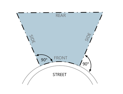
Figure 08.1 Side Lot Lines
h.
Residential lots shall not obtain direct access from a collector or arterial street. When private driveway access from a collector or arterial is necessary for several adjacent lots, such lots shall be served by a combined access drive, which shall be platted as a permanent access easement.
i.
Irregular shaped lots, including flag lots, may be allowed where necessary due to unusual site conditions, particularly topography, floodplains, significant vegetation, or soil suitability. These lots shall not be created with protrusions, extensions or stems of less than thirty (30) feet in width, in order to accommodate a twenty (20) foot wide drive aisle with five (5) foot landscaping buffer.
(5)
Subdivisions shall be designed to provide for lots that are of an appropriate size and configuration for the site characteristics and intended uses; connections between neighborhoods, shopping and recreation areas that are safe and convenient; adequate buffering from the adverse impacts of adjacent uses through lot orientation, setbacks, landscaping or other appropriate methods; conservation of water, land and energy resources; minimization of grading, road cuts and fills and a road system designed to preserve the integrity and function of the arterial and local roadway network.
(e)
Street and circulation standards.
(1)
All street and circulation systems for motor vehicles, bicycles, and pedestrians shall comply with the standards in:
a.
Section 13.08.040, Sensitive lands avoidance;
b.
Section 13.08.050, Grading and drainage; and
c.
Section 13.08.060, Access, connectivity, and circulation.
(2)
The arrangement, character, extent, and location of all streets shall conform to the Roadway Design and Construction Criteria Manual, and other adopted transportation standards and shall conform to the Transportation Master Plan and Complete Streets Policy to the maximum extent practicable.
(3)
The arrangement, character, extent, and location of all streets shall consider the relationship to:
a.
Existing and other planned streets;
b.
Topographical conditions;
c.
Drainage;
d.
Public convenience and safety; and
e.
The land uses of land served by such streets.
(f)
Residential roadway buffers.
(1)
New single-family and duplex residential development shall provide a residential roadway buffer between the edge of each right-of-way of a highway, arterial, and collector roadway (as described in the Roadway Design and Construction Criteria Manual) and the adjacent or nearest residential lot(s).
(2)
The residential roadway buffer width shall be determined according to Table 13.08.B.
(3)
Residential roadway buffers shall be landscaped according to the standards in Section 13.08.090(i). The Town may approve, at its sole discretion, a plan to reallocate required residential roadway buffer areas where they provide a varied and creative edge design and provide a remedy for site-specific hardship or design constraints, subject to the following criteria:
a.
There is no decrease in the total required residential roadway buffer area for a single block.
b.
The buffer area shall remain within the originating block, except that where blocks are less than five hundred (500) feet in length the residential roadway buffer area may be reallocated to adjacent blocks if approved by the Planning Director.
c.
The reallocation does not reduce any buffer area to less than fifty (50) percent of the minimum buffer width shown in Table 13.08.B.
d.
Any residential roadway buffer area with a width less than that shown in Table 13.08.B shall include enhanced landscaping as required by Section 13.08.090(i)(2)c and shall be designed to mitigate the visual and noise impacts resulting from the decreased buffer.
e.
The amount of residential buffer area reallocated is limited to twenty-five (25) percent of the total required residential roadway buffer square footage for any given block (intersection to intersection), except that on blocks less than five hundred (500) feet in length, the twenty-five (25) percent limit may be reduced if the Planning Director determines that the resulting buffer will provide equal or better visual buffering and mitigation of noise impact.
f.
The Residential roadway buffer design shall be sensitive to existing topography and provide improved and attractive buffering for residential lots adjacent to arterial and collector roadways.
g.
Residential roadway buffers shall not count towards parks or requirements.
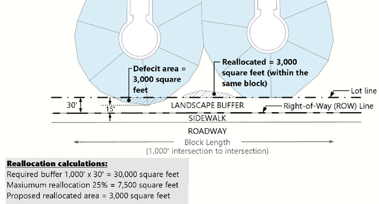
Figure 08.2 Sample Reallocation Plan
(g)
Land dedications.
(1)
Purpose. The purpose of this Section 13.08.030(g) is to ensure that subdivisions provide adequate sites for the location of public facilities necessitated by the impacts created by new development. Such sites shall be dedicated to the Town, a special district, or a homeowners' association for eventual construction and maintenance. An additional purpose is to require appropriate mitigation in proportion to the impacts created by new development.
(2)
General requirements.
a.
The developer shall provide for the construction, at no cost to the Town, any school district or any special district that has not accepted financial responsibility in writing, all roads adjacent to publicly dedicated sites, traffic signalization to serve the site, extensions of all utilities to the site and other public infrastructure as required to mitigate the anticipated impacts of the subdivision on the Town's road system and public infrastructure.
b.
Financial security shall be provided prior to recordation of the final plat to ensure the construction of required public improvements.
c.
For any development zoned as Planned Development or where an annexation agreement requires the dedication of land for public purposes, this Section shall require the dedication of additional land to fulfill the entire dedication required by this Section 13.08.030(g).
(3)
Land dedications required. This Section 13.08.030(g)(3) describes required dedications of land during the subdivision approval process. Required dedications of land identified in Subsections (3)a through (3)d below are in addition to the twenty (20) percent goal of development open space described in Subsection (3)e below, Required dedications of land described in Subsections (3)a through (3)d will not be credited towards required open space under Subsection (3)e unless permitted for consideration by the Town in a specific situation identified in this LDO.
a.
Land dedication for road, street, and highway rights-of-way.
1.
Intent. The intent of this Section 13.08.030(g)(3)a is to implement the transportation element of the Master Plan and Transportation Master Plan and to ensure that new development and redevelopment mitigate their impacts on the road, street, and highway systems.
2.
Standards
a)
The developer shall provide, at no cost to the Town, adequate right-of-way for the internal or adjacent road, street, or highway according to the classification in the Master Plan and the requirements of the Roadway Design and Construction Criteria Manual.
b)
The Town may require reasonable improvements to adjacent roadways in order to mitigate impacts of new subdivisions. Rights-of-way necessary to accommodate such improvements shall be dedicated at no cost to the Town and the improvements shall be financially secured by a Subdivision Agreement.
c)
The conveyance of all land dedicated for public purposes to the Town shall be by warranty deed, special warranty deed, or by plat, and the title shall be free and clear of all liens and encumbrances not acceptable to the Town, and with real property taxes prorated to the time of conveyance. The property owner shall provide a title insurance policy in the Town's name and a certified survey of conveyance.
b.
Land dedication for schools. Lands required to meet the additional needs for school facilities based on proposed development are generally reserved at the time land is zoned for development, and are dedicated at the time of subdivision platting. Land dedicated for schools shall be transferred prior to recording of the Final Plat for any subdivision or portion of a subdivision where reserved school lands are located.
1.
Intent. The intent of this Section 13.08.030(g)(3)b is to ensure that new development and redevelopment that are anticipated to include school aged children mitigate their impacts on the need for additional school lands for facilities to educate those children.
2.
Criteria for identification and dedication of school lands.
a)
Land dedicated for schools shall be suitable for the intended use to meet the need generated by the proposed development and must be suitable for construction of school facilities.
b)
Sites shall be flat and constructible, free of easements unacceptable to the Town, free of land encumbrances, and shall be located away from hazardous land uses, and located on two (2) street frontages with at least one being a collector street.
c)
Sites proposed for dedication shall be a single parcel and shall meet minimum size requirements sufficiently square or rectangular to be usable for the intended purpose.
d)
The dedicated school land shall be centrally located and within the service radius, with public access to at least one adjacent collector street frontages, bicycle and pedestrian access via trail or walkway, and free from hazards that would threaten the safety of those using the land. School sites are encouraged to be located adjacent to open space or parks.
3.
Calculation of required land dedication.
a)
Unless otherwise determined by the School District and accepted by Town Council, the following formula is used to calculate the minimum amount of required school land dedication to meet the needs of the proposed subdivision:
b)
Unless otherwise determined by the School District and accepted by Town Council, the following is the minimum acreage required per school:
4.
Existing dwelling units shall be excluded from the calculation of the school land dedication requirement if they have previously been included in the calculation for school land dedication.
5.
Dedicated school land shall be clearly identified on the submitted plat by a legal description. The plat or plan shall also indicate the number of acres for each site and the total acreage proposed for school land dedication within the project.
6.
Cash-in-lieu of land dedication shall be required when recommended as necessary by the Planning Director, upon recommendation of the School District, to be more appropriate in satisfying the needs of the proposed development. Such cases include, but are not limited to, small developments not able to meet the minimum acreage requirements or developments that are served by adjacent facilities that could be expanded to satisfy the need created by the proposed development. The Planning Director's recommendation shall be subject to Town Council approval as part of the subdivision approval process.
a)
The cash-in-lieu fee shall be equivalent to the fair market value of the acreage required for school land dedication and shall take into account any recommended valuation by the School District. Value shall be based on anticipated market value after completion of platting and construction of public improvements. The applicant shall submit a proposal for the cash-in-lieu fee and supply the information necessary for the Town Council to evaluate the adequacy of the proposal. This information shall include at least one appraisal of the property by a qualified appraiser.
b)
The conveyance of land through the Town's dedication requirement shall occur as outlined in the Subdivision Agreement at the time of the Final Plat for the subdivision filing in which the school site is located. The Town may elect to accept dedication of a required school to hold for the School District until such time as the School District requires the land for school use. Cash-in-lieu of land shall be paid prior to recording of the first Final Plat in the subdivision.
7.
The provisions of this Section 13.08.030(g)(3)b shall be in addition to any requirements contained in any Annexation Agreement or other agreement that includes provisions for the dedication of school sites or cash-in-lieu of land. Credit shall be given for any previous dedications or payments that include a land dedication component.
c.
Land dedication for other public facilities.
1.
Intent. The intent of this Section 13.08.030(g)(3)c is to ensure that new development and redevelopment mitigate their impacts on the need for land for public facilities other than roads, streets, highways, schools, parks, trails, and open space (each of which is addressed separately in this Section 13.08.030(g)(3), Land dedications required.
2.
Standards
a)
For the purpose of mitigating impacts associated with a development, the Town may require the dedication of land for other public facilities, including, but not limited to, fire stations, libraries, police substations, Town maintenance facilities or similar public purposes that are reasonably related to the demand created by the development. Such requirements shall be recommended by the Planning Director based upon requests to the Town made by the public agency impacted by the development and the proportionate share of impacts created by the development. The Planning Director's recommendation shall be subject to Town Council approval as part of the subdivision approval process.
b)
The conveyance of land dedicated for public purposes to the Town shall be by warranty deed or special warranty deed, and the title shall be free and clear of all liens and encumbrances, including real property taxes prorated to the time of conveyance. The property owner shall provide a certified survey and a title insurance policy in the name of the Town or other public or quasi-public entity as determined by the Town at the time of conveyance.
c)
Any the conveyance of lands dedicated, or transfer of fees obtained in lieu of land dedications, pursuant to this Section 13.08.030(g)(3), Land dedications required, to another public entity shall be pursuant to a petition to the Town Council.
d.
Land dedication for parks and trails.
1.
Intent. The intent of this Section 13.08.030(g)(3)d is to ensure that new development and redevelopment mitigate their impacts on the need for parks and trails for the residents, occupants, and users of the new development or redevelopment.
2.
General requirements.
a)
In every district except the Downtown East district, whenever land is proposed for residential subdivision, the developer shall provide land for parks and trails demand generated by the proposed use.
b)
Required park and trail lands shall be suitable for the development of active recreation, play areas, passive use areas and/or trails, furniture, shade structures and other amenities or, in some instances, to preserve unique landforms or natural areas.
c)
All parks and trail land shall align with the goals and strategies of the current Parks, Recreation, and Open Space Master Plan.
d)
All park facilities shall comply with the standards in the Parks, Trails, Open Space, and Streetscape Design and Construction Manual and other Town parks planning and design documents as approved by the Town.
e)
All trails development shall conform to the criteria as outlined in the Open Space, Trails and Greenways Master Plan and the standards set forth in the Parks, Trails, Open Space, and Streetscape Design and Construction Manual.
f)
Where no suitable land is available in a residential development, cash-in-lieu of land or the equivalent monetary value, off-site improvements in reasonable proximity to the development, or the donation of recreation facilities may be substituted with the Town's approval. The recommendation as to whether cash-in-lieu rather than dedication of land is required shall be made by the Planning Director based on the impacts of the proposed subdivision on the Town's park and trail system. The Planning Director's recommendation shall be subject to Town Council approval as part of the subdivision approval process.
g)
The Town Council may recommend and encourage additional dedication for open space beyond that required by Subsections 3 or 4 below if deemed necessary to preserve areas of special significance based on criteria set forth in the Open Space, Trails, and Greenways Master Plan. Such additional dedications may be included with the applicable plat.
h)
Any additional dedication of land for parks, trail, or open space required by prior agreement, such as an Annexation Agreement, shall not be reduced.
i)
Park and trail lands required to be dedicated, and any optional dedications of park or trail lands or open space shall be clearly identified on any submitted plat or Site Plan, including the number of acres for each site and the total acreage proposed for park or open space dedication within the project.
3.
Park land dedication for residential development.
a)
The following formula is used to calculate the minimum amount of land dedication required to provide adequate land for parks in residential developments including residential portions of Planned Development Districts:
1)
Single-Family Detached and Duplexes
Total Amount = Dwelling units × 0.0239 acres/unit
2)
Single-family attached and Multifamily
Total Amount = Dwelling units × 0.0139 acres/unit
b)
The formula above is based upon:
1)
Seven and one-half (7½) acres of developed park land per one thousand (1,000) population.
2)
An assumed occupancy factor of 3.19 people per household for single-family detached houses and duplexes, and 1.85 people per household for multifamily developments.
c)
For the purposes of calculating the required dedication, existing dwelling units within a subdivision shall be excluded from the calculation of the park requirement.
d)
The Town Council will allocate the acreage requirement between neighborhood and community park categories as deemed necessary to meet specific needs and shall determine the amount of developed park acreage required based upon recommendations by the Community Development Department.
e)
Parcels of land smaller than one (1) acre will not be accepted as dedication for neighborhood-serving parks and parcels of land smaller than ten (10) acres will not be accepted as dedicated for community-serving parks, unless specifically approved by the Town Council.
4.
Park land dedication for nonresidential development. Within nonresidential developments and nonresidential components of a Planned Development District, the provision of park facilities within nonresidential developments is encouraged but not required.
5.
Identification of land. Park lands required to be dedicated, and any optional dedications of open space pursuant to Section 13.08.030(g)(3)d.2.g), above, shall be clearly identified on any submitted plat or Site Plan, including the number of acres for each site and the total acreage proposed for park dedication within the project.
6.
Cash-in-lieu of land dedication.
a)
Applicability.
1)
Cash-in-lieu of land dedication or off-site land dedications may be used when:
i.
The applicant is unable to satisfy the park and open space dedication requirement on-site due to a non-economic hardship;
ii.
The cash-in-lieu value of park land dedication and park development costs is deemed by the Town to be more appropriate in satisfying the needs of the residents of the proposed development than dedication of land; or
iii.
The option of cash-in-lieu of land or off-site park dedications will result in improved park and open space design in the surrounding area with substantive public benefit.
2)
Cases in which cash-in-lieu of park and trail land dedications may include but are not limited to small developments where the required dedication does not meet the minimum size requirement for a dedicated park or open space, and developments that already have adjacent facilities that could be altered or expanded to satisfy the need created by the proposed development.
3)
In those subdivisions where proposed regional trails are located, no cash-in-lieu of land dedication will be accepted unless an acceptable alternate route for the regional trail is identified by the property owner and the Town determines that the proposed alternate provides equivalent or better public benefit. If an alternative route is accepted by the Town, the applicant will be responsible to contribute cash-in-lieu to fund off-site construction of the trail.
b)
Calculation of cash-in-lieu fees. The cash-in-lieu of land dedication and park development costs fee shall be determined by the following process:
1)
The Parks and Recreation Department and the Community Development Department shall review all cash-in-lieu of land requests and make a recommendation to the Planning Director.
2)
The Planning Director shall make a final determination on the method in which the land dedication requirements shall be satisfied at the time of Preliminary Plan, or Minor Development Plat.
3)
The cash-in-lieu fee shall be equivalent to the full market value of the acreage required for park land dedication. Value shall be based on anticipated market value after completion of platting and construction of public improvements. The applicant shall submit a proposal for the cash-in-lieu fee and supply the information necessary for the Planning Director to evaluate the adequacy of the proposal. This information shall include at least one appraisal of the property by a qualified appraiser acceptable to the Town.
4)
When cash-in-lieu of land dedication and park development costs are requested by the Planning Director, the following formula shall be used:
i.
[(A) × (B)] + (C) = Cash-In Lieu Amount Required.
(A) = Total Gross Acreage for Dedication
(B) = Total $ Value/Acre as Determined by Market Value of Land with Infrastructure in Place
(C) = Development/Improvement Costs for Total Acreage
5)
When the combination of land and cash-in-lieu of land is requested by the Planning Director, the following formulas shall be used:
i.
(A) - (B) = Total Acreage for Dedication as Cash-in-Lieu (C).
(A) = Total Park Dedication in Acres Required
(B) = Land Acreage Accepted by Town
ii.
(C) × (D) = Cash-In-Lieu Amount Required.
(C) = Total Acreage for Dedication as Cash-in-Lieu
(D) = $ Value per Acre as Determined by Market Value + Development Cost per Acre
6)
The cash-in-lieu fee shall be determined at the time of Final Plat or Minor Development Plat approval and shall be paid to the Town prior to the recording of the Final Plat or Minor Development Plat.
7.
Credits toward park land dedication requirements. The Town may consider requests for credit to offset some or all of the park land dedication requirements in the following circumstances:
a)
Credit for specialized recreation facilities. The Town may consider a request to meet a portion of park land dedication requirements through the provision of specialized recreation facilities, provided that such facilities:
1)
Are available to the general public;
2)
Will meet a demonstrated public need; and
3)
Replace or supplement facilities that would generally be provided by the Town.
b)
Credit for dedication of off-site land. The Town may consider an applicant's request to meet a portion of park land dedication requirements through dedication or purchase and subsequent dedication of off-site land (land not contiguous to the development), provided that such land:
1)
Will meet a demonstrated public need;
2)
Meets the selection criteria for a Neighborhood-Serving Park, Community-Serving park, trail, or open space lands as provided in Section 13.08.030(g)(3)d.8, below; and
3)
Is within one-half (½) mile of the subject development unless otherwise agreed to by the Town.
c)
Credit for alternative provision of park and recreation facilities. An applicant may request to meet a portion of park land dedication requirements through the provision of park, trails, or recreation facilities or improvements (rather than land) by developers, special districts, and homeowners' associations, and the Town may accept such requests if it determines that the offered improvements will be of equal or greater value to the Town's park system.
d)
Credit for private park areas. An applicant may request to meet a portion of the park land dedication requirement through the provision of private park area, where the amount of land area being considered does not constitute more than fifty (50) percent of the total dedication requirement and the Town may accept such requests if it determines that the offered private park will relieve an equal or greater burden on the Town's park system.
1)
Are available and easily accessible to all residents of the neighborhood for no additional use charge; and
2)
Meet the criteria in Section 13.08.030(g)(3)d.8 below.
8.
Selection criteria for parks and trails.
a)
Community-serving parks. Land may be considered for acceptance to satisfy community-serving park land dedication requirements if it complies with the following standards:
1)
There is sufficient flat surface (preferred fifty (50) percent of land) to provide development of active recreation areas as deemed necessary to meet the needs of the respective service area;
2)
Land will not be considered for community-serving park land dedication if it is an exclusive utility easement, public street right-of-way, or pedestrian walkway required under other regulations or contains topographical or hazardous obstructions that would preclude development as a community-serving park;
3)
The area to be dedicated shall offer natural and scenic quality and can support both active and passive recreational activities for Town residents;
4)
Areas containing lakes, ponds or reservoirs may be considered provided that such area does not exceed one-half (½) of the dedication requirement and the area is contiguous to other acceptable park or open space land;
5)
The proposed park shall comply with the design criteria in Section 13.08.030(g)(4), the Parker Parks, Recreation and Open Space Master Plan and other Town planning and design standards as applicable;
6)
The minimum size of community-serving parks shall be ten (10) acres. The preferred size of community-serving parks is ten (10) to twenty-five (25) acres. A minimum of ninety (90) percent of the land shall be developable for park uses; and
7)
The proposed park shall include amenities pursuant to Section 13.08.030(g)(4)g.
b)
Neighborhood-serving parks. Land may be considered for acceptance to satisfy neighborhood park land dedication requirements if it complies with the following standards:
1)
The land accommodates development of active recreation areas as deemed necessary to meet the needs of the respective service area;
2)
The land is not an exclusive utility easement, public street right-of-way or pedestrian walkway required under other regulations or contains topographical or hazardous obstructions that would preclude development as a neighborhood-serving park;
3)
Where feasible, a neighborhood-serving park site may be considered for co-locating with an elementary or middle school site in order to benefit from shared facilities such as parking lots, access roads, play fields and other facilities, thereby reducing the overall acreage requirement by a factor equal to those shared facilities;
4)
The proposed park shall comply with the design criteria in Section 13.08.030(g)(4), the Parker Parks, Recreation and Open Space Master Plan and other Town planning and design standards as applicable;
5)
The minimum size of neighborhood-serving parks shall be one (1) acre. The maximum size shall be nine and 99/100 acres. The preferred size of neighborhood-serving parks is one and one-half (1½) to five (5) acres. A minimum of ninety (90) percent of the land shall be developable for park uses; and
6)
The proposed park shall include amenities pursuant to Section 13.08.030(g)(4)g.
c)
Areas not allowed as parks. The following lands shall not count toward dedicated park requirements or be accepted in satisfaction of park and trail land dedication requirements:
1)
Private lots or yards in residential developments.
2)
Public or private street rights-of-way, medians, and features within roundabouts.
3)
Parking areas and driveways, except those parking areas and driveways that are developed for the purpose of providing access and parking for the park.
4)
Land covered by structures not associated with the park use.
5)
Golf courses.
6)
Landscaped areas as required in Section 13.08.090.
7)
Notwithstanding Subsection 6) above, landscaped areas that are required as part of a multifamily development that are designed as a private park for active recreation and meet the criteria contained in i through v below, may be counted towards park dedication requirements if the Town determines that they serve the purpose of a public park as well or better than a dedicated public park.
i.
Must meet all other requirements within this Section 13.08.030(g)(3), Land dedications required;
ii.
May not be located in a required setback;
iii.
May not be located within ten (10) feet of a residential building unless vertical mixed-use;
iv.
May not be located within ten (10) feet of a parking area or access drive; and
v.
Must be accessible to all residents of the multifamily community free of charge.
d)
Areas accepted for parks in limited circumstances. The following areas may be accepted toward dedicated park requirements provided they meet the criteria in Section 13.08.030(g)(3)d, Land dedication for parks and trails, but only one-half (½) of the acreage dedicated will be credited toward minimum park requirements. For example, for each two (2) acres in the following areas dedicated for parks, only one (1) acre will be credited towards the minimum dedication requirements.
1)
Detention ponds in residential developments; and
2)
Areas within the floodway as identified by the Flood Insurance Rate Map (FIRM) described in Section 13.08.040(a), Floodplain regulations.
e)
Trails. Recommended guidelines for trails are listed in the Open Space, Trails, and Greenways Master Plan. Trails may be considered for acceptance for the park land dedication requirements if all the following selection criteria are met:
1)
Location of dedicated public trails. Lands dedicated for public trails shall be at locations deemed appropriate by the Town Council. If a specific location has been designated in the Open Space, Trails and Greenways Master Plan, the plat or plans for development shall show the dedication of land for trails in a location that corresponds to the location designated in the Plan;
2)
The Town shall not accept land for public trail dedication if the land is a public street right-of-way or pedestrian walkway required under other regulations or if the land contains topographical or hazardous obstructions that would preclude development of a trail; and
3)
All trails shall provide for easy, safe, and secure usage and allow for sufficient easement or right-of-way to accommodate pedestrian, bike, and equestrian uses. In most instances, this will require an easement or right-of-way width of a minimum of 30 feet.
9.
Developer responsibility for development of dedicated lands. The developer shall assume all responsibility for the development of all dedicated parks, open space, and trails in compliance with the development's parks, open space and trails facilities Master Plan unless otherwise determined by the Town. If required by the Town based on the size, location, or character of the proposed development, or in connection with commitments made in an annexation agreement or Planned Development approval, a park, trail, and open space facilities Master Plan for the proposed development shall be submitted to the Town prior to the time of Final Plat submittal.
10.
Conveyance of dedicated land.
a)
Dedication of lands for roads, parks, or trails, shall be conveyed as specified by the plat and/or Subdivision Agreement, and if not specified in those documents, then as specified in this Section 13.08.030(g)(3)d.10.
1)
If not conveyed by plat, the conveyance shall be by warranty deed or special warranty deed. In the case of trail lands, the Town may also accept dedication by public easement.
2)
The title shall be free and clear of all liens and encumbrances not acceptable to the Town, and with real property taxes prorated to the time of conveyance.
3)
The dedicator shall provide the Town with a title insurance policy in the Town's name, and a certified survey of conveyance, at the time of conveyance.
4)
Land dedicated for park land shall include the necessary water rights or other available water service to provide irrigation and drinking water.
5)
The entity receiving the dedicated land shall be responsible for maintenance of the land unless another entity acceptable to the Town accepts responsibility for maintenance in writing.
6)
Parks shall be constructed, inspected, and approved per the approved Site Plan and landscape plan, with probationary and final acceptance by the Town prior to conveyance.
7)
As an alternative to dedicating lands required by Sections 13.08.030(g)(3)a, Land dedication for road, street and highway rights-of-way, and 13.08.030(g)(3)d, Land dedication for parks and trails, the Town may authorize or require all or part of such land to be dedicated to a Special District, Homeowner's Association, or other entity, and may waive or modify requirements in this 13.08.030(g)(3)d.10 as necessary to facilitate conveyance to that District, Association, or entity.
e.
Open space.
1.
Intent. The purpose of this Section 13.08.030(g)(3)e is to implement the recommendations for open space in the Town of Parker Open Space, Trails, and Greenways Master Plan. Goals and requirements for open space complement the requirements for dedicated parks and trails in Section 13.08.030(g)(3)d, Land dedication for parks and trails, and serve similar purposes, including preservation of natural areas and resources, preservation of scenic views, greater resident access to open areas and recreation, and enhancement of the quality of new development in the Town.
2.
Amount of open space.
a)
Minimum percentage required.
1)
All residential development shall provide up to twenty (20) percent of the total development parcel as open space as described in this Section 13.08.030(g)(3)e, subject to the provisions of 13.03.030(h)(6)e, Requirements for conditions of approval.
a.
For property zoned Planned Development (PD), total development parcel means the total gross land area subject to the PD Development Plan, and does not mean the land area contained in each separate filing of a larger, phased planned development.
b.
Land included in setbacks on individual development lots, streets or rights-of-way shall not be counted towards the open space calculation.
2)
Nonresidential development is not required to provide open space as described in this Section 13.08.030(g)(3)e unless the property includes lands identified in the Open Space, Trails and Greenways Master Plan or the Parks, Open Space, and Recreation Master Plan to be preserved as open space.
3)
Any required land dedications in Subsections 13.08.030(g)(3)a through 13.08.030(g)(3)d above, shall be in addition to the required open space within the development. Required land dedications are not credited toward the minimum recommended open space, except those meeting the standards in Subsection b) below or as otherwise determined by the Town.
b)
Credit for public park land dedications beyond minimum requirements. In determining the amount of open space required pursuant to this Section 13.08.030(g)(3)e the Town shall consider and may give credit for dedications of land for public park purposes in excess of the seven and one-half (7½) acres per one thousand (1,000) population standard in Section 13.08.030(g)(3)d above.
3.
Use and ownership of open space. All tracts of land required by the Town to be identified as open space shall be:
a)
Used only for approved passive or active recreation or for conservation purposes and permanently reserved as open space in a manner satisfactory to the Town; and either
b)
Owned by an Owner's Association (OA), Metropolitan District, or similar entity approved by the Town; or
c)
Dedicated the Town, subject to the Town's acceptance.
4.
Selection criteria for open space lands. All open space shall comply with selection criteria in this Subsection a) or Subsection b) below, as determined by the Town.
a)
Locations consistent with Master Plan. The open space lands include lands identified through the Open Space Acquisition Criteria in the Open Space, Trails, and Greenways Master Plan and/or the Parks, Recreation, and Open Space Master Plan; or
b)
Priority lands for open space. The open space lands preserve areas of significant natural areas and scenic or cultural resources on a property. The Town may use all applicable plans, maps, and reports to determine whether significant natural areas and resources exist on a proposed site that should be protected as open space. More specifically, priority lands are those that serve one or more of the following functions:
1)
To identify or separate municipalities, communities, or subdivisions or to provide expansive visual relief from development;
2)
To buffer or provide transitions between different land uses;
3)
To preserve or protect:
i.
Environmentally sensitive areas: Areas including, but not limited to, 100-year floodplains, wetlands, wildlife habitat and aquifer recharge areas;
ii.
Significant natural landforms: Areas including, but not limited to, prominent landforms such as rock outcroppings, buttes, mesas, lakes, streams, and drainage ways;
iii.
Significant natural vegetation areas: Areas including, but not limited to, 100-year floodplains, drainage ways, wildlife corridors, migration routes and calving areas;
iv.
Important wildlife habitat areas: Areas including, but not limited to, 100-year floodplains, drainage ways, wildlife corridors, migration routes and calving areas;
v.
Geologic hazard areas: Areas including, but not limited to, expansive soils and related conditions, soil erosion areas and unstable slopes;
vi.
Severe soil erosion areas: Areas including, but not limited to, twenty (20) percent or greater slope, and natural drainage ways;
vii.
Sensitive visual areas: Areas including, but not limited to, major ridgelines, viewpoints, and view corridors;
viii.
Significant views: Areas including, but not limited to, major ridgelines, distant or panoramic views and view corridors;
ix.
Outdoor recreation areas; and/or
x.
Cultural, historic, and archaeological areas; and
xi.
Areas that provide for Town-wide or regional trails and linkages; public access to lakes, streams, and other public lands; passive recreation opportunities; or outdoor and nature studies areas.
c)
Areas not allowed as open space. The following lands shall not count toward open space requirements, unless otherwise provided in this LDO:
1)
Private lots or yards in one-family and duplex developments;
2)
Public or private street rights-of-way, including arterial and collector right-of-way landscaping areas required by other regulations, except for landscaped areas at least fifty (50) feet wide in the bulb of a cul-de-sac street, when installed and maintained by the developer or adjacent property owners;
3)
Land that is burdened by an exclusive utility or other easement unacceptable to the Town;
4)
Parking areas and driveways;
5)
Land covered by structures; and
6)
Medians on public or private streets.
5.
Additional standards for open space.
a)
Plat requirements. Open space as shown on approved development plans that is adjacent to the area proposed for subdivision platting, or as otherwise identified during the subdivision process, shall be platted as a part of the subdivision during this process.
b)
Restriction on open space. Proof that the open space has been protected from future development by a recorded deed restriction or easement, dedication through a plat or plat note, or through another instrument acceptable to the Town, shall be submitted to the Town before issuing Building Permits for construction. All deed restrictions or easements shall be noted on the plat.
f.
Disposal of dedicated lands. Any disposal of lands obtained by the Town pursuant to the dedication requirements described in Subsections (3)a through (3)e above shall require an act of the Town Council at a public hearing pursuant to Section 13.03.030(g) and shall be subject to Section 15.2 of the Town of Parker Charter.
(4)
Design criteria for parks, trails, and open spaces. Land dedicated for public parks, trails, and open space shall meet the following design criteria, as applicable.
a.
Connectivity required. To the maximum extent practicable, parks, trails and open space shall be organized to create integrated systems of open areas that connect with the following types of lands located within or adjacent to the development:
1.
Dedicated public parks or trails;
2.
Dedicated school sites;
3.
Other dedicated or open spaces;
4.
Regional parks, trails, or open lands as specified in the Open Space, Trails, and Greenways Master Plan;
5.
Neighborhood shopping and activity centers; and
6.
Adjacent residential neighborhoods and employment centers.
b.
Regular shaped and contiguous.
1.
Parks, trails, and open space shall be shaped to provide a critical mass for usable park and open space functions and shall be contiguous unless:
a)
The land is used as a continuation of an existing trail or other linear park; or
b)
Specific topographic features require a different configuration, such as a linear open space layout along a stream.
2.
Wherever possible, public parks should be regularly shaped, with a minimum dimension of one hundred (100) feet of width and depth for Neighborhood-Serving Parks and three hundred (300) feet of width and depth for Community-Serving Parks.
c.
Visibility and Accessibility to residents.
1.
In order to make them visible to the general public, all parks shall be bounded on at least one side by a public street. In addition, to the maximum extent practicable, private lots should not back onto a park but should be separated from the park by public streets.
2.
Access to dedicated parks or open space shall be a minimum of twenty-five (25) feet wide. The Town reserves the right to require wider access depending upon anticipated community demand.
3.
All areas open to the public shall remain open for at least twelve (12) hours each day.
4.
The location of parks, trails, and open space to align with the Parks, Recreation and Open Space Master Plan Neighborhood parks shall be located to serve a one-half (½) mile service area.
5.
Community parks shall be located to serve a two (2) mile service area.
d.
Recreational facilities. Recreational facilities constructed in parks and open space shall comply with all applicable Town construction standards and specifications and shall comply with amenity standards in Section 13.08.030(g)(4)g, Park and open space amenities.
e.
Landscaping and fences/walls on perimeter.
1.
All open space shall be left in its natural or existing condition except as determined by the Town based on the intended use of the open space.
2.
Existing trees and vegetation shall be preserved to the maximum extent practicable.
3.
Fencing adjacent to public parks and open space shall meet fencing standards found in Section 13.08.090(n).
f.
Drainage detention areas in park or open space areas.
1.
If a proposal is made for a detention area to be used partially as park or open space, the Town shall determine if the detention area serves the public interest. Public interest shall be based on potential use of the area for park, open space, or recreation uses by the public, whether the area would complement the Town's park or trail system, provide ease of maintenance, and whether the pond can be operated and maintained in accordance with Town standards.
2.
The following standards shall apply for a detention pond to be considered towards parks, trails, or open space requirements:
a)
Slopes shall comply with Town construction standards and specifications, but in no case shall exceed a slope of 4:1.
b)
Adequate access shall be provided to the detention area for pedestrians, the physically disabled and maintenance equipment.
c)
Drainage structures shall be designed and located to facilitate maximum use of the detention area for recreational use.
d)
Landscaping shall be provided as required by Section 13.08.090, Landscaping, buffering, and screening.
e)
Amenities shall be required for any detention pond used to meet park dedication requirements. Amenities shall not be located in areas of the detention facility that will be regularly inundated.
g.
Park and open space amenities. Development subject to parks and open space dedication requirements in Section 13.08.030(g)(3), Land dedications required, shall provide amenities pursuant to the following standards.
1.
Required amenities for all parks. The following amenities are required for all parks in addition to the amenity options selected from Subsection 2 below.
a)
Landscaping shall be provided for all areas not used for other amenities.
b)
Tables and seating shall be provided, such as benches, chairs, picnic tables, and ADA seating.
c)
Internal access pathways per ADA standards shall be provided to and between park amenities, parking areas, and the perimeter.
d)
Open turf play areas shall be provided with living or synthetic turf.
e)
Universal and inclusive play elements meeting ADA standards shall be provided to accommodate all ages and abilities.
f)
Dog waste stations shall be provided at all pedestrian access points into the park, with a minimum of three (3) per park or as otherwise determined by the Town.
g)
Trash receptacles shall be provided at all seating areas with a minimum of three (3) per park or as otherwise determined by the Town.
h)
All neighborhood parks shall provide a minimum of one adequately sized shelter serving a capacity greater than five (5) users providing shade and with tables and related seating.
i)
All community-serving parks shall provide:
1)
A large shelter serving a capacity of between forty-eight (48) and one hundred (100) users;
2)
A loop trail path with mileage markers;
3)
A large destination-scale play area of a minimum of ten thousand (10,000) square feet;
4)
Programmed space;
5)
Drinking fountains, number to be determined at the time of Final Plat or Site Plan;
6)
A multi-use baseball or softball field, diamond, or rectangular ball field (size and type to be determined at the time of Final Plat or Site plan);
7)
A minimum of two (2) sport courts;
8)
A bicycle rack and bicycle repair station;
9)
Permanent flush restrooms shall be provided;
10)
Barbecues, single or dual with ash disposal; and
11)
Off-street parking per the minimum parking space guidelines as stated in the Parks, Trails, Open Space, and Streetscape Design and Construction Manual.
2.
Table of options for additional amenities. Table 13.08.E below includes options for the additional required amenities for neighborhood parks, community-serving parks, and open space. The table is divided into categories, with various options and requirements from each category depending on the type of park or open space, and in some cases, the size of the park.
a)
Cells marked "C" indicates that the amenity is compatible with that type of park or open space.
b)
Cells marked "R" indicates that the amenity is required for that type of park or open space and subject to the referenced code Section.
c)
Cells remaining blank indicate that the amenity is not appropriate for that type of park or open space and is not allowed.
d)
Cells with a cross-reference to another Subsection indicate that the amenity is required pursuant to that referenced Section and is not an option that may be chosen to fulfill amenity requirements.
3.
Alternative equivalent compliance. The Planning Director may allow alternatives to the requirements in Table 13.08.E with a recommendation of approval by the Parks and Recreation Department, and where an applicant achieves a higher quality while meeting the intent of these standards. Alternatives may include adjustments to the types of amenities provided or the number of amenities required. Under either scenario, the applicant shall clearly demonstrate how such alternatives meet the intent of the Land Development Ordinance and result in a higher quality park or open space.
4.
Installation and maintenance. All amenities included in provided parks and open space shall be installed, irrigated, and maintained pursuant to the Town standards and specifications in coordination with the Parks and Recreation Department.
(h)
Cluster developments.
(1)
Purpose. The purpose of this Section 13.08.030(h) is to authorize and regulate the creation of residential developments or subdivisions in which individual lots are smaller than otherwise required in the zoning district ("cluster lots"), but in which the overall total number of lots does not exceed the maximum number of lots limited by the zoning district in order to:
a.
Preserve open space through ecological planning and design and preservation of natural landscape character in amounts that are greater than that achievable with more conventional subdivision design and thereby help to preserve the Town's natural and open areas;
b.
Protect environmentally sensitive areas such as steep slopes, ridgelines, stream systems, wetlands, wooded and vegetated areas, wildlife habitat, wildlife corridors, and view corridors; and
c.
Promote a more flexible and spatially efficient residential layout and street design to provide a parks and open space design that preserves a greater amount of land in its natural state than standard subdivision design, reduces land disturbance and impervious area, and produces a more desirable visual environment through aesthetic use of open space and to reduce infrastructure costs.
(2)
Applicability. Cluster developments are permitted, at the applicant's option, in the SF1, SF2,and SF3 zoning district and on parcels subject to the hillside protection standards stated in Section 13.08.040(b).
(3)
Permitted uses. All residential uses permitted in the zoning district are allowed in a cluster development,
(4)
Minimum parcel size. Cluster developments are permitted on any parcels or tracts with a minimum gross area of ten (10) acres, except there is no minimum parcel size for cluster developments on parcels subject to the hillside protection standards stated in Section 13.08.040(b).
(5)
Minimum lot dimensions and yards. All dimensional and setback standards shall apply as follows:
a.
SF2 dimensional and setback standards may be used for cluster development in SF1 districts.
b.
SF3 dimensional and setback standards may be used for cluster development in SF2 districts
c.
MF dimensional and setback standards may be used for cluster development in SF3 districts
(6)
Required open space.
a.
Each cluster development shall provide the following minimum amounts of open space, as applied to the total gross land area shown on the subdivision plat:
1.
In the SF1, SF2, and SF3 Districts: Thirty-five (35) percent;
2.
Open space in a cluster development shall be subject to all relevant selection and design criteria stated in Section 13.08.030(g)(3)e.4, Selection criteria for open space lands.
(7)
Perimeter buffer required. A landscaped buffer at least thirty (30) feet in width, free of buildings, structures, and parking area shall be established along the perimeter of the cluster development property.
(8)
Criteria for approval of a cluster development. The Town Council may approve a cluster development if it finds that:
a.
The cluster development meets all other applicable requirements set forth in this Section 13.08.030(h);
b.
The cluster development, compared with a more traditional site development plan, better attains the policies and objectives of this Section 13.08.030(h) and this LDO;
c.
The cluster development will have no significant adverse impacts on adjacent properties or development.
(i)
Public improvements and related financial assurances. All public improvements required to be constructed or installed for an approved subdivision pursuant to this LDO, and agreement between the Town and the property owner, or action of the Town Council, shall be constructed or installed by the property owner, and financial security for those improvements as required by the Town shall be provided by the property owner, as set forth in Section 13.03.050, Public and private improvements and related financial assurances.
13.08.040 - Sensitive lands avoidance.
(a)
Floodplain regulations.
(1)
Findings of fact.
a.
The flood hazard areas of the Town are subject to periodic inundation that can result in loss of life and property, health and safety hazards, disruption of commerce and governmental services, extraordinary public expenditures for flood protection and relief, and impairment of the tax base, all of which adversely affect the public health, safety, and general welfare.
b.
These flood losses are caused by the cumulative effect of obstructions in areas of special flood hazard that increase flood heights and velocities, and when inadequately anchored, damage uses in other areas. Uses that are inadequately floodproofed, elevated or otherwise protected from flood damage also contribute to the flood loss.
(2)
Purpose. The purpose of this Section 13.08.040(a) is:
a.
To protect human life and health;
b.
To minimize expenditure of public money for costly flood control projects;
c.
To minimize the need for rescue and relief efforts associated with flooding and generally undertaken at the expense of the general public;
d.
To minimize prolonged business interruptions;
e.
To minimize damage to critical facilities, public facilities, and utilities such as water and gas mains, electric, telephone and sewer lines, streets and bridges located in areas of special flood hazard;
f.
To help maintain a stable tax base by providing for the sound use and development of areas of special flood hazard to minimize future flood blight areas;
g.
To ensure that potential buyers are notified that property is in an area of special flood hazard; and
h.
To ensure that those who occupy the areas of special flood hazard assume responsibility for their actions.
(3)
Methods of reducing flood losses. In order to accomplish its purposes, this Section 13.08.040(a) includes methods and provisions for:
a.
Restricting or prohibiting uses that are dangerous to health, safety, and property due to water or erosion hazards, or that result in damaging increases in erosion, flood heights, or velocities;
b.
Requiring that uses vulnerable to floods be protected against flood damage at the time of initial construction;
c.
Controlling the alteration of natural floodplains, stream channels and natural protective barriers, that help accommodate or channel floodwaters;
d.
Controlling, filling, grading, dredging and other development that may increase flood damage; and
e.
Preventing or regulating the construction of flood barriers that will unnaturally divert floodwaters or that may increase flood hazards in other areas.
(4)
Applicability.
a.
This Section 13.08.040(a) shall apply to all areas of special flood hazard and areas removed from the floodplain by the issuance of a Federal Emergency Management Agency (FEMA) Letter of Map Revision Based on Fill (LOMR-F) within the jurisdiction of the Town.
b.
Notwithstanding the provisions of Section 13.08.040(a)(6)a, there may be existing structures located within the 100-year floodplain existing on the Effective Date, or existing structures that are included in a 100-year floodplain due to revisions to the floodplain boundaries. These standards shall apply to those situations, and any activity listed below shall comply with the standards in Section 13.08.040(a)(6). More information about when these standards are applied is available in Table 13.08.A.
(5)
General provisions.
a.
Basis for establishing the areas of special flood hazard. The areas of special flood hazard identified by FEMA in a scientific and engineering report entitled The Flood Insurance Study for Douglas County, Colorado, and Incorporated Areas, dated March 16, 2016, including any subsequent amendments made by the Town, with an accompanying Flood Insurance Rate Map (FIRM), as it may subsequently be amended, which report is hereby incorporated by this reference and declared to be a part of this Section 13.08.040(a)(5)a. The Flood Insurance Study (FIS), DFIRMs and FIRMs are available on the Town's website and on file at Parker Town Hall.
b.
Compliance. No structure shall be constructed, located, extended, or converted or land altered without full compliance with the terms of this Section 13.08.040(a) and other applicable regulations. These regulations meet the minimum requirements as set forth by the Colorado Water Conservation Board and the National Flood Insurance Program.
c.
Warning and disclaimer of liability. The degree of flood protection required by this Section 13.08.040(a)is considered reasonable for regulatory purposes and is based on scientific and engineering considerations. Larger floods can and will occur on rare occasions. Flood heights may be increased by man-made or natural causes. This Section 13.08.040(a)does not imply that land outside the areas of special flood hazard or uses permitted within such areas will be free from flooding or flood damages. This Section shall not create liability on the part of the Town, any officer or employee thereof or the Federal Emergency Management Agency (FEMA) for any flood damages that result from reliance on or any administrative decision lawfully made under this Section 13.08.040(a).
(6)
Requirements for flood hazard reduction.
a.
General standards. In all areas of special flood hazard, all activities subject to this Section 13.08.040(a), shall comply with the following standards:
1.
Anchoring. All new construction and substantial improvements shall be anchored to prevent flotation, collapse, or lateral movement of the structure and capable of resisting the hydrostatic and hydrodynamic loads.
2.
Prohibitions on new buildings and lots.
a)
New buildings shall be prohibited within a designated 100-year floodplain.
b)
No habitable structures shall be located within a designated 100-year floodplain.
c)
No new buildings or habitable structures shall be located within a designated stream buffer as set forth in Section 13.08.040(c)(3), Stream buffer boundaries.
d)
No portion of any buildable lot shall be located within a designated 100-year floodplain, except for those designated only for the construction of roads, utilities, trails, parks, and other public facilities that are:
1)
Included in a previously approved Capital Improvement Program; or
2)
Not included in a previously approved Capital Improvement Program, but found by the Planning Commission and the Town Council to:
i.
Meet the purpose of this Section 13.08.040(a); and
ii.
Serve a necessary public benefit.
e)
Where exceptions noted above are necessary, all substantial improvements, utilities, and buildings shall comply with all construction and anchoring standards in this Section 13.08.040(a).
1)
Constructed with materials and utility equipment resistant to flood damage.
2)
Constructed using methods and practices that minimize flood damage.
3)
Constructed with electrical, heating, ventilation, plumbing and air conditioning equipment and other service facilities that are designed and/or located so as to prevent water from entering or accumulating within the components during conditions of flooding.
3.
Utilities.
a)
All new and replacement water supply systems shall be designed to minimize or eliminate infiltration of floodwaters into the system;
b)
New and replacement sanitary sewage systems shall be designed to minimize or eliminate infiltration of floodwaters into the systems and discharge from the systems into floodwaters; and
c)
On-site waste disposal systems shall be located to avoid impairment to or contamination from those systems during flooding.
4.
Subdivisions.
a)
All subdivisions shall be designed to minimize flood damage;
b)
All subdivisions shall have public utilities and facilities such as sewer, gas, electrical and water systems located and constructed to minimize flood damage;
c)
All subdivisions shall have adequate drainage provided to reduce exposure to flood damage; and
d)
Base flood elevation data shall be provided for all subdivisions and other proposed development.
b.
Construction standards for non-conforming structures.
1.
Residential construction. Substantial improvement of any existing residential structure shall have the lowest floor (including basement), electrical, heating, ventilation, plumbing and air conditioning equipment elevated a minimum of two (2) feet above the base flood elevation.
2.
Nonresidential construction. New construction and substantial improvement of any existing commercial, industrial, or new construction as approved through 13.08.40(2)(3)a.2.d) of any other nonresidential structure shall either have the lowest floor (including basement) elevated a minimum of two (2) feet above the base flood elevation or, together with attendant utility and sanitary facilities, shall:
a)
Be flood proofed so that below two (2) feet above the base flood elevation the structure is watertight with walls substantially impermeable to the passage of water;
b)
Have structural components capable of resisting hydrostatic and hydrodynamic loads and effects of buoyancy; and
c)
Be certified by a registered professional engineer or architect that the design and methods of construction are pursuant to accepted standards of practice for meeting the provisions of this Section 13.08.040(a)(6)b.2. Such certifications shall be provided to the Floodplain Administrator as set forth in Section 13.03.010(d)(2).
3.
Critical facilities. All new construction and substantial improvement of, and new additions to critical facilities shall have a minimum freeboard of two (2) feet above the base flood elevation.
4.
Openings in enclosures below the lowest floor. In all new construction and substantial improvement, any fully enclosed areas below the lowest floor that are subject to flooding shall be designed to automatically equalize hydrostatic flood forces on exterior walls by allowing for the entry and exit of floodwaters. Designs for meeting this requirement must either be certified by a registered professional engineer or architect or must meet or exceed the following criteria:
a)
A minimum of two (2) openings having a total net area of not less than one (1) square inch for every square foot of enclosed area subject to flooding shall be provided;
b)
The bottom of all openings shall be no higher than one (1) foot above grade; and
c)
Openings may be equipped with screens, louvers or other coverings or devices, provided that they permit the automatic entry and exit of floodwaters.
5.
Recreational vehicles. Recreation vehicles are prohibited from locating within the special flood hazard area pursuant to Section 13.08.040(a)(6)c.
6.
Activity related to an existing agricultural use in the cherry creek floodplain. Any construction related to and necessary for an existing agricultural use within the Cherry Creek floodplain is permitted; however, to the maximum extent practicable, such construction, including related land disturbance activity, shall be located, and contained outside the first fifty (50) feet of the Cherry Creek stream buffer closest to the stream.
c.
Unauthorized camping prohibited in designated floodplains.
1.
Purpose.
a)
To protect the public health, safety and welfare of the Town, its residents, and visitors by prohibiting conduct in floodplains, which may endanger an individual or the general public.
b)
To allow for the removal of personal property reasonably believed to be the result of unauthorized camping in a floodplain, upon reasonable and adequate notice, and providing an opportunity for individuals to retrieve removed personal property upon request to the Town.
2.
General.
a)
It shall be unlawful for any person to camp in a floodplain.
b)
The Town may remove and store all property found at an unauthorized campsite in accordance with Section 8.07.100 of this Code.
d.
Floodways. In all areas of special flood hazard that are also designated as floodways, all activities subject to this Section 13.08.040(a), shall comply with the following standards:
1.
Prohibit encroachments, including fill, new construction, substantial improvements, and other development, unless certification by a registered professional engineer or architect is provided demonstrating that encroachments shall not result in any increase in flood levels during the occurrence of the base flood discharge.
2.
If Subsection 1. above is satisfied, all new construction and substantial improvements shall comply with all applicable flood hazard reduction provisions of this Section 13.08.040(a)(6).
e.
Alteration of a watercourse. In all areas of flood hazard, all activities subject to this Section 13.08.040(a), that alter a watercourse shall comply with the following standards:
1.
Channelization and flow diversion projects shall appropriately consider issues of sediment transport, erosion, deposition, and channel migration, and properly mitigate potential problems through the project, as well as upstream and downstream of any improvement activity.
2.
Any channelization or other stream alteration activity proposed by a project proponent must be evaluated for its impact on the regulatory floodplain and shall comply with all applicable federal, state, and local floodplain rules, regulations, and ordinances.
3.
Any stream alteration activity shall be designed and sealed by a registered Colorado professional engineer.
4.
Within a regulatory floodway, stream alteration activities shall not be constructed unless the project proponent (a) submits an acceptable No-rise Certification or (b) the Town first applies for a CLOMR and a floodway revision.
(7)
Administration. The standards and regulations in this Section 13.08.040(a) shall be applied and administered pursuant to Sections 13.03.040(e), Floodplain development permit and 13.03.040(f), Floodplain development variance.
(b)
Hillside development.
(1)
Purpose. The purpose of this Section 13.08.040(b) is to implement the Town's adopted policies to limit or prohibit development in areas determined to be hazardous to life or property, including geologic hazard areas and areas with steep slopes, to preserve and enhance the existing natural and visual environment, a significant component of which are the Town's hillsides, and to promote the following:
a.
To undertake development in a manner that will protect life and property from hazards due to slope, erodible soils, unstable soils, earth movement and other geologic and hydrologic hazards;
b.
To use best practices in design, landscape architecture, architecture, and civil engineering to preserve and enhance the aesthetics and natural resources of hillside areas;
c.
To reduce the potential for increased erosion, sedimentation and surface runoff and the resulting adverse impacts on community and regional quality;
d.
To preserve or enhance the beauty of the landscape by encouraging the maximum retention of natural topographic features such as drainage swales, streams, slopes, ridge lines, rock outcrops, vistas, and natural plant formations;
e.
To promote a safe means of ingress and egress for vehicular and pedestrian traffic to and within hillside areas while at the same time minimizing the scarring effects of hillside street construction;
f.
To encourage imaginative and innovative building techniques to create buildings suited to natural hillside surroundings; and
g.
To enhance neighborhood character and community identity associated with the Town's hillsides.
(2)
Applicability. This Section 13.08.040(b) shall apply to any development or subdivision proposal for hillside properties that contain any slopes fifteen (15) percent or greater as measured over a horizontal distance of at least fifty (50) feet (Steep Slopes), or where adverse conditions associated with slope stability, erosion or sedimentation are present as determined by the Town. Hillside areas are generally described on the Slope Map available on the Town's website. More information about when these standards are applied is available in Table 13.08.A.
(3)
Calculation of average lot slope.
a.
For purposes of this Section 13.08.040(b), the average slope of a lot shall be calculated as follows:
1.
Land area within the subject lot that has steep slope of twenty (20) percent or greater shall be excluded from the total lot area in the calculation.
2.
Average slope is then measured over the remainder of the subject lot based on two-foot contour lines, as stated in the following formula:
3.
0.0046 × Summation of the Length of All Average Slopes = Contour Lines (in feet)
Lot area (in acres)
Where 0.0046 is a conversion factor of square feet to acres, based on a contour interval
of two feet.
b.
All average slope calculations shall be rounded to the nearest whole number.
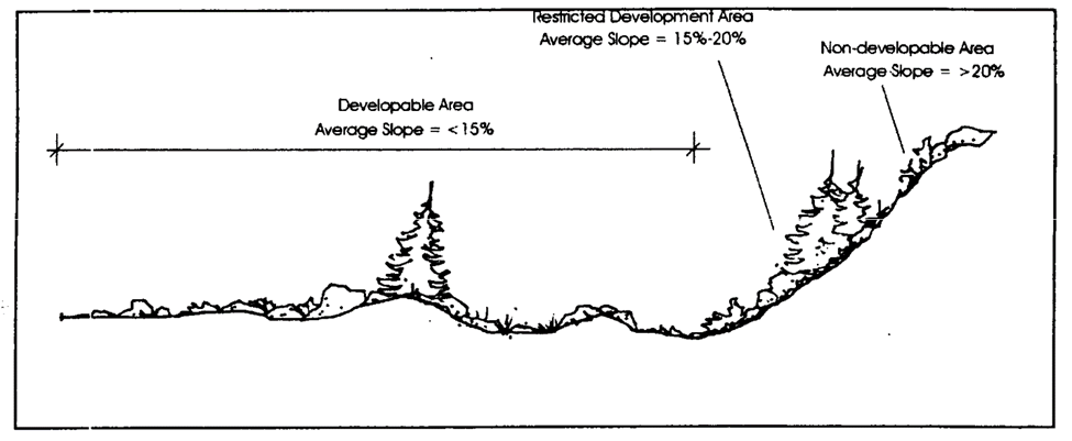
Figure 08.3 Average Slope Examples
c.
All average slope calculations are subject to verification by the Town. In the case of any dispute regarding an average slope calculation, the Town's determination of average slope shall apply.
(4)
Development on slopes of twenty (20) percent or more.
a.
Except as stated in Subsection (4)b below, development, including the platting of developable lots, on slopes of 20 degrees or more is prohibited unless a Variance is obtained under Section 13.03.040(x), Variance.
b.
In order to serve development that is not located on slopes of twenty (20) percent or more, the Town may allow the installation and maintenance of roads, driveways, and minor utilities on lands with slopes of twenty (20) percent or more, subject to Town standards and specifications and the standards in this Section 13.08.040(b).
(5)
Development on slopes of fifteen (15)—twenty (20) percent.
a.
Permitted uses. Unless otherwise specifically allowed by this LDO, the only principal uses allowed on lands or lots subject to this Section 13.08.040(b) shall be single-family detached dwellings, passive park and recreation uses, open space and other conservation uses, as determined by the Town. The Town may allow the installation and maintenance of roads, driveways, and minor utilities on such lands, subject to Town standards and specifications and the standards in this Section 13.08.040(b).
b.
Minimum lot area and maximum lot coverage. The minimum lot area for single-family detached dwelling lots subject to this Section 13.08.040(b)(5) shall be eight thousand (8,000) square feet, and the maximum lot coverage shall be forty (40) percent.
c.
Grading standards.
1.
Minimization of disturbance. Natural landforms shall be preserved and grading and other land disturbance shall be minimized to the maximum extent practicable.
2.
Cutting to create benches. Cutting and grading to create benches or pads for additional or larger building sites shall be avoided to the maximum extent practicable.
3.
Limits on changing natural grade. The original, natural grade of a lot shall not be raised or lowered more than four (4) feet at any point for construction of any structure or improvement, except:
a)
If retaining walls that comply with all LDO standard are used to reduce the steepness of man-made slopes, grade changes up to six (6) feet may be allowed.
b)
As necessary to construct a driveway from the street to a garage or parking area, grade changes or retaining walls up to six (6) feet may be allowed.
c)
The Planning Director may approve other exceptions or suggestions for alternative compliance with these grading standards if the proposal:
1)
Is consistent with the purpose of this Section 13.08.040(b);
2)
Offers an exemplary design and architecture that preserves the natural landform of the site's hillsides; and
3)
Results in less total site disturbance than would compliance with the maximum limits on changing natural grade stated in this Section 13.08.040(b).
4.
Grading for accessory building pads. The creation of separate building pads for accessory buildings and structures other than private garages, such as tennis courts, swimming pools, outbuildings, and similar facilities, shall be avoided on Steep Slopes to the maximum extent practicable,
5.
Limits on man-made slopes. Except as noted in 13.08.040(b)(7), Reclamation of pre-existing man-made slopes:
a)
Filled man-made slopes greater than twenty-five (25) percent shall be avoided to the maximum extent practicable.
b)
Filled man-made slopes shall not exceed a slope of fifty (50) percent.
c)
Cut man-made surfaces or slopes shall not exceed a slope of fifty (50) percent unless a soils engineering or a geotechnical report is furnished stating that the site has been investigated and that, in the opinion of a qualified professional acceptable to the Town, a cut at a steeper slope will be stable and not create a hazard to public or private property.
d)
All cut, filled, and graded slopes shall be recontoured to the natural, varied contour of the surrounding terrain.
e)
The applicant shall provide reasonable measures, including additional plantings, necessary to assure the timely revegetation of man-made slopes.
6.
Excavation. Excavation for footings and foundations shall be minimized to the maximum extent practicable to lessen site disturbance and ensure compatibility with hillside and sloped terrain.
7.
Retaining walls. Retaining walls used to reduce the steepness of man-made slopes and provide planting pockets conducive to revegetation shall meet all applicable standard, including but not limited to maximum height of retaining walls, in Section 13.08.090(n)(6), Retaining walls.
d.
Street and general site access standards.
1.
All public access roads shall comply with standards in the Roadway Design and Construction Criteria Manual.
2.
Fire access roads shall comply with the requirements of the current adopted edition of the International Fire Code, Chapter 5 and Appendix D. Access road widths shall be no less than twenty (20) feet in width for buildings that are less than thirty (30) feet in height while access road width shall be no less than twenty-six (26) feet in height where buildings exceed thirty (30) feet in height. These widths are minimum requirements, and where applicable, shall comply with the Roadway Design and Construction Criteria Manual and LDO requirements.
3.
All private streets, roads, and private access roads shall comply with the following standards:
a)
All streets, roads, private access roads and other vehicular routes shall follow natural contour lines to the maximum extent practicable.
b)
Streets, roads, private access roads and other vehicular routes used to access a parcel (but not including driveways, that are addressed in Subsection (6) below) shall not cross slopes between thirty (30) and fifty (50) percent, except that crossings of such slopes for distances of not more than one hundred (100) feet may be approved if the, Planning Director and Director of Engineering/Public Works determine that no alternative location for the access is practicable, and that any adverse visual and environmental impacts will be mitigated to the maximum extent practicable:
c)
No street, road, private access road or other vehicular route shall cross a slope greater than fifty (50) percent.
d)
Grading for streets, roads, private access roads and other vehicular routes shall be limited to the cartway portion of the right-of-way, plus up to an additional ten (10) feet on either side of the cartway as needed.
(6)
Driveway standards.
a.
Driveways shall follow natural contour lines to the maximum extent practicable.
b.
Driveways longer than one hundred fifty (150) feet in length shall provide a turn-around that meets the Town's adopted standards.
c.
Driveways longer than fifty (50) feet in length shall not be allowed to cross slopes between thirty (30) and fifty (50) percent, except that crossings of such slopes for distances of not more than one hundred (100) feet may be approved if the Planning Director and Director of Engineering/Public Works determine that no alternative location for the driveway is practicable, and that any adverse visual and environmental impacts will be mitigated to the maximum extent practicable:
d.
No driveway shall cross a slope greater than fifty (50) percent.
e.
Shared driveways for residential dwelling units shall be used to the maximum extent practicable
f.
Finished driveway grades shall not exceed ten (10) percent within twenty (20) feet of a public or private street or right-of-way, and shall not exceed twelve (12) percent in any other area.
(7)
Reclamation of pre-existing man-made slopes.
a.
Applicability. This Subsection (7) applies to man-made slopes fifteen (15) percent or greater that were caused by past human activity on a parcel, such as mining or quarrying, but not including man-made slopes created as part of an applicant's pre-construction or construction activities.
b.
Reclamation required. An applicant or developer shall, to the maximum extent practicable, reclaim all pre-existing man-made slopes fifteen (15) percent or greater to as close to the original natural grade and contours of the parcel as possible.
c.
Applicable regulations. Reclamation activity shall be subject to the grading standards stated in Section 13.08.040(b)(5)c above.
(c)
Stream protection standards.
(1)
Purpose. The purpose of this Section 13.08.040(c) is to provide for development adjacent to the Town's streams and waterways in a manner consistent with the Town's Master Plan goals, objectives, and policies to preserve the multiple functions and quality of the Town's streams and associated riparian areas, including wetlands, and to require appropriate stream buffers that will:
a.
Limit development to low intensity land uses in areas determined to be hazardous to life or property, including highly erodible stream banks;
b.
Preserve and use existing natural drainage ways for open space and stormwater detention and/or conveyance;
c.
Maintain and provide required access for future maintenance of stream channels;
d.
Protect and preserve wetlands;
e.
Conserve and enhance existing vegetation communities;
f.
Preserve critical wildlife habitat by ensuring that new development protects and sustains significant wildlife populations;
g.
Minimize water pollution, including sediment and other pollutants in surface runoff, and maintain or improve water quality levels;
h.
Promote dendritic design of site features incorporating or connecting to streams; and
i.
Preserve or enhance the beauty of the landscape by encouraging the maximum retention of natural topographic features such as drainage swales, streams, and wetlands.
(2)
Applicability. This Section 13.08.040(c) applies to any land-disturbing activity and to all new development and subdivision, including the expansion, alteration or reconstruction of buildings, structures, and impervious areas. More information about when these standards are applied is available in Table 13.08.A.
(3)
Stream buffer boundaries.
a.
General.
1.
Stream buffers shall be designated along all streams located in the Town. Projects shall provide stream buffers based on the 100-year floodplain as identified by the Flood Insurance Rate Map (FIRM) for Douglas County, Colorado, and Incorporated Areas available on the Town's website.
2.
All stream, stream buffer, and wetland boundary delineations are subject to the Town's approval.
b.
Stream buffer for Cherry Creek. The stream buffer for Cherry Creek shall be the greater of:
1.
The 100-year floodplain of Cherry Creek ("Cherry Creek Floodplain"), as described in the Flood Insurance Rate Map, or as described in a site-specific survey prepared by a qualified professional and acceptable to the Town; or
2.
The area located within one hundred (100) feet of both sides of Cherry Creek, measured as a line extending perpendicularly from the stream bank of the active channel; or
3.
The area located within twenty-five (25) feet from the outer boundary of a wetland hydrologically related to Cherry Creek; or
4.
Setback lines indicated on the Drainage Master Plan for Cherry Creek, as adopted by the Town and the Mile High Flood District ("MHFD"), and as amended from time to time.
c.
Stream buffer for all other streams and gulches. The stream buffer for all streams other than Cherry Creek shall be the greater of:
1.
The 100-year floodplain as described in the Flood Insurance Rate Map, or as described in a site-specific survey prepared by a qualified professional and acceptable to the Town; or
2.
The area located within fifty (50) feet of both sides of the stream, measured as a line extending perpendicularly from the stream bank of the active channel; or
3.
Setback lines indicated on the Outfall Systems Plan for the particular stream, as adopted by the Town and the MHFD, and as amended from time to time; provided, however, that this Subsection c shall not apply to that portion of Sulphur Gulch located within the Downtown East and Downtown West zoning districts.
d.
Expansion of stream buffers. The Town may expand the boundaries of a stream buffer at any point to include land areas that, if developed or disturbed, may adversely affect the quality of the stream and/or the integrity of the stream banks. The Town may expand the stream buffer boundaries if it finds that the following conditions exist:
1.
The land area is located within one hundred (100) feet of the subject stream, measured as a line extending perpendicularly from the stream bank of the active channel; and
2.
The land area is classified as highly erodible on the most current available USDA soils survey map, or on any other plan, map or resource approved by the Town for this purpose; or
3.
The land area contains steep slopes of fifteen (15) percent or greater.
e.
Delineation of wetland boundaries.
1.
Qualified professional. A qualified person with demonstrated expertise in the field shall delineate all wetland areas.
2.
Mapped wetlands. Boundary delineation of wetlands shall be established by reference to the Douglas County Riparian Conservation Zone Map, as finally adopted and as amended from time to time.
3.
Unmapped/disputed wetlands. If a wetlands has not been mapped or its boundaries not clearly established, or if either the Town or developer disputes the existing boundaries, the developer shall retain a qualified person with demonstrated expertise in the field to delineate the boundaries of the wetland according to professional standards approved by the Town. The developer shall use The Corps of Engineers Wetlands Delineation Manual, Technical Report Y-87-1 (January 1987), as a guideline and reference for the wetland boundary determination. Subsequent revisions of the Delineation Manual shall not be incorporated into this delineation methodology.
f.
Requests for preliminary determination of stream buffer boundaries. Property owners may obtain a preliminary determination of where the Town will likely locate stream buffer boundaries, or whether the Town will expand the base stream buffer boundaries pursuant Subsection e above, or how the Town will address unmapped/disputed wetlands pursuant to Subsection e above, or how the Town may classify an unmapped watercourse on a specific property, and whether the standards of this Section 13.08.040(c) will apply to such properties, through the procedure described in Section 13.03.040(m), Preliminary determination of stream buffer boundaries.
(4)
Compliance with applicable federal wetlands laws or regulations.
a.
Prohibited activities. No person shall engage in any activity that shall disturb, remove, fill, drain, dredge, clear, destroy or alter any area, including vegetation, within a wetlands that falls in the jurisdiction of the federal government and its agencies, except as may be expressly allowed under applicable federal laws or regulations. However, notwithstanding any contrary federal law or regulations, draining any wetlands that falls in the jurisdiction of the federal government and its agencies is prohibited.
b.
Federal approvals prerequisite to town approval. The Town shall not grant final approval to any development or activity, including subdivisions, in a wetlands that falls within the federal government's jurisdiction until the developer shows that all necessary federal approvals and permits have been obtained.
c.
Mitigation plans. The Town shall not prohibit execution of a permitted mitigation plan or maintenance of a permitted mitigation project, nor shall it take responsibility for the mitigation project, even within areas to be accepted by the Town upon final acceptance of all improvements. A letter from the Army Corps of Engineers, accepting the mitigation, is required to release the development from further obligations.
(5)
Protection standards for all stream buffers.
a.
Permitted uses and activities in stream buffers.
1.
The stream buffer area shall remain in a natural state, shall not be modified, and no land disturbing activity shall occur in a stream buffer, except as expressly allowed in this Subsection (5) or other applicable Town laws and regulations.
2.
Any land disturbing activity not prohibited by Subsection 13.08.040(c)(4), Compliance with applicable federal wetlands laws or regulations, and otherwise permitted in stream buffer areas by this LDO shall comply with the following:
a)
The Storm Drainage and Environmental Criteria Manual, as amended;
b)
The Cherry Creek Basin Water Quality Authority's Regulation No. 72, Paragraph 72.7(3)(c)(7), regarding best management practices for maximum removal of stormwater phosphorous; and
c)
Stream stabilization measures pursuant to UDFCD adopted Master Plans and Outfall Systems Plans.
3.
The Town Council may consider any or all of the stream buffer area that comply with the standards in Section 13.08.030(g)(4), Design criteria for parks, trails, and open spaces, towards satisfaction of the open space requirements of Section 13.08.030(g)(3)e, Open space.
b.
Location of platted lots in stream buffers other than the cherry creek stream buffer. The following development lot allowance shall apply in all stream buffers except the Cherry Creek stream buffer:
1.
Development lots for residential, commercial, industrial, or other private development shall not be permitted in the stream buffer unless otherwise allowed by Subsection 3 below.
2.
Tracts for open space, parks, and public facilities, as described below in Subsections c. through g. below are permitted subject to the provision of a plat note that references that the stream buffer is subject to the terms and conditions of this Section 13.08.040(c).
3.
The Town Council may waive or modify this prohibition on the platting of development lots if the Town Council finds that:
a)
The proposed development lot is intended for nonresidential infill development or redevelopment within the boundaries of the Downtown East or Downtown West district; and
b)
The waiver or modification meets the criteria for Major Modifications or Variances stated in Sections 13.08.040(c)(6) below.
c.
Public facilities allowed.
1.
Public facilities including but not limited to flood control structures, stream stabilization improvements, utility rights-of-way and road/street crossings may be permitted in the stream buffer areas, subject to the Town's approval and the standards in Subsection e. below.
2.
Trails, based on the recommendations of the Open Space, Trails and Greenways Master Plan.
3.
Parks, subject to the Town's approval and the following standards:
a)
The applicant shall reclaim any disturbance of the stream buffer area by regrading and revegetation. Provisions for reclamation of the disturbed area shall be included in any development or Subdivision Agreement for the project, with adequate financial security to guarantee reclamation will be completed.
b)
The impact to the topography within the streamside corridor shall be minimized.
c)
Vehicular access to parks shall be located outside of the stream buffer area.
d)
Parks shall not be permitted t within the regulatory floodway shown on the Flood Insurance Rate Map, or in the area located within fifty (50) feet of both sides of the stream, measured as a line extending perpendicularly from the stream bank of the active channel.
d.
Stream buffer crossings: roads, bridges, trails, and utilities. Roads, bridges, trails, and utilities are permitted in the stream buffer and may cross the stream, subject to the Town's approval and the following conditions:
1.
The proposed activity shall be supported by an analysis conducted by a qualified professional acceptable to the Town that:
a)
Shows no economically feasible alternative to location within the stream buffer is available; and
b)
Contains a mitigation plan to minimize impacts on the stream buffer.
2.
The applicant shall reclaim any disturbance of the stream buffer area by regrading and revegetation. Provisions for reclamation of the disturbed area shall be included in any development or Subdivision Agreement for the project, with adequate financial security to guarantee that the reclamation will be completed.
3.
The number of road crossings shall be minimized to the maximum extent practicable.
4.
Rights-of-way shall be the minimum width necessary for installation, access, and maintenance.
5.
Utility corridors in stream buffer areas shall be located at the outside edge of the buffer and access roads for maintenance of utilities shall be located outside the stream buffer area.
6.
Access for maintenance of utilities in stream buffer areas should be at specific points rather than parallel to the utility corridor.
7.
The angle of any crossings shall be perpendicular to the stream or stream buffer to the maximum extent practicable in order to minimize clearing and other land disturbance.
8.
No more than one fairway crossing associated with a permitted golf course shall be allowed for every one thousand (1,000) linear feet of stream buffer area.
9.
The Town may allow the use of low water bridges for crossings intended for use only by pedestrians, equestrians, bicyclists, or golf carts, but not by automobiles or other motor vehicles.
e.
Stormwater management in stream buffers. Stormwater management structures, practices and activities may be permitted in the stream buffer, subject to the Town's approval and the following conditions:
1.
The proposed stormwater facilities shall be supported by an analysis conducted by a qualified professional that shows:
a)
No economically feasible alternative location outside the stream buffer is available; and
b)
The project is either necessary for flood control or significantly improves the water quality or habitat in the stream.
2.
Stormwater management in new developments and subdivisions shall use on-site and nonstructural alternatives to the maximum extent practicable before larger facilities will be allowed within the stream buffer.
3.
To the maximum extent practicable, permitted stormwater management facilities should be located outside the first twenty-five (25) feet of the stream buffer.
4.
When constructing stormwater management facilities, the area cleared shall be limited to the minimum required for construction and adequate access for maintenance, as outlined in the most recent edition of the Storm Drainage and Environmental Criteria Manual.
5.
Materials dredged or otherwise removed from a stream buffer shall be stored outside the stream buffer.
f.
Restoration projects allowed.
1.
Stream, stream bank and vegetation restoration projects are allowed where the goal is to restore the stream or stream buffer to an ecologically healthy state, as approved by the Department of Engineering—Stormwater Utility.
2.
Wildlife and fisheries management activities are allowed when the Town determines they are consistent with the purposes of the Federal Endangered Species Act or consistent with the regulations, policies, and habitat improvement programs of the Colorado Division of Wildlife.
g.
Water quality monitoring allowed. Water quality monitoring and stream gauging are allowed within the stream buffer, as approved by the Town.
h.
Tree and vegetation removal. All existing, healthy trees and vegetation within the stream buffer area shall be preserved and, where necessary to provide adequate screening or to repair damaged riparian areas, supplemented with additional native planting and landscaping approved by the Town. This provision shall not prohibit removal of dead trees/vegetation, noxious weeds, nonnative trees/vegetation that are necessary to accommodate stormwater management or roadway and trail crossings, or that threaten native species growth or reintroduction, or any other tree/vegetation that is a threat to the public health or safety. See Section 13.08.090(l) for applicable tree preservation standards.
(6)
Administration of stream buffer standards.
a.
Proposed development in areas adjacent to protected stream buffers and wetlands shall be reviewed for compliance with the standards in this Section 13.08.040(c) through the Final Plan, Minor Development Plat, or Site Plan approval process in Sections 13.03.040(q)(4), 13.03.040(q)(6), and 13.03.040(p) respectively.
b.
Modifications of standards in this Section 13.08.040(c) may be approved by the Town pursuant to Section (j), Major Modification.
c.
Modifications that exceed the criteria for an Major Modifications may be approved by the Town pursuant to Section 13.03.040(x), Variance.
(d)
Visually significant ridgelines. Development sites that include visually significant ridgelines shall limit the extent of building on top of the ridgeline, or rooflines that protrude above the ridgeline to twenty (20) percent of the total length of the ridgeline within the property boundaries of the development site.
(e)
Prairie dog management.
(1)
Intent. The purpose of this Section 13.08.040(e) is to provide for the humane management of prairie dogs in connection with development. It is the intent of the Town that prairie dogs shall be managed humanely, with preference given to relocation, if feasible, and if not, humanely exterminated.
(2)
Applicability. The provisions contained in this Section 13.08.040(e) are in addition to, and do not supersede, any state or federal rules, regulations or standards concerning the management of prairie dogs. This Section shall apply to all development when prairie dogs are present on a site, including but not limited to the following:
a.
Demolition Permit;
b.
Grading Permit;
c.
Final Plat;
d.
Minor Development Plat;
e.
Replat; and
f.
Site Plan.
(3)
Relocation. Applicants are encouraged to partner with nonprofit conservation and public interest groups to relocate existing prairie dogs; provided, however, no relocation of prairie dogs shall occur between April 1 and June 1, which is the birthing season.
(4)
Use of humane extermination. If, after Town approval of a development application and a period of not less than thirty (30) days of attempted relocation, such relocation of prairie dogs is infeasible or prohibited, except as provided in Subsection (3) above, the applicant shall utilize humane extermination using a licensed professional exterminator to eradicate all or part of a prairie dog colony. All products shall be approved for use by the Colorado Department of Agriculture, U.S. Fish and Wildlife Service, and U.S. Environmental Protection Agency. Humane extermination shall not occur when endangered or threatened species such as the Western Burrowing Owl or Black-Footed Ferret are present on a site until such species are protected or relocated in accordance with the requirements of the U.S. Fish and Wildlife Service. For purposes of this Section 13.08.040(e), humane extermination shall include the use of products that (1) are nontoxic (such as carbon dioxide and carbon monoxide); (2) minimize secondary poisoning; and (3) minimize impacts to nontarget species.
(5)
Certification. Prior to Grading Permit approval or the commencement of site development, the applicant shall provide a certification in a form acceptable to the Town indicating compliance with the provisions of this Section 13.08.040(e).
(Ord. 3.372.4 §1, 2025)
13.08.050 - Grading and drainage.
(a)
Applicability. This Section 13.08.050 apply to all development unless otherwise stated in this LDO. More information about when these standards are applied is available in Table 13.08.A.
(b)
Soil erosion and sediment control.
(1)
Property owners or their agents must take measures that reduce or eliminate the effects of storm water runoff and wind on soil surfaces in order to promote the safety, public health, convenience, and general welfare of the community.
(2)
Site improvements shall minimize cut and fill in order to preserve the general character of the existing terrain, unless otherwise required to comply with a standard in this LDO or the manuals referred to in this Section 13.08.050.
(3)
No Grading Permit will be authorized until a drainage plan and erosion control plan have been approved by the Town Drainage Engineer.
(c)
Reference manuals adopted. The following manuals have been adopted by the Town. All soil erosion and sediment control measures required pursuant to Subsection (b) above shall comply with the practices listed in those manuals to the maximum extent practicable.
(1)
Storm drainage and environmental criterial manual.
a.
The Storm Drainage and Environmental Criteria Manual, as revised February 2014 and prepared by the Town, is hereby adopted by reference to establish standards for drainage and the control of soil erosion and sedimentation occurring as a result of nonagricultural activities within the Town.
b.
This Storm Drainage and Environmental Criteria Manual shall be consulted for requirements regarding drainage and erosion control prior to construction.
c.
The technical methodology may be amended from time to time by the Director of Engineering/Public Works in order to meet the standards set forth in this LDO.
d.
The Director of Engineering/Public Works may also adopt rules and regulations that are in conformity with this Section 13.08.050.
(2)
Illicit discharge detection and elimination (IDDE) manual.
a.
The Town of Parker Illicit Discharge and Detection Elimination (IDDE) Manual as amended is hereby adopted by reference.
b.
The technical methodology may be amended from time to time by the Director of Engineering/Public Works in order to meet the standards set forth in this LDO.
c.
The Director of Engineering/Public Works may also adopt rules and regulations that are in conformity with this Section 13.08.050.
(d)
Underdrains.
(1)
Approval of underdrains. Underdrains shall not be constructed within the Town's rights-of-way unless the Director of Engineering/Public Works makes a written determination that such underdrains are necessary to remedy a specific drainage issue for which an underdrain will provide an effective remedy. If an underdrain is determined to be necessary, it shall be constructed pursuant to design and construction criteria approved in advance by the Director of Engineering/Public Works.
(2)
Failed underdrains. In those projects in which underdrains have already been constructed and installed within the Town rights-of-way, the failure of an underdrain, as determined by the Director of Engineering/Public Works, shall result in the following procedure for alleviating the underdrain failure:
a.
The failed underdrain system shall be eliminated as a vehicle for draining ground water from the adjacent property for which it was intended and to which it was installed.
b.
The adjacent property owner[s] shall be required, at their own cost, to install a sump pump to drain ground water, as a replacement and in lieu of the failed underdrain system.
(e)
Retaining Walls
All retaining walls shall comply with the standards in Section 13.08.090(n)(6), Retaining walls.
13.08.060 - Access, connectivity, and circulation.
(a)
Purpose. The purpose of this Section 13.08.060 is to create a pedestrian-friendly environment and contribute to a walkable community by:
(1)
Providing an interconnected system of bikeways, walkways, and trails within the Town and to the regional transportation network to reduce the frequency and shorten the distance of automobile trips.
(2)
Designing development blocks to connect the site to the existing street network to facilitate walking and bicycling between uses and to and from public areas.
(3)
Developing and maintaining a street network of public and private roadways that accommodates safe and convenient movement, consolidates access to adjacent properties to minimize curb cuts and not disrupt adjacent residential areas, and facilitates efficient automobile circulation.
(b)
Pedestrian and bicycle connections.
(1)
Applicability.
a.
This Section 13.08.060 shall apply to all development except as stated in Subsection b below,
b.
The Planning Director may adjust or waive the standards in this Section 13.08.060 if the Planning Director determines that alternative provisions for pedestrian and bicycle mobility:
1.
Will better achieve the purposes in Section 13.08.060(a); or
2.
Will allow the applicant to comply with additional development standards in this LDO; or
3.
Are necessary because unique site factors make strict compliance with the standards in this Section impracticable.
c.
More information about when these standards are applied is available in Table 13.08.A.
(2)
Standards applicable to all development.
a.
Publicly accessible sidewalks or walkways shall be provided along public streets or drives.
b.
Pedestrian and vehicle access shall be separated through provision of a sidewalk or walkway to the maximum extent practicable. Where complete separation of pedestrians and vehicles is not practicable, potential hazards shall be minimized by using landscaping, bollards, special paving, lighting, and other means to clearly delineate pedestrian areas.
c.
The on-site pedestrian and bicycle circulation system shall be designed to provide or allow for direct connections to major pedestrian and bicycle destinations including, but not limited to, trails, parks, schools, and transit stops that are located either within or adjacent to the development.
d.
Walkways within the site shall be located and aligned to directly and continuously connect areas or points of common pedestrian origin and destination, and shall not be located and aligned solely based on the vehicular drive aisle or parking lot configuration.
e.
Pedestrian crosswalks in or through parking lots or on private streets shall be distinguished from the driving surface through the use of different materials and color to enhance pedestrian safety. The Planning Director may approve an alternative crosswalk design where the facility provides different and creative solutions for safe pedestrian crossings.
f.
All proposed development shall apply Complete Streets planning and design principles and be consistent with the Town's adopted Complete Streets Policy for access, circulation, connections, and multi-modal transportation to the maximum extent practicable.
g.
Walkways within a site shall be located and aligned to directly and continuously connect areas or points of pedestrian origin and destination and shall not be located and aligned solely based on the outline of a parking lot configuration.
(3)
Public transit stops and access.
All development adjacent to a transit stop shall provide the following:
a.
clear, comfortable, and direct pedestrian and bicycle access to existing transit (bus) stops and future transit stops.
b.
Transit stop locations shall provide a concrete pad for any future transit shelters.
(4)
Nonresidential and mixed-use development.
a.
All nonresidential and mixed-use development public areas shall provide sidewalk and trail connectivity for pedestrians and bicyclists between all public entries to new and existing buildings, outlying parking areas, between buildings, to the public sidewalk system, amenities and to transit facilities.
b.
Publicly accessible walkways shall connect from the site to adjacent uses in a logical manner. If adjacent properties are undeveloped, the applicant shall design and construct future pedestrian connections to adjacent parcels.
c.
Sidewalks located on any building side with a public entrance shall be a minimum width of ten (10) feet and shall span the entire length of the building. The ten (10) foot sidewalk shall transition into a five (5) foot wide sidewalk that connects to the on-site pedestrian circulation system located on the interior and perimeter areas of the development site. This requirement may be reduced to no less than eight (8) feet in width where parking is not perpendicular to the sidewalk.
(5)
Multifamily and single-family attached.
a.
All multifamily and single-family attached development public areas shall provide sidewalk and trail connectivity for pedestrians and bicyclists between all public entries to new and existing buildings, outlying parking areas, between buildings, to the public sidewalk system, amenities and to transit facilities.
b.
Publicly accessible walkways shall connect from the site to adjacent uses in a logical manner. If adjacent properties are undeveloped, the applicant shall design and construct future pedestrian connections to adjacent parcels.
(6)
Downtown pedestrian-oriented amenity zones.
a.
In the Downtown East and Downtown West zoning districts, properties adjacent to Mainstreet shall provide a pedestrian-oriented amenity area a minimum of eighteen (18) feet in width that includes:
1.
An amenity or buffer zone where street trees, street and pedestrian lights, and other street furniture are located; and
2.
A walking zone with a minimum width of eight (8) feet, clear of obstructions and parallel to the vehicular drive.
Figure 08.4 Mainstreet Pedestrian-Oriented
Amenity Area
b.
In the Downtown East zoning district, properties adjacent to any public street other than Mainstreet shall provide an amenities area a minimum width of eighteen (18) feet that includes a walking zone with a minimum width of ten (10) feet along Parker Road and eight (8) feet along all other public streets, clear of obstructions and parallel the public street.
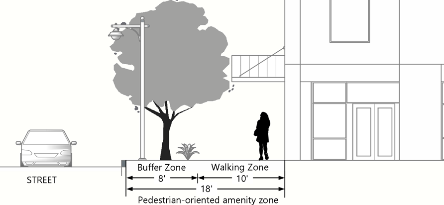
Figure 08.5 All Other Public Street
Pedestrian-Oriented Amenity Areas
(c)
Development block layout.
(1)
Applicability. These standards shall apply to all development, except parks and open spaces. More information about when these standards are applied is available in Table 13.08.A.
(2)
All development blocks.
a.
Development blocks shall be designed and oriented to maximize building frontages to and primary access from public streets or private streets create active street fronts and pedestrian walkability.
b.
The maximum block size shall not exceed one thousand (1,000) feet in length and width.
c.
Paseos and pathways shall be used to create pedestrian-blocks and to further breakdown blocks to sizes ranging between three hundred (300) and five hundred (500) feet.
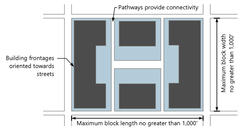
Figure 08.6 Development Block Requirements
(3)
Commercial and mixed-use development. A commercial or mixed-use development block shall break down a large-size parcel into developable lots with multiple access points based on land use, site context, and existing street and pedestrian connectivity. A block shall provide connectivity to public roadways and off-street parking and shall consider natural site features such as large trees or tree groves, floodplain, drainage ways and topographic conditions of the site.
(d)
Streets and internal access.
(1)
All public streets, roads, trails, and rights-of-way shall be consistent with the adopted Transportation Master Plan and the requirements of the current adopted edition of the International Fire Code, Chapter 5, and Appendix D.
(2)
All public streets shall comply with the standards set forth in the Roadway Design and Construction Criteria Manual and the requirements of the current adopted edition of the International Fire Code, Chapter 5, and Appendix D.
(3)
Private internal access drive aisles and streets shall be safe and clearly defined, and shall comply with all applicable standards in this LDO and the Roadway Design and Construction Criteria Manual.
(4)
Private streets shall include all of the following:
a.
A minimum five-foot width sidewalk on both sides of the roadway.
b.
All development shall install detached sidewalks unless on-street parking is provided, in which case an attached sidewalk may be installed.
c.
Within nonresidential development where topography or other site constraints exist, an attached sidewalk may be considered.
d.
Streetscape landscaping shall be required pursuant to Section 13.08.090(e).
e.
Parallel parking along private streets is permitted.
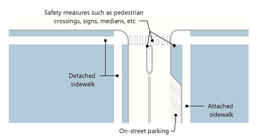
Figure 08.7 Private Street Requirements
(e)
Signs, signals, lighting, median refuge areas, landscaping and/or other means of traffic calming devices shall also be incorporated at pedestrian crossings to promote safety.
13.08.070 - Airport regulations.
(a)
Purpose. The purpose of the airport land use regulations in this Section 13.08.070 is to preserve existing and establish new compatible land uses around airports to allow land use not associated with high population concentration, to minimize exposure of residential uses to critical and uncontrollable aircraft noise areas, to avoid danger from aircraft crashes, to discourage traffic congestion and encourage compatibility with nonmotorized traffic from development around airports.
(b)
Applicability. This Section 13.08.070 shall apply to all development located within the Airport Influence Area. More information about when these standards are applied is available in Table 13.08.A.
(c)
Height limitations. Except as otherwise provided in this Section 13.08.070, no structure or object of natural growth shall be constructed, erected, altered, allowed to grow or to be maintained in excess of the following height limits and zones:
(1)
The maximum height of any structure or object of natural growth within the Airport Influence Area shall not exceed the maximum height established by FAA Regulation FAR Part 77.
(2)
A referral to Centennial Airport shall be required for the construction or alteration of any structure two hundred (200) feet or higher located within twenty thousand (20,000) feet or any runway.
(d)
Surfaces. In order to protect public safety, certain surfaces and areas are hereby established that include all the land and air space within the area that would be hazardous to air navigation at the airport.
(1)
This Section 13.08.070 shall apply to all land within the officially identified Airport Influence Area. Future airport sites may be officially identified as future Airport Influence Areas and subject to the provisions of this Section 13.08.070 by action of a Town Council after a public hearing pursuant to Section 13.03.030(g).
(2)
This Section 13.08.070 establishes airport height zones on an airport obstruction and vicinity map. These zones are areas above imaginary surfaces and are designed to regulate the height of structures and trees in the airport vicinity. They are set forth in the FAA Regulation FAR Part 77 as amended.
a.
Utility Runway Visual Approach Zone: Slopes upward twenty (20) feet horizontally for each foot vertically, beginning at the end of and at the same elevation as the primary surface and extending to a horizontal distance of five thousand (5,000) feet along the extended runway centerline, with a lateral width of one thousand two hundred fifty (1,250) feet.
b.
Utility Runway Nonprecision instrument Approach Zone: Slopes upward twenty (20) feet horizontally for each foot vertically, beginning at the end of and at the same elevation as the primary surface and extending to a horizontal distance of five thousand (5,000) feet along the extended runway centerline, with a lateral width of one thousand two hundred fifty (1,250) feet.
c.
Runway Larger Than Utility Visual Approach Zone: Slopes upward twenty (20) feet horizontally for each foot vertically beginning at the end of and at the same elevation as the primary surface and extending to a horizontal distance of five thousand (5,000) feet along the extended runway centerline, with a lateral width of one thousand five hundred (1,500) feet.
d.
Runway Larger Than Utility with a Visibility Minimum Greater Than Three-Fourths Mile Nonprecision Instrument Approach Zone: Slopes upward thirty-four (34) feet horizontally for each foot vertically beginning at the end of and at the same elevation as the primary surface and extending to a horizontal distance of ten thousand (10,000) feet along the extended runway centerline, with a lateral width of three thousand five hundred (3,500) feet.
e.
Runway Larger Than Utility with a Visibility Minimum as Low as Three-Fourths Mile Nonprecision Instrument Approach Zone: Slopes upward thirty-four (34) feet horizontally for each foot vertically beginning at the end of and at the same elevation as the primary surface and extending to a horizontal distance of ten thousand (10,000) feet along the extended runway centerline, with a lateral width of four thousand (4,000) feet.
f.
Precision Instrument Runway Approach Zone: Slopes upward fifty (50) feet horizontally for each foot vertically beginning at the end of and at the same elevation as the primary surface and extending to a horizontal distance of ten thousand (10,000) feet along the extended runway centerline; thence slopes upward forty (40) feet horizontally for each foot vertically to an additional horizontal distance of forty thousand (40,000) feet along the extended runway centerline, with a lateral width of sixteen thousand (16,000) feet.
g.
Heliport VFR Approach Zones: Slopes upward eight (8) feet horizontally for each foot vertically beginning at the end of and at the same elevation as the primary surface, and extending to a distance of four thousand (4,000) feet along the extended primary surface centerline.
h.
Heliport IFR Approach Zones: Slopes upward fifteen (15) feet horizontally for each foot vertically beginning at the end of and at the same elevation as the primary surface, and extending to a distance of ten thousand (10,000) feet along the primary surface centerline.
i.
STOL Approach Zones: Slopes upward fifteen (15) feet horizontally for each foot vertically beginning at the end of and at the same elevation of primary surface, and extending to a distance of ten thousand (10,000) feet along the extended runway centerline.
j.
Transitional Zone: Slopes upward and outward seven (7) feet horizontally for each foot vertically beginning at the sides of and at the same elevation as the primary surface and the approach zones and extending to a height of one hundred fifty (150) feet above the airport elevation above mean sea level shown on the approved airport/heliport layout. In addition, slopes outward seven (7) feet horizontally for each foot vertically beginning at the sides of and at the same elevation as the approach zones, and of and at the same elevation as the approach zones, and extending to where they intersect with the conical surface. Where the precision instrument runway approach zone projects beyond the conical zone, height limits sloping upward and outward seven (7) feet horizontally for each foot vertically shall be maintained beginning at the sides of and at the same elevation as precision instrument runway approach surface, and extending to a horizontal distance of five thousand (5,000) feet measured at ninety (90) degree angles to the extended runway centerline.
k.
Heliport VFR Transitional Zones: Slopes upward and outward two (2) feet horizontally for each foot vertically beginning at the sides of and at the same elevation as the primary surface and the approach surfaces and extending a distance of one hundred fifty (150) feet measured horizontally from and at ninety (90) degree angles to the primary surface centerline and extended centerline.
l.
STOL Transitional Zones: Slopes upward and outward four (4) feet horizontally for each foot vertically beginning at the sides of and at the same elevation as the primary surface and a portion of the sides of the approach surface and extends to an elevation of one hundred (100) feet above the primary surface.
m.
Horizontal Zones: One hundred fifty (150) feet above the airport elevation above mean sea level shown on the approved airport/heliport layout.
n.
Conical Zone: Slopes upward and outward twenty (20) feet horizontally for each foot vertically beginning at the periphery of the horizontal zone and at one hundred fifty (150) feet above the airport elevation and extending to a height of three hundred fifty (350) feet above the airport elevation.
(e)
Performance regulations. No use may be made of land within the designated Airport Influence Area that creates electrical interference with radio communication between the airport and aircraft, makes it difficult for pilots to distinguish between airport lights and other lights, causes glare in the eyes of pilots using the airport, impairs visibility in the vicinity of the airport or otherwise endangers the landing, taking off or maneuvering of aircraft at the airport or in the vicinity of the airport. No airport/heliport will be allowed unless it is located in an officially identified Airport Influence Area. Review of land use proposals and/or changes shall use noise contours when applicable. Noise attenuation in building design should be included in proposals within the airport influence area.
13.08.080 - Parking and loading.
(a)
Purpose. The purposes of this Section 13.08.080 are:
(1)
To ensure that off-street parking areas are well designed with regard to safety, efficiency and convenience for vehicles, bicycles, and pedestrians.
(2)
To ensure land uses can function without negatively impacting adjacent land uses and allow for the development of walkable mixed-use environments.
(3)
To ensure that parking is considered and designed as accessory to the principal uses within the buildings served, that buildings and pedestrian scale areas are the focal point, that parking is viewed as a necessary function in support of those activities and that it is visually and functionally secondary to the principal use of the building and pedestrian access.
(4)
To provide enough vehicular parking to accommodate the need generated by the uses without providing excessive amounts of parking.
(5)
To encourage alternative parking arrangements such as shared parking.
(6)
To provide that required parking facilities are located on the same lot or parcel as the building or use served, unless shared parking is allowed by this Section 13.08.080.
(7)
To provide parking efficiencies through parking reduction mechanisms for mixed-use development, redevelopment, and developments that are near multi-modal transportation options within the Downtown East and Downtown West zoning districts.
(8)
To provide for creative and innovative parking approaches that support and implement the Mainstreet Master Plan and Transportation Master Plan within the Downtown East and Downton West zoning districts and adjacent areas.
(b)
Applicability. This Section 13.08.080 applies to:
(1)
All new development of primary buildings;
(2)
All expansion of the gross floor area or an existing primary building; and
(3)
Any change of substantive land use or change of tenant finish that meets the following standards:
a.
Prior to approval of a tenant finish involving a substantive change in use, the applicant shall demonstrate that adequate parking exists for the proposed land use change. The square footage of all tenant finish areas shall be identified for each proposed use. When changes in land use and tenant finish require more parking than currently exists, the applicant shall be required to revise its Site Plan to increase the number of parking spaces consistent with the requirements in this Section 13.08.080, while still meeting landscaping requirements. Failure to provide additional required parking may result in the denial of the tenant finish permit.
b.
The requirements in Subsection (3)a above do not apply to for a change of land use or tenant finish within a multi-tenant or multi-building development on a single lot under common ownership or management where all of the proposed uses are permitted by right.
(4)
More information about when these standards are applied is available in Table 13.08.A.
(c)
Location of required parking spaces. All off-street parking spaces required by this Section 13.08.080 shall be provided on the same lot, parcel, or site served by the required parking, unless off-site parking is permitted pursuant to Section 13.08.080(g) or otherwise approved and noted on a single Site Plan covering multiple contiguous lots or a multi-tenant building or multi-building development under common ownership or management.
(d)
Use of required parking spaces. Required parking areas shall be available for the parking of operable passenger automobiles of residents, customers, patrons, and employees and shall not be used for outdoor storage or display, trailer or RV storage, sale, repair, dismantling or servicing of any vehicles, equipment, materials, or supplies, except as otherwise permitted through a Temporary Use Permit.
(e)
Striping of parking and loading spaces.
(1)
All off-street parking spaces, excluding residential units with individual driveways, shall be outlined by white or yellow stripes not less than four (4) inches wide painted on the surface area or an alternative approved by the Planning Director.
(2)
All non-parking spaces for vehicles, such as loading zones, emergency lanes or spaces in front of doorways/entrances, shall be clearly delineated.
(f)
Number of off-street parking spaces required. The minimum off-street parking spaces for specific uses shall be as provided below in Table 13.08.F.
(1)
Calculation of required parking spaces.
a.
Area measurements. Unless otherwise specifically provided in this LDO, all square-footage-based parking and loading standards shall be calculated on the basis of net leasable area (see Figure 08.8 and Figure 08.9). For outdoor areas, calculations shall be based on the portion of the lot actually being used for the specified use, as listed in Table 13.08.F.
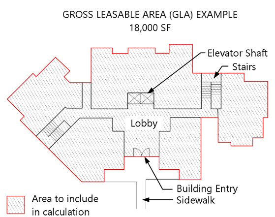
Figure 08.8 Gross Leasable Area (GLA)
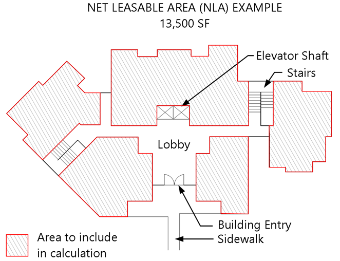
Figure 08.9 Net Leasable Area (NLA)
b.
Fractions. In calculating the required number of parking spaces, any fraction of a parking space of one-half (½) or more shall be equal to one (1) space. Fractions less than one-half (½) of a parking space shall not be counted as a parking space.
c.
Unlisted uses. If a use of property is not listed in Table 13.08.F, the Planning Director shall apply the off-street parking standard for the most similar use. If the Planning Director determines that there is no similar use, the Planning Director may require the applicant to submit a special study supported by competent information in order to make the determination as to what parking requirement would best achieve the purposes of this Section 13.08.080.
d.
Multiple commercial tenants. If three (3) or more commercial tenants or users occupy a single building, the minimum number of off-street parking spaces shall be one (1) space per three hundred (300) square feet of net leasable area regardless of the minimum number of parking spaces otherwise applicable to the individual commercial use.
(2)
Phasing of Parking for developments with multiple buildings.
a.
If a development is being constructed in phases over time, required parking may also be constructed in phases in accordance with a development phasing plan approved by the Town, or no such phasing plan has been approved, then the required parking for each phase of the development shall be determined by the Planning Director based on anticipated parking demand for that phase of development.
b.
Required parking for each building constructed shall generally be required to be installed before a Certificate of Occupancy for the building will be issued.
c.
No parking area for a phase of development may be located on any portion of the lot or site designated for landscaping when the full development is completed
d.
All parking landscaping plans and parking access points necessary for each phase shall be designed to accommodate parking areas at final build out.
(3)
Temporary parking areas.
a.
Temporary parking areas required to serve a temporary building or use listed in Table 13.05.A shall be considered when the request is included in an application for the Temporary Use Permit and is determined that temporary parking spaces are needed to protect public health and safety or to avoid adverse impacts on surrounding areas.
b.
Temporary parking spaces are not required to meet the standards in Section 13.08.080(j), Parking layout and design.
c.
Any temporary structure that is expected to be in place longer than six (6) months to one (1) year may be required to construct permanent parking if determined to be necessary because of anticipated heavy use of parking areas or to mitigate visual, noise, or operational impacts on surrounding properties.
(4)
Electric vehicle charging stations. Where a parking lot or parking structure is provided for new development or redevelopment of multifamily dwellings or nonresidential uses, the lot or structure shall be provided with electric vehicle power transfer infrastructure in compliance with the Colorado Model Electric Ready and Solar Ready Code.
(g)
Off-site parking. Off-site parking shall be permitted provided the following requirements are met:
(1)
Eligibility. For nonresidential or mixed-use development, a portion of the parking requirement may be met through off-site parking pursuant to the requirements of this Section 13.08.080(g), where the applicant demonstrates that it cannot reasonably provide on-site parking pursuant to this Section 13.08.080, and that such off-site parking will promote consistency with the Town's adopted plans through improved building and site design.
(2)
Location of off-site parking.
a.
The distance from the property line of the site to the boundary of the off-site parking area spaces shall not exceed six hundred (600) feet. However, the Planning Director, or designee, may approve a distance of more than six hundred (600) feet (not to exceed a distance of one thousand two hundred (1,200) feet) based on the land use or quality of pedestrian connection between the subject site and the off-street parking area.
b.
In the Downtown East and Downtown West zoning districts, off-site parking may include on-street parking adjacent to the subject site or the off-site parking location. Only on-street vehicle parking spaces for which more than one-half (½) of the curb length of the parking space is adjacent to the subject lot, as measured by the hypothetical extension of lot lines of the subject lot or parcel into the on-street parking area, shall be counted towards minimum parking requirements.
Figure 08.10 Off-Site Parking Location
Requirements
c.
In all zoning districts other than the Downtown East and Downtown West districts, off-site parking shall not be located on-street and may not be located in a residential zoning district unless otherwise determined by the Planning Director.
(3)
Accessible parking. All parking spaces for persons with disabilities required by the Americans with Disabilities Act shall be provided on-site.
(4)
Maximum number of off-site parking spaces. No more than thirty (30) percent of the required on-site parking shall be addressed through off-site parking.
(5)
Review. All requests for approval of off-site parking shall be reviewed as part of the Site Plan approval process pursuant to Section 13.03.040(p).
(6)
Shared parking plan and agreement.
a.
As part of the approval for off-site parking, the applicant shall submit an off-site shared parking plan meeting the requirements described in the LDO Administrative Manual.
b.
All requests for approval of off-site parking shall be filed by the owners of the site and off-site parking area (including any owners of buildings existing on the site or off-site parking area, if different than the real property owners), and shall be reviewed as part of the Site Plan process pursuant to Section 13.03.040(p).
c.
In addition to the off-site shared parking plan, a shared parking agreement for off-site parking, in a form approved by the Town Attorney, shall be executed by the owners of the site and the off-site parking area (including any owners of buildings existing on the site or off-site parking area, if different than the real property owners) and consented to in writing by the Town. The shared parking agreement for off-site parking shall substantially comply with the format of any model shared parking agreement, in the LDO Administrative Manual.
d.
Upon approval of an off-site shared parking plan and shared parking agreement, a copy of the plan and agreement shall be recorded by the Town with the Douglas County Clerk and Recorder.
e.
All recorded off-site shared parking plans and shared parking agreements shall run with the land, be binding upon the applicants for such shared parking plans, their successors, and assigns, and shall restrict and limit the use and operation of all land and buildings included in the plan to all conditions and limitations in the approved plan and agreement. No Site Plans or plats shall be approved, or permits or Certificates of Occupancy issued, unless the proposed uses and developments comply with all the conditions and limitations of the approved plan and agreement.
f.
Recorded off-site shared parking plans and shared parking agreements may be amended pursuant to the same procedure and subject to the same limitations and requirements by which such plans and agreements were approved and recorded.
g.
Upon application by the owners of any site and off-site parking area subject to any recorded shared parking plan and agreement (including any owners of buildings existing on the site or the off-site parking area, if different than the real property owners), the plan and agreement may be terminated if all uses, land, and buildings remaining under such plan are made to comply with all conditions and limitations of the plan and agreement and all uses, land, and buildings withdrawn from the plan are made to comply with this LDO and all other Town regulations. Upon approval of the termination of a shared parking plan and agreement, all parties shall sign a shared parking termination agreement, which shall be recorded by the Town with the Douglas County Clerk and Recorder with the costs of recording paid by the applicants.
(h)
Accessible parking. All parking provided for any new building constructed, any new use established, any enlargement of an existing building or use, any change in the occupancy of any building or any change of use shall be designed and constructed pursuant to the Americans with Disabilities Act, as amended ("ADA").
(i)
Parking credits and adjustments.
(1)
Parking exemptions and reductions in the Downtown East and Downtown West zoning districts.
a.
Parking exemptions. For all uses except residential, the first five thousand (5,000) square feet of newly constructed, expansions, changes of use, tenant finish/improvement, or modifications net leasable floor area shall be excluded from the calculations required by this Section 13.08.080.
b.
Parking reductions. Off-street parking requirements in the Downtown East and Downtown West zoning districts may be reduced when on-street public parking is provided along local or collector streets adjacent to the proposed development.
(2)
Mixed-use/shared parking reductions.
a.
Applicability.
1.
The following Mixed-use/shared parking reductions apply in all zoning districts, unless otherwise indicated in this LDO, to ensure new developments do not provide more parking than is needed, and to promote the efficient use of land while reducing the expanse of paved areas.
2.
In locations where a mix of land uses allows for complementary use of parking spaces due to differences in the timing of peak parking demand.
3.
No application of this Section 13.08.080(i) shall reduce the number of parking spaces on site for persons with disabilities below the number required by the Americans with Disabilities Act (ADA).
b.
Shared parking reduction table.
1.
Where two or more uses listed in Table 13.05.A: Table of Allowed Uses are located on a single lot or in a single development (but not in the same building) and those uses share a parking lot or structure, the total off-street parking requirement for those uses may be reduced by the factors shown in Table 13.08.G below.
2.
To calculate the shared parking reduction, add the parking requirements for each use category and then divide the sum by the factor shown for that combination of use categories in Table 13.08.G.
3.
If the mixed-use or shared parking includes more than two (2) categories of uses, this reduction only applies to the two (2) uses with the greatest parking demands. After calculating the reduction for those two (2) use categories pursuant to Table 13.08.G, parking for a third, fourth, or additional use categories sharing the parking facility shall be provided at the rates shown in Table 13.08.F.
4.
For example, a development with five thousand (5,000) square feet net lease area (NLA) of retail space (one (1) per three hundred (300) square feet NLA) and three thousand (3,000) square feet restaurant (one (1) per four (4) persons design capacity - one hundred twenty (120) persons) would take the total spaces required between the two (2) uses and divide by 1.3.
a)
Retail: (5,000 / 300 = 16.6) = 17
b)
Restaurant: (120 / 4) = 30
c)
Total = 47 / 1.3 = 36.15
d)
The shared parking requirement is 36 spaces.
(3)
Transit proximity reductions.
a.
The minimum parking required by Table 13.08.F may be reduced by five (5) percent if the majority of the site for which parking is being provided is within one-quarter (¼) mile of a transit stop.
b.
The minimum parking required by Table 13.08.F may be reduced by five (5) percent if the majority of the site for which parking is being provided is within one-quarter (¼) mile of a regional trail providing pedestrian and bicycle access.
(4)
Shared-vehicle reductions. For each parking space in a mixed-use or nonresidential development reserved for a shared vehicle, carpool, or vanpool, the minimum number of required off-street parking spaces shall be reduced by four (4). Each shared vehicle, carpool, or vanpool space shall be signed for such use and shall count toward the minimum number of required parking spaces.
(5)
Automotive fuel sales reduction. For the Automotive Fuel Sales use, the Planning Director may allow some fueling pump areas to count toward the required parking spaces if the Planning Director determines that information about parking demand or site circulation provided by the applicant demonstrates that the remaining parking spaces not in fuel pump areas are adequate to fulfill the parking needs of the site.
(6)
Transportation demand management reductions. Additional reductions in minimum required off-street parking spaces, beyond those in Sections 13.08.080(i)(1) through 13.08.080(i)(4) above are available based on the applicant's inclusion of Transportation Demand Management commitments, and the Town's acceptance of those commitments, based on a special parking study supporting those reductions, as described in Section 13.08.080(l), Special parking study requirement or option.
(7)
Limit on parking reductions. Regardless of how many of the parking reductions in Sections 13.08.080(i)(2) through 13.08.080(i)(4) are used, or in what combination, the minimum amount of required off-street parking shall not be reduced by more than thirty (30) percent below the minimum combined off-street parking required for each use, considered independently, pursuant to Table 13.08.F. Off-street parking may be reduced by more than thirty (30) percent using a combination of parking reductions through the special parking study described in Subsection (I).
(j)
Parking layout and design.
(1)
Purpose. The purpose of this Section 13.08.080(j) is to:
a.
Lay out and design parking areas that minimize negative visual impacts from adjacent primary roadways and properties.
b.
Reduce the expansive impervious surfaces within parking areas by organizing parking areas into smaller blocks that address a pedestrian scale.
c.
Incorporate design elements that connect the on-site and perimeter pedestrian circulation system between the parking area and the building or use.
d.
Better integrate safety and aesthetics for pedestrian and vehicular interaction.
e.
Visually and physically separate the view of surface parking areas and the cars in them from adjacent streets, open spaces, pedestrian ways, and residential areas.
f.
Provide parking spaces sized to accommodate typical expected vehicles.
g.
Provide sufficient vehicular circulation to access parking spaces.
(2)
Parking space size.
a.
Each off-street parking space, other than parallel spaces, shall be nine (9) feet in width and eighteen (18) feet in length, with an unobstructed front-end overhang. Parking spaces adjacent to landscape islands shall be ten (10) feet in width or a concrete strip, at least eighteen (18) inches wide, shall be provided on the adjacent side of the island for pedestrians to step out of the car.
Figure 08.11 Off-Street Parking Space Design Requirements
b.
See Table 13.08.H below for additional standards.
(3)
Internal vehicular access and circulation.
a.
All parking areas shall be provided with ingress and egress to an improved public right-of-way or private street, shall be located to promote safety and minimize traffic congestion, and shall be provided with necessary internal circulation drives and aisles to create through-traffic patterns.
b.
Each parking block shall have consistent design angles for all parking within the parking block.
(4)
Pedestrian walkways.
a.
In parking lots containing more than one hundred fifty (150) contiguous spaces, sidewalks, or paths at least five (5) feet in width and designated by raised surfaces or different surfacing colors and materials shall be provided within a landscaped median to provide safe pedestrian access from the farthest parking block, row, or bay to the primary entrance of each building the parking area serves. Required sidewalks or paths may be located to provide pedestrian access to more than one (1) adjacent parking area.
b.
A direct pedestrian walkway at least five (5) feet in width and designated by raised surfaces or different surfacing colors and materials shall be provided between the front door of any multifamily or nonresidential principal building and the nearest sidewalk or trail along a public or private street.
(5)
Downtown parking location and design. In addition to the standards in Subsections (2), (3), and (4) above, the following additional standards apply to parking layout and design in the Downtown area.
a.
Downtown east and downtown west zoning districts. The location of off-street parking areas in the Downtown East and Downtown West shall comply with the requirements in Table 13.08.1, below.
Figure 08.12 Example of one bay of parking between a building and the right-of-way
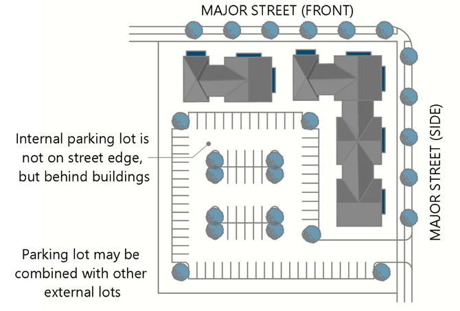
Figure 08.13 Example of Interior Parking
Behind a Building
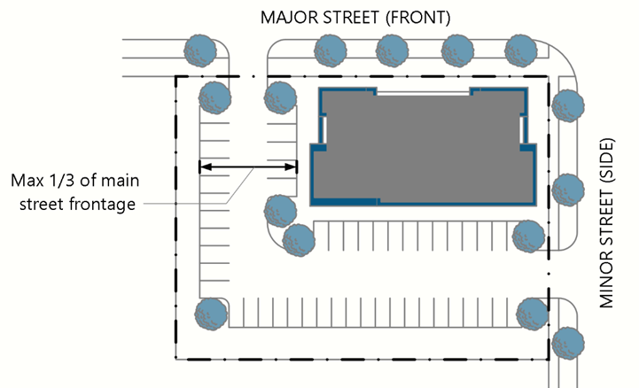
Figure 08.14 Example of Parking on the
Side of a Building
b.
Additional standards for Downtown East zoning district.
1.
Individual parking blocks, other than those providing public parking, shall be limited to not more than thirty (30) surface spaces.
2.
Shared parking and cross-property parking access for similar and complementary uses shall be provided to facilitate pedestrian and vehicular access between lots to the maximum extent practicable.
(6)
Multifamily development parking area layout and design. In addition to the standards in Subsections (2), (3), and (4) above, the following additional standards apply to parking layout and design in multifamily developments, including vertical mixed-use development that include multifamily uses or buildings, that are not located in the Downtown East or Downtown West zoning districts. Parking areas shall be located internally to multifamily development, behind building massing to minimize the visibility of parking from public streets and rights-of-way.
a.
Parking blocks and lots.
1.
Parking blocks shall be limited to a maximum width of three (3) bays of parking and one hundred eighty (180) feet by two hundred seventy (270) feet unless separated by an internal street.
2.
Private parking lots adjacent to public open space and trails shall not be allowed unless they are at least twenty-five (25) feet from the property edge adjacent to the open space or trail, provided, however, that parking spaces available for public use may be located within the twenty-five (25) foot buffer if the Planning Director determines their location will not create adverse impacts on the visual quality of the open space or trail.
b.
Parking garages and carports.
1.
Garage entries, carports and parking structures shall be internalized in building groups or oriented away from street frontage to the maximum extent practicable.
2.
Detached garage structures shall be limited to a maximum of five (5) double garages or ten (10) single garages in a row.
3.
Carport structures shall be limited to a maximum of ten (10) parking spaces in length.
4.
A minimum of nine (9) feet of separation shall be provided between carport structures.
(7)
Commercial and mixed-use development parking area layout and design. In addition to the standards in Subsections (2), (3), and (4) above, in commercial and mixed-use developments that are not located in the Downtown East or Downtown West zoning districts, parking shall be arranged into parking blocks defined by pedestrian paths, landscaping and/or building placement.
a.
Each parking block shall have consistent design angles for all parking within the parking block.
b.
Individual parking blocks shall be limited to not more than eighty (80) spaces, with four (4) rows (two (2) bays of parking) per block.
c.
For property that has not already been platted, shared parking and cross-property parking access for similar and related uses shall be required at the time of platting the property.
d.
For property that is already platted or is not required to be replatted as part of the development or redevelopment of the property, shared parking and cross-property parking access shall be provided to the maximum extent practicable.
e.
Off-street parking shall be located to comply with the Development Design Standards.
(8)
Industrial development parking area layout and design. In addition to the standards in Subsections (2) and (3) above, in industrial developments that are not located in the Downtown East or Downtown West zoning districts, parking shall be arranged into parking blocks defined by landscaping and/or building placement. Subsection (4) above shall apply to visitor and employee parking only.
a.
Each parking block shall have consistent design angles for all parking within the parking block.
b.
Parking areas shall clearly designate and distinguish visitor and employee parking from truck loading and service areas.
c.
Individual parking blocks shall be limited to not more than one hundred twenty (120) spaces.
d.
A maximum of one (1) bay of parking shall be permitted in front of the industrial building for visitor or employee parking, between the building and the public roadway. The remainder of the parking provided shall be located on the side or rear of the building, with adequate screening from a public roadway, open space, parks, and view of the public realm.
e.
All truck or trailer parking areas shall be located to the side or rear of the building and screened to comply with Section 13.08.090(m), Utility, storage, and service area screening.
(9)
Snow storage.
a.
A portion of the site equal to five (5) percent of the surface areas to be plowed after snowfall shall be provided and shown on the Site Plan as one (1) or more snow storage areas that:
1.
Are located on the edge of the pavement to be plowed;
2.
Are located so as not to interfere with the safe movement of pedestrians and traffic, including outside of any required sight distance triangles;
3.
Are provided with appropriate drainage and where refreezing of any sheet drainage will not create safety issues; and
4.
Are not located on any required landscaping or buffering.
b.
Snow storage areas may be located on portions of the lot or parcel designated parking spaces required to meet minimum vehicle parking requirements.
(k)
Drive-through and vehicle stacking.
(1)
Applicability. This Section 13.08.080(k) shall apply to all new development that includes drive-through facilities to assure that vehicle stacking and queuing areas are secondary to the function of a site and do not interfere with other pedestrian and vehicle movements.
(2)
Standards
a.
All uses with drive-through facilities shall provide a traffic study identifying the number of stacking spaces required to avoid vehicle queuing and stacking onto drive aisles or roadways and interference with parking and other vehicle movements on the lot. The number of require stacking spaces required shall be the number identified in the traffic study or the number indicated in Table 13.08.J, whichever is greater.
(3)
Vehicle stacking spaces must be a minimum of eleven (11) feet wide by twenty (20) feet long.
(4)
Drive-through lanes shall demonstrate adequate turning radius for a passenger vehicle.
(5)
In the Downtown West zoning district, no drive-through lane, service window, or vehicle stacking area shall be located between the front of the building and the front lot line.
(6)
The placement of drive-through lanes, service windows, speaker box locations and other ancillary back-of-house functions shall be located away from view of residential uses and public or private rights-of-way.
(7)
Where drive-through windows and facilities cannot be designed to avoid visibility from or adjacency to public roadways, they shall be covered with a canopy that is integrated into the design of the building and screened with a solid hardscape element, such as a decorative wall with a maximum height of four (4) feet and landscaping with an opacity of eighty (80) percent at one (1) year maturity, a maximum of three (3) feet in height or screened by a decorative solid wall with a maximum of four (4) feet in height.
(8)
Drive-through lanes shall not be designed to exit vehicles directly onto a public roadway.
(9)
Pedestrian walkways that cross through drive-through lanes must consist of a raised or textured crosswalk for enhanced pedestrian safety.
(10)
Where the drive-through lane is located on a Restricted Lot that is adjacent to a Protected Lot, no portion of the drive-through lane shall be located between a building on the Restricted Lot and a property boundary with the Protected Lot.
(11)
The Planning Director may allow some fueling pump areas to count toward the required vehicle queuing if the Planning Director determines that information about parking demand or site circulation provided by the applicant demonstrates that remaining stacking and queuing spaces will function to fulfill the site's traffic circulation needs.
(l)
Special parking study requirement or option.
(1)
Applicability.
a.
Special parking study requirement. Where Table 13.08.F requires a special study to establish minimum off-street parking requirements, the purpose of a special study is to assist the Town with evaluating the impacts of parking for unusual, complex, or mixed-use developments. The required study shall be prepared at the applicant's expense, and shall comply with the standards in this Section 13.08.080(l).
b.
Special study option. The applicant may submit a special study to request a reduction in the number of required vehicle parking spaces that would otherwise be required due to:
1.
The nature of the operations of a proposed use; or
2.
The applicant's written commitment to incorporate Transportation Demand Management (TDM) measures into the design or operation of the proposed development. Example of TDM measures to which applicants may commit include but are not limited to:
a)
Work schedules that reduce the number of employees on-site as specific times through compressed work schedules or telework opportunities;
b)
Flexible employee arrival and departure times that reduce commuting during peak travel hours; or
c)
Incentives to employees to use alternative modes of transportation to the development.
(2)
Special study for parking standards.
a.
A special study shall be conducted by a certified transportation planner or licensed professional engineer.
b.
The special study shall include the following information:
1.
Summary of the development proposal.
2.
Summary of parking generation and parking demand, utilizing data from one of the following sources: Institute of Transportation Engineers (ITE), Urban Land Institute (ULI), International Parking Institute (IPI), or American Planning Association (APA).
3.
A parking analysis of at least two (2) comparable uses addressing demand characteristics, peak period activity, off-peak activity, and opportunities for reductions and/or off-site shared parking.
4.
Identification of possible off-site shared parking areas, parking reductions, or mixed-uses having complementary parking demands.
5.
A summary of how the request is consistent with the Master Plan and promotes improved Site Plan or urban design.
6.
A list of at least two (2) comparable uses in similar communities, the amounts of parking provided for those facilities, and any evidence of parking over- or under-supply on those comparable use and facilities.
7.
The Town may request additional information or analysis, including, but not limited to, alternative or new data points, or consideration of additional or alternative factors related to comparability or peak demand, as supported by sound transportation planning and engineering principles.
(3)
Approval of special study for parking.
a.
A special study for parking shall be reviewed by the Planning Director concurrent with and pursuant to Section 13.03.040(p), Site plan.
b.
A special study for parking shall be approved or approved with conditions if the Planning Director determines that the study and any optional Transportation Demand Management commitments:
1.
Are consistent with the Master Plan; and
2.
Will promote improved Site Plan or urban design; and
3.
Sufficiently document and support the reduction of required parking for the site and for the use.
(m)
Number of off-street bicycle parking spaces required.
(1)
Purpose. The purpose of this Section 13.08.080(m) is to:
a.
Encourage the use of bicycles as an alternative mode of transportation; and
b.
Provide safe, convenient, and aesthetically pleasing locations to park bicycles.
(2)
Applicability. Bicycle facilities shall be provided for any new building, any building addition or enlargement of any existing building or use greater than three thousand (3,000) square feet of Gross Floor Area, or any change in use requiring a Site Plan approval.
(3)
Bicycle parking spaces required.
a.
The minimum number of bicycle parking spaces required for the use specified in Table 13.08.K below.
b.
In the case of a use not specifically listed in Table 13.08.K, the Planning Director or designee shall apply the bicycle standard for the most similar use, based on potential bicycle usage by patrons, employees, or residents.
(4)
Bicycle parking facility design standards.
a.
Bicycle parking facilities shall be located near building entrances, shall be visible from the primary entrance of the land use they serve
b.
Bicycle parking facilities shall not be located in automobile parking lots or in any other area that is also designated for another use (such as a walkway, landscaped area, or drainage facility).
c.
Bicycle parking facilities shall not be located in a manner that impedes vehicle or pedestrian movement or causes damage to plant and landscape materials.
d.
Bicycle parking facilities shall be designed to allow a bicycle to be securely attached to the parking structure.
e.
The bicycle parking structure shall be made of durable metal materials permanently attached to the pavement foundation.
13.08.090 - Landscaping, buffering, and screening.
(a)
Purpose. The purpose of this Section 13.08.090 is to ensure that all developments provide landscape improvements to achieve the following goals:
(1)
To encourage creative design solutions that contribute to the unique local character of the community.
(2)
To create attractive, shaded environments.
(3)
To create continuity along streets, internal vehicular access drives and pedestrian routes.
(4)
To soften and mitigate negative visual impacts.
(5)
To preserve the healthy, mature trees existing throughout the Town.
(6)
To ensure the plant materials have a high success rate of survival in drought and low watering conditions, and encourage the use of horticultural and maintenance practices best suited to the specific location conditions.
(7)
To abate soil erosion and stabilize steep slopes.
(8)
To encourage reasonable water conservation practices and use of xeric landscaping principles.
(9)
To meet the policies set forth in the Master Plan.
(10)
To encourage landscape design, installation and maintenance that promotes compatibility with the surrounding indigenous setting.
(11)
To encourage species diversity.
(b)
Applicability.
(1)
New, non-infill development shall comply fully with the standards in this Section 13.08.090.
(2)
Redevelopment, infill development, and Administrative Adjustments on sites shall comply with the standards in this Section 13.08.090 as follows.
a.
Minor Improvements
Any changes to a property or use that do not add building square footage, such as architectural changes or changes to comply with the Americans with Disabilities Act, shall not be required to install additional landscaping.
b.
Moderate Improvements
Square footage changes that increase the total gross floor area of a structure by less than seventy-five (75) percent, or that add new parking areas, storage, or that expand the use, as determined by the Building Permit and Site Plan applications, shall include a corresponding percent increase in compliance with this Section 13.08.090, as determined by the Planning Director.
c.
Large Improvements
Square footage changes that increase total gross floor area of a structure by seventy-five (75) percent or greater, as determined by the Site Plan amendment and Building Permit applications, shall be required to fully comply with this Section 13.08.090.
(3)
All developments requiring Site Plan approval and/or streetscape landscaping shall submit a landscaping plan meeting all applicable requirements on the Town website, in order to enable the Town to evaluate compliance with this Section 13.08.090.
(4)
When a Restricted Lot is adjacent to a Protected Lot, the Restricted Lot shall comply with applicable provisions of Section 13.08.090(g), Site perimeter landscaping.
(5)
More information about when these standards are applied is available in Table 13.08.A.
(c)
Amount of landscaping required.
(1)
All portions of a property that are not occupied by structures, water bodies, by streets, roads, driveways, sidewalks, parking areas, other vehicular use areas, trails, or paths are required to be landscaped according to this Section 13.08.090.
(2)
The minimum required area for total site landscaping is measured as a percentage of the lot's developed area. Total site landscaping shall be provided according to Table 13.08.L, below.
(3)
Where a calculation of a landscaping requirement results in a fractional number, the requirement shall be considered the next greatest whole number.
(4)
Streetscape landscaping required by Section 13.08.090(e) shall not be used to meet the total landscaping requirements, below.
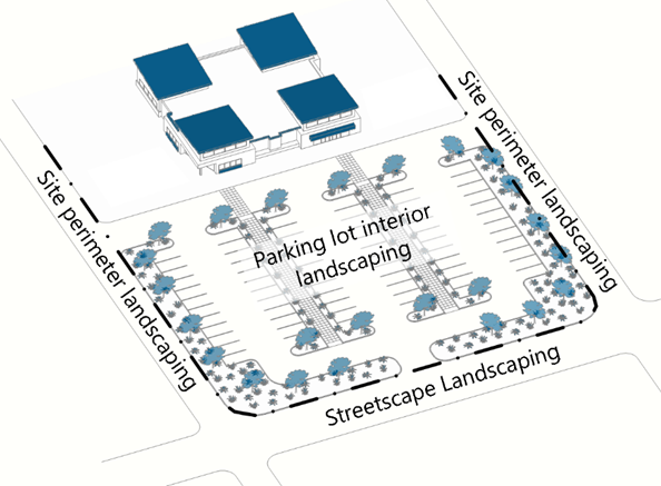
(5)
During the Site Plan review process, one (1) tree may be substituted for ten (10) required shrubs if the applicant can demonstrate the proposed tree:
a.
Will not be located within an easement where trees are not permitted;
b.
Will not conflict with existing or proposed infrastructure and/or utilities; and
c.
Will not be located in an areas whose shape or size does not meet the minimum dimensions required for healthy survival of the tree.
d.
All required trees shall be deciduous species, and shall be planted at least four (4) feet from any paved surface.
e.
Traditional turf grass shall not be planted in landscape islands.
(d)
Types of landscaping required.
(1)
This Section 13.08.090(d) describes five (5) different types of landscaping and buffering that may be required by the Town depending on the type, location, and size of development, as well as the character and scale of adjacent uses or frontages. In addition to the requirements in this Section 13.08.090(d), all property being subdivided shall comply with the requirements of Section 13.08.030(f), Residential roadway buffers and with all standards for improvements and amenities to required parks and trails in Section 13.08.030(g)(4), Design criteria for parks, trails and open spaces.
a.
Streetscape landscaping;
b.
Parking lot interior landscaping;
c.
Site perimeter landscaping;
d.
Site interior landscaping; and
e.
Residential subdivision roadway buffers.
(2)
Table 13.08.M identifies the landscaping types that may be required within each zoning district, unless varied by other provisions of this LDO applicable to specific locations or uses.
(e)
Streetscape landscaping.
(1)
Purpose. The intent of this Section 13.08.090(e) is to create a uniform street landscape character and tree canopy, to reinforce the pedestrian environment established along streets and internal vehicle access drives, and to provide a transition between adjacent properties.
(2)
Applicability. Streetscape landscaping is required for all development in all zoning districts.
(3)
General requirements.
a.
Streetscape landscaping that complies with this Section 13.08.090(e) shall be installed in the area between each curb and a detached sidewalk, or in the case of an attached sidewalk, within eight (8) feet from the back of the sidewalk away from the street.
b.
Streetscape landscaping is a separate requirement from other forms of site landscaping requirements and may not be used to meet any other site landscape requirements listed in Subsections 13.08.090(f), Parking lot interior landscaping through 13.08.090(h), Site interior landscaping.
c.
Access drives and sight triangle may be subtracted from the linear frontage in calculations of the amount of streetscape landscaping to determine the number of trees and shrubs required.
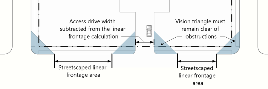
Figure 08.15 Access Drive and Sight Triangle Subtractions
d.
All property owners including residential property owners shall be responsible for maintaining, repairing, and replacing streetscape landscaping, including street trees and ground cover as further required by this Section 13.08.090(e) and this LDO.
e.
Review and the approval of the design of required streetscape landscaping shall be coordinated between the Planning and Engineering Departments.
f.
Streetscape landscaping on Parker Road shall be subject to CDOT review and approval.
g.
All streetscape landscaping, including median landscaping, shall comply with Town's sight triangle requirements and other applicable requirements in the Parks, Trails, Open Space, and Streetscape Design and Construction Manual and the Roadway Design and Construction Criteria Manual.
(4)
Specific requirements. Streetscape landscaping shall consist of trees and turf grass or shrubs, rock, and mulch that meet the following standards.
a.
Within the DE and DW zoning districts, the number of required trees shall be a minimum of one (1) tree per thirty-five (35) linear feet of street frontage. When located along a street with tree grates, streetscape shall consist of trees only. When located along a street without tree grates, the traditional streetscape requirements including the ground cover shall be required.
b.
Within all other zoning districts, the minimum number of required trees shall be a minimum of one (1) tree per forty (40) linear feet of street frontage. Trees shall be planted in straight alignment parallel to the road and uniformly spaced unless the Town approves an alternative alignment to match the alignment of a sidewalk or the alignments used on adjacent properties.
c.
Evergreen trees are prohibited in streetscape landscaping.
d.
Streetscape landscaping shall have a minimum coverage of seventy-five (75) percent living plant material. Alternative compliance may be considered by the Planning Director where:
1.
Utilities, drainage, or other physical constraints exist; or
2.
The streetscape design is compatible with adjacent landscaping, which may include but is not limited to closer spacing of trees or shrubs or higher coverage of living materials in the Downtown East and Downtown West zoning districts.
e.
Streetscape landscaping shall comply with the Parks, Trails, Open Space, and Streetscape Design and Construction Manual.
f.
Within any given street block, a maximum of five (5), and minimum of three (3), shade tree species shall be selected to limit over-use of one species. Exceptions can be submitted for consideration, and will be approved/disapproved during the Site Plan review process. Select plant materials with similar characteristics such as color and form to provide uniformity within the block, concentrating species with ornamental characteristics at vistas and intersections.
g.
Spacing for all vegetation shall be at least ninety (90) percent of the mature spread stated on the Recommended Plant List. In some instances, understory trees and shrubs shall be allowed within this ninety (90) percent spacing to provide a higher density of planting, as long as the mature size (height, branching structure, etc.) of each of the plants will not hinder either plants growth.
h.
Where signs, lights, overhead or underground utilities, utility poles and fire hydrants would limit mature vegetation size, adjustments in species or location shall be approved to minimize excessive pruning, but the total amount of required landscaping on the site shall not be reduced based on required spacing from those features.
(f)
Parking lot interior landscaping.
(1)
Purpose. The purpose of this Section 13.08.090(f) is to reduce the visual scale of surface parking lots, reduce the overall amount of impervious pavement to allow for greater on-site stormwater mitigation, and increase shaded areas within the parking lot.
(2)
Applicability. Parking lot interior landscaping is required for new parking lots created on vacant land with eleven (11) or more spaces and for infill and redeveloped parking lots as calculated in Section 13.08.090(b)(2).
(3)
Design.
a.
At least ten (10) percent of the total area covered by the parking lot shall be allocated to landscaped islands. The area covered by the parking lot shall include parking stalls and circulation aisles with parking stall access, but shall exclude access drives into the parking lot, loading areas and similar access features.
b.
Parking aisle lengths shall not exceed the width of ten (10) adjacent parking spaces without being separated by a planting island at least nine (9) feet in width.
c.
Parking blocks, as required in Section 13.08.080(j), Parking lot layout and design, shall be separated by landscape islands.
d.
Each landscape island shall comply with the following standards:
1.
Landscaped islands shall be at least the size of one full-sized parking space (one hundred sixty-two (162) square feet) and have no dimension less than nine (9) feet. The Planning Director may approve portions of a landscape island that are less than nine (9) feet in dimension where the site can not comply due to site shape, topography, access points, or related internal safety and circulation constraints.
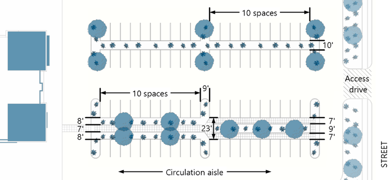
Figure 08.17 Landscaped Island Requirements
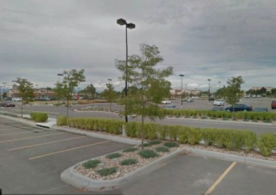
Figure 08.18 Landscaped Island Example
2.
Where pedestrian walkways that meet the minimum width requirements of Section 13.08.080(j)(4) are incorporated into landscape islands, the minimum width of the landscape island does not need to be increased to replace vegetated areas occupied by the walkway, and walkway areas shall count towards the minimum vegetation that would otherwise be required in that landscape island.
3.
Parking lots shall be designed so as not to drain into or across public sidewalks or adjacent property, or directly into natural watercourses.
4.
Landscaped islands shall be designed to provide biofiltration of stormwater by incorporating the following features to the maximum extent practicable:
a)
Raised curbs or wheel stops shall indicate the outer dimensions of landscape islands to minimize vehicle overhang of the island, and shall include gaps eighteen (18) to twenty-four (24) inches wide at frequent intervals to allow storm water infiltration.
b)
The surface of landscape islands and divider strips shall be concave to help channel and treat surface water runoff.
c)
Rain gardens, bio-swales, drainage easements, and drainage inlets are permitted within parking lot islands.
5.
Where appropriate and approved by the Director of Engineering/Public Works, the use of porous pavement and/or specially designed brick or block should be considered to increase on-site water retention for plant material, replenishment of groundwater supplies and to reduce problems associated with runoff.
e.
Each landscape island shall install one (1) tree and five (5) shrubs shall be planted for each increment of one hundred sixty-two (162) square feet. For each additional fifteen (15) square feet, an additional shrub shall be planted. Light poles shall be located to avoid conflicts with the required tree locations.
(g)
Site perimeter landscaping.
(1)
Purpose. The primary purpose of this Section 13.08.090(g) is to:
a.
Establish minimum requirements for plantings around the perimeter of a lot or parcel to create a landscaped edge; and
b.
Mitigate impacts between different zoning districts or uses with landscaping.
(2)
Applicability.
a.
These standards apply to all development, excluding single-family detached and duplex dwellings, in all zoning districts unless an exception is provided in another Section of this LDO.
b.
These standards apply to all sides or perimeters except any portion of the perimeter that shares a driveway, drive aisle or parking lot as shown on an approved Site Plan(s).
(3)
Required landscaping.
a.
This Section 13.08.090(g) defines three (3) different types of perimeter landscaping that are intended to accomplish the following:
1.
P1 Minor. P1 perimeter landscaping is intended to create a partial visual separation between uses or districts. This is the least intensive form of site perimeter landscaping.
2.
P2 Moderate. P2 perimeter landscaping is intended to create a semi-opaque visual separation between uses or districts.
3.
P3 Intense. P3 perimeter landscaping is intended to provide both space and a partial visual separation between uses or districts. This represents the most intensive form of required site perimeter landscaping and is intended for use where a new development is located adjacent to a district or use that is significantly different in intensity, such as a residential district next to an industrial district.
b.
Site perimeters shall be landscaped to comply with the standards shown in Table 13.08.N, below. The dimensions and planting requirements for each type of site perimeter landscaping are shown in Table 13.08.O: Standard Site Perimeter Landscaping Types.
(4)
Site perimeter landscaping standards.
a.
Required site perimeter landscaping shall comply with the buffer widths and planting requirements in Table 13.08.O.
b.
Easements held by a HOA for infrastructure, such as stormwater management systems, that are not irrigated shall be irrigated to the maximum extent practicable. If the Planning Director determines that irrigation is not practicable, the easement may be landscaped with non-living materials including, but not limited to boulders, rocks, stone, mulch, or decorative pavement. Solid or open fencing may be used on easements not located between residential lots and public or private streets, but only open decorative fencing may be located on easements located between residential lots and public or private streets.
c.
Site perimeter landscaping may be located within required setbacks.
d.
Access driveways shall not be subtracted from the linear frontage in calculations of the amount of landscaping required. Required landscaping shall be condensed into the remaining site perimeter landscaping area.
(5)
Parking lots adjacent to right-of-way.
a.
Parking lots adjacent to a public or private right-of-way shall install P2 perimeter landscaping.
b.
When hardscape elements, such as decorative landscape walls or other architectural elements, are proposed as a buffering technique, the landscaped area width may be reduced to no less than six (6) feet if the Planning Director determines that the proposed hardscape elements will provide equal or better visual screening of the parking lot. Screening walls, architectural elements, materials, colors, and designs shall conform to or complement the predominant materials, colors, and elements of the primary building on the site. Chain link and wood fences shall not be used to meet this requirement.
(6)
Downtown east and downtown west districts. Regardless of the use, development in the Downtown East and Downtown West zoning districts shall install P1 perimeter landscaping, except when a building is adjacent to the public right-of-way in which case streetscape landscaping shall be installed in accordance with Section 13.08.090(e).
(h)
Site interior landscaping.
(1)
Purpose. The purpose of this Section 13.08.090(h) is to:
a.
Use landscaping to provide for beautification and improve the visual appearance of the site;
b.
Soften and mitigate negative visual impacts; and
c.
Ensure that each development site in the Town installs any additional landscaping when the provision of other required landscaping does not add up to the overall landscaping requirement as set forth in Section 13.08.090(c), Amount of landscaping required.
(2)
Applicability.
a.
Site interior landscaping is required for all development types except single-family detached dwellings and duplex dwellings.
b.
Site interior landscaping is required for all lots or parcels where compliance with the requirements of Sections 13.08.090(f), Parking lot interior landscaping and 13.08.090(g), Site perimeter landscaping, do not collectively meet the minimum site landscaping required by Section 13.08.090(c), Amount of landscaping required.
(3)
General requirements.
a.
Site interior landscaping shall be located to achieve one or more of the following objectives, to the maximum extent practicable.
1.
Break up the visual massing of large wall areas and large buildings;
2.
Break up any remaining hardscape areas remaining after compliance with Section 13.08.090(f), Parking lot interior landscaping;
3.
Accent special building features such as main pedestrian entries and building corners; and/or
4.
Accent project site entryways.
b.
Improved plazas and hardscape may be credited toward the required site interior landscaping if they include improvements such as colored and stamped concrete, decorative fencing, planting beds, and trees in tree gates.
(i)
Residential subdivision roadway buffer landscaping.
(1)
Applicability.
a.
Residential subdivision roadway buffer landscaping is required for all portions of residential subdivisions where areas planned or platted for single-family detached dwellings or duplex dwellings area adjacent to highway, arterial, and collector roadways. For additional information on residential buffer standards, see Section 13.08.030(f), Residential roadway buffers.
b.
Where residential subdivision roadway buffer landscaping is required, it shall be located between any streetscape landscaping and the lot, as illustrated in Figure 08.9.
c.
Streetscape landscaping required by Section 13.08.090(e) may not be used to meet residential subdivision roadway buffer landscaping requirements.
d.
Where an attached sidewalk is required by the Town's applicable design standards and where the streetscape landscape is not separated from the residential subdivision roadway buffer by a sidewalk, the Planning Director may allow an applicant to reduce the buffer width of the residential subdivision roadway buffer, provided that all required street trees for both streetscape landscaping and residential subdivision roadway buffers are planted in the reduced width buffer area.
(2)
Landscape design and materials.
a.
To conserve water, a dense linear landscape layout without extensive use of traditional turf grasses shall be used.
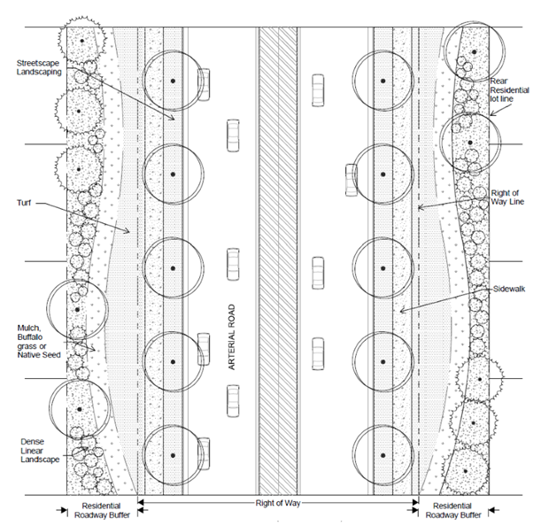
Figure 08.19 Linear Landscape Layout Example
b.
At a minimum, the residential subdivision roadway buffer shall include one (1) tree and five (5) shrubs for every thirty (30) linear feet of required buffer length. All minimum plant material standards required by Section 13.08.090(j)(3), Plant material specifications, apply with the following exception: 60 percent of required shrubs must have a minimum mature height and spread of forty-eight (48) inches within three (3) years after installation.
c.
If the residential subdivision roadway buffer widths are less than the minimum required by Table 13.08.B because of buffer reallocation permitted by Section 13.08.030(f)(3), then enhanced landscaping in those areas is required as follows:
1.
Minimum buffer widths that fall below the minimum width by less than five (5) feet shall provide for one (1) tree and seven (7) shrubs for every thirty (30) linear feet of the residential roadway buffer length that falls below the minimum; and
2.
Minimum buffer widths that fall below the minimum width by more than five (5) feet shall provide for one (1) tree and ten (10) shrubs for every thirty (30) linear feet of the residential roadway buffer length that falls below the minimum.
d.
A minimum of fifty (50) percent of required trees must be evergreen species to provide year-round screening and color. Trees may be spaced irregularly in informal groupings or be uniformly spaced, as consistent with larger overall planting patterns and organization. No trees or groups of trees may be farther apart than thirty-five (35) feet.
e.
Native seed mixtures may be used in residential roadway buffers but may not be used directly adjacent to public sidewalks or within two hundred (200) feet of corners, intersections, and subdivision entrances. Installation/application shall be by seed drilling only.
(j)
Landscaping and buffering materials.
(1)
Applicability. All required landscaping shall comply with the Xeriscape standards and plant material specifications set forth in this Section 13.08.090(j).
(2)
Xeriscape standards.
a.
Principles. Xeriscape is a method of landscaping that promotes water conservation and is a combination of seven (7) basic landscaping principles, as identified below. The following principles shall apply to all required landscaped areas:
1.
Design required landscaping to address the physical site characteristics of the property, the needs of those using the property and the best water-conserving methods.
2.
Limit turf to useful spaces and determine which grasses will best serve your needs. If an area is intended for appearance only, rather than for active recreational enjoyment, other drought tolerant ground cover plants may be more appropriate and may be irrigated more efficiently.
3.
Select trees, shrubs and ground covers based on their adaptability to the Town's climate and soils and the Town's recommended plant list.
b.
Standards.
1.
Soil amendments such as high quality compost or other organic amendments shall be added during soil preparation to increase plant health and conserve water.
2.
Plants of similar water needs shall be grouped together to minimize water waste.
3.
Mulch shall be used as needed to reduce evaporation, discourage weed growth, keep the soil cool and reduce erosion.
4.
Due to excessive watering requirements, seed mixtures or sod containing large percentages of traditional turf grasses are to be limited in use. Traditional turf grasses are defined as Bluegrass (Poa pratensis) and turf type tall fescue (Festuca arundinacea) and cultivars of those two types.
a)
Traditional turf grasses shall only make up fifteen (15) percent of any required on-site landscaping for commercial and industrial uses. Where commercial uses include residential or recreational components, such as, but not limited to, assisted living, schools and daycares, the Planning Director may approve a greater amount of traditional turf grass area. The applicant must demonstrate that the additional traditional turf grass areas are being used in high-traffic areas, such as, but not limited to, athletic fields, children's play areas, parks, and courtyards.
b)
Traditional turf grasses are prohibited for use on any interior parking lot landscaping.
c)
Low water turf grass is preferred.
5.
Instead of traditional turf grass, installed turf grass shall be warm season turf grass such as Blue Grama (Bouteloua gracilis) or Gram/Buffalo Mix, unless otherwise allowed by this Section 13.08.090(j). Other irrigated native seed and seed blends that satisfy the requirements of this Section 13.08.090(j)(2)b shall be limited to less visible areas including side yards, rear yards, transition areas, and undeveloped portions of a lot that exceed twenty-five (25) percent of the gross area of the lot.
(3)
Plant material specifications.
a.
Amount required.
1.
At maturity, a minimum of seventy-five (75) percent of each area required to be landscaped pursuant to Sections 13.08.090(c) shall have a variety of ground cover of living plant material, including, but not limited to, trees, shrubs, ground cover, turf or seed and other perennial ground covering plant materials. Street trees shall not be included in the calculation.
2.
The remaining twenty-five (25) percent of each area required to be landscaped shall be covered with a variety of non-living landscape materials to create visual interest, such as bark, wood mulch, one and one-half-inch (1½) diameter or larger rock, decorative boulders, other materials (not including exposed gravel) approved during the Site Plan process, or a combination of the above.
3.
In all landscaped areas, except within public rights-of-way and residential roadway buffers, one (1) tree and five (5) shrubs shall be planted for each one thousand five hundred (1,500) square feet of lot area not covered by a building or required parking.
a)
10 shrubs may be substituted for one (1) tree when approved during the Site Plan process if the Planning Director determines that the tree requirement cannot be reasonably accomplished due to site factors.
b)
Where utility lines prevent the installation of a tree, a shrub with a height at maturity of at least eight (8) feet may be substituted.
c)
One (1) ornamental grass in a five-gallon container or three (3) ornamental grasses in one-gallon containers may be substituted for one (1) shrub.
d)
A mix of deciduous and evergreen trees is required to provide color and screening in winter months. A minimum of twenty-five (25) percent and a maximum of fifty (50) percent shall be evergreen trees.
e)
The landscaping materials required by these provisions shall include a variety and be distributed throughout the areas to be landscaped in such a manner as to avoid locating too many plants in one location, large areas of non-living material, or obstructing views (except where screening is desired).
b.
Living landscape materials.
1.
Living plant materials shall be selected from the Town's recommended plant list in the Parks, Trails, Open Space, and Streetscape Design and Construction Manual.
2.
Species not included in the recommended plant list may be submitted for consideration by the Town as long as the suggested species is not on the prohibited plant list in the appendix of the Parks, Trails, Open Space, and Streetscape Design and Construction Manual.
3.
All plants shall meet or exceed the plant quality and species standards of the American Standard for Nursery Stock ANSI.
4.
Selected plant materials shall be healthy and shall be nursery-grown and adapted to the Parker area.
5.
All plant materials shall comply with the following standards:
a)
Deciduous shade trees shall be at least two and one-half (2½) inch caliper, measured six (6) inches above the ground.
b)
Ornamental and flowering trees shall be at least two-inch caliper measured six (6) inches above the ground.
c)
Evergreens shall be a minimum of six (6) feet tall, measured to mid-point of most recent year's growth.
d)
Shrubs shall be a five-gallon container or larger.
6.
Landscaping shall be provided in a sufficient variety of species to ensure the continued appeal of a project in those instances where a particular species is killed through insect or disease activity.
7.
Landscaping shall include well-adapted, drought-tolerant vegetation, which generally requires less water and landscape maintenance.
c.
Non-living landscape material standards.
1.
Artificial landscape materials, including, for example, plastic trees, shrubs, and synthetic turf, are prohibited within landscaped areas. Exceptions to this prohibition include the following, as approved by the Town:
a)
Athletic or recreation facilities at public or private schools and Town-owned property or parks; and
b)
Private outdoor recreational facilities.
c)
Synthetic turf and similar materials may be considered for specific purposes for land uses such as pet relief areas for veterinary clinics, kennels, or dog parks.
2.
Non-living landscape areas shall not count towards the minimum landscape requirements.
3.
Non-living landscape materials for ground cover shall provide a variety of materials to ensure visual interest and shall consist of a combination of two (2) or more of the following: bark, wood chips, wood mulch, rocks, boulders, or other materials approved during the Site Plan process.
4.
Wood mulch shall consist of natural cedar fiber mulch and shall be applied a minimum of four (4) inches in depth, installed over a base of geotextile fabric.
a)
No geotextile fabric shall be used in areas of perennial flower and ground cover plantings.
b)
Natural cedar fiber mulch shall be installed over areas of perennial flower to a minimum depth of two (2) inches.
5.
Rock shall be one and one-half (1½) to six (6) inches in size and a minimum depth of three (3) inches installed over a base of geotextile fabric. No more than fifty (50) percent of any rock may be smaller than four (4) inches.
(4)
Planting standards.
a.
Landscaping shall comply with the planting standards in the Parks, Trails, Open Space, and Streetscape Design and Construction Manual.
b.
Plant materials shall be spaced to allow adequate room for the plant at maturity.
c.
Landscaping shall be arranged to ensure that landscaping material at maturity will not interfere with or damage property on adjacent properties and rights-of-way.
d.
Landscaping shall be protected from damage from motor vehicles by the placement of wheel stops, curbs, or other acceptable means, approved by the Town.
e.
All trees shall be spaced to avoid interference with light poles, signs, and other structures as described in the Roadway Design and Construction Criteria Manual. However, the minimum number of trees required on a lot or parcel shall not be reduced due to the location of light poles in parking lot islands or parking lot perimeter landscaping areas.
f.
Where signs, lights, overhead or underground utilities, utility poles and fire hydrants would limit mature vegetation size, adjustments in species or location should be considered to minimize excessive pruning.
g.
Except as stated in Subsection h below, spacing for all vegetation shall be no less than ninety (90) percent of the mature spread stated on the Recommended Plant List. In some instances, understory trees and shrubs shall be allowed within this ninety (90) percent spacing to provide a higher density of planting, as long as the mature size (height, branching structure, etc.) of each of the plants will not hinder either plants growth.
h.
Spacing of streetscape landscaping shall comply with the Streetscape Design and Construction Manual.
(5)
Landscape design.
a.
For all development in all zoning districts, sight distance triangles adjacent to drive lanes shall be maintained and are to be designed based upon projected traffic level and speeds.
b.
The following standards apply to all development except single-family detached dwellings and duplexes.
1.
Tree grates in the streetscape shall be limited to the Downtown East and Downtown West zoning districts and shall be a minimum of five (5) feet by eight (8) feet.
2.
Lawn areas shall be included in the landscape design only where active recreation and usage will occur.
3.
Along primary building facades, landscaping within ten (10) feet of the building foundation shall be clustered around pedestrian entryways to the maximum extent practicable. Landscaping around parking structures shall be used to enhance the appearance of the ground floor.
4.
Buildings located at intersections shall provide enhanced landscaping at the corner. Enhanced landscaping and design shall be reviewed and approved during the Site Plan process by the Planning Director and may include but is not limited to a combination of the following: additional plant quantity and varieties, pedestrian accommodations, raised beds, landscape walls or similar hardscape elements, or any improvement that goes beyond the minimum requirements of this Section 13.08.090(j), Landscaping and buffering materials.
c.
Landscaping shall include a mixture of shrubs, groundcover, turf, and native grass shall be used in undulating forms to break up the long straight line appearance of utility easements where trees are not allowed to be planted, to the maximum extent practicable.
(6)
Irrigation requirements.
a.
All landscaped areas shall have a properly designed automatic irrigation system providing full coverage to all turf and plant material areas from rotary/gear-drive sprinklers, pop-up and surface spray sprinklers, bubblers, drip or trickle irrigation, as appropriate for the area to be landscaped.
b.
All landscaped areas shall be irrigated pursuant to the irrigation system design and material standards set forth in the Parks, Trials, Open Space, and Streetscape Design and Construction Manual.
(k)
Flexibility for increased landscape quality. Although all development must comply with all applicable landscaping, buffering, and screening standards in Sections 13.08.090(a) through 13.08.090(j), this Section 13.08.090(k) allows property owners to offer creative alternatives to required landscaping that improve the quality and aesthetics of the landscaping treatments. Three (3) types of alternatives are available, and all may be approved administratively.
(1)
Increased living material size. An applicant may offer to install larger (in diameter) canopy tree species than the minimum sizes required by Section 13.08.090(j)(3)b, Living landscape materials, in return for a reduction in the number of trees that need to be installed. This option may be used for any required landscaping except for Streetscape Landscaping required by Section 13.08.090(e); the requirements of that Section may not be varied through this process.
a.
Deciduous trees. For each new deciduous canopy tree installed with a diameter at chest height of four (4) inches or greater, the number of shrubs required to be installed in the same planting area may be reduced by ten (10) percent, up to a maximum of thirty (30) percent reduction. Shrubs approved as tree replacements by Section 13.08.090(j)(3)a.3.a) may not be reduced.
b.
Evergreen trees. For each new evergreen tree installed with a height of eight (8) feet or greater, the number of shrubs required to be installed in the same planting area may be reduced by ten (10) percent, up to a maximum of thirty (30) percent reduction. Shrubs approved as tree replacements by Section 13.08.090(j)(3)a.3.a) may not be reduced.
c.
Ornamental trees. For each new tree deciduous canopy tree installed with a diameter at chest height of three (3) inches or greater, the number of shrubs required to be installed in the same planting area may be reduced by ten (10) percent, up to a maximum of thirty (30) percent. Shrubs approved as tree replacements by Section 13.08.090(j)(3)a.3.a) may not be reduced.
(2)
Increased living material coverage.
a.
An applicant may offer to vegetate a required planting area with one hundred (100) percent living materials (except for a one-foot wide buffer of wood mulch around the base of each tree) in return for a reduction in the number of shrubs required to be installed in that planting area.
b.
For each planting area with one hundred (100) percent living materials, the number of shrubs required in that planting area may be reduced by twenty (20) percent. Shrubs approved as tree replacements by Section 13.08.090(j)(3)a.3.a) may not be reduced.
(3)
Creative hardscape and public art.
a.
An applicant may offer to install vertical hardscape elements in a required landscape area to provide material variety and visual interest when viewed from public rights-of-way, in return for a reduction in required planting materials.
b.
The offered hardscape elements shall include at least one of the following with a height above grade of at least thirty (30) inches:
1.
A brick or masonry wall of a material acceptable to the Town, but not including smooth, flat faced, ground, or split faced cementitious masonry units (CMU);
2.
A decorative fence or panels with a minimum transparency of twenty-five (25) percent, constructed of wrought iron or architectural grade facing metal, but not including chain link or industrial metal products;
3.
A fountain extending at least forty-two (42) inches above grade or fountain wall of similar height;
4.
A covered structure with a sitting area, such as a gazebo or trellis, accessible from public sidewalks or walkways in compliance with the Americans with Disabilities Act; or
5.
A freestanding art installation as appropriate for general audiences, installed in a location where it is easily visible from at least one (1) street frontage for at least seventy-five (75) percent of the length of that street frontage.
c.
For each hardscape or art element meeting the standards in Subsection b. above, the number of trees and shrubs required to be installed in the same landscape area may be reduced by twenty-five (25) percent. The landscaped area containing the hardscape or art element may be counted toward the total landscape requirement.
(4)
Alternative/administrative compliance. The Planning Director may approve an optional approach to required landscaping listed in Subsections (1), (2), and (3) above if the Planning Director determines that the offered alternative will:
a.
Increase the visual aesthetics and appeal of the property, when viewed from public or private streets; and
b.
Increase the variety and interest of landscaping when viewed from the adjacent public streets or rights-of-way realm.
c.
Produce equal or better buffering of sound, noise, glare, and dust for adjacent properties and rights-of-way, when compared to the landscaping otherwise required to be installed by Sections 13.08.090(a) through 13.08.090(j).
(l)
Tree and shrub conservation and replacement.
(1)
Purpose. The purpose of this Section 13.08.090(l) is to facilitate the preservation of existing trees and shrubs and the replenishment of tree and shrub stock to the maximum extent practicable. These actions are intended to contribute to the public health, safety, and welfare by decreasing flooding, soil erosion, air pollution and noise, improving aesthetics and preserving property values. Tree and shrub preservation and replenishment will contribute to establishing and reinforcing a positive identity for the Town.
(2)
Applicability and exemptions.
a.
Applicability. This Section 13.08.090(l) shall apply to all property located in the Town, except as otherwise provided by Subsection b below.
b.
Exemptions. The following development types and activities are exempt from this Section 13.08.090(j):
1.
Activities conducted on single-family detached dwelling and duplex dwelling lots.
2.
Maintenance of trees and shrubs, such as pruning, home gardening and landscape maintenance
3.
Commercial arboricultural or horticultural activities, including but not limited managing/harvesting tree crops and nurseries.
4.
Removal or maintenance of trees and shrubs damaged by adverse weather conditions.
5.
The thinning of trees or shrubs for the purpose of fire mitigation along the Wildland Urban Interface and preserving or enhancing the health of the remaining stand of trees or shrubs, consistent with good forest management practices, such as those published by the Colorado State Forest Service and by the Rocky Mountain Chapter of International Society of Arboriculture.
6.
All trees that must be removed because of death, disease, hazardous condition, or emergency work to protect life, limb, or property. An arborist or horticulturist must verify trees are diseased before their removal.
7.
All trees and shrubs that are listed under the Colorado Noxious Weed Act as a noxious weed species.
(3)
General conservation standards.
a.
No person shall remove, damage, or destroy any Significant Tree or Significant Vegetation unless otherwise allowed by this Section 13.08.090(l).
b.
To the maximum extent practicable, existing trees on a development site or in a right-of-way shall be saved during the development of any property, unless it can be demonstrated that there is no reasonable configuration that allows the permitted structure without tree removal. Removal of trees shall be limited to the smallest number of trees practicable to allow the construction of a permitted structure on the site.
c.
Shrubs marked for protection that are located in or around a drainageway or drainage facility may be trimmed back or thinned as part of stormwater maintenance or management activities. The root mass of all such shrubs requiring maintenance shall be preserved in good health.
(4)
Tree conservation plan required.
a.
If no reasonable alternatives to removal are available, no tree may be removed before a tree conservation plan to minimize environmental and visual impacts from the removal is approved by the Planning Director.
b.
Tree conservation plans shall include all information and materials and shall comply with all standards required by instructions in the LDO Administrative Manual, and shall be reviewed by the Planning Director concurrent with and pursuant to Section 13.03.040(p), Site plan.
(5)
Landscaping credit for preserved and relocated trees.
a.
Existing trees preserved during development may be credited towards required landscaping based on the size, location, condition, and species of the preserved tree as follows:
1.
Conservation of each one (1) inch diameter of an existing, healthy, non-invasive species tree (measured at four and one-half (4½) feet above the ground level) during initial development of a site will earn a credit of two (2) inches of diameter against requirements to install new trees on the site.
2.
Conservation of each one (1) inch diameter of an existing, healthy, non-invasive species tree (measured at four and one-half (4½) feet above the ground level) during redevelopment of a previously developed site will earn a credit of three (3) inches of diameter against requirements to install new trees on the site.
b.
For each one-inch diameter of a tree relocated on or off the development site, the applicant will earn a credit of one-half (½) inch of diameter against requirements to install new trees on the site.
c.
Tree preservation credits may not be used to reduce or satisfy the Streetscape Landscaping requirements of Section 13.08.090(e).
d.
The Planning Director may determine the locations where trees otherwise required to be installed by this Section 13.08.090, will not be required to be installed due to credits awarded under Subsection a. above.
(6)
Tree protection during development.
a.
Before the start of construction, all trees and shrubs on the site shall be clearly identified in the field as either "preserve," "relocate" or "remove" by the property owner. Trees and shrubs to be saved may be identified in groups.
b.
Town staff shall verify the identification of trees and shrubs according to the approved tree conservation plan. The Town shall complete its field identifications prior to issuance of Grading Permit.
c.
During development or razing activity, the landowner shall install effective protection around all tree preservation areas and shall install mechanisms such as tree wells (dependent upon species), retaining walls or other structures necessary to protect individual trees and shrubs designated for preservation. The protective measures shall be specified in the tree conservation plan and shall be designed and installed in a manner consistent with good horticultural practices.
d.
The Town shall field verify all locations, sizes and quantities of replacement or relocated trees and shrubs.
e.
Any relocated tree or shrub that dies (more than fifty (50) percent deceased) within one (1) year of final inspection shall be replaced within one (1) year or the next growing season with the same approved size and species of the tree or shrub that died or the site or landscaping plan shall be amended to include additional trees equal to fifty (50) percent of the value of the dead tree or shrub or pay fee in lieu, at the discretion of the Town.
f.
Tree replacement may be satisfied by a fee in lieu of the value of the required replacement plant, paid to the Town, or by planting trees and shrubs of appropriate value if existing trees or shrubs cannot be preserved or relocated as described in this Section 13.08.090(l).
g.
The Town may require financial security to ensure compliance with this Section 13.08.090(l)(6) pursuant to Section 13.03.050, Public and private improvements and related financial assurances.
(7)
Alternative compliance. The Planning Director, with a recommendation from the Parks and Recreation Department, may waive all or a portion of the provisions of this Section 13.08.090(l), if the Planning Director determines that:
a.
The preservation of the tree would prevent substantially all potential development or redevelopment of the site for purposes consistent with the adopted Master Plan; and
b.
The applicant's landscaping plan includes additional landscaping (beyond that required by Sections 13.08.090(c) and 13.08.090(e) through 13.08.090(i)) in an amount, and in locations, sufficient to mitigate substantially adverse environmental, visual, and screening impacts created by the removal of the tree or shrub.
(m)
Utility, storage, and service area screening.
(1)
Purpose. The purpose of this Section 13.08.090(m) is to require screening of utility areas, permitted outdoor storage areas, and service areas to improve the visual appearance of properties in the Town when viewed from adjacent development and rights-of-way.
(2)
Applicability and exceptions.
a.
Applicability.
1.
All development shall provide screening of above ground utility areas, permitted outdoor storage areas, and service areas on each lot, unless exempted or limited by this Section 13.08.090(m).
2.
The screening requirements apply to electrical and gas powered mechanical equipment, ductwork and major plumbing lines used to heat, cool, or ventilate, and power systems for the building and site on which the building is located.
b.
Exceptions. The screening requirements of this Section 13.08.090(m) do not apply to:
1.
Roof and wall mounted antennas regulated by the screening requirements in Section 13.05.040, Wireless communication facilities.
2.
Painted vent openings on nonresidential and multifamily buildings that do not project more than four (4) inches from the wall or twelve (12) inches on a pitched roof.
3.
Solar arrays or solar energy collection systems to the extent the required screening would interfere with the collection of energy by such equipment.
4.
Window air conditioner units in residential dwellings.
5.
Single-family detached dwellings, duplex dwellings, and single-family attached dwellings, which are instead required to comply with Section 13.08.120, Utilities.
(3)
Multifamily and nonresidential development.
a.
Screening. All multifamily residential mixed-use, and nonresidential development shall provide an enclosure or screening for all trash bins, recycle bins, storage yards, service areas, loading docks, and above ground utilities and equipment areas on the property.
b.
Mechanical equipment.
1.
Roof-mounted mechanical equipment. Roof-mounted mechanical equipment that is visible from five (5) feet above grade at any point on the lot boundary shall be screened by a parapet wall or similar feature that is an integral part of the building's architectural design. The parapet wall or similar feature shall be of a height equal to or greater than the height of the mechanical equipment being screened.
2.
Wall-mounted mechanical equipment. Where roof-mounted mechanical equipment is not feasible, mechanical equipment may be mounted on the wall and shall be located on the side or rear façade of a building and shall be:
a)
Painted to match the predominant colors used on of the exterior wall of the building, unless not permitted by the manufacturer; and
b)
Screened from view by structural or landscape features that are compatible with the architecture of the building to the maximum extent practicable.
3.
Ground-mounted mechanical equipment. Ground-mounted mechanical equipment shall be located on the side or rear yard and screened from view by landscaping, a fence, or a decorative wall that is integrated into the architecture of the structure to the maximum extent practicable. The fence or wall shall be of a height equal to or greater than the height of the mechanical equipment being screened.
c.
Service, storage, and loading areas.
1.
Applicability and exceptions.
a)
Applicability. All service, loading, and storage areas shall be screened pursuant to this Section 13.08.090(m).
b)
Exception. Screening is not required for temporary structures unless otherwise required by Section 13.05.060(b), Temporary structures.
2.
Location.
a)
All service, storage, and loading areas shall be placed at the rear, on the side of, or inside buildings.
b)
No service, storage, or loading area shall be visible from a public or private right-of-way, or visible from adjacent residential areas.
c)
Properties with roadways on two (2) or more sides in which the shape, size, or access require that the service, storage, and loading areas be located adjacent to a right-of-way may be permitted subject to additional screening requirements as determined by the Planning Director.
d)
Service, storage, and loading areas shall be located so they do not interfere with the normal activities of building occupants or visitors on driveways, walkways, in parking areas, or at entries.
e)
Property in the LF, LI, or PD zoning districts that allows for industrial uses, shall screen all outdoor storage areas that are adjacent to or within public view of property in any other zoning district.
3.
Screening standards.
a)
Storage areas shall be fully screened and enclosed by:
1)
A solid wall or solid fence a minimum of six (6) feet tall or the height of the material being stored, whichever is taller, not to exceed eight (8) feet for commercial development, and twelve (12) feet for industrial development; or
2)
A landscape area that is a minimum of six (6) feet wide on the outside of the wall.
b)
Any fencing used as screening shall meet the standards in Section 13.08.090(n), Fences and walls.
c)
Screening for loading docks shall be long enough to screen the maximum size truck or trailer that can be accommodated on site. Sites that can accommodate a full size tractor-trailer shall provide a wing wall at least forty-eight (48) feet in length.
d.
Shopping cart storage.
1.
All shopping carts shall be stored either inside the building they serve or adjacent to the building in an area that is identified on the Site Plan and shall be screened using materials that are similar in appearance to materials used in the architecture of the primary structure.
2.
Shopping cart corrals shall be made of a material suitable for withstanding weathering and rusting.
3.
Shopping cart corrals shall not be located in required off-street parking spaces.
e.
Dumpsters and garbage storage.
1.
Garbage storage areas shall be visually screened on all sides using durable materials that are similar in appearance to materials used in the architecture of the primary structure.
2.
Screening is not required on a side adjacent to a service drive aisle used for garbage pick-up service.
f.
Drive-through facilities. Drive-through facilities shall comply with the screening requirements set forth in Section 13.08.080(k)(7), Drive-through and vehicle stacking.
(4)
General design of required screening.
a.
Design standards.
1.
Required screening shall not be less than six (6) feet in height.
2.
A required screening wall or fence may not have more than ten (10) square inches of openings in any given square foot of surface.
3.
Plant materials used for required screening shall obtain a solid appearance and provide a visual barrier of the required height within three (3) years of their initial planting.
4.
In an Open Space district, all screening and/or fencing shall be designed and installed to maintain the values of the open space amenity.
b.
Construction standards.
1.
Required screening shall be constructed of one (1) or more of the following:
a)
Brick, stone or concrete masonry, stucco, concrete or wood unless a different but equivalent material is specifically approved by the Community Development Department;
b)
Landscaped berm;
c)
Evergreen trees and shrub materials from the Town's recommended plant list provided that:
1)
The plant materials shall be located in a bed that is at least six (6) feet wide;
2)
Plant materials shall be placed a maximum of twenty-four (24) inches on center over the entire length of the bed unless the Planning Director determines that an alternative planting density is capable of providing substantially opaque screening within in three (3) years of installation; and is approved by the Planning Director; and/or
d)
Any combination of the above that provides a solid screen wall to create a visual barrier.
2.
Access through the required screening may be provided by a solid gate or other site planning provision that preserves the integrity of the screening.
(5)
Alternative screening and mitigation.
a.
Alternatives to the screening standards in Subsections (2), (3), (4), and (5) above may be approved if the Planning Director determines:
1.
A different standard meets the purposes of screening;
2.
The proposed alternative provides equal or better visual screening and mitigation of potential negative sound, glare noise, and dust impacts than the standards in Subsections (2), (3), and/or (4) above, as applicable; and
3.
Alternative screening and mitigation may include but are not limited to increased setbacks, increased landscaping, architectural elements, and painting or otherwise causing the utility and mechanical equipment to visually blend with the site or structure.
(n)
Fences and walls.
(1)
Applicability. Fences, hedges, and walls shall be permitted, and shall be required to comply with the provisions of this Section 13.08.090(n), in all zoning districts unless applicable buffering or screening requires different treatment.
(2)
Building Permit required. A Building Permit is required for any retaining wall greater than four (4) feet in height or for any fence or freestanding wall greater than six (6) feet in height, or as required by the Building Code.
(3)
Fence and wall height.
a.
Residential uses.
1.
Fences or walls shall not exceed a height of six (6) feet, except:
a)
Fences or walls located in front of the primary structure shall not exceed a height of forty-two (42) inches;
b)
Where public parks, open space, or trails are bordered by private rear or side yards, only open faces, such as split rail, no higher than forty-eight (48) inches shall be erected on the common boundaries with the park, open space, or trail. Opaque fences and walls are prohibited in yards bordering the parks or open space except where the fence is within:
1)
Fifty (50) feet and parallel to a public collector road;
2)
One hundred (100) feet and parallel to a public arterial road; or
3)
Two hundred (200) feet and parallel to Parker Road, E-470, or Chambers Road.
2.
On corner lots where the structure has two (2) building walls facing a public or private street, one (1) frontage shall be considered a secondary front building wall. Fences greater than forty-two (42) inches in height shall not be located within six (6) feet of back of sidewalk on the secondary frontages.
3.
Structures on through lots shall have a designated front building wall and a secondary front building wall. Fences greater than forty-two (42) inches in height shall not be located within six (6) feet of back of sidewalk on the secondary frontages.
4.
On lot frontages with an arterial street or a higher street classification where the buffer between the property and the street is less than twenty-five (25) feet in width, solid fences and walls shall not exceed a maximum height of eight (8) feet. For lower street classifications or where the buffer between the property and the street is twenty-five (25) feet or more in width, solid fences and walls shall not exceed a maximum height of six (6) feet.
b.
Mixed-use and nonresidential uses.
1.
The height of fences and walls shall not exceed:
a)
Six feet on a lot with a use listed as a Public, Institutional, Civic, or Commercial Use in Table 13.05.A: Table of Allowed Uses as approved in a Site Plan.
b)
Eight (8) feet on a lot with a use listed as an Industrial Use in in Table 13.05.A: Table of Allowed Uses as approved in a Site Plan.
2.
The Planning Director may allow an increase in fence or wall height for uses listed as a Public, Institutional, Civic, or Commercial Use in Table 13.05.A: Table of Allowed Uses to eight (8) feet and uses listed as Industrial Uses to twelve (12) feet subject to the following standards:
a)
The fence or wall is screening an approved loading or storage area.
b)
The fence or wall is attached to a building.
c)
The fence or wall is compatible with the architecture of the building.
3.
Behind the front building wall of the primary structure, fences or walls shall not exceed a height of eight (8) feet and shall be approved pursuant to Section 13.03.040(p), Site plan.
4.
In front of the primary structure, fences or walls shall not be opaque and shall not be taller than forty-two (42) inches in height.
5.
On corner and through lots where the structure has two (2) building walls facing a public or private right-of-way, both frontages shall be considered primary frontages and shall comply with Subsections b.1 and b.2 above.
6.
On lot frontages with an arterial street or a higher street classification where the buffer between the property and the street is less than twenty-five (25) feet in width, opaque fences and walls shall not exceed a maximum height of eight (8) feet. For lower street classifications or where the buffer between the property and the street is twenty-five (25) feet or more in width, solid fences and walls shall not exceed a maximum height of six (6) feet.
(4)
Fence and wall design standards.
a.
Materials.
1.
Fences and walls shall be constructed of materials commonly used such as lumber, brick, decorative iron or metal, decorative masonry units, decorative concrete, or stone.
2.
The following materials are prohibited:
a)
Electrically charged wire, concertina wire, razor wire, or other similar style security barriers;
b)
Non-traditional fence materials, including aluminum siding, vehicle parts, smooth face concrete masonry units/blocks, cloth or plastic tarps, scrap wood, or any other material not customarily sold for fencing in the Denver Metropolitan area;
c)
Landscape timbers and railroad tie walls;
d)
Chain-link fence (with or without privacy slats), and barbed wire fencing, except as described below:
1)
For Public Utilities as approved pursuant to Section 13.03.040(p), Site plan or Section 13.03.040(t), Use by special review - major utilities, or Section 13.03.040(u), Use by special review - water and sewer;
2)
For other utilities or airport operations where required by state or federal law; or
3)
For the purpose of keeping agricultural livestock contained in the Agricultural zoning district or where vacant land is being used for agricultural purposes; or
4)
For temporary construction security fencing between the time a Building Permit is issued and the time the final Certificate of Occupancy is issued; or
5)
In other circumstances, where the Planning Director determines that there is a significant risk to public health or safety if these types of fencing are not installed.
3.
In mixed-use and nonresidential developments and residential front patios, forward of the front building wall of the primary structure, fences or walls shall not be opaque.
b.
Design.
1.
Fences or walls shall be designed and maintained so that they are similar in appearance to the materials used on principal structures on the lot and/or fences on adjacent properties.
2.
The finished side of the fence or wall (one that does not show any structural supports), shall face the adjacent property or street right-of-way.
3.
Matching materials shall be used along the entire run of fencing or wall unless open-space fencing is required based on location.
4.
A change in materials, such as a masonry column, shall occur every fifty (50) feet in fences or walls visible from a collector or arterial roadway.
5.
Fences and walls shall follow the contour of the ground to the maximum degree practicable. Adjustments for grade shall occur at the bottom of the fence to the maximum extent practicable.
(5)
Additional standards for Downtown East and Downtown West Zoning Districts. In addition to the standards in Subsections (3) and (4) above, above, fences in the Downtown East and Downtown West zoning districts shall comply with following requirements.
a.
Wood privacy fences are not allowed if visible from the street.
b.
Opaque privacy fences shall be limited to the rear and sides of the building and may not exceed six (6) feet in height.
(6)
Retaining walls. Retaining walls shall be used to reduce the steepness of man-made slopes and to provide planting pockets conducive to revegetation.
a.
Height
1.
The height of retaining walls shall not exceed:
a)
Six (6) feet on a lot with a use listed as a Residential Use in Table 13.05.A: Table of Allowed Uses.
b)
Six (6) feet on a lot with a use listed as a Public, Institutional, Civic, or Commercial Use in Table 13.05.A: Table of Allowed Uses as approved in a Site Plan.
c)
Eight (8) feet on a lot with a use listed as an Industrial Use in in Table 13.05.A: Table of Allowed Uses as approved in a Site Plan.
2.
The Planning Director may allow an increase in retaining wall height for uses listed as a Public, Institutional, Civic, or Commercial Use in Table 13.05.A: Table of Allowed Uses to eight (8) feet and uses listed as Industrial Uses to twelve (12) feet subject to the following standards:
a)
The wall is constructed using high quality materials;
b)
The wall is screened by a building or landscaping; and
c)
The wall is not located within twenty-five (25) feet of a public or private right-of-way or open space.
3.
The Director or Engineering/Public Works may allow an increase in retaining wall height for public or private right-of-way projects.
b.
Design and Construction.
1.
Retaining walls shall be reviewed and approved by the Town for confirmation of engineering adequacy before construction if applicable.
2.
Retaining wall terracing shall be limited to two (2) tiers,
3.
The width of the terrace between any two (2) vertical retaining walls shall be at least five (5) horizontal feet;
4.
Terraces created between retaining walls shall be permanently landscaped pursuant to this Section 13.08.090.
5.
Retaining walls shall be faced with stone or masonry block in earth-colored materials similar to the surrounding natural landscape.
6.
All retaining walls shall comply with the Building Code adopted by the Town, except that when any provision of this 13.08.090(n)(6) conflicts with any provision set forth in such Building Code, the more restrictive provision shall apply.
7.
Development sites adjacent to open space and/or recreational areas shall limit the height of retaining walls to four (4) feet in height from the finished grade.
8.
Terraced retaining walls landscaped with live plantings between walls shall be permitted with five-foot minimum width spacing between walls and limited to two (2) tiers.
13.08.100 - Building design.
(a)
Purpose.
The purpose of this Section 13.08.100 is to ensure that all new construction in the Town is visually attractive and avoids visual monotony in order to promote the livability and economic health of the Town and to achieve the goals in the adopted Master Plan.
(b)
Applicability. This Section 13.08.100 shall apply to all new development of primary structures in the Town, unless exempted by another Section of this LDO. More information about when these standards are applied is available in Table 13.04.A.
(c)
Residential design standards.
(1)
Purpose. The purpose of this Section 13.08.100 is to require single-family detached dwellings and duplex dwellings (which are referred to as paired units in the Development Design Standards) that front or are located along the same side of a public street, private internal street, or public or private open space, or greenways be designed to provide a varied street scene, architectural variety, and to eliminate the reuse or repetition of identical or substantially similar building designs in close proximity to each other.
(2)
Applicability.
a.
This Section 13.08.100 shall apply to:
1.
All new single-family detached dwellings and duplex dwellings in the Town:
2.
A duplex dwelling or dwellings developed on separate legal lots of record as a part of a larger subdivision.
b.
A duplex dwelling or dwellings that are developed as a part of a multifamily development that is located on the same legal lot of record is not subject to this Section 13.08.100(c), but is subject to Section 13.08.100(d).
(3)
Front setback variation requirements. In each development or portion of a development, the front setback of one (1) lot shall be varied by a minimum of two (2) feet from the front setback of any unit adjacent on either side of the subject lot. This standard does not apply to adjacent curved lots on the end of a cul-de-sac.
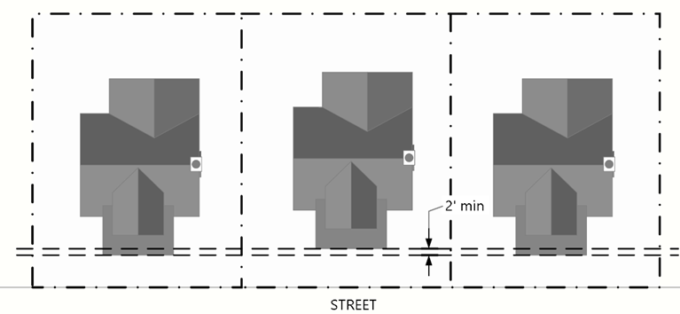
Figure 08.20 Example of Front Building Setback Variation
(4)
Building variation requirements. The following standards apply to each development or portion of a development.
a.
Identical or visually similar single-family detached dwellings may not be repeated more frequently than every sixth dwelling along the same side of any street in a residential subdivision.
b.
Identical or visually similar duplex dwellings may not be repeated more frequently than every fourth building (each building contains two (2) units) along the same side of any street in a residential subdivision.
c.
These standards for building variation shall be implemented through the applicant's submittal and the Town's approval of a Residential Design Plan Matrix that identifies different models of homes that reflect the required levels of variation as described below.
1.
Criteria for placement of model homes.
a)
Substantially different building mass and building form (as detailed in Subsection 2 below), and
b)
Building variation requirements (as detailed in Subsection 3 below):
1)
Substantially different roof type.
2)
Elevation plane variation.
3)
Exterior surface material schemes and color palettes.
2.
Building mass and form. The pattern of model homes shall result in differences in building composition (including but not limited to vertical bays and a pattern of openings).
a)
Building mass. Considered to be the outline of the unit. Massing denotes the basic primary mass and the overall scale, shape, and proportion of the unit. This is determined by the height, width, and depth of the unit.
b)
Building form. Form includes building elements and horizontal/vertical breaks of a unit. The style of the unit includes ranch, tri-level or two-story structures, as depicted in the following diagrams.
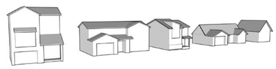
Figure 08.21 Example of Single-Family Detached Units Showing Differences in Building
Mass and Form
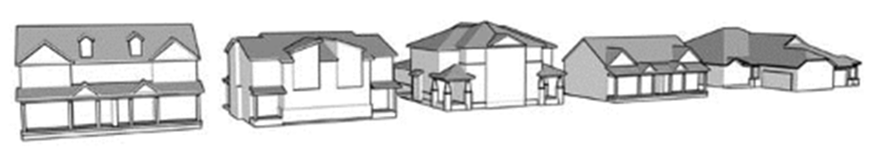
Figure 08.22 Example of Paired Units Showing Differences in
Building Mass and Form
3.
Building variations requirements.
a)
Substantially different roof type. Roof types consist of mansard, hip (full or clip), flat, gambrel, gable and front-to-back (shed style), as depicted in the following diagram.
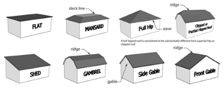
Figure 08.23 Examples of Roof Types
b)
Elevation plane variation. The elevation plane is identified as the exterior wall of the structure. For an elevation plane to be considered substantially different from another model, the secondary plane must project at least sixty (60) inches from the primary plane and constitute at least thirty (30) percent of the first-floor elevation plane (excluding planes with garage doors) or the secondary plane must project at least twenty-four (24) inches from the primary plane and constitute at least thirty (30) percent of the entire elevation plane (first and second floors), as depicted in the following diagram:
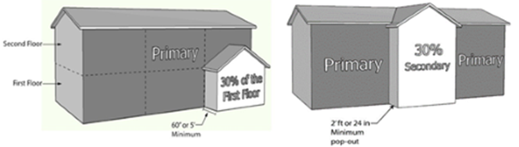
Figure 08.24 Elevation Plane Variation Requirement
c)
Exterior building elements and palettes.
1)
Exterior building elements and palettes include architectural details and materials on a structure that are used to create a distinctive differentiation between structures and shall be used to distinguish the entire structure including the rear. Exterior building elements for buildings that contain paired units include the addition of the following to the building (examples of these elements can be found in the multifamily design standards contained in the Development Design Standards):
i.
Covered porch/deck.
ii.
Additional windows.
iii.
Eave overhang.
iv.
Cornice.
v.
Dormers.
vi.
Balconies.
vii.
Bay windows.
viii.
Terraces
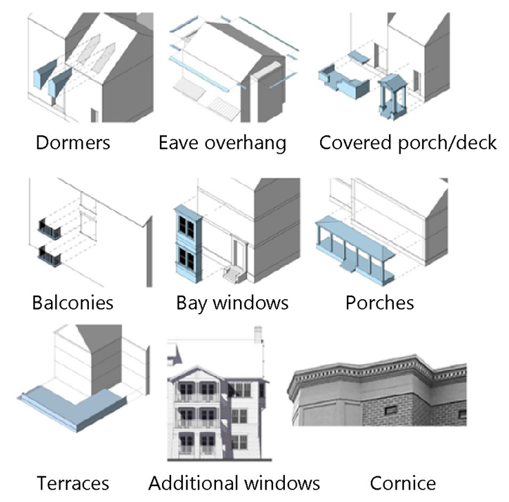
Figure 08.25 Examples of Exterior Building Elements
2)
Exterior building palettes include the use of substantially different building materials to make the unit appear different. The material differences shall be substantial in nature, such as a) base change from brick to stone; b) material change and/or variation on upper portion of a structure from siding; or c) architectural detailing.
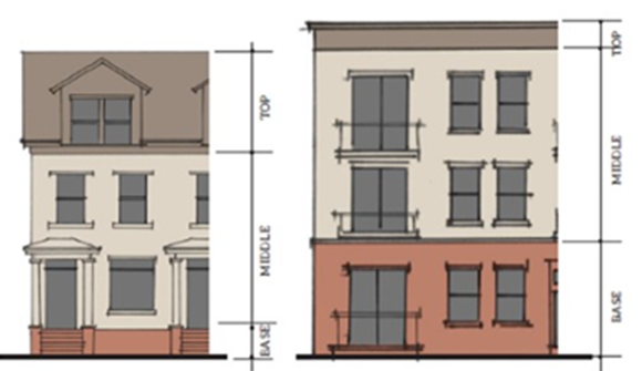
Figure 08.26 Examples of Base, Middle, and Top Building Material Changes
4.
Placement and distribution of model units on residential design plan matrix.
a)
Single-family detached units.
1)
In order for single-family detached units to be located next to each other, they shall comply with the following standards:
i.
Substantially different building mass and form (i.e., a ranch can be placed next to a two-story home and a 40-foot wide home can be placed next to a 50-foot wide home); or
ii.
If building mass and form are similar, then the dwelling shall comply with at least two (2) of the following three (3) standards:
a.
Substantially different roof type;
b.
Elevation plane variation; or
c.
Exterior surface material schemes and color palettes.
2)
In order for a single-family detached dwelling to be placed three (3) lots away in either direction, it must comply with the following:
i.
Substantially different building mass and form (i.e., a ranch can be placed next to a two-story home and a 40-foot wide home can be placed next to a 50-foot wide home); or
ii.
If building mass and form are similar, then the dwelling shall comply with at least one (1) of the following three (3) standards:
a.
Substantially different roof type;
b.
Elevation plane variation; or
c.
Exterior surface material schemes and color palettes.
3)
Matrix for models.
i.
Lot designation for each model. Based on the above criteria, the models are placed within Lots I—VI.
ii.
Once the model numbers of each type of unit are categorized for each lot, these models are then laid out onto the subdivision map for the filing being developed.
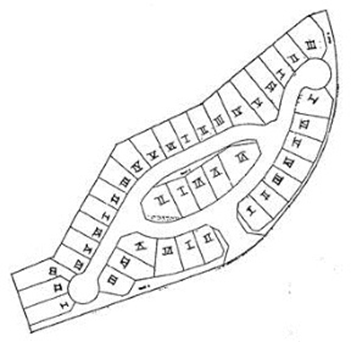
Figure 08.27. Example of Single-Family Detached Unit Lot Designation.
Note: The numerical sequence I, II, III, IV, V and VI must be maintained.
iii.
When a break in the street scene occurs, the matrix numbering can start over. This means that the same model can be placed next to each other when a break in the street scene occurs. A break in a street scene is a separation of twenty-five (25) feet or more, including a tract for open space, greenway, park, or a street intersection, that separates lots from one another.
b)
Duplex dwellings.
1)
In order for duplex dwellings to be located next to each other, the buildings shall comply with the following standards:
i.
Substantially different building mass and form (i.e., a ranch building can be placed next to a two-story building and a 40-foot wide building can be placed next to a 50-foot wide building).
ii.
If building mass and form are similar, then the duplex dwelling shall comply with at least two (2) of the following three (3) standards:
a.
Substantially different roof type;
b.
Elevation plane variation; or
c.
Exterior surface material schemes and color palettes.
2)
In order for duplex dwellings to be placed two (2) lots away in either direction, the buildings must comply with the following standards:
i.
Substantially different building mass and form (i.e., a ranch building can be placed next to a two-story building and a 40-foot wide building can be placed next to a 50-foot wide building).
ii.
If building mass and form are similar, then the duplex dwelling shall comply with at least one (1) of the following three (3) standards:
a.
Substantially different roof type;
b.
Elevation plane variation; or
c.
Exterior surface material schemes and color palettes.
3)
Matrix for models.
i.
Lot designation for each model. Based on the above criteria, the duplex dwellings are placed within Lots I—IV.
ii.
Once the model numbers of each type of duplex dwellings are categorized for each lot, these models are then laid out onto the subdivision map for the filing being developed.
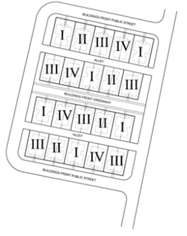
Figure 08.28 Example of Duplex Dwelling Designation.
Note: Each Roman numeral represents one building that contains two attached units.
iii.
When a break in the street scene occurs, the matrix numbering can start over. This means that the same model can be placed next to each other when a break in the street scene occurs. A break in a street scene is a separation of twenty-five (25) feet or more, including a tract for open space, greenway, park, or a street intersection, that separates lots from one another.
(5)
Additional standards.
a.
Soffit design. No roof overhang or soffit, as measured from the finished side of the siding or premium material of the structure to the inside of the fascia board, shall be less than eight (8) inches, unless the structure embodies architectural styles of an historical nature; for example, a Santa Fe style that has a flat roof without any overhang, or a Tudor style that has a roof pitch of a ten (10) vertical inch rise over a twelve (12) horizontal inch run or greater. Requests for this exemption shall be presented to the Community Development Department prior to the issuance of a Building Permit, and documentation may be required.
b.
Building trim.
1.
Trim around windows shall be a minimum of three and one-half (3½) inches wide, and trim around doors shall be a minimum of two (2) inches wide. If premium materials such as brick or stone are used on the front of a structure, they are not required to be used on the other sides.
2.
Trim details such as special moldings, colors and related details shall be used in the same manner on all sides of the structure as they appear on any side of the structure. As an exception, shutters and muntins, including any detail exclusively associated with the use of shutters and muntins, may be used on the front without being carried to the other sides.
(d)
Multifamily, mixed-use, and nonresidential development.
(1)
Purpose. The purposes of this Section 13.08.100(d) are those listed in the Development Design Standards.
(2)
Applicability. This Section 13.08.100(d) applies to all multifamily, mixed-use, and nonresidential development in the Town, unless otherwise stated in the Development Design Standards.
(3)
Compliance with Development Design Standards required.
a.
All Site Plans and architectural plans for multifamily, mixed-use, and nonresidential development within the Town shall comply with the Development Design Standards.
b.
If any standards in this LDO conflict with standards in the Development Design Standards, the stricter shall apply.
(e)
Handicapped accessibility.
(1)
All development shall comply with handicapped accessibility requirements based on the version of the International Building Code, Chapter 11, and the International Code Council (ICC) A117.1-2016, or any future update of that document adopted by the Town.
(2)
All residential development projects and individual dwelling units shall comply with all applicable state and federal laws and regulations regarding accessible dwelling units and accessible routes to buildings containing dwelling units as applicable. Applicable state and federal laws include, but are not limited to the Fair Housing Act, Americans with Disabilities Act, and Section 9-5, C.R.S.
(3)
Building design standards that do not apply to single-family detached dwellings occupied by household living uses shall not apply to those occupied by a Group Home and Residential Facility.
13.08.110 - Exterior lighting.
(a)
Purpose. The purpose of this Section 13.08.110 is to provide for the safety of citizens by providing adequate lighting in public areas, minimize light pollution through the use of efficient lighting, minimize light trespass, and reduce glare.
(b)
Applicability.
(1)
All outdoor lighting in all zoning districts shall comply with the standards in this Section 13.08.110 unless exempted by Subsection (c) below or by another provision of this LDO.
(2)
All outdoor lighting installed in the public right-of-way shall comply with the Roadway Design and Construction Criteria Manual.
(3)
More information about when these standards are applied is available in Table 13.08.A.
(c)
Exemptions. The following are exempt from this Section 13.08.110:
(1)
Luminaires that have a lamp of equivalent of nine hundred (900) lumens or less;
(2)
Public street lighting, traffic control devices and luminaires on these devices installed by the Town or other governmental entity;
(3)
Temporary, holiday lighting displays;
(4)
Lighting of flags, public monuments, and statuary;
(5)
Lighting of public art;
(6)
Temporary lighting of construction sites provided such lighting is discontinued upon completion of the construction activity and night time use is limited to address security;
(7)
Lighting for temporary uses or mobile businesses that is turned off within thirty (30) minutes after the use or business closes for the day;
(8)
Navigational lighting systems at airports and other lighting necessary for aircraft safety;
(9)
Properties containing only single-family detached, single-family attached or duplex dwellings are exempt from Subsections (d) through (f) except that lighting fixtures shall not emit more than nine hundred (900) lumens.
(d)
Prohibited lighting. The following types of exterior lighting are prohibited in the Town.
(1)
Any lighting that could generate nuisance impacts or interfere with the safe movement of motor vehicles, bicycles, or pedestrians on public or private streets, including but not limited to:
a.
Any light that may be confused with or construed as a traffic control device and not authorized by a state, federal or Town government; and
b.
Any blinking, flashing, strobing, or changing intensity lights.
(2)
Searchlights, aerial lasers, and rotating beacons;
(3)
All lighting in the Open Space zoning district except that necessary for public safety, as determined by the Town; and
(4)
Low pressure sodium lights, mercury vapor lights, and other types of lighting with similarly low spectral emissions.
(e)
General standards. All exterior lighting subject to this Section 13.08.110 shall comply with the following standards.
(1)
Maximum lumens. No single lamp or luminaire shall exceed twenty-five thousand (25,000) lumens.
(2)
Lighting types and efficiency.
a.
Light sources shall be color-correct types and shall have a correlated color temperature (CCT) below 5001 degrees Kelvin.
b.
LED or other high efficiency light fixtures shall be used to the maximum extent practicable.
(3)
Shielding required.
a.
All light fixtures shall be shielded and directed to avoid glare and overspill onto adjacent property.
b.
All light fixtures shall be shielded using full cutoff light fixtures that are directed downwards (ninety (90) degrees from true vertical) and no more than ten (10) percent of total lumens measurable at or above eighty (80) degrees above the vertical axis of the light fixture unless an exception is approved by the Planning Director.
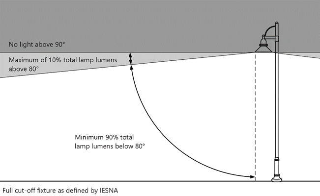
Figure 08.29 Fully Shielded Fixtures
c.
All light fixtures on structures, poles, bollards, stands, or mounted on a building shall have a shield, adjustable reflector, and/or non-protruding diffuser to shield the light source from sight.
(4)
Light trespass.
a.
All light fixtures shall be installed so that light trespass from any property line, except a property line adjacent to a public/private street, shared parking or access drive or aisle, shall not exceed the following:
1.
One-half (½) lumen per square foot at a single-family detached, single-family attached or duplex dwelling property line.
2.
One (1) lumen per square foot at multifamily dwelling or nonresidential property line.
(5)
Maximum height.
a.
The maximum height of freestanding (non-building mounted) light fixtures shall be equal to the maximum height of the principal building on the parcel or twenty-five (25) feet, whichever is less.
b.
The maximum height of freestanding light fixtures along pedestrian paths and trails shall be fifteen (15) feet.
c.
The maximum height of building mounted lighting fixtures shall be fifteen (15) feet unless decorative or accent lighting.
d.
The maximum height of freestanding light fixtures used for an outdoor recreation facility or park shall be determined at the time of Site Plan application with approval of the Parks, Recreation and Open Space Director. Light fixtures for these areas shall also be equipped with a glare control package such as louvers, shields, or similar devices and aimed so that their beams are directed and fall with the primary activity or performance area.
e.
On a Restricted Lot, the maximum height of any lighting pole within fifty (50) feet of a Protected Lot shall be fifteen (15) feet.
(6)
Light setbacks. All freestanding light fixtures shall be set back from each property line a distance at least equal to the total height of the luminaire.
(7)
Light uniformity. Lighting of parking lots and drive aisles shall have a uniformity ratio of six to one (6:1) (maximum to minimum).
(8)
Lighting curfew.
a.
Except as modified by paragraph b. below, all illumination shall be reduced by at least seventy (70) percent one (1) hour after the close of business, and shall not exceed that level of illumination until at least one (1) hour prior to the opening of the business. This reduction in illumination may be achieved by dimming the lamps within a light fixture (luminaire) and/or turning off a luminaire or a portion of a multi-luminaire assemblage.
b.
Illumination for the following uses are not required to comply with paragraph a. above:
1.
Residential uses (including residential units in mixed-use buildings).
2.
Lighting for outdoor recreation facilities or parks, which shall instead be reduced by 50 percent immediately after the end of the recreational activity and shall be fully turned off:
a)
No later than one (1) hour after the end of activity; and
b)
Whenever the facility is not in use.
c.
Property security lighting in excess of the minimum reduction is permitted provided that:
1.
All such lighting is equipped with an adjustable distance and range setting; and
2.
An amicable detector is set to minimize the number of instances in which illumination is triggered by traffic passing the property on adjacent streets.
(9)
Vehicle and pedestrian circulation areas. Lighting shall be provided throughout all vehicular and pedestrian circulation areas to promote safety.
(10)
Nonconforming lighting. All nonconforming light fixtures shall comply with the standards set forth in Section 13.01.070(f)(1), Nonconforming exterior lighting.
(11)
Maintenance. All outdoor light fixtures shall be maintained pursuant to Section 13.08.130(a)(8), Exterior lighting.
(f)
Site Specific Lighting Standards.
(1)
Parking lot lighting. No portion of a parking lot shall exceed a maximum illumination of twelve (12) lumens per square foot.
(2)
Wall mounted lighting. No wall mounted lamp or luminaire shall exceed ten thousand (10,000) lumens.
(3)
Pedestrian walkway areas and bicycle paths lighting.
a.
Where pedestrian walkways and bicycle paths in parking areas are not lit by parking lot or building lighting, they shall be lit with pedestrian-scale lighting.
b.
All light fixtures for plazas, sidewalks, small urban parks, and walkways shall direct light downward and use shatterproof lamp coverings.
c.
Pedestrian bollard lamps shall be mounted no higher than four (4) feet above grade and shall not exceed four thousand (4,000) lumens for any single lamp.
(4)
Decorative and accent lighting.
a.
Light fixtures illuminating the façade of a building are not subject to the maximum height standards as set forth in Section 13.08.110(e)(5), but shall not be mounted at a height greater than the height of the wall it is being mounted to.
b.
In order to allow for creative, unique and active outdoor spaces, lighting for outdoor seating and dining areas, interior courtyards, pedestrian areas or walkways, and/or event venues, may be allowed to vary from the standards in this Section 13.08.110(f)(4) subject to approval by the Planning Director based on lighting type, location, and time of use.
c.
Permanent outdoor string or similar decorative accent lights shall not exceed one thousand (1,000) lumens and shall not flash, blink, fade, or strobe.
d.
Decorative lighting displays located on sides of building, roofs, and trees within two hundred (200) feet of a residential zoning district shall be prohibited except:
1.
Where a side of a building is facing away from the residential uses and the decorative lighting display is not visible from the residential units; or
2.
In vertical mixed-use buildings where both residential and non-residential uses are in the same building.
3.
Decorative lighting displays located on buildings shall be no more than two hundred (200) lumens per foot
4.
Decorative lighting displays shall be turned off between 11:00 p.m. and 6:00 a.m.
5.
Flashing, moving, changing intensity, coursing, blinking, racer-type, strobing shall be prohibited
e.
The Planning Director may approve partial shielding for decorative lighting provided that the resulting lighting complies with the light trespass provisions of Section 13.08.110(e)(4).
(5)
Floodlights and security lighting.
a.
All floodlights shall be designed or retrofitted with shielding to focus the light so that it falls upon either the surface of the structure to be illuminated, on a freestanding sign, or on the ground.
b.
Security lighting may include motion activated lighting emitting a maximum of three thousand (3,000) lumens per light fixture.
c.
No more than one (1) motion activated security light fixture is allowed per sixty (60) linear feet of building elevation.
d.
Security lighting shall be timed to turn off after not more than five (5) minutes after motion activation.
(6)
Principal display areas lighting (including canopies).
a.
Site plans shall identify a "Principal Display" area not exceeding thirty (30) percent of the total Site Plan area and shall identify the remainder of the site as the "Inventory and General Parking."
b.
"Principal Display" areas shall be allowed a maximum of thirty-five (35) lumens per square foot.
c.
Canopy lighting for uses that shelter outside work, service areas or port-cocheres, including automotive fuel canopies, shall have all light fixtures flush mounted or recessed into the canopy and equipped with flat lenses.
13.08.120 - Utilities.
(a)
Purpose. The purpose of this Section 13.08.120 is to ensure that all development is served by adequate utilities, to ensure that utilities are placed underground whenever possible, and that any aboveground utility components are visually shielded from view to the maximum extent practicable.
(b)
Applicability. All development shall comply with the standards in this Section 13.08.120 unless exempted by another provision of this LDO. More information about when these standards are applied is available in Table 13.08.A. This Section shall apply to water, sewer, electricity, and natural gas services provided by third party utility providers. The Town of Parker does not provide utility services.
(c)
Standards.
(1)
All on-site utilities and equipment shall be placed underground. The cost of undergrounding utilities shall be borne by the applicant or developer.
(2)
On-site utilities and equipment for the provision of service to residential use(s) shall only utilize side yard and rear yard utility easement(s) for service to individual lots, except:
a.
Where located in the required shared sidewalk and utility easement adjacent to a local residential street, not to exceed six (6) feet in width, measured from the property line to the street; or
b.
Pocket utility easements for underground utility lines, which are located in the front yard, and shall be no larger than the typical width of the individual residential lot of the subdivision it is located within; or
c.
When located within tracts for parks, open space, and landscape and buffer tracts where equipment is screened by landscaping.
(3)
On-site utilities and equipment for the provision of service to residential use(s) may be placed above ground only if located in a rear yard utility easement only. On-site utilities and equipment shall be placed at or near the rear corner where the rear yard and side yard utility easements meet to the maximum extent practicable.
(4)
On-site utilities and equipment, including service lines to a lot, for the provision of service to nonresidential use(s) shall meet the following requirements:
a.
Individual service lines to nonresidential use(s) shall be placed underground.
b.
On-site utilities and equipment may be placed above ground in a rear yard or side yard only.
c.
Where a nonresidential property has three (3) or more frontages on a street and the applicant can demonstrate that a side and/or rear location is not feasible, the Town may consider an above-ground location in the front yard adjacent to the street with the lowest average daily traffic (ADT) volume. Equipment shall be set back to the greatest extent practicable from the corner and screened in accordance with the Town-approved plans.
d.
Utilities and equipment that serve more than one (1) lot or user may be placed within the front setback when the following conditions are satisfied (this Subparagraph does not apply to individual on-site utilities and equipment):
1.
Equipment is existing;
2.
Existing equipment needs to be relocated due to development;
3.
Equipment is added to an existing line; and
4.
Where compliance is precluded due to the size of the lot, the layout of existing development and infrastructure, or there is the presence of significant topography, wetlands, floodplains, watercourses, hazard areas, or other significant environmental features, the applicant shall comply with the requirements of this Section 13.08.120 to the maximum extent practicable, as determined by the Planning Director.
(5)
Where the placement of above-ground on-site utilities and equipment in the rear yard utility easement is not feasible for the provision of service to residential use(s), such equipment may be placed above ground in the side yard utility easement. Side yard utility easement permitted pursuant to this Subsection (5) shall be located between the rear of the principal structure and the rear property lin. Equipment placed within the side yard utility easement shall be placed at or near the rear corner where the rear yard and side yard meet to the maximum extent practicable.
(6)
Meters and related conduit may be placed above ground if mounted to the principal structure and integrated into the overall building architecture, painted to match the building, or screened from view. Meters should be located on the side or rear façade of a building to the maximum extent practicable.
(7)
All aboveground components visible from Town streets and rights-of-way shall be screened in accordance with a Town-approved Plat, Replat, or Site Plan.
(8)
Where an applicant is unable to comply with Subsections (1) through (7) above, the applicant may apply to the Town Council for approval of a modification or waiver of the standards if the applicant can demonstrate that:
a.
There is a hardship related to the exceptional narrowness, shallowness, or shape of a specific piece of property, or by reason of exceptional topographic conditions or other extraordinary and exceptional situation or condition of such piece of property; or
b.
The applicable utility has refused to provide service in the location or under the conditions required by this LDO, and the utility's decision has been upheld by the Colorado Public Utilities Commission.
(9)
Streetlights and underground electric service to streetlights are permitted in the front yard.
(10)
All structures and uses, except for temporary uses authorized by this LDO, shall be served by public water and sewer facilities.
(11)
Any unavoidable aboveground components, such as gas meters or electric service supply boxes, shall be located away from main entries into buildings, public and internal street frontages, sidewalks, and corners to the maximum extent practicable, and shall be located in mid-block locations or on the side or rear facades of buildings to the maximum extent practicable.
13.08.130 - Maintenance and operating standards.
All properties in the Town shall comply with the standards in this Section 13.08.130 regarding the operation and maintenance of activities, buildings, and land in the Town.
(a)
Maintenance.
(1)
Landscaping.
a.
Maintenance shall be the responsibility of the property owner of record or an assignee of the owner of record that has assumed landscape maintenance responsibility, including the maintenance of landscaping within the tree lawn adjacent to the property.
b.
The trees, shrubs, fences, walls, and other landscaping materials depicted on approved plans shall be considered as elements of the project in the same manner as parking, building materials and other elements, and shall be maintained in perpetuity, unless amended or modified by the Town.
c.
All plantings required or provided pursuant to this LDO shall be maintained in a healthy and attractive manner, free from disease, pests, weeds, and litter, as determined by the Town. Maintenance shall include, but not be limited to, watering, fertilizing, weeding, cleaning, mowing, edging, mulching, pruning, trimming, spraying, cultivating or other maintenance as needed and pursuant to acceptable horticultural practices including native grass areas.
d.
For all required landscaping and planting, dead plant materials shall be removed and replaced with healthy planting materials of comparable size and species that meet the original intent of the approved landscape design within forty-five (45) days after the plant dies, or if seasonal conditions prohibit removal and replacement then by June 1.
e.
Nonliving landscape materials such as rock, stone, and wood mulch that no longer cover the area in which they were originally deposited shall be regularly replenished to maintain the full coverage to a minimum depth of three (3) inches for rock mulches and four (4) inches for wood mulch.
f.
Landscaping structural features such as fences, walls, planter boxes and site furnishings, shall be maintained in a sound, structural and attractive condition.
g.
Irrigation systems are to be monitored and adjusted periodically to ensure that the water demands of all plant materials are being met.
h.
Irrigation system repairs shall be made within seven (7) days of discovery of damage unless seasonal conditions prohibit repairs.
i.
Landscaped areas shall be free from trash and debris.
j.
Fences, walls, or hedges shall be maintained in good structural or living condition. The landowner is responsible for the repair or removal of a fence, wall or hedge that constitutes a safety hazard, by reason of inadequate maintenance, dilapidation, obsolescence, or abandonment, or that constitutes a zoning violation.
(2)
Parking areas.
a.
All off-street parking areas shall be maintained in good condition, free of weeds, trash and debris and major surfacing defects such as potholes, large divots, or major cracks. All repairs shall be completed pursuant to the Roadway Design and Construction Criteria Manual.
b.
Each space shall be surfaced with concrete or asphalt, shall be properly graded for drainage, and shall be provided with surfaced vehicular access to an improved public or private right-of-way.
(3)
Signs.
a.
Compliance with building code. The property owner or an assignee of the property owner shall maintain each sign in a condition fit for the intended use and shall have a continuing obligation to comply with all building code requirements.
b.
Repair.
1.
The Community Development Department may require any sign to be repaired to keep the sign in a safe condition and free of cracked, peeling, or flaking paint or other surface material, torn or loose fabric, and trip hazards.
2.
All supports, braces and anchors for such signs shall be maintained in a safe condition. Removal of a conforming or nonconforming sign for repair, refurbishing or repainting, is allowed without a permit or any payment of fees, provided that all of the following conditions are met:
a)
There shall be no alteration or remodeling to the sign base, sign support or the mounting of the sign itself;
b)
There shall be no enlargement or increase in any of the dimensions of the sign or its structure; and
c)
The sign shall be accessory to a permitted, approved conditional, or nonconforming use.
c.
Noncompliance. Any sign that is found to be unsafe, insecure, or a menace to the public by the Community Development Department shall comply with the removal requirements of Section 13.01.080(c)(9)b, Unsafe signs.
d.
Abandonment. Any sign that is determined to be abandoned shall comply with the requirements of Section 13.01.080(c)(9)c, Abandoned signs.
(4)
Maintenance of open space. All open space shall be maintained by the property owner unless stated otherwise per a written agreement as approved by the Town.
(5)
Construction activities.
a.
Restoration of rights-of-way. Whenever construction disrupts the surface or subsurface of any rights-of-way, the right-of-way shall be restored to its original condition or an improved condition by the developer pursuant to ordinances of the Town and the Roadway Design and Construction Criteria Manual.
c.
Restoration of surface conditions. All surface disruptions associated with the installation of utilities shall be returned to a condition equal to or better than the original condition.
d.
Construction materials. Storage of all construction material shall be within the legal boundaries of the project site or an alternate site approved by the Town, in a location that will not block access to the project, particularly access by emergency vehicles, and shall not occur on public rights-of-way without the express written permission of the Town.
e.
Periodic compliance review. The Town will conduct site compliance inspections during the course of construction. These inspections may be required prior to the finalization of a particular construction phase and shall be incorporated into the permitting process.
(6)
Walkways and sidewalks. Walkways and sidewalks shall be properly maintained and free from obstructions and hazards.
(7)
Trash enclosures. All trash enclosures, including dumpsters, shall be maintained in good working order and shall remain closed except when trash pick-ups occur.
(8)
Exterior lighting. All exterior light fixtures shall be maintained in good working order, free of broken glass, plastic, or housings and pole and fixture finishes free of fading, chipping, or peeling paint.
(9)
Fencing. All fencing shall be maintained in good repair, free of broken, dented, or bent panels or materials, and free of trash, debris, and any signage not permitted by Chapter 13.09Sign Code.
(b)
Operations and nuisances. All structures, uses, and activities shall not create adverse impacts or nuisances, as defined by Colorado law, on the residents, employees, or visitors on the property or on neighboring properties as described below.
(1)
Glare. Direct or reflected glare, including glare from exterior lighting, shall not be visible at the property line.
(2)
Noise. All activities shall comply with Chapter 6.03, Noise Regulations, of the Parker Municipal Code regarding permissible levels of noise.
(3)
Odor. No activity shall cause or allow the emission of any odorous air contaminant that is a nuisance, hazard or exceeds applicable Colorado or federal regulations.
(4)
Smoke. No activity shall discharge into the atmosphere any contaminant greater than the threshold limit values listed by the American Conference of Governmental Industrial Hygienists or by Colorado or federal regulation. Visible emissions of any kind past the lot line of the property on which the source of the emissions is located are prohibited.
(5)
Vibration. No activity other than temporary construction activities shall cause inherent and recurring generated vibration detectable without instruments at any point along the property line.
(6)
Hazardous materials. All uses and activities shall comply with state statutes and regulations regarding the use, storage, handling, and transportation of flammable liquids, liquefied petroleum, gases, explosives, hazardous materials, hazardous wastes, toxic materials, and solid wastes, as those terms are defined by applicable statutes, rules, regulations, or ordinances.
(7)
Materials and waste handling. All materials or wastes that might cause fumes or dust or that constitute a fire hazard or that may be attractive to rodents or insects shall be stored outdoors only in closed, impermeable trash containers that are screened pursuant to the requirements of this LDO. Fuels and lubricating oils shall be prevented from leaking and/or draining onto the ground. All sewage and industrial wastes shall be treated and disposed of in compliance with the applicable water quality standards of the Colorado and federal government.
(8)
Electromagnetic radiation. No activity shall create or operate an intentional source of electromagnetic radiation that does not comply with the current regulations of the Federal Communications Commission regarding that type of electromagnetic radiation source.
13.08.140 - Associations.
(a)
Creation of homeowners' association. For all residential condominiums or residential subdivisions, the applicant shall create a homeowners' association under the laws of the State of Colorado, or the property shall be included in an existing homeowners' association. The homeowners' association shall be lawfully established prior to, or as a part of, first Final Plat approval or first Condominium Map approval that creates residential lots or units. All documents related to the homeowners' association, including the articles of organization or incorporation and declaration of covenants, conditions, and restrictions, shall be submitted in draft form at the time of application for Final Plat or Condominium Map review. Such documents shall be acceptable to the Town as a condition of Final Plat or Map approval.
(b)
Creation of property owners' association. For all vertical mixed-use, commercial condominiums, and commercial Minor Development Plats that include private roadways, detention ponds or other improvements that need to be maintained, the applicant shall create a property owners' association under the laws of the State of Colorado, or the property shall be included in an existing property owners' association. The property owners' association shall be lawfully established prior to, or as a part of, Minor Development Plat approval or Condominium Map approval. All documents related to the property owners' association, including the articles of organization or incorporation and declaration of covenants, conditions, and restrictions, shall be submitted in draft form at the time of application for Minor Development Plat or Condominium Map review. Such documents shall be acceptable to the Town as a condition of Minor Development Plat or Map approval.
(c)
Recording. Prior to, or as a condition of, approval of the Final Plat, Minor Development Plat, or Condominium Map, the applicant shall record the association documents approved by the Town in the Office of the Clerk and Recorder for Douglas County.
(d)
Association documents. The association documents shall require, at a minimum:
(1)
Mandatory membership.
a.
All owners of lots, condominium units or of property within the subdivision shall be members of the association.
b.
The members of the association shall share equitably in the costs of operating the association, including the costs of maintaining all private improvements, including, but not limited to, private streets, private parks, private open space, drainage facilities, landscaping and medians, common areas and facilities, recreation areas and facilities, stormwater management areas and facilities, walkways and other facilities, which are not dedicated to or accepted by the Town or by a special district organized for such purposes. The association documents shall require, at minimum, that the costs of such maintenance shall be collectable from the owner of the lot, unit, or property to which such costs are assessed; and that such costs shall be and constitute a lien upon such lot, unit, or property.
(2)
Maintenance of property.
a.
Associations shall maintain the private improvements, including, but not limited to, private streets, private parks, private open space, drainage facilities, landscaping and medians, common areas and facilities, recreation areas and facilities, stormwater management areas and facilities, walkways and other facilities, as identified on the Final Plat, Minor Development Plat, Condominium Map, and/or subject to a license agreement(s) with the Town, and shall assume all responsibilities for such maintenance as shown on the Final Plat, Minor Development Plat, Condominium Map, and/or described in the license agreement(s), except as otherwise stated in a Subdivision Agreement or Development Agreement between the Town and property owner.
b.
Associations shall have covenants regarding maintenance requirements for individual member's lots, units, or properties that have standards meeting or exceeding those contained in the Parker Property Maintenance Code. The covenants shall provide the association with the ability to enforce the rules and regulations set forth in the covenants. The association documents shall give the Town the authority to require the association to perform routine maintenance and repairs necessary to keep the property within the subdivision or condominium in good condition, in accordance with the standards that meet or exceed those in the Parker Property Maintenance Code.
c.
If the association does not respond to a notice of violation from the Town regarding maintenance within thirty (30) calendar days of the date of such notice, the Town shall have the right to perform the work itself or hire a contractor to perform the work and assess each property owner of the association and/or each owner of property within the subdivision, or unit within a condominium, a fee to recover its costs. Such fee shall include an administrative charge equal to fifteen (15) percent of the cost of the work performed. The costs may be recovered in a Municipal Court proceeding. The Town may also assess and file a lien against any property within the subdivision, or any unit within the condominium, for the cost of the work that was performed by the Town. The lien shall be a first and prior lien to all other liens.
(3)
Town approval to amend or terminate. The association documents shall include a provision requiring the Town's written consent to amend or terminate any of the covenants that are the subject of this Section 13.08.140(d).
(4)
Additional association responsibilities.
a.
Trash and recycling collection. Associations shall have covenants requiring regular trash and recycling collection and the association shall be responsible for regular trash and recycling collection for all lots or units, common amenities/facilities and parks and open space.
b.
Public access. Associations shall provide cross-access easements providing public access to all parks, open space, trails, and accessory uses/facilities, including, but not limited to, public bathrooms, parking, play equipment and seating.
c.
Association documents. Associations shall make available within seven (7) days of request, at no charge to the Town, association records related to the requirements contained in this Section 13.08.140(d), including, but not limited to, the association's governing documents, covenants, bylaws, meeting agendas and minutes, capital improvement plans, and budgets.
(5)
Exemption. The Planning Director may exempt residential subdivisions containing less than ten (10) detached dwelling units from the requirements of this Section 13.08.140, where the applicant can demonstrate that:
a.
The proposed subdivision has no maintenance responsibilities or that maintenance responsibilities have been assigned to and accepted by a special district.
b.
The enforcement of covenants is made through a different agreement or arrangement or the use of a party wall agreement.
(6)
Failure to comply. The Town, through the Planning Director, shall have the authority to withhold approvals, permits and certificates of occupancy in the event that an applicant fails to comply with the requirements of this Section 13.08.140.