
Peachtree City City Zoning Code
ARTICLE X
- REQUIREMENTS BY DISTRICT
This article outlines design and use requirements for the following zoning districts:
Sec. 1001. - R-10, R-12, R-15, and R-22 one-family residential districts.
(1001.1) Intent of districts: It is intended that the R-10, R-12, R-15, and R-22 zoning districts be reserved and developed for low- and medium-density residential purposes. The regulations which apply to these districts are designed to encourage the formation and continuance of a stable, healthy environment for one-family dwellings situated on zoning lots having an area of 10,000 square feet or more. These regulations are also intended to discourage encroachment by commercial, industrial or other uses capable of adversely affecting the intended residential character of the districts.
(1001.2) Permitted uses: The following uses shall be permitted in any R-10, R-12, R-15, and R-22 residential zoning district:
(a)
One-family dwelling, excluding mobile or manufactured homes.
(b)
Publicly owned building, facility or land.
(c)
Building, facility or land for the distribution of utility services.
(d)
Building, facility or land for non-commercial park, recreation, thoroughfare, or open space purposes.
(e)
Private boat dock, fishing pier, boathouse and related accessory concession and support facilities, where permitted through deed restrictions.
(f)
Non-commercial agriculture, excluding the keeping of poultry or livestock.
(g)
Non-commercial horticulture to include fruit trees, nuts and/or vegetables, provided that plots or planting areas for vegetables shall not be located within the front setback area.
(h)
Neighborhood recreation centers, swimming pools and/or tennis courts.
(i)
Accessory use, as identified herein.
(j)
Customary home occupations as identified in the zoning ordinance.
(1001.3) Conditional uses: The following uses shall be permitted in any R-10, R-12, R-15 and R-22 residential zoning district on a conditional basis:
(a)
Church or other place of worship on the following conditions:
(1)
Notwithstanding any other requirements in this ordinance, the following conditions shall apply to all churches regardless of zoning district.
(2)
Minimum zoning lot area is three acres.
(3)
Minimum lot width: 100 feet.
(4)
Minimum setback area, front:
(a)
Building: 40 feet.
(b)
Parking: 20 feet.
(5)
Minimum setback area, side: 15 feet. If adjoining a residential lot, the building setback shall be 75 feet.
(6)
Minimum setback area, rear: 30 feet. If adjoining a residential zoning lot, the building setback shall be 75 feet.
(7)
Maximum building height: As approved by the fire department.
(8)
All zoning lots shall have direct access onto an arterial, major collector road or have access to an arterial, major collector or industrial/commercial road via a minor collector.
(9)
No parking shall be permitted within 20 feet of the property line of any adjoining residential zoning lot.
(10)
Parking and/or service areas shall be separated from adjoining residential lots by a suitable fence or wall six feet in height or a suitable evergreen planting screen six feet in height at time of planting. The required fence, wall, or evergreen planting screen must provide for a reasonable visual separation between properties. No fence or wall in excess of four feet may be placed in a setback area adjoining a public street.
(11)
Any existing church in any zoning district may comply with either the requirement existing prior to enactment of this ordinance, or they may comply with the conditions of this section. They shall not be permitted to comply with various sections of both requirements.
(b)
On-site sewage disposal system with the following conditions:
(1)
The zoning lot is at least one acre in area.
(2)
A permit for the system is obtained from the county health department prior to its installation.
(1001.4) Other requirements: Unless otherwise specified in this ordinance, uses permitted in R-10, R-12, R-15 and R-22 residential zoning districts shall conform to the following standards:
(a)
Minimum floor area per dwelling unit:
R-10: 1,000 square feet.
R-12: 1,200 square feet.
R-15: 1,400 square feet.
R-22: 1,600 square feet.
(b)
Minimum zoning lot area:
R-10: 10,000 square feet.
R-12: 12,000 square feet.
R-15: 15,000 square feet.
R-22: 22,000 square feet.
(c)
Minimum land area per dwelling unit:
R-10: 10,000 square feet.
R-12: 12,000 square feet.
R-15: 15,000 square feet.
R-22: 22,000 square feet.
(d)
Maximum dwelling units per net acre:
R-10: 4.36 units.
R-12: 3.63 units.
R-15: 2.90 units.
R-22: 1.98 units.
(e)
Minimum lot width:
R-10: 80 feet.
R-12: 85 feet.
R-15: 95 feet.
R-22: 120 feet.
(f)
Minimum lot width adjacent to existing or future public or private street right-of-way line:
(1) 40 feet on street.
(2) 35 feet on cul-de-sac.
(g)
Minimum front setback depth:
R-10: 30 feet.
R-12: 40 feet.
R-15: 40 feet.
R-22: 50 feet.
(h)
Minimum side setback depth:
R-10: 10 feet.
R-12: 10 feet.
R-15: 10 feet; however, no two principal buildings on adjacent zoning lots shall be closer than 25 feet from each other.
R-22: 15 feet.
(i)
Minimum rear setback depth:
R-10: 30 feet.
R-12: 30 feet.
R-15: 30 feet.
R-22: 30 feet.
(j)
Maximum building height: 35 feet.
(1001.5) Property rezoned to R-12: The following tract of land is hereby rezoned from Fayette County AR agricultural district to Peachtree City R-12 single family residential district:
All that tract or parcel of land lying or being in Land Lot 18 of the 6th District of Fayette County, Georgia, containing 38.72 acres (1,686,775 sq. ft.), as shown on exhibit entitled, "BOUNDARY SURVEY FOR JEFF LINDSEY COMMUNITIES, INC.", prepared by Moore Bass Consulting Inc., dated 11/15/19, last revised 4/21/20 and being more particularly described as follows:
Commence at a point (½ inch rebar) at the intersection of Land Lots 18, 19, 28 & 29, said point being the True Point of Beginning. From said point, proceed S88°23'36"E along the north line of Land Lot 18, a distance of 1,101.85 feet to a point on the west right-of-way of Redwine Road (R/W varies); thence proceed southerly along said right-of-way, along the arc of a curve to the right, a distance of 316.72 feet (said arc having a radius of 2,808.27 feet and being subtended by a chord bearing N13°41'53"W, with a chord distance of 316.55 feet) to a point; thence proceed southerly along said right-of-way, S11°22'20"E, a distance of 199.77 feet to a point (1" open top pipe); thence continue S11°22'20"E, a distance of 30.79 feet to a point (1" open top pipe); thence, S11°22'20"E, a distance of 195.15 feet to a point; thence S11°22'20"E, a distance of 186.60 feet to a point; thence, S11°22'20"E, a distance of 59.99 feet to a point; thence S11°21'30"E, a distance of 60.09 feet to a point; thence S11°29'00"E, a distance of 273.16 feet to a point (½" rebar); thence, leaving said right-of-way, proceed N88°23'37"W, a distance of 810.97 feet to a point; thence S01°36'36"W, a distance of 170.61 feet to a point; thence N88°19'37"W, a distance of 548.86 feet to a point (½" rebar) on the west line of Land Lot 18; thence proceed along said land lot line, N00°26'22"W, a distance of 955.65 feet to a point (½" rebar); thence continue N00°26'22"W, a distance of 377.84 feet to a point (½" rebar); thence N00°23'54"W, a distance of 122.47 feet to a point (½" rebar), and the TRUE POINT OF BEGINNING.
(Ord. No. 946, § 1, 8-7-2008; Ord. No. 1186, § 1, 2-4-2021)
Editor's note— Ord. No. 946, § 1, adopted August 7, 2008, repealed former § 1001 and enacted a new § 1001 as set out herein. The former section pertained to similar subject matter and derived from Ord. No. 268, § 1(C)(1), 6-3-1982; Ord. No. 366, § 19, 5-22-1985; Ord. No. 394, 4-8-1986; Ord. No. 408, 8-21-1986; Ord. No. 457, 3-17-1988.
Sec. 1002. - R-43 one-family residential district.
(1002.1) Intent of district: It is intended that the R-43 zoning district be reserved and developed for low-density residential purposes. The regulations which apply to this district are designed to encourage the formation and continuance of a stable, healthy environment for one-family dwellings situated on zoning lots having an area of one acre or more, with provisions for on-site sewer disposal and limited agricultural activities. These regulations are also intended to discourage encroachment by commercial, industrial or other uses capable of adversely affecting the intended residential character of the district.
(1002.2) Permitted uses: The following uses shall be permitted in any R-43 residential zoning district:
(a)
One-family dwelling, excluding mobile or manufactured homes.
(b)
Publicly owned building, facility or land.
(c)
Building, facility or land for the distribution of utility services.
(d)
Building, facility or land for noncommercial park, recreation, thoroughfare, or open space purposes.
(e)
Neighborhood recreation centers, swimming pools and tennis courts.
(f)
Noncommercial horticulture to include fruit trees, nuts and/or vegetables, provided that plots or planting areas for vegetables shall not be located within the front setback area.
(g)
Accessory use, as identified herein.
(h)
Customary home occupations, as identified in the zoning ordinance.
(1002.3) Conditional uses: The following uses shall be permitted in any R-43 residential zoning district on a conditional basis:
(a)
Noncommercial agriculture on the following conditions:
(1)
Poultry and livestock shall not be permitted on a zoning lot of less than 80,000 square feet.
(2)
No poultry or livestock shall be maintained within 100 feet of the property line of any adjoining street or residential zoning lot.
(3)
No building used for animals shall be constructed within 200 feet of any property line.
(4)
At least 5,000 square feet of fenced area shall be provided for each animal, not including household pets, to be maintained on the zoning lot.
(b)
Guest house on the following conditions:
(1)
The guest house shall be a detached accessory use to the principal residence on the lot.
(2)
The maximum size of the guest house shall not exceed 600 SF or 25 percent of the area of the principal residence (not including garages or unheated space), whichever is larger.
(3)
Vehicular access to the guest house shall be by way of the driveway of the principal dwelling and in no case shall a separate point of access be created to the adjoining road or highway.
(4)
One additional off-street parking space shall be provided for the exclusive use of the guest house in addition to the parking requirements for the principal dwelling.
(5)
The guest house shall not be leased, sub-leased, rented, or sub-rented separately from the main dwelling, nor shall the guest house be used as a permanent residence on the premises.
(6)
Installation of a separate gas, water and/or electrical meter for the guest house shall be prohibited.
(7)
All property development regulations applicable to the principal residence shall also be applicable to the guest house, including, but not limited to, building setbacks and height limits.
(8)
The architectural design of the guest house shall be compatible with the principal residence on the lot, to include similar exterior building materials, color selection and roof pitch.
(9)
The owner of the property shall sign an affidavit as kept on file with the zoning administrator acknowledging their understanding of these requirements. Said affidavit shall be recorded in the deed records of the clerk of the superior court of Fayette County, Georgia.
(c)
On-site sewage disposal system on the following conditions:
(1)
The zoning lot is at least one acre in area.
(2)
A permit for the system is obtained from the county health department prior to its installation.
(d)
Church or other place of worship, on the following conditions:
(1)
Notwithstanding any other requirements in this ordinance, the following conditions shall apply to all churches regardless of zoning district.
(2)
Minimum zoning lot area is three acres.
(3)
Minimum lot width: 100 feet.
(4)
Minimum setback area, front:
a.
Building: 40 feet.
b.
Parking: 20 feet.
(5)
Minimum setback area, side: 15 feet. If adjoining a residential lot, the building setback shall be 75 feet.
(6)
Minimum setback area, rear: 30 feet. If adjoining a residential zoning lot, the building setback shall be 75 feet.
(7)
Maximum building height: As approved by the fire department.
(8)
All zoning lots shall have direct access onto an arterial, major collector road or have access to an arterial, major collector or industrial/commercial road via a minor collector.
(9)
No parking shall be permitted within 20 feet of the property line of any adjoining residential zoning lot.
(10)
Parking and/or service areas shall be separated from adjoining residential lots by a suitable fence or wall six feet in height or a suitable evergreen planting screen six feet in height at time of planting. The required fence, wall, or evergreen planting screen must provide for a reasonable visual separation between properties. No fence or wall in excess of four feet may be placed in a setback area adjoining a public street.
(11)
Any existing church in any zoning district may comply with either the requirement existing prior to enactment of this ordinance, or they may comply with the conditions of this section. They shall not be permitted to comply with various sections of both requirements.
(1002.4) Other requirements: Unless otherwise specified in this ordinance, uses permitted in R-43 residential zoning districts shall conform to the following standards:
(a)
Minimum floor area per dwelling unit: 1,500 square feet.
(b)
Minimum zoning lot area: One acre.
(c)
Minimum land area per dwelling unit: One acre.
(d)
Maximum dwelling units per net acre: One unit.
(e)
Minimum lot width: 150 feet.
(f)
Minimum lot width adjacent to existing or future public or private street right-of-way line:
(1)
40 feet on street.
(2)
35 feet on cul-de-sac.
(g)
Minimum front setback depth: 50 feet.
(h)
Minimum side setback depth: 15 feet.
(i)
Minimum rear setback depth: 30 feet.
(j)
Maximum building height: 35 feet.
(1002.5) Property rezoned to R-43:
(1)
Longboat Subdivision. The subdivision of Longboat shall be zoned R-43 Single-Family Residential, to include the following properties: 100, 105, 110, 115, 120, 125, 130, 135, 140, 145, and 150 Creekrise Drive; 100, 105, 125, 130, 135, 140, 145, 150, 155, 160, and 165 Dockstreet Aly; 100, 105, 110, and 115 Woodcanoe Ct; 105, 115, 125, 135, 140, 156, 166, 160, and 170 Boatwater Bend; 110, 115, and 120 Kayak Ct; 110, 120, 130, 135, 140, 145, 150, 155, and 160 Paddle Court; and all common areas dedicated to and owned by the Longboat Home Owners Association.
(Ord. No. 947, § 1, 8-7-2008; Ord. No. 1196-A, § 1, 10-7-2021)
Editor's note— Ord. No. 947, § 1, adopted August 7, 2008, repealed former § 1002 and enacted a new § 1002 as set out herein. The former section pertained to similar subject matter and derived from Ord. No. 268, § 1(C)(2), 6-3-1982; Ord. No. 366, § 19, 5-22-1985; Ord. No. 394, 4-8-1986; Ord. No. 408, 8-21-1986.
Sec. 1002A. - VR residual villa residential district.
(1002A.1) The VR villa residential district is a residual zoning district which shall no longer allow new designation through rezoning. It is the specific purpose and intent of the residual VR district that existing tracts of land currently zoned VR be utilized as currently permitted and developed.
(1002A.2) Permitted uses: The following uses shall be permitted in any VR zoning district:
(a)
Guest villa.
(b)
Accessory uses, as identified herein.
(c)
Customary home occupation, as identified in the zoning ordinance.
(1002A.3) Conditional uses: The following uses shall be permitted in any VR zoning district on a conditional basis:
(a)
On-site sewage disposal system on the following conditions:
(1)
The zoning lot is at least one acre in area.
(2)
A permit for the system is obtained from the county health department prior to its installation.
(1002A.4) Other requirements: No new VR villa residential districts shall be created. VR is a residual district designation whereby land already zoned VR may carry out their approved development plan or modify their project based on the provisions of this section, subject to the following additional limitations:
(a)
Guest villas shall be operated only as an amenity and not made available to the general public.
(b)
Dwelling shall have exterior appearance of single-family dwelling.
(c)
Minimum floor area per dwelling unit: 2,100 square feet.
(d)
Minimum zoning lot area: one acre.
(e)
Minimum land area per dwelling unit: one acre.
(f)
Maximum dwelling units per net acre: one unit.
(g)
Minimum lot width: 150 feet.
(h)
Minimum front setback depth: 50 feet.
(i)
Minimum side setback depth: 15 feet.
(j)
Minimum rear setback depth: 30 feet.
(k)
Maximum building height: 35 feet.
(l)
Zoning lot must have direct access onto a public street.
(Ord. No. 948, § 1, 8-7-2008)
Editor's note— Ord. No. 948, § 1, adopted August 7, 2008, repealed former § 1002A and enacted a new § 1002A as set out herein. The former section pertained to similar subject matter and derived from Ord. No. 174(c), 1-25-1979; Ord. No. 259, 5-6-1982; Ord. No. 366, § 19, 5-22-1985.
Sec. 1003. - ER estate residential district.
(1003.1) Intent of district: It is intended that the ER zoning district be reserved and developed for low-density residential purposes where agriculture-type conditional uses would be expected. The regulations which apply to this district are designed to encourage the formation and continuance of a stable, healthy environment for one-family dwellings situated on zoning lots having an area of three acres or more with provisions for on-site sewage disposal and limited agricultural activities. These regulations are also intended to discourage encroachment by commercial, industrial or other uses capable of adversely affecting the intended residential character of the district.
(1003.2) Permitted uses: The following uses shall be permitted in an ER zoning district:
(a)
One-family dwelling, excluding mobile or manufactured homes.
(b)
Publicly owned building, facility or land.
(c)
Building, facility or land for the distribution of utility services.
(d)
Building, facility or land for noncommercial park, recreation, thoroughfare, or open space purposes.
(e)
Neighborhood recreation centers, swimming pools and tennis courts.
(f)
Noncommercial horticulture to include fruit trees, nuts and/or vegetables, provided that plots or planting areas for vegetables shall not be located within the front setback area.
(g)
Accessory uses, as identified herein.
(h)
Customary home occupation, as identified in the zoning ordinance.
(1003.3) Conditional uses: The following uses shall be permitted in any ER residential zoning district on a conditional basis:
(a)
Noncommercial agriculture on the following conditions:
(1)
No poultry or livestock shall be maintained within 100 feet of the property line of any adjoining street or residential zoning lot; except when it abuts an AR or ER zoning lot, it may be no closer than ten feet.
(2)
No building used for animals shall be constructed within 200 feet of any property line; except when it abuts an AR or ER zoning lot, it may be no closer than 50 feet.
(3)
At least 5,000 square feet of fenced area shall be provided for each animal, not including household pets, to be maintained on the zoning lot.
(b)
Guest house on the following conditions:
(1)
The guest house shall be a detached accessory use to the principal residence on the lot.
(2)
The maximum size of the guest house shall not exceed 600 SF or 25 percent of the area of the principal residence (not including garages or unheated space), whichever is larger.
(3)
Vehicular access to the guest house shall be by way of the driveway of the principal dwelling and in no case shall a separate point of access be created to the adjoining road or highway.
(4)
One additional off-street parking space shall be provided for the exclusive use of the guest house in addition to the parking requirements for the principal dwelling.
(5)
The guest house shall not be leased, sub-leased, rented, or sub-rented separately from the main dwelling, nor shall the guest house be used as a permanent residence on the premises.
(6)
Installation of a separate gas, water and/or electrical meter for the guest house shall be prohibited.
(7)
All property development regulations applicable to the principal residence shall also be applicable to the guest house, including, but not limited to, building setbacks and height limits.
(8)
The architectural design of the guest house shall be compatible with the principal residence on the lot, to include similar exterior building materials, color selection and roof pitch,
(9)
The owner of the property shall sign an affidavit as kept on file with the zoning administrator acknowledging their understanding of these requirements. Said affidavit shall be recorded in the deed records of the clerk of the superior court of Fayette County, Georgia.
(c)
On-site sewage disposal system on the following conditions:
(1)
A permit for the system is obtained from the county health department prior to its installation.
(d)
Riding stable on the following conditions:
(1)
The zoning lot is not less than ten acres in area.
(2)
No building is constructed within 200 feet from any property line.
(3)
Animals are not maintained within 100 feet of the property line of any adjoining residential zoning lot.
(4)
The building height requirements for the district are maintained.
(5)
The zoning lot has direct access onto an arterial or major collector road.
(6)
No activities, other than normal maintenance, will be conducted within 100 feet of the property line of any adjoining residential zoning lot.
(7)
No automobile parking will be permitted within 100 feet of any property line.
(8)
No identification sign is installed other than one, nonilluminated sign not greater than 24 square feet in the area for each panel of a double-sided structure.
(e)
Church or other place of worship, on the following conditions:
(1)
Notwithstanding any other requirements in this ordinance, the following conditions shall apply to all churches regardless of zoning district.
(2)
Minimum zoning lot area is three acres.
(3)
Minimum lot width: 100 feet.
(4)
Minimum setback area, front:
a.
Building: 40 feet.
b.
Parking: 20 feet.
(5)
Minimum setback area, side: 15 feet. If adjoining a residential lot, the building setback shall be 75 feet.
(6)
Minimum setback area, rear: 30 feet. If adjoining a residential zoning lot, the building setback shall be 75 feet.
(7)
Maximum building height: As approved by the fire department.
(8)
All zoning lots shall have direct access onto an arterial, major collector road or have access to an arterial, major collector or industrial/commercial road via a minor collector.
(9)
No parking shall be permitted within 20 feet of the property line of any adjoining residential zoning lot.
(10)
Parking and/or service areas shall be separated from adjoining residential lots by a suitable fence or wall six feet in height or a suitable evergreen planting screen six feet in height at time of planting. The required fence, wall, or evergreen planting screen must provide for a reasonable visual separation between properties. No fence or wall in excess of four feet may be placed in a setback area adjoining a public street.
(11)
Any existing church in any zoning district may comply with either the requirement existing prior to enactment of this ordinance, or they may comply with the conditions of this section. They shall not be permitted to comply with various sections of both requirements.
(1003.4) Other requirements: Unless otherwise specified in this ordinance, uses permitted in ER residential zoning districts shall conform to the following standards:
(a)
Minimum floor area per dwelling unit: 1,600 square feet.
(b)
Minimum zoning lot area: Three acres.
(c)
Minimum land area per dwelling unit: Three acres.
(d)
Minimum lot width: 250 feet.
(e)
Minimum front setback depth: 100 feet.
(f)
Minimum side setback depth: 15 feet.
(g)
Minimum rear setback depth: 30 feet.
(h)
Maximum building height: 35 feet.
(Ord. No. 949, § 1, 8-7-2008)
Editor's note— Ord. No. 949, § 1, adopted August 7, 2008, repealed former § 1003 and enacted a new § 1003 as set out herein. The former section pertained to similar subject matter and derived from Ord. No. 268, § 1(C)(3), 6-3-1982; Ord. No. 366, § 19, 5-22-1985; Ord. No. 408, 8-21-1986.
Sec. 1003A. - Property rezoned to ER.
(a)
13.2 acres of land west of Camp Creek and on Stagecoach Road shall be rezoned to ER, Estate Residential with the condition that a deed restriction shall be placed on the land such that a public school or public school facilities shall not be permitted on the property.
(Ord. No. 1215, § 1, 12-7-2023)
Sec. 1004. - GR general residential district.
(1004.1) Intent of district: It is intended that the GR zoning district be reserved and developed for medium to high-density residential purposes. The regulations which apply to this district are designed to encourage the formation and continuance of a stable, healthy environment for many different kinds of dwellings situated on zoning lots having an area of 1,600 square feet or more. These regulations are also intended to discourage encroachment by commercial, industrial or other uses capable of adversely affecting the intended residential character of the district.
(1004.2) Permitted uses: The following uses shall be permitted in any GR zoning district:
(a)
One family dwelling, excluding mobile or manufactured homes.
(b)
Publicly owned building, facility or land.
(c)
Building, facility or land for the distribution of utility services.
(d)
Building, facility or land for noncommercial park, recreation, thoroughfare or open space.
(e)
Private boat dock, fishing pier, boathouse and related accessory concession and support facilities, where permitted through deed restrictions.
(f)
Noncommercial horticulture to include fruit trees, nuts and/or vegetables, provided that plots or planting areas for vegetables shall not be located within the front setback area.
(g)
Neighborhood recreation centers, swimming pools and/or tennis courts.
(h)
Patio dwelling.
(i)
Two-family attached (duplex) dwelling.
(j)
Townhouse dwelling.
(k)
Cluster dwelling.
(l)
Multi-family dwelling.
(m)
Accessory uses, as identified herein.
(n)
Customary home occupations, as identified in the zoning ordinance.
(1004.3) Conditional uses: The following uses shall be permitted in any GR residential zoning district on a conditional basis:
(a)
Church or other place of worship on the following conditions:
(1)
Notwithstanding any other requirements in this ordinance, the following conditions shall apply to all churches regardless of zoning district.
(2)
Minimum zoning lot area is three acres.
(3)
Minimum lot width: 100 feet.
(4)
Minimum setback area, front:
a.
Building: 40 feet.
b.
Parking: 20 feet.
(5)
Minimum setback area, side: 15 feet. If adjoining a residential lot, the building setback shall be 75 feet.
(6)
Minimum setback area, rear: 30 feet. If adjoining a residential zoning lot, the building setback shall be 75 feet.
(7)
Maximum building height: As approved by the fire department.
(8)
All zoning lots shall have direct access onto an arterial, major collector road or have access to an arterial, major collector or industrial/commercial road via a minor collector.
(9)
No parking shall be permitted within 20 feet of the property line of any adjoining residential zoning lot.
(10)
Parking and/or service areas shall be separated from adjoining residential lots by a suitable fence or wall six feet in height or a suitable evergreen planting screen six feet in height at time of planting. The required fence, wall, or evergreen planting screen must provide for a reasonable visual separation between properties. No fence or wall in excess of four feet may be placed in a setback area adjoining a public street.
(11)
Any existing church in any zoning district may comply with either the requirement existing prior to enactment of this ordinance, or they may comply with the conditions of this section. They shall not be permitted to comply with various sections of both requirements.
(b)
On-site sewage disposal system with the following conditions:
(1)
The zoning lot is at least one acre in area.
(2)
A permit for the system is obtained from the county health department prior to its installation.
(1004.4) Other requirements: Unless otherwise specified in this ordinance, uses permitted in GR residential zoning districts shall conform to the following standards:
(a)
Maximum dwelling units per gross acre:
Attached: 12 units.
Detached: Ten units.
Note: Each GR general residential zoning district shall have the gross density (maximum dwelling units per gross acre) specified as an addendum to the GR designation on the official zoning map. A GR-10 designation indicates that a maximum of ten units per gross acre would be permitted within the district.
(b)
Minimum floor area per dwelling unit:
Attached: 600 square feet.
Detached: 800 square feet.
(c)
Minimum zoning lot area per dwelling unit:
Attached: 1,600 square feet.
Detached: 4,000 square feet.
(d)
Minimum lot width at building line:
Attached: 18 feet.
Detached: 30 feet.
(e)
Minimum lot width at street:
Attached: 18 feet.
Detached: 18 feet.
(f)
Minimum front setback:
Attached: 20 feet.
Detached: 15 feet; provided that each dwelling unit includes at least two paved parking spaces off the right-of-way; at least one of those spaces must be in a fully enclosed garage, and no part of the garage shall be within 20 feet of the right-of-way.
(g)
Minimum side setback:
Attached: Zero feet; provided, that at least a 20-foot separation is maintained between buildings, and further provided, that no more than 16 dwelling units are included in any single building.
Detached: Zero feet; provided, that at least a ten-foot separation is maintained between dwellings, and further provided, that at least one 20-foot separation is provided for every ten dwelling units.
Note: If adjoining a single-family residential zoning district, the minimum side setback shall be 30 feet.
(h)
Minimum rear setback:
Attached: 20 feet.
Detached: 20 feet.
Note: If adjoining a single-family residential zoning district, the minimum rear setback shall be 40 feet.
(i)
Maximum building height:
Attached: Three stories.
Detached: Three stories.
Note: If over 35 feet, the building height must be approved by the fire marshal.
(j)
Screening: When property in a GR general residential zoning district adjoins a single-family residential zoning district, a suitable planting screen and/or a fence or wall at least six feet in height shall be installed to properly screen the parking, service and activity areas from the adjoining property.
(Ord. No. 950, § 1, 8-7-2008; Ord. No. 1189, § 1, 2-18-2021)
Editor's note— Ord. No. 950, § 1, adopted August 7, 2008, repealed former § 1004 and enacted a new § 1004 as set out herein. The former section pertained to similar subject matter and derived from Ord. No. 174(a), 1-25-1979; Ord. No. 268, § 1(C)(4), 6-3-1982; Ord. No. 366, § 19, 5-22-1985; Ord. No. 394, 4-8-1986; Ord. No. 528, 3-1-1990.
Sec. 1004A. - Property rezoned to GR.
(1004A.1) The property shown on the attached drawing (figure 1004A.1) in the shaded area, and comprising about 130 acres, be rezoned from its present classification of GR-16 (75.8 acres); GR-14 (2.7 acres); R-43 (10.1 acres); LUC (7.2 acres); OS (34.0 acres); and AR (0.2 acres) to the following new classifications; GR-4 (119.0 acres); LC (2.3 acres); and OS (8.7 acres). Said property is in land lots 134 and 155 of the Seventh Land District of Fayette County, Georgia, and is known as Kedron Northwest (94-001).
Figure 1004A.1
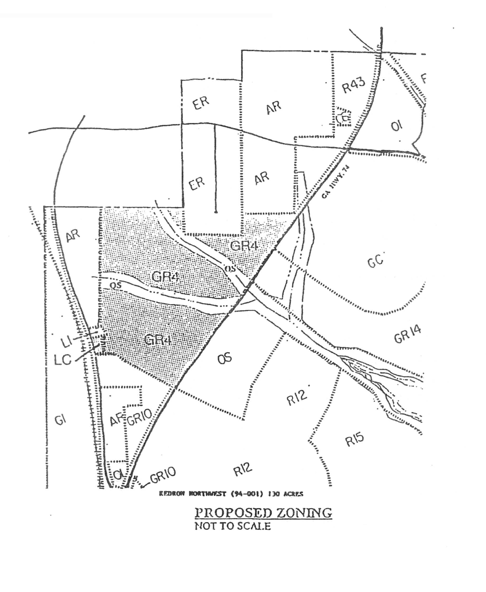
(Ord. No. 617, 5-5-1994)
(1004A.2) Newgate Road tract (GR-17).
(a)
The property described below shall be rezoned from its present classification of LUR-13 Limited Use Residential to GR-17 General Residential. Said property is more particularly described as follows:
ALL THAT TRACT OR PARCEL OF LAND LYING AND BEING IN LAND LOT 134 OF THE 7 th DISTRICT, FAYETTE COUNTY, GEORGIA AND BEING MORE PARTICULARLY DESCRIBED AS FOLLOWS:
BEGINNING AT A POINT ON THE WEST RIGHT OF WAY OF NEWGATE ROAD (60' R/W) BEING 508.00' NORTH OF A POINT WHERE THE WEST RIGHT OF WAY OF NEWGATE ROAD AND THE NORTH RIGHT OF WAY OF GEORGIAN PARK INTERSECT; THENCE RUNNING N 54 50 09 W A DISTANCE OF 248.37' TO AN IRON PIN FOUND ON THE EAST RIGHT OF WAY OF GEORGIA HIGHWAY 74 (R/W VARIES), THENCE RUNNING ALONG SAID R/W N 37 51 22 E A DISTANCE OF 36.55' TO AN IRON PIN FOUND, THENCE CONTINUING ALONG SAID R/W N 35 15 15 E A DISTANCE OF 600.00' TO A IRON PIN SET, THENCE CONTINUING ALONG SAID R/W N 42 03 54 E A DISTANCE OF 134.50' TO AN IRON PIN FOUND, THENCE LEAVING SAID R/W AND RUNNING S 13 17 35 E A DISTANCE OF 171.12' TO AN IRON PIN SET, THENCE RUNNING S 09 51 05 E, A DISTANCE OF 148.57' TO AN IRON PIN SET, THENCE RUNNING S 08 43 00 E A DISTANCE OF 188.47' TO AN IRON PIN FOUND, THENCE RUNNING S 23 58 55 W A DISTANCE OF 157.24' TO AN IRON PIN SET, THENCE RUNNING S 00 50 25 W A DISTANCE OF 102.46' TO AN IRON PIN FOUND, THENCE RUNNING S 36 37 57 W A DISTANCE OF 255.92' TO AN IRON PIN FOUND, THENCE RUNNING N 74 54 09 W A DISTANCE OF 97.50' TO AN IRON PIN FOUND ON THE EAST R/W OF NEWGATE ROAD, THENCE CURVING TO THE LEFT ALONG SAID R/W A CHORD BEARING OF N 10 06 19 E A CHORD DISTANCE OF 47.11', BEING SUBTENDED BY AN ARC DISTANCE OF 47.15' TO A POINT, CONTINUING ALONG SAID R/W N 06 08 01 E A DISTANCE OF 54.99' TO A POINT, THENCE CURVING TO THE RIGHT ALONG SAID R/W A CHORD BEARING OF N 13 27 34 E A CHORD DISTANCE OF 151.04', BEING SUBTENDED BY AN ARC DISTANCE OF 151.45' TO A POINT, CONTINUING ALONG SAID R/W N 20 47 06 E A DISTANCE OF 11.79' TO A POINT, THENCE CURVING TO THE RIGHT ALONG SAID R/W A CHORD BEARING OF N 45 37 30 E A CHORD DISTANCE OF 21.00', BEING SUBTENDED BY AN ARC DISTANCE OF 21.67' TO A POINT, CONTINUING ALONG SAID R/W CURVING TO THE LEFT A CHORD BEARING OF N 69 21 36 W A CHORD DISTANCE OF 77.51', BEING SUBTENDED BY AN ARC DISTANCE OF 292.72' TO A POINT, CONTINUING ALONG SAID R/W CURVING TO THE RIGHT A CHORD BEARING OF S 04 03 18 E A CHORD DISTANCE OF 21.00', BEING SUBTENDED BY AN ARC DISTANCE OF 21.67' TO A POINT, THENCE CONTINUING ALONG SAID R/W S 20 47 06 W, A DISTANCE OF 11.79' TO A POINT, THENCE CURVING TO THE LEFT ALONG SAID R/W A CHORD BEARING OF S 15 57 55 W A CHORD DISTANCE OF 109.66', BEING SUBTENDED BY AN ARC DISTANCE OF 109.79' TO THE POINT OF BEGINNING.
SAID TRACT CONTAINS 5.62 ACRES.
(b)
This tract is illustrated on the Boundary Survey prepared by Delta Surveyors, Inc. (dated April 20, 2010), a copy of which is attached hereto as Exhibit "A" and incorporated herein by express reference.
(c)
It is intended that the GR-17 zoning designation be established for the property specifically for the development of a 96-unit apartment complex for senior adults and that age restrictions be placed on the property to accommodate residents 62 years of age and older.
(d)
Development shall take place substantially in conformance with the schematic master plan prepared by Foley Design Associates Architects, Inc. (last revised May 18, 2010) for "Kedron Senior Residences," a copy of which is attached as Exhibit "B". It is understood the building layout, internal circulation, parking areas and stormwater detention areas may change once detailed site and grading plans are prepared; however, any increase in the total number of residential units or any modification to the conditions and requirements of this section shall require a new rezoning action.
(1004A.2.1) Permitted uses.
1.
No more than 96 apartments, all but two of which shall be age-restricted in accordance with paragraph 1004A.2.3(13) below, within the overall development. Two non-revenue producing units for on-site property management will not be age restricted, and occupancy of those units shall be restricted to employees serving the property.
2.
Ancillary uses, such as, but not limited to, the uses set forth in subsection 1004A.2.3(23), a beauty salon, barber shop, fitness studio or dining facility located wholly within the building.
3.
Publicly owned building, facility or land.
4.
Building, facility or land for the distribution of utility services.
5.
Building, facility or land for non-commercial park, recreation or open space purposes solely for the use of the occupants, staff, and guests of the development.
6.
Customary home occupations, as identified herein.
7.
Accessory uses, as identified herein.
(1004A.2.2) Conditional uses. No conditional uses shall be permitted within this zoning district.
(1004A.2.3) Other requirements.
1.
Minimum floor area per dwelling unit:
a.
One bedroom/one bath: 725 SF
b.
Two bedroom/one bath: 927 SF
c.
Two bedroom/two bath: 992 SF
2.
Minimum front building setback.
a.
Building: 40'
b.
Parking: 10'
3.
Minimum side setback. 15'; provided that the building layout and separation is in accordance with current building and life safety codes and approved by the city's building official and fire marshal.
4.
Minimum rear setback. 20'; provided that the building layout and separation is in accordance with current building and life safety codes and approved by the city's building official and fire marshal.
5.
Maximum building height. Each building shall be no more than three stories in height and shall not exceed 48 feet in height from finish grade to the ridge line or the tallest portion of the roof. The building height shall be reviewed and approved by the building official and fire marshal as a part of the site plan approval process.
6.
Building architecture, exterior materials and color selection shall follow the city's design guidelines ordinance.
7.
A minimum of one parking space shall be provided for each residential unit within the development. The parking area shall be designed in accordance with city specifications. Vehicular parking spaces shall measure no less than 9' × 18' and golf cart parking spaces shall measure no less than 6' × 10'. It is understood the parking areas for residents will be enclosed with a security fence with electronic security gates.
Dumpsters, loading and service areas shall not be located within any building setback areas and shall be properly screened from view in accordance with city ordinances.
8.
Multi-use path connections. The applicant shall coordinate with city staff to determine the location of a multi-use path connection from this development to the existing multi-use path on Newgate Road and shall be responsible for designing and constructing this multi-use path connection at no cost to the city.
9.
The maintenance of all internal parks, landscaped areas and signage shall be the sole responsibility of the developer; provided, however, that in the event a community association is formed for the development, such community association may assume responsibility for this requirement; and provided further, that if developer dedicates property to the city, the city shall be responsible for such maintenance upon acceptance of the dedication.
10.
The developer shall coordinate with the Fayette County Water Department and the city fire department to ensure that its project is served by appropriately sized water lines.
11.
Any development on the subject property shall comply with the city's post-construction stormwater runoff management ordinance and provide water quality best management practices (BMP's) on greenbelt areas dedicated to the city, if any.
12.
The location of any floodplain on the subject property shall be field located and surveyed prior to preparation of the engineering drawings. No development or land-disturbing activity shall be permitted within the floodplain, except as otherwise permitted by law.
13.
The developer shall coordinate with the city building, fire and police departments to ensure their understanding of the proposed development, internal circulation routes, emergency response, building design and life safety issues.
14.
The developer shall pay impact fees as identified within the city's impact fee ordinance in effect at the time of permit application submittal.
15.
Except as provided in subsection 1004A.2.1(1), the subject property and any residential units constructed thereon shall be restricted to housing for elderly persons as defined in 42 U.S.C. § 3607 (that being, persons 62 years of age or older). The developer shall adhere to policies and procedures that demonstrate the intent required under this provision. In addition, the developer, and its successors and assigns, shall comply with rules issued by the Secretary of the United States Department of Housing and Urban Development and/or the Georgia Department of Community Affairs for verification of occupancy.
16.
The developer shall notify the city of any changes in ownership or management of the subject property or the development located thereon.
17.
The developer shall work with city staff and the fire marshal to identify a suitable location for the security gates with the intent being to move the gates as far into the property, and away from any city right-of-way, as possible. At no time shall the entire development be gated such that vehicular traffic is completely restricted; provided, however, that parking for residents shall be secured.
a)
For purposes of this condition, "accessible," shall mean not restricted by a vehicular or pedestrian gate system. "Secured," shall mean that ingress and egress is restricted via the use of fences and gates. "Controlled," shall mean that ingress and egress will be limited via the use of manual locks, magnetic locks, call boxes, card readers, security cameras, and/or similar devices. The use of said devices to control access through doorways shall be at the discretion of the developer.
b)
At least one entrance to any building located upon the subject property, to be identified as the main public entrance, shall be accessible by vehicles and pedestrians. Access to the main public entrance shall be controlled. The developer shall provide visitor and employee parking in the vicinity of the main public entrance. Visitor and employee parking shall be for the use of the employees, visitors and potential residents. A section of the parking to be identified as resident parking shall be for the use of the residents and their visitors only. The resident parking shall be controlled and secured. Sections of any building upon the subject property in the vicinity of the resident parking shall be controlled and secured.
18.
The developer shall provide covered parking for golf carts on the property.
19.
The final site plan and architectural plans shall ensure that all mechanical units are properly screened from view from adjacent properties.
20.
The landscape plan for the subject property shall be reviewed and approved in accordance with the city's landscape ordinance.
21.
The developer shall prepare an annual audit report as required by the State of Georgia Department of Community Affairs to prove compliance with the requirements of paragraph 15 of this agreement. A copy of the annual audit report shall be provided to the city manager.
22.
Parking lot lighting shall be limited to decorative (post-top) fixtures and outdoor lighting shall be located and oriented such that adjacent properties and roadways are not adversely affected and such that no direct light is cast upon adjacent properties and roadways. The mounting height of outdoor lighting fixtures shall be limited to 20 feet; provided, however, that wall-mounted light fixtures may be mounted higher than 20 feet. The following types of lighting shall not be permitted: cobra-head, shoe-box, or pole-mounted flood lights.
23.
All signs erected on the property shall comply with the city sign ordinance in effect at the time of application for permits for such signs.
24.
The developer shall provide the following amenities on the subject property: community room, fitness center, game room, hair salon, picnic area with grill and covered pavilion, community gardening center with planter beds, and golf cart spaces and recharging stations. Such amenities shall be provided for at least 15 years after the issuance of the last certificate of occupancy for any structure located thereon; provided, however, that the developer shall have the discretion to replace or substitute these amenities with other amenities in order to adjust the needs of the tenants and to compete with similar residential communities.
(Ord. No. 1024, § 1, 3-3-2011; Ord. No. 1026, § 1, 3-3-2011)
(1004A.3) Parcels 0734 101 and 0734 016, Wilksmoor Village (87.6 acres).
(a)
The tract of land as described below shall be rezoned from its present zoning designation of GI General Industrial to GR-4 General Residential. Said property is more particularly described as follows:
All that tract or parcel of land lying and being in Land Lots 156, 157, & 158 of the 7 th District, City of Peachtree City, Fayette County, Georgia, and being more particularly described as follows:
BEGINNING at a nail found at the Land Lot corner common to Land Lots 157, 158, 164 and 165; Thence running along the Land Lot Line common to Land Lots 165 and 157, North 00°06'00" East, 1275.41 feet to a ½-inch rebar found; Thence, North 00°13'13" East, 2326.74 feet to a 1-inch open top pipe found along the line in common to Land Lots 156 and 166; Thence leaving said Land Lot line and running, North 88°35'16" East, 810.00 feet to a 1-inch open top pipe found along the southwesterly right-of-way of CSX Railroad (having a variable width right-of-way); Thence running along said southwesterly right-of-way of CSX Railroad, South 06°48'14" East, 1257.72 feet to a 1-inch open top pipe found; Thence leaving said southwesterly right-of-way of CSX Railroad and running, South 83°37'12" West, 174.91 feet to a 1-inch open top pipe found; Thence, South 06°49'12" East, 261.53 feet to a 1-inch open top pipe found; Thence, North 83°13'51" East, 174.74 feet to a 1-inch open top pipe found along said southwesterly right-of-way of CSX Railroad; Thence running along said southwesterly right-of-way of CSX Railroad, South 06°50'14" East, 881.45 feet to a ½-inch rebar found; Thence, South 06°49'25" East, 525.07 feet to a ½-inch rebar found; Thence leaving said southwesterly right-of-way of CSX Railroad and running, South 83°10'25" West, 100.00 feet to a ½-inch rebar found; Thence, South 06°50'15" East, 694.97 feet to a ½-inch rebar found; Thence, North 83°09'46" East, 100.02 feet to a ½-inch rebar found along said southwesterly right-of-way of CSX Railroad; Thence running along said southwesterly right-of-way of CSX Railroad, South 06°50'26" East, 244.35 feet to a ½-inch rebar found; Thence, North 89°38'32" West, 1281.77 feet to a 1-inch rod found along the line in common to Land Lots 158 and 164; Thence running along said Land Lot line, North 00°31'22" East, 206.43 feet to a nail found at the Land Lot corner common to Land Lots 157, 158, 164 and 165, and the true POINT OF BEGINNING.
Said tract contains 89.152 ACRES (3,883,453 square feet), more or less.
LESS AND EXCEPT the following tract or parcel of land:
All that tract or parcel of land lying and being in Land Lots 157 & 165 of the 7 th District, City of Peachtree City, Fayette County, Georgia, and being more particularly described as follows:
To find the true point of beginning, COMMENCE at a nail found at the corner common to Land Lots 157, 158, 164, and 165; thence run, South 00°31'22" West, 206.43 feet to a 1-inch rod found; thence, South 89°38'32" East, 1281.77 feet to a ½-inch rebar found along the southwesterly right-of-way of CSX Railroad (having a variable width right-of-way); thence, North 06°50'26" West, 244.35 feet to a ½-inch rebar found; thence leaving said southwesterly right-of-way of CSX Railroad and running, South 83°09'46" West, 100.02 feet to a ½-inch rebar found; thence, North 06°50'15" West, 694.97 feet to a ½-inch rebar found; thence, North 83°10'25" East 100.00 feet to a ½-inch rebar found along said southwesterly right-of-way of CSX Railroad; thence running along said southwesterly right-of-way of CSX Railroad, North 06°49'25" West, 525.07 feet to a ½-inch rebar found; thence, North 06°50'14" West, 881.45 feet to a 1-inch open top pipe found; thence leaving said southwesterly right-of-way of CSX Railroad and running, South 83°13'51" West, 174.74 feet to a 1-inch open top pipe found; thence running along a tie line, North 77°59'23" West, 629.69 feet to a point and the true POINT OF BEGINNING; Thence, South 00°00'00" West, 400.00 feet to a point; Thence, North 90°00'00" West, 206.92 feet to a point along the line in common to Land Lots 157 and 165; Thence running along said Land Lot line, North 00°13'13" East, 400.00 feet to a point; Thence leaving said Land Lot line and running, South 90°00'00" East, 205.38 feet to a point and the true POINT OF BEGINNING.
Said tract contains 1.893 ACRES (82,459 square feet), more or less.
(b)
These tracts are illustrated on the Survey for John Wieland Homes and Neighborhoods, Inc., prepared by Rochester & Associates, Inc. (dated June 30, 2006), a copy of which is attached hereto as Exhibit "A" and incorporated herein by express reference.
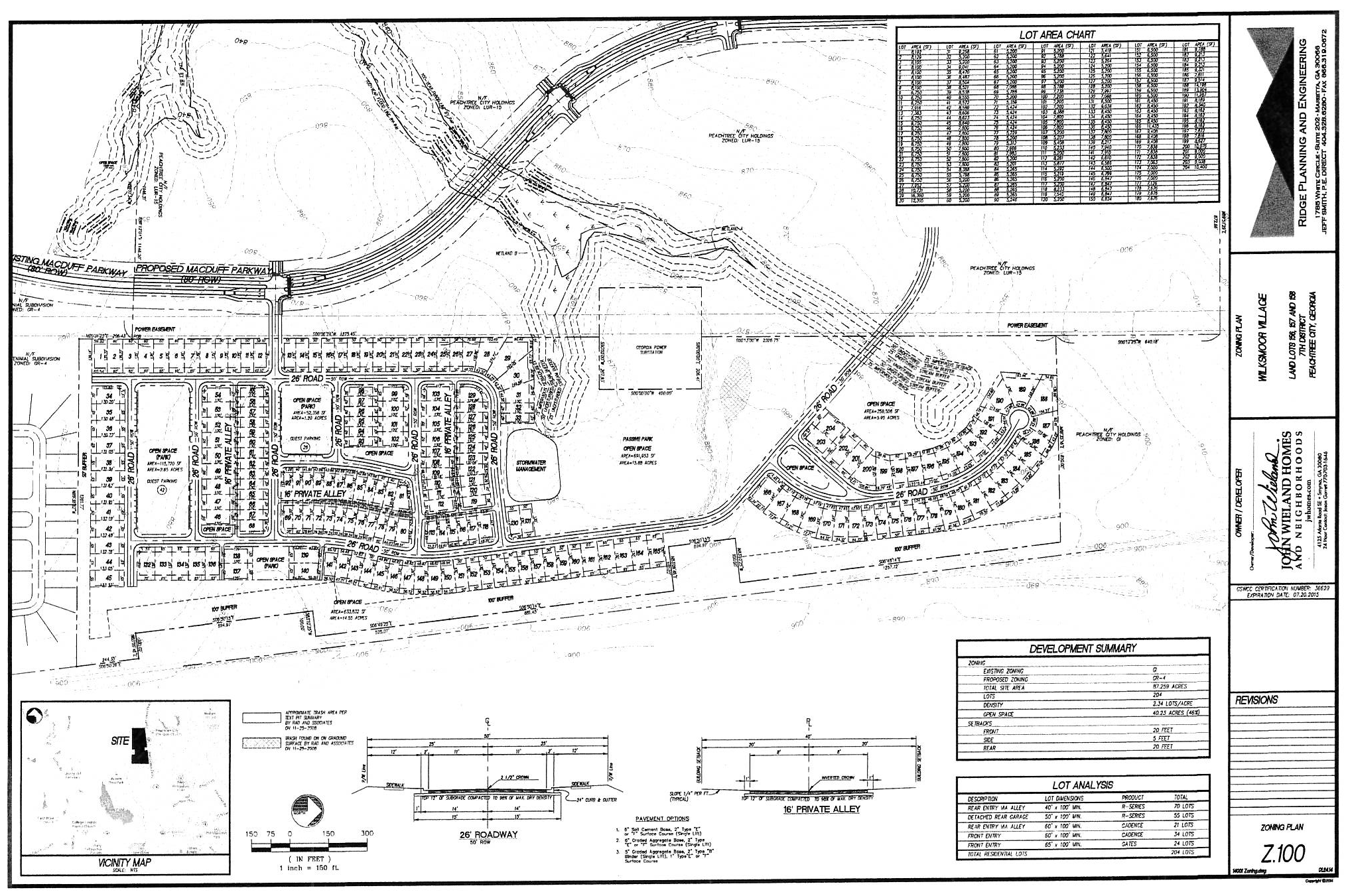
It is intended that the GR-4 zoning district be established specifically for the development of a 204-lot single-family detached residential subdivision to be developed substantially in accordance with the following express conditions:
(c)
Conformance with master plan. Development shall take place substantially in conformance with the Zoning Plan for Wilksmoor Village as prepared by Ridge Planning and Engineering (dated January 24, 2014), a copy of which is attached hereto as Exhibit "B" and incorporated herein by express reference. Any substantive change to this plan or any of the conditions and requirements of this section shall require a new rezoning action.
(d)
Permitted uses.
1.
No more than 204 single-family detached residential lots.
2.
Publicly owned buildings, facilities or land.
3.
Buildings, facilities or land for the distribution of utility services.
4.
Buildings, facilities or land for non-commercial park, recreation or open space purposes.
5.
Accessory uses, as identified herein.
(e)
Conditional uses.
(a)
Church or other place of worship on the following conditions:
(1)
Notwithstanding any other requirements in this ordinance, the following conditions shall apply to all churches regardless of zoning district.
(2)
Minimum zoning lot area is three acres.
(3)
Minimum lot width: 100 feet.
(4)
Minimum setback area, front:
a.
Building: 40 feet.
b.
Parking: 20 feet.
(5)
Minimum setback area, side: 15 feet. If adjoining a residential lot, the building setback shall be 75 feet.
(6)
Minimum setback area, rear: 30 feet. If adjoining a residential zoning lot, the building setback shall be 75 feet.
(7)
Maximum building height: As approved by the fire department.
(8)
All zoning lots shall have direct access onto an arterial, major collector road or have access to an arterial, major collector or industrial/commercial road via a minor collector.
(9)
No parking shall be permitted within 20 feet of the property line of any adjoining residential zoning lot.
(10)
Parking and/or service areas shall be separated from adjoining residential lots by a suitable fence or wall six feet in height or a suitable evergreen planting screen six feet in height at time of planting. The required fence, wall, or evergreen planting screen must provide for a reasonable visual separation between properties. No fence or wall in excess of four feet may be placed in a setback area adjoining a public street.
(11)
Any existing church in any zoning district may comply with either the requirement existing prior to enactment of this ordinance, or they may comply with the conditions of this section. They shall not be permitted to comply with various sections of both requirements.
(f)
Other requirements.
1.
Maximum number of dwelling units: 204.
2.
Minimum floor area per dwelling unit: 1,200 SF.
3.
Minimum zoning lot area per dwelling unit: 4,000 SF.
4.
Minimum lot width at building setback line: 30'.
5.
Minimum lot width at street: 30'.
6.
Minimum front building setback: 15'; provided that at least two paved parking spaces are provided for each dwelling unit off of the right-of-way; at least one of those spaces must be within a fully enclosed garage, and no part of the garage shall be located within 20' of the right-of-way.
7.
Minimum side setback: 0'; provided that at least a 10' separation is maintained between dwelling units. For corner lots, there shall be no less than a 10' building setback between the right-of-way and the edge of the structure.
8.
Minimum rear building setback: 10', provided that for those units served by a dedicated alley with garage access in the rear of the homes, at least one paved parking spaces shall be provided off of the alley for each home and no part of the garage shall be located less than 10' from the edge of the alley.
9.
Alley access: Alleys shall be a minimum of 20' in width and shall be paved with a suitable surface to support fire and emergency apparatus.
10.
Maximum building height: 3 stories, not including a basement level.
11.
Architectural concept: The architectural concept for the overall subdivision shall be similar to what was submitted to and approved by the planning commission and city council as a part of the rezoning.
Each home with a side elevation facing a public street shall include architectural detailing such that the elevation does not create a blank wall facing the public street.
(g)
The rezoning was approved by the mayor and city council on May 15, 2014 subject to the following understandings and conditions:
1.
The portion of MacDuff Parkway that will be constructed to provide access to these tracts shall be constructed in accordance with the road construction plans on file with the city engineer.
2.
A detailed multi-use path plan shall be submitted along with the concept plat. This property for the easements shall be deeded to the city as a part of the final platting process.
The applicant shall provide a multi-use path easement of no less than 20' in width across the front portion of the 17.2-acre tract of land north of Chadsworth Way, which will allow the city to construct a multi-use path from Chadsworth Way to Franklin Ridge Drive.
3.
A city-owned greenbelt of no less than 50 feet wide shall be maintained along the southern property line. Except for perpendicular utility crossings, clearing and/or grading shall not be permitted. Stormwater detention and/or water quality features shall not be permitted within this greenbelt. This property shall be deeded to the city as a part of the final platting process.
4.
A city-owned greenbelt of no less than 50 feet wide shall be maintained along the northern property line. Except for perpendicular utility crossings, clearing and/or grading shall not be permitted. Stormwater detention and/or water quality features shall not be permitted within this greenbelt. This property shall be deeded to the city as a part of the final platting process.
5.
A tree save and landscape buffer of no less than 25 feet in width shall be maintained at the rear of all lots abutting the Oglethorpe Transmission power line easement. Clearing and/or grading within this buffer, except for perpendicular utility crossings, shall not be permitted. This buffer shall be identified on the final plat and included within the deeds and covenants recorded for the subdivision.
It is understood the garages for some of these homes will be located at the rear of the property, and that the garages will be located in such a manner as to provide additional buffering between the homes and the transmission line easement. Where applicable, a fence will be provided between the garage and the home on the adjoining property to provide additional buffering.
6.
Existing vegetation in all areas identified as open space and/or buffer along the perimeter of the overall development shall be preserved to the greatest extent practicable prior to, during and following construction activities. It is understood stormwater facilities may be located within these areas. It is also understood the areas identified as internal parks and open space will be cleared and graded to create open, passive park areas within the development similar to those within the adjoining Centennial subdivision.
7.
The overall development shall comply with the city's post-construction stormwater runoff management ordinance and provide water quality best management practices (BMP's) on greenbelt areas dedicated to the city.
8.
The location of the floodplain shall be field located and surveyed prior to preparation of the engineering drawings. Absolutely no development shall be permitted within the floodplain.
9.
The maintenance of all internal parks, landscaped areas, signage, and subdivision entrances shall be the sole responsibility of the developer and/or the homeowner's association.
10.
The applicant shall establish deed covenants for the overall subdivision that shall limit rental units to no more than 20 percent of the total number of dwelling units in the subdivision. The covenants shall provide for the strict enforcement of the limit on rental units, and the developer shall establish the administrative structure for that enforcement prior to sale of the first dwelling unit in the subdivision.
11.
The developer shall pay impact fees for each residential lot within the subdivision as identified within the city's impact fee ordinance.
12.
No less than a 100 foot-wide city-owned greenbelt shall be provided between the rear property line of all lots along the eastern property boundary and the CSX rail line. Clearing and grading shall not be permitted within this area. This area shall be deeded to the city as a part of the final plat process.
A statement addressing the proximity of the development to the CSX rail line shall be developed with the involvement of city staff, the city attorney and the developer. This statement shall appear on the final plat and in the deed restrictions and covenants for the overall development.
13.
It is understood the rezoning applies to the entire tract of land, and the property is zoned for no more than 204 residential units. It is also understood that, until such time that MacDuff Parkway is complete and open to traffic, no more than 100 certificates of occupancy shall be issued for homes within the development.
EXHIBIT "A"
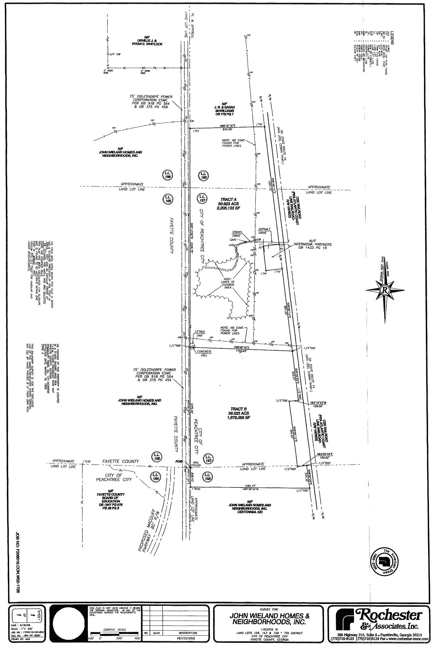
EXHIBIT "B"
(Ord. No. 1080, § 1, 5-15-2014)
(1004A.4) Parcel ID 0719056, Heritage of Peachtree City Tract, 3.50 acres.
(a)
A single tract of land as described below shall be rezoned from its present zoning designation of C-C Community Commercial (unincorporated Fayette County) to GR-14 General Residential (Peachtree City). Said property is more particularly described as follows:
All that tract or parcel of land lying and being in Land Lot 69 of the 7th District, Fayette County, Georgia, and being more particularly described as follows:
Beginning at an iron stake on the Northwest margin of Georgia State Route No. 54, which iron stake lies in a northeasterly direction along said Northwest margin of Georgia State Route No. 54 a distance of 1,634.3 feet from its intersection with the East boundary line of Land Lot 92; thence from said point of beginning North 87 degrees 53 minutes 42 seconds West a distance of 527.09 feet to an iron stake; thence North 00 degrees 58 minutes 40 seconds East a distance of 273.87 feet to an iron stake; thence South 86 degrees 12 minutes 45 seconds East a distance of 629.35 feet to an iron stake; thence South 22 degrees 49 minutes 41 seconds West a distance of 273.0 feet to an iron stake, said iron stake marking the point of beginning.
(b)
This tract is illustrated on the attached Exhibit "A" and incorporated herein by express reference.
(Ord. No. 1124, § 1, 4-6-2017)
Sec. 1005. - LC residual limited commercial district.
(1005.1) Intent of district: The LC limited commercial district is a residual zoning district which shall no longer allow new designation through rezoning. It is the specific purpose and intent of the residual LC district that existing tracts of land currently zoned LC be utilized as currently permitted and developed.
(1005.2) Permitted uses: The following uses shall be permitted in any LC zoning district:
(a)
Retail business involving the sale of convenience type merchandise in stores having a size of less than 6,000 square feet, and provided no processing is involved on the premises.
(b)
Business involving the rendering of a personal service in establishments having a size of less than 6,000 square feet.
(c)
Accessory use, as identified herein.
(1005.3) Conditional uses:
There shall be no conditional uses permitted within this zoning district.
(1005.4) Other requirements: Unless otherwise specified in this ordinance, uses permitted in LC zoning districts shall conform to the following standards:
(a)
Minimum zoning lot area: 20,000 square feet.
(b)
Minimum lot width: 100 feet.
(c)
Minimum front setback depth:
(1)
Building: 40 feet.
(2)
Driveway/parking: 20 feet.
(d)
Minimum side setback depth: Ten feet.
Note: If adjoining a residential zoning lot, the building setback shall be 75 feet.
(e)
Minimum rear setback depth: 20 feet.
Note: If adjoining a residential zoning lot, the building setback shall be 75 feet.
(f)
Maximum building height: 35 feet.
(g)
Storage: No storage will be permitted on the zoning lot outside a fully enclosed building.
(h)
All zoning lots shall have direct access onto an arterial, major collector or industrial/commercial road or have access to an arterial, major collector or industrial/commercial road via an access street.
(i)
No automobile parking or service areas will be permitted within the required front depth setback depth or within 30 feet of the property line of any adjoining residential zoning lot.
(j)
Parking and service areas must be separated from adjoining residential lots by a suitable evergreen planting screen, fence or wall at least six feet in height above finished grade. The required screen, fence or wall must provide for a reasonable visual separation between the properties.
(k)
No outside loudspeaker systems shall be utilized.
(l)
All lights or lighting arrangements used for purposes of advertising, security or night operations must be directed away from adjoining or nearby residential zoning lots.
(Ord. No. 951, § 1, 8-7-2008)
Editor's note— Ord. No. 951, § 1, adopted August 7, 2008, repealed former § 1005 and enacted new § 1005 as set out herein. The former section pertained to similar subject matter and derived from Ord. No. 233, 4-2-1981; Ord. No. 268, § 1(C)(5), 6-3-1982; Ord. No. 366, § 19, 5-22-1985; Ord. No. 408, 8-21-1986; Ord. No. 824, 12-18-2003.
Sec. 1005A. - OI office institutional district.
(1005A.1) Intent of district: It is intended that the OI zoning district be established for office oriented business purposes. The regulations which apply within this district are designed to encourage the formation and continuance of a stable, economically healthy and compatible environment for office uses that are located so as to provide nearby areas with convenient service facilities. These regulations are also intended to reduce traffic congestion, provide adequate off-street parking, avoid the development of "strip" type business areas, and discourage encroachment by other uses capable of adversely affecting the limited character of the district.
(1005A.2) Permitted uses: The following uses shall be permitted in any OI office/institutional zoning district:
(a)
Business and professional offices, including medical, dental, legal, financial, architectural, engineering, real estate, insurance and manufacture representatives, provided no goods are offered for sale on the premises.
(b)
Business involving the rendering of a personal service in establishments having a size of 6,000 square feet or less.
(c)
Noncommercial club or lodges.
(d)
Funeral home.
(e)
Publicly owned building, facility or land.
(f)
Building, facility or land for the distribution of utility services.
(g)
Building, facility or land for noncommercial park, recreation, thoroughfare or open space purposes.
(h)
Building, facility or land for off-street automobile parking.
(i)
Government offices.
(j)
Research/testing facilities and professional laboratories.
(k)
Banks and financial institututions with drive-thru establishment or automated transfer machines.
(l)
Educational institutions, including colleges and universities, business schools, trade schools, professional schools and technical schools.
(m)
Accessory use, as identified herein.
(1005A.3) Conditional uses: The following uses shall be permitted in any OI zoning district on a conditional basis:
(a)
Church or other place of worship, on the following conditions:
(1)
Notwithstanding any other requirements in this ordinance, the following conditions shall apply to all churches regardless of zoning district.
(2)
Minimum zoning lot: 3 acres.
(3)
Minimum lot width: 100 feet.
(4)
Minimum setback area, front:
(a)
Building: 40 feet.
(b)
Parking: 20 feet.
(5)
Minimum setback area, side: 15 feet.
Note: If adjoining a residential lot, the building setback shall be 75 feet.
(6)
Minimum setback area, rear: 30 feet.
Note: If adjoining a residential zoning lot, the building setback shall be 75 feet.
(7)
Maximum building height: As approved by the fire department.
(8)
All zoning lots shall have direct access onto an arterial, major collector road or have access to an arterial, major collector or industrial/commercial road via a minor collector.
(9)
No parking shall be permitted within 20 feet of the property line of any adjoining residential zoning lot.
(10)
Parking and/or service areas shall be separated from adjoining residential lots by a suitable fence or wall six feet in height or a suitable evergreen planting screen six feet in height at time of planting. The required fence, wall, or evergreen planting screen must provide for a reasonable visual separation between properties. No fence or wall in excess of four feet may be placed in a setback area adjoining a public street.
(11)
Any existing church in any zoning district may comply with either the requirement existing prior to enactment of this ordinance, or they may comply with the conditions of this section. They shall not be permitted to comply with various sections of both requirements.
(b)
Retail and service facilities located within an office or institutional building and catering to employees, students and clients of clients of office and institutions located within the district excluding gasoline sales and motor vehicle repair.
(c)
Indoor, sit-down restaurants with not more than 60 seats, provided that no drive-thru or drive-in facilities are permitted.
(1005A.4) Other requirements: Unless otherwise specified in this ordinance, uses permitted in OI zoning districts shall conform to the following standards:
(a)
Minimum zoning lot area: 20,000 square feet.
(b)
Minimum lot width: 100 feet.
(c)
Minimum front setback depth:
(1)
Building: 40 feet.
(2)
Driveway/parking: 20 feet.
(d)
Minimum side setback depth: Ten feet
Note: If adjoining a residential zoning lot, the building setback shall be 75 feet.
(e)
Minimum rear setback depth: 20 feet.
Note: If adjoining a residential zoning lot, the building setback shall be 75 feet.
(f)
Maximum building height: 35 feet.
(g)
Storage: No storage will be permitted on the zoning lot outside a fully enclosed building.
(h)
All zoning lots shall have direct access onto an arterial, major collector or industrial/commercial road or have access to an arterial, major collector or industrial/commercial road via an access street.
(i)
No automobile parking or service areas will be permitted within the required front setback depth or within 30 feet of the property line of any adjoining residential zoning lot.
(j)
Parking and service areas must be separated from adjoining residential lots by a suitable evergreen planting screen, fence or wall at least six feet in height above finished grade. The above required evergreen planting screen, fence or wall must provide for a reasonable visual separation between the properties.
(k)
No outside loudspeaker systems shall be utilized.
(Ord. No. 952, § 1, 8-7-2008)
Editor's note— Ord. No. 952, § 1, adopted August 7, 2008, repealed former § 1005A and enacted new § 1005A as set out herein. The former section pertained to similar subject matter and derived from Ord. No. 174(b), 1-25-1979; Ord. No. 233, 4-2-1981; Ord. No. 260, 5-6-1982; Ord. No. 268, § 1(C)(6), 6-3-1982; Ord. No. 366, § 19, 5-22-1985; Ord. No. 408, 8-21-1986; Ord. No. 588, 11-19-1992; Ord. No. 709, 3-18-1999.
Sec. 1005B. - Property rezoned to OI.
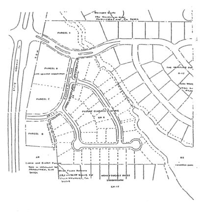
(1005B.1) Three tracts of land fronting on Georgia Highway 74 North are rezoned from GR-6 general residential to OI office/institutional. These three tracts of land are more particularly described on a document entitled "Proposed Zoning and Development Map for the McWilliams Property," drawn by Lorber and Associates and dated July 22, 1994. Said map is maintained in the office of the city clerk, and a copy is incorporated herein as figure 1005B.1. For purposes of identification, the three tracts affected by this rezoning action are labeled parcel "A" (about 1.2 acres), parcel "C" (about 1.3 acres), and Parcel "D" (about 1.0 acres). Altogether, this rezoning includes 3.5 acres.
Figure 1005B.1
(Ord. No. 628, 10-20-1994)
(1005B.2) Ergle tract:
(a)
Two tracts of property described below shall be rezoned from their present classification of AR Agricultural Reserve to OI Office Institutional. Said properties are more particularly described as follows:
Tract 1: All that tract or parcel of Land lying and being in Land Lot 158 of the 7th District, Fayette County, Georgia and being more particularly described as follows:
Beginning at an ½" rebar placed at the northern right-of-way of Wisdom Road and the eastern right of way of State Road 74 and the thence along said eastern right of way line along a curve to the right an arc distance of 281.58 feet having a radius of 2,754.80 feet being subtended by a chord of North 08°18'59" West a distance of 281.46 feet to a point; thence North 08°18'59" West, a distance of 258.43 feet to an axle found; thence North 88°15'12" East, a distance of 230.09 feet to a ½" rebar set; thence South 08°05'23" East, a distance of 164.19 feet to an axle found; thence South 86°09'27" West, a distance of 20.92 feet to a point; thence South 09°39'51" East, a distance of 343.73 feet to a point on the northern right of way of Wisdom Road; thence along said right of way along a curve to the left an arc distance of 126.34 feet having a radius of 1885.25 feet being subtended by a chord of South 80°38'37" West a distance of 126.32 feet to a point; thence South 78°06'30" West, a distance of 78.02 feet to a ½" rebar placed and the Point of Beginning. Containing 112,309 square feet or 2.578 acres.
Tract 2: All that tract or parcel of Land lying and being in Land Lot 158 of the 7th District, Fayette County, Georgia and being more particularly described as follows:
Commencing at a ½" rebar placed at the northern right-of-way of Wisdom Road and the eastern right of way of State Road 74 and the thence along said eastern right of way line North 78°06'30" East, a distance of 78.02 feet to a point; thence along said right of way along a curve to the right an arc distance of 126.34 feet having a radius of 1885.25 feet being subtended by a chord of North 80°38'37" East a distance of 126.32 feet to a point and THE TRUE POINT OF BEGINNING; thence leaving said right of way North 09°39'51" West, a distance of 343.73 feet to a point; thence North 86°09'27" East, a distance of 20.92 feet to an axle found; thence North 86°09'27" East, a distance of 164.49 feet to a 1-1/2" open top pipe found; thence South 09°21'05" East, a distance of 342.78 feet to an axle found on the northern right of way of Wisdom Road; thence along said northern right of way South 87°53'27" West, a distance of 88.22 feet to a point; thence continuing along said right of way along a curve to the left an arc distance of 95.35 feet having a radius of 1885.25 feet being subtended by a chord of South 84°05'45" West a distance of 95.34 feet to a point an THE TRUE POINT OF BEGINNING. Containing 62,694 square feet or 1.440 Acres.
(b)
The above-described tracts are illustrated in the Boundary and Topography Survey prepared by Metro Engineering and Surveying Company, Inc. (dated March 14, 2005), a copy of which is attached hereto as exhibit "A" and incorporated herein by express reference.
It is intended that the OI zoning district be established specifically for a commercial and office complex to be developed substantially in accordance with the following express conditions:
(1005B.2.1) Conformance with master plan. Development shall take place in conformance with the master plan prepared by Summer/Wise & Associates Architects (last revised April 25, 2005), a copy of which is attached hereto as exhibit "B" and incorporated herein by express reference. Any substantive change to this plan or any of the conditions and requirements of this section shall require a new rezoning action.
(1005B.2.2) Permitted uses.
(a)
Business, professional, and government office facilities.
(b)
Business involving the rendering of a personal service on the premises in establishments having a size of 6,000 square feet or less.
(1005B.2.3) Uses not permitted.
(a)
Transportation facility or terminal.
(b)
Self-service storage facilities, i.e., mini-warehouses.
(c)
Adult bookstores.
(d)
Package stores.
(e)
Gas stations.
(f)
Off-street auto parking facility.
(g)
Massage parlors.
(h)
Open yard for the sale, rental, and/or storage of materials or equipment, including junk or salvage materials.
(i)
Convenience-type stores.
(j)
Restaurants or food service establishments.
(k)
Bars.
(1005B.2.4) Conditional uses. No conditional uses shall be permitted within this zoning district.
(1005B.2.5) Other requirements.
(a)
Maximum building size. The overall area of all commercial and office space shall not exceed 39,000 SF.
(b)
Building height. The maximum building height shall not exceed three stories or 60 feet in height from finish grade.
(c)
Parking. Parking shall be provided as set forth in Section 909. Dumpsters, loading and service areas shall not be located within any building setbacks and shall be properly screened from view in accordance with current city ordinances.
The owner of the property shall ensure that vehicles parking on the property are limited to those used by employees or visitors of the tenants within the buildings. The entire parking lot shall be posted as "No Parking" after business hours and shall not be used as overflow parking for any of the surrounding businesses.
(d)
Landscape buffer. A minimum landscaped buffer of no less than 25' in width shall be provided between this development and the adjoining Fairfield subdivision. All landscaped islands shown in the parking area must be provided. Within this buffer, a combination of meandering berms, fencing and landscaping must be installed to provide a permanent vegetated buffer separating the two properties. The berm must be a minimum of two to three feet in height with a minimum four- to five-foot high privacy fence as shown on the Conceptual Buffer Plan prepared by Peterson Planning (last revised May 27, 2005), a copy of which is attached hereto as exhibit "C" and incorporated herein by express reference.
The purpose of the landscape buffer is to provide a minimum visual screen of ten feet in height from the finish grade of the parking lot at the time of installation. The fence shall be painted or stained a neutral color and shall be maintained by the property owner. A combination of evergreen shrubs and trees shall be installed on both sides of the fence.
The berm and landscaping shall extend beyond the property within the city-owned greenbelt behind the residential lots backing up to Wisdom Road and taper into the existing dense foliage to provide a vegetated buffer in this area.
(e)
Curb cuts. The overall development shall be limited to one right-in/right-out curb cut on GA 74. The teardrop island within this entrance must consist of stamped and stained concrete, brick or concrete pavers as opposed to plain concrete. The overall site will be limited to two full-turning entrances from Wisdom Road.
(f)
Access drive. The internal access drive interconnecting with the adjoining Dalton West tract shall be designed in such a manner as to allow the free-flow of traffic through this site from Wisdom Road to the adjoining property.
(g)
Architectural concept. A unified architectural concept for the overall tract must be developed and approved by the planning commission. The architectural design, building materials and color selections of all buildings and structures on the site must be substantially the same or similar to the schematic elevations as prepared by Summer/Wise & Associates Architects (dated June 2, 2005), a copy of which is attached hereto as exhibit "D" and incorporated herein by express reference.
All sides of each building and structure on the site must include similar architectural detailing, building materials and color selections. Standard wall pack or other security lighting shall not be permitted on the exterior of the buildings unless approved by the planning commission.
(g)
Site lighting. A complete site lighting plan, including all lighting proposed on the exterior of the buildings, must be developed and approved by the planning commission. A lighting plan must be submitted which indicates that light from the parking lots, drive aisles, drive-thru and ATM buildings does not leave the property boundaries. The level of illumination within all parking and service areas must not exceed three foot-candles. Lighting underneath the ATM canopy shall comply with current federal regulations.
The level of illumination at all property boundaries must not exceed 0.5 footcandles. Light poles within the parking areas and drive aisles adjacent to the adjoining subdivision must be no higher than 14 feet from finish grade. Additionally, all lights within 50 feet of the rear property boundary must be placed on a timer and turned off no later than 11:00 p.m. each night.
(h)
Signage program. Signage shall be provided as set forth within the city's sign ordinance and in accordance with an overall sign program for the tract that shall be approved by the planning commission.
(i)
Outdoor speakers. All outdoor speaker systems must be adjusted so that noise from these speakers does not carry onto adjoining properties.
(j)
Landscape concept. A complete landscape plan must be developed and approved by the planning commission. The plan must provide for a fully landscaped entrances off of GA 74 and Wisdom Road, including meandering berms and substantial landscaping within the tree save and landscape buffer adjacent to GA 74. Clearing and grading shall be kept to a minimum within the landscaped buffers adjacent to the adjoining subdivision, and these areas must be heavily landscaped with evergreen trees and plant material to assist in providing a visual separation between the proposed development and the adjoining subdivision. All landscaped areas within the site, including the GA 74 and Wisdom Road right-of-ways, must be irrigated.
(k)
Utility connections. The property must be connected to the city's sanitary sewer system, and the existing septic systems must be removed. All overhead utility lines that traverse the site must be relocated underground.
(l)
Business hours. The business hours of operation for all tenants within both buildings open to the general public, unless a specific business operates by appointments, shall be limited to 6:00 a.m.—9:00 p.m.
(m)
Multi-use path connection. A multi-use path connection must be provided to this development and shall be located within the right-of-way on the north side of Wisdom Road and extend from the existing entrance to the Fairfield subdivision to the easternmost entrance to this development. The multi-use path must be located so that berming and landscaping can be provided between the path and the city-owned greenbelt where applicable.
(n)
Signal warrant study. The applicant shall fund up to, but not exceeding $9,000.00, to the city for the preparation of a Signal Warrant Study for the GA 74/Wisdom Road intersection. This fee shall be in addition to any funds already spent to prepare traffic studies or signal warrant studies to date.
(o)
Application of requirements and conditions. The requirements and conditions specified in this section shall remain in effect unless specifically amended or revoked by subsequent action of city council in accordance with the established procedure for zoning amendments; and, in addition, if it is determined that the property will not be developed in substantially the same manner as depicted on the Summer/ Wise & Associates Architects master plan referenced above, and each condition of that plan substantially complied with, the zoning of this property shall automatically revert back to the zoning the property currently holds.
(Ord. No. 848, 6-2-05)
(1005B.3) HomeTech Mortgage, LLC tract:
(a)
The property described below shall be rezoned from its present classification of AR Agricultural Reserve to OI Office Institutional. Said property is more particularly described as follows:
All that tract or parcel of land lying and being in Land Lot No. 158 of the 7 th District, Fayette County, Georgia, and more particularly described as follows:
Beginning at a point on the east right-of-way line of State Highway No. 74, which point is located 212.6' southerly from the north Land Lot Line of said Land Lot No. 158 as measured along the easterly right-of-way line of said State Highway No. 74; and from the Point of Beginning thus determined running thence North 86 ½ degrees east a distance of 231.6 feet to an iron pin; running thence south 1 ¼ degrees west a distance of 100 feet to an iron pin; running thence south 86 ½ degrees west to the easterly right-of-way line of State Highway No. 74; running thence northerly along the right-of-way of said highway a distance of 100 feet to the Point of Beginning; less and except any portion of captioned property lying and being within the right-of-way of Georgia Highway 74.
(b)
The above-described tract is illustrated in the Boundary and Topography Survey prepared by W.D. Gray and Associates, Inc. (dated January 26, 2006), a copy of which is attached hereto as exhibit "A" and incorporated herein by express reference.
It is intended that the OI zoning district be established specifically for a single office building to be developed substantially in accordance with the following express conditions:
(1005B.3.1) Conformance with master plan. Development shall take place in conformance with the schematic site plan prepared by Lorber & Associates, Inc., a copy of which is attached hereto as exhibit "B" and incorporated herein by express reference. Any substantive change to this plan or any of the conditions and requirements of this section shall require a new rezoning action.
(1005B.3.2) Permitted uses.
(a)
Business, professional, and government office facilities.
(b)
Business involving the rendering of a personal service on the premises in establishments having a size of 6,000 square feet or less.
(1005B.3.3) Uses not permitted.
(a)
Transportation facility or terminal.
(b)
Self-service storage facilities, i.e., mini-warehouses.
(c)
Adult bookstores.
(d)
Package stores.
(e)
Gas stations.
(f)
Off-street auto parking facility.
(g)
Massage parlors.
(h)
Open yard for the sale, rental, and/or storage of materials or equipment, including junk or salvage materials.
(i)
Convenience-type stores.
(j)
Restaurants or food service establishments.
(k)
Bars.
(1005B.3.4) Conditional uses. No conditional uses shall be permitted within this zoning district.
(1005B.3.5) Other requirements.
(a)
Maximum building size. The overall area of the office building shall not exceed 4,000 s.f.
(b)
Building height. The maximum building height shall not exceed one story in height.
(c)
Parking. Parking shall be provided as set forth in Section 909. Dumpsters, loading and service areas shall not be located within any building setbacks and shall be properly screened from view in accordance with current city ordinances.
(d)
Curb cuts. The overall development shall be limited to one right-in/ right-out curb cut on GA 74 with appropriate turning lanes as approved by GDOT. The teardrop island within this entrance must consist of stamped and/or stained concrete, brick or concrete pavers as opposed to plain concrete.
(e)
Interparcel access. Interparcel access should be provided between this development and the adjoining Campanile's Home Furnishings tract to the north.
(f)
Architectural concept. The architectural design and exterior building materials of the proposed building must be compatible with the surrounding developments. All sides of the building must include architectural detailing and similar building materials. Additionally, no wall-packs or other external security lighting sources will be permitted on the building.
(g)
Site lighting. A complete site lighting plan, including all lighting proposed on the exterior of the buildings, must be developed and approved by the planning commission. All lighting within the parking lot shall be limited to 250-watt high-pressure sodium fixtures with a maximum pole height of 30 feet from finish grade to the top of the pole. The level of illumination within the parking area must not exceed three foot-candles
(h)
Signage program. Signage shall be provided as set forth within the city's sign ordinance and in accordance with an overall sign program for the tract that shall be approved by the planning commission. The property shall be limited to one monument sign; one wall sign facing SR 74 identifying the name of the main tenant within the building; and no window signs or other individual tenant signage outside of the building.
(i)
Landscape concept. A complete landscape plan must be developed and approved by the planning commission. The plan must provide for a fully landscaped entrance off of GA 74, including meandering berms and substantial landscaping within the tree save and landscape buffer adjacent to GA 74 to screen views to the parking lot. All landscaped areas within the site, including the GA 74 right-of-way, must be irrigated.
(j)
Utility connections. The property must be connected to the city's sanitary sewer system, and the existing septic systems must be removed. All overhead utility lines that traverse the site must be relocated underground.
(k)
Application of requirements and conditions. The requirements and conditions specified in this section shall remain in effect unless specifically amended or revoked by subsequent action of city council in accordance with the established procedure for zoning amendments; and, in addition, if it is determined that the property will not be developed in substantially the same manner as depicted on the Lorber & Associates schematic site plan referenced above, and each condition of that plan substantially complied with, the zoning of this property shall automatically revert back to the zoning the property currently holds.
(Ord. No. 886, 6-15-2006)
Editor's note— The exhibits referred to in this section may be found at the city clerk's office.
(1005B.4) Peeples Lake tract.
(a)
A single tract of land described below shall be rezoned from its present zoning classification of O-I Office Institutional (Fayette County) to OI Office Institutional (Peachtree City). Said property is more particularly described as follows:
All that tract or parcel of land lying and being in Land Lot 18 of the 6th Land District of Fayette County, Georgia, and being more particularly described as follows:
Begin at a 1" open topped pipe marking the intersection of the northerly right-of-way of State Route 74 and the westerly Land Lot Line of Land Lot 18 also being the easterly property line of The Fayette County Animal Shelter Property; Thence North 00°32'24" East for a distance of 309.94 feet to a 1" open topped pipe; Thence North 00°26'34" West for a distance of 238.06 feet to a point; Thence South 88°22'43" East for a distance of 549.08 feet to a point; Thence South 01°36'53" West for a distance of 200.11 feet to a point; Thence South 88°23'06" East for a distance of 900.43 feet to a point; on the westerly right-of-way of Redwine Road, said right-of-way is 80 feet at this point; Thence South 11°35'40" East for a distance of 201.77 feet to a transitional right-of-way between Redwine Road and the northerly right-of-way of State Route 74; Thence along the transitional right-of way the following bearing and distances, South 01°34'50" West for a distance of 78.75 feet to a point; Thence South 12°23'16" West for a distance of 33.26 feet to a point; Thence South 56°11'01" West for a distance of 43.29 feet to a point on the northerly right-of-way of State Route 74; THENCE along said right-of-way of State Route 74 the following calls: along a curve to the left having a radius of 1237.54 feet and an arc length of 76.51 feet, being subtended by a chord of North 81°36'51" West, for a distance of 76.50 feet to a point; THENCE along a curve to the left having a radius of 12001.54 feet and an arc length of 153.93 feet, being subtended by a chord of North 85°31'56" West, for a distance of 153.93 feet to a point; THENCE along a curve to the left having a radius of 5330.60 feet and an arc length of 676.05 feet, being subtended by a chord of North 86°56'01" West, for a distance of 675.60 feet to a point; THENCE along a curve to the left having a radius of 5330.60 feet and an arc length of 477.00 feet, being subtended by a chord of South 86°53'14" West, for a distance of 476.84 feet to a point; THENCE along a curve to the left having a radius of 5330.60 feet and an arc length of 60.20 feet, being subtended by a chord of South 82°52'03" West, for a distance of 60.20 feet to the Point of Beginning; Together with and subject to covenants, easements, and restrictions of record.
Said property contains 13.0 acres.
(b)
This tract is illustrated on the Boundary and Topography Survey prepared by Integrated Science and Engineering (dated August 8, 2006), a copy of which is attached hereto as exhibit "A" and incorporated herein by express reference.
It is intended that the OI zoning district be established specifically for a medical and professional office complex to be developed substantially in accordance with the following express conditions:
(1005B.4.1) Conformance with master plan.
Development shall take place in conformance with the master plan prepared by Group VI Corporation (last revised October 18, 2006), a copy of which is attached hereto as Exhibit "B" and incorporated herein by express reference. Any substantive change to this plan or any of the conditions and requirements of this section shall require a new rezoning action.
(1005B.4.2) Permitted uses.
(a)
Business, professional, and government office facilities.
(b)
Business involving the rendering of a personal service on the premises in establishments having a size of 6,000 square feet or less.
(c)
Indoor commercial recreation facility.
(d)
Social, civic or professional club.
(e)
School, college or university.
(1005B.4.3) Uses not permitted.
(a)
Transportation facility or terminal.
(b)
Self-service storage facilities, i.e., mini-warehouses.
(c)
Adult bookstores.
(d)
Package stores.
(e)
Gas stations.
(f)
Off-street auto parking facility.
(g)
Massage parlors.
(h)
Open yard for the sale, rental, and/or storage of materials or equipment, including junk or salvage materials.
(i)
Convenience-type stores.
(j)
Restaurants or food service establishments.
(k)
Bars.
(1005B.4.4) Conditional uses.
No conditional uses shall be permitted within this zoning district.
(1005B.4.5) Other requirements.
(a)
Maximum building size. The gross square footage of all buildings shall not exceed 110,000 SF.
(b)
Setbacks. All impervious surfaces shall be located no less than forty (40) feet from SR 74 and no less than thirty (30) feet from Redwine Road.
The minimum front building setbacks adjacent to SR 74 and Redwine Road shall be no less than forty (40) feet.
The minimum side setback shall be no less than ten (10) feet. Where the subject tract adjoins a residentially-zoned property, the minimum building setback shall be no less than seventy-five (75) feet.
The minimum rear setback shall be no less than 25'. Where the subject tract adjoins a residentially-zoned property, the minimum building setback shall be no less than seventy-five (75) feet, except on Parcel "A", where the minimum building setback shall be no les than thirty (30) feet.
(c)
Building height. The maximum building height shall not exceed sixty (60) feet in height from finish grade to the top of the building.
(d)
Parking. Parking shall be provided as set forth in Section 909. Dumpsters, loading and service areas shall not be located within any building setbacks and shall be properly screened from view in accordance with current ordinances.
Parking and/or access drives shall be located no closer than thirty (30) feet from any residentially-zoned property.
(d)
Landscape buffer. Landscaped buffers shall be provided between the development on this site and the adjoining residentially-zoned property and along SR 74 and Redwine Road. Within these buffers, a combination of meandering berms and evergreen plant material must be installed to provide a permanent vegetative buffer. The berms must be a minimum of four (4) feet in height with 4:1 slopes.
The landscape buffer adjacent to SR 74 shall be no less than forty (40) feet in width, as measured from the right-of-way.
The landscape buffer adjacent to Redwine Road shall be no less than thirty (30) feet in width, as measured from the right-of-way.
The landscape buffer adjacent to residentially-zoned property shall be no less than thirty (30) feet in width, as measured from the property line.
(e)
Curb cuts. The overall development shall be limited to one existing full-turning and one future right-in/ right-out curb cut on SR 74 as well as one future full-turning curb cut on Redwine Road. All future curb cuts shall consist of stamped and stained concrete, brick or concrete pavers as opposed to plain concrete.
(f)
Architectural concept. A unified architectural concept for the overall tract must be developed and approved by the Planning Commission. The architectural design, building materials and color selections of all buildings and structures on the site must be substantially the same or similar to the rendering of the Starr's Mill Professional Center building as provided by Group VI Corporation (dated October 9, 2008), a copy of which is attached hereto as Exhibit "C" and incorporated herein by express reference.
All sides of each building and structure on the site must include similar architectural detailing, building materials and color selections. Standard wall pack or other security lighting on the exterior of the buildings shall be limited to full cutoff fixtures.
(g)
Site lighting. A complete site lighting plan, including all lighting proposed on the exterior of the buildings, must be developed and approved by the Planning Commission. All site lighting must include high-pressure sodium fixtures. A lighting plan must be submitted which indicates that light from the parking lots and drive aisles does not leave the property boundaries. The average level of illumination within all parking and service areas must not exceed 3 foot-candles. Flood and/or spot lights attached to the light poles used to illuminate the site or the buildings shall not be permitted.
The level of illumination at all property boundaries must not exceed 0.5 footcandles.
(h)
Signage program. Signage shall be provided as set forth within the City's Sign Ordinance and in accordance with an overall sign program for the tract that shall be approved by the Planning Commission.
(i)
Outdoor speakers. Outdoor speakers shall not be permitted.
(j)
Landscape concept. A complete landscape plan must be developed and approved by the Planning Commission. The plan must provide for fully landscaped entrances off of GA 74 and Redwine Road, including meandering berms and substantial landscaping within the tree save and landscape buffers adjacent to both roads.
All required landscaping shall be maintained in a horticulturally healthy an aesthetically pleasing manner. All planting beds and lawn areas should include an underground irrigation system with a programmable timer and operational rain shut-off device. If an underground irrigation system is not available, all planting areas shall be no more than one hundred (100) feet from a watering source and assurances shall be furnished to the city landscape architect that water will be available and appropriate watering shall take place.
(k)
Utility connections. The property must be connected to the City's sanitary sewer system, and the existing septic systems must be removed upon development of that portion of the overall site.
To the greatest extent practicable, all overhead utility lines that traverse the site, except for high voltage transmission lines, shall be relocated underground or removed from the site.
(l)
Business hours. The business hours of operation for all tenants within all buildings open to the general public, unless a specific business operates by appointments, shall be limited to 6:00 a.m.—9:00 p.m.
(m)
Multi-use path connection. A multi-use path connection must be provided to this development and shall be located within the GDOT right-of-way and/or on city-owned property on the north side of SR 74. The multi-use path shall be constructed as each portion of the site is developed and shall be incorporated into the berming and landscaping adjacent to SR 74 and Redwine Road.
(n)
Change in use of adjoining property. All buffers and setbacks adjoining existing residentially-zoned property that require additional depth or width because of the adjoining zoning designation, shall be automatically reduced to standard widths, as described within this ordinance, upon the changing of zoning designations of those residential properties.
(o)
Application of requirements and conditions. The requirements and conditions specified in this section shall remain in effect unless specifically amended or revoked by subsequent action of City Council in accordance with the established procedure for zoning amendments.
(Ord. No. 893, 11-2-2006)
Editor's note— The exhibits referred to in this section may be found at the city clerk's office.
(1005B.5) Southern Pines tract.
(a)
Two tracts of land as described below shall be rezoned from their current zoning classification of C-C Community Commercial and O-I Office Institutional (unincorporated Fayette County) to OI Office Institutional (Peachtree City). Said parcels are more particularly described as follows:
Parcel 1
All that tract or parcel of land lying and being in land Lot 18 of the 6th District, Fayette County, and being more particularly described as follows:
COMMENCE at the point of intersection of the southerly right-of-way line of State Highway #74 (right-of-way varies) with the westerly land lot line of Land Lot 18; Thence along said right-of-way North 85 degrees 30 minutes 07 seconds East for a distance of 119.87 feet to a point; Thence along a curve to the right having a radius of 5925.00 feet and an arc length of 278.29 feet, being subtended by a chord of North 86 degrees 50 minutes 51 seconds East for a distance of 278.27 feet to a point; Thence South 01 degrees 48 minutes 25 seconds East for a distance of 81.00 feet to a point; Thence along a curve to the right having a radius of 5844.00 feet and an arc length of 97.40 feet, being subtended by a chord of North 88 degrees 40 minutes 14 seconds East for a distance of 97.40 feet to a point; Thence North 00 degrees 51 minutes 07 seconds West for a distance of 81.00 feet to a point; Thence along a curve to the right having a radius of 5925.00 feet and an arc length of 842.31 feet, being subtended by a chord of South 86 degrees 46 minutes 45 seconds East for a distance of 841.60 feet to a point; Thence along a curve to the right having a radius of 1289.00 feet and an arc length of 42.56 feet, being subtended by a chord of South 81 degrees 45 minutes 39 seconds East for a distance of 42.56 feet to a point; Thence South 33 degrees 40 minutes 08 seconds East for a distance of 69.43 feet to a point; Thence South 77 degrees 03 minutes 20 seconds East for a distance of 4.06 feet to a point; Thence leaving said right-of-way, South 12 degrees 56 minutes 40 seconds West for a distance of 9.90 feet to the POINT OF BEGINNING; Thence South 12 degrees 56 minutes 40 seconds West, a distance of 161.54 feet; Thence along a curve to the right having a radius of 420.00 feet and arc length of 260.23 feet, being subtended by a chord of South 30 degrees 41 minutes 40 seconds West for a distance of 256.09 feet; Thence North 29 degrees 54 minutes 15 seconds West, a distance of 136.35 feet; Thence North 62 degrees 39 minutes 26 seconds West, a distance of 184.20 feet; Thence along a curve to the left, having a radius of 50.00 feet and an arc length of 99.02 feet, being subtended by a chord of North 29 degrees 23 minutes 29 seconds West for a distance of 83.61 feet; Thence North 03 degrees 52 minutes 27 seconds East, a distance of 150.70 feet; Thence along a curve to the right, having a radius of 5,865.00 feet and an arc length of 341.09 feet, being subtended by a chord of South 84 degrees 22 minutes 22 seconds East for a distance of 341.04 feet to a point; Thence along a curve to the right, having a radius of 1,229.00 feet and an arc length of 91.21 feet, being subtended by a chord of South 80 degrees 34 minutes 50 seconds East for a distance of 91.19 feet to the POINT OF BEGINNING.
Containing 2.63 acres, more or less.
Parcel 2
All that tract or parcel of land lying and being in land Lot 18 of the 6th District, Fayette County, and being more particularly described as follows:
COMMENCE at the point of intersection of the southerly right-of-way line of State Highway #74 (right-of-way varies) with the westerly land lot line of Land Lot 18; Thence along said right-of-way North 85 degrees 30 minutes 07 seconds East for a distance of 119.87 feet to a point; Thence along a curve to the right having a radius of 5925.00 feet and an arc length of 278.29 feet, being subtended by a chord of North 86 degrees 50 minutes 51 seconds East for a distance of 278.27 feet to a point; Thence South 01 degrees 48 minutes 25 seconds East for a distance of 81.00 feet to a point; Thence along a curve to the right having a radius of 5844.00 feet and an arc length of 97.40 feet, being subtended by a chord of North 88 degrees 40 minutes 14 seconds East for a distance of 97.40 feet to a point; Thence North 00 degrees 51 minutes 07 seconds West for a distance of 81.00 feet to a point; Thence along a curve to the right having a radius of 5925.00 feet and an arc length of 842.31 feet, being subtended by a chord of South 86 degrees 46 minutes 45 seconds East for a distance of 841.60 feet to a point; Thence along a curve to the right having a radius of 1289.00 feet and an arc length of 42.56 feet, being subtended by a chord of South 81 degrees 45 minutes 39 seconds East for a distance of 42.56 feet to a point; Thence South 33 degrees 40 minutes 08 seconds East for a distance of 69.43 feet to a point; Thence South 77 degrees 03 minutes 20 seconds East for a distance of 64.06 feet to a point; Thence leaving said right-of-way, South 12 degrees 56 minutes 40 seconds West for a distance of 9.90 feet to the POINT OF BEGINNING; Thence along a curve to the right, having a radius of 1229.00 feet and an arc length of 244.74 feet, being subtended by a chord of South 69 degrees 57 minutes 07 seconds East for a distance of 244.34 feet; Thence South 26 degrees 08 minutes 45 seconds West, a distance of 24.42 feet; Thence North 89 degrees 14 minutes 54 seconds West, a distance of 59.97 feet; Thence South 00 degrees 43 minutes 14 seconds West, a distance of 253.05 feet; Thence North 72 degrees 39 minutes 26 seconds West, a distance of 251.43 feet; Thence along a curve to the left, having a radius of 480.00 feet and an arc length of 134.92 feet, being subtended by a chord of North 20 degrees 59 minutes 49 seconds East for a distance of 134.48 feet; Thence North 12 degrees 56 minutes 40 seconds East, a distance of 161.54 feet to the POINT OF BEGINNING.
Containing 1.43 acres, more or less.
(b)
These tracts are illustrated on the Plan of Annexation and Zoning for The Gates, prepared by Integrated Science and Engineering (dated October 24, 2012), a copy of which is attached hereto as Exhibit "A" and incorporated herein by express reference.
It is intended that the OI zoning district be established specifically for the development of no more than one professional office building and associated parking on each tract of land, to be developed substantially in accordance with the following express conditions:
(1005B.5.1) Conformance with master plan.
Development shall take place substantially in conformance with the concept plan for The Gates prepared by Integrated Science and Engineering (last revised September 24, 2012), a copy of which is attached hereto as Exhibit "B" and incorporated herein by express reference. Any substantive change to this plan or any of the conditions and requirements of this section shall require a new rezoning action.
(1005B.5.2) Permitted uses.
1.
Business, professional and government office facilities.
2.
Business involving the rendering of a personal service on the premises in establishments having a size of 6,000 square feet or less.
3.
Accessory uses (see Section 908).
(1005B.5.3) Uses not permitted.
1.
Transportation facility or terminal.
2.
Self-service storage facilities, i.e., mini-warehouses.
3.
Adult bookstores.
4.
Package stores.
5.
Gas stations.
6.
Off-street auto parking facility.
7.
Massage parlors.
8.
Open yard for the sale, rental, and/or storage of materials or equipment, including junk or salvage materials.
9.
Convenience-type stores.
10.
Restaurants or food service establishments.
11.
Bars.
(1005B.5.4) Conditional uses.
No conditional uses shall be permitted within this zoning district.
(1005B.5.5) Other requirements.
1.
Maximum building size: The combined gross square footage of both buildings shall not exceed 20,000 SF in size.
2.
Building setbacks:
(a)
Front: 40 feet; provided there is no automobile parking or drop-off area located between the building and the internal street.
(b)
Side: Ten feet.
(c)
Rear: 20 feet.
3.
Maximum building height: The maximum building height shall not exceed two stories in height or 35 feet in height from finish grade to the ridge line of the roof.
4.
Parking: Parking shall be provided as set forth in Section 909 and shall be located so as not to be visible from the internal road as you enter the development from SR 74.
The owner of the property shall ensure that vehicles parking on the property are limited to those used by employees or visitors of the tenants within the buildings. The entire parking lot shall be posted as "No Parking" after business hours and shall not be used as overflow parking for any of the surrounding businesses.
5.
Curb cuts: There shall be no more than one access drive into each office tract from the entrance road. No access to these tracts shall be provided from SR 74. The access drives should align and be approved by the city engineer in respect to design and sight distance as a part of the concept plat process.
6.
Transition yard: A transition yard, as defined within the city zoning ordinance, shall be provided between the office development and the adjoining residential lots as shown on the approved concept plan.
7.
Architectural concept: A unified architectural concept for the overall office component shall be submitted to and approved by the planning commission. The architectural design, building materials and color selections shall be residential in character to complement the homes within the subdivision.
All sides of the office buildings and associated structures shall include similar architectural detailing, building materials and color selections.
8.
Storage: No storage shall be permitted on the zoning lot outside of a fully enclosed building.
Dumpsters, loading and service areas shall not be located within any building setback and shall be properly screened from view in accordance with current city ordinances.
9.
Business hours: The business hours of operation for all tenants within both buildings open to the general public, unless a specific business operates by appointments, shall be limited to 6:00 a.m.—9:00 p.m.
(Ord. No. 1049, § 1, 10-18-2012)
(1005B.6) Foot Pain, LLC tracts.
(a)
Four tracts of land as described below shall be rezoned from their current zoning classification of C-C Community Commercial and O-I Office Institutional (unincorporated Fayette County) to OI Office Institutional (Peachtree City).
These parcels are more particularly described as follows:
Tract 1—Peachtree Professional tract.
All that tract or parcel of land lying and being in Land Lot 69 of the 7th District, Fayette County, Georgia, and being more particularly described as follows:
Beginning at the intersection of the westerly right-of-way of Georgia State highway 54 and the north line of Land Lot 6 then southwesterly along the westerly right-of-way 610.74 feet to a ½" rebar found; thence south 89 degrees 47 minutes 02 seconds a distance of 6.65 feet to a ½" rebar set on the ROW of Georgia State Highway 54 and the true POINT OF BEGINNING; thence along said right-of-way south 23 degrees 01 minutes 42 seconds west a distance of 178.99 feet to a ½" rebar set; thence continue along said right-of-way south 67 degrees 24 minutes 14 seconds east a distance of 7.48 feet to a ½" rebar found. Thence continue along said right-of-way south 22 degrees 35 minutes 46 seconds west a distance of 72.08 feet to a point; thence continue along said right-of-way south 23 degrees 47 minutes 09 seconds west a distance of 45.00 feet to a ½ rebar set; thence continue along said right-of-way north 66 degrees 16 minutes 53 seconds west a distance of 9.09 feet to a ½" rebar set; thence continue along said right-of-way 23 degrees 03 minutes 04 seconds west a distance of 15.95 feet to a ½ rebar set; thence continue along said right-of-way south 68 degrees, 02 minutes 56 seconds east a distance of 8.93 feet to a concrete right-of-way monument found; thence continue along said right-of-way south 68 degrees 02 minutes 56 seconds east a distance of 108.27 feet to a 5/8" rebar found; thence leaving said right-of-way north 88 degrees 37 minutes 57 seconds west a distance of 325.98 feet to a ½" rebar set on the west land lot line of Land Lot 69 and the easterly right-of-way line of Sumner Road (50' right-of-way) said land lot line and right-of-way line also being the dividing line between Fayette County and the City of Peachtree City; thence along said land lot line and right-of-way north 01 degrees 09 minutes 46 seconds a distance of 380.31 feet to a ½: rebar set; thence continue along said land lot and right-of-way line north 00 degrees 15 minutes 53 seconds east a distance of 149.98 feet to a ½" rebar found; thence leaving said land lot line and right-of-way line north 89 degrees 50 minutes 01 seconds east a distance of 239.31 feet to a ½" rebar found; thence south 00 degrees 07 minutes 24 seconds east a distance of 149.90 feet to a ½" rebar found; thence north 89 degrees 47 minutes 02 seconds east a distance of 234.61 feet to a ½" rebar set on the westerly right-of-way of Georgia State Highway 54 and the true POINT OF BEGINNING; said tract containing 4.36 acres more or less and being shown on an ALTA/ASCM Land Title Survey prepared for Foot Pain, LLC, United Community Bank, and Chicago Title Insurance Company by W.D. Gray and Associates, Inc. dated September 5, 2012.
Said tract is depicted in Exhibit "A".
Tract 2—Paper Rose Studio tract.
ALL THAT TRACT or parcel of land lying and being in Land Lot 69 of the 7th District of Fayette County, Georgia, being more particularly described as follows:
Beginning at a point located on the west line of Land Lot 69, which point is located 1,958.7 feet north of the southwest corner of said land lot, as measured along said land lot line, running thence north 00 degrees 14 minutes east 144.6 feet to a point; running thence south 89 degrees 54 minutes east 346.5 feet to a point located on the existing right-of-way of Georgia State Highway 54 (having an 80-foot right-of-way at the time of preparation of said survey); running thence southwesterly along said right-of-way 156.1 feet to a point; running thence north 89 degrees 54 minute west 288.3 feet to the Point of Beginning; said parcel having a two-story frame residential dwelling located thereon; as per plat of survey prepared by Koons Wood & Associates for McCurdy, Wilcox & Reeves, dates May 21, 1986, revised November 25, 1987.
There is excepted from the afore-described parcel that portion of the said property lying within the bounds and limits of Georgia State Highway 54.
Said tract is depicted in Exhibit "B".
Tract 3—Peachtree City Chiropractic tract.
All that certain tract or parcel of land lying and being in Land Lot 69 of the 7th Land District of Fayette County, Georgia, being more particularly described as follows:
To locate the true POINT OF BEGINNING, commence at the point of intersection of Land Lot 68, Land Lot 69, Land Lot 92, and Land Lot 93 of the 7th Land District; run thence in a northerly direction along the common land lot line of Land Lot 69 and Land Lot 92 a distance of 1,777.7 feet to a point; said point being the TRUE POINT OF BEGINNING; running thence along said common land lot line north 0 degrees 15 minutes 06 seconds east a distance of 180.52 feet to a point; running thence leaving said common land lot line south 89 degrees 59 minutes 35 seconds east a distance of 270.38 feet to the westerly right-of-way of Georgia State Highway 54 (right-of-way varies); running thence along said right-of-way south 22 degrees 21 minutes 49 seconds west a distance of 201.03 feet to a point; running thence leaving said right-of-way north 88 degrees 24 minutes 19 seconds west a distance of 194.76 feet to a point located on the common land lot line of Land Lot 69 and Land Lot 92, said point being the TRUE POINT OF BEGINNING; said tract containing approximately 0.980 acres, as shown on that certain as-built survey prepared for Dr. John R. Justice, by Welborn Land Surveying, Inc., Mark R. Welborn, G.R.L.S., Certificate No. 2711, dated September 26, 2002.
Said tract is depicted in Exhibit "C".
Tract 4—Paletta Group tract.
All that tract or parcel of land lying and being in Land Lot 69 of the 7th District of Fayette County, Georgia and being more particularly described as follows:
Beginning at a point located at the intersection of the northerly right-of-way of Sumner Road with the northwesterly right-of-way of Georgia State Highway 54; thence running northeasterly along the northwesterly right-of-way of Georgia State Highway 54 a distance of 88.60 feet to an iron pin set and the TRUE POINT OF BEGINNING; thence running south 88 degrees 41 minutes 22 seconds west a distance of 75.95 feet to a point located on the westerly right-of-way of Sumner Road; thence running north 00 degrees 38 minutes 38 seconds west along the said westerly right-of-way of Sumner Road a distance of 30.79 feet to a ROW monument found; thence running north 01 degrees 08 minutes 08 seconds east along the said westerly right-of-way of Sumner Road a distance of 284.22 feet to an iron pin found; thence departing said right-of-way and running south 88 degrees 24 minutes 19 seconds east a distance of 200.55 feel to an iron pin set on the northwesterly right-of-way of Georgia State Highway 54; thence running south 24 degrees 14 minutes 46 seconds west along the said northwesterly right-of-way of Georgia State Highway 54 a distance of 131.49 feet to a ROW monument found; thence running south 24 degrees 14 minutes 45 seconds west along the said northwesterly right-of-way of Georgia State Highway 54 a distance of 138.14 feet to a ROW monument found; thence running south 17 degrees 12 minutes 06 seconds west along the said northwesterly right-of-way of Georgia State Highway 54 a distance of 64.69 feet to an iron pin set and the true POINT OF BEGINNING; said tract containing 0.969 acres.
Said tract is depicted in Exhibit "D".
It is intended that the OI zoning district be established specifically for medical and/or professional office buildings and associated ancillary uses as identified herein, and that future buildings be developed substantially in accordance with the following express conditions:
(1005B.6.1) Permitted uses.
1.
Business and professional offices, including medical, dental, legal, financial, architectural, engineering, real estate, insurance and manufacturer representatives, provided no goods are offered for sale on the premises.
2.
Business involving the rendering of a personal service on the premises in establishments having a size of 6,000 square feet or less.
3.
Non-commercial club or lodges.
4.
Funeral home.
5.
Publicly owned building, facility or land.
6.
Building, facility or land for the distribution of utility services.
7.
Research/testing facilities and professional laboratories.
8.
Banks and financial institutions with drive-thru or automated teller machines.
9.
Educational institutions, including colleges and universities, business schools, trade schools, professional schools and technical schools.
10.
Accessory uses (see Section 908).
11.
Indoor, sit-down restaurants with not more than 60 seats, provided that no drive-thru or drive-in facilities are permitted.
(Ord. No. 1193, § 1, 7-15-2021)
(1005B.6.2) Conditional uses.
No conditional uses shall be permitted.
(1005B.6.3) Other requirements.
(a)
Multiple frontage lot: Because the subject tracts abut both SR 54 and Sumner Road, they are considered multiple frontage lots and, therefore, front building and parking setbacks shall be established adjoining the right-of-way of both public streets.
(b)
Setbacks: All impervious surfaces, including buildings, parking, stormwater detention facilities, etc., shall be located no less than 40 feet from the right-of-way of SR 54 and no less than 50 feet from the right-of-way of Sumner Road.
The minimum side building setbacks shall be no less than ten feet.
The minimum rear building setback shall be no less than 20 feet.
(c)
Maximum building height: The maximum building height shall not exceed two stories in height or 35 feet in height from finish grade to the ridge line of the roof.
(d)
Parking: Parking shall be provided as set forth in Section 909. No automobile parking shall be permitted within the established front building setbacks.
(e)
Curb cuts: There shall be no vehicular access from these tracts of land to or from Sumner Road.
(f)
Architectural detailing: All sides of the buildings and associated structures shall include similar architectural detailing, building materials and color selections.
(g)
Storage: No storage shall be permitted on the zoning lot outside of a fully enclosed building.
(h)
[Dumpsters, loading and service areas:] Dumpsters, loading and service areas shall not be located within any building setback and shall be properly screened from view in accordance with current city ordinances.
(i)
Site lighting: All site lighting, including all fixtures mounted on the exterior of the buildings, shall comply with the city's lighting ordinance.
(j)
Sumner Road undisturbed buffer: An undisturbed buffer of no less than 25 feet in width as measured from the right-of-way of Sumner Road shall be preserved on each tract of land and shall be designated on the plat of the overall property. Other than perpendicular utility crossings, clearing, grading or the removal of any vegetation from these buffers shall not be permitted. In those areas void of vegetation, the buffer shall be re-established with evergreen plant material (minimum six feet in height from finish grade) planted in staggered rows at no less than eight feet on center.
(k)
Multi-use path connection: The applicant shall coordinate with city staff to identify a location for an at-grade multi-use path crossing on Sumner Road and shall then be responsible for constructing a multi-use path from the SR 54/Sumner Road intersection to the northernmost property line of the Peachtree Professional Center tract. A detailed plan shall be prepared in accordance with city standards and submitted to city staff for review prior to construction. The applicant shall be solely responsible for design and construction of this connection at no cost to the city. It is understood the multi-use path shall not impact the existing buffer adjacent to Sumner Road.
(l)
Landscaping enhancements: The applicant shall prepare a detailed analysis of landscaping requirements as they relate to Fayette County in comparison to those required by Peachtree City. Should additional plant material be required to satisfy the city's tree replacement requirements, the applicant shall prepare a landscape plan identifying how the existing landscaping will be enhanced to comply with Peachtree City requirements.
It is understood this requirement shall apply to the Peachtree Professional building tract only. Landscaping requirements on the remaining tracts will be analyzed as these tracts are either expanded or redeveloped in the future.
(m)
Non-conforming issues: Upon approval of the annexation, existing conditions on each tract of land, to include parking design, landscaping, signage, lighting, etc., that do not comply with current city ordinances shall be considered legally non-conforming. Should these improvements be modified and/or if the property is redeveloped, these items shall be brought into conformance with city ordinances to the greatest extent practicable.
Exhibit "A"
Exhibit "B"
Exhibit "C"
Exhibit "D"
(Ord. No. 1066, § 1, 6-6-2013)
(1005B.7) Starr's Mill Academy Pre-School and Childcare Center, Inc. Tract.
(a)
A single tract of land as described below shall be rezoned from its present zoning designation of A-R Agricultural Residential (unincorporated Fayette County) to OI Office Institutional (Peachtree City). Said property is more particularly described as follows:
All that tract or parcel of land lying and being in Land Lot 18 of the 6th District, Fayette County, Georgia, and being more particularly described as follows:
To find the true point of beginning, commence at a point located at the intersection of the southwesterly right of way line of State Highway #74 (100′ R/W) and the northwesterly right of way line of Brechin Drive (60′ R/W); thence run in a northwesterly direction along the southwesterly right of way line of State Highway #74 a distance of 576.13 feet to an iron pin found; said iron pin is the point of beginning; thence from the point of beginning and leaving said right of way of State Highway #74 and running north 89 degrees 52 minutes 04 seconds west a distance of 606.67 feet to a 1″ Solid Rod; thence south 89 degrees 44 minutes 53 seconds west a distance of 248.58 feet to an iron pin found; thence north 00 degrees 01 minutes 33 seconds east a distance of 550.01 feet to an iron pin found; thence south 89 degrees 56 minutes 18 seconds east a distance of 337.46 feet to an iron pin found at the southwesterly right of way line of State Highway #74; thence along the southwesterly right of way line of State Highway #74 and along the arc of a curve having a radius of 1,490.91 feet (said arc being subtended by a chord having a bearing of south 46 degrees 52 minutes 07 seconds east and a chord length of 212.37 feet) a distance of 212.55 feet to a point; thence continuing along said right of way line and along the arc of a curve having radius of 16,689.81 feet (said arc being subtended by a chord having a bearing of South 41 degrees 51 minutes 06 seconds east and a chord length of 543.40 feet) a distance of 543.42 feet to the point of beginning. Said tract of land contains 333,776 square feet as shown on plat of survey prepared by Solar Land Surveying Company dated September 28, 2002, certified by John W. Stanzillis, Jr., G.R.L.S. No. 2109.
LESS AND EXCEPT that property condemned by the Department of Transportation in Condemnation case styled Department of Transportation vs. 1.0 acres of land, et al., Docket No. 2008V-0921CE, in the Superior Court of Fayette County, Georgia, Order and Judgment dated June 9, 2008, filed June 9, 2008, recorded in Deed Book 3408, Page 355, Fayette County, Georgia records.
(b)
This tract is illustrated on the attached Exhibit "A" and incorporated herein by express reference.
It is intended that the OI zoning district be established in accordance with the following express conditions:
(1005B.7.1) Conditions.
1.
The Applicant shall be solely responsible for constructing a multi-use path connection from The Gates subdivision to their existing parking lot in a location deemed acceptable by the City Engineer. The path shall be designed and constructed in accordance with the city's multi-use path design standards.
2.
The existing signage on the tract will be improved to city standards.
3.
The zoning designation of the subject tract shall be OI Office Institutional.
4.
The Land Use Designation of the subject tract shall be OFF Office.
(c)
Permitted uses.
(a)
Use permitted for this tract shall those permitted under the OI zoning district.
Exhibit "A"
(Ord. No. 1111(OI), § 1, 5-5-2016)
(1005B.8) Terry Business Park. The subdivision known as the Terry Business Park shall be zoned O-I Office Institutional, to include the following properties: 100, 105, 110, 115, 120, and 130 Genevieve Court.
(Ord. No. 1196-A, § 1, 10-7-2021)
(1005B.9) The property located at 1920 State Route 54 W shall be zoned to O-I Office Institutional.
(Ord. No. 1196-A, § 1, 10-7-2021)
Sec. 1006. - GC general commercial district.
(1006.1) Intent of district: It is intended that the GC zoning district be established and reserved for general business purposes. The regulations that apply within this district are designed to encourage the formation and continuance of a stable, economically healthy and compatible environment for businesses to serve city and regional commercial needs. These regulations are also intended to accommodate businesses which benefit from being located in close proximity to each other, and to discourage any encroachment by other uses capable of adversely affecting the basic commercial character of the district. It is further intended that these regulations will reduce traffic congestion, provide for adequate off-street parking, and limit the development of "strip" type business areas.
The city council does hereby find that, based upon studies conducted on behalf of the city and by other cities, big box developments, typically over 32,000 square feet for an individual business, and developments with over 150,000 square feet of retail space, can have negative impacts on a community. In particular, such developments can have a negative impact on the scale of retail development in the community, and can also adversely impact existing retail businesses in the city. Additionally, such developments can result in an over-supply of commercial development within the city, thereby shifting the economic focus of the community. Employment opportunities may also be adversely affected by such developments. Finally, such developments are contrary to the city's comprehensive plan, as well as the goals and objectives of providing public safety services to the city's residents. For the foregoing reasons, the city council has determined it to be in the best interests of the city to provide that such developments may only be established pursuant to a special use permit, subject to the terms and conditions for the application and approval thereof set for in this section.
(1006.2) Permitted uses: The following uses shall be permitted in any GC zoning district:
(a)
Retail business involving the sale of merchandise on the premises, provided no single tenant, owner, occupant, or business occupies more than 10,000 square feet, as follows:
(1)
Antique shops, including antique auction houses.
(2)
Art and school supply stores.
(3)
Automotive car wash facilities.
(4)
Automobile maintenance facilities (brake repair, installation of tires, tune-up shops, oil change services, emission stations, etc.) subject to all activities taking place within an enclosed building.
(5)
Automotive parts store.
(6)
Automotive rentals.
(7)
Bakeries.
(8)
Bar, nightclub, tavern and/ or lounges.
(9)
Bicycle shops.
(10)
Boat sales and supply.
(11)
Book or stationery stores.
(12)
Camera and/or photography store.
(13)
Clothing sales and apparel stores.
(14)
Consignment stores.
(15)
Convenience food stores.
(16)
Department stores.
(17)
Drive-in restaurants.
(18)
Drop-off and/or donation center, provided that merchandise is dropped inside of an enclosed building or tenant space and there is no sale of donated merchandise on the premises.
(19)
Drug stores.
(20)
Electronic equipment sales and service (TV, VCR, stereo equipment, etc.).
(21)
Florists.
(22)
Food and/or grocery stores.
(23)
Food catering establishments.
(24)
Funeral home and mausoleum.
(25)
Furniture rental and/or sales.
(26)
Garden supply centers and greenhouses.
(27)
Gift shops.
(28)
Golf cart sales and supply.
(29)
Hardware stores.
(30)
Hobby shops.
(31)
Ice cream shops.
(32)
Interior decorating shops.
(33)
Jewelry stores.
(34)
Music stores.
(35)
Newspaper publishing facility.
(36)
Pet shops and/or grooming facilities.
(37)
Photography shops and studios.
(38)
Plumbing, electrical, pool and home building supply showrooms and sales centers provided there is no outside storage associated with the use.
(39)
Radio, recording or television studios and broadcasting stations, not including a transmission tower on the premises.
(40)
Radio and television repair shops.
(41)
Record and/or video sales and rental services.
(42)
Rental facilities provided there is no merchandise stored outside of the building and/or tenant space.
(43)
Restaurants and lounges.
(44)
Shoe sales.
(45)
Small appliance repair shops.
(46)
Sporting goods stores.
(47)
Toy stores.
(b)
Business involving the rendering of a personal service on the premises, as follows:
(1)
Barber and/or beauty shops.
(2)
Custom dressmaking and sewing shops.
(3)
Day care facility, subject to the following conditions:
a.
A minimum of 100 square feet of outdoor recreation area per child is provided, and the outdoor play area is enclosed with a six-foot tall fence.
b.
Compliance with all state day care standards.
c.
Compliance with all health regulations.
(4)
Dry cleaning establishments, including dry cleaning pick-up and delivery stations, not to exceed 2,500 square feet of gross floor area.
(5)
Locksmith shops.
(6)
Nail salons.
(7)
Photocopying and/or reproduction services.
(8)
Shoe repair shops.
(9)
Tailor shops.
(10)
Travel agencies.
(11)
Watch and clock repair shops.
(c)
Office for governmental, business, professional or general purposes, as follows:
(1)
Accounting offices.
(2)
Animal hospitals and/or veterinary clinics.
(3)
Banks and/or financial institutions.
(4)
Clinics and health centers.
(5)
Design studios (architecture, engineering, landscape architecture, etc.)
(6)
Educational facilities.
(7)
Insurance office.
(8)
Instructional studios (art, dance, martial arts, yoga, etc.)
(9)
Law offices.
(10)
Medical offices (doctor, dentist, chiropractor, etc.).
(11)
Other public or professional offices.
(d)
Commercial recreation facility located entirely within a building on the premises, as follows:
(1)
Amusement centers and arcades, including billiards and pool halls.
(2)
Athletic and health clubs.
(3)
Children's gym and/or indoor recreation facilities.
(4)
Cultural facilities (art galleries, museums, theaters, libraries and other similar uses).
(5)
Indoor recreation facilities (bowling alleys, skating rinks, shooting ranges, movie theaters, etc.).
(e)
Publicly owned building, facility or land.
(f)
Building, facility or land for the distribution of utility services.
(g)
Building, facility, or land for non-commercial park, recreation, thoroughfare or open space purposes.
(h)
Private or semiprivate club, lodge or social center.
(i)
Hotel or motel, subject to the following conditions:
(1)
All guest rooms shall be accessible by internal hallways only.
(2)
The lobby area shall be a minimum of 800 square feet in size.
(3)
Each hotel/motel site shall be a minimum of two acres in size.
(4)
Each hotel/motel shall provide on-site management 24 hours per day.
(5)
Each guest room shall include a complete bathroom facility, including sink, toilet and tub/shower.
(6)
On-site storage of commercial equipment shall be prohibited.
(7)
Occupational tax licenses shall not be issued for any business operating out of a guest room at the hotel/motel.
(k)
Post-secondary education, trade or vocational school.
(l)
Accessory uses, as described herein.
(1006.2a) Prohibited uses: The following uses shall not be permitted in any GC zoning district:
(a)
Adult entertainment.
(b)
Adult novelty stores, book stores, entertainment centers, theatres, and amusement facilities, peep shows and/or massage parlors.
(c)
Automobile sales.
(d)
Bail bond services.
(e)
Bingo parlor.
(f)
Blood bank and/or plasma center.
(g)
Check cashing facilities.
(h)
Cemetery.
(i)
Crematory.
(j)
Extended stay lodging facilities.
(k)
Facilities for dumping, disposal, incineration or reduction of garbage or refuse.
(l)
Group homes.
(m)
Kennels.
(n)
Open yard for the sale, rental and/or storage of materials or equipment, including junk or salvage materials.
(o)
Pawn shops, second hand stores, closeout or liquidation stores, flea markets and/or bankruptcy or fire sales.
(p)
Scrap and salvage services.
(q)
Second-hand clothing and/or thrift stores.
(r)
Tattoo parlors.
(1006.3) Conditional uses: The following uses shall be permitted in any GC zoning district on a conditional basis:
(a)
Retail business involving the sale of merchandise on an individual zoning lot where an individual tenant, owner, occupant, or business occupies more than 10,000 square feet subject to the following conditions:
(1)
In addition to the conditions set forth in this subsection 1006.3. The maximum aggregate size of any commercial development shall be 150,000 square feet of floor area.
(2)
No single commercial tenant, owner, occupant, or business shall occupy more than 32,000 square feet of floor area.
(3)
No three commercial tenants, owners, occupants, or businesses shall occupy a combined floor area of more than 80,000 square feet.
(4)
No more than six commercial tenants, owners, occupants, or businesses shall occupy more than 10,000 square feet of floor area each.
(5)
All exterior building elevations that face public streets and/ or customer parking areas shall be designed so that there are no large expanses of blank walls. This requirement can be met by employing the use of architectural features including but not limited to the following: doors, windows, pilasters, columns, horizontal and vertical offsets, material and color variations, decorative cornices, awnings, canopies, murals, and graphics. In order to assure conformance with this requirement, exterior building elevations must be reviewed and approved as a part of the overall final site plan review process.
(6)
Any tenant, occupant, or business that occupies more than 10,000 square feet shall provide the city attorney with a copy of the rental agreement between such tenant, owner, occupant, or business and its landlord which contains a contract provision prohibiting such person or entity from voluntarily vacating such premises or otherwise ceasing to conduct its retail business on such premises while simultaneously preventing the landlord, by continuing to pay rent or otherwise, from leasing the premises to another person or company who will operate a permitted business on the premises. If such a tenant, occupant or business voluntarily vacates such premises or otherwise ceases to conduct its retail business on the premises, the landlord shall be free to market and lease such premises to another person or company.
(7)
The owner of the zoning lot shall prepare a traffic management plan which identifies the traffic problems that will be generated by development on the premises and which presents reasonable solutions to those problems. The plan must be prepared by a qualified professional traffic planner at no cost to the city, and it must be approved by the city engineer prior to the approval of the preliminary site plan or the issuance of a land disturbance permit or building permit, which ever occurs first.
(8)
The owner of the zoning lot shall prepare a water management plan which identifies the water management problems that will be generated by development on the premises and which presents reasonable solutions to those problems. The plan must be prepared by a qualified professional engineer at no cost to the city, and it must be approved by the city engineer prior to the approval of the preliminary site plan or the issuance of a land disturbance permit or building permit, which ever occurs first.
(b)
All conditional uses permitted in subsection 1005.3 for LC zoning districts shall be permitted as conditional uses in the GC zoning district, subject to the same conditions set forth in subsection 1005.3 and any additional conditions set forth in this subsection 1006.3.
(c)
Open setback depth for the sale, rental and/or storage of materials or equipment, excluding junk or salvage materials, provided that the area is entirely screened from the street and adjoining properties by a suitable fence or wall at least six feet in height above finished grade. The above required fence or wall must provide for a reasonable visual separation between the use and adjoining properties.
(d)
Commercial recreational facility or land where the use is not located entirely within a building on the premises, on the following conditions:
(1)
The zoning lot is not less than one acre in area.
(2)
Except for golf courses or other passive recreation areas, the zoning lot is not adjacent to or across the street from any residential zoning lot.
(e)
Transportation facility or terminal, provided service is primarily for passenger transportation rather than freight transportation.
(f)
Community hospital, including customary accessory functions, provided the zoning lot is not less than ten acres in area.
(g)
Church or other legitimate place of worship, including a one-family dwelling for a minister, on the following conditions:
(1)
Notwithstanding any other requirements in this section, the following conditions shall apply to all churches regardless of zoning district:
(2)
Minimum zoning lot area is three acres.
(3)
Minimum lot width is 100 feet.
(4)
Minimum setback area, front:
(5)
Minimum setback area, side: 15 feet. If adjoining a residential lot, the building setback shall be 75 feet.
(6)
Minimum setback area, rear: 30 feet. If adjoining a residential zoning lot, the building setback shall be 75 feet.
(7)
Maximum building height: As approved by the fire department.
(8)
All zoning lots shall have direct access onto an arterial, major collector road or have access to an arterial, major collector or industrial/commercial road via a minor collector.
(9)
No parking shall be permitted within 20 feet of the property line of any adjoining residential zoning lot.
(10)
Parking and/or service areas shall be separated from adjoining residential lots by a suitable fence or wall six feet in height or a suitable planting screen six feet in height at time of planting. The required fence, wall, or screen must provide for a reasonable visual separation between properties. No fence or wall in excess of four feet may be placed in a setback area adjoining a public street.
(11)
One non-illuminated sign not greater than 32 square feet in area for each panel of a double-sided structure is permitted.
(12)
Parking: See section 909.
(13)
Lighting: See section (1005A.4)(n).
(14)
Any existing church in any zoning district may comply with either the requirement existing prior to enactment of this ordinance or they may comply with the conditions of this section. They shall not be permitted to comply with various sections of both requirements.
(1006.4) Special Use Permit: Certain uses, because of their unique characteristics or potential impacts on adjacent land uses, are not generally permitted within the GC zoning district as a matter of right, but may, under the right set of circumstances and conditions be acceptable in certain specific locations. These uses are permitted only through the issuance of a special use permit by the mayor and city council after ensuring that the use can be appropriately accommodated on the specific property, will be in conformance with the comprehensive plan, can be constructed and operated in a manner which is compatible with the surrounding land uses and overall character of the community, and that the public interest and general welfare of the citizens of the city will be protected.
No inherent right exists to receive a special use permit; such permits are a special privilege granted by the city under a specific set of circumstances and conditions, and each application and situation is unique. Consequently, mere compliance with the generally applicable requirements may not be sufficient and additional measures, occasionally substantial, may be necessary to mitigate the impact of the proposed development. In other situations, no set of conditions would be sufficient to approve an application, even though the same request in another location might be approved.
1006.4(a) Applicability: The following uses may be permitted within the GC zoning district following issuance of a special use permit by city council:
(a)
Commercial and/or retail developments with more than 150,000 square feet of general commercial uses.
(b)
An individual retail business involving the sale of merchandise on an individual zoning lot where an individual tenant, owner, occupant or business occupies more than 32,000 square feet subject to the following:
1006.4(b) Application: The city planner shall prescribe the form(s) on which applications for a special use permit are made. Applications shall include the name and address of the applicant, the name and address of the owner of each zoning lot involved, and the relationship of the applicant and property owner in connection with the application. If the applicant or property owner is an entity other than an individual, the application shall also include detailed information regarding the principals of the entity. The city planner shall prescribe any other material that may reasonably be required to determine compliance with this article, with sufficient copies for necessary referrals and records.
Applications for special use permits shall not be deemed complete until each of the following items have been submitted to the city planner:
(a)
Application package. One copy of the appropriate application form and all necessary documentation must be fully completed and signed by the property owner or duly authorized agent with power of attorney.
(b)
Fees. Appropriate application fees as identified by city council shall be attached to the application package. Checks should be made payable to the City of Peachtree City.
(c)
Property deed. Two copies of the property deed(s) for all properties included in the application.
(d)
Boundary survey. Two copies of the boundary survey for each property included in the application shall be prepared by a certified land surveyor or licensed civil engineer and shall contain the following information:
(1)
Bearings and distances with a scale of 1" = 100' or less, for all property lines and existing and proposed zoning district lines.
(2)
Area of land proposed for consideration, in square feet or acres.
(3)
Scale and north arrow.
(4)
Names of boundary roads or streets and width of existing rights-of-way.
(5)
Geographic parcel identification number (GPIN).
(6)
The land use and/or zoning classification of adjacent properties.
(7)
An electronic copy of the legal description for each parcel included in the application.
(e)
Written narrative. The written narrative is a description of how the proposal relates to the relevant chapters of the comprehensive plan and should address the following elements at a minimum, as applicable:
(1)
Land use. Whether the proposed zoning and/ or land uses are consistent with the long-range land use designation, as well as:
(a)
Proposed uses and impacts on public facilities.
(b)
Proposed maximum number of dwelling units.
(c)
Maximum height of all proposed structures.
(d)
Mitigation of impacts on neighboring properties, including vehicular access plan, landscaping and screening, setback and buffer requirements, and transitioning of density/ intensity of land use.
(e)
Proposed special amenities including a commitment to landscaping with indigenous, drought tolerant species.
(f)
Proposed phasing of development and their relationship to supportive utilities, facilities, transportation, and service components to accommodate the impacts of the development.
(2)
Community design. How the proposal will address the principles and standards of community design including, but not limited to:
(a)
How the project fits within the village concept of the city as set forth in the city's comprehensive plan.
(b)
Providing multi-use path connections between residential and commercial properties and community facilities.
(c)
Incorporating crime prevention principles into site and building designs.
(d)
Providing parking at the rear of commercial buildings.
(e)
Locating structures close to the street edge.
(f)
Eliminating or limiting large parking lots between public streets and building entrances.
(g)
Preserving natural resources on the site.
(h)
Incorporating natural storm water management designs as wet ponds and as architectural features of new developments.
(i)
Protecting and restoring the natural terrain, drainage, and vegetation.
(j)
Aligning new roads to the natural contours of the land.
(k)
Building architecture, signs, landscaping, lighting, and retention of natural vegetation along roadways and property boundaries.
(l)
Preserving and/or providing open space.
(3)
Economic development. Identify whether or not the proposed use is an existing county-based business or targeted industry, as identified by the Fayette County development authority and/or the development authority of the city. Provide an estimate the development will have on the city's tax base.
(4)
Fire and rescue. Discuss how fire safety will be addressed:
(a)
Impacts of the proposal on established level of service (LOS) standards.
(b)
Additional mitigation measures such as sprinklers and fire-rated construction if outside travel time.
(c)
Proposed improvements, including possible transportation improvements to achieve a satisfactory LOS.
(5)
Potable water. Describe how water will be provided to the site:
(a)
Relationship of the proposed development to supportive public utilities.
(b)
Improvements proposed, especially if the proposal relies on groundwater or recharge areas.
(6)
Sewer. Describe how sanitary sewer service will be provided to the site:
(a)
Relationship of the proposed development to supportive public utilities, where consistent with the comprehensive plan.
(b)
Proposed improvements to accommodate development.
(7)
Transportation. Describe measures to achieve level of service 'D' or better. The limits of any traffic study shall be determined by the city engineer and the city's traffic consultant and shall include:
(a)
Impacts of the proposal on established level of service (LOS) standards.
(b)
Improvements proposed, both motorized and non-motorized.
(c)
Address connectivity of sidewalks and/ or multi-use path system to adjacent properties, as well as the connectivity of internal roads to adjacent properties.
(f)
Schematic site plan. Ten full size, one 11" × 17" reduction and one electronic copy of the schematic site plan shall be submitted as a part of the application package. All graphic plans shall be prepared at a scale of 1" = 100' or less and on a sheet size not to exceed 24" × 36". If prepared on more than one sheet, match lines shall be clearly indicated where the sheets join.
The schematic site plan shall be prepared by a registered landscape architect, architect or civil engineer licensed to practice in the state, and shall identify the existing features of the property such as existing structures, vegetation, and watercourses, and provide a schematic presentation of its intended use in a graphic, visual, and written format. The schematic site plan shall include specific site plan features of the proposed development including layout of internal roads, lots, and open space. At a minimum, the schematic site plan shall include the following:
(1)
Vicinity map at 1" = 2,000'.
(2)
Owner and project name.
(3)
Parcel identification numbers, name, present zoning, and zoning and use of all abutting or contiguous parcels.
(4)
Property lines with bearings and distances, and existing and proposed zoning district lines.
(5)
Area of land proposed for consideration, in square feet or acres.
(6)
Scale and north arrow.
(7)
Names of boundary roads or streets and width of existing rights-of-way.
(8)
Any easements and encumbrances on the property.
(9)
Topography, indicated by contour lines with an interval of not more than five feet.
(10)
Proposed roads, with right-of-way width, including those identified in the comprehensive plan that will connect with or pass through the subject property.
(11)
General locations of proposed major access points to existing streets and to future rights-of-way identified in the comprehensive plan.
(12)
Both sides of existing rights-of-way, with all existing and planned curb cuts shown.
(13)
Tabulation of all building square footage proposed on the property.
(14)
Location of any open space and buffer areas, storm water management facilities, and community and public facilities.
(15)
Location of existing and proposed utilities.
(16)
Vehicular and pedestrian circulation plan, including current and projected traffic counts and typical street sections, right-of-way improvements, access points, travel ways, parking, loading, stacking, sidewalks, and multi-use paths.
(17)
Layout and orientation of any current and/or all proposed buildings and /or improvements, building use, height restrictions and building setback lines.
(18)
Location and design of screening and landscaping.
(g)
Environmental constraints analysis. The environmental constraints analysis shall provide a description and generalized mapping of natural site conditions, with an emphasis on those significant environmental features that could be affected by the proposed development, and those that will be retained upon completion. A quantification of the acreage and percentage of the environmental features should also be included.
The analysis shall include a written description and generalized mapping of natural site conditions, with an emphasis on those significant environmental features that could be affected by the proposed development and those that will be retained upon completion of the project. The analysis shall also describe avoidance efforts and/or mitigation techniques to minimize the environmental impacts of the proposal.
The following information shall be addressed by a graphic plan and accompanying text:
(1)
Areas having slopes of 15 percent and greater, clearly indicated by separate shading devices (or written indication of "no areas having slopes of 15 percent and greater").
(2)
Estimate the amount and extent of impervious and proposed pervious surfaces (show in tabular form). Identify general locations of impervious surfaces and estimate maximum impervious surface amounts upon completion of a development.
(3)
Delineation of the areas of the property that will remain in a natural or undisturbed state upon completion of the project.
(4)
Watercourses, to include the approximate location of the 100-year floodplain, if applicable, based on FEMA maps (or written indication of "no floodplain"), and proposed buffers along the watercourses.
(h)
Traffic impact analysis. A traffic impact analysis shall be submitted with each application. In addition, requests for a special use permit shall include the following:
(1)
Detailed transportation information identifying how the proposed development will interconnect with adjoining commercial and/or residential properties or developments, including, but not limited to, internal streets, sidewalks, multi-use paths, etc.
(2)
A traffic impact analysis.
(3)
An estimated parking tabulation for both on- and off-street parking, including an assessment for shared parking, which may supersede the requirements of the city's parking ordinance.
(i)
Schematic land use plan. This plan shall depict land areas within the overall development, including proposed land uses, buffers, open space, building setbacks and density.
(j)
Phasing plan. This plan shall identify the order in which development, public facilities, improvements, and amenities will be provided, constructed, dedicated, or reserved.
(k)
Community facilities and infrastructure plan. This plan shall identify the impact on community facilities and infrastructure, such as police and fire protection facilities, utilities, and other public use elements, and how the plan will address these issues.
(l)
Urban design guidelines. These guidelines shall address in narrative and/ or graphic form those characteristics relating to proposed buildings and structures, including heights, massing, setbacks, etc.
(m)
Streetscape and landscape plan. This plan shall demonstrate the planting concepts intended to be implemented within the proposed development.
(n)
Emergency response plan. This plan shall address how the various components of the development will be accessible in the event of an emergency, and shall be coordinated and acceptable to the city's fire and police chief.
(o)
Architectural program. This plan will identify the proposed architectural design, building materials and other aesthetic components of the overall development. The plan will also include details on the exterior lighting, site lighting and signage.
(p)
Any information submitted by the applicant which references an impact on the city shall also set forth the mitigation measures to be implemented by the applicant to offset, reduce, or eliminate such impacts.
1006.4(d) Review procedures. Application for the establishment of special uses shall be submitted to the city planner and, upon determination that such application contains all necessary elements, shall be deemed received by the city and referred to the planning commission for its review and recommendation.
The planning commission shall report to the mayor and city council its recommendation as to the approval or disapproval of such application and any recommendation for establishment of conditions, in addition to those set forth in this article, deemed necessary to protect the public interest and welfare.
In considering applications for special use permits, the planning commission and city council shall use the standards set forth in section 1305 of this appendix and shall consider the following criteria:
(a)
Compatibility of the proposed use and location with the policies established in the comprehensive plan.
(b)
Compatibility of the proposed use with the character of adjacent properties and the surrounding neighborhoods and with existing and proposed development.
(c)
Availability of, or ability to provide, adequate utilities, drainage, parking and loading space, lighting, screening, landscaping and open space.
(d)
Provision of safe and convenient vehicular, pedestrian, bicycle, and alternate modes of transportation.
(e)
Compatibility of the proposed use with the intent and function of the GC zoning district.
(f)
Compliance with applicable performance standards and requirements as set forth in the city's land development ordinance.
In approving any application for special use permit, the city may by resolution:
(a)
Impose such reasonable standards, conditions or requirements, in addition to any specified within this chapter, as it may deem necessary to protect the public interest and welfare. Such additional standards may include, but are not limited to, special setbacks, buffer requirements, increased screening or landscaping requirements, and standards pertaining to traffic, circulation, noise, lighting, hours of operation and similar characteristics.
(b)
Require that a performance guarantee, acceptable in form, content and amount to the city be posted by the applicant to ensure continued compliance with all conditions and requirements that may be specified.
(c)
Specify time limits or expiration dates for any such special use permits, including provisions for periodic review and renewal.
1006.4(e) Procedures applicable to permits. Unless otherwise specified by the conditions of the permit, failure to establish the special use authorized by the permit within two years from the date of approval by the city council shall cause the permit to terminate automatically. In the case of uses involving the construction of new buildings or other structures, the use shall be deemed "established" if all necessary foundation work has been completed within the two-year period and construction work is continuously and diligently pursued thereafter under a valid building permit. In the case of uses involving occupancy of land or an existing building, the use shall be deemed "established" only if the land or buildings have been occupied and the proposed activity conducted within the two-year period.
Unless otherwise specified in the conditions of a permit, the initial term of each special use permit shall be for one year from the date of approval. Upon compliance with those conditions and restrictions imposed by the city council and all relevant city ordinances, the special use permit shall, without application, be renewed automatically for additional successive one-year terms. However, a special use permit shall not be so renewed and shall expire at the end of the term or current renewal thereof if notice of noncompliance with any material condition or restriction is mailed by certified mail to the permittee, at the address shown on the application for the permit or any new address of which the city planner subsequently receives written notice, more than 30 days before the end of the term or the renewal thereof then in effect and such noncompliance is not corrected within 30 days to the satisfaction of the city planner.
The provisions of this section are cumulative with the power of injunction and other remedies afforded by law to the city and, further, shall not be so interpreted as to vest in any applicant any rights inconsistent or in conflict with the power of the city to rezone the subject property or to exercise any other power provided by law.
Once a special use permit is granted, such use may be enlarged, extended, increased in intensity or relocated only in accordance with the provisions of this section unless the city council, in approving the initial permit, has specifically established alternative procedures for consideration of future expansion or enlargement. If the use that is the subject of the special use permit becomes a use permitted as a matter-of-right through subsequent amendment of this chapter, the special use permit conditions shall be voided but only to the extent they are more restrictive than those conditions applicable generally to such by-right use.
Uses in a district for which a special use permit is required, which were legally existing without such a permit at the time of adoption of this chapter or an amendment thereto which required such a special use permit, shall not be deemed nonconforming uses, but shall, without further action, be deemed conforming special uses so long as they continue in existence. Such special uses shall be subject to the provisions of subsection (d) below with respect to any enlargement, extension, and increase in intensity or relocation.
Where any special use is discontinued for any reason for a continuous period of two years or more, the special use permit shall automatically terminate without notice. A use shall be deemed to have been "discontinued" when the use shall have ceased for any reason, regardless of the intent of the owner or occupier of the property to reinstitute the use at some later date. The approval of a new special use permit shall be required prior to any subsequent reinstatement of the use.
1006.4(f) Amendment of special use permits. An amendment is a request for any enlargement, expansion, and increase in intensity, relocation, or modification of any condition of a previously approved and currently valid special use. Amendments shall be processed as follows:
(a)
Non-material and insignificant modifications, shifts in location, slight changes in size, shape, intensity, or configuration may be authorized by the city planner provided there is nothing in the currently valid permit to preclude such action, the changes comply fully with other provisions of the permit and the Code, and that there will be a five percent or less increase in either lot coverage or floor area over what was originally approved.
(b)
Minor enlargements, expansions, increases in intensity, relocations, or modifications of any conditions of an approved and currently valid special use may, without public hearing, be authorized, including the establishment or reestablishment of reasonable conditions, by resolution of the city council provided that such minor changes comply with the following criteria:
(1)
There will be a cumulative total of less than a ten percent increase in either total lot coverage or floor area;
(2)
There will be no detrimental impact on any adjacent property caused by significant change in the appearance or the use of the property or any other contributing factor;
(3)
Nothing in the currently valid special use permit precludes or otherwise limits such expansion or enlargement;
(4)
The proposal conforms to the provisions of this article and is in keeping with the spirit and intent of the adopted comprehensive plan.
Any proposed amendment other than those provided for in subsections (1) and (2) above shall be considered a major amendment of a previously approved and currently valid special use and shall be approved in the same manner and under the same procedures as are applicable to the issuance of the original permit.
(1006.5) Other requirements: Unless otherwise specified in this Ordinance, uses permitted in GC zoning districts shall conform to the following standards:
(a)
Minimum zoning lot area: 30,000 square feet.
(b)
Minimum lot width: 150 feet.
(c)
Minimum front setback depth:
(1)
Building: 40 feet.
(2)
Driveway/parking: 20 feet.
(d)
Minimum side setback depth: Ten feet. If adjoining a residential zoning lot, the building setback shall be 75 feet.
(e)
Minimum rear setback depth: 20 feet. If adjoining a residential zoning lot, the building setback shall be 75 feet.
(f)
Maximum building height: The maximum height of all buildings shall not exceed 35 feet in height from finish grade to the ridge line or the tallest portion of the roof without first rezoning the property. In no case shall the maximum height of a building exceed 60 feet in height from finish grade to the ridge line or the tallest portion of the roof.
As part of the rezoning process, the proposed site access, site circulation and building design details regarding the overall building layout, proposed construction methods, and overall fire protection plan shall be reviewed and approved by the fire marshal and building official in accordance with current fire and building codes. The fire marshal and building official may impose additional or alternative requirements to the approval based on conditions to include, but not limited to, the type of building, construction type and/or the planned occupancy and use of the building and overall life safety considerations.
In addition, city staff and the planning commission shall review the building elevations in accordance with the city's design guidelines ordinance.
(g)
Parking: Refer to section 909.
(h)
Signs: Refer to chapter 66.
(i)
Storage: No storage will be permitted on the zoning lot outside a fully enclosed building unless the storage area is entirely screened from the street and adjoining properties by a suitable fence or wall at least six feet in height above finished grade. The required fence or wall must provide for a reasonable visual separation between the storage area and any adjoining property.
(j)
Access: All zoning lots shall have direct access onto an arterial, major collector or industrial/commercial road or have access to an arterial, major collector or industrial/commercial road via an access street.
(k)
No automobile parking or service areas will be permitted within the required front setback depth or within 30 feet of the property line of any adjoining residential zoning lot.
(l)
All parking and service areas must be separated from adjoining residential zoning lots by a suitable planting screen, fence or wall at least six feet in height above finished grade. The above required screen, fence or wall must provide for a reasonable visual separation between the properties.
(m)
No outside loudspeaker systems shall be utilized.
(n)
All lights or lighting arrangements used for purposes of advertising, security or night operations must be directed away from adjoining or nearby residential zoning lots.
(o)
The plan must be designed in accordance with the requirements identified within the city's vegetation protection and landscape requirements ordinance.
(p)
Items (c) and (o) above shall be binding standards on all development after March 5, 1981. Development completed prior to this date will not need to meet such standards now or in the future and will be limited to a 20-foot front setback depth.
(q)
No use permitted in this zoning district shall be allowed to cover more than 75 percent of the zoning lot on which it is located with impervious surfaces.
(r)
All properties developed for commercial purposes, whether they are occupied or not, shall be regularly maintained so they are not allowed to fall into a state of disrepair or neglect; and they shall consistently present a neat and orderly appearance to the general public as well as adjacent and nearby tenants and property owners.
(Ord. No. 875, 3-2-2006; Ord. No. 932, § 1, 2-21-2008; Ord. No. 975, § 1, 6-18-2009)
Editor's note— Ord. No. 875, adopted March 2, 2006, repealed and reenacted § 1006 in its entirety to read as herein set out. Formerly, § 1006 pertained to similar subject matter and derived from Ord. No. 220, adopted November 6, 1980; Ord. No. 233, adopted April 2, 1981; Ord. No. 268, § 1(C)(7), adopted June 3, 1982; Ord. No. 366, § 19, adopted May 22, 1985; Ord. No. 408, adopted August 21, 1986; Ord. No. 650, adopted November 16, 1995; Ord. No. 743, § 1, adopted November 2, 2000.
Sec. 1006A. - LUC limited-use commercial district.[2]
(1006A.1) Intent of district: It is intended that the LUC zoning district be established and reserved for restricted commercial business purposes. Recognizing that a commercial district with its variety of land uses could cause a detrimental impact on neighboring lands, the regulations which apply within this district are designed to encourage the formation and continuance of a stable, economically healthy and compatible environment for businesses to serve city and regional commercial needs and to promote the interests of the particular neighbors and the public welfare at large. These regulations are intended for use only when a commercial district, in its unrestricted form, would be an isolated district, unrelated and detrimental to the surrounding area. These regulations are also intended to reduce traffic congestion, provide for adequate off-street parking, prohibit the development of "strip" type business areas, and prohibit encroachment by other uses capable of adversely affecting the character of the district.
(1006A.2) Permitted uses: Any one or more of the following uses may be permitted in any LUC zoning district. (The specific use and any related activity anticipated by the party requesting the rezoning must be delineated in the zoning request.) The property will be rezoned for one or more specific uses only to the exclusion of all other listed permitted uses. The limits of permitted uses of the property, density or intensity of use, and height and size restrictions must have a reasonable relation to the rezoning, and must be in the best interest of public safety, welfare and convenience.
(a)
Retail business involving the sale of merchandise on the premises.
(b)
Business involving the rendering of a personal service on the premises.
(c)
Office for governmental, business, professional or general purposes.
(d)
Commercial recreation facility located entirely within a building on the premises.
(e)
Publicly owned building, facility or land.
(f)
Building, facility or land for the distribution of utility services.
(g)
Building, facility, or land for noncommercial park, recreation, thoroughfare or open space purposes.
(h)
Private or semiprivate club, lodge or social center.
(i)
Building, facility or land for off-street automobile parking.
(j)
Hotel or motel.
(k)
Restaurant/lounge.
(l)
Commercial trade or vocational school.
(m)
Radio and/or television station, not including a transmission tower.
(n)
Wholesale business involving the sale of merchandise on the premises.
(o)
Newspaper publishing facility.
(p)
Accessory use: See section 908.
(1006A.3) Conditional uses: The following uses shall be permitted in any LUC zoning district on a conditional basis. (The specific use and any related activity anticipated by the party requesting the rezoning must be delineated in the zoning request.) The city council may, in its discretion, approve a zoning request subject to additional conditions so long as those conditions are reasonable and are imposed for the protection or benefit of neighboring land owners to ameliorate the effects of the zoning charge. (The property will be rezoned for one or more specific uses only to the exclusion of all other listed permitted uses.)
(a)
All conditional uses permitted in section (1005.3) for LC zoning districts, subject to the same conditions.
(b)
Dwelling in combination with any use permitted in this district.
(c)
All uses permitted in section (1004.2) for GR zoning districts, subject to the same requirements, except maximum density for attached units shall be 20 units per acre when the following conditions are satisfied:
(1)
The building shall contain a mixture of residential and non-residential uses; and
(2)
At least 50 percent of the building's street or ground level shall contain non-residential uses.
(d)
All conditional uses permitted in section (1004.3) for GR zoning districts, subject to the same conditions.
(e)
Open yard for the sale, rental and/or storage of materials or equipment, excluding junk or salvage materials, provided that the area is entirely screened from the street and adjoining properties by a suitable fence or wall at least six feet in height above finished grade. The above required fence or wall must provide for a reasonable visual separation between the use and adjoining properties.
(f)
Commercial recreation facility or land where the use is not located entirely within a building on the premises, on the following conditions:
(1)
The zoning lot is not less than one acre in area.
(2)
The zoning lot is not adjacent to or across the street from any residential zoning lot.
(g)
Transportation facility or terminal, provided service is primarily for passenger transportation rather than freight transportation.
(h)
Community hospital, including customary accessory functions, provided the zoning lot is not less than ten acres in area.
(i)
Self-service storage facilities (mini-warehouses), permitted subject to the following conditions:
(1)
Storage facilities shall be limited to dead storage use only.
(2)
No activities other than rental of storage units and pick-up and deposit of dead storage shall be allowed on the premises.
(1006A.4) Other requirements: Unless otherwise specified in this ordinance, uses permitted in LUC zoning districts shall conform to the following standards:
(a)
Minimum zoning lot area: 30,000 square feet.
(b)
Minimum lot width: 150 feet.
(c)
Minimum front setback depth:
(1)
Building: 40 feet.
(2)
Driveway/parking: 20 feet.
(d)
Minimum side setback depth: Ten feet. (If adjoining a residential zoning lot, the building setback shall be 75 feet.)
(e)
Minimum rear setback depth: 20 feet. (If adjoining a residential zoning lot, the building setback shall be 75 feet.)
(f)
Maximum building height: Ten stories, but if over 35 feet, it must be approved by the fire department.
(g)
Parking: See section 909.
(h)
Signs: See Peachtree City sign ordinance.
Cross reference— Sign ordinance, § 66-1 et seq.
(i)
Storage: No storage will be permitted on the zoning lot outside a fully enclosed building unless the storage area is entirely screened from the street and adjoining properties by a suitable fence or wall at least six feet in height above the finished grade. The required fence or wall must provide for a reasonable visual separation between the storage area and any adjoining property.
(j)
All zoning lots shall have direct access onto a major thoroughfare, or have access to a major thoroughfare via an access street.
(k)
No automobile parking or service areas will be permitted within the required front setback depth or within 30 feet of the property line of any adjoining residential zoning lot.
(l)
All parking and service areas must be separated from adjoining residential zoning lots by a suitable planting screen, fence or wall at least six feet in height above finished grade. The above required screen, fence or wall must provide for a reasonable visual separation between the properties.
(m)
No outside loudspeaker systems shall be utilized.
(n)
All lights or lighting arrangements used for purposes of advertising, security or night operations must be directed away from adjoining or nearby residential zoning lots.
(o)
A landscape plan is required for the site, and must be reviewed by a registered landscape architect to be designated by the city and by the planning commission prior to issuance of occupancy permit. If no action is taken or time extended within 30 days from filing, such request shall be considered approved.
The landscape plan shall be fully implemented prior to occupancy and if not completed an occupancy permit will not be issued. If it is infeasible to complete the landscaping due to weather conditions or other extenuating circumstances then the owner shall post a performance bond or other acceptable security in an amount equal to 110 percent of the cost of the landscaping improvements which remain incomplete. The owner shall have a one year period in which to complete the required improvements in a satisfactory manner. The owner shall provide adequate maintenance of the landscaping improvements for a minimum of one year from implementation. The city shall inspect special screening at least once during this period to ensure that the approved plan has been fully implemented and maintained. If it is found that the landscaping, as stated in this section has died within the one-year period such landscaping shall be replaced by the owner.
(p)
The limits of permitted usage and/or any conditional uses must be clearly defined. A complete description of each district created, its location, its permitted uses, conditional uses, related activities and special restriction must appear in the appendix of the zoning ordinance. LUC districts shall be listed in this appendix in a numerical sequence related to the order in which they were created. This numerical suffix shall also be shown on the official zoning map, affixed to each district so created.
(Ord. No. 262, 4-8-1982; Ord. No. 366, § 19, 5-22-1985; Ord. No. 1189, § 2, 2-18-2021)
Editor's note— Specific LUC districts are set out in § 1006B.
Sec. 1006B. - Specific limited-use commercial districts.
(1006B.1) Limited-use commercial district no. 1.
(a)
This district has been created for an area of approximately 20 acres located on the north side of Georgia Highway 54, east of lake Peachtree Bridge and west of the Flat Creek Golf Course. Refer to plat [attached to Ordinance No. 504].
(b)
In order to create a commercial district that is related to its surrounding area and in the best interest of public safety, welfare and convenience, the district shall be limited to the following specific uses: a hotel conference complex (1006A.2)(j) and commercial recreational facility (1006A.2)(d). The following additional uses which relate to the primary activity of this complex shall be permitted if located entirely within the building complex:
(1)
Retail business involving the sale of merchandise on the premises (1006A.2)(a);
(2)
Business involving the rendering of a personal service on the premises (1006A.2)(b);
(3)
Office for governmental, business, professional or general purpose (1006A.2)(c);
(4)
Private or semiprivate club, lodge or social center (1006A.2)(h);
(5)
Restaurant/lounge (1006A.2)(k); and
(6)
Those accessory uses listed in section (908.3), uses accessory to businesses and industries. Section (908.6), setback, height, and other requirements for accessory uses, shall apply to this district.
(c)
The following conditions shall apply to the permitted uses of this district:
(1)
All activities conducted within the district must relate to the business and service of a hotel conference complex and commercial recreational facility.
(2)
Except for off-street parking, all commercial, sales and service activities shall be within completely enclosed buildings, and there shall be no unenclosed displays of merchandise. No wholesaling or jobbing shall be conducted from within the district. Typical outdoor activities (pool, tennis court, patio restaurant, etc.) shall be allowed, contingent on site plan review of the planning commission.
(3)
Building height shall be limited to 35 feet above the highest site elevation.
(4)
Traffic ingress/egress shall be limited to one entry from Highway 54 with adequate acceleration/deceleration lanes provided (location of which shall be approved during site plan review).
(5)
Off-street parking requirements shall be in compliance with section 909, off-street automobile parking of the zoning ordinance. Common parking unique to the site shall be considered during site plan review.
(d)
All other requirements as listed in section (1006A.4), other requirements, (a) through (p) shall apply to this district unless otherwise specified as a conditional use.
(Ord. No. 504, 8-5-1982)
(1006B.2) Limited-use commercial district no. 2.
(a)
This district has been created for an area of approximately three acres located on the north by Flat Creek Road and the west by Clubhouse Drive, as shown on attached plat. [Refer to Ordinance No. 505].
(b)
In order to create a commercial district that is related to its surrounding area and in the best interest of public safety, welfare and convenience, the district shall be limited to the following specific uses: a commercial recreation facility (1006A.2)(d). The following additional uses which relate to the primary activity of this complex shall be permitted if located entirely within the building complex:
(1)
Retail business involving the sale of merchandise on the premises (1006A.2)(a);
(2)
Business involving the rendering of a personal service on the premises (1006A.2)(b);
(3)
Office for business or professional purpose (1006A.2)(c);
(4)
Private or semiprivate club, or social center (1006A.2)(h);
(5)
Restaurant/lounge (1006A.2)(k); and
(6)
Those accessory uses listed in section (908.3), uses accessory to businesses and industries. Section (908.6), setback, height, and other requirements for accessory uses shall apply to this district.
(c)
The following conditions shall apply to the permitted uses of this district:
(1)
All activities conducted within the district must relate to the business and service of a commercial recreational facility.
(2)
Typical outdoor activities (pool, tennis court, patio restaurant, etc.) shall be allowed, contingent on site plan review of the planning commission.
(3)
Building height shall be limited to 35 feet above the highest site elevation.
(4)
Traffic ingress/egress shall be limited to access from the entry drive to Flat Creek Club.
(d)
All other requirements as listed in section (1006A.4), other requirements, (a) through (p) shall apply to this district unless otherwise specified as a conditional use.
(Ord. No. 504, 8-5-1982)
(1006B.3) Limited-use commercial district no. 3.
(a)
A tract of property described below shall be rezoned from its present classifications of GR-6 and GR-10 to LUC-3. Said property is described as follows:
All that tract or parcel of land lying, situated, and being in Land Lot 130 of the Seventh Land District of Fayette County, Georgia, and being more particularly described as follows:
In order to find the true point of beginning, begin at a point formed by the easterly right-of-way of Georgia Highway 74 and the northerly right-of-way of Aberdeen Parkway; from said point run thence along the easterly right-of-way of State of Georgia Highway 74, 799.12 feet to the TRUE POINT OF BEGINNING.
From said POINT OF BEGINNING, run thence S 45°03'19" E 1306.91 feet to a point; run thence S 66°44'38" E 708.59 feet to a point; run thence N 73°40'59" E 694.26 feet to a point; run thence N 01°23'26" W 301.30 feet to a point located on the southerly right-of-way of Aberdeen Parkway; run thence N 82°25'35" W 90 feet to a point; run thence along the arc formed by the curve of the southerly right-of-way of Aberdeen Parkway an arc distance equal to 167.82 feet, the chord of said arc bearing N 72°36'47" W 166.29 feet; run thence N 59°46'06" W 127.44 feet to a point; run thence along the southerly and easterly right-of-way of Aberdeen Parkway an arc distance equal to 230.49 feet, the chord of said arc bearing N 44°06'39" W 228.20 feet; run thence N 32°31'35" W 383.87 feet to a point; run thence along the southern and eastern right-of-way of Aberdeen Parkway an arc distance of 573.91 feet to a point, the chord of said arc bearing N 59°33'25" W 538.40 feet; run thence N 89°12'26" W a distance of 458.58 feet to a point; run thence along the southerly right-of-way of Aberdeen Parkway an arc distance equal to 355.70 feet, the chord of said arc bearing S 79°22'36" W 352.72 feet to a point; run thence S 63°47'05" W 215.74 feet to a point, run thence along the southerly right-of-way of Aberdeen Parkway an arc distance of 55 feet to the TRUE POINT OF BEGINNING, the chord of said arc bearing S 62°37'19" W 55 feet to the true point of beginning.
(b)
The above tracts of property are hereby rezoned on the following express conditions:
(1)
The use of said property shall be limited to those uses specified in the Code of Ordinances for Peachtree City, section (1006A.2), exception, section (1006A.2)(a), retail business; section (1006A.2)(j), hotel; and (1006A.2)(n), wholesale business.
(2)
No restaurant/lounge shall be permitted pursuant to section (1006A.2)(k) of the Zoning Ordinance of the City of Peachtree City unless plans reveal that said restaurant/lounge will be located entirely within an office building.
(3)
No access shall be allowed onto Aberdeen Parkway.
(4)
The developer shall reserve an undisturbed buffer easement, 25 feet in width, along the right-of-way of Aberdeen Parkway.
(Ord. No. 322, 2-6-1984; Ord. No. 754, 4-6-2000; Ord. No. 811, 7-17-2003)
(1006B.4) Limited-use commercial district no. 4.
(a)
A certain property located in said city is hereby rezoned from AR (agricultural reserve) to LUC-4 (limited-use commercial). Said property is more particularly described as follows: (See legal description of 38 acres attached to Ordinance No. 324 and made a part hereof.)
(b)
Said property is rezoned to LUC-4 for the uses set forth in section (1006A.3)(h) of [the zoning ordinance] the Code of Ordinances of Peachtree City only (community hospital including customary accessory functions) and deemed to specifically include medical office buildings.
(c)
Said rezoning is hereby allowed on the express condition that:
(1)
The entire medical complex shall have undisturbed buffers 150 feet in width on all sides.
(2)
Any retail space shall be medically related and shall be limited to customary accessory functions of a hospital and shall be located in the hospital building or in adjacent office buildings as depicted on a site plan presented by Hospital Corporation of America and made a part of this record, however, in no case built on subdivided lots.
(3)
Prior to construction, any plan of road access must be approved by the city council of Peachtree City.
(4)
Said zoning is further conditioned upon procurement by the Hospital Corporation of America of a certificate of need for a hospital from the State of Georgia.
(Ord. No. 324, 3-13-1984)
(1006B.5) Limited-use commercial district no. 5.
(a)
This district has been created for an area of approximately 6.4 acres located on the north by Flat Creek Road and the east by Peachtree Parkway as shown on the attached plat. [Refer to Ordinance No. 506.]
(b)
In order to create a commercial district that is related to its surrounding area and in the best interest of public safety, welfare and convenience, the district shall be limited to the following specific uses: a commercial recreational facility (1006A.2)(d). The following additional uses which relate to the primary activity of this complex shall be permitted if located entirely within the building complex:
(1)
Retail business involving the sale of merchandise on the premises (1006A.2)(a), (ex.: the sale of tennis equipment in tennis pavilion);
(2)
Business involving the rendering of a personal service on the premises (1006A.2)(b), (ex.: tennis lessons);
(3)
Office for business or professional purpose (1006A.2)(c), (ex.: rental office);
(4)
Private or semiprivate club, or social center (1006A.2)(h);
(5)
Restaurant/lounge (1006A.2)(k), (ex.: snack bar); and
(6)
Those accessory uses listed in section (908.3), uses accessory to businesses and industries. Section (908.6), setback, height, and other requirements for accessory uses, shall apply to this district.
(c)
The following conditions shall apply to the permitted uses of this district:
(1)
All activities conducted within the district must relate to the business and service of a commercial recreational facility.
(2)
Typical outdoor activities (pools, tennis courts, patio restaurant, etc.) shall be allowed, contingent on site plan review of the planning commission.
(d)
All other requirements as listed in section (1006A.4), other requirements, (a) through (p) shall apply to this district unless otherwise specified as a conditional use.
(Ord. No. 506, 6-7-1984)
(1006B.6) Limited-use commercial district no. 6.
(a)
This district has been created for an area of approximately eight acres located on the south side of Peachtree Parkway about 1,500 feet west of its intersection with Ebenezer Road. Refer to submitted zoning drawings for details. This parcel is to be used as a club house for the new Braelinn Golf Course to be constructed south of the Parkway.
(b)
The proposed uses for this site will include a pro shop, restaurant and bar, golf cart storage/repair, offices, meeting rooms, and other such uses associated with a golf club.
(c)
In order to create a district related to its surroundings and in the best interest of public safety, welfare and convenience, the district shall be limited to those uses specified in (1006A.2) except hotel or motel (1006A.2)(j), wholesale business (1006A.2)(n), and newspaper (1006A.2)(o).
(d)
This site will have access from Peachtree Parkway including a medium cut and will have some outdoor parking, walkways, patios, cart parking and other associated outdoor development.
(e)
All other requirements as listed in "Other Requirements" (1006A.4)(a) through (p) shall apply to this district unless otherwise specified as a conditional use, except speakers (1006A.4)(m) which is a functional requirement of a starting area for a golf course.
(Ord. No. 507, 3-12-1986)
(1006B.7) Limited-use commercial district no. 7.
(a)
A tract of property described below [shall] be rezoned from the present zoning classification of agriculture reserve (AR) to limited-use commercial 7 (LUC-7). Said property is more particularly described as follows [in Ordinance No. 508].
(b)
The above tract of property is hereby zoned on the following express conditions: The use of the property shall be limited to those uses specified in the Code of Ordinances for Peachtree City, section (1006A.2), as follows:
(a)
Retail business involving the sale of merchandise on the premises (to retail items of the following nature: foodstuffs, wearing apparel, appliances, household goods, automotive goods and parts, pharmaceutical related items, and hardware-related items);
(b)
Business involving the rendering of a personal service on the premises (to render services of the following nature: installation of goods and parts sold through retail, insurance, medical, dental, optometry, chiropractic, and other medical-related items);
(c)
Office for governmental, business, professional or general purposes (to render services of the following nature: insurance medical, dental, optometry, chiropractic, and other medical-related items);
(d)
Restaurant/lounge (to render service in the line of fast food, drive through, restaurant beverage sale, cafeteria style, sit down style and specialty house (steak, Chinese, etc.)).
(c)
The zoning of said property is further predicated on the following conditions:
(1)
The portion of the tract which adjoins Highway 54 and is proposed for shopping center use shall be limited to 15.5 acres.
(2)
A 100-foot, city-owned greenbelt shall be maintained along Highway 54, and no access shall be allowed through the greenbelt to Highway 54 from the site. The 100-foot greenbelt shall begin from the new right-of-way on Highway 54 and not the existing right-of-way.
(3)
A 50-foot, city-owned greenbelt shall be maintained around all other boundaries of the 34-acre site, with access permitted at only three points along Walt Banks Road.
(4)
The remainder of the site which is not greenbelt and shopping center shall be used only for offices for governmental, business, professional or general office purposes.
(5)
The largest single tenant in the shopping center shall be limited to 32,000 square feet.
(6)
A frontage road shall be constructed on the site to commercial road standards from Walt Banks Road to the north property line and should eventually be extended to Sumner Road.
(7)
The developer shall fund a city-sponsored traffic study to determine the impact of the development on Highway 54, Walt Banks, and Peachtree Parkway.
(8)
If the traffic study determines that Walt Banks Road needs to be widened, the 50-foot greenbelt shall be from the new right-of-way.
(9)
The developer shall pay the cost of the road improvements identified by the study as well as all other off-site improvements needed to serve the project.
(d)
(1006A.3) (conditional uses) is not applicable to this rezoning.
(e)
All other requirements as listed in section (1006A.4) (other requirements) (a) through (p) shall apply to this district.
(Ord. No. 508, 10-22-1987)
(1006B.8) Limited-use commercial district no. 8.
(a)
This district [has been] created for an area of approximately ten acres located on State Road 54, land lot 160, of the seventh land district, Fayette County, Georgia. (See attached plat marked exhibit "A.")
(b)
In order to create a commercial district that is related to its surrounding area and in the best interest of public safety, welfare, and convenience, the district shall be limited to the following specific uses:
(1)
Retail business involving the sale of merchandise on the premises, office supplies, flower shop, new car dealership, card shop, bookstore, home furnishing store, novelty shop, notions/art/crafts shop, ready to wear, jewelry, pets, record and/or video shop, paint shop, photo shop, sporting goods, specialty shops (1006A.2)(a);
(2)
Business involving rendering of a personal service on the premises, i.e., beauty shop, doctors office, barber shop, shoe repair shop, dry cleaners, health club and/or facilities (1006A.2)(b);
(3)
Office for governmental, business, professional or general purposes, i.e., insurance office, real estate office (1006A.2)(c); and
(4)
Restaurant/lounge, i.e., fast food, sitdown restaurant, deli (1006A.2)(k).
(Ord. No. 509, 2-2-1987)
(1006B.9) Limited-use commercial district no. 9.
(a)
The tracts of property described below [shall] be rezoned from their present zoning classifications of OI and R-43 to LUC-9. Said property includes those tracts or parcels of land lying, situate and being in the Seventh Land District of Fayette County, Georgia, and being more particularly described as follows:
Tract "1" - 4.8 acres more or less:
Begin at a point located at the intersection of the southwestern corner of said property with the eastern right-of-way of Highway 54 and the northeastern property line of Robert L. Choate; and from said point run thence south 46 degrees 20 minutes east 528 feet, more or less, to a point; run thence north 44 degrees 20 minutes east 398 feet, more or less, to a point; run thence north 46 degrees 10 minutes west 528 feet, more or less, to a point located on the easterly right-of-way of Highway 54; run thence in a southwesterly direction along said right-of-way of south 44 degrees 20 minutes west 400 feet, more or less, to the point of beginning.
Tract "2" - 4.2 acres more or less:
To find the true point of beginning, begin at a point located at the intersection of the eastern right-of-way of Highway 54 and the northeast corner of tract "1" described above. Run thence south 46 degrees 10 minutes east 280 feet, more or less, to a point; run thence in a northeasterly direction 785 feet, more or less, to a point; run thence in a northwesterly direction 319 feet, more or less, to a point on the right-of-way of Highway 54; run thence in a southwesterly direction along said right-of-way 774 feet, more or less, to the point of beginning.
Tracts "1" and "2" are more particularly described on a plat prepared for Peachtree City Development Corporation and dated 08/30/90. Said plat is maintained in the office of the city clerk for the City of Peachtree City and is incorporated herein by reference.
(b)
In order to create a district which is economically healthy awhile continuing the commercial character already existing along Highway 54, this LUC-9 zoning district shall be limited to those uses specified in (1006A.2), except that the following uses are not permitted: (f) Utility services; (g) Noncommercial park; (i) Off-street auto parking facility; (l) Trade school; (n) Wholesale business; and (o) Newspaper publishing.
(c)
There will be no conditional uses permitted in this LUC-9 zoning district other than (1006A.3)(a).
(d)
All other requirements as listed in (1006A.4)(a) through (p) shall apply to this district with the following exceptions: (c) Minimum front setback from Highway 54 for buildings and parking, not including a driveway, shall be 40 feet; (k) No automobile parking or service areas will be permitted within the required front setback depth or within 30 feet of the property line of any adjoining residential zoning lot, or within 40 feet of the Highway 54 right-of-way; (m) No outside loudspeaker systems shall be utilized except speaker systems normally used in conjunction with restaurant order placing.
(e)
The following additional requirements shall also apply to this LUC-9 zoning district: (q) There shall be no access from Robinson Road to the commercial area other than from the platted frontage road; and (r) Commercial service areas shall be properly screened from Highway 54.
(Ord. No. 570, 9-20-1990)
(1006B.10) Limited-use commercial district no. 10.
(a)
The property identified as tract I on the attached Planterra Ridge Composite Zoning Map (figure 1006B.10), and comprising about 21.6 acres, be rezoned from its present classification of GC general commercial to OS open space, about 10.6 acres, and LUC-10 limited-use commercial, about 11.0 acres. Said property is in the Seventh Land District of Fayette County, Georgia, in land lot 160.
(b)
It is intended that the LUC-10 zoning district be established specifically in order to permit the development of a tennis center for the city. The only uses to be permitted within this zoning district are those indoor and outdoor uses that relate to the operation of a tennis center. These uses shall include, but not be limited to, lighted and/or unlighted tennis courts, practice areas, instruction areas, spectator areas, parking areas, pro shop, sports equipment sales and service, sports attire sales, dressing rooms and showers, and restaurants, lounges and/or snack bars. Section (1006A.3) is not applicable to this property, except for paragraph (f). All the requirements of section (1006A.4) shall apply with the exception of outside loudspeaker systems which are to be specifically permitted as a part of the operation of the tennis center.
(Ord. No. 583, 6-4-1992)
(1006B.11) Limited-use commercial district no. 11.
(a)
The tract of land described below be rezoned from OS open space to LUC limited-use commercial—11, to wit:
All that tract of parcel of land lying and being in the City of Peachtree City and in land lot 155 of the Seventh Land District of Fayette County, Georgia; containing 0.863 acres, more or less, as shown by [a] plat prepared by Jefferson Consultants, Inc., entitled "Prepared for Dorothy Thomas," dated October 14, 1992, and in accordance with said plat being more particularly described as follows:
BEGINNING AT an iron pin located 89.5 feet northeastwardly, as measured along the southeasterly margin of the right-of-way of Georgia Highway 74, from the northeasterly margin of the right-of-way of an improved street or roadway known as Kedron Drive; running thence north 36 degrees 26 minutes 59 seconds east, as measured along the southeasterly margin of the right-of-way of said Georgia Highway 74, a distance of 205.45 feet to an iron pin; thence south 85 degrees 4 minutes 24 seconds east, 93.83 feet to a concrete monument; thence south 1 degree 58 minutes 45 seconds west, 227.55 feet to a concrete monument on the south line of land lot 155 aforesaid, thence north 85 degrees 4 minutes 24 seconds west, as measured along the south line of land lot 155 aforesaid, 210 feet to an iron pin; thence north 1 degree 41 minutes 25 seconds east, 52.2 feet back to the iron pin at the POINT OF BEGINNING HEREOF.
This being the same realty described by Warranty Deed from Virginia B. Betsill to J.L. McElwaney, dated April 10, 1965 and recorded in Deed Book 55 at Page 255, records of Fayette County, Georgia, less and except that portion of said realty contained within the right of way of Georgia Highway 74.
(b)
The purpose of this limited-use commercial zoning district is for the property to be used for a branch bank and related financial services or other general office uses. All requirements as contained in section (1006A.4) shall apply to this zoning district.
(Ord. No. 599, 4-1-1993; Ord. No. 1151, § 1, 10-4-2018)
(1006B.12) Reserved.
Editor's note— Ord. No. 821, adopted November 6, 2003, repealed subsection 1006B.12 in its entirety, which pertained to the limited-use commercial district no. 12, and derived from Ord. No. 624, adopted July 21, 1994, and Ord. No. 656, adopted August 17, 1995.
Figure 1006B.10
Figure 1006B.11
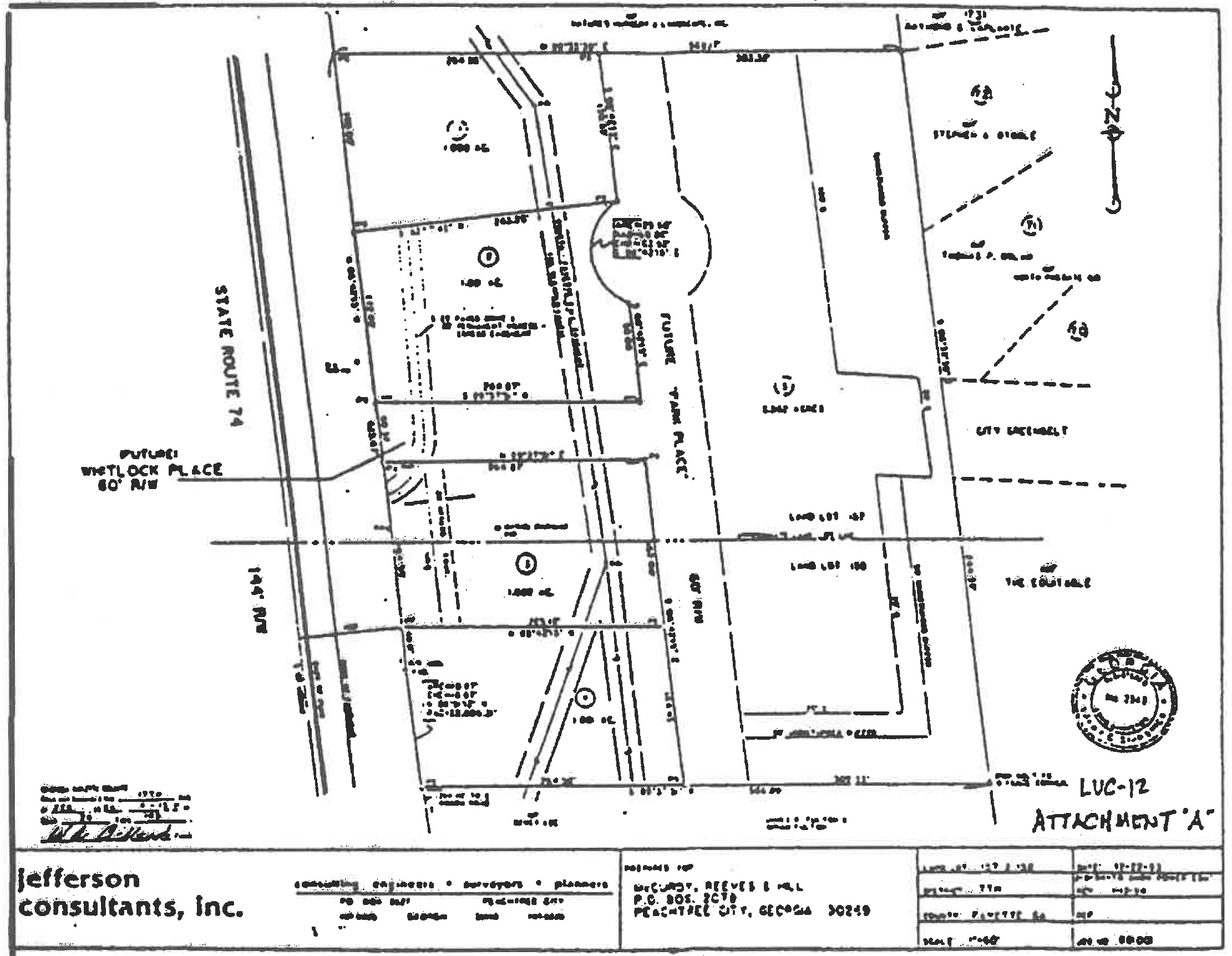
Figure 1006B.12
(1006B.13) Limited-use commercial district no. 13.
(a)
The 26.85-acre tract of land at the southwest corner of GA 74 and GA 54, as shown on attachment A, shall be rezoned from LI limited industrial and GC general commercial to LUC-13 limited-use commercial, subject to the following conditions and requirements:
(1)
The internal/access drive infrastructure, including The Circle, as described on the attached drawing to be built up-front as part of phase one.
(2)
The perimeter buffer on GA 54 from the railroad to the eastern access drive should be a minimum of 45 feet wide.
(3)
The balance of the perimeter buffer on GA 54 and GA 74 should be a minimum of 30 feet wide.
(4)
The perimeter buffer on Clover Reach should be a minimum of 20 feet wide.
(5)
The landscape buffer on both sides of all three primary access drives should be a minimum of 20 feet wide.
(6)
The landscape buffer on the outer perimeter of The Circle should be a minimum of 20 feet wide with no curb cuts off The Circle other than the access drives.
(7)
The Circle should be a minimum of 200 feet in diameter measured from back of curb. The Circle should be designed as a public gathering place.
(8)
The access drives should be at least 28 feet of pavement measured from back of curb.
(9)
The master plan needs to create a strong visual axis from the GA 74/GA 54 intersection to the focal point at The Circle. In this area the distance between buildings should not be less than 120 feet, and the width of the landscape area should not be less than ten feet. Additional buffering may be required by the Planning Commission, as necessary, to screen the parking areas from GA 54 and GA 74.
(10)
A special landscape plan will be required for all buffer areas, for the visual axis, and for The Circle.
(11)
All buildings on the site should be of a consistent architectural character, and they should share similar design features, finish materials and color schemes.
(12)
The recommendations of the Moreland Altobelli study for improvements to GA 74 and GA 54 should be implemented.
(13)
Short-term cart path access will be via an at-grade crossing on GA 74 at Paschall. An actual path is to be installed to the commercial area from the crossing rather than use commercial/industrial streets for pedestrian traffic. Applicant will be responsible for funding the cart path improvements, and the city will assist as needed with acquiring easements.
(14)
The following types of businesses shall be excluded:
a.
Open yard for the sale, rental and/or storage of materials or equipment, including junk or salvage materials.*
b.
Transportation facility or terminal.
c.
Self-service storage facilities; i.e. mini-warehouses.
d.
Gas stations.
* Nurseries and other operations combining both indoor and outdoor sales are permitted as long as the outdoor sales are properly screened.
(15)
All other uses listed in sections (1006A.2) and (1006A.3) shall be permitted.
(16)
All requirements listed in section (1006A.4) are requirements for any development in the LUC-13 zoning district.
(b)
This rezoning was approved at the council meeting on July 8, 1995. Development of the property shall take place substantially in accordance with the approved concept plan (attachment A), as well as the design standards submitted with the rezoning request and approved as part of the concept. Substantial deviation from the concept and/or design standards will require city council approval.
(Ord. No. 648, 7-8-1995)
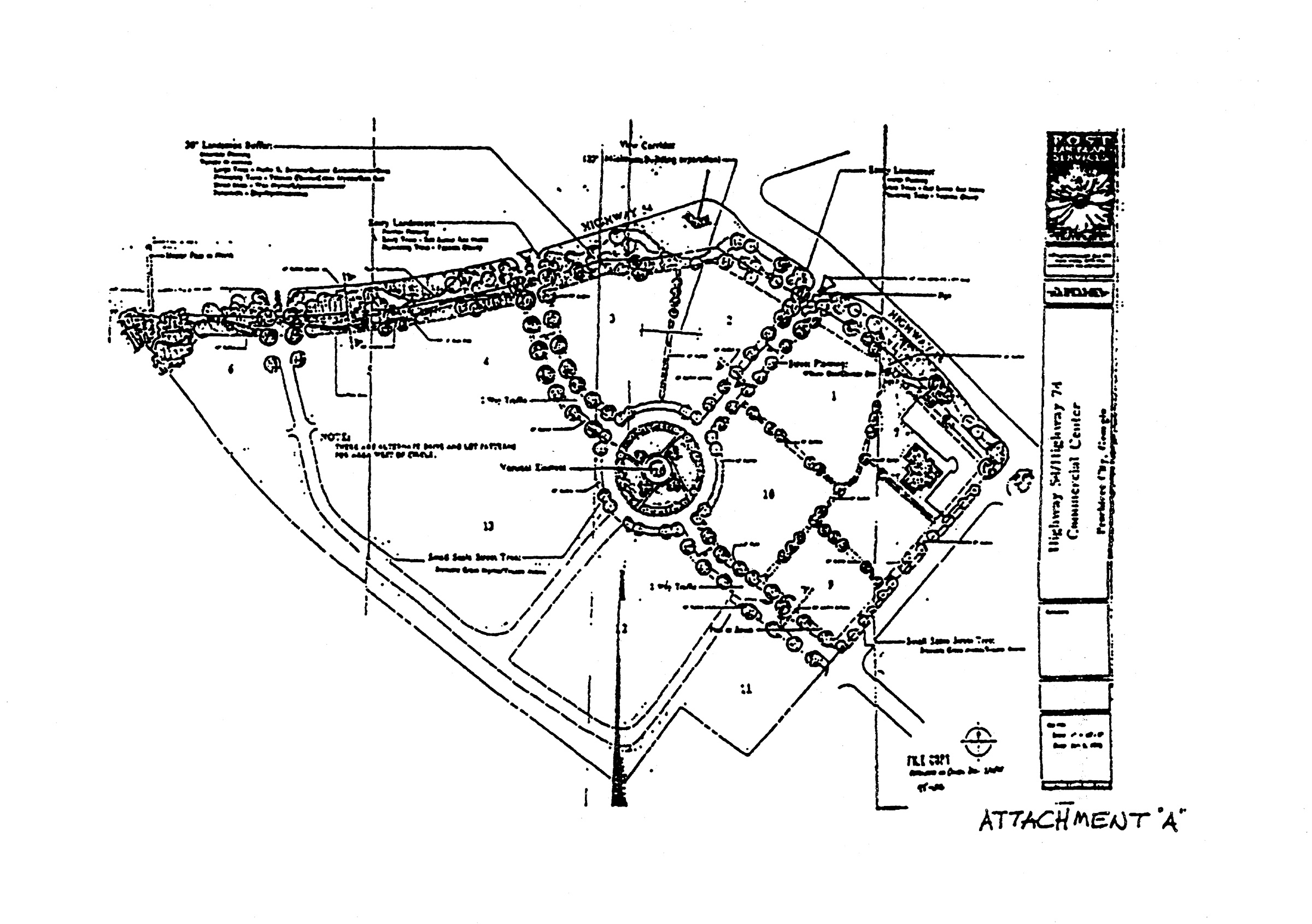
Figure 1006B.13
(1006B.13A) Limited-use commercial district no. 13A.
All that tract or parcel of land lying and being in land lot 129 of the 7th Land District of Fayette County, Georgia, and being more particularly described as follows:
To find the TRUE POINT OF BEGINNING; commence at the point of intersection formed by the Southeastern right-of-way of Clover Reach (a road having an 80-foot right-of-way); and GA State Route No. 74, (a road having a 130-foot right-of-way), thence South 86 degrees 17 minutes 22 seconds West a distance of 42.50 feet to a point; thence South 41 degrees 23 minutes 02 seconds West a distance of 170.00 feet to a 3/4" steel rod set and the TRUE POINT OF BEGINNING;
THENCE South 48 degrees 48 minutes 18 seconds East a distance of 278.43 feet to a 3/4" steel rod set;
THENCE South 46 degrees 13 minutes 00 seconds West a distance of 300.59 feet to a nail found in asphalt;
THENCE North 48 degrees 39 minutes 48 seconds West a distance of 223.10 feet to a 3/4" steel rod set in cart path;
THENCE North 03 degrees 38 minutes 23 seconds West a distance of 42.41 feet to a 3/4" steel rod found;
THENCE North 41 degrees 23 minutes 02 seconds East a distance of 268.81 feet to the TRUE POINT OF BEGINNING, and containing 79,049 square feet or 1.81 acre(s) of land, more or less.
Together with a 10-foot cart path easement along the Southwest property line in favor of The City of Peachtree City.
According to that certain Rezoning Composite for PEACHTREE CITY HOLDINGS, L.L.C. dated July 23, 1999, prepared by Welborn Land Surveying, Inc., Mark R. Welborn, G.R.L.S. #2711.
The above described tract shall be developed in accordance with all restrictions and conditions that apply to the LUC-13 zoning district.
(Ord. No. 750, 9-16-99)
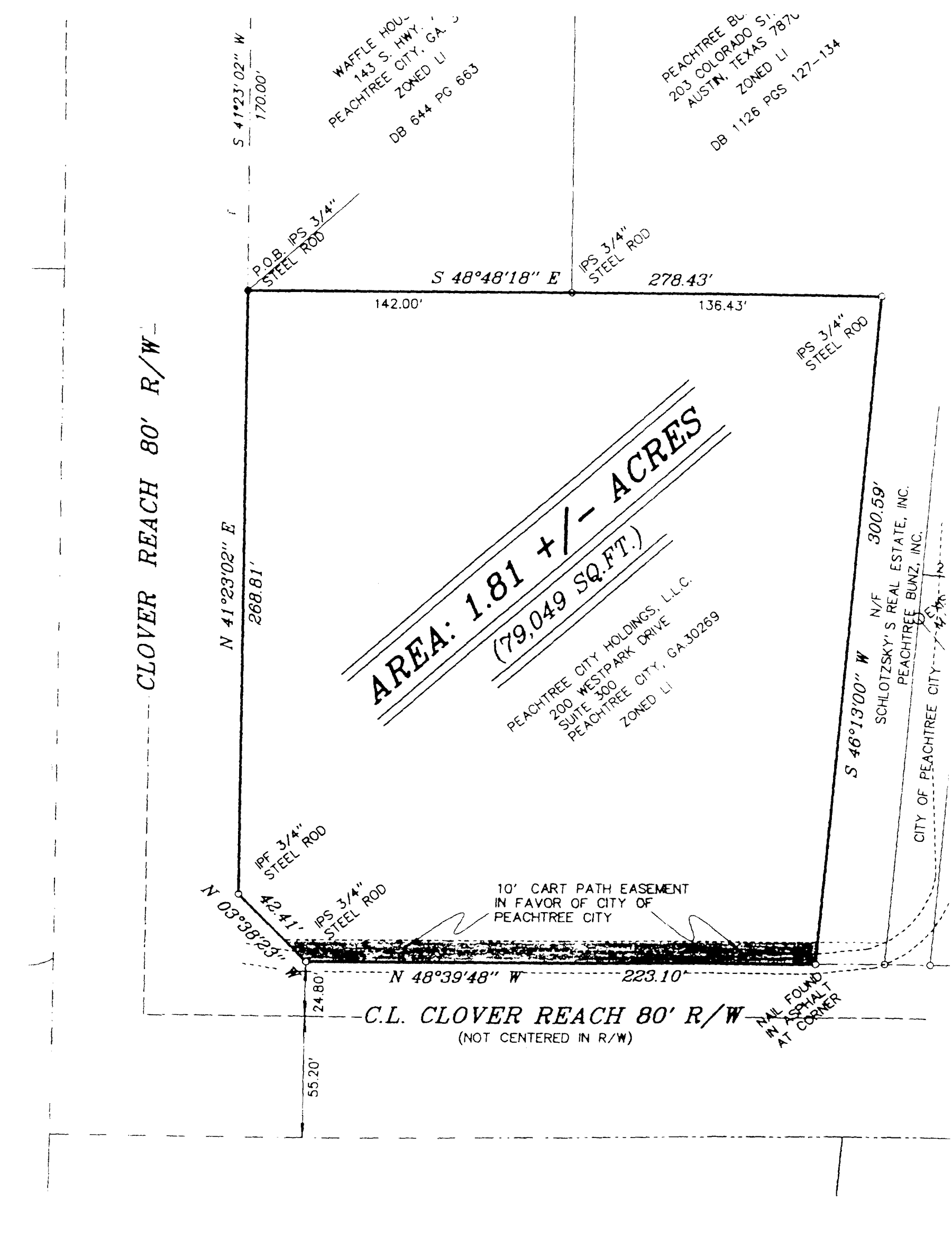
Limited-use commercial district no. 13A
(1006B.14) Limited-use commercial district no. 14.
It is intended that this LUC-14 zoning district be established specifically for an assisted living facility subject to the following conditions:
(a)
The property must be used only for assisted living for the elderly.
(b)
If the assisted living use is ever discontinued for any reason, the property can only be reused for an activity that is specifically permitted in a GC general commercial zoning district.
(c)
No more than 64 assisted-living units are to be established on the property.
(d)
A minimum 50-foot wide tree-save area is to be provided along both Stevens Entry and Prime Point.
(e)
The project will be subject to the established impact fee for Glenloch Village for each of the proposed 64 units (the fee is currently $1,083.00 per unit).
(f)
The plan must meet all state and local standards and will have to have written approval from the state and the city fire chief prior to construction.
(Ord. No. 751, 3-6-97)
(1006B.15) Limited-use commercial district no. 15.
It is intended that the LUC-15 zoning district be established specifically for a mixed office/ residence use to be developed substantially in accordance with Exhibit "A" and subject to the following conditions:
1.
The use of the property shall be limited to a professional office building with a floor area not to exceed 7,200 square feet, as well as an upstairs dwelling unit of at least 1,500 square feet for the exclusive use of the owner or office tenant of the building;
2.
The site plan for the professional office/residence shall conform to the site plan submitted with the application and approved by the Planning Commission as a part of the rezoning process;
3.
An Impact Fee would be required for the proposed dwelling unit; and
4.
If for any reason it is not possible or desirable for the owner of the property to abide by the above three conditions, the zoning of the property shall be reclassified to its original LC designation and all non-conforming uses shall be terminated at once.
(Ord. No. 752, 8-19-99)
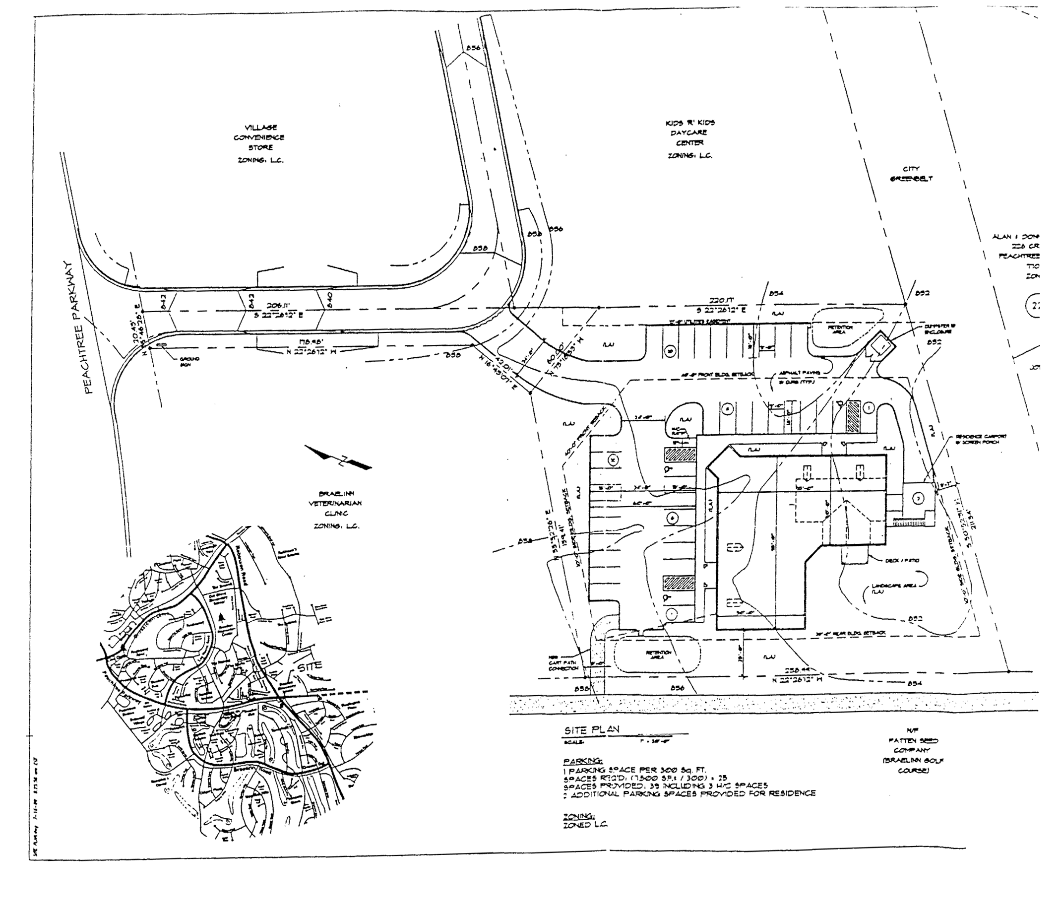
Limited-use commercial district no. 15
(1006B.16) Limited-use commercial district no. 16. The LUC-16 zoning district created by this section replaces the following existing zoning classifications:
(a)
LUC-7 Palm Beach property,
(b)
LUR-8 Lallande property,
(c)
LUR-9 Lallande/Scott property, and
(d)
R-43 Heard property.
(1006B.16.1) Conformance with master plan. Development shall take place in conformance with the Ozell Stankus master plan dated December 2, 1999 and attached hereto as Exhibit "A" (Master Plan); Group VI Roadway/Parcel layout plan dated January 16, 2001, (Exhibit "B") and Main Boulevard and Parking Specifications, (Exhibit "C"); provided however, that the property described in the LUC-28 Zoning District shall not be considered a part of such plans as of the effective date of this ordinance. Any substantive change to this plan or any of the conditions and requirements of this section will require a new rezoning action.
(Ord. No. 1115, § 1, 8-18-2016)
(1006B.16.2) Permitted uses.
(a)
Single-family detached residences.
(b)
Multi-family residences shall be upper level (second and/ or third floor) residences and may have a rear entry ground level garage.
(c)
The following commercial and office uses shall be permitted within the LUC-16 zoning district. (The examples under the categories are not intended to be exhaustive. Businesses of like characteristics may be permitted, although not specifically listed as an example.)
(1)
All retail oriented business involving the sale of merchandise on the premises (for example, the retail sale of foodstuffs, coffee shops, wearing apparel, computers and appliances, office supplies, household goods, books, toys, florists, pharmaceutical related items, hardware-related items, pet stores, notions/arts/craft shops; jewelry shops, art galleries, businesses such as video-tape rental centers, shoe stores and other retail businesses normally found in shopping centers).
(2)
Business involving the rendering of a personal service on the premises (for example, the installation of goods and parts sold through retail; insurance; medical, dental, optometry, chiropractic, and other medical-related items; veterinary offices (excluding facilities with outdoor kennel facilities); dry-cleaning establishments; dancing and other instructional businesses; health and fitness clubs; banking establishments; photography studios; and hair salons and barber shops).
(3)
Office for governmental, business, professional or general purposes (for example, rendering services of the following nature: insurance; attorney's offices; accountants, investment brokers, and income tax preparation centers; advertising agencies, travel agencies, architectural and engineering services, interior designers, medical, dental, optometry, chiropractic, and other medical-related items; and real estate agencies).
(4)
Commercial recreation facility located entirely within a building.
(5)
Building, facility or land for non-commercial park, recreation, thoroughfare or open space purposes.
(6)
Private or semi-private club, lodge or social center.
(7)
Building, facility or land for off-street automobile parking.
(8)
Restaurant/lounge (whose gross sales of non-food items, including liquor sales, do not collectively exceed 40 percent of total gross sales (for example: fast food, deli, restaurant beverage sale, cafeteria style, sit-down style, and specialty house (steak, Chinese, Italian, etc.).
(9)
Theater, movie and/or live, including dinner-theater.
(10)
Hotel or motel.
(d)
The following uses shall not be permitted within the LUC-16 zoning district: (The examples under the categories are not intended to be exhaustive. Businesses of like characteristics may be prohibited, although not specifically listed as an example.)
(1)
Ambulance service.
(2)
Agricultural implement sales and service.
(3)
Automobile repair garages.
(4)
Automobile sales, new and used or leasing facility (excepting a car rental agency that does not park or store its vehicles in the development).
(5)
Automobile part sales, including tires,
(6)
Automobile washing establishments.
(7)
Boat sales, new and used.
(8)
Drive-in theaters.
(9)
Animal hospitals or veterinary clinics with outdoor kennel facilities.
(10)
Service stations.
(11)
Drive-through restaurants that have no seating for customers.
(12)
Cocktail lounge, disco or dance hall (provided that this restriction shall not prohibit the same of beer, wine and alcohol and other beverages from a restaurant).
(13)
Peepshows, massage parlors, adult book store, adult theater, adult amusement facility.
(14)
Bingo parlor, bowling alley, pool hall, billiard parlor, skating rink, or roller rink.
(15)
Blood bank.
(16)
Any industrial use, assembly, manufacture, distillation, refining, smelting, agriculture, or mixing operation.
(17)
Any "second-hand" store, Army-Navy or government "surplus" store, odd lot, closeout or liquidation store, any fire or bankruptcy sale, auction or flea market.
(18)
Any dumping, disposal, incineration or reduction of garbage or refuse.
(19)
Labor camp, junkyard, stockyard, or animal raising (except for boarding of animals incidental to a reasonable pet store operation.
(1006B.16.4) Conditional uses. No conditional uses shall be permitted in this district.
(1006B.16.5) Other requirements.
(a)
General retail: Minimum floor area 150,000 square feet.
Maximum floor area 225,000 square feet.
(b)
Restaurants: Minimum floor area 15,000 square feet.
Maximum floor area 40,000 square feet.
(c)
Offices: Minimum floor area 30,000 square feet.
Maximum floor area 80,000 square feet.
(d)
Maximum commercial area: The overall area of general retail, restaurants, and offices shall not exceed 300,000 square feet.
(e)
Maximum residential units:
Single-family detached—135 units.
Fee-simple townhomes—46 units.
(f)
Minimum open space area: At least 20 percent of the tract must be exclusively devoted to permanent green space in the form of park land, greenbelts, and buffers.
(g)
Commercial tenants: The largest single commercial tenant in the Center shall have a floor area of less than 50,000 square feet; the second largest tenant shall have a floor area of less than 40,000 square feet; and the third largest tenant shall have a floor area of less than 32,000 square feet. No businesses shall be located within the Center if they rely on drive-through traffic for more than 50 percent of their revenue. In addition, all drive-through facilities shall be located away from the main shopping street, the traffic circle, and the secondary access street; and no direct access is provided to these areas.
(h)
Single-family detached residential: There shall be two types of single-family detached residential lots: Type "A" shall have a minimum width of 82 feet and shall be located adjacent to the greenbelt along the west property line of the tract. There shall be at least 22 Type "A" lots. All other lots shall be Type "B," and they shall have a minimum width of 52 feet.
(i)
Minimum residential lot area:
Type "A"—7,800 square feet.
Type "B"—5,600 square feet.
Fee-simple townhomes—N/A.
(j)
Minimum residential floor area:
Type "A"—2,400 square feet.
Type "B"—1,600 square feet.
Fee-simple townhomes—800 square feet.
(k)
Minimum front setback:
Type "A"—30 feet from back of curb.
Type "B"—15 feet from back of curb.
All Other Uses—10 feet from back of curb.
(l)
Minimum side setback:
Type "A"—5 feet.
Type "B"—3 feet.
All other uses—0 feet.
(m)
Minimum rear setback:
Type "A"—20 feet.
Type "B"—17 feet.
All other uses—0 feet.
(n)
Building separation: If any buildings within the tract are not attached, there must be a minimum separation of 10 feet between them.
(o)
Parking: As set forth in section 909.
(p)
Signs: As set forth in the sign ordinance and in accordance with a sign program for the tract which shall be approved by the planning commission as a part of the overall design criteria for the tract.
(q)
Maximum building height: Three (3) stories plus a basement.
(r)
Buffers: The following buffers and greenbelts shall be provided:
(1)
A minimum 35-foot wide city-owned greenbelt along the north property line adjoining the Mathis property;
(2)
A minimum 50-foot wide city-owned greenbelt along the west property line adjoining the Southern Trace and Parkway Estates subdivisions;
(3)
A minimum 60-foot wide city-owned greenbelt along the east property line adjacent to GA 54 in all areas where residential lots are platted;
(4)
A minimum 60-foot wide landscaped buffer along the eastern property line adjacent to GA 54 in all areas where residential lots are not platted;
(5)
A minimum 50-foot wide landscaped buffer along the southern property line adjacent to Walt Banks Road where residential lots are not platted;
(6)
A minimum 60-foot wide greenbelt along the southern property line adjacent to Walt Banks Road where residential lots are platted.
(s)
Curb cuts: The tract shall be limited to one curb cut on GA 54 and one curb cut on Walt Banks Road to serve the single-family detached lots.
The tract shall be limited to three commercial curb cuts on GA 54 (one at the existing median cut and two other right-in, right-out cuts about equally spaced between the median cut and Walt Banks Road). The tract shall be limited to one commercial curb cut on Walt Banks Road.
(t)
Architectural concept: All proposed development shall comply with the overall master plan and shall be designed in accordance with the Lexington Circle Design Guidelines (hereinafter "Guidelines") which shall be approved by the planning commission as a part of the ordinance approval process. The Guidelines shall be consistent with the concept illustrated by the Ozell Stankus master plan. As a part of the conceptual site plan approval process, the applicant shall submit schematic building elevations to city staff for review prior to presenting them to the planning commission for approval.
(u)
Landscape concept: In addition to an architectural concept, the overall tract must be developed in accordance with an approved landscape concept that includes islands at each entrance, all medians, and all landscape areas shown on the master plan.
(v)
Tree-save areas: In developing the tract, the developer shall make every reasonable effort to provide meaningful tree-save areas in addition to the required greenbelts and buffers.
(w)
Watershed protection: The developer must take whatever steps are necessary to assure that the quality of stormwater runoff from the tract is properly controlled in accordance with established "best management practices."
(Ord. No. 1115, § 1, 8-18-2016)
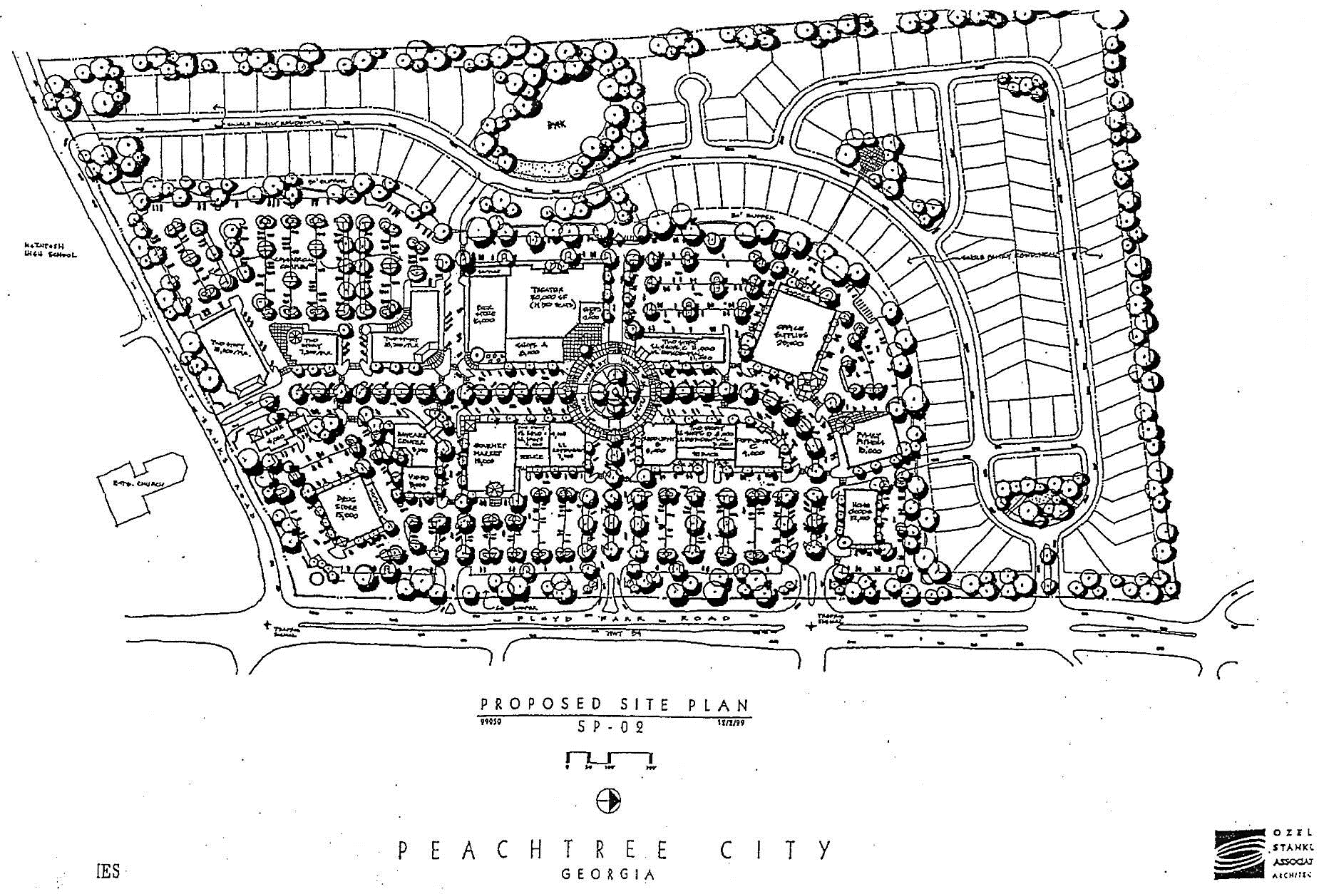
Exhibit "A"
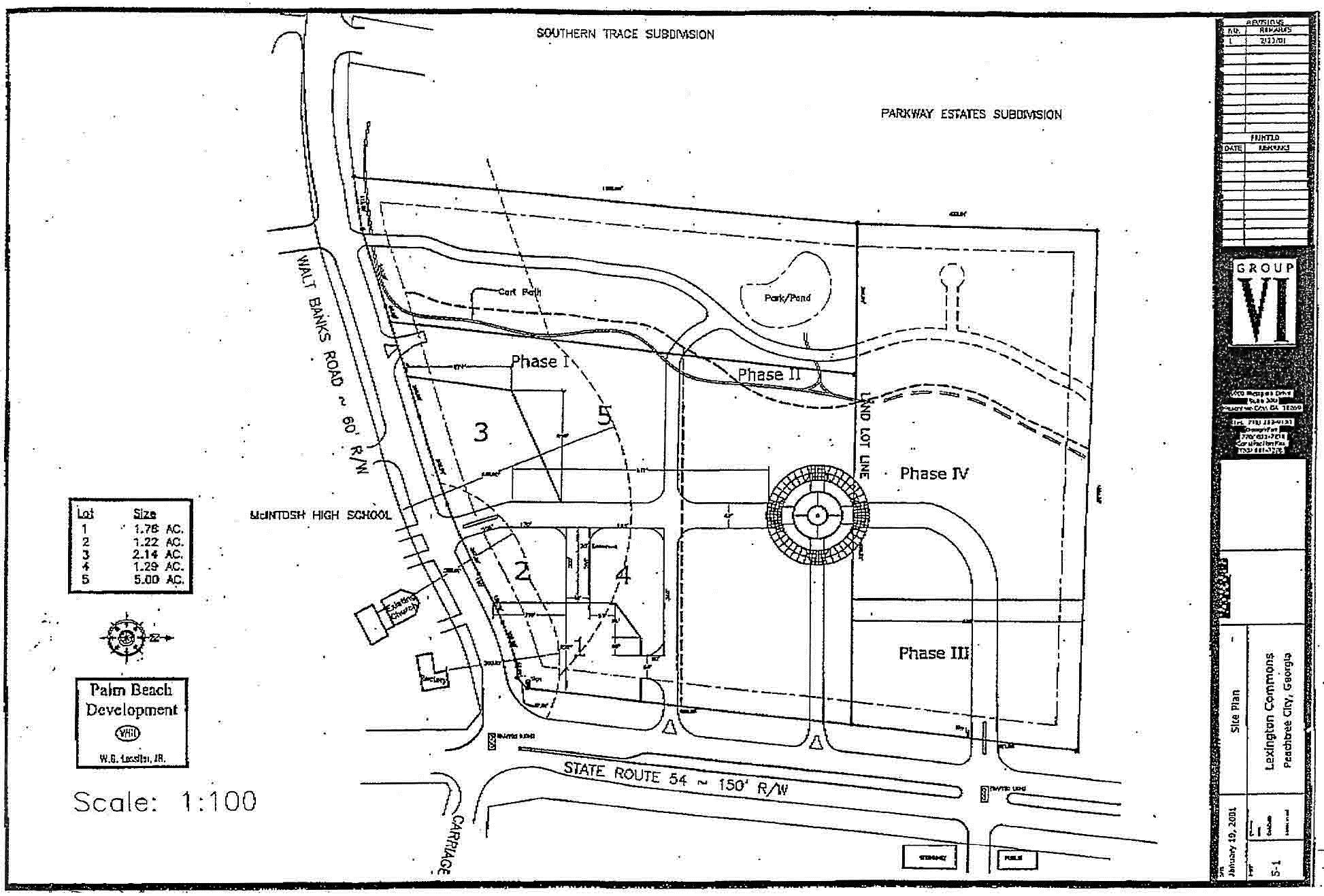
Exhibit "B"
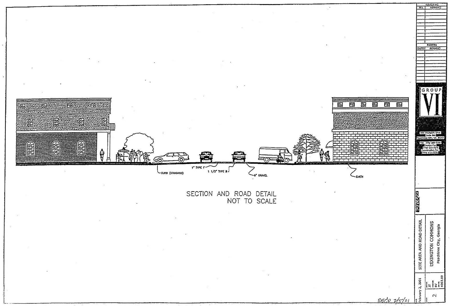
Exhibit "C"
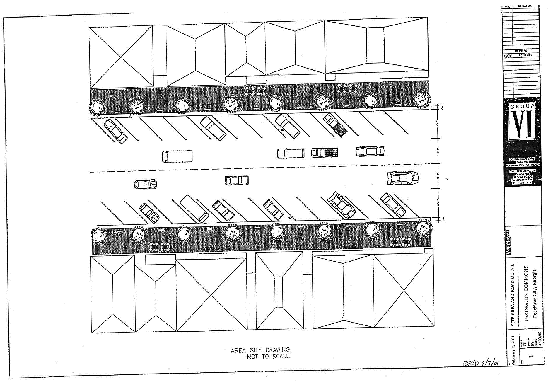
(Ord. No. 835, 9-2-2004; Ord. No. 1079, § 1, 5-15-2014)
(1006B.17) Limited use commercial district no. 17.
(a)
A tract of property described below shall be rezoned from its present classifications of LUC-3 to LUC-17. Said property is described as follows:
To find the true POINT OF BEGINNING, commence at the intersection formed by the southerly right-of-way of Westpark Drive (60' right-of-way) and the easterly right-of-way of Commerce Drive (80' right-of-way); thence N 45°09'19" E a distance of 312.05 feet to a point of curve; thence, along a curve to the right having a radius of 462.39', a delta of 36°11'01", an arc length of 292.01' and a chord which bears N 63°14'52" E having a chord distance of 287.18' to a 5/8" rebar found and the TRUE POINT OF BEGINNING.
Thence, along a curve to the right having a radius of 462.39', a delta of 17°43'19", an arc length of 143.02' and a chord length which bears S 89°47'58" E having a chord distance of 142.45' to a point on a line; thence, S 80°56'19" E a distance of 289.99' to a point of curve; thence, along a curve to the right having a radius of 287.99', a delta of 54° 41'12", an arc length of 274.87' and a chord which bears S 53° 35'42" E having a chord distance of 264.56' to a point on a line; thence, S 25°38'10" E a distance of 39.09' to a ½" re-bar FOUND; thence, S 63° 44'18" W a distance of 233.69' to a ½" re-bar FOUND; thence, S 10°53'36" E a distance of 197.20' to a ¾" steel-rod FOUND; thence, N 88°04'31" W a distance of 201.87' to a ¾" steel rod SET; thence, S 76°04'16" W a distance of 56.14' to a 5/8" re-bar FOUND; thence, N 12°22'48" W a distance of 181.40' to a ½" re-bar FOUND; thence, N 56°25'55" W a distance of 163.60' to a ½" re-bar FOUND; thence, N 11°18'31" W, a distance of 280.00' to the TRUE POINT OF BEGINNING, and containing 219,021 SF or 5.028 acres of land, more or less.
(b)
The above tracts of property are hereby rezoned on the following express conditions:
(1)
The use of said property shall be limited to those uses specified in the Code of Ordinances for Peachtree City, section (1006A.2), exception, section (1006A.2)(a), retail business; section (1006A.2)(j), hotel; and (1006A.2)(n), wholesale business.
(2)
No restaurant/lounge shall be permitted pursuant to section (1006A.2)(k) of the Zoning Ordinance of the City of Peachtree City unless plans reveal that said restaurant/lounge will be located entirely within an office building.
(3)
Guest quarters will be permitted as an accessory use provided the following conditions are met:
a.
There can be no more than six separate guest rooms on a single zoning lot;
b.
There can be no more than one guest room for every 3,000 square feet of office space in a building;
c.
All guest rooms must be located entirely within the office building;
d.
No guest rooms shall include a complete kitchen;
e.
All guest rooms shall be used only for short-term accommodations for bona fide business associates of the principal office use; and
f.
The guest rooms shall be strictly for non-paying guests and no payment of any kind shall be made by those guests for the use of the facilities.
(4)
If at any time in the future the property is not to be used for the national headquarters of a sorority, the zoning will revert back to LUC-3.
(Ord. No. 812, 7-17-2003)
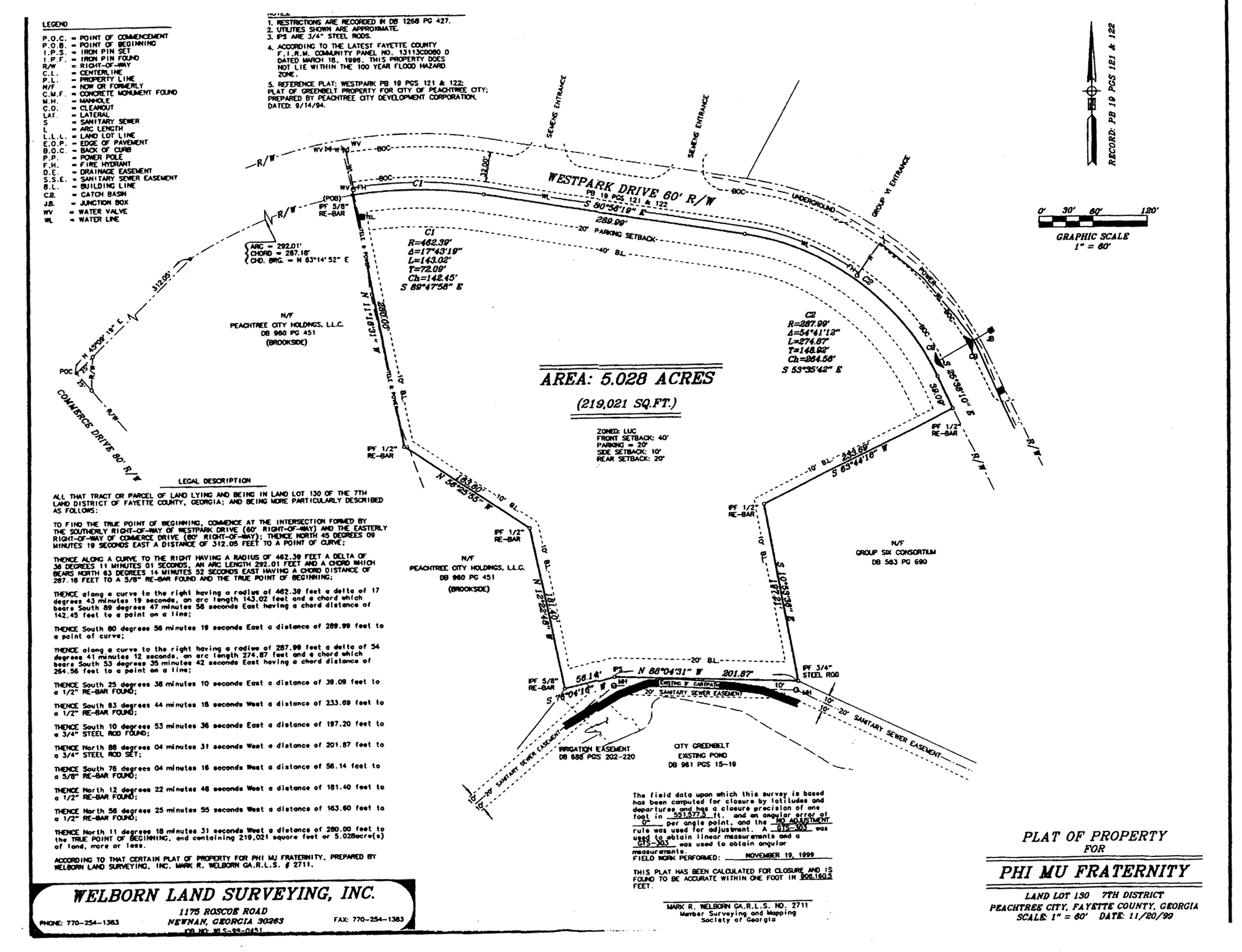
Limited use commercial district no. 17
(1006B.18) Limited use commercial district no. 18.
(a)
A tract of property described below shall be rezoned from its present classification of AR Agricultural Reserve to LUC-18. Said property is more particularly described as follows:
All that tract of land lying and being in land lot 158 of the 7th district of Fayette County, Georgia, being more particularly described as follows:
To find the point of beginning, commence at the intersection of the centerline of Wisdom Road and the eastern right-of-way line of State Route 74; thence running along said eastern right-of-way line of State Route 74 in a northerly direction, 500.86 feet to an axle found and the true Point of Beginning; thence running, North 8°41'14" West, 446.90 feet to a point; thence leaving said eastern right-of-way line of State Route 74 and running, North 88°32'14" East, 233.85 feet to a point; thence, South 08°18'02" East, 441.89 feet to a point; thence, South 87°23'26" West, 230.31 feet to an axle found on the aforesaid eastern right-of-way line of State Route 74 and the true Point of Beginning. Said tract contains 2.3525 acres (102,473 square feet), more or less, as per survey prepared for Helen Leach by Delta Surveyors, Inc. dated September 12, 1998.
(b)
The above-described tract is illustrated in Exhibit "A," which is included with Ord. No. 808 as an attachment. It is intended that the LUC-18 zoning district be established specifically for a mixed retail/ commercial use to be developed substantially in accordance with the following express conditions:
(1006B.18.1) Conformance with master plan. Development shall take place in conformance with the master plan prepared by Site Design Services, Inc. (last revised November 4, 2002). Any substantive change to this plan or any of the conditions and requirements of this section shall require a new rezoning action.
(1006B.18.2) Permitted uses.
(a)
Retail business involving the sale of merchandise on the premises.
(b)
Business involving the rendering of a personal service on the premises.
(c)
Office for governmental, business, professional, or general purposes.
(1006B.18.3) Uses not permitted.
(a)
Transportation facility or terminal.
(b)
Self-service storage facilities, i.e., mini-warehouses.
(c)
Adult bookstores.
(d)
Package stores.
(e)
Restaurants and any business involving the sale of food or beverage on the premises.
(f)
Gas stations.
(g)
Off-street auto parking facility.
(h)
Massage parlors.
(i)
Open yard for the sale, rental, and/or storage of materials or equipment, including junk or salvage materials.
(j)
Convenience-type stores.
(1006B.18.4) Conditional uses. No conditional uses shall be permitted within this zoning district.
(1006B.18.5) Other requirements.
(a)
Maximum commercial area. The overall area of general retail, commercial and/ or office space shall not exceed 19,000 SF. All requirements listed in Section (1006A.4) are requirements for any development within the LUC-18 zoning district.
(b)
Parking. Parking shall be provided as set forth in Section 909. Dumpsters, loading and service areas shall not be located within any building setbacks and shall be properly screened from view.
(c)
Curb cuts. The tract shall be limited to one right-in/ right-out curb cut on GA 74. The tear-drop island within this entrance must be landscaped with plant material rather than concrete.
(d)
Access drive. The access road along the rear property line shall be designed in a manner such that the adjoining properties can connect to this road as they are developed.
(e)
Architectural concept. A unified architectural concept for the overall tract must be developed and approved by the Planning Commission. The architectural design of all buildings must be residential in character and must blend in with the scale and design of surrounding developments. All sides of each building must include architectural detailing and similar building materials.
(f)
Site lighting. A complete site lighting plan, including all lighting proposed on the exterior of the buildings, must be developed and approved by the Planning Commission. Wall packs or other external lighting sources will not be permitted on the sides and rear of the buildings without approval. All site lighting must be directed away from the adjoining residential subdivision and placed on a timer. The level of illumination within all parking and service areas must not exceed 3 foot-candles.
(g)
Signage program. Signage shall be provided as set forth within the City's Sign Ordinance and in accordance with an overall sign program for the tract that shall be approved by the Planning Commission as a part of the conceptual site plan review process.
(h)
Landscape concept. A complete landscape plan must be developed and approved by the Planning Commission. The plan must provide for a fully landscaped entrance off GA 74, including substantial landscaping within the detention and buffer areas adjacent to GA 74. The 10-foot wide landscaped area along the rear property line must be heavily landscaped to assist in providing a visual separation between the proposed development and the adjoining subdivision. All landscaped areas within the site, including the GA 74 right-of-way, must be irrigated.
(i)
Utility connections. The property must be connected to the city's sanitary sewer system, and the existing septic system must be removed. All overhead utility lines that traverse the site must be relocated underground.
(j)
Application of requirements and conditions: The requirements and conditions specified in this section shall remain in effect unless specifically amended or revoked by subsequent action of city council in accordance with the established procedure for zoning amendments; and, in addition, if it is determined that the property will not be developed in substantially the same manner as depicted on the Site Design Services, Inc. master plan referenced above, and each condition of that plan substantially complied with, the zoning of this property shall automatically revert back to the zoning the property currently holds.
(Ord. No. 753, 3-16-00; Ord. No. 808, 11-21-02; Ord. No. 809, 5-1-03)
(1006B.19) Limited use commercial district no. 19.
(a)
The tract of land of approximately one acre and known as Lot 4 of the Whitlock Place Subdivision shall be rezoned from LUC-12 Limited Use Commercial to LUC-19 Limited Use Commercial.
This tract is more particularly described on the revised final plat of Whitlock Place, Phase II, dated February 17, 1994, and recorded in plat book 24, pages 148, 149. A copy of page 149 is incorporated herein as figure 1006B.19.
It is intended that the LUC-19 zoning district be established specifically as follows:
(b)
Permitted uses.
(1)
Appliance, radio and TV sales;
(2)
Art, custom frame and antique shops;
(3)
Furniture/home furnishings, including carpeting;
(4)
Upholstery shop;
(5)
Lawn equipment sales;
(6)
Barber or beauty shop;
(7)
Dressmaking and tailoring shop;
(8)
Dry cleaning store;
(9)
Interior decorating store;
(10)
Stores selling blinds, fabric and wall covering;
(11)
Import stores (sales of home furnishings only);
(12)
Business involving the rendering of personal services connected with uses set forth above including by way of example and not by way of limitation a locksmith shop;
(13)
Any authorized uses under OI zoning;
(14)
A frame shop, an art gallery, space for small retail businesses dealing in handmade or low production volume specialty products relating to home decor, wearing apparel, jewelry, art work and handicrafts operating entirely within the building. No tenant space under this paragraph shall exceed 500 square feet.
(15)
A mixture or combination of the above, including partitioning of the existing premises into smaller shops, businesses or offices, with separate entrances;
(c)
Conditional uses. No conditional uses shall be permitted within this zoning district.
(d)
Other requirements.
(1)
Minimum zoning lot area: one acre.
(2)
Minimum lot width: 150 feet.
(3)
Minimum front setback depth:
a.
Building: 40 feet.
b.
Driveway/parking: 20 feet.
(4)
Minimum side setback: 20 feet.
(5)
Minimum rear setback: 20 feet.
(6)
Maximum building height: one story.
(7)
Parking: See Section 909.
(8)
Signs: As set forth in the sign ordinance, but with the condition that the property will be limited to only one free-standing identification sign; one wall sign facing GA 74 identifying the name of the main tenant within the building only; and there will be no window signs or other individual tenant signage outside the building. The wall sign facing GA 74 shall be limited to a single panel with sandblasted or raised graphics, with no internal illumination or reverse channel lettering.
(e)
No outside storage or displays of merchandise will be permitted on the property, with the exception of one fully screened trash dumpster.
(f)
No outside loudspeaker system shall be utilized.
(g)
The property must be connected to the city cart path system prior to occupancy and use.
(h)
This rezoning was approved by the city council at its meeting on November 6, 2003; and the conditions imposed at that time shall remain in effect unless specifically modified by subsequent action of the city council.
(Ord. No. 821, 11-6-2003; Ord. No. 865, 1-5-2006)
(1006B.20) Limited-use commercial district no. 20.
(a)
Two tracts of land as described below shall be rezoned from their present classification of GI General Industrial to LUC-20 Limited-use commercial, subject to the conditions set forth herein. In the event of a conflict between the provisions of this ordinance and the regulations of the LUC Zoning District, the most restrictive regulation shall apply.
Tract 3 (17.341-acres)
All that tract or parcel of land lying and being in Land Lots 29 and 30 of the 6th District of Fayette County, Georgia and being more particularly described as follows:
To find the TRUE POINT OF BEGINNING, commence at an axle at the common corner on Land Lots 29, 30, 32 and 33; THENCE along the south line of Land Lot 29 South 89 degrees 13 minutes 19 seconds East a distance of 659.69 feet to a point; THENCE leaving said land lot line North 00 degrees 36 minutes 14 seconds East a distance of 339.46 feet to a point; THENCE North 85 degrees 30 minutes 07 seconds East a distance of 154.03 feet to a point on the flood plain contour (elevation 752) and the TRUE POINT OF BEGINNING; THENCE leaving said flood plain contour North 85 degrees 30 minutes 07 seconds East a distance of 644.27 feet to a ½" rebar; THENCE South 04 degrees 29 minutes 53 seconds East a distance of 285.72 feet to a ½" rebar; THENCE North 85 degrees 30 minutes 07 seconds East a distance of 459.19 feet to a point on a curve; THENCE along a curve to the right having a radius of 985.00 feet, a delta of 32 degrees 37 minutes 36 seconds, an arc length of 560.90 feet, and a chord which bears South 20 degrees 41 minutes 46 seconds West having a chord distance of 553.36 feet to a point on a line; THENCE South 30 degrees 30 minutes 26 seconds West a distance of 97.71 feet to a concrete right-of-way monument on the northwesterly right-of-way of Rockaway Road (right-of-way varies); THENCE along said right-of-way South 37 degrees 26 minutes 02 seconds West a distance of 211.71 feet to a point on the flood plain contour (elevation 752); THENCE leaving the right-of-way of Rockaway Road and following said flood plain contour the following courses and distances: South 85 degrees 59 minutes 59 seconds West a distance of 17.65 feet to a point; THENCE South 81 degrees 54 minutes 54 seconds West a distance of 78.60 feet to a point; THENCE South 68 degrees 06 minutes 19 seconds West a distance of 47.17 feet to a point; THENCE South 81 degrees 01 minutes 56 seconds West a distance of 40.93 feet to a point; THENCE South 89 degrees 06 minutes 13 seconds West a distance of 40.07 feet to a point; THENCE South 86 degrees 23 minutes 29 seconds West a distance of 8.80 feet to a point; THENCE South 45 degrees 45 minutes 18 seconds West a distance of 44.43 feet to a point; THENCE North 55 degrees 48 minutes 11 seconds West a distance of 47.80 feet to a point; THENCE North 36 degrees 27 minutes 31 seconds West a distance of 38.56 feet to a point; THENCE North 37 degrees 00 minutes 25 seconds West a distance of 45.27 feet to a point; THENCE North 15 degrees 03 minutes 08 seconds West a distance of 48.73 feet to a point; THENCE North 12 degrees 08 minutes 56 seconds West a distance of 26.32 feet to a point; THENCE North 85 degrees 41 minutes 24 seconds East a distance of 45.50 feet to a point; THENCE North 19 degrees 11 minutes 12 seconds East a distance of 15.32 feet to a point; THENCE North 73 degrees 17 minutes 39 seconds West a distance of 44.81 feet to a point; THENCE North 74 degrees 45 minutes 56 seconds West a distance of 46.58 feet to a point; THENCE North 79 degrees 29 minutes 36 seconds West a distance of 17.86 feet to a point; THENCE North 81 degrees 29 minutes 27 seconds West a distance of 31.58 feet to a point; THENCE North 85 degrees 01 minutes 36 seconds West a distance of 29.08 feet to a point; THENCE North 09 degrees 00 minutes 06 seconds West a distance of 33.17 feet to a point; THENCE North 04 degrees 26 minutes 53 seconds West a distance of 59.07 feet to a point; THENCE North 10 degrees 08 minutes 05 seconds West a distance of 51.45 feet to a point; THENCE South 79 degrees 20 minutes 04 seconds West a distance of 14.28 feet to a point; THENCE South 04 degrees 40 minutes 21 seconds West a distance of 29.32 feet to a point; THENCE South 66 degrees 23 minutes 52 seconds West a distance of 21.90 feet to a point; THENCE North 43 degrees 34 minutes 17 seconds West a distance of 29.38 feet to a point; THENCE North 41 degrees 56 minutes 01 seconds West a distance of 36.04 feet to a point; THENCE North 26 degrees 58 minutes 55 seconds West a distance of 29.41 feet to a point; THENCE North 19 degrees 08 minutes 04 seconds West a distance of 26.70 feet to a point; THENCE North 01 degrees 13 minutes 33 seconds East a distance of 29.21 feet to a point; THENCE North 02 degrees 13 minutes 32 seconds West a distance of 28.25 feet to a point; THENCE North 45 degrees 45 minutes 48 seconds West a distance of 38.16 feet to a point; THENCE North 42 degrees 25 minutes 19 seconds West a distance of 30.78 feet to a point; THENCE North 04 degrees 23 minutes 01 seconds West a distance of 30.82 feet to a point; THENCE North 07 degrees 06 minutes 17 seconds East a distance of 48.00 feet to a point; THENCE North 03 degrees 14 minutes 53 seconds West a distance of 58.66 feet to a point; THENCE North 20 degrees 50 minutes 55 seconds West a distance of 30.49 feet to a point; THENCE North 19 degrees 08 minutes 04 seconds West a distance of 28.80 feet to a point; THENCE North 13 degrees 07 minutes 01 seconds West a distance of 18.38 feet to a point; THENCE North 08 degrees 19 minutes 23 seconds East a distance of 28.01 feet to a point; THENCE North 32 degrees 33 minutes 18 seconds West a distance of 21.07 feet to a point; THENCE North 11 degrees 21 minutes 04 seconds West a distance of 36.93 feet to a point; THENCE North 34 degrees 04 minutes 20 seconds West a distance of 42.02 feet to a point; THENCE North 26 degrees 09 minutes 05 seconds West a distance of 46.32 feet to a point; THENCE North 26 degrees 59 minutes 22 seconds East a distance of 16.88 feet to a point; THENCE North 03 degrees 01 minutes 21 seconds West a distance of 17.84 feet to a point; THENCE North 86 degrees 47 minutes 33 seconds West a distance of 24.32 feet to a point; THENCE North 11 degrees 02 minutes 15 seconds East a distance of 49.49 feet to a point; THENCE North 01 degrees 18 minutes 50 seconds West a distance of 38.00 feet to a point; THENCE North 09 degrees 33 minutes 35 seconds West a distance of 19.30 feet to a point which is the TRUE POINT OF BEGINNING, and containing 17.431 acre(s) of land, more or less.
Tract 4 (6.329-acres)
All that tract or parcel of land lying and being in Land Lots 29 and 30 of the 6 th District of Fayette County, Georgia being more particularly described as follows:
To find the TRUE POINT OF BEGINNING, commence at a point at the intersection of the southerly right-of-way of State Route No. 74 (100' right-of-way) and the easterly right-of-way of Rockaway Road (right-of-way varies); THENCE along the easterly right-of-way of Rockaway Road South 01 degrees 15 minutes 08 seconds West a distance of 68.91 feet to a point; THENCE along the northwesterly right-of-way of Rockaway Road the following courses and distances: South 35 degrees 51 minutes 08 seconds West a distance of 841.25 feet to a point;; THENCE crossing the right-of-way of Rockaway Road South 00 degrees 43 minutes 01 seconds West a distance of 138.49 feet to a point on the southeasterly right-of-way of Rockaway Road and the TRUE POINT OF BEGINNING; THENCE leaving the right-of-way of Rockaway Road South 00 degrees 37 minutes 53 seconds West a distance of 1,142.51 feet to a point on the floodplain contour (elevation 751); THENCE along said floodplain contour the following courses and distances: North 39 degrees 03 minutes 45 seconds West a distance of 5.41 feet to a point; THENCE North 52 degrees 00 minutes 19 seconds West a distance of 35.38 feet to a point; THENCE North 19 degrees 11 minutes 24 seconds West a distance of 36.00 feet to a point; THENCE South 20 degrees 33 minutes 35 seconds West a distance of 28.94 feet to a point; THENCE North 60 degrees 59 minutes 12 seconds West a distance of 20.67 feet to a point; THENCE North 25 degrees 59 minutes 45 seconds West a distance of 29.66 feet to a point; THENCE South 87 degrees 48 minutes 02 seconds West a distance of 30.73 feet to a point; THENCE North 60 degrees 17 minutes 54 seconds West a distance of 46.32 feet to a point; THENCE North 02 degrees 46 minutes 51 seconds East a distance of 20.72 feet to a point; THENCE North 26 degrees 23 minutes 06 seconds East a distance of 24.18 feet to a point; THENCE North 04 degrees 15 minutes 51 seconds West a distance of 23.79 feet to a point; THENCE North 19 degrees 28 minutes 14 seconds West a distance of 37.97 feet to a point; THENCE North 26 degrees 11 minutes 10 seconds West a distance of 39.18 feet to a point; THENCE North 26 degrees 58 minutes 39 seconds West a distance of 33.76 feet to a point; THENCE North 43 degrees 40 minutes 10 seconds West a distance of 25.46 feet to a point; THENCE North 59 degrees 45 minutes 48 seconds West a distance of 27.42 feet to a point; THENCE North 53 degrees 18 minutes 21 seconds East a distance of 21.13 feet to a point; THENCE North 76 degrees 14 minutes 32 seconds West a distance of 83.55 feet to a point; THENCE North 63 degrees 55 minutes 16 seconds West a distance of 25.88 feet to a point; THENCE North 49 degrees 17 minutes 01 seconds West a distance of 39.42 feet to a point; THENCE South 67 degrees 05 minutes 08 seconds West a distance of 30.37 feet to a point; THENCE North 52 degrees 10 minutes 45 seconds West a distance of 27.53 feet to a point; THENCE North 64 degrees 06 minutes 34 seconds West a distance of 67.38 feet to a point; THENCE North 77 degrees 48 minutes 02 seconds West a distance of 43.57 feet to a point on the southeasterly right-of-way of Rockaway Road; THENCE along said right-of-way the following courses and distances: North 37 degrees 26 minutes 02 seconds East a distance of 160.42 feet to a point; THENCE North 52 degrees 33 minutes 58 seconds West a distance of 35.00 feet to a point; THENCE North 37 degrees 14 minutes 32 seconds East a distance of 364.62 feet to a point on a curve; THENCE along a curve to the left having a radius of 31,722.26 feet, a delta of 00 degrees 40 minutes 33 seconds, an arc length of 374.24 feet, and a chord which bears North 36 degrees 49 minutes 41 seconds East having a chord distance of 374.23 feet to a point which is the TRUE POINT OF BEGINNING, and containing 6.329 acre(s) of land, more or less.
(b)
These tracts are illustrated on the Boundary and Topography Survey prepared for Dominion Senior Living of Peachtree City, LLC and its Lender, Wachovia Bank, N.A., Lawyers Title Insurance Corporation, and Buckhead Title and Abstract Company, Inc., prepared by W.D. Gray and Associates, Inc. (dated November 13, 2007), a copy of which is attached hereto as Exhibit "A" and incorporated herein by express reference.
It is intended that the LUC-20 zoning district be established specifically for a 310-unit campus-style senior residential community to be developed substantially in accordance with the conditions set forth in this ordinance.
(c)
Development shall take place substantially in conformance with the schematic master plan prepared by Eberly & Associates, Inc. "Somerby of Peachtree City" dated October 18, 2007. It is understood the layout of individual buildings, internal circulation, parking areas and stormwater detention areas may change once detailed site and grading plans are prepared; however, any increase in the total number of residential units or any of the conditions and requirements of this section shall require a new rezoning action.
(1006B.20.1) Permitted uses.
1.
No more than 310 total dwelling units shall be permitted within the overall development, with the total number of units not to exceed:
(a)
Thirty condominiums, not to exceed three living levels above garages (four stories total) on the 17.431-acre tract.
(b)
Thirty condominiums, not to exceed three living levels above garages (four stories total) on the 6.329-acre tract.
(c)
One hundred thirty-six apartments, not to exceed four stories in height.
(d)
Sixteen duplex and/or four-plex villas, not to exceed one and one-half stories in height.
(e)
Seventy-four age-restricted assisted living residences, not to exceed two stories in height.
(f)
Twenty-four memory-care residences, not to exceed two stories in height.
2.
Ancillary uses, such as, but not limited to, a beauty salon, barber shop, branch bank, gift shop, or dining facility located wholly within the independent living facility.
3.
Publicly owned building, facility or land.
4.
Building, facility or land for the distribution of utility services.
5.
Building, facility or land for non-commercial park, recreation or open space purposes solely for the use of the occupants, staff, and guests of the development.
6.
Customary home occupations (see Section 907).
7.
Accessory uses, as identified in Section 908.
(Ord. No. 1010, § 1, 10-7-2010; Ord. No. 1178, § 1, 7-16-2020)
(1006B.20.2) Conditional uses. No conditional uses shall be permitted within this zoning district.
(1006B.20.3) Other requirements.
1.
Minimum floor area per dwelling unit:
Condominium or villa units: 1,500 SF
Apartment, assisted living and memory care units: 300 SF
2.
Minimum zoning lot area. As described herein and shown on the schematic site plan approved as a part of the rezoning.
3.
Maximum number of dwelling units. A total of 310 residential units as described herein.
4.
Minimum lot width. As described herein and shown on the schematic site plan approved as a part of the rezoning.
5.
Minimum front building setback for villas and condominiums. Fifteen feet from the back of curb of the internal road; provided that at least two paved parking spaces are provided for each villa or condominium and at least one of those spaces is located within a fully enclosed garage, and no part of the garage shall be within twenty feet of the back of curb of the internal road.
6.
Minimum side setbacks. Zero feet; provided that the building layout and separation is in accordance with current building and life safety codes and approved by the city's building official and the fire marshal.
7.
Minimum rear setbacks. Twenty feet.
8.
Maximum building height. As approved by the city's building official and fire marshal.
9.
Parking. As set forth within the city's parking ordinance. Dumpsters, loading and service areas shall not be located within any building setbacks and shall be properly screened from view in accordance with city ordinances.
10.
Signs. As set forth within the city's sign ordinance.
11.
Tree save and landscape buffers. No less than a 50-foot tree save and landscape buffer shall be provided adjacent to Rockaway Road on parcel 0610 002. This buffer shall be measured from the future right-of-way of Rockaway Road.
No less than a 25-foot tree save and landscape buffer shall be provided along the northern property boundary, as measured from the property line.
12.
Internal buffers and tree save areas. Tree save areas shall be delineated with tree save fencing and approved by the city landscape architect prior to any land disturbance activities. These areas shall be maintained with natural vegetation and/or enhanced with berms, fencing and landscaping. No vegetation shall be removed from these areas without prior city approval.
13.
Reserved.
14.
Interparcel access. At least one restricted access driveway connection shall be provided to the 21.12-acre commercial parcel to the north.
15.
Architectural concept. In addition to compliance with the city's design guidelines ordinance, the architectural design, color selection and exterior building materials for all buildings shall comply with the architectural guidelines established for the Wilshire Pavilion retail development. All sides of each building must include architectural detailing and similar building materials.
Each building with a side elevation facing an internal street shall include architectural detailing on the side elevation to avoid creating a blank wall facing the street.
16.
Site lighting. A complete site lighting plan, including all lighting proposed on the exterior of each building, shall be developed and submitted to the city planner for review and approval prior to installation. All lighting shall comply with the city's lighting ordinance.
17.
Landscape concept. A complete landscape plan for the overall development shall be prepared in accordance with the city's landscape ordinance and submitted to and approved by the planning commission. Landscaping shall extend along the entire frontage of parcel 0610 022 on Rockaway Road and shall include a combination of berms and plant material to provide a permanent vegetative buffer. The berms must be a minimum of four feet in height with 4:1 slopes. All landscaped areas shall include an underground irrigation system with a programmable timer. A landscape buffer shall be provided abutting the eastern edge of the overhead utility easement along Rockaway Road on parcel 0610 006. Vegetation shall be planted within this buffer to provide a visual buffer between Rockaway Road and the residential development.
18.
Stormwater detention. The overall development shall comply with the city's post-construction stormwater runoff management ordinance and provide water quality best management practices (BMP's) on greenbelt areas dedicated to the city.
19.
Delineation of floodplain. The location of the floodplain shall be field located and surveyed prior to preparation of the engineering drawings. Absolutely no development shall be permitted within the floodplain, except for a black vinyl-coated chain link fence not to exceed six feet in height, which the developer may, at its sole option, construct on the property line separating the developer's property from the property to be deeded to the city as greenbelt.
20.
Rental of individual units. The applicant shall establish deed covenants for the condominium units that shall limit rental units to no more than 20 percent of the total number of condominium units within the 17.431-acre and the 6.329-acre tracts. The covenants shall provide for the strict enforcement of the limit on rental units within the condominium units, and the developer shall establish the administrative structure for that enforcement prior to sale of the first dwelling unit in the subdivision. All other units within the community will be rental units.
21.
Impact fees. The developer shall pay impact fees for each residential unit within the development as identified within the city's impact fee ordinance. Impact fees for the entire development shall be due prior to approval of the final site plan.
22.
Age-restriction. At the applicant's request, the property and units constructed on parcel 0610 002 and 0610 008 shall be restricted to housing for older persons as defined in 42 U.S.C. § 3607. Said development shall be intended and operated for occupancy by persons 55 years of age or older, and at least 80 percent of the occupied units shall be occupied by at least one person who is 55 years of age or older. The city shall publish and adhere to policies and procedures that demonstrate the intent required under this provision. In addition, the developer and its successors and assigns shall comply with rules issued by the Secretary of the United States Department of Housing and Urban Development for verification of occupancy, which shall: provide for verification by reliable surveys and affidavits; and include examples of the types of policies and procedures relevant to a determination of compliance with the requirement of this paragraph 22.
23.
Monetary and land donations. The applicant shall donate money and land as identified during the city council meeting of October 18, 2007, and as defined within the attached development agreement.
24.
Development agreement. The rezoning is conditioned upon the execution of an amended development agreement between the city, the applicant, and any interested party including but not limited to any party which as [has] a secured interest in the property, a copy of the amended development agreement being attached hereto. The amended development agreement shall be recorded in the deed records of the clerk of the Superior Court of Fayette County, Georgia, so as to provide notice of the conditions of this zoning to all parties in interest. In the event of a conflict between the provisions of this ordinance and the terms of the amended development agreement, the most restrictive regulation shall apply.
(Ord. No. 915, 10-18-2007; Ord. No. 1010, § 2, 10-7-2010; Ord. No. 1178, § 2, 7-16-2020)
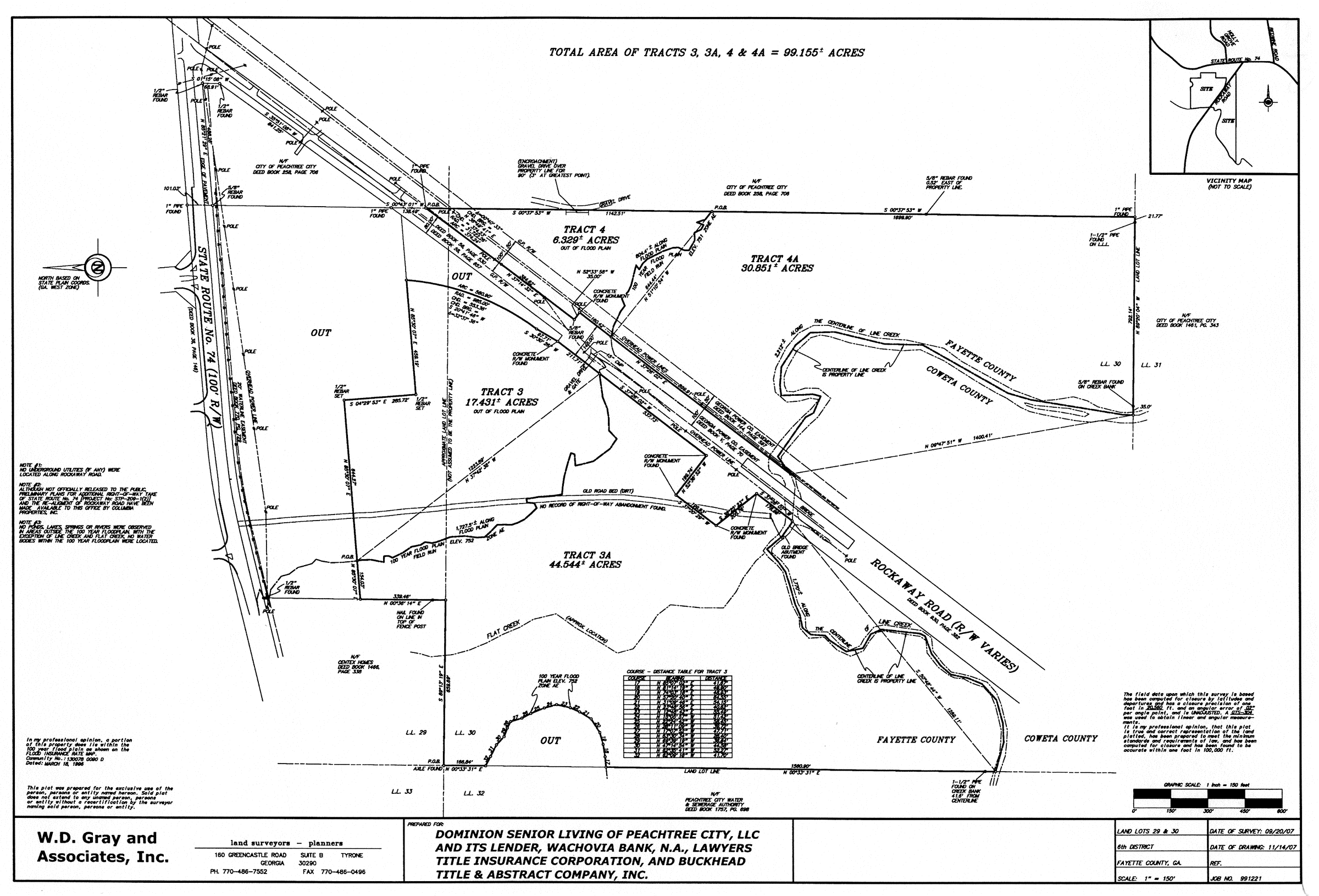
Limited-use commercial district no. 20 (1)
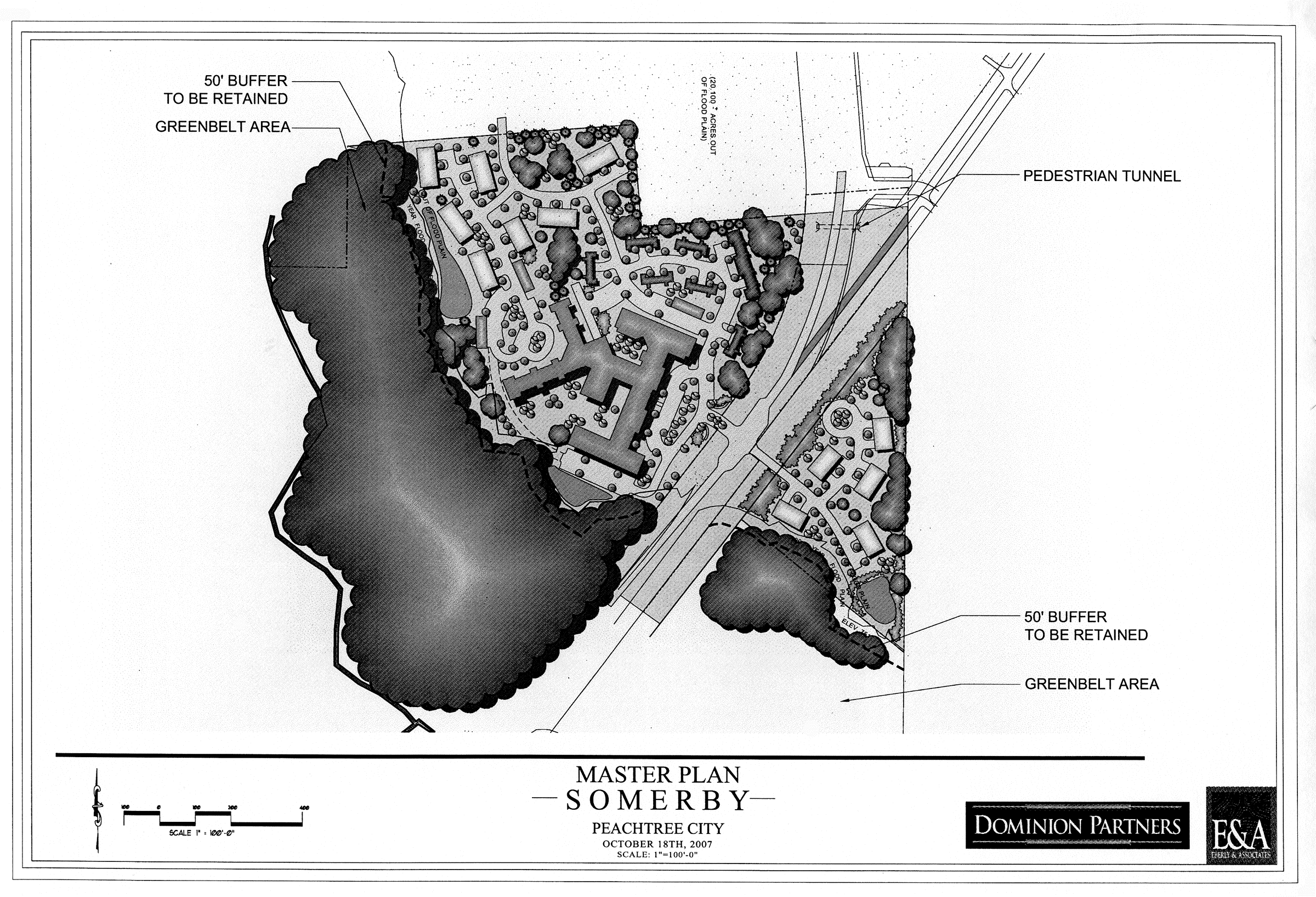
Limited-use commercial district no. 20 (2)
(1006B.22) Limited-use commercial district no. 22.
(a)
A single tract of land as described below shall be rezoned from its present classification of GC General Commercial to LUC-22 Limited-use commercial, subject to the conditions set forth herein. In the event of a conflict between the provisions of this ordinance and the regulations of the LUC Zoning District, the most restrictive regulation shall apply.
Legal description: All that tract or parcel of land lying and being in Land Lots 130, 131, 158 & 159 of the 7th District, City of Peachtree City, Fayette County, Georgia and being more particularly described as follows:
BEGINNING at a point on the westerly right-of-way of Commerce Drive North (60' R/W) 650.96 feet northwesterly from the intersection of the westerly right-of-way of Commerce Drive and the northwesterly right-of-way of Aberdeen Parkway (R/W Varies); thence North 58°49'01" West, a distance of 50.00 feet to a point; thence North 32°25'57" West, a distance of 325.89 feet to a point; thence North 65°03'36" East, a distance of 102.51 feet to a 1/2 inch rebar found; thence 42.42 feet along a curve to the right, said curve having a chord of North 70°07'14" East 42.36 feet and a radius of 240.00 feet to a point; thence North 75°11'09" East, a distance of 218.96 feet to a 3/4 inch rebar found; thence South 31°46'43" East, a distance of 234.02 feet to a point; thence South 58°13'17" West, a distance of 139.83 feet to a point; thence South 24°47'56" West, a distance of 130.63 feet to a point on the westerly right-of-way of Commerce Drive North (60' R/W); thence along said right-of-way 87.57 feet along a curve to the left, said curve having a chord of South 72°59'37" West 80.00 feet and a radius of 60.00 feet to a point, being the POINT OF BEGINNING.
Said tract contains 2.480 acres or 108,035 square feet of land.
(b)
This tract of land is illustrated on the Boundary and Topography Survey prepared for Apsilon Management Peachtree City LLC, prepared by Hurd-Prince & Associates, Inc. (dated October 3, 2007), a copy of which is attached hereto as Exhibit "A" and incorporated herein by express reference.
It is intended that the LUC-22 zoning district be established specifically for a four-story hotel to be developed substantially in accordance with the conditions set forth in this ordinance.
(c)
Development shall take place substantially in conformance with the schematic master plan prepared by ACES Engineering dated February 22, 2008 (Exhibit "B"). It is understood the building, internal circulation, parking areas and stormwater detention areas may change once detailed site and grading plans are prepared; however, any increase in the height of the building, the total number of rooms or any of the conditions and requirements of this section shall require a new rezoning action.
(1006B.22.1) Permitted uses. In order to create a commercial district that is related to its surrounding area and in the best interest of public safety, welfare and convenience, the district shall be limited to the following specific uses: a full service hotel and commercial recreational facility located entirely within a building on the premises.
The following additional uses which relate to the primary activity of this development shall be permitted if located entirely within the building:
1.
Retail business involving the sale of merchandise on the premises;
2.
Business involving the rendering of a personal service on the premises;
3.
Office for governmental, business, professional or general purpose;
4.
Private or semiprivate club, lodge or social center;
5.
Restaurant/lounge; and
6.
Accessory uses, as identified in Section 908.
(1006B.22.2) Uses not permitted.
1.
Extended stay lodging facility.
2.
Residential use (apartments, condominiums, townhomes, flats, lofts, etc.).
(1006B.22.3) Conditional uses. No conditional uses shall be permitted within this zoning district.
(1006B.22.4) Other requirements.
1.
Maximum floor area: 58,580 SF.
2.
Maximum number of rooms: 93.
3.
Maximum number of floors: 4.
4.
Maximum building height: 60'.
5.
Minimum front, rear and side setbacks. As set forth within the LUC zoning ordinance.
6.
Parking. As set forth within the city's Parking Ordinance.
7.
Signage. As set forth within the city's Sign Ordinance.
8.
Architectural concept. The architectural design, color selection and exterior building materials shall be substantially the same or equal to the building elevations prepared by Daniel Lemberg & Associates dated March 9, 2007 (Exhibit "C"). These drawings were reviewed in accordance with the city's Design Guidelines Ordinance and presented to and approved by the Planning Commission on March 10, 2008 as a part of the rezoning process.
Prior to submittal of the building plans to the Building Department, the Applicant shall submit the exterior building materials and color selections to the City Planner and the Planning Commission Representative for approval. The purpose of this submittal is to ensure the exterior building materials and color selections are compatible with the exterior building materials and color selections of existing buildings on Commerce Drive North.
9.
Site lighting. As set forth within the city's Lighting Ordinance.
10.
Landscape concept. As set forth within the city's landscape ordinance; provided, however, that since the proposed building would exceed the maximum 35-foot building height established within the GC zoning ordinance by 42 percent, a minimum of 42 percent of the required canopy trees shall be increased to no less than four inches in caliper. Additionally, no less than 50 percent of the canopy and understory trees provided to meet tree replacement requirements shall be specified as evergreen plant material.
11.
Stormwater detention. As set forth within the city's post-construction stormwater runoff management ordinance.
(Ord. No. 941, § 1, 4-3-2008)
Editor's note— The exhibits referred to in this section are not set out at length herein, but are on file in the office of the city clerk.
(1006B.23) Limited-use commercial district no. 23
(a)
A single tract of land as described below shall be rezoned from its present classification of GC General Commercial to LUC-23 Limited-use commercial, subject to the conditions set forth herein. In the event of a conflict between the provisions of this ordinance and the regulations of the LUC Zoning District, the most restrictive regulation shall apply.
LEGAL DESCRIPTION
All that tract or parcel of land lying and being in Land Lot 158 of the 17 th District, Fayette County, GA, and being more particularly described as follows:
Commencing at the point of intersection of the easterly right-of-way of State Route 74 (R/W varies) and the Southerly right-of-way of Wisdom Road (80' R/W), thence along said southerly right-of-way 439.09 feet to a PK nail set in the centerline of a private asphalt driveway, said point being the TRUE POINT OF BEGINNING;
Thence along said southerly right-of-way and a curve to the right an arc distance of 33.25 feet, said curve having a radius of 1754.50 feet and being subtended by a chord of 33.25 feet, at South 88 degrees 55 minutes 36 seconds East, to a ½" rebar found; then leaving southerly right-of-way South 26 degrees 29 minutes 37 seconds East, 515.04 feet to a ¾" open top pipe found; thence South 63 degrees 39 minutes 54 seconds West. 300.17 feet to a PK nail found in the centerline of said private asphalt driveway; thence along said centerline the following courses and distances: North 71 degrees 06 minutes 03 seconds East, 86.84 feet to a point; along a curve to the left, an arc distance of 130.67 feet, said curve having a radius of 112.69 feet and being subtended by a chord of 123.47 feet, at North 37 degrees 52 minutes 56 seconds East, to a point; North 04 degrees 39 minutes 49 seconds East, 103.3 feet to a PK nail set, said point being the TRUE POINT OF BEGINNING;
Said tract or parcel of land contains 2.846 acres and is more accurately depicted on a plat of survey prepared by GeoSurvey, Ltd. Dated November 14, 2006, job number 20063002.
Together with easement rights reserved in Warranty Deed from Jamie A. White Wyatt to John Barrow, dated September 1, 1999, filed September 14, 1999, recorded in Deed Book 1429, Page 623, Fayette County, Georgia records.
And together with easement rights contained in Storm Water Sewer Easement from Peachtree Housing, Ltd. To Jamie A. White Wyatt and Barrow and Hirsch Properties, Inc. dated April 26, 2002, filed August 7, 2002, recorded in Deed Book 1919, Page 75, Fayette County, Georgia records.
(b)
This tract of land is illustrated on the ALTA/ACSM Land Title Survey prepared for Kasandas Properties Peachtree, LLC prepared for Lawyers Title Insurance Corporation, prepared by Geo-Survey, Ltd. (dated November 14, 2006), a copy of which is attached hereto as Exhibit "A" and incorporated herein by express reference.
It is intended that the LUC-23 zoning district be established specifically for a three-story hotel to be developed substantially in accordance with the conditions set forth in this ordinance.
(c)
Development shall take place substantially in conformance with the schematic site plan (prepared by ACME American, L.L.C. and dated June 1, 2012) (Exhibit "B"). It is understood the building, internal circulation, parking areas and stormwater detention areas may change once detailed site and grading plans are prepared; however, any increase in the height of the building, the total number of rooms or any of the conditions and requirements of this section shall require a new rezoning action.
(1006B.23.1) Permitted uses.
In order to create a commercial district that is related to its surrounding area and in the best interest of public safety, welfare and convenience, the district shall be limited to the following specific uses: a full service hotel and commercial recreational facility located entirely within a building on the premises.
The following additional uses which relate to the primary activity of this development shall be permitted if located entirely within the building:
1.
Retail business involving the sale of merchandise on the premises;
2.
Business involving the rendering of a personal service on the premises;
3.
Office for governmental, business, professional or general purpose;
4.
Private or semiprivate club, lodge or social center;
5.
Restaurant/lounge; and
6.
Accessory uses, as identified in Section 908.
(1006B.23.2) Uses not permitted.
1.
Extended stay lodging facility.
2.
Residential use (apartments, condominiums, townhomes, flats, lofts, etc.)
(1006B.23.3) Conditional uses.
No conditional uses shall be permitted within this zoning district.
(1006B.23.4) Other requirements.
1.
Maximum floor area: 42,000 SF.
2.
Maximum number of rooms: 79.
3.
Maximum number of floors: Three.
4.
Maximum building height: 43 feet (applies to parapet wall above entrance only).
5.
Minimum front, rear and side setbacks: As set forth within the LUC zoning ordinance.
6.
Parking: As set forth within the city's parking ordinance.
7.
Signage: As set forth within the city's sign ordinance.
8.
Architectural concept: The architectural design, color selection and exterior building materials shall be substantially the same or equal to the building elevations prepared by ACME American (Exhibit "C"). These drawings were reviewed in accordance with the city's design guidelines ordinance and presented to and approved by the planning commission on September 9, 2013 as a part of the rezoning process.
As a part of the conceptual site plan review process, the applicant shall submit the exterior building materials and color selections to the planning and zoning administrator and the planning commission Representative for approval. The purpose of this submittal is to ensure the exterior building materials and color selections are compatible with the exterior building materials presented to and approved by the planning commission.
9.
Site lighting: As set forth within the city's lighting ordinance; provided, however, that the site lighting plan shall include all fixtures proposed on the exterior of the building and those proposed to uplight or highlight architectural features of the building. Colored lighting shall not be used to illuminate the parapet, nor shall any light used to illuminate the parapet be visible from the adjoining residential tract.
10.
Landscape concept: As set forth within the city's landscape ordinance; provided, however, that since the proposed building height (43 feet) would exceed the maximum building height (35 feet) established within the GC zoning ordinance by 17 percent, the total number of canopy and understory trees required under the city's landscape ordinance shall be increased by not less than 17 percent.
11.
Stormwater detention: As set forth within the city's post-construction stormwater runoff management ordinance.
(1006B.24) Limited-use commercial district no. 24
(a)
The tract of land as described below shall be rezoned from its present classification of OI Office Institutional to LUC-24 Limited-use commercial, subject to the conditions set forth herein. In the event of a conflict between the provisions of this ordinance and the regulations of the LUC Zoning District, the most restrictive regulation shall apply.
LEGAL DESCRIPTION—TRACT 2
All that tract and parcel of land lying and being in land lots 135 & 122 of the 7th District, Fayette County, Georgia, and more particularly described as follows:
Commencing at the existing intersection of Northerly Right of way of Peachtree Parkway (100′ ROW), and the Easterly Right of way of World Drive (80′ ROW); Thence N 05°54′40″ E a distance of 135.51′ to a point; Thence N 05°46′41″ E a distance of 129.08′ to a point; Thence around a curve to the left having a radius of 440.00′ a length of 125.31′ a chord bearing of N 04°21′48″ W a distance of 124.89′ to a point; Thence N 12°31′19″ W a distance of 81.00 to THE POINT OF BEGINNING (P.O.B.).
FROM THE POINT OF BEGINNING (P.O.B.): Thence N 12°31′19″ W a distance of 54.05′ to a point; Thence around a curve to the right having a radius of 812.46′, a length of 157.19′, a chord bearing of N 06°58′41″ W a distance of 156.95′ to a point; Thence N 88°33′58″ E a distance of 3.50′ to a point; Thence around a curve to the right having a radius of 808.96′, a length of 109.49′, a chord bearing of N 02°26′35″ E a distance of 109.40' to a point; Thence N 09°03'02'' E a distance of 538.24' to a point; Thence S 44°02′33″ E a distance of 595.57′ to a point; Thence S 09°43′16″ E a distance of 225.66′ to a point; Thence S 50°11′40″ E a distance of 31.52′ to a point; Thence S 69°59′07″ W a distance of 443.13′ to a point; Thence S 77°28′41″ W a distance of 125.00′ to THE POINT OF BEGINNING (P.O.B.).
Containing 6.521 acres, together with all easements recorded and unrecorded.
(b)
This tract of land is illustrated on the survey for Residence Inn and Suites, prepared by Southside Surveying and Planning (dated September 25, 2014), a copy of which is attached hereto as Exhibit "A" and incorporated herein by express reference.
It is intended that the LUC-24 zoning district be established specifically to permit the development of an all-suites hotel on the subject tract subject to the following understandings and conditions:
1.
The rezoning shall be limited to Lot 2 within the overall Kedron Office Park.
2.
No more than one hotel shall be constructed on the subject tract.
3.
The hotel shall be designated as an all-suites hotel with no more than 120 rooms.
4.
The hotel shall be no taller than four stories in height.
5.
The hotel shall be no taller than 45 feet as measured from finish grade to the ridge line or the highest point of the parapet wall, whichever is taller.
6.
The hotel shall be located as far north on the subject tract as possible and shall not disturb any of the existing tree cover.
It is understood the adjoining building pad shall be developed for office use as identified within Section 1005A.2 of the OI Office Institutional zoning district and in conformance with other requirements as identified within Section 1005A.4 of the OI Office Institutional zoning district.
(c)
Development shall take place substantially in conformance with the schematic site plan as prepared by Lemberg Architects and Associates and dated September 24, 2014 (Exhibit "B"). It is understood the location of the building may change once detailed site and grading plans are prepared; however, any increase in the intensity of that which is shown on the schematic site plan or any of the conditions and requirements identified herein shall require a new rezoning action.
(1006B.24.1) Permitted uses.
In addition to those uses identified within section 1005A.2 of the OI Office Institutional zoning district, the following uses shall be permitted within the LUC-24 zoning district:
1.
All-suites hotel.
(1006B.24.2) Other requirements.
(a)
The schematic site plan submitted as a part of the rezoning request is illustrative only. The applicant shall prepare a detailed conceptual site plan which must be reviewed and approved by the planning commission as a part of the established site plan review and approval process. It is understood the general layout of the buildings, parking areas and amenities may change once final engineering documents are prepared.
(b)
The building elevations for each building shall be presented to and approved by the planning commission as a part of the site plan review process. The architectural design, exterior building materials and color selection of the proposed buildings shall be compatible with those used on the 100 World Drive office building.
(c)
The overall development shall comply with the city's post-construction stormwater runoff management ordinance and provide water quality best management practices (BMP's) on greenbelt areas dedicated to the city.
(d)
The applicant shall coordinate with the Peachtree City Building, Fire and Police Departments to ensure their understanding of the proposed development, internal circulation routes, emergency response, building design and life safety issues.
(e)
The developer shall pay impact fees as identified within the city's impact fee ordinance.
(f)
A traffic study shall be prepared to determine if the proposed change in use might require modifications to maintain the current level of service at the Peachtree Parkway/World Drive intersection. The traffic study as well as any off-site improvements shall be funded at the sole expense of the applicant.
(g)
The Applicant shall adopt Deed Restrictions for Lot 1 stipulating the subject tract shall be used for office use only as identified in the OI Zoning District. The deed restrictions shall include a requirement that the Kedron Hills Homeowner's Association (HOA) must approve any changes to the uses as permitted.
(h)
The hotel shall maintain a minimum AAA three-star rating, or equivalent, per hotel industry standards.
(Ord. No. 1088, § 1, 1-15-2015)
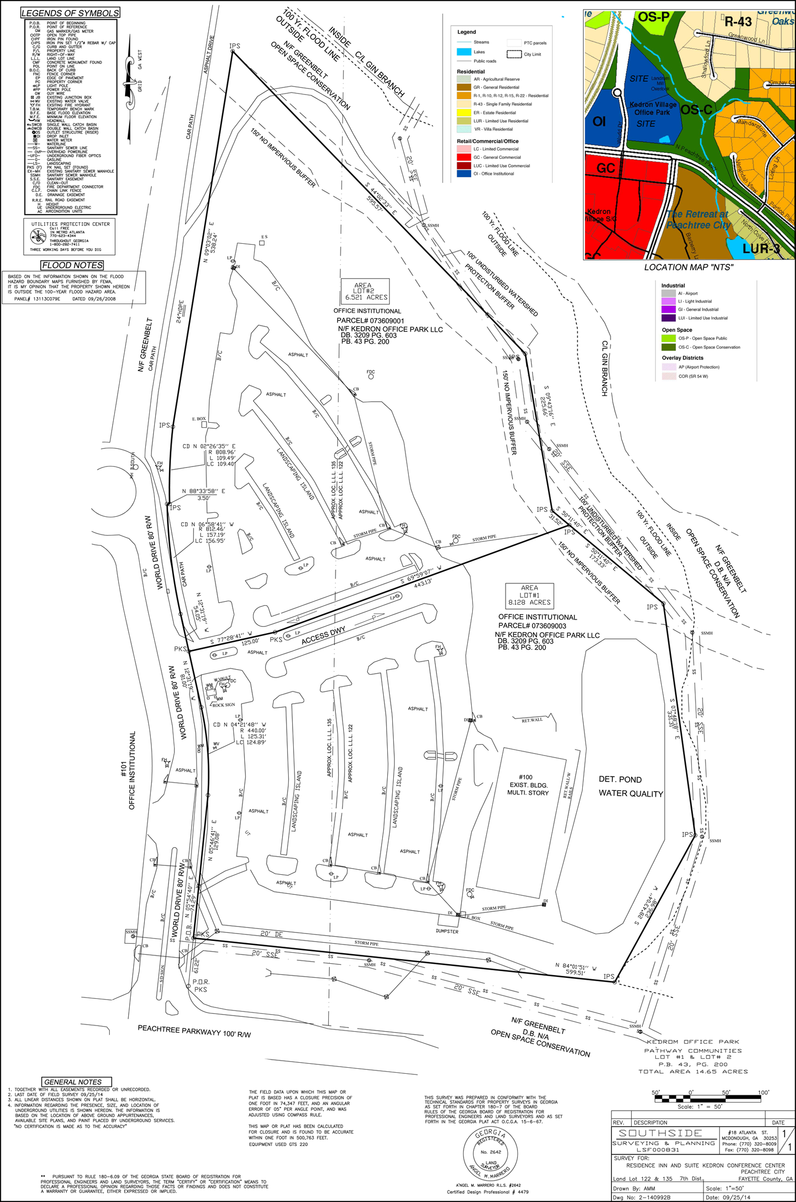
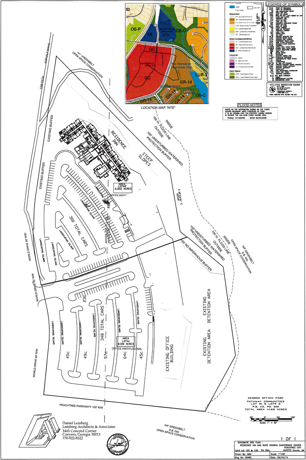
(1006B.25) Limited-use commercial district no. 25.
(a)
The tract of land as described below shall be rezoned from its present classification of OI Office Institutional to LUC-25 Limited Use Commercial, subject to the conditions set forth herein. In the event of a conflict between the provisions of this ordinance and the regulations of the LUC Zoning District, the most restrictive regulation shall apply.
[Legal description:] All that tract or parcel of land lying and being in Land Lot 93 of the 7th Land District of Fayette County, Georgia and being more particularly described as follows:
Begin at a nail found in the cart path on the northerly right-of-way line of Stevens Entry (60′ ROW), which point lies westerly a distance of 797.32 feet as measured along said right-of-way line from the intersection of said right-of-way line with the northwesterly right-of-way line of Prime Point (60′ ROW), and run thence along said right-of-way line of Stevens Entry South 87 degrees 1 minute 9 seconds west a distance of 205.40 feet to a nail set in a cart path; run thence North 21 degrees 27 minutes 50 seconds east a distance of 436.71 feet to a ¾ inch rod found; run thence South 84 degrees 24 minutes 5 seconds east a distance of 317.13 feet to a ¾ inch rod found; run thence South 36 degrees 32 minutes 8 seconds West a distance of 454.03 feet to the Point of Beginning as established above; being shown and described as Tract 3 containing 2.355 acres, on that certain plat of survey prepared for Brooks & Kaigler, by James R. Green, Georgia Registered Land Surveyor No. 2543, dated June 17, 1998, which plat is incorporated herein by reference.
(b)
This tract of land is illustrated on the Boundary Survey for Tract 3 prepared for Brooks & Kaigler by James R. Green (dated June 17, 1998), a copy of which is attached hereto as Exhibit D and incorporated herein by express reference.
It is intended that the LUC-25 zoning district be established specifically to subdivide the existing 2.36-acre Creekside Medical tract into two tracts of land in accordance with the conditions set forth in this ordinance.
(c)
The intent of the rezoning is to permit the subdivision of the property such that the building and parking setbacks as identified within the OI zoning district are not applicable to the internal property line separating the two tracts of land.
It is understood a second office building will be constructed on one of the new parcels as identified on the conceptual site plan (approved June 12, 2000) and the final site plan (approved July 23, 2001) for the subject tract.
(d)
It is also understood that all access and utility easements, cross parking agreements, and other internal agreements between the owners of the two tracts of land shall be duly satisfied and recorded as a part of the sale of the individual buildings or tracts of land, and that the city shall not be responsible for interpreting or providing relief for any issues related to the subdivision of the two tracts of land.
(1016B.25.1) Permitted uses.
Those uses identified in Section 1005A.2 of the Peachtree City Zoning Ordinance.
(1016B.25.2) Conditional uses.
Those uses identified in Section 1005A.3 of the Peachtree City Zoning Ordinance.
(1016B.25.3) Other requirements.
(a)
Minimum zoning lot area: 20,000 square feet.
(b)
Minimum lot width: 100 feet.
(c)
Minimum front setback depth:
(1)
Building: 40 feet.
(2)
Driveway/parking: 20 feet.
Note: The minimum front setback depths shall apply only to the property line abutting Stevens Entry and shall not apply to the internal property line separating the two tracts.
(d)
Minimum side setback depth: 10 feet.
Note: The minimum side setback depth shall not apply to the internal property line separating the two tracts.
(e)
Minimum rear yard: 20 feet.
Note: The minimum rear setback depth shall not apply to the internal property line separating the two tracts.
(f)
Maximum building height: 35 feet.
(g)
Storage: No storage will be permitted on the zoning lot outside of a fully enclosed building.
(h)
No automobile parking or service areas will be permitted within the required front setback depth or within 30 feet of the property line of any adjoining residential zoning lot.
(i)
Parking and service areas must be separated from adjoining residential lots by a suitable evergreen planting screen, fence or wall at least six feet in height above finished grade. The above required evergreen planting screen, fence or wall must provide for a reasonable visual separation between the properties.
(j)
No outside loudspeaker systems shall be utilized.
(e)
This rezoning request was approved by the Mayor and City Council on November 20, 2014 subject to the following understandings and conditions:
1.
Approval of the rezoning shall not include approval of any site enhancements or improvements.
2.
The new building shall comply with the established site plan submittal requirements, and shall not exceed 4,881 SF as identified on the approved conceptual and final site plans.
3.
The Applicant shall coordinate with City Staff to ensure notes related to site access, parking, stormwater and utility easements are properly addressed and included on the final plat.
Exhibit A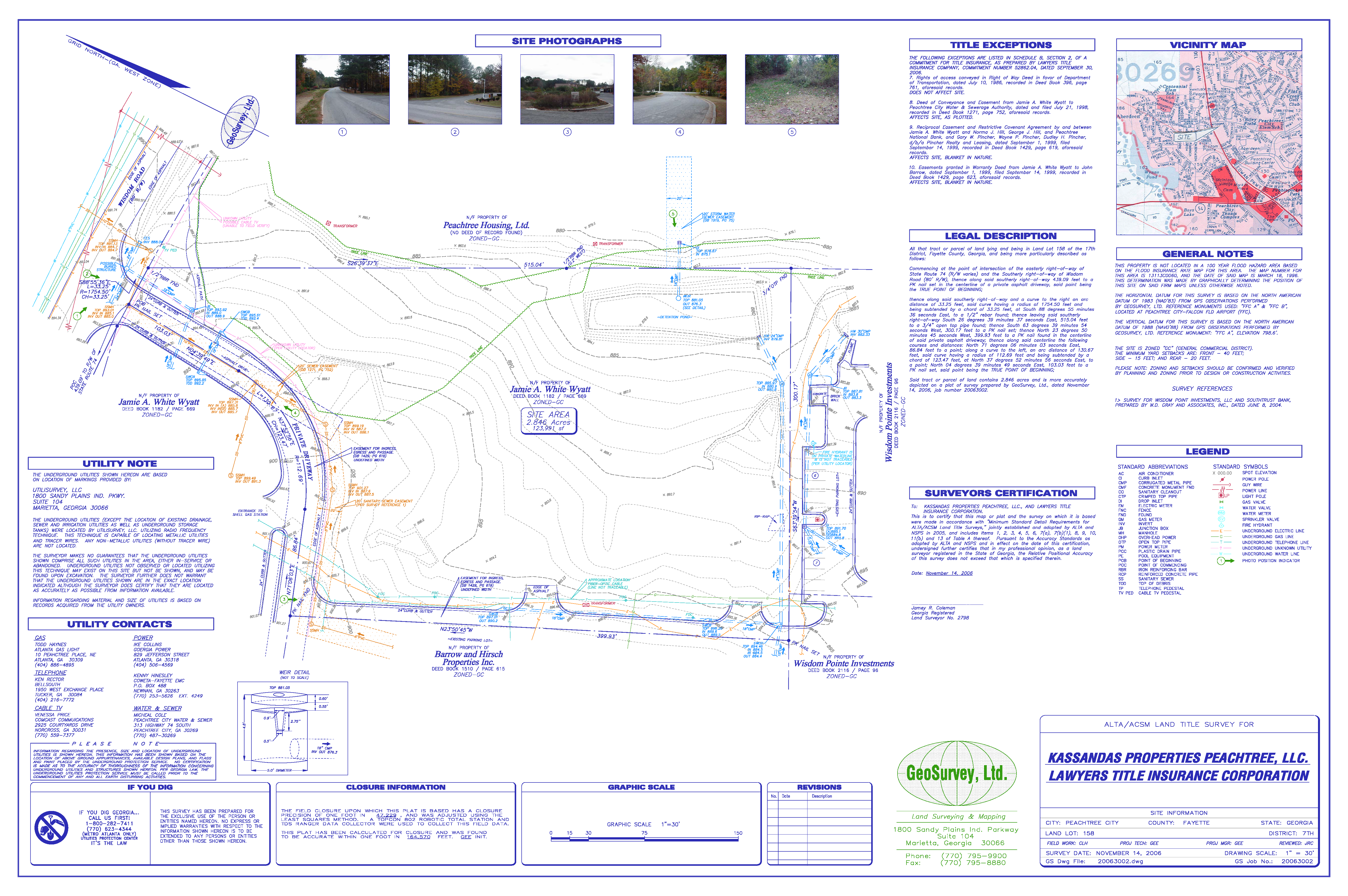
Exhibit B
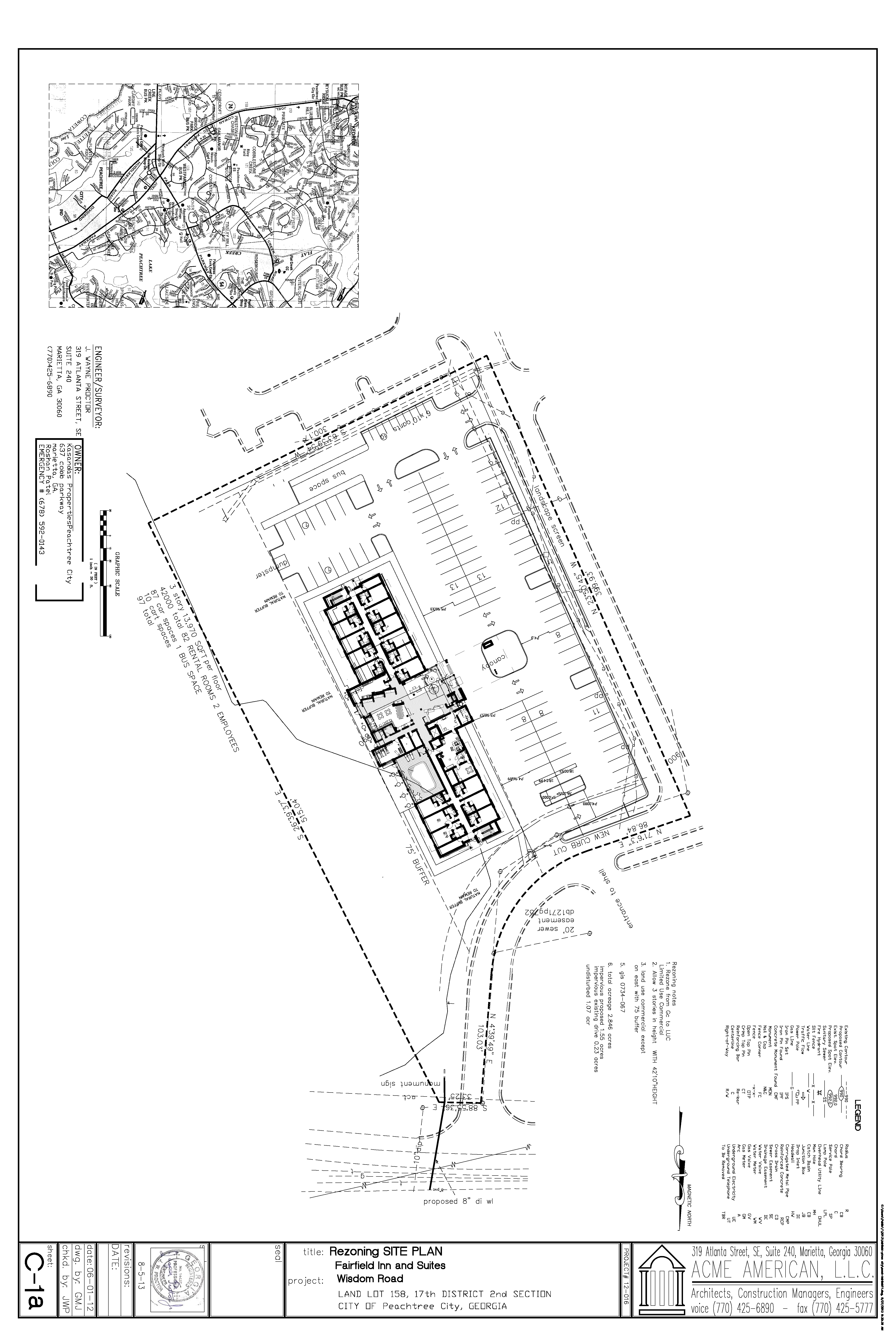
Exhibit C
Exhibit D
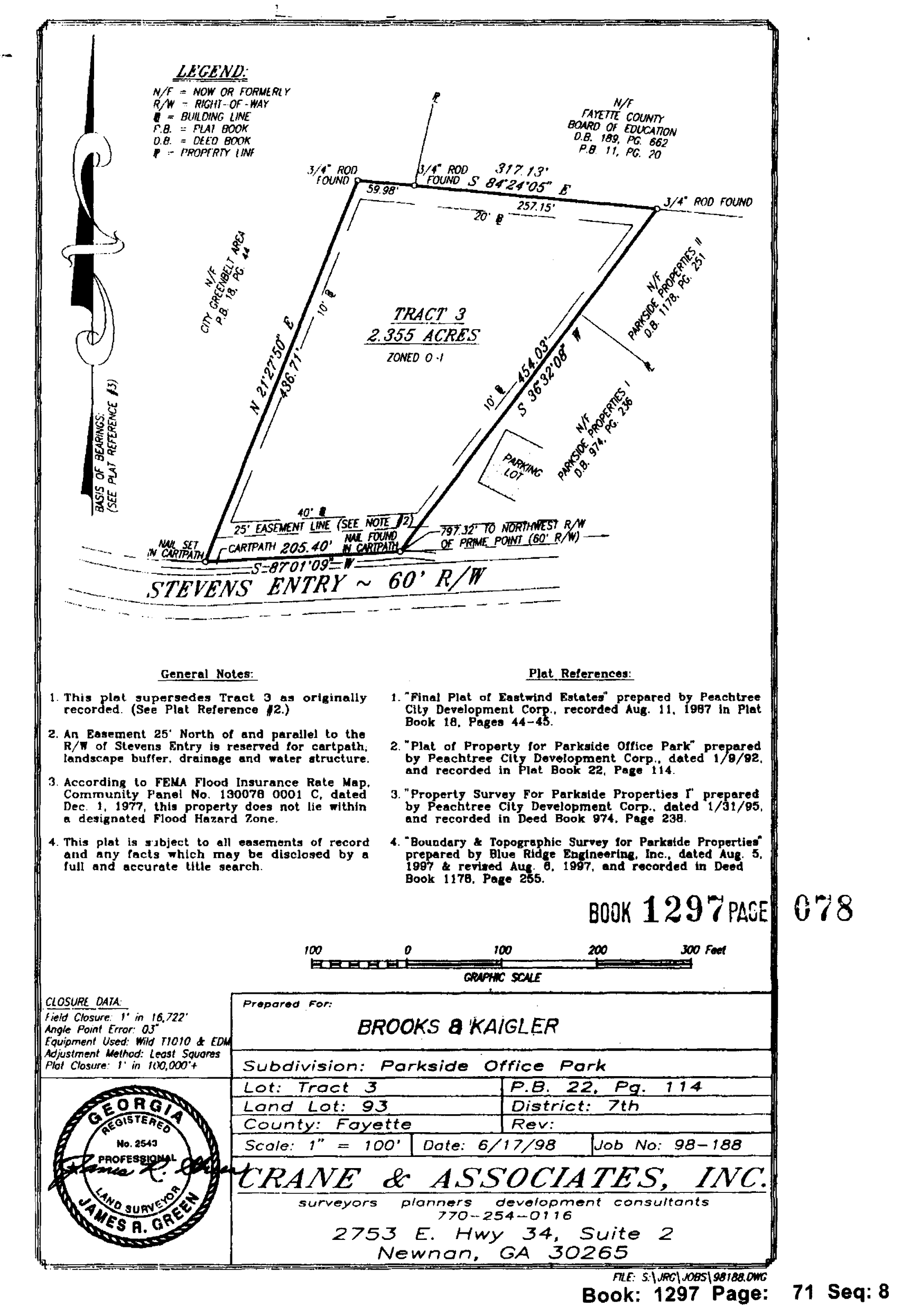
(Ord. No. 1067, § 1, 10-3-2013; Ord. No. 1085, 11-20-2014)
(1006B.27) Limited-use commercial district no. 27.
(a)
The tract of land as described below shall be rezoned from its present classification of LUC-9 Limited Use Commercial to LUC-27 Limited Use Commercial, subject to the conditions set forth herein. In the event of a conflict between the provisions of this subsection and the regulations of the LUC Zoning District, the most restrictive regulation shall apply.
All that tract or parcel of land lying and being in Land Lots 93 and 94 of the 7th District, City of Peachtree City, Fayette County, Georgia, and being more particularly described as follows:
Commencing at a ⅝″ rebar found at the intersection of the southeasterly right of way of Georgia State Highway 54 (variable right of way) with the southwesterly right of way of Shakerag Hill (variable right of way); thence along the southwesterly right of way of Shakerag Hill North 89 degrees 03 minutes 10 seconds East, a distance of 42.61 feet to a ⅝″ rebar found; thence continuing along said right of way South 46 degrees 11 minutes 42 seconds East, a distance of 236.30 feet to a point, said point being the POINT OF BEGINNING; thence continuing along said right of way South 46 degrees 11 minutes 42 seconds East, a distance of 14.00 feet to a ¾″ rod found; thence continuing along said right of way North 43 degrees 48 minutes 18 seconds East, a distance of 35.00 feet to a ¾″ rod found; thence leaving said right of way South 46 degrees 11 minutes 42 seconds East, a distance of 247.73 feet to a ¾″ rod found; thence South 44 degrees 19 minutes 34 seconds West, a distance of 398.04 feet to a ½″ crimp top pipe found; thence North 46 degrees 20 minutes 46 seconds West, a distance of 259.82 feet to a point; thence North 44 degrees 04 minutes 28 seconds East, a distance of 363.71 feet to the POINT OF BEGINNING.
Said tract contains 103,363 square feet or 2.37 acres.
(b)
This tract of land is illustrated on the Final Plat for Shakerag Hill prepared by Rochester & Associates (dated April 11, 2006), a copy of which is attached hereto as Exhibit "A" and incorporated herein by express reference.
It is intended that the LUC-27 zoning district be established specifically to subdivide the existing 2.37-acre Peachtree Pointe office tract such that the three existing office buildings can be sold and/ or refinanced in accordance with the conditions set forth in this ordinance.
(c)
The intent of the rezoning is to permit the subdivision of the property such that the building and parking setbacks as identified within the LUC zoning district are not applicable to the internal property lines separating the individual tracts of land.
(d)
It is also understood that all access and utility easements, cross parking agreements, and other internal agreements between the owners of the individual tracts of land shall be duly satisfied and recorded as a part of the sale of the individual buildings or tracts of land, and that the city shall not be responsible for interpreting or providing relief for any issues related to the subdivision of the two tracts of land.
(Section 1006B.27.1) Permitted uses.
Those uses identified in Section 1006B.9 of the Peachtree City Zoning Ordinance.
(Section 1006B.27.2) Conditional uses.
Those uses identified in Section 1006B.9 of the Peachtree City Zoning Ordinance.
(Section 1006B.27.3) Other requirements.
(a)
Minimum zoning lot area: 30,000 square feet.
(b)
Minimum lot width: 150 feet.
(c)
Minimum front setback depth:
(1)
Building: 40 feet.
(2)
Driveway/parking: 20 feet.
Note: The minimum front setback depth shall apply only to the property line abutting Shakerag Hill and shall not apply to the internal property line separating the two tracts.
(d)
Minimum side setback depth: 10 feet.
Note: The minimum side setback depth shall not apply to the internal property line separating the two tracts.
(e)
Minimum rear setback: 20 feet.
Note: The minimum rear setback depth shall not apply to the internal property line separating the two tracts.
(f)
Maximum building height: 35 feet.
(g)
Storage: No storage will be permitted on the zoning lot outside of a fully enclosed building.
(h)
No automobile parking or service areas will be permitted within the required front setback depth or within 30 feet of the property line of any adjoining residential zoning lot.
(i)
Parking and service areas must be separated from adjoining residential lots by a suitable evergreen planting screen, fence or wall at least six feet in height above finished grade. The above required evergreen planting screen, fence or wall must provide for a reasonable visual separation between the properties.
(j)
No outside loudspeaker systems shall be utilized.
(e)
This rezoning request was approved by the Mayor and City Council on April 2, 2015, subject to the following understandings and conditions:
1.
Approval of the rezoning shall not include approval of any site enhancements or improvements.
2.
The Applicant shall coordinate with City Staff to ensure notes related to site access, parking, stormwater and utility easements are properly addressed and included on the final plat.
(Ord. No. 1092, § 1, 4-2-2015)
(Section 1006B.28) Limited-use commercial district no. 28
(a)
A single tract of land within the existing Lexington Circle mixed-use development as described below shall be rezoned from its present zoning designation of LUC-16, Limited Use Commercial District 16 to LUC-28, Limited Use Commercial District 28. Said property is more particularly described as follows:
All that tract or parcel of land lying and being in Land Lot 93 of the 7th District, Fayette County, City of Peachtree City, Georgia, and being more particularly described as follows:
Beginning at the Northeast corner of the mitered Right-of-Way intersection of the Northerly Right-of-Way of Walt Banks Road (60-foot Right-of-Way) and the Westerly Right-of-Way of State Route #54 (Right-of-Way varies); said Right-of-Way intersection being shown on the Final Plat of Lexington Circle, recorded in Plat Book 41, pages 127-128; Thence along the Westerly Right-of-Way of State Route #54 North 06 degrees 06 minutes 32 seconds East a total distance of 859.98 feet to a point, said point being the intersection of the Westerly Right-of-Way of State Route #54 and the Northerly line of Land Lot 93; thence leaving said Right-of-Way North 89 degrees 50 minutes 24 seconds West along said Land Lot Line a total distance of 620.23 feet to a point on the West side of an 80 foot ingress/egress and utility tract named Lexington Circle as shown on the above referenced plat and the TRUE POINT OF BEGINNING; thence leaving said Land Lot Line and along said ingress/egress and utility tract South 02 degrees 04 minutes 51 seconds West a distance of 42.02 feet to a point; Thence South 42 degrees 56 minutes 45 seconds East a distance of 41.00 feet to a point; Thence South 03 degrees 56 minutes 53 seconds West a distance of 351.21 feet to a point; Thence South 46 degrees 57 minutes 35 seconds West a distance of 8.51 feet to a point; Thence leaving said ingress/egress and utility tract as shown on the Final Plat of Lexington Circle, recorded in Plat Book 41, pages 127-128, and running along the Proposed Zoning Line as shown on the Zoning Exhibit prepared for High Sierra Investments, LLC by W.D. Gray and Associates, dated October 20, 2016, North 83 degrees 28 minutes 59 seconds West a distance of 349.37 feet to a point on the Westerly property line of Tract 8; Thence North 06 degrees 27 minutes 04 seconds East a distance of 391.87 feet to a point on the Northern Land Lot Line of Land Lot 93; Thence along said Land Lot Line South 89 degrees 50 minutes 24 seconds East a distance of 110.57 feet to a point; Thence continuing along said Land Lot Line South 89 degrees 50 minutes 24 seconds East a distance of 196.51 feet to a point on the west side of the 80 foot ingress/egress and utility tract, and the TRUE POINT OF BEGINNING; said tract containing 3.223 acres more or less, and being a portion of Tract 8 as recorded in Plat Book 41, pages 127-128 and as shown on the Zoning Exhibit prepared for High Sierra Investments, LLC by W.D. Gray and Associates, dated October 20, 2016.
(b)
Said tract is included as Exhibit "A" and incorporated herein by express reference.
The subject tract shall be developed in accordance with all restrictions and conditions adopted as a part of the LUC-16 zoning district, except for the following:
The LUC-28 zoning district is specifically intended to permit the development of a four-story residential loft building that will contain no more than 80 residential units and associated amenities, said building shall not exceed the height of eighty (80) feet. The zoning designation shall also permit a ground-level retail component within the residential building.
(c)
Development shall take place substantially in conformance with the schematic site plans (dated July 2016) and building elevations (dated April 2016) as prepared by Jefferson Browne Architects, copies of which are attached hereto and incorporated into the Ordinance by express reference as (Exhibit "B"). It is understood the building, internal circulation, parking areas and stormwater detention areas may change once detailed site and grading plans are prepared; however, any substantive change or deviation from the conditions and requirements of this section shall require a new rezoning action.
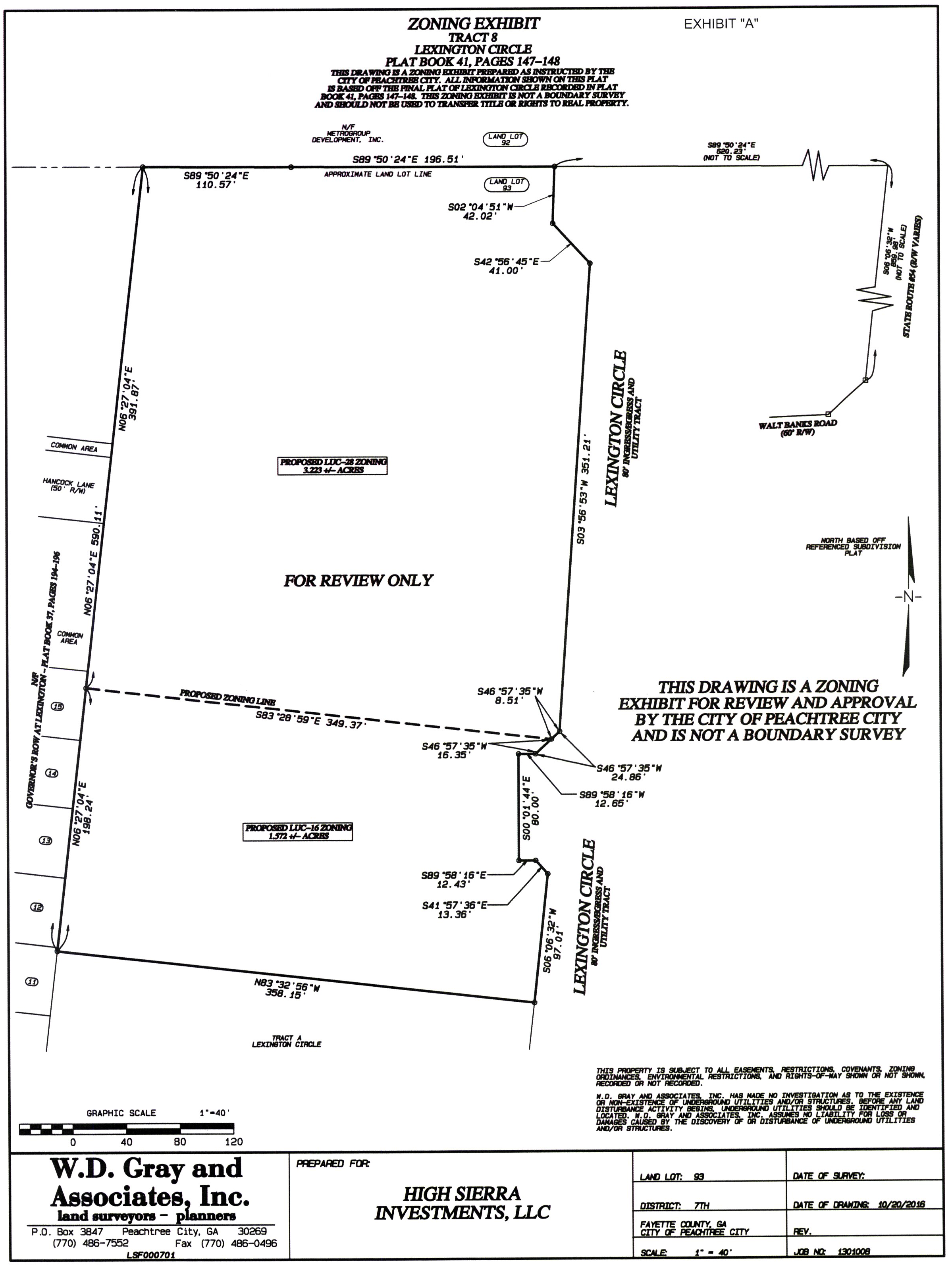
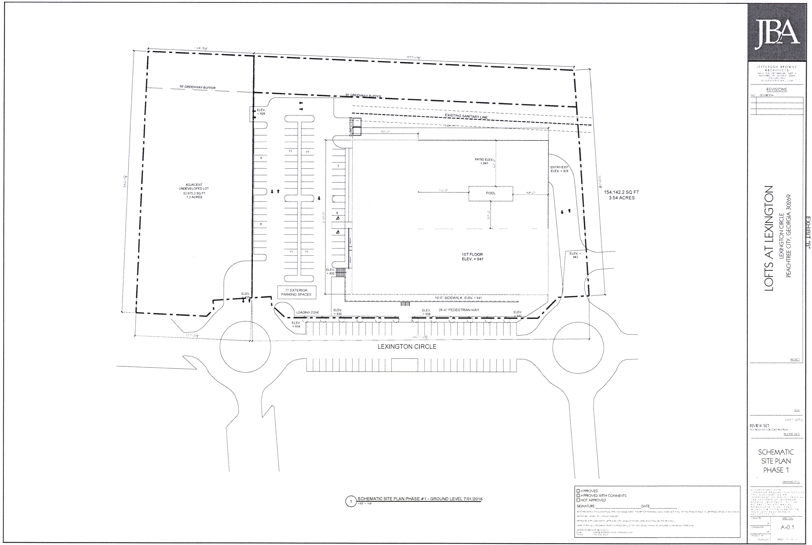
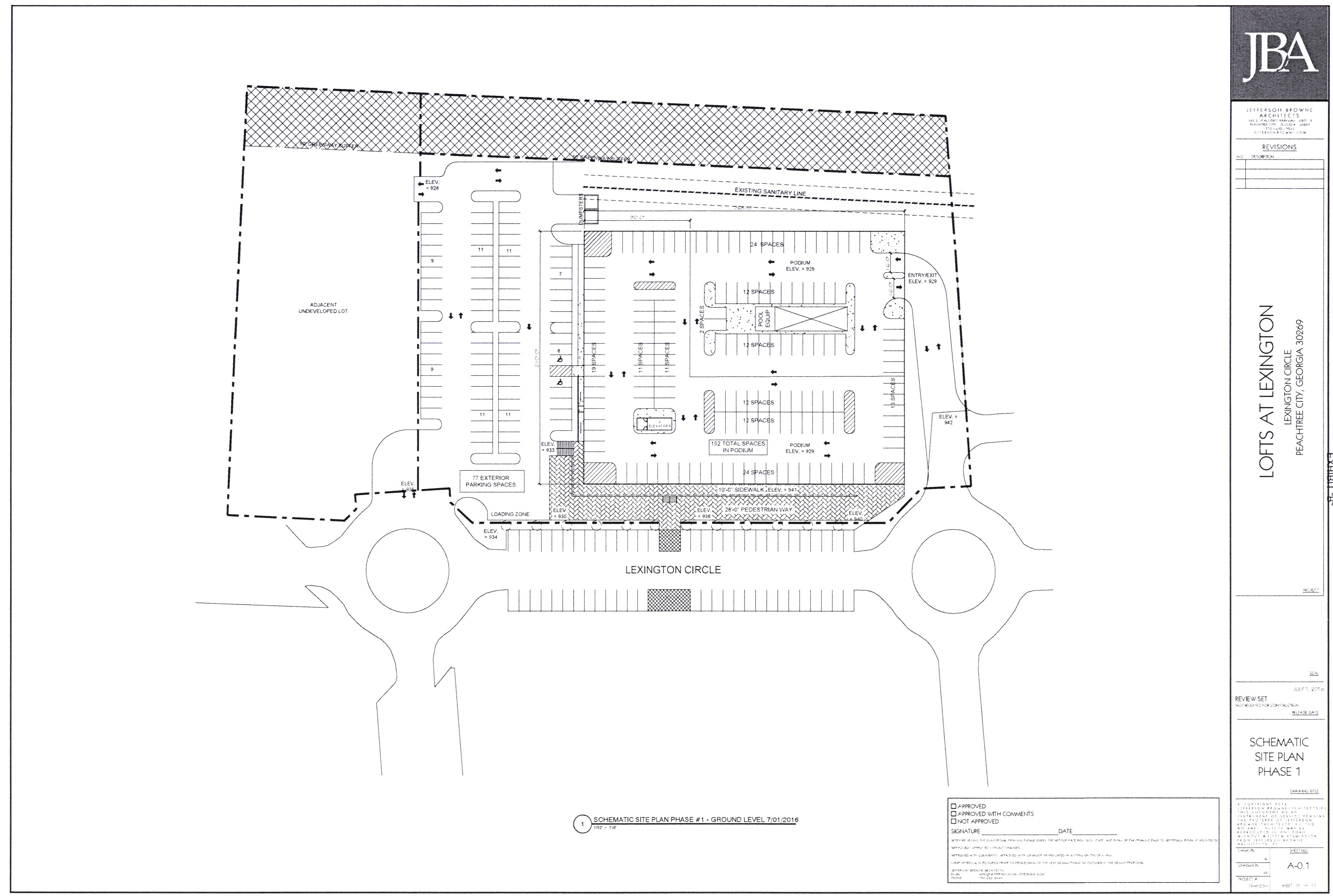
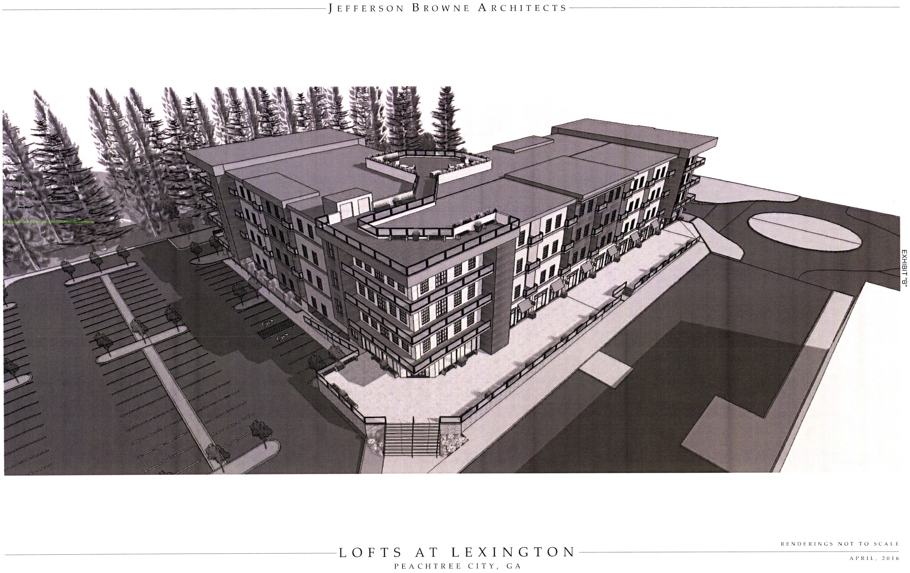
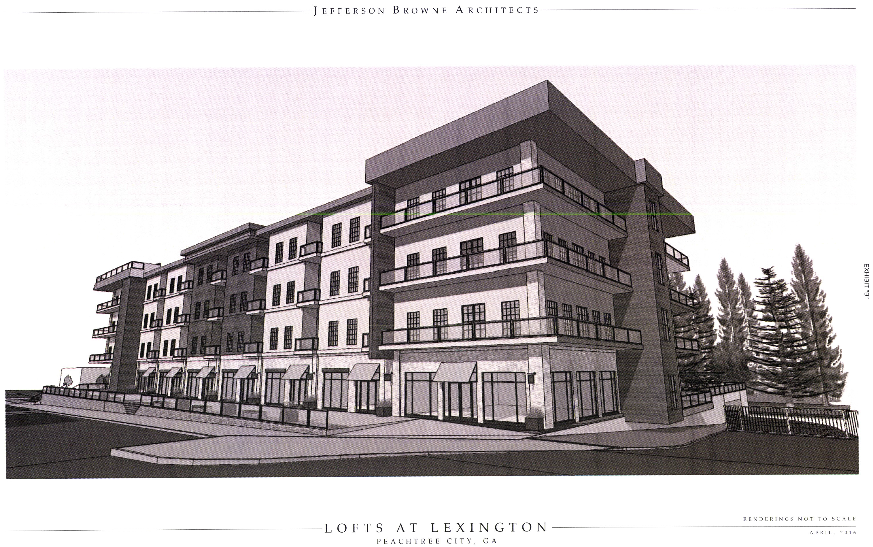
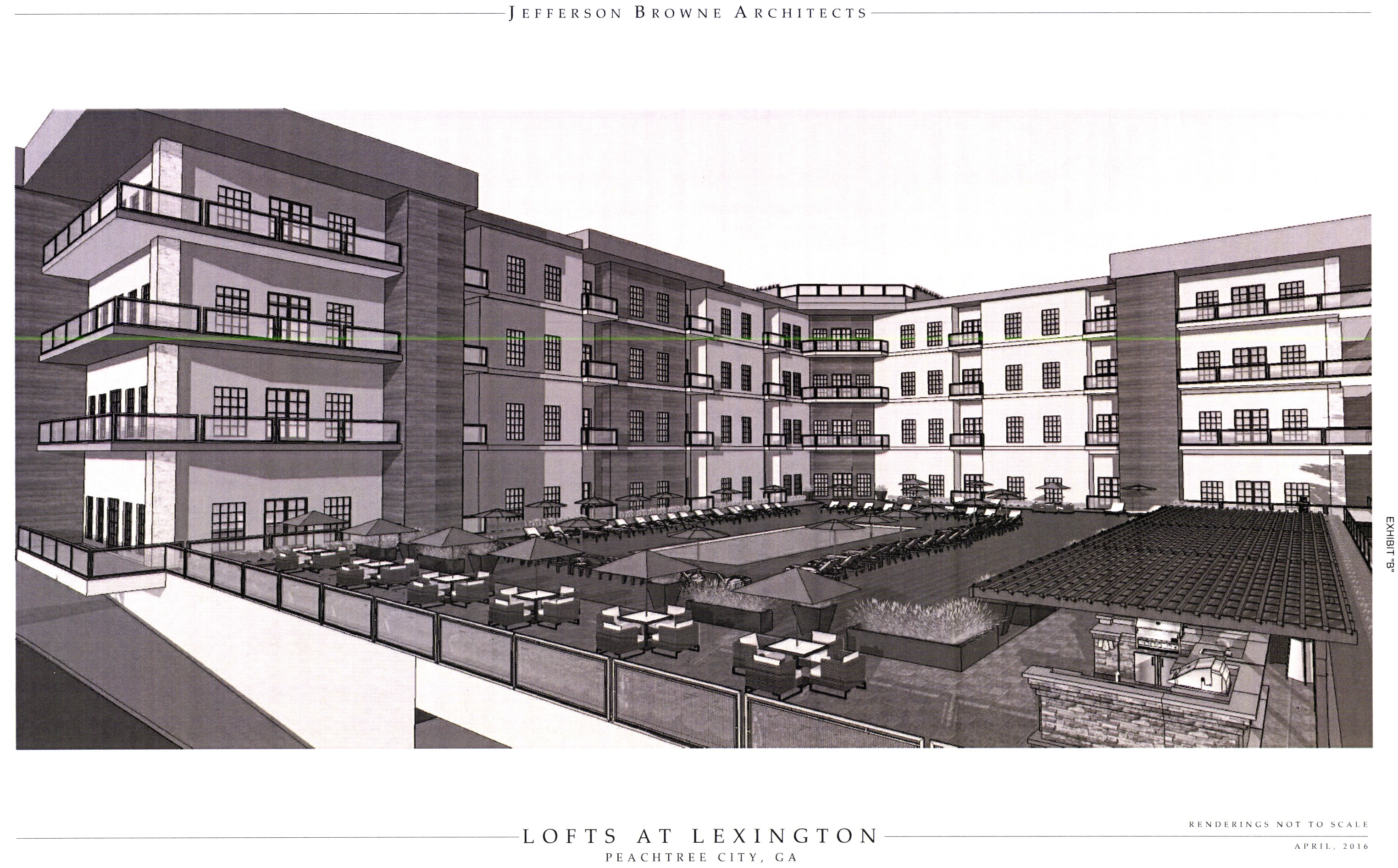
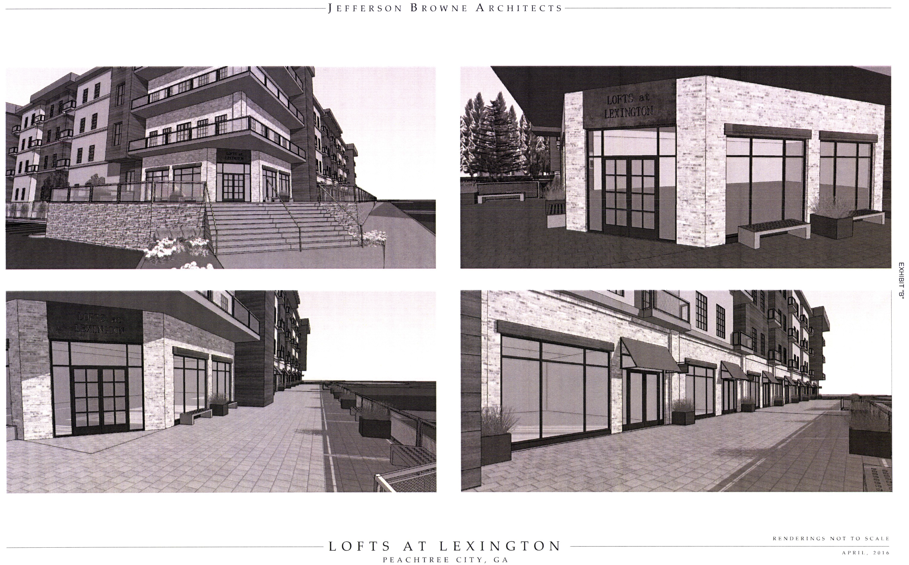
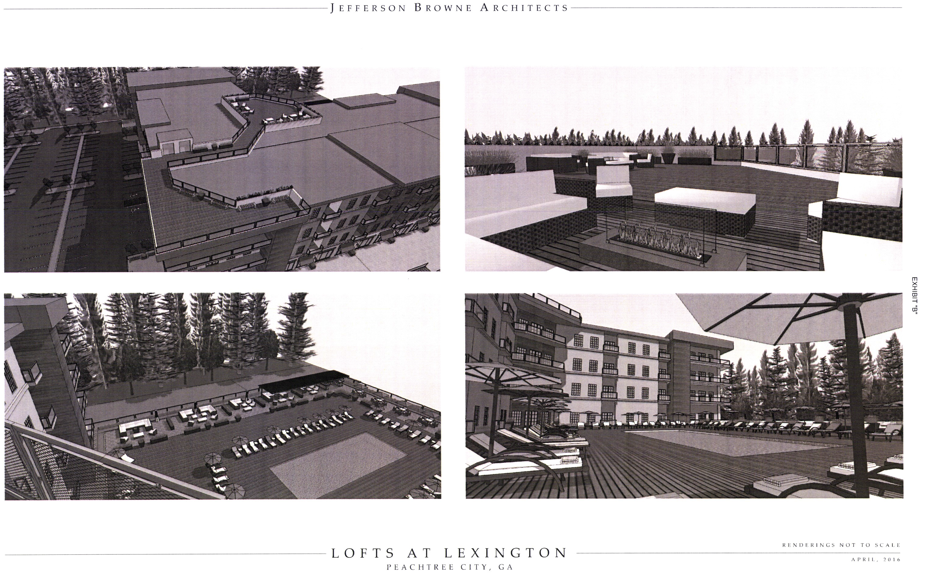
(Ord. No. 1116, § 1, 8-18-2016)
(Section 1006B.29) Limited-use commercial district no. 29
(a)
The zoning of the property described below shall be rezoned from the current zoning designation of GC General Commercial to LUC-29 Limited Use Commercial. Said property is more particularly described as follows:
All that tract or parcel of land lying or being in Land Lot 160 of the 7 TH District, Fayette County, Peachtree City, Georgia, and being more particularly described as follows:
Commencing at a concrete monument found at the mitered intersection of the southerly right of way of Georgia State Highway 54 (having a variable width right of way) and the existing westerly right of way of Line Creek Drive (having a variable width right of way at this point); Thence continuing along the said southerly right of way of Georgia State Highway 54 south 57°10'39" East, a distance of 22.84 feet to a concrete monument found at the intersection of the original westerly right of way of Line Creek Drive (right of way varies); Thence along the said westerly right of way line of Line Creek Drive (right of way varies) South 15°12'20" West, a distance of 141.14 feet to the POINT OF BEGINNING:
Thence (right of way varies ) South 88°11'09" East, a distance of 30.72 feet to a point; Thence southerly a distance of 186.74 feet along the arc of a curve to the east, having a radius of 980.00 feet and being subtended by a chord which bears South 08°07'13" West, for a distance of 186.46 feet, to a point on the terminus of the said Line Creek Drive; Thence along the terminus of Line Creek Drive South 88°36'21" East, a distance of 64.34 feet to a point; Thence leaving the said terminus of Line Creek Drive proceed North 88°53'25" East, a distance of 322.77 feet to a point; Thence North 88°52'25" East, a distance of 219.52 feet to a point; Thence South 02°10'10" West, a distance of 564.89 feet to a point; Thence North 88º15'57" West, a distance of 834.90 feet to an iron pin found, a five eights inch rebar; Thence North 01º25'15" East, a distance of 386.40 feet to a three quarter inch open top pipe found; Thence North 01º24'19" East, a distance of 336.86 feet to a point; Thence South 88º11'09" East, a distance of 227.29 feet to the POINT OF BEGINNING.
Said property contains 11.56 acres more or less.
(b)
It is intended that the LUC-29 zoning district be established specifically for the subdivision of the existing commercial development into multiple tracts for different ownership in accordance with the following express conditions:
1.
Permitted uses: All uses permitted in the GC zoning district shall be permitted in LUC-29.
2.
Prohibited uses: All uses prohibited in the GC zoning district shall be prohibited in LUC-29.
3.
Conditional uses: All conditional uses and standards listed in the GC zoning district shall also apply in LUC-29.
4.
Special Use Permit: Special Use permits do not apply in the LUC-29 zoning district and shall require a rezoning action.
5.
Other requirements:
i.
Minimum zoning lot area: 5,000 square feet.
ii.
Minimum lot width: 20 feet.
iii.
Minimum front setback depth:
1.
Building: 0 feet.
2.
Driveway/parking: 20 feet.
iv.
Minimum side setback depth: 0 feet. If adjoining a residential zoning lot, the building setback shall be 75 feet.
v.
Minimum rear setback depth: 20 feet. If adjoining a residential zoning lot, the building setback shall be 75 feet.
vi.
Maximum building height: The maximum height of all buildings shall not exceed 35 feet in height from finish grade to the ridge line or the tallest portion of the roof without first rezoning the property. In no case shall the maximum height of a building exceed 60 feet in height from the finish grade to the ridge line or the tallest portion of the roof.
vii.
Parking: Refer to section 909
viii.
Signs: Refer to chapter 66
ix.
Storage: No storage will be permitted on the zoning lot outside a fully enclosed building unless the storage area is entirely screened from the street and adjoining properties by a suitable fence or wall at least six feet in height above finished grade. The required fence or wall must provide a reasonable visual separation between the storage area and any adjoining property.
x.
Access: All zoning lots shall have direct access onto an arterial, major collector or industrial/commercial road via an access street.
xi.
All parking and service areas must be separated from the adjoining residential zoning lots by a suitable planting screen, fence or wall at least six feet in height above finished grade. The above required screen, fence or wall must provide a reasonable visual separation between the properties.
xii.
No outside loudspeaker system shall be utilized.
xiii.
All lights or lighting arrangements used for purposes of advertising, security or night operations must be directed away from adjoining or nearby residential zoning lots.
xiv.
No use permitted in this zoning district shall be allowed to cover more than 75 percent of the zoning lot on which it is located with impervious surfaces.
xv.
All properties developed for commercial purposes, whether they are occupied or not, shall be regularly maintained so they are not allowed to fall into a state of disrepair or neglect; and they shall consistently present a neat and orderly appearance to the general public as well as adjacent and nearby tenants and property owners.
(Ord. No. 1150, § 1, 9-6-2018)
(1006B.30) Limited-use commercial district no. 30.
(a)
The zoning of the property described below shall be rezoned from the current zoning designation of AR Agricultural Residential (unincorporated Fayette County) to LUC-30 Limited Use Commercial. Said property is more particularly described as follows:
District of Fayette County, Georgia and being more particularly described All that tract or parcel of land lying and being in Land Lot 70 of the 7 th Land as follows:
Beginning at an iron pin found on the Land Lot corner common on Land Lots 91, 70, 69 and 92, said pin being on the eastern right of way of Sumner Road and being the True Point of Beginning. Thence along said right of way of Sumner Road North 01º50'58" West a distance of 458.97 feet to an iron pin found; Thence leaving said right of way North 56º13'49" East a distance of 1,117.70 feet to an iron pin found; Thence South 01d42'27" East a distance of 385.76 feet to an iron pin found on the western variable right of way of GA Hwy 54; Thence along said right of way South 20º09'28" West a distance of 755 feet to an iron pin found; Thence leaving said right of way North 88º45'51" West a distance of 665.88 feet to an iron pin found, said pin being the True Point of Beginning. Together with and subject to covenants, restrictions and easements of record. Said property contains 14.65 acres, more or less.
All the tract or parcel of land lying and being in Land Lot 70, 7th District, Fayette County, Georgia and being more particularly described as follows: Beginning at the intersection of the common corners of Land Lots 69, 70, 91, and 92; thence proceeding Southeasterly along the southerly line of Land Lot 70, 20.02 feet to an iron pin set on the Easterly side of a 40 foot prescriptive easement for Sumner Road; thence proceed Northerly along Easterly side of said easement a distance of 458.97 feet to the True Point of Beginning. Thence North 01º51'03" West for a distance of 56.55 feet to a point. Thence North 01º18'06" West for a distance of 123.44 feet to a point. Thence North 03º06'16" West for a distance of 88.79 feet to a point. Thence North 03º11'10" West for a distance of 364.59 feet to a point. Thence North 00º01'00" East for a distance of 24.30 feet to a point. Thence along a curve to the right having a radius of 100.00 feet and an arc length of 44.876 feet, being subtended by a chord of North 27º41'22" East for a distance of 44.48 feet to a point; thence along a curve to the right having a radius of 973.08 feet and an arc length of 13.35 feet, being subtended by a chord of North 56º37'24" East for a distance of 13.35 feet to a point on the Southerly right of way of Sumner Road. Thence North 56º13'49" East for a distance of 1,091.74 feet to a point on the Southerly right of way of Sumner Road. Thence South 01º36'07" East for a distance of 601.78 feet to an iron pin found. Thence South 01º43'27" East for a distance of 87.01 feet to an iron pin set. Thence South 56º13'49" West for a distance of 1,117.70 feet to a point, said pint being the True Point of Beginning. Together with and subject to covenants, easements and restrictions of record. Said property contains 15.04 acres more or less, being more particularly described on a plat of survey prepared by Southeastern Engineers dated December 28, 1994.
The above tract is depicted on the attached Exhibit "A".
(b)
It is intended that the LUC-30 zoning district be established specifically for the development of a mixed-use development to be constructed substantially in accordance with the following express conditions:
(c)
Conformance with conceptual site plan. Development shall take place substantially in conformance with the conceptual site plan as prepared by Peterson Planning, a copy of which is attached hereto as Exhibit "B" and incorporated herein by express reference. Any substantive change to this plan or any of the conditions and requirements of this section shall require a new rezoning action.
(d)
Permitted Uses.
1.
No more than 27 single-family detached residential lots.
2.
Office uses as permitted in section 1005A, OI office institutional district. Said uses shall cover no more than 4.1 acres of the overall development.
3.
Commercial uses as permitted in section 1006, except automotive fueling stations, automatic car wash facilities, or automobile maintenance facilities. Uses listed as prohibited in section 1006.2a are also prohibited in this zoning district. Permitted commercial uses shall cover no more than 4.8 acres of the overall development.
4.
Publicly owned buildings, facilities or land.
5.
Buildings, facilities or land for the distribution of utility services.
6.
Buildings, facilities or land for non-commercial park, recreation or open space purposes.
7.
Accessory uses (see section 908).
8.
Customary home occupations (see section 907).
(e)
Conditional uses. Conditional uses shall comply with the conditions established in the corresponding section: 1006 for the commercial uses and 1005 for office uses. Special use permits are not permitted in this zoning district without a zoning action.
(f)
Other Requirements.
1.
Maximum number of dwelling units: 27.
2.
Minimum residential lot area: 9,000 square feet.
3.
Minimum floor area per dwelling unit: 2,000 square feet.
4.
Minimum residential lot width: 65 feet or 30 feet along a cul-de-sac.
5.
Minimum residential setbacks:
a.
Front porch: Ten feet
b.
Front building setback: 20 feet
c.
Side setback: Ten feet
d.
Rear setback: 30 feet
6.
Minimum commercial and office setbacks:
a.
Front building: 30 feet
b.
Front parking: 15 feet
c.
Side building: Ten feet
d.
Rear building: 30 feet
7.
Residential architectural standards: Architectural concept: Home styles shall comply with examples submitted by the developer. At least half of the homes shall have front porches for at least half of the front elevation. Homes shall be faced with either brick, stone, or cementitious siding. Building elevations facing public streets or visible from a public street shall not be blank and shall utilize the same level of architectural detailing as the front elevation.
8.
Commercial and Office architectural standards: styles shall comply with the examples submitted by the applicant. Facades shall be comprised of brick, stone, or cementitious siding.
9.
Parking: as per Zoning section 909
10.
Signs: As per Peachtree City sign ordinance
(g)
The overall development of the tract is subject to the following understandings and conditions:
1.
Parks and community facilities shall be provided as shown on the master plan. A property owners' association, as established by the developer, shall be responsible for the maintenance of the parks, community facilities and sidewalks. A note to this end shall be placed on the final plat.
2.
Commercial and office traffic shall not have direct automobile access to Sumner Road.
3.
A minimum 50-foot wide area shall be reserved along State Route 54 for the potential landing location of a multi-use path bridge or tunnel across the state route.
4.
Multi-use paths shall be located substantially similar to those shown on the master plan.
5.
A development agreement between the city and the applicant shall be executed in order to provide notice and guarantees to each party.
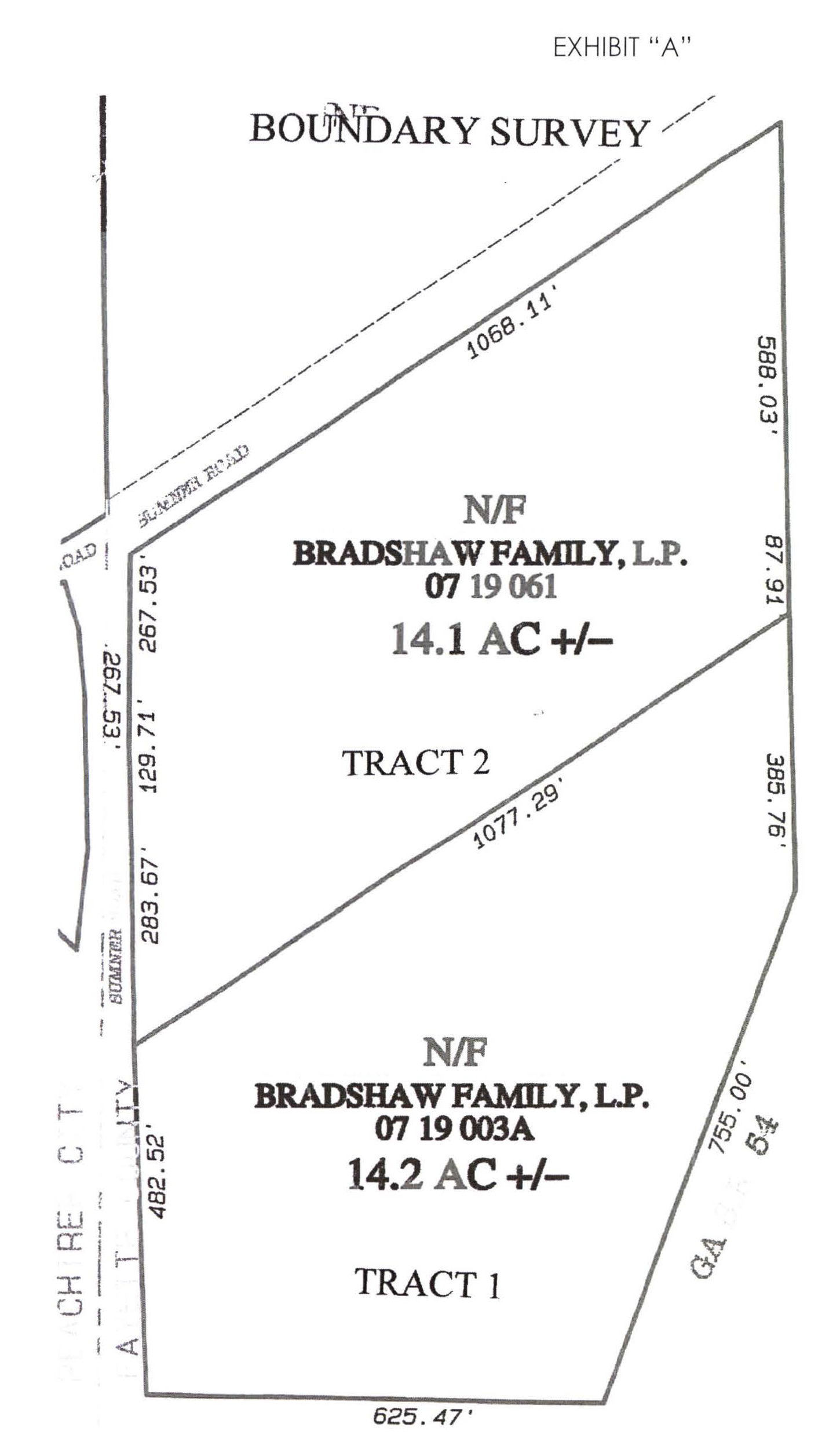
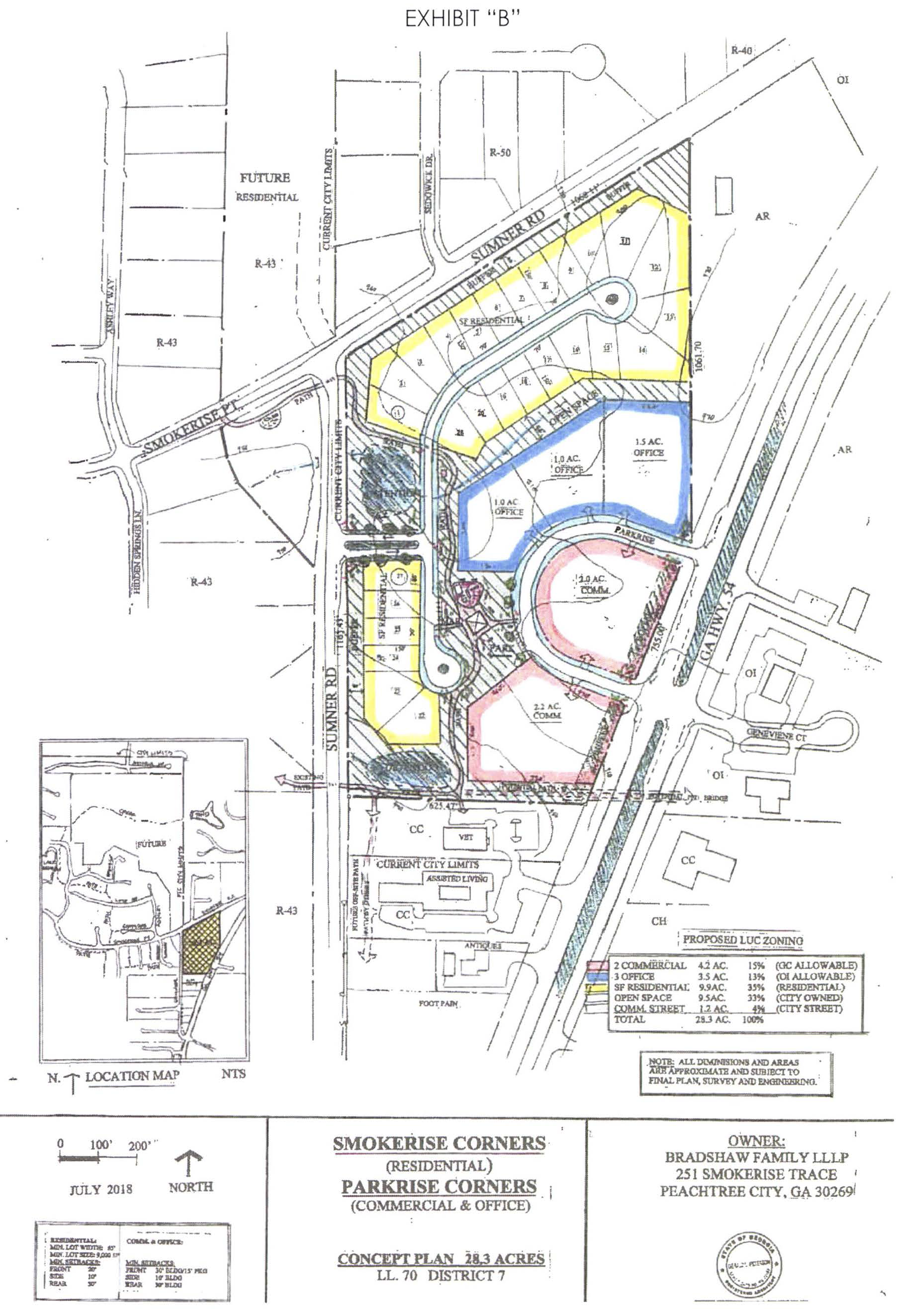
(Ord. No. 1159, § 1, 11-15-2018)
(1006B.31) Limited-use commercial district no. 31.
(a)
The tract of land as described below shall be rezoned from its present classification of GI General Industrial to LUC-31 Limited Use Commercial, subject to the conditions set forth herein.
(b)
All that tract or parcel of land lying and being in Land Lots 52 and 53 of the 6th Land District of Peachtree City, Fayette County, Georgia and containing Lots 8, 9, 10, 11 and that portion of Lot 2, now known as Exchange Place, a private street now serving said lots 8, 9, 10, and 11 as shown on that certain plat titled The Exchange Final Plat, dated February 27, 2015, recorded June 8, 2015 in Plat Book 48, Pages 56-57, Fayette County, Georgia.
(c)
Permitted uses. All uses permitted in the LUC zoning district
(d)
Conditional uses.
1.
No conditional uses are permitted.
2.
Conditional uses listed in the LUC zoning district are specifically prohibited on this property.
(e)
Other requirements.
1.
Development shall conform to the other requirements established in the LUC Limited Use Commercial district.
2.
A multi-use path easement conforming to the city standards shall be provided across the property, and shall allow public access.
(Ord. No. 1169, § 1, 5-2-2019)
(1006B.32) Limited-use residential district no. 32.
(a)
The zoning of the property described below shall be rezoned from the current zoning designation of GC General Commercial and OI Office Institutional to LUC-32 Limited Use Commercial. Said property is more particularly described as follows:
ALL THAT TRACT OR PARCEL OF LAND LYING AND BEING LOCATED IN LAND LOT 94, OF THE 7 TH LAND DISTRICT, City of Peachtree City, Fayette County, Georgia and being more particularly described as follows:
Commencing at a ½" rebar set at the right of way intersection of the northeastern right of way of Petrol Point (50' right of way per deed book 3972, pages 445-448) and southeastern right of way of Tivoli Gardens (50' right of way per deed book 3972, pages 445-448); thence along the right of way of Petrol Point N 46º07'14"W a distance of 74.28 feet to a ½" open top pipe found; thence continuing along said right of way N 46º03'51" W a distance of 305.24 feet to a ½" rebar found, and the TRUE POINT OF BEGINNING; thence continuing along said right of way N 45º52'36" W a distance of 205.90 feet to a 5/8" rebar found; thence leaving said right of way N 43º51'57" E a distance of 325.90 feet to a 1" rod found; thence S 46º09'21" W a distance of 328.31 feet to a ½" rebar found on the right of way of Petrol Point, and the TRUE POINT OF BEGINNING; said tract containing 1.55 acres, more or less, and being shown on an unrecorded plat by W.D. Gray and Associates, prepared for Laurel Brooke Development, LLC, dated August 30, 2019.
ALL THAT TRACT OR PARCEL OF LAND LYING AND BEING LOCATED IN LAND LOTS 94 AND 93, OF THE 7 TH LAND DISTRICT of Fayette County, City of Peachtree City, Georgia and being more particularly described as follows:
Beginning at ½" rebar set at the right of way intersection of the northeastern right of way of Petrol Point (50' right of way per deed book 3972, pages 445-448) and the southeastern right of way of Tivoli Gardens (50' right of way per deed book 3972, pages 445-448); thence along the right of way of Petrol Point N 46º07'14" W a distance of 74.28 feet to a ½" open top pipe found; thence leaving said right of way N 89º59'20" E a distance of 34.68 feet to a ½" rebar found; thence N 44º12'56" E a distance of 159.94 feet to a 3/8" rebar found; thence N 43º59'54" E a distance of 148.35 feet to a ½" rebar found; thence N 46º40'22"W a distance of 179.89 feet to a ½" rebar found; thence N 46º52'53"W a distance of 150.03 feet to a ½" rebar found; thence n 46º32'31"W a distance of 44.33 feet to a ½" rebar set; thence N44º21'29"E a distance of 397.24 feet to a crimped top pipe found; thence n 44º21'29"E a distance of 127.97 feet to a ½" rebar set; thence S 72º16'48"E a distance of 87.30 feet to a ½" rebar found; thence S00º30"17"W a distance of 165.07 feet to a ¾" rod found; thence N89º34'32"W a distance of 20.04 feet to a ¾" rod found; thence S00º32'08"W a distance of 902.74 feet to a ½" rebar set; thence S37º17'37"W a distance of 154.22 feet to a ½" open top pipe found; thence N46º01"32"W a distance of 370.06 feet to a 2" open top pipe found; thence S89º48"27"W a distance of 35.73 feet to a 3/8" rebar found on the right of way of Tivoli Gardens; thence along said right of way N43º12'47"E a distance of 75.78 feet to a ½" rebar set at the right of way intersection of Petrol Point and Tivoli Gardens, and the POINT OF BEGINNING; said tract containing 7.31 acres, more or less, and being shown on an unrecorded plat by W.D. Gray and Associates, prepared for Laurel Brooke Development, LLC, dated August 30, 2019.
(b)
This tract is illustrated on the boundary survey attached hereto as Exhibit "A" and incorporated herein by express reference.
It is intended that the LUC-32 zoning district be established specifically for the development of a mixed-use commercial and residential development to be constructed substantially in accordance with the following express conditions:
(c)
Conformance with master plan.
Development shall take place substantially in conformance with the conceptual master plan as prepared by historical concepts, a copy of which is attached hereto as Exhibit "B" and incorporated herein by express reference. Any substantive change to this plan or any of the conditions and requirements of this section shall require a new rezoning action.
(d)
Permitted uses.
1.
No more than 25 single-family residential dwelling units.
2.
No more than ten mixed-use commercial buildings with maximum 2,100 gross heated square feet. These buildings may contain residential uses on the second floor only, as long as all building and fire safety codes are satisfied.
3.
No more than one mixed-use commercial building with a maximum 5,500 gross heated square feet. Residential uses may be located on the second floor only, as long as all building and fire safety codes are satisfied.
4.
Two multi-family condominium buildings, each with ten residential units and two ground-level live/work units.
5.
Uses permitted as defined in GC zoning district, section 1006, except automotive car wash facilities, automobile maintenance facilities, automotive rentals, drive-in restaurants, drive-through establishments, and funeral home and mausoleum.
6.
Uses permitted as defined in the OI zoning district, section 1005A, except funeral homes.
7.
Bed and breakfast with individual cottages between 400—700 gross heated square feet. Each cottage shall be considered a part of the bed and breakfast business and may not be subdivided into individual lots for sale.
8
Publicly owned buildings, facilities or land.
9.
Buildings, facilities or land for non-commercial park, recreation or open space purposes.
10.
Accessory uses (see section 908).
11.
Customary home occupations (see section 907).
(e)
Conditional uses. No conditional uses shall be permitted within this zoning district.
(f)
Other requirements.
1.
Minimum front setback for single-family lots: ten feet.
2.
Minimum side setback for single-family lots: five feet.
3.
Minimum rear setback for single-family residential lots: ten feet.
4.
Minimum rear setback for commercial and mixed-use lots: five feet.
5.
Parking: each single-family residential lot shall have an off-street parking area for two vehicles. Parking for the bed and breakfast shall be provided at a ratio of 1.5 spaces per cottage. Parking for the commercial and mixed-use buildings shall be provided at a minimum rate of one space per 275 square feet. Parking for multi-family buildings shall be provided at a minimum rate of 1.5 spaces per residential unit and two spaces per live/work unit. At least 80 percent of the required parking for the multi-family buildings shall be covered parking. All parking dimensions shall comply with city standards.
6.
Signage: signage shall comply with city standards unless a master sign program is approved by the planning commission.
7.
Architectural standards: structures shall utilize brick, stone, or cementitious siding for all elevations. Each elevation visible from a street or publicly owned greenbelt shall include architectural detailing similar to the front elevation in order to avoid creating a blank wall. Multi-family buildings shall substantially comply with applicant-provided elevations. All sides shall be composed of at least 25 percent masonry, and paint colors shall be neutral tones to compliment and blend with the natural environment.
8.
Streets: street sub-base and paving standards shall be built to city standards as required by the city engineer. Maintenance of colored cement, stamped cement, cobblestones, and similar paving products shall be the sole responsibility of the developer and/or the homeowners' association.
9.
Multi-use paths: at least two multi-use path connections shall be provided to the western property line and connect to the existing path in the city greenbelt. The developer shall work with city staff to locate and designate a path easement to the northeastern property boundary for a future connection to Shakerag Hill. The multi-use path sections and easements shall comply with city standards.
10.
Landscaping shall be provided between the multi-family portion of the development and the adjacent greenbelt to create a visual buffer. At least three types of evergreen species shall be provided, and they shall be substantially mature at the time of planting.
11.
Landscaping shall be provided along the edges and slopes of the park space to both stabilize slopes and provide a visually appealing setting for the park. A landscape plan shall be submitted and approved by the city prior to installation of plant materials.
12.
Maintenance of all internal parks, landscaped areas, sidewalks, signage, and subdivision entrances shall be the sole responsibility of the developer and/or the homeowners' association. This shall be noted on the final plat.
13.
Stormwater facilities may be privately owned if constructed to city standards and a maintenance agreement between the city and the property owner/homeowners' association is recorded with the Fayette Clerk of Court.
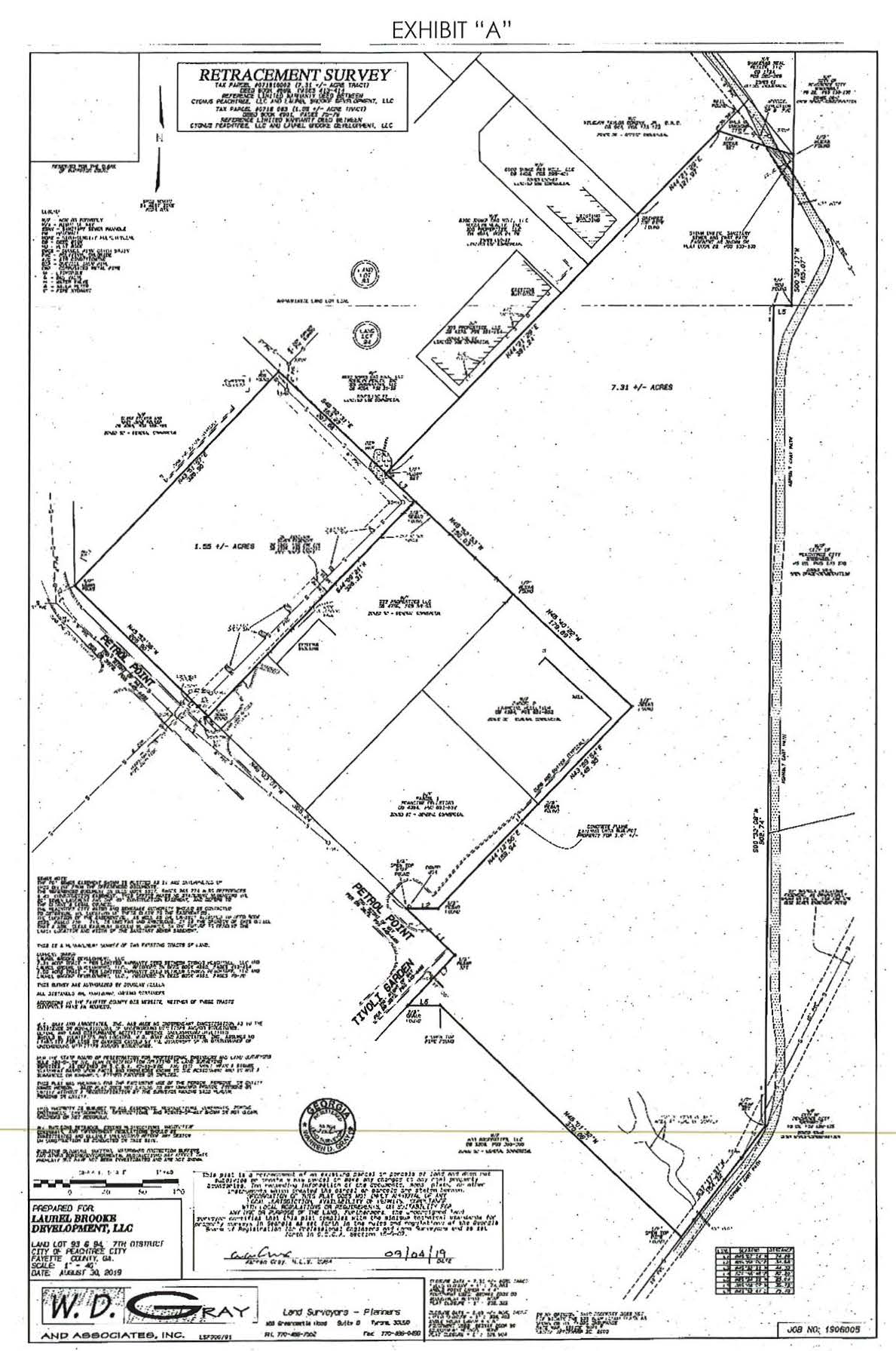
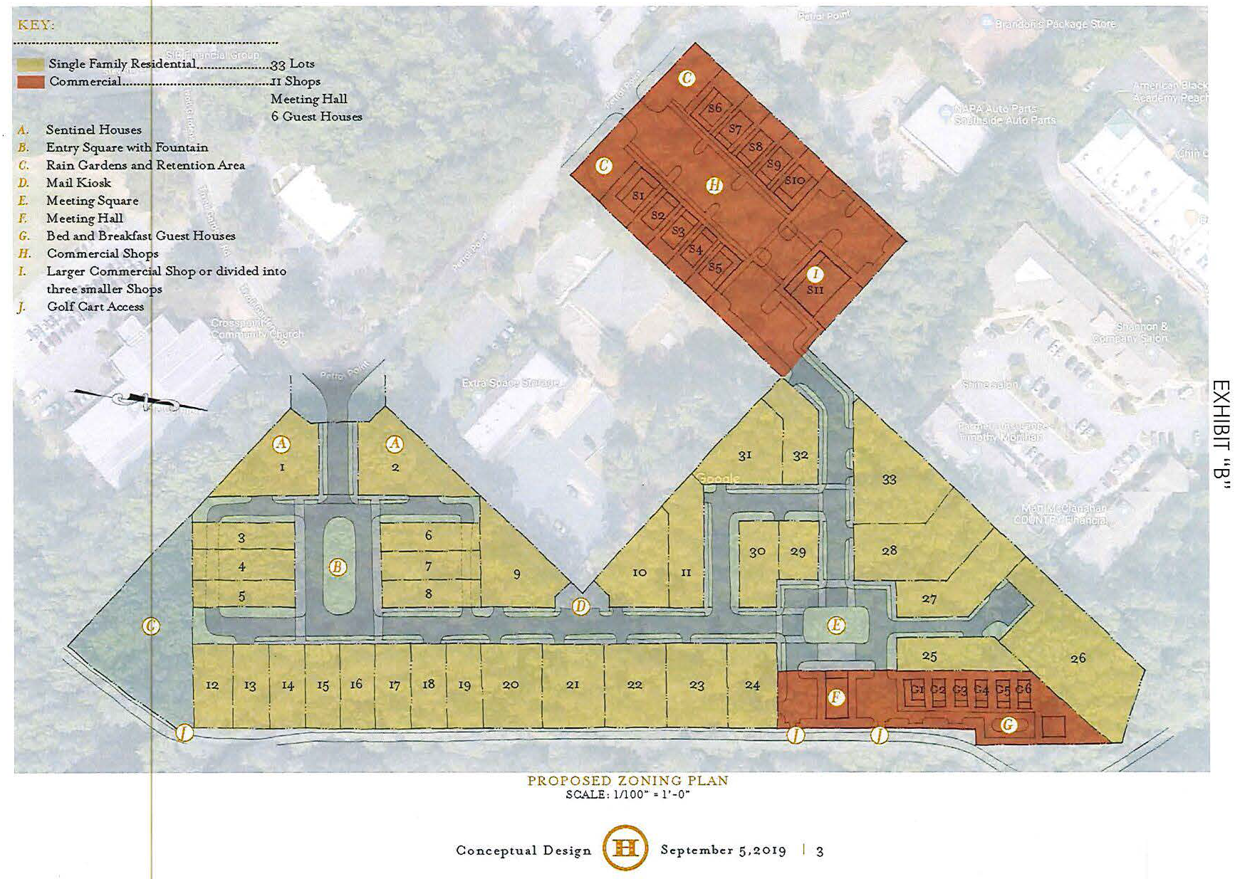
(Ord. No. 1175, § 1, 11-7-2019; Ord. No. 1184, § 1, 1-21-2021)
(1006B.33) Limited-use commercial district no. 33.
(a)
The zoning of the property described below shall be rezoned from the current zoning designation of R-43 one-family residential and GC general commercial to LUC-33 Limited Use Commercial No. 33. Said property is more particularly described as follows:
Parcel 1: Tax ID 0719 031 (1952 Hwy 54 W)
All that tract or parcel of land lying and being in Land Lot 69 of the 7 th District of Fayette County, Georgia, and more particularly described as follows: beginning at an iron pin on the northerly right of way line of said Land Lot 69, at its point of intersection with the easterly right of way line of State Highway 54; from said point of beginning, running thence S 89 º E along the N land lot line of said Land Lot 69 a distance of 120 feet to an iron pin; running thence S 01 degree W a distance of 120 feet to an iron pin; running thence N 89 º W a distance of 412.3 feet to the easterly right of way line of State Highway No. 54; running thence N 21º21'30" E a distance of 128 feet to the point of beginning; containing 1.074 acres of land, according to the plat of survey by Lum C. Hall, surveyor, entitled "Property of Abon Brown," dated 26 April 1972.
Parcel 2: Tax ID 0719 038 (1954 Hwy 54 W)
All that tract or parcel of land lying and being in Land Lot 69 of the 7 th District of Fayette County, Georgia, and more particularly described as follows: beginning at a point in the easterly right of way of Route #54 which is 128 feet a westerly direction from the junction of Land Lot #69 and #70; thence S 89º00' E a distance of 412.3 feet to an iron pin found; thence S 1º00' W a distance of 120 feet to a point; thence N 89º00' W a distance of 459.21 feet to a point in the easterly right of way of State Route #54; thence N 22º21" E a distance of 128.84 feet along the easterly right of way of State Route #54 back to the point of beginning; said tract containing some 1.20 acres as per survey of J.R. Wood, Surveyors and Planners, Inc., dated 14 June 1979, which plat by reference thereto is incorporated herein. Less and except that portion of said tract consisting of 0.53 acres consisting of a right of way conveyed to the state department of transportation on 1 September 1988, which conveyance is properly recorded in Deed Book 518 at page 73 in the office of the clerk of superior court of Fayette County, Georgia.
Parcel 3: Tax ID 0719 047 (1964 Hwy 54 W)
All that tract or parcel of land lying and being in Land Lot 69 of the 7 th District of Fayette County, Georgia, and more particularly described as follows as per survey dated January 25, 1989, revised August 5, 1992, prepared by Larry C. Shimshick, RLS No. 2343, for PTC Properties, Inc. and Metro Bank: to find the true point of beginning, commence at the intersection of the common boundary line of Land Lots 69 and 70 with the easterly right of way of Georgia Highway 54; run thence in a southwesterly direction along the right of way of Georgia Highway 54 at a distance of 256.84 feet to the true point of beginning; from said true point of beginning, run thence S 88º42'38" E a distance of 439.86 feet to a point marked by an iron pin found; run thence S 02º07'24" E a distance of 175.66 feet to a point marked by an iron pin found; run thence N 89º42'27" W a distance of 521.22 feet to a point along the easterly right of way of Georgia Highway 54 marked by an iron pin; run thence along said right of way N 22º17'29" E a distance of 197.55 feet to a point marked by an iron pin, which point is the true point of beginning.
Parcel 4: Tax ID 0719 046 (1968 Hwy 54 W)
All that tract or parcel of land lying and being in Land Lot 69 of the 7 th District of Fayette County, Georgia, and being more particularly described as follows: beginning at an iron pin located on the easterly right of way of State Route 54 (80 foot right of way) said iron pin being 344.47 feet as measured along said easterly right of way of State Route 54, southwesterly from the point of intersection of the easterly right of way of State Route 54 and the southeasterly right of way of Davis Road; thence running S 89º55'08" E 250 feet to an iron pin; thence S 0º04'52" W 175 feet to an iron pin; thence N 89º55'08" W 321.41 feet to an iron pin located on said easterly right of way of State Route 54; thence running N 22º00'02" E along said right of way 189 feet to the point of beginning; said property containing 1.1478 acres according to a plat of survey prepared for J.C. Brogdon, Jr., by J.R. Wood Surveyors & Planners, Inc., dated March 22, 1983, a copy of which is attached hereto and made a part hereof.
Parcel 5: Tax ID 071903004 (112 Governors Square)
All that tract or parcel of land lying and being in Land Lot 69 of the 7 th District of Fayette County, Georgia, and being known as Building Number 1 of Governors Square Condominium as depicted on a plat of survey entitled "Governors Square Condominium" prepared for Lawler and Lawler, Inc. by Koons, Wood and Associates, dated March 2, 1987, and recorded in Plat Book 1, page 32 Fayette County Georgia Records.
Parcel 6: Tax ID 071903001 (Tract 1 Governors Square)
All that tract or parcel of land lying and being in Land Lot 69 of the 7th District of Fayette County, Georgia, and more particularly described as follows: to find the point of beginning, commence at a rock corner located at the common intersection of Land Lots 59, 60, 69, and 70; thence proceed N89º35"21'W along the northeasterly boundary of Land Lot 69 a distance of 1,792.91 feet to an iron pin; thence proceed S00º24'39"W a distance of 414.40 feet to an iron pin; thence proceed S89º43'04"E a distance of 103.39 feet to an iron pin; thence proceed S00º19'55"W a distance of 130.00 feet to an iron pin and the point of beginning; thence proceed S89º39'37"E a distance of 312.15 feet to a point; thence proceed S00º04'52"W a distance of 359.35 feet to an iron pin; thence proceed N89º55'08"W a distance of 832.43 feet to a point; thence proceed N00º14'47"E a distance of 159.51 feet to a point; thence proceed S88°15'57" a distance of 81.99 feet to a point; thence proceed N67º45'59" a distance of 36.37 feet to a point; thence proceed N22º14'01"E a distance of 207.93 feet to a point; thence proceed S89º39'37"E a distance of 675.45 feet to the point of beginning being shown as Tract 1, Tract 3 and part of Tract 2 on plat of survey Governors Square Condominium prepared for Ravin Homes by Koons Wood & Associates as revised October 23, 1992.
Parcel 7: Tax ID 0719 070 (100 Governors Trace)
All that tract or parcel of land lying and being in Land Lot 69 of the 7 th District of Fayette County, Georgia, and more particularly described as follows: to find the point of beginning, commence at a rock corner located at the common intersection of Land Lots 59, 60, 69, and 70; thence proceed N 89º35"21'W along the northeasterly boundary of Land Lot 69 a distance of 1,792.91 feet to an iron pin; thence proceed S 00º24'39"W a distance of 414.40 feet to an iron pin; thence proceed S 89º43'04"E a distance of 103.39 feet to an iron pin; thence proceed S00º19'55"W a distance of 130.00 feet to an iron pin and the point of beginning; thence proceed S89º39'37"E a distance of 312.15 feet to a point; thence proceed S00º04'52"W a distance of 359.35 feet to an iron pin; thence proceed N89º55'08"W a distance of 832.43 feet to a point; thence proceed N00º14'47"E a distance of 159.51 feet to a point; thence proceed S88º15'57" a distance of 81.99 feet to a point; thence proceed N67º45'59" a distance of 36.37 feet to a point; thence proceed N22º14'01"E a distance of 207.93 feet to a point; thence proceed S89º39'37"E a distance of 675.45 feet to the point of beginning being shown as Tract 1, Tract 3 and part of Tract 2 on plat of survey Governors Square Condominium prepared for Ravin Homes by Koons Wood & Associates as revised October 23, 1992.
Parcel 8: Tax ID 071903002 (150 Governors Square)
All that tract or parcel of land lying and being in Land Lot 69 of the 7 th District of Fayette County, Georgia, being tract 2 of Governor's Square Condominium, and being shown as building 9 on plat of survey prepared for Ravin Homes by W.D. Gray and Associates, Inc., dated 1/26/01, revised on 1/30/01 and being further described as follows: the point of beginning is marked by a point located on the northeasterly right of way of Governors Square (60 foot right of way); said point being 783.03 feet easterly from the intersection of the right of way of State Route 54 and the northeasterly right of way of Governor's Square; from said point of beginning leaving the right of way of governors' square run N 00º00'00" E 150.97 feet to a point; thence running S 89º39'37" E 261.93 feet to a point; thence running S 00º04'52" W 147.34 feet to a point; thence running along the northeasterly right of way of Governor's Square S 89º32'39" W 261.73 feet to the point of beginning.
Parcel 9: Tax ID 0719 009 (50-acre tract)
All that tract or parcel of land lying and being in Land Lot 69 of the 7 th District of Fayette County, Georgia, and being more particularly described as follows:
Begin at a ⅝-inch rebar set on the common land lot line of Land Lots 69 and 60, said district and county, said rebar being located 1,689.95 feet westerly as measured along the common land lot line of Land Lots 69 and 70, said district and county, from the NE corner of Land Lot 69 and the SE corner of Land Lot 70, thence proceeding S 00º21'15" W a distance of 414.31 feet to a ⅝-inch rebar set at the NE corner of property now or formerly owned by FBN Developers, thence proceeding westerly along the northern boundary line of the FBN Developers property N 89º42'27" W a distance of 103.39 feet to a ⅝-inch rebar set at the intersection of the SE corner of property now or formerly owned by PTC Properties, Inc., and the northern boundary line of the property of FBN Developers, thence proceeding northeasterly along the easterly boundary line of the property of PTC Properties, Inc. N 00º24'46" E a distance of 424.53 feet to a ⅝-inch rebar set on the common land lot line of Land Lots 69 and 70 (passing a ⅝-inch rebar set at the intersection of the NE corner of the property of PTC Properties Inc. and the NE corner of the property of PTC Properties, Inc. and the SE corner of the property owned by William C. Hare and a ⅝-inch rebar set at the intersection of the NE corner of the property owned by William C. Hare and the SE corner of the property of Ronald D. Erwin, et. al.) thence proceeding easterly along the common land lot line of Land Lots 69 and 70 S 89º35'13"E a distance of 102.97 feet to a ⅝-inch rebar, said ⅝-inch rebar marking the point of beginning. Said property being shown on that survey for PTC Properties, Inc. prepared by Jefferson Consultants of Peachtree City, Georgia and bearing the seal of Larry C. Shimshick, Georgia Registered Land Surveyor Number 2343, dated April 7, 1995 and being job number 850850.
Parcel 10: Tax ID 071903003 (125 Governors Square)
All that tract or parcel of land lying and being in Land Lot 69 of the 7 th District of Fayette County, Georgia, being tract 3 of Governor Square Condominium, and being more particularly described as follows: beginning at the intersection of Georgia Highway 54 (r/w varies) and Governors Square (60' r/w) 236.11 feet E along S right of way of Governors Square to a point on the northwesterly corner of tract 3, thence running south 82º09'41" E, a distance of 622.50 feet to a point, and being the true point of beginning, thence running N 89º32'02" E a distance of 138.09 feet to a point, thence running S 00º27'58" E a distance of 65 feet to a point, thence running S 89º32'02" W a distance of 138.09 feet to a point, thence running N 00º27'58" W a distance of 65 feet to a point, and being the true point of beginning.
Parcel 11: Tax ID 071903006 (117 Governors Square)
All that tract or parcel of land lying and being in Land Lot 69 of the 7 th District of Fayette County, Georgia, and more particularly described as follows: to arrive at the point of beginning, commence at the intersection of the SW right of way of Governor's Square (60' r/w) with the southeasterly side of State Route 54, said point of intersection being 60 feet SE of the existing centerline of State Route 54; thence in a southeasterly and easterly direction along the southeasterly right of way of Governors Square for a distance of 153.04 feet to the NW corner of Tract 3 of Governor's Square Condominium; thence S 65º31'55" E for a distance of 233.37 feet to the point of beginning; thence S 89º51'59" E for a distance of 113.01 feet to a point; thence S 00º08'01" W for a distance of 53.50 feet to a point; thence N 89º51'59" W for a distance of 113.01 feet to a point; thence N 00º08' 01" E for a distance of 53.50 feet to the point of beginning. Said tract or parcel of land containing 0.139 acres of land and being the same as shown on a plat by Koons, Wood, Moore, and Shimshick for Seals Communication Corporation dated October 17, 1989. Said plat of survey is, by this reference, incorporated in and made a part hereof.
Parcel 12: Tax ID 071903007 (105 Governors Square)
All that tract or parcel of land lying and being in Land Lot 69 of the 7 th District of Fayette County, Georgia, and more particularly described as follows: to arrive at the point of beginning, commence at the intersection of the southeasterly right-of-way of State Route 54 (right-of-way varies) and the S right-of-way of Governors Square (60' right-of-way); thence in an easterly direction along the S right-of-way of Governors Square a distance of 153.04 feet to a ⅝" rebar; thence leaving the right-of-way of Governors Square S 07º03'53" E a distance of 88.72 feet to the point of beginning; thence S 89º25'35" E a distance of 162.47 feet to a point; thence S 00º34'25" W a distance of 58.50 feet to a point; thence N 89º25'35" W a distance of 162.47 feet to a point; thence N 00º34'25" E a distance of 58.50 feet to the point of beginning, and containing 9,504 square feet of 0.218 acres of land, more or less.
Parcel 13: Tax ID 071902002 (122 Peachtree Court)
All that tract or parcel of land lying and being in Land Lot 69 of the 7 th District of Fayette County, Georgia, being Lot 2 of Peachtree Corner as shown on Plat of Survey by Koons, Wood & Associates for Brogdon Realty Company, and more particularly described as follows: to find the point of beginning start at the SE corner of Davis Road and Georgia Highway 54 thence SW along the easterly side of Georgia Highway 54 210.42 feet to a point; thence S 89º55'08" E 403.24 feet to a point being the true point of beginning; thence S 89º55'08" E 145 feet to a point; thence S 00º04'52" W 299.69 feet to a point on the N side of proposed road with 60 foot right of way; thence N 89º55'06" W 145 feet to a point; thence N 00º04'52" E 299.69 feet to the point of beginning.
Parcel 14: Tax ID 071902003 (128 Peachtree Court)
All that tract or parcel of land lying and being in Land Lot 69 of the 7 th District of Fayette County, Georgia, being Lots 3, 4, 8, 9, and 11 of Peachtree Corners Subdivision as per plat by J.R. Wood dated August 1, 1986, recorded in Plat Book 18, Page 80, Fayette County Records, said plat being expressly incorporated herein and made a part of this description.
Parcel 15: Tax ID 071902004 (134 Peachtree Court)
All that tract or parcel of land lying and being in Land Lot 69 of the 7 th District of Fayette County, Georgia, being Lots 3, 4, 8, 9, and 11 of Peachtree Corners Subdivision as per plat by J.R. Wood dated August 1, 1986, recorded in Plat Book 18, Page 80, Fayette County Records, said plat being expressly incorporated herein and made a part of this description.
Parcel 16: Tax ID 071902005 (138 Peachtree Court)
All that tract or parcel of land lying and being in Land Lot 69 of the 7 th District of Fayette County, Georgia, being Lot 5 of Peachtree Corners, as shown on Plat of Survey by Koons, Wood & Associates for Brogdon Realty Company, as recorded in Plat Book 18, Page 80, Fayette County records and incorporated herein by reference.
Parcel 17: Tax ID 071902006 (Lot 6 Peachtree Court)
All that tract or parcel of land lying and being in Land Lot 69 of the 7 th District of Fayette County, Georgia, being Lot 6 of Peachtree Corners Subdivision, as shown on that certain plat of said subdivision recorded in Plat Book 18, Page 80, Fayette County, Georgia records, said plat being incorporated herein and made a part hereof by reference.
Parcel 18: Tax ID 071902008 (135 Peachtree Court)
All that tract or parcel of land lying and being in Land Lot 69 of the 7 th District of Fayette County, Georgia, being Lots 3, 4, 8, 9, and 11 of Peachtree Corners Subdivision as per plat by J.R. Wood dated August 1, 1986, recorded in Plat Book 18, Page 80, Fayette County Records, said plat being expressly incorporated herein and made a part of this description.
Parcel 19: Tax ID 071902009 (Lot 9 Peachtree Court)
All that tract or parcel of land lying and being in Land Lot 69 of the 7 th District of Fayette County, Georgia, being Lots 3, 4, 8, 9, and 11 of Peachtree Corners Subdivision as per plat by J.R. Wood dated August 1, 1986, recorded in Plat Book 18, Page 80, Fayette County Records, said plat being expressly incorporated herein and made a part of this description.
Parcel 20: Tax ID 071902011 (119 Peachtree Court)
All that tract or parcel of land lying and being in Land Lot 69 of the 7 th District of Fayette County, Georgia, being Lots 3, 4, 8, 9, and 11 of Peachtree Corners Subdivision as per plat by J.R. Wood dated August 1, 1986, recorded in Plat Book 18, Page 80, Fayette County Records, said plat being expressly incorporated herein and made a part of this description.
Parcel 21: Tax ID 071902012 (113 Peachtree Court)
All that tract or parcel of land lying and being in Land Lot 69 of the 7 th District of Fayette County, Georgia, being Lot 12 of Peachtree Corners Subdivision as per plat by J.R. Wood dated August 1, 1986, recorded in Plat Book 18, Page 80, Fayette County Records, said plat being expressly incorporated herein and made a part of this description by reference.
(b)
This tract is illustrated on the graphic attached hereto as Exhibit "A" and incorporated herein by express reference.
It is intended that the LUC-33 zoning district be established specifically for the development of a walkable, mixed-use development to be constructed substantially in accordance with the following express conditions:
(c)
Conformance with conceptual master plan. Development shall take place substantially in conformance with the conceptual master plan as prepared by Peterson Planning, a copy of which is attached hereto as Exhibit "B" and incorporated herein by express reference. Any substantive change to this plan or any of the conditions and requirements of this section shall require a new rezoning action.
(d)
Permitted uses.
1.
A maximum of 75 percent of the total development land area shall be used for residential uses. All uses and conditional uses listed in the GR zoning district shall be permitted, subject to the same requirements and conditions. Maximum dwelling units per acre shall be as follows:
a.
Attached, residential-only building: 12 units.
b.
Attached, with ground-level commercial or office: 20 units.
c.
Detached: Ten units.
d.
A maximum of 94 single-family lots shall be permitted.
2.
A minimum of 25 percent of the total development land area shall be used for non-residential uses. For the purposes of calculating land use of structures containing mixed uses, the primary use of the ground floor (street level) shall be considered for the land use (i.e. ground-level commercial buildings with upper-level residential uses shall be considered a non-residential use). All uses and conditional uses listed in the GC zoning district are permitted, subject to the same conditions listed in subsection 1006.3 and excepting prohibited uses listed in subsection 1006.2a.
3.
A least 0.75 acres, or adequate land for a community services building and required parking, shall be provided with direct access to either Governors Square or Peachtree Court.
4.
A single park of at least one acre shall be provided within the development as shown on the conceptual master plan.
(e)
Streets, paths, and parking.
1.
Streets, inter-parcel connectivity, and path connections shall be provided as shown on the conceptual master plan.
2.
Streets shall be constructed to standards specified in the Land Development Ordinance. Requests to alter right-of-way widths, lane widths, or curb details shall be reviewed and approved by the planning commission. In no case shall changes to construction standards such as compaction, base, or pavement be considered.
3.
A 50-foot right-of-way shall be dedicated to the city for all future street connections, as shown on the conceptual master plan. This includes, at a minimum:
a.
A least two connections to the southern property line abutting the Shiloh Mobile Home Park. One shall be in the mixed-use portion and one shall be in the single-family residential portion.
b.
At least one connection to the northern property line abutting the Genevieve Court office park.
4.
The street network shall include at full build-out, at a minimum, the following:
a.
Both Peachtree Court and Governors Square shall be extended into and serve the single-family residential subdivision.
b.
At least two public street connections between Peachtree Court and Governors Square.
5.
New streets shall be constructed at the time an adjacent property is developed.
6.
Sidewalks. Shall be maintained by a property owners association or the adjacent property owner. Sidewalks shall be constructed to city standards and may extend into the right-of-way as long as a minimum five by eight foot tree well is maintained to meet the street tree spacing minimum described herein. A portion of the sidewalk may be used, enclosed, or fenced off for commercial use as long as at least a five-foot clearance is maintained for pedestrians. Sidewalks shall be provided, at a minimum, as follows:
a.
On both sides of Governors Square.
b.
On both sides of Peachtree Court.
c.
On the commercial side of both future streets adjacent to the central park.
7.
Paths. Paths shall be constructed to city standards.
a.
The path between the single-family residential and the mixed-use development shall be constructed at the time of the single-family residential development.
b.
A minimum 20-foot multi-use path easement shall be provided on the northern property line connecting the single-family residential portion to Highway 54. Construction of the path shall be required during redevelopment of adjacent lots.
8.
Parking.
a.
Parking ratios shall be a minimum: four per 1,000 square feet of non-residential, one per attached dwelling unit, and 1.5 per detached dwelling unit.
b.
At least one parking space for single-family lots shall be provided off street in an enclosed garage, which shall be at least 20 feet from the property line.
c.
On-street parking shall not be permitted within 300 feet of the State Route right-of-way.
9.
Landscape.Section 1110 of the Land Development Ordinance shall not apply to this zoning district.
a.
A landscape plan for off-street parking lots shall be reviewed and approved by the planning department prior to installation of plants.
b.
Street trees shall be planted along both sides of Governors Square, Peachtree Court, and both park-side streets, spaced 30 feet on center. Trees shall be planted within tree-wells that are at least five by eight feet, and shall be installed when the adjacent lot is developed. Trees shall be those species appropriate for parking lots and paved areas, and shall be a species whose mature height is at least 30 feet.
(f)
Setbacks and architectural standards.
1.
Setbacks shall be determined by the adjacent street frontage.
a.
Minimum parking setback from State Route 54 shall be ten feet.
b.
Minimum building setback from State Route 54 shall be 20 feet.
c.
Maximum building setback from Governors Square shall be ten feet.
d.
Maximum building setback from Peachtree Court shall be 12 feet.
e.
Maximum building setback from central park streets shall be 12 feet.
f.
Side setbacks are zero, provided that fire codes are satisfied and that there is at least ten feet between detached buildings.
g.
Front setbacks for single-family structures shall be ten feet for the main structure and 20 feet for garages.
h.
Rear setbacks for single-family structures shall be ten feet for the main structure and 20 feet for garages.
2.
Single-family residential architectural standards. Structures shall utilize brick, stone, or cementitious siding for all elevations.
a.
Each elevation visible from a public street or publicly owned greenbelt shall include architectural detailing similar to the front elevation in order to avoid creating a blank wall.
b.
At least 25 percent of the homes shall have front porches for at least half of the front elevations.
c.
To avoid repetitive and monotonous street presence, there shall be at least five different house plans used, each with at least two elevation variations.
3.
Non-single-family architectural standards. All other structures shall comply with architectural standards established in Sections 725—730 of the Land Development Ordinance. Structures within 500 feet of the centerline of State Route 54 shall be reviewed and approved by the planning commission; all other structures shall be reviewed and approved as a part of the building permit review process.
(g)
Other requirements.
1.
The maintenance of all internal parks, landscaped areas, sidewalks, subdivision entrances, and community amenity areas shall be the sole responsibility of the homeowners' association, and a note to this end shall be placed on the final plat.
2.
Redevelopment of existing lots shall extend and connect to the city's sanitary sewer system, and the existing septic systems must be removed. All overhead utility lines that traverse the site must be located underground, except those used for regional and sub-regional transmission.
EXHIBIT "A"
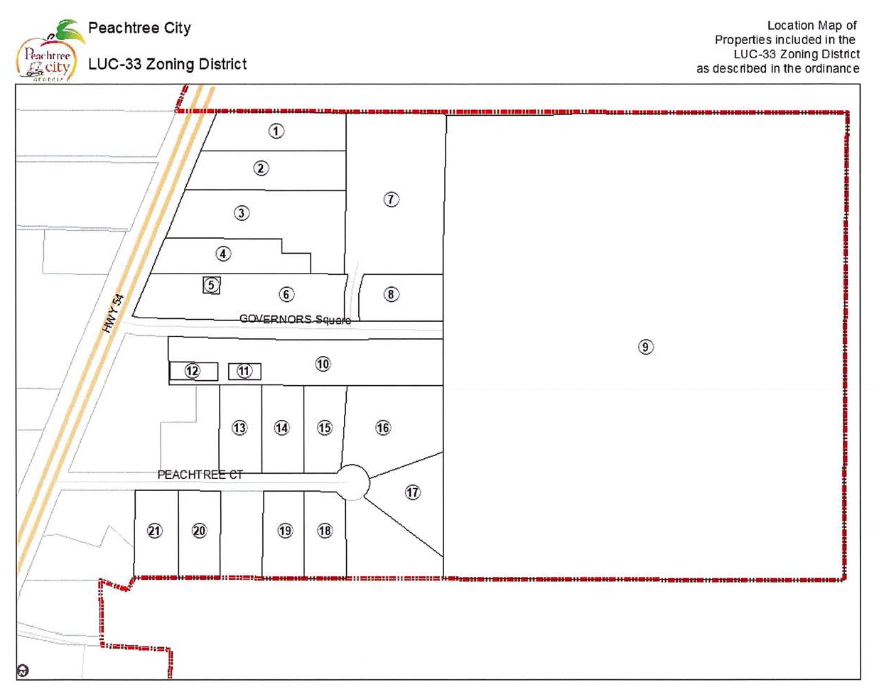
EXHIBIT "B"
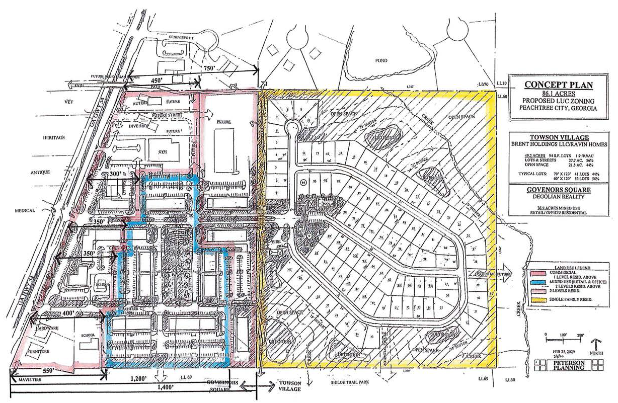
(Ord. No. 1181, § 1, 9-3-2020)
(1006B.34) Limited-use commercial district no. 34.
(a)
The zoning of the property described below shall be rezoned from the current zoning designation of GC general commercial to LUC-34 limited use commercial. Said property is more particularly described as follows:
ALL THAT TRACT OR PARCEL OF LAND LYING AND BEING LOCATED IN LAND LOT 127, OF THE 7TH LAND DISTRICT, City of Peachtree City, Fayette County, Georgia and being more particularly described as follows:
Begin at a point on the northwesterly line of the right of way of State Route No. 54 (a road having a varying right of way) 231.66 feet northeasterly from the intersection of the northwesterly line of the right of way of State Route No. 54 and the truncated corner at the intersection of the northwesterly line of the right of way of State Route No. 54 and the northeasterly line of the right of way of Northlake Drive (said beginning point also being the easterly mort corner of property now of formerly owned by the Citizens and Southern National Bank); running thence north 31 degrees 10 minutes 48 seconds west along the northeast line of the property now or formerly owned by The Citizens and Southern National Bank a distance of 167.85 feet to an iron pin; running thence south 58 degrees 43 minutes 36 seconds west along the northwest line of the property now or formerly owned by the Citizens and Southern National Bank a distance of 265.01 feet to an iron pin on the northeasterly line of the right of way of Northlake Drive; run thence north 29 degrees 07 minutes 19 seconds west along the northeast line of the right of way of Northlake Drive a distance of 288.90 feet to a point; continuing thence in a generally northwesterly direction along the northeasterly line of the right of way of Northlake Drive and along the arc of a curve to the right an arc distance of 301.40 feet the chord of said curve having a bearing of north 08 degrees 30 minutes 12 seconds west in a length of 294.37 feet to a point; continuing thence north 13 degrees 00 minutes 00 seconds east along the southeast line of the right of way of Northlake Drive a distance of 17.60 feet to a point; continuing thence in a northeasterly direction along the southeasterly line of the right of way of Northlake Drive and long the arc of a curve to the right an arc distance of 56.76 feet the chord of said curve having a bearing of North 33 degrees 15 minutes 00 seconds east and a length of 55.59 feet to a point; continuing thence north 53 degrees 30 minutes 00 seconds east along the southeast line of the right of way of Northlake Drive a distance of 32.98 feet to a point; continuing thence in a generally northeasterly direction along the southeasterly line of the right of way of Northlake Drive and along the arc of a curve to the left an arc distance of 301.93 feet the chord of said curve having a bearing north 39 degrees 51 minutes 43 seconds east and a length of 298.49 feet to an iron pin; thence leaving the right of way of Northlake Drive run South 50 degrees 04 minutes 48 seconds east a distance of 122.38 feet to an iron pin; running thence south 24 degrees 15 minutes 10 seconds east a distance of 83.91 feet to an iron pin; running thence south 43 degrees 57 minutes 46 seconds east a distance of 178.78 feet to an iron pin; running thence south 23 degrees 30 minutes 28 seconds east a distance of 319.41 feet to an iron pin; running thence south 16 degrees 40 minutes 04 seconds east a distance of 69.34 feet to an iron pin; running thence south 23 degrees 59 minutes 05 seconds east a distance of 128.41 feet to a point on the northwest line of the right of way of State Route 54 and along the arc of a curve to the left an arc distance of 230.31 feet the chord of said curve having a bearing of south 653 degrees 49 minutes 56 seconds west and a length of 230.26 feet to a point and the POINT of BEGINNING; being the same property shown on that certain plat of survey last revised October 1, 1991, prepared for Aberdeen Village Associates, Inc. by Larry C. Shimshiek, Georgia Registered Land Surveyor No. 2343, which plat by this reference is incorporated herein and made a part hereof.
LESS AND EXCEPT ALL THAT TRACT OR PARCEL OF LAND LYING AND BEING IN LAND LOT 127, OF THE 7TH LAND DISTRICT of Fayette County, Georgia, and being more particularly described as follows:
To find the true point of beginning, commence at an iron pin located on the southeasterly right of way of Northlake Drive, which pin is located 1,173.63 feet southwest of the intersection of said right of way with the existing westerly right of way of Flat Creek Road thence run a southwesterly direction along Northlake Drive an arc distance of 25.00 feet said arc having a delta running south 02 degrees 15 minutes 47 seconds west and having a right radius of 632.96 feet to a point which is the true point of beginning; thence leaving said right of way of Northlake Drive and running south 55 degrees 53 minutes 44 seconds east a distance of 90.00 feet to a point; continuing southeast an arc distance of 90.00 feet said arc having a delta running south 11 degrees 27 minutes 38 seconds east and having a right radius of 449.94 feet to a point; running thence south 30 degrees 01 minute 24 seconds west a distance of 132.43 feet to a point; running thence north 76 degrees 41 minutes 10 seconds west a distance of 85 feet to a point; running thence north 52 degrees 06 minutes 31 seconds west a distance of 132.00 feet to a point located on the existing southeasterly right of way of Northlake Drive; thence running along the right of way of Northlake Drive and arc distance of 162.66 feet said arc having a delta running north 14 degrees 43 minutes 27 seconds east and a left radius of 632.96 feet to the point of beginning; said tract containing 0.709 acres according to a plat of survey prepared for Gordon L. Fleming, dated April 10, 1995, by Jefferson Consultants, Inc., registered land surveyors, certificate number 2343 job number 950109 and said plat being recorded in Plat Book 26, Page 91 records of the Clerk of the Superior Court of Fayette County, Georgia.
(b)
It is intended that the LUC-34 zoning district be established specifically for the development of a mixed-use commercial development to be constructed substantially in accordance with the following express conditions:
(c)
Conformance with conceptual site plan. Development shall take place substantially in conformance with the conceptual site plan as prepared by Jefferson Architecture, a copy of which is attached hereto as exhibit "A" and incorporated herein by express reference. Any substantive change to this plan or any of the conditions and requirements of this section shall require a new rezoning action.
(d)
Permitted uses.
1.
No more than 12 multi-family attached residential dwelling units.
2.
Commercial uses listed as permitted, prohibited, and conditional in the GC General Commercial zoning district.
3.
Publicly owned buildings, facilities or land.
4.
Buildings, facilities or land for the distribution of utility services.
5.
Buildings, facilities or land for public park, recreation or open space purposes.
6.
Accessory uses to commercial and residential land uses.
(e)
Conditional uses. No conditional uses shall be permitted within this zoning district.
(f)
Other requirements.
1.
Architectural style and quality of the building shall comply with the renderings provided by the applicant.
2.
A property owners association or similar shall be created to establish minimum building maintenance and operation standards and other restrictive covenants that shall establish a maximum percentage of residential properties that may be rented contemporaneously. A copy of the association covenants and deed restrictions shall be reviewed and approved by the city prior to recording with the Fayette County records.
EXHIBIT "A"
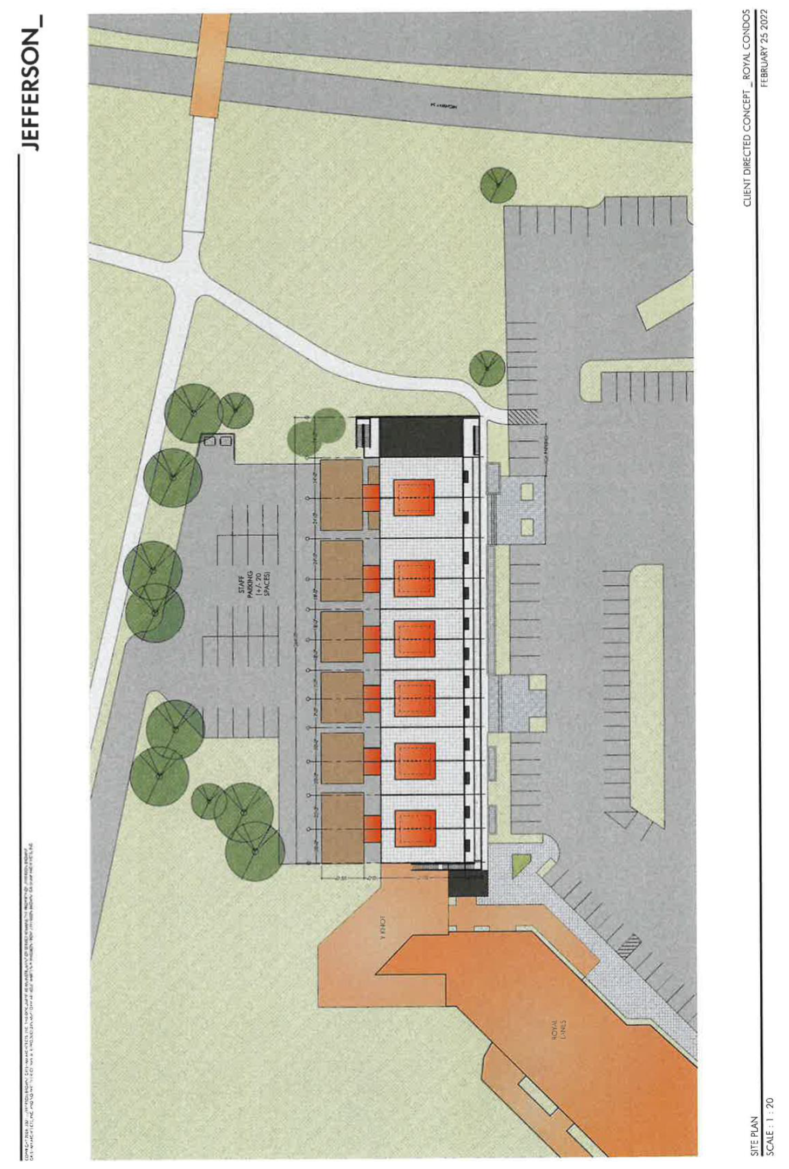
(Ord. No. 1198-A, § 1, 6-16-2022)
Sec. 1006C. - Property rezoned to GC.
(1006C.1) Stephens tract commercial.
(a)
The property described below shall be rezoned from its present classification of GI general industrial to GC general commercial, subject to the conditions set forth herein. In the event of a conflict between the provisions of this ordinance and the regulations of the GC zoning district, the most restrictive regulation shall apply. Said property is more particularly described as follows:
All that tract or parcel of land lying and being in land lots 29 and 30 in City of Peachtree, Fayette County, being more particularly described as follows:
To find the TRUE POINT OF BEGINNING, commence at a point at the intersection of the on the southerly right of way of State Route No. 74 (100' R/W varies) and the northerly right of way of Rockaway Road (R/W varies); Thence run along Rockaway Road South 01 degrees 15 minutes 08 seconds West a distance of 68.91 feet to a point; Thence continue along said right of way South 35 degrees 51 minutes 08 seconds West a distance of 841.25 feet to a 1" pipe found, the TRUE POINT OF BEGINNING; Thence run along said right of way along an arc of a curve to the left with a distance of 49.04 feet to a point (said arc being subtended by a chord South 36 degrees 14 minutes 30 seconds West a distance of 49.04 feet); Thence leaving said right of way and run South 85 degrees 30 minutes 07 seconds West a distance of 720.20 feet to a point; Thence run North 04 degrees 29 minutes 53 seconds West a distance of 285.72 feet to a point; Thence run South 85 degrees 30 minutes 07 seconds West a distance of 798.29 feet to a point; Thence run North 00 degrees 36 minutes 14 seconds East a distance of 385.52 feet to a ½" rebar found on the southerly State Route No. 74 (R/W varies); Thence run along said right of way North 76 degrees 32 minutes 17 seconds East a distance of 271.39 feet to a point; Thence continue along said right of way along an arc of a curve to the right with a distance if 361.69 feet to a point (said arc being subtended by a chord North 80 degrees 32 minutes 40 seconds East a distance of 361.34 feet); Thence continue along said right of way North 85 degrees 21 minutes 28 seconds East a distance of 951.45 feet to a 5/8" rebar found; Thence leave said right of way and run South 00 degrees 36 minutes 28 seconds West a distance of 711.27 feet to a 1" pipe found, the POINT OF BEGINNING.
Said Tract contains 21.120 acres more or less.
(b)
The above-described tract is illustrated in the Boundary and Topography Survey prepared by W.D. Gray and Associates, Inc. (last revised December 8, 2006), a copy of which is attached hereto as exhibit "A" and incorporated herein by express reference.
(1006C.1.1) Permitted uses.
(a)
Retail business involving the sale of merchandise on the premises, provided no single tenant, owner, occupant, or business occupies more than 10,000 square feet.
(b)
Business involving the rendering of a personal service on the premises.
(c)
Office for governmental, business, professional or general purposes.
(d)
No more than one freestanding restaurant with a drive-thru window for pick-up of food or drink orders; provided that this restriction shall not prohibit a freestanding restaurant from maintaining designated parking areas for patrons to pick up food orders to go. This provision shall also not preclude individual tenants from maintaining drive-thru windows for pick-up of food or drink orders, so long as such tenants are in a building with at least two other individual tenants. In addition to one freestanding restaurant as described herein, this restriction shall not preclude a freestanding coffee shop with a drive-thru window from being located within the overall development. As used herein, the term "coffee shop" shall mean a small restaurant in which coffee and light snacks and other drinks are served.
(e)
No more than one business whose primary business is the sale of alcohol; provided that this restriction shall not prohibit individual restaurants from selling beer, wine, distilled spirits or other beverages. Such business whose primary business is the sale of alcohol shall not be located within a freestanding building or tenant space exceeding 3,000 SF in gross floor area.
(f)
Automobile parts sales; provided that the repair of vehicles on the premises of any business by the property owner, the tenant or customers shall be prohibited.
(g)
Indoor commercial recreation facility.
(h)
Publicly owned building, facility or land.
(i)
Building, facility or land for a non-commercial park, recreation, thoroughfare or open space purposes.
(j)
Accessory use, in accordance with section 908.
(1006C.1.2) Uses not permitted.
(a)
Hotel or motel.
(b)
Cocktail lounge, disco or dance hall.
(c)
Automobile repair facilities, including oil change facilities and emissions testing centers.
(d)
Automobile washing facilities.
(e)
Automobile sales and leasing (new and used vehicles).
(f)
Boat sales and leasing (new and used).
(g)
Establishments whose primary business is the sale of gasoline or diesel.
(h)
Animal hospitals or veterinary clinics with outdoor kennel facilities.
(i)
Adult novelty stores, book stores, entertainment centers, theatres, and amusement facilities, peep shows and massage parlors, provided that this restriction shall not prohibit a day spa from locating within the development.
(j)
Bingo parlor, bowling alley, pool hall, billiards parlor, skating rink and roller rink.
(k)
Electronic gaming centers where the primary business is from game playing.
(l)
Pawn shops, second hand stores, closeout or liquidation stores, flea markets, bankruptcy or fire sales, provided that this restriction shall not prohibit a consignment store from selling new and/ or unused merchandise.
(m)
Blood bank and plasma centers.
(n)
Tattoo parlors.
(o)
Check-cashing facilities.
(p)
Facilities for dumping, disposal, incineration or reduction of garbage or refuse.
(q)
A site for day laborers to congregate or to solicit work.
(r)
Transportation facility or terminal.
(s)
Self-service storage facilities, i.e., mini-warehouses.
(t)
Off-street auto parking facility.
(u)
Open yard for the sale, rental, and/ or storage of materials or equipment, including junk or salvage materials.
(1006C.1.3) Conditional uses. The following uses shall be permitted on a conditional basis:
(a)
Retail business involving the sale of merchandise on an individual zoning lot where an individual tenant, owner, occupant, or business occupies more than 10,000 square feet subject to the following conditions:
(1)
In addition to the conditions set forth in this subsection, the maximum aggregate size of any commercial development shall be 150,000 square feet of floor area.
(2)
No single commercial tenant, owner, occupant, or business shall occupy more than 32,000 square feet of floor area.
(3)
No three commercial tenants, owners, occupants, or businesses shall occupy a combined floor area of more than 80,000 square feet.
(4)
No more than six commercial tenants, owners, occupants, or businesses shall occupy more than 10,000 square feet of floor area each.
(5)
All exterior building elevations that face public streets and/or customer parking areas shall be designed so that there are no large expanses of blank walls. This requirement can be met by employing the use of architectural features including but not limited to the following: doors, windows, pilasters, columns, horizontal and vertical offsets, material and color variations, decorative cornices, awnings, canopies, murals, and graphics. In order to assure conformance with this requirement, exterior building elevations must be reviewed and approved as a part of the overall final site plan review process.
(6)
Any tenant, occupant, or business that occupies more than 10,000 square feet shall provide the city attorney with a copy of the rental agreement between such tenant, owner, occupant, or business and its landlord which contains a contract provision prohibiting such person or entity from voluntarily vacating such premises or otherwise ceasing to conduct its retail business on such premises while simultaneously preventing the landlord, by continuing to pay rent or otherwise, from leasing the premises to another person or company who will operate a permitted business on the premises. If such a tenant, occupant or business voluntarily vacates such premises or otherwise ceases to conduct its retail business on the premises, the landlord shall be free to market and lease such premises to another person or company.
(7)
The owner of the zoning lot shall prepare a traffic management plan which identifies the traffic problems that will be generated by development on the premises and which presents reasonable solutions to those problems. The plan must be prepared by a qualified professional traffic planner at no cost to the city, and it must be approved by the city engineer prior to the approval of the preliminary site plan or the issuance of a land disturbance permit or building permit, which ever occurs first.
(8)
The owner of the zoning lot shall prepare a water management plan which identifies the water management problems that will be generated by development on the premises and which presents reasonable solutions to those problems. The plan must be prepared by a qualified professional engineer at no cost to the city, and it must be approved by the city engineer prior to the approval of the preliminary site plan or the issuance of a land disturbance permit or building permit, which ever occurs first.
(b)
Private school, nursery or day care facility on the following conditions:
(1)
The zoning lot is not less than 40,000 square feet in area.
(2)
Plans for the facilities must receive the written approval of the state regulatory agencies and the fire department prior to any construction or occupancy.
(c)
Church or other legitimate place of worship, including a one-family dwelling for a minister, on the following conditions:
(1)
Notwithstanding any other requirements in this section, the following conditions shall apply to all churches regardless of zoning district:
(2)
Minimum zoning lot area is three acres.
(3)
Minimum lot width is 100 feet.
(4)
Minimum setback area, front:
Building: 40 feet.
Parking: 20 feet.
(5)
Minimum setback area, side: 15 feet. If adjoining a residential lot, the building setback shall be 75 feet.
(6)
Minimum setback area, rear: 30 feet. If adjoining a residential zoning lot, the building setback shall be 75 feet.
(7)
Maximum building height: As appproved by the fire department.
(8)
All zoning lots shall have direct access onto an arterial, major collector road or have access to an arterial, major collector or industrial/commercial road via a minor collector.
(9)
No parking shall be permitted within 20 feet of the property line of any adjoining residential zoning lot.
(10)
Parking and/or service areas shall be separated from adjoining residential lots by a suitable fence or wall six feet in height or a suitable planting screen six feet in height at time of planting. The required fence, wall, or screen must provide for a reasonable visual separation between properties. No fence or wall in excess of four feet may be placed in a setback area adjoining a public street.
(11)
Parking. See section 909.
(12)
Any existing church in any zoning district may comply with either the requirement existing prior to enactment of this ordinance or they may comply with the conditions of this section. They shall not be permitted to comply with various sections of both requirements.
(1006C.1.4) Other requirements.
(a)
Landscape requirements. Landscaped buffers shall be provided between the development on this site and SR 74/Rockaway Road, and between the development on this site and the adjoining Stephens tract. Within these buffers, a combination of berms and landscaping shall be installed to provide a permanent vegetative buffer. The berms must be a minimum of four feet in height with 4:1 slopes. All landscaped areas shall include an underground irrigation system with a programmable timer.
The landscape buffer adjacent to SR 74 shall be no less than 40 feet in width, as measured from the right-of-way.
The landscape buffer adjacent to Rockaway Road shall be no less than 30 feet in width, as measured from the right-of-way.
The landscape buffer adjacent to the Stephens tract shall be no less than 25 feet in width, as measured from the property line.
(b)
Reserved.
(c)
Reserved.
(d)
Curb cuts. Pursuant to GDOT review and approval, the overall development shall be limited to no more than three curb cuts from SR 74. If Rockaway Road is not realigned so that it borders or bisects the property, the three curb cuts shall be located along SR 74 subject to GDOT review and approval. If Rockaway Road is realigned so that it borders or bisects the property, no more than two additional curb cuts shall be located along SR 74 subject to GDOT review and approval.
No more than one full-turning curb cut shall be located on Rockaway Road subject to the requirements of city ordinances and subject to GDOT review and approval if required.
(e)
Interparcel access. Interparcel access shall be provided between each parcel and to the remainder of the Stephens tract.
(f)
Architectural concept. In addition to compliance with the city's design guidelines ordinance, the architectural design, color selection and exterior materials for all buildings shall comply with the architectural guidelines established for the Wilshire Pavilion development. All sides of each building must include architectural detailing and similar building materials.
(h)
Signage program. Signage shall be provided as set forth within the city's sign ordinance and in accordance with the approved signage program established for Wilshire Pavilion.
(Ord. No. 907, 9-6-2007)
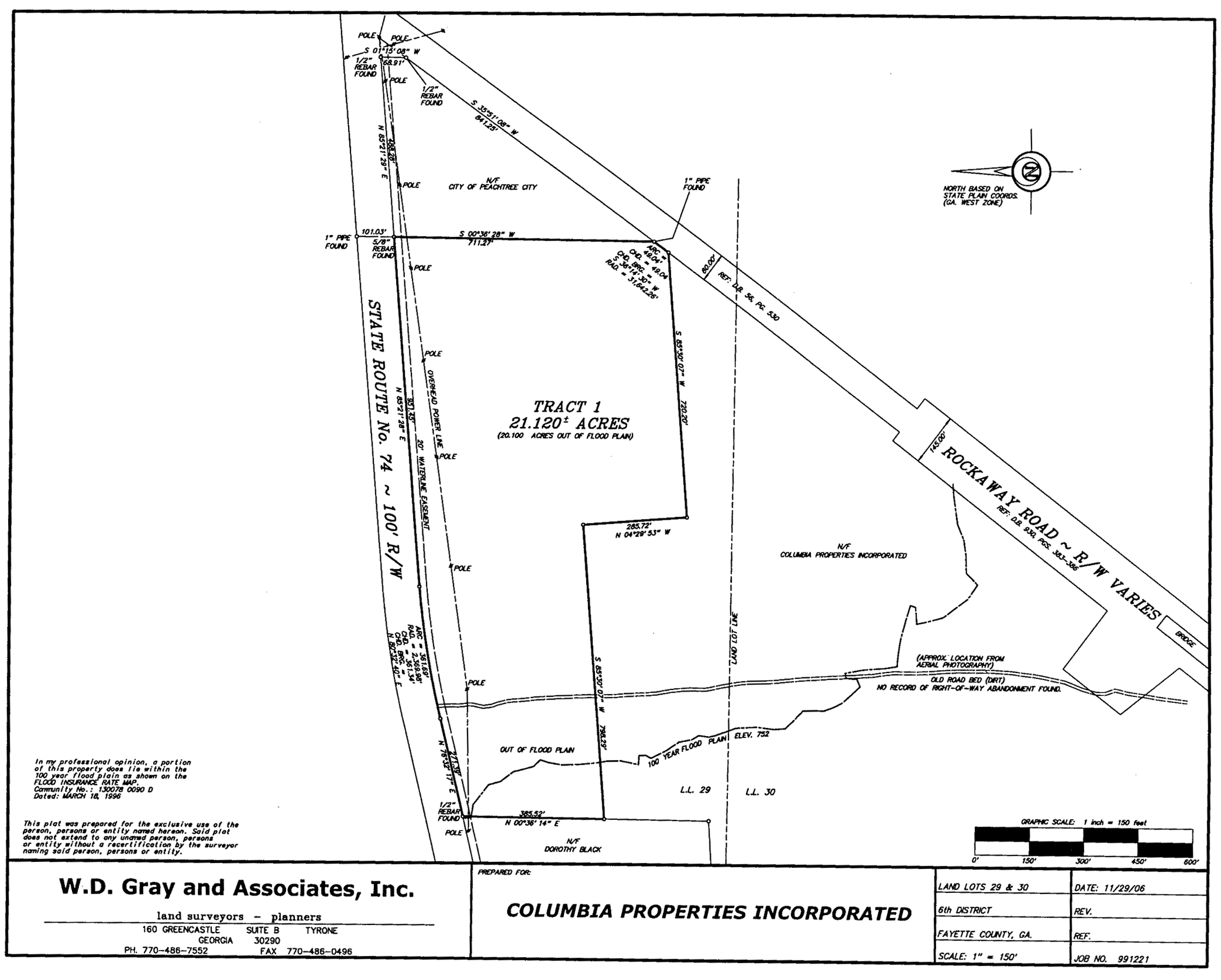
Stephens tract commercial
Sec. 1006D. - Special use permits.
(1006D.1) Reserved.
(1006D.2) The Kroger Company - Braelinn Village retail center. It is intended that a special use permit be established for the proposed expansion of the existing Kroger grocery store within the Braelinn Village retail center on Crosstown Drive. The proposed expansion is limited to the Kroger Company only and shall not exceed 42,800 square feet in size. The expansion shall be developed in accordance with the conditions set forth in this ordinance.
In the event of a conflict between the provisions of this ordinance and the regulations of the GC zoning district, the most restrictive regulation shall apply.
(1006D.2.1) Legal description. The special use permit shall be limited to the tract of land described below.
All that tract of land lying and being in Land Lot 49 of the 6th District of Fayette County, Georgia being more particularly described as follows:
To find the TRUE POINT OF BEGINNING, commence at the point formed by the intersection of the southwestern right-of-way line of Peachtree Parkway (130 foot right of way) with the northwestern right-of-way line of Crosstown Drive (100 foot right-of-way), if said right-of-way lines were extended to form a point, and run thence along said extended right-of-way line of Crosstown Drive south 84 degrees 30 minutes 00 seconds west 50.00 feet to a point located on the northwestern right-of-way line of Crosstown Drive: run thence along said right-of-way line the following courses and distances: south 84 degrees 30 minutes 00 seconds west 944.05 feet; thence along the arc of a 907.52 foot radius curve an arc distance of 127.49 feet (said arc being subtended by a chord lying to the southeast bearing south 80 degrees 51 minutes 21 seconds west 127.39 feet); thence along the arc of a 911.83 foot radius curve an arc distance of 156.14 feet (said arc being subtended by a chord lying to the southeast bearing south 71 degrees 54 minutes 13 seconds west 155.95 feet); and thence along the arc of a 911.83 foot radius curve an arc distance of 211.18 feet to the TRUE POINT OF BEGINNING (said arc being subtended by a chord lying to the southeast bearing south 60 degrees 58 minutes 57 seconds west 210.70 feet); from the TRUE POINT OF BEGINNING as thus established, continue along said right-of-way line of Crosstown Drive the following courses and distances: along the are of a 911.83 foot radius curve an arc distance of 110.52 feet (said are being subtended by a chord lying to the southeast bearing south 51 degrees 15 minutes 24 seconds west 110.46 feet); and thence south 47 degrees 54 minutes 59 seconds west 720.17 feet; thence leave said right-of-way line and run north 06 degrees 22 minutes 59 seconds west 39.40 feet; thence north 42 degrees 05 minutes 01 seconds west 162.67 feet; thence south 74 degrees 50 minutes 22 seconds west 196.10 feet; thence north 41 degrees 51 minutes 03 seconds west 8.36 feet; thence north 01 degrees 23 minutes 58 seconds west 144.59 feet; thence north 28 degrees 17 minutes 22 seconds west 259.89 feet; thence north 07 degrees 38 minutes 18 seconds west 223.70 feet; thence north 07 degrees 54 minutes 43 seconds east 25.32 feet; thence north 59 degrees 54 minutes 30 seconds east 559.74 feet; thence north 39 degrees 48 minutes 46 seconds east 305.56 feet; thence south 70 degrees 44 minutes 36 seconds east 67.52 feet; thence north 56 degrees 03 minutes 21 seconds east 122.00 feet; thence south 76 degrees 21 minutes 36 seconds east 184.82 feet; thence south 47 degrees 01 minutes 32 seconds east 61.30 feet; thence south 76 degrees 35 minutes 57 seconds east 315.45 feet; thence along the are of a 1000.00 foot radius curve an arc distance of 371.82 feet (said are subtended by a chord to the northwest bearing south 43 degrees 10 minutes 24 seconds west 369.69 feet); thence south 56 degrees 16 minutes 52 seconds west 210.00 feet; thence south 33 degrees 43 minutes 06 seconds east 240.00 feet to the TRUE POINT OF BEGINNING. Tract contains 21.12 acres.
(1006D.2.2) Conditions of approval. The special use permit shall be granted subject to the following understandings and conditions:
1.
Development shall take place in conformance with the Schematic Site Plan prepared by Crescent View Engineering, LLC (last revised December 14, 2012), a copy of which is attached hereto as Exhibit "A" and incorporated herein by express reference. Any substantive change to this plan or any of the conditions and requirements of this section shall require an amendment of the special use permit application approved by city council.
2.
The appearance of the exterior of the proposed building shall be designed in conformance with the Exterior Color Elevation Rendering prepared by Integrated Designs International Architectural Studio (last revised December 13, 2012), a copy of which is attached hereto as Exhibit "B" and incorporated herein by express reference. Any substantive change to this plan or any of the conditions and requirements of this section shall require an amendment of the special use permit application approved by city council.
3.
The side elevation of both the east and west building additions shall contain architectural features to minimize the appearance of blank walls. The architectural detailing, building materials and color selections as shown on the Exterior Color Elevation Rendering as described above shall extend no less than 100 feet from the front corner of the building towards the service court. The remainder of these walls, as well as the rear of the building, shall be painted to match.
4.
The ten parking spaces adjacent to the west building elevation shall be removed and this area reconfigured to accommodate plant material.
5.
The design of all parking areas, including the dimensions of all planting islands, shall comply with city ordinances and be reflected on the conceptual site plan submittal.
6.
The location of all dumpsters and associated dumpster enclosures shall be identified on the conceptual site plan and shall be screened in accordance with city ordinances. All dumpsters associated with Kroger or the proposed expansion shall be located and designed such that noise generation will be kept to a minimum. Where applicable, compactors shall be located within these buildings to minimize noise.
7.
The applicant shall work with city staff to identify locations for golf cart parking and associated charging stations, both of which shall be located within close proximity to the entrance to the store and identified on the conceptual site plan submittal. No less than four golf cart charging stations and/or outlets for charging golf carts shall be provided in close proximity to these parking spaces.
8.
Site lighting associated with this expansion and all lighting proposed on the exterior of the building shall comply with the city lighting ordinance. A detailed photometric site lighting plan, which includes lighting on the exterior of all buildings, shall be prepared and submitted prior to approval of the final site plan. Site and security lighting shall be designed to prevent glare and spillover onto the adjoining property.
9.
It is understood that clearing or grading shall not be permitted until the final site plan is approved.
10.
It is understood that modifications to the proposed site plan and building elevations may be required based on conditions that may be imposed as a part of the Special Use Permit review process.
11.
The applicant shall continue to work with city staff and the planning commission to ensure that all elements of the proposed site plan and building elevations comply with current city ordinances.
12.
The applicant shall provide additional landscaping that amounts to no less than 25 percent of the caliper inches of both canopy and understory trees required for the expansion by the city's landscape ordinance. The additional plant material shall be field located by the city landscape architect within the natural area between the multi-use path and the proposed retaining wall to augment existing vegetation and to buffer the proposed site improvements.
It is understood this plant material may be installed on city-owned property adjacent to the retail center or on other city-owned tracts of land as identified by the city landscape architect. It is also understood the applicant shall warranty and maintain this plant material in accordance with the landscape ordinance.
13.
The applicant shall continue to coordinate with the city engineer related to the additional vehicular trips generated by the proposed expansion to determine what, if any, improvement might be needed at the existing entrances into the retail center from Crosstown Drive.
14.
The applicant shall continue to coordinate with the city engineer related to the stormwater management plan and potential impacts to the adjoining Flat Creek Nature Area.
15.
Should there be substantial changes to the schematic site plan submitted as a part of the special use permit application, the applicant shall file a new site plan and supporting documentation in accordance with the established criteria within subsection 1006.4(f) of the GC General Commercial zoning ordinance.
(Ord. No. 1056, § 1, 2-7-2013)
Sec. 1007. - LI light industrial district.
(1007.1) Intent of district. It is intended that the LI zoning district be established for light industrial uses which are not significantly objectionable, in terms of appearance, noise, odor, fumes, etc., to surrounding properties. The regulations which apply within this district are designed to encourage the formation and continuance of a compatible environment for uses of a light industrial nature, to protect and reserve undeveloped areas of Peachtree City which are suitable for such industries, and to discourage encroachment by other uses which are capable of adversely affecting the light industrial character of the district.
(1007.2) Permitted uses. The following uses shall be permitted in any LI zoning district provided no noise, vibration, smoke, gas, fume, odor, dust, fire hazard, radiation or other injurious or obnoxious condition related to those uses creates a nuisance beyond the premises on which they are located.
Only the uses specified below shall be permitted within the LI zoning district:
(a)
Accessory uses to permitted uses;
(b)
Agriculture and forestry;
(c)
Ambulance service;
(d)
Amusement or recreational activities located wholly within a building;
(e)
Animal hospital, veterinary clinic, kennel, animal boarding or animal grooming salon;
(f)
Assembly and distribution of products and merchandise;
(g)
Automatic teller machine, provided that it is not a part of, or on the same parcel as, a bank or financial institution;
(h)
Automobile repair and maintenance facility;
(i)
Automobile, truck and trailer leasing or rental facility;
(j)
Bakery and catering service;
(k)
Barber and/or beauty shops;
(l)
Building material sales and service (wholesale, with no sales to the general public);
(m)
Cabinet shops and furniture repair;
(n)
Car wash facility;
(o)
Day care facilities;
(p)
Dry cleaning plant operations and service outlets;
(q)
Electrical/electronic appliances, sales and service;
(r)
Electrical/electronic supply facility;
(s)
Electrical, telephone or other public utility station;
(t)
Electronic, video or mechanical game amusement center;
(u)
Emissions and inspection testing;
(v)
Equipment rental;
(w)
Fabricating shops (woodworking, upholstery, sheet metal, etc.);
(x)
Farm and garden supply stores, including nurseries and greenhouses;
(y)
Floor coverings sales and supply;
(z)
Fraternal clubs and lodges (non-commercial);
(aa)
Furniture repair, refinishing, refurbishing and upholstery;
(bb)
Glass sales and installation;
(cc)
Golf cart rental, sales and service facility;
(dd)
Hardware sales;
(ee)
Health service clinics, including accessory pharmacies;
(ff)
Indoor shooting range;
(gg)
Light manufacturing, processing, and assembly;
(hh)
Lighting assembly, sales and service;
(ii)
Office furniture sales and supply;
(jj)
Paint sales and supply;
(kk)
Photography studio, photo processing facility;
(ll)
Plumbing and/or HVAC sales and supply;
(mm)
Printing, blueprinting, book binding, Photostatting, lithography and publishing facility;
(nn)
Public buildings, facilities and utilities;
(oo)
Radio, television, recording and/or rehearsal studio facility;
(pp)
Research laboratories, including medical and dental labs;
(qq)
Self-storage mini-warehouse facility;
(rr)
Sign painting and fabricating shops;
(ss)
Small electric motor repair;
(tt)
Studio for teaching music, voice, dance, karate, etc.;
(uu)
Telegraph or messenger service;
(vv)
Trade or vocational school.
(1007.3) Conditional uses. The following uses shall be permitted in any LI zoning district on a conditional basis:
(a)
Open yard for the storage of materials or equipment, excluding junk or salvage materials, provided that the area is entirely screened from the street and adjoining properties by a suitable fence or wall at least six feet in height above finished grade. The above required fence or wall must provide for a reasonable visual separation between the use and adjoining properties.
(b)
Church or other place of worship, on the following conditions:
(1)
Notwithstanding any other requirements in this section, the following conditions shall apply to all churches regardless of zoning district.
(2)
Minimum zoning lot area is three acres.
(3)
Minimum lot width is 100 feet.
(4)
Minimum setback area, front:
Building: 40 feet
Parking: 20 feet
(5)
Minimum setback area, side: 15 feet.
Note: If adjoining a residential lot, the building setback shall be 75 feet.
(6)
Minimum setback area, rear: 30 feet.
Note: If adjoining a residential zoning lot, the building setback shall be 75 feet.
(7)
Maximum building height: As approved by the fire marshal.
(8)
All zoning lots shall have direct access onto an arterial, major collector road or have access to an arterial, major collector or industrial/commercial road via a minor collector.
(9)
No parking shall be permitted within 20 feet of the property line of any adjoining residential zoning lot.
(10)
Parking and/or service areas shall be separated from adjoining residential lots by a suitable fence or wall six feet in height or a suitable evergreen planting screen six feet in height at time of planting. The required fence, wall, or evergreen planting screen must provide for a reasonable visual separation between properties. No fence or wall in excess of four feet may be placed in a setback area adjoining a public street.
(11)
Any existing church in any zoning district may comply with either the requirement existing prior to enactment of this ordinance, or they may comply with the conditions of this section. They shall not be permitted to comply with various sections of both requirements.
(c)
Indoor and/outdoor athletic training facility on the following conditions:
(1)
The owner of the property shall provide documentation to the city indicating there is sufficient parking on the site to accommodate the proposed use as well as the other tenants within the building, and that parking will not interfere with existing service courts, loading docks and/or truck traffic. As a part of this exercise, the owner of the property shall also include a detailed site plan identifying where parking will be provided for each use within the building.
(2)
The tenant space shall have a dedicated entrance that is not shared with other tenants within the building.
(3)
The tenant space shall have dedicated bathroom facilities that are not shared with other tenants within the building.
(4)
The tenant space shall be separated from other uses within the building with appropriate fire walls and contains a fire sprinkler system designed for assembly activities.
(5)
The tenant space shall contain a self-contained HVAC system which does not circulate air from other tenants within the building.
(6)
The tenant space shall contain a dedicated space inside the building designed to "hold" patrons until picked up by their parent or authorized designee. The intent of this provision is to provide a safe area inside of the building as opposed to having children waiting outside of the building.
(7)
Should the athletic training facility include both indoor and outdoor facilities, the owner of the property shall provide a designated sidewalk and/or access route connecting the two facilities. The purpose of this designated connection is to separate patrons of the training facility from interacting with vehicular and/or truck traffic.
(d)
Telecommunications facilities and support structures in accordance with the provisions of the wireless telecommunications facilities ordinance.
(1007.4) Other requirements: Unless otherwise specified in this ordinance, uses permitted in LI zoning districts shall conform to the following standards:
(a)
Minimum zoning lot area: 20,000 square feet.
(b)
Minimum lot width: 100 feet.
(c)
Minimum front setback depth: 30 feet.
(d)
Minimum side setback depth: 20 feet.
Note: If adjoining a residential zoning lot, the building setback shall be 100 feet.
(e)
Minimum rear setback depth: 20 feet.
Note: If adjoining a residential zoning lot, the building setback shall be 100 feet.
(f)
Maximum building and structure height: Unlimited, but if the height of a proposed building exceeds 35 feet, as measured from finish grade to the ridge line or the tallest portion of the roof, the proposed site access, site circulation and building design details regarding the overall building layout, proposed construction methods, and overall fire protection plan shall be reviewed and approved by the fire marshal and building official in accordance with current fire and building codes prior to the review by the city planning commission. The fire marshal and building official may impose additional or alternative requirements to the approval based on conditions to include but are not limited to, the type of building, construction type and/or the planned occupancy and use of the building and overall life safety considerations.
In addition to this review, federal air space regulations may apply should the building exceed 35 feet in height.
(g)
Maximum structure size for retail uses permitted in this district: 10,000 square feet.
There is no maximum structure size for other non-retail uses permitted in the LI zoning district.
(h)
No automobile parking or service areas will be permitted within the required front setback depth or within 30 feet of the property line of any adjoining residential zoning lot.
(i)
All parking and service areas must be separated from adjoining residential lots by a suitable planting screen, fence or wall at least six feet in height above finished grade. The required screen, fence or wall must provide for a reasonable visual separation between the properties.
(j)
No open burning will be permitted on any zoning lot.
(k)
All industries must be approved by state and federal regulatory agencies relative to meeting standards for environmental quality.
(Ord. No. 953, § 1, 8-7-2008; Ord. No. 1003, §§ 1, 2, 7-15-2010; Ord. No. 1055, § 1, 12-6-2012)
Editor's note— Ord. No. 953, § 1, adopted August 7, 2008, repealed and reenacted section 1007 in its entirety to read as herein set out. Formerly, section 1007 pertained to similar subject matter, and derived from Ord. No. 199, adopted June 5, 1980; Ord. No. 233, adopted April 2, 1981; Ord. No. 366, § 19, adopted May 22, 1985; Ord. No. 408, adopted August 21, 1986; Ord. No. 430, adopted May 7, 1987; Ord. No. 933, § 1, adopted February 21, 2008.
Sec. 1008. - GI general industrial district.
(1008.1) Intent of district: It is intended that the GI zoning district be established and reserved for basic or primary types of industrial uses which involve extensive manufacturing, processing or assembly operations. The regulations which apply within this district are designed to encourage the formation and continuance of a compatible environment for industries which require sizable tracts of land and/or employ large numbers of workers. The intention is also to reserve and protect undeveloped areas of Peachtree City which are suitable for such industries, and to discourage encroachment by other uses which are capable of adversely affecting the basic industrial character of the district.
(1008.2) Permitted uses: The following uses shall be permitted in any GI zoning district:
(a)
Accessory uses;
(b)
Agriculture and forestry;
(c)
Aircraft hangar and maintenance facility;
(d)
Automobile repair and maintenance facility;
(e)
Aviation facility;
(f)
Building contractor and related construction;
(g)
Building material sales and service (wholesale, no sales to the general public);
(h)
Commercial greenhouse or plant nursery (wholesale);
(i)
Distribution facility;
(j)
Electrical, cable, telephone or other public utility;
(k)
Manufacturing and assembly;
(l)
Offices, professional;
(m)
Outdoor storage facilities, excluding junk, salvage yards or wrecked vehicles;
(n)
Printing services;
(o)
Public government buildings, facilities and utilities;
(p)
Radio, television, recording and/or rehearsal studio facility;
(q)
Ready-mix concrete plants and pre-cast concrete manufacturing and sales;
(r)
Recovered materials processing facility;
(s)
Recycling collection centers;
(t)
Research and development facility;
(u)
Research laboratories, including medical and dental labs;
(v)
Self-storage warehouse facility;
(w)
Sewage treatment facility;
(x)
Trade or vocational school;
(y)
Transportation equipment storage and maintenance facility;
(z)
Truck fleet maintenance shop;
(aa)
Warehouse and storage facility;
(bb)
Wholesale trade and distribution facility, including office showrooms and display areas.
(1008.3) Conditional uses: The following uses shall be permitted in any GI zoning district on a conditional basis:
(a)
Open yard for the storage of materials or equipment, excluding junk or salvage materials, provided that the area is entirely screened from the street and adjoining properties by a suitable fence or wall at least six feet in height above finished grade. The above required fence or wall must provide for a reasonable visual separation between the use and adjoining properties.
(b)
Church or other place of worship, on the following conditions:
(1)
Notwithstanding any other requirements in this section, the following conditions shall apply to all churches regardless of zoning district.
(2)
Minimum zoning lot area is three acres.
(3)
Minimum lot width is 100 feet.
(4)
Minimum setback area, front:
Building: 40 feet
Parking: 20 feet
(5)
Minimum setback area, side: 15 feet. If adjoining a residential lot, the building setback shall be 75 feet.
(6)
Minimum setback area, rear: 30 feet. If adjoining a residential zoning lot, the building setback shall be 75 feet.
(7)
Maximum building height: As approved by the fire department.
(8)
All zoning lots shall have direct access onto an arterial, major collector road or have access to an arterial, major collector or industrial/commercial road via a minor collector.
(9)
No parking shall be permitted within 20 feet of the property line of any adjoining residential zoning lot.
(10)
Parking and/or service areas shall be separated from adjoining residential lots by a suitable fence or wall six feet in height or a suitable evergreen planting screen six feet in height at time of planting. The required fence, wall, or evergreen planting screen must provide for a reasonable visual separation between properties. No fence or wall in excess of four feet may be placed in a setback area adjoining a public street.
(11)
Any existing church in any zoning district may comply with either the requirement existing prior to enactment of this ordinance, or they may comply with the conditions of this section. They shall not be permitted to comply with various sections of both requirements.
(c)
Indoor and/outdoor athletic training facility on the following conditions:
(1)
The owner of the property shall provide documentation to the city indicating there is sufficient parking on the site to accommodate the proposed use as well as the other tenants within the building, and that parking will not interfere with existing service courts, loading docks and/or truck traffic. As a part of this exercise, the owner of the property shall also include a detailed site plan identifying where parking will be provided for each use within the building.
(2)
The tenant space shall have a dedicated entrance that is not shared with other tenants within the building.
(3)
The tenant space shall have dedicated bathroom facilities that are not shared with other tenants within the building.
(4)
The tenant space shall be separated from other uses within the building with appropriate fire walls and contains a fire sprinkler system designed for assembly activities.
(5)
The tenant space shall contain a self-contained HVAC system which does not circulate air from other tenants within the building.
(6)
The tenant space shall contain a dedicated space inside the building designed to "hold" patrons until picked up by their parent or authorized designee. The intent of this provision is to provide a safe area inside of the building as opposed to having children waiting outside of the building.
(7)
Should the athletic training facility include both indoor and outdoor facilities, the owner of the property shall provide a designated sidewalk and/or access route connecting the two facilities. The purpose of this designated connection is to separate patrons of the training facility from interacting with vehicular and/or truck traffic.
(d)
Telecommunications facilities and support structures in accordance with the provisions of the wireless telecommunications facilities ordinance.
(1008.4) Other requirements: Unless otherwise specified in this ordinance, uses permitted in GI zoning districts shall conform to the following standards:
(a)
Minimum zoning lot area: 80,000 square feet.
(b)
Minimum lot width: 200 feet.
(c)
Minimum front setback depth: 50 feet.
(d)
Minimum side setback depth: 20 feet.
Note: If adjoining a residential zoning lot, the building setback shall be 100 feet.
(e)
Minimum rear yard: 50 feet.
Note: If adjoining a residential zoning lot, the building setback shall be 100 feet.
(f)
Maximum building height and structure height: Unlimited, but if the height of a proposed building exceeds 35 feet, as measured from finish grade to the ridge line or the tallest portion of the roof, the proposed site access, site circulation and building design details regarding the overall building layout, proposed construction methods, and overall fire protection plan shall be reviewed and approved by the fire marshal and building official in accordance with current fire and building codes prior to the review by the city planning commission. The fire marshal and building official may impose additional or alternative requirements to the approval based on conditions to include but are not limited to, the type of building, construction type and/or the planned occupancy and use of the building and overall life safety considerations.
In addition to this review, federal air space regulations may apply should the building exceed 35 feet in height.
(g)
No automobile parking or service areas will be permitted within the required front setback depth or within 50 feet of the property line of any adjoining residential zoning lot.
(h)
No open burning will be permitted on any zoning lot.
(i)
All industries must be approved by state and federal regulatory agencies relative to meeting standards for environmental quality.
(1008.5) Special use permit: Certain uses, because of their unique characteristics or potential impacts on adjacent land uses, are not generally permitted within the GI zoning district as a matter of right, but may, under the right set of circumstances and conditions be acceptable in certain specific locations. Such uses are permitted only through the issuance of a special use permit by the mayor and city council after ensuring that the proposed use will:
(a)
Occupy an existing building;
(b)
Be appropriately accommodated on the specific property;
(c)
Be in conformance with the comprehensive plan;
(d)
Be operated in a manner that is compatible with the surrounding land uses and overall character of the immediate area;
(e)
Promote and protect the public interest and general welfare of the citizens of the city; and
(f)
The use is a permitted use in the light industrial (LI) zoning district.
(1008.5.1) Applicability. An application for a special use permit may be made to the city council for uses deemed to be compatible with permitted uses in the GI zoning district by the planning and development director or his/her designee.
(1008.5.2) Application. The planning and development department shall prescribe the form(s) on which applications for a special use permit are made. Applications for special use permits shall not be deemed complete until each of the following items have been submitted to the planning and development department:
(a)
Application package. One copy of the appropriate application form and all necessary documentation must be fully completed and signed by the property owner or duly authorized agent with power of attorney.
(b)
Fees. Appropriate application fees as identified by city council shall be attached to the application package. Checks should be made payable to the City of Peachtree City.
(c)
Schematic site plan. One 24 inches × 36 inches, one 11 inches × 17 inches reduction and one electronic copy of the schematic site plan shall be submitted as a part of the application package. All graphic plans shall be prepared at a scale of one inch = 100 feet or less. The schematic site plan shall be prepared by a registered landscape architect, architect or civil engineer licensed to practice in the state, and shall identify the existing features of the property such as existing structures, vegetation, watercourses, and easements and provide a schematic presentation of its intended use in a graphic and written format. The schematic site plan shall include square footage of existing buildings and uses, and square footage of the proposed use, and any proposed modifications made to the existing buildings.
(d)
Written narrative. The written narrative is a description of how the proposal relates to the relevant chapters of the comprehensive plan and should address the following elements at a minimum, as applicable:
(1)
Compatibility of the proposed use and location with the policies established in the comprehensive plan.
(2)
Compatibility of the proposed use with the character of adjacent properties and the surrounding neighborhoods and with existing and proposed development.
(3)
Availability of, or ability to provide, adequate utilities, drainage, parking and loading space, lighting, screening, landscaping and open space.
(4)
Provision of safe and convenient vehicular, pedestrian, bicycle, and alternate modes of transportation.
(5)
Compatibility of the proposed use with the intent and function of the GI zoning district.
(6)
Compliance with applicable performance standards and requirements as set forth in the city's land development ordinance.
(e)
Additional submittal requirements. Based on the proposed special use, the planning and development department may require additional submittal materials including, but not limited to, environmental constraints analysis, a traffic impact analysis, economic impact statement, community facilities and infrastructure plan, phasing plan, urban design guidelines, streetscape and landscape plan, emergency response plan, or other supporting materials.
(1008.5.3) Review procedures. Application for the establishment of special uses shall be submitted to the planning and development department and, upon determination that such application contains all necessary elements, shall be deemed received by the city and referred to the city council for its review and recommendation.
In considering applications for special use permits, the city council shall use the standards set forth in section 1304 of this appendix and shall consider the following criteria:
(a)
Compatibility of the proposed use and location with the policies established in the comprehensive plan.
(b)
Compatibility of the proposed use with the character of adjacent properties and the surrounding neighborhoods and with existing and proposed development.
(c)
Availability of, or ability to provide, adequate utilities, drainage, parking and loading space, lighting, screening, landscaping and open space.
(d)
Provision of safe and convenient vehicular, pedestrian, bicycle, and alternate modes of transportation.
(e)
Compatibility of the proposed use with the intent and function of the GI zoning district.
(f)
Compliance with applicable performance standards and requirements as set forth in the city's land development ordinance.
In approving any application for special use permit, the city may by resolution:
(a)
Impose such reasonable standards, conditions or requirements, in addition to any specified within this chapter, as it may deem necessary to protect the public interest and welfare. Such additional standards may include, but are not limited to, special setbacks, buffer requirements, increased screening or landscaping requirements, and standards pertaining to traffic, circulation, noise, lighting, hours of operation and similar characteristics.
(b)
Require that a performance guarantee, acceptable in form, content and amount to the city be posted by the applicant to ensure continued compliance with all conditions and requirements that may be specified.
(c)
Specify time limits or expiration dates for any such special use permits, including provisions for periodic review and renewal.
(1008.5.4) Procedures applicable to permits. Unless otherwise specified by the conditions of the permit, failure to establish the special use authorized by the permit within one year from the date of approval by the city council shall cause the permit to terminate automatically. The use shall be deemed "established" only if the land or buildings have been occupied and the proposed activity conducted within the one-year period.
Unless otherwise specified in the conditions of a permit, the initial term of each special use permit shall be for one year from the date of approval. Upon compliance with those conditions and restrictions imposed by the city council and all relevant city ordinances, the special use permit shall, without application, be renewed automatically for additional successive one-year terms. However, a special use permit shall not be so renewed and shall expire at the end of the term or current renewal thereof if notice of noncompliance with any material condition or restriction is mailed by certified mail to the permittee, at the address shown on the application for the permit or any new address of which the planning and development department subsequently receives written notice, more than 30 days before the end of the term or the renewal thereof then in effect and such noncompliance is not corrected within 30 days to the satisfaction of the planning and development department.
The provisions of this section are cumulative with the power of injunction and other remedies afforded by law to the city and, further, shall not be so interpreted as to vest in any applicant any rights inconsistent or in conflict with the power of the city to rezone the subject property or to exercise any other power provided by law.
Once a special use permit is granted, such use may be enlarged, extended, increased in intensity or relocated only in accordance with the provisions of this section unless the city council, in approving the initial permit, has specifically established alternative procedures for consideration of future expansion or enlargement. If the use that is the subject of the special use permit becomes a use permitted as a matter-of-right through subsequent amendment of this appendix, the special use permit conditions shall be voided but only to the extent they are more restrictive than those conditions applicable generally to such by-right use.
Uses in a district for which a special use permit is required, which were legally existing without such a permit at the time of adoption of this chapter or an amendment thereto which required such a special use permit, shall not be deemed nonconforming uses, but shall, without further action, be deemed conforming special uses so long as they continue in existence. Such special uses shall be subject to the provisions of section 1008.5.5 below with respect to any enlargement, extension, and increase in intensity or relocation.
Where any special use is discontinued for any reason for a continuous period of one year or more, the special use permit shall automatically terminate without notice. A use shall be deemed to have been "discontinued" when the use shall have ceased for any reason, regardless of the intent of the owner or occupier of the property to reinstitute the use at some later date. The approval of a new special use permit shall be required prior to any subsequent reinstatement of the use.
(1008.5.5) Amendment of special use permits. An amendment is a request for any enlargement, expansion, and increase in intensity, relocation, or modification of any condition of a previously approved and currently valid special use. Amendments shall be processed as follows:
(a)
Non-material and insignificant modifications, shifts in location, slight changes in size, shape, intensity, or configuration may be authorized by the planning and development department provided there is nothing in the currently valid permit to preclude such action, the changes comply fully with other provisions of the permit and the Code, and that there will be a five percent or less increase in either lot coverage or floor area over what was originally approved.
(b)
Minor enlargements, expansions, increases in intensity, relocations, or modifications of any conditions of an approved and currently valid special use may, without public hearing, be authorized, including the establishment or reestablishment of reasonable conditions, by resolution of the city council provided that such minor changes comply with the following criteria:
(1)
There will be a cumulative total of less than a ten percent increase in either total lot coverage or floor area;
(2)
There will be no detrimental impact on any adjacent property caused by significant change in the appearance or the use of the property or any other contributing factor;
(3)
Nothing in the currently valid special use permit precludes or otherwise limits such expansion or enlargement;
(4)
The proposal conforms to the provisions of this article and is in keeping with the spirit and intent of the adopted comprehensive plan.
Any proposed amendment other than those provided for in subsections (a) and (b) above shall be considered a major amendment of a previously approved and currently valid special use and shall be approved in the same manner and under the same procedures as are applicable to the issuance of the original permit.
(Ord. No. 954, § 1, 8-7-2008; Ord. No. 983, § 1, 8-20-2009; Ord. No. 1002, §§ 1, 2, 7-15-2010; Ord. No. 1128, § 1, 5-18-2017)
Editor's note— Ord. No. 954, § 1, adopted August 7, 2008, repealed former § 1008 and enacted a new § 1008 as set out herein. The former section pertained to similar subject matter and derived from Ord. No. 201, 6-5-1980; Ord. No. 233, 4-2-1981; Ord. No. 366, § 19, 5-22-1985; Ord. No. 931, § 1, 2-21-2008.
Sec. 1009. - OS-C open space - conservation district.
(1009.1) Intent of district: It is intended that the OS-C zoning district be established to conserve and protect natural areas, floodplain and/or wetland areas, historical sites, wildlife habitats and lands agreed to be left undisturbed and undeveloped as a part of the site plan approval process or as identified within the city's master plan. The regulations which apply for uses in this district are designed to protect the open nature of the landscape and discourage encroachment by residential, commercial, industrial or other uses capable of adversely affecting the undeveloped character of the district. The primary purpose of designating these areas is to raise the degree of assurance that designated open space will remain open.
(1009.2) Permitted uses: The following uses shall be permitted in any OS-C zoning district:
(a)
Undeveloped, natural land.
(b)
Paved, multi-use paths or natural surface trails.
(c)
Boardwalks, scenic overlooks, playgrounds and/or picnic areas.
(d)
Archaeological or historic sites.
(e)
Cemeteries established prior to the adoption of this ordinance.
(1009.3) Conditional uses.
(a)
Building, facility or land for the distribution of utility services, subject to review and approval by the planning commission and/or city council.
(b)
Stormwater detention facilities, subject to review and approval by the planning commission and/or city council.
(1009.4) Other requirements: Unless otherwise specified in this ordinance, uses permitted in OS-C zoning districts shall conform to the following standards:
(a)
Minimum zoning lot area: None.
(b)
Minimum lot width: None.
(c)
Minimum front setback depth: 50 feet.
(d)
Minimum side setback depth: 20 feet.
(e)
Minimum rear setback depth: 50 feet.
(f)
Maximum building and structure height: Ten feet, unless approved through the site plan review process.
(Ord. No. 984, § 1, 8-20-2009; Ord. No. 1004, § 1, 7-15-2010)
Editor's note— Ord. No. 984, § 1, adopted August 20, 2009, repealed and reenacted section 1009 in its entirety to read as herein set out. Formerly, section 1009 pertained to the OS open space and conservation district, and derived from Ord. No. 233, adopted April 2, 1981, and Ord. No. 366, § 19, adopted May 22, 1985.
Cross reference— Sign ordinance, § 66-1 et seq.; property rezoned to GR, app. A, § 1004A; limited-use commercial district no. 10, app. A, § (1006B.10).
Sec. 1009A. - OS-P open space - public district.
(1009A.1) Intent of district: It is intended that the OS-P zoning district be established to conserve and protect natural areas and to control development on certain land and water areas which provide for public parks and/or buildings, scenic areas or open spaces, to protect watersheds and water supply reservoirs and to allow for recreational uses. The regulations which apply to uses in this district are designed to protect the open nature of the landscape and discourage encroachment by residential, commercial, industrial or other uses capable of adversely affecting the undeveloped character of the district.
(1009A.2) Permitted uses: The following uses shall be permitted in any OS-P zoning district:
(a)
Undeveloped, natural land.
(b)
Paved, multi-use paths or natural surface trails.
(c)
Boardwalks, scenic overlooks, playgrounds and/or picnic areas.
(d)
Archaeological or historic sites.
(e)
Cemeteries established prior to the adoption of this ordinance.
(f)
Publicly owned building, facility or land.
(h)
Building, facility or land for park, recreation, thoroughfare, or open space purposes.
(i)
Public or private boat dock, fishing pier, boathouse and related accessory concession and support facilities, where permitted through deed restrictions.
(j)
Public and/ or private golf course, including clubhouses, swimming pools, tennis courts or other associated activities located thereon, but not including miniature golf courses.
(1009A.3) Conditional uses.
(a)
Building, facility or land for the distribution of utility services, subject to review and approval by the planning commission and/or city council.
(b)
Stormwater detention facilities, subject to review and approval by the planning commission and/or city council.
(c)
Telecommunications facilities and support structures in accordance with the provisions of the wireless telecommunications facilities ordinance.
(d)
Church or other place of worship on the following conditions:
(1)
Notwithstanding any other requirements in this ordinance the following conditions shall apply to all churches regardless of zoning district.
(2)
Minimum zoning lot area is three acres.
(3)
Minimum lot width: 100 feet.
(4)
Minimum setback area, front:
(a)
Building: 40 feet.
(b)
Parking: 20 feet.
(5)
Minimum setback area, side: 15 feet. If adjoining a residential lot, the city's transition yard ordinance applies.
(6)
Minimum setback area, rear: 30 feet. If adjoining a residential zoning lot, the city's transition yard ordinance applies.
(7)
Maximum building height: As approved by the fire department.
(8)
All zoning lots shall have direct access onto an arterial, major collector road or have access to an arterial, major collector or industrial/commercial road via a minor collector.
(9)
Any existing church in any zoning district may comply with either the requirement existing prior to enactment of this ordinance or they may comply with the conditions of this section. They shall not be permitted to comply with various sections of both requirements.
(e)
On-site sewage disposal system with the following conditions:
(1)
The zoning lot is at least one acre in area.
(2)
A permit for the system is obtained from the county health department prior to its installation.
(1009A.4) Other requirements: Unless otherwise specified in this ordinance, uses permitted in OS-P zoning districts shall conform to the following standards:
(a)
Minimum zoning lot area: None.
(b)
Minimum lot width: None.
(c)
Minimum front setback depth: 50 feet.
(d)
Minimum side setback depth: 50 feet. These setback requirements do not apply to boat docks, fishing piers, boathouses and similar structures normally used along shorelines, provided the structures are permitted in this district.
(e)
Minimum rear setback depth: 50 feet. These setback requirements do not apply to boat docks, fishing piers, boathouses and similar structures normally used along shorelines, provided the structures are permitted in this district.
(f)
Maximum building and structure height: Unlimited, but if the height of a proposed building or structure exceeds 35 feet, as measured from finish grade to the ridge line or the tallest portion of the roof, the proposed site access, site circulation and building design details regarding the overall building layout, proposed construction methods, and overall fire protection plan shall be reviewed and approved by the fire marshal and building official in accordance with current fire and building codes prior to the review by the city planning commission. The fire marshal and building official may impose additional or alternative requirements to the approval based on conditions to include but are not limited to, the type of building, construction type and/or the planned occupancy and use of the building and overall life safety considerations.
In addition to this review, federal air space regulations may apply should the building or structure exceed 35 feet in height.
(Ord. No. 984, § 2, 8-20-2009; Ord. No. 1005, § 1, 7-15-2010)
Sec. 1010. - AR agricultural reserve district.
(1010.1) Intent of district. As the City of Peachtree City has developed, many of the areas initially incorporated into the city as rural land have now been incorporated into the planned residential neighborhoods, commercial centers and industrial park. Infrastructure has been constructed in the majority of the city, including sanitary sewer and water lines, underground utilities, roads, multi-use paths and other public facilities in accordance with the development patterns identified on the city's land use plan. It is intended that the AR zoning district be used primarily for general agricultural, forestry and horticultural purposes as an interim use until such time it is appropriate to convert the land to its ultimate use in accordance with the land use plan. In the interim, the AR zoning district will permit the productive use of the land for the purposes specified herein.
(1010.2) Permitted uses. The following uses shall be permitted in any AR zoning district:
(a)
One-family dwelling, excluding mobile or manufactured homes.
(b)
Publicly owned building, facility or land.
(c)
Building, facility or land for the distribution of utility services.
(d)
Building facility or land for noncommercial park, recreation, thoroughfare, or open space purposes.
(e)
Private boat dock, fishing pier, boathouse and related accessory concession and support facilities, where permitted through deed restrictions.
(f)
Noncommercial horticulture to include fruit trees, nuts and/or vegetables, provided that plots or planting areas for vegetables shall not be located within the front setback area.
(g)
Accessory uses, as identified herein.
(h)
Customary home occupations as identified in the zoning ordinance.
(1010.3) Conditional uses: The following uses shall be permitted in any AR zoning district on a conditional basis:
(a)
Noncommercial agriculture on the following conditions:
(1)
No poultry or livestock shall be maintained within 100 feet of the property line of any adjoining street or residential zoning lot; except when it abuts an AR or ER zoning lot, it may be no closer than ten feet.
(2)
No building used for animals shall be constructed within 200 feet of any property line; except when it abuts an AR or ER zoning lot, it may be no closer than 50 feet.
(3)
At least 5,000 square feet of fenced area shall be provided for each animal, not including household pets, to be maintained on the zoning lot.
(b)
Guest house on the following conditions:
(1)
The guest house shall be a detached accessory use to the principal residence on the lot.
(2)
The maximum size of the guest house shall not exceed 600 SF or 25 percent of the area of the principal residence (not including garages or unheated space), whichever is larger.
(3)
Vehicular access to the guest house shall be by way of the driveway of the principal dwelling and in no case shall a separate point of access be created to the adjoining road or highway.
(4)
One additional off-street parking space shall be provided for the exclusive use of the guest house in addition to the parking requirements for the principal dwelling.
(5)
The guest house shall not be leased, sub-leased, rented, or sub-rented separately from the main dwelling, nor shall the guest house be used as a permanent residence on the premises.
(6)
Installation of a separate gas, water and/or electrical meter for the guest house shall be prohibited.
(7)
All property development regulations applicable to the principal residence shall also be applicable to the guest house, including, but not limited to, building setbacks and height limits.
(8)
The architectural design of the guest house shall be compatible with the principal residence on the lot, to include similar exterior building materials, color selection and roof pitch.
(9)
The owner of the property shall sign an affidavit as kept on file with the zoning administrator acknowledging their understanding of these requirements. Said affidavit shall be recorded in the deed records of the clerk of the superior court of Fayette County, Georgia.
(c)
On-site sewage disposal system on the following conditions:
(1)
A permit for the system is obtained from the county health department prior to its installation.
(d)
Riding stable on the following conditions:
(1)
The zoning lot is not less than ten acres in area.
(2)
No building is constructed within 200 feet from any property line.
(3)
Animals are not maintained within 100 feet of the property line of any adjoining residential zoning lot.
(4)
The building height requirements for the district are maintained.
(5)
The zoning lot has direct access onto an arterial or major collector road.
(6)
No activities, other than normal maintenance, will be conducted within 100 feet of the property line of any adjoining residential zoning lot.
(7)
No automobile parking will be permitted within 100 feet of any property line.
(8)
No identification sign is installed other than one, nonilluminated sign not greater than 24 square feet in the area for each panel of a double-sided structure.
(e)
Church or other place of worship, on the following conditions:
(1)
Notwithstanding any other requirements in this ordinance, the following conditions shall apply to all churches regardless of zoning district.
(2)
Minimum zoning lot area is three acres.
(3)
Minimum lot width: 100 feet.
(4)
Minimum setback area, front:
(a)
Building: 40 feet.
(b)
Parking: 20 feet.
(5)
Minimum setback area, side: 15 feet.
Note: If adjoining a residential lot, the building setback shall be 75 feet.
(6)
Minimum setback area, rear: 30 feet.
Note: If adjoining a residential lot, the building setback shall be 75 feet.
(7)
Maximum building height: As approved by the fire marshal.
(8)
All zoning lots shall have direct access onto an arterial, major collector road or have access to an arterial, major collector or industrial/commercial road via a minor collector.
(9)
No parking shall be permitted within 20 feet of the property line of any adjoining residential zoning lot.
(10)
Parking and/or service areas shall be separated from adjoining residential lots by a suitable fence or wall six feet in height or a suitable evergreen planting screen six feet in height at time of planting. The required fence, wall, or evergreen planting screen must provide for a reasonable visual separation between properties. No fence or wall in excess of four feet may be placed in a setback area adjoining a public street.
(11)
Any existing church in any zoning district may comply with either the requirement existing prior to enactment of this ordinance, or they may comply with the conditions of this section. They shall not be permitted to comply with various sections of both requirements.
(1010.4) Other requirements: Unless otherwise specified in this ordinance, uses permitted in AR zoning districts shall conform to the following standards:
(a)
Minimum floor area per dwelling unit: 1,000 square feet.
(b)
Minimum zoning lot area: One acre.
(c)
Minimum land area per dwelling unit: One acre.
(d)
Minimum lot width: 150 feet.
(e)
Minimum front setback depth: 50 feet.
(f)
Minimum side setback depth: 25 feet.
(g)
Minimum rear setback depth: 30 feet.
(h)
Maximum building height: 35 feet.
(Ord. No. 955, § 1, 8-7-2008)
Editor's note— Ord. No. 955, § 1, adopted August 7, 2008, repealed former § 1010 and enacted a new § 1010 as set out herein. The former section pertained to similar subject matter and derived from Ord. No. 366, § 19, 5-22-1985; Ord. No. 408, 8-21-1986.
Sec. 1010A. - Property rezoned to AR.
(1010A.1) Whitlock/Hardy/Kidd/Wilks Grove tracts.
(a)
Upon application by the agent for the Whitlock/Hardy/Kidd/Wilks Grove tracts, four tracts of land described below shall be rezoned from their present zoning classification of A-R Agricultural Residential (Fayette County) to AR Agricultural reserve (Peachtree City). Said property is more particularly described as follows:
Tract "C"
Whitlock tract (17.870 acre tract)
All that tract or parcel of land lying and being in land lot 166 of the 7 th district, Fayette County, Georgia, and being more particularly described as follows:
BEGINNING at the common land lot corner of Land Lots 155, 156, 166, and 167 of the 7 th District; Thence S 00°05'08" E along the common line of Land Lots 156 and 166 which is the line coincident with the Fayette County/Peachtree City boundary line for a distance of 224.64' to a point; Thence S 00°05'08" E for a distance of 608.28' to a point being the TRUE POINT OF BEGINNING: Thence S 00°05'08" E for a distance of 905.17' to a 3" iron rod; Thence S 89°51'29" W for a distance of 872.66' to a 3" iron rod; Thence N 00°20'55" W for a distance of 142.69' to a point; Thence N 00°20'17"W for a distance of 732.07 to a point; Thence N 87°52'14"E for a distance of 457.48' to a point; Thence N87°52'14"E for a distance of 419.62' returning to the TRUE POINT OF BEGINNING.
Said tract consisting of 17.870.
Tract "D"
Hardy tract (9.133 acres)
All that tract or parcel of land lying and being in land lot 166 of the 7 th district, Fayette County, Georgia, and being more particularly described as follows:
BEGINNING at the common land lot corner of Land Lots 155, 156, 166, and 167 of the 7 th District; Thence S 00°05'08" E along the common line of Land Lots 156 and 166 which is the line coincident with the Fayette County/Peachtree City boundary line for a distance of 224.64' to a point; Thence S00°05'08" E for a distance of 608.28' to a point; Thence S 00°05'08" E for a distance of 905.17' to a 3" iron rod; Thence S 89°51'29" W for a distance of 872.66' to a 3" iron rod; Thence N 00°20'55" W for a distance of 142.69' to a point; Thence N 00°20'17"W for a distance of 732.07 to a point being the TRUE POINT OF BEGINNING; Thence N 00°20'17" W for a distance of 862.94' to a ¾" pin found; Thence S 89°27'40" W for a distance of 466.12' to a ¾" pin found; Thence S 00°47'18"W for a distance of 593.41' to a point; Thence S 87°52'14" W for a distance of 457.48' returning to the TRUE POINT OF BEGINNING.
Said tract consisting of 9.133 acres.
Tract "E"
Kidd tract (5.666 acres)
All that tract or parcel of land lying and being in land lot 166 of the 7 th district, Fayette County, Georgia, and being more particularly described as follows:
BEGINNING at the common land lot corner of Land Lots 155, 156, 166, and 167 of the 7 th District; Thence S 00°05'08" E along the common line of Land Lots 156 and 166 which is the line coincident with the Fayette County/Peachtree City boundary line for a distance of 224.64' to a point being the TRUE POINT OF BEGINNING; Thence S 00°05'08" E for a distance of 608.28' to a point; Thence S 87°52'14"W for a distance of 419.62' to a point; Thence N 00°47'18" W for a distance of 593.41' to a point; Thence N 87°41'35" E for a distance of 218.22' to a point; Thence S 26°17'51"E for a distance of 29.62' to a point; Thence N 62°35'26"E for a distance of 96.74' to a point; Thence N 87°41'35"E for a distance of 93.29 returning to the TRUE POINT OF BEGINNING.
Said tract containing 5.666 acres.
Tract "F"
Wilks Grove Baptist Church tract (2.331 acres)
All that tract or parcel of land lying and being in land lot 166 of the 7 th district, Fayette County, Georgia, and being more particularly described as follows:
BEGINNING at the common land lot corner of Land Lots 155, 156, 166, and 167 of the 7 th District; Thence S 00°05'08" E along the common line of Land Lots 156 and 166 which is the line coincident with the Fayette County/Peachtree City boundary line for a distance of 224.64' to a point; Thence S 87°41'35"W for a distance of 93.29' to a point; Thence S 62°35'26" W for a distance of 96.74' to a point; Thence N 26°17'51"W for a distance of 29.62' to a point; Thence S 87°41'35'W for a distance of 218.22' to a point; Thence S 00°47'18" W for a distance of 14.00' to a point; Thence N 01°03'47"W for a distance of 243.00' to a point; Thence S 89°45'08" E for a distance of 414.24 to a point being the POINT OF BEGINNING.
Said tract containing 2.331 acres
(b)
These tracts of land are illustrated on the boundary and topography survey prepared by Rochester & Associates, Inc. (dated September 4, 2008), a copy of which is attached hereto as exhibit "A" and incorporated herein by express reference.
It is intended that the AR zoning district be established for these tracts until a development proposal is prepared, at which time the property shall proceed through the rezoning process as appropriate.
(1010A.2) The following tract of land is hereby rezoned from Fayette County AR agricultural district to Peachtree City A-R agricultural reserve district:
All that tract or parcel of land lying and being in land lot 18 of the 6 th district of Fayette County, Georgia, and being Tracts 4 and 6 as shown on a plat of survey prepared by J.R. Wood Surveyors and Planners, Inc. Entitled "The Mill Farms", said plat being recorded in Plat Book 11, page 163 of the Fayette County, Georgia Records, made a part hereof by reference.
(Ord. No. 960, § 1, 11-6-2008; Ord. No. 1186, § 2, 2-4-2021)
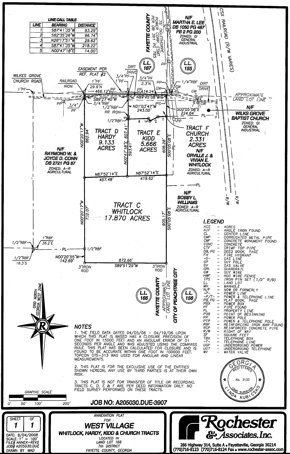
Sec. 1011. - R-1 one-family residential district.
(1011.1) Intent of district: It is intended that the R-1 zoning district protect the characteristics of certain areas of Peachtree City that existed prior to the enactment of this ordinance. No R-1 zoning districts will be permitted except those created with enactment of this ordinance. The regulations which apply to this district are designed to encourage the formation and continuance of a stable, healthy environment for one-family dwellings situated on zoning lots having an area of 10,000 square feet or more. These regulations are also intended to discourage encroachment by commercial, industrial or other uses capable of adversely affecting the intended residential character of the districts.
(1011.2) Permitted uses: The following uses shall be permitted in any R-1 residential zoning district:
(a)
One-family dwelling, excluding mobile or manufactured home.
(b)
Publicly owned building, facility or land.
(c)
Building, facility or land for the distribution of utility services.
(d)
Building, facility or land for noncommercial park, recreation, thoroughfare, or open space purposes.
(e)
Private boat dock, fishing pier, boathouse, and related accessory concession and support facilities, where permitted through deed restrictions.
(f)
Noncommercial horticulture to include fruit trees, nuts and/or vegetables, provided that plots or planting areas for vegetables shall not be located within the front setback area.
(g)
Neighborhood recreation centers, swimming pools and/or tennis courts.
(h)
Accessory use, as identified herein.
(i)
Customary home occupations, as identified in the zoning ordinance.
(1011.3) Conditional uses. The following uses shall be permitted in any R-1 residential zoning district on a conditional basis:
(a)
Church or other place of worship, on the following conditions:
(1)
Notwithstanding any other requirements in this ordinance, the following conditions shall apply to all churches regardless of zoning district.
(2)
Minimum zoning lot area is three acres.
(3)
Minimum lot width: 100 feet.
(4)
Minimum setback area, front:
(a)
Building: 40 feet.
(b)
Parking: 20 feet.
(5)
Minimum setback area, side: 15 feet.
Note: If adjoining a residential lot, the building setback shall be 75 feet.
(6)
Minimum setback area, rear: 30 feet.
Note: If adjoining a residential lot, the building setback shall be 75 feet.
(7)
Maximum building height: As approved by the fire department.
(8)
All zoning lots shall have direct access onto an arterial, major collector road or have access to an arterial, major collector or industrial/commercial road via a minor collector.
(9)
No parking shall be permitted within 20 feet of the property line of any adjoining residential zoning lot.
(10)
Parking and/or service areas shall be separated from adjoining residential lots by a suitable fence or wall six feet in height or a suitable evergreen planting screen six feet in height at time of planting. The required fence, wall, or evergreen planting screen must provide for a reasonable visual separation between properties. No fence or wall in excess of four feet may be placed in a setback area adjoining a public street.
(11)
Any existing church in any zoning district may comply with either the requirement existing prior to enactment of this ordinance, or they may comply with the conditions of this section. They shall not be permitted to comply with various sections of both requirements.
(1011.4) Other requirements: Unless otherwise specified in this ordinance, uses permitted in R-1 residential zoning district shall conform to the following standards:
(a)
Minimum floor area per dwelling unit: 1,000 square feet.
(b)
Minimum zoning lot area: 10,000 square feet.
(c)
Minimum land area per dwelling unit: 10,000 square feet.
(d)
Maximum dwelling units per net acre: 4.36 units.
(e)
Minimum lot width: 75 feet.
(f)
Minimum front setback depth: 30 feet.
(g)
Minimum side setback depth: 7.5 feet.
(h)
Minimum rear setback depth: 30 feet.
(i)
Maximum building height: 35 feet.
(Ord. No. 956, § 1, 8-7-2008)
Editor's note— Ord. No. 956, § 1, adopted August 7, 2008, repealed former § 1011 and enacted a new § 1011 as set out herein. The former section pertained to similar subject matter and derived from Ord. No. 269, § 1(C)(9), 6-3-1982; Ord. No. 366, § 19, 5-22-1985; Ord. No. 408, 8-21-1986.
Sec. 1012. - Airport overlay districts.
(1012.1)
Intent of district. The general purpose of this district is to protect the existing and future operations of the Atlanta Regional Airport Falcon Field (the airport) and the public investment therein; and to promote the health, safety, and general welfare of the public and aviation users. The specific purpose and intent of this district is to:
(1)
Impose additional overlay regulations, which are in addition to those underlying zoning regulations, that will maintain a compatible relationship between airport operations and existing and future land uses around the airport.
(2)
Regulate and restrict the height of structures and objects of natural growth, placement of buildings, visual obstructions (smoke, steam, dust, etc.) electrical and navigational interference, noise sensitive land uses, and wildlife and bird attractants around the airport.
(3)
Regulate and restrict building sites, uses, and concentrations of people to protect life and property in case of accident.
(4)
Provide a quality environment for human habitation and for encouraging the most appropriate land uses around the airport.
(1012.2)
Applicability. The airport overlay districts shall apply only to those parcels of land shown on the official zoning map designated within or partially within the airport overlay districts.
(1012.3)
Definitions
(1)
Airport: Falcon Field Peachtree City Airport.
(2)
Airport elevation: The highest point of an airport's usable landing area measured in feet above mean sea level (msl) which, for under this section 1012, shall be 808.0 msl.
(3)
Airport hazard: Any structure, tree, or use of land that obstructs the air space required for the flight of aircraft and landing or take-off at an airport, is otherwise hazardous to such landing or taking off of aircraft, or places significant number of people or property at risk from airport operations.
(4)
Airspace: The space lying above the earth or above a certain area of land or water that is necessary to conduct aviation operations.
(5)
FAR Part 77: A regulation established by the Federal Aviation Administration entitled, in full, "Objects Affecting Navigable Airspace—Part 77" that (a) establishes standards for determining obstructions in navigable airspace; (b) defines the requirements for notice to the FAA Administrator of certain proposed construction or alteration; (c) provides for the aeronautical studies of obstructions to air navigation to determine their effect on the safe and efficient use of airspace; (d) provides for public hearings on the hazardous effect of proposed construction or alteration on air navigation; and (e) provides for establishing antenna farm areas.
(6)
FAA: Federal Aviation Administration, an operating administration of the United States Department of Transportation.
(7)
FAA determinations: Per the Code of Federal Regulations, all construction within any airport imaginary surface must submit a request for review to the FAA (i.e. Form 7480) at least 45 days before commencement of construction. The FAA will perform an aeronautical study and issue a determination letter regarding the proposed project's impact on air navigation. One of the three typical responses are issued:
(a)
Determination of no hazard: The proposed construction/alteration did not exceed obstruction standards and marking/lighting is not required.
(b)
Determination of no hazard with conditions: The proposed construction/alteration would be acceptable contingent upon implementing mitigating measures such as the marking and lighting of the structure.
(c)
Determination of hazard: The proposed construction/alteration is determined to be a hazard to air navigation.
(8)
Height: For the purpose of determining the height limits in all zones set forth in this article and shown on the official zoning map, height shall be measured as the highest point of a structure, tree, or other object of natural growth, measured from the mean seal level elevation (msl) unless otherwise specified.
(9)
Imaginary surfaces: Those areas established in relation to the airport and to each runway consistent with FAR Part 77, as amended time to time, in which any object extending above these imaginary surfaces, by definition, is an obstruction.
(a)
Approach surface - longitudinally centered on the extended runway centerline and extends outward and upward from the end of the runway primary surface. The approach slope of a runway is a ratio of 20:1, 34:1, or 50:1/40:1 depending on the approach type. The length of the approach surface varies from 5,000 to 50,000 feet and also depends upon the approach type.
(b)
Conical surface - extends upward and outward from the periphery of the horizontal surface at a slope of 20 feet horizontally for every one foot vertically (20:1) for a horizontal distance of 4,000 feet.
(c)
Horizontal surface - a horizontal plane located 150 feet above the established airport elevation and encompasses an area from the transitional surface to the conical surface. The perimeter is constructed by generating arcs from the center of each end of the primary surface and connecting the adjacent arcs by lines tangent to those arcs.
(d)
Primary surface - the surface longitudinally centered on a runway. Then the runway has a specially prepared hard surface, the primary surface extends 200 feet beyond the end of that runway. The width of the primary surface is 1,000 ft. at the airport.
(e)
Transitional surface - extends outward and upward at right angles to the runway centerline and extends at a slope of seven feet horizontally for each one foot vertically (7:1) from the sides of the primary and approach surfaces. The transitional surfaces extend to the point at which they intercept the horizontal surface at a height of 150 feet above the established airport elevation (808.0 + 150 feet = 958 msl).
(10)
Incompatible land use: The use of land that is normally incompatible with the aircraft and airport operations (such as, but not limited to, homes, schools, nursing homes, hospitals, and libraries.)
(11)
Mean sea level: Abbreviated msl, the mean sea level is an average level of the surface of one of more of Earth's bodies of water from which heights are measured.
(12)
Noise sensitive land use: A use where airport noise typically interferes with normal activities associated with the use. Examples of noise sensitive land uses include, but are not limited to, residential, educational, health, religious, wildlife refuges, and cultural sites where a quiet setting is a recognized attribute.
(13)
Public assembly uses: This definition shall apply to this section of the zoning ordinance only. An activity or daily use of a structure or outdoor facility where concentrations of people gather for purposes such as deliberation, education, shopping, business, entertainment, amusement, special events, sporting events, but excluding air shows. A public assembly use does not include places where people congregate for relatively short periods of time such as parking lots, cemeteries, golf courses, or uses approved by the FAA in an adopted airport master plan.
(14)
Runway protection zone (RPZ): A trapezoidal-shaped area centered about the extended runway centerline that is used to enhance the protection of people and property on the ground. The RPZ dimensions are functions of the design aircraft, type of operation, and visibility minimums, and therefore may be amended from time to time.
(15)
Structure: This definition shall apply to this section of the zoning ordinance only. An object anchored, constructed, attached, erected, gathered, located, placed, piled, or installed by humans, either on the ground or in or over a body of water, either moveable or immovable, and either temporary or permanent. The term structure includes, but is not limited to, antennae, buildings, cranes, fences, overhead transmission lines, patios and decks, man-made ponds, signs and sign structures, smokestacks, towers, utility poles, wires, and anything attached to any of the foregoing either temporarily or permanently.
(16)
Wildlife attractants: Any human-made structure, land-use practice, or human-made or natural geographic that can attract or sustain wildlife within the landing or departure airspace or the airport's air operations area. These attractants include, but are not limited to, open bodies of water, surface mining, waste disposal sites, wastewater treatment facilities, or wetlands.
(1012.4)
Establishment and delineation of airport overlay districts. The following overlay districts are created and mapped on the official zoning map, which may be updated as determined by city council following the map amendment process stipulated in article XIII of the zoning ordinance:
(1)
Height limitations overlay (HLO): The boundary of the HLO zone shall be the full extent of all the imaginary surfaces described in Part 77 of the FAA guidance and mapped on the Peachtree City official zoning map. The HLO protected airspace on a property begins at 150 feet over 808 msl (958 msl).
(2)
Approach/departure overlay (ADO): The boundary of the ADO shall be the full extent of the approach and departure surfaces for the airport, as described in FAR Part 77 of the FAA guidance and mapped on the Peachtree City official zoning map. The protected airspace within the northern ADO follows a 34:1 slope for 10,000 feet. The protected airspace within the southern ADO follows a slope of 50:1 for 10,000 feet, then a slope of 40:1 for the remaining 40,000 feet.
(3)
Transitional surface overlay (TSO): The boundary of the TSO shall be the full extent of the transitional surface as described in FAR Part 77 of the FAA guidance and as mapped on the Peachtree City official zoning map. The protected airspace within the TSO follows a slope of 7:1 from the primary and approach surfaces to the point at which it intercepts the HSO.
(4)
Runway protection zone overlay (RPZO): The boundary of the RPZO shall be the full extent of the RPZ for the airport, as described in FAR Part 77 of the FAA guidance and mapped on the Peachtree City official zoning map.
(1012.5)
General Provisions for all airport overlay districts. The following restrictions apply to all land within any of the airport overlay districts.
(1)
Applicability of regulations. If a single parcel is located in more than one airport overlay district, the applicable overlay district use restrictions shall apply only to the portion of the property located in that overlay district. A parcel may be partially or fully within two or more overlay districts.
(2)
Glare restrictions. No glare-producing materials or architectural design shall be used that will result in glare that could impeded a pilot's vision.
(3)
Lighting restrictions. No lighting shall project directly onto an existing runway or taxiway or into existing airport approach and landing paths except where necessary for safe and convenient air travel, as determined by the FAA or the airport. Lighting for any new or expanded use shall incorporate shielding in their designs to reflect light away from airport approach and landing paths. No use shall imitate airport lighting or impeded the ability of pilots to distinguish between airport lighting and other lighting.
(4)
Communications facilities and electrical interference. No structure or use shall create electrical or electronic interference with navigational signals, or radio or radar communications between the aircraft and a ground station. Proposals for the location of new or expanded radio, radio-telephone, and television transmission facilities and electrical transmission lines shall be coordinated with FAA prior to approval.
(5)
Visibility. No structure or use shall cause emissions of smoke, dust, or steam that could obscure visibility of pilots. Nor shall any emissions be permitted that are injurious to the public in use of the airport.
(6)
Waste disposal facilities. No new waste disposal facilities shall be permitted within the airport overlay districts unless approval is obtained from the Federal Aviation Administration.
(7)
Other hazards and aircraft operations. In addition to the specific prohibitions stated in this article, no use or structure shall otherwise endanger the landing, taking off, or maneuvering of aircraft.
(1012.6)
Regulations by districts.
(1)
Height limitation overlay (HLO).
(a)
No structure or tree shall be constructed, altered, or allowed to grow into or project within the HLO, which is 958 msl or greater.
(b)
When the height limitations of the applicable zoning district are more restrictive than those of imaginary surface restrictions, the applicable zoning district height limitations shall apply and control.
(c)
Exceptions to the height restrictions may be administratively approved by the planning director subject to conditions of the FAA determination of no hazard or the FAA determination of no hazard with conditions.
(2)
Approach departure overlay (ADO). In addition to the requirements of the underlying zoning district and the general provisions of the airport overlay districts, areas designated within the ADO shall comply with the following restrictions. In the event of a conflict between the following restrictions and the provisions of the underlying zoning district for each parcel, the more restrictive provision shall control. The provisions for the ADO are as follows:
(a)
No structure or tree shall be constructed, altered, or allowed to grow into or project within the ADO protected airspace.
(b)
All development applications may be required to provide proof that the proposed development will not project within the ADO protected airspace. Documentation satisfying this shall be as determined by the planning director and or the airport sponsor, and may include an elevation certificate or other similar survey.
(c)
Exceptions to the height restrictions may be administratively approved by the planning director subject to the conditions of the FAA determination of no hazard or the FAA determination of no hazard with conditions.
(d)
Fuel storage tank farms are prohibited.
(3)
Transitional surface overlay (TSO). In addition to the requirements of the underlying zoning district and the general provisions of the airport overlay districts, areas designated within the TSO shall comply with the following restrictions. In the event of a conflict between the following restrictions and the provisions of the underlying zoning district for each parcel, the more restrictive provision shall control. The provisions of the TSO are as follows:
(a)
No structure or tree shall be constructed, altered, or allowed to grow into or project within the TSO protected airspace.
(b)
All development applications may be required to provide proof that the proposed development will not project within the TSO. Documentation satisfying this section shall be as determined by the planning director and or the airport sponsor, and may include an elevation certificate or other similar survey.
(c)
Exceptions to the height restrictions may be administratively approved by the planning director if the conditions of the FAA determination of no hazard or the FAA determination of no hazard with conditions are satisfied.
(4)
Runway protection zone overlay (RPZO). In addition to the requirements of the underlying zoning district and the general provisions of the airport overlay districts, areas designated as RPZO shall comply with the following use restrictions:
(a)
Above-ground structural hazards are prohibited, including buildings, temporary structures, exposed transmission lines, and other similar above-ground structures. No tree or shrub shall be maintained or allowed to grow within the RPZO.
(b)
Public assembly uses as defined by this section are prohibited.
(1012.7)
Nonconforming uses.
(1)
Regulations are not retroactive. The regulations prescribed by this section shall not be construed to require the removal, lowering, or other change or alteration of any structure, tree, or use of land not conforming to the regulations as of the effective date of this section or otherwise interfere with the continuance of nonconforming use. Nothing contained herein shall require any change in the construction, alteration, or intended use of any structure, the construction or alteration of which was begun proper to the effective date of this section, and is diligently prosecuted and completed within two years of the construction or alteration start date.
(2)
Any lawfully existing nonconforming use may be continued, repaired, and maintained.
(3)
Lawfully existing nonconforming uses shall not be enlarged or extended unless the project satisfies the conditions of the FAA determination of no hazard or the FAA determination of no hazard with conditions. The burden of establishing that a nonconformity lawfully exists is on the owner.
(1012.8)
Permits and procedures.
(1)
All permits and procedures for building permits or zoning approvals within the airport overlay districts shall comply with the Peachtree City Code of Ordinances.
(2)
Additional documentation may be required by the planning director before permits can be issued or as a condition of permit approval. These may include elevation certificates showing the structure does not violate the maximum height requirements, FAA determination statements, statements of approval from the airport, or other documents as required.
(3)
Any permit or variance granted may be conditioned as to require the owner of the structure or tree in question to install, operate, and maintain, at the owner's expense, such markings and lights as may be necessary to indicate to pilots the presence of an airport hazard.
(1012.9)
Variances.
(1)
Any person desiring to erect or increase the height of any structure, permit the growth of any tree, or use property not in accordance with the regulations prescribed in this article may apply to the city council for a variance from such regulations. The variance and public hearing process shall comply with article XII of the zoning ordinance.
(2)
The application for a variance shall be accompanied by an FAA determination as to the effect of the proposal on the operation of the airport and air navigation.
(3)
Upon determining the completeness of the application, the variance application shall be referred to the airport for review, comments, and recommendations prior to the public hearing on the variance application.
(Ord. No. 1192, § 1, 6-17-2021)
Editor's note— Ord. No. 1192, § 1, adopted June 17, 2021, repealed § 1012 and enacted a new § 1012 as set out above and later amended. Former § 1012 pertained to airport zoning and derived from Ord. No. 391, adopted March 20, 1986; Ord. No. 474, adopted November 3, 1988; and Ord. No. 475, adopted November 3, 1988.
Sec. 1013. - LUR limited-use residential.
(1013.1) Intent of district. It is intended that the LUR zoning district be established and reserved for restricted residential development allowing flexibility in design. The regulations which apply to this district are designed to encourage the formation and continuance of a stable, healthy environment while allowing for a uniqueness in design.
(1013.2) Permitted uses. Any one or more of the following uses may be permitted in any LUR district (the specific use and design must be delineated in the zoning request). The property will be rezoned for one or more specific uses only to the exclusion of all other listed permitted uses.
(a)
Single-family detached;
(b)
Single-family attached;
(c)
Townhouse;
(d)
Condominium;
(e)
Cluster housing subdivision;
(f)
Accessory use.
(1013.3) Other requirements. Unless otherwise specified in this ordinance, uses permitted in LUR zoning districts shall conform to the following standards:
(a)
Minimum total zoning lot area: five acres.
(b)
Minimum floor area per dwelling unit: 1,000 square feet.
(c)
Minimum side setback depth: 30 feet from project boundary; 20 feet between detached buildings.
(d)
Minimum rear setback depth: 40 feet when rear setback depth of lot adjoins the project boundary.
(Ord. No. 456, 3-17-1988)
Sec. 1013A. - Specific limited-use residential districts.
(1013A.1) Reserved.
Editor's note— Subsection 1013A.1, which formerly pertained to the limited-use residential district no. 1, and derived from Ord. No. 605, adopted June 3, 1993 has been removed at the direction of the city. The user's attention is directed to the replacement provisions enacted by Ord. No. 819, which is codified as subsection 1013A.6.
(1013A.2) Limited-use residential district no. 2.
(a)
The tract of land of approximately six acres at the southwest corner of Peachtree Parkway and Flat Creek Road be rezoned from LUC-2 limited-use commercial (about 0.7 acre) and LUC-5 limited-use commercial (about 5.3 acres) to LUR-2 limited-use residential. This tract is more particularly described on a boundary and topographic survey prepared by Ashford Engineers and dated April 25, 1994. Said survey is maintained in the office of the city clerk, and a copy is incorporated herein as figure 1013A.2. It is intended that the LUR-2 zoning district be established specifically as follows in subsections (b)—(d) below.
(b)
Permitted uses:
(1)
Single-family detached dwelling.
(2)
Accessory use, as set forth in section (908.1).
(3)
Customary home occupation, as set forth in section 907.
(c)
Conditional uses:
(1)
No conditional uses are permitted in this zoning district.
(d)
Other requirements:
(1)
Minimum floor area per dwelling unit: 1,800 heated square feet.
(2)
Minimum zoning lot area: No minimum zoning lot area has been established. No more than 14 lots may be developed on the tract.
(3)
Maximum dwelling units per gross area: 2.34 units.
(4)
Minimum lot widths: No minimum lot widths have been established.
(5)
Minimum front setback: 25 feet from the back of the curb. A 50-foot undisturbed greenbelt is required along both Peachtree Parkway and Flat Creek Road. The only disturbance that will be permitted in the greenbelt is an access drive to the tract from Flat Creek Road. The width of that access drive cannot exceed 60 feet of cleared area.
(6)
Minimum side setback: Zero feet from interior lot lines, including the north lot lines of lots 1 and 14 which are common with the 50-foot greenbelt lines along Flat Creek Road. There must be a minimum of 15 feet between adjacent detached homes and ten feet between adjacent detached garages.
(7)
Minimum rear setback: 30 feet from the 50-foot greenbelt line along Peachtree Parkway and 40 feet from the project boundaries on the south and west sides of the tract which are common with the golf course property lines.
(8)
Maximum building height: Two stories plus a basement.
(9)
Parking: As set forth in section 909; each dwelling will have a two-car garage with additional off-street parking for two cars.
(10)
Signs: As set forth in the sign ordinance [section 66-1 et seq.].
(11)
Driveways: A common driveway may be shared by no more than two dwelling units.
(12)
Buffers: Along the boundaries of the tract on both the west and south sides, no clearing of trees shall be permitted in required setback areas without prior city approval. Each building site must be graded separately in order to save as many of the internal trees as possible. All tree-save areas must be identified in the field and approved by the city prior to any clearing.
(13)
Development will take place substantially in accordance with concept plan and other design characteristics submitted as a part of this rezoning request, as amended by action of the city council.
(14)
This rezoning was approved by the city council at its meeting on September 15, 1994. This rezoning action and the conditions imposed at that time shall remain in effect unless specifically modified or revoked by subsequent action of the city council.
Figure 1013A.1
Figure 1013A.2
(1013A.3) Limited-use residential district no. 3.
(a)
The 26.02-acre tract of land on the west side of Peachtree Parkway across from the Smokerise Plantation Subdivision (attachment A), commonly known as North Cove, be rezoned from its current zoning classification of AR agricultural reserve to LUR-3 limited-use residential, subject to the following conditions and requirements:
(b)
Permitted uses:
(1)
No more than 47 dwelling units of which two units shall be detached Sentinel Homes, 17 shall be row/townhomes that may be attached or detached, 13 shall be detached garden homes, and 15 shall be detached plantation homes.
(2)
A clubhouse, including an outdoor pool and other customary accessory uses.
(3)
Privately owned streets, access drives, and stormwater drainage facilities.
(4)
Publicly owned building, facility or land.
(5)
Building, facility or land for the distribution of utility services.
(6)
Building, facility or land for noncommercial park, recreation or open space purposes.
(7)
Private boat dock, fishing pier, boathouse and related support facilities.
(8)
Accessory use (see section 908).
(9)
Customary home occupation (see section 907).
(c)
Conditional uses: No conditional uses are permitted in this zoning district.
(d)
Other requirements:
(1)
Minimum floor area per dwelling unit:
Sentinel homes—2,400 square feet.
Row/townhomes—1,800 square feet.
Garden homes—1,800 square feet.
Plantation homes—2,400 square feet.
(2)
Minimum zoning lot area: No minimum has been established. The developer must abide by the concept approved as a part of this rezoning (attachment B).
(3)
Maximum dwelling units: 47 units, or 1.8 units per acre for 26.02 acres.
(4)
Minimum lot width: No minimum has been established. The developer must abide by the concept approved as a part of this rezoning (attachment B).
(5)
Minimum front setbacks:
Sentinel homes—20 feet on main entrance road; ten feet on north/south road.
Row/townhomes—ten feet.
Garden homes—ten feet.
Plantation homes—ten feet.
(6)
Minimum side setbacks: All units; zero feet.
(7)
Building separation: If buildings are not attached, the minimum separation between any two buildings shall be ten feet.
(8)
Minimum rear setbacks:
Sentinel homes—Zero feet.
Row/townhomes—20 feet.
Garden homes—Zero feet.
Plantation homes—30 feet.
(9)
Maximum building height: Three stories, plus a basement.
(10)
Parking: As set forth in section 909.
(11)
Signs: As set forth in the sign ordinance [section 66-1 et seq.].
(12)
Buffers: A 50-foot undisturbed greenbelt shall extend the entire length of the property along Peachtree Parkway. None of the dwelling units shall back up to this greenbelt. No more than two access cuts through the greenbelt shall be permitted.
A 100-foot undisturbed natural buffer shall extend the length of the property along the lake. In addition, there shall be a 50-foot wide strip parallel to the undisturbed natural buffer within which no impervious surfaces will be permitted.
(13)
Development shall take place substantially in accordance with the approved concept plan (attachment B), as well as the design standards submitted with the rezoning request and approved as a part of the concept. Substantial deviation from the concept and/or design standards will require city council approval.
(14)
This rezoning was approved at the council meeting on May 18, 1995 subject to the following conditions:
a.
The plan must be executed essentially as presented with respect to the number of units, the location and orientation of the units, the alignment of the road system, and the amount and distribution of the open space and buffer areas;
b.
In addition to a deceleration lane for right turns at each of the entrances, there should be a dedicated left turn lane on the parkway at the main entrance;
c.
The 50-foot greenbelt along the parkway must be preserved and protected both during construction and after the project is occupied. The developer will be responsible for enhancing the greenbelt as necessary to maintain the scenic nature of the parkway and properly buffer the project from the road;
d.
Special effort must be made by the developer to protect the quality of the water in the lake from the adverse effects of soil erosion and sedimentation; and
e.
The developer must provide a guarantee that some mechanism will be in place to prevent the disturbance of the natural areas both during and after the construction phase of the project.
(15)
This ordinance and all requirements and conditions thereof shall remain in effect unless specifically amended or revoked by subsequent city council action in accordance with the established amendment procedure.
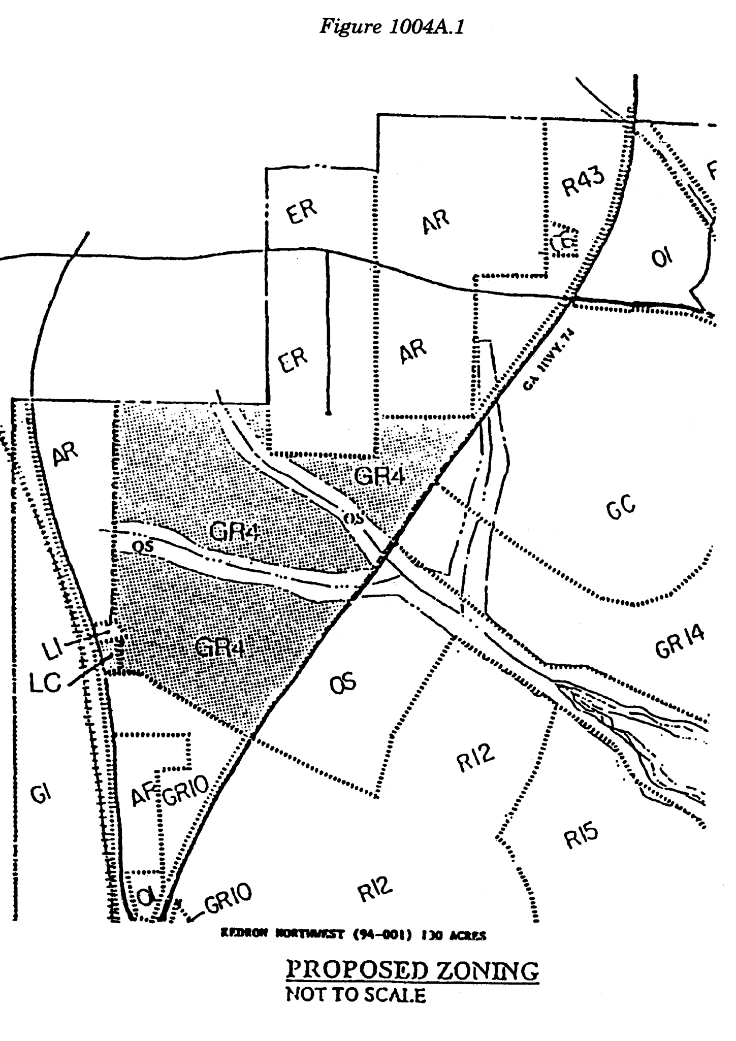
Figure 1013A.3 Attachment A
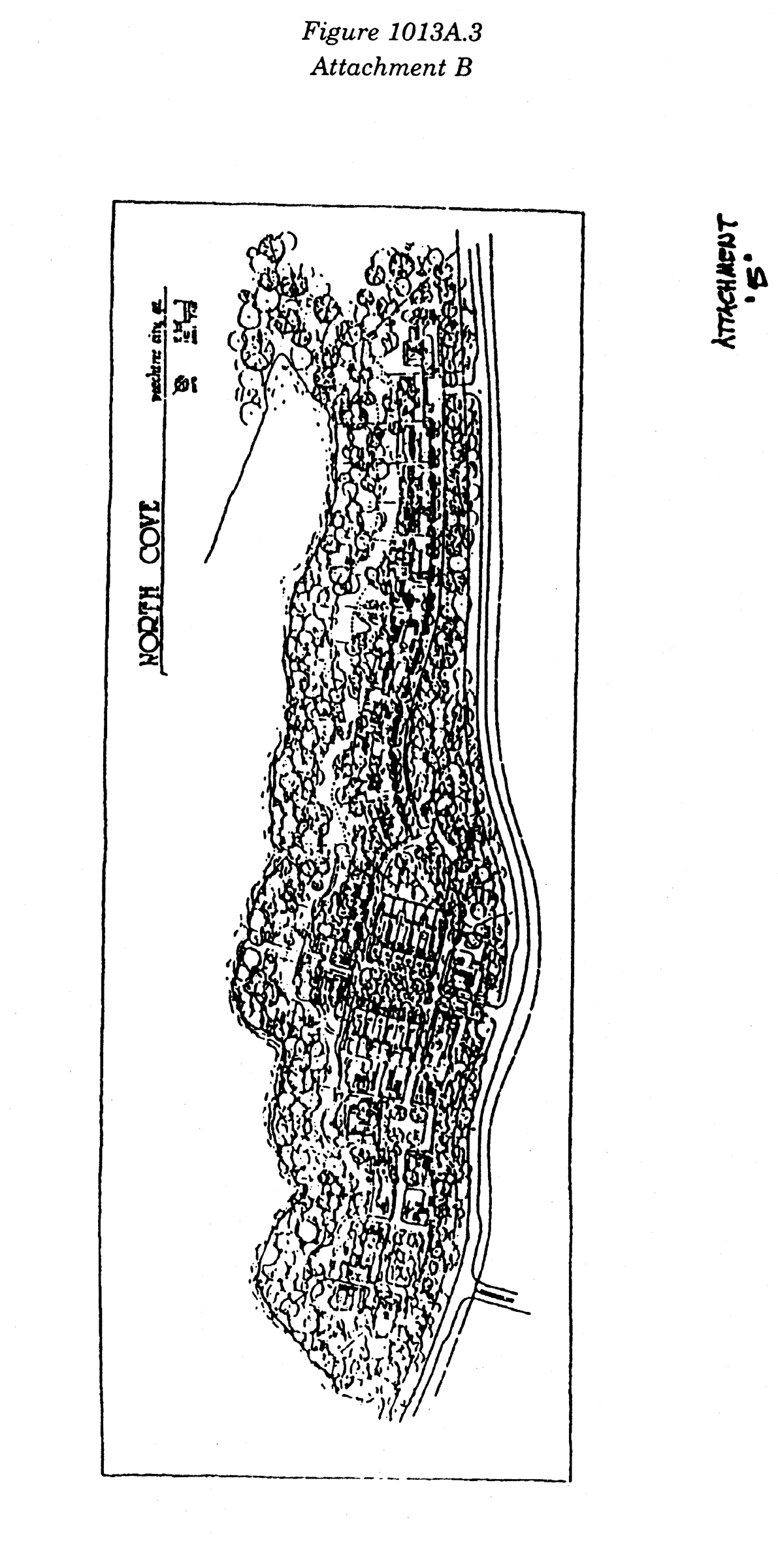
Figure 1013A.3—Attachment B
(1013A.4) Limited-use residential district no. 4.
This property includes all that tract or parcel, lying and being in Land Lot 67 of the 7 th District, Fayette County, Georgia, and being more particularly described as follows:
Beginning at the Southeastern corner of Land Lot 67, thence North along the East line of Land Lot 67 a distance of 314.85 feet to a point, thence North 89 40'40" West for a distance of 552.78 feet to a point, thence North 0 19'20" East for a distance of 452.36 feet to a point, thence North 89 40'40" West for a distance of 81.76 feet to the TRUST POINT OF BEGINNING, thence South 0 19'20" West for a distance of 45.75 feet t a point, thence North 89 40'40" West for a distance of 600.75 feet to a point on the Eastern right-of-way of Robinson Road, thence Northerly along the Eastern right-of-way of Robinson Road a distance of 345.96 feet to a point, thence North 89 12'38" East for a distance of 660.72 feet to a point, thence South 0 19'20" West for a distance of 307.59 feet to the TRUE POINT OF BEGINNING. Said tract containing 5.00 acres.
This attachment is further illustrated in Exhibit "A", which is included with this Ordinance as an attachment [and codified at the end of this subsection]. It is intended that the LUR-4 zoning district be established specifically for the development of two lots, each of about 2.5 acres in area, for single-family residential use in accordance with all requirements for an R-43 Residential zoning district except for minimum lot size, which shall be 2.5 acres in this instance, and provided that each house be custom-built with a heated floor area of at least 3,400 square feet.
(Ord. No. 817, 4-20-1995)
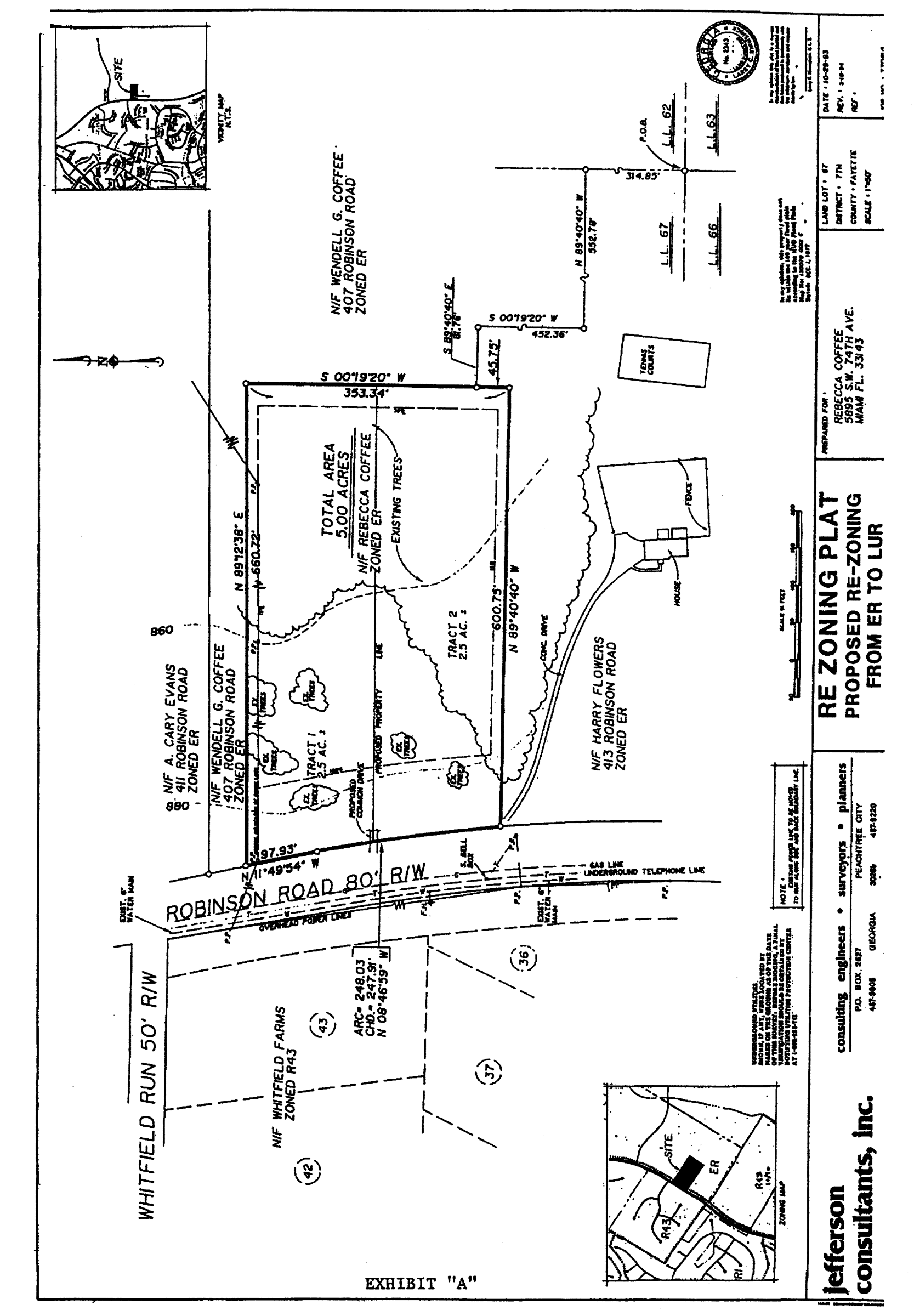
Limited-use residential district no. 4
(1013A.5) Limited-use residential district no. 5.
This property includes all the tract or parcel of land lying in and being in land lot 128 of the 7th district Fayette County, Georgia, being more particularly described as follows:
Beginning at the intersection of the easterly right-of-way of State Route 74 (a 130' R/W) and the southerly right-of-way of Willow Road (a variable R/W) if said right-of-ways were extended to form a point instead of a miter. Thence, North 54 degrees 48 minutes 17 seconds East a distance of 49.25' to a 5/8" re-bar and the True Point of Beginning; Thence following the right-of-way of Willow Road North 54 degrees 48 minutes 17 seconds East a distance of 39.93' to a point; Thence, continuing along said right-of-way an arc distance of 375.26' said arc being subtended by a chord; bearing of North 30 degrees 30 minutes 40 seconds East and having a chord distance of 364.14' to a point; Thence, North 6 degrees 14 minutes 21 seconds East a distance of 31.68' to a point; Thence, an arc distance of 7.06', said arc being subtended by a chord bearing of North 6 degrees 26 minutes 09 seconds West and having a chord distance of 7.06' to a point; Thence, North 88 degrees 44 minutes 35 seconds West a distance of 30.55' to a point; Thence, an arc distance of 112.09' said arc being subtended by a chord bearing of North 5 degrees 55 minutes 15 seconds West and having a chord distance of 111.77' to a point; Thence, North 65 degrees 03 minutes 28 seconds East a distance of 493.94' to a point; Thence, South 23 degrees 25 minutes 08 seconds East a distance of 295.0' to an IPF; Thence, South 66 degrees 22 minutes 47 seconds East a distance of 213.79' to a point; Thence, South 30 degrees 26 minutes 17 seconds West a distance of 91.10' to a point; Thence, South 44 degrees 51 minutes 55 seconds West a distance of 79.93' to a point; Thence, South 30 degrees 16 minutes 50 seconds West a distance of 100.20' to an IPF; Thence, South 22 degrees 58 minutes 39 seconds West a distance of 80.57' to an IPF; Thence, South 22 degrees 49 minutes 04 seconds West a distance of 74.60' to a point; Thence, South 30 degrees 33 minutes 46 seconds West a distance of 147.15' to a point; Thence, South 30 degrees 21 minutes 34 seconds West a distance of 187.89' to a point; Thence, North 35 degrees 32 minutes 10 seconds West a distance of 302.36' to a point; Thence, North 9 degrees 39 minute 30 seconds East a distance of 69.42' to the True Point of Beginning. Said tract containing a total of 6.615 acres more or less.
This tract is further illustrated as Exhibit "A", which is included with this Ordinance as an attachment [and codified at the end of this subsection]. It is intended that the LUR-5 zoning district be established specifically for a planned cluster housing project designed in accordance with the development plan shown on Exhibit "A;" that it be developed with minimum setbacks as specified in Section 1004.4, paragraphs (f), (g), and (h) for detached structures; and that it also be subject to the following conditions:
1.
The final development plan will show the strip of land that will be required for the widening of GA 74. At this time it is anticipated that a strip about 25 feet wide will be needed. The developer agrees to dedicate this strip at no cost to the public.
2.
The 75-foot wide greenbelt along GA 74 will be measured from the proposed new right-of-way line rather than the existing line.
3.
In order to provide the land necessary for the highway expansion and the greenbelt, Lot 24 will be eliminated and converted to greenbelt.
4.
The house of Lot 23 will be located as far to the east as possible in order to maximize its separation from the highway.
5.
The existing utility lines will be removed from the area between the project and the houses along Cedar Drive. The 35-foot buffer area will be labeled a tree-save buffer. That area will be re-landscaped with berms and vegetation to provide a permanent, meaningful, and effective separation between the two subdivisions; and
6.
Stormwater detention will be handled as a part of an area-wide stormwater management program. If for some reason this is not possible, the project will not be approved as presented. A detention pond in the back yard of one of the lots (Lot 8) would be totally out of character with the rest of the subdivision, which otherwise appears to be well designed.
(Ord. No. 818, 6-5-1997)
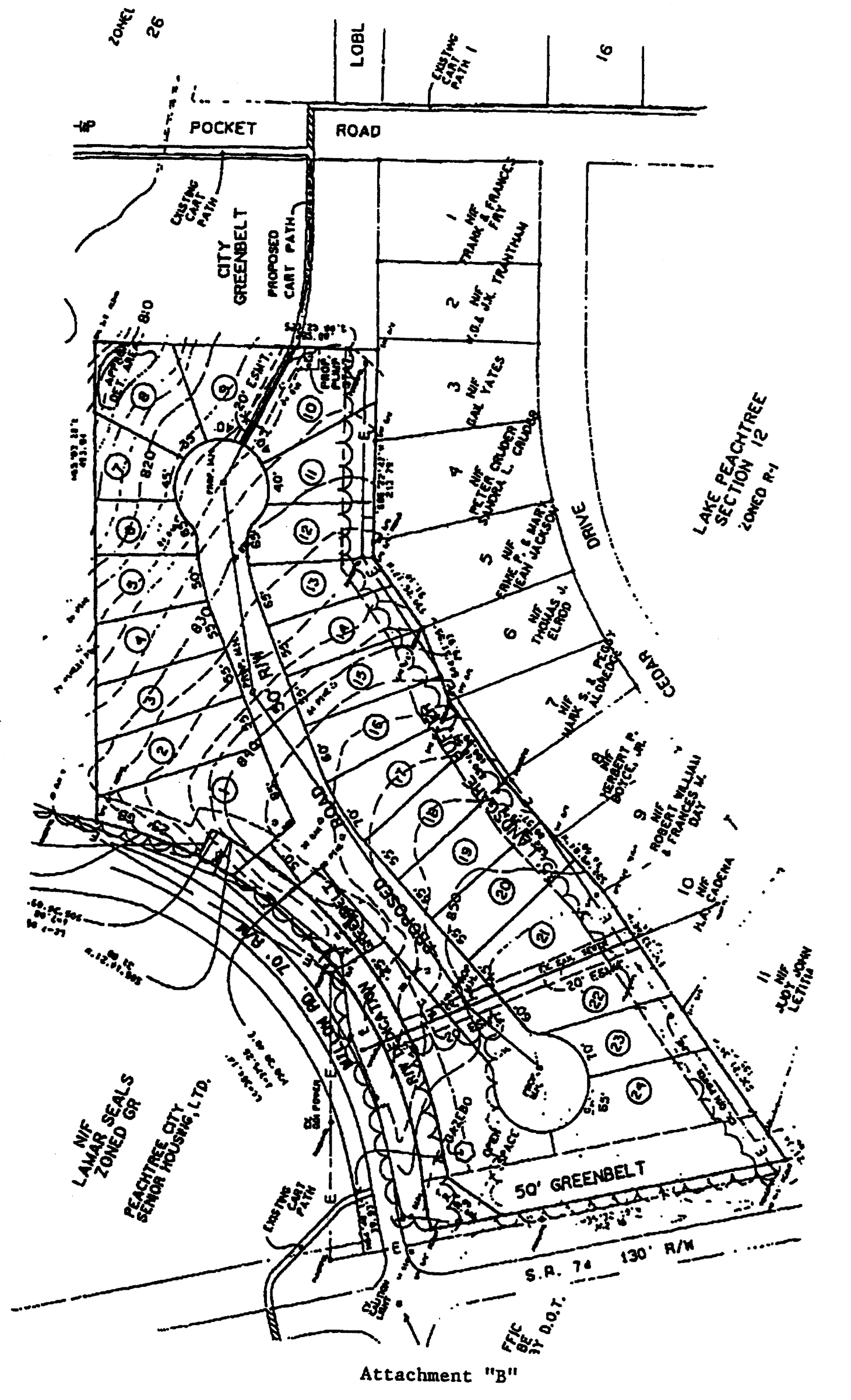
Limited-use residential district no. 5
(1013A.6) Limited-use residential district no. 6.
(1013A.6.1) Effect on other zoning districts. The LUR-6 zoning district created by this section replaces the LUR-1 zoning classifications.
(1013A.6.2) Conformance with master plan. The development plan for this tract is illustrated on Exhibit "A", which is included with this Ordinance as an attachment [and codified at the end of this subsection]. It is intended that the LUR-6 zoning district be established specifically for a planned residential neighborhood with single-family detached homes having a minimum area of 2,400 square feet each. The lots would be as shown on Exhibit "A" with required setbacks of 20 feet (front), 10 feet (side), and 30 feet (rear/ house) or 20 feet (rear/ garage). The overall layout of the project would be in accordance with the plan shown on Exhibit "A," subject to the following conditions:
1.
The Applicant must coordinate with City Staff and the City Fire Marshal to ensure that the proposed street design and access drive meet appropriate criteria for this development. The proposed garage access drive should be designed to permit emergency access to the rear of proposed structures.
2.
The proposed radii for all intersections within this development must be designed to accommodate sufficient turning movements for emergency vehicles and large trucks and ensure appropriate traffic visibility.
3.
The Applicant should coordinate with City Staff to ensure that the proposed cart path crossing will provide safe visibility. Appropriate signage and striping will be required as a part of this crossing.
4.
The Applicant should coordinate with City Staff to determine if the proposed neighborhood park system, sidewalks and street system will be private and maintained by a Homeowner's Association or dedicated to the City for maintenance.
5.
Street lights will be required for this development.
6.
All streams and associated buffers must be identified and appropriately protected.
7.
All sanitary sewer lines must be located to minimize impact to existing vegetation and should be kept within the streets wherever possible.
8.
The Applicant should coordinate with City Staff to study the safety and sight lines at the proposed main entry and Peachtree Parkway intersection.
9.
The deed covenants must contain a notice to all future property owners that the required watershed protection buffers are to remain undisturbed.
10.
The number of homes that may be constructed within this subdivision shall not exceed 54.
11.
Development shall take place substantially in accordance with the plan layout and design characteristics submitted by the developer with the revised LUR zoning request, and substantial deviation thereof will require Council approval.
12.
The actual location of the at-grade cart path crossing on Peachtree Parkway must be approved by the City Engineer and the Police Chief prior to recording the Final Plat in order to assure that it is in the safest location.
13.
In order to protect existing vegetation, the utility lines must be located within street rights-of-way wherever possible.
14.
The neighborhood should include at least one, and possibly two, tot lots. The exact location for the tot lots must be approved by the Planning Commission prior to their installation.
(Ord. No. 819, 5-7-1998)
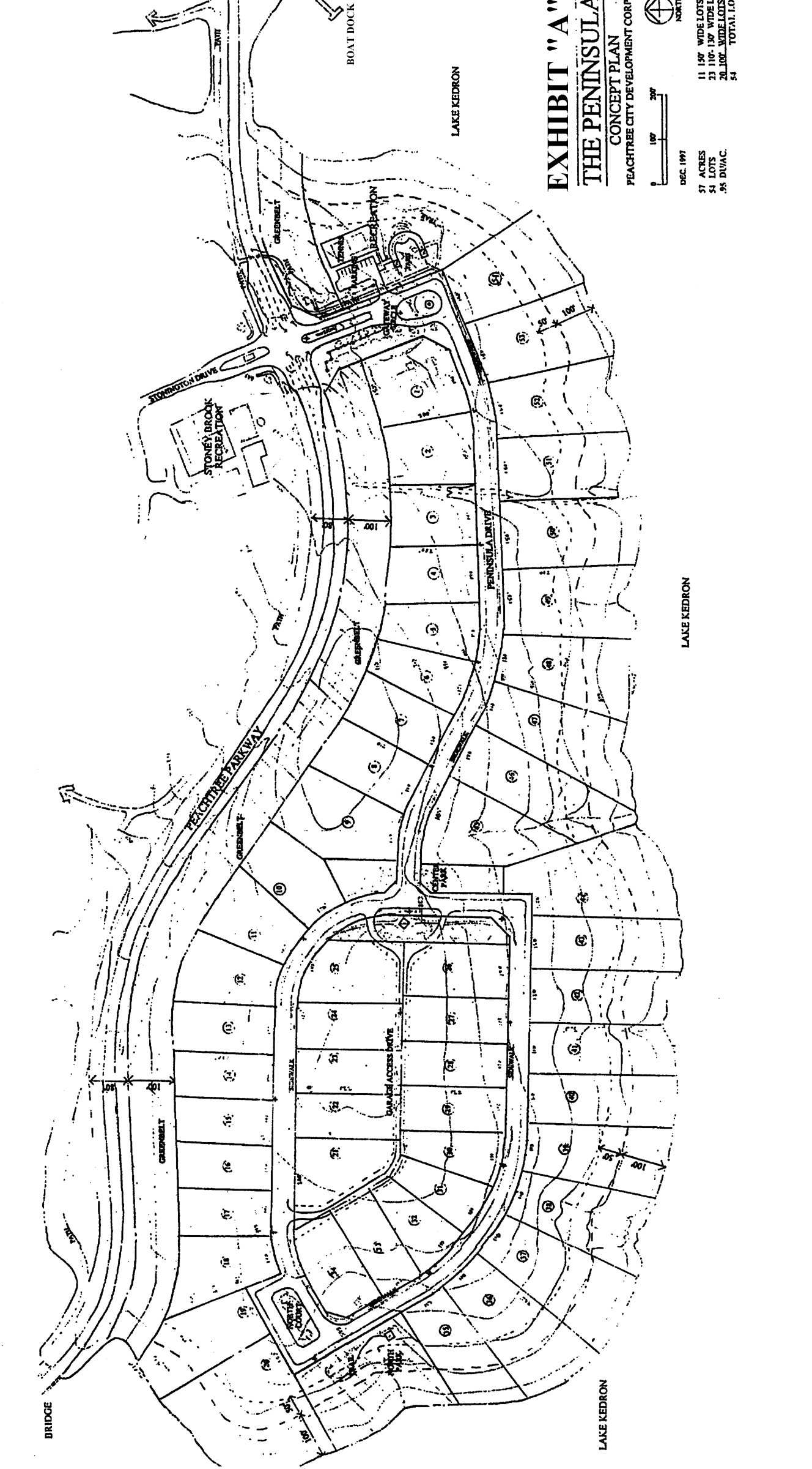
Limited-use residential district no. 6
(1013A.7) Limited-use residential district no. 7.
All that tract or parcel of land lying and being in Land Lot 160 of the 7 th District of Fayette County, Georgia, and being more particularly described as follows:
Beginning at the intersection of the northwest right-of-way of Terra Verte (a 50' R/W) and the southwest right-of-way of Planterra Way (a variable R/W); Thence northwest along the southwest R/W of Planterra Way a distance of 411.57' to a point. Thence, leaving the R/W of Planterra Way North 88 degrees 24 minutes 01 seconds West a distance of 169.62 to a ⅝" rebar and the True Point of Beginning; Thence North 88 degrees 24 minutes 01 seconds West a distance of 829.58' to a ½" rebar; Thence North 01 degrees 17 minutes 58 seconds East a distance of 355.96' to a point; Thence South 88 degrees 22 minutes 14 seconds East a distance of 834.77' to a ⅝" rebar; Thence South 2 degrees 8 minutes 10 seconds West a distance of 355.53' to the True Point of Beginning. Said tract containing a total of 6.796 acres more or less.
The above-described tract is further illustrated in Exhibit, "A" which is included with this Ordinance as an attachment. It is intended that the LUR-7 zoning district be established specifically for a 28-lot subdivision for single-family detached homes in accordance with the design presented in Exhibit "A" and consistent with the principles and standards set forth in the rezoning request dated October 9, 1998, revised November 24, 1998, and as amended on July 17, 2003 and September 3, 2009.
In addition to the special conditions stated above, the uses on this property shall be governed by the general conditions contained in Section 1013 of the Peachtree City Zoning Ordinance and the following conditions:
(1)
Minimum rear building setbacks:
Lots 1—5 and 24—38: 20 feet.
Lots 6—23: 20 feet.
(2)
Wooden decks and raised patios shall be permitted within the rear building setback on Lots 6—23 only provided that said wooden deck or raised patio is no closer than ten feet to the rear property line of said lots.
(3)
Roofed structures (enclosed patios, screened porches, sunrooms, etc.) shall not be permitted within the rear building setback on any lot unless the property owner obtains a variance.
(4)
Decks and other outside structures must be identified on future site plans submitted to the building department prior to issuance of a building permit.
(5)
The applicant must provide a copy of the amended zoning ordinance to existing and prospective property owners.
(Ord. No. 813, 7-7-2003; Ord. No. 986, § 1, 9-3-2009)
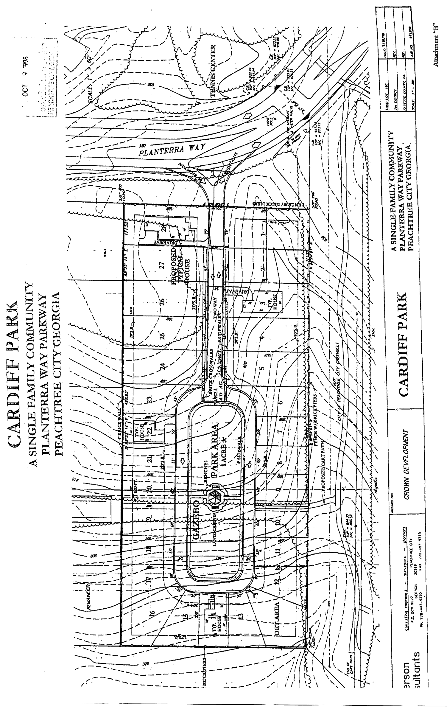
Limited-use residential district no. 7
(1013A.8) Limited-use residential district no. 8.
(A)
Lallande Tract: All that tract or parcel of land lying and being in Land Lot 92, 7th District, Peachtree City, Fayette County, Georgia, and being more particularly described as follows:
Commencing at a concrete monument marking the intersection of the westerly right-of-way of State Route 54 (right-of-way varies) with the southwesterly right-of-way of Sumner Road (right-of-way varies); thence proceed along said fight-of-way of State Route 54 S. 00° 55'30" W. for a distance of 84.16' to an iron pin set and the POINT OF BEGINNING; thence continue along said right-of-way S. 00° 55'30" W. for a distance of 54.05' to a point; thence continue along State Route 54 and along the arc of a curve concave southeasterly and having as its elements a radius of 2939.79', a delta angle of 5° 46'35", and a chord or S. 09° 54'12" W. 296.26', for an arc distance 296.38 feet to an iron pin set; thence departing said right-of-way proceed along a line common to Ronald Scott N. 88° 11;52" W. for a distance of 1432.10' to an iron pin set; thence departing the line common to Scott, proceed along the line common to lots 10 and 11, Parkway Estates Phase Two N. 00° 34'04" E. for a distance of 288.64' to an iron pin set, thence departing the line common to Parkway Estates proceed along a line common to Judith M. Mathis N. 89° 31'37" E. for a distance of 1480.41' to the POINT OF BEGINNING, containing 10.6256 acres of land.
(B)
Scott Tract: All that tract or parcel of land lying and being in Land Lot 92, 7th District, Peachtree City, Fayette County, Georgia, and being more particularly described as follows:
Commencing at a concrete monument marking the intersection of the westerly right-of-way of State Route 54 (right-of-way varies) with the southwesterly right-of-way of Sumner Road (right-of-way varies); thence along said right-of-way of State Route 54 S. 00° 55'30' W., a distance of 84.16 feet to an iron pin, thence continuing along said right-of-way S. 00° 55' 30" W., a distance of 54.05 feet to a point; thence continuing along said right-of-way along the arc of a curve to the left having a radius of 2939.79 feet, a delta angle of 5° 46'35", and a chord bearing S. 09° 54' 12" W. a distance of 296.26 feet, for an arc distance of 296.38 feet to an iron pin and the POINT OF BEGINNING. Thence departing said fight-of-way along a line common to Miriam J. Lallande N. 88° 11'52" W., a distance of 1432.10 feet to an iron pin; thence departing the line common to Miriam J. Lallande S. 00° 34'04" W., a distance of 59.80 feet, thence S. 00° 23'58" W., a distance of 236.45 feet to a point; thence S. 88° 06'53" E., a distance of 1402.75 feet to a 5/8" rebar; thence N. 06° 23' 18" E., a distance of 298.92 feet to the POINT OF BEGINNING. Said parcel containing 9.66 acres, more or less.
The general development concept for these two tracts is illustrated on Exhibit "A" which is included with this ordinance as an attachment. The overall development of the tracts would be subject to the following conditions:
1.
The proposed development plan presented to Council was only intended to suggest a concept. It shall not be considered the final approved development plan. That plan must be prepared and approved as part of the regular plat review process;
2.
The development plan must include a minimum 35-foot city-owned greenbelt along its northern boundary with the adjoining Mathis tract;
3.
The plan must include a 100-foot city-owned greenbelt along its western boundary with the adjoining Parkway Estates Subdivision;
4.
The plan must include a 100-foot city-owned greenbelt along its eastern boundary with GA 54 in all areas where residential lots are platted;
5.
The plan must include a 25-foot landscape buffer along its entire southern boundary;
6.
The plan must be limited to a single right-in/right-out access point of GA 54;
7.
The plan must be limited to a single site of not more than 1.5 acres adjacent to GA 54 for the development of compatible professional office space. A minimum 60- foot landscape buffer must be provided along GA 54;
8.
The plan must be limited to a single-family detached cluster home concept at a density of no more than 4.0 units per gross acre;
9.
The plan must be developed in accordance with a unified architectural concept that must be approved by the Planning Commission as a part of the plat review process;
10.
The plan must provide for the possible linkage of the property with the adjoining Heard tract; however, this linkage can only be implemented upon the approval of the city and shall be based strictly on the benefit to the community of such a linkage;
11.
The plan must provide for a fully landscaped entrance on GA 54, including a substantial landscaped median;
12.
The plan must include, in addition to an architectural concept, a complete landscape concept, a site lighting plan, and a sign program, all of which must be approved by the Planning Commission as a part of the plat review process;
13.
In developing the site, the developer must make every effort to provide for meaningful tree-save areas on the interior of the property, over and above the buffers and greenbelts around the perimeter.
(Ord. No. 746, 6-17-1999)
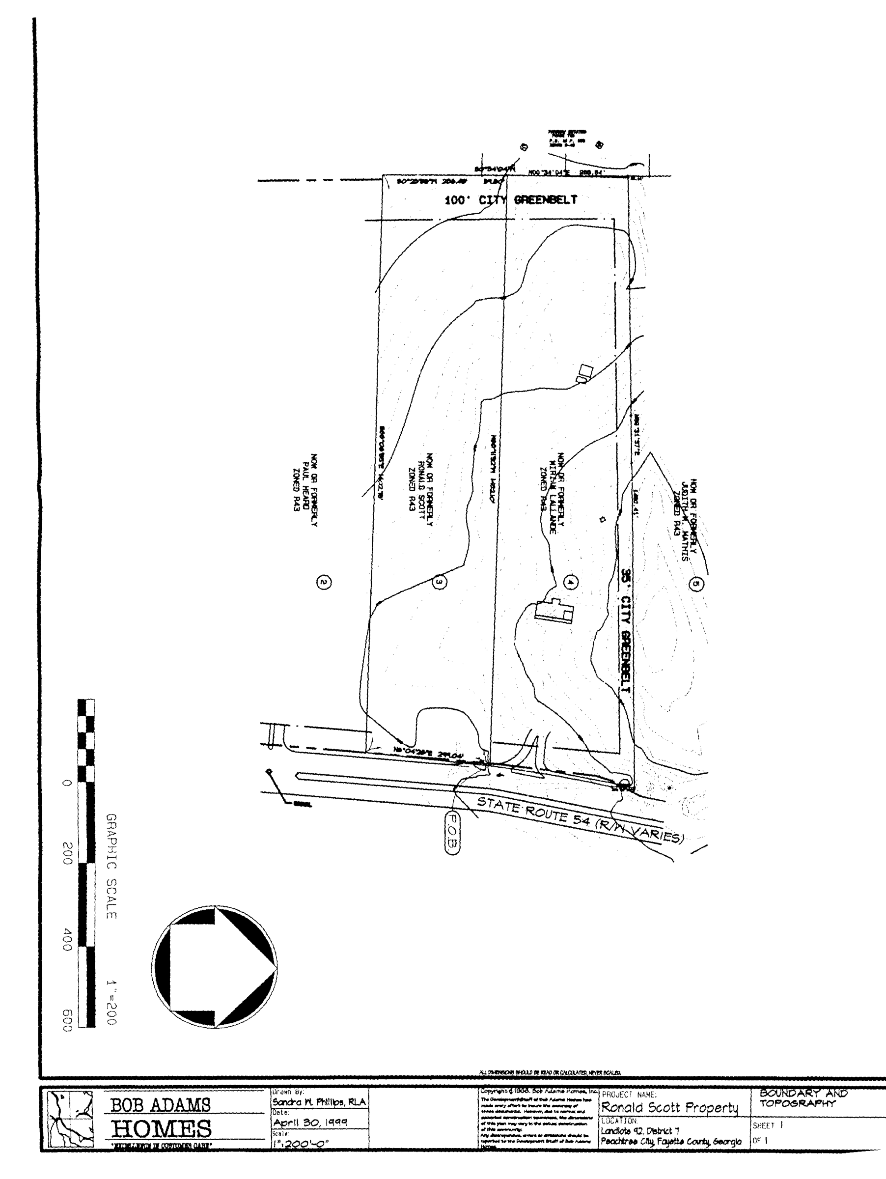
Limited-use residential district no. 8
(1013A.9) Limited-use residential district no. 9.
Hyde Tract:
All that tract or parcel of land lying and being in land lot 68 of the 7th District of Fayette County, Georgia, being more particularly described as follows:
Beginning at the common corner of land lots 60, 61, 68 and 69, thence westerly 572.85' along the land lot line between lots 68 and 69 to the true point of beginning;
Thence, S° 47'- 47" W 1333.11 feet to a point;
Thence, S 88°- 48' 33" W 208.14 feet to a point;
Thence, S 0°- 47' 47" W 121.37 feet to a point;
Thence, S 19°- 46' 50" E 174.77 feet to a point; on the north side of Old Stagecoach Road.
Thence, S 78°- 32' 45" W 97.31 feet along Old Stagecoach Road to a point;
Thence continuing along Old Stagecoach Road S - 81°-43'-47W 185.41 feet to a point;
Thence, N 0°- 37' 15" E 277.60 feet to a point;
Thence, S 84° 21' 36" W 150.00 feet to a point;
Thence, N 0°- 37' 15" E 666.18 feet to a point;
Thence, N 1°- 24' 14" E 842.48 feet to a point;
Thence, N 88°- 34' 20" E 567.82 feet along the land lot line of Land Lot 68 and 69, 567.82 feet to the point of beginning, containing 20.769 acres.
Palmer Tract:
All that tract or parcel of land lying and being in Land Lot 68 of the 7th District of Fayette County, Georgia, being a 10.981-acre tract more particularly described as follows:
Beginning at the common corner of Land Lots 68, 69, 60 and 61; running thence south 00 degrees 47 minutes 47 seconds west along the east land lot line of Land Lot 68 1,349.16 feet to a point; running thence south 58 degrees 07 minutes 58 seconds west 200.29 feet to a point; running thence south 00 degrees 47 minutes 47 seconds west 208.86 feet to a point located on the northerly right-of-way of Old Stagecoach Road; running thence south 87 degrees 41 minutes 25 seconds west along said right-of-way 25.04 feet to a point; running thence north 00 degrees 47 minutes 47 seconds east 223.89 feet to a point; running thence north 58 degrees 07 minutes 58 seconds east 200.29 feet to a point; running thence north 00 degrees 47 minutes 47 seconds east 545.90 feet to a point; running thence north 89 degrees 12 minutes 13 seconds west 547.82 feet to a point; running thence north 00 degrees 47 minutes 47 seconds east 795.90 feet to a point located on the existing north land lot line of Land Lot 68; running thence south 88 degrees 34 minutes 20 seconds east along said land lot line 572.85 feet to the point of beginning; said tract containing 10.981 acres and designated as Tract I on that certain plat of survey dated May 22, 1990, revised August 24, 1992, prepared for Larry A. Manwaring and Lynda E. Manwaring by J. R. Wood, Registered Land Surveyor, Certificate No. 2048, Job No. 800825; said survey being recorded in Plat Book 25, Page 190, Fayette County Records.
The above-described tracts are illustrated in Exhibit "A" which is included with this Ordinance as an attachment. It is intended that this LUR-9 zoning district be developed substantially in accordance with Exhibit "A" with no more than 12 residential lots, and subject to the following four conditions:
1.
Lot 12 as shown on Exhibit "A" should be eliminated and the area added to Lot 11. It did not seem wise to put another lot onto Old Stagecoach Road, especially a one-acre lot. It would constitute an expansion of an already bad situation.
2.
The subdivision must be tied into the path system at one or both of the proposed locations prior to the occupancy of the first home in the subdivision.
3.
The extension of Carriage Lane must be done to existing City street standards for a low-density public street. The name of the street must be the same from GA 54 to the end of the proposed new cul-de-sac. It should not be changed midway as proposed.
4.
The Health Department must review and approve all lots in the subdivision prior to approval of the concept plat by the Planning Commission.
(Ord. No. 747, 7-15-99)
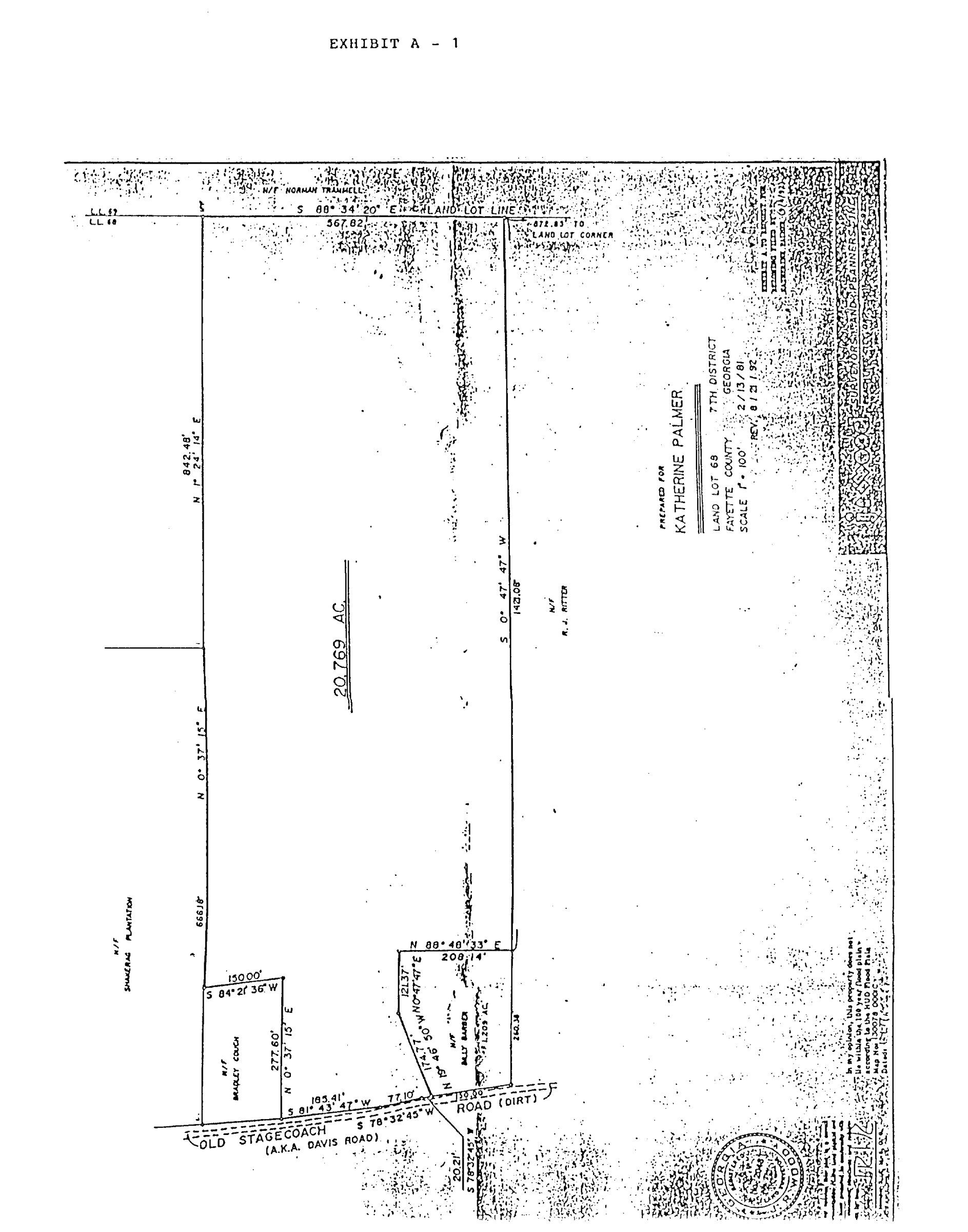
Limited-use residential district no. 9A
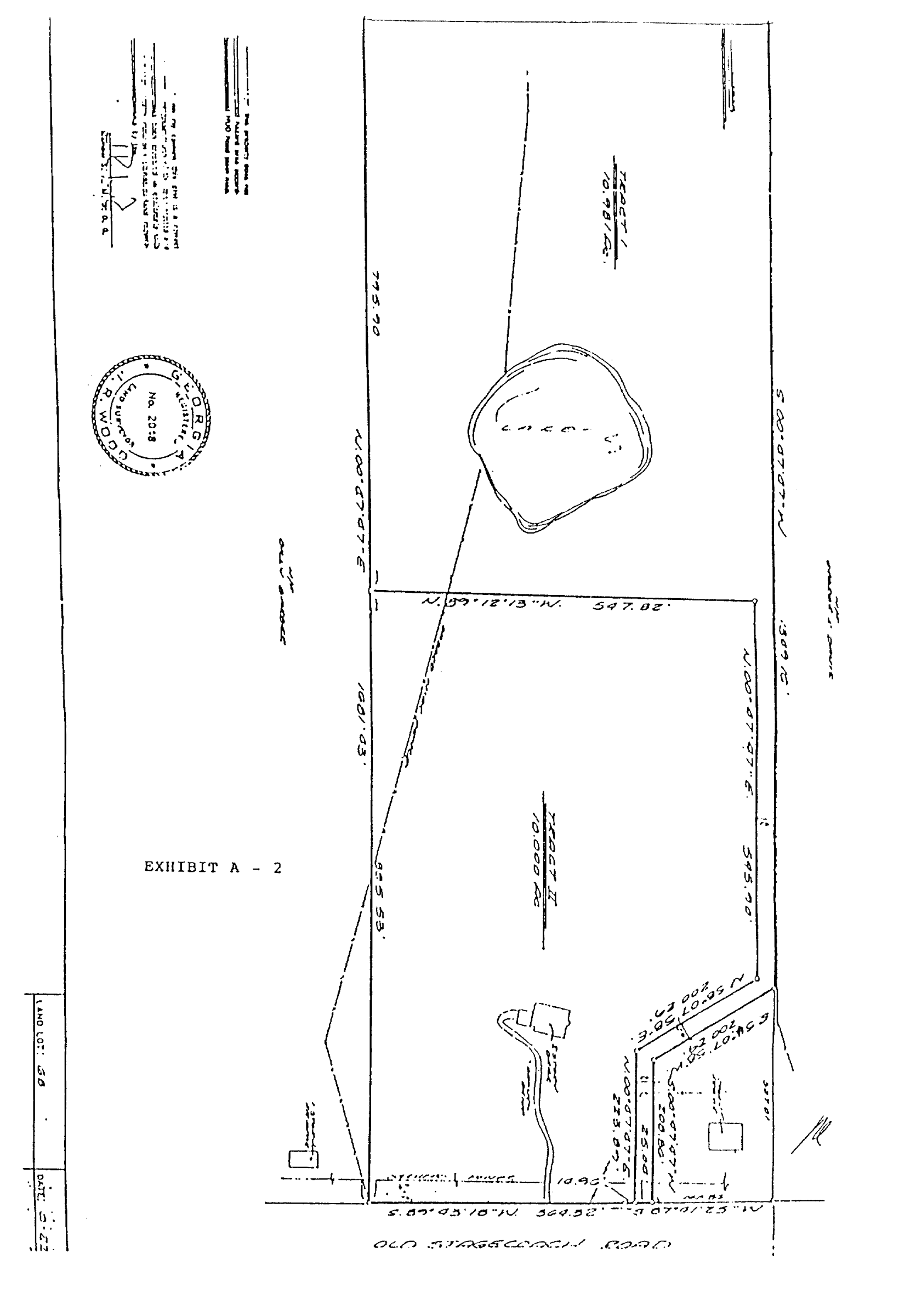
Limited-use residential district no. 9B
(1013A.10) Limited-use residential district no. 10.
1.
The development plan must include a minimum 35-foot, City-owned greenbelt along its northern boundary with the adjoining Mathis tract;
2.
The plan must include a 50-foot, City-owned greenbelt along its western boundary with the adjoining Parkway Estates Subdivision;
3.
The plan must include a 60-foot, City-owned greenbelt along its eastern boundary with GA 54 in all areas where residential lots are platted;
4.
The plan must be limited to a single right-in/right-out access point on GA54;
5.
The plan must be limited to a single site of not more than 1.5 acres adjacent to GA 54 for the development of compatible professional office space. A minimum 60-foot landscape buffer must be provided along GA 54;
6.
The plan must be limited to a single-family detached cluster home concept at a density of no more than 4.0 units per gross acre;
7.
The plan must be developed in accordance with a unified architectural concept that must be approved by the Planning Commission as a part of the plat review process;
8.
The plan must provide for the possible linkage of the property with the adjoining Heard tract; however, this linkage can only be implemented upon the approval of the City and shall be based strictly on the benefit to the community of such a linkage;
9.
The plan must provide for a fully landscaped entrance on GA 54, including a substantial landscaped median;
10.
The plan must include, in addition to an architectural concept, a complete landscape concept, a site lighting plan, and a sign program, all of which must be approved by the Planning Commission as a part of the plat review process;
11.
In developing the site, the developer must make every effort to provide for meaningful tree-save areas on the interior of the property, over and above the buffers and greenbelts around the perimeter; and
12.
The road alignment and lot arrangement must be in accordance with the Wood and Partners Master Plan dated July 15, 1999.
(Ord. No. 748, 8-9-99)
(1013A.11) Limited-use residential district no. 11.
All that tract or parcel of land lying and being in Land Lots 19 and 28 of the 6th District of Fayette County, Georgia, and being more particularly described as follows:
Beginning at a point located at the intersection of the Southwesterly 80' right-of-way of Redwine Road and the Northeasterly 80' right-of-way of Robinson Road; Thence along said right-of-way of Robinson Road, along a curve to the right having a radius of 503.76', and a length of 170.38', being subtended by a chord of N 38° 17'15" W, a distance of 169.57' to a point, located on the Southeasterly 40' right-of-way of Holly Grove Church Road; Thence along said right-of-way of Holly Grove Church Road, N 23° 15'47" E, a distance of 138.08' to a point; Thence continuing along said right-of-way along a curve to the right, having a radius of 1490.70' and a length of 384.44', being subtended by a chord of N 29° 20'55" E, a distance of 384.44' to a point, Thence leaving said right-of-way following the meandering of a creek the following courses and distances:
S 72° 19'56" E a distance of 29.58' to a point: Thence
S 64° 32'50" E a distance of 129.08' to a point: Thence
S 70° 31'24" E a distance of 52.91' to a point: Thence
S 59° 01'43" E a distance of 68.20' to a point: Thence
N 50° 32'33" E a distance of 11.06' to a point: Thence
S 65° 01'25" E a distance of 48.56' to a point: Thence
S 83° 51'29" E a distance of 66.63' to a point: Thence
S 60° 21'05" E a distance of 176.72' to a point: Said point being along the Northwesterly 80' right-of-way of Redwine Road, thence continuing along said right-of-way along a curve to the left, having a radius of 1004.60', and a length of 548.62', being subtended by a chord of S 09° 56'04" W, a distance of 541.82' to a point; Said point being the true point of beginning.
Said above described tract containing 10.77 acres more or less.
A survey of this property is shown as Exhibit "A" and a general development concept is shown as Exhibit "B," both of which are included with this ordinance as attachments. The overall development of the tract is subject to the following conditions:
1.
The number of lots shall be no more than 30;
2.
There shall be a greenbelt or undisturbed buffer at least 60 feet wide around the entire perimeter;
3.
The internal streets shall meet all city street standards;
4.
The City Engineer shall approve the location of the entrance street on Robinson Road to assure adequate sight distance and other necessary safety considerations;
5.
The developer shall be responsible for contributing a pro rata share of the cost of redeveloping Holly Grove Church Road into a private driveway; and
6.
The developer shall be responsible for paying the Braelinn impact fee in addition to the above additional project costs.
(Ord. No. 749, 7-15-99)
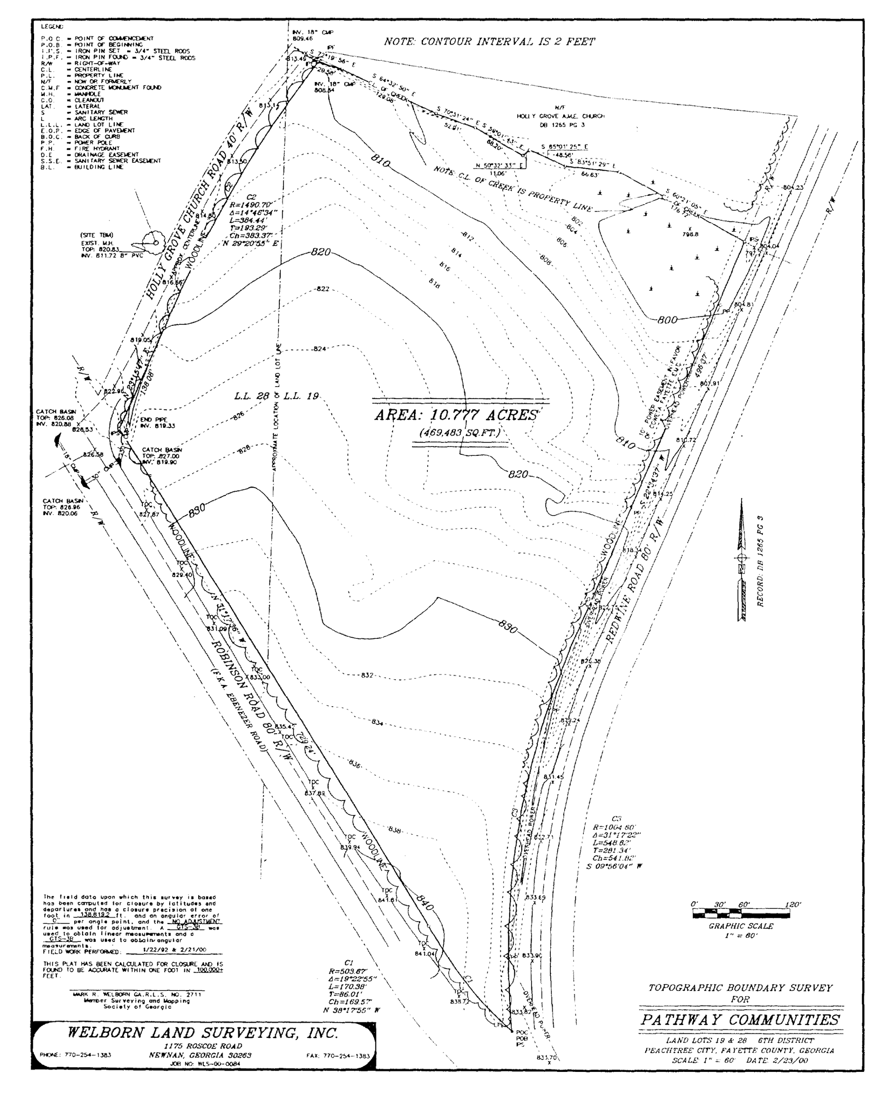
Limited-use residential district no. 11
(1013A.12)
Limited use residential district no. 12. Two tracts of property described below shall be rezoned from their present classification of AR Agricultural Reserve to LUR Limited Use Residential. Said properties are more particularly described as follow
Wilks tract:
All that tract or parcel of land lying and being in Land Lot 155 of the 7th District of Fayette County and being more particularly described as follows:
To arrive at the POINT OF BEGINNING, COMMENCE at the intersection of the Northwesterly right-of-way of Belvedere Drive (50' right-of-way) and the Northeasterly right-of-way of Kedron Drive (right-of-way varies); THENCE in a Northwesterly direction along the Northeasterly right-of-way of Kedron Drive a distance of 395.44 feet to a point on the west line of a Peachtree City City Greenbelt; THENCE leaving the right-of-way of Kedron Drive in a North direction along the West line of said City Greenbelt a distance of 759.67 feet to a 1/2" rebar; THENCE continuing along said City Greenbelt North 00 degrees 43 minutes 39 seconds East a distance of 401.28 feet to a 1" crimped pipe and the POINT OF BEGINNING; THENCE leaving said City Greenbelt South 78 degrees 02 minutes 34 seconds West a distance of 526.09 feet to a point on the Easterly right-of-way of Old State Route No. 74 (80' right-of-way); THENCE along said right-of-way along a curve to the right having a radius of 2,493.93 feet, a delta of 06 degrees 53 minutes 32 seconds, an arc length of 300.00 feet, and a chord which bears North 15 degrees 00 minutes 59 seconds West having a chord distance of 299.82 feet to a 3/4" crimped pipe;
THENCE leaving the right-of-way of Old State Route No. 74 North 70 degrees 01 minutes 00 seconds East a distance of 641.03 feet to a 1/2" rebar on the west line of a Peachtree City Greenbelt; THENCE along said City Greenbelt South 01 degrees 26 minutes 40 seconds West a distance of 399.78 feet to a 1" crimped pipe and the POINT OF BEGINNING, and containing 4.567 acre(s) of land, more or less.
Blocker tract:
All that tract or parcel of land lying and being in Land Lot 155 of the 7th District of Fayette County and being more particularly described as follows:
To arrive at the POINT OF BEGINNING, COMMENCE at the intersection of the Northwesterly right-of-way of Belvedere Drive (50' right-of-way) and the Northeasterly right-of-way of Kedron Drive (right-of-way varies); THENCE in a Northwesterly direction along the Northeasterly right-of-way of Kedron Drive a distance of 395.44 feet to a point on the west line of a Peachtree City City Greenbelt; THENCE leaving the right-of-way of Kedron Drive in a North direction along the West line of said City Greenbelt a distance of 759.67 feet to a 1/2" rebar and the POINT OF BEGINNING; THENCE leaving said City Greenbelt South 84 degrees 55 minutes 43 seconds West a distance of 393.31 feet to a 5/8" rod on the Easterly right-of-way of Old State Route No. 74 (80' right-of-way); THENCE along said right-of-way the following courses and distances: North 19 degrees 56 minutes 39 seconds West a distance of 269.32 feet to a point on a curve; THENCE along a curve to the right having a radius of 2,493.93 feet, a delta of 01 degrees 47 minutes 55 seconds, an arc length of 78.28 feet, and a chord which bears North 19 degrees 21 minutes 42 seconds West having a chord distance of 78.28 feet to a point; THENCE leaving the right-of-way of Old State Route No. 74 North 78 degrees 02 minutes 34 seconds East a distance of 526.09 feet to a 1" crimped pipe on the west line of a Peachtree City City Greenbelt; THENCE along said City Greenbelt South 00 degrees 43 minutes 39 seconds West a distance of 401.28 feet to a 1/2" rebar and the POINT OF BEGINNING, and containing 3.884 acre(s) of land, more or less.
A survey of both parcels is shown as Exhibit "A" and a general development concept is shown as Exhibit "B", both of which are included with this ordinance as attachments.
The overall development of the tract is subject to the following conditions:
1.
The proposed rezoning applies to both the 4.567-acre Wilks tract and the 3.884-acre Blocker tract. A plat, which combines both parcels into one 8.451-acre tract, must be prepared and recorded prior to submittal of the concept plat.
2.
The concept plat is intended only to suggest a concept and shall not be considered the final approved development plat. That plat must be prepared and approved as part of the regular plat approval process.
3.
There shall be no more than 23 residential lots within the overall subdivision.
4.
In addition to the 50' greenbelt adjacent to Old Senoia Road required by the City's Buffer Ordinance, all portions of the plat identified on the concept plat as buffer area shall be deeded to the City and designated as greenbelt.
5.
The Applicant shall provide colored renderings of the typical elevations of the homes, including exterior building materials, for review and approval as a part of the concept plat submittal process.
6.
The side elevations of the homes on Lots 1, 22 and 23 visible from the internal roads shall include architectural detailing to avoid creating a blank wall facing the public streets.
7.
All internal streets shall conform to current city design guidelines and standards for public streets. Additionally, the multi-use path connection shall be constructed to city standards.
8.
The City Engineer shall approve the location of the entrance off of Old Senoia Road to assure adequate sight distances and other necessary safety considerations.
9.
The developer shall be responsible for paying the Kedron service area impact fee in addition to the above additional project costs.
10.
The applicant shall donate funds for a tot lot to be constructed in a location deemed appropriate by the city, or to make improvements to existing tot lots.
11.
A 20-foot buffer shall be added to the rear of Lot 1.
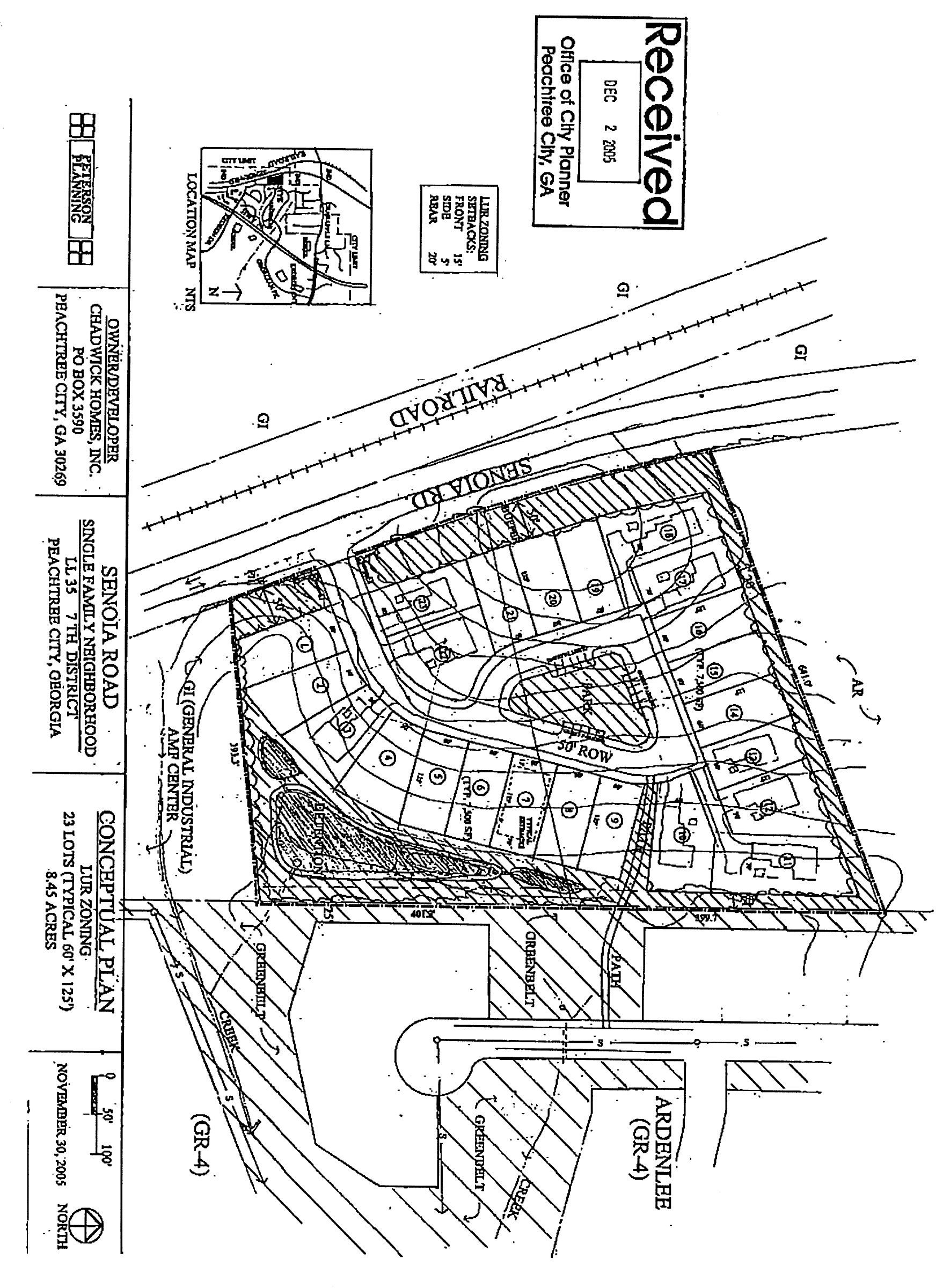
Limited use residential district no. 12
(Ord. No. 872, 1-19-06)
(1013A.13) Limited use residential district no. 13.
The property described below shall be rezoned from its present classification of GC General Commercial to LUR-13:
ALL THAT TRACT or parcel of land lying and being in Land Lot 134 of the 7th Land District, Peachtree City, Fayette County, Georgia and being more particularly described as follows:
Beginning at the point on the western right-of-way of Newgate Road (60' ROW) 508.00' North of the intersection of Newgate Road and Georgian Park, and a POINT OF BEGINNING, thence running N 54° 50' 09" W, a distance of 248.37' to an iron pin found on the eastern right-of-way of Georgia Highway 74 (ROW varies), thence running north along said right-of-way N 37° 51' 22" E, a distance of 36.55' to an iron pin found, thence continuing along said right-of-way N 35° 15'15" E, a distance of 600.00' to an iron pin set, thence continuing along said right-of-way N 42° 03'54" E, a distance of 134.50' to an iron pin found, thence running S 13° 17'35" E, a distance of 171.12' to an iron pin set, thence running S 09° 51'05" E, a distance of 148.57' to an iron pin set, thence running S 08° 43' 00" E a distance of 188.47' to an iron pin found, thence running S 23° 58' 55 W, a distance of 157.24' to an iron pin found, thence running S 00° 50' 25" W, a distance of 102.46' to an iron pin found, thence running S 36° 37' 57" W a distance of 255.92' to an iron pin found, thence running N 74° 54' 09" W a distance of 97.50' to an iron pin found on the south right-of-way of Newgate Road (60' ROW), thence running north along right-of-way of Newgate Road following the curves and tangents a distance of 723.02' TO THE POINT OF BEGINNING.
This property contains 5.62 acres.
A survey of the subject tract is shown as Exhibit "A" and a general development concept is shown as Exhibit "B", both of which are included with this ordinance as attachments. Development shall take place in conformance with the master plan prepared by Peterson Planning (last revised January 10, 2007). Any substantive change to this plan or any of the conditions and requirements of this section shall require a new rezoning action.
The overall development of the tract is subject to the following conditions:
1.
The schematic site plan is intended only to suggest a concept and shall not be considered the final approved development plan. That plan must be prepared and approved as part of the regular conceptual site plan review process.
2.
The conceptual site plan must comply with the recent amendments to the city's Land Development Ordinance, including all setbacks identified within the LUR Limited Use Residential zoning district.
3.
The architectural design and exterior building materials of each building must be similar in design and color. The sides and rear of each building must include architectural detailing and similar building materials as those used on the front elevation.
4.
The site plan must provide for fully landscaped entrances off of Newgate Road, including meandering berms and extensive landscaping as necessary to assist in screening the parking areas from view.
5.
A multi-use path connection must be provided between this development and the existing multi-use path adjacent to the Georgian Park Car Wash.
6.
This development is located within the Kedron Service Area, which requires an impact fee of $1,283 per residential unit. Impact fees in the amount of $26,943 ($1,283 x 21 units) must be submitted prior to approval of the final site plan.
7.
The minimum size of each unit shall be no less than 3,000 SF as shown on the schematic floor plans presented to City Council at their meeting on March 1, 2007.
8.
The overall project shall be developed in substantial conformance with the overall schematic site plan as presented to City Council at their meeting on March 1, 2007, and attached to this ordinance as "Exhibit B".
9.
The land use designation for this tract should be changed from COM Commercial to MF Multi-family.
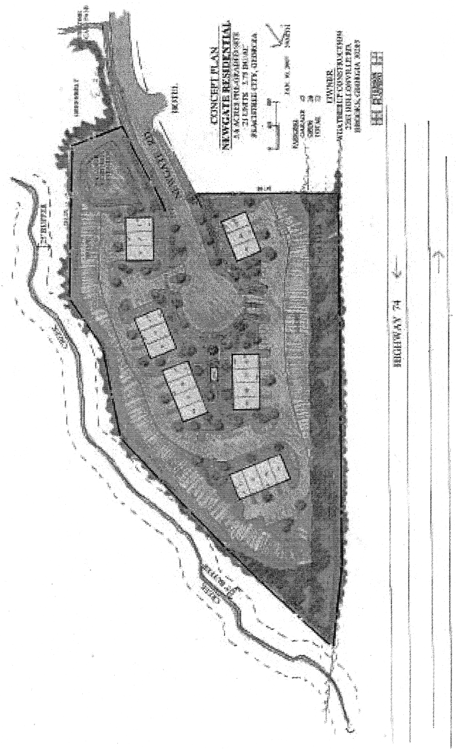
Limited use residential district no. 13A
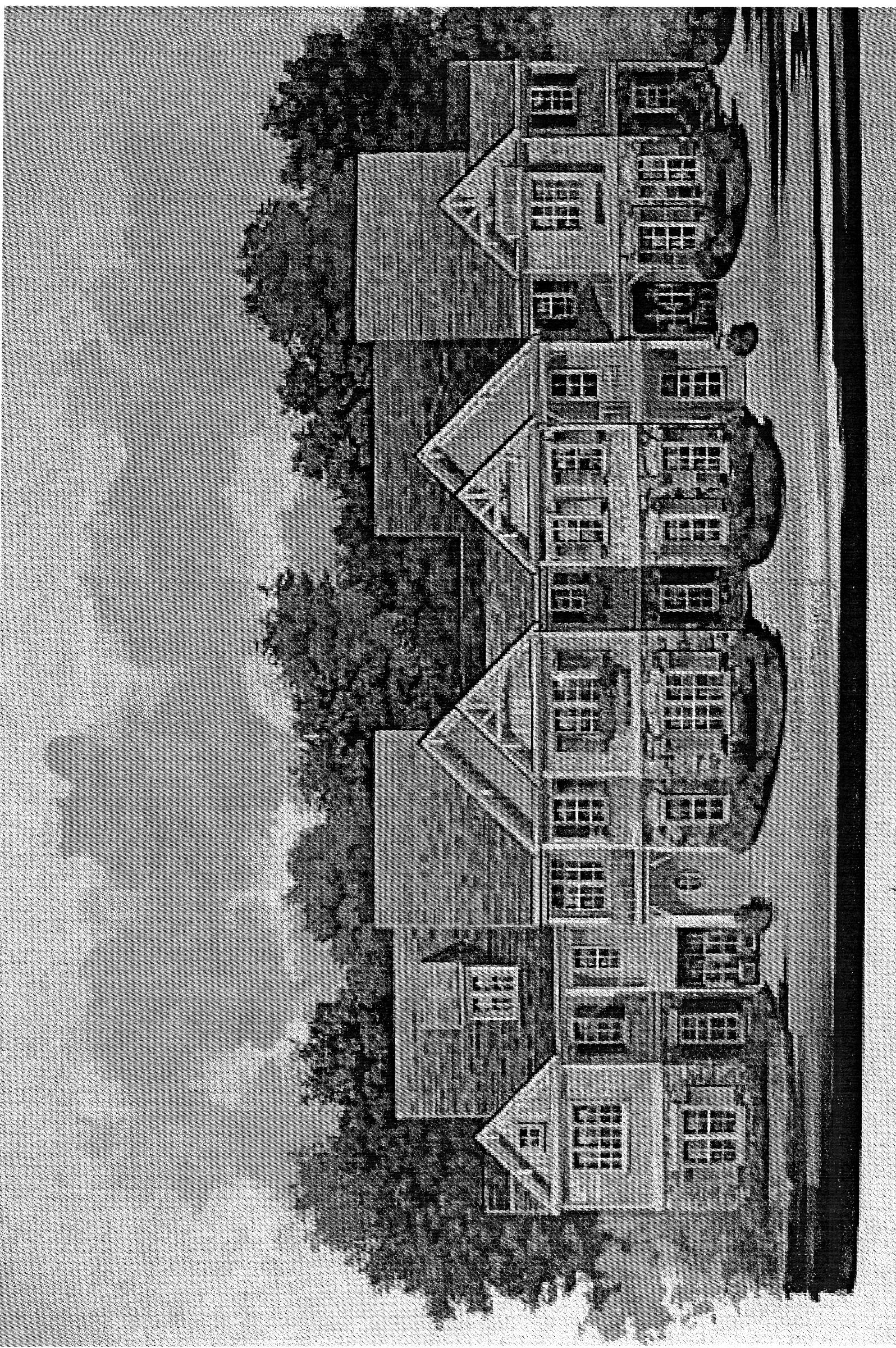
Limited use residential district no. 13B
(Ord. No. 897, 3-1-2007)
(1013A.14) Limited-use residential district no. 14.
(a)
The zoning of land as described below shall be amended as follows:
Tract 1:
All that tract or parcel of land lying and being in Land Lots 166, 167, 182, 183 & 184 of the 7th District, Fayette County, Georgia and being more particularly described as follows:
BEGINNING at a concrete monument found at the Land Lot corner common to Land Lots 167, 168, 182 & 183; thence along the Land Lot line common to Land Lots 167 & 168 South 89°43'36" East, a distance of 439.82 feet to a 1/2-inch rebar found; thence South 89°45'09" East, a distance of 1086.10 feet to an iron pin set; thence South 01°00'58" East, a distance of 1460.99 feet to a large rock found; thence South 88°17'23" East, a distance of 929.48 feet to an iron pin set; thence South 00°53'45" West, a distance of 510.84 feet to an iron pin set; thence South 88°49'38" East, a distance of 510.84 feet an iron pin set on the Land Lot line common to Land Lots 155 & 167; thence along said Land Lot line South 00°53'45" West, a distance of 1032.86 feet to an iron pin set at the Land Lot corner common to Land Lots 155, 156, 166 & 167; thence along the Land Lot line common to Land Lots 166 & 167 North 89°45'08" West, a distance of 414.24 feet to a 3/4-inch pipe found; thence along said Land Lot line South 89°27'40" West, a distance of 466.12 feet to a railroad iron found; thence along said Land Lot line North 88°51'41" West, a distance of 542.37 feet to a 1-inch pipe found; thence South 00°17'52" East, a distance of 1602.14 feet to a 1/2-inch rebar found; thence North 89°39'07" West, a distance of 2347.47 feet to a point in the centerline of Line Creek, which is also the Fayette/Coweta County line; thence along the centerline of Line Creek, a portion of which is a dry run, the following calls: North 38°47'06" West, a distance of 30.36 feet to a point; thence North 63°38'51" West, a distance of 49.22 feet to a point; thence North 80°19'35" West, a distance of 35.81 feet to a point; thence North 49°05'59" West, a distance of 36.70 feet to a point; thence North 34°49'25" West, a distance of 41.94 feet to a point; thence North 72°07'03" West, a distance of 33.58 feet to a point; thence South 67°41'22" West, a distance of 40.11 feet to a point; thence South 79°21'08" West, a distance of 36.59 feet to a point; thence North 76°04'41" West, a distance of 34.85 feet to a point; thence North 52°38'01" West, a distance of 59.54 feet to a point; thence North 42°19'45" West, a distance of 65.45 feet to a point; thence North 32°19'20" West, a distance of 66.27 feet to a point; thence North 34°15'43" West, a distance of 55.88 feet to a point; thence North 03°15'54" West, a distance of 109.73 feet to a point; thence North 26°14'23" West, a distance of 129.71 feet to a point; thence North 03°06'45" West, a distance of 22.40 feet to a point; thence North 46°46'31" East, a distance of 50.61 feet to a point; thence North 16°54'09" East, a distance of 50.88 feet to a point; thence North 02°03'29" East, a distance of 45.06 feet to a point; thence North 26°18'04" West, a distance of 31.29 feet to a point; thence North 15°15'06" West, a distance of 101.06 feet to a point; thence North 25°11'47" East, a distance of 88.79 feet to a point; thence North 25°55'45" East, a distance of 114.64 feet to a point; thence North 45°30'53" East, a distance of 43.17 feet to a point; thence North 11°01'20" East, a distance of 33.07 feet to a point; thence North 42°34'11" West, a distance of 75.36 feet to a point; thence North 78°23'10" West, a distance of 35.59 feet to a point; thence North 14°18'30" West, a distance of 67.96 feet to a point; thence North 21°51'37" East, a distance of 51.38 feet to a point; thence North 18°09'42" West, a distance of 34.05 feet to a point; thence North 54°23'14" West, a distance of 37.40 feet to a point; thence North 84°29'03" West, a distance of 39.44 feet to a point; thence North 71°19'41" West, a distance of 83.66 feet to a point; thence North 81°39'08" West, a distance of 74.85 feet to a point; thence South 84°16'47" West, a distance of 28.44 feet to a point; thence North 88°32'10" West, a distance of 46.67 feet to a point; thence North 32°40'29" West, a distance of 43.36 feet to a point; thence North 12°55'54" East, a distance of 50.32 feet to a point; thence North 17°39'42" East, a distance of 37.27 feet to a point; thence North 60°00'05" East, a distance of 44.53 feet to a point; thence North 36°48'16" East, a distance of 39.10 feet to a point; thence North 03°46'52" West, a distance of 32.14 feet to a point; thence North 21°49'54" West, a distance of 58.66 feet to a point; thence North 35°13'52" East, a distance of 110.86 feet to a point; thence North 09°20'36" East, a distance of 47.96 feet to a point; thence North 07°56'09" West, a distance of 27.50 feet to a point; thence North 66°24'49" West, a distance of 42.83 feet to a point; thence North 76°47'06" West, a distance of 61.90 feet to a point; thence North 38°14'31" West, a distance of 81.72 feet to a point; thence North 15°15'05" West, a distance of 43.78 feet to a point; thence North 12°01'24" West, a distance of 143.86 feet to a point; thence North 18°20'11" West, a distance of 81.86 feet to a point; thence North 00°04'25" East, a distance of 71.09 feet to a point; thence North 11°32'24" East, a distance of 122.83 feet to a point; thence North 09°48'59" East, a distance of 48.06 feet to a point; thence North 72°43'53" West, a distance of 92.65 feet to a point; thence North 08°33'43" West, a distance of 63.10 feet to a point; thence North 06°34'44" East, a distance of 56.79 feet to a point; thence North 23°18'25" West, a distance of 50.48 feet to a point; thence North 65°32'14" West, a distance of 43.27 feet to a point; thence North 21°15'55" West, a distance of 73.57 feet to a point; thence North 13°15'53" East, a distance of 38.81 feet to a point; thence North 16°37'38" West, a distance of 56.20 feet to a point; thence North 81°37'01" East, a distance of 38.47 feet to a point; thence South 80°28'21" East, a distance of 36.34 feet to a point; thence North 86°42'15" East, a distance of 29.62 feet to a point; thence North 05°07'33" East, a distance of 44.46 feet to a point; thence North 16°08'35" West, a distance of 39.25 feet to a point; thence North 03°51'01" East, a distance of 58.78 feet to a point; thence North 12°01'16" West, a distance of 83.67 feet to a point; thence North 37°28'07" West, a distance of 82.84 feet to a point; thence North 70°30'30" West, a distance of 59.28 feet to a point; thence North 42°31'47" West, a distance of 57.04 feet to a point; thence North 19°58'47" East, a distance of 54.97 feet to a point; thence North 07°58'06" East, a distance of 46.37 feet to a point; thence North 10°45'37" West, a distance of 63.53 feet to a point; thence North 02°38'07" West, a distance of 114.06 feet to a point; thence North 15°44'15" West, a distance of 95.37 feet to a point; thence North 21°19'17" West, a distance of 103.22 feet to a point; thence North 08°02'57" West, a distance of 71.21 feet to a point; thence North 13°41'56" West, a distance of 112.38 feet to a point; thence North 31°54'56" West, a distance of 72.80 feet to a point; thence South 84°01'54" West, a distance of 78.17 feet to a point; thence North 63°28'01" West, a distance of 54.07 feet to a point; thence North 30°19'25" West, a distance of 105.16 feet to a point; thence North 69°44'14" West, a distance of 100.62 feet to a point; thence North 66°56'48" West, a distance of 101.30 feet to a point; thence South 79°21'14" West, a distance of 52.51 feet to a point; thence North 78°33'18" West, a distance of 39.53 feet to a point; thence North 39°25'22" West, a distance of 94.05 feet to a point; thence North 18°23'45" West, a distance of 69.83 feet to a point; thence North 37°19'15" West, a distance of 78.86 feet to a point; thence North 41°15'10" West, a distance of 79.40 feet to a point; thence North 35°02'09" West, a distance of 93.91 feet to a point; thence North 07°51'20" East, a distance of 62.59 feet to a point; thence North 48°16'00" East, a distance of 97.38 feet to a point; thence North 35°55'02" East, a distance of 81.99 feet to a point; thence North 07°38'27" West, a distance of 93.10 feet to a point; thence North 01°57'49" East, a distance of 85.73 feet to a point; thence North 11°34'58" West, a distance of 103.52 feet to a point; thence North 23°15'01" West, a distance of 91.16 feet to a point; thence North 51°54'26" West, a distance of 189.20 feet to a point; thence North 43°10'55" West, a distance of 125.65 feet to a point; thence North 59°09'37" West, a distance of 71.40 feet to a point; thence North 70°42'14" West, a distance of 49.05 feet to a point; thence North 67°11'52" West, a distance of 78.94 feet to a point; thence North 03°07'23" East, a distance of 33.71 feet to a point; thence South 82°11'45" East, a distance of 35.36 feet to a point; thence North 34°11'49" East, a distance of 31.66 feet to a point; thence North 16°13'02" West, a distance of 49.07 feet to a point; thence North 36°30'02" West, a distance of 57.85 feet to a point; thence leaving the centerline of Line Creek South 87°07'59" East, a distance of 385.64 feet to a 1/2 inch rebar found; thence South 01°08'14" East, a distance of 189.03 feet to a 3/4 inch rebar found; thence South 81°07'45" East, a distance of 646.97 feet to a 3/4 inch rebar found; thence South 47°18'21" East, a distance of 499.44 feet to a 1 inch axle found on the Land Lot line common to Land Lots 182 & 183; thence along said Land Lot line North 89°54'23" East, a distance of 1659.88 feet to a concrete monument found, being the POINT OF BEGINNING.
Said tract contains 403.093 acres or 17,558,737 square feet of land.
Tract 2:
All that tract or parcel of land lying and being in Land Lot 167, 7 th District, Fayette County, Georgia, and being more particularly described as follows: Commencing at ½" rebar found located on the south west corner of Lot 2B of Shamrock Industrial Park Phase 5 as shown on Plat Book 47, Page 112, said rebar also being located on the northern line of Land Lot 167, Thence along said northern Land Lot Line S89º48'07"E 216.11' to a ½" rebar found on the south east corner of said Lot 2b; thence S88º55'18"E 60.58' to a ½" rebar found at the south west corner of property now or formerly owned by CWD Properties, Inc., said point being the Point of Beginning for this tract of Land; thence continuing along said northern line of Land Lot 167 and the southern line of CWD Properties, Inc. S89º06'09"E 1,061.87' to the remnants of a concrete monument found located on the western lone of property now or formerly owned by Martha Lee; thence along said Martha Lee property S00º39'26"W 1,474.04' to a concrete monument found located on the northern line of property now or formerly owned by Peachtree City Holdings, thence N88º43'20"W 83.50'to a 1/2" rebar found on the northern line of property now of formerly owned by KH Peachtree LLLP, thence along said northern line of KH Peachtree LLLP Property, N88º17'04"W 929.61' to an iron pin set (1/2" rebar with cap stamped "Rochester-LSF000484" located on the eastern line of property now or formerly owned by KH Peachtree LLLP, thence along the eastern line of KH Peachtree LLLP Property, N03º37'45"W 1,464.96' to a ½" rebar found located at the south east corner of said Lot 2B Shamrock Industrial Park, said point also being located on the northern line of Land Lot 167; thence along said Land Lot Line S88º55'18"E 60.58' to a ½" rebar found and the Point of Beginning.
Said Tract of land containing 1,566,355 square feet or 35.959 acres.
Tract 3:
All that tract of land lying in Land Lot 167, 7 th District, Fayette County, Georgia, and being more particularly described as follows: Beginning at an iron pin set at the Land Lot corner common to Land Lot 167, 155, 156, and 166 commence along the Land Lot line common to Land Lots 155 and 167 N00d53'45"E, a distance of about 1,038 feet to the southeast corner of said property, labeled "Ellerson House 6 acres" in survey and deed filed in Fayette County records in Plat Book L page 86 recorded on July 26, 1886.
Said Tract of land containing about 6 acres.
Said tracts of land containing a total combined area of about 445 acres.
(b)
Tract 1 is illustrated on the Boundary and Topography Survey prepared by Rochester & Associates, Inc. (last revised August 14, 2006), a copy of which is attached hereto as Exhibit "A" and incorporated herein by express reference. Tract 2 is illustrated on the Boundary Survey prepared by Rochester & Associates, Inc. (last revised August 8, 2018), a copy of which is attached hereto as Exhibit "A" and incorporated herein by express reference. Tract 3 is illustrated on the Boundary Survey prepared by Daniel Swint, C.S.C. on August 22, 1882 and recorded in Fayette County, Georgia records in Plat Book L page 86.
It is intended that the LUR-14 zoning district be established specifically for a 734-unit single-family detached residential subdivision with a gross density of no more than 1.65 units per acre to be developed substantially in accordance with the following express conditions:
(c)
Conformance with master plan for Tract 1. Development shall take place in conformance with the master plan prepared by Rochester & Associates, Inc. (last revised July 11, 2014), a copy of which is attached hereto as Exhibit "B" and incorporated herein by express reference. Any substantive change to this plan or any of the conditions and requirements of this section shall require a new rezoning action.
It is understood the proposed subdivision for Tract 1 shall be submitted to city staff and the planning commission for review and approval in accordance with the established subdivision plat review process. Subdivision of Tracts 2 and 3 shall be in accordance with the established subdivision plat review process.
(d)
Permitted uses.
1.
Single-family detached residential units.
2.
A clubhouse, including an outdoor pool, tennis courts and other customary accessory uses.
3.
Publicly owned building, facility or land.
4.
Building, facility or land for the distribution of utility services.
5.
Building, facility or land for non-commercial park, recreation or open space purposes.
6.
Accessory uses, as identified herein.
7.
Customary home occupations, as identified herein.
(e)
Conditional uses. No conditional uses shall be permitted within this zoning district.
(f)
Other requirements.
1.
Maximum number of dwelling units: 734.
2.
Minimum floor area per dwelling unit: 585 units shall have no less than 1,500 SF of heated floor area. The remaining 149 units shall have no less than 1,350 SF of heated floor area.
3.
Minimum zoning lot area: As described herein and shown on the concept plat approved as a part of the rezoning.
4.
Minimum lot width: As described herein and shown on the concept plat approved as a part of the rezoning.
5.
Minimum front building setback: Ten feet as measured from the property line; provided that each dwelling unit provides at least two paved parking spaces off the back of sidewalk; at least one of those spaces must be within a fully enclosed garage, and no part of the garage shall be within 20 feet of the back of sidewalk.
6.
Minimum side building setbacks: Zero feet; provided that at least a ten-foot separation is maintained between dwellings, and further provided that at least one 20-foot separation is provided between every ten dwelling units.
7.
Minimum rear building setbacks: Ten feet.
8.
Maximum building height: Two stories, plus a basement.
9.
Parking: As set forth within the city's parking ordinance.
10.
Signs: As set forth within the city's sign ordinance.
11.
Driveways: Common driveways shall not be permitted, with the exception of those driveways shared by golf carts and located within recorded easements.
12.
Tree save and landscape buffers: All tree save areas within the subdivision shall be delineated with tree save fencing and approved by the city prior to any land disturbance activities. These areas shall be maintained with natural vegetation and/ or enhanced with berming, fencing and landscaping. No vegetation shall be removed from these areas without prior city approval.
13.
Greenbelts: A 100-foot greenbelt shall be provided along the northern property boundary separating this development from the Shamrock Industrial Park. A 50-foot greenbelt shall be provided around the perimeter of the development. A 50-foot greenbelt shall be provided adjacent to MacDuff Parkway as required by the city's buffer ordinance. All greenbelt areas shall be dedicated to the city.
14.
Architectural concept: A unified architectural concept for the overall subdivision must be developed and approved by the planning commission. The architectural design, building materials and color selections of all buildings and structures on the site must be substantially the same. Each home with a side elevation facing a public street shall include architectural detailing on the side elevation to avoid creating a blank wall facing the public street.
15.
Development concept: Development shall take place substantially in conformance with the approved concept plat (Exhibit "B"), as well as the design concepts presented with the zoning request and approved as a part of the concept. Substantial deviation from the approved concept plat or design concepts shall require city council approval.
16.
A road connection shall be provided between internal subdivision roads and the northern property line adjacent to CWD Properties/ The Scarbrough Group (parcel 0744 040 and parcel 0744 042) to allow future access to Rockwood Road. Said road connection shall be paved, at a minimum, up to the Peachtree City / Town of Tyrone city boundary.
(g)
The overall development of the tract is subject to the following understandings and conditions:
1.
All transportation enhancements identified within Attachment "A" of GRTA's Notice of Decision (dated December 20, 2006) shall be constructed at no cost to the city and open to the public prior to issuance of the 101 st Certificate of Occupancy for any residential dwelling unit within this development. Such traffic enhancements were imposed as conditions by GRTA on the entire DRI, which included both developments. Accordingly, the enhancements should be constructed based upon an agreement between Brent West Village, LLC and John Wieland Homes and Neighborhoods, and their successors and assigns, and should be based on each party's pro-rata share of traffic generated by each development based upon the information considered by GRTA. Evidence of such agreement between Brent West Village, LLC and John Wieland Homes and Neighborhoods shall be provided to the city prior to the approval of any plats for the development of the property.
Furthermore, it is agreed that the substantial completion shall occur no more than 14 months (subject to normal weather and Acts of God extensions) from the date of final permitting of MacDuff Parkway including issuance of all local, state and federal permits and all permits from CSX Railroad for a bridge spanning the railroad. If substantial completion has not been achieved during the 14-month period referenced above, the city may require a performance and payment bond be issued in favor of the city for any uncompleted portion of the parkway. Should any delays in substantial completion be the result of the city's inability to gain clear title to any right-of-way or easements required for construction, the city agrees to waive the restriction limiting the number of certificate of occupancies allowed.
2.
MacDuff Parkway shall be designed to city standards as a community collector and shall include a 24-foot wide median (as measured from back of curb) with vertical curb and gutter. The road section shall also include two travel lanes at a minimum width of 16 feet each, as measured from edge of pavement. The road shall be designed within an 80-foot right-of-way (minimum).
3.
In accordance with section 723.2 of the city's buffer ordinance, a continuous 50-foot wide (minimum) city-owned greenbelt buffer shall be established for any residential development adjacent to a community collector road and a continuous 50-foot wide tree-save and landscape buffer shall be established for any non-residential development adjacent to a community collector road.
It is understood these buffer areas may be enhanced with berms, fencing and landscaping once clearing and grading is complete. A detailed landscape plan shall be prepared and submitted to city staff and the planning commission for review and approval prior to any disturbance to or the installation of any enhancements within these buffer areas.
4.
The applicant shall coordinate with city staff to identify locations of traffic calming devices and shall incorporate these into the design and construction of MacDuff Parkway at no cost to the city.
5.
The applicant shall coordinate with city staff to determine if a multi-use path tunnel can be constructed underneath MacDuff Parkway as a part of the road improvements. Should a location be identified, the applicant shall design and construct the tunnel as a part of the MacDuff Parkway extension at no cost to the city.
6.
The applicant shall coordinate with city staff to determine locations of multi-use paths throughout the development, and shall extend the multi-use path from the multi-use bridge spanning the CSX rail line to the existing path on Kedron Drive between the Belvedere and Sagamore subdivisions.
7.
The applicant shall coordinate with the Fayette County Water Department and the Peachtree City Fire Department to ensure appropriately sized water lines are constructed as a part of the MacDuff Parkway extension. In addition, the applicant shall be responsible for installing all utilities within the right-of-way of MacDuff Parkway.
8.
The applicant shall be responsible for installing landscaping within the median and right-of-way of MacDuff Parkway as a part of the road construction and maintaining these areas until the roads are accepted by the city. Following this dedication, the maintenance of the landscaping within the right-of-way shall be the sole responsibility of the Homeowner's Association in perpetuity.
9.
There shall be no more than 734 total lots within the overall subdivision. The concept plat submitted as a part of the annexation and rezoning request is illustrative only. The developer shall prepare a detailed development plan, which must be approved by the planning commission as a part of the concept plat approval process. It is understood the general layout of the streets and individual lots will be similar to what is shown on the concept plat once final engineering documents are prepared.
10.
Existing vegetation within the areas identified as open space on the concept plat shall be protected prior to, during and following construction activities.
11.
The buffer separating the residential lots along the northern property boundary shall be increased to no less than 100 feet in width, and this area shall be dedicated to the city as greenbelt.
12.
Existing vegetation within the 50-foot buffer around the perimeter of the property shall be preserved to the greatest extent practicable prior to, during and following construction activities. These areas shall be dedicated to the city as greenbelt.
13.
The overall development shall comply with the city's post-construction stormwater runoff management ordinance and provide water quality best management practices (BMP's) on greenbelt areas dedicated to the city.
14.
The location of the floodplain shall be field located and surveyed prior to preparation of the engineering drawings. Absolutely no development shall be permitted within the floodplain with the exception of perpendicular road and utility crossings.
15.
The maintenance of all internal parks, landscaped areas, signage and subdivision entrances shall be the sole responsibility of the developer and/or the homeowner's association.
16.
The applicant shall establish deed covenants for the overall subdivision that shall limit rental units to no more than 20 percent of the total number of dwelling units in the subdivision. The covenants shall provide for the strict enforcement of the limit on rental units, and the developer shall establish the administrative structure for that enforcement prior to sale of the first dwelling unit in the subdivision.
17.
The developer shall pay impact fees for each residential lot within the subdivision as identified within the city's impact fee ordinance.
18.
At the applicant's request, the property and units constructed thereon shall be restricted to housing for older persons as defined in 42 U.S.C. § 3607. Said development shall be intended and operated for occupancy by persons 55 years of age or older, and at least 80 percent of the occupied units shall be occupied by at least one person who is 55 years of age or older. The city shall publish and adhere to policies and procedures that demonstrate the intent required under this provision. In addition, the developer and its successors and assigns shall comply with rules issued by the Secretary of the United States Department of Housing and Urban Development for verification of occupancy, which shall provide for verification by reliable surveys and affidavits and include examples of the types of policies and procedures relevant to a determination of compliance with the requirement of this paragraph 18.
19.
The annexation and rezoning is conditioned upon the execution of the development agreement between the city and the applicant attached hereto. The development agreement shall be recorded in the Deed Records of the Clerk of the Superior Court of Fayette County, Georgia, so as to provide notice of the conditions of this zoning to all parties in interest.
20.
The annexation and rezoning as proposed is conditioned upon the annexation of the John Wieland Homes and Neighborhoods tract to the south.
21.
Should a suitable tract of land be made available to the city at no cost, the city will consider relocating the proposed fire station site such that it will not be located within 1,000 LF of the main entrance into the subdivision. In this case, "suitable" shall mean a site that meets the needs of fire and emergency services; a site that will not create additional gaps in coverage or service areas; a site that has access to adjoining roadways; a site with readily available utilities; and a site with no significant grading and/ or fill issues, environmental impacts or other design issues.
(Ord. No. 919, 5-3-2007; Ord. No. 1082, § 1, 9-4-2014; Ord. No. 1163, § 1, 12-20-2018)
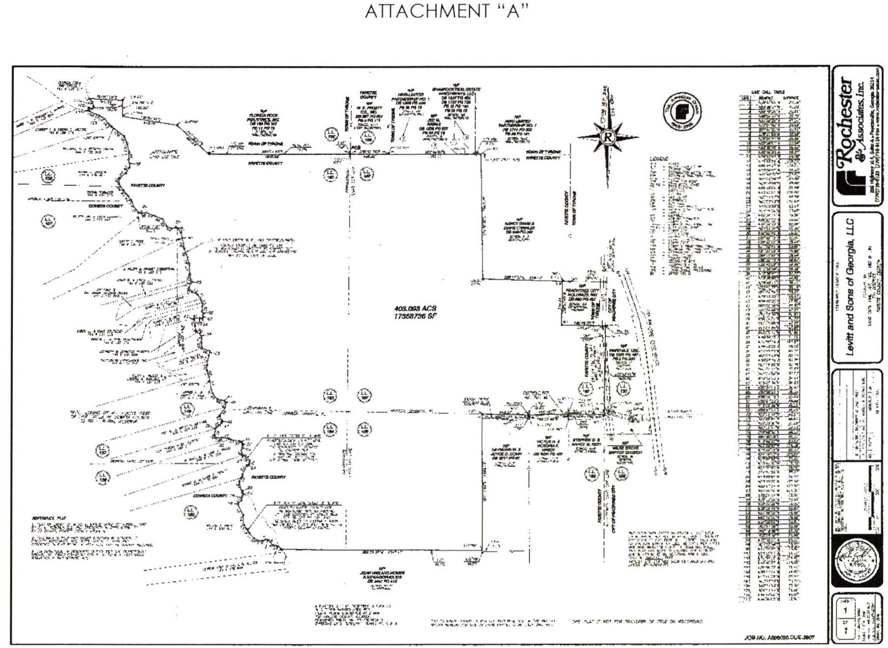
(Ord. No. 1163, § 1, 12-20-2018)
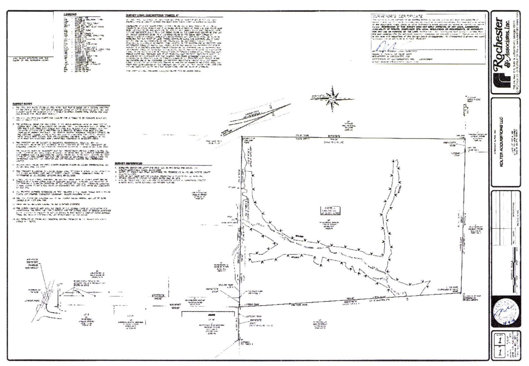
(Ord. No. 1163, § 1, 12-20-2018)
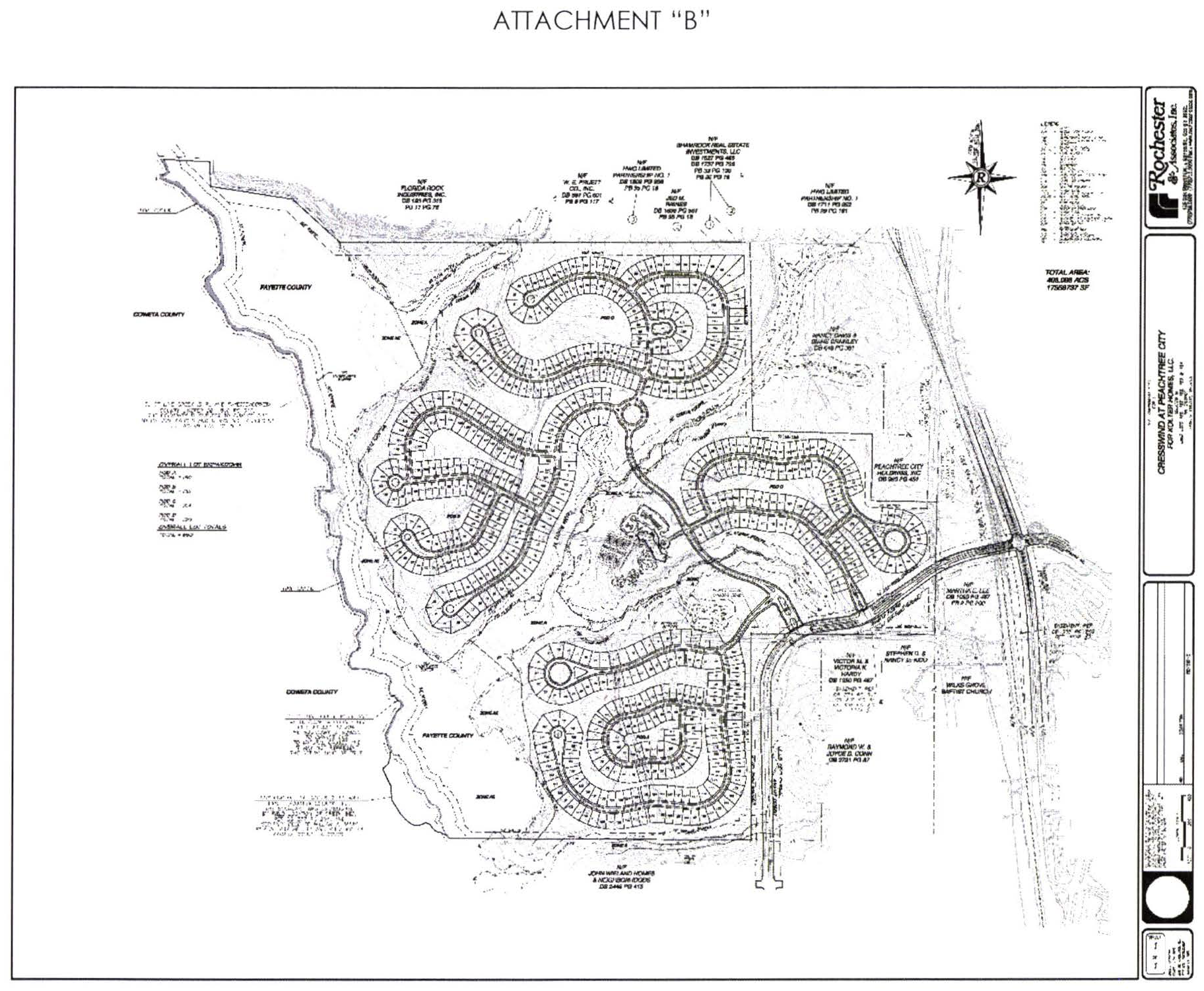
(Ord. No. 1163, § 1, 12-20-2018)
(1013A.15) Limited-use residential district no. 15.
(a)
A single tract of land described below shall be rezoned from its present zoning classification of A-R Agricultural Residential (Fayette County) to LUR-15 Limited Use Residential (Peachtree City). Said property is more particularly described as follows:
Tract 1
All that tract or parcel of land lying and being in Land Lot 166, 7th District, Fayette County, Georgia, and being more particularly described as follows:
BEGINNING at a 1" pipe on the Land Lot Line common to Land Lots 166 and 167, being 1574' East of the Land Lot corner common to Land Lots 166, 167, 183, and 184, being the TRUE POINT OF BEGINNING; thence South 88°51'41" East, a distance of 542.37 feet to a railroad iron; thence South 00°20'17" East, a distance of 1595.01 feet to a 1/4 inch rebar; thence North 89°36'57" West, a distance of 543.36 feet to a 1/4 inch rebar; thence North 00°17'52" West, a distance of 1602.14 feet to a 1 inch pipe, being the TRUE POINT OF BEGINNING.
Said tract contains 19.918 acres or 867636 square feet.
Tract 2
All that tract or parcel of land lying and being in Land Lots 165, 166, 184 & 185 of the 7th District, Fayette County, Georgia and being more particularly described as follows:
BEGINNING at a nail found at the Land lot corner common to Land Lots 157, 158, 164 and 165; thence along the Land Lot line common to Land Lots 164 & 165 North 88°11'34" West, a distance of 1146.31 feet to a 1 inch crimp top pipe found; thence along the Land Lot line common to Land Lots 164 & 165 and 185 & 186 North 88°09'44" West, a distance of 2469.33 feet to a point in the centerline of Line Creek, which is also the Fayette/Coweta County line; thence along the centerline of Line Creek and the county line the following calls: North 36°58'03" West, a distance of 214.55 feet to a point; thence North 85°36'23" East, a distance of 132.55 feet to a point; thence North 70°13'27" East, a distance of 110.92 feet to a point; thence North 62°50'46" East, a distance of 105.30 feet to a point; thence North 47°26'44" East, a distance of 100.12 feet to a point; thence North 89°34'59" East, a distance of 70.71 feet to a point; thence North 78°16'24" East, a distance of 36.06 feet to a point; thence North 17°26'00" East, a distance of 43.83 feet to a point; thence North 30°51'58" West, a distance of 109.49 feet to a point; thence North 25°41'48" West, a distance of 65.19 feet to a point; thence North 02°51'47" West, a distance of 66.41 feet to a point; thence North 59°57'28" West, a distance of 128.06 feet to a point; thence North 09°59'17" West, a distance of 101.98 feet to a point; thence North 36°03'32" West, a distance of 58.87 feet to a point; thence North 45°11'31" West, a distance of 96.00 feet to a point; thence North 01°17'13" West, a distance of 114.13 feet to a point; thence North 21°34'01" West, a distance of 101.12 feet to a point; thence North 16°03'41" West, a distance of 82.46 feet to a point; thence North 39°11'04" West, a distance of 175.05 feet to a point; thence North 25°26'10" West, a distance of 101.43 feet to a point; thence North 15°10'33" East, a distance of 116.62 feet to a point; thence North 14°07'37" West, a distance of 69.00 feet to a point; thence North 00°29'39" West, a distance of 106.94 feet to a point; thence North 19°25'52" East, a distance of 104.12 feet to a point; thence North 00°44'43" West, a distance of 100.24 feet to a point; thence North 38°43'42" West, a distance of 134.54 feet to a point; thence North 16°12'42" East, a distance of 102.61 feet to a point; thence North 40°29'33" East, a distance of 77.68 feet to a point; thence North 33°02'37" East, a distance of 219.86 feet to a point; thence North 23°23'23" West, a distance of 72.11 feet to a point; thence North 41°02'24" West, a distance of 64.03 feet to a point; thence North 10°30'23" West, a distance of 106.98 feet to a point; thence North 12°34'32" West, a distance of 144.77 feet to a point; thence North 06°14'30" West, a distance of 206.90 feet to a point; thence North 21°00'55" East, a distance of 152.00 feet to a point; thence North 14°58'12" East, a distance of 101.79 feet to a point; thence North 30°35'59" East, a distance of 82.43 feet to a point; thence North 22°11'57" West, a distance of 79.79 feet to a point; thence North 03°11'43" East, a distance of 107.70 feet to a point; thence North 40°24'27" West, a distance of 107.70 feet to a point; thence North 08°57'29" West, a distance of 101.43 feet to a point; thence North 45°10'16" West, a distance of 111.80 feet to a point; thence North 25°53'27" East, a distance of 97.02 feet to a point; thence North 18°49'50" East, a distance of 106.37 feet to a point; thence North 07°36'21" East, a distance of 101.12 feet to a point; thence North 00°11'28" East, a distance of 72.80 feet to a point; thence North 65°32'07" East, a distance of 46.10 feet to a point; thence North 07°36'21" East, a distance of 101.12 feet to a point; thence North 19°09'17" West, a distance of 45.83 feet to a point; thence North 30°59'47" West, a distance of 65.01 feet to a point; thence North 37°26'05" West, a distance of 70.62 feet to a point; thence leaving said creek centerline South 89°39'07" East, a distance of 2347.47 feet to a 1/4 inch rebar found; thence South 01°16'43" East, a distance of 16.15 feet to a 1 inch pipe found; thence North 88°40'53" East, a distance of 543.13 feet to a 1/4 inch rebar found; thence South 00°20'55" East, a distance of 142.69 feet to a 3 inch railroad iron found; thence North 89°51'29" East, a distance of 872.66 feet to a 3 inch railroad iron found on the Land Lot line common to Land Lots 156 & 166; thence along said Land Lot line South 00°12'25" West, a distance of 640.18 feet to a 1 inch pipe found; thence along the Land Lot line common to Land Lots 156 & 166 and 157 & 165 South 00°13'00" West, a distance of 2326.75 feet to a ½ inch rebar found; thence along the Land Lot line common to Land Lots 157 & 165 South 00°06'24" West, a distance of 1275.40 feet to a nail found, being the POINT OF BEGINNING.
Said tract contains 359.575 acres or 15,663,081.26 square feet.
(b)
This tract is illustrated on the Boundary and Topography Survey prepared by Rochester & Associates, Inc. (last revised August 14, 2006), a copy of which is attached hereto as Exhibit "A" and incorporated herein by express reference.
It is intended that the LUR-15 zoning district be established specifically for a 517-unit residential subdivision to be developed substantially in accordance with the following express conditions:
(c)
Conformance with master plan. Development shall take place in conformance with the master plan prepared by PBS&J (last revised June 12, 2007), and the Ridge Planning & Engineering Everton Phase 9 - Townhomes plan (dated September 10, 2018) copies of which are attached hereto as Exhibit "B" and incorporated herein by express reference. Any substantive change to these plans or any of the conditions and requirements of this section shall require a new rezoning action.
(d)
Permitted uses.
1.
No more than 517 residential lots with the following dimensions:
a.
54 lots shall measure no less than 55 feet x 125 feet;
b.
140 lots shall measure no less than 65 feet x 125 feet;
c.
90 lots shall measure no less than 75 feet x 130 feet;
d.
134 lots shall measure no less than 90 feet x 130 feet;
e.
29 lots shall measure no less than 100 feet x 150 feet;
f.
28 lots shall measure no less than 115 feet x 200 feet;
g.
42 lots shall be attached townhome units;
2.
A clubhouse, including an outdoor pool, tennis courts and other customary accessory uses.
3.
Publicly owned building, facility or land.
4.
Building, facility or land for the distribution of utility services.
5.
Building, facility of land for non-commercial park, recreation or open space purposes.
6.
Accessory uses (see Section 908).
7.
Customary home occupations (see section 907).
(e)
Conditional uses. No conditional uses shall be permitted within this zoning district.
(f)
Other requirements.
1.
Minimum floor area per dwelling unit: 1,500 SF.
2.
Minimum zoning lot area: As described herein and shown on the master plan approved as part of the rezoning and Everton Phase 9 Townhome plan.
3.
Maximum number of dwelling units: No more than 517 residential units shall be provided within the overall subdivision.
4.
Minimum lot width: As described herein and shown on the master plan approved as a part of the rezoning and Everton Phase 9 Townhome plan.
5.
Minimum front building setbacks for detached single-family lots: 15 feet; provided that each dwelling unit provides at least two paved parking spaces off the right-of-way; at least one of those spaces must be within a fully enclosed garage, and no part of the garage shall be within 20 feet of the right-of-way.
6.
Minimum front building setbacks for attached townhome lots: Zero feet; so long that each dwelling unit provides at least two paved parking spaces of the right-of-way or alley; at least one of these spaces must be within a fully enclosed garage, and no part of the garage shall be within 20 feet of the back of curb of the street or alley.
7.
Minimum side setback for detached single-family lots: Zero feet; provided that at least a ten-foot separation is maintained between dwellings, and further provided, that at least one 20-foot separation is provided between every ten dwelling units.
8.
Minimum side setback for attached townhome lots: Zero feet.
9.
Minimum rear setbacks for detached single-family lots: Ten feet; provided that for those units served by a dedicated alley with garage access in the rear of the homes, at least two paved parking spaces shall be provided off of the alley; at least one of those spaces shall be within a fully enclosed garage, and no part of the garage shall be located less than 20 feet from the edge of alley.
10.
Minimum rear setbacks for attached townhome lots: Zero feet; so long that a minimum 20-foot clearance zone is provided between the rears of units when they back up to each other.
11.
Maximum building height: Two stories, plus a basement.
12.
Parking: as set forth within the city's parking ordinance.
13.
Signs: As set forth within the city's sin ordinance.
14.
Alley access: Alleys shall be a minimum of 20 feet in width and shall be paved with a suitable surface to support fire and emergency apparatus.
15.
Uses permitted above garages: on those lots where detached garages are located behind homes, the second floor of these buildings shall be limited to storage or home office use only. Garage apartments, granny floats, or other residential uses within these second floor areas shall not be permitted.
16.
Tree save and landscape buffers: All tree save and landscape buffers shall be maintained with natural vegetation and/or enhanced with berming, fencing and landscaping. No vegetation shall be removed from these areas without prior city approval. All tree save areas within the subdivision must be delineated with tree save fencing and approved by the city prior to any land disturbance activities.
17.
Greenbelts: A 50-foot greenbelt shall be provided around the perimeter of the development. A 50-foot greenbelt shall be provided adjacent to MacDuff Parkway as required by the city's buffer ordinance. All greenbelt areas shall be dedicated to the city.
18.
Architectural concept: A unified architectural concept for the overall development must be developed and approved by the planning commission. The architectural design, building materials and color selections of all buildings and structures on the site must be substantially the same. Townhome units shall be faced with brick, stone, or cementitious siding. Each home with a side elevation facing a public street shall include similar architectural detailing as the front elevation to avoid creating a blank wall.
19.
Each lot shall have the number of trees as required by the Land Development Ordinance. In the case where no yard is incorporated in the lot, the required trees shall be planted on an adjacent or nearby open space.
20.
Development concept: Development shall take place substantially in conformance with the approved master plan and the Everton Phase 9 Townhomes plan (Exhibit "B"), as well as the design concepts presented with the zoning request and approved as a part of the concept. Substantial deviation from the approved master plan , the Everton Phase 9 Townhomes plan, or design concepts shall require city council approval.
(g)
The overall development of the tract is subject to the following understandings and conditions:
1.
All transportation enhancements identified within Attachment "A" of GRTA's Notice of Decision (dated December 20, 2006) shall be constructed at no cost to the city and open to the public prior to issuance of the first certificate of occupancy for any residential dwelling unit within this development. Such traffic enhancements were imposed as conditions by GRTA on the entire DRI, which included both developments. Accordingly, the enhancements should be constructed based upon an agreement between John Wieland Homes and Neighborhoods and Levitt & Sons, or their successors in interest, and should be based on each party's pro-rata share of traffic generated by each development based upon the information considered by GRTA. Evidence of such agreement between John Wieland Homes and Neighborhoods and Levitt & Sons shall be provided to the city prior to the approval of any plats for the development of the property.
2.
MacDuff Parkway shall be designed to city standards as a community collector and shall include a 24-foot wide median with vertical curb and gutter as measured from back-of-curb. The road section shall also include two travel lanes at a minimum width of 16 feet each, as measured from edge of pavement. The road shall be designed within an 80-foot right-of-way (minimum).
3.
Parallel parking shall not be provided along MacDuff Parkway as proposed by the developer, as this road is designated as a community collector. The applicant is aware that staff does not support parallel parking on any portion of MacDuff Parkway, and shall continue to coordinate with staff to determine if this type of parking arrangement might be supported.
4.
In accordance with the city's buffer ordinance, a continuous 50-foot wide (minimum) city-owned greenbelt buffer shall be established for any residential development adjacent to a community collector road and a continuous 50-foot wide tree-save and landscape buffer shall be established for any non-residential development adjacent to a community collector road.
5.
The applicant shall coordinate with city staff to identify locations of traffic calming devices and incorporate these into the design and construction of MacDuff Parkway at no cost to the city.
6.
The applicant shall coordinate with city staff to determine if a multi-use path tunnel can be constructed underneath MacDuff Parkway as a part of the road improvements. Should a location be identified, the applicant shall design and construct the tunnel as a part of the MacDuff Parkway extension at no cost to the city.
7.
The applicant shall coordinate with city staff to determine locations of multi-use paths throughout the development, and shall provide a multi-use path connection from this development to the existing multi-use path within the adjoining Centennial subdivision.
8.
The applicant shall coordinate with the Fayette County Water Department and the city fire department to ensure appropriately sized water lines are constructed as a part of the MacDuff Parkway extension. In addition, the applicant shall be responsible for installing all utilities within the right-of-way of MacDuff Parkway.
9.
The applicant shall coordinate with city staff and the fire department to identify a suitable location for a new fire station to serve the West Village area. This site should be located approximately 3,600 LF to the north of the existing fire station site and dedicated at no cost to the city.
10.
The applicant shall be responsible for installing landscaping within the median and right-of-way of MacDuff Parkway as a part of the road construction and maintaining these areas until the roads are accepted by the city. Following this dedication, the maintenance of the landscaping within the right-of-way shall be the sole responsibility of the Homeowner's Association in perpetuity.
11.
There shall be no more than 517 total lots within the overall subdivision. The master plan submitted as a part of the annexation and rezoning request is illustrative only. The developer shall prepare a detailed development plan, which must be approved by the planning commission as a part of the concept plat approval process. It is understood the general layout of the streets and individual lots will be similar to what is shown on the concept plat once final engineering documents are prepared.
12.
Existing vegetation within the areas identified as open space on the concept plat must be protected prior to, during and following construction.
13.
A 50-foot wide greenbelt shall be provided between the homes along the southern property boundary separating this development from the proposed school site and the existing homes within the Chadsworth subdivision.
14.
Existing vegetation within the 50-foot buffer around the perimeter of the property shall be preserved to the greatest extent practicable prior to, during and following construction activities. These areas shall be dedicated to the city as greenbelt.
15.
The overall development shall comply with the city's post-construction stormwater runoff management ordinance and provide water quality best management practices (BMPs) on greenbelt areas dedicated to the city.
16.
The location of the floodplain shall be field located and surveyed prior to preparation of the engineering drawings. Absolutely no development shall be permitted within the floodplain.
17.
The maintenance of all internal parks, landscaped areas, sidewalks, alleys, signage and subdivision entrances shall be the sole responsibility of the developer and/or the homeowner's association. A note to this end shall be required on the final plat.
18.
The applicant shall establish deed covenants for the overall subdivision that shall limit rental units to no more than 20 percent of the total number of dwelling units in the subdivision. The covenants shall provide for the strict enforcement of the limit on rental units, and the developer shall establish the administrative structure for that enforcement prior to sale of the first dwelling unit in the subdivision.
19.
The developer shall pay impact fees for each residential lot within the subdivision as identified within the city's impact fee ordinance.
20.
The annexation and rezoning is conditioned upon the execution of a new development agreement between the city and the applicant.
21.
The annexation and rezoning as proposed is conditioned upon the annexation of the Scarborough/Stillwell tracts to the north.
Exhibit A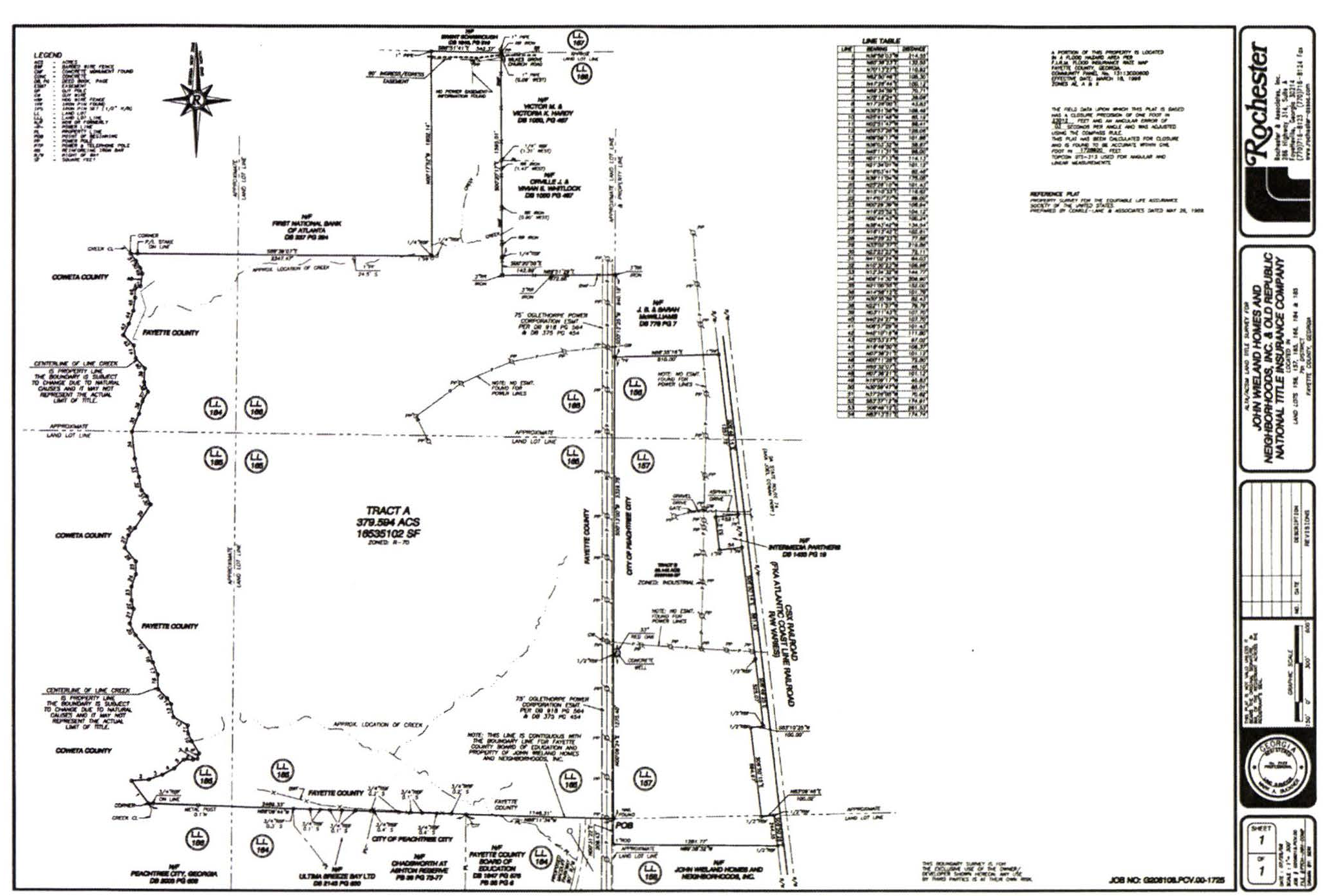
Exhibit B
(Ord. No. 917, 5-3-2007; Ord. No. 1152, § 1, 10-4-2018)
Limited-use residential district no. 15 (1)
Limited-use residential district no. 15 (2)
(1013A.16) Limited-use residential district no. 16.
(a)
A single tract of land as described below shall be rezoned from its present zoning designation of C-C Community Commercial, O-I Office Institutional and A-R Agricultural Residential (unincorporated Fayette County) to LUR-16 Limited Use Residential (Peachtree City). Said property is more particularly described as follows:
All that tract or parcel of land lying and being in land Lots 17 and 18 of the 6th District, Fayette County, and being more particularly described as follows:
Beginning at the point of intersection of the southerly right-of-way line of State Highway #74 (right-of-way varies) with the westerly land lot line of Land Lot 18; Thence along said right-of-way North 85 degrees 30 minutes 07 seconds East for a distance of 119.87 feet to a point; Thence along a curve to the right having a radius of 5925.00 feet and an arc length of 278.29 feet, being subtended by a chord of North 86 degrees 50 minutes 51 seconds East for a distance of 278.27 feet to a point; Thence South 01 degrees 48 minutes 25 seconds East for a distance of 81.00 feet to a point; Thence along a curve to the right having a radius of 5844.00 feet and an arc length of 97.40 feet, being subtended by a chord of North 88 degrees 40 minutes 14 seconds East for a distance of 97.40 feet to a point; Thence North 00 degrees 51 minutes 07 seconds West for a distance of 81.00 feet to a point; Thence along a curve to the right having a radius of 5925.00 feet and an arc length of 842.31 feet, being subtended by a chord of South 86 degrees 46 minutes 45 seconds East for a distance of 841.60 feet to a point; Thence along a curve to the right having a radius of 1289.00 feet and an arc length of 42.56 feet, being subtended by a chord of South 81 degrees 45 minutes 39 seconds East for a distance of 42.56 feet to a point; Thence South 33 degrees 40 minutes 08 seconds East for a distance of 69.43 feet to a point; Thence South 77 degrees 03 minutes 20 seconds East for a distance of 68.12 feet to a point; Thence North 58 degrees 58 minutes 52 seconds East for a distance of 68.79 feet to a point; Thence along a curve to the right having a radius of 1289.00 feet and an arc length of 382.73 feet, being subtended by a chord of South 64 degrees 49 minutes 55 seconds East for a distance of 381.33 feet to a point; Thence South 84 degrees 46 minutes 46 seconds West for a distance of 149.10 feet to a point; Thence South 26 degrees 08 minutes 45 seconds West for a distance of 27.34 feet to the northerly line of the parcel described in deed book 2003 page 140; Thence leaving said right-of-way, along said northerly line, North 89 degrees 14 minutes 54 seconds West for a distance of 41.55 feet to northwest corner of said parcel; Thence along the westerly line of said parcel South 00 degrees 43 minutes 14 seconds West for a distance of 550.05 feet to the southwest corner of said parcel; Thence along the south line of said parcel South 89 degrees 34 minutes 16 seconds East for a distance of 248.63 feet to a 1" iron rod; Thence leaving said south line, along the west line of lots 6,7,8 and 14 of Brechin Park as recorded in plat book 31 page 170 Fayette County records, South 00 degrees 46 minutes 23 seconds West for a distance of 1026.58 feet to a point; Thence leaving said west line, along the north line of lands now or formerly owned by Starville Development, and the north line of lots 15,16,23,24,26 and 27 of said Brechin Park North 89 degrees 51 minutes 08 seconds West for a distance of 1934.72 feet to a 24" gum tree on the west line of land lot 17; Thence along the west line of land lots 17 and 18, North 00 degrees 40 minutes 16 seconds East for a distance of 1837.19 feet to the Point of Beginning.
LESS AND EXCEPT
Parcel 1
All that tract or parcel of land lying and being in land Lot 18 of the 6th District, Fayette County, and being more particularly described as follows:
COMMENCE at the point of intersection of the southerly right-of-way line of State Highway #74 (right-of-way varies) with the westerly land lot line of Land Lot 18; Thence along said right-of-way North 85 degrees 30 minutes 07 seconds East for a distance of 119.87 feet to a point; Thence along a curve to the right having a radius of 5925.00 feet and an arc length of 278.29 feet, being subtended by a chord of North 86 degrees 50 minutes 51 seconds East for a distance of 278.27 feet to a point; Thence South 01 degrees 48 minutes 25 seconds East for a distance of 81.00 feet to a point; Thence along a curve to the right having a radius of 5844.00 feet and an arc length of 97.40 feet, being subtended by a chord of North 88 degrees 40 minutes 14 seconds East for a distance of 97.40 feet to a point; Thence North 00 degrees 51 minutes 07 seconds West for a distance of 81.00 feet to a point; Thence along a curve to the right having a radius of 5925.00 feet and an arc length of 842.31 feet, being subtended by a chord of South 86 degrees 46 minutes 45 seconds East for a distance of 841.60 feet to a point; Thence along a curve to the right having a radius of 1289.00 feet and an arc length of 42.56 feet, being subtended by a chord of South 81 degrees 45 minutes 39 seconds East for a distance of 42.56 feet to a point; Thence South 33 degrees 40 minutes 08 seconds East for a distance of 69.43 feet to a point; Thence South 77 degrees 03 minutes 20 seconds East for a distance of 4.06 feet to a point; Thence leaving said right-of-way, South 12 degrees 56 minutes 40 seconds West for a distance of 9.90 feet to the POINT OF BEGINNING; Thence South 12 degrees 56 minutes 40 seconds West, a distance of 161.54 feet; Thence along a curve to the right having a radius of 420.00 feet and arc length of 260.23 feet, being subtended by a chord of South 30 degrees 41 minutes 40 seconds West for a distance of 256.09 feet; Thence North 29 degrees 54 minutes 15 seconds West, a distance of 136.35 feet; Thence North 62 degrees 39 minutes 26 seconds West, a distance of 184.20 feet; Thence along a curve to the left, having a radius of 50.00 feet and an arc length of 99.02 feet, being subtended by a chord of North 29 degrees 23 minutes 29 seconds West for a distance of 83.61 feet; Thence North 03 degrees 52 minutes 27 seconds East, a distance of 150.70 feet; Thence along a curve to the right, having a radius of 5,865.00 feet and an arc length of 341.09 feet, being subtended by a chord of South 84 degrees 22 minutes 22 seconds East for a distance of 341.04 feet to a point; Thence along a curve to the right, having a radius of 1,229.00 feet and an arc length of 91.21 feet, being subtended by a chord of South 80 degrees 34 minutes 50 seconds East for a distance of 91.19 feet to the POINT OF BEGINNING.
Parcel 2
All that tract or parcel of land lying and being in land Lot 18 of the 6th District, Fayette County, and being more particularly described as follows:
COMMENCE at the point of intersection of the southerly right-of-way line of State Highway #74 (right-of-way varies) with the westerly land lot line of Land Lot 18; Thence along said right-of-way North 85 degrees 30 minutes 07 seconds East for a distance of 119.87 feet to a point; Thence along a curve to the right having a radius of 5925.00 feet and an arc length of 278.29 feet, being subtended by a chord of North 86 degrees 50 minutes 51 seconds East for a distance of 278.27 feet to a point; Thence South 01 degrees 48 minutes 25 seconds East for a distance of 81.00 feet to a point; Thence along a curve to the right having a radius of 5844.00 feet and an arc length of 97.40 feet, being subtended by a chord of North 88 degrees 40 minutes 14 seconds East for a distance of 97.40 feet to a point; Thence North 00 degrees 51 minutes 07 seconds West for a distance of 81.00 feet to a point; Thence along a curve to the right having a radius of 5925.00 feet and an arc length of 842.31 feet, being subtended by a chord of South 86 degrees 46 minutes 45 seconds East for a distance of 841.60 feet to a point; Thence along a curve to the right having a radius of 1289.00 feet and an arc length of 42.56 feet, being subtended by a chord of South 81 degrees 45 minutes 39 seconds East for a distance of 42.56 feet to a point; Thence South 33 degrees 40 minutes 08 seconds East for a distance of 69.43 feet to a point; Thence South 77 degrees 03 minutes 20 seconds East for a distance of 64.06 feet to a point; Thence leaving said right-of-way, South 12 degrees 56 minutes 40 seconds West for a distance of 9.90 feet to the POINT OF BEGINNING; Thence along a curve to the right, having a radius of 1229.00 feet and an arc length of 244.74 feet, being subtended by a chord of South 69 degrees 57 minutes 07 seconds East for a distance of 244.34 feet; Thence South 26 degrees 08 minutes 45 seconds West, a distance of 24.42 feet; Thence North 89 degrees 14 minutes 54 seconds West, a distance of 59.97 feet; Thence South 00 degrees 43 minutes 14 seconds West, a distance of 253.05 feet; Thence North 72 degrees 39 minutes 26 seconds West, a distance of 251.43 feet; Thence along a curve to the left, having a radius of 480.00 feet and an arc length of 134.92 feet, being subtended by a chord of North 20 degrees 59 minutes 49 seconds East for a distance of 134.48 feet; Thence North 12 degrees 56 minutes 40 seconds East, a distance of 161.54 feet to the POINT OF BEGINNING.
Containing 73.04 acres, more or less.
(b)
These tracts are illustrated on the Plan of Annexation and Zoning for The Gates, prepared by Integrated Science and Engineering (dated October 24, 2012), a copy of which is attached hereto as Exhibit "A" and incorporated herein by express reference.
It is intended that the LUR-16 zoning district be established specifically for the development of a 90-lot single-family detached residential subdivision to be developed substantially in accordance with the following express conditions:
(c)
Conformance with master plan.
Development shall take place substantially in conformance with the Concept Plan for The Gates as prepared by Integrated Science and Engineering (last revised September 24, 2012), a copy of which is attached hereto as Exhibit "B" and incorporated herein by express reference. Any substantive change to this plan or any of the conditions and requirements of this section shall require a new rezoning action.
(d)
Permitted uses.
1.
No more than 90 single-family detached residential lots.
2.
A neighborhood amenity area, to include a cabana, outdoor pool, tot lot and other customary accessory uses.
3.
Reserved.
4.
Publicly owned buildings, facilities or land.
5.
Buildings, facilities or land for the distribution of utility services.
6.
Buildings, facilities or land for non-commercial park, recreation or open space purposes.
7.
Accessory uses (see Section 908).
8.
Customary home occupations (see Section 907).
(e)
Conditional uses.
No conditional uses shall be permitted within this zoning district.
(f)
Other requirements.
1.
Maximum number of dwelling units: 90.
2.
Minimum floor area per dwelling unit: 1,500 SF.
3.
Minimum zoning lot area: As described herein and shown on the concept plan approved as a part of the rezoning.
4.
Minimum lot width: As described herein and shown on the concept plan approved as a part of the rezoning.
5.
Minimum front building setback: 30 feet; provided that at least two paved parking spaces are provided for each dwelling unit off of the right-of-way; at least one of those spaces must be within a fully enclosed garage, and no part of the garage shall be located within 40 feet of the right-of-way.
6.
Minimum side setback: Ten feet; provided that at least a 20-foot separation is maintained between dwelling units.
7.
Minimum rear setback: 30 feet; provided that for lots that adjoin an external greenbelt, the rear setback shall be increased to 40 feet.
8.
Multiple frontage lots: Any lot having a property line adjacent to more than one public street right-of-way shall be deemed a multiple frontage lot. Any rear or side setback that also fronts on a public right-of-way shall have a setback depth equal to the minimum front setback depth.
9.
Maximum building height: Two stories, not including a basement level.
10.
Architectural concept: A unified architectural concept for the overall subdivision must be presented to and approved by the planning commission. The architectural design, building materials and color selections of all buildings and structures on the site must be compatible.
Each home with a side elevation facing a public street shall include architectural detailing such that the elevation does not create a blank wall facing the public street.
(g)
The overall development of the tract is subject to the following understandings and conditions:
1.
The overall development shall include no more than 90 lots designated for residential use. It is understood the concept plan submitted as a part of the annexation and rezoning application is illustrative only, and that the developer shall prepare a detailed concept plat in accordance with the established concept plat submittal process. It is also understood the general layout of the streets and individual lots shall be similar to what is shown on the concept plan once final engineering documents are prepared.
2.
No less than a 60-foot-wide tree save and landscape buffer shall be provided along the entire property frontage adjacent to SR 74. This tract of land shall be owned and maintained by the homeowner's association and/or the owners of the office tracts as appropriate.
It is understood the appearance of the tree save and landscape buffer is paramount to assist in creating an attractive gateway into Peachtree City. The applicant shall develop a detailed berming and landscape plan for this area that shall be reviewed and approved by the city landscape architect and the planning commission as a part of the concept plat submittal process.
Within this tree save and landscape buffer and extending the entire length of the property, existing vegetation shall be augmented with earthen berms and landscaping, the intent being to create a visual buffer separating the proposed office and residential development from the highway. The landscape plan shall identify berming and landscaping within all areas void of vegetation.
The general appearance shall be consistent with the existing berming and landscaping in front of the Starr's Mill Professional Building and shall include a combination of berms and plant material to provide a permanent vegetative buffer. The berms shall be a minimum of four feet in height with 4:1 slopes. All landscaped areas shall include an underground irrigation system with a programmable timer.
The applicant shall maintain the landscaping within this area until such time the internal streets within the subdivision are accepted by the city. Following this dedication, the maintenance of the landscaping shall be the sole responsibility of the homeowner's association and/or the owners of the office tracts in perpetuity.
3.
No less than a 50-foot-wide greenbelt shall be provided along all other property boundaries. This property shall be deeded to the city as a part of the final plat process.
Existing vegetation within these greenbelts shall be preserved to the greatest extent practicable prior to, during and following construction activities. In those areas void of vegetation, the applicant shall develop a detailed landscape plan that shall be reviewed and approved by the city landscape architect and the planning commission as a part of the concept plat submittal process.
In areas void of vegetation, a combination of evergreen plant material (Leyland Cypress, Cryptomeria Japonica, etc.) shall be planted in staggered rows at eight feet on center. The minimum height of the evergreen plant material shall be no less than six feet to eight feet in height from finish grade to the top of the plant material at the time of planting.
All exposed areas shall be mulched with no less than four inches of fresh hardwood bark mulch. This plant material shall be guaranteed for no less than two years from date of acceptance by the city. The landscaping shall be installed within six months following the issuance of the first building permit within the subdivision.
4.
Existing vegetation within all other areas identified on the concept plan as greenbelt, undisturbed buffers or open space shall be protected prior to, during and following construction. These areas shall be deeded to the city for ownership and maintenance as a part of the final plat process.
5.
The applicant shall coordinate with city staff to identify locations for a multi-use path connection from this development to Meade Field Drive. It is understood this path will traverse the Meade Field Recreation Complex. The applicant shall be solely responsible for design and construction of these connections at no cost to the city.
6.
Sanitary sewer shall be provided to serve each lot within this development. It is understood the location of any sewer main or manhole shall be no closer than 200 feet to any adjoining property line.
7.
The applicant shall coordinate with the Fayette County Water Department and the Peachtree City Fire Department to ensure appropriately sized water lines are constructed as a part of the overall development.
8.
The overall development shall comply with the city's post-construction stormwater runoff management ordinance and shall provide water quality best management practices (BMP's) on greenbelt areas dedicated to the city.
9.
The location of all floodplains and associated buffers shall be field located and surveyed prior to preparation of the concept plat. Absolutely no development shall be permitted within these areas.
10.
Initial construction activities shall be limited to clearing and grading associated with road, utility and stormwater facilities. Absolutely no mass clearing or grading shall be permitted on the property.
11.
A clearing and grading plan must be submitted for each residential lot prior to issuance of a land disturbance permit. These plans shall be reviewed and approved by the city landscape architect as well as the development Inspector to ensure that existing vegetation on each lot is preserved to the greatest extent practicable.
12.
Following clearing and grading activities and after commencement of construction of the home on each lot, a landscape plan shall be prepared and submitted for review and approval by the city landscape architect. In addition to vegetation preserved during clearing and grading activities, each residential lot shall include no less than three canopy trees, each of which shall be no less than two and one-half inches in diameter as measured at breast height (dbh).
13.
The applicant shall provide pocket parks as depicted on the concept plan. The details of these parks and the associated amenities shall be presented to and approved by the planning commission as a part of the concept plat approval proves.
14.
The maintenance of all internal pocket parks, amenity areas, landscaped areas, internal signage and subdivision entrances shall be the sole responsibility of the developer and/or the homeowner's association in perpetuity.
15.
No less than a ten-foot-wide landscaped median shall be provided within the entrance road to separate the office tracts from the residential tracts. The location and design of this median shall be presented to and approved by the planning commission as a part of the concept plat approval process.
16.
Prior to approval of the conception plans, the applicant shall provide documentation satisfactory to the city engineer indicating GDOT's approval of the improvements to the existing intersection and traffic signal.
17.
The applicant shall establish deed covenants for the overall subdivision that shall limit rental units to no more than 20 percent of the total number of dwelling units in the subdivision. The covenants shall provide for the strict enforcement of the limit on rental units, and the developer shall establish the administrative structure for that enforcement prior to sale of the first dwelling unit in the subdivision.
18.
A statement addressing the proximity of the development to the Peachtree City - Falcon Field Airport shall be developed with the involvement of city staff, the city attorney, the Peachtree City Airport Authority, and the developer. This statement shall appear on the final plat and in the deed restrictions and covenants for the overall development.
19.
A statement addressing the proximity of the development to the Meade Field Recreation Complex shall be developed with the involvement of city staff, the city attorney, the Peachtree City recreation and special events advisory board, and the developer. This statement shall appear on the final plat and in the covenants and deed restrictions for the overall development.

(Ord. No. 1050, § 1, 10-18-2012)
(1013A.17) Limited-use residential district no. 17.
(a)
The zoning of a single tract of land as described below shall be rezoned from its current zoning designation of AR Agricultural Reserve to LUR-17 Limited Use Residential (Peachtree City). Said property is more particularly described as follows:
Legal Description
All that tract or parcel of land lying and being located in land Lot 155 of the 7 th Land District of Fayette, County, Georgia; within the city limits of Peachtree City; all as will appear on a plat entitled "Retracement Survey For: Chadwick Homes, Inc.", dated July 10, 2017; last revised October 31, 2017; as prepared by Jason D. Turner, Georgia Registered Land Surveyor No. 2795 and being more particularly described as follows:
Commencing at the intersection of the southerly right-of-way of Depot Street (60-foot right-of-way) and the easterly right-of-way of Old State Route No. 74 (A.K.A. Senoia Road) (80-foot right-of-way) and from said point of beginning run in a southerly direction along the easterly right-of-way of Old State Route No. 74 for a distance of 318.28 feet to a 3/8" iron pin found and the true point of beginning of the property herein described;
Thence south 85 degrees 05 minutes 16 seconds east for a distance of 651.15 feet leaving said right-of-way to a ½" iron pin found;
Thence south 01 degrees 14 minutes 51 seconds west for a distance of 198.80 feet to a 1-1/2" solid iron pin found;
Thence south 00 degrees 26 minutes 21 seconds east for a distance of 101.15 fee to a ½" iron pin found;
Thence south 69 degrees 31 minutes 43 seconds west for a distance of 641.03 feet to a ¾: crimp top pipe found at the easterly right-of-way of Old State Route No. 74;
Thence along a curve to the right having a radius of 2274.94 feet and an arc length of 538.17 feet, being subtended by a chord of north 04 degrees 24 minutes 15 seconds west for a distance of 581.57 feet along said right-of-way to a 3/8" iron pin found and the true point of beginning.
Together with and subject to covenants, easements, and restrictions of record.
Said property contains 6.507 acres more or less.
(b)
This tract is illustrated on the Retracement Survey prepared by Turner & Associates Land Surveyors (revised October 31, 2017), a copy of which is attached hereto as Exhibit "A" and incorporated herein by express reference.
It is intended that the LUR-17 zoning district be established specifically for the development of a 15-lot single-family detached residential subdivision to be developed substantially in accordance with the following express conditions:
(c)
Conformance with conceptual site plan. Development shall take place substantially in conformance with the Conceptual Site Plan as prepared by Day Design Group, Inc. (revised November 13, 2017), a copy of which is attached hereto as Exhibit "B" and incorporated herein by express reference. Any substantive change to this plan or any of the conditions and requirements of this section shall require a new rezoning action.
(d)
Permitted Uses.
(1)
No more than 15 single-family detached residential lots.
(2)
Publicly owned buildings, facilities or land.
(3)
Buildings, facilities or land for the distribution of utility services.
(4)
Buildings, facilities or land for non-commercial park, recreation or open space purposes.
(5)
Accessory uses (see Section 908).
(6)
Customary home occupations (see Section 907).
(e)
Conditional Uses. No conditional uses shall be permitted within this zoning district.
(f)
Other Requirements.
(1)
Maximum number of dwelling units: 15.
(2)
Minimum floor area per dwelling unit: 1,600 square feet.
(3)
Minimum zoning lot area: 4,800 square feet.
(4)
Minimum lot width: As described herein and shown on the Conceptual Site Plan (Exhibit "A").
(5)
Minimum front building setback: ten feet provided that at least two paved parking spaces are required for each dwelling unit off of the right-of-way; at least one of these spaces must be within a fully enclosed garage, and street-facing garages shall be at least 20 feet from the right-of-way.
(6)
Minimum side setback: zero feet; provided that at least a ten-foot separation is maintained between dwelling units.
(7)
Minimum rear setback: 25 feet for lots 1-7; 5 feet for lots 8-15.
(8)
Maximum building height: Two stories, not including a basement level.
(9)
Architectural concept: As illustrated in Exhibit "C".
(g)
The overall development of the tract is subject to the following understandings and conditions:
(1)
Development shall take place substantially in conformance with the Conceptual Site Plan (Exhibit "B"). Any substantive change to the plan or conditions of this section shall require a new zoning action. A reduction in the number of lots is not considered substantive, but a reduction in the minimum lot size is considered substantive.
(2)
Provide a maximum of 15 single-family detached units, each with a minimum floor area of 1,600 square feet, provided the development meets all applicable stormwater requirements without variances.
(3)
Each lot shall be at least 60 feet wide and contain at least 4,800 square feet.
(4)
Architectural concept shall be substantially similar to those provided as Exhibit "C".
(5)
The Applicant shall coordinate with city staff in providing a location for the multi-use path connection. A path connection to the existing path at the Saranac subdivision shall include a pipe for the conveyance of stormwater to be located under the path and designed to receive stormwater from the area adjacent to the path. Any trees removed for a path connection to the existing path at Saranac subdivision shall be replaced within the greenbelt with like size and species of plants as trees removed.
(6)
A 50-foot-wide greenbelt shall be provided along the frontage of Senoia Road as required by the Land Development Ordinance, and a tree-protection fence along the greenbelt shall be installed prior to the issuance of a Land Disturbance Permit.
(7)
A 20-foot-wide undisturbed buffer shall be provided along the southern boundary of the property.
(8)
The location of all floodplains and associated buffers shall be field located and surveyed prior to preparation of the concept plat. No development shall be permitted within these areas.
(9)
A clearing and grading plan must be submitted for each residential lot prior to issuance of a land disturbance permit. These plans shall be reviewed and approved by city staff to ensure that existing vegetation on each lot is preserved to the greatest extent practicable.
(10)
The applicant shall establish deed covenants for the overall subdivision that shall limit rental units to no more than 20 percent of the total number of dwelling units in the subdivision. The covenants shall provide for the strict enforcement of the limit on rental units, and the developer shall establish the administrative structure for that enforcement prior to sale of the first dwelling unit in the subdivision.
Exhibit A
Exhibit B
Exhibit C
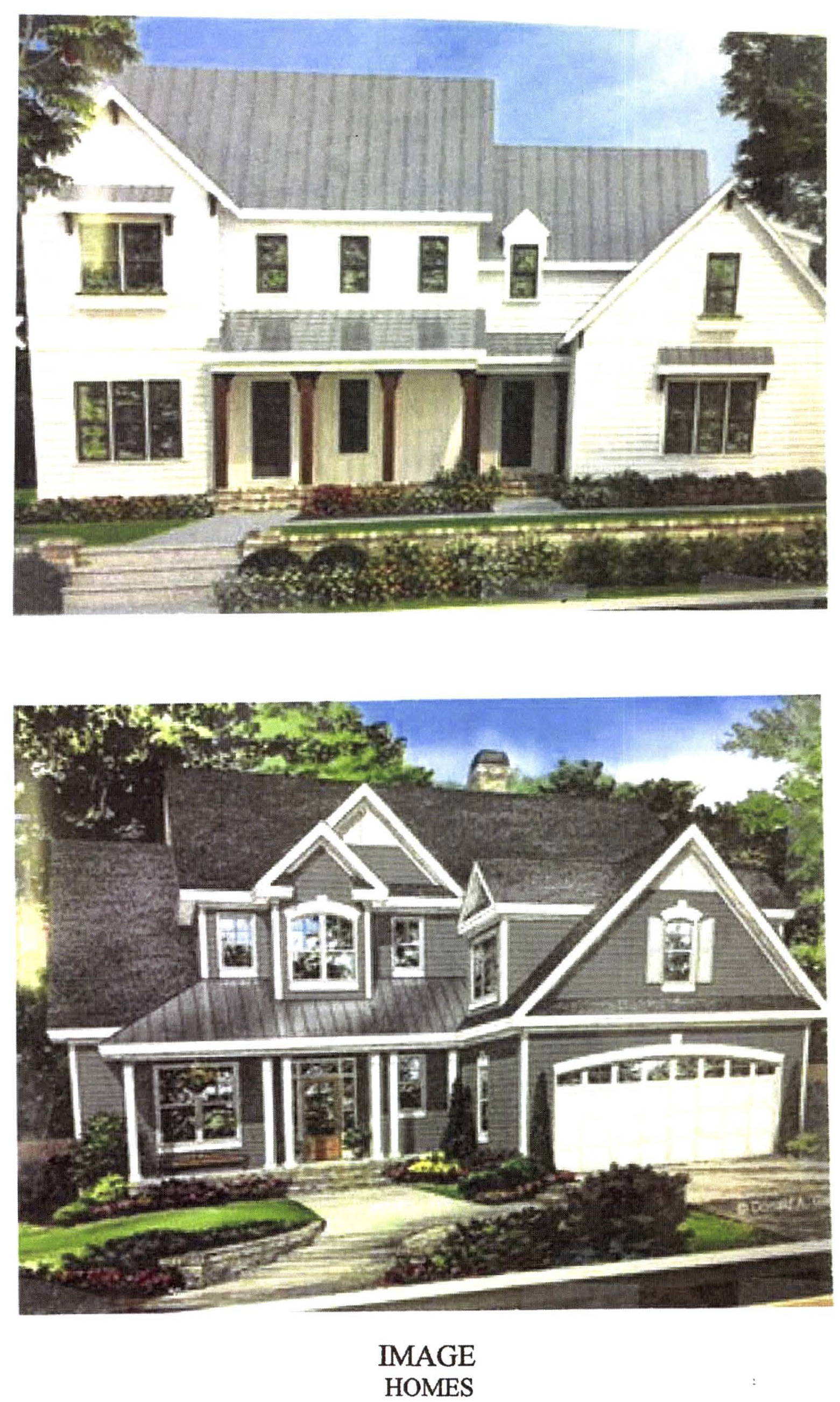
(Ord. No. 1141, § 1, 3-15-2018; Ord. No. 1148, § 1, 6-7-2018)
(1013A.18) Limited-use residential district no. 18.
(a)
The zoning of the property described below shall be rezoned from the current zoning designation of AR Agricultural Reserve and GI General Industrial to LUR-18 Limited Use Residential. Said property is more particularly described as follows:
All that tract or parcel of land lying and being located in land lots 155, 156, 166, and 167, of the 7 th Land District of Fayette, County, Georgia; within the City Limits of Peachtree City; all as will appear on a survey entitled "Boundary Survey for Craftmark Development, LLC.", dated September 26, 2017; as prepared by Kevin M. Brown, Georgia Registered Land Surveyor No. 2960 and being more particularly described as follows:
Beginning at a ¾ open top pipe located North 89 degrees 43 minutes 10 seconds West a distance of 414.24 feet from a ½ inch rebar found at the common corner of Land Lots 155, 156, 166, and 167;
Thence, South 01º13'15" East a distance of 228.84 feet to a railroad iron; thence North 89º59'00" East a distance of 940.64 feet to an iron pin and cap set; thence North 06º47'00" West a distance of 162.62 feet to an iron pin and cap set in the southerly line of Wilks Grove Church Road; thence, North 78º00'00" East a distance of 24.93 feet to an iron pin and cap set in the westerly right-of-way line of CSX Railroad (100 foot right-of-way width); thence, with said right-of-way line, South 06º47'00" East a distance of 193.00 feet to a ½ inch rebar; thence, South 06º43'14" East a distance of 684.05 feet to a railroad rail; thence, South 06º47'05" East a distance of 693.49 feet to a ¾ inch crimp top pipe; thence South 06º48'14"East a distance of 744.14 feet to a 1 inch open top pipe; thence leaving said right-of-way line, South 88º37'43" West a distance of 810.18 feet to a 1 inch open top pipe; thence, North 00º13'58" East a distance of 639.88 feet to a railroad rail; thence, South 89º52'51" West a distance of 872.40 feet to a railroad rail; thence, North 00º25'01" East a distance of 904.39 feet to a ½ inch rebar; thence, North 00º13'19" West a distance of 805.41 feet to a ½ inch rebar; thence, 15.89 feet along a curve to the right (said curve having a radius of 410.00 feet, and a chord bearing North 82º02'12" East, 15.89 feet) to a ½ inch rebar; thence, North 83º08'48" East a distance of 182.34 feet to an iron pin and cap set; thence, 39.87 feet along a curve to the left (said curve having a radius of 650.00 feet, and a chord bearing North 81º23'23" East, 39.86 feet) to an iron pin and cap set; thence, North 89º29'38" East a distance of 145.84 feet to an iron pin and cap set; thence, North 24º28'17" West a distance of 100.23 feet to an iron pin and cap set; thence, 50.01 feet along a curve to the left (said curve having a radius of 590.00 feet, and a chord bearing North 65º31'43" East, 50.00 feet) to an iron pin and cap set; thence, South 24º28'17" East a distance of 122.45 feet to an iron pin and cap set; thence, North 89º29'38" East a distance of 29.09 feet to the point of beginning.
Said property contains 66.54 acres.
(b)
This tract is illustrated on the Boundary Survey prepared by Falcon Design Consultants, LLC, a copy of which is attached hereto as Exhibit "A" and incorporated herein by express reference.
It is intended that the LUR-18 zoning district be established specifically for the development of a single-family detached residential subdivision to be developed substantially in accordance with the following express conditions:
(c)
Conformance with Conceptual Site Plan. Development shall take place substantially in conformance with the Conceptual Site Plan as prepared by Mooney Design Studio, a copy of which is attached hereto as Exhibit "B" and incorporated herein by express reference. Any substantive change to this plan or any of the conditions and requirements of this section shall require a new rezoning action.
(d)
Permitted Uses.
(1)
No more than 180 single-family detached residential lots.
(2)
Publicly owned buildings, facilities or land.
(3)
Buildings, facilities or land for the distribution of utility services.
(4)
Buildings, facilities or land for non-commercial park, recreation or open space purposes.
(5)
Accessory uses (see Section 908).
(6)
Customary home occupations (see Section 907).
(e)
Conditional Uses. No conditional uses shall be permitted within this zoning district.
(f)
Other Requirements.
(1)
Maximum number of dwelling units: 180
(2)
Minimum floor area per dwelling unit: 1,600 square feet
(3)
Minimum lot width: 50 feet
(4)
Minimum front building setback: 10 feet provided that at least two paved parking space are provided on each lot; at least one of these spaces must be within a fully enclosed garage, and garage entrances shall be at least 20 feet from the property line.
(5)
Minimum side setback: 0 feet; provided that at least a 10-foot separation is maintained between dwelling units; and provided that at least a 20-foot separation is provided between every ten dwellings.
(6)
Minimum rear setback: 10 feet.
(7)
Maximum building height: Two stories, not including a basement level
(8)
Architectural concept: Homes shall be constructed in similar design and materials as presented in the master plan. Each home with a side elevation facing a public street shall include architectural detailing of the side elevation to avoid creating a blank wall visible from a public street.
(g)
The overall development of the tract is subject to the following understandings and conditions:
(1)
The developer shall grant an access easement to Wilkes Grove Church to the new internal public street if the church accepts. The intent of this condition is to eventually allow the closure of the at-grade railroad crossing currently being used by the church.
(2)
A 50-foot-wide greenbelt shall be provided along the frontage of MacDuff Parkway as required by the Land Development Ordinance.
(3)
A minimum 100-foot greenbelt shall be provided along the CSX railroad. This greenbelt shall be left undisturbed during construction and removal of trees in not permitted unless approval is granted by the planning and development director. This greenbelt shall be dedicated to the city.
(4)
Initial construction activities shall be limited to clearing and grading shown on the Grading Plan provided by the developer, which leaves 23% of the property undisturbed.
(5)
The location of all floodplains and associated buffers shall be field located and surveyed prior to preparation of the concept plat. No development shall be permitted within these areas.
(6)
Developer shall coordinate with the city engineer to update the master hydrology study performed for the Wilksmoor Village Development. Developer shall be responsible for the construction of any ponds or other structures necessary to ensure no detrimental effects occur downstream.
(7)
An amenity area shall be provided as shown on the master plan and include a pool, a heated clubhouse with restrooms, and a dog park. Off-street parking shall be provided as per the minimum Zoning Code parking ratios.
(8)
Community mailbox stations shall be provided near the amenity area. Mailbox stations shall be covered with a roof either in a separate structure or within a community clubhouse.
(9)
Sidewalks shall be provided on both sides of internal streets and shall be constructed to city standards.
(10)
At least one multi-use path connection shall be provided to the southwestern property line in order to connect to planned multi-use paths in the Everton subdivision. This connection shall be separated from the road, shall comply with all City standards, and shall be located between Road "D" and the southern property line.
(11)
The developer shall construct a multi-use path along the southeastern border of MacDuff Parkway right-of-way connecting the existing path crossing at Cresswind Boulevard to the proposed entrance street Road "A".
(12)
The maintenance of all internal parks, landscaped areas, sidewalks, subdivision entrances, and community amenity areas shall be the sole responsibility of the homeowners' association, and a note to this end shall be placed on the final plat.
(13)
A statement addressing the proximity of the development to the CSX railroad shall be placed on the final plat for the overall development.
(14)
The developer shall coordinate with Peachtree City Water and Sewerage Authority regarding sewer connection design requirements and maintenance.
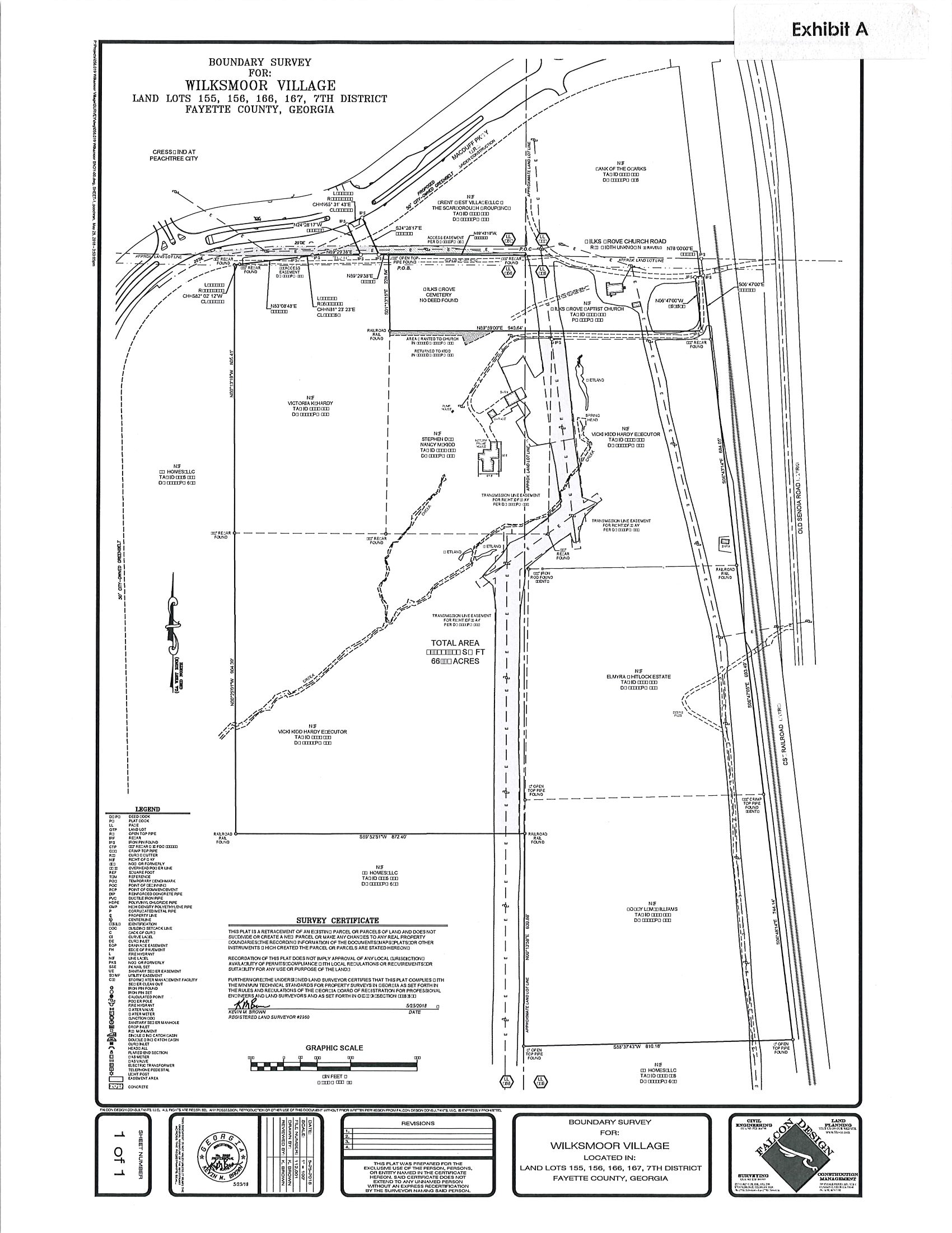
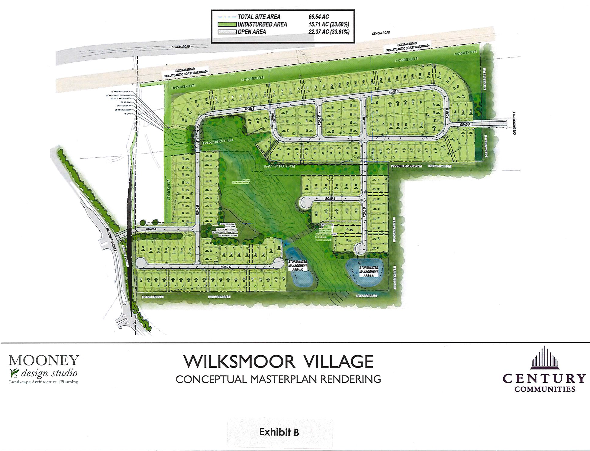
(Ord. No. 1149, § 1, 7-19-2018)
(1013A.19) Limited-use residential district no. 19. The zoning of the property described below shall be rezoned from the current zoning designation of LUC-30 to LUR-19 limited use residential. Said property is more particularly described as follows:
All that tract or parcel of land lying and being in Land Lot 70 of the 7 th Land District of Fayette County, Georgia and being more particularly described as follows:
Beginning at an iron pin set at the start of a curve to the right that forms the intersection of the easterly right of way of Sumner Road (40' R/W) and the southerly right of way of Sumner Road (a.k.a. Brown Road, 60' R/W), thence northeasterly 44.86 feet along said curve to the right having a radius of 100 feet and a central angle of 25º42'00" and being subtended by a chord which bears North 30º04'09" East 44.48 feet to an iron pin set, said point being the southerly right of way of Sumner Road (a.k.a. Brown Road, 60' R/W). Thence along said R/W northeasterly a distance of 13.35 feet along said curve to the right having a radius of 973.08 feet and a central angle 0º47'10" and being subtended by a chord which bears North 59º00'11" East 13.35 feet; thence along said right of way North 58º21'50" East a distance of 1091.74 feet to ½ inch rebar; thence leaving said right of way South 00º38'47" West, a distance of 606.44 feet to an iron pin set; thence South 00º38'47" West, a distance of 68.78 feet to an iron pin set' thence North 89º19'39" West a distance of 188.69 feet to an iron pin set; thence South 58º21'50" West a distance of 522.27 feet to an iron pin set; thence South 00º02'59" East a distance of 216.67 feet to an iron pin set; thence South 67º25'37" East a distance of 213.93 feet to an iron pin set; thence South 22º34'23" West, a distance of 324.22 feet to an iron pin set; then South 03º28'57" West a distance of 222.75 feet to an iron pin set; thence North 86º31'03" West a distance of 383.33 feet to a 1" open top pipe found, said point being the corner of Land Lots 69, 70, 91 & 92 and the easterly right of way of Sumner Road (40' R/W); thence along said right of way North 00º19'11" East, a distance of 463.20 feet to a point; thence along said right of way North 00º09'57" West, a distance of 61.21 feet to a point; thence along said right of way North 01º04'41" East a distance of 123.44 feet to a point' ; thence along said right of way North 00º43'29" West a distance of 88.79 feet to a point; thence along said right of way North 00º48'23" West a distance of 364.59 feet to a point; thence along said right of way North 04º51'40" East a distance of 25.05 feet to a point, said point being the Point of Beginning.
(a)
Intent. It is intended that this district be complimentary to the mixed-used development established in the LUC-30 zoning district; and that the two districts be constructed substantially in accordance with the following express conditions:
(b)
Conformance with conceptual site plan. Development shall take place substantially in conformance with the conceptual site plan as prepared by Peterson Planning, a copy of which is attached hereto as exhibit "A" and incorporated herein by express reference. Any substantive change to this plan or any of the conditions and requirements of this section shall require a new rezoning action.
(c)
Permitted uses.
(1)
No more than 27 single-family detached residential lots.
(2)
Publicly owned buildings, facilities or land.
(3)
Buildings, facilities or land for non-commercial park, recreation or open space purposes.
(4)
Accessory uses (see section 908).
(5)
Customary home occupations (see section 907).
(d)
Other requirements.
(1)
Maximum number of dwelling units: 27.
(2)
Minimum residential lot area: 9,000 square feet.
(3)
Minimum floor area per dwelling unit: 2,000 square feet.
(4)
Minimum residential lot width: 65 feet or 30 feet along a cul-de-sac.
(5)
Minimum residential setbacks:
a.
Front porch: Ten feet
b.
Front building setback: 20 feet
c.
Side setback: 5 feet
d.
Rear setback: 30 feet
(6)
Residential architectural standards: Homes shall be faced with either brick, stone, or cementitious siding. Building elevations facing public streets or visible from a public street shall not be blank and shall utilize the same level of architectural detailing as the front elevation.
(e)
Conditions. The overall development of the tract is subject to the following understandings and conditions:
(1)
Parks and community facilities shall be provided as shown on the master plan. A property owners' association, as established by the developer, shall be responsible for the maintenance of the parks, community facilities and sidewalks. A note to this end shall be placed on the final plat.
(2)
Multi-use paths shall be located substantially similar to those shown on the master plan.
(1013A.20) Limited-use residential district no. 20.
(a)
The zoning of the property described below shall be rezoned from the current zoning designation of GI general industrial to LUR-20 limited use residential. Said property is more particularly described as follows:
All that tract or parcel of land lying and being located in Land Lot 155, of the 7 th land district, City of Peachtree City, Fayette County, Georgia and being more particularly described as follows:
Beginning at an iron pin set at the Land Lot corner common to Land Lots 155, 156, 166 and 167; thence along the land lot line common to land lots 155 and 167 North 00º53'45" East, a distance of 1543.70 feet to an iron pin set; thence South 88º50'15" East, a distance of 183.92 feet to an iron pin set on the westerly right-of-way of the CSX Railroad (R/W varies - 100' right of way at this point); thence along said right of way the following calls: South 20º20'43" East, a distance of 178.88 feet to a point; thence 234.06 feet along a curve to the right, said curve having a chord of South 18º53'30" East 234.03 feet and a radius of 4612.78 feet to a point; thence South 72º33'43" West, a distance of 25 feet to a point (said right of way being 150' at this point); thence 92.32 feet along a curve to the right, said curve having a chord of South 16º51'42" East 92.31 feet and a radius of 4587.78 feet to a point; thence 425.73 feet along a curve to the right, said curve having a chord of South 10º30'39" East 425.51 feet and a radius of 3795.46 feet to a point; thence South 06º56'56" East, a distance of 68.24 feet to a point; thence North 83º03'04" East, a distance of 25 feet to a point (said right of way being 100' at this point); thence South 06º56'56" East a distance of 351.99 feet to a point; thence South 06º48'53" East, a distance of 232.85 feet to an iron pin set on the ;and lot line common to land lots 155 and 156; thence along said land lot line North 89º02'16" West, a distance of 529.90 feet to an iron pin set, being the Point of Beginning. Said tract contains 13.756 acres of land.
And all that tract or parcel of land lying and being locate in land lot 155 of the 7 th Land District, City of Peachtree City, Fayette County, Georgia and being more particularly described as follows:
Beginning at an iron pin set at the land lot corner common to Land Lots 155, 156, 166 and 167; thence along the land lot line common to land lots 155 and 156 South 89º02'16" East, a distance of 630.83 feet to an iron pin set on the easterly right of way of the CSX Railroad (R/W varies - 100' right of way at this point) and the true point of beginning; thence along said right of way the following calls: North 06º48'53" West a distance of 246.62 feet to a point; thence North 06º56'56" West, a distance of 352.11 feet to a point; thence North 83º03'04" East, a distance of 25 feet to a point (said right of way being 150' at this point); thence North 06º56'56" West, a distance of 68.69 feet to a point; thence 363.45 feet and a radius of 3945.46 feet to an iron pin set at the intersection of the easterly right of way of the CSX Railroad and the westerly right of way of Senoia Road (80' R/W); thence along the westerly right of way of Senoia Road the following calls: South 20º25'15" East a distance of 75.44 feet to a point; thence 411.40 feet along a curve to the right, said curve having a chord of South 16º40'48" East 411.10 feet and a radius of 3150.58 feet to a point; thence 466.55 feet along a curve to the right, said curve having a chord of South 07º46'03" East 466.07 feet and a radius of 2955.90 feet to a point; thence South 02º54'31" East a distance of 99.03 feet to an iron pin set on the land lot line common to land lots 155 and 165; thence along said land lot line North 89º02'16" West, a distance of 94.31 feet to an iron pin set, being the true point of beginning. Said tract contains 1.732 acres of land.
Less and except all that tract or parcel of land lying and being in Land Lot 155, of the 7 th Land District of Fayette County, Georgia, and being more particularly described as follows:
Beginning at an iron pin set at the land lot corner common to land lots 155, 156, 166 & 167; thence along the land lot line common to land lots 155 and 167 North 00º53'45" East a distance of 468.13 feet to a point; thence leaving said land lot line and along a proposed right of way the following calls: 328.24 feet along a curve to the right having a chord of North 67º44'56" East 326.59 feet and a radius of 945 feet to a point; thence North 77º41'58" East a distance of 122.02 feet to a point on the westerly right of way of CSX Railroad (right of way varies); thence along said right of way the following calls: South 06º56'56" East a distance of 49.42 feet to a point; thence North 83º03'04" East a distance of 35 feet to a point; thence South 06º56'56" East a distance of 351.99 feet to a point; thence South 06º48'53: East, a distance of 232.85 feet to an iron pin set on the land lot line common to land lots 155 & 156; thence along said land lot line North 89º02'16" West a distance of 529.90 feet to an iron pin set, being the point of beginning. Said tract contains 6.359 acres.
(b)
This tract is illustrated on the boundary survey attached hereto as exhibit "A" and incorporated herein by express reference. It is intended that the LUR-20 zoning district be established specifically for the development of a townhome residential development to be constructed substantially in accordance with the following express conditions:
(c)
Conformance with conceptual site plan.
Development shall take place substantially in conformance with the conceptual site plan as prepared by Moore Bass Consulting, a copy of which is attached hereto as exhibit "B" and incorporated herein by express reference. Any substantive change to this plan or any of the conditions and requirements of this section shall require a new rezoning action.
(d)
Permitted uses.
1.
No more than 36 townhome residential dwelling units.
2.
Publicly owned buildings, facilities or land.
3.
Buildings, facilities or land for the distribution of utility services.
4.
Buildings, facilities or land for public park, recreation or open space purposes.
5.
Accessory uses to residential land uses
(e)
Conditional uses. No conditional uses shall be permitted within this zoning district.
(f)
Other requirements.
1.
The minimum front building setback is 25 feet from back of sidewalk or back of pavement, whichever is greater.
2.
Internal streets shall be built to city standards with regards to compaction, subgrade, pavement, and other requirements as deemed by the city engineer.
3.
Buffers: All buffers shall be maintained with natural vegetation and enhanced with additional landscaping.
a.
A 50-foot undisturbed buffer shall be provided along the railroad right-of-way. A privacy fence shall be constructed along the edge of the railroad right-of-way, and evergreen plantings shall be added to the buffer where existing trees are sparse.
b.
A 100-foot landscaping buffer shall be provided along the western property line. This buffer shall be enhanced with various evergreen plantings to create a visual buffer.
c.
The 40-foot landscaping buffer along MacDuff Parkway shall be landscaped with a selection of canopy, understory, and evergreen plants. A landscape plan for this buffer shall be reviewed and approved by city staff prior to installation.
4.
Each housing unit shall be faced with either brick, stone, or cementitious siding. Each side elevation shall include windows, and shall include similar architectural detailing as the front elevation.
5.
At least two canopy trees shall be provided for each unit meeting the standards of the land development ordinance. In the case where no yard is incorporated in the lot, the required trees shall be planted on an adjacent or nearby open space that is not included in the required buffers.
6.
A home owners association shall be created to establish minimum property maintenance and other restrictive covenants that shall establish a maximum percentage of 25 percent of properties that may be rented contemporaneously, as proposed by the applicant. A copy of the association covenants and deed restrictions shall be reviewed and approved by the city prior to recording with the Fayette County records.
7.
All internal streets, sidewalks, parks, amenities, and landscaping including the landscape buffer along MacDuff Parkway shall be the responsibility of the home owner's association.
8.
A statement addressing the proximity of the development to the CSX railroad shall be placed on the final plat.
Exhibit A
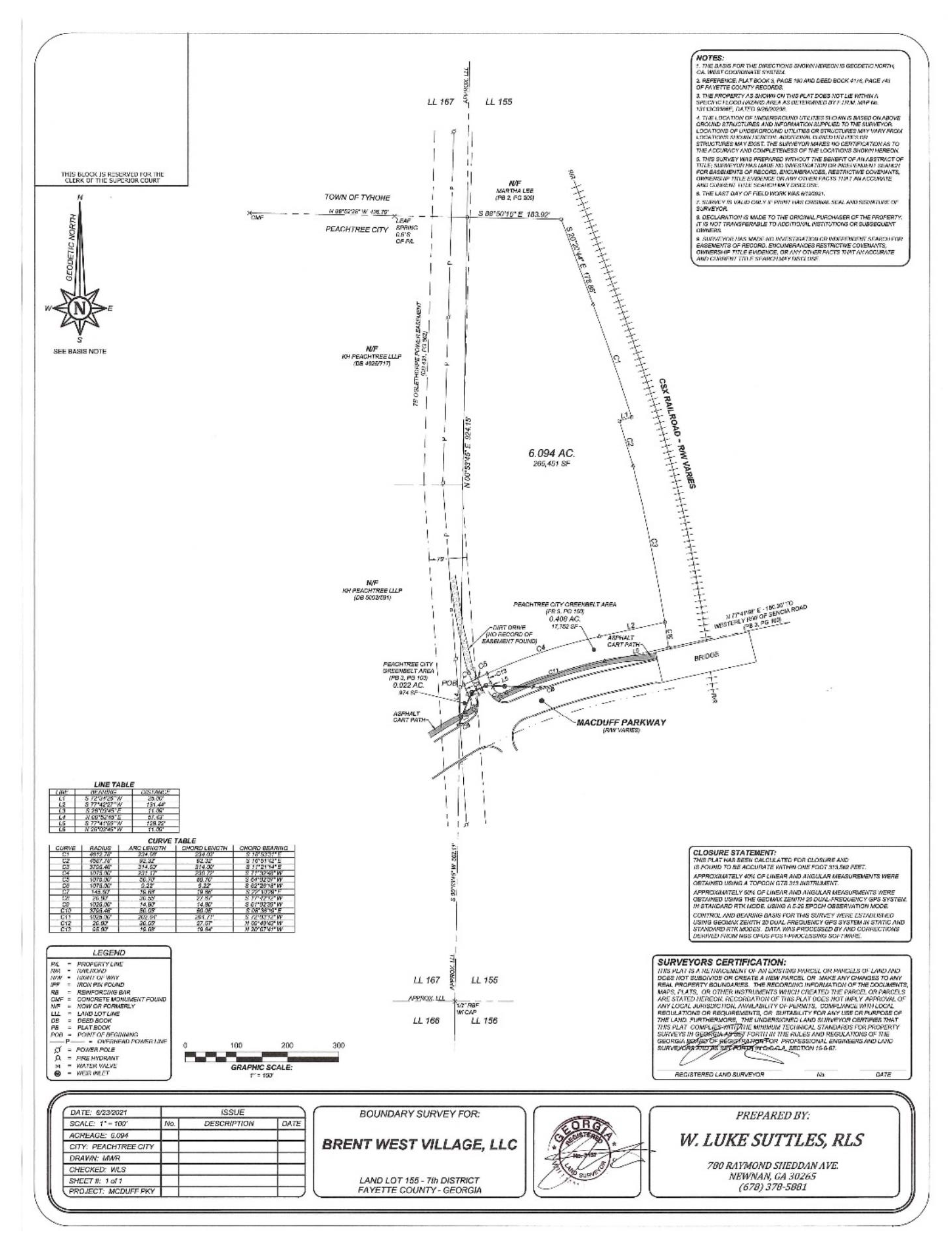
Exhibit B
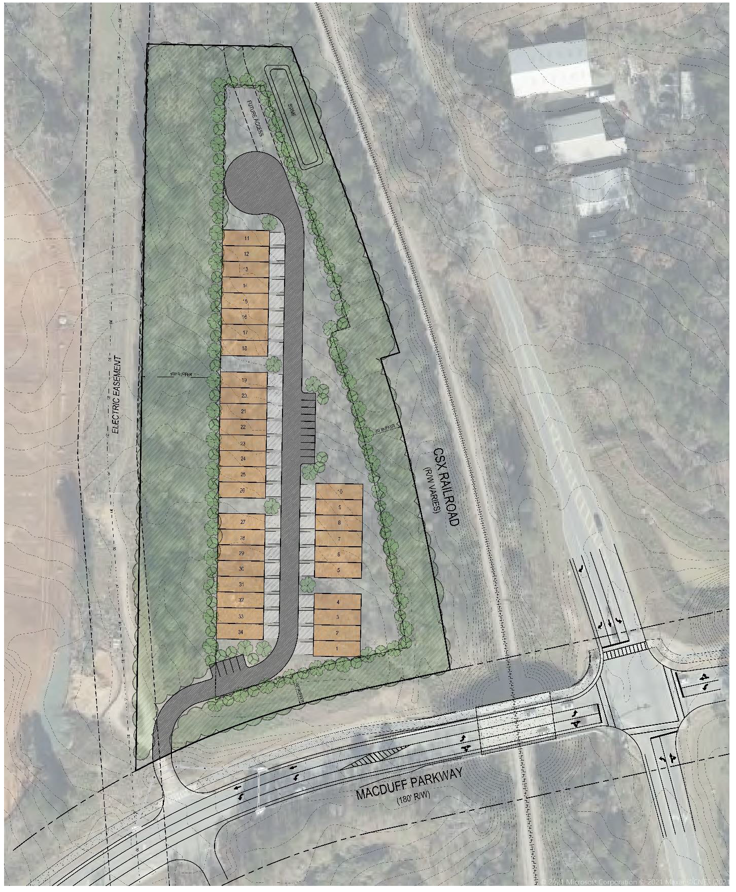
(Ord. No. 1198, § 1, 12-2-2021; Ord. No. 1204, § 1, 7-12-2022)
(1013A.21) Limited-use residential district no. 21.
(a)
The zoning of the property described below shall be rezoned from the current zoning designation of GI General Industrial to LUR-21 Limited Use Residential. Said property is more particularly described as follows:
ALL THAT TRACT OR PARCEL OF LAND LYING AND BEING LOCATED IN LAND LOT 18, OF THE 6 TH LAND DISTRICT, City of Peachtree City, Fayette County, Georgia, containing 38.72 acres and being more particularly described as follows:
Commence at a point (1/2 inch rebar) at the intersection of Land Lots 18, 19, 28 & 29, said point being the True Point of Beginning.
From said point, proceed S88d23'36"E along the north line of Land Lot 18 a distance of 1,101.85 feet to a point on the west right-of-way of Redwine Road (R/W varies); thence proceed southerly along said right-of-way, along the arc of a curve to the right a distance of 316.72 feet (said arc having a radius of 2,808.27 feet and being subtended by a chord bearing N13º41'53"W, with a chord distance of 316.55 feet) to a point; thence proceed southerly along said right-of-way S11º22'20"E a distance of 199.77 feet to a point (1" open top pipe); thence S11º22'20"E a distance of 195.15 feet to a point; thence S11º22'20"E a distance of 186.6 feet to a point; thence S11º22'20"E a distance of 59.99 feet to a point; thence S11º21'30"E a distance of 60.09 feet to a point; thence S11º29'00"E a distance of 273.16 feet to a point (1/2 inch rebar); thence leaving said right-of-way proceed N88º23'37"W a distance of 810.97 feet to a point; thence S01º36'36"W a distance of 170.61 feet to a point; thence N88º19'37"W a distance of 548.86 feet to a point (1/2" rebar) on the west line of Land Lot 18; thence proceed along said land lot line N00º26'22"W a distance of 955.65 feet to a point (1/2" rebar); thence continue N00º26'22"W a distance of 377.84 feet to a point (1/2 inch rebar); thence N00º23'54"W a distance of 122.47 feet to a point (1/2 inch rebar), and the TRUE POINT OF BEGINNING.
(b)
It is intended that the LUR-21 zoning district be established specifically for the development of a single-family residential development to be constructed substantially in accordance with the following express conditions:
(c)
Conformance with conceptual site plan. Development shall take place substantially in conformance with the Conceptual Site Plan as prepared by Moore Bass Consulting, a copy of which is attached hereto as Exhibit "A" and incorporated herein by express reference. Any substantive change to this plan or any of the conditions and requirements of this section shall require a new rezoning action.
(d)
Permitted uses.
1.
The maximum number of dwelling units shall be 74.
2.
Publicly owned buildings, facilities or land.
3.
Buildings, facilities or land for the distribution of utility services.
4.
Buildings, facilities or land for public park, recreation or open space purposes.
5.
Accessory uses to residential land uses
(e)
Conditional uses. Conditional uses permitted within the R-12 zoning district shall be permitted with the same conditions listed therein.
(f)
Other requirements.
1.
Each lot shall conform to the requirements of the R-12 zoning district for minimum lot area (12,000 square feet), minimum lot width (85 feet or 35 feet on cul-de-sac), and maximum building height (35 feet).
2.
The minimum front setback is 25 feet.
3.
Minimum side setback is five feet, except for lots that back up to the 25-foot buffer along the western and northern property lines of the overall development. The minimum side setback for these lots shall conform to the requirement of the R-12 zoning district, which is ten feet.
4.
Minimum rear setback is 20 feet, except for lots that back up to the 25-foot buffer along the western and northern property lines of the overall development. The minimum rear setback for these lots shall conform to the requirement of the R-12 zoning district, which is 30 feet.
5.
The minimum floor area per dwelling unit shall be 2,000 square feet.
6.
Each home with a side elevation facing a public street shall include architectural detailing of the side elevation to avoid creating a blank wall facing the public street.
7.
A multi-use path connection shall be provided to the southern property line as shown on the master plan.
8.
A multi-use path connection shall be provided to the northern property line as shown on the master plan.
9.
A minimum 40-foot landscape buffer shall be provided along Redwine Road. This buffer shall be left undisturbed to the greatest extent possible, and removal of trees shall only be permitted by the planning and development director. This buffer shall be deeded to the city as a greenbelt.
10.
The maintenance of all internal parks, sidewalks, landscaped areas, signage and subdivision entrances shall be the sole responsibility of the developer and/or the homeowner's association.
11.
The location of all floodplains, wetlands, and associated buffers shall be field located and surveyed. None of these areas shall be located within the buildable envelope of a lot.
EXHIBIT "A"
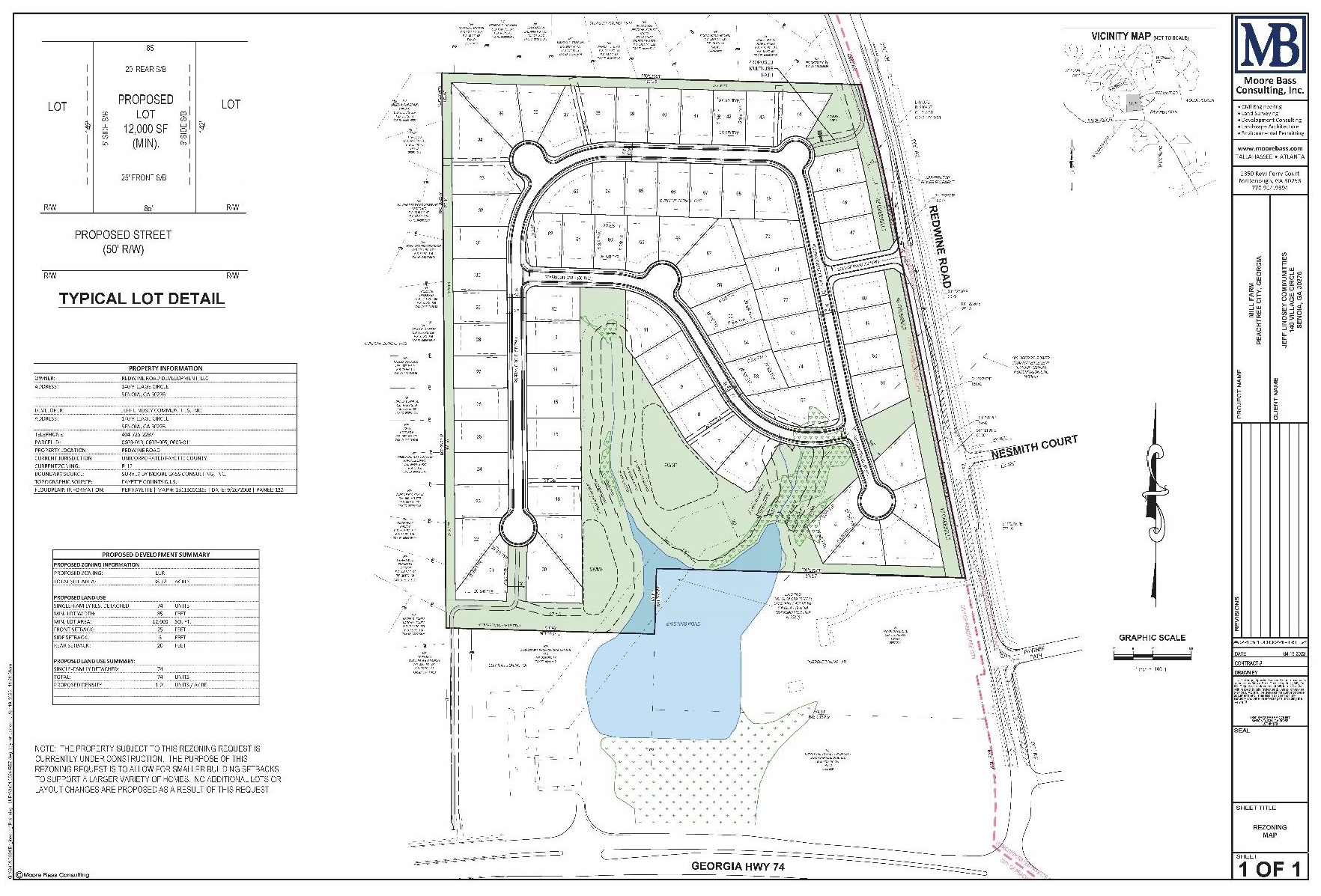
(Ord. No. 1211, § 1, 7-13-2023)
(1013A.22) Limited-use residential district no. 22.
(a)
The zoning of the property described below shall be zoned from unincorporated Fayette County MHP, Mobile Home Park, to LUR-22 Limited Use Residential. Said property is more particularly described as follows:
Fayette County, Georgia and being more particularly described as follows:
Beginning at a 1" pipe found at the common corner of land lots 60, 61, 69, and 68, said point being the Point of Commencement; Thence leaving said land lot corner and along the eastern line of land lot 69 North 00º45'24" East, a distance of 677.83 feet to an iron pin set (1/2" rebar with yellow plastic cap stamped "Rochester-LSF000484") said point being located on the centerline of a creek and the POINT OF BEGINNING for this tract of land;
Thence leaving the eastern line of land lot 69 and along a creek the following: North 27°40'36" West, a distance of 60.34 feet to a point; Thence North 75°27'56" West, a distance of 52.04 feet to a point; Thence North 00°41'41" West, a distance of 57.40 feet to a point; Thence North 67°18'31" West, a distance of 16.56 feet to a point; Thence North 29°11'41" West, a distance of 44.94 feet to a point; Thence North 69°48'07" West, a distance of 90.61 feet to a point; Thence North 69°36'53" West, a distance of 68.95 feet to a point; Thence North 61°38'52" West, a distance of 56.18 feet to a point; Thence North 83°26'24" West, a distance of 25.34 feet to a point; Thence North 58°47'16" West, a distance of 31.55 feet to a point; Thence North 63°16'09" West, a distance of 68.89 feet to a point; Thence South 65°33'40" West, a distance of 18.18 feet to a point; Thence North 52°44'12" West, a distance of 55.75 feet to a point; Thence South 22°20'03" West, a distance of 8.81 feet to a point; Thence North 61°45'49" West, a distance of 94.59 feet to a point; Thence North 73°01'04" West, a distance of 58.97 feet to a point; Thence North 68°00'25" West, a distance of 46.51 feet to a point; Thence North 61°33'16" West, a distance of 36.09 feet to a point; Thence South 62°11'12" West, a distance of 19.98 feet to a point; Thence North 39°26'13" West, a distance of 55.43 feet to a point; Thence North 49°47'20" West, a distance of 63.78 feet to a point; Thence North 44°04'36" West, a distance of 61.55 feet to a point; Thence North 43°30'17" West, a distance of 58.07 feet to a point; Thence North 68°52'43" West, a distance of 72.37 feet to a point; Thence North 00°55'12" West, a distance of 19.80 feet to a point; Thence North 49°23'55" West, a distance of 37.77 feet to a point; Thence North 09°41'20" West, a distance of 24.34 feet to a point; Thence North 05°53'10" West, a distance of 57.07 feet to a point; Thence North 27°33'10" West, a distance of 60.73 feet to a point; Thence North 15°29'03" West, a distance of 39.38 feet to an iron pin set located on the city limits line of City of Peachtree City; Thence along said city limits line South 89°50'23" East, a distance of 1067.89 feet to a 3/8" rebar found said point being on the eastern line of land lot 69; Thence leaving said city limits line and along the eastern line of land lot 69 South 02°23'17" West, a distance of 691.59 feet to a ½" rebar found; Thence South 00°45'24" West, a distance of 126.46 feet to an iron pin set and the POINT OF BEGINNING. Said lot containing 496,020.67 square feet or 11.387 acres more or less.
(b)
It is intended that the LUR-22 zoning district be established specifically for the development of a single-family residential development to be constructed substantially in accordance with the following express conditions:
(c)
Conformance with Conceptual Site Plan. Development shall take place substantially in conformance with the Conceptual Site Plan as prepared by Rochester & Associates, dated August 11, 2023, a copy of which is attached hereto as Exhibit "A" and incorporated herein by express reference. Any substantive change to this plan or any of the conditions and requirements of this section shall require a new rezoning action
(d)
Permitted Uses.
(1)
The maximum number of dwelling units shall be 21.
(2)
Accessory uses per Section 908 of the Zoning Ordinance.
(3)
Buildings, facilities or land for the distribution of utility services.
(4)
Building, facilities or land for public park, recreation, or open space purposes.
(5)
Customary home occupations per Section 907 of the Zoning Ordinance.
(e)
Conditional Uses. There are no conditional uses permitted in this district.
(f)
Other Requirements.
(1)
Front setbacks shall be ten feet for the main structure and 20 feet for garages.
(2)
Rear setbacks shall be ten feet for the main structure and 20 feet for garages.
(3)
At least 75% of the houses shall have a main-level bedroom and bathroom.
(4)
Houses shall be faced with either brick, stone, cementitious stucco, or cementitious siding.
(5)
Each elevation visible from a public street shall include architectural detailing similar to the front elevation in order to avoid creating a blank wall.
(6)
The maintenance of all internal parks, landscaped areas, sidewalks, subdivision entrances, and community amenity areas shall be the sole responsibility of the homeowner's association and a note to this end shall be placed on the final plat.
(Ord. No. 1213, § 1, 11-16-2023)
(1013A.23) Limited-use residential district no. 23.
(a)
The zoning of the property described below shall be zoned from unincorporated Fayette County AR, Agricultural Residential, to LUR-23 Limited Use Residential. Said property is more particularly described as follows:
All that tract or parcel of land lying and being in land lot 61 of the 7 th district, Fayette county, Georgia and being more particularly described as follows: Beginning at the southwest corner of said land lot; running thence east along the south line of said land lot 791.1 feet; thence north 4 minutes west, 1,130.7 feet; thence west 110 feet; thence north 400 feet to the center of an Old Stagecoach Road; thence southwesterly along the center of said road and following the curvature thereof 762.4 feet to the west line and said land lot; thence south along said land lot line 1,290 feet to the southwest corner of said land lot and the point of beginning. Said description as per survey by Joseph W. Steed, Jr. recorded at Plat Book 2, Page 6, Fayette County records
And
All that tract or parcel of land lying and being in land lot 61 of the 7 th district, Fayette county, Georgia and being more particularly described as follows: Beginning at a point on the south line of said land lot 781.1 feet east of the southwest corner of said land lot; running thence east along the south line of said land lot 665 feet to an iron pin; thence north 50 minutes east, 1,470.3 feet to an iron pin; thence south 89 degrees 7 minutes west 515 feet to an iron pin; thence North 56 minutes west 170 feet to the center of Old Stagecoach Road; thence southwesterly along the center of said road and following the curvature thereof 300 feet; thence south 400 feet; thence east 110 feet; thence south 4 minutes east 1,130.7 feet to the south line of said land lot and the Point of Beginning. Said Description as per plat by J.W. Steed, Jr., recorded in Plat Book 2, Page 6, Fayette County Records. The purpose of this deed is to make grantee sole owner of the above described property. Less and Except: All that tract or parcel of land lying and being in Land lot 651 of the 7 th district, Fayette County, Georgia and being more particularly described as follows: Beginning at a Point that is 781.02 feet east of the common corner of land lots 61, 62, 67, and 68 as measured along the dividing line between land lots 61 and 62; thence north 01 degrees 02 minutes 36 seconds west for a distance of 95.17 feet to a point; thence north 87 degrees 35 minutes 31 seconds east for a distance of 345.26 feet to a point; thence south 04 degrees 10 minutes 14 seconds east for a distance of 100.00 feet to an iron pin found; thence south 87 degrees 20 minutes 47 seconds west a distance of 288.24 feet to a nail in a stump; thence north 86 degrees 52 minutes 23 seconds west a distance of 62.66 feet to the true point of beginning.
And
All that tract or parcel of land lying and being in land lot 62 of the 7 th district, Fayette county, Georgia and being more particularly described as follows: To find the true point of beginning, commence at a 1.5 inch open top pipe found at the corner common to Land Lots 61, 62, 36, and 35; thence run North 88º18'59" West, 1,129.36 feet to a ½ inch rebar set; thence South 89º54'21" West 416.91 feet to a ½ inch rebar set and the true Point of Beginning: thence South 01º09'39" East 519.54 feet to a ½ inch rebar set along the norther right of way of Spear Road having a 60-foot right of way; thence running along said right of way 138.94 feet along the arc of a curve to the left having a radius of 729.98 feet and being scribed by a chord bearing South 59º52'09" West 138.73 feet to a point; thence South 54º25'00" West 1,652.93 feet to a point; thence 14.16 feet along the arc of a curve to the right having a radius of 387.04 feet and being scribed by a chord bearing South 55º27'52" West 14.165 feet to a ½ inch rebar set; thence leaving said northern right of way of Spear Road and running North 01º09'39" West 691.61 feet to a 5/8 inch rebar found; thence North 898º54'21" East 267.65 feet to a ½ inch rebar set and the true Point of Beginning. Siad tract contains 3.69 acres, more or less, as described in a survey prepared by Ronal S. Davis, Hyde Park Properties II, LLC & THG Properties LLLP Prepared by Point to Point Land Surveyors dated March 19, 2020.
(b)
It is intended that the LU-23 zoning district be established specifically for the development of a single-family residential development to be constructed substantially in accordance with the following express conditions:
(c)
Conformance with Conceptual Site Plan. Development shall take place substantially in conformance with the Conceptual Site Plan as prepared by Lorber & Associates, dated July 12, 2023, and incorporated herein by express reference. Any substantive change to this plan or any of the conditions and requirements of this section shall require a new rezoning action.
(d)
Permitted Uses.
(1)
The maximum number of units shall be 21, consisting of a minimum of 1-acre.
(2)
All Permitted Uses and Conditional Uses listed in Section 1002 of the Zoning Ordinance
(e)
Residential Lot Requirements: All residential lots shall comply with all requirements listed in Section 1002.4 of the Zoning Ordinance
(f)
Other Requirements:
(1)
Environmentally sensitive lands such as floodplains, wetlands, streams, and their associated buffers shall be platted separately from residential lots and dedicated to either a Home Owner's Association or the City.
(2)
A 50-foot landscape buffer meeting all requirements of Section 723.2 of the Land Development Ordinance shall be located along Spear Road. A landscape plan for this buffer shall be reviewed and approved by the Planning Division.
(3)
A 50-foot buffer shall be provided along the western property line abutting 209 Spear Road.
(4)
75% of the houses shall have at least one ground-level bedroom and full bathroom.
(5)
Houses shall be faced with either brick, stone, or cementitious siding. Building elevations facing public streets or visible from a public street shall not be blank and shall utilize the same level of architectural detailing as the front elevations.
(6)
The developer shall establish a Home Owners' Association that will be responsible for the maintenance of community facilities, subdivision entrance signs, and sidewalks. A note to this end shall be placed on the final plat.
(Ord. No. 1215, § 2, 12-7-2023)
Sec. 1014. - LUI limited-use industrial.
(1014.1) Intent of district. It is intended that the LUI zoning district be established and reserved for restricted industrial and industrial support purposes. The regulations which apply to these districts are intended to encourage the preparation of innovative site plans, and to offer developers a degree of flexibility in planning and implementing their projects that is not available otherwise.
(1014.2) Eligibility. In order to be eligible for LUI zoning, a project site must contain at least five acres, it must be in one ownership, and it must have direct access to a major thoroughfare.
(1014.3) Establishment of district. In order to establish an LUI zoning district, a developer must prepare a complete development plan, including his own restrictions to be imposed on the development. If approved by both the planning commission and the city council, the complete development plan will become a part of the zoning restrictions for the district. The planning commission and the city council are under no obligation to approve a proposed LUI district, and the planning commission and city council may change a developer's proposal in any way necessary to protect the public interest and promote the master development plan for the city. Once an LUI zoning district is established, the adopted development plan may be changed only by appropriately amending the zoning ordinance.
(1014.4) Permitted uses. Any use may be permitted in an LUI zoning district that is permitted in a limited industrial district or in a general industrial district. However, the permitted use must be explicitly specified in the development plan for each proposed district, and explicitly approved by the planning commission and the city council. The planning commission and city council are under no obligation to approve any proposed use.
(1014.5) Development standards. The development standards for any proposed LUI zoning district must be explicitly defined by the developer and approved by the planning commission and the city council. If specific standards are not adopted for a particular aspect of a development, the appropriate existing standards in the zoning ordinance will apply. In no instance will any site development within an LUI zoning district take place within 300 feet of a residential zoning district.
(1014.6) Changes. Once an LUI zoning district is adopted and entered onto the official zoning map, no change may be made to the permitted uses, development standards, or any specifically approved aspect of the total development plan unless it is changed in accordance with the established amendment procedures set forth in this ordinance.
(Ord. No. 463, 6-2-1988)
Sec. 1014A. - Specific limited-use industrial areas.
(1014A.1) Limited-use industrial district no. 1.
(a)
A tract of land as described below shall be rezoned from its present classification of GI General Industrial to LUI-1 Limited Use Industrial, subject to the conditions set forth herein. In the event of a conflict between the provisions of this ordinance and the regulations of the LUI Zoning District, the most restrictive regulation shall apply.
ALL THAT TRACT OR PARCEL OF LAND lying and being in Land Lots 41, 42, 47 and 48 of the 6th District of Fayette County, Georgia and being more particularly described as follows:
BEGINNING at the intersection of the easterly right-of-way of Georgia State Highway 74 and the northern property line of Matsushita Communication Corp of USA/Panasonic (Deed Book 1244, Page 229) and thence running along the said easterly right-of-way of Georgia State Highway 74 North 11°03'52" West 1201.94 feet to a point; running thence North 86°26'21" East 183.11 feet to a point: thence running North 26°13'48" East 379.66 feet to a point; running thence North 40°39'50" East 307.68 feet to a point; running thence North 82°07'09" East 249.26 feet to a point; running thence North 43°53'06" East 147.98 feet to a point; running thence South 60°10'19" East 386.26 feet to a point; running thence South 33°11'56" East 391.85 feet to a point; running thence South 13°18'20" East 258.75 to a point; running thence South 58°21'32" East 213.29 feet to a point; running thence South 15°41'41" East 233.56 feet to a 1/2 inch rebar found; running thence South 62°23'01" West 1719.76 feet to a point located on the easterly right-of-way of Georgia State Highway 74 and THE POINT OF BEGINNING; said land consisting of 44.29 acres as depicted on that certain Boundary Survey for SANY Group Co., Ltd. by Integrated Science & Engineering, dated June 11, 2007.
(b)
This tract is illustrated on the Boundary Survey prepared by Integrated Science and Engineering (dated June 11, 2007), a copy of which are attached hereto as Exhibit "A" and incorporated herein by express reference.
It is intended that the LUI-1 zoning district be established specifically for a 50,000 SF office building, a 50,000 SF research and development building and not more than nine residential units (to include three condominiums within the office building and six single-family detached guest villas) to be developed substantially in accordance with the conditions set forth in this ordinance.
(c)
Development shall take place substantially in conformance with the schematic master plan prepared by Peterson Planning for "SANY Corporate Office, R&D and Residence" dated September 12, 2007 (Exhibit "B"). It is understood the layout of individual buildings, internal circulation, parking areas and stormwater detention areas may change once detailed site and grading plans are prepared; however, any increase in the total number of residential units or any of the conditions and requirements of this section shall require a new rezoning action.
(1014A.1.1) Permitted uses.
1.
No more than nine residential units shall be permitted on the property, with the total number of units not to exceed three condominiums located within the office building and six single-family detached guest villas.
2.
Office building.
3.
Research and development center.
4.
Building, facility or land for the distribution of utility services.
5.
Building, facility or land for non-commercial park, recreation or open space purposes solely for the use of the occupants, staff, and guests of the development.
(1014A.1.2) Conditional uses. No conditional uses shall be permitted within this zoning district.
(1014A.1.3) Other requirements.
1.
Maximum number of dwelling units: A total of nine residential units as described herein.
2.
Maximum floor area per dwelling unit: 4,000 SF.
3.
Minimum zoning lot area: As described herein and shown on the schematic site plan approved as a part of the rezoning.
4.
Minimum lot width: As described herein and shown on the schematic site plan approved as a part of the rezoning.
5.
Minimum front building setback: Fifty feet. No automobile parking or service areas shall be permitted within the required front setback depth
6.
Minimum side setback: Twenty feet.
7.
Minimum rear setback: Fifty feet.
8.
Maximum building height: Unlimited, but if over 35 feet, the height must be approved by the fire department and, if applicable, by federal air space regulatory agencies prior to any construction.
9.
Parking: As set forth within the city's parking ordinance. Dumpsters, loading and service areas shall not be located within any building setback areas and shall be properly screened from view in accordance with city ordinances.
10.
Signs: As set forth within the city's sign ordinance.
11.
Tree save and landscape buffers: No less than a 60-foot tree save and landscape buffer shall be provided adjacent to SR 74 South.
12.
Internal buffers and tree save areas: Tree save areas shall be delineated with tree save fencing and approved by the city landscape architect prior to any land disturbance activities. These areas shall be maintained with natural vegetation and/ or enhanced with berms, fencing and landscaping. No vegetation shall be removed from these areas without prior city approval.
13.
Curb cuts: The overall development shall be limited to no more than one full-turning curb cut on SR 74 South, which is designed with appropriate deceleration and turn lanes.
14.
Site lighting: A complete site lighting plan, including all lighting proposed on the exterior of each building, shall be developed and submitted to the city planner for review and approval prior to installation. All lighting shall comply with the city's lighting ordinance.
15.
Landscape concept: A complete landscape plan for the overall development shall be prepared in accordance with the city's landscape ordinance and submitted to and approved by the planning commission.
16.
Stormwater detention: The overall development shall comply with the city's post-construction stormwater runoff management ordinance and provide water quality best management practices (BMP's) on greenbelt areas dedicated to the city.
17.
Delineation of floodplain: The location of the floodplain shall be field located and surveyed prior to preparation of the engineering drawings. Absolutely no development shall be permitted within the floodplain.
18.
Use of residential units: The property cannot be subdivided so as to permit any residential unit to be sold or conveyed to a third party. The residential units cannot be leased to any third parties who are not employees, directors, or affiliated with SANY American, Inc., and any successors or assigns. These restrictions shall be referenced on the plat for the property.
19.
Impact fees: The developer shall pay impact fees for each residential unit within the development as identified within the city's impact fee ordinance. Impact fees for the entire development shall be due prior to approval of the final site plan.
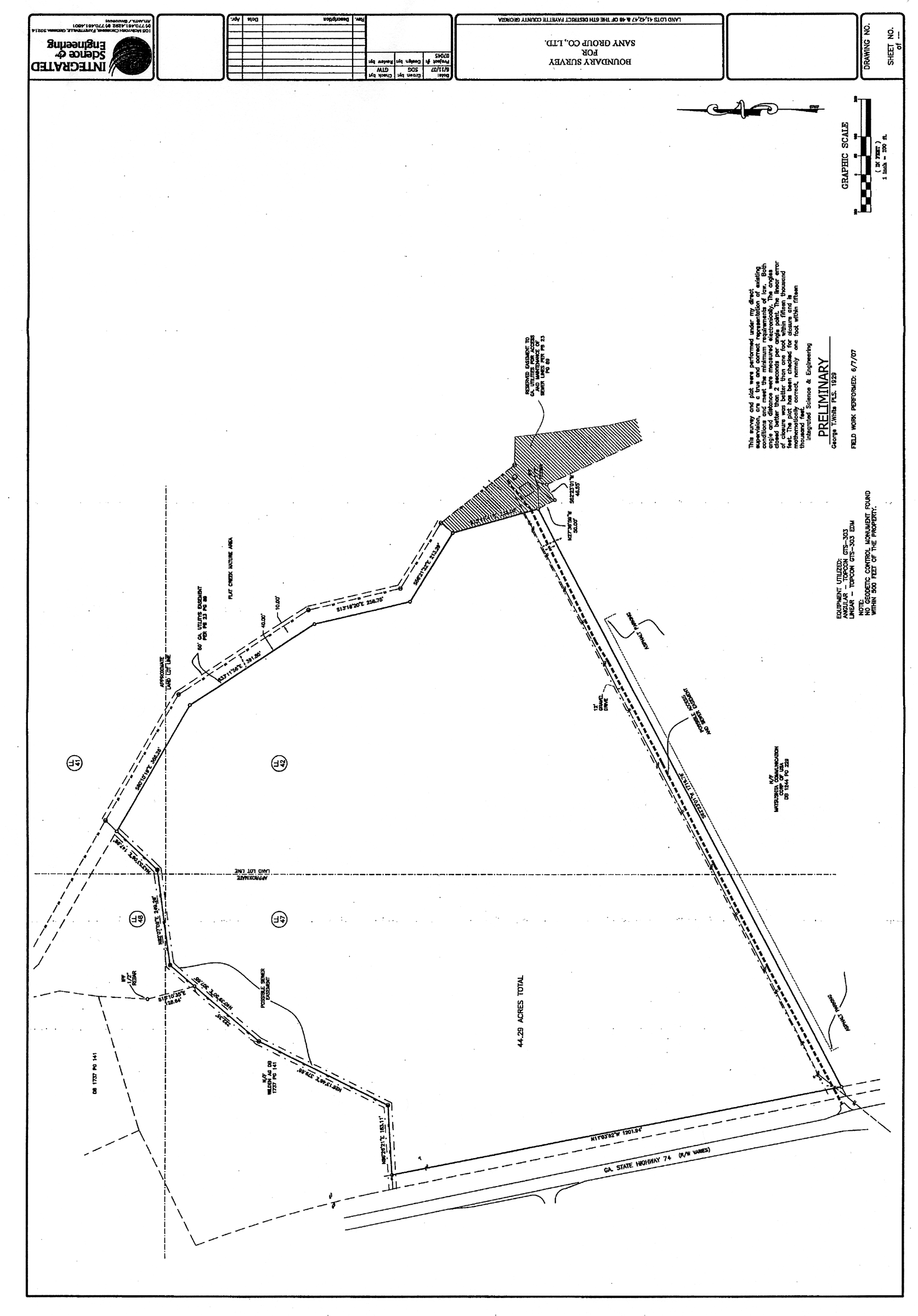
Limited-use industrial district no. 1 (1)
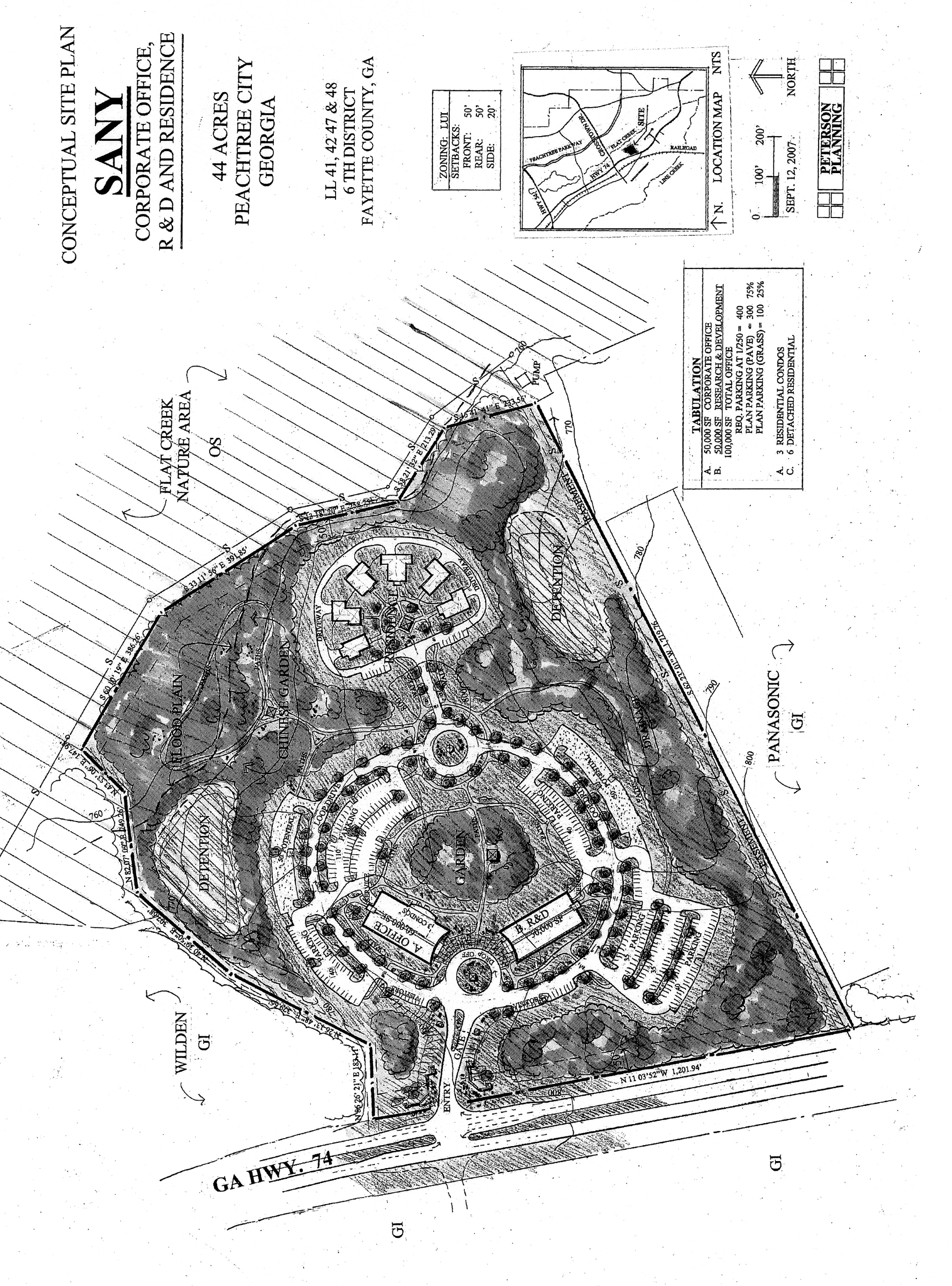
Limited-use industrial district no. 1 (2)
(1014A.2) Limited-use industrial district no. 2.
(a)
Two tracts of land as described below shall be rezoned from their present classification of GI General Industrial to LUI-2 Limited Use Industrial, subject to the conditions set forth herein. In the event of a conflict between the provisions of this ordinance and the regulations of the LUI Zoning District, the most restrictive regulation shall apply.
Tract 1: ALL THAT TRACT OR PARCEL of land containing 19.13 acres lying and being in Land Lots 42,43,46 and 47 of the Sixth District of Fayette County, Georgia, also being in the city of Peachtree City, Georgia, and being more particularly described as follows:
TO FIND THE TRUE POINT OF BEGINNING, commence at the corner formed by the intersection of the southeast line of the right-of-way of Crosstown Road (having a 100' right-of-way) with the east and northeast line of the right-of-way of Georgia State Highway 74 (having a 130' right-of-way), if said right-of-way lines were extended to form an angle instead of a truncated curve; running thence in a southerly direction along the east right-of-way of Georgia State Highway 74 a distance of 4,990.50 feet to a point and the TRUE POINT OF BEGINNING; running thence North 62 23' 01" East a distance of 662.54 feet to a point; running thence South 27 39' 40" East a distance of 863.29 feet to a point; running thence South 62 23' 01" West a distance of 517.00 feet to a point; running thence South 27 43' 52" East a distance of 514.04 feet to a point; running thence South 62 23' 01" West a distance of 294.57 feet to a point on the east right-of-way line of Georgia State Highway 74; running thence along the east right-of-way line of Georgia State Highway 74 along a curve to the right an arc distance of 1060.75 feet, which arc is subtended by a chord with a bearing of North 24 44' 53" West a chord distance of 1051.29 feet and having a radius of 2,289.86 feet to a point; running thence continuing along the east right-of-way line of Georgia State Highway 74 North 11 28' 40" West a distance of 340.78 feet to the TRUE POINT OF BEGINNING.
Tract 2: ALL THAT TRACT OR PARCEL of land containing 40.89 acres lying and being in Land Lots 42,43,46 and 47 of the Sixth District of Fayette County, Georgia, also being in the city of Peachtree City, Georgia, and being more particularly described as follows:
TO FIND THE TRUE POINT OF BEGINNING, commence at the corner formed by the intersection of the southeast line of the right-of-way of Crosstown Road (having a 100' right-of-way) with the east and northeast line of the right-of-way of Georgia State Highway 74 (having a 130' right-of-way), if said right-of-way lines were extended to form an angle instead of a truncated curve; running thence in a southerly direction along the east right-of-way of Georgia State Highway 74 a distance of 4,990.50 feet to a point, running thence North 62 23' 01" East a distance of 662.54 feet to the TRUE POINT OF BEGINNING; running thence North 62 23' 01" East a distance of 1085.13 feet to a point; running thence South 27 36' 59" East a distance of 50.00 feet to a point; running thence North 62 23' 01" East a distance of 46.55 feet to a point; running thence South 25 00' 13" East a distance of 1328.70 feet to a point; running thence South 62 23' 01" West a distance of 1586.41 feet to a point; running thence North 27 43' " West a distance of 514.04 feet to a point; running thence North 62 23' 01" East a distance of 517.00 feet to a point; running thence North 27 39' 40" West a distance of 863.29 feet to the TRUE POINT OF BEGINNING.
(b)
These tracts of land are illustrated on the Boundary Survey for Panasonic Automotive Systems of America as prepared by S.A. Gaskins & Associates, LLC (dated December 30, 2013), a copy of which is attached hereto as Exhibit "A" and incorporated herein by express reference.
It is intended that the LUI-2 zoning district be established specifically to subdivide the existing 60-acre Panasonic tract into two tracts of land in accordance with the conditions set forth in this ordinance.
(c)
It is understood there are no external building modifications or additions, parking or circulation enhancements, or any site improvements planned as a part of this subdivision. The rezoning is meant to accommodate a proposed subdivision of the property into two tracts of land.
(d)
It is understood that all access and utility easements, cross parking agreements, and other internal agreements between the owners of the two tracts of land shall be duly satisfied and recorded as a part of the sale of the individual buildings or tracts of land, and that the city shall not be responsible for interpreting or providing relief for any issues related to the subdivision of the two tracts of land.
(1014A.2.1) Permitted uses. Those uses identified in Section 1008.2 of the Peachtree City Zoning Ordinance.
(1014A.2.2) Conditional uses. Those uses identified in Section 1008.3 of the Peachtree City Zoning Ordinance.
(1014A.2.3) Other requirements.
(a)
Minimum zoning lot area: 80,000 square feet.
(b)
Minimum lot width: 200 feet.
(c)
Minimum front setback depth: 50 feet.
Note: The minimum front setback depth shall apply only to the property line abutting HWY 74 and shall not apply to the internal property lines.
(d)
Minimum side setback depth: 20 feet.
Note: The minimum side setback depth shall apply only to the north and south property lines and shall not apply to the internal property lines.
(e)
Minimum rear yard: 50 feet.
Note: The minimum rear setback depth shall apply only to the property line abutting the Flat Creek Nature Area and shall not apply to the internal property lines.
(f)
Maximum building height and structure height: Unlimited, but if the height of a proposed building exceeds 35 feet, as measured from finish grade to the ridge line or the tallest portion of the roof, the proposed site access, site circulation and building design details regarding the overall building layout, proposed construction methods, and overall fire protection plan shall be reviewed and approved by the fire marshal and building official in accordance with current fire and building codes prior to the review by the city planning commission. The fire marshal and building official may impose additional or alternative requirements to the approval based on conditions to include, but not limited to, the type of building, construction type and/or the planned occupancy and use of the building and overall life safety considerations. In addition to this review, federal air space regulations may apply should the building exceed 35 feet in height.
(g)
No automobile parking or service areas will be permitted within the required front setback depth or within 50 feet of the property line of any adjoining residential zoning lot.
(h)
No open burning will be permitted on any zoning lot.
(i)
All industries must be approved by state and federal regulatory agencies relative to meeting standards for environmental quality.
(j)
This rezoning request was approved by the mayor and city council on November 7, 2013 subject to the following understandings and conditions:
1.
The applicant shall continue to coordinate with city staff to ensure all applicable notes are included on the final subdivision plat prior to recording.
2.
The applicant shall provide an easement in favor of the City of Peachtree City of no less than 50' in width along the rear property line. The purpose of this easement is to accommodate the future construction of a multi-use path within the existing sanitary sewer easement along the rear property line.
3.
It is understood that approval of the rezoning shall not include approval of any site enhancements or improvements, and that any site enhancements or improvements shall follow the established site plan review process.
(1014A.3) Limited-use industrial district no. 3
(a)
The tract of land as described below shall be rezoned from its present classification of GI General Industrial to LUI-3 Limited Use Industrial, subject to the conditions set forth herein. In the event of a conflict between the provisions of this ordinance and the regulations of the LUI Zoning District, the most restrictive regulation shall apply.
ALL THAT TRACT or parcel of land lying and being in Land Lot 47 of the 6 th Land District of Fayette County, Georgia and being approximately 17.8 acres and being more particular described as follows:
BEGIN at a point on the northeasterly right-of-way line of CSX Railroad (100′ r/w), which lies north 16 degrees 50 minutes 44 seconds west a distance of 219.25 feet as measured along said right-of-way line from the intersection of said railroad right-of-way line with the northeasterly right-of-way of Dividend Drive (80′ r/w), and run thence along said railroad right-of-way line north 16 degrees 55 minutes 33 seconds west a distance of 798.76 feet to a point; run thence north 73 degrees 6 minutes 47 seconds east a distance of 216.83 feet to a point; run thence south 27 degrees 17 minutes 27 seconds east a distance of 87.79 feet to a point; run thence north 85 degrees 46 minutes 14 seconds east a distance of 355.75 feet to a point; run thence north 68 degrees 48 minutes 32 seconds east a distance ot 478.31 feet to a point on the southwesterly right-of-way line of Georgia Highway 74 (130′ r/w); run thence in a southerly direction along said right-of-way line along the arc of a curve to the right of the point which marks the northeast corner of land conveyed to Dividend Partners, LLC by Formtec, Inc. by Limited Warranty Deed recorded in Deed Book 1160, Page 483, Fayette County, Georgia Records; run thence away from said right-of-way line south 78 degrees 31 minutes 20 seconds west a distance of 1023.82 feet to the Point of Beginning as established above; being all that property which is bound on the east by Georgia Highway 74, on the south by said property formerly owned by Formtec, Inc., as described in said deed recorded in Deed Book 1160, Page 483, bound on the west by said right-of-way of CSX Railroad, and bound on the north by property nor or formerly owned by the US Department of Commerce and/or Robert Pattillo Properties, Inc.
Said property containing 17.8 acres.
(b)
This tract of land is illustrated on the Boundary Survey prepared for South-Tree Enterprises by W.D. Gray & Associates (last revised June 24, 2014), a copy of which is attached hereto as Exhibit "A" and incorporated herein by express reference.
(c)
It is intended that the LUI-3 zoning district be established specifically to allow the subdivision of the 16.58-acre South 74 Industrial Park in accordance with the conditions set forth in this ordinance.
The rezoning will permit the subdivision of the property such that the building and parking setbacks as identified within the GI General Industrial zoning district are not applicable to the internal property lines separating the individual tracts of land.
It is understood additional buildings will be constructed on the property in accordance with the conceptual site plan as approved by the planning commission.
(d)
It is also understood that all access and utility easements, cross parking agreements, and other internal agreements between the owners of the various tracts of land shall be duly satisfied and recorded as a part of the sale of the individual buildings or tracts of land, and that the city shall not be responsible for interpreting or providing relief for any issues related to the subdivision of the two tracts of land.
(1014A.3.1) Permitted uses.
Those uses identified in section 1008.2 of the Peachtree City Zoning Ordinance.
(1014A.3.2) Conditional uses.
Those uses identified in section 1008.3 of the Peachtree City Zoning Ordinance.
(1014A.3.3) Other requirements.
(a)
Minimum zoning lot area: 80,000 square feet.
(b)
Minimum lot width: 200 feet.
(c)
Minimum front setback depth:
(1)
Building: 50 feet.
(2)
Driveway/parking: 50 feet.
Note: The minimum front setback depths shall apply only to the property line abutting HWY 74 and shall not apply to the internal property line separating the individual tracts.
(d)
Minimum side setback depth: 20 feet.
Note: The minimum side setback depth shall not apply to the internal property line separating the individual tracts.
(e)
Minimum rear yard: 50 feet.
Note: The minimum rear setback depth shall not apply to the internal property line separating the individual tracts.
(f)
Maximum building height: Unlimited, but if the height of a proposed building exceeds 35 feet, as measured from finish grade to the ridge line or the tallest portion of the roof, the proposed site access, site circulation and building design details regarding the overall building layout, proposed construction methods, and overall fire protection plan shall be reviewed and approved by the fire marshal and building official in accordance with current fire and building codes prior to the review by the city planning commission. The fire marshal and building official may impose additional or alternative requirements to the approval based on conditions to include, but not limited to, the type of building, construction type and/or the planned occupancy and use of the building and overall life safety considerations. In addition to this review, federal air space regulations may apply should the building exceed 35 feet in height.
(g)
No automobile parking or service areas will be permitted within the required front setback depth or within 50 feet of the property line of any adjoining residential zoning lot.
(h)
No open burning will be permitted on any zoning lot.
(i)
All industries must be approved by state and federal regulatory agencies relative to meeting standards for environmental quality.
(1014A.4) Limited-use industrial district no. 4
(a)
The tract of land as described below shall be rezoned from its present classification of GI General Industrial to LUI-4 Limited Use Industrial, subject to the conditions set forth herein. In the event of a conflict between the provisions of this ordinance and the regulations of the LUI Zoning District, the most restrictive regulation shall apply.
All that tract or parcel of land lying and being in Land Lots 46 and 47 of the 6th Land District of Peachtree City, Fayette County, Georgia and being more particularly described as follows:
To arrive at the TRUE POINT OF BEGINNING; Commence at the intersection formed by the easterly right-of-way of CSX RAILROAD (100-foot right-of-way) and the southerly right-of-way of Dividend Drive (80-foot right-of-way); THENCE run in a southeasterly direction along the easterly right-of-way of CSX RAILROAD a distance of 1,165.00 feet to a ½" re-bar found on the easterly right-of-way of CSX RAILROAD and the TRUE POINT OF BEGINNING; THENCE leaving said right-of-way south 33°15'25" east a distance of 88.60 feet to a ½" re-bar found; THENCE north 70°37'11" east a distance of 843.31 feet to a ½" re-bar and cap set on the new westerly right-of-way of GEORGIA STATE HIGHWAY NO. 74 (right-of-way varies) and said point being on a curve; THENCE along a curve to the left having a radius of 2,148.29 feet, a delta of 16°18'21", an arc length of 611.39 feet, and a chord which bears south 25°56'16" east having a chord distance of 609.33 feet to a ½" re-bar and cap set; THENCE south 62°19'52" west a distance of 24.28 feet to a ⅜" re-bar found; THENCE south 62°19'52" west a distance of 433.48 feet to a ⅜" re-bar found; THENCE south 62°17'30" west a distance of 161.24 feet to a ½" re-bar found; THENCE along a curve to the left having a radius of 507.78 feet, a delta of 11°08'35", an arc length of 98.76 feet, and a chord which bears north 57°15'34" west having a chord distance of 98.60 feet to a ½" re-bar and cap set; THENCE north 61°37'45" west a distance of 153.69 feet to a ½" re-bar and cap set; THENCE along a curve to the right having a radius of 480.69 feet, a delta of 28°06'43", an arc length of 235.85 feet, and a chord which bears north 48°55'08" west having a chord distance of 233.49 feet to a ½" re-bar and cap set; THENCE north 36°26'00" west a distance of 91.23 feet to a ½" re-bar and cap set; THENCE along a curve to the right having a radius of 704.59 feet, a delta of 06°03'54", an arc length of 74.58 feet, and a chord which bears north 34°13'08" west having a chord distance of 74.55 feet to a ½" re-bar and cap set on the easterly right-of-way of CSX RAILROAD (100-foot right-of-way);
THENCE north 16°52'03" west a distance of 226.90 feet to a ½" re-bar found and the TRUE POINT OF BEGINNING, and containing 527,098 square feet or 12.100 acres of land, more or less.
(b)
This tract of land is illustrated on the survey for Churchill Peachtree City Limited Partnership by Welborn Land Surveying (dated November 11, 2015), a copy of which is attached hereto as Exhibit "A" and incorporated herein by express reference.
(c)
It is intended that the LUI-4 zoning district be established specifically to subdivide the existing 12.1-acre Churchill International Property Corporation tract into two tracts of land in accordance with the conditions set forth in this ordinance.
The rezoning will permit the subdivision of the property such that the building and parking setbacks as identified within the GI General Industrial zoning district are not applicable to the internal property lines separating the individual tracts of land.
It is understood an additional building will be constructed on the property in accordance with the conceptual site plan as approved by the planning commission.
(d)
It is also understood that all access and utility easements, cross parking agreements, and other internal agreements between the owners of the two tracts of land shall be duly satisfied and recorded as a part of the sale of the individual buildings or tracts of land, and that the city shall not be responsible for interpreting or providing relief for any issues related to the subdivision of the two tracts of land.
(1014A.4.1) Permitted uses. Those uses identified in Section 1008.2 of the Peachtree City Zoning Ordinance.
(1014A.4.2) Conditional uses. Those uses identified in Section 1008.3 of the Peachtree City Zoning Ordinance.
(1014A.4.3) Other requirements.
(a)
Minimum zoning lot area: 80,000 square feet.
(b)
Minimum lot width: 200 feet.
(c)
Minimum front setback depth:
(1)
Building: 50 feet.
(2)
Driveway/parking: 50 feet.
Note: The minimum front setback depths shall apply only to the property line abutting HWY 74 and shall not apply to the internal property line separating the individual tracts.
(d)
Minimum side setback depth: 20 feet.
Note: The minimum side setback depth shall not apply to the internal property line separating the individual tracts.
(e)
Minimum rear yard: 50 feet.
Note: The minimum rear setback depth shall not apply to the internal property line separating the individual tracts.
(f)
Maximum building height: Unlimited, but if the height of a proposed building exceeds 35 feet, as measured from finish grade to the ridge line or the tallest portion of the roof, the proposed site access, site circulation and building design details regarding the overall building layout, proposed construction methods, and overall fire protection plan shall be reviewed and approved by the fire marshal and building official in accordance with current fire and building codes prior to the review by the city planning commission. The fire marshal and building official may impose additional or alternative requirements to the approval based on conditions to include, but not limited to, the type of building, construction type and/or the planned occupancy and use of the building and overall life safety considerations. In addition to this review, federal air space regulations may apply should the building exceed 35 feet in height.
(g)
No automobile parking or service areas will be permitted within the required front setback depth or within 50 feet of the property line of any adjoining residential zoning lot.
(h)
No open burning will be permitted on any zoning lot.
(i)
All industries must be approved by state and federal regulatory agencies relative to meeting standards for environmental quality.
(e)
This rezoning request was approved by the mayor and city council on March 3, 2016 subject to the following understandings and conditions:
1.
Approval of the rezoning shall not include approval of any site enhancements or improvements.
2.
The new building shall comply with the established site plan submittal requirements, and shall not exceed 100,000 SF as identified on the approved conceptual and final site plans.
3.
The applicant shall coordinate with city staff to ensure notes related to site access, parking, stormwater and utility easements are properly addressed and included on the final plat.
(1014A.5) Limited-use industrial district no. 5.
(a)
The tract of land as described below shall be rezoned from its present classification of GI General Industrial to LUI-5 Limited Use Industrial, subject to the conditions set forth herein.
All that tract or parcel of land lying and being in Land Lots 58 and 59 of the 6th Land District of Peachtree City, Fayette County, Georgia and from a plat of survey by Winfred D. Kirk dated February 19, 1977, recorded in Plat Book 9, page 205, Fayette County Records, being more particularly described as follows:
BEGINNING at an iron pin at the intersection of the southeasterly right of way line of Kelly Drive with the northeasterly right of way line of Dividend Drive and running thence north 67º46' east 603.08 feet along said southeasterly right of way line of Kelly Drive to an iron pin at the right of way of the Atlantic Coast Line Railroad; running thence south 24'24" east along the southwesterly right of way line of said Railroad 723.81 feet to an iron pin; running thence south 65º27'30" west 604.61 feet to an iron pin on the northeasterly right of way line of Dividend Drive; running thence north 24º15' west along the northeasterly right of way line of said Dividend Drive 748.11 feet to the iron pin at the intersection of said right of way lines of Kelly Drive and Dividend Drive and the point of beginning, being improved property of an area size of 10.2 acres having a one-story brick building and appurtenances thereon.
(b)
This tract of land is illustrated on the survey by Winfred D. Kirk dated February 19, 1977, a copy of which is attached hereto as Exhibit "A" and incorporated herein by express reference.
(1014A.5.1) Permitted uses. Those uses identified in the GI General Industrial and LI Light Industrial zoning districts.
(1014A.5.2) Conditional uses. The following uses shall be permitted in the LUI-5 zoning district on a conditional basis:
(1)
The conditional uses identified in the GI General Industrial and LI Light Industrial zoning districts with the same conditions.
(2)
Sit-down restaurant up to 4,000 gross square feet per tenant. The owner of the property shall provide documentation to the city indicating there is sufficient parking on the site to accommodate the proposed use as well as the other tenants within the buildings, and that parking will not interfere with existing service courts, loading docks and/or truck traffic. The owner of the property shall also include a detailed site plan identifying where parking will be provided for each use within the building or buildings.
(3)
Retail sales so long as the publicly-accessible retail showroom of the tenant occupies less than half the gross floor area of the industrial tenant. The owner of the property shall provide documentation to the city indicating there is sufficient parking on the site to accommodate the proposed use as well as the other tenants within the buildings, and that parking will not interfere with existing service courts, loading docks and/or truck traffic. The owner of the property shall also include a detailed site plan identifying where parking will be provided for each use within the building or buildings.
(1014A.5.3) Other requirements.
(a)
Minimum zoning lot area: 20,000 square feet.
(b)
Minimum lot width: 100 feet.
(c)
Minimum front setback depth: 30 feet.
(d)
Minimum side setback depth: 20 feet.
(e)
Minimum rear yard: 20 feet.
(f)
Maximum building height: Unlimited, but if the height of a proposed building exceeds 35 feet, as measured from finish grade to the ridge line or the tallest portion of the roof, the proposed site access, site circulation and building design details regarding the overall building layout, proposed construction methods, and overall fire protection plan shall be reviewed and approved by the fire marshal and building official in accordance with current fire and building codes prior to the review by the city planning commission. The fire marshal and building official may impose additional or alternative requirements to the approval based on conditions to include, but not limited to, the type of building, construction type and/or the planned occupancy and use of the building and overall life safety considerations. In addition to this review, federal air space regulations may apply should the building exceed 35 feet in height.
(g)
Maximum structure size for retail uses permitted in this district: 10,000 square feet. There is no maximum structure size for other non-retail uses permitted in the LUI-5 zoning district.
(h)
No automobile parking or service areas will be permitted within the required front setback depth.
(i)
No open burning will be permitted on any zoning lot.
(j)
All industries must be approved by state and federal regulatory agencies relative to meeting standards for environmental quality.
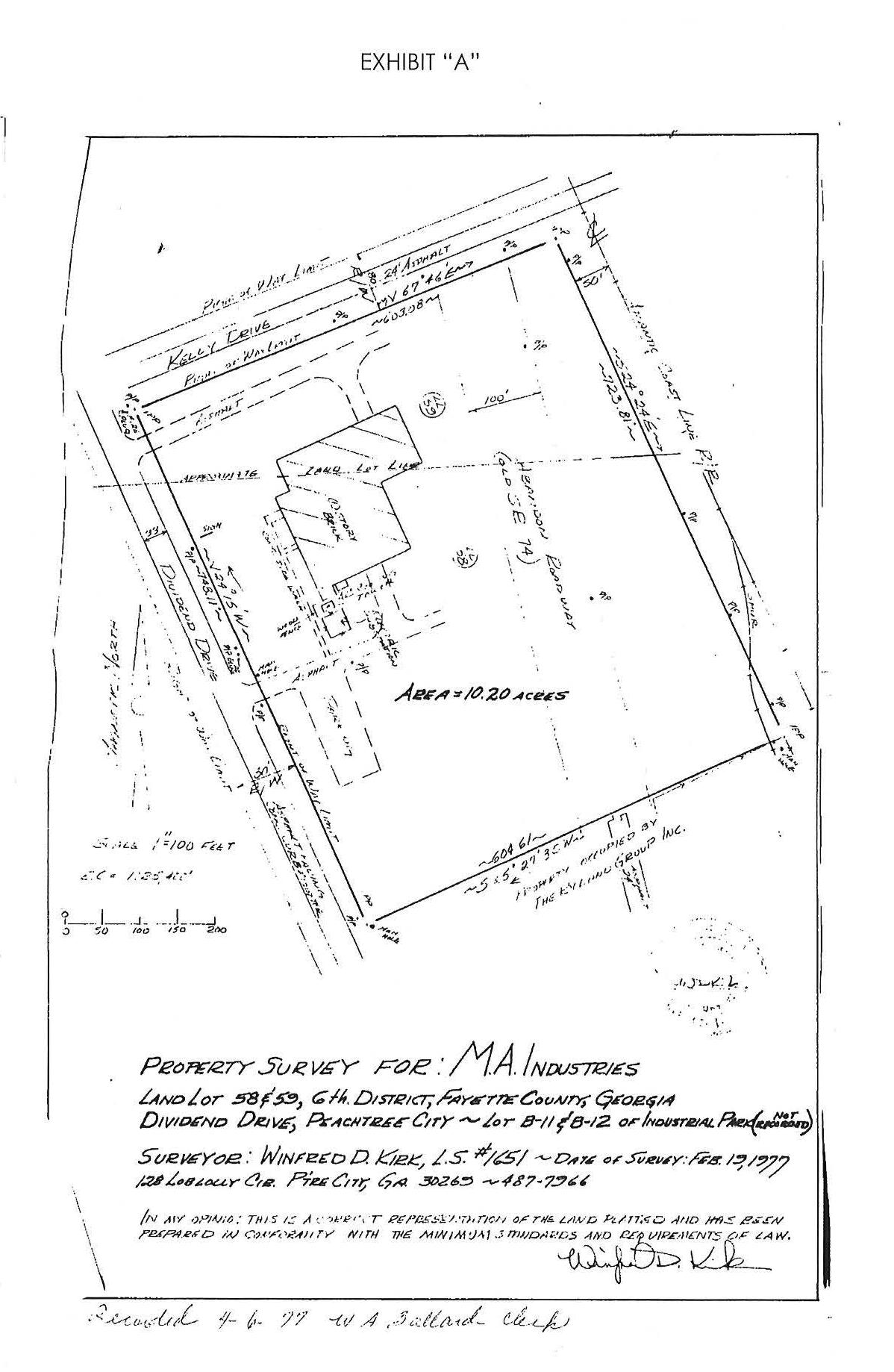
(1014A.6) Limited-use industrial district [no. 6]. The zoning of the property described below shall be rezoned from the current zoning designation of GI General Industrial to LUI-6 Limited Use Industrial. Said property is more particularly described as follows:
All that tract or parcel of land lying and being located in land Lots 58 and 59, of the 6 th Land District, City of Peachtree City, Fayette County, Georgia and being more particularly described as follows:
Beginning at a ½ inch rebar set at the intersection of the southwesterly right-of-way of Dividend Drive (80' R/W) with the northwesterly right-of-way of Kelly Green Drive (80' R/W); thence along said right of way of Kelly Green Drive S 70º05'30"W a distance of 1,095.96 feet to a ½ inch rebar found; thence departing said right of way N 00º54'38"W a distance of 219.21 feet to a ½ inch rebar found; thence N 17º51'57"W a distance of 266.21 feet to a ½ inch rebar found; thence N 56º58'37"E a distance of 1,014.82 feet to a ½ inch rebar found on said right of way of Dividend Drive; thence along said right of way S 22º05'12"E a distance of 704.08 feet to said ½ inch rebar set and the point of beginning. Said tract containing 12.82 acres as shown on survey prepared by Pearson & Associates, Inc., dated November 1, 2004 and last revised November 11, 2004.
(1014A.6.1) Permitted uses. Those uses identified in the GI General Industrial and Li Light Industrial zoning districts, except neither a petroleum refinery nor a ready-mix concrete plant and pre-cast concrete manufacturing facility are permitted.
(1014A.6.2) Conditional uses. In addition to the conditional uses and conditions identified in the GI General Industrial and LI Light Industrial zoning districts, the following uses are permitted in the LUI05 zoning district on a conditional basis:
(1)
Sit-down restaurant up to 4,000 gross square feet each. The owner of the property shall provide documentation to the city indicating there is sufficient parking on the site to accommodate the proposed uses as well as the other tenants within the buildings, and that parking will not interfere with the existing service courts, loading docks and/or truck traffic the owner of the property shall also include a detailed site plan identifying where parking will be provided for each use with the building or buildings.
(2)
Retail sales as long as the publicly-accessible retail showroom occupies less than half the gross floor area of the tenant, up to a maximum retail sales area of 10,000 square feet per tenant. The owner of the property shall provide documentation to the city indicating there is sufficient parking on the site to accommodate the proposed uses as well as the other tenants within the buildings, and that parking will not interfere with the existing service courts, loading docks and /or truck traffic the owner of the property shall also include a detailed site plan identifying where parking will be provided for each use with the building or buildings.
(1014A.6.3) Other requirements.
(1)
Minimum zoning lot area: 80,000 square feet.
(2)
Minimum lot width: 200 feet.
(3)
Minimum front setback depth: 50 feet.
(4)
Minimum side setback depth: 20 feet.
(5)
Minimum rear yard: 50 feet.
(6)
Maximum building height and structure height: Unlimited, but if the height of a proposed building exceeds 35 feet, as measured from finish grade to the ridge line or the tallest portion of the roof, the proposed site access, site circulation and building design details regarding the overall building layout, proposed construction methods, and overall fire protection plan shall be reviewed and approved by the fire marshal and building official in accordance with current fire and building codes prior to the review by the city planning commission. The fire marshal and building official may impose additional or alternative requirements to the approval based on conditions to include but are not limited to, the type of building, construction type and/or the planned occupancy and use of the building and overall life safety considerations. In addition to this review, federal air space regulations may apply should the building exceed 35 feet in height.
(7)
No automobile parking or service areas will be permitted within the required front setback depth or within 50 feet of the property line of any adjoining residential zoning lot.
(8)
No open burning will be permitted on any zoning lot.
(9)
All industries must be approved by state and federal regulatory agencies relative to meeting standards for environmental quality.
(10)
A 75-foot no-disturb buffer shall be located along the western property line abutting the city-owned greenbelt.
(11)
No development activity shall occur within 300 feet of a residentially-zoned property.
(1014A.7) Limited-use industrial district no. 7.
(a)
The zoning of the property described below shall be rezoned from the current zoning designation of GI General Industrial to LUI-7 Limited Use Industrial. Said property is more particularly described as follows:
ALL THAT TRACT OR PARCEL OF LAND LYING AND BEING LOCATED IN LAND LOT 59 and 60 OF THE 6 TH LAND DISTRICT, City of Peachtree City, Fayette County, Georgia and being shown as "Tract 2", containing approximately 28.92 acres of land on that certain survey prepared by Georgia Land Surveying Co., bearing the seal of Josh L. Lweis, IV, Georgia Registered Land Surveyor No. 3028, dated July 15, 2016, last revised December 14, 206, recorded in Plat Book 49, Pages 173-174, in the office of the Clerk of Superior Court of Fayette County, Georgia.
(b)
This tract is illustrated on the "Property Location" survey, prepared by S.A. Gaskins & Associates, LLC by Swinson A. Gaskins, Sr. #1620, dated September 9, 2020 attached hereto as Exhibit "A" and incorporated herein by express reference.
(c)
It is intended that the LUI-07 zoning district be established specifically to subdivide the existing 28.9-acre site into two tracts of land in accordance with the conditions set forth in this ordinance.
It is understood that any additional development as defined by this ordinance shall be done in accordance with this zoning ordinance and the land development ordinance. Substantial changes from the Exhibit "A" property location plan referenced above shall require a rezoning action.
(d)
Permitted uses. All permitted uses identified in the GI zoning district, section 1008.2 of this zoning ordinance.
(e)
Conditional uses. All conditional uses and conditions identified in the GI zoning district, section 1008.3 of this zoning ordinance.
(f)
Other requirements.
1.
All other requirements identified in the GI zoning district, section 1008.4 of this zoning ordinance, except (b) minimum lot width; and (d) minimum side setback.
2.
All access and utility easements, cross parking agreements, and other internal agreements between the owners of the two tracts of land shall be duly satisfied and recorded as part of the sale of the individual buildings or tracts of land, and that the city shall not be responsible for interpreting or providing relief for any issues related to the subdivision of the property.
(Ord. No. 913, 11-1-2007; Ord. No. 1078, § 1, 6-5-2014; Ord. No. 1090, § 1, 2-19-2015; Ord. No. 1106, § 1, 3-3-2016; Ord. No. 1168, § 1, 3-21-2019; Ord. No. 1173, § 1, 10-3-2019; Ord. No. 1219, § 1, 5-16-2024)
Sec. 1015. - COR, corridor overlay district (GA 54 West).
(1015.1) Intent of district. The GA 54 West Corridor Overlay District is intended to enhance the viability and livability of all property within the GA 54 West corridor. The purpose of the Overlay District is to achieve and maintain a unified, pleasing aesthetic and visual quality in site planning, architectural design, building materials, landscaping, site lighting and signage; and to promote and encourage the use of alternate modes of transportation within the corridor through the provision of interconnecting streets, sidewalks and a multi-use path system. The intent of the GA 54 West Design Guidelines is to assure respect for and reduce incompatible and adverse impacts on the visual experience from the roadway.
(1015.2) Delineation of District. The requirements of the GA 54 West Corridor Overlay District shall apply to all non-residentially zoned properties within the geographic area shown on the following map. These parcels are further defined on the official Zoning Map of Peachtree City on file with the Peachtree City Planning Department:
Corridor Overlay District
(1015.3) Design Guidelines. The Design Guidelines consist of several key design concepts, which when operating in conjunction with each other provide for the compatible relationship of individual developments within the GA 54 West Corridor. All buildings and site improvements must meet or exceed the requirements identified within the GA 54 West Design Guidelines (copy attached). It is understood the Design Guidelines may be amended as necessary to carry out the intent and maintain the character of the GA 54 West Corridor Overlay District. The original copy of these Design Guidelines shall be kept on file with the Peachtree City Planning Department.
All new development and changes to existing development located within the Overlay District shall be reviewed in accordance with these guidelines, except for single-family detached houses. Such development shall receive site plan approval prior to commencing construction. There shall be no alteration of the existing condition of land, uses, structures, landscaping or lighting within the Overlay District after the effective date of this ordinance, except as provided by this section or by other sections of this ordinance.
(1015.3.5) Streetscape enhancements. Streetscape improvements include those architectural or functional facilities or structures which occur on site but are not part of the building and which encourage and facilitate human interaction with the environment. Examples include, but are not limited to, decorative light fixtures, fountains, sculptures, benches and tables, planters, retaining walls, pedestrian and multi-use paths, bicycle parking structures, trash receptacles and enclosures, bollards and fences. These improvements shall be designed in accordance with the landscape and streetscape specifications within the GA 54 West Design Guidelines and shall be reviewed for aesthetic functionality and compatibility.
(1015.4) Review procedures. All development proposed within the GA 54 West Overlay District shall submit the required information to the City Planner as a part of the conceptual site plan review process. Such application shall be reviewed for consistency with the Design Guidelines and according to the submission and review criteria established within the GA 54 West Design Guidelines.
A two-step approval process (conceptual and final site plan) shall apply to all new development. Alterations and additions, minor external changes and signs shall not be required to pursue conceptual site plan approval.
(1015.5) Requirements following project completion. All appearance features, lighting and landscaping required by the Design Guidelines or shown on the approved site plan shall be maintained by the present owner and all subsequent owners of the property. Any changes proposed by the owner shall meet the requirements specified within the Design Guidelines and will require approval by City Staff and the Planning Commission.
All properties developed for commercial purposes, whether or not they are occupied, shall be regularly maintained so they are not allowed to fall into a state of disrepair or neglect; and they shall consistently present a neat and orderly appearance to the general public as well as adjacent and nearby tenants and property owners.
(Ord. No. 825, 1-15-2004)
Editor's note— Ord. No. 825, adopted January 15, 2004, enacted provisions intended for use as subsection (1015.3), streetscape enhancements. Inasmuch as there are already provisions so designated, and at the discretion of the editor, said provisions have been redesignated as subsection (1015.3.5).
Sec. 1016. - CON conservation subdivision overlay district.
(1016.1) Intent and purpose.
(a)
To provide for the preservation of greenspace as a nonstructural stormwater runoff and watershed protection measure.
(b)
To promote the development of residential subdivisions that permits flexibility of design in order to promote environmentally sensitive and efficient uses of the land.
(c)
To preserve in perpetuity unique or sensitive natural resources such as groundwater, floodplains, wetlands, streams, steep slopes, woodlands and wildlife habitat.
(d)
To encourage clustering of houses and structures on less environmentally sensitive soils which will reduce the amount of infrastructure, including paved surfaces and utility easements, necessary for residential development.
(e)
To reduce erosion and sedimentation by minimizing land disturbance and removal of vegetation in residential development.
(f)
To promote interconnected greenways and corridors throughout the community.
(g)
To promote contiguous greenspace with adjacent jurisdictions.
(h)
To encourage interaction in the community by clustering houses and orienting them closer to the street, providing public gathering places and encouraging use of parks and community facilities as focal points in the neighborhood.
(i)
To encourage street designs that reduce traffic speeds and reliance on main arteries.
(j)
To promote construction of convenient landscaped walking trails and bike paths both within the subdivision and connected to neighboring communities, businesses, and facilities to reduce reliance on automobiles.
(k)
To conserve scenic views and reduce perceived density by maximizing the number of houses with direct access to and views of open space.
(l)
To preserve important historic and archaeological sites.
(1016.2) General regulations.
(a)
Applicability of regulations. The conservation subdivision overlay district shall only be permitted within the LUR zoning district and shall be approved as a part of the formal rezoning process as a special use.
(b)
Ownership of development site. The tract of land to be subdivided must be held in single ownership.
(c)
Housing density determination. The maximum number of lots in the conservation subdivision overlay district shall be determined by either of the following two methods, at the discretion of the local jurisdiction:
(1)
Calculation. The maximum number of lots is determined by dividing the area of the tract of land by the minimum lot size specified in the current zoning classification of the property. In making this calculation, the following shall not be included in the total area of the parcel:
(a)
Slopes over 25 percent of at least 5,000 square feet contiguous area;
(b)
The 100-year floodplain;
(c)
Bodies of open water over 5,000 square feet contiguous area;
(d)
Wetlands that meet the definition of the Army Corps of Engineers pursuant to the Clean Water Act; or
(e)
Anticipated right-of-way needs for roads and utilities.
(2)
Yield plan. The maximum number of lots is based on a conventional subdivision design plan, prepared by the applicant, in which the tract of land is subdivided in a manner intended to yield the highest number of lots possible based upon the current zoning classification of the property. The plan does not have to meet formal requirements for a site design plan, but the design must be capable of being constructed given site features and all applicable regulations.
(1016.3) Application requirements.
(a)
Site analysis map. Concurrent with the submission of a concept plat, the applicant shall prepare and submit a detailed site analysis map. The purpose of the site analysis map is to ensure the important site features have been adequately identified prior to the creation of the site design, and that the proposed open space will meet the requirements of this article.
At a minimum, the concept plat shall include the following features:
1)
Property boundaries;
2)
All streams, rivers, lakes, wetlands and other hydrologic features;
3)
Topographic contours of no less than ten-foot intervals;
4)
All primary and secondary conservation areas labeled by type, as described in section 1016.4 of this article;
5)
General vegetation characteristics;
6)
General soil types;
7)
The planned location of protected open space;
8)
Existing roads and structures; and
9)
Potential connections with existing greenspace and trails.
(b)
Open space management plan. An open space management plan, as described in section 1016.4, shall be prepared and submitted prior to the issuance of a land disturbance permit.
(c)
Instrument of permanent protection. An instrument of permanent protection, such as a conservation easement or permanent restrictive covenant and as described in section 1016.4, shall be placed on the open space concurrent with the issuance of a land disturbance permit.
(d)
Other requirements. The Applicant shall adhere to all other applicable requirements of the underlying zoning and land development ordinance.
(1016.4) Open space.
(a)
Definition. Open space is the portion of the conservation subdivision that has been set aside for permanent protection. Activities within the open space are restricted in perpetuity through the use of an approved legal instrument.
(b)
Standards to determine open space.
1)
The minimum restricted open space shall comprise at least 40 percent of the gross tract area.
2)
The following are considered primary conservation areas and are required to be included within the open space, unless the applicant demonstrates that this provision would constitute an unusual hardship and be counter to the purposes of this article:
(a)
The regulatory 100-year floodplain;
(b)
Buffer zones of at least 75 feet width along all perennial and intermittent streams;
(c)
Slopes above 25 percent of at least 5,000 square feet contiguous area;
(d)
Wetlands that meet the definition used by the Army Corps of Engineers pursuant to the Clean Water Act;
(e)
Populations of endangered or threatened species, or habitat for such species; and
(f)
Archaeological sites, cemeteries and burial grounds.
3)
The following are considered secondary conservation areas and should be included within the open space to the maximum extent feasible.
(a)
Important historic sites;
(b)
Existing healthy, native forests of at least one acre contiguous area;
(c)
Individual existing healthy trees greater than eight inches caliper, as measured from their outermost drip line;
(d)
Other significant natural features and scenic view sheds such as ridge lines, peaks and rock outcroppings, particularly those that can be seen from public roads;
(e)
Prime agricultural lands of at least five acres contiguous area; and
(f)
Existing trails that connect the tract to neighboring areas.
4)
Above-ground utility rights-of-way and small areas of impervious surface may be included within the protected open space but cannot be counted towards the 40 percent minimum area requirement. Large areas of impervious surface shall be excluded from the open space.
5)
At least 75 percent of the open space shall be in a contiguous tract. The open space should adjoin any neighboring areas of open space, other protected areas, and non-protected natural areas that would be candidates for inclusion as part of a future area of protected open space.
6)
The open space shall be directly accessible to the largest practicable number of lots within the subdivision. Non-adjoining lots shall be provided with safe, convenient access to the open space.
(c)
Permitted uses of open space. Uses of open space may include the following:
1)
Conservation of natural, archeological or historical resources;
2)
Meadows, woodlands, wetlands, wildlife corridors, game preserves, or similar conservation-oriented areas;
3)
Walking or bicycle trails, provided they are constructed of porous paving materials;
4)
Passive recreation areas;
5)
Active recreation areas, provided that they are limited to no more than ten percent of the total open space and are not located within primary conservation areas. Active recreation areas may include impervious surfaces. Active recreation areas in excess of this limit must be located outside of the protected open space;
6)
Agriculture, horticulture, silviculture or pasture uses, provided that all applicable best management practices are used to minimize environmental impacts, and such activities are not conducted within primary conservation areas;
7)
Nonstructural stormwater management practices;
8)
Easements for drainage, access, and underground utility lines; or
9)
Other conservation-oriented uses compatible with the purposes of this ordinance.
(d)
Prohibited uses of open space.
1)
Golf courses;
2)
Roads, parking lots and impervious surfaces, except as specifically authorized in the previous sections; and
3)
Other activities as determined by the applicant and recorded on the legal instrument providing for permanent protection.
(e)
Ownership and management of open space.
1)
Ownership of open space. The applicant must identify the owner of the open space who is responsible for maintaining the open space and facilities located thereon. If a homeowners association is the owner, membership in the association shall be mandatory and automatic for all homeowners of the subdivision and their successors. If a homeowners association is the owner, the homeowners' association shall have lien authority to ensure the collection of dues from all members. The responsibility for maintaining the open space and any facilities located thereon shall be borne by the owner.
2)
Management plan. The applicant shall submit a plan for management of open space and common facilities ("plan") that:
(a)
Allocates responsibility and guidelines for the maintenance and operation of the open space and any facilities located thereon, including provisions for ongoing maintenance and for long-term capital improvements;
(b)
Estimates the costs and staffing requirements needed for maintenance and operation of, and insurance for, the open space and outlines the means by which such funding will be obtained or provided;
(c)
Provides that any changes to the plan be approved by the city council; and
(d)
Provides for enforcement of the plan.
3)
In the event the party responsible for maintenance of the open space fails to maintain all or any portion in reasonable order and condition, the city may assume responsibility for its maintenance and may enter the premises and take corrective action, including the provision of extended maintenance. The costs of such maintenance may be charged to the owner, homeowner's association, or to the individual property owners that make up the homeowner's association, and may include administrative costs and penalties. Such costs shall become a lien on all subdivision properties.
(f)
Legal instrument for permanent protection.
1)
The open space shall be protected in perpetuity by a binding legal instrument that is recorded with the deed. The instrument shall be one of the following:
(a)
A permanent conservation easement in favor of either:
(1)
A land trust or similar conservation-oriented non-profit organization with legal authority to accept such easements. The organization shall be bona fide and in perpetual existence and the conveyance instruments shall contain an appropriate provision for retransfer in the event the organization becomes unable to carry out its functions; or
(2)
A governmental entity with an interest in pursuing goals compatible with the purposes of this ordinance. If the entity accepting the easement is not the city, then a third right of enforcement favoring the city shall be included in the easement;
(b)
A permanent restrictive covenant for conservation purposes in favor of a governmental entity; or
(c)
An equivalent legal tool that provides permanent protection, if approved by the city.
2)
The instrument for permanent protection shall include clear restrictions on the use of the open space. These restrictions shall include all restrictions contained in this article, as well as any further restrictions the Applicant chooses to place on the use of the open space.
(g)
Special use permit.
1)
Certain uses, because of their unique characteristics or potential impacts on adjacent land uses, are not generally permitted within the zoning districts as a matter of right, but may, under the right set of circumstances and conditions be acceptable in certain specific locations. These uses are permitted only through the issuance of a special use permit by the mayor and city council after ensuring that the use can be appropriately accommodated on the specific property, will be in conformance with the comprehensive plan, can be constructed and operated in a manner which is compatible with the surrounding land uses and overall character of the community, and that the public interest and general welfare of the citizens of the city will be protected.
2)
No inherent right exists to receive a special use permit; such permits are a special privilege granted by the city under a specific set of circumstances and conditions, and each application and situation is unique. Consequently, mere compliance with the generally applicable requirements may not be sufficient and additional measures, occasionally substantial, may be necessary to mitigate the impact of the proposed development. In other situations, no set of conditions would be sufficient to approve an application, even though the same request in another location might be approved.
3)
Review procedures.
(a)
Application for the establishment of special uses shall be submitted to the city planner and, upon determination that such application contains all necessary elements, shall be deemed received by the city and referred to the planning commission for its review and recommendation.
(b)
The planning commission shall report to the mayor and city council its recommendation as to the approval or disapproval of such application and any recommendation for establishment of conditions, in addition to those set forth in this article, deemed necessary to protect the public interest and welfare.
(c)
In considering applications for special use permits, the planning commission and city council shall use the standards set forth in section 1305 of the city zoning ordinance and shall consider the following criteria:
(1)
Compatibility of the proposed use and location with the policies established in the comprehensive plan.
(2)
Compatibility of the proposed use with the character of adjacent properties and the surrounding neighborhoods and with existing and proposed development.
(3)
Availability of, or ability to provide, adequate utilities, drainage, parking and loading space, lighting, screening, landscaping and open space.
(4)
Provision of safe and convenient vehicular, pedestrian, bicycle, and alternate modes of transportation.
(5)
Compatibility of the proposed use with the intent and function of the zoning district, based upon the current zoning classification of the property.
(6)
Compliance with applicable performance standards and requirements as set forth in the city's land development ordinance.
(d)
In approving any application for special use permit, the city may by resolution:
(1)
Impose such reasonable standards, conditions or requirements, in addition to any specified within this chapter, as it may deem necessary to protect the public interest and welfare. Such additional standards may include, but are not limited to, special setbacks, buffer requirements, increased screening or landscaping requirements, and standards pertaining to traffic, circulation, noise, lighting, hours of operation and similar characteristics.
(2)
Require that a performance guarantee, acceptable in form, content and amount to the city be posted by the applicant to ensure continued compliance with all conditions and requirements that may be specified.
(3)
Specify time limits or expiration dates for any such special use permits, including provisions for periodic review and renewal.
(Ord. No. 929, § 1, 2-7-2008)