
Purcellville City Zoning Code
ARTICLE 2
- BASE DISTRICTS
Sec. 2.1.- Establishment of base districts.
In order to regulate and restrict the location and use of buildings and land for trade, industry, residence, and other purposes in accordance with the objectives of the Comprehensive Plan; to regulate and restrict the location, height and size of buildings hereafter erected or structurally altered, the size of yards and other open spaces and the density of population, the following zoning districts are hereby established:
The purpose statements which accompany each district are intended to describe in a general way the character of uses to be encouraged in the district, to assist with selection of appropriate districts for application to various conditions of land use, existing or planned, and to assist with interpretation of questions which may arise with respect to particular land uses in particular locations. In any case of difference between the purpose statement and the use regulations for the district, the use regulations shall control.
Sec. 2.2. - Establishment of the zoning map.
Such land and the district classification thereof, shall be as shown on the map or maps designated as the "Zoning Map of Purcellville, Virginia," dated and signed by the mayor upon adoption. This zoning map or maps, and all notations, dimensions, references, and symbols shown thereon, pertaining to such districts shall be as much a part of this ordinance as if fully described herein and shall be filed as part of this ordinance of the Town of Purcellville. Said map shall be available for public inspection in the town office, and online at https://purcellvilleva.gov/DocumentCenter/View/13229/2025-ZONING-MAP?bidId=. Such map shall be marked "Original Copy not to be altered or removed from the town's office except on Court Subpoena" provided however, that said map may be removed during normal office hours by the zoning administrator for the purpose of incorporating duly adopted revisions.
This map together with subsequent applicable amendments shall be conclusive as to the current zoning status of land.
Sec. 2.3.1. - Revisions of the zoning map.
No later than March 31 of the year following adoption of this ordinance, publications of the zoning map, clearly showing the zoning district boundaries and zoning district names and designations for the incorporated area of Purcellville, shall be made available to the public. In each calendar year thereafter, if there have been any changes in the zoning district boundaries, special use permits, zoning conditions or classifications in the preceding year, such map or affected sheet thereof shall be revised no later than March 31, reflecting all such changes as of December 31 of the preceding year.
Sec. 2.3.2. - Informational copies of the zoning map.
(1)
Informational copies of the zoning map shall be made available for inspection at the office of the zoning administrator and such other locations as may be necessary or convenient. These maps shall be revised as described above, to show changes in zoning district boundaries as officially approved.
(2)
Drafting errors or drafting omissions may be corrected, but no changes in zoning district boundaries may be made except to show amendments properly adopted by the town council.
(3)
Any person desiring a copy of said zoning map shall pay a fee as established by the fee schedule for each copy thereof, to the appropriate town official.
Sec. 2.4. - Interpretation of zoning map boundaries.
(1)
A district name, letter or letter-number combination shown on the zoning map indicates that the regulations pertaining to the district designated by that name, letter or letter-number combination extend throughout the whole area in the town bounded by the district boundary lines within which such name, letter or letter-number combination is shown or indicated, except as otherwise provided by this section.
(2)
Where uncertainty exists with respect to the boundaries of the various districts as shown on the zoning map accompanying and made a part of these regulations, the following rules apply:
(a)
In cases where a boundary line is given a position within a road, street or alley, navigable or non-navigable stream, it shall be deemed to be in the center of the right-of-way of the road, street, alley, or stream, and if the actual location of such road, street, alley, or stream varies slightly from the location as shown on the zoning map, then the actual location shall control.
(b)
In cases where a boundary line is shown as being located a specific distance from a road or street line or other physical feature, this distance shall control.
(c)
Where the district boundaries are shown on the zoning map to approximately coincide with lot lines or town limit line, the lot lines or town limit line shall be construed to be the district boundary line unless otherwise indicated.
(d)
In cases where district boundaries as shown on the zoning map do not coincide or approximately coincide with road or street lines, alley lines or lot lines, and no dimensions are shown, the location of such district boundary lines shall be determined by the use of the scale appearing on the map.
(e)
If, because of error or omission in the zoning map, any property in the jurisdiction of this ordinance is not shown as being in a zoning district, such property shall be classified R-T single-family residential district until changed by amendment.
Sec. 2.5. - Zoning upon annexation.
Pursuant to Code of Virginia, § 15.2-2286 A.2., land annexed or brought into the town via a boundary line adjustment shall be classified as X transitional district to provide for the reasonable and orderly interim regulation of use and development and may be amended upon application to the town for a zoning map amendment.
Sec. 2.6. - R-2 single-family detached residential low density.
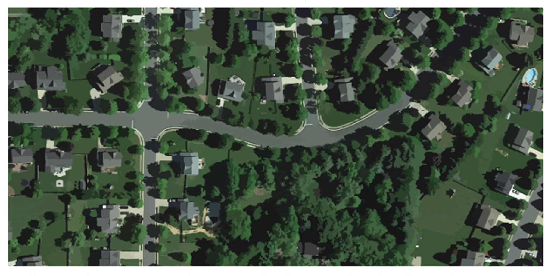
Figure 6: A figure showing some areas that may fall within a residential single-family district. This graphic is for illustrative purposes only; to determine the zoning designation of a particular property, refer to the official zoning map.
Sec. 2.6.1. - Intent.
The purpose of this district is to provide for low-density single-family detached residential development together with those public and semi-public uses and accessory uses as may be necessary or are normally compatible with residential surroundings. Certain special care facilities and certain governmental, educational, recreational and utility uses are allowed by special use permit subject to such restrictions and requirements as will ensure compatibility with residential surroundings. This district is comprised of land use categories defined in the 2030 Comprehensive Plan as areas to sustain, including single-family detached traditional, single-family detached suburban, and parks and open space.
The single-family detached traditional category reflects the character of the oldest neighborhoods in Purcellville and it is appropriate for infill to occur in these neighborhoods, as well as future single-family subdivisions conforming to the town's traditional character. The single-family detached suburban category reflects the character of existing suburban subdivisions and is appropriate for infill in these existing neighborhoods.
Sec. 2.6.2. - Development standards.
(1)
Lot size standards.
In addition, the following lot size standards shall apply:
(a)
Other permitted uses shall comply with the standards established for single-family detached dwelling, or as specified in the district regulations. The minimum lot area for individual or onsite sewage disposal systems is subject to health department requirements.
(b)
Lot width is measured at the front setback line.
(2)
Building bulk and form standards.
In addition, the following building bulk standards and exceptions shall apply:
(a)
Measurement of front yards.
i.
The minimum front yard shall be measured from the front lot line to the front building setback line.
ii.
Minimum front yard shall be 40 feet measured from the street centerline if street right-of-way is less than 50 feet in width.
(b)
Additional yard regulations.
i.
Other principal structures shall comply with the standards established for single-family detached dwelling, or as required in the district regulations.
ii.
Accessory structures attached to the main building shall be considered part of the main building and comply with front, side, and rear yard requirements. (For decks see Article 3, Section 3.4: Accessory buildings and structures.)
(c)
Additional height standards.
i.
A public or semi-public building, such as a school, church, or library, may be erected to a height of 60 feet from grade provided that required front, side and rear yards shall be increased one foot for each foot in height over 35 feet.
ii.
Church spires, belfries, cupolas, monuments, water towers, chimneys, flues, and flag poles of any height, and television antennas up to 60 feet in height, are exempt from height regulations. Parapet walls may be up to four feet above the height of the building on which the walls rest.
(d)
Yard and height standards for accessory structures.
i.
Detached accessory structures shall not be closer than five feet to any property line.
ii.
Except as provided in Article 3, Section 3.4, no accessory structure which is at least five feet but less than ten feet from any lot line shall be more than 20 feet in height. Accessory structures at least ten feet from any lot line may be up to 28 feet in height.
Sec. 2.6.3. - Generally applicable regulations.
In addition to the provisions of this section, the provisions of Articles 5 through 9 shall also apply. These provisions govern components including, but not limited to: Parking and loading standards, signage, landscaping and buffers. In the event of conflicting regulations, the regulations of this chapter shall apply for each base district.
Sec. 2.7. - R-3 single-family detached residential medium density.
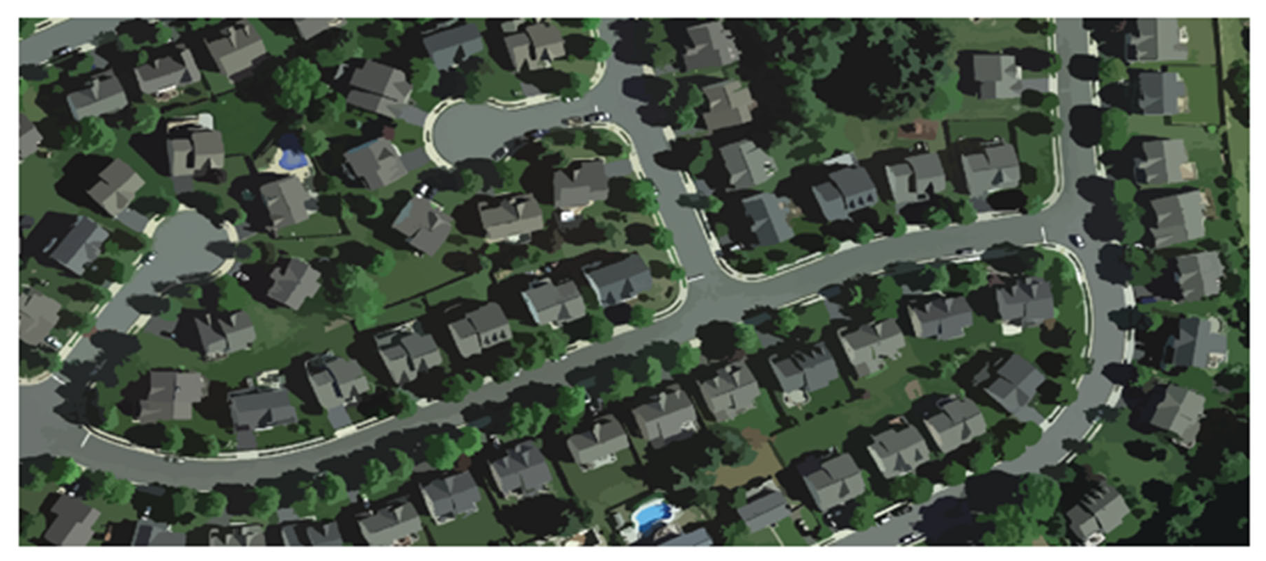
Figure 7: A figure showing some areas that may fall within the R-3 district. This graphic is for illustrative purposes only; to determine the zoning designation of a particular property, refer to the official zoning map.
Sec. 2.7.1. - Intent.
The purpose of this district is to provide for low medium-density, single-family detached residential development together with those public and semi-public uses and accessory uses as may be necessary or are normally compatible with residential surroundings. In general, urbanization is planned and utilities and public services exist or are planned to be adequate for the type or types of development contemplated. In addition, certain special care facilities and certain governmental, educational, recreational and utility uses are allowed by special use permit subject to such restrictions and requirements as will ensure compatibility with residential surroundings. This district is comprised of land use categories defined within the 2030 Comprehensive Plan as "areas to sustain," such as parks and open space, single-family detached traditional, single-family detached suburban, and mixed-use neighborhood scale. R-3 lots are generally smaller than typical lots in the R-2 district.
The single-family detached traditional category reflects the character of the oldest neighborhoods in Purcellville, and it is appropriate for infill to occur in these neighborhoods, as well as future single-family subdivisions conforming to the town's traditional character. The single-family detached suburban category reflects the character of existing suburban subdivisions and is appropriate for infill in these existing neighborhoods.
Sec. 2.7.2. - Development standards.
(1)
Lot size standards.
In addition, the following lot size standards shall apply:
(a)
Other permitted uses shall comply with the standards established for single-family detached dwelling, or as specified in the district regulations.
(b)
Minimum lot area for individual or on-site sewage disposal systems is subject to health department requirements.
(c)
Lot width is measured at the front building setback line.
(2)
Building bulk and form standards.
In addition, the following building bulk standards and exceptions shall apply:
(a)
Measurement of front yards.
i.
The minimum front yard shall be measured from the front lot line to the front building setback line.
ii.
Minimum front yard shall be 40 feet measured from the street centerline if street right-of-way is less than 50 feet in width.
(b)
Additional height standards.
i.
A public or semi-public building, such as a school, church, or library, may be erected to a height of 60 feet from grade provided that required front, side and rear yards shall be increased one foot for each foot in height over 35 feet.
ii.
Church spires, belfries, cupolas, monuments, water towers, chimneys, flues, and flag poles of any height, and television antennas up to 60 feet in height, are exempt from height regulations. Parapet walls may be up to four feet above the height of the building on which the walls rest.
iii.
Except as provided in Article 3, Section 3.4, no accessory structure which is at least five feet but less than ten feet from any lot line shall be more than 20 feet in height. Accessory structures at least ten feet from any lot line may be up to 28 feet in height.
Sec. 2.7.3. - Generally applicable regulations.
In addition to the provisions of this section, the provisions of Articles 5 through 9 shall also apply. These provisions govern components including, but not limited to: parking and loading standards, signage, landscaping and buffers. In the event of conflicting regulations, the regulations of this chapter shall apply for each base district.
Sec. 2.8. - R-8 single-family attached residential.
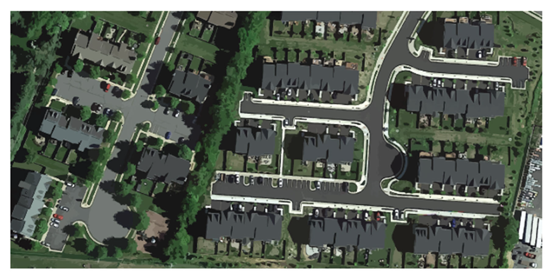
Figure 8: A figure showing some areas that may fall within the R-8 district. This graphic is for illustrative purposes only; to determine the zoning designation of a particular property, refer to the official zoning map.
Sec. 2.8.1. - Intent.
The purpose of this district is to provide for medium-density townhouse and other single-family attached developments together with those public and semi-public uses and accessory uses as may be necessary or are normally compatible with residential surroundings. In general, urbanization is planned and utilities and public services exist or are planned to be adequate for the type or types of development contemplated. Certain special care facilities and governmental, educational, recreational and utility uses are allowed by special use permit subject to such restrictions and requirements as will ensure compatibility with residential surroundings. This district is comprised of the land use category defined within the 2030 Comprehensive Plan as areas to sustain, single-family attached.
Sec. 2.8.2. - Development standards.
(1)
Lot size standards. The minimum lot size standards for all single-family detached and single-family attached dwellings shall comply with the R-3 residential district regulations of Article 2, Section 2.7.
Single-family attached townhouse dwellings shall only be permitted on lots with access to public water and sewer infrastructure. Duplex developments shall not exceed two attached single-family dwelling units per building. Townhouse developments shall not exceed eight attached single-family dwelling units per acre.
1 See Article 3: Use standards for special regulations for single-family attached dwellings.
In addition, the following lot size standards shall apply:
(a)
Lot width is measured at the front building setback line.
(b)
Minimum lot width shall be 30 feet for end and corner lots. All townhouse dwellings except end dwellings and corner lots shall occupy the full width of the lot.
(c)
Other permitted uses shall comply with the standards established for single-family detached dwelling, or as specified in the district regulations.
(d)
Minimum street frontage is 25 feet for single-family detached and duplex dwellings.
(e)
Minimum lot area for individual or on-site sewage disposal systems is subject to health department requirements.
(f)
Special provisions for single-family attached dwellings are found in Article 3: Use Standards.
(2)
Building bulk form standards. The minimum building bulk standards for all single-family detached and duplex dwellings shall comply with the R-3 district regulations of Article 2, Section 2.7.
1 Minimum side yards for end lots only.
2 Townhouse dwellings shall be permitted to include three stories.
In addition, the following building bulk standards and exceptions shall apply:
(a)
Measurement of front yards.
i.
The minimum front yard shall be measured from the front lot line to the front building setback line.
ii.
Minimum front yard shall be 40 feet measured from the street centerline if street right-of-way is less than 50 feet in width.
(b)
Additional yard regulations.
i.
Other principal structures shall comply with the standards established for single-family detached dwelling, or as required in the district regulations.
ii.
Accessory structures attached to the main building shall be considered part of the main building and comply with front, side, and rear yard requirements. (For decks see Article 3, Section 3.4: Accessory buildings and structures.)
(c)
Additional height standards.
i.
Townhouses may include three stories but may not exceed 35 feet in height.
ii.
A public or semi-public building, such as a school, church, library, or general hospital, may be erected to a height of 60 feet provided that required front, side and rear yards shall be increased one foot for each foot in height over 35 feet.
iii.
Church spires, belfries, cupolas, monuments, water towers, chimneys, flues, and flag poles of any height, and television antennas up to 50 feet in height, are exempt from height regulations. Parapet walls may be up to four feet above the height of the building on which the walls rest.
iv.
No accessory structure which is within ten feet of any party lot line shall be more than one story in height. All accessory structures shall be of less height than the main buildings on the lot.
(d)
Yard and height standards for accessory structures.
i.
Detached accessory structures shall not be closer than five feet to any property line.
ii.
No accessory structure which is within ten feet of any party lot line shall be more than one story in height. All accessory structures shall be of less height than the main buildings on the lot.
Sec. 2.8.3. - Generally applicable regulations.
In addition to the provisions of this section, the provisions of Articles 5 through 9 shall also apply. These provisions govern components including, but not limited to: parking and loading standards, signage, landscaping and buffers. In the event of conflicting regulations, the regulations of this chapter shall apply for each base district.
Sec. 2.9. - R-15 multi-family apartment building residential.
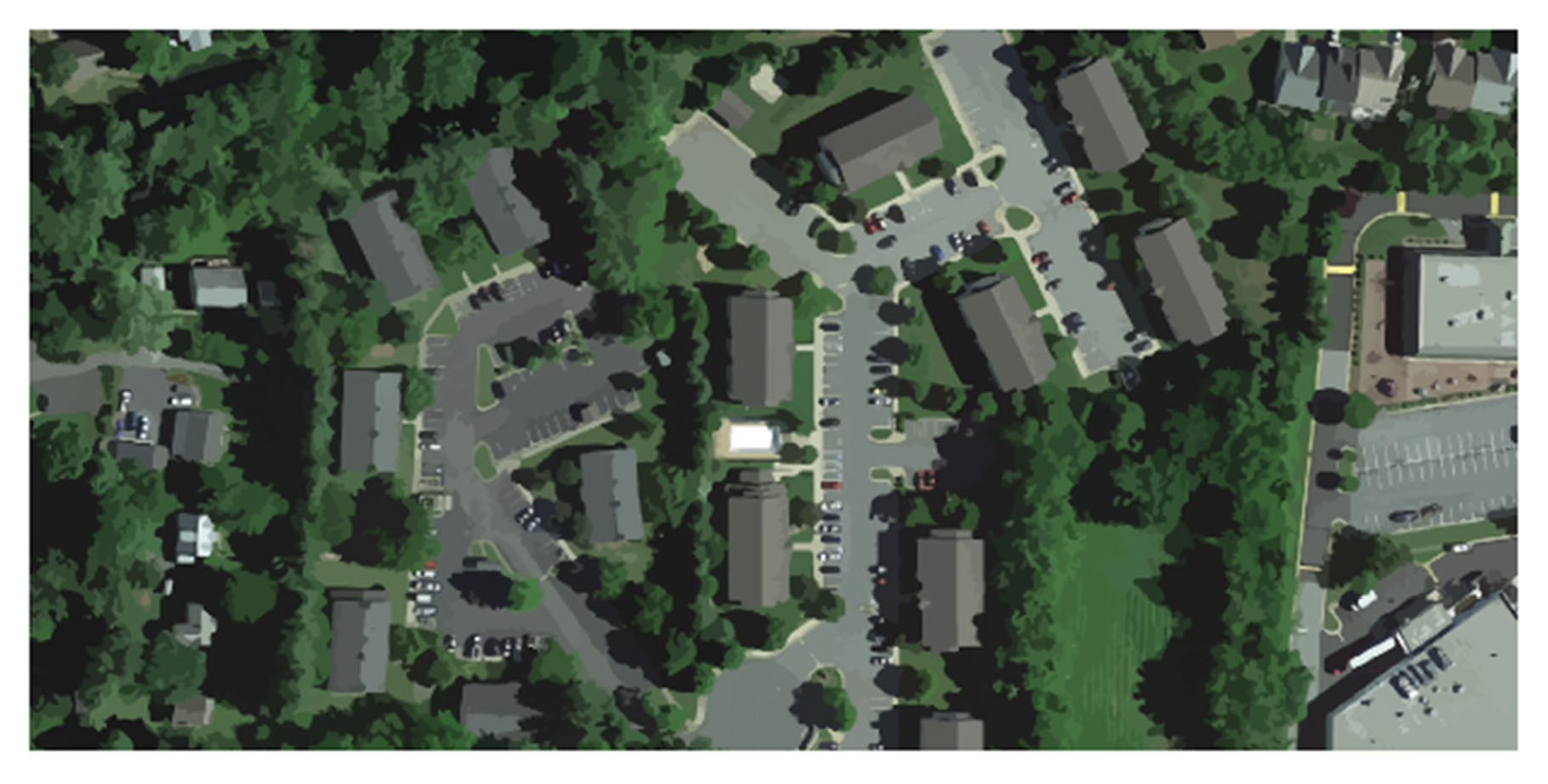
Figure 9: A figure showing some areas that may fall within the R-15 district. This graphic is for illustrative purposes only; to determine the zoning designation of a particular property, refer to the official zoning map.
Sec. 2.9.1. - Intent.
The purpose of this district is to provide for any redevelopment or development of dwelling units in multi-family apartment buildings. Small-scale two- or three-story buildings with three to eight apartment dwellings are the ideal size for multi-family development in Purcellville, especially as infill in areas adjacent to existing neighborhoods. In general, utilities and public services exist or are planned to be adequate for the type or types of development contemplated. Certain special care facilities and governmental, educational, recreational and utility uses are allowed by special use permit subject to such restrictions and requirements as will ensure compatibility with residential surroundings. This district comprises the multi-family land use category in the 2030 Comprehensive Plan.
Sec. 2.9.2. - Development standards.
(1)
Lot size standards.
(a)
Apartment building dwellings. Apartment building dwellings shall only be permitted on lots with access to public water and sewer infrastructure. Developments containing apartment building dwellings shall comply with the lot size standards of Table A below.
In addition, the following lot size standards shall apply:
i.
Lot width is measured at the front building setback line.
ii.
Minimum lot area for individual or on-site sewage disposal systems is subject to health department requirements.
(2)
Building bulk and form standards for apartment building dwellings.
(a)
Density and floor area.
i.
Overall project density shall not exceed 15 dwelling units per acre, exclusive of public rights-of-way.
ii.
No apartment building shall contain more than 12 apartment dwelling units.
iii.
Each apartment dwelling unit shall contain at least 600 square feet of livable floor area, exclusive of garages, carports, cellars, basements, attics, open porches, patios, or breezeways, except that up to ten percent of the units may be constructed with less floor area than this minimum.
(b)
Setback.
i.
No apartment building shall be located closer than 35 feet from any public right-of-way or closer than 15 feet from a private drive, access road or open common parking area whether oriented to the front, sides or rear of the buildings, except that parking areas may be located within five feet and private drives may be located within ten feet of any blank or windowless wall.
ii.
No apartment building shall be located closer than 25 feet from a side or rear property line. This regulation does not apply to existing buildings which are converted to apartment building use.
iii.
A minimum distance of 25 feet shall separate any two buildings or groups of apartment buildings from any other abutting use or building type.
(c)
Open space.
i.
The maximum lot coverage shall be 40 percent.
ii.
At least 400 square feet of commonly usable open space shall be provided for each dwelling unit.
(d)
Site design standards. The development or project shall be designed to promote harmonious relationships with surrounding adjacent and nearby developed properties, particularly in larger developments or projects where more than one building is involved, and to this end may employ such design techniques as may be appropriate, including use of building types, orientation, spacing and setback of buildings, careful use of topography, maintenance of natural vegetation, location of access points, recreation areas, open spaces, and parking areas, grading, landscaping, and screening. The principal means of access to a set of apartment buildings containing more than 24 total apartment dwelling units shall be from an arterial or collector thoroughfare of adequate physical and functional design to handle anticipated traffic needs. Secondary access to a local street will be permitted only in cases where there are overriding factors of health or safety for future residents of the project or where the arrangement and conditions of the minor streets are such that the projected increase in traffic will not substantially affect the use and enjoyment of the street by present or future residents.
i.
Where community refuse containers are provided as accessory uses to apartment building developments, such containers shall be conveniently located for pick-up vehicle access and completely screened from view by means of a fence or wall and an appropriately designed gate which can be latched open and closed.
(3)
Additional building bulk standards. The minimum building bulk standards for all single-family detached and duplex dwellings shall comply with the R-3 residential district regulations of Article 2, Section 2.7.
The minimum building bulk standards for all single-family attached dwellings shall comply with the R-8 single-family attached residential district regulations of Article 2, Section 2.8.
In addition, the following building bulk standards and exceptions shall apply:
(a)
Measurement of front yards.
i.
The minimum front yard shall be measured from the front lot line to the front building setback line.
ii.
Minimum front yard shall be 40 feet measured from the street centerline if street right-of-way is less than 50 feet in width.
(b)
Additional yard regulations.
i.
Other principal structures shall comply with the standards established for single-family detached dwelling, or as required in the district regulations.
ii.
Accessory structures attached to the main building shall be considered part of the main building and comply with front, side, and rear yard requirements. (For decks see Article 3, Section 3.4: Accessory buildings and structures.)
(c)
Additional height standards.
i.
Townhouses may include three stories but may not exceed 35 feet in height.
ii.
A public or semi-public building, such as a school, church, library, or hospital, may be erected to a height of 60 feet provided that required front, side and rear yards shall be increased one foot for each foot in height over 35 feet.
iii.
Church spires, belfries, cupolas, monuments, water towers, chimneys, flues, and flag poles of any height, and television antennas up to 60 feet in height, are exempt from height regulations. Parapet walls may be up to four feet above the height of the building on which the walls rest.
iv.
No accessory structure which is within ten feet of any party lot line shall be more than one story in height. All accessory structures shall be of less height than the main buildings on the lot.
(d)
Yard and height standards for accessory structures.
i.
Detached accessory structures shall not be closer than five feet to any property line.
ii.
No accessory structure which is within ten feet of any party lot line shall be more than one story in height. All accessory structures shall be of less height than the main buildings on the lot.
Sec. 2.9.3. - Generally applicable rules.
In addition to the provisions of this section, the provisions of Articles 5 through 9 shall also apply. These provisions govern components including, but not limited to: parking and loading standards, signage, landscaping and buffers. In the event of conflicting regulations, the regulations of this chapter shall apply for each base district.
Sec. 2.10. - C-1 professional office.
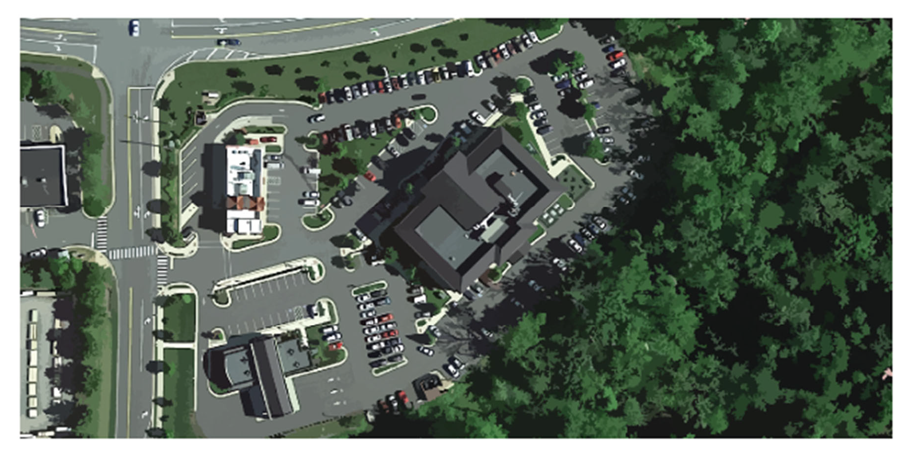
Figure 10: A figure showing a commercial area with some uses and designs that may apply to the C-1 professional office district. This graphic is for illustrative purposes only; to determine the zoning designation of a particular property, refer to the official zoning map.
Sec. 2.10.1. - Intent.
The purpose of this district is to provide for planned office parks or for small format professional office buildings, in attractive surroundings with types of uses, structures, plantings, and signs so controlled as to be generally compatible with the natural topography, trails, and greenspace of the surroundings while protecting the stream corridor. This district comprises the professional office land use category described in the 2030 Comprehensive Plan.
Sec. 2.10.2. - Development standards.
(1)
Lot size standards.
(2)
Building bulk and form standards.
In addition, the following building bulk standards and exceptions shall apply:
(a)
Additional height standards.
i.
Principal structures may be erected to a height of 45 feet, with issuance of a special use permit.
ii.
Church spires, belfries, cupolas, monuments, water towers, chimneys, flues, and flag poles of any height are exempt from height regulations. Parapet walls may be up to four feet above the height of the building on which the walls rest.
iii.
No accessory structure which is within ten feet of any adjoining owner lot line shall be more than one story or 15 feet high. All accessory structures shall be of less height than the main buildings on the lot.
(b)
Minimum setback and buffer from streams. A planted buffer strip of at least 100 feet in width must be provided between any existing stream that drains a watershed area of 100 or more acres, and all proposed buildings and paved parking areas. However, the developer may submit a plan for approval by the zoning administrator to reduce the buffer to not less than 50 feet, provided that the plan includes alternative measures that would achieve the same level of protection for water quality and wildlife habitat as would a 100-foot wide buffer.
(c)
Modification of yard and setback requirements. The zoning administrator may grant an administrative modification of the yard, setback and buffer requirements upon recommendation of the board of architectural review, which shall include a written explanation of how any such modification will better accomplish the purpose and intent of the district.
Sec. 2.10.3. - Special approval for offices and other business buildings.
Site development plan approval is required. An office park or office buildings or other buildings shall be designed to promote harmonious relationships with surrounding adjacent and nearby properties, developed and undeveloped, including providing a coordinated appearance when viewed from adjacent highways, and to this end may employ such design techniques as may be appropriate to a particular area, including location of permitted uses, orientation, spacing and setback of buildings, maintenance of natural vegetation, location of access points, size and location of signs, open spaces, and parking areas, grading, landscaping and servicing.
Sec. 2.10.4. - Additional standards and requirements for special permit uses.
In addition to the general standards set forth in Article 10, Section 10.7: Special use permits, all developments requiring a special use permit shall be reviewed for compliance with the Town of Purcellville Design Guidelines and Article 3: Use standards.
Sec. 2.10.5. - Generally applicable regulations.
In addition to the provisions of this section, the provisions of Articles 5 through 9 shall also apply. These provisions govern components including, but not limited to: parking and loading standards, signage, landscaping and buffers. In the event of conflicting regulations, the regulations of this chapter shall apply for each base district.
Sec. 2.11. - MC mixed commercial (neighborhood and medium).
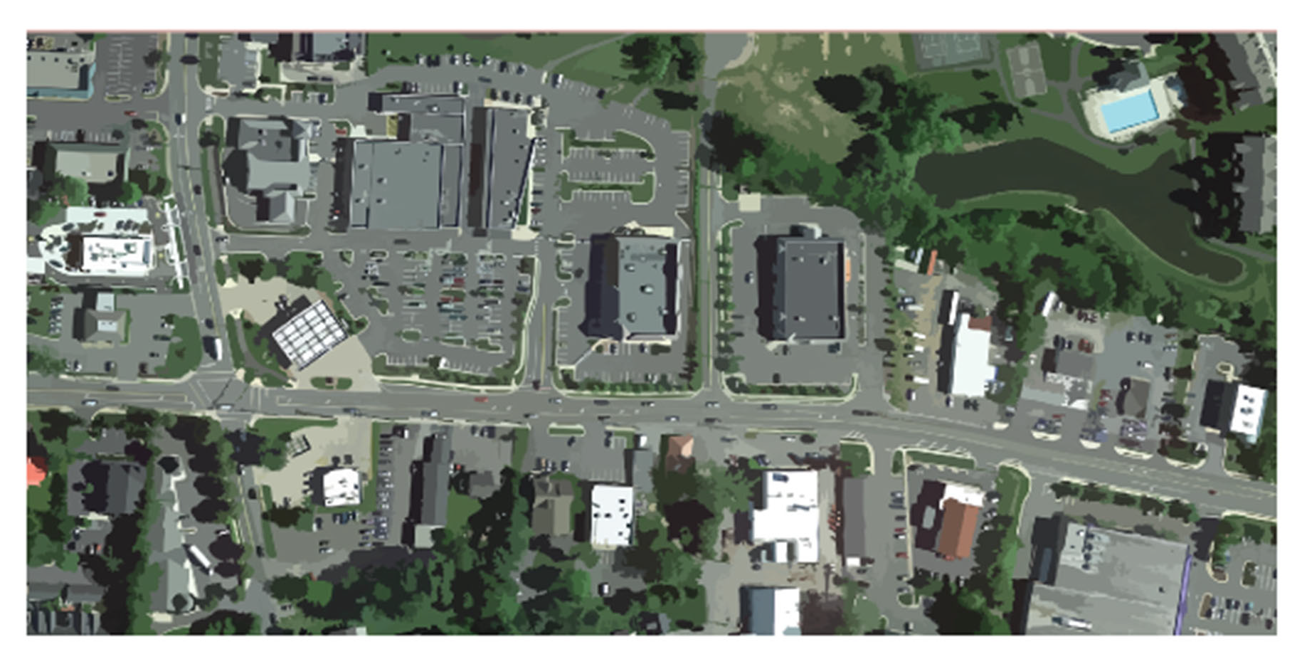
Figure 11. A figure showing some areas that may fall within a MC district. This graphic is for illustrative purposes only; to determine the zoning designation of a particular property, refer to the official zoning map.
Sec. 2.11.1. - Intent.
The purpose of this district is to provide sufficient space in appropriate locations for a variety of retail shopping, office uses and miscellaneous recreational and service activities, generally serving the town, its neighborhoods and the surrounding area of the county and to implement the Comprehensive Plan. These uses should be developed as compact centers in or near developed areas where retail and service activities now exist or are planned. The district includes site design standards to minimize traffic congestion and conflict and landscaping and sign standards to minimize distracting visual clutter and to enhance the appearance of the district. To enhance the general character of the district, its function of local and neighborhood service, and its compatibility with surrounding uses, the size of certain by-right uses is limited and special standards are included to address automobile intensive uses. This district is comprised of land use categories defined within the 2030 Comprehensive Plan as commercial neighborhood scale and commercial medium scale.
(1)
Lot size standards.
In addition, the following lot size standards apply:
(a)
Lot width is measured at the minimum front yard building restriction line.
(b)
Exception to minimum street frontage: The minimum street frontage may be reduced to a minimum of 30 feet for one lot of a two-lot subdivision provided that any resulting lot with frontage less than 50 feet shall not require new individual access to a public street for ingress and egress of vehicular traffic, but rather shall share use of a previously existing legal access to a public street with a contiguous parcel.
(2)
Building bulk and form standards.
Areas depicted on the official zoning map within as Sub Area 2 of the East Main Overlay are commercial medium scale, all other areas of the mixed commercial base district are commercial neighborhood scale.
Values beyond the above listed by right allowances of maximum lot area, OSR, FAR and ISR can be sought through the special use permit process, as described in Article 10.
In addition, the following building bulk standards and exceptions shall apply:
(a)
Additional yard and setback regulations.
i.
See Article 1, Section 1.8: Additional lot area and yard standards for exception for signs and certain other structures located in a yard.
ii.
Refer to Article 1, Section 1.8: Additional lot area and yard standards for additional provisions that may qualify the minimum yard requirements set forth above.
(b)
Additional height standards.
i.
For office buildings and financial institutions, any building or part of a building which is located within 200 feet of an R-2 or R-3 residential district shall not exceed two stories or 30 feet in height.
ii.
A public or semi-public building, such as a school, church, or library, may be erected to a height of 60 feet from grade provided that the setback from the property line for that portion of the building exceeding 45 feet shall be increased one foot for each foot in height over 35 feet.
iii.
Church spires, belfries, cupolas, monuments, water towers, chimneys, flues, and flagpoles of any height, and television and radio antennas up to 60 feet in height, are exempt from height regulations. Parapet walls may be up to four feet above the height of the building on which the walls rest.
iv.
No accessory structure which is within ten feet of any adjoining property line shall be more than one story high. All accessory structures shall be of less height than the main buildings on the lot.
(3)
Landscaping standards. The following minimum landscaping requirements shall apply:
Sec. 2.11.3. - Additional design standards for all uses.
(1)
Site plan. Where approval of a site plan is required, the plan shall be designed to promote sensitive use of topography and to promote harmonious relationships with adjacent and nearby residential properties, developed or undeveloped, and to this end shall provide effective screening alongside and rear property lines by means of fences, walls, hedges, planting screen or natural vegetation in accordance with the requirements of this ordinance.
(2)
Refuse. Refuse containers and refuse storage shall be located in a paved area and hidden from general public view, either from within or outside the premises, by means of fences, walls, or landscape planting.
(3)
Drainage. Provision shall be made for proper stormwater drainage from parking and loading areas. Water shall not be permitted to drain from such areas onto adjacent property except into a natural watercourse or a drainage easement. Provision shall be made for protection against erosion and sedimentation in accordance with applicable town ordinances.
(4)
New commercial developments incorporating multiple buildings shall be designed to provide a cohesive appearance, using materials, detailing and colors to provide overall similarity and compatibility among structures. Design features of individual buildings, structures or storefronts shall be subordinate to the overall design of the development as a whole.
(5)
Projects containing many buildings or a variety of functions shall provide variety in building size and massing. A general transition from small or low buildings along street frontages to larger and taller buildings on the interior of the site shall be achieved.
(6)
On large commercial sites, development of several smaller buildings to create visual interest, human scale and variety, shall be achieved, rather than a single large building. The use of smaller buildings, appropriately positioned and sited as a means of breaking up large parking expanses shall be achieved.
(7)
Solid walls, dull or minimal facades shall be avoided along public streets or pedestrian ways.
(8)
Parking shall be designed to the rear of the lot when possible. Shared entrances shall be used wherever possible and, when parking lots are adjacent, the lots shall be connected to parking areas on adjacent sites and integrated with each other whenever possible.
(9)
Vehicular entrances/exits shall be consolidated and shared among adjacent properties to minimize traffic conflicts. Individual points of access along major roadways shall be avoided. Access shall be provided by secondary roads and common driveways wherever possible.
(10)
Parking lots shall be screened from view through the use of such elements as earthen berms, landscaping and/or street trees.
(11)
Mechanical equipment, including rooftop equipment, such as generators and air conditioning units, shall be screened from public view in a manner compatible with the site and using material similar to the buildings and harmonious with the overall design.
(12)
Loading and service areas shall be oriented away from public views.
Sec. 2.11.4. - Additional standards and requirements for special permit uses.
In addition to the general standards set forth in Article 10, Section 10.7: Special use permits, all developments requiring a special use permit shall be reviewed for compliance with Section 2.11.3 (Section 3, not 4): Additional design standards for all uses above, the Town of Purcellville Design Guidelines, and Article 3, Section 3.4: Use standards.
Sec. 2.11.5. - Generally applicable regulations.
In addition to the provisions of this section, the provisions of Articles 5 through 9 shall also apply. These provisions govern components including, but not limited to: parking and loading standards, signage, landscaping and buffers. In the event of conflicting regulations, the regulations of this chapter shall apply for each base district.
Sec. 2.12. - C-4 Mixed-use neighborhood scale.
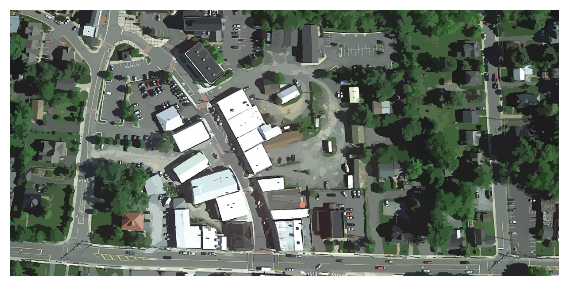
Figure 12: A figure showing some areas that may fall within the C-4 district. This graphic is for illustrative purposes only; to determine the zoning designation of a particular property, refer to the official zoning map.
Sec. 2.12.1. - Intent.
The purpose of this district is to provide for an appropriate variety of neighborhood-scale mixed uses in the historic center for commercial, financial, professional, governmental, recreation, entertainment, and cultural activities, in accordance with the purposes and goals of the Comprehensive Plan. It is intended to promote a convenient and relatively compact arrangement of uses and buildings that enhance the sense of place and pedestrian orientation of the downtown area and on the west end of town, and to this end required yards are minimal and permitted building bulk and coverage is relatively high. Medium density residential development in the form of up to two apartment dwelling units per building is permitted to encourage housing convenient to places of shopping and work. Additional residential development in the form of townhouses and single-family detached dwellings require special use permits. Signing and outdoor storage are restricted in order to promote an attractive and stable urban environment. This district is comprised of land use categories defined within the 2030 Comprehensive Plan as mixed-use neighborhood scale.
The following special use regulations for business and commercial buildings shall apply.
(1)
Similar uses permitted. Other commercial, financial, professional, governmental, recreation, entertainment, cultural and service uses which, in the opinion of the zoning administrator, are of the same general character as those uses permitted in the district, shall be permitted, provided that these uses shall be permitted only in accordance with the development standards of this ordinance.
(2)
Enclosed buildings. Except as provided in the regulations for this district, all uses shall be conducted within completely enclosed buildings of permanent and durable construction, with no open storage of raw, in process, or finished products or material and supplies or waste material, except products on temporary display for sale. This provision does not preclude outdoor eating areas accessory to a permitted use.
Sec. 2.12.2. - Development standards.
(1)
Lot size standards. There are no minimum lot size standards for dwellings or business uses in the C-4 central commercial district. See the respective overlay districts for additional standards.
(2)
Building bulk and form standards.
In addition, the following building bulk standards and exceptions shall apply:
(a)
Exceptions to maximum front yard standards.
i.
Permitted outdoor public use spaces such as outdoor cafe seating is exempt from the maximum front yard requirement.
ii.
For expansions to existing principal structures, the setback may be greater than 15 feet as long as it is bringing the existing setback into equal or greater conformity with the regulations than the existing structure.
iii.
All lots zoned C-4 and located north of the former W&OD railroad right-of-way, as shown on Figure 13: Map 9.1, shall be exempt from maximum front yard requirements.
(b)
Front facade standards. The front facade of the principal structure must extend across at least 50 percent of the lot width at the front setback, unless less frontage is required due to required driveway access or to preserve existing vegetation. The front facade must enclose a full height, habitable interior space. However, existing parcels with existing principal structures and front lot widths of more than 80 feet at the time of adoption of these standards, need only have front facades across 35 percent of the front lot width. Properties to the north of the W&OD trail, as shown on Figure 13: Map 9.1, shall be exempt from either of these requirements.
(c)
Modification of yard and setback requirements. The zoning administrator may grant an administrative modification of the yard and setback requirements upon recommendation of the board of architectural review, which shall include a written explanation of how any such modification will better accomplish the purpose and intent of the district.
(d)
Additional height standards. All buildings may be erected as a matter of right up to a maximum height of 35 feet and two and one-half stories (a basement shall not count as a "story" in the C-4 district). In addition:
i.
Buildings may be erected up to three stories and 45 feet if approved by the board of zoning appeals in accordance with the process set forth in Section 2.12.2.ix herein. Any lawfully existing building measuring between 35 feet and 45 feet in height is deemed to have obtained approval for the building height.
ii.
Publicly owned buildings and places of worship may be erected to a maximum height of three stories and 60 feet, as measured to the uppermost point of the roof, if approved by the board of zoning appeals in accordance with the process set forth in Section [2.12.2(d)ix.] herein. Any lawfully-existing public building or place of worship measuring between 35 feet and 60 feet in height is deemed to have obtained approval for the building height.
iii.
Church spires, belfries, and cupolas may extend above the maximum building height specified herein if approved by the board of zoning appeals in accordance with the process set forth in Section [2.12.2(d)ix.] herein.
iv.
Chimneys and flues may extend above the maximum building height specified herein, but only by the least amount possible to comply with the applicable building codes; chimneys and flues may extend beyond the minimum height required by the applicable building code if approved by the board of zoning appeals in accordance with the process set forth in Section [2.12.2(d)ix.] herein.
v.
Parapet walls shall not count toward building height and may be constructed as a matter of right up to four feet above the height of the building on which the walls rest.
vi.
Height shall be measured as prescribed in Article 1, Section 1.5 of this Code.
vii.
Flagpoles, monuments, and structures of a similar nature may be permitted up to 35 feet in height, or up to 45 feet in height if approved by the board of zoning appeals in accordance with the process set forth in Section [2.12.2(d)ix.] herein.
viii.
"Over the air reception devices" that are regulated by the FCC, including antenna and satellite dishes, may be installed and extend up to 12 feet above the height of the constructed building, or taller if approved by the board of zoning appeals in accordance with the process set forth in Section [2.12.2(d)ix.] herein.
ix.
The board of zoning appeals shall act upon requests for additional height after receiving recommendations from both the planning commission and the board of architectural review, and after conducting a public hearing advertised in accordance with Code of Virginia, § 15.2-2204. Persons requesting additional height shall submit an application form together with relevant supporting materials to the director of planning, using the town's application form for a variance. The director of planning shall review the application for completeness and, once complete, transmit the application to both:
•
The planning commission, who shall: (i) conduct a public hearing advertised in accordance with Code of Virginia, § 15.2-2204; and (ii) consider the request and formulate a recommendation in accordance with the process and standards (those relevant to height) for variance applications as set forth in Section 10.5 of this zoning ordinance; and
•
The board of architectural review, who shall consider the request in accordance with the process and standards (those relevant to height) set forth in Article 10 of this zoning ordinance. The planning commission and board of architectural review processes shall run concurrently, and joint meetings of the bodies are permitted but not required. Each body shall send a written recommendation to the board of zoning appeals through the director of planning, together with its findings concerning how the proposal measures against the standards by which it was reviewed. Any applicant seeking additional height as permitted under this section shall pay a single application fee equal to the fee required for processing a special use permit for construction.
(3)
On-site surface parking regulations. New on-site surface parking lots may not be located closer to the front lot line than the front facade of any new principal structure, with the following exceptions:
(a)
That not more than one row of parallel or angled parking is permitted in the front yard if the sidewalk is between such parking and any new principal structure and such parking directly abuts an approved public street without any intervening open space or physical improvements; and
(b)
Existing areas of existing parking lots are exempt from this provision.
(c)
One expansion of not more than nine new parking spaces to an existing parking lot is exempt from these provisions.
(d)
All lots zoned C-4 and located north of the former W&OD railroad right-of-way, as shown on Figure 13: Map 9.1. are excepted from this provision.
Sec. 2.12.3. - Generally applicable regulations.
In addition to the provisions of this section, the provisions of Articles 5 through 9 shall also apply. These provisions govern components including, but not limited to: parking and loading standards, signage, landscaping and buffers. In the event of conflicting regulations, the regulations of this chapter shall apply for each base district.
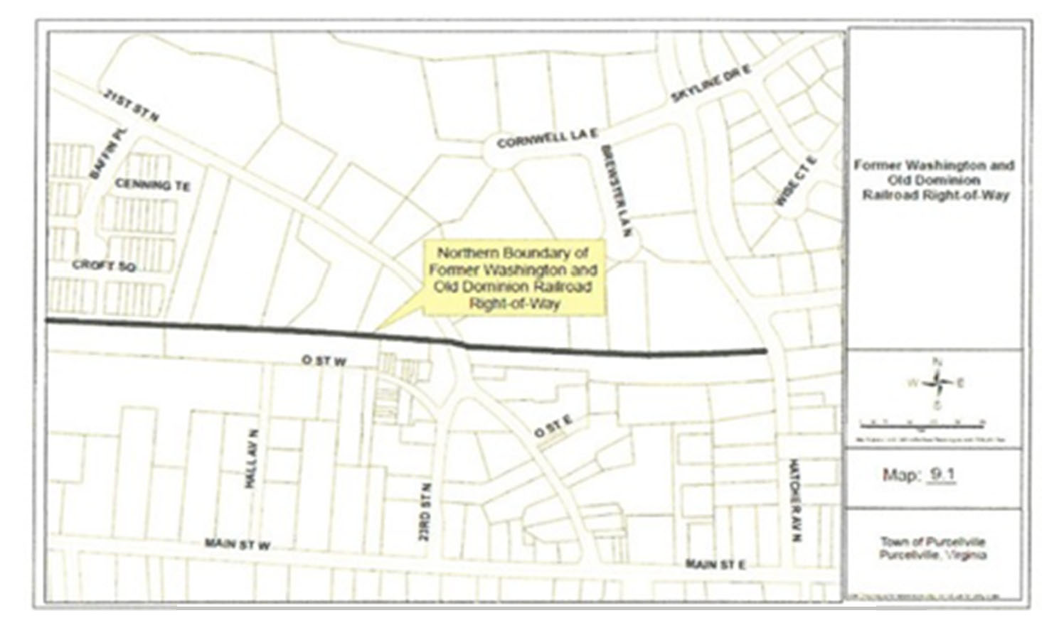
Figure 13: Map 9.1.
Sec. 2.13. - IB industrial business.
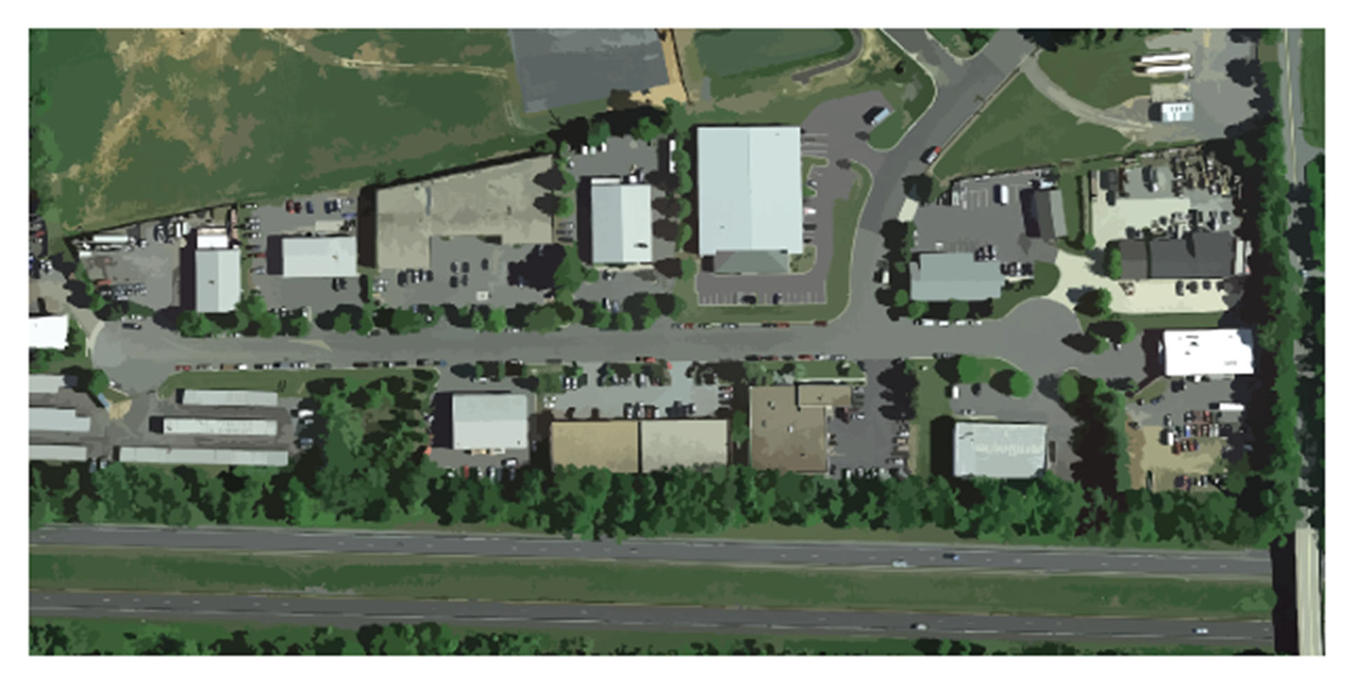
Figure 14: A figure showing some areas that may fall within an IB disrict. This graphic is for illustrative purposes only; to determine the zoning designation of a particular property, refer to the official zoning map.
Sec. 2.13.1. - Intent.
The purpose of this district is to provide for a variety of light manufacturing, fabricating, processing, wholesale distributing, and warehousing uses appropriately located for access by highways and providing a controlled environment within which signing is limited, uses are to be conducted generally within completely enclosed buildings or within screened areas, and a moderate amount of landscaping is required, in accordance with the purposes and goals of the Comprehensive Plan. In order to preserve the land for industry, to reduce extraneous traffic, and avoid future conflicts between industry and other uses, business and service uses are limited primarily to those which will be useful to employees in the district and future residential uses are restricted. This district comprises the industrial business land use category from the 2030 Comprehensive Plan.
(1)
Similar uses permitted. Other manufacturing uses which, in the opinion of the zoning administrator, are of the same general character as those uses permitted in the district shall be permitted. All uses shall be conducted so as not to produce hazardous, objectionable or offensive conditions at property line boundaries by reason of odor, dust, smoke, cinders, fumes, noise, vibration, heat, glare, wastes, fire or explosion.
Sec. 2.13.2. - Development standards.
(1)
Lot size standards. The following shall apply to all permitted uses:
(2)
Building bulk and form standards. The following yard, setback, and height regulations shall apply to all structures in IB districts:
Values beyond the above listed by right allowances of maximum lot area, OSR, FAR and ISR can be sought through the special use permit process, as described in Article 10.
In addition, the following building bulk standards and exceptions shall apply:
(a)
Additional yard and setback standards.
i.
No structure shall be located closer than 50 feet to the boundary of a residential district.
(b)
Additional height regulations.
i.
A building or part thereof may be erected to a height of 60 feet provided that it is located at least 100 feet from any lot line.
ii.
Cupolas, monuments, water towers, chimneys, flues, and flag poles of any height, and television antennas up to 125 feet in height, are exempt from height regulations. Parapet walls may be up to four feet above the height of the building on which the walls rest.
iii.
The board of zoning appeals may grant exceptions to height limits under Article 10, Section 10.3: Board of zoning appeals.
Sec. 2.13.3. - Special regulations for manufacturing and commercial buildings.
(1)
Enclosed buildings. All uses shall be conducted within a completely enclosed building of permanent and durable construction, with no open storage of waste material. Products or equipment used, manufactured or maintained on the premises may be stored in the open if screened from the street or from a residential district by landscaping, fences or walls.
(2)
Landscaping. Any part of the front yard not used for parking or accessways shall be landscaped with grass, trees, shrubs or pedestrian walks.
(3)
Site plan. Where approval of a site plan is required, the plan shall be designed to promote careful use of topography and to promote harmonious relationships with adjacent and nearby residential and business properties, developed or undeveloped, and to this end may provide effective screening alongside and rear property lines by means of fences, walls, hedges, planting screen or natural vegetation in accordance with the requirements of this ordinance.
(4)
Refuse. Refuse containers or refuse storage shall be located in a paved area and hidden from general public view, either from within or outside the premises, by means of fences, walls, or landscaping planting.
(5)
Drainage. Provision shall be made for proper stormwater drainage from parking and loading areas. Water shall not be permitted to drain from such areas onto adjacent property except into a natural watercourse or a drainage easement. Provision shall be made for protection against erosion and sedimentation in accordance with applicable town ordinances.
(6)
Fencing. All fencing shall have a uniform and durable character and shall be properly maintained.
(7)
Hazardous materials and chemicals. A list of all hazardous materials and chemicals shall be provided at the time that an occupancy permit is applied for. The list will be referred to the office of the fire marshal who shall determine special storage and handling requirements and any other requirements as may be required by SARA Title III and applicable state regulations.
Sec. 2.13.4. - Generally applicable regulations.
In addition to the provisions of this section, the provisions of Articles 5 through 9 shall also apply. These provisions govern components including, but not limited to: parking and loading standards, signage, landscaping and buffers. In the event of conflicting regulations, the regulations of this chapter shall apply for each base district.
Sec. 2.14. - IG institutional and government.
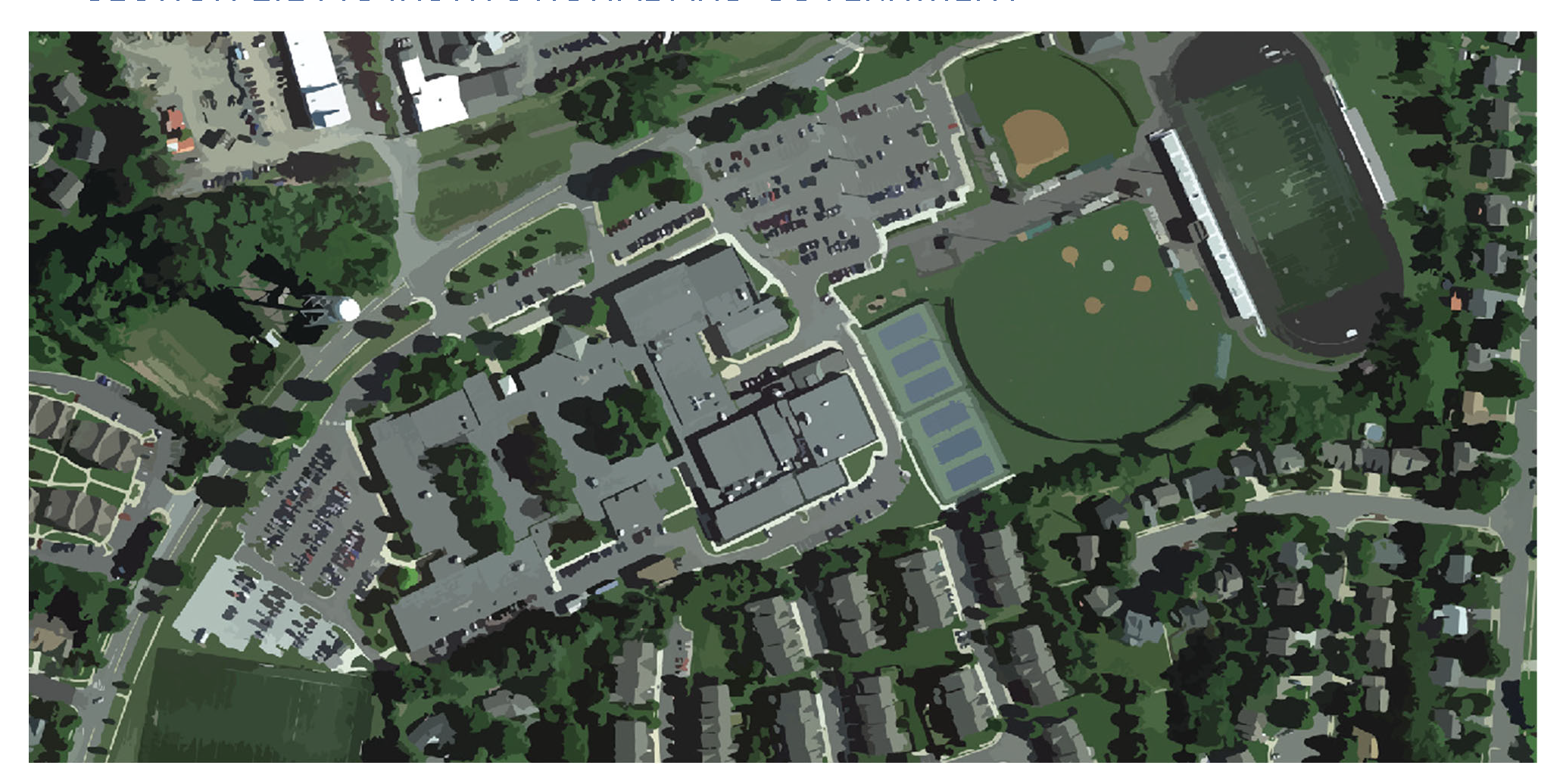
Figure 15: A figure showing some areas that may fall within an IG district. This graphic is for illustrative purposes only; to determine the zoning designation of a particular property, refer to the official zoning map.
Sec. 2.14.1. - Intent.
This district is intended to permit the location and growth of public and private educational, institutional, public, and semi-public uses in areas appropriate for such uses. The district is intended to encourage the retention or adaptive reuse of larger public and institutional uses on sites identified for such uses in the adopted 2030 Comprehensive Plan. The regulations within this district are intended to achieve the following specific purposes:
(1)
Recognize the unique needs of institutional and public uses and their relationship with neighboring land uses;
(2)
Minimize the potential for adverse impacts of institutional and public uses on adjacent land uses, including traffic congestion, adequate parking, and pedestrian linkages;
(3)
Facilitate the creation of a convenient and harmonious development of buildings, parking, and open spaces for individual institutional and public uses; and
(4)
Facilitate the proper functioning of such institutional and public uses.
Sec. 2.14.2. - Development standards.
(1)
Lot size standards.
(a)
The minimum lot area shall be ten thousand square feet for any parcel with a structure for human occupancy, such as offices, meeting rooms, places of assembly, but not including storage buildings, restrooms, or gazebos.
(b)
No minimum lot area for parcels without a substantial structure, such as well sites, park sites, and public streets.
(c)
The maximum lot area shall be five acres, unless approved through a special use permit as described in Article 10.
(2)
Yard and setback standards.
(a)
Front yards. No setbacks are required, except yards adjacent to a residential district shall have a setback equal to the setback of the adjoining residential district or, in built-up areas, may match the average setback of adjacent structures.
(b)
Side and rear yards. No side or rear yard are required, except where such use abuts a residential district there shall be a minimum ten-foot side and/or rear yard.
(c)
Notwithstanding the above, for additions to an existing building, the yard requirement for the addition may match the existing yard for the existing building.
(3)
Height standards.
(a)
Within 50 feet of any residential district, the maximum height of the nearest residential district shall apply.
(b)
A public or semi-public building, such as a school, church, or library, may be erected to a height of 60 feet provided that required front, side and rear yards shall be increased one foot for each foot in height over 50 feet.
(c)
Church spires, belfries, cupolas, monuments, water towers, chimneys, and flues are exempt from height regulations.
(4)
Building bulk and form standards.
Sec. 2.14.3. - Additional design standards for all uses.
In addition to the above standards, all projects shall be reviewed for compliance with the Town of Purcellville Design Guidelines and the following general building and site design principles:
(1)
Site design. Where approval of a site plan is required, the plan shall be designed to promote sensitive use of topography and to promote harmonious relationships with adjacent and nearby properties, developed or undeveloped, and to this end shall provide effective screening alongside and rear property lines by means of fences, walls, hedges, planting screen or natural vegetation in accordance with the requirements of this ordinance.
(2)
Building design.
(a)
Projects incorporating multiple buildings shall be designed to provide a cohesive appearance, using materials, detailing and colors to provide overall similarity and compatibility among structures. Design features of individual buildings and structures shall be subordinate to the overall design of the development.
(b)
Projects containing many buildings or a variety of functions shall provide variety in building size and massing. A general transition from small or low buildings along street frontages to larger and taller buildings on the interior of the site shall be achieved.
(c)
On large sites, development of several smaller buildings to create visual interest, human scale and variety, shall be achieved, rather than a single large building. The use of smaller buildings, appropriately positioned and sited as a means of breaking up large parking expanses shall be achieved.
(d)
Buildings shall be finished and have on all sides the same architectural features or shall be architecturally compatible with the building group or neighborhood with which they are associated.
(3)
Parking and access.
(a)
Shared entrances shall be used wherever possible and, when parking lots for uses permitted in this district are adjacent, the lots shall be connected to parking areas on adjacent sites and integrated with each other whenever possible.
(b)
Parking lots shall be screened from view through the use of such elements as earthen berms, landscaping and/or street trees.
(c)
Access shall be provided by secondary roads and common driveways wherever possible.
(d)
Pedestrian and vehicular circulation shall be coordinated with that on adjacent properties. The site shall be designed to minimize the potential for turning movement conflicts and to facilitate safe and efficient on-site circulation. Parking and stacking spaces shall be provided and located in such a manner as to facilitate safe and convenient vehicle and pedestrian access to all uses on the site.
(4)
Utilities and HVAC equipment.
(a)
All utility lines, electric, telephone, cable television lines, etc., and shall be placed underground.
(b)
Mechanical equipment, including rooftop equipment, such as generators and air conditioning units, shall be screened from public view in a manner compatible with the site and using material similar to the buildings and harmonious with the overall design.
(5)
Refuse and loading.
(a)
Refuse containers or refuse storage shall be located in a paved area and hidden from general public view, either from within or outside the premises, by means of fences, walls, or landscape planting.
(b)
Loading and service areas shall be oriented away from public views.
Sec. 2.14.4. - Generally applicable regulations.
In addition to the provisions of this section, the provisions of Articles 5 through 9 shall also apply. These provisions govern components including, but not limited to: parking and loading standards, signage, landscaping and buffers. In the event of conflicting regulations, the regulations of this chapter shall apply for each base district.
Sec. 2.15. - AC agricultural tourism commercial.
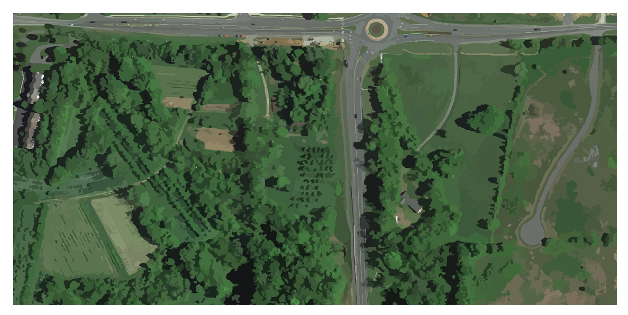
Figure 16: A figure showing some areas that may fall within an AC district. This graphic is for illustrative purposes only; to determine the zoning designation of a particular property, refer to the official zoning map.
Sec. 2.15.1. - Intent.
This district is designed to accommodate and encourage the continuation of agricultural uses within the town, to permit certain low-intensity commercial uses that would support agricultural and tourism industries, to maintain the majority of open space in these areas, and to accommodate uses that would complement and enhance the historic character of the town. It is intended that uses in this district will be designed in a manner that:
(1)
Conserves open land around the town's periphery, including those areas containing historic resources or sensitive natural features such as woodlands, prime farmland, steep slopes, streams, floodplains, and wetlands, by setting them aside from development;
(2)
Promotes agricultural or equestrian uses;
(3)
Protects productive agricultural soils for continued or future agricultural use and conserves blocks of land large enough to allow for efficient farm operations;
(4)
Reduces erosion and sedimentation by the retention of existing vegetation;
(5)
Provides for the maintenance of open land within the town which can help to provide opportunities for recreation, protect scenic and historic views, minimize the visual impact of new development from existing roads, and preserve the historic, rural setting surrounding the town;
(6)
Promotes a traditional development pattern that is compatible with the existing historic character of the town and which is connected to the existing fabric of the town; and
(7)
Provides for commercial development compatible with agricultural and horticultural uses to serve as a transition toward more dense commercial development within the town.
This district is comprised of the land use category defined within the 2030 Comprehensive Plan as agricultural tourism commercial.
Sec. 2.15.2. - Development standards.
The development standards for all uses shall be governed by Table A and Table B of this section, except as modified for certain uses in Section 2.15.3: Additional standards for certain uses.
(1)
Lot size standards.
(2)
Bulk standards.
Sec. 2.15.3. - Additional standards for certain uses.
Additional standards set forth below shall apply to certain specific uses permitted in this ordinance. These are intended to serve as the minimum standards for these uses, and are not intended to substitute for other applicable provisions of this ordinance or for additional conditions that may be imposed in connection with any required special use permit approvals. All special use permit uses shall also be subject to Section 2.15.5: Design standards.
(1)
Veterinary clinic. The following lot area and bulk standards in Table C shall apply to all veterinary clinics located within an AC district:
(2)
Studio. The following lot area and bulk standards in Table D shall apply to all studios located within an AC district:
(3)
Nature preserve.
(a)
Minimum lot area: Five acres.
(b)
Accessory uses. Accessory uses shall only permit on lots 20 acres in size or larger. Accessory uses to a nature preserve may include retail sales (e.g., gift shops), small restaurants or cafes, or visitor centers subject to the following standards:
i.
Retail sales shall be limited to the sale of items directly related to the nature and character of the principal permitted use.
ii.
Accessory uses other than a visitor's center shall contain no more than 1,000 square feet of gross floor area. A visitor's center shall contain no more than 10,000 square feet of gross floor area.
(c)
Maximum floor area ratio: 0.2.
(d)
Storage areas. The total area of storage areas shall not exceed ten percent of the total area of the principal structure.
(4)
Country inn.
(a)
The parcel shall have safe and reasonable access to a state-maintained road.
(b)
Minimum setback, buildings, parking and lighted areas: 40 feet from the side and rear property line.
(c)
Maximum guest rooms: nine.
(d)
The owner or manager shall provide full-time management of the premises at all times when the establishment is occupied by guests.
(e)
Outdoor events (e.g., weddings, receptions, parties) or similar activities conducted for compensation shall be permitted only upon application for a temporary zoning permit from the zoning administrator, who may impose conditions regarding hours of operation, volume of amplified music, type and intensity of outdoor lighting, traffic control measures, and similar health, safety and welfare matters.
(5)
Eating establishment. The following lot area and bulk standards in Table E shall apply to all studios located within an AC district:
(6)
Farm and community market.
(a)
Minimum lot size: 80,000 square feet.
(b)
A minimum of 25 percent of the gross sales receipts must be derived directly from agricultural products produced on site or other property owned by the operator. An annual report verifying the portion of sales derived from products produced on site shall be submitted on request to the zoning administrator.
(c)
Sales area for accessory products shall be limited to 25 percent of the total area devoted to sales. The calculation of total sales area shall include areas devoted to the display of items for sale.
(d)
Permitted accessory products include pottery, baskets, garden accessories, baked goods, floral supplies, and other items directly related to the culture, care, use of, or processing of a principal use. Products not related to the principal permitted use, such as lawn mowers and tractors, shall not be allowed.
(7)
Winery. Wineries shall comply with the following standards:
(a)
Minimum lot size: Ten acres.
(b)
Minimum building setbacks: 100 feet from all lot lines.
Sec. 2.15.4. - Exceptions to development standards.
The development standards contained within [Section] 2.15.2: Development standards and additional standards contained within Section 2.15.3: Additional standards for certain uses may be modified by special use permit procedures set forth in Article 10, Section 10.7: Special use permits, provided that the application satisfies the public purpose of those standards to an equivalent degree.
Sec. 2.15.5. - Design standards.
(1)
Overall form. Buildings, other than those used for agricultural, horticultural, or the housing of animals, shall be clustered along existing or proposed roads. Open space shall be used to preserve natural and environmental resources identified in the Comprehensive Plan. New construction shall be sited so as to best preserve natural and historic resources, natural vistas, and existing topography. Greenbelt open space shall be designed to follow natural features whenever possible and to maintain an agricultural, woodland, or countryside character. New development shall be distinguished from the peripheral, greenbelt open space by a well-defined edge.
(2)
Block design. New lots shall be designed with interconnecting roadways, defined by buildings, landscaping, pedestrian ways, and sidewalks, and adapted to the topography and unique natural features of the tract.
(3)
Lot design. Lots shall have frontage onto a street or a street and an alley. In general, in developments where lot sizes vary considerably, the smaller lots should be located closer to the existing town, with larger lots on the perimeter. Lots abutting common greens, squares or parks shall be provided with sidewalks along their abutting lot lines.
(4)
Street design. Street layout shall take into consideration internal open space areas, gateways, and vistas. Both street and pedestrian linkages to the existing town are recommended where possible.
(a)
A minimum of two connections with the existing public street system rated as at least a collector street shall be provided where possible. Connections giving access to collectors with existing sidewalks or trails shall be required where practicable.
(b)
Use of culs-de-sac or other streets with a single point of access shall be minimized.
(c)
To calm traffic speeds, the use of T-intersections, where vehicles must stop and turn to the right or left rather than proceeding forward in a straight line, are encouraged. At least 25 percent of all intersections within the subdivision shall take this form, unless other traffic calming measures, such as traffic islands or circles, are employed.
(d)
Street trees shall be planted along all streets in conformance with Article 5, Section 5.8: Streetscaping.
(5)
Parking. Off-street parking shall be provided as required in Article 7: Parking and loading regulations, with the following exceptions:
(a)
Parking lots for agricultural, horticultural, equestrian and other similar uses, including farm markets, may be surfaced with gravel, provided the parking lots are used no more than four days per month as permitted by Article 7. Creation of such lots shall require approval of a zoning grading permit with sketch plan, but not a full site plan.
(b)
Additional parking standards for all other uses.
i.
At least 20 percent, but no more than 50 percent, of the required parking shall be paved with reinforced grass paver block or similar porous paving material to minimize the visual impact of the parking area and maximize the pervious area.
ii.
Any portion of a parking lot constructed of porous pavement, up to a maximum of 50 percent of the entire parking area, and any sidewalks or trails not providing direct access between the principal building and the parking lot may be included as part of the required open space area.
(6)
Outdoor storage and service areas. Except for agricultural and horticultural uses, no outdoor storage shall be permitted unless the zoning administrator determines that such storage is customarily required and integral to the use and that such storage will be adequately screened from all property lines. Any service area shall be located and designed to minimize its visibility from off-site.
(7)
Pedestrian access. Every effort shall be made to provide a safe and convenient pedestrian connection to the existing town pedestrian network.
(8)
Building character. All buildings developed by special permit or subject to review by the board of architectural review shall consider the following building character conditions to ensure that development within the AC agricultural commercial district are consistent with the architectural character of the town.
(a)
Existing structures. All exterior changes shall be compatible in architectural style, scale and materials with the existing structure and with the historic character of the town. Existing buildings with historic or architectural value on the site must be adaptively re-used to the greatest extent possible.
(b)
New structures. The architectural design of all new buildings and structures shall be compatible in architectural style, scale and materials with the historic character of the town and shall avoid a monolithic appearance.
(c)
Building elevations and architectural details sufficient to show compliance with this standard shall be submitted for approval as part of the special use permit application.
Sec. 2.15.6. - Generally applicable regulations.
In addition to the provisions of this section, the provisions of Articles 5 through 9 shall also apply. These provisions govern components including, but not limited to: parking and loading standards, signage, landscaping and buffers. In the event of conflicting regulations, the regulations of this chapter shall apply for each base district.
Sec. 2.16.1. - Intent.
The purpose of this district is to provide for the reasonable and orderly interim regulation of use and development of land annexed or brought into the town via a boundary line adjustment.
Sec. 2.16.2. - Development standards.
(1)
Lot size standards. The following shall apply to all permitted uses:
In addition, the following lot size standards shall apply:
(a)
Lot width is measured at the front building setback line.
(b)
Other permitted uses shall comply with the standards established for single-family detached dwelling, or as specified in the district regulations.
(c)
Minimum lot area for individual or on-site sewage disposal systems is subject to health department requirements.
(2)
Building bulk and form standards.
In addition, the following building bulk standards and exceptions shall apply:
(a)
Measurement of front yards.
i.
The minimum front yard shall be measured from the front lot line to the front building setback line.
ii.
Minimum front yard shall be 55 feet measured from the street centerline if street right-of-way is less than 50 feet in width.
(b)
Additional yard regulations.
i.
Other principal structures shall comply with the standards established for single-family detached dwelling, or as required in the district regulations.
ii.
Accessory structures attached to the main building shall be considered part of the main building and comply with front, side, and rear yard requirements.
(c)
Additional height standards.
i.
There are no restrictions for buildings used exclusively for agricultural purposes.
ii.
The height limit for dwellings may be increased up to 45 feet and up to three stories provided there are two side yards for each permitted use each of which is at least 15 feet plus one foot or more for each side yard for each additional foot of building height over 35 feet upon granting of a variance by the board of zoning appeals under Article 10, Section 10.3: Board of zoning appeals.
iii.
A public or semi-public building such as a school, church, or library, may be erected to a height of 60 feet from grade provided that required front, side and rear yards shall be increased one foot for each foot in height over 35 feet.
iv.
Church spires, belfries, cupolas, monuments, water towers, chimneys, flues, and flag poles of any height, and television antennas up to 60 feet in height, are exempt from height regulations. Parapet walls may be up to four feet above the height of the building on which the walls rest.
(d)
Yard and height standards for accessory structures.
i.
Detached accessory structures shall not be closer than five feet to any property line.
ii.
No accessory structure which is within ten feet of any party lot line shall be more than one story in height. All accessory structures shall be of less height than the main buildings on the lot.
Sec. 2.16.3. - Generally applicable regulations.
In addition to the provisions of this section, the provisions of Articles 5 through 9 shall also apply. These provisions govern components including, but not limited to: parking and loading standards, signage, landscaping and buffers. In the event of conflicting regulations, the regulations of this chapter shall apply for each base district.
Sec. 2.17.1. - Intent.
If, because of error or omission in the zoning map, any property in the jurisdiction of this ordinance is not shown as being in a zoning district, such property shall be classified R-T single-family residential district until changed by amendment and the following regulations shall apply:
Sec. 2.17.2. - Development standards.
(1)
Lot size standards.
In addition, the following lot size standards shall apply:
(a)
Other permitted uses shall comply with the standards established for single-family detached dwelling, or as specified in the district regulations.
(b)
Minimum lot area for individual or on-site sewage disposal systems is subject to health department requirements.
(c)
Lot width is measured at the front building setback line.
(2)
Building bulk and form standards.
In addition, the following building bulk standards and exceptions shall apply:
(a)
Measurement of front yards.
i.
The minimum front yard shall be measured from the front lot line to the front building setback line.
ii.
Minimum front yard shall be 70 feet measured from the street centerline if the street right-of-way is less than 50 feet in width.
(b)
Additional yard regulations.
i.
Other principal structures shall comply with the standards established for single-family detached dwelling, or as required in the district regulations.
ii.
Accessory structures attached to the main building shall be considered part of the main building and comply with front, side, and rear yard requirements. (For decks see Article 3, Section 3.4: Accessory buildings and structures.)
(c)
Yard and height standards for accessory structures.
i.
Accessory structures attached to the main building shall be considered part of the main building and comply with front, side and rear yard requirements. (For decks see Article 3, Section 3.4: Accessory buildings and structures.)
ii.
Detached accessory structures shall not be closer than five feet to any property line.
Sec. 2.17.3. - Generally applicable regulations.
In addition to the provisions of this section, the provisions of Articles 5 through 9 shall also apply. These provisions govern components including, but not limited to: parking and loading standards, signage, landscaping and buffers. In the event of conflicting regulations, the regulations of this chapter shall apply for each base district.