
Rosemead City Zoning Code
Appendix A
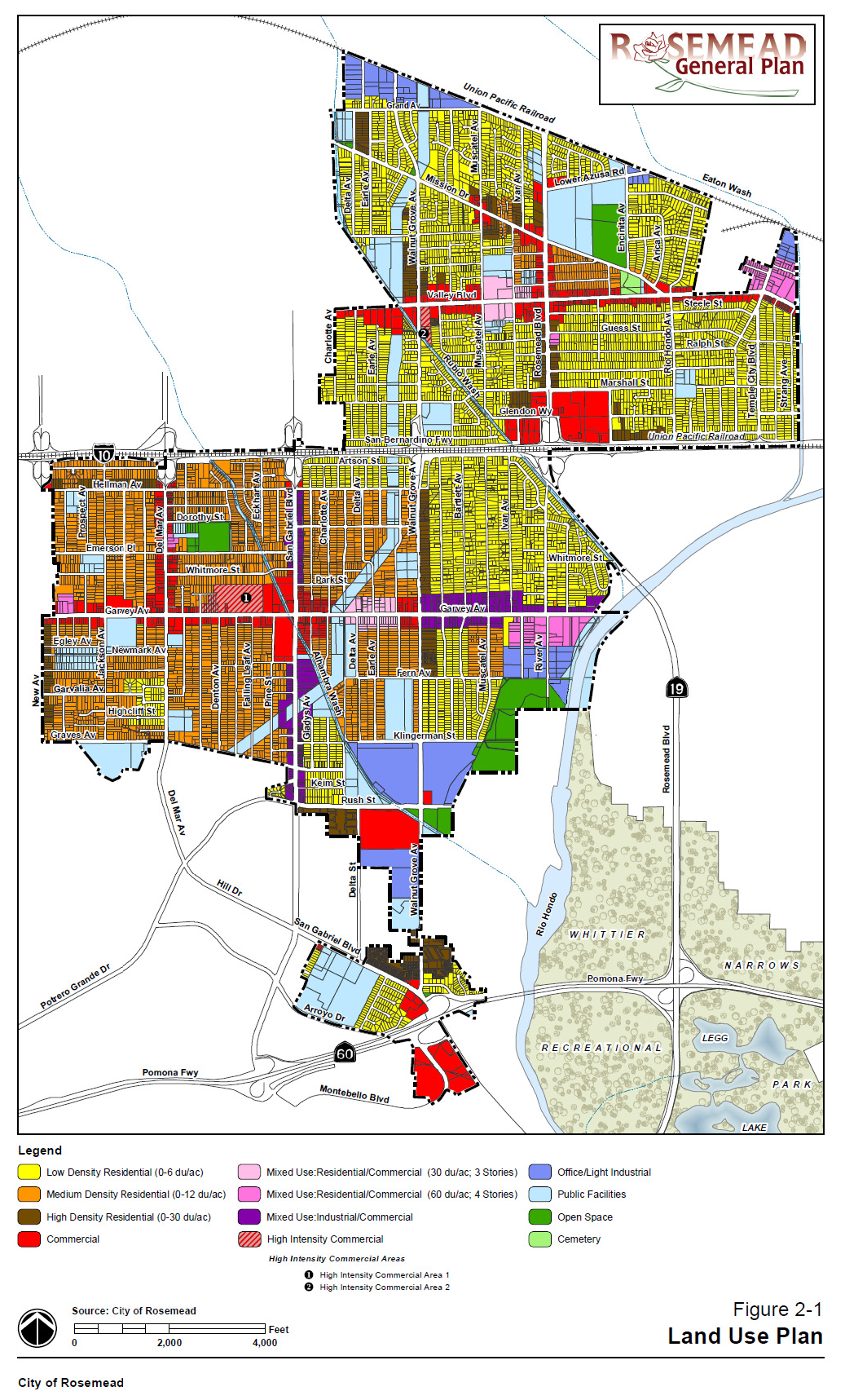
GENERAL PLAN LAND USE MAP AND NONRESIDENTIAL FLOOR AREA RATIO
Table 1-1: Nonresidential General Plan Land Use Categories and Maximum Floor Area Ratios (FAR)
| Land Use Categories | Maximum FAR |
|---|---|
| Commercial/Business Categories | |
| C Commercial(a) | 0.35:1 FAR |
| HIC High Intensity Commercial(a) | 0.35:1 FAR |
| OLI Office/Light Industrial | 0.5:1 FAR |
| Mixed-Use Category | |
| MRC Mixed-Use Residential/Commercial(b) | 1.6:1 FAR |
| MHRC Mixed-Use High Density Residential/Commercial(c) | 2.0:1 FAR |
| MIC Mixed-Use Industrial/Commercial | 2.5:1 FAR |
| Public/Institutional Category | |
| PF Public Facilities | N/A |
| Open Space Categories | |
| OS Open Space/Natural Resources | N/A |
| CEM Cemetery | N/A |
| Specific Plans | |
| Garvey Avenue Specific Plan | The Garvey Avenue Specific Plan established in this Title under Chapter 17.21 contains the FAR regulations, and shall take precedence over this Table. |
| Notes: | |
| (a) Maximum of 1.0:1 FAR allowed for hotel uses that meet the requirements in Article 3, Chapter 13.30 (Section 17.30.130). | |
| (b) Mixed-Use Residential/Commercial assumes a 67% residential, 33% commercial land use mix. | |
| (c) Mixed-Use High Density Residential/Commercial assumes a 75% residential, 25% commercial land use mix. | |
(Ord. No. 931, § 5(Exh. A), 10-22-13; Ord. No. 978, § 5(Exh. A), 2-27-18)