
Saint Cloud City Zoning Code
CHAPTER 3
PERFORMANCE AND SITING STANDARDS
3.1.1.- Purpose and intent.
The regulations and requirements herein set forth have been made in accordance with a comprehensive plan, with reasonable consideration, among other things, to the prevailing land uses, growth characteristics, and the character of the respective districts and their peculiar suitability for particular uses and to encourage the most appropriate use of land throughout the city.
A.
Minimum requirements and interpretation of provisions. In their interpretation and application, the provisions of this chapter shall be the minimum requirements to promote the public health, safety, morals, and general welfare, and to protect the character and maintain the stability of residential, commercial, industrial, agricultural, educational, cultural, and recreational areas within the city. It is not intended by this chapter to interfere with, abrogate, or annul any lawful easements, covenants, or other agreements between the city and other parties.
B.
Police powers. Among other purposes, the provisions herein are intended to provide adequate light, air, privacy, and access to property, to enhance the aesthetic appeal and features of the city and to avoid undue concentration of population by regulating and limiting the height and bulk of buildings, the size of open spaces surrounding buildings, storage and materials of personal property or any commercial activity, to establish building lines, to divide the area of the city into districts restricting and regulating therein the construction, reconstruction, alteration, and use of buildings, structures, and land for residential, commercial, industrial, agriculture, educational, cultural, recreational, and other specified uses, and to limit congestion in the public streets by providing off-street parking of motor vehicles, and to define the powers and duties of the various administrative officers and boards within the city as those officers and boards deal with land development.
C.
Prohibited uses. The district regulations contained in this chapter are to be construed so as to prohibit those uses which are not specifically listed as permitted uses or conditional uses within the districts, except for those districts in which the planning commission may determine that certain other uses are similar to and compatible with the permitted uses listed within such district.
3.2.1.- Establishment of districts.
In order to classify, regulate, and restrict the uses of land, water, buildings, and structures; to regulate and restrict the height and bulk of buildings; to regulate the area of yards, courts, and other open spaces between buildings; and to regulate the intensity of land use, all the area of the city is classified into the districts listed in Table 3.2.1, with each district assigned to a broad zoning category.
(Ord. No. 2025-79, § 1, 11-13-2025)
3.2.2. - Definitions of groupings of various districts.
Where phrases or phraseology of similar intent are used in these zoning regulations, the phrases or phraseology shall be construed to include or apply to each of the zoning districts within each of the zoning district categories as follows:
A.
Residential district. All references to residential, zoned residentially, residentially zoned shall be construed to include all of the zoning district categorized as residential in Table 3.2.1.
B.
Commercial district. All references to commercial, zoned commercially, commercially zoned shall be construed to include all of the zoning district categorized as commercial in Table 3.2.1.
C.
Industrial district. All industrial, zoned industrial, industrially zoned shall be construed to include all of the zoning district categorized as industrial in Table 3.2.1.
D.
Agricultural district. All agricultural, zoned agricultural, agriculturally zoned shall be construed to include all of the zoning district categorized as agricultural in Table 3.2.1.
E.
Institutional district. All institutional, zoned institutional, institutionally zoned shall be construed to include all of the zoning district categorized as institutional in Table 3.2.1.
3.2.3. - Districts shown on maps.
The boundaries of the various districts are shown upon an official zoning map. The official zoning map is hereby made a part of this Code and all maps, references, and other information shown therein shall be as much a part of this Code as if all matter and information set forth by said maps were fully described herein.
A.
Official zoning map. If, in accordance with the provisions of these zoning regulations and applicable provisions of state law, changes are made in district boundaries or other matters portrayed on the official zoning map, such changes shall be entered promptly on the official zoning map after the amendment has been approved by the city council. All entries on the official zoning map shall be noted within a legend of "map changes." The legend shall include ordinance number, date of adoption, applicant name, existing zoning, and new zoning.
B.
Unauthorized changes prohibited. No changes of a nature which would alter the assigned district boundaries shall be made in the official zoning map, or any matter shown thereon, except in conformity with the procedures set out in these zoning regulations. Any unauthorized change in the assigned districts by any person or persons shall be considered a violation of these zoning regulations. Changes which affect the identification of physical features of the city, such as streets, lots, or waterways, may be made on the official zoning map providing such change is authorized in writing by the city manager.
C.
Final authority as to zoning. Regardless of the existence of purported copies of all or part of the official zoning map, which may from time to time be made or published, the official zoning map, which shall be maintained by the office of the city manager or his designee shall be the final authority as to the current zoning status of all lands and waters in the incorporated area of the city.
D.
Retention of earlier zoning map. All zoning maps, or remaining portions thereof, which have been officially adopted and recognized as the official zoning map for the city prior to the effective date of adoption of these zoning regulations shall be retained as a public record and as a guide to the zoning status of lands and waters prior to such date.
E.
Replacement of official zoning map. If the official zoning map, or any page or portion thereof, becomes damaged, lost, destroyed, or difficult to interpret by reason of the nature or number of changes, the city council may, by resolution, adopt a new official zoning map, or any page or pages thereof, which shall supersede the prior official zoning map, or page or pages thereof. The new official zoning map, or page or pages thereof, may correct drafting or other errors or omissions in the prior official zoning map, or page or pages thereof, but no such correction shall have the effect of amending the original official zoning map, or page or pages thereof. If, in the process of adopting a replacement official zoning map, or any page or pages thereof, district boundaries are changed or altered, then action in regard to such change of district boundaries shall be taken only in the form of an amendment in conformity with these zoning regulations.
3.2.4. - Interpretation of district boundaries.
Except as otherwise specifically provided, a district symbol or name shown within district boundaries on the official zoning map indicates that district regulations pertaining to the district extend throughout the whole area surrounded by the boundary line. Where uncertainty exists as to the boundaries of any district shown on said maps, the following rules shall apply:
A.
Where boundaries are indicated as approximately following street and alley lines, land lot lines, or lot lines, such line shall be construed to be such boundaries.
B.
In unsubdivided property or tracts, where a district boundary divides a lot, the location of such boundaries, unless same are indicated by dimensions, shall be determined by use of the scale appearing on such maps.
C.
Where a public road, street, or alley is officially vacated or abandoned, the regulations applicable to the property to which it is reverted shall apply to such vacated or abandoned road, street, or alley.
D.
The city manager or their designee shall decide all questions or disputes which may arise relative to the interpretation of the zoning district boundaries. Appeals to these decisions can be made to the Board of Adjustment in accordance with section 1.3.2.
3.2.5. - Application of district regulations.
The regulations herein set out within each district shall be minimum or maximum limitations, as the case may be, and shall apply uniformly to each class or kind of structure, use, or land or water. Except as hereinafter provided:
A.
Zoning affects use or occupancy. No building, structure or part thereof, land, or water shall hereafter be used or occupied, erected, constructed, reconstructed, located, moved, or structurally altered except in conformity with the regulations herein specified.
B.
Zoning affects height of structures, population density, lot coverage, yards, and open spaces. No building or structure shall hereafter be erected or altered in any manner contrary to the provisions of these zoning regulations, and especially:
1.
To exceed height, floor area ratios, or building area;
2.
To provide a greater number of dwelling units;
3.
To provide less lot area per dwelling unit or to occupy a smaller lot;
4.
To occupy a greater percentage of lot area;
5.
To provide narrower or smaller yards, courts, or other open spaces; or
6.
To provide for lesser separation between buildings or structures or portions of buildings or structures.
C.
Multiple use of required open space prohibited. No part of a required yard or other required open space, required off-street parking, or off-street loading space, provided in connection with one building, structure, or use shall be included as meeting the requirements for any other building, structure, or use, except where specific provision is made in these zoning regulations.
D.
Reduction of lot area prohibited. No lot or yard existing at the effective date of these zoning regulations shall thereafter be reduced in size, dimension, or area below the minimum requirements set out herein, except by reason of a portion being acquired for public use by dedication, condemnation, or purchase. Lots or yards created after the effective date of these zoning regulations shall meet at least the minimum requirements established herein.
E.
Continuity of zoning. In the event any unincorporated territory shall hereafter become incorporated, there shall be no lapse of zoning. Any and all zoning regulations which may be in effect in such territory shall remain in full force and effect and shall continue to be administered and enforced until such time as municipal zoning within such territory shall be adopted and take effect.
F.
Effect on lots. Every building or structure hereafter erected shall be located on a lot as defined herein. When an unrecorded lot or nonunified parcel of land is used, the owner thereof shall furnish the city manager or his designee a statement of unity of title, allocating to such uses a specific area of land, the unity of which shall not be subject to further subdivision and shall furnish proof of legal access thereto. Unity of title shall be accomplished by providing to the city an individual parcel number, obtained from the property appraiser's office, for the parcel of land being used. Uses, area, and yard requirements for such unrecorded lots or nonunified parcels shall be the same as for lots of record located in the same district.
3.3.1.- General provisions applicable to all zoning districts.
The following general provisions shall apply to all zoning districts forming the base set of requirements for each of the zoning district's individual requirements:
A.
Description of districts. Each zoning district or group of zoning districts provides a description of the district and its intended development pattern and character for which all of the standards within the zoning district shall be consistent with.
B.
Permitted uses.
1.
Primary uses. Primary uses of shall be permitted either as "by-right" or as "conditional uses" as referenced in the regulations for each zoning district. In some instances, additional use-specific regulations may be applicable pursuant to article 14 of this chapter.
2.
Accessory uses and structures. Uses and structures unless stated otherwise in the zoning district regulations are those which:
a.
Are customarily accessory and clearly incidental and subordinate to permitted uses and structures;
b.
Are located on the same lot as the permitted principal use or structure, or on a contiguous lot in the same ownership;
c.
Do not involve operations or structures not in keeping with the character of the zoning district.
3.
Similar uses. A use not specifically listed in the development/lot requirements table of a particular zoning district but possessing similar characteristics, including but not limited to size, intensity, density, operating hours, demands on public facilities such as water, sewer, traffic or environmental impacts, and business practices, may be allowed upon approval by the city manager or their designee if that use is not listed elsewhere in another zoning district in the city. Such uses shall be subject to all requirements of the uses to which they are similar.
C.
Development/Lot Requirements. The minimum or maximum requirements for each lot or development are as referenced in the regulations of each zoning district. The following additional regulations shall also apply:
1.
Minimum site area. Each structure shall be located on a lot or parcel of land having a minimum usable area (See definitions, "Net usable area") and a minimum lot width.
2.
Maximum lot coverage. Maximum lot coverage shall be calculated for all buildings including accessory buildings unless specified otherwise and shall not exceed that listed in the regulations for each zoning district.
3.
Minimum dwelling size. Each dwelling shall have a minimum living area, not including garages, carports, open or screened porches, or breezeways as indicated in the regulations for each zoning district.
4.
Maximum impervious coverage. The maximum impervious surface coverage of a lot shall not exceed that listed in the regulations for each zoning district. See section 3.15.1 for what constitutes an impervious surface and its requirements.
D.
Yard Requirements. The setback requirements for permitted, conditional, and accessory structures are as referenced in each zoning district's requirements.
E.
Height. The height of permitted, conditional, and accessory structures shall not exceed that referenced in the regulations for each zoning district or as may be specifically stated elsewhere in this LDC.
F.
Density. The density of development within each zoning district shall not exceed that listed in the zoning districts' individual requirements expressed as either the number of dwelling units per acre for residential development or as a floor area ration (FAR) for non-residential development.
G.
Minimum recreation and open space. Area will be required to be set aside expressed as a percentage of site area for certain developments as referenced in each of the zoning district's requirements or as noted in article 9 of this chapter. If there is a conflict between the zoning district's recreation and open space requirements and that of article 9, the stricter provision shall apply.
H.
Parking requirements. Off-street parking and/or loading for vehicles and bicycles shall be provided in accordance with chapter 4, article 2 of the LDC.
I.
Sign regulations. See article 16 of this chapter.
J.
Landscaping and Buffer Requirements. See article 8 of this chapter.
K.
Supplemental district regulations. Due to the unique nature of each zoning district, some zoning district regulations may contain requirements unique to that zoning district and will be listed within the regulations for each zoning district.
3.3.2. - Land use designations.
The following zoning districts are compatible with and are to be only assigned within the land uses listed below and as designated on the city's comprehensive plan, future land use map:
3.4.1.- A, Agriculture District.
A.
Description of district. The lands included within the agriculture district are intended to provide for an agricultural district where the predominant character of the land is for agricultural use or for large lot agricultural estate development which is located primarily on the fringe of urban growth or pockets within such growth where the predominant character of urban development has not yet been fully established, or the future development of which is uncertain. The regulations in this district are intended to provide for primary agricultural use while at the same time preventing the creation of conditions which would become a nuisance or possible safety hazard and which would generate high levels of traffic.
B.
Permitted uses. Only the following uses are permitted in this zoning district as follows:
1.
Primary uses.
Notes:
1 See requirements of City Code Chapter 8 that requires adherence to certain locational and operational standards.
2 Development and design standards apply.
2.
Accessory uses. Uses and structures which:
a.
Meet the provisions of section 3.3.1.B.2;
b.
Do not involve the conduct of business on the premises except as provided herein; and
c.
Are not of a nature likely to attract visitors in larger numbers than would normally be expected in this zoning district.
C.
Development/lot requirements.
D.
Yard requirements.
E.
Height requirement.
F.
Accessory buildings. Accessory buildings and structures which are ancillary to the agricultural use shall maintain the same front and side yards as the main structure; however, they shall not project beyond the established building line. Rear yards shall be a minimum of 15 feet.
More than one dwelling unit may be allowed on agriculturally zoned property provided such unit is ancillary to the agricultural use or is in keeping with the uses normally found on agricultural land and for each dwelling unit a minimum of 43,560 square feet of site area shall be required. (A dwelling unit may include a mobile/manufactured home.)
G.
Minimum recreation and open space. See chapter 4, article 9 of this LDC.
H.
Fences. Fences in an agricultural zoning district shall not be restricted as for other residential zoning districts. Fences shall be allowed to be constructed and maintained around the entire perimeter of the property with the height limited to eight feet provided all sight distances are maintained on corner lots.
I.
Medical marijuana cultivation and processing. Medical marijuana cultivation and processing as defined in section 8.2.2 of the Land Development Code is permitted as a conditional use in the agricultural district.
(Ord. No. 2023-45, § 2, 11-9-2023)
3.5.1.- R-E, R-1, R-1A, and R-1B, Single-Family Dwelling District.
A.
Description of district. These districts comprise certain lands, water, and structures having a low density of development; they are single-family residential in character and have additional open space where it is desirable and likely that such similar development will occur and continue. Uses are limited primarily to single-family dwellings and such non-residential uses as are intended to provide service to the immediate and adjacent areas.
B.
Permitted uses. Only the following uses are permitted in this zoning district as follows:
1.
Primary uses
2.
Accessory uses. Uses and structures which:
a.
Meet the provisions of section 3.3.1.B.2;
b.
Do not involve the conduct of business on the premises except as provided herein; and
c.
Are not of a nature likely to attract visitors in larger numbers than would normally be expected in this zoning district.
C.
Development/lot requirements.
D.
Yard requirements.
E.
Height requirements.
F.
Density. No residential project within any residential district shall be approved at a density which exceeds the maximum allowable density for the land use category in which the property is located, and the capacity of water, sewer or traffic circulation systems serving the site, taking into account other existing and approved project demands regardless of the size or configuration of the lots proposed for the development.
G.
Minimum recreation and open space. See chapter 4, article 9 of the LDC.
(Ord. No. 2023-45, § 2, 11-9-2023)
3.5.2. - R-2 Zone, Single-family and Two-family Dwelling District, and R-2A, Single-Family Dwelling District.
A.
Description of district. The R-2 zone is composed of certain areas intended to provide more intensive land use than single-family districts. Provision is made for the erection of duplex dwelling structures but no multifamily structures. These districts are situated so that they are well served by public and commercial services and have convenient access to thoroughfares and collector streets.
The R-2A zone is composed of certain areas intended to allow an increase in density by allowing smaller lots but limiting the uses to single-family residences.
B.
Permitted uses. Only the following uses are permitted in this zoning district as follows:
1.
Primary uses.
2.
Accessory uses. Uses and structures which:
a.
Meet the provisions of section 3.3.1.B.2;
b.
Do not involve the conduct of business on the premises except as provided herein; and
c.
Are not of a nature likely to attract visitors in larger numbers than would normally be expected in this zoning district.
C.
Development/lot requirements.
D.
Yard requirements.
E.
Height.
F.
Density. No residential project within any residential district shall be approved at a density which exceeds the maximum allowable density for the land use category in which the property is located, and the capacity of water, sewer or traffic circulation systems serving the site, taking into account other existing and approved project demands regardless of the size or configuration of the lots proposed for the development.
(Ord. No. 2023-45, § 2, 3, 11-9-2023)
3.5.3. - R-3 and R-4 Multiple Family Dwelling Districts.
A.
Description of district. These districts are composed of certain medium and high-density residential areas, plus open space and recreation areas required to service such density, where it is likely and desirable to extend such type of development as identified in the city comprehensive plan. These districts may also serve as a mitigation district for those lands which restrict development activity because of particular conservation concerns as identified in the city comprehensive plan. Due to the higher-than-average concentration of persons and vehicles, these districts are situated where it is well serviced by public and commercial services. Also included in this district are architecturally integrated subdivisions, townhouses, cluster subdivisions and condominium projects.
B.
Permitted uses. Only the following uses are permitted in this zoning district as follows:
1.
Primary uses.
2.
Accessory uses.
a.
Uses and structures that meet the following provisions shall be considered accessory and therefore permitted if they:
(1)
Meet the provisions of section 3.3.1.B.2;
(2)
Do not involve the conduct of business on the premises except as provided herein; and
(3)
Are not of a nature likely to attract visitors in larger numbers than would normally be expected in this zoning district.
b.
Permitted accessory uses and structures for single-family, two-family (duplex) and cluster subdivision structures within the R-3 and R-4 zoning districts shall meet the requirements under section 3.3.1, "General provisions for agricultural and residential zoning districts."
c.
Permitted accessory uses and structures for multifamily, condominium projects, townhouses or architecturally integrated subdivision units shall be designed exclusively for the use of the complex residents and shall, except for carports and/or garages, be located within the complex and not on the perimeter.
C.
Development/lot requirements.
D.
Yard Requirements.
1.
Setback regulations for single-family, two-family (duplex) and cluster home subdivisions shall be as shown below:
2.
Multiple-family dwellings, townhouses, condominium projects, architecturally integrated subdivisions and non-dwelling structure setback regulations shall be as shown below:
E.
Height Requirements.
1.
The maximum height of a structure or building shall be as follows:
2.
Any building or structure may exceed 35 feet in height in the R-3 and R-4 zoning districts providing the following conditions are met:
a.
Adequate fire protection is provided by internal fire abatement systems being constructed and such fire protection must be verified by the city manager or his designee.
b.
Adequate water supply and pressure are provided on the site and approved by the city manager or his designee.
F.
Density.
1.
Maximum density shall be set at the time of zoning; however, in no case shall the maximum density for R-3 exceed ten dwelling units per net residential acre.
2.
In no case shall the maximum density for R-4 exceed 18 dwelling units per net residential acre.
3.
No rezoning, or project within the R-3 or R-4 districts shall be approved at any density which exceeds the capacity of water, sewer or traffic circulation systems serving the site, taking into account existing and approved project demands, or the ability of the city police and fire departments to adequately provide service demands of the density.
G.
Minimum recreation and open space. Such common open space must be reasonably compact and at least one open space area shall provide usable area for the purposes of informal and unstructured recreation and relaxation. Retention areas, provided they are constructed and maintained to provide for recreation access, may also be used in the calculation of this requirement.
1.
Generally. Recreation and open space shall be provided pursuant to chapter 4, article 9 of the LDC. Where a conflict exists between these requirements and that of chapter 4, article 9, the stricter provision shall prevail.
2.
Cluster subdivisions. Common open space, miniparks, and/or greenbelts shall be provided within the subdivision in the amount equivalent to 500 square feet per buildable lot of useable recreation and open space. The amount of useable open space that must be set aside shall be:
a.
A minimum of one-half acre in size.
b.
Usable for the purpose of recreation, greenbelts, miniparks, and is capable of being used and enjoyed for purposes of informal and unstructured recreation and relaxation.
c.
Not encumbered with any substantial structure. (This would not include pools, screen rooms or recreational facilities constructed as accessory to the subdivision.)
d.
Not devoted to use as a roadway, parking area, sidewalk, or right-of-way.
e.
Legally and practicably accessible to the residents of the cluster subdivision, and/or to the public if dedication of the open space is required pursuant to the city's comprehensive plan.
3.
Multiple-family dwellings, townhouses, condominium projects, and architecturally integrated subdivisions.
a.
Common open space, miniparks, and/or greenbelts shall be provided within the project/subdivision in the amount equivalent to 250 square feet per dwelling unit. The required minimum of one open space area shall provide a minimum of 2,000 square feet of usable area.
b.
No less than 25 percent of the gross land area of the project/subdivision shall be set aside for common open space.
4.
Non-dwelling purposes.
a.
Common open space for areas developed for non-dwelling purposes shall provide 15 percent of the gross land area of the project for useable open space.
H.
Parking. For complete design standards and requirements according to use, see the regulations of chapter 4, article 2 of the LDC.
I.
Architecturally integrated subdivision provisions. The intent of architecturally integrated subdivisions is to allow the developer to create lots and construct buildings without regard to any minimum lot size, lot width, or setback restrictions, except for those noted below and in which approval is obtained, not only for the division of land into lots but also for a configuration of principle buildings to be located on such lots. Architecturally integrated subdivisions require that the approved plans show the location, height, and minimum dimensions of all structures to the extent necessary to comply with the purpose and intent of architecturally integrated subdivisions. This subdivision type is essentially for the subdivision of buildings, rather than the subdivision of land, and allows for "fee simple" ownership of such buildings.
Within architecturally integrated subdivisions, the following standards shall apply:
1.
Lot boundary setback requirements shall apply where and to the extent that structures constructed on the subdivided tracts meet setback requirements set forth in section 3.5.3.D above, to abutting lands not a part of the architecturally integrated subdivision.
2.
All units within an architecturally integrated subdivision shall access a main collector or arterial roadway by a street within the architecturally integrated subdivision.
3.
Each lot must be of sufficient size and dimension that it can accommodate the structure proposed to be located on it consistent with all other applicable requirements of this section.
4.
The number of dwelling units in an architecturally integrated subdivision cannot exceed the maximum density authorized for the tract under section 3.5.3.C of these regulations.
5.
To the extent reasonably practicable in residential subdivisions, the amount of land "saved" by creating lots that are smaller than the standards set forth above, shall be set aside as usable open space. (See section 3.5.3.G for specific requirements.)
6.
The purpose of this section is to provide flexibility, consistent with the public health and safety, and not to increase overall density to the developer that subdivides property and constructs buildings on the lots created in accordance with the unified and coherent plan of development.
7.
Architecturally integrated subdivisions are required to apply for subdivision approval as specified in subdivision regulations, chapter 2, article 5 of the Land Development Code.
8.
Necessary legal mechanisms need to be recorded with the subdivision to ensure:
a.
Ownership and proper maintenance of common areas.
b.
Architectural integrity of the buildings/structures remain intact with the original plan of development.
9.
Landscaping and buffers are required as set forth in landscaping, chapter 4, article 8 of these regulations.
J.
Cluster subdivision provisions. The intent of cluster subdivisions is to allow the subdivision of smaller lots provided the developer leaves the land "saved" by so doing as usable open space, thereby lowering development costs and increasing the amenity of the project.
1.
Within cluster subdivisions, in the R-3 zoning district, the following standards shall apply:
a.
In any cluster subdivision, the developer may create lots and construct buildings provided such lots shall be a minimum of 6,000 square feet and all other zoning restrictions for single-family structures are met. The land area saved by clustering shall be incorporated into usable recreation and open space and comprise at least 10,000 square feet of unified usable space.
b.
The number of dwelling units in a cluster subdivision shall not exceed the maximum density authorized for the tract under section 3.5.3.C of these regulations.
c.
Cluster subdivisions are required to apply for subdivision approval as specified in subdivision regulations, chapter 2, article 5 of these regulations.
2.
Within cluster subdivisions, in the R-4 zoning district, the following standards shall apply:
a.
In any single-family residential subdivision in the R-4 zone, a developer may create lots that are smaller than those required in a standard subdivision, provided that:
(1)
The lots created shall be a minimum of 5,000 square feet and all other zoning restrictions for single-family structures are met.
(2)
The number of dwelling units does not exceed the maximum density authorized for the tract under section 3.5.3.C.
(3)
The amount of usable open space that must be set aside shall be as referenced in section 3.5.3.G.
(4)
Setback and yard requirements shall be as set forth in section 3.5.3.D.
K.
Deed covenants and recorded condominium documents. Within condominium and townhouse projects, deed covenants and all recorded condominium documents as required by the state shall be required and filed with the Community Development Department prior to issuance of certificate of occupancy to ensure the maintenance and upkeep of areas and facilities retained in common ownership in order to provide a safe, healthful, and attractive living environment and to prevent the occurrence of blight and deterioration of the individual units within the complex.
(Ord. No. 2023-45, § 2, 11-9-2023)
3.5.4. - MH-2 and MH-A, Manufactured/Mobile Home Districts.
A.
Description of district. These districts are composed of certain areas suitable for the use of manufactured/mobile homes and for residential purposes and when they are compatible with adjoining and nearby present and future development within the city.
Additionally, the Manufactured/Mobile Home Annexation District (MH-A) is designed for individual lots and parcels.
1.
All individual lots or parcels heretofore regularly zoned for manufactured/mobile home use in the unincorporated areas adjoining the city, which have been annexed to the city since the same was established by Laws of Fla. ch. 65-2166, and which at the time of annexation were assigned to a manufactured/mobile home zoning classification.
2.
An individual lot or parcel, heretofore regularly zoned and utilized for manufactured/mobile home use in an unincorporated area adjoining the city upon application by its owner for, and its subsequent, annexation to the city.
3.
An individual lot or parcel, heretofore regularly zoned but not utilized for manufactured/mobile home use (i.e., vacant) in an unincorporated area adjoining the city upon application by its owner for, and its subsequent, annexation to the city; provided that in the case of a vacant lot, prior to annexation, there shall be a finding by the city council that manufactured/mobile home use for such lot is the only use compatible with the adjoining and nearby uses.
The mixing of manufactured/mobile homes and conventional dwellings in a neighborhood is found to be incompatible and is specifically prohibited by these regulations.
B.
Permitted uses. Only the following uses are permitted in this zoning district as follows:
1.
Primary uses.
2.
Accessory uses.
a.
Uses that are customarily accessory and clearly incidental and subordinate to primary uses and structures listed above shall be permitted if:
(1)
Do not involve the conduct of business on the premises;
(2)
Are located on the same lot or parcel as the manufactured/mobile home park;
(3)
Are not of a nature likely to attract visitors in larger numbers than would normally be expected in a manufactured/mobile home park; and
(4)
Do not involve operations or structures not in keeping with the character of a manufactured/mobile home park.
b.
The following accessory uses have additional regulations as noted below:
(1)
Park and recreation facilities may include recreation rooms or centers, courts for games, docks, piers, boat launching areas, etc.; excluded are facilities for boat repair or storage.
(2)
Enclosed storage structures and storage garage facilities are limited to park residents only.
(3)
Emergency shelter structures and facilities are permitted and shall be designed to accommodate all of residents of a mobile home park, mobile home subdivision, or travel trailer & RV park/campgrounds.
C.
Development/lot requirements.
D.
Yard requirements.
E.
Height requirements.
F.
Density. See sections 3.5.4.I K for restrictions on density.
G.
Recreation and open space requirements. See sections 3.5.4I K and chapter 4, article 9 of the LDC for recreation and open space requirements. Where a conflict exists between these requirements and that of chapter 4, article 9, the stricter provision shall prevail.
H.
Parking. See sections 3.5.4.I K.
I.
Manufactured/mobile home park standards. Manufactured homes and mobile home parks shall be processed in accordance with procedures established in the city subdivision regulations (article 4 of chapter 2 of the LDC). Regulations provided for most zoning districts as to yards, height, etc., are not applicable to the proper development of a manufactured/mobile home park, and the following development standards are to apply to the development of manufactured/mobile home parks:
1.
Minimum park area. Twenty acres, with access from the manufactured/mobile home park to a major street over publicly maintained roads. This minimum area applies to all new parks and to all new portions of already existing manufactured/mobile home parks
2.
Maximum density of units per gross acre. Six units with a minimum lot area of 4,000 square feet.
3.
Minimum number of spaces completed and ready for occupancy. Minimum number of spaces completed and ready for occupancy before first occupancy is permitted: 32 spaces.
4.
Street design standards. Streets may be private streets and shall be constructed in accordance with chapter 6, design standards.
5.
Access. Access shall be designed for safe and convenient movement of traffic into and out of the park, with minimization of marginal friction with free movement for traffic on adjacent streets. All vehicular traffic into and out of the park shall be through such designated entrances and exits.
6.
Communications systems. Communications systems shall not be audible beyond park boundaries. Outside public address systems are prohibited.
7.
Utilities.
a.
Street lighting shall be installed, which may be overhead or low level; the source of light shall not be visible beyond park boundaries and all light shall be reflected into the street or pedestrian way.
b.
Each manufactured/mobile home stand shall be provided with an approved type 115-230 volt electric service and meeting minimum requirements of the Florida Building Code.
c.
Each manufactured/mobile home stand shall be connected to central water and sewer. No individual water supply or sewage disposal system shall be permitted in any manufactured/mobile home park.
d.
All utilities distribution and collection systems, including those for water, sewer, electricity, telephone, gas, and television cable shall be underground. Electric power, water supply and central gas systems (if used) shall be serviced by individual meters.
8.
Utility easements. Landscaped utilities easements shall be provided along the front of each manufactured/mobile home stand. Easement locations are subject to the approval of the public works and electrical utilities departments. Such easements, where provided, shall not be less than ten feet in width. No permanent structures shall be located within such utility easements. All utilities shall be located within such easements, if provided, or in easements adjacent to street pavements or in buffer areas as set forth in paragraph J. of this section.
9.
Recreation facilities. A minimum requirement of 20 percent of the gross land area of the park or 1.5 acres, whichever is greater, shall be developed for active or passive recreational purposes. No manufactured/mobile home site, required buffer strip, street right-of-way, storage area, utility site, or utility easement shall be counted as recreation area in meeting this requirement. Recreational areas and facilities shall be owned and operated by the park management or by an owners' association. All such facilities shall be made easily accessible to each manufactured/mobile home site.
10.
Buffer areas.
a.
A landscaped buffer area shall be provided along the boundaries of a manufactured/mobile home park. The minimum depth of the buffer area is determined by the land use or street classification adjacent to the park as follows:
b.
Such buffer strips may be used for drainage structures and utility easements but shall not be used for any other purpose.
c.
All such buffer strips (except for waterfront and abutting manufactured/mobile home zones) shall be planted in suitable ground cover material and shall contain a planting screen at least six feet high with opacity of at least 75 percent after 12 months growth, which screen shall extend the length of the buffer strip except for driveway or pedestrian way openings.
d.
A completely opaque structure at least six feet in height may be substituted for the planting screen, but the remainder of the required buffer strip (and the total buffer strip for waterfront and abutting manufactured/mobile home zones) shall be planted and permanently maintained in suitable ground cover, as determined by the city manager or his designee.
11.
Off-street parking. Two off-street parking spaces for each manufactured/mobile home stand plus one space for each 100 square feet of gross floor area in offices, laundry facilities, recreation buildings, and the like.
12.
Manufactured/mobile home installation standards and onsite inspection. All manufactured/mobile homes shall be installed and inspected for compliance with F.A.C. ch. 15C-1, Rules of the Department of Highway Safety and Motor Vehicles, Division of Motor Vehicles, placed on a foundation that shall consist of a series of concrete or metal blocks or piers or concrete pads with a bearing area of not less than 144 square inches or equivalent. Bearing pads shall be spaced not less than ten feet apart along both sides of the manufactured/mobile home. In addition, each manufactured/mobile home shall be firmly fastened to the ground with no less than four anchors of the screw auger, arrowhead, deadman, or equivalent type with a horizontal area of at least 28 square inches, and with a below ground depth of not less than 36 inches, such anchors to be located near each corner of the manufactured/mobile home.
13.
Skirting. Each manufactured/mobile home shall have skirting or such construction as approved by the city manager or his designee.
14.
General design and setback restrictions. Designers of manufactured/mobile home parks shall utilize contemporary design practices and shall avoid monotonous and obsolete rectilinear or herringbone design for location of manufactured/mobile home stands. Ten-foot setbacks shall be provided from front of unit to street line. All units shall be placed on lots to ensure the following minimum separation:
15.
Procedures.
a.
Applications for rezoning to MH-2 classification for manufactured/mobile home park purposes shall present such preliminary site and construction plans and draft prospectus as will provide the planning commission and the city council with a sound basis upon which to reach a decision. Upon rezoning, manufactured/mobile home parks shall be processed in accordance with procedures established in the city subdivision regulations.
b.
A final plat of record is not required. Minimum building elevations, street construction requirements and drainage improvement requirements shall be as required in new subdivisions. If right-of-way dedications for public streets or drainage canals or easements are required, said dedication certificates shall be conveyed to the city prior to the completion of the requirements of the next paragraph of this subsection.
c.
After all required improvements (streets, street lighting, central sewer and water, drainage, etc.) have been completed for a park, or an approved construction unit of a park, the city departments involved in the preliminary site plan procedures shall be in writing confirm to the city manager or his designee that said improvements have been completed. Until a site is approved for occupancy, no manufactured/mobile homes shall be placed thereon.
16.
Status of existing manufactured/mobile home parks. Existing manufactured/mobile home parks, which have a permit to operate under F.S. ch. 513, may, regardless of land area, be rezoned to MH-2 classification after demonstrating that they meet all minimum health and sanitation requirements as determined by the county health department and all requirements for health and safety as determined by the city Community Development Department.
J.
Manufactured/mobile home subdivision standards. A manufactured/mobile home subdivision, permissible as a conditional use in the MH-2 district, is a subdivision and the standards and procedures set forth in the city subdivision regulations, except as specifically set forth herein, shall apply to such subdivision. The development standards for manufactured/mobile home parks set forth herein under section 3.5.4.I above shall apply to manufactured/mobile home subdivisions, except for subsections 1., 2., 3., and 4.
The following supplemental development standards for manufactured/mobile home subdivisions are hereby set:
1.
Minimum site area, lot width, dwelling size, maximum lot coverage and required setbacks. Minimum site area, lot width, dwelling size, maximum lot coverage and required setbacks shall be as referenced in section 3.5.4.C, D, and E.
2.
Buffers. As for manufactured/mobile home parks, section 3.5.4.H. 10.
3.
Procedure. Once rezoning to MH-2 classification has been obtained and a conditional use secured, procedures shall be as under the city subdivision ordinance. An application for rezoning and a petition for conditional use may be jointly filed and acted upon.
K.
Travel trailer/RV parks and campgrounds standards. Sites in travel trailer/RV parks and campgrounds, permissible as conditional uses in the MH-2 district, shall be occupied only by travel trailers, pickup coaches, camping trailers, RVs and other vehicular accommodations suitable for temporary habitation and use for travel, vacation, and recreation purposes. No permanent external appurtenances such as carports, cabanas, or patios may be attached to any travel trailer or other vehicular accommodation parked in a travel trailer/RV park or in the travel trailer/RV section of a manufactured/mobile home park, and the removal of wheels and placement of the unit on a foundation in such a park or section of a manufactured/mobile home park is prohibited. Camping in tents is permitted only in travel trailer/RV parks having a total site area of greater than 15 acres.
1.
Minimum park area. Ten acres.
2.
Location and access. A travel trailer/RV park or campground shall be so located that no entrance or exit from a park shall discharge traffic into any residential district, nor require movement of traffic from the park through a residential district. A travel trailer/RV park or campground shall have a minimum of 150 feet of frontage on a public street and shall not discharge traffic through or onto any local or collector residential street.
3.
Site conditions. Condition of soil, groundwater level, drainage, and topography shall not create hazards to the property or the health or safety of the occupants. The site shall not be exposed to objectionable smoke, noise, odors or other adverse influences, and no portion of the park subject to flooding, subsidence, or erosion shall be used for any purpose which would expose persons or property to hazards.
4.
Length of stay. Permanent occupancy in a travel trailer/RV park or in the travel trailer/RV section of a manufactured/mobile home park is prohibited except for park owners or manager. No occupant of such space shall remain in the same travel trailer/RV park more than 180 days.
5.
Accessory uses. Management headquarters, recreational facilities, toilets, dumping stations, coin operated laundry facilities and other uses and structures customarily incidental to operation of a travel trailer/RV park or campground are permitted as accessory uses to the park.
6.
Streets. Streets in travel trailer/RV parks and campgrounds may be private but shall be constructed with a stabilized travelway of a material approved by the city manager or his designee and shall meet the following minimum width requirements:
7.
Buffers. As for manufactured/mobile home parks, section 3.5.4.H.10.; provided that at the time of the granting of a conditional use, additional buffer areas and types may be required in developed areas in the areas in projected future growth.
8.
Sites. Each travel trailer/RV site or space shall be at least 2,500 square feet in area. Each site shall contain a stabilized vehicular parking pad of a material approved by the city manager or his designee. No part of a travel trailer/RV or other unit placed on a travel trailer/RV site shall be closer than five feet to a site line.
9.
Other regulations to be met. All other applicable regulations of the state and the city shall be met, and particularly, but not limited to, sanitary and safety facilities.
10.
Recreation facilities. A minimum of 15 percent of the gross site area for the travel trailer/RV park shall be set aside and developed as common use areas or open or enclosed recreation facilities. No travel trailer/RV site, required buffer strip, street right-of-way, storage area, or utility site shall be counted as meeting recreational purposes.
11.
Design of access to park. Entrances and exits to travel trailer/RV parks and campgrounds shall be designed for safe and convenient movement of traffic into and out of the park, and to minimize marginal friction with free movement of traffic on adjacent streets. All traffic into or out of the park shall be through such entrances and exits. No entrance or exit shall require a turn at an acute angle for vehicles moving in the direction intended, and radii of curbs and pavements at intersections shall be such as to facilitate easy turning movements for vehicles with trailers attached. No material impediment to visibility shall be created or maintained which obscured the view of an approaching driver in the right lane of the street within: (a) 100 feet where speed limit is less than 45 miles per hour, or (b) 150 feet where speed limit is 45 miles per hour or more, of any portion of the approach lane of the access way within 25 feet of its intersection with the righthand lane of the street.
12.
Off-street parking, loading and maneuvering space. In connection with use of any travel trailer/RV park or campground, no parking, loading, or maneuvering incidental to parking or loading shall be permitted on any public street, sidewalk, required buffer, or right-of-way, or on any public grounds, or on any private grounds not part of the travel trailer/RV park, unless the owner has given written permission for such use. Each travel trailer/RV park shall provide off-street parking, loading and maneuvering space located and scaled so that the prohibitions above may be observed, and park owners shall be held responsible for violations of these requirements.
13.
Procedures.
a.
Applications for rezoning to MH-2 classification for travel trailer/RV park or campground purposes shall present such preliminary site and construction plans as will provide the planning commission and the city council a sound basis upon which to reach a decision. Upon rezoning, a petition for conditional use is required. An application for rezoning and a petition for conditional use may be jointly filed and acted upon.
b.
Applications for travel trailer/RV parks and campgrounds shall be processed in accordance with procedures set forth in the city subdivision regulations. The same information and data shall be furnished at each stage of plan approval as is required in subdivision plat approval, but no final plat shall be made of record.
c.
After all required improvements have been completed for a travel trailer/RV park or campground, or an approved construction unit of a park or campground, the city departments involved shall in writing confirm to the city manager or his designee (that said improvements have been completed. Until a site is approved) for occupancy, no travel trailer/RV or other unit shall be placed thereon.
L.
Combined manufactured/mobile home and travel trailer/RV park. Joint manufactured/mobile home parks and travel trailer/RV parks shall be conditional uses within the MH-2 zone. All development standards will be in accordance with section 3.5.4.I. The application for conditional use shall clearly delineate those areas to be devoted to such uses and shall particularly include details as to how the manufactured/mobile home section shall be buffered from the travel trailer/RV section. No mixing of travel trailer/RV and manufactured/mobile home sites is permitted. No vehicular access to the travel trailer/RV and manufactured/mobile home sites is permitted. No vehicular access to the travel trailer/RV section shall be through the manufactured/mobile home section of the park, and the manufactured/mobile home portion of the park shall have a least one entrance and exit which does not require passage through the travel trailer/RV or campground section. Recreation facilities may be jointly used, but the total percentages of land area to be devoted to recreation facilities must total the percentages as for manufactured/mobile home park and travel trailer/RV park or campground separately computed.
M.
Rezoning to MH-A Prohibited. No owner of a lot or parcel existing within the corporate limits of the city, following the establishment of the MH-A, manufactured home annexation district, shall make application for inclusion of such lot or parcel in the manufactured/mobile home annexation district by rezoning, nor shall such rezoning be permitted; inclusion in the manufactured/mobile home annexation district shall occur only as an initial zoning upon annexation.
3.6.1.- P, Professional District.
A.
Description of district. The intent of the professional district is to promote orderly and logical development of land for offices and service activities, to discourage integration of noncomplimentary land uses that may interfere with the proper function of the district, and to assure adequate design in order to maintain the integrity of existing or future nearby residential areas. The ultimate site plan must provide a low intensity of land usage and site coverage to enable the lot to retain a well-landscaped image so as to readily blend with nearby residential areas; buildings are low profile. It is intended that a minimum number of points of ingress and egress be utilized in order to reduce the impact of traffic on adjacent streets and thus enhance traffic movement.
The
professional district is compatible with and is to be only assigned within a public institutional, professional/private, commercial, industrial or recreational land use designation on the city's comprehensive plan, future land use map.
B.
Permitted uses.
1.
Principal uses. Permitted and conditional uses allowed within the professional district are referenced in the Table of Permissible Uses in Commercial Districts.
2.
Accessory uses. Uses that are customarily accessory and clearly incidental and subordinate to primary uses and structures listed above and meet the conditions in section 3.3.1.B.2 shall be permitted.
C.
Development/lot requirements.
D.
Yard requirements.
E.
Height.
F.
Density. See floor area ratio referenced in section 3.6.1.C. This requirement may be modified based on the floor area ratio bonus option provided for in section 3.15.7.
G.
Recreation and open space requirements. See chapter 4, article 9.
H.
Parking.
1.
Parking space setback. Parking in the professional district shall be allowed in any required yard with appropriate setbacks established in chapter 4, article 2 of this Code, but shall not encroach into any required landscaped or buffer area per chapter 4, article 8 of this Code.
2.
Parking areas. All parking areas and drives used by the public in the professional district shall be paved. See chapter 6 of this Code for design standards.
3.
For complete design standards and requirements according to use, see the regulations of chapter 4, article 2 of this LDC.
I.
Sign regulations. See article 2 of chapter 4 of this LDC for sign regulations in this zoning district.
J.
Landscape and buffer requirements. Landscape and buffer requirements in this zoning district must be in accordance with article 8 of chapter 4 of this LDC.
K.
Supplemental district regulations.
1.
Outdoor storage, other than operable vehicles. No outdoor storage area shall be allowed unless approved as a conditional use. No outdoor storage area, except those for nurseries and greenhouses, shall cover an area in excess of ten percent of the site and no outdoor storage shall be allowed in front of the principal building, in any required yard area, or within 25 feet of a residential district. All outdoor storage areas shall be screened on all sides by a solid wall or a solid fence at least six feet high.
2.
Residential uses. Residential uses may be allowed on lots separate from nonresidential uses, but such lots shall not have frontage on an arterial road, except for Live Local Act Projects as defined in chapter 4, article 15 of the LDC where residential uses are permissible in this zoning district subject to meeting all eligibility and site design requirements.
3.
Mixed uses. Any allowed residential use may be placed in a separate building on the same lot with an allowed non-residential use, if it is located at the rear of the lot. Any residential use located in the same building as a non-residential use shall be on a floor above or to the rear area of the non-residential use. Any residential use located on the first floor shall only be used by the owner of the business, a resident manager of the business, or a security guard for the business, and their families. These restrictions do not apply to home occupations.
4.
Commercial lights. Where a professional district borders a residential district, incandescent lighting may be used for illuminating the parking area, advertising signs, or any portion of the property as long as direct light is not visible to drivers on the roadways or adjacent residential areas.
5.
Commercial sounds. No amplification of sound shall be permitted in the professional district which will carry to outside areas.
6.
Additional setback requirements. Greater setbacks may be required on certain properties in the professional district in order to accommodate cross access easements as may be required under article 12, joint-use driveways and service road provisions of chapter 6 of this Code or future right-of-way requirements.
7.
Required screening. In the professional district, trash dumpsters and such minor outside mechanical equipment typically attached or integral to a structure as air conditioners, compressors, propane tanks, electrical transformers solely used by that property, etc., as determined by the city manager or his designee, shall be screened with opaque material from view from any street rights-of-way. This requirement shall not apply to fire suppression equipment.
(Ord. No. 2024-22, § II, 4-25-2024; Ord. No. 2025-79, § 1, 11-13-2025)
3.6.2. - NB, Neighborhood Business District.
A.
Description of district. The neighborhood business district is designed to serve those areas in the city that are predominantly residential in character but which require some neighborhood service establishments and shops. Such commercial uses permitted in the neighborhood business district shall be highly restrictive relative to size and scope of operation and designed to serve primarily the residents of the immediate neighborhood. The neighborhood business district is not intended for use by major or large scale commercial or service establishments.
The neighborhood business district is compatible with and is to be only assigned within a high density residential, commercial, or professional/private land use designation on the city's comprehensive plan, future land use map.
B.
Permitted uses.
1.
Principal uses. Permitted and conditional uses allowed within the neighborhood business district are referenced in the Table of Permissible Uses in Commercial Districts.
2.
Accessory uses. Uses that are customarily accessory and clearly incidental and subordinate to primary uses and structures listed above and meet the conditions in section 3.3.1.B.2 shall be permitted.
C.
Development/lot requirements.
D.
Yard Requirements.
E.
Height.
F.
Density. See floor area ratio referenced in section 3.6.2.C.
G.
Recreation and open space requirements. See article 9 of chapter 4.
H.
Parking.
1.
Parking space setback. Parking in the neighborhood business district shall be allowed in any required yard with appropriate setbacks established in chapter 4, article 2 of this Code, but shall not encroach into any required landscaped or buffer area per chapter 4, article 8 of this Code.
2.
Parking areas. All parking areas and drives used by the public in the professional district shall be paved. See chapter 6 of this Code for design standards.
3.
For complete design standards and requirements according to use, see the regulations of chapter 4, article 2 of the LDC.
I.
Sign regulations. See article 2 of chapter 4 of this LDC for sign regulations in this zoning district.
J.
Landscape and buffer requirements. Landscape and buffer requirements in this zoning district must be in accordance with article 8 of chapter 4 of this LDC.
K.
Supplemental district regulations.
1.
Outside storage. No business in the neighborhood business district shall be permitted to have outside storage of parts, supplies, materials or equipment.
2.
Fencing. Fencing in the neighborhood business district shall be allowed within the side and rear yards as authorized by section 3.15.3 of these regulations. If a side or rear yard abuts a right-of-way in the neighborhood business district (excluding street alleys), such side or rear yard fencing must meet a required 25-foot setback. Such fencing in the neighborhood business district shall be approved by the city manager or his designee and maintained as originally approved for permitting.
3.
Required screening. In the neighborhood business district, such minor outside mechanical equipment typically attached or integral to a structure as air conditioners, compressors, propane tanks, electrical transformers solely used by that property, etc., as determined by the city manager or his designee, shall be screened with opaque material from view from any street rights-of-way. This requirement shall not apply to fire suppression equipment.
(Ord. No. 2025-79, § 1, 11-13-2025)
3.6.3. - HB, Highway Business District.
A.
Description of district. The highway business district is composed of lands and structures used primarily to provide for the retailing of commodities and furnishing selected services. The regulations for the highway business district also intend to permit and encourage a full development of essential retail uses; at the same time, however, protecting nearby residential properties from any possible adverse effects of commercial activity and maintaining an attractive arterial corridor.
The highway business district is compatible with and is to be only assigned within a commercial or industrial land use designation on the city's comprehensive plan, future land use map.
B.
Permitted uses.
1.
Principal uses. Permitted and conditional uses allowed within the highway business district are referenced in the Table of Permissible Uses in Commercial Districts.
2.
Accessory uses. Uses that are customarily accessory and clearly incidental and subordinate to primary uses and structures listed above and meet the conditions in section 3.3.1.B.2 shall be permitted.
C.
Development/lot requirements.
D.
Yard Requirements.
E.
Height.
F.
Density. See floor area ratio referenced in section 3.6.3C. This requirement may be modified based on the floor area ratio bonus option provided for in section 3.15.7.
G.
Recreation and open space requirements. See chapter 4, article 9.
H.
Parking.
1.
Parking space setback. Parking in the highway business district shall be allowed in any required yard with appropriate setbacks established in chapter 4, article 2 of this Code, but shall not encroach into any required landscaped or buffer area per chapter 4, article 8 of the Code.
2.
Parking areas. All parking areas and drives used by the public in the professional district shall be paved. See chapter 6 of this Code for design standards.
3.
For complete design standards and requirements according to use, see the regulations of chapter 4, article 2 of the LDC.
I.
Sign regulations. See article 2 of chapter 4 of this LDC for sign regulations in this zoning district.
J.
Landscape and buffer requirements. Landscape and buffer requirements in this zoning district must be in accordance with article 8 of chapter 4 of this LDC.
K.
Supplemental district regulations.
1.
Outdoor storage, other than operable vehicles. No outdoor storage area shall be allowed unless approved as a conditional use. No outdoor storage area, except those for nurseries and greenhouses, shall cover an area in excess of ten percent of the site and no outdoor storage shall be allowed in front of the principal building, in any required yard area, or within 25 feet of a residential district. All outdoor storage areas shall be screened on all sides by a solid wall or a solid fence at least six feet high.
2.
Amount of repair and manufacturing. Retail sales establishments may have accessory fabricating and repairing of goods on the premises provided, however, that such space does not exceed 20 percent of the gross floor area of the establishment, whether such space is located indoors or outdoors. This shall not limit the gross floor area devoted to repair activities in repair service establishments which are listed as a principal use.
3.
Location of repair and manufacturing. All repair and manufacturing processes conducted within 300 feet of a residential district shall be in completely enclosed buildings. Processes located at a greater distance may be located outdoors if approved as a conditional use and if enclosed by a solid wall or fence at least six feet high.
4.
Non-profit secondhand merchandise establishments. All sales and storage associated with a non-profit secondhand merchandise establishment must be within completely enclosed structures. These structures shall not contain less than 5,000 or more than 10,000 square feet of gross floor area.
5.
Residential uses. Residential uses may be allowed on lots separate from nonresidential uses, but such lots shall not have frontage on an arterial road, except for Live Local Act Projects as defined in chapter 4, article 15 of the LDC where residential uses are permissible in this zoning district subject to meeting all eligibility and site design requirements.
6.
Mixed uses. Any allowed residential use may be placed in a separate building on the same lot with an allowed nonresidential use, if it is located at the rear of the lot. Any residential use located in the same building as a nonresidential use shall be on a floor above or to the rear area of the nonresidential use. Any residential use located on the first floor shall only be used by the owner of the business, a resident manager of the business, or a security guard for the business, and their families. These restrictions do not apply to home occupations or Live Local Act Projects.
7.
Commercial lights. Where a highway business district borders a residential district, incandescent lighting may be used for illuminating the parking area, advertising signs, or any portion of the property as long as direct light is not visible to drivers on the highways or adjacent residential areas.
8.
Commercial sounds. No amplification of sound shall be permitted in the highway business district which will carry to outside areas.
9.
Additional setback requirements. Greater setbacks may be required on certain properties in the highway business district in order to accommodate cross access easements as may be required under article 12, joint-use driveways and service road provisions of chapter 6 of this Code or future right-of-way requirements.
10.
Required screening. In the highway business district, trash dumpsters and such minor outside mechanical equipment typically attached or integral to a structure such as air conditioners, compressors, propane tanks, electrical transformers solely used by that property, etc., as determined by the city manager or his designee, shall be screened with opaque material from view from any street rights-of-way. This requirement shall not apply to fire suppression equipment.
(Ord. No. 2024-22, § II, 4-25-2024; Ord. No. 2025-79, § 1, 11-13-2025)
3.6.4. - BC, Business Commercial District.
A.
Description of District. The business commercial district is composed of lands and structures used primarily to provide for the retailing of commodities and furnishing selected services. The regulations for the business commercial district also intend to permit and encourage a full development of essential commercial uses; at the same time, however, protecting nearby residential properties from any possible adverse effects of commercial activity and maintaining an attractive arterial corridor.
The business commercial district is compatible with and is to be only assigned within a commercial or industrial land use designation on the city's comprehensive plan, future land use map.
B.
Permitted uses.
1.
Principal uses. Permitted and conditional uses allowed within the business commercial district are referenced in the Table of Permissible Uses in Commercial Districts.
2.
Accessory uses. Uses that are customarily accessory and clearly incidental and subordinate to primary uses and structures listed above and meet the conditions in section 3.3.1.B.2 shall be permitted.
C.
Development/lot requirements.
D.
Yard requirements.
E.
Height.
F.
Density. See floor area ratio referenced in section 3.6.4C.
G.
Recreation and open space requirements. See chapter 4, article 9.
H.
Parking.
1.
Parking space setback. Parking in the business commercial district shall be allowed in any required yard with appropriate setbacks established in chapter 4, article 2 of this Code, but shall not encroach into any required landscaped or buffer area per chapter 4, article 8 of the Code.
2.
Parking areas. All parking areas and drives used by the public in the professional district shall be paved. See chapter 6 of this Code for design standards.
3.
For complete design standards and requirements according to use, see the regulations of chapter 4, article 2 of the LDC.
I.
Sign regulations. See article 2 of chapter 4 of this LDC for sign regulations in this zoning district.
J.
Landscape and buffer requirements. Landscape and buffer requirements in this zoning district must be in accordance with article 8 of chapter 4 of this LDC.
K.
Supplemental district regulations.
1.
Additional buffering and/or landscaping. At the time of approval of the site plan or subdivision plan, additional buffering and/or landscaping may be required in the business commercial district in order to shield adjacent properties from any adverse external effects of the development.
2.
Outside storage. Outside storage of parts, supplies or materials may be approved in the business commercial district provided storage is in conjunction with the business and is located on the side or rear yard of said business and fenced as authorized by sections 3.20.2 and 3.20.4.C of this Code. Such fencing shall be constructed of opaque material. The fence shall be approved by the city manager or his designee and maintained as originally approved and permitted.
3.
Additional setback requirements. Greater setbacks may be required on certain properties in order to accommodate cross access easements as may be required under Article XI, "access control", joint-use driveways and service road provisions, of this Code or future right-of-way requirements.
4.
Required screening. In the business commercial district, such minor outside mechanical equipment typically attached or integral to a structure as air conditioners, compressors, propane tanks, electrical transformers solely used by that property, etc., as determined by the city manager or his designee, shall be screened with opaque material from view from any street rights-of-way. This requirement shall not apply to fire suppression equipment.
(Ord. No. 2024-22, § II, 4-25-2024; Ord. No. 2025-79, § 1, 11-13-2025)
3.6.5. - CBD, Central Business District 1 and 2.
A.
Description of district. In the CBD-1 and CBD-2 districts it is the intent to establish areas within which a wide diversity of services may be provided with as dense a use of land as is consistent with the requirements of health and safety. It is further the intent of CBD-1 and CBD-2 to be oriented to pedestrian and non-motorized movements of shoppers so that a social as well as commercial role of being the city's center shall be fulfilled.
CBD-1 is intended to apply to the historical six block downtown business area.
CBD-2 is intended to apply to the balance of the central business district.
The CBD-1 and CBD-2 districts are compatible with and are to be only assigned within a commercial land use designation on the city's comprehensive plan, future land use map.
B.
Permitted uses.
1.
Principal uses. Permitted and conditional uses allowed within the central business districts 1 and 2 are referenced in the Table of Permissible Uses in Commercial Districts.
2.
Accessory uses. Uses that are customarily accessory and clearly incidental and subordinate to primary uses and structures listed above and meet the conditions in section 3.3.1.B.2 shall be permitted.
C.
Development/lot requirements.
D.
Yard Requirements.
E.
Height.
F.
Density.
1.
See floor area ratio referenced in section 3.6.5.C. This requirement may be modified based on the floor area ratio bonus option provided for in section 3.15.7.
G.
Recreation and open space requirements. See chapter 4, article 9.
H.
Parking.
1.
Off-Street parking is not required in the CBD-1 and CBD-2 zoning districts for existing and renovated buildings under 50,000 square feet in size. New or renovated structures 50,000 square feet or greater are subject to parking requirements and shall meet 50 percent of required parking on-site or off-site surface parking lot or structured parking within 1,200 feet of the primary structure.
2.
Parking lot/space setback. No such parking lot/spaces shall be located closer than seven feet from a public right-of-way unless this requirement is reduced by a maximum of two feet for all or part of the lot by the city manager or their designee because the reduction would not be detrimental to the surrounding area based on consideration of nearby land uses and because one or more of the following criteria is satisfied:
a.
A historic structure is located on the lot and a reduction of the requirement would significantly increase the potential for the lot to accommodate the use.
b.
The lot has an area less than 10,000 square feet and a reduction of the requirement would significantly increase the potential for the lot to accommodate the use.
c.
One or more specimen trees, historic trees, large trees shall be saved by granting the reduction.
3.
For complete design standards and requirements according to use, see the regulations of chapter 4, article 2 of the LDC.
4.
Reduced parking requirements for Live Local Act Projects are outlined chapter 4, section 4.2.1 and 4.2.6.
I.
Sign regulations. See article 2 of chapter 4 of this LDC for sign regulations in this zoning district.
J.
Landscape and buffer requirements. Landscape and buffer requirements in this zoning district must be in accordance with article 8 of chapter 4 of this LDC.
K.
Supplemental district regulations.
1.
Residential uses. Residential uses may be allowed on lots separate from nonresidential uses, but such lots shall not have frontage on an arterial road, except for Live Local Act Projects as defined in chapter 4, article 15 of the LDC where residential uses are permissible in this zoning district subject to meeting all eligibility and site design requirements.
2.
Mixed uses. Any allowed residential use may be placed in a separate building on the same lot with an allowed nonresidential use, if it is located at the rear of the lot. Any residential use located in the same building as a nonresidential use shall be on a floor above or to the rear area of the nonresidential use. Any residential use located on the first floor shall only be used by the owner of the business, a resident manager of the business, or a security guard for the business, and their families. These restrictions do not apply to home occupations or Live Local Act Projects.
3.
Amount of repair and manufacturing. Retail sales establishments may have accessory fabricating and repairing of goods on the premises within completely enclosed buildings provided, however, that such space does not exceed ten percent of the gross floor area of the establishment. This shall not limit the gross floor area devoted to repair activities in repair service establishments which are listed as a principal use.
4.
Outdoor display of merchandise.
a.
Retail uses. Retail uses may have accessory outdoor display which is defined as the placement of merchandise, commodities, equipment, materials or articles outside of a building for the purposes of attracting customers and displaying examples of items that are for retail sale within a building. Display shall constitute the placement of one sample of an item for sale within the building in accordance with the allowable uses of the zoning district. Additional restrictions are as follows:
(1)
Display may be located in a public right-of-way provided the display is located on a sidewalk;
(2)
Display shall be limited to each side of a lot with, public street frontage and shall not exceed five square feet of display area for every lineal foot of building frontage facing that public street;
(3)
Display shall not include large furniture items or major appliances;
(4)
No display area shall be allowed for a side of a lot without public street frontage;
(5)
No display shall block a building entrance or obstruct a sidewalk in such a manner that there is less than a five-foot wide sidewalk path;
(6)
No display shall be located within any landscaped area.
b.
Method and time of display. Items shall be displayed in such a manner that the items for sale may be partially or completely viewed by the potential purchaser without opening a container of any type. Only a single unit of each type item may be displayed. The display of multiple units of any one item, except for potted plants or clothing, is prohibited. The stacking of items in bulk such as landscape, masonry, fencing or building materials shall not be permitted, except for potted plants. In items or display over six feet in height may be allowed outdoors. Merchandise shall only be displayed during the business hours of the seller. No signage is allowed with display of merchandise other than permitted in article 16 of this chapter.
c.
Display equipment. All equipment used to display the items for sale must be mobile and must be stored indoors or off site when the merchandise is not being displayed.
d.
Compliance timeframe. Existing outside display, sales or storage uses that are rendered nonconforming by virtue of enactment of these regulations shall be made conforming with the issuance of this amendment or shall be removed on or before May 23, 2017.
5.
Storefronts. In order to provide clear views of merchandise in stores and enhance the pedestrian shopping experience, the first-floor windows of all commercial buildings shall provide a view of the interior area within three feet of the opening.
6.
One percent for public art fund. To stimulate public spaces, economic development, and encourage a sense of ownership and community pride within downtown plazas, neighborhood and community centers, city parks and municipal buildings. Based on the estimates for new construction or renovation to increase gross square footage by greater than 150 percent of the original building, the capital project must include an amount dedicated to a public art fund, at the time of approval, which represents a combined amount for works of art, architectural enhancements or special landscaping treatment that is equal to one percent of the total cost of the project.
a.
Artworks may include physical works of art (such as sculptures or wall hangings,) architectural enhancements (such are decorative facade reliefs or murals as defined and designed in 4.10.3,) or special landscape treatment (such as fountains or water features) which may be integral parts of the building that are situated within or outside a building in highly visible areas.
b.
Artworks may be located in or near municipal facilities which have already been constructed.
c.
Artworks may be located in other areas where large numbers of people gather and are able to experience the works of art, enhanced architectural treatments or special landscaping.
d.
If an artwork is deemed inappropriate for the site as determined by the city council, the one percent may be used for other needs, purchases and projects for the public art program as may be further defined by resolution.
7.
In any CBD retail commercial district, outside storage of parts, supplies, materials, etc., may be approved provided storage is in conjunction with the business and is located on the side or rear yard of said business and fenced as authorized by sections 3.20.2 and 3.20.4.C. of this Code. Such fencing shall be constructed of opaque material. The fence shall be approved by the city manager or his designee and maintained as originally approved and permitted.
8.
Landscape and buffer requirements. Landscape and buffer requirements in the CBD-1 and CBD-2 districts must be in accordance with chapter 4, article 8 of this Code. The required landscaped yard in the CBD-1 and CBD-2 shall include the following additional requirements:
a.
Landscaping shall be provided in an amount equal to ten percent of the building footprint.
b.
One tree planted every 25 feet, or fraction thereof.
c.
If any off-street surface parking areas are adjacent to sidewalks, streets or other public rights-of-way, the following applies:
(1)
Landscaped strip of at least ten feet in width is required.
(2)
Hedge or other durable screen at least 18 inches in height immediately upon planting with expected growth to be 30 inches in height within one year after planting.
(3)
If the durable screen is of nonliving material, it cannot be a continuous screen, such as a wall. It may be other types of landscape treatment such as boulders, pylons, etc. However, these screens must be no greater than ten lineal feet per screen. Between these treatments, a hedge or other plant arrangement must be utilized. This must be done in such a manner as to screen the parking area and maneuvering area of the cars.
(4)
The remainder of the required landscaped areas shall be landscaped with grass, groundcover or other landscape or hardscape treatment that is consistent with the primary building architecture. The landscaping adjacent to the rights-of-way and any off-street surface parking areas shall be protected from vehicular encroachment by the use of curbing or wheel stops.
(Ord. No. 2024-22, § II, 4-25-2024; Ord. No. 2024-66, § I, 9-19-2024; Ord. No. 2025-79, § 1, 11-13-2025)
3.6.6. - EC, Employment Commercial District.
A.
Description of district. The employment commercial district implements the policies of the comprehensive plan to expand and diversify employment opportunities within the city. A request for rezoning to the employment commercial district shall only be permitted when requested by the City of St. Cloud, Osceola County, or the State of Florida, or applicant initiated with a letter of support from one of the aforementioned entities. The property or subject area shall consist of contiguous properties that meet the following criteria:
1.
Contiguous to two or more roadways classified as collector, arterial, or higher.
2.
Contains a minimum of 100 acres.
3.
Is not located within a mixed use master plan area or where JPA infill center zoning may not be appropriate.
B.
Master plan required.
1.
Development within employment commercial districts shall require a master plan, for administrative approval.
C.
Permitted uses.
1.
Principal uses. Permitted and conditional uses allowed within the employment commercial district are referenced in the Table of Permissible Uses in Commercial Districts.
2.
Accessory uses. Uses that are customarily accessory and clearly incidental and subordinate to primary uses and structures listed above and meet the conditions in section 3.3.1.B.2 shall be permitted.
D.
Development/lot requirements.
E.
Yard requirements.
F.
Height.
G.
Density Requirements.
H.
Open space requirements. See chapter 4, article 9 of the LDC.
I.
Parking.
1.
Parking space setback. Parking in the employment commercial district shall be allowed in any required yard with appropriate setbacks established in chapter 4, article 2 of this Code, with the exception of standards provided within this article for the employment commercial district, but shall not encroach into any required landscaped or buffer area per chapter 4, article 8 of the LDC.
2.
Minimum off-street parking requirements for the following uses within the employment commercial district shall be as follows:
a.
Multi-tenant industrial uses: One space for each 500 square feet of gross floor area.
b.
Warehouses: One space for each 3,000 square feet of gross floor area.
c.
Shopping centers: Less than 75,000 square feet - one space for each 300 square feet of gross floor area; or 75,000 square feet or greater - one space for each 400 square feet of gross floor area.
d.
Manufacturing: One space for each 1,000 square feet of gross floor area.
3.
Parking areas. All parking areas and drives used by the public in the employment commercial district shall be completed in accordance to the city's design requirements and adopted engineering standards.
J.
Sign regulations. All signage shall comply with the city's existing regulations, unless a master signage plan is included and approved with the employment commercial district master plan.
K.
Landscape and buffer requirements. Landscape and buffer requirements in this zoning district must be in accordance with article 8 of chapter 4 of the LDC.
L.
Supplemental district regulations.
1.
Outside storage. Businesses within the employment commercial district shall be permitted to have outside storage of parts, supplies, materials or equipment, subject to screening requirements from adjacent properties and rights-of-way, and in compliance with design standards and requirements identified in chapter 3, article 14 of the LDC.
2.
Fencing. Fencing in the employment commercial district shall be allowed within the side and rear yards as authorized by section 3.15.3 of these regulations. If a side or rear yard abuts a right-of-way in the employment commercial district, such side or rear yard fencing must meet a required 5-foot setback. Such fencing shall be constructed of a durable, uniform, weather resistant, rust proof material, and shall not include barbed wire fencing except where mandated by law. All fencing in the employment commercial district shall be approved by the city manager or his designee and maintained as originally approved for permitting.
3.
Required screening. In the employment commercial district, such minor outside mechanical equipment typically attached or integral to a structure as air conditioners, compressors, propane tanks, electrical transformers solely used by that property, etc., as determined by the city manager or his designee, shall be screened with opaque material from view from any street rights-of-way. This requirement shall not apply to fire suppression equipment.
(Ord. No. 2025-79, § 1, 11-13-2025)
Editor's note— Ord. No. 2025-79, § 1, adopted Nov. 13, 2025, renumbered the former § 3.6.6 as § 3.6.7 and enacted a new § 3.6.6 as set out herein. The historical notation has been retained with the amended provisions for reference purposes.
3.6.7. - Permitted uses in commercial districts.
The following is a listing of uses permitted in the commercial zoning districts. Each use is listed with a "P" for permitted by-right, or "C" for conditional use within each zoning district column. Those uses listed in zoning district's column with neither a "P" or "C" shall be considered prohibited.
(Ord. No. 2025-79, § 1, 11-13-2025)
Editor's note— See editor's note at § 3.6.6.
3.7.1.- I-1, I-2, and I-2A Industrial Districts.
A.
Description of districts. The industrial districts are composed of areas of land in locations that are suitable to provide for research, technological applications, and industrial development. These areas are also suitable for those uses which are more intense or noncompatible with those uses within other commercial districts. The purpose of the industrial districts is to encourage and develop industrial applications of varying types and to protect surrounding land uses from encroachment of noncompatible uses, smoke, fumes, vibrations, or odors of any objectionable nature.
Industrial district 1 (I-1) is intended to provide for development which allows for office, research, technology application, warehousing and light industrial uses. In addition, this district provides for uses which are commercial in nature but are more intense or noncompatible with existing uses within commercial districts.
Industrial district 2 (I-2) is intended for development which is industrial in nature. Industrial uses are those activities which involve the manufacturing, fabricating, processing, converting, altering and assembling, warehousing and the testing of products. Also included are those administrative functions and uses which are required for proper management of, control of, and directly related to industrial activity.
B.
Permitted uses.
1.
Principal uses.
a.
Industrial district 1. No building, structure, or part thereof shall be erected, altered, or used, nor shall the premises be used in whole or in part in the light industrial, research, and technology district 1 (I-1) for other than one or more of the specified uses or conditional uses in section 3.7.3 and provided that:
(1)
Research, technological, or light industrial uses, and office uses that are related to light industry and research, and activities incidental and accessory thereto.
(a)
Research shall include theoretical and applied research in all sciences, product development and testing, engineering development, and marketing development.
(b)
Light industrial uses shall include manufacture, fabricating, processing, converting, altering and assembling, and testing of products, provided that no such use shall:
i.
Cause or result in dissemination of dust, smoke, gas or fumes, noise, vibration, or excessive light beyond the boundaries of the lot on which the use is conducted; menace by reason of fire, explosion, radiation, or other physical hazards; harmful discharge of waste materials; or unusual traffic hazards or congestion due to type or amount of vehicles required by or attached to the use. The performance standards for this subparagraph shall be those determined through professional review by the city manager, or his designee.
ii.
Be dangerous to the comfort, peace, enjoyment, health, or safety of the community or the abutting areas or tends to their disturbance or annoyance.
iii.
Be consistent with the appropriate and orderly development of the city and adjacent areas.
(c)
Office uses that relate to LIRT activities shall include, but are not necessarily limited to, those office uses related to scientific or industrial research, product development and testing, engineering development, and marketing development, and such other office uses ancillary to and compatible with LIRT uses.
b.
Industrial district 2 (I-2). No building, structure, or part thereof shall be erected, altered, or used, nor shall the premises be used in whole or in part in the industrial district 2 (I-2) for other than one or more of the specified uses or conditional uses in section 3.7.3 and provided that:
(1)
In order to serve the purpose of permitting a wide variety of compatible land uses, permitted uses are not limited to any particular number of specified uses. Rather, any use consistent with the purposes of this district and the city's comprehensive plan is permitted, provided that:
(a)
No use shall be permitted, excluding reasonable construction activity that:
i.
Emits significant quantities of dust, dirt, cinders, smoke, gases, fumes, odors, or vapors into the atmosphere. The performance standards for this subparagraph shall be those determined through professional review by the city manager, or his designee.
ii.
Emits any liquid or solid wastes or other matter into any stream, river or other waterway. The performance standards for this subparagraph shall be those determined through professional review by the appropriate state or federal regulatory agency.
iii.
Emits radiation or discharges glare or heat, or emits electromagnetic, microwave, ultrasonic, laser, or other radiation. The performance standards for this subparagraph shall be those determined through professional review by the appropriate state or federal regulatory agency.
iv.
Produces excessive noise or ground vibration perceptible without instruments at any point exterior to any lot. The performance standards for this subparagraph shall be those determined through professional review by the city manager, or his designee.
v.
Utilizes open storage, except for those uses provided for within these regulations and meet the provisions for such open storage.
c.
Sub-district I-2A. Within the I-2 district there shall be a sub-district known as industrial I-2A wherein no lot of less than 108 feet in width or 17,000 square feet shall be permitted. All other provisions of I-2 shall apply. No property shall be rezoned to an I-2A district after the effective date of September 22, 1988.
d.
Enclosed buildings and outside storage. All uses in the I-1 and I-2 districts, except for uses which would not maintain employees and would not require office facilities such as contractor storage yards, shall be maintained within an enclosed permanent building. Outside storage of parts, supplies or materials in the I-1 and I-2 districts may be approved provided storage is in conjunction with the business and is located in a side or rear yard of said business and fenced as authorized by section 3.15.3 of this Code. The fence shall be constructed of opaque material when adjacent uses are not zoned industrial. The fence shall be approved by the building official, or his designee, and maintained as originally approved
2.
Accessory uses. Permitted accessory uses and structures in the I-1 and I-2 districts shall be as follows:
a.
Uses and structures which are customarily accessory and clearly incidental and subordinate to permitted principal uses and structures; provided, however, that no residential facilities shall be permitted in the district except for watchmen or caretakers whose work requires residence on the premises or for employees who will be temporarily quartered on the premises.
b.
Hospitals or clinics in connection with industrial activity.
c.
Retail sales to the general public provided that are customarily accepted as being compatible and necessary to a permitted use within the district and:
(1)
If retail sales are incidental and subordinate to the principal research, technological, or light industrial uses in this district, no area reserved for retail sales, display of products, and accessible to the general public shall be greater than 20 percent of the area reserved for the principal use if located in the I-1 District; or
(2)
If retail sales are incidental and subordinate to the principal industrial uses in this district, no area reserved for retail sales, display of products, and accessible to the general public shall be greater than ten percent of the area reserved for the principal use.
C.
Development/lot requirements.
D.
Yard Requirements.
1.
Setbacks. Minimum setbacks from lot lines are shown below:
2.
Building separation for I-1 and I-2. Separation of principal buildings on the same property in the I-1 and I-2 districts shall meet the minimum standards set in the 5th Edition of the Florida Building Code, Section 304, Business Group B and Section 306, Factory Group F. The final building separation shall be determined by the building official and the fire marshal.
E.
Height.
F.
Density. See floor area ratio referenced in section 3.7.1C. This requirement may be modified based on the floor area ratio bonus option provided for in section 3.15.7.
G.
Recreation and open space requirements. A minimum of thirty percent of the gross site area shall be set aside and developed as common/recreation use areas or open space. In addition, chapter 4, article 9 of the LDC shall apply. Where a conflict exists between these requirements and that of chapter 4, article 9, the stricter provision shall prevail.
H.
Parking. For complete design standards and requirements according to use, see the regulations of chapter 4, article 2 of this LDC.
I.
Sign regulations. See article 2 of chapter 4 of this LDC for sign regulations in this zoning district.
J.
Landscape and buffer requirements. Landscape and buffer requirements in this zoning district must be in accordance with article 8 of chapter 4 of this LDC.
K.
Supplemental district regulations.
1.
Outdoor storage, other than operable vehicles. No outdoor storage area shall be allowed unless approved as a conditional use. No outdoor storage area, except those for nurseries and greenhouses, shall cover an area in excess often percent of the site and no outdoor storage shall be allowed in front of the principal building, in any required yard area, or within 25 feet of a residential district. All outdoor storage areas shall be screened on all sides by a solid wall or a solid fence at least six feet high.
2.
Repair and manufacturing. All repair and manufacturing processes conducted within 300 feet of a residential district shall be in completely enclosed buildings. Processes located at a greater distance may be located outdoors if approved as a conditional use and if enclosed by a solid wall or fence at least six feet high.
3.
Required screening. In the I-1 and I-2 district, such minor outside mechanical equipment typically attached or integral to a structure as air conditioners, compressors, propane tanks, electrical transformers solely used by that property, etc., as determined by the city manager or his designee, shall be screened with opaque material from view from any street rights-of-way. This requirement shall not apply to fire suppression equipment.
(Ord. No. 2024-22, § II, 4-25-2024)
3.7.2. - I-3, Industrial Park District.
A.
Description of districts. Industrial park (PUD) district 3 (I-3) is intended for negotiated industrial development which allows for maximum flexibility of design within the portion of the parcel that can be developed. The industrial park district 3 (I-3) district permits planned unit developments which are intended to promote efficient and economical land use, an improved level of amenities, appropriate and harmonious variety in physical development, creative design, improved industrial and commercial environments, orderly and economical development in the city, and the protection of adjacent and nearby existing and future city development. The industrial park district 3 (I-3) district is suitable for development, redevelopment and conservation of land, water, and other resources of the city.
B.
Permitted uses.
1.
Principal uses.
a.
Uses and conditional uses permitted. The uses permitted within the industrial park district (I-3) may include any uses and conditional uses established in section 3.7.3 established for the I-1 and I-2 zoning districts, and, provided that:
(1)
No use shall be permitted, excluding reasonable construction activity that:
(a)
Emits significant quantities of dust, dirt, cinders, smoke, gases, fumes, odors, or vapors into the atmosphere. The performance standards for this subparagraph shall be those determined through professional review by the city manager, or his designee.
(b)
Emits any liquid or solid wastes or other matter into any stream, river or other waterway. The performance standards for this subparagraph shall be those determined through professional review by the appropriate state or federal regulatory agency.
(c)
Emits radiation or discharges glare or heat, or emits electromagnetic, microwave, ultrasonic, laser, or other radiation. The performance standards for this subparagraph shall be those determined through professional review by the appropriate state or federal regulatory agency.
(d)
Produces excessive noise or ground vibration perceptible without instruments at any point exterior to any lot. The performance standards for this subparagraph shall be those determined through professional review by the city manager, or his designee.
(e)
Utilizes open storage, except for those uses provided for within these regulations and meet the provisions for such open storage.
(2)
All allowable and conditional uses shall be established at the time of zoning to I-3.
b.
Enclosed buildings and outside storage. All uses in the I-3 district, except for uses which would not maintain employees and would not require office facilities such as contractor storage yards, shall be maintained within an enclosed permanent building. Outside storage of parts, supplies or materials in the I-3 district may be approved provided storage is in conjunction with the business and is located in a side or rear yard of said business and fenced as authorized by section 3.15.3 of this Code. The fence shall be constructed of opaque material when adjacent uses are not zoned industrial. The fence shall be approved by the building official, or his designee, and maintained as originally approved.
4.
Accessory uses. Permitted accessory uses and structures in the I-3 district shall those which are customarily accessory and clearly incidental and subordinate to permitted principal uses and structures.
C.
Development/lot requirements.
1.
Area regulations for industrial planned unit development. The I-3 District is intended for the development of industrial planned unit developments. The development/lot requirements for a planned unit development are as follows:
a.
Minimum area. Industrial planned unit developments shall contain at least five acres of land.
b.
Minimum street frontage. The minimum street frontage for any block for an industrial planned unit development on a single public street shall be 1,000 continuous feet.
c.
Access points. All industrial planned unit development access points on a public street shall be located at least 600 feet apart and at least 600 feet from the intersection of any street right-of-way lines. The city commission may require wider spacing between access points and intersecting street right-of-way lines when the planned industrial development has more than the minimum required frontage on a public street. All access points shall be specifically approved by the city commission.
2.
Lot standards for industrial park district (I-3). The following are standards for individual lots within an industrial planned industrial development:
D.
Yard requirements.
1.
Setbacks.
2.
Building separation for I-3. Separation of principal buildings on the same property in the planned industrial district (PID) shall meet the minimum standards set in the 5th Edition of the Florida Building Code, Section 304, Business Group B and Section 306, Factory Group F. The final building separation shall be determined by the building official and the fire marshal.
E.
Height.
F.
Density. See floor area ratio referenced in section 3.7.1C. This requirement may be modified based on the floor area ratio bonus option provided for in section 3.15.7
G.
Recreation and open space requirements. A minimum of thirty percent of the gross site area shall be set aside and developed as common/recreation use areas or open space. In addition, chapter 4, article 9 of the LDC shall apply. Where a conflict exists between these requirements and that of chapter 4, article 9, the stricter provision shall prevail.
H.
Parking. For complete design standards and requirements according to use, see the regulations of chapter 4, article 2 of the LDC.
I.
Sign regulations. See article 2 of chapter 4 of this LDC for sign regulations in this zoning district.
J.
Landscape and buffer requirements. Landscape and buffer requirements in this zoning district must be in accordance with article 8 of chapter 4 of this LDC.
K.
Supplemental district regulations.
1.
Development regulations. In addition to the above requirements, development within the industrial park district shall also comply with sections 3.9.4 through 3.9.5 and chapter 2, article 5 with the exception of section 3.9.5.D.4 and the accompanying Table 3.9.5 of that division.
2.
Definitions. In addition to the definitions contained in chapter 8, shall also apply to the planned industrial district (PID). Any references in those definitions which are specific to residential and commercial PUD development shall be interpreted to apply to the industrial intent of this district.
3.
Planned unit development approval procedure. The approval procedure shall be the same as specified in section 2.5.1 of these regulations and the approval criteria found in section 2.5.2.
4.
Planned unit development zoning and preliminary master plan approval. The approval procedure shall be the same as specified in section 2.5.2 of these regulations.
5.
Approval criteria. The city commission may approve a proposed industrial park district (I-3) and its associated preliminary development plan only after competent, substantial evidence has been presented that allows the city commission to make the following determination:
a.
The proposed I-3 district is consistent with the land development regulations, comprehensive plan and the future land use map;
b.
The proposed I-3 district will not substantially devalue or prevent reasonable use and enjoyment of the adjacent properties;
c.
Adequate public infrastructure facilities and water and sewer service to support the development of the proposed I-3 district are available or an agreement or binding conditions have been established that will provide these facilities, improvements and services in a reasonable time frame;
d.
The proposed I-3 district will not allow a type or intensity of development that is premature or presently out of character in relationship to the surrounding area;
e.
The rezoning will not interfere with an adjacent property owner's reasonable expectation of use or enjoyment; and
f.
There is availability and adequacy of primary streets and thoroughfares to support traffic to be generated within the proposed I-3 district and the surrounding area, or an agreement or binding conditions have been established that will provide such transportation facilities to support said traffic in a reasonable time frame.
6.
Procedures. The procedures shall be the same as specified in section 2.5.2.B. of these regulations.
7.
Development of district I-3. The industrial park district (I-3) is composed of a single planned development which:
a.
Is land under unified control, planned and developed as a whole in a single development operation, or approved programmed series of development operations, for industrial, commercial, and related uses and facilities.
b.
Includes principal and accessory uses and structures substantially related to the character of the development itself and the surrounding areas of which it is a part.
c.
Is developed according to comprehensive and detailed plans which include streets; utilities; lots or building sites; traffic, environmental, soils, and other studies; detailed plans for other uses and improvements on the land as related to the buildings; and the like.
d.
Includes a program for full provision, maintenance and operation of all common areas, improvements, facilities, and services as will be for the use by some or all of the occupants of the planned unit development.
e.
At the time of zoning to I-3, the following zoning requirements shall be established:
(1)
Allowable and conditional uses.
(2)
Accessory uses.
(3)
Building height.
(4)
Site area.
(5)
Yard regulations.
(6)
Minimum lot width.
(7)
Maximum lot coverage.
(8)
Building separation.
(9)
Off-street parking and loading.
(10)
Sign regulations.
(11)
Landscaping requirements.
(12)
Outside storage.
(13)
Impervious area.
f.
If the items referenced above are not addressed at the time of zoning, the city shall apply the requirements of the I-2 district for specific zoning regulations.
8.
Final master plan approval. The approval procedures shall be the same as specified in section 2.5.3 of these regulations.
9.
Plat or site plan approval for each section or building lot. The approval procedures shall be the same as specified in section 2.5.4 of these regulations.
10.
Revision of planned unit development final master plan. The revision procedures shall be the same as specified in section 2.5.5 of these regulations.
11.
Planned unit development time limitations. Time limitations shall be the same as specified in section 2.5.6 of these regulations.
12.
Deviation from the final master plan or the final section approval. Any deviation not approved in the accepted final master plan or final section shall cause the city council to immediately revoke the final master plan or final section approval until such time as the deviations are corrected or revisions are approved by the city council.
13.
Development standards for planned unit development. Development standards shall be the same as specified in section 3.9.5 of these regulations. Any references in those standards which are specific to residential and commercial PUD development shall be interpreted to apply to the industrial intent of this district.
14.
Required screening I-3. In the I-3 district, such minor outside mechanical equipment typically attached or integral to a structure as air conditioners, compressors, propane tanks, electrical transformers solely used by that property, etc., as determined by the city manager or his designee, shall be screened with opaque material from view from any street rights-of-way. This requirement shall not apply to fire suppression equipment.
(Ord. No. 2024-22, § II, 4-25-2024)
3.7.4. - Permitted uses in industrial districts.
The following is a listing of uses permitted in the industrial zoning districts. Each use is listed with a "P" for permitted by-right, or "C" for conditional use within each zoning district column. Those uses listed in zoning district's column with neither a "P" or "C" shall be considered prohibited.
3.8.1.- OR, Open Space and Recreation District.
A.
Description of district. The open space and recreation district is established to provide for conservation and protection of sensitive lands or other public lands deemed worthy of preservation for within the city to ensure that present and future residents of the city are able to enjoy the benefits of the natural environment of the city.
The open space and recreation district is compatible with and is to be only assigned within a park/open space land use designation on the city's comprehensive plan future land use map.
B.
Permitted uses.
1.
Primary uses.
2.
Accessory uses. Permitted accessory uses and structures in the open space and recreation district are those uses and structures which meet the provisions of section 3.3.1.B.2
C.
Development/lot requirements.
D.
Yard Requirements. None
E.
Height.
F.
Density. See floor area referenced in section 3.8.1.C
G.
Recreation and open space requirements. None.
H.
Parking. For complete design standards and requirements according to use, see the regulations of chapter 4, article 2 of the LDC.
I.
Other use regulations.
1.
Seaplane bases. Seaplane bases within the open space and recreation zoning district must meet the following requirements.
a.
All aircraft landing areas must be located on a body of water
b.
Facility structures must be publicly owned.
c.
Aircraft parking on land is restricted to designated areas unless additional temporary parking is approved by the development review committee as a part of a special event.
2.
City government offices and facilities. Any city government offices and facilities located in the open space and recreation zoning district must meet the following requirements.
a.
Facilities must support park functions.
3.
Restaurants (all). Any type of restaurant identified as a permitted or conditional use in the open space and recreation zoning district in section 3.8.1.B.1 must meet the following requirements:
a.
Facility structures must be publicly owned.
b.
Parking area must be shared with a public recreation area.
4.
Retail. Retail within the open space and recreation zoning district must meet the following requirements.
a.
Facility structures must be publicly owned.
b.
Any retail use must directly support an existing public recreation opportunity on site.
c.
Parking must be shared with a public recreation area.
3.9.1.- Intent and purpose.
It is the purpose of this section to permit planned unit developments which are intended to promote efficient and economical land use, an improved level of amenities, appropriate and harmonious variety in physical development, creative design, improved living environments, orderly and economical development in the city, and the protection of adjacent and nearby existing and future city development. The district is suitable for development, redevelopment and conservation of land, water, and other resources of the city.
Regulations for planned unit developments are intended to accomplish the purposes of zoning, subdivision regulation, and other applicable city regulations to the same degree as in instances where such city regulations are intended to control development on a lot-by-lot basis rather than on a unified development approach. In view of the substantial public advantages of planned unit development, it is the intent of PUD regulations to promote and encourage development in this form where tracts suitable in size, location and character for the uses and structures proposed are to be planned and developed as unified and coordinated units.
A.
Development of district. The planned unit development district is composed of a single planned development which:
1.
Is land under unified control, planned and developed as a whole in a single development operation or approved programmed series of development operations for dwelling units and related uses and facilities;
2.
Includes principal and accessory uses and structures substantially related to the character of the development itself and the surrounding areas of which it is a part;
3.
Is developed according to comprehensive and detailed plans which include not only streets, utilities, lots or building sites and the like, but also site plans, floor plans, and the elevations for all buildings as intended to be located, constructed, used, and related to each other, and detailed plans for other uses and improvements on the land as related to the buildings; and
4.
Includes a program for full provision, maintenance and operation of such areas, improvements, facilities, and services as will be for common use by some or all of the occupants of the planned unit development, but will not be provided, operated or maintained at public expense.
3.9.2. - Permitted uses.
The uses permitted within the planned unit development district shall include the following:
A.
Residential planned unit development.
1.
Residential units, including townhouses, condominiums, patio homes, zero lot line homes and detached dwellings, foster care facilities, community residential homes, and family day care homes.
2.
Churches, schools, community or club buildings, and similar public and semipublic facilities.
3.
Non-residential uses, commercial or retail uses, offices, clinics, hospitals, and professional uses, provided the following criteria are met:
a.
The location is an appropriate relation to other land use;
b.
Adequate economic justification studies are submitted showing the need for any proposed non-residential; the proposed non-residential uses are designed to serve primarily the residential use in the planned unit development unless the economic studies indicate greater non-residential uses are justified or there are no residential uses in the development;
c.
The non-residential uses do not utilize more than ten percent of the gross acreage of the development;
d.
No non-residential use, nor any building devoted Primarily to a non-residential use shall be built or established prior to beginning construction of the residential buildings or uses it is intended to serve, of any, without the approval of the city council.
B.
Commercial planned unit development.
1.
Commercial or retail uses, offices, professional uses, hospitals, hotels, motels, timeshare uses and alcoholic beverage establishments, minor and restaurant uses.
2.
Churches, schools, public buildings and similar public/semi-public facilities.
3.
Residential, multifamily and townhouse attached unit:
a.
The primary purpose and use within the district is commercial in nature and residential uses are compatible in scale and intensity to uses in the general area;
b.
Although commercial and office uses in the district may be designed to serve a large area, those uses should also be provided and designed to satisfy, to the extent possible, commercial, service and employment requirements of any residential units in the district.
3.9.3. - Conditional uses.
Conditional uses in the planned unit development district shall be as follows:
1.
Home occupations;
2.
Alcoholic beverage establishment, major use.
3.9.4. - Area of planned unit development.
Areas within a planned unit development shall be determined as follows:
A.
Gross acreage. The gross acreage of a planned unit development shall be the total number of acres within the perimeter boundaries of the planned unit development.
B.
Gross residential acreage. The gross residential acreage shall equal the gross acreage less all other non-residential productive use areas, such as, commercial or industrial acreage and the areas normally part of commercial or industrial areas, such as parking areas, roads, and buffers.
C.
Net acreage. The total number of acres within the perimeter boundaries of a planned unit development, excluding areas devoted to major streets, rights-of-way, easements, lakes, public and private common space and recreation areas, areas below the 100-year flood level elevation, and areas which are not suitable for buildings or structures due to soil limitations.
3.9.5. - Development standards for planned unit development.
The development standards for planned unit development are as follows:
A.
Unified control. All land included for purpose of development within a PUD district shall be under the control of the applicant, whether that applicant be an individual, partnership, or corporation or a group of individuals, partnerships, or corporations. The applicant shall present firm evidence of the unified control of the entire area within the proposed PUD. The applicant shall state agreement to: (1) proceed with the proposed development according to the provisions of these zoning regulations and such conditions as may be attached to the rezoning of the land to PUD; (2) provide agreements, contracts, deed restrictions, and sureties acceptable to the city for completion of the development according to the plans approved at the time of rezoning to PUD, and for continuing operation and maintenance of such areas, function, and facilities as are not to be provided, operated, or maintained at public expense; and (3) bind their successors in title to any commitments made under (1) and (2) preceding. All such agreements and evidence of unified control shall be examined by the city attorney, and no rezoning of land to PUD classification shall be adopted without a certification by the city attorney that such agreements and evidence of unified control meet the requirements of those zoning regulations.
B.
[Reserved.]
C.
Location standards. In reaching recommendations and decisions as to rezoning land to PUD classification, the planning commission and the city council shall apply the following locational standards, in addition to the standards of these zoning regulations applicable to the rezoning of land generally:
1.
Conformity with the comprehensive plan. PUD's shall be located in conformity with the comprehensive plan and particularly to the future land use element of the comprehensive plan.
2.
Relation to major transportation facilities. PUD's shall be so located with respect to arterial or major streets, highways, collector streets, or other transportation facilities as to provide direct access to such PUD's without creating or generating traffic along minor streets in residential areas or districts outside the PUD.
3.
Relation to utilities, public facilities, and services. PUD's shall be so located in relation to sanitary sewers, water lines, storm and surface drainage systems, and other utilities systems and installations that neither extension nor enlargement of such systems will be required in manner, form, character, location, degree, scale, or timing resulting in higher net public cost or earlier incursion of public cost than would development in forms generally permitted under existing zoning in the area. Such PUD's shall be so located with respect to necessary public facilities (e.g., schools, parks and playgrounds) as to have access to such facilities in the same degree as would development permitted under existing zoning, and shall be so located, designed and scaled that access for such public services is equivalent to, and net cost for such services is not greater than, access and net costs for public services for development as permitted under existing zoning.
a.
Exceptions. If applicants will: (1) provide private facilities, utilities, or services approved by appropriate public agencies as substituting on an equivalent basis, and assure their satisfactory continuing operation permanently, or until similar public utilities, facilities, or services are available and used, or (2) make provision acceptable to the city for offsetting any added net public cost or early commitment of public funds made necessary by such development, the rezoning to PUD may be approved.
b.
Computation of costs. In computing added net public costs, difference in anticipated public installation, operation, and maintenance costs and difference in anticipated public revenue shall be considered. Expenses involved in making such determinations as may be required in establishing added net public costs shall be paid by the applicant. Determination shall be made by the city or by experts acceptable to the city.
4.
Physical character of the site. The site shall be suitable for development in the manner proposed without hazards to persons or property, on or off the tract, from probability of flooding, erosion, or other dangers, annoyances, or inconveniences. Condition of soil, ground water level, drainage, and topography shall all be appropriate to both kind and pattern of use intended.
D.
Internal PUD standards. In addition to the standards set in Table 3.9.5 below, the following standards apply within a PUD district:
1.
Access. Every dwelling unit, or other use permitted in the PUD, shall have access to a public street either directly or via an approved private road, pedestrian way, court, or other area dedicated to public or private use, or common element guaranteeing access. Permitted uses are not required to front on a dedicated public road.
2.
Internal lots and frontage. Within the boundaries of the PUD, no minimum lot size or minimum yards shall be required; provided, however, that PUD frontage or dedicated public roads shall observe front yard requirements in accordance with the zoning district the PUD use most closely resembles and that peripheral yards abutting other zoning districts shall be the same as required in the abutting zone.
3.
Off-street parking and off-street requirements for vehicles and bicycles. See chapter 4, article 2 of the LDC.
4.
Commercial standards, residential PUD's. Commercial uses located in a residential PUD are intended to serve the needs of the PUD and not the general needs of a surrounding area. The maximum area within a residential PUD which may be devoted to neighborhood commercial uses including required off-street parking requirements, is governed by Table 3.9.5 below and chapter 4, article 2. Areas designated for commercial activities normally shall not front on exterior or perimeter streets, but shall be centrally located within the project to serve the residents of the PUD. No off-site advertisements, advertising signs or advertising structures shall be constructed or erected, used, or maintained in any part or portion of a residential PUD.
5.
Underground facilities. Within a PUD, all utilities, including telephone, television cable, and electrical systems shall be installed underground. Appurtenances to these systems which require above ground installation must be effectively screened and, thereby, may be excepted from this requirement. Primary facilities providing service to the site of the PUD may be excepted.
6.
Dedications. Dedication for public utilization of a maximum of ten percent of gross land area for schools, parks, fire stations, roadways and other improvements may be required where such dedication is in conformity with the comprehensive plan for the area involved and a finding is made by the appropriate public body that a demonstrated need exists arising from impacts of the development or where such needs have been formally identified in appropriate plans prior to the development proposal. Contributions of cash, in lieu equal to the approximate value of the land contribution may be made where the land donations are less than five acres or where the city council approves such cash contribution. Such contribution shall be placed in a trust by the city for purchase or development of recreational facilities in the general area of the PUD.
7.
Open space. In general, increased intensity of use within a PUD shall be offset by an increase in the proportion of lands preserved as open and living space areas. While current FHA land use intensity (LUI) criteria may be used as a guide, the city council shall consider the quality of overall design and amenities as well in approving plans.
8.
General design. In general, design standards applicable to subdivisions shall apply. However, it is expected that well documented designs which provide justification for streets and alternative placement of structures will be considered provided such changes are necessary to allow for improvement of the overall quality of design as well as of amenities provided within the development.
E.
Perimeter requirements. The city council, upon the recommendation of the planning commission, may impose one or both of the following requirements in order to protect the privacy of existing adjoining uses:
1.
Permanent screening. Structures, buildings, and streets located at the perimeter of the development shall be permanently screened in a manner which sufficiently protects the privacy and amenities of the adjacent existing uses. (See article 8, Landscaping and Tree Protection of chapter 4 of this LDC).
2.
Increased setbacks. Increased setbacks from the perimeter line may be imposed to protect privacy of adjacent existing uses.
3.10.1.- General provisions.
A.
Relationship to other Land Development Code chapters. The standards in this article apply to properties shown on the city's future land use map as mixed use and identified in the comprehensive plan as a mixed use district. If there are conflicts between these standards and standards contained elsewhere in the Land Development Code, the standards in this article shall prevail. Development aspects not covered by these standards shall be governed by the standards contained elsewhere in the Land Development Code.
B.
Purpose.
1.
The standards are intended to enable creation of functional mixed use communities consisting of pedestrian and transit-oriented centers of commerce and employment that support and are supported by walkable residential neighborhoods.
2.
The following planning principles serve as a guide for interpreting and implementing the standards contained herein. The principles are the basis for the city's mixed use policies and they are organized by the scale at which they are functionally relevant.
a.
Community scale principles.
(1)
Neighborhoods and centers are compact, pedestrian-oriented and transit-accessible places designed to reduce over-reliance on automotive based travel.
(2)
Centers, having a mix of uses, are the primary urban form for accommodating commercial, office, industrial and institutional development. Special districts established to accommodate a single use are the exception.
(3)
Ordinary activities are conveniently accessible by walking or transit, allowing independence to those who cannot or choose not to drive.
(4)
Interconnected networks of streets are designed to disperse traffic and reduce the length of automobile trips.
(5)
A range of housing types and price levels is available within neighborhoods to accommodate diverse ages and incomes.
(6)
Transit supportive building densities and land uses are provided within walking distance of transit stops.
(7)
Civic, public, and private institutional and commercial activities are embedded in mixed use centers, not isolated in remote single-use complexes.
(8)
A range of civic spaces, including parks, squares, and playgrounds are distributed within neighborhoods and centers.
b.
Block and building scale principles.
(1)
Buildings and landscaping contribute to the physical definition of streets as public spaces.
(2)
Development respects the pedestrian and the spatial form of public areas, while adequately accommodating the automobile.
(3)
The design of streets and buildings reinforces safe pedestrian environments, with building frontages oriented to the street.
(4)
A visual scale is established for each center and neighborhood and coordinated through a consistent application of building form standards.
(5)
Civic buildings and public gathering places are provided at locations that reinforce community identity.
(6)
Civic buildings are distinctive and appropriate to their role of importance within the community.
C.
Concept plans and site development plans.
1.
The comprehensive plan directs that:
a.
Implementation of the conceptual master plan for a mixed use district be through the preparation and approval of a concept plan and site development plan; and
b.
Adjustments to a conceptual master plan shall become final through approvals of concept plans and site development plans.
2.
The comprehensive plan further prescribes policies that these standards are intended to implement, which include:
a.
The build out of lands within a mixed use district should occur in a manner that is predictable, but also flexible; and
b.
Uses, densities, and intensities in a mixed use district shall be allowed to change over time, evolving in order to realize buildout targets.
3.
For a mixed use district designated as a multimodal transportation district (MMTD), the city will review and approve concept plans and site development plans consistent with the following principles (among other principles):
a.
Within a MMTD, a concept plan or a development order (if the concept plan also functions as a detailed specific area plan (DSAP) pursuant to F.S. § 163.3245) may vary by up to 25 percent from the overall densities and intensities dictated by a conceptual master plan. In establishing densities and intensities under this provision, the following shall apply:
(1)
The concept plan shall identify the proposed densities and intensities by reference to affected centers and neighborhoods. The proposed program shall be evaluated based on:
(a)
The development program's consistency with the FLUE mixed use policies; and
(b)
The project's enabling of transit, jobs creation, and walkability within the district's urban and community centers.
(2)
Development within urban, employment, community, and neighborhood centers, or within one-quarter mile of rail stations, stations along bus rapid transit routes in exclusive bus-only lanes, and/or transit superstops, having diminished densities and intensities shall be developed to allow evolution of the developments to original densities and intensities. The site development plan shall clearly illustrate how this will be accomplished, through a series of site designs showing the sequence of development activity over time.
(3)
Project designs will incorporate the walkability principles contained in these standards and maintain consistency with MMTD policies adopted for the area.
D.
Organization. The remainder of this article is organized as follows:
1.
Public realm standards. This section presents design specifications for establishing and creating public spaces, which include streetscapes and civic spaces.
2.
Place type functions. This section directs different types of activities or uses to the appropriate place type, consistent with its defined function. Minimum percentages of uses within a place type are set forth for the purpose of ensuring a robust mixture of compatible activities.
3.10.2. - Place type function.
A.
Regulation of place type function. The requirements of this section regulate place type functions by establishing broad categories of use and requiring their coordination with the building forms required to be identified in each site development plan. Use categories provide a systematic basis for combining mutually supportive and complementary activities so they can be managed appropriately. The intent is not to limit uses, but to allocate them to the appropriate place types. Use requirements are outlined for the place types discussed below.
B.
Employment center (EC).
1.
An employment center functions as a regional jobs center, as well as the principal work place for a mixed use district. A center contains high-intensity uses that are designed to meet the needs of a diversifying economy, while maintaining a pedestrian orientation and providing a high level of connectivity to adjacent residential neighborhoods and commercial centers. It is accessible to all modes of travel, to include regional serving facilities capable of providing access to other major employment and commercial centers in the region.
2.
Vertical and horizontal mixed use is allowed. Individual use categories and the minimum percentages to be achieved at buildout, as calculated by developable area square footage, are shown below. The minimums, as they apply to a specific mixed use district, may be modified through the conceptual master plan (CMP), or the development of regional impact (DRI) processes. All modifications shall ensure a mix of uses consistent with the purpose of the place type.
C.
Urban center (UC).
1.
An urban center is the location for regional-scale commercial uses having a trade area extending outside the mixed use district. An urban center is generally served by one or more multimodal corridors and contains a diverse mix of commercial, office, business, residential, and public, park and civic uses. This type of center has a structure and character resembling traditional downtowns. The buildings should be sized to allow for a rich mixture of building types and sizes that can contribute to a center's vitality and sustainability.
2.
Vertical and horizontal mixed use is allowed, with individual use categories and the minimum percentages to be achieved at buildout, as calculated by developable area square footage, shown below. The minimums, as they apply to a specific mixed use district, may be modified through the CMP, or DRI processes. All modifications shall ensure a mix of uses consistent with the purpose of the place type.
3.
Urban centers are the preferred location for high schools. They shall be located adjacent to or within urban centers, served by planned transit stops or station(s), and co-located, where possible, with parks, recreation facilities, community centers, libraries and open space. Schools may offer alternative public realm standards as needed to comply with U.S. Department of Education, Florida Department of Education or Osceola County School Board requirements. The particulars shall be determined by waiver and shall be the minimum necessary for achieving compliance.
D.
Community center (CC).
1.
A community center contains vertical and/or horizontal mixed use, allowing for commercial, office, public, park, civic, and residential uses. The uses are specific to the civic and daily/weekly needs of the surrounding neighborhoods and the buildings and open spaces are sized to meet those needs. These centers are generally within a short travel distance for the majority of residents in the adjoining neighborhoods.
2.
Individual use categories and the minimum percentages to be achieved at buildout, as calculated by developable area square footage, are shown below. The minimums, as they apply to a specific mixed use district, may be modified through the CMP processes. All modifications shall ensure a mix of uses consistent with the purpose of the place type.
3.
Community centers are the preferred location for middle schools. They shall be located adjacent to or within community centers, served by planned transit stops or station(s), and co-located, where possible, with parks, recreation facilities, community centers, libraries and open space. Schools may offer alternative public realm standards as needed to comply with U.S. Department of Education, Florida Department of Education or Osceola County School Board requirements. The particulars shall be determined by waiver and shall be the minimum necessary for achieving compliance. Multi-use trails shall connect middle schools to residential neighborhoods and open space systems.
E.
Neighborhood center (NC).
1.
A neighborhood center is an intrinsic part of a neighborhood and, as the name implies, is generally located at or near the neighborhood's geographic center. A mix of uses is appropriate and desirable—commercial, office, civic, and parks. At a minimum, park land and civic uses are present. By providing a focal point for local activity, a neighborhood center helps to define the neighborhood as a specific place. This sense of place can be reinforced by locating neighborhood centers and elementary schools adjacent to one another. Structures are built to fit into the scale and design of the neighborhood.
2.
The area attributed to public/park/civic space shall be, at a minimum, 25 percent of the neighborhood center, as calculated by developable area square footage.
3.
Elementary schools shall be located adjacent to neighborhood centers or centrally located to two to three neighborhoods to maximize walkability. Schools may offer alternative public realm standards as needed to comply with U.S. Department of Education, Florida Department of Education or Osceola County School Board requirements. The particulars shall be determined by waiver and shall be the minimum necessary for achieving compliance. Multi-use trails shall connect elementary schools to residential neighborhoods and open space systems.
F.
Neighborhood type 1 (NH 1).
1.
A neighborhood type 1 represents the predominant residential district type within the city's mixed use districts. The mix of housing types is oriented towards detached rather than attached units and is served by a highly connected street system with sidewalks, and bikeways, with connections to transit facilities. Since neighborhoods consume the greatest amount of developed acreage, they act as the background matrix within which other place types fit. The permeability of this matrix—achieved through the highly connected grid street pattern—allows for movement supportive of the mixed use district's functional integrity.
2.
Individual use categories and minimum percentages to be achieved at buildout, as calculated by developable area square footage, are shown below. The minimums, as they apply to a specific mixed use district, may be modified through the CMP or DRI. Where a buildout program has been established in a CMP or DRI, the percentages shown shall serve as a guide for evaluating deviations from such program.
G.
Neighborhood type 2 (NH 2).
1.
A neighborhood type 2 is a dense residential area where the focus is on attached housing types rather than detached housing types. The densities are intended to support transit, as well as adjacent commercial and employment centers. It can provide a transition—in terms of building form—between employment, urban and community centers and type 1 neighborhoods. It has a wide range of building types, such as townhouses, row houses, and apartments, and to a lesser extent patio homes, single-family homes and cottages.
2.
Individual use categories and minimum percentages to be achieved at buildout, as calculated by developable area square footage, are shown below. The minimums, as they apply to a specific mixed use district, may be modified through adoption of a CMP or through the DRI process. The percentages shown shall serve as a guide for evaluating deviations from the minimums.
H.
Open space (OS).
1.
Open space represents a place type where character is defined by the civic and public purposes it implements. It may encompass regional, community and neighborhood parks, natural resources (wetlands, habitat protection areas), stormwater facilities, nature centers and wildlife observation places to include trails, boardwalk, piers, pavilions and gardens. This place type defines and connects neighborhoods and centers throughout a mixed use district and functions as a greenway and green infrastructure system.
2.
Any improvements involving construction of a building or an activity-based park within the open space district shall require review and approval of a site development plan for the area to be improved. Site development plans are not required for passive recreational improvements such as trails and boardwalks having minimum impact to the landscape.
3.
Lands identified as open space in a CMP and designated for preservation shall be preserved in perpetuity through recordation of conservation easements consistent with F.S. § 704.06 with allowance for boundary adjustments based on site-specific conditions. The easements must be effective before or concurrent with the effective date of the final plat.
I.
Special district.
1.
A special district is a place type intended to serve one of two purposes. The first purpose is to set aside an area for activities providing an essential function, but which should not or cannot be mixed with other types of development because of their operations or expansive space needs. These include industrial operations, airports, correctional facilities, cemeteries, distribution centers, production facilities and major public utilities. The second purpose is to accommodate an economic catalyst. Special districts established for this second purpose are to be limited in number and in size, so as not to undermine the economic viability of a district's employment center or urban center.
2.
An economic catalyst is an entity—educational, medical, research or business—capable of stimulating growth of basic businesses and industries within the larger mixed use district. A special district established as an economic catalyst shall be designed and constructed in a manner that allows it to evolve into an employment center where feasible. The site development plan shall clearly illustrate how this will be accomplished, through a series of site designs showing the sequence of development activity over time.
3.
The public realm standards contained herein shall be appropriately adjusted to accommodate the development program approved for a special district. The changes to the standards shall be outlined in either the concept plan or site development plan.
3.10.3. - Public realm standards.
A.
Purpose. This section sets forth development standards for the two types of public spaces that make up the public realm—the streetscape and civic space. As the public realm is the principal area for public movement, land use access and linkages, its design is key to creating a functional environment that promotes walkability and supportive of various modes of transit.
B.
Streetscape. Figure 3.10.3a depicts the streetscape's design elements, which consist of the public right-of-way and the private frontage.
1.
For regulatory purposes, the public right-of-way is subdivided to include the following: turn lane/median; travel lane; bike lane; parking; parkway; and sidewalk. Tables 3.10.3a—e identify the dimensional requirements for each of these elements by roadway type. As shown in the tables, application of the requirements may change to reflect the relationship between the roadway and the place type fronting it. Table 3.10.3a shows the dimensional requirements for private frontages associated with each place type.
2.
Unless noted otherwise, the dimension shown in the tables represent both the minimum and maximum requirement. In addition, for purposes of these standards, the "frontage" of a building is defined as the surface of an exterior wall which faces a public right-of-way other than an alley or lane.
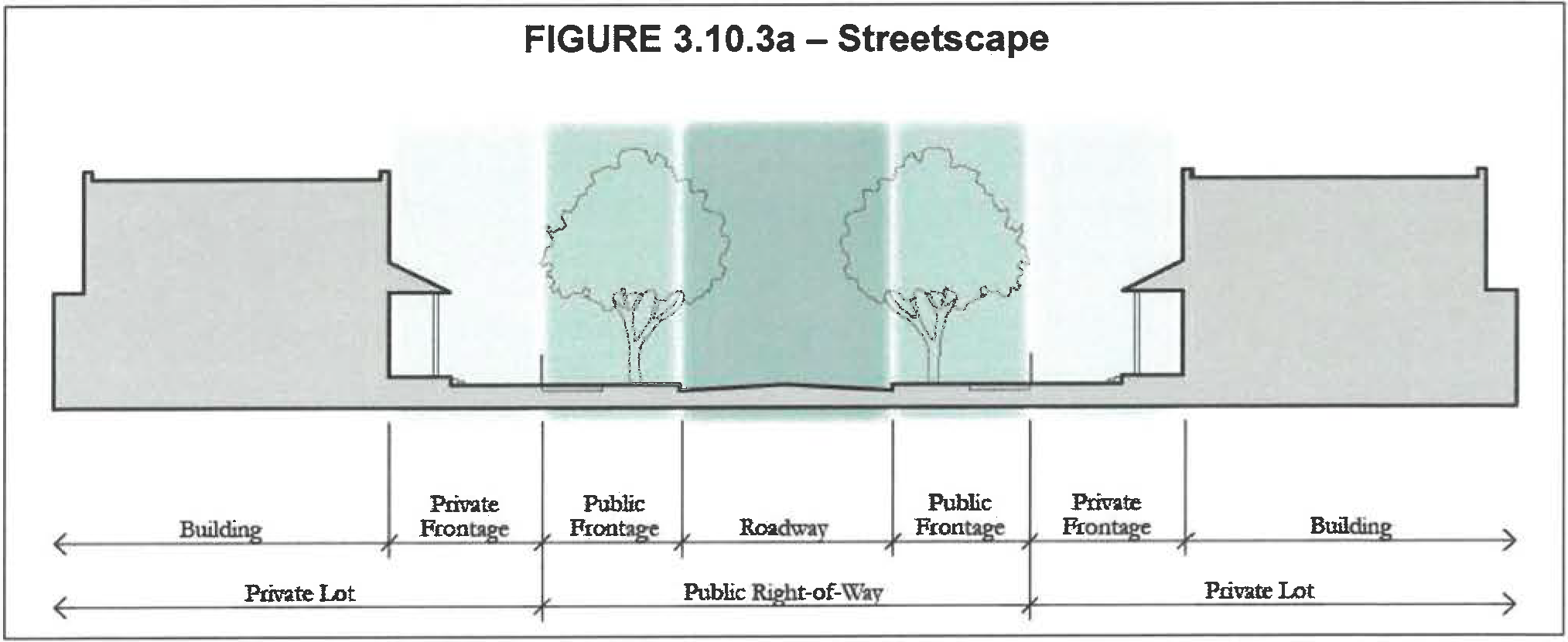
3.
Prototypical Cross Section dimensions for principal roadway types are shown below.
4.
Private frontages. The following standards apply to private frontages
a.
Build-to line (BTL).
(1)
The BTL for building façades shall be as shown in Table 3.10.3f. A minimum percentage of each building façade, as set forth in the table, shall be built to the BTL. This percentage shall be calculated for the vertical building façade at the first floor.
(2)
The BTL shall be consistent along each facing street block. Exceptions to the BTL setbacks or frontage buildout percentages may be allowed by waiver for the purpose of creating a distinct civic space consistent with the civic space standards or creating space to be used specifically for café-table seating.
(3)
Buildings shall front all rights-of-way except for those segments adjacent to open space.
b.
Building façades on multifamily, mixed use, and non-residential buildings.
(1)
All buildings must front a public right-of-way (excluding an alley or lane) or civic space.
(2)
Building façades may include jogs of not more than 36 inches in depth, except as necessary to allow bay windows, shop fronts, balconies, civic spaces, outdoor seating, etc., in which case jogs of greater than 36 inches will be allowed. Jogs of 36 inches or less will be considered as being on the BTL.
(3)
Building volumes shall be articulated into three distinct vertical components, a "base," "middle," and a "top." The first floor height of buildings in centers shall be a minimum of 12 feet, except neighborhood centers within N1 neighborhoods may be ten feet.
(4)
Building façades along BTLs shall be expressed as building modules that do not exceed 30 linear feet in width.
(5)
Weather protection features, which may include awnings, overhangs or other treatments providing functional weather protection, are required on building façades fronting a BTL within employment, urban, community and neighborhood centers. Weather protection features shall provide continuous sidewalk coverage for the length of the building, where feasible.
(6)
Awnings or overhangs shall project a minimum of six feet and maintain a clear height of at least eight feet. They may encroach upon the public sidewalk subject to a right-of-way encroachment permit.
(7)
A building's primary entrance shall be located on the façade facing the public right-of-way or civic space. Primary entrance is the principal pedestrian access to a building, even if customers or residents may more frequently use a secondary entrance associated with a garage, parking area, driveway or other vehicle use area. The entrance shall have the architectural detailing that sets it apart from other entrances and allows it be recognized as the building's primary access point.
(8)
Along the primary street within urban and employment centers, buildings shall be at least three stories in height. Along the primary street in community and neighborhood centers, building height shall be at least two stories in height. Limited exceptions may be made by waiver as a way to add variety and architectural interest to a center. Primary street is defined as the principal commercial street within a center. All other streets are considered secondary.
(9)
One-story buildings shall not exceed 125,000 square feet.
(10)
Buildings higher than three stories shall use stepbacks, balconies or other architectural treatments to decrease their apparent size and scale.
c.
Street screen. A street screen not less than six feet in height or greater than 12 feet in height shall be required along any private frontage that is not otherwise occupied by a building. The street screen shall consist of a wall constructed of material matching or complementary to that of the adjacent building façades. A wall may be replaced by a hedge or fence (or combination) providing comparable level of screening. Residential lots within neighborhood type 1 are exempt from this requirement. Street screen openings for access shall be no larger than necessary to allow vehicular and pedestrian movement. In no event should a vehicular entry be wider than 18 feet. Vehicular entry is not allowed on a primary street.
d.
Windows and doors on multifamily, mixed use and non-residential buildings.
(1)
For multifamily, mixed use or non-residential buildings within centers, a minimum of 60 percent of the total wall area at the ground floor must include pedestrian entrances or transparent windows.
(2)
Windows shall be slightly recessed or project as bays from the main wall of the façade so as to create texture and shadows on the façade for visual interest, as well as the perception that people or activities are behind the windows.
(3)
Upper floor residential units must have a visible ground floor entrance facing the front or side street, a civic space, or a pedestrian passageway. This may be a common entrance serving multiple units.
e.
Parking and service/loading areas.
(1)
Parking and service/loading areas shall be accessed by a rear alley, rear lane, shared driveway or local street other than a primary street within centers.
(2)
Within neighborhoods, lots fronting on a framework street shall be accessed by a rear alley or rear lane.
(3)
Off-street surface parking areas and service/loading areas shall be screened from the public right-of-way by liner buildings or a street screen.
(4)
Structured parking and surface parking entries and driveways within all centers shall be located at least 75 feet away from any block corner or another garage or parking area entry on the same side of the same block.
(5)
Driveway width at the sidewalk within neighborhood types 1 and 2 shall not exceed 11 feet. For employment, urban, community and neighborhood centers, maximum driveway width at the sidewalk shall not exceed 18 feet. Entries to structured parking or delivery bays shall have a maximum clear height of 16 feet and a maximum clear width of 22 feet.
f.
Signage.
(1)
Signs shall be scaled to the character of the center or neighborhood; for pedestrians and slow-moving vehicular traffic in centers; and for simple, unobtrusive wayfinding in other areas of a mixed use district.
(2)
The total area of all signage for each building frontage may not exceed one and one-half square feet for each foot of lineal street frontage. Temporary signs shall not be included in the total area calculation.
(3)
Flush-mounted signs shall be no larger than 60 square feet; may not project more than eight inches from a building wall; and must be located no higher than 20 feet above the sidewalk, below the sill line of the second floor windows, or below the lowest point of the roof, whichever is lowest. In addition, one building identification sign is permitted per building façade. A building identification sign shall be no more than 100 square feet, may be mounted above the second story for maximum viewing, and shall consist of individual letters and/or graphic elements applied directly to the building façade. An address sign no more than two square feet in size is permitted at each address.
(4)
Wall plaques of up to six square feet and projecting no more than three inches from a building wall are permitted proximate to building entryways.
(5)
Monument signs are permitted.
(6)
Blade signs (perpendicular to the BTL) not more than six square feet, minimum nine feet clear height above the sidewalk, may be hung below the second-story level, from the façade or from an overhang or awning. Blade signs in the form of banners may be hung at least 14 feet above the sidewalk and not above the third story so long as such banners do not project more than three feet into the public right-of-way.
(7)
Awnings and canopies may include logos on the valance or front plain. Signs may be suspended from awnings or canopies so long as an eight-foot clear height is maintained.
(8)
No more than 25 percent of a window may be covered by signage.
(9)
Temporary sidewalk easel signs of up to 36 inches in height by 24 inches in width are permitted within that part of a building façade setback from the BTL.
(10)
The following signs are prohibited: billboards, roof signs and freestanding pole signs.
(11)
All illumination of signs and buildings shall be by constant light—digital, scrolling, flashing, traveling, animated or intermittent lighting shall not be mounted on the exterior of any building.
g.
Lighting. Appropriate lighting is desirable for nighttime visibility, crime deterrence and decoration. Lighting that is too bright or intense creates glare, hinders night vision and creates light pollution. It is the intent of these standards to provide outdoor lighting that contributes positively to the pedestrian-oriented environment of urban centers and urban neighborhoods. Dark sky principles are not required.
(1)
Street lights shall preserve the ambiance of the night and respect the privacy of neighboring properties by applying pedestrian-scaled fixtures. Light poles shall be no higher than 18 feet.
(2)
Lighting elements shall provide full spectrum light so that colors at night are natural and realistic. Lighting elements that cast a clearly/perceptively unnatural spectrum of light (such as low-pressure sodium) are prohibited.
h.
Street trees.
(1)
All roadways shall be lined with rows of trees, with each block and its facing block planted in a single species with shade canopies of a height that, at maturity, begin higher than the top of the second story of buildings. The following canopy trees are approved for use: Live Oak; Nuttall Oak; Magnolia; Winged Elm; Tabebuia ipe.
(2)
Trees shall be located within the parkway and medians of the public right-of-way, with the exception that trees are not required in the median of a center's primary street.
(3)
Trees shall be planted along an alignment line—generally three to three and one-half feet from the back of the curb at an average spacing not greater than 30 feet on center. Where necessary, spacing allowances may be made to accommodate curb cuts, fire hydrants and other infrastructure elements. This allowance for spacing may not exceed 45 feet on center except where necessary for transit stops or stations.
(4)
Trees shall be at grade or not greater than six inches in height above or below the sidewalk. Any unpaved ground area shall be planted with groundcover, flowering vegetation, or climbing vines, not to exceed 112 inches in height.
(5)
At planting, trees shall be at least two and one-half inches in diameter at designated breast height (DBH) and at least ten feet in overall height.
(6)
Trees must be "limbed up" as they gain appropriate maturity so as to not interfere with pedestrian or truck travel (minimum seven feet clear over the sidewalk and 14 feet over the travel of the street) and to maintain visibility.
(7)
Maintenance and replacement of trees is the responsibility of the property owner.
i.
Landscape buffers.
(1)
Within a mixed use district, landscape buffers shall not be allowed between place types, between adjacent neighborhoods or between buildings and roadways.
(2)
Landscape buffers may be provided along the boundary line of a mixed use district to mitigate any potential conflicts with adjacent development.
C.
Utilities.
1.
All new utilities shall be placed underground in the public right-of-way, in easements within a private frontage or in rear service alleys. Their specific placement will be determined as part of the site development plan process. Above ground power lines are allowed within an alley or lane.
2.
In furtherance of FLU Policy 1.2.12, the Natural Drainage Module shall serve as a menu of stormwater management techniques, appropriately calibrated for the development patterns intended for a specific mixed use district.
D.
Civic space standards.
1.
Civic space is the second element of the public realm regulated by this article. The development standards provide significant open space and recreational opportunities that are a spatial counter-point to the densities and intensities required of development in mixed use districts. These can be realized through a variety of spaces ranging from large regional and neighborhood-scaled parks to small pocket parks. The open space network will be serviced by an interconnected network of sidewalks, trails and paths for pedestrians and bicyclists alike, providing open space amenities accessible to all neighborhoods and centers within a district.
The types of spaces allowed are illustrated in Figure 3.10.3b.
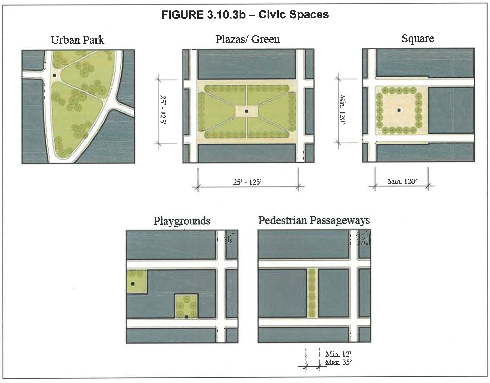
2.
Civic spaces shall adhere to the following standards:
a.
Urban parks.
(1)
Description. Urban parks include open areas available for a variety of purposes, to include structured and unstructured recreation, commercial activity and other passive uses.
(2)
Character. These spaces have a formal urban character being defined by surrounding building frontages and adjacent tree-lined streets. The landscape consists of lawns, trees and shrubs and furnished with paths and benches and shade. Civic elements such as kiosks, open shelters, pergolas, playgrounds or fountains may be included. Parks shall be located within or proximate to centers.
(3)
Standards.
(a)
Width—N/A.
(b)
Depth—N/A.
(c)
Must front at least two public roadways. All buildings must front this space.
(4)
Typical uses.
(a)
Passive/active recreation.
(b)
Commercial uses, including farmer's markets, foot races and concerts.
(c)
Playgrounds.
(d)
Civic events.
b.
Plazas and greens.
(1)
Description. Plazas and greens are open areas available for civic purposes, commercial activities, passive recreation, and, for greens, unstructured active recreation. Numerous plazas and greens add to the vibrancy of centers and neighborhoods by creating the opportunity for casual public engagement. Building frontages define the space. Pocket plazas function in a similar manner and follow the same rules as the larger plazas. These smaller scaled spaces create more intimate places for seating or dining and provide a place where commercial and neighborhood activity can spill into. These plazas can also be used to create a formal space in front of a prominent building entrance.
(2)
Character. Plazas and greens are purposefully sited gathering areas designed with a percentage of paved surface area appropriate to their pedestrian traffic level. They shall be sufficient in number to provide enough shade to help mitigate the heat effect of the hardscape. Tables and chairs shall be provided.
(3)
Standards.
(a)
Minimum width and depth—25 feet.
(b)
Maximum width and depth—125 feet.
(c)
Must front on at least one public roadway.
(4)
Typical uses.
(a)
Casual seating.
(b)
Commercial uses (e.g., retail and food kiosks).
c.
Squares.
(1)
Description. Squares provide an important anchor for a center or neighborhood, serving as an open space available for civic purposes, commercial activity, unstructured recreation and other passive uses. The square should have an urban, formal character and be defined by the surrounding building frontages and adjacent tree-lined streets.
(2)
Character. All buildings adjacent to the square must front onto it. Adjacent streets lined with appropriately scaled trees help to define the square. The landscape shall consist of lawns, trees, and shrubs planted in formal patterns and furnished with paths and benches. Shaded areas for seating shall be provided. A civic element or small structure such as a kiosk, open shelter, pergola, or fountain may be included.
(3)
Standards.
(a)
Minimum width—120 feet.
(b)
Minimum depth—120 feet.
(c)
Must front on at least two public roadways.
(4)
Typical uses.
(a)
Unstructured and passive recreation.
(b)
Commercial and civic uses.
(c)
Casual seating.
d.
Playgrounds.
(1)
Description. Playgrounds are open areas designed and equipped for the recreation of children. They can be interspersed within neighborhoods or centers. Playgrounds can be freestanding or located within urban parks.
(2)
Character. Playgrounds serve as safe places protected from the street and typically in locations where children do not have to cross framework streets to get to. Often playgrounds, particularly tot-lots, are located in the center of blocks surrounded by residential areas.
(3)
Standards.
(a)
Minimum width—N/A.
(b)
Minimum depth—N/A.
(c)
Independent of building frontages.
(d)
Fenced with limited access points.
(4)
Typical uses.
(a)
Passive/active recreation.
(b)
Picnic facilities.
(c)
Outdoor seating.
(d)
Play structures, interactive art, fountains.
e.
Pedestrian passageways.
(1)
Pedestrian passageways provide pathways between buildings and through-blocks. They create unique spaces for building frontages to access while allowing for social and commercial activity to spill into the public realm.
(2)
Character. Passageways are hardscape areas with frequent entries and frontages. There may be exterior stairways to adjacent buildings that frame and define the passageway. There are minimal plantings and potted plants.
(3)
Standards.
(a)
Minimum width—12 feet.
(b)
Maximum width—35 feet.
(c)
Uninterrupted pedestrian passageways greater than 150 feet in length must incorporate a pocket plaza.
(d)
Pedestrian passageways shall be incorporated into blocks that are longer than 400 feet in length in urban centers.
(4)
Typical uses.
(a)
Primary access.
(b)
Casual seating.
3.11.1.- Open space.
A.
Framework. The open space framework builds on existing recreational amenities such as East Lake Tohopekaliga, the Split Oak Forest Conservation Park, Chisholm Park, Lake Runnymede Conservation Area and the Narcoossee Community Center and is focused on the preservation of existing resources, wildlife corridors and habitat areas. A primary regional trail system links these existing amenities, with new planned parks and cultural amenities. Secondary off-street trails will connect neighborhoods to this primary regional trail system, and detached sidewalks and bike lanes along road rights-of-way will serve as local connections throughout the Narcoossee area.
Parks, open space and trails increase quality of life, and can enhance property values in Narcoossee and throughout the region. The preservation of open space and natural resources ensures a sustainable ecosystem for Narcoossee's diverse vegetation and wildlife species. Trail systems allow a higher quality of life for residences and offer off-street transportation options and recreational opportunities that could extend into Orange County, south to Lake Lizzie Natural Area and eventually to Harmony. Open space and trails are discussed in greater detail below and are identified on the Open Space Framework Map.
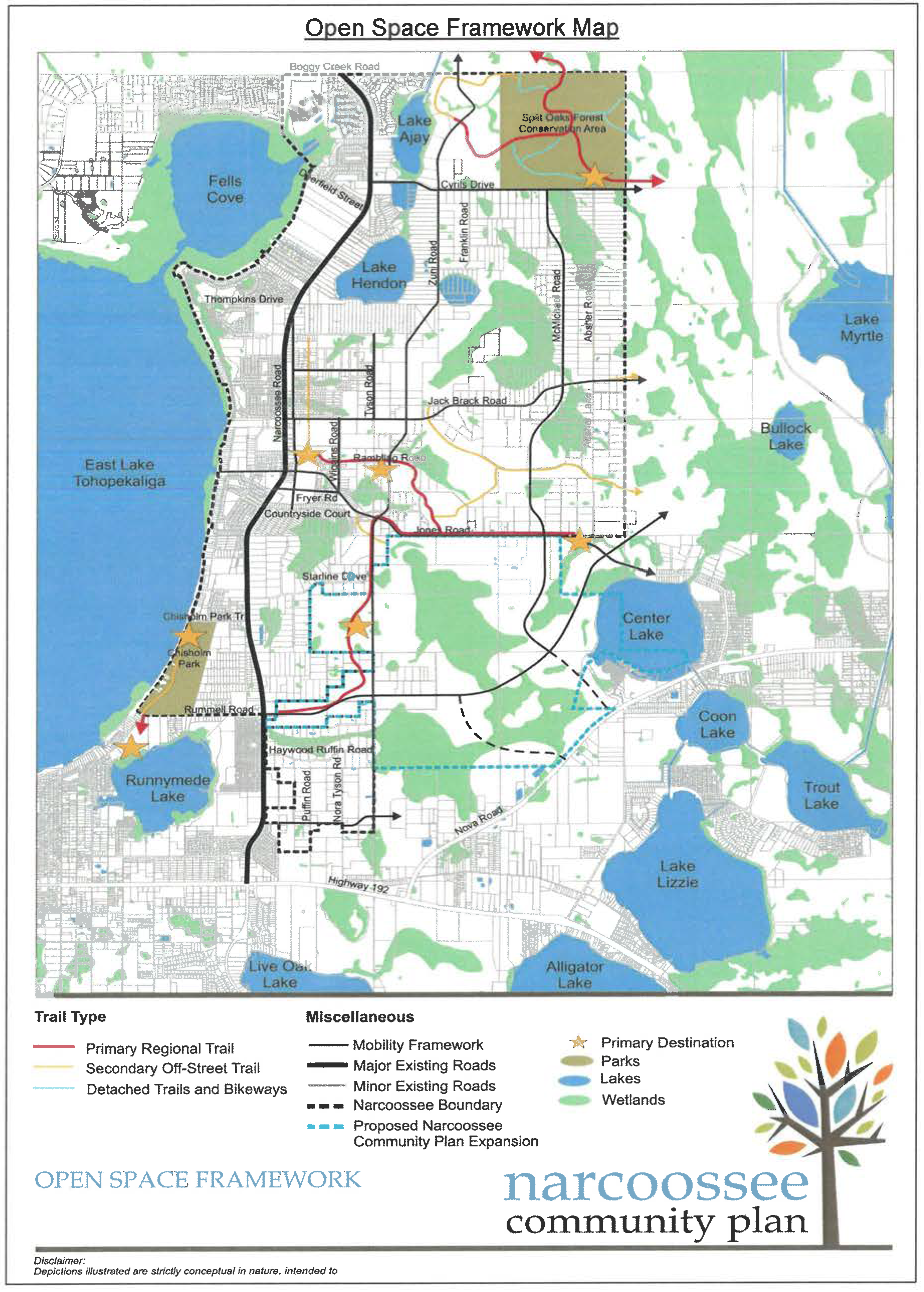
B.
Open space goals and objectives. The open space guidelines are needed to preserve the natural resources of the area, while allowing for recreational uses throughout and are oriented towards four primary objectives:
1.
Preserve the natural resources of the area;
2.
Create destinations for recreation;
3.
Establish an efficient and safe trail system to connect these destinations; and
4.
Serve a range of users, including hikers, bicyclists, and equestrians.
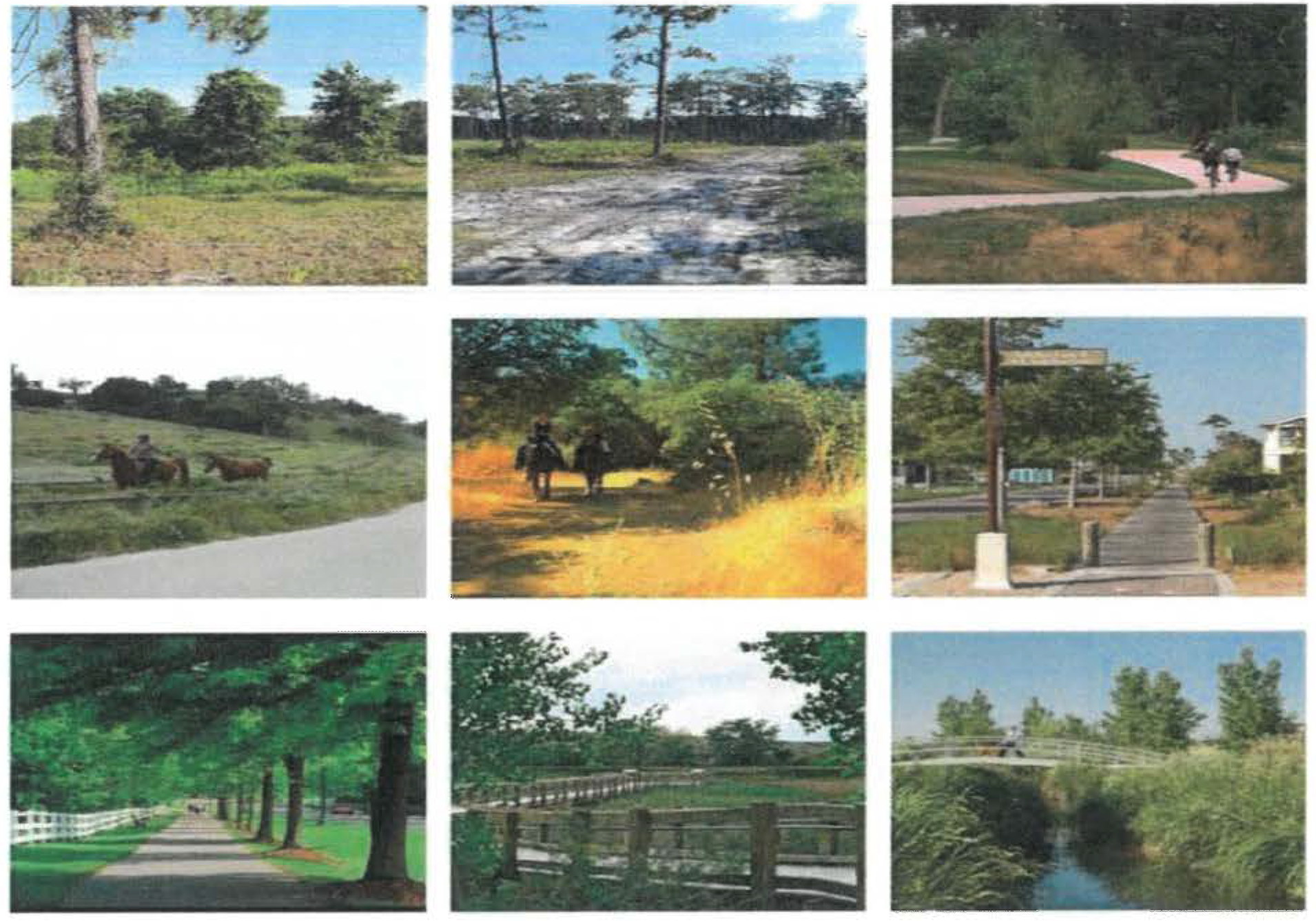
C.
Open space overall context. The western edge of the Narcoossee study area is bounded by East Lake Tohopekaliga and Fell's Cove and their associated wetlands. Many additional lakes, including Lake Runnymede, Center Lake, and Hinden Lake are scattered throughout the area, connected by large-scale wetlands systems.
Much of the Narcoossee community is heavily vegetated with wetlands and forested areas. While many of these natural areas are smaller and disconnected west of Narcoossee Road, eastern areas boast large expanses of undisturbed wetland forests.
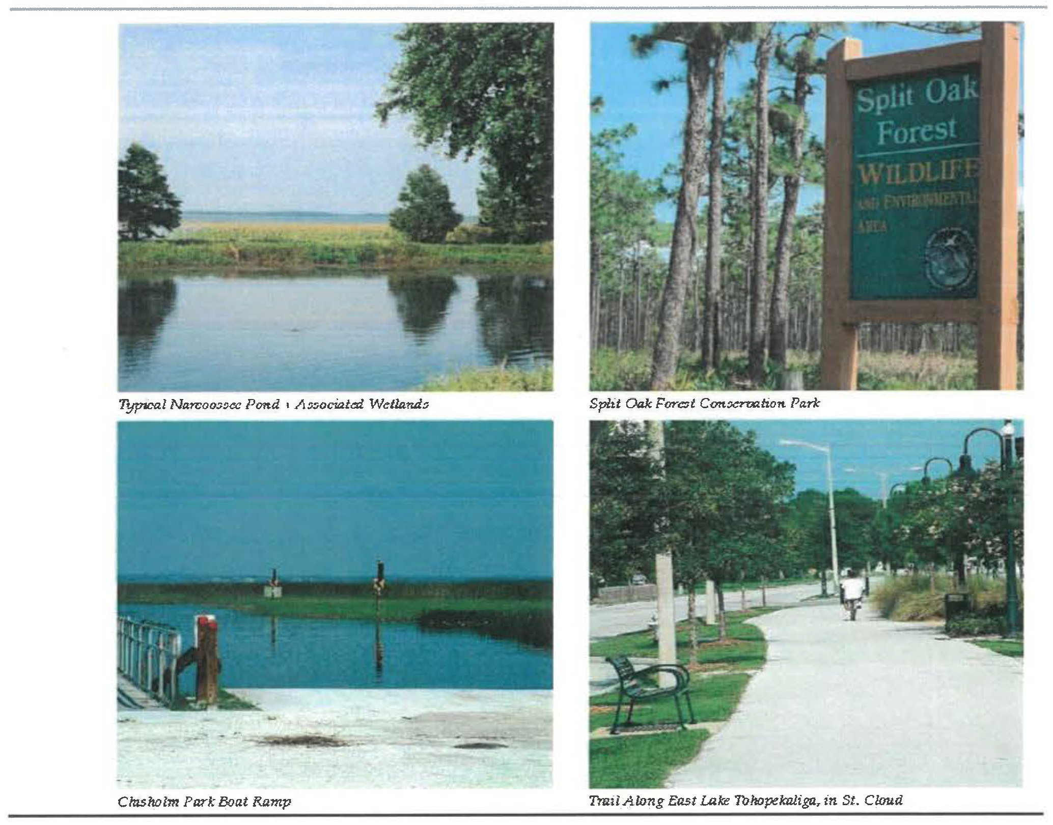
D.
Open space opportunities.
1.
Preservation of natural resources. Preservation of the natural systems for the Narcoossee community is considered a core community value. Built on the wetland system, this natural framework helps maintain the open, rural feeling. Opportunities are present for each landowner to be a steward of the natural resources for their property. Other opportunities exist to connect these sensitive areas with additional upland corridors so wildlife can move freely through the area. Wildlife corridors have been planned on adjacent mixed use districts. These wildlife corridors could make connections all the way from East Lake Tohopekaliga to the Econlockhatchee River. These areas will serve additional functions including interpretation; preserving water quality, detention, and retention; and simply reinforcing character features. Key areas of opportunity include:
•
Wetlands
•
Sensitive wildlife areas
•
Floodplain areas
•
Upland wildlife corridors
•
Historic areas
•
Public lands
•
Water bodies
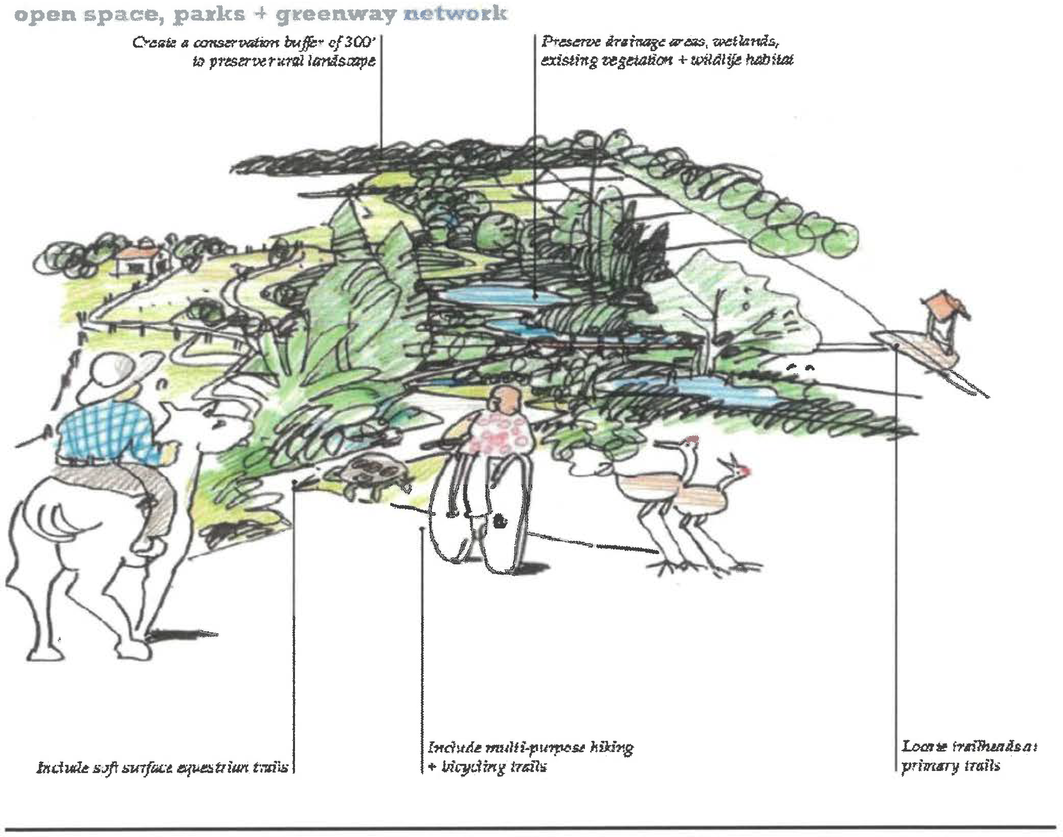
2.
Open space, parks and greenway networks. Preservation of natural systems is important to the character of the Narcoossee area, and the benefits of this are described throughout this section. These areas also provide the framework for a greenway, parks and trail system, linking the community together within a natural fabric. As demonstrated in the open space framework map in chapter 4, new parks, the Historic Town, the Narcoossee Elementary and Middle Schools and public lands are planned and connected into one system. Key opportunities include:
•
Regional park system and facilities
•
Lakeside parks
•
Public plazas
•
Community gardens
•
Beach areas with marina/boat slips and water access
•
Recreation center
•
Playgrounds
•
Tree preservation
3.
Multi-use trails. Adjacent to natural features and greenways is a system of multimodal trails. These trails provide an appropriate buffer between sensitive resources and adjacent development. These trails allow for equestrian use, walking and biking. Trails have been located in strategic areas including within mixed use areas, along existing streets and adjacent to natural features. New trails in the Narcoossee community provide the opportunity to achieve the following:
•
Reinforce the character by promoting a historically used transportation system;
•
Buffer new development with a recreation amenity;
•
Create a new mobility option that supports equestrian, walking and biking;
•
Connect neighborhoods with trail systems to the Historic Town, schools, centers and regional destinations such as the Split Oak Mitigation Park and the Econlockhatchee River;
•
Provide safe and healthy options for seniors and our youth;
•
Create a new off-street trail amenity that helps mitigate the impact of busy roads.
a.
Trailheads. Trailheads are public places to enter and exit a trail facility, and often include signage, informal kiosks with trail maps, and trash receptacles.
There are three types of trailheads: trailheads with parking, trailheads with equestrian trailer parking, and non-parking access points. Trailheads that offer parking are typically near heavily utilized trails. The amount of parking offered at these trailheads is dependent on trail usage and available space. Non-parking access points are typically located on lesser-used trail systems.
Following are the elements that should be located at each trailhead:
•
Signage. Rules and regulations shall be located at all trailheads, and shall include trail etiquette, warnings about potential safety hazards, and permitted trail uses.
•
Trash receptacles. Trash cans shall be located at all city-maintained trailheads and shall be placed along heavily used trails within the Narcoossee area.
•
Dog waste disposal stations. On trails where dogs are allowed, dog waste stations shall be provided at one-mile intervals and at trailheads.
•
Shade structures. Where possible, shade structures shall be located at heavily utilized trailheads to offer relief from the sun and shelter from inclement weather.
•
Lighting. In areas likely to receive use at night, pathway lighting meeting dark sky standards shall be provided to avoid conflicts at intersections and allow users to better observe trail direction, surface conditions and obstacles.
•
Restrooms. Where possible, restrooms shall be present at heavily utilized trailheads.
b.
Trail crossings. Trail crossings shall always be located perpendicular to the roadway and shall be clearly marked. Crossings are encouraged to be located at signalized intersections, especially at major roadway crossings. If this is not feasible, a trail-user activated flashing yellow light shall be used at the crossing. These crossings shall also be striped or utilize different paving methods to alert drivers to trail crossing locations. On local streets, trail crossings may be signed with only a stop sign.
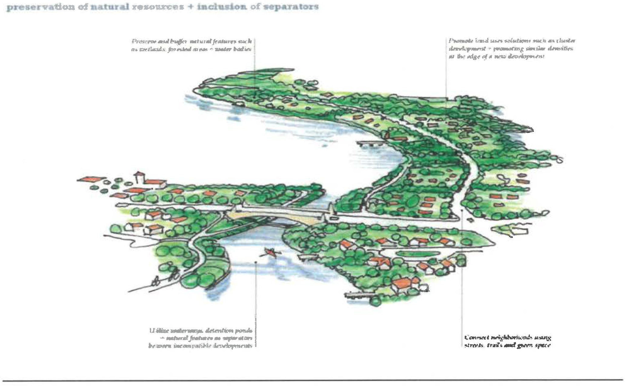
3.11.2. - Separators.
The Narcoossee area has a number of character areas consisting of traditional subdivisions to rural estates. The community has acknowledged that portions of the community will continue to grow. New mixed use districts are already expected in the area. In these transitioning areas, separators, transitions and connections can increase the compatibility of all future projects. These techniques come in many forms, from simply preserving and buffering natural features adjacent to new developments to promoting compatible densities on the edge of a development.
Although, one technique is to create a separation between developments, another technique is to connect them. By connecting existing neighborhoods to new neighborhoods, the difference between the two developments are lessened. Through greenway, park, trail and street connections, separate developments appear to be one development with a variety of housing types. Residents benefit from shared amenities and new transportation choices. Key actions and opportunities include:
•
Preserve and buffer natural features such as wetlands, forested areas and water bodies.
•
Create setbacks and separation of uses.
•
Utilize physical features such as trails, fencing, sidewalks, detention ponds and berms.
•
Promote land uses solutions such as feathering, cluster development, height restrictions, stair stepping, and promoting similar densities at the edge of a new development.
•
Connect new and existing neighborhoods using streets, greenways, parks and trails.
A.
Fencing.
1.
Height. Fencing shall be a minimum of 30 inches in height along roadway rights-of-way; 42 inches against vertical drops greater than 24 inches; and 54 inches along equestrian trails.
2.
Materials. Fencing shall be constructed of one of the following materials: wooden post and horizontal wire; pre-cast concrete post and rail; three-rail wooden fence; steel I-beam vertical posts with wooden rails; or Corten steel slatted fence.
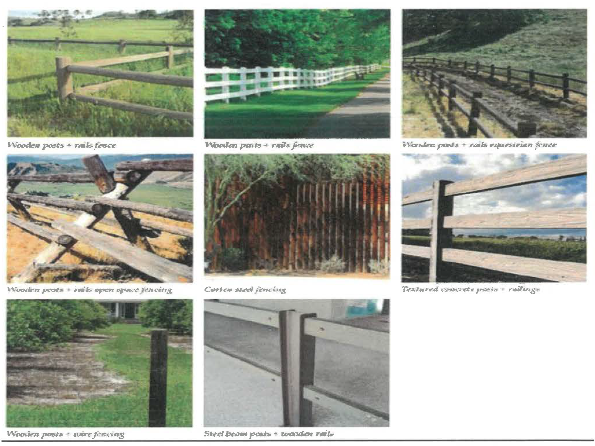
B.
Berms. Berms and plantings shall be used to create a buffer between Narcoossee Road and adjacent residential development. Where space is not adequate to provide berming, other structures such as hedges and/or fences shall be used to create a screen, with associated plantings located on the Narcoossee Road side of the structure.
1.
Berms shall be constructed in a non-contiguous fashion, with breaks between berms at appropriate locations (i.e., trail connections to interior neighborhoods, detention pond locations).
2.
Slopes and overall form are to be natural and smooth; with irregular, organic forms; rounded tops; and varied side and bottom slopes, transitioning gently into adjacent grades.
3.
Berm height shall be a minimum of six feet and determined by right-of-way width available and adjacent usage and sight lines.
4.
Berms shall be completely covered with grass, shrubs or other living ground cover. Landscaping shall be used to give additional screening height where necessary and to provide a visually aesthetic treatment to the roadside.
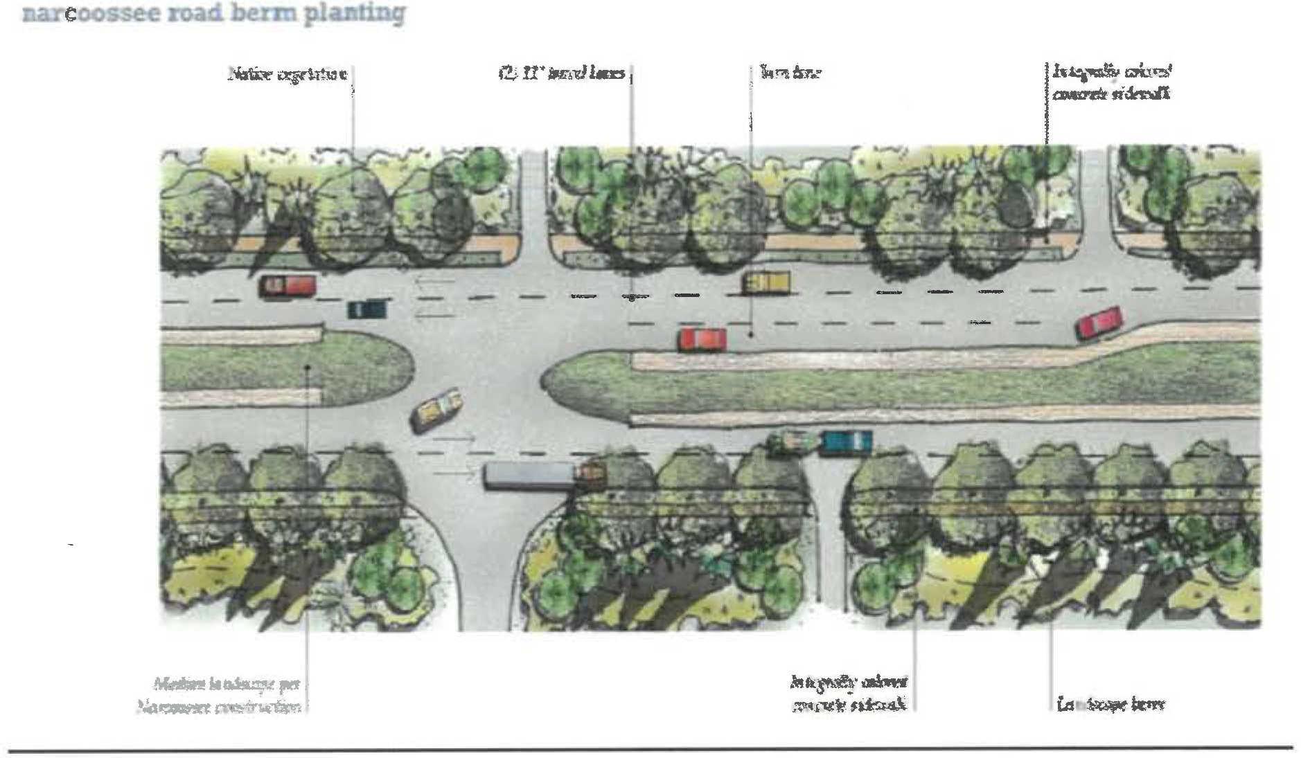
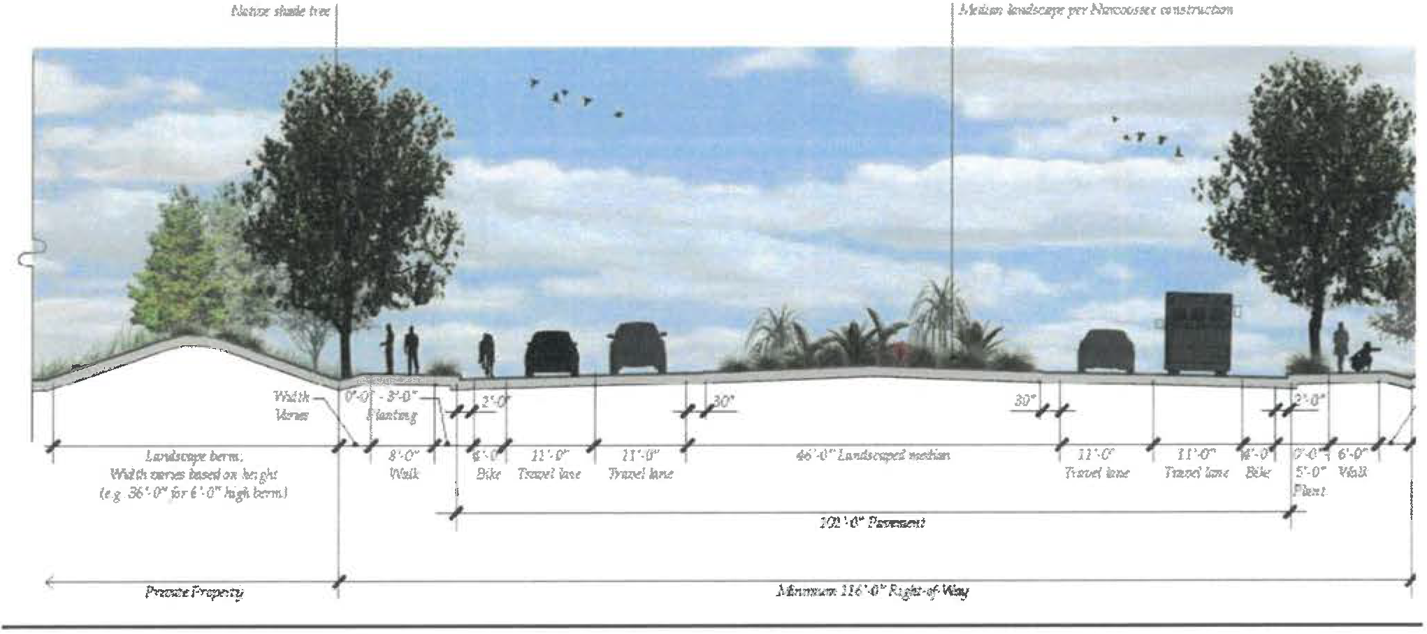
C.
Natural features. Preserve existing native vegetation and features where possible, and utilize these areas as buffers between incompatible developments. Wetlands shall be preserved and buffered per the requirements in the Osceola County Comprehensive Plan. Historic trees shall be protected as stated within the Osceola County Land Development Code.
D.
New physical features. Built features such as detention ponds, berms, greenways and trail systems and right-of-way elements such as sidewalks and fencing shall also be utilized as separators between incompatible developments.
E.
Land use solutions. Land use options such as cluster development and transitioning densities at the edges of existing residential areas can help maintain the Narcoossee community character. Additionally, connections between existing and new residential neighborhoods using greenways and trail systems and/or local street connections can also help mitigate undesirable elements such as larger roads and additional traffic.
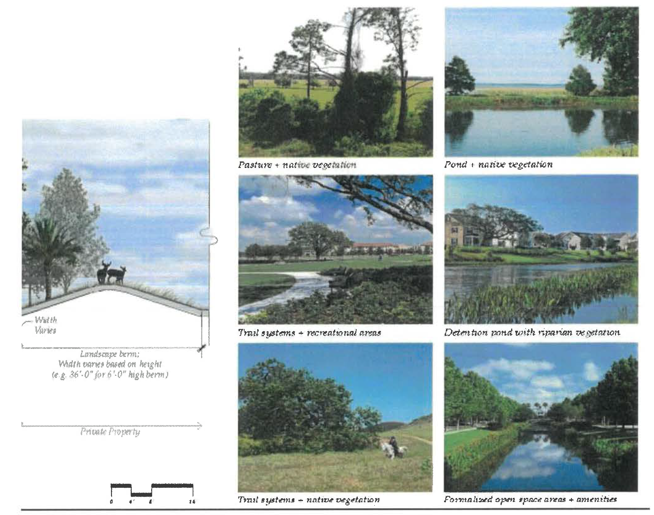
3.11.3. - Centers framework.
The economic development framework for Narcoossee highlights opportunities for consolidating, expanding and creating new commercial areas along the Narcoossee corridor and interior to new walkable neighborhoods. The centers framework is identified on map 3.12B below:
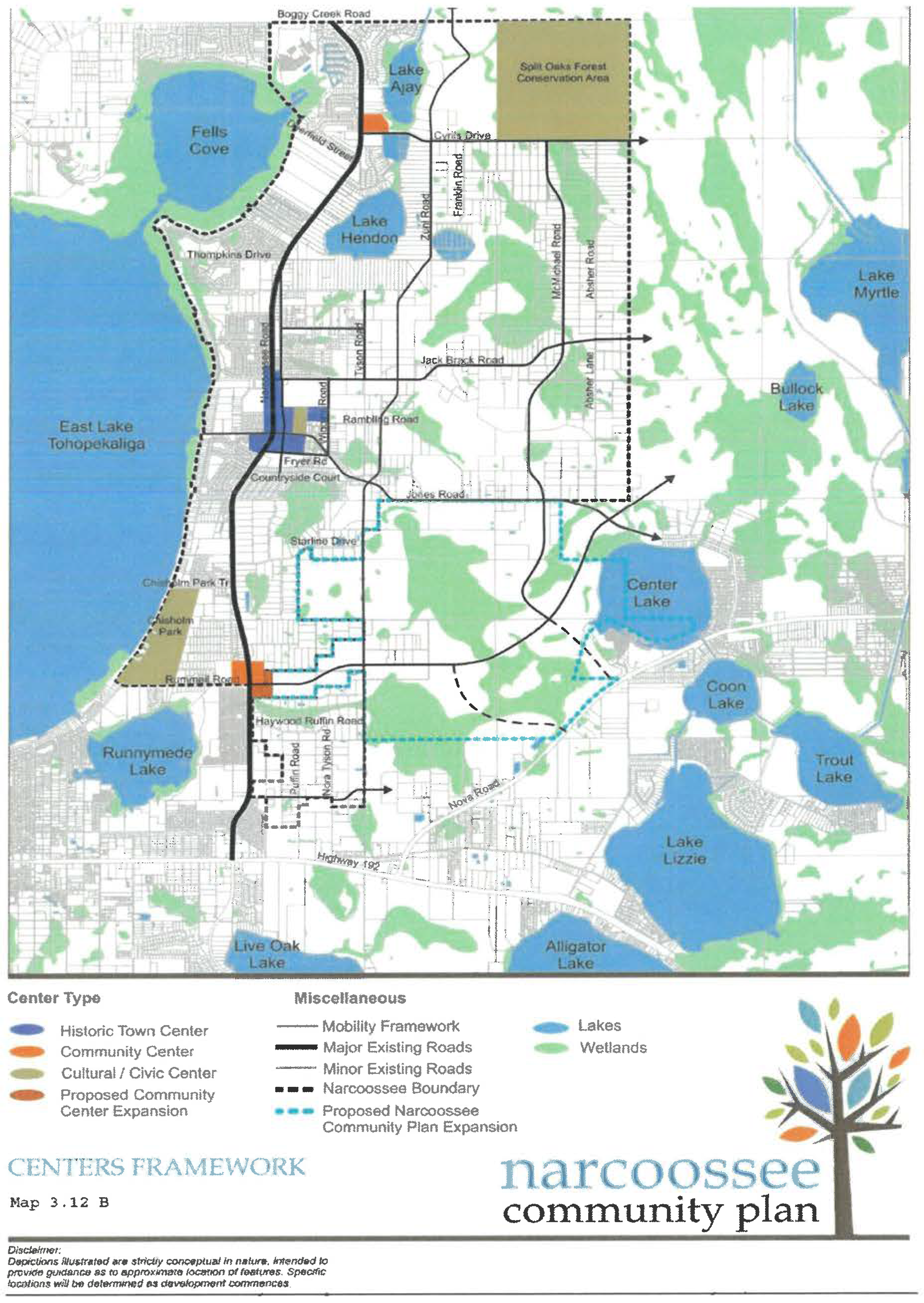
At the heart of the Narcoossee corridor is the Historic Town. This area will serve as the community and cultural center for residents of the area.
At the south end of the corridor lies the existing retail center anchored by Publix. With the opportunity for continued expansion along U.S. Highway 102, this area could serve as an employment base for the community.
Two additional future community centers lie at the intersections of Narcoossee Road and Cyrils Drive, and Narcoossee Road and Rummell Road. These centers are anticipated to contain a mix of retail and small businesses to complement the southern commercial and employment center.
Additional future neighborhood-scale centers occur along Narcoossee Road at Boggy Creek Road, Tompkins Drive, and Chisholm Park Trail. Additional neighborhood centers also occur interior to the residential developments within the Narcoossee community.
A.
Centers overall context. The Historic Town will establish a focus and identity for the Narcoossee community and will center around what could be considered Historic Narcoossee at the northeast corner of Narcoossee Road and Jones Road. This area sites almost at the geographical center for the Narcoossee community, already contains the historic fire station, and most lots are already divided into smaller parcels and zoned commercial, which is more applicable to development of a small downtown area. The Narcoossee Feed Store at the northwest corner of Narcoossee and Jones Roads should be preserved as well. It is recommended the St. Luke's Missionary Baptist Church, currently further east on Jones Road, be relocated to the Historic Town.
The preservation of remaining historic buildings and structures in Narcoossee is an important consideration in establishing the Historic Town. This may involve the preservation, and in some case, physical relocation of historic buildings such as the Narcoossee Feed Store, the Narcoossee Schoolhouse, St. Luke's Missionary Baptist Church, the Volunteer Fire Department, and other historic buildings and structures in the area.
The economic development framework for Narcoossee highlights opportunities for consolidating, expanding and creating new commercial areas along the Narcoossee corridor and interior to new walkable neighborhoods.
B.
Centers opportunities. Residents do not want Narcoossee Road to suffer a similar fate as other corridors in the region. Instead of typical strip commercial development, a series of appropriately spaced and sized neighborhood and commercial centers will be developed. These walkable, unique centers will range from coffee shops to mixed use office complexes to new local restaurants. In key places, they will be surrounded by smaller residential units, creating new complete neighborhoods. Centers located in the mixed use districts will be adjacent to higher density development. A 2011 market analysis infers that long-term market demand exceeds the amount of zoned commercial and employment land, due to high traffic counts along Narcoossee Road and anticipated regional growth. These under-scaled, vibrant centers could experience high retail expenditure per square foot, promoting needed but tempered economic development. The existing commercial big box center at Highway 192 could be expected to transition to a mixed use area over time if adjacent residential densities are increased. Key opportunities include:
•
Creation of lakefront retail areas
•
Redevelopment of the Community Center at Highway 192
•
Creation of centers with senior living components, local restaurants and services
C.
Historic Town opportunities.
1.
Employment areas opportunities. Residents have expressed interest in new local jobs. When asked the question, "will my children live in the community when they grow older?", the majority answered "no". A primary reason is the lack of high-paying jobs. Most residents work outside the area. One method to minimize the impacts of growth is providing employment options closer to where people live. New employment areas are planned in the centers, mixed use areas or as a separation between the Narcoossee community and the northeast district. These businesses will provide new employment options to the residents. Key opportunities include:
•
New high-technology research facilities due to the proximity to Medical City and the northeast district
•
Office uses, creating appropriate entryways into the area
•
Sustainable industries that are consistent with the area's values
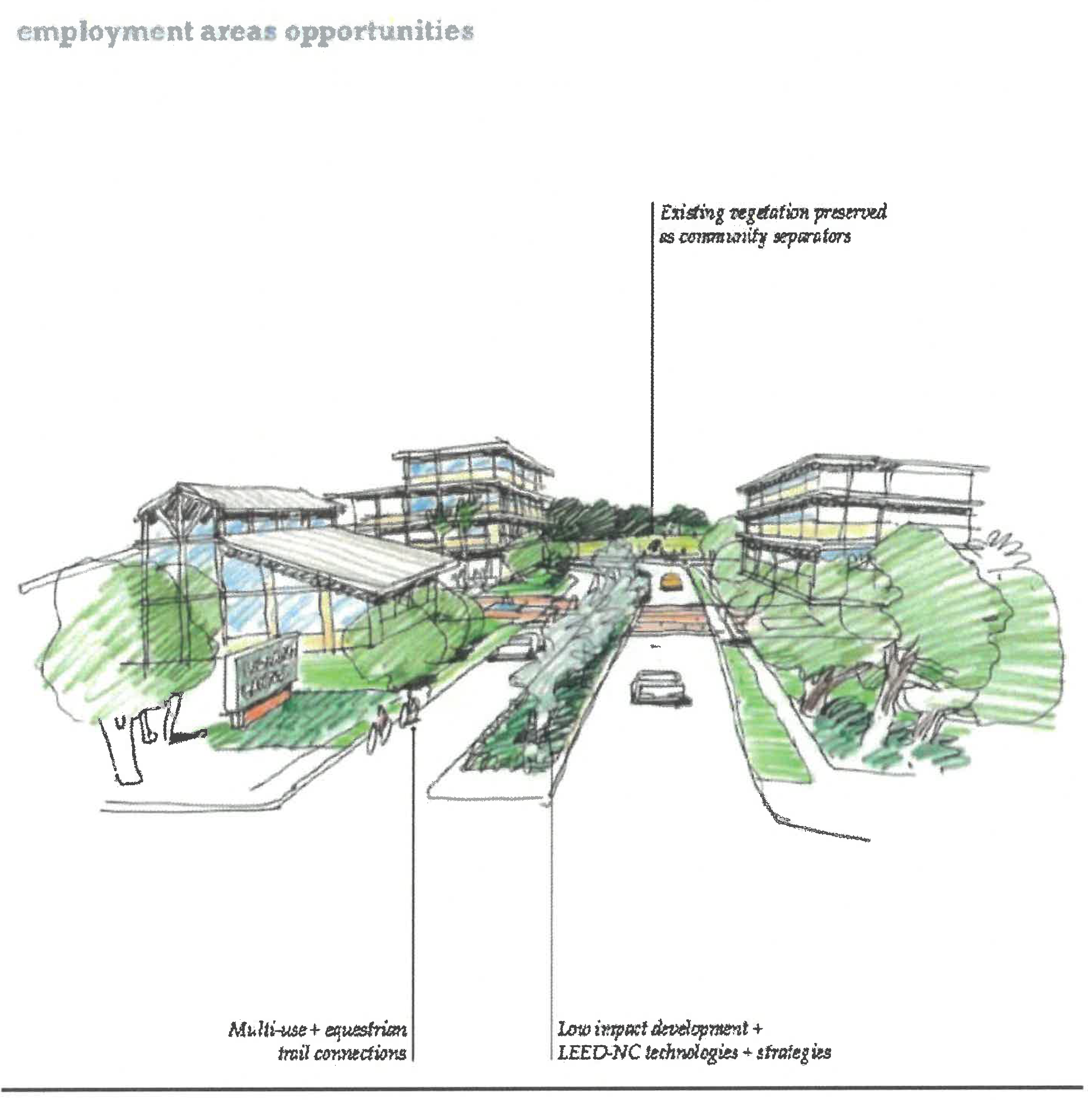
2.
Investment in Historic Town opportunities. Residents have chosen to restore and expand the historic gathering place of the community. Historic Town will include mixed use commercial buildings against the street, a small-block quaint downtown, event area and the stabilization and enhancement of the adjacent residential neighborhoods. The development of Historic Town is expected to achieve the following goals:
•
Creation of a gateway into the community and Osceola County
•
Definition of the character and sense of place of the community
•
Creation of a central public gathering area and event areas
•
Provision of a center for local economic development
•
Provision of a local and regional recreational resource focused on equestrian amenities
•
Provision of a cultural center for the community, including a museum, art, local food production, and historic buildings
•
Provision of transit station options
•
Key opportunities include:
•
Well-designed architectural details
•
Restaurants
•
Library and/or community centers
•
Churches and/or meeting areas
•
Public greens, plazas and farmer's market
•
Civic buildings/town hall
•
Amphitheater and/or public gathering spaces
•
Equestrian amenities
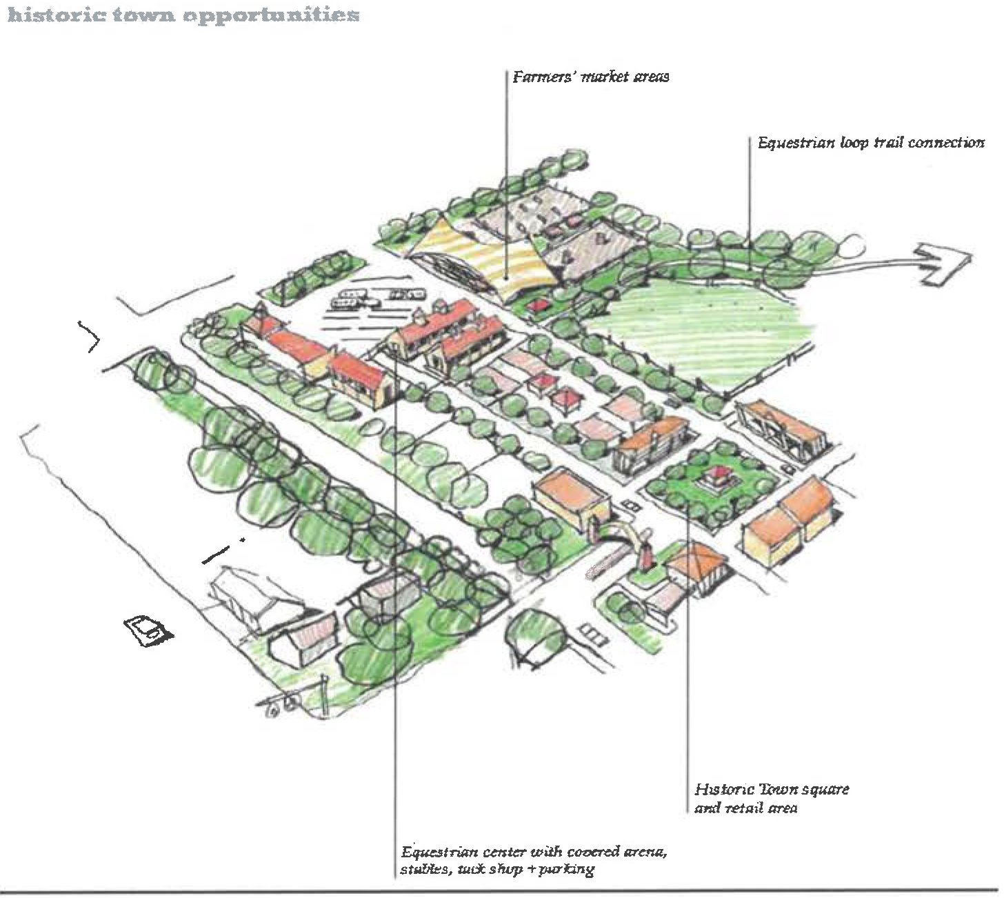
D.
Historic Town goals and objectives. The Historic Town design guidelines are necessary to create a vibrant, small-scale town center, and are oriented towards five primary objectives:
•
Reflect the rural and agrarian context of the community;
•
Create places for gathering;
•
Enhance the existing identity in a cohesive way;
•
Establish a comfortable pedestrian environment; and
•
Plan for transit integration by including transit-oriented features.
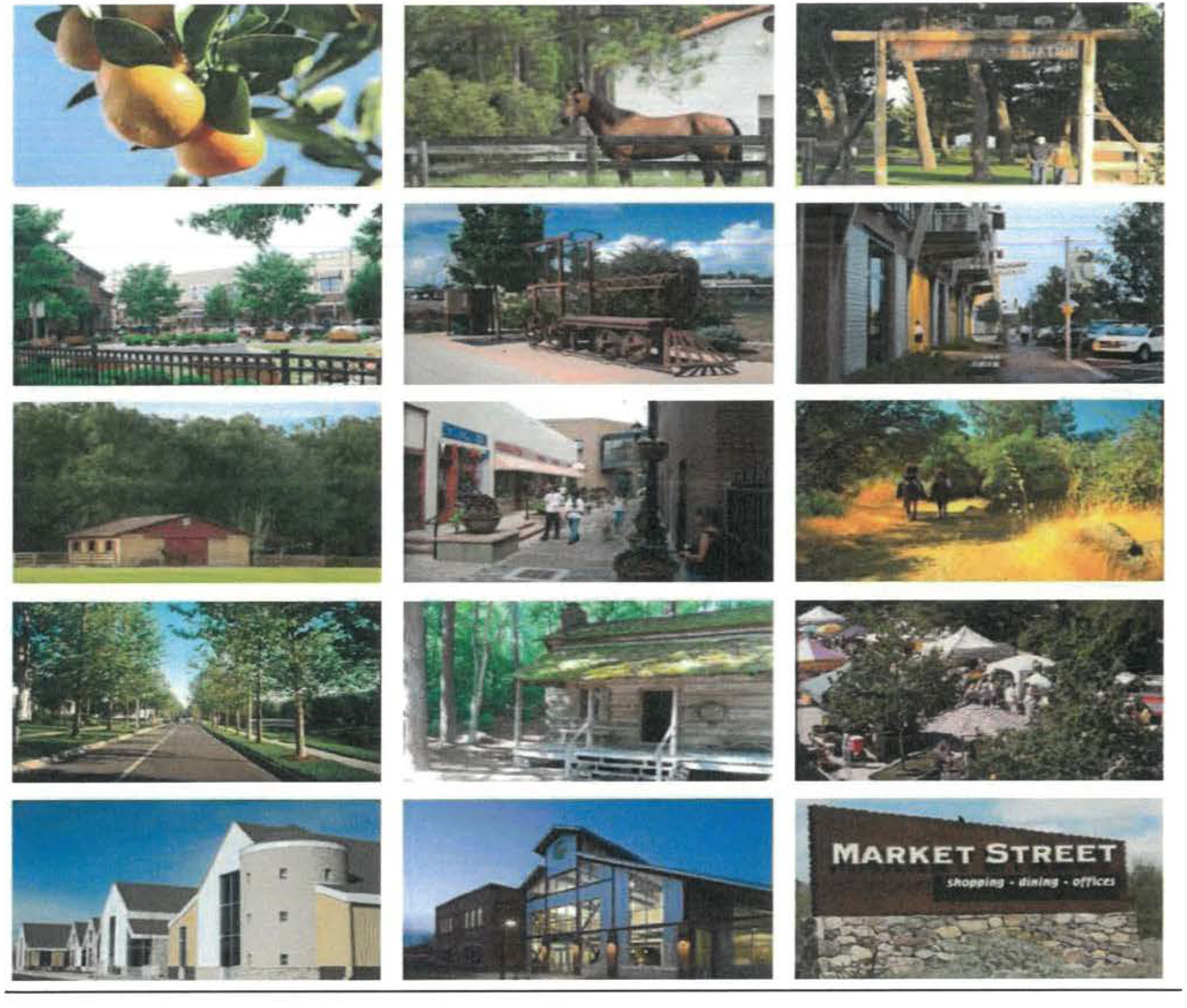
1.
Historic Town character areas. Within the Narcoossee Historic Town, four character areas exist that reflect differing types of use, walkability, road types and usage and transitions. These four zones are described as follows:
a.
Zone 1: Small block commercial is characterized by smaller, pedestrian-oriented blocks, narrower streets and central town square.
b.
Zone 2: The Narcoossee Road Transit-Oriented Design (TOD)/Commercial is the area that calls passerby's attention to the Small Block Commercial area. While the rest of the Narcoossee corridor is heavily landscaped, with little or no views to the interior neighborhoods, within this area the buildings will front the highway, creating a more active public space along Narcoossee Road.
c.
Zone 3: Town residential make up the majority of the area surrounding the Small Block Commercial, and comprises the residential component of the Historic Town. While the block layout relies heavily on existing parcels and rights-of-way, the blocks range in size, with a maximum of 600 feet by 250 feet. A new street network through the area increases connectivity and enhances walkability.
d.
Zone 4: The Cultural/Commercial/Event Zone serves as the gathering area and the cultural center for Narcoossee.
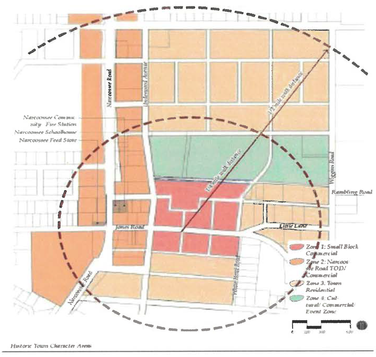
2.
Historic Town guidelines
a.
Zone 1: Small block commercial.
(1)
Small block commercial architecture.
(a)
Building size, massing and use. All buildings shall be built to a uniform frontage line to define the Small Block Commercial and distinguish it from other centers and surrounding neighborhoods.
(b)
Building use.
•
The Small Block Commercial zone shall have a variety of uses including: housing, small-scale, neighborhood-oriented retail, commercial and office, with a focus on civic uses and recreational facilities.
•
Sites for future civic buildings shall be preserved as prominent focal points and identifying architectural buildings.
•
This zone should encourage a mix of uses.
(c)
Lot/building sites.
•
Large development parcels shall be divided into smaller building sites wherever possible.
•
Building sites for civic buildings may consume an entire block.
•
Maximum building sites for residential and commercial uses shall be 5,000 square feet.
•
Maximum lot coverage shall be 100 percent.
(d)
Building height.
•
Building heights shall be varied throughout the Small Block Commercial.
•
Maximum building height shall be two stories.
•
Maximum height for special element, such as silos, towers or clerestories shall be 40 feet.
•
Maximum building footprint shall be 5,000 square feet.
•
Civic buildings shall be exempt from this limit.
(e)
Building setbacks.
•
Front build-to line: 0 feet.
•
Side and rear setback lines: 0 feet.
(f)
Building frontages.
•
Minimum building façade built to the build-to line shall be 85 percent.
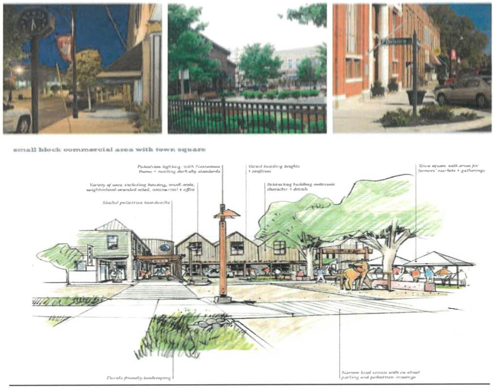
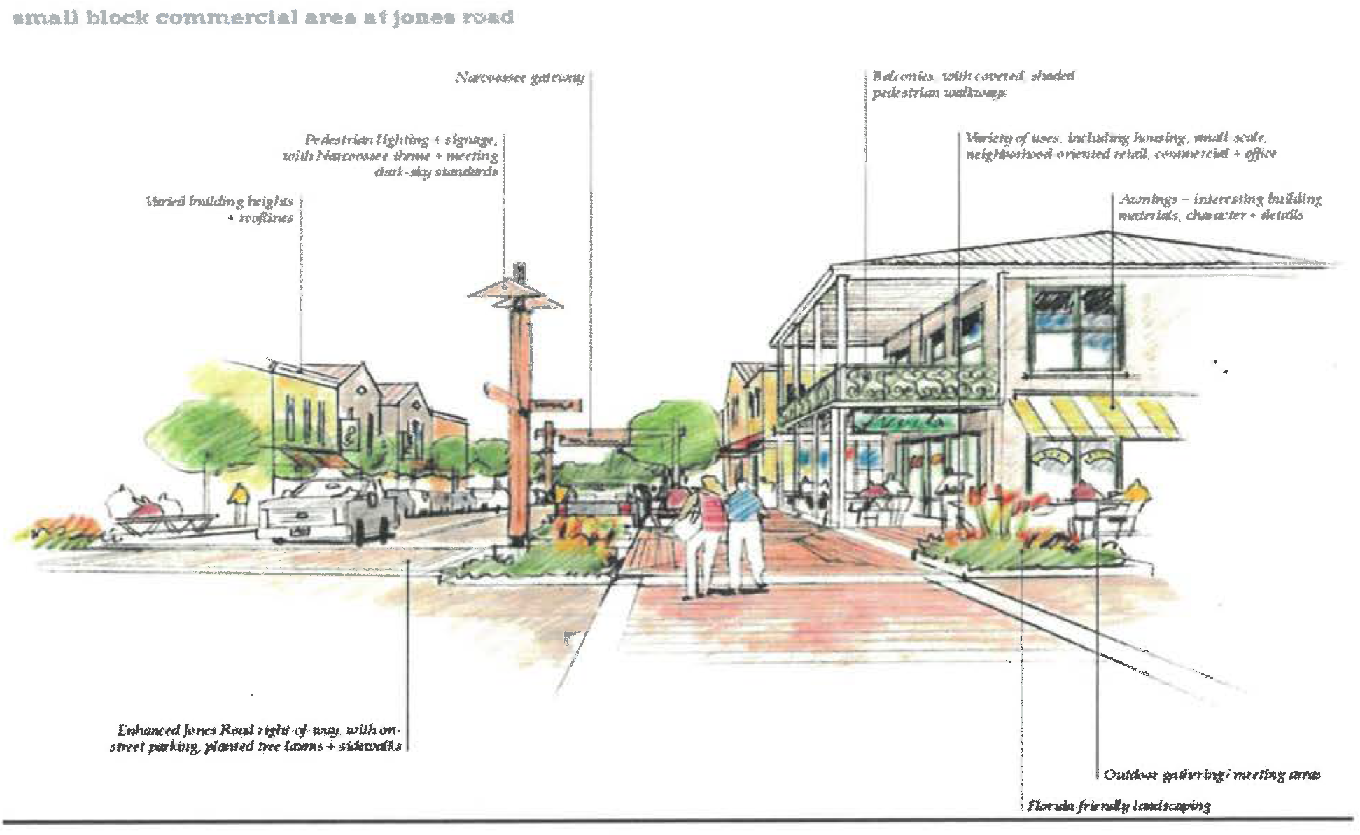
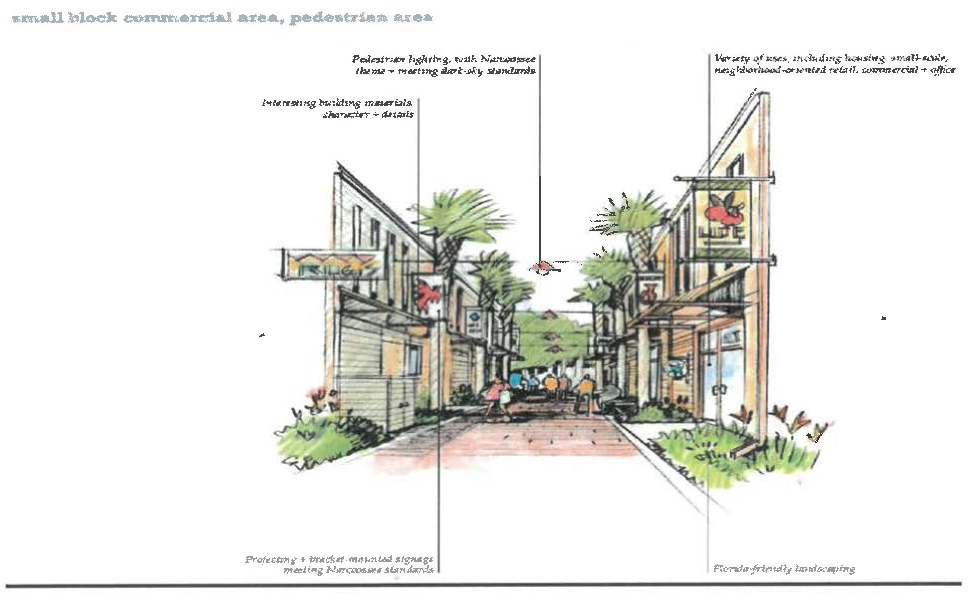
(2)
Small block commercial exterior building materials and finishes.
Exterior materials. Types of materials appropriate to the context of Narcoossee shall be used. Examples are noted as follows:
•
Unfinished rough-cut pine cladding
•
Clapboard siding
•
Metal standing seam roofing
•
Perforated metal
•
Wire metal mesh
Exterior colors. Within the Small Block Commercial, natural and earth tone colors such as unfinished wood shall be used, as appropriate, for different architectural styles.
(3)
Small block commercial building details/public/private space and transition.
Entrances.
•
All main entrances shall face the commercial street.
Encroachments.
•
Encroachments include porches, awnings, roof overhangs, covered entries, arcades, boardwalks, balconies.
•
All buildings shall have some type of transitional public/private space.
•
All encroachments may extend into the public sidewalk.
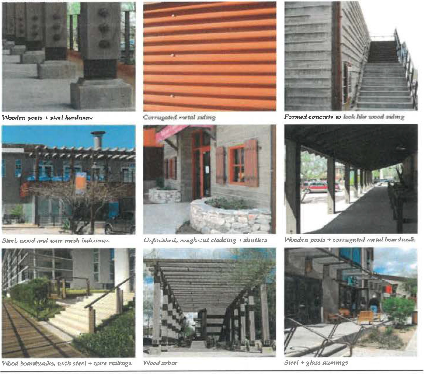
(4)
Small Block Commercial building fenestration and roofs.
Fenestration/glazing.
•
Ground level retail storefronts with formal, symmetrical façades, large expanses of display windows flush with the building walls, recessed entrances and decorative glass transoms shall be used in the Small Block Commercial.
•
Windows shall be scaled to remain proportionate with building size.
Roofs.
•
Clerestory windows and/or dual-level roofs shall be used at second levels.
•
Roof forms recalling those of barns, stables or agricultural facilities shall be used.
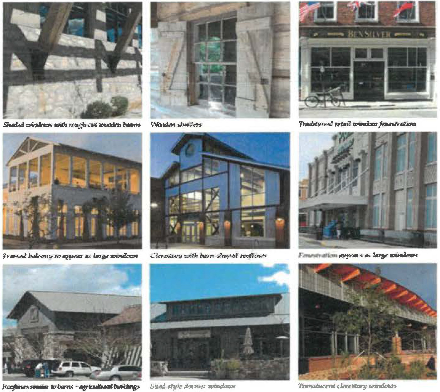
(5)
Small Block Commercial building signage.
Projecting or bracket-mounted signage. Bracket-mounted signage projecting from walls is an effective, historically-sensitive method to provide building signage for the Small Block Commercial area. These signs are more pedestrian in scale, typically mounted on pilasters or walls at a height closer to the sidewalk, and oriented perpendicular to the movement of pedestrians along the sidewalk, a more appropriate and sensitive solution than larger, flush-mounted signs oriented to the automobile.
(a)
Use projecting, bracket-mounted signage where possible. Signs should be affixed to, or hung from, brackets such that the bottom of the sign is at least eight feet above the sidewalk.
(b)
Signs should not be mounted higher than 12 feet above the sidewalk, or project above the roof or parapet.
(c)
Sign sizes, styles and mounting heights should be consistent and complementary in order to unify the streetscape.
(d)
Modern signage designs are permitted provided the designs are compatible with the historic building.
(e)
Signs can be externally illuminated with small floodlights or similar fixtures, provided the lighting is directed back toward the sign and does not cause glare onto the street, sidewalk, or sky.
Flush-mounted and wall signage. Flush wall-mounted signage can also be an effective, historically sensitive method to provide building signage for the Historic Town. Sign placement, sizes and mounting heights are critical in ensuring the compatibility of this type of signage with the downtown streetscape.
Small, flush-mounted signs should be pedestrian in scale, oriented to pedestrians along the sidewalk instead of to the automobile on the street. Wall-mounted directory signage can be used to identify tenants on upper floors, or in larger, multi-tenant buildings.
(a)
Use flush wall signage where bracket-mounted signage is not possible. Signs should be mounted at least eight feet above the sidewalk, but no higher than 12 feet.
(b)
Sign sizes, styles and mounting heights should be consistent and complementary in order to unify the streetscape.
(c)
Signs can be externally illuminated with small floodlights or similar fixtures, provided the light is directed back toward the sign and does not cause glare onto the street, sidewalk or sky.
Modern signage designs are acceptable, provided the designs are compatible with the historic building.
Awning and window signage. Both window signage and awning valance signage is pedestrian in scale and easily relates information to the visitor along the sidewalk.
(a)
Signage on awnings is permitted, either on the sloped body of the awning or on the valance. Valance signage is preferred for its more appropriate scale.
(b)
Window signage is encouraged in conjunction with complementary wall- or bracket-mounted signs.
(c)
Colors and styles for awning signs should be complementary to the awning fabrics.
(d)
Awning signage should not be backlit.
(e)
Window signage should be in scale with the window area, not obstructing the view to the interior of the business.
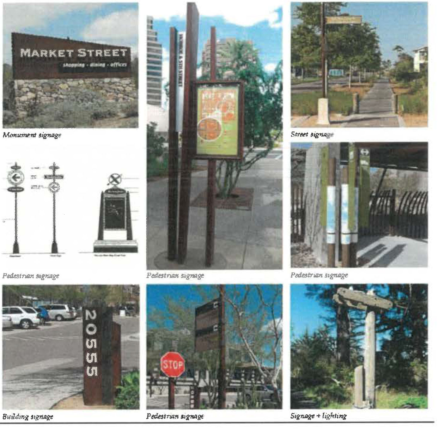
(6)
Small block commercial building lighting.
Façade lighting. Subtle façade lighting shall enhance the character and ambiance of the Small Block Commercial. façade lighting can be used to supplement street lighting for improved pedestrian safety. Façade lighting can be used as lighting for wall-mounted signage. All lighting within the area shall meet dark sky requirements.
Subtle wall-washing façade lighting shall be permitted within the Small Block Commercial.
(a)
Fixtures should be directed downward, with emphasis placed on the street level areas of the façade where the lighting will enhance pedestrian safety.
(b)
Fixture styles, finishes and light source should be compatible with the scale and materials of the building façades, and complementary to awnings, signage and other features.
(c)
Use of modern light fixtures is permitted, provided the placement and design is compatible with the character of the Small Block Commercial buildings.
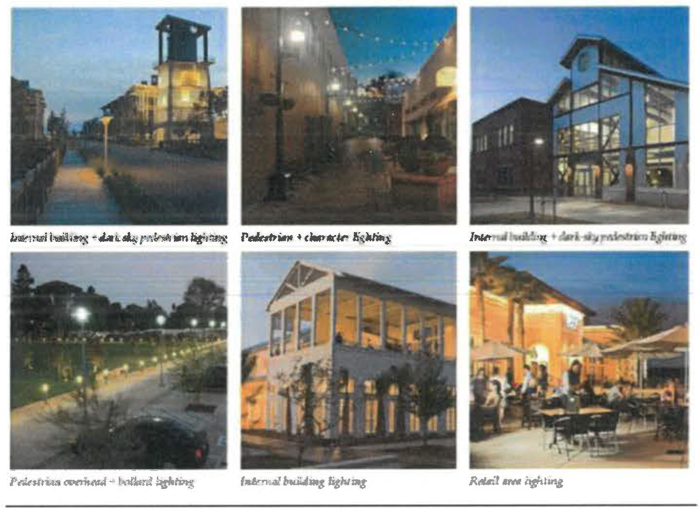
b.
Zone 2: Narcoossee Road TOD/Commercial.
(1)
TOD/Commercial architecture.
(a)
Building size, massing and use. All buildings shall be built to a uniform frontage line to define the TOD/Commercial area and to distinguish it from the overall Narcoossee corridor.
(b)
Building use. The TOD/Commercial area shall have a variety of uses including: housing, retail, commercial and office.
(c)
Lot/building sites.
• Maximum building sites for residential and commercial uses shall be 15,000 square feet.
• Maximum lot coverage shall be 100%
(d)
Building setbacks.
• Front build-to line: 0 feet
• Side and rear setbacks: 0 feet
(e)
Building frontages.
• Minimum building façade built to the build-to line shall be 85 percent.
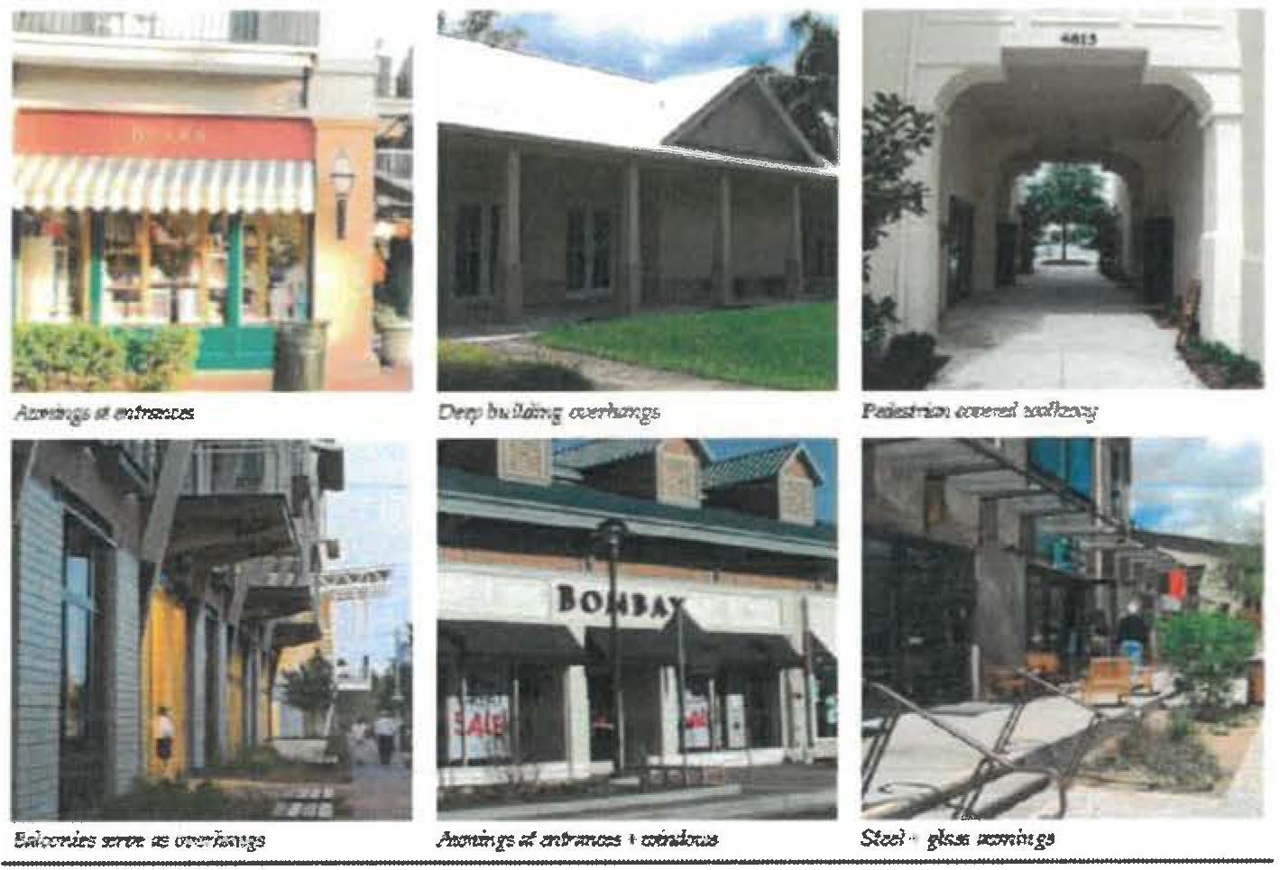
(f)
Entrances
• All main entrances shall face Narcoossee Road
(g)
Encroachments
• Porches, awnings, roof overhangs, covered entries, arcades, boardwalks, balconies.
• All buildings shall have some type of transitional public/private space.
• All encroachments may extend into the public sidewalk.
(2)
TOD/Commercial building lighting and signage. The TOD/Commercial area lighting and signage shall be designed similar to those described for the Small Block Commercial area.
c.
Zone 3: Town Residential. Several areas adjacent to the Small Block Commercial, particularly north along Narcoossee Road, are underdeveloped and excellent candidates for redevelopment. A more intensive pattern of development in these transitional areas will provide the Historic Town with an enlarged population of customers, visitors, and residents. New development in these areas should encourage mixed use, blending residential housing with traditional commercial and retail businesses and providing downtown live/work opportunities. New development should build on the pattern of one- and two-story buildings organized in traditional block faces, with buildings fronting tree-lined streets.
Infill development within the transitional areas between the Small Block Commercial and rural residential areas to the east and south shall be more "urban" than "suburban" in character, with new buildings constructed to the sidewalks instead of set back with large expanses of lawn. Native landscaping shall be encouraged throughout the area, to reinforce Narcoossee's character.
Design of building scale, massing, façade treatments, materials and details are encouraged to be similar to those recommended within the Small Block Commercial.
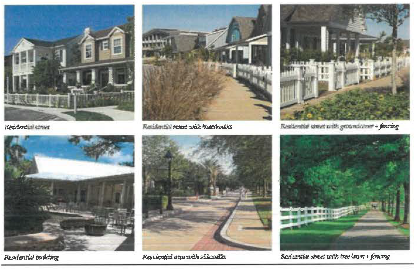
d.
Zone 4: Cultural/Commercial/Event Zone. The Cultural/Commercial/Event Zone could include a small public square at a central location, with adjacent streets lined with street trees. As part of this square, an orange grove could be accommodated, or orange trees could line all sides of the square, to reinforce Narcoossee's agricultural history. Hitching posts could be placed around the square as well, separate from parking areas.
A location should be identified and preserved for an equestrian/event center adjacent to the Small Block Commercial, in order to support the retail uses within Historic Town and to support the equestrian community adjacent to the area.
These grounds could serve as both event grounds as well as places for community gatherings such as farmers' markets.
Design of building scale, massing, façade treatments, materials and details are encouraged to be similar to those recommended within the Small Block Commercial.
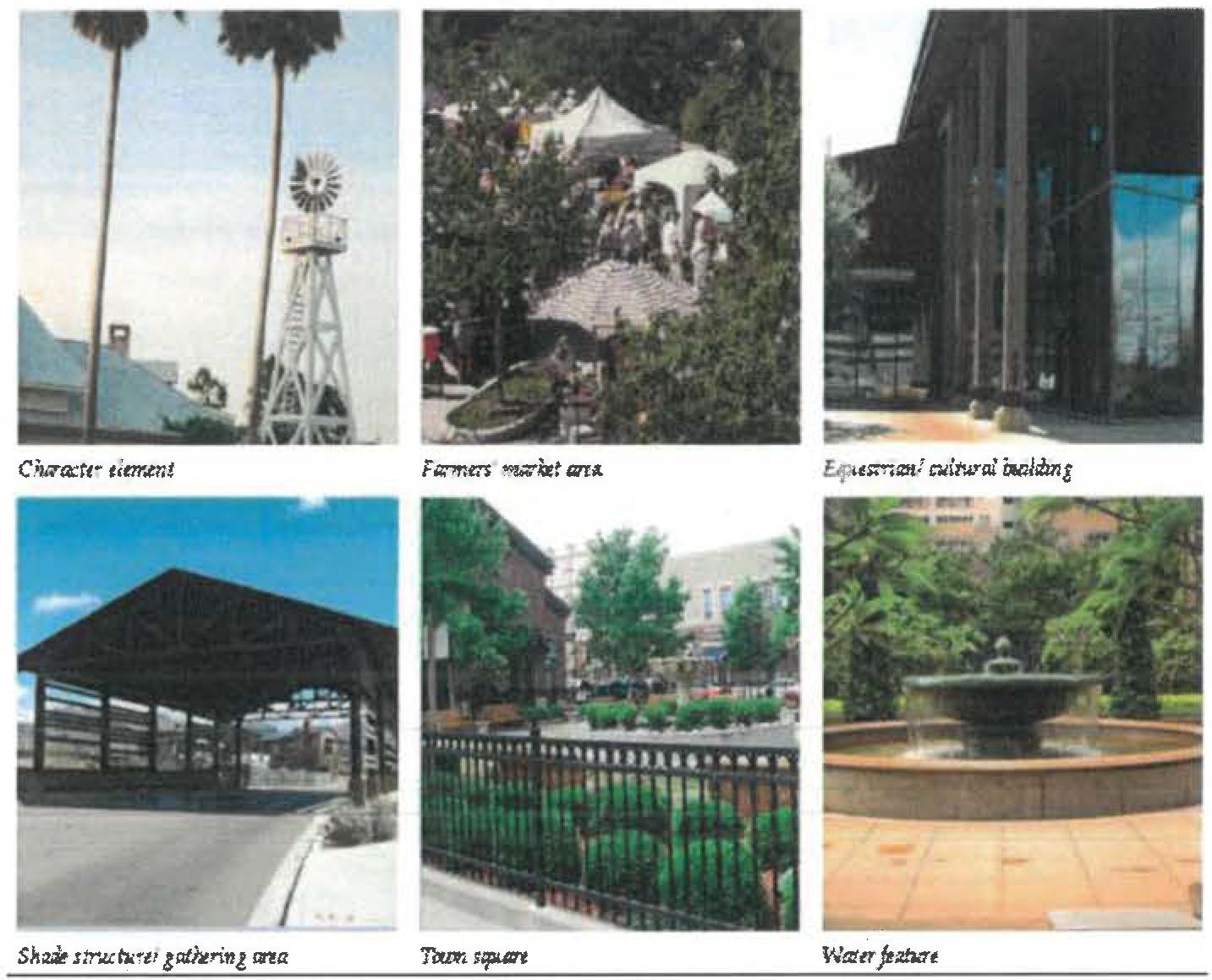
3.
Historic Town public art. A theme should be developed for public art and incorporated around the Small Block Commercial and Cultural/Commercial/ Event Zone. Themes could include:
•
Steamer ships
•
Equestrian
•
Orange groves
•
Sugar cane
•
Cattle brands
•
Turpentine industry
•
Railroad
•
Cowboy
•
Wildlife (sandhill cranes, alligators, black bear, fox, deer, turkey, etc.)
•
Natural resource elements (water, wetlands, pines, saw palmetto, wildflowers, etc.)
All commercial and civic buildings built within the Small Block Commercial and Cultural/Commercial/Event Zones shall be required to fund or contribute to one public art project or historical site identification/markers within the area, related to the overall theme.
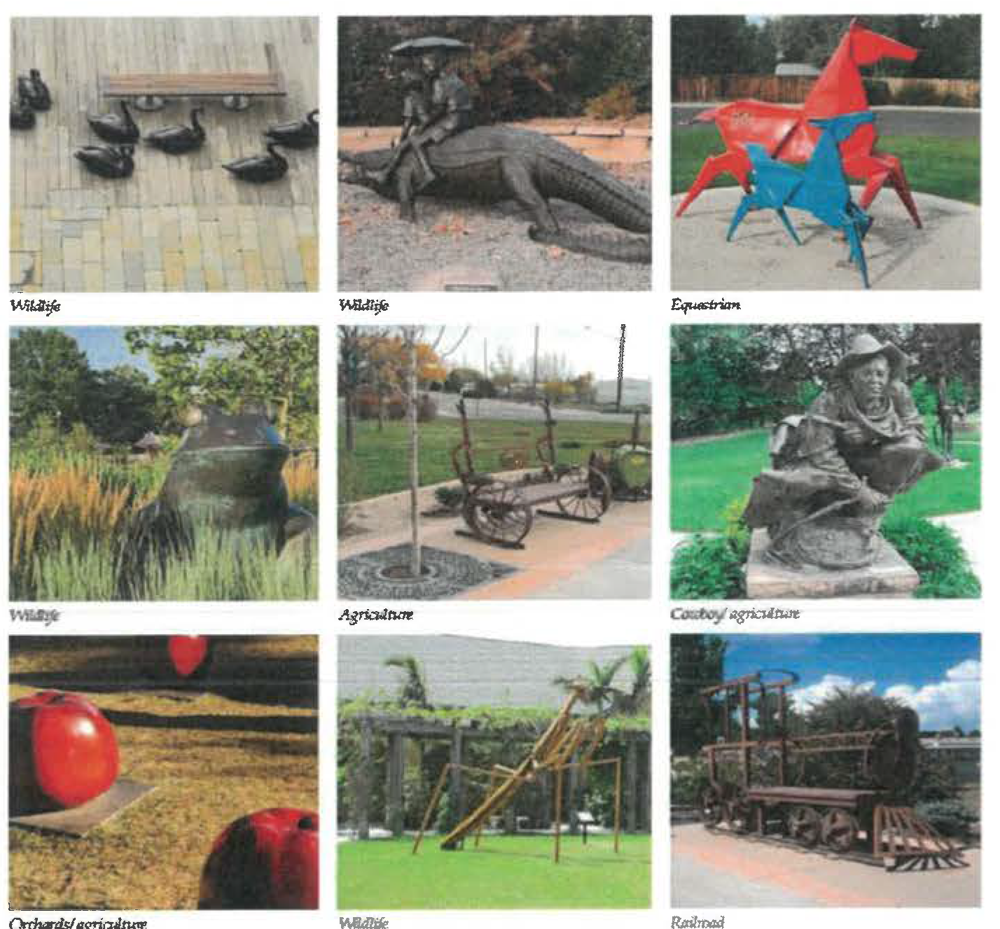
E.
Community and Neighborhood Centers goals and objectives. Guidelines are needed to create vibrant, small-scale Community and Neighborhood Centers along the Narcoossee corridor, and are oriented towards the following objectives:
•
Reflect the agrarian context of the community along the Narcoossee corridor; and
•
Design centers that are interesting and express a different character than currently found in the nearby commercial areas of St. Cloud.
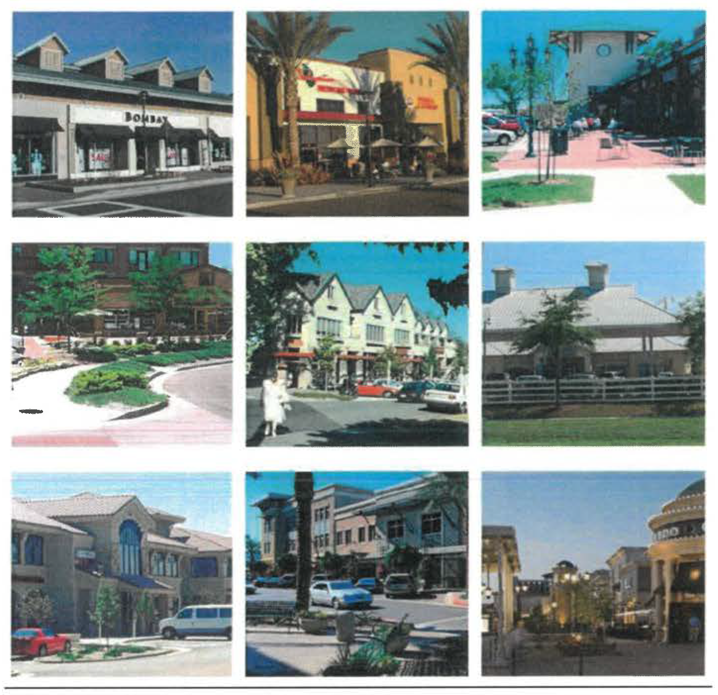
1.
Neighborhood and Community Centers guidelines.
a.
Neighborhood and Community Centers building architecture.
(1)
Building use.
• Neighborhood Centers shall have a variety of uses including: small-scale, neighborhood-oriented retail, office, civic and housing.
• Community Centers shall have a variety of uses including; small- and large-format retail, commercial, office, and multi-family housing.
• A mix of uses is encouraged both horizontally and vertically.
(2)
Lot/building sites.
• Maximum building sites shall be 25,000 square feet within the Neighborhood Centers.
• Maximum building sites shall be 80,000 square feet within the Community Centers.
• Maximum building footprint shall be 25,000 square feet within the Neighborhood Centers, and
• 80,000 square feet within the Community Centers.
• Civic buildings, such as schools, churches, and/or recreation centers shall be exempt from the building square footage limit but shall be sized to be compatible with adjacent development.
(3)
Building massing.
• A single, large, dominant building mass shall be avoided within Neighborhood and Community Centers; changes in mass shall be related to entrances, the integral structure and/or the organization of interior spaces and activities.
• Horizontal masses shall not exceed a height/width ratio of 1 vertical to 3 horizontal without substantial variation in massing that includes a change in height and projecting or recessed elements.
• Buildings shall relate well to each other, to the site, and adjacent properties by providing transitions in building heights.
• No façade that faces a street or connecting walkway shall have a blank, uninterrupted length exceeding 30 feet.
b.
Neighborhood and Community Centers exterior building materials and finishes and details.
(1)
Exterior materials and colors. Exterior building materials shall either be complimentary or draw in part from the materials already being used in the Narcoossee area. If dissimilar materials are being proposed, other characteristics such as scale and proportions, form, architectural detailing, color and texture, shall be utilized to ensure that enough similarity exists for the building to be compatible, despite the differences in materials.
With the exception of windows, building materials shall be natural/indigenous in character, and shall be selected to provide a variety of textures per building façade, visual balance and avoid excessive variety of materials.
Building materials shall provide greater visual and textural interest at building entrances and architectural opportunities and areas that are highly visible to the public. Exterior materials shall be chosen for their suitability, durability, and visual continuity. Recommended building materials include:
•
Brick
•
Textural concrete block, painted or integral color
•
Textured architectural precast panels, painted and/or cast-in textures
•
Site-cast concrete panels, painted and/or cast-in textures
•
Wood
•
Natural stone and synthetic stone products
•
Metal-accents elements only
•
Glazing
•
Smooth face concrete block, used in combination with other textural materials
•
Other similar high-quality materials
The color palette shall consider earth tones indigenous to the region resulting in a cohesive, unified theme throughout the development.
Interesting building details reminiscent of the Narcoossee area's history as an agricultural and ranching area are encouraged, such as clerestories, double-pitch roof forms, barn details, etc.
c.
Neighborhood and Community Centers public/private space and transition.
Entrances.
• Primary building entrances shall be clearly defined to provide greater visual and textural interest at building entries.
Encroachments.
• All buildings shall have some type of transitional public/private space, such as porches, awnings, roof overhangs, covered entries, arcades and/or balconies. All of these encroachments may extend into the public sidewalk.
d.
Neighborhood and Community Centers building fenestration and glazing.
Ground level retail storefronts with large expanses of display windows shall be used in both Neighborhood and Community Centers.
Windows shall be scaled and positioned to remain proportionate with building size.
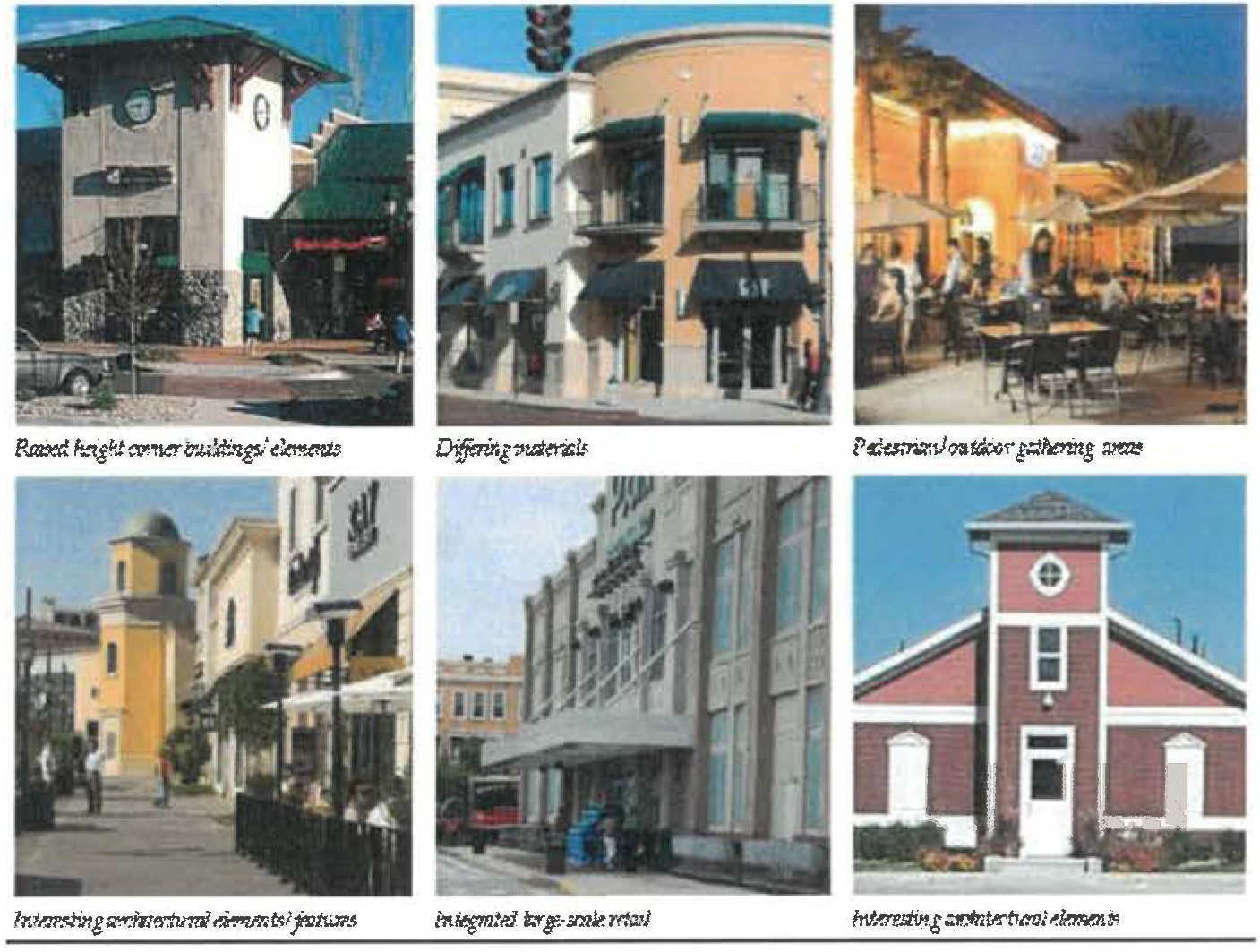
e.
Neighborhood and Community Centers building signage. Building signage throughout the Narcoossee area shall be designed and lit to reflect the area's history as an agricultural and ranching area and respect the immediate context of adjacent uses. Signs shall be designed to be of a low profile, with the majority of signs being building-mounted and not pole-mounted within the road right-of-way.
All signs within Neighborhood and Community Centers shall be architecturally integrated with both building and overall Center, in terms of size, shape, color, texture and lighting, and shall reflect and enhance the character and primary design elements of the building and its use. The number of signs per building façade shall be limited to the fewest necessary to clearly identify businesses located within. Signs shall be designed with the purpose of enhancing the pedestrian experience, while promoting retail and street activity.
(1)
Bracket-mounted and projecting signage. Bracket-mounted or projecting signs are pedestrian in scale, typically mounted on pilasters or walls at a height closer to the sidewalk, and oriented perpendicular to the movement of pedestrians along the sidewalk, a more appropriate and sensitive solution than larger, flush-mounted signs oriented to the automobile.
• Use projecting or bracket-mounted signage where possible and locate adjacent to a building entrance.
• Signs should be affixed to, or hung from, brackets such that the bottom of the sign is at least eight feet above the sidewalk, and not higher than 12 feet above the sidewalk, or project above the roof or parapet.
• Sign sizes, styles and mounting heights shall be carefully and interestingly designed to reflect the character of each building and business as well as fitting comfortably with other adjacent signage to unify the streetscape.
• Projecting signs shall fit within an imaginary rectangle with a maximum area of six square feet. Hanging signs shall fit within an imaginary rectangle with a maximum area of four square feet.
• Signs shall be placed within a clear, signable area and should not obscure windows, doors, architectural or ornamental features. Typically, wall signs should be centered on horizontal surfaces (i.e., over a storefront opening).
• Signs can be externally illuminated with small floodlights or similar fixtures, provided the lighting is directed back toward the sign and does not cause glare onto the street, sidewalk, or sky.
• Modern signage designs are acceptable, provided the designs are compatible with the historic building.
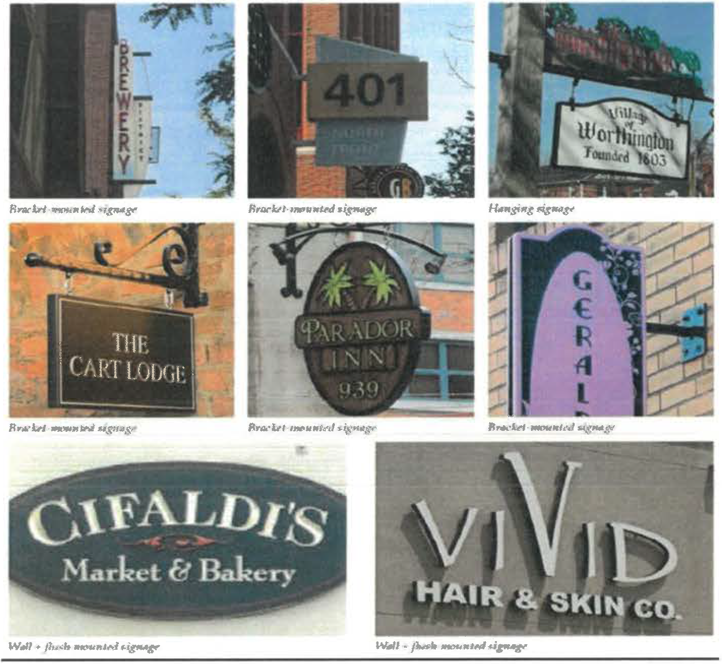
(2)
Wall signage.
• Wall signs shall be designed to be compatible with the storefront in scale, proportion, and color and to create a clearly defined edge, provide shadow relief and a substantial appearance.
• Wall signs are to be mounted flush and fixed securely to a building wall, projecting no more than 18 inches from the face of the building wall, and not extending sideways beyond the building face or above the highest line of the building to which it is attached.
• Wall signs shall not exceed 15 percent of the building façade (the exterior walls of a building exposed to public view).
• Signs shall be placed within a clear, signable area and should not obscure windows, doors, architectural or ornamental features. Typically, wall signs should be centered on horizontal surfaces (i.e., over a storefront opening).
(3)
Plaque signage.
• Plaque signs shall be a maximum area of two square feet with a maximum projection of two inches.
(4)
Awning and window signage.
Awning signage. Awning and canopy signs are signs that are printed on, painted on, or attached to an awning or canopy above a business door or window, and are oriented toward pedestrians at the opposite side of the street. Awnings and canopies must be permanently attached to the buildings; and shall be designed to project over individual window and door openings and not as one single continuous feature.
The minimum height of awnings shall be eight feet from the lowest point to the sidewalk.
Signage on awnings is permitted at no more than 30 percent of the surface area, either on the sloped body of the awning or on the valance. Valance signage is preferred for its more appropriate scale. Signage should be located either on the main body of the awning or on the overhang, but not on both.
Awning signage shall not be backlit or lit with other interior illumination.
Window signage. Window signs are painted, posted, displayed, sandblasted, or etched on an interior translucent or transparent surface, including windows or doors. Window signage is encouraged in conjunction with complementary wall or bracket-mounted signs.
Window signs shall not exceed 15 percent of the overall window area so that visibility is not obscured.
(5)
Monument signs. Monument signs are freestanding signs typically used for buildings separated from adjacent streets by substantial setbacks.
Low profile signs shall be constructed out of complementary materials to its associated building and overall Center.
Monument signs shall be composed of individual lettering that is consistent with the image of the business and the surrounding architectural style. Letter heights shall not exceed 12 inches. Sign text shall be limited to the business or neighborhood name and the business address.
Maximum sign height, including the sign base, shall not exceed six feet in height. The sign base shall be landscaped on all sides.
Monument signs shall only be used when other alternative types of signage would not provide adequate identification.
Monument signs shall be illuminated by external fixtures designed to complement the appearance of the sign and meet dark sky standards.
(6)
Prohibited signs. Prohibited signs within the Narcoossee area are listed as follows:
• Pole signs (billboards) directed at vehicular travelers, and located at arterials, and not within the pedestrian realm.
• Pole signs taller than 12 feet in height.
• Neon, LED, electronic, laser or video signs.
• Street furniture signs, including bench advertisements.
• Internally lighted, cabinet-style signs.
• Animated, flashing or swinging signs.
• Roof signs.
• Tree/utility pole signs.
• Trailer signs.
• Search lights.
• Pennants or streamers.
• Balloons or inflatable signs.
• Projected image signs.
f.
Neighborhood and Community Centers building lighting. Building lighting throughout the Narcoossee area shall be designed to reflect the area's history as an agricultural and ranching area. All lighting is required to meet dark sky standards, and all lighting shall be directed downward with high cut-off, so as not to reflect light back into the sky. Over-lighting within these areas is not permitted.
• Store façades, if lighted, must have lighting equipment mounted on the building pointing downwards.
• Stores must use controls to turn off exterior lights and sign lights after store closing. Only a minimum light level shall remain on past this point.
• All building-mounted security lighting must be pointed down and completely shielded.
• Floodlighting and uplighting shall not be permitted.
• Subtle wall-washing façade lighting shall be permitted.
• Fixtures should be directed downward with emphasis placed on the street level areas of the façade where the lighting will enhance pedestrian safety.
• Fixture styles, finishes and light source should be compatible with the scale and materials of the building façades, and complementary to awnings, signage and other features.
g.
Neighborhood and Community Centers convenience commercial. Convenience Commercial areas throughout the Narcoossee area should be treated with a higher level of character and architectural detail than typical standards. Gas stations, convenience stores and fast-food restaurants shall be designed to the same level of detail as defined on the previous pages, with landscaping and elements such as fencing and signage located to detract from the drive-through character of these establishments, and to enhance pedestrian safety.
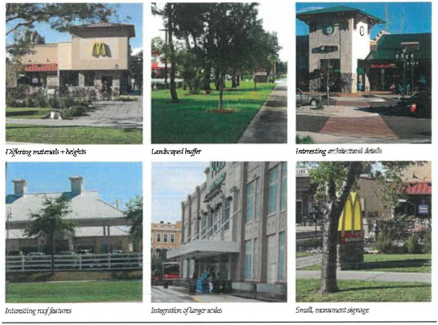
3.12.1.- General provisions.
A.
Relationship to other Land Development Code chapters. The standards in this chapter apply to properties shown on the city's future land use map and identified in the comprehensive plan as a JPA infill center. If there are conflicts between these standards and standards contained elsewhere in the Land Development Code, the standards in this article shall prevail. Development aspects not covered by these standards shall be governed by the standards contained elsewhere in the Land Development Code.
B.
Purpose. The standards are intended to enable the creation of compact development areas that encourage walkability and transit use and allow for a mixture of residential and non-residential development that supports commercial areas and transit, and provides a transition to higher intensities and densities, or transportation corridors. Residential density must be a minimum of eight units per acre. In addition to residential development, uses such as offices and professional services, as well as ancillary commercial, may be permitted based on compatibility, access, and development standards identified in the Land Development Code. Non-residential uses shall be limited to a maximum 1.0 FAR. Support uses such as schools, parks, and places of worship shall be permitted. Center types within JPA infill include neighborhood, community, urban, and employment. Each center will vary in density and intensity scale.
C.
Mix of uses. For all projects within JPA infill center core, with the exception of neighborhood centers, a minimum of 4,000 square feet of non-residential use per acre is required. Uses may be mixed vertically or horizontally with the minimum requirement to be achieved at build-out. Non-residential square footage shall be built at project inception when planned vertically and/or reserved by acreage when planned horizontally. Self-storage does not count toward required minimum square feet; however, it can be calculated towards minimum FAR. Residential developments within the perimeter must demonstrate direct pedestrian access to existing or planned non-residential development within one-quarter mile of the project, or a transit stop; or shall be required to provide a minimum of 1,000 square feet of non-residential use per acre. Neighborhood support uses such as schools and other institutional uses, parks, and places of worship shall not count toward meeting non-residential requirements.
D.
Center types. Zoning districts shall be determined based on data and analysis. Adjustments to the perimeter and core may be processed with the submittal of a master plan. Requests shall be evaluated for consistency with the overall policy criteria for core and perimeter areas, and may consider factors such as, but not limited to, adjacency to the perimeter or core, the percentage of change in area, natural and physical limitations, and compatibility with surrounding development.
1.
JPA Neighborhood Center (NC). Primarily intended for small-scale, neighborhood-serving retail and office; recreational, public, or civic uses; entertainment and a supporting mix of residential types, including mixed use buildings.
a.
Neighborhood center commercial/neighborhood center mixed (NCC/NCM) is defined as an area up to ten acres, located within a neighborhood center FLU designation, and adjacent to a local street, collector, or arterial roadway.
2.
JPA community center (CC). Primarily intended for large-scale retail and office, civic uses, and medium- to high-density residential.
a.
Community center core (CCC) is defined as an area greater than ten up to 70 acres, centrally located within a community center FLU designation.
b.
Community center perimeter (CCP) is defined as an area generally extending one-half mile outside the center core.
3.
JPA urban center (UC). Primarily intended for large-scale retail and office, and intense residential development.
a.
Urban center core (UCC) is defined as an area of a minimum of 70 acres, centrally located within an urban center FLU designation.
b.
Urban center perimeter (UCP) is defined as an area generally extending one mile outside the center core.
4.
JPA employment center (EC). Primarily intended to provide intense workplace developments such as research firms, national headquarters, medical and professional offices, hospitals and light industrial development; ancillary retail is intended to serve the needs of employees; secondary education facilities including colleges and universities. Residential development is intended to provide a variety of housing types for the employees of the center.
a.
Employment center core (ECC) is defined as an area of a minimum of 70 acres, centrally located within an employment center FLU designation.
b.
Employment center perimeter (ECP) is defined as an area generally extending one mile outside the center core.
E.
Building orientation for JPA infill centers.
1.
Building siting for JPA infill centers. The following standards apply to principal buildings within the JPA infill centers. Single-family properties shall comply with siting and architectural standards contained within chapter 3 article 17.
a.
The PS/SDP must identify primary, secondary, and service frontages. Primary frontages shall face each other to the maximum extent feasible. Any given block must be comprised of two primary frontages; only connections which provide shaded and direct pedestrian access shall be considered toward meeting minimum block sizes. Block connections not associated with a street shall consist of a sidewalk or paved pathway, a minimum of eight feet wide and shaded with canopy trees an average of 40 feet on center.
b.
All buildings must face a primary frontage or civic space. Building sides facing primary or secondary frontage, or civic space shall comply with the architecture standards contained herein. Conceptual elevations shall be required at SDP.
c.
A building's primary entrance shall be located on the façade facing the primary frontage or civic space. Primary entrance is the principal pedestrian access to a building, even if customers or residents may more frequently use a secondary entrance associated with a garage, parking area, driveway or other vehicle use area. The entrance shall have the architectural detailing that sets it apart from other entrances and allows it to be recognized as the building's primary access point.
d.
Within JPA urban centers, JPA employment centers and JPA community centers core, buildings shall be at least two stories in height.
e.
Upper floor residential units must have a visible ground floor entrance facing the front or side street, a civic space, or a pedestrian passageway. This may be a common entrance serving multiple units.
f.
Minimum eight-foot-wide sidewalk required for urban center core/perimeter and employment center core/perimeter.
2.
Build-to-line (BTL).
a.
The BTL for building façades shall be as shown in Table 3.12-1 below. A minimum percentage of each block (the expanse of street from one intersection to the next) facing a primary frontage shall be comprised of building façade , as set forth in the table. This percentage shall be calculated for the linear building façade at the first floor.
b.
The BTL shall be consistent along each facing street block. A civic space or café-table seating area that meets the following standards will be considered part of the BTL setback or frontage build-out percentages. Dining areas must be clearly delineated from the public sidewalk through the use of pavement treatments or barriers. Civic areas must be open for public use and provide features that allow for casual public engagement such as shaded seating areas, art, or gardens. Civic areas shall be accessible from an extension of the primary building and use. Vehicular areas are not permitted within the minimum frontage along the primary façade unless otherwise provided herein.
F.
Development standards for JPA infill centers.
1.
Blocks. Within the JPA infill centers, urban blocks shall be generally scaled at 300 feet by 600 feet and shall be created to ensure the implementation of a pedestrian scaled neighborhood.
2.
Convenience stores. Convenience stores within a JPA infill center must comply with the setback and building placement contained in the JPA infill centers standards. Pump stations shall be located behind the principal structure and shall be limited to the following:
a.
Neighborhood center core: Maximum of six fuel pump stations.
b.
Community center core: Maximum of six fuel pump stations.
c.
Community center perimeter: Maximum of eight fuel pump stations.
d.
Urban/employment center core: Maximum of four fuel pump stations.
e.
Urban/employment center perimeter: Maximum of six fuel pump stations.
3.
Drive through restaurants. Within a JPA infill center, drive-thru windows shall be located to the side or the rear of the property. In the event that a drive-thru is visible from a right-of-way a minimum three-foot-tall, maximum four-foot-tall planter with low shrubs that screens the drive-through aisles from the abutting public right-of-way shall be used to minimize the visual impact of vehicular stacking. At no time shall this landscape barrier be pruned in a manner that allows the vehicle headlights from the drive-through lane to be visible from abutting street rights-of-way. As an alternative other architectural features consistent with the primary building architecture design may be used to screen vehicles from view.
4.
Wholesaling, warehousing, storage and distribution, and enclosed/light manufacturing. Such uses are permitted within a JPA infill center subject to the following standards.
a.
Use shall be adjacent to a paved street which is designed to accommodate the volume of truck traffic associated with the development.
b.
Use shall be conducted inside a building. Within a JPA employment center only, outdoor storage may occur as an accessory use in areas designated on a site development plan. The area shall be generally located to the interior or rear of the property and entirely screened from view of adjacent non-industrial property, from primary frontages, and rights-of-way.
c.
Bay doors shall be located to the interior or rear of the site and not face a primary frontage.
d.
JPA infill centers standards apply, except as follows:
i.
Two rows of parking may be permitted between the structure and primary frontage, when a linear park consistent with mixed use district standards is provided at the BTL. More than two rows of parking may be provided when designed as a parking block. A row of parking shall consist of a drive aisle with parking on each side. When a linear park is utilized to meet the BTL requirements, planting shall also include shrubs arranged to provide a visual screen of 75 percent opacity and achieve a minimum height of three feet within two years adjacent to the parking area.
ii.
Parking block. Industrial use parking blocks shall be designed to incorporate pedestrian routes not to exceed block sizes consistent with JPA infill centers standards. Routes can consist of pedestrian pathways, internal drive aisles with sidewalk or other like mechanisms. Primary frontages shall provide a linear park consistent with mixed use district standards at the BTL, and include shrubs arranged to provide a visual screen of 75 percent opacity and achieve a minimum height of three feet within two years adjacent to the parking area.
iii.
A minimum of 25 percent transparency (windows) at the ground floor. Transparency calculations may include the glass surfaces of the entrance window system itself. The area of required transparency shall be calculated by multiplying the structure's linear frontage by a height (above adjacent finished pavement grade) of 12 feet. Sixty percent of the ground floor shall include the minimum transparency plus glazing or other features that mimic fenestration such as transparent windows, awnings, spandrel glass features (without opening into building wall or structure), ledges, shutters, or other architectural elements used to enhance the façade. These elements are required for at least 35 percent of upper floors.
5.
Retail/office parking requirements are only one space per 500 square feet, not to exceed 110 percent of required minimum.
G.
Architectural design standards for JPA infill centers. The following standards apply to multifamily, mixed use and non-residential buildings within the JPA infill centers zoning districts NCC, NCM, CCC, CCP, UCC, UCP, ECC, ECP, and JPA-MDI.
1.
Building form. The intent is to encourage human scale elements in building design, and to reduce the mass of large buildings. Breaks in mass are required to relate to structural systems and the organization of interior space. Both horizontal and vertical mixed-use designs are highly encouraged.
a.
All building façades shall be architecturally finished with materials such as stucco, brick, stone, finished concrete, wood or other comparable materials.
b.
Building façades shall include jogs of not more than 36 inches in depth, except as necessary to allow bay windows, shop fronts, balconies, civic spaces, outdoor seating, etc., in which case jogs of greater than 36 inches will be allowed. Jogs of 36 inches or less will be considered as being on the BTL.
c.
Building volumes shall be articulated into three distinct vertical components—a "base," "middle," and a "top." The first floor height shall be a minimum of 12 feet.
d.
Building façades along BTLs shall be expressed as building modules that do not exceed 30 linear feet in width.
e.
Horizontal masses shall not exceed a height/width ratio of one vertical to three horizontal without substantial variation in massing that includes a change in height and projecting or recessed elements.
f.
Buildings shall relate well to each other, to the site, and adjacent properties by providing transitions in building heights.
g.
A minimum of 60 percent of the total wall area at the ground floor must include pedestrian entrances or transparent windows.
h.
Windows shall be slightly recessed or project as bays from the main wall of the façade so as to create texture and shadows on the façade for visual interest, as well as the perception that people or activities are behind the windows.
2.
Building massing. Massing refers to shape and form of the building. The intent is to encourage human scale elements in building design, and to reduce the mass or large buildings. Breaks in mass are required to relate to structural systems and the organization of interior space.
a.
Massing requirements: The requirement for the subdivision of masses/volumes in a building shall apply according to the standards established in Table 3.14-2.
b.
When massing subdivision is required per Table 3.12-2 the requirement shall be satisfied by demonstrating that the required number of individual massing elements have been provided from the following options:
Option 1: Setbacks. Setbacks shall occur at the second floor or above the ground floor level, if a building is two floors or more in height.
Figure 3.12-a Massing Setback.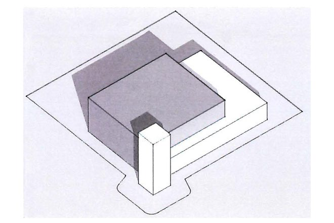
Option 2: Offset. Offsets shall be a minimum of ten feet to break up the foundation line to define each mass. The portion projected or recessed shall extend up to the roof eaves.
Figure 3.12-b Massing Offsets.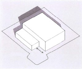
Option 3: Façade length and variations. Variations in the façade shall be as follows:
i.
Façades greater than 60 feet in length, but less than 120 feet in length must exhibit a prominent shift in the façade of the structure so that no greater than 75 percent of the length of the building façade appears unbroken. Each shift shall be in the form of either a ten foot change in building façade alignment or a ten foot change in roof line height, or a combined change in façade and roof line totaling ten feet.
ii.
Façades that exceed 120 feet in length shall provide a prominent shift in the mass of the structure at each 120 foot interval, or less if the developer desires, reflecting a change in function or scale. The shift shall be in the form of either a 15 foot change in building façade alignment or a 15 foot change in roof line. A combination of both a roof line and façade change is encouraged and to that end, if the combined change occurs at the same location in the building plan, a 15 foot total change will be considered as full compliance.
iii.
The façade length and variation requirement apply to primary and secondary façades .
Figure 3.12-c Massing Façade Variations.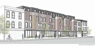
Note: For massing illustration purpose only.
3.
Building articulation. The intent is to reduce the apparent size of buildings and create visual interest. Articulation elements shall vary to alleviate the appearance of a large building mass, break up along walls, express individuality of each building, and enhance the character of the neighborhood/development. Building façade facing the public right-of-way or civic space must comply with the following articulation elements:
a.
Weather protection features, which may include awnings, overhangs or other treatments providing functional weather protection, are required on building façades fronting a BTL. Awnings or overhangs shall project a minimum of six feet and maintain a clear height of at least nine feet. They may encroach upon the public sidewalk subject to a right-of-way encroachment/utilization permit.
b.
In a multifamily residential building, if balconies are provided, a minimum of 50 percent of all units shall incorporate balconies at a minimum size of six feet deep and 60 square feet.
c.
Corner articulation elements such as arched, gabled, stepped or decorative parapet with cornice over building entrances, integrated with the building's massing and style.
4.
Roof modulation. The intent is to ensure that visual interest also applies to roof treatment. Roof forms may be used to identify different functional areas within the building, to provide for additional light to enter the building, to reduce massing, to screen rooftop equipment, and to create movement along the roof line. The following roof modulation elements are allowed:
a.
Building façades fronting a BTL must use multiple peaks or roof planes and distinctive roof forms covering each building mass.
b.
Same roof form with a different orientation of the ridge elements.
c.
Same roof form with the same orientation, but the roof has a minimum change in elevation of two point five feet between each subdivision of the building.
d.
Any other treatment that the approving authority determines to be consistent with the intent and is consistent with sound and generally accepted land use planning or architectural practices and principles.
5.
Accessory structures. The intent is to ensure that accessory structures are located in areas that are not visible from public streets by pedestrians and shall not be visible from adjacent residential properties. Structural screening shall be consistent with the architectural elements, material and colors of the principal structure.
a.
Accessory structures shall be a minimum of one story and a maximum of two stories and complement the architectural style of the primary structure.
b.
Service areas such loading areas, refuse/recycling collection containers (garbage dumpsters) shall be structurally enclosed and screened by a screen one foot greater than the element being screened.
c.
Mechanical equipment shall be placed on the roof, on the side or in the rear of each building. Roof-top equipment shall be completely screened from all ground level views by parapet wall or other architectural features, which shall be integrated to the building. Ground-mounted equipment screening shall be at a minimum of one foot greater in height than the area/equipment being screened.
d.
Solar panels that are not integrated into the architecture of the façade or roof shall be hidden from sight and shall be treated as mechanical equipment. Solar panels and photovoltaic elements that are integrated into the building architecture shall comply with the architecture articulation and or roof element.
(Ord. No. 2025-65, § 1, 10-9-2025)
3.13.1.- Historic Preservation and Historic Preservation District.
A.
Purpose and intent. These provisions are designed to identify, protect, restore and encourage the reuse of resources, all of which are essential to the city's health, safety, and its economic, educational, cultural and general welfare. These valid public purposes shall be fulfilled by this division to achieve the following goals:
1.
Preserve distinctive elements of St. Cloud's historical culture and heritage;
2.
Ensure the harmonious, orderly, and efficient growth, prosperity and development of the city through retention and reuse of its historic and cultural resources;
3.
Foster and strengthen civic pride through acknowledgement of the accomplishments of the past by safeguarding the city's heritage for future generations;
4.
Maintain and enhance neighborhoods through neighborhood conservation. Assist neighborhoods to achieve a positive neighborhood identity and sense of place by enhancing the scale, character, and stability of existing neighborhoods and protect against destruction of or encroachment upon areas and sites which contribute to the character of the city;
5.
Avoid demolition, or other adverse effects on historic properties and areas which would cause an irreparable loss to the city;
6.
Augment existing zoning: Operate in conjunction with the Land Development Code to preserve any historic areas or structures within the city;
7.
Provide a review process for the continued preservation and appropriate, compatible and sensitive development of new construction and additions or modifications of significant historical structures within the city's historic district;
8.
Encourage compliance by providing financial incentives to residents who undertake preservation or restoration efforts.
9.
Establish and implement the findings of the historic preservation plan adopted by the city council.
In addition, these provisions are designed to implement, and be consistent with, and assist in the achievement of the goals, objectives, and policies, as specifically required by the city's comprehensive plan, with respect to historic, conservation, and neighborhood resources.
B.
Terms and definitions. The following words, terms and phrases, when used in this division, shall have the meanings ascribed to them in this section, except where the context clearly indicates a different meaning:
Alteration. Any construction or any change of a resource, including changes to size, shape, occupancy, character, or use of a building or structure.
Assessed value. The total value of a tax parcel, excluding the value of land as determined by the property appraiser for Osceola County, and shown on the property tax bill sent to the owner of record by the County of Osceola.
Board. City of St. Cloud Historic Preservation Board (HPB), hereinafter, referred to as the board or the HPB (see definition of "historic preservation board").
Building. Any structure defined as historically significant in the St. Cloud Downtown Historic District Survey, October 2020. A building is any structure built for the support, shelter, or enclosure of persons, chattels, or property of any kind which has enclosing walls for 50 percent of its perimeter. The word "building" includes the word "structure" (see definition of "structure").
Construction. The act of placing a principal structure on a property or adding an addition to an existing structure or adding an accessory structure to the property. Actual construction includes the placing of construction materials in a permanent position and fastened in a permanent manner except that where demolition, excavation, or removal of any existing structure has been substantially begun preparatory to new construction, such excavation, demolition, or removal shall be deemed to be actual construction, provided that work shall be continuously carried on until the completion of the new construction involved. Fill and the installation of drainage facilities shall be considered a part of construction. Actual construction shall include only work begun and continued under a valid building permit.
Certificate of Appropriateness. A document evidencing review by the historic preservation board for work proposed by an applicant on resources located within the historic preservation district.
Certificate of economic hardship. A document evidencing approval by the HPB of an application for economic hardship as that term is defined in these regulations.
Certified Local Government (CLG). A local government approved by the Florida Department of State, Division of Historical Resources, to perform certain historic preservation functions.
Contributing property. A property that contributes to the historic significance of a historic district by location, design, setting, materials, workmanship, or association and thus adds to the district's sense of historical time, place, and historical development.
Demolition. Any act or process that partially or totally destroys a resource.
Design guidelines handbook. Document which illustrates examples of design features, historic styles, and treatment options which preserve the historical, cultural, and architectural character of a historic district or property.
District. A zoning classification which applies to certain designated property within the city and within which the zoning regulations are uniform (see also "historic district").
Economic hardship. An onerous, extreme, or exceptional economic burden that would be placed upon a property owner by the denial of an application for a certificate of appropriateness or by the imposition of conditions placed on the granting of such certificate.
Effect. A change in the quality of the historical, architectural, archaeological, or cultural significance of a property or district, or in the characteristics that qualify the property or district as historically important.
Florida Master Site File. An archive and database of all known archaeological and historical sites and districts recorded within the State of Florida that is maintained by the Florida Department of State, Division of Historical Resources, and is organized alphabetically by county and numerically, as recorded.
Historic district. A geographically definable area designated by the city council as possessing a significant concentration, linkage, or continuity of properties united historically or architecturally by plan or physical development.
Historic Preservation Board (HPB). Reviews all changes to historically significant structures within the historic district. The HPB holds public hearings and issues certificates of appropriateness.
Historic properties. Those properties recommended by the HPB as being of historical, cultural, architectural or archaeological importance.
Historical and Architectural Survey, City of St. Cloud Project Report, October 2020 (as amended from time to time). St. Cloud Main Street completed a historic and architectural survey in 2020 which catalogued and documented the history and architectural styles, years built, and other pertinent information of the cultural resources in the city dating on or before 1970. Florida Site File forms were created for each identified structure, building or site and submitted to the State of Florida Department of State's Division of Historical Resources. The cultural resources assessment survey report shall conform to the provision of Chapter JA-46, Florida Administrative Code.
Historically significant structure. Any structure meeting the Secretary of the Interior's definition of historic that includes: structures over 50 years old and either architecturally, culturally, or historically significant and for the purposes of this document, viable structures that can potentially be preserved, rehabilitated, restored, or reconstructed.
National Register of Historic Places. The official federal list of historic districts, sites, buildings, structures, and objects significant in American history, architecture, landscape architecture, engineering, archaeology, and culture. Authorized under the National Historic Preservation Act of 1966, and by 36 C.F.R. 60 as each may be amended from time to time, and maintained by the U.S. Department of the Interior.
Noncontributing property. A classification applied to a property within a historic district signifying that it does not contribute to the qualities that give the historic district cultural, historical, architectural, or archaeological significance as embodied in the criteria for the designation of a district, but which because of its location within a district should be compatible with the character of the district.
Object. A primarily artistic or architectural item closely linked to the history of the property. Said item is typically relatively small in scale and simply constructed, such as a statue, milepost, statuary, or fountain.
Preservation. The act or process of applying measures necessary to sustain the existing form, integrity, and materials of a historic property. Work, including preliminary measures to protect and stabilize the property, generally focuses upon the ongoing maintenance and repair of historic materials and features rather than extensive replacement and new construction. New exterior additions are not within the scope of this treatment; however, the limited and sensitive upgrading of mechanical, electrical, and plumbing systems and other code-required work to make properties functional is appropriate within a preservation project.
Property. Area of land containing a single historic resource or a group of resources, which may include any of a building, site, structure, object, or district.
Reconstruction. The act or process of depicting, by means of new construction, the form, features, and detailing of a non-surviving site, landscape, building, structure, or object for the purpose of replicating its appearance at a specific period of time and in its historic location.
Rehabilitation. The act or process of making possible a compatible use for a property through repair, alterations, and additions while preserving those portions or features which convey its historical, cultural, archaeological or architectural significance.
Relocation. Any change of the location of a building, structure, or object from its present setting to another setting.
Resource. A building, site, structure, object, or district that reflects historical, archaeological, or cultural significance.
Restoration. The act or process of accurately depicting the form, features, and character of a property as it appeared at a particular period of time by means of the removal of features from other periods in its history and reconstruction of missing features from the restoration period. The limited and sensitive upgrading of mechanical, electrical, and plumbing systems and other code-required work to make properties functional is appropriate within a restoration project.
Secretary of the Interior's Standards for Rehabilitation. 36 CFR 67 which pertain to historic buildings of all materials, construction types, sizes, and occupancy and encompass the exterior and the interior, related landscape features and the building's site and environment as well as attached, adjacent, or related new construction. The standards are to be applied to specific rehabilitation projects in a reasonable manner, taking into consideration economic and technical feasibility.
Secretary of the Interior's Standards for the Treatment of Historic Properties. 36 CFR 68 which provides guidance on the sensitive rehabilitation of a historic property. The Secretary of the Interior is responsible for establishing professional standards and providing advice on the preservation and protection of all cultural resources listed in or eligible for listing in the National Register of Historic Places. The standards apply to all proposed development grant-in-aid projects assisted through the National Historic Preservation Fund, and are intended to be applied to a wide variety of resource types, including buildings, sites, structures, objects, and districts. They address four treatments: preservation, rehabilitation, restoration, and reconstruction. N.B.: 36 CFR Part 67, focuses on "certified historic structures" as defined by the IRS Code of 1986. The "Standards for Rehabilitation" cited in 36 CFR 67 should always be used when property owners are seeking certification for federal tax benefits.
Setting. The physical environment of a property, including all landscape elements.
Site. The location of an event, a prehistoric or historic occupation or activity, or a building or structure, whether standing, ruined, or vanished, where the location itself possesses historic, cultural, or archaeological value regardless of the value of any existing structure.
Street level. As it relates to building height, the street level is the first 15 feet of height.
Structure(s). A combination of materials to form a construction, generally used to distinguish from buildings, those functional constructions made for purposes other than creating human shelter; e.g., a bridge, wall, fence, or pond. Anything constructed, installed, or portable, the use of which requires a location on a parcel of land. It includes a movable structure while it is located on land which can be used for housing, business, commercial, agricultural, or office purposes either temporarily or permanently. Structure also includes fences, billboards, swimming pools, swimming pool decks, poles, transmission lines, and advertising signs. Structures can be accessory, temporary, or permanent.
C.
District designation and map. See appendix A for downtown historic preservation district designation map.
D.
Historic preservation board.
1.
Establishment. The HPB shall be established within six months of the effective date of the ordinance from which this division derived. The HPB shall convene to establish bylaws which shall be developed within 30 days. The bylaws shall be made available to the public.
2.
Composition and terms. The HPB shall consist of seven members and two alternate members, all of whom shall be appointed by the city council. Members shall be residents of the city. In the event that too few qualified residents apply to meet the professional qualification standards or too few residents are interested in the positions, the city council may appoint non-resident individuals who have demonstrated special interest, experience, or knowledge in history, architecture, or related disciplines to the remaining board positions.
a.
A minimum of three members shall be chosen from among the disciplines of architecture, history, architectural history, archaeology, landscape architecture, construction, construction management, engineering, planning or a person who is a general contractor.
b.
The remaining four members will be selected from a pool of applicants, according to the following: Two members shall be experienced in the areas of commercial development, real estate, banking or law; the two remaining members shall be citizen members at large; the two alternate members shall be from any of the foregoing professions or citizen members at large.
c.
All members shall have demonstrated a special interest, experience or knowledge in historic preservation or closely related disciplines.
d.
Members of the HPB shall serve three-year terms for a maximum of up to six consecutive years. Of the initial appointments, four members shall be appointed for a term of three years and three members shall be appointed for a term of two years for a maximum of up to six consecutive years.
e.
Alternate members shall be appointed for a term of two years for a maximum of up to six consecutive years.
f.
Vacancies on the HPB, including expired terms, shall be filled by persons with the same background as the original appointee, or related field within 60 days, in order to maintain the desired HPB makeup.
E.
Procedures of the HPB. The HPB shall hold a minimum of four meetings per year at regular intervals. Additional meetings may be called if necessary to process applications for review in accordance with the required timelines. All meetings of the HPB shall be publicly announced and will have a previously advertised agenda. The meetings shall be open to the public. Persons serving on the HPB are encouraged to attend educational meetings or workshops to develop a special interest, expertise, experience, or knowledge in preservation, architecture, or quasi-judicial boards. The city shall appoint a professionally qualified historic preservation staff member to advise and assist the board, carry out delegated responsibilities, and undertake the requirements for certified local government certification.
F.
Procedures and quorum. The HPB shall adopt rules of procedures, subject to any limitations prescribed by law. The rules of procedures shall be available for public inspection upon request. Four members shall constitute a quorum for the transaction of business. The HPB shall select a chairman and other officers and shall prescribe their duties and powers. The city manager or his or her designee shall designate staff to attend all meetings, acting in an advisory capacity and participating fully in HPB discussions but having no right to vote. All decisions made by the HPB shall take place in a public forum. The HPB shall keep minutes of its proceedings, record the vote on each question, and keep records of its discussions, recommendations, and other official actions. Summary minutes will be prepared and made available to the public after adoption by the HPB.
G.
Removal. Any member of the HPB may be removed pursuant to the procedures outlined in the City Code of Ordinances.
H.
Powers and duties of the HPB. The HPB shall have the following powers and duties within the incorporated city limits of St. Cloud, Florida:
1.
To recommend to the city council the following:
a.
Review nominations of properties and districts to be designated in the city's local historic register;
b.
Adoption, modification, or replacement of a design guidelines handbook;
c.
Update of the St. Cloud Downtown Historic District Survey October 2020 (as amended from time to time);
2.
To hold public hearings and to approve or deny applications for certificates of appropriateness or certificates of economic hardship affecting proposed or designated properties or properties within districts;
3.
To call upon available city staff members as well as other experts for assistance and/or technical advice;
4.
To authorize a member of the HPB to testify before a board or commission on any matter affecting historically, culturally, archaeologically, and architecturally significant properties and resources;
5.
To confer recognition upon the owners of properties and districts by means of certificates, plaques or markers;
6.
To recommend amendments or changes to these regulations;
7.
To collaborate with the St. Cloud Main Street organization and any other organization to inform and educate citizens concerning the historic, cultural, archaeological, and architectural heritage of the city; and
8.
To participate in survey and planning activities of the certified local government;
9.
Review a list of nominations of properties and districts to the National Register of Historic Places, as a required duty of being a certified local government;
10.
To identify historic properties within the city limits and maintain a detailed inventory of historic districts, sites and structures compatible with the Florida Master Site File.
11.
To coordinate with the State of Florida's Division of Historical Resources Certified Local Government program by satisfying the following requirements:
a.
The state historic preservation officer shall be given 30 calendar days prior notice of all meetings and within 30 days following such meetings shall be provided with the minutes and record of attendance of the HPB and the public.
b.
The state historic preservation officer shall be notified of any change of HPB membership within 30 days of their appointment or resignation.
c.
Notify the state historic preservation officer immediately of all new historic designations or alterations to existing designations.
d.
Submit amendments to the code to the state historic preservation officer for review and comment at least 30 days prior to adoption.
e.
Provide duplicates of all inventory materials to the State Historic Preservation Office.
f.
Submit an annual report by November 1 covering activities of the previous October 1 through September 30 and shall include the following information:
(1)
A copy of the rules of procedure;
(2)
A copy of the historic preservation ordinance;
(3)
Resumes of the HPB members;
(4)
Changes to the HPB membership;
(5)
New local designations and National Register of Historic Places listings;
(6)
A review of survey and inventory activity with a description of the system used;
(7)
A program report on each grant-assisted activity; and
(8)
Number of projects reviewed.
I.
Certified local government review. The city council will apply for certified local government (CLG) status with the intent to be approved by the Florida Department of State, Division of Historical Resources. The city council as a CLG is required to participate in the Florida National Register of Historic Places nomination process, be involved in the Section 106 process of the National Historic Preservation Act (NHPA), and is eligible to receive grants from the CLG section of the Florida Department of State, Historical Resources Grants-In-Aid program.
J.
Unsafe buildings and structures. Should the building official determine that a historic property or a property within a historic district is unsafe, the community development department staff and the HPB shall be notified of such findings.
1.
Within applicable laws and regulations, the building official shall request that the resource be repaired rather than demolished and shall take into account any comments and recommendations provided by community development or the HPB. The building official may take appropriate actions to effect and accomplish the preservation of the resource, including, but not limited to, negotiations with the owner and other interested parties, provided that such actions do not contradict with the Florida Building Codes.
2.
In the case where the building official determines that there are emergency conditions dangerous to the life, health, or property affecting a historic property or a property within a historic district and timely demolition is the only course of action, the building official may order the demolition and notify the community development department of the impending action. In this instance, a certificate of appropriateness will not be required and the HPB will promptly be notified of the action being taken.
K.
Exceptions for historic properties.
1.
Waiver of technical requirements. The provisions of the technical codes relating to the construction, alteration, repair, enlargement, restoration, or moving of buildings may not be mandatory for those resources listed in the St. Cloud Downtown Historic District Survey, October 2020 (as amended from time to time), the National Register of Historic Places, or the local historic register, when evaluated by a Florida registered architect or engineer and demonstrated to the building official to be safe and in the public interest of health, safety, and welfare.
2.
Equivalent protection. Resources or portions thereof that do not strictly comply with the Florida Building Code may be considered to be in compliance, if it can be shown to the satisfaction of the building official that equivalent protection has been provided or that no hazard will be created or continued through noncompliance. Life, safety, and property conservation shall be in compliance with the 2014 5th Edition of the Florida Existing Building Code or as subsequently amended.
3.
Accessibility. Alterations to resources listed in the St. Cloud Downtown Historic District Survey, October 2020 (as amended from time to time). the National Register of Historic Places, or the local historic register may receive exemption from accessibility requirements, if the building official determines that compliance for accessible routes (exterior and interior), ramps, entrances, or toilets would threaten or destroy the historic significance of the building. Alternative requirements mentioned in the 2014 5th Edition, Accessibility, of the Florida Building Code shall be utilized.
4.
Administrative and board approval of zoning code variances. The responsibility for review and approval of an application for a variance in association for a certificate of appropriateness for alterations of resources listed in the St. Cloud Downtown Historic District Survey, October 2020 (as amended from time to time), the National Register of Historic Places, or the local historic register will rest with City Council. Such requests for variance shall be made on the standard application form for a standard site variance pursuant to Section 3.4.1 [3.16.2] of the Land Development Code.
5.
Sustainable building practices. The application of sustainable, energy efficient, and green building practices to improvements associated with historic properties is encouraged whenever they are compatible with best historic preservation practices. Whenever possible, equipment such as solar panels, wind generation devices, or mechanical equipment, etc., should not be affixed to the building but sited in rear or side yard locations and fully screened with landscaping, fencing, or wall barrier. When placement upon the building is unavoidable, such equipment, as well as skylights, shall be located on a noncharacter-defining elevation or roof slope that is not visible from the street. In no instance shall the equipment be allowed to be placed upon any character-defining feature.
L.
Designation of historic properties and districts.
1.
Guidelines for historic designation—qualifications. To qualify, individual properties must be listed in the St. Cloud Downtown Historic District Survey, October 2020 (as amended from time to time) or be listed in the National Register of Historic Places or is included in the Florida Department of State's Division of Historical Resources Master Site File. Additionally, and as determined by the HPB, it must have significance in American history, architecture, archaeology, engineering or culture and possess integrity of location, design, setting, materials, workmanship, or association. For districts, eligibility is based on the establishment of historic contexts or themes which describe the historical relationship of the properties within the district. Individual buildings shall be at least 50 years old and, in the case of a district at least 50 percent of the buildings shall be at least 50 years old. In addition, buildings shall be significant in one or more of the following areas:
a.
Listed in the National Register of Historic Places or included in the inventory in the St. Cloud Downtown Historic District Survey, October 2020 or is included in the Florida Department of State's Division of Historical Resources Master Site File;
b.
Associated with events that have made a significant contribution to the broad patterns of the city's history;
c.
Associated with the lives of persons significant in the city's past;
d.
Embodies the distinctive characteristics of a type, period, or method of construction, or represents the work of a master craftsman, or possesses high artistic or architectural values, or represents a significant and distinguishable entity whose other components may lack individual distinction;
e.
Has yielded, or may be likely to yield, information important in prehistory or history.
2.
Properties not generally considered; exceptions. Ordinarily cemeteries, birthplaces, graves of historical figures, properties owned by religious institutions or used for religious purposes, structures that have been moved from their original locations, reconstructed historic buildings, properties primarily commemorative in nature, and properties that have achieved significance within the past 50 years shall not be considered eligible for a historic designation. However, such properties will qualify if they are integral parts of districts that do meet the criteria or if they fall within the following categories:
a.
A religious property deriving primary significance from architectural, archaeological, cultural or artistic distinction or historical importance;
b.
A building or structure removed from its original location but which is primarily significant for its architectural value, or which is the surviving structure most importantly associated with a historic person or event;
c.
A birthplace or grave of a historical figure of outstanding importance if there is no appropriate site or building associated with his or her productive life;
d.
A cemetery that derives its primary importance from graves of persons of transcendent importance, from age, from distinctive design features, or from association with historic events;
e.
A reconstructed building when accurately executed in a suitable environment and presented in a dignified manner as part of a restoration master plan, and when no other building or structure with the same association has survived;
f.
A property primarily commemorative in intent if design, age, tradition, or symbolic value has invested it with its own exceptional significance; or
g.
A property achieving significance within the past 50 years if it is of exceptional importance.
3.
Procedures for historic designations of properties and districts:
a.
The city shall send a notice of proposed designation to the owner of the property in question at least 30 calendar days prior to the date of the public hearing. The city shall transmit to the owner the staff recommendations on the designation at least 15 calendar days prior to the public hearing.
b.
The HPB shall hold a public hearing within 60 days after the filing of a complete application for designation is received. The meeting shall be publicly announced in accordance with section 3.13.1.C.
c.
At the public hearing, the HPB shall either recommend approval or denial of the designation based on the criteria outlined in section 3.13.1.F.1 of the Land Development Code.
(1)
In the event the owner of a property or the owners of more than 50 percent of the property within a district object in writing to the proposed designation, either before or during the public hearing, then the application shall be withdrawn and not considered by the HPB at that time. All objections in writing must contain the notarized signature of the property owner(s).
d.
The application will be scheduled for the next possible city council meeting. The city council will make a determination of designation after taking into account the recommendations of staff, the HPB, and affected property owners.
4.
Removal of designation. A designation may be removed by the city council after considering the HPB's recommendation. Such recommendation shall be based upon new and compelling evidence and evaluation of work or natural cause producing an adverse effect to a property or district. The same guidelines and the same procedures established for designation shall be considered for the removal of the designation.
5.
Designation of county, state, or other political subdivision properties. County, state, or political subdivision entity-owned properties may be recommended for designation as a historic property or district if such designation is not prohibited or preempted by law, or otherwise provided for in the intergovernmental coordination element of the comprehensive plan (as amended from time to time). In the absence of prohibition, preemption, or other agreement, such other government may only avoid designation of its property by bearing the burden of proof that public interests, on balance, are best served by avoiding such designation. Such determination shall be established by the process as set forth in this division. Once designated, unless reversed upon appeal, such designated property or district shall comply with and be regulated by all regulations contained in this division.
6.
Maintenance and repair of designated properties; demolition by neglect prohibited
a.
Ordinary maintenance or repair. Nothing in this division shall be construed to prevent the ordinary maintenance or repair of any exterior elements of any building or structure that does not involve a change of design, appearance or material, and which does not require a building permit.
b.
Affirmative maintenance required. The owner of a property designated pursuant to this chapter either individually or as part of a district or zone shall comply with all applicable codes, laws, and regulations governing the maintenance of the property. It is the intent of this section to preserve from deliberate or inadvertent neglect of the exterior features of such properties and the interior portions thereof when maintenance is necessary to prevent deterioration and decay of the property. All such properties shall be preserved against decay and deterioration and shall be free from structural defects through prompt corrections of any of the following defects:
(1)
Facades that fall and injure the subject property, adjoining property or members of the public;
(2)
Deteriorated or inadequate foundations, defective or deteriorated flooring or floor supports, deteriorated walls, or other vertical structural supports;
(3)
Members of ceilings, roofs, and roof structures or other structural members that may rot, sag, split, or buckle due to defective material or deterioration;
(4)
Deteriorated or ineffective waterproofing of exterior walls, roofs, foundations, or floors, including broken, unsecured or missing windows or doors;
(5)
Any fault or defect in the property that renders it structurally unsafe, insufficiently protected from weathering, or not properly watertight.
7.
Nominations to the National Register of Historic Places. As part of the duties under the certified local government program, the HPB shall receive all nominations of local property for submission to the National Register of Historic Places following the regulations of the state historic preservation office.
a.
Appropriate local officials, owners of record, and applicants shall be given a minimum of 30 calendar days and not more than 75 calendar days prior notice to HPB meetings in which to comment on or object to the listing of a property in the National Register of Historic Places.
b.
Objections to being listed in the National Register of Historic Places by property owners must be notarized and filed with the state historic preservation officer. Within 30 days after its meeting, the HPB shall forward to the state historic preservation officer its action on the nomination and the recommendations of the local officials. Appropriate local officials, the owner, and the applicant shall be notified of the HPB's action.
c.
The state historic preservation officer will take further steps on the nomination in accordance with federal and state regulations. If either the HPB or the local officials, or both, support the nomination, the state historic preservation officer will schedule the nomination for consideration by the state review board for the National Register of Historic Places at its next regular meeting. If both the HPB and the local officials recommend that a property not be nominated to the National Register of Historic Places, the state historic preservation officer will take no further action on the nomination unless an appeal is filed with the state historic preservation officer.
M.
Certificate of appropriateness. The HPB or community development staff shall review actions affecting the exterior of properties and all resources, including noncontributing properties, within the district as well as properties on the local historic register within the city limits. If the actions are determined to meet all requirements for historic preservation, a certificate of appropriateness shall be issued.
1.
Applying standards. In reviewing an application, the Secretary of the Interior's Standards for Rehabilitation, as may be amended from time to time, shall be applied. The current version is as follows:
a.
A property shall be used for its historic purpose or be placed in a new use that requires minimal change to the defining characteristics of the building and its site environment.
b.
The historic character of a property shall be retained and preserved. The removal of historic materials or alteration of features and spaces that characterize a property shall be avoided.
c.
Each property shall be recognized as a physical record of its time, place, and use. Changes that create a false sense of historical development, such as adding conjectural features or architectural elements from other buildings, shall not be undertaken.
d.
Most properties change over time; those changes that have acquired historic significance in their own right shall be retained and preserved.
e.
Distinctive features, finishes, and construction techniques or examples of craftsmanship that characterize a property shall be preserved.
f.
Deteriorated historic features shall be repaired rather than replaced. Where the severity of deterioration requires replacement of a distinctive feature, the new feature shall match the old in design, color, texture, and other visual qualities and, where possible, materials. Replacement of missing features shall be substantiated by documentary, physical, or pictorial evidence.
g.
Chemical or physical treatments, such as sandblasting, that cause damage to historic materials shall not be used. The surface cleaning of structures, if appropriate, shall be undertaken using the gentlest means possible.
h.
Significant archaeological resources affected by a project shall be protected and preserved. If such resources must be disturbed, mitigation measures shall be undertaken.
i.
New additions, exterior alterations, or related new construction on the same parcel of land shall not destroy historic materials that characterize the property. The new work shall be differentiated from the old and shall be compatible with the massing, size, scale, and architectural features to protect the historic integrity of the property and its environment.
j.
New additions or related new construction on a parcel of land adjacent to a historic property shall be undertaken in such a manner that if removed in the future, the essential form and integrity of the historic property and its environment would be unimpaired.
2.
Additional criteria. The above points from the Secretary of the Interior's Standards for Rehabilitation shall be supplemented by the following criteria specific to certain types of requests:
a.
New construction and alterations. All new construction and alterations to existing buildings within a designated historic district or on an individually designated property shall be visually compatible, and meet the following guidelines, as determined by the HPB.
(1)
Setting, orientation and setbacks. The building should be situated approximately the same distance from the street as adjacent historic buildings, to create a continuous street edge. The orientation of the building should be visually compatible with that of the buildings in the historic district at street level. The setting should be designed with the overall environment in mind. It should take into account the compatibility of landscaping, parking, service areas, walkways, and accessory structures.
(2)
Building height. The height of the building at street level, i.e., from a 15-foot perspective, should be visually compatible in comparison or relation to the height of the existing contributing buildings in the historic district.
(3)
Design styles. New buildings should take their design cues from the prevailing architectural styles within the historic district. Traditional or contemporary design standards and elements should relate to the existing styles.
(4)
Proportion of openings. The openings of any building within a historic district should be visually compatible with the openings in existing contributing buildings within the historic district. The relationship of the width of windows and doors to the height of windows and doors should be visually compatible with the existing contributing buildings within the historic district at street level.
(5)
Rhythm of solids to voids. The relationship between solids (walls) and voids (windows and doors) of a building should be visually compatible with the surrounding buildings at street level.
(6)
Rhythm of spacing along the street. The relationship of buildings to the open space between them should be compatible with the other buildings on each side of the street in that block.
(7)
Relationship of materials and textures. The materials and textures of a building should be chosen with the predominant materials of the historic district in mind, to the greatest extent possible. Simplicity in such use is preferable.
(8)
Roof shapes. The roof shape of a building is a major distinguishing feature. The roof shape of a building should be compatible with the roof shape of existing contributing buildings within the historic district. The roof shape shall be consistent with the architectural style of the building, to the maximum extent possible.
(9)
Size, scale, bulk, mass and volume. The physical size, scale, bulk, mass, and volume should be compatible with the existing contributing buildings within the historic district at street level, and where appropriate may be stepped back above 35 feet in building height.
b.
Additions. All additions to historic structures or structures within a historic district shall meet the following guidelines, as determined by the HPB:
(1)
Locate an addition to the rear or least visible sides of historic structures. Locating an addition on the front elevation should be avoided.
(2)
Minimize the loss of historic materials from the historic structure and protect character-defining architectural features.
(3)
Design the addition to be compatible in terms of massing, size, scale, relationship of solids to voids, and architectural features. An addition should be subordinate to the historic building.
(4)
Differentiate the addition from the historic structure.
(5)
If permitted, rooftop additions should generally be limited to one story in height, should be set back from the wall plane and should be as inconspicuous as possible.
(6)
Continue the design elements on all elevations of the new construction, not only those elevations that can be viewed from the street.
(7)
Design and construct the addition so that, if removed in the future, the essential form and integrity of the historic structure will be unimpaired.
(8)
Limit the size and number of openings between the old and new building by utilizing existing doors or by enlarging existing windows.
c.
Demolition. All demolitions of contributing historic structures within a historic district or structures on the local historic register within the city limits shall comply with the following:
(1)
Simultaneous certificates required. No building or structure on a property or located within an historic district shall be demolished without first receiving a certificate of appropriateness for new construction. The applications for demolition and new construction shall be reviewed by the HPB and by the community development department. The requirement of a certificate of appropriateness for new construction may be waived by the HPB upon a good cause showing that such requirement would be unduly harsh or would result in a substantial hardship to the property owner.
(2)
A showing of good cause may include, but is not limited to, evidence that the property owner is unable to comply with the requirement for simultaneous new construction due to advanced age, infirmity, physical, or other debilitating handicap, or financial hardship.
(3)
If an application for certificate of appropriateness for demolition is approved, the owner shall, at his/her expense, fully record the building prior to demolition. At a minimum, the owner shall provide an architectural description, floor plan with interior and exterior dimensions, interior and exterior photographs, and any other information requested by the HPB. Said record shall be deposited with the city clerk where it will be made available to the public.
(4)
Upon approval by the HPB of a certificate of appropriateness for demolition, the demolition permit shall not be issued until all demolition and new construction plans for the property have received all other required governmental approvals.
(5)
The existence of one or more of the following conditions may be the basis for denial of a demolition application:
(a)
The resource contributes significantly to the historic character of a designated property or district;
(b)
The resource is listed in the National Register of Historic Places;
(c)
The resource is one of the last remaining examples of its kind in the neighborhood or city;
(d)
The resource is capable of being repaired and reused in a practical and feasible manner;
(e)
Retention of the resource would promote the general welfare of the city by providing an opportunity to study local history, architecture, and design, or by developing an understanding of the importance and value of a particular culture or heritage;
(f)
Granting a certificate of appropriateness for the demolition would result in an irreparable loss to the city of a significant resource;
(g)
The plans for the simultaneous new construction (if the demolition is granted) are not compatible with the property or district.
d.
Demolition delay period. The HPB may grant a certificate of appropriateness for demolition which may contain a delayed effective date. The effective date will be determined by the HPB based on the relative significance of the resource and the probable time required to arrange a possible alternative to demolition. The HPB may delay demolition for up to three months. During the demolition delay period, the HPB may take such steps as it deems necessary to preserve the resource. Such steps may include, but are not limited to: consultations with community groups, public agencies, and interested citizens; recommendations for acquisition of the property by public or private bodies or agencies; an exploration of the possibility of moving the resource.
e.
Salvage and preservation of specific features. The HPB may require the property owner to salvage and preserve specified classes of building materials, architectural details, ornaments, fixtures and the like.
f.
Authority to initiate designation. If an undesignated property warrants it and it is otherwise authorized under this Code, community development staff, the building official, or other city staff may initiate, or recommend that the HPB initiate the designation application and review process for demolition. They may further request that the HPB require that the issuance of a demolition permit be stayed pending the HPB's review of the application and the city council's decision to designate or deny designation of the property for demolition. However, the maximum period during which the issuance of a demolition permit may be stayed pursuant to this paragraph is 120 days, unless extended by the city council. If for any reason the designation process is not completed and the demolition application is approved, the owner shall, at his/her expense, fully record the building prior to demolition and attempt to salvage and preserve specified classes of building materials, architectural details, ornaments, fixtures, and the like.
g.
Relocation. The existence of one or more of the following conditions may be the basis for denial of a relocation application:
(1)
The historic character or architectural elements of the resource contribute to its present setting in such a manner that relocation would result in a substantial loss to the setting or district;
(2)
There are no definite plans for the area to be vacated;
(3)
There are definite plans for the area to be vacated that may adversely affect the character of the district;
(4)
The resource cannot be moved without significant damage to its physical integrity;
(5)
The proposed relocation area is not compatible with the historic, cultural, and architectural character of the resource;
(6)
Little or no effort has been made to consider relocation within the same district or within another district with compatible historic, aesthetic, cultural, or design qualities with the relocated resource.
h.
Changes in approved work. Any change in the proposed work following the issuance of a certificate of appropriateness shall be reviewed by community development department staff. If the proposed change does not materially affect the historic character or the proposed change is in accordance with the HPB's decision, community development department staff may administratively approve the change. If the proposed change is not in accordance with the HPB's decision, a new certificate of appropriateness application for such change must be submitted for HPB review.
N.
Incentives for historic preservation.
1.
General.
a.
The granting of tax exemptions to owners who make improvements to historic properties was authorized by an amendment to the Florida Constitution and codified in F.S. §§ 196.1997 and 196.1998. The ad valorem tax exemption program was established by Osceola County in 1995 (Ordinance 95-41), and may be implemented in the city through an interlocal agreement with the county and a local tax abatement exemption ordinance. The tax abatement exemption ordinance authorizes granting exemptions from increases to ad valorem taxes for qualified improvements to qualifying properties.
b.
Exemptions. Exemptions for historic properties are intended for the physical improvements necessary to preserve, rehabilitate, restore, or reconstruct the historic resource, which may include additions, alterations, or new construction. The improvements must comply with the Secretary of the Interior's Standards for Rehabilitation.
c.
Mutual procedures. The city and county will process the application following mutually established procedures through both the city council and county commission. This program will provide an exemption from tax increases on the improvements to the property for up to a ten-year period. The exemption is conveyed through a covenant that accompanies the deed of the property and may be transferred to future owners during the abatement period.
2.
Tax exemption for historic properties.
a.
The city council hereby creates a tax exemption for the appropriate preservation, rehabilitation, restoration, or reconstruction of qualifying historic properties designated herein. Qualifying property shall be exempt from that portion of ad valorem taxation levied by the city on 100 percent of the increase in assessed value resulting from any appropriate preservation, rehabilitation, restoration, or reconstruction of the qualifying property made on or after the effective date of the ordinance from which this division derived for a period of up to ten years.
b.
The above exemption does not apply to:
(1)
Taxes levied for payment of bonds;
(2)
Taxes authorized by a vote of the electors pursuant to Section 9(b) (local taxes) or Section 12 (local bonds), Article VII (Finance and Taxation), of the Florida Constitution; or
(3)
Personal property.
3.
Qualifying properties and improvements.
a.
The following real property in the city is a qualifying property for the purposes of this subsection if at the time the exemption is approved by the city council, the property:
(1)
Is individually listed in the National Register of Historic Places pursuant to the National Historic Preservation Act of 1966, as amended;
(2)
Is a contributing property to a national register-listed district;
(3)
Is designated as a historic property, or as a contributing property to a historic district, under the terms of the city's historic preservation code;
(4)
Has been determined by the HPB as satisfying the qualifications as set forth in section 3.13.1.L, designation of historic properties and districts.
The exemption does not apply to improvements made to noncontributing principal buildings or noncontributing accessory structures.
b.
For an improvement to a historic property to qualify for a tax exemption, the improvement must:
(1)
Be consistent with the Secretary of the Interior's Standards for Rehabilitation, as amended;
(2)
Be determined by the HPB to meet criteria established in rules adopted by the Florida Department of State, Division of Historical Resources, Florida Administrative Code (FAC) 1A-38, as amended; and
(3)
Be consistent with any ordinance of the city designating the property as historic or designating the historic district in which the property is located.
4.
Evaluation of property open to the public. Pursuant to F.S. tit. XIV, § 196.1998, if a historic property is used for non-profit or governmental purposes and is regularly open for the public's visitation, use, and benefit, the property is exempt from ad valorem taxation of up to 100 percent of the assessed value of the property, as improved, provided however that the assessed value of the improvement must be equal to at least 50 percent of the total assessed value of the property as improved. In order for the property to qualify for the exemption, improvements must be made on or after the day the ordinance granting the exemption is adopted.
5.
Application for exemption; fees. An applicant desiring an ad valorem tax exemption for proposed improvements to a historic property must file a request accompanied by its corresponding fee and all documentation required by the application checklist. The request shall be made on the three-part Historic Preservation Property Tax Exemption Application, DOS Form No. HR3E101292, approved by the State of Florida, Division of Historical Resources and promulgated in accordance with Rule 1A-38, Florida Administrative Code, and include additional information and documentation of the cost of the qualifying improvement. Part 1 of the application, "Evaluation of Property Eligibility," and Part 2, "Description of Improvements" shall be submitted before qualifying improvements are initiated. Part 3, "Request for Review of Completed Work," shall be submitted to the HPB and building department for review upon completion of the qualifying improvements. The request for review of completed work shall contain the historic preservation exemption covenant as established by the Department of State, Division of Historical Resources and applicable for the term for which the exemption is granted.
O.
Certificate of appropriateness process.
1.
Certificate of appropriateness application. The review process shall be initiated with the submittal of a certificate of appropriateness application to the city. The certificate of appropriateness application shall contain information on project costs, and, if applying for a tax exemption, a copy of the most recent tax bill for the subject property from the Osceola County Property Appraiser. Upon the receipt of the certificate of appropriateness application by the city, the city shall conduct a review for eligibility in accordance with the requirements stated herein.
2.
Review of the certificate of appropriateness application. A review of the certificate of appropriateness application shall be completed by the city in accordance with the established schedule and process.
a.
Within five working days following the application submittal, all certificates of appropriateness shall be reviewed by community development staff for sufficiency and to determine if the work is considered a major or minor review.
b.
Within ten working days of completed submittal for minor reviews, a decision shall be rendered and provided to the applicant in writing.
(1)
Should the minor review require a resubmittal, the city will have five working days to review the new submittal.
c.
Within 20 working days of completed submittal for major reviews, the city will provide comments to the applicant advising them of their public hearing date or request to modify the request due to non-conformance to the Land Development Code and the Secretary of the Interior's Standards.
(1)
Should the major review require a resubmittal, the city will have ten working days to review the new submittal and provide a public hearing date or request new modifications.
(2)
The owner and applicant will be provided at least 30 days notice of their hearing date.
d.
Once the city determines that the work as proposed is a qualifying improvement and is in compliance with the review standards herein, the city shall approve the certificate of appropriateness application and issue a written notice to the applicant.
e.
If the city determines that the work as proposed is not a qualifying improvement or is not in compliance with the review standards contained herein, a written notice shall be provided to the applicant, including recommendations concerning the changes to the proposed work necessary to make it a qualifying improvement to bring it into compliance with the review standards.
3.
Appeals to the HPB.
a.
Within ten days of receipt of notice that the city has denied a certificate of appropriateness application, the applicant may file a written notice of appeal of the denial to the HPB. The appeal shall be processed in accordance with the public meeting and notification procedures required of the city's quasi-judicial hearing process, except that public notices need only be mailed to owners of abutting or adjacent property as determined by the HPB.
b.
If the HPB denies the appeal, the applicant may appeal the action of the HPB to the city council.
4.
Issuance of other permits or approval. A certificate of appropriateness shall be considered a prerequisite to the issuance of any other permits required. The issuance of a certificate of appropriateness shall not relieve the applicant from obtaining other permits or approvals required by the city.
No certificate of occupancy or completion shall be issued by the city until the certificate of appropriateness application has been approved by either the HPB or city staff and all appeal proceedings have been completed.
5.
Completion of work. An applicant must begin all work within two years following the date of approval of a certificate of appropriateness. A certificate of appropriateness application shall be automatically revoked if the property owner has not completed work within two years after commencement of the work.
The HPB, upon the recommendation of the city, may extend the time for completion of a substantial improvement in accordance with the procedures of the city's building code.
6.
Final application and request for review of completed work. For projects that determined eligible for tax exemption:
a.
The request for review of completed work shall be accompanied by documentation of the total costs of the qualifying improvements. Appropriate documentation may include, but is not limited to, paid contractor's bills, cancelled checks, and an approved building permit application listing the cost of work to be performed. Upon the receipt of a request for review of completed work and all required supporting documents, the city shall inspect the completed improvements to ensure compliance with the certificate of appropriateness and any approved amendments.
b.
If the city determines that the work is a qualifying improvement and is in compliance with the review standards contained herein, the request for review of completed work shall be approved and forwarded to the HPB for review, and written notice shall be provided to the applicant.
c.
If the city determines that the work as completed is not in compliance with the certificate of appropriateness application or the established timeframe as described in this section, the applicant shall be given written explanation for such findings, including recommendations concerning the changes to the proposed work necessary to make it a qualifying improvement and bring it into compliance with the review standards. The application will be forwarded to the HPB for review once the applicant makes the adequate changes necessary for compliance, or upon receiving notice from the applicant that no further changes will be made to the project.
d.
Recommendations to HPB and city council. On completion of the review of a request for review of completed work, the city shall present such request at a regularly scheduled meeting of the HPB and recommend that the HPB grant or deny the exemption. The recommendation and explanation shall be provided in writing to the applicant and HPB for consideration at a public meeting. The application, along with a recommendation of approval or denial, shall subsequently be forwarded by the HPB to the city council for final consideration.
e.
Approval by the city council. Upon approval of a request for review of completed work by the HPB, the request shall be placed on the consent agenda of the city council for approval. The information on the consent agenda to approve the request shall indicate the property owner, property address and legal description, time period that the tax exemption will remain in effect, and expiration date, and shall require the owner to record the restrictive covenant in the Official Record Book of Osceola County. The applicant shall provide the city with two certified copies of the recorded covenant.
f.
Notice of approval to the property appraiser. The city shall transmit the following certified copies to the Osceola County Property Appraiser:
(1)
Recorded restrictive covenant;
(2)
Approved request for review of completed work; and
(3)
The resolution of the city council approving the request and authorizing the tax exemption.
g.
Effective date and duration of tax exemption. When the city council approves a historic preservation tax exemption, the covenant shall be in effect for ten years; however, the city council has the discretion to approve a shorter time frame if petitioned by the property owner. The effective date of the exemption shall be January 1 of the following year from when the covenant and resolution are recorded with the Osceola County Clerk of the Court.
h.
Property maintenance, penalty, and revocation. The character of the property and qualifying improvements are to be maintained during the period that the exemption is granted. Such covenant shall be binding on the current property owner, transferees, and their heirs, assigns and successors. A violation of the covenant shall result in the revocation of the granted tax exemption, and the property owner being subject to the payment of taxes that would have been owed had the exemption not been initially granted. The revocation process shall occur as follows:
(1)
Revocation proceedings.
(a)
The HPB may initiate proceedings to revoke the ad valorem tax exemption provided herein, in the event the applicant, or subsequent owner or successors in interest to the property, fails to maintain the property according to the terms and conditions of the covenant;
(b)
The HPB shall provide notice to the current owner of record of the property and hold a revocation public hearing, and make a recommendation to the city council;
(c)
The city council shall review the recommendation of the HPB and make a determination as to whether the tax exemption shall be revoked. Should the city council determine that the tax exemption shall be revoked, a written resolution revoking the exemption and notice of penalties as provided herein shall be provided to the owner, to the Osceola County Property Appraiser, and filed in the official records of Osceola County;
(d)
Upon receipt of the resolution revoking the tax exemption, the Osceola County Property Appraiser shall discontinue the tax exemption on the property as of January 1 of the year following receipt of the notice of revocation.
(2)
Notice of penalties. The resolution revoking the tax exemption shall include a statement that a penalty equal to the total amount of taxes that would have been due in March of each of the previous years in which the tax exemption and covenant were in effect had the property not received the exemption, less the amount of taxes actually paid in those years, plus interest on the difference calculated as provided in F.S. § 212.12 shall be imposed by the Osceola County Tax Collector for violation of the terms, conditions and standards of the historic preservation exemption covenant.
i.
Annual report. The HPB shall prepare an annual report to the city council regarding the tax exemption proposed in this section. The report shall be filed in January of each calendar year, and shall summarize the activities of the city and the HPB related to this article during the previous calendar year. The information shall include, but not be limited to, a list of the properties for which a Part 1, "Evaluation of Property Eligibility," a Part 2, "Description of Improvements," and Part 3, "Request for Review of Completed Work" were made during the preceding year; an explanation of the disposition of each application; the expenditures on each approved qualifying improvement during the calendar year; the total number of properties currently participating in the program provided within this article; and any other information requested by the city council.
P.
Standards for archaeological work; discovery of archaeological site.
1.
Scope. The HPB shall be responsible for identifying, protecting, managing and promoting all cultural resources (historic and prehistoric sites and districts) within the city limits.
2.
Archaeological work. Archaeological surveys, assessments, excavations, and other work required by this division shall be conducted by a qualified, professional archaeologist and be consistent with the guidelines for such work promulgated by Osceola County that are consistent with accepted professional standards and regulations developed by the Florida Department of State, Division of Historical Resources and the U.S. Department of the Interior, or their successor agencies.
3.
Site discovered during the development process. In the event that archaeological materials or artifacts are discovered by ground-disturbing activities on any property within the city, such activities in the immediate vicinity of the archaeological site shall be discontinued immediately and the community development department notified. The site shall be inspected and may be required to be assessed by a qualified professional archaeologist at the expense of the property owner.
4.
Unmarked human graves. If a discovery is made of an unmarked human grave or graves, then the procedures for notifying the state archaeologist and county medical examiner shall be followed, consistent with state law.
Q.
Enforcement and penalties. The city or any other legal authority shall enforce any violation of this division pursuant to the penalty provisions contained in Chapter 1, Scope and Administration, of the 2014 5th Edition, Building, of the Florida Building Code and in article II, general provisions, section 1.2.7, penalties, of the St. Cloud Land Development Code.
(Ord. No. 2024-47, § 1, 7-18-2024)
3.13.2. - Bed and breakfast establishments.
A.
Location requirements. Bed and breakfast establishments are allowed as follows:
1.
In zoning districts as provided in in this chapter and defined in Chapter 8.
2.
In a building may also be allowed as a bed and breakfast if located within the perimeter of the Downtown Historic Preservation District as shown on the map in section 3.13.1.B regardless of the underlying zoning district, or
3.
In a building located in area that is south of Lake Shore Boulevard, east of Dakota Avenue, west of Eastern Avenue, and north of 9th Street.
B.
Approval process. A pre-application meeting is recommended to review and determine the appropriate approval process of each bed and breakfast establishment based on specific site conditions.
C.
Operational requirements. A bed and breakfast shall be operated according to the following requirements:
1.
A home occupation local business tax receipt and any required local, state or federal licenses or registrations must be obtained prior to commencing operation of a bed and breakfast establishment.
2.
No food preparation will be allowed within any guest bedroom.
3.
The resident owner shall keep a current guest register including names, permanent addresses, dates of occupancy, and motor vehicle license of all guests.
4.
Guest stays shall be limited to 30 consecutive days and no more than 60 days in any one-year period.
5.
At least one owner of the bed and breakfast establishment shall reside in the bed and breakfast establishment.
D.
Impact fees. Each guest bedroom shall be assessed mobility fees equal to the lodging room rate as established in chapter 2, article 11 of the LDC, less credit received for a residential use. The combined floor area of all guest bedrooms and private common areas shall be used to calculate police, fire protection and other impact fee methodologies applying floor criteria. Fees shall be paid prior to issuance of a home occupation local business tax receipt in cases where a building permit is not necessary.
E.
Parking.
1.
One off-street parking space must be provided for each guest bedroom, in addition to two spaces for the resident owner. No more than two off-site spaces may be allowed in the front of residential neighborhood properties if compatible with the neighborhood unless otherwise approved by the city council. All other parking shall be provided to the side or to the rear of the building.
2.
Parking positioned to the rear or side of the structure in residential neighborhood properties:
a.
Shall be screened from adjacent property by a six-foot wood or PVC fence or masonry wall or sight obscuring vegetation.
b.
Shall have minimum rear and side yard setbacks the same as the principal structure's minimum side yard setback.
3.
Any lighting of parking areas located to the rear or to the side of the building shall be directed away from adjacent properties. The city may limit the time periods during which such lighting may be activated based on compatibility with adjacent affected property, recreational vehicles, utility trucks, or other similar large vehicles not owned by the resident owner are prohibited from parking overnight on the premises of any bed and breakfast establishment.
F.
Signs. One unlighted, freestanding sign or additional hanging sign square footage shall be allowed for residentially zoned bed and breakfast establishments within the overlay district. The freestanding sign shall be allowed a maximum of ten square feet per establishment, provided all setback and height requirements of section 3.16.10 are met. Unlighted hanging signs shall be allowed a maximum of 8 square feet provided all requirements of section 3.16.10 are met.
G.
Building requirements and restrictions.
1.
Appearance of house. Rooms used for sleeping shall be a part of the primary residential structure or connected by a covered walkway. Primary access to guest bedrooms shall be from an interior hallway or room of the building, unless other access is required for emergency egress. Exterior appearance of the structure shall maintain a single-family character. Any expansion of or room addition to a bed and breakfast establishment requires approval by city staff.
2.
Limit on number of guestrooms. No more than 15 guest bedrooms shall be allowed within a bed and breakfast establishment.
3.
Architectural requirements. Any room additions or expansion of a bed and breakfast establishment designated as a historic landmark must be compatible with the existing historical architectural style of the building.
H.
Fire safety and building codes. Any building utilized as a bed and breakfast establishment must comply with fire safety codes, the currently adopted building codes, and state energy codes.
1.
Maximum occupancy and total number of bedrooms, including owner-occupants and owner bedrooms, shall be disclosed for review by the development review committee.
2.
Sprinkling and fire alarm requirements shall be determined by fire and building officials with consideration for building maximum occupancy.
3.13.3. - Entertainment district.
A.
Purpose. The purpose of this section is to encourage the location of entertainment, retail and restaurant uses within a limited defined area of the city hereafter referred to as the entertainment district. The regulations within this section create an opportunity to offer a variety of amenities to the public in a convenient physical location that will promote pedestrian use with an attendant decrease in vehicular traffic, provide for more efficient and effective public safety enforcement in a defined area, foster a mutual relationship among downtown merchants and property owners, and encourage private development of entertainment facilities which enhance and complement the use of the public facilities.
B.
District boundaries. The entertainment district shall mean an area depicted in "Exhibit A" of the ordinance this section derives and be generally described as the area bounded by 9th Street to the North, Florida Avenue to the East, 13th Street to the South and Massachusetts Avenue to the West. It shall also include those properties directly adjacent to the described district boundaries for the purposes of uses described herein.
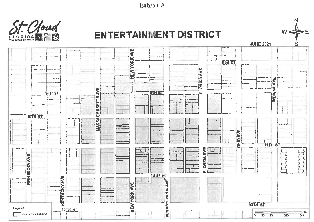
C.
Outside consumption in the district. Within the district, the following shall apply:
1.
District possession/consumption hours. Possession/consumption of any alcoholic beverages dispensed or sold by a registered establishment is authorized within the boundaries of the district, Wednesdays to Saturdays, from 11:00 a.m. to 12:00 a.m. Extended hours of consumption for city or city-sponsored events may be granted with prior approval by the city manager and/or designee, not to exceed chapter 4, alcoholic beverages, section 4.2, hours of sale.
2.
Outside drink limit. Any registered establishment licensed to dispense or sell alcoholic beverages by the drink for consumption on the premises is authorized to dispense an alcoholic beverage in an approved clear container for removal from the premises, as specified in this section, provided, however, that no establishment shall dispense to any person, under the legal age of alcohol drinking, as provided by law, more than one such alcoholic beverages at a time for removal from the premises, and no person shall remove at one time more than one such alcoholic beverages from the licensed premises.
3.
Size limited to 16 fluid ounces. No person shall hold in possession on the streets and sidewalks, in parks and squares, or in other public places within the district, more than one alcoholic beverage in approved container that exceeds 16 fluid ounces in size.
4.
Drinking from a bottle, aluminum, or glass container is prohibited. It shall be unlawful for any person to drink alcoholic beverages from a not approved container, or to possess in an open aluminum or glass container any alcoholic beverage on the streets, sidewalks, rights-of-way, and parking lots, whether public or private, except as authorized and approved as outdoor dining.
D.
Hours for music and entertainment. Music, singing, and/or other forms of entertainment, whether amplified or not, shall be permitted indoors at any time during business hours of any facility or business enterprise within the district. Outdoor music, singing and entertainment shall be permitted until 1:30 a.m., providing compliance with the city's noise ordinance, unless otherwise permitted by way of special event permit.
E.
Games, sporting events, and entertainment. Games, sporting events, artistic performances, farmer's markets and other such forms of organized entertainment and community events are encouraged and allowed within the entertainment district, subject to compliance with all applicable health and safety regulations and approved through the special event permitting process.
(Ord. No. 2025-78, § 2, 1-8-2026)
3.13.4. - Marina and docking facilities.
A.
The provisions of these regulations shall establish minimum requirements for the permitting, siting, design, construction, and operation of marinas to serve the needs of boaters, while properly managing the state's natural resources, and protecting public health. For the purposes of determining permitted uses, a marina or docking facility shall be any facility on or adjacent to the water which provides for mooring, berthing, transfer, or storage of vessels, and which includes any or all of the related ancillary structures and functions of marinas such as but not limited to: docks, piers, piles, anchorages, buoys, boat lifts, hoists, shade structures, boathouses, vessel storage areas, boat ramps, anchorages, breakwaters, channels, locks, moorings, basins, vessel repair services, vessel sales, sales of supplies which are normally associated with boating, such as vessel fuel sales, bait and tackle sales, vessel rentals, and parking areas for users of the marina. For the purposes of determining siting standards, marinas are categorized as recreational operations which include planned community marinas, water sports clubs (including those with nominal fee general members) and co-ops for limited customer base; commercial facilities which are operated for the general public; or, public facilities operated by governmental agencies.
B.
Siting standards shall apply to any commercial, public, recreational, or private marina that is on or adjacent to the water and: 1) contains five or more slips, or 2) provides berthing for one or more head boats, any vessel maintenance or repair yard that is on or adjacent to the water, all public, commercial, or recreational boat ramps, or associated upland ancillary facilities such as fueling or vessel maintenance facilities; or, 3) provides a lake access facility that transfers boats from dry land or another water body using a boat lift, hoist, lock, or any similar facility. These standards under section B shall not apply to: 1) private marina and docking facilities for personal use only; or 2) facilities in compliance with an adopted conceptual master plan (or adopted alternate conceptual plan) or concept plan approved for a mixed use district; or 3) marina and docking facilities on manmade lakes or water management systems without boat access to a natural lake or private or non-navigable water bodies; or 4) repair or replacement of existing marina facilities that does not increase boating capacity.
C.
Commercial marinas shall be subject to the following standards: Commercial marinas, operated for profit, are permitted subject to the following:
1.
A siting and design study in accordance with the application shall be submitted prior to any permit approval.
2.
Commercial marinas may only be allowed on sites which have direct access to a collector (avenue), or arterial (boulevard) road.
3.
When available, shall connect to central water and sewer services.
4.
May only be authorized on sites with a minimum of one acre.
5.
Support facilities may include but are not limited to installations or services that support the functions of a marina, such as utility services, fueling stations, repair and launching facilities, the marina headquarters, parking, picnic areas, recreation areas, retail facilities and eating establishments catering to the boating and aquatic recreational needs of marina users, and restrooms, showers, and laundries.
6.
Vessel repair/maintenance and storage yards may be authorized as part of the permitted use. All repair/maintenance and storage yards must be totally screened from off-site view and Yard base shall consist of an all-weather surface. When abutting residential use, the screening must also include a "high" buffer.
7.
Trip for-hire, charter vessels and other vessels for-hire may operate from commercial marinas when approved by the city.
8.
Tournaments may be authorized as a special event and will require special event permitting through the city. Special events shall be limited to six times per year.
D.
Public marinas shall be subject to the following standards:
1.
Public marinas are owned by governmental agencies and operated with their own personnel or through a concession or other agreement with a private entity.
2.
When available, shall connect to central water and sewer services.
3.
May only be authorized on sites with a minimum of one acre.
4.
Support facilities may include, but are not limited to, installations or services that support the functions of a marina, such as utility services, fueling stations, repair and launching facilities, the marina headquarters, parking, picnic areas, community recreation areas, retail facilities and eating establishments catering to the boating and aquatic recreational needs of marina users, and restrooms, showers, and laundries.
5.
Vessel repair/maintenance and storage yards are prohibited; vessels that provide facility service or maintenance are exempt from the storage provisions.
6.
Tournaments sponsored by the city are exempt from special event review and permitting.
7.
Must be in compliance with St. Cloud City Code Chapter 48—Waterways
E.
Recreational or private marinas shall be subject to the following standards:
1.
May include residential or planned community marinas, club marinas, and all other marinas which are not commercial marinas or public marinas, co-ops.
2.
When available, shall connect to central water and sewer services.
3.
Residential or planned community marinas are part of a single, overall development plan and/or are designed to share common facilities such as docks, walkways, pilings, ramps, lifts, or an entrance channel.
4.
Clubs and co-ops are distinguishable from commercial marinas because they do not have commercial operations or support facilities and are for the exclusive use of the members.
5.
Trip for-hire, charter vessels and other vessels for-hire are prohibited from operating from recreational marinas except for the exclusive use of the residents of the community.
6.
Support facilities shall be limited to launching facilities, a marina maintenance office, parking, picnic areas, community recreation areas, restrooms, and minor convenience retail.
7.
Vessel repair/maintenance and storage yards are permitted if totally screened from off-site view with a "high" buffer and yard base shall consist of an all-weather surface.
8.
Tournaments may be authorized as a special event and will require special event permitting through the city. Special events shall be limited to six events per year.
9.
Unless the location of the marina or docking facility has been approved in a PUD zoning district, the greater of the following shall be required from the marina or docking facility to each perimeter boundary of the property: 1) 250 feet; or 2) one-half the quotient of one linear foot of shoreline per ten square feet of preempted submerged lands (as defined by Florida Administrative Code), as illustrated in Exhibit A.; or 3) if a boat ramp is proposed, one-half the sum of three feet per each lot granted access to the common facility with a minimum of 250 feet each side and a maximum requirement of 500 feet each side.
Exhibit A
The required shoreline shall be owned by the homeowner's association or similar entity, and placed in a separate tract to restrict individual boat dock access, with a minimum planting of 15 trees for every 100 linear feet of shoreline (minimum 50-foot) wide planting area) and a 20-foot) wide area for an environmental swale adjacent landward of the planting area as illustrated in Exhibit B. No fertilizer or permanent irrigation shall be allowed in the required tract.
Exhibit B
10.
Access shall be permitted via manmade lakes, or water management systems, that function as a system of interconnected lakes. Such access through the water management system or manmade lake shall have a minimum average width of 100 feet.
11.
Facilities which require altering the natural, or existing permitted depth of a lake bottom in order to function shall not be permitted.
a.
Facilities that have direct access to an established natural or manmade depth adequate for navigation purpose (require a de minimis removal of less than 450 cubic yards of permitted dredging material from sovereign submerged lands) and utilize the least invasive sediment removal process, consistent with best management practices, are exempt from this requirement.
b.
Dredging operations exempt from permitting consistent with requirements outlined in the Florida Statutes or Florida Administrative Code are exempt from this requirement.
12.
Access for motorized boats using motors over ten horsepower may only be permitted on water bodies that meet one of the following criteria: 1) named Florida lakes with a surface area over 250 acres; or 2) manmade lakes without connection to a natural lake.
F.
Lake access facilities that transfer boats from dry land or another water body using a boat lift, hoist, lock, or any similar facility shall be subject to the following standards in addition to siting standards for commercial, public, or recreational marinas.
1.
Boat lifts, hoists, or any other means to transfer a boat which includes vertical components shall be covered by a boat shelter or shade structure with materials similar to those used in the principal structures (size shall be limited to cover structure only and shall not create additional functions).
2.
A boat washing component shall be included with each lake access facility, ensuring the runoff from the boat wash is contained within the water body from which the boat is exiting.
a.
The city may require water quality monitoring tests to confirm that the lake access facility, including the boat washing function, is not adversely impacting the lake.
b.
Any required tests shall be performed by an independent lab licensed to provide the applicable testing.
(Ord. No. 2025-10, § I, 3-13-2025)
3.14.1.- Accessory structures.
A.
Residential districts.
1.
Location.
a.
Accessory structures shall not be located in front yards with the exception of accessory structures which would customarily be found in that yard, as determined by the city manager or his designee.
b.
Accessory structures may be located in the rear yard provided the setbacks outlined in Table 3.14.1 are met.
c.
Accessory structures may be located in the interior side yard provided the setbacks outlined in Table 3.14.1 are met but also set back ten feet from the front yard as defined.
d.
Accessory structures may be located in the corner side yard provided the setbacks outlined in Table 3.14.1 are met but also set back 15 feet from the secondary street. Detached garages and aluminum carports are permitted in corner side yard with the 20-foot setback.
e.
Such structures shall not be located within any easement unless determined acceptable by public works department and if property owner acknowledges responsibility to move structure as needed.
2.
Special restrictions.
a.
Except as provided below, such structures shall not exceed 18 feet in height as measured from the ground to the highest point of the roof.
b.
Private garages, when attached to the main structure, shall be treated as part of the main building for purposes of this section and shall meet all required setbacks for such main structure. All detached garages shall be treated as permanent structures for purposes of permitting and shall meet all of the requirements of section 3.14.1.A, "Accessory Structures," "Residential Districts."
c.
Porte-cochères when attached and architecturally integrated with the main structure may be allowed to encroach into the front setback to the outward edge of the driveway up to a maximum often feet from the property line.
d.
No accessory structure may be constructed prior to construction of the principal building. The additional structure shall not adversely impact the existing drainage pattern.
e.
Towers erected for the purpose of mounting antennas for uses that would be customarily found in residential districts shall be allowed providing the following restrictions are met:
(1)
Only one tower per property.
(2)
Cannot exceed 35 feet in height excluding antenna.
(3)
Must be located in only the rear yard.
(4)
The height of the tower shall not exceed the distance from the base of the tower to the closest point on all property boundary lines.
f.
All structures within any zoning district shall be maintained as originally approved and permitted in a safe and structurally sound condition.
g.
No accessory structure shall be larger than 800 square feet, or 50 percent of the total air-conditioned floor area of the existing primary structure, whichever is less, unless a special exception is approved by the board of adjustment.
h.
Only one 800 square foot accessory structure per residence shall be allowed unless a special exception is approved by board of adjustment.
i.
Architectural design and exterior finishes of accessory structures shall be consistent and compatible with the principal building.
j.
Screen enclosures attached to a principal building may exceed 18 feet in height but may not exceed the height of the roofline of the principal building.
k.
By special exception approved by the board of adjustment, a detached or attached private garage may exceed 18 feet in height but no greater than 35 feet, as measured from the ground to the highest point of the roof to allow for the parking of a recreational or similar vehicle.
B.
Commercial and industrial districts.
1.
Location.
a.
Accessory structures shall not be located in front yards, side yards, or street side yards with the exception of accessory structures which would customarily be found in those yards, as determined by the city manager or his designee. Such accessory structures shall not be located closer than ten feet to the rear lot line, shall meet the stipulated side, side street and front yard setbacks for the principal building.
b.
Accessory structures shall not be located within any easement.
c.
Solid waste dumpsters and their enclosures are accessory structures which are specifically permitted to be located within a front yard provided all of the following requirements are met:
(1)
The property is zoned industrial;
(2)
The dumpster enclosure must completely screen the dumpster from view and must be constructed of a finished masonry material such as brick, split-face block, glazed block, or stucco on concrete block (painted and untreated concrete block are not permitted enclosure materials;
(3)
The front yard setback is ten feet; and
(4)
The location is approved by the city manager or his designee.
2.
Special restrictions.
a.
No accessory structure may be constructed prior to construction of the principal building.
b.
Towers erected for the purpose of mounting antennas for uses that would be customarily found in commercial or industrial districts shall be allowed providing the following restrictions are met:
(1)
Only one tower per property.
(2)
Height limits shall be as set by the Federal Aviation Administration.
(3)
No portion of the tower (i.e., guy wires) shall intrude into any abutting property.
(4)
Must be located only in the rear yard.
C.
Yard requirements, in commercial districts, for swimming pools, spas, and screen enclosures for pools.
1.
No pool or spa, measured to the water's edge, shall be located closer to the side or rear yard property line of the lot, parcel, or piece of land upon which said pool or spa is located than the distance required by the zoning ordinances of the city for side or rear yards in the zone in which the property is located, plus three feet.
2.
Pools or spas may be located in the front yard of a commercial structure provided such use:
a.
Is incidental to the primary commercial use;
b.
Is maintained behind the required front yard setback plus three feet;
c.
Shall be screened, fenced or protected in accordance with all state regulations; and
d.
Shall be enhanced with a vegetative buffer or landscaping design in order to screen such use from any roadways.
(Ord. No. 2023-45, § 4, 11-9-2023)
3.14.2. - Commercial restrictions.
A.
Commercial lights. Where a commercial or industrial land use borders a residential district or a right-of-way, lighting may be used for illuminating the parking area, advertising signs, or any portion of the property as long as direct light source is not visible to drivers on the right-of-way or adjacent residential areas.
B.
Commercial sounds. No amplification of sound shall be permitted which will carry outside the immediate space occupied by the business generating the commercial sounds or outside the property line if the enterprise generating the sounds is the only business located on the lot.
C.
Outside storage of parts, supplies or materials. Outside storage of parts, supplies or materials may be approved provided storage is in conjunction with the business and is located on the side or rear yard of said business and fenced as authorized by this section of the code. Fencing shall be constructed of opaque material and parts, supplies or materials stored within such fencing may not be seen from the abutting properties. The fence shall be approved by the city manager or his designee and maintained as originally approved and permitted.
D.
Commercial odors. No commercial establishment shall generate any offensive odor that reaches the odor threshold which will carry outside the immediate space occupied by the business generating the odors or outside the property line if the enterprise generating the odor is the only business located on the lot.
E.
Commercial parking. No commercial establishment shall allow the parking of commercial vehicles, as defined in section 8.2.2, unless the parked commercial vehicles meet the following criteria:
1.
The vehicle parked are owned/leased and specifically used by the business occupying the premises; and
2.
Such parking is a minor portion of the business; or
3.
The business is licensed as a parking facility.
Any residential use in a commercial zoning district shall comply with all applicable regulations in regard to "parking and use of vehicles and recreational equipment," section 8.2.2 of this Land Development Code.
3.14.3. - Parking and use of vehicles and recreational equipment.
A.
General requirements.
1.
Unless expressly permitted by ordinance or the state statutes, no recreational equipment or commercial vehicle shall be used for living, sleeping, or housekeeping purposes except when:
a.
Parked or stored in a duly licensed mobile home park licensed for recreational vehicle use; or
b.
Parked on private property during a special event approved by the city manager or his designee.
2.
Recreational equipment may be parked in areas zoned for multifamily residential use provided that such areas are approved for such use by the owner of the property and included in the city's approved site plan for such property.
3.
It shall be unlawful for any motor vehicle or recreational equipment to extend over, or interfere with the use of any sidewalk or right-of-way.
4.
Commercial vehicles shall not be parked on any property or roadway zoned for residential use except during the course of active site development or building construction or during the course of regular business (7:00 a.m. to 8:00 p.m.), or in an enclosed garage or when stored behind an opaque fence. No part of the commercial vehicle shall be visible from any area outside of the fencing.
5.
Emergency vehicles used by the owner and/or tenant of the residence shall be allowed to be parked in such residential areas provided the owner and/or tenant is "on call" for emergency activities and such allowance is in written form by the service provider and on file in the office of the city clerk or has qualified under section 3.14.3.D "waiver."
B.
Recreational equipment. Recreational equipment, up to 25 feet in length may be parked in the front, side or rear yard of a residential zoning district but no closer than one foot to any abutting property line, provided such equipment is not parked within any right-of-way. Such recreational equipment shall not obstruct the visibility at intersections as defined in this Code.
Recreational equipment over 25 feet and less than 35 feet in length shall be parked in the rear yard but no closer than five feet to any abutting property line.
Recreational equipment over 35 feet in length may be parked only in a garage, carport, or other area as approved by the city manager or his designee.
C.
Exceptions for recreational equipment.
1.
Recreational equipment may be parked in areas other than those designated in section 3.14.3.B and outside of the right-of-way for a period not to exceed 24 hours for purposes of loading or unloading or cleaning.
2.
Recreational equipment may be parked entirely within a carport, garage or other approved structure.
3.
Upon obtaining a permit from the city manager or his designee, city residents may allow their guests to park a recreational vehicle, not for living purposes, for up to ten days in the driveway, or in the side or rear yard, provided that at least 60 days must elapse before such guest parking will be permitted on the same property.
D.
Waiver. Any property owner who cannot meet the requirements of these sections, and would suffer a hardship if not allowed to park recreational or commercial equipment on his property, may apply to the city council for a waiver from the restrictions imposed by this section for a specified period of time. The waiver request and notices of the public hearing on such waiver request shall be provided by the property owner in the same manner as required of the applicant for a request for a conditional use to these zoning regulations, and the same rights of appeal shall apply. No formal posting of the site or legal advertisement shall be required. The requested waiver shall only be granted for a one calendar year period and shall be reviewed on an annual basis.
E.
Storage or repair of vehicles or recreational equipment. Storage or repair of vehicles or recreational equipment shall meet all requirements of chapter 24, article II, division 2 of the City Code.
3.14.4. - Certain services as defined by the city council.
Certain services, as defined by the city council, are permitted in any zoning district. Certain services are hereby defined and are limited to certain installations of water, sewer, cable television, gas, telephone, and electrical systems such as substations, lift stations, and similar installations; provided, however: (1) that this subsection shall not be deemed to permit the location in a district of such installations as electric or gas generating plants, sewage treatment plants, water pumping or aeration facilities from which they would otherwise be prohibited, unless such facilities serve a subdivision recorded before the effective date of these zoning regulations, are intended to serve a subdivision approved under subdivision regulations in effect after the effective date of this Code, or are a part of an internal package system designed and intended to serve a single industrial or commercial use or complex; and (2) that this subsection shall not be deemed to permit the erection of structures for commercial activities such as sales of related merchandise or collection of bills in districts from which such activities would otherwise be prohibited.
3.14.5. - Alcoholic beverage establishments. (See definition chapter 8.)
In addition to any other requirements or limitations of this Code, places for the sale of liquor, beer, or wine for on-premises consumption, such as cocktail bars, saloons, nightclubs or package liquor stores (hereinafter called "establishments") shall be subject to the following additional requirements and limitations:
A.
These establishments shall be located at least 750 feet from any public, private, or parochial, elementary, junior high, or high school, and/or church or child day care center. The 750-foot minimum is to be measured in a straight line from the front or main entrance door of the establishment, as determined by the city manager or his designee, to the nearest point of the church structure or the nearest point of the school or child day care center property.
B.
These establishments shall be located at least 500 feet from another establishment. The required 500 feet is to be measured in a straight line from the nearest point of the structure of the establishment to the nearest point of the structure of another.
C.
Where an establishment is located and begins operation in conformity with this section and with this Code with subsequent locating of a school, church or child day care center within 750 feet of such existing establishment, or where an establishment began prior to the enactment of the separation requirement, it shall not be construed that such establishment is in violation of this Code.
D.
The sale of alcoholic beverages for on-premises consumption or the package sale of alcoholic beverages shall be exempt from the provisions of section 3.14.5.A. through 3.14.5.C. for the following, as described below:
1.
Full-service restaurants where the service of food is more than 51 percent of the total sales, verifiable upon request, and alcoholic beverages is incidental to the service of food cooked on the premises; or
2.
The sale of alcoholic beverages in certain bars/nightclubs which is incidental to a hotel or motel operation having more than 50 guestrooms; or
3.
The package sale of alcoholic beverages is not for consumption on the premises; or
4.
Micro-breweries or micro-wineries, as defined in section 8.2.2.
5.
The establishment is located within the CBD-1 as a permitted use; or
6.
The establishment is located within the CBD-2 as a conditional use; or
7.
Publicly owned facilities; or
8.
Private clubs where only members and their guests are served and there are no indications on the exterior of the building that alcoholic beverages are served therein, and where such private clubs, and fraternal organizations, are permitted within any zoning classifications, but shall be governed by the restrictions imposed by their state licenses.
E.
Full-service restaurants. The provisions of section 3.14.5.A. through 3.14.5.C. (above) shall not apply to the sale of alcoholic beverages for on-premises consumption at a full-service restaurant. A full-service restaurant is defined as an establishment serving full-course meals and engaged primarily in the service of food and non-alcoholic beverages, with alcoholic beverages generally only consumed or sold in connection with the consumption or sale of food during all hours of operation. A full-service restaurant may have a bar area in which alcoholic beverages are served and consumed without the accompanying sales and consumption of food; however, such bar area shall be no more than 12 percent of the total gross floor area of the full-service restaurant.
An establishment which contains pool tables, video games, a stage, live entertainment, illuminated or non-illuminated signs advertising alcoholic beverages, permits dancing, or which has live music or plays recorded music at a level above 70 decibels (measured six inches from the source), shall not be considered to be a full-service restaurant. An establishment which charges a cover charge at any time shall not be considered a full-service restaurant. An establishment which advertises anything other than the sale of food shall not be considered a full-service restaurant.
The full-service restaurant must have permanent kitchen facilities located within the premises in which full-course meals are regularly prepared for service to patrons of the establishment. Such kitchen facilities must be designed, constructed, equipped and maintained to actually allow preparation of food in sufficient quantities to serve full-course meals simultaneously to a number of patrons equal to at least 50 percent of the rated patron capacity of the restaurant. No person shall attempt to circumvent the intent of this part by an artifice or scheme, such as the serving of stock meals. Stock meals as used herein are defined to include and refer to the serving of cold plates, snacks, previously prepared sandwiches and any other type of meal which is capable of being served to more than one customer.
The dining area shall contain tables and chairs or booths of standard table height. Counters and tables of cocktail table height shall not be permitted. All tables shall meet or exceed the minimally acceptable standard of 256 square inches of table space per patron.
The bar area, if one exists, shall be visually or physically separated from the remainder of the full-service restaurant and shall include the bar itself, any stools, chairs or other seating adjacent to the bar, and any other seating separated from the remainder of the full-service restaurant. The bar shall be accessible only from within the full-service restaurant and shall not have direct customer access to or from the outside.
F.
Certain bars/nightclubs in hotels or motels. The provisions of sections 3.14.5.A. through 3.14.5.C. (above) shall not apply to the sale of alcoholic beverages for on-premises consumption at an establishment located within a hotel or motel containing 50 or more guestrooms where such establishment in the hotel or motel has no direct entrance or exit on a public street.
G.
For package sale of alcoholic beverages. The provisions of sections 3.14.5.A. through 3.14.5.C. (above) shall not apply to a vendor who operates an establishment, the primary purpose of which is the package sale of alcoholic beverages for off-site consumption.
H.
Micro-breweries and micro-wineries. The provisions of sections 3.14.5.A. through 3.14.5.C. (above) shall not apply to a vendor who is licensed by the Florida Department of Business and Professional Regulations, Division of Alcoholic Beverages and Tobacco to manufacture malt beverages or to produce wine.
I.
Establishment is a permitted use in CBD-1 district. The provisions of sections 3.14.5.A. through 3.14.5.C. (above) shall not apply to an establishment that is approved as a permitted use and is located within the CBD-1 central business district 1.
J.
Establishment is permitted as conditional use in the CBD-2 district. The provisions of sections 3.14.5.A. through 3.14.5.C. (above) shall not apply to an establishment that is approved as a conditional use and is located within the CBD-2 central business district 2.
K.
Publicly-owned facilities. The provisions of sections 3.14.5.A. through 3.14.5.C. (above) shall not apply to an establishment located within a facility owned by the public where the primary purpose and design of the facility is to accommodate the assembly of people for entertainment or recreation.
3.14.6. - Automotive service stations and filling stations.
The following regulations shall apply to the location, design, construction, and operation, and maintenance of automotive service stations and filling stations:
A.
Setback requirements. Buildings, gasoline pumps, tanks, vents, pump islands, and pump island canopies shall conform to setback requirements in the district in which the automotive service station or filling station is located; provided no such pumps, tanks, vents, pump islands, or pump island canopies shall be located closer than 25 feet to any side or rear property line. No automotive service station or filling station building or gasoline pump shall be located within 25 feet of any residentially zoned property. A minimum distance of 100 feet by shortest airline measurement shall also be maintained between the nearest point of lots used for filling stations or automotive service stations.
B.
Location of gas pumps. Gasoline pumps, vents, tanks, pump islands, and pump island canopies may be located no closer than 15 feet to the street property line; provided that if such 15-foot requirement is closer than setback requirements for the district in which the automotive service station or filling station is located, such service station or filling station appurtenances shall be removed before the property is converted to a use other than an automotive service station or filling station.
C.
Location of storage tanks. Storage tanks shall be located below grade and shall conform to state regulations.
D.
Location of pumps within a required setback. In districts where setbacks greater than 15 feet are required, no gasoline pumps, vents, tanks, pump islands, or pump island canopies shall be located at a 15-foot distance from the street right-of-way line until a legal instrument satisfactory to the city attorney has been prepared and recorded at the expense of the property owner or lessee, which instrument shall relieve the city of all costs of removal of such appurtenances and from any severance damages should the city acquire such right-of-way.
E.
Buffer walls. Where lots to be used for automotive service stations or filling stations abut on any property which is residentially zoned, there shall be a finished concrete block wall with a cap, or opaque buffer meeting the requirements of chapter 4, article 8 of this Code or equivalent. The wall or buffer shall be six feet in height, except where the wall or buffer extends to within 15 feet of a street line. Such wall or buffer shall not obstruct visibility at intersections as described in section 3.15.3.A of this Code. Such wall or buffer shall be continuous and unpierced except that a wall along an alley line may have a three-foot opening which is closed by a solid gate when not in use.
3.14.7. - Requirements for approval of transient lodging establishment units.
Transient lodging establishment uses shall be reviewed as conditional uses or permitted uses and shall meet the following requirements:
A.
Applicant shall submit required submittals at time of application for review:
1.
A conceptual plan drawn to scale showing proposed lot sizes, proposed location of units, any existing structures or uses, any proposed or existing amenities, location of development to existing streets, proposed or existing buffers, or any other information necessary to determine whether or not the conditional use meets the requirements of the code.
2.
Method of ownership and management.
B.
In addition to the requirements for review of a conditional use within this Code, the planning commission shall review and make recommendations for approval or denial to city council based on the following factual matters:
1.
No structure or part thereof within the proposed conditional use shall be utilized for transient lodging establishment unless all structures or parts thereof within the proposed conditional use are utilized on transient lodging establishment basis.
2.
The use will not overburden public recreational facilities designed to serve the residential areas of the city.
3.
The property shall have direct access to an arterial street.
4.
The transient lodging establishment uses are located on a site which is physically separate from permanent residential uses by recreational amenities, major collector or arterial roadways, or open space.
5.
Other factors as may be presented in evidence at the public hearing.
C.
In addition to the requirements for review of a conditional use within this Code, the city council shall review recommendations submitted by the planning commission and shall deny or approve, establishing conditions based on the compatibility with surrounding lands.
3.14.8. - Miscellaneous structures.
A.
School bus shelters and bicycle racks may be located in any district. District setbacks are waived. Locations and setbacks shall be approved by the city manager or his designee.
B.
Bus stop benches may be located in any district. Locations and setbacks shall be approved by the city manager or his designee. One sign per bus stop bench may be approved provided signage: 1) Shall only face the right-of-way, 2) does not exceed 12 square feet in size, and 3) shall not be located in any area along the lakefront of the city. Bus stop benches shall be placed where they do not cause any danger to the health, safety, and welfare of the citizens and shall not cause any obstructions of sight distances.
C.
Bus shelters providing protection from the elements at bus stops may be located along public transportation routes when approved as to design, advertisement allocation, and location by the city council and issuance of the appropriate right-of-way utilization permit. Bus shelters shall be placed where they do not cause any danger to the health, safety, and welfare of the citizens and shall not cause any obstructions of sight distances.
D.
Telephone booths may be located in any district. District setbacks are waived. Locations shall be approved by the city manager or his designee if nearer a street line than the district front setback line.
E.
Mail delivery boxes may be placed in accord with U.S. post office regulations, and are exempt from district setbacks. Gang or multiple delivery boxes may be covered as approved by the United States Postal Service.
F.
Charitable organization collection boxes may be placed as approved by the city manager or his designee. This privilege may be revoked for cause.
3.14.9. - Temporary storage, office trailers, and construction trailers.
A.
During periods of active site development and during the end of the year increase in retail sales activity, temporary buildings and trailers are required by developers, builders, business owners, and their agents to be located in close proximity to construction and/or retail activity.
These buildings and trailers may be permitted by the city manager, or designee, during active construction on a development site. Temporary storage units may be permitted by the city manager, or designee, during the time period between November 15 and January 15 at a site in highway business or business commercial zoning districts on developed sites where retail sales is the primary use. All temporary buildings, structures and trailers shall comply with the following requirements:
1.
Applicable to all structures. Prior to approval of a temporary storage, office, or construction trailer, as provided for in this section, the contractor or property owner shall request written documentation from the Community Development Department regarding the need for a building permit. If a building permit is required, then it shall be obtained prior to installation of the storage, office, or construction trailer.
All temporary trailers intended for human occupancy for habitation shall be required to provide potable water and sanitary sewer services. Potable water and sewer service shall be provided via city approved connection to the public water and sewer services for the property. Alternative potable water and sewer services may be approved by the city engineer—utilities, subject to other jurisdictional authority, where public water and/or sewer service are not available based upon the sole determination of the city engineer—utilities.
2.
Construction/contractor offices. Structures for the purpose of providing meeting space, work space, and storage space for site development personnel, equipment and materials are permitted subject to the following criteria:
a.
One construction/contractor office is allowed per contractor, unless otherwise approved by the city manager or his designee;
b.
One additional construction/contractor office is allowed for the builder or developer;
c.
The construction/contractor office shall be of a type specifically designed for human occupancy;
d.
The construction/contractor office shall be removed prior to the issuance of a certificate of occupancy of a structure on the final lot within the development (or phase of the development) in which it is located.
3.
Storage units. Structures, buildings, or trailers for the storage of equipment and/or materials that are not designed for human occupation.
a.
One storage unit is allowed per contractor, unless otherwise approved by the city manager or his designee;
b.
Storage units to support retail sales activities shall not be located in a driveway, fire lane, pedestrian way, or parking space required to meet minimum requirements of this Code.
c.
Storage units to support retail sales shall be placed on a durable surface such as concrete or asphalt pavement.
d.
Storage units to support retail sales shall be placed a minimum of 20 feet from all building openings.
4.
Sales offices in residential subdivisions or planned unit developments. Structures for the purpose of providing information to potential home buying customers.
a.
One allowed per builder in a residential subdivision or development;
b.
Shall be of a type specifically designed for human occupancy;
c.
Five parking spaces shall be provided. One of the spaces shall be handicapped compliant;
d.
The site must be landscaped, with skirting around the sales office.
5.
Security quarters. Structures for use by site security personnel that may or may not be habitable as living quarters on a round-the-clock basis.
a.
If habitable the building shall meet all local and state codes for habitable buildings; and
b.
The use is restricted to use by security personnel only.
3.14.10. - Seasonal/temporary tree sales.
The intent of this regulation is to provide for the display and sale of ornamental trees during the Christmas season as specified below. These ornamental trees shall not be cut from the site, unless the site has been previously licensed for that purpose.
A.
Temporary sales are to be allowed only during the period between November 15th and December 30th of any one year.
B.
All sales under this section must be permitted by the city manager or his designee. A separate occupational license shall apply.
C.
Temporary outside display and sales are permitted only in neighborhood business (NB), highway business (HB), business commercial (BC), commercial PUD, industrial 1, 2, and 3, (I-1, I-2 and I-3), agricultural 1 and 2 (A-1 and A-2), and professional (P).
D.
Minimum setbacks for trees shall be 20 feet. Such temporary sales shall be allowed one temporary sign, no greater than 32 square feet. Such sign can only be placed at the location of the sale and must meet all signage requirements for site distances. Such sign shall be classified as a temporary new business sign and allowed to be placed on the site only during the allowable sale period. Off-street parking must be allocated for the sale site, with one space for each 200) square feet of sale area. At the time of permit application, a sketch must be presented that that shows the basic design of the sale lot, electrical and sanitation requirements, and addresses the requirements mentioned above.
E.
At the time of application, the applicant must prove ownership of the parcel to be used, or supply a notarized letter of permission by the owner allowing this temporary use.
F.
All electrical, sanitation, and health requirements must be met. Failure to meet the specified electrical and health standards will result in the revocation of the permit. If a tent is used, a permit shall be required. Fire department approval is necessary.
G.
The lot must be cleaned and returned to its original condition, as practically as possible, after the temporary period. A refundable performance bond as currently established or as hereafter adopted by resolution of the city council from time to time will be required.
3.14.11. - Temporary or mobile vendors.
Notwithstanding any other provisions of this Code, temporary or mobile vendors, as defined, shall be prohibited except in conjunction with and identified in a special event permit approved by the development review committee.
3.14.12. - Model sales centers.
A.
Model sales centers are defined as two or more homes or dwelling units in a unified location, constructed within a newly developed subdivision that are to be shown for the purpose of selling units comparable to the homes to be constructed in the subdivision.
B.
Model sales centers shall be allowed in all newly developing residential zoning districts provided the following criteria are met:
1.
Be located on primary access roads within the subdivision.
2.
Be located within the subdivision from which the models are being sold.
C.
Units located in a center must receive a certificate of occupancy prior to their use as a model.
D.
Model sales centers must provide a minimum of four off-street parking spaces for sales personnel and customers unless constructed in conjunction with a sales office pursuant to section 3.14.9.A.4 of the Land Development Code. If parking is required, such areas may be mulched, except for the handicapped accessible access, and located on the adjoining lot provided that such area is under the same ownership as the model center or as authorized by affidavit from the owner of the development.
E.
Model sales centers shall limit the sales only to units constructed in that development. Centers shall only be classified as a temporary branch office under state requirements for licensing.
F.
All signage must meet the requirements of article 16, "signs" of chapter.
G.
All fencing must meet the requirements of this section of the code.
H.
Model sales centers may not be used to conduct construction business for the units to be constructed or construction business for any other subdivision.
I.
Model sales centers must revert to residences after the last unit is sold in the development where they are located.
J.
The following submittals shall be required at the time of application for model centers:
1.
A site plan showing:
a.
Location of models;
b.
Sidewalk;
c.
Signage;
d.
Parking including state handicapped accessibility requirements; parking is not required when model homes are constructed in conjunction with a sales office pursuant to section 3.14.9.A.4 of the Land Development Code;
e.
Proposed time frame for model to exist; and
f.
Fencing.
2.
A single permit, at a cost as currently established or as hereafter adopted by resolution of the city council from time to time, shall be issued for the proposed model center at the primary address. The permit shall include signs and fences. Such permit shall be good for one year and shall be renewed or extended on a yearly basis.
3.14.13. - Sales, commercial zoning districts.
A.
Outside sales shall be allowed in the highway business (HB), neighborhood business (NB), professional (P), and business commercial (BC) districts, provided the following requirements are met:
1.
Sales shall be for the purposes of retailing merchandise which is normally sold from the business currently licensed by the city. Sales shall be held on the licensed premises. The business shall have been licensed for a minimum of 90 days prior to outside sales. No permit shall be required.
2.
Sales shall not encroach into rights-of-way or approved vehicular circulation patterns or divert pedestrian traffic into vehicular traffic lanes. The display of merchandise shall not reduce the parking requirements or effectiveness of landscaped areas located within the site.
3.
A minimum of 44 inches in width for all pedestrian ways shall be maintained for sidewalks on the approved site plan. Additional width may be required depending upon the site plan; sales shall be subject to the ADA Accessibility Guidelines for Buildings and Facilities as adopted by the state in the Florida Americans with Disabilities Accessibility Implementation Act (F.S. § 553.501 et seq.).
B.
Temporary sales may be permitted in the highway business (HB), neighborhood business (NB), professional (P), and business commercial (BC) zoning districts, provided the following requirements are met:
1.
Shall not be conducted more than 28 calendar days per year and no more than four times per calendar year. A sales permit shall be required. The fee for this permit shall be as currently established or as hereafter adopted by resolution of the city council from time to time.
2.
Location and size shall be reviewed and approved by the city manager or his designee to determine the impact of the function on the overall site.
3.
If tents are utilized for the sales, they shall be permitted separately from the sale permit.
4.
Sales shall be for the purposes of retailing merchandise which is normally sold from the business currently licensed by the city, or for the display and sale of merchandise, or equipment not normally sold on a parcel.
A temporary permit may be issued for the display and sale of merchandise or equipment not normally sold on a parcel provided the following requirements are met:
a.
The merchandise or equipment to be sold is owned and/or offered for sale by the owner of the subject property or approved by the owner of the improved or unimproved property; and
b.
The display of such merchandise or equipment shall not reduce the parking requirements or effectiveness of landscaped areas located within the site and the areas for the display of the merchandise or equipment does not adversely impact the public health, safety or welfare of the citizens of the city.
5.
A minimum of 44 inches in width for all pedestrian ways shall be maintained for sidewalks on the approved site plan. Additional width may be required depending upon the site plan; sales shall be subject to the ADA Accessibility Guidelines for Buildings and Facilities as adopted by the state in the Florida Americans with Disabilities Accessibility Implementation Act (F.S. § 553.501 et seq.).
C.
Vehicle sales shall be restricted in the highway business district. Vehicle sales may be allowed in the highway business district when the vehicles are not normally sold from the parcel, provided the following requirements are met:
1.
The sale of vehicles on improved or unimproved property when the vehicles to be sold are owned and/or offered for sale by the owner of the subject property or approved by the owner of the parcel.
2.
Any vehicle for sale must be properly licensed and operable and the maximum number of vehicles allowed on any one parcel for sale at any one time shall not exceed two.
3.
Any vehicle sale shall not be conducted more than 28 calendar days per year and no more than four times per calendar year. A sales permit shall be required. The fee for this permit shall be as currently established or as hereafter adopted by resolution of the city council from time to time.
4.
Location shall be reviewed and approved by the city manager or his designee to determine the impact on the overall site.
3.14.14. - Sales, CBD-1 and CBD-2 zoning districts.
A.
Outside sales may be allowed in CBD 1 and 2 zoning districts, provided the following requirements are met:
1.
Sales shall be for the purposes of retailing merchandise which is normally sold from a business currently licensed by the City of St. Cloud. Sales shall be held on the licensed premises. No permit shall be required.
2.
The merchandise shall be displayed directly in front of the principal structure only. It shall extend a maximum of ten feet from the front of the principal building or structure, and shall be subject to the ADA Accessibility Guidelines for Buildings and Facilities (F.S. § 553.501 et seq.).
3.
Some areas located in the fronts of each establishment are public rights-of-way. Goods may be displayed within such public rights-of-way as long as they do not intrude into any vehicle areas.
4.
The merchandise display shall not exceed six feet in height, shall not be located on a trailer or other vehicle; and the items displayed shall not pose any threat to public health or welfare (e.g., tires, receptacles, or containers that can harbor mosquitoes, rodents, vermin, or disease-carry[ing] pests); and shall not violate any city ordinance or state law related to public health or welfare.
5.
The displayed merchandise shall not be located within required landscaped areas, required parking areas, required walkways, fire lanes, fire accessways, exitways or accessible routes of travel as defined by the city building code.
6.
Existing outside display, sales or storage uses that are rendered non-conforming by virtue of enactment of these regulations shall be made conforming with the issuance of this amendment or shall be removed on or before November 27, 2011. (F.S. § 553.501 et seq.)
3.14.15. - Sales, industrial zoning districts.
A.
Outside sales shall be allowed in all industrial zoning districts, provided the following requirements are met:
1.
Sales shall be for the purposes of retailing merchandise which is normally sold from the business currently licensed by the city. Sales shall be held on the licensed premises. The business shall have been licensed for a minimum of 90 days prior to outside sales. No permit shall be required.
2.
Sales shall not encroach into rights-of-way or approved vehicular circulation patterns or divert pedestrian traffic into vehicular traffic lanes.
3.
A minimum of 44 inches in width for all pedestrian ways shall be maintained for sidewalks on the approved site plan. Additional width may be required depending upon the site plan; sales shall be subject to the ADA Accessibility Guidelines for Buildings and Facilities as adopted by the state in the Florida Americans with Disabilities Accessibility Implementation Act (F.S. § 553.501 et seq.).
B.
Outside sales shall be allowed in industrial districts for liquidation of personal property pursuant to F.S. § 83.806, self-service storage space, enforcement of lien.
3.14.16. - Conditional special sales.
A.
Conditional special sales shall be defined as special sales not specifically addressed by sections 3.14.13 and 3.14.14 of this Code. Conditional special sales shall require a permit and meet the requirements in sections 3.14.13 and 3.14.14 above and be reviewed by the city council for approval.
B.
Nonprofit organizations shall be allowed sales of merchandise or services provided such organizations apply for a "nonprofit solicitors permit." There is no permit or fee required for nonprofit activities.
3.14.17. - Outside sales/rental lots.
Outside sales/rental lots shall be for businesses that normally display their goods outside of the primary building. Such lots may be for the purpose of selling or renting cars, mobile homes, boats, or heavy equipment; and, shall meet the following requirements:
A.
Obtain city occupational license.
B.
Sales/rental lots shall meet the following parking requirements:
1.
Vehicles, boats, heavy equipment—One space for each 200 square feet of gross floor area of structure for sales office shall be provided for customer parking and shall meet all parking design requirements.
2.
Mobile homes or manufactured homes—One customer parking space for each mobile home or one space for every 200 square feet of gross floor area of structure for sales office, whichever is greater shall be provided and shall meet all parking design requirements.
3.
All parking must be paved to meet all requirements of the Land Development Code.
C.
Display areas of sales/rental lots shall meet the following requirements:
1.
Parking stall striping may be eliminated in a display area.
2.
For every 2,000 square feet of paved display area, 120 square feet of additional landscaping shall be provided on the site in lieu of the internal landscaping requirements for parking islands.
3.
Mobile home or manufactured home display areas shall maintain a minimum often feet of separation between display units. Vehicle display areas shall maintain necessary space for access to each vehicle.
4.
All display areas shall maintain the minimum required landscaped buffer area from all property frontages.
5.
All display areas shall be improved in accordance with the design standards in chapter 6 of this Code.
D.
Sales/rental lots must meet all sight distance requirements on all lot frontages.
3.14.18. - Child care centers.
Child care centers may be approved provided the following requirements are met:
A.
There shall be a fenced, usable, safe and sanitary outdoor play area. The play area shall be calculated at the minimum of 45 gross square feet per child in any group using the play area at one time, however, the minimum play area shall not be less than that calculated for one-half the licensed capacity.
B.
There shall be a minimum of 35 square feet of usable indoor floor space per child excluding stairways, toilets and bath facilities.
C.
All such facilities shall be inspected and licensed by the state department of children and family services and shall meet all of the requirements of the state agency as a condition of approval.
D.
If play areas are located within 50 feet of any residential zoning district, the outdoor play area shall be separated by opaque screening material.
E.
All fencing shall be located inside the required buffer area.
3.14.19. - Adult day care centers.
Adult day care centers may be approved, provided the following requirements are met:
A.
There shall be a minimum of 30 net square feet of usable, safe and sanitary floor area for each participant indoors. Net floor space shall be as defined under state regulations.
B.
There shall be a minimum of 25 square feet of usable outdoor recreation area per participant. Such area may include a screen room. Outdoor recreation shall be secured by screening, hedges or fencing.
C.
All such facilities shall be inspected and licensed by the state department of children and family services and shall meet all of the requirements of the state agency as a condition of approval.
3.14.20. - Keeping and breeding of exotic birds.
The keeping of more than three and/or breeding of exotic birds shall be permitted as a conditional use in all residential zoning districts provided the following criteria are met:
A.
The city council shall have granted a conditional use in accordance with the guidelines contained in the Land Development Code.
B.
No more than 30 birds may be kept on the subject property. The area or structure in which the birds are kept must contain a minimum of one square foot of floor space per mature bird.
C.
If a bird has a clutch of eggs, and the hatchlings result in more than 30 birds being located on the site, or the number exceeds the size restrictions of the loft, the owner will have 30 days from the date the new birds hatched to relocate of the excess birds to a lawfully conforming location.
D.
The primary use of the property shall be a single-family detached dwelling, and the principal residents of the person engaged in the keeping and breeding of the birds. The keeping and breeding of exotic birds shall not be permitted on property occupied by mobile or manufactured homes, single-family attached, duplex, or multifamily units.
E.
The city may inspect the property as deemed necessary to ensure that the provisions of this section are being fully complied with.
F.
If birds are being kept in an outdoor loft, the following shall apply:
1.
The loft shall be designed and constructed to meet the wind load requirements of the Florida Building Code in effect for the city, as may be amended from time to time. A building permit shall be required.
2.
The loft shall be of sufficient size and design, and constructed of such materials, that it can, and shall be, maintained in a clean and sanitary condition.
3.
The loft shall be constructed in the rear yard only, no closer than 50 feet to any adjacent residence, nor closer than 25 feet to any side, rear, or side street property line.
4.
Feed for the occupants of the loft shall be kept indoors, or in containers designed to protect against intrusion by rodents or other vermin. All birds will be fed within the confines of the loft.
5.
All birds, with the exception of homing racing pigeons, shall be confined to the loft except when being transported. Racing homing pigeons may be released for limited periods as necessary for exercise, training, and competition; and at no time shall they be permitted to perch or linger on buildings or structures on adjacent properties. Racing homing pigeons shall not be released for exercise, training or competition except in accordance with the following:
a.
The owner of the racing homing pigeons must be a member in good standing of an organized pigeon club such as the American Pigeon Union, Inc., the International Federation of Racing Pigeon Fanciers, the National Pigeon Association, the American Tippler Society, the International Roller Association, or the Rare Breeds Pigeon Club.
b.
No racing homing pigeon shall be released to fly for exercise, training, or competition which has been fed in during a period of four hours prior to the flight.
c.
Racing homing pigeons shall be banded and registered with one of the national pigeon associations/registries.
G.
If there are three documented violations within any 12-month period, the conditional use will be taken before the city council for possible revocation.
3.14.21. - Janitorial services in CBD-1 and CBD-2 zoning districts.
Approval of janitorial services as a conditional use shall be subject to the condition that all company-owned vehicles used by the service must be parked onsite. No on-street parking of these vehicles shall be permitted.
3.14.22. - Produce stand.
A.
Produce stands shall be permitted as a conditional use in highway business or any industrial zoning district subject to the following requirements:
1.
Only one produce stand shall be located on an undeveloped or unimproved parcel. The parcel must be greater than one acre and the lot frontage must be greater than 150 feet.
2.
The use may operate seasonally or year-round, but in no case shall remain in place longer than five years unless reapplication is made and approved by means of a conditional use.
3.
Produce stands shall be required to have a minimum of two off-street paved or unpaved parking spaces. Parking spaces shall be clearly marked with adequate room for a vehicle turn-around as determined by the city.
4.
Setbacks shall be met as required in LDC sections 3.6.3 and 3.7.1 as shown in commercial and industrial requirements for their respective zoning districts.
5.
A building permit shall be obtained for any structures proposed under this section.
6.
Produce stands shall not exceed 1,000 gross square feet.
7.
Produce stands shall not exceed 20 feet in height.
8.
Signage for the produce stand is permitted provided that the following requirements are met:
a.
Shall not exceed the amount allowed by section 3.16.10 for permanent signage per establishment.
b.
Signage shall be removed when the produce stand is removed and at the owner's expense.
9.
Produce stands not occupied for more than 90 days must be removed at the owner's expense.
10.
No utility connections will be permitted on site.
11.
No temporary restroom facilities will be permitted.
12.
Any on-site cooking facilities shall be approved by the city.
3.14.23. - Mini-warehouses and storage facilities. (See section 3.6.6 and 3.7.4).
Such uses shall be permitted as indicated in the use table and subject to the following:
A.
Mini-warehouses and storage facilities shall front on public rights-of-way. Such facilities shall be designed so that warehouse doors are not visible from these rights-of-way.
B.
Exterior surface materials of the primary/street façade.
C.
Shall be select high quality, human-scale building materials to reduce building massing and create visual interest.
D.
The base of a building (the first two to five feet above the sidewalks) shall be differentiated from the rest of the façade with treatments such as change in material and/or color.
E.
The primary/street façade of buildings shall incorporate no less than two building materials including, but not limited to, tile, brick, stucco, cast stone, stone, formed concrete or other high-quality, long-lasting masonry material over a minimum 75 percent of the surface area (excluding windows, doors and curtain walls.) The remainder of the wall area may incorporate other materials.
F.
No single compartment shall have a floor area exceeding 1,500 square feet.
G.
Such facilities shall be used only for dead storage of materials or articles and shall not be used for assembly, fabrication, processing or repair.
H.
No services or private sales shall be conducted from any storage unit. Garage sales and/or flea market-type activities are prohibited.
I.
Owner of the property is authorized to hold auctions of individual unit contents when contents are abandoned.
J.
Nonprofit organizations may be authorized by special event permit to hold fundraising events if the owner of the property authorizes such use in writing.
K.
If outside storage is permitted per use table, the outside storage area shall be only located in the side or rear yards and fenced as authorized by section 3.15.3 of this Code and the fence shall be constructed of opaque material when adjacent uses that are not zoned industrial.
L.
Facilities shall not be used for meeting rooms or residence except for as provided for in this Code.
M.
Storage of explosive or highly flammable material shall be prohibited.
3.14.24. - Sidewalk cafés.
A.
Necessity and intent.
1.
There is a need for regulations and standards for the existence and operation of sidewalk cafés to facilitate and ensure a safe environment in these areas.
2.
The establishment of permit conditions and safety standards for sidewalk cafés is necessary to protect and promote the general health, safety and welfare of the residents of the city.
B.
Sidewalk café authorized. Restaurant operators, eating and/or drinking establishments are allowed to operate a sidewalk café that conforms to the requirements of this section and other applicable provisions of this Code, and are hereby made exempt from the prohibition of conducting business within a public right-of-way of this Code.
C.
Permittee. For the purposes of this section of the LDC, the permittee means the recipient of a sidewalk café permit under the terms herein.
D.
Permit and application requirements.
1.
It shall be unlawful for any person to operate a sidewalk café on any sidewalk, parklet or public right-of-way within the city without obtaining a permit as required by this section. Sidewalk cafés shall only be located adjacent to businesses permitted by the City's Land Development Code, no person shall establish a sidewalk café on a public right-of-way unless such person has obtained a valid permit to operate that sidewalk café pursuant to this Code.
2.
The chief of police or designee shall have the right to remove, after 24 hours notice, any tables, chairs and other objects on public right-of-way which are used in connection with a sidewalk café which do not have a permit, and shall have the right to immediately remove any tables, chairs or other objects on public property which impede pedestrian traffic or pose a threat to the public health, safety or welfare.
3.
A permit for a sidewalk café shall be issued only to the operator of a valid food and/or drink license and operating restaurant who wishes to provide moveable tables and chairs on the public right-of-way adjacent to the restaurant.
4.
Application forms for permits to operate a sidewalk café are provided by Growth Management Services of the City of St. Cloud.
5.
A scaled drawing of the café area shall be required with each sidewalk café permit application with measurements outlining the location, boundary, tables, chairs, barriers, stanchions, host or hostess stations, and other features. This drawing shall demonstrate that pedestrian paths of travel are completely unobstructed, as described in section F below. Hours of operation of sidewalk café shall be included on drawing.
6.
A copy of a valid business tax receipt to operate a food and/or drinking establishment in front of which the proposed sidewalk café will be located. The number of chairs or seats to be utilized for the sidewalk café must be included in the number of seats authorized by the license.
7.
A copy of the state alcoholic beverage license and state approved site plan identifying the extension of this permit to the sidewalk where the café seating will operate as required by this Code.
E.
Fees. Fees may be required as adopted by resolution of the city council.
F.
Standards and criteria.
1.
Sidewalk cafés shall be located in such a manner that a minimum width of four feet is maintained at all times as an unobstructed pedestrian path.
2.
Sidewalk cafés are restricted to the usable public right-of-way and adjacent outdoor seating area of the licensed establishment to which the permit is issued or within the usable public right-of-way of the building where the validly licensed restaurant is located.
3.
All tables, chairs, umbrellas, heaters, signs or other personal or business property will not be permitted within four feet of a pedestrian crosswalk or accessible corner curb cut.
4.
The sidewalk café shall not obstruct vehicle passengers from exiting their cars with the placement of their curbside tables.
5.
All furniture shall be stored inside the establishment whenever the business is closed.
6.
Smoking in sidewalk cafés where permitted by state law shall be allowed at the business owner's discretion.
G.
Special restrictions.
1.
Sidewalk cafés shall be required to keep the sidewalk and close proximity free of trash and debris as a result of the sidewalk café.
2.
Sidewalk café operations may be required to cease immediately at the sole discretion of the city.
3.
The sidewalk café permit is a license to temporarily use the city's sidewalks within the city's rights-of-way. It is not intended and shall not be constructed as an interest in the real property.
4.
For the purpose of public safety, at any time after obtaining a sidewalk café permit, the permittee may be limited to use of non-breakable beverage containers after the police department receives complaints or there are observations for the need to amend the sidewalk café permit to impose the non-breakable beverage provision.
5.
The permit covers the public sidewalk and right-of-way adjacent to the establishment. Tables and chairs on private property will be governed by other applicable regulations. No additional outdoor seating authorized pursuant to this Code shall be used for calculating seating requirements pertaining to applications for or issuance of an alcoholic beverage license for any establishment; nor shall the outdoor seating be used as the basis for computing required seating for restaurants and dining rooms, or as grounds for claiming exemption from such requirements under the provisions of any city ordinance or state law. However, additional outdoor seating authorized pursuant to this Code shall be included in determining required plumbing or accessibility fixtures or other fire and building code requirements.
6.
Approval of a sidewalk café permit shall be conditioned upon obtaining the necessary state alcoholic beverage license and meeting all state alcoholic beverage requirements. The approved site plan by the state for the state alcoholic beverage license to allow service outside of the establishment must conform to the proposed site plan for the café seating and must be submitted with the application for a sidewalk café permit. All tables and chairs must not exceed the boundaries of the state alcoholic beverage plan and the scaled drawing of the café area submitted with the sidewalk café permit application.
H.
Dogs.
1.
A public food service establishment is prohibited from having any dog, other than service dogs, on its premises unless it possesses a valid permit issued in accordance with this part.
2.
Applications for a permit under this part shall include, along with any other such information deemed reasonably necessary, the following:
a.
The name, location and mailing address of the subject establishment.
b.
The name, mailing address and telephone contact information of the permit applicant.
c.
A diagram and description of the outdoor area to be designated as available to patrons's dogs. This diagram may be combined with the drawing needed for the sidewalk café permit.
d.
Hours of operation that patrons' dogs are permitted in the designated outdoor area.
3.
All permits issued pursuant to this part shall be subject to the following:
a.
Dogs may be permitted in sidewalk café.
b.
Animals other than dogs may not be in the outdoor dining area, and only service dogs may enter the indoor area of the restaurant. Dogs, other than service dogs, may not enter outdoor dining areas by going through the inside of the restaurant or anywhere else food is stored or prepared.
c.
Dogs must be licensed and leashed at all times.
d.
Employees are prohibited from touching, petting, or handling dogs.
e.
Establishments shall provide bowls of water for the sole use by dogs.
f.
A conspicuous sign shall be posted to designate dog areas. This sign shall also list applicable rules, including this contained here and any additional rules that may have been included as conditions of the permit.
g.
Dogs shall not be permitted on chairs, benches, seats or other furniture.
h.
Dogs shall not be permitted to come in contact with any items involved in food service preparation.
i.
Dogs shall not stand or sit in designated walkways or pedestrian paths of travel.
j.
Restaurant workers who do not prepare or serve food shall clean up dog urine, feces, vomit and any other fluids or solids, and sanitize the areas immediately.
k.
Restaurants that allow pet dogs in outdoor dining areas may make additional rules. Additional rules may include the maximum number of dogs allowed at any one time, the size and breed of dogs allowed and the sections of outdoor dining areas where customers with dogs can be seated.
I.
Alcohol service.
1.
Sidewalks cafés are hereby made exempt from the prohibition on the sales and consumption of alcoholic beverages outside of a licensed building as provided by this Code.
J.
Liability and indemnification.
1.
Prior to the issuance of a permit, the applicant shall furnish a signed statement indemnifying the city, its officers and employees for any damages to property or injury to persons which may be occasioned by any activity carried under the terms of the permit.
2.
A permittee shall pay, and by its acceptance of a permit specifically agrees to pay, any and all damages or penalties which the city may be legally required to pay as a result of the permittee's operation or maintenance of a sidewalk café under this part, whether or not the acts or omissions complained of are authorized, allowed or prohibited by the city.
3.
A permittee shall also pay all expenses incurred by the city in defending itself with regard to any and all damages and penalties mentioned in subsection 1 above. These expenses shall include all out-of-pocket expenses, including a reasonable attorney's fee and the reasonable value of services rendered by any employee of the city.
4.
The permittee shall maintain, throughout the term of the permit, liability insurance insuring the city and the permittee with regard to all damages mentioned in subsection 1 above caused by the grantee or its agents, in the minimum amounts of:
a.
Workers' and unemployment compensation insurance as provided by the laws of this state.
b.
Two hundred thousand dollars for property damage, bodily injury, or death payable to any one person and $1,000,000.00 for property damage, bodily injury or death when totaled with all other claims or judgments arising out of the same incident or occurrence.
c.
The insurance policies obtained by a permittee in compliance with this section shall be issued by a company or companies acceptable to the city and a current certificate or certificates of insurance, along with written evidence of payment of all required premiums, shall be filed and maintained with the city during the term of the permit. The policies shall name the city as an additional insured and shall contain a provision that written notice of cancellation or reduction in coverage of the policy shall be delivered by registered mail to the city at least 30 days in advance of the effective date thereof.
d.
An applicant for a permit shall be required to submit evidence of liability insurance.
K.
Revocation or suspension; emergencies.
1.
The approval of a sidewalk café permit is conditional at all times. A sidewalk café permit may be revoked or suspended if it is found that:
a.
Any necessary business or health permit has been suspended, revoked or canceled.
b.
The permittee does not have insurance which is correct and effective in the minimum amounts described in this section.
c.
The permittee exceeds the approved number of seats by placing additional tables, chairs, et cetera, in or beyond the approved area.
d.
The permittee has failed to correct violations of this Code or conditions of this permit within 24 hours of receipt of the city manager or their designee's notice of such violations delivered in writing to the permittee.
2.
If the permittee fails to remove any tables, chairs and other objects related to sidewalk café within 48 hours of receipt of the chief of police or designee final notice of revocation or suspension, the chief of police or designee shall have the right to remove such objects.
3.
If a permittee is found in violation of the Code and given a written citation on three occasions in a single year as identified as the beginning date of the permit issuance, the sidewalk café permit shall be suspended for a period of time or revoked as determined by the chief of police or designee, effective immediately upon receipt of a third violation. In addition, if the chief of police or designee believes that a permittee has engaged or is engaged in conduct warranting the suspension or revocation of the permit, the chief of police or designee shall serve the permittee by certified mail or hand delivery at his business address as disclosed in the application for the permit or at the permitted premises, a written administrative complaint which affords reasonable notice of facts or conduct which warrant the intended action. The permittee shall be given adequate opportunity to request an administrative hearing before the code enforcement board unless the chief of police or designee finds that an emergency condition exists involving serious danger to public health, safety or welfare, in which case advance notice and hearing shall not be required. In the case of an emergency suspension or revocation, the permittee shall immediately be advised of the chief of police or designee's action and afforded a prompt post-suspension or revocation hearing in accordance with the procedures set forth in this Code. Appeals of applications or café seating plans rejected by the city may be heard by the city council for either upholding the decision of the chief of police, further revising and approving the plan or approving the submitted plan.
3.14.25. - Medical marijuana dispensary.
Medical marijuana dispensaries shall be allowable in industrial districts 1, 2 and 3 only and with an approved conditional use permit provided the conditions set forth below are met, and any other conditions that the city council may deem appropriate, shall be made a part of the conditional use permit, if approved:
A.
The medical marijuana dispensary shall provide adequate seating for its patients and business invitees. The medical marijuana dispensary shall not permit any patient or business invitee to stand, sit (including in a parked car), or gather or loiter outside of the building where the dispensary operates, including in any parking areas, for any period of time longer than that reasonably required to arrive and depart.
B.
Security. The owners shall have a review of the site with the city police department prior to opening and annually. It shall be the responsibility of the owner to schedule the reviews with the department.
C.
No drive-through service. No medical marijuana dispensary shall have a drive-through or drive-in service. All dispensing, payment for and receipt of medical marijuana shall occur from inside the medical marijuana dispensary.
D.
Alcoholic beverages or marijuana. No sale of alcoholic beverages or consumption or use of alcoholic beverages or marijuana shall be allowed on the premises, including in the parking areas.
E.
Separation distances. A medical marijuana dispensary shall not operate within 1,500 feet of another approved medical marijuana dispensary or within 200 feet of any residentially zoned or residentially used property, or within 750 feet of a public park, child care center or school existing or approved by the city at the time of application. All distance requirements shall be measured by drawing a straight line from the nearest property line of the protected use to the nearest property line of the proposed medical marijuana dispensary.
F.
Operating hours. Medical marijuana dispensaries shall not be allowed to operate between 7:00 p.m. and 7:00 a.m.
G.
Inspection of approved premises. During business hours and other times of apparent activity, all approved premises shall be subject to inspection by the fire chief, the building official, code enforcement officer, police chief, or authorized representative of any of them, for the purpose of investigating and determining compliance with provisions of the LDC and any other applicable state or local law or regulation. Such inspection may include, but need not be limited to, the inspection of books, records, and inventory. Where any part of the premises consists of a locked area, such area shall be made available for inspection, without delay, upon reasonable request. The frequency of such inspections shall not be unreasonable and shall be conducted in a manner to ensure the operation of the premises is not inhibited.
H.
Requirements related to the premises. Medical marijuana dispensaries shall be subject to the following additional requirements:
1.
All cannabis or cannabis derivative products ready for sale shall be in a sealed or locked container or cabinet except when being accessed for distribution.
2.
Only individuals authorized pursuant to Florida law may dispense cannabis, and such cannabis may only be dispensed to persons authorized pursuant to Florida law to receive cannabis.
3.
No cannabis shall be dispensed outside of the hours permitted by Florida law. However, Medical Marijuana Dispensaries may conduct administrative functions as permitted by other relevant ordinances and state law.
4.
No unaccompanied minor may be dispensed cannabis unless otherwise authorized under state law.
5.
The medical marijuana dispensary shall employ reasonable measures and means to eliminate odors emanating from dispensing and shall properly dispose of controlled substances in a safe, sanitary and secure manner and in accordance with applicable laws and regulations.
6.
After issuance of a conditional use permit, the premises subject to the permit shall not be physically changed, altered or modified in any manner not consistent with the permit.
7.
No smoking or vaping on premises or in parking areas.
I.
Suspension of revocation of conditional use permit. The city may revoke a conditional use permit issued hereunder after notice for any of the following reasons:
1.
The owner or lessor of the premises, the applicant, or the operator of the medical marijuana dispensary or his or her agent, manager, or employee, have violated, do not meet, or have failed to comply with, any of the terms, mandatory requirements or other provisions of the conditional use permit or any applicable state, county, or city law or regulation.
2.
Any applicable provision related to revocation of a certificate of use as set forth in section 12-137 of the City Code.
3.
Prior to revocation of the conditional use permit issued hereunder, the city shall provide Notice and an opportunity to request a hearing before the city council.
4.
Any conditional use permit issued hereunder shall be automatically revoked if the owner of the premises fails to execute the conditional use permit within 30 days of its approval or the medical marijuana dispensary fails to commence dispensing within 12 months after the conditional use permit has been issued.
J.
Compliance with other laws. All medical marijuana dispensaries shall at all times be in compliance with all federal and state laws and regulations, and the City of St. Cloud Code of Ordinances, as may be amended from time to time.
3.14.26. - Foster group home.
Foster group homes may be approved, provided the following requirements are met in addition to those requirements stipulated in zoning district in which it is permitted use-by-right or conditional use:
A.
The applicant shall list the location of all foster care and group care facilities within a two-mile area;
B.
The proposed facility shall be no less than one mile from other existing facilities;
C.
The proposed structure (facility) shall be compatible with the neighborhood in its physical size and meet all dwelling requirements of the appropriate zoning district;
D.
The facility shall not be detrimental to the character of the area or inconsistent with the trends of development in the area;
E.
The facility shall not be incompatible with the density of the surrounding area. For the purpose of calculating density, each 2.5 persons shall be considered a single-family unit;
F.
The facility shall not unduly affect existing traffic patterns, movements and intensity; and
G.
The facility shall be consistent with the city comprehensive land use plan.
3.14.27. - Home occupation.
An occupation may be conducted within a dwelling unit provided that the following requirements can be met in addition to those requirements stipulated in the zoning district in which the dwelling and subsequent home occupation are permitted:
A.
No person other than members of the family residing on the premises shall be engaged in such occupation;
B.
The use of the dwelling unit for the home occupation shall be clearly incidental and subordinate to its use for residential purposes by its occupants, and shall under no circumstances change the residential character thereof;
C.
There shall be no change in the outside appearance of the building or premises, or other visible evidence of the conduct of such home occupation; and there shall be no storage of tools, equipment or materials on the premises;
D.
The home occupation shall be conducted wholly within the dwelling and unit and no home occupation or portion thereof shall be conducted in any accessory building;
E.
No home occupation shall occupy more than 20 percent of the first-floor area of the residence, exclusive of the area of any open porch or attached garage or similar space not suited or intended for occupancy as living quarters. No rooms which have been constructed as an addition to the residence, nor any attached porch or garage which has been converted into living quarters, shall be considered as floor area for the purpose of this definition until two years after the date of completion thereof, as shown by the records of the city building inspection division;
F.
No traffic shall be generated by such home occupation in greater volumes than would normally be expected in a residential neighborhood, and any need for parking generated by the conduct of such home occupation shall be met off the street and other than in a required front yard;
G.
No equipment or process shall be used in such home occupation which creates noise, vibration, glare, fumes, odors, or electrical interference detectable to the normal senses off the lot, if the occupation is conducted in a single-family residence, or outside the dwelling unit if conducted in other than a single-family residence. In the case of electrical interference, no equipment or process shall be used which creates visual or audible interference in any radio or television receivers off the premises;
H.
The following shall not be considered home occupations: Beauty shops, barbershops, band instrument or dance instructor, swimming instructor, studio for group instruction, public dining facility or tearoom, antique or gift shop, photographic studio, fortunetelling or similar activity, outdoor repair, food processing, retail sales, nursery school, or kindergarten. The giving of group instruction of any type shall not be deemed a home occupation;
I.
The giving of individual instruction to one person at a time such as an art or piano teacher, shall be deemed a home occupation; provided, however, that the provisions of subparagraph h. above shall apply to prohibiting individual instruction as a home occupation for those activities listed in subparagraph h. above;
J.
Fabrication of articles such as are commonly classified under the terms arts and handicrafts may be deemed a home occupation, subject to the other terms and conditions of this definition, and providing no retail sales are made at the home;
K.
A home occupation shall be subject to all applicable city occupational licenses and other business taxes;
L.
Home occupations are allowed as permitted uses in all residential zoning districts, except those zoning districts which list home occupations as special exceptions. Physical addresses must be used for all home occupation licenses. Post office boxes are not to be used for any home occupation license address. An affidavit shall be required of all applicants stating an agreement of compliance at the time of issuance of a home occupation license. If in any 12-month period, two citations are issued due to noncompliance with these regulations for home occupations, city council approval will be required for renewal of such home occupation license;
M.
A passenger vehicle for hire is permitted provided the following are met:
1.
Limit of one passenger vehicle for hire on the property;
2.
Vehicle is not a taxi;
3.
The vehicle contains no advertisement or marking identifying it as a passenger vehicle for hire other than those required by a governmental permitting agency; and;
4.
The vehicle must fit in the driveway or garage of the residence, and may not extend into the right-of-way.
3.14.28. - Convenience store with gas pumps in the NB neighborhood business zoning district.
A convenience store with gas pumps in the NB neighborhood business zoning district may be permitted as a conditional use pursuant to the regulations for such. The conditional use permit requested shall satisfy the factual matters required of section 1.3.3.C.3.b, as well as the following additional requirements:
A.
Landscaping must be Florida Friendly in so much that it demonstrates consideration of the guidelines for Florida Friendly Landscaping as outlined by the South Florida Water Management District. This includes, as applicable, following the Nine Principles of Florida Friendly Landscaping: 1. Right Plant, Right Place; 2. Water Efficiently; 3. Fertilize Appropriately; 4. Mulch; 5. Attract Wildlife; 6. Manage Yard Pests Responsibly; 7. Recycle; 8. Prevent Stormwater Runoff; 9. Protect the Waterfront.
B.
Dumpster pad must be screened from adjoining street and residential neighborhoods.
C.
No carnival flags, banners, light, balloons, or windsocks or similar attention-grabbing devices are allowed on site.
D.
Sign must be freestanding monumental signs as defined by the Land Development Code. Signs shall be indirectly illuminated as defined by the Land Development Code.
E.
Color and materials of fuel canopies and signs must be coordinated with the primary structure.
F.
Architectural standards. In order that buildings, structures, signs and landscaping will be in harmony with the other structures and improvements in the community, safety conditions, lighting conditions, traffic conditions and economic benefit to the entire community all of the following items and a color rendering of the proposed facility submitted as part of the conditional use application shall be required:
1.
The height and area of buildings shall be compatible with the surrounding neighborhood and not exceed the height of buildings on adjacent properties.
2.
Gasoline pumps, pump islands, and pump island canopies may be located no closer than 25 feet to any property line.
3.
Underground storage tanks only shall be permitted.
4.
The colors and materials on the exterior. Colors shall be consistent with the character of the neighborhood. The paint color shall be reviewed by the city for compliance with the guidelines established below:
a.
Primary building colors, used at building walls, garden walls, and other primary building elements, shall be restrained and neutral in hue. These may include light earth tones that are in keeping with the neighborhood character. Stark, extreme colors like white or black shall not be used as primary wall colors.
b.
Colors shall be compatible with other buildings in adjacent neighborhoods.
c.
Secondary color shall complement the primary building color, and may be a lighter shade than the body color, or use more saturated hues. Secondary color can be used to give additional emphasis to architectural features such as building bases or wainscots, columns, cornices, capitals, and bands.
d.
Type and pitch of roofs. Roofs, including the fuel canopies, shall be either gable or hip and shall match the principal building in terms of style, detailing, and materials. They shall contribute expressive and interesting forms that add to the overall character of the neighborhood. Signs shall not be displayed on fuel canopies.
e.
Secondary buildings and freestanding signage shall be made of similar material as the primary building.
5.
The size and spacing of windows, doors and other openings: Windows shall be designed to be in keeping with the character of the neighborhood.
a.
Standards. Buildings shall include vertically proportioned façade openings with windows that have a greater height than width (an appropriate vertical/horizontal ratio ranges from 1.5:1 to 2:1). Storefront windows shall, in the neighborhood business district, be a maximum of 60 percent of the storefront façade surface area.
b.
Windows. Windows shall be divided into smaller panes where needed to complement the characteristics of the neighborhood. Bare aluminum trim shall not be used. Deeply tinted glass or applied films are not permitted. Reflective glazing shall not be used. Windows shall maintain consistency in shape and in location across the façade, and be coordinated with façades of adjacent buildings or the desired character of an area. Large expanses of glass shall not be used. Windows shall be subdivided and separated by mullions. If tinting glazing is used, it shall be restricted to only light tints with green, gray, or blue hues.
6.
Logo signs. Logo signs shall be incorporated into the ground sign or the side of a building at as small a size that allows visibility from the street as determined by speed and distance. Any logo shall not exceed 50 percent of the total sign area.
3.14.29. - Communication tower facility regulations.
A.
Purpose. The purpose of this section is to establish specific criteria for the siting of communication towers and antennas. The goals of this section are:
1.
Protect and promote the public health, safety, and general welfare of the residents of the city;
2.
Accommodate the growing need for communication towers and enhance the ability of the provider's wireless communication services to provide to the community reliable wireless communication services;
3.
Protect residential areas and land uses from potential adverse impacts of towers and antennas;
4.
Provide for the appropriate location and development of telecommunication facilities within the municipal limits and minimize the total number of towers throughout the community;
5.
Encourage users of communication towers and antennas to configure them in a way that minimizes the adverse visual impact of the telecommunication towers and antennas through careful design, siting, landscape screening, and innovative camouflaging techniques; and
6.
Minimize potential damage to property from telecommunication towers and facilities by requiring such structures be soundly designed, constructed, modified, and maintained.
In furtherance of the purposes stated above, the city shall at all times give due consideration to the city's comprehensive plan, zoning map, existing land uses, and environmentally sensitive areas, including hurricane preparedness areas, in approving sites for the location of communication facilities.
B.
Applicability.
1.
All new wireless communication facilities and any reconstruction or modifications to existing wireless communication facilities in the city shall be subject to the regulations in this chapter to the full extent permitted under applicable state and federal law.
2.
The following type of wireless communication facilities shall be prohibited:
a.
Lattice tower facility,
b.
Guyed tower facility, and
c.
Mobile tower facility (Except during a declared state of emergency for the proposed location or in conjunction with an active building permit for repair of an existing tower facility.)
3.
Broadcasting facilities/amateur radio station operators/receive only antennas. This chapter shall not govern any broadcasting facility or a wireless communication facility owned and operated by a federally- licensed amateur radio station operator or which is used exclusively for receive only antennas; however, requests for placement of an amateur radio antenna in the city shall be processed in accordance with applicable law.
4.
Nothing in this chapter is intended to prohibit small or micro wireless facilities as defined in F.S. 337.401(7) "Advanced Wireless Infrastructure Deployment Act".
5.
Public safety exemption. All government communication towers with public safety systems or equipment shall be exempted from the siting standards of this section. Any such exemptions shall not be considered as precluding the co-location or other service providers. Any co-location on government communication towers, sites or government property by other than for public safety systems or equipment shall comply with the co-location standards and requirements herein.
C.
General requirements.
1.
Permitted use. New towers, antennas, and other communication facilities shall be considered a permitted use as indicated in sections 3.4.1.B, 3.6.6, 3.7.4, and 3.8.1.B, and subject to all of the requirements related to permitted uses regulations within their respective zoning district.
a.
New towers, antennas and other communication facilities shall be considered a permitted use within community centers, urban centers, and employment centers place types, subject to mixed use district development standards and development and design standards herein.
b.
New towers, antennas and other communication facilities shall be considered a permitted use within the employment commercial (EC) zoning district, subject to any applicable requirements.
2.
State and federal requirements. All proposed communication towers and antennas must meet or exceed current standards and regulations of the FAA, the FCC, including emissions standards, and any other agency of the local, state or federal government with the authority to regulate towers and antennas prior to issuance of a building permit by the city. If such applicable standards and regulations are revised and require that existing facilities adhere to such revised standards, then the owners of telecommunication towers and antennas governed by this chapter shall bring such towers and antennas into compliance with such revised standards and regulations within 90 calendar days of the effective date of such standards and regulations, unless a different compliance schedule is established by the controlling agency or other applicable law. Failure to bring into compliance with such revised standards and regulations shall constitute grounds for the removal of the communication tower, antenna or wireless communication facility at the owner's expense.
3.
Building codes and safety standards. To ensure the structural integrity of telecommunication facilities, towers and antennas installed, the owner shall construct and maintain communication facilities, towers, and antennas in compliance with the Florida Building Code, and all other applicable codes and standards, as amended from time to time. A statement shall be submitted to the City by a Florida professional engineer experienced in structural design of telecommunication structures certifying compliance with this chapter upon completion of construction and/or subsequent modification. Where a preexisting structure, excluding street light and utility poles within the public right-of-way, is requested as a stealth (camouflage) facility, the facility, and all modifications thereof, shall comply with all requirements as provided in this chapter and all other applicable standards as may be amended from time to time.
4.
Stop work orders. Upon notice from the building official that work on any structure is being done contrary to the provisions of this section or in a dangerous or unsafe manner, such work shall be immediately stopped. Such notice shall be in writing and shall be given to the owner of the property, the owner of the tower, the owner's agent, or the person doing the work, and shall state the conditions under which work may be resumed. Where an emergency exists, no written notice shall be required to be given by the building official.
5.
Correction of unsafe conditions. All towers, masts, and antennas which are unsafe, or which constitute a fire hazard or are otherwise dangerous to human life by reason of inadequate maintenance, dilapidation or abandonment, are hereby declared illegal and shall be abated by repair or demolition in accordance with the following procedure:
a.
A 30-day notice shall be given to the owner of the tower, mast, or antenna which is in violation of this section to correct the violation within the 30-day period or to remove it from the property within 90-days.
b.
Failure to do this will subject the owner to Code Enforcement penalties. In addition, thereto, the city may forthwith declare the structure to be a nuisance and proceed to abate the nuisance as provided by law.
6.
Factors considered in review of a site development plan for towers. In addition to any standards for consideration of a Site Development Plan pursuant to this Land Development Code, the city development review committee (DRC) shall consider the following factors in determining whether to approve a site development plan for a communication facility, including a tower:
a.
Availability of suitable existing towers, other structures, or alternative technologies not requiring the use of towers or structures (statement of need);
b.
Height of the proposed tower;
c.
Proximity of the tower to residential structures and residential district boundaries;
d.
Nature of uses on adjacent and nearby properties;
e.
Surrounding topography;
f.
Surrounding tree coverage and foliage;
g.
Design of the tower, with particular reference to design characteristics that have the effect of reducing or eliminating visual obtrusiveness; and
h.
Proposed ingress and egress.
7.
Tower separation. The minimum distance separation between an existing tower and a proposed tower shall be at least one mile for a tower proposed within the CBD-1 Zoning District, and at least two miles within all other zoning districts. Separation shall be measured from the base of the proposed tower/antenna to the base of the existing tower/antenna.
8.
Co-location of communication antenna. New communication towers shall be engineered and constructed to accommodate the following, unless the applicant can demonstrate that such accommodation is not technologically, structurally, or cost feasible:
a.
A minimum of one additional communication service provider for a total of two or more providers (such as a personal wireless service provider) if the new communication tower extends less than 75 feet above the ground.
b.
A minimum of two additional communication service providers, for a total of three or more providers if the new communication tower extends 75 feet or more above the ground.
c.
If co-location is determined to be feasible, verification from an engineer registered by the State of Florida shall be submitted which demonstrates that the communication tower is designed to accommodate the required number of service providers.
D.
Development and design standards. The standards listed in this section apply specifically to all antennas, towers, and communication facilities.
1.
Height. No communication tower shall exceed 100 feet in height from ground level unless designed to accommodate multiple users. In which case, a communication tower shall not exceed 180 feet in height from ground level.
a.
Method of determining communication tower height. Measurement of communication tower height shall include antenna, base pad, and other appurtenances and shall be measured from the average finished grade of the parcel within 20 feet of the base of the tower.
2.
Structural design. Communication towers shall be constructed to the most current standards published by the Electronic Industries Association (EIA), which may be amended from time to time, and all city construction/building codes. Further, any improvements and/or additions (i.e., antenna, satellite dishes, equipment, etc.) to existing communication towers shall require submission of site development plans, sealed and verified by a professional engineer, which demonstrate compliance with the EIA standards in effect at the time of said improvement or addition. Said plans shall be submitted to, and reviewed and approved by, the City of St. Cloud DRC prior to a building permit being requested.
3.
Type of Construction and Aesthetics.
a.
Communication tower or facilities within Agriculture (A) or Open Space/Recreational (OR) zoning may be monopole construction. Special design features such as stealth (camouflage) construction shall be required if the tower is proposed within 500 feet of a residential zoning district and shall be compatible with the character of the surrounding area.
b.
Communication tower or facilities within Professional (P), Highway Business (HB), Industrial 1 (I-1), Industrial 2 (I-2), Industrial 2A (I-2A), Planned Unit Development (PUD), and Mixed Use (MIX) zoning shall contain special design features such as stealth (camouflage) construction and shall be compatible with the character of the surrounding area.
(1)
Communication towers within the boundaries of or within 500 feet of the Community Redevelopment Agency District, Historic Preservation Overlay (HPO), or the Entertainment District shall contain special design features such as stealth (camouflage) construction which shall disguise the tower as a destination monument or as artwork compatible with the surrounding architecture and intent of such district.
(a)
A major certificate of appropriateness shall be required for communication towers within the HPO.
c.
Communication antennas or facilities within Central Business District 1 (CBD-1) shall be roof mounted on an existing or proposed building that is a minimum of three stories tall and also meets the below standards.
(1)
Stand-alone communication towers shall not be permitted within the CBD-1 Zoning District.
(2)
Shall contain special design features such as stealth (camouflage) construction which shall disguise the antennas as a destination monument or as artwork compatible with the surrounding and host building architecture as well as the intent of the CBD-1 Zoning District.
(a)
A major certificate of appropriateness shall be required for communication towers within the HPO.
(3)
If the related equipment facility is located on the roof of the building, the equipment shall not be visible from the ground.
(4)
Antennas may not extend above the highest point of a roof, unless they are attached to and are architecturally integrated into the design of a rooftop structure, such as an equipment room, steeple, or stairwell penthouse.
d.
Roof mounted communication antennas or facilities. A communication antenna or facility within permitted zoning districts may be proposed as roof mounted, rather than as a stand-alone tower on an existing or proposed building that is a minimum of three stories tall and shall meet the following standards:
(1)
Such facility shall be stealth (camouflage).
(2)
If the related equipment facility is located on the roof of the building, the equipment shall not be visible from the ground.
(3)
Antennas may not extend above the highest point of a roof, unless they are attached to and are architecturally integrated into the design of a rooftop structure, such as an equipment room, steeple, or stairwell penthouse.
e.
Colors. Except where determined by the DRC to be part of a destination monument or artwork design or where superseded by the requirements of other state or federal regulatory agencies possessing jurisdiction over communication towers, communication towers shall be painted or constructed in neutral colors, designed to blend into the surrounding environment such as non-contrasting gray, earth tones of appropriate shades of green or blue, or such other colors as determined according to the surrounding area.
f.
Alternative design standards. The city manager (or designee) may approve alternative design standards for communication tower facilities, if the design is determined to be in the best interest of the public health, safety, and welfare, and if the design aesthetics proposed go above and beyond the standards in this section.
4.
Signage. No signs, symbol or letters other than those required by law or those necessary to ensure public safety, shall be allowed on an antenna or tower.
a.
Warning signs.
(1)
If high voltage is necessary for the operation of the telecommunication tower or any accessory structures, "HIGH VOLTAGE DANGER" warning signs shall be permanently attached to the fence or wall surrounding the structure and spaced no more than 40 feet apart.
(2)
"NO TRESPASSING" warning signs shall be permanently attached to the fence or wall and spaced no more than 40 feet apart.
(3)
The height of the lettering of the warning signs shall be at least 12 inches in height. The warning signs shall be installed at least five feet above the finished grade.
(4)
The warning signs may be attached to freestanding poles if landscaping may obstruct the content of the signs.
(5)
The face of the warning signs shall be consistent with federal and state law. The trim or framing around the face of the warning signs must be designed to have a decorative appeal consistent with surrounding architectural design.
5.
Lighting. Towers shall not be artificially lighted, except to assure human safety or as required by the FAA or other applicable authority. If lighting is required, the lighting alternatives and design chosen must cause the least disturbance to the surrounding views. At the time of construction of the tower in cases where there are residential uses located within 500 feet of the tower, dual mode lighting shall be requested from the FAA.
6.
Setbacks/fall area. Telecommunications towers must be set back from the property line a minimum distance of 110 percent of the height of the telecommunications tower or towers shall be designed to fall within the boundaries of the parcel on which the tower is located. If setback is less than 110 percent of the height of the tower, the applicant will provide a certified "fall zone" letter or tower design and certification drawing(s) stating tower is designed to fall within the boundaries of the parcel on which the tower is located, to be provided at the time of building permit review. All towers shall be designed and certified by an engineer registered by the State of Florida. The design and certification must establish that the tower is structurally sound and in conformance with the requirements of the county's adopted building and electric codes and all other applicable construction standards, as well as federal and state law. This certification shall be required at the time of building permit review.
7.
Parking. Each telecommunication facility site may provide parking only for use by maintenance personnel. No vehicle storage shall occur.
8.
Screening. A decorative brick/architectural block walls not less than eight feet in height from finished grade shall be provided around the perimeter of all tower sites for ground-mounted towers. Wall must be architecturally compatible with the surrounding area. Equipment shall not project above, and shall be completely screened by the wall. Access to the tower site shall be through a locked gate. The screening requirements contained herein may be adjusted where site development order considerations warrant as approved by the city manager (or designee).
9.
Landscaping. The visual impacts of a communication tower and accessory structures shall be mitigated through landscaping or other screening materials at the base of said structures. The following minimum standards for landscaping and buffering of a communication tower shall be required around the perimeter of the tower and accessory structures, except that the standards may be waived by the City Manager (or designee) for those sides of the proposed tower that are located on parcels with an adjacent Future Land Use of Agricultural/Rural (ARG) or Park/Open Space (REC) or those sides directly adjacent to jurisdictional wetlands. Landscaping shall be installed on the outside of the required wall within a ten-foot buffer. Further, the use of existing vegetation shall be preserved to the maximum practicable extent and may be used as a substitute or in supplement toward meeting landscaping requirements. The following landscaping shall be provided:
a.
A continuous landscape screen consisting of alternating large and medium canopy trees a minimum of two and one-half inches in diameter at designated breast height (DBH) and at least ten feet in overall height at time of planting. These trees planted around the perimeter of the wall shall be planted a maximum of 15 feet apart;
b.
A continuous hedge consisting of plantings spaced a minimum of 30 inches on center, at least 30 inches high at planting, and capable of growing to at least 36 inches in height within 18 months shall be planted in front of the tree line referenced above;
c.
All landscaping shall be of the evergreen variety or appropriate variety to provide an opaque screen year around;
d.
All landscaping shall be xeriscape compatible or irrigated;
e.
All landscaping shall be properly maintained to ensure good health and viability.
E.
Application process. The city shall create an application form that may be amended from time to time, for a person to apply for the construction, installation, or placement of a communication facility, communication tower, or antenna within the city consistent with the terms of this section.
1.
Required submittals. All communication towers and/or antenna applications shall include:
a.
A completed application form;
b.
A site development plan indicating the location and lot size, as well as all structures and vegetation both on and off the site which have an impact on the tower/antenna location requirements;
c.
A graphic depiction and description of the height, style, color and design of the proposed tower/antenna;
d.
A photometric plan showing compliance with exterior site lighting standards;
e.
A landscape and screening plan indicating materials, sizes and location of plantings or shielding material in sufficient detail to determine compliance with the complete shielding requirements of this section; and
f.
Statement of need. Proposed communications antennas may, and are encouraged to, co-locate onto existing communication towers or antenna support structures. Provided such co-location is accomplished in a manner consistent with this section, then such co-locations are permitted by right. Prior to approval of a proposed tower, the applicant shall identify all existing towers or antenna support structures within two miles of the proposed tower and demonstrate that there is no option to co-locate on one of those existing towers or antenna support structures. Evidence submitted to demonstrate that no existing tower or antenna support structure can accommodate the applicant's proposed antenna must be submitted with the application and may consist of any of the following:
(1)
No existing towers or antenna support structures are located within the geographic area required to meet applicant's engineering requirements.
(2)
Existing towers or antenna support structures are not of sufficient height to meet applicant's engineering requirements.
(3)
Existing towers or antenna support structures do not have sufficient structural strength to support applicant's proposed antenna and related equipment.
(4)
Co-location of the applicant's proposed antenna would cause electromagnetic interference with the antenna on the existing towers or antenna support structure, or the antenna on the existing towers or antenna support structures would cause interference with the applicant's proposed antenna.
(5)
The fees, costs, or contractual provisions required by the owner in order to share an existing tower or antenna support structure or to adapt an existing tower or antenna support structure for sharing are unreasonable. Costs exceeding new tower development are presumed to be unreasonable.
(6)
The applicant demonstrates that there are other limiting factors that render existing towers and antenna support structures unsuitable.
g.
An engineering report, certified by a Florida professional engineer experienced in the design of telecommunication systems that shall include:
(1)
Information for site development plan and review, including without limitation, a legal description of the parent tract and leased parcel if applicable, onsite and adjacent land uses, a visual impact analysis and photo digitalization and landscaping embellishment and/or methods used for stealth (camouflage) of the proposed telecommunication facilities viewed from the property line, at a distance of 250 feet, and 500 feet from all properties within that range, or at other points agreed upon at a pre-application meeting;
(2)
Due consideration must be given to potential construction details, including preliminary structural analysis for any proposed structures, such as equipment screen walls;
(3)
A certification from a Florida professional engineer experienced in design of telecommunication systems that the proposed facility including reception and transmission functions, will not interfere with or obstruct transmission to and from existing city telecommunication facilities; and
h.
The required site development plan application fee.
2.
Method of approval. Following the review, the development review committee may vote to deny, approve, or approve with conditions any application for a communication tower facility location permit through a majority vote of the members present. The DRC action shall be final unless an appeal is filed by the applicant or a neighboring property owner within ten days of the DRC action. Following DRC approval, a building permit shall be required to be submitted, reviewed, and approved prior to any construction.
3.
Method of appeal. Final decision of the DRC for a communication tower facility may be appealed to the city council.
F.
Interference with public safety communications. To the extent not inconsistent with applicable federal law, all providers of personal wireless services and all owners and/or operators of wireless communications facilities, shall comply with the following:
1.
Any wireless communications facility that causes interference with the operations of public safety communications services, shall, after receiving notice, rectify the interference immediately or, to the extent not inconsistent with applicable law, cease transmitting signals (go off the air) at once.
2.
In the event that the wireless communications facility interferes with public safety communications, it shall be the responsibility of the owner and/or operator of the wireless communications facility that creates the interference to make all necessary repairs and/or accommodations to alleviate the problem at its expense. The city shall be held harmless from any action arising out of this occurrence.
3.
In the event that a provider of personal wireless services and/or an owner and/or operator of wireless communications facility interferes with public safety communications, and thereafter ceases transmission of signals (goes off the air) and rectifies the interference, it may resume providing personal wireless services.
4.
To the extent not inconsistent with applicable law, if a provider of personal wireless services or the owner or operator of a wireless communications facility, refuses to stop the interference or to cease transmitting signals as required herein, the city may file a complaint with the FCC for resolution and/or seek an injunction against it pursuant to F.S. § 843.025, as it relates to depriving an officer of means of protection or communication. Any person who is found to have violated this section shall be punished as provided by applicable law.
(Ord. No. 2025-79, § 1, 11-13-2025)
3.14.30. - Accessory dwelling units (ADU).
A.
Necessity and intent.
1.
There is a need for regulations and standards for ADUs within the City that provide an opportunity for smaller households to have housing options and provide affordable rental options while protecting the stability, property values and single-family residential character of neighborhoods. These standards apply to all attached and detached accessory dwelling units (ADUs) throughout the city. In support of this concept, the State of Florida enacted Section 163.31771 F.S., which enables a local government to permit ADUs to help meet their affordable housing needs.
B.
Number of ADUs permitted. One accessory dwelling unit (attached or detached) is permitted per parcel. Provided, however, a permit shall not be issued by the city for any property upon which exists a violation of any City Code or Land Development Code provision.
C.
Density calculation.
1.
An ADU is exempt from density calculations.
D.
Maximum size.
1.
For lots less than one acre. The maximum living area for an ADU shall be 60 percent of the principal dwelling unit but shall not exceed 1,000 square feet.
2.
For lots one acre or greater. The maximum living area for an ADU shall be 60 percent of the principal dwelling unit.
E.
Dimensional standards.
1.
Attached ADUs shall meet the assigned zoning district's setbacks residential dimensional requirements, per table III-4, development regulations by zoning district.
2.
Detached ADUs shall meet the assigned zoning district's front and side yard requirements. The rear yard setback for detached ADU's shall be a minimum of ten feet from the property line.
3.
The maximum height for detached ADUs shall not exceed the height of the principal structure.
F.
Parking requirements.
1.
A minimum of two off-street parking spaces shall be provided for the ADU, in addition to the required parking for the principal dwelling unit in accordance with the off-street and bicycle parking requirement section of the Land Development Code except:
a.
Single-family homes constructed before 1995 in the downtown grid area, the required parking calculation for the principal dwelling unit shall be two off-street parking spaces.
G.
Architectural standards.
1.
Architectural design and exterior finishes of accessory structures shall be consistent and compatible with the principal building. Must have a complementary appearance to that of the principal structure such as wood, stone, and/or manufactured products such as brick, stucco, or decorative concrete block.
2.
Entrance features. An ADU is permitted a main entrance in the front façade of the principal structure if the ADU and primary is a shared entryway, if not, the entryway shall be located at the side or rear of the principal structure. This entryway shall contain only one main door on the front façade of the principal structure. An exterior stairway to an ADU, if proposed, shall not be constructed on the front or street side of the principal dwelling unit.
3.
Architectural elements such as awnings, parapets, decorative molding, and windows may be utilized to create compatibility and consistency between the appearance of the principal dwelling unit and the ADU.
4.
All applications for ADU shall provide architectural drawings of the proposed structure and photographs showing the complete front facade of the existing principal structure.
5.
Building elevations shall be provided for review prior to issuance of permits.
H.
Occupancy standards.
1.
The permitted ADU hereunder or the primary structure located on the property shall not be leased or rented for consideration of any kind, unless the record title owner of the property permanently resides in the primary structure or the ADU. Continuance maintenance of a homestead ad valorem tax exemption for the property in the name of the owner shall be prima facia evidence of compliance with this requirement. Nothing herein shall authorize or permit rental or leasing of the primary structure or ADU as a short-term rental (30 consecutive days or less).
I.
Impact fees.
1.
ADUs permitted hereunder shall be charged or incur impact and mobility fees, including educational system impact fees, calculated at the applicable single-family rate.
J.
Addressing and utilities.
1.
The ADU is required to have an address and be posted on the unit. If the ADU is located in the rear of the property, the address numbers shall be posted in the principal structure and be visible from the street.
2.
ADU may have a separate utility meter, however, it is not required.
K.
Variances and nonconformities.
1.
For nonconforming structures and lots, an ADU shall not be considered an accessory structure as set forth in section 3.14.1 of the Land Development Code as amended or renumbered. An ADU shall only be permitted if the ADU meets all current applicable city and Land Development Code provisions.
2.
Variances for height, setbacks, and dwelling size shall not be considered for ADUs.
L.
Building code. Must comply with the adopted Florida Building Code.
M.
Deed restrictions. As a condition precedent to the issuance of a building permit for an ADU, the property owner shall at the owner's expense record in the public records of Osceola County a declaration or encumbrance of restrictions in a format and with a certification of ownership as approved by the city attorney.
(Ord. No. 2023-45, § 5, 11-9-2023)
3.15.1.- Impervious coverage.
Notwithstanding any other provision of this Code, coverage of any site by impervious surfaces shall not exceed 80 percent of the total buildable site area exclusive of public rights-of-way or approved private streets. Impervious surface includes, but is not limited to, area covered by buildings, roads, parking areas, sidewalks, covered parking or walkways and similar areas. Where parking areas and/or sidewalk areas are constructed with pervious materials such as paver block, this area can be considered 50 percent pervious for the purpose of complying with this section of the code.
3.15.2. - Intersection visibility.
A.
Visibility at intersections. On a corner lot in all districts, no structure as defined in section 8.2.2, and including fence, wall, hedge, planting, and berm, shall be erected, placed, planted, or allowed to grow in such a manner as to obstruct vision between a height of 2½ feet and ten feet above the centerline grades of the intersecting streets in the area bounded by the street right-of-way lines of such corner lots and a line joining points along said street right-of-way lines 25 feet from the point of intersection.
B.
Enforcement and remedies of obstructions. The city manager or his designee is hereby authorized to immediately remove those obstructions to visibility as defined above when said obstructions present a safety and/or health hazard to the public welfare. The owner of the property on which the obstruction rested, or the owner of the obstruction, shall be notified as soon as circumstances permit. The city shall not bear responsibility for possible damage incurred during the obstruction's removal nor for the cost of replacing the obstruction at another location.
3.15.3. - Fences, walls and hedges.
A.
General regulations.
1.
In all districts, the height of fences, walls and hedges shall be measured from the finished lot grade. A reasonable allowance shall be made for minor rises and falls in ground level, as determined by the city manager or his designee.
2.
Fences, walls and hedges shall not be permitted in regulated floodways unless the floodway encroachment analysis required in section 4.3.5.C.1 demonstrates that the proposed development or land distributing activity will not result in any increase in the base flood elevation. Fences in regulated floodways that have the potential to block the passage of floodwaters shall meet the limitations of section 4.3.10.D.
3.
No permit of any fence shall be issued if the construction or location of said fence would create an unreasonable obstruction that would block, redirect or impede the natural drainage flow of the site(s). Fences located within or across drainage swales shall be a minimum of three inches above grade, with the exception of upright posts or bars.
B.
Agricultural districts. All walls, fences and hedges erected and/or maintained in the above district shall comply with the following requirements:
1.
The maximum height in all yards shall not exceed eight feet above grade.
2.
See section 3.15.2., "Intersection visibility."
C.
Residential dwelling districts. All walls, fences and hedges erected and/or maintained in the above district shall comply with the following requirements:
1.
The maximum height in a front yard shall not exceed three feet above grade and shall not exceed six feet above grade in all other yards.
2.
Around the perimeter of a legally platted and recorded subdivision, height may be up to six feet from grade, provided it is located within a legally recorded and accepted wall easement or within a platted tract of land intended for the purpose of containing a perimeter wall, fence and/or hedge, as determined by the city manager or his designee.
3.
Shall not contain any substance, such as broken glass, spikes, nails, barbs, barbed wire or similar materials designed to inflict pain or injury to any person or animal. This would also include electric fences.
4.
See section 3.15.2., "Intersection visibility."
5.
Shall be permitted on vacant lots or parcels provided all of the following are complied with:
a.
A specific reason/explanation must be provided, which may include, but is not limited to: the presence of a physical feature or hazard on the property which would require restricting access; the regular unauthorized use of the property for illegal activities; and/or the owner can verify that the property is routinely used for illegal dumping.
b.
Setback a minimum often feet from all street rights-of-way.
c.
Shall not be opaque.
d.
Shall be brought into compliance with those regulations for height, location, etc., in effect when the property is developed (that is, by the construction of a principal structure).
e.
No improvement or planting, including but not limited to fences, walls, trees and hedges, shall be allowed in a ten-foot setback, supplemental to all other yard setbacks located along both sides of the north-south centerline of the following blocks in the City of St. Cloud, according to the official plat thereof as filed and recorded among the public records of Osceola County, Florida, in Plat Book "B," at pages 33 and 34.
Lots 1—8 and 17—24 of Block 55.
and located along both sides of the north-south centerline of the following blocks in the LAKEFRONT ADDITION to the City of St. Cloud, according to the official plat thereof as filed and recorded among the public records of Osceola County, Florida, in Plat Book "B," at pages 61 through 64:
D.
Highway business and neighborhood business districts 1 and 2, and professional districts. All walls, fences and hedges erected and/or maintained in the above districts shall comply with the following requirements:
1.
The maximum height in a front yard shall not exceed three feet above grade and shall not exceed eight feet above grade in all other required yards.
2.
Those portions within a side or rear yard which abut a right-of-way, excluding alleys, shall maintain a ten-foot setback, except for those portions used in conjunction with outdoor storage, which shall maintain a 25-foot setback.
3.
Shall not be composed of material designed to inflict bodily injury, such as broken glass, spikes, nails, razor wire, etc.
4.
See section 3.15.2., "Intersection visibility."
E.
Industrial 1, 2 and 3 districts and business commercial districts. All walls, fences and hedges erected and/or maintained in the above districts shall comply with the following requirements:
1.
The maximum height in all required yards shall not exceed eight feet above grade.
2.
Up to 18 inches offence height may be composed of barbed wire, provided that no portion of barbed wire extends below a height of six feet above grade.
3.
Fencing within a front yard shall be composed of a suitable fence material for the purpose of providing a reasonably unobstructed view of the main structure from the front property line.
4.
Those portions within a required yard which abut a right-of-way, excluding alleys, shall maintain a ten-foot setback, except those portions used in conjunction with outdoor storage, which shall maintain a 25-foot setback.
5.
Shall not be composed of materials designed to inflict bodily injury, such as broken glass, spikes, nails, razor wire, etc., except as allowed per subsection 2. above.
6.
See section 3.15.2., "Intersection visibility."
F.
Public utility or other public necessities. Where, owing to special conditions, and approved by the city manager, public utility structures or areas, including sanitary sewer wastewater pump stations or substations, may be fenced in any yard area. Barbed wire may be utilized where additional security is deemed appropriate. This provision also applies to areas which owing to special conditions fencing is required to protect public health, safety and welfare.
3.15.4. - Exclusions from height limits.
The height limitations contained in the district regulations do not apply to spires, belfries, cupolas, flag poles except in residential districts, antennas, water tanks, ventilators, chimneys, or to other appurtenances usually required to be placed above the roof level and not intended for human occupancy; provided, however, the heights of these structures or appurtenances thereto shall not exceed any height limitations prescribed by the Federal Aviation Administration or airport zoning regulations within the flight approach zone of airports. See section 3.16.5 for residential flagpole restrictions.
3.15.5. - Encroachments.
Every part of every required yard shall be open and unobstructed from the ground to the sky except as hereinafter provided or as otherwise permitted in these zoning regulations:
A.
Roof eaves may project into all yards not more than three feet where the required side yard is 7½ feet or more in width. Roof eaves may project into a required side yard not more than two feet where the required side yard is less than 5½ feet in width.
B.
Sills and belt courses may not project more than six inches into a required yard.
C.
Movable awnings may project into the required side yard setbacks provided such awnings do not project outside the property boundaries and do not exceed the height of the window.
D.
Chimneys, fireplaces, or pilasters may project not over two feet into a required yard.
E.
Fire escapes shall not intrude into a required side or front yard but may intrude into the rear yard but no closer than five feet to the rear property line.
F.
Hoods, canopies, or marquees may project not over three feet into a required yard.
G.
Air conditioner units may project into the required side yard setbacks provided such units are not placed outside the property boundaries. Air conditioner pads and condensing units will be installed with a minimum of ten feet stagger to provide for drainage and accessibility.
H.
Except as provided in chapter 6, "Design Standards," nothing in these zoning regulations shall be so construed as to prohibit any type of landscaping or private, nonprofit, gardening on any lot.
I.
Dumpster pads and screens may encroach into the required setbacks provided such pads and screens do not encroach into any required buffer areas.
J.
Within the Central Business districts 1 and 2, awnings may encroach into the right-of-way area abutting the building but may not encroach into any traffic area.
K.
Propane tanks 120-gallon capacity or less.
3.15.6. - Setbacks for future road widening.
In addition to the setback requirements contained in the specific zoning districts, increased setbacks shall be required to ensure a minimum 25-foot setback from any planned right-of-way line identified in a transportation element or capital improvements element of a comprehensive plan. Such required setbacks shall be measured from the proposed future right-of-way line.
A.
Notwithstanding setback provisions for individual zoning districts, no permanent structures, required parking, accessory structures or any required improvements under the City's Land Development Code may be placed within the setbacks established above.
B.
Interim uses may be allowed in areas reserved for future road widening provided that such areas are not within an adopted work program of the city, county, or state for the next five years and further provided that the owner agrees to indemnify the city from any liability and to remove any structures from the planned right-of-way in the event that the road widening does take place.
3.15.7. - Floor area ratio bonus option.
A.
Purpose. The floor area ratio (FAR) bonus standards are offered as incentives to encourage facilities and amenities that stimulate economic and community redevelopment and are intended to accomplish several purposes for the central business, professional, highway business, and industrial districts. These purposes include coordinating private development with public investments in transportation systems and other public infrastructure, ensuring building height compatibility and step downs to residential neighborhoods and historic districts, and limiting shadows from new development on adjacent residential neighborhoods and on public open spaces.
B.
General regulations.
1.
The bonus options are only allowed in situations where stated.
2.
Only new developments are eligible for the bonuses unless specifically stated otherwise.
3.
Exceptions to the requirements and the amount of bonus floor area or height earned are prohibited.
4.
Projects may use more than one bonus option unless specifically stated otherwise.
5.
The maximum floor area increase that may be earned through the bonus options must be within the limits for overall floor area increases stated.
C.
Floor area ratio standard. The cumulative floor area ratio bonuses for all properties within the CBD-1, CBD-2, HB, I-1, I-2, I-3, and P zoning districts shall not exceed 125 percent of the permitted base FAR as follows:
1.
Mixed use: additional FAR of 0.25 if at least 30 percent of gross building space is in residential use, plus 350 additional leasable square feet of gross building for each additional one-percent increment of residential up to a maximum of 45 percent;
2.
Affordable housing: 0.25 FAR bonus if 20 percent of the housing is affordable;
3.
Public open space: a minimum of 15 percent — 25 percent open space is required in all developments. A FAR bonus of 0.01 FAR is allowed for each additional one-percent increase in permanent public open space, up to a maximum 0.25 FAR;
4.
Structured parking: additional 0.25 FAR for structured parking on site, plus 350 additional leasable square feet of gross building for each additional space provided for off-site use;
5.
LEED certified building: additional 0.25 FAR if building is certified at least at the LEED Silver level;
6.
Tree program: additional 0.05 FAR is allowed for each five percent increment increase up to a maximum of 25 FAR, in required trees provided on site or if not provided on site, then an equivalent fee in-lieu amount shall be donated to the city's tree program in place at the time of approval, as may be further defined by resolution;
7.
Outdoor dining: additional 0.15 FAR if accessory outdoor dining is provided for restaurants, bakeries, candy, confectionary and ice cream stores may have, however, that such areas shall not encroach within any street, alley, driveway, parking space, loading space, fire lane or landscaped area. No outdoor dining area shall block a building entrance or obstruct a sidewalk in such a manner that there is less than a five-foot wide clear path. Outdoor dining may be located within the public right-of-way subject to approval of the city manager, or their designee;
8.
Innovative building/site design: at the discretion of the city manager or his designee, an additional 0.15 FAR may be provided when a building or site design exhibits state-of-the-art building design, low-impact design, or other use of sustainable construction process or locally sourced building materials.
3.15.8. - Performance standards.
The following are additional criteria for developments that are applicable in the specific instances as noted below.
A.
Performance standards for sites adjacent to designated open spaces.
1.
Eligible sites. Building heights to the south and/or west of certain areas designated open space on the comprehensive plan map may be increased above the limits specified for CBD-1, CBD-2, HB, I-1, I-2, I-3, and P districts.
2.
The performance standard. Building heights may be increased if the amount of shadow cast by the proposed building on the adjacent open space will be less than or equal to the shadow that would result from an allowed building constructed to the district's maximum height. The shadow from an allowed building is based on the shadow that would be cast by a structure covering the entire site at the height limit permitted. Shadows must be analyzed for noon and 3:00 p.m. on April 21 to determine compliance with this provision.
B.
Performance standard for sites within and/or adjacent to historic overlay districts.
1.
Building heights on blocks within and/or adjacent to a historic overlay district may be increased above the limits stated in section 3.6.6 and section 3.7.4. Requests for the increases are reviewed as part of the design review process.
2.
The development proposal must comply with all of the following standards:
a.
The site encompasses a single block that is subject to two different height limits, and the block is within or adjacent to a historic overlay district.
b.
The project does not include removal of any historical landmarks and no historical landmarks were cleared from the site during the 60 months prior to the date of application for the exception.
c.
Historical landmarks on the site are preserved and restored as part of the proposed project.
d.
A building wall, called the "street wall," must be constructed abutting the street lot line facing the historic overlay district. Street walls must extend along the entire frontage facing the historic overlay district. When the project's frontage on its block is larger than the historic overlay district's frontage on the facing block, the street wall must extend 25 feet beyond the end of the historic overlay district.
e.
The street wall must be at least 35 feet in height or equal to the distance of the horizontal encroachment into the area regulated by the lower height limit, whichever is more.
However, portions of the building that is within and/or front the historic overlay district may not exceed 105 feet in height or ten stories, within 25 feet of the street lot line. Building step back distances greater than 25 feet from the facing historic overlay district may achieve the maximum building height permitted for that underlying zoning district.
f.
The existing building wall of a historical landmark incorporated into the project is exempt from the requirements of subparagraphs d. and e., above.
g.
Portions of the structure located behind the street wall must provide for active street-level non-residential commercial use;
h.
The project may not result in a building that exceeds a maximum height of 155 feet or 15 stories or the higher of the two height limits on the block, whichever is lower.
3.
Approval of a height increase based on this subsection in no way limits the ability of the review body conducting design review to require reconfiguration of the building's design, including lowering the height of the building or reducing the amount of the increase. The review body will base its review on application of both the general design guidelines applicable to the area, and the guidelines applicable to the adjacent historic district.
4.
Adjustments to requirements and standards of this subsection are prohibited, unless approved by the city manager or their designee.
3.15.9. - Buildings to have access.
Every building hereafter erected or moved shall be on a lot adjacent to a public street, or with access to an approved private street, and all structures shall be so located on lots as to provide safe and convenient access for servicing, fire protection, and required off-street parking. No dwelling shall be erected on a lot or portion of a lot which does not abut on at least one public street or approved private street for at least 35 feet, at the property line adjacent to the street. Abutting rights-of-way shall be paved unless there exists a governmentally maintained street as shown on the city governmentally maintained street map. (See section 6.1.3.3(c).)
3.15.10. - Moving of buildings or structures.
No building or structure shall be moved from one lot to another lot, or moved to another location on the same lot unless such building or structure or site on which building is to be located conforms to all of the applicable provisions of these zoning regulations and all other applicable regulations of the city. All structures within any zoning district shall be maintained as originally approved and permitted.
Permits shall be required for the moving, relocation, and/or demolition of structures within city limits. Permitting shall also be required for the placement of structures on vacant lots within the municipal boundaries, meeting all the requirements of section 2.2.3 of this Code, for review of such placement.
3.15.11. - Impoundment of movable equipment or structures.
A.
Recreational equipment, commercial vehicles, or accessory structures placed in violation of the LDC are specifically declared to be public nuisances and may be ordered impounded by the city manager or his designee provided that the owner of the property on which such equipment, vehicles, or structures are located shall be given notice of the violation and intended action 24 hours prior to impoundment, and further provided that any additional requirements of state law are complied with. Notwithstanding such notice requirements, any equipment, vehicle, or structure which poses an immediate hazard or is on public property, rights-of-way or easements, may be summarily impounded without such notice.
B.
The city shall bill the property owner for costs of impoundment and may establish such impoundment fees by resolution as are necessary to cover city costs and deter violations of the applicable regulations. If the owner of the premises is not the owner of the property to be impounded, he may release the property to the city and shall not be liable for any costs. Otherwise, all costs not paid within 30 days of the original impoundment shall be a lien against the parcel from which the property was impounded after a notice of lien is recorded by the city in the public records of the county. The city may foreclose such lien, or bring a separate suit for the amount due. Included in the expenses recoverable by the city are the costs of filing the notice and legal expense incurred in connection with the collection of the amount due hereunder.
3.15.12. - Classification of annexed land and compatibility matrix.
A.
All territory which may hereafter be annexed into the city shall request a corresponding zoning district according to the table below or such classification as approved by amendment as provided by law.
B.
All territory which may hereafter be annexed into the city shall request a compatible future land use designation according to the table below or such designation as approved by amendment as provided by law.
(Ord. No. 2025-64, § 1, 11-13-2025)
3.15.13. - Live Local Act Projects.
A.
This section is meant to provide the bulk zoning requirements for projects that qualify as a Live Local Act Project as defined in this LDC.
B.
Setback regulations. Setback regulations for Live Local Act Project shall be as follows:
C.
Maximum lot coverage. Maximum lot coverage for all Live Local Act Projects shall be 35 percent.
D.
Maximum building or structure height. The maximum building height is the currently allowed height for a commercial or residential development within one mile of the proposed development, or three stories, whichever is higher. Evidence shall be provided of the maximum allowed height within one mile, as detailed in article IV, division 2, section 4.2.9(B)(2).
E.
Minimum open space. Common open space areas shall meet the requirements of open space and amenities requirements herein.
Common open space, miniparks, and/or greenbelts shall be provided within the project in the amount equivalent to 250 square feet per dwelling unit. The required minimum of one open space area shall provide a minimum of 2,000 square feet of usable area.
No less than 25 percent of the gross land area of the project shall be set aside for common open space.
F.
Density regulations. Live Local Act Projects are permitted at 25 dwelling units per acre, including density bonus provisions detailed in the LDC and the future land use element of the comprehensive plan.
G.
Parking requirements. Parking requirements for Live Local Act Projects are regulated by chapter 4, section 4.2.1 and 4.2.6.
H.
Landscaping requirements. Landscaping buffer requirements for Live Local Act Projects are regulated by article VIII, Table 8.4.1.
(Ord. No. 2024-22, § III, 4-25-2024)
3.16.1.- Purpose and intent of sign regulations.
A.
The intent of this article is to ensure adequate means of communication through signage while maintaining a safe environment and attractive visual appearance within the city. By specifying criteria for all signage, this article is intended to serve the following purposes:
1.
Maintain the established small-town character within the city's historic district while accounting for the city's suburban and urban growth outside the historic district by regulating all exterior signage in a manner that is consistent with promoting such goals.
2.
Protect and maintain the visual integrity of roadway corridors within the city by establishing a maximum amount of signage on any one site to reduce visual clutter.
3.
Establish locations and setbacks for signage that are designed to protect motorists from visual distractions, obstructions and hazards.
4.
Enhance the appearance of the physical environment by requiring that signage be designed as an integral architectural feature of the site and structure for which such signage is intended to identify and be located in a manner that is sensitive to the existing natural environment.
5.
Provide for signage that satisfies the needs of the local business community for visibility, identification and communication.
6.
Establish procedures for the removal or replacement of nonconforming signs, enforcement of these regulations, maintenance of existing signs, and consideration of variances and appeals.
7.
Facilitate clear communication of messages.
8.
Reduce hazards to the health, safety or welfare of the public.
9.
Prevent signs that may mislead or confuse the public.
B.
The regulation of signs as provided herein is based upon their function and is not based upon the content of the message contained on any such sign. The Florida Constitution provides that it is the policy of the state to conserve and protect its scenic beauty, and the regulation of signage for purposes of aesthetics directly serves that policy. In order to preserve the city as a desirable community in which to live, visit and do business, a pleasing, visually attractive environment is of foremost importance. The regulation of signs within the city is a highly contributive means by which to achieve this desired end. These sign regulations are prepared with the intent of enhancing the small-town environment and promoting the continued well-being of the city. The enhancement of the visual environment is critical to a community's image and safety, and the sign control principles set forth herein create a sense of character and ambiance that distinguishes the city as one with a commitment to maintaining and improving an attractive and safe environment.
The city council recognizes that there are various persons and entities that have an interest in communicating with the public through the use of signs that serve to identify businesses and services, residences and neighborhoods, and also to provide for expression of opinions. The council is also responsible for furthering the city's obligation to its residents and visitors to maintain a safe and aesthetically pleasing environment where signs do not create excessive visual clutter and distraction or hazards for pedestrians and vehicles; where signs do not adversely impact the small-town character of the city's historic district or the suburban and urban growth outside of the historic district; and where signs do not conflict with the natural and scenic qualities of the city. It is the intent of the council that the regulations contained in this article shall provide a uniform sign criteria that regulates the size, height, number and placement of signs in a manner that is compatible with the unique qualities of the various zoning districts, and which shall place the fewest possible restrictions on personal liberties, property rights, free commerce, and the free exercise of Constitutional rights, all while achieving the city's goal of creating a safe, healthy, attractive and aesthetically pleasing environment that does not contain excessive clutter or visual distraction from rights-of-way and adjacent properties, the surrounding natural environment, and residential neighborhoods.
C.
Findings of fact. The city council finds that:
1.
The manner of the erection, location and maintenance of signs affects the public health, safety, or welfare of the people in this community and the general public.
2.
The safety of motorists, cyclists, pedestrians, and other users of the public streets is affected by the number, size, location, lighting and movement of signs that divert an individual's attention.
3.
The size and location of signs may, if uncontrolled, constitute an obstacle to effective fire-fighting techniques and other emergency management services.
4.
The construction, erection and maintenance of large signs suspended from or placed on the tops of buildings, walls or other structures may constitute a direct danger to pedestrian and vehicular traffic below, especially during periods of strong winds, such as those caused by hurricanes and Central Florida thunderstorms.
5.
Uncontrolled and unlimited signs may degrade the aesthetic attractiveness of the natural and manmade attributes of the community and thereby undermine the economic value of the city's small-town character within the historic district and suburban or urban growth outside the historic district.
D.
Substitution clause. It is not the intent of this article to afford greater protection to commercial speech than to non-commercial speech. Any commercial sign, display or device allowed under this article may contain any lawful non-commercial message that complies with all other requirements applicable to the sign. The non-commercial message may occupy the entire display area or any portion thereof, and may substitute for or be combined with the commercial message, provided that the sign is not prohibited and continues to comply with all requirements of this article. Thus, notwithstanding any provisions that may be interpreted to the contrary, this article allows a sign containing non-commercial copy to the same extent as a sign containing commercial copy.
E.
With respect to any definitions, names, or descriptions throughout the Land Development Code that attempt to define a particular type of sign, such is merely for the purpose of understanding the sign code's provisions in a reasonable manner. The definition or description is not provided with the intent to regulate or restrict the content that may be displayed on the sign. Rather, it is to explain the common purpose or activity for which the sign is used generally.
3.16.2. - Appeals and variances.
A.
Appeals. Any individual or entity, or their duly authorized agent, aggrieved by a decision of the city manager or his/her designee with respect to this article may file a written appeal within 30 days after the disputed decision has been made by the city manager or their designee. Appeals shall be filed with the city manager and shall state fully the grounds for the appeal and all facts relied upon by the petitioner. The city manager shall schedule the appeal to be heard by the city council within 21 days from receipt of the written appeal. The city council shall then render a decision within 30 days after hearing the appeal. If the city council does not grant the appeal, the petitioner may seek relief in the Circuit Court for Osceola County, Florida, as provided by law.
B.
Variances. The board of adjustment shall hear variances to the sign regulations.
3.16.3. - Permits required.
A.
Except for permit-exempt signs pursuant to section 3.16.5, no sign shall be erected, maintained or displayed within the city until a sign permit has been issued by the city manager or their designee. All signs shall be approved separately and apart from any building permits and site plans.
B.
Applications for a sign permit shall be submitted to the Community Development Department for approval and shall comply with the following requirements:
1.
Said application shall consist of a scaled drawing showing the detail, dimensions and copy of said sign, along with the dimensions of the building and proposed location of the sign(s).
2.
When application is made for a new freestanding sign, which is within three feet of the required setbacks measured to the nearest drip edge of the sign, such application shall be accompanied by a new or existing survey of the lot that has been made by a land surveyor licensed in Florida.
3.
Except in the case of a temporary sign, all applications shall include an affidavit from the owner of the parcel of property where the sign is to be displayed giving permission to the tenant and/or contractor to apply for such permit.
4.
No sign permit shall be issued unless the establishment for which the sign will serve as identification has made application for a business tax receipt and/or certificate of use as applicable.
5.
The owner of a multi-tenant building may permit a sign that is designed to serve the entire property.
C.
All signs which are electrically illuminated by neon or other means shall require an electrical permit. All signs may require engineered drawings, as determined by the city manager or his/her designee.
D.
All signs shall be erected within 180 days of issuance of the permit; otherwise, the permit shall become null and void.
E.
Multiple businesses. In the case of a lot occupied or intended to be occupied by multiple business enterprises (e.g., a shopping center), sign permits shall be issued in the name of the lot owner or his/her agent rather than in the name of the individual business enterprise requesting a particular sign. The city shall be responsible for enforcing only the provisions of this chapter and not the provisions of any allocation formula, lease, or other private restriction.
F.
Issuance. Upon receipt of the required application and permit fee, the city manager or his/her designee shall review the plans, specifications and other pertinent information relating to the proposed sign, and if deemed necessary inspect the premises upon which the proposed sign is to be displayed, prior to issuing a permit. Within 30 days of receiving the required application and permit fee, the city manager or his/her designee shall approve, deny or request additional information from the applicant seeking the sign permit. If the permit fee has been paid, the required application was accurate and did not include any false or misleading information, and the proposed sign is in compliance with this article, then the city manager or his/her designee shall issue the sign permit.
G.
No sign shall be approved for use, nor alteration be allowed, until the sign has been inspected by the city manager or his/her designee and found to be in compliance with all the requirements of this article and applicable technical codes, including the following:
1.
All structural, electrical and safety features shall be in accordance with the Florida Building Code and National Electrical Code.
2.
All signs shall comply with provisions of the zoning district in which they are located.
3.
All signs, together with all supports, braces, anchors, etc., shall be kept in continual repair, including the replacement of defective parts, repainting, cleaning and otherwise in a presentable condition.
4.
The owner and/or tenant of the premises and the owner and/or erector of the sign shall be held responsible for any violation of these regulations.
5.
After due notice of violation, the city manager or his/her designee shall process the violation through the code enforcement board for determination of penalties.
6.
Prior to final inspection of new freestanding signage, the owner or his/her agent or the contractor of record, shall supply to the city, a final survey made by a land surveyor licensed in the state. This document shall be retained by the Community Development Department as a public record.
H.
Notwithstanding the issuance of a permit hereunder, the city manager or his/her designee may at any time suspend or revoke an approved permit and immediately cause the sign to be removed, if it is determined that the sign fails to meet any of the conditions contained in this article, chapter, or the building code.
3.16.4. - Permit fee schedule.
A.
Permit fees are based on the value of each sign erected and shall be as currently established or as hereafter adopted by resolution of the city council from time to time. Current fee schedules may be obtained in the city clerk's office. When such sign requires an electrical permit, the electrical-permit fees shall be in addition to sign-permit fees.
B.
Should any work commence prior to the issuance of a permit as required by this article, the permit fee shall be double the normal permit fee.
3.16.5. - Exemptions from permitting.
The following are exempt from permitting and may be displayed at any time in all zoning districts:
A.
Vehicle signs.
B.
Changes in copy of a message board, bulletin board, or other changeable copy sign.
C.
Signs not visible from public right-of-way which do not require engineered drawings as determined by the building official.
D.
Official Signs.
Exempt from permitting and may be displayed at any time in the following zoning districts:
The following signs may be displayed without a permit during the periods of time identified below:
3.16.6. - Prohibited signs and characteristics.
The following signs are prohibited within the city:
A.
Pole signs.
B.
Snipe signs.
C.
Wind signs.
D.
Human signs.
E.
Inflatable signs.
F.
Billboards.
G.
Permanent off-site commercial signs.
H.
Permanent commercial signs in residential zoning districts.
I.
Roof signs; unless the sign is architecturally integrated into the building's design.
J.
Signs using words and/or traffic control symbols such as "stop," "look," "caution," "danger" or "slow" in any manner that may reasonably interfere with, mislead, or confuse traffic.
K.
Illuminated incandescent tubings, LED light strips, or similar lights unless:
1.
The lighting is an integral decorative or architectural feature of the building and is used to accent three-dimensional building architectural elements.
2.
Is not connected or gives the appearance of any connection to the overall signage of the project.
3.
Antique filament style lighting and temporary holiday decorations shall not be considered prohibited by this section.
L.
Signs resembling an official sign that are not displayed by the appropriate government entity.
M.
Signs attached to, or placed on, any vehicle subject to the following exceptions:
1.
If the vehicle is parked on non-residential private property on an approved paved surface and within the confines of a building or in some manner which provides for effective screening so as not to allow the sign or signs on the vehicle to be viewed from any public street.
2.
Any vehicle upon which is placed or attached a sign identifying the company, store, firm or office or its principal products or services if such vehicle is one which is operated during the normal course of business of the company, store, firm or office; provided, however, that no such vehicle shall be routinely parked in a location where it serves as or constitutes additional signage.
3.
Buses, taxicabs, and similar common carrier vehicles which are licensed or certified in accordance with applicable law and any commercial vehicle authorized under Section 3.14.3 of the Land Development Code.
a.
No sign shall be constructed, erected, used, displayed or altered in a manner so that any of its characteristics violate the following restrictions:
(1)
Signs that are animated or incorporate animation as part of the display.
(2)
Signs that incorporate external moveable objects as part of the display.
(3)
Signs that emit audible sounds.
(4)
Signs that emit odor or visible matter, such as smoke or steam.
(5)
Signs that emit light of such intensity or brilliance that may cause a hazardous condition.
(6)
Signs placed in a location or displayed in a manner that may be a danger to the health, safety, or welfare of the public.
(7)
Signs placed in a location that may interfere with vehicular or pedestrian traffic.
(8)
Signs of a portable or moveable nature except those provided under section 13.6.9, "temporary signs."
(9)
Any freestanding sign that is closer than 50 feet, including right-of-way, to a residential district.
(10)
Signs that display any copy of an obscene or sexually explicit nature as defined in or prohibited by F.S. ch. 847.
3.16.7. - Removal and violations.
A.
Any sign previously associated with a vacated premises shall be removed from the premises by the property owner or lessee no later than 30 days from the time such activity ceases to exist, or said sign or surface shall be altered to remove any copy that would pertain to the activity formerly associated with the vacated premises in accordance with all provisions of the LDC.
B.
Signs attached to any unauthorized support, public right-of-way, pole, public improvement, public utility structure or any place where the city manager or his/her designee determines to be a danger to the health, safety or welfare of the public shall be removed immediately by the city manager or his/her designee, without notice, and shall be held no more than five days at a storage cost to the sign owner as currently established or as hereafter adopted by resolution of the city council from time to time. Signs not retrieved by the owner within five working days shall be destroyed by the city.
3.16.8. - Nonconforming signs.
A.
The structural members of a nonconforming sign shall not be moved, altered or replaced except to bring the sign into complete conformity with this article. Maintenance, as defined, shall not constitute moving, altering, or replacing.
B.
Any nonconforming sign that has the status of an abandoned sign for more than 180 days shall be removed, unless within that time period the owner has applied for a building permit, business tax receipt, or other development approval.
C.
If a nonconforming sign is destroyed or damaged to the extent of 50 percent or more of the structural members, as determined by the city manager or his/her designee, it may not thereafter be repaired, reconstructed, or replaced except in conformity with all the provisions of this article, and the remnants of the former sign structure shall be cleared from the land.
D.
A sign with an EVM display that was lawfully in existence prior to the effective date of this amended article, which has (or would have if in normal working order) the functional ability to immediately conform its EVM display, shall be allowed to maintain the EVM display in the nonconforming condition for a period of 60 days from the effective date of this amended article. After the 60-day period has run, all nonconforming EVM displays shall be made to conform to the provisions of section 3.16.11 by the sign owner or owner's agent.
E.
Any nonconforming lighting identified as prohibited herein which was made nonconforming by the provisions of this amended article shall be allowed to remain in nonconforming condition for a period of 90 days from the effective date of this amended article. After the 90-day amortization period has run, all such nonconforming lighting shall be removed.
3.16.9. - Temporary signs.
When properly permitted, temporary signs may be displayed as follows and shall not count against the display area allowed for the site. A temporary sign permit, issued by the City of St. Cloud, is required for each temporary sign.
A.
Temporary on-site identification sign incidental to a model-home center.
1.
Signs shall not be erected until a building permit has been received for the model center.
2.
Three on-site signs shall be allowed:
a.
Size restrictions:
(1)
Maximum copy area: 32 square feet per sign.
(2)
Maximum height: Ten feet.
b.
Placement restrictions:
(1)
Must be on private property with the property owner's permission.
(2)
Signs shall not be placed in a manner that would cause obstruction to any traffic flows or patterns, or that would obstruct views at the points of ingress and egress to the site.
3.
Up to eight off-site directional signs may be placed each weekend beginning at 5:00 p.m. Friday and ending at 8:00 a.m. Monday. In the event an official holiday, as recognized by the city, occurs on a Monday, the sign may remain until 8:00 a.m. Tuesday.
a.
Size restrictions:
(1)
Maximum copy area: Six square feet.
(2)
Maximum height: Three feet.
b.
Placement restrictions:
(1)
Must be on private property with the permission of the land-owner
(2)
Must not be further than one-half mile radius of the model center when measured from the edge of the parcel.
B.
Temporary signs incidental to an upcoming special event.
1.
Signs shall not be erected or displayed until the event has been approved by the development review committee, the city manager or his/her designee.
2.
On-site signs:
a.
For events held on private property, signs may be erected at the event's location no sooner than three weeks prior to the event.
b.
For events held on city property that are sponsored by the city, signs may be erected at the event's location no sooner than three weeks prior to the event.
c.
For events held on city property that are not sponsored by the city, signs may be erected at the event's location no sooner than five calendar days prior to the event.
3.
Off-site directional signs.
a.
Up to eight off-site directional signs may be placed beginning one day prior to the event.
b.
Size restrictions:
(1)
Maximum copy area: Six square feet.
(2)
Maximum height: Three feet
c.
Placement restrictions:
(1)
Must be on private property with the permission of the land-owner.
(2)
Must not be further than a one-half mile radius of the event when measured from the edge of the permitted event area.
4.
All signs shall be removed no later than three days after the event to which the signs pertain unless otherwise specified in this article.
C.
Temporary signs incidental to a grand opening. Such signs shall be allowed to be displayed for a period of 30 days after the date a business tax receipt or certificate of use is issued to any new establishment, new owner of an existing establishment, or establishment name change.
1.
For a grand opening of a shopping center as defined, the following requirements apply:
a.
Two freestanding signs shall be allowed per street frontage.
b.
Size restrictions:
(1)
Maximum copy area: 32 square feet per sign.
(2)
Maximum height: Ten feet.
c.
Placement restrictions:
(1)
Setback restriction: minimum of five feet from all property lines.
(2)
Signs shall not be placed in a manner that would cause obstruction to any traffic flows or patterns, or that would obstruct views at the points of ingress and egress to the site.
d.
One banner attached to the building façade shall be allowed.
(1)
Maximum copy area: 1.5 square feet per foot of building frontage.
2.
For any other grand opening, the following requirements apply:
a.
One freestanding sign shall be allowed.
b.
Size restrictions:
(1)
Maximum copy area: 32 square feet.
(2)
Maximum height: Eight feet.
c.
Placement restrictions:
(1)
Setback restriction: Minimum of five feet from all property lines.
(2)
Signs shall not be placed in a manner that would cause obstruction to any traffic flows or patterns, or that would obstruct views at the points of ingress and egress to the site.
d.
One banner attached to the building façade shall be allowed.
e.
Maximum copy area: 1.5 square feet per foot of building frontage.
f.
Signs may include trailer signs, banners, sidewalk signs, and feather flags.
g.
A ribbon cutting ceremony type sign to new merchants in the city, and shall only be displayed for one day, and no permit shall be required.
D.
Establishment in a shopping center or on an individual parcel. Each establishment in a shopping center or on an individual parcel shall be allowed temporary signage pursuant to the following requirements:
1.
Signage shall be displayed no more than 60 days per calendar year
2.
Temporary signage per establishment shall not exceed the amounts allowed by section 3.16.10 for permanent signage per establishment with the following exception:
a.
Up to four temporary freestanding signs may be used by a single establishment such that the sum of the display area of all temporary freestanding signs does not exceed the maximum display area for a permanent freestanding sign in section 3.16.10.
3.
Signs shall not obstruct vehicular traffic ways, pedestrian travel ways, required parking areas, required loading spaces, nor be located within required landscaped areas.
E.
Temporary on-site identification signs incidental to a construction project.
1.
Only one sign may be displayed during an active construction project that receives site plan approval.
2.
Signs shall not be erected or displayed until the city has issued a development order for an approved site plan or a building permit.
3.
Signs shall be removed within ten days after receiving a certificate of occupancy.
4.
Size restrictions:
a.
Project site less than one acre:
(1)
Maximum copy area: 16 square feet.
(2)
Maximum height: Eight feet.
b.
Project site is equal to or greater than one acre:
(1)
Maximum copy area: 32 square feet.
(2)
Maximum height: Ten feet.
F.
Temporary on-site signs incidental to a new subdivision development.
1.
One sign may be allowed at each entrance to a new subdivision where active construction is underway.
2.
Signs shall not be erected or displayed until preliminary-plat and construction plans have been approved, the pre-construction conference held and completed, and a sign permit issued by the city manager or his/her designee.
3.
Signs shall be removed within 30 days of build out of the subdivision.
4.
Size restrictions:
a.
Maximum copy area: 32 square feet.
b.
Maximum height: Ten feet.
5.
Setback restrictions: Five feet.
3.16.10. - Permanent signs.
Except with regard to certain temporary and/or exempt signs, it shall be unlawful to erect, maintain or display any sign that is not in compliance with the following provisions. Signage not specifically allowed in a zoning district shall be considered prohibited.
Table 3.16.10 shows signs which are allowed in each zoning district. Refer to the appropriate section below for more detailed regulations for each type of sign.
A.
Highway business (HB), Employment Commercial (EC), and business commercial (BC).
1.
Freestanding signs.
a.
Lots with frontage of 75 feet or greater shall be allowed one freestanding monument or sign subject to the following:
(1)
Size restrictions:
(a)
Maximum copy area: 64 square feet.
(b)
Maximum height: Ten feet above finished grade, provided that such sign is not located within an area that would cause any sight obstructions.
(2)
Pedestal restrictions:
(a)
Maximum height: Three feet
(b)
Shall not be directly illuminated.
(c)
Shall not count towards the maximum copy area.
(d)
The pedestal shall include landscaping with an operational irrigation system integrated into the landscaping. The landscaping shall be properly maintained at all times; dead or diseased materials shall be promptly removed and replaced with like materials in healthy condition.
(3)
Setback restrictions:
(a)
Front: Five feet.
(b)
Side: Ten feet, provided that such sign shall be located no closer than 25 feet from any other freestanding sign and a minimum of 50 feet from any residential zoning district.
(4)
Other restrictions:
(a)
Multiple establishments on the same parcel or accessible through the same entrance shall be allowed to occupy the same monument sign which meets the above requirements. The amount of signage may not be increased unless the sign is in a shopping center, as defined, in which case see integrated shopping center sign section 3.16.10.A.8.
(5)
Those parcels that are adjacent to two or more public rights-of-way shall be allowed one additional freestanding sign consistent with all setback, size and height provisions as identified above. Such additional signage shall only be allowed if the subject property is a minimum of one acre and the linear length of each side adjacent to the public rights-of-way is a minimum of 175 feet in length.
(a)
Large frontage parcels—Parcels with a single user, a minimum frontage of 500 feet, a minimum land area of three acres, and a minimum depth of 200 feet, may erect one additional freestanding sign on a single frontage. The signs must maintain a minimum separation distance of 200 feet.
b.
Lots with frontage less than 75 feet shall be allowed one freestanding monument sign subject to the following:
(1)
Size restrictions:
(a)
Maximum copy area: 32 square feet.
(b)
Maximum height: Six feet above finished grade; provided that such signs are not located within an area that would cause any sight obstructions.
(2)
Pedestal restrictions:
(a)
Maximum height: Three feet.
(b)
Shall not be directly illuminated.
(c)
Shall not count towards the maximum copy area.
(d)
The pedestal shall include landscaping with an operational irrigation system integrated into the landscaping. The landscaping shall be properly maintained at all times; dead or diseased materials shall be promptly removed and replaced with like materials in healthy condition.
(3)
Setback restrictions:
(a)
Front: Five feet.
(b)
Side: Ten feet; provided that such sign shall be located no closer than 25 feet from any other freestanding sign and a minimum of 50 feet from any residential zoning district.
(4)
Other restrictions:
(a)
Multiple establishments on the same parcel or accessible through the same entrance shall be allowed to occupy the same monument sign which meets the above requirements. The amount of signage may not be increased.
2.
Wall or window signs.
a.
Maximum copy area for all wall and/or window signs on the front façade of a building or unit shall not exceed the lesser of the following:
(1)
Two square feet per linear foot of a building's frontage up to a maximum of 600 square feet. Or;
(2)
Ten percent of the area of the front elevation.
b.
Additional wall and/or window signage may be displayed on the side and rear façades of the building, but the total amount of display area for such additional signage on each additional façade shall not exceed 50 percent of that allowed on the front façade.
c.
Wall signs shall not extend above the roofline or outside limits of the wall façade, shall not project more than 18 inches from the wall façade, and shall have only one surface to display copy.
3.
Awning or marquee signs.
a.
Size restrictions:
(1)
Copy area of awning or marquee signs count towards maximum copy area of wall or window signage.
b.
Placement restrictions:
(1)
Shall maintain an eight-foot clearance, between the bottom of the sign and the finished surface of all public and private pedestrian pathways.
4.
Projecting signs. One projecting sign is allowed per ground floor establishment subject to the following:
a.
Size restrictions:
(1)
Maximum sign area for signs mounted at a height of 15 feet or lower from the finished grade below: Eight square feet.
(2)
Maximum sign area for signs mounted at a height of more than 15 feet from the finished grade below: 25 square feet.
b.
Placement restrictions:
(1)
The projecting sign shall be placed on the building to be viewed by pedestrians on the abutting street or pedestrian way.
(2)
Projecting signs shall be located within five feet of the principal business entrance. In no case, however, shall a projecting sign be mounted within ten feet of any other projecting sign.
(3)
Projecting signs may project no more than 42 inches from the building wall and shall not extend above the roofline or the parapet of the wall of the building on which it is erected.
(4)
Projecting signs may not project into a designated vehicular area.
(5)
Shall maintain an eight-foot clearance from the bottom of the sign and the finished grade below.
5.
On-site directional signs. Shall be allowed at points of ingress and egress subject to the following restrictions:
a.
Size restrictions:
(1)
Maximum copy area: Five square feet per sign.
(2)
Maximum height: Not to exceed maximum allowed in city standard details.
b.
Setback restrictions:
(1)
Shall not cause any sight obstructions
6.
Menu signs. When an establishment provides services directly to an individual that is physically present at the establishment's premises or to an individual in a motor vehicle, a menu sign may be allowed subject to the following restrictions:
a.
Drive-thru menu sign:
(1)
Maximum copy area: 48 square feet per lane.
b.
Walk-up menu sign:
(1)
Maximum size: Six square feet.
(2)
Placement restrictions:
(a)
Must be located within ten feet of the main entrance.
7.
Drive-in service sign. When an establishment provides a drive-in service with approved designated parking stalls for such service, then drive-in service signs may be allowed subject to the following restrictions:
a.
Size restrictions:
(1)
Maximum copy area: Eight square feet.
(2)
Maximum height: Eight feet.
b.
Placement restrictions:
(1)
Signs shall be located at the designated drive-in parking spot and shall not be used to display copy that conveys a message legible from a public right-of-way.
8.
Integrated shopping center signs. One freestanding monument sign is allowed for a shopping center as defined on lots with greater than 75 feet of frontage.
a.
Size restrictions:
(1)
Maximum copy area: 96 square feet.
(2)
Maximum height: 15 feet.
(3)
In addition to the allowed display area, integrated architectural features up to 18 inches in width may be incorporated into the design of the sides and top of the sign, however, the overall height of the sign, including the architectural feature shall not exceed 15 feet as noted above.
b.
Setback restrictions:
(1)
Front: Five feet.
(2)
Side: Ten feet, provided that such sign shall be located no closer than 25 feet from any other freestanding sign and a minimum of 50 feet from any residential zoning district.
c.
Other restrictions:
(1)
In no case shall an establishment in a plaza with an integrated shopping center sign be allowed to install their own freestanding sign.
(2)
Those parcels that are adjacent to two or more public rights-of-way shall be allowed one additional integrated shopping center sign consistent with all setback, size and height provisions as identified above. Such additional signage shall only be allowed if the subject property is a minimum of one acre and the linear length of each side adjacent to the public rights-of-way is a minimum of 175 feet in length.
9.
Electronic variable message center (EVM). EVM signs are allowed to be displayed subject to the requirements found in section 3.16.11.
B.
Professional (P) and open space and recreation (OR).
1.
Freestanding signs. One freestanding monument or ground sign shall be allowed subject to the following:
a.
Size restrictions:
(1)
Maximum copy area: 32 square feet.
(2)
Maximum height: Six feet above finished grade; provided that such signs are not located within an area that would cause any sight obstructions
b.
Pedestal restrictions:
(1)
Maximum height: Three feet.
(2)
Shall not be directly illuminated.
(3)
Shall not count towards the maximum copy area.
(4)
The pedestal shall include landscaping with an operational irrigation system integrated into the landscaping. The landscaping shall be properly maintained at all times; dead or diseased materials shall be promptly removed and replaced with like materials in healthy condition.
c.
Setback restrictions:
(1)
Front: Five feet.
(2)
Side: Ten feet, provided that such sign shall be located no closer than 25 feet from any other freestanding sign and a minimum of 50 feet from any residential zoning district.
d.
Other restrictions:
(1)
Multiple establishments on the same parcel or accessible through the same entrance shall be allowed to occupy the same monument sign which meets the above requirements. The amount of signage may not be increased
(2)
Parcels larger than three acres with a frontage greater than 150 feet shall be allowed one additional freestanding monument or ground sign subject to the above restrictions.
2.
Wall or window signs.
a.
Maximum copy area for all wall and/or signs on the front façade of a building or unit shall not exceed 1.5 square feet per linear foot of a building's frontage up to a maximum of 600 square feet.
b.
Additional wall and/or window signage may be displayed on the side arid rear façades of the building or unit, but the total amount of display area for such additional signage on each additional façade shall not exceed 50 percent of that allowed on the front façade.
c.
Wall signs shall not extend above the roofline or outside limits of the wall façade, shall not project more than 18 inches from the wall façade, and shall have only one surface to display copy
3.
Awning or marquee sign.
a.
Size restrictions:
(1)
Copy area of awning or marquee signs count towards maximum copy area of wall or window signage.
b.
Placement restrictions:
(1)
Shall maintain an eight-foot clearance, between the bottom of the sign and the finished surface of all public and private pedestrian pathways.
4.
On-site directional signs. Shall be allowed at points of ingress and egress subject to the following restrictions.
a.
Size restrictions:
(1)
Maximum copy area: Five square feet per sign.
(2)
Maximum height: Not to exceed maximum allowed in city standard details.
b.
Setback restrictions:
(1)
Shall not cause any sight obstructions.
5.
Menu signs. When an establishment provides services directly to an individual that is physically present at the establishment's premises or to an individual in a motor vehicle, a menu sign may be allowed subject to the following restrictions.
a.
Drive-thru menu sign:
(1)
Maximum copy area: 48 square feet per lane.
b.
Walk-up menu sign:
(1)
Maximum size: Six square feet.
(2)
Placement restrictions:
(a)
Must be located within ten feet of the main entrance.
6.
Drive-in service signs. When an establishment provides a drive-in service with approved designated parking stalls for such service, then drive-in service signs may be allowed subject to the following restrictions.
a.
Size restrictions:
(1)
Maximum copy area. Eight square feet.
(2)
Maximum height: Eight feet.
b.
Placement restrictions:
(1)
Signs shall be located at the designated drive-in parking spot and shall not be used to display copy that conveys a message legible from a public right-of-way.
7.
Electronic variable message center (EVM).
a.
Dwell time: Any existing EVM in the professional (P) or open space and recreation (OR) zoning districts shall change copy no more than one time per hour.
C.
Neighborhood business (NB)
1.
Freestanding signs. One freestanding monument or ground sign shall be allowed subject to the following:
a.
Size restrictions:
(1)
Maximum copy area: 32 square feet.
(2)
Maximum height: Six feet above finished grade; provided that such signs are not located within an area that would cause any sight obstructions.
b.
Pedestal restrictions:
(1)
Maximum height: Three feet.
(2)
Shall not be directly illuminated.
(3)
Shall not count towards the maximum copy area.
(4)
The pedestal shall include landscaping with an operational irrigation system integrated into the landscaping. The landscaping shall be properly maintained at all times; dead or diseased materials shall be promptly removed and replaced with like materials in healthy condition.
c.
Setback restrictions:
(1)
Front: Five feet.
(2)
Side: Ten feet, provided that such sign shall be located no closer than 25 feet from any other freestanding sign and a minimum of 50 feet from any residential zoning district.
2.
Wall or window signs.
a.
Maximum copy area for all wall and/or window signs on the front façade of a building or unit shall not exceed 1.5 square feet per linear foot of a building's frontage up to a maximum of 600 square feet.
b.
Additional wall and/or window signage may be displayed on the side and rear façades of the building, but the total amount of display area for such additional signage on each additional façade shall not exceed 50 percent of that allowed on the front façade.
c.
Wall signs shall not extend above the roofline or outside limits of the wall façade, shall not project more than 18 inches from the wall façade, and shall have only one surface to display copy.
3.
Awning or marquee sign.
a.
Size restrictions:
(1)
Copy area of awning or marquee signs count towards maximum copy area of wall or window signage.
b.
Placement restrictions:
(1)
Shall maintain an eight-foot clearance between the bottom of the sign and the finished surface of all public and private pedestrian pathways.
4.
On-site directional signs. Shall be allowed at points of ingress and egress subject to the following restrictions:
a.
Size restrictions:
(1)
Maximum copy area: Five square feet per sign.
(2)
Maximum height: Not to exceed maximum allowed in city standard details.
b.
Setback restrictions:
(1)
Shall not cause any sight obstructions.
5.
Menu signs. When an establishment provides services directly to an individual that is physically present at the establishment's premises or to an individual in a motor vehicle, a menu sign may be allowed subject to the following restrictions:
a.
Drive-thru menu sign:
(1)
Maximum copy area: 48 square feet per lane.
b.
Walk-up menu sign:
(1)
Maximum size: Six square feet.
(2)
Placement restrictions:
(a)
Must be located within ten feet of the main entrance.
6.
Drive-in service signs. When an establishment provides a drive-in service with approved designated parking stalls for such service, then drive-in service signs may be allowed subject to the following restrictions:
a.
Size restrictions:
(1)
Maximum display area: Eight square feet.
(2)
Maximum height: Eight feet.
b.
Placement restrictions:
(1)
Signs shall be located at the designated drive-in parking spot and shall not be used to display copy that conveys a message legible from a public right-of-way.
D.
Industrial (I-1, I-2, I-2A).
1.
Freestanding signs.
a.
Lots with frontage of 75 feet or greater shall be allowed one freestanding monument or ground sign subject to the following:
(1)
Size restrictions:
(a)
Maximum copy area: 64 square feet.
(b)
Maximum height: Ten feet above finished grade, provided that such sign is not located within an area that would cause any sight obstructions
(2)
Pedestal restrictions:
(a)
Maximum height: Three feet.
(b)
Shall not be directly illuminated.
(c)
Shall not count towards the maximum copy area.
(d)
The pedestal shall include landscaping with an operational irrigation system integrated into the landscaping. The landscaping shall be properly maintained at all times; dead or diseased materials shall be promptly removed and replaced with like materials in healthy condition.
(3)
Setback restrictions:
(a)
Front: Five feet.
(b)
Side: Ten feet, provided that such sign shall be located no closer than 25 feet from any other freestanding sign and a minimum of 50 feet from any residential zoning district.
(4)
Other restrictions:
(a)
Multiple establishments on the same parcel or accessible through the same entrance shall be allowed to occupy the same monument sign which meets the above requirements. The amount of signage may not be increased.
(5)
Those parcels that are adjacent to two or more public rights-of-way shall be allowed one additional freestanding sign consistent with all setback, size and height provisions as identified above. Such additional signage shall only be allowed if the subject property is a minimum of one acre and the linear length of each side adjacent to the public rights-of-way is a minimum of 175 feet in length.
(6)
Large frontage parcels—Parcels with a single user, a minimum frontage of 500 feet, a minimum land area of three acres, and a minimum depth of 200 feet, may erect one additional freestanding sign on a single frontage. The signs must maintain a minimum separation distance of 200 feet.
b.
Lots with frontage less than 75 feet shall be allowed one freestanding monument or ground sign subject to the following:
(1)
Size restrictions:
(a)
Maximum copy area: 32 square feet.
(b)
Maximum height: Six feet above finished grade; provided that such signs are not located within an area that would cause any sight obstructions.
(2)
Pedestal restrictions:
(a)
Maximum height: Three feet.
(b)
The pedestal shall include landscaping with an operational irrigation system integrated into the landscaping. The landscaping shall be properly maintained at all times; dead or diseased materials shall be promptly removed and replaced with like materials in healthy condition.
(3)
Setback restrictions:
(a)
Front: Five feet.
(b)
Side: Ten feet, provided that such sign shall be located no closer than 25 feet from any other freestanding sign and a minimum of 50 feet from any residential zoning district.
2.
Wall and/or window signs.
a.
Maximum copy area for all wall and/or window signs on the front façade of a building or unit shall not exceed the lesser of the following:
(1)
Two square feet per linear foot of a building's frontage up to a maximum of 600 square feet. Or;
(2)
Ten percent of the area of the front elevation.
b.
Additional wall and/or window signage may be displayed on the side and rear façades of the building, but the total amount of display area for such additional signage on each additional façade shall not exceed 50 percent of that allowed on the front façade.
c.
Wall signs shall not extend above the roofline or outside limits of the wall façade, shall not project more than 18 inches from the wall façade, and shall have only one surface to display copy.
3.
Awning or marquee signs. Awning signs shall be allowed subject to the following:
a.
Size restrictions:
(1)
Copy area of awning or marquee signs count towards maximum copy area of wall or window signage.
b.
Placement restrictions:
(1)
Shall maintain an eight-foot clearance between the bottom of the sign and the finished surface of all public and private pedestrian pathways.
4.
On-site directional signs. Shall be allowed at points of ingress and egress subject to the following restrictions:
a.
Size restrictions:
(1)
Maximum copy area: Five square feet per sign.
(2)
Maximum height: Not to exceed maximum allowed in city standard details.
b.
Setback restrictions:
(1)
Shall not cause any sight obstructions.
5.
Drive-in service signs. When an establishment provides a drive-in service with approved designated parking stalls for such service, then drive-in service signs may be allowed subject to the following restrictions:
a.
Size restrictions:
(1)
Maximum copy area: Eight square feet.
(2)
Maximum height: Eight feet.
b.
Placement restrictions:
(1)
Signs shall be located at the designated drive-in parking spot and shall not be used to display copy that conveys a message legible from a public right-of-way.
6.
Integrated shopping center signs. One freestanding monument sign is allowed for a shopping center as defined on lots with greater than 75 feet of frontage.
a.
Size restrictions:
(1)
Maximum copy area: 96 square feet.
(2)
Maximum height: 15 feet.
(3)
In addition to the allowed display area, integrated architectural features up to 18 inches in width may be incorporated into the design of the sides and top of the sign, however, the overall height of the sign, including the architectural feature shall not exceed 15 feet as noted above.
b.
Setback restrictions:
(1)
Front: Five feet.
(2)
Side: Ten feet, provided that such sign shall be located no closer than 25 feet from any other freestanding sign and a minimum of 50 feet from any residential zoning district.
c.
Other restrictions:
(1)
In no case shall an establishment in a plaza with an integrated shopping center sign be allowed to install their own freestanding sign.
(2)
Those parcels that are adjacent to two or more public rights-of-way shall be allowed one additional integrated shopping center sign consistent with all setback, size and height provisions as identified above. Such additional signage shall only be allowed if the subject property is a minimum of one acre and the linear length of each side adjacent to the public rights-of-way is a minimum of 175 feet in length.
7.
Electronic variable message center (EVM). EVM signs are allowed subject to the requirements found in section 3.16.11.
E.
Central business districts (CBD-1, CBD-2)
1.
Freestanding signs. One freestanding monument or ground sign subject to the following:
a.
Size restrictions:
(1)
Maximum copy area: 20 square feet.
(2)
Maximum height: Six feet above finished grade; provided that such signs are not located within an area that would cause any sight obstructions.
b.
Pedestal restrictions:
(1)
Maximum height: Three feet.
(2)
Shall not be directly illuminated.
(3)
Shall not count towards the maximum copy area.
(4)
The pedestal shall include landscaping with an operational irrigation system integrated into the landscaping. The landscaping shall be properly maintained at all times; dead or diseased materials promptly shall be removed and replaced with like materials in healthy condition.
c.
Setback restrictions:
(1)
Front: Five feet.
(2)
Side: Ten feet, provided that such sign shall be located no closer than 25 feet from any other freestanding sign and a minimum of 50 feet from any residential zoning district.
d.
Other restrictions:
(1)
Multiple establishments on the same parcel or accessible through the same entrance shall be allowed to occupy the same monument sign which meets the above requirements. The amount of signage may not be increased.
(2)
Freestanding signage may not be located in public rights-of-way.
2.
Wall signs. Wall signs are allowed subject to the following:
a.
Maximum copy area for all wall signs on the front façade of a building or unit shall not exceed 1.5 square feet per linear foot of a building's frontage up to a maximum of 600 square feet.
b.
Additional wall signage may be displayed on the side and rear façades of the building, but the total amount of display area for such additional signage on each additional façade shall not exceed 50 percent of that allowed on the front façade.
c.
Wall signs shall not extend above the roofline or outside limits of the wall façade, shall not project more than 18 inches from the wall façade, and shall have only one surface to display copy.
3.
Awning or marquee signs.
a.
Size restrictions:
(1)
Must follow the same restrictions for wall signage.
b.
Placement restrictions:
(1)
Shall maintain an eight-foot clearance between the bottom of the sign and the finished surface of all public and private pedestrian pathways.
4.
Projecting signs. One projecting sign is allowed per ground floor establishment subject to the following:
a.
Size restrictions:
(1)
Projecting signs shall not exceed eight square feet in sign area if mounted at a height of 15 feet or lower measured from the finished sidewalk to the bottom of the sign.
(2)
Projecting signs shall not exceed 25 square feet in sign area if mounted higher than 15 feet measured from the finished sidewalk to the bottom of the sign placement restrictions.
b.
Placement restrictions:
(1)
The projecting sign shall be placed on the building to be viewed by pedestrians on the abutting street or pedestrian way.
(2)
Projecting signs shall be located within five feet of the principal business entrance. In no case, however, shall a projecting sign be mounted within ten feet of any other projecting sign.
(3)
Projecting signs may project no more than 42 inches from the building wall and shall not extend above the roofline or the parapet of the wall of the building on which it is erected.
(4)
Projecting signs may not project into a designated vehicular area.
(5)
Shall maintain an eight-foot clearance from the bottom of the sign and the finished grade below.
5.
Menu signs. When an establishment provides services directly to an individual that is physically present at the establishment's premises or to an individual in a motor vehicle, a menu sign may be allowed subject to the following restrictions:
a.
Drive-thru menu sign:
(1)
Maximum copy area: 48 square feet per lane.
b.
Walk-up menu sign:
(1)
Maximum size: Six square feet.
(2)
Placement restrictions:
(a)
Must be located within ten feet of the main entrance.
F.
Residential zoning districts. The following signs are allowed in residential zoning districts.
(Ord. No. 2025-79, § 1, 11-13-2025)
3.16.11. - Electronic variable message (EVM) signs.
A.
Operational standards and brightness. The following shall apply to all EVM signs.
1.
The copy on an EVM sign shall not change more than once in an eight second period unless otherwise allowed by law or except as necessary on a sign for public health and safety, including traffic control.
2.
EVM signs shall only operate between the hours of 7:00 a.m. and 9:00 p.m. EVM signs may be permitted to operate outside these hours only while the establishment it serves is open to the public.
3.
Installation of a new EVM sign or replacement of an existing sign with an EVM sign shall require permits pursuant to the LDC.
4.
EVM signs must meet the following requirements:
a.
Display shall be limited to static messages.
b.
Static display time for each message is a minimum of eight seconds.
c.
The amount of time to completely change from one message to the next is instantaneous.
d.
The change of message shall occur simultaneously for the entire sign face.
e.
The sign shall contain a default design that will hold the face of the sign at one position if a malfunction occurs.
f.
No flashing lights, traveling messages, animation, transitional effects, or other movements are allowed on an EVM sign.
g.
Ambient light sensors shall be installed and shall automatically adjust the light intensity of the sign based on ambient light conditions.
h.
The maximum light intensity shall not exceed 0.3-foot candles above ambient light levels.
i.
Light measurements shall be taken with the meter aimed directly at the sign message face, or at the area of the sign emitting the brightest light if that area is not the sign message face, at a distance of 100 feet from the sign area being measured.
B.
Location and placement.
1.
The following shall apply to the new placement or installation of an EVM sign.
2.
Only one electronic variable message (EVM) sign is allowed per single-occupancy development or multiple-occupancy complex and must be integrated and designed as a component of a monument or marquee sign in accordance with the following standards:
3.
EVM signs are not allowed for development with a street frontage less than 50 feet or for outparcels within a multiple-occupancy complex.
4.
The area of the EVM portion of the sign shall not exceed 50 percent of the total sign copy area and in no case shall exceed 32 square feet.
5.
An EVM sign may not be installed where a development is already using a portable sign or other temporary signs.
C.
Enforcement.
1.
Violations of these regulations will be subject to code enforcement action.
2.
Any EVM sign which is found in violation of these regulations three or more times may only be operated from ½ hour after sunrise to ½ hour before sunset, regardless of hours of operation.
3.16.12. - Severability
A.
The sections, paragraphs, sentences, clauses and phrases of this article are severable, and if any phrase, clause, sentence, paragraph or section of this article shall be declared unconstitutional or void or unenforceable by the valid judgment or decree of a court of competent jurisdiction, such unconstitutionality or invalidity shall not affect any of the remaining phrases, clauses, sentences, paragraphs and sections of this article.
B.
This subsection B. shall not be interpreted to limit the effect of subsection A. of this section, or any other applicable severability provision in this Code or any adopting ordinance. The city council specifically intends that severability shall be applied to sign regulations even if the result would be to allow less speech in the city, whether by subjecting currently exempt signs to permitting or by some other means.
C.
This subsection C. shall not be interpreted to limit the effect of subsections A. or B. of this section, or any other applicable severability provision in this Code or any adopting ordinance. The city council specifically intends that severability shall be applied to prohibited signs so that each of the prohibited sign types listed in section 3.19.6 shall continue to be prohibited irrespective of whether another or any other sign prohibition is declared unconstitutional or invalid.
D.
This subsection D. shall not be interpreted to limit the effect of subsections A., B., or C. of this section, or any other applicable severability provision in this Code or any adopting ordinance. The city council specifically intends that severability shall be applied to section 3.16.5 so that if all or any of such provisions are declared unconstitutional or invalid by a valid final judgment of any court of competent jurisdiction, the city council intends that such declaration shall not affect any other permit exemption.
3.17.1.- Non-residential architectural design standards.
A.
Intent. The intent of these architectural standards is to ensure that future non-residential developments will have a high level of overall aesthetic appeal and visual interest, thereby promoting the City of St. Cloud as an attractive destination for residents, workers and visitors and supporting its economic vitality while also protecting the health, safety and welfare of the public.
The architectural elements used in the design of new buildings shall create and/or maintain continuity of the street wall and façade. New building façades shall employ architectural elements that provide gradual or compatible transitions between existing and new buildings. Such elements include continuity of scale, rhythm, proportion, massing and design, windows and transparency, façade treatment, building material, color, access, and open space which collectively serve as logical evolutions of the existing character of the street. This does not mean that identical architectural styles shall be duplicated from neighborhood buildings. Rather, continuity shall be maintained through a consistency in proportion and character of defining elements of existing façades or repetition of other architectural features.
B.
Applicability.
1.
The non-residential architectural standards set forth in this section shall apply to all proposed non-residential development and multifamily apartments and condominiums within the city, and shall apply when application is made for planned unit development preliminary master plan that includes non-residential development and multifamily apartments and condominiums, applications for site development plans that include non-residential development or building permit approval. These standards shall also apply to existing development if a building's gross floor area is increased by 50 percent or more.
2.
If any of the non-residential architectural standards set forth in this Section conflict with any other provision of the City of St. Cloud Code of Ordinances or Land Development Code, the provision that establishes the more specified architectural standard shall govern. If neither conflicting provision establishes a specific architectural standard, then the more restrictive provision governs unless otherwise expressly provided.
3.
Exemption. The non-residential architectural standards set forth in this section do not apply when the city council has established specific architectural standards for a unique overlay district, like the downtown historic district, unless the specific architectural standards otherwise expressly state their applicability. In addition, the city council may require, in a planned unit development, architectural standards that exceed the requirements of this section for an individual project when council determines that such enhanced architectural standards would be in the best interested of the public health, safety and welfare.
4.
Deviation. Deviations from the provisions outlined in this section may be appealed by the board of zoning adjustment or city council provided that the deviation will not be contrary to the public interest and will be in harmony with the general intent and purpose of this section and where either of the following applies:
a.
Conditions exist that are not the result of the applicant and which are such that a literal enforcement of the regulations involved would result in unnecessary or undue hardship; or
b.
Literal conformity with the regulations would inhibit innovation or creativity in design.
C.
Consistency within an existing development. Buildings within a development shall be designed with color schemes, building materials, roof types, roof lines, and exterior roof finish consistent with or that resemble those of the principal building or structure on the site.
D.
Consistency and integrity of building components. All portions of any exterior side of a building, extending from finished grade to the top of the parapet wall or eaves, extending the entire width of the side of a building, must be designed with consistent architectural style, detail and trim features.
E.
Buildings facing public streets. On a site that abuts an arterial or collector street, any portion of a building wall which is located not more than 250 feet from and that faces a collector street or an arterial street, shall have at least 25 percent glazing.
F.
Required design elements based on gross floor area. All exterior sides of a building subject to this section shall provide design elements in accordance with the gross square footage of a building, as provided below.
1.
Design elements required by this section may be located, at the discretion of the developer, on an exterior wall of a building required to comply with this section, on the roof of the building, or on both wall(s) and the roof of a building, as applicable.
2.
The number of design elements shall be determined by a buildings gross square footage as follows:
a.
Buildings with a gross floor area of 10,000 square feet or less shall require a minimum of three design elements listed in section 3.17.1.F.3.
b.
Buildings with a gross floor area of more than 10,000 square feet but less than 50,000 square feet shall require a minimum of four design elements listed in section 3.17.1.F.3.
c.
Buildings with a gross floor area of 50,000 square feet or greater shall require a minimum of five design elements listed in section 3.17.1.F.3.
3.
The following is a list of the design elements that can be used to meet the requirements of this subsection:
•
Architectural features and detailing that create a frame and definition to the primary public entrance.
•
One or more canopies or awnings that extend a total length of at least 30 percent of the length of any side of a building subject to this section
•
One or more attached porticos
•
Peaked or arched roof form
•
Overhanging eaves a minimum of 18 inches wide on all portions of a building with a pitched roof
•
Arcade.
•
Colonnade.
•
Arches or arched forms other than roof forms or an arcade.
•
Windows or glazing that comprise at least 30 percent of all exterior walls, as measured within a horizontal plane extending along the length of the building frontage between four and ten feet in height above grade.
•
Ornamental or structural details, including but not limited to, banding or moldings used throughout the exterior building walls that add decoration and detail to a building roofline, building openings, or windows.
•
Two or more ornamental or structural details that are horizontally continuous (except for interruptions for doors and windows), which may include but are not limited to any type of three-dimensional moldings, banding, projections, recesses, or niches that help to define a base, body, and cap to the proposed building.
•
A tower such as a clock tower or bell tower.
•
A cupola.
•
Sculptured artwork (excluding corporate logos or advertising).
•
Vertical articulation of walls, including pilasters, columns, or other relief with maximum separation of one third of the wall on which they are located, not to exceed a separation of 100 feet.
•
Planter boxes that are integrated into the building architecture or wing that incorporate landscaped areas and/or places for sitting.
•
Curved wall containing an uninterrupted curve along at least ten percent of the length of any side of a building subject to this section.
G.
Articulation.
1.
Reduce the monotony of large buildings by breaking architectural elements into smaller pedestrian scale components or through use of varied materials, textures or colors, trim, roof lines, canopies and awnings in order to provide variation and visual interest. Façades shall be organized into three major components, the base (ground level), body (upper architecture) and cap (parapet, entablature or roofline), as illustrated in Figure 3.17.1a.
a.
The incorporation of expressed architectural bays shall be encouraged to break up large unbroken surfaces along the street wall.
b.
All projects shall provide horizontal architectural treatments and/or façade articulations such as cornices, friezes, balconies, piers, awnings, pedestrian amenities, or other features for the first 15 feet of building height, measured vertically at street level.
c.
Projects with sixty linear feet or more of building frontage shall provide vertical architectural treatments and/or façade articulations such as columns, pilasters, indentations, storefront bays, windows, landscaping, or other feature at least every 30 feet on center. The vertical break shall be at least 24 to 36 inches in width.
H.
Continuity.
1.
Maintain building openings that enhance building design and continuity, as well as the pedestrian experience.
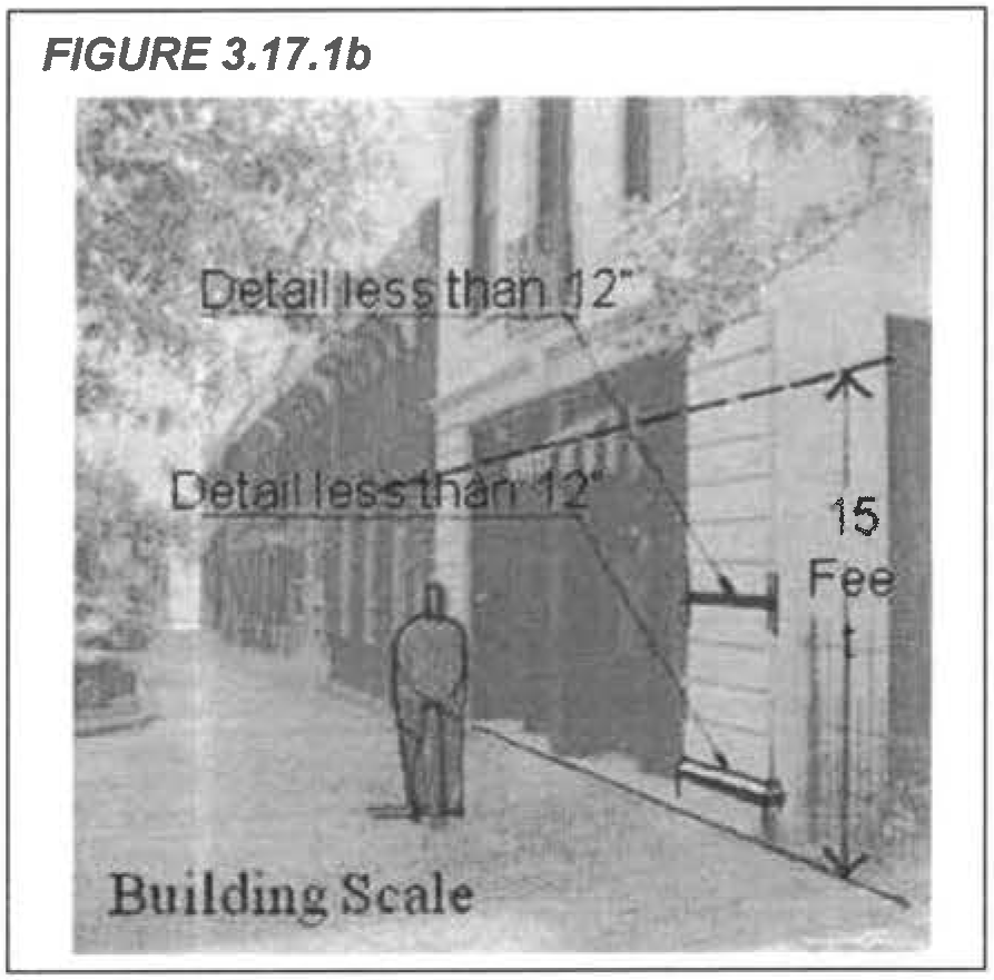
a.
Buildings shall be generally designed to maintain a continuous street wall along the length of a block except to accommodate building articulation.
I.
Scale.
1.
Maintain human scale of building that enhances the pedestrian experience at the ground floor of commercial areas.
a.
Façade shall incorporate a minimum of two continuous details refined to the scale of 12 inches or less within the first 15 feet of the building wall, measured vertically at the street level.
J.
Proportion.
1.
Maintain ground level pedestrian scale with traditional storefront façade components and proportions to provide a consistent pattern of architectural detailing, including the use of decorative elements, changes in rooflines and windows, and changes in building materials and color.
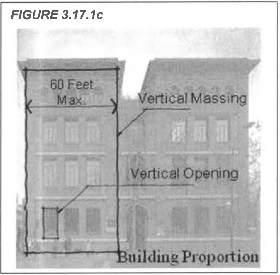
a.
The frontage of buildings shall be divided into architecturally distinct sections of no more than 60 feet in width with each section taller than it is wide.
b.
Windows and storefront glazing shall be divided to be either square or vertical in proportion so that each section is taller than it is wide.
c.
Vertical and horizontal design elements, including columns, pilasters, and cornices, shall be defined at both the ground level and upper levels to break up the mass of buildings.
K.
Rhythm.
1.
Solid blank walls shall be avoided through the use of façade modulation or other repetitive architectural detailing to maintain visual organization of the building's façade.
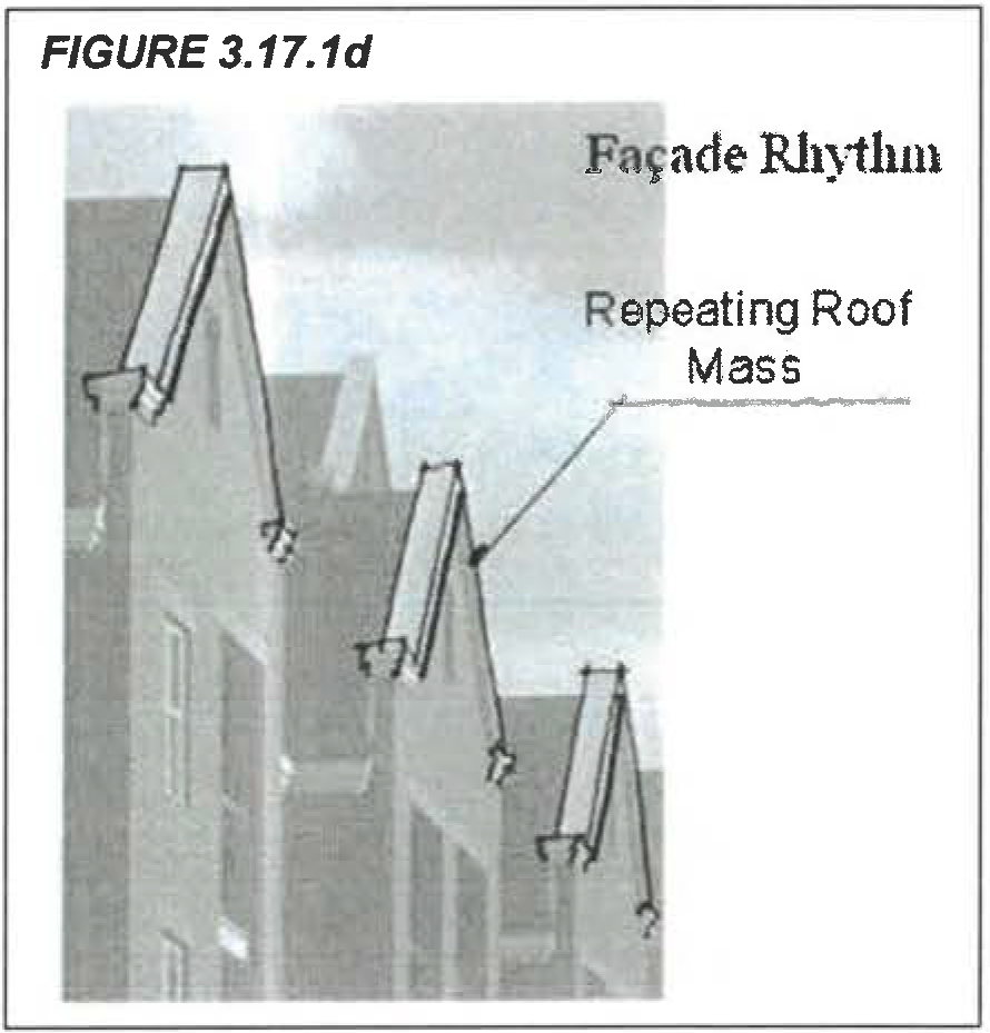
a.
A minimum of one significant detail or massing component shall be repeated no less than three times along each applicable elevation.
b.
The scale of the chosen element shall relate to the scale of the structure.
L.
Entry treatment.
1.
Construct a dominant entryway to reinforce the character of the building, add visual interest, break up the monotony of flat surfaces, add a vertical element to break up the façade of the building and create an inviting entrance.
a.
A dominant entryway fronting a public street that is differentiated from the building façade and provides a distinctive use of architectural treatments, materials, or special lighting shall be constructed.
b.
Buildings constructed on a corner shall place the dominant entry on the corner at a diagonal. The use of a curvilinear element for this entryway is strongly encouraged.
c.
Building entries shall be illuminated at night using dark sky lighting standards.
d.
Doors shall be comprised of non-tinted clear glass, which is free of temporary signage and/or other types of materials that may obstruct visibility.
M.
Roof lines.
1.
Design new buildings to achieve consistency by creating continuity between the heights of adjacent roofs, parapets, and cornices, where possible.
a.
Roof lines shall be designed to reflect a distinct style (such as) a relatively consistent horizontal cornice with a dominant vertical architectural element to meet the roof line; or 2) a collage effect with clearly juxtaposed roof lines that have a repetitive element.
b.
Severe roof pitches that create prominent out-of-scale building elements shall be avoided.
N.
Exterior surface materials.
1.
Select high quality, human-scale building materials to reduce building mass and that create visual interest.
a.
The base of a building (the first two to five feet above the sidewalks) shall be differentiated from the rest of the building façade with treatments such as change in material and/or color.
b.
The exterior façade of buildings shall incorporate no less than two building materials including but not limited to tile, brick, stucco, cast stone, stone, formed concrete or other high quality, long-lasting masonry material over a minimum 75 percent of the surface area (excluding windows, doors and curtain walls.) The remainder of the wall area may incorporate other materials.
O.
Windows and transparency.
1.
Add visual interest and create a feeling of openness by incorporating windows with architectural defining features such as window frames, sashes, muntins, glazing, paneled or decorated jambs and moldings.
a.
A minimum percentage of transparency along a street or primary travel way for different levels of non-residential uses shall be achieved as follows:
(1)
Ground level retail: 25 percent of surface area minimum;
(2)
Ground level office or other commercial uses: 15 percent of surface area minimum;
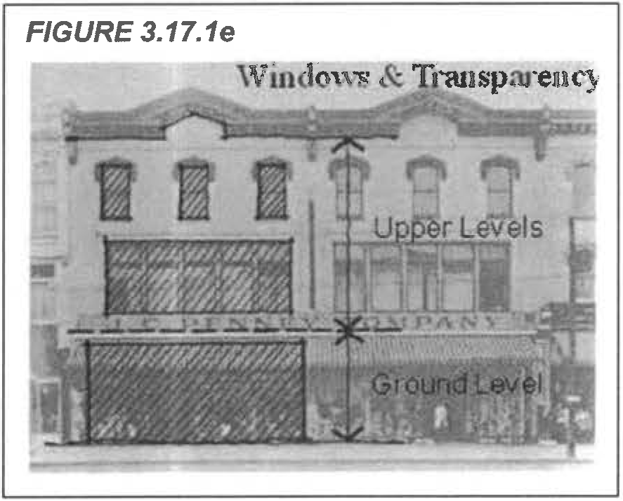
(3)
Ground level of commercial use over 25,000 SF: Ten percent of surface area minimum; and
(4)
Upper levels of all uses: 15 percent of surface area minimum.
b.
Transparency of the ground level shall be calculated within the first 15 feet of the building wall, measured vertically at street level, as illustrated in Figure 3.17.1e.
c.
In cases where a building has more than two façades fronting a street or primary travel way, the transparency requirement shall only be required on two façades based on pedestrian traffic and vehicular visibility.
d.
All ground level windows shall provide direct views to the building's interior or to a lit display area extending a minimum of three feet behind the window.
e.
Ground level windows shall extend above a minimum 18-to-24-inch base.
f.
A continuous curtain wall of glass which exceeds 30 feet in width and 15 feet in height without intervening vertical and horizontal breaks of at least 24 to 36 inches, shall be prohibited.
g.
Street facing, ground floor windows shall be comprised of non-tinted, clear glass.
h.
Windows on the upper levels of buildings may be comprised of tinted glass to reduce glare and unnecessary reflection.
P.
Storefronts.
1.
Promote an active pedestrian district by incorporating attractive and functional storefronts into new construction.
a.
Multiple tenants with storefronts within a single building shall be architecturally consistent, but defined and separated through structural bays, horizontal lintels, vertical piers or other architectural features up to 30-foot intervals.
b.
Individual storefronts shall not be used for storage or left empty without window displays.
Q.
Color.
1.
Use a color palette which complements adjacent buildings and promotes a consistent color scheme on the site.
a.
A maximum of three primary colors for each building segment may be proposed with a maximum of two accent colors, as illustrated in Figure 3.17.1f.
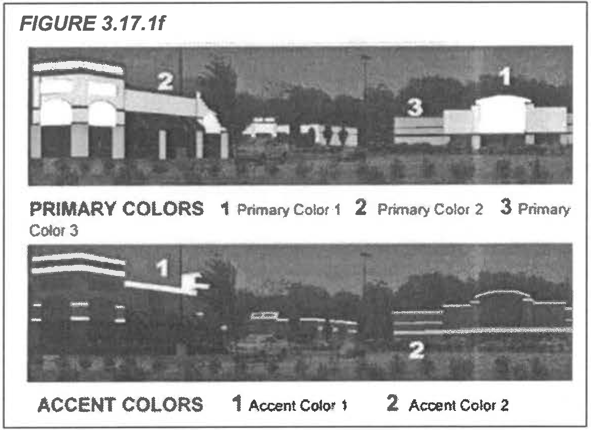
b.
Bright or intense colors shall not be utilized for large areas unless consistent with the historical context of the area as shown in historic documentation.
c.
Bright colors on architectural detailing, trim, window sashes, doors and frames, or awnings may be used if they are consistent with the historical context of the area as shown in historic documentation.
d.
All vents, gutters, down spouts, etc., shall be painted to match the color of the adjacent surface, unless being used expressly as trim or an accent element.
R.
Awnings and canopies.
1.
Add awnings or canopies to provide variation to simple storefront designs in order to establish a horizontal rhythm between structures where none exists and add color to a storefront.
a.
The size, scale and color of the awnings shall be compatible with the rest of the building and shall be designed as an integral part of the building architecture.
b.
Awnings and canopies shall be constructed of high quality, substantial materials which must be durable and fade resistant and maintained in good condition and replaced periodically.
c.
Canopies and awnings that span an entire building are discouraged. The careful spacing of awnings that highlight certain features of a storefront or entryway is encouraged.
S.
Ground floor lighting.
1.
Incorporate lighting into the design not only to accentuate architectural features, but to provide a safe environment for pedestrian activity.
a.
Lighting shall be shielded to prevent glare to adjacent properties, following dark sky lighting standards.
b.
Intense lighting which is used solely for advertising purposes shall not be used.
c.
Buildings shall be highlighted through "up" lights or accent lights placed on the façade.
d.
Neon lighting shall not be used to outline a building.
3.17.2. - Residential design standards.
A.
Intent. The general intent of the residential architectural design standards is as follows:
1.
To produce a high-quality living environment for all users.
2.
To enhance the relationship between new development/redevelopment and the public realm.
3.
To maintain an appropriate overall scale and pattern of development within its context.
4.
To maintain and enhance the attractiveness of the architecture in the City of St. Cloud.
5.
To reduce the mass/scale and uniformity of large building masses, while allowing design flexibility.
6.
To improve traffic circulation options, particularly for pedestrians and bikers.
7.
To ensure that development is accomplished with high quality that benefits the property owners and the citizens of the City of St. Cloud, thereby protecting the high quality of life afforded to the citizens of the city and enhancing the tax base of the city.
8.
To integrate the architectural character of neighboring buildings where it provides a positive example through the use of related building features including scale/mass, height, the proportions of entries, windows, and o other openings (fenestration), colors, materials, and volumes.
B.
Applicability.
1.
New development.
a.
Applicable land uses. The standards herein shall apply to new development that is required to comply with the approval processes set forth in b. below and for the following uses in any zoning district:
(1)
Dwellings, single-family
(2)
Dwellings, two-family or duplex
(3)
Dwellings, single-family attached including townhouses
b.
Applicable approval processes. These standards shall be applicable unless:
(1)
A preliminary master plan for a planned unit development pursuant to chapter 2, article 5 of the Land Development Code was approved prior to July 1, 2023, for the development of the uses noted in the previous section,
(2)
A site development plan pursuant to chapter 2, article 3 of the Land Development Code was approved prior to July 1, 2023, for the development of the uses noted in the previous section, or
(3)
A preliminary subdivision plan pursuant to chapter 2, article 4 of the Land Development Code was approved prior to July 1, 2023, for the development of the uses noted in the previous section. Note, these standards do not apply to simple lot splits, or lot reconfigurations as defined in sections 5.2.4 and 5.2.5, respectively.
2.
Alternative design. These standards are not intended to prevent the use of alternative designs that meet the intent and purpose established in section 3.17.2A. Proposals for alternative design solutions may be submitted to the city manager or designee which, although not meeting all of the technical requirements of these standards, clearly and convincingly results in an innovative building or site design which is consistent with sound and generally accepted land use planning or architectural practices and principles, creates a positive visual experience from the street level, protects the visual ambience of the community, enhances the public amenities resulting from the design, and generally furthers the intent of these standards.
3.
Demonstration of compliance. Compliance with the standards set forth in this section shall be demonstrated at the time of Preliminary Subdivision Plan (PSP). The Development Review Committee (DRC) shall be designated as the architectural review board to determine compliance with these residential design standards. An applicant may request an appeal of the decision of the DRC to city council following the procedures set forth in section 2.3.4.D of the Land Development Code.
4.
Relationship with other sections of the Land Development Code. In the event that the requirements of the standards set forth in this Article are in conflict with the standards of other sections of Land Development Code, then the more restrictive provision governs unless otherwise expressly provided.
5.
Exemption. These residential architectural design standards do not apply when the city council has established specific design standards for a unique overlay such as the downtown Historic Preservation Overlay or any other overlay, unless the specific design standards otherwise expressly state their applicability. Multifamily apartments and condominiums shall adhere to the non-residential architectural design standards.
C.
Building siting.
1.
Variety of product. Architectural elevations and façades shall vary with the intent of preventing adjacent homes, duplexes, and townhouse units from looking similar to one another. Based on the type of building(s) or land uses(s) being developed, the following shall apply:
a.
Single-family detached homes. The building type (model), exterior paint color, and elevation (all three) shall not match adjacent homes, nor the homes located directly or diagonally across the street.
b.
Duplexes. For duplexes, the above product variation standards for single-family detached homes shall apply to the duplex as a whole and not each duplex unit individually.
c.
Townhouse buildings. For developments consisting of townhouses, the following shall apply:
(1)
Each townhome building (containing multiple attached dwelling units) shall vary so that each dwelling elevation, paint color, and material (all three) shall not match adjacent buildings, nor the building located directly or diagonally across the street or courtyard in instances where primary façades face each other.
(2)
Each dwelling unit within a townhome building shall also vary from adjacent units using one or more of the variations noted above (type, paint color, or elevation). To increase visual variety and highlight individual units, primary façades shall provide creative façade breaks, building step-backs, offsets, bay windows and/or similar forms of building façade treatments.
2.
Building orientation. The intent of this section is to orient front entrances towards the public or private streets, common areas or courtyards (publicly accessible spaces) and to have residential buildings creating create a sense of spatial enclosure along streets or the public realm with buildings forming a "street wall" and defining "outdoor rooms".
a.
Front entrances. The front or primary entrance door of a dwelling shall be located on the façade facing the adjacent public or private street, common area, or courtyards.
3.
Façade classifications. For the purposes of building siting and building form regulations, façades of a building shall be classified as follows:
a.
A façade that has a primary entrance door is a primary façade.
b.
If the dwelling is located on a corner lot that faces two public streets and the side façade does not have a primary entrance, that side façade is the secondary façade.
c.
If the dwelling façade with the primary entrance faces an adjacent public or private street, common area, or a courtyard and the garage faces an alley or a private internal street, the façade where the garage is located is a secondary façade, and the façade with the primary entrance is a primary façade. If the garage faces a public or private street, the garage façade is a primary façade.
4.
Townhouse Buildings. Buildings defined as townhouses shall be sited within a given site as follows:
a.
Building length. Maximum building group length shall be ten units or 250 feet, whichever is less.
b.
Relationships between townhouse buildings. Townhouse buildings shall face each other with a front-to-front, front-to-side or a back-to-back relationship depending on location relative to a street, lane or open space.
c.
Minimum distance between townhouse buildings across each other. If townhouse buildings' primary façades face each other in a common area instead of across the street, the minimum distance between the buildings across the common area shall be 50 feet.
FIGURE 3.1 Examples of Permissible Building Siting, Orientation, and Façade Classification for Townhouses and Single-Family Residential Units
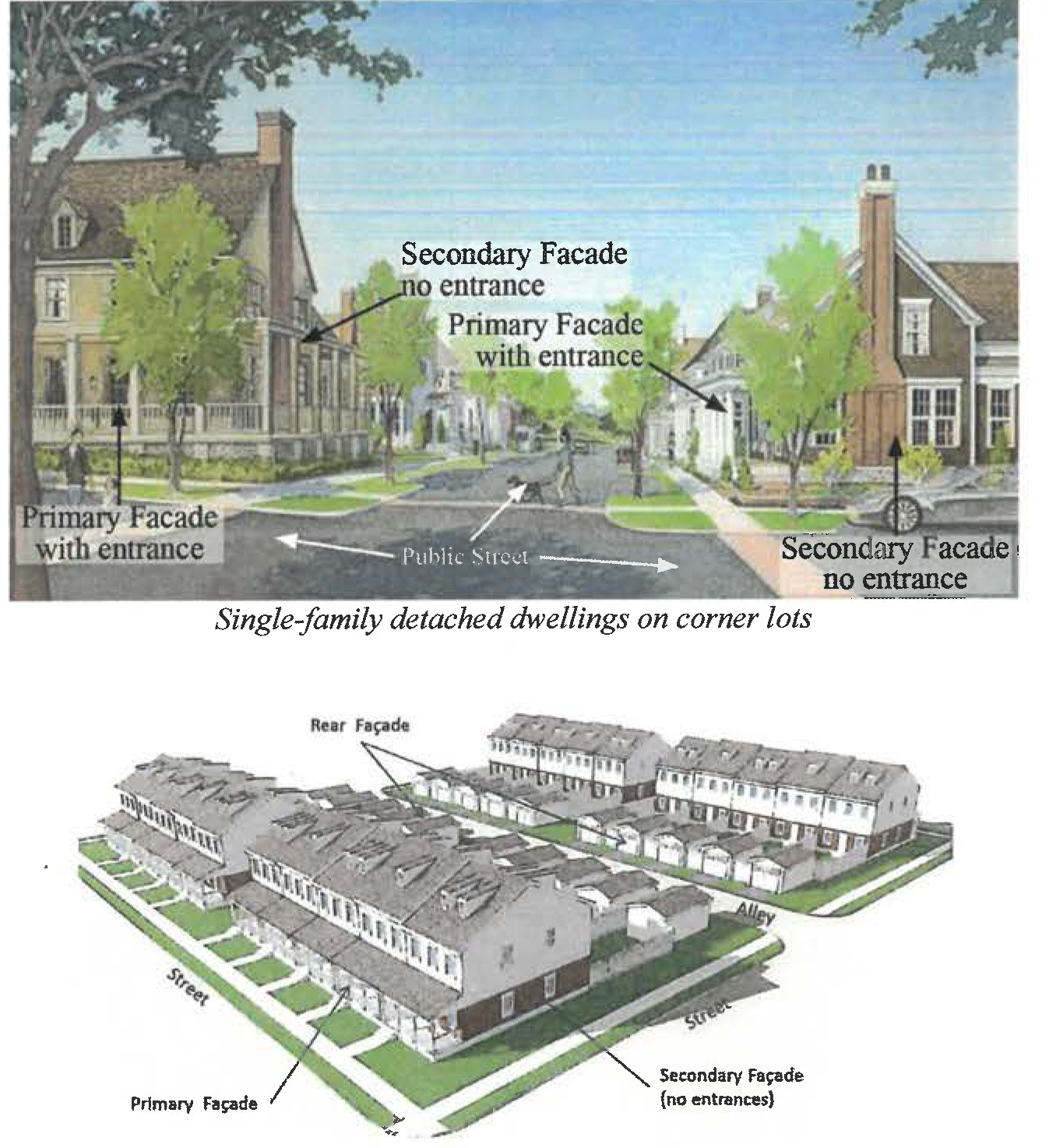
Townhouses facing two public or private streets and detached garages accessed from
alley
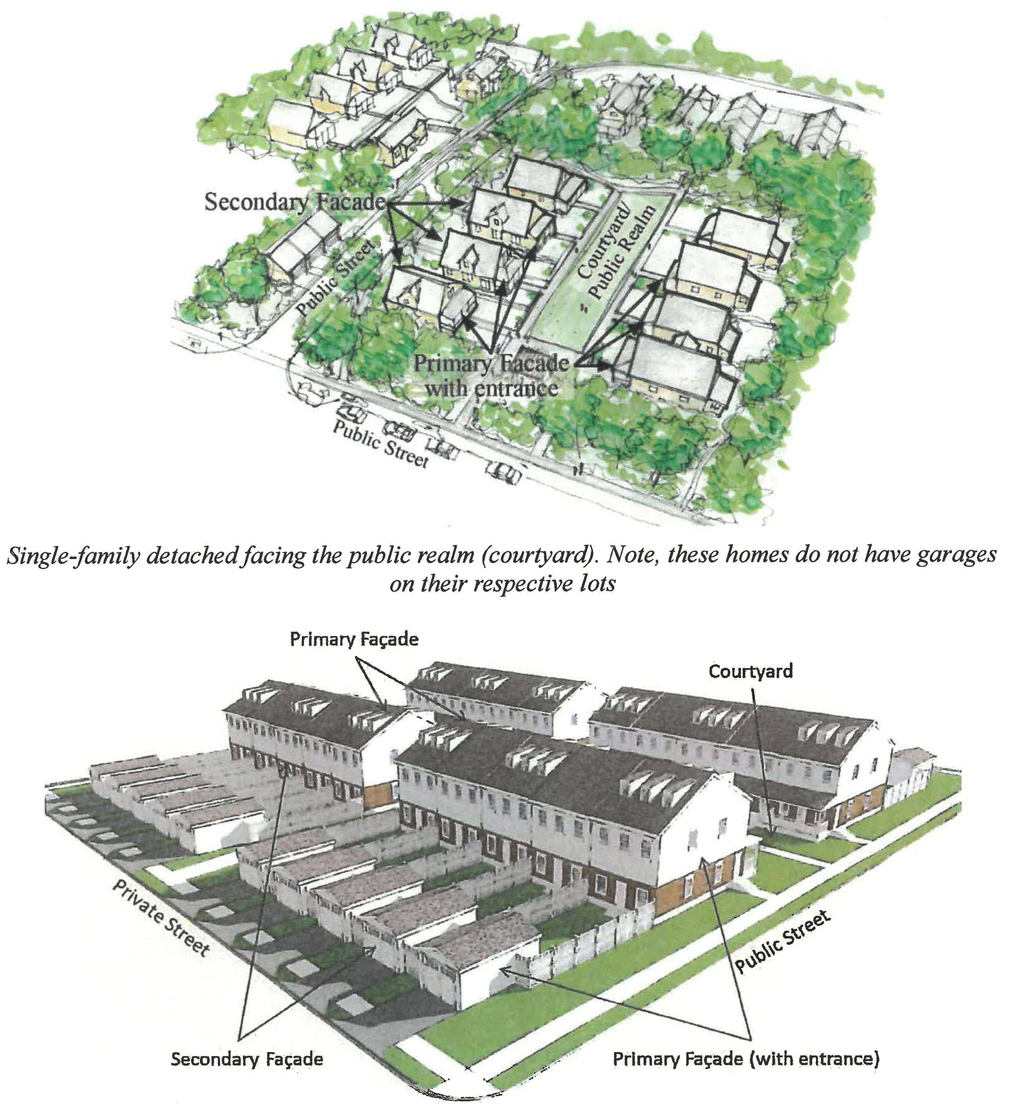
Townhouses primary entrance facing a courtyard and detached garages facing a private
street
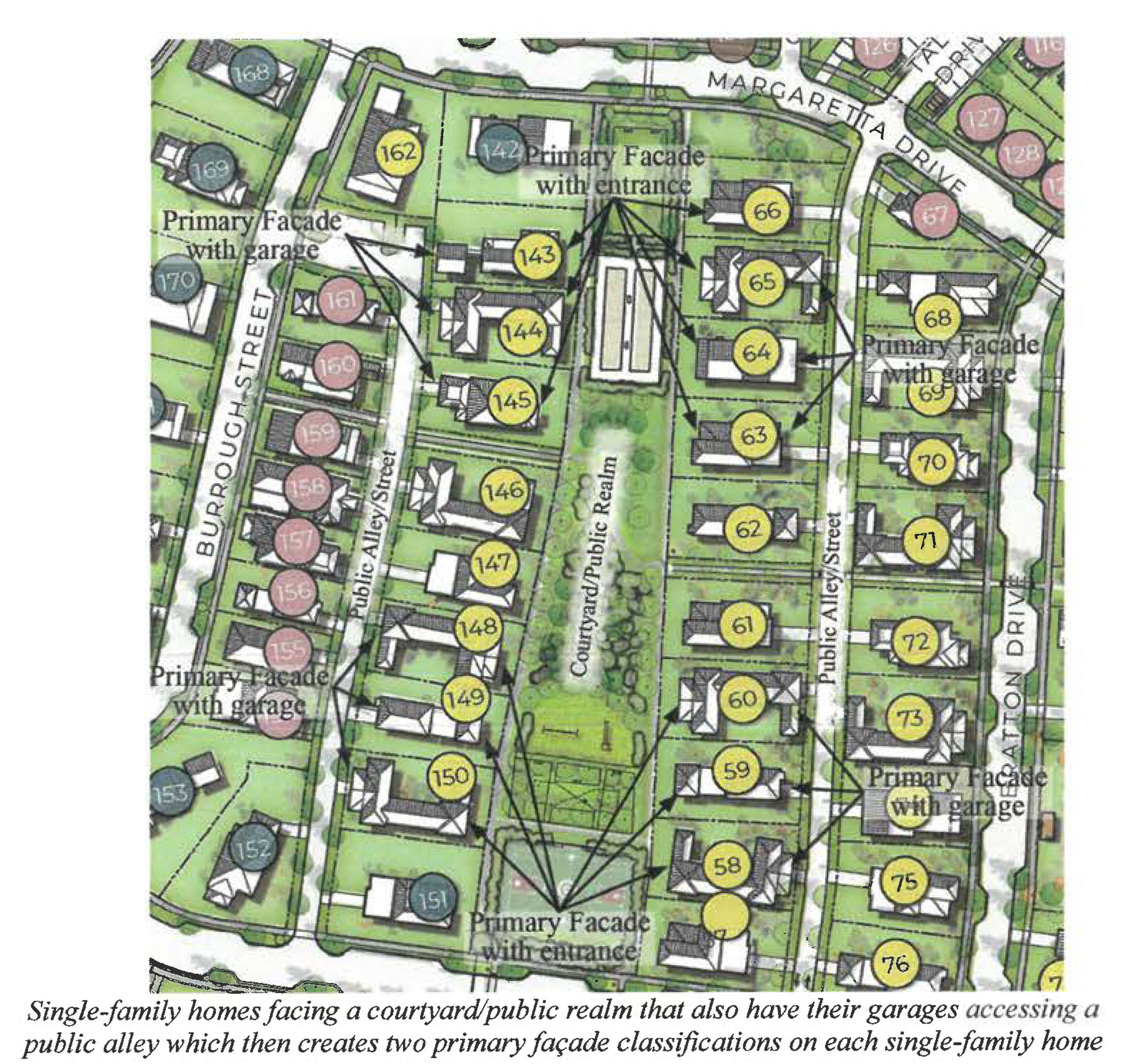
5.
Garages. To limit the garage as a dominant feature on the primary façade of a single-family detached home, duplex, or townhouse and reduce conflicts between pedestrians and vehicles, the following regulations shall apply to garages and their associated driveways:
a.
Garage door maximum length. Garages door width shall not exceed 50 percent of the primary façade length. Garages that are side-loaded, rear loaded, or located in the rear yard are exempt from this provision. See figure 3.2 as an example of calculating maximum garage frontage length.
b.
Narrow lots or site area. In instances of narrow lot widths or site area, vehicle access shall be regulated as follows:
(1)
Single-family detached. Off-street parking, including driveways and garages for an individual single-family detached dwelling shall be access from an alley or side street, if the lot width for a single-family detached dwelling unit is less than 50 feet as measured along the street line.
(2)
Duplexes and townhouses. Off-street parking, including driveways and garages for individual duplex or townhouse units which have a primary façade of less than 40 feet shall be accessed from an alley, side street, or provided in common parking areas/garages.
c.
Detached rear garage. Detached rear garage is permissible and not subject to maximum width restrictions noted above.
d.
Multi-story parking garages shall not be subject to these restrictions; however, they shall meet all applicable commercial design guidelines and have architectural design elements and colors that are complementary to the primary structure(s) which they serve.
FIGURE 3.2 Percentage of Garage Frontage Length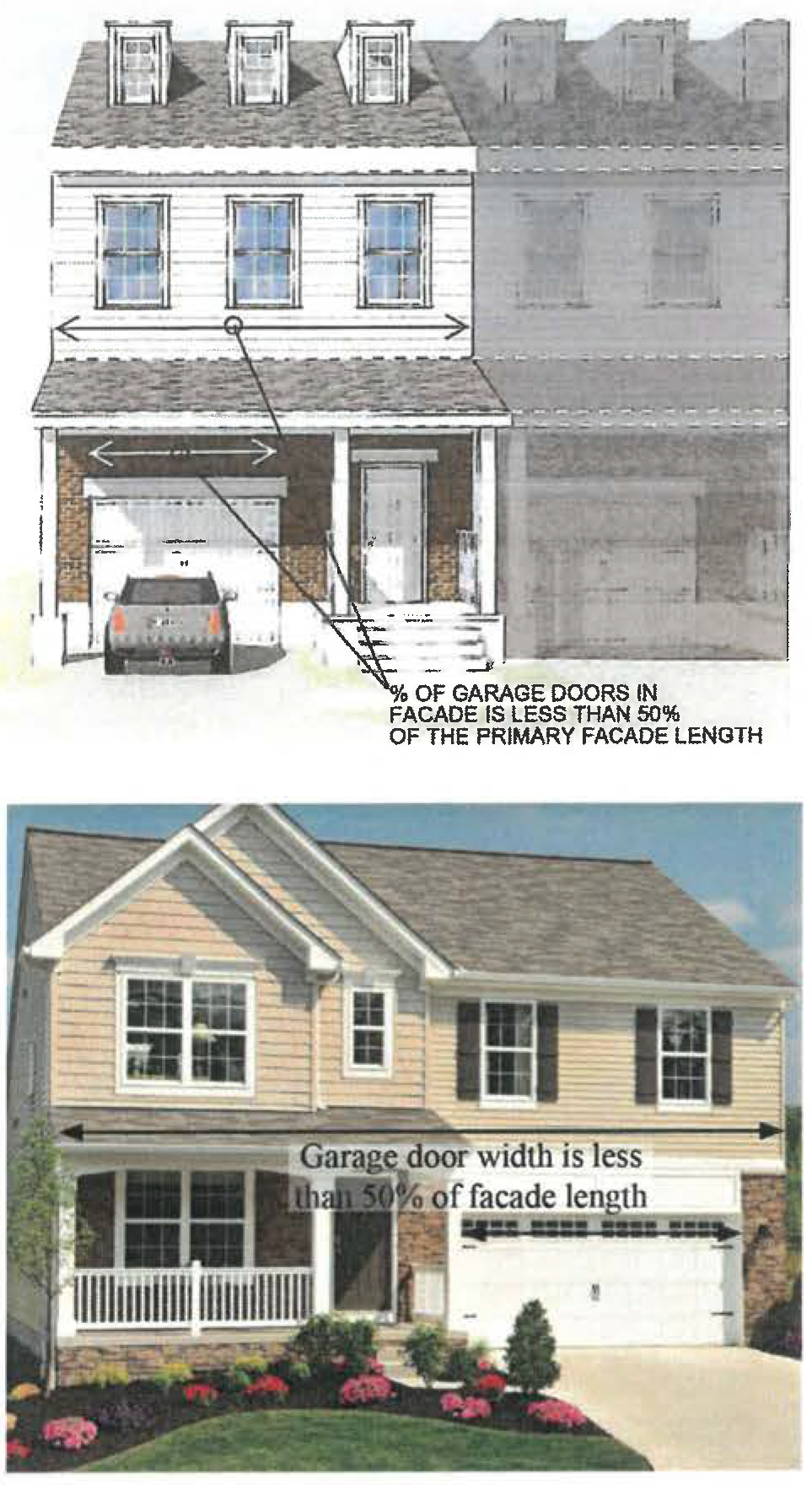
D.
Building form.
1.
Articulation and design.
a.
Intent. The intent of this section is to reduce the apparent size of buildings and create visual interest. Building façades and roofs shall include architectural elements that vary in order to alleviate the appearance of a large building mass, break up long walls, express the individuality of each unit, and enhance the character of the neighborhood/development.
b.
Architectural elements. Architectural elements and variation shall not be restricted to a single façade. The sides of a building designated either a primary or secondary façade shall display a balanced level of quality and architectural interest consistent with sound and generally accepted architectural practices and principles and adhere to the articulation elements requirements below.
c.
Front entrance articulation. Front entrances shall be clearly defined with the use of architectural features including, but not limited to, porticos, recessed/projected access, stairs, columns, canopies, different material, or treatment.
d.
Minimum number of articulation elements. Buildings shall contain a minimum number of specified articulation elements which can be chosen from the list in subpart e. below based on the façade classification as follows:
(1)
Primary façade: Three articulation elements.
(2)
Secondary façade: Two articulation elements.
(3)
Rear or side façade (not designated as a secondary façade): One articulation element.
(4)
Rear façade facing an adjacent right-of-way, street, alley, or other public realm space: Two articulation elements.
e.
Articulation elements. The following is a list of articulation elements that can be chosen to satisfy the requirements of subpart d. above.
(1)
Arched, gabled, stepped or decorative parapet with cornice over building entrances, integrated with the building's massing and style.
(2)
Canopies, balconies, patios, porches or porticos, bay windows, steps, ornamental guardrails, porch railing, pergolas, columns, all of which shall be integrated with the building's massing and style.
(3)
Vertical or horizontal modulation through recesses and projections that create variation in the wall plane of a particular façade.
(4)
Peaked roof forms used as wall articulation.
(5)
Overhangs or other roof treatments that provide shade and break the vertical plane, a minimum of three feet deep that cover at least 20 percent of the horizontal length of the façade.
(6)
Ornamental and structural articulations that are integrated into the building structure, consistent with the building's mass and scale. Vertical architectural treatments shall have a minimum width of 20 inches and a projection or recession of a minimum of 12 inches in depth.
(7)
Articulation elements that reflect the individuality of each unit including, but not limited to, recesses, additional decorative features, or change of material and/or change of color associated with difference in façade plane, consistent with sound and generally accepted architectural practices and principles.
(8)
If a rear façade faces an adjacent right-of-way, street, or other public realm space, requiring two articulation elements, enhanced perimeter landscape is permissible as one of the two required articulation elements. The perimeter landscaped area shall be a minimum five feet wide and shall include groundcover and shrubs/vegetation that provide dense screening with a mature height of six feet at a minimum, and one understory tree or clusters of three palm trees for each 25 feet, or fraction thereof, of the linear building façade.
(9)
Any other treatment that the approving authority determines to clearly and convincingly be consistent with the intent of this section and is consistent with sound and generally accepted land use planning practices and principles.
FIGURE 3.3 Façade Articulation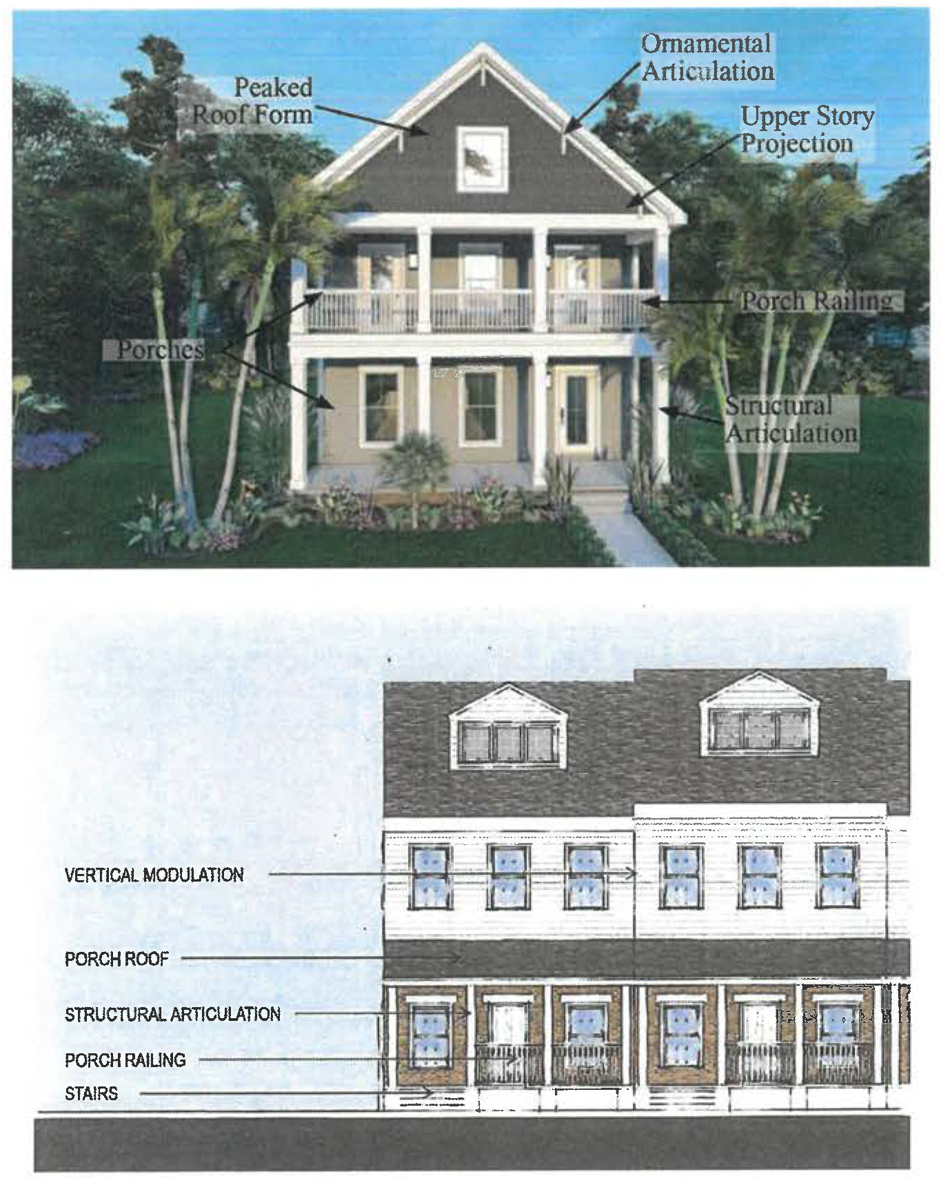
2.
Roof modulation.
a.
Intent. The intent of this section is to ensure that visual interest also applies to roof treatment. Roof forms may be used to identify different functional areas within the building, to provide for additional light to enter the building, to reduce massing, to screen rooftop equipment, and to create movement along the roof line.
b.
Roof design compatibility. Roofing forms, slopes, details, materials, and overall design shall be compatible with the overall style, mass, scale and character of the structure.
c.
Gutters and downspouts. Gutters and downspouts visible from a street or public realm shall:
(1)
Do not drain directly onto public streets, sidewalks, or the public realm.
(2)
Are discreetly located to maximize aesthetics, unless decorative in nature.
d.
Vent pipes. Vent pipes that are visible from a street or public realm shall be painted to match the color of the roof to make them less visible.
e.
Number and roof modulation elements. Roofs shall contain a minimum number of roof modulation elements as listed in subpart f below based on façade classification as follows:
(1)
Primary façade: two elements.
(2)
Secondary façade: one element.
f.
Roof modulation elements. The following is the list of articulation elements that can be chosen to satisfy the requirements of subpart e above.
(1)
Uninterrupted roofline along the eave between roof modulation elements shall be no more than 40 feet.
(2)
Decorative parapets that are a minimum of three feet in height above the finished roof.
(3)
Multiple peaks and/or roof planes.
(4)
A sloping roof with an average pitch of 3:12 or greater.
(5)
Extension of window or façade elements up into the roof area.
(6)
Distinctive roof forms covering each building mass.
(7)
Same roof form with a different orientation of the ridge elements.
(8)
Same roof form with same orientation, but the roof has a minimum change in elevation of two point five (2.5) feet between each roof level.
(9)
Any other treatment that the approving authority determines to be consistent with the intent of this Subsection and is consistent with sound and generally accepted land use planning and architecture practices and principles.
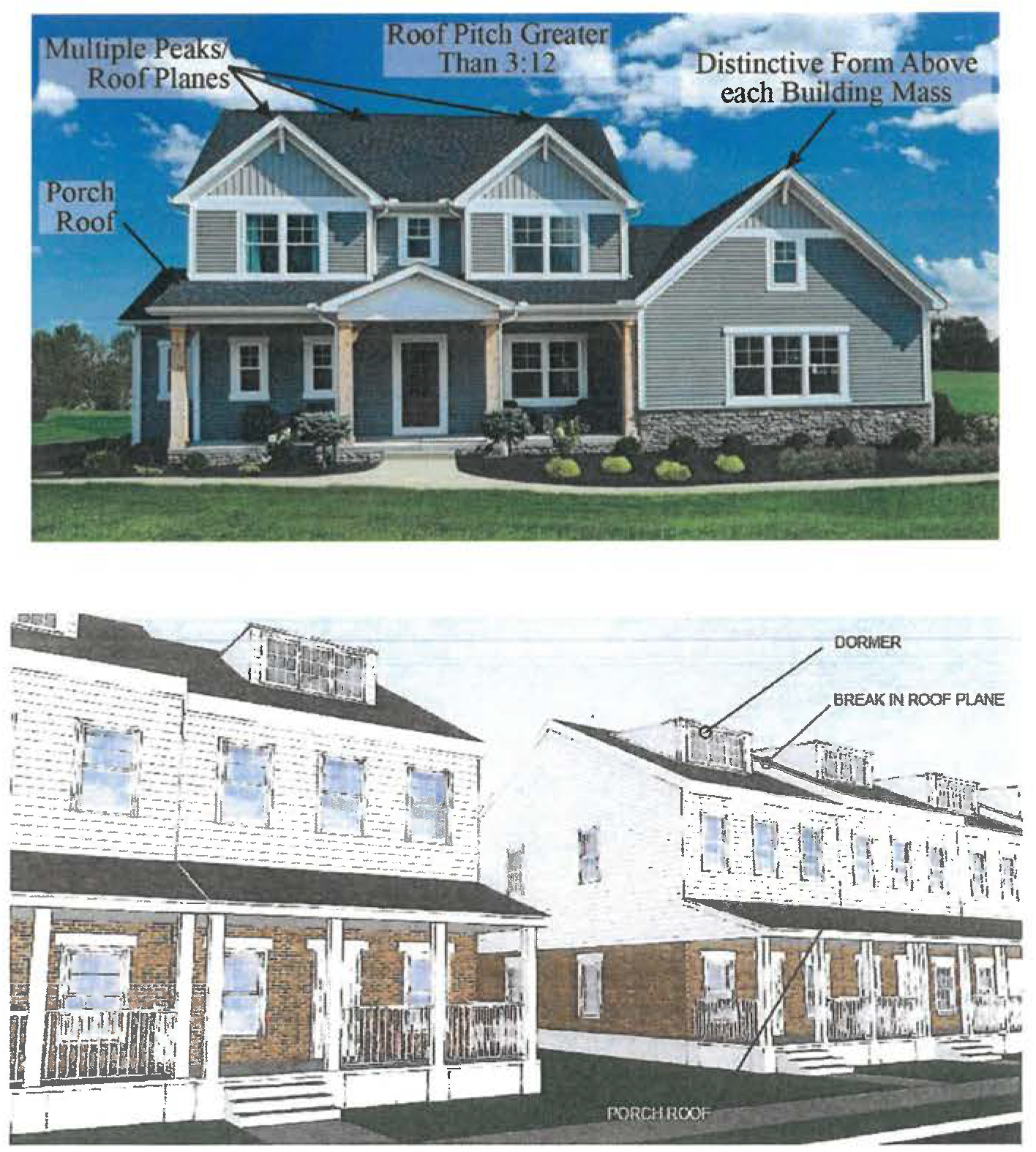
FIGURE 3.4 Roof Modulation
3.
Fenestration.
a.
Intent. The intent of this section is to ensure identity and visual interest in the design of residential structures and ensure proper natural light and ventilation to each dwelling.
b.
Design standards. Doors, windows and other openings in a building exterior façade shall comply with all of the following:
(1)
Fenestration elements (doors, windows and openings) shall be appropriately sized for the scale and style of the building on which they are located.
(2)
Windows, doors and/or openings shall occupy a minimum of 15 percent of the area of the primary façade and ten percent of the area of the secondary façade or façades that front a street, park, plaza or on-site courtyard.
(3)
A garage door can be creditable as fenestration element if providing a minimum of 20 percent of its area as windows.
(4)
Windows shall provide daylighting into the building.
(5)
Buildings using large amounts of glass shall divide the glass into smaller panels achieving proportions emphasizing verticality. See Figure 3.4.
(6)
Windows and doors shall be accentuated through measures such as:
(a)
Adding trim/sills and lintels or other similar treatment,
(b)
Providing shutters or awnings,
(c)
Framing through the use of façade materials,
(d)
Use of bay windows, and/or
(e)
Recessing the window.
(7)
Where decorative shutters are used to accentuate windows and/or doors, said shutters shall be scaled and affixed to have the appearance of functioning shutters.
FIGURE 3.5 Fenestration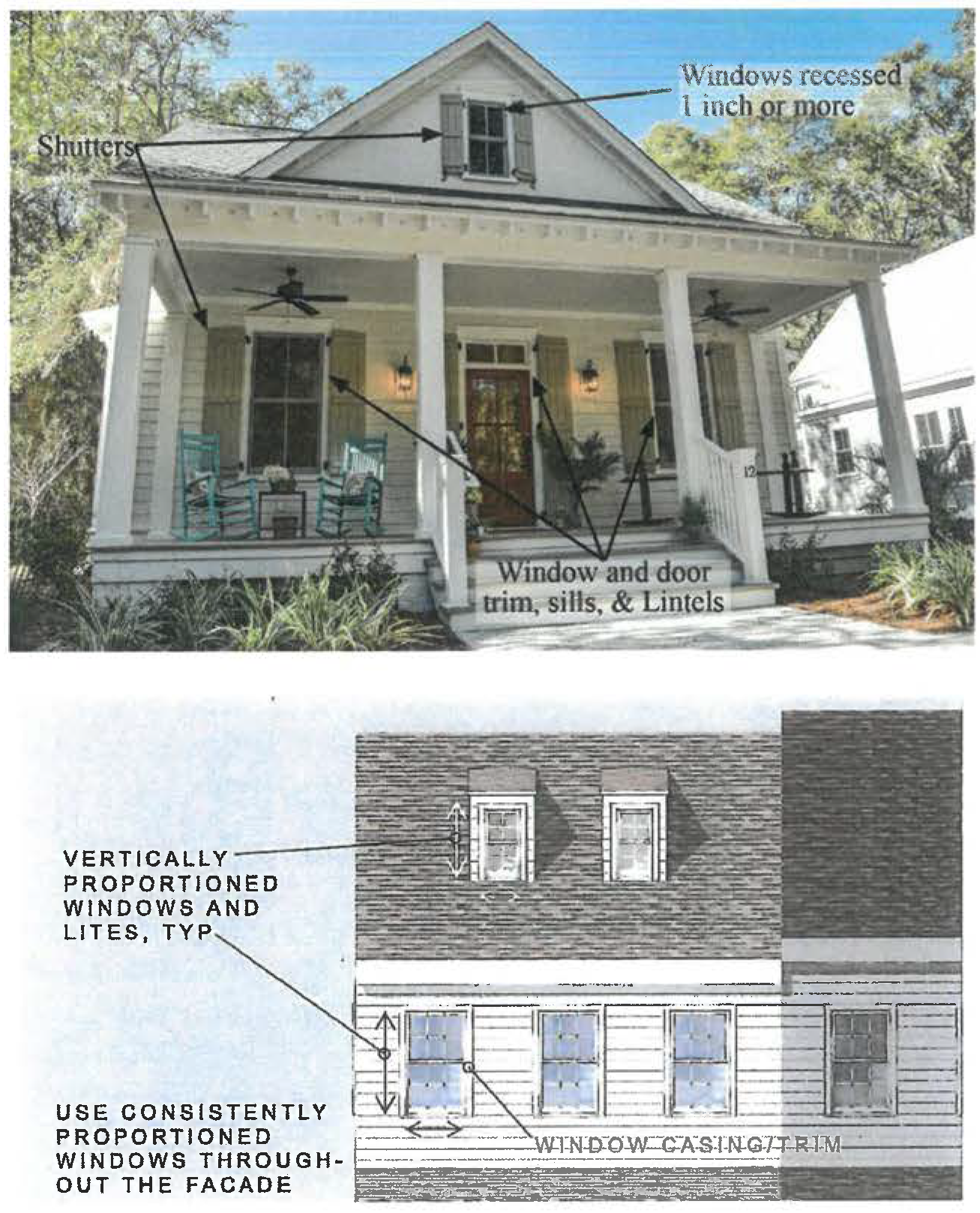
4.
Materials.
a.
Intent. The intent of this section is to use façade materials to provide character and attractiveness to the set of buildings. Materials shall be varied and contrasting either to differentiate dwelling units or to differentiate specific portions of dwelling units.
b.
Material consistency. Material treatment shall be consistent in all building façades within a given lot or development and shall be complementary to one another and appropriate for the architectural style.
c.
Number of façade materials. The minimum number of building materials used on a primary façade and secondary façade shall be two, excluding fenestration, trims, and decorative elements.
d.
Change in materials. Changes in material shall generally occur when there is a change in the plane of the façade. The change in material is encouraged to occur on inside corners of the building.
e.
Wrapping materials around building corners. Brick and stone materials shall wrap around corners to give an appearance of structural function and minimize a veneer appearance.
f.
Brick and stone veneer. If used, brick and stone veneer shall be mortared to give the appearance of a structural function.
g.
Minimum and maximum percentages of specific façade materials for attached single family, including townhomes and duplexes.
(1)
The minimum percentage of stone and/or brick in a primary façade is 20 percent and the minimum percentage of stone and/or brick in a secondary façade is ten percent.
(2)
The maximum percentage for stucco in a primary façade is 60 percent and the maximum percentage for wood panel (including painted or stained lap horizontal siding, vertical board, batten wood siding) is 60 percent.
(3)
The maximum percentage for stucco in a secondary façade is 70 percent and the maximum percentage for wood panel (including painted or stained lap horizontal siding, vertical board, batten wood siding) is 70 percent.
h.
Percentage calculation. The percentage calculation shall be based on exterior walls, excluding fenestration, trims and decorative elements.
i.
Permissible façade materials. High-quality façade materials, including but not limited to: brick, stone, wood panel (including painted or stained lap horizontal siding, vertical board, batten-wood siding) and stucco.
j.
Prohibited façade materials. Prohibited façade materials include: untreated concrete block, plywood, unfinished lumber aluminum, textured T1-11, corrugated fiberglass, sheet metal or tin siding and any other materials determined by the city to be of similar nature or effect.
FIGURE 3.6 Building Materials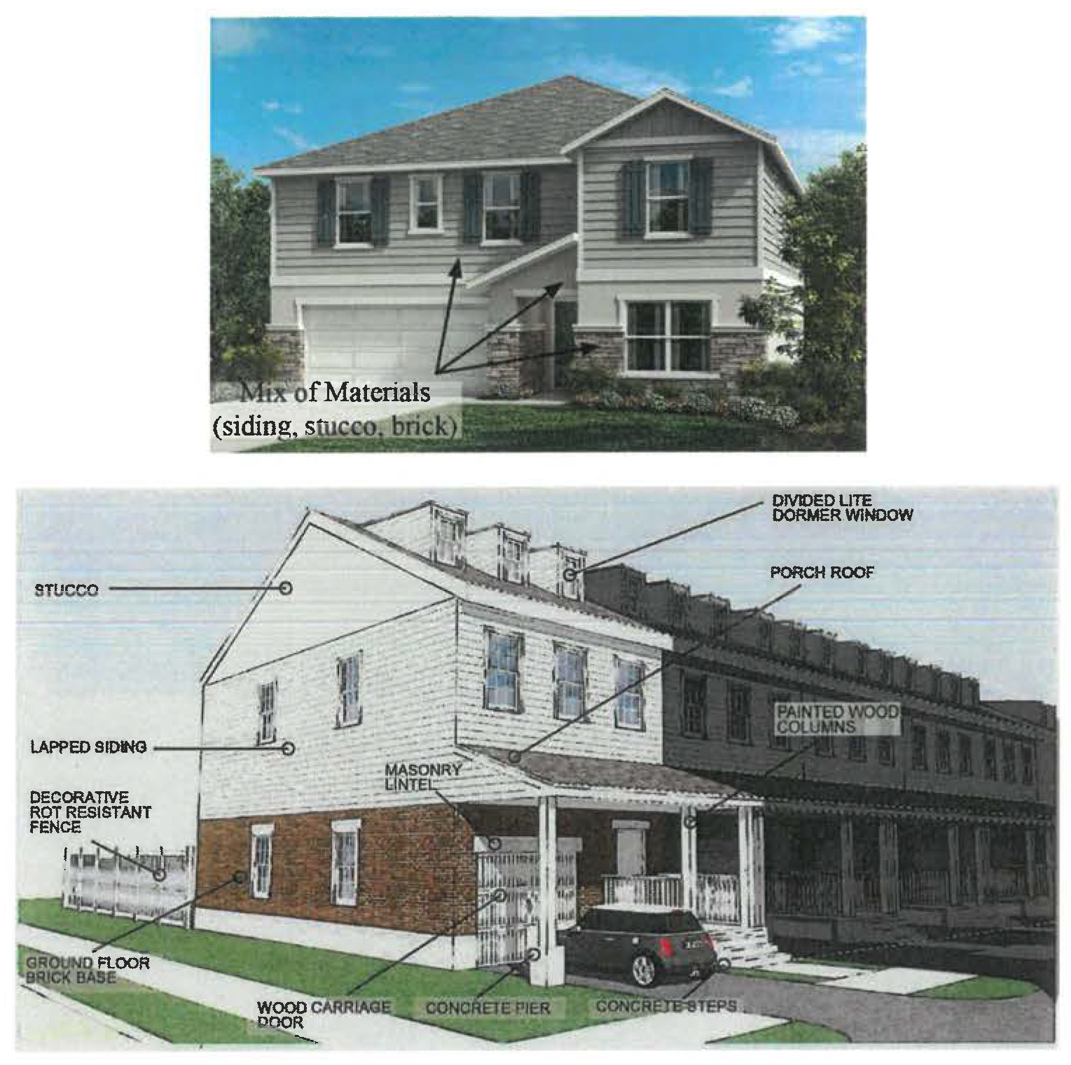
5.
Colors.
a.
Intent. The intent of this section is to ensure that colors are harmonious and add to the visual character of the building.
b.
Prohibited colors and finishes. The following are prohibited on the exterior of any building, which are found by the city to be one or more of the following:
(1)
Colors that fluoresce under ultra-violet (UV) or black light;
(2)
Colors and finishes that are pearlescent or excessively reflective in nature.
c.
Maximum number of colors. A maximum of three colors may be used on the exterior walls of any building plus two additional colors for trim/cornice work.
d.
Natural materials. Unpainted materials such as brick and stone do not count as colors.
E.
Accessory structures and equipment.
1.
Service areas.
a.
Intent. The intent of this section is to ensure that common refuse/recycling collection containers (garbage dumpsters) are located in areas that are not visible from public streets by pedestrians.
b.
Design requirements for common refuse/recycling collection containers (garbage dumpsters).
(1)
Refuse/recycling collection containers (garbage dumpsters) shall be structurally screened.
(2)
Screening shall be a minimum one foot greater in height than the element being screened.
(3)
Structural screening shall be consistent with the architectural elements, materials, and colors of the principal structure and shall completely obstruct the view of the element being screened.
(4)
Whenever practicable, these areas and equipment shall be integrated into the main structure.
2.
Mechanical equipment.
a.
Intent. The intent of this section is to ensure that mechanical equipment is located in areas that are not visible from public streets by pedestrians.
b.
Location. Mechanical equipment shall be placed on the roof, on the side, or in the rear of each building.
c.
Roof-top equipment screening requirements.
(1)
Roof-top mechanical equipment shall be completely screened from all ground level views by a parapet wall or other architectural feature, such feature shall be architecturally integrated to the building.
(2)
The parapet screen height shall be at least one foot higher than the mechanical equipment being screened. In exceptional cases, if the applicant cannot meet this requirement, the applicant may propose a different screening height if demonstrated by the line of sight that the equipment is not visible from the pedestrian view, in which case it shall not be considered a deviation.
(3)
Structural screening shall be consistent with the architectural elements, materials and colors of the principal structure. Whenever practicable, these areas and equipment shall be integrated into the main structure.
d.
Ground-mounted equipment screening requirements.
(1)
Ground-mounted equipment shall not be visible from public rights-of-way, by pedestrians or adjacent residential properties.
(2)
Screening shall be provided at a minimum one foot greater in height than the area/equipment being screened.
(3)
Structural screening shall be consistent with the architectural elements, materials, and colors of the principal structure. Whenever practicable, these areas and equipment shall be integrated into the main structure.
(4)
Air conditioning pads and condensing units shall be staggered a minimum of ten feet from air conditioner condensing units on adjacent properties to provide for drainage and accessibility.
3.
Adequate storage. Where a garage is not provided, a minimum of 40 square feet of enclosed storage area shall be constructed so that residents will have space to store bulky personal effects (i.e., recreational equipment, tools, yard equipment, etc.)