
Santa Barbara County Unincorporated
City Zoning Code
City Zoning Code
APPENDIX E
ORCUTT PILOT PROGRAM
_____
The purpose of this questionnaire is to determine whether the proposed project requires the issuance of a Land Use Permit or a Zoning Clearance for projects proposed in the Orcutt Community Plan area.
1.
New home on a vacant lot: Is this an application for a new home located on a vacant lot in a subdivision tract that was approved after January 1, 1990? Note - Does not apply to an addition to an existing home, or the demolition and reconstruction of a home.
If yes, immediately consult with a Planning and Development planner because a Zoning Clearance is all that is necessary assuming the project complies with the tract map conditions and zoning ordinance requirements.
If no, continue with the rest of the checklist.
□Yes □No
2.
Old Town Orcutt: Is your project located in Old Town Orcutt (see Figure 1, Old Town Orcutt).
If yes, immediately consult with a Planning and Development planner to see if approval by the Old Town Orcutt Board Architectural Review is required. If OTBAR review is required, a Land Use Permit is required.
If no, continue with the rest of the checklist.
□Yes □No
3.
Two or three story homes: Does your project propose a new two- or three- story home or a second or third story addition?
If yes, immediately consult with a Planning and Development planner because a Land Use Permit is required.
□Yes □No
4.
Agriculture: Is your project located adjacent to land zoned or used for agricultural (see Figure 2, Orcutt Agricultural Lands).
□Yes □No
If yes, immediately consult with a Planning and Development planner because a Land Use Permit may be required.
If no, continue with the rest of the checklist.
□Yes □No
5.
Airport Zones: Is your project located in the Airport Safety Zones (see Figure 3, Airport Safety Zones).
If yes, immediately consult with a Planning and Development planner because a Land Use Permit may be required.
If no, continue with the rest of the checklist.
□Yes □No
6.
Biological Resources: Does your property have significant biological resources such as:
A.
The project site is within or adjacent to significant vegetation (see Figure 4, Significant Vegetation).
B.
The proposed development would remove native trees over six feet in height or non-native trees with a 25 inch or greater diameter at breast height.
C.
The proposed development includes the construction of structures within a wetland, or the construction of roads over a creek or stream corridor.
D.
The proposed development is set back less than 50 feet from the outside edge of riparian vegetation and the top of creek bank (as defined by County Flood Control standards). Drainage plans direct polluting drainage away from the creek or include appropriate filters and erosion and sedimentation control plans are proposed during construction.
E.
The proposed development includes the construction of roads over a creek or stream corridor.
If yes, immediately consult with a Planning and Development planner because a Land Use Permit is required.
If no, continue with the rest of the checklist.
□Yes □No
7.
Flooding & Drainage: Is your project located adjacent to Orcutt or Pine Creeks (see Figure 5, Orcutt Flood Hazard Areas).
If yes, immediately consult with a Planning and Development planner because a Land Use Permit is required.
If no, continue with the rest of the checklist.
□Yes □No
8.
Geology, Topography & Soils: Does your property have significant geologic, topographic and/or soils hazards, e.g.:
A.
The proposed development is located within 50 feet of an active or potentially active fault (see Figure 6, Geologic Formations).
B.
The proposed development drains to the rear of the lot.
C.
The proposed development is located on slopes of more than 20% (See definition of slope).
D.
The depth of the proposed cut and fill is greater than three feet.
E.
The proposed development involves more than 100 cubic yards of grading.
If yes, immediately consult with a Planning and Development planner because a Land Use Permit is required.
If no, continue with the rest of the checklist.
□Yes □No
9.
Noise: Is your project located in an area that currently exceeds the 65 dB(A) CNEL noise level (see Figure 7, Noise Levels - Buildout).
If yes, immediately consult with a Planning and Development planner because a Land Use Permit is required.
If no, continue with the rest of the checklist.
□Yes □No
10.
Open Space: Is your project located within or adjacent to an Open Space Area designated on the Orcutt Community Plan (see Figure 8, Open Space).
If yes, immediately consult with a Planning and Development planner because a Land Use Permit may be required.
If no, continue with the rest of the checklist.
END OF CHECKLIST - Please consult with Planning and Development staff to confirm your answers and submit the appropriate application for either a Zoning Clearance or Land Use Permit.
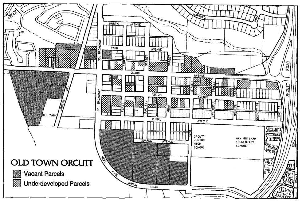
Figure 1 - Old Town Orcutt
See corresponding figure (Figure 9) in Orcutt Community Plan
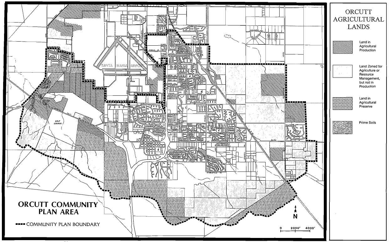
Figure 2 - Orcutt Agricultural Lands
See corresponding figure (Figure 11) in Orcutt Community Plan
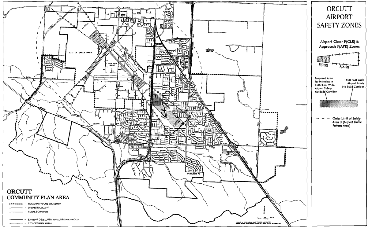
Figure 3 - Airport Safety Zones
See corresponding figure (Figure 37) in Orcutt Community Plan
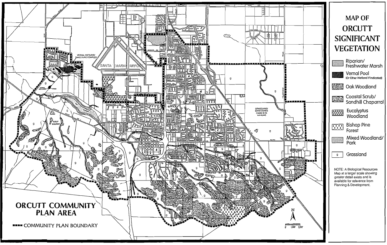
Figure 4 - Significant Vegetation
See corresponding figure (Figure 24) in Orcutt Community Plan
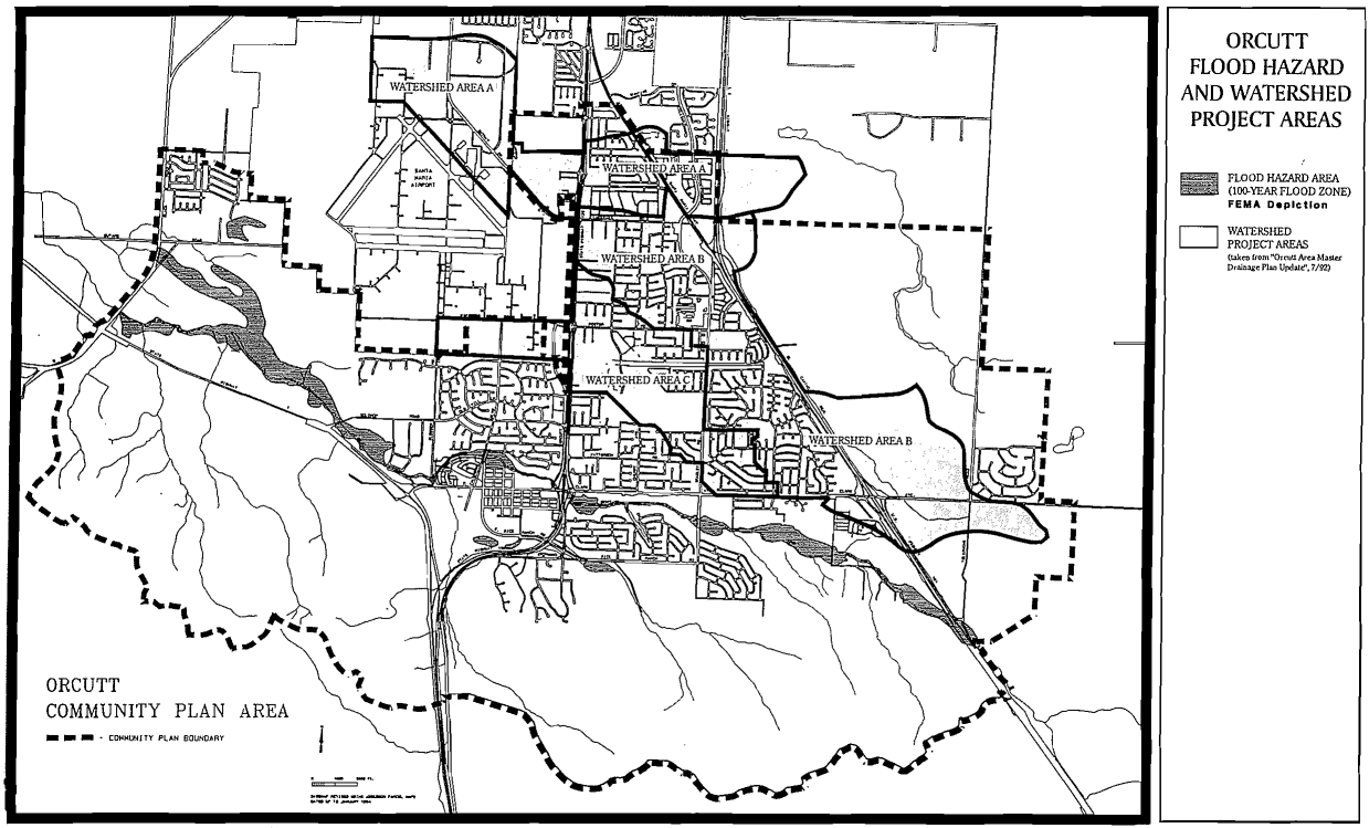
Figure 5 - Orcutt Flood Hazard Areas
See corresponding figure (Figure 27) in Orcutt Community Plan
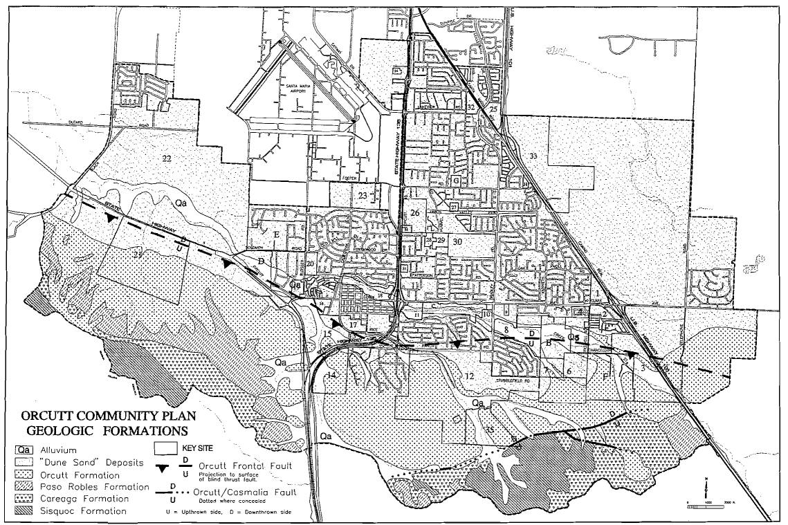
Figure 6 - Geologic Formations
See corresponding figure (Figure 33) in Orcutt Community Plan
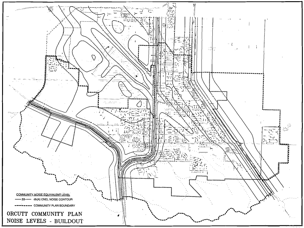
Figure 7 - Noise Levels - Buildout
See corresponding figure (Figure 35) in Orcutt Community Plan
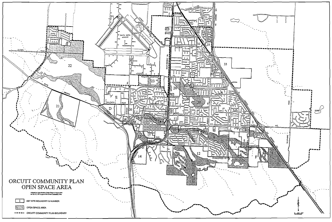
Figure 8 - Open Space
See corresponding figure (Figure 16) in Orcutt Community Plan