
Santa Barbara County Unincorporated
City Zoning Code
City Zoning Code
ARTICLE 35
2 - ZONES AND ALLOWABLE LAND USES
35.20.010 - Purpose
This Chapter describes the County's requirements for the approval of proposed development and new land uses. The permit requirements established by this Development Code for specific land uses are in Chapters 35.21 through 35.26 and Chapter 35.28 (Overlay Zones).
35.20.020 - Prerequisites for Development and New Land Uses
Each land use and structure shall be established, constructed, reconstructed, altered, moved, or replaced in compliance with the following requirements.
A.
Allowable use. A proposed land use must be allowed by this Development Code in the zone applied to the site. The basis for determining whether a use is allowable is in Section 35.20.030 (Allowable Development and Planning Permit Requirements).
B.
Permit and approval requirements. Any planning permit or other approval required by Section 35.20.030 (Allowable Development and Planning Permit Requirements) shall be obtained before the issuance of any grading, building, or other construction permit, and before commencing any work pertaining to any development or use or using any land or structure, unless such structure or use is listed in Section 35.20.040 (Exemptions from Planning Permit Requirements).
C.
Development standards, conditions of approval, Comprehensive Plan. Each land use and structure shall comply with the development standards of this Chapter, the provisions of Article 35.2 through Article 35.8, all other applicable requirements of this Development Code, the Comprehensive Plan, including any applicable community, specific or area plan and any applicable conditions imposed by a previously granted planning permit.
D.
Legal lot. The site of a proposed development or land use shall be one or more lots as defined in this Development Code.
35.20.030 - Allowable Development and Planning Permit Requirements
A.
Allowable land uses. The land uses allowed by this Development Code in each zone and overlay zone are listed in Chapters 35.21 through 35.28, together with the type of planning permit required for each use. Each listed land use type is defined in Article 35.11 (Glossary).
1.
Establishment of an allowable use. Any land use identified by Chapters 35.21 through 35.28 as being allowable within a specific zone may be established on any lot within that zone, subject to the planning permit requirements of Subsection B. (Permit requirements) below, and compliance with all applicable requirements of this Development Code, unless the approval and/or issuance of a planning permit is not required in compliance with Section 35.20.040 (Exemptions from Planning Permit Requirements).
2.
Use not listed. A land use not listed in Chapters 35.21 through 35.28 or not shown in the table of allowable land uses and permit requirements for a particular zone is not allowed, except as otherwise provided in Subsection A.3 (Similar and compatible use may be allowed) below.
3.
Similar and compatible use may be allowed. In the following zones the Commission may determine that a proposed use not listed in this Chapter is allowable in compliance with Section 35.82.190 (Use Determinations).
a.
Applicable zones:
(1)
C-1 (Limited Commercial);
(2)
C-2 (Retail Commercial);
(3)
C-3 (General Commercial);
(4)
CH (Highway Commercial);
(5)
CM-LA (Community Mixed Use - Los Alamos)
(6)
CN (Neighborhood Commercial);
(7)
CS (Service Commercial);
(8)
M-1 (Light Industry);
(9)
MRP (Industrial Research Park);
(10)
OT-R/GC (Old Town Residential/General Commercial);
(11)
OT-R/LC (Old Town Residential/Light Commercial);
(12)
PI (Professional and Institutional);
(13)
PU (Public Utilities);
(14)
REC (Recreation); and
b.
Applicable standards and permit requirements. When the review authority determines that a proposed but unlisted use is similar to a listed allowable use, the proposed use will be treated in the same manner as the listed use in determining where it is allowed, what permits are required, and what other standards and requirements of this Development Code apply.
B.
Permit requirements. Proposed development and land uses shall comply with the following permit requirements, in addition to the requirements of a Building Permit or other permit required by the County Code.
1.
General planning permit requirements. The allowable land use tables within Chapters 35.21 through 35.26 provide for land uses that are:
a.
Permitted subject to compliance with all applicable provisions of this Development Code, subject to first obtaining a Land Use Permit (Section 35.82.110). These are shown as "P" uses in the tables;
b.
Allowed subject to the approval of a Minor Conditional Use Permit (Section 35.82.060) and shown as "MCUP" uses in the tables;
c.
Allowed subject to the approval of a Conditional Use Permit (Section 35.82.060) and shown as "CUP" uses in the tables;
d.
Permitted subject to compliance with all applicable provisions of this Development Code, subject to first obtaining a Zoning Clearance (Section 35.82.210). These are shown as "ZC" uses in the tables;
e.
Allowed as an exempt use as listed in Section 35.20.040 (Exemptions from Planning Permit Requirements) and shown as "E" uses in the tables;
f.
Allowed subject to the type of County approval required by a specific provision of Chapter 35.42 (Standards for Specific Land Uses) and shown as "S" uses in the tables; and
g.
Not allowed in particular zones and shown as "—" in the tables. Use may be subject to a similar use determination in compliance with Subsection A.3 (Similar and compatible use may be allowed) above.
h.
Where the last column in each table ("Specific Use Regulations") includes a section number, the referenced Section may affect whether the use requires a Zoning Clearance, Land Use Permit, Development Plan, Minor Conditional Use Permit, or Conditional Use Permit, and/or may establish other requirements and standards applicable to the use.
A proposed land use type that is not listed in the tables is not allowed, except as provided by Subsection A.3 (Similar and compatible use may be allowed) above, or if allowed in compliance with Chapter 35.28 (Overlay Zones), or if allowed in compliance with Article 35.4 (Standards for Specific Land Uses).
2.
Design Review. Development authorized in compliance with Subsection B.1 (General planning permit requirements) above may also require Design Review approval in compliance with Section 35.82.070 (Design Review).
(Ord. No. 5192, § 2, 11-7-2023)
35.20.040 - Exemptions from Planning Permit Requirements
The requirements of this Development Code that one or more planning permits (e.g., Land Use Permit, Conditional Use Permit, Minor Conditional Use Permit, Development Plan) be obtained prior to proposed development or the establishment of a land use do not apply to the land uses, structures, and activities identified by this Section.
A.
General requirements for exemption. The land uses, structures, and activities identified by Subsection B. (Exempt activities and structures) below, are exempt from the planning permit requirements of this Development Code only when:
1.
The use, activity, or structure is established and operated in compliance with the setback requirements, height limits, parking requirements, and all other applicable standards of this Development Code, the required provisions and conditions of any existing, approved permits for the subject lot and, where applicable, Chapter 35.101 (Nonconforming Uses, Structures, and Lots); and
2.
Any permit or approval required by regulations other than this Development Code is obtained (for example, a Building Permit and/or Grading Permit).
B.
Exempt activities and structures. The following are exempt from all planning permit requirements of this Development Code when in compliance with Subsection A. (General requirements for exemptions) above, except if addressed by Policy OS-O-5 and Development Standards 5.1 through 5.3 of the Orcutt Community Plan, the MT-GOL (Mountainous-Goleta) zone, Section 35.28.100 (Environmentally Sensitive Habitat Overlay Zone) as it applies to sites located within the Eastern Goleta Valley Community Plan, the Goleta Community Plan or Mission Canyon Community Plan areas, or Section 35.28.170 (Riparian Corridor-Goleta (RC-GOL) Overlay Zone).
1.
Animal keeping. Animal keeping when shown as an "E" in the Land Use Tables in Chapters 35.21 through 35.26 ( Table 2-1 and following) and the Animal Keeping Table ( Table 4-2 and following) in Section 35.42.060 (Animal Keeping).
2.
Antennas. Ground or roof mounted receive-only satellite dish or wireless television antenna less than one meter in diameter used solely by the occupants of the property on which the antenna is located for the noncommercial, private reception of communication signals, see Chapter 35.44 (Telecommunications Facilities).
3.
Change of occupancy or use. A change in occupancy or use of an existing structure that complies with all of the following:
a.
The occupancy or use that exists prior to the change is a legal, permitted use of the structure.
b.
The change is from a land use listed as a permitted use in the applicable land use tables within Chapters 35.21 through 35.26 to the same land use (e.g., from restaurant, café or coffee shop to a restaurant, café or coffee shop).
c.
The new occupancy or use does result in an increase in the number of parking spaces required to be provided on-site.
d.
The new occupancy or use is established and operated in compliance with the setback requirements, height limits, parking requirements, and all other applicable standards of this Development Code, including any required provisions and conditions of any existing, approved permits for the subject lot.
e.
Any permit or approval required by regulations other than this Development Code is obtained (for example, a Building Permit and/or Grading Permit).
4.
Cultivated agricultural, orchards and vineyards. Cultivated agriculture, orchards and vineyards when shown as an "E" in the Land Use Tables in Chapters 35.21 through 35.26 ( Table 2-1 and following).
5.
Damaged or destroyed structure. The replacement or restoration of a conforming structure damaged or destroyed by a disaster, as determined by the Director in consultation with the Flood Control District as applicable.
a.
The replaced or restored structure shall comply with all requirements of the applicable zone (including permitted uses), shall be for the same use, shall be in the same general footprint location, and shall not exceed the floor area, height, or bulk of the destroyed structure by more than 10 percent, or 250 square feet, whichever is less. For the purposes of this Subsection B.5, bulk is defined as total interior cubic volume as measured from the exterior surfaces of the structure.
b.
If the structure was damaged or destroyed as a result of a debris flow or other catastrophic event resulting in a significant change in topography or alteration of drainage features (e.g., creeks, streams, waterways, etc.) located on or affecting the lot on which the replaced or restored structure would be located, the replaced or restored structure may be relocated on the lot to meet applicable setbacks from top-of-bank and reduce flood hazards, as long as the structure otherwise complies with Subsection 5.a above and with applicable policies of the Comprehensive Plan.
c.
Notwithstanding the height measurement methodology contained in Section 35.30.090.C, if the structure was damaged or destroyed as a result of a debris flow or other catastrophic event resulting in a significant change in topography or alteration of drainage features located on or affecting the lot on which the replaced or restored structure would be located, the replaced or restored structure may exceed the height of the destroyed or damaged structure (as measured from the post-event grade to peak roof height) by more than 10 percent if necessary to comply with the base flood elevation that exists for the lot after the debris flow or other event. In no case shall the height of the structure, as measured from the lowest, finished floor to the highest part of the structure, excluding chimneys, vents, and noncommercial antennas, exceed the equivalent height of the damaged or destroyed structure by more than 10 percent. The height of the structure, as measured from post-event grade, shall not exceed the height of the applicable zone.
(1)
For the purposes of this Subsection 5.c, post-event grade is defined as the existing grade on the lot at the time of application submittal.
d.
Except as provided in Subsection B.5.d.(1) below, if the Director determines that the exterior design or specifications are proposed to be changed, then the restored or replaced structure shall require Design Review in compliance with Section 35.82.070 (Design Review), if the structure is otherwise required to have Design Review (e.g. the site is within the Design Control overlay).
(1)
If a structure has been damaged or destroyed as a result of a debris flow or other catastrophic event resulting in a significant change in topography or alteration of drainage features located on or affecting the lot on which the replaced or restored structure would be located, the restored or replaced structure, even if relocated on the lot or increased in height, shall not require Design Review unless the exterior design or specifications of the replaced or restored structure are substantially different from the prior structure(s), as determined by the Director. If the structure is otherwise exempt from requiring a planning permit but requires Design Review, the structure shall receive preliminary and final design review approval before an exemption is issued.
6.
Demolition. The demolition of a structure less than 50 years old or, if the structure is 50 years old or greater, either the Director or the Historic Landmark Advisory Commission has determined that it is not historically significant.
7.
Electric Vehicle Charging Stations. Electric vehicle charging stations and hydrogen-fueling stations that comply with Government Code Section 65850.7.
8.
Fences, gates, gateposts, walls, retaining walls. See Section 35.30.070 (Fences and Walls).
9.
Final or Parcel Map recordation. The recordation of a Final Map or Parcel Map following the approval of a Tentative Map including Vesting Tentative Maps.
10.
Grading. Grading activities that do not require the approval of a Development Plan by the requirements of the applicable zone, and that comply with the following, except if addressed by Policy GEO-O-3 of the Orcutt Community Plan, the MT-GOL (Mountainous-Goleta) zone, Section 35.28.100 (Environmentally Sensitive Habitat Overlay Zone) as it applies to sites located within the Eastern Goleta Valley Community Plan, the Goleta Community Plan or Mission Canyon Community Plan areas, or the RC-GOL (Riparian Corridor-Goleta) overlay zone.
a.
General grading. Grading for which a permit is not required by County Code Chapter 14 (Grading).
b.
Oil field grading. Grading in a State-designated oil field involving less than 1,500 cubic yards of cut or fill on a slope of less than 30 percent; provided that the grading:
(1)
Does not have the potential to change or adversely affect an intermittent or perennial stream or regional watercourse;
(2)
Will not adversely impact paleontological, archaeological, or uniquely important cultural resources;
(3)
Will not adversely affect exceptional wildlife values;
(4)
Is not proposed to be located within one mile and in the visible area of a scenic highway, public park, or area designated as recreational or open space on the Comprehensive Plan Land Use Maps; or
(5)
Does not require the removal of three or more trees that are each greater than 17 inches in circumference measured two feet above the ground.
The requirements of this Subsection shall not be construed to alter the provisions and regulations of County Code Chapter 14 (Grading).
11.
Grazing. Grazing when shown as an "E" in the Land Use Tables in Chapters 35.21 through 35.26 ( Table 2-1 and following) and the Animal Keeping Tables ( Table 4-2 and following), in Section 35.42.060 (Animal Keeping).
12.
Hoop structures and shade structures. Hoop structures and shade structures that are exempt in compliance with Section 35.42.140.C (Hoop structures and shade structures in agricultural zones).
13.
Interior alterations. Interior alterations that do not increase the gross floor area within the structure, do not increase the required number of parking spaces, or do not result in a change in the permitted use of the structure.
14.
Irrigation lines. The installation of irrigation lines that do not require a Grading Permit in compliance with County Code Chapter 14.
15.
Lot Line Adjustment recordation. The recordation of documents required to complete a Lot Line Adjustment.
16.
Minor additions, accessory and temporary filming structures.
a.
Accessory structures. One story detached accessory structures used as tool or storage sheds, playhouses, gazebos, pergolas, and similar structures, provided that the height does not exceed 12 feet, the floor area (gross) does not exceed 120 square feet, and the structure does not have plumbing or electrical facilities.
b.
Agricultural accessory structures.
(1)
Livestock loading ramps. In the AG-II zone, loading ramps used for the purpose of loading livestock for transport.
(2)
Pole barns. In the RR, AG-I, and AG-II zones, agricultural accessory structures that are roofed and supported by posts or poles, do not exceed 500 square feet of roof area, are unenclosed on all sides, and do not have plumbing or electrical facilities.
c.
Decks, platforms, walk, driveways. Decks, platforms, walks, and driveways that are not required to have a Building Permit or Grading Permit, and that are not over 30 inches above finish grade, or located over a basement or story below.
d.
Door, window features and skylights. Doors, windows, and skylights, and window awnings that are supported by an exterior wall and project no more than 54 inches from an exterior wall of a building.
e.
Spa, hot tub, pond. A spa, hot tub, fish pond, or other water feature that does not exceed a total area of 120 square feet, including related equipment, or does not contain more than 2,000 gallons of water.
f.
Temporary filming structures. Structures and related development required for temporary motion picture, television, and theater stage sets and scenery, and still photographic sessions, provided that the development does not require alterations of the natural environment such as removal of vegetation, grading, or earthwork, and is in compliance with all applicable requirements of County Code Chapter 14C (Film Permit Office).
17.
Oil drilling and production accessory equipment. In the AG-II, M-2 or M-CR zones accessory equipment, excluding the installation of water flooding or steam injection systems using fresh groundwater, incidental to existing production facilities when the installation of such equipment will not require grading or expansion of the site.
18.
Onsite wastewater treatment systems.
a.
Onsite wastewater treatment systems, not including alternative wastewater treatment systems, and the installation and performance testing of drywells for sewage disposal, except for lots located in a Special Problems Area that is designated as such due to sewage disposal constraints.
b.
The modification, replacement or repair of all or any portion of an existing onsite wastewater treatment system, including alternative wastewater treatment systems and wastewater treatment systems located on a lot in a Special Problem Area that is designated as such due to sewage disposal constraints, provided that the modification, replacement or repair occurs in substantially the same area as the existing system.
19.
Propane tanks. Propane tanks located in residential or agricultural zones.
20.
Repair and maintenance. Repair and maintenance activities that do not result in addition to, or enlargement or expansion of the object of the repair or maintenance activities.
21.
Replacement in-kind of an existing and conforming structure. The replacement in-kind of an existing permitted and conforming structure provided:
a.
The reconstructed structure shall comply with all requirements of the applicable zone, shall be for the same use, shall be in the same footprint location, and shall not exceed the floor area, height, or bulk of the existing structure. For the purposes of this Subsection B.20, bulk is defined as total interior cubic volume as measured from the exterior surfaces of the structure.
b.
The exterior design or specifications is not proposed to be revised, or, if revisions are proposed, the revisions are determined to be minor by the Director.
c.
The structure is less than 50 years old or, if the structure is 50 years old or greater, either the Director or the Historic Landmark Advisory Commission has determined that it is not historically significant.
22.
Seismic retrofitting. Seismic retrofits to existing structures that are limited to the addition of foundation bolts, hold-downs, lateral bracing at cripple walls and other structural elements required by County Ordinance 4062. The seismic retrofits shall not increase the gross square footage of the structure, involve exterior alterations to the structure, alter the footprint of the structure, nor increase the height of the structure.
23.
Signs. Signs in compliance with Section 35.38.030 (Exemptions).
24.
Solar energy systems. The addition of solar energy systems to the roofs of existing structures.
25.
Structures of limited value. A structure with an aggregate value of less than $2,000, as determined by the Director.
26.
Utility facilities. Poles, wires, underground gas pipelines less than 12 inches in diameter, and similar installations erected, installed, or maintained by a public agency or public service or utility district or company, other than those facilities defined as natural gas telecommunications facilities in compliance with Section 33.44.030 (Telecommunications Facilities Appurtenant to natural Gas Distribution Facilities). However, these structures shall comply with the applicable height limitations of the F (Airport Approach Area) overlay zone.
27.
Water wells.
a.
The testing and installation of a water well to serve one domestic, commercial, industrial, or recreational connection.
b.
Except in zones requiring Development Plans, water wells for water systems for agricultural purposes.
C.
Exempt accessory dwelling units and junior accessory dwelling units. The development of an accessory dwelling unit or junior accessory dwelling unit is exempt from the planning permit requirements of this Development Code, including the requirements of Section 35.20.040.A (General requirements for exemptions), above, Section 35.82.080 (Development Plans), and all sections of this Development Code requiring Final Development Plan approval, when in compliance with Section 35.42.015 (Accessory Dwelling Units and Junior Accessory Dwelling Units). Notwithstanding the foregoing, the gross floor area of any existing or proposed accessory dwelling unit or junior accessory dwelling unit shall be included in the gross floor area calculations for the purpose of processing a Development Plan.
D.
Process. Any determination made by the Director that a use, activity, or structure is exempt from the planning permit requirements of this Development Code in accordance with this Section is final and not subject to appeal.
(Ord. No. 5167, § 1, 11-29-2022; Ord. No. 5192, § 3, 11-7-2023; Ord. No. 5238, § 1, 2-11-2025)
35.20.050 - Temporary Uses
Requirements for establishing a temporary use (e.g., seasonal sales lot, special event, temporary office trailer) are in Section 35.42.260 (Temporary Uses and Trailers).
35.21.010 - Purpose
This Chapter lists the land uses that may be allowed within the Agricultural zones established by Section 35.14.020 (Zoning Map and Zones), determines the type of planning permit/approval required for each use and provides basic standards for site layout and building size.
35.21.020 - Purposes of the Agricultural Zones
The purposes of the individual Agricultural zones and the manner in which they are applied are as follows.
A.
AG-I (Agricultural I) zone. The AG-I zone is applied to areas appropriate for agricultural use within Urban, Inner Rural, and Existing Developed Rural Neighborhood areas, as designated on the Comprehensive Plan maps. The intent is to provide standards that will support agriculture as a viable land use and encourage maximum agricultural productivity.
B.
AG-II (Agricultural II) zone. The AG-II zone is applied to areas appropriate for agricultural land uses on prime and non-prime agricultural lands located within the Rural Area as shown on the Comprehensive Plan maps. The intent is to preserve these lands for long-term agricultural use.
35.21.030 - Agricultural Zones Allowable Land Uses
A.
General permit requirements. Table 2-1 (Allowed Land Uses and Permit Requirements for Agricultural Zones) identifies the uses of land allowed by this Development Code in each Agricultural zone, and the planning permit required to establish each use, in compliance with Section 35.20.030 (Allowable Development and Planning Permit Requirements).
B.
Requirements for certain specific land uses. Where the last column ("Specific Use Regulations") in Table 2-1 (Allowed Land Uses and Permit Requirements for the Agricultural Zones) includes a section number, the referenced Section may affect whether the use requires a Land Use Permit, Development Plan, Minor Conditional Use Permit, or Conditional Use Permit, and/or may establish other requirements and standards applicable to the use.
C.
Development Plan approval required.
1.
AG-I zone. On property zoned AG-I, the approval of a Final Development Plan in compliance with Section 35.82.080 (Development Plans) is required prior to the approval of a Land Use Permit in compliance with Section 35.82.110 (Land Use Permits) or the issuance of a Zoning Clearance in compliance with Section 35.82.210 (Zoning Clearance) for a structure, other than an agricultural reservoir, that is not otherwise required by this Development Code to have discretionary permit approval, and is either of the following:
a.
20,000 or more square feet in gross floor area; or
b.
An attached or detached structure and the gross floor area thereof, when added to the gross floor area of existing structures on the lot, will equal or exceed 20,000 square feet.
2.
AG-II zone. On property zoned AG-II, the approval of a Final Development Plan in compliance with Section 35.82.080 (Development Plans) is required prior to the approval of a Land Use Permit in compliance with Section 35.82.110 (Land Use Permits) or the issuance of a Zoning Clearance in compliance with Section 35.82.210 (Zoning Clearances) for the following structural development that is not otherwise required by this Development Code to have discretionary permit approval:
a.
Non-agricultural structural development. The proposed structure and use thereof does not qualify as agricultural structural development (see Article 35.11, Glossary) and is either 15,000 or more square feet in gross floor area or the structure is an attached or detached addition that, together with existing structures on the site that do not qualify as agricultural structural development, will total 15,000 square feet or more in gross floor area.
(1)
Floor area not included in total gross floor area. The gross floor area of the following structures is not included in the total gross floor area on the lot for the purpose of determining whether the approval of a Final Development plan is required in compliance with Subsections C.2.a, above:
(a)
The gross floor area of structures that are exempt from planning permit requirements in compliance with Section 35.20.040 (Exemptions from Planning Permit Requirements).
b.
Agricultural structural development. The proposed structure and use thereof do qualify as agricultural structural development and meets one or more of the following:
(1)
The proposed structure is 15,000 or more square feet in gross floor area or is an addition to an existing structure that will result in a structure of 15,000 or more square feet in gross floor area after completion of the addition.
(2)
The proposed structure is 10,000 or more square feet in gross floor area or is an addition to an existing structure that will result in a structure of 10,000 or more square feet in gross floor area after completion of the addition, and:
(a)
A different structure that qualifies as agricultural structural development that is 10,000 or more square feet in gross floor area exists on the lot, or
(b)
There is an active, unexpired planning permit that allows for the construction of a different structure that qualifies as agricultural structural development that is 10,000 or more square feet in gross floor area, or
(c)
The application for the proposed structure is submitted either in conjunction with or subsequent to an application for a different structure that qualifies as agricultural structural development that is 10,000 or more square feet in gross floor area.
(3)
The proposed structure(s) will result in a total gross floor area on a lot that exceeds the development plan threshold listed for the applicable lot area as shown in the table below. Total gross floor area includes the gross floor area of agricultural development and non-agricultural structural development, both existing and proposed.
(4)
Floor area not included in total gross floor area. The gross floor area of the following structures is not included in the total gross floor area on the lot for the purpose of determining whether the approval of a Final Development plan is required in compliance with Subsection D.2.b.(3), above.
(a)
The gross floor area of structures that are exempt from planning permit requirements in compliance with Section 35.20.040 (Exemptions from Planning Permit Requirements).
(b)
A maximum of 10,000 square feet of gross floor area of structures that qualify as agricultural structural development and comply with the following:
(i)
Each structure does not exceed 3,000 square feet of gross floor area.
(ii)
Each structure has three or fewer walls, and at least one of the long sides of the structure shall be open and shall only utilize posts to support the roof.
(5)
Proposed structures that do not require the approval of a Final Development Plan in compliance with Subsection D.2.b.(3) and Subsection D.2.b.(4), above, shall comply with Subsection 35.21.050.C (Development standards for agricultural structural development that does not require the approval of a Final Development Plan). Proposed structures that do not comply with Subsection 35.21.050.C may be allowed in compliance with an approved Final Development Plan.
3.
Exemptions from floor area calculations, wineries. Gross floor area associated with the following structures is not included in determining the 20,000-square foot gross floor area threshold for that development which requires a Development Plan in compliance with Subsection D.1 and D.2, above.
a.
The structure qualifies as winery structural development.
b.
If the structure is existing, then it was included in a Land Use Permit issued for a winery or is proposed to become part of a winery for which an application has been submitted to the Department.
D.
Design Review required. Design Review may be required prior to the approval of a planning permit for a structure, or an addition to or an alteration of, an existing structure in compliance with Section 35.82.070 (Design Review).
E.
Accessory structures and uses. Each use allowed by Table 2-1 (Allowed Land Uses and Permit Requirements for the Agricultural Zones) may include accessory structures and uses that are customarily incidental to the primary use.
Key to Zone Symbols
Notes:
(1) See Article 35.11 (Glossary) for land use definitions.
(2) Development Plan approval may also be required; see Subsection 35.21.030.C.
(3) Limitations apply on lands zoned with the Limited Agricultural Enterprise (LAE) overlay zone; see Section 35.28.155.
(4) Use limited to areas designated on the Land Use Element Maps with the "Agricultural Industry overlay."
(5) See Subsection 35.42.140.B.2 for special permit requirements and development standards that apply within the Gaviota Coast Plan area.
(6) On one or more locations or lots under the control of an operator that do not exceed a total area of one acre; if the total area exceeds one acre, then a CUP is required.
Key to Zone Symbols
Notes:
(1) See Article 35.11 (Glossary) for land use definitions.
(2) Development Plan approval may also be required; see Subsection 35.21.030.C.
(3) Limitations apply on lands zoned with the Limited Agricultural Enterprise (LAE) overlay zone; see Section 35.28.155.
Key to Zone Symbols
Notes:
(1) See Article 35.11 (Glossary) for land use definitions.
(2) Development Plan approval may also be required; see Subsection 35.21.030.C.
(3) One-family dwelling may be a mobile home on a permanent foundation, see Section 35.42.205.
(4) Limited to locations within the Gaviota Coast Plan area; see Subsection 35.28.210.I.
(5) Limitations apply on lands zoned with the Limited Agricultural Enterprise (LAE) overlay zone; see Section 35.28.155.
(6) A change of use to a large or small family day care home, serving children, is exempt from zoning permits. An application to construct a new structure to be used as a large or small family day care home, serving children, is subject to the same standards and permit requirements as a proposal to construct a residential structure in the same zone.
(7) Day care centers serving up to and including fifty (50) children may be permitted with a Land Use Permit in compliance with Section 35.82.110 (Land Use Permits).
Key to Zone Symbols
Notes:
(1) See Article 35.11 (Glossary) for land use definitions.
(2) Development Plan approval may also be required; see Subsection 35.21.030.C.
(3) Use is subject to the standards of the PU zone.
(4) Does not include electrical transmission lines outside the jurisdiction of the County.
(Ord. No. 5167, § 2, 11-29-2022; Ord. No. 5202, § 1, 2-13-2024; Ord. No. 5226, §§ 2—4, 12-10-2024)
35.21.040 - Agricultural Zones Lot Standards
Each subdivision and residential development shall comply with the following minimum lot area and building site requirements for the applicable zone.
A.
Minimum lot area. Each lot in a proposed subdivision shall comply with the minimum gross lot area requirements in Table 2-2 (Minimum Lot Area/Building Site Area).
B.
Minimum building site area for residential use. Each primary dwelling shall be located on a lot with the minimum gross area shown in Table 2-2 (Minimum Lot Area/Building Site Area). A dwelling and its accessory structures and uses may also be located on a smaller existing legal lot unless it is a fraction lot.
Table 2-2- Minimum Lot Area/Building Site Area
35.21.050 - Agricultural Zones Development Standards
A.
General development standards. Development within the Agricultural zones shall be designed, constructed, and established in compliance with the requirements in Table 2-3 (AG-I and AG-II Zones Development Standards) below, and all applicable standards in Article 35.3 through Article 35.7 of this Development Code.
B.
Community Plan overlay requirements. Section 35.28.210 (Community Plan Overlays) establishes additional requirements and standards that apply to development and uses located in an applicable community or area plan as specified in Section 35.28.210 (Community Plan Overlays).
Table 2-3- AG-I and AG-II Zones Development Standards
C.
Development standards for agricultural structural development that does not require the approval of a Final Development Plan. In addition to the development standards listed in Subsection 35.21.050.A, above, all development associated with the construction of agricultural structural development that does not require the approval of a Final Development Plan in compliance with Subsection 35.21.030.D.2.b.(2) and Subsection 35.21.030.D.2.b.(3) shall comply with all of the additional development standards listed below. If these requirements are in conflict with other provisions of the Comprehensive Plan or any applicable community or area plan, this Development Code, or any permit conditions established by the County, the more restrictive requirements shall control.
1.
The development shall avoid or minimize significant impacts to agriculture to the maximum extent feasible by siting structures so as to minimize impacts to productive agricultural land, prime soils, and adjacent agricultural operations.
2.
The development shall be located no less than 100 feet from the following environmental sensitive habitat areas that are determined by a qualified professional to be intact and of high quality. This setback may be adjusted upward or downward on a case-by-case basis depending upon site specific conditions such as slopes, biological resources and erosion potential.
a.
Native plant communities recognized as rare by California Department of Fish and Wildlife (2003 or as amended). Examples include Native Grasslands, Maritime chaparral, Bishop Pine Forests, and Coastal Dune Scrub.
b.
Native woodlands and forests.
c.
Nesting, roosting, and/or breeding areas for rare, endangered or threatened animal species.
(1)
Rare, endangered, or threatened species are defined as those listed by State or Federal wildlife agencies under the State or Federal Endangered Species Acts, candidates for listing, species of special concern, and species that meet the definition of "rare" in Section 15380 of California Environmental Quality Act.
(2)
A separation of greater than 100 feet may be required in order to fully protect formally listed Endangered Species (e.g., a 100-foot separation may not fully protect known breeding ponds for California Tiger Salamander).
d.
Plant communities known to contain rare, endangered, or threatened species.
e.
Streams, riparian areas, vernal pools, and wetlands.
f.
Any designated Environmental Sensitive Habitat Areas.
3.
The development shall preserve natural features, landforms and native vegetation such as trees to the maximum extent feasible.
4.
The development shall be compatible with the character of the surrounding natural environment, subordinate in appearance to natural landforms, and sited so that it does not intrude into the skyline as seen from public viewing places. At a minimum, the development shall comply with the following design standards.
a.
Exterior lighting shall be for safety purposes only and shall comply with Section 35.30.120 (Outdoor Lighting).
b.
Building materials and colors (earth tones and non-reflective paints) compatible with the surrounding natural environment shall be used to maximize the visual compatibility of the development with surrounding areas.
D.
Development standard for agricultural cultivation located in the Gaviota Coast Plan area. Agricultural cultivation, such as the installation of new areas of cultivated agriculture, orchards or vineyards, located on slopes of 30 percent or greater on agriculturally zoned lands shall adhere to the best management practices in the Steep Slope Guidelines, Gaviota Coast Plan Appendix D, to ensure slope stabilization, soil conservation, and water quality control.
(Ord. No. 5238, § 2, 2-11-2025)
35.21.060 - Reserved
Editor's note— Ord. No. 5226, § 5, adopted December 10, 2024, repealed the former Section 35.21.060 in its entirety, which pertained to permit requirements and development standards for specific land uses in the Gaviota Coast Plan Area and derived from original codification.
35.22.010 - Purpose
This Chapter lists the land uses that may be allowed within the Resource Protection zones established by Section 35.14.020 (Zoning Map and Zones), determines the type of planning permit/approval required for each use, and provides basic standards for site layout and building size.
35.22.020 - Purposes of the Resource Protection Zones
A.
The purpose of the MT-GAV (Mountainous - Gaviota), MT-GOL (Mountainous - Goleta), MT-TORO (Mountainous - Toro Canyon), and RMZ (Resource Management) zones is to protect lands that are unsuited for intensive development and that have:
1.
Slopes in excess of 40 percent; or
2.
Valleys surrounded by slopes exceeding 40 percent; or
3.
Isolated table land surrounded by slopes exceeding 40 percent; or
4.
Areas with outstanding resource values, including environmentally sensitive habitats and/or watersheds.
The intent is to allow reasonable but limited development because of extreme fire hazards, minimum services, and/or environmental constraints, and to encourage the preservation of these areas for uses including grazing, scientific and educational study, and limited residential uses.
35.22.030 - Resource Protection Zones Allowable Land Uses
A.
General permit requirements. Table 2-4 (Allowed Land Uses and Permit Requirements for Resource Protection Zones) identifies the uses of land allowed by this Development Code in each Resource Protection Zone, and the planning permit required to establish each use, in compliance with Section 35.20.030 (Allowable Development and Planning Permit Requirements).
B.
Requirements for certain specific land uses. Where the last column ("Specific Use Regulations") in Table 2-4 (Allowed Land Uses and Permit Requirements for Resource Protection Zones) includes a section number, the referenced Section may affect whether the use requires a Land Use Permit, Development Plan, Minor Conditional Use Permit or Conditional Use Permit, and/or may establish other requirements and standards applicable to the use.
C.
Development Plan approval required.
1.
MT-GAV, MT-GOL, and MT-TORO zones. Final Development Plan approval in compliance with Section 35.82.080 (Development Plans) is required prior to the approval of a Land Use Permit in compliance with Section 35.82.110 (Land Use Permits) or the issuance of a Zoning Clearance in compliance with Section 35.82.210 (Zoning Clearances) for a structure, other than an agricultural reservoir, that is not otherwise required by this Development Code to have discretionary permit approval and is 20,000 or more square feet in gross floor area, or is an attached or detached addition that together with existing structures on the site will total 20,000 square feet or more in gross floor area.
2.
RMZ zone. Final Development Plan approval is required for all development, including grading.
D.
Design Review required. Design Review may be required prior to the approval of a planning permit for a structure, or an addition to or an alteration of, an existing structure in compliance with Section 35.82.070 (Design Review).
E.
Accessory structures and uses. Each use allowed by Table 2-4 (Allowed Land Uses and Permit Requirements for the Resource Protection Zones) may include accessory structures and uses that are customarily incidental to the primary use.
Key to Zone Symbols
Notes:
(1) See Article 35.11 (Glossary) for land use definitions.
(2) Development Plan approval may also be required; see Subsection 35.22.030.C.
(3) On one or more locations or lots under the control of an operator that do not exceed a total area of one acre; if the total area exceeds one acre, than a CUP is required.
Key to Zone Symbols
Notes:
(1) See Article 35.11 (Glossary) for land use definitions.
(2) Development Plan approval may also be required; see Subsection 35.22.030.C.
(3) A change of use to a large or small family day care home, serving children, is exempt from zoning permits. An application to construct a new structure to be used as a large or small family day care home, serving children, is subject to the same standards and permit requirements as a proposal to construct a residential structure in the same zone.
(4) Day care centers serving up to and including fifty (50) children may be permitted with a Land Use Permit in compliance with Section 35.82.110 (Land Use Permits).
Key to Zone Symbols
Notes:
(1) See Article 35.11 (Glossary) for land use definitions.
(2) Development Plan approval may also be required; see Subsection 35.22.030.C.
(3) Use is subject to the standards of the PU zone.
(4) Does not include lines outside the jurisdiction of the County.
(5) Not applicable to facilities constructed by the County.
(Ord. No. 5167, § 3, 11-29-2022; Ord. No. 5202, § 2, 2-13-2024)
35.22.040 - Resource Protection Zones Lot Standards
Each subdivision and residential development shall comply with the following minimum lot area and building site requirements for the applicable zone.
A.
Minimum lot size. Each lot in a proposed subdivision shall comply with the minimum gross lot area requirements in Table 2-5 (Minimum Lot Area/Building Site Area). Minimum lot width and depth shall be determined by the review authority through the subdivision approval process.
B.
Minimum building site area for residential use. Each primary dwelling shall be located on a lot with the minimum gross area shown in Table 2-5 (Minimum Lot Area/Building Site Area). A dwelling and its accessory structures and uses may also be located on a smaller existing legal lot, except for a fraction lot.
Table 2-5- Minimum Lot Area/Building Site Area
35.22.050 - Resource Protection Zones Development Standards
A.
General development standards. Development within the Resource Protection zones shall be designed, constructed, and established in compliance with the requirements in Table 2-6 (MT and RMZ Zones Development Standards), below and all applicable standards in Article 35.3 through Article 35.7 of this Development Code.
B.
Community Plan overlay requirements. Section 35.28.210 (Community Plan Overlays) establishes additional requirements and standards that apply to development and uses located in an applicable community or area plan as specified in Section 35.28.210 (Community Plan Overlays).
Table 2-6- MT and RMZ Zones Development Standards
35.22.060 - Resource Protection Zones Findings for Project Approval
The approval of a Conditional Use Permit or Minor Conditional Use Permit in a Resource Protection zone shall require that the review authority first make the applicable findings in Section 35.82.060 (Conditional Use Permits and Minor Conditional Use Permits), including any specific findings required for the applicable zone.
35.23.010 - Purpose
This Chapter lists the land uses that may be allowed within the residential zones established by Section 35.14.020 (Zoning Map and Zones), determines the type of planning permit/approval required for each use and provides basic standards for site layout and building size.
35.23.020 - Purposes of the Residential Zones
The purposes of the individual residential zones and the manner in which they are applied are as follows.
A.
RR (Residential Ranchette). The RR zone is applied within Urban, Inner-Rural and Existing Developed Rural Neighborhood areas as designated on the Comprehensive Plan maps where low density residential and agricultural uses are appropriate. This zone is intended to preserve the character of an area and to minimize the services required by providing for low density residential development.
B.
R-1/E-1 (Single Family Residential) zone. The R-1 and E-1 zones are applied to areas appropriately located for one-family living at a reasonable range of population densities, consistent with sound standards of public health, safety, and welfare. This zone is intended to protect the residential characteristics of an area and to promote a suitable environment for family life.
C.
EX-1 (One-Family Exclusive Residential) zone. The EX-1 zone is applied to areas appropriate for high standards of residential estate development on lots larger than one acre. The intent is to ensure that development protects the residential character of the area and is consistent with sound standards that promote public health, safety, and welfare.
D.
R-2 (Two-Family Residential) zone. The R-2 zone is applied to areas appropriate for residential development in the form of two-family dwellings (duplexes) and to maintain a residential character similar to that of one-family neighborhoods. This zone is intended to ensure the compatibility of duplex development with surrounding multiple and one-family dwellings and neighborhoods.
E.
DR (Design Residential) zone. The DR zone is applied to areas appropriate for one-family, two-family, and multi-family dwellings. This zone is intended to ensure comprehensively planned and well designed residential development, while allowing flexibility and encouraging innovation and diverse design, and requiring that substantial open space be maintained within new residential developments.
F.
PRD (Planned Residential Development) zone. The PRD zone ensures the comprehensively planned development of large acreage within Urban Areas as designated on the Comprehensive Plan maps that are intended primarily for residential use. The intent of this zone is to:
1.
Promote flexibility and innovative design of residential development, to provide desirable aesthetic and efficient use of space and to preserve significant natural, scenic, and cultural resources of a site;
2.
Encourage clustering of structures to preserve a maximum amount of open space;
3.
Allow for a diversity of housing types; and
4.
Provide recreational opportunities for use by both the residents of the site and the public.
G.
SLP (Small Lot Planned Development) zone. SLP zone is applied to areas appropriate for increased opportunities for affordable housing, and establishes standards for the development of individual small lots for one-family homes. The intent of this zone is to:
1.
Provide housing opportunities which meet the needs of the community, including housing for low, moderate, and middle income households, families with children, senior citizens, and other identified households in need; and
2.
Ensure a safe and attractive residential environment by promoting high standards of site planning, architecture, and landscaping for small lot planned development.
H.
MHP (Mobile Home Planned Development) zone. The MHP zone is applied to areas appropriate for mobile homes on non-permanent foundations, in planned developments including mobile home rental parks and mobile home statutory (air space) condominiums. The intent is to meet community needs by providing affordable housing opportunities. The intent is also to ensure a safe and attractive residential environment by promoting high standards of site planning, architecture, and landscaping design for mobile home developments.
I.
MHS (Mobile Home Subdivision) zone. The MHS zone is applied to areas appropriate for increasing opportunities for affordable housing, and established standards for the development of mobile home subdivisions. To this end, the intent of this MHS zone is to meet community needs by providing housing opportunities for low, moderate, and middle income households, families with children, senior citizens, and other identified households in need. The intent is also to ensure a safe and attractive residential environment by promoting high standards of site planning, architecture, and landscaping for mobile home developments.
J.
MR-O (Multi-Family Residential - Orcutt) zone. The MR-O zone is applied to areas located within the Orcutt Community Plan that are appropriate for new high quality multi-family residential opportunities at densities considered by state law to be affordable by design to very low and low-income households. The regulations will ensure projects located in this zone will provide safe, aesthetically pleasing and desirable new residential neighborhoods that are compatible with existing developments. To achieve these purposes, this zone incorporates a number of basic, self-mitigating design components that promote quality design and efficient land use, the provision of open space, energy conservation, and recreational opportunities for residents and families. In addition, the regulations provide certainty to property owners, developers, and neighbors about the type of development and density allowed on these two sites. The application of the MR-O zone to Orcutt Community Plan Key Sites 3 and 30 will allow the development of not less than 372 multi-family housing units The minimum residential density within the MR-O zone shall be equal to the maximum allowed residential density of 20 units per acre, excluding private and public rights-of-way and except as required by state law.
35.23.030 - Residential Zones Allowable Land Uses
A.
General permit requirements. Tables 2-7 and 2-8 (Allowed Land Uses and Permit Requirements for Residential Zones) identify the uses of land allowed by this Development Code in each residential zone, and the planning permit required to establish each use, in compliance with Section 35.20.030 (Allowable Development and Planning Permit Requirements).
B.
Requirements for certain specific land uses. Where the last column ("Specific Use Regulations') in Tables 2-7 and 2-8 (Allowed Land Uses and Permit Requirements for the Residential Zones) includes a Section number, the referenced Section may affect whether the use requires a Land Use Permit, Development Plan, Minor Conditional Use Permit, or Conditional Use Permit, and/or may establish other requirements and standards applicable to the use.
C.
Development Plan approval required. Except as provided below, Final Development Plan approval is required in compliance with Section 35.82.080 (Development Plans) prior to the approval of a Land Use Permit in compliance with Section 35.82.110 (Land Use Permits) or the issuance of a Zoning Clearance in compliance with Section 35.82.210 (Zoning Clearances) as follows:
1.
RR, R-1/E-1, EX-1 and R-2 zones. Final Development Plan approval is required prior to the approval of a Land Use Permit or the issuance of a Zoning Clearance for a structure, other than an agricultural reservoir, that is not otherwise required by this Development Code to have discretionary permit approval and is 20,000 or more square feet in gross floor area, or is an attached or detached addition that together with existing structures on the site will total 20,000 square feet or more in gross floor area.
2.
DR zone. Final Development Plan approval in compliance with Section 35.82.080 (Development Plans) is required for all development within the DR zone, including grading, except that the following:
a.
One one-family dwelling and its accessory uses and structures on a single lot where a Final Development Plan was not previously approved unless required in compliance with Subsection C.1 above. The one-family dwelling shall be subject to the development standards applicable to the R-1/E-1 zone in Section 35.23.040 (Residential Zones Development Standards).
b.
Orchards, vegetable and flower gardens, raising of field crops and uses and structures accessory and customarily incidental thereto.
3.
MHP, MHS and SLP zones. Final Development Plan approval in compliance with Section 35.82.080 (Development Plans) is required for all development, including grading within the MHP, MHS, and SLP zones.
4.
PRD zone. Final Development Plan approval in compliance with Section 35.82.080 (Development Plans) is required for all development, including grading, within the PRD zone, except for the following:
a.
Orchards, vegetable and flower gardens, the raising of field crops and uses and structures accessory and customarily incidental thereto subject to the development standards of the PRD zone.
D.
Design Review required. Design Review may be required prior to the approval of a planning permit for a structure, or an addition to or an alteration of an existing structure in compliance with Section 35.82.070 (Design Review).
E.
Accessory structures and uses. Each use allowed by Tables 2-7 and 2-8 (Allowed Land uses and Permit Requirements for Residential Zones) may include accessory structures and uses that are customarily incidental to the primary use, provided that the accessory structures and uses are:
1.
Within the R-1/E-1, EX-1, R-2, DR, MR-O and SLP zones, when accessory to dwellings are for the exclusive use of the residents of the site and their guests and do not involve a commercial enterprise on the site; and
2.
In compliance with all applicable requirements of this Development Code, including standards for specific uses and structures in Chapter 35.42 (Standards for Specific Land Uses).
Key to Zone Symbols
Notes:
(1) See Article 35.11 (Glossary) for land use definitions.
(2) Development Plan approval may also be required; see Subsection 35.23.030.C.
(3) On one or more locations or lots under the control of an operator that do not exceed a total area of one acre; if the total area exceeds one acre, then a CUP is required.
Key to Zone Symbols
Notes:
(1) See Article 35.11 (Glossary) for land use definitions.
(2) Development Plan approval may also be required; see Subsection 35.23.030.C.
(3) A Zoning Clearance (Section 35.82.210) is required instead of a Land Use Permit (Section 35.82.110) for a primary single-family dwelling on a lot that resulted from the recordation of a Final (tract) Map for which its Tentative Map was approved after January 1, 1990, and was vacant at the time the Final Map was recorded.
(4) One-family dwelling may be a mobile home on a permanent foundation, see Section 35.42.205.
(5) Limited to student housing facilities located in an area where such facilities are to be used by students of a permitted educational facility.
(6) As defined in the CN Zone and the accompanying list of allowable uses.
Key to Zone Symbols
Notes:
(1) See Article 35.11 (Glossary) for land use definitions.
(2) Development Plan approval may also be required; see Subsection 35.23.030.C.
(3) A change of use to a large or small family day care home, serving children, is exempt from zoning permits. An application to construct a new structure to be used as a large or small family day care home, serving children, is subject to the same standards and permit requirements as a proposal to construct a residential structure in the same zone.
(4) Day care centers serving up to and including fifty (50) children may be permitted with a Land Use Permit in compliance with Section 35.82.110 (Land Use Permits).
Key to Zone Symbols
Notes:
(1) See Article 35.11 (Glossary) for land use definitions.
(2) Development Plan approval may also be required; see Subsection 35.23.030.C.
(3) Use is subject to the standards of the PU Zone.
(4) Does not include lines outside the jurisdiction of the County.
(5) Not applicable to facilities constructed by the County.
Key to Zone Symbols
Notes:
(1) See Article 35.11 (Glossary) for land use definitions.
(2) Development Plan approval may also be required; see Subsection 35.23.030.C.
Key to Zone Symbols
Notes:
(1) See Article 35.11 (Glossary) for land use definitions.
(2) Development Plan approval may also be required; see Subsection 35.23.030.C.
(3) On one or more locations or lots under the control of an operator that do not exceed a total area of one acre; if the total area exceeds one acre, then a CUP is required.(4) See Section 35.23.100.G.
Key to Zone Symbols
Notes:
(1) See Article 35.11 (Glossary) for land use definitions.
(2) Development Plan approval may also be required; see Subsection 35.23.030.C.
(3) A Zoning Clearance (Section 35.82.210) is required instead of a Land Use Permit (Section 35.82.110) for a primary single-family dwelling on a lot that resulted from the recordation of a Final (Tract) Map for which its Tentative Map was approved after January 1, 1990, and was vacant at the time the Final Map was recorded.
(4) See Section 35.23.080 (Mobile Home Park Zone Standards).
(5) Mobile home must be on a permanent foundation, see Section 35.42.205
Key to Zone Symbols
Notes:
(1) See Article 35.11 (Glossary) for land use definitions.
(2) Development Plan approval may also be required; see Subsection 35.23.030.C.
(3) A change of use to a large or small family day care home, serving children, is exempt from zoning permits. An application to construct a new structure to be used as a large or small family day care home, serving children, is subject to the same standards and permit requirements as a proposal to construct a residential structure in the same zone.
(4) Day care centers serving up to and including fifty (50) children may be permitted with a Land Use Permit in compliance with Section 35.82.110 (Land Use Permits).
Key to Zone Symbols
Notes:
(1) See Article 35.11 (Glossary) for land use definitions.
(2) Development Plan approval may also be required; see Subsection 35.23.030.C.
(3) Use is subject to the standards of the PU Zone.
(4) Does not include lines outside the jurisdiction of the County.
(5) Not applicable to facilities constructed by the County.
Key to Zone Symbols
Notes:
(1) See Article 35.11 (Glossary) for land use definitions.
(2) Development Plan approval may also be required; see Subsection 35.23.030.C.
(Ord. No. 5167, §§ 4, 5, 11-29-2022; Ord. No. 5202, §§ 3, 4, 2-13-2024; Ord. No. 5207, § 1, 5-3-2024)
35.23.040 - Residential Zones Lot Standards
A.
Minimum lot size.
1.
Minimum area and width. Each lot in a proposed subdivision shall comply with the minimum lot area and width requirements in Table 2-9 (Minimum Lot Size and Minimum Building Site Area). Area requirements are gross or net as noted, minimum lot widths are gross or net, as noted. (Note that lot width is defined differently in the EX-1 zone than other zones, see the definition of "Lot Width, Gross" in Article 35.11 (Glossary)).
2.
Minimum depth. Minimum lot depth shall be determined by the review authority through the subdivision approval process; except that minimum lot depth in the SLP zone shall be 80 feet.
B.
Minimum building site area for residential use. Each primary dwelling and it's allowed accessory structures shall be located on a lot with the minimum area and width shown in Table 2-9 (Minimum Lot Size and Minimum Building Site Area), except that:
1.
A dwelling and its accessory structures and uses may be located on a lot of less area, except for a fraction lot; and
2.
A dwelling and its accessory structures and uses may be located on a lot of less width.
C.
Minimum building site area for residential use - Summerland. Within the Summerland Community Plan area, a minimum net lot area of 10,000 square feet is required for the development of a two-family dwelling in a 10-R-2 zone, instead of the minimum building site area required by Subsection B. (Minimum building site area for residential use) above.
Table 2-9- Minimum Lot Size and Minimum Building Site Area
Notes:
(1) Lot width is defined differently for the EX-1 zone than other zones. See the definition of "Lot Width, Gross" in Article 35.11 (Glossary).
(2) The DR zoning map symbol is accompanied by a number(s) that specifies the allowable number of units per gross acre, see Table 2-11A (DR Zone Maximum Density) and Table 2-11B (DR Zone Minimum and Maximum Density).
(Ord. No. 5207, § 2, 5-3-2024)
35.23.050 - Residential Zones Development Standards
A.
General development standards. Development within the residential zones shall be designed, constructed, and established in compliance with the requirements in Table 2-10 (Residential Zones Development Standards) below and all applicable standards in Article 35.3 through Article 35.7 of this Development Code.
B.
Community Plan overlay requirements. Section 35.28.210 (Community Plan Overlays) establishes additional requirements and standards that apply to development and uses located in an applicable community or area plan as specified in Section 35.28.210 (Community Plan Overlays).
Table 2-10- Residential Zones Development Standards
Table 2-10- Residential Zones Development Standards (continued)
Notes:
(1) Except where a larger setback is required by the Commission for light, air, or privacy in the review of a discretionary planning permit.
(2) See Section 35.23.060.D for site coverage and height limit standards for qualifying affordable housing, senior housing, or special care housing developments.
Table 2-10- Residential Zones Development Standards (continued)
C.
Accessory storage of materials. Storage of materials accessory to the principal structure or use on the lot on which the storage is located is subject to the following standards. A Land Use Permit in compliance with Section 35.82.110 (Land Use Permits) is not required to establish storage of materials except when 1) this Subsection C. requires a permit for a specific type of storage, or 2) the storage includes the construction of a new structure or alteration of an existing structure that is not exempt from a Land Use Permit in compliance with Section 35.20.040 (Exemptions from Planning Permit Requirement), or 3) the storage in not in compliance with Section 35.20.040 (Exemptions from Planning Permit Requirement). However, other permits may be required in compliance with Chapter 17 (Solid Waste Services), Chapter 19 (Junk Yards and Dumps) and Chapter 23 (Motor Vehicles and Traffic) of the County Code. Nothing in this Subsection 35.23.050.C shall be construed as preventing the enforcement or implementation of the provisions of Chapter 17 (Solid Waste Services), Chapter 19 (Junk Yards and Dumps) and Chapter 23 (Motor Vehicles and Traffic) of the County Code.
1.
Building materials and equipment used in a construction project.
a.
The following storage of building materials and equipment used in a construction project is allowed on residentially zoned lots. Storage of building materials and equipment include stockpiles of construction materials, tools, equipment, and building component assembly operations,
(1)
Same or adjacent lot. The storage of building materials and equipment used in a construction project on the same lot on which the construction is occurring or on a lot adjacent to the lot on which the construction is occurring provided:
(a)
There is a valid building permit or planning permit in effect for the construction project; and
(b)
When storage is proposed on a lot adjacent to the lot on which the construction is occurring, the planning permit application for the construction project shall also include the adjacent lot and shall describe the storage proposed to occur on the adjacent lot.
(2)
Construction related to an approved Final Development Plan. The storage of building materials and equipment used in a construction project where concurrent development is occurring on several lots at the same time in compliance with an approved Final Development Plan or other planning permit or building permit that allows construction activities to occur on several lots that are proximate to one another.
b.
The storage of building materials and equipment not allowed by Subsection C.1.a, above, or C.2, below, is considered a Contractor Equipment Storage Yard which is not allowed in residential zones.
2.
Outdoor storage of miscellaneous materials. The storage of miscellaneous materials including articles, building materials not associated with the construction of a structure for which there is a valid planning or building permit, equipment, junk, motor vehicle parts, scrap or tools outside of a fully enclosed or fully screened structure is subject to the following requirements.
a.
Area occupied by stored materials.
(1)
Stored materials shall be limited to the following maximum area, based upon the lot area of the lot.
(2)
No more than 100 square feet of the maximum allowed area of storage shown in the table above may be devoted to the storage of junk, including scrap material, salvage material or used material held for recycling, reuse or resale.
b.
Maximum height of stored materials: Five feet.
c.
Screening required. Except for stacked, cut firewood for on-site domestic use only, the outdoor storage of miscellaneous materials shall be enclosed within a six-foot high solid wood fence or masonry wall. The fence or wall shall be located in close proximity to the materials being stored so as to effectively screen the storage area.
d.
Location of storage. Storage of miscellaneous materials shall not be located within required front setback or side setback areas in compliance with Section 35.23.050 (Residential Zones Development Standards).
e.
Modifications to standards allowed with a Minor Conditional Use Permit. The storage of miscellaneous materials that does not comply with the standards contained in Subsections a. through d. of Subsection C.2, above, may be allowed in compliance with a Minor Conditional Use Permit approved in compliance with Section 35.82.060 (Conditional Use Permits and Minor Conditional Use Permits).
f.
Noncompliance deemed a violation of this Development Code. As of June 1, 2012, storage of miscellaneous materials that does not comply with the standards contained in Subsections a. through d. of Subsection C.2, above, or is not allowed by a Minor Conditional Use Permit approved in compliance with Section 35.82.060 (Conditional Use Permits and Minor Conditional Use Permits) as allowed by Subsection C.2.e, above, shall be considered a violation of this Development Code and subject to enforcement and penalties in compliance with Chapter 35.108 (Enforcement and Penalties).
D.
Motor vehicle assembly, dismantling, maintenance, repair, restoration, etc. The assembling, disassembling, modifying, repairing, restoration, servicing, wrecking or otherwise working (hereinafter referred to as "work" within the meaning of this Subsection D) on a motor vehicle is allowed only in compliance with the following standards. This Subsection D. shall not apply to occasional minor maintenance such as changing belts, hoses, oil and spark plugs. Nothing in this Subsection D. shall be construed as preventing the enforcement or implementation of the provisions of Chapter 17 (Solid Waste Services) or Chapter 19 (Junk Yards and Dumps) or Chapter 23 (Motor Vehicles and Traffic) of the County Code.
1.
Work is restricted to vehicles that are registered with the California Department of Motor Vehicles to a person residing on the lot on which the work occurs. Residing on a lot does not include transient occupancies where the occupancy is for a period of less than 30 days.
2.
Vehicle dismantling shall not occur outside of a fully enclosed or fully screened structure and such vehicles shall not be kept, parked or stored outside of a fully enclosed or fully screened structure or on parking spaces required in compliance with Section 35.36.050 (Required Number of Spaces: Residential Uses).
3.
Any storage of vehicle parts located outside of a fully enclosed or fully screened structure shall be in compliance with Subsection C. (Accessory storage of materials), above, and shall not be located on parking spaces required in compliance with Section 35.36.050 (Required Number of Spaces: Residential Uses).
4.
Work associated with the preparation for sale of vehicles or vehicle parts for sale is not allowed.
5.
Modifications to standards allowed with a Minor Conditional Use Permit. Work that does not comply with the standards contained in Subsections D.1 through D.4, above, may be allowed in compliance with a Minor Conditional Use Permit approved in compliance with Section 35.82.060 (Conditional Use Permits and Minor Conditional Use Permits).
6.
Noncompliance deemed a violation of this Development Code. As of June 1, 2012, any motor vehicle assembly, dismantling, maintenance, repair, restoration, etc. that does not comply with the standards contained in Subsections D.1 through D.4, above, or is not allowed by a Minor Conditional Use Permit approved in compliance with Section 35.82.060 (Conditional Use Permits and Minor Conditional Use Permits) as allowed by Subsection D.5, above, shall be considered a violation of this Development Code and subject to enforcement and penalties in compliance with Chapter 35.108 (Enforcement and Penalties).
35.23.060 - DR Zone Standards
Proposed development and new land uses within the DR zone shall comply with the following standards, in addition to those in Section 35.23.050 (Residential Zones Development Standards).
A.
Density.
1.
Maximum density. The number of dwelling units on a lot shall not exceed the maximum specified by Table 2-11A (DR Zone Maximum Density) for each DR zoning designation shown in Table 2-11A (DR Zone Maximum Density).
Table 2-11A- DR Zone Maximum Density
2.
Minimum and maximum density. The number of dwelling units on a lot shall comply with the minimums and maximums specified by Table 2-11B (DR Zone Minimum and Maximum Density) for each DR zoning designation shown in Table 2-11B (DR Zone Minimum and Maximum Density).
Table 2-11B- DR Zone Minimum and Maximum Density
a.
Lower density allowance. An applicant may propose a lower density than the minimum density specified in Table 2-11B (DR Zone Minimum and Maximum Density) when physical, environmental, or infrastructure constraints would preclude a project from meeting the specified minimum density.
(1)
Finding. The applicant must demonstrate, based upon a preponderance of evidence in the record, and the review authority must find that no feasible method(s) exists to satisfactorily mitigate or avoid the specific constraint(s) without rendering the housing project financially infeasible for the development of housing for very low, low, and/or moderate-income households. Feasible methods may include alternative siting, alternative design, and/or smaller units.
(2)
Project phasing. Applicants that request a lower density allowance than the specified minimum density based on current infrastructure constraints (e.g., deficient public water supply or sewer capacity) shall reserve a portion of the site and design and develop the housing project in phases to allow additional housing units in compliance with the specified minimum density for the overall site when adequate infrastructure becomes available. Each phase of the project shall include a proportional share of any required housing for very low-, low-, and/or moderate-income households.
B.
Open space.
1.
Minimum area. Except for developments that are permitted in compliance with Subsection D (Affordable housing, senior housing, or special care housing developments), below, a minimum of 40 percent of the net site area shall be reserved for the life of the project as common and/or public open space.
2.
Title to common open space area. Title to the common open space, common recreational facilities, common parking areas and private streets shall be held by a non-profit association of all homeowners within the project area, or other non-profit individual or entity on such reasonable terms and conditions as the Board may prescribe. The reasonable terms and conditions may include restricting the rights to develop the property to the uses described in the approved Final Development Plan for the project. The preservation and maintenance of all common open space, common recreational facilities, common parking areas, and private streets shall be the obligation of the individual or entity holding title to these areas.
3.
Public Open Space.
a.
All or a portion of required open space may be provided as public open space and developed as public parks, trails, or other public recreational facilities (e.g., sports fields or courts, playgrounds, picnic or BBQ areas, community center, pool/aquatic facility, gymnasium) to provide recreational opportunities for use by both the residents of the site and the public. In siting and designing public open space, the project shall consider the following:
(1)
The need to protect public use areas historically used by the public such as beaches and trails;
(2)
The avoidance of siting of structures in hazardous areas or on steep slopes;
(3)
The protection of environmentally sensitive habitat areas and archaeological sites; and
(4)
The protection of scenic areas of the site.
Lands to be preserved as open space may be dedicated in fee to the County or other public agency or may remain in private ownership with dedication of only appropriate scenic and/or open space easements. For lands counted as public open space that remain in private ownership, the County shall require granting of an easement guaranteeing the public's right of access and use of such open space.
b.
The County may require the applicant or Homeowner's Association to maintain all public open spaces and related facilities for a specified period after occupancy of the project or may require payment of an in-lieu fee if the County maintains the public open space and related facilities. If the applicant or Homeowner's Association is to maintain public open spaces, prior to the approval of any permits for construction, a bond or other approved financial security shall be posted guaranteeing performance of maintenance obligations.
C.
Condominiums, stock cooperatives, community apartments. The review authority may apply the following standards as conditions of approval of a condominium, stock cooperative, and community apartment project where allowed in compliance with Article 35.2 (Zones and Allowable Land Uses) within the DR zone.
1.
Laundry facilities. Each dwelling unit shall be provided separate laundry facilities. The Final Development Plan shall show sufficient space, utility connections, and vents to allow for the installation of a clothes washer and dryer in each unit or in a garage, not to encroach upon parking.
a.
Affordable housing projects. For affordable housing overlay projects or housing developments that provide a minimum of 50 percent of the housing units at the required affordable income levels, the laundry facilities may be provided in a common area within the development. A minimum of one standard capacity size washer and dryer shall be provided for each four dwelling units contained within the same structure.
2.
Open space.
a.
Common. Common open space and recreation areas shall be designed to provide access for the handicapped.
b.
Private. Each dwelling unit shall include a private outdoor patio area in the form of ground level patios or upper story balconies. Private patios shall not be less than 20 percent of the gross floor area of the dwelling unit. If the required patio area is less than 200 square feet, then this requirement may be satisfied by providing only one patio or balcony for the dwelling unit.
3.
Storage space. Each dwelling unit shall be provided with at least 180 cubic feet of weatherproofed, enclosed, lockable, and easily accessible storage space onsite in addition to the storage space of closets, cabinets, and pantries contained within the dwelling units.
4.
Utility metering. Individual metering for utilities shall be provided for each unit, unless the metering would conflict with an innovative energy efficient or resource conserving utility system designed for the project.
D.
Affordable housing, senior housing, or special care housing developments. This subsection provides revised development standards for height limit, open space, parking, and site coverage in order to provide incentives and greater flexibility for certain affordable housing, senior housing, or special care housing developments proposed on lots zoned DR consistent with Program 1.16 of the 2015-2023 Housing Element.
1.
Applicability. This Subsection D (Affordable housing, senior housing, or special care housing developments) shall only apply to projects that comply with the types of development specified below:
a.
Affordable housing. For the purposes of this section, affordable housing is defined as housing developments with all housing units (excluding units inhabited by employees of the development living on-site) dedicated and restricted to housing affordable to low-income households, very low-income households, and/or extremely low-income households, as defined in Table 2.7, page 2-11 of the Santa Barbara County 2015-2023 Housing Element Update.
b.
Senior housing. For the purposes of this section, senior housing is defined as housing developments with all housing units (excluding units inhabited by employees of the development living on-site and/or units inhabited by people as required for consistency with federal, state, and/or local fair housing law) dedicated and restricted to housing at least one senior person. For the purposes of this section, a senior person is defined as someone 55 years of age or older.
c.
Affordable senior housing. For the purposes of this section, affordable senior housing is defined as housing developments with all housing units (excluding units inhabited by employees of the development living on-site and/or units inhabited by people as required for consistency with federal, state, and/or local fair housing law) dedicated and restricted to affordable housing (as defined in Section 35.23.060.D.1.a, above) for seniors (as defined in Section 35.23.060.D.1.b, above).
d.
Mixed affordable housing and senior housing. For the purposes of this section, mixed affordable housing and senior housing is defined as housing developments with all housing units (excluding units inhabited by employees of the development living on-site and/or units inhabited by people as required for consistency with federal, state, and/or local fair housing law) dedicated and restricted to affordable housing (as defined in Section 35.23.060.D.1.a, above), senior housing (as defined in Section 35.23.060.D.1.b, above), and/or affordable senior housing (as defined in Section 35.23.060.D.1.c, above).
e.
Special care housing. For the purposes of this section, special care as defined in Section 35.110.020 (Definitions of Specialized Terms and Phrases).
2.
Modified development standards for qualifying projects. The following development standards regarding height limit, open space, parking, and site coverage shall apply to projects developed in compliance with this Subsection D (Affordable housing, senior housing, or special care housing developments) instead of the respective standards listed in Table 2-10 (Residential Zones Development Standards), Subsection B (Open space), above, and Chapter 35.36 (Parking and Loading Standards). These modified development standards shall be considered the site development standards for calculating density bonuses and granting incentives or concessions in compliance with the California Density Bonus Law (Government Code Section 65915 - 65918) and the Density Bonus Program (see Chapter 35.32, Density Bonus for Affordable Housing).
a.
Height limit. 40 feet for projects located outside the Toro Canyon Plan area.
b.
Open space. A minimum of 30 percent of the net site area shall be reserved for the life of the project as common open space and/or public open space.
(1)
Calculation of common open space. Common open space may also include the areas listed below in addition to the areas listed in the definition of common open space in Section 35.110.020 (Definitions of Specialized Terms and Phrases). Hard surfaced sidewalks located outside of common open space areas shall not qualify as common open space.
(a)
Community patios.
(b)
Deck or patios associated with swimming pools located within common open space areas.
(c)
Detention basins that function as common open space.
(d)
Hard surfaced sidewalks when located within common open space areas.
(2)
Calculation of public open space. Public open space may also include the areas listed below in addition to the areas listed in the definition of public open space in Section 35.110.020 (Definitions of Specialized Terms and Phrases).
(a)
Detention basins that function as public open space.
(3)
Title to open space area. Title to the common open space, common recreational facilities, common parking areas and private streets shall be held in accordance with Section 35.23.060.B.2.
c.
Parking. Parking requirements shall be as follows:
Notes:
Does not apply to special care homes serving 6 or fewer clients that are permitted
as a one-family dwelling.
(1)
Contingency parking plan.
(a)
A contingency parking plan shall be submitted with all applications proposing to utilize these modified parking standards. The contingency parking plan shall demonstrate that the proposed development can be modified to provide parking as required irrespective of Section 35.23.060.D. Space required for the contingency parking plan shall not count toward the open space requirement for the proposed development.
(b)
Applicants shall evaluate parking post-occupancy and shall submit annual post-occupancy parking evaluations to the County during the first three years of occupancy. The County may require the submittal of additional annual parking evaluations if the units are not fully occupied within three years. The evaluations shall compare actual parking demand to existing parking supply and address the occupancy rate of the development. If the County determines that the number of existing parking spaces is less than actual parking demand, the applicant shall implement the contingency parking plan and construct additional parking spaces.
d.
Maximum site coverage. 40 percent of the net site area for structures containing residential uses.
3.
Requirement to record an affordable housing agreement and resale and rental restrictive covenant for affordable housing and senior housing projects. Prior to issuance of a Land Use Permit in compliance with Section 35.82.110 (Land Use Permits) or a Zoning Clearance in compliance with Section 35.82.210 (Zoning Clearances) for an affordable housing project or senior housing project, each project shall record, as applicable:
a.
Affordable housing projects. An affordable housing agreement and resale and rental restrictive covenant, or other equivalent document approved as to form by the County Counsel, which outlines the following: the sales and/or rental prices for the various types of units to be established; and provisions for the sale, resale, renting and restrictions that will be applicable to the project, to ensure the continued availability for a minimum of 45 years, restarting for up to 90 years upon resale of a unit, of units for purchase or occupancy by target households. In addition, the running of the covenant, or other equivalent document approved as to form by the County Counsel, shall be tolled during any period of violation of said document's terms.
b.
Senior housing projects. A senior housing agreement and resale and rental restrictive covenant, or other equivalent document approved as to form by the County Counsel, which outlines the provisions for the sale, resale, renting and restrictions that will be applicable to the project, to ensure the continued availability, for a minimum of 45 years, restarting for up to 90 years upon resale of a unit, of units for purchase or occupancy by seniors. In addition, the running of the covenant, or other equivalent document approved as to form by the County Counsel, shall be tolled during any period of violation of said document's terms.
E.
Commercial Recreational Facilities and Neighborhood-Serving Commercial Uses
1.
Commercial recreational facilities and neighborhood-serving commercial uses (i.e., convenience store, café, corner store) may be allowed in developments of at least 20 units per acre, provided that:
a.
Such commercial recreational facilities are accessory to and compatible with the residential uses;
b.
Such neighborhood-serving commercial uses are accessory to the residential use and limited to those serving such day-to-day needs of residents in the immediate area such as food, pharmacy, fuel, and other incidentals and shall be subject to the same permit requirements for the proposed use as specified in the CN zone;
c.
Such commercial recreational facilities and neighborhood-serving commercial uses shall be an integral part of the development and accessible via active transportation modes (i.e., walking, biking) within the development; and
d.
Such commercial recreational facilities and neighborhood-serving commercial uses shall not, by reason of their construction, lighting, location, manner or timing of operation, parking arrangements, signs, or other characteristics have adverse effects on residential uses within or adjoining the development or create traffic congestion or hazards to vehicular or pedestrian traffic.
(Ord. No. 5207, §§ 3, 4, 5-3-2024)
35.23.070 - EX-1 Zone Standards
Proposed development and new land uses within the EX-1 zone shall comply with the following standards, in addition to those in Section 35.23.050 (Residential Zones Development Standards).
A.
Setbacks. On a lot less than 150 feet wide, no more than one-third of the total lot width shall be required for the total side yard setbacks in compliance with Table 2-10 (Residential Zones Development Standards). The reduced setbacks shall be equal in width on both sides of the lot for non-corner lots and equally reduced on both sides for corner lots. These reduced setbacks shall not apply to accessory buildings such as stables.
35.23.080 - MHP Zone Standards
Proposed development and new land uses within the MHP zone shall comply with the following standards, in addition to those in Section 35.23.050 (Residential Zones Development Standards).
A.
Density. The maximum allowable density within the MHP zones shall comply with the Comprehensive Plan.
B.
Park perimeter setbacks. The following minimum setbacks for structures shall apply to the perimeters of a mobile home park.
1.
Front. 50 feet from the centerline and 20 feet from the right-of-way line of any street.
2.
Side and rear. 15 feet from the side or rear property lines of the mobile home park.
C.
Park interior setbacks on individual mobile home sites. Each structure and mobile home within a mobile home park shall comply with all applicable requirements of California Code of Regulations Title 25.
D.
Site coverage. Structures shall not occupy more than 75 percent of each mobile home site.
E.
Height limit. No structure shall exceed a height of 25 feet.
F.
Open space.
1.
Mobile home park requirements. A mobile home park shall comply with the following open space requirements.
a.
A minimum of 15 percent of the gross area of the mobile home development shall be in common open space, which may include recreational area and facilities for the use of the residents of the development. The facilities shall generally be provided in a central location and may include lawn and picnic areas, swimming pools, tennis courts, etc. Laundry facilities or other non-recreational uses shall not be included in the common open space. Improved sidewalks, walkways or paths shall link all mobile home sites to the recreational facilities. If the mobile home development is to be developed in phases, the open space/common recreation area must be developed during the first phase of construction.
b.
In a mobile home condominium development, title to the common open space, common recreational amenities and private streets shall be conveyed to a non-profit association of all homeowners within the project area, or any other non-profit individual or entity on such reasonable terms and conditions as the Board of Supervisors may prescribe subject to conveying to the County the rights to develop such common open space with anything except open space, non-commercial recreational facilities, common parking areas, and private streets.
c.
The preservation and maintenance of all common open space, common recreational facilities, common parking areas, and private streets shall be the obligation of the individual or entity holding title to said areas.
G.
Mobile home skirting. Each mobile home within a MHP zone shall be equipped with perimeter skirting.
35.23.090 - MHS Zone Standards
Proposed development and new land uses within the MHS zone shall comply with the following standards, in addition to those in Section 35.23.050 (Residential Zones Development Standards).
A.
Minimum site area. The minimum amount of land that may be developed for a MHS shall be one acre, provided that this minimum land area is adequate to meet the requirements of the MHS district.
B.
Density and minimum lot area.
1.
Maximum density. The maximum density of an MHS shall be seven units per gross acre.
2.
Minimum lot area and dimensions. The minimum area for individual lots within the MHS shall be 4,000 square feet, with only one one-family dwelling permitted per lot. Each lot shall have a minimum width of 50 feet and a minimum depth of 80 feet.
C.
Development standards.
1.
Perimeter setback requirements. The following minimum setbacks shall apply to the perimeters of a MHS development:
a.
Front. 50 feet from the centerline or 20 feet from the right-of-way line of any street.
b.
Side and rear. 15 feet from the side or rear property lines of any lot on which the MHS development is located.
2.
Individual lot setback requirements. The following minimum setbacks shall apply to interior lots within a MHS development:
a.
Front. 10 feet from the front line of each lot,
b.
Side. Five feet in width on each side of the building or structure, exclusive of awnings, etc. Where the side yard abuts an access road, public parking area or walk, the setback shall be a minimum of 10 feet in width.
c.
Rear. 10 feet.
d.
Open space setback modifications. To maximize open space on individual lots, the side setback and minimum distance required between buildings may be modified by the Commission to allow dwelling units to be located within one side yard, provided that the remaining side yard is equal to the sum of the two required side yards. These modifications shall be subject to State of California approval to waive the minimum setback requirements of California Code of Regulations, Title 25.
3.
Separation between buildings on the same site. The minimum distance between a building designed or used for human habitation and any other detached building shall be 10 feet.
4.
Site coverage. Structures shall not occupy more than 60 percent of each one-family lot.
5.
Height limit. No structure shall exceed 25 feet in height.
6.
Open space.
a.
A minimum of 15 percent of the gross lot area shall be in common open space, which shall include a recreational area with facilities for the use of the residents of the development. The facilities shall generally be provided in a central location and may include lawn and picnic area, swimming pools, tennis courts, etc. Laundry facilities or other non-recreational uses shall not be included in the common open space. Improved sidewalks, walkways or paths shall link all mobile home lots to the recreational facilities. If the MHS is to be developed in phases, the open space/community recreation area must be developed during the first phase of construction.
b.
Title to the common open space, common recreational facilities, common parking areas, and private streets shall be conveyed to a non-profit association of all homeowners within the project area, or any other non-profit individual or entity on such reasonable terms and conditions as the Board of Supervisors may prescribe subject to conveying to the County the rights to develop such property with anything except open space, non-commercial recreational facilities, common parking areas, and private streets. Preservation and maintenance of all common open space, common recreational facilities, common parking areas, and private streets shall be the obligation of the individual or entity holding title to the areas.
7.
Additional requirements.
a.
Tool shed and equipment storage structures shall be permitted on each lot but shall not be located in the front, side, or rear setback area.
b.
The exterior design and finish of all buildings and structures within the MHS zone shall be compatible. For all buildings and structures, the Development Plan shall include the following: a description of the colors and finishes of exterior walls, roof lines, and other exterior design features determined by the County to be necessary for compatibility.
c.
Each mobile home development shall comply with all applicable requirements of California Code of Regulations, Title 25.
35.23.100 - PRD Zone Standards
Proposed development and new land uses within the PRD zone shall comply with the following standards, in addition to those in Section 35.23.050 (Residential Zones Development Standards).
A.
Specific Plans. For areas requiring a Specific Plan in compliance with the Comprehensive Plan, a Specific Plan shall be filed and approved in compliance with Chapter 35.88 (Specific Plans) prior to or concurrent with the submittal of a Preliminary Development Plan. The Director may waive the requirement for the Preliminary Development Plan if the Director determines that the approved Specific Plan provides the same information as required for a Preliminary Development Plan. All Development Plans shall comply with the Specific Plan for the project area.
B.
Requirements of the Comprehensive Plan. Additional site specific requirements for property designated for Planned Development (PD) on the Land Use Element Maps may be set forth in the text of the Comprehensive Plan.
C.
Setback requirements. Setbacks shall be proposed and approved on the Preliminary and Final Development Plans to protect and preserve property values of the site and adjacent properties, ensure compatibility of different uses, avoid nuisances, and advance the general welfare within the PRD zone. In addition, siting of structures shall be based on the following factors: privacy, light and air, solar exposure, building configuration, and aesthetics.
D.
Streets. Streets may be public or private; provided that all private streets shall be constructed to County standards, and adequate provisions shall be made in the codes, covenants and restrictions to ensure the adequate maintenance of private streets. The standards for any onsite improvements (streets, walks, drainage, and utilities) may be modified for a planned residential development by the County upon recommendation from the Public Works Department, Road Division. Street design shall relate to the function of the street and, particularly in hillside areas, where no on-street parking is necessary or permitted, street widths may be reduced. Innovation in street and walkway design, the use of cul-de-sacs and loop streets, and reduction of grading for streets is encouraged. Vehicular access to individual lots or units shall generally be only from project streets.
E.
Open space.
1.
Amount. The County shall specify the required amount of public and/or common open space in a planned residential development at the time of approval of the Development Plan but in no case shall the total amount of public and/or common open space be less than 40 percent of the gross acreage. Determination of the appropriate amount of public and/or common open space shall be based on consideration of the following factors:
a.
The need to protect for public use areas historically used by the public such as beaches and trails;
b.
The avoidance of siting of structures in hazardous areas or on steep slopes;
c.
The protection of environmentally sensitive habitat areas and archaeological sites; and
d.
The protection of scenic areas of the site.
Lands to be preserved as open space may be dedicated in fee to the County or other public agency or may remain in private ownership with dedication of only appropriate scenic and/or open space easements. For lands counted as public open space that remain in private ownership, the County shall require granting of an easement guaranteeing the public's right of access and use of such open space.
2.
Maintenance of public open space. The County may require the applicant or Homeowners' Association to maintain all public open spaces and related facilities for a specified period after occupancy of the planned residential development or may require payment of an in-lieu fee if the County maintains the public open space and related facilities. If the applicant or Homeowners' Association is to maintain public open spaces, prior to the approval of any permits for construction, a bond or other approved financial security shall be posted guaranteeing maintenance.
3.
Maintenance of common open space. Common open space shall be deeded to the Homeowners' Association and held in undivided ownership by the owners of the planned residential development. Preservation and maintenance of all common open space and communal recreational facilities shall be guaranteed by a restrictive covenant describing the open space and its maintenance and improvements and running with the land as described in the approved Final Development Plan.
F.
Homeowners' Association. At the time of submittal of a Preliminary or Final Development Plan, the applicant shall file a description of the proposed organization of the Homeowners' Association including conditions, covenants, and restrictions that will govern the Association. The description shall include the following provisions:
1.
The Association shall be established before the homes are sold;
2.
Membership in the Association shall be mandatory for each home buyer and any successive buyer;
3.
The Association shall be responsible for liability insurance, property taxes, and maintenance of common open space and recreational and other common facilities;
4.
Homeowners shall pay their pro rata share of all costs of the Association and the assessment levied by the Association can become a lien on the property; and
5.
The Association shall be able to adjust the assessment to meet changed needs.
G.
Commercial recreational facilities and convenience stores. Commercial recreational facilities and convenience stores of a commercial and service nature may be allowed in developments of 200 dwelling units or more provided:
1.
Such commercial recreational facilities are compatible with the residential use.
2.
Such convenience store are limited to those serving such day to day needs of residents in the immediate area as food, drugs, gasoline and other incidentals
3.
Such convenience stores shall be an integral part of the development and shall collectively occupy no more than two acres (gross).
4
Such convenience stores shall not, by reason of their construction, lighting, location, manner or timing of operation, parking arrangements, signs or other characteristics have adverse effects on residential uses within or adjoining the development or create traffic congestion of hazards to vehicular or pedestrian traffic.
35.23.110 - SLP Zone Standards
Proposed development and new land uses within the SLP zone shall comply with the following standards, in addition to those in Section 35.23.050 (Residential Zones Development Standards).
A.
Minimum site area. The minimum amount of land that may be developed for a SLP shall be one acre, provided that this minimum land area is adequate to meet the requirements of the SLP zone.
B.
Side setbacks and building separation. To maximize open space on individual lots, the side setback and minimum distance required between buildings may be modified by the Commission to allow dwelling units to be located within one side yard; provided that the remaining side yard is equal to the sum of the two required side yards.
C.
Open space.
1.
A minimum of 15 percent of the gross site area shall be in common open space which shall include a recreational area with facilities for the use of the residents of the development.
a.
These facilities shall generally be provided in a central location and may include lawn and picnic areas, swimming pools, tennis courts, etc.
b.
Laundry facilities or other non-recreational uses shall not be included in the common open space.
c.
Sidewalks, walkways or paths shall link all residential lots to the recreational facilities.
If the SLP is to be developed in phases, the open space/community recreation area must be developed during the first phase of construction.
2.
Title to the common open space, common recreational facilities, common parking areas, and private streets shall be conveyed to a non-profit association of all homeowners within the project area. At the option of the Board, title may otherwise be conveyed to any other non-profit individual or entity on such reasonable terms and conditions as the Board may prescribe, subject to conveying to the County the rights to develop the property with anything except open space, non-commercial recreational facilities, common parking areas, and private streets.
3.
The preservation and maintenance of all common open space, common recreational facilities, common parking areas, and private streets shall be the obligation of the individual or entity holding title to the areas.
D.
Accessory structures. Tool shed and equipment storage structures shall be permitted on each lot but shall not be located in the front, side, or rear setback area.
E.
Design of structures. The exterior design and finish of all structures within the SLP shall be compatible. For all structures, the Development Plan shall include the following: the building envelope or footprint of each lot, a description of the colors and finishes of exterior walls, roof lines, and other exterior design features determined by the County to be necessary for compatibility.
35.23.130 - MR-O Zone Standards
Proposed development within the MR-O zone shall comply with the following standards, in addition to those in Section 35.23.050 (Residential Zones Development Standards).
A.
Application processing.
1.
Additional discretionary review, environmental review and public hearings not required; exception. Uses allowed by the issuance of a Zoning Clearance in compliance with Section 35.82.210, as shown in Table 2-8 , above, have already complied with the requisite discretionary approval and environmental review process and public hearings before the Commission and the Board concurrent with the processing of the 2003-2008 Housing Element Focused Rezone Program. In compliance with Government Code Section 65580 et seq., no further environmental review, public hearing, or discretionary approval is required for projects that only require the issuance of a Zoning Clearance in compliance with Section 35.82.210 and conform to the regulations in this Section. All projects, inclusive of rezone applications that have not been specifically initiated by the County for the purpose of complying with Government Code Section 65580 et seq., are required to proceed through additional discretionary review, inclusive of environmental review and all required public hearings.
2.
Predevelopment review. Predevelopment consultation with the Director shall be required prior to acceptance of a formal development application for sites within this zoning district. Prior to these meetings, applicants shall be advised that the project is subject to ministerial review and the MR-O zone regulations.
a.
Predevelopment review submittal requirements. Applicants shall review the Multi Family Residential Zone Design Principles in Subsection H, below, prior to scheduling a predevelopment appointment with the Director and incorporate the principles into the concept plan. An application for predevelopment review by the Director shall be submitted in compliance with Chapter 35.80 (Permit Application Filing and Processing) and shall include at a minimum the following materials.
(1)
Preliminary site plans with conceptual building footprints, parking, and site circulation identified.
(2)
General open space and landscaping concept plans.
(3)
Exterior building elevation examples with conceptual design features illustrated.
3.
Development application requirements. Applications for Zoning Clearance shall be submitted in compliance with Chapter 35.80 (Permit Application Filing and Processing) and shall include at a minimum the following materials:
a.
Proposed site, parking, grading, and drainage plans.
b.
Proposed landscaping plan and a list of proposed plants.
c.
Proposed lighting plan developed in compliance with Section 35.30.120 (Outdoor Lighting).
d.
Building materials board, and color plates with examples for each proposed building in the development.
e.
Building identification and traffic sign design examples and colors.
f.
Elevation drawings depicting the proposed project's context with adjacent buildings.
4.
Prior to issuance of a Zoning Clearance in compliance with Section 35.82.210, the Director shall verify that the project incorporates, to the extent feasible, the design principles described in Subsection H below.
B.
Setbacks.
1.
Perimeter setback. All structures shall be setback a minimum of 10 feet from the perimeter of the entire development.
2.
Interior setbacks. The following shall apply to all lots within the development:
a.
Front. Each lot shall provide an average setback of 10 feet from all public and private street rights-of-way. Balconies, decks, entryways, landings, patios and porches may encroach within the front setback.
b.
Side. None.
c.
Rear. Each lot shall provide an average setback of 10 feet from the rear property line.
3.
Parking.
a.
Off-street parking. Covered or uncovered off-street parking shall be located a minimum of 10 feet from any public or private street right-of-way line and a minimum of five feet from any other property line and shall be made available throughout the project.
C.
Minimum distance between opposing garages. 20 feet.
D.
Distance between buildings on same building site. The minimum distance between a building containing dwelling units and any other detached building shall be five feet.
E.
Height limit. The height limit of any structure is 50 feet, except that within 100 feet of any street located adjacent to the perimeter of the development the height limit is 40 feet.
F.
Open space. A minimum of 25 percent of the net site area shall be reserved for the life of the project as open space.
1.
A minimum of 60 percent of the total open space requirement shall be provided as common open space areas such as greenways, landscaping, outdoor dining and cooking areas, play areas, picnic, swales and walkways.
2.
A maximum of 40 percent of the total open space requirement may be provided as private open space.
3.
Title to the common open space, common recreational facilities, common parking areas, and private streets shall be conveyed to a non-profit association of all homeowners within the project area, or any other non-profit individual or entity on such reasonable terms and conditions as the Board of Supervisors may prescribe subject to conveying to the County the rights to develop such property with anything except open space, non-commercial recreational facilities, common parking areas, and private streets. Preservation and maintenance of all common open space, common recreational facilities, common parking areas, and private streets shall be the obligation of the individual or entity holding title to the areas.
G.
Density. The minimum residential density within the MR-O zone shall be equal to the maximum allowed residential density of 20 units per acre, excluding private or public rights-of-way.
H.
Design. Design requirements are detailed in the Orcutt Community Plan as development standards applicable to Key Site with MR-O zoning. The primary purpose of the MR-O zone design requirement is to establish self-mitigating design components to minimize the potential negative aesthetic impacts of any proposed project. The secondary purpose of the design requirement is to ensure continuity and compatibility with inter-related design components found in other residential zone districts in the Orcutt Community Plan. A verification of feasible compliance with the Design Components by the Board of Architectural Review and the Director is required prior to issuance of Zoning Clearance in compliance with Section 35.82.210 and guarantees fast-track project processing.
I.
Additional requirements for condominiums, stock cooperatives, or community apartments. The following requirements shall apply to condominiums, stock cooperatives, or community apartments:
1.
Individual metering for utilities shall be provided for each unit, unless metering would be in conflict with an innovative energy-efficient or resource conserving utility system designed for the project.
2.
Individual or shared enclosed trash collection areas shall be provided sufficient to serve each housing unit and building in the development.
3.
In the case of cluster development, the perimeter of the development shall be landscaped with a minimum strip of 10 feet except for access to adjacent streets.
4.
Preservation and maintenance of all common open space, common recreational facilities, common parking areas, and private streets shall be the obligation of the individual or entity holding title to said areas, consistent with the project landscape plan.
(Ord. No. 5238, § 3, 2-11-2025)
35.24.010 - Purpose
This Chapter lists the land uses that may be allowed within the commercial zones established by Section 35.14.020 (Zoning Map and Zones), determines the type of planning permit/approval required for each use and provides basic standards for site layout and building size.
35.24.020 - Purposes of Commercial Zones
The purposes of the individual commercial zones and the manner in which they are applied are as follows.
A.
C-1 (Limited Commercial) zone. The C-1 zone is appropriate for both retail and service commercial activities that serve the local community. This zone allows diverse uses, yet restricts allowable uses to those that are also compatible with neighboring residential uses to protect residential uses from negative impacts, including noise, odor, lighting, traffic, or degradation of visual aesthetic values.
B.
C-2 (Retail Commercial) zone. The C-2 zone is appropriate for retail business and commercial needs including stores, shops, and offices supplying commodities or performing services for the residents of the surrounding community.
C.
C-3 (General Commercial) zone. The C-3 zone is applied to areas appropriate for wholesale and heavy commercial uses and services that are not suited to the commercial zones that accommodate lighter commercial uses. The intent is to provide for commercial uses in these areas while protecting adjacent uses from negative impacts including noise, odor, lighting, or traffic.
D.
CH (Highway Commercial) zone. The CH zone is applied to areas adjacent and accessible to highways or freeways appropriate for uses that serve the highway traveler.
E.
CM-LA (Community Mixed Use - Los Alamos) zone. The CM-LA zone applies to areas only within the Los Alamos Community Plan along the Bell Street Corridor. The purpose is to create a sense of place and provide certainty in the permitting process as to what is allowed within the Bell Street Commercial Core area. The result will be a vibrant mix of uses along Bell Street with retail on the ground floor fronting Bell Street and housing above and in buildings fronting secondary streets of the corridor.
F.
CN (Neighborhood Commercial) zone. The CN zone is applied to areas within residential neighborhoods appropriate for local retail or service businesses to meet daily needs for food, drugs, gasoline, and other incidentals of residents in the immediate area. The intent is to provide local serving commercial establishments while preserving the residential character of the area.
G.
C-S (Service Commercial) zone. The C-S zone is applied to areas appropriate for service commercial activities, including wholesale service and business facilities with ancillary offices and inside storage areas, which are more limited in scope than the range of uses permitted in the general commercial zones. The intent is to provide for commercial uses in these areas and ensure compatibility with and the protection of neighboring land uses from negative impacts including noise, odor, lighting, or traffic.
H.
C-V (Resort/Visitor Serving Commercial) zone. The C-V zone is applied to areas of unique scenic and recreational value appropriate for tourist recreational development, while providing for maximum conservation of site resources through comprehensive site planning. The intent is to provide for maximum public access, enjoyment, and use of an area's scenic, natural, and recreational resources while ensuring preservation of such resources. This zone is not intended for highway related uses that normally service travelers.
I.
PI (Professional and Institutional) zone. The PI zone is applied to areas appropriate for professional uses, and for educational, institutional, governmental, and other public facilities. It is the intent of this zone to ensure that these uses are well-designed and landscaped, and harmonious with surrounding land uses.
(Ord. No. 5192, § 4, 11-7-2023)
35.24.030 - Commercial Zones Allowable Land Uses
A.
General permit requirements. Tables 2-12 and 2-13 (Allowed Land Uses and Permit Requirements for Commercial Zones) identify the uses of land allowed by this Development Code in each commercial zone, and the planning permit required to establish each use, in compliance with Section 35.20.030 (Allowable Development and Planning Permit Requirements).
B.
Requirements for certain specific land uses. Where the last column ("Specific Use Regulations") in Tables 2-12 and 2-13 (Allowed Land Uses and Permit Requirements for the Commercial Zones) includes a Section number, the referenced Section may affect whether the use requires a Land Use Permit, Development Plan, Minor Conditional Use Permit, or Conditional Use Permit, and/or may establish other requirements and standards applicable to the use.
C.
Development Plan approval required. Development Plan approval in compliance with Section 35.82.080 (Development Plans) is required prior to the approval of a Land Use Permit in compliance with Section 35.82.110 (Land Use Permits) or the issuance of a Zoning Clearance in compliance with Section 35.82.210 (Zoning Clearances) as follows.
1.
CN and C-1 zones. Final Development Plan approval in compliance with Section 35.82.080 (Development Plans) is required prior to the approval of a Land Use Permit or the issuance of a Zoning Clearance for structures that exceed 5,000 square feet in gross floor area.
2.
C-2 and C-3 zones. Final Development Plan approval in compliance with Section 35.82.080 (Development Plans) is required prior to the approval of a Land Use Permit or Zoning Clearance for buildings and structures that total 5,000 or more square feet in gross floor area or where onsite buildings and structures and outdoor areas designated for sales or storage total 20,000 square feet or more.
3.
CH zone. Final Development Plan approval in compliance with Section 35.82.080 (Development Plans) is required prior to the approval of a Land Use Permit or Zoning Clearance for all proposed development, including grading.
4.
CM-LA zone. Final Development Plan approval is required for buildings and structures that total 15,000 or more square feet in gross floor area.
5.
C-S, C-V, and PI zones. Final Development Plan approval in compliance with Section 35.82.080 (Development Plans) is required prior to the approval of a Land Use Permit or Zoning Clearance for all proposed development, including grading.
D.
Design Review required. Design Review is required prior to the approval of a planning permit for a structure, or an addition to or an alteration of an existing structure located within the CN, C-1, C-2, C-3, CH or CM-LA zones, in compliance with Section 35.82.070 (Design Review).
E.
Accessory uses and structures. Each nonresidential use allowed by Tables 2-12 and 2-13 may include accessory uses and structures that are customarily incidental to the nonresidential use, provided that:
1.
Within the C-1, C-2, C-3, and C-S zones:
a.
There shall be no manufacture, assembly, processing, or compounding of products other than as is customarily incidental or essential to the allowed use.
b.
The operations are not injurious to the health, safety, or welfare of the neighborhood because of noise, odor, dust, smoke, vibration, danger to life and property, or other similar causes.
Key to Zone Symbols
Notes:
(1) See Article 35.11 (Glossary) for land use definitions.
(2) Development Plan approval may also be required; see Subsection 35.24.030.C (Commercial Zone Allowable Land Uses).
(3) Shall be conducted within a completely enclosed building except for material storage which may be permitted within an area enclosed by a solid wall, fence or hedge not less than six feet in height.
(4) On one or more locations or lots under the control of an operator that do not exceed a total area of one acre; if the total area exceeds one acre, then a CUP is required.
Key to Zone Symbols
Notes:
(1) See Article 35.11 (Glossary) for land use definitions.
(2) Development Plan approval may also be required; see Subsection 35.24.030.C (Commercial Zone Allowable Land Uses).
(3) Includes miniature golf and practice/putting range.
(4) Allowed only on a lot with no commercial use, and subject to all development standards of the R-1/E-1 zone except minimum lot size.
Key to Zone Symbols
Notes:
(1) See Article 35.11 (Glossary) for land use definitions.
(2) Development Plan approval may also be required; see Subsection 35.24.030.C (Commercial Zone Allowable Land Uses).
(3) May include beer brewing and wine making provided (a) the area devoted to beer brewing and wine making, including the area devoted to equipment and storage of materials and supplies, does not exceed 50 percent of the interior floor area of the primary business, and (b) the product is primarily sold for on-site consumption.
(4) Includes microbreweries that are necessary and secondary to a bar or restaurant.
(5) Shall be conducted within a completely enclosed building except for material storage which may be permitted within an area enclosed by a solid wall, fence or hedge not less than six feet in height.
(6) Limited to establishments that supply commodities to meet the day-to-day needs of residents in the neighborhood.
(7) Limited to establishments that supply commodities to the residences in the neighborhood.
(8) Limited to the sale of fuel for agricultural equipment.
(9) No off-premise alcoholic beverage sales allowed; no alcoholic beverage sales in restaurant except when food also served.
Key to Zone Symbols
Notes:
(1) See Article 35.11 (Glossary) for land use definitions.
(2) Development Plan approval may also be required; see Subsection 35.24.030.C (Commercial Zone Allowable Land Uses).
(3) Shall be conducted within a completely enclosed building except that within the C-3 and C-S zones exterior material storage may be permitted within an area enclosed by a solid wall, fence or hedge not less than six feet in height.
(4) A change of use to a large or small family day care home, serving children, is exempt from zoning permits. An application to construct a new structure to be used as a large or small family day care home, serving children, is subject to the same standards and permit requirements as a proposal to construct a residential structure in the same zone.
(5) Day care centers serving up to and including fifty (50) children may be permitted with a Land Use Permit in compliance with Section 35.82.110 (Land Use Permits).
Key to Zone Symbols
Notes:
(1) See Article 35.11 (Glossary) for land use definitions.
(2) Development Plan approval may also be required; see Subsection 35.24.030.C (Commercial Zone Allowable Land Uses).
(3) Use is subject to the standards of the PU zone.
(4) Does not include lines outside the jurisdiction of the County.
(5) Not applicable to facilities constructed by the County.
Key to Zone Symbols
Notes:
(1) See Article 35.11 (Glossary) for land use definitions.
(2) Development Plan approval may also be required; see Subsection 35.24.030.C (Commercial Zone Allowable Land Uses).
Key to Zone Symbols
Notes:
(1) See Article 35.11 (Glossary) for land use definitions.
(2) Development Plan approval may also be required; see Subsection 35.24.030.C (Commercial Zone Allowable Land Uses).
(3) Restricted to the processing of on-premise products.
(4) On one or more locations or lots under the control of an operator that do not exceed a total area of one acre; if the total area exceeds one acre, then a CUP is required.
Key to Zone Symbols
Notes:
(1) See Article 35.11 (Glossary) for land use definitions.
(2) Development Plan approval may also be required; see Subsection 35.24.030.C (Commercial Zone Allowable Land Uses).
(3) Destination-type facility required; see Section 35.24.060 (C-V Zone Additional Standards).
(4) Not including trade schools using heavy equipment.
Key to Zone Symbols
Notes:
(1) See Article 35.11 (Glossary) for land use definitions.
(2) Development Plan approval may also be required; see Subsection 35.24.030.C (Commercial Zone Allowable Land Uses).
(3) Same permit requirement as required for an adjacent lot zoned agricultural or residential if agricultural uses are allowed.
(4) See Section 35.42.020 (Accessory Structures and Uses).
Key to Zone Symbols
Notes:
(1) See Article 35.11 (Glossary) for land use definitions.
(2) Development Plan approval may also be required; see Subsection 35.24.030.C (Commercial Zone Allowable Land Uses).
(3) No off-premise alcoholic beverage sales allowed; no alcoholic beverage sales in restaurant except when food also served.
(4) A service station existing at the time of the adoption of the CM-LA zone shall be considered a permitted use rather than a nonconforming use.
(5) Use only allowed accessory and incidental to an approved resort/visitor-serving facility.
Key to Zone Symbols
Notes:
(1) See Article 35.11 (Glossary) for land use definitions.
(2) Development Plan approval may also be required; see Subsection 35.24.030.C (Commercial Zone Allowable Land Uses).
(3) Shall be conducted within a completely enclosed building except that within the C-3 and CS zones exterior material storage may be permitted within an area enclosed by a solid wall, fence or hedge not less than six feet in height.
(4) Use not allowed on a lot abutting a residential zone; see Section 35.42.270 (Vehicle Services).
(5) A change of use to a large or small family day care home, serving children, is exempt from zoning permits. An application to construct a new structure to be used as a large or small family day care home, serving children, is subject to the same standards and permit requirements as a proposal to construct a residential structure in the same zone.
(6) Day care centers serving up to and including fifty (50) children may be permitted with a Land Use Permit in compliance with Section 35.82.110 (Land Use Permits).
Key to Zone Symbols
Notes:
(1) See Article 35.11 (Glossary) for land use definitions.
(2) Development Plan approval may also be required; see Subsection 35.24.030.C (Commercial Zone Allowable Land Uses).
(3) Use is subject to the standards of the PU zone.
(4) Does not include lines outside the jurisdiction of the County.
(5) Not applicable to facilities constructed by the County.
Key to Zone Symbols
Notes:
(1) See Article 35.11 (Glossary) for land use definitions.
(2) Development Plan approval may also be required; see Subsection 35.24.030.C (Commercial Zone Allowable Land Uses).
(Ord. No. 5167, §§ 6—8, 11-29-2022; Ord. No. 5192, §§ 5—7, 11-7-2023; Ord. No. 5202, §§ 5, 6, 2-13-2024)
35.24.040 - Commercial Zones Development Standards
A.
General standards. Development within the commercial zones shall be designed, constructed, and established in compliance with the requirements in Table 2-14 (Commercial Zones Development Standards) below, and all applicable standards in Article 35.3 through Article 35.7 of this Development Code.
B.
Community Plan overlay requirements. Section 35.28.210 (Community Plan Overlays) establishes additional requirements and standards that apply to development and uses located in an applicable community or area plan as specified in Section 35.28.210 (Community Plan Overlays).
Table 2-14- Commercial Zones Development Standards
Table 2-14- Commercial Zones Development Standards (continued)
Table 2-14- Commercial Zones Development Standards (continued)
Table 2-14- Commercial Zones Development Standards (continued)
(Ord. No. 5192, § 8, 11-7-2023)
35.24.050 - CN, C-1, C-2, C-3, C-S, CH, and PI Zones Additional Standards
Proposed development and new land uses within the CN, C-1, C-2, C-3, C-S, CH and PI zones shall comply with the following standards, in addition to those in Section 35.24.040 (Commercial Zones Development Standards).
A.
CN zone standards.
1.
Enclosure of activities required. All retail uses that supply commodities and service uses allowed by Table 2-12 (Allowed Land Uses and Permit Requirements for Commercial Zones) shall occur within a completely enclosed building, except for service stations and other uses that commonly include an outdoor component provided any use that occurs outside of a completely enclosed building is appropriately screened and such screening is specifically approved by the review authority.
2.
Storage and trash enclosures. Areas for trash or outdoor storage shall be enclosed and screened to conceal all trash or stored material from public view.
B.
C-1 zone standards.
1.
Enclosure of activities required.
a.
Retail and service uses. All retail uses that supply commodities and service uses allowed by Table 2-12 (Allowed Land Uses and Permit Requirements for Commercial Zones) shall occur within a completely enclosed building except for plant nurseries and service stations, and other uses that commonly include an outdoor component provided any use that occurs outside of a completely enclosed building is appropriately screened and such screening is specifically approved by the review authority.
b.
Storage and trash enclosures. Areas for trash or outdoor storage shall be enclosed and screened to conceal all trash or stored material from public view.
2.
One-family dwellings. A one-family dwelling may be established within the C-1 zone only on a lot with no commercial use. Where a one-family dwelling is allowed, any residential accessory use or structure shall comply with the requirements of Section 35.42.020 (Accessory Structures and Uses).
C.
C-2 zone standards.
1.
Enclosure of activities required.
a.
Machinery service and repair uses. Auto and machinery repair and service activities allowed by Table 2-12 (Allowed Land Uses and Permit Requirements for the Commercial Zones) shall occur within a completely enclosed building, or within an area enclosed by a solid wall, hedge, or fence a minimum of six feet in height, approved as to design by the Director.
b.
Retail uses. All retail uses allowed by Table 2-12 (Allowed Land Uses and Permit Requirements for Commercial Zones) shall occur within a completely enclosed building except for plant nurseries and service stations, and other uses that commonly include an outdoor component provided any use that occurs outside of a completely enclosed building is appropriately screened and such screening is specifically approved by the review authority.
2.
Storage and trash enclosures. Areas for trash or outdoor storage shall be enclosed and screened to conceal all trash or stored material from public view.
D.
C-3 zone standards.
1.
Enclosure of activities required. Within the C-3 zone, the land use types identified by Table 2-12 (Allowed Land Uses and Permit Requirements for the Commercial Zones) as requiring enclosure shall occur within a completely enclosed building, except that materials may be stored within an area enclosed by a solid wall, fence, or hedge not less than six feet in height.
2.
Storage and trash enclosures. Areas for trash or outdoor storage shall be enclosed and screened to conceal all trash or stored material from public view.
E.
C-S zone standards.
1.
Enclosure of activities required. Within the C-S zone, the land use types identified by Table 2-12 (Allowed Land Uses and Permit Requirements for the Commercial Zones) as requiring enclosure shall occur within a completely enclosed building, except that materials may be stored within an area properly screened from and aesthetically compatible with neighboring use, as determined by the review authority.
2.
Storage and trash enclosures. Areas for trash or outdoor storage shall be enclosed and screened to conceal all trash or stored material from public view.
F.
PI zone standards.
1.
Limitations on use. No sales, production, repair, or processing shall take place on any property zoned PI, except to the extent necessary for and incidental to the operation of permitted or conditionally permitted uses.
2.
Restaurant within office building. A restaurant located in an office building may include bar or cocktail lounge accessory to a restaurant, but not a drive-through.
35.24.060 - C-V Zone Additional Standards
Proposed development and new land uses within the C-V zone shall comply with the following standards, in addition to those in Section 35.24.040 (Commercial Zones Development Standards).
A.
Allowable uses. The approval of visitor-serving commercial uses shall require that the review authority first determine that each commercial use is designed and limited to be incidental and directly oriented towards the needs of visitors, is part of a larger resort/visitor-serving facility, and will not substantially change the character of the larger resort/visitor-serving facility of which it is part.
B.
Destination facilities required. Allowed resort, guest ranch, hotel, motel, country club, convention and conference center uses shall be of a self-contained, destination-point nature, rather than primarily providing short-term overnight accommodations for travelers.
35.24.070 - CM-LA Zone Additional Standards
Proposed development and new land uses within the CM-LA zone shall comply with the following standards in addition to those in Section 35.24.040 (Commercial Zones Development Standards).
A.
Minimum lot width for residential use. Development that includes dwelling units shall be located on a lot with a minimum net lot width of 20 feet.
B.
Determining the front line of lot for properties in the CM-LA zone. For the purposes of the CM-LA zone district, all lots (including through lots and corner lots) with a front line abutting Bell Street shall be considered to have a front line on Bell Street unless the review authority finds that reasonable development of the property would be precluded.
C.
Streets in the CM-LA zone. Streets that are located parallel to Bell Street (Waite, Leslie, and portions of Main Street) shall be considered through streets. Streets that are located perpendicular to Bell Street (Centennial Street) shall be considered secondary streets.
D.
Limitations on bedrooms, floor area, uses, and location of dwelling units in the CM-LA zone.
1.
A residential use shall not exceed two bedrooms per 700 square feet of gross floor area of commercial development on the same lot.
2.
Dwelling units are only permitted above the ground floor of buildings that abut:
a.
Bell Street; and/or
b.
A secondary street on a lot with a Bell Street front line, unless the majority of the building façade abuts a through street as shown in Figure 2-1a.
3.
Dwelling units are permitted on all floors of buildings that abut:
a.
A secondary street on a lot without a Bell Street front line; and/or
b.
A through street.
4.
Dwelling unit access from Bell Street is prohibited.
E.
Commercial buildings in CM-LA zone.
1.
Commercial uses are allowed on all floors of buildings.
a.
Only commercial uses are permitted on the ground floor of buildings that abut:
(1)
Bell Street; and/or
(2)
A secondary street on a lot with a Bell Street front line, unless residential uses are allowed on all floors in compliance with Subsections D.2 and D.3 above.
2.
The floor area devoted to commercial uses is limited by the setbacks and build-to-lines shown in Figure 2-1 (Setbacks and Build-to-Lines for Structures).
3.
Buildings with a Bell Street frontline shall be commercial on the ground floor.
F.
Setbacks and Build-to-Lines for structures. The setbacks in Table 2-15 apply as measured from the front line. Buildings shall be located within the shaded area shown in Figure 2-1 (Setbacks and Build-to-Lines for Structures) below.
Table 2-15Setbacks and Build-to Lines for Structures
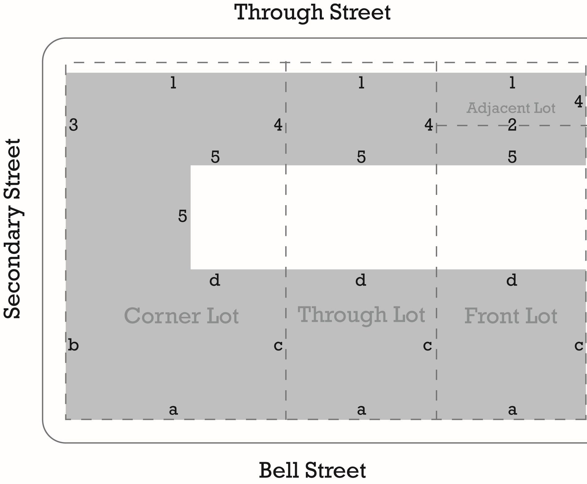
Figure 2-1 - Setbacks and Build-to-Lines for Structures
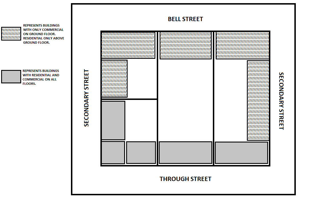
Figure 2-1a - Allowed Building Uses
G.
Setbacks for parking. The setbacks in Table 2-16 (Setbacks for Parking) apply as measured from the front line of the lot. Parking shall be located within the shaded area shown in Figure 2-2 (Setbacks for Parking) below.
Table 2-16- Setbacks for Parking
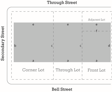
Figure 2-2 - Setbacks for Parking
H.
Architectural encroachments. Architectural features and signs may intrude into road rights-of-way in compliance with the following provided that an encroachment permit is first obtained from either Caltrans or the County Public Works Department.
1.
Balconies, fire escapes, unenclosed porches, and shop front awnings may intrude a maximum of six feet into all rights-of-way and setback areas identified in Figure 2-1 (Setbacks and Build-to-Lines for Structures).
2.
Awnings shall be a minimum of eight feet high above the sidewalk. Above the ground floor, bay windows, chimneys, cantilevered rooms, and eaves may intrude a maximum of three feet into rights-of-way and all setback areas identified in Figure 2-1 (Setbacks and Build-to-Lines for Structures).
3.
Colonnades when installed as part of a gallery for retail uses shall be no less than 10 feet deep and overlap the whole width of the sidewalk to within two feet of the curb. The colonnade shall be no less than 12 feet clear in height.
4.
Signs (See Chapter 35.38 Sign Standards and the Bell Street Design Guidelines).
5.
The architectural feature or sign is in compliance with the Bell Street Design Guidelines and Chapter 10 (Building Regulations) of the County Code.
I.
Processing and site development standards. Proposed development within the CM-LA zone shall comply with the following processing and site development standards.
1.
General. The following standards shall apply to all development within the CM-LA zone.
a.
Vacant lots: Development of vacant lots shall comply with the development standards as described in Section 35.24.030 for the CM-LA zone. A vacant lot may be developed with only commercial uses. Residential density shall comply with Subsection 35.24.070.D, above.
b.
Additions to structures on existing lots: Development on lots with existing structures shall conform to the development standards as described in Section 35.24.030 for the CM-LA zone. Additions to existing structures containing commercial uses shall be limited by the setbacks as described in Figure 2-1(Setbacks and Build-to-Lines for Structures).
c.
Design review required: Prior to the approval of any permits for structures, the project shall be approved or conditionally approved by the Board of Architectural Review in compliance with the Bell Street Design Guidelines and Section 35.82.070 (Design Review).
J.
Building Types. Setbacks create yard spaces that characterize building types. The following building types shall apply in the CM-LA zone.
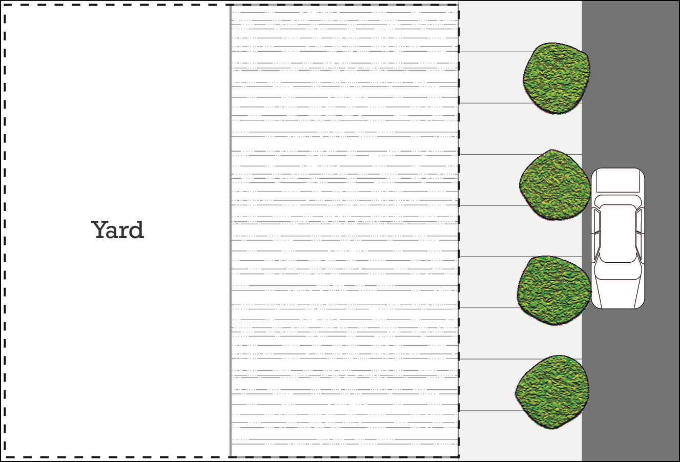 | Rear Yard Building Type - This type of building occupies the entire width of a property, leaving the rear of the lot as the sole yard. This is an urban building type as the continuous facade steadily defines its interface with the public thoroughfare. The location of the rear elevations may be articulated for functional purposes. In its residential form, this type is the rowhouse, duplex, or triplex. For commercial or mixed-uses, the rear yard can accommodate substantial parking. Parking shall be required to be located in the rear of the lot. |
 Drawings not to scale.
| Side Yard Building Type - This type of building is located adjacent to one side of the lot and provides a setback (side yard) from the other side. A front setback is permitted on secondary streets to accommodate residential development; however a setback shall not be provided for the portion of the building facing Bell Street. The side yard shall be designed as to allow access to the interior of the lots for pedestrians and parking. |
K.
Facade Types - Buildings with a front line on Bell Street. The following building facade types shall be used for buildings with a front line on Bell Street in the CM-LA zone.
 | Shopfront: Shopfronts are facades placed at or close to the right-of-way line with the entrance at the sidewalk grade. This type is conventional for retail frontage and is commonly equipped with awnings. Recessed entryways are required with a shop front. |
 | Forecourt: The main facade of the building is at or near the street frontage line and a small percentage of it is set back, creating a small courtyard area. The area could be used as an entry court or shared garden space for apartment buildings, or as an additional shopping or restaurant seating area. The proportions and orientation of these spaces should be carefully considered for solar orientation and user comfort. This frontage type should be used sparingly and should not be repeated within a block. A short wall, hedge, or fence 32 inches to 42 inches in height could be used to define the forecourt area. The depth of the forecourt shall be no more than 20 feet and be no wider than 50 percent of the building width. |
 Drawings not to scale.
| Gallery: Galleries are shopfronts with an attached colonnade that projects over the sidewalk and encroaches into the public right-of-way. This frontage type is ideal for retail use but only when the sidewalk is fully absorbed within the colonnade so that a pedestrian cannot bypass it. The colonnade shall be no less than 10 feet deep and overlap the whole width of the sidewalk to within two feet of the curb. The colonnade shall be no less than 12 feet clear in height. |
L.
Building Façade Types - Buildings Not Facing Bell Street. The following façade types shall be used for buildings with a front line on a through or secondary street in the CM-LA zone.
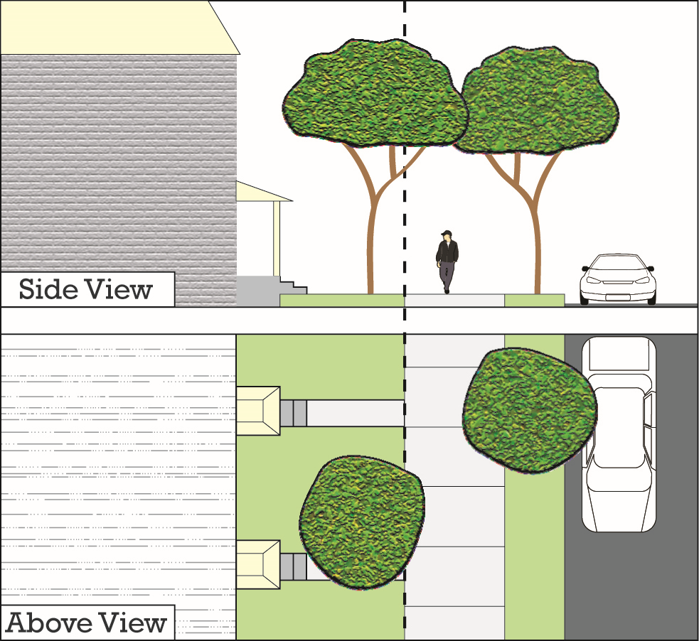 | Common Yard: The main facade of the building has a setback from the front line. The resulting front yard can be defined or undefined at the front line. This edge is typically defined by a fence or hedge within a traditional neighborhood or left undefined within more rural areas or subdivisions. Common yards are typical for larger homes within historic neighborhoods. A front porch is optional. |
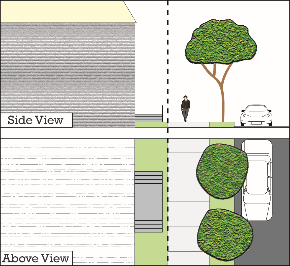 | Stoop: The building façade is near the front line and the elevated stoop engages the sidewalk. The stoop should be elevated a minimum of 24 inches above the sidewalk to ensure privacy within the building. The stairs from the stoop may lead directly to the sidewalk or may be side loaded. The minimum width and depth of the stoop should be five feet. This type is appropriate for residential uses with small setbacks. |
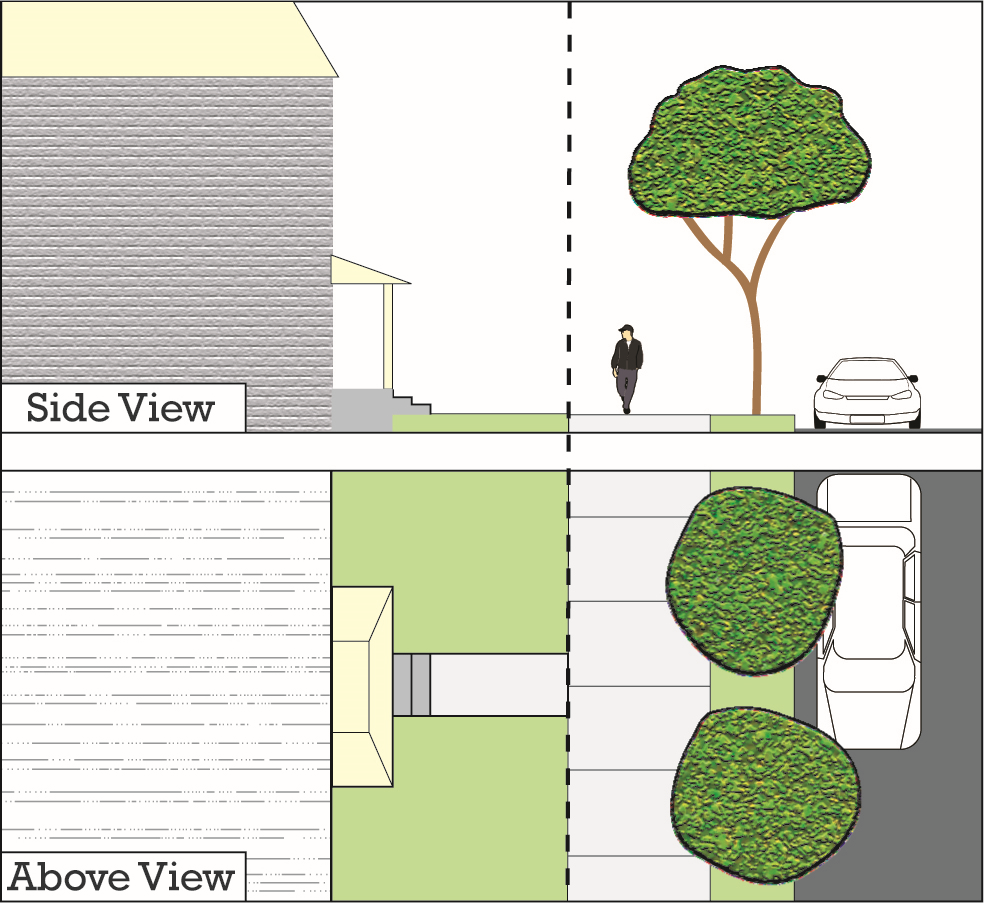 Drawings not to scale.
| Porch: The building façade has a small setback from the front line. The resulting front yard is typically very small and can be defined by a fence or hedge. The porch can encroach into the setback to the point that the porch extends to the front line. A minimum depth of six feet clear is required within the development standards to ensure usability. |
M.
Entry Doors. Entry doors for commercial establishments shall be located at intervals no greater than 50 feet along Bell Street.
N.
Storage. Areas for trash or outdoor storage shall be enclosed and screened in such a manner as to conceal all trash or stored material from public view to the maximum extent feasible. Solid waste and recycling storage facilities shall also be in compliance with Section 35.30.170 (Solid Waste and Recycling Storage Facilities).
O.
Utilities. Utilities shall be located so as to not be visible from the public right-of-way if feasible. Mechanical equipment, including solar energy systems, should not be visible from the street if feasible.
P.
Modification of development standards. As part of the Design Review process required in compliance with Subsection I.1.c., above, the Board of Architectural Review shall review the proposed development to determine if the development complies with the Development Standards in Subsections H. through M. above. The applicant may request modifications of the Development Standards in Subsections H. through M., above, and the Board of Architectural may grant such modifications in compliance with the following:
1.
Request for modification of two or fewer development standards: At the request of the applicant, the Board of Architectural Review may modify a maximum of two development standards only if it first finds that the configuration of the lot and application of said development standard(s) would limit reasonable development of the project that would otherwise comply with the Development Standards in Subsections H. through M. above.
2.
Request for modification of three or more development standards: If the applicant requests modification of three or more development standards, the project shall be processed as a Development Plan in compliance with Section 35.82.080 (Development Plans), and the Planning Commission shall be the review authority for said Development Plan.
a.
The Board of Architectural Review shall review the intent of each Site Development Standard that is requested to be modified, and shall make a recommendation to the Planning Commission as to whether the requested modifications should be approved, conditionally approved, or denied.
b.
After receipt of the recommendation from the Board of Architectural Review, the Planning Commission may modify the development standards requested for modification as part of the Commission's action on the project.
35.24.080 - Reserved
Editor's note— Ord. No. 5192, § 9, adopted November 7, 2023, repealed the former Section 35.24.080 in its entirety, which pertained to SC Zone additional standards and derived from original codification.
35.25.010 - Purpose
This Chapter identifies the land uses that may be allowed within the Industrial zones established by Section 35.14.020 (Zoning Map and Zones), determines the type of planning permit/approval required for each use and provides basic standards for site layout and project design.
35.25.020 - Purposes of Industrial Zones
The purposes of the individual industrial zones and the manner in which they are applied are as follows.
A.
M-RP (Industrial Research Park) zone. The M-RP zone is intended to provide areas exclusively for light industry, technical research, and business headquarters office as the primary land use types, uses in well-designed buildings and attractively landscaped areas. The intent is to establish development standards and landscaping requirements to ensure a park-like environment for the uses permitted and compatibility with adjacent non-industrial areas.
B.
M-1 (Light Industry) zone. The M-1 zone is intended to provide areas exclusively for light industrial uses. The intent is to encourage sound industrial development through appropriate areas for these uses, and to protect nearby residential, commercial, and industrial uses from hazards, noise, and other disturbances.
C.
M-2 (General Industry) zone. The M-2 zone is intended to provide areas for all types of industrial uses while providing the level of project review necessary to ensure that adverse impacts will be minimized and that these uses will be compatible with surrounding properties.
D.
M-CR (Coastal-Related Industry) zone. The M-CR zone is intended to provide areas that are appropriate for coastal-related industrial uses within the Inland area. The intent is to provide standards and conditions that will ensure that environmental damage will be avoided or minimized to the maximum extent feasible.
35.25.030 - Industrial Zones Allowable Land Uses
A.
General permit requirements. Table 2-19 (Allowed Land Uses and Permit Requirements for Industrial Zones) identifies the uses of land allowed by this Development Code in each industrial zone and the planning permit required to establish each use, in compliance with Section 35.20.030 (Allowable Development and Planning Permit Requirements).
B.
Requirements for certain specific land uses. Where the last column ("Specific Use Regulations") in Table 2-19 (Allowed Land Uses and Permit Requirements for Industrial Zones) includes a section number, the referenced Section may affect whether the use requires a Land Use Permit, Development Plan, Minor Conditional Use Permit, or Conditional Use Permit and/or may establish other requirements and standards applicable to the use.
C.
Accessory uses and structures. A use allowed by Table 2-19 (Allowed Land Uses and Permit Requirements for Industrial Zones) may include accessory uses and structures as follows.
1.
M-1 and M-2 zones. Accessory structures and uses customarily incidental to a permitted use, not including retail sale by a manufacturing enterprise.
2.
M-CR and M-RP zones. Accessory structures and uses customarily incidental to a permitted use.
D.
Development Plan approval required.
1.
M-RP, M-1, M-2 zones. Within the M-RP, M-1, or M-2 zones, Final Development Plan approval in compliance with Section 35.82.080 (Development Plans) is required prior to any development, including grading, except as provided in Subsection D.1.b, below.
a.
Final Development Plan approval is required for a structure that is accessory to a permitted agricultural use, other than an agricultural reservoir, and that is not otherwise required by this Development Code to have discretionary permit approval and is 20,000 or more square feet in gross floor area, or is an attached or detached addition that together with existing structures on the site will total 20,000 square feet or more in gross floor area.
b.
Certain allowed agricultural uses in the M-1 and M-2 zones. Within the M-1 and M-2 zones, agricultural uses that are permitted on an adjacent lot zoned agricultural or residential do not require the approval of a Development Plan and may be allowed in compliance with a Land Use Permit issued in compliance with Section 35.82.110 (Land Use Permits).
2.
M-CR zone. Within the M-CR zone, Final Development Plan approval is required for a structure, other than an agricultural reservoir, that is not otherwise required by this Development Code to have discretionary permit approval and is 20,000 or more square feet in gross floor area, or is an attached or detached addition that together with existing structures on the site will total 20,000 square feet or more in gross floor area.
E.
Design Review required.
1.
Design Review is required prior to the approval of a planning permit for a structure, or an addition to or alteration of, an existing structure in the M-RP, M-1, and M-2 zones, in compliance with Section 35.82.070 (Design Review).
2.
Design Review may be required prior to the approval of a planning permit for a structure, or an addition to or alteration of, an existing structure in the MC-R zone, in compliance with Section 35.82.070 (Design Review).
Key to Zone Symbols
Notes:
(1) See Article 35.11 (Glossary) for land use definitions.
(2) Development Plan approval may also be required; see Subsection 35.25.030.D (Development Plan approval required).
(3) Restricted to products produced on-premise and in compliance with Section 35.42.040 (Agricultural Processing Facilities)
(4) On one or more locations or lots under the control of an operator that do not exceed a total area of one acre; if the total area exceeds one acre, then a CUP is required.
(5) Does not include tasting rooms or onsite retail sales.
(6) Subject to the regulations of Section 35.42.280 (Wineries).
Key to Zone Symbols
Notes:
(1) See Article 35.11 (Glossary) for land use definitions.
(2) Development Plan approval may also be required; see Subsection 35.25.030.D (Development Plan approval required).
(3) Limited to the casting of lightweight non-ferrous metal not causing noxious fumes or odors.
(4) Does not include drop hammers.
(5) Limited to automobiles.
Key to Zone Symbols
Notes:
(1) See Article 35.11 (Glossary) for land use definitions.
(2) Development Plan approval may also be required; see Subsection 35.25.030.D (Development Plan approval required).
Key to Zone Symbols
Notes:
(1) See Article 35.11 (Glossary) for land use definitions.
(2) Development Plan approval may also be required; see Subsection 35.25.030.D (Development Plan approval required).
(3) Dwellings maybe allowed for the employees of the owner or lessee of the land engaged in a permitted use of the land upon which the dwelling is located.
(4) Same permit requirement as required for an adjacent lot zoned agricultural or residential if agricultural uses are allowed.
Key to Zone Symbols
Notes:
(1) See Article 35.11 (Glossary) for land use definitions.
(2) Development Plan approval may also be required; see Subsection 35.25.030.D (Development Plan approval required).
(3) Limited to automobiles.
(4) A change of use to a large or small family day care home, serving children, is exempt from zoning permits. An application to construct a new structure to be used as a large or small family day care home, serving children, is subject to the same standards and permit requirements as a proposal to construct a residential structure in the same zone.
(5) Day care centers serving up to and including fifty (50) children may be permitted with a Land Use Permit in compliance with Section 35.82.110 (Land Use Permits).
Key to Zone Symbols
Notes:
(1) See Article 35.11 (Glossary) for land use definitions.
(2) Development Plan approval may also be required; see Subsection 35.25.030.D (Development Plan approval required).
(3) Use is subject to the standards of the PU Zone.
(4) Does not include lines outside the jurisdiction of the County.
(5) Not applicable to facilities constructed by the County.
Key to Zone Symbols
Notes:
(1) See Article 35.11 (Glossary) for land use definitions.
(2) Development Plan approval may also be required; see Subsection 35.25.030.D (Development Plan approval required).
(Ord. No. 5167, § 9, 11-29-2022; Ord. No. 5202, § 7, 2-13-2024; Ord. No. 5230, § 1, 2-4-2025)
35.25.040 - Industrial Zones Development Standards
A.
General standards. New and existing development within the industrial zones shall be designed, constructed, and established in compliance with the requirements in Table 2-20 (Industrial Zones Development Standards) below, and all applicable standards in Article 35.3 through Article 35.7 of this Development Code.
B.
Community Plan overlay requirements. Section 35.28.210 (Community Plan Overlays) establishes additional requirements and standards that apply to development and uses located in an applicable community or area plan as specified in Section 35.28.210 (Community Plan Overlays).
Table 2-20- Industrial Zones Development Standards
Table 2-20- Industrial Zones Development Standards (continued)
35.25.050 - Industrial Zones Additional Standards
Proposed development and new land uses within the M-RP, M-1 and M-2 zones shall comply with the following standards, in addition to those in Section 35.25.040 (Industrial Zones Development Standards).
A.
Performance standards - M-RP, M-1, and M-2 zones. The following performance standards apply to all existing and proposed development and land uses in the M-RP, M-1, and M-2 zones as noted.
1.
Noise.
a.
M-RP zone. The volume of sound, measured during calm air conditions, generated by or resulting from any use, other than motor vehicles, operated in any lot shall not exceed 50 decibels at any point along the boundary of or outside of the lot upon which the use is located.
b.
M-1 and M-2 zones. The volume of sound measured outside during calm air conditions, generated by any use shall not exceed 75 dBL 10 at or beyond any point along the property line of the lot where the use is located. However, in no case shall the volume of sound exceed 65 dB Ldn at the location of any nearby noise sensitive uses, as defined in the Noise Element of the Comprehensive Plan.
2.
Odors, fumes, gasses, liquids, heat, glare, radiation.
a.
M-1 zone. No offensive odors or fumes, noxious gases, or liquids, heat, glare, or radiation generated by or resulting from any use on any lot, other than motor vehicles or lighting fixtures, shall be detectable at any point along the property line of, or outside of the lot where the use is located.
b.
M-2 zone. Any generation of offensive odors or fumes, noxious gases or liquids, heat, glare, or radiation, and all activities shall be conducted in such a manner so as not to be injurious to the health, safety, or welfare of persons residing or working in the neighborhood by reason of danger to life or property.
3.
Public health, safety and welfare - M-1, M-2 and M-RP zones. All activities shall be conducted in such a manner so as not to be injurious to the health, safety, or welfare of persons residing or working in the neighborhood by reason of danger to life or property
4.
Smoke or dust - M-RP and M-1 zones. No smoke or dust shall be generated on a site by or resulting from any use, except for that associated with heating buildings, and motor vehicles.
5.
Vibration.
a.
M-RP zone. The ground vibration generated by any use, other than motor vehicles, operated on any lot shall not be perceptible without instruments at any point along the boundary of or outside of the lot upon which the use is located.
b.
M-1 and M-2 zones. Ground vibration inherently and recurrently generated by or resulting from any use on any lot, other than motor vehicles, shall not be perceptible without instruments at any point along the property line of, or outside of the lot where the use is located.
B.
Enclosure of activities.
1.
M-2 zone. Open storage of equipment and materials shall be permitted only in areas screened from the view of surrounding lots.
2.
M-RP zone. All activities, other than incidental loading and unloading, and other incidental handling, shall be conducted entirely within a completely enclosed building.
C.
M-RP zone standards for convenience shopping and services. Retail stores shops, or establishments supplying commodities or services intended to meet the day-to-day needs of industrial research park employees in the vicinity may be allowed provided the total floor area of employee-serving retail and employee personal services uses on a single site within the M-RP zone shall not exceed 20 percent of the total gross floor area on the site.
35.26.010 - Purpose
This Chapter lists the land uses that may be allowed within the Special Purpose zones established by Section 35.14.020 (Zoning Map and Zones), determines the type of planning permit/approval required for each use, and provides basic standards for site layout and building size.
35.26.020 - Purposes of Special Purpose Zones
The purposes of the individual Special Purpose zones and the manner in which they are applied are as follows.
A.
MU (Mixed Use) zone. The MU zone is applied to areas that are suited for mixed-use development (i.e., residential, commercial and/or industrial uses) because of their location in relation to existing or planned land uses of adjacent areas and infrastructure improvements such as transportation corridors. The purpose and intent of the MU zone is to:
1.
Create attractive and diverse areas that include a mix of housing, shopping, workplace and entertainment uses and nodes for transportation access that foster a variety of small, entrepreneurial, and flexible residential-based businesses, generate economic and social vitality, and create community gathering spaces, entertainment venues, and pedestrian friendly streetscapes.
2.
Provide flexibility and connectivity in the arrangement and location of residential, commercial and/or industrial development in order to create areas that are accessible, attractive and inviting to pedestrians.
3.
Establish development standards that allow residential, commercial and/or industrial activities to compatibly co-exist and provide a transition between existing, adjacent neighborhoods in order to avoid conflicts between incompatible uses.
4.
Plan for the development of sustainable communities that provide varied housing opportunities and multi-modal transportation capabilities.
B.
NTS (Naples Townsite) zone. The NTS zone is established due to unique circumstances particular to the Naples Townsite and is applied to the Naples Townsite in recognition of the Official Map of Naples (hereinafter the "Official Map") adopted by the County on October 2, 1995, and the direction of Coastal Land Use Plan Policy 2-13 for land use at the Naples Townsite. This zone is intended to achieve a balance that provides for low density residential units, public access and recreation opportunities, preservation of the scenic and rural character of the Naples area, and conservation of open space and biological resources, compatible with the surrounding agricultural uses of the Gaviota Coast.
C.
OT (Old Town) zones. The OT zones are applied to establish standards for development and guidelines for architectural continuity in areas with unique historic neighborhood characteristics. The intent is to protect and preserve neighborhood character and the architectural styles that have developed historically in these areas.
1.
OT-R (Old Town - Residential) zone. The OT-R zone allows for one- and multi-family residential uses in areas of unique historic character, and establishes guidelines for architectural continuity, to preserve neighborhood character.
2.
OT-R/LC (Old Town - Residential/Light Commercial) zone. The OT-R/LC zone allows for residential and commercial uses, individually or combined, in areas that contain predominantly one-family dwellings, or that are in close proximity to one-family residential zones, to provide neighborhood-oriented goods and services, and to create a buffer area of low intensity commercial land uses combined with residential uses between areas of strictly residential and general commercial use. The intent is to maintain the existing mixture of residential and commercial uses, and to preserve the character and architectural styles of the neighborhood areas.
3.
OT-R/GC (Old Town - Residential/General Commercial) zone. The OT-R/GC zone allows for residential and commercial uses, individually or combined, especially in older urban areas where an "Old Town" atmosphere is to be maintained, and to provide for local business and commercial needs and services for the community, while maintaining a residential quality in the area. The intent is to maintain a mixture of residential and commercial uses, and to preserve the character and architectural style of the neighborhood areas.
D.
PU (Public Works Utilities and Private Services Facility) zone. The PU zone is applied to areas appropriate for the siting of large scale public works, utilities and private service facilities, provided that the requirements of this zone do not apply to local agencies exempted by Section 35.20.040 (Exemptions from Planning Permit Requirements). The intent is to provide adequate design requirements to ensure that these facilities are compatible with surrounding land uses.
E.
REC (Recreation) zone. The REC zone is applied to provide public or private open space areas appropriate for various forms of outdoor recreation. The intent is to encourage outdoor recreational uses that will protect and enhance areas with the potential to accommodate both active and passive recreation because of their beauty and natural features. Proposed recreational uses should compliment and be appropriate to the area because of the natural features.
35.26.030 - Special Purpose Zones Allowable Land Uses
A.
General permit requirements. Tables 2-21 and 2-22 (Allowed Land Uses and Permit Requirements for Special Purpose Zones) identify the uses of land allowed by this Development Code in each special purpose zone, and the planning permit required to establish each use, in compliance with Section 35.20.030 (Allowable Development and Planning Permit Requirements).
B.
Requirements for certain specific land uses. Where the last column ("Specific Use Regulations") in Tables 2-2-21 and 2-22 (Allowed Land Uses and Permit Requirements for the Special Purpose Zones) includes a section number, the referenced Section may affect whether the use requires a Land Use Permit, Development Plan, Minor Conditional Use Permit, or Conditional Use Permit and/or may establish other requirements and standards applicable to the use.
C.
Development Plan approval required. Development Plan approval in compliance with Section 35.82.080 (Development Plans) is required as follows:
1.
MU, NTS, PU, and REC zones. Within the MU, NTS, PU, and REC zones, Final Development Plan approval in compliance with Section 35.82.080 (Development Plans) is required prior to any development, including grading.
2.
OT zones.
a.
OT-R/LC and OT-GC. Final Development Plan approval in compliance with Section 35.82.080 (Development Plans) is required for structures that total 5,000 square feet or more in gross floor area, or developments that total 10,000 square feet or more.
b.
OT-R. Final Development Plan approval in compliance with Section 35.82.080 (Development Plans) is required for all multi-family residential development, including grading.
c.
Lot subject to the Pedestrian Area - Old Town Orcutt (PA-OTO) Overlay Zone. If a lot is subject to Section 35.28.160 (Pedestrian Area - Old Town Orcutt (PA-OTO) Overlay Zone), then the development plan requirements of Section 35.28.160 (Pedestrian Area - Old Town Orcutt (PA-OTO) Overlay Zone) shall apply instead of Subsections 2.a. and 2.b., above.
D.
Accessory uses and structures. Each use allowed by Tables 2-21 and 2-22 (Allowed Land Uses and Permit Requirements for the Special Purpose Zones) may include accessory uses and structures that are customarily incidental to the use, provided that:
1.
Within the MU zone, the assembly, compounding, manufacture or processing of products is allowed in compliance with Section 35.26.050 - MU Zone Additional Standards.
2.
Within the REC zone, accessory structures and uses shall be limited to those required to support the recreational activities (e.g., parking areas, water and sanitary facilities, boat launching facilities, ranger stations and limited concession facilities).
3.
Within the NTS zone, accessory uses and structures shall be limited to those required to support the principal permitted use and do not involve a commercial enterprise on the site.
E.
Design review required. Prior to the approval of a planning permit for a structure, or an addition to or alteration of an existing structure, Design Review approval by the Board of Architectural Review is required in compliance with Section 35.82.070 (Design Review).
1.
Prior to approving a project located on property zoned MU (Mixed Use) that includes a mix of residential with commercial or industrial uses, the Board of Architectural Review shall find that the design of the project:
a.
Utilizes entries to interior courtyards, building entrances, and public spaces that encourage family and community activities.
b.
Uses architectural styles in association with multifamily units that delineate the separation of units.
c.
Ensures that residential units are interconnected with the streets and courtyards as part of a unified and defined sense of space.
Key to Zone Symbols
Notes:
(1) See Article 35.11 (Glossary) for land use definitions.
(2) Development Plan approval may also be required; see Subsection 35.26.030.C.
(3) Shall not be allowed within easement areas designated as part of an Open Space and Habitat Management Plan in compliance with Section 35.26.060.
(4) On one or more locations or lots under the control of an operator that do not exceed a total area of one acre; if the total area exceeds one acre, then a CUP is required.
Key to Zone Symbols
Notes:
(1) See Article 35.11 (Glossary) for land use definitions.
(2) Development Plan approval may also be required; see Subsection 35.26.030.C.
(3) Only one such facility may be allowed within each project site area covered by an approved Final Development Plan and such facility may only be used by owners and residents of the project area for noncommercial purposes.
(4) Must be conducted within a completely enclosed building.
(5) Use restricted to public coastal access and recreational uses not associated with a commercial onsite operation, commercial lead-tours of the site, or any for-fee or other remuneration recreational activities, except as allowed as part of an equestrian facility, are expressly prohibited.
Key to Zone Symbols
Notes:
(1) See Article 35.11 (Glossary) for land use definitions.
(2) Development Plan approval may also be required; see Subsection 35.26.030.C.
(3) Not allowed in addition to an artist studio.
(4) Use not allowed if the OT designation is OT-LC or OT-GC, and not OT-R/LC or OT-R/GC.
(5) A Zoning Clearance (Section 35.82.210) is required instead of a Land Use Permit for a primary one-family dwelling on a lot that resulted from recordation of a Final (Tract) Map for which its Tentative Map was approved after January 1, 1990, and was vacant at the time the Final Map was recorded.
Key to Zone Symbols
Notes:
(1) See Article 35.11 (Glossary) for land use definitions.
(2) Development Plan approval may also be required; see Subsection 35.26.030.C.
(3) May include beer brewing and wine making provided (a) the area devoted to beer brewing and wine making, including the area devoted to equipment and storage of materials and supplies, does not exceed 50 percent of the interior floor area of the primary business, and (b) the product is primarily sold for on-site consumption.
(4) Must be conducted within a completely enclosed building.
Key to Zone Symbols
(1) See Article 35.11 (Glossary) for land use definitions.
(2) Development Plan approval may also be required; see Subsection 35.26.030.C.
(3) Use not allowed if the OT designation is OT-LC or OT-GC, and not OT-R/LC or OT-G/LC.
(4) Limited to barber and beauty shops, and shoe sales and/or repair stores.
(5) A change of use to a large or small family day care home, serving children, is exempt from zoning permits. An application to construct a new structure to be used as a large or small family day care home, serving children, is subject to the same standards and permit requirements as a proposal to construct a residential structure in the same zone.
(6) Day care centers serving up to and including fifty (50) children may be permitted with a Land Use Permit in compliance with Section 35.82.110 (Land Use Permits).
Key to Zone Symbols
Notes:
(1) See Article 35.11 (Glossary) for land use definitions.
(2) Development Plan approval may also be required; see Subsection 35.26.030.C.
(3) Use is subject to the standards of the PU zone.
(4) Does not include lines outside the jurisdiction of the County.
(5) Not applicable to facilities constructed by the County.
Key to Zone Symbols
Notes:
(1) See Article 35.11 (Glossary) for land use definitions.
(2) Development Plan approval may also be required; see Subsection 35.26.030.C.
Key to Zone Symbols
Notes:
(1) See Article 35.11 (Glossary) for land use definitions.
(2) Development Plan approval may also be required; see Subsection 35.26.030.C.
(3) On one or more locations or lots under the control of an operator that do not exceed a total area of one acre; if the total area exceeds one acre, then a CUP is required.
Key to Zone Symbols
Notes:
(1) See Article 35.11 (Glossary) for land use definitions.
(2) Development Plan approval may also be required; see Subsection 35.26.030.C.
Key to Zone Symbols
Notes:
(1) See Article 35.11 (Glossary) for land use definitions.
(2) Development Plan approval may also be required; see Subsection 35.26.030.C.
Key to Zone Symbols
Notes:
(1) See Article 35.11 (Glossary) for land use definitions.
(2) Development Plan approval may also be required; see Subsection 35.26.030.C.
(3) A change of use to a large or small family day care home, serving children, is exempt from zoning permits. An application to construct a new structure to be used as a large or small family day care home, serving children, is subject to the same standards and permit requirements as a proposal to construct a residential structure in the same zone.
(4) Day care centers serving up to and including fifty (50) children may be permitted with a Land Use Permit in compliance with Section 35.82.110 (Land Use Permits).
Key to Zone Symbols
Notes:
(1) See Article 35.11 (Glossary) for land use definitions.
(2) Development Plan approval may also be required; see Subsection 35.26.030.C.
(3) Subject to standards of the PU zone.
(4) Does not include lines outside the jurisdiction of the County.
(5) Not applicable to facilities constructed by the County outside of the Coastal Zone.
(6) May include park and ride facilities.
Key to Zone Symbols
Notes:
(1) See Article 35.11 (Glossary) for land use definitions.
(2) Development Plan approval may also be required; see Subsection 35.26.030.C.
(Ord. No. 5167, §§ 10, 11, 11-29-2022; Ord. No. 5192, § 10, 11-7-2023; Ord. No. 5202, §§ 8, 9, 2-13-2024)
35.26.040 - Special Purpose Zones Development Standards
A.
General standards. Development within the Special Purpose zones shall be designed, constructed and established in compliance with the requirements in Table 2-23 (Special Purpose Zones Development Standards) below, and all applicable standards in Article 35.3 through Article 35.7 of this Development Code.
B.
Community Plan overlay requirements. Section 35.28.210 (Community Plan Overlays) establishes additional requirements and standards that apply to development and uses located in an applicable community or area plan as specified in Section 35.28.210 (Community Plan Overlays).
Table 2-23- Special Purpose Zones Development Standards
Table 2-23- Special Purpose Zones Development Standards (continued)
Table 2-23- Special Purpose Zones Development Standards (continued)
35.26.050 - MU Zone Additional Standards
Proposed development and new land uses within the MU zone shall comply with the following standards, in addition to those in Section 35.26.040 (Special Purpose Zones Development Standards).
A.
Maximum density requirements. The maximum density for each development on a lot within the MU zone shall be determined on a case-by-case basis by the Commission as part of the review and approval of an application for a Preliminary or Final Development Plan. The Commission shall establish a maximum density based on its consideration of the development standards of the MU zone (landscaping, building coverage, etc.), and the purpose, design, and function of the project within the context of the surrounding neighborhood.
B.
Setback requirements. Setbacks shall be determined on a case-by-case basis by the Commission as part of the review and approval of an application for a Preliminary or Final Development Plan in compliance with the following standards. The following setbacks may be increased or decreased by the Commission as necessary to provide adequate separation and open space both between land uses on the project site and on adjacent lots, and between land uses within the project site.
1.
Lots other than interior lots. The following apply to structures located on lots that are not defined as interior lots.
a.
Front - Primary. None required; however, if provided shall not exceed 10 feet.
b.
Front - Secondary. None required; however, if provided shall not exceed 10 feet.
c.
Side.
(1)
A side setback area having a minimum width of 10 feet shall be provided adjacent to a lot zoned residential as shown in Table 1-1 (Zones).
(2)
If the project site does not abut a lot zoned residential as shown in Table 1-1 (Zones), then a side setback is not required; however, if provided, it shall not exceed a width of 10 feet.
d.
Rear.
(1)
A rear setback area having a minimum width of 25 feet shall be provided adjacent to a lot zoned residential as shown in Table 1-1 (Zones).
(2)
If the project site does not abut a lot zoned residential as shown in Table 1-1 (Zones), then a rear setback is not required; however, if provided, it shall not exceed a width of 10 feet.
2.
Interior lots. The following apply to structures located on lots that are defined as interior lots.
a.
A setback having a minimum width of 25 feet shall be provided adjacent to any lot line that abuts a lot zoned residential as shown in Table 1-1 (Zones).
b.
A setback is not required adjacent to any lot line that abuts a lot that is not zoned residential as shown in Table 1-1 (Zones); however, if provided, it shall not exceed a width of 10 feet.
3.
Parking.
a.
Lots other than interior lots. Parking on lots that are not defined as interior lots shall be located in compliance with the setbacks shown in Table 2-24 (Setbacks for Parking), below.
Table 2-24Setbacks for Parking
Notes:
(1) If the project site abuts a lot zoned residential as shown in Table 1-1 (Zones), a side setback area having a minimum width of 10 feet shall be provided.
(2) If the project site abuts a lot zoned residential as shown in Table 1-1 (Zones), a rear setback area having a minimum width of 25 feet shall be provided.
b.
Interior lots. Parking on lots that are defined as interior lots shall be located:
(1)
Parking shall be located no closer than 25 feet to any lot line that abuts a lot zoned residential as shown in Table 1-1 (Zones).
(2)
A setback from a lot line that abuts a lot that is not zoned residential as shown in Table 1-1 (Zones) is not required; however, if provided, it shall not exceed a width of 10 feet.
4.
Architectural encroachments. Architectural features and signs may intrude into road rights-of-way in compliance with the following provided that an encroachment permit is first obtained from the County Public Works Department.
a.
Balconies, fire escapes, unenclosed porches, and shop front awnings may intrude a maximum of six feet into all rights-of-way and setback areas.
b.
Awnings shall be a minimum of eight feet high above the sidewalk. Above the ground floor, bay windows, chimneys, cantilevered rooms, and eaves may intrude a maximum of three feet into rights-of-way and all setback areas.
C.
Open space and recreation area requirements for projects containing only residential uses.
1.
Open space/yard area.
a.
Common open space. A usable common open space shall be provided. Common open space may include recreational facilities such as picnic areas, swimming pools, tennis courts, etc., but shall not include laundry facilities or other non-recreational uses.
b.
Private open space. A minimum of five percent of the gross floor area of a dwelling unit shall be provided for that dwelling unit.
(1)
Each private open space shall have a minimum six-foot dimension.
(2)
For residences without a ground-level component, usable open space may be provided above-ground.
2.
Recreation. Playgrounds and other recreational areas shall be located to ensure the safety of the residents of the development.
D.
Uses allowed with a Minor Conditional Use Permit or Conditional Use Permit. A use allowed by Table 2-21 (Allowed Land Uses and Permit Requirements for Special Purpose Zones) in the MU zone with a Conditional Use Permit or Minor Conditional Use Permit that is proposed as part of a mixed use project shall not, by reason of its location, construction, manner or timing of operations, signs, lighting, parking arrangements, or other characteristics adversely affect other land uses within or adjoining the development, or create traffic congestion or hazards to vehicular or pedestrian traffic.
E.
Development standards. In addition to the development standards listed in Table 2-23 (Special Purpose Zone Development Standards), above, and elsewhere in Chapter 35.26 (Special Purpose Zones), proposed development within the MU zone shall comply with the following development standards.
1.
Allowed uses and compatibility. Any use allowed in the MU zone may be conducted on the project site in combination with other allowed uses. At the time of Development Plan approval the Commission shall include conditions of approval that address, at a minimum, the following to ensure that nonresidential uses are compatible with any residential use located in the vicinity, including, for live/work units, the residential component of the live/work unit.
a.
Hours of operation, including deliveries.
b.
Odor.
c.
Noise.
d.
Traffic circulation and generation.
e.
Use of hazardous materials.
f.
Lighting.
2.
Minimum lot width for residential use. Development that includes dwelling units shall be located on a lot with a minimum net lot width of 50 feet.
3.
Limitations on bedrooms, floor area and location of dwelling units for mixed-use projects containing dwelling units.
a.
Except for mixed-use projects that qualify as a live/work unit development, the residential component of a mixed-use project shall not exceed two bedrooms per 900 square feet of gross floor area of commercial development on the same lot.
b.
Lots that abut a road having a roadway classification of P2 or 2 Lane Expressway. The following standards apply to the residential component of a mixed-use project on lots that abut a road having a roadway classification of P2 or 2 Lane Expressway on the circulation map for a Community Plan area:
(1)
Dwelling units may be allowed on the ground floor of a building only when:
(a)
The facade of the portion of a building containing the dwelling units does not face a road having a roadway classification of P2 or 2 Lane Expressway.
(b)
The gross floor area devoted to residential uses does not exceed 50 percent of the total gross floor area of the ground floors of each building on the lot.
(2)
Except as allowed in compliance with Subsection E.1.b(2)(a), below, dwelling unit access from a building façade that faces a road having a roadway classification of P2 or 2 Lane Expressway is not allowed.
(a)
Dwelling unit access from a building facade that faces a road having a roadway classification of P2 or 2 Lane Expressway is allowed where the access is to the residential portion of a live/work unit and the access is located within the interior of the ground floor nonresidential area.
4.
Location of commercial and industrial uses. Commercial and industrial uses are allowed on all floors of buildings.
5.
Pedestrian oriented area. Portions of a project site devoted to nonresidential uses shall create a pedestrian oriented area.
6.
Storage. Areas for trash or outdoor storage shall be:
a.
Enclosed and screened to conceal all trash or stored material from public view.
b.
Located to eliminate any negative impacts resulting from sound, visual, safety or odor to the residential portion of the development.
c.
Designed to look pleasing and contribute to the overall ambience of the area.
d.
Constructed in compliance with Section 35.30.170 (Solid Waste and Recycling Storage Facilities.
7.
Utilities. Utilities shall be located so as to not be visible from the public rights-of-way if feasible. Mechanical equipment, including solar energy systems, should not be visible from the street if feasible.
8.
Additional development standards for live/work units. The following development standards apply to live/work units:
a.
Application requirements. In addition to the requirements of Section 35.80.030 (Application Preparation and Filing), an application for a project that includes a live/work unit(s) shall include floor plans that clearly delineate those areas that are devoted to a residential use and those areas that are devoted to a nonresidential use.
b.
Allowed uses. Any nonresidential use allowed in the MU zone may be conducted on the premises of the live/work unit.
c.
Residential area requirements.
(1)
The residential portion shall include cooking space and sanitary facilities that satisfy the provisions of other applicable codes so that the unit may be legally occupied as a dwelling unit.
(2)
The residential portion of the unit shall not occupy more than 50 percent of the gross floor area of the unit. However, in no case shall there be less than 120 square feet of living area exclusive of kitchen, bath, closets and hallways in any live/work unit.
(a)
For the purpose of calculating this 120-square foot requirement, the living room, dining room, family room, sleeping area(s), or other area designated for a similar use of a residential nature shall be deemed as living area.
(b)
All other habitable rooms except kitchens shall have a minimum floor area of 70 square feet.
d.
Nonresidential area requirements.
(1)
There shall be adequate working space reserved for and regularly used by resident owner or employee.
(2)
The nonresidential portion of the unit shall be in compliance with commercial building standards.
(3)
There shall be at least one public entrance that is directly accessible to the nonresidential area, and a visitor utilizing this entrance shall not be required to pass through any residential floor area in order to enter the nonresidential area of the unit.
(4)
The nonresidential activity shall be conducted in compliance with a valid business license associated with the premises.
e.
Location of residential and nonresidential areas and separation of uses.
(1)
The nonresidential portion of the unit shall be located on the ground floor and the residential portion shall be located on the second floor. An entry to the residential portion may be located within the interior of the ground floor nonresidential area.
(2)
The residential and non-residential portions of the unit shall be subject to all applicable separation standards as required by the Building Code.
f.
Limitation on employees. Employees shall be limited to occupants of the residential portion of the units plus up to three persons not residing in the residential portion.
g.
Usable open space requirement. A minimum of 75 square feet of usable open space shall be provided for each live/work unit.
(1)
For residences without a ground-level component, usable open space may be provided above-ground.
h.
Design criteria. Projects including live/work units shall be in compliance with the following design criteria. Prior to approving a project the Board of Architectural Review shall find that the project is in compliance with these criteria.
(1)
The exterior of a new building containing primarily live/work units has a commercial appearance including the use of nonresidential building styles or other techniques.
(2)
The layout of the nonresidential area within the unit provides a functional open area for working activities.
(3)
The floor and site plan for the project includes adequate provision for the delivery of items required for the type of businesses anticipated in the project. This may include:
(a)
Loading areas located near elevators and/or stairs.
(b)
Service elevators designed to carry and move oversized items.
(c)
Stairwells that are wide and/or straight enough to deliver wide items.
(d)
Wide corridors that facilitate the movement of oversized item.
9.
Additional development standards for mixed-use development with commercial and residential uses. The following development standards shall apply to mixed-use development with commercial and residential uses:
a.
Scale and Design. The scale and design of the mixed-use development shall comply with the following standards:
(1)
Maximize compatibility between the mix of uses and with surrounding development.
(2)
Enhance the character and function of the adjacent area.
(3)
Avoid light, noise, odor, and/or air pollution effects on residential uses.
(4)
Limit signage appropriately to achieve attractive designs for both residents of dwelling units and patrons of commercial businesses.
(5)
Incorporate plaza or courtyard materials that create a community space through the use of color and layering as patterns in the landscape and hardscape.
10.
Additional development standards for industrial uses. The following development standards apply to industrial uses:
a.
Allowed use. Industrial uses allowed in the MU zone in compliance with Table 2-21 (Allowed Land Uses and Permit Requirements for Special Purpose Zones) shall be allowed in a live/work unit(s).
b.
Floor area limit. The gross floor area devoted to the industrial use within a live/work unit shall not exceed 200 percent of the gross floor area devoted to the residential use within the same unit.
35.26.060 - NTS Zone Additional Standards
Development within the NTS zone shall comply with the following standards, in addition to those in Section 35.26.040 (Special Purpose Zones Development Standards).
A.
Design Review required. Any structure exceeding 500 square feet of gross floor area, and any addition to an existing structure where the addition exceeds 500 square feet of gross floor area or any addition to an existing structure that results in a structure exceeding 500 square feet of gross floor area shall require Design Review in compliance with Section 35.82.070 (Design Review).
B.
Minimum lot Size.
1.
Newly created lots and reconfiguration of existing lots shall conform to the approved Development Plan.
2.
No minimum lot size is required; however, structures and site improvements shall be confined to development envelopes and the remaining area of each lot outside of the development envelope shall be restricted to agriculture or open space and protected by permanent easement.
3.
Development envelope, as used herein means and includes the contiguous portion of a lot on which is located all structures and site improvements as shown and designated on the Development Plan.
C.
Setbacks. There are no standard setback requirements. Setbacks shall be designated on the approved Development Plan in order to protect and preserve property values of the site and adjacent properties, ensure compatibility of different uses, avoid nuisances, and advance the general welfare within the Naples Townsite zone.
D.
Siting of structures. The siting of structures shown on the Development Plan shall be based on the following factors: privacy, light and air, solar exposure, building configuration, aesthetics and preservation of public views.
E.
Distance required between structures and designated trails. All structures shall be setback from public trails in compliance with the standards set forth on the adopted Santa Barbara County Parks Recreation and Trails Map (PRT) in effect at the time of approval of the Development Plan (Preliminary or Final). In the absence of an adopted standard, a minimum setback of 35 feet shall be required.
F.
Height limit.
1.
The height limit for structures is 25 feet except as provided below.
a.
Chimneys, church spires, elevator, minor mechanical and stair housings, flag poles, towers, vents, and similar structures which are not used for human activity may be up to 35 feet in height where the excess height is not prohibited by Section 35.28.200 (View Corridor Overlay). The use of towers or similar structures to provide higher ceiling heights for habitable space shall be deemed a use intended for human activity.
b.
Subsection F.1.a., above, shall supersede the height limit exception provided in Section 35.30.090.D.1.
2.
Development shall be subject to the Ridgeline and Hillside Development Guidelines if applicable in compliance with Section 35.62.040.
G.
Open Space and Habitat Management Plan. All areas proposed for open space and resource protection shall be designated as part of the approved Development Plan, along with the mechanism by which the areas proposed for open space and resource protection will be preserved (e.g., fee dedication, easement, etc.). Such areas shall be designated in consideration of resource protection policies and the balancing of land use objectives stipulated in Section 35.26.020.B.
1.
A preliminary Open Space and Habitat Management Plan shall be submitted in conjunction with an application to rezone to the Naples Townsite zone.
2.
Prior to issuance of Land Use Permits in compliance with Section 35.82.110 (Land Use Permits) for any aspect of an approved Final Development Plan, a final Open Space and Habitat Management Plan shall be submitted for review and approval by the Department.
3.
The Open Space and Habitat Management Plan shall provide for the conservation, restoration and enhancement of habitat, and preservation of all designated open space.
4.
The Open Space and Habitat Management Plan shall be prepared by a qualified biologist in collaboration with appropriate specialists, as approved by the Department, and shall include chapters or components that incorporate, as applicable, the following items:
a.
A Habitat Management Program that protects special-status plants and wildlife, the integrity of wildlife foraging and movement habitat, and the existing quality of habitats in the project area.
b.
A Fuel Management Program that balances public safety with resource protection by maintaining adequate grassland buffers between structures and scrub and oak woodland habitats.
c.
A Resident and Public Use Management and Resource Education Program that regulates resident and public access, protects biological resources in designated open space areas and educates property owners on resource management.
d.
A Habitat Continuity Program that preserves and enhances habitat so that wildlife movement through designated open space areas may be allowed to continue with a minimum of disruption.
e.
A Non-Native Wildlife Control Program that controls brown-headed cowbirds and European starlings which are attracted, in particular, to livestock areas.
f.
A Monarch Butterfly Roost Protection Program that safeguards monarch butterflies from development activities and subsequent use of open spaces, including the bluffs near the ocean.
g.
A Construction Management Program that details best management practices to minimize potential soil erosion during construction and demonstrates that surface runoff from hardscapes and access roads will not increase the potential for soil erosion.
h.
An Agricultural Management Program that prohibits row-crop agriculture (e.g., orchards, vineyards, etc.) within all designated open space areas containing grassland, coastal scrub, chaparral, oak woodland, wetland or eucalyptus woodland habitats.
5.
The topical areas and specificity of the Open Space and Habitat Management Plan shall be appropriate to the environmental setting of the property and the final content shall be determined in connection with the environmental review process for the project.
6.
The Open Space and Habitat Management Plan shall identify the location of easements on all project parcels where lands are to be protected and/or enhanced. All allowable and unallowable uses and activities within each easement shall be described in the Open Space and Habitat Management Plan.
7.
The Open Space and Habitat Management Plan shall identify the specific third party conservation organization (e.g., Land Trust or other organization), among whose purposes it is to conserve open space and/or natural resources of the conservation easement, provided that:
a.
The organization is a bona fide conservation organization; and
b.
Provisions for proper reverter or retransfer to another bona fide conservation organization are made in the event that organization becomes unwilling or unable to continue carrying out its functions.
In the event a third party conservation organization is unavailable to accept the easement and implement the Open Space and Habitat Management Plan, the County shall identify an alternative appropriate entity. If the replacement organization cannot demonstrate expertise in natural resource management and conservation, such organization, as a condition of its selection, shall employ a qualified biologist, as approved by the Department, to monitor implementation of the Open Space and Habitat Management Plan.
8.
Through implementation of the Open Space and Habitat Management Plan, the third party conservation organization shall assure that the open space will be protected in perpetuity from all forms of development, except as shown on the approved Development Plan.
H.
Visual development standards.
1.
Visual analysis.
a.
No permits for development shall be issued without project-specific visual analysis that uses story poles, photo-simulation or other comparable visualization techniques, to analyze the height, scale and character of proposed structures as seen from prominent public viewing areas.
b.
The visual analysis shall be performed and submitted as part of the Development Plan in conjunction with an application to rezone to the Naples Townsite zone and shall be used to demonstrate consistency with relevant visual resource policies of the Comprehensive Plan.
c.
Prominent public viewing areas, as used in this Subsection, means and includes vantage points readily accessible to the general public which provide the greatest opportunity for viewing natural features of the project area taking into account physical topography, foreground obstructions, proximity to the project site, viewing duration, number of viewers and similar considerations that limit visibility of the proposed development. Areas that are determined to constitute prominent public viewing areas shall be graphically depicted in the visual analyses.
2.
Lighting.
a.
All lighting shall be energy conserving and follow night sky lighting practices, generally conforming to the standards and recommendations of the International Dark-Sky Association and the Illuminating Engineering Society of North America. All exterior lighting installations shall be:
(1)
Designed and installed to be fully shielded (full cutoff) such that the lamp itself or the lamp image is not directly visible beyond the area of illumination.
(2)
Located and designed so as to avoid creating off-site glare, light spillover onto adjacent properties, or upward illumination into the night sky.
(3)
Of low intensity and low glare design.
(4)
Utilize motion, light and time sensors that minimize the duration of use.
b.
All light poles, fixtures, and hoods shall be constructed or coated with a non-reflective exterior finish.
c.
No uplighting of landscape or structures shall be allowed and exterior lighting of driveways, roads and parking areas shall be the minimum necessary to provide safety and security.
d.
A schematic lighting concept shall be submitted as part of the Development Plan in conjunction with an application to rezone to the Naples Townsite zone.
e.
[Reserved.]
f.
Prior to the issuance of Land Use Permits in compliance with Section 35.82.110 (Land Use Permits) for any aspect of an approved Final Development Plan, final lighting details shall be submitted for review and approval by the Board of Architectural Review in compliance with Section 35.82.070 (Design Review).
3.
Roads, driveways, and parking areas.
a.
All roads, driveways and parking areas (private as well as public) shall be sited so as to avoid, where feasible, their visibility from public viewing areas (e.g., public roads, trails and the ocean) including, where possible, the consolidation and sharing of common access.
b.
If paved surfaces cannot feasibly be located outside the public viewshed due to geologic, topographic or biological constraints, only surface materials that are designed to be compatible and not detract from the rural character of the Gaviota Coast shall be allowed.
c.
Such design techniques should include use of stamped and colorized concrete and paving with locally-occurring earth-tone colors.
d.
A schematic hardscape concept shall be submitted as part of the Development Plan in conjunction with an application to rezone to the Naples Townsite zone.
e.
Prior to the issuance of Land Use Permits in compliance with Section 35.82.110 (Land Use Permits) for any aspect of an approved Final Development Plan, surface materials for all paved surfaces shall be submitted for review and approval by the Board of Architectural Review in compliance with Section 35.82.070 (Design Review).
4.
Undergrounding of utility services. All new utility service shall be underground.
5.
Preservation of existing features. Existing features that serve to blend, obscure or otherwise substantially diminish visibility of proposed structures, as well as new features which serve as mitigation to accomplish the same outcome, shall be maintained in a continuous state of good condition and repair. Existing vegetation that serves to screen the proposed development shall not be altered in any manner that would increase the visibility of the development except where:
a.
Such alteration is specifically allowed by the approved Development Plan.
b.
Such alteration is performed under the direction of a licensed arborist
c.
Such alteration, if it involves tree removal, is determined necessary and appropriate by a licensed arborist for reasons of disease, death or similar circumstance.
In addition, any trees or significant vegetation (whether existing at time of development or added as a condition of approval) which are integral to demonstrating consistency with relevant visual resource policies of the Comprehensive Plan, and which subsequently die, shall be replaced with trees and vegetation of a comparable size, species and density that shall achieve the same or comparable visual effect within a reasonable period of time as determined by the Board of Architectural Review.
6.
Preservation and maintenance of trees and vegetation on adjacent property.
a.
Preservation and maintenance of trees and vegetation on adjacent property, owned by parties other than the applicant, that serve to blend, obscure or substantially diminish visibility of proposed structures on the applicant's property shall be the applicant's responsibility. Alternatively, the applicant shall create a comparable hedgerow on its property with trees and vegetation of a comparable size, species and density that shall, within five years, achieve the same or comparable visual effect that is presently served by trees and vegetation on adjacent property.
b.
Prior to issuance of Land Use Permits in compliance with Section 35.82.110 (Land Use Permits) for any aspect of an approved Final Development Plan, a Vegetative Hedgerow Plan shall be submitted for review and approval by the Department. The Vegetative Hedgerow Plan shall:
(1)
Identify off-site trees and vegetation that are integral to the project.
(2)
Specify the mechanism and arrangements by which to assure that off-site trees and vegetation are maintained in a continuous state of good condition and repair, in compliance with the standards set forth in Subsection H.6. above.
(3)
Provide a planting plan with appropriate security to create a comparable hedgerow on the site the proposed development.
7.
Fencing.
a.
Goals. Exterior fencing shall affirmatively further the following overarching goals:
(1)
Reflect the rural character of the Gaviota Coast.
(2)
Be permeable and not impair public views nor the passage of light, air or native wildlife.
(3)
Avoid the appearance of property fragmentation (e.g., use of rocks or similar low-profile materials to demark property lines).
b.
Schematic fencing concept. A schematic fencing concept shall be submitted as part of the Development Plan in conjunction with an application to rezone to the Naples Townsite zone. This schematic fencing concept shall affirmatively further the goals listed in Subsection H.8.a., above, and shall:
(1)
Depict typical fencing details for individual lots and development envelopes.
(2)
Identify all of the following:
(a)
Perimeter and common area fencing property line delineation.
(b)
Separation between private and public open space easement areas.
(c)
Separation for agricultural areas, and where applicable, at or within development envelopes.
c.
Fencing plan standards. The fencing plan shall be in compliance with the following standards:
(1)
Fencing outside of the development envelope of individual lots shall be constructed with appropriate materials such as unpainted split rail, low stone wall or wire consistent with the rural and agrarian character of the land.
(2)
Where fencing would separate an agricultural area from an Open Space and Habitat Management Plan easement area, said fencing shall use material or devices that are not injurious of wildlife; barb wire fences are expressly prohibited.
(3)
Fencing within the development envelope of individual lots may employ solid materials, consistent and complimentary with the architectural character of the building design, not to exceed a maximum height of six feet. Fencing at or within the development envelope may be designed to restrict wildlife passage.
8.
Roadways and drainage.
a.
Roads and driveways shall be kept to a minimum width and length, and shared where possible.
b.
Roads and driveways shall utilize permeable features (e.g., natural inlaid rock-lined gutters, etc.) to improve natural filtration or otherwise direct sheet flows to bioswales, subject to County Fire Department access roadway requirements. Private lot parking areas or auto courts are permitted to be constructed of impermeable surfaces, subject to the limitations in this Section.
c.
All paved surfaces shall be designed so as to divert surface water to bioswales, French drains or other appropriate drainage devices to avoid, where feasible, surface run off into creeks and the ocean.
d.
Grading for roads and driveways shall be minimized.
9.
Landscaping.
a.
Landscaping shall be utilized to visually integrate development with the rural character of the Gaviota Coast. A schematic landscape concept shall be submitted as part of the Development Plan in conjunction with an application to rezone to the Naples Townsite zone which:
(1)
Depicts typical planting details for individual lots and development envelopes.
(2)
Identifies all perimeter and common area landscaping.
b.
Prior to issuance of a Land Use Permit in compliance with Section 35.82.110 for any aspect of an approved Final Development Plan, landscape and irrigation plans shall be prepared by a botanist, licensed landscape contractor or California registered landscape architect and shall be submitted for review and approval by the Board of Architectural Review in compliance with Section 35.82.070 (Design Review). The landscape and irrigation plans shall incorporate at a minimum the following features:
(1)
Water conserving irrigation and drought-tolerant native species, consistent with existing vegetation located along the Gaviota Coast.
(2)
Selection of vegetation on the basis of screening capabilities, non-invasive character, rate of growth, and compatibility with existing on-site vegetation (if any).
(3)
The type, size and density of new plant material shall be sufficient, within five years, to reasonably screen or otherwise blend the development into its natural setting.
(4)
Retention of existing vegetation for their screening and visual character.
(5)
Newly planted non-native landscaping shall not be visually obtrusive to public views (e.g., large, non-native palm trees, etc.) or detract from the rural character of the Gaviota coast.
(6)
Implementation of an Integrated Pest Management Plan that avoids or minimizes use of biodegradable pesticides and herbicides.
35.26.070 - OT Zone Additional Standards
Proposed development and new land uses within the OT zone shall comply with the following standards, in addition to those in Section 35.26.040 (Special Purpose Zones Development Standards).
A.
Maximum lot size and density. The number of dwelling units on a lot containing only residential uses shall not exceed the maximum specified by Table 2-25 (OT Zone Maximum Density) for each OT zoning designation shown in Table 2-25 (OT Zone Maximum Density). (Note: the Zoning Map symbol shown in Table 2-25 (OT Zone Maximum Density) is appended to the OT-R/LC, OT-GC, or OT-R symbol on the Zoning Map, as applicable.)
B.
Design Review required. Prior to the issuance of any Land Use Permit for a structure, all plans for new or altered structures shall be subject to Design Review in compliance with Section 35.82.070 (Design Review) only if required in compliance with Section 35.28.160 (Pedestrian Area - Old Town Orcutt Overlay Zone).
Table 2-25- OT Zone Maximum Density
C.
Public improvement requirements. The Road Division of the Public Works Department shall review all plans for new or altered structures for frontage improvement conditions prior to the issuance of a Land Use Permit. As a condition of Land Use Permit issuance, the owner or their agent shall dedicate rights-of-way and engineer and construct street pavement, curbs, gutters, and sidewalks on the street frontage of the property that are determined by the Department of Public Works to be reasonably related to the proposed use of the property. See Section 35.28.160 (Pedestrian Area - Old Town Orcutt Overlay Zone) for additional vehicle access standards for lots within the PA-OTO overlay.
D.
Noise standards. The volume of sound generated by any use on property within the OT-R/GC and OT-R/LC zones shall not exceed 65 dB Ldn at any point beyond the property boundary upon which the use is located.
E.
Open space. The following standards apply within the OT-R zone.
1.
Minimum area. A minimum of 40 percent of the net site area shall be reserved for the life of the project as common open space.
2.
Title to open space area. Title to the common open space shall be held by a non-profit association of homeowners or by any other individual or entity on reasonable terms and conditions as the Board may prescribe, which may include conveying to the County the rights to develop the property with anything except open space or noncommercial recreation.
F.
Condominiums, stock cooperatives, community apartments. The review authority may apply the following standards as conditions of approval of a condominium, stock cooperative, or community apartment.
1.
Laundry facilities.
a.
General requirement. Each dwelling unit shall be provided separate laundry facilities. Sufficient space, utility connections, and vents to allow for the installation of a clothes washer and dryer in each unit or in a garage, not to encroach upon parking, shall be shown on the Final Development Plan.
b.
Affordable housing project. For affordable housing overlay projects or housing developments that provide a minimum of 50 percent of the housing units at the required affordable income levels, the laundry facilities may be provided in a common area within the development. A minimum of one standard capacity size washer and dryer shall be provided for every four dwelling units contained within the same structure.
2.
Open space.
a.
Common. Common open space and recreation areas shall be designed to provide access for the handicapped.
b.
Private. Each dwelling unit shall include a private outdoor patio area in the form of ground level patios or upper story balconies. Private patios shall not be less than 20 percent of the gross floor area of the dwelling unit. If the required patio area is less than 200 square feet, then this requirement shall be satisfied by providing only one patio or balcony for the dwelling unit.
3.
Storage space. Each dwelling unit shall be provided with at least 180 cubic feet of weatherproofed, enclosed, lockable, and easily accessible storage space on site in addition to the storage space of closets, cabinets, and pantry contained within the dwelling units.
4.
Utility metering. Individual metering for utilities shall be provided for each unit, unless the metering would be in conflict with an innovative energy efficient or resource conserving utility system designed for the project.
35.26.080 - PU Zone Additional Standards
Proposed development and new land uses within the PU zone shall comply with the following standards, in addition to those in Section 35.26.040 (Special Purpose Zones Development Standards).
A.
Noise. The volume of sound, measured during calm air conditions, inherently and recurrently generated by or resulting from any use, other than motor vehicles, operated on any lot shall not exceed 70 decibels at any point along the boundary of or outside of the lot upon which such use is located.
B.
Odors, fumes, gasses, liquids, heat, glare, radiation. No offensive odors or fumes, noxious gases or liquids, heat, glare, or radiation generated by or resulting from any use, other than motor vehicles or lighting fixtures, operated on any lot shall be detectable at any point along the boundary of or outside of the lot upon which such use is located.
C.
Outdoor storage. Open storage of equipment and materials shall be permitted only in areas screened from view of surrounding lots.
D.
Public health, safety, and welfare. All activities shall be conducted in such a manner so as not to be injurious to the health, safety, or welfare of persons residing or working in the neighborhood by reason of danger to life or property.
E.
Smoke or dust. Except for the heating of buildings there shall be no smoke or dust generated by or resulting from any use, other than motor vehicles located upon the lot.
F.
Vibration. The ground vibration inherently and recurrently generated by or resulting from any use, other than motor vehicles, operated on any lot shall not be perceptible without instruments at any point along the boundary of or outside of the lot upon which such use is located.
35.26.090 - REC Zone Additional Standards
Proposed development and new land uses within the REC zone shall comply with the following standards, in addition to those in Section 35.26.040 (Special Purpose Zones Development Standards).
A.
Limitation on lodging occupancy. To ensure the recreational, rather than residential use of overnight accommodations, the maximum period for individual occupancy of overnight accommodations shall be 30 days.
35.28.010 - Purpose
This Chapter provides additional standards designed to protect sensitive resources, ensure reasonable development and housing opportunities and to promote the public health, safety and welfare of the community.
35.28.020 - Applicability of Overlay Zones
The provisions of this Chapter apply to development and land uses in addition to all other applicable requirements of this Development Code. Any conflict between the provisions of this Chapter and any other provision of this Development Code shall be resolved in compliance with Subsection 35.10.040.F (Conflicting requirements) or as specifically indicated within the following sections of this Chapter.
A.
Mapping of overlay zones. The applicability of any overlay zone to a specific site is shown by the overlay zone Zoning Map symbol established by Section 35.14.020 (Zoning Map and Zones), being appended as a suffix to the symbol for the primary zone on the Zoning Map. The overlay zones are applied to property through the rezoning process in compliance with Chapter 35.104 (Amendments) subject to any specific rezoning requirements of the applicable overlay zone.
B.
Allowed land uses, permit requirements, development standards. Except as may be otherwise provided by this Chapter for a specific overlay zone:
1.
Any land use normally allowed in the primary zone by this Chapter may be allowed within an overlay zone, subject to any additional requirements of the overlay zone;
2.
Development and land uses within a overlay zone shall obtain the planning permits required by this Chapter for the primary zone, and the overlay zone, as applicable; and
3.
Development and land uses within an overlay zone shall comply with all applicable development standards of the primary zone and the overlay zone, except as modified by this Chapter.
35.28.030 - Affordable Housing (AH) Overlay Zone
A.
Purpose and intent. The Affordable Housing (AH) overlay zone is intended to promote affordable housing production, and implement the policies of the Housing Element by providing substantial incentives to developers through standards of development and performance.
B.
Applicability.
1.
Density bonus. A residential development project within the AH overlay zone is eligible for increased density up to the maximum number of units designated by the overlay zone on the Zoning Map provided that either:
a.
Thirty percent or more of all new units are available to very low income households; or
b.
Fifty percent or more of all new units are available to a mix of very low, low, lower-moderate and upper-moderate income units according to the proportional allocations for each income category as indicated in Table 2-26 (AH Overlay 50% Mix Allotment) below:
Table 2-26- AH Overlay 50% Mix Allotment
The density increase shall be inclusive of the density bonus authorized by state law (e.g., density increase must be at least 20 percent over the base density as required by Government Code Sections 65915 and 65918 or successor statutes. The maximum density for a lot within the AH overlay shall be indicated on the Zoning Map.
2.
Relationship to primary zone. Each land use and proposed development within the AH overlay shall comply with all applicable requirements of the primary zone in addition to the requirements of this Section. If a requirement of this Section conflicts with a requirement of the primary zone, the requirements of this Section shall control.
C.
Allowable land uses. The following land use types may be permitted on a site within the AH overlay zone:
1.
Any land use allowed in the primary zone, subject to the permit requirements established by the primary zone for the use; and
2.
With the approval of a Development Plan in compliance with Section 35.82.080 (Development Plans) one-family dwellings, two-family dwellings, apartments, condominiums, townhouses, cluster housing, planned unit developments, small lot planned developments and stock cooperatives, that contain a minimum of either 30 percent or 50 percent affordable housing units developed and intended to be purchased or rented subject to the County's Affordable Housing Program criteria and formulas established for very low, low, lower-moderate and upper-moderate income households.
D.
Permit and processing requirements.
1.
Final Development Plan required. Final Development Plan approval in compliance with Section 35.82.080 (Development Plans) is required prior to the approval of a Land Use Permit for all development, including grading. Final Development Plan approval shall be subject to conditions and requirements determined by the review authority to be appropriate and necessary to ensure compliance with the purposes of the County's affordable housing program, the Housing Element and applicable provisions of the Comprehensive Plan.
2.
Fast track processing. Each qualifying AH overlay project shall be subject to the fast track permit process outlined in the Housing Element Implementation Guidelines, to ensure that each AH overlay zone project receives timely and preferential processing.
3.
Pre-application procedure. Prior to submitting an application for an AH overlay zone project, the applicant should obtain pre-application and other preliminary consultations with the Department and other officials to obtain information and guidance before entering into binding commitments and incurring substantial expense in the preparation of plans, surveys and other data. These preliminary consultations shall relate to a specific development proposal that outlines the concept and characteristics of the project.
E.
Modifications to Development Code requirements. The approval of a Final Development Plan for a site located on property zoned with the AH overlay zone may include the following modifications to requirements of this Development Code, in addition to the density modifications provided by Subsection B.1 (Density bonus) above.
1.
Zoning or improvement standards. Facilities, improvements, and/or development or zoning standards normally required for residential development, other than those in this Section, may be modified by the Commission if deemed necessary to ensure dwelling unit affordability or to provide additional incentives. Examples of the modified facility requirements include the waiver or phasing of any required off-site improvements.
2.
Fees. If deemed appropriate by the Board, any or all fees normally imposed by the County on development projects may be waived, reduced, or deferred. In these cases, reduced fees shall be based upon the applicant supplying the Board with evidence and assurances that savings realized from the reductions will be passed on to future residents by way of reduced rent or purchase price for units.
3.
Development standards. The following standards shall apply to all qualified AH overlay zone projects in the DR (Design Residential) and PRD (Planned Residential Development) zones.
a.
One side yard setback per lot may be reduced from the requirement of the applicable zone to a zero setback. The width of any setback thereby reduced shall be applied to the opposite side yard setback. In cases of corner lots, the side yard setback may be reduced to zero with no additional setback requirement for the opposite setback.
b.
The total amount of common and/or public open space may be reduced to 30 percent of the gross acreage.
F.
Affordable housing agreement. Prior to the issuance of a Land Use Permit (Section 35.82.110) or Zoning Clearance (Section 35.82.210) for an AH overlay zone project, each project shall record an affordable housing agreement and resale and rental restrictive covenant, or other equivalent document approved as to form by the County Counsel, which outlines:
1.
The sales and/or rental prices for the various types of units to be established; and
2.
Provisions for the sale, resale, renting and restrictions that will be applicable to the project, to ensure the continued availability of units for purchase or occupancy by target households, in compliance with the Housing Element.
35.28.060 - Airport Approach (F) Overlay Zone
A.
Purpose and Intent. The Airport Approach (F) overlay zone regulates land uses within Airport Clear and Approach Zones consistent with the Airport Land Use Plan, and limits the height of structures, appurtenances, and vegetation within these areas. The intent is to protect the safety of people both in the air and on the ground, to reduce and avoid noise and safety conflicts between airport operations and surrounding land uses, and to preserve navigable airspace around the County's airports.
B.
Applicability.
1.
Affected area. The requirements of this Section apply within the Airport Clear and Approach Zones, as the zones are described in Subsection D. (Description of Airport Clear and Approach zones) below. In addition, the requirements of Subsection F. (Development standards) below, apply within the Airport Land Use Commission Planning Boundaries, as the boundaries are shown on the Airport Land Use Plan maps.
2.
Relationship to primary zone. Each land use and proposed development within the F overlay zone shall comply with all applicable requirements of the primary zone, in addition to the requirements of this Section.
C.
Role of Airport Land Use Commission (ALUC).
1.
Review of proposed development.
a.
An application for development approval that is determined by the Department to be consistent with the provisions of this overlay zone shall not be subject to review by the ALUC.
b.
An application for development approval that is determined by the Department to be inconsistent or potentially inconsistent with the provisions of this overlay zone shall be referred to the ALUC for a determination as to whether the application is consistent with the provisions of the Airport Land Use Plan (ALUP).
c.
No permit for a project determined by the Department to be inconsistent or potentially inconsistent with the provisions of this overlay zone shall be approved or recommended for approval until the ALUC has reviewed the application and determined whether the project is consistent with the ALUP; however, the failure of the ALUC to render its determination within 60 days of the referral shall be construed as a finding that the proposed development is consistent with the ALUP.
d.
By a majority of their total membership the Commission and/or Board may approve a discretionary permit, or a discretionary or ministerial permit on appeal, accompanied by findings, based upon substantial evidence in the public record, that the proposed development is consistent with the purpose and intent expressed in Public Utilities Code Section 21670.
2.
Review of proposed amendments. The proposed adoption or Amendment of any portion of the Comprehensive Plan and/or any Specific Plan, zoning or building regulation, that may apply to any property within a Clear and/or Approach Zone, shall be referred to the ALUC for determination as to the consistency of the proposed action with the adopted ALUP. A finding by the ALUC that the proposed action is not consistent with the ALUP, including recommended project modifications and/or conditions deemed necessary by the ALUC to achieve consistency, may be overridden only by a two-thirds vote of the total membership of the Board accompanied by findings, based upon substantial evidence in the public record, that the proposed action is consistent with the purpose and intent expressed in Public Utilities Code Section 21670.
D.
Description of the Airport Clear and Approach Zones. Airport Clear Zones and Airport Approach Zones are subject to particular hazards, requiring land use restrictions to promote the public safety and preserve navigable airspace. The Clear and Approach Zones and their boundaries are described as follows. Land use regulations within the Clear Zones and Approach Zones are detailed in Subsection E. (Land use standards) below, height restrictions and additional land use guidelines are detailed in Subsection F. (Development standards) below.
1.
Airport Clear Zone, F(CLR). Airport Clear Zones are located immediately adjacent to the ends of airport runways. The Clear Zone dimensions applicable to each runway of the County's airport are described in Subsection D.3 (Physical dimensions) below. The Clear Zones are shown in the Land Use Element, and are designated on the zoning maps by the symbol F(CLR). Airport Clear Zone areas experience greater noise and safety hazards than Airport Approach Zones, and are subject to more restrictive land use limitations.
2.
Airport Approach Zones, F(APR). Airport Approach Zones are extensions of the Airport Clear Zones. The Approach Zone dimensions applicable to each runway of the County's airports are described in Subsection D.3 (Physical dimensions) below. The Approach Zones are shown in the Land Use Element, and are designated on the zoning maps by the symbol F(APR). Airport Approach Zones are subject to lesser noise and safety hazards than the Airport Clear Zones, and thus are subject to less restrictive land use limitations.
3.
Physical dimensions. The Airport Clear and Approach Zones form a continuous horizontal plane surface adjacent to the end of the affected runway. The ends of runways lie 200 feet within the ends of a "primary surface" as defined in Federal Aviation Regulations (FAR) Part 77.25(c). This surface has the geometric form of an isosceles trapezoid, extending outward from the runway end and bisected by an extension of the runway centerline. Table 2-27 (Airport Clear and Approach Zone Dimensions) identifies the specific dimensions of these zones for each county airport runway. Also see Figure 2-3 (Airport Clear and Approach Zones).
Table 2-27- Airport Clear and Approach Zone Dimensions
Notes:
The dimensions W1, D1, and D2 in the above table have been adjusted to account for
their being measured from the end of the runway rather than from the end of the primary
surface defined in FAR Part 77.25(c). These adjustments have been made so that the
Clear and Approach Zone dimensions may be measured from commonly mapped and determinate
physical features, while being coterminous with the Clear and Approach Zones defined
in the Airport Land Use Plan.
E.
Land use standards. Each land use proposed within an Airport Clear or Approach Zone shall comply with all of the following standards.
1.
Uses prohibited in all zones. The following uses are prohibited in both the Airport Clear or Airport Approach zones:
a.
A use that would direct steady or flashing lights at aircraft during initial climb or final approach, other than an FAA approved navigational signal or visual approach slope indicator (VASI);
b.
A use that would cause sunlight to be reflected toward an aircraft on initial climb or final approach;
c.
A use that would generate smoke or attract large concentrations of birds, or which may otherwise affect safe aviation within the area;
d.
A use that would generate electrical interference that may be detrimental to the operation of aircraft, communications, or airport instrumentation.
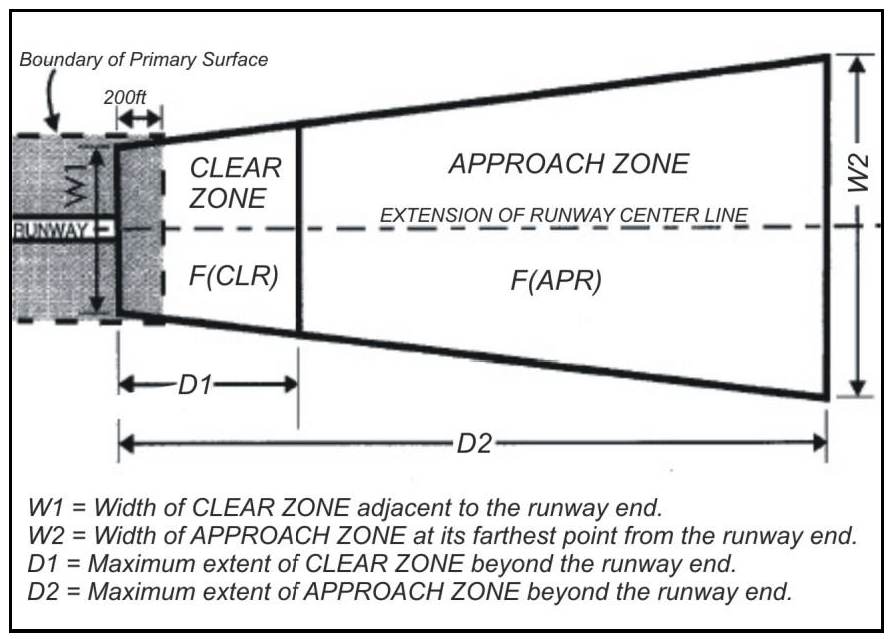
Figure 2-3 - Airport Clear and Approach Zones
2.
Airport Clear Zones. The following requirements apply within the Airport Clear Zones in addition to those in Subsection E.1 (Uses prohibited in all zones) above.
a.
Prohibited uses. The following uses are prohibited within Airport Clear Zones:
(1)
All residential uses;
(2)
Hazardous uses including above-ground oil, gas, or chemical storage, except as permitted under Subsection F.3 below;
(3)
Any use that may result in a long- or short-term concentration of people greater than 25 persons per gross acre, unless the use is found consistent with the Airport Land Use Plan by the ALUC, or is approved by the Board of Supervisors upon a two-thirds vote of its total membership with specific findings, based upon substantial evidence in the public record, that the proposed development is consistent with the purpose an intent expressed in Public Utilities Code Section 21670.
b.
Examples of permitted uses. The following are examples of uses permitted within the Airport Clear Zones, where allowed by the primary zone, subject to the general exclusions in Subsection E.1 (Uses prohibited in all zones) above.
(1)
Aeronautical facilities (e.g., instrument landing navigation aids and equipment buildings, visual navigation aids, weather data instruments, fencing and access roadways to protect and serve aeronautical installations, and airport entrance roadways);
(2)
Agriculture and agricultural storage;
(3)
Automobile sales display areas;
(4)
Automobile wrecking yards;
(5)
Building contractors' yards;
(6)
Building materials storage and wholesale yards;
(7)
Hay, grain, and feed wholesale yards;
(8)
Mini-storage warehouses;
(9)
Open space;
(10)
Parking lots, including those that may serve areas or uses not within airport clear zones;
(11)
Recreational vehicle and boat storage yards;
(12)
Truck, bus, and construction equipment storage yards;
(13)
Wholesale nurseries;
(14)
Any other use that the ALUC finds consistent with the ALUP, or that is approved by a two-thirds vote of the Board with specific findings, based upon substantial evidence in the public record, that the proposed development is consistent with the purpose and intent expressed in Public Utilities Code Section 21670.
3.
Airport Approach Zones. The following uses generally are not permitted within one mile of the runway end in the Airport Approach Zones, unless found consistent with the ALUP by the ALUC, or approved by a two-thirds vote of the Board's total membership with specific findings, based upon substantial evidence in the public record, that the proposed development is consistent with the purpose and intent expressed in Public Utilities Code Section 21670:
a.
Residential development, except for reconstruction, alterations, construction of new one-family homes on existing legal lots and one-family residential land divisions representing a density less than or equal to four units per gross acre; and
b.
Nonresidential development that would concentrate more than 25 persons per gross acre, including schools, office buildings, shopping centers, hospitals, and stadiums.
F.
Development standards.
1.
Height limits.
a.
Airport Clear and Approach Zones. The height limits required by this Subsection apply within both the Clear and Approach Zones, and certain uses may require an assessment for possible airspace obstruction. These restrictions and requirements complement, but do not supersede the requirements of the Federal Aviation Regulations Part 77.
Within both the Airport Clear Zones and the Approach Zones, the highest point of any structure, improvement, or vegetation above the elevation of the respective runway end shall not exceed one vertical foot per the number of feet of horizontal distance between the structure or improvement and the runway end, as shown in the following table; provided that this Section shall not prevent the establishment or maintenance of a structure or improvement not exceeding 15 feet in height above the elevation of the runway end.
Table 2-28- Airport Clear and Approach Zone Dimensions
b.
Airport Land Use Commission (ALUC) Planning Boundary. Each application for proposed structures, improvements, or vegetation that exceeds the following height within the ALUC Planning Boundary shown on the maps of the adopted ALUP which includes but extends beyond the Clear and Approach Zones, shall be referred to the ALUC for review and possible subsequent referral to the Federal Aviation Administration (FAA) and the affected airport operator for an assessment of potential airspace obstruction. Referral is required for all proposed structures, improvements, and vegetation with a maximum height above site grade exceeding the lesser of:
(1)
One vertical foot for each 100 horizontal feet from the nearest point of the nearest airport runway or heliport; or
(2)
45 feet.
This referral process is intended to simplify identifying most potential airspace obstructions beyond the boundaries of the Airport Clear and Approach Zones. This process is intended to complement, but not supersede related notification requirements specified in FAR Part 77. This process does not relieve the applicant of responsibility for direct notification of the FAA Administrator under FAR Part 77. This procedure is not intended to affect the timing of normal Departmental processing of the development permit application.
2.
Noise standards. New residential uses, and the conversion of an existing structure to a residential use on property within an F overlay zone, shall be approved only with conditions that:
a.
Each unit and associated structures and areas exposed to airport noise levels of 65 dB LDN (or CNEL) or greater shall be subject to an avigation/noise easement or easements, which shall be of a form and content approved by the County in consultation with the affected airport operator;
b.
Any prospective buyer, lessee, or renter shall be notified in writing, prior to entering any sale, lease, or rent contract, if any exterior living area associated with a unit for sale, lease, or rent is exposed to airport noise levels of 65 dB LDN (or CNEL) or greater; and
c.
The State Department of Real Estate Public Report (for any subdivision, condominium project) shall disclose whether any unit is within a 65+ dB LDN (or CNEL) airport noise exposure area, and shall refer to any avigation/noise easement affecting the unit.
3.
Hazardous materials. Prior to the issuance of a Land Use Permit in compliance with Section 35.82.110 (Land Use Permits) or a Zoning Clearance in compliance with Section 35.82.210 (Zoning Clearances) for a use located within a Clear Zone that involves the storage of more than 10 gallons of flammable liquid or hazardous material:
a.
The County Public Health Department and the Fire Department having inspection, permit, and/or emergency response responsibility for that location shall review the proposed use, and
b.
Any potential hazards associated with the storage of said materials shall be mitigated to the reasonable satisfaction of the County Public Health Department and applicable Fire Department.
35.28.070 - Critical Viewshed Corridor (CVC) Overlay Zone
A.
Purpose and intent. The Critical Viewshed Corridor (CVC) overlay zone is applied to property in the Gaviota Coast Plan area to provide enhanced protection to the critical coastal viewsheds of the Gaviota Coast from inappropriate development. The intent is to ensure that development is sited and/or screened in a manner that will reduce impacts to the public viewshed while allowing for reasonable development.
B.
Applicability. This overlay zone is applied in the Gaviota Coast Plan area to the visually critical near-field viewsheds located to the north and south of Highway 101 as shown on the County zoning map. All development within this overlay zone is subject to the requirements of this overlay zone except as provided below:
1.
Single agricultural structures with an individual gross floor area of less than 5,000 square feet are not subject to the requirements of this overlay zone provided:
a.
The existing cumulative structural development located on the lot that the structure is proposed to be located on does not exceed a footprint area of 10,000 square feet.
b.
The structure(s) complies with the following standards:
(1)
All exterior lighting is in compliance with the following:
(a)
The lighting is required for safety purposes only.
(b)
Outdoor lighting complies with Section 35.30.120 (Outdoor Lighting).
(2)
The structure uses building materials, earth tone colors, and non-reflective paints that are compatible with the surrounding natural environment to maximize the visual compatibility of the development with surrounding areas.
C.
Relationship to primary zone. Each land use and proposed development within the CVC overlay zone shall comply with all applicable requirements of the primary zone, in addition to the requirements of this Section.
D.
Permit and processing requirements.
1.
Design review required. Except for development that is exempt from the requirements of this overlay zone in compliance with Subsection B (Applicability), above, all structural development proposed on a lot located within the CVC overlay zone shall require Design Review in compliance with Section 35.82.070 (Design Review) prior to the issuance of a Land Use Permit in compliance with Section 35.82.110 (Land Use Permits) or a Zoning Clearance in compliance with Section 35.82.210 (Zoning Clearances).
2.
Application requirements. An application for Design Review shall be submitted in compliance with Chapter 35.80 (Permit Application Filing and Processing).
3.
Criteria for approval. The Board of Architectural Review may approve or conditionally approve the application only if it determines that the project conforms to the following standards:
a.
Screening. Development is screened to the maximum extent feasible as seen from public viewing places. Screening shall be achieved to the maximum extent feasible through adherence to the Site Design Hierarchy within the Gaviota Coast Plan Design Guidelines.
b.
Landscaping. Landscaping, not including any agricultural crop or orchard, when mature, does not obstruct public views of the mountains or the ocean.
c.
Ocean views. Development is sited and designed to preserve unobstructed broad views of the ocean from Highway 101, and is clustered to the maximum extent feasible.
d.
Structure height.
(1)
The height of any structure located south of Highway 101 does not exceed 15 feet unless an increase in height would facilitate clustering of development and result in greater view protection, or a height in excess of 15 feet would not impact public views to the ocean.
(2)
Visible portions of structures located on lots having unobstructed broad view of the ocean shall be designed so that any intrusions into the view of the ocean, as seen from public viewing areas, is minimized to the maximum extent feasible.
(3)
The height and/or scale development is harmonious with the surrounding area.
(4)
The appearance of the development is not undesirable or unsightly.
4.
Appeal. The action of the Board of Architectural Review may be appealed in compliance with Chapter 35.102 (Appeals).
E.
Land use limitations.
1.
Greenhouses. Greenhouses are limited to 4,000 square feet per lot.
2.
Overhead electrical transmission and distribution lines. New overhead electrical transmission and distribution lines for non-agricultural development that are subject to regulation by the County are prohibited within the CVC overlay zone.
(Ord. No. 5238, § 4, 2-11-2025)
35.28.080 - Design Control (D) Overlay Zone
A.
Purpose and intent. The Design Control (D) overlay zone is applied where, because of visual resources and/or unique neighborhood characteristics, plans for new or altered structures require Design Review. The intent is to ensure well designed development and to protect scenic qualities, property values, and neighborhood character.
B.
Applicability. Each land use and proposed development within the D overlay zone shall comply with all applicable requirements of the primary zone, in addition to the requirements of this Section.
C.
Permit and processing requirements. The plans for each new or altered structure within the D overlay zone shall be submitted for Design Review in compliance with Section 35.82.070 (Design Review), except as shown below:
1.
Eastern Goleta Valley. The plans for each new or altered structure subject to the Eastern Goleta Valley Design Guidelines shall be submitted for Design Review in compliance with Section 35.82.070 (Design Review) if required by Subsection E.2, below.
2.
Los Alamos Community Plan area. The plans for each new or altered structure subject to the Los Alamos Bell Street Design Guidelines shall be submitted for Design Review in compliance with Section 35.82.070 (Design Review) if required in compliance with Subsection 35.28.080.F.2.
D.
Setbacks, height limits, and other zoning requirements. New construction and alterations shall comply with the regulations of the primary zone, except that when the primary zone allows modifications of the regulations by the Director, Zoning Administrator, or Commission, the Board of Architectural Review may recommend the modifications of setbacks, height limits, and other requirements to protect visual resources.
E.
Eastern Goleta Valley.
1.
Purpose and intent. This section establishes procedures and findings for the approval of land use and proposed development located in the Eastern Goleta Valley to ensure that such land use and proposed development is consistent with the Eastern Goleta Valley Design Guidelines for residential development.
2.
Applicability. The following shall be submitted for Design Review in compliance with Section 35.82.070 (Design Review):
a.
New one-family and two-family dwellings.
b.
Demolished and reconstructed one-family and two-family dwellings when 50 percent or more of the existing gross floor area is demolished.
c.
Second and third floor additions to existing one-family and two-family dwellings not including the addition of lofts within an existing structure where there is no change in the outward appearance of the structure.
d.
Conversions of attached and detached garages that are accessory to one-family or two-family dwellings that result in an increase in habitable area.
e.
Any addition of more than 1,000 square feet of the gross floor area or 50 percent or more of the gross floor area of the principal one-family or two-family dwelling that existed on the lot as of March 1, 2007 for lots located, whichever is less.
f.
Any structural alterations to one-family and two-family dwellings that are substantially visible from the street frontage.
F.
Los Alamos Community Plan area.
1.
Purpose and intent. This section establishes procedures and findings for the approval of land use and proposed development in the Los Alamos Community Plan area to ensure that such land use and proposed development is consistent with the Los Alamos Bell Street Design Guidelines.
2.
Applicability. The following shall be submitted for Design Review in compliance with Section 35.82.070 (Design Review).
a.
The construction of new buildings.
b.
Demolished and reconstructed buildings when 50 percent or more of the existing gross floor area is demolished.
c.
Second and third floor additions to buildings not including the addition of lofts or mezzanines within an existing structure where there is no change to the outward appearance of the structure.
d.
Any structural alterations that substantially alters the façade and are substantially visible from the street frontage within the Bell Street Commercial Core and Design Control Overlay area.
G.
Santa Ynez Valley Community Plan Area.
1.
Special provisions for projects within the Santa Ynez Valley Community Plan Area. All structures located on property within the Santa Ynez Valley Community Plan area and zoned with the Design Control (D) Overlay shall require Design Review in compliance with Section 35.82.070 except for the following:
a.
Agricultural accessory structures that have a gross floor area of less than 1,000 square feet.
b.
Deer and livestock fencing up to 8 feet in height.
c.
Structures that cannot be viewed from public roadways or other areas of public use. Landscape screening shall not be taken into consideration when determining whether the structure is visible from public roadways or other areas of public use.
d.
Structures exempt from Design Review in compliance with Subsection 35.82.070.C.
35.28.100 - Environmentally Sensitive Habitat Area Overlay Zone
A.
Purpose and intent. The Environmentally Sensitive Habitat Area (ESH) overlay zone is applied to areas with unique natural resources and/or sensitive animal or plant species, and/or their habitats, where existing and potential development and other activities may despoil or eliminate the resource. This overlay is intended to:
1.
Protect and preserve specified areas in which plant or animal species or their habitats are either rare or especially valuable because of their role in the ecosystem, and that could be easily disturbed or degraded by human activities and developments; and
2.
Ensure that each project permitted in the overlay zone is designed and carried out in a manner that will provide the maximum feasible protection to sensitive habitat areas.
B.
Applicability.
1.
The Environmentally Sensitive Habitat Area overlay zone is applied within the Eastern Goleta Valley Community Plan, the Gaviota Coast Plan, the Goleta Community Plan, the Mission Canyon Community Plan, and the Toro Canyon Plan areas. The requirements of this Section shall apply to:
a.
Areas within the Eastern Goleta Valley Community Plan area designated as ESH-GOL on the Zoning Map.
b.
Areas within the Gaviota Coast Plan designated as ESH-GAV on the Zoning Map.
c.
Areas within the Goleta Community Plan designated as ESH-GOL on the Zoning Map.
d.
Areas within the Mission Canyon Community Plan designated as ESH-MC on the Zoning Map.
e.
Areas within the Toro Canyon Plan designated as ESH-TCP on the Zoning Map.
2.
Relationship to primary zone. Each land use and proposed development on property designated as ESH-GAV, ESH-GOL, ESH-MC or ESH-TCP shall comply with all applicable requirements of the primary zone, in addition to the requirements of this Section.
a.
Additional requirements. The biological resource policies and development standards in the Toro Canyon Plan shall apply to any area designated as ESH-TCP in addition to the requirements of this Section unless it is determined that the project is not located in or within 100 feet of an environmentally sensitive habitat area in compliance with Subsection B.4.c, below.
3.
Overlay zone boundary. The Zoning Map, and the process described in Subsection B.4 (Environmentally sensitive habitat area boundary determination), below, shall guide determining whether the requirements of this Section apply to any area designated as ESH-GAV, ESH-GOL, ESH-MC or ESH-TCP.
4.
Environmentally sensitive habitat area boundary determination. The determination of the boundary of an environmentally sensitive habitat area shall occur during permit application review.
a.
ESH-GAV.
(1)
The requirements of this Section shall not apply to an application for a project if the Director determines that the proposed development is not located in an environmentally sensitive habitat area.
(2)
A site inspection shall be conducted, if determined to be necessary by the Director, if the Director determines that the proposed development is located in an environmentally sensitive habitat area.
(a)
If the Director determines that a site inspection is required, then the site inspection shall be performed by a qualified biologist to be selected jointly by the Department and the applicant.
(3)
Upon completion of the site inspection, and if determined by the review authority to be necessary, conditions shall be applied to the permit that will protect the environmentally sensitive habitat area to the maximum extent feasible, consistent with the biological habitat, goals, objectives, policies, development standards, and actions of the Gaviota Coast Plan.
b.
ESH-GOL.
(1)
The requirements of this Section shall not apply to an application for a project if the Director determines that the proposed development is not located in an environmentally sensitive habitat area.
(2)
A site inspection shall be conducted, if determined to be necessary by the Director, if the Director determines that the proposed development is located in an environmentally sensitive habitat area.
(a)
If the Director determines that a site inspection is required, then the site inspection shall be performed by a qualified biologist to be selected jointly by the Department and the applicant.
c.
ESH-MC and ESH-TCP.
(1)
The requirements of this Section shall not apply to an application for a project if the Director determines, following a review of the Mission Canyon Community Plan Environmentally Sensitive Habitat Map or the Toro Canyon Environmentally Sensitive Habitat Map, as applicable, and, where appropriate, by conducting a site visit, that the proposed project is not located in or within 100 feet of an environmentally sensitive habitat area.
(a)
Toro Canyon Plan area. The project shall also not be subject to the biological resources policies and development standards in the Toro Canyon Plan if the project is determined by the Director to not be located in or within 100 feet of an environmentally sensitive habitat area.
(2)
Site inspection and biological report. A site inspection by the Department biologist may be required if the Director determines that the proposed project is located in or within 100 feet of an environmentally sensitive habitat area.
(a)
The Director may determine that the preparation of a biological report by a qualified biologist to be selected jointly by the Department and the applicant is required in order to identify the environmentally sensitive habitat area.
(b)
The determination by the Director that the proposed project is located in or within 100 feet of an environmentally sensitive habitat area is final and not subject to appeal in compliance with Section 35.102 (Appeals); however, the determination may be disputed by the applicant in compliance with Subsection B.4.d (Dispute resolution, ESH-MC and ESH-TCP), below.
d.
Dispute resolution, ESH-MC and ESH-TCP. On lots designated as ESH-MC or ESH-TCP, if the determination by the Director that the proposed project is located in or within 100 feet of an environmentally sensitive habitat area is disputed by the applicant then additional study of the potential environmentally sensitive habitat on the site shall be required.
(1)
If the Director determines, based upon additional evidence presented by a qualified biologist, that a site does not contain biological resources and sensitive habitats identified as environmentally sensitive habitats in the Mission Canyon Community Plan or the Toro Canyon Plan, as applicable, the proposed project on the lot shall not be subject to the requirements of this Section.
(2)
In the event there is disputed biological evidence, third-party review by another qualified biologist shall be required, at the expense of the applicant, before the environmentally sensitive habitat designation may be found inapplicable. If the Director determines that the preponderance of credible evidence in a biological assessment does not support rescinding the environmentally sensitive habitat designation or modifying the environmentally sensitive habitat boundary, the area shall remain mapped as environmentally sensitive habitat and the project shall comply with all applicable requirements of this Section.
(a)
This decision by the Director is subject to appeal in compliance with Chapter 35.102 (Appeals).
5.
Identification of newly documented environmentally sensitive habitat areas, ESH-GAV, ESH-GOL (Eastern Goleta Valley Community Plan area), ESH-MC and ESH-TCP. On lots located within the Gaviota Coast Plan area, the Eastern Goleta Valley Community Plan area, the Mission Canyon Community Plan area or the Toro Canyon Plan area, if an environmentally sensitive habitat area is identified by the Department to be located on-site during permit application review, but the habitat area is not designated as ESH-GAV, ESH-GOL, ESH-MC or ESH-TCP, the provisions of Subsections C. through F., below, as applicable, shall apply. The Department will periodically update the Zoning Map to apply the ESH-GAV, ESH-GOL, ESH-TCP or the ESH-MC overlay zone to add the new habitat areas and applicable setback areas.
C.
Permit and processing requirements, ESH-GAV. The following permit and processing requirements shall apply to lots zoned ESH-GAV.
1.
Land Use Permit requirement and exemptions.
a.
Land Use Permit required. The issuance of a Land Use Permit in compliance with Section 35.82.110 (Land Use Permits) shall be required for the following activities located within the Gaviota Coast Plan area, except when the activity occurs as part of an agricultural use, as defined by this Development Code, when located on lots with an agricultural zone designation, i.e., AG-I or AG-II, or the activity is exempt from this requirement as provided in Section 35.28.100.C.1.b, below.
(1)
The removal of native vegetation from an area greater than 5,000 square feet.
(2)
The removal of native riparian vegetation along 50 linear feet or more of a creek or stream.
(3)
The removal of native vegetation that, when added to the previous removal of native vegetation within the affected habitat, would total more than 5,000 square feet of native vegetation, or more than 50 linear feet of native riparian vegetation along a creek or stream.
(4)
Grading in excess of 50 cubic yards of cut or fill.
(5)
The removal of any native tree greater than six inches in diameter measured four feet above existing grade, or more than six feet in height, or non-native trees that are used as habitat by the Monarch Butterflies for roosting, or by nesting raptors, unless the Department makes one or more of the following findings:
(a)
The tree is dead and is not of significant habitat value.
(b)
The trees prevent the construction of a project for which a Land Use Permit has been issued in compliance with Section 35.82.110 (Land Use Permits) and this Section, and project redesign is not feasible.
(c)
The tree is diseased and poses a danger to healthy trees in the immediate vicinity. The Department may require evidence of this to be presented by an arborist, licensed tree surgeon, or other qualified person.
(d)
The tree is so weakened by age, disease, storm, fire, excavation, removal of adjacent trees, or any injury so as to cause imminent danger to persons or property.
b.
Exemptions from Land Use Permit requirements. The issuance of a Land Use Permit shall not be required for the following activities located within the Gaviota Coast Plan area:
(1)
The removal of vegetation along roads and driveways up to 10 feet on both sides of the roads and/or driveways.
(2)
Fuel modification for defensible space within 100 feet of an existing structure.
(3)
Fuel modification for defensible space located more than 100 feet but less than 300 feet from an existing structure following inspection by Santa Barbara County Fire Department personnel and issuance of a letter by the County Fire Department determining that more than 100 feet of fuel modification is required to provide adequate defensible space around the structure based on a site specific safety zone calculation.
(4)
In compliance with Subsection 35.10.040.G (State, County, Local Agency, and School District sites and facilities), clearing vegetation, conducting prescribed fires, maintaining fire roads, and other wildfire prevention activities by the Federal government (e.g., U.S. Forest Service) on leased or federally owned land, the County or any district of which the Board of Supervisors is the governing body (e.g., County Fire Department), and the State or an agency of the State acting in its sovereign (governmental) capacity (e.g., California Department of Forestry and Fire Prevention (CAL FIRE)).
2.
Minor Conditional Use Permit requirement. A Minor Conditional Use Permit approved in compliance with Section 35.82.060 (Conditional Use Permits and Minor Conditional Use Permits) is required where a significant amount of vegetation is proposed to be removed which would exceed one acre, or 500 linear feet of creek bank, or where grading would exceed 1,500 cubic yards of cut and fill, unless the removal occurs as part of an agricultural use, as defined by this Development Code, when located on lots with an agricultural zone designation, i.e., AG-I or AG-II.
3.
Findings required for permit approval. Prior to issuance of any planning permit for a lot located within the ESH-GAV overlay zone, the review authority shall first find that the proposed development is consistent with all applicable biological goals, objectives, policies, actions and development standards of the Gaviota Coast Plan, in addition to all other findings required by this Development Code for permit approval.
4.
Conditions of approval. A permit may be issued subject to compliance with conditions of approval that the review authority determines to be necessary to ensure consistency with habitat protection provisions of the Gaviota Coast Plan.
a.
The conditions may, among other matters, limit the size, kind, or character of the proposed work, require replacement of vegetation, establish required monitoring procedures and maintenance activity, stage the work over time, or require the alteration of the design of the development to ensure protection of the habitat.
b.
The conditions may also include deed restrictions and easements for resource protection. Any regulation of the primary zone specifying building height limit, distance between buildings, setback, yard, parking, building coverage and landscaping or screening requirements may be altered by express conditions in the permit to achieve the purposes of this overlay zone.
D.
Permit and processing requirements, ESH-GOL. The following permit and processing requirements shall apply to lots zoned ESH-GOL.
1.
Land Use Permit requirement.
a.
Locations within the Eastern Goleta Valley Community Plan area.
(1)
Land Use Permit Required. The issuance of a Land Use Permit in compliance with Section 35.82.110 (Land Use Permits) shall be required for the following activities located within the Eastern Goleta Valley Community Plan area, except when exempt from this requirement as provided in Subsection 35.28.100.D.1.a.(2) below.
(a)
The removal of native vegetation from an area more than 5,000 square feet.
(b)
Fuel modification for defensible space for any existing structure.
(c)
The removal of native riparian vegetation along 50 linear feet or more of a creek or stream.
(d)
The removal of native vegetation that, when added to the previous removal of native vegetation within the affected habitat, would total more than 5,000 square feet of native vegetation, or more than 50 linear feet of native riparian vegetation along a creek or stream.
(e)
Grading in excess of 50 cubic yards of cut or fill.
(f)
The removal of any native tree more than six inches in diameter measured four feet above existing grade, or more than six feet in height, or non-native trees that are used as habitat by the Monarch Butterflies for roosting, or by nesting raptors, unless the Department makes one or more of the following findings:
(i)
The tree is dead and is not of significant habitat value.
(ii)
The trees prevent the construction of a project for which a Land Use Permit has been issued in compliance with Section 35.82.110 (Land Use Permits) and this Section, and project redesign is not feasible.
(iii)
The tree is diseased and poses a danger to healthy trees in the immediate vicinity. The Department may require evidence of this to be presented by an arborist, licensed tree surgeon, or other qualified person.
(iv)
The tree is so weakened by age, disease, storm, fire, excavation, removal of adjacent trees, or any injury so as to cause imminent danger to persons or property.
(2)
Exemptions from Permit Requirements. The issuance of a Land Use Permit shall not be required for the following activities located within the Eastern Goleta Valley Community Plan area:
(a)
The removal of vegetation along roads and driveways up to 10 feet on both sides of the roads and/or driveways.
(b)
Fuel modification for defensible space within 100 feet of an existing structure.
(c)
Fuel modification for defensible space located more than 100 feet but less than 300 feet from an existing structure following inspection by Santa Barbara County Fire Department personnel and issuance of a letter by the County Fire Department determining that more than 100 feet of fuel modification is required to provide adequate defensible space around the structure based on a site specific safety zone calculation.
(d)
In compliance with Subsection 35.10.040.G (State, County, Local Agency, and School District sites and facilities), clearing vegetation, conducting prescribed fires, maintaining fire roads, and other wildfire prevention activities by the Federal government (e.g., U.S. Forest Service) on leased or federally owned land, the County or any district of which the Board of Supervisors is the governing body (e.g., County Fire Department), and the State or an agency of the State acting in its sovereign (governmental) capacity (e.g., California Department of Forestry and Fire Prevention (CAL FIRE)).
b.
Locations within the Goleta Community Plan area. For development proposed within an area subject to this Section that is located within the Goleta Community Plan area, the issuance of a Land Use Permit in compliance with Section 35.82.110 (Land Use Permits) shall be required for the following, in addition to those required to have a Land Use Permit by the primary zone.
(1)
The removal of vegetation from an area greater than 5,000 square feet.
(2)
The removal of a significant amount of vegetation along 50 linear feet of creek bank.
(3)
The removal of vegetation that, when added to the previous removal of vegetation within the affected habitat, would total more than 5,000 square feet, or longer than 50 linear feet of vegetation along a creek bank.
(4)
Grading in excess of 50 cubic yards of cut or fill.
(5)
The removal of any native tree greater than six inches in diameter measured four feet above existing grade, or more than six feet in height, or non-native trees that are used as habitat by the Monarch Butterflies for roosting, or by nesting raptors, unless the Department makes one or more of the following findings:
(a)
The tree is dead and is not of significant habitat value.
(b)
The trees prevent the construction of a project for which a Land Use Permit has been issued in compliance with Section 35.82.110 (Land Use Permits) and this Section, and project redesign is not feasible.
(c)
The tree is diseased and poses a danger to healthy trees in the immediate vicinity. The Department may require evidence of this to be presented by an arborist, licensed tree surgeon, or other qualified person.
(d)
The tree is so weakened by age, disease, storm, fire, excavation, removal of adjacent trees, or any injury so as to cause imminent danger to persons or property.
2.
Minor Conditional Use Permit requirement. A Minor Conditional Use Permit approved in compliance with Section 35.82.060 (Conditional Use Permits and Minor Conditional Use Permits) is required where a significant amount of vegetation is proposed to be removed which would exceed one acre, or 500 linear feet of creek bank, or where grading would exceed 1,500 cubic yards of cut and fill.
3.
Findings required for permit approval. A permit may be approved and/or issued subject to compliance with conditions of approval that the review authority determines to be necessary to protect the environmentally sensitive habitat area and to ensure consistency with the biological habitat, goals, objectives, policies, development standards, and actions of the Eastern Goleta Valley Community Plan or the Goleta Community Plan, as applicable.
4.
Conditions of approval. A permit may be approved and/or issued subject to compliance with conditions of approval that the review authority determines to be necessary to protect the environmentally sensitive habitat area and to ensure consistency with the biological habitat, goals, objectives, policies, development standards, and actions of the Goleta Community Plan.
a.
The conditions may, among other matters, limit the size, kind, or character of the proposed work, require replacement of vegetation, establish required monitoring procedures and maintenance activity, stage the work over time, or require the alteration of the design of the development to ensure protection of the habitat.
b.
The conditions may also include deed restrictions and easements for resource protection. Any regulation of the primary zone specifying building height limit, distance between buildings, setback, yard, parking, building coverage and landscaping or screening requirements may be altered by express conditions in the permit to achieve the purposes of this overlay zone.
E.
Permit and processing requirements, ESH-MC. The following permit and processing requirements shall apply to lots zoned ESH-MC.
1.
Land Use Permit requirement.
a.
The issuance of a Land Use Permit in compliance with Section 35.82.110 (Land Use Permits) shall be required for the following activities unless the activity is determined to be exempt from a Land Use Permit in compliance with Subsection E.1.b (Land Use Permit exemptions), below.
(1)
The removal of any native tree (as listed in Mission Canyon Community Plan Policy BIO-MC-6) greater than six inches in diameter (largest diameter for non-round trunks) as measured 4.5 feet above ground level (or as measured from the uphill side where sloped), unless the Director makes one or more the following findings, based on evidence submitted by an arborist or biologist approved by the Department:
(a)
The tree is dead and is not of significant habitat value.
(b)
The tree prevents the construction of a project for which a Land Use Permit has been issued in compliance with Section 35.82.110 (Land Use Permits) and this Section, and project redesign is not feasible.
(c)
The tree is diseased and poses a danger to healthy trees in the immediate vicinity.
(d)
The tree is so weakened by age, disease, storm, fire, excavation, removal of adjacent trees, or any non-deliberate injury so as to cause imminent danger to persons or property.
(2)
The removal of native vegetation within the stream or creek buffer defined as 50 feet or greater from the geologic top of bank of any stream or creek.
b.
Land Use Permit exemptions. The permit requirements in Subsection E.1.a, above, do not apply to the following activities, unless the activity occurs in conjunction with the processing of another application for development that requires a Land Use Permit:
(1)
Removal of immature native trees (as listed in Mission Canyon Community Plan Policy BIO-MC-6).
(2)
Removal of loose leaves, branches, and other surface debris from the soil surface.
(3)
Removal of non-native or invasive species (as listed on the California Invasive Plant Council (Cal-IPC) Invasive Plant Inventory Database).
(4)
Removal of understory vegetation in non-riparian oak woodland or forest area if located within the minimum defensible space area. This exemption applies to defensible space from permitted and nonconforming structures.
(5)
Limbing of mature trees for fuel modification for defensible space.
(6)
Thinning or mowing of vegetation (except mature native trees) as required to meet fuel modification criteria and leaving the roots intact, provided no sensitive species are destroyed.
2.
Minor Conditional Use Permit requirement. The issuance of a Minor Conditional Use Permit in compliance with Section 35.82.060 (Conditional Use Permits and Minor Conditional Use Permits) shall be required for the following activities.
a.
Removal of native vegetation for a distance of 500 linear feet or more along a creek.
b.
Removal of one acre or more of vegetation within an oak woodland or forest habitat outside of the minimum area required for defensible space.
c.
Grading in excess of 1,500 cubic yards of cut and fill.
3.
Fuel modification for defensible space - Mission Canyon Community Plan area. In the Mission Canyon Community Plan area, fuel modification for Defensible Space associated with applications submitted in compliance with Subsections E.1 and E.2, above, for new dwelling units, or additions to dwelling units, either individually or combined, which are greater than 50 percent of the gross floor area of the dwelling as it existed on May 2, 2014, shall be subject to the following:
a.
If a biological report is determined to be necessary by the Director, in compliance with Subsection B.4 (Boundary determination), above, the report shall describe the boundaries and fuel modification measures to be used to create defensible space for existing and proposed structures located within the environmentally sensitive habitat area
b.
Plans for fuel modification shall be reviewed by a qualified biologist, in consultation with County Fire Department, and shall contain measures to ensure that the habitat's structural integrity (e.g., stable stream banks, tree canopies for shade, adequate ground cover for erosion control and wildlife cover) and ecological functions (e.g., maintenance of water quality) that physically support species are maintained.
4.
Findings required for permit approval. Prior to approval of any permit for a project within the ESH-MC overlay zone, the review authority shall first find, in addition to other findings required by this Development Code, that the proposed project complies with all applicable biological resource policies and development standards in the Mission Canyon Community Plan.
5.
Conditions of approval. A permit shall be approved and/or issued subject to compliance with conditions of approval that the review authority determines to be necessary to protect the environmentally sensitive habitat area consistent with the biological resource policies and development standards of the Mission Canyon Community Plan.
a.
The conditions may limit the size, kind, or character of the proposed work, require replacement of vegetation, establish required monitoring procedures and maintenance activity, stage the work over time, or require the alteration of the design of the project to ensure protection of the habitat.
F.
Permit and processing requirements, ESH-TCP. The following permit and processing requirements shall apply to lots zoned ESH-TCP.
1.
Land Use Permit requirement.
a.
The issuance of a Land Use Permit in compliance with Section 35.82.110 (Land Use Permits) shall be required for the following activities unless the activity is directly related to an agricultural use on a lot with an agricultural zone designation.
(1)
The removal of native vegetation along 50 linear feet or more of a creek bank or removal that, when added to the previous removal of native vegetation within the affected habitat on the site, would total 50 or more linear feet of native vegetation along a creek bank.
(2)
Grading in excess of 50 cubic yards of cut or fill.
(3)
Except for vegetation fuel management within 100 feet of an existing structure:
(a)
The removal of native vegetation over an area greater than 21,780 square feet (one-half acre) or that, when added to the previous removal of native vegetation within the affected habitat on the lot, would total an area greater than 21,780 square feet.
(4)
Vegetation fuel management beyond 100 feet from any existing structure on the property.
(5)
The removal of any native tree greater than six inches in diameter measured 4.5 feet above existing grade and more than six feet in height, or non-native trees that are used as a habitat by Monarch Butterflies for roosting, or by nesting raptors, unless the Department makes one or more of the following findings:
(a)
The tree is dead and is not of significant habitat value; or
(b)
The tree prevents the construction of a project for which a Land Use Permit has been issued in compliance with Section 35.82.110 (Land Use Permits) and this Section, and project redesign is not feasible; or
(c)
The tree is diseased and poses a danger to healthy trees in the immediate vicinity. The Department may require evidence of this to be presented by an arborist, licensed tree surgeon, or other qualified person; or
(d)
The tree is so weakened by age, disease, storm, fire, excavation, removal of adjacent trees, or any non-deliberate injury so as to cause imminent danger to persons or property.
2.
Minor Conditional Use Permit requirement. Except for vegetation fuel management within 100 feet of an existing structure, the approval of a Minor Conditional Use Permit in compliance with Section 35.82.060 (Conditional Use Permits and Minor Conditional Use Permits) shall be required where native vegetation is proposed to be removed from more than one acre, or 500 linear feet of creek bank, or where grading would exceed 1,500 cubic yards of cut and fill.
3.
Finding required for permit approval. Prior to approval of any permit for a project within the ESH-TCP overlay zone, the review authority shall first find, in addition to other findings required by this Development Code, that the proposed project complies with all applicable biological resource policies and development standards in the Toro Canyon Plan.
4.
Conditions of approval. A permit shall be approved and/or issued subject to compliance with conditions of approval that the review authority determines to be necessary to protect the environmentally sensitive habitat area to the maximum extent feasible consistent with the biological resource policies and development standards of the Toro Canyon Plan.
a.
The conditions may, among other matters, limit the size, kind, or character of the proposed work, require replacement of vegetation, establish required monitoring procedures and maintenance activity, stage the work over time, or require the alteration of the design of the project to ensure protection of the habitat.
b.
The conditions may also include deed restrictions and conservation and resource easements. Any regulation of the primary zone, except permitted or conditionally permitted uses, may be altered by express conditions in the permit, to achieve the purposes of this overlay zone, provided that the alteration is not less restrictive than the regulations of the primary zone.
35.28.120 - Flood Hazard Area (FA) Overlay Zone
A.
Purpose and intent. The Flood Hazard (FA) overlay zone is intended to promote public health, safety and welfare and to minimize public and private losses due to flood conditions in areas within the 100-year flood plain by alerting property owners that County Code Chapter 15A (Floodplain Management) applies to their property, and avoiding the exposure of new development to flood hazards, minimizing the need for future flood control protective works and resulting alteration of stream and wetland environments. This overlay zone serves as a mechanism whereby members of the public and staff can easily identify areas of special flood hazard that are subject to County Code Chapter 15A (Floodplain Management).
B.
Applicability. The requirements of this Section apply to special flood hazard areas as defined in County Code Chapter 15A (Floodplain Management).
1.
Additional standards. Each land use shall comply with the requirements of the primary zone and "development" as defined in County Code Chapter 15A shall also comply with the additional requirements in Chapter 15A.
2.
Flood Hazard Overlay Map. The Flood Hazard Overlay Map shall reflect the boundaries of special flood hazard areas as shown on the current Federal Emergency Management Agency (FEMA) maps on file with the County Public Works Flood Control and Water Agency (referred to in this Section as the "Flood Control Agency").
3.
Relationship to primary zone. Each land use and proposed development within the FA overlay zone shall comply with all applicable requirements of the primary zone, in addition to the requirements of this Section.
C.
Permit and processing requirements.
1.
Referral and determination. Prior to the approval of a Land Use Permit in compliance with Section 35.82.110 (Land Use Permits) or a Zoning Clearance in compliance with Section 35.82.210 (Zoning Clearances) for all development subject to the FA overlay zone;
a.
The applicant shall be referred to the Flood Control Agency for a determination as to whether the development is subject to the requirements of County Code Chapter 15A. If the Flood Control Agency determines that the proposed development is subject to Chapter 15A, then the development shall comply with the requirements of Chapter 15A.
b.
The applicant shall obtain the appropriate clearance or receive a written exemption from the Flood Control Agency.
35.28.140 - Hazardous Waste Management Facility (HWMF) Overlay Zone
A.
Purpose and intent. The Hazardous Waste Management Facility (HWMF) overlay zone provides a mechanism for the siting of off-site hazardous waste management facilities and is intended to ensure that the facilities are sited consistent with both the requirements of the Hazardous Waste Element of the Comprehensive Plan and the primary zone.
B.
Applicability.
1.
Siting criteria. A project on a site for which rezoning to the HWMF overlay zone has been initiated shall comply with all Hazardous Waste Element siting criteria.
2.
Relationship to primary zone. Each land use and proposed development within the HWMF overlay zone shall comply with all applicable requirements of the primary zone, in addition to the requirements of this Section. If a requirement of this Section conflicts with a requirement of the primary zone, the regulations more protective of the public health and the environment shall control.
C.
Permit and processing requirements. A Final Development Plan in compliance with Section 35.82.080 (Development Plans) is required prior to any development, including grading.
D.
Permitted uses. The following land uses are allowed within the HWMF overlay zone in compliance with Subsection C. (Permit and processing requirements) above, in addition to the uses allowed by the primary zone:
1.
Recycling facilities;
2.
Residuals repositories;
3.
Storage facilities;
4.
Transfer station; and/or
5.
Treatment facilities.
E.
Facility location requirements. Treatment, recycling, transfer and storage facilities should be sited in Urban Areas as designated on the Comprehensive Plan maps unless they are needed in a Rural Area as designated on the Comprehensive Plan maps or the Commission finds that the facility or facilities cannot be located in an Urban Area. Residuals repositories shall not be sited in Urban Areas.
F.
Development standards. Each hazardous waste facility shall be designed and constructed in compliance with the following standards.
1.
Buffer. A buffer adequate to protect the public health and environmentally sensitive areas shall be established. The size and location of the buffer shall be based on a thorough assessment of risk to human health and the environment.
2.
Containment facilities. Each facility shall be designed and constructed to contain spills, leaks, and other accidental releases of waste. Containment shall provide protection to air quality and surface and groundwater resources, and shall be based on a site characterization and geologic report.
3.
Public services.
a.
In Urban Areas as designated on the Comprehensive Plan maps, all facilities shall use public services.
b.
In Rural Areas as designated on the Comprehensive Plan maps where public services are not available, private services for all facilities shall be adequately designed for capacity and environmental protection.
4.
Site security. Each facility shall include measures for adequate site security.
5.
Visual compatibility. Each facility shall be designed and constructed to be visually compatible with existing and anticipated surrounding land uses.
6.
Odor control. No noxious odors associated with a hazardous waste facility shall be detectable at the property boundary.
7.
Noise. The level of noise generated by the facility at the property boundary shall not exceed 65 db(A).
8.
Monitoring system. A monitoring system to measure offsite impacts including but not limited to noise, odors, vibration and air and water quality degradation shall be in operation throughout the construction, operation, closure and post-closure of the facility.
9.
Outdoor lighting. All outdoor lighting shall be shielded and no unobstructed beam of light shall shine off the premises. In addition, no lighting shall draw attention to the facility, and shall be an overall level and type compatible with surrounding uses.
G.
Findings required Development Plan approval. In addition to the other findings required by this Development Code for the approval of Development Plans, no Development Plan for a hazardous waste management facility shall be approved unless the review authority also makes the findings in compliance with Subsection 35.82.080.E.7 (Additional findings required for Preliminary or Final Development Plans for sites within the Hazardous Waste Management Facility overlay zone).
35.28.150 - Highway 101 Corridor (HC) Overlay Zone
A.
Purpose and intent. The Highway 101 Corridor (HC) overlay zone is applied to the Highway 101 corridor that includes areas of exceptional aesthetic, historic and natural value. Transportation improvements within the South Coast urbanized portions of the corridor may adversely impact these resources. This overlay zone is used to designate areas along Highway 101 in the South Coast urbanized area where unique public viewsheds, scenic, historic and natural assets and community character should be protected. The intent of this overlay is to ensure that development is designed and carried out in a manner that provides maximum protection, restoration and/or enhancement of the unique qualities of the corridor, and promotes multi-modal transportation.
B.
Applicability. Each land use and proposed development within the State-owned right-of-way, within the County right-of-way, or on private land adjacent to Highway 101 for which a public agency has obtained an easement to carry out a project, shall comply with the requirements of this Section in addition to the requirements of the primary zone.
C.
Application requirements. An application for development shall be submitted in compliance with Chapter 35.80 (Permit Application Filing and Processing).
D.
Development standards. Each project within the HC overlay zone shall comply with the following development standards.
1.
Design guidelines. Each project shall comply with the Highway 101 Corridor Design Guidelines available upon request from the Department to the maximum extent feasible.
2.
Grading. All grading shall be conducted in a manner that will maintain the existing profile of the Highway 101 Corridor, soften the appearance of the highway and its massive structures, preserve existing landscaping, and provide new landscaping.
3.
Highway crossing design. Highway crossing design shall:
a.
Accommodate automobiles, buses, and trucks, as well as promoting use by pedestrians and bicyclists;
b.
Provide adequate space for large-scale landscaping to soften the bulk of transportation structures and provide continuity between structures and vegetation; and
c.
Allow for movement of anadromous or other migratory fish species, including steelhead.
4.
Entries and exits. Roadway intersections with highway on- and off-ramps shall provide safe crossings for both pedestrians and bicyclists. The following features shall be included:
a.
Walkways, bikeways and/or multi-purpose trails, separated from vehicle lanes;
b.
Minimum road widths and pedestrian islands to accommodate pedestrian and bicyclist crossings;
c.
Passageway for the movement of anadromous or other migratory fish species, including steelhead, if applicable.
5.
Landscaping.
a.
Master Landscaping Plan. Each project within the HC overlay zone shall be consistent with the Highway 101 Corridor Master Landscaping Plan, to be developed by the California Department of Transportation with community input and County approval, upon its adoption.
b.
Drought-tolerant native species. Drought-tolerant native species shall be utilized in landscape plans to the maximum extent feasible. Emphasis shall be placed on using a palette of native species and exotic species (if well adapted and non-invasive). Plants native to southern Santa Barbara County shall be used where they are naturally suited.
(1)
Within 100 feet of riparian habitat, wetlands or oak woodlands, landscaping shall consist only of native plants which are indigenous to the south coast of Santa Barbara County, selected on the basis of specific environmental conditions.
(2)
Propagation of native species. Within the areas identified in Subsections b.(1) above, landscaping shall be propagated from locally collected plant materials (e.g. seeds and cuttings). Exception will be made where Eucalyptus trees are providing habitat for Monarch butterflies or raptors (refer to Goleta Community Plan - Southern Section, Environmentally Sensitive Habitats and Riparian Corridor Protection Overlay Map and Note on Eucalyptus in Appendix B of the Highway 101 Corridor Design Guidelines, available upon request from the Department).
c.
Preservation of scenic and visual amenities. To the maximum extent feasible, all development, including expansions of Highway 101, shall incorporate provisions for landscaping to preserve the scenic and visual amenities which exist along the affected transportation corridor, or to replace such landscaping with comparable scenic and visual amenities. To the extent feasible, the historic landscaping scheme shall be preserved and restored.
d.
Median landscaping. Highway 101 Corridor projects shall include median landscaping to soften the concrete and asphalt expanse of the highway.
E.
Application review and recommendation. Upon receipt of an application, the Department shall determine the potential of the proposed development to either adversely impact, or to enhance the visual and historical qualities of the area and the opportunity for multi-modal transportation, develop appropriate conditions of approval if necessary and forward its recommendations to the review authority.
F.
Modifications. The review authority may grant modifications to the requirements of this Section when they are found infeasible due to safety or physical constraints.
35.28.155 - Limited Agricultural Enterprise (LAE) Overlay Zone
A.
Purpose and intent. The purpose of the Limited Agricultural Enterprise (LAE) overlay zone is to limit agricultural enterprise uses allowed pursuant to Section 35.42.035.C that present potential conflicts and food safety concerns with historic row and food crop growing areas that are zoned AG-II, while allowing a limited number of agricultural enterprises that are most closely aligned with, and accessory to, agriculture.
B.
Applicability. The LAE overlay zone applies to lots located within large tracts of historically cultivated agricultural regions growing row and food crops zoned AG-II in the Santa Maria Valley (east and west of the City of Santa Maria), and the Lompoc Valley (east and west of the City of Lompoc). The provisions of this overlay zone shall apply to any areas zoned LAE on the Santa Barbara County Zoning Map.
1.
Relationship to the primary zone. Each proposed agricultural enterprise land use within the LAE overlay zone shall comply with this section in addition to all applicable requirements of the primary zone.
C.
Allowed Agricultural Enterprise Uses. The following commercial agricultural enterprises uses may be allowed in compliance with the specific Sections referenced below.
1.
Aquaponics (closed system) in compliance with Subsection 35.42.035.D.1.
2.
Small-scale agricultural processing, including product preparation, small-scale processing beyond the raw state, and tree nut hulling, in compliance with Section 35.42.040 (Agricultural Processing).
3.
Farm stands in compliance with Section 35.42.050 (Agricultural Product Sales).
4.
Horseback riding may be allowed with a Land Use Permit in compliance with Section 35.82.110 (Land Use Permits) and Section 35.21.030 (Agricultural Zones Allowable Land Uses- Table 2-1 , Equestrian Facilities).
5.
Hunting in compliance with Subsections 35.42.240.E.4.a and 35.42.240.E.4.b.(1) (Hunting).
D.
Agricultural Enterprise Uses Allowed with a Conditional Use Permit or Minor Conditional Use Permit. The following agricultural enterprises uses may be allowed with a Conditional Use Permit or Minor Conditional Use Permit in compliance with Section 35.82.060 (Conditional Use Permits and Minor Conditional Use Permits), as follows:
1.
Campgrounds.
a.
Campgrounds with a Conditional Use Permit in compliance with Subsections 35.42.240.B and 35.42.240.D.
b.
Campgrounds and low-impact camping areas with a Minor Conditional Use Permit in compliance with Subsection 35.42.240.E.1.
2.
Composting with a Minor Conditional Use Permit in compliance with Subsection 35.42.100.C.3.c.
3.
Educational experiences and opportunities with a Minor Conditional Use Permit in compliance with Subsection 35.42.035.D.2 (Educational experiences and opportunities).
4.
Farmstays with a Minor Conditional Use Permit in compliance with Section 35.42.134 (Farmstays).
5.
Fishing operations with a Minor Conditional Use Permit in compliance with Subsection 35.42.240.E.2 (Fishing operation).
6.
Firewood processing and sales with a Minor Conditional Use Permit in compliance with Subsection 35.42.035.D.3.
7.
Lumber processing and milling (small-scale) with a Minor Conditional Use Permit in compliance with Subsection 35.42.035.D.5.
8.
Small-scale special events with a Minor Conditional Use Permit in compliance with Subsection 35.42.035.D.6 (Small-scale special events).
(Ord. No. 5226, § 6, 12-10-2024)
35.28.157 - Mobile Home Park (MHP) Overlay Zone
A.
Purpose and intent. The purpose of the Mobile Home Park (MHP) overlay zone is to:
1.
Promote the continued use of mobile homes and manufactured homes in the unincorporated County as an accessible housing option for households of all income levels.
2.
Respect the interests of tenants and owners of mobile home parks in maintaining parks of desirable character, stable operation, and economic viability.
3.
Recognize mobile home parks as communities in which residents are substantially invested, and to provide for security of tenancy comparable to that of other residential communities less vulnerable to redevelopment.
4.
Establish that for all land in the unincorporated County occupied by mobile home parks, and as long as this ordinance is in effect, mobile home parks shall be the primary land use allowed.
5.
Promote and preserve residential development that is high density and single family in character.
B.
Applicability. The MHP overlay zone applies to existing mobile home parks as of the effective date of this Ordinance, August 14, 2025, except for existing senior mobile home parks as provided for under Section 35.28.180, Senior Mobile Home Park Overlay Zone. The County may apply the MHP overlay concurrently with or subsequent to the permitting of any new all-ages mobile home parks.
1.
Relationship to the primary zone. Each land use and proposed development within the MHP overlay zone shall comply with all applicable requirements of the primary zone, in addition to the requirements of this section.
(Ord. No. 5263, § 2, 7-15-2025)
35.28.160 - Pedestrian Area - Old Town Orcutt (PA-OTO) Overlay Zone
A.
Purpose and intent.
1.
The purpose of the Pedestrian Area - Old Town Orcutt (PA-OTO) overlay zone is to promote pedestrian activity with design standards that emphasize pedestrian safety and comfort, enhance on-street parking supplies, and foster pleasant development patterns along major street frontages in the downtown portion of Old Town Orcutt.
2.
The intent is to maintain the existing mixture of residential and commercial uses, to preserve the character and architectural styles of the neighborhood areas, to encourage development patterns consistent with the historic character of Old Town Orcutt, and to foster a pedestrian oriented environment.
B.
Applicability.
1.
Core Pedestrian Area. The Core Pedestrian Area encourages future commercial and mixed use development in a pattern intended to mimic historic buildings by eliminating building coverage limitations, requiring buildings to be constructed to the front property line, and removing onsite commercial parking space requirements.
a.
The pedestrian experience in this zone is enhanced with the provision of on-street diagonal parking, reduced pedestrian street crossing distances, and inviting sidewalks and property street frontages.
b.
The Core Pedestrian Area is generally located on both sides of Clark Avenue from Broadway Avenue to State Highway 135, and on both sides of Broadway Avenue from Clark Avenue to Pinal Avenue.
2.
Peripheral Pedestrian Area. The Peripheral Pedestrian Area is intended to provide a transition between the downtown commercial neighborhood (the Core Pedestrian Area) and adjacent residential and mixed use zones, while encouraging redevelopment through a reduction in the amount of required onsite parking for commercial uses.
a.
The proximity of the Peripheral Pedestrian Area to the Core Pedestrian Area is designed to encourage pedestrians to walk between the two areas, as well as for both areas to benefit from enhanced on-street parking resources.
b.
The Peripheral Pedestrian Area is generally located on the north side of Clark Avenue for the first block west of Broadway Avenue, and also between Pacific Street (on the east), the Core Pedestrian Area (on the west), Pinal Avenue (on the south), and Union Avenue (on the north).
3.
Relationship to primary zone. Each land use and proposed development within the PA-OTO overlay zone shall comply with all applicable requirements of the primary zone, in addition to the requirements of this Section. If a requirement of this Section conflicts with a requirement of the primary zone, the requirements of this Section shall take precedence.
C.
Permit and processing requirements.
1.
Development Plan approval required. A Final Development Plan in compliance with Section 35.82.080 (Development Plans) and a Land Use Permit in compliance with Section 35.82.110 (Land Use Permits) is required for one or more structures that total 10,000 or more square feet in gross floor area, or where onsite structures and outdoor areas designated for sales or storage total 20,000 square feet or more.
2.
Design Review required.
a.
Prior to the issuance of any Land Use Permit for a structure, all plans for new or altered structures shall be subject to Design Review in compliance with Section 35.82.070 (Design Review).
b.
Subsection 35.82.070.C.2 (Special Provisions for Projects in the Jurisdictional Area of the North County Board of Architectural Review) shall apply to any required Design Review.
c.
All plans for new or altered structures shall be determined to be in compliance with the Old Town Orcutt Design Guidelines
3.
Public Works Department review. Prior to the issuance of a Land Use Permit in compliance with Section 35.82.110 (Land Use Permits) for any structure, all plans for new or structures shall be reviewed by the Road Division of the Public Works Department for frontage improvement conditions in compliance with Subsection E (Dedication and access requirements) below.
D.
Development standards.
1.
Setback requirements.
a.
Residential uses only. Setbacks for structures containing only residential uses shall be as required by Section 35.26.040 (Special Purpose Zones Development Standards) for the OT-Residential zone.
b.
Commercial and residential uses. Buildings and structures containing commercial or commercial and residential uses shall comply with the following setback requirements.
(1)
Front: 10 percent of the depth of the lot, not to exceed 10 feet; at least 25 feet when abutting a lot zoned Old Town Residential (OT-R); except in the Core Pedestrian Area, where new buildings and structures containing commercial uses shall be constructed to the front property line and no front setback shall be permitted. New development sited on lots with a grade change at the street frontage are allowed a front setback for the entrance portion of the structure, where necessary to construct elements to achieve compliance with ADA requirements for building access. Renovations to, additions to, or expansions of existing multi-family residential, mixed-use, and commercial development projects not resulting in an increase of 1,000 square feet or more than 10 percent of approved building coverage on site, shall be exempt from the specific front setback prohibition of the Core Pedestrian Area.
(2)
Side: None required.
(3)
Rear: 10 percent of the depth of the lot; except in the Core Pedestrian Area, where new structures containing commercial uses are not required to have a rear setback.
2.
Building coverage.
a.
Residential uses only. Lot coverage for buildings and structures containing only residential uses shall be as required by Section 35.26.040 (Special Purpose Zones Development Standards) for the OT-Residential zone.
b.
Core Pedestrian Area. In the Core Pedestrian Area there shall be no restriction on building coverage for buildings and structures containing uses other than exclusive residential uses.
c.
Peripheral Pedestrian Area. In the Peripheral Pedestrian Area not more than 65 percent of the gross area shall be occupied by buildings and structures containing uses other than exclusive residential uses.
3.
Parking. Off street parking shall be provided as required by Section 35.36.120 (Standards for Mixed Use Zones and Uses).
E.
Dedication and access requirements.
1.
Dedications and public improvements. As a condition to the issuance of a Land Use Permit in compliance with Section 35.82.110 (Land Use Permits) for any building or structure, the owner or their agent shall dedicate rights of way and engineer and construct street pavement, curbs, gutters, and sidewalks on the street frontage of the property that are determined by the Road Division of the Public Works Department to be reasonably related to the proposed use of the property.
2.
Street access limitations.
a.
Core Pedestrian Area. In the Core Pedestrian Area, no vehicular access to new multi-family residential, mixed-use, and commercial development projects shall be permitted via curb cuts and/or driveways on Clark Avenue and Broadway Avenue.
b.
Peripheral Pedestrian Area. In the Peripheral Pedestrian Area, vehicular access to new multi-family residential, mixed-use, and commercial development projects via curb cuts and/or driveways on Clark Avenue and Broadway Avenue shall be avoided where feasible.
35.28.170 - Riparian Corridor - Goleta (RC-GOL) Overlay Zone
A.
Purpose and intent. The Riparian Corridor - Goleta (RC-GOL) overlay zone is applied within rural areas designated Agriculture on the Comprehensive Plan maps for the Eastern Goleta Valley Community Plan area and the Goleta Community Plan area to protect and preserve mapped riparian corridors that could be easily disturbed or degraded by development and other human activities. This overlay recognizes the differing goals and policies of the Comprehensive Plan by providing riparian corridor protection requirements that are compatible with reasonable agricultural uses. The overlay is also intended to maintain a continuous canopy of trees along each riparian corridor, and protect the overall ecological integrity of the mapped stream system.
B.
Applicability. This overlay may be applied only to inland area riparian corridors within Rural Areas that are designated Agriculture by the Comprehensive Plan.
1.
Determination of applicability.
a.
If, upon receipt of an application for grading or the removal of vegetation the Director determines that the site does not contain the pertinent species or habitat, the provisions of this overlay shall not apply.
b.
If the provisions of this overlay apply and the Director determines it necessary, a site inspection shall be conducted by a qualified biologist to be selected jointly by the Department and the applicant. Upon completion of the site inspection, and if determined to be necessary, conditions shall be applied to the permit that will protect the riparian corridor to the maximum extent feasible, consistent with the biological habitats goals, objectives, policies, development standards, and actions of the Eastern Goleta Valley Community Plan and the Goleta Community Plan.
2.
Relationship to primary zone. Each land use and proposed development within the RC-GOL overlay shall comply with all applicable requirements of the primary zone, in addition to the requirements of this Section.
C.
Permit and processing requirements.
1.
Land Use Permit requirement. A Land Use Permit in compliance with Section 35.82.110 (Land Use Permits) is required for the following types of grading or vegetation removal, in addition to the activities required to have a Land Use Permit by the primary zone.
a.
The removal of vegetation over an area greater than 20,000 square feet.
b.
The removal of a significant amount of vegetation along 100 linear feet or more of creek bank.
c.
The removal of vegetation that when added to the previous removal of vegetation within the affected habitat on a lot would total more than one acre or longer than 200 linear feet of creek bank.
d.
Grading in excess of 150 cubic yards.
2.
Minor Conditional Use Permit requirement. A Minor Conditional Use Permit in compliance with Section 35.82.060 (Conditional Use Permits and Minor Conditional Use Permits) is required where a significant amount of vegetation is proposed to be removed within an area that exceeds one acre or 500 linear feet of creek bank, or where grading would exceed 1,500 cubic yards of cut and fill.
D.
Application requirements. A required application for any grading or vegetation removal shall be submitted in compliance with Chapter 35.80 (Permit Application Filing and Processing).
E.
Findings required for permit approval. Prior to the approval of any permit for grading or vegetation removal within the RC-GOL overlay zone, the review authority shall first find that the proposed project complies with all applicable biological goals, objectives, policies, actions and development standards in the Eastern Goleta Valley Community Plan and the Goleta Community Plan.
F.
Conditions of approval. A permit shall be conditioned to ensure consistency with the Eastern Goleta Valley Community Plan and the Goleta Community Plan.
1.
The conditions may, among other matters, limit the size, kind, or character of the proposed work, require replacement of vegetation, establish required monitoring procedures and maintenance activity, and/or stage the work over time to ensure protection of the habitat.
2.
The conditions may also include deed restrictions and resource protection easements. Any regulation of the primary zone specifying building height limits, distance between buildings, setback, yard, parking, building coverage and landscaping or screening requirements may be altered by express condition in the permit to achieve the purposes of this overlay zone.
35.28.175 - Scenic Corridor - Mission Canyon (SC-MC) Overlay Zone
A.
Purpose and intent. The purpose of the Scenic Corridor-Mission Canyon (SC-MC) overlay zone is to recognize and protect the special character, history, and visual resources of the gateway entrance to Mission Canyon along Mission Canyon Road. The intent is to maintain the existing historic stone walls and deep front setbacks from Mission Canyon Road, to encourage high quality of development for new structures and alterations of existing structures, and to ensure appropriate review of projects within the context of the historic setting.
B.
Applicability. The Scenic Corridor - Mission Canyon (SC-MC) overlay zone applies to lots located generally adjacent to Mission Canyon Road between Mountain Drive and Foothill Road (State Route 192). The provisions of the overlay zone shall apply to any area designated as SC-MC on the Zoning Map.
1.
Relationship to primary zone. Each proposed land use and development within the SC-MC overlay zone shall comply with this subsection in addition to all applicable requirements of the primary zone.
2.
Permit and processing requirements.
a.
Plans for each new or altered structure that requires the approval of a Conditional Use Permit in compliance with Section 35.82.060 (Conditional Use Permits and Minor Conditional Use Permits) or a Land Use Permit in compliance with Section 35.82.110 (Land Use Permits) within the SC-MC overlay zone shall be submitted for Design Review in compliance with Section 35.82.070 (Design Review). The Board of Architectural Review shall review the project plans within the context of the scenic and historical architectural setting, including Mission Santa Barbara, Santa Barbara Museum of Natural History, "Glendessary House" (a County Landmark), and "Rockwood" (the Santa Barbara Woman's Club) in conformance with Subsection 35.82.070.F.8. (Additional Findings required for Design Review applications within the Scenic Corridor - Mission Canyon (SC-MC) overlay zone).
b.
In compliance with Section 35.30.070 (Fences and Walls), fences, gates, and walls located within 80 feet from road centerline or 55 feet from right-of-way that exceed 3.5 feet in height, and gateposts that exceed four feet in height, shall require a Land Use Permit in compliance with Section 35.82.110 (Land Use Permits).
C.
Development standards.
1.
Setback requirements. The primary and secondary front setbacks for any portion of a lot located adjacent to Mission Canyon Road shall be a minimum of 80 feet from road centerline and 55 feet from right-of-way.
a.
This setback shall be applied to new structures, additions or alterations to existing structures, or structures that are demolished and rebuilt, unless:
(1)
The minimum setback cannot be met without projecting into an environmentally sensitive habitat area, its buffer, or a known cultural or historical resource.
(2)
The structure is a Santa Barbara County Landmark or the Director determines the structure qualifies as historically significant per the County's Environmental Thresholds and Guidelines Manual, and meeting the SC-MC setback would substantially diminish the quality of the resource.
(3)
The structure is being reconstructed in compliance with Subsection 35.20.040.B.2.a or Section 35.101.030.B.1.
b.
Structures qualifying under Subsections C.1.a.(1), C.1.a.(2) or C.1.a.(3), above, shall be subject to the setbacks of the primary zone.
2.
Detached accessory structures. Detached accessory structures shall not be located closer than the principal dwelling to the primary and secondary front setbacks except as allowed in compliance with Section 35.30.150.D.
3.
Fences, gates, gateposts and walls.
a.
The character of historic stone walls and gateposts (comprised of stone masonry generally constructed between 1900 and 1940) shall be preserved and restored. Incompatible materials such as metal, chain link, wood, or plastic shall not be used as an addition to or directly in front of or behind historic stone walls and gateposts.
b.
Fences, gates, gateposts, and walls shall be designed and constructed of natural materials. Except as provided below, chain link or bamboo fences, gates, or gateposts, and plaster or stucco walls shall not be allowed within the primary and secondary front setback.
(1)
The Board of Architectural Review may grant an exception to allow plaster or stucco walls and/or alternative materials for fences, gates, and gateposts in compliance with Subsection 35.82.070.F.8.(d) if granting the exception would enhance and promote better structural, visual, and/or architectural design.
35.28.180 - Senior Mobile Home Park (SMHP) Overlay Zone
A.
Purpose and intent. The purpose of the Senior Mobile Home Park (SMHP) overlay zone is to:
1.
Recognize that senior mobile home parks provide one of the few housing options within Santa Barbara County available to seniors that are affordable and allow for independent living in a detached dwelling.
2.
Preserve a significant source of affordable, senior housing by ensuring that senior mobile home parks within the unincorporated area remain predominantly available to seniors and are not converted to allow occupancy by persons of all ages.
3.
Recognize senior mobile home parks as walkable communities where seniors may live actively and independently among peers, the preservation of those qualities being central to residents' continued health, welfare and financial stability.
4.
Meet the purpose of the federal Housing for Older Persons Act of 1995 (42 U.S.C. Section 3607).
5.
Ensure a sufficient supply of land for this type of use in the future.
B.
Applicability. The SMHP overlay zone applies to all mobile home parks that meet the definition of a senior mobile home park and are rezoned to the SMHP overlay zone as of the effective date of this Ordinance, August 14, 2025. The County may apply the SMHP overlay concurrently with or subsequent to the permitting of any new senior mobile home parks.
1.
Relationship to the primary zone. Each land use and proposed development within the SMHP overlay zone shall comply with all applicable requirements of the primary zone, in addition to the requirements of this section.
2.
Occupancy. For the purposes of this Section, "occupied by" shall mean it is that person's primary residence.
C.
Signage, advertising, rental agreements and leases. Signage, advertising, rental agreements and leases for properties within the SMHP overlay zone shall comply with the following:
1.
Signage, advertising, park rules, regulations, rental agreements and leases for units in a mobile home park in the SMHP overlay zone must state that the park is a "Senior Mobile Home Park."
2.
Any advertisement for a rental or vacancy in the SMHP overlay zone must state that the vacancy is intended for occupancy by at least one person 55 years of age or older.
D.
Occupancy limitations and rentals. At least 80 percent of the occupied units in a mobile home park in the SMHP overlay zone must be occupied by at least one person 55 years of age or older.
1.
Mobile home parks within the SMHP overlay zone satisfy the occupancy requirements of this section even if:
a.
There are unoccupied mobile homes, provided that at least 80 percent of the occupied mobile homes are occupied by at least one person 55 years of age or older.
b.
To the extent permitted by applicable law, for a period of no more than two consecutive years fewer than 80 percent of the occupied units are occupied by at least one person 55 years of age or older, provided the senior mobile home park has reserved all unoccupied mobile homes for occupancy by at least one person 55 years of age or older.
E.
Age verification and compliance procedures.
1.
The County shall determine, and maintain summary documentation establishing, that at least 80 percent of the occupied mobile homes in a senior mobile home park are occupied by at least one resident who is 55 years of age or older. The occupancy verification documentation shall be made available by park owners for inspection by the County upon reasonable notice and request.
2.
At least once every two years owners and operators of senior mobile home parks shall submit documentation confirming that at least 80 percent of all occupied mobile homes are occupied by at least one resident 55 years of age or older to the County of Santa Barbara Planning and Development Department.
3.
The County shall consider government-issued identification to be reliable documentation of the age of the residents of the senior mobile home park, provided that it contains specific information about current age or date of birth (e.g., driver's license).
4.
Reliable documentation shall also include a certification in a lease, application, affidavit, or other document signed by any member of the household aged 18 or older asserting that at least one person in the unit is 55 years of age or older.
5.
If the occupant(s) of a particular mobile home refuse or are unable to comply with these age verification procedures, the County may, if it has sufficient evidence, consider the unit to be occupied by at least one person 55 years of age or older. Such evidence may include:
a.
Government records or documents;
b.
Prior forms or applications; or
c.
A statement from an individual who has personal knowledge of the age of the occupants. The individual's statement must set forth the basis for such knowledge and be signed under penalty of perjury.
F.
Duty of mobile home park residents to comply with age verification request. No later than 30 days after a request for age verification by a mobile home park owner or operator or an employee or agent of the County, all owners and residents of all mobile homes located, or proposed to be located, within the SMHP overlay zone shall provide to the mobile home park operator the requested age verification documents.
G.
Duty of mobile home park owners/operators to comply with age reporting requirement and certification
1.
Within 150 days of the effective date of this Ordinance, August 14, 2025, and then every two years thereafter, the owner or operator of each mobile home park within the SMHP overlay zone shall report to the County of Santa Barbara Planning and Development Department confirmation that at least 80 percent of all occupied mobile homes are occupied by at least one resident 55 years of age or older. The owners or operators of each senior mobile home park shall maintain procedures for verifying the age of park residents.
2.
The owner or operator of each senior mobile home park shall provide to the County a certification substantially in the following form:
"I [name] hereby certify that [number of such mobile homes] mobile homes out of a total of [total number] occupied mobile homes located in this mobile home park are occupied by at least one person 55 years of age or older and it is their primary residence. This certification is based on my personal knowledge of the residents, evidence provided to me in the form of official government documents containing specific information about the current age of the residents, resident affidavits, or age certifications made by residents."
H.
Enforcement. Violations of any provisions of this Section 35.28.180 shall be enforced per enforcement standards in compliance with Chapter 35.108 (Enforcement and Penalties).
(Ord. No. 5263, § 3, 7-15-2025)
35.28.210 - Community Plan Overlays
A.
Overlay zones. The boundaries of the Community or Area Plan overlay zones are established by the applicable Community Plan or Area Plan maps.
B.
Applicability of standards. The Community Plan or Area Plan standards found within each Community Plan or Area Plan, and the following Subsections apply to subdivisions, development, and land uses within the boundaries of the applicable community or area plan in addition to all other applicable requirements of this Development Code. If a requirement of a community or area plan standard conflicts with another provision of this Development Code, the community or area plan standard shall control unless otherwise indicated.
C.
Required findings. In addition to any findings that are otherwise required by this Development Code for the approval of a permit for development, project approval within a community or area plan overlay zone shall require that the review authority also first find that the project complies with all applicable requirements of the applicable community or area plan.
D.
Los Alamos Community Plan area.
1.
All lots located within the Bell Street Commercial Core and Design Control Overlay shall be subject to Design Review in compliance with Section 35.82.070.
E.
Orcutt Community Plan area.
1.
Orcutt Pilot Program permitting procedure. Development that would normally require the approval of a Land Use Permit in compliance with Section 35.82.110 (Land Use Permits) shall instead be approved in compliance with Section 35.82.210 (Zoning Clearance) provided that the development qualifies to be reviewed under the Zoning Clearance process as determined by the Orcutt Pilot Program Checklist (see Appendix E - Orcutt Pilot Project Checklist) incorporated by herein by reference.
F.
Santa Ynez Valley Community Plan area.
1.
Mixed Use — Santa Ynez Valley (MU-SYV) Overlay
a.
Purpose and intent. This Overlay is designed to generate additional opportunities for in-fill housing while simultaneously protecting the commercial viability and potential of the commercial area. Other goals include maintaining the pedestrian-oriented character of the downtown areas, ensuring attractive and compatible architectural design of future projects, reducing regulatory barriers to mixed-use development and prohibiting uses that conflict with preserving the rural ambience of the townships of Santa Ynez and Los Olivos.
b.
Applicability. The MU-SYV overlay may only be applied to properties located within the Santa Ynez Valley Community Plan area with a primary zone of C-1 or C-2 and located in an Urban Area as designated on the Comprehensive Plan maps. Each land use and proposed development within the MU-SYV overlay shall comply with all applicable requirements of the primary zone in addition to the requirements of this Section. If a requirement of this Section conflicts with a requirement of the primary zone, the requirements of this Section shall control.
c.
Prohibited uses. The following uses are not allowed within the MU-SYV overlay either as a permitted or a conditionally permitted use:
(1)
Auto vehicle sales and rental.
(2)
Building and landscape materials sales - Outdoor.
(3)
Drive-through facility.
(4)
Service station.
(5)
Single room occupancy facility (SRO)
(6)
Truck, trailer, construction, farm, heavy equipment sales/rental.
(7)
Vehicle services.
(8)
Laundry, dry cleaning plant utilizing perchloroethylene (PERC).
d.
Requirements for mixed use development. The development of a site or structure with a combination of residential and commercial uses shall be restricted as follows:
(1)
Ratio of commercial and residential uses. To ensure the overall purpose and intent of the commercial district is maintained, gross floor area devoted to residential use shall not exceed 66 percent of total gross floor area.
(a)
The approval of a Conditional Use Permit in compliance with Section 35.82.060 is required for mixed use developments having a gross floor area devoted to residential use that is greater than 25 percent and less than or equal to 50 percent of the total gross floor area of the development.
(b)
The approval of a Conditional Use Permit in compliance with Section 35.82.060 is required for mixed use developments having a gross floor area devoted residential use that is greater than 51 percent and less than or equal to 66 percent of the total gross floor area of the development. Additionally, the following criteria shall be met:
(i)
The project site is located either on the periphery of the commercial core or is adjacent to an area zoned residential.
(ii)
The applicant can demonstrate that development of the project site with gross floor area devoted to commercial use that exceeds 49 percent of the total gross floor area of the development is not viable due to the configuration of the project site (e.g., narrow street frontage).
(2)
Restriction to commercial uses. If the project site has more than one street frontage, then the ground floor of the development adjacent to the street with the highest number of average daily traffic trips shall be restricted to commercial uses.
e.
Development standards. The development standards of the primary zone shall apply to all structures except as follows:
(1)
Setbacks. No front setback shall be required.
(2)
Parking.
(a)
The required number of parking spaces for existing or proposed mixed-use development may be reduced up to 50 percent from the number of spaces required in compliance with Section 35.36.110 (Standards for Nonresidential Zones and Uses).
(b)
The required number of parking spaces for residential uses shall be in compliance with Section 35.36.100 (Standards for Residential Zones and Uses).
(c)
The review authority may approve a reduction or waiver of the on-site parking requirement subject to first making one or more of the following findings:
(i)
A shared parking agreement in a form approved by County Counsel is executed and recorded by the applicant and nearby property owner(s) within 1,000 feet of the MU-SYV overlay to accommodate the parking deficit.
(ii)
The configuration of the project site does not allow for driveway access from the rear or side of the project site and would require installation of a driveway along a pedestrian-oriented stretch of sidewalk to the detriment of pedestrian safety or streetscape aesthetics.
(iii)
A parking study has determined that adequate parking exists in either on the street or within public parking lots in the Mixed-Use Overlay District that will accommodate 80 percent of the peak parking demand generated by the project.
(3)
Prior to the issuance of any Land Use Permit for structures, all final plans of structures shall receive final approval by the Board of Architectural Review in compliance with Section 35.82.070 (Design Review).
G.
Summerland Community Plan area.
1.
Floor area limit. Structures subject to this subsection shall not exceed the following maximum floor area limits.
a.
One-family dwellings. All new one-family dwellings and additions to existing one-family dwellings are subject to the following standards:
(1)
Lots having a lot area (net) of less than 12,000 square feet. On lots with a lot area (net) of less than 12,000 square feet, the net floor area of structures subject to this Subsection G.1.a shall be in compliance with the following Table 2-29 (One-family Dwelling Floor Area Limits). The net floor area shall not exceed the amount calculated using the FAR or the Maximum Allowable Square Footage per Lot Area, whichever is less.
Table 2-29One-family Dwelling Floor Area Limits
(2)
Lots of 12,000 square feet and greater. On lots with a lot area (net) of 12,000 square feet and greater, the net floor area of structures subject to this Subsection G.1.a shall not exceed 2,500 square feet plus five percent of the net lot area; however, in no case shall the net floor area exceed 8,000 square feet.
(3)
See Subsection G.1.b, below, for allowable adjustments to the maximum floor area.
(4)
Accessory dwelling units and junior accessory dwelling units. The floor area limits enumerated above do not apply to existing or proposed accessory dwelling units or junior accessory dwelling units allowed in compliance with Section 35.42.015 (Accessory Dwelling Units and Junior Accessory Dwelling Units).
b.
Adjustments to maximum allowed floor area.
(1)
Accessory structures (detached) on lots less than or equal to 10,000 square feet (net). Except as provided in compliance with Subsection G.1.b.(1)(a), below, the cumulative gross floor area of all detached accessory structures located on a lot less than or equal to 10,000 square feet (net) shall not exceed 500 square feet.
(a)
If the dwelling does not include an attached garage, then a detached garage used for the parking of motor vehicles no greater than 500 square feet of floor area (net) may also be allowed in addition to the cumulative floor area (gross) allowed in compliance with Subsection G.1.b.(1), above.
(2)
Floor below grade.
(a)
The provisions of this subsection only apply to structures with two or more floors.
(b)
The amount of floor area of a floor below grade that is included in the net floor area used to determine compliance with the maximum allowed floor area is calculated by multiplying "A" times "B" where:
(i)
"A" equals the total floor area below grade as measured from the interior surfaces of exterior walls, and
(ii)
"B" equals the floor below grade adjustment which is the percentage of the total wall area of a floor below grade that is exposed (see Figure 2-4) which is determined by dividing the total exposed wall area by the total wall area.
(c)
The height of the wall area used to determine the total wall area is measured from the finished floor of the floor below grade to the bottom of the floor joist supporting the floor above, however, only a maximum of 10 feet shall be used in calculating the total wall area.
(d)
Except as provided in Subsection (2)(d)(i), below, the height of the exposed exterior wall area used to determine the total exposed wall area is measured to the finished grade adjacent to the exterior wall.
(i)
If the grade adjacent to any exterior wall slopes downward, then the height of the exposed wall area shall be calculated from a point located six feet away from the exterior wall surface or at the property line if the property line is located within six feet of the exterior wall surface. This does not apply to the minimum drainage required to comply with building code requirements.
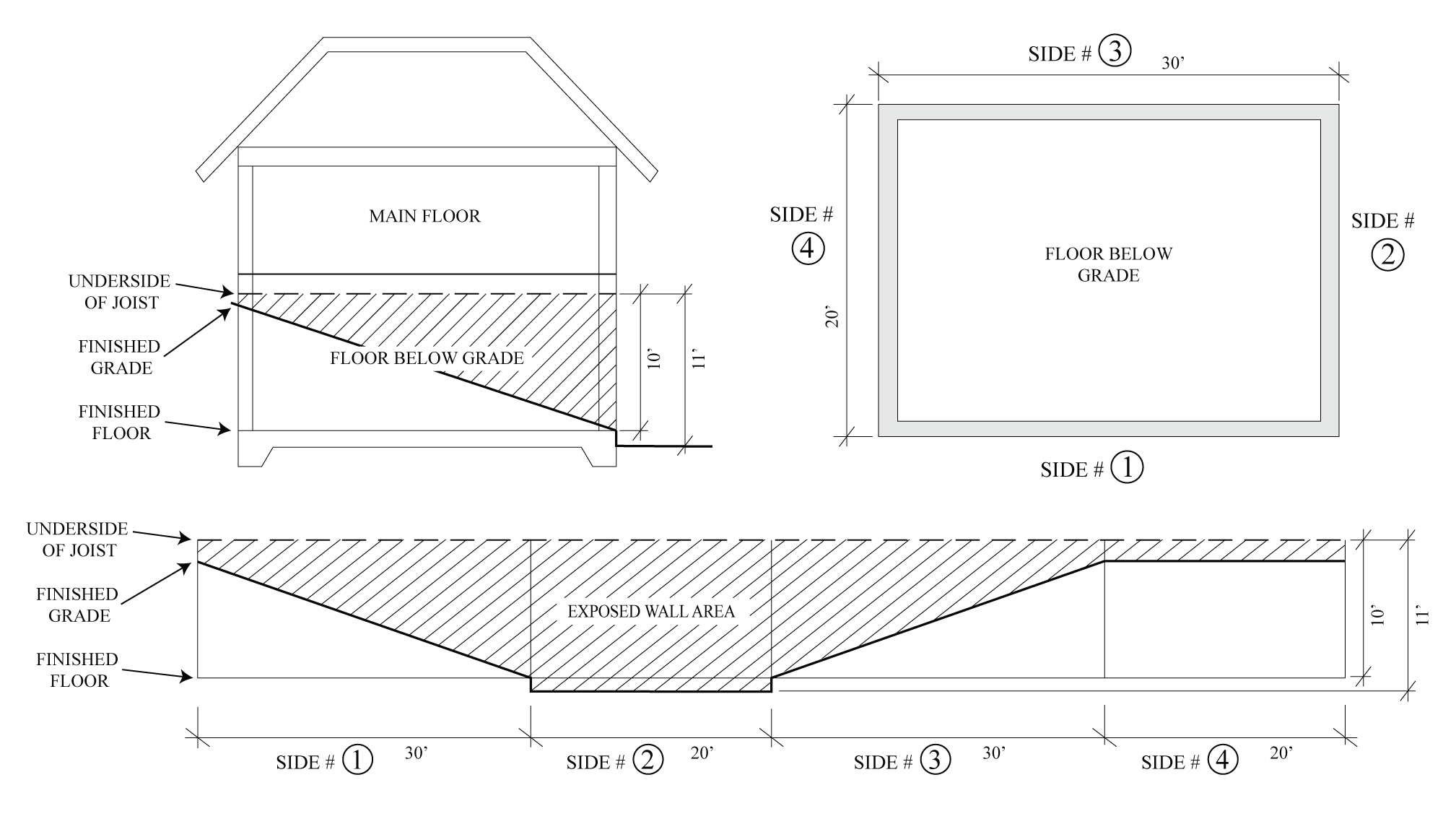
Figure 2-4 — Illustrative example for calculating the floor below grade adjustment
(3)
Garages attached to a dwelling.
(a)
On lots with a lot area (net) of less than 12,000 square feet, up to 500 square feet per dwelling unit of floor area (net) used as an attached two-car garage for the parking of motor vehicles is not included in the net floor area used to determine compliance with the FAR in Table 2-29 (One-family Dwelling Floor Area Limits), of Subsection G.1.a.(1), above.
Larger garages may be allowed, however, excess square footage will be counted toward the net floor area of the dwelling.
(b)
Lots of 12,000 square feet (net) or greater. On lots with a lot area (net) of 12,000 square feet or greater, up to 750 square feet of floor area (net) used as an attached garage for the parking of motor vehicles is not included in the net floor area used to determine compliance with Subsection G.1.a.(2), above.
(4)
Accessory dwelling units and junior accessory dwelling units. The following shall not be included in the net floor area used to determine compliance with Subsection G.1, above:
(a)
Up to 850 square feet of floor area (gross) devoted to an attached accessory dwelling unit that provides one bedroom or less.
(b)
Up to 1,000 square feet of floor area (gross) devoted to an attached accessory dwelling unit that provides more than one bedroom.
(c)
Up to 500 square feet of floor area (gross) devoted to a junior accessory dwelling unit.
(5)
Transfer of floor area. Up to one-half of the maximum allowed floor area of a principal dwelling may be transferred to an existing or new principal dwelling as follows:
(a)
Elimination of potential subdivision. The maximum allowed floor area on a lot that may be subdivided in compliance with the applicable zone in effect as of June 6, 2014 may be increased in compliance with the following and Subsection G.5(c), below:
(i)
A Declaration of Restriction acceptable to the County shall be recorded by the property owner prior to the issuance of a building permit to eliminate the subdivision potential of the lot.
(ii)
The increase in the maximum allowed floor area is limited to one-half of the maximum allowed floor area that would otherwise be allowed for a lot that is equal in size to the minimum lot size required in compliance with the applicable zone in effect as of June 6, 2014.
(b)
Elimination of existing lot. The maximum allowed floor area on a lot that cannot be subdivided in compliance with the applicable zone in effect as of June 6, 2014 may be increased in compliance with the following and Subsection G.5(c) below:
(i)
The lot is contiguous to a lot that cannot be subdivided in compliance with the applicable zone in effect as of June 6, 2014.
(ii)
A voluntary merger of the two lots and a Declaration of Restriction acceptable to the County shall be recorded by the property owner prior to the issuance of a building permit to eliminate the subdivision potential of the lot.
(iii)
The increase in the maximum allowed floor area is limited to one-half of the maximum allowed floor area that would otherwise be allowed on either of the lots that are the subject of the voluntary merger.
(c)
In no event shall the maximum allowed floor area as adjusted in compliance with Subsections G.5(a) or G.5(b) above exceed:
(i)
12,000 square feet on lots with a lot area (net) of less than 20 acres.
(ii)
15,000 square feet on lots with a lot area (net) of 20 acres or greater.
c.
Existing structures that exceed the maximum allowed floor area. An existing structure that exceeds the maximum allowed floor area (net) may be altered or reconstructed provided that the proposal complies with the Summerland Residential Design Guidelines in all other respects.
2.
Parking.
a.
Parking spaces required. All new one-family dwellings approved after June 6, 2014 shall provide the following number of off-street parking spaces shown in Table 2-30 (Additional Parking Space-Requirement), below, in addition to the number otherwise required by Chapter 35.36 (Parking and Loading Standards).
Table 2-30Additional Parking-Space Requirement
(1)
Use of permeable materials. Parking spaces shall be paved with permeable materials on a suitable base, including concrete pavers, turf block, and permeable asphalt, provided that such materials are consistent with the County Fire Department or applicable fire district minimum structural design standards for emergency access.
(2)
Location. Parking spaces shall be located outside of required setback areas for the lot, except that one parking space may be located within the front setback area provided the location is approved by the Board of Architectural Review in compliance with Section 35.82.070 (Design Review).
(3)
Configuration. On lots of 10,000 square feet (net) or more in area, the additional parking spaces required in compliance with Table 2-30 (Additional Parking-Space Requirement) may be provided in a tandem arrangement with each other.
H.
Toro Canyon Plan area.
1.
Development Standards. All non-agricultural structures shall be in compliance with the following development standards:
a.
Large understories and exposed retaining walls shall be minimized.
b.
Building rake and ridgelines shall conform to or reflect the surrounding terrain.
c.
Landscaping shall be used to integrate the structure into the site and its surroundings, and shall be compatible with the adjacent terrain.
d.
The exterior surfaces of the structure, including water tanks, walls, and fences, use non-reflective building materials and colors shall be compatible with the surrounding terrain (including rock outcrops, soils, and vegetation). Where paints are used, they shall be non-reflective.
e.
Retaining walls shall be colored and textured (e.g., with earth tone and split faces) to match adjacent soils or stone, and shall be visually softened with appropriate landscaping.
f.
Outside lighting shall be minimized. Outside lighting shall be shielded, downward-directed low-level lighting consistent with Toro Canyon's rural and semi-rural character.
g.
The total height of cut slopes and fill slopes, as measured from the natural toe of the lowest fill slope (See Figure 2-5) or the natural toe of the lowest cut slope (See Figure 2-6) to the top of the cut slope, shall be minimized. The total vertical height of any graded slopes for a project, including the visible portion of any retaining wall above finished grade, shall not exceed 16 vertical feet. A project may be exempt from this standard if the Board of Architectural Review makes a written finding that:
(1)
The project furthers the intent of protecting hillsides and watersheds;
(2)
The project enhances and promotes better structural and/or architectural design; and
(3)
The project minimizes visual or aesthetic impacts.
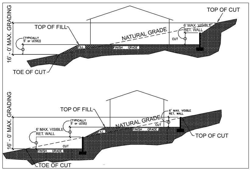
Figure 2-5 - Total height as measured from the natural toe of the lowest fill slope
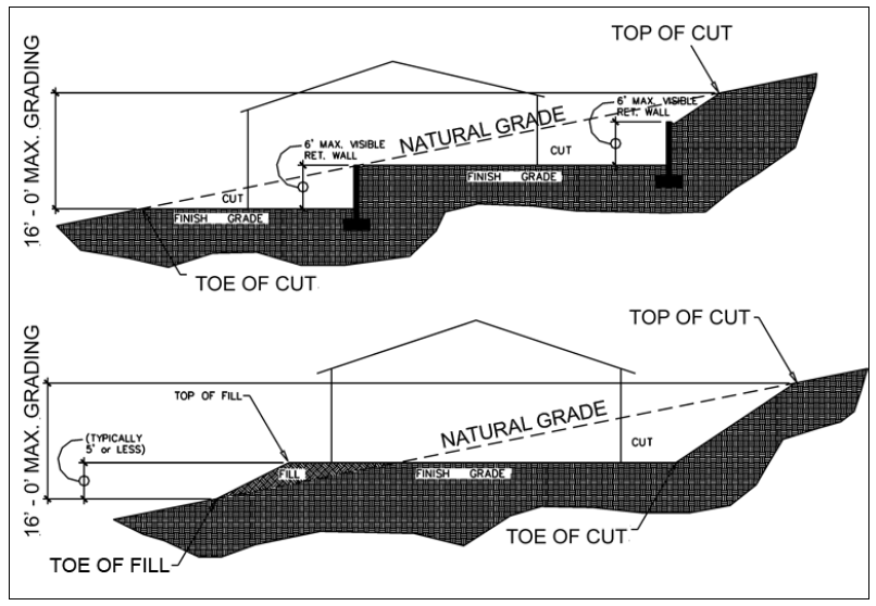
Figure 2-6 - Total height as measured from the natural toe of the lowest cut slope
h.
The visible portion of a retaining wall above finished grade shall not exceed a height of six feet. (See Figures 2-5 and 2-6). A project may be exempt from this standard if the Board of Architectural Review makes a written finding that:
(1)
The project furthers the intent of protecting hillsides and watersheds;
(2)
The project enhances and promotes better structural and/or architectural design; and
(3)
The project minimizes visual or aesthetic impacts.
I.
Gaviota Coast Plan area.
1.
Gaviota Coast Plan area land use incentive program.
a.
Purpose and intent. The purpose of the Gaviota Coast Plan area land use incentive program is to allow landowners within the Gaviota Coast Plan area on property zoned AG-II to develop additional dwelling units (i.e., incentive dwelling units) in exchange for taking actions that provide a demonstrated public benefit such as the provision of public trails. The intent is to implement the policies and development standards of Gaviota Coast Plan that seek to, through voluntary landowner action, provide a greater level of protection and enhancement of natural resources, support agricultural viability, and increase public access, throughout the Plan area while preserving the existing rural character of the Gaviota Coast.
b.
Applicability. The provisions of this Subsection I.1 (Gaviota Coast Plan area land use incentive program) only apply to property zoned AG-II and located within the Gaviota Coast Plan area.
c.
Allowable density. Incentive dwelling units shall not count toward the allowable density for purposes of determining consistency with the Comprehensive Plan and this Development Code.
d.
Actions and eligible incentives. Table 2-31 (Actions and Eligible Incentives), below, describes the voluntary actions a landowner may take and the benefits that may be derived from taking those actions, i.e., the issuance of a permit(s) for an incentive dwelling unit.
Table 2-31- Actions and Eligible Incentives
(1)
Dedication of trail easements shall comply with the following:
(a)
The easement shall be for the entire length of the trail that is located on the premises on which the incentive dwelling unit is proposed to be located.
(b)
An irrevocable offer of dedication shall be recorded by the landowner prior to the issuance of a Land Use Permit in compliance with Section 35.82.110 (Land Use Permits) or a Zoning Clearance in compliance with Section 35.82.210 for an incentive dwelling unit that may be allowed based on the dedication of a trail easement.
(i)
Said offer shall include, at a minimum, a description of the purpose of the easement and a legal description of the proposed easement.
(ii)
Said offer shall be subject to review and approval by the Department and the County Counsel.
e.
Requirements and development standards for incentive dwelling units. All incentive dwelling units allowed in compliance with this Subsection I.1 (Gaviota Coast Plan area land use incentive program) shall comply with the following requirements and development standards. Where there are conflicts between the standards of this Subsection I.1.e, the standards in Section 35.42.020 (Accessory Structures and Uses), and the standards in the specific zone regulations (Article 35.2 Zones and Allowable Land Uses), the provisions of this Section shall prevail unless indicated otherwise. The review authority may add other conditions, consistent with general law and applicable State and County standards as necessary to preserve the health, safety, welfare, and character of the agricultural area.
(1)
Accessory to the principal dwelling. The lot shall contain an existing one-family dwelling at the time an application for an incentive dwelling unit is submitted, or the application for the incentive dwelling unit shall be submitted in conjunction with the application for the principal dwelling. The incentive dwelling unit shall not be occupied before occupation of the principal dwelling.
(2)
Amenities. An incentive dwelling unit shall have a separate entrance and shall include permanent provisions for cooking, eating, living, sanitation and sleeping.
(3)
Application requirements. A permit application for an incentive dwelling unit shall include the following information in addition to that information required within Chapter 35.80 (Permit Application Filing and Processing):
(a)
A floor plan drawn to scale of the principal dwelling and the incentive dwelling unit(s).
(b)
Documentation verifying the principal dwelling is owner-occupied.
(c)
The proposed method of water supply and sewage disposal for the incentive dwelling unit(s).
(4)
Conversion of existing structures. An existing, legal agricultural employee dwelling or guesthouse that was constructed prior to December 9, 2016 may be converted to an incentive dwelling unit.
(a)
An existing, legal agricultural employee dwelling that is converted to an incentive dwelling unit may be replaced with a new agricultural employee dwelling in compliance with Section 35.42.030 (Agricultural Employee Dwellings).
(b)
An existing, legal guest house that is converted to an incentive dwelling unit may be replaced with a new guest house in compliance with Section 35.42.150 (Guesthouses, Artist Studios, and Cabañas) provided that there is no more than one guesthouse located on the premises.
(c)
If the existing, legal agricultural employee dwelling or guest house that is proposed to be converted to an incentive dwelling unit is subject to a recorded Notice to Property Owner, then following the effective date of the required planning permit and prior to the use of the agricultural employee dwelling or guest house as an incentive dwelling unit the Department shall prepare and the property owner shall record a Notice to Property Owner that documents specific conditions and/or restrictions, if any, that apply to use of the structure as an incentive dwelling unit and supersedes the specific conditions and/or restrictions included in the previous Notice to Property Owner.
(d)
A detached incentive dwelling unit that results from the conversion of an existing, legal agricultural employee dwelling may exceed the applicable maximum gross floor area limit provided no building additions or alterations shall be allowed that result in an increase in the gross floor area in excess of that which existed prior to December 9, 2016.
(5)
Height limit.
(a)
Attached incentive dwelling units. An attached incentive dwelling unit shall not exceed a height of 16 feet as measured from the lowest finished floor of the incentive dwelling unit to the bottom of the support system of the floor above, or, if there is no floor above, to the highest points of the coping of a flat roof or to the mean height of the highest gable of a pitch or hip roof that covers the incentive dwelling unit. An exception to this height limit may be granted when the portion of a proposed incentive dwelling unit that would exceed this height limit is wholly contained within an existing structure.
(b)
Detached incentive dwelling units. A detached incentive dwelling unit that is not connected by any means to another structure shall not exceed a building height of 16 feet. A detached incentive dwelling unit connected to a detached accessory structure may be permitted provided:
(i)
The height of the incentive dwelling unit shall not exceed a height of 16 feet as measured from the lowest finished floor of the incentive dwelling unit to the bottom of the support system of the floor above, or, if there is no floor above, to the highest points of the coping of a flat roof or to the mean height of the highest gable of a pitch or hip roof of the roof that covers the incentive dwelling unit, and
(ii)
The height of the entire structure does not exceed 25 feet.
(c)
Locations within the CVC Overlay. If the incentive dwelling unit is proposed to be located on a lot zoned with the CVC (Critical Viewshed Corridor) overlay zone and located south of Highway 101, then the height of the incentive dwelling unit shall not exceed 15 feet as measured in compliance with Subsections I.1.3.(5) (a) and (b), above, unless an increase in height that complies with Subsections I.1.3.(5) (a) and (b), above, is approved by the Board of Architectural Review in compliance with Section 35.28.070 (Critical Viewshed Corridor (CVC) Overlay Zone).
(6)
Location of detached incentive dwelling unit. A detached incentive dwelling unit shall comply with the setback regulations that apply to the principal dwelling as identified in the applicable zone. Additionally, except for the conversion of agricultural employee dwellings and guest houses allowed in compliance with Subsection I.1.e.(4), above, that existed prior to December 9, 2016, detached incentive dwelling units shall be clustered with the principal dwelling unit.
(a)
For the purposes of this Subsection I.1.e.(6), clustered means the principal dwelling unit and the detached incentive dwelling unit, including all structures accessory thereto, shall be located within a single continuous building envelope.
(b)
The clustered building envelope shall minimize "barbell," "finger," and "peninsula" type configurations to ensure, to the maximum extent feasible, that the development minimizes intrusion into agricultural areas and maximizes clustering of residential and accessory structures in order to preserve productive agricultural lands.
(7)
Maximum and minimum gross floor area requirements.
(a)
Maximum gross floor area.
(i)
Attached incentive dwelling units. The maximum gross floor area of attached incentive dwelling units shall not exceed 1,200 square feet.
(ii)
Detached incentive dwelling units. Unless allowed in compliance with Subsection I.1.e.(4)(d), above, the maximum gross floor area of a detached incentive dwelling unit shall not exceed the standards for the specified gross lot area shown in Table 2-32 (Maximum Gross Floor Area Gaviota Coast Plan Area) below.
Table 2-32- Maximum Gross Floor Area Gaviota Coast Plan Area
(b)
Minimum gross floor area. The minimum gross floor area of an incentive dwelling unit shall be 300 square feet.
(c)
Measurement of gross floor area. The gross floor relates only to directly accessible appurtenant interior spaces and does not include any existing floor area not contained within the incentive dwelling unit, nor the floor area of storage or other accessory structures or spaces not directly accessible from the living area of the incentive dwelling unit.
(8)
Maximum number of incentive dwelling units.
(a)
A maximum of two incentive dwelling units consisting of one attached incentive dwelling unit and one attached or detached incentive dwelling unit may be allowed on a premises that qualifies under Category 1 in Table 2-31 (Actions and Eligible Incentives), above.
(b)
A maximum of one attached incentive dwelling unit or one detached incentive dwelling unit may be allowed on a premises that qualifies under Category 2 in Table 2-31 (Actions and Eligible Incentives), above.
(c)
In no case shall more than two incentive dwelling units be approved on a premises that has both coastal trail primary and secondary routes depicted on the PRT maps.
(9)
Parking requirements. In addition to the required parking for the principal dwelling, a minimum of one off-street parking space shall be provided on the same lot that the incentive dwelling unit is located on for each sleeping room in the incentive dwelling unit. The additional parking shall be provided as specified in the base zone and in Chapter 35.36 (Parking and Loading Standards).
(10)
Notification of occupants. The owner shall provide notification to the occupants of an incentive dwelling unit that the residence is located on and adjacent to property zoned and used for agriculture and that inconvenience or discomfort from properly conducted agricultural operations, including noise, dust, odors, and chemicals, shall not be deemed a nuisance.
(11)
Private and public services.
(a)
Where public water service is available, an incentive dwelling unit shall be required to be served by the appropriate district.
(i)
If the principal dwelling is currently served by a public water district or mutual water company, not subject to moratorium for new connections, then an incentive dwelling unit shall also be served by the appropriate public water district or mutual water company.
(ii)
If the principal dwelling is currently served by a water district or mutual water company subject to a moratorium for new connections, or if the existing service is by a private water system and if the property is not located in an overdrafted water basin, then an incentive dwelling unit may be served by a private water system subject to review and approval by the Public Health Department or State as applicable.
(b)
Where public sewer service is available, an incentive dwelling unit shall be required to be served by the appropriate district.
(i)
For the purposes of this Subsection I.1.e.(11)(b), public sewer service may be considered as not being available when such public sewer or any building or any exterior drainage facility connected thereto is located more than two hundred feet from any proposed building or exterior drainage facility on any lot or premises that abuts and is served by such public sewer. (California Plumbing Code Section 713.4)
(c)
An incentive dwelling unit proposed to be served by an onsite wastewater treatment system shall not be allowed in addition to a principal dwelling on a lot less than two gross acres in size if the principal dwelling is served by or is proposed to be served by an onsite wastewater treatment system.
(12)
Residency of lot owner.
(a)
The owner of the lot (or the major shareholder, officer, partner, or beneficiary of a corporate or trust owner) shall reside on said lot, in either the principal dwelling or in an incentive dwelling unit except when a) disability or infirmity require institutionalization of the owner, or b) the Director approves in writing owner's written request for a temporary absence due to illness, temporary employment relocation, sabbatical, extended travels, or other good cause. Before the issuance of a Land Use Permit in compliance Section 35.82.110 (Land Use Permits) or a Zoning Clearance in compliance with Section 35.82.210 (Zoning Clearances), the owner shall sign and record an agreement with the County requiring that the owner reside on the property.
(b)
Upon transfer of ownership of the property, the new owner shall reside on the property or the use of a structure or portion thereof as an incentive dwelling unit shall be discontinued and the structure shall be:
(1)
If attached to the principal dwelling, converted into a portion of the principal dwelling; or,
(2)
If it is a detached structure, removed or converted into a legal accessory structure.
(13)
Sale and subdivision.
(a)
An incentive dwelling unit shall not be financed, sold or transferred separately from the principal dwelling.
(b)
Upon approval of an incentive dwelling unit on a lot, the lot shall not be subdivided unless there is adequate land area to divide the lot in compliance with:
(i)
The Comprehensive Plan including the Gaviota Coast Plan designation.
(ii)
This Development Code including Article 35.2 (Zones and Allowable Land Uses).
(iii)
Subsection I.1.e.(11)(c), above, if an incentive dwelling unit is proposed to be served by an onsite wastewater treatment system following the subdivision.
f.
Additional findings. In addition to the findings required in compliance Section 35.82.110 (Land Use Permits), before the approval of a permit for a detached incentive dwelling unit the Director shall make all of the following findings:
(1)
The incentive dwelling unit is incidental and subordinate to the primary agricultural use of the lot.
(2)
The incentive dwelling unit does not adversely affect the onsite or adjacent agricultural operations.
(3)
The incentive dwelling unit is compatible with and does not substantially alter the rural, agricultural character of the area.
2.
Gaviota Coast Plan area air quality disclosure statement. Prior to the issuance of a Land Use Permit in compliance with Section 35.82.110 (Land Use Permits) or a Zoning Clearance in compliance with Section 35.82.210 (Zoning Clearances) for residential developments that are located within 500 feet of Highway 101, a Notice to Property Owner shall be required to be recorded by the property owner that provides an Air Quality Disclosure Statement to potential buyers of the property. The Air Quality Disclosure Statement shall summarize the results of technical studies that reflect a health concern resulting from the exposure of children to air quality emissions generated within 500 feet of Highway 101.