
Sarasota City Zoning Code
ARTICLE VI
ZONE DISTRICTS
Sec. VI-100. - Districts designated.
Division 1. General
Zone District Map and General Regulations
Division 2. Residential Single Family
RSF-E Residential Single Family Estate
RSF-1 Residential Single Family 1
RSF-2 Residential Single Family 2
RSF-3 Residential Single Family 3
RSF-4 Residential Single Family 4
RSM-9 Residential Single Multiple 9 units per acre
RTD-9 Residential Transition District 9 units per acre
Division 3. Residential Multiple Family
RMF-1 Residential Multiple Family 1
RMF-2 Residential Multiple Family 2
RMF-3 Residential Multiple Family 3
RMF-4 Residential Multiple Family 4
RMF-5 Residential Multiple Family 5
RMF-6 Residential Multiple Family 6
RMF-7 Residential Multiple Family 7
RMF-R Residential Multiple Family Revitalization*
Division 4. Office
OND Office Neighborhood District
OCD Office Community District
ORD Office Regional District
SMH Sarasota Memorial Hospital
BG Botanical Gardens
OPB Office Professional Business*
OPB1 Office Professional Business 1*
OP Office Park*
MCI Medical Charitable Institutional*
Division 5. Commercial
CND Commercial Neighborhood District
CSD Commercial Storefront District
CRD Commercial Residential District
CGD Commercial General District
CSC Commercial Shopping Center
CN Commercial Neighborhood*
CBN Commercial Business Newtown (Newtown CRA only)
NT North Trail (North Trail only)
CT Commercial Tourist (St. Armands only)
CP Commercial Park*
CSCN Commercial Shopping Center Neighborhood*
CSCC Commercial Shopping Center Community*
CSCR Commercial Shopping Center Regional*
CG Commercial General*
Division 6. Production Intensive Commercial
ICD Intensive Commercial District
IGD Industrial General District
IHD Industrial Heavy District
CI Commercial Intensive*
ILW Industrial Light Warehousing*
I Industrial*
Division 7. Special Purpose
WFR Waterfront Resort
G Governmental
CRT Commercial Residential Transition*
Division 8. Open Space, Recreation and Conservation
POS Park and Open Space
MP Marine Park
Division 9. Special Public Interest Overlay Districts
(FCOD) Fruitville Gateway Corridor Overlay District
(MMOD) "Missing Middle" Overlay District
(CIO) Coastal Islands Overlay District
(ROD) Ringling Overlay District
(HAOD) Housing Authority Overlay District
(NTOD) North Trail Overlay District
(LPOD) Laurel Park Overlay District
(RROD) Rosemary Residential Overlay District
(NCHD) Newtown Conservation Historic Overlay District
Division 10. Downtown Zone Districts
DTN Downtown Neighborhood District
DTNE Downtown Neighborhood Edge District
DTE Downtown Edge District
DTC Downtown Core District
DTB Downtown Bayfront District
Division 11. Urban Mixed-Use Zone Districts
MU-1 Urban Mixed-Use 1
MU-2 Urban Mixed-Use 2
MU-3 Urban Mixed-Use 3 (North Trail only)
* Indicates non-implementing district that may not be used in future rezonings.
(Ord. No. 02-4357, 4-29-02; Ord. No. 04-4531, § 3, 6-7-03; Ord. No. 09-4838, § 2(att. 1), 2-17-09; Ord. No. 09-4888, § 2(att. 1), 11-2-09; Ord. No. 10-4915, § 2(att. 1), 6-7-10; Ord. No. 13-5041, § 2(att. 1), 3-4-13; Ord. No. 24-5510, § 2(Exh. A), 4-1-24)
Sec. VI-101. - Purpose.
The initial implementing zone districts are identified in the Sarasota City Plan, as zone districts which have an intent and purpose that is conceptually consistent with the intent of the future land use classifications. The intent, specific uses and development standards reflected by those districts were examined and implementing zone districts, defined below, have been developed to achieve consistency between these factors and the future land use classifications.
While it is the intent of the city to eventually eliminate all non-implementing zoning districts the city also recognizes that the Sarasota City Plan, is a long-range plan and the city commission may elect to rezone certain zoning lots while allowing a non-implementing zone district to remain in effect for others. Therefore, this article contains the non-implementing zone districts that remain in effect. However, the non-implementing zone districts shall no longer be used as a basis for future rezonings.
In order to carry out the intent of and purpose of the Sarasota City Plan; the city is hereby divided into the following implementing zone districts.
1 An application seeking a rezoning of Metropolitan Regional Site 10 to the Downtown Edge (DTE) Zone District shall be submitted concurrently with a site plan application. A site plan application requiring planning board and city commission public hearings shall be processed for review simultaneous with a rezone application for this site.
(Ord. No. 02-4357, 4-29-02; Ord. No. 04-4515, § 2, 1-20-04; Ord. No. 04-4531, § 3, 6-7-04; Ord. No. 09-4838, § 2(att. 1), 2-17-09; Ord. No. 09-4888, § 2(att. 1), 11-2-09; Ord. No. 10-4915, § 2(att. 1), 6-7-10; Ord. No. 18-5241, § 2(Exh. A), 5-7-18; Ord. No. 20-5338, § 2(Exh. A), 1-4-21; Ord. No. 24-5510, § 2(Exh. A), 4-1-24)
Sec. VI-102. - Zone district map, and general regulations.
(a)
Purpose. The purpose of the zone district map is to set forth the boundaries of the zoning districts established in these regulations. The purpose of the land use matrix is to provide a list of all permitted land uses along with the districts where these uses are permitted to locate.
(b)
Zone district map. The location and boundaries of the districts established by these regulations are described on the zone district map of the city, which together with all explanatory matter thereon, is hereby adopted by reference and declared to be a part of these regulations as if they were fully described herein.
(c)
Maintenance of map. The zone district map, as amended from time to time in accordance with the provisions of division 11 of article IV (rezonings) shall be maintained by the planning department and kept on file and made available for public reference in the office of the city auditor and clerk.
(d)
Application of regulations within boundaries. Except as otherwise specifically provided, a district symbol or name shown within district boundaries on the official zoning map indicates that district regulations pertaining to the district extend throughout the area surrounded by the boundary line.
(e)
Interpretation of boundaries. Where uncertainty exists as to the boundaries of districts as shown on the official zoning map, the following rules shall apply:
(1)
Boundaries indicated as approximately following the centerlines of streets or alleys shall be construed to follow such centerlines as they exist on the ground, except where variation of actual location from mapped location would change the zoning status of a zoning lot, in which case the boundary shall be interpreted in such a manner as to avoid changing the zoning status of any zoning lot. Should a street or alley be vacated or closed, the boundary line shall be construed as remaining in its location, except where ownership of the vacated street or alley is divided other than at the center, in which case the boundary line shall be construed as moving with the ownership.
(2)
Boundaries indicated as approximately following zoning lot lines, public property lines, and the like shall be construed as following such lines; provided that, where such boundaries are adjacent to a street or alley and the zoning status of the street or alley is not indicated, the boundaries shall be construed as running to the middle of the street or alley. Should a street or alley be vacated or closed, interpretation shall be as provided in subsection (1) of this section.
(3)
Boundaries indicated as approximately following city limits shall be construed as following such city limits.
(4)
Boundaries indicated as following railroad tracks shall be construed as being midway between the main tracks.
(5)
Boundaries indicated as following shorelines or centerlines of streams, canals, lakes or other bodies of water or indicated as following mean high water lines shall be construed as following such shorelines, centerlines or mean high water lines. In the case of a change in shoreline or of the course or extent of bodies of water, the boundaries shall be construed as moving with the change.
(6)
Boundaries indicated, as following physical features other than those mentioned above shall be construed as following such physical features, except where variation of actual location from mapped location would change the zoning status of a zoning lot. In such case, the boundary shall be interpreted to avoid changing the zoning status of any zoning lot.
(7)
Boundaries indicated as parallel to or extensions of features indicated in subsections (1) through (6) of this section shall be construed as being parallel to or extensions of such features.
(8)
The scale of the map on the page of the atlas showing the property in question shall determine distances not specifically indicated on the official zoning map.
(f)
Exclusive nature of the chapter.
(1)
Except as otherwise expressly provided herein, this article shall be deemed exclusive in nature, and only those uses specified shall be permitted in the various zoning districts. If a use is not specified in a zoning district, it shall be prohibited in that district. In the event that a use is not permitted in any zoning district, it may only be permitted after appropriate amendment to the text of this chapter.
(2)
Without limiting the provisions of subsection (1) of this section, any use, condition, or activity defined in article II which is not specifically permitted in a zoning district shall be prohibited in that district. Further, when any defined use, condition or activity is permitted in a district subject to restrictions, such use, condition, or activity is prohibited if it is being conducted in violation of those restrictions.
(3)
Although a proposed use and structure may not be specifically identified as a principal permitted use and structure in a particular zone district, or a conditional use, the director of neighborhood and development services shall have the authority to determine whether a proposed use and structure may be permitted, by reasonable implication, as a principal permitted use and structure or a conditional use in any zone district. Such determinations by the director of neighborhood and development services shall be subject to review and approval by the city manager. In making such a determination, the director of neighborhood and development services shall find that each of the following conditions have been met:
a.
That the proposed use is substantially the same in character as one (1) or more of the activities, businesses or operations which are specifically designated as principal permitted uses in the zone district or a conditional use;
b.
That any structure associated with a proposed use is substantially the same in character as those structures associated with one or more of the activities, businesses or operations specifically designated as principal permitted uses or a conditional use in the zone district;
c.
That the proposed use would not be contrary to the intent of the particular zone district.
(4)
Those technical requirements of these regulations, such as site plan approval, minimum yard requirements, minimum off-street parking requirements, maximum zoning lot coverage, maximum height of structures, and other such standards as are applicable in a particular zone district, shall be applied to the proposed use and structure which has been permitted in the zone district by reasonable implication. The specific standards to be applied shall be those standards that are applicable to the specifically identified use and structure most similar in character to the proposed use and structure which is to be permitted by reasonable implication. Further, in the event that the director of neighborhood and development services determines that a proposed use may be permitted as a conditional use, such determination shall in no manner effect the application of the provisions of these regulations as to the procedures to be followed to obtain a conditional use approval and any other standards or requirements to be applied to conditional uses.
(5)
It is further the intent of these regulations that the duties of the city commission concerning these regulations shall not include hearing and deciding questions of enforcement and interpretation that may arise. The procedure for settling such questions shall be governed by the policy set out in this section and the procedures set out in these regulations.
(6)
It is further the intent of these regulations that decisions involving conditional uses shall first be made by the planning board, with review by the city commission only as set out in section IV-905 of these regulations and that recourse to the courts from such decisions shall be provided by applicable law of the state.
(g)
Interpretation when more than one standard applies. Whenever more than one regulation or standard applies to any use, structure, activity or undertaking subject to any provision of this chapter, the most restrictive or stringent shall govern.
(h)
Maximum development rights. It is not the intent of this zoning code that each zoning lot must necessarily be allowed to develop to the maximum intensity theoretically permitted by the applicable development regulations. Practical considerations, such as, but not limited to, site characteristics or dimensions, natural features, existing improvements, or conditions imposed at the time of development approval, may operate to limit the intensity of development which would have otherwise been allowed. For example, a one-acre site located in a zone district which permits a dwelling unit density of nine units per acre may not be able to accommodate nine dwelling units due to the existence of some or all of the above referenced practical considerations or due to the applicability of other development regulations.
(i)
Conversion of assisted living facilities. If an assisted living facility is changed to multiple-family use, then the full provisions of these regulations, including provision of off-street parking, shall be met for such multiple-family use prior to any occupancy on a multiple-family basis.
(j)
Parking and storage of certain equipment, vehicles, etc.
(1)
No recreational vehicle, motor home or accessory recreational vehicle shall be used for living, sleeping or housekeeping purposes. A recreational vehicle, motor home or accessory recreational vehicle may be parked or stored in a rear or side yard but not in a front yard, provided that such equipment may be parked anywhere on residential premises for no more than 24 hours during loading and unloading.
(2)
No motor vehicle, shall be parked or stored on any real property situated within the city if the same is wrecked, dismantled, partially dismantled, inoperative or is abandoned or discarded. The foregoing prohibition shall not apply if the motor vehicle is parked or stored in an enclosed building, lawfully existing on real property, so long as the same is not visible from other public or private real property.
(3)
A motor vehicle, as defined in article II, may be temporarily stored or parked on real property, not enclosed within a building, if each of the following conditions are met:
a.
The motor vehicle has a currently valid registration and a currently valid license plate affixed thereon, issued by the state department of highway safety and motor vehicles;
b.
The motor vehicle is titled in the name of the owner or person in possession of the real property whereon it is temporarily parked or stored; and
c.
So long as said motor vehicle is inoperable for no more than three calendar days.
(k)
Moving of buildings or structures. No building or structure shall be moved from one zoning lot to another or moved to another location on the same zoning lot unless such building or structure shall thereafter conform to all of the applicable provisions of this zoning code and the provisions of chapter 11, section 11-106, of the Code of the City of Sarasota.
(l)
Access.
(1)
Every building hereafter erected or moved shall be on a zoning lot that abuts either a public or private street. All structures shall be so located on zoning lots as to provide safe and convenient access for servicing, fire protection and required off-street parking. No dwelling shall be erected on a zoning lot or portion of a zoning lot that does not abut on at least one public street or approved private street for at least 20 feet. Except, flag zoning lots shall be developed in accordance with the standards of section VII-602(gg) of this Code.
(2)
No land which is residentially zoned shall be used for driveway, walkway or access purposes to any land which is nonresidentially zoned or used for any purpose not permitted in a residential district, except for ingress and egress to an existing use which does not abut a street.
(3)
No land which is zoned as single-family shall be used for driveway, walkway or access purposes to any land which is zoned as multiple family.
(m)
Corner zoning lots. In the case of corner zoning lots in residential districts, except the RSM-9 zone district, a front yard of the required depth shall be provided on one frontage and a front yard of no less than 20 feet shall be provided on the other. If a corner zoning lot in a residential district existed on January 10, 1974, nothing in this subsection shall require that a structure shall be built with a building width less than 30 feet, even if the allowed building which will cause the structure to encroach into a required front yard. However, any structure built to a width of 30 feet shall meet minimum side yard setback requirements.
(n)
Special yards. In the case of irregularly shaped zoning lots, the director of neighborhood and development services shall determine which yards shall apply by the relation of the portion of the zoning lot on which the yard is to be located to the adjoining zoning lot or zoning lots, with due regard to the orientation and location of structures and buildable area thereon.
(o)
Reduction of lot area. No zoning lot, lot of record, parcel, or yard existing on January 10, 1974, shall thereafter be reduced in dimension or area below the minimum requirements set forth in these regulations, except by reason of a portion being acquired for public use in any manner, including dedication, condemnation, purchase and other similar situations. Zoning lots or yards created after January 10, 1974 shall meet at least the minimum requirements established by these regulations.
(p)
Height limitations. The height limitations contained in the regulations pertaining to specific districts do not apply to spires, belfries, cupolas, personal television antennae, water tanks, ventilators, chimneys, elevator shaft enclosures, or other appurtenances usually required to be placed above the roof level and not intended for human occupancy. In addition, the height limitations shall not apply to non-habitable architectural features (including roofs) extending no more than six feet above the eave line of a roof for buildings in zone districts in which the maximum height limitation is less than 51 feet, no more than nine feet for buildings in zone districts in which the maximum height limitation is greater than 51 feet and less than 101 feet, no more than 12 feet for buildings in zone districts in which the maximum height limitation is greater than 101 feet and less than 141 feet, and no more than 20 feet for buildings in zone districts in which the maximum height limitation exceeds 141 feet. Provided, however, that the heights of the above cited structures or appurtenances thereto shall not exceed any height limitations prescribed by the Federal Aviation Administration or airport zoning regulations within the flight approach zone of airports.
(q)
[Exclusion.] No part of a required yard or other required open space or off-street parking or off-street loading space provided in connection with one structure or use shall be included as meeting the requirements of any other structure or use, except where specific provision is made in these regulations.
(r)
Any references to conditional uses shall be interpreted to mean major conditional uses. Only those uses specifically cited as being allowed by minor conditional use shall use said minor conditional use process.
(s)
Overlay districts. Overlay districts may be used to modify the development standards of the underlying base zone district and delete uses that would otherwise be allowed in the underlying base zone district. However, overlay districts shall not be utilized to add uses not specifically allowed in the base zone district regulations or the future land use classification.
(t)
Measurements. This section explains how certain measurements are made in the zoning code.
(1)
Fractions. When calculations result in fractions the results will be rounded as follows:
a.
Minimum requirements. When a regulation is expressed in terms of a minimum requirement, any fractional result less than 0.5 shall be rounded down to the next whole number; any fractional result equal to or greater than 0.5 shall be rounded up to the next consecutive whole number. For example, if a minimum requirement of one parking space for every 200 square feet is applied to a 8,050 square foot building, the resulting fraction of 40.25 is rounded down to 40 required spaces. If a minimum requirement of one tree for every 30 feet is applied to a 50-foot strip, the resulting fraction of 1.67 is rounded up to two required trees.
b.
Maximum limits. When a regulation is expressed in terms of maximum limits, any fractional result shall be rounded down to the next lower whole number. For example, if a maximum limit of one dwelling unit for every 3,000 square feet is applied to an 8,000 square foot zoning lot, the resulting fraction of 2.67 is rounded down to two allowed dwelling units.
(2)
Determining density. Density shall be determined in the following ways.
a.
Dwelling units equipped with kitchen facilities shall be equal to one dwelling unit. Accessory kitchens do not count toward determining density. Any applicant seeking a dwelling unit with an accessory kitchen must sign an affidavit stating the property owner will not divide the structure into additional dwelling units. The affidavit must be recorded in the official records of Sarasota County as a condition precedent to issuance of the building permit.
b.
Dwelling units not equipped with kitchen facilities shall be equal to one-half of a dwelling unit.
c.
Where the residential facility contains an accessory infirmary, each bed shall be equal to one-quarter of a dwelling unit.
d.
Maximum dwelling unit calculations may only include area devoted to public streets and alleys as defined in i. below.
e.
Maximum dwelling unit calculations may only include area devoted to private streets and alleys as defined in ii. below.
i.
The amount of land area utilized to satisfy development standards shall include that portion of the zoning lot to be dedicated by the property owner to the city for public right-of-way purposes prior to the actual conveyance in accordance with the conditions of any applicable development approval, or a written agreement between the city and the property owner. The inclusion of such land area to satisfy development standards is permitted only for the first project actually built on the subject zoning lot after the actual conveyance of a portion of the zoning lot for public right-of-way purposes.
ii.
The amount of land area utilized to satisfy development standards shall include that portion of the zoning lot approved by the city for private right-of-way purposes in accordance with the conditions of any applicable development approval.
f.
Additional density and FAR for submerged land. (See also Sarasota City Plan, Future Land Use Chapter and Objective 1, submerged lands action strategy.)
i.
Submerged lands are those lands located beneath a body of water. Submerged lands include, but are not limited to, lands waterward of the mean high water line or located beneath a freshwater body of water such as a lake or pond.
ii.
In cases where the submerged lands are privately owned in a fee simple, and for submerged tidal lands where ownership has been provided by a deed(s) obtained from the Trustees of the Internal Improvement Fund of the State of Florida, the total area of the privately owned submerged lands may be included and used in the calculation of the maximum gross residential density or maximum nonresidential intensity (i.e., floor area ratio) for the adjacent upland parcel based on and using the same maximum residential density or maximum nonresidential intensity for the submerged lands as allowed for the upland parcel under its zoning district.
iii.
Assigned development rights provided for by this section shall be transferred to the adjacent upland area for development, however, development consistent with the open space recreation-conservation classification may be allowed to a limited extent over the submerged land area (e.g., docks, piers, boathouses, water-dependent structures and uses).
iv.
This section shall be applicable only when the future land use map classification for the adjacent upland area is also delineated on the future land use map for the boundary of the submerged land area.
g.
Required attainable dwelling units. When a regulation is expressed in terms of minimum number of attainable dwelling units required, any fractional result shall be rounded up to the next whole number. For example, if a development requires ten percent of a 121-unit development to be designated as attainable dwelling units, the resulting fraction of 12.1 is rounded up to require 13 attainable dwelling units.
(3)
Determining required setbacks.
a.
Required front yard setbacks shall be measured from the edge of the property line created by the dedication of the property to the city for public right-of-way purposes.
b.
Required front yard setbacks shall be measured from the edge of the right-of-way line created by the approved and recorded private right-of-way easement.
(4)
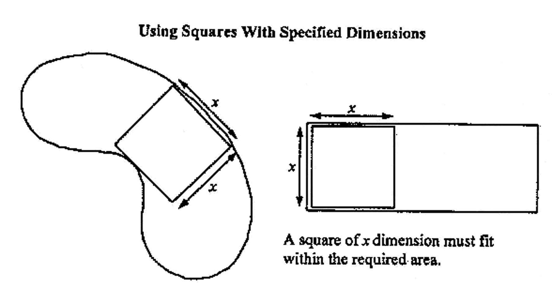
Measuring areas with squares of specified dimensions. Required areas (for example, required usable outdoor areas in residential zones) must be of a sufficient size and configuration so that a square measuring "X" by "X" can be placed totally within the required area. The dimensions of the square are stated in the base zone districts. See illustration VI-101.
(u)
Additional development standards applicable single-family dwellings in RSF-E, 1, 2, 3, 4, RTD-9 and RMF-1, 2, 3 zone districts.
Note: Non-profit organizations constructing housing sold to low to moderate income families (under 80 percent of median income in the county) may apply to use housing partnership funds, administered by the office of housing and community development, to offset the costs to comply with these requirements.
(1)
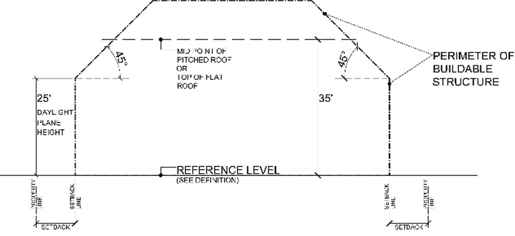
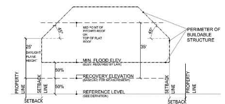
Maximum height—Single-family dwellings. All single-family dwellings shall be limited in height to the greater of 35 feet above reference level or in areas where flood elevations are established by law, 35 feet above the recovery elevation of a property. The maximum height of all single-family dwellings shall be measured commencing from either of the greater of the two points described in this section to the highest point of a flat roof, to the deck of a mansard roof or to the average height between the plate and the ridge of gable or hip roofs, not including chimneys, antennas or elevator shaft enclosures.
(2)
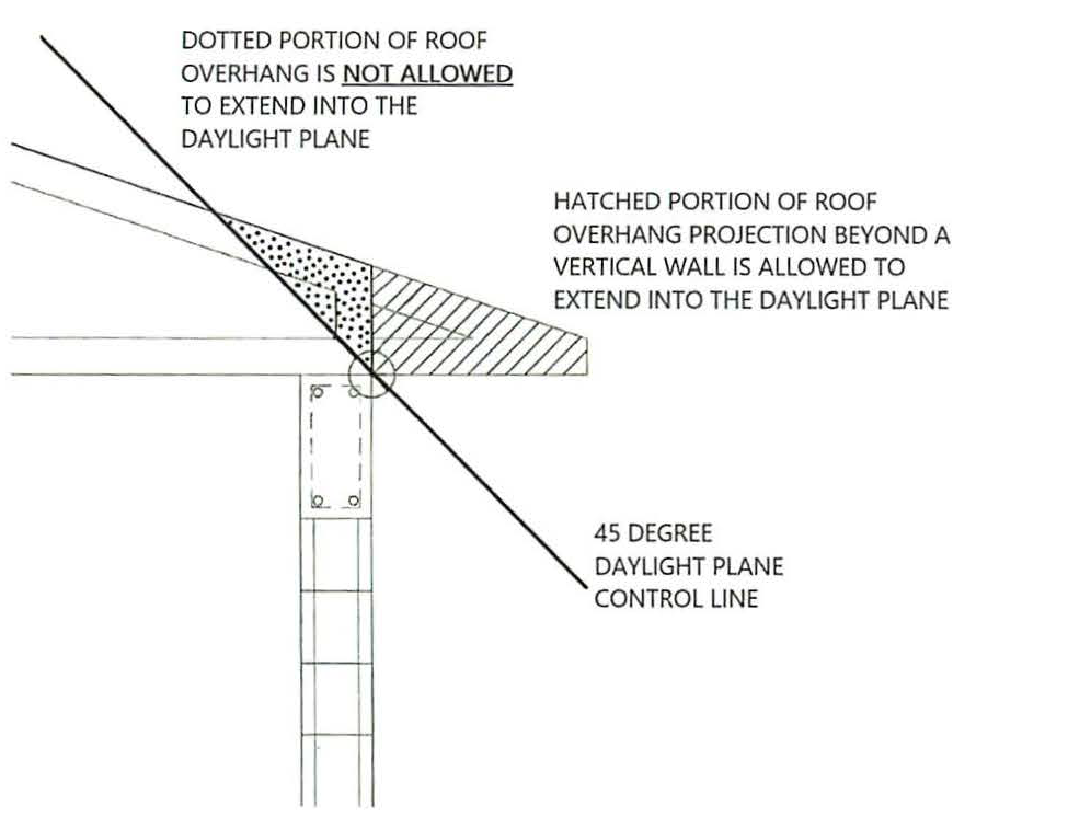
Daylight plane regulations. All single-family dwellings shall not be of such height or size that they penetrate the daylight plane which is an angle of 45 degrees measured above horizontal from the side yard setback lines, and beginning 25 feet above the greater of the Reference Level or the allowed recovery elevation, said plane projecting upward toward the center of the parcel. The daylight plane requirements above shall not apply to:
a.
Roof overhangs (portion projecting beyond a vertical wall), chimneys, antenna and elevator shaft enclosures;
b.
Dormers or other architectural features that do not exceed a combined 30 percent in length of the roof on the side of the structure upon which the dormers or architectural features are located.
Height of Single-Family Dwellings within Flood Zones
(3)
Outdoor mechanical equipment. Screening wall in the absence of perimeter fencing or mechanical equipment elevated above grade. Prior to the issuance of a building permit which includes the installation of new exterior mechanical equipment or the relocation of existing mechanical equipment in a side yard in the absence of perimeter fencing or when outdoor mechanical equipment is elected above grade, the applicant shall submit documentation demonstrating that a screening wall, or screening fence has been provided, to the director of development services showing all air conditioning equipment, pool pumps and similar electrical-mechanical equipment, proposed to be placed outside the main structure in a side yard to be screened from adjoining properties with a screening wall. This screening wall shall be required regardless of the distance from the side property line to the mechanical equipment. Wall- or window-mounted outdoor mechanical equipment shall be exempt from the screening wall requirement. The screening wall shall be required when outdoor mechanical equipment is elevated above grade or in the absence of perimeter fencing, only for new exterior mechanical equipment or the relocation of existing equipment (i.e., the replacement of existing mechanical equipment shall not require a screening wall). The screening wall shall be located in the side yard between the mechanical equipment and the closest property line. The screening wall shall be 18 inches higher than the equipment being shielded and at least as wide as the equipment being shielded. See section VII-1201 for allowable encroachment of the wall into the required setback. The site must be built to conform to the submitted documentation.
(4)
Drainage plan.
a.
Purpose: The alteration of land elevation that often accompanies the construction of single-family dwellings, building additions, swimming pools or spas often alters the historic drainage pattern from a parcel of land to the detriment of adjoining properties. The health, safety and welfare of the citizens of the city are promoted by requiring new residential construction to direct attendant stormwater drainage into public or private facilities rather than on to the land of adjoining properties.
b.
Drainage plan: The owner/applicant for a building permit to construct a new single-family dwelling or substantial improvements to a single-family dwelling shall submit to the director of neighborhood and development services a stormwater drainage management plan showing drainage from the site discharging to either: on-site retention; or swales directed to adjacent public or private stormwater receptors; or a combination thereof. The director of neighborhood and development services may require, upon receiving the recommendation of the building official, a drainage plan prepared and sealed by a professional engineer meeting the requirements of this section. The site must be built to conform to the submitted drainage plan. Such plan shall not be required for individual single-family dwellings when a master drainage plan for the development of which the single-family dwelling is a part has been submitted and approved.
(5)
Landscape plan required.
a.
Purpose: Trees have traditionally acted as visual unifying elements for residential dwelling units. Trees promote the aesthetics of the built environment, preserve the character of the neighborhood and enhance the overall appearance of the front yard of properties upon which single-family dwellings are located.
b.
The owner/applicant submitting an application for building permit for new construction of a single-family dwelling or additions to a single-family dwelling exceeding 500 square feet shall be required to simultaneously submit a landscape plan depicting the following:
1.
In the front yard of each single-family dwelling the following trees shall be required:
i.
For each front zoning lot line less than 30 feet in length: one canopy tree, understory tree may be planted when a canopy tree is not feasible;
ii.
For each front zoning lot line less than 100 feet in length: one canopy tree;
iii.
For each front zoning lot line 100 feet or more in length: two canopy trees.
2.
Minimum canopy tree size for purposes of this section shall be:
i.
Minimum height: 12 feet;
ii.
Minimum caliper: three inches. If the tree planted to meet this requirement is a native pine tree, it must be a minimum of one and one-half-inch caliper.
3.
Minimum understory tree size for purposes of this section shall be:
i.
Minimum height: eight feet;
ii.
Minimum caliper: two inches.
See section VII-308(h)(4), zoning code for lists of acceptable trees for this purpose. Existing trees meeting the standards of this section or determined to be Florida-friendly or native, within the front yard may be counted towards this minimum tree requirement. The site must be built to conform to the submitted landscape plan. A landscape plan shall not be required for individual single-family dwellings when a master landscape plan for the development of which the single-family dwelling is a part has been submitted and approved.
(v)
Mix of attainable units requirements. Any project developing at a density greater than the permitted base density allowed within the underlying zone district and required to provide attainable housing shall provide the following mix of required attainable/affordable dwelling units (consistent with F.S. § 420.004): at least one-third of the dwelling units must be available to households having incomes at or below 80 percent of the AMI and no more than one-third of the dwelling units may be available to households having incomes in the range of 100 percent to 120 percent of the AMI.
(w)
Construction staging plan required.
(1)
Purpose. The health, safety, and welfare of neighborhoods are promoted by requiring large residential construction projects to provide construction staging plans.
(2)
Prior to the issuance of a building permit for new nonresidential buildings, residential construction greater than 5,000 square feet of floor area (measured cumulatively), and major renovations greater than 5,000 square feet of floor area (measured cumulatively), the applicant shall submit a building permit for a staging plan for approval by the building official. Construction staging plans shall identify the approximate location of any exterior trash storage areas, materials storage areas, or temporary structures such as construction trailers or sanitary facilities. These areas shall be located in a manner that does not interfere with operation of any adjacent streets, rights-of-way, or on-site areas identified for protection. The applicant shall also include the estimated average number of work-related vehicles associated with the construction activities and available for on-site or off-site parking locations for such vehicles, either in narrative or site plan format.
(Ord. No. 02-4357, 4-29-02; Ord. No. 03-4429, § 5, 1-21-03; Ord. No. 03-4473, § 6, 6-16-03; Ord. No. 04-4538, § 5, 6-7-04; Ord. No. 04-4573, § 26, 6-20-05; Ord. No. 06-4663, § 2, 3-20-06; Ord. No. 06-4682, § 2, 7-26-06; Ord. No. 09-4838, § 2(att. 1), 2-17-09; Ord. No. 10-4927, § 2(att. 1), 2-22-11; Ord. No. 13-5041, § 2(att. 1), 3-4-13; Ord. No. 16-5173, § 3, 7-5-16; Ord. No. 22-5414, § 2(Exh. A), 5-16-22; Ord. No. 23-5469, § 2(Exh. A), 4-17-23; Ord. No. 23-5471, § 2(Exh. A), 4-17-23; Ord. No. 23-5472, § 2(Exh. A), 4-17-23; Ord. No. 23-5487, § 2(Exh. A), 9-5-23; Ord. No. 24-5510, § 2(Exh. A), 4-1-24; Ord. No. 24-5540, § 2(Exh. A), 9-16-24; Ord. No. 25-5583, § 2(Exh. A), 11-17-25)
Sec. VI-103. - Split zoning.
Where a site under the same ownership is split between more than one base zone, no setbacks, recess (additional setback or step-back), or buffers are required from that zoning line. In order to utilize this section all other development standards, including allowed uses, of the base zones or any overlay district shall be met in each of the respective base or overlay zones.
(Ord. No. 02-4357, 4-29-02)
Sec. VI-104. - Use of two or more zoning lots, lots of record or parcels to satisfy zoning requirements.
(a)
Same ownership.
(1)
Two or more contiguous lots of record, parcels, or zoning lots under the same ownership may be used to satisfy zoning requirements (such as zoning lot size, setbacks, yard, zoning lot coverage, parking, etc.) only after either a consolidation or boundary adjustment plat has been approved and recorded eliminating the common, internal lot line(s), provided that this provision shall not operate to conflict with subsection (b) below.
(2)
Two or more zoning lots under the same ownership but separated by adjacent public rights-of-way or within the same development boundary, may be combined to satisfy density allowed and parking required by the base zone district(s) provided the following requirements are met:
a.
A minimum of ten percent of the total project units for sale or lease to families with incomes of 80 percent or less of the Area Median Income (AMI) in the Sarasota-Bradenton MSA or 20 percent of the units are sold or leased to families with incomes at 100 percent of the AMI.
b.
The applicant must sign a covenant that ensures the income level(s) above will be met for a period not less than 30 years.
c.
An attested copy of the approved covenant must be recorded in the official records for Sarasota County on forms approved by the city attorney.
d.
The applicant shall provide proof of recordation prior to approval of the certificate of occupancy.
e.
When utilizing the downtown attainable housing density bonus, the base density is not reduced by density already developed on the parcels or development site, nor by density previously transferred to another parcel or development site. The cumulative total density of the combined lots shall not exceed the maximum permitted density of the zone district(s).
(b)
Separate ownership.
(1)
For shopping malls, shopping centers, office parks, mixed-use condominiums and other mixed-use projects, condominium/hotel projects, recreational club/condominium projects and industrial parks developed as a single project, but which include zoning lots under separate ownership subsequent to, or in conjunction with the development of the project, the development standards for parking, setbacks, zoning lot coverage, open space, etc. may be satisfied by all of the property included within the project. In such event, permanent easements shall be noted on the approved site plan, and covenants recorded in the public records providing for the joint use and maintenance of such items as parking, utilities, open space, etc. Such easements and covenants shall be approved as to form by the city attorney and shall not be changed without prior city approval by the original approving authority. When utilizing the downtown attainable housing density bonus, the achievable bonus density is not reduced by the density previously transferred to another parcel or development site, however, the base density is reduced by the density previously transferred to another parcel or development site. A minimum of 15 percent of the dwelling units shall be designated as attainable after the entire base density has either been developed on the parcels or development site or transferred to another parcel or development site.
As an example, if a development transfers 100 percent of the project's base density (50 DU/acre), future development can achieve a maximum of 150 DU/acre of bonus density, only if 15 percent of the dwelling units are designated as attainable.
For example:
Parcel A may achieve up to 4x the base density (200 DU/acre).
Parcel A transfers 50 DU/acre of the base density to Parcel B.
Parcel A may develop up to 150 DU/acre via the attainable housing density bonus, when a minimum of 15 percent of the total dwelling units are designated as attainable.
(200 DU/acre - 50 DU/acre = 150 DU/acre).
Parcel B may develop up to 100 DU/acre market rate units. When developing over 100 DU/acre via the attainable housing density bonus, a minimum of 15 percent of the total density bonus units dwelling units shall be designated as attainable, up to 250 DU/acre.
(50 base DU/acre + 50 transferred base DU/acre + 150 bonus density DU/acre = 250 DU/acre).
(2)
Two or more zoning lots under separate ownership and separated by a single public right-of-way or within the same development boundary, may utilize a joint use agreement to satisfy density allowed and parking required by the base zone district(s) provided the following requirements are met.
a.
A minimum of ten percent of the total project units for sale or lease to families with incomes of 80 percent or less of the Area Median Income (AMI) in the Sarasota-Bradenton MSA or 20 percent of the units are sold or leased to families with incomes at 100 percent of the AMI.
b.
The applicant must sign a covenant that ensures the income level(s) above will be met for a period not less than 30 years.
c.
An attested copy of the approved covenant must be recorded in the official records for Sarasota County on forms approved by the city attorney.
d.
The applicant shall provide proof of recordation prior to approval of the certificate of occupancy.
e.
When utilizing the Downtown Attainable Housing Density Bonus, the base density is not reduced by density already developed on the parcels or development site, nor by density previously transferred to another parcel or development site. The cumulative total density of lots shall not exceed the maximum permitted density of the zone district(s).
(c)
[Additional provisions.] Notwithstanding the foregoing, this section (VI-104) shall not apply in any residential zone district (see subsections VI-201(b) and VI-303(b)).
(1)
No land which is zoned as single-family (see subsection VI-201(b)) shall be used to satisfy any zoning standard by land which is zoned in any other zoning category (e.g., multiple family; office; commercial; production-intensive commercial; special purpose; open space, recreation and conservation; overlay, or downtown). For example, required parking or stormwater retention/detention from any multiple family zone district shall not be allowed in any single-family residential zone district. Single-family zoning lots within the North Trail Overlay District (NTOD) may be used to satisfy stormwater retention/detention requirements. Single-family zoning lots within the North Trail Overlay District (NTOD) may be used as accessory parking in part or in whole to satisfy parking requirements so long as the criteria in subsection VI-910(d)(9)(d) are met. Above ground structured parking shall not be permitted.
(2)
No land which is zoned as multiple family (see subsection VI-301(b)) shall be used to satisfy any zoning standard by land which is zoned in any other zoning category (e.g., single family; office; commercial; production-intensive commercial; special purpose; open space, recreation and conservation; overlay; or downtown). For example, required parking or stormwater retention/detention from any nonresidential zone district shall not be allowed in any multiple family residential zone district. Multiple family zoning lots within the North Trail Overlay District (NTOD) and multiple family zoning lots abutting urban mixed-use zone districts may be used to satisfy stormwater retention/detention requirements. Multiple family zoning lots within the North Trail Overlay District (NTOD) and multiple family zoning lots abutting to urban mixed-use zone districts may be used as accessory parking in part or in whole to satisfy parking requirements so long as the criteria in subsection VI-910(d)(9)(d) and subsection VI-104(c)(3) are met. Above ground structured parking shall not be permitted.
(3)
Abutting multiple family zoning lots used as accessory parking in part or in whole, used to meet or exceed minimum parking requirements for the principal use, shall meet the following standards:
a.
Vehicular access to the parking area on a residentially zoned lot shall only be through the nonresidential zoned lot.
b.
No sales, sales display, or service activity of any kind is permitted on the residentially zoned lot.
c.
No commercial renting or selling of spaces is permitted on the residentially zoned lot.
d.
No parking of automotive vehicles other than passenger automobiles is permitted on the residentially zoned lot.
e.
No movement of vehicles related to commercial uses between the hours of 10:00 p.m. and 6:00 a.m. is permitted on the residentially zoned lot.
f.
No parking of vehicles related to commercial uses for periods of longer than 24 hours is permitted on the residentially zoned lot.
g.
Opaque fencing shall be required as part of any buffering adjacent to other residentially zoned lots.
(Ord. No. 02-4357, 4-29-02; Ord. No. 06-4663, § 2, 3-20-06; Ord. No. 06-4682, § 2, 7-26-06; Ord. No. 08-4799, § 2, 4-28-08; Ord. No. 19-5300, § 3(Exh. B), 10-7-19; Ord. No. 23-5487, § 2(Exh. A), 9-5-23; Ord. No. 24-5510, § 2(Exh. A), 4-1-24)
Sec. VI-105. - Establishment of minimum building finished floor elevations.
(a)
For buildings, including manufactured homes and mobile homes, with a front yard setback of ten feet or more:
(1)
The minimum finished floor elevation for the first floor shall be as provided in subsection a. below, or the highest elevation produced by any of the measurements provided for under subsections b., c. or d. below, as determined by the city engineer.
a.
A minimum of 24 inches above the average elevation of the crown of a dedicated public street abutting a front yard, as established by the city engineer;
b.
A minimum of 24 inches or more above the average elevation of the crowns of two or more dedicated public streets that determine the drainage pattern of the area, as established by the city engineer;
c.
A minimum of 24 inches or more above the crown of a street that has not been dedicated as a public street where the elevation of the street has been approved by the city engineer for drainage purposes; or
d.
Not less than five feet above mean sea level for the location of the proposed construction, as determined by reference to the datum established by the United States Coast and Geodetic Survey.
(b)
For buildings, including manufactured homes and mobile homes, with a front yard setback of less than ten feet. The minimum finished floor elevation shall be at an elevation to be determined by the city engineer. In establishing the applicable elevation, the city engineer shall consider the probability of flooding at the particular location of the structure, the reasonably anticipated extent of damage that may be incurred at the particular location of the structure in the event of flooding, the proximity of the structure to other structures, the minimum finished floor elevation of adjacent structures, the potentially harmful effects of drainage from the particular site at the established elevation, the compatibility of the structure with other structures in the immediate area, and any other matter peculiar to the particular site and structure and the surrounding area.
(c)
Minimum building finished floor elevations in the Phillippi Creek floodplain. Based on the Phillippi Creek Basin Flood Control Study, conducted by Smalley, Wellford and Nalven, Engineers, dated February 1961, buildings, including manufactured homes and mobile homes, shall have a minimum finished first floor elevation that is the highest elevation produced by any of the following methods:
(1)
24 inches or more above the established floodplain elevation;
(2)
A minimum of five feet above mean sea level at the location of the proposed construction, as determined by reference to the datum established by the United States Coast and Geodetic Survey; or
(3)
An elevation determined by the city engineer. In making this determination, the city engineer shall consider the probability of flooding at the particular location of the structure, the reasonably anticipated extent of damage that may be incurred at the particular location of the structure in the event of flooding, the proximity of the structure to other structures, the minimum finished floor elevation of adjacent structures, the potentially harmful effects of drainage from the particular site at the established elevation, the compatibility of the structure with other structures in the immediate area, and any other matter peculiar to the particular site and structure and the surrounding area.
(d)
The minimum finished floor elevation for all new buildings shall be shown on all plans submitted to the building, zoning and code enforcement department in support of an application for a building permit. The plans shall contain a certificate, of a registered professional architect, engineer or land surveyor licensed by the state that the proposed first floor elevation meets or exceeds the minimum requirements established above.
(e)
Basements, equipment rooms, parking areas and other areas customarily lower than the first finished floor of a building may be exempted from the minimum requirements hereof, by the director of neighborhood and development services. In such instances, the building shall be designed and constructed with a permanent wall or water barrier surrounding said area. In addition, the area shall contain no floor area designed or used as habitable area.
(f)
Any building existing on the nineteenth day of December, 1983, which does not comply with the minimum finished floor elevations established above shall be a nonconforming structure subject to the requirements and limitations, as applicable, set forth in article V. However, an existing structure may be repaired, maintained, renovated or remodeled to the same extent as is otherwise permitted for a structure that is deemed to be conforming. If the owner of a nonconforming structure seeks to increase the square footage of the first floor of a nonconforming structure to an extent equal to or greater than 50 percent of the existing first floor area square footage, the addition shall conform to the finished floor elevation requirements of this section unless the city engineer determines that a lesser minimum finished floor elevation is appropriate. In making this determination, the city engineer shall consider the probability of flooding at the particular location of the structure, the reasonably anticipated extent of damage that may be incurred at the particular location of the structure in the event of flooding, the proximity of the structure to other structures, the minimum finished floor elevation of adjacent structures, the potentially harmful effects of drainage from the particular site at the established elevation, the compatibility of the structure with other structures in the immediate area, and any other matter peculiar to the particular site and structure and the surrounding area.
(Ord. No. 02-4357, 4-29-02; Ord. No. 09-4838, § 2(att. 1), 2-17-09)
Sec. VI-201. - Intent and purpose.
(a)
Intent and purpose. The intent and purpose of the Residential Single Family (RSF) districts is to preserve land for housing and provide housing opportunities for individual households. The regulations are intended to create, maintain and promote the development and redevelopment of these neighborhoods while preserving their existing residential character. The regulations preserve the character of neighborhoods by providing six different densities and development standards. These zones allow some non-household living uses but not to such an extent as to sacrifice the overall image and character of the neighborhood. The regulations promote desirable residential areas by addressing aesthetically pleasing environments, safety, privacy, and recreational opportunities. The site development standards allow flexibility of development while maintaining compatibility within the city's various neighborhoods. In addition, the regulations provide clarity to property owners, developers, and neighbors about the limits of what is allowed.
(b)
List of the single family zone districts. The full names, short names, and map symbols of the single-family zone districts are listed below. When this Code refers to the single-family zones, it is referring to the zone districts listed here. When this Code refers to the residential zones, it is referring to both the multifamily zones in division 3 and the single-family zones in this division.
(c)
Characteristics of the zones.
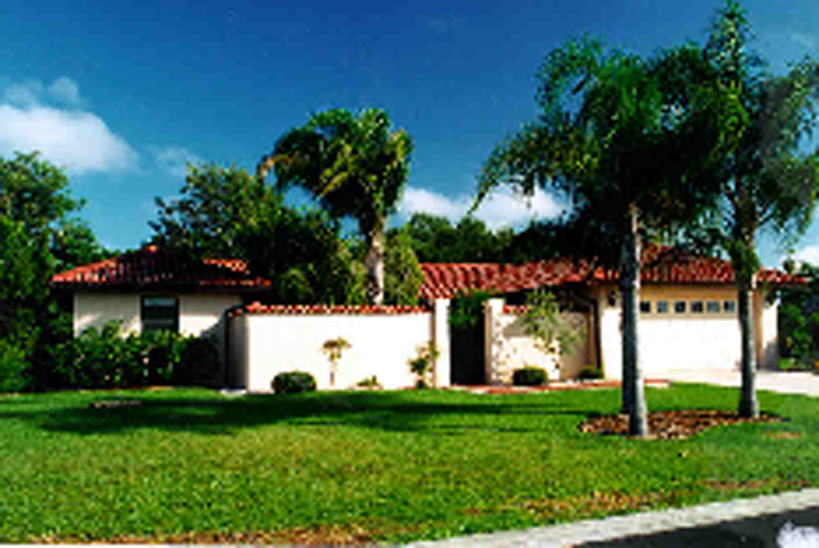
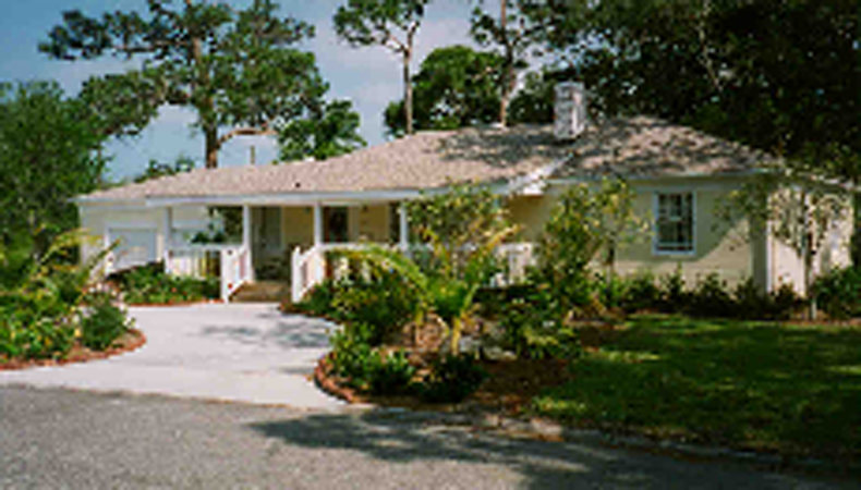
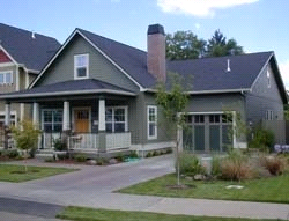
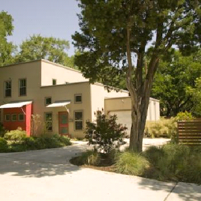
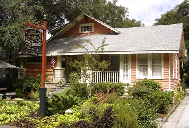
Note: The photos are not intended to represent a requirement for any particular style of architecture.
(1)
RSF E, 1 and 2 zones. The RSF E, 1, and 2 zones are low-density single-family zones, which allow 2, 2.9 and 4.3 dwelling units per acre respectively. One and two story single-family detached houses will characterize allowed housing.
(2)
RSF 3 and 4 zones. The RSF 3, and 4 zones are moderate density single-family zones, which allow 5.8 and 8.7 dwelling units per acre respectively. One and two story single-family detached houses will characterize allowed housing.
(3)
RSM-9 zone. The RSM-9 zone is a moderate density single-family zone, which allows up to nine dwelling units per acre. One and two story single-family detached houses will characterize allowed housing.
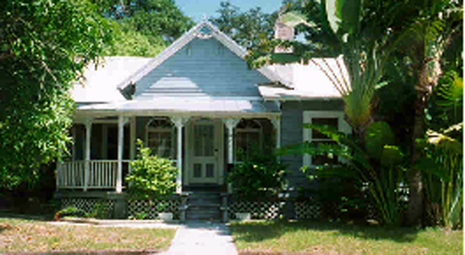
However, in contrast to the other RSF districts above, the RSM-9 district also allows attached single-family units, clustered single-family units and garage apartments which are compatible in scale to the single-family detached houses.
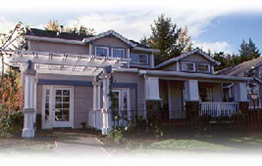
(4)
RTD-9 zone. The RTD-9 zone is a moderate density single-family zone, which allows up to nine dwelling units per acre. One- and two-story single-family detached houses will characterize allowed housing. However, in contrast to the other RSF districts above, the RTD-9 district also allows accessory dwelling units (e.g., garage apartments) and nonresidential uses that contribute to the residential attributes of the neighborhood and provide a means by which to preserve and enhance the residential character of the district.
(Ord. No. 02-4357, 4-29-02; Ord. No. 10-4915, § 2(Att. 1), 6-7-10)
Sec. VI-202. - Uses.
(a)
Definitions. Certain specific uses are defined in article II, division 2. The use categories are described in article II, division 3.
(b)
Permitted uses. Uses permitted in the single family zones are listed in table VI-201 with a "P". These uses are allowed if they comply with the development standards and other regulations of this Code.
(c)
Conditional uses. Uses allowed in the single family zones, if approved through the conditional use review process, are listed in table VI-201 with either a "C", if the use is a major conditional use, or an "MC", if the use is a minor conditional use. These uses are allowed provided they comply with the conditional use approval criteria, the development standards, and any other regulations of this Code.
(d)
Provisional uses. Uses allowed, if approved through the provisional use review process, are listed in table VI-201 with an "L". Provisional uses are similar to those regulated by a conditional use permit that, by their nature, may, but do not necessarily have significant adverse effects on the environment, overburden public land and services, change the desired character of an area, create major nuisances, or most importantly present the possibility of a change in circumstances during their life.
(e)
Historic reuses. Reuses allowed, if approved through the historic reuse review process, are listed in table VI-201 with an "H". Historic reuses may, but do not necessarily have significant adverse effects on the environment, overburden public land and services, change the desired character of an area, create major nuisances, or most importantly present the possibility of a change in circumstances during their life.
(f)
Use limitations. Uses allowed that are subject to limitations are identified with bracketed numbers in table VI-201. The limitations that correspond to the bracketed numbers are stated at the end of table VI-201. These uses are allowed if they comply with the use limitations, development standards and other regulations of this Code.
(g)
Accessory uses. Common accessory uses are listed as examples with each use category. Accessory uses are allowed by right, in conjunction with the primary use, unless stated otherwise in these regulations. Also, unless otherwise stated, they are subject to the same regulations as the primary use. See article VII, division 9 for specific accessory use standards.
(h)
Prohibited uses. Uses listed in table VI-201 without any symbol (i.e., blank space) are prohibited. Existing uses in categories listed as prohibited may be subject to the regulations of article V, vested rights and nonconformities.
Table VI-201. Primary Uses Allowed in the Single-Family Zones
Use limitations for table VI-201:
(1)
Household living limitation. Housing types are limited to those defined in table VI-202.
(2)
Group living limitation. Housing types are limited to those defined in table VI-202, community residential homes for up to six residents are allowed as a permitted use, subject to subsection VII-602(aa).
(3)
RTD-9 nonresidential use limitations.
a.
Nonresidential uses shall not exceed any total combination of 600 square feet within the first story of a primary structure or any portion of the accessory building. Bed and breakfast uses are exempt from the 600 square foot limit.
b.
An owner-occupant or tenant shall reside on the subject property in order to utilize any nonresidential use.
c.
No more than two nonresident employees shall work on the premises at any one time.
d.
Exterior displays shall be limited to artisanal uses and permitted only during public operating hours.
e.
Public operating hours shall be limited between the hours of 8:00 a.m. and 8:00 p.m.
f.
Any use not listed shall be prohibited.
(4)
Residential historic reuse limitations.
a.
Nonresidential uses shall not exceed any total combination of 600 square feet within the first story of a primary structure or any portion of an accessory building.
b.
An owner-occupant or tenant shall reside on the subject property in order to utilize any nonresidential use.
c.
No more than two nonresident employees shall work on the premises at any one time.
d.
Exterior displays shall be limited to artisanal uses and permitted only during public operating hours.
e.
Public operating hours shall be limited between the hours of 8:00 a.m. and 8:00 p.m.
f.
Parking shall be placed to the side or back of the property only.
g.
Any use not listed shall be prohibited.
(Ord. No. 02-4357, 4-29-02; Ord. No. 06-4663, § 2, 3-20-06; Ord. No. 10-4915, § 2(att. 1), 6-7-10; Ord. No. 13-5055, § 2(Att. 1), 5-6-13; Ord. No. 20-5310, § 5(Exh. D), 1-21-20; Ord. No. 20-5337, § 2(att. A, 8-17-21)
Sec. VI-203. - Residential use development standards.
(a)
Residential structure types allowed. Residential structure types are limited in the single-family zones to maintain the overall image and character of the city's single-family neighborhoods. However, the regulations allow options, in certain districts, to increase housing variety and opportunities, and to promote affordable housing. The kinds of residential structure types allowed in the single-family zones are stated in table VI-202. The residential structure types are defined in article II, division 2.
Table VI-202. Residential Structure Types Allowed in the Single-Family Zones
Notes for table VI-202:
(1)
Prohibited in coastal islands overlay district and cottage court housing development.
(b)
Density.
(1)
Purpose. Density standards serve several purposes. For example, they match housing density with the availability of public services and the carrying capacity of the land. In addition, density standards promote development opportunities for housing and promote urban densities in less developed areas. Density regulations are one tool to judge equivalent compatibility of projects.
(2)
Maximum density. The maximum density (dwelling units) allowed is stated in table VI-203, accessory dwelling units, if allowed, shall not be included in calculating maximum density.
(c)
Zoning lot size.
(1)
Purpose. Zoning lot size limits help to preserve the overall character of developed neighborhoods by assuring that new houses will generally have the same size zoning lots as the surrounding built-up environment. They also assure that development on a zoning lot will, in most cases, be able to comply with all applicable development standards.
(2)
Land divisions. All new zoning lots created shall comply with the zoning lot size standards of table VI-203. For sites which are proposed to be developed, an ownership made up of several zoning lots may not be subdivided or boundary adjusted into zoning lots that do not comply with the standards of table VI-203 (See section VI-103).
(3)
New development on conforming zoning lots. New development on zoning lots that comply with the minimum zoning lot size standards in table VI-203 is allowed in accordance with the standards of this Code.
(4)
New development on nonconforming zoning lots. New development on zoning lots which do not conform to the minimum zoning lot standards in table VI-203 are subject to regulations of section V-108, nonconforming zoning lots.
(d)
Height.
(1)
Purpose. The height standards serve several purposes: they promote a reasonable building scale and relationship of one residence to another; they promote options for privacy for neighboring properties; and they reflect the general building scale and placement of houses in the city's neighborhoods.
(2)
Maximum height. The maximum height allowed for all structures is stated in table VI-203.
(3)
Extensions above the maximum height. Extensions above the maximum height of structures are detailed under height limitations in section VI-102(p).
(e)
Setbacks.
(1)
Purpose. The setback regulations for buildings serve several purposes: they maintain light, air, separation for fire protection, and access for fire fighting; they reflect the general desired building scale and placement of houses in the city's neighborhoods; they promote a reasonable physical relationship between residences; they promote options for privacy for neighboring properties; they require larger front setbacks than side and rear setbacks to promote open, visually pleasing front yards; and they provide adequate flexibility to site a building so it may be compatible with the neighborhood, fit the shape of the site, allow for required outdoor areas, and allow for architectural diversity.
(2)
Required setbacks. The required setbacks for buildings are stated in table VI-203. The minimum setbacks for institutional uses are stated in table VI-204. Other setbacks may apply to specific types of development or situations. For example, setbacks for parking areas are stated in article VII, divisions 2 and 3.
(3)
Extensions (encroachments) into required building setbacks. Allowable encroachments into required building setbacks are stated in article VII, division 12.
(f)
Building coverage.
(1)
Purpose. The building coverage standards, together with the height and setback standards control the overall bulk of structures. Additionally, the standards help define the character of the different zones by limiting the amount of building allowed on a site. They work in conjunction with the zoning lot size standards to determine how built-up a neighborhood appears.
(2)
Building coverage standards. The maximum combined building coverage on a zoning lot is stated in table VI-203.
(g)
Impervious coverage. Note: Nonprofit organizations constructing housing sold to low to moderate income families (under 80 percent of median income in the county) may apply to use housing partnership funds, administered by the office of housing and community development, to offset the costs to comply with these requirements.
(1)
Purpose. The impervious coverage standards are designed to help protect trees and other desirable vegetation and enhance the overall appearance within the yard area of single-family neighborhoods. The standards reflect the historic development pattern of single-family homes built 20 to 50 years ago that generally have large lawn areas.
(2)
Impervious coverage standards. The maximum impervious coverage standard on a zoning lot is stated in table VI-203. The owner/applicant for building permits shall submit information requested by the director of neighborhood and development services which demonstrates the percentage of the total area existing or proposed to be covered by impervious surfaces. The director of neighborhood and development services may require, upon receiving the recommendation of the building official, an impervious surface plan prepared and sealed by a professional engineer meeting the requirements of this section. See definitions for impervious surfaces and run-off coefficient in article II, division 2.
(h)
Design standards in the RSM-9 zone district.
(1)
Purpose. The design standards preserve and enhance the residential character of the district.
Table VI-203 identifies the zone district(s) where this regulation applies.
(2)
Requirements. All new construction shall be carried out in accordance with the following mandatory design standards.
a.
Utilities. Utility house feed lines shall be placed underground.
b.
Building facade. The front of buildings must face the street and include a front door as a primary entrance. The design of the front entry door shall also incorporate a window.
c.
Front porch. The main entrance on principal buildings shall include a porch, deck or similar open-air covered main entry feature. The porch, deck or similar feature shall have a minimum depth of six feet and comprise a minimum of 30 percent of the width of the principal building's front facade (not including the garage) or eight feet whichever is larger.
d.
Garage/carport placement. All new garages and carports shall be set back at least 15 feet from the front facade of the primary building. In situations where there is more than one wall on the front facade (e.g., rooms jutting out from the front facade), the measurement shall be taken from the wall closest to the street. If there is more than one front lot line, this standard applies to the front yard that contains the front entry. The width of any attached garage or carport area may not exceed 50 percent of the primary building.
e.
Fences, hedges and walls. See section VII-1101, fences, hedges and walls for additional standards.
f.
Building elevation. Where it is necessary to elevate a building above grade, fill may not be used to elevate the lot above the grade of any adjacent lot. In such cases where the building is elevated, a stem wall foundation shall be used and openings beneath the structure shall be screened with materials consistent with the design of the building.
(i)
Design standards in the RTD-9 zone district.
(1)
Purpose. The design standards preserve and enhance the residential character of the district. Table VI-203 identifies the zone district(s) where this regulation applies.
(2)
Requirements. All new construction shall be carried out in accordance with the following mandatory design standards.
a.
Utility lines. All new "house feed" utility feed lines shall be placed underground.
b.
Front entry. All new primary buildings shall face the street and include a front door as a primary entrance facing a street and not more than six feet recessed back from the face of the front facade. Accessory dwelling units may face an internal walkway, driveway or alley. The design of the front entrance of the primary building shall also incorporate a glazing.
c.
Front windows. The first story facade on all street frontages shall be a minimum of 15 percent glass. Windows in garage doors shall not count but windows in a garage wall shall count towards meeting the standard.
d.
Front porch. All new primary buildings shall include a porch, deck or similar open-air covered entry feature that is accessed directly from a street or pedestrian easement and must be visible from the street. Front porches must have a minimum depth of six feet and comprise a minimum of 30 percent of the width of a building's primary front facade (not including the garage) or eight feet whichever is larger. Porches may extend six feet into the front setback plus an additional two feet for eaves.
e.
Garage/carport placement. All new garages and carports shall be set back at least 15 feet from the front facade of the primary building. In situations where there is more than one wall on the front facade (e.g., rooms jutting out from the front facade), the measurement shall be taken from the wall closest to the street. If there is more than one front lot line, this standard applies to the front yard that contains the front entry. The width of any attached garage or carport area may not exceed 50 percent of the front of the primary building.
f.
Fences and walls. The maximum height of new fences and walls located between the front facade of the primary building and the front lot line shall not exceed four feet in height. Ornamental decorations and light fixtures not exceeding 18 inches in height above the maximum four feet may be allowed on pillars or supports for any fence or wall.
g.
Building elevation. Where it is necessary to elevate a new building above grade, fill may not be used to elevate the lot above the grade of any adjacent lot. In such cases where the new building is elevated, a stem wall foundation (with or without a crawl space) shall be used. If there are openings beneath the structure the openings shall be screened with materials consistent with the design of the building.
Table VI-203. Residential Development Standards in the Single-Family Zones
Notes for table VI-203:
(1)
Average zoning lot size for attached unit developments shall be at least 4,840 square feet per dwelling unit.
(2)
Applies only to the end perimeter of attached unit developments on an interior lot. On corner lots, either the rear setback or the non-street side setback can be reduced to zero. However, the remaining non-street setback must comply with the requirements for a standard rear setback. See illustration below.
(3)
Applies to the entire attached unit development. The maximum building coverage for an individual zoning lot in an attached unit development is 60 percent.
(4)
Minimum side and rear yard for accessory buildings shall be three feet.
(5)
Front setback exception. The director of development services is authorized to decrease the maximum front setback to allow the preservation of existing trees. Compliance with EDCM, Part 5, Sec. D.8.b. Visibility at intersections is required.
(6)
Minimum rear yard setback for accessory dwelling shall be ten feet.
(7)
Covered front porches at a residential entrance may extend up to ten feet into the front setback plus up to an additional two feet for eaves.
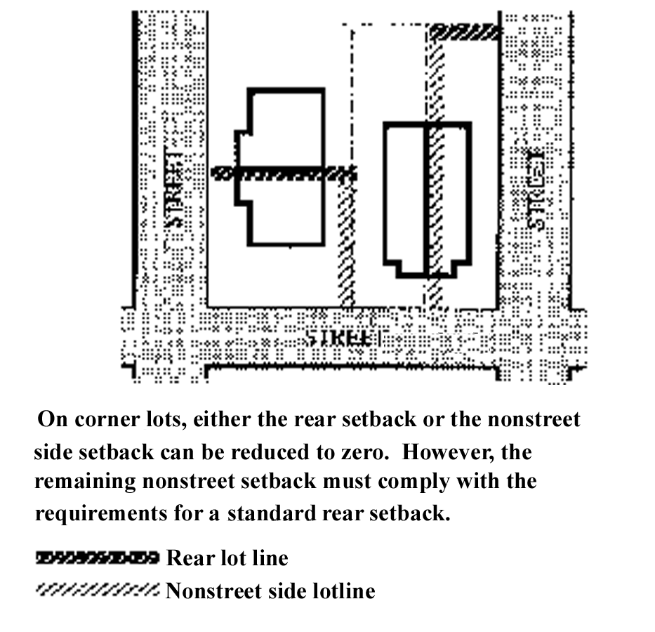
Side and rear setbacks on corner lots—Attached housing
(j)
Historic preservation transfer of development rights. Transferable development rights from sending sites within the RSM-9 zoning district may be sold or transferred in accordance with section VI-914. There are no receiving sites for transferable development rights in the RSM-9 zoning district.
(Ord. No. 02-4357, 4-29-02; Ord. No. 03-4429, § 6, 1-21-03; Ord. No. 04-4514, § 4, 1-20-04; Ord. No. 04-4538, § 6, 6-7-04; Ord. No. 04-4573, § 6, 6-20-05; Ord. No. 06-4663, § 2, 3-20-06; Ord. No. 06-4682, § 2, 7-26-06; Ord. No. 07-4720 § 2, 5-21-07; Ord. No. 09-4838, § 2(att. 1), 2-17-09; Ord. No. 09-4888, § 2(att. 1), 11-2-09; Ord. No. 10-4912, § 2(att. 1), 6-7-10; Ord. No. 10-4915, § 2(att. 1), 6-7-10; Ord. No. 20-5309, § 3(Exh. B), 11-2-20; Ord. No. 20-5337, § 2(att. A, 8-17-21; Ord. No. 22-5404, § 2, 3-7-22; Ord. No. 22-5414, § 2(Exh. A), 5-16-22; Ord. No. 22-25430, § 2(Exh. A), 12-5-22; Ord. No. 23-5476, § 2(Exh. A), 4-17-23; Ord. No. 25-5556, § 2(Exh. A), 2-18-25; Ord. No. 25-5583, § 2(Exh. A), 11-17-25)
Sec. VI-204. - Institutional use development standards.
(a)
Purpose. The general base zone development standards are designed for residential buildings. Different development standards are needed for institutional uses that may be allowed in single-family zones. The intent is to maintain compatibility with and limit the negative impacts on surrounding residential neighborhoods.
(b)
Use categories to which these standards apply. The standards of this section apply to uses in the institutional use categories group, whether allowed by right, or subject to a conditional use review.
(c)
Standards.
(1)
The development standards are stated in table VI-204. Specific uses or development types may also be subject to article VII, regulations of general applicability.
Table VI-204. Institutional Development Standards in the Single-Family Zones
(2)
Exterior storage. Exterior storage of materials and equipment is prohibited.
(3)
Mechanical equipment. Mechanical equipment located on the ground, such as heating or cooling equipment, pumps, or generators shall be screened from the street and any abutting residentially zoned properties by walls, fences, or vegetation tall enough to screen the equipment. Mechanical equipment on roofs shall be screened from the ground level of any abutting residentially zoned properties.
(Ord. No. 02-4357, 4-29-02; Ord. No. 04-4573, § 8, 6-20-05; Ord. No. 09-4888, § 2(att. 1), 11-2-09; Ord. No. 10-4915, § 2(att. 1), 6-7-10)
Sec. VI-301. - Intent and purpose.
(a)
Intent and purpose. The intent and purpose of the Residential Multiple Family (RMF) districts is to preserve land for urban housing and to provide opportunities for multiple family housing. These regulations are intended to create and maintain and promote the development and redevelopment of these neighborhoods while preserving their existing residential character. At the same time, they allow for institutional uses but not to such extent as to sacrifice the overall residential neighborhood image and character. The seven multiple family zones are distinguished primarily by density and development standards. The development standards work together to create desirable residential area by promoting aesthetically pleasing environments, safety, privacy, and recreational opportunities. The development standards generally assure that new development will be compatible with the city's character. At the same time, the standards allow for flexibility for new development. In addition, the regulations provide clarity to property owners, developers and neighbors about the limits of what is allowed.
The RMF-R district was originally intended to serve as the residential revitalization area adjacent to the city's central business district and to provide incentives for redevelopment and multifamily residential development in close proximity to the downtown core. In accordance with the policies of the Sarasota City Plan (1998 Ed), as amended, there shall be no further re-zonings to the RMF-R zone district classification. The standards contained in this division, shall be applied only to those zoning lots which were zoned RMF-R prior to the effective date of Ordinance No. 87-3061.
(b)
List of the multiple family zone districts. The full names, short names and map symbols of the multiple family zone districts are listed below. When this Code refers to the multiple family zones, it is referring to the zone districts listed here. When this Code refers to the residential zones, it is referring to both the single-family zones in division 2 and the multiple family zones in this division.
(c)
Characteristics of the zones.
(1)
RMF 1 and 2 zones. The RMF-1 and RMF-2 zones are moderate density multiple family zones which allow six and nine dwelling units per acre respectively. One and two story buildings will characterize allowed housing. The major types of new development will be plexes, townhouses, row houses and garden apartments.
RMF 1 and 2 zones
(2)
RMF 3, 4, and 5 zones. The RMF 3, 4, and 5 zones are medium density multiple family zones which allow 13, 18 and 25 dwelling units per acre respectively. Two to eight story buildings generally characterize allowed housing. The major type of new development will be medium to high-rise apartments and condominiums.
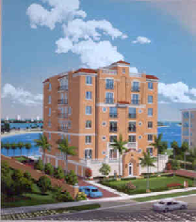
RMF 3, 4 and 5 zones
(3)
RMF 6 and 7 zones. The RMF 6 and 7 zones are high density multiple family zones which allow 18 and 25 dwelling units per acre, respectively, and up to 35 and 50 dwelling units per acre, respectively, when providing dwelling units designated for households with an income at or below 120 percent of the Area Median Income (AMI) in the North Port-Sarasota-Bradenton Metropolitan Statistical Area (MSA) for a minimum period of 30 years. Four- to six-story buildings generally characterize allowed housing. The major type of new development will be apartments and condominiums.
(Ord. No. 02-4357, 4-29-02; Ord. No. 20-5309, § 3(Exh. B), 11-2-20)
Sec. VI-302. - Uses.
(a)
Definitions. Certain specific uses are defined in article II, division 2. The use categories are described in article II, division 3.
(b)
Permitted uses. Uses permitted in the multiple family zones are listed in table VI-301 with a "P." These uses are allowed if they comply with the development standards and other regulations of this Code.
(c)
Conditional uses. Uses allowed in the multiple family zones, if approved through the conditional use review process, are listed in table VI-301 with either a "C," if the use is a major conditional use, or an "MC," if the use is a minor conditional use. These uses are allowed provided they comply with the conditional use approval criteria, the development standards, and any other regulations of this Code.
(d)
Provisional uses. Uses allowed, if approved through the provisional use review process, are listed in table VI-301 with an "L". Provisional uses are similar to those regulated by a conditional use permit that, by their nature, may, but do not necessarily have significant adverse effects on the environment, overburden public land and services, change the desired character of an area, create major nuisances, or most importantly present the possibility of a change in circumstances during their life.
(e)
Use limitations. Uses allowed that are subject to limitations are identified with bracketed numbers in table VI-301. The limitations that correspond to the bracketed numbers are stated at the end of table VI-301. These uses are allowed if they comply with the use limitations, development standards and other regulations of this Code.
(f)
Accessory uses. Common accessory uses are listed as examples with each use category. Accessory uses are allowed by right, in conjunction with the primary use, unless stated otherwise in these regulations. Also, unless otherwise stated, they are subject to the same regulations as the primary use. See article VII, division 9 for specific accessory use standards.
(g)
Prohibited uses. Uses listed in table VI-301 without any symbol (i.e., blank space) are prohibited. Existing uses in categories listed as prohibited may be subject to the regulations of article V, vested rights and non-conformities.
Table VI-301. Primary Uses Allowed in the Multiple Family Zones
Use limitations for table VI-301:
(1)
Household living limitation. Household living. Housing types are limited to those defined in table VI-302.
(2)
Group living limitation. Group living. Housing types are limited to those defined in table VI-302.
(3)
Provisional use approval is allowed only as an accessory use to religious institutions and schools, day care as a primary use shall require minor conditional use approval in residential multiple family zones.
(4)
All applicants for a day care facility, that provide child care for more than ten children, shall hold a community workshop as set forth in section IV-201(b) prior to submitting an application for a provisional use permit.
(Ord. No. 02-4357, 4-29-02; Ord. No. 4515, § 3, 1-20-04; Ord. No. 06-4663, § 2, 3-20-06; Ord. No. 13-5055, § 2(Att. 1), 5-6-13)
Sec. VI-303. - Development standards.
(a)
Residential structure types allowed. A broad range of residential structure types is allowed in the multiple family zones. This range allows for efficient use of land, provides options to increase housing variety and housing opportunities, and promotes affordable housing. The residential housing types allowed in the multiple family zones are stated in table VI-302. The residential structure types are defined in article II, division 2.
Table VI-302. Residential Structure Types Allowed in the Multiple Family Zones
(b)
Density.
(1)
Purpose. Density standards serve several purposes. For example, they match housing density with the availability of public services and the carrying capacity of the land. In addition, density standards promote development opportunities for housing and promote urban densities in less developed areas. Density regulations are one tool to judge equivalent compatibility of projects.
(2)
Maximum density. The maximum density (dwelling units) allowed is stated in table VI-303.
(c)
Zoning lot size.
(1)
Purpose. The minimum zoning lot size requirements for new zoning lots ensure that development on a zoning lot will in most instances be able to comply with all site development standards.
(2)
Land divisions. All new zoning lots created shall comply with the zoning lot size standards of table VI-303. The existence of zoning lots larger than the minimum is not a hardship, and may not be used to justify their division into zoning lots that are smaller than the minimum size allowed.
(3)
New development on conforming zoning lots. New development on zoning lots that comply with the minimum zoning lot size standards in table VI-303 is allowed in accordance with the standards of this Code.
(4)
New development on nonconforming zoning lots. New development is allowed on zoning lots that do not conform to the zoning lot size standards in table VI-303 are subject to regulations of section V-108, nonconforming zoning lots.
(d)
Height.
(1)
Purpose. The height standards serve several purposes:
a.
They promote a reasonable building scale and relationship of one residential use to another;
b.
They promote options for privacy for neighboring properties; and
c.
They reflect the general building scale of multiple family development in the city's neighborhoods.
(2)
Maximum height. The maximum height allowed for all uses are stated in table VI-303.
(3)
Extensions Above the Maximum Height. Extensions above the maximum height of structures are detailed under height limitations in section VI-102(p).
(e)
Setbacks.
(1)
Purpose. The building setback regulations serve several purposes:
a.
They maintain light, air, separation for fire protection, and access for fire fighting;
b.
They reflect the general building scale and placement of multiple family development in the city's neighborhoods;
c.
They promote a reasonable physical relationship between residences;
d.
They promote options for privacy for neighboring properties;
e.
They require larger front setbacks than side and rear setbacks to promote open, visually pleasing front yards that promote human interaction; and
f.
They provide adequate flexibility to site a building so it may be compatible with the neighborhood, allow for required outdoor areas, allow for proper traffic circulation and allow for design diversity;
(2)
Required setbacks. The required setbacks for buildings are stated in table VI-303. The minimum setbacks for institutional uses are stated in table VI-304. Other setbacks may apply to specific types of development or situations. For example, setbacks for parking areas are stated in article VII, divisions 2 and 3.
(3)
Extensions (encroachments) into required building setbacks. Allowable encroachments into required building setbacks are stated in article VII, division 12.
(4)
Additional setbacks.
a.
Additional Setbacks applicable to properties outside Golden Gate Point.
For structures over 35 feet in height, measured from finished grade, the following additional setbacks are required for all yards. All portions of the building that exceed 35 feet in height, measured from finished grade, shall have an additional setback of at least 12 feet.
b.
Additional setbacks applicable to properties on Golden Gate Point.
For structures over 35 feet in height, measured from finished grade, the following additional setbacks are required for all yards. All portions of the building that exceed 35 feet in height, measured from finished grade shall be setback as follows:
1.
Front and waterfront additional setback: At least eight feet.
2.
Side and rear additional setback: At least 12 feet.
Gold Gate Point
(f)
Building coverage.
(1)
Purpose. The building coverage standards, along with the height and setback standards, limit the overall bulk of structures. They assure that larger buildings will not have a footprint that overwhelms adjacent development. The standards help define the character of the different zones by determining how built-up a neighborhood appears.
(2)
Maximum building coverage. The maximum building coverage on the zoning lot is stated in table VI-303.
(g)
Required outdoor areas.
(1)
Purpose. The required outdoor area standards assure opportunities for outdoor relaxation and/or recreation. The standards work with the building coverage and landscaped areas standards to assure that some of the land not covered by buildings is of adequate size, shape and location to be usable for outdoor recreation or relaxation. Required outdoor areas are an important aspect in addressing the livability of a residential property by providing outdoor living opportunities, some options for outdoor privacy, and a healthy environment.
(2)
Required outdoor area sizes. The minimum sizes of required outdoor areas per dwelling unit are stated in table VI-303.
(3)
Requirements. All new construction shall be carried out in accordance with the following standards.
a.
Ground level units. The required outdoor area for ground level units must be individual areas and must be directly accessible from the unit. The area may be on the ground or above. Individual outdoor areas for ground level units must be visually screened from each other. The area must be surfaced with lawn, pavers, decking, or sport court paving that allows the area to be used for recreational purposes. User amenities, such as tables, benches, trees, planter boxes, garden plots, drinking fountains, spas or pools may be placed in the outdoor area. It may be covered, such as a covered patio, but it may not be fully enclosed. Screened openings are not considered fully enclosed.
b.
Upper level units. For upper level units, the required outdoor area may be provided individually, such as by balconies, or combined into a larger area. If combined into a larger area, it must comply with the following requirements:
1.
The total amount of required outdoor area for upper level dwelling units is the cumulative amount of the required area per dwelling unit stated in table VI-303 for individual areas, minus any upper level units that provide individual outdoor areas. However, a combined required outdoor area must comply with the minimum area and dimension requirements in table VI-303 for combined outdoor areas.
2.
The combined outdoor area may be developed for active or passive recreational facilities. Examples include play areas, plazas, roof-top patios, picnic areas, and open recreational facilities. The area must be surfaced with lawn, pavers, decking or sport court paving that allows the area to be used for recreational purposes. User amenities, such as tables, benches, trees, planter boxes, garden plots, drinking fountains, spas or pools may be placed in the outdoor area. It may be covered, such as a patio, but it may not be fully enclosed. Screened openings are not considered fully enclosed.
3.
Placement. Uncovered ground level required outdoor areas may extend into the required side and rear setback, but not into the required front building setback.
(h)
Reserved.
Table VI-303. Residential Development Standards in the Multiple Family Zones
Notes for table VI-303:
(1)
The maximum building height shall be measured vertically from the first habitable floor of each building, or no more than 25 feet above finished grade, whichever is less.
(2)
The maximum building height on Golden Gate Point (see subsection VI-303(e)(4) for map of Golden Gate Point) shall be measured vertically from the first habitable floor of each building or no more than 15 feet above finished grade, whichever is less.
(3)
In the RMF-R district, the maximum height is 35 feet if within 150 feet of RSF district.
(4)
In the RMF-R district, for structures over 35 feet in height, an additional setback of at least 12 feet.
(5)
In the RMF-R district, 50 percent for buildings less than four stories; 25 percent for buildings four stories or greater.
(6)
If interior structured parking is utilized in the principal building, for at least 50 percent of the minimum required parking for a project, the maximum site coverage for the floors used exclusively for parking shall be 50 percent.
(7)
For structures over 35 feet in height in the RMF-4, 5, and 7 zone districts, additional setback standards apply. Please see section VI-303(e)(4), "additional setbacks" for additional setback standards applicable to Golden Gate Point and other locations in the city.
(8)
Residential development on zoning lots or a combination of zoning lots designated RMF-6 may receive up to 35 dwelling units per acre (above the base residential density of 18 dwelling units per acre) and/or residential development on zoning lots or a combination of zoning lots designated RMF-7 may receive up to 50 dwelling units per acre (above the base residential density of 25 dwelling units per acre) by providing dwelling units for households with incomes at or below 120 percent of the Area Median Income (AMI) in the North Port-Sarasota-Bradenton Metropolitan Statistical Area (MSA) for a period of at least 30 years.
For each dwelling unit provided for a household with an income at or below 120 percent of the AMI, three additional market rate dwelling units will be allowed. Of the dwelling units provided for households with incomes at or below 120 percent of the AMI, at least one-third of the qualifying dwelling units must be available to households having incomes at or below 80 percent of the AMI and no more than one-third of the dwelling units may be available to households having incomes in the range of 100 percent to 120 percent of the AMI.
No additional building height shall be granted for bonus density housing.
As a condition of approval, an agreement between the developer/landowner and the City of Sarasota shall be filed in the official records of Sarasota County requiring that a buyer or renter of a dwelling unit designated for households with an income at or below 120 percent of the AMI shall not have a household income greater than the income range designated for the unit, that a "for sale" dwelling unit designated for households with an income at or below 120 percent of the AMI shall have an appreciation limit applicable upon resale, and that a rental unit designated for households with an income at or below 120 percent of the AMI shall be monitored for rent and tenant income levels for a period of at least 30 years. The purpose of this agreement shall be to set forth commitments and obligations of the developer/landowner and future owners or residents for the residential bonus density regarding affordability control, occupancy, monitoring, reporting, enforcement, and any other necessary provisions applicable during the time period of at least 30 years. The city manager shall be authorized to sign the agreement on behalf of the city.
(9)
The larger setback is required for zoning lots abutting properties zoned residential single-family.
(10)
Density requirements apply. Portions of the development used to satisfy the density requirements may not be used to fulfil the density requirements of a future development.
(11)
Applies only to the end unit of attached unit developments abutting the project boundary. Attached unit developments may reduce the interior side setback to zero. A minimum 15 ft separation is required between buildings. On corner lots, one of the non-street side setbacks may be reduced to zero.
(Ord. No. 02-4357, 4-29-02; Ord. No. 03-4430, §§ 7, 8, 1-21-03; Ord. No. 04-4514, § 5, 1-20-04; Ord. No. 04-4538, § 7, 6-7-04; Ord. No. 06-4682, § 2-7-26-06; Ord. No. 07-4720 § 2, 5-21-07; Ord. No. 07-4770, § 2, 12-17-07; Ord. No. 09-4888, § 2(att. 1), 11-2-09; Ord. No. 13-5041, § 2 (att. 1), 3-4-13; Ord. No. 20-5309, § 3(Exh. B), 11-2-20; Ord. No. 22-5430, § 2(Exh. A), 12-5-22; Ord. No. 24-5540, § 2(Exh. A), 9-16-24)
Sec. VI-304. - Institutional use development standards.
(a)
Purpose. The general base zone development standards are designed for residential buildings. Different development standards are needed for institutional uses that may be allowed in multiple family zones. The intent is to maintain compatibility with and limit the negative impacts on surrounding residential neighborhoods.
(b)
Use categories to which these standards apply. The standards of this section apply to uses in the institutional use categories group, whether allowed by right, or subject to a conditional use review.
(c)
Standards.
(1)
The development standards are stated in table VI-304. Specific uses or development types may also be subject to article VII, regulations of general applicability.
(2)
Exterior storage. Exterior storage of materials and equipment is prohibited.
(3)
Mechanical equipment. Mechanical equipment located on the ground, such as heating or cooling equipment, pumps, or generators shall be screened from the street and any abutting residentially zoned properties by walls, fences, or vegetation tall enough to screen the equipment. Mechanical equipment on roofs shall be screened from the ground level of any abutting residentially zoned properties.
Table VI-304. Institutional Development Standards in the Multiple Family Zones
Notes for table VI-304:
(1)
Institutional uses that are allowed may be located within residential structures that exceed 35 feet of height in accordance with the maximum height regulations in table VI-303. However, the maximum height for stand-alone institutional projects in RMF-4, RMF-5, RMF-6 and RMF-7 zone districts shall be 35 feet.
(Ord. No. 02-4357, 4-29-02; Ord. No. 04-4573, § 9, 6-20-05; Ord. No. 09-4888, § 2(att. 1), 11-2-09)
Sec. VI-305. - Alternative lot size, building setback and building coverage standards for Golden Gate Point.
(a)
Intent and purpose. The alternative standards are intended to provide an option for new development to be designed and sited in a manner that will encourage human activity on the street. The alternative is applicable to a range of development sizes; however, it may be more practical, feasible, or workable for large projects. Therefore, not all development will qualify for this alternative.
(b)
Establishment of the boundaries. The application of the alternative standards shall be restricted to the zoning lots within Golden Gate Point. See map.
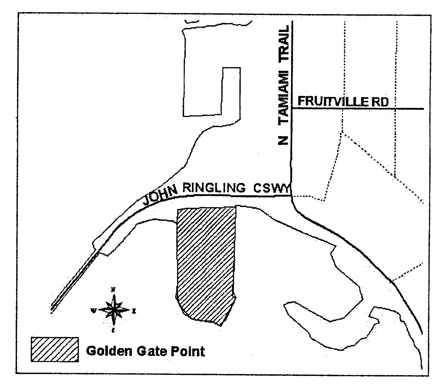
(c)
Alternative standards.
(1)
Alternative zoning lot size. There is no minimum zoning lot size.
(2)
Alternative building setbacks.
(3)
Alternative building coverage. The maximum building coverage is 100 percent.
(d)
Requirements for alternative standards. The alternative zoning lot size, building setback and building coverage standards may be utilized, in lieu of those found in table VI-303, provided all of the following requirements are met.
(1)
Maximum height. The maximum building height shall be 50 feet and a maximum of four stories. The maximum building height shall be measured vertically from the first habitable floor of each building or no more than 15 feet above finished grade. Variances are prohibited.
(2)
Location of parking.
a.
Parking lots or garages shall not be located any closer to the street right-of-way than the distance by which the principal building is set back from the street right-of-way. This provision shall not be construed to preclude parking lot access driveways.
b.
If a zoning lot fronts on three streets then parking may be located on one (1) corner.
c.
If a zoning lot fronts on four streets then parking may be located on two corners.
d.
Variances are prohibited.
(3)
Windows.
a.
Portions of a building facing a street. The combined area of all stories shall be a minimum of 25 percent glass.
b.
Portions of a building not facing a street. The combined area of all stories shall be a minimum of 15 percent glass.
c.
Variances are prohibited.
(4)
Neighborhood meeting required. All applicants choosing to use these alternative standards shall hold a neighborhood workshop, in accord with the procedures for neighborhood workshops defined in subsection IV-201(b), prior to submitting an application.
(5)
Site plan approval required. In order to utilize these alternative standards, an application for site plan approval for the proposed development must be approved by the planning board in accordance with article IV, division 5.
(6)
Design. In approving the site plan the planning board shall utilize the advisory community design guidelines (design guidelines) found in Appendix D to determine whether the proposed development is compatible with its surroundings. The primary intent is for new development to be designed and sited to encourage human activity on the street. A favorable consistency finding does not equate to being consistent with all of the design guidelines. Rather, an "on-balance" consistency finding shall consider all components of the design guidelines that are relevant to the application. For example, an application may be consistent with ten relevant design guidelines and inconsistent with only one (1), however, if that one (1) design guideline is judged to have more importance, then the proposal may be found to be incompatible with the surrounding area.
(Ord. No. 08-4799, § 2, 4-28-08)
Sec. VI-401. - Intent and purpose.
(a)
Intent and purpose. The intent and purpose of the office (O) districts is to preserve land for office and major institutional developments and provide employment opportunities. These regulations are intended to create, maintain and promote the development and redevelopment of neighborhoods while preserving their existing character. The differences in the zones reflect the diversity of the office areas in the city. The zones are distinguished by the uses allowed and the intensity of development allowed in each zone. The regulations promote uses and development and redevelopment that will enhance the economic viability of the specific office area and the city as a whole.
In general, a finite range of uses is allowed in each zone. Limits on the intensity of uses and the development standards promote the desired character for the office area. In most instances, the development standards are designed to allow development flexibility within parameters that support the intent of the specific zone. In addition, the regulations provide clarity to property owners, developers and neighbors about the limits of what is allowed.
(b)
List of the office zone districts. The full names, short names and map symbols of the office districts are listed below. When this Code refers to the office zones it is referring to the zone districts listed here.
(c)
Characteristics of the zones.
(1)
OND. The Office Neighborhood district (OND) provides development opportunities on small sites in or near residential neighborhoods for small, low intensity offices. The zone is intended to provide viable uses for property on collector and local streets; and provides suitable site design and compatibility controls to address the impacts of nonresidential development on nearby residential neighborhoods. This zone is intended for areas that act as a transition between single-family residential neighborhoods and more intense nonresidential uses or high traffic areas. Development is intended to be of a scale and character similar to nearby residential development to promote compatibility with the surrounding area.
OND
(2)
OCD. The Office Community district (OCD) is a low to medium intensity office zone for property on collector and higher classified streets. Uses may have local or citywide emphasis. The zone is intended to prevent the appearance of strip commercial development by allowing office uses but not other commercial uses. However, ancillary retail sales and service uses are allowed to service the office uses in the building but restricted to limit detrimental impacts on nearby residential areas. Development may be auto-accommodating, except where the development is adjacent to a collector street. The development standards allow for more intense development than in the OND zone, but not as intense as the ORD zone.
OCD
(3)
ORD. The Office Regional district (ORD) is a medium intensity office zone generally for property on arterial and higher classified streets. Uses may have citywide or regional emphasis. Development is expected to be auto-accommodating.
ORD
(4)
SMH. The SMH zone is a medium to high intensity institutional zone that provides provisions specific to the Sarasota Memorial Hospital campus. This zone implements the comprehensive plan policies and designations for site 8 in the metropolitan regional land use classification. The development standards are designed to provide for transitions between the more intense hospital development and surrounding lower intensity uses. In addition, specific development standards provide a pleasant and diverse pedestrian experience and connect activities in the zone with surrounding uses.
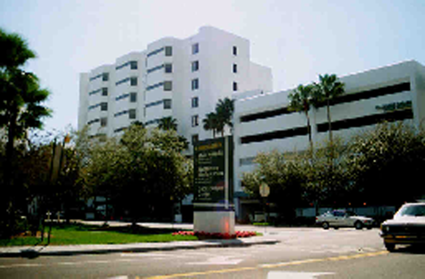
SMH
(5)
BG. The intent and purpose of the BG district is to permit the use of botanical gardens and accessory uses. This zoning district provides a means by which a botanical garden may grow in a sensitive and coherent manner that preserves the quality of life and integrity of the surrounding neighborhoods.
The following zone districts are not implementing districts and may not be used in future rezoning petitions. See section VI-101.
(6)
OPB. The OPB zone is intended to permit small business, professional and service related offices and to facilitate their proper development and use. It is also intended that development and redevelopment of these commercial districts shall be compatible with, and preserve and enhance, the character of the adjoining neighborhoods. This is not an implementing district and there shall be no further rezonings to the OPB zone district. The standards contained in this district shall be applied only to those zoning lots which are currently zoned OPB.
(7)
OBP-1. The OPB-1 zone is intended to permit small businesses, professional and service related offices and to facilitate their proper development and use. It is also intended that development and redevelopment of these commercial districts shall be compatible with, and preserve and enhance, the character of adjoining neighborhoods. This is not an implementing district and there shall be no further rezonings to the OPB-1 zone district. The standards contained in this district shall be applied only to those zoning lots which are currently zoned OPB-1.
(8)
OP. The OP zone is intended to permit medium-scale business, professional offices and service related offices and to facilitate their proper development and use. It is also intended that substantial buffering and other design techniques shall be used to lessen and/or prevent impacts on adjacent or nearby residential uses. This is not an implementing district and there shall be no further rezonings to the OP zone district. The standards contained in this district shall only be applied only to those zoning lots which are currently zoned OP.
(9)
MCI. The MCI zone is intended to permit institutional uses of a medical charitable, philanthropic, altruistic, religious, social or eleemosynary character to facilitate their proper development and use. This district is also appropriate for special residential uses such as: assisted living facilities, nursing homes, and residential treatment facilities. Regulations for such uses in the MCI district are designed to minimize their impacts on adjoining or nearby districts and use. This is not an implementing district and there shall be no further rezonings to the MCI zone district. The standards contained in this district shall only be applied only to those zoning lots which are currently zoned MCI.
(Ord. No. 02-4357, 4-29-02; Ord. No. 20-5338, § 2(Exh. A), 1-4-21)
Sec. VI-402. - Uses.
(a)
Definitions. Certain specific uses are defined in article II, division 2. The use categories are described in article II, division 3.
(b)
Permitted uses. Uses permitted in the office zones are listed in table VI-401 with a "P". These uses are allowed if they comply with the development standards and other regulations of this Code.
(c)
Conditional uses. Uses allowed in the office zones, if approved through the conditional use review process, are listed in table VI-401 with either a "C" if the use is a major conditional use, or an "MC" if the use is a minor conditional use. These uses are allowed provided they comply with the conditional use approval criteria, the development standards, and any other regulations of this Code.
(d)
Provisional uses. Uses allowed, if approved through the provisional use review process, are listed in table VI-401 with an "L". Provisional uses are similar to those regulated by a conditional use permit that, by their nature, may, but do not necessarily have significant adverse effects on the environment, overburden public land and services, change the desired character of an area, create major nuisances, or most importantly present the possibility of a change in circumstances during their life.
(e)
Use limitations. Uses allowed that are subject to limitations are identified with bracketed numbers in table VI-401. The limitations that correspond to the bracketed numbers are stated at the end of table VI-401. These uses are allowed if they comply with the use limitations, development standards and other regulations of this Code.
(f)
Accessory uses. Common accessory uses are listed as examples with each use category. Accessory uses are allowed by right, in conjunction with the primary use, unless stated otherwise in these regulations. Also, unless otherwise stated, they are subject to the same regulations as the primary use. See article VII, division 9 for specific accessory use standards.
(g)
Prohibited uses. Uses listed in table VI-401 without any symbol (i.e., blank space) are prohibited as primary uses, however, some may be permissible as accessory uses as prescribed in article VII, division 9 of this Code. Existing uses in categories listed as prohibited may be subject to the regulations of article V, vested rights and nonconformities.
Table VI-401. Primary Uses Allowed in the Office Zones
Notes for table VI-401:
(1)
Household living limitation.
a.
Housing types are limited to those defined in table VI-402.
b.
Residential uses on a OND or OCD zoning lot must be located above ground floor of any building.
c.
Residential portions on the ground floor of mixed use projects on a ORD zoning lot must be less than 50 percent of the total ground floor area of the project, which may consist of one or more buildings. In addition, nonresidential portions of mixed-use projects must be completed and receive a certificate of occupancy in advance or at the same time as the certificate of occupancy for any residential portion of the project.
(2)
Group living limitation.
a.
Housing types are limited to those defined in table VI-402.
b.
All group living uses in OND, OCD and ORD zones are regulated as follows:
1.
Less than 20 residents. Group living uses for less than 20 residents are allowed as a permitted use, subject to section VII-602(aa).
2.
20 or more residents. Group living uses for 20 or more residents are minor conditional uses. They are also subject to section VII-602(aa).
3.
Exception. Normally all occupants of a building are counted. However, in this instance, staff persons that do not live on the site are not counted to determine whether the facility meets the 20 resident cutoff, above which a minor conditional use is required.
(3)
Building design limitation. The design of all buildings used for nonresidential purposes that does not occupy an existing building originally designed as a residential building shall be designed to be residential in character. The building design may employ sloped roofs, gables, porches, double-hung windows and other elements normally associated with residential buildings.
(4)
Parking area location limitation. Parking areas shall not be located any closer to a public street right-of-way than the distance by which the principal building is set back from the street right-of-way. This provision shall not be construed to preclude parking lot access driveways. Parking areas shall not be located on street corners unless one of the following conditions exist.
a.
If a zoning lot fronts on three streets, then parking may be located on only one corner.
b.
If a zoning lot fronts on four streets, then parking may be located on only two corners.
(5)
Retail sales and service limitation in the OCD and ORD zones. Retail sales and service uses must be located within an office building and are limited to ten percent of the total floor area of the building; exclusive of parking area; larger amounts of retail sales and service are prohibited. Uses are limited in size in order to limit their potential impact on the office character of the zone. Ancillary retail sales and service uses are meant to primarily service the office uses in the building.
(6)
Drive-through facility limitation. Drive-up windows and drive-through uses are prohibited.
(7)
Radio and frequency transmission facilities limitation. Maximum height of any tower shall be limited to 150 feet.
(8)
All applicants for a day care facility, that provide child care for more than ten children, shall hold a community workshop as set forth in section IV-201(b) prior to submitting an application for a provisional use permit.
(9)
Pharmacy limitation. Pharmacy use allowed only when accessory to a medical center and approved under the minor conditional use process. Pharmacy as a primary use is prohibited. See section VII-904(16).
(10)
Accessory uses consistent with botanical gardens. Activities consistent with similar cultural institutions include, but are not limited to, event facility, greenhouses, dock facilities, plant/gift shops, offices, snack bars, parking garages, and restaurant are permitted as an accessory use to the botanical garden's primary use. Accessory restaurant uses are limited to ten percent of the total developed floor area on site; exclusive of parking areas; larger amounts of restaurant space is prohibited. Accessory restaurants shall not provide catering or kitchen facilities for off-site events.
a.
Accessory restaurants shall be designed to minimize and mitigate noise impacts on adjacent residential property. Sound from outdoor dining areas shall be directed away from residential uses.
(11)
Medical massage therapy. Medical massage therapy is permitted as an accessory use to a medical office.
(Ord. No. 02-4357, 4-29-02; Ord. No. 07-4770, § 2, 12-17-07; Ord. No. 13-5055, § 2(Att. 1), 5-6-13; Ord. No. 18-5234, § 2(Exh. A), 2-5-18; Ord. No. 20-5338, § 2(Exh. A), 1-4-21; Ord. No. 22-5415, § 2(Exh. A), 4-16-22; Ord. No. 22-5427, § 2(Exh. A), 9-6-22)
Sec. VI-403. - Development standards.
(a)
Residential structure types allowed. A very narrow range of residential structure types is allowed in the office zones. This range allows for options to increase housing variety and housing opportunities, while maintaining the primary nature and focus of the zones. The residential structure types allowed in the office zones are stated in table VI-402. The residential structure types are defined in article II, division 2.
Table VI-402. Residential Structure Types Allowed in the Office Zones
(b)
Density.
(1)
Purpose. Density standards serve several purposes. For example, they serve to establish housing density with the availability of public services and the carrying capacity of the land. In addition, density standards promote development opportunities for housing and promote urban densities in less developed areas. Density regulations are also one tool to judge equivalent compatibility of projects.
(2)
The maximum density (dwelling units) allowed is stated in table VI-403.
(c)
Floor area ratio.
(1)
Purpose. Floor area ratios (FARs) regulate the amount of use (the intensity) allowed on a zoning lot. FARs provide a means to match the potential amount of uses with the desired character of the area and the provision of public services. FARs also work with height, setback, and building coverage standards to control the overall bulk of development.
(2)
FAR standard. The floor area ratios are stated in table VI-403 and apply to all nonresidential development including certain community service uses that may also have to comply with a density standard. Additional floor area is allowed for residential (residential use categories) development.
(d)
Zoning lot size.
(1)
Purpose. The minimum zoning lot size requirements for new zoning lots ensure that development on a zoning lot will in most instances be able to comply with all site development standards.
(2)
Land divisions. All new zoning lots created shall comply with the zoning lot size standards of table VI-403. For sites which are proposed to be developed, an ownership made up of several zoning lots may not be subdivided or boundary adjusted into zoning lots that do not comply with the standards of table VI-403 (See section VI-103).
(3)
New development on conforming zoning lots. New development on zoning lots that comply with the minimum zoning lot size standards in table VI-403 is allowed in accordance with the standards found in table VI-401.
(4)
New development on nonconforming zoning lots. New development on zoning lots which do not conform to the minimum zoning lot standards in table VI-403 are subject to regulations of section V-108, nonconforming zoning lots.
(e)
Height.
(1)
Purpose. The height limits are intended to control the overall scale of buildings. The height limits in OND and OCD zones discourage buildings that visually dominate adjacent residential areas. The height limits in the ORD zone allow for a greater building height at a scale that generally reflects Sarasota's higher intensity office areas. The height limits in the SMH zone are intended to provide for transition between the hospital campus and neighboring areas. The height limits in the BG zone are intended to provide for transition between office zones and adjacent residential areas. Generally, light, air and the potential for privacy are intended to be preserved in adjacent residential areas.
(2)
Maximum height. The maximum height allowed for all structures is stated in table VI-403.
(3)
Extensions above the maximum height. Extensions above the maximum height of structures are detailed under height limitations in section VI-102(p).
(f)
Setbacks.
(1)
Purpose. The required building setbacks promote streetscapes that are consistent with the desired character of the different office zones. The OND and OCD zone setbacks promote buildings close to the sidewalk to reinforce a pedestrian-oriented and built-up streetscape. The setback requirements of areas that abut residential zones promote office development that will maintain a visual transition, light, air and the potential for privacy for adjacent residential zones. The minimum and maximum setback standards apply to all buildings and structures on the site except as specified in (3) and (4) below.
(2)
Required setbacks. The required minimum and maximum building setbacks are stated in table VI-403. Other setbacks may apply to specific types of development or situations. For example, setbacks for parking areas are stated in article VII, divisions 2 and 3.
(3)
Extensions (encroachments) into required building setbacks. Allowable encroachments into required building setbacks are stated in article VII, division 12.
(4)
Administrative reduction. The director of development services may approve the reduction or elimination of the maximum setback requirement.
a.
If a zoning lot fronts on three or more streets, then the maximum front yard setback only applies to two frontages where the logical major pedestrian pattern occurs.
b.
Up to 25 percent of the length of each street-facing facade of a building is exempt from the maximum setback in order to enhance a building's design by creating a forecourt/courtyard or a chamfered corner.
Applicants requesting this option must submit their request in writing to the director of development services and explain the basis for the request.
(g)
Building coverage.
(1)
Purpose. The building coverage standards limit the footprint of buildings and work with the FAR, height and setback standards to control the overall scale of development. The standards promote development consistent with the desired character of the zone.
(2)
Building coverage standards. The maximum building coverage on the zoning lot is stated in table VI-403.
(h)
Ground floor windows.
(1)
Purpose. Blank walls on the ground level of buildings are limited in order to:
a.
Provide a pleasant, rich and diverse pedestrian experience by connecting activities occurring within a structure to adjacent sidewalk areas;
b.
Encourage continuity of office and service uses;
c.
Encourage surveillance opportunities by restricting fortress-like facades at street level; and
d.
Avoid a monotonous pedestrian environment.
Table VI-403 identifies the zone districts where this regulation applies.
(2)
Qualifying types of development. This regulation applies to all new development and remodeling projects that exceed 50 percent of the structure's assessed valuation. Assessed valuation shall be determined by reference to the official property tax assessment rolls of the year the structure is to be remodeled.
(3)
Required amounts of window area.
a.
Exterior walls of a building facing a street on the ground level must meet the general window standard in subsection b. below. However, on corner zoning lots, the general standard must be met on one street frontage only. The general standard must be met on the street that has the lower street classification, unless the logical major pedestrian pattern occurs on the higher classified street in a specific instance. On the other street(s) the requirement is one-half of the general standard.
b.
General standard. The windows must be at least 50 percent of the length and 25 percent of the ground level wall area. Ground level wall areas of a building include all exterior wall areas up to nine feet above finished grade. The requirement does not apply to the walls of residential structures or parking structures.
(4)
Qualifying window features. Required window areas must be either windows that allow views into working areas or lobbies, pedestrian entrances (e.g., doorways), or display windows set into a wall. Display cases attached to the outside of a wall do not qualify. The bottom of the windows must be no more than three feet above the adjacent public sidewalk elevation.
(5)
Administrative reduction. When exterior walls of a building are more than 20 feet from the front zoning lot line, the director of development services may reduce or eliminate the required amount of window area provided one or more of the following techniques is used on the exterior wall of the building and/or on a streetwall: wall murals (trompe l'oeil); decorative masonry patterns; vertical or horizontal change in wall plane; vertical trellises; landscaped or raised planter beds placed in front of the wall; canopies; or awnings. Except for decorative openings, streetwalls may have openings no larger than necessary to allow vehicle and pedestrian access. Applicants requesting this option must submit their request in writing to the director development services and explain the basis for the request.
(i)
Screening.
(1)
Purpose. These screening standards address specific unsightly features that detract from the appearance of office buildings.
Table VI-403 identifies the zone district(s) where this regulation applies.
(2)
Qualifying types of development. This regulation applies to all new development and remodeling projects that exceed 50 percent of the structure's assessed valuation. Assessed valuation shall be determined by reference to the official property tax assessment rolls of the year the structures is to be remodeled.
(3)
Garbage collection areas. All exterior garbage cans, dumpsters and garbage collection and compaction areas must be screened from public streets and any adjacent properties. These areas shall be located and screened so that the visual and acoustic impacts of these functions are contained and out of view from adjacent properties and public streets. Trash receptacles for pedestrian use are exempt. See section VII-1401 for specific requirements.
(4)
Mechanical equipment. Mechanical equipment, located on the ground, such as heating or cooling equipment, pumps, or generators must be screened from public streets and any adjacent properties. All rooftop mechanical equipment must be screened from the ground level of public streets and any adjacent properties by integrating it into building and roof design.
(5)
Other screening requirements. The screening and buffering requirements for uses, parking areas, exterior storage and exterior display areas are stated with the regulations for those types of items.
(j)
Pedestrian standards.
(1)
Purpose. The pedestrian standards encourage a safe, attractive and usable pedestrian circulation system in all nonresidential developments. They ensure a direct pedestrian connection between the street and buildings on the site, and between buildings and other activities within the site. In addition, they provide for connections between adjacent sites, where feasible.
Table VI-403 identifies the zone district(s) where this regulation applies.
(2)
Qualifying types of development. This regulation applies to all new development and remodeling projects that exceed 50 percent of the structures assessed valuation. Assessed valuation shall be determined by reference to the official property tax assessment rolls of the year the structures is to be remodeled.
(3)
Standards. An on-site pedestrian circulation system must be provided. The system must meet all standards of this section.
a.
Connections.
1.
Connection to street. The sidewalk system must connect all abutting streets to the main building entrance.
2.
Internal connections. The sidewalk system must connect all buildings on the zoning lot, and provide connections to other areas of the site, such as parking areas, bicycle parking, recreational areas, common outdoor areas and any other amenities.
b.
Materials.
1.
The circulation system must be hard-surfaced, and be at least five feet wide.
2.
Where the system crosses driveways, parking areas and loading areas, the system must be clearly identifiable through the use of elevation changes, speed bumps, different paving materials, or other similar methods. Painted crosswalks or stripping does not meet this requirement.
3.
Where the system is parallel and adjacent to a motor vehicle travel lane, the system must be a raised path or be separated from the lane by a raised curb, bollards, landscaping or other physical barrier. If a raised path is used the ends of the raised portions must be equipped with ADA (Americans with Disabilities Act) accessible curb ramps.
c.
Lighting. The on-site pedestrian circulation system must be lighted to a level where the employees, residents, visitors and customers can safely use the system at night. All lighting fixtures must be shielded and directed to confine light spread within the site boundaries. See the standards in section VII-1402, site lighting.
Table VI-403. Development Standards in the Office Zones
Table VI-403 notes:
OCD, ORD DISTRICTS
(1)
The larger setback requirement applies to structures fronting on arterial and higher classified streets.
SMH DISTRICT
(2)
A 25-foot front setback is required along Osprey Avenue.
A 50-foot front setback is required along Hillview Street.
OPB DISTRICT
(3)
Two additional stories will be allowed above the 45-foot maximum height only if each of those floors are used for interior structured parking for at least 50 percent of the minimum required parking for a project. No structure located within 100 feet of any zoning district shall exceed the height permitted in such district.
OPB, OP DISTRICTS
(4)
If interior structured parking is utilized, for at least 50 percent of the minimum required parking for a project, the maximum site coverage for the floors uses exclusively for parking shall be 50 percent.
OPB-1 DISTRICT
(5)
Total of side setbacks not less than 30 percent of zoning lot width.
MCI DISTRICT
(6)
No structure shall be located within 50 feet of any property zoned residential.
BG DISTRICT
(7)
Minimum building setbacks from residentially zoned property shall be 65 feet for enclosed greenhouses.
(Ord. No. 02-4357, 4-29-02; Ord. No. 04-4538, § 8, 6-7-04; Ord. No. 04-4547, §§ 7, 8, 6-7-04; Ord. No. 04-4573, § 10, 6-20-05; Ord. No. 06-4663, § 2, 3-20-06; Ord. No. 07-4770, § 2, 12-17-07; Ord. No. 09-4838, § 2(att. 1), 2-17-09; Ord. No. 09-4888, § 2(att. 1), 11-2-09; Ord. No. 20-5309, § 3(Exh. B), 11-2-20; Ord. No. 20-5338, § 2(Exh. A), 1-4-21; Ord. No. 22-5430, § 2(Exh. A), 12-5-22)
Sec. VI-404. - Special SMH development standards.
1.
Special SMH Development Standards.
(a)
The height of buildings, including parking structures, shall be limited as follows:
Table VI-404. Maximum height in SMH zone
Notwithstanding section VI-102(p), the height limits prescribed above shall not apply to: roof-top antennae 20 feet or less in height, satellite dish receivers, parapets or railings not more than 42 inches in height, or chimneys.
(b)
No buildings shall be located within the area bounded on the south by the Hillview Street right-of-way, on the west by Laurent Place right-of-way, on the north by a line that is parallel to and 100 feet southerly of the Arlington Street right-of-way, and on the east by a line that is parallel to and 285 feet westerly of the U.S. 41 right-of-way.
(c)
Buildings, including parking structures, located within 100 feet of the U.S. 41 right-of-way or within 100 feet of the Hillview Street right-of-way shall have articulated facades subdivided into sections not in excess of 100 feet in length or 50 feet in height. Facades shall be designed to reduce the apparent mass and scale of the building and to avoid a uniform monolithic appearance and long blank walls, particularly at the street level. Facade articulation can be achieved through a change in plane, recessed sections, projections, belt courses, sills, cornices, or other visual/architectural techniques.
(d)
Building elevations, including parking structures, located within 250 feet of the Osprey Avenue right-of-way shall have articulated facades subdivided into sections not in excess of 60 feet in length or 30 feet in height. Facades shall be designed to reduce the apparent mass and scale of the building and to avoid a uniform monolithic appearance and long blank walls, particularly at the street level. Facade articulation can be achieved through a change in plane, recessed sections, projections, belt courses, sills, cornices, or other visual/architectural techniques.
(e)
Surface parking areas located within 50 feet of the Osprey Avenue right-of-way shall be located to the side or rear of the building which they are designed to serve. Surface parking shall not be closer to the Osprey Avenue right-of-way than the distance by which the principal building is setback from the right-of-way. This provision shall not be construed to preclude parking lot access drives.
(f)
Surface parking areas serving buildings abutting the Osprey Avenue right-of-way shall be located a minimum of 50 feet from the intersecting right-of-way lines of Osprey Avenue and any other intersecting street (i.e., street corners). This provision shall not be construed to prevent the ordinary maintenance or repair of surface parking facilities in such corner locations and which were lawfully constructed prior to March 20, 2000.
(g)
Urban open space equal to five percent of the combined zoning lot areas of property owned by the Sarasota County Public Hospital Board within the SMH district shall be provided on the hospital campus. Interior open space may not be used to satisfy the urban open space requirement.
(h)
The maximum floor area ratio within the SMH district shall be 2.0 to 1 based upon a calculation of the floor area ratio for the entire Sarasota Memorial Hospital Campus zoned SMH.
2.
Special BG Development Standards.
(a)
Fireworks.
(1)
No fireworks or fireworks displays are permitted.
(b)
Refuse and recycling. All refuse and recycling storage for accessory restaurant uses shall be within an enclosed building or garage.
(c)
Buffering. Project boundary buffers abutting a residential property shall be a minimum of ten feet, and shall be development, at minimum, as a "B" buffer, with a minimum six-foot wall.
(d)
Parking. Minimum parking standards:
(1)
One parking space for each 250 square feet of floor area for nonresidential building space.
(2)
Alternative parking ratio:
a.
The director of development services, after consultation with the city engineer, shall be authorized to approve alternative ratios for providing off-street parking spaces in accordance with this section.
b.
Where the landowner believes that required parking ratios of this section are too high, data submitted by the landowner may be used to determine a different or lesser ratio for a specific proposed use. Such data may include site studies from similar uses, generally accepted engineering standards (for example, ITE standards), or independent engineering calculations based on the nature of the proposed use. The director of development services, in coordination with the city engineer, shall evaluate such submittals to determine an acceptable ratio for the proposed use.
c.
An attested copy of an approved alternative parking ratio shall be recorded in the official records of Sarasota County on forms approved by the city attorney. An alternative parking ratio may be amended by following the same procedure required for the original approval. The landowner shall provide proof of recordation prior to approval of the certificate of occupancy.
(e)
Windows.
(1)
Portions of a building facing a street, excluding a parking garage. The first story shall be a minimum of 30 percent glass and the combined area above the first story shall be a minimum of 25 percent glass.
(2)
Portions of a building not facing a street, excluding a parking garage. The combined area of all stories shall be a minimum of 20 percent glass.
(3)
Glass shall be clear or lightly tinted with a visible light transmittance factor of 0.6 or higher (where R+A+T=1.0). Translucent, opaque, or mirrored glass may not be used.
(4)
Security grilles, if any, shall be at least 50 percent transparent and shall be located on the inside of the glassed area.
(5)
The director of development services may reduce or eliminate the amount of window area above the first story provided a vegetative facade is used on the exterior wall of the building, such as vertical trellises, landscaped or raised planter beds placed in front of wall, or other similar method. Applicants requesting this option must submit their request in writing to the director of development services and explain the bases for the request.
(Ord. No. 02-4357, 4-29-02; Ord. No. 20-5338, § 2(Exh. A), 1-4-21)
Sec. VI-501. - Intent and purpose.
(a)
Intent and purpose. The intent and purpose of the commercial (C) districts is to preserve land for retail, office and service developments and provide employment and purchasing opportunities. The differences in the zones reflect the diversity of commercial areas in the city. The zones are distinguished by the uses allowed and the intensity of development allowed. Some of the zones encourage commercial areas that are a neighborhood scale and character, while other zones allow commercial areas that have a community or regional market. The regulations promote uses and development that will enhance the economic viability of the specific commercial district and the city as a whole.
In general, a wide range of uses is allowed in each zone. Limits on the intensity of uses and the development standards promote the desired character for the commercial area. The development standards are designed to allow a large degree of development flexibility within parameters that support the intent of the specific zone. In addition, the regulations provide clarity to property owners, developers and neighbors about the limits of what is allowed.
(b)
List of the commercial zone districts. The full names, short names and map symbols of the commercial districts are listed below. When this Code refers to the commercial zones it is referring to the zone districts listed here.
(c)
Characteristics of the zones.
(1)
CND. The Commercial Neighborhood district (CND) is intended for small commercial sites and areas in or near residential neighborhoods. Development is intended to be pedestrian-oriented with buildings close to and oriented towards the sidewalk especially at street corners. The emphasis of the zone is on uses that provide services for the nearby residential areas, and other uses that are small scale and have little off-site impact. Uses are limited in intensity to promote their local orientation and to limit adverse impacts on nearby residential areas.

CND
(2)
CSD. The Commercial Storefront district (CSD) is intended for areas that have or desire a storefront character. The desired character includes buildings close to and oriented towards the sidewalk especially at street corners. Development is intended to be pedestrian-oriented. The zone may also be appropriate at signalized intersections on busy streets to create a more pedestrian oriented environment or sleeve to cross these major streets. The zone allows a full range of retail, service and business uses with a local, community or regional market area.
CSD
(3)
CRD. The Commercial Residential district (CRD) promotes mixed-use development that combines commercial and housing uses in a single or multiple buildings. This zone allows increased development opportunities on busier streets without fostering a strip commercial appearance. Development is intended to be pedestrian-oriented with buildings close to and oriented to the sidewalks, especially at street corners. This development type will support transit use, provide a buffer between busy streets and residential neighborhoods, and provide new housing opportunities in the city. Development will consist primarily of businesses on the ground floor with housing on upper stories. The zone should be limited in its application to locations that will not be negatively impacted by the height bonus, for example, signalized intersections on busy streets to create a more pedestrian oriented environment or sleeve to cross these major streets. The emphasis of the nonresidential uses is primarily on local or community oriented retail, service and office uses.
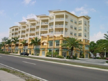
CRD
(4)
CGD. The Commercial General district (CGD) is primarily intended to allow auto-accommodating commercial development. The district also allows mixed-use development that combines commercial and housing uses in a single or multiple buildings subject to the requirements of Section VI-503(l). The zone allows a full range of retail and service businesses with a local, community or regional market. The zone's development standards promote attractive development, an open and pleasant street appearance, and compatibility with adjacent residential areas. Development is intended to be aesthetically pleasing for motorists, transit users, pedestrians and the businesses themselves. This development type will support transit use, privide a buffer between busy streets and residential neighborhoods, and provide new housing opportunities in the city.
CGD
(5)
CSC. The Commercial Shopping Center (CSC) is intended to provide for the development of planned commercial developments on larger sites. The zone allows for a full range of retail and service businesses with a local, community or regional market. Development is expected to be auto-accommodating. The zone's development standards promote attractive development, an open and pleasant street appearance that does not have the appearance of strip commercial development. Development is intended to be aesthetically pleasing for motorists, while remaining pedestrian friendly.
CSC
(6)
CBN. The intent and purpose of the CBN district is to provide for a mixture of residential and nonresidential uses and foster an urban community that is diverse, compact and walkable. In an ideal setting, buildings would form a continuous edge, generally up against the outer edge of the right-of-way, with large expanses of glass for pedestrians to see what is happening inside, and a constant sense of give-and-take between inside and outside. The width of the buildings along the street would be relatively narrow, with a range and variety of stores and shops. Restaurants and other uses might spill out onto the sidewalk creating open-air cafes, galleries and other attractions. Landscaping is prevalent, but does not dominate the setting, and does not prevent the pedestrian from getting close to the buildings, storefronts and display windows.


(7)
NT. The intent and purpose of the NT district is to permit a mix of neighborhood scale commercial; cultural and educational facilities; tourist accommodations and attractions; multifamily residential and mixed uses and to facilitate their proper development and use. The commercial and service activities within this zone are primarily oriented toward serving the needs of local residents, tourists and students. Development and redevelopment shall be compatible with, and preserve and enhance, the character of the adjoining neighborhoods. It is further intended that this district is to promote development and redevelopment in a manner that creates a safe and attractive environment for specified uses as well as cultivate an attractive gateway to the city.
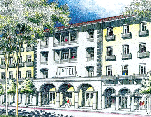
(8)
CT. The intent and purpose of the CT district is to serve the nonresidential needs of tourists by providing a variety of goods and services for tourists. The application of this district is restricted to St. Armand's Key.


CT
The following zone districts are not implementing districts and may not be used in future petitions for rezoning. See section VI-101.
(9)
CN. The intent and purpose of the CN district is to permit small-scale neighborhood oriented commercial facilities and to facilitate their proper development and use through substantial buffering and design techniques to lessen and/or prevent impacts on adjacent or nearby residential uses. Businesses in this district are within convenient traveling distance from one or several neighborhoods. The primary uses provided for include food, drugs, hardware and similar items and the provision of personal services. This is not an implementing district and there shall be no further rezonings to the CN zone district. The standards contained in this district shall only be applied to those zoning lots which are currently zoned CN.
(10)
CP. The intent and purpose of the CP district is to permit medium scale commercial facilities and to facilitate their proper development and use. Businesses in this district serve a community-wide market area and offer a wide range of goods and services. It is further intended that substantial buffering and other design techniques shall be used to lessen and/or prevent impacts on adjacent or nearby residential uses. This Commercial Park district is limited in application to zoning lots with frontage on major arterials or and interstate connectors. This is not an implementing district and there shall be no further rezonings to the CP zone district. The standards contained in this district shall only be applied only to those zoning lots which are currently zoned CP.
(11)
CSC-N. The intent and purpose of the CSC-N districts is to provide for the development of planned commercial facilities on large tracts of land. It is further intended that the uses be used to provide a variety of goods and services in a unified development scheme and not single purpose activities. Since a shopping center may well be located in proximity to residential areas, great care must be used to fit a center into its surroundings. This is not an implementing district and there shall be no further rezonings to the CSC-N zone district. The standards contained in this district shall only be applied only to those zoning lots which are currently zoned CSC-N.
(12)
CSC-C. The intent and purpose of the CSC-C districts is to permit the development of planned commercial facilities on large tracts of land. The nature of the primary uses in the CSC-C district are intended to provide a variety of goods and services in a unified development scheme and not single purpose activities. Since the shopping center may well be located in proximity to residential areas, great care must be used to fit it into its surroundings. This is not an implementing district and there shall be no further rezonings to the CSC-C zone district. The standards contained in this district shall only be applied only to those zoning lots which are currently zoned CSC-C.
(13)
CSC-R. The intent and purpose of the CSC-R districts is to permit the development of planned commercial facilities on large tracts of land. The nature of the primary uses in the CSC-R district are intended to provide a variety of goods and services in a unified development scheme and not single purpose activities. Since the shopping center may well be located in proximity to residential areas, great care must be used to fit it into its surroundings. This is not an implementing district and there shall be no further rezonings to the CSC-R zone district. The standards contained in this district shall only be applied only to those zoning lots which are currently zoned CSC-R.
(14)
CG. The intent and purpose of the CG district is to permit medium scale commercial facilities and to facilitate their proper development and use. Businesses in this district serve a community-wide market area and offer a wide range of goods and services. It is further intended that substantial buffering and other design techniques shall be used to lessen and/or prevent impacts on adjacent or nearby residential uses. This is not an implementing district and there shall be no further rezonings to the CG zone district. The standards contained in this district shall only be applied only to those zoning lots which are currently zoned CG.
(Ord. No. 02-4357, 4-29-02; Ord. No. 09-4838, § 2(att. 1), 2-17-09; Ord. No. 09-4890, § 2(att. 1), 10-19-09; Ord. No. 19-5299, § 2(Exh. A), 3-2-20)
Sec. VI-502. - Primary uses.
(a)
Definitions. Certain specific uses are defined in article II, division 2. The use categories are described in article II, division 3.
(b)
Permitted uses. Uses permitted in the commercial zones are listed in tables VI-501 and VI-501-A with a "P." These uses are allowed if they comply with the development standards and other regulations of this Code.
(c)
Conditional uses. Uses allowed in the commercial zones, if approved through the conditional use review process, are listed in tables VI-501 and VI-501-A with either a "C" if the use is a major conditional use, or an "MC" if the use is a minor conditional use. These uses are allowed provided they comply with the conditional use approval criteria, the development standards, and any other regulations of this Code.
(d)
Provisional uses. Uses allowed, if approved through the provisional use review process, are listed in tables VI-501 and VI-501-A with an "L". Provisional uses are similar to those regulated by a conditional use permit that, by their nature, may, but do not necessarily have significant adverse effects on the environment, overburden public land and services, change the desired character of an area, create major nuisances, or most importantly present the possibility of a change in circumstances during their life.
(e)
Use limitations. Uses allowed that are subject to limitations are identified with bracketed numbers in tables VI-501 and VI-501-A. The limitations that correspond to the bracketed numbers are stated at the end of tables VI-501 and VI-501-A. These uses are allowed if they comply with the use limitations, development standards and other regulations of this Code.
(f)
Accessory uses. Common accessory uses are listed as examples with each use category. Accessory uses are allowed by right, in conjunction with the primary use, unless stated otherwise in these regulations. Also, unless otherwise stated, they are subject to the same regulations as the primary use. See article VII, division 9 for specific accessory use standards.
(g)
Prohibited uses. Uses listed in tables VI-501 and VI-501-A without any symbol (i.e., blank space) are prohibited as primary uses, however, some may be permissible as accessory uses as prescribed in article VII, division 9 of this Code. Existing uses in categories listed as prohibited may be subject to the regulations of article V, vested rights and nonconformities.
Table VI-501. Primary Uses Allowed in the Commercial Zones
Notes for table 501:
(1)
Residential use limitation.
a.
Housing types are limited to those defined in table 502.
b.
Residential uses on a CND or CSD zoning lot must be located above the first floor of any building.
c.
Residential uses on the ground floor on a CRD or CGD zoning lot must be less than 50 percent of the total ground floor area of the project, which may consist of one or more buildings. In addition, nonresidential portions of mixed-use projects must be completed and receive an occupancy permit in advance or at the same time as an occupancy permit for any residential portion of the project.
(2)
Parking area location limitation. Parking areas shall not be located any closer to a public street right-of-way than the distance by which the principal building is set back from the street right-of-way. This provision shall not be construed to preclude parking lot access driveways. Parking areas shall not be located on street corners unless one of the following conditions exist.
a.
If a zoning lot fronts on three streets, then parking may be located on only one corner.
b.
If a zoning lot fronts on four streets, then parking may be located on only two corners.
(3)
Drive-through facility limitation. Drive-up windows and drive-through uses are prohibited.
(4)
Small business limitation. Each individual business is limited to 10,000 square feet of total floor area exclusive of parking area. Uses are limited in size in order to limit their potential impacts on residential uses and to promote a relatively local market area.
(5)
Pharmacy limitation. Pharmacy use permitted only when accessory to a drugstore or grocery store. Pharmacy as a primary use is prohibited.
Table VI-501-A. Primary Uses Allowed in the Commercial Zones
Notes for table VI-501A:
(1)
Storage limitation. No on-site permanent vehicle storage allowed.
(2)
Adult use limitation. See specific restrictions in article IV, division 4 of this Code.
(3)
Pet grooming limitation. No boarding, kennel or veterinary services are permitted.
(4)
Location limitation. Use must be located above first floor of the building.
(5)
Community service limitation in CBN. The following community service uses are prohibited: short-term housing, mass shelters, labor pool, halfway houses, food pantries, and soup kitchens.
(6)
Pharmacy limitation. Pharmacy use permitted only when accessory to a drugstore, grocery store or medical office. Pharmacy as a primary use is prohibited.
(Ord. No. 02-4357, 4-29-02; Ord. No. 03-4429, § 7, 1-21-03; Ord. No. 06-4663, § 2, 3-20-06; Ord. No. 06-4682, § 2, 7-26-06; Ord. No. 07-4720 § 2, 5-21-07; Ord. No. 07-4770, § 2, 12-17-07; Ord. No. 09-4890, § 2(att. 1), 10-19-09; Ord. No. 11-4962, § 2(att. 1), 6-6-11; Ord. No. 13-5055, § 2(Att. 1), 5-6-13; Ord. No. 18-5234, § 2(Exh. A), 2-5-18; Ord. No. 19-5299, § 2(Exh. A), 3-2-20; Ord. No. 21-5364, § 2(Exh. A), 5-18-21; Ord. No. 22-5415, § 2(Exh. A), 4-16-22; Ord. No. 22-5427, § 2(Exh. A), 9-6-22; Ord. No. 22-5430, § 2(Exh. A), 12-5-22; Ord. No. 23-5503, § 2(Exh. A), 2-20-24)
Sec. VI-503. - Development standards.
(a)
Residential structure types allowed. A very narrow range of residential structure types is allowed in the commercial zones. This range allows for options to increase housing variety and housing opportunities, while maintaining the primary nature and focus of the zones. The residential structure types allowed in the commercial zones are stated in tables VI-502 and VI-502-A. The residential structure types are defined in article II, division 2.
Table VI-502. Residential Structure Types Allowed in the Commercial Zones
Table VI-502-A Residential Structure Types Allowed in the Commercial Zones
(b)
Density.
(1)
Purpose. Density standards serve several purposes. For example, they serve to establish housing density with the availability of public services and the carrying capacity of the land. In addition, density standards promote development opportunities for housing and promote urban densities in less developed areas. Density regulations are also one tool to judge equivalent compatibility of projects.
(2)
The maximum density allowed is stated in table VI-503 and 503A.
(c)
Floor area ratio.
(1)
Purpose. Floor area ratios (FARs) regulate the amount of use (the intensity) allowed on a zoning lot. FARs provide a means to match the potential amount of uses with the desired character of the area and the provision of public services. FARs also work with height, setback, and building coverage standards to control the overall bulk of development.
(2)
FAR standard. The floor area ratios are stated in table VI-503 and 503A. These FARs apply to all nonresidential development including hotel/motel uses. However, additional square footage obtained by the height bonus in subsection VI-503(l) below, shall not be calculated in the determination of the maximum FAR. Certain community service uses that may also have to comply with a density standard shall also be subject to the FAR requirement. Additional floor area is allowed for residential (residential use categories) development.
(d)
Reserved.
(e)
Height.
(1)
Purpose. The height limits are intended to control the overall scale of buildings. The height limits in the CND zone discourage buildings that visually dominate adjacent residential areas. The height limits in the CBN, CSD, CRD, CGD and CSC zones allow for a greater building height at a scale that generally reflects the city's higher intensity nonresidential areas. Generally, light, air and the potential for privacy are intended to be preserved in adjacent residential areas.
(2)
Height standard. The height standards for all structures are stated in tables VI-503 and VI-503-A.
(3)
Extensions (encroachments) above the maximum height. Extensions above the maximum height of structures are detailed under height limitations in section VI-102(p).
(f)
Setbacks.
(1)
Purpose. The required building setbacks promote streetscapes that are consistent with the desired character of the different commercial zones. The CBN, CND, CSD and CRD zones setbacks promote buildings close to the sidewalk to reinforce a pedestrian-oriented and built-up streetscape. The setback requirements of areas that abut residential zones promote nonresidential development that will maintain a visual transition, light, air and the potential for privacy for adjacent residential zones. The minimum and maximum setback standards apply to all buildings and structures on the site except as specified in (3) and (4) below.
(2)
Required setbacks. The required minimum and maximum building setbacks are stated in tables VI-503 and VI-503-A. Other setbacks may apply to specific types of development or situations. For example, setbacks for parking areas are stated in article VII, divisions 2 and 3.
(3)
Extensions (encroachments) into required building setbacks. Allowable encroachments into required building setbacks are stated in article VII, division 12.
(4)
Administrative reduction. The director of neighborhood and development services may approve the reduction or elimination of the maximum setback requirement.
a.
If a zoning lot fronts on three or more streets, then the maximum front yard setback only applies to two frontages where the logical major pedestrian pattern occurs.
b.
Up to 25 percent of the length of each street-facing facade of a building is exempt from the maximum setback in order to enhance a building's design by creating a forecourt/courtyard or a chamfered corner.
Applicants seeking this option must submit their request in writing to the director of neighborhood and development services and explain the basis for the request.
(g)
Optional building roof lighting standards.
(1)
Purpose. Building lighting can provide an attractive and cohesive design element for business districts. While not mandatory, if building roof lighting is installed it should be installed in a consistent manner. Consistent and similar lighting can provide a common element which unifies and connects a variety of dissimilar buildings.
(2)
Optional building roof lighting shall be installed based on the following standards:
a.
Clear lights of no more than 7½ watts;
b.
Non-flashing;
c.
Bulbs placed on a strand between 12-inch and 18-inch intervals;
d.
Limited to outlining the roof and eaves of the building; and
e.
Installation must meet all applicable provisions of the adopted electrical code (as may be amended).
(h)
Ground floor windows.
(1)
Purpose. Blank walls on the ground level of buildings are limited in order to:
a.
Provide a pleasant, rich and diverse pedestrian experience by connecting activities occurring within a structure to adjacent sidewalk areas;
b.
Encourage continuity of office and service uses;
c.
Encourage surveillance opportunities by restricting fortress-like facades at street level; and
d.
Avoid a monotonous pedestrian environment.
Table VI-503 identifies the zone districts where this regulation applies.
(2)
Qualifying types of development. This regulation applies to all new development and remodeling projects that exceed 50 percent of the structure's assessed valuation. Assessed valuation shall be determined by reference to the official property tax assessment rolls of the year the structure is to be remodeled.
(3)
Required amounts of window area.
a.
Exterior walls of a building facing a street on the ground level must meet the general window standard in subsection b. below. However, on corner zoning lots, the general standard must be met on one street frontage only. The general standard must be met on the street that has the lower street classification, unless the logical major pedestrian pattern occurs on the higher classified street in a specific instance. On the other street(s) the requirement is one-half of the general standard.
b.
General standard. The windows must be at least 50 percent of the length and 25 percent of the ground level wall area. Ground level wall areas of a building include all exterior wall areas up to nine feet above finished grade. The requirement does not apply to the walls of residential structures or parking structures.
c.
Security grilles, if any, shall be at least 50 percent transparent and shall be located on the inside of the glassed area.
(4)
Qualifying window features. Required window areas must be either windows that allow views into working areas or lobbies, pedestrian entrances (e.g., doorways), or display windows set into a wall. Display cases attached to the outside of a wall do not qualify. The bottom of the windows must be no more than three feet above the adjacent public sidewalk elevation.
(5)
Administrative reduction. When exterior walls of a building are more than 20 feet from the front zoning lot line, the director of neighborhood and development services may reduce or eliminate the required amount of window area provided one (1) or more of the following techniques is used on the exterior wall of the building and/or on a streetwall: wall murals (trompe l'oeil); decorative masonry patterns; vertical or horizontal change in wall plane; vertical trellises; landscaped or raised planter beds placed in front of the wall; canopies; or awnings. Except for decorative openings, streetwalls may have openings no larger than necessary to allow vehicle and pedestrian access. Applicants requesting this option must submit their request in writing to the director of neighborhood and development services and explain the basis for the request.
(i)
Screening.
(1)
Purpose. These screening standards address specific unsightly features that detract from the appearance of nonresidential buildings.
Table VI-503 identifies the zone district(s) where this regulation applies.
(2)
Qualifying types of development. This regulation applies to all new development and remodeling projects that exceed 50 percent of the structure's assessed valuation. Assessed valuation shall be determined by reference to the official property tax assessment rolls of the year the structures is to be remodeled.
(3)
Garbage collection areas. All exterior garbage cans, dumpsters and garbage collection and compaction areas must be screened from the street and any adjacent properties. These areas shall be located and screened so that the visual and acoustic impacts of these functions are contained and out of view from adjacent properties and public streets. Trash receptacles for pedestrian use are exempt. See section VII-1401 for specific requirements.
(4)
Mechanical equipment. Mechanical equipment, located on the ground, such as heating or cooling equipment, pumps, or generators must be screened from public streets and any adjacent properties. All rooftop mechanical equipment must be screened from the ground level of public streets and any adjacent properties by integrating it into building and roof design.
(5)
Other screening requirements. The screening and buffering requirements for uses, parking areas, exterior storage and exterior display areas are stated with the regulations for those types of items.
(j)
Pedestrian standards.
(1)
Purpose. The pedestrian standards encourage a safe, attractive and usable pedestrian circulation system in all nonresidential developments. They ensure a direct pedestrian connection between the street and buildings on the site, and between buildings and other activities within the site. In addition, they provide for connections between adjacent sites, where feasible.
Table VI-503 identifies the zone district(s) where this regulation applies.
(2)
Qualifying types of development. This regulation applies to all new development and remodeling projects that exceed 50 percent of the structures assessed valuation. Assessed valuation shall be determined by reference to the official property tax assessment rolls of the year the structures is to be remodeled.
(3)
Standards. An on-site pedestrian circulation system must be provided. The system must meet all standards of this section.
a.
Connections.
1.
Connection to street. The sidewalk system must connect all abutting streets to the main entrance.
2.
Internal connections. The sidewalk system must connect all buildings on the zoning lot, and provide connections to other areas of the site, such as parking areas, bicycle parking, recreational areas, common outdoor areas and any other amenities.
b.
Materials.
1.
The circulation system must be hard-surfaced, and be at least five feet wide.
2.
Where the system crosses driveways, parking areas and loading areas, the system must be clearly identifiable through the use of elevation changes, speed bumps, different paving materials, or other similar method. Stripping does not meet this requirement.
3.
Where the system is parallel and adjacent to a motor vehicle travel lane, the system must be a raised path or be separated from the lane by a raised curb, bollards, landscaping or other physical barrier. If a raised path is used the ends of the raised portions must be equipped with ADA (Americans with Disabilities Act) accessible curb ramps.
c.
Lighting. The on-site pedestrian circulation system must be lighted to a level where the employees, residents, visitors and customers can safely use the system at night. All lighting fixtures must be shielded and directed to confine light spread within the site boundaries. See the standards in section VII-1402, site lighting.
(k)
Exterior display, storage and work activities.
(1)
Purpose. The standards of this section are intended to assure that exterior display, storage and work activities:
a.
Will be consistent with the desired character of the zone;
b.
Will not be a detriment to the overall appearance of a commercial area;
c.
Will not have adverse impacts on adjacent properties, especially those zoned residential; and
d.
Will not have an adverse impact on the environment.
Tables VI-503 and 503-A identify the zone district(s) where this regulation applies.
(2)
Qualifying types of development. This regulation applies to all existing, new, remodeling projects.
(3)
Exterior display and storage. Exterior display of goods is prohibited except for the display and storage of plants, produce, motor vehicles and boats subject to the following limitations:
a.
Such uses must be accessory to an approved primary use.
b.
Display areas for plants and produce are limited to an area equal to 15 percent of the principal uses' gross floor area. There is no limit for approved motor vehicle or boat sales/rental lots and plant nurseries.
c.
Except for approved plant nurseries, all plant and produce merchandise must be stored inside the building after permitted hours of operation. Motor vehicles and boats may remain outdoors.
d.
Hours of operation are limited from 6:00 a.m. to 9:00 p.m.
e.
Display areas are not permitted in required landscape, parking, or pedestrian areas.
(4)
Exterior work activities. Exterior work activities are prohibited except for the following uses that comply with all applicable regulations: restaurants; plant nurseries; entertainment and recreation uses that are commonly performed outside; sales or rental of motor vehicles and boats; fuel sales; car washes; commercial surface parking lots; and outdoor markets.
(l)
Residential hotel/motel accommodations height bonus.
(1)
Purpose and description. Special height bonuses for residential uses in the CRD, and for residential uses and hotel/motel accommodation uses in the CGD are intended to provide incentives for new housing and for hotel/motel accommodation opportunities in the city and to place residents and hote/motel guests in close proximity to business establishments in the CRD and CGD zones. The bonus is designed to allow additional building height in a manner that is still consistent with the purposes of the CRD and CGD zones.
The bonus is applicable to a range of development sizes. However, it may be more practical, feasible, or workable for large projects. Therefore, all developments will not qualify for this bonus option.
(2)
Qualifying types of development. The height bonus provisions are applicable to all existing or new principal structures in CRD zone. The height bonus provisions are applicable to all existing or new principal structures in the CGD zone provided the maximum zoning lot size is one acre or greater.
(3)
CRD height bonus. The maximum height may be increased to 65 feet provided the additional height over 35 feet is used exclusively for residential uses.
a.
Compliance with the standards. Variances to any of the development standards of the base zone or any overlay district are prohibited if the project is to receive any height bonus. It is the responsibility of the applicant to document that all of the bonus requirements are met.
b.
Covenants. The applicant must sign a covenant that ensures that the additional height will continue to be used exclusively for residential for the life of the development. The city attorney must approve the covenant as to form. The covenant must be recorded prior to issuance of the first building permit for the project.
(4)
CGD height bonus. The maximum height may be increased to 65 feet provided the additional height over 45 feet is used exclusively as habitable floor in residential or hotel/motel accommodation uses.
a.
Compliance with the standards. Variances to any of the development base zone or any overlay district are prohibited for any structure that receives the height bonus. It is the responsibility of the applicant to document that all of the bonus requirements are met.
b.
Covenants. The applicant must sign a covenant that ensures the additional height will continue to be used exclusively for residential or hotel/motel accommodation uses for the life of the development. The city attorney must approve the covenant as to form. The covenant must be recorded prior to issuance of the first building permit for the project.
c.
Hotel/motel accommodations. When the CGD height bonus is exclusively used for hotel or motel uses, the applicant shall contribute to the City's Affordable Housing Trust Fund. The amount of the contribution shall be $5,000.00 for each foot of building height or fraction thereof that exceeds 45 feet and $10,000.00 for each foot of building height or fraction thereof that exceeds 55 feet.
(5)
CGD residential intensity bonus. Developers of commercial projects in the CGD zoning lots that are one acre or greater in size may include residential dwelling units as provided in this subsection, thereby resulting in a mixed-use project subject to the following: The maximum dwelling unit density shall be 25 units per acre. One out of every four dwelling units or 25 percent of the dwelling units shall be designated for households with an income at or below 120 percent of the Area Median Income (AMI) in the North Port-Sarasota-Bradenton metropolitan statistical area (MSA) for a period of at least 30 years.
As a condition of the allowance of the residential intensity bonus, an agreement between the developer/landowner and the City of Sarasota shall be recorded in Official Records of Sarasota County. The agreement shall provide that a buyer or renter of a dwelling unit designated for households with an income at or below 120 percent of AMI in the North Port-Sarasota-Bradenton MSA shall not have a household income greater than the income range designated for the units that are specified in the agreement. The agreement shall provide for monitoring of occupant income levels for a period of 30 years. The agreement shall further provide that a dwelling unit designated for households with an income at or below 120 percent of AMI for the local MSA shall have an appreciation limit applicable upon resale and that a rental unit designated for households with an income at or below 120 percent of AMI for the local MSA shall be monitored for rent levels for 30 years.
The agreement between the developer/landowner and the City of Sarasota shall also address how the cost to the developer/landowner of providing the above-described designated dwelling units will be offset by the allowance of dwelling units to create a mixed use project by allowance of a height bonus, if applicable; and by such other incentives as may have been agreed upon by the parties. The agreement shall contain an acknowledgement by the developer/landowner that the cost of providing the above-described designated dwelling units have been fully offset by the incentives set forth in the agreement and that the city has complied with the provisions of the Florida Statutes that may be construed to apply to require offsets, including, but not necessarily limited to F.S. 166.04151.
(m)
Ground floor retail.
(1)
Purpose. The standard is intended to ensure the desired character of the zone.
Table VI-503 identifies the zone district(s) where this regulation applies.
(2)
Qualifying types of development. This regulation applies to all new development and remodeling projects that exceed 50 percent of the structures assessed valuation. Assessed valuation shall be determined by reference to the official property tax assessment rolls of the year the structures is to be remodeled.
(3)
All buildings on a zoning lot must devote at least 75 percent of the ground floor street frontage to retail sales and service uses identified in table VI-501.
(n)
Building recess.
(1)
Purpose. The standard is intended to prevent the effect of canyon-like streets by establishing human scale proportions for new buildings at eye level.
Table VI-503 identifies the zone district(s) where this regulation applies.
(2)
Qualifying types of development. This regulation applies only to new development.
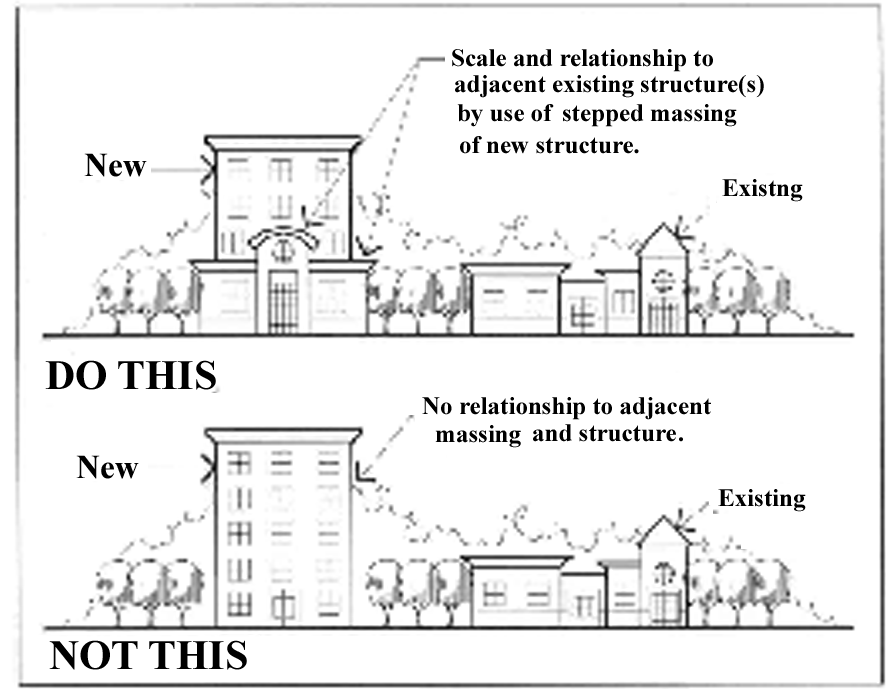
Illustration VI-501
(3)
In the CRD, any portion of a building that exceeds 35 feet in height above finished grade, shall be recessed a minimum of ten additional feet along all street frontages above 35 feet. The design and placement of the recess shall also consider the scale and relationship of adjacent existing structures (see illustration VI-501).
Table VI-503. Development Standards in the Commercial Zones.
Table VI-503 Notes:
(1)
The maximum height may be increased if allowed by the residential height bonus regulations of subsection VI-503(l).
(2)
There is no height limit for aviation control towers and major event entertainment uses. However, these uses are subject to major conditional use approval.
(3)
The larger setback requirement applies to the ground floor of buildings fronting on arterial and higher classified streets. The setback for upper stories may be the smaller setback requirement.
(4)
The larger setback requirement applies to structures fronting on arterial and higher classified streets.
(5)
The larger setback is required for zoning lots abutting residentially zoned property.
(6)
The maximum height may be increased to 50 feet for structures or portions of structures which are set back 100 feet or greater from residentially zoned property. In addition, storefront entrance/entry architectural features for such structures or portions of structures which are set back 100 feet or greater from residentially zoned property may be allowed up to a maximum height of 65 feet.
(7)
The maximum height may be increased to 65 feet for structures or portions of structure which are set back 100 feet or greater from single-family residentially zoned properties if allowed by the residential hotel/motel accommodation height bonus regulations of subsection VI-503(l).
Table VI-503A. Development Standards in the Commercial Zones
Table VI-503A notes:
CN, CG DISTRICTS
(1)
Minimum side yard setback is eight feet where property abuts residentially zoned property.
CBN DISTRICT
(2)
Minimum setback is 15 feet where property abuts residential.
(12)
Maximum building height may be increased to 45 feet for contiguous parcels that abut the intersection of Dr. Martin Luther King Jr. Way and Osprey Avenue.
NT DISTRICT
(3)
Maximum height for hotels/motels, theaters and third floor residential is 35 feet.
(4)
Unenclosed balconies may extend two feet on the second and third floor; unenclosed porches on the ground floor and marquees and awnings above the ground floor may extend five feet into the front yard setback.
(5)
Minimum side setback adjacent to residential use and fronting on N. Tamiami, eight feet; adjacent to residential use and fronting side streets intersecting with N. Tamiami 15 feet.
CT DISTRICT
(6)
Residential must be located above the first floor of the building.
(7)
Minimum setback is zero feet above the first story. New buildings with upper stories that project over the first story, must have the projection cantilevered without ground supports.
(10)
The display of merchandise on doors open to the outside is prohibited.
CP DISTRICT
(8)
If interior structured parking is utilized, for at least 50 percent of the minimum required parking for a project, the maximum site coverage for the floors uses exclusively for parking shall be 50 percent.
CSC-N, CSC-C, CSC-R DISTRICTS
(9)
Minimum setback is 100 feet where property abuts residentially zoned property.
(Ord. No. 02-4357, 4-29-02; Ord. No. 03-4429, § 7, 1-21-03; Ord. No. 03-4472, § 2, 6-16-03; Ord. No. 04-4513, § 3, 1-20-04; Ord. No. 04-4547, §§ 7—9, 6-7-04; Ord. No. 06-4663, § 2, 3-20-06; Ord. No. 07-4770, § 2, 12-17-07; Ord. No. 08-4799, § 2, 4-28-08; Ord. No. 09-4838, § 2(att. 1), 2-17-09; Ord. No. 09-4890, § 2(att. 1), 10-19-09; Ord. No. 10-4912, § 2(att. 1), 6-7-10; Ord. No. 10-4927, § 2(att. 1), 2-22-11; Ord. No. 19-5299, § 2(Exh. A), 3-2-20; Ord. No. 20-5309, § 3(Exh. B), 11-2-20; Ord. No. 22-5414, § 2(Exh. A), 5-16-22; Ord. No. 22-5430, § 2(Exh. A), 12-5-22)
Sec. VI-504. - Special NT, CP and CT development standards.
(a)
North Trail (NT) district.
(1)
Site plan review is required in accordance with article IV, division 5.
(2)
Exterior lighting shall be provided for nighttime illumination of display areas, parking lots, walkways, entrances, and exits. These areas shall be lit, at a minimum, one-half hour after sunset and one-half hour before sunrise during hours of operation. The use of a photoelectric switch is highly recommended.
(3)
Prohibited hours of operation are from 10:00 p.m. to 6:00 a.m., except as otherwise provided in subsection (5)b. Urgent care centers, colleges, universities, restaurants, theaters, hotels, and motels, residential uses, bed and breakfast inns, and existing radio and television stations, transmitters, bars, outdoor bars, and nightclubs are excluded from this restriction. All other allowable uses shall apply for a major conditional use to extend their hours of operation.
(4)
Preparation and storage areas shall be conducted within a completely enclosed building, except as permissible under subsection (6) below. Outdoor recreational facilities such as swimming pools or tennis courts are permitted.
(5)
Trash and garbage shall be stored within closed containers or recycling containers that are screened from general view.
(6)
In order to develop a zoning lot for nonresidential use, the zoning lot shall have frontage on North Tamiami Trail (U.S. 41), 10th Street, Dr. Martin Luther King, Jr. Way, Myrtle Street, or University Parkway (f/k/a DeSoto Road). A zoning lot which does not meet the frontage requirement on one of the above-described streets may be integrated into a site and development plan with another zoning lot which has frontage on one of the above-described streets, regardless of whether there is an intervening street or alley between the zoning lot lacking such frontage and the zoning lot abutting one of the above-described streets. A zoning lot that is developed for nonresidential use as of January 1, 1994, which does not satisfy the requirements of this subsection, shall be exempt from such requirement.
(7)
Curb cut requirements.
a.
No new curb cuts are allowed on North Tamiami Trail within 70 feet of the projected curbline of any intersecting public street.
b.
Two curb cuts on North Tamiami Trail may be allowed if there is not access available from a side street or alley. The total width of both driveways shall not exceed 50 percent of the property frontage on North Tamiami Trail.
c.
All other state department of transportation and city regulations regarding curb cuts and driveways shall be met.
(8)
Location of off-street parking. Parking shall be permitted in required yards.
(9)
Pedestrian-related design features.
a.
Direct pedestrian access shall be provided from the principal entrance of the building to the sidewalk on North Tamiami Trail or side street, if any. Pedestrian access shall be provided from rear parking facilities to the ground floor uses, either through rear or side building entrances, pedestrian ways along the perimeter of buildings, or by pedestrian throughways that connect the rear parking lots to the sidewalks along North Tamiami Trail. Pedestrian throughways may be exterior and located between buildings or may be incorporated into the interior design of a structure. Pedestrian throughway shall be a minimum of six feet wide, well lighted and visually accessible from either the interior of the building or street and parking areas. The intention is to provide a safe and aesthetically pleasing environment.
b.
Parking, vehicular service areas, and all pedestrian areas shall be well lighted to provide both a secure and aesthetically pleasing environment. Lighting shall be directed away from adjacent residential properties and roadways.
c.
Combined ground floor and second floor building frontage on all front yards shall contain a minimum of 15 percent transparent or translucent materials per gross area of frontage.
(b)
Commercial Park (CP) district.
(1)
One curb cut permitted for every 150 feet of frontage.
(2)
No curb cut shall be permitted on an interstate connector or major arterial within 60 feet of any intersecting public street when access to the development is possible from the intersecting street.
(3)
Property owners shall provide acceleration/deceleration lanes at any entrance or exit to or from an interstate connector or major arterial as may be required by the city engineer and approved by the planning board.
(4)
All trash and garbage shall be stored within closed containers that are screened from general view.
(5)
When abutting zoning lot owners utilize one shared access point to a major arterial or interstate connector, there shall be no required side yard setback for their parking areas and no required side yard landscaping; these standards to allow combined parking area.
(c)
Commercial Tourist (CT) district.
(1)
New awnings, canopies, marquees and similar features may not encroach into the public right-of-way along the front property line.
(2)
New awnings, canopies and similar features (where allowed) shall be constructed of high quality materials. "Plastic" looking materials that have a glossy or shiny appearance are prohibited. Backlighting of awnings, canopies and similar features is prohibited.
(Ord. No. 02-4357, 4-29-02; Ord. No. 06-4682, § 2, 7-26-06; Ord. No. 09-4838, § 2(att. 1), 2-17-09; Ord. No. 09-4890, § 2(att. 1), 10-19-09; Ord. No. 10-4927, § 2(att. 1), 2-22-11; Ord. No. 22-5427, § 2(Exh. A), 9-6-22; Ord. No. 23-5502, § 2(Exh. A), 2-20-24)
Sec. VI-601. - Intent and purpose.
(a)
Intent and purpose. The intent and purpose of the Production Intensive Commercial (PIC) districts is to preserve land for manufacturing, warehousing, and intensive commercial developments and provide for areas that have a mix of uses with a strong industrial orientation. The zones differ in the mix of allowed uses, the allowed intensity of development and the development standards. The regulations promote areas, that consist of uses and developments, which will support the economic viability of the specific zoning district and of the city. The regulations protect the health, safety and welfare of the public, addresses area character, and address environmental concerns. In addition, the regulations provide clarity to property owners, developers, and neighbors about the limits of what is allowed.
(b)
List of the production intensive commercial districts. The full names, short names and map symbols of the production intensive commercial districts are listed below. When this Code refers to the Production intensive commercial zones it is referring to the zones listed here.
(c)
Characteristics of the zones.
(1)
ICD. The Intensive Commercial district (ICD) is intended to provide areas where a wide range of employment opportunities without potential conflicts from interspersed residential uses. The emphasis is on intensive commercial and industrially related uses. Other commercial uses are allowed to support a wide range services and employment opportunities. The development standards are intended to allow new development, which is similar in character to existing development while promoting viable and attractive intensive commercial areas.
ICD
(2)
IGD. The Industrial General district (IGD) is intended to provide areas where most industrial uses may locate, while other uses are restricted to prevent potential conflicts and to preserve land for industry. The development standards are intended to allow new development, which is similar in character to existing development while promoting viable and attractive industrial areas.
IGD
(3)
IHD. The Industrial Heavy district (IHD) is intended to provide areas where all kinds of industries may locate, including those not desirable in other zones due to their objectionable impact or appearance. The development standards are the minimum necessary to assure safe, functional, efficient, and environmentally sound development.
IHD
The following zone districts are not implementing districts and may not be used in future petitions for rezoning. See section VI-101.
(4)
CI. The intent and purpose of the CI district is to permit and facilitate the proper development of high intensity commercial development. Uses in this district require highly visible and highly accessible locations with direct access to streets carrying large volumes of traffic that serve regional needs. It is further intended that substantial buffering and other design techniques shall be used to mitigate negative impacts on nearby or adjacent uses. This is not an implementing district and there shall be no further rezonings to the CI zone district. The standards contained in this district shall only be applied only to those zoning lots which are currently zoned CI.
(5)
ILW. The intent and purpose of the ILW district is to permit light manufacturing, processing, storage and warehousing, wholesaling and distribution and to facilitate the proper development and use. This is not an implementing district and there shall be no further rezonings to the ILW zone district. The standards contained in this district shall only be applied only to those zoning lots which are currently zoned ILW.
(6)
I. The intent and purpose of the I district is to permit heavy industrial uses which have the potential of producing extensive adverse impacts on surrounding land uses or resources and to facilitate the proper development and use. Such uses include those that produce noise, odors or increased hazards of fire, or are generally incompatible with lower-intensity land uses. It is generally required that industrial processes will take place within enclosed buildings. This is not an implementing district and there shall be no further rezonings to the I zone district. The standards contained in this district shall only be applied only to those zoning lots which are currently zoned I.
(Ord. No. 02-4357, 4-29-02)
Sec. VI-602. - Primary uses.
(a)
Definitions. Certain specific uses are defined in article II, division 2. The use categories are described in article II, division 3.
(b)
Permitted uses. Uses permitted in the production intensive commercial zones are listed in tables VI-601 and VI-601A with a "P." These uses are allowed if they comply with the development standards and other regulations of this Code.
(c)
Conditional uses. Uses allowed in the production intensive commercial zones, if approved through the conditional use review process, are listed in tables VI-601 and VI-601A with either a "C" if the use is a major conditional use, or an "MC" if the use is a minor conditional use. These uses are allowed provided they comply with the conditional use approval criteria, the development standards, and any other regulations of this Code.
(d)
Provisional uses. Uses allowed, if approved through the provisional use review process, are listed in tables VI-601 and VI-601A with an "L". Provisional uses are similar to those regulated by a conditional use permit that, by their nature, may, but do not necessarily have significant adverse effects on the environment, overburden public land and services, change the desired character of an area, create major nuisances, or most importantly present the possibility of a change in circumstances during their life.
(e)
Use limitations. Uses allowed that are subject to limitations are identified with bracketed numbers in tables VI-601 and VI-601A. The limitations that correspond to the bracketed numbers are stated at the end of tables VI-601 and VI-601A. These uses are allowed if they comply with the use limitations, development standards and other regulations of this Code.
(f)
Accessory uses. Common accessory uses are listed as examples with each use category. Accessory uses are allowed by right, in conjunction with the primary use, unless stated otherwise in these regulations. Also, unless otherwise stated, they are subject to the same regulations as the primary use. See article VII, division 9 for specific accessory use standards.
(g)
Prohibited uses. Uses listed in tables VI-601 and VI-601A without any symbol (i.e., blank space) are prohibited as primary uses, however, some may be permissible as accessory uses as prescribed in article VII, division 9 of this Code. Existing uses in categories listed as prohibited may be subject to the regulations of article V, vested rights and non-conformities.
Table VI-601. Primary Uses Allowed, Production Intensive Commercial
Table VI-601A. Primary Uses Allowed, Production Intensive Commercial
Notes for Table VI-601A:
(1)
Manufacturing limitation. No manufacturing of concrete or asphalt on site.
(2)
Pet grooming limitation. No boarding, kennel or veterinary services are permitted.
(3)
Adult use limitation. See specific restrictions found in article IV, division 4 of this Code.
(4)
Outdoor storage limitation. No wrecking yards, including motor vehicle or junk yards, or yards in whole or in part used for scrap or salvage operations, or processing, storage, display or sale of scrap, salvage or used building materials, motor vehicle or motor vehicle parts.
(5)
Contractor storage yard limitation. No storage, display or sale of scrap, salvage, second hand building materials, inoperative motor vehicles or used motor vehicle parts allowed.
(6)
Pharmacy limitation. Pharmacy use permitted only when accessory to a drugstore or grocery store. Pharmacy as a primary use is prohibited.
(Ord. No. 02-4357, 4-29-02; Ord. No. 04-4515, § 9, 1-20-04; Ord. No. 06-4663, § 2, 3-20-06; Ord. No. 06-4682, § 2, 7-26-06; Ord. No. 08-4799, § 2, 4-28-08; Ord. No. 09-4848, § 2(att. 1), 2-17-09; Ord. No. 13-5043, § 2(exh. A), 3-4-13; Ord. No. 13-5055, § 2(Att. 1), 5-6-13; Ord. No. 18-5234, § 2(Exh. A), 2-5-18; Ord. No. 21-5364, § 2(Exh. A), 5-18-21; Ord. No. 22-5427, § 2(Exh. A), 9-6-22; Ord. No. 23-5503, § 2(Exh. A), 2-20-24; Ord. No. 24-5523, § 2(Exh. A), 7-15-24)
Sec. VI-603. - Development standards.
(a)
Residential structure types allowed. A very narrow range of residential structure types is allowed in the Production Intensive Commercial zones. The residential structure types allowed in the commercial zones are stated in table VI-602. The residential structure types are defined in article II, division 2.
Table VI-602. Residential Structure Types Allowed in the Production Intensive Commercial Zones
(b)
Reserved.
(c)
Floor area ratio.
(1)
Purpose. Floor area ratios (FARs) regulate the amount of use (the intensity) allowed on a zoning lot. FARs provide a means to match the potential amount of uses with the desired character of the area and the provision of public services. FARs also work with height and setback coverage standards to control the overall bulk of development.
(2)
FAR standard. The floor area ratios are stated in Table VI-603. These FARs apply to all nonresidential development including hotel/motel uses and certain community service uses that may also have to comply with a density standard. Additional floor area is allowed for residential (residential use categories) development.
(d)
Reserved.
(e)
Height.
(1)
Purpose. The height limits are intended to control the overall scale of buildings.
(2)
Height standard. The height standards for all structures are stated in table VI-603 and VI-603A.
(3)
Extensions (encroachments) above the maximum height. Extensions above the maximum height of structures are detailed under height limitations in section VI-102(p).
(f)
Setbacks.
(1)
Purpose. The required building setbacks promote streetscapes that are consistent with the desired character of the different production intensive commercial zones.
(2)
Required setbacks. The required minimum and maximum building setbacks are stated in table VI-603 and VI-603A. Other setbacks may apply to specific types of development or situations. For example, setbacks for parking areas are stated in article VII, divisions 2 and 3.
(3)
Extensions (encroachments) into required building setbacks. Allowable encroachments into required building setbacks are cited in article VII, division 12.
(g)
Reserved.
(h)
Reserved.
(i)
Ground floor windows.
(1)
Purpose. Blank walls on the ground level of buildings are limited in order to:
a.
Provide a pleasant, rich and diverse pedestrian experience by connecting activities occurring within a structure to adjacent sidewalk areas;
b.
Encourage continuity of office and service uses;
c.
Encourage surveillance opportunities by restricting fortress-like facades at street level; and
d.
Avoid a monotonous pedestrian environment.
Table VI-603 identifies the zone districts where this regulation applies.
(2)
Qualifying types of development. This regulation applies to all new development and remodeling projects that exceed 50 percent of the structure's assessed valuation. Assessed valuation shall be determined by reference to the official property tax assessment rolls of the year the structure is to be remodeled.
(3)
Required amounts of window area.
a.
Exterior walls of a building facing a street on the ground level must meet the general window standard in subsection b. below. However, on corner zoning lots, the general standard must be met on one street frontage only. The general standard must be met on the street that has the lower street classification, unless the logical major pedestrian pattern occurs on the higher classified street in a specific instance. On the other street(s) the requirement is one-half of the general standard.
b.
General standard. The windows must be at least 50 percent of the length and 25 percent of the ground level wall area. Ground level wall areas of a building include all exterior wall areas up to nine feet above finished grade. The requirement does not apply to the walls of residential structures or parking structures.
(4)
Qualifying window features. Required window areas must be either windows that allow views into working areas or lobbies, pedestrian entrances (e.g., doorways), or display windows set into a wall. Display cases attached to the outside of a wall do not qualify. The bottom of the windows must be no more than three feet above the adjacent public sidewalk elevation.
(5)
Administrative reduction. When exterior walls of a building are more than 20 feet from the front zoning lot line, the director of neighborhood and development services may reduce or eliminate the required amount of window area provided one (1) or more of the following techniques is used on the exterior wall of the building and/or on a streetwall: wall murals (trompe l'oeil); decorative masonry patterns; vertical or horizontal change in wall plane; vertical trellises; landscaped or raised planter beds placed in front of the wall; canopies; or awnings. Except for decorative openings, streetwalls may have openings no larger than necessary to allow vehicle and pedestrian access. Applicants requesting this option must submit their request in writing to the director of neighborhood and development services and explain the basis for the request.
(j)
Screening.
(1)
Purpose. These screening standards address specific unsightly features that detract from the appearance of nonresidential buildings.
Table VI-603 identifies the zone districts where this regulation applies.
(2)
Qualifying types of development. This regulation applies to all new development and remodeling projects that exceed 50 percent of the structure's assessed valuation. Assessed valuation shall be determined by reference to the official property tax assessment rolls of the year the structures is to be remodeled.
(3)
Garbage collection areas. All exterior garbage cans, dumpsters and garbage collection and compaction areas must be screened from the street and any adjacent properties. These areas shall be located and screened so that the visual and acoustic impacts of these functions are contained and out of view from adjacent properties and public streets. Trash receptacles for pedestrian use are exempt. See section VII-1401 for specific requirements.
(4)
Mechanical equipment. Mechanical equipment, located on the ground, such as heating or cooling equipment, pumps, or generators must be screened from public streets and any adjacent properties. All rooftop mechanical equipment must be screened from the ground level of public streets and any adjacent properties by integrating it into building and roof design.
(5)
Other screening requirements. The screening and buffering requirements for uses, parking areas, exterior storage and exterior display areas are stated with the regulations for those types of items.
(k)
Pedestrian standards.
(1)
Purpose. The pedestrian standards encourage a safe, attractive and usable pedestrian circulation system in all nonresidential developments. They ensure a direct pedestrian connection between the street and buildings on the site, and between buildings and other activities within the site. In addition, they provide for connections between adjacent sites, where feasible.
Table VI-603 identifies the zone districts where this regulation applies.
(2)
Qualifying types of development. This regulation applies to all new development and remodeling projects that exceed 50 percent of the structures assessed valuation. Assessed valuation shall be determined by reference to the official property tax assessment rolls of the year the structures is to be remodeled.
(3)
Standards. An on-site pedestrian circulation system must be provided. The system must meet all standards of this section.
a.
Connections.
1.
Connection to street. The sidewalk system must connect all abutting streets to the main entrance.
2.
Internal connections. The sidewalk system must connect all buildings on the zoning lot, and provide connections to other areas of the site, such as parking areas, bicycle parking, recreational areas, common outdoor areas and any other amenities.
b.
Materials.
1.
The circulation system must be hard-surfaced, and be at least five feet wide.
2.
Where the system crosses driveways, parking areas and loading areas, the system must be clearly identifiable through the use of elevation changes, speed bumps, different paving materials, or other similar method. Stripping does not meet this requirement.
3.
Where the system is parallel and adjacent to a motor vehicle travel lane, the system must be a raised path or be separated from the lane by a raised curb, bollards, landscaping or other physical barrier. If a raised path is used the ends of the raised portions must be equipped with ADA (Americans with Disabilities Act) accessible curb ramps.
c.
Lighting. The on-site pedestrian circulation system must be lighted to a level where the employees, residents, visitors and customers can safely use the system at night. All lighting fixtures must be shielded and directed to confine light spread within the site boundaries. See the standards in section VII-1402, site lighting.
(l)
Exterior display, storage and work activities.
(1)
Purpose. The standards of this section are intended to assure that exterior display and storage:
a.
Will be consistent with the desired character of the zone;
b.
Will not be a detriment to the overall appearance of a commercial area;
c.
Will not have adverse impacts on adjacent properties, especially those zoned residential; and
d.
Will not have an adverse impact on the environment.
Table VI-603 identifies the zone district(s) where this regulation applies.
(2)
Qualifying types of development. This regulation applies to all existing, new, remodeling projects.
(3)
Exterior display. Exterior display of goods is allowed.
(4)
Exterior storage. Exterior storage is allowed if the storage area complies with the standards of this section. Exterior storage is limited to 50 percent of the zoning lot area for all uses in the CI and ICD zones; however, there is no limit for such uses in the ILW, I, IGD and IHD zones. All exterior storage areas: shall meet all setback requirements applicable to the primary use; shall meet all applicable environmental performance standards of article VII, division 10 of this Code; shall be screened in accordance with article VII, division 3 of this Code; and shall be screened from public view along all street frontages. Except for an approved waste related use, storage of refuse, waste, junk or inoperative motor vehicles or the accumulation of inoperative equipment shall be prohibited.
(5)
Exterior work activities. Exterior activities are allowed in the ILW, I, IGD, and IHD zones. Exterior activities are prohibited in the CI and ICD zones except for the following uses where they are allowed: restaurants; plant nurseries; entertainment and recreation uses that are commonly performed outside; sales or rental of motor vehicles and boats; fuel sales; car washes; commercial surface parking lots; and outdoor markets.
Table VI-603. Development Standards in the Production Intensive Commercial Zones
Table VI-603 notes:
(1)
There is no height limit for aviation control towers and major event entertainment uses. However, these uses are subject to major conditional use approval.
(2)
The larger setback is required for zoning lots abutting residentially zoned property.
(Ord. No. 02-4357, 4-29-02; Ord. No. 03-4429, § 8, 1-21-03; Ord. No. 03-4472, § 3, 6-16-03; Ord. No. 04-4538, § 9, 6-7-04; Ord. No. 04-4547, § 8, 6-7-04; Ord. No. 07-4770, § 2, 12-17-07; Ord. No. 09-4838, § 2(att. 1), 2-17-09; Ord. No. 09-4888, § 2(att. 1), 11-2-09; Ord. No. 20-5309, § 3(Exh. B), 11-2-20; Ord. No. 22-5430, § 2(Exh. A), 12-5-22)
Sec. VI-701. - Intent and purpose.
(a)
The intent and purpose of the special purpose districts is to provide opportunities for development to occur with collections of individual, but highly interrelated, complimentary uses (e.g., residential and nonresidential). The mix of allowed uses, the allowed intensity of development and the development standards distinguishes the zones. The regulations also promote areas that will enhance the economic viability of the specific mixed-use district and the city as a whole. In addition, the regulations provide clarity to property owners, developers and neighbors about the limits of what is allowed.
(b)
List of the special purpose zone districts. The full names, short names and map symbols of the special purpose districts are listed below. When this Code refers to the special purpose zones it is referring to the zones listed here.
(c)
Characteristics of the zones.
(1)
WFR. The Waterfront Resort (WFR) district is intended to permit multiple family dwellings, hotels and motels for tourists, and private recreation clubs for its members and their guests along the Lido Key beachfront and to facilitate the proper development and use. The zone district standards are designed to maximize opportunities for public access to and views of the water.
(2)
G. The Governmental (G) district may be utilized to implement the Sarasota City Plan within any area of the Future Land Use map. The G district is intended to apply to those lands where national, state, and local governments' activities are conducted and where governments' agencies hold title to such lands or where the private owner of such lands requests such zoning to accommodate a governmental use. Any lawful government activity is permitted in this district. Uses under lease from governmental entities are permissible by conditional use.

The following zone district is not an implementing district and may not be used in future petitions for rezoning.
(3)
CRT. The purpose of the CRT district is to provide for a flexible mixed use district suitable for zoning lots which can accommodate higher intensity development while at the same time providing for needed residential housing opportunities in areas adjacent to the central business district. The CRT district is intended to create a stable edge along the boundaries of the central business district by encouraging the preservation and enhancement of existing housing and by requiring the provision of new housing. This is not an implementing district and there shall be no further rezonings to the CRT zone district. The standards contained in this district shall be applied only to those zoning lots which are currently zoned CRT.
(Ord. No. 02-4357, 4-29-02; Ord. No. 13-5041, § 2(att. 1), 3-4-13)
Sec. VI-702. - Primary uses.
(a)
Definitions. Certain specific uses are defined in article II, division 2. The use categories are described in article II, division 3.
(b)
Permitted uses. Uses permitted in the mixed use zones are listed in table VI-701 with a "P." These uses are allowed if they comply with the development standards and other regulations of this Code.
(c)
Conditional uses. Uses allowed in the mixed use zones, if approved through the conditional use review process, are listed in table VI-701 with either a "C" if the use is a major conditional use, or an "MC" if the use is a minor conditional use. These uses are allowed provided they comply with the conditional use approval criteria, the development standards, and any other regulations of this Code.
(d)
Provisional uses. Uses allowed, if approved through the provisional use review process, are listed in table VI-701 with an "L". Provisional uses are similar to those regulated by a conditional use permit that, by their nature, may, but do not necessarily have significant adverse effects on the environment, overburden public land and services, change the desired character of an area, create major nuisances, or most importantly present the possibility of a change in circumstances during their life.
(e)
Use limitations. Uses allowed that are subject to limitations are identified with bracketed numbers in table VI-701. The limitations that correspond to the bracketed numbers are stated at the end of table VI-701. These uses are allowed if they comply with the use limitations, development standards and other regulations of this Code.
(f)
Accessory uses. Common accessory uses are listed as examples with each use category. Accessory uses are allowed by right, in conjunction with the primary use, unless stated otherwise in these regulations. Also, unless otherwise stated, they are subject to the same regulations as the primary use. See article VII, division 9 for specific accessory use standards.
(g)
Prohibited uses. Uses listed in table VI-701 without any symbol (i.e., blank space) are prohibited as primary uses, however, some may be permissible as accessory uses as prescribed in article VII, division 9 of this Code. Existing uses in categories listed as prohibited may be subject to the regulations of article V, vested rights and non-conformities.
Table VI-701. Primary Uses Allowed in the Special Purpose Zones
Notes for table VI-701:
(1)
Adult use limitation. See specific restrictions in article IV, division 4 of this Code.
(2)
Pet grooming limitation. No boarding, kennel or veterinary services are permitted.
(3)
Household living limitation. Housing types are limited to those defined in table VI-702.
(4)
Group living limitation. Housing types are limited to those defined in table VI-702.
(5)
Pharmacy limitation. Pharmacy use permitted only when accessory to a drugstore or grocery store. Pharmacy as a primary use is prohibited.
(6)
Mobile food truck. The number of mobile food trucks allowed on G-zoned city-owned properties may be increased at the discretion of the city manager.
(7)
Leaseholds. Leaseholds are permitted by right in existing buildings.
(Ord. No. 02-4357, 4-29-02; Ord. No. 03-4472, § 6, 6-16-03; Ord. No. 04-4538, § 10, 6-7-04; Ord. No. 06-4682, § 2, 7-26-06; Ord. No. 13-5043, § 2(exh. A), 3-4-13; Ord. No. 13-5055, § 2(Att. 1), 5-6-13; Ord. No. 18-5234, § 2(Exh. A), 2-5-18; Ord. No. 21-5364, § 2(Exh. A), 5-18-21; Ord. No. 22-5415, § 2(Exh. A), 4-16-22; Ord. No. 22-5427, § 2(Exh. A), 9-6-22; Ord. No. 23-5503, § 2(Exh. A), 2-20-24)
Sec. VI-703. - Development standards.
(a)
Residential structure types allowed. A broad range of residential structure types is allowed in some of the Special Purpose zones. This range allows for options to increase housing variety and housing opportunities, and promotes affordable housing. The residential structure types allowed in the Special Purpose zones are stated in table VI-702. The residential structure types are defined in article II, division 2.
Table VI-702. Residential Structure Types Allowed in the Special Purpose Zones
(b)
Density.
(1)
Purpose. Density standards serve several purposes. For example, they serve to establish housing density with the availability of public services and the carrying capacity of the land. In addition, density standards promote development opportunities for housing and promote urban densities in less developed areas. Density regulations are also one tool to judge equivalent compatibility of projects.
(2)
The maximum density allowed is stated in table VI-703.
(c)
Floor area ratio.
(1)
Purpose. Floor area ratios (FARs) regulate the amount of use (the intensity) allowed on a zoning lot. FARs provide a means to match the potential amount of uses with the desired character of the area and the provision of public services. FARs also work with height, setback, and building coverage standards to control the overall bulk of development.
(2)
FAR standard. The floor area ratios are stated in Table VI-703. These FAR's apply to all nonresidential development including hotel/motel uses and certain community service uses that may also have to comply with a density standard. Additional floor area is allowed for residential (residential use categories) development.
(d)
Reserved.
(e)
Height.
(1)
Purpose. The height limits are intended to control the overall scale of buildings.
(2)
Height standard. The height standards for all structures are stated in table VI-703.
(3)
Extensions (encroachments) above the maximum height. Extensions above the maximum height of structures are detailed under height limitations in section VI-102(p).
(f)
Setbacks.
(1)
Purpose. The required building setbacks promote streetscapes that are consistent with the desired character of the different mixed use zones.
(2)
Required setbacks. The required minimum and maximum building setbacks are stated in table VI-703. Other setbacks may apply to specific types of development or situations. For example, setbacks for parking areas are stated in article VII, divisions 2 and 3.
(3)
Extensions (encroachments) into required building setbacks. Allowable encroachments into required building setbacks are stated in article VII, division 12.
(g)
Reserved.
(h)
Reserved.
(i)
Screening.
(1)
Purpose. These screening standards address specific unsightly features that detract from the appearance of nonresidential buildings.
Table VI-703 identifies the zone district(s) where this regulation applies.
(2)
Qualifying types of development. This regulation applies to all new development and remodeling projects that exceed 50 percent of the structures assessed valuation. Assessed valuation shall be determined by reference to the official property tax assessment rolls of the year the structure is to be remodeled.
(3)
Garbage collection areas. All exterior garbage cans, dumpsters and garbage collection and compaction areas must be screened from the street and any adjacent properties. These areas shall be located and screened so that the visual and acoustic impacts of these functions are contained and out of view from adjacent properties and public streets. Trash receptacles for pedestrian use are exempt. See section VII-1401 for specific requirements.
(4)
Mechanical equipment. Mechanical equipment, located on the ground, such as heating or cooling equipment, pumps, or generators must be screened from public streets and any adjacent properties. All rooftop mechanical equipment must be screened from the ground level of public streets and any adjacent properties by integrating it into building and roof design.
(5)
Other screening requirements. The screening and buffering requirements for uses, parking areas, exterior storage and exterior display areas are stated with the regulations for those types of items.
(j)
Pedestrian standards.
(1)
Purpose. The pedestrian standards encourage a safe, attractive and usable pedestrian circulation system in all nonresidential developments. They ensure a direct pedestrian connection between the street and buildings on the site, and between buildings and other activities within the site. In addition, they provide for connections between adjacent sites, where feasible.
Table VI-703 identifies the zone district(s) where this regulation applies.
(2)
Qualifying types of development. This regulation applies to all new nonresidential development and remodeling projects that exceed 50 percent of the structure's assessed valuation. Assessed valuation shall be determined by reference to the official property tax assessment rolls of the year the structure is to be remodeled.
(3)
Standards. An on-site pedestrian circulation system must be provided. The system must meet all standards of this section.
a.
Connections.
1.
Connection to street. The sidewalk system must connect all abutting streets to the main entrance.
2.
Internal connections. The sidewalk system must connect all buildings on the zoning lot, and provide connections to other areas of the site, such as parking areas, bicycle parking, recreational areas, common outdoor areas and any other amenities.
b.
Materials.
1.
The circulation system must be hard-surfaced, and be at least five feet wide.
2.
Where the system crosses driveways, parking areas and loading areas, the system must be clearly identifiable through the use of elevation changes, speed bumps, different paving materials, or other similar method. Stripping does not meet this requirement.
3.
Where the system is parallel and adjacent to a motor vehicle travel lane, the system must be a raised path or be separated from the lane by a raised curb, bollards, landscaping or other physical barrier. If a raised path is used the ends of the raised portions must be equipped with curb ramps.
c.
Lighting. The on-site pedestrian circulation system must be lighted to a level where the employees, residents, visitors and customers can use the system at night. See the standards in section VII-1402, site lighting.
(k)
Exterior display, storage and work activities.
(1)
Purpose. The standards of this section are intended to assure that exterior display, storage and work activities:
a.
Will be consistent with the desired character of the zone;
b.
Will not be a detriment to the overall appearance of a commercial area;
c.
Will not have adverse impacts on adjacent properties, especially those zoned residential; and
d.
Will not have an adverse impact on the environment.
Table VI-703 identifies the zone district(s) where this regulation applies.
(2)
Qualifying types of development. This regulation applies to all existing, new, remodeling projects.
(3)
Exterior display and storage. Exterior display of goods is prohibited except for the display and storage of plants, produce, motor vehicles and boats subject to the following limitations:
a.
Such uses must be accessory to an approved primary use.
b.
Display areas for plants and produce are limited to an area equal to 15 percent of the principal uses' gross floor area. There is no limit for approved motor vehicle or boat sales/rental lots and plant nurseries.
c.
Except for plant nurseries, all plant and produce merchandise must be stored inside the building after permitted hours of operation. Motor vehicles and boats may remain outdoors.
d.
Hours of operation are limited from 6:00 a.m. to 9:00 p.m.
e.
Display areas are not permitted in required landscape, parking, or pedestrian areas.
(4)
Exterior work activities. Exterior work activities are prohibited except for the following uses that comply with all applicable regulations: restaurants; plant nurseries; entertainment and recreation uses that are commonly performed outside; sales or rental of motor vehicles and boats; fuel sales; car washes; commercial surface parking lots; and outdoor markets.
Table VI-703. Development Standards in the Special Purpose Zones
Table VI-703 Notes:
G district.
(1)
All development within the G district shall be carried out in accordance with the development standards of the most restrictive zone district adjacent to the G zoned zoning lot. If other G zoned zoning lots surround the particular G zoned zoning lot, the development standards of the closest zone district, other than the G zone district, shall be used.
a.
The development standards shall apply to all development, uses, and property owners including the city.
b.
Waivers to the development standards may be granted in accordance with section IV-1701.
c.
Exception for attainable housing projects. The city commission shall have sole discretion in determining the development standards in association with any attainable housing project. The city commission shall make findings that development standards for attainable housing projects are consistent with the Sarasota City Plan and compatible with the surrounding neighborhood as part of any conditional use or site plan approval. However, attainable housing projects may not be located in existing parks.
WFR district.
(2)
The larger number of guest units requires a zoning lot greater than three acres.
(3)
The larger maximum building height is only for multiple family and hotel/motel uses.
(4)
The maximum building height for multiple family and hotel/motel uses shall be measured vertically from the first habitable floor of each building, or no more than 25 feet above finished grade, whichever is less.
(5)
For structures over 35 feet in height, the following additional setbacks are required for all side yards. All portions of the building that exceed 35 feet in height, measured from finished grade, shall be setback as follows:
a.
Multifamily: At least 12 feet.
b.
Hotel/motel uses at least 12 feet.
(6)
If interior structured parking is utilized in the principal building, for at least 50 percent of the minimum required parking for a project, the maximum site coverage for the floors used exclusively for parking shall be 50 percent.
CRT district.
(7)
Maximum height for single- and two-family is 35 feet. Maximum height for mixed use where less than 50 percent of floor area devoted to residential is 45 feet. Maximum height for hotels/motels is 45 feet, however, no portion of any structure located within 100 feet of any residential zone district shall exceed the height permitted in such residential zone district.
(8)
The minimum front setback for single- and two-family is 20 feet. The minimum side setback for single and two family is five feet but 15 feet combined.
(Ord. No. 02-4357, 4-29-02; Ord. No. 03-4429, § 9, 1-21-03; Ord. No. 03-4430, § 7, 1-21-03; Ord. No. 03-4472, § 4, 6-16-03; Ord. No. 04-4514, § 6, 1-20-04; Ord. No. 06-4682, § 2, 7-26-06; Ord. No. 07-4770, § 2, 12-17-07; Ord. No. 09-4888, § 2(att. 1), 11-2-09; Ord. No. 13-5041, § 2(att. 1), 3-4-13; Ord. No. 20-5309, § 3(Exh. B), 11-2-20; Ord. No. 20-5309, § 3(Exh. B), 11-2-20; Ord. No. 22-5430, § 2(Exh. A), 12-5-22)
Sec. VI-704. - Special CRT development standards.
(a)
Commercial Residential Transition (CRT) district.
(1)
Sale, display, preparation, and storage must be conducted within a completely enclosed building.
(2)
No more than 30 percent of gross floor space shall be devoted to storage.
(3)
Products shall be sold only at retail.
(4)
One curb cut permitted for every 75 feet of frontage.
(5)
Nonresidential shall provide residential dwelling units either on site or alternatively within the boundaries of the area depicted on the map below.
Nonresidential shall provide residential dwelling units at the following ratio of nonresidential square footage to dwelling units.
Off-site residential development required by this section may include:
a.
Improvement of vacant property.
b.
Relocation and rehabilitation of an existing structure as per standards established by the city CDBG program.
c.
Acquisition and rehabilitation of an existing structure identified by the city as a deteriorated structure as per standards established by the city CDBG program.
In the determination of the manner of residential dwelling units necessary in order to meet the requirements of this section, a structure which is locally designated as historically significant or which is listed on the Florida Master Site File of Historic Places and which is rehabilitated, shall be counted as two dwelling units provided plans for the rehabilitation of same are approved by the city historic preservation board. No certificate of occupancy shall be issued for a new nonresidential use in the CRT district until a certificate of occupancy has been issued for all residential dwelling units required by this section.
(Ord. No. 02-4357, 4-29-02; Ord. No. 04-4513, § 4, 1-20-04; Ord. No. 07-4770, § 2, 12-17-07; Ord. No. 13-5041, § 2(att. 1), 3-4-13)
Sec. VI-801. - Intent and purpose.
(a)
Intent and purpose. The intent and purpose of these zone districts is to protect defined areas from excessive development. However, it is expected that some minimal development will occur to allow for public recreational activities and government infrastructure.
(b)
List of the open space, recreation and conservation zone districts. The full names, short names and map symbols of the open space, recreation and conservation districts are listed below. When this Code refers to the open space, recreation and conservation zones it is referring to the zones listed here.
(c)
Characteristics of the zones.
(1)
POS. The intent and purpose of the Park and Open Space (POS) district is to preserve land and enhance public and private open, natural, and improved park and recreational areas identified in the Sarasota City Plan. These areas serve many functions including:
a.
Providing opportunities for outdoor recreation;
b.
Providing contrasts to the built environment;
c.
Preserving scenic qualities:
d.
Protecting sensitive or fragile environmental areas; and
e.
Preserving the capacity and water quality of the storm water drainage system.
(2)
MP. The intent and purpose of the Marine Park (MP) district is to protect and preserve water areas within the jurisdiction of the city. Since the economy of the city depends in considerable measure upon proper utilization of the water, all waters, including, but not limited to, all basins, bays, bayous, canals, lakes, rivers, streams, waterways and waters of the Gulf of Mexico, and all publicly and privately owned submerged lands thereunder extending from high tide or mean high water line are included in this zone district.
(Ord. No. 02-4357, 4-29-02; Ord. No. 06-4663, § 2, 3-20-06)
Sec. VI-802. - Primary uses.
(a)
Definitions. Certain specific uses are defined in article II, division 2. The use categories are described in article II, division 3.
(b)
Permitted uses. Uses permitted in the open space recreation and conservation zones are listed in table VI-801 with a "P." These uses are allowed if they comply with the development standards and other regulations of this Code.
(c)
Conditional uses. Uses allowed in the open space recreation and conservation zones, if approved through the conditional use review process, are listed in table VI-801 with either a "C" if the use is a major conditional use, or an "MC" if the use is a minor conditional use. These uses are allowed provided they comply with the conditional use approval criteria, the development standards, and any other regulations of this Code.
(d)
Provisional uses. Uses allowed, if approved through the provisional use review process, are listed in table VI-801 with an "L". Provisional uses are similar to those regulated by a conditional use permit that, by their nature, may, but do not necessarily have significant adverse effects on the environment, overburden public land and services, change the desired character of an area, create major nuisances, or most importantly present the possibility of a change in circumstances during their life.
(e)
Use limitations. Uses allowed that are subject to limitations are identified with bracketed numbers in table VI-801. The limitations that correspond to the bracketed numbers are stated at the end of table VI-801. These uses are allowed if they comply with the use limitations, development standards and other regulations of this Code.
(f)
Accessory uses. Common accessory uses are listed as examples with each use category. Accessory uses are allowed by right, in conjunction with the primary use, unless stated otherwise in these regulations. Also, unless otherwise stated, they are subject to the same regulations as the primary use. See article VII, division 9 for specific accessory use standards.
(g)
Prohibited uses. Uses listed in table VI-801 without any symbol (i.e., blank space) are prohibited as primary uses, however, some may be permissible as accessory uses as prescribed in article VII, division 9 of this Code. Existing uses in categories listed as prohibited may be subject to the regulations of article V, vested rights and non-conformities.
Table VI-801. Primary Uses Allowed in the Open Space Recreation and Conservation Zones
Notes for table 801:
(1)
Retail sales and service limitation. Retail sales and service uses are conditional uses only when they are associated with a park and open space use. In other situations, they are prohibited.
(2)
Basic utilities limitation. Basic utilities that serve a development site are accessory uses to the primary use being served. All other basic utilities are conditional uses.
(3)
Community services limitation. Most community service uses are a conditional use. However, social service agencies, psychiatric treatment programs, short-term housing and mass shelters are prohibited.
(4)
Parks and open space limitation in POS district. Park and open space uses are allowed by right. However, certain facilities that are part of a park and open space use require a conditional use review. These facilities are listed below:
a.
Parks. Swimming pools, concession areas; parking areas; baseball, football, soccer, and other fields used for organized sports; and other facilities that draw spectators to events in a park, are conditional uses within a park use.
b.
Cemeteries. Mausoleums, chapels, and similar accessory structures associated with funerals or burial, and parking areas are conditional uses within a cemetery use.
c.
Golf courses. Clubhouses, restaurants, driving ranges, and parking areas are conditional uses within a golf course use.
d.
Boat ramp. All boat ramps and associated parking area are conditional uses.
(5)
Pharmacy limitation. Pharmacy use allowed only when associated with and ancillary to an approved park and open space use. Pharmacy as a primary use is prohibited.
(6)
Parks and open spaces limitation in MP district. Park and open space uses are allowed by right. However, certain facilities that are part of a park and open space use require a conditional use review. These facilities are listed below:
a.
Civic boardwalk and pier. A civic boardwalk and pier which is contiguous to the G zone district or other government-owned property requires a conditional use. In other situations, they are prohibited.
b.
Docks. A dock which is contiguous to the G zone district or other government-owned property requires a conditional use, except as otherwise provided in section VII-1302. A dock which is contiguous to a residential zone district or a downtown zone district is permitted in accordance with section VII-1302.
c.
Boat ramps. All boat ramps and associated parking areas are conditional uses.
(Ord. No. 02-4357, 4-29-02; Ord. No. 03-4472, § 7, 6-16-03; Ord. No. 13-5055, § 2(Att. 1), 5-6-13; Ord. No. 18-5234, § 2(Exh. A), 2-5-18; Ord. No. 21-5346, § 3(Exh. A), 12-7-20)
Sec. VI-803. - Development standards.
Table VI-803. Development standards in the open space recreation and conservation zones(1)
Table VI-803 Notes:
(1)
These standards may be superseded by the regulations of an overlay zone district.
(2)
One caretaker dwelling unit per zoning lot is permitted.
(3)
Additional density and FAR for submerged land. (See also subsection VI-102(t), determining density, and Sarasota City Plan, Future Land Use chapter and Objective 1, submerged lands action strategy.)
a.
Submerged lands are those lands located beneath a body of water. Submerged lands include, but are not limited to, lands waterward of the mean high-water line or located beneath a freshwater body of water such as a lake or pond.
b.
In cases where the submerged lands are privately owned in fee simple, and for submerged tidal lands where ownership has been provided by a deed(s) obtained from the trustees of the internal improvement fund of the State of Florida, the total area of the privately owned submerged lands may be included and used in the calculation of the maximum gross residential density or maximum nonresidential intensity (i.e., floor area ratio) for the adjacent upland parcel based on and using the same maximum residential density or maximum nonresidential intensity for the submerged lands as allowed for the upland parcel under its zoning district.
c.
Assigned development rights provided for by this section shall be transferred to the adjacent upland area for development; however, development consistent with the open space-recreation-conservation classification may be allowed to a limited extent over the submerged land area (e.g., docks, piers, boathouses, water-dependent structures and uses).
d.
This section shall be applicable only when the future land use map classification for adjacent upland area is also delineated on the future land use map for the boundary of the submerged land area.
(Ord. No. 02-4357, 4-29-02; Ord. No. 09-4888, § 2(att. 1), 11-2-09; Ord. No. 21-5346, § 3(Exh. A), 12-7-20)
Sec. VI-804. - Special MP development standards.
(a)
Conditional use standards. When considering an application for approval of conditional uses of any waters or submerged lands, or structures, in the MP zone district, in additional to compliance with the general standards for conditional uses in section IV-906, the development service department, the planning board and the city commission shall review such application with consideration for the following factors as to whether the conditional uses or structures will:
(1)
Allow the public to reasonably use and enjoy the waters or submerged lands in the vicinity.
(2)
Minimize impacts to nearshore benthic communities and provide mitigation for impacts sufficient to result in the net preservation, restoration, or enhancement of the aquatic functions and values of nearshore benthic communities.
(3)
Cause or contribute to significant erosion of waterfront properties.
(4)
Cause significant detrimental diversion of tidal water flow, significant accumulation of debris, or creation of water pockets for incubation of red tide.
(5)
Demonstrates that adequate precautions are taken to prevent saltwater intrusions into surface water tables.
(6)
Display that there are proper provisions to be taken for protection of an access to existing or proposed navigable channels or basins.
(7)
Provide parking for such commercial uses at a location appropriately zoned and reasonably convenient to the place of business, or principal mooring site in the case of a boat or vessel when there is finding of need by the planning board in the particular case.
(b)
Prohibited uses.
Gambling boats. No gambling boat shall be permitted to board any passenger within the MP zone district. No gambling boat shall be permitted to dock or moor within the MP zone district except to take on fuel or to address on on-board emergency.
(Ord. No. 02-4357, 4-29-02; Ord. No. 07-4711, § 2, 1-5-09; Ord. No. 21-5346, § 3(Exh. A), 12-7-20)
Sec. VI-901. - Intent and purpose.
The purpose of the special public interest overlay districts established in the following sections is to protect and enhance certain specific lands, uses and structures which, by virtue of their type or location, have characteristics which are distinct from lands and structures outside such overlay districts. It is the intent of the city commission to permit, insofar as possible, those uses and structures, which would otherwise be permitted, provided that reasonable and necessary conditions are met which ensure the protection and enhancement of said lands, uses and structures. It is the further intent of the city commission to specifically protect and enhance the following:
(1)
Fruitville Gateway Corridor Overlay District (FCOD).
(2)
"Missing Middle" Overlay District (MMOD).
(3)
Coastal Islands Overlay District (CIO).
(4)
Ringling Overlay District (ROD).
(5)
Housing Authority Overlay District (HAOD).
(6)
North Trail Overlay District (NTOD).
(7)
Laurel Park Overlay District (LPOD).
(8)
Rosemary Residential Overlay District (RROD).
(9)
Newtown Conservation Historic Overlay District (NCHD).
(Ord. No. 02-4357, 4-29-02; Ord. No. 03-4505, § 1, 1-20-04; Ord. No. 09-4888, § 2(att. 1), 11-2-09; Ord. No. 13-5054, § 2(Exh. A), 8-19-13; Ord. No. 14-5094, § 2, 10-6-14; Ord. No. 20-5310, § 6(Exh. E), 1-21-20; Ord. No. 22-5430, § 2(Exh. A), 12-5-22)
Sec. VI-902. - General.
(a)
The provisions of this division 9 apply to all lands, uses and structures in areas approved by the city commission as overlay districts. Such lands, uses and structures are also subject to the provisions of their underlying zoning designation; provided, however, that where the provisions of this division 9 are in conflict with the provisions of the underlying zoning designation, the provisions of this division 9 shall apply.
(b)
The special public interest overlay districts established in this article generally operate by establishing performance standards to effectuate the purposes of the district. Except as otherwise provided, they do not supersede the regulations of the underlying district.
(c)
Land lying within special public interest overlay districts shall remain part of the underlying zoning districts established by other provisions of this article, and may, in addition, lie in one or more overlay districts in accordance with the designation of each.
(d)
Unless otherwise specified in this Code creating the special public interest overlay districts, when any zoning lot or use is partially located within a special public interest overlay district, the remainder of the zoning lot or use shall not be subject to the provisions of this division 9.
(Ord. No. 02-4357, 4-29-02; Ord. No. 13-5053, § 2(Exh. A), 5-6-13)
Sec. VI-903. - Creation of special public interest overlay districts.
(a)
Amendments to this division shall be adopted in accordance with the provisions of article IV upon the recommendation of the city commission, planning board, city manager, city attorney, or the department of planning and development.
(b)
Every recommendation for creation of a special public interest overlay district or addition of land thereto shall address the following, as applicable:
(1)
A statement of purpose and intent shall specify the nature of the special and substantial public interest involved and objectives to be promoted by creation of the special public interest overlay district and imposition of the regulations proposed therefore.
(2)
Proposed district boundaries shall be depicted on one or more maps that shall also display all other zoning districts applicable to the property proposed for inclusion in the district.
(3)
Regulations proposed to promote the special purposes of the district.
(c)
Regulations proposed with any special public interest overlay district shall be designed to reasonably promote the purposes of the district, and may require or address any of the following, in addition to or in lieu of other regulations affecting property within the district:
(1)
Submission of specifically detailed site plans, building plans, elevations and maps showing the relation of proposed development to surrounding or otherwise affected property in terms of location, scale or intensity, character and continuity;
(2)
Protection of features designated as being of special concern within the district;
(3)
Mixtures or limitations of permitted uses;
(4)
Special performance standards and development regulations;
(5)
Other matters as appropriate to promote the special public interests of the district.
(Ord. No. 02-4357, 4-29-02)
Sec. VI-904. - Mapping of special interest overlay districts.
Upon approval of a special public interest overlay district, by adoption of an ordinance by the city commission a map of the district boundaries shall be incorporated into the zoning maps of the city.
(Ord. No. 02-4357, 4-29-02)
Sec. VI-905. - Fruitville Gateway Corridor overlay district.
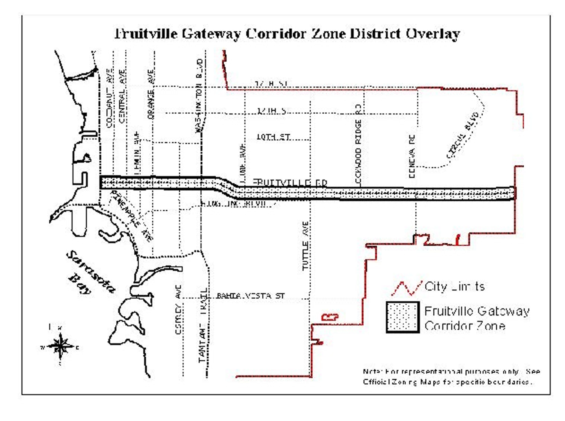
(a)
Intent and purpose. The Fruitville gateway corridor overlay district (FCOD) is intended to further the purposes set forth in F.S. § 163.3202, implementation of the adopted Sarasota City Plan as amended, and in general to protect the health, safety and general welfare of the public by the prevention or reduction of traffic congestion, avoidance of distracting visual clutter, and preservation of the aesthetic value in the Fruitville Road corridor by:
(1)
Creating an enhanced visual eastern gateway to the city.
(2)
Encouraging unified signage plans.
(3)
Enhancing the appearance and environment of the city.
(b)
Establishment and boundaries of the FCOD. The boundaries of the FCOD shall conform to the limits of the area as depicted on the city zoning map. In lieu of a metes and bounds description, the overlay district boundaries may be described by fixing the points of beginning and end in the centerline of a street and the distance on one or both of the sides from the centerline to which the FCOD shall extend, or may be established by description of coterminous with property boundaries of zoning lots along such street, or any combination of these methods. These surfaces shall be superimposed over the city zoning maps to delineate those areas covered by the FCOD district.
(c)
Permitted uses. All uses permitted by right in the underlying zoning district(s), shall be permitted in the FCOD.
(d)
Provisional uses. All uses permitted as provisional uses in the underlying zoning district(s) shall require a provisional use permit when proposed to be established in the FCOD.
(e)
Conditional uses. All uses permitted as conditional uses in the underlying zoning district(s), shall require a conditional use permit when proposed to be established in the FCOD.
(f)
Yards and setbacks. All uses in the FCOD shall be subject to the yard and setback requirements set forth in the underlying zoning district, unless a more restrictive standard is established by the FCOD.
(g)
Development standards.
(1)
Applicability. When the FCOD applies to a particular property, the underlying zoning district categories are neither abandoned nor repealed. The existing regulations remain in effect. All development shall be subject to the development standards set forth in the underlying zoning district. However, where the provisions of this section are in conflict with the underlying zoning designation, the provisions of this section shall apply.
Existing development shall be subject to this section when seeking any one of the following:
a.
Cumulative expansion after the effective date of these regulations (October 21, 1998) of at least 50 percent of the improved (building and land) square footage existing at the time of the effective date of these regulations (October 21, 1998).
b.
Any cumulative substantial remodeling of an existing use after the adoption effective date of these regulations (October 21, 1998).
(2)
Signs. The following regulations shall supersede or supplement the provisions set forth in article VII, division 1 of this Code. It is the purpose of these regulations to ensure that signage in the FCOD does not constitute a visual blight on the landscape and character of the Fruitville Road Gateway corridor. It is established that there is a significant relationship between the manner in which signs are displayed, and the public safety and the value and economic stability of adjoining properties. It is further established that the reasonable display of signs is necessary as a public service and to the conduct of competitive commerce and industry. These regulations establish minimum standards for signs that directly relate to the use of property and to the intensity of development of each zoning lot and land use.
a.
All proposed developments shall develop a unified sign program for the site. These sign programs shall address the coordination of the size, style, number and color scheme of all the signs erected on the site (these regulations are not meant to regulate or approve the contents of the signage). The unified sign program, not including sign content, is to be approved by the approving authority as part of the development approval.
b.
All freestanding ground mounted signs shall be monument type signs not exceeding ten feet in height. Such signs must be of a low-profile design (i.e., with wider dimensions than higher dimensions).
1.
All freestanding ground-mounted signs shall be constructed of high quality materials and finishes. Acceptable materials include wood, masonry, metal, stone, glass, ceramic, and other similar materials.
2.
Sign illumination shall be from shielded indirect sources that do not cause a glare or nuisance beyond the property line.
3.
All freestanding ground-mounted signs shall be landscaped and installed on a wood, stone or other base structure. The base treatment shall be at least two feet high and at least one-half as wide as the sign face erected on the structure, and one-fourth as deep as the width of the sign face erected on the structure.
c.
Signs with flashing or intermittent lights, continuous changes of message (e.g., continuous traveling effects, animation, bijou effects, etc.), lights of changing degrees of intensity, and lights or lighting effects that cause glare are prohibited.
d.
All signage on a site is to be integrated into, or otherwise visually related to the project's building(s) and is to be composed of materials and colors compatible with the materials of the building(s) as determined by the approving authority based on information supplied by the developer.
e.
The total amount of signage on a site may be increased in the following ways:
1.
If all signs are constructed of natural, or natural appearing materials, the amount of signage, as controlled by article VII, division 1, may be increased by a factor of five percent;
2.
If the colors of all the signage are limited to neutral or subdued colors or earth tones, the signage may be increased by a factor of five percent.
(3)
Architectural treatment guidelines. The focus of these guidelines is on ensuring, in the broadest terms, the compatibility of the structures built in the FCOD gateway overlay district. These guidelines are not intended to dictate building style, size, or bulk of the projects. They are, however, intended to establish building treatment criteria and significance for the corridor.
a.
Metal shall not be used as an exterior wall or siding building material.
b.
Architectural elevation plans, drawn to scale, for all projects shall be approved as part of the site plan approval process.
(Ord. No. 02-4357, 4-29-02; Ord. No. 03-4472, § 8, 6-16-03; Ord. No. 13-5053, § 2(Exh. A), 5-6-13; Ord. No. 13-5055, § 2(Att. 1), 5-6-13; Ord. No. 23-5489, § 2(Exh. A), 9-5-23)
Sec. VI-906. - "Missing middle" overlay district.
Map VI-906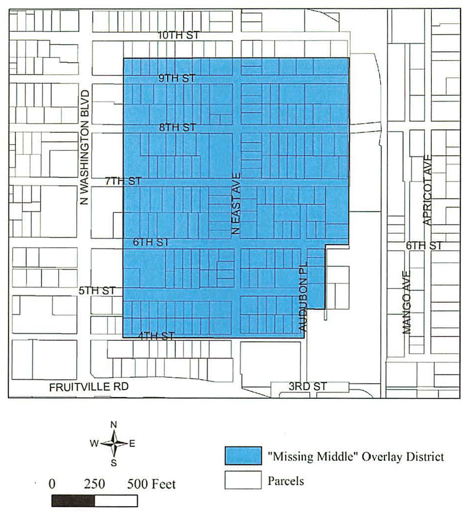
(a)
Intent and purpose. The "missing middle" overlay district (MMOD) and the increased residential dwelling unit density allowable within the overlay district is intended to:
(1)
Implement the Sarasota City Plan.
(2)
Promote higher density residential development and increase availability of attainable housing.
(3)
Encourage more people to permanently reside within the boundaries of the MMOD in order to enhance the economic vitality of the surrounding neighborhood and downtown.
(b)
Establishment and boundaries of the MMOD. The application of the MMOD shall be restricted to those geographical areas that are designated on the Official Zone District Map of the City of Sarasota.
(c)
Development standards.
(1)
Applicability. Except as provided in section VI-906(c), all development and uses allowed in the MMOD shall be subject to the development standards set forth in the underlying zoning district.
(2)
Residential density bonus. New residential development on zoning lots or a combination of zoning lots within the MMOD and zoned downtown neighborhood (DTN), may receive up to 23 dwelling units per acre of additional density (for a maximum of 35 units per acre) by providing a minimum of 25 percent attainable housing units, for those residential units exceeding the base residential density of 12 dwelling units per acre.
a.
Of the dwelling units provided for households with incomes at or below 120 percent of the AMI, at least one-third of the qualifying dwelling units must be available to households having incomes at or below 80 percent of the AMI and no more than one-third of the dwelling units may be available to households having incomes in the range of 100 percent to 120 percent of the AMI.
b.
No additional building height shall be granted for bonus density housing.
c.
As a condition of approval, an agreement between the developer/landowner and the City of Sarasota shall be recorded in the official records of Sarasota County, prior to the first building permit, requiring, for a minimum of 30 years, that a buyer or renter of a dwelling unit designated for households with an income at or below 120 percent of the AMI shall not have a household income greater than the income range designated for the unit, that a "For Sale," including future resale, dwelling unit designated for households with an income at or below 120 percent of the AMI shall have an appreciation limit applicable upon resale, and that a rental unit designated for households with an income at or below 120 percent of the AMI shall be monitored for rent and tenant income levels for a period of at least 30 years.
d.
The purpose of this agreement shall be to set forth commitments and obligations of the developer/landowner and future owners or residents for the residential bonus density regarding affordability control, occupancy, monitoring, reporting, enforcement, and any other necessary provisions applicable during the time period of at least 30 years. The city manager shall be authorized to sign the agreement on behalf of the city.
(3)
Residential structure types.
a.
Purpose.
1.
The "missing middle" overlay district is referencing the term missing middle housing and refers to a range of multi-unit housing types. These types provide diverse housing options including duplexes, cottage courts, and small multi-dwelling structures.
2.
The purpose of the missing middle housing type is to protect the traditional single-family character of the neighborhood while facilitating rehabilitation, improvement and redevelopment in a manner that is consistent with the scale of the neighborhood.
3.
This type of housing enhances neighborhoods character, meets demand of walkable neighborhood living, provides diverse housing options, addresses the need for affordable and attainable homes, and provides the density needed to support locally serving businesses and transit.
b.
Permitted building types.
Table VI-906. Residential Structure Types Allowed in the MMOD Boundary
(4)
Design standards. The following regulations shall supersede certain standards of section VI-1005, as applicable, and are required of new development within the MMOD.
a.
Purpose. The design standards preserve and enhance the residential character of the district.
b.
Number of dwelling units. No more than 12 dwelling units are permitted on a zoning lot.
c.
Front porch requirements for attached single-family, duplexes, and triplexes. The main entrance(s) on principal buildings shall include a porch, deck or similar open-air covered main entry feature. The porch, deck or similar feature shall have a minimum depth of six feet and a minimum width of eight feet.
d.
Location of parking.
1.
Surface parking areas shall be located in the second or third layer except that driveways, aprons and drop-offs may be located in the first layer.
2.
Garages shall be located in the third layer. If there is more than one frontage line, this standard applies to the frontage line that contains the main entry. In no case shall a garage be located in the first layer.
3.
Loading areas/spaces are prohibited along frontages.
(Ord. No. 22-5430, § 2(Exh. A), 12-5-22)
Sec. VI-907. - Coastal Islands overlay district.
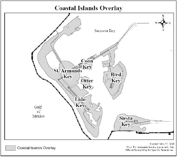
(a)
Intent and purpose. The Coastal Islands Overlay (CIO) is intended to protect the environmentally sensitive and fragile nature of the coastal islands and their evacuation needs. The regulations address the density, intensity and scale of development consistent with the Environmental Protection and Coastal Island chapter of the Sarasota City Plan. The CIO consists of four subdistricts and are mapped separately below:
(1)
The Impervious Surface Overlay District (ISOD) is intended to limit increases in impervious surface for new construction.
(2)
The Height Overlay District (HOD) is intended to limit increases in the height for new construction.
(3)
The Density Overlay District (DOD) is intended to limit increases in residential density for new construction.
(4)
The Conservation Overlay District (COD) is intended to protect these generally undeveloped coastal, environmentally sensitive areas, which include beaches, dunes, coastal hammocks, mangrove swamps, tidal islands, tidal marshes and other marine and estuarine habitats.
(b)
Establishment of the boundaries. The application of the CIO shall be restricted to those geographical areas that are shown on the Official Zone District Map of the City of Sarasota.
(c)
Applicability. When the CIO applies to a particular property, the underlying zoning district categories are neither abandoned nor repealed. The existing regulations remain in effect. All development shall be subject to the development standards set forth in the underlying zoning district. However, where the provisions of this section are in conflict with the underlying zoning designation, the provisions of this section shall apply. No accessory dwelling units are permitted within the boundaries of the Coastal Islands Overlay District.
(d)
The Impervious Surface Overlay District (ISOD). The maximum impervious surface coverage for parcels located on the coastal islands is 70 percent except as otherwise delineated on the map below and where the base zone standard is more restrictive (i.e., RSF-E is 60 percent).
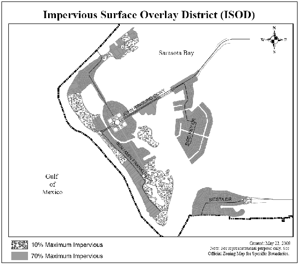
(e)
The Height Overlay District (HOD). The maximum height for parcels located on the coastal islands is 35 feet (as measured from the minimum FEMA elevation) except as otherwise delineated on the map below. However, this shall not be interpreted to exempt single-family dwellings in RSF-E, 1, 2, 3, 4 and RMF-1, 2, 3 zone districts from the provisions of section VI-102(u).
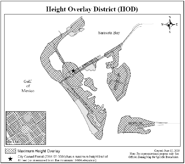
(f)
The Density Overlay District (DOD). The city shall not approve amendments to the future land use map (LU-6), Zoning Atlas, or zoning text that increase residential density on the coastal islands as identified on the map below. However, the city may allow for an increase in residential density within the CT and G zoned sites located within the St. Armands Circle commercial shopping area for the purpose of creating residential liner buildings that screen nonresidential uses from residential uses as determined through a master planning process. The CT and G zoned areas are delineated on the map below.
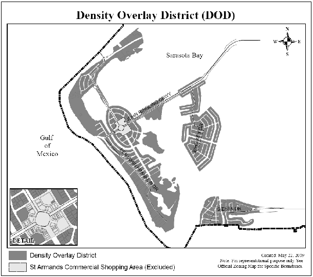
(g)
Conservation Overlay District (COD).
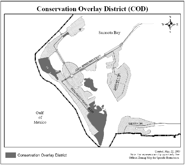
(1)
Permitted uses. The uses permitted in the COD are identified in the table below, subject to the development standards set forth in this division and article VII:
Primary Uses Allowed in the Conservation Overlay District
(2)
Development standards. In addition to the standards set forth in article VII, all development within the COD shall be carried out in accordance with the development standards of the underlying zone district in addition to the following standards:
a.
All development permits shall undergo site plan approval.
b.
All development shall be designed to minimize the impact of human activities on natural systems, and not adversely affect the natural character of the area.
c.
All development shall demonstrate to what extent environmentally sensitive areas (see definitions article II, division 2) are being impacted; and if so, the proposed mitigation techniques, including, but not limited to, habitat restoration.
d.
All development permits shall be conditioned upon proof that any state or federal permit regarding threatened or endangered species has been obtained.
e.
All development permits shall be consistent with the Sarasota Bay Estuary Program's "Comprehensive Conservation and Management Program for Sarasota Bay".
f.
Additional conditions may be applied by the planning board and the city commission to a conditional use that has a potentially adverse environmental impact on contiguous lands located within the COD.
g.
Maximum density regulations in dwelling units per acre are not applicable in the COD.
h.
Minimum zoning lot requirements in the COD are not applicable.
i.
Maximum zoning lot coverage regulations in the COD are to be determined by the planning board and city commission.
j.
There shall be no minimum yard requirements in the COD.
k.
Maximum height of structures in the COD shall be determined on a case-by-case basis by the planning board and the city commission.
(Ord. No. 02-4357, 4-29-02; Ord. No. 09-4888, § 2(att. 1), 11-2-09; Ord. No. 13-5055, § 2(Att. 1), 5-6-13; Ord. No. 20-5337, § 2(exh. A), 8-17-21; Ord. No. 22-5404, § 2, 3-7-22)
Sec. VI-908. - Ringling overlay district.
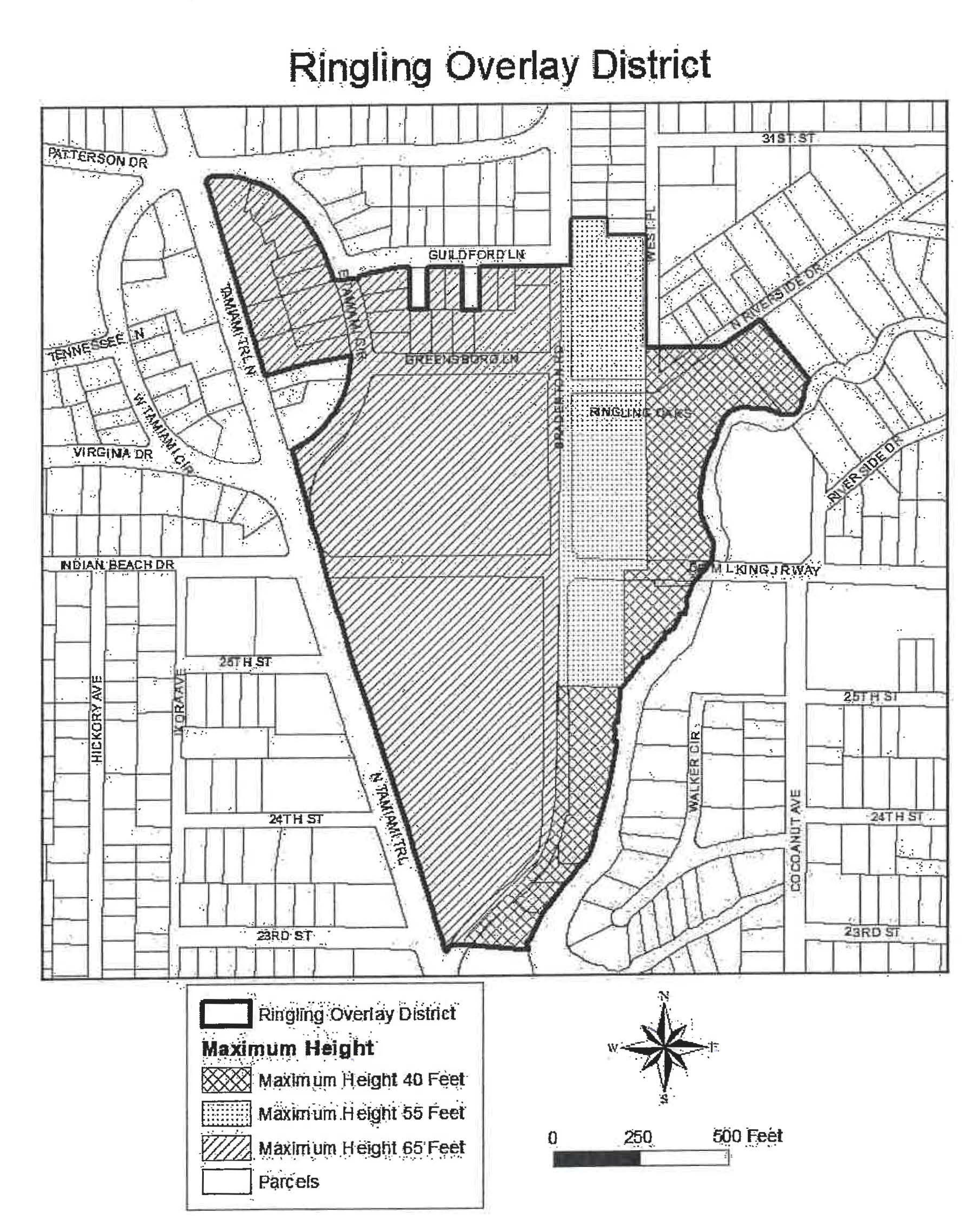
(a)
Intent and purpose. The Ringling Overlay District (ROD) is intended to provide a means by which the Ringling College of Art and Design (RCAD) may continue to function and grow in a sensitive and planned manner that preserves the integrity and long-term viability of the surrounding neighborhood.
(b)
Establishment of the boundaries. The application of the ROD shall be restricted to those geographical areas that are designated on the Official Zone District Map of the City of Sarasota.
(c)
Development standards.
(1)
Applicability. When the ROD applies to a particular property, the underlying zoning district categories are neither abandoned nor repealed. The existing regulations remain in effect. All development shall be subject to the development standards set forth in the underlying zoning district. However, where the provisions of this section are in conflict with the underlying zoning designation, the provisions of this section shall apply.
(2)
Unified campus development.
a.
All of the zoning lots, within the ROD and under the ownership of the RCAD, may be combined to satisfy density, floor area ratio, building coverage and parking and loading requirements even where the zoning lots are separated by a public right-of-way.
b.
All other development standards must be met independently for each zoning lot.
(3)
Uses.
a.
Colleges shall be a permitted use in the ROD.
b.
Permitted accessory uses for colleges in the ROD shall include offices; meeting areas; laboratories; libraries; housing for students, faculty and visitors; cafeteria and food service; recreation, health and sports facilities; theatres; before and after school day care; health care facilities, bookstores; parking; maintenance facilities; and other uses typically accessory to a college. These permitted accessory uses shall not be subject to the retail sales and service limitation (Table VI-401, Note 5).
(4)
Floor area ratio. Maximum floor area ratio for all nonresidential development is 1.0.
(5)
Maximum building coverage. Maximum building coverage is 50 percent.
(6)
Height. See Map VI-908, Ringling Overlay District for maximum height limits.
a.
In order to accommodate the screening of rooftop mechanical equipment, on the portions of the ROD that allow building height in excess of 40 feet, the height limitations of subsection VI-102(p) shall not apply to nonhabitable pitched-roofed architectural features (e.g., gable, hip, gambrel, mansard) extending no more than 20 feet above the eave line of a roof or the minimum necessary to screen the mechanical equipment, whichever is less. This additional height shall not exceed 35 percent of the total roofed area of the building or the minimum necessary to screen the mechanical equipment, whichever is less.
(7)
Parking.
a.
Minimum parking requirement:
1.
One (1) space for each 1.725 fill-time equivalent students (FTE). FTE is determined by RCAD's Registrar as the number of full-time students plus the total number of credit hours taken by part-time students divided by the number of credit hours to be eligible for full-time status. Currently, at least 12 credit hours are required to be classified as a full-time student.
2.
Parking spaces located on parcels under the ownership of RCAD and located within one-quarter mile of the ROD may be utilized to meet minimum parking requirements with the ROD.
i.
Safe pedestrian routes must exist or will be provided for the safety of pedestrians traveling between the campus destinations and the offsite parking facilities.
ii.
Agreement for offsite parking. In the event that an offsite parking area is not under the same ownership as the principal use served, a written agreement between the record owners, RCAD, and city is required. The owner of the offsite parking area shall enter into a written agreement with RCAD and the city, with enforcement running to the city, providing that the land comprising the parking area shall never be disposed of and that the owner agrees to bear the expense of recording the agreement and such agreement shall bind his or her heirs, successors, and assigns. An attested copy of the agreement between the owners of record, RCAD, and the city shall be filed the official records of Sarasota County. Recordation of the agreement must take place prior to issuance of a building permit or certificate of occupancy for any use to be served by the offsite parking area. An offsite parking agreement may be revoked only if all required off-street parking spaces will be provided elsewhere or is no longer needed.
iii.
In situations where the underlying zoning is within a residential district, a maximum of two parking spaces per dwelling unit may be counted toward meeting parking requirements.
3.
RCAD will provide with each development application, an update to the City of Sarasota to confirm adherence to this ratio. Updates will be based on the prior semester student population.
b.
Nonpaved parking:
1.
Grass, shell (or other pervious material) may be permitted for up to 50 percent of required off-street parking facilities (excluding handicapped spaces) provided they meet the following criteria and are approved by the city engineer:
i.
Driveway and access aisles shall be surfaced with asphalt, concrete material, clay brick or concrete paving units.
ii.
Be so maintained such that the grass, shell (or other pervious material) does not constitute a nuisance by virtue of its appearance or condition and is graded in a level condition. The failure to adequately maintain a turf grid system, shell (or other pervious material), resulting in a nuisance or unsafe condition for pedestrians or motor vehicles, shall be enforceable by proceedings before the code enforcement special magistrate in accordance with section 2-310, Sarasota City Code.
iii.
Comply with the drainage requirements for stormwater runoff set forth in the engineering design criteria manual.
c.
Alternative parking ratio:
1.
The director of development services, after consultation with the city engineer, shall be authorized to approve alternative ratios for providing required off-street parking spaces in accordance with this section.
2.
Where the applicant believes the required parking ratios of this section are too high, data submitted by the applicant may be used to determine a different or lesser ratio for the specific proposed use. Such data may include site studies from similar uses, generally accepted engineering standards (for example, ITE trip rates), or independent engineering calculations based on the nature of the proposed use. The director of neighborhood and development services, in coordination with the city engineer, shall evaluate such submittals to determine an acceptable ratio for the proposed use.
3.
An attested copy of an approved alternative parking ratio must be recorded in the official records for Sarasota County on forms approved by the city attorney. An alternative parking ratio may be amended by following the same procedure required for the original approval. The applicant shall provide proof of recordation prior to approval of the certificate of occupancy.
(8)
Windows.
a.
Portions of the first story of a building facing a street, excluding a parking garage, shall be a minimum of 30 percent glass and the combined area above the first story shall be a minimum of 25 percent glass. Portions of the first story of a building, excluding a parking garage shall be screened by one of the options of a Type B buffer that does not require a structure, in a length not to exceed 30 percent of the total length. In this situation, the remainder of the first story shall be a minimum of 30 precent glass and the combined area above the first story shall be a minimum of 25 percent glass.
b.
For portions of a building not facing a street, excluding a parking garage, the combined area of all stories shall be a minimum of 20 percent glass.
c.
Glass shall be clear or lightly tinted with a visible light transmittance factor of 0.5 or higher (where R+A+T=1.0). Translucent, opaque, and mirrored glass may not be used.
d.
Security grilles, if any, shall be at least 50 percent transparent and shall be located on the inside of the glassed area.
e.
Administrative reduction. When exterior walls of a building are more than 20 feet from the front, side or rear zoning lot line, the director of development services may reduce or eliminate the required amount of window area provided one or more of the following technique is used on the exterior wall of the building: wall murals; decorative architectural elements; changes in wall plane; landscaped or raised planter beds placed in front of the wall; window displays including art galleries and retail areas; canopies; trellises; or awnings. If the RCAD requests this option, they must submit their request in writing to the director of development services and explain the basis for the request.
(9)
Dr. MLK Jr. Way and Old Bradenton Road Frontage.
a.
The following standards apply to new buildings within 150 feet of Dr. MLK Jr. Way and Old Bradenton Road. However, these standards shall not apply to the area on the west side of Old Bradenton Road beginning 300 feet south of Dr. MLK Jr. Way to the terminus of Old Bradenton Road at U.S. 41.
b.
Maximum front setback from Dr. MLK Jr. Way and Old Bradenton Road is 50 feet.
c.
Portions of a building or parking garage facing Dr. MLK Jr. Way and Old Bradenton Road shall provide a 25-foot minimum depth of active use along at least 50 percent of the length of the first two stories. Active building uses include, but are not limited to: lobbies, residential, commercial and office.
d.
Parking lots or garages shall not be located any closer to the Dr. MLK Jr. Way and Old Bradenton Road right-of-way than the distance by which the active use portion of the building is set back from the street right-of-way. This provision shall not be construed to preclude parking lot access driveways for buildings more than 100 feet in length.
e.
Administrative reduction. The director of development services is authorized to approve a reduction or elimination of these standards only if existing buildings, tree preservation and infrastructure improvements would preclude the applicant's ability to meet these standards. If the RCAD requests this option, they must submit their request in writing to the director of development services and explain the basis for the request.
(10)
Whittaker Bayou frontage.
a.
Blank walls shall be avoided on all new buildings. If such walls are necessary for interior reasons, the structure wall shall receive some form of articulation or "add-on" elements such as wall murals, decorative architectural elements, changes in the wall plane, landscape or raised planter beds placed in front of the wall, window displays, canopies, trellises, or awnings.
b.
A pedestrian walkway shall be provided in the area along the bayou between the building and the water. The intent is to develop a continuous interconnected pedestrian walkway along the entire Whittaker Bayou frontage as new development and redevelopment occurs.
(11)
Streetwalls.
a.
Streetwalls, the freestanding masonry walls built along the front lot line, or generally coplanar with the facade, often for the purpose of masking a parking lot, service area, or outdoor activity from the street, shall be located at the area between the frontage line and the facade line whenever they are needed to screen a surface parking lot or other unsightly condition such as an outdoor work space or alley.
b.
Streetwalls shall be between three and one-half and six and one-half feet in height, but may exceed that height where necessary to screen mechanical equipment from the street, as determined by the director of development services. Expanses longer than 25 feet or higher than three and one-half feet shall be architecturally designed {e.g., vertical or horizontal changes in wall plane, landscaped or raised planters, decorative view ports, wrought iron grillwork or decorative masonry patterns). Except for decorative openings, streetwalls may have openings no larger than necessary to allow vehicle and pedestrian access.
c.
If allowed by the director of development services, a hedge between three and one-half and six and one-half feet in height may replace the streetwall.
(Ord. No. 07-4770, § 2, 12-17-07; Ord. No. 09-4838, § 2(att. 1), 2-17-09; Ord. No. 21-5342, § 2(Exh. A), 12-7-20; Ord. No. 24-5540, § 2(Exh. A), 9-16-24)
Sec. VI-909. - Housing authority overlay district.
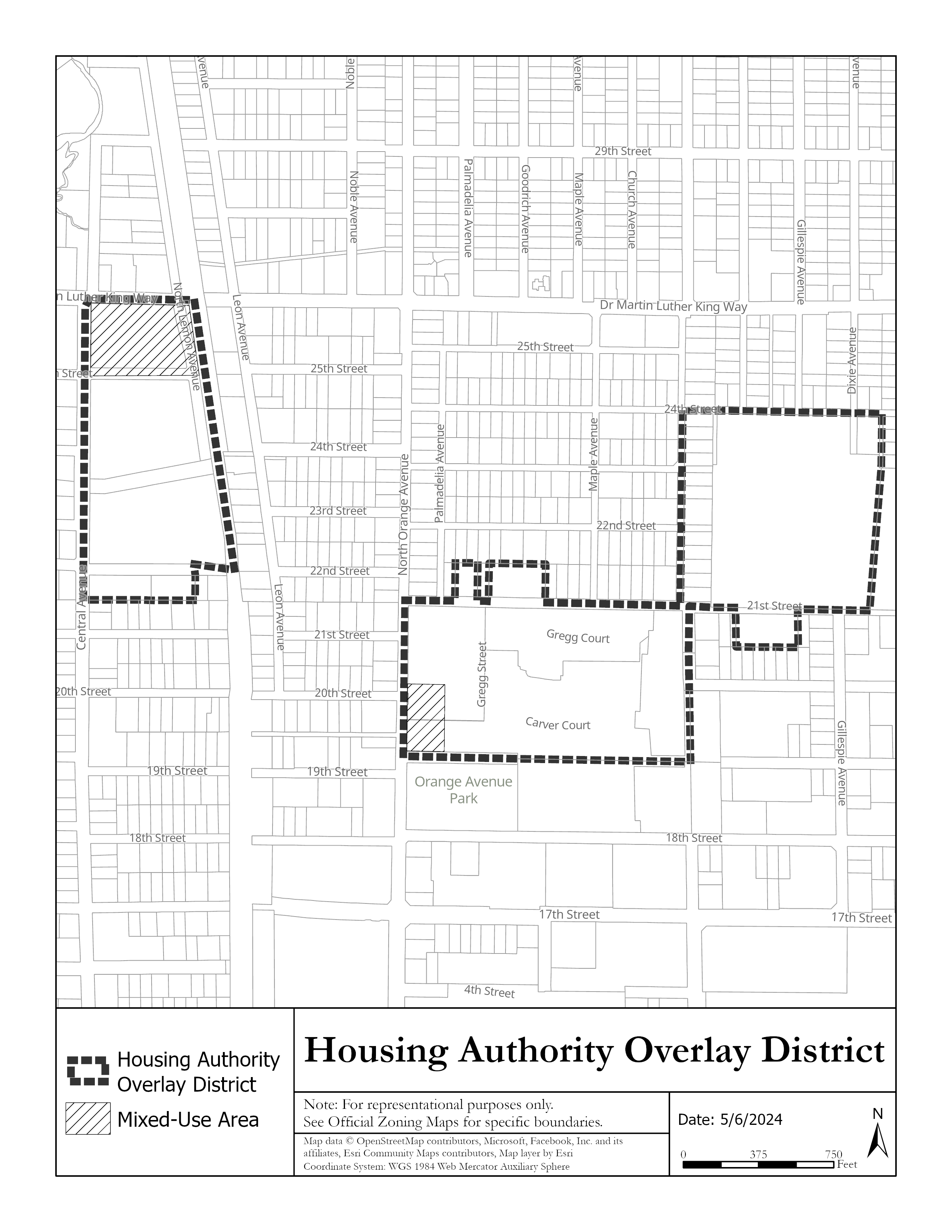
(a)
Intent and purpose. The housing authority overlay district (HAOD) is intended to provide a means by which the housing authority may continue to function and grow in a sensitive and planned manner that preserves the integrity and long-term viability of the surrounding neighborhood.
(b)
Establishment of the boundaries. The application of the HAOD shall be restricted to those geographical areas that are designated on the Official Zone District Map of the City of Sarasota.
(c)
Development standards.
(1)
Applicability. When the HAOD applies to a particular property, the underlying zoning district categories are neither abandoned nor repealed. The existing regulations remain in effect. All development shall be subject to the development standards set forth in the underlying zoning district. However, where the provisions of this section are in conflict with the underlying zoning designation, the provisions of this section shall apply.
(2)
Primary uses.
Notes for Use Table:
(1)
Use limitations. Commercial uses are limited to the areas designated as Urban Edge (mixed use) on the future land use map in the Sarasota City Plan. Each individual business is limited to 5,000 square feet of total floor area. Commercial uses are limited in size in order to limit their potential impacts on residential uses and to promote a relatively local market area. Drive-up windows and drive-through uses are prohibited. A commercial use is required on the ground floor of any portion of a building facing the road frontage along Dr. Martin Luther King Jr. Way.
(2)
All applicants for a day care facility, that provide child care for more than ten children, shall hold a community workshop as set forth in section IV-201(b) prior to submitting an application for a provisional use permit.
(3)
Pharmacy limitation. Pharmacy use permitted only when accessory to a drugstore or grocery store. Pharmacy as a primary use is prohibited.
(4)
Development standards.
| a. Maximum Density | 25 units/acre: 50 units/acre for property designated as multiple family - high density on the future land use map. |
| b. Residential Structure Types | All structure types are permitted except for mobile homes, manufactured homes and manufactured home parks. |
| c. Maximum Floor Area Ratio for nonresidential uses | none |
| d. Minimum Zoning Lot Size | 1,800 sq. ft. |
| e. Maximum Building Coverage | 75% |
| f. Building Setback | |
| - Minimum Front | 10 ft. |
| - Maximum Front | 20 ft. |
| - Minimum Side | 0 ft. |
| - Minimum Rear | 15 ft. |
| - Exceptions |
The director of building, zoning and code compliance is authorized to increase the
maximum front setback to allow the preservation of existing trees.
Porches (including eaves) may encroach up to 100% of the depth of the front setback. All other encroachments shall be allowed consistent with section VII-1201. Compliance with EDCM, Part 5, Sec. D.8.b. Visibility at intersections. |
| g. Maximum Building Height | 45 feet |
| - Exceptions |
The maximum height may be increased to 45 feet for areas greater than 100 feet from
boundary of the property line within the overlay.
Extensions above the maximum height of structures detailed under Height Limitations in Section VI-102(P) are allowed. |
| Other Regulations | |
| h. Historic Designation | See Article IV, Division 8 |
| i. Signage | |
| 1. General Standards | See VII-101 thru 109 |
| 2. Residential Sign Standards | See VII-110(2) |
| 3. Nonresidential Sign Standards | See below. When in conflict with any other sign standard the following standards apply. |
| 4. Design Guidelines | See Appendix D, Advisory Community Design Guidelines. These nonmandatory guidelines should be consulted prior to developing signs for any project. |
5. Lighting
  |
Signage may be externally illuminated by reflection of a light source aimed at its
surface. All lighting must be shielded to prevent glare or nuisance beyond the property
line.
Backlighting with neon, fluorescent, or LED white light is permitted only for channel letter signs that use individually cut opaque letters (a.k.a. "halo illuminated letters"). The use of cabinet-type box signs or channel letter signs with translucent backlit panels is prohibited. Signage inside shopfront windows may be neon lit. Signs with flashing or intermittent lights, continuous changes of message, lights of changing degrees of intensity, and lights or lighting effects that cause glare are prohibited. The backlighting of awnings and messages attached thereto is prohibited. |
6. Wall Sign
 |
A single external wall sign band (with individually cut letters) may be applied at
the top of the 1
st
floor facade of each building, providing that it not exceed 2 feet in height by any
length.
Where there is more than one sign, all signs should be complementary to each other in the type of construction materials and letter size and style of copy. |
7. Projecting Sign
 | Projecting signs, not to exceed 4 square feet in area per face for each separate business entrance may be attached perpendicular to the facade. The bottom of such signs shall be a minimum of eight feet above the walkway. |
8. Temporary Portable A-Frame Sign
 | A single temporary portable A-frame sign may be allowed for each business, on private property, provided the sign is less than 4 feet high and less than 18 by 24 inches per face. |
9. Window Sign
 | Such signs shall cover no more than 20 percent of the total window and glass portion of the door area. A permanent address shall be permitted in addition to the 20 percent coverage. Window signs shall not be included in any calculation of total sign area for the building or tenant. Handwritten signs of any type are prohibited. |
10. Awning Sign
 | Awnings at the first story may have signs. No such sign shall exceed 20 percent of the area of each awning (top plus all sides). |
11. Real Estate Sign
 | One single-faced or double-faced nonilluminated "For Sale" or "For Rent" sign for each street frontage not exceeding 16 square feet per face and not exceeding 6 feet in height above grade. Upon sale or rent, the sign shall be immediately removed. |
| 12. Other signs | Prohibited. All other signs not specifically permitted. |
| j. Parking | See Article VII, Division 2. |
| - Exceptions |
1 space for each dwelling unit; .50 space for each dwelling unit designated as affordable
to households with an income at or below 120 percent of the area median income (AMI)
for a minimum of 30 years.
1 space for each 500 square feet of floor area for nonresidential space. Parking areas shall not be located any closer to a public street right-of-way than the distance by which the principal building is set back from the street right-of-way. This provision shall not be construed to preclude parking lot access driveways. Parking areas shall not be located on street corners unless one of the following conditions exists. a. If a zoning lot fronts on three streets, then parking may be located on only one corner. b. If a zoning lot fronts on four streets, then parking may be located on only two corners. |
| k. Landscaping | See Article VII, Division 3 and 3.1 |
| l. Flood Zone | See Article VII, Division 4 |
| m. Specific Use Standards | See Article VII, Division 6 |
| n. Public Art | See Article VII, Division 7 |
| o. Additional Use Standards | See Article VII, Division 9 |
| p. Environmental Performance | See Article VII, Division 10 |
| q. Fences | See Article VII, Division 11 |
| r. Encroachments | See Article VII, Division 12 |
| s. Waterfront Property & Docks | See Article VII, Division 13 |
| t. Refuse & Lighting | See Article VII, Division 14 |
(Ord. No. 07-4770, § 2, 12-17-07; Ord. No. 13-5041, § 2(att. 1), 3-4-13; Ord. No. 13-5055, § 2(Att. 1), 5-6-13; Ord. No. 18-5234, § 2(Exh. A), 2-5-18; Ord. No. 21-5346, § 2(Exh. A), 5-18-21; Ord. No. 23-5503, § 2(Exh. A), 2-20-24; Ord. No. 24-5513, § 2(Exh. A), 5-6-24)
Sec. VI-910. - North Trail overlay district.
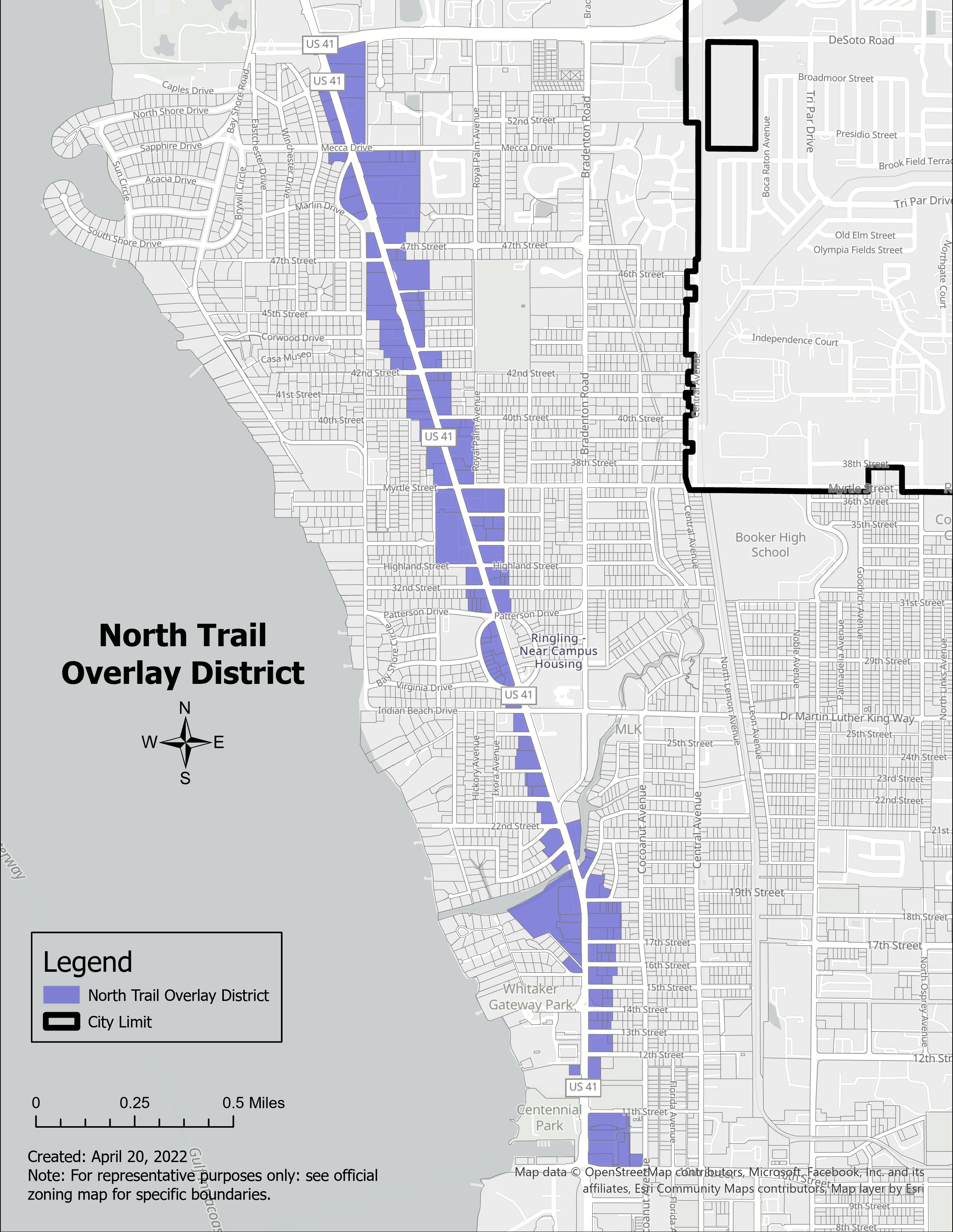
(a)
Vision, intent and purpose.
The vision. The character of the North Trail corridor began to change following the completion of Interstate 75 in the early 1980s. What was once a thriving segment of US 41 consisting of many destination businesses slowly began to deteriorate. Since 1989, various studies of the North Trail corridor have been undertaken in an effort to revitalize this part of the city. The studies have provided guidance on how to transform the corridor into a thriving, walkable district that supports local community redevelopment objectives and new urbanism concepts. This community-based vision has continued to evolve through close consultation with the people living and working along the corridor with the ultimate goal of creating sustainable redevelopment with quality buildings and streetscapes that are compatible with adjacent residential neighborhoods. It is a long-term vision that will need to occur in phases over time.
The North Trail corridor is a critical, but underutilized and undervalued gateway to some of Sarasota's most culturally and economically significant assets. US 41 provides mobility for roughly 40,000 automobiles a day as a major regional transportation corridor, but lacks a sense of place and positive cultural identity. Rather than favoring pedestrian and neighborhood movements, US 41 simply functions as a pathway facilitating automobile travel and is viewed as perilous for pedestrians. However, the North Trail has the potential to function as a destination attraction.
The vision for the corridor attempts to transform the image of the North Trail into a true, definable, and marveled place known for its historical, cultural, educational, civic, neighborhood, and commercial assets. Converting US 41 to a downtown main street is not the answer. The solution is in re-making the cross streets and key focal points of the US 41 corridor where people can feel comfortable gathering and lingering in well-lit, accessible, and visible centers of activity.
Pedestrian-friendly vs. auto-centric streetscapes.
Pedestrian-friendly streets are designed on a human scale where the proportional relationship of a particular building, structure, or streetscape element is intended to correspond to human form and function. "Human scale" often refers to the subjective objective that the relationship between a person and their natural or manmade environment should be comfortable, intimate, and contribute to the individual's sense of accessibility. This relates to how form and placement of buildings are compared to the open spaces and streets (especially intersections) and how comfortable pedestrians feel when walking through those spaces. Pedestrian friendly streetscapes focus on aesthetics and can include wider sidewalks, visible storefronts, landscaping, and street furniture. Note the human scale elements depicted in the illustration above between the streetscape and the structures.
Auto-centric streetscapes on the other hand are areas designed on an automobile scale and managed almost entirely for the facilitation of vehicular traffic flow. There is little relationship between the building and the public right-of-way in these types of streetscapes. The distance from one building to the next on foot can be prohibitive for anyone walking and in fact may actually discourage pedestrian movement. Note in the below image that pedestrians have limited options to safely cross the auto-centric streetscape to reach the other side of the road.
The intent and purpose.
The North Trail Overlay District (NTOD) is intended to provide an optional set of zoning standards to voluntarily encourage new development and redevelopment projects that are of human scale and will support human activity on the street and shift from an auto-centric land use pattern to one that emphasizes a variety of modal choices - including walking, biking, and transit. In addition, the standards will encourage new development and redevelopment projects to function in a sensitive manner that preserves the integrity and long-term viability of the surrounding neighborhoods.
(b)
Establishment of the boundaries. The application of the NTOD shall be restricted to those geographical areas that are designated on the Official Zone District Map of the City of Sarasota.
(c)
Applicability.
1.
Purpose. The North Trail Overlay District (NTOD) provides an optional, alternative, and voluntary set of development standards which is intended to partially implement the vision, intent and purpose for the NTOD. Compliance is intended to occur over time as redevelopment and new development occur. These regulations are intended for new development, expansion and remodeling. Existing structures and uses are allowed to continue and normal repair and maintenance is encouraged. Exceptions from restrictions that would otherwise limit the ability to rebuild after sudden or gradual destruction are allowed for condominiums and valid development approvals. Subsection VI-910(f) (adjustment review process) below also recognizes that some sites may be difficult to develop in compliance with these regulations and provides for adjustments to these regulations.
2.
Voluntary. These standards only apply to development projects where the applicant voluntarily agrees to meet applicable development standards for current and future development projects. If the applicant does not voluntarily agree, the NTOD standards do not apply. Although use of the NTOD is not mandatory, any development project that voluntarily makes use of the NTOD shall be required to proffer a proviso that must be recorded in the official records for Sarasota County, on forms approved by the city attorney, to identify NTOD standards are mandatory for all future development applications. [For example, if a development project voluntarily seeks to utilize the lower parking standards to re-purpose an existing building then the proviso will mandate future development on the site to utilize applicable NTOD standards.]
3.
Conflict. When the NTOD applies to a particular property, the underlying zoning district categories are neither abandoned nor repealed. The existing regulations remain in effect. All development shall be subject to the development standards set forth in the underlying zoning district. However, where the provisions of this section are in conflict with the underlying zoning designation, the provisions of this section shall apply.
(d)
Development standards.
1.
Height.
a.
Maximum height. The maximum height is four stories (see definition of "story"), except for properties zoned RMF-4 and CRD. The maximum height in RMF-4 and CRD is regulated by those zone districts. Height adjustments are prohibited.
i.
Areas of special flood hazard. For structures within a special flood hazard area in the NTOD, the recovery elevation shall be used as the baseline for the measurement of the maximum height limitation (see below graphic).
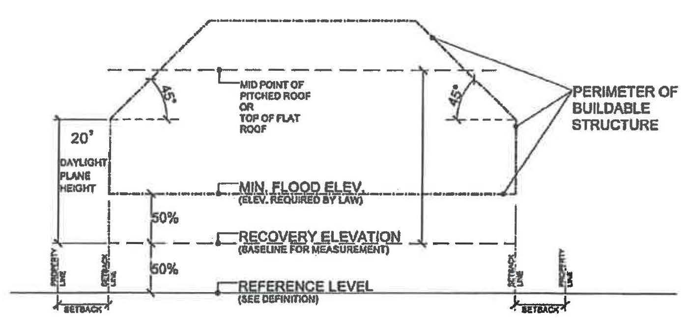
2.
Setbacks.
a.
Front setbacks.
i.
Properties fronting North Tamiami Trail.
a.
Minimum front setback on North Tamiami Trail is ten feet. The minimum front setback may be reduced up to five feet based upon the pedestrian space standards in subsection VI-910(d)(3)(a).
b.
Minimum front setback along side streets intersecting North Tamiami Trail is the same as the underlying zone district.
c.
Maximum front setback for buildings fronting on North Tamiami Trail is 20 feet. This requirement is limited to portions of the building required to meet the minimum façade requirement (see facades below).
d.
Additions to development on zoning lots totaling 500 square feet or less, once each five calendar years, are exempt from the maximum front setback requirement for buildings fronting on North Tamiami Trail in subsection "c." above.
ii.
Properties not fronting North Tamiami Trail. The minimum front setback for properties not fronting North Tamiami Trail is the same as the underlying zoning district.
iii.
Balconies, including roof overhangs, may extend into the required front setback up to six feet and shall not conflict with proposed vegetation or existing landscaping conditions. All balconies within the NTOD shall be unenclosed and have a minimum depth of six feet.
iv.
Marquees and awnings above the ground floor may extend five feet into the front yard setback.
b.
Side setbacks.
i.
Properties abutting residentially zoned property. Properties with a side yard abutting single-family or multiple family (RMF-1, 2, or 3) zoned properties, the minimum side setback shall be subject to the underlying zone district standard and a daylight plane requirement. The purpose of the daylight plane requirement is to: enhance compatibility between residential and nonresidential zones by a gradual increase in height between developments; promote a reasonable building scale; and promote privacy for neighboring properties. The daylight plane requirement allows a maximum height of 20 feet starting at the required side setback line and then extending upward at a 45-degree angle until reaching the maximum four-story height limit. In other words, the building may be extended up in height an additional foot for each foot of distance from the starting setback line. For example, a building setback an additional ten feet from a side setback line can be 30 feet tall (the original 20-foot starting point, plus ten feet). See general examples of daylight plane graphics on the next pages.
ii.
Properties not abutting residentially zoned properties. The minimum side setback is zero feet for properties with a side yard that does not abut single-family or multiple family (RMF 1, 2 or 3) zoned property. See general examples of daylight plane graphics on the next pages.
c.
Rear setbacks.
i.
Properties abutting residentially zoned property. Properties with a rear yard abutting single-family or multiple family (RMF-1, 2, or 3) zoned properties, the minimum rear setback shall be subject to the underlying zone district standard and a daylight plane requirement. The purpose of the daylight plane requirement is to: enhance compatibility between residential and nonresidential zones by a gradual increase in height between developments; promote a reasonable building scale; and promote privacy for neighboring properties. The daylight plane requirement allows a maximum height of 20-feet starting at the required rear setback line and then extending upward at a 45-degree angle until reaching the maximum four-story height limit. In other words, the building may be extended up in height an additional foot for each foot of distance from the starting setback line. For example, a building setback an additional ten feet from a rear setback line can be 30 feet tall (the original 20-foot starting point, plus ten feet). See general examples of daylight plane graphics below and on the next page.
ii.
Properties not abutting residentially zoned property. The minimum rear setback for buildings not abutting single-family or multiple family (RMF 1, 2, or 3) zoned property is the same as the underlying zoning district. See general examples of daylight plane graphics below and on the next page.
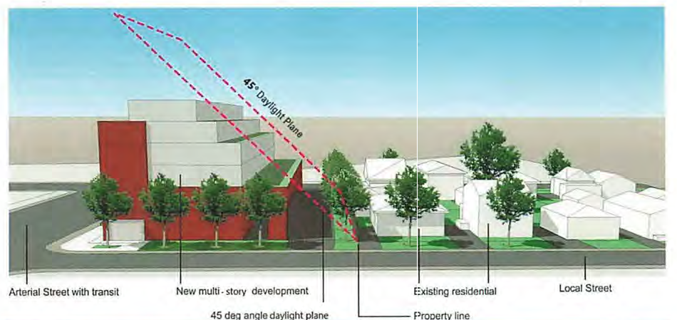
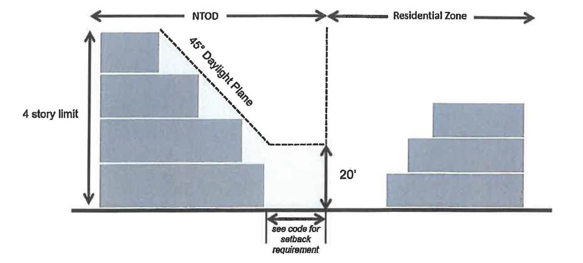
3.
Urban frontage requirements (North Tamiami Trail).
a.
Pedestrian space. A minimum eight-foot clear pedestrian path shall be maintained along the entire North Tamiami Trail property frontage located on the public right-of-way, private property, or a combination of both. A clear walking path is the width of the sidewalk that is not encroached upon by streetlight, utility boxes, tree trunks, street furniture, landscaping and similar barriers to pedestrian travel. Any encroachments into the public right-of-way are subject to city review and approval. Paved areas may utilize various materials, including pervious applications, provided the finished surface meets the American with Disabilities Act (ADA) standards. See examples of pedestrian oriented spaces below. A minimum amenity zone width of 6.5 feet, with canopy trees preferred where achievable, shall be required along the North Tamiami Trail property frontage between the sidewalk and back-of-curb. The required amenity zone width may include landscaping, street lights, street furniture, public art, transit infrastructure or other amenities and may be interrupted to increase the sidewalk width.
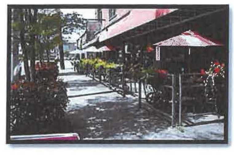
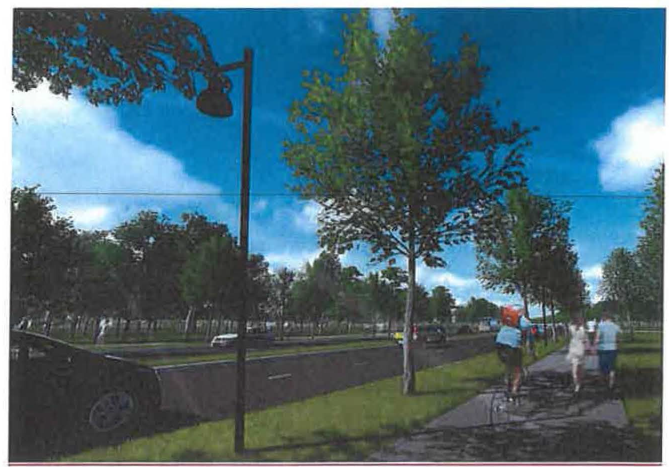
b.
Corner architecture (North Tamiami Trail). New buildings at the intersection of North Tamiami Trail with another public street shall accentuate the building corner facing the intersection by including architectural treatment that emphasizes the corner, such as the examples shown below.
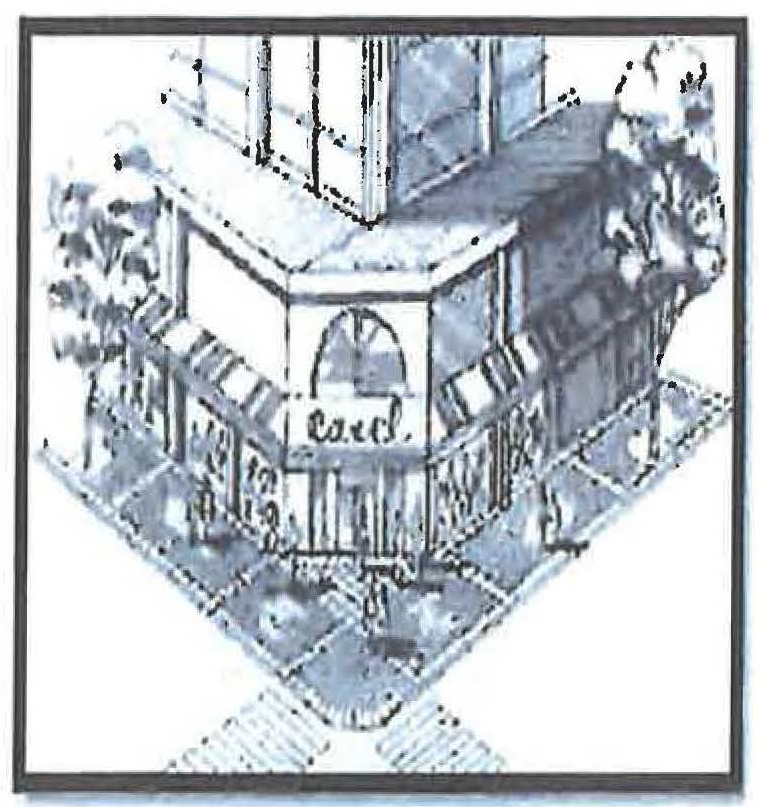
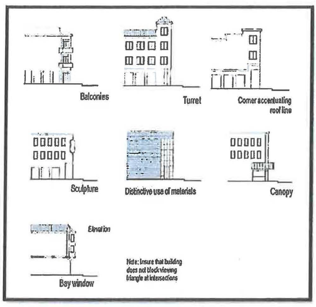
c.
Facades (exterior wall of a building).
i.
Facade requirement. At least 50 percent of the street frontage for each zoning lot on North Tamiami Trail shall be occupied by building(s). In the absence of building(s) along the remainder of the front lot line, landscaping consistent with Section VII, Division 3 of the Zoning Code shall be installed or a freestanding decorative masonry or decorative metal (wrought iron or aluminum) wall, referred to as a "streetwall," with optional pilasters shall be built generally coplanar with the facade to screen surface parking - except for access openings to allow for vehicles and pedestrians. The streetwall shall be a minimum of three feet high and a maximum of six and one-half feet high. The opaque portions of the streetwall shall not exceed three feet in height - except for optional pilasters. Portions of the streetwall above three feet in height shall be less than 50 percent opaque to provide transparency for passive surveillance between the sidewalk and the property. Where the access crosses any pedestrian path, the intersection shall be clearly marked and lighted for the safety of the pedestrian.
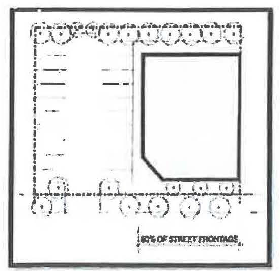
ii.
Reduction in façade requirement. In order to form an outdoor pedestrian plaza or courtyard with a clear walkway connecting the sidewalk to the building entry, the 50 percent building street frontage may be reduced by the director of development services, consistent with subsection VI-910(f), as long as the 20-foot minimum depth of habitable space is maintained along the entire building frontage that runs parallel to North Tamiami Trail (see habitable space below). The outdoor plaza or courtyard may not be used for parking.
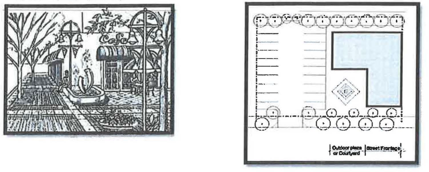
iii.
Main entrance. At least one main entrance of a commercial or mixed-use building shall face onto a sidewalk along North Tamiami Trail or at a corner with North Tamiami Trail. Entrances shall be emphasized with one or more of the following techniques: landscaping, paving (including pervious applications where appropriate), lighting or recessed from the facade surface.
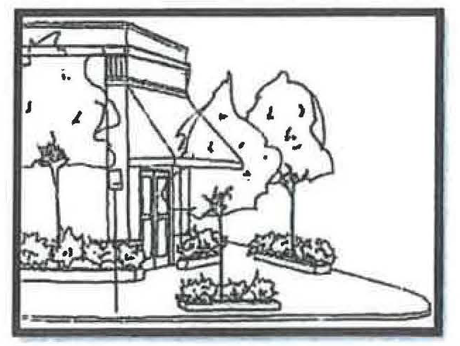
iv.
Exemptions to façade requirement.
a.
Development on zoning lots that have 80 feet or less of street frontage on North Tamiami Trail and no other access other than through the North Tamiami Trail frontage are exempt from the requirements of this subsection "c. Façades" (exterior wall of a building fronting on North Tamiami Trail).
b.
Additions to development on zoning lots totaling 500 square feet or less, once each five calendar years, are exempt from the requirements of this subsection "c. Façades" (exterior wall of a building fronting on North Tamiami Trail).
4.
Habitable space. Portions of a building or parking garage facing North Tamiami Trail shall provide a 20-foot minimum depth of habitable space for the full height and length of the first story. Stairwells, elevators, lobbies or other associated building service space may be allowed to contribute up to 20 percent of the habitable space requirement.
5.
Windows.
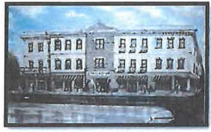
a.
Nonresidential.
i.
The first story shall be a minimum of 30 percent glass for portions of a building facing a street.
ii.
The combined area, of all stories, above the first story facing a street shall be a minimum of 25 percent glass.
iii.
The combined area of all stories shall be a minimum of 20 percent glass for portions of a building not facing a street (excluding alleys).
iv.
Security or decorative grilles, if any, shall be at least 50 percent transparent and shall be located on the inside of the glassed area.
v.
Glazing shall be clear or lightly tinted with a visible light transmittance factor of six-tenths or higher (where R + A + T = 1.0). Translucent, opaque, and mirrored glass may not be used for window materials.
b.
Residential.
i.
The first story on residential frontages shall be a minimum of 15 percent glass.
ii.
Security or decorative grills, if any, shall be at least 50 percent transparent and shall be located on the inside of the glassed area.
iii.
Glazing shall be clear or lightly tinted with a visible light transmittance factor of six-tenths or higher (where R + A + T = 1.0). Translucent, opaque, and mirrored glass may not be used for window materials.
c.
Reduction in window area requirement. The director of development services may reduce or eliminate the required amount of window area (without a formal application for an adjustment) provided one or more of the following techniques is used on the exterior wall of the building and/or on a streetwall:
i.
Installing a vertical trellis in front of the wall with climbing vines or planting materials.
ii.
Providing a landscaped planting bed in front of the wall with plant materials that can obscure at least 50 percent of the wall's surface.
iii.
Providing artwork (mosaic, mural, sculpture, relief, etc.) over the blank wall surface.
iv.
Vertical or horizontal change in wall plane.
v.
Decorative lighting and/or decorative masonry patterns.
vi.
Canopies or awnings. New awnings, canopies and similar features shall be constructed of high quality materials. Materials that have a glossy or shiny appearance are prohibited. Backlighting of awnings is prohibited.
Applicants requesting a reduction in the window area requirement must submit their request in writing to the director of development services and explain the basis for the request.
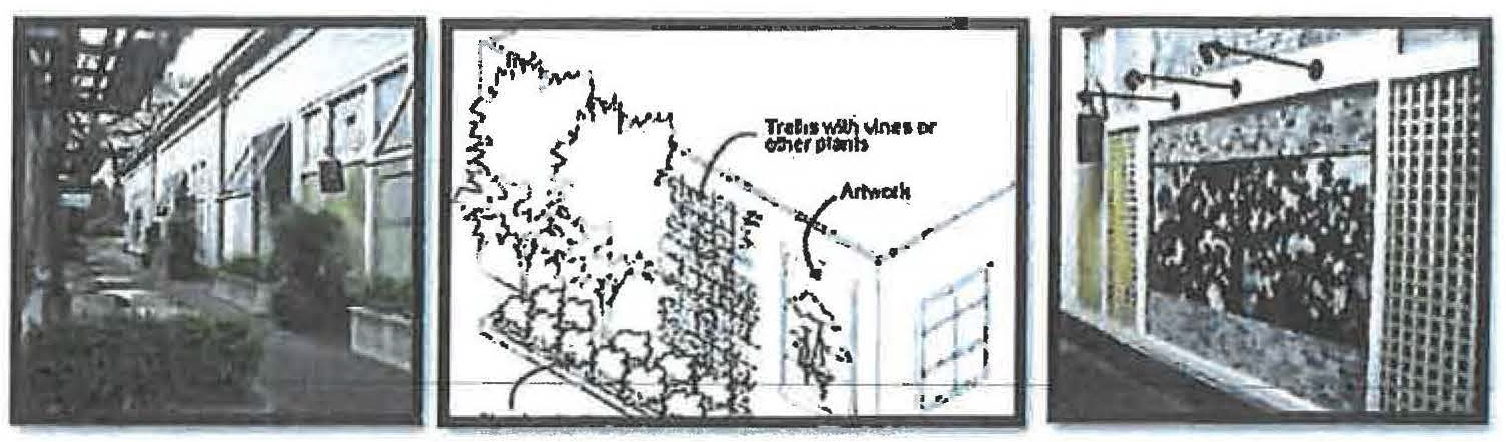
6.
Screening.
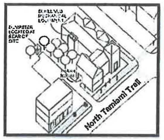
a.
Garbage collection areas. All exterior garbage cans, dumpsters, and garbage collection and compaction areas must be screened from the street and any adjacent properties. These areas shall be located and screened so that the visual impacts of these functions are contained and out of view from adjacent properties and public streets. Trash receptacles for pedestrian use are exempt. See section VII-1401 for specific requirements.
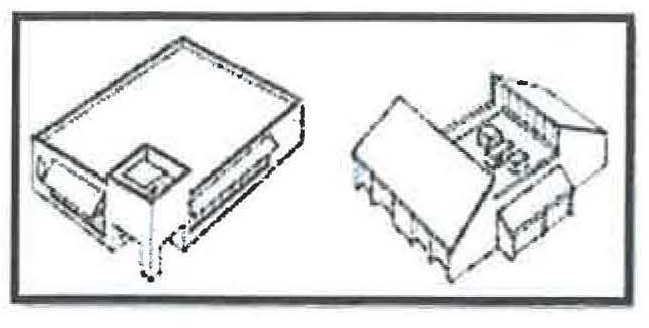
b.
Mechanical equipment. Mechanical equipment, located on the ground, such as heating or cooling equipment, pumps, or generators must be screened from public streets and any adjacent properties. All rooftop mechanical equipment must be screened from the ground level of public streets and any adjacent properties by integrating it into building and roof design.
c.
Other screening requirements. The screening and buffering requirements for uses, parking areas, exterior storage and exterior display areas are stated with the regulations for those types of items.
7.
Pedestrian standards.
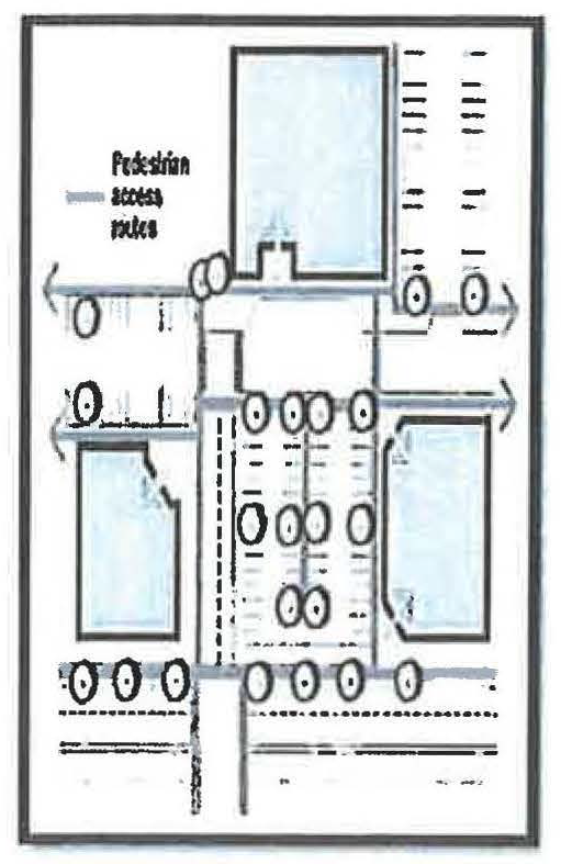
a.
Standards. An on-site pedestrian circulation system must be provided. The system must meet all standards of this section. The following example provides clear pedestrian connections from the street, between buildings, through parking lots, and to adjacent uses.
i.
Connections.
a.
Connection to street. The sidewalk system must connect all abutting streets to the main entrance.
b.
Internal connections. The sidewalk system must connect all buildings on the zoning lot, and provide connections to other areas of the site, such as parking areas, bicycle parking, recreational areas, common outdoor areas and any other amenities.
ii.
Materials.
a.
The circulation system must be hard-surfaced.
b.
Where the system crosses driveways, parking areas, and loading areas, the system must be clearly identifiable through the use of elevation changes, speed bumps, different paving materials, or other similar method. Striping does not meet this requirement.
c.
Where the system is parallel and adjacent to a motor vehicle travel lane, the system must be a raised path or be separated from the lane by a raised curb, bollards, landscaping, or other physical barrier. If a raised path is used the ends of the raised portions must be equipped with ADA (Americans with Disabilities Act) accessible curb ramps.
iii.
Lighting. The on-site pedestrian circulation system must be lighted to a level where the employees, residents, visitors, and customers can safely use the system at night. All lighting fixtures must be shielded and directed to confine light spread within the site boundaries. See the standards in section VII-1402, site lighting.
8.
Exterior display, storage, and work activities.
a.
Exterior display and storage. Exterior display of goods is prohibited except for the display and storage of plants, produce, motor vehicles, and boats subject to the following limitations:
i.
Such uses must be accessory to an approved primary use.
ii.
Display areas for plants and produce are limited to an area equal to 15 percent of the principal uses' gross floor area.
iii.
There is no limit for approved motor vehicle or boat sales/rental lots and plant nurseries.
iv.
Except for approved plant nurseries, all plant and produce merchandise must be stored inside the building after permitted hours of operation. Motor vehicles and boats may remain outdoors. Hours of operation are limited from 6:00 a.m. to 10:00 p.m.
v.
Display areas are not permitted in required landscape, parking, or pedestrian areas.
b.
Exterior work activities. Exterior work activities are prohibited except for the following uses that comply with all applicable regulations: restaurants; plant nurseries; entertainment and recreation uses that are commonly performed outside; sales or rental of motor vehicles and boats; fuel sales; car washes; commercial surface parking lots; and open air markets.
c.
Open air market/bazaar. The purpose of an open air market/bazaar is to allow for open-air sale of retail products in certain nonresidential zone districts, to provide for the creation of a more urban pedestrian environment and to stimulate business. Permitted locations shall be limited to property zoned CN, CP, CSCN, CSCC, CSCR, CG, CI, ILW, I, CND, CSD, CRD, CGD, CSC, NT, DTE, DTC, DTB, ICD, IGD, IHD, G, and CBN. Applications for a provisional use permit shall be submitted to the director of development services and shall meet the standards defined in subsection VII-602(x).
9.
Parking.
a.
General standards. See sections VII-201, 202, 203, 204, 205, 207, 208, 209, 213, 214, and 215 which shall apply where applicable.
The following standards supersede the parking standards of article VII, division 2 where in conflict with other parking provisions, including the general standards of subsection 9.a. above.
b.
Minimum parking requirement.
i.
One space for each 350 square feet of floor area for nonresidential space.
ii.
One space for each residential unit. One-half space for each dwelling unit designated as affordable to households with an income at or below 120 percent of the area median income (AMI).
iii.
One-half space for each hotel/motel unit, plus applicable parking for accessory uses, which may draw patrons beyond those receiving accommodations.
iv.
Any off-street parking requirement of 20 spaces or more shall provide bicycle parking spaces equal to 20 percent of the total automobile parking spaces required.
c.
Changes in use exemption.
i.
Changes to existing uses shall be exempt from having to meet new parking requirements and may continue to provide existing parking. Any new/additional building square footage, however, shall be subject to meeting applicable parking requirements.
d.
Parking and stormwater management utilizing residential zoning lots.
i.
Adjacent residential zoning lots within the NTOD may be used as accessory parking in part or in whole and may also be used to meet or exceed minimum parking requirements for the principal use.
a.
Vehicular access to the parking area on a residentially zoned lot shall only be through the nonresidential zoned lot.
b.
No sales, sales display, or service activity of any kind is permitted on the residentially zoned lot.
c.
No commercial renting or selling of spaces is permitted on the residentially zoned lot.
d.
No parking of automotive vehicles other than passenger automobiles is permitted on the residentially zoned lot.
e.
No movement of vehicles related to commercial uses between the hours of 10:00 p.m. and 6:00 a.m. is permitted on the residentially zoned lot.
f.
No parking of vehicles related to commercial uses for periods of longer than 24 hours is permitted on the residentially zoned lot.
g.
Opaque fencing shall be required as part of any buffering adjacent to other residentially zoned lots.
ii.
Residential zoning lots within the NTOD may be used for stormwater management.
e.
Alternative parking ratio.
i.
The director of development services, after consultation with the city engineer, shall be authorized to approve alternative ratios for providing required off-street parking spaces in accordance with this section.
ii.
Where the applicant believes the required parking ratios of this section are too high, data submitted by the applicant may be used to determine a different or lesser ratio for specific proposed use. Such data may include site studies from similar uses, generally accepted engineering or industry specific practices (for example, ITE parking rates or ICSC parking rates), or independent engineering calculations based on the nature of the proposed use. The director of development services, in coordination with the city engineer, shall evaluate such submittals to determine an acceptable ratio for the proposed use.
iii.
An attested copy of an approved alternative parking ratio must be recorded in the official records for Sarasota County on forms approved by the city attorney. An alternative parking ratio may be amended by following the same procedure required for the original approval. The applicant shall provide proof of recordation prior to approval of the certificate of occupancy.
f.
Location of parking. Parking lots or garages shall not be located any closer to the North Tamiami Trail right-of-way than the distance by which the principal building is set back from the street right-of-way. This provision shall not be construed to preclude parking lot access driveways. Parking areas shall not be located on street corners unless one of the following conditions exists; however, this shall not be construed to allow parking in front of buildings on North Tamiami Trail.
i.
If a zoning lot fronts on three streets, then parking may be located on only one corner.
ii.
If a zoning lot fronts on four streets, then parking may be located on only two corners.
iii.
Exemptions to location of parking requirement.
a.
Development on zoning lots that have 80 feet or less of street frontage on North Tamiami Trail and no other access other than through the North Tamiami Trail frontage are exempt from the requirements of this subsection "f, location of parking."
b.
Additions to development totaling 500 square feet or less, once each five calendar years, are exempt from the requirements of this subsection "f, location of parking."
g.
Tandem parking allowance.
i.
Tandem spaces, if used, shall be required to meet the minimum dimensional standards in the illustration (eight and one-half feet by 38 feet). Such tandem parking shall not extend over the sidewalk or interfere with pedestrian or vehicular movement.
ii.
Residential development may utilize tandem parking for same unit parking only.
iii.
Nonresidential development may utilize tandem parking for employee parking only.
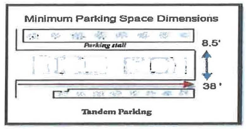
h.
Shared parking allowance. Shared parking facilities for developments or uses with different operating hours or different peak business periods may be approved if the shared parking complies with all of the following standards:
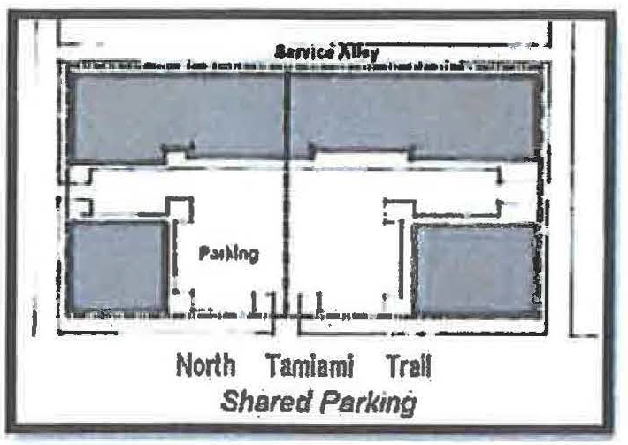
i.
Ineligible activities. Shared parking may not be used to satisfy the off-street parking standards for residential uses, except for those dwelling units designated as affordable to households with an income at or below 120 percent of the Area Median Income (AMI). Required parking spaces reserved for persons with disabilities may not be located off-site.
ii.
Location. Shared parking spaces must be located on the same or abutting zoning lot of the main entrance of all uses served.
iii.
Zoning classification. Shared parking areas for nonresidential uses shall not be located in any underlying residential district.
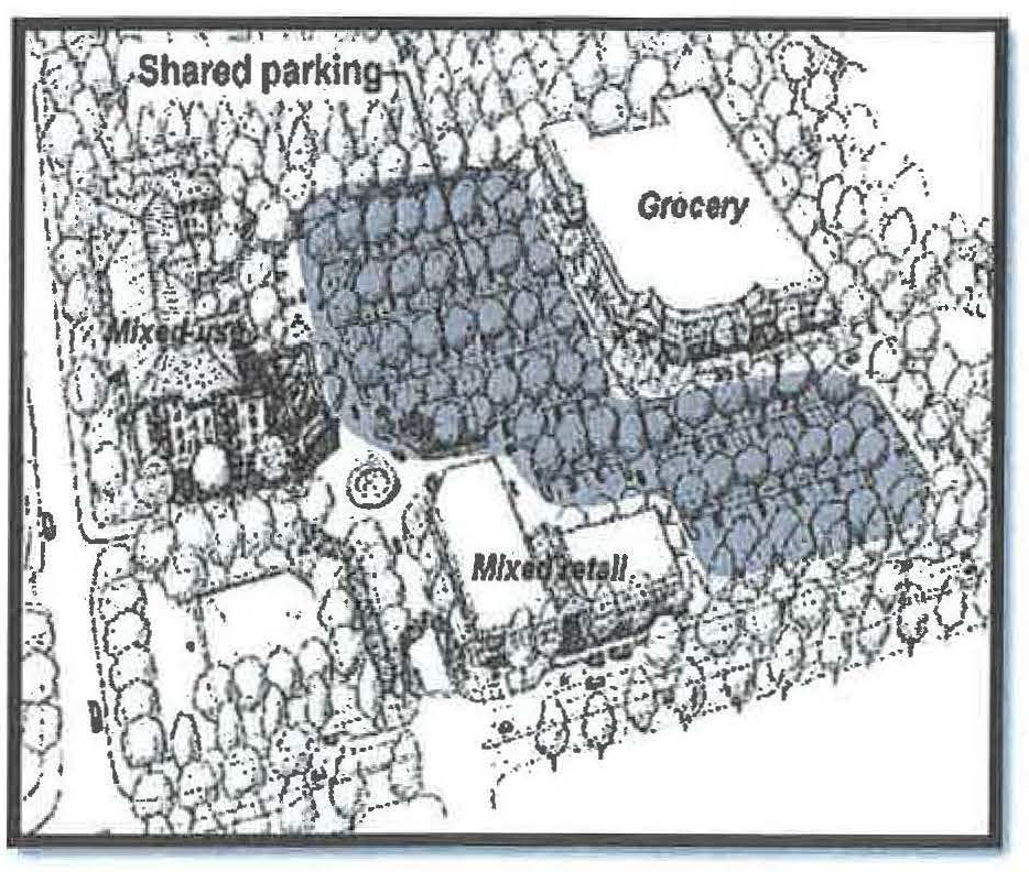
iv.
Shared parking analysis. Those wishing to use shared parking as a means of satisfying off-street parking requirements must submit a shared parking analysis to the director of development services that clearly demonstrates the feasibility of shared parking. The analysis must be provided in a form acceptable to the director of development services. It must address at a minimum: the size and type of the proposed development; the composition of tenants; the anticipated rate of parking turnover; and the anticipated peak parking and traffic loads for all uses that will be sharing off-street parking spaces.
v.
Agreement for shared parking. A shared parking plan shall be enforced through written agreement among all owners of record. The owner of the shared parking area shall enter into a written agreement with the city, with enforcement running to the city, providing that the land comprising the parking area shall never be disposed of except in conjunction with the sale of the building which the parking area serves so long as the facilities are required; and that the owner agrees to bear the expense of recording the agreement and such agreement shall bind his or her heirs, successors, and assigns. An attested copy of the agreement between the owners of record shall be submitted to the city attorney for recordation in a form established by the city attorney. Recordation of the agreement must take place before issuance of a certificate of occupancy for any use to be served by the shared parking area. A shared parking agreement may be revoked only if all required off-street parking spaces will be provided on-site in accordance with the off-street parking schedules in this section. The written agreement shall be voided by the city if other off-street facilities are provided in accord with these zoning regulations. The director of development services is hereby authorized to administratively approve and execute on behalf of the city shared parking agreements which are in compliance with this section.
vi.
Change in use. Where the uses subject to a shared parking agreement change, the director of development services shall have the authority to require a revised shared parking analysis. A new shared parking agreement is required when the revised shared parking analysis indicates additional parking is required.
i.
Off-site parking. Off-street parking spaces on a separate lot from the lot on which the principal use is located may be approved if the off-site parking complies with the all of following standards:
i.
Ineligible activities. Off-site parking may not be used to satisfy the off-street parking standards for convenience stores or other convenience-oriented uses. Required parking spaces reserved for persons with disabilities may not be located off-site.
ii.
Location. No off-site parking space may be located more than 600 feet from the primary entrance of the use served (measured along the shortest legal pedestrian route). Off-site parking spaces may not be separated from the use served by an arterial street right-of-way (as designated in the comprehensive plan), unless a grade-separated pedestrian walkway is provided, or other traffic control or remote parking shuttle bus service is provided.
iii.
Zoning classification. Off-site parking areas shall not be located in any residential district.
iv.
Agreement for off-site parking. In the event that an off-site parking area is not under the same ownership as the principal use served, a written agreement between the record owners is required. The owner of the off-site parking area shall enter into a written agreement with the city, with enforcement running to the city, providing that the land comprising the parking area shall never be disposed of except in conjunction with the sale of the building which the parking area serves so long as the facilities are required; and that the owner agrees to bear the expense of recording the agreement and such agreement shall bind his or her heirs, successors, and assigns. An attested copy of the agreement between the owners of record must be submitted to the city attorney for recordation in form established by the city attorney. Recordation of the agreement must take place prior to issuance of a building permit or certificate of occupancy for any use to be served by the off-site parking area. An off-site parking agreement may be revoked only if all required off-street parking spaces will be provided, in accordance with the off-street parking schedules in this section. The director of development services is hereby authorized to administratively approve and execute on behalf of the city off-site parking agreements which are in compliance with this section.
v.
Signage. All off-site parking spaces shall be clearly marked for exclusive use of the use to be served.
10.
Signage.
| a. General Standards | See VII-101 thru 109 |
b. Lighting
  |
Signage may be externally illuminated by reflection of a light source aimed at its
surface. All lighting must be shielded to prevent glare or nuisance beyond the property
line.
The backlighting of awnings and messages attached thereto is prohibited. Backlighting with neon, fluorescent, or LED white light is permitted only for signs that use individually cut opaque letters (a.k.a. "halo illuminated letters"). The use of cabinet-type box signs or channel letter signs with translucent backlit panels is prohibited. Signage inside shopfront windows may be neon lit. Signs with flashing or intermittent lights, continuous changes of message, animated and electronic message boards, lights of changing degrees of intensity, and lights or lighting effects that cause glare are prohibited. |
c. Wall Sign
 | One single external wall sign band (with individually cut letters) may be applied at the top of either the first or second floor façade of each building, providing that it not exceed two feet in height by any length. This shall not be interpreted to allow for two wall sign bands on any building. Where there is more than one sign on an individual building, all signs should be complementary to each other in the type of construction materials and letter size and style of copy. |
d. Directory Sign
 | One wall-mounted directory sign may be located at each ground level entrance. The sign may list the name of the establishment(s) and may include a location map. Each directory sign shall not exceed a total aggregate area of 16 square feet. Any such sign shall not project more than 12 inches from the building to which it is attached. |
e. Projecting Sign
 | Projecting signs, not to exceed four square feet in area per face for each separate business entrance, may be attached perpendicular to the facade. The bottom of such signs shall be a minimum of eight feet above the walkway. |
f. Awning Sign
 | Awnings at the first story may have signs. No such sign shall exceed 20 percent of the area of each awning (top plus all sides). |
|
g. Temporary Portable
A-Frame Sign  | A single temporary portable A-frame sign may be allowed for each business, on private property, provided the sign is less than four feet high and less than 18 by 24 inches per face. Placement in the public right-of-way shall be prohibited. |
h. Window Sign
 | Such signs shall cover no more than 20 percent of the total window and glass portion of the door area. A permanent address shall be permitted in addition to the 20 percent coverage. Window signs shall not be included in any calculation of total sign area for the building or tenant. Handwritten signs of any type are prohibited. |
i. Real Estate Sign
 | One single-faced or double-faced non-illuminated "For Sale" or "For Rent" sign for each street frontage not exceeding 16 square feet per face and not exceeding six feet in height above grade. Upon sale or rent, the sign shall be immediately removed. |
j. Monument Sign
 | One freestanding monument sign per street frontage not exceeding 120 square feet in area on all faces and not exceeding ten feet in height above grade. |
k. Building Banners
 |
Building banners shall be permitted on each face of the building subject to the following
regulations.
a. Banners shall be located on private property unless a right-of-way encroachment permit is obtained. b. The bottom of the banner shall be a minimum of eight feet above the walkway or ground. c. The maximum size of each banner shall project a maximum of three feet from the face of the building and be a maximum of nine feet tall and shall be of uniform dimensions throughout the zoning lot upon which they are located. d. One banner may be located for each 50 feet of building length. For example, if the face of the building is 99 feet long, only one banner shall be permitted on that face of the building. e. The top and bottom of all banners shall be affixed to poles designed solely for that purpose. No banners shall be affixed to other structures, vehicles, utility poles, trees, shrubs or plants. f. All banners shall be constructed of fire retardant material and shall be replaced by the owner of the banner at a minimum of two times per year. g. All banners may contain written copy of a general non-advertising nature plus identifying logos or symbols. The term "non-advertising nature" shall mean the copy does not advertise the name of any business, specific merchandise or sale prices. |
l. Marquee Sign
 | Theatres may have one marquee sign for each building frontage that includes an entrance available to the general public. The marquee shall not extend beyond the top or sides of the building. |
| m. Alley Signs | Alleys may also contain one projecting or wall sign at each customer entrance. Such signs shall not exceed four square feet in area per face. The bottom edge of such signs shall be located a minimum of eight feet above the walkway. |
| n. Other Signs | Prohibited. All other signs not specifically permitted. |
| o. Design Guidelines |
See Appendix D. Advisory Community Design Guidelines.
These non-mandatory guidelines shall be consulted prior to developing signs for any project. |
(e)
Community workshop required.
1.
All applicants choosing to utilize the North Trail Overlay District shall hold a community workshop. In accord with the procedures for community workshops defined in subsection IV-201(b), prior to submitting an application.
(f)
Adjustment review process.
1.
Purpose and applicability. Existing structures and uses are allowed to continue and normal repair and maintenance is encouraged. Compliance with the NTOD standards is intended to occur over time as new development, expansion and remodeling occur. The regulations of the NTOD apply over a wide area, which makes full compliance with all of the regulations difficult on sites with unusual situations. Adjustment reviews allow alternative ways to meet the vision, intent and purpose of the NTOD (section VI-910(a)) by providing flexibility for sites that are small or irregularly shaped or contain significant tree canopy. Adjustments may also be used when strict application of the regulations would preclude reasonable economic use of a site. The adjustment process allows the NTOD regulations to continue to provide certainty and rapid processing of site plan applications. Each adjustment shall be considered unique and shall not set precedent for others.
2.
Regulations which may and may not be adjusted:
a.
Eligible regulations. Unless specifically prohibited in subsection "b" below, all regulations which do not exceed a 25-percent dimensional standard, where applicable, may be modified administratively by the director of development services by using the adjustment review process.
b.
Ineligible regulations. No adjustments shall be granted for the following:
i.
Maximum building height.
ii.
Setbacks for yards abutting residentially zoned property, except for the preservation of trees.
iii.
Daylight plane standards for yards abutting residentially zoned property.
iv.
Signage. However, to accommodate existing buildings, the dimensional standards may be adjusted by up to 25 percent and the location of signs may be adjusted if the approval criteria are met.
v.
Allowed uses in the underlying zone districts.
vi.
Maximum residential densities in the underlying zone districts.
vii.
Maximum floor area ratio in the underlying zone districts.
viii.
Parking standards for accessory parking on residentially zoned lots.
ix.
Residentially zoned lots within the NTOD used for stormwater management.
c.
Dimensional standards. Except for the preservation of trees, no adjustment to a dimensional standard shall be granted by the director of development services which would result in a reduction of a code requirement or an increase in a code limitation by more than 25 percent. Where applicable, all other adjustment requests exceeding the 25 percent threshold shall require approval from the planning board.
3.
Approval criteria. An application for an adjustment shall be accompanied by documentation that establishes how the applicant meets the criteria of subsection "a.", "b.", or "c." below.
a.
Civic/government uses. Adjustment requests for uses that are uniquely governmental such as administration centers, public safety/public works facilities, public mass transit terminals, post offices, public libraries, public museums, or public schools/colleges will be approved, approved with changes, or approved with conditions if the director of development services finds that the applicant has shown that approval criteria "i" through "v" below have been met.
i.
The design of the development project is exemplary civic architecture; and
ii.
The building will be constructed of high quality materials and finishes; and
iii.
The project will enhance the appearance and environment of the city; and
iv.
The adjustment will not be injurious to the neighborhood or otherwise detrimental to the public welfare; and
v.
The vision, intent and purpose of the NTOD have been met.
b.
Other non-government uses. Adjustment requests for uses that are not uniquely governmental such as apartments/condominiums, hotels/motels, retail/service shops, or office buildings (regardless of ownership) will be approved, approved with changes, or approved with conditions if the director of development services finds that the applicant has shown that either approval criteria "i" through "vi" or approval criteria "vii" through "x" below, have been met.
i.
Granting the adjustment will equally or better meet the purpose of the regulation to be adjusted; and
ii.
The proposal will not significantly detract from the livability or appearance of any adjacent residential zone district; and
iii.
If more than one adjustment is being requested, the cumulative effect of the adjustments results in a project which is still consistent with the overall purpose of the NTOD; and
iv.
City designated historic resources (if applicable) are preserved; and
v.
Any impacts resulting from the adjustment are mitigated to the maximum extent practical; and
vi.
The vision, intent and purpose of the NTOD have been met; or
vii.
Application of the regulation in question would preclude reasonable economic use of the site; and
viii.
Granting the adjustment is the minimum necessary to allow reasonable use of the site; and
ix.
Any impacts resulting from the adjustment are mitigated to the extent practical; and
x.
The vision, intent, and purpose of the NTOD have been met.
c.
Preservation of trees. It is the intent of this section to permit the applicant to receive an adjustment equal to the decrease in the buildable area caused by the modification required to the structure to preserve trees protected by article VII, division 3.1 of this Code. An application for an adjustment shall demonstrate all of the following three requirements are met.
i.
The adjustment is for the purpose of preserving a tree or trees protected by article VII, division 3.1 of this Code; and
ii.
The applicant cannot design and locate the proposed structure or infrastructure improvements to preserve the trees and also comply with all provisions of the Zoning Code, without causing the applicant undue hardship; and
iii.
Considering the shape and dimensions of the real property, the location of existing structures and infrastructure improvements, and the size, age, health, and species of trees sought to be protected, it is not feasible to transplant the trees to another location on the site.
d.
Conditions. In granting any adjustment, the director of development services shall prescribe appropriate conditions and safeguards in conformity with these regulations. Violation of such conditions and safeguards, when made a part of the terms under which the adjustment is granted, shall be deemed a violation of these regulations.
e.
Amendments. An adjustment may be amended, only by following the preceding procedures in this section.
f.
Expiration of approval. An adjustment shall expire upon the expiration of the site plan into which the adjustment has been incorporated.
g.
Appeals. Any final decision of the director of development services may be appealed to the planning board in accord with subsection (g) Appeal process, below.
(g)
Appeal process.
1.
Decision of the director. Any aggrieved person may appeal the decision of the director of development services to approve or deny an adjustment by filing a notice of appeal with the office of the city auditor and clerk on a form prepared by the department of development services within ten calendar days after the date the letter containing the decision of the director of development services is mailed to the applicant or within ten calendar days after issuance of a building permit. The planning board shall hold a de novo hearing on the application for adjustment by using the applicable approval criterion to consider the appeal, and may affirm, affirm with conditions or reverse the decision of the director. The hearing shall be advertised and conducted in accord with section IV-202. Prior to conducting the hearing, the planning board shall make a determination as to whether the entity or person who filed the notice of appeal is an "aggrieved person" as defined in this Zoning Code and the planning board may receive evidence on this issue. In the event the planning board determines that the appealing party is not an "aggrieved person," the board shall not conduct the hearing on the application for adjustment.
2.
Decision of the planning board. An appeal of a decision of the planning board may be made to the city commission. A notice of appeal in the form of a letter shall be filed with the city auditor and clerk's office within ten days of the planning board's decision. The city commission shall hold a de novo public hearing to consider the appeal, and may affirm, affirm with conditions or reverse the decision of the planning board by using the applicable approval criterion. The hearing shall be advertised and conducted in accord with section IV-202. An appeal of the decision of the city commission may be made to the Circuit Court for Sarasota County, Florida, by filing a petition for writ of certiorari as provided under the Florida Rules of Appellate Procedure. A decision of the city commission to approve or deny an adjustment as provided in this subsection (g) shall be deemed to have been rendered on the date that the city commission adopts a resolution setting forth its findings and decision.
(h)
Enforcement. Should a violation of an approved design occur during construction, the director of development services has the authority to require the developer to stop, remove, and/or alter the violation or to require the developer to secure an adjustment in accord with subsection (f) above.
(Ord. No. 08-4799, § 2, 4-28-08; Ord. No. 09-4838, § 2(att. 1), 2-17-09; Ord. No. 09-4888, § 2(att. 1), 11-2-09; Ord. No. 13-5041, § 2(att. 1), 3-4-13; Ord. No. 13-5053, § 2(Exh. A), 5-6-13; Ord. No. 18-5244, § 2(Exh. A), 4-16-18; Ord. No. 19-5300, § 2(Exh. A), 10-7-19; Ord. No. 22-5414, § 2(Exh. A), 5-16-22)
Sec. VI-911. - Laurel Park overlay district.
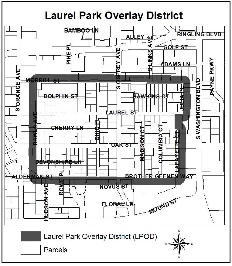
(a)
Intent and purpose. The Laurel Park overlay district (LPOD) is intended to enhance communication between a developer or landowner and residents within the Laurel Park neighborhood when a building permit or administrative site plan is proposed within the overlay district that meets or exceeds the thresholds of subsection IV-501(c). This section applies to all applications for administrative site plan approval which may be processed in advance of a building permit or in conjunction with a building permit which meet or exceed the thresholds set out in subsection IV-501(c). However, if two community workshops have been held on an administrative site plan application as required by subsections VI-911(c) and (e); then no additional community workshops are required if a subsequent application for a building permit is filed to allow construction in accordance with a previously approved and currently valid site plan.
(b)
Establishment of the boundaries. The application of the Laurel Park overlay district shall be restricted to those geographical areas that are designated on the official zone district map of the City of Sarasota. However, the geographical areas that are subject to the requirements of this section may change over time as properties are assembled or partially transferred because the requirements of this section apply to all parcels that are located within or intersect the Laurel Park overlay district at the time of building permit or administrative site plan application.
(c)
First community workshop requirement. Prior to submitting an application for a building permit or administrative site plan that meets or exceeds the thresholds of subsection IV-501(c) on a parcel of land that is located entirely or partially within the Laurel Park overlay district, a community workshop shall be held. The purpose of this workshop will be to inform attendees about the development proposal and to generate discussion/feedback about the proposed development, including uses, building dimensions (height, bulk, etc.), number of dwelling units or size of nonresidential uses, traffic patterns, location of trash receptacles, and other pertinent information. After the community workshop, the developer may submit a building permit or administrative site plan application. The developer may, but is not required to incorporate comments or issues raised during the community workshop into the development plan(s). The time period between the community workshop and submittal of a building permit or administrative site plan application shall not exceed 365 calendar days.
Notice shall be mailed by the city at least 14 days prior to the date of the community workshop to each owner of record of any land within 500 feet of a parcel of land that is located entirely or partially within the Laurel Park overlay district for which a building permit or administrative site plan approval is sought and to the Laurel Park neighborhood association and to affected neighborhood associations or persons who have registered with the neighborhood and development services department to receive notice of Laurel Park overlay district applications. The notice of community workshop shall include at a minimum the following: the applicant's name and telephone number; the street address of the site with an identification map; a clear, factual explanation of what the applicant is proposing; and the date, time, and location of the community workshop. This notice requirement does not mean that all persons receiving the notice must attend the community workshop.
(d)
Notice of filing for a building permit or administrative site plan. Within five working days of building permit or administrative site plan application submittal which meets or exceeds the thresholds of subsection IV-501(c) regarding a parcel of land located entirely or partially within the Laurel Park overlay district, the city shall send a notice of filing to owners of record of properties located within 500 feet of the subject property, to the Laurel Park neighborhood association, to affected neighborhood associations or persons who have registered with the neighborhood and development services department to receive notice, and to those who attended the community workshop. The notice of filing will be published on the city's website.
(e)
Second community workshop requirement. A second community workshop shall be held between 30 and 45 calendar days after the initial submittal of a building permit or administrative site plan application which meets or exceeds the thresholds of subsection IV-501(c) regarding a parcel of land located entirely or partially within the Laurel Park overlay district. The purpose of this workshop will be to inform attendees about the building permit or administrative site plan application that was submitted and to report the course of action, if any, in which the building permit or administrative site plan addressed issues or comments that were made at the first community workshop. Neighborhood and development services staff will present an analysis of how the building permit or administrative site plan application meets applicable city codes. The second community workshop shall be held prior to issuance of a building permit or administrative site plan decision.
Notice of the second community workshop shall follow the same procedures identified in subsection VI-911(c).
(f)
Notice of issuance for a building permit or administrative site plan. Within five working days of a building permit issuance or administrative site plan approval which meets or exceeds the thresholds of subsection IV-501(c) regarding a parcel of land located entirely or partially within the Laurel Park overlay district, the city shall send a notice of issuance to owners of properties located within 500 feet of the subject property, to the Laurel Park neighborhood association, to affected neighborhood associations or persons who have registered with the neighborhood and development services department to receive notice of Laurel Park overlay district applications, and to those who attended either of the community workshops. The notice of issuance will be published on the city's website.
(g)
Appeal of an administrative decision. The following persons may appeal an administrative decision to approve or deny a building permit or a site plan which meets or exceeds the thresholds of subsection IV-501(c) regarding a parcel of land located entirely or partially within the Laurel Park overlay district to the planning board by filing a notice of appeal with the office of city auditor and clerk within 20 working days of the decision:
(1)
The applicant, or
(2)
An owner, resident or other occupant of real property located within 500 feet of the subject property; the owner's, resident's, or occupant's designated representative; or a neighborhood association having one or more of such owners, residents or occupants as members and which represents an area within 500 feet of the subject property.
The planning board shall hold a de novo public hearing to consider the appeal and shall grant, grant with conditions, or deny the application for a building permit or site plan approval. The planning board shall use and be guided by the criteria located in section IV-506, standards for review, in evaluating a site plan that has been appealed.
In lieu of an appeal to the planning board, an appeal of a technical matter regulated by the state building code shall be made to the board of rules and appeals in accordance with chapter 11 of the Code of the City of Sarasota. Technical matter refers to laws and rules which pertain to and govern the design, construction, erection, alteration, modification, repair, and demolition of public and private buildings, structures, and facilities and enforcement of such laws and rules as described in F.S. § 553.73, Florida Building Code. Subsection 11-10(a) of the Code of the City of Sarasota limits filing an appeal of a decision of the building official to a property owner or duly authorized agent of the property owner.
(h)
Appeal of planning board decision. A person described in subsection VI-911(g) above, may appeal a planning board decision to approve or deny a building permit or a site plan which meets or exceeds the thresholds of subsection IV-501(c) regarding a parcel of land located entirely or partially within the Laurel Park overlay district to the city commission by filing a notice of appeal with the office of city auditor and clerk within 20 working days of the decision. The city commission shall hold a de novo public hearing to consider the appeal and shall grant, grant with conditions, or deny the application for a building permit or site plan approval. The city commission shall use and be guided by the criteria located in section IV-506, standards for review, in evaluating a site plan that has been appealed.
(i)
[Failure to notify not cause for invalidation.] Failure to notify an owner of record of any land located within 500 feet of a parcel of land that is located entirely or partially within the Laurel Park overlay district for which a building permit or administrative site plan approval which meets or exceeds the thresholds of subsection IV-501(c) is sought, the Laurel Park neighborhood association, or affected neighborhood associations or persons who have registered with the neighborhood and development services department to receive notice of Laurel Park overlay district applications, and those who attended either of the community workshops as provided in subsection VI-911(c), (d), (e) or (f), shall not invalidate:
(1)
A building permit or administrative site plan application, or
(2)
A building permit issuance or administrative site plan approval.
(Ord. No. 13-5054, § 2(Exh. A), 8-19-13)
Sec. VI-912. - Rosemary residential overlay district.
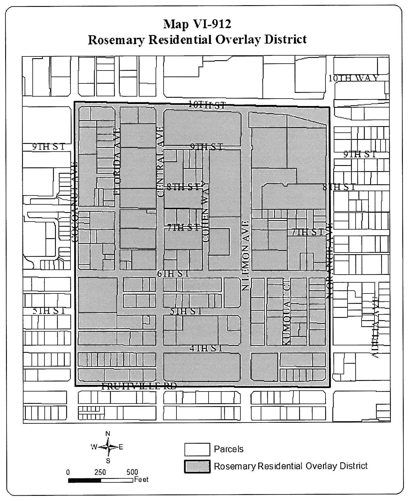
(a)
Intent and purpose. The Rosemary Residential Overlay District (RROD) and the increased residential dwelling unit density allowable within the overlay district are intended to:
(1)
Implement the Sarasota City Plan adopted by Ordinance No. 08-4792, and amended by ordinance.
(2)
Promote higher density residential development and use in order to encourage a residential balance to existing nonresidential uses within the RROD. The higher density residential development and use is compatible with existing uses, density and scale of development in the surrounding area. The higher density residential development and use allows for a fully mixed-use area that provides for residential and nonresidential uses in order to create a functional, sustainable, urbanized community within the RROD. This classification provides for and is consistent with the implementation of the Sarasota City Plan.
(3)
Encourage more people to permanently reside within the boundaries of the RROD in order to enhance the economic vitality of the Rosemary neighborhood and downtown.
The base density within the RROD is 40 dwelling units per acre. It is the further intent of these regulations that applications for approval of a building permit or site plan for new development (see note 1) with increased density up to 100 dwelling units per acre for new development that comply with certain development standards and when providing attainable dwelling units for a minimum period of 30 years, shall be reviewed and approved, approved with conditions, or denied, as appropriate, in accordance with section IV-1901.
(b)
Establishment and boundaries of the RROD. The boundaries of the RROD are Cocoanut Avenue, 10th Street, Orange Avenue, and Fruitville Road, as shown on Map VI-912.
(c)
Development standards.
(1)
Applicability. Except as provided in section VI-912(c), all development and uses allowed in the RROD shall be subject to the development standards set forth in the underlying zoning district.
(2)
Density. The following regulations shall supersede the maximum density limitations and downtown attainable housing density bonus standards set forth in article VI of this Zoning Code.
a.
The base residential density within the RROD shall be a maximum of 40 dwelling units per acre.
(3)
Public realm design. The following regulations shall supersede certain standards of section VI-1005, development standards, or section VII-107, public art required, as applicable, and are required of new development within the RROD:
a.
Public realm design features required of all new development (see note 1). All new development in the RROD shall comply with requirements 1., through 5.:
1.
Sidewalk zone. A sidewalk zone shall be provided between each street and the building frontage facing the street. The sidewalk zone shall consist of two sub-zones, a pedestrian zone and an amenity zone, and shall be at least 12 feet wide, measured from the back of the street curb to the face of the building. The pedestrian zone shall provide a "clear" walking path of at least eight feet. "Clear" walking path is the width of the sidewalk that is not encroached upon by street lights, utility boxes, tree trunks, street furniture, landscaping and similar barriers to pedestrian travel. An amenity zone is a minimum of four feet in width, adjacent to and measured from back of curb, shall provide for canopy trees planted at intervals between 30 and 40 feet (except where a canopy tree would be impractical due to underground utilities or lead to an unsafe condition such as impeding lines of sight), landscaping, street lights, public art, street furniture, sidewalk cafes, or other amenities. The surface of the amenity zone should be pervious materials, such as pavers or vegetative ground cover (provided that grass, turf, and sod shall not be considered vegetative ground cover), and should not include shrubbery adjacent to on-street parking that would impede passage from the parking area to the pedestrian zone. In certain cases, the species of canopy tree may require a five-foot planting area, thereby reducing the "clear" walking path to a width of seven feet at those locations adjacent to the planting area. Adjustments may be granted in accordance with section IV-1903. The development services director shall consult with the planning director and city engineer in making this adjustment determination.
2.
Shade and weather protection. At all entrances to the ground floor multifamily dwelling units and nonresidential units abutting a street, shade and weather protection shall be provided for pedestrians and persons entering the building. All buildings shall have a canopy at the primary building entrance.
3.
Nonresidential windows. All ground floor nonresidential units abutting a street must provide window transparency for at least 50 percent of the front facade.
4.
Architectural features on walls facing streets. To provide relief from long, unbroken sections of building wall, a pedestrian passageway, building entrance with canopy, change in the plane of the wall, or other architectural feature is required at least every 80 feet of facade length along a street. Such architectural features shall be at least ten feet in width, ten feet in height, and five feet in depth.
5.
Enhanced public art contribution. Any property owner or developer that is required to contribute public art in accordance with section VII-701 shall provide enhanced funding equal to one-quarter of one percent of the construction cost in addition to the contribution required in section VII-701. The total contribution shall be three-quarters of one percent of the construction cost. The property owner or developer may choose to provide the public art contribution on the development site, in a location other than the development site located within the RROD, or pay into the public art fund. Regardless of which of these options is selected, the total amount of the enhanced public art contribution (i.e., the additional one-quarter of one percent) shall be used only for providing public art within the RROD.
b.
Additional development standards (see note 1). All new development in the RROD shall comply with at least three of the standards described in 1. through 6. below:
1.
Urban open space. A new development that provides on-site, publicly accessible urban open space may satisfy one or two of the three required development standards depending on the area of the urban open space provided.
A.
One development standard shall be satisfied when at least five percent of site area is devoted to urban open space.
B.
Two development standards shall be satisfied when at least ten percent of site area is devoted to urban open space.
C.
When provided on-site, urban open space must be at least 1,000 square feet in area; at least 20 feet wide in its narrowest dimension; publicly accessible during daylight hours and identified by signage; clearly visible from one or more streets; located at the property frontage; maintained by the property owner; include one or more works of art, benches, or other pedestrian-oriented features; primarily open to the sky with shaded area of at least 20 percent of the open space area through shade trees or permanent shade structures; and shall not include the required 12-foot sidewalk zone identified in the enhanced public realm design feature of subsection VI-912(c)(3)a.1, sidewalk zone.
D.
To avoid the unintended consequences of buildable area being lost because a new development provides urban open space on-site, compensating floor area will be available, with such compensating floor area equal to the area of the urban open space provided multiplied by five (the number of floors provided as of right in the RROD).
E.
When urban open space is provided on-site, the maximum building height may be increased to seven stories to accommodate the compensating floor area provided under 4., above.
2.
Mixed-use new development. One of the three required development standards shall be satisfied when a new development includes both residential and nonresidential uses on the same site. At least 50 percent of the first story (i.e. ground or entry level floor) building length facing a street shall contain nonresidential uses which meet the definition of habitable space for the second layer (see "frontage terminology for Downtown Zone Districts). Nonresidential units at the first story level shall be publicly accessible with separate, street-facing entrances for each unit.
3.
Rosemary residential overlay district public parking fund. One of the three required development standards shall be satisfied when payment equal to one-half of one percent of a development's construction cost is paid into the Rosemary residential overlay district public parking fund.
4.
Rosemary residential overlay district open space fund. One of the three required development standards shall be satisfied when payment equal to one-half of one percent of a new development's constriction cost is paid into the Rosemary residential overlay district open space fund.
5.
Entrances facing streets and porches and stoops. One of the three required development standards shall be satisfied when at least 30 percent of ground floor multifamily dwelling units and all nonresidential units abutting a street have entrances facing the street. Each ground floor residential unit with an entrance abutting a street shall provide either a porch or a stoop, provided however, that such porch or stoop shall not encroach upon the required sidewalk zone.
6.
Balconies facing streets. One of the three required development standards shall be satisfied when at least 50 percent of multiple-family dwelling units above the ground floor and facing streets are provided with balconies. All balconies must be at least four feet deep and six feet wide and accessible from the interior of the adjacent dwelling unit.
(4)
Residential bonus density.
a.
New development on zoning lots or a combination of zoning lots with the RROD may receive up to 60 dwelling units per acre of additional density (above the base residential density of 40 dwelling units per acre) by providing attainable dwelling units for a period of at least 30 years.
b.
For each attainable dwelling unit provided, three additional market rate dwelling units will be allowed, provided other requirements are satisfied. At least one-third of the required attainable dwelling units must be available to households having incomes at or below 80 percent of the AMI and no more than one-third of the required attainable dwelling units may be available to households having incomes in the range of 100 percent to 120 percent of the AMI.
c.
By way of example, a new development on a one-acre site that provides nine attainable dwelling units may be eligible for 27 additional market rate dwelling units (at the ratio of three additional market rate dwelling units for every one required attainable dwelling unit). This would provide a total of 36 additional dwelling units above the base density of 40 dwelling units per acre for a total density of 76 dwelling units per acre. Of the nine required attainable dwelling units, at least three must be available to households with incomes at or below 80 percent of the AMI, and no more than three units may be available to households with incomes in the range of 100 percent to 120 percent of the AMI.
d.
No additional building height shall be granted for bonus density housing.
e.
Owner occupied units.
1.
An affordable housing agreement between the developer/landowner and the City of Sarasota shall be recorded in the official records of Sarasota County, prior to the issuance of site plan approval, requiring that a "For Sale" attainable dwelling unit shall have an appreciation limit applicable upon resale. The initial sale of an attainable dwelling unit shall not be to a buyer with a household income greater than the income range designated for the attainable dwelling unit, based on annual AMI data from the U.S. Department of Housing and Urban Development (HUD).
2.
For the purposes of determining affordability, the sale price plus the expected monthly mortgage payment, including taxes, insurance, private mortgage insurance, applicable condominium association fees, and utilities shall be considered. The required attainable units must be maintained for at least 30 years. The purpose of this affordable housing agreement shall be to set forth commitments and obligations of the owner regarding affordability control, occupancy, resale, and any other necessary provisions. The affordable housing agreement shall require that the resale price restriction be recorded with the deed for each attainable dwelling unit. The city manager shall be authorized to sign the affordable housing agreement on behalf of the city.
3.
The maximum sales price for the resale of an attainable dwelling unit shall be in accordance with the resale formula of a designated community land trust or as outlined in the applicable affordable housing agreement.
4.
No lease shall be executed for any required owner-occupied attainable dwelling unit during the affordability period unless an exception is otherwise provided for in the affordable housing agreement.
f.
Rental units.
1.
An affordable housing agreement between the developer/landowner and the City of Sarasota shall be recorded in the Official Records of Sarasota County, prior to the issuance of site plan approval, requiring, for a minimum period of 30 years, a renter of an attainable unit shall not have a household income greater than the income range designated for the unit at initial occupancy.
2.
An attainable housing rental unit shall be monitored for rent and tenant income levels for a period of at least 30 years. The purpose of this agreement shall be to set forth commitments and obligations of the developer/landowner and future owners or residents for the residential bonus density regarding affordability control, occupancy, monitoring, reporting, enforcement, and any other necessary provisions applicable during the time period of at least 30 years. The city manager shall be authorized to sign the agreement on behalf of the city.
g.
In the event an attainable dwelling unit converts from either a rental to owner-occupied or owner-occupied unit to rental, a new agreement shall be recorded in the Official Records of Sarasota County and required to meet the applicable affordability standards in VI-1005(b)(3)(c). The time period the attainable unit is required to maintain affordability is not reset when the new agreement is recorded.
Note 1: As used herein, the term "new development" means a building constructed or proposed to be constructed pursuant to a building permit application or a site plan review application submitted on or after February 14, 2020. The term "new development" does not include an exterior alteration or exterior improvement to a building or structure existing prior to February 14, 2020, or a building or structure for which a building permit application or site plan review application was submitted prior to February 14, 2020.
(5)
Transfer of development rights. Buildings that are historically designated by the City of Sarasota or listed individually on the National Register of Historic Places are eligible sending sites within the Rosemary residential overlay district for transferal of development rights. Unused density may be transferred from a sending site to a receiving site located within the Rosemary residential overlay district. A parcel with a historically designated building or a building eligible for historic designation shall be an ineligible receiving site if development will result in demolition of that existing building.
Development rights that are transferred will equal the "as of right" residential density and/or nonresidential floor area on the sending site less actual density or floor area on the sending site (base density of 40 dwelling units per acre and/or building floor area equal to five floors × site area less setbacks). Up to two additional stories are allowed for development on the receiving site, for a total height limit not to exceed seven stories. The residential density of a receiving site shall not exceed 100 dwelling units per acre.
Development rights at the sending site, which exceed the existing residential development density and/or nonresidential floor area at the date of transfer, shall be severed in perpetuity.
As a condition of approval, an agreement shall be filed in the official records of Sarasota County between the landowners for the sending and receiving properties and the City of Sarasota stating the development rights which are transferred and any stipulations associated with such transfer. The city manager shall be authorized to sign the agreement on behalf of the city.
(6)
On-site public parking. The maximum height of structures may be increased up to seven stories subject to the following:
a.
When a development provides a minimum of five public parking spaces on-site, the maximum building height may be increased to seven stories to accommodate the compensating floor area provided to public parking within the first four stories of the project. The gross floor area of the additional sixth and/or seventh story may be up to three times the gross floor area allocated to the city for public parking. This public parking shall be in addition to the minimum required parking for the project.
b.
The applicant must sign an agreement to ensure that the public parking spaces will be open to the public for the life of the development, that the public parking spaces shall maintain the same hours of operations as the city's downtown public parking garages, and to specify the operational and maintenance responsibilities for the public parking. Public parking may not be used for valet purposes. The city attorney must approve the agreement as to form and the agreement shall be recorded in the official records of Sarasota County, prior to issuance of site plan approval. The city manager shall be authorized to sign the agreement on behalf of the city.
c.
On-site public parking shall be identified by signage, clearly visible from one or more streets.
d.
Adjustments to subsections a. and b. above are prohibited.
(Ord. No. 14-5094, § 3, 10-6-14; Ord. No. 17-5222, § 2, 8-21-17; Ord. No. 19-5284, § 2(Exh. A), 12-2-19; Ord. No. 21-5364, § 2(Exh. A), 5-18-21; Ord. No. 23-5487, § 2(Exh. A), 9-5-23)
Sec. VI-913. - Newtown conservation historic overlay district.
MAP VI-913
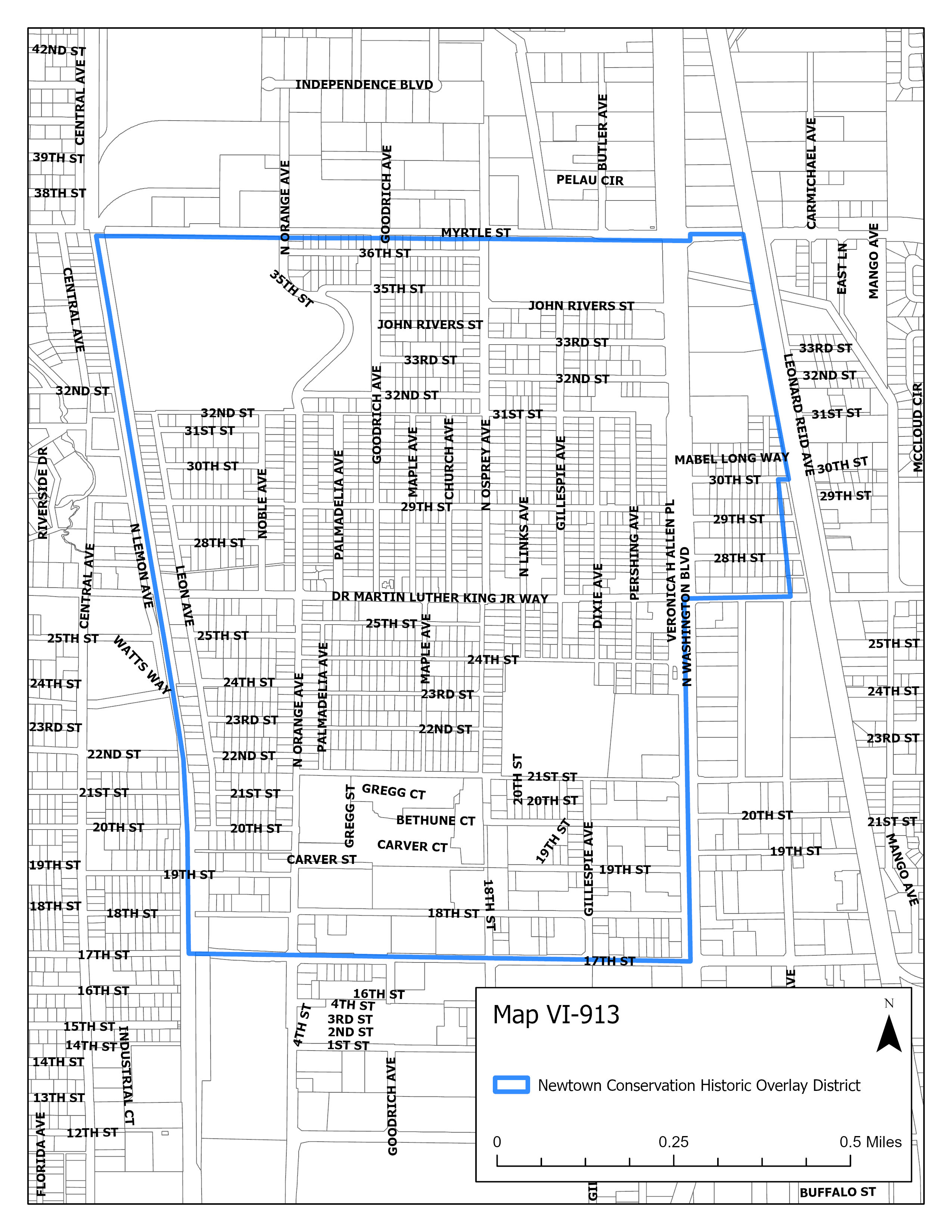
(a)
Intent and purpose. The Newtown conservation historic district (NCHD) overlay is intended to promote the historic integrity and protect the area from inappropriate demolition, rehabilitation, renovation, uses, alterations, or new development that would be contrary to the existing culture or historic architectural character of the area as identified in the Newtown conservation historic district report.
(b)
Building permits shall be reviewed for a certificate of compliance by the planning department for alterations, construction, demolition or removal of a structure more than 50 years old or for modern infill development within the NCHD. The planning department shall conduct a review to determine if the proposed scope of work or development is compatible and in keeping with the intent and purpose of the NCHD. The planning department shall be permitted access to the premises or to the subject structure during this review period at reasonable times and by appointment with the owner or designated agent for this review process.
(1)
If the proposed scope of work is compatible and in keeping with the intent and purpose of the NCHD, the planning department shall issue the certificate of compliance.
(2)
If the proposed scope of work is not compatible and in keeping with the intent and purpose of the NCHD, the planning department will issue a report, which shall include an evaluation prescribing what measures are required to avoid, minimize, or mitigate the adverse effect on the NCHD. The property owner shall submit an application for a certificate of compliance to the city auditor and clerk's office on forms specified by the planning department, or their designee. The planning department shall forward the application for the certificate of compliance and the staff report to the historic preservation board for their review and approval. If the historic preservation board finds the measures required to avoid, minimize, or mitigate the adverse effect to the NCHD have been met, in accordance with this provision, the historic preservation board may approve the certificate of compliance. If the requested certificate of compliance is not granted by the historic preservation board, then the request for a certificate of compliance may be appealed to the city commission per subsection IV-812(b).
(c)
Design standards in the NCHD.
(1)
Purpose. The design standards preserve and enhance the historic residential character of the district.
a.
Map VI-913 identifies the area where this regulation applies.
(2)
Requirements. All new residential single-family construction shall be carried out in accordance with the following mandatory design standards.
a.
Utilities. Utility house feed lines shall be placed underground.
b.
Building facade. The front of buildings must face the street and include a front door as a primary entrance.
c.
Front porch. The main entrance on residential buildings shall include a porch, deck, or similar open-air covered main entry feature. The porch, deck, or similar feature shall have a minimum depth of six feet and comprise a minimum of 30 percent of the width of the principal building's front facade (not including the garage) or eight feet, whichever is larger. Front porches may encroach up to ten feet into the required front setback.
d.
Garage/carport placement. Garages and carports, both attached and detached, must be setback at least five feet from the front facade of the primary building. If there is more than one front lot line, this standard applies to the front yard that contains the front entry. The width of any attached garage or carport area may not exceed 50 percent of the primary building's front facade.
e.
Fences, hedges and walls. See section VII-1101, fences, hedges and walls for additional standards.
f.
Building elevation. Where it is necessary to elevate a building above grade, fill may not be used to elevate the lot above the grade of any adjacent lot. In such cases where the building is elevated, a stem wall foundation shall be used and openings beneath the structure shall be screened with materials consistent with the design of the building.
(Ord. No. 20-5310, § 6(Exh. A), 1-21-20; Ord. No. 24-5540, § 2(Exh. A), 9-16-24)
Sec. VI-914. - Historic preservation transfer of development rights overlay district.
Map VI-914: Historic Preservation Transfer of Development Rights
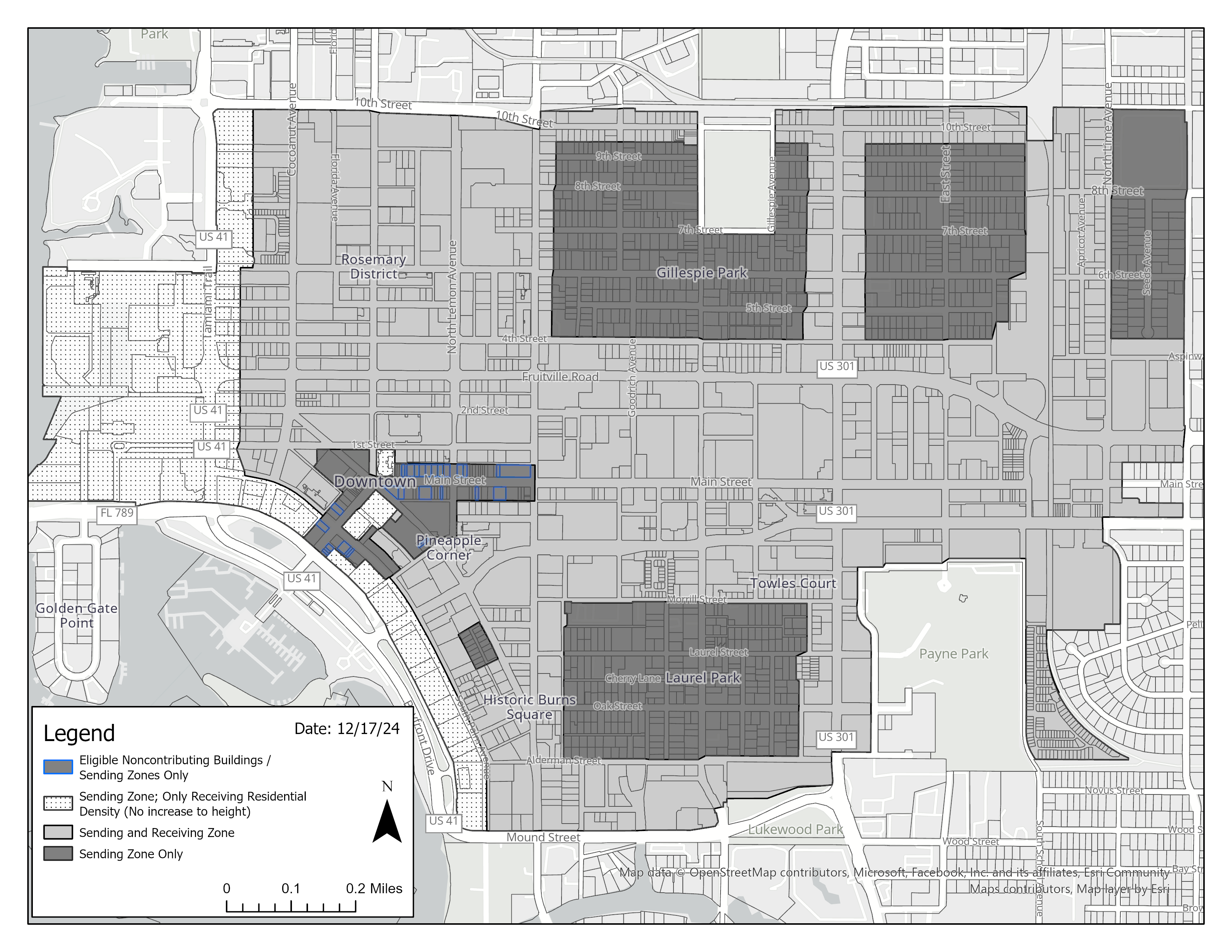
(a)
Intent and purpose. The purpose of the historic preservation transfer of development rights (TDR) program is to transfer residential density and/or buildable square footage for up to an additional two stories in height from eligible sending sites to eligible receiving sites through a voluntary process that permanently preserves designated historic buildings. The TDR program provides a market-based incentive for preserving historic buildings by allowing the unused development rights on a site with an historic building to be transferred to another site. Transferring the development rights reduces the economic incentive to demolish the historic building. An owner of a site with a designated historic incentive to demolish the historic building who would otherwise lose the value of the site's unused development potential may realize the value of the site's unused development potential by selling or transferring the unused development rights to a designated receiving site. The TDR program provides an effective and predictable incentive process for historic property owners while ensuring that the development rights transferred to receiving sites are utilized in balance with other city goals and policies.
(b)
Establishment of boundaries. The application of the historic preservation transfer of development rights program shall be restricted to those geographical areas that are designated on the official zone district map of the City of Sarasota.
(c)
Definitions. See section II-201 for historic preservation transfer of development rights program related definitions.
(d)
Confirmation of transferable development rights.
(1)
An application for a TDR zoning code confirmation letter must be submitted for a proposed sending site to the director of development services, prior to the submission of a TDR application. All the required application fees must be paid at the applicant's expense.
(2)
The director of development services may issue a TDR zoning code confirmation letter indicating the transferable number of dwelling units and/or buildable square footage. Available transferable development rights shall be added to the TDR registry.
(3)
The TDR zoning code confirmation letter does not prohibit future development of the site. Any additional dwelling units and/or buildable square footage developed on the site voids the previously issued TDR zoning code confirmation letter.
(4)
If the allowable density and/or buildable square footage of the site increases (e.g., change in zoning or development rights established by code), any additional development rights may be used on site and shall require a new TDR zoning code confirmation letter to be issued.
(e)
Procedure to sell, transfer, or convey transferable development rights.
(1)
An owner of a designated historic building or owner of transferable development rights, who wishes to transfer dwelling units or buildable square footage, shall apply for such transfer by submitting a TDR application. The application must be completed and executed by at least two applicants. At least one applicant must represent the owner(s) of the sending site or the entity wishing to sell transferable development rights and at least one applicant must represent the owner(s) of the receiving site or the entity purchasing the transferable development rights. If the same entity or person(s) owns the proposed sending site and receiving site, then that entity or person(s) may be represented by one applicant.
(2)
In addition to submitting the TDR application, the following shall be submitted:
a.
TDR zoning code confirmation letter issued by the city within the last 12 months;
b.
The number of dwelling units and/or amount of buildable square footage identified to be transferred;
c.
A preservation restrictive covenant agreement including all of the following restrictions on the property proposed as a sending site.
i.
The sending site will be maintained for 40-year recertification; and
ii.
Long-term maintenance of the sending site as outlined in the maintenance plan will be binding on all existing owners and any subsequent owners; and
iii.
The development rights sold and transferred by the sending site shall remain a restriction on the development rights of the existing owners and subsequent owners of the sending site in perpetuity; and
d.
A maintenance plan dated no later than 90 days prior to the submission of the TDR application prepared by a registered architect, engineer licensed in the State of Florida, or general contractor. The maintenance plan must describe the designated historic building(s) in detail and must identify any existing structural or building code deficiencies in the building and site along with a remediation plan for the short-term, and also outline a plan for the cyclical maintenance of the building and site for the long-term. The maintenance plan must sufficiently outline plans for continued preservation of the sending site.
e.
TDR sending/receiving agreement.
(3)
The development services director may approve, approve with conditions, or deny the TDR application.
(4)
An approved TDR application permanently removes and severs the transferable development rights from such sending site. The approved TDR application shall serve as a document formally designating a sending site and receiving site.
(5)
The TDR sending/receiving agreement and preservation restrictive covenant agreement shall be recorded in the official records of Sarasota County. The agreements shall be recorded prior to the approval of the site plan proposing to utilize transferable development rights. The city manager may administratively approve and execute the sending/receiving agreement and the preservation restrictive covenant on behalf of the city.
(6)
Transferable development rights do not expire and may be sold immediately or retained for future sale. Sales of some transferable development rights are allowed and owners are not required to sell all rights to one entity. Unused transferable development rights may be cancelled and the development rights returned to the designated historic building by following the procedures for the establishment of the TDR sending/receiving agreement and preservation restrictive covenant.
(f)
Calculations of transferable development rights.
(1)
Calculation of sending site transferable development rights:
a.
The number of transferable dwelling units is calculated by the number of potential units on a sending site less the existing number of dwelling units on the same sending site.
i.
Sending sites are not eligible to transfer bonus density. The potential number of dwelling units permitted on a site is calculated in accordance with the base density of the zone district.
ii.
A development does not receive additional height when density (dwelling units) is transferred.
b.
The transferable buildable square footage is calculated by the buildable square footage on a sending site less the existing gross floor area of the existing structures on the same sending site. The transferable buildable square footage from sending sites may be used in conjunction with section VI-1005(g) on a receiving site. Transferable buildable square footage may be used as residential or nonresidential.
c.
No transferable development rights shall be severed unless the structure is a designated historic building, consistent with section II-201, historic preservation transfer of development rights related definitions.
(2)
Calculation of receiving site transferable development rights:
a.
Transferable residential dwelling units: A building located or planned to be located on a receiving site may receive one additional dwelling unit for each dwelling unit transferred from the sending site.
i.
Regardless of the scale of the transferable development rights, the receiving site does not receive any additional height from transferring only residential dwelling units.
ii.
Development rights shall only be transferred as whole units.
iii.
The transferable dwelling units may be used in conjunction with the downtown attainable housing density bonus. However, the total density of the development on a zoning lot shall not exceed four times the base density of the underlying zone district.
b.
Transferable building square footage: A building located or planned to be located on a receiving site may be increased in height to accommodate transferable development rights providing that one square foot of buildable square footage from the sending site may be transferred as one square foot of gross floor area to the receiving site.
i.
Two stories maximum: The increase in height of a building on a receiving site that results from accommodating transferable development rights shall not exceed two stories above the height otherwise permitted for such building in the underlying zone district. The transferable building square footage received from a sending site may be used in conjunction with section VI-1005(g). Transferable building square footage may be used for residential or nonresidential.
ii.
Dimensions of additional stories: The height and other dimensions of any such additional stories shall be in accordance with all other applicable requirements of this zoning code.
(Ord. No. 25-5556, § 2(Exh. A), 2-18-25)
Sec. VI-1001. - General description.
(a)
Intent and purpose. The intent and purpose of the downtown districts is to produce an urban area that implements the Downtown Master Plan 2020, to fulfill the goals, objectives and action strategies of the Sarasota City Plan, and promote a diverse mix of development to include attainable housing.
The downtown zone districts are based on the SmartCode, a transect-based model code developed by Duany Plater-Zybert & Company to implement Smart Growth principles advocated by the Downtown Master Plan 2020. Compared with conventional (Euclidean) zoning that encourages development be separate and disperse, Smart Growth encourages the development of urban communities that are diverse, compact and walkable. The transect is a geographical cross-section of a region that allows for a system of classifying the rural-to-urban as a continuum of natural and man-made environments. This gradient, when divided, lends itself to the creation of zoning categories as illustrated below.
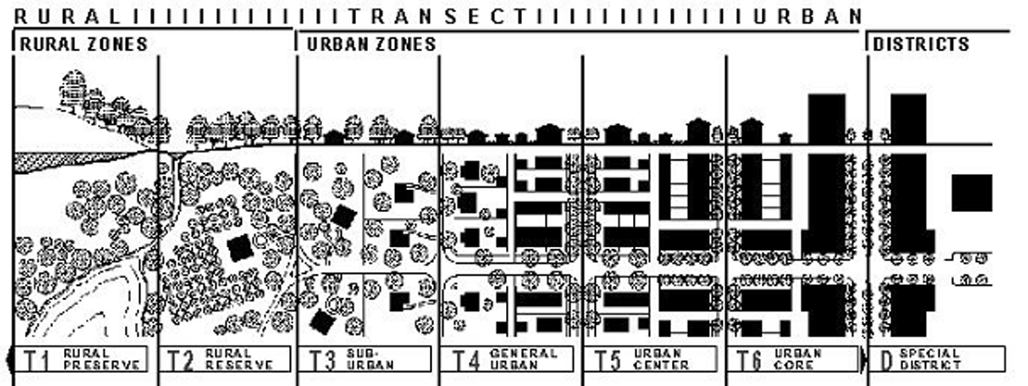
The downtown zone districts are based on the most urban of these transects: T4, T5 and T6.
The singular quality that helps differentiate the urban downtown from typical suburban environments is the primacy that the urban downtown places upon creating a high quality pedestrian environment. This environment is best described in terms of the quality of the frontages along the street edges. Frontages are the area between the facade of the building and the lot line (see frontage definition II-201).
An excellent frontage is one that provides a high level of positive stimulus and interaction for the pedestrian. In an ideal setting, buildings would form a continuous edge, generally up against the outer edge of the right-of-way, with large expanses of glass for pedestrians to see what is happening inside, and a constant sense of give-and-take between inside and outside. The width of the buildings along the street would be relatively narrow, with a range and variety of stores and shops. Restaurants and other uses might spill out onto the sidewalk creating open-air cafes, galleries and other attractions. Landscaping is prevalent, but does not dominate the setting, and does not prevent the pedestrian from getting close to the buildings, storefronts and display window[s].
A poor frontage, on the other hand, is one in which there is little, if any, stimulus or interaction with the pedestrian. A surface parking lot is an example of the worst type of street frontage, affording the passerby little sense of enclosure, protection or interaction.
Good and fair frontages rank accordingly between the two extremes. Any interruption in the continuity of the street wall detracts from the quality of the frontage. The ability of good pedestrian-scale buildings to create high quality frontage is diminished sharply when areas of surface parking or the blank facades of parking structures or other building interrupt the continuity of buildings. Similarly, buildings that interrupt the continuity of the street wall by stepping back from the street, or by placing berms, planting or other forms of landscaping between the sidewalk and the building, detract from the overall quality of the frontage. Such an approach, while perfectly acceptable in suburban locations, is in direct contrast to the fundamental urban character of a downtown setting.
In summary, the intent of these downtown districts is to create an urban environment that is a comfortable and interesting place to live and walk.
(b)
List of the downtown zone districts. The transect base, full names, short names and map symbols of the downtown zone districts are listed below. When this Code refers to the downtown zones it is referring to the zones listed here.
(c)
Characteristics of the zones.
(1)
DTN. The Downtown Neighborhood (DTN) district is a primarily residential but also allows for a mixture of land uses. Residential dwellings may be single-family or multiple-family up to a maximum of 12 dwelling units per acre, or up to 35 units per acre in accordance with the "missing middle" overlay district, as described in section VI-906. Properties zoned DTN are eligible to participate in the historic preservation transfer of development rights program as a sending zone, consistent with section VI-914. In addition to a primary residential structure, an ancillary outbuilding is permitted on each lot. Low-intensity office, retail and lodging uses may be permitted in limited amounts. Retail stores are confined to corner lots. Other nonresidential uses that contribute to the residential attributes of a neighborhood are also allowed. Building height shall be limited to a maximum of three stories. Building frontages include porches, fences and terraces.
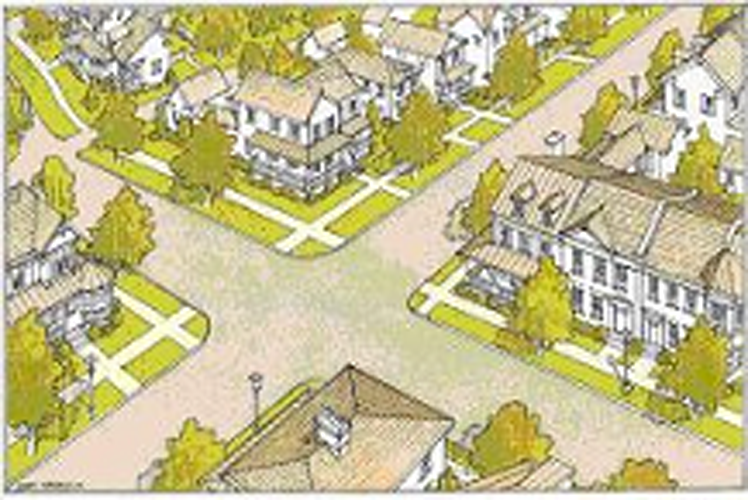
DTN Illustration
(2)
DTNE. The Downtown Neighborhood Edge (DTNE) district is a mixed-use transition area typically located along the interface between residential and nonresidential neighborhoods. The desired character includes building close to and oriented towards the sidewalk especially at street corners. Development is intended to be pedestrian oriented. Residential dwellings may be single-family or multiple-family and may include mixed-use structures that provide for live-work opportunities. Residential dwellings may be built to a maximum density of 18 dwelling units per acre, or up to 72 dwelling units per acre in accordance with the downtown attainable housing density bonus, as described in section VI-1005(b)(3). Properties zoned DTNE are eligible to participate in the historic preservation transfer of development rights program, consistent with section VI-914. A variety of nonresidential uses that contribute to the residential attributes of the adjacent residential neighborhood are allowed. Building heights shall be limited to a maximum of three stories. Building frontages include stoops, forecourts and storefronts.
(3)
DTE. The Downtown Edge (DTE) district is a densely mixed-use area typically located along a pedestrian way or a roadway within a neighborhood. Residential dwellings may be single-family or multiple-family and may include mixed-use structures that provide for live-work opportunities. Residential dwellings may be built to a maximum density of 25 dwelling units per acre, or up to 100 dwelling units per acre in accordance with the RROD, as described in section VI-912. Development outside of the RROD may be built up to a maximum density of 100 dwelling units per acre in accordance with the downtown attainable housing density bonus, as described in section VI-1005(b)(3). Properties zoned DTE are eligible to participate in the historic preservation transfer of development rights program, consistent with section VI-914. A variety of nonresidential uses are allowed everywhere with ground floor retail mandatory on certain designated frontages. Building heights shall be limited to a maximum of five stories or seven stories in the RROD when urban open space is provided or a transfer of development rights occurs, including the historic preservation transfer of development rights in section VI-904, for a development project. Building frontages include stoops, forecourts and storefronts.
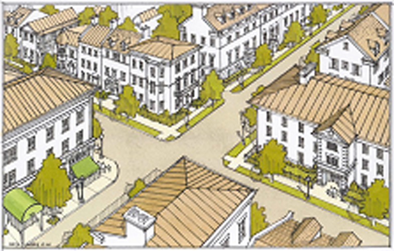
DTNE & DTE Illustration
(4)
DTC. The Downtown Core (DTC) district is a very dense mixed-use urban area. Residential dwellings are generally multiple-family and located in tall structures. Residential dwellings may be built up to a maximum density of 50 dwelling units per acre or up to 200 dwelling units per acre in accordance with the downtown attainable housing bonus, as described in section VI-1005(b)(3). Properties zoned DTC are eligible to participate in the historic preservation transfer of development rights program, consistent with section VI-914. Nonresidential uses are varied and include department stores, entertainment facilities, restaurants, offices and lodging uses. Ground floor retail is allowed everywhere and is mandatory on certain designated frontages. Building height shall be limited to a maximum of ten stories except as provided for in table VI-1003 (building height). Building frontages include stoops, forecourts and storefronts.
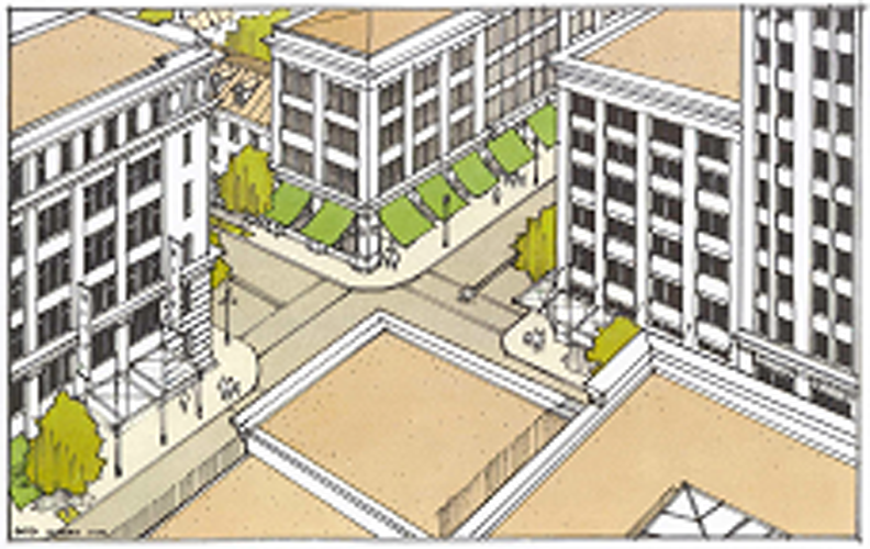
DTC Illustration
(5)
DTB. The Downtown Bayfront (DTB) district is identical to Downtown Core (DTC) above except that building heights shall be limited to a maximum of 18 stories.
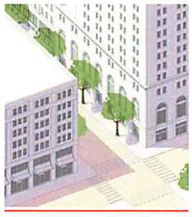
DTB Illustration
(Ord. No. 04-4531, § 3, 6-7-04; Ord. No. 05-4649, § 3, 2-21-06; Ord. No. 09-4890, § 2(att. 1), 10-19-09; Ord. No. 14-5094, § 4, 10-6-14; Ord. No. 19-5284, § 3(Exh. B), 12-2-19; Ord. No. 22-5402, § 2, 4-18-22; Ord. No. 23-5487, § 2(Exh. A), 9-5-23; Ord. No. 25-5556, § 2(Exh. A), 2-18-25)
Sec. VI-1002. - Application and conflict.
(a)
Application.
(1)
Purpose. Compliance is intended to occur, over time, as redevelopment and new development occur. These regulations are intended for new development, expansion and remodeling. Existing structures and uses are allowed to continue and normal repair and maintenance is encouraged. Exceptions from restrictions that would otherwise limit the ability to rebuild after sudden or gradual destruction are allowed for condominiums and valid development approvals. Section IV-1903 also recognizes that some sites may be difficult to develop in compliance with these regulations and provides for adjustments to these regulations.
(2)
When these regulations apply.
a.
New development. These regulations apply to all new development.
b.
Expansion and remodeling.
Expansion: Any expansion of existing buildings shall comply with those regulations found in tables VI-1003 and VI-1004. These regulations shall apply only to the new expanded portion of the building.
Exterior remodel: Any exterior remodeling of existing buildings shall comply with those regulations found in tables VI-1003 and VI-1004, which are applicable to the scope of a particular project. These regulations shall not apply to exterior portions of a building not being remodeled.
Interior remodel: These regulations shall not apply to interior remodeling of existing buildings.
For example, remodeling a storefront may require compliance with standards, such as: Window area, window shape and exterior finish materials and an addition would need to comply with standards, such as setbacks, height limits and parking.
(3)
When these regulations do not apply.
a.
Existing buildings and uses. Existing buildings and uses that do not conform to the provisions of these regulations may continue as they are. However, if a prohibited use ceases for 24 consecutive months, the use shall not be reestablished. The director of development services may grant one extension for an additional 12 months, provided the property owner applies for the extension at least 60 days prior to the end of the original 24-month period. The application shall demonstrate that restoration of the use has been diligently pursued and that practical difficulties will preclude a timely restoration of the use within the original 24-month period. Subsequent uses shall conform to the district regulations. Any final decision of the director of development services may be appealed to the planning board in accord with section IV-1901(f).
b.
Repair and maintenance. Normal repair and maintenance may be performed on existing buildings.
For example:
1.
Repair of a broken window would not require compliance with the building design standards for window area and shape; or
2.
Repair of a leaking roof would not require compliance with the roof design standards.
c.
Existing or approved condominiums. Any existing or approved structure or structures on a single zoning lot under condominium ownership or cooperative long term leases may be rebuilt after destruction to the prior extent of nonconforming as to height, stories and density of units per acre regardless of the percentage of destruction. In the event of such rebuilding, all other applicable district requirements shall be met unless an adjustment is obtained in accord with IV-1903 of this Code.
d.
Valid development approvals.
1.
A project for which an application for site plan approval has been filed prior to January 1, 2006 may be reviewed, approved and constructed under the prior regulations.
2.
A project for which a site plan has been approved under the prior regulations may be constructed as approved provided a building permit is issued prior to expiration of such approval.
3.
The structures and uses in projects described in subsections d.1. and 2. above shall not be deemed nonconforming but shall be deemed to be lawfully existing in conformity with these regulations and shall be allowed to continue as lawfully existing uses or structures.
e.
Split zone districts (DTNE, DTE, DTC and DTB). Where a zoning lot, in single ownership, is split between more than one base zone, the entire zoning lot may be used to satisfy the zoning requirements for density, building setback and parking.
For example, a one-acre lot equally split between DTE (25 units/ac) and DTC (50 units/ac) would be permitted 37 units anywhere on the lot.
In order to utilize this section all other development standards of the base zones or any overlay district, other than those standards specified above, shall be met in each of the respective base or overlay zones. However, adjustments from these development standards may be requested in accordance with section IV-1903. In the event this section is used, it shall be noted on the site plan. In addition, a statement that this section has been applied to the development project shall be recorded in the public records before the first building permit is issued. The statement shall be approved as to form by the city attorney.
(b)
Conflicts with other regulations. When conflicts with other sections of this zoning code occur, the provisions of these regulations (division 10) shall take precedence and shall supersede other sections of this zoning code. However, the provisions of this division shall not be construed to take precedence over:
(1)
Article VI, division 9, overlay districts;
(2)
Florida Building Code; or
(3)
The city's Engineering Design Criteria Manual.
(Ord. No. 04-4531, § 3, 6-7-04; Ord. No. 05-4648, § 3, 1-3-06; Ord. No. 05-4649, § 3, 2-21-06; Ord. No. 09-4838, § 2(att. 1), 2-17-09; Ord. No. 09-4890, § 2(att. 1), 10-19-09; Ord. No. 13-5041, § 2(att. 1) 3-4-13; Ord. No. 23-5487, § 2(Exh. A), 9-5-23)
Sec. VI-1003. - Regulating maps.
(a)
Purpose. The intent and purpose of the regulating maps is to identify certain specific areas that, by virtue of their location, the city desires to require features that promote the safety, comfort and convenience of the pedestrian. Amendments to the regulating maps shall be processed as a zoning text amendment (see article IV, division 12).
(b)
Map VI-1001 identifies the (1) primary and (2) secondary street grid. Buildings along a primary street shall be held to a higher standard in support of pedestrian activity than buildings along a secondary street. The standards are reflected in table VI-1003.
(c)
Map VI-1002 identifies sites that have required (1) retail frontage and (2) optional retail frontage.
(1)
Required retail frontage. A required retail frontage designation specifies that a building must contain a retail sales or service use or office use at the sidewalk level through the depth of the second layer the entire length of the building frontage. In addition, a gallery or awning frontage is also required to provide a covered sidewalk for a minimum of 90 percent of the building frontage.
Retail sales and service uses and office uses are identified in table VI-1001.
Standards for gallery and awning frontage types are identified in table VI-1003.
(2)
Optional retail frontage. An optional retail frontage designation specifies that a building which contains a retail sales or service use at the sidewalk level must provide a gallery or awning frontage that covers the sidewalk for [a] minimum of 90 percent of the building frontage.
Retail sales and service uses and office uses are identified in table VI-1001.
Standards for gallery and awning frontage types are identified in table VI-1003.
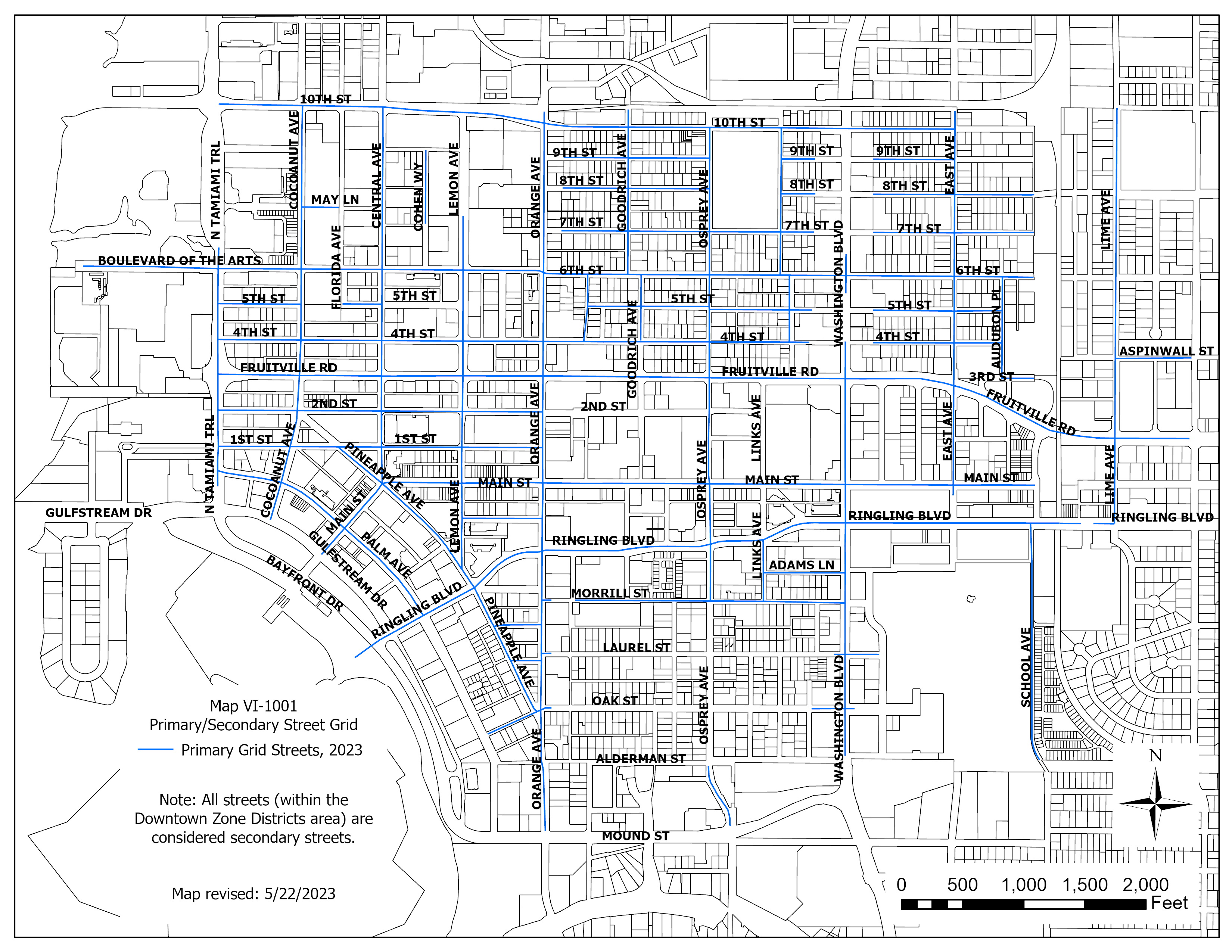
(Ord. No. 04-4531, § 3, 6-7-04; Ord. No. 05-4648, § 3, 1-3-06; Ord. No. 05-4649, § 3, 2-21-06; Ord. No. 05-4650, § 4, 2-21-06; Ord. No. 09-4838, § 2(att. 1), 2-17-09; Ord. No. 09-4890, § 2(att. 1), 10-19-09; Ord. No. 10-4927, § 2(att. 1), 2-22-11; Ord. No. 14-5094, § 6, 10-6-14; Ord. No. 17-5196, § 2(Exh. A), 12-5-16; Ord. No. 17-5198, § 2(Exh. B), 2-21-17; Ord. No. 21-5381, § 2(Exh. A), 9-7-21; Ord. No. 22-5402, § 2(Exh. A), 4-18-22; Ord. No. 23-5487, § 2(Exh. A), 9-5-23)
Sec. VI-1004. - Primary uses.
(a)
Definitions. Uses are defined in article II, division 2. The use categories are described in article II, division 3 unless otherwise noted.
(b)
Permitted uses. Uses permitted in the mixed use zones are listed in table VI-1001 with a "P." These uses are allowed if they comply with the development standards and other regulations of this Code.
(c)
Conditional uses. Uses allowed in the mixed use zones, if approved through the conditional use review process, are listed in table VI-1001 with either a "C" if the use is a major conditional use, or an "MC" if the use is a minor conditional use. These uses are allowed provided they comply with the conditional use approval criteria, the development standards, and any other regulations of this Code.
(d)
Provisional uses. Uses allowed, if approved through the provisional use review process, are listed in table VI-1001 with a "L". Provisional uses are similar to those regulated by a conditional use permit that, by their nature, may, but do not necessarily have significant adverse effects on the environment, overburden public land and services, change the desired character of an area, create major nuisances, or most importantly present the possibility of a change in circumstances during their life.
(e)
Historic reuses. Reuses allowed, if approved through the historic reuse review process, are listed in table VI-1001 with an "H". Historic reuses may, but do not necessarily have significant adverse effects on the environment, overburden public land and services, change the desired character of an area, create major nuisances, or most importantly present the possibility of a change in circumstances during their life.
(f)
Use limitations. Uses allowed that are subject to limitations are identified with numbers in parentheses ( ) in table VI-1001. The limitations that correspond to the numbers in parentheses are stated at the end of table VI-1001. These uses are allowed if they comply with the use limitations, development standards and other regulations of this Code.
(g)
Accessory uses. Common accessory uses are listed as examples with each use category. Accessory uses are allowed by right, in conjunction with the primary use, unless stated otherwise in article VII, division 9, accessory uses and structures. Also, unless otherwise stated, they are subject to the same regulations as the primary use.
(h)
Prohibited uses. Uses listed in table VI-1001 without any symbol (i.e., blank space) are prohibited. Existing uses in categories listed as prohibited may be subject to the regulations of article V, vested rights and non-conformities.
Table VI-1001. Primary Uses Allowed in the Downtown Zone Districts
Notes for table VI-1001:
(1)
Household living limitation. Housing types are limited to those defined in table VI-1002.
(2)
Group living limitation. Housing types are limited to those defined in table VI-1002.
(3)
Drive-through limitation. Drive-up windows and drive-through uses are prohibited on any zoning lot where ingress or egress of the drive-up or drive-through use occurs on a primary street (map VI-101). See [subsection] IV-1903B.2.a. concerning adjustments to drive-through facilities.
(4)
Commercial use limitation. Commercial uses are subject to conditional use approval (as depicted in table VI-101) and subject to the following limitations, among others, that may be necessary to protect the residential character of the downtown neighborhood zone district:
a.
The area available for office use is limited to the first story of the primary building and permitted on any floor of an accessory building.
b.
The area available for retail stores use is limited to the first story on one corner of each block.
c.
The area available for artisan use is limited to 600 square feet within the first story of a primary or accessory building.
(5)
[Specific locations identified.] Map VI-1003 identifies locations where a residential use is required along the road frontage. A residential use may consist of various residential structure types, including single-family and multiple-family dwellings, or residential liner buildings.
(6)
Historic reuse limitations.
a.
The area available for office use is limited to the first story of the primary building and permitted on any floor of an accessory building.
b.
The area available for retail stores use is limited to the first story on one corner of each block.
c.
The area available for artisan use is limited to 600 square feet within the first story of a primary or accessory building.
d.
Public operating hours shall be limited between the hours of 8:00 a.m. and 8:00 p.m.
e.
Any use not listed shall be prohibited.
(7)
Additional requirements. All applicants for a day care facility that provide child care for more than ten children, shall hold a community workshop as set forth in subsection IV-201(b) prior to submitting an application for a provisional use permit.
(8)
Pharmacy limitation. Pharmacy use permitted only when accessory to a drugstore or grocery store. Pharmacy as a primary use is prohibited.
(9)
Distance separation. New pharmacy uses shall be located at least 1,000 feet from existing pharmacies.
(10)
Parks and open space types. Publicly accessible parks, greens, squares, plazas, and playgrounds are exempt from frontage regulations.
(Ord. No. 04-4531, § 3, 6-7-04; Ord. No. 06-4682, § 2, 7-26-06; Ord. No. 07-4770, § 2, 12-17-07; Ord. No. 08-4799, § 2, 4-28-08; Ord. No. 09-4890, § 2(att. 1), 10-19-09; Ord. No. 13-5043, § 2(exh. A), 3-4-13; Ord. No. 13-5055, § 2(Att. 1), 5-6-13; Ord. No. 18-5234, § 2(Exh. A), 2-5-18; Ord. No. 19-5285, § 2(Exh. A), 7-15-19; Ord. No. 20-5310, § 7(Exh. F), 1-21-20; Ord. No. 21-5364, § 2(Exh. A), 5-18-21; Ord. No. 22-5414, § 2(Exh. A), 5-16-22; Ord. No. 22-5415, § 2(Exh. A), 4-16-22; Ord. No. 23-5487, § 2(Exh. A), 9-5-23; Ord. No. 23-5503, § 2(Exh. A), 2-20-24)
Sec. VI-1005. - Development standards.
(a)
Residential structure types. A broad range of residential structure types is allowed in the downtown zones. This range allows for options to increase housing variety and housing opportunities, and promotes affordable housing. If all the requirements of this Code are met, the residential structure types allowed in the downtown zones are stated in table VI-1002 below. The residential structure types are defined in article II, division 2.
Table VI-1002. Residential Structure Types Allowed in the Downtown Zones
(b)
Density.
(1)
Purpose. Density standards serve to establish housing density with the availability of public services and the carrying capacity of the land. Density regulations are also one tool to judge equivalent compatibility of projects.
(2)
The maximum density allowed is stated in table VI-1003. Accessory dwelling units and hotel/motel units shall not be included in calculating density.
(3)
Downtown attainable housing density bonus.
a.
Development on zoning lots or a combination of zoning lots designated DTNE, DTE, DTC, or DTB may exceed the base density when attainable dwelling units are provided for a portion of those residential dwelling units exceeding the base density. The maximum residential density shall not be greater than four times the permitted base density of the zone district when attainable housing units are provided on-site. Of the residential dwelling units exceeding the base density, a minimum of 15 percent shall be designated as attainable units.
b.
Of the required attainable dwelling units provided, at least one-third of the dwelling units must be available to households having incomes at or below 80 percent of the AMI and no more than one-third of the dwelling units may be available to households having incomes in the range of 100 percent to 120 percent of the AMI.
c.
Required affordability.
1.
Owner-occupied units.
i.
An affordable housing agreement between the developer/landowner and the City of Sarasota shall be recorded in the Official Records of Sarasota County, prior to the issuance of site plan approval, requiring that a "For Sale" attainable dwelling unit shall have an appreciation limit applicable upon resale. The initial sale of an attainable dwelling unit shall not be to a buyer with a household income greater than the income range designated for the attainable dwelling unit, based on annual AMI data from the U.S. Department of Housing and Urban Development (HUD).
ii.
For the purposes of determining affordability, the sale price plus the expected monthly mortgage payment, including taxes, insurance, private mortgage insurance, applicable condominium association fees, and utilities shall be considered. The required attainable units must be maintained for at least 30 years. The purpose of this affordable housing agreement shall be to set forth commitments and obligations of the owner regarding affordability control, occupancy, resale, and any other necessary provisions. The affordable housing agreement shall require that the resale price restriction be recorded with the deed for each attainable dwelling unit. The city manager shall be authorized to sign the affordable housing agreement on behalf of the city.
iii.
The maximum sales price for the resale of an attainable dwelling unit shall be in accordance with the resale formula of a designated community land trust or as outlined in the applicable affordable housing agreement.
iv.
No lease shall be executed for any required owner-occupied attainable dwelling unit during the affordability period unless an exception is otherwise provided for in the affordable housing agreement.
2.
Rental units.
i.
An affordable housing agreement between the developer/landowner and the City of Sarasota shall be recorded in the Official Records of Sarasota County, prior to the issuance of site plan approval, requiring, for a minimum period of 30 years, a renter of an attainable unit shall not have a household income greater than the income range designated for the unit at initial occupancy.
ii.
The purpose of this affordable housing agreement shall be to set forth commitments and obligations of the developer/landowner and future owners or residents for the residential bonus density regarding affordability control, occupancy, monitoring, reporting, enforcement, and any other necessary provisions applicable during the time period of at least 30 years. An attainable housing rental unit shall be monitored for rent and tenant income levels for a period of at least 30 years. The city manager shall be authorized to sign the affordable housing agreement on behalf of the city.
iii.
In the event an attainable dwelling unit converts from either a rental to owner-occupied unit or owner-occupied unit to rental unit, a new affordable housing agreement shall be recorded in the Official Records of Sarasota County and required to meet the applicable affordability standards in section VI-1005(b)(3)(c). The time period the attainable unit is required to maintain affordability is not reset when the new agreement is recorded.
d.
Applicants choosing to utilize the downtown attainable housing density bonus may hold a voluntary community workshop in accord with the procedures for community workshops defined in subsection IV-201(b)(2) and (3), prior to receiving final development review committee (DRC) sign-off.
(c)
Floor area ratio.
(1)
Purpose. Floor area ratios (FARs) regulate the amount of use (the intensity) allowed on a zoning lot. FARs provide a means to match the potential amount of uses with the desired character of the area and the provision of public services. FARs also work with height, setback, and building coverage standards to control the overall bulk of development.
(2)
The floor area ratios are stated in table VI-1003. These FARs apply to all nonresidential development including hotel/motel uses. Residential uses are not included in FAR calculation.
(d)
Zoning lot size.
(1)
Purpose. The minimum zoning lot size requirements for zoning lots ensure that development on a zoning lot will, in most instances, be able to comply with all site development standards. The lot size standards also promote new lots that are practical to develop, now and in the future.
(2)
The minimum zoning lot sizes are stated in table VI-1003.
(e)
Building coverage.
(1)
Purpose. The building coverage standards promote development consistent with the desired character of the zone.
(2)
The maximum building coverage allowed is stated in table VI-1003.
(f)
Building setbacks.
(1)
Purpose. The required building setbacks promote streetscapes that are consistent with the desired character of the different downtown zones.
(2)
The required minimum and maximum building setbacks are stated in table VI-1003.
(3)
Allowable encroachments into required setbacks and recesses are stated in article VII, division 12.
(g)
Building height.
(1)
Purpose. The height limits are intended to control the overall scale of buildings.
The purpose of using stories as the measurement of height (rather than feet) in the downtown zone districts is to provide an incentive for the creation of buildings with improved exterior and interior proportions resulting from greater floor-to-ceiling heights. Experience has shown that the use of feet as a measurement of maximum height provides an incentive to minimize floor-to-ceiling heights in order to maximize the number of stories, often resulting in ill-proportioned buildings. It is recognized that the use of stories as the unit of measurement will result in a range of actual building heights due to the variety of other factors impacting decisions regarding the number of stories and the floor-to-ceiling height of each of the stories for any particular development.
The purpose of limiting the dimension of each story to 14 feet between finished floor and finished ceiling is to preclude the possibility of inserting additional stories within an allowable story. Interstitial space shall only be permitted for the use of mechanical, electrical, plumbing, or similar equipment and materials. Any increase, other than the minimum height required to accommodate equipment, must be approved by the director of development services or designee with written justification provided for review.
It is expressly not the purpose or intent of this method of measurement to provide a rationale for supporting rezonings or other arguments for the increase in building height by calculating a total theoretical height based on allowable stories multiplied by the maximum floor-to-ceiling height.
(2)
The height standards for all structures are stated in table VI-1003.
(3)
Additional exceptions for height in the DTC:
a.
Existing buildings over ten stories. In the DTC, an existing building (as of January 6, 2003) over ten stories in height may be removed, demolished, or destroyed and replaced with a new building. The maximum height of such new building shall be either the number of feet which previously existed in the demolished building or the maximum number of stories allowed in DTC, whichever is greater.
b.
New buildings over ten stories. Notwithstanding the ten-story height limit in the DTC the director of development services may approve two new buildings up to 180 feet in height within the area bounded on the north by Fruitville Road, on the south by Ringling Boulevard, on the west by Pineapple Avenue and on the east by Washington Boulevard subject to approval criteria 1. through 3. or approval criteria 4. through 6. below.
1.
At least 50 percent of the buildings' gross floor area shall contain nonresidential use(s).
2.
The applicant must sign a covenant to ensure that at least 50 percent of the buildings' gross floor area will contain nonresidential use(s) for the life of the development. The city attorney must approve the covenant as to form. The covenant must be recorded prior to issuance of the first building permit for the project.
3.
Adjustments to subsections b.1. and b.2. above are prohibited. See section IV-1903; or
This exception is applicable to a range of development sizes. However, it may be more practical, feasible, or workable for large projects of at least one-half acre in size. Therefore, all developments will not qualify for this exception.
4.
An area within the first four stories of the project shall be allocated to the city for public parking. The area allocated to the city shall provide at least 200 public parking spaces to qualify for approval. This public parking shall be in addition to the minimum required parking for the project. On-site public parking shall be identified by signage, clearly visible from one or more streets.
5.
The applicant must sign an agreement to ensure that the public parking spaces will be open to the public for the life of the development and that the public parking spaces shall maintain the same hours of operations as the city's downtown public parking garages, and to specify the operational and maintenance responsibilities for the public parking. Public parking may not be used for valet purposes. The city attorney must approve the agreement as to form and the agreement must be recorded in the official records of Sarasota County, prior to issuance of site plan approval for the project. The city manager shall be authorized to sign the agreement on behalf of the city.
6.
Adjustments to subsections b.4. and b.5. above are prohibited. See section IV-1903.
c.
Bonus height: Public parking incentive. This bonus is applicable to a range of development sizes. However, it may be more practical, feasible, or workable for large projects of at least one-half acre in size. Therefore, all developments will not qualify for this bonus option.
The maximum height of structures may be increased to 11 stories subject to the following:
1.
When a development provides a minimum of 25 public parking spaces on-site, the maximum building height may be increased to 11 stories to accommodate the compensating floor area provided to public parking within the first four stories. The gross floor area of the additional story may be up to two times (2x) the gross floor area allocated to the city for public parking. This public parking shall be in addition to the minimum required parking for the project. On-site public parking shall be identified by signage, clearly visible from one or more streets.
2.
The applicant must sign an agreement to ensure that the public parking spaces will be open to the public for the life of the development, that the public parking spaces shall maintain the same hours of operations as the city's downtown public parking garages, and to specify the operational and maintenance responsibilities for the public parking. Public parking may not be used for valet purposes. The city attorney must approve the agreement as to form and the agreement shall be recorded in the official records of Sarasota County, prior to issuance of site plan approval. The city manager shall be authorized to sign the agreement on behalf of the city.
3.
Adjustments to subsections c.1. and c.2. above are prohibited.
d.
Bonus height: Public parking and sidewalk incentive.
The maximum height of structures may be increased to 11 stories when d.1. through d.3. below are satisfied:
1.
When a development provides a minimum of five public parking spaces on-site, the maximum building height may be increased to 11 stories to accommodate the compensating floor area provided to public parking within the first four stories. The gross floor area of the additional story may be up to three times the gross floor area allocated to the city for public parking. This public parking shall be in addition to the minimum required parking for the project. On-site public parking shall be identified by signage, clearly visible from one or more streets.
2.
The applicant must sign an agreement to ensure that the public parking spaces will be open to the public for the life of the development, that the public parking spaces shall maintain the same hours of operations as the city's downtown public parking garages, and to specify the operational and maintenance responsibilities for the public parking. Public parking may not be used for valet purposes. The city attorney must approve the agreement as to form and the agreement shall be recorded in the official records of Sarasota County, prior to issuance of site plan approval. The city manager shall be authorized to sign the agreement on behalf of the city.
3.
At a minimum, an eight-foot pedestrian zone and six-foot amenity zone shall be provided on at least one frontage. Canopy trees shall be planted in the amenity zone when feasible. When the sidewalk is provided on private property, a sidewalk easement shall be recorded in the official records of Sarasota County to the benefit of Sarasota, prior to the issuance of the first building permit. The gross floor area of the additional story may be up to four times the gross easement area allocated to the city.
4.
Adjustments to subsections 1. Through 3. above are prohibited.
(4)
Additional exceptions for height in DTE, DTNE, DTC and DTB. Parking structures that are completely surrounded by liner buildings at least 20 feet in depth along all primary and secondary street frontage lines and waterways, except for openings to the parking structure, shall be exempt from the height limitation. In no case shall the parking structure exceed the height of the liner building. (For example, a five-story building may contain a parking structure of six or more stories provided a liner building along all street frontages or waterways surrounds the parking structure.) Adjustments to the liner-building requirement are prohibited.
(5)
Additional exceptions for height in DTE, DTC, and DTB for first story mezzanines. Mezzanines are permitted in the first story (i.e., ground or entry level floor) without being counted as an additional story. Mezzanines must be setback at least 12 feet from the front facade of the building and the floor to ceiling height of the first story can be up to 21 feet when a mezzanine is constructed within the first story.
Existing buildings: Buildings that exist as of May 18, 2021, or a building or structure for which a building permit application or site plan review application was submitted prior to May 18, 2021, may install a mezzanine within an existing first story without being counted as an additional story. This mezzanine floor area shall not be included in any calculation of total floor area for parking requirement. The portion of the room or space of the first story containing the mezzanine must be constructed at the overall height which is the minimum height necessary to meet the Florida Building Code vertical clearance above and below the mezzanine. The remaining room(s) or space(s) of the first story not containing the mezzanine is limited to no more than 14 feet in height from finished floor to finished ceiling.
(6)
Additional exceptions for height in DTE, DTNE, and DTC. In accordance with section VI-904, historic preservation transfer of development rights (TDR), a building located, or planned to be located on a receiving site may be increased in height to accommodate transferrable development rights. The increase in the height shall not exceed two stories above the height otherwise permitted for such building. The height and other dimensions of any such additional stories shall be in accordance with all other applicable requirements of this zoning code.
(h)
Other regulations.
(1)
Other regulations, considered part of these downtown zone districts, are found in article IV (development review procedures) and article VII (regulations of general applicability. See table VI-1003 below.
(2)
Sites with overlay zones are subject to additional regulations. The official zoning maps indicate which sites are subject to these additional regulations.
Table VI-1003. Development Standards in the Downtown Zone Districts
| Development Standards |
DTN
(Neighborhood)  |
DTNE
(Neighborhood Edge) DTE (Edge)  |
DTC (Core)
DTB (Bayfront)  |
|
Density
See VI-1005(b) | |||
| -Maximum |
12 units/acre
35 units/acre (Missing middle overlay district (MMOD)) - see section VI-906) |
18 units/acre (DTNE) up to 72 units/acre - see section VI-1005(b)(3) and VI-914.
25 units/acre (DTE) and VI-904, up to 100 units/acre - see section VI-1005(b)(3) up to 100 units/acre (Rosemary residential overlay district (RROD)) - see section VI-912) | 50 units/acre up to 200 units/acre - see section VI-1005(b)(3) and VI-914. |
|
Floor area ratio
See VI-1005(c) | |||
| -Maximum | 0.5 | Not applicable | Not applicable |
|
Zoning lot size
See VI-1005(d) | |||
| -Minimum | 3,630 sq. ft. |
2,500 sq. ft. (DTNE)
1,800 sq. ft. (DTE) | 1,800 sq. ft. |
|
Building coverage
See VI-1005(e) | |||
| -Maximum | 75% |
85% (DTNE)
100% (DTE) | 100% |
| Building setback see VI-1005(f) | |||
| -Minimum front | 10 ft. |
5 ft. (DTNE)
0 ft. (DTE) | 0 ft. |
| -Maximum front | 20 ft. |
15 ft. (DTNE)
10 ft. (DTE) | 10 ft. |
| -Minimum side | 0 ft./10 ft. combined |
0 ft.
10 ft. (where DTNE abuts DTN or RSF) | 0 ft. |
| -Minimum rear |
15 ft. primary building
3 ft. accessory building 4 ft. all accessory buildings, pools, and fences abutting alleys |
10 ft. (DTNE)
0 ft. (DTE) | 0 ft. |
| -Exceptions |
On secondary streets (map VI-1001), buildings are exempt from the maximum setback
limitation.
On primary streets (map VI-1001), the maximum front yard setback only applies to portions of a building meeting the minimum facade requirement. The minimum side yard setback for structures on the south side of 4th Street is zero. Porches may encroach up to 50% of the depth of the setback. All other encroachments shall be allowed consistent with section VII-1201. Compliance with EDCM, part 5, section D.8.b. Visibility at intersections. |
On secondary streets (map VI-1001), buildings are exempt from the maximum setback
limitation.
On primary streets (map VI-1001), the maximum front yard setback only applies to portions of a building meeting the minimum facade and height requirement. On primary street intersections (map VI-1001), the maximum setback for chamfered corners shall be 20 feet from the lot corner to the center of the building facade that faces the lot corner. Encroachments shall be allowed consistent with section VII-1201. Compliance with EDCM, part 5, section D.8.b. Visibility at intersections. |
On secondary streets (map VI-1001), buildings are exempt from the maximum setback
limitation.
On primary streets (map VI-1001), the maximum front yard setback only applies to portions of a building meeting the minimum facade and height requirement. On primary street intersections (map VI-1001), the maximum setback for chamfered comers shall be 20 feet from the lot corner to the center of the building facade that faces the lot corner. Encroachments shall be allowed consistent with section VII-1201. Compliance with EDCM, part 5, section D.8.b. Visibility at intersections. |
|
Building height
See VI-1005(g) | |||
| -Maximum |
3 stories—Primary building
2 stories—Accessory building |
3 stories (DTNE)
5 stories (DTE) 7 stories (RROD - see section VI-912, only provided with urban open space or transfer of development rights) Projects utilizing the historic preservation TDR program may be eligible for additional building height - see section VI-914. |
10 stories (DTC)
Projects utilizing the historic preservation TDR program may be eligible for additional building height - see section VI-914, 18 stories (DTB) |
| -Minimum | Not applicable | 2 stories on primary streets (map VI-1001) | 2 stories on primary streets (map VI-1001) |
| -Special requirements | None |
On primary streets (map VI-1001), buildings that have residential uses facing the
primary street on the first floor shall raise the first finished floor at least two
feet above the sidewalk grade for a minimum depth of 20 feet.
DTE zoning lots adjacent to a single-family, RMF-1, 2, 3, or DTN zone district. On the portion of a site within 100 feet of a site zoned RSM-9 the maximum building height is three stories. On the portion of a site within 100 feet of a site zoned DTN, RSF-1, 2, 3, 4, or RMF-1, 2, 3, the maximum building height is four stories. |
On primary streets (map VI-1001), buildings that have residential uses facing the
primary street on the first floor shall raise the first finished floor at least two
feet above the sidewalk grade for a minimum depth of 20 feet.
On primary streets (map VI-1001), stories at the sidewalk level shall be no less than 12 feet in height from the finished floor to finished ceiling for a minimum depth of 20 feet. |
| -Exceptions |
Basements that emerge less than four feet from finished grade or attics not exceeding
four feet at the kneewall shall not constitute an additional story.
A single tower on a building, defined as habitable portions of a building above the roof level with a footprint less than 240 square feet, shall not be subject to height limits. Extensions above the maximum height of structures detailed under Height Limitations in section VI-102(p) are allowed. |
Basements that emerge less than four feet from finished grade or attics not exceeding
4 feet at the kneewall shall not constitute an additional story.
A single tower on a building, defined as habitable portions of a building above the roof level with a footprint less than 240 square feet, shall not be subject to height limits. Extensions above the maximum height of structures detailed under Height Limitations in section VI-102(p) are allowed. See also: VI-1005(g)(4), additional exceptions for height in the DTE, DTNE, DTC, and DTB |
Basements that emerge less than four feet from finished grade or attics not exceeding
four feet at the kneewall shall not constitute an additional story.
A single towers on a building, defined as habitable portions of a building above the roof level with a footprint less than 240 square feet, shall not be subject to height limits. Extensions above the maximum height of structures detailed under Height Limitations in section VI-102(p) are allowed. See also: VI-1005(g)(3) Additional exceptions for height in the DTC. a. Existing buildings over ten stories. b. New buildings over ten stories. c. Bonus height. VI-1005(g)(4), (5), additional exceptions for height in the DTE, DTNE, DTC, and DTB |
| Other regulations | The regulations in this division state the allowed uses and development standards for the base zones. Sites with overlay zones are subject to additional regulations. The official zoning maps indicate which sites are subject to these additional regulations. General standards that may be applicable are found in division 1 of this article. Specific uses or development types may also be subject to article VII, regulations of general applicability. | ||
(i)
Building design.
(1)
Purpose. The city has a rich architectural and planning heritage based on diversity. The Downtown Code is intended to respect and continue to foster this heritage. The Downtown Code encourages all new and renovated buildings to be outstanding examples of architecture and planning. The Downtown Code is a planning instrument. It does not dictate any architectural style or design. The Downtown Code is intended to be predictable. It is also intended that it be flexible. The predictability and flexibility embodied in the Downtown Code is intended to permit creativity and diversity in architectural design, because the construction, renovation and maintenance of outstanding buildings and public spaces continue to contribute to the health, welfare, character and history of the city and its citizens.
(2)
The required design standards are stated in table VI-1004. These standards are limited to portions of buildings with frontages that face a primary street. Building frontages that face a secondary street are exempt from these standards. map VI-1001 identifies the primary and secondary street grid.
(3)
Application of frontage type standards. Frontage types, like the "transect," are illustrated as "snapshots" along a continuum from rural to urban. Permitted frontage types may be used in combination with one another and one may "blend" into another.
For example, the DTN zone allows "common lawn" and "porch and fence" frontage types. Since both types are permitted it is permissible to have a common lawn with either a porch or a fence. In another illustration, the DTC zone would permit a facade close to the frontage line without a awning, gallery or arcade attached, unless it were located on a required retail frontage.
However, no aspect of a prohibited frontage type shall be allowed with a permitted frontage type. For example, in the DTB zone, a common lawn frontage shall not be permitted in conjunction with an awning frontage.
(j)
Purpose. The standards of this section are intended to assure that exterior display, storage and work activities:
(1)
Exterior display and storage of merchandise are not allowed; except for the display of plants, produce, and, where allowed, motor vehicles and boats.
(2)
Exterior work activities are prohibited except for the following uses that comply with all applicable regulations: restaurants; plant nurseries; entertainment and recreation uses that are commonly performed outside; fuel sales; car washes; commercial surface parking lots; and outdoor markets.
Table VI-1004. Building Design Standards in the Downtown Zone Districts
These standards are limited to portions of buildings with frontages that face a primary street. (See map VI-1001.)
| Building Design Standards |
DTN
(Neighborhood) 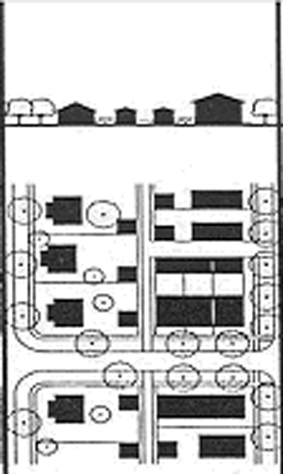 |
DTNE
(Neighborhood Edge) DTE (Edge) 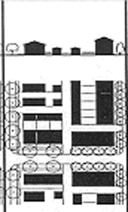 |
DTC (Core)
DTB (Bayfront) 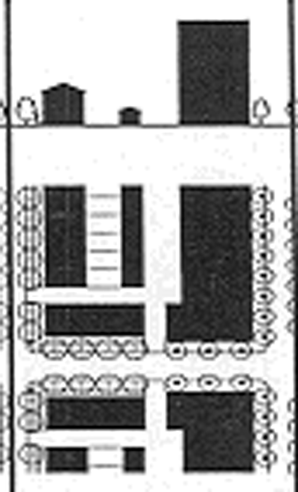 |
|---|---|---|---|
|
Building design
See VI-1005(i) | |||
|
Frontage type
See II-201 definitions | |||
| -Common lawn | Permitted | Prohibited | Prohibited |
|
-Porch and Fence
-Minimum porch width -Minimum porch depth |
Permitted
8 ft. 6 ft. |
Prohibited
Not applicable Not applicable Porch is permitted within the RROD; minimum width if 8 ft.; minimum depth is 6 ft. |
Prohibited
Not applicable Not applicable |
| -Door yard or light court | Permitted | Permitted | Prohibited |
| -Forecourt | Permitted | Permitted | Permitted |
| -Stoop | Permitted | Permitted | Permitted |
| -Awning | Prohibited |
Permitted
Subject to meeting encroachment standards in VII-1201 and the following standards: On optional and required retail frontages (see map VI-1002), an awning is required to cover the sidewalk for minimum of 90 percent of the building frontage (see VI-1003(c)) Awnings at the first story shall overlap the sidewalk eight feet. However, in no case shall an awning come closer than two feet of the curb. To avoid conflicts with existing infrastructure (e.g., street trees or streetlighting), the director of development services may reduce the required distance an awning must overlap the sidewalk or allow for a retractable awning without application for an adjustment. The minimum awning height (measured from the sidewalk to the lowest portion of the awning) shall be between eight and 14 feet, to be determined by the director of development services based on the scale of the building. Lighting shall be provided to illuminate the sidewalk in a manner acceptable to the director of development services. The backlighting of awnings and messages attached thereto is prohibited. |
Permitted
Subject to meeting encroachment standards in VII-1201 and the following standards: On optional and required retail frontages (see map VI-1002), an awning is required to cover the sidewalk for minimum of 90 percent of the building frontage (see VI-1003(c)) Awnings at the first story shall overlap the sidewalk eight feet. However, in no case shall an awning come closer than two feet of the curb. To avoid conflicts with existing infrastructure (e.g., street trees or streetlighting), the director of development services may reduce the required distance an awning must overlap the sidewalk, or allow for a retractable awning without application for an adjustment. The minimum awning height (measured from the sidewalk to the lowest portion of the awning) shall be between eight and 14 feet, to be determined by the director of development services based on the scale of the building. Lighting shall be provided to illuminate the sidewalk in a manner acceptable to the director of development services. The backlighting of awnings and messages attached thereto is prohibited. |
|
-Gallery
(The definition for a gallery includes canopies or light colonnades that extend along all or part of a building frontage, entrance canopies above doors and canopies above windows. See definition of Gallery and Canopy.) | Prohibited |
Permitted
Subject to meeting encroachment standards in VII-1201 and the following standards: On optional and required retail frontages (see map VI-1002), a gallery is required to cover the sidewalk for [a] minimum of 90 percent of the building frontage (see VI-1003(c).) The gallery shall be no less than ten feet wide (measured from the building facade to the inside of the column) and overlap the sidewalk to within three feet of the curb. Where the curb along a block frontage is irregular (e.g., where "bulb outs" occur) the curb line along the entire block frontage shall be the predominant curb line, excluding irregularities. The width of columns shall be a maximum of two feet in any horizontal dimension. Openings in the gallery facade shall be at least 75 percent measured at each story. A gallery above the first story is optional with a maximum height of four stories. The minimum clear height within the first story walkway space shall be 12 feet. |
| -Gallery (cont'd.) | When determined to be necessary by the director of development services, existing street trees and streetlights may be removed or relocated. All costs associated with the removal or relocation of street trees and streetlights shall be at the expense of the property owner. The city engineer shall determine the right-of-way repairs associated with the removal or relocation of street trees and streetlights. Tree removal and replacement is subject to article VII, division 3.1 and the EDCM. Galleries shall incorporate lighting into the gallery to illuminate the sidewalk in a manner acceptable to the director of development services. Any final decision of the director of development services may be appealed to the planning board in accord with section IV-1901(f). | When determined to be necessary by the director of development services, existing street trees and streetlights may be removed or relocated. All costs associated with the removal or relocation of street trees and streetlights shall be at the expense of the property owner. The city engineer shall determine the right-of-way repairs associated with the removal or relocation of street trees and streetlights. Tree removal and replacement is subject to article VII, division 3.1 and the EDCM. Galleries shall incorporate lighting into the gallery to illuminate the sidewalk in a manner acceptable to the director of development services. Any final decision of the director of development services may be appealed to the planning board in accord with section IV-1901(f). | |
| -Arcade | Prohibited | Prohibited in the public right-of-way | Prohibited in the public right-of-way |
| Facades | Facades shall be built parallel to the front lot line, except at chamfered corners, along a minimum of 50 percent of its length. |
Facades shall be built parallel to the front lot line, except at chamfered corners,
along a minimum of 70 percent of its length.
In the absence of a building along the remainder of the front lot line, a street wall shall be built generally coplanar with the facade only when they are needed to screen surface or structured parking or other unsightly conditions such as alleys. |
Facades shall be built parallel to the front lot line, except at chamfered corners,
along a minimum of 90 percent of its length.
In the absence of a building along the remainder of the front lot line, a street wall shall be built generally coplanar with the facade only when they are needed to screen surface or structured parking or other unsightly conditions such as alleys. |
| Recess | Not applicable | Not applicable | Buildings shall have a minimum 12-foot recess along each street front commencing above the 2nd, 3rd or 4th story. Encroachments into the required recess shall be allowed consistent with section VII-1202. |
| Habitable space | Not applicable | Buildings shall provide a 20-foot minimum depth of habitable space for the full height and length of the first two stories. | Buildings shall provide a 20-foot minimum depth of habitable space for the full height and length of the first two stories. |
| Pedestrian entrance | Buildings shall have their main entrance along a frontage line. Buildings with multiple frontages shall have their primary frontage determined by the director of development services. |
Buildings shall have their main entrance along a frontage line. Buildings with multiple
frontages shall have their primary frontage determined by the director of development
services.
All buildings located at a corner intersection shall incorporate architectural features at the ground floor that emphasize the importance of pedestrian movement. These features may include chamfered corners, walk-through covered arcades, trellis structures, and other elements that focus visual interest on the corners. |
| Corner architecture | Not applicable | The director of development services may exempt buildings located at a corner intersection that celebrate the corner, such as with a turret, from (1) the recess requirement above the fourth story and (2) the requirement that facades be built parallel to the front lot line. This exemption is limited to a distance 24 feet from each front lot line at the corner. | The director of development services may exempt buildings located at a corner intersection that celebrate the corner, such as with a turret, from (1) the recess requirement above the forth story and (2) the requirement that facades be built parallel to the front lot line. This exemption is limited to a distance 24 feet from each front lot line at the corner. |
| Streetwalls | Not applicable |
Streetwalls shall be located at the first layer and along the building frontage line
whenever they are needed to screen surface or structured parking or other unsightly
conditions such as alleys.
Streetwalls shall be between three and one-half and eight feet in height. Expanses longer than 25 feet or higher than three and one-half feet shall be architecturally designed (e.g., vertical or horizontal changes in wall plane, landscaped or raised planters, decorative view ports, wrought iron grillwork, or decorative masonry patterns). Except for decorative openings, streetwalls may have openings no larger than necessary to allow vehicle and pedestrian access. If allowed by the director of development services, a hedge of equal height may replace the streetwall. |
Streetwalls shall be located at the first layer and along the building frontage line
whenever they are needed to screen surface or structured parking or other unsightly
conditions such as alleys.
Streetwalls shall be between three and one-half and eight feet in height. Expanses longer than 25 feet or higher than three and one-half feet shall be architecturally designed (e.g., vertical or horizontal changes in wall plane, landscaped or raised planters, decorative view ports, wrought iron grillwork or decorative masonry patterns). Except for decorative openings, streetwalls may have openings no larger than necessary to allow vehicle and pedestrian access. If allowed by the director of development services, a hedge of equal height may replace the streetwall. |
| Windows | The first story facade on residential frontages shall be minimum of 15 percent glass. Windows in garage doors shall not count but windows in garage walls shall count towards meeting this standard. |
The first story facade on required retail frontages (map VI-1002) shall be a minimum
70 percent glass. The first story facade on all other nonresidential frontages shall
be a minimum 30 percent glass.
The first story facade on residential frontages shall be minimum of 15 percent glass. The glazed area and all other openings of a facade above the first story shall not exceed 70 percent of the total area, with each facade being calculated independently. Security grilles, if any, shall be at least 50 percent transparent and shall be located on the inside of the glassed area. Glazing shall have clear or lightly tinted glass with a visible light transmittance factor of 0.6 or higher (where R+A+T=1.0). Translucent, opaque, and mirrored glass may not be used. However glazing on required retail frontages shall be clear (non-tinted) and transparent to permit view of human activities and spaces within. |
| Shape of openings |
Each opening in a facade, including windows, doors, and arches, shall be designed
to appear as if they are square or vertical in proportion.
The spacing of support columns on a porch, measured from the centerline of the columns, shall not be greater than the height of the columns. Exception: The director of development services may exempt buildings that incorporate the syntax of the Sarasota School of Architecture. |
Each opening in a facade, including windows, doors, and arches, shall be designed
to appear as if they are square or vertical in proportion.
The spacing of support columns for a gallery or arcade, measured from the centerline of the columns, shall not be greater than the height of the columns. Exception: The director of development services may exempt buildings that incorporate the syntax of the Sarasota School of Architecture. |
Each opening in a facade, including windows, doors, and arches, shall be designed
to appear as if they are square or vertical in proportion.
The spacing of support columns for a gallery or arcade, measured from the centerline of the columns, shall not be greater than the height of the columns. Exception: The director of development services may exempt buildings that incorporate the syntax of the Sarasota School of Architecture. The square or vertical proportion requirement shall not apply to the nonresidential ground floor of a building within the Rosemary residential overlay district. |
| Roofs |
Pitched roofs, if provided, shall be sloped no less than 5:12, except that porches
may be attached shed roofs with pitches no less than 2:12.
Flat roofs shall have parapets no less than 42 inches high or as required to conceal and fully screen any mechanical equipment from all sides. In addition to any required parapets, decorative panels, including metal panels, are permitted when used for screening mechanical equipment. |
Pitched roofs, if provided, shall be sloped no less than 5:12, except that porches
may be attached shed roofs with pitches no less than 2:12.
Flat roofs shall have parapets no less than 42 inches high or as required to conceal and fully screen any mechanical equipment from all sides. In addition to any required parapets, decorative panels, including metal panels, are permitted when used for screening of mechanical equipement. |
Pitched roofs, if provided, shall be sloped no less than 5:12, except that porches
may be attached shed roofs with pitches no less than 2:12.
Flat roofs shall have parapets no less than 42 inches high or as required to conceal and fully screen any mechanical equipment from all sides. In addition to any required parapets, decorative panels, including metal panels, are permitted when used for screening of mechanical equipment. |
| Exterior finish |
Exterior finish materials on all facades (except windows) shall be limited to clapboards
(durable materials), shingles (durable materials), cementitious finish, stucco, quarried
stone, cast stone, or brick. Materials may be combined on one facade only horizontally,
with heavier below lighter (i.e., visual weight such as brick below stucco).
Wood and metal window surrounds are permitted in addition to all the material permitted for the exterior. Wood and metal pergolas and trellises are permitted. Fabric awnings are permitted without back lighting. Balconies and porches shall be made of painted or simulated wood, metal or masonry. |
Exterior finish materials on all facades (except windows) shall be limited to pre-cast
concrete, decorative concrete block, cementitious finish, stucco, quarried stone,
cast stone, brick, terra cotta, and tile. Materials may be combined on one facade
only horizontally, with heavier below lighter (i.e., visual weight such as brick below
stucco).
Wood and metal window surrounds are permitted in addition to all the material permitted for the exterior. Wood and metal pergolas and trellises are permitted. Fabric awnings are permitted without back lighting. Balconies, galleries and arcades shall be made of painted or simulated wood, metal or masonry. Guardrails on balconies or elevated walkways may be made of glass. |
(Ord. No. 04-4531, § 3, 6-7-04; Ord. No. 04-4573, § 14, 6-20-05; Ord. No. 05-4648, § 3, 1-3-06; Ord. No. 05-4649, § 3, 2-21-06; Ord. No. 05-4650, § 6, 2-21-06; Ord. No. 06-4682, § 2, 7-26-06; Ord. No. 07-4720 § 2, 5-21-07; Ord. No. 07-4770, § 2, 12-17-07; Ord. No. 08-4799, § 2, 4-28-08; Ord. No. 09-4838, § 2(att. 1), 2-17-09; Ord. No. 09-4890, § 2(att. 1), 10-19-09; Ord. No. 10-4912, § 2(att. 1), 6-7-10; Ord. No. 10-4927, § 2(att. 1), 2-22-11; Ord. No. 13-5041, § 2(att. 1), 3-4-13; Ord. No. 13-5055, § 2(Att. 1), 5-6-13; Ord. No. 14-5094, § 5, 10-6-14; Ord. No. 19-5284, § 3(Exh. B), 12-2-19; Ord. No. 20-5309, § 3(Exh. B), 11-3-20; Ord. No. 21-5364, § 2(Exh. A), 5-18-21; Ord. No. 22-5414, § 2(Exh. A), 5-16-22; Ord. No. 22-5430, § 2(Exh. A), 12-5-22; Ord. No. 23-5469, § 2(Exh. A), 4-17-23; Ord. No. 23-5473, § 2(Exh. A), 4-17-23; Ord. No. 23-5487, § 2(Exh. A), 9-5-23; Ord. No. 24-5540, § 2(Exh. A), 9-16-24; Ord. No. 25-5556, § 2(Exh. A), 2-18-25; Ord. No. 25-5583, § 2(Exh. A), 11-17-25)
Sec. VI-1101. - Intent and purpose.
(a)
Intent and purpose. The intent and purpose of the urban mixed-use zone districts is to identify existing commercial corridor and commercial center areas that are appropriate for mixed-use development. The Urban Mixed-Use land use classification and implementing urban mixed-use zone districts are founded upon the concepts of "New Urbanism" whereby diverse, walkable neighborhoods are created. This is a fully mixed-use classification that provides for residential and nonresidential uses in order to create a functional and sustainable urbanized community. A goal of "New Urbanism" is to realize compact and diverse mixed-use developments that provide housing and workplaces in proximate locations. It is envisioned that the current redevelopment of corridors and centers that today consist of one predominant type of use, either commercial or office, will transition to a varied mix of land uses consisting of both residential and nonresidential uses over time.
A means to encourage the provision of attainable housing that will be utilized is to establish a base density for development containing market rate dwelling units and a higher bonus density, consisting of both market rate and attainable units, for development when a specified level of attainable housing is provided. Urban mixed-use zone districts may include multiple family residential as well as multi-use structures that provide for live-work opportunities. Nonresidential uses are varied and may include retail stores, restaurants, offices, and civic uses. Buildings and developments may consist of single or multiple uses.
Urban mixed-use zone districts provide for a variety of building intensities, densities, uses, and heights, with new development or redevelopment sensitive to adjacent and nearby uses in order to support both functional and aesthetic compatibility.
(b)
List of urban mixed-use districts. The full names, short names, and map symbols of the urban mixed-use districts are listed below. When this Code refers to the urban mixed-use zone it is referring to the zone districts listed here.
(c)
Characteristic of the zones.
(1)
MU-1: The Urban Mixed-Use 1 (MU-1) district is a mixed-use area typically located along major thoroughfares. The desired character includes buildings being close to and oriented towards the sidewalk, especially at street corners. Development is intended to be functional and aesthetically pleasing for motorists, transit users, pedestrians and the businesses themselves. Development and redevelopment should be compatible with the character of the adjoining neighborhoods. Residential dwellings may be built to a maximum density of 13 dwelling units per acre, or up to 75 units per acre when utilizing the attainable housing density bonus as described in section VI-1103(b)(3). Building height shall be limited to a maximum of three stories, with the ability to achieve up to one or two additional stories when providing additional attainable dwelling units in accordance with section VI-1103(j).
(2)
MU-2: The Urban Mixed-Use 2 (MU-2) district is a mixed-use area typically located along major thoroughfares. Development is intended to be pedestrian-oriented with buildings close to and oriented towards the sidewalk, especially at street corners. This redevelopment and development type will support transit use, provide a buffer between high volume streets and residential neighborhoods, provide new housing opportunities in the city and should be compatible with the character of the adjoining neighborhoods. Residential dwellings may be built to a maximum density of 25 dwelling units per acre, or up to 75 units per acre when utilizing the attainable housing density bonus as described in section VI-1103(b)(3). Building height shall be limited to a maximum of four stories, with the ability to achieve up to one additional story when providing additional attainable dwelling units in accordance with section VI-1103(j).
(3)
MU-3: The Urban Mixed-Use 3 (MU-3) district is intended to permit a mix of community scale commercial uses; cultural and educational facilities; tourist accommodations and attractions; multifamily residential and mixed-uses; and to facilitate their proper development and use along the North Trail. The commercial and service activities within this zone are primarily oriented toward serving the needs of local residents, tourists, and students. Development and redevelopment should be compatible with the character of the adjoining neighborhoods. It is further intended that this district promote development and redevelopment in a manner that creates a safe and attractive environment for specified uses as well as cultivates an attractive gateway to the city. Residential dwellings may be built to a maximum density of 35 dwelling units per acre, or up to 105 units per acre when utilizing the attainable housing density bonus as described in section VI-1103(b)(3). Building height shall be limited to a maximum of four stories, with the ability to achieve up to one additional story when providing additional attainable dwelling units in accordance with section VI-1103(j).
(Ord. No. 24-5510, § 2(Exh. A), 4-1-24)
Sec. VI-1102. - Primary uses.
(a)
Definitions. Uses are defined in article II, division 2. The use categories are described in article II, division 3 unless otherwise noted.
(b)
Permitted uses. Uses permitted in the urban mixed-use zones are listed in table VI-1101 with a "P." These uses are allowed if they comply with the development standards and other regulations of this Code.
(c)
Conditional uses. Uses allowed in the urban mixed-use zones, if approved through the conditional use review process, are listed in table VI-1101 with either a "C" if the use is a major conditional use, or an "MC" if the use is a minor conditional use. These uses are allowed provided they comply with the conditional use approval criteria, the development standards, and any other regulations of this Code.
(d)
Provisional uses. Uses allowed, if approved through the provisional use review process, are listed in table VI-1101 with a "L". Provisional uses are similar to those regulated by a conditional use permit that, by their nature, may, but do not necessarily have significant adverse effects on the environment, overburden public land and services, change the desired character of an area, create major nuisances, or most importantly present the possibility of a change in circumstances during their life.
(e)
Historic reuses. Reuses allowed, if approved through the historic reuse review process, are listed in table VI-1101 with an "H". Historic reuses may, but do not necessarily have significant adverse effects on the environment, overburden public land and services, change the desired character of an area, create major nuisances, or most importantly present the possibility of a change in circumstances during their life.
(f)
Use limitations. Uses allowed that are subject to limitations are identified with numbers in parentheses ( ) in table VI-1101. The limitations that correspond to the numbers in parentheses are stated at the end of table VI-1101. These uses are allowed if they comply with the use limitations, development standards and other regulations of this Code.
(g)
Accessory uses. Common accessory uses are listed as examples with each use category. Accessory uses are allowed by right, in conjunction with the primary use, unless stated otherwise in article VII, division 9, accessory uses and structures. Also, unless otherwise stated, they are subject to the same regulations as the primary use.
(h)
Prohibited uses. Uses listed in table VI-1101 without any symbol (i.e., blank space) are prohibited. Existing uses in categories listed as prohibited may be subject to the regulations of article V, vested rights and nonconformities.
Table VI-1101. Primary Uses Allowed in the Urban Mixed-Use Zone Districts
Notes for table VI-1101:
(1)
Household living limitation. Housing types are limited to those defined in table VI-1102.
(2)
Group living limitation. Housing types are limited to those defined in table VI-1102.
(3)
Pharmacy limitation. Pharmacy use permitted only when accessory to a drugstore or grocery store. Pharmacy as a primary use is prohibited.
(4)
Publicly accessible parks and open space. Publicly accessible parks, greens, squares, plazas, and playgrounds are exempt from frontage regulations.
(Ord. No. 24-5510, § 2(Exh. A), 4-1-24)
Sec. VI-1103. - Development standards.
(a)
Residential structure types. A broad range of residential structure types are allowed in the urban mixed-use zones. This range allows for options to increase housing variety and housing opportunities and promote attainable housing. If all the requirements of this Code are met, the residential structure types allowed in the urban mixed-use zones are stated in table VI-1102 below. The residential structure types are defined in article II, division 2.
Table VI-1102. Residential Structure Types Allowed in the Urban Mixed-Use Zone Districts
Notes for table VI-1102:
(1)
Structure types only permitted on local roadways.
(2)
Attached single-family structure types shall not front on an interstate connector or major arterial roadway.
(3)
Only multi-dwelling structures (large or small) are permitted in a multi-dwelling development.
(b)
Density.
(1)
Purpose. Density standards serve to establish housing density with the availability of public services and the carrying capacity of the land. Density regulations are also one tool to judge equivalent compatibility of projects.
(2)
The maximum density allowed is stated in table VI-1103. Accessory dwelling units and hotel/motel units shall not be included in calculating density.
(3)
Attainable housing density bonus.
a.
Development on zoning lots or a combination of zoning lots designated MU-1, MU-2, or MU-3 may exceed the base density when attainable dwelling units are provided for a portion of those residential dwelling units exceeding the base density. The maximum residential density shall not be greater than three times the permitted base density of the future land use classification when attainable housing units are provided on-site. Of the residential dwelling units exceeding the base density of the zone district, a minimum of 15 percent shall be designated as attainable units.
b.
Of the required attainable dwelling units provided, at least one-third of the dwelling units must be available to households having incomes at or below 80 percent of the AMI and no more than one-third of the dwelling units may be available to households having incomes in the range of 100 percent to 120 percent of the AMI.
c.
Required affordability.
1.
Owner-occupied units.
i.
An Affordable Housing Agreement between the developer/landowner and the City of Sarasota shall be recorded in the Official Records of Sarasota County, prior to the issuance of site plan approval, requiring that a "For Sale" attainable dwelling unit shall have an appreciation limit applicable upon resale. The initial sale of an attainable dwelling unit shall not be to a buyer with a household income greater than the income range designated for the attainable dwelling unit, based on annual AMI data from the U.S Department of Housing and Urban Development (HUD).
ii.
For the purposes of determining affordability, the sale price plus the expected monthly mortgage payment, including taxes, insurance, private mortgage insurance, applicable condominium association fees, and utilities shall be considered. The required attainable units must be maintained for at least 30 years. The purpose of this Affordable Housing Agreement shall be to set forth commitments and obligations of the owner regarding affordability control, occupancy, resale, and any other necessary provisions. The Affordable Housing Agreement shall require that the resale price restriction be recorded with the deed for each attainable dwelling unit. The city manager shall be authorized to sign the Affordable Housing Agreement on behalf of the city.
iii.
The maximum sales price for the resale of an attainable dwelling unit shall be in accordance with the resale formula of a designated community land trust or as outlined in the applicable Affordable Housing Agreement.
iv.
No lease shall be executed for any required owner-occupied attainable dwelling unit during the affordability period unless an exception is otherwise provided for in the Affordable Housing Agreement.
2.
Rental units.
i.
An Affordable Housing Agreement between the developer/landowner and the City of Sarasota shall be recorded in the Official Records of Sarasota County, prior to the issuance of site plan approval, requiring, for a minimum period of 30 years, a renter of an attainable unit shall not have a household income greater than the income range designated for the unit at initial occupancy.
ii.
The purpose of this Affordable Housing Agreement shall be to set forth commitments and obligations of the developer/landowner and future owners or residents for the residential bonus density regarding affordability control, occupancy, monitoring, reporting, enforcement, and any other necessary provisions applicable during the time period of at least 30 years. An attainable housing rental unit shall be monitored for rent and tenant income levels for a period of at least 30 years. The city manager shall be authorized to sign the Affordable Housing Agreement on behalf of the city.
iii.
In the event an attainable dwelling unit converts from either a rental to owner-occupied unit or owner-occupied unit to rental unit, a new Affordable Housing Agreement shall be recorded in the Official Records of Sarasota County and required to meet the applicable affordability standards in [section] VI-1103(b)(3)(c). The time period the attainable unit is required to maintain affordability is not reset when the new agreement is recorded.
(c)
Floor area ratio.
(1)
Purpose. Floor area ratios (FARs) regulate the amount of use (the intensity) allowed on a zoning lot. FARs provide a means to match the potential amount of uses with the desired character of the area and the provision of public services. FARs also work with height, setback, and building coverage standards to control the overall bulk of development.
(2)
The floor area ratios are stated in table VI-1103. These FARs apply to all nonresidential development including hotel/motel uses. Residential uses are not included in FAR calculation.
(d)
Zoning lot size.
(1)
Purpose. The minimum zoning lot size requirements promote new lots that are practical to develop, now and in the future.
(2)
The minimum zoning lot sizes are stated in table VI-1103.
(e)
Building coverage.
(1)
Purpose. The building coverage standards promote development consistent with the desired character of the zone.
(2)
The maximum building coverage allowed is stated in table VI-1103.
(f)
Building setbacks.
(1)
Purpose. The required building setbacks promote streetscapes that are consistent with the desired character of the different urban mixed-use zones. Setbacks promote buildings close to the sidewalk to reinforce a pedestrian-oriented and built-up streetscape. The setback requirements of areas that abut residential zones promote nonresidential development that will maintain a visual transition, light, air, and the potential for privacy for adjacent residential zones.
(2)
The required minimum and maximum building setbacks are stated in table VI-1103.
(3)
Allowable encroachments into required setbacks and recesses are stated in article VII, division 12.
(g)
Screening.
(1)
Purpose. These screening standards address specific unsightly features that detract from the appearance of nonresidential buildings.
Table VI-1103 identifies the zone district(s) where this regulation applies.
(2)
Qualifying types of development. This regulation applies to all new development and remodeling projects that exceed 50 percent of the structure's assessed valuation. Assessed valuation shall be determined by reference to the official property tax assessment rolls of the year the structure is to be remodeled.
(3)
Garbage collection areas. All exterior garbage cans, dumpsters, and garbage collection and compaction areas must be screened from the street and any adjacent properties. These areas shall be located and screened so that the visual and acoustic impacts of these functions are contained and out of view from adjacent properties and public streets. Trash and recycling receptacles for pedestrian use are exempt. See section VII-1401 for specific requirements.
(4)
Mechanical equipment. Mechanical equipment, located on the ground, such as heating or cooling equipment, pumps, or generators must be screened from public streets and any adjacent properties. All rooftop mechanical equipment must be screened from the ground level of public streets and any adjacent properties by integrating it into building and roof design.
(5)
Other screening requirements. The screening and buffering requirements for uses, parking areas, exterior storage, and exterior display areas are stated with the regulations for those types of items.
(h)
Pedestrian standards.
(1)
Purpose. The pedestrian standards encourage a safe, attractive, and usable pedestrian circulation system in all nonresidential developments. They ensure a direct pedestrian connection between the street and buildings on the site, and between buildings and other activities within the site. In addition, they provide for connections between adjacent sites, where feasible.
Table VI-1103 identifies the zone district(s) where this regulation applies.
(2)
Qualifying types of development. This regulation applies to all new development and remodeling projects that exceed 50 percent of the structures assessed valuation. Assessed valuation shall be determined by reference to the official property tax assessment rolls of the year the structure is to be remodeled.
(3)
Standards. An on-site pedestrian circulation system must be provided. The system must meet all standards of this section.
a.
Connections.
1.
Connection to street. The sidewalk system must connect all abutting streets to the main entrance.
2.
Internal connections. The sidewalk system must connect all buildings on the zoning lot, and provide connections to other areas of the site, such as parking areas, bicycle parking, recreational areas, common outdoor areas and any other amenities.
b.
Materials.
1.
The circulation system must be hard-surfaced, and be at least five feet wide.
2.
Where the system crosses driveways, parking areas and loading areas, the system must be clearly identifiable through the use of elevation changes, speed bumps, different paving materials, or other similar methods. Striping does not meet this requirement.
3.
Where the system is parallel and adjacent to a motor vehicle travel lane, the system must be a raised path or be separated from the lane by a raised curb, bollards, landscaping, or other physical barrier. If a raised path is used the ends of the raised portions must be equipped with ADA (Americans with Disabilities Act) accessible curb ramps.
4.
Lighting. The on-site pedestrian circulation system must be lighted to a level where the employees, residents, visitors and customers can safely use the system at night. All lighting fixtures must be shielded and directed to confine light spread within the site boundaries. See the standards in section VII-1402, site lighting.
(i)
Exterior display, storage, and work activities.
(1)
Purpose. The standards of this section are intended to assure that exterior display, storage, and work activities:
a.
Will be consistent with the desired character of the zone;
b.
Will not be a detriment to the overall appearance of a commercial area;
c.
Will not have adverse impacts on adjacent properties, especially those zoned residential; and
d.
Will not have an adverse impact on the environment.
Tables VI-1103 identify the zone district(s) where this regulation applies.
(2)
Qualifying types of development. This regulation applies to all existing, new or remodeling projects.
(3)
Exterior display and storage. Exterior display of goods is prohibited except for the display and storage of plants, produce, and motor vehicles (where allowed) and are subject to the following limitations:
a.
Such uses must be accessory to an approved primary use.
b.
Display areas for plants and produce are limited to an area equal to 15 percent of the principal uses' gross floor area. There is no limit for approved motor vehicle or boat sales/rental lots and plant nurseries.
c.
Except for approved plant nurseries, all plant and produce merchandise must be stored inside the building after permitted hours of operation. Motor vehicles and boats may remain outdoors.
d.
Hours of operation are limited from 6:00 a.m. to 9:00 p.m.
e.
Display areas are not permitted in required landscape, parking, or pedestrian areas.
(4)
Exterior work activities. Exterior work activities are prohibited except for the following uses that comply with all applicable regulations: restaurants; plant nurseries; entertainment and recreation uses that are commonly performed outside; sales or rental of motor vehicles and boats; fuel sales; car washes; commercial surface parking lots; and outdoor markets.
(j)
Building height.
(1)
Purpose. The height limits are intended to control the overall scale of buildings.
The purpose of using stories as the measurement of height (rather than feet) in the urban mixed-use zone districts is to provide an incentive for the creation of buildings with improved exterior and interior proportions resulting from greater floor-to-ceiling heights. Experience has shown that the use of feet as a measurement of maximum height provides an incentive to minimize floor-to-ceiling heights in order to maximize the number of stories, often resulting in ill-proportioned buildings. It is recognized that the use of stories as the unit of measurement will result in a range of actual building heights due to the variety of other factors impacting decisions regarding the number of stories and the floor-to-ceiling height of each of the stories for any particular development.
The purpose of limiting the dimension of each story to 14 feet between finished floor and finished ceiling is to preclude the possibility of inserting additional stories within an allowable story. Interstitial space shall only be permitted for the use of mechanical, electrical, plumbing, or similar equipment and materials. Any increase, other than the minimum height required to accommodate equipment, must be approved by the director of development services or designee with written justification provided for review.
(2)
The height standards for all structures are stated in table VI-1103.
(3)
Bonus height in the MU-1, MU-2, and MU-3 zone district.
a.
When a development designates at least 11 percent of the total dwelling units of a development or at least 15 percent of the bonus units, whichever is greater, as attainable for a minimum of 30 years, on-site, the building containing the attainable dwelling units may achieve up to an additional two stories, for a total of five stories. The development shall not exceed the maximum height of 70 feet.
b.
Of the required attainable dwelling units provided, at least one-third of the dwelling units must be available to households having incomes at or below 80 percent of the AMI and no more than one-third of the dwelling units may be available to households having incomes in the range of 100 percent to 120 percent of the AMI.
c.
Designated attainable bonus units shall meet the required affordability standards pursuant to section VI-1103(b)(3).
d.
Adjustments to subsection (3)(a)—(c) are prohibited.
(4)
Bonus height in the MU-2 zone district for hotel/motel accommodation uses.
a.
The maximum height may be increased to five stories provided the additional height over four stories is used exclusively as hotel/motel accommodation uses. The development shall not exceed the maximum height of 70 feet.
i.
Agreements. The applicant must sign an agreement that ensures the additional height will continue to be used exclusively for hotel/motel accommodation uses for the life of the development. The city attorney must approve the agreement as to form. The agreement must be recorded prior to issuance of the first building permit for the project.
ii.
Hotel/motel accommodations. When the height bonus is used exclusively for hotel or motel uses, the applicant shall contribute to the city's Affordable Housing Trust Fund. The amount of the contribution shall be equal to one (1) percent of the construction cost for the hotel/motel.
b.
Adjustments to subsection (5)(a)—(b) are prohibited.
(5)
Additional exceptions for height in MU zone districts for first story mezzanines. Mezzanines are permitted in the first story (i.e., ground or entry level floor) without being counted as an additional story. Mezzanines must be setback at least 12 feet from the front facade of the building and the floor to ceiling height of the first story can be up to 21 feet when a mezzanine is constructed within the first story.
(k)
Required outdoor area.
(1)
Purpose. The required outdoor area standards assure opportunities for outdoor relaxation and/or recreation. The standards work with the building coverage and landscaped areas standards to assure that some of the land not covered by buildings is of adequate size, shape, and location to be usable for outdoor recreation or relaxation. Required outdoor areas are an important aspect in addressing the livability of a residential property by providing outdoor living opportunities, some options for outdoor privacy, and a healthy environment.
(2)
Required outdoor area sizes. The minimum sizes of required outdoor areas per dwelling unit are stated in table VI-1103.
(3)
Requirements. All new multiple family construction of eight units or more shall be carried out in accordance with the following standards.
a.
The required outdoor area may be provided individually, such as by balconies, or combined into a larger area. If combined into a larger area, it must comply with the following requirements:
1.
The total amount of required outdoor area is the cumulative amount of the required area per dwelling unit stated in table VI-1103 for individual areas, minus any units that provide individual outdoor areas.
2.
The combined outdoor area may be developed for active or passive recreational facilities. Examples include play areas, plazas, roof-top patios, picnic areas, and open recreational facilities. The area must be surfaced with lawn, pavers, decking or sport court paving that allows the area to be used for recreational purposes. User amenities, such as tables, benches, trees, planter boxes, garden plots, spas, or pools may be placed in the outdoor area. It may be covered, such as a patio, but it may not be fully enclosed. Screened openings are not considered fully enclosed.
Table VI-1103. Development Standards in the Urban Mixed-Use Districts
Notes for table VI-1103:
(1)
Attached developments may reduce the interior side-setback to zero.
(2)
The larger setback is required for zoning lots abutting residentially zoned property.
(3)
The maximum height shall not exceed 70 feet.
(4)
Applicable to new multiple family construction of eight units or more.
Table VI-1104. Building Frontage Standards in the Urban Mixed-Use Districts
(l)
Commercial Center Standards.
(1)
Purpose and intent. These standards are limited to Commercial Centers, or zoning lots three acres or larger, and are intended to improve the appearance of suburban centers, accommodate both vehicles and pedestrians, improve connections between individual developments, support compatibility with surrounding neighborhoods, promote redevelopment, and minimize automobile dependency.
(2)
Applicability. All new development shall comply with the standards in this section.
(3)
Open Space Standards. For commercial and mixed-use developments, a minimum of ten percent of the developable area shall be identified as open space.
a.
Natural features, passive recreation, tree protection areas, stormwater management areas treated as site amenities, access easements with paths or trails, active recreational areas, parks, and open space may be counted towards open space.
b.
If the development site is adjacent to existing or planned public trails, parks, or other public open space areas, the open space set-aside shall, to the maximum extent practicable, connect, extend, or enlarge the trail, park, or other public open space area.
c.
If the development is to be phased, a phasing plan identifying the open space is required for each phase.
(4)
The arrangement of new streets shall provide for alignment and continuation of existing or proposed streets into adjoining lands where the adjoining lands are undeveloped and intended for future development or where the adjoining lands are undeveloped and include opportunities for such connections.
(5)
New dead-end streets and cul-de-sacs are not allowed.
(6)
Commercial centers should divide development area to create smaller blocks and a network of interconnected streets.
(Ord. No. 24-5510, § 2(Exh. A), 4-1-24)