
Sherwood City Zoning Code
Division VIII
ENVIRONMENTAL RESOURCES
Chapter 16.132 - GENERAL PROVISIONS AND CONFORMANCE[53]
Editor's note— Ord. No. 2023-002, § 2, adopted March 7, 2023, amended the title of Ch. 16.132.
Chapter 16.136 - MINERAL RESOURCES[54]
Editor's note— Ord. No. 2023-002, § 2, adopted March 7, 2023, amended the Code by repealing former Ch. 16.136, §§ 16.136.010—16.136.050, and renumbering former Ch. 16.138, §§ 16.138.010 and 16.138.020, as a new Ch. 16.136, §§ 16.136.010 and 16.136.020. Former Ch. 16.136 pertained to procedures, and derived from Ord. 91-922, § 3.
Chapter 16.138 - SOLID WASTE[55]
Editor's note— Ord. No. 2023-002, § 2, adopted March 7, 2023, amended the Code by renumbering former Ch. 16.140, §§ 16.140.010—16.140.090, as a new Ch. 16.138, §§ 16.138.010—16.138.090. See note at Ch. 16.136 for more information.
Chapter 16.140 - PARKS, TREES AND OPEN SPACES[56]
Editor's note— Ord. No. 2012-003, § 2, adopted May 1, 2012, amended the Code by retitling Ch. 16.142. Formerly, Ch. 16.142 was entitled "Parks and Open Spaces." Subsequently, Ord. No. 2023-002, § 2, adopted March 7, 2023, amended the Code by renumbering former Ch. 16.142, §§ 16.142.010—16.142.090, as a new Ch. 16.140, §§ 16.140.010—16.140.090. See note at Ch. 16.138 for more information.
Chapter 16.142 - WETLAND, HABITAT AND NATURAL AREAS[57]
Editor's note— Ord. No. 2023-002, § 2, adopted March 7, 2023, amended the Code by renumbering former Ch. 16.144, §§ 16.144.010—16.144.030, as a new Ch. 16.142, §§ 16.142.010—16.142.030. See note at Ch. 16.140 for more information.
Chapter 16.144 - NOISE[58]
Editor's note— Ord. No. 2023-002, § 2, adopted March 7, 2023, amended the Code by renumbering former Ch. 16.146, §§ 16.146.010—16.146.030, as a new Ch. 16.144, §§ 16.144.010—16.144.030. See note at Ch. 16.142 for more information.
Chapter 16.146 - VIBRATIONS[59]
Editor's note— Ord. No. 2023-002, § 2, adopted March 7, 2023, amended the Code by renumbering former Ch. 16.148, §§ 16.148.010 and 16.148.020, as a new Ch. 16.146, §§ 16.146.010 and 16.146.020. See note at Ch. 16.144 for more information.
Chapter 16.148 - AIR QUALITY[60]
Editor's note— Ord. No. 2023-002, § 2, adopted March 7, 2023, amended the Code by renumbering former Ch. 16.150, §§ 16.150.010—16.150.030, as a new Ch. 16.148, §§ 16.148.010—16.148.030. See note at Ch. 16.146 for more information.
Chapter 16.150 - ODORS[61]
Editor's note— Ord. No. 2023-002, § 2, adopted March 7, 2023, amended the Code by renumbering former Ch. 16.152, §§ 16.152.010 and 16.152.020, as a new Ch. 16.150, §§ 16.150.010 and 16.150.020. See note at Ch. 16.148 for more information.
Chapter 16.152 - HEAT AND GLARE[62]
Editor's note— Ord. No. 2023-002, § 2, adopted March 7, 2023, amended the Code by renumbering former Ch. 16.154, §§ 16.154.010 and 16.154.020, as a new Ch. 16.152, §§ 16.152.010 and 16.152.020. See note at Ch. 16.150 for more information.
Chapter 16.154 - ENERGY CONSERVATION[63]
Editor's note— Ord. No. 2023-002, § 2, adopted March 7, 2023, amended the Code by renumbering former Ch. 16.156, §§ 16.156.010—16.156.040, as a new Ch. 16.154, §§ 16.154.010—16.154.040. See note at Ch. 16.152 for more information.
16.132.010 - Purpose
This Division is intended to protect, preserve, and otherwise properly manage the City's natural and environmental resources for the benefit of the general public, to regulate land development so as to protect the public from natural and environmental hazards, and to establish performance standards allowing the City to properly and uniformly assess the impact of residential, commercial, industrial, and institutional development and activities on the quality of the City's environment.
16.132.020 - Applicability
The standards of this Chapter, and applicable portions of the Comprehensive Plan, shall apply to all Chapters in Division VIII, Environmental Resources, except for Chapter 16.134 Floodplain Overlay, for any new uses or changes to existing uses in commercial, industrial and institutional zones.
(Ord. No. 2023-002, § 2, 3-7-2023; Ord. 91-922, § 3)
16.132.030 - Conformance
Conformance with the standards of this Chapter shall, at a minimum, be certified in writing by a professional engineer and submitted with the application for site plan review required by Chapter 16.90, except as per Section 16.136.050. The written certification shall include:
A.
Statement certifying that the proposed commercial, industrial or institutional use, if properly managed and operated, will comply with City environmental performance standards, and citing evidence supporting the certification.
B.
Copies of any applicable State permits or recent test results, if available, which would indicate compliance with City environmental performance standards.
(Ord. 91-922, § 3; Ord. No. 2023-002, § 2, 3-7-2023; Ord. 91-922, § 3)
16.132.040 - Additional Information
A.
Prior to accepting any land use application to which this Chapter applies, the City Manager or his/her designee, may determine that additional expertise in evaluating the application, due to the complexity of its impact on environmental resources, is warranted. Under such circumstances, the City may contract with a professional engineer or other qualified consultant to evaluate and make recommendations on specific application elements relative to City environmental resource standards.
B.
Upon the City's determination that additional expertise is needed, the applicant shall deposit a sum equal to the estimated cost, as determined by the City, of such professional services. If the actual cost of such services is more than estimated, the applicant shall be responsible for the difference, provided however, that the applicant's financial responsibilities will not exceed ten percent (10%) of the estimate without prior written authorization. If the cost of such services is less than the estimate, the balance of the deposit shall be returned to the applicant upon final action on their land use application.
(Ord. No. 2023-002, § 2, 3-7-2023)
16.132.050 - Referenced Statutes and Rules
The Federal, State or regional statutes and rules cited in this Chapter are made part of this Code by reference. The statutes and rules cited are as current at the time of adoption of this Code. If a referenced statute or rule is amended by Federal, State or regional agencies, this Code must be amended for the new statute or rule to take precedence.
(Ord. No. 2023-002, § 2, 3-7-2023)
16.132.060 - Exceptions
The City shall make an initial determination whether a proposed development is subject to any of the standards of this Chapter, or whether the development is exempt. The City Manager or his/her designee is authorized to waive all or some of these standards when a proposed development clearly does not represent a substantial impact on the City's environmental resource standards as per this Chapter. The findings of the City Manager or his/her designee shall be made in writing, and copies shall be forwarded to the applicant and the Commission. The action of the City Manager or his/her designee may be appealed as per Chapter 16.76.
(Ord. No. 2023-002, § 2, 3-7-2023)
16.134.010 - Generally
Special resource zones are established to provide for preservation, protection, and management of unique natural and environmental resources in the City that are deemed to require additional standards beyond those contained elsewhere in this Code. Special resource zones may be implemented as underlying or overlay zones depending on patterns of property ownership and the nature of the resource. A property or properties may be within more than one resource zone. In addition, the City may identify special resource areas and apply a PUD overlay zone in advance of any development in order to further protect said resources.
The areas of special flood hazard identified by the Federal Insurance Administration in a scientific and engineering report entitled, "The Flood Insurance Study for Washington County, Oregon and Incorporated Areas," (flood insurance study) dated October 19, 2018, with accompanying Flood Insurance Maps are hereby adopted by reference and declared to be a part of this ordinance. The Flood Insurance Study is on file with the Sherwood City Engineer at Sherwood City Hall.
(Ord. No. 2018-009, § 2, 10-16-2018; Ord. No. 2018-006, § 2, 10-2-18; Ord. No. 2016-013, § 1, 10-18-2016; Ord. 91-922, § 3)
16.134.020 - Purpose
The purpose of this ordinance is to promote the public health, safety, and general welfare, and to minimize public and private losses due to flood conditions in specific areas by complying with the provisions of this chapter.
A.
The FP zoning district is an overlay district that controls and regulates flood hazard areas in order to protect the public health, safety and general welfare; to reduce potential flood damage losses; and to protect floodways and natural drainageways from encroachment by uses which may adversely affect water quality and water flow and subsequent upstream or downstream flood levels. The FP zone shall be applied to all areas within the base flood, and shall supplement the regulations of the underlying zoning district.
B.
FP zoning districts are areas within the base flood as identified by the Federal Emergency Management Agency (FEMA) in a Flood Insurance Study (FIS) and in Flood Insurance Rate Maps (FIRM) published for the City and surrounding areas, or as otherwise identified in accordance with Section 16.134.020C. These FEMA documents are adopted by reference as part of this Code, and are on file at the City.
C.
When base flood elevation data is not available from the FIS or FIRM, the City shall obtain, review, and reasonably utilize any base flood elevation and floodway data available from a federal, state, or other source, and standards developed by the FEMA, in order to administer the provisions of this Code.
D.
In areas where a regulatory floodway has not been designated, and where the Flood Insurance Study indicates that it is possible to calculate a floodway, no new construction, substantial improvements, or other development (including fill) shall be permitted within Zones A1-30 and AE on the community's FIRM, unless it is demonstrated that the cumulative effect of the proposed development, when combined with all other existing and anticipated development, will not increase the water surface elevation of the base flood more than one foot at any point within the community.
(Ord. No. 2018-009, § 2, 10-16-2018Ord. No. 2016-013, § 1, 10-18-2016; Ord. No. 2010-015, § 2, 10-5-2010; Ord. 2000-1092, § 3; 88-870)
16.134.030 - Greenways
The FP zoning districts overlaying the Rock Creek and Cedar Creek floodplains are designated greenways in accordance with Chapter 5 of the Community Development Plan. All development in these two floodplains shall be governed by the policies in Division V, Chapter 16.142 of this Code, in addition to the requirements of this Section and the Clean Water Services Design and Construction Standards R&O 07-20, or its replacement.
(Ord. No. 2018-009, § 2, 10-16-2018Ord. No. 2016-013, § 1, 10-18-2016; Ord. No. 2010-015, § 2, 10-5-2010; Ord. 2000-1092, § 3; 88-879)
16.134.040 - Development Review and Floodplain Administrator Duties
A.
The City Engineer is the designated local Floodplain Administrator and is responsible for maintaining local floodplain management records for the City.
B.
Provided land is not required to be dedicated as per Section 16.134.030, a conditional use permit (CUP) is required before any use, construction, fill, or alteration of a floodplain, floodway, or watercourse, or any other development begins within any FP zone, except as provided in Section 16.134.050.
C.
Application for a CUP for development in a floodplain shall conform to the requirements of Chapter 16.82 and may include, but is not limited to, plans and scale drawings showing the nature, location, dimensions, and elevations of the area in question, existing or proposed structures, fill, storage of materials, and drainage facilities.
D.
The following specific information is required in a floodplain CUP application and shall be certified and verified by a registered civil engineer or architect. The City shall maintain such certifications as part of the public record. All certifications shall be based on the as-built elevations of lowest building floors.
1.
Elevations in relation to the current FIRM and FIS of the lowest floor (including basement) of all structures;
2.
Elevations in relation to the current FIRM and FIS to which any structure has been flood proofed.
3.
That the flood proofing methods for any structure meet the requirements of this section, Floodplain Structures.
4.
Description of the extent to which any watercourse will be altered or relocated as a result of the proposed development.
5.
A base flood survey and impact study made by a registered civil engineer.
6.
Proof all necessary notifications have been sent to, and permits have been obtained from, those federal, state, or other local government agencies for which prior approval of the proposed development is required.
7.
Any other information required by this section, by any applicable federal regulations, or as otherwise determined by the City to be necessary for the full and proper review of the application.
E.
The floodplain administrator shall review all development permits to determine if the proposed development is located in the floodway. If located in the floodway, assure that the encroachment provisions of Section 16.134.070.F are met.
F.
Where base flood elevation data is provided through the Flood Insurance Study, FIRM or required under Section 16.134.020.C the local Floodplain Administrator shall:
1.
Obtain and record the actual elevation (in relation to mean sea level) of the lowest floor (including basement) of all new and substantially improved structures, and
2.
If the structure has been floodproofed in accordance with Sections 16.134.090.A.3 and D.1.a, then obtain the elevation (in relation to mean sea level) to which the structure was floodproofed, and
3.
Maintain all elevation and floodproofing certificates required under Section 16.134.040.D, and
4.
Maintain for public inspection all records pertaining to the provisions of this ordinance.
G.
Where elevation data is not available as per subsection D of this section, or from other sources as per Section 16.134.020.C, a floodplain CUP shall be reviewed using other relevant data, as determined by the City, such as historical information, high water marks, and other evidence of past flooding. The City may require utility structures and habitable building floor elevations, and building flood proofing, to be at least two feet above the probable base flood elevation, in such circumstances where more definitive flood data is not available.
H.
The floodplain administrator shall:
1.
Notify adjacent communities, the Department of Land Conservation and Development and other appropriate state and federal agencies, prior to any alteration or relocation of a watercourse, and submit evidence of such notification to the Federal Insurance Administration as required in Section 16.134.100.C.
2.
Require that maintenance is provided within the altered or relocated portion of said watercourse so that the flood carrying capacity is not diminished.
I.
The floodplain administrator shall make interpretations where needed, as to exact location of the boundaries of the areas of special flood hazards (for example, where there appears to be a conflict between a mapped boundary and actual field conditions). The person contesting the location of the boundary shall be given a reasonable opportunity to appeal the interpretation. Such appeals shall be granted consistent with the standards of Section 60.6 of the Rules and Regulations of the National Flood Insurance Program (44 CFR 59-76).
J.
Variances to any standard within the floodplain overlay shall comply with the provisions of the Code of Federal Regulations (CFR) section 44 CFR 60.6(a)(1)—(7).
(Ord. No. 2018-009, § 2, 10-16-2018Ord. No. 2016-013, § 1, 10-18-2016; Ord. No. 2015-003, § 2, 3-17-2015; Ord. No. 2010-015, § 2, 10-5-2010; Ord. 91-922, § 3; 88-879)
16.134.050 - Permitted Uses
In the FP zone the following uses are permitted outright, and do not require a CUP, provided that floodway flow, or floodplain capacity, will not be impeded, as determined by the City, and when greenway dedication is not required as per Section 16.134.030.
A.
Agricultural uses, provided that associated structures are not allowed, except for temporary building and boundary fences that do not impede the movement of floodwaters and flood-carried materials.
B.
Open space, park and recreational uses, and minor associated structures, if otherwise allowed in the underlying zoning district that do not impede the movement of floodwaters and flood-carried materials.
C.
Public streets and appurtenant structures, and above and underground utilities, subject to the provisions of Sections 16.134.080 and 16.134.090.
D.
Other accessory uses allowed in the underlying zoning district that do not involve structures, and will not, in the City's determination, materially alter the stability or storm drainage absorption capability of the floodplain.
(Ord. No. 2018-009, § 2, 10-16-2018Ord. No. 2016-013, § 1, 10-18-2016; Ord. No. 2015-003, § 2, 3-17-2015; Ord. No. 2010-015, § 2, 10-5-2010; Ord. 2000-1092, § 3; 91-922)
16.134.060 - Conditional Uses
In the FP zone the following uses are permitted as conditional uses, subject to the provisions of this Section and Chapter 16.82, when greenway dedication is not required as per this Section.
Greenways:
A.
Any permitted or conditional use allowed in the underlying zoning district, when located in the flood fringe only, as specifically defined by this Code.
(Ord. No. 2018-009, § 2, 10-16-2018Ord. No. 2016-013, § 1, 10-18-2016; Ord. No. 2010-015, § 2, 10-5-2010; Ord. 91-922, § 3; 88-879)
16.134.070 - Prohibited Uses
In the FP zone the following uses are expressly prohibited:
A.
The storage or processing of materials that are buoyant, flammable, contaminants, explosive, or otherwise potentially injurious to human, animal or plant life.
B.
Public and private sewerage treatment systems, including drainfields, septic tanks and individual package treatment plants.
C.
Any use or activity not permitted in the underlying zoning district.
D.
Any use or activity that, in the City's determination, will materially alter the stability or storm drainage absorption capability of the floodplain.
E.
Any use or activity that, in the City's determination, could create an immediate or potential hazard to the public health, safety and welfare, if located in the floodplain.
F.
Any use, activity, or encroachment located in the floodway, including fill, new construction, improvements to existing developments, or other development, except as otherwise allowed by Section 16.134.050 and unless certification by a registered professional engineer or architect is provided demonstrating through hydrologic and hydraulic analyses performed in accordance with standard engineering practice that the use, activity, or encroachment will not result in any increase to flood levels during the occurrence of the base flood discharge.
a.
If paragraph F of this section is satisfied, all new construction and substantial improvements shall comply with all applicable flood hazard provisions of Sections 16.134.080 and .090, or ASCE 24, whichever is more stringent.
G.
The storage of recreational vehicles. This is the most restrictive provision wherein.
(Ord. No. 2018-009, § 2, 10-16-2018Ord. No. 2016-013, § 1, 10-18-2016; Ord. No. 2015-003, § 2, 3-17-2015; Ord. No. 2010-015, § 2, 10-5-2010; Ord. 88-879, § 3)
16.134.080 - Floodplain Development
A.
Floodplain Alterations
1.
Floodplain Survey
The floodplain, including the floodway and flood fringe areas, shall be surveyed by a registered land surveyor or civil engineer, and approved by the City, based on the findings of the flood insurance study and other available data. Such delineation shall be based on the current FIRM and FIS data and be field-located from recognized valid benchmarks.
2.
Grading Plan
Alteration of the existing topography of floodplain areas may be made upon approval of a grading plan by the City. The plan shall include both existing and proposed topography and a plan for alternate drainage. Contour intervals for existing and proposed topography shall be included and shall be not more than one foot for ground slopes up to five percent (5%) and for areas immediately adjacent to a stream or drainage way, two feet for ground slopes between five and ten percent (5% to 10%), and five feet for greater slopes.
3.
Fill and Diked Lands
a.
Proposed floodplain fill or diked lands may be developed if a site plan for the area to be altered within the floodplain is prepared and certified by a registered civil engineer and approved by the Commission pursuant to the applicable provisions of this Code.
b.
Vehicular access shall be provided from a street above the elevation of the base flood to any proposed fill or dike area if the area supports structures for human occupancy. Unoccupied fill or dike areas shall be provided with emergency vehicle access.
4.
Alteration Site Plan
a.
The certified site plan prepared by a registered civil engineer or architect for an altered floodplain area shall show that:
(1)
Proposed improvements will not alter the flow of surface water during flooding such as to cause a compounding of flood hazards or changes in the direction or velocity of floodwater flow.
(2)
No structure, fill, storage, impervious surface or other uses alone, or in combination with existing or future uses, will materially reduce the capacity of the floodplain or increase in flood heights.
(3)
Proposed floodplain fill or diked areas will benefit the public health, safety and welfare and incorporate adequate erosion and storm drainage controls, such as pumps, dams and gates.
(4)
No serious environmental degradation shall occur to the natural features and existing ecological balance of upstream and downstream areas.
(5)
On-going maintenance of altered areas is provided so that flood-carrying capacity will not be diminished by future erosion, settling, or other factors.
b.
Applicants must obtain a conditional letter of map revision (CLOMR) from FEMA before any encroachment, including fill, new construction, substantial improvement, or other development, in the regulatory floodway is permitted. Applicants are responsible for preparing technical data to support the CLOMR application and paying any processing or application fees to FEMA.
5.
Subdivisions and Partitions
All proposed subdivisions or partitions including land within an FP zone must establish the boundaries of the base flood by survey and dedicate said land as per Section 16.134.030. The balance of the land and development must:
a.
Be designed to include adequate drainage to reduce exposure to flood damage, and have public sewer, gas, electrical and other utility systems so located and constructed to minimize potential flood damage, as determined by the City.
b.
Provide for each parcel or lot intended for structures, a building site which is at or above the base flood elevation, and meets all setback standards of the underlying zoning district.
c.
Where base flood elevation data is not provided, or is not available from an authoritative source, it shall be generated by the applicant for subdivision proposals and other proposed developments which contain at least fifty (50) lots or five acres, whichever is less.
(Ord. No. 2018-009, § 2, 10-16-2018Ord. No. 2016-013, § 1, 10-18-2016; Ord. No. 2015-003, § 2, 3-17-2015; Ord. No. 2010-015, § 2, 10-5-2010; Ord. 88-879, § 3)
16.134.090 - Floodplain Structures
Structures in the FP zone permitted in accordance with this section, shall be subject to the following conditions, in addition to the standards of the underlying zoning district:
A.
Generally
1.
All structures, including utility equipment, and manufactured housing dwellings, shall be anchored to prevent lateral movement, floatation, or collapse during flood conditions, and shall be constructed of flood-resistant materials, to standards approved by the City, State Structural and Plumbing Specialty Codes and applicable building codes.
2.
The lowest floor elevation of a structure designed for human occupancy must be at least one and one-half feet above the base flood elevation and the building site must comply with the provisions of Section 16.134.080.A.
3.
The lower portions of all structures shall be flood proofed according to the provisions of the State Structural and Plumbing Specialty Code to an elevation of at least one and one-half feet above the base flood elevation.
4.
The finished ground elevation of any under floor crawl space shall be above the grade elevation of an adjacent street, or natural or approved drainage way unless specifically approved by the City. A positive means of drainage from the low point of such crawl space shall be provided.
5.
All new construction and substantial improvements shall be constructed using methods and practices that minimize flood damage.
B.
Utilities
1.
Electrical, heating, ventilation, plumbing and air-conditioning equipment and other service facilities located within structures shall be designed and/or otherwise elevated or located so as to prevent water from entering or accumulating within the components during conditions of flooding.
2.
Electrical service equipment, or other utility structures, shall be constructed at or above the base flood elevation. All openings in utility structures shall be sealed and locked.
3.
Water supply and sanitary sewer systems (not prohibited under section 16.134.070.B shall be approved by the Washington County Health Department, and shall be designed to minimize or eliminate the infiltration of floodwaters into the systems, or any discharge from systems into floodwaters.
a.
On-site waste disposal systems shall be located to avoid impairment to them or contamination from them during flooding consistent with Washington County Health Authority and Oregon Department of Environmental Quality.
C.
Residential Structures
1.
All residential structures shall have the lowest floor, including basement, elevated to at least one and one-half feet above the base flood elevation.
2.
Fully enclosed areas below the lowest floor that are subject to flooding are not permitted unless they are designed to automatically equalize hydrostatic flood forces on exterior walls by allowing for the entry and exit of floodwaters. Designs for meeting this requirement must either be certified by a registered engineer or architect, or must meet or exceed the following minimum criteria:
a.
A minimum of two openings having a total net area of not less than one square inch for every square foot of enclosed area subject to flooding shall be provided.
b.
The bottom of all openings shall be no higher than one foot above grade.
c.
Openings may be equipped with screens, louvers, or other coverings or devices, provided they permit the automatic entry and exit of floodwaters.
3.
Shall be constructed with materials resistant to flood damage.
D.
Non-Residential Construction
1.
All commercial, industrial or other non-residential structures shall have either the lowest floor, including basement, elevated to the level of the base flood elevation; or, together with attendant utility and sanitary facilities, shall:
a.
Be flood proofed so that below the base flood level the structure is watertight with walls substantially impermeable to the passage of water.
b.
Have structural components capable of resisting hydrostatic and hydrodynamic loads and effects of buoyancy.
c.
Be certified by a Registered Professional Engineer or Architect that the design and methods of construction are in accordance with accepted standards of practice for meeting all provisions of this Section. A record of such certificates shall be maintained by the Floodplain Administrator in accordance with Section 16.134.040.A.
d.
Nonresidential structures that are elevated and not flood proofed must meet the same standards for space below the lowest floor as per Section 16.134.090.C.2.
E.
Manufactured Dwellings
1.
Manufactured dwellings supported on solid foundation walls shall be constructed with flood openings that comply with paragraph C.2 of this section;
2.
The bottom of the longitudinal chassis frame beam in A zones (excluding coastal A zones), shall be at or above BFE;
3.
The manufactured dwelling shall be anchored to prevent flotation, collapse, and lateral movement during the base flood. Anchoring methods may include, but are not limited to, use of over-the-top or frame ties to ground anchors (Reference FEMA's "Manufactured Home Installation in Flood Hazard Areas" guidebook for additional techniques), and;
4.
Electrical crossover connections shall be a minimum of 12 inches above BFE.
F.
Recreational Vehicles
Except where prohibited under Section 16.134.070.G Recreational vehicles placed on sites are required to:
1.
Be on the site for fewer than 180 consecutive days, and
2.
Be fully licensed and ready for highway use, on its wheels or jacking system, is attached to the site only by quick disconnect type utilities and security devices, and has no permanently attached additions; or
3.
Meet the requirements of paragraph E of this section and the elevation and anchoring requirements for manufactured dwellings.
(Ord. No. 2018-009, § 2, 10-16-2018Ord. No. 2016-013, § 1, 10-18-2016; Ord. No. 2015-003, § 2, 3-17-2015; Ord. No. 2010-015, § 2, 10-5-2010; Ord. 88-879, § 3)
16.134.100 - Additional Requirements
A.
Dimensional standards or developments in the FP zone are the same as in the underlying zoning district, except as provided in Section 16.134.100.
B.
Approval of a site plan pursuant to Chapter 16.90 that includes portions of the FP overlay may be conditioned by the City to protect the best interests of the surrounding area or the community as a whole, and to carry out the terms of the Comprehensive Plan. These conditions may include, but are not limited to:
1.
Increasing the required lot sizes, yard dimensions, modifying street widths, or off-street parking spaces.
2.
Limiting the height, size, or location of buildings.
3.
Controlling the location and number of vehicle access points.
4.
Limiting the number, size, location, or lighting of signs.
5.
Requiring diking, fencing, screening, landscaping, or other facilities to protect the proposed development, or any adjacent or nearby property.
6.
Designating sites for open space or water retention purposes.
7.
Construction, implementation, and maintenance of special drainage facilities and activities.
C.
FEMA Notification.
1.
Notify FEMA within six months of project completion when a conditional letter of map revision (CLOMR) has been obtained from FEMA or when development altered a watercourse, modified floodplain boundaries, or modified base flood elevations. This notification shall be provided as a letter of map revision (LOMR).
2.
The applicant is responsible for preparing technical data to support the LOMR application and paying any processing or application fees to FEMA.
3.
The floodplain administrator is under no obligation to sign the Community Acknowledgement Form, which is part of the CLOMR/LOMR application, until the applicant demonstrates that the project will or has met the requirements of this Code and all applicable state and federal laws.
(Ord. No. 2018-009, § 2, 10-16-2018Ord. No. 2016-013, § 1, 10-18-2016; Ord. No. 2015-003, § 2, 3-17-2015; Ord. No. 2010-015, § 2, 10-5-2010; Ord. 88-879, § 3)
16.136.010 - Permitted Activities
Mineral extraction and processing, including sand and gravel pits, rock crushers, concrete and asphalt mixing plants, are permitted in the GI zone as conditional uses, subject to Chapter 16.82, and the following special conditions.
(Ord. No. 2023-002, § 2, 3-7-2023; Ord. 91-922, § 3)
16.136.020 - Special Conditions
The following special conditions apply to mineral extraction and processing activities:
A.
The applicant shall provide a plan for the land from which the sand and gravel will be excavated showing contours on at least five (5) foot intervals, and all improvements on the land and within three-hundred (300) feet of the property.
B.
Mineral extraction and processing shall not be permitted closer than thirty (30) feet to the boundary of adjacent property, nor closer than three-hundred (300) feet to any existing residence, unless the owner or owners of such adjacent property sign a written consent to a lesser distance, and the Commission approves such lesser distance. The Commission may set greater separations as warranted by specific site conditions.
C.
The Commission shall specify depth, degree of bank slopes and the distance from any public structures, for all excavations made in or near stream beds. The Commission shall determine setbacks from public rights-of-way when excavations are near such rights-of-way.
D.
Sand and gravel shall be excavated in such a manner so as to leave an average of two (2) feet, or more if specified by the Commission, of undisturbed material over the entire excavation tract. Excavations shall be conducted so that excavated areas will not collect and retain stagnant water.
E.
After dry pit sand and gravel excavations have been completed, the operator shall evenly spread excess waste materials over the bottom of the pit, and then shall evenly spread topsoil to a minimum depth of one and one-half (1-½) feet, unless evidence is produced that the land excavated had less than one and one-half (1-½) feet of topsoil prior to commencement of operations.
F.
Haulage roads within the excavation tract shall be maintained in a reasonably dust-free condition. Hours of operation, unless otherwise specified by the Commission, shall be from 6:00 AM to 7:00 PM.
G.
Rock crushers, concrete and asphalt mixing plants may be permitted, providing that the crushers and plants are accessory to the sand and gravel operations and primarily use materials excavated on-site.
H.
The operator shall post security in a form acceptable to the City in a sum equal to the number of acres within the excavation tract, multiplied by five-hundred dollars ($500.00), to ensure full compliance with all of the terms and regulations pertaining to the extraction and processing of sand and gravel. The minimum amount of such bond shall be two-thousand, five-hundred dollars ($2,500.00) and the maximum amount twenty-five thousand dollars ($25,000.00).
I.
The operator shall furnish evidence of liability insurance of not less than fifty-thousand dollars ($50,000.00) for any negligent act or omission in the operation or maintenance of sand and gravel pit, and the extraction and production of sand and gravel, and all activities connected with, or incidental thereto.
J.
Prior to action on a conditional use permit, the action shall be advertised as a Type III application per Chapter 16.72.
(Ord. No. 2023-002, § 2, 3-7-2023)
16.138.010 - Solid Waste Facilities
Solid waste facilities are defined in 16.10.020 of this Code and are permitted in the General Industrial (GI) and Light Industrial (LI) zones as described in those sections of the Code. Permitted solid waste facilities are subject to the review procedures, site improvements and other standards of this Chapter.
(Ord. No. 2023-002, § 2, 3-7-2023; Ord. No. 2010-015, § 2, 10-5-2010; Ord. 93-966, § 3)
16.138.020 - Solid Waste Incinerators
The operation of solid waste incinerators for any commercial, industrial, or institutional purpose is prohibited in the City. For the purposes of this section, solid waste is defined as per ORS 459.005(24), and includes infectious wastes as per ORS 459.386(4). Provided said incineration or burning is otherwise properly permitted, this prohibition shall not apply to furnaces, incinerators, or stoves burning wood or wood-based products, petroleum products, natural gas, or to other fuels or materials not defined as solid waste, to yard debris burning, or to small-scale specialized incinerators utilizing solid waste produced as a by-product on-site and used only for energy recovery purposes. Said small-scale specialized incinerators must be integral to and part of, but clearly ancillary secondary and incidental to, a permitted or conditionally permitted use in the City, and cannot utilize infectious wastes or any fuels derived from infectious wastes. This prohibition shall not apply to solid waste incinerators lawfully permitted to operate prior to September 5, 1990, but shall apply to any expansion, alteration, or modification of such a use or any applicable permits.
(Ord. No. 2023-002, § 2, 3-7-2023; Ord. No. 2010-015, § 2, 10-5-2010; Ord. 91-922, § 3)
16.138.030 - Accessory Use Solid Waste Facilities
A.
The following solid waste facilities are permitted, subject to the applicable regulations of the zone, as an accessory use to a permitted or conditional use without being subject to the conditional use review:
1.
Household hazardous waste depot, provided the facility is accessory to a public facility or to a use in an industrial zone.
2.
Small scale specialized incinerator, provided the facility complies with Section 16.138.020 and does not accept more than two-hundred twenty (220) pounds per day of waste from off-site.
3.
Recycling drop boxes, provided they also comply with Section 16.138.090.E.5.
(Ord. No. 2023-002, § 2, 3-7-2023; Ord. No. 2010-015, § 2, 10-5-2010; Ord. 93-966, § 3; 91-922)
16.138.040 - Multiple Purpose Solid Waste Facility
A solid waste facility may include more than one kind of facility as defined in Section 16.10.020, Definitions. Any application that includes more than one kind of facility is permitted in a given zone only if all of the uses proposed in the facility are permitted in that zone. If any of the uses proposed are allowed only as a conditional use in the zone, then all of the uses proposed shall be considered conditional uses.
(Ord. No. 2023-002, § 2, 3-7-2023; Ord. No. 2010-015, § 2, 10-5-2010; Ord. 93-966, § 3; 91-922)
16.138.050 - Temporary Solid Waste Facility
A.
The following solid waste facilities may be approved as a temporary use in any zone without being subject to conditional use review if the use operates not more than three (3) days per calendar month, subject only to the dimensional requirements of the underlying zone (e.g., setbacks and height), and the applicable provisions of Section 16.138.090, Site Improvements and the appropriate requirements of Sections 16.138.060 through 16.138.080:
1.
Household hazardous waste.
2.
Resource Recovery Facility.
3.
Yard debris depot.
(Ord. No. 2023-002, § 2, 3-7-2023; Ord. No. 2010-015, § 2, 10-5-2010; Ord. 93-966, § 3; 91-922)
16.138.060 - Application Contents
A.
In addition to submitting land use application forms provided by the City of Sherwood, and in accordance with other sections of this Code, the applicant shall describe at least the following features of the proposed facility:
1.
Capacity and project life.
2.
The population or industries to be served.
3.
The amount of solid waste that is expected to be accommodated at the facility from the population or industries to be served, including maximum daily and monthly amounts and average annual volume and weight of waste to be received.
4.
For a landfill, planned future uses of the site after closure.
5.
The quantity of each type of waste stream projected to be accommodated at the facility. Examples of waste streams include domestic waste, commercial and institutional waste, industrial waste, construction and demolition waste, agricultural waste, sewage sludge, and contaminated clean-up materials.
6.
The operating characteristics of the facility, including equipment used, hours of operation, and volume, distribution, and type of traffic associated with the use and a traffic study, if required by Section 16.138.090 of this Code.
7.
The kind or kinds of facility or facilities proposed based on the solid waste facility definitions in Section 16.10.020, Definitions.
B.
The applicant shall submit the following information as part of the application, unless the City Manager or his or her designee finds that, given the scale and nature of the facility, a requested item will not materially aid the approval authority in reviewing the proposal, and the item is not otherwise required to be submitted under this Code.
1.
A written description of the location of the site with respect to known or easily identifiable landmarks and access routes to and from the area the facility will serve.
2.
A legal description of the tract or tracts to be used for the facility.
3.
Except for an accessory facility, a map or maps showing the location of the site, existing and approved land uses within a minimum two-hundred fifty (250) foot radius of the boundary of the site inside the regional urban growth boundary or within a minimum five-hundred (500) foot radius of the site outside the regional urban growth boundary; public water supply wells, surface waters, access roads within that radius; historic sites, areas of significant environmental concern or resources, or significant environmental features identified in the Community Development Plan, Part 2, within the applicable radius; other existing or approved manmade or natural features relating to the facility; and a north arrow, bar scale, and drawing table.
4.
Except for an accessory use or temporary facility, an aerial photograph of the site and the area within the relevant radius with the boundary of the site outlined.
5.
Except for an accessory or temporary facility, a map or maps showing the existing topography of the site with contour intervals not to exceed two (2) feet if slopes are less than five percent (5%), not to exceed five (5) feet if slopes are more than five percent (5%), and not to exceed ten (10) feet if slopes are more than twenty percent (20%); natural features of the site including water bodies wetlands; the boundary of the one-hundred (100) year floodplain based on Federal Emergency Management Agency data; public easements of record; manmade features including buildings, utilities, fences, roads, parking areas, and drainage features; boundaries of existing waste disposal areas and soil borrow areas, if any; locations of borings, piezometers, monitoring wells, test pits, water supply wells, and facility monitoring or sampling points and devices; a benchmark; and a north arrow, bar scale, and drawing date.
6.
For a landfill, data regarding average and monthly precipitation and evaporation and prevailing wind direction and velocity, based on data from the National Oceanic and Atmospheric Administration or other federal or state agency, or from on-site measurements.
7.
For a landfill, information regarding minimum, maximum, and average annual flow rates and monthly variations of streams on the site, based on stream gauging data collected by the U.S. Geological Service or other federal or state agency supplemented with reliable site specific data as available.
8.
A map or maps showing and describing the type and size of existing vegetation on the site, and identifying vegetation to be removed and retained.
9.
A grading plan showing site elevations when grading is completed, including any modifications to drainage channels and any required retaining walls or other means of retaining cuts or fills.
10.
A site plan showing proposed structures, signs, parking, outdoor storage, landscaping, berms, fencing, and other features of the facility.
11.
Responses to the applicable standards of Section 16.138.090 of this Code.
12.
If other local, state or federal permits are required for construction and operation of the proposed facility:
a.
The applicant shall submit a copy of such permit(s); or
b.
The applicant shall submit:
(1)
A schedule for submitting the required permits; a description of the requirements of the laws and regulations applicable to such other local, state or federal permits; a summary of how the applicant proposes to comply with the requirements; a list of which regulations require local land use approval; and a list of potentially conflicting local, state or federal standards; and
(2)
A copy of any application filed for another local, state or federal permit for the proposed facility within ten (10) working days after it is filed with the local, state or federal agency; and
c.
A copy of any written correspondence or published notice from the local, state or federal agency regarding that application within ten (10) working days after the applicant receives that correspondence or notice from the local, state or federal agency.
(Ord. No. 2023-002, § 2, 3-7-2023; Ord. No. 2010-015, § 2, 10-5-2010; Ord. 93-966, § 3; 91-922)
16.138.070 - Review Procedures and Burden of Proof
A.
Before accepting an application as complete, the City Manager or his/her designee may decide additional expertise is warranted to evaluate it due to exceptional circumstances, the complexity of the proposed facility, or its potential impacts. The City Manager or his/her designee may hire a professional engineer with the necessary expertise to make a written evaluation of the specific application elements required pursuant to this Code.
1.
The written evaluations shall be available no later than thirty (30) days after the applicant submits a deposit to pay for the work. Within ten (10) days after the written evaluation is available, the City Manager or his/her designee shall determine whether the application is complete and advise the applicant in writing accordingly, listing any additional information required to make the application complete.
2.
The City Manager or his/her designee shall draft a work program and estimate the cost of hiring a professional engineer with the necessary expertise for the written evaluation and shall advise the applicant of that cost, which shall not exceed ten (10) times the application fee (or other reasonable limit) unless approved by the applicant. The applicant shall deposit a sum equal to the estimated cost of such services before the application is deemed complete. If the cost of such services is less than estimated, the City shall refund any excess to the applicant. If the cost of such services is more than estimated, the City shall bill the applicant for such additional cost; provided the cost of such services shall not exceed one-hundred ten percent (110%) of the estimated cost unless the applicant or the City agrees in writing to assume such additional cost.
3.
The provision does not authorize the City to collect money from an applicant for independent evaluation of on-going operations or performance review of a facility. A fee may be required pursuant to Section 16.138.080F before renewal, but not at the time of application or approval.
B.
An application for a solid waste facility under this Code is complete if any written evaluation required under this Section has been completed, and if:
1.
The application includes substantial evidence that the proposed facility will comply with the applicable development standards in Section 16.138.090 or conditions that may be necessary to ensure compliance; or
2.
The application includes substantial evidence that the proposed facility is likely to comply with the applicable development standards in Section 16.138.090, identifies any necessary evidence not yet submitted, and provides a reasonable schedule for its submission.
3.
The application includes information required to be submitted under Section 16.138.060 of this Code, except to the extent waived by the City Manager or his/her designee.
C.
The City shall provide public notice and an opportunity for submission of written information and/or for a public hearing to consider compliance within the terms of this Code.
D.
An applicant for a solid waste facility bears the burden of proving that a facility complies with this Code. The following presumptions and procedures apply when evaluating compliance with the burden of proof:
1.
An applicant is rebuttably presumed to have met the burden of proof if the application includes substantial evidence that the facility will comply with the standards for establishment of the facility in Section 16.138.090 and conditions proposed by the City Manager or his/her designee to ensure such compliance.
2.
Substantial evidence can be rebutted only by evidence of equal or greater probative value. For instance, testimony from a professional engineer about a given subject in which an engineer has expertise may be rebutted only by testimony or evidence from another professional engineer or a person similarly qualified about that subject. Testimony from an expert witness regarding matters relevant to the expertise of the witness cannot be rebutted by testimony from a non-expert witness. This subsection does not limit what may be introduced as testimony; it affects the weight to be accorded that testimony.
3.
If evidence of equal probative value is offered that a given facility does and does not comply with a given standard or that a proposed condition is or is not adequate to ensure compliance, the approval authority shall weight the evidence, identify which evidence it accepts as the basis for its decision, and explain why that evidence is accepted and why contrary evidence is rejected.
4.
The approval authority shall issue all necessary land use compatibility statements to the applicant or to applicable local, state, or federal agencies, and a final decision with appropriate findings, conclusions and conditions of approval if, after the appropriate review process, it finds there is substantial evidence that the facility complies with all applicable provisions of this Code and City laws incorporated by reference, subject to appropriate conditions, and that such evidence was not effectively rebutted and does not need to be supplemented.
5.
If, after a public hearing (or another initial level of review; for instance, the close of the public record following public notice and an opportunity to file written comments), the approval authority finds that:
a.
There is substantial evidence that the facility complies with some applicable provisions of this Code and such evidence was not rebutted and does not need to be supplemented to resolve disputes.
b.
There is not substantial evidence that the facility complies with one or more applicable provisions of this Code, or evidence necessary for approval was rebutted or requires augmenting to resolve disputes; and
c.
It is likely that the applicant will provide the remaining necessary substantial evidence within six (6) months, the approval authority shall:
(1)
Issue a written final decision approving the proposed facility in concept that, among other things:
(a)
Identifies standards with which the application complies and provide findings and conclusions showing why it complies, based on substantial evidence in the record, and subject to appropriate conditions of approval;
(b)
Identifies evidence the applicant must submit to show the proposed facility complies with other applicable provisions of this Code, imposes a schedule for its submission, and includes any requirements pursuant to subsection A above; and
(c)
Describes how that substantial evidence will be reviewed, including any public notice and hearing requirements.
(2)
Issues all necessary land use compatibility statements to the applicant or to applicable local, state or federal agencies.
6.
The approval authority shall issue a final decision that denies the application if, after the appropriate review process, it finds that:
a.
The record does not contain substantial evidence that the facility complies with all applicable provisions of this Code or could comply given the imposition of conditions, in which case the decision shall identify the section(s) about which the record does not contain substantial evidence; or
b.
There is more persuasive and at least equally substantial evidence contrary to evidence that the proposed use complies with applicable standards of this Code or could comply given the imposition of conditions, in which case the decision shall identify the provisions for which evidence against the facility overwhelmed the evidence in favor, and
c.
The applicant declines to supplement the record regarding standards identified pursuant to subsections D and 6a and 6b above, or it is not likely that substantial evidence necessary to address standards identified pursuant to subsections D and 6a and 6b above will be available within six (6) months after the date of the decision.
(Ord. No. 2023-002, § 2, 3-7-2023; Ord. 93-966, § 3; 91-922)
16.138.080 - Conditions of Approval and Enforcement
A.
The approval authority may approve an application for a facility subject to conditions of approval. Conditions of approval shall be reasonably related to impacts of the facility, the requirements of this Code and provisions incorporated herein. In no instance may an approval authority impose as a condition of approval a requirement that a facility be publicly or privately owned. All facilities approved pursuant to this Code shall be subject to a condition requiring that landscaping, air and water quality structures and devices, signs, structures, paved areas, and other features of the facility be maintained in good condition, and that such features be replaced if they fail to survive or are rendered ineffective over time.
B.
Conditions of approval may require an applicant to submit a written statement or permit from state or federal agencies responsible for administering a regulation to which the proposed facility is subject, if the record does not contain such a statement or permit.
1.
Such a condition may fulfill provisions of Code Sections relating to Noise, Odors, Ground and Surface Water, Air Quality and Treatment and Storage that the facility comply with state or federal regulations, subject to a further condition that the applicant submit a written statement or permit showing the proposed facility complies with the applicable state or federal regulation before a building permit is issued for the facility; and
2.
Such a condition shall require appropriate review and allow modification of the decision and conditions of approval regarding the application if a state or federal permit substantially changes a proposed facility from what was approved by the City in ways relevant to applicable provisions of Section 16.138.090.
C.
All facilities approved pursuant to this Code shall comply with applicable state and federal regulations as a condition of approval. Approval of a facility pursuant to this Code does not preclude imposition of more stringent state or federal regulations adopted after the effective date of this Code.
D.
Any facility that is required to obtain a franchise or license from the Metropolitan Service District (Metro) shall obtain the franchise or license and provide a copy of it to the City before a building permit is issued for the facility.
E.
The City shall enforce the conditions of approval pursuant to Section 16.02.040, Violations. If Metro issues a franchise or license for the facility, the City shall send to Metro a copy of any written correspondence or notices City sends to the applicant regarding enforcement of conditions of approval. Metro may remedy violations of conditions of approval regarding the facility and charge the franchisee or licensee for the cost of such remedial action unless provided otherwise in the franchise or license.
F.
The City may periodically conduct a performance review of an approved facility to determine whether it continues to comply with the criteria and standards then applicable and to modify conditions of approval that apply to the facility so that it continues to comply. The approval authority shall specify the time for any performance review. The City may impose a fee for performance review.
(Ord. No. 2023-002, § 2, 3-7-2023; Ord. 93-966, § 3; 91-922)
16.138.090 - Site Improvement
A.
Setbacks, Landscaping and Site Design Impacts:
1.
The facility shall comply with the setback requirements and height limits of the underlying zone. However, if the facility adjoins a commercial zone, the minimum setback shall be one-hundred (100) feet, and if the facility adjoins a residential or open space zone, the minimum setback shall be two-hundred (200) feet.
2.
Structures, exterior storage and processing areas, and vehicle maneuvering and parking are prohibited in setbacks required pursuant to subsection A1 above, except that:
a.
The approval authority may reduce the required setback if it finds that a lesser setback will not adversely affect the privacy, use, or visual character of existing uses on adjoining land, based on the scale and design of the use or structure(s), landscaping and buffers, or on the topography, vegetation, or other natural features of the site.
b.
Minor building features such as eaves, chimneys, fire escapes, bay windows, uncovered stairs, wheelchair ramps, and uncovered decks no more than three (3) feet above grade may extend up to twenty percent (20%) into a required setback.
c.
Attached mechanical structures such as heat pumps, air conditioners, emergency generators, and water pumps may extend into a required setback, except adjoining or across a street from an abutting residential zone.
d.
Fences, walls, berms, landscaping, access drives, and an entry sign(s) are permitted in the setback; and
e.
Notwithstanding the preceding, structures shall be situated so they comply with the Uniform Building Code, State of Oregon Structural Specialty Code, as adopted in Oregon.
3.
Exterior building surfaces shall be finished. Metal used on the exterior of the building shall be anodized or painted; galvanized or coated steel shall not be left unpainted.
4.
Buildings with walls containing more than twenty-five hundred (2,500) square feet above grade shall incorporate fascias, canopies, arcades, or multiple colors or building materials to break up large wall surfaces visually into areas of one-thousand (1,000) square feet or less, unless it would be contrary to the purpose of the wall, such as for retaining earth or for structural support.
5.
Attached mechanical structures and roof-mounted equipment shall be screened from ground-level view at adjoining public streets and property zoned residential or open space. Screening may include landscaping, sight obscuring fencing or other features.
6.
The facility shall not cause glare or lights to shine off-site in excess of one-half (0.5) footcandle onto non-industrial zoned land, based on a written statement certified by a professional engineer.
7.
Structures shall not obstruct scenic views or vistas identified in the Community Development Plan, Part 2, although structures may be visible from off-site.
8.
Major activity areas of the site, such as loading and delivery areas, shall be oriented away from adjoining land zoned for residential or open space uses.
9.
At least twenty percent (20%) of the facility site shall be landscaped with living vegetation in an appropriate medium, such as yard debris compost. Landscaped areas shall have a permanent irrigation system equipped with automatic controls. Where landscaping is situated in required setbacks or adjoins buildings and other structures, it shall include evergreen species at least six (6) feet above grade at planting and situated not farther apart than the radius of the crown of a mature specimen. The approval authority may waive or reduce the level of landscaping where necessary to allow sight distance for vehicular traffic, to enable views of signs or other features of the facility that should be visible to enhance the function of the facility, or to protect solar access to adjoining property. The approval authority may require larger or more numerous trees where necessary to reduce the potential adverse visual effects of a facility. Existing significant vegetation shall be retained, where feasible, and may substitute for other required vegetation. Landscaping in setbacks and parking lots counts toward the twenty percent (20%).
B.
Historic Resource Impacts
The facility shall not adversely affect historic resources listed in Division IX of this code (or inventory of historic resources adopted by the City). A facility complies with this standard if the site and adjoining land do not contain an identified historic resource and are not in an historic district. If the site or adjoining land contains such a resource, then the applicant shall show the facility design preserves the historic resource character.
C.
Operating Impacts
1.
Exterior activities are prohibited between 10:00 PM and 7:00 AM daily, except that vehicles may continue to enter and exit the site and maintenance may be conducted at all hours if they do not violate applicable provisions of Chapters 16.144, Noise; 16.146, Vibration; and subsections A6, A8 and I2 of this Section during any hours.
2.
For a solid waste transfer station, most solid waste may be stored in an open pit or floor inside a building for up to twenty-four (24) hours or in a sealed container on the site for up to seventy-two (72) hours. Separated recycled materials may be stored on the site for up to thirty (30) days in unsealed containers.
D.
Signage Impacts
1.
Signs shall comply with sign regulations of Chapter 16.102, except as provided herein.
2.
If the facility is open to the public, the applicant shall provide a sign(s) at each public entrance to the facility that is clearly legible and visible from the adjoining public road. The sign shall identify the name of the facility, the name and telephone number of the operator, and hours of operation of the facility. The entry sign(s) may be up to thirty-two (32) square feet per side and up to ten (10) feet above grade, unless the zone allows larger signs. Directional information to orient drivers shall be included on the entry sign(s) or on interior signs.
3.
A sign(s) describing recommended access routes to the facility, materials accepted, instructions for correct preparation of accepted materials, recycling services, and fees for disposing materials shall be posted at the facility. Signs interior to the site shall be coordinated and consistent in appearance.
4.
Signs that use recycled materials, including recycled plastic, are encouraged. Sign quality and appearance shall be appropriate to the character of the area, as determined by the approval authority.
E.
Outdoor Storage Impacts
1.
No mixed solid waste or recovered material shall be stored outside in unsealed containers, except;
a.
In a landfill or composting facility approved for that purpose.
b.
Solid waste or recovered material that is inert; or
c.
As otherwise allowed in subsection E of this Section. In all circumstances, outdoor storage of hazardous waste is prohibited.
2.
Source-separated materials other than yard debris and wood waste shall be stored in containers in an area enclosed on at least three (3) sides and roofed except that in a rural zone, such material shall be enclosed on any side visible from adjoining public or private property and roofed.
3.
Wood waste, yard debris, and solid waste in sealed containers may be stored outdoors if it complies with the applicable dimensional and design standards. Yard debris shall be removed from the site on at least a weekly basis.
4.
Storage areas larger than two (2) cubic yards for recovered materials shall be enclosed.
5.
Drop boxes for recyclable materials on the site of a solid waste facility shall be painted and maintained in good repair, situated on a paved surface and emptied before collected items exceed the height of the box or within five (5) days of becoming full. The applicant shall post a notice on any recycling drop box, stating that only domestic recyclable or reusable materials, such as paper, cardboard, glass, tin, aluminum, plastic and clothing are permitted. The notice shall also state that yard debris, appliances, or other large items that may be repairable, recyclable or reusable are prohibited, unless the box is designed for that purpose. The name and telephone number of the operator shall also be posted on the box.
6.
Outdoor storage areas shall not be visible when viewed from a height of five (5) feet at the edge of the property, except as provided above. A facility complies with this standard when outdoor storage is enclosed within a sight obscuring fence, wall, berm, or landscaping at least six (6) feet high, but not more than ten (10) feet high. A wood fence is sight obscuring when attached vertical or horizontal fence boards are separated by not more than one-fourth (¼) inch. A metal fence consisting of chain link or woven fabric is sight obscuring when water and insect resistant wood or plastic slats are inserted in the fence material so they are separated by not more than three-eighths (⅜) inch. Landscaping is sight obscuring when it includes evergreen material at least six (6) feet high and not more than two (2) feet on center at planting.
F.
Litter Impacts
1.
For purposes of litter control, an area described as the "Primary Impact Area" shall be established around the proposed facility. The Primary Impact Area is the area within which litter and illegally dumped solid waste is presumed to be a result of the presence of a solid waste facility. Illegally dumped waste consists of solid waste in excess of two (2) cubic yards at a given location and litter includes lesser amounts of solid waste at a given location.
2.
The Primary Impact Area shall extend at least one-half (½) mile from the facility boundary along primary routes to the facility, as identified in the traffic study. The approval authority may expand the Primary Impact Area based on specific conditions or if otherwise warranted based on annual review of illegal dumping and litter patterns in the area.
3.
Except as specified in Subsection 5 of this Section, the applicant shall submit to the City a plan to eliminate litter in the Primary Impact Area. The plan shall include at least the following:
a.
A proposed delineation of the Primary Impact Area.
b.
Appropriate gates, signs and other traffic control devices to direct traffic to the facility along approved routes that, to the extent possible, avoid public parks, residential and retail districts and major public attractions.
c.
Establishment of a patrol to remove litter along designated routes within the Primary Impact Area on a schedule that, in the opinion of the approval authority, is sufficient to prevent accumulation of litter.
d.
Provisions for the removal of illegally dumped waste within the primary impact area within twenty-four (24) hours of discovery.
e.
Provisions to make available written information that describes access routes to the facility, fees for wastes permitted at the facility, surcharges for delivery of uncovered loads, if appropriate, and recycling incentives; and
f.
For a landfill, a description of measures to be used to minimize blowing of litter from the site, such as periodic application of cover material, spraying with liquid, or use of portable fencing.
4.
The facility operator shall be responsible for the cost of collecting, removing and disposing of litter and illegally dumped waste within the Primary Impact Area. In addition, the operator shall take reasonable measures to assist the City in identifying sources of illegal waste. If the City identifies a source of illegal waste, the City may take measures to reimburse the operator for the cost of collection and proper disposal of the waste.
5.
The requirements of this subsection shall not apply to a facility that is not open to the public and receives waste only in sealed containers, or to any facility involved exclusively in recycling.
G.
Vector Control Impacts
For any facility where solid waste could sustain or attract rodents or insects, because of the solid waste in question or the environmental characteristics of the site, the applicant shall submit and implement a plan to reduce the potential for rodent and insect propagation using methods designed to minimize nuisance conditions and health hazards.
H.
Traffic Circulation and Access
1.
Access requirements for a facility shall be based on the number and type of vehicle trips generated by the facility. The number of trips generated per day shall be based on the most recent version of the Trip Generation Manual of the Institute of Traffic Engineers, except that the applicant may submit a trip generation study certified by a professional traffic engineer of other similar facilities as the basis for trip generation by the proposed facility. If a proposed facility is not listed in the Trip Generation Manual and a trip generation study of other similar facilities is not available, then the number and type of vehicle trips generated by the proposed facility shall be based on the figures for the use most similar to the proposed facility for which the Trip Generation Manual contains data.
2.
The applicant shall identify designated routes for vehicular traffic generated by the proposed facility and shall provide written information to facility users describing and promoting use of those routes. Designated routes shall be selected to minimize traffic on non-arterial streets and shall not include streets in residential zones if nonresidential streets provide access.
3.
For a facility that generates more than two-hundred (200) vehicle trips per day, the applicant shall submit a traffic study by a professional engineer that shows the facility will not cause traffic volumes that exceed the capacity of the street based on the capacity assumptions of the Transportation Master Plan of the City, or that cause any intersection affected by that traffic to have a Level of Service E. If the proposed facility will cause street capacity to be exceeded or create a Level of Service E at any intersection, the applicant shall propose street modifications acceptable to the City to meet the requirements of this subsection. Unless otherwise provided by agreement with the City, all expenses related to street improvements necessitated by the proposed facility shall be borne by the applicant.
4.
A facility in an urban zone shall provide for a deceleration/turn lane at proposed access points to separate facility-bound traffic from other traffic if deemed warranted by the traffic study required in subsection H.3 of this Section. The lane shall accommodate at least two (2) stacked vehicles and shall taper at a ratio of not less than twenty-five in one (25:1) to match the standard roadway width.
I.
Odor Impacts
1.
The applicant shall demonstrate that the facility meets the requirements of Chapter 16.150, and:
a.
Will incorporate the best practicable design and operating measures to reduce the potentials or odors detectable off-site from such things as waste stored or being processed on site, spillage of waste, venting of dust, residual amounts of waste in operating areas of the site, and vehicle odors in stacking, maneuvering and staging areas; and
b.
Will not cause unusual or annoying odors, considering the density of the surrounding population, the duration of the emissions, and other factors relevant to the impact of such emissions.
2.
Open burning of solid waste will not be allowed unless:
a.
Open burning is consistent with standards of the DEQ; or
b.
The facility is outside the area where open burning is banned, and a permit is not required by DEQ.
J.
Ground and Surface Water Impacts
1.
The applicant shall demonstrate that the facility will:
a.
Collect all waste water from production, washing down of equipment and vehicles, and similar activities and discharge the water to a public sanitary sewer if:
(1)
The sewer adjoins or can be extended to the site based on applicable rules of the sewer service provider, and
(2)
The sewer has the capacity to accommodate waste water from the facility as determined by the sewer service provider or by a professional civil engineer; or
b.
Incorporate an alternative sanitary waste disposal method that is or will be approved by DEQ; or
c.
Incorporate an alternative waste disposal method that is consistent with applicable water quality standards and will not cause drinking water supplies to violate applicable water quality standards; or
d.
Not generate waste water, and will divert and/or contain storm water so that it does not enter solid waste on the site.
2.
Prior to construction of the facility, the applicant shall obtain all required permits relating to discharges of waste water and storm water from the facility. The operator of the facility shall comply with all directives of state and federal agencies related to protection of ground and surface water resources potentially affected by the facility.
3.
At the request of the approval authority, the applicant shall submit to the approval authority copies of any groundwater self-monitoring programs and analyses of potential surface and groundwater impacts related to the facility that are required to be submitted to the DEQ.
4.
At the request of the approval authority, an applicant for a landfill, mixed waste compost facility, wood waste recycling facility, yard debris depot or processing facility shall submit copies of its leachate collection and treatment plan and program prepared by a professional civil engineer for submittal to the DEQ, if one has been required by the DEQ.
5.
An applicant for a household hazardous waste depot, hazardous waste treatment and storage facility, material recovery facility, solid waste depot or transfer station shall submit and implement a plan and program prepared by a professional civil engineer to collect, pre-treat and dispose waste water from the floor or operating area of such facility and to prevent surface water from mixing with solid waste spills.
6.
The applicant shall submit and implement a plan prepared by a professional civil engineer to reduce the amount of waste water caused by hosing down equipment, tipping areas, platforms and other facility features, such as by using high pressure/low flow washing systems, compressed air or vacuum equipment for cleaning.
7.
The applicant shall submit and implement a plan prepared by a professional civil engineer or landscape architect to collect storm water from all impervious areas of the site and to properly manage storm water. The applicant shall comply with state and federal regulations governing storm water discharges, and obtain required storm water discharge permits in a timely fashion. To the extent consistent with a storm water discharge permit issued for the facility, storm water shall be managed in the following manner:
a.
Storm water disposal shall comply with the Storm Drainage Master Plan of the City.
b.
If a storm sewer with adequate capacity is not available, the applicant shall:
(1)
Retain storm water on site; and/or
(2)
Detail storm water on-site and discharge it from the site at no greater rate than before development of the facility; or
(3)
Discharge storm water at full rate to public drainage features, such as a roadside ditch or regional drainage facility, if there is adequate capacity to accommodate it as determined by a professional civil engineer or landscape architect. If discharging water at full rate would exceed the capacity of downstream drainage features, the applicant shall:
(a)
Provide a detention pond or ponds to contain water in excess of the system's capacity; and/or
(b)
Identify improvements to downstream drainage features necessary to accommodate the increased volume or rate of flow without adversely affecting adjoining property and either:
(i)
Provide such improvements before operation of the facility, or
(ii)
Contribute necessary funds to the City and USA so that the City and USA can undertake such improvements.
(c)
If off-site improvements are required to accommodate storm water from the site, prior to issuance of a building permit for the facility, the applicant, the City and USA shall execute an agreement to pay back the applicant for the cost of improvements to the extent those improvements exceed the storm drainage needs generated by the facility.
8.
Except as otherwise provided by the storm drainage master plan of the City and USA, the collection and disposal system shall be sized to accommodate peak flows from a twenty-five (25) year storm event, based on the flow from the area that includes the site and the basin that drains onto it, assuming permitted development of that area, as determined by a professional civil engineer or landscape architect.
9.
Before storm water is discharged from the site or into the ground, the applicant will direct it through features to remove sediment, grease and oils, and water soluble materials in the water. Such features shall comply with the storm drainage standards of the City and USA.
10.
The applicant shall submit and implement a plan prepared by a professional civil engineer or landscape architect to reduce the potential for erosion along natural and constructed drainageways and across slopes during and after construction.
11.
For a landfill, the approval authority may require that the applicant submit a copy of its closure plan as prepared for submittal to the DEQ.
K.
Methane Gas Impacts
1.
The applicant shall submit a statement from a professional engineer that the facility will not generate significant quantities of methane gas emissions; or
2.
The applicant shall submit and implement a methane gas control program prepared by a professional engineer that describes how:
a.
The facility will not generate methane gas in excess of twenty-five percent (25%) of the lower explosive limit for methane in facility structures or in excess of the lower explosive limit at the facility boundary;
b.
The gas shall be collected and vented, incinerated, or put to or prepared for a productive use; and
c.
Methane will be measured in structures and at the facility boundary, consistent with applicable DEQ standards.
L.
Air Quality Impacts
A facility shall not cause detrimental air quality impacts. A facility complies with this standard if the applicant obtains all required Air Contaminant Discharge Permits and the facility is operated in conformance with Chapter 16.148 and all applicable DEQ air quality standards and requirements.
M.
Treatment and Storage Facilities (Hazardous Waste)
The applicant for a proposed treatment and storage facility shall comply with Oregon Administrative Rules Chapter 340, Division 340, Division 120, and any other applicable state or federal law, by obtaining all state and federal permits necessary for operation of the facility.
(Ord. No. 2023-002, § 2, 3-7-2023; Ord. No. 2010-015, § 2, 10-5-2010; Ord. 93-966, § 3)
16.140.010 - Purpose
This Chapter is intended to assure the provision of a system of public and private recreation and open space areas and facilities consistent with this Code and applicable portions of the City's adopted Comprehensive Plan. The standards of this section do not supersede the open space requirements of a Planned Unit Development, found in Chapter 16.40 - Planned Unit Development (PUD).
(Ord. No. 2023-002, § 2, 3-7-2023; Ord. No. 2011-009, § 2, 7-19-2011; Ord. 2006-021; 91-922, § 3)
16.140.020 - Multi-Family Dwelling Developments
A.
Standards
Except as otherwise provided, recreation and open space areas shall be provided in new Multi-Family dwelling residential developments to the following standards:
1.
Open Space
A minimum of twenty percent (20%) of the site area shall be retained in common open space. Required yard parking or maneuvering areas may not be substituted for open space.
2.
Recreation Facilities
A minimum of fifty percent (50%) of the required common open space shall be suitable for active recreational use. Recreational spaces shall be planted in grass or otherwise suitably improved. A minimum area of eight-hundred (800) square feet and a minimum width of fifteen (15) feet shall be provided.
3.
Minimum Standards
Common open space and recreation areas and facilities shall be clearly shown on site development plans and shall be physically situated so as to be readily accessible to and usable by all residents of the development.
4.
Terms of Conveyance
Rights and responsibilities attached to common open space and recreation areas and facilities shall be clearly specified in a legally binding document which leases or conveys title, including beneficial ownership to a home association, or other legal entity. The terms of such lease or other instrument of conveyance must include provisions suitable to the City for guaranteeing the continued use of such land and facilities for its intended purpose; continuity of property maintenance; and, when appropriate, the availability of funds required for such maintenance and adequate insurance protection.
(Ord. No. 2023-002, § 2, 3-7-2023; Ord. No. 2021-010, § 2, 12-7-2021; Ord. No. 2011-009, § 2, 7-19-2011; Ord. No. 2010-015, § 2, 10-5-2010; Ord. 91-922, § 3)
16.140.030 - All Residential Subdivisions
A.
A minimum of five percent (5%) of the net buildable site (after exclusion of public right-of-way and environmentally constrained areas) shall be maintained as "open space". Open space must include usable areas such as public parks, swimming and wading pools, grass areas for picnics and recreational play, walking paths, and other like space. Cottage cluster development is subject to the open space requirements of 16.14.40 and not to the requirements of this section. The following may not be used to calculate open space:
1.
Required yards or setbacks.
2.
Required visual corridors.
3.
Required sensitive areas and buffers.
4.
Any area required to meet a standard found elsewhere in this code.
B.
Enhanced streetscapes such as "boulevard treatments" in excess of the minimum public street requirements may count toward a maximum of 10,000 square feet of the open space requirement.
1.
Example: if a 52-foot-wide right-of-way [ROW] is required for a 1,000 foot-long street and a 62-foot wide ROW with 5-foot additional plantings/meandering pathway is provided on each side of the street, the additional 10-foot-wide area x 1,000 linear feet, or 10,000 square feet, counts toward the open space requirement.
C.
The open space shall be conveyed in accordance with one of the following methods:
1.
By dedication to the City as public open space (if acceptable to the City). Open space proposed for dedication to the City must be acceptable to the City Manager or the Manager's designee with regard to the size, shape, location, improvement, environmental condition, and budgetary and maintenance abilities;
2.
By leasing or conveying title (including beneficial ownership) to a corporation, homeowners' association or other legal entity, with the City retaining the development rights to the open space. The terms of such lease or other instrument of conveyance must include provisions (e.g., maintenance, property tax payment, etc.) suitable to the City.
D.
The density of a residential subdivision shall be calculated based on the net buildable site prior to exclusion of open space per this Section.
1.
Example: a 40,000 square foot net buildable site would be required to maintain 2,000 square feet (5%) of open space but would calculate density based on 40,000 square feet.
E.
If a proposed residential subdivision contains or is adjacent to a site identified as open space or park and recreation area in a Concept Plan or Parks and Recreation Master Plan, or has been identified for acquisition by the Sherwood Parks and Recreation Board, establishment of open space shall occur in the designated areas if the subdivision contains the park site, or immediately adjacent to the parks site if the subdivision is adjacent to it.
F.
If the proposed residential subdivision does not contain or is not adjacent to a site identified as open space or parks and recreation area in a Concept Plan or Parks and Recreation Master Plan, otherwise identified for acquisition by the Parks and Recreation Board, the applicant may elect to convey off-site park/open space.
G.
This standard does not apply to a residential partition provided that a development may not use phasing or series partitions to avoid the minimum open space requirement. A partition of land that was part of an approved partition within the previous five (5) years shall be required to provide the minimum five percent (5%) open space in accordance with subsection (A) above.
H.
The value of the open space conveyed under Subsection (A) above may be eligible for Parks System Development Charges (SDCs) credits based on the methodology identified in the most current Parks and Recreation System Development Charges Methodology Report.
(Ord. No. 2023-002, § 2, 3-7-2023; Ord. No. 2022-004, § 2, 6-13-2022; Ord. No. 2021-010, § 2, 12-7-2021; Ord. No. 2011-009, § 2, 7-19-2011)
16.140.040 - Visual Corridors
A.
Corridors Required
New developments located outside of the Old Town Overlay with frontage on Highway 99W, or arterial or collector streets designated on Figure 8-1 of the Transportation System Plan shall be required to establish a landscaped visual corridor according to the following standards:
In residential developments where fences are typically desired adjoining the above described major street the corridor may be placed in the road right-of-way between the property line and the sidewalk. In all other developments, the visual corridor shall be on private property adjacent to the right-of-way.
B.
Landscape Materials
The required visual corridor areas shall be planted as specified by the review authority to provide a continuous visual and/or acoustical buffer between major streets and developed uses. Except as provided for above, fences and walls shall not be substituted for landscaping within the visual corridor. Uniformly planted, drought resistant street trees and ground cover, as specified in Section 16.140.060, shall be planted in the corridor by the developer. The improvements shall be included in the compliance agreement. In no case shall trees be removed from the required visual corridor.
C.
Establishment and Maintenance
Designated visual corridors shall be established as a portion of landscaping requirements pursuant to Chapter 16.92. To assure continuous maintenance of the visual corridors, the review authority may require that the development rights to the corridor areas be dedicated to the City or that restrictive covenants be recorded prior to the issuance of a building permit.
D.
Required Yard
Visual corridors may be established in required yards, except that where the required visual corridor width exceeds the required yard width, the visual corridor requirement shall take precedence. In no case shall buildings be sited within the required visual corridor.
E.
Pacific Highway 99W Visual Corridor
1.
Provide a landscape plan for the highway median paralleling the subject frontage. In order to assure continuity, appropriate plant materials and spacing, the plan shall be coordinated with the City Planning Department and ODOT.
2.
Provide a visual corridor landscape plan with a variety of trees and shrubs. Fifty percent (50%) of the visual corridor plant materials shall consist of groupings of at least five (5) native evergreen trees a minimum of ten (10) feet in height each, spaced no less than fifty (50) feet apart, if feasible. Deciduous trees shall be a minimum of four (4) inches DBH and twelve (12) feet high, spaced no less than twenty-five (25) feet apart, if feasible.
(Ord. No. 2023-002, § 2, 3-7-2023; Ord. No. 2021-010, § 2, 12-7-2021; Ord. No. 2012-003, § 2, 5-1-2012; Ord. No. 2011-009, § 2, 7-19-2011; Ord. No. 2010-015, § 2, 10-5-2010; Ord. 2009-005, § 2, 6-2-2009; Ord. 2006-021)
Editor's note— Ord. No. 2011-009, § 2, adopted July 19, 2011, amended the Code by adding a new § 16.142.030, and renumbering former §§ 16.142.030—16.142.080 as new §§ 16.142.040—16.142.090. Subsequently, Ch. 16.142 was renumbered by Ord. No. 2023-002. See editor's note, Ch. 16.140.
16.140.050 - Park Reservation
Within a time period not to exceed three (3) years, the City may purchase open space and park and recreation areas in adopted Concept Plans and the Parks and Recreation Master Plan, which have not been dedicated pursuant to Sections 16.140.030 or 16.134.020. An applicant shall make a request to the City's Parks and Recreation Advisory Board for the purchase of open space and/or park and recreation land. After the request is heard, the City's Parks and Recreation Advisory Board will make a recommendation to City Council. The Sherwood City Council is the final decision-maker.
(Ord. No. 2023-002, § 2, 3-7-2023; Ord. No. 2011-009, § 2, 7-19-2011; Ord. No. 2010-015, § 2, 10-5-2010; Ord. 2006-021; 91-922, § 3)
Note— See editor's note, § 16.140.040.
16.140.060 - Street Trees
A.
Installation of Street Trees on New or Redeveloped Property.
Trees are required to be planted to the following specifications along public streets abutting or within any new development or re-development. Planting of such trees shall be a condition of development approval. The City shall be subject to the same standards for any developments involving City-owned property, or when constructing or reconstructing City streets. After installing street trees, the property owner shall be responsible for maintaining the street trees on the owner's property or within the right-of-way adjacent to the owner's property.
1.
Location: Trees shall be planted within the planter strip along a newly created or improved streets. In the event that a planter strip is not required or available, the trees shall be planted on private property within the front yard setback area or within public street right-of-way between front property lines and street curb lines or as required by the City.
2.
Size: Trees shall have a minimum trunk diameter of two (2) caliper inches, which is measured six inches above the soil line, and a minimum height of six (6) feet when planted.
3.
Types: Developments shall include a variety of street trees. The trees planted shall be chosen from those listed in 16.140.080 of this Code.
4.
Required Street Trees and Spacing:
a.
The minimum spacing is based on the maximum canopy spread identified in the recommended street tree list in section 16.140.080 with the intent of providing a continuous canopy without openings between the trees. For example, if a tree has a canopy of forty (40) feet, the spacing between trees is forty (40) feet. If the tree is not on the list, the mature canopy width must be provided to the planning department by a certified arborist.
b.
All new developments shall provide adequate tree planting along all public streets. The number and spacing of trees shall be determined based on the type of tree and the spacing standards described in a. above and considering driveways, street light locations and utility connections. Unless exempt per c. below, trees shall not be spaced more than forty (40) feet apart in any development.
c.
A new development may exceed the forty-foot spacing requirement under section b. above, under the following circumstances:
(1)
Installing the tree would interfere with existing utility lines and no substitute tree is appropriate for the site; or
(2)
There is not adequate space in which to plant a street tree due to driveway or street light locations, vision clearance or utility connections, provided the driveways, street light or utilities could not be reasonably located elsewhere so as to accommodate adequate room for street trees; and
(3)
The street trees are spaced as close as possible given the site limitations in (1) and (2) above.
(4)
The location of street trees in an ODOT or Washington County right-of-way may require approval, respectively, by ODOT or Washington County and are subject to the relevant state or county standards.
(5)
For arterial and collector streets, the City may require planted medians in lieu of paved twelve-foot wide center turning lanes, planted with trees to the specifications of this subsection.
B.
Removal and Replacement of Street Trees.
The removal of a street tree shall be limited and in most cases, necessitated by the tree. A person may remove a street tree as provided in this section. The person removing the tree is responsible for all costs of removal and replacement. Street trees less than five (5) inches DBH can be removed by right by the property owner or his/her assigns, provided that they are replaced. A street tree that is removed must be replaced within six (6) months of the removal date.
1.
Criteria for All Street Tree Removal for trees over five (5) inches DBH. No street tree shall be removed unless it can be found that the tree is:
a.
Dying, becoming severely diseased, or infested or diseased so as to threaten the health of other trees, or
b.
Obstructing public ways or sight distance so as to cause a safety hazard, or
c.
Interfering with or damaging public or private utilities, or
d.
Defined as a nuisance per City nuisance abatement ordinances.
2.
Street trees between five (5) and ten (10) inches DBH may be removed if any of the criteria in 1. above are met and a tree removal permit is obtained.
a.
The Tree Removal Permit Process is a Type I land use decision and shall be approved subject to the following criteria:
(1)
The person requesting removal shall submit a Tree Removal Permit application that identifies the location of the tree, the type of tree to be removed, the proposed replacement and how it qualifies for removal per Section 1. above.
(2)
The person shall post a sign, provided by the City, adjacent to the tree for ten (10) calendar days prior to removal that provides notice of the removal application and the process to comment on the application.
(3)
If an objection to the removal is submitted by the City or to the City during the ten (10) calendar day period, an additional evaluation of the tree will be conducted by an arborist to determine whether the tree meets the criteria for street tree removal in Section 1. above. The person requesting the Tree Removal Permit shall be responsible for providing the arborist report and associated costs.
(4)
Upon completion of the additional evaluation substantiating that the tree warrants removal per Section 1. above or if no objections are received within the ten-day period, the tree removal permit shall be approved.
(5)
If additional evaluation indicates the tree does not warrant removal, the Tree Removal Permit will be denied.
3.
Street trees over ten (10) inches DBH may be removed through a Type I review process subject to the following criteria.
a.
The applicant shall provide a letter from a certified arborist identifying:
(1)
The tree's condition,
(2)
How it warrants removal using the criteria listed in Section 1. above, and identifying any reasonable actions that could be taken to allow the retention of the tree.
b.
The applicant shall provide a statement that describes whether and how the applicant sought assistance from the City, HOA or neighbors to address any issues or actions that would enable the tree to be retained.
c.
The person shall post a sign, provided by the City, adjacent to the tree for ten (10) calendar days prior to removal that provides notice of the removal application and the process to comment on the application.
d.
Review of the materials and comments from the public confirm that the tree meets the criteria for removal in Section 1. above.
C.
Homeowner's Association Authorization.
The Planning Commission may approve a program for the adoption, administration and enforcement by a homeowners' association (HOA) of regulations for the removal and replacement of street trees within the geographic boundaries of the association.
1.
An HOA that seeks to adopt and administer a street tree program must submit an application to the City. The application must contain substantially the following information:
a.
The HOA must be current and active. The HOA should meet at least quarterly and the application should include the minutes from official HOA Board meetings for a period not less than eighteen (18) months (six (6) quarters) prior to the date of the application.
b.
The application must include proposed spacing standards for street trees that are substantially similar to the spacing standards set forth in 16.140.060.A above.
c.
The application must include proposed street tree removal and replacement standards that are substantially similar to the standards set forth in 16.140.060.B above.
d.
The application should include a copy of the HOA bylaws as amended to allow the HOA to exercise authority over street tree removal and replacement, or demonstrate that such an amendment is likely within ninety (90) days of a decision to approve the application.
e.
The application should include the signatures of not less than seventy-five (75) percent of the homeowners in the HOA in support of the application.
2.
An application for approval of a tree removal and replacement program under this section shall be reviewed by the City through the Type IV land use process. In order to approve the program, the City must determine:
a.
The HOA is current and active.
b.
The proposed street tree removal and replacement standards are substantially similar to the standards set forth in 16.140.060.B above.
c.
The proposed street tree spacing standards are substantially similar to the standards set forth in 16.140.060.A above.
d.
The HOA has authority under its bylaws to adopt, administer and enforce the program.
e.
The signatures of not less than seventy-five (75) percent of the homeowners in the HOA in support of the application.
3.
A decision to approve an application under this section shall include at least the following conditions:
a.
Beginning on the first January 1 following approval and on January 1 every two (2) years thereafter, the HOA shall make a report to the city planning department that provides a summary and description of action taken by the HOA under the approved program. Failure to timely submit the report that is not cured within sixty (60) days shall result in the immediate termination of the program.
b.
The HOA shall comply with the requirements of Section 12.20 of the Sherwood Municipal Code.
4.
The City retains the right to cancel the approved program at any time for failure to substantially comply with the approved standards or otherwise comply with the conditions of approval.
a.
If an HOA tree removal program is canceled, future tree removals shall be subject to the provisions of section 16.140.060.
b.
A decision by the City to terminate an approved street tree program shall not affect the validity of any decisions made by the HOA under the approved program that become final prior to the date the program is terminated.
c.
If the city amends the spacing standards or the removal and replacement standards in this section (SZCDC 16.140.060) the City may require that the HOA amend the corresponding standards in the approved street tree program.
5.
An approved HOA tree removal and replacement program shall be valid for five (5) years; however the authorization may be extended as approved by the City, through a Type II Land Use Review.
D.
Exemption from Replacing Street Trees.
A street tree that was planted in compliance with the Code in effect on the date planted and no longer required by spacing standards of section A.4. above may be removed without replacement provided:
1.
Exemption is granted at the time of street tree removal permit or authorized homeowner's association removal per Section 16.140.060.C. above.
2.
The property owner provides a letter from a certified arborist stating that the tree must be removed due to a reason identified in the tree removal criteria listed in Section 16.140.060.B.1. above, and
3.
The letter describes why the tree cannot be replaced without causing continued or additional damage to public or private utilities that could not be prevented through reasonable maintenance.
E.
Notwithstanding any other provision in this section, the city manager or the manager's designee may authorize the removal of a street tree in an emergency situation without a tree removal permit when the tree poses an immediate threat to life, property or utilities. A decision to remove a street tree under this section is subject to review only as provided in ORS 34.100.
F.
Trees on Private Property Causing Damage.
Any tree, woodland or any other vegetation located on private property, regardless of species or size, that interferes with or damages public streets or utilities, or causes an unwarranted increase in the maintenance costs of same, may be ordered removed or cut by the City Manager or his/her designee. Any order for the removal or cutting of such trees, woodlands or other vegetation, shall be made and reviewed under the applicable City nuisance abatement ordinances.
G.
Penalties.
The abuse, destruction, defacing, cutting, removal, mutilation or other misuse of any tree planted on public property or along a public street as per this Section, shall be subject to the penalties defined by Section 16.02.040, and other penalties defined by applicable ordinances and statutes, provided that each tree so abused shall be deemed a separate offense.
(Ord. No. 2023-002, § 2, 3-7-2023; Ord. No. 2012-003, § 2, 5-1-2012; Ord. No. 2011-009, § 2, 7-19-2011; Ord. No. 2011-001, §§ 1, 2, 2-15-2011; Ord. No. 2010-015, § 2, 10-5-2010; Ord. 2006-021; Ord. 91-922, § 3)
Note— See editor's note, § 16.140.040.
16.140.070 - Trees on Property Subject to Certain Land Use Applications
A.
Generally
The purpose of this Section is to establish processes and standards which will minimize cutting or destruction of trees and woodlands within the City. This Section is intended to help protect the scenic beauty of the City; to retain a livable environment through the beneficial effect of trees on air pollution, heat and glare, sound, water quality, and surface water and erosion control; to encourage the retention and planting of tree species native to the Willamette Valley and Western Oregon; to provide an attractive visual contrast to the urban environment, and to sustain a wide variety and distribution of viable trees and woodlands in the community over time.
B.
Applicability
All applications including a Type II - IV land use review, shall be required to preserve trees or woodlands, as defined by this Section to the maximum extent feasible within the context of the proposed land use plan and relative to other codes, policies, and standards of the City Comprehensive Plan.
C.
Inventory
1.
To assist the City in making its determinations on the retention of trees and woodlands, land use applications including Type II - IV development shall include a tree and woodland inventory and report. The report shall be prepared by a qualified professional and must contain the following information:
a.
Tree size (in DBH and canopy area)
b.
Tree species
c.
The condition of the tree with notes as applicable explaining the assessment
d.
The location of the tree on the site
e.
The location of the tree relative to the planned improvements
f.
Assessment of whether the tree must be removed to accommodate the development
g.
Recommendations on measures that must be taken to preserve trees during the construction that are not proposed to be removed.
2.
In addition to the general requirements of this Section, the tree and woodland inventory's mapping and report shall also include, but is not limited to, the specific information outlined in the appropriate land use application materials packet.
3.
Definitions for the inventory purposes of this Section
a.
A tree is a living woody plant having a trunk diameter as specified below at Diameter at Breast Height (DBH). Trees planted for commercial agricultural purposes, and/or those subject to farm forest deferral, such as nut and fruit orchards and Christmas tree farms, are excluded from this definition and from regulation under this Section, as are any living woody plants under six (6) inches at DBH. All trees six (6) inches or greater shall be inventoried.
b.
A woodland is a biological community dominated by trees covering a land area of 20,000 square feet or greater at a density of at least fifty (50) trees per every 20,000 square feet with at least fifty percent (50%) of those trees of any species having a six (6) inches or greater at DBH. Woodlands planted for commercial agricultural purposes and/or subject to farm forest deferral, such as nut and fruit orchards and Christmas tree farms, are excluded from this definition, and from regulation under this Section.
c.
A large stature tree is over 20 feet tall and wide with a minimum trunk diameter of 30 inches at DBH.
D.
Retention requirements
1.
Trees may be considered for removal to accommodate the development including buildings, parking, walkways, grading etc., provided the development satisfies of D.2 or D.3, below.
2.
Required Tree Canopy - All Residential Developments subject to Type II—IV land use review.
Each net development site shall provide a variety of trees to achieve a minimum total tree canopy of 40 percent. The canopy percentage is based on the expected mature canopy of each tree by using the equation πr 2 to calculate the expected square footage of canopy for each tree. The expected mature canopy is counted for each tree regardless of an overlap of multiple tree canopies.
The canopy requirement can be achieved by retaining existing trees or planting new trees. Required street trees can be used toward the total on site canopy required to meet this standard. The expected mature canopy spread of the new trees will be counted toward the needed canopy cover. A certified arborist or other qualified professional shall provide the estimated tree canopy of the proposed trees to the planning department for review.
3.
Required Tree Canopy - Non-Residential and Multi-Family Dwelling Developments
a.
Each net development site shall provide a variety of trees to achieve a minimum total tree canopy of 30 percent. The canopy percentage is based on the expected mature canopy of each tree by using the equation πr 2 to calculate the expected square footage of each tree. The expected mature canopy is counted for each tree even if there is an overlap of multiple tree canopies.
b.
The canopy requirement can be achieved by retaining existing trees or planting new trees. Required landscaping trees can be used toward the total on site canopy required to meet this standard. The expected mature canopy spread of the new trees will be counted toward the required canopy cover. A certified arborist or other qualified professional shall provide an estimated tree canopy for all proposed trees to the planning department for review as a part of the land use review process.
c.
Development standards for new surface parking lots more than half (½) acre in size, see Section 16.94 Parking and Loading.
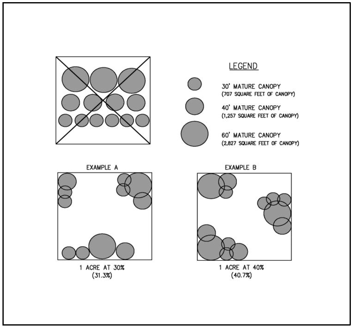
4.
The City may determine that, regardless of D.1 through D.3, that certain trees or woodlands may be required to be retained. The basis for such a decision shall include; specific findings that retention of said trees or woodlands furthers the purposes and goals of this Section, is feasible and practical both within the context of the proposed land use plan and relative to other policies and standards of the City Comprehensive Plan, and are:
a.
Within a Significant Natural Area, 100-year floodplain, City greenway, jurisdictional wetland or other existing or future public park or natural area designated by the City Comprehensive Plan, or
b.
A landscape or natural feature as per applicable policies of the City Comprehensive Plan, or are necessary to keep other identified trees or woodlands on or near the site from being damaged or destroyed due to windfall, erosion, disease or other natural processes, or
c.
Necessary for soil stability and the control of erosion, for managing and preserving surface or groundwater quantities or quality, or for the maintenance of a natural drainageway, as per Clean Water Services stormwater management plans and standards of the City Comprehensive Plan, or
d.
Necessary in required buffers between otherwise incompatible land uses, or from natural areas, wetlands and greenways, or
e.
Otherwise merit retention because of unusual size, size of the tree stand, historic association or species type, habitat or wildlife preservation considerations, or some combination thereof, as determined by the City.
5.
Tree retention requirements for properties located within the Old Town Overlay or projects subject to the infill standards of Chapter 16.68 are only subject to retention requirements identified in D.4. above.
6.
The Notice of Decision issued for the land use applications subject to this Section shall indicate which trees and woodlands will be retained as per subsection D of this Section, which may be removed or shall be retained as per subsection D of this Section and any limitations or conditions attached thereto.
7.
All trees, woodlands, and vegetation located on any private property accepted for dedication to the City for public parks and open space, greenways, Significant Natural Areas, wetlands, floodplains, or for storm water management or for other purposes, as a condition of a land use approval, shall be retained outright, irrespective of size, species, condition or other factors. Removal of any such trees, woodlands, and vegetation prior to actual dedication of the property to the City shall be cause for reconsideration of the land use plan approval.
E.
Tree Preservation Incentive
Retention of existing native trees on site which are in good health can be used to achieve the required mature canopy requirement of the development. The expected mature canopy can be calculated twice for existing trees. For example, if one existing tree with an expected mature canopy of 10 feet (78.5 square feet) is retained it will count as twice the existing canopy (157 square feet).
F.
Additional Preservation Incentives
1.
General Provisions. To assist in the preservation of trees, the City may apply one or more of the following flexible standards as part of the land use review approval. To the extent that the standards in this section conflict with the standards in other sections of this Title, the standards in this section shall apply except in cases where the City determines there would be an unreasonable risk to public health, safety, or welfare. Flexibility shall be requested by the applicant with justification provided within the tree preservation and protection report as part of the land use review process and is only applicable to trees that are eligible for credit towards the effective tree canopy cover of the site. A separate adjustment application as outlined in Section 16.84.030.A is not required.
2.
Flexible Development Standards. The following flexible standards are available to applicants in order to preserve trees on a development site. These standards cannot be combined with any other reductions authorized by this code.
a.
Lot size averaging. To preserve existing trees in the development plan for any Land Division under Division VII, lot size may be averaged to allow lots less than the minimum lot size required in the underlying zone as long as the average lot area is not less than that allowed by the underlying zone. No lot area shall be less than 80 percent of the minimum lot size allowed in the zone;
b.
Setbacks. The following setback reductions will be allowed for lots preserving existing trees using the criteria in subsection (1) below. The following reductions shall be limited to the minimum reduction necessary to protect the tree.
(1)
Reductions allowed:
(a.)
Front yard - up to a 25 percent reduction of the dimensional standard for a front yard setback required in the base zone. Setback of garages may not be reduced by this provision.
(b.)
Interior setbacks - up to a 40 percent reduction of the dimensional standards for an interior side and/or rear yard setback required in the base zone.
(c.)
Perimeter side and rear yard setbacks shall not be reduced through this provision.
c.
Approval criteria:
(1.)
A demonstration that the reduction requested is the least required to preserve trees; and
(2.)
The reduction will result in the preservation of tree canopy on the lot with the modified setbacks; and
(3.)
The reduction will not impede adequate emergency access to the site and structure.
3.
Sidewalks. Location of a public sidewalk may be flexible in order to preserve existing trees or to plant new large stature street trees. This flexibility may be accomplished through a curb-tight sidewalk or a meandering public sidewalk easement recorded over private property and shall be reviewed on a case by case basis in accordance with the provisions of the Engineering Design Manual, Street and Utility Improvement Standards. For preservation, this flexibility shall be the minimum required to achieve the desired effect. For planting, preference shall be given to retaining the planter strip and separation between the curb and sidewalk wherever practicable. If a preserved tree is to be utilized as a street tree, it must meet the criteria found in the Street Tree section, 16.140.060.
4.
Adjustments to Commercial and Industrial development Standards. Adjustments to Commercial or Industrial Development standards of up to 20 feet additional building height are permitted provided;
a.
At least 50% of a Significant Tree stand's of canopy within a development site (and not also within the sensitive lands or areas that areas dedicated to the City) is preserved;
b.
The project arborist or qualified professional certifies the preservation is such that the connectivity and viability of the remaining significant tree stand is maximized;
c.
Applicable buffering and screening requirements are met;
d.
Any height adjustments comply with state building codes;
e.
Significant tree stands are protected through an instrument or action subject to approval by the City Manager or the City manager's designee that demonstrates it will be permanently preserved and managed as such;
(1.)
A conservation easement;
(2.)
An open space tract;
(3.)
A deed restriction; or
(4.)
Through dedication and acceptance by the City.
G.
Tree Protection During Development
The applicant shall prepare and submit a final Tree and Woodland Plan prior to issuance of any construction permits, illustrating how identified trees and woodlands will be retained, removed or protected as per the Notice of Decision. Such plan shall specify how trees and woodlands will be protected from damage or destruction by construction activities, including protective fencing, selective pruning and root treatments, excavation techniques, temporary drainage systems, and like methods. At a minimum, trees to be protected shall have the area within the drip line of the tree protected from grading, stockpiling, and all other construction related activity unless specifically reviewed and recommended by a certified arborist or other qualified professional. Any work within the dripline of the tree shall be supervised by the project arborist or other qualified professional onsite during construction.
H.
Penalties
Violations of this Section shall be subject to the penalties defined by Section 16.02.040, provided that each designated tree or woodland unlawfully removed or cut shall be deemed a separate offense.
(Ord. No. 2024-002, § 1, 8-6-2024; Ord. No. 2023-002, § 2, 3-7-2023; Ord. No. 2022-004, § 2, 6-13-2022; Ord. No. 2021-010, § 2, 12-7-2021; Ord. No. 2012-003, § 2, 5-1-2012; Ord. No. 2011-009, § 2, 7-19-2011; Ord. 2006-021; Ord. 91-922, § 3)
Note— See editor's note, § 16.140.040.
16.140.080 - Trees on Private Property—Not Subject to a Land Use Action
A.
Generally
In general, existing mature trees on private property shall be retained unless determined to be a hazard to life or property. For the purposes of this section only, existing mature trees shall be considered any deciduous tree greater than ten (10) inches diameter at the breast height (dbh) or any coniferous tree greater than twenty (20) inches dbh.
B.
Residential (Single Family Detached and Middle Housing) Standards
In the event a property owner determines it necessary to remove existing mature trees on their property that are not a hazard, they may remove the trees as described below;
1.
Removal of up to five (5) trees, or up to 10 percent of the number of trees on site, whichever is greater, within a twelve month period. No review or approval required provided that trees are not located within a wetland, floodplain or protected through prior land use review per section 3.b.(1.) - (5.) below, that the planning department is notified in writing 48 hours prior to removing the tree, including the property address, property owner name and contact information, and provided with the type and size of the tree. Failure to notify the Planning Department shall not result in a violation of this code unless it is determined that the tree removal is located within a wetland, floodplain or protected through prior land use review per section 3.b. (1.) - (5.) below, or in excess of that permitted outright.
2.
Removal of six (6) or more trees, or more than 10 percent of the number of trees on site, whichever is greater, within a twelve month period except as allowed in subsection 1, above.
a.
The applicant shall submit the following;
(1.)
A narrative describing the need to remove the tree(s),
(2.)
A statement describing when and how the Homeowner's Association (HOA) was informed of the proposed tree cutting and their response. If there is not an active HOA, the applicant shall submit as statement indicating that there is not a HOA to contact.
(3.)
A plan showing the location of the tree and
(4.)
The applicant shall submit a replacement tree plan. Half of the number of trees removed shall be replaced on site with native trees within six months from the date of removal.
3.
The City may determine that, regardless of B.1 through B.2, that certain trees or stands of trees may be required to be retained.
a.
If removal is proposed within a wetland, floodplain or protected through prior land use review per section 3.b. (1.) - (5.) below, the applicant shall submit documentation from a licensed qualified professional in natural resources management such as a wetland scientist, a botanist, or biologist, discussing the proposed tree removal and how it would or would not compromise the integrity of the resource. It shall also discuss the feasibility and practicality of tree removal relative to policies and standards of the City Comprehensive Plan, listed in section 3.b. below.
b.
The basis for such a City decision shall include; specific findings that retention of said trees or woodlands furthers the purposes and goals of this Section, is feasible and practical relative to other policies and standards of the City Comprehensive Plan, and are:
(1.)
Within a Significant Natural Area, 100-year floodplain, City greenway, jurisdictional wetland or other existing or future public park or natural area designated by the City Comprehensive Plan, or
(2.)
A landscape or natural feature as per applicable policies of the City Comprehensive Plan, or are necessary to keep other identified trees or woodlands on or near the site from being damaged or destroyed due to windfall, erosion, disease or other natural processes, or
(3.)
Necessary for soil stability and the control of erosion, for managing and preserving surface or groundwater quantities or quality, or for the maintenance of a natural drainageway, as per Clean Water Services stormwater management plans and standards of the City Comprehensive Plan, or
(4.)
Necessary in required buffers between otherwise incompatible land uses, or from natural areas, wetlands and greenways, or
(5.)
Otherwise merit retention because of unusual size, size of the tree stand, historic association or species type, habitat or wildlife preservation considerations, or some combination thereof, as determined by the City.
C.
Non-Residential and Multi-Family Dwelling Standards
In the event a property owner determines it necessary to remove existing mature trees on their property that are not a hazard, they may remove the trees as described below;
1.
Trees required by a land use decision after the effective date of this code can be removed. Any trees removed shall be replaced within six months of removing the tree with an appropriate tree for the area.
2.
Trees that were not required by land use or planted prior to the effective date of this code can be removed after receiving approval from the City of Sherwood.
a.
Removal of up to 25 percent of the trees on site can be removed and replaced through a Type I review process. The applicant shall submit the following;
(1.)
A narrative describing the need to remove the trees,
(2.)
A plan showing the location of the trees and
(3.)
A replacement tree plan. One-half (1/2) of the number of trees removed shall be replaced. The replacement shall take place on site with similar trees within six months from the date of removal.
(4.)
Exemption to replacement. If less than one-half (1/2) of the trees removed will be replanted due to site crowding and constraints precluding the healthy growth of additional trees, a report from a qualified professional shall describe the site specific crowding or constraints, and provide a report to the City requesting the exemption in order to be exempt from replacing the removed trees.
b.
Removal of more than 25 percent of the trees on site can be removed and replaced through a type II review process. The applicant shall submit the following;
(1.)
An arborists report describing the need to remove the trees. The cause for removal must be necessitated by the trees,
(2.)
A plan showing the location of the tree and
(3.)
A replacement tree plan. Two-thirds of the number of trees removed shall be replaced on site with similar trees within six months from the date of removal.
(4.)
Exemption to replacement. If less than one-half (½) of the trees removed will be replanted due to site crowding and constraints precluding the healthy growth of additional trees, a report from a qualified professional shall describe the site specific crowding or constraints, and provide a report to the City requesting the exemption in order to be exempt from replacing the removed trees.
3.
The City may determine that, regardless of C.1 through C.2, that certain trees or stands of trees may be required to be retained.
a.
The applicant shall submit documentation from a licensed qualified professional in natural resources management such as wetland scientist, botanist or biologist, discussing the proposed tree removal within the context of the proposed land use plan and relative to other policies and standards of the City Comprehensive Plan, listed in section 3.b. below.
b.
The basis for such a City decision shall include; specific findings that retention of said trees or woodlands furthers the purposes and goals of this Section, is feasible and practical both within the context of the proposed land use plan and relative to other policies and standards of the City Comprehensive Plan, and are:
(1.)
Within a Significant Natural Area, 100-year floodplain, City greenway, jurisdictional wetland or other existing or future public park or natural area designated by the City Comprehensive Plan, or
(2.)
A landscape or natural feature as per applicable policies of the City Comprehensive Plan, or are necessary to keep other identified trees or woodlands on or near the site from being damaged or destroyed due to windfall, erosion, disease or other natural processes, or
(3.)
Necessary for soil stability and the control of erosion, for managing and preserving surface or groundwater quantities or quality, or for the maintenance of a natural drainageway, as per Clean Water Services stormwater management plans and standards of the City Comprehensive Plan, or
(4.)
Necessary in required buffers between otherwise incompatible land uses, or from natural areas, wetlands and greenways, or
(5.)
Otherwise merit retention because of unusual size, size of the tree stand, historic association or species type, habitat or wildlife preservation considerations, or some combination thereof, as determined.
(Ord. No. 2023-002, § 2, 3-7-2023; Ord. No. 2022-004, § 2, 6-13-2022; Ord. No. 2022-004, § 2, 6-13-2022; Ord. No. 2021-010, § 2, 12-7-2021; Ord. No. 2012-003, § 2, 5-1-2012; Ord. No. 2011-009, § 2, 7-19-2011; Ord. No. 2011-001, §§ 1, 2, 2-15-2011; Ord. No. 2010-015, § 2, 10-5-2010)
Note— See editor's note, § 16.140.040.
16.140.090 - Recommended Street Trees
A.
Recommended Street Trees:
B.
Recommended Street Trees under Power Lines:
Acer ginnala — Amur Maple 20' spread
Acer campestre — Hedge Maple 30' spread
Acer palmatum — Japanese Maple 25' spread
Acer griseum — Paperbark Maple 20' spread
Acer circinatum — Vine Maple 25' spread
Amelanchier x grandiflora — Apple Serviceberry 20' spread
Amelanchier Canadensis — Shadblow Serviceberry 20' spread
Cercis Canadensis — Eastern Redbud 25—30' spread
Clerodendrum trichotomum — Glorybower Tree 20' spread
Cornus florida — Flowering Dogwood 20-25' spread
Cornus kousa — Japanese Dogwood 25' spread
Crataegus phaenopyrum — Washington Hawthorn 25' spread
Crataegus x lavellei — Lavelle Hawthorn 20' spread
Fraxinus excelsior globosum — Globe-Headed European Ash 12—15' spread
Koelreuteria paniculata — Goldenrain Tree 10—20' spread
Laburnum x waterii — Golden Chain Tree 15' spread
Malus — Flowering Crabapple 20-25' spread
Prunus — Flowering Cherry 20—25' spread
Pyrus calleryana — Flowering Pear "Cleveland Select" 20' spread
Styrax japonica — Japanese Snowbell 25' spread
Syringa reticulata — Japanese Tree Lilac 20—25' spread
C.
Prohibited Street Trees:
Acer, Silver Maple
Acer, Boxelder
Ailanthus, gladulosa - Tree-of-heaven
Betula; common varieties of Birch
Ulmus; common varieties of Elm
Morus; common varieties of Mulberry
Salix; common varieties of willow
Coniferous Evergreen (Fir, Pine, Cedar, etc.)
Populus; common varieties of poplar, cottonwood and aspen
Female Ginkgo
D.
Alternative Street Trees: Trees that are similar to those on the recommended street tree list can be proposed provided that they are non-fruit bearing, non-invasive and not listed on the prohibited street tree list. A letter from a certified arborist must be submitted, explaining why the tree is an equivalent or better street tree than the recommended street trees that are identified in this section.
(Ord. No. 2023-002, § 2, 3-7-2023; Ord. No. 2011-009, § 2, 7-19-2011; Ord. No. 2011-001, §§ 1, 2, 2-15-2011; Ord. No. 2010-015, § 2, 10-5-2010)
Note— See editor's note, § 16.140.040.
16.142.010 - Generally
Unless otherwise permitted, residential, commercial, industrial, and institutional uses in the City shall comply with the following wetland, habitat and natural area standards if applicable to the site as identified on the City's Wetland Inventory, the Comprehensive Plan Natural Resource Inventory, the Regionally Significant Fish and Wildlife Habitat Area map adopted by Metro, and by reference into this Code and the Comprehensive Plan. Where the applicability of a standard overlaps, the more stringent regulation shall apply.
(Ord. No. 2023-002, § 2, 3-7-2023; Ord. 2006-021; 2001-1119 § 1; 91-922)
16.142.020 - Standards
A.
The applicant shall identify and describe the significance and functional value of wetlands on the site and protect those wetlands from adverse effects of the development. A facility complies with this standard if it complies with the criteria of subsections A.1.a and A.1.b, below:
1.
The facility will not reduce the area of wetlands on the site, and development will be separated from such wetlands by an area determined by the Clean Water Services Design and Construction Standards R&O 00-7 or its replacement provided Section 16.138.090 does not require more than the requested setback.
a.
A natural condition such as topography, soil, vegetation or other feature isolates the area of development from the wetland.
b.
Impact mitigation measures will be designed, implemented, and monitored to provide effective protection against harm to the wetland from sedimentation, erosion, loss of surface or ground water supply, or physical trespass.
c.
A lesser setback complies with federal and state permits, or standards that will apply to state and federal permits, if required.
2.
If existing wetlands are proposed to be eliminated by the facility, the applicant shall demonstrate that the project can, and will develop or enhance an area of wetland on the site or in the same drainage basin that is at least equal to the area and functional value of wetlands eliminated.
B.
The applicant shall provide appropriate plans and text that identify and describe the significance and functional value of natural features on the site (if identified in the Community Development Plan, Part 2) and protect those features from impacts of the development or mitigate adverse effects that will occur. A facility complies with this standard if:
1.
The site does not contain an endangered or threatened plant or animal species or a critical habitat for such species identified by Federal or State government (and does not contain significant natural features identified in the Community Development Plan, Part 2, Natural Resources and Recreation Plan).
2.
The facility will comply with applicable requirements of the zone.
3.
The applicant will excavate and store topsoil separate from subsurface soil, and shall replace the topsoil over disturbed areas of the site not covered by buildings or pavement or provide other appropriate medium for re-vegetation of those areas, such as yard debris compost.
4.
The applicant will retain significant vegetation in areas that will not be covered by buildings or pavement or disturbed by excavation for the facility; will replant areas disturbed by the development and not covered by buildings or pavement with native species vegetation unless other vegetation is needed to buffer the facility; will protect disturbed areas and adjoining habitat from potential erosion until replanted vegetation is established; and will provide a plan or plans identifying each area and its proposed use.
5.
Development associated with the facility will be set back from the edge of a significant natural area by an area determined by the Clean Water Services Design and Construction standards R&O 00-7 or its replacement, provided Section 16.138.090A does not require more than the requested setback. Lack of adverse effect can be demonstrated by showing the same sort of evidence as in subsection A.1 above.
C.
When the Regionally Significant Fish and Wildlife Habitat map indicates there are
resources on the site or within 50 feet of the site, the applicant shall provide plans
that show the location of resources on the property. If resources are determined to
be located on the property, the plans shall show the value of environmentally sensitive
areas using the methodologies described in Sections 1 and 2 below.
The Metro Regionally Significant Fish and Wildlife Habitat map shall be the basis
for determining the location and value of environmentally sensitive habitat areas.
In order to specify the exact locations on site, the following methodology shall be
used to determine the appropriate boundaries and habitat values:
1.
Verifying boundaries of inventoried riparian habitat. Locating habitat and determining its riparian habitat class is a four-step process:
a.
Located the Water Feature that is the basis for identifying riparian habitat.
1.
Locate the top of bank of all streams, rivers, and open water within 200 feet of the property.
2.
Locate all flood areas within 100 feet of the property.
3.
Locate all wetlands within 150 feet of the property based on the Local Wetland Inventory map and on the Metro 2002 Wetland Inventory map (available from the Metro Data Resource Center, 600 NE Grand Ave., Portland, OR 97232). Identified wetlands shall be further delineated consistent with methods currently accepted by the Oregon Division of State Lands and the US Army Corps of Engineers.
b.
Identify the vegetative cover status of all areas on the property that are within 200 feet of the top of bank of streams, rivers, and open water, are wetlands or are within 150 feet of wetlands, and are flood areas or are within 100 feet of flood areas. Vegetative cover status shall be as identified on the Metro Vegetative Cover map. In the event of a discrepancy between the Metro Vegetative Cover map and the existing site conditions, document the actual vegetative cover based on the following definitions along with a 2002 aerial photograph of the property;
1.
Low structure vegetation or open soils — Areas that are part of a contiguous area one acre or larger of grass, meadow, crop-lands, or areas of open soils located within 300 feet of a surface stream (low structure vegetation areas may include areas of shrub vegetation less than one acre in size if they are contiguous with areas of grass, meadow, crop-lands, orchards, Christmas tree farms, holly farms, or areas of open soils located within 300 feet of a surface stream and together form an area of one acre in size or larger).
2.
Woody vegetation — Areas that are part of a contiguous area one acre or larger of shrub or open or scattered forest canopy (less than 60% crown-closure) located within 300 feet of a surface stream.
3.
Forest canopy — Areas that are part of a contiguous grove of trees of one acre or larger in area with approximately 60% or greater crown closure, irrespective of whether the entire grove is within 200 feet of the relevant water feature.
c.
Determine whether the degree that the land slopes upward from all streams, rivers, and open water within 200 feet of the property is greater than or less than 25% (using the Clean Water Services Vegetated Corridor methodology); and
d.
Identify the riparian habitat classes applicable to all areas on the property using Table 8-1 below:
2.
Verifying boundaries of inventoried upland habitat. Upland habitat was identified based on the existence of contiguous patches of forest canopy, with limited canopy openings. The "forest canopy" designation is made based on analysis of aerial photographs, as part of determining the vegetative cover status of land within the region. Upland habitat shall be as identified on the HCA map. The perimeter of an area delineated as "forest canopy" on the Metro Vegetative Cover map may be adjusted to more precisely indicate the drip line of the trees within the canopied area.
(Ord. No. 2023-002, § 2, 3-7-2023; Ord. 2006-021; 2001-1119, § 1; 91-922)
16.142.030 - Exceptions to Standards
In order to protect environmentally sensitive areas that are not also governed by floodplain, wetland and Clean Water Services vegetated corridor regulations, the City allows flexibility of the specific standards in exchange for the specified amount of protection inventoried environmentally sensitive areas as defined in this code.
A.
Process
The flexibility of standards is only applicable when reviewed and approved as part of a land use application and shall require no additional fee or permit provided criteria is addressed. In the absence of a land use application, review may be processed as a Type 1 administrative interpretation.
B.
Standards modified
1.
Lot size — Not withstanding density transfers permitted through Chapter 16.40, when a development contains inventoried regionally significant fish and wildlife habitats as defined in Section 16.142.020 above, lot sizes may be reduced up to ten percent (10%) below the minimum lot size of the zone when an equal amount of inventoried resource above and beyond that already required to be protected is held in a public or private open space tract or otherwise protected from further development.
2.
Setbacks — For residential zones, the setback may be reduced up to thirty percent (30%) for all setbacks except the garage setback provided the following criteria are satisfied:
a.
The setback reduction must result in an equal or greater amount of significant fish and/or wildlife habitat protection. Protection shall be guaranteed with deed restrictions or public or private tracts.
b.
In no case shall the setback reduction supersede building code and/or Tualatin Valley Fire and Rescue separation requirements.
c.
In no case shall the setback be reduced to less than five feet unless otherwise provided for by the underlying zone.
3.
Density — per Section 16.10.020 (Net Buildable Acre definition), properties with environmentally sensitive areas on site may opt to exclude the environmentally sensitive areas from the minimum density requirements provided the sensitive areas are protected via tract or restrictive easement. A proposal to remove said area from the density calculation must include: a delineation of the resource in accordance with Section 16.142.020C, the acreage being protected, and the net reduction below the normally required minimum for accurate reporting to Metro.
4.
Parking — Per Section 16.94.020.B.6, 10-25% of the required parking spaces may be reduced in order to protect inventoried regionally significant fish and wildlife habitat areas, provided these resources are protected via deed restrictions or held in public or private tracts.
5.
Landscaping — Per Section 16.92.030.B.6, exceptions may be granted to the landscaping standards in certain circumstances as outlined in that section.
(Ord. No. 2023-002, § 2, 3-7-2023; Ord. No. 2010-015, § 2, 10-5-2010; Ord. 2006-021)
16.144.010 - Generally
All otherwise permitted commercial, industrial, and institutional uses in the City shall comply with the noise standards contained in OAR 340-35-035. The City may require proof of compliance with OAR 340-35-035 in the form of copies of all applicable State permits or certification by a professional acoustical engineer that the proposed uses will not cause noise in excess of State standards.
(Ord. No. 2023-002, § 2, 3-7-2023; Ord. 91-922, § 3)
16.144.020 - Noise Sensitive Uses
When proposed commercial and industrial uses do not adjoin land exclusively in commercial or industrial zones, or when said uses adjoin special care, institutional, or parks and recreational facilities, or other uses that are, in the City's determination, sensitive to noise impacts, then:
A.
The applicant shall submit to the City a noise level study prepared by a professional acoustical engineer. Said study shall define noise levels at the boundaries of the site in all directions.
B.
The applicant shall show that the use will not exceed the noise standards contained in OAR 340-35-035, based on accepted noise modeling procedures and worst case assumptions when all noise sources on the site are operating simultaneously.
C.
If the use exceeds applicable noise standards as per subsection B of this Section, then the applicant shall submit a noise mitigation program prepared by a professional acoustical engineer that shows how and when the use will come into compliance with said standards.
(Ord. No. 2023-002, § 2, 3-7-2023; Ord. 91-922, § 3)
16.144.030 - Exceptions
This Chapter does not apply to noise making devices which are maintained and utilized solely as warning or emergency signals, or to noise caused by automobiles, trucks, trains, aircraft, and other similar vehicles when said vehicles are properly maintained and operated and are using properly designated rights-of-way, travel ways, flight paths or other routes. This Chapter also does not apply to noise produced by humans or animals. Nothing in this Chapter shall preclude the City from abating any noise problem as per applicable City nuisance and public safety ordinances.
(Ord. No. 2023-002, § 2, 3-7-2023; Ord. 91-922, § 3)
16.146.010 - Generally
All otherwise permitted commercial, industrial, and institutional uses shall not cause discernible vibrations that exceed a peak of 0.002 gravity at the property line of the originating use, except for vibrations that last five (5) minutes or less per day, based on a certification by a professional engineer.
(Ord. No. 2023-002, § 2, 3-7-2023; Ord. 91-922, § 3)
16.146.020 - Exceptions
This Chapter does not apply to vibration caused by construction activities including vehicles accessing construction sites, or to vibrations caused by automobiles, trucks, trains, aircraft, and other similar vehicles when said vehicles are properly maintained and operated and are using properly designated rights-of-way, travelways, flight paths or other routes. Nothing in this Chapter shall preclude the City from abating any vibration problem as per applicable City nuisance and public safety ordinances.
(Ord. No. 2023-002, § 2, 3-7-2023; Ord. 91-922, § 3)
16.148.010 - Generally
All otherwise permitted commercial, industrial, and institutional uses shall comply with applicable State air quality rules and statutes:
A.
All such uses shall comply with standards for dust emissions as per OAR 340-21-060.
B.
Incinerators, if otherwise permitted by Section 16.138.020, shall comply with the standards set forth in OAR 340-25-850 through 340-25-905.
C.
Uses for which a State Air Contaminant Discharge Permit is required as per OAR 340-20-140 through 340-20-160 shall comply with the standards of OAR 340-220 through 340-20-276.
(Ord. No. 2023-002, § 2, 3-7-2023; Ord. 91-922, § 3)
16.148.020 - Proof of Compliance
Proof of compliance with air quality standards as per Section 16.148.010 shall be in the form of copies of all applicable State permits, or if permits have not been issued, submission by the applicant, and acceptance by the City, of a report certified by a professional engineer indicating that the proposed use will comply with State air quality standards. Depending on the nature and size of the use proposed, the applicant may, in the City's determination, be required to submit to the City a report or reports substantially identical to that required for issuance of State Air Contaminant Discharge Permits.
(Ord. No. 2023-002, § 2, 3-7-2023; Ord. 91-922, § 3)
16.148.030 - Exceptions
Nothing in this Chapter shall preclude the City from abating any air quality problem as per applicable City nuisance and public safety ordinances.
(Ord. No. 2023-002, § 2, 3-7-2023; Ord. 91-922, § 3)
16.150.010 - Generally
All otherwise permitted commercial, industrial, and institutional uses shall incorporate the best practicable design and operating measures so that odors produced by the use are not discernible at any point beyond the boundaries of the development site.
(Ord. No. 2023-002, § 2, 3-7-2023; Ord. 91-922, § 3)
16.150.020 - Standards
The applicant shall submit a narrative explanation of the source, type and frequency of the odorous emissions produced by the proposed commercial, industrial, or institutional use. In evaluating the potential for adverse impacts from odors, the City shall consider the density and characteristics of surrounding populations and uses, the duration of any odorous emissions, and other relevant factors.
(Ord. No. 2023-002, § 2, 3-7-2023; Ord. 91-922, § 3)
16.150.030 - Exceptions
Nothing in this Chapter shall preclude the City from abating any odor problem as per applicable City nuisance and public safety ordinances.
(Ord. No. 2023-002, § 2, 3-7-2023; Ord. 91-922, § 3)
16.152.010 - Generally
Except for exterior lighting, all otherwise permitted commercial, industrial, and institutional uses shall conduct any operations producing excessive heat or glare entirely within enclosed buildings. Exterior lighting shall be directed away from adjoining properties, and the use shall not cause such glare or lights to shine off site in excess of one-half (0.5) foot candle when adjoining properties are zoned for residential uses.
(Ord. No. 2023-002, § 2, 3-7-2023; Ord. 93-966, § 3; 91-922)
16.152.020 - Exceptions
Nothing in this Chapter shall preclude the City from abating any heat and glare problem as per applicable City nuisance and public safety ordinances.
(Ord. No. 2023-002, § 2, 3-7-2023; Ord. 93-966, § 3; 91-922)
16.154.010 - Purpose
This Chapter and applicable portions of the Comprehensive Plan provide for natural heating and cooling opportunities in new development. The requirements of this Chapter shall not result in development exceeding allowable densities or lot coverage, or the destruction of existing trees.
(Ord. No. 2023-002, § 2, 3-7-2023; Ord. 91-922, § 3)
16.154.020 - Applicability
The standards in this Chapter shall apply to any new uses or changes to existing uses in multi-dwelling, commercial, industrial and institutional zones. The standards in this Chapter do not apply to accessory dwelling unit or single detached, or middle housing development in residential zones.
(Ord. No. 2023-002, § 2, 3-7-2023; Ord. No. 2022-004, § 2, 6-13-2022; Ord. No. 2021-010, § 2, 12-7-2021)
Editor's note— Ord. No. 2021-010, § 2, adopted December 7, 2021, amended the Code by adding a new § 16.156.020, and renumbering former §§ 16.156.020 and 16.156.030 as new §§ 16.156.030 and 16.156.040. Subsequently, §§ 16.156.020—16.156.040 were renumbered by Ord. No. 2023-002, § 2, adopted March 7, 2023. See editor's note, Ch. 16.154.
16.154.030 - Standards
A.
Building Orientation - The maximum number of buildings feasible shall receive sunlight sufficient for using solar energy systems for space, water or industrial process heating or cooling. Buildings and vegetation shall be sited with respect to each other and the topography of the site so that unobstructed sunlight reaches the south wall of the greatest possible number of buildings between the hours of 9:00 AM and 3:00 PM, Pacific Standard Time on December 21st.
B.
Wind - The cooling effects of prevailing summer breezes and shading vegetation shall be accounted for in site design. The extent solar access to adjacent sites is not impaired vegetation shall be used to moderate prevailing winter wind on the site.
(Ord. No. 2023-002, § 2, 3-7-2023; Ord. No. 2021-010, § 2, 12-7-2021; Ord. 91-922, § 3)
Note— Former § 16.156.020. See editor's note, § 16.154.020.
16.154.040 - Variance to Permit Solar Access
Variances from zoning district standards relating to height, setback and yard requirements approved as per Chapter 16.84 may be granted by the Commission through a Type IV review where necessary for the proper functioning of solar energy systems, or to otherwise preserve solar access on a site or to an adjacent site.
(Ord. No. 2023-002, § 2, 3-7-2023; Ord. No. 2021-010, § 2, 12-7-2021; Ord. 91-922, § 3)
Note— Former § 16.156.030. See editor's note, § 16.154.020.