
Tallahassee City Zoning Code
ARTICLE VII
SUPPLEMENTARY REGULATIONS
Sec. 10-411.- Accessory structures.
(a)
General requirements. It is the purpose of this section to regulate the installation, configuration, and use of accessory structures, and the conduct of accessory uses, in order to ensure that they are not harmful either aesthetically or physically to residents and surrounding areas. Any number of different accessory structures may be located on a parcel, provided that the following requirements are met:
(1)
There shall be a permitted principal development on the parcel, located in full compliance with all standards and requirements of this chapter.
(2)
All accessory structures shall setback ten feet from any property line, except where the permitted principal development setback is less in which case the accessory structure shall comply with the principal structure setback.
(3)
Accessory structures shall not be located in a required buffer or landscape area nor in the front yard or side corner yard.
(4)
Accessory structures shall be included in all calculations of impervious surface and stormwater runoff. Water surface area of a pool will not be considered part of impervious surface for stormwater calculations.
(5)
Accessory structures shall be shown on any concept development plan with full supporting documentation as required in chapter 9, article III of this Code.
(6)
Accessory structures shall be located at least six feet from any other structure on the same lot.
(b)
Storage buildings, utility buildings, equipment, and infrastructure.
(1)
No accessory buildings used for industrial storage of hazardous, incendiary, noxious or deadly materials shall be located nearer than 100 feet from any property line.
(2)
Vehicles, including travel trailers, recreational vehicles, manufactured housing and mobile homes/manufactured homes, shall not be used as storage buildings, utility buildings or other such uses.
(3)
Utilities, equipment, and infrastructure.
a.
New development. No exterior utility accessories used for service loading entries, parking for commercial vehicles with cargo volumes greater than ten cubic yards (referred to below as "loading zones"), solid waste facilities with capacities greater than one cubic yard (referred to below as "trash enclosures"), nonresidential air conditioning compressors greater than ten tons, air compressors, electrical generators, or overhead electrical transformers shall be located nearer than ten feet from any property line or 200 feet from any property line adjoining a low-density residential zoning district.
b.
Lot configuration does not permit attainment of 200-foot buffer. For the purposes of subsection (b)(3)b. and e., the term "protected residential" includes any property that is zoned either RP-1, RP-2, RP-MH, RP-R, RP-UF, R-1, R-2, R-3, R-5, UF, LP, MH, or RA.
1.
Loading zone. If the distance between the back of a building and the rear property line is less than 220 feet, then the project may locate the loading zone to within 50 feet of the boundary of the adjoining property which is protected residential provided it is buffered from the property which is protected residential with a minimum of a ten-foot wide landscape strip along its full length between the loading zone and the nearest protected residential. The landscape strip must include at least two trees from the list at section 10-285, table 4.
2.
Trash enclosure. If the distance between the back of a building and the rear property line is less than 220 feet, then the project may locate the trash enclosure to within 50 feet of the boundary of the adjoining property which is protected residential provided it is buffered from the property which is protected residential by a six-foot opaque wall of finished masonry or wood on three sides, with a gated door accessible to service vehicles. If a wall of a trash enclosure is generally parallel to protected residential, then a ten-foot wide landscape strip shall be adjacent to the trash enclosure along the full width of the side(s) facing the property which is protected residential. If a corner of a trash enclosure is adjacent to protected residential, then the ten-foot wide landscape strip shall be adjacent to one of the trash enclosure walls that form that corner. The landscape strip must include at least one tree from the list at section 10-285, table 4.
3.
Lots with multiple frontages. For sites with multiple street frontages, the front yard is the principal frontage as defined by section 1-2. Loading zones and trash enclosures shall be sited in the rear yard of such properties. If the distance between the back of a building and the rear property line is less than 220 feet, then the loading zone or trash enclosure shall meet the following criteria:
A.
Be a minimum of 50 feet from any property boundary that is adjacent to protected residential;
B.
be a minimum of 50 feet from any property boundary that is across a street from protected residential, provided the street has three or fewer travel lanes (including on street parking, merge, and turn lanes); and
C.
Provide the buffer wall or fence, landscaping, and trees noted in subsection (b)(3)b.
c.
Redevelopment. Redevelopment projects that propose a solid waste facility with a capacity greater than one cubic yard that is enclosed with a six-foot opaque wall of finished masonry, wood, or natural plant material on three sides, with a gated door accessible to service vehicles, are not required to comply with the ten-foot or 200-foot setbacks set forth in this section. Solid waste facilities for redevelopment projects are required to be located behind buildings or other structures so as to screen them from public rights-of-way.
d.
Earthwork disturbances. No earthwork disturbances for stormwater swales, detention ponds or retention ponds shall be located nearer than 30 feet from any (existing) property line adjoining a low-density residential zoning district. This does not include earthwork disturbances for underground stormwater facilities, stormwater swales centered on (proposed) property lines with a common utility easement, or perpendicular crossings of property lines by stormwater swales. Redevelopment projects are exempt from complying with the 30-foot distance requirement set forth in this subsection (b)(3)d. for earthwork disturbances associated with stormwater swales. Earthwork disturbances associated with stormwater retention or detention ponds for redevelopment projects must comply with a 15-foot distance requirement from any (existing) property line adjoining a low-density residential zoning district.
e.
Subsection (b)(3) does not apply to the following:
1.
Proposed non-residential or dense residential developments adjacent to properties which are Protected Residential that are currently developed and occupied by a legally existing non-conforming use; or
2.
Proposed non-residential or dense residential developments adjacent to isolated properties which are protected residential comprised of less than three units on less than three contiguous lots. For purposes of this section, "isolated" shall mean one or two residential units, which are surrounded by non-residential zoning or uses.
3.
A change of use at an existing non-residential or dense residential development, provided the change of use does not result in a more intense use that is otherwise regulated by subsection 10-411(b)(3).
(c)
Swimming pools, hot tubs and similar structures.
(1)
Swimming pools shall be permitted only in side and rear yards, and shall not encroach into any required building setback.
(2)
Enclosures for pools shall comply with standards for yard requirements and other building location requirements of this chapter.
(3)
All pools shall be completely enclosed with an approved wall, fence or other substantial structure not less than four feet in height. The enclosure shall completely surround the pool and shall be of sufficient material to prohibit unrestrained admittance to the enclosed area through the use of self-closing and self-latching doors.
(Code 1984, ch. 27, § 17.1; Ord. No. 95-O-0025AA, 9-13-1995; Ord. No. 97-O-0027AA, § 48, 7-8-1997; Ord. No. 99-O-0058AA, § 9, 1-26-2000; Ord. No. 01-O-28AA, §§ 34—36, 10-24-2001; Ord. No. 21-O-15, § 4, 6-16-2021)
Sec. 10-412. - Accessory uses.
Accessory uses are permitted only in conjunction with a principal use. The land use administrator during project determination (see chapter 9, article III of this Code) will make the determination of compliance with this section.
(1)
Accessory dwelling units (ADUs).
a.
Purpose. The purpose of this section is to provide a useful tool as part of the overall goal of providing a wide variety of housing choices to city residents, and promoting families and self-sufficiency for individuals by allowing more opportunities for extended family living.
b.
Standards. ADUs may be allowed in all zoning districts provided that all of the following requirements shall be met:
1.
A single ADU may be placed on a lot with a single-family or duplex residence, or a lot with a non-residential use. Within the MMTD, if all other development standards are satisfied, a single ADU is allowed for each principal dwelling unit on a residential lot. Within the MMTD, if all other development standards are satisfied, a single ADU is allowed for each non-residential establishment on a non-residential lot.
2.
An ADU shall be located as an attached or detached unit to a principal or accessory structure, so long as the height of the ADU is not greater than two stories. Where an ADU is located entirely on the second floor above an accessory structure, then the height of the entire structure shall not exceed two stories.
3.
Detached ADUs shall be located in the interior side, side corner, or rear yard.
4.
ADUs shall not exceed 1,200 square feet of gross floor area under roof, provided that it can meet all other development standards.
5.
ADUs shall adhere to the same required setbacks and overall lot coverage requirements as the principal structure.
6.
The requirements of section 10-83 of this Code, rooming houses as nonconforming uses, shall be applicable to lots with ADUs zoned RP-1, RP-2, R-1, and R-2.
(2)
Home occupations. An accessory use of a dwelling unit involving the manufacture or provision of goods or services for a charge, fee or other compensation meeting the criteria set forth in this subsection. A home occupation is a permissible use in all districts. The restrictions of subsections (2)b. through (2)i. of this section shall not apply where the home occupation consists of sales of fruits and vegetables and such is conducted by the owner and occupant of a residence of an age greater than 70 years and provided that such use has been conducted at least annually since October 1, 1992.
a.
Only persons living on the premises shall be engaged in a home occupation.
b.
The use of the dwelling unit for the home occupation shall be clearly incidental and subordinate to its occupant. The total area used for the home occupation, including storage, whether inside the dwelling or in a separate building on the premises, shall not exceed one-third of the floor area of the enclosed living area of the dwelling unit. Floor area of garages shall not be included in the calculation of the total floor area of the enclosed living area of the dwelling unit.
c.
The home occupation shall be conducted entirely within the principal building that is used as the residential dwelling, except for related activities conducted off the premises.
d.
All storage, including equipment, relating to the home occupation, shall be contained entirely within a completely enclosed structure. Storage of materials must comply with the rules and regulations promulgated by the state fire marshal.
e.
No merchandise or goods of any kind shall be sold or offered for sale upon the premises, nor picked up by customers from the premises, if such activities result in a violation of other provisions of this section, and further provided that no such sale or pickup will be allowed unless such sale or pickup is prearranged.
f.
No merchandise or articles for sale shall be displayed for advertising purposes and no sign or other evidence of the conduct of a home occupation shall be visible from outside the dwelling unit.
g.
No home occupation shall be allowed which involves the visitation of clients, customers, salesmen or suppliers or any other person coming for business purposes which would generate vehicular traffic in excess of two vehicle round trips per hour or more than ten vehicle round trips per day. For purposes of this section, a "round trip" is defined as a vehicle arriving at and leaving from the premises. The provisions of this section shall not apply to the teaching of piano, dance, and nonband instrument instruction; however, the following traffic limitations shall apply to such activities:
1.
No more than seven vehicle round trips per hour.
2.
This limitation shall not be construed to prohibit the teaching of occasional group lessons.
h.
All parking associated with the home occupation shall be off the street on a paved driveway or in officially painted on-street parking spaces.
i.
No activity shall be conducted nor any equipment or process shall be used which constitutes a health hazard or creates noise, vibration, glare, fumes, odors or electrical interference detectible to the normal senses off the premises, if the occupation is conducted in a single-family residence, or outside the dwelling unit if conducted in other than a single-family residence. No equipment or process shall be used which creates visual or audible interference in any radio or television receiver off the premises or causes fluctuations in line voltage off the premises.
j.
No more than one motor vehicle used in the conduct of the home occupation can be kept on the premises at any one time.
k.
No home occupation license shall authorize the violation of private deed covenants.
(3)
Central dining rooms, recreation centers and other amenities.
a.
Generally. Residential and nonresidential development projects may provide amenities for the exclusive use of the employees and/or residents of the project. Such amenities shall be allowed only as provided in this section.
b.
Dining rooms/cafeterias/snack shops, etc.. A development may provide a central dining facility to serve the employees and/or residents of the project subject to the following restrictions:
1.
The facility shall not be open to the general public.
2.
There shall be no off-site signs advertising the presence of the facility.
c.
Community centers/recreation centers. Residential projects may provide a central facility to provide a meeting place and indoor recreation opportunities for residents subject to the following restrictions.
1.
Such facilities shall not include health clubs, gyms and the like offering services to the general public.
2.
Parking to serve the building shall be provided as required by section 10-11.
3.
There shall be no identification signs, other than directional signs pursuant to chapter 7 of this Code.
d.
Employee fitness centers. Nonresidential development projects may provide a fitness or exercise center for the use of employees subject to the following restrictions:
1.
Such facilities shall not be open to the general public.
2.
There shall be no signs, other than directional or occupant signs, identifying the facility.
(4)
Bed and breakfast inn.
a.
Generally. Bed and breakfast inns may be permitted in all districts that permit residential and residential mixed-use development as an accessory use to a single-family dwelling unit. Access shall be provided by a street other than a local street.
b.
Standards. Accessory bed and breakfast inns may be allowed provided all the following requirements are met:
1.
Bed and breakfast inns shall be limited to three guest rooms, except in the historic overlay district, where five guest rooms may be provided.
2.
Guests are limited to a length of stay of no more than 14 consecutive days.
3.
A Type A development review is required to ensure that the establishment of the bed and breakfast inn is consistent with the comprehensive plan and conforms with the land development regulations. The bed and breakfast inn operator shall be required to receive an occupational license (from the appropriate local government).
4.
The number of required parking spaces for guests and residents shall conform to the following schedule:
One guest room — three spaces
Two guest rooms — four spaces
Three guest rooms — five spaces
Parking is prohibited in the front yard unless the area is screened and the parking arrangement is determined to be compatible with the surrounding area. Parking may be located to the side or rear of the structure, to be screened from view of adjacent properties. See section 10-177 for screening and buffering requirements.
5.
No food preparation or cooking for guests shall be conducted within any bedroom nor other individual rooms, except for the kitchen and/or pantry. Meals may be provided only to residents and guests.
6.
No structure shall be constructed for the sole purpose of being utilized as a bed and breakfast inn; no existing structure should be enlarged or expanded for the purpose of providing additional rooms for guests. It is intended that bed and breakfast inn be converted or renovated single-family residences, and that this principal function be maintained. The exterior appearance of the structure shall not be altered from its single-family character.
7.
Only a singular sign, for the purposes of identification, not advertisement, shall be permitted. This sign shall not exceed two square feet in area, and be posted no higher than 3½ feet. This sign shall not be illuminated.
(5)
Freestanding single pass carwash A freestanding single pass carwash is permitted as an accessory use at neighborhood, community, and highway commercial locations inside the urban service area.
(6)
For the purposes of subsection (6), the term "protected residential" includes any property developed with a single-family residence, duplex, or triplex to a density of less than or equal to eight units per acre, and any vacant property that is zoned either RP-1, RP-2, RP-MH, RP-R, RP-UF, R-1, R-2, R-3, R-5, UF, LP, MH, or RA.
If allowed as a permitted principal use in a zoning district and if adjacent to a property which is protected residential, businesses with drive through facilities must meet the following development standards:
a.
Option 1.
1.
Businesses with drive through facilities must provide a landscape buffer and fence as defined by section 10-177 (for areas outside the MMTD) and section 10-284.3 (for areas inside the MMTD).
2.
Drive through speakers, order boards, and windows must be located a minimum of 100 feet from the nearest adjacent boundary of any property which is protected residential.
3.
That portion of the drive through lane between the order board and the point 75 feet before the order board must be located a minimum of 50 feet from the nearest adjacent boundary of any property which is protected residential.
b.
Option 2. Businesses with drive through facilities (both inside and outside of the MMTD) must provide a landscape buffer which achieves the following:
1.
The 60-foot Type D planting standard at section 10-177;
2.
All canopy trees and understory trees within the buffer are four-inch caliper at the time of planting;
3.
All trees are evergreen species to provide year-round screening; and
4.
A six-foot wood stockade fence with no spacing between the pickets is built adjacent to all protected residential property lines.
c.
Subsection (6) does not apply to the following:
1.
Proposed drive through facilities adjacent to properties which are protected residential that are currently developed and occupied by a legally existing non-conforming use; or
2.
Proposed drive through facilities adjacent to isolated properties which are protected residential comprised of less than three units on less than three contiguous lots. For purposes of this section, "isolated" shall mean one or two residential units, which are surrounded by non-residential zoning or uses.
3.
A change of use at an existing drive through, provided the change of use does not result in a more intense use that is otherwise regulated by subsection (6). However, if a new drive through lane is proposed, it must meet the standards in subsection (6).
d.
Properties in the multi-modal transportation district must also meet the additional drive through standards set forth in article IV, division 4, Downtown overlay regulating plan and multi-modal transportation district (MMTD) standards.
(Code 1984, ch. 27, § 17.2; Ord. No. 95-O-0025AA, 9-13-1995; Ord. No. 96-O-0028, § 1, 9-25-1996; Ord. No. 97-O-0025, § 1, 5-28-1997; Ord. No. 97-O-0046AA, § 1, 8-20-1997; Ord. No. 98-O-0002AA, § 1, 1-28-1998; Ord. No. 01-O-28AA, § 37, 10-24-2001; Ord. No. 17-O-23AA, § 3, 9-27-2017; Ord. No. 21-O-15, § 5, 6-16-2021; Ord. No. 24-O-03, § 3, 3-27-2024)
Sec. 10-413. - Community services and facilities/institutional uses.
(a)
Purpose and intent. The intent of this section is to establish regulations, requirements, and standards for land uses and activities conducted for the public welfare. The location of community services and facilities/institutional uses shall be consistent with the comprehensive plan. This section is intended to address uses, facilities, and structures necessary for the health, safety, and welfare of the general public, that are not typically provided for profit by private individuals and establishments. This section establishes public notice requirements for the establishment of any proposed community services and facilities/institutional uses as well as for the expansion or redesign of any such existing uses or facilities, and provides for public participation in this process. This section promulgates standards to ensure that the location of community services and facilities/institutional uses is unlikely to be incompatible with surrounding land uses and activities and to ensure that all such facilities or structures are designed to minimize negative impacts upon surrounding properties.
(b)
Development standards. During the course of the required land development review, the entity with authority shall authorize development standards appropriate for the proposed institutional use. Such development standards shall address land use compatibility, environmental constraints, and the availability of infrastructure.
(c)
Minimum requirements for approval; new development. Any and all applications for new community services and facilities/institutional uses must comply with the following requirements:
(1)
Consistency with the comprehensive Plan. The entity with authority shall find that the proposed location is consistent with the comprehensive plan. New institutional uses and facilities shall be located to serve areas of population experiencing an existing deficiency of facilities and services or to serve areas where demand for facilities and services is projected to occur as identified in the 2010 Comprehensive Plan. Facilities and services shall not be established or expanded in any location which will result in land development patterns inconsistent with the 2010 Comprehensive Plan nor shall any such development be permitted that is likely to promote the premature development of any area resulting in land use intensities inconsistent with the future land use map. In the determination of proposed facility or structure location or the acceptability of any such proposed expansion, the entity with authority may balance the benefits of location in proximity to the service population with any associated disadvantages.
a.
The applicant must demonstrate that there presently exists, or is expected to exist an unmet demand within the community for the public benefit intended to result from the establishment and operation of that proposed or expanded community service/or facility institutional use;
b.
The applicant must demonstrate that the proposed use or facility will alleviate that demand, either in full or in part;
c.
The applicant must demonstrate that the proposed site for the use or facility is suitably located to provide the public benefit to the intended generalized service population area;
d.
The applicant must demonstrate that the proposed use or facility and site are sized according to the demand that the facility is proposed to satisfy;
e.
The applicant must demonstrate and document that the anticipated benefit to be provided to the community outweighs the potential harm to the public interest, including harm to environmentally sensitive areas or private interests, likely to result from the establishment and operation of the proposed community service or facility/institutional use;
f.
The applicant must demonstrate that the establishment and operation of the proposed use or facility will not prevent the normal and customary use of residentially-zoned properties and residential structures or otherwise adversely affect residential neighborhoods to the extent that residential displacement is likely, or indicate what provisions are proposed to mitigate any adverse effects and displacement; and
g.
The applicant must demonstrate that the new facility will promote the efficient use of existing or planned infrastructure and discourage uncontrolled urban sprawl.
(2)
Environmental analysis required. Community services or facilities/institutional uses to be located within the city limits shall be required to submit a part I environmental analysis completed as per the requirements of the chapter 5 of this Code.
(d)
Minimum requirements for approval; redevelopment/expansion. Any and all applications for the redevelopment, modification, or expansion of existing community services and facilities/institutional uses shall be subject to review and approval pursuant to the procedural requirements set forth in this chapter.
(e)
Site plan approval required. New development of land to be utilized as a community service or facility/institutional use shall require site plan approval before development activities may be permitted. The site plan submitted for approval shall be subject to review and approval pursuant to the procedural requirements of chapter 9, article III of this Code.
(f)
Exemptions. The following uses and activities are exempted from this chapter:
(1)
Facilities and structures requiring a physical plant, or new development with impervious area of 7,500 square feet or less;
(2)
Rights-of-way and easements dedicated for public benefit use; and
(3)
Community services and facilities established in existing structures.
(g)
Special requirements for community services and facilities/institutional uses that may cause air pollution. Any new or expanded portion of a coal burning utility, asphalt plant, resource recovery facility or other potential point source of air pollution required by law to obtain an air pollution permit from the state department of environmental regulation or the United States Environmental Protection Agency shall be required to utilize the best available control technology.
(h)
Special requirements for charitable donation stations. This paragraph applies to charitable donation stations as defined in section 1-2. In addition to meeting the criteria in this section for community facilities, such stations shall have indoor storage for all donations, and shall have an attendant available during normal business hours responsible for the collection and/or storage of said donations.
(i)
Special access requirements for private and charter schools. Private and charter schools shall not be accessed from an arterial roadway unless there is full, safe access from both directions. Private or charter schools shall not be accessed from a residential local street.
(Code 1984, ch. 27, § 18.1; Ord. No. 95-O-0025AA, 9-13-1995; Ord. No. 05-O-39AA, § 5, 7-13-05; Ord. No. 15-O-17AA, § 23, 8-26-2015; Ord. No. 24-O-26, § 1, 6-19-2024)
Sec. 10-414. - Mobile home/manufactured home parks.
(a)
Intent. The purpose of this section is to provide development standards for mobile home/manufactured home parks within the city and to provide for the continuation of mobile home/manufactured home parks in existence at the time of adoption of this Code. This section includes site plan, recreational, buffer, internal street improvement, lot frontage and off-street parking requirements.
(b)
Approval.
(1)
Site plan. A building permit for a mobile home/manufactured home park shall be issued only after a site plan review and approval.
(2)
Required recreational area. The following amounts of land shall be designated and developed for recreational purposes within each mobile home/manufactured home park site:
a.
There shall be at least one recreational area in each park not less than 12,000 square feet in area, excluding water surface or periodically flooded or inundated land.
1.
For 30 to 100 mobile home spaces, an additional 400 square feet for each mobile home shall be provided.
2.
After 100 mobile home spaces, an additional 200 square feet for each additional mobile home lot shall be provided.
b.
Water surface or periodically flooded or inundated land which is usable and maintained for recreation purposes may be used for a maximum of one-fourth of the required recreation area in excess of 12,000 square feet. In addition, each two square feet of water surface area or periodically flooded or inundated land shall be considered as only one square foot of land for purposes of fulfilling the total recreational area requirement.
c.
A designated pedestrian accessway shall be provided to the recreational area. Motor vehicle access may be provided.
(3)
Required buffers. A 20-foot green area is required adjacent and parallel to all public streets. This required buffer shall be maintained in an attractive condition at all times. This required buffer may be included within a required setback. See section 10-177 regarding buffering requirements for adjoining uses.
(4)
Required internal street improvements. All lots or spaces within a mobile home park shall have direct and uninterrupted access restricted to mobile home park major or minor streets, which streets shall have direct access to a public right-of-way. Installation of all internal streets, easements and other improvements to the mobile home park development shall be in conformance with the following:
a.
Dedication of streets and easements within the boundaries of a mobile home park are not required.
b.
Paving of mobile home park streets is not required if the mobile home park is designed to accommodate not more than 12 mobile homes.
c.
Streets in mobile home parks shall be constructed to meet the following standards:
1.
Major streets: Thirty feet of right-of-way and 24 feet of paving width.
2.
Minor streets: Twenty-four feet of right-of-way and 20 feet of paving width.
3.
Dead end streets: Limited to 500 feet in length and shall provide a terminal with a right-of-way diameter of not less than 70 feet and a paved surface diameter of not less than 60 calendar feet.
(5)
Required lot frontage. Each mobile home park lot must have a minimum of 15 feet of frontage on a mobile home park major or minor street, or on a common off-street parking facility or access aisle thereto.
(6)
Locations and specifications for off-street parking. Off-street parking requirements shall be as found in article VI of this chapter with the following exceptions and modifications.
a.
Entrances and exits: Each parking space shall be directly accessible from a major or minor mobile home park street or access aisle thereto. Parking facilities serving mobile home lots without major, or minor mobile home park street frontage shall be so arranged that no automobile shall have to back into any major or minor mobile home park street. All entrance and exit driveways shall be located no closer than 25 feet from a major or minor mobile home park street intersection.
b.
Required on-site parking for a single mobile home lot may be accommodated by a parking stall a minimum of 38 feet in length and nine feet in width, exclusive of mobile home park street rights-of-way.
c.
Common off-street parking facilities serving individual mobile home lots may be utilized provided:
1.
Motor vehicle access to such facilities shall be limited to major mobile home park street;
2.
Mobile home lots which abut a common off-street parking facility shall have motor vehicle access limited to that facility;
3.
Not more than five lots shall be served by each off-street parking facility;
4.
Access aisles shall not encroach upon any required lot;
5.
Areas devoted to off-street parking facilities shall not encroach upon the required paving width of major and minor mobile home park streets;
6.
The parking facility shall not be in excess of a radius of 150 feet from the mobile home which it serves.
7.
A sidewalk not less than 3½ feet in width shall be provided and maintained between the mobile home entrance and the common off-street parking facility.
(c)
Parks in existence as of March 1, 1992. For mobile home parks in existence as of March 1, 1992, and licensed by the state the following is required:
(1)
All existing mobile home parks shall be required, within 180 days from the adoption of this chapter, to provide an accurate dimensioned site plan showing the boundaries of the park, road circulation and dimensions of the individual lots as they exist today and proof of the date the park was established. Lot lines may be adjusted with future applications for mobile home placement permits, provided minimum separations and setbacks are maintained. It is the intent of this section to ensure that minimum health, safety and welfare standards are complied with and to control mobile home park density.
(2)
All mobile homes being moved into a park shall conform to the established requirements for setbacks and for density. The minimum separation from unit to unit at the sides shall be 15 feet, from the rear 16 feet and ten feet from the road-way edge. All plot plans used for permitting shall show the following: mobile home size, proposed setbacks including all adjacent existing structures, and two on-site parking spaces at least nine feet wide and 19 feet high each. This information shall be checked against the accepted park site plan provided to the building inspection division and will be field verified to ensure that all applicable Code provisions are being complied with.
(3)
Density of development will be monitored, verified and enforced pursuant to state records which establish the maximum number of units permitted in a park.
(Code 1984, ch. 27, § 18.2; Ord. No. 95-O-0025AA, 9-13-1995; Ord. No. 01-O-28AA, § 38, 10-24-2001)
Sec. 10-415. - Airport/aerospace regulations.
(a)
Definitions. In addition to the definitions and rules of construction in section 1-2, the following words, terms and phrases, when used in this section, shall have the meanings ascribed to them in this subsection, except where the context clearly indicates a different meaning:
Airport means:
(1)
The Tallahassee Regional Airport: The airport is described as those lands within the Tallahassee Regional Airport Master Plan and approved development of regional impact, as amended.
(2)
Tallahassee Commercial Airport: The airport is located in Township 2 North, Range 1 West, and comprising the west half of section 30 north of the road.
Airport elevation means the highest point of an airport's usable landing area measured in feet above mean sea level.
Airport hazard means any structure located within a ten-nautical-mile radius of the geographic center of a publicly owned or operated airport, military airport, or an airport licensed by the state for public use, which obstructs the airspace required for the flight of aircraft in approaching, landing, taking off or departing such airport.
Airport primary surface means a surface longitudinally centered on a runway. When the runway has a specially-prepared hard surface, the primary surface extends 200 feet beyond each end of that runway. The width of the primary surface of a runway will be that width prescribed in part 77-cf of the Federal Aviation Regulations for the most precise approach existing or planned for either end of that runway. The elevation of any point on the primary surface is the same as the elevation of the nearest point on the runway centerline.
Airport zoning chart means a chart or map of the area affected by the airport zoning, which shows the layout of the runways, the airport boundaries and the airport elevation. The chart also sets forth the various zones with the applicable height limitations for each. The chart identifying topographic features such as major streams, rivers, railroads, roads and streets.
Airspace height: For the purpose of determining the height limits in all zones set forth in this chapter and shown on the zoning map, the datum shall be mean sea level elevation unless otherwise specified.
Control zone means airspace extending upward from the surface of the earth which may include one or more airports and is normally a circular area of five statute miles in radius, with extensions where necessary to include approach and departure paths.
Decision height means the height at which a decision must be made during an instrument landing system (ILS) instrument approach, to either continue the approach or to execute a missed approach.
Heliport means a designated land area, other than an airport, used primarily for the operation and basing of rotorcraft.
Heliport primary surface means the area of the primary surface which coincides in size and shape with the designated landing and takeoff area of a heliport or helistop. This surface is a horizontal plane at the elevation of the established heliport or helistop elevation.
Helistop means a designated landing area other than an airport, used for the operating of rotorcraft where no basing facilities are provided.
Instrument runway means a runway having an existing instrument approach procedure utilizing air navigation facilities or area type navigation equipment, for which an instrument approach procedure has been approved or planned.
Minimum descent altitude means the lowest altitude, expressed in feet above mean sea level, to which descent is authorized on final approach or during circle-to-land maneuvering in execution of a standard instrument approach, procedure, where no electronic glide slope is provided.
Minimum en route altitude means the altitude in effect between radio fixes which assures acceptable navigational signal coverage and meets obstruction clearance requirements between those fixes.
Minimum obstruction clearance altitude means the specified altitude in effect between radio fixes on VOT airways, off-airway routes or route segments which meets obstruction clearance requirements for the entire route segment and which assures acceptable navigational signal coverage only within 22 miles of a very high frequency omnidirectional range (VOR).
Runway means a defined area on an airport prepared for landing and takeoff of aircraft along its length.
Short takeoff and landing (STOL) primary surface means an imaginary plane, 300 feet wide centered on the runway. Its length extends 100 feet beyond each runway end. The elevation of any point on the primary surface is the same as the elevation of the nearest point on the runway centerline.
Visual runway means a runway intended solely for the operation of aircraft using visual approach procedures with no straight-in instrument approach procedure and no instrument designation indicated on an Federal Aviation Administration-approved airport layout plan, a military service's approved military airport layout plan, or by any planning document submitted to the Federal Aviation Administration by competent authority.
(b)
Zones. In order to carry out the provisions of this section, there are hereby created and established certain zones which are depicted on the county airport zoning chart. A copy of the official airport zoning chart is on file with the Tallahassee Regional Airport, the planning department, and the city and county growth management departments. An area located in more than one zone of the following zones is considered to be only in the zone with the more restrictive height limitation. The various zones are hereby established and defined as follows:
(1)
Public airport height zones and limitations.
a.
Horizontal zone. The horizontal zone shall be the land lying under a horizontal plane 150 feet above the established airport elevation, the perimeter of which is constructed by swinging arcs of specified radii from the center of each end of the primary surface of each runway of each airport and connecting the adjacent arcs by lines tangent to those arcs. The radius of each arc is (i) 5,000 feet for all runways designated by the Federal Aviation Administration as visual only; (ii) 10,000 feet for all Federal Aviation Administration designated instrument runways. The radius of the arc specified for each end of a runway will have the same arithmetical value. That value will be the highest determined for either end of the runway. When a 5,000-foot arc is encompassed by tangents connecting two adjacent 10,000-foot arcs, the 5,000-foot arc shall be disregarded on the construction of the perimeter of the horizontal surface. No structure shall exceed 150 feet above the established airport elevation in the horizontal zone of the airport zoning chart.
b.
Conical zone. The conical zone shall be the land lying under a surface extending outward and upward from the periphery of the horizontal surface at a slope of 20 to one for a horizontal distance of 4,000 feet. No structure shall penetrate the conical surface in the conical zone of the airport zoning chart.
c.
Primary zone. The primary zone shall be the land lying under a surface longitudinally centered on a runway when the runway has a specifically prepared hard surface, the primary surface extends 200 feet beyond each end of that runway; but when the runway has no specially prepared hard surface, or planned hard surface, the primary surface ends at each end of that runway. The elevation of any point on the primary surface is the same as the elevation of the nearest point on the runway centerline. The width of a primary surface is:
1.
Two hundred fifty feet for runways having only visual approaches and load limits of less than 12,500 pounds.
2.
Five hundred feet for runways having nonprecision instrument approaches and load limits of less than 12,500 pounds.
3.
For runways having load limits greater than 12,500 pounds.
i.
Five hundred feet for visual only runways.
ii.
Five hundred feet for nonprecision instrument runways having visibility minimums of greater than three-fourths statute mile.
iii.
One thousand feet for nonprecision instrument runways having visibility minimums of less than three-fourths statute mile and for precision instrument runways.
The width of a primary surface of a runway will be that width prescribed in this section for the most precise approach existing or planned for either end of that runway. Height restrictions in the primary zone shall be in compliance with current Federal Aviation Administration directives.
d.
Approach zone. The approach zone is that land lying under a surface longitudinally centered on the extended runway centerline and extending outward and upward from each end of the primary surface. An approach surface is applied to each end of each runway based upon the type of approach available or planned for that runway end and is depicted on the airport zoning chart.
1.
The inner edge of the approach surface is the same width as the primary zone and it expands uniformly to a width of:
i.
One thousand two hundred fifty feet for that end of a runway with only visual approaches and load limit of less than 12,500 pounds.
ii.
One thousand five hundred feet for that end of a runway with only visual approaches and load limit of greater than 12,500 pounds.
iii.
Two thousand feet for that end of a runway with a nonprecision instrument approach and load limit of less than 12,500 pounds.
iv.
Three thousand five hundred feet for that end of a nonprecision instrument runway, having visibility minimums greater than three-fourths statute miles and load limits greater than 12,500 pounds.
v.
Four thousand feet for that end of a nonprecision instrument runway with visibility minimums less than three-fourths statute mile and load limits greater than 12,500 pounds.
vi.
Sixteen thousand feet for precision instrument runways.
The approach zone extends for a horizontal distance of:
Five thousand feet at a slope of 20 to one for all visual only runways.
Ten thousand feet at a slope of 34 to one for all nonprecision instrument runways.
Ten thousand feet at a slope of 50 to one with an additional 12,000 feet at a slope of 40 to one until intersection with a plane 500 feet above the airport elevation, then continuing at 500 feet above airport elevation for 28,000 feet, for all precision instrument runways.
The outer width of an approach surface to an end of a runway will be that width prescribed in this subsection for the most precise approach existing or planned for that runway end. No structure shall exceed the height of any point of the approach surface of the most precise approach existing or planned for the runway end as depicted on the airport zoning chart.
Transitional zone: That land lying under the primary and approach surfaces extended at a slope of seven to one from the sides of these surfaces. However, when the slope of seven to one intersects a plane 500 feet above the established airport elevation, the transitional surface becomes a plane 500 feet above the established airport elevation as depicted on the airport zoning chart.
No structure shall be erected that raises the published minimum descent altitude or decision height for any instrument approach to any runway.
(2)
Heliports.
a.
Heliports and helistops with visual approaches only. The area described as an approach zone for a heliport with visual approaches is a trapezoidal area increasing in width from the coincident width of the primary surface to a width of 500 feet at a horizontal distance of 4,000 feet from the primary surface. Its centerline being the continuation of the centerline of the primary surface. This area shall be clear of all obstructions above a glide path of eight to one from the primary surface of each designated landing and takeoff area. The side slope in all other directions shall be clear of all obstructions above a glide path of five to one for a horizontal distance of 500 feet.
b.
Heliports with instrument approaches. The area described as an approach zone for a heliport with instrument approaches is a trapezoidal area increasing in width from the coincident width of the primary surface to a width of 3,400 feet at a horizontal distance of 10,000 feet from the primary surface: its centerline being the continuation of the centerline of the primary surface. This area shall be clear of all obstructions above a glide path of 15 to one from the primary surface of each designated instrument takeoff and landing area. The side slope in all other directions shall be clear of all obstructions above a glide path of five to one for a horizontal distance of 500 feet.
(3)
STOLport. The area described as an approach zone for STOLport is a trapezoidal area increasing gradually in width from the coincident width of the runway primary surface to a width of 3,400 feet at a horizontal distance of 10,000 feet from the primary surface; its centerline being the continuation of the primary surface. This area shall be clear of obstructions above a glide path of 15 to one from the primary surface of each runway. When the approach zone to any runway crosses a road or railroad, the glide path must pass at least 15 feet above the edge of the nearest traffic lane, 17 fret above interstate highways and at least 25 feet above the nearest railroad. The glide slope in all other directions shall be clear of all obstructions above a glide path of five to one for a horizontal distance of 500 feet.
(c)
Use restrictions. Notwithstanding any other provision of this section, no uses may be made of land or water within ten nautical miles of the airport reference point of a public airport in the county in such manner as to interfere with the operation of an airborne aircraft, unless such structures do not exceed subsections (b)(1), (2) and (3) of this section, CFR part 77 with amendments, and hold a valid license or construction permit from the Federal Communications Commission. The following special requirements shall apply to each permitted use:
(1)
Within three nautical miles of the airport reference point of a public airport in the county, all lights or illumination used in conjunction with street, parking, signs or use of land and structure shall be arranged and operated in such a manner that it is not misleading or dangerous to aircraft operating from a public airport or in vicinity thereof.
(2)
No operation from any use shall produce smoke, glare or other visual hazards within three statute miles of any usable runway or a public airport.
(3)
No operations from any use in the county shall produce electronic interference with navigation signals or radio communication between the airport and aircraft.
(d)
Lighting. Notwithstanding subsection (c) of this section, the owner of any structure over 200 feet above ground level must install on that structure lighting in accordance with Federal Aviation Administration advisory circular 70/7460-IC and amendments.
(e)
Variances. Any person desiring to erect or increase the height of any structure, or use property not in accordance with the regulations prescribed in this section may apply to the board of adjustment and appeals for a variance from such regulation. No application for variance to the requirements of this section may be considered by the board of adjustment and appeals unless a copy of the application has been furnished by the applicant to the manager of the Tallahassee Regional Airport.
(f)
Hazard marking and lighting. Any permit or variance granted may be so conditioned as to require the owner of the structure or development in question to permit the county or the city at the owner's expense to install, operate and maintain thereon such markers and lights as may be necessary to indicate to pilots the presence of an airspace hazard.
(Code 1984, ch. 27, §§ 15.1, 15.2; Ord. No. 95-O-0025AA, 9-13-1995)
State Law reference— Airport zoning, F.S. ch. 333.
Sec. 10-416. - Transportation right-of-way preservation.
(a)
Purpose and authority. The purposes of this section, adopted in accordance with F.S. §§ 163.3177(6)(b) and 337.273(6) are to:
(1)
Implement the Tallahassee-Leon County Comprehensive Plan, especially the long range transportation plan and transportation element objectives and policies for future transportation corridors;
(2)
Alleviate traffic congestion on major roadways and therefore protect and enhance the economy, the environment, and the public health, safety and welfare of the citizens of the city;
(3)
Maintain established level of service standards to accommodate planned future growth, minimize impacts to existing development, and to assure a safe, efficient and sustainable transportation system for the citizens of the city;
(4)
Provide a basis for coordinating the provision of transportation facilities with new development on designated corridors where the construction and improvement of transportation facilities is expected; and
(5)
Protect the rights of landowners whose land is designated for future transportation use.
(b)
Applicability. These right-of-way setbacks shall apply to all land within or abutting future transportation corridors designated on/in the future right-of-way needs map and the Tallahassee-Leon County long range transportation plan of the Tallahassee-Leon County Comprehensive Plan, as amended.
(c)
Consistency with the transportation plan and protection from encroachment. All development on planned future corridors designated for improvement in the Tallahassee-Leon County Comprehensive Plan and identified on the future right-of-way needs map and long range transportation plan shall be consistent with the transportation functions of those corridors. Planned future corridors shall be protected from encroachment by structures, parking areas, or drainage facilities, except as may be allowed on an interim basis in accordance with subsection (g).
(d)
Right-of-way along designated roadway facilities. The following minimum right-of-way shall be required along arterial and collector roadways designated for improvement on/in the future right-of-way needs map and/or the Tallahassee-Leon County long range transportation plan of the Tallahassee-Leon County Comprehensive Plan, as amended.
(1)
Future Right-of-Way Needs
WITH an Existing Corridor Alignment
(Assuming flat terrain without side slopes, and 4 lanes with separate bike lanes provided)
(2)
Future Right-of-Way Needs
WITHOUT an Existing Corridor Alignment
(3)
Widths represent maximum anticipated right-of-way needs based on roadway functional classification, typical cross sections, and design standards for a range of potential design alternatives. In addition to the number of travel lanes, the following are important considerations in the determination of right-of-way needs for future corridors:
a.
Space for sidewalks to provide safe and convenient movement of pedestrians.
b.
The provision of bike lanes or separate bike paths.
c.
Space for current or future location of utilities so that, when necessary, they can be safely maintained without undue interference with traffic. The utility strip needs to be of sufficient width to allow placement of a water main so that in the case of rupture, neither the roadway pavement nor adjacent property will be damaged.
d.
Accommodation of stormwater at the surface or in storm drains.
e.
Accommodation of auxiliary lanes at intersections.
f.
Placement of trees to improve the aesthetic qualities of the roadway, to shade pedestrians, and improve community appearance. The space needs to be adequate to accommodate tree growth without damaging sidewalks, abutting development, or curb and gutter.
g.
Allowing for changes in the paved section, utilities, or other modifications, that may be necessary in order to meet unforeseen changes in vehicular, pedestrian, bicycle, or other transportation needs as a result of changes in land use and activity patterns.
(4)
Alternative widths may be established by the local government, in consultation with other affected agencies, pursuant to an adopted critical area plan or based upon an analysis of existing constraints, community planning objectives, and other considerations unique to the roadway or surrounding land development.
(e)
Determination of alignment and setbacks.
(1)
Where an alignment of a designated corridor has been established by engineering study and/or design, all proposed structural improvements shall conform with the building setbacks in that zoning district and such setbacks shall be measured from the identified right-of-way line for the new alignment.
(2)
Where an alignment has not been established by engineering study and/or design, the applicant may propose, and the city shall establish, an approximate alignment consistent with the need to avoid development encroachment and provide continuity of the corridor, as well as to meet conceptual site planning needs of the project. The generalized widths indicated on the future right-of-way needs table (subsection 10-416(d), above) shall be used to determine an appropriate alignment, except where the city has designated an alternative width pursuant to an adopted critical area plan, an analysis of existing constraints, or community planning objectives. The following techniques shall be considered for maintaining the continuity of the corridor and protecting the corridor from encroachment:
a.
For existing roads, the future centerline shall be the centerline of the existing right-of-way, except where an alternative centerline alignment would be clearly less harmful to the environment, would displace fewer residents and businesses, or is more technically or financially feasible. On state roads, the public works department shall solicit comments on the proposed alignment from the state department of transportation and review those comments in evaluating the proposed alignment.
b.
For new roads on new alignments, the public works director shall establish an approximate alignment that maintains the continuity of the corridor and minimizes adverse social, environmental and economic impacts of the transportation project. On state roads, the public works department shall solicit comments on the proposed alignment from the state department of transportation and review those comments in evaluating the proposed alignment.
c.
The approximate alignment shall be the basis for applying normal setbacks as specified in that zoning district. When the specific alignment is later established through engineering study and design, the setback may be reduced through the established deviation process, provided that such reduction is necessitated solely by the final alignment of the right-of-way.
(3)
Reduction of rear- and side-yard setbacks may be considered to ensure that structures do not encroach into future transportation corridors. A reduction of the required setback may be approved through the development review committee (DRC) deviation procedure, provided such reduction is necessitated solely by the proposed alignment of the corridor. In the event that a site plan application would normally qualify as a type A site plan, the request of such setback reduction would elevate the request to a type B site plan review to ensure comprehensive consideration of potential impacts.
(f)
Right-of-way dedication.
(1)
A property owner may, at any time during the application process for preliminary, conceptual, or final approval of a project (including site plan or plat), voluntarily dedicate lands within the project site to the city, or to the governmental entity with jurisdiction should it be a non-city roadway, that are in the future corridor or right-of-way. Where an alignment has been established by engineering study or design, lands to be dedicated shall be within the designated future right-of-way. Where an alignment has not been established, an approximate alignment shall be established as provided in subsection 10-416(d).
(2)
Projects proposed adjacent to or abutting a designated future transportation corridor, shall, as a condition of approval, be required to dedicate lands within the project site that are necessary for that right-of-way to the city, or to the governmental entity with jurisdiction should it be a non-city roadway, provided there is a rational nexus between the required dedication of land, the needs of the community, and the impacts of the project on the transportation network due to development. When a development application proposes to generate trips on adjacent roadway facilities (both existing and proposed), the city will generally presume there is a nexus. The following shall also apply:
a.
Dedication required under this section shall be shown on the site plan and/or recordation on the face of the plat, deed, grant of easement, or other method acceptable to the city, or to the governmental entity with jurisdiction should it be a non-city roadway. Dedication shall be completed prior to issuance of final development order or recording of the final plat. If final approval of the application is denied, the deed or other instrument of dedication shall be voided and returned to the applicant.
b.
Where a series of approvals are required for a development project, or in the case of a phased development project, the developer may petition the city, or the governmental entity with jurisdiction should it be a non-city roadway, to defer the obligation to dedicate necessary rights-of-way at the time of granting of a subsequent development order approval. As a condition of deferring the obligation to dedicate rights-of-way, which deferral shall be in the sole discretion of the city (or entity with jurisdiction), the city shall require the developer to execute an agreement specifying the amount and timing of the right-of-way dedication.
(g)
Interim use of reserved land. Interim use of land within a future transportation corridor may be permitted to preserve some economic use of the land until it is needed for transportation purposes. Such uses shall conform to the use provisions of the zoning district and shall be limited to the following:
(1)
Green space requirements to support the development on the non-dedicated portion of the parcel;
(2)
The stormwater retention facility may, at the discretion of city and/or FDOT, be incorporated into the design of the future transportation facility retention facilities. Should this option be chosen by the city and/or FDOT, the developer need not relocate the stormwater retention facility provided that the property for the stormwater facility is dedicated to the local government, which will assume maintenance responsibility for the facility, and/or relocate such facility to a regional facility.
(h)
Incentives. The incentives below may also be provided to landowners who dedicate property determined by the city as necessary for corridor protection. A landowner is not entitled to all of these incentives on any one project. Instead, it is the intent of this provision that these tools (or a combination thereof) be available to the landowner and city staff for development of a written agreement in which the landowner is compensated for the value of land dedicated to the city (or other applicable jurisdiction). Such written agreement shall be completed as a condition of final site plan approval. Incentive (5), however, shall be granted by right to every applicable application.
(1)
On-site transfer of development rights. If the right-of-way is dedicated to the city, the city may approve the on-site transfer of development rights, based on the gross density or intensity allowable on the site prior to any set-aside for future right-of-way. The transfer will be from land needed for transportation right-of-way to other portions of the site, excluding any land required to be dedicated for site-related improvements. Approval of transfer of development rights may include consideration of deviations from site design standards necessitated by the increased net density or intensity of the portions of the site receiving the transfer of development rights.
(2)
Clustering of structures. Clustering of structures may be allowed to preserve the full development rights of the property while siting structures to avoid encroachment into the corridor. Clustering of structures under this provision may include deviations to reduce setbacks between buildings within a project site, reduction of buffers within a project site, or deviations from other related site design requirements. This provision is not intended to reduce perimeter buffers designed to ensure compatibility of proposed development with adjacent uses.
(3)
Urban forest/landscape area. The acreage of dedicated right-of-way may be included in the calculations of greenspace required under chapter 5 of this Code. This provision is not intended to reduce perimeter buffers designed to ensure compatibility of proposed development with adjacent uses, or to eliminate interior landscaping designed for aesthetics and shade. Related standards for landscaping, urban forest, and tree debits/credits are provided in chapter 5 of this Code.
(4)
Concurrency and/or impact fee credit. The value of the dedicated right-of-way may be eligible as a credit toward the transportation impact fees and/or cost of concurrency mitigation activities triggered by the project, consistent with the City Concurrency Management System Policy and Procedures Manual.
(5)
Deviation fees or elevated review fees. In the event that a government request for dedication causes the need for specific deviation and/or elevation from type A to type B review, a waiver of the resultant deviation fees and/or the difference between type A and type B site plan fees shall be provided.
(i)
Economically beneficial use of property. The city may elect to not apply certain provisions of this section to a particular parcel of property if staff determines that application of such provisions would prevent all economically beneficial use of the property.
(j)
Exceptions. Sidewalks, bicycle facilities, driveway access facilities and public utilities may be placed within the required right-of-way subject to review and written authorization by the department of public works in coordination with the applicable departments and/or facilities providers. Mailboxes shall not be affected by this section.
(k)
Appeals. Any aggrieved party adversely affected by this section may seek relief under the procedure provided in subsection 9-155(9)(i), regarding formal proceedings for type B site plans.
(Ord. No. 06-O-07AA, § 5, 1-25-2006)
Editor's note— Ord. No. 06-O-07AA, § 5, adopted January 25, 2006, amended § 10-416 in its entirety to read as herein set out. Formerly, § 10-416 pertained to special roadway setbacks and derived from the Code of 1984, ch. 27, § 18.3; Ord. No. 95-O-0025AA, adopted September 13, 1995, and Ord. No. 96-O-0029, § 1, adopted November 13, 1996.
Sec. 10-417. - Transition residential facilities.
(a)
Purpose and intent. This section is promulgated in response to the needs of the homeless within the community, including emergency shelter, short-term shelter and transitional shelter, for the purpose of providing for the location of transitional residential facilities within the city.
(b)
Where allowed. Transitional residential facilities may be allowed in any zoning district, with the exception of the industrial district, subject to the limitations and in accordance with the procedures and minimum criteria set forth in this section.
(c)
Approval procedure. New transitional residential facilities and expansions to existing transitional residential facilities are subject to type B site plan approval.
(d)
General information required. Any applicant requesting transitional residential facility approval must submit the following general information for review in order for the application to be considered complete:
(1)
Statement describing the purpose of the facility;
(2)
Statement justifying the need for the facility;
(3)
Statement supporting the proposed location as appropriate for the facility;
(4)
Statement of ownership and management of the proposed transitional residential facility;
(5)
Legal description and boundary survey signed and sealed by surveyor;
(6)
Statement of traffic impact;
(7)
General location map showing the relation of the proposed site to existing and proposed features and land uses: major streets, existing utilities and public features, and the land uses of the surrounding area;
(8)
Statement of the size and capacity of the proposed transitional residential facility;
(9)
Statement describing in detail, the character and intended use of the transitional residential facility; and
(10)
The following additional information shall be included for transient residential facility sites which will require new construction:
a.
Statement describing the type and availability of utilities and public facilities to be used; and
b.
Tabulation of the gross acreage of the site and the area to be devoted to impervious surfaces such as structures and parking lots.
(e)
Specific information required. Any applicant requesting a transitional residential facility approval must submit the following specific information for review in order for the application to be complete.
(1)
A security plan addressing the needs of the facility's residents as well as those of the surrounding community, including a statement describing the special supervision to be provided to residents;
(2)
A description of all activities and uses to be conducted on the site;
(3)
A description of any needs which may be required by residents of the transitional residential facility which will not be available on site, and a statement indicating how these needs will be met offsite;
(4)
A plan indicating:
a.
The size, location, height, and setbacks of all existing and proposed buildings and other structures, including a description of the specific use of all buildings and structures;
b.
Any natural conditions which may affect the use of the site;
c.
Off-street parking;
d.
Driveway and access limitation controls;
e.
Location and size of open spaces and landscaped areas or buffering elements;
f.
The general architectural themes, appearance, and representative building types; and
g.
A schedule of any and all renovations or other activities proposed to improve the appearance of any existing structures and grounds.
(f)
Minimum criteria for the issuance of site plan approval. The development review committee shall determine whether a transitional residential facility approval shall be granted based on the finding that the following minimum criteria have been satisfied:
(1)
The operation and location of the facility as proposed is consistent with the comprehensive plan and applicable land development regulations;
(2)
The facility would not create or cause a private nuisance, including but not limited to noise, odor, health hazard, glare and unlawful activities, to adjacent properties;
(3)
The facility will implement adequate security and supervision measures to address the needs of the facility's residents as well as residents of adjacent lands and their property;
(4)
The facility is served by or easily accessible to mass transit;
(5)
The facility will be of adequate size and design to reasonably accommodate its projected capacity;
(6)
The facility and its features are designed to be compatible with the general architecture theme, appearance and representative building types of adjacent properties and uses; and
(7)
The intensity of use of the proposed facility does not unreasonably adversely impact upon existing uses or change the character of the area in which it is located. Intensity of the use of the proposed facility shall be determined based upon its size, the number and type of accessory services to be provided, either by itself or in conjunction with other group homes, community residential homes, and transitional residential facilities located within a 2,400-foot distance of the site boundaries. Adverse impacts shall be evaluated particularly with respect to existing residential uses and districts within 500 feet of the site.
(Code 1984, ch. 27, §§ 16.1—16.6; Ord. No. 95-O-0025AA, 9-13-1995; Ord. No. 01-O-28AA, § 33, 10-24-2001)
Sec. 10-418. - Preserving corner visibility for vehicular and pedestrian safety.
In order to minimize accidents caused by obstruction to vision at street intersections, the following regulations shall apply:
(1)
Within the area formed by the rights-of-way lines of intersecting streets, a straight line connecting points on such rights-of-way lines at a distance of the required setback for the zoning district from their point of intersection, such connecting line extending beyond the points to the edge of pavement, there shall be a clear space with no obstruction to vision between the height of three feet and a height of ten feet above the average grade of each street as measured at the centerline thereof.
(2)
The requirements of this section shall not be deemed to prohibit any necessary retaining wall.
(3)
Trees shall be permitted in the clear space provided that foliage is cut away within the prescribed heights.
(4)
Lamp posts and street name sign posts shall be permitted.
(Code 1984, ch. 27, § 18.4; Ord. No. 95-O-0025AA, 9-13-1995)
Sec. 10-419. - Community residential home requirements.
(a)
Local government responsibilities. Local government responsibilities for community residential home requirements shall be as follows:
(1)
In the case of homes of one to six residents, the local government will receive notification from the state at the time of home occupancy that the home has been licensed by HRS.
(2)
Review notification by the providers of homes of seven to 14 residents in accordance with F.S. ch. 419.
(3)
In reviewing notifications of homes of seven to 14 residents, the local government may:
a.
Fail to respond within 60 days, in which case, the home may be established at the site selected;
b.
Deny the siting of the home, in which case the local government must establish that the siting of the home at the place selected:
1.
Does not otherwise conform to existing zoning regulations applicable to other multifamily uses in area;
2.
Does not meet applicable licensing criteria established as determined by the department, including the requirement that the home be located to assure the safe care and supervision of the clients; or
3.
Would result in such a concentration of community residential homes in the area or a combination of such homes with other residences such that the nature and character of the area would be substantially altered;
c.
Approve the siting.
(b)
Categories of community residential homes. Categories of homes licensed by the state are included under F.S. ch. 419.
(c)
Procedures. Procedures for licensing community residential home are as follows:
(1)
The applicant obtains license application package from the appropriate state licensing office. A meeting with the state district community residential home coordinator (coordinator) should be initiated by the applicant or prospective applicant for licensure, by contacting the appropriate state district office.
(2)
At this meeting, the coordinator will advise the provider of the notification procedures required by law and will fill out the preliminary survey form for the registry.
(3)
The coordinator will advise the provider that for the purposes of licensure by the state the burden of proof regarding the dispersion requirements rests with the provider (for a proposed home of six or fewer residents) or the local government and provider (for a proposed home for seven to 14 residents).
(4)
The coordinator will make the registry available to the provider/sponsor so that he can check the proposed site for the proximity of other community residential homes.
(d)
Six or fewer residents. For a community residential home with six or fewer residents the following shall apply:
(1)
The provider certifies that the proposed site is not within 1,000 feet of another such home on the most recent edition of HRS Form 1786, March 1990. The provider notifies the licensing office that the home may be licensed without review or zoning approval by local government by sending a copy of HRS Form 1786 or the successor form thereto the licensing office. If the proposed site is within 1,000 feet of another such home, the provider must obtain written approval from the local government for the siting. A copy of the written approval must also be sent to the licensing office.
(2)
Upon completion of licensure, the community residential home coordinator will send notification to the local government that the facility has been licensed. The coordinator will update the community residential homes registry in the district.
(e)
Seven to 14 residents. For a community residential home with seven to 14 residents the following shall apply:
(1)
The provider certifies that the proposed site is not within 1,000 feet of another such home on the most recent edition of HRS Form 1786, March 1990 or the successor form thereto. The provider notifies the licensing office that the home may be licensed without review or zoning approval by local government by sending a copy of HRS Form 1786 to the licensing office. If the proposed site is within 1,000 feet of another such home, the provider must obtain written approval from the local government for the siting. A copy of the written approval must also be sent to the licensing office.
(2)
Upon completion of licensure, the coordinator will send notification to the local government that the facility has been licensed. The coordinator will update the community residential homes registry in the district.
(3)
The state district administrator will provide the notification letter for inclusion in the provider's local government notification packet.
(4)
The provider must apply to the local government for approval.
a.
The local government has 60 calendar days to respond. If no response is provided in 60 days, the home is automatically permitted. It is the provider's responsibility to ensure on HRS Form 1786 or successor form that the notification package has been sent to the local government and to keep track of the time, contacting the coordinator and the licensing office at the expiration of 60 days.
b.
If denied, the provider may request that the local government arrange for conflict resolution through mediation as provided for by F.S. § 419.001(5), or may request an administrative hearing.
(5)
If the proposed site does not meet the dispersion requirement, the provider must obtain approval from the local government. The coordinator will advise the provider to contact the local government directly if he wishes to seek siting approval on an exception basis. The provider will notify the district coordinator and the licensing office once the zoning decision has been made.
(6)
Upon completion of licensure, the state licensing component will notify the state district coordinator.
(7)
Upon licensure, the coordinator will update the local registry and the statewide registry.
(Code 1984, ch. 27, § 18.5; Ord. No. 95-O-0025AA, 9-13-1995; Ord. No. 96-O-0033AA, § 8, 12-11-1996)
Sec. 10-420. - Location of mobile homes and manufactured homes.
(a)
Leon County Ordinance No. 96-11, adopted by the board of county commissioners on September 24, 1996, which amended the county's land development code by adding a new article XVII entitled "Manufactured Housing," shall not apply within the city limits of the city. All location and development standards for manufactured housing and mobile homes within the city limits shall be governed by the city Code of Ordinances and city Land Development Code.
(b)
Due to the lack of comprehensive implementation of federal building and safety standards for transportable structures manufactured prior to June 15, 1976, no mobile homes manufactured before June 15, 1976, shall be permitted in any zoning district of the city except as authorized by this subsection. Such mobile homes lawfully existing in the city on July 10, 1997, may be relocated within the city consistent with the this chapter, the housing code, and permitting requirements.
(c)
No person shall park or store an unoccupied mobile home in residential areas in residential preservation (RP-1, RP-2, and RP-MH), urban fringe, lake protection, central urban, university transition, mixed use A, mixed use B, and mixed use C zoning districts except in a completely enclosed structure, unless otherwise provided for in this chapter.
(d)
Manufactured homes meeting the following standards shall be permitted in specific zoning districts as set forth in this chapter which allow residential design manufactured homes:
(1)
Minimum width of main body. Minimum width of the main body of the residential design manufactured home as located on the site shall not be less than 20 feet as measured across the narrowest portion. This is not intended to prohibit the offsetting of portions of the home.
(2)
Minimum roof pitch, minimum roof overhang, roofing materials. Minimum pitch of the main roof shall not be less than one foot or rise for four feet of horizontal and minimum roof overhang shall be six inches. In general, any roofing material may be used which is generally used for site built homes.
(3)
Exterior finish; light reflection. Any material may be used for exterior finish which is generally acceptable for housing, provided, however, that reflection for such exterior shall not be greater than from siding coated with clean white gloss exterior enamel.
(4)
Foundation. Residential design manufactured homes shall be placed upon a permanent foundation. Permanent foundation shall mean:
a.
Installation of the home according to F.A.C. ch. 15C-1; and
b.
Construction of a permanent perimeter stem wall designed and constructed to comply with the Standard Building Code specification for exterior nonload bearing walls, extending at a minimum from the ground surface to the bottom starter of the exterior wall surfaces of the home as approved by the building and zoning official.
c.
The building and zoning official may predetermine and establish general approval for specific types, varieties or designs of foundations and veneer or screening materials to be used in connection with future installation of a residential design manufactured home.
(e)
Notwithstanding other regulations of this chapter, mobile homes lawfully existing in the city on July 10, 1997, residential design manufactured homes and standard design manufactured homes may be located in lawfully existing mobile home/manufactured home parks regardless of the zoning district in which the mobile home/manufactured home park is located.
(Code 1984, ch. 27, § 18.9; Ord. No. 95-O-0025AA, 9-13-1995; Ord. No. 97-O-0013, § 1, 4-23-1997; Ord. No. 97-O-0031AA, § 10, 7-9-1997; Ord. No. 97-O-0058, § 1, 11-12-1997)
Sec. 10-421. - Specific requirements for restricted uses.
(a)
Rural district. Special requirements for rural districts shall be as follows:
(1)
Mining activities. All mining activities as defined on the schedule of permitted uses must meet the specific development standards, as follows. This includes standard industrial code (SIC) items 144 and 145. A plan must be submitted demonstrating protection of adjacent properties and public interest which shall include, but not be limited to the following:
a.
The mining activity, all accessory uses and structures, internal roadways, and driveways onto the adjacent streets shall be setback a minimum of 100 feet from the perimeter property boundaries or 200 feet from the nearest off-site residence, residential zoning district, or subdivision intended primarily for residential land use whichever distance is greater. This setback standard may be reduced if less of a setback is approved in writing by the adjacent property owner or owners prior to site plan approval or if the adjacent property is also used as a mining activity.
b.
A plan of vehicular access to and from the site demonstrating that heavy trucks and equipment will not travel on that portion of a local or minor collector street with frontage containing residential land use, zoned for residential land use, or containing subdivision lots intended primarily for residential land use. For purposes of this requirement, local and minor collector streets shall be those identified in the local government comprehensive plan and the city-county long range transportation plan.
c.
A land reclamation plan shall be submitted demonstrating that upon termination of the activity, the land shall be returned to a condition that will allow an effective reuse comparable to surrounding properties.
(2)
Lumber and wood products. For lumber and wood products a plan must be submitted demonstrating protection of adjacent properties and public interest which shall include, but not be limited to the following: All buildings and outside activities associated with the use shall setback a minimum of 200 feet from the nearest off-site residence or subdivision intended primarily for residential land uses.
(3)
Camps and recreational vehicle parks (SIC 703). For camps and recreational vehicle parks (SIC 703) a plan must be submitted demonstrating protection of adjacent properties and public interest which shall include, but not be limited to the following:
a.
Sanitary facilities shall be provided;
b.
Not more than ten campsites per acre shall be provided;
c.
Individual campsites, roadways, and accessory structures shall be located to meet the minimum building setback standards from the exterior property lines of the campground.
(4)
Heavy construction equipment rental and equipment rental and leasing (SIC 7253 and 7359). For heavy construction equipment rental and equipment rental and leasing (SIC 7253 and 7359) a plan must be submitted demonstrating protection of adjacent properties and public interest which shall include, but not be limited to the following:
a.
Must be associated with timbering and/or agribusiness;
b.
A plan of vehicular access to and from the site demonstrating that heavy trucks and equipment will not travel on that portion of a local or minor collector street with frontage containing residential land use, zoned for residential land use, or containing subdivision lots intended primarily for residential land use. For purposes of this requirement, local and minor collector streets shall be those identified in the local government comprehensive plan and the city-county long range transportation plan.
(b)
Urban fringe. Special requirements for urban fringe shall be as follows:
(1)
Manufacturing activities. Manufacturing activities (SIC 201 through 206, 21 and 24) as defined on the schedule of permitted uses shall complete the following development guidelines. A plan must be submitted demonstrating protection of adjacent properties and public interest which shall include, but not be limited to the following:
a.
All buildings and outside activities associated with the use shall setback a minimum of 200 feet from the nearest off-site residence or subdivision intended primarily for residential land uses;
b.
A plan of vehicular access to and from the site demonstrating that heavy trucks and equipment will not travel on that portion of a local or minor collector street with frontage containing residential land use, zoned for residential land use, or containing subdivision lots intended primarily for residential land use. For purposes of this requirement, local and minor collector streets shall be those identified in the 2010 Comprehensive Plan and the city-county long range transportation plan.
(2)
Camps and recreational vehicle parks (SIC 703). For camps and recreational vehicle parks (SIC 703) a site plan shall be submitted demonstrating protection of adjacent properties and public interest which shall include, but not be limited to the following:
a.
Sanitary facilities shall be provided;
b.
Not more than ten campsites per acre shall be provided;
c.
Individual campsites, roadways, and accessory structures shall be located to meet the minimum building setback standards from the exterior property lines of the campground.
(3)
Heavy construction equipment rental and equipment rental and leasing (SIC 7253 and 7359). For heavy construction equipment rental and equipment rental and leasing (SIC 7253 and 7359) a plan must be submitted demonstrating protection of adjacent properties and public interest which shall include, but not be limited to the following:
a.
Must be associated with timbering and/or agribusiness;
b.
A plan of vehicular access to and from the site demonstrating that heavy trucks and equipment will not travel on that portion of a local or minor collector street with frontage containing residential land use, zoned for residential land use, or containing subdivision lots intended primarily for residential land use. For purposes of this requirement, local and minor collector streets shall be those identified in the 2010 Comprehensive Plan and the city-county long range transportation plan.
(c)
Regulations pertaining to other restricted uses. In the review of any proposed restricted use for which specific restrictions are not elsewhere set forth in this chapter, a determination shall be required to ensure that the requested use is consistent with the purpose and intent of the district in which it is proposed to be located; and, that establishment of the proposed use would not be likely to interfere with the conduct of the principal activities intended to be accommodated within the district.
(Code 1984, ch. 27, § 10.7; Ord. No. 95-O-0025AA, 9-13-1995; Ord. No. 97-O-0027AA, § 45, 7-8-1997)
Sec. 10-422. - Specific requirements for special exception uses.
Due to the nature of special exception uses, special criteria shall be applied to ensure compatibility of the proposed use with adjacent and nearby uses and developments. Special exception uses shall include a statement with the application for site plan approval which addresses the following factors:
(1)
Physical factors by which the environmental impact of the project on the site and adjacent site can be assessed.
(2)
Scale and character compatibility factors by which the viability of the development in terms of use, scale, height, setbacks, open space and architectural design can be assessed.
(3)
Relationship to other special exception uses in the vicinity of the subject site.
(4)
Transportation access and location with respect to abutting transportation facilities. Unless otherwise specified, the development shall not access to or from any minor local street.
(5)
Other factors as deemed appropriate by the land use administrator, development review committee or planning commission due to the nature of the proposed development.
(Code 1984, ch. 27, § 10.5; Ord. No. 95-O-0025AA, 9-13-1995)
Sec. 10-423. - Temporary uses.
(a)
Particular temporary uses permitted. The following are temporary uses which may be permitted by the building official and are subject to the following specific regulations and standards, in addition to the other requirements specified in this chapter:
(1)
Meetings of religious, business, educational, fraternal or other groups; carnivals; circuses; or other activity which the public may attend and which utilize a tent or similar structure:
a.
Permitted in any zoning district except for the residential preservation districts; and the single-family detached residential districts (R-1 and R-2).
b.
Maximum length of permit shall be 20 calendar days, unless extended by the building official.
c.
No structure or equipment within 500 feet of any property line of property on which residential uses are located.
d.
Permitted by the building official after a review for structural soundness and safety.
(2)
Reserved.
(3)
Temporary portable storage containers:
a.
Intent. Temporary portable storage containers (hereinafter referred to as TPSCs) are permitted in any zoning district in a manner that is safe and compatible with adjacent surrounding uses and activities and in compliance with this section. This section shall not apply to commercial properties.
b.
Regulations. TPSCs shall be allowed on one- or two-family residential lots only as specified in this section and subject to the following:
1.
Notification. All companies engaged in the rental, loan or sale of TPSCs shall provide a legible copy of these regulations with every rental contract.
2.
Duration. TPSCs may be placed on one- or two-family residential properties for periods of not more than 90 days within a calendar year, and not more than 30 days in any 90-day period. If the TPSC is placed for seven consecutive days or more, a permit shall be required.
3.
Location and size.
i.
TPSCs shall be located a minimum of five feet from any property line. TPSCs shall be placed in the side or rear yard. If this is not possible, and it is necessary to locate the TPSC in the front yard, the container shall be placed on a paved area only and not on grassed or landscaped areas.
ii.
The maximum allowable size for TPSCs on one- and two-family residential lots is an aggregate sum of 160 square feet. This size restriction does not apply where the use of the TPSC coincides with a valid building permit for purposes of reconstruction or remodeling, or for new construction.
iii.
TPSCs shall not be located in a manner that impairs a motor vehicle operator's view of other vehicles, bicycles or pedestrians utilizing, entering or exiting a right-of-way; or in a manner that obstructs the flow of pedestrian or vehicular traffic;
iv.
TPSCs shall not be placed within a green area, urban forest, conservation area or a required buffer.
4.
Exceptions. The building official may authorize exceptions to the placement of TPSCs only as specified in this section and subject to the following:
i.
Up to two extensions of the duration period may be authorized if the property owner has demonstrated that extenuating circumstances exist to justify the extension;
ii.
TPSCs may be permitted in any zoning district on one- and two-family residential lots for a maximum of six months provided that the use of the container coincides with a valid building permit for purposes of reconstruction and/or remodeling. Upon completion of the work permitted, the TPSC shall be removed as required by subsection 10-423(a)(3)b.5.;
iii.
In the event of a city, county, state, or federal emergency declaration, the requirements of this section may be exempted for a specific period of time as deemed necessary by the city manager to meet the needs of the community;
iv.
TPSCs placed in conjunction with a building permit for new construction are exempt from this section as long as they are located within the construction limits of all applicable permits and are removed upon completion of the work permitted;
5.
Violation and enforcement. Any TPSC that is not removed at the end of the time for which it is permitted or immediately upon the direction of a code enforcement officer for removal or relocation of such TPSC for safety reasons, shall be in violation of this section. Enforcement of this section shall be in accordance with Chapter 2, Code of General Ordinances.
(b)
Additional regulations. Any temporary use permitted pursuant to subsection (a) that uses a tent or similar structure 200 square feet or a canopy 400 sq. feet in area or greater shall require a permit and shall be subject to the following:
(1)
Documentation from the county health department that adequate arrangement for temporary sanitary facilities has been ensured must by provided to the building official.
(2)
No permanent or temporary lighting shall be installed without an electrical permit and inspection.
(3)
All uses shall be confined to the dates specified in the permit.
(4)
Hours of operation shall be confined to those specified in the permit.
(5)
The site shall be cleared of all debris at the end of the special event and cleared of all temporary structures within 30 calendar days after the closing event.
(6)
Public parking for the exclusive use of the facility shall be provided. It shall be the responsibility of the applicant to guide traffic to these areas and to prevent patrons from unlawfully parking.
(c)
Fees. The city commission may authorize fees for temporary use permits by resolution.
(Code 1984, ch. 27, § 18.8; Ord. No. 95-O-0025AA, 9-13-1995; Ord. No. 96-O-0033AA, § 9, 12-11-1996; Ord. No. 06-O-31, § 1, 9-27-2006; Ord. No. 06-O-45AA, § 3, 11-21-2006)
Sec. 10-424. - Development standards for passive recreation.
In all zoning districts in which passive recreational uses and activities are allowed, the least restrictive development standards of that district shall be applicable unless the land use administrator determines that there is potential for serious off-site impact. If such a determination is made, the land use administrator may require more restrictive standards as provided for uses and activities in the applicable district.
(Code 1984, ch. 27, § 18.6; Ord. No. 95-O-0025AA, 9-13-1995)
Sec. 10-425. - Communication antennas and communication antenna support structures.
(a)
Intent. The regulations and requirements of this section are intended to:
(1)
Promote the public health, safety and general welfare by regulating the siting of wireless communication facilities;
(2)
Accommodate the growing need and demand for wireless communication services;
(3)
Provide for the appropriate location and development of wireless communication facilities within the city;
(4)
Recognize that the provision of wireless services may be an essential service within such land use categories as may be provided for under the comprehensive plan, subject to the limitations of this section;
(5)
Minimize adverse visual effects of wireless communication facilities through careful design, siting, landscape screening and innovative camouflaging techniques;
(6)
Encourage the location and co-location of antennas on existing structures thereby minimizing new visual impacts and reducing the need for additional antenna support structures; and
(7)
Further the balance between the need to provide for certainty to the communications industry in the placement of wireless communication facilities and the need to provide certainty to the residents and citizens of the city that the aesthetic integrity of the city will be protected from the proliferation of unnecessary antenna support structures.
(b)
Applicability; exemption for government-owned property; use of existing structures.
(1)
Applicability. All new communications antennas and communication antenna support structures in the city, except as otherwise specifically provided in this section, shall be subject to this chapter and all other applicable building and construction codes. In the event of any conflict between other zoning regulations and the regulations contained in this section, the provisions of this section shall override and supersede such other regulations unless otherwise specifically set forth in this section.
(2)
Exemption for government-owned property. The provisions of this section shall not apply to communication antenna support structures and communication antennas located on property, rights-of-way or easements owned by the United States, the state, the county, or the city. Notwithstanding the foregoing, communication antenna support structures located on property, rights-of-way, or easements owned by the United States, the state, the county, or the city shall comply with subsection (e) of this section, minimum distance of communication antenna support structures from residential property lines, unless the communication antenna support structure is determined by the entity with authority to approve the site plan to be necessary for provision of an essential service by a public utility.
(3)
Use of existing structures.
a.
All communication antenna support structures existing on August 25, 1999, shall be allowed to continue to be used as they presently exist. Routine maintenance shall be permitted on such existing antenna support structures.
b.
New construction on an existing communications antenna support structure, other than routine maintenance and modifications to accommodate co-location as provided in subsection (b)(3)c. of this section on an existing communication antenna support structure, shall comply with the requirements of this section.
c.
An antenna support structure which is modified or replaced to accommodate the colocation of an additional antenna is not subject to the requirements of this section, except those provisions of subsection (j) of this section regarding structural design provided:
1.
The modified or replaced communication antenna support structure is either of the same type as the existing antenna support structure or a monopole;
2.
Camouflaged antenna support structures may only be replaced with camouflaged antenna support structures of like design,
3.
The communication antenna support structure's height is not increased by more than 25 feet, and does not exceed the height limitations of the underlying zoning district, except for the height of the antenna support structure, for nonconforming structures, which shall be no greater than the original structure approval; and
4.
The replacement antenna support structure is located within 75 feet of the original location and does not increase any nonconformities regarding distance from residential property lines.
d.
For communication antennas, replacement of antennas on a structure with different antennas shall be considered routine maintenance and is not subject to the requirements of this section provided the antennas do not extend more than 15 feet above the highest point of the existing structure and the area (square footage) of the replacement antenna is less than 50 percent more than the area (square footage) of the antenna that was originally permitted on the structure.
(4)
For purposes of this section, a communication antenna support structure that has received final approval in the form of either a site plan approval or a building permit, but has not yet been constructed, shall be considered an existing antenna support structure so long as such approval is valid and unexpired as of August 25, 1999. In addition, a communication antenna support structure which has received a land use compliance certificate pursuant to this chapter shall be considered an existing antenna support structure so long as the holder thereof has submitted complete applications for a concurrency certificate, an environmental permit, and a building permit; and the permit applications are pending on August 25, 1999.
(5)
The provisions of this section shall not apply where communication antennas are located on existing structures with a height of 30 feet or greater, so long as the antennas do not extend more than 15 feet above the highest point of the existing structure provided that no antennas may be located on a single-family attached, single-family detached, two-family (duplex) dwelling unit, or multifamily dwelling structure containing four or less dwelling units. Existing structures may include, but are not limited to, nonresidential buildings, water towers, existing communication antenna support structures, recreational light fixtures and other public utility structures.
(6)
All communication antenna support structures or antennas proposed within the city shall comply with the requirements of section 10-415 regarding airport/airspace regulations. If there is any conflict between the requirements of this section and section 10-415, the requirements in section 10-415 shall control.
(7)
An existing structure (other than an antenna support structure) in which a communication antenna is located, that is modified or replaced shall be subject to the provisions of this chapter and the applicable building codes.
(8)
This section is not intended to apply to the siting of radio and television broadcast towers licensed by the Federal Communications Commission and used primarily for broadcast purposes.
(c)
Location.
(1)
Zoning districts. A communication antenna support structure may be located in any district so long as it meets the requirements of this section, except that in a planned unit development it must be specifically listed as a principal permitted use. Communication antenna support structures in the downtown zoning districts (CC Central Core, and SCD special character district), and ASN-A All Saints Neighborhood Infill/Low Intensity, and ASN-B All Saints Neighborhood Infill/Moderate Intensity, ASN-C All Saints Neighborhood Infill/Corridor Mixed Use District, and ASN-D All Saints Neighborhood Corridor Mixed Use District, and UV University Urban Village), CU (central urban), and UT (university transition) shall be constructed in accordance with subsection (r) of this section regarding camouflaged structures.
(2)
Minimum setbacks from roadways.
a.
Gateway routes. Communication antenna support structures, other than camouflaged antenna support structures, shall not be located within 100 feet from the right-of-way of the gateway routes listed below. Except as provided in subsection (c)(2)e of this section, communication antenna support structures shall not be located in areas more than 100 feet and less than 250 feet from the right-of-way of the gateway routes listed below.
Pensacola Street: From airport exit on Capital Circle Southwest to Pensacola Street, and Pensacola Street to Stadium Drive.
Lake Bradford Road: From airport exit on Capital Circle Southwest to Lake Bradford Road and Lake Bradford Road to Gaines Street.
South Monroe Street: From "4 points" area to Gaines Street.
South Adams Street: From "4 points" area to Bloxham Street.
West Tennessee Street: From Capital Circle Southwest to Dewey Street.
Apalachee Parkway: From Broward Street to Capital Circle Southeast.
North Monroe Street: From Thomasville Road to I-10.
Mahan Drive: From Meridian Street to I-10.
Thomasville Road: From North Monroe Street to Killearny Way.
Orange Avenue: From Lake Bradford Road to South Adams Street.
Miccosukee Road: From Capital Circle to Meridian Street.
Old Bainbridge Road: From Brevard Street to Tharpe Street.
b.
Canopy roads. Communication antenna support structures, including camouflaged antenna support structures, shall not be located within a canopy road protection zone. Except as provided in subsection (c)(2)e of this section, communication antenna support structures shall not be located in areas more than 100 feet and less than 250 feet from the right-of-way of a designated canopy road.
c.
All other roadways. Communication antenna support structures, other than camouflaged antenna support structures, shall not be located within 100 feet from the right-of-way of all other roadways within the city except as provided in subsection (c)(2)e of this section
d.
Camouflaged antenna support structures. Camouflaged antenna support structures may be located within 100 feet of any right-of-way in the city, subject to the applicable setbacks (i.e., sign, building, etc.).
e.
Deviations. Communication antenna support structures may be located in areas more than 100 feet and less than 250 feet from the right-of-way of designated gateway routes and designated canopy roads and less than 100 feet from the right-of-way of all other roadways so long as the director shall determine that the proposed antenna support structure meets the criteria for deviations in subsection (u) of this section regarding deviations from standards in this section. Such applications for deviations are subject to the review process as set forth in section 9-154 of this Code. The applications shall comply with all other requirements of this section.
(3)
A communication antenna support structure shall not be located on or within 250 feet of property designated as historic preservation overlay, unless otherwise constructed in accordance with subsection (r) of this section regarding camouflaged structures. Any application for a communication antenna support structure or antenna on or within 250 feet of property designated as historic preservation overlay shall request a certificate of appropriateness from the city's architectural review board pursuant to article IV, division 3 of this chapter regarding the historic preservation overlay and National Register of Historical Properties overlay district (HPO).
(4)
Notwithstanding anything to the contrary in the this chapter, no communication antenna support structure other than a monopole (freestanding) or camouflaged antenna support structure shall be, located abutting a residential lot, except that a communication support structure necessary for provision of an essential service by a public utility abutting a residential lot is not limited to a monopole if the entity with the authority to approve the site plan determines that a different type of communication antenna support structure is necessary for provision of the essential services.
(5)
Antenna support structures shall not be located within the building setback requirements of the underlying zoning district.
(6)
Communication antennas shall not be located on any single-family attached, single-family detached, two-family (duplex) dwelling unit, or multifamily dwelling structure containing four or less dwelling units.
(7)
Communication antennas may be located on existing structures in public road rights-of-way along collector, arterial or limited access roadways as defined by the comprehensive plan.
(8)
A temporary communication antenna support facility may be used by a provider in au zoning district for the purposes of providing temporary wireless service for special short-term events such as political events, sporting events, or entertainment events, or as necessary to aid in post disaster relief efforts.
(9)
A temporary communication antenna support facility may be used by a provider in any zoning district for the purposes of allowing modification, replacement, and/or repairs to a permanent facility, for a period not to exceed 180 days.
(10)
Temporary communication antenna support facilities shall be allowed on approved communication antenna support structure development sites, for a period not to exceed 180 days from final development review committee approval determination provided the use of a temporary antenna support facility is declared at time of site plan submittal and is located within 75 feet of the approved antenna support structure location. Operation of temporary antenna support facilities shall cease upon erection of the permanent communication antenna support structure.
(d)
Maximum height.
(1)
Notwithstanding anything to the contrary in this chapter, the maximum height of communication antenna support structures shall be 150 feet except in R (rural), UF (urban fringe), M-1 (light industrial), I (industrial), and IC (interchange commercial) zoning districts or in a PUD (planned united development), PD (planned development) which includes community services, light or heavy infrastructure, or light or heavy infrastructure uses, in which the maximum height shall be 250 feet so long as the communication antenna support structure is located within the portion of the planned united development, critical planning area or target planning area designated for such uses. Measurements of communication antenna support structure height shall include the base pad, and other appurtenances and shall be measured from the finished grade of the antenna support structure to the top of the structure (excluding antennas).
(2)
Communication antennas shall not extend more than 15 feet above the highest point of the structure on which it is located.
(e)
Minimum distance of communication antenna support structures from residential property lines.
(1)
Communication antenna support structures, except camouflaged antenna support structures, shall be at least 200 feet from the nearest residential lot line under different ownership of the subject site. In addition, antenna support structures shall be at least 250 feet from the nearest lot line under different ownership of the subject site of any single-family detached, single-family attached or duplex residential dwelling.
(2)
Distances shall be measured from the center of the base of the communication antenna support structure to the nearest residential lot line under different ownership of the subject site.
(3)
In the event that an abutting residential zoned property is vacant, the required distance of communication antenna support structures from property lines shall be determined according to the most intense use allowed on the abutting residentially zoned property
(4)
Communication antenna support structures, including camouflaged antenna support structures shall comply, at a minimum, with the applicable building code requirements and the building setbacks in this chapter.
(f)
Accessory communication equipment buildings and uses. Accessory equipment buildings used in conjunction with the operation and maintenance of communication antennas and support structures shall be permitted subject to the following requirements:
(1)
If located on the ground, accessory communication equipment buildings shall comply with the minimum accessory building setback requirements of the underlying zoning district;
(2)
Shall not exceed 750 square feet of gross floor area per provider;
(3)
If ground constructed or mounted, shall not exceed 20 feet in height;
(4)
Design and location of the accessory equipment building shall be in conformance with the applicable underlying zoning district;
(5)
Shall be designed, constructed, and installed in compliance with all applicable local building codes;
(6)
Shall be of material and/or color which matches the exterior of the existing structure, if any, where the antennas are located; and
(7)
Mobile or immobile equipment not used in direct support of the wireless communication facility shall not be stored or parked on the site, unless repairs to the antenna and related equipment and/or to the antenna support structure are being made.
(g)
Minimum yard requirements. There are no minimum yard requirements for communication antenna support structures.
(h)
Illumination. Communication antenna support structures shall not be artificially lighted except to assure human safety or as required by the Federal Aviation Administration or such lighting or illumination is part of the design of a camouflage structure.
(i)
Finished color. Communication antenna support structures not requiring Federal Aviation Administration painting/marking shall have either a galvanized finish or be painted a dull blue, gray, or black finish, unless otherwise constructed in accordance with subsection (r) of this section regarding camouflaged structures.
(j)
Structural design. The applicant shall provide certification indicating the communication antenna support structure is designed and shall be constructed to ensure that the structural failure or collapse of the antenna support structure will not create a safety hazard to adjoining properties. Communication antenna support structures shall be constructed to Chapter 16 of the currently adopted Florida Building Code. Further, any improvements and/or additions to existing communication antenna support structures shall require approval from the director for compliance with this chapter and with the Florida Building Code.
(k)
Fencing. A minimum six-foot finished masonry wall or a six-foot fence shall be required around communication antenna support structures. Access to the antenna support structure shall be through a locked gate. This requirement shall not apply to camouflaged antenna support structures. Deviations to this requirement may be granted in accordance with subsection (u) of this section regarding deviations from standards in this section, for other antenna support structures provided (in addition to criteria of subsection (u) of this section) the structure is made unclimbable up to a height above 20 feet.
(l)
No advertising. Neither communication antenna support structures, antenna support structure sites, nor communication antennas shall be used for advertising purposes and shall not contain any signs for the purpose of advertising except as provided in subsection (r) of this section regarding camouflaged structures.
(m)
Landscaping. The visual impacts of communication antenna support structures shall be mitigated through landscaping or other screening materials at the base of the antenna support structure and ancillary structures as follows:
(1)
A ten-foot wide, Type B landscape buffer which meets the landscape requirements of chapter 5 of this Code shall be required around the perimeter of the antenna support structure and accessory structures;
(2)
All required landscaping shall be of the evergreen variety;
(3)
All required landscaping shall be xeriscape tolerant or irrigated and properly maintained to ensure good health and vitality;
(4)
Required landscaping shall be installed outside the fence or wall; and
(5)
Existing vegetation shall be preserved to the maximum extent practicable and may be credited as appropriate toward meeting landscaping requirements.
(6)
An applicant may request deviation to the standards in this section in accordance with subsection (u) of this section regarding deviation from standards of this section.
(n)
Nonconforming communication antenna support structures and antennas. To the extent set forth in this section, the restrictions on nonconforming uses and structures contained in article II, division 3 of this chapter, are modified and supplemented by this section. Bona fide nonconforming communication antenna support structures or antennas that are damaged or destroyed may be rebuilt and all such antenna support structures or antennas may be modified or replaced without meeting the minimum distance requirements specified in paragraph subsection (e) of this section regarding the minimum distance of communication antenna support structures from residential property lines. The type, height, and location of the antenna support structure on the site shall have no greater impact on the abutting property than the original facility approval. Building permits to rebuild the antenna support structure shall comply with the applicable city codes and shall be obtained within 180 days from the date the antenna support structure is damaged or destroyed. If no permit is applied for, or obtained, or if such permit expires, the communication antenna support structure shall be deemed abandoned as specified in subsection (o) of this section.
(o)
Abandonment.
(1)
Prior to issuance of a building permit, the applicant shall enter into an agreement with the city to be approved by the director, that requires the applicant or the owner of the antenna support structure to remove the antenna support structure upon its abandonment.
(2)
In the event the use of any communication antenna support structure has been discontinued for a period of 180 consecutive days, the antenna support structure shall be deemed to be abandoned. Determination of the date of abandonment shall be made by the director of growth management, based upon documentation and/or affidavits from the communication antenna support structure owner/operator regarding the issue of antenna support structure usage. At such time as the director of growth management reasonably determines that an antenna support structure is abandoned, the director of growth management shall provide the antenna support structure owner or operator with written notice of an abandonment determination by certified mail, United States mail or hand delivery. Failure or refusal by the owner to respond within 60 days of receipt of such notice, shall constitute prima facie evidence that the antenna support structure has been abandoned.
(3)
Upon the director's determination of such abandonment, the owner or operator of the antenna support structure shall have an additional 120 days within which to: (i) reactivate the use of the antenna support structure or transfer the antenna support structure to another owner or operator who makes actual use of the antenna support structure or (ii) dismantle and remove the antenna support structure. At the earlier of 180 days from the date of abandonment without reactivation or upon completion of dismantling and removal, any exception and/or variance approval for the antenna support structure shall automatically expire. In the event the communication antenna support structure is not reactivated or is removed as provided for in this subsection, the city may remove the communication support structure and the owner or operator shall be liable for any cost incurred by the city in the removal of the abandoned communication antenna support structure.
(p)
Certification of compliance with Federal Communication Commission NIER standards. Prior to receiving final inspection, the applicant shall certify in writing submitted to the director that the communication antenna support structure complies with all current Federal Communication Commission regulations for non-ionizing electromagnetic radiation (NIER). The director shall indicate on the site plan approval that this certification has been received.
(q)
Co-location. Communication antenna support structures shall be structurally designed to accommodate the co-location of antennas as follows:
(1)
All communication antenna support structures, except camouflaged structures, over 80 feet and up to and including 125 feet in height shall be structurally designed to accommodate at least two providers.
(2)
All communication antenna support structures, except camouflaged structures, over 125 feet and up to and including 150 feet in height shall be structurally designed to accommodate at least three providers.
(3)
All communication antenna support structures, except camouflage structures, exceeding 150 feet in height shall be structurally designed to accommodate at least four providers.
(r)
Camouflaged structures.
(1)
Criteria to be considered in determining whether a communication antenna support structure qualifies as a camouflage structure:
a.
Whether the antenna support structure: (i) resembles a natural object or a manmade structure (example of a natural object is a tree; examples of a manmade structure are bell and clock towers, church steeple, detached or attached sign structure or a lookout station); or (ii) serves a purpose other than supporting antennas, for example lighting of sports facilities, transmission of electrical and/or telephone lines; flag poles;
b.
Whether the antenna support structure is designed to be compatible with the architectural elements, such as bulk, massing, and scale of the surrounding properties; and
c.
Whether the antenna support structure is designed to blend with the principal use structure, if any.
(2)
Upon receipt of the required application, the director shall make the determination whether the particular antenna support structure qualifies as a camouflaged structure using criteria set forth in subsection (r)(1) of this section. The director's determination may be appealed to the planning commission as set forth in the planning commission bylaws and article chapter 2, article III, division 2, subdivision II of this Code.
(3)
Camouflaged structures shall be permitted in all zoning districts; provided, however, that no antenna support structure may be located on a residential property used as single-family attached, single-family detached, two-family (duplex) dwellings, or multifamily units containing four or less dwellings.
(4)
Depending on the type of camouflaged structure, the entity with authority to approve the site plan may require that the structure meet fencing requirements of subsection (k) of this section.
(5)
All camouflaged structures are subject to the review requirements of subsection (s) of this section regarding land use compliance certificate and preapplication conference and subsection (t) of this section regarding site plan review.
(6)
All camouflaged structures are subject to the applicable local building and land development regulations.
(s)
Land use compliance certificate and preapplication conference. Except as otherwise provided in this section, a land use compliance certification and preapplication conference pursuant to section 9-151 of this Code regarding development review and approval system shall be required for siting all communication antenna support structures and antennas.
(t)
Site plan review.
(1)
Except as otherwise provided in this section, all applications for communication antenna support structures and communication antennas shall be treated as a Type B site plan and shall be subject to all requirements in this chapter for Type B site plans.
(2)
Any application for a communication antenna support structure to be located on property, rights-of-way, or easements owned by the United States, the state, the county, or the city that does not meet the minimum distance requirements of subsection (e) of this section regarding the minimum distance of communication antenna support structures from residential property lines and seek to be exempted from the subsection by virtue of providing an essential service shall be accompanied by a site plan which shall be reviewed as a Type B site plan, and shall be accompanied by a narrative explaining the nature of the essential service and certifying that the applicant is a public utility. The entity with authority to approve the Type B site plan shall consider whether the communication antenna support structure is necessary for provision of an essential service by a public utility; and if the decision is to approve, shall include such a finding in the written order.
(3)
Any application from a public utility pursuant to subsection (c)(5) of this section to construct a communication antenna support structure other than a monopole abutting a residential lot shall be accompanied by a site plan which shall be reviewed as a Type B site plan. The site plan shall include a narrative explaining the need for an antenna support structure other than a monopole.
(4)
Any decision to deny an application for siting a communication antenna support structure or communication antenna shall be in writing and supported by substantial evidence contained in a written record. No location for placement, construction, or modification of a communication antenna support structure or communication antenna shall be regulated on the basis of the environmental effects of radio frequency emissions to the extent that the communication antenna support structure and communication antennas comply with the Federal Communication Commission regulations concerning such emissions.
(5)
All applications for new antenna support structures, except as otherwise provided in this section, shall demonstrate that a suitable alternative site does not exist and this demonstration is not rebutted by competent and substantial evidence.
(6)
Any person adversely affected by any final action or failure to act on a permit application may, within 30 days after final action or failure to act by the city, file a petition for writ of certiorari in the county circuit court. For purposes of seeking judicial review, city action on a permit application shall not be final until the applicant has exhausted its right to formal proceedings under chapter 2, article III, division 2, subdivision II of this Code.
(u)
Deviations from standards in this section.
(1)
Intent and purpose. The intent and purpose of this subsection is to address and balance the concerns about communication antenna support structures that do not meet the requirements of this section and the recognized need of the provider to serve the community.
(2)
Prohibitions. No deviations shall be granted for the following:
a.
Height, setbacks, fencing, or buffer requirements for communication antenna support structures and antennas where such structures and antennas are located in or adjoining any residential preservation future land use category.
b.
Deviations to height exceeding 170 feet in the R-1, R-2, and R-3 zoning districts;
c.
Construction of communication antenna support structures within the underlying zoning district building setback;
d.
Requirements of subsection (q) of this section regarding co-location; and
e.
Deviations that permit communication antenna support structures within a canopy road protection zone.
(3)
Authority. An applicant may request a deviation from the standards in this section from the entity with authority to approve, approve with conditions, or deny a site plan application under the regulations of this section. Requests for deviations pursuant to this section shall be processed concurrently with an application for site plan review.
(4)
Criteria for deviations from the standards in this section for communication antenna support structures. With respect to action upon applications for deviations, the entity with the authority to approve a site plan application for a communication antenna support structure or communication antenna shall grant a deviation only if it finds that the deviation meets the following standards and criteria:
a.
The deviation will not be detrimental to the public health, safety, or welfare to the surrounding properties;
b.
The deviation provides for greater mitigation of aesthetic impacts to adjoining properties and/or roadways. Aesthetic impact shall take into consideration, but not be limited to, the amount of the antenna support structure that can be viewed from the surrounding land uses in conjunction with the structure's proximity to the surrounding land use, mitigation, landscaping or intervening visual buffers, existing character of the surrounding area, or other visual options;
c.
The deviation provides greater compatibility with the nature and character of other land uses and/or with the environment within which the antenna support structure proposes to locate. The antenna support structure may be placed or designed to assist with mitigating the overall aesthetic impact of an antenna support structure;
d.
A suitable alternative site is not available. The applicant shall demonstrate that an alternative site does not exist, and this demonstration is not rebutted by competent and substantial evidence;
e.
The deviation sought is the minimum necessary to address the need for the deviation, subsequent to exploring all reasonable siting alternatives;
f.
The location of the communication antenna support structure will not have a significant detrimental impact on abutting property values; and
g.
The granting of the deviation is consistent with the intent and purpose of this section, this chapter, and the comprehensive plan.
(5)
Supplemental information required for applications for deviations from standards in this section. The following information shall be included with all applications for deviations from standards set forth in this section. The applicant may use any combination of site plans, surveys, maps, technical reports or written narratives necessary to convey the following information:
a.
A scaled site plan clearly indicating the communication antenna support structure site, type and height of the proposed antenna support structure, the location of the accessory equipment building, on-site land uses and zoning, abutting land uses and zoning, abutting roadways, proposed means of access, distances from the property lines, elevation drawings of the proposed communication antenna support structure, and any other proposed structures;
b.
A current zoning or tax map or aerial, as maintained by the county property appraiser's office, showing the location of the proposed communication antenna support structure;
c.
A legal description of the parent tract and communication antenna sup port structure site (if applicable);
d.
If the proposed communication antenna support structure site meets the required minimum distance from residential lot lines, approximate distance between the proposed communication antenna support structure and the nearest residential lot line, platted residential properties, or unplatted residential lot lines and/or nonresidential lot lines. If the proposed communication antenna support structure site does not meet the minimum distance requirements, then exact distances, locations and identifications of such properties shall be shown on a site plan.
e.
A landscape plan showing specific landscape materials;
f.
The method of fencing, finished color and, if applicable, the method of aesthetic mitigation and illumination;
g.
If the applicant is not co-locating (sharing space) on an existing communication antenna support structure of another communications provider, evidence that it has made diligent but unsuccessful efforts to co-locate its antenna and associated equipment on an existing structure within its search ring on commercially reasonable terms;
h.
Evidence that the applicant has made diligent but unsuccessful efforts to locate the proposed communication antenna support structure on suitable government-owned property within its search ring;
i.
With respect to deviations only, certification by the applicant that the proposed communication antenna support structure is reasonably necessary to serve an abutting or nearby residential area or areas.
(Code 1984, ch. 27, § 18.7; Ord. No. 95-O-0025AA, 9-13-1995; Ord. No. 96-O-0018, § 1, 11-26-1996; Ord. No. 97-O-0027AA, § 49, 7-8-1997; Ord. No. 98-O-0028AA, § 9, 6-24-1998; Ord. No. 99-O-0025AA, § 3, 8-25-1999; Ord. No. 09-O-31AA, § 21, 10-29-2009; Ord. No. 11-O-17AA, § 8, 9-21-2011; Ord. No. 13-O-03, § 19, 8-28-2013; Ord. No. 13-O-23, § 2, 10-23-2013)
Sec. 10-426. - Cluster development.
(a)
Purpose and intent. The purpose and intent of the cluster development is to encourage creative and efficient design through a concentration of residential, commercial, and office uses. Specifically, the purpose and intent of residential clustering is to encourage creative, efficient neighborhood design, reducing infrastructure construction and maintenance costs; minimizing the disturbance of environmental resources; reducing automotive energy use through opportunities for safe pedestrian and bicycle circulation; enhancing housing affordability through reduction of residential lot street frontages and residential lot sizes; providing neighborhood open spaces and/or recreation spaces convenient to residents; and preserving future transportation corridors. Individual lots are not restricted to minimum size, provided the cluster development does not exceed the maximum allowed gross density of the underlying zoning district and all other applicable cluster development standards are met. Building setbacks, other than perimeter setbacks, shall be established by the cluster plan.
(b)
Allowable land uses and density. The uses permitted in a cluster development are limited to the uses in the underlying zoning district. The overall density of development permitted in a cluster development is that permitted by the underlying zoning district.
(c)
Development standards.
(1)
Cluster development shall be subject to type B review as indicated in section 9-155.
(2)
Minimum lot size, lot width, and setbacks do not apply to cluster development, unless a zoning district specifically sets forth development standards for cluster development. The cluster development plan shall establish lot widths, lot sizes, and setbacks internal to the development.
(3)
Areas designated conservation or preservation areas shall not be included as portions of residential lots. Open space shall be preserved through the placement within a conservation or agricultural easement, with provisions for ownership, maintenance, and control of open space areas, approved as to form and sufficiency by the city attorney's office. Lands included with agricultural easements in cluster site plans located outside the urban service area may be developed and subdivided only at such time as when the subject site is included within the urban service area.
(4)
Active recreation areas shall be level and may include paved or irrigated turf surfaces. Active recreation areas shall be set back a minimum of 200 feet from residential preservation zoning districts not a part of the cluster development site plan.
(5)
Streets shall be designed primarily to accommodate local traffic and to encourage convenient and safe access for motorists and pedestrians.
(6)
Vehicular interconnections to adjoining properties shall be included when possible. However, interconnections should be designed to serve primarily local traffic unless otherwise approved as part of a master plan. Pedestrian and bicycle interconnections to adjoining properties shall be provided whenever possible.
(7)
In order to slow the flow of traffic and aid in developing a protected pedestrian environment, visitor parking requirements may be met exclusively through the provision of on-street parking, in accordance with the provisions set forth in section 10-358.
(8)
Perimeter setbacks for cluster development shall comply with the following unless specific perimeter setbacks are included in the schedule of minimum development standards for the zoning district:
(9)
Cluster development standards shall apply only to approved cluster site plans.
(d)
Lake protection cluster development.
(1)
Density and layout. The maximum gross density allowed for new residential development in the LP district is one dwelling unit per two gross acres. As an alternative to large-lot developments, a clustered subdivision shall be permitted within the lake protection zoning district. Clustered subdivisions shall:
a.
Contain a minimum of 60 percent open space as a reserve area, comprised of such things as special development zones, preservation and conservation features, undeveloped uplands, passive recreation areas, and stormwater facilities designed as a community amenity;
b.
Be developed at a maximum density of two dwelling units per gross acre;
c.
Be served by central water and sewer systems.
(2)
Reserve area. The acreage of the reserve area shall comprise no less than 60 percent of the total parcel; shall be permanently preserved though the creation of a perpetual easement; shall be continuous and contiguous with other portions of the site; shall be contiguous with or proximal to existing or planned public or private greenspace to the greatest extent practicable, and shall be of sufficient size and buffered to ensure the protection of all critical on-site resources that are to be preserved and to accommodate authorized uses.
a.
All preservation areas, special development zones, conservation areas, archaeological sites and view-shed areas within designated protection zones for canopy roads shall be incorporated into the reserve area even if total acreage exceeds the minimum requirement of 60 percent of the total parcel; other open space areas shall be incorporated into the reserve area to the greatest extent practicable.
b.
The reserve area shall adjoin any existing or planned adjacent areas of open space, or natural areas that would be potential sites for inclusion as part of a future area of protected open space as depicted in the Greenways Master Plan. In those instances where a clustered subdivision will be located adjacent to another existing or planned clustered subdivision, each clustered subdivision shall be designed so that reserve areas of each are adjacent to the greatest extent practicable.
c.
Reserve area land shall be reserved permanently by easement for natural open space, passive recreation uses (e.g., greenbelts, trails, picnic areas or open fields), stormwater facilities, or other environmental conservation purposes.
d.
Stormwater management facilities which are otherwise permissible are allowed in the reserve area provided that the facilities are located outside of preservation areas, canopy road protection zones, naturally forested areas, special development zones, and meet either of the applicable following two standards:
Retention ponds shall have side slopes of flatter than 4:1 or with appropriate tree and plant species that visually integrates the stormwater facility into the overall reserve area. All such facilities shall be designed as community amenities, with trails, observation decks, or platforms where appropriate.
e.
All applicants for a clustered subdivision shall submit a management plan describing how the reserve area land will be maintained in perpetuity, including provision of a dedicated source of funds approved by the local government, to finance the timely and consistent execution of the plan.
(3)
Development area. The development area shall be the area not set aside as reserve area and shall comprise no more than 40 percent of the total parcel. The development area shall be located on the least environmentally sensitive or otherwise significant portions of the total clustered subdivision parcel; be contiguous to the greatest extent practicable; and allow maximum open space to be easily maintained in the reserve area. Design of the development area shall follow the procedural steps set forth below.
a.
Delineate areas of the site to be reserved due to their significant features and value to the area's continued natural character in accordance with subsection (2) above;
b.
Determine the number of allowable lots desired;
c.
Locate potential development sites on the area of the tract not delineated as reserve area, with due consideration for topography, soil suitability for construction, and efficient service by public or central water and sewerage systems;
d.
Align streets to serve residential sites, with due consideration for topography and connections to existing, planned or potential streets in adjacent areas, and align pedestrian trails if planned; and
e.
Delineate boundaries of individual residential lots where lot sizes and shapes, block sizes and shapes, and street networks and alignments shall be designed in accordance with accepted planning practices to produce a rational and economical system without undue clearing or grading. The lot arrangement, design and orientation shall be such that all lots will provide satisfactory building sites that are properly related to topography and the character of surrounding development.
f.
Specific development and locational standards shall be subject to the minimum standards of the underlying land use category and base zoning district and shall be established at the time of development plan submittal.
(Code 1984, § 18.10; Ord. No. 97-O-0027AA, § 50, 7-8-1997; Ord. No. 06-O-07AA, § 6, 1-25-2006; Ord. No. 16-O-17, § 3, 10-26-2016)
Sec. 10-427. - Site lighting standards.
(a)
Application. Site lighting standards shall apply to those zoning districts specifically listed in this section. Exterior lighting shall include any light source outside a building whether freestanding or on its own pole, attached to a structure, or underneath a roof of an open-sided building.
(b)
Exemptions. Emergency lighting and traffic control lighting are exempt from these standards.
(c)
Specific guidelines. Subsections (c)(1) and (c)(2) establish lighting development standards for specific geographic areas, while subsection (c)(3) establishes citywide lighting development standards based on proximity to properties that are protected residential.
(1)
The following standards shall apply to land uses in the MMTD detailed in this division.
a.
Within the downtown overlay the following shall apply:
1.
For natural quality, lighting elements shall provide full spectrum light to prevent color distortion.
2.
Light overspill onto adjacent properties shall be minimized by a combination of placement of light fixtures, mounting height, natural or artificial barriers on the fixture owner's property, shielding of the light source to direct light onto the surface to receive illumination, and other fixture design features.
3.
All exterior lighting fixtures shall be total cutoff type with light emitting diode (LED), metal halide lamps or incandescent lamps.
4.
Motion detector activated lights are permitted and are required to cycle off after five minutes.
5.
The light source of any fixture shall not be visible from adjacent properties.
6.
Fixtures shall provide evenly zero point five (0.5) foot-candles at street level and at walkways, bike paths and parks. The light level at parking lots shall be no less than zero point four (0.4) foot-candles and no greater than one foot-candle.
7.
Light fixtures in parking lots shall be a maximum of 18 feet in height. Light fixtures along pedestrian walkways shall be a maximum of 12 feet in height.
8.
Within the downtown overlay along street corridors, to the extent possible, street lighting shall be uniform and consistent with the character of the area.
9.
Prohibitions. The use of search lights, laser lighting, or lights that pulse, flash, rotate or simulate motion for advertising or promotions is prohibited.
b.
Within the MMTD Transects T3, T4 and T5 the following lighting standards shall apply:
1.
Developments should strive to achieve dark sky principles, which are intended to preserve the night sky, maximize efficiency, minimize intrusive glare, and limit lighting to the minimum amount necessary for identification and safety. Standards provided herein shall apply to development proposed after adoption of these standards, and shall not be construed to create non-conformities nor necessitate retrofitting existing light fixtures. Lighting for parking and for interior areas of development shall adhere to dark sky principles.
2.
Exemptions.
(i)
Emergency lighting and traffic control devices are exempt from these standards.
3.
Prohibitions.
(i)
The use of search lights, laser lighting, strobes and flashers, internally illuminated awnings or canopies, and wall and roof mounted floodlights or spot-lights used for general grounds illumination, is prohibited.
(ii)
Up lighting is prohibited except when used to accent landscaping provided such lighting is extinguished by 2:00 a.m.
4.
Illumination.
(i)
All exterior lighting shall be total cutoff (i.e., directed downward and capped), and should be recessed or shielded to conceal the light source.
5.
When abutting single-family, low-density zoning districts (R-1, R-2, RP-1, or RP-2), lighting shall not exceed 0.5 footcandles as measured at the property line six feet above grade.
6.
Fixture location and dimensions.
(i)
Light fixtures shall be 15-foot maximum height above grade in pedestrian-exclusive areas. Lighted bollards or recessed stairway lighting are encouraged along pedestrian routes.
(ii)
Light fixtures shall be no greater than 25 feet above grade in other areas (i.e., streets, parking lot).
(iii)
Building and wall-mounted lights shall adhere to the height standards of subsections (c)(1).b.6.i. and ii. above.
(2)
The following standards shall apply to land uses in the Mahan Corridor Ring (MCR) and Mahan Corridor Node (MCN) zoning districts. Where conflict between the requirements of this subsection and other rules or regulations occur, the stricter of the two shall apply.
a.
For natural quality, lighting elements shall provide full spectrum light to prevent color distortion.
b.
Light overspill onto adjacent properties shall be minimized by a combination of placement of light fixtures, mounting height, natural or artificial barriers on the fixture owner's property, shielding of the light source to direct light onto the surface to receive illumination, and other fixture design features.
c.
All exterior lighting fixtures shall be total cutoff type with light emitting diode (LED), metal halide, or incandescent lamps.
d.
Motion detector activated lights are permitted and are required to cycle off after five minutes.
e.
The light source of any fixture shall not be visible from adjacent properties.
f.
All nighttime lighting including wall mounted security lighting, shall not exceed 0.5 vertical surface foot-candle measured at the property line six feet above grade.
g.
Light fixtures in parking lots shall not exceed ten feet in height and shall have recessed bulbs and filters which conceal the source of illumination.
h.
No wall or roof mounted flood or spotlights used as general grounds lighting are permitted. Wall mounted security lighting is permitted.
i.
Prohibitions. The use of search lights, laser lighting, or lights that pulse, flash, rotate or simulate motion for advertising or promotions is prohibited.
(3)
For the purposes of subsection (c)(3), the terms listed below are defined as follows:
Dense residential means a residential building on a parcel larger than one-half acre developed at a density of greater than 14 units per acre.
Protected residential means any property developed with a single-family residence, duplex, or triplex to a density of less than or equal to eight units per acre, and any vacant property that is zoned either RP-1, RP-2, RP-MH, RP-R, RP-UF, R-1, R-2, R-3, R-5, UF, LP, MH, or RA.
The following lighting standards apply when a non-residential or dense residential land use is adjacent or across a public street from a property which is protected residential. In the event of any conflict between this subsection and any other lighting standard in this section, this subsection shall control.
a.
Definitions.
1.
Candela. A measurement of luminous intensity.
2.
Footcandle (FC). A quantitative unit measuring the amount of light (illumination) falling onto a given point. One footcandle equals one lumen per square foot.
3.
Full cutoff. Luminaire light distribution where zero candela intensity occurs at or above an angle of 90° above nadir. Additionally, the candela per 1,000 lamp lumens does not numerically exceed 100 (ten percent) at or above a vertical angle of 80° above nadir. This applies to all lateral angles around the luminaire.
As shown by the illustration titled "Full Cutoff Lighting Fixture", a full cutoff fixture does not allow any light above a horizontal line at the bottom of the light source (i.e. at or above an angle of 90° above nadir), and limited light at an angle of 80° to 90° above nadir.
Full Cutoff Lighting Fixture
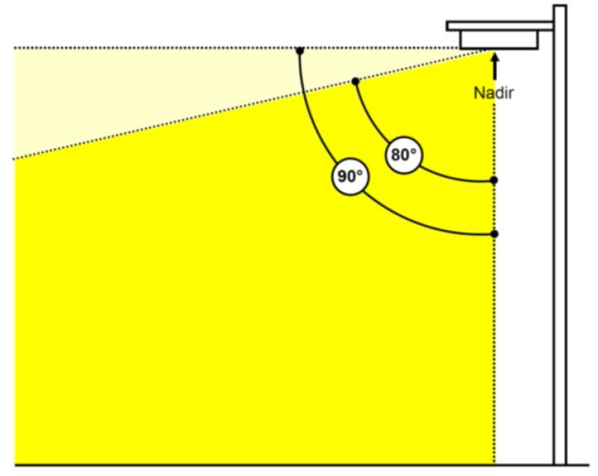
_____
4.
Fully shielded. A light fixture constructed, installed and maintained in such a manner that all light emitted from the fixture, either directly from the lamp or a diffusing element, or indirectly by reflection or refraction from any part of the fixture, is projected below the horizontal plane through the fixture's lowest light emitting part.
5.
Glare. The effect produced by a light source within the visual field that is sufficiently brighter than the level to which the eyes are adapted, to cause annoyance, discomfort, or loss of visual performance and ability.
6.
Light trespass. Unwanted light spilling onto an adjacent property.
7.
Lumen. A quantitative unit used to identify the amount of light emitted by a light source. A lamp is generally rated in lumens.
8.
Nadir. The point directly below the luminaire.
9.
Shield. A device that is attached onto or inserted into a luminaire to alter the direction of light being emitted. A luminaire that has a shield attached or inserted is considered to be "shielded."
10.
Lighting plan. The lighting plan shall include the following: (a) site plan showing the area to be illuminated; (b) the number, type, location, and mounting heights of all pole mounted and building mounted fixtures; and (c) specifications and manufacturer cut sheets for all fixtures including full cutoff classification and shielding information. Lighting plans shall contain the signature and seal of a registered architect, engineer, or lighting professional and shall certify that the illumination on the plan is in accordance with the standards contained in subsection (c)(3).
b.
Standards. The standards listed in the table titled "Lighting Standards" shall apply to a non-residential or dense residential land use either (a) adjacent to property which is protected residential, or (b) across a public roadway from property which is protected residential.
Lighting Standards
_____
c.
Prohibitions. The following outdoor lighting fixtures and applications are prohibited:
1.
Any lamp which blinks, flashes, moves, revolves, flickers, or changes intensity or color;
2.
Any upward oriented lighting;
3.
Searchlights, beacons, and laser source light fixtures;
4.
Unshielded accent building mounted luminous tube (such as neon, LED, fluorescent or other similar technology);
5.
Flood lights;
6.
Internally illuminated wall panels; and
7.
Lighting of any angled building surface (i.e. roof pitch).
d.
Exemptions. The following outdoor lighting fixtures and applications are exempt from the standards in this subsection (c)(3):
1.
Low voltage, low wattage ornamental lighting fixtures, provided the lighting is shielded to eliminate glare and light trespass;
2.
A building mounted fixture that delivers a maximum of 1,000 lumens output (equivalent to a 60-watt incandescent bulb) and utilizes a translucent lens covering the light source;
3.
Fixtures that turn on only during an emergency or power outage;
4.
Construction or emergency lighting provided that such lighting is temporary and is discontinued immediately upon completion of construction work or abatement of the emergency;
5.
Lighting of temporary uses and special events permitted by the city; and
6.
Athletic fields and outdoor recreation facilities operated by the city or the Leon County School Board.
e.
Final inspection. Prior to determining that a building passes final inspection, or prior to the issuance of a certificate of occupancy, the city land use and environmental services inspector shall confirm that the outdoor lighting as installed complies with the approved lighting plan and the requirements of this subsection.
f.
Previously developed sites. In the event of construction or redevelopment of an existing site with outdoor lighting which does not conform to this subsection and which otherwise requires a Type A or Type B site plan review pursuant to section 9-154 or section 9-155, any modification of the outdoor lighting at the site must conform to this subsection.
g.
Subsection (c)(3) does not apply to the following:
1.
Proposed non-residential or dense residential developments adjacent to or across the street from properties which are protected residential that are currently developed and occupied by a legally existing non-conforming use; or
2.
Proposed non-residential or dense residential developments adjacent to or across the street from isolated properties which are protected residential comprised of less than three units on less than three contiguous lots. For purposes of this section, "isolated" shall mean one or two residential units, which are surrounded by non-residential zoning or uses.
3.
A change of use at an existing non-residential or dense residential development, provided the change of use does not result in a more intense use that is otherwise regulated by subsection (c)(3). However, if new or replacement outdoor lighting is proposed, it must meet the standards in subsection (c)(3).
(Ord. No. 04-O-43AA, §§ 17, 18, 6-23-2004; Ord. No. 05-O-16AA, § 22, 3-30-2005; Ord. No. 06-O-04AA, § 5, 2-22-2006; Ord. No. 07-O-15, § 10, 3-28-2007; Ord. No. 07-O-39, § 4, 11-20-2007; Ord. No. 10-O-49AA, § 7, 2-23-2011; Ord. No. 13-O-03, § 20, 8-28-2013; Ord. No. 21-O-15, § 6, 6-16-2021)
Editor's note— Ord. No. 04-O-43AA, §§ 17, 18, adopted June 23, 2004, repealed and reenacted section 10-427 to read as herein set out. Formerly, § 10-427 pertained to interim development and redevelopment standards and review process for Gaines Street urban infill and redevelopment areas and derived from the Code of 1984, § 18.11; Ord. No. 02-O-48, § 1, adopted May 22, 2002, and Ord. No. 04-O-26, § 1, adopted April 28, 2004.
Sec. 10-428. - Moratorium on establishment of medical marijuana treatment centers and establishment or expansion of existing cannabis dispensing facilities.
Upon the effective date of this section and continuing for a period of 120 days, a moratorium is hereby imposed on the establishment of any medical marijuana treatment center (MMTC) or cannabis dispensing facility, and on the expansion or relocation of any existing cannabis dispensing facility, within the city.
(1)
During the moratorium, it shall be unlawful to establish, open or cause to be opened any MMTC or cannabis dispensing facility within the city. Existing and established cannabis dispensaries located in the city and operating as of the date of this moratorium, specifically including the Trulieve and Surterra Therapeutics dispensaries, are exempted from this subsection (1).
(2)
During the moratorium, it shall be unlawful to relocate or cause to be relocated any MMTC or cannabis dispensing facility within the city.
(3)
During the moratorium, it shall be unlawful to expand or cause to be expanded any MMTC or cannabis dispensing facility within the city. For purposes of this subsection, expand shall mean an increase in the physical size of a facility.
(4)
During the moratorium, the city will not take any action on any application for development permit or issue any development order or take other official action which would have the effect of allowing or permitting the development of any MMTC or cannabis dispensing facility, except as provided in this section.
(5)
During the moratorium, any applicant for any development permit, development order or any other official city action, which would facilitate the establishment of a MMTC or cannabis dispensing facility, shall be required to disclose the intention to establish such a facility. In the event that it is determined by the city that an applicant for a permit has failed to disclose the intent to establish a MMTC or cannabis dispensing facility, the city shall be authorized to take any of the following actions:
a.
Revoke or suspend any development permit, development order, certificate of occupancy or license granted after the date of this section;
b.
Suspend action on any application for any development permit, development order or other official action, which would have the effect of allowing or permitting the development of a MMTC or cannabis dispensing facility; and
c.
Take any and all such further action necessary to enforce this section.
(6)
The city commission may lift or dissolve the moratorium imposed by this section upon proper notice and a single public hearing.
(Ord. No. 16-O-33AA, § 1, 1-25-2017)
Editor's note— Prior to the reenactment of section 10-428 by Ord. No. 16-O-33AA, § 1, adopted January 25, 2017, Ord. No. 08-O-11, § 6, adopted March 26, 2008, repealed section 10-428 in its entirety, which pertained to interim development and redevelopment standards and review process for the Gaines Street Urban Infill and Redevelopment Area, and derived from Ord. No. 04-O-80, § 1, adopted October 27, 2004.
Sec. 10-429. - Development standards for dense residential uses next to properties which are protected residential.
(a)
Applicability. For the purposes of section 10-429, the terms listed below are defined as follows:
(1)
Protected residential means any property developed with a single-family residence, duplex, or triplex to a density of less than or equal to eight units per acre, and any vacant property that is zoned either RP-1, RP-2, RP-MH, RP-R, RP-UF, R-1, R-2, R-3, R-5, UF, LP, MH, or RA.
(2)
Dense residential means a residential building on a parcel larger than one-half acre developed at a density of greater than 14 units per acre.
(b)
Standards. All new dense residential projects which require a Type A or Type B site plan review pursuant to section 9-154 or section 9-155, which are adjacent to or across the street from a property which is protected residential shall meet the following regulations:
(1)
Transparency. Reflective glass (which provides for less than 70 percent light transmission) is prohibited. Transparency must be provided as indicated in the table below titled "Transparency Standard for Dense Residential". Properties in the MMTD design review districts are subject to a separate transparency standard in article IV, division 4 of this chapter (Downtown overlay regulating plan and multi-modal transportation district standards).
Transparency Standard for Dense Residential
_____
(2)
Facade articulation. No street-facing facade shall exceed 50 feet in length without at least a minimum two-foot change in the depth of the wall plane.
(3)
Roofs. Street-facing roofs that exceed 50 feet in length shall meet the following standards:
a.
Sloped roofs shall provide one or more of the following:
1.
A minimum two-foot horizontal variation in the roofline, or
2.
A roof element, that includes one of the following: dormer, cupola, gable, hip detail, or roof projections.
b.
Flat roofs shall provide either a cornice or other decorative band to serve as a building cap for the entire roof. If building equipment or utilities are located on a flat roof, a parapet wall is required to shield the equipment or utilities.
(4)
Parking. Parking shall be provided as follows:
a.
In the multi-modal transportation district, parking lots shall meet the development standards listed in article IV, division 4, Downtown overlay regulating plan and multi-modal transportation district (MMTD) standards.
b.
Outside of the multi-modal transportation district, parking lots shall meet the following standards:
1.
Parking shall be provided to the side or rear and not closer to the street than the street-facing facade of the structure.
2.
Parking lots with more than four spaces shall be screened when adjacent to a property which is protected residential. Screening shall include a Type A landscape buffer consistent with section 10-177.
(5)
Orientation. The front of the structure shall be oriented to face the primary access street.
(6)
Height step back. This standard applies to any dense residential building elevation which meets any of the following criteria:
a.
Abuts a property which is protected residential; or
b.
Is located across a local street from a property which is protected residential; or
c.
Is located across any collector or arterial roadway (which include three or fewer travel lanes) from a property which is protected residential. Striped on-street parking, middle merge lanes, and middle turn lanes shall count as one lane.
If any of the above location criteria are met, a height step back is required and shall vary based on the first floor elevation of the dense residential use in relation to the first floor elevation of the protected residential use as follows:
_____
The floors identified in the table above, and each successive floor, must be each stepped back a minimum of ten feet from the floor below it where adjacent to or across the street from a property which is protected residential. If other building elevations face non-residential uses, one additional floor is permitted along the non-residential uses to compensate for the density not permitted due to the building step back along the protected residential elevation. This standard is visually represented by the illustration titled "Height Step Back".
(7)
Outdoor uses. There shall be no active recreation uses allowed within 200 feet of any property which is protected residential.
(8)
Access. If a dense residential driveway exit is located on a local street across from a property which is protected residential, it shall be sited across from the shared property boundary of the individual protected residential lots to minimize the extent to which automobile headlights shine into the windows of residences.
(c)
Section 10-429 does not apply to the following:
(1)
Proposed dense residential developments adjacent to or across the street from properties which are protected residential that are currently developed and occupied by a legally existing non-conforming use; or
(2)
Proposed dense residential developments adjacent to or across the street from isolated properties which are protected residential comprised of less than three units on less than three contiguous lots. For purposes of this section, "isolated" shall mean one or two residential units, which are surrounded by non-residential zoning or uses.
(3)
A change of use at an existing dense residential development, provided the change of use does not result in a more intense use that is otherwise regulated by section 10-429.
Height Step Back
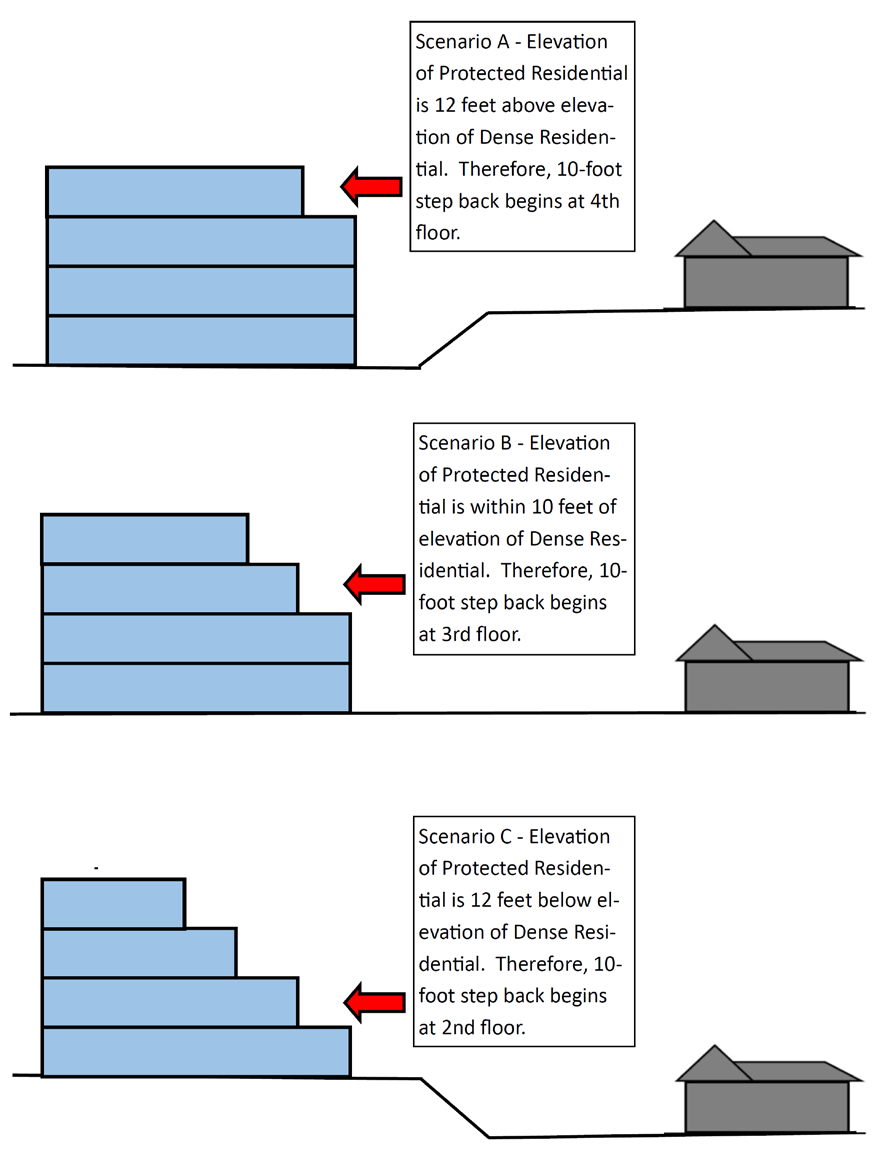
(Ord. No. 21-O-15, § 7, 6-16-2021)
Editor's note— Prior to the reenactment of section 10-429 by Ord. No. 21-O-15, § 7, adopted June 16, 2021, Ord. No. 15-O-04, § 13, adopted May 27, 2005, repealed the former section 10-429 in its entirety, which pertained to interim development and redevelopment standards and review process for the Capitol Center and Cascades Greenway Districts within the Gaines Street Urban Infill and Redevelopment Area, and derived from Ord. No. 05-O-55AA, § 1, adopted November 22, 2005.
Sec. 10-430. - Reserved.
Editor's note— Ord. No. 09-O-18, § 5, adopted May 27, 2009, repealed the former section 10-430 in its entirety, which pertained to interim development and redevelopment standards and review process for the South Monroe Sector Area, and derived from Ord. No. 06-O-08AA, § 1, adopted February 22, 2006.