
Broken Arrow City Zoning Code
CHAPTER 3
- DIMENSIONAL AND DESIGN STANDARDS
Sec. 3-1-1. - Agricultural (AG).
A.
Purpose. The AG district provides for the continued use of land for predominantly agricultural purposes and preserves undeveloped areas until they can feasibly be developed pursuant to more urban standards with adequate public safeguards for health, safety, and welfare; and to provide a base zoning classification as a holding mechanism for newly annexed property.
B.
Applicability. The standards in this section apply to areas denoted as AG on the Official Zoning Map.
C.
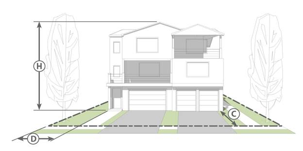
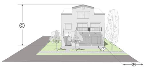
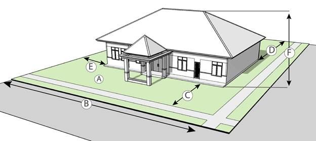
Dimensional standards. Table 3-1-1-1, Dimensional Standards, below, establishes the standards for constructing new development in the AG zoning district.
| Table 3-1-1-1
AG Dimensional Standards | |||
|---|---|---|---|
| Standards | Illustrative | ||
| Minimum Lot | 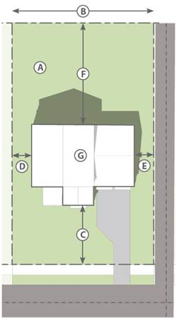 | ||
| A | Area | 5 ac. | |
| B | Frontage | 330 ft. | |
| Minimum Building Setback | |||
| C | Front | 50 ft. | |
| F | Rear 1 | Lesser of 50 ft. or 20% of lot depth | |
| D | Side (one, total) | one: 25 ft.; both: 60 ft. | |
| E | Side adjacent to arterial | 50 ft. | |
| E | Setback on corner or adjacent to public street/alley | 50 ft. | |
| Maximum | |||
| — | Building Height | 50 ft. | |
| — | Lot Coverage | 30% | |
 | |||
|
TABLE NOTES:
1. In the AG district only, the front setback is measured from the ultimate right-of-way line, as recommended in the Comprehensive Plan. | |||
D.
Land uses and off-street parking. Table 3-1-1-2, Permitted Uses and Minimum Off-Street Parking Spaces, shows the uses and use categories permitted in the agricultural (AG) zoning district. Associated minimum off-street parking spaces apply to all development option types. See Division 4-2, Parking, Loading, and Access, for more detailed provisions. Uses not listed in this table are prohibited unless the Director interprets a use as functionally the same, as described in Section 2-2-1.E.1, Classification of New and Unlisted Uses.
E.
Landscaping and buffering. Table 3-1-1-3, AG Landscape Standards, provides general standards for planting requirements in the AG zoning district. For more detail, refer to Division 4-3, Landscaping, Screening, and Tree Preservation.
F.
Signs. Table 3-1-1-4, AG Permitted Sign Types, establishes the sign types that require or do not require a sign permit and contains a cross-reference to the sign type standards. Sign types not listed are prohibited in this zoning district. For more detail, refer to Chapter 5, Signs.
Sec. 3-1-2. - Single-family residential (RS).
A.
Purpose. The RS district is intended to accommodate single-family residential dwellings and developments with a range of lot sizes depending on location, context, and scale.
B.
Applicability. The standards in this section apply to areas designated RS on the Official Zoning Map.
C.
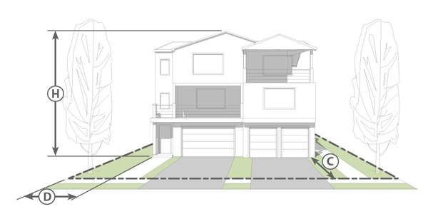
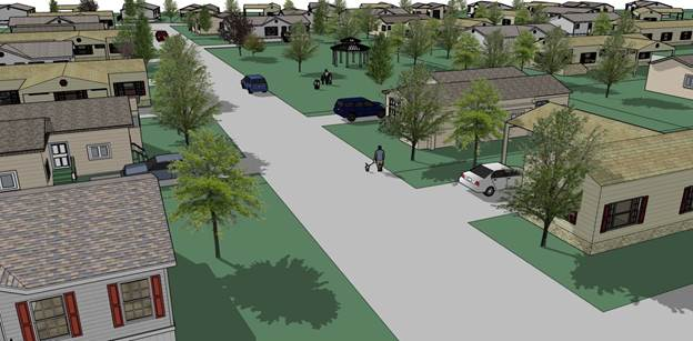
Dimensional standards. Table 3-1-2-1, RS Dimensional Standards, below, establishes the standards for developing new neighborhoods in the RS zoning district. Figure 3-1-2-1, RS Subdivision Development Options Illustrative, provides a visual example of an RS development.
| Table 3-1-2-1
RS Dimensional Standards | |||
|---|---|---|---|
| Standards | Illustrative | ||
| Minimum Lot |  | ||
| A | Area | 6,500 sq. ft. | |
| B | Frontage 5 | 60 ft. | |
| Minimum Building Setback | |||
| C | Front 2 | 25 ft. | |
| F | Rear | 20 ft. | |
| D | Side (one, total) | 5 ft., 10 ft. | |
| E | Side and rear adjacent to arterial | 35 ft. | |
| E | Setback on corner or adjacent to public street/alley | 25 ft. | |
| Maximum | |||
| — | Building Height | 35 ft. | |
| — | Lot Coverage 1 | 50% | |
 | |||
|
TABLE NOTES:
1. Additional ten percent lot coverage allowed for corner lots 2. For lots in single-family residential districts with two or more sides abutting a public way (not including arterials), the front yard may be reduced to 15 feet along those rights-of-way that have no vehicular access. In such instances, there shall be no obstruction in a 15-foot front yard (such as buildings, fences, parked vehicles, etc.) and vehicular access should be from the street with the lowest design speed and capacity and lowest traffic volume. The jog in the front yard between the two lots shall not exceed five feet. 3. The minimum lot frontage of any wedge-shaped lot may be measured at the build line. Lot must have at least 30 feet of frontage where the lot abuts the street. | |||
| Figure 3-1-2-1
RS Development Illustrative | |
|---|---|
 | |
D.
Land uses and off-street parking. Table 3-1-2-2, RS Permitted Uses and Minimum Off-Street Parking Spaces, shows the uses and use categories permitted in the single-family residential (RS) zoning district. Associated minimum off-street parking spaces apply to all development option types. See Division 4-2, Parking, Loading, and Access, for more detailed provisions. Uses not listed in this table are prohibited unless the Director interprets a use as functionally the same, as described in Section 2-2-1.E.1, Classification of New and Unlisted Uses.
E.
Landscaping and buffering. Table 3-1-2-3, Landscape Standards, provides general standards for planting requirements in the RS zoning district. For more detail, refer to Division 4-3, Landscaping, Screening, and Tree Preservation.
F.
Signs. Table 3-1-2-4, RS Permitted Sign Types, establishes the sign types that require or do not require a sign permit and contains a cross-reference to the sign type standards. Sign types not listed are prohibited in this zoning district. For more detail, refer to Chapter 5, Signs.
Sec. 3-1-3. - Single-family residential-compact (RS-C).
A.
Purpose. The RS-C district is intended to provide for the smaller residential lots, compared to the RS district, in exchange for the permanent set aside of common open space.
B.
Applicability. The standards in this section apply to areas designated RS-C on the Official Zoning Map.
C.
Dimensional standards. Table 3-1-3-1, RS-C Dimensional Standards, below, establishes the standards for developing new neighborhoods in the RS-C zoning district. Figure 3-1-3-1, RS-C Compact Development Illustrative, provides a visual example of RS-C development.
| Table 3-1-3-1
RS-C Dimensional Standards | |||
|---|---|---|---|
| Standards | Illustrative | ||
| Open Space |  | ||
| — | Minimum Common Open Space 1,2 | 15% | |
| Minimum Lot | |||
| A | Area | 5,000 sq. ft. | |
| B | Frontage 5 | 50 ft. | |
| Minimum Building Setback | |||
| C | Front 4 | 20 ft. | |
| F | Rear | 20 ft. | |
| D | Side (one, total) | 5 ft., 10 ft. | |
| E | Side and rear adjacent to arterial | 35 ft. | |
| E | Setback on corner or adjacent to public street/alley | 20 ft. | |
| Maximum | |||
| — | Building Height | 35 ft. | |
| — | Lot Coverage 3 | 55% | |
 | |||
|
TABLE NOTES:
1. Common open space in entire development. 2. Refer to Section 3-1-2.G, Open Space Development Standards, below. 3. Additional ten percent lot coverage allowed for corner lots. 4. For lots in single-family residential districts with two or more sides abutting a public way (not including arterials), the front yard may be reduced to 15 feet along those rights-of-way that have no vehicular access. In such instances, there shall be no obstruction in a 15-foot front yard (such as buildings, fences, parked vehicles, etc.) and vehicular access should be from the street with the lowest design speed and capacity and lowest traffic volume. The jog in the front yard between the two lots shall not exceed five feet. 5. The minimum lot frontage of any wedge-shaped lot may be measured at the build line. Lot must have at least 30 feet of frontage where the lot abuts the street. | |||
| Figure 3-1-3-1
RS-C Compact Development Illustrative | |
|---|---|
 | |
D.
Land uses and off-street parking. Table 3-1-3-2, RS-C Permitted Uses and Minimum Off-Street Parking Spaces, shows the uses and use categories permitted in the single-family residential-compact (RS-C) zoning district. Associated minimum off-street parking spaces apply to all development option types. See Division 4-2, Parking, Loading, and Access, for more detailed provisions. Uses not listed in this table are prohibited unless the Director interprets a use as functionally the same, as described in Section 2-2-1.E.1, Classification of New and Unlisted Uses.
E.
Landscaping and buffering. Table 3-1-3-3, Landscape Standards, provides general standards for planting requirements in the RS-C zoning district. For more detail, refer to Division 4-3, Landscaping, Screening, and Tree Preservation.
F.
Signs. Table 3-1-3-4, RS-C Permitted Sign Types, establishes the sign types that require or do not require a sign permit and contains a cross-reference to the sign type standards. Sign types not listed are prohibited in this zoning district. For more detail, refer to Chapter 5, Signs.
G.
Open space development standards. Open space conveyed to the City in the RS-C district shall meet the standards below:
1.
Permitted types of open space. Table 3-1-3-5, RS-C Open Space Types, shows the types of open space that are permitted within an RS-C development. In addition to these types, other open space types approved by the Director are permitted.
2.
Minimum street frontage. Required open space shall have a minimum of 20 feet of frontage on a public street.
3.
Floodplain. A minimum of 50 percent of the dedicated open space within a subdivision shall be outside of the 100-year floodplain.
4.
Access. A proposed development adjacent to required open space area shall not be designed to restrict reasonable access to the open space.
6.
Active and passive. A minimum of 25 percent of the required open space shall be active open space.
7.
Interconnection. Open space land within a development shall be interconnected to existing and potential open space on adjacent properties, as well as to other internal open space in the subdivision to provide a continuous network within and adjoining the subdivision. Open space land shall also be linked to pedestrian and bicycle improvements, and other open space and amenities to create a network of open spaces within the development and between adjacent developments.
8.
Tree preservation. Trees within the preserved passive or active open space of a development shall be preserved in accordance with Section 4-3-4, Existing Tree Protection and Replacement. Under no circumstances may Bradford Pears be planted within common open space.
9.
Structures. Except for pavilions, playing fields, and structures and improvements for storm water drainage, wastewater treatment, or water supply, passive open space shall be free of all structures.
10.
Wastewater treatment and water. The square footage set aside for wastewater treatment and water supply shall not be credited toward the minimum required open space.
11.
Community garden. A community garden may be utilized to meet the open space dedication requirements.
12.
Maintenance and ownership of open space. Open space within a development shall be owned and maintained by one of the following: a homeowners association, a non-profit land trust, or (under specific circumstances) the City.
13.
Phasing. The amount of dedicated open space per final plat shall be commensurate with the number of lots that have received final plat approval. For example, a subdivision with 300 lots that has 150 lots that have received final plat approval shall have a minimum of 50 percent of its overall required open space dedicated.
| Table 3-1-3-5
RS-C Open Space Types | |
|---|---|
 Community Garden Community Garden |  Courtyard or Plaza Courtyard or Plaza |
 Park Park |  Trail Trail |
| * Note: Images are shown as examples only. | |
H.
Transition to adjacent existing subdivisions. An RS-C development utilizes common open space that is permanently set aside to provide rural and suburban character and increased lot counts to incentivize their use, compared to a conventional development. An RS-C development that abuts an existing single-family subdivision that is not in the RS-C or RS-P district shall meet a minimum of one of the standards below.
1.
Lots. Lots on the perimeter of the RS-C development shall be equal to or greater than the lot area and width of the adjacent lots.
2.
Setbacks. Dwelling units on the perimeter of the RS-C development shall be set back from the boundary of the existing single-family subdivision a minimum of the following distances.
a.
One to four RS-C lots: setback required in Table 3-1-3-1, above;
b.
Five to 20 RS-C lots: 35 feet; and
c.
Twenty-one or more RS-C lots: 50 feet.
3.
Open space. A natural, preserved common open space area a minimum of 50 feet in width shall be provided within the development along its common boundary with the existing single-family subdivision, within which no new structures shall be constructed and no clearing of trees or understory growth shall be permitted (except as necessary for trail construction).
Sec. 3-1-4. - Single-family residential-preservation (RS-P).
A.
Purpose. The RS-P district is intended to provide for the smallest of single-family residential lots, compared to the RS and RS-C districts, in exchange for the permanent set aside of common open space.
B.
Applicability. The standards in this section apply to areas designated RS-P on the Official Zoning Map.
C.
Dimensional standards. Table 3-1-4-1, RS-P Dimensional Standards, below, establishes the standards for developing new neighborhoods in the RS-P zoning district. Figure 3-1-4-1, RS-P Preservation Development Illustrative, provides a visual example of RS-P development.
| Table 3-1-4-1
RS-P Dimensional Standards | |||
|---|---|---|---|
| Standards | Illustrative | ||
| Open Space |  | ||
| — | Minimum Common Open Space 1,2 | 25% | |
| Minimum Lot | |||
| A | Area | 3,500 sq. ft. | |
| B | Frontage 5 | 35 ft. | |
| Minimum Building Setback | |||
| C | Front 4 | 20 ft. | |
| F | Rear | 15 ft. | |
| D | Side (one, total) | 5 ft., 10 ft. | |
| E | Side and rear adjacent to arterial | 35 ft. | |
| E | Setback on corner or adjacent to public street/alley | 15 ft. | |
| Maximum | |||
| — | Building Height | 35 ft. | |
| — | Lot Coverage 3 | 60% | |
 | |||
|
TABLE NOTES:
1. Common open space in entire development. 2. Refer to Section 3-1-2.G, Open Space Development Standards, below. 3. Additional ten percent lot coverage allowed for corner lots. 4. For lots in single-family residential districts with two or more sides abutting a public way (not including arterials), the front yard may be reduced to 15 feet along those rights-of-way that have no vehicular access. In such instances, there shall be no obstruction in a 15-foot front yard (such as buildings, fences, parked vehicles, etc.) and vehicular access should be from the street with the lowest design speed and capacity and lowest traffic volume. The jog in the front yard between the two lots shall not exceed five feet. 5. The minimum lot frontage of any wedge-shaped lot may be measured at the build line. Lot must have at least 30 feet of frontage where the lot abuts the street. | |||
| Figure 3-1-4-1
RS-P Development Illustrative | |
|---|---|
 |
D.
Land uses and off-street parking. Table 3-1-4-2, RS-P Permitted Uses and Minimum Off-Street Parking Spaces, shows the uses and use categories permitted in the single-family residential-preservation (RS-P) zoning district. Associated minimum off-street parking spaces apply to all development option types. See Division 4-2, Parking, Loading, and Access, for more detailed provisions. Uses not listed in this table are prohibited unless the Director interprets a use as functionally the same, as described in Section 2-2-1.E.1, Classification of New and Unlisted Uses.
E.
Landscaping and buffering. Table 3-1-4-3, Landscape Standards, provides general standards for planting requirements in the RS-P zoning district. For more detail, refer to Division 4-3, Landscaping, Screening, and Tree Preservation.
F.
Signs. Table 3-1-4-4, RS-P Permitted Sign Types, establishes the sign types that require or do not require a sign permit and contains a cross-reference to the sign type standards. Sign types not listed are prohibited in this zoning district. For more detail, refer to Chapter 5, Signs.
G.
Open space development standards. Open space conveyed to the City in the RS-P district shall meet the standards below.
1.
Permitted types of open space. Table 3-1-4-5, RS-P Open Space Types, shows the types of open space that are permitted within an RS-P development. In addition to these types, other open space types approved by the Director are permitted.
2.
Minimum street frontage. Required open space shall have a minimum of 20 feet of frontage on a public street.
3.
Floodplain. A minimum of 50 percent of the dedicated open space within a subdivision shall be outside of the 100-year floodplain.
4.
Access. A proposed development adjacent to required open space area shall not be designed to restrict reasonable access to the open space.
5.
Parkland. A maximum of 25 percent of the required open space may be parkland or other permitted type of open space allowed in the RS-P district.
6.
Interconnection. Open space land within a development shall be interconnected to existing and potential open space on adjacent properties, as well as to other internal open space in the subdivision to provide a continuous network within and adjoining the subdivision. Open space land shall also be linked to pedestrian and bicycle improvements, and other open space and amenities to create a network of open spaces within the development and between adjacent developments.
7.
Tree preservation. Trees within the preserved passive or active open space of a development shall be preserved in accordance with Section 4-3-4, Existing Protection and Replacement. Under no circumstances may Bradford Pears be planted within common open space.
8.
Structures. Except for pavilions, playing fields, and structures and improvements for storm water drainage, wastewater treatment, or water supply, passive open space shall be free of all structures.
9.
Wastewater treatment and water. The square footage set aside for wastewater treatment and water supply shall not be credited toward the minimum required open space.
10.
Maintenance and ownership of open space. Open space within a development shall be owned and maintained by one of the following: a homeowners association, a non-profit land trust, or (under specific circumstances) the City.
11.
Phasing. The amount of dedicated open space per final plat shall be commensurate with the number of lots that have received final plat approval. For example, a subdivision with 300 lots that has 150 lots that have received final plat approval shall have a minimum of 50 percent of its overall required open space dedicated.
| Table 3-1-4-5
RS-P Open Space Types | |
|---|---|
 Grassland Grassland |  Riparian Buffer Riparian Buffer |
 Natural Vegetated Buffer Natural Vegetated Buffer |  Woodland Woodland |
| * Note: Images are shown as examples only. | |
H.
Transition to adjacent existing subdivisions. An RS-P development utilizes common open space that is permanently set aside to provide rural and suburban character and increased lot counts to incentivize their use, compared to a conventional development. An RS-P development that abuts an existing single-family subdivision that is not in the RS-C or RS-P district shall meet a minimum of one of the standards below.
1.
Lots. Lots on the perimeter of the RS-P development shall be equal to or greater than the lot area and width of the adjacent lots.
2.
Setbacks. Dwelling units on the perimeter of the RS-P development shall be set back from the boundary of the existing single-family subdivision a minimum of the following distances.
a.
One to four RS-P lots: setback required in Table 3-1-4-1, above;
b.
Five to 20 RS-P lots: 35 feet; and
c.
Twenty-one or more RS-P lots: 50 feet.
3.
Open space. A natural, preserved common open space area a minimum of 50 feet in width shall be provided within the development along its common boundary with the existing single-family subdivision, within which no new structures shall be constructed and no clearing of trees or understory growth shall be permitted (except as necessary for trail construction).
Sec. 3-1-5. - Residential medium density (RMD).
A.
Purpose. The RMD district is intended for the construction of and the continued use of land for single- and two-family dwellings.
B.
Applicability. The standards in this section apply to areas designated as RMD on the Official Zoning Map.
C.
Dimensional standards. Table 3-1-5-1, RMD Dimensional Standards, below, establishes the standards for constructing new development in the RMD zoning district.
| Table 3-1-5-1
RMD Dimensional Standards | |||
|---|---|---|---|
| Standards | Illustrative | ||
| Minimum Lot | 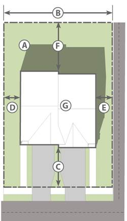 | ||
| A | Area |
Detached or Duplex: 7,000 sf
Attached: 4,000 sf/dwelling unit | |
| B | Frontage |
Detached or Duplex: 60 ft
Attached: 30 ft/dwelling unit | |
| Minimum Building Setback | |||
| C | Front | 25 ft 1 | |
| F | Rear | 20 ft | |
| D | Side | 10 ft | |
| E | Side adjacent to arterial | 35 ft | |
| E | Setback on corner or adjacent to public street/alley | 25 ft | |
| Maximum | |||
| H | Building Height | 35 ft | |
| — | Lot Coverage | 50% 2 | |
 | |||
|
TABLE NOTES:
1. For corner lots, the front setback may be reduced to 15 feet along those rights-of-way without vehicular access, and may be reduced to 20 feet along stub streets. In such instances, vehicular access shall be provided from the street with the lowest design speed, capacity, and volume. 2. Additional ten percent lot coverage allowed for corner lots. | |||
D.
Land uses and off-street parking. Table 3-1-5-2, RMD Permitted Uses and Minimum Off-Street Parking Spaces, shows the uses and use categories permitted in the residential medium density (RMD) zoning district. Associated minimum off-street parking spaces are included as well. See Division 4-2, Parking, Loading, and Access, for more detailed provisions. Uses not listed in this table are prohibited unless the Director interprets a use as functionally the same, as described in Section 2-2-1.E.1, Classification of New and Unlisted Uses.
E.
Landscaping and buffering. Table 3-1-5-3, RMD Landscape Standards, provides general standards for planting requirements in the RMD zoning district. For more detail, refer to Division 4-3, Landscaping, Screening, and Tree Preservation.
F.
Signs. Table 3-1-5-4, RMD Permitted Sign Types, establishes the sign types that require or do not require a sign permit and contains a cross-reference to the sign type standards. Sign types not listed are prohibited in this zoning district. For more detail, refer to Chapter 5, Signs.
Sec. 3-1-6. - Residential multi-family (RMF).
A.
Purpose. The RMF district is intended to accommodate the development of multi-family dwellings, including both ownership and rental units, at varied medium to high densities. Through adequate site planning and development standards, multi-family units are intended to be compatible with surrounding zoning and existing land uses.
B.
Applicability. The standards in this section apply to areas designated as RMF on the Official Zoning Map.
C.
Dimensional standards. Table 3-1-6-1, RMF Dimensional Standards, below, establishes the standards for new development in the RMF zoning district.
| Table 3-1-6-1
RMF Dimensional Standards | |||
|---|---|---|---|
| Standards | Illustrative | ||
| Minimum Lot |  | ||
| A | Area |
Multi-family: 2,300 sf per dwelling unit
Other uses: 4,000 sf per dwelling unit | |
| B | Frontage |
Detached or Duplex: 60 ft
Attached: 30 ft/dwelling unit Other uses: 200 ft. | |
| Minimum Building Setback | |||
| C | Front |
Multi-family: 35 ft.
Other uses: 25 ft. | |
| F | Rear |
Multi-family: 35 ft.; 50 ft. if adjacent to AG, RS, RS-C, RS-P, or RMD
Other uses: 20 ft. | |
| D | Side |
Multi-family: 35 ft.; 50 ft. if adjacent to AG, RS, RS-C, RS-P, or RMD
Other uses: 10 ft. | |
| E | Side adjacent to arterial | 35 ft. | |
| E | Setback on corner or adjacent to public street/alley |
Multi-family: 35 ft.
Other uses: 20 ft. | |
| Maximum | |||
| H | Building Height | 35 ft. | |
| — | Lot Coverage | 50% 1 | |
 | |||
|
TABLE NOTES:
1. Additional ten percent lot coverage allowed for corner lots. | |||
D.
Land uses and off-street parking. Table 3-1-6-2, RMF Permitted Uses and Minimum Off-Street Parking Spaces, shows the uses and use categories permitted in the residential multi-family zoning district. Associated minimum off-street parking spaces apply to all development option types. See Division 4-2, Parking, Loading, and Access, for more detailed provisions. Uses not listed in this table are prohibited unless the Director interprets a use as functionally the same, as described in Section 2-2-1.E.1, Classification of New and Unlisted Uses.
E.
Landscaping and buffering. Table 3-1-6-3, RMF Landscape Standards, provides general standards for planting requirements in the RMF zoning district. For more detail, refer to Division 4-3, Landscaping, Screening, and Tree Preservation.
F.
Signs. Table 3-1-6-4, RMF Permitted Sign Types, establishes the sign types that require or do not require a sign permit and contains a cross-reference to the sign type standards. Sign types not listed are prohibited in this zoning district. For more detail, refer to Chapter 5, Signs.
G.
Additional design standards.
1.
Multi-family building design standards. These standards are intended to promote high-quality multi-family residential development and construction, protect property values, and encourage visual variety and architectural compatibility.
a.
Building location and orientation.
i.
In multi-building developments, the buildings shall be arranged to enclose and frame common areas. Common areas and courtyards shall be convenient to a majority of units.
ii.
When more than one multi-family building is constructed:
(A)
No side, end, or rear wall of a multi-family structure shall be located within 20 feet of a side, end, or rear wall of any other multi-family structure;
(B)
No side, end, or rear wall of a multi-family structure shall be located within 30 feet of the front wall of any other multi-family structure;
(C)
No front wall of a multi-family structure shall be located within 40 feet of the front wall of any other multi-family structure;
(D)
No more than three structures shall be located continuously on the same building line, or within 30 feet of such building line established. Buildings shall be arranged so that the fronts of the buildings are set to the front or back of each adjacent front building line by at least 30 feet or more; and
(E)
Parking lots shall be no more than 350 feet in length without an offset change in direction of 30 feet or more, centerline to centerline.
b.
Building mass and articulation.
i.
A multi-family building shall be a maximum of 250 feet in length.
ii.
Each facade greater than 50 feet in length, measured horizontally, shall incorporate wall plane projections or recesses having a depth of at least ten percent of the length of the facade, and extending at least 20 percent of the length of the facade. No uninterrupted length of any facade shall exceed 50 horizontal feet. Figure 3-2-4-1, Multi-family Building Articulation, illustrates this concept of wall plane projections and recesses.
iii.
Blocky, uniform facades are prohibited. As shown in Figure 3-1-6-1, Multi-family Building Articulation, the facades of all multi-family buildings shall be articulated through the incorporation of two or more of the following:
(A)
Balconies;
(B)
Bay or box windows;
(C)
Porches;
(D)
Dormers;
(E)
Variations in materials; or
(F)
Variations in roof forms.
iv.
The height of each multi-family building taller than 35 feet shall be stepped down from its highest roofline at least one full story on any end of the building located within 50 feet of a street right-of-way or an adjacent area with single-family or two-family residential development.
| Figure 3-1-6-1
Multi-Family Building Articulation | |
|---|---|
 |
c.
Roof design.
i.
Roof forms and rooflines shall be broken into a series of smaller components when viewed from the street. A continuous roofline shall be no more than 50 feet in length.
(A)
For a flat roof or facade with a horizontal eave, fascia or parapet, the minimum vertical dimension of roofline modulation is the greater of two feet or ten percent of the wall height (finish grade to top of wall).
(B)
For other roof forms, individual segments of the roof with no change in slope may not exceed 40 percent of the total roof amount.
(C)
Upper-level residential floors may be incorporated into the roof form to reduce the apparent height and mass of buildings.
ii.
All roof jack and penetrations shall be painted to match adjacent roof color.
d.
Building entrance.
i.
Entrances shall be prominent and visible from the street and from parking areas.
ii.
Primary building entrances and entrances facing a street shall be covered with a canopy, awning, or similar weather protection, or may be designed with a covered breezeway.
iii.
Apartment buildings and mixed-use building types with common entries shall provide at least one, zero-step entrance to each building from an accessible path at the front, side, or rear of each building.
iv.
A building entrance shall be clearly distinguishable in its architectural design and treatment. Examples include:
(A)
The inclusion of side-lights (glazed openings to the side of the door), or transom-lights (glazed opening above the door) in the entry design;
(B)
A change in building materials around the entrance; and
(C)
A small projection or recession (maximum of ten feet) of the wall surrounding the entrance.
e.
Facades and detail elements.
i.
Windows. All elevations on multi-family buildings shall contain windows. Primary facades and street-facing elevations shall contain at least 15 percent windows.
ii.
Detailed design. Buildings shall provide detailed design by incorporating at least two of the following features:
(A)
Dormers;
(B)
Gables;
(C)
Recessed or covered porch entries;
(D)
Cupolas or towers;
(E)
Pillars, posts, or columns;
(F)
Balconies;
(G)
Eaves (minimum 12-inch projection);
(H)
Overhanging eaves with exposed rafters;
(I)
Offsets in building face or roof (minimum 16 inches); and
(J)
Decorative patterns on exterior finishes (e.g., shingles, wainscoting, ornamentation, and similar features.)
iii.
Four-sided design. A multi-family building's architectural features and treatments shall not be restricted to a single elevation. All sides of a building open to view by the public shall display a similar level of quality and architectural interest.
f.
Materials.
i.
The exterior walls of multi-family structures shall be constructed of masonry, concrete panels, exterior insulated finished systems (EIFS), and/or stucco.
ii.
Front and side elevations of multi-family structures located within 200 feet of a public street right-of-way shall be constructed of brick and/or natural stone.
iii.
Front and side elevations of multi-family structures located between 201 and 500 feet of a public street right-of-way shall be constructed of a minimum of 50 percent brick and/or natural stone.
iv.
Front and side elevations of multi-family structures located between 501 and 800 feet of a public street right-of-way shall be constructed of a minimum of 25 percent brick and/or natural stone.
v.
Rear elevations of multi-family structures shall provide a minimum of 50 percent of the required percentage of brick and/or natural stone that is required for the front and side elevations of that same structure pursuant to subparagraphs b through d, above.
g.
Storage for accessory elements. Multi-family projects shall provide covered, enclosed, and secure storage areas for bicycles and other belongings that typically cannot be accommodated within individual dwelling units. Storage and other accessory buildings shall be designed with materials and/or architectural elements that are related to the principal building(s).
h.
Garages.
i.
Attached or detached garages.
(A)
Detached garages and carports shall not be located between a principal multi-family building and a primary street from which the building is entered.
(B)
Where possible, a detached garage shall be internalized in building groups to minimize visibility from adjacent streets.
ii.
Size.
(A)
Detached garages and carports shall be limited to six spaces per structure to avoid a continuous row of garages.
(B)
No more than six garage doors may appear on any multi-family building elevation containing front doors, and the plane of each garage door shall be offset at least two feet from the plane of the garage door adjacent to it.
iii.
Design.
(A)
Detached garages and carports shall be integrated in design with the principal building architecture, and shall incorporate similar and compatible forms, scale, materials, color, and details.
(B)
Side- or rear-facing garages shall have windows or other architectural details that mimic the features of the living portion of the structures on the side of the garage facing a street.
Sec. 3-1-7. - Residential manufactured home (RMH).
A.
Purpose. The RMH district is intended to accommodate manufactured homes and subdivisions to establish minimum standards for such uses to ensure compatibility with surrounding zoning and existing land uses.
B.
Applicability. The standards in this section apply to areas designated residential manufactured home on the Official Zoning Map.
C.
Dimensional standards. Table 3-1-7-1, RMH Dimensional Standards, below, establishes the standards for new development in the RMH zoning district.
| Table 3-1-7-1
RMH Dimensional Standards | |||
|---|---|---|---|
| Standards | Illustrative | ||
| Minimum Tract Requirements |  | ||
| Area | |||
| — | Total | 5 acres | |
| — | Per manufactured home | 4,000 sf | |
| Width | |||
| — | Principal entrance | 50 ft. | |
| — | Elsewhere | 100 ft. | |
| Building Setback1 | |||
| — | From public thoroughfare | 35 ft. | |
| — | From side and rear boundary | 25 ft. | |
| Minimum Lot Requirement | |||
| A | Area | 2,000 sf | |
| B | Setback from internal street or drive | 20 ft. | |
| C | Separation between manufactured homes | 15 ft. | |
| — | Separation from boundary of manufactured home lot | 10 ft. | |
 | |||
|
TABLE NOTES:
1. A required building setback from an abutting street shall be measured from the planned right-of-way as designated by the Transportation Plan as set forth in the Comprehensive Plan. | |||
D.
Land uses and off-street parking. Table 3-1-7-2, RMH Permitted Uses and Minimum Off-Street Parking Spaces, shows the uses and use categories permitted in the residential manufactured home (RMH) zoning district. Associated minimum off-street parking spaces apply to all development option types. See Division 4-2, Parking, Loading, and Access, for more detailed provisions. Uses not listed in this table are prohibited unless the Director interprets a use as functionally the same, as described in Section 2-2-1.E.1, Classification of New and Unlisted Uses.
E.
Landscaping and buffering. Table 3-1-7-3, RMH Landscape Standards, provides general standards for planting requirements in the RMH zoning district. For more detail, refer to Division 4-3, Landscaping, Screening, and Tree Preservation.
F.
Signs. Table 3-1-7-4, RMH Permitted Sign Types, establishes the sign types that require or do not require a sign permit and contains a cross-reference to the sign type standards. Sign types not listed are prohibited in this zoning district. For more detail, refer to Chapter 5, Signs.
Sec. 3-2-1. - Community mixed-use (CM).
A.
Purpose. The community mixed-use (CM) district is intended to provide for small, compact commercial centers within or surrounded by residential areas, compatible in scale and character with surrounding residential uses, to serve the convenience needs of the immediately surrounding neighborhood. Ground-floor, small-scale retail is typical, and upper-story residential and office use is encouraged. Neighborhood centers are walkable with a focus on multimodal safety and access.
B.
Applicability. The standards in this section apply to areas designated as CM on the Official Zoning Map.
C.
Dimensional standards. Table 3-2-1-1, CM Dimensional Standards, below, establishes the standards for constructing new development in the CM zoning district.
| Table 3-2-1-1
CM Dimensional Standards | |||
|---|---|---|---|
| Standards | |||
| Lot dimensions | |||
| — | Area | 10,000 sf (min) | |
| — | Min. lot frontage | None | |
| — | Building Coverage | None | |
| Setbacks1 | |||
| A | Front | 10 ft. (Maximum) | |
| — | Rear | None | |
| B | Side abutting property in same district | None | |
| B | Side abutting property in a different nonresidential district | None | |
| B | Side abutting property in a residential district | None | |
| Building dimensions | |||
| C | Height | 35 ft or 2.5 stories (Maximum) | |
 | |||
|
TABLE NOTES:
1. A required building setback from an abutting street shall be measured from the planned right-of-way as designated by the Transportation Plan as set forth in the Comprehensive Plan. | |||
D.
Land uses and off-street parking. Table 3-2-1-2, CM Permitted Uses and Minimum Off-Street Parking Spaces, shows the uses and use categories permitted in the community mixed-use zoning district. Associated minimum off-street parking spaces are included as well. See Division 4-2, Parking, Loading, and Access, for more detailed provisions. Uses not listed in this table are prohibited unless the Director interprets a use as functionally the same, as described in Section 2-2-1.E.1, Classification of New and Unlisted Uses.
E.
Landscaping and buffering. Table 3-2-1-3, CM Landscape Standards, provides general standards for planting requirements in the CM zoning district. For more detail, refer to Division 4-3, Landscaping, Screening, and Tree Preservation.
F.
Signs. Table 3-2-1-4, CM Permitted Sign Types, establishes the sign types that require or do not require a sign permit and contains a cross-reference to the sign type standards. Sign types not listed are prohibited in this zoning district. For more detail, refer to Chapter 5, Signs.
G.
Additional design standards.
1.
Ground floor design. The ground floor level of all buildings in the CM district shall be limited to retail uses, with the exception of small lobbies to allow access to residential and office uses on upper floors.
2.
Drive-thrus prohibited. No drive-thrus shall be permitted in the CM district.
3.
Multi-family building design standards. These standards are intended to promote high-quality multi-family residential development and construction, protect property values, and encourage visual variety and architectural compatibility.
a.
Building location and orientation.
i.
In multi-building developments, the buildings shall be arranged to enclose and frame common areas. Common areas and courtyards shall be convenient to a majority of units.
ii.
When more than one multi-family building is constructed:
(A)
No side, end, or rear wall of a multi-family structure shall be located within 20 feet of a side, end, or rear wall of any other multi-family structure;
(B)
No side, end, or rear wall of a multi-family structure shall be located within 30 feet of the front wall of any other multi-family structure;
(C)
No front wall of a multi-family structure shall be located within 40 feet of the front wall of any other multi-family structure;
(D)
No more than three structures shall be located continuously on the same building line, or within 30 feet of such building line established. Buildings shall be arranged so that the fronts of the buildings are set to the front or back of each adjacent front building line by at least 30 feet or more; and
(E)
Parking lots shall be no more than 350 feet in length without an offset change in direction of 30 feet or more, centerline to centerline.
b.
Building mass and articulation.
i.
A multi-family building shall be a maximum of 200 feet in length.
ii.
Each facade greater than 50 feet in length, measured horizontally, shall incorporate wall plane projections or recesses having a depth of at least ten percent of the length of the facade, and extending at least 20 percent of the length of the facade. No uninterrupted length of any facade shall exceed 50 horizontal feet. Figure 3-2-4-1, Multi-family Building Articulation, illustrates this concept of wall plane projections and recesses.
iii.
Blocky, uniform facades are prohibited. As shown in Figure 3-2-1-1, Multi-family Building Articulation, the facades of all multi-family buildings shall be articulated through the incorporation of two or more of the following:
(A)
Balconies;
(B)
Bay or box windows;
(C)
Porches;
(D)
Dormers;
(E)
Variations in materials; or
(F)
Variations in roof forms.
iv.
The height of each multi-family building taller than 35 feet shall be stepped down from its highest roofline at least one full story on any end of the building located within 50 feet of a street right-of-way or an adjacent area with single-family or two-family residential development.
| Figure 3-2-1-1
Multi-Family Building Articulation | |
|---|---|
 |
c.
Roof design.
i.
Roof forms and rooflines shall be broken into a series of smaller components when viewed from the street. A continuous roofline shall be no more than 50 feet in length.
(A)
For a flat roof or facade with a horizontal eave, fascia or parapet, the minimum vertical dimension of roofline modulation is the greater of two feet or ten percent of the wall height (finish grade to top of wall).
(B)
For other roof forms, individual segments of the roof with no change in slope may not exceed 40 percent of the total roof amount.
(C)
Upper-level residential floors may be incorporated into the roof form to reduce the apparent height and mass of buildings.
ii.
All roof jack and penetrations shall be painted to match adjacent roof color.
d.
Building entrance.
i.
Entrances shall be prominent and visible from the street and from parking areas.
ii.
Primary building entrances and entrances facing a street shall be covered with a canopy, awning, or similar weather protection, or may be designed with a covered breezeway.
iii.
Apartment buildings and mixed-use building types with common entries shall provide at least one, zero-step entrance to each building from an accessible path at the front, side, or rear of each building.
iv.
A building entrance shall be clearly distinguishable in its architectural design and treatment. Examples include:
(A)
The inclusion of side-lights (glazed openings to the side of the door), or transom-lights (glazed opening above the door) in the entry design;
(B)
A change in building materials around the entrance; and
(C)
A small projection or recession (maximum of ten feet) of the wall surrounding the entrance.
e.
Facades and detail elements.
i.
Windows. All elevations on multi-family buildings shall contain windows. Primary facades and street-facing elevations shall contain at least 15 percent windows.
ii.
Detailed design. Buildings shall provide detailed design by incorporating at least two of the following features:
(A)
Dormers;
(B)
Gables;
(C)
Recessed or covered porch entries;
(D)
Cupolas or towers;
(E)
Pillars, posts, or columns;
(F)
Balconies;
(G)
Eaves (minimum 12 inch projection);
(H)
Overhanging eaves with exposed rafters;
(I)
Offsets in building face or roof (minimum 16 inches); and
(J)
Decorative patterns on exterior finishes (e.g., shingles, wainscoting, ornamentation, and similar features).
iii.
Four-sided design. A multi-family building's architectural features and treatments shall not be restricted to a single elevation. All sides of a building open to view by the public shall display a similar level of quality and architectural interest.
f.
Materials.
i.
The exterior walls of multi-family structures shall be constructed of masonry, concrete panels, exterior insulated finished systems (EIFS), and/or stucco.
ii.
Front and side elevations of multi-family structures located within 200 feet of a public street right-of-way shall be constructed of brick and/or natural stone.
iii.
Front and side elevations of multi-family structures located between 201 and 500 feet of a public street right-of-way shall be constructed of a minimum of 50 percent brick and/or natural stone.
iv.
Front and side elevations of multi-family structures located between 501 and 800 feet of a public street right-of-way shall be constructed of a minimum of 25 percent brick and/or natural stone.
v.
Rear elevations of multi-family structures shall provide a minimum of 50 percent of the required percentage of brick and/or natural stone that is required for the front and side elevations of that same structure pursuant to subparagraphs b through d, above.
g.
Storage for accessory elements. Multi-family projects shall provide covered, enclosed, and secure storage areas for bicycles and other belongings that typically cannot be accommodated within individual dwelling units. Storage and other accessory buildings shall be designed with materials and/or architectural elements that are related to the principal building(s).
h.
Garages.
i.
Attached or detached garages.
(A)
Detached garages and carports shall not be located between a principal multi-family building and a primary street from which the building is entered.
(B)
Where possible, a detached garage shall be internalized in building groups to minimize visibility from adjacent streets.
ii.
Size.
(A)
Detached garages and carports shall be limited to six spaces per structure to avoid a continuous row of garages.
(B)
No more than six garage doors may appear on any multi-family building elevation containing front doors, and the plane of each garage door shall be offset at least two feet from the plane of the garage door adjacent to it.
iii.
Design.
(A)
Detached garages and carports shall be integrated in design with the principal building architecture, and shall incorporate similar and compatible forms, scale, materials, color, and details.
(B)
Side- or rear-facing garages shall have windows or other architectural details that mimic the features of the living portion of the structures on the side of the garage facing a street.
Sec. 3-2-2. - Downtown mixed-use core (DM).
A.
Purpose. The downtown mixed-use core (DM) district is intended to provide for and encourage development and redevelopment that preserves and enhances the unique character and vitality, historic small-town scale, architectural variety and pedestrian friendliness of the Broken Arrow downtown. The standards for this district are intended to implement the Downtown Master Plan, which should be consulted when applying these standards. Small-scale offices, retail, and upper-story residential uses are allowed. Design standards focus on creating a human-scaled, pedestrian-oriented and walkable downtown that invites commercial development and complementary residential opportunities. Continuous retail frontages, largely uninterrupted by driveways and parking, are encouraged.
B.
Applicability. The standards in this section apply to areas designated as DM on the Official Zoning Map, located outside of the downtown residential overlay district.
C.
Dimensional standards. Table 3-2-2-1, DM Dimensional Standards, below, establishes the standards for constructing new development in the DM zoning district.
| Table 3-2-2-1
DM Dimensional Standards | |||
|---|---|---|---|
| Standards | |||
| Lot dimensions | |||
| A | Area | None | |
| B | Min. lot frontage | None | |
| — | Building Coverage | 50% (minimum) | |
| Setbacks1 | |||
| C | Front | 20 ft. (minimum) | |
| D | Rear | 20 ft. (minimum) | |
| E | Side abutting property in same district | None | |
| E | Side abutting property in a different nonresidential district | None | |
| E | Side abutting property in a residential district | 10 ft. (minimum) | |
| Building dimensions | |||
| F | Height | 50 ft. or 3 stories | |
 | |||
|
TABLE NOTES:
1. A required building setback from an abutting street shall be measured from the planned right-of-way as designated by the Transportation Plan as set forth in the Comprehensive Plan. | |||
D.
Land uses and off-street parking. Table 3-2-2-2, DM Permitted Uses and Minimum Off-Street Parking Spaces, shows the uses and use categories permitted in the downtown mixed-use core zoning district. Associated minimum off-street parking spaces are included as well. See Division 4-2, Parking, Loading, and Access, for more detailed provisions. Uses not listed in this table are prohibited unless the Director interprets a use as functionally the same, as described in Section 2-2-1.E.1, Classification of New and Unlisted Uses.
E.
Landscaping and buffering. Table 3-2-2-3, DM Landscape Standards, provides general standards for planting requirements in the DM zoning district. For more detail, refer to Division 4-3, Landscaping, Screening, and Tree Preservation.
F.
Signs. Table 3-2-2-4, DM Permitted Sign Types, establishes the sign types that require or do not require a sign permit and contains a cross-reference to the sign type standards. Sign types not listed are prohibited in this zoning district. For more detail, refer to Chapter 5, Signs.
G.
Additional design standards.
1.
Standards for nonresidential and mixed use buildings. The standards that follow apply to all new construction except for single-family and duplexes.
a.
Site layout.
i.
Parallel to lot lines. New construction shall be built parallel to lot lines to reflect the historical orientation of nonresidential structures in the downtown. Structures shall not be oriented at an angle to lot lines.
ii.
Building to sidewalk edge. A minimum 70 percent of each building facade along the street edge shall be built to the sidewalk, as depicted in Figure 3-2-2-2, Percentage of Building at Sidewalk Edge and Upper Floor Distinction.
b.
Building design.
i.
Orientation of primary facade. The primary facade of a structure shall be oriented to the street, or, on corner lots, both streets, not to a side of the building, the lot, or to an interior court.
ii.
Exterior building materials.
(A)
Brick shall be the primary building material, along with masonry accents as traditionally found in the downtown.
(B)
Exterior finishing systems (EIFS) and metal shall not be used as a primary exterior building material.
c.
Ground-floor pedestrian interest.
i.
The ground floor of a building shall encourage pedestrian activity by maintaining a high window-to-wall ratio. On the facade facing the street, at least 40 percent of the wall area that is between three and ten feet above grade shall consist of glazing. On a corner building, both walls facing the street shall comply with this requirement.
ii.
Reflective tinted windows are prohibited.
d.
Upper-floor distinction. The distinction between the street level and upper levels should be expressed through detailing, changes in materials, and fenestration, as depicted in Figure 3-2-2-2.
| Figure 3-2-2-2
Percentage of Building at Sidewalk Edge and Upper-Floor Distinction | |
|---|---|
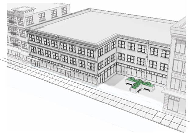 |
2.
Multi-family building design standards. These standards are intended to promote high-quality multi-family residential development and construction, protect property values, and encourage visual variety and architectural compatibility.
a.
Building location and orientation.
i.
In multi-building developments, the buildings shall be arranged to enclose and frame common areas. Common areas and courtyards shall be convenient to a majority of units.
ii.
When more than one multi-family building is constructed:
(A)
No side, end, or rear wall of a multi-family structure shall be located within 20 feet of a side, end, or rear wall of any other multi-family structure;
(B)
No side, end, or rear wall of a multi-family structure shall be located within 30 feet of the front wall of any other multi-family structure;
(C)
No front wall of a multi-family structure shall be located within 40 feet of the front wall of any other multi-family structure;
(D)
No more than three structures shall be located continuously on the same building line, or within 30 feet of such building line established. Buildings shall be arranged so that the fronts of the buildings are set to the front or back of each adjacent front building line by at least 30 feet or more; and
(E)
Parking lots shall be no more than 350 feet in length without an offset change in direction of 30 feet or more, centerline to centerline.
b.
Building mass and articulation.
i.
A multi-family building shall be a maximum of 200 feet in length.
ii.
Each facade greater than 50 feet in length, measured horizontally, shall incorporate wall plane projections or recesses having a depth of at least ten percent of the length of the facade, and extending at least 20 percent of the length of the facade. No uninterrupted length of any facade shall exceed 50 horizontal feet. Figure 3-2-4-1, Multi-family Building Articulation, illustrates this concept of wall plane projections and recesses.
iii.
Blocky, uniform facades are prohibited. As shown in Figure 3-2-2-3, Multi-family Building Articulation, the facades of all multi-family buildings shall be articulated through the incorporation of two or more of the following:
(A)
Balconies;
(B)
Bay or box windows;
(C)
Porches;
(D)
Dormers;
(E)
Variations in materials; or
(F)
Variations in roof forms.
iv.
The height of each multi-family building taller than 35 feet shall be stepped down from its highest roofline at least one full story on any end of the building located within 50 feet of a street right-of-way or an adjacent area with single-family or two-family residential development.
| Figure 3-2-2-3
Multi-Family Building Articulation | |
|---|---|
 |
c.
Roof design.
i.
Roof forms and rooflines shall be broken into a series of smaller components when viewed from the street. A continuous roofline shall be no more than 50 feet in length.
(A)
For a flat roof or facade with a horizontal eave, fascia or parapet, the minimum vertical dimension of roofline modulation is the greater of two feet or ten percent of the wall height (finish grade to top of wall).
(B)
For other roof forms, individual segments of the roof with no change in slope may not exceed 40 percent of the total roof amount.
(C)
Upper-level residential floors may be incorporated into the roof form to reduce the apparent height and mass of buildings.
ii.
All roof jack and penetrations shall be painted to match adjacent roof color.
d.
Building entrance.
i.
Entrances shall be prominent and visible from the street and from parking areas.
ii.
Primary building entrances and entrances facing a street shall be covered with a canopy, awning, or similar weather protection, or may be designed with a covered breezeway.
iii.
Apartment buildings and mixed-use building types with common entries shall provide at least one, zero-step entrance to each building from an accessible path at the front, side, or rear of each building.
iv.
A building entrance shall be clearly distinguishable in its architectural design and treatment. Examples include:
(A)
The inclusion of side-lights (glazed openings to the side of the door), or transom-lights (glazed opening above the door) in the entry design;
(B)
A change in building materials around the entrance; and
(C)
A small projection or recession (maximum of ten feet) of the wall surrounding the entrance.
e.
Facades and detail elements.
i.
Windows. All elevations on multi-family buildings shall contain windows. Primary facades and street-facing elevations shall contain at least 15 percent windows.
ii.
Detailed design. Buildings shall provide detailed design by incorporating at least two of the following features:
(A)
Dormers;
(B)
Gables;
(C)
Recessed or covered porch entries;
(D)
Cupolas or towers;
(E)
Pillars, posts, or columns;
(F)
Balconies;
(G)
Eaves (minimum 12 inch projection);
(H)
Overhanging eaves with exposed rafters;
(I)
Offsets in building face or roof (minimum 16 inches); and
(J)
Decorative patterns on exterior finishes (e.g., shingles, wainscoting, ornamentation, and similar features.)
iii.
Four-sided design. A multi-family building's architectural features and treatments shall not be restricted to a single elevation. All sides of a building open to view by the public shall display a similar level of quality and architectural interest.
f.
Materials.
i.
The exterior walls of multi-family structures shall be constructed of masonry, concrete panels, exterior insulated finished systems (EIFS), and/or stucco.
ii.
Front and side elevations of multi-family structures located within 200 feet of a public street right-of-way shall be constructed of brick and/or natural stone.
iii.
Front and side elevations of multi-family structures located between 201 and 500 feet of a public street right-of-way shall be constructed of a minimum of 50 percent brick and/or natural stone.
iv.
Front and side elevations of multi-family structures located between 501 and 800 feet of a public street right-of-way shall be constructed of a minimum of 25 percent brick and/or natural stone.
v.
Rear elevations of multi-family structures shall provide a minimum of 50 percent of the required percentage of brick and/or natural stone that is required for the front and side elevations of that same structure pursuant to subparagraphs b through d, above.
g.
Storage for accessory elements. Multi-family projects shall provide covered, enclosed, and secure storage areas for bicycles and other belongings that typically cannot be accommodated within individual dwelling units. Storage and other accessory buildings shall be designed with materials and/or architectural elements that are related to the principal building(s).
h.
Garages.
i.
Attached or detached garages.
(A)
Detached garages and carports shall not be located between a principal multi-family building and a primary street from which the building is entered.
(B)
Where possible, a detached garage shall be internalized in building groups to minimize visibility from adjacent streets.
ii.
Size.
(A)
Detached garages and carports shall be limited to six spaces per structure to avoid a continuous row of garages.
(B)
No more than six garage doors may appear on any multi-family building elevation containing front doors, and the plane of each garage door shall be offset at least two feet from the plane of the garage door adjacent to it.
iii.
Design.
(A)
Detached garages and carports shall be integrated in design with the principal building architecture, and shall incorporate similar and compatible forms, scale, materials, color, and details.
(B)
Side- or rear-facing garages shall have windows or other architectural details that mimic the features of the living portion of the structures on the side of the garage facing a street.
3.
Parking.
a.
On-site parking shall be located to the rear or side of all buildings. No on-site parking shall be located between the primary building entrance and the street.
b.
On-site parking adjacent to the street, but not including an alley, shall be screened with a masonry wall no more than three feet in height and/or a landscape buffer meeting the requirements of Division 4-3, Landscaping, Screening, and Tree Preservation, in order to maintain an attractive pedestrian environment at the street edge.
c.
Interior parking requirements shall meet the landscape requirements in Section 4-3-6, Parking Lot Landscaping.
Sec. 3-2-3. - Downtown fringe (DF).
A.
Purpose. The downtown fringe (DF) district is intended to apply to those areas within the downtown core area but outside the DM district. DF district uses may have a similar form, density, and height as DM areas, but typically generate a lower intensity of activity, both vehicular and pedestrian. Commercial, office, and residential uses are allowed on all floors in the DF district. Uses within the DF district are subject to additional design considerations, since they abut residential neighborhoods in many cases.
B.
Applicability. The standards in this section apply to areas designated as DF on the Official Zoning Map.
C.
Dimensional standards. Table 3-2-3-1, DF Dimensional Standards, below, establishes the standards for constructing new development in the DF zoning district.
| Table 3-2-3-1
DF Dimensional Standards | |||
|---|---|---|---|
| Standards | |||
| Lot dimensions | |||
| A | Area | 7,000 sf (minimum) | |
| B | Min. lot frontage | None | |
| — | Building Coverage | 50% (minimum) | |
| Setbacks1 | |||
| C | Front | 20 ft. (minimum) | |
| D | Rear | 20 ft. (minimum) | |
| E | Side abutting property in same district | None | |
| E | Side abutting property in a different nonresidential district | None | |
| E | Side abutting property in a residential district | 10 ft. (minimum) | |
| Building dimensions | |||
| F | Height | 50 ft. or 3 stories | |
 | |||
|
TABLE NOTES:
1. A required building setback from an abutting street shall be measured from the planned right-of-way as designated by the Transportation Plan as set forth in the Comprehensive Plan. | |||
D.
Land uses and off-street parking. Table 3-2-3-2, DF Permitted Uses and Minimum Off-Street Parking Spaces, shows the uses and use categories permitted in the downtown fringe zoning district. Associated minimum off-street parking spaces are included as well. See Division 4-2, Parking, Loading, and Access, for more detailed provisions. Uses not listed in this table are prohibited unless the Director interprets a use as functionally the same, as described in Section 2-2-1.E.1, Classification of New and Unlisted Uses.
E.
Landscaping and buffering. Table 3-2-3-3, DF Landscape Standards, provides general standards for planting requirements in the DF zoning district. For more detail, refer to Division 4-3, Landscaping, Screening, and Tree Preservation.
F.
Signs. Table 3-2-3-4, DF Permitted Sign Types, establishes the sign types that require or do not require a sign permit and contains a cross-reference to the sign type standards. Sign types not listed are prohibited in this zoning district. For more detail, refer to Chapter 5, Signs.
G.
Additional design standards.
1.
Transitional building height. The height of each building taller than 35 feet shall be stepped down from its highest roofline at least one full story on any portion of the building located within 50 feet of a street right-of-way or an adjacent area with single-family or two-family residential development.
2.
On-site parking location and design.
a.
On-site parking shall be located to the rear or side of all buildings. No on-site parking shall be located between the primary building entrance and the street.
b.
On-site parking adjacent to the street, but not including an alley, shall be screened with a masonry wall no more than three feet in height and/or a landscape buffer meeting the requirements of Division 4-3, Landscaping, Screening, and Tree Preservation, in order to maintain an attractive pedestrian environment at the street edge.
c.
Interior parking requirements shall meet the landscape requirements in Section 4-3-6, Parking Lot Landscaping.
3.
Multi-family building design standards. These standards are intended to promote high-quality multi-family residential development and construction, protect property values, and encourage visual variety and architectural compatibility.
a.
Building location and orientation.
i.
In multi-building developments, the buildings shall be arranged to enclose and frame common areas. Common areas and courtyards shall be convenient to a majority of units.
ii.
When more than one multi-family building is constructed:
(A)
No side, end, or rear wall of a multi-family structure shall be located within 20 feet of a side, end, or rear wall of any other multi-family structure;
(B)
No side, end, or rear wall of a multi-family structure shall be located within 30 feet of the front wall of any other multi-family structure;
(C)
No front wall of a multi-family structure shall be located within 40 feet of the front wall of any other multi-family structure;
(D)
No more than three structures shall be located continuously on the same building line, or within 30 feet of such building line established. Buildings shall be arranged so that the fronts of the buildings are set to the front or back of each adjacent front building line by at least 30 feet or more; and
(E)
Parking lots shall be no more than 350 feet in length without an offset change in direction of 30 feet or more, centerline to centerline.
b.
Building mass and articulation.
i.
A multi-family building shall be a maximum of 200 feet in length.
ii.
Each facade greater than 50 feet in length, measured horizontally, shall incorporate wall plane projections or recesses having a depth of at least ten percent of the length of the facade, and extending at least 20 percent of the length of the facade. No uninterrupted length of any facade shall exceed 50 horizontal feet. Figure 3-2-4-1, Multi-family Building Articulation, illustrates this concept of wall plane projections and recesses.
iii.
Blocky, uniform facades are prohibited. As shown in Figure 3-2-3-1, Multi-family Building Articulation, the facades of all multi-family buildings shall be articulated through the incorporation of two or more of the following:
(A)
Balconies;
(B)
Bay or box windows;
(C)
Porches;
(D)
Dormers;
(E)
Variations in materials; or
(F)
Variations in roof forms.
iv.
The height of each multi-family building taller than 35 feet shall be stepped down from its highest roofline at least one full story on any end of the building located within 50 feet of a street right-of-way or an adjacent area with single-family or two-family residential development.
| Figure 3-2-3-1
Multi-Family Building Articulation | |
|---|---|
 |
c.
Roof design.
i.
Roof forms and rooflines shall be broken into a series of smaller components when viewed from the street. A continuous roofline shall be no more than 50 feet in length.
(A)
For a flat roof or facade with a horizontal eave, fascia or parapet, the minimum vertical dimension of roofline modulation is the greater of two feet or ten percent of the wall height (finish grade to top of wall).
(B)
For other roof forms, individual segments of the roof with no change in slope may not exceed 40 percent of the total roof amount.
(C)
Upper-level residential floors may be incorporated into the roof form to reduce the apparent height and mass of buildings.
ii.
All roof jack and penetrations shall be painted to match adjacent roof color.
d.
Building entrance.
i.
Entrances shall be prominent and visible from the street and from parking areas.
ii.
Primary building entrances and entrances facing a street shall be covered with a canopy, awning, or similar weather protection, or may be designed with a covered breezeway.
iii.
Apartment buildings and mixed-use building types with common entries shall provide at least one, zero-step entrance to each building from an accessible path at the front, side, or rear of each building.
iv.
A building entrance shall be clearly distinguishable in its architectural design and treatment. Examples include:
(A)
The inclusion of side-lights (glazed openings to the side of the door), or transom-lights (glazed opening above the door) in the entry design;
(B)
A change in building materials around the entrance; and
(C)
A small projection or recession (maximum of ten feet) of the wall surrounding the entrance.
e.
Facades and detail elements.
i.
Windows. All elevations on multi-family buildings shall contain windows. Primary facades and street-facing elevations shall contain at least 15 percent windows.
ii.
Detailed design. Buildings shall provide detailed design by incorporating at least two of the following features:
(A)
Dormers;
(B)
Gables;
(C)
Recessed or covered porch entries;
(D)
Cupolas or towers;
(E)
Pillars, posts, or columns;
(F)
Balconies;
(G)
Eaves (minimum 12-inch projection);
(H)
Overhanging eaves with exposed rafters;
(I)
Offsets in building face or roof (minimum 16 inches); and
(J)
Decorative patterns on exterior finishes (e.g., shingles, wainscoting, ornamentation, and similar features.)
iii.
Four-sided design. A multi-family building's architectural features and treatments shall not be restricted to a single elevation. All sides of a building open to view by the public shall display a similar level of quality and architectural interest.
f.
Materials.
i.
The exterior walls of multi-family structures shall be constructed of masonry, concrete panels, exterior insulated finished systems (EIFS), and/or stucco.
ii.
Front and side elevations of multi-family structures located within 200 feet of a public street right-of-way shall be constructed of brick and/or natural stone.
iii.
Front and side elevations of multi-family structures located between 201 and 500 feet of a public street right-of-way shall be constructed of a minimum of 50 percent brick and/or natural stone.
iv.
Front and side elevations of multi-family structures located between 501 and 800 feet of a public street right-of-way shall be constructed of a minimum of 25 percent brick and/or natural stone.
v.
Rear elevations of multi-family structures shall provide a minimum of 50 percent of the required percentage of brick and/or natural stone that is required for the front and side elevations of that same structure pursuant to subparagraphs b through d, above.
g.
Storage for accessory elements. Multi-family projects shall provide covered, enclosed, and secure storage areas for bicycles and other belongings that typically cannot be accommodated within individual dwelling units. Storage and other accessory buildings shall be designed with materials and/or architectural elements that are related to the principal building(s).
h.
Garages.
i.
Attached or detached garages.
(A)
Detached garages and carports shall not be located between a principal multi-family building and a primary street from which the building is entered.
(B)
Where possible, a detached garage shall be internalized in building groups to minimize visibility from adjacent streets.
ii.
Size.
(A)
Detached garages and carports shall be limited to six spaces per structure to avoid a continuous row of garages.
(B)
No more than six garage doors may appear on any multi-family building elevation containing front doors, and the plane of each garage door shall be offset at least two feet from the plane of the garage door adjacent to it.
iii.
Design.
(A)
Detached garages and carports shall be integrated in design with the principal building architecture, and shall incorporate similar and compatible forms, scale, materials, color, and details.
(B)
Side- or rear-facing garages shall have windows or other architectural details that mimic the features of the living portion of the structures on the side of the garage facing a street.
Sec. 3-3-1. - Office neighborhood (ON).
A.
Purpose. The office neighborhood (ON) district is intended to provide locations for compact office developments that serve, and are compatible with, residential uses.
B.
Applicability. The standards in this section apply to areas designated as ON on the Official Zoning Map.
C.
Dimensional standards. Table 3-3-1-1, ON Dimensional Standards, below, establishes the standards for constructing new development in the ON zoning district.
| Table 3-3-1-1
ON Dimensional Standards | |||
|---|---|---|---|
| Standards | |||
| Lot dimensions | |||
| A | Area | 12,000 sf (minimum) | |
| B | Lot frontage | 100 ft. (minimum) | |
| — | Building Coverage | N/A | |
| Setbacks1 | |||
| C | Front | 50 ft. (minimum) | |
| D | Rear | 30 ft. (minimum) | |
| E | Side abutting property in same district | None | |
| E | Side abutting property in a different nonresidential district | 30 ft. (minimum) | |
| E | Side abutting property in a residential district | 30 ft. for buildings up to 35 ft. in height; 50 ft. for buildings taller than 35 ft. | |
| Building dimensions | |||
| F | Height | 50 ft. or 3 stories | |
 | |||
|
TABLE NOTES:
1. A required building setback from an abutting street shall be measured from the planned right-of-way as designated by the Transportation Plan as set forth in the Comprehensive Plan. | |||
D.
Land uses and off-street parking. Table 3-3-1-2, ON Permitted Uses and Minimum Off-Street Parking Spaces, shows the uses and use categories permitted in the office neighborhood zoning district. Associated minimum off-street parking spaces are included as well. See Division 4-2, Parking, Loading, and Access, for more detailed provisions. Uses not listed in this table are prohibited unless the Director interprets a use as functionally the same, as described in Section 2-2-1.E.1, Classification of New and Unlisted Uses.
E.
Landscaping and buffering. Table 3-3-1-3, ON Landscape Standards, provides general standards for planting requirements in the ON zoning district. For more detail, refer to Division 4-3, Landscaping, Screening, and Tree Preservation.
F.
Signs. Table 3-3-1-4, ON Permitted Sign Types, establishes the sign types that require or do not require a sign permit and contains a cross-reference to the sign type standards. Sign types not listed are prohibited in this zoning district. For more detail, refer to Chapter 5, Signs.
G.
Additional design standards.
1.
Building materials.
a.
Primary building materials. Exterior walls on a new building or renovated, existing building that are visible from the public realm shall utilize one or more of the following primary building materials:
i.
Masonry, such as brick or stone;
ii.
Stucco;
iii.
Glass, such as glass curtain walls and glass block;
iv.
Concrete panels; or cementitious siding.
b.
Secondary building materials.
i.
The following building materials may be used as an accent material on no more than 25 percent of each exterior wall visible from the public realm, for new construction and renovations:
(A)
Metals including metal panels and architectural metal;
(B)
Exterior insulated finished systems (EIFS);
(C)
Siding such as wood shingle or wood clapboard; or
(D)
Masonry materials other than brick and stone.
ii.
Proposals that include these materials on 25 percent or less of each exterior wall visible from the public realm may be reviewed and approved by the Director. Proposals that include these materials on more than 25 percent of one or more exterior wall visible from the public realm shall be reviewed by the Planning Commission.
Sec. 3-3-2. - Commercial neighborhood (CN).
A.
Purpose. The commercial neighborhood (CN) district is intended for small, compact commercial uses within or surrounded by residential areas, compatible in scale and character with surrounding residential use, to serve the convenience needs of the immediately surrounding neighborhood.
B.
Applicability. The standards in this section apply to areas designated as CN on the Official Zoning Map.
C.
Dimensional standards. Table 3-3-2-1, CN Dimensional Standards, below, establishes the standards for constructing new development in the CN zoning district.
| Table 3-3-2-1
CN Dimensional Standards | |||
|---|---|---|---|
| Standards | |||
| Lot dimensions | |||
| A | Area | Minimum: 12,000 sf; Maximum: 2.5 acres | |
| B | Lot frontage | 100 ft. (minimum) | |
| — | Building Coverage | N/A | |
| Setbacks1 | |||
| C | Front | 50 ft. (minimum) | |
| D | Rear | 30 ft. (minimum) | |
| E | Side abutting property in same district | None | |
| E | Side abutting property in a different nonresidential district | 30 ft. (minimum) | |
| E | Side abutting property in a residential district | 30 ft. (minimum) | |
| Building dimensions | |||
| F | Height | 50 ft. or 3 stories | |
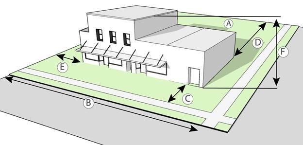 | |||
|
TABLE NOTES:
1. A required building setback from an abutting street shall be measured from the planned right-of-way as designated by the Transportation Plan as set forth in the Comprehensive Plan. | |||
D.
Land uses and off-street parking. Table 3-3-2-2, CN Permitted Uses and Minimum Off-Street Parking Spaces, shows the uses and use categories permitted in the commercial neighborhood zoning district. Associated minimum off-street parking spaces are included as well. See Division 4-2, Parking, Loading, and Access, for more detailed provisions. Uses not listed in this table are prohibited unless the Director interprets a use as functionally the same, as described in Section 2-2-1.E.1, Classification of New and Unlisted Uses.
E.
Landscaping and buffering. Table 3-3-2-3, CN Landscape Standards, provides general standards for planting requirements in the CN zoning district. For more detail, refer to Division 4-3, Landscaping, Screening, and Tree Preservation.
F.
Signs. Table 3-3-2-4, CN Permitted Sign Types, establishes the sign types that require or do not require a sign permit and contains a cross-reference to the sign type standards. Sign types not listed are prohibited in this zoning district. For more detail, refer to Chapter 5, Signs.
G.
Additional design standards.
1.
Building materials.
a.
Primary building materials. Exterior walls on a new building or renovated, existing building that are visible from the public realm shall utilize one or more of the following primary building materials:
i.
Masonry, such as brick or stone;
ii.
Stucco;
iii.
Glass, such as glass curtain walls and glass block;
iv.
Concrete panels; or
v.
Cementitious siding.
b.
Secondary building materials.
i.
The following building materials may be used as an accent material on no more than 25 percent of each exterior wall visible from the public realm, for new construction and renovations.
(A)
Metals including metal panels and architectural metal;
(B)
Exterior insulated finished systems (EIFS);
(C)
Siding such as wood shingle or wood clapboard; or
(D)
Masonry materials other than brick and stone.
ii.
Proposals that include these materials on 25 percent or less of each exterior wall visible from the public realm may be reviewed and approved by the Director. Proposals that include these materials on more than 25 percent of one or more exterior wall visible from the public realm shall be reviewed by the Planning Commission.
Sec. 3-3-3. - Commercial general (CG).
A.
Purpose. The commercial general (CG) district is intended to provide a full range of community-oriented retail and service commercial uses. The CG district also accommodates compact neighborhood commercial uses provided they are compatible with surrounding residential uses in scale and character.
B.
Applicability. The standards in this section apply to areas designated as CG on the Official Zoning Map.
C.
Dimensional standards. Table 3-3-3-1, CG Dimensional Standards, below, establishes the standards for constructing new development in the CG zoning district.
| Table 3-3-3-1
CG Dimensional Standards | |||
|---|---|---|---|
| Standards | |||
| Lot dimensions | |||
| A | Area | None | |
| B | Lot frontage | 200 ft. (minimum) | |
| — | Building Coverage | N/A | |
| Setbacks1 | |||
| C | Front | 50 ft. (minimum) | |
| D | Rear | 50 ft. (minimum) | |
| E | Side abutting property in same district | None | |
| E | Side abutting property in a different nonresidential district | 30 ft. (minimum) | |
| E | Side abutting property in a residential district | 1-story: 50 ft.; more than 1 story, but less than 75 ft in height: 75 ft; taller than 75 ft: equal to building height | |
| Building dimensions | |||
| F | Height | None | |
 | |||
|
TABLE NOTES:
1. A required building setback from an abutting street shall be measured from the planned right-of-way as designated by the Transportation Plan as set forth in the Comprehensive Plan. | |||
D.
Land uses and off-street parking. Table 3-3-3-2, CG Permitted Uses and Minimum Off-Street Parking Spaces, shows the uses and use categories permitted in the commercial general zoning district. Associated minimum off-street parking spaces are included as well. See Division 4-2, Parking, Loading, and Access, for more detailed provisions. Uses not listed in this table are prohibited unless the Director interprets a use as functionally the same, as described in Section 2-2-1.E.1, Classification of New and Unlisted Uses.
E.
Landscaping and buffering. Table 3-3-3-3, CG Landscape Standards, provides general standards for planting requirements in the CG zoning district. For more detail, refer to Division 4-3, Landscaping, Screening, and Tree Preservation.
F.
Signs. Table 3-3-3-4, CG Permitted Sign Types, establishes the sign types that require or do not require a sign permit and contains a cross-reference to the sign type standards. Sign types not listed are prohibited in this zoning district. For more detail, refer to Chapter 5, Signs.
G.
Additional design standards.
1.
Building materials.
a.
Primary building materials. Exterior walls on a new building or renovated, existing building that are visible from the public realm shall utilize one or more of the following primary building materials:
i.
Masonry, such as brick or stone;
ii.
Stucco;
iii.
Glass, such as glass curtain walls and glass block;
iv.
Concrete panels; or cementitious siding.
b.
Secondary building materials.
i.
The following building materials may be used as an accent material on no more than 25 percent of each exterior wall visible from the public realm, for new construction and renovations.
(A)
Metals including metal panels and architectural metal;
(B)
Exterior insulated finished systems (EIFS);
(C)
Siding such as wood shingle or wood clapboard; or
(D)
Masonry materials other than brick and stone.
ii.
Proposals that include these materials on 25 percent or less of each exterior wall visible from the public realm may be reviewed and approved by the Director. Proposals that include these materials on more than 25 percent of the one or more exterior wall visible from the public realm shall be reviewed by the Planning Commission.
Sec. 3-3-4. - Commercial heavy (CH).
A.
Purpose. The commercial heavy (CH) district is intended primarily for uses that provide commercial goods and services to residents of the community in areas that are dependent on automobile access and exposed to heavy automobile traffic. These commercial uses are subject to frequent view by the public and visitors to Broken Arrow, and they should provide an attractive appearance and controlled internal and external traffic movement.
B.
Applicability. The standards in this section apply to areas designated as CH on the Official Zoning Map.
C.
Dimensional standards. Table 3-3-4-1, CH Dimensional Standards, below, establishes the standards for constructing new development in the CH zoning district.
| Table 3-3-4-1
CH Dimensional Standards | |||
|---|---|---|---|
| Standards | |||
| Lot dimensions | |||
| A | Area | None | |
| B | Lot frontage | 100 ft. (minimum) | |
| — | Building Coverage | N/A | |
| Setbacks1 | |||
| C | Front | 50 ft. (minimum) | |
| D | Rear | 30 ft. (minimum) | |
| E | Side abutting property in same district | None | |
| E | Side abutting property in a different nonresidential district | 30 ft. (minimum) | |
| E | Side abutting property in a residential district | 1-story: 50 ft.; more than 1 story, but less than 75 ft in height: 75 ft; taller than 75 ft: equal to building height | |
| Building dimensions | |||
| F | Height | None | |
 | |||
|
TABLE NOTES:
1. A required building setback from an abutting street shall be measured from the planned right-of-way as designated by the Transportation Plan as set forth in the Comprehensive Plan. | |||
D.
Land uses and off-street parking. Table 3-3-4-2, CH Permitted Uses and Minimum Off-Street Parking Spaces, shows the uses and use categories permitted in the commercial heavy zoning district. Associated minimum off-street parking spaces are included as well. See Division 4-2, Parking, Loading, and Access, for more detailed provisions. Uses not listed in this table are prohibited unless the Director interprets a use as functionally the same, as described in Section 2-2-1.E.1, Classification of New and Unlisted Uses.
E.
Landscaping and buffering. Table 3-3-4-3, CH Landscape Standards, provides general standards for planting requirements in the CH zoning district. For more detail, refer to Division 4-3, Landscaping, Screening, and Tree Preservation.
F.
Signs. Table 3-3-4-4, CH Permitted Sign Types, establishes the sign types that require or do not require a sign permit and contains a cross-reference to the sign type standards. Sign types not listed are prohibited in this zoning district. For more detail, refer to Chapter 5, Signs.
G.
Additional design requirements.
1.
Building materials.
a.
Primary building materials. Exterior walls on a new building or renovated, existing building that are visible from the public realm shall utilize one or more of the following primary building materials:
i.
Masonry, such as brick or stone;
ii.
Stucco;
iii.
Glass, such as glass curtain walls and glass block;
iv.
Concrete panels; or
v.
Cementitious siding.
b.
Secondary building materials.
i.
The following building materials may be used as an accent material on no more than 25 percent of each exterior wall visible from the public realm, for new construction and renovations.
(A)
Metals including metal panels and architectural metal;
(B)
Exterior insulated finished systems (EIFS);
(C)
Siding such as wood shingle or wood clapboard; or
(D)
Masonry materials other than brick and stone.
ii.
Proposals that include these materials on 25 percent or less of each exterior wall visible from the public realm may be reviewed and approved by the Director. Proposals that include these materials on more than 25 percent of one or more exterior wall visible from the public realm shall be reviewed by the Planning Commission.
Sec. 3-3-5. - Industrial light (IL).
A.
Purpose. The industrial light (IL) district is intended to provide for light manufacturing, processing, service, storage, wholesale, and distribution operations with all operations contained within an enclosed building. The intent of the IL district is to preserve land for light industrial and service-oriented commercial uses.
B.
Applicability. The standards in this section apply to areas designated as IL on the Official Zoning Map.
C.
Dimensional standards. Table 3-3-5-1, IL Dimensional Standards, below, establishes the standards for constructing new development in the IL zoning district.
| Table 3-3-5-1
IL Dimensional Standards | |||
|---|---|---|---|
| Standards | |||
| Lot dimensions | |||
| A | Area | 10,000 sf (minimum) | |
| B | Lot frontage | Arterial: 100 ft; others: 50 ft | |
| — | Building Coverage | N/A | |
| Setbacks1 | |||
| C | Front | Arterial: 50 ft; others: 30 ft | |
| D | Rear | 30 ft. (minimum) | |
| E | Side abutting property in same district | None | |
| E | Side abutting property in a different nonresidential district | 30 ft. (minimum) | |
| E | Side abutting property in a residential district | 50 ft | |
| Building dimensions | |||
| F | Height | Abutting residential district: 50 ft or 4 stories 2 ; others: None | |
 | |||
|
TABLE NOTES:
1. A required building setback from an abutting street shall be measured from the planned right-of-way as designated by the Transportation Plan as set forth in the Comprehensive Plan. 2. When abutting any residential district or an arterial or highway, the building shall be set back an additional two feet for every foot in height above 50 feet. | |||
D.
Land uses and off-street parking. Table 3-3-5-2, IL Permitted Uses and Minimum Off-Street Parking Spaces, shows the uses and use categories permitted in the industrial light zoning district. Associated minimum off-street parking spaces are included as well. See Division 4-2, Parking, Loading, and Access, for more detailed provisions. Uses not listed in this table are prohibited unless the Director interprets a use as functionally the same, as described in Section 2-2-1.E.1, Classification of New and Unlisted Uses.
E.
Landscaping and buffering. Table 3-3-5-3, IL Landscape Standards, provides general standards for planting requirements in the IL zoning district. For more detail, refer to Division 4-3, Landscaping, Screening, and Tree Preservation.
F.
Signs. Table 3-3-5-4, IL Permitted Sign Types, establishes the sign types that require or do not require a sign permit and contains a cross-reference to the sign type standards. Sign types not listed are prohibited in this zoning district. For more detail, refer to Chapter 5, Signs.
G.
Additional design standards.
1.
Building materials.
a.
Primary building materials. Exterior walls on a new building or renovated, existing building that are visible from the public realm shall utilize one or more of the following primary building materials:
i.
Masonry, such as brick or stone;
ii.
Stucco;
iii.
Glass, such as glass curtain walls and glass block;
iv.
Concrete panels; or
v.
Cementitious siding.
b.
Secondary building materials.
i.
The following building materials may be used as an accent material on no more than 25 percent of each exterior wall visible from the public realm, for new construction and renovations.
(A)
Metals including metal panels and architectural metal;
(B)
Exterior insulated finished systems (EIFS);
(C)
Siding such as wood shingle or wood clapboard; or
(D)
Masonry materials other than brick and stone.
ii.
Proposals that include these materials on 25 percent or less of each exterior walls visible from the public realm may be reviewed and approved by the Director. Proposals that include these materials on more than 25 percent of one or more exterior wall visible from the public realm shall be reviewed by the Planning Commission.
Sec. 3-3-6. - Industrial heavy (IH).
A.
Purpose. The industrial heavy (IH) district is intended to provide for heavy industrial development of a potentially noxious nature, including heavy manufacturing, storage, major freight terminals, waste and salvage, resource extraction, processing, and other related uses. The intent of the IH district is to preserve land for industry in locations with access to major streets as designated on the Comprehensive Plan Map, as well as locations generally accessible to railroad transportation.
B.
Applicability. The standards in this section apply to areas designated as IH on the Official Zoning Map.
C.
Dimensional standards. Table 3-3-6-1, IH Dimensional Standards, below, establishes the standards for constructing new development in the IH zoning district.
| Table 3-3-6-1
IH Dimensional Standards | |||
|---|---|---|---|
| Standards | |||
| Lot dimensions | |||
| A | Area | No minimum lot area; district min.: 2.5 acres | |
| B | Lot frontage | Arterial: 100 ft; Others: 50 ft | |
| — | Building Coverage | N/A | |
| Setbacks1,2 | |||
| C | Front | 30 ft. (minimum) | |
| D | Rear | None | |
| E | Side abutting property in same district | None | |
| E | Side abutting property in a different nonresidential district | 50 ft. (minimum) | |
| E | Side abutting property in a residential district | 50 ft. | |
| Building dimensions | |||
| F | Height | Abutting residential district: 50 ft or 4 stories 2 ; others: None | |
 | |||
|
TABLE NOTES:
1. A required building setback from an abutting street shall be measured from the planned right-of-way as designated by the Transportation Plan as set forth in the Comprehensive Plan. 2. When abutting any residential district or an arterial or highway, the building shall be set back an additional two feet for every foot in height above 50 feet. | |||
D.
Land uses and off-street parking. Table 3-3-6-2, IL Permitted Uses and Minimum Off-Street Parking Spaces, shows the uses and use categories permitted in the industrial light zoning district. Associated minimum off-street parking spaces are included as well. See Division 4-2, Parking, Loading, and Access, for more detailed provisions. Uses not listed in this table are prohibited unless the Director interprets a use as functionally the same, as described in Section 2-2-1.E.1, Classification of New and Unlisted Uses.
E.
Landscaping and buffering. Table 3-3-6-3, IH Landscape Standards, provides general standards for planting requirements in the IH zoning district. For more detail, refer to Division 4-3, Landscaping, Screening, and Tree Preservation.
F.
Signs. Table 3-3-6-4, IH Permitted Sign Types, establishes the sign types that require or do not require a sign permit and contains a cross-reference to the sign type standards. Sign types not listed are prohibited in this zoning district. For more detail, refer to Chapter 5, Signs.
G.
Additional design standards.
1.
Building materials.
a.
Primary building materials. Exterior walls on a new building or renovated, existing building that are visible from the public realm shall utilize one or more of the following primary building materials:
i.
Masonry, such as brick or stone;
ii.
Stucco;
iii.
Glass, such as glass curtain walls and glass block;
iv.
Concrete panels; or cementitious siding.
b.
Secondary building materials.
i.
The following building materials may be used as an accent material on no more than 25 percent of each exterior wall visible from the public realm, for new construction and renovations.
(A)
Metals including metal panels and architectural metal;
(B)
Exterior insulated finished systems (EIFS);
(C)
Siding such as wood shingle or wood clapboard; or
(D)
Masonry materials other than brick and stone.
ii.
Proposals that include these materials on 25 percent or less of each exterior wall visible from the public realm may be reviewed and approved by the Director. Proposals that include these materials on more than 25 percent of one or more exterior wall visible from the public realm shall be reviewed by the Planning Commission.
Sec. 3-4-1. - Floodplain district.
A.
Purpose. The floodplain district is designed to:
1.
Protect life;
2.
Reduce and prevent flood damage;
3.
Reduce public expenditures in the areas subject to flooding;
4.
Permit reasonable use of land in areas subject to flooding;
5.
Promote the general welfare of the community; and
6.
Prevent or reduce flood damage by keeping floodways free of manmade obstructions to permit the free flow and discharge of floodwater.
B.
Applicability. The standards in this section apply to areas designated as FD on the Official Zoning Map.
C.
District and designation boundaries.
1.
The initial boundaries of the floodplain district shall be certified by the Engineering and Construction Director at the time of annexation, or shall be established on previously annexed land only after notice and public hearing before the Planning Commission and approval of the City Council at the time of approval of a Zoning Map Amendment for the property. Amendments to the floodplain district shall be established in the same manner as amendments to any other zoning district or supplemental designation as set forth in Division 6-3, Permits and Procedures, of this ordinance, and such proposed amendments shall be transmitted in writing to the Engineering and Construction Director for review and recommendation. Lands within the floodplain district shall be identified on the Official Zoning Map by the district symbol "FD." No improvements of any type, including realignment of the old channel, construction of berms, dikes, or land filling, shall occur prior to approval and certification of engineering plans by the Engineering and Construction Director, as provided in this ordinance.
2.
The boundaries of the floodplain district may be amended so as to maintain uniformity with the purpose of this ordinance upon a finding that:
a.
A flood control project of the Federal, State, County, or City government or a private person has substantially altered the boundaries of the floodplain;
b.
Flood data compiled subsequent to the enactment of the designation indicates that the boundaries should be adjusted; or
c.
Proposed improvement, such as fill, channel improvements, of flood retention reservoirs has received approval from the Engineering and Construction Director.
3.
Upon a finding by the Engineering and Construction Director that a proposed amendment meets one of the three conditions listed above, the Engineering and Construction Director shall certify approval of the amendment and file a written recommendation with the Planning Commission. If the proposed amendment does not meet one or more of the conditions listed above, the Engineering and Construction Director shall deny the proposal in writing and furnish the Planning Commission a copy of the Engineering and Construction Director's findings.
D.
Land uses.
1.
The following uses and activities are permitted within the FD district provided they do not create adverse effects on other land uses:
a.
Agriculture;
b.
Arboretum;
c.
Common open areas;
d.
Fire alarm;
e.
Flood management projects;
f.
Forestry;
g.
Golf course;
h.
Grazing;
i.
Historical marker;
j.
Horticulture cultivation;
k.
Natural areas;
l.
Parks, public and private;
m.
Ponds;
n.
Roadway bridges;
o.
Street signs;
p.
Utility lines; and
q.
Wildlife preserve.
2.
The following uses may be allowed if approved by the Director:
a.
Parking areas;
b.
Temporary outside storage of materials, so long as the materials will not float away and obstruct the flow of floodwater;
c.
Temporary amusement enterprises; and
d.
Open air recreational uses, temporary.
E.
Standards.
1.
All structures shall be designed and constructed to withstand flood conditions.
2.
Materials that in time of flood might float away and lodge against bridge abutments or otherwise serve to restrict the free flow and flood discharge capacity of water channel are prohibited.
3.
No structures of any type and no uses of any type may be allowed that in any way will increase the volume of water, or the velocity of water, or the areas subject to inundation within the FD district, or adjacent to the FD district. Nor shall any uses or structures be allowed that detrimentally affect (no matter how slight) the flood on any lands upstream from or downstream from the floodplain district.
F.
Nonconformities.
1.
A structure lawfully existing within the floodplain district at the effective date of said zoning and that would be prohibited in said FD shall be deemed nonconforming and may continue subject to the following provisions:
a.
No such nonconforming structure may be enlarged through area or time.
b.
Should such structure be damaged or partially destroyed by any means to the extent of 50 percent of its current replacement cost at time of damage, said structure shall not be restored.
c.
Ordinary repairs may be made on any nonconforming structure provided said structure is not enlarged in area or through time. If a nonconforming structure becomes physically unsafe or unlawful due to lack of repairs and maintenance and a final order of abatement, vacation or demolition is entered by a duly authorized official by reason of this physical condition; it shall not thereafter be used, restored, repaired, or rebuilt.
2.
No construction of a permanent principal structure shall be allowed on any lot located within a floodplain district even though said lot was filed of record or was within a subdivision approved by the Planning Commission or its legal predecessor prior to the effective date of the floodplain district.
G.
Responsibility for flooding. The fact that land or property is not included within a floodplain district as authorized by this ordinance shall not constitute assurance that such land or property is not subject to flooding and shall not be so interpreted.
Sec. 3-4-2. - Highway design overlay district.
A.
Purpose. This district is intended to promote high-quality nonresidential building design along Broken Arrow's highways and project a positive image to encourage economic development in the City. The standards contained in this subsection are intended to protect the health, safety, and welfare of the citizens by preventing or reducing traffic congestion and reducing distracting visual clutter associated with highway development. The standards of the HDOD strive to achieve the stated purpose by addressing the physical characteristics of development such as building design, building entrances, wall articulation, and fencing. These standards encourage land assembly and development in accordance with the Broken Arrow Comprehensive Plan.
B.
Applicability. The standards of this section apply to all nonresidential, multi-family, and duplex development within the highway design overlay district.
C.
District boundaries. The Highway Design Overlay District includes all properties within 500 feet of a limited access highway.
D.
Standards.
1.
Building design.
a.
Building orientation. All nonresidential primary buildings on lots or tracts with frontage on the highway shall be oriented towards the highway. For buildings with multiple frontages, facades oriented toward secondary frontages shall provide an equal level of quality in terms of materials and design.
b.
Wall articulation. Primary structures with single walls exceeding 50 feet in length shall incorporate two or more of the following features at least every 50 feet in length:
i.
Increased setback of a minimum of ten feet;
ii.
Changes in color, graphical patterning, changes in texture, or changes in material;
iii.
Projections, recesses, and reveals, expressing structural bays or other aspects of the architecture with a minimum offset of plane of 12 inches;
iv.
Variation in building height by no less than one story; or
v.
Windows and fenestration to provide additional detail.
c.
Building entrance. Each primary structure shall have a clearly defined main pedestrian entrance featuring at least three of the following:
i.
Canopies or porticos;
ii.
Overhangs;
iii.
Recesses or projections;
iv.
Arcades;
v.
Arches;
vi.
Peaked roof forms;
vii.
Display windows;
viii.
Architectural tile work or moldings integrated into the building design; or
ix.
Integrated planters or wing walls that incorporate landscaped or seating areas.
d.
Multiple buildings in commercial centers. To achieve unity between all buildings in a commercial development consisting of more than one building, all buildings in such a development, including pad site buildings, shall employ a consistent architectural style or theme, be constructed of similar exterior materials, and feature similar colors to the extent practicable.
2.
Outdoor display and sales. Outdoor display and/or sales may be allowed subject to compliance with Section 2-4-2. No outdoor display and/or sales shall be visible from the limited access highway.
3.
Screening of loading and refuse collection and rooftop mechanical equipment. All loading and refuse collection facilities and rooftop mechanical equipment shall be screened pursuant to Section 4-3-7.
4.
Utilities. Unless a waiver is authorized by the City Council, all electrical and telephone lines and wires including, but not limited to, street lighting, shall be placed underground. Feeder and other major transmission lines may remain overhead. All utility installation shall conform to the City's adopted Technical Standards and Specifications.
Sec. 3-4-3. - Downtown residential overlay.
A.
Introduction.
1.
Purpose of the downtown residential overlay district (DROD). The downtown residential overlay district (DROD) is intended to continue the implementation of the Downtown Master Plan by promoting compatible, high quality mixed-use and residential design in the area bounded by Elm Place, Houston Street, 9th Street (Lynn Lane), and Kenosha Street. For the purposes of this document, the DROD is sometimes referred to as "downtown." The DROD standards promote protection of sensitive established residential neighborhoods while also accommodating residential infill that contributes to an active and walkable area. The DROD is intended to facilitate residential and mixed-use conservation of residential character in stable neighborhoods, while also accommodating increased residential densities, mixed-use development and commercial activities in targeted areas to enhance activity and commerce.
The DROD standards are intended to ensure that all new development and renovations promote the urban design principles established in the Downtown Master Plan, including:
a.
Implement the Comprehensive Plan. The DROD Design Standards support the goals of the Broken Arrow Comprehensive Plan, particularly for areas designated as downtown area and urban residential. The design standards promote compatible residential infill development that exhibits good urban design principles, as called for in the Comprehensive Plan, as well as the Downtown Master Plan.
b.
Promote high quality urban design and walkability. The DROD Design Standards promote development that enhances the public realm in downtown, including streets, alleys, sidewalks and other public spaces. The design standards are intended to facilitate residential and mixed-use development that is visually interesting, pedestrian-friendly and of a quality that benefits the downtown experience and its design character. Thus, new development should employ design features to break up large masses and avoid monotonous walls in order to increase comfort for the pedestrian and the overall appearance of downtown.
c.
Respond to context and key features. The DROD Design Standards are tailored to respond to existing development patterns and neighborhoods in different parts of downtown. The design standards are customized to respond to the degree of change that is appropriate in a given area or in some cases a desire to maintain the current character.
d.
Respect established development patterns. The DROD Design Standards respond to the design traditions throughout each individual neighborhood within the DROD. Development patterns, including lot size and depth, typical building widths, and the presence of architectural features, are all important in determining a neighborhood's design traditions and physical characteristics. Creative and contemporary designs, as well as increases in density, are promoted in certain areas, provided design features are included to promote compatibility.
B.
Downtown Residential Overlay District (DROD) Areas. The downtown residential overlay district (DROD) is divided into seven distinct areas, each of which has unique objectives for new development and substantial renovations to existing properties. The area boundaries are based on several factors, including:
•
The periods in which development historically occurred.
•
Original subdivision boundaries.
•
Existing building forms and scale.
•
Existing architectural characteristics.
•
Comprehensive Plan objectives.
•
Downtown Plan objectives.
•
Community input.
The area boundaries also consider the degree to which an area's character should be maintained or transformed as redevelopment occurs. An intent statement is provided below for each area. Each intent statement broadly describes the desired future character for the area. The map in Figure 2.1 identifies the DROD area boundaries.
1.
Broken Arrow downtown residential overlay district (DROD) areas.
| Figure 2.1 DROD Areas Map | |
|---|---|
 |
2.
DROD Area 1: Residential 1. DROD Area 1 includes two discontiguous areas within the interior of the DROD, west of Main Street, east of Elm Place, north of Houston Street and south of Kenosha Street. Area 1 was originally developed as traditional single-family neighborhoods, but over time have been transformed into residential districts that exhibit a wide variety of building forms, including single-family homes, two-family properties and varying types of multi-family buildings.
Area 1 should accommodate variety in architecture and building form, but maintain a residential character. new construction and renovations should reflect some of the characteristics of traditional single-family homes, by limiting the width and scale of new buildings. However, to accommodate a variety of building forms and encourage architectural variety, flexibility should be provided to promote an eclectic neighborhood that accommodates a variety of Downtown living options. Design creativity should be encouraged, but employed in a fashion that is ensures compatibility of non-single-family forms with the primarily single-family residential context.
Over time, Area 1 should become more urban in nature, exhibiting a frequent rhythm of building entries, small front setbacks and front building wall widths. Development should contribute to an engaging streetscape that promotes walkability by orienting buildings toward the street, minimizing the visibility of garages, and minimizing vehicular-pedestrian conflicts. New development should also incorporate re-use of alleyways, where they are available.
Building forms in Area 1 will range from conventional single-family homes on smaller, single lots to moderately scaled multi-family flats on adequately sized lots.
| Figure 2.2 | |
|---|---|
 |
3.
DROD Area 2: Residential 2. DROD Area 2 includes one contiguous area within the interior of the DROD, generally located east of Main Street, west of 9th Street (Lynn Lane), north of Detroit Street and south of Midway Avenue. Area 2 was originally developed in the 1940s as a single-family residential neighborhood and has generally retained this character over time. Area 2 currently contains single-family homes and a small number of two-family homes. While Building forms are generally consistent throughout this Area, architectural character (like materials and individual elements) and scale vary significantly from block to block and house to house.
Development in Area 2 should continue to reinforce the established single-family residential character while facilitating moderate increases in density through the accommodation of accessory dwelling units (ADU) and two-family units.
Designs should express variety in architectural character while maintaining a generally consistent single-family form. For example, variety in materials should be promoted while the scale and width of buildings should be sized to be compatible with existing buildings.
Development in this area should contribute to an engaging streetscape that promotes walkability by orienting toward the street, minimizing the visibility of garages and minimizing vehicular-pedestrian conflicts. New development should also incorporate re-use of alleyways, where they are available.
Building forms in Area 2 may range from conventional single-family homes on a single lot to two-family attached units, while also accommodating accessory dwelling units (ADUs).
| Figure 2.3 | |
|---|---|
 |
4.
DROD Area 3: Residential 3. DROD Area 3 consists of a contiguous area in the interior of the DROD, located east of Main Street, West of 9th Street (Lynn Lane), South of Detroit Street and generally north of Dallas Street. Area 3 is unique in that it contains the most consistent collection of traditional single-family forms and architectural character within the DROD. While some infill and alterations have occurred and periods of development vary, architectural character and form is relatively consistent within individual blocks.
Area 3 should retain its single-family residential character by promoting moderately scaled building forms and compatible architectural character. New infill development and renovations should be designed to be expressly compatible with the single-family traditional context and the block in which they are located.
Development should include design elements and features, such as porches, pitched roofs, and subordinate garages, which fit in with the traditional context. Building features, including the overall height of a building (or specific portions of a building), should be scaled to maximize compatibility.
Development should contribute to an engaging streetscape that promotes walkability by orienting toward the street, minimizing the visibility of garages and minimizing vehicular-pedestrian conflicts. New development should also incorporate re-use of alleyways, where they are available.
Building forms in Area 3 should be generally limited to single-family, but appropriately scaled and compatible accessory dwelling units should also be accommodated.
| Figure 2.4 | |
|---|---|
 |
5.
DROD Area 4: Residential 4. DROD Area 4 is a contiguous area in the southeastern portion of the DROD. It is located east of Main Street, north of Houston Street, south of Dallas Street and generally west of 9th Street (Lynn Lane). Area 4 contains single-family neighborhoods developed in the 1950s and 1960s. Block pattern, parcel shape and orientation, and building designs are uniquely different from the more uniform, gridded single-family neighborhoods in the majority of the DROD. This area contains the most consistent collection of mid-century single-family forms and architectural character within the DROD. Building form is quite similar from property to property. With some exceptions, homes are one-story with prominent front-loaded garages and small entry stoops or porches. Low pitched roofs differentiate these houses from steeper pitched roof forms seen in other residential neighborhoods in the DROD. The wider dimensioned wall is typically placed parallel to the street, making the single-family residential homes in this area horizontally-oriented with elongated, asymmetrical facades.
Area 4 should be maintained as a single-family residential neighborhood with a high degree of design consistency. This should be achieved by exclusively promoting single-family building forms. New construction and significant renovations should be designed to be compatible in form and scale to the existing context, particularly for parts of the building that are closest to the street. Building features, including the overall height of a building (or key portions of a building), should be scaled to be compatible with the mid-century context.
Development should be designed to contribute to an engaging streetscape that promotes walkability by orienting toward the street, minimizing the presence of blank walls adjacent to the street and minimizing the visual impact of garage doors.
Building forms in Area 4 should be limited to single-family, but appropriately scaled and compatible accessory dwelling units also should be accommodated.
| Figure 2.5 | |
|---|---|
 |
6.
DROD Area 5: Rose district transition. DROD Area 5 occurs in several locations between the DROD's perimeter corridors and interior residential areas. It also serves as a transition between the Rose District to residentially focused areas. Area 5 currently exhibits a wide variety of architectural character, forms and even land uses. Significant infill and change has occurred in many of portions of Area 5, creating no consistent pattern of development.
Building off of the policies in the Downtown Master Plan, Area 5 should transform significantly over time by accommodating more intensive residential and commercial development that supports downtown business and extends the active, urban character of the Rose District. However, the area must also serve as a transition that buffers intensive commercial/mixed-use development from interior residential areas. As such, new construction and significant renovations should include a variety of building forms ranging from single-family to rowhouses to mixed-use buildings with limited commercial, such as neighborhood-level retail or small offices.
Variety in architectural character and building form should be encouraged to create an eclectic mix of housing and nonresidential activities that directly supports the Rose District. Architectural creativity, contemporary design and modern building forms should mix with traditional ones to support this objective. Variety in building materials, roof forms and other features is encouraged in Area 5.
Development in Area 5 should contribute to an engaging streetscape and support a highly walkable environment, particularly in the areas closest to the Rose District. Buildings should be designed to orient strongly to the street, creating a consistent street edge with buildings placed relatively close to the street. Ground floor transparency and interaction between private properties and the public street should be maximized with both residential and commercial uses through the use of windows, doors, porches, stoops, storefronts, significant glazing and other features.
Building forms in Area 5 will range widely within the district and a mix of forms within a single block is appropriate and encouraged. Forms will include rowhomes, moderately scaled flats and mixed-use buildings with limited retail uses.
| Figure 2.6 | |
|---|---|
 |
7.
DROD Area 6: Commercial/mixed-use core. DROD Area 6 consists of the core Rose District properties that surround Main Street and West Broadway Avenue. These areas exhibit a wide variety of building forms, architectural characteristics and land uses. Buildings in this area strongly orient to Main Street and West Broadway. Broken Arrow's traditional commercial district is generally located in this area along Main Street, between College and El Paso Streets. Other segments of Main to the north and south of this core, as well as West Broadway, exhibit a mix of residential and commercial development that continues to redevelop and change.
As described by the Broken Arrow Downtown Master Plan, the core of the DROD along Main Street exhibits a variety of architectural styles, which should continue in future development. New construction should be built to create a consistent street wall by promoting buildings built to the back of the sidewalk and at heights of two stories or greater. These same principles and design standards should be promoted along West Broadway and along the full span of Main Street through the DROD. New construction in Area 6 will include a variety of building forms to increase intensity, activity and a pedestrian-oriented, urban feel; including rowhouses, flats, mixed-use and commercial building forms.
Variety in architectural character and building form will continue to be promoted to create an eclectic mix of commercial and high-density residential development.
New construction in Area 6 should establish active pedestrian street edges by incorporating active uses along the ground floor and by providing high degrees of transparent storefronts. The incorporation of awnings and architectural details along the ground floor and upper stories will also enhance the pedestrian street edges. The interaction between private properties and the public street should be maximized to the fullest extent feasible through the use of windows, doors, porches stoops, storefronts and other features.
Building forms in Area 6 will include residential rowhouses and larger flats and mixed-use commercial. A mix of these forms at multiple stories is appropriate and encouraged.
| Figure 2.7 | |
|---|---|
 |
8.
DROD Area 7: Commercial/mixed-use corridor. DROD Area 7 includes properties at the perimeter of the DROD, including along Kenosha Street, Elm Place, 9th Street (Lynn Lane) and Houston Street. This area currently contains a wide variety of land uses and building forms, including single-story auto-oriented strip retail, land intensive commercial uses (like auto-mechanics and auto dealers), industrial buildings, institutional buildings and vacant land. Buildings are typically set back significantly from the streets they face to accommodate surface parking lots near the roadway. No discernible patterns of architectural character appear in the area.
Scale of development is relatively low today, but Area 7 represents one of the best opportunities to develop higher intensity commercial, mixed-use and residential building forms that will support and complement the Rose District.
Area 7 should accommodate redevelopment with high-quality and well-designed commercial, mixed-use and multi-family buildings. While it is likely to continue to be auto-oriented in nature, properties should be designed with quality materials and landscaping and be designed to enhance walkability. Buildings should be placed to create a relatively consistent street edge along the perimeter corridors by minimizing the amount of surface parking provided between buildings and the street. Buildings in this area should be designed to transition sensitively to adjacent areas of residential character. Clearly defined entries, variation in materials, and articulation of larger building masses should all contribute to improved design in Area 7.
Building forms in Area 7 will focus on building forms that accommodate higher density and land use intensity, including larger residential flats, mixed-use and commercial building forms. A variety of building heights, both within individual projects and along the block, is appropriate and encouraged.
| Figure 2.8 | |
|---|---|
 |
C.
Building forms.
1.
Purpose of the downtown residential overlay district (DROD). The eight building forms permitted on properties in the downtown residential overlay district (DROD) appear as the column headers in Table 1 below. The building forms are intended to accommodate a variety of residential and commercial uses at varying intensities that fit appropriately within the different areas of downtown, which appear as the row titles in Table 1.
These building forms will promote activity, business and a pedestrian-friendly environment. Each building form is described through the remainder of this chapter in terms of physical characteristics and the land uses that each respectively accommodates. Building and site design standards for each of the building forms and as further refined by area are provided in Chapter 5.
2.
Planned unit development (PUD). Projects not permitted by right (P) may be considered through the planned unit development process (PUD). The PUD is established as an overlay zoning district and is intended as an alternative to conventional development. Approval of a PUD requires the submission to the Planning Commission and the City Council of a proposed outline development plan and accompanying development standards applicable to a particular tract, for discretionary review (see Section 6.4).
3.
Single-family. The "single-family" building form is a detached house that is a small-scale, freestanding building, typically one to 2.5 stories in height. This form occurs as a single building on a lot and it may include building details such as a front porch, front stoop and attached or detached garage. This type of single-family home is typically set back from the public right-of-way and adjacent lots, and is slightly elevated above the ground. It typically includes a moderately pitched roof form and is designed with the smaller dimension of the building footprint parallel to the street. In some cases, a flat roof shape is employed. This building form is ideally designed to facilitate residential uses.
| Figures 3.1 (left), 3.2 (center), 3.3 (right)
Single-Family Building Forms | |
|---|---|
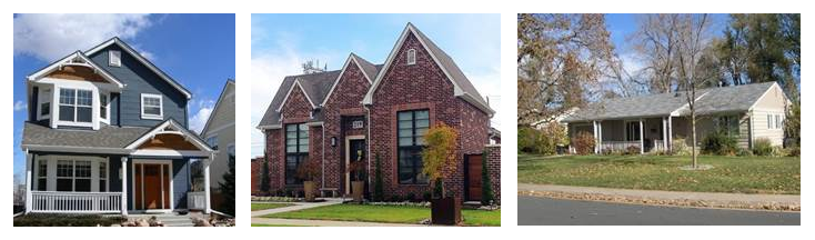 Illustrates three styles of the single-family building form. Illustrates three styles of the single-family building form. |
4.
Two-family. The "two-family" building form exhibits a similar shape and architectural features to the "single-family" building form, but allows for a slightly higher density. The two-family building form can be designed as two side-by-side single-family units; can be a form split with one unit facing the primary street and the other facing a secondary street, backyard, or side yard; and can be a form with one unit on the ground-level and the other on the upper-level. Parking is provided for each of the units. Parking can take the form of a shared, attached garage; a shared, detached garage; individual, attached garages; or individual, shared garages.
| Figures 3.4 (left), 3.5 (right)
Side-by-Side Two-Family Building Form | |
|---|---|
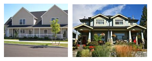 A side-by-side two-family building form exhibits similar building features to single-family. A side-by-side two-family building form exhibits similar building features to single-family. |
5.
Cottage court. This building form consists of a series of small, detached structures, providing multiple units arranged around a common courtyard, which is oriented perpendicular to the street. The common courtyard provides usable, shared open space in lieu of a private rear yard and becomes an important community element. This building form is sized to fit within single-family and medium density neighborhoods. The cottage court building form enables appropriately scaled, well-designed higher densities and is important for providing a broad choice of housing types and promoting walkability. Parking in cottage court developments can occur in many fashions: as attached or detached garages tied to individual homes, as attached carports, within detached communal garages, or within scattered surface parking lots.
| Figures 3.8 (left), 3.9 (right)
Cottage Court Building Form | |
|---|---|
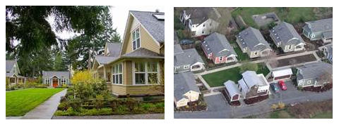 Illustrates the cottage court building form that is defined by a common courtyard.
The entries for all interiorunits face the common courtyard, while the end units face
the common courtyard or the adjacent street. Illustrates the cottage court building form that is defined by a common courtyard.
The entries for all interiorunits face the common courtyard, while the end units face
the common courtyard or the adjacent street. |
6.
Three-plex/four-plex/mansion apartment. A three-plex/four-plex/mansion apartment building form provides an opportunity for increased density in a single-family context. While providing multiple units within one building, this building form appears to be similar and size and shape to that of a large single-family house, utilizing a single roof, shared entry or entries and shared outdoor space. While this building form may be larger than neighboring single-family buildings, its setbacks, parking location and wall articulation features make it an appropriate building form that allows for increased density in the single-family context.
| Figures 3.6 (left), 3.7 (right)
Three-Plex/Four-Plex Mansion Apartment | |
|---|---|
 Illustrates two interpretations of the three-plex/four-plex mansion apartmentappear
as a large, single-family residence, while providing multiple units. Illustrates two interpretations of the three-plex/four-plex mansion apartmentappear
as a large, single-family residence, while providing multiple units. |
7.
Rowhouse. This building form consists of a series of attached units that are narrow and tall, with entries facing the street (on street adjacent walls). This building form has a limit to the width of the total building length so that it relates to neighboring structures and provides a defined front wall for each unit. The rowhouse form is often raised moderately off the ground and accessed by a porch or stoop to draw attention to the individual entry for each unit. A variety of articulation methods can be used to distinguish each rowhouse unit, including changes in material, wall offsets, and changes in color. Detached garages or a "tuck under garage" (provided within the first floor of each unit) accessed by an alley or internal access drive is typical.
| Figures 3.10 (left), 3.11 (right)
Rowhouse Building Form | |
|---|---|
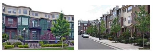 Illustrates the rowhouse building form that shows street-facing entries and distinguishesbetween
each rowhouse unit through the use of wall offsets and changes in material. Illustrates the rowhouse building form that shows street-facing entries and distinguishesbetween
each rowhouse unit through the use of wall offsets and changes in material. |
8.
Flats. A flat is a multi-story, residential building form that increases density in targeted single-family areas and provides an additional housing option in commercial and mixed-use areas. A flat includes floors of "stacked" residential units. Common entries and circulation corridors typically provide access to individual units. Flats may be single-loaded with a circulation hallway on one side of the building or double-loaded with units on both sides of a building with a common hallway through the middle. The location and connection of an entry to the street and the articulation of the building walls provide architectural interest and create a more pedestrian-friendly environment. Parking in flats-style developments typically occurs in shared surface parking lots, but can also occur in structured garages, as market forces allow.
| Figures 3.12 (left), 3.13 (right)
Flats Building Form | |
|---|---|
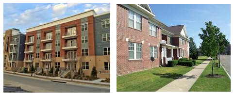 Illustrates the flats building form which increases density in single-family areas
and providesan additional housing option in commercial and mixed-use areas. Illustrates the flats building form which increases density in single-family areas
and providesan additional housing option in commercial and mixed-use areas. |
9.
Mixed-use A. This building form facilitates office and residential uses within one structure mixed vertically and/or horizontally, with limited supporting retail. Its scale and intensity is limited to facilitate a neighborhood-compatible mixed-use building that transitions appropriately to areas of strictly residential character. For instance, these may take the form of a small corner shop with rowhouses or flats continuing down the block. The ground-floor requires transparency minimums for certain retail uses as well as limits on the linear percentage of active storefronts. Mixed-use A also accommodates offices and residential uses. This very flexible building form may include components of many other building forms described in this chapter. Parking for residents and office and retail employees in this building form is typically aggregated in adjacent surface parking lots or structured garages. However, buildings that are predominantly residential may also incorporate individual garages within the design of the primary structure. This building form also commonly requires nearby, on-street parking for short-term office visitors and retail patrons.
| Figure 3.14 Mixed-Use A Building Type | |
|---|---|
 Illustrates the Mixed-Use A buildings type which exhibits small corner shopswith rowhouse
and flats on the remainder of the block. Illustrates the Mixed-Use A buildings type which exhibits small corner shopswith rowhouse
and flats on the remainder of the block. |
10.
Mixed-use B/commercial. This form facilitates the mixing of commercial, office and potentially residential uses within one structure. Mixed-use B/commercial also accommodates commercial or office uses as sole uses within a single building. It is characterized by generous ground floor heights, active ground floor uses (such as shops or offices). In many cases, office or residential components are included on upper floors with the ground floor dedicated to retail uses. Entries are typically clearly demarcated for individual components of a building, like common residential entries or storefronts. Ground floors are highly articulated and exhibit high percentages of transparency. Internal circulation is critical to connecting uses within the building and elevators are widely used where multiple stories exist. Parking for residents and office and retail employees in this building form is typically aggregated in adjacent surface parking lots or structured garages. This building form exhibits a high number of visitors and shopping patrons, which makes high-turnover, on-street parking critical.
| Figures 3.15 (left) and 3.16 (right)
Mixed-Use B/Commercial Building Form | |
|---|---|
 Illustrates the Mixed-Use B/Commercial building form that can be designed andarticulated
in many ways to accommodate a variety of uses. Illustrates the Mixed-Use B/Commercial building form that can be designed andarticulated
in many ways to accommodate a variety of uses. |
D.
Design intent statements.
1.
Lot. Standards in the "lot" category are intended to ensure that a site is adequately sized and dimensioned to accommodate a particular building form, consistent with the intent of the DROD area in which it is located. Lot dimension requirements help ensure that a consistent and compatible horizontal rhythm of buildings is established along a public street and that a project with multiple units or buildings on one lot does not appear overly dense in relation to residential properties nearby. Lot requirements are particularly important in areas where single-family homes are prominent.
Where a site will be subdivided into more than one parcel (a potential situation for rowhouse, cottage court, two-family and three-plex/four-plex/mansion apartment), lot design standards should be based on the collective area of all parcels. Figures 4.1 and 4.2 illustrate a project site that remains one parcel, despite the individual rowhouse units. Figures 4.3 and 4.4 illustrate a project site that was subdivided into individual parcels based on units. While this project is subdivided, the lot design standards should still be based on the collective area of all parcels.
| Figure 4.1 | |
|---|---|
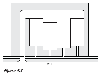 |
| Figure 4.2 | |
|---|---|
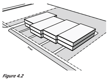 |
| Figure 4.3 | |
|---|---|
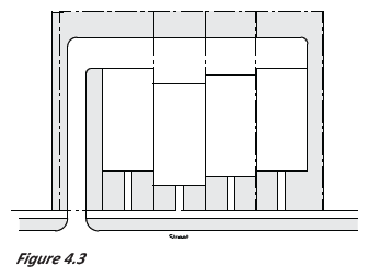 |
| Figure 4.4 | |
|---|---|
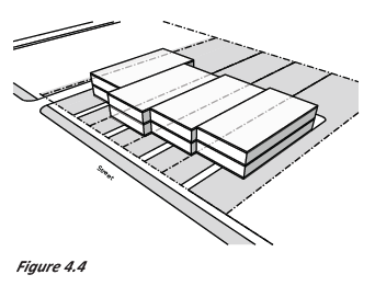 |
a.
Lot area. This standard seeks to establish a minimum lot size that is compatible with properties in a given DROD area. Minimum lot sizes are provided for each building type. This standard is intended to reflect traditional lot sizes and widths in each individual area and seeks to provide adequate site area to accommodate particular building types.
Lot area applies to: single-family, two-family, three-plex/four-plex/mansion apartment, cottage court, rowhouse, flats, mixed-use A.
b.
Lot frontage. This design standard establishes a minimum linear width for an individual lot that is parallel to the street. It is intended to accommodate the permitted building type(s) in that Area and establish a consistent horizontal rhythm of buildings along a block and within a specific area.
Lot frontage applies to: single-family, two-family, three-plex/four-plex/mansion apartment, cottage court, rowhouse, flats, mixed-use A.
c.
Lot depth. This design standard establishes a minimum linear distance from the front lot line to rear lot line in order to accommodate the cottage court building form, which allows multiple detached structures on a single lot. This design standard aims to ensure adequate depth to accommodate two or more structures between the front and rear lot lines, and to accommodate the common courtyard space of a cottage court building form, as well as parking for each unit and driveway access.
Lot depth applies to: cottage court.
d.
Lot coverage. This design standard is intended to limit the ratio of built areas to landscaped areas on a lot by designating a maximum percentage of lot that can be covered by structures or impervious surfaces, such as surface parking and driveways. Lot coverage ensures that a minimum amount of undeveloped or open space is retained on a parcel to encourage retaining yard area proportions consistent with other properties in an area, and particularly those of a residential character.
Lot coverage applies to: single-family, two-family, three-plex/four-plex/mansion apartment, cottage court, rowhouse, flats, mixed-use A.
2.
Site. Standards in the "Site Design" category are intended to ensure that the arrangement and relationship between various elements on a site have a positive impact on the property and the surrounding neighborhood. Site standards identify where buildings, parking and other elements should be located on a site to promote a visually cohesive neighborhood, establish a rhythm of buildings along a street, minimize the visual impact of parking and garages on the neighborhood and ensure that sufficient light, air and privacy are preserved between adjoining properties. They also promote efficient and safe circulation of pedestrians and vehicles, as well as a minimization of pedestrian/vehicle conflicts.
Where a site will be subdivided into more than one parcel (a potential situation for rowhouse, cottage court, two-family and three-plex/four-plex/mansion apartment), site design standards should be based on the collective area of all parcels. Figures 4.5 and 4.6 illustrate a project site that remains one parcel, despite the individual rowhouse units. Figures 4.7 and 4.8 illustrate a project site that was subdivided into individual parcels based on units. While this project is subdivided, the site design standards should still be based on the collective area of all parcels.
| Figure 4.5 | |
|---|---|
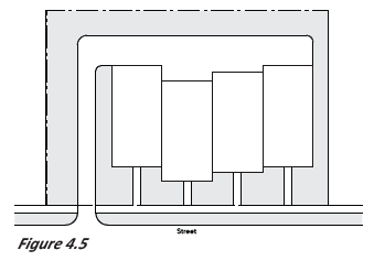 |
| Figure 4.6 | |
|---|---|
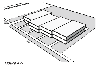 |
| Figure 4.7 | |
|---|---|
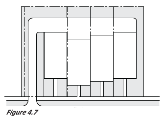 |
| Figure 4.8 | |
|---|---|
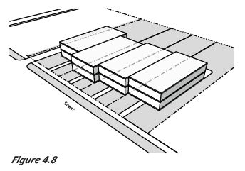 |
a.
Front setback/build to zone. This standard is intended to establish a consistent placement of buildings along a block such that the buildings frame the street space. Placement of buildings closer to the street strengthens the visual connection between the street and buildings. This creates visual interest along a block, which enhances walkability. The front setback is measured from the front property line to the front wall. The build to zone (BTZ) is measured from the required front setback to the distance specified in the design standards tables (in Chapter 5). A percentage of the front wall is required to be built in the BTZ. The percentage varies by building form and area. See Figure 4.9 for an example.
Front setback/build to zone applies to: single-family, two-family, three-plex/four-plex/mansion apartment, cottage court, rowhouse, flats, mixed-use A, mixed-use B/commercial.
| Figure 4.9 | |
|---|---|
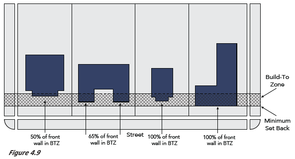 |
b.
Side setback. This design standard is intended to establish horizontal spacing of buildings to create a rhythm along the street and to ensure adequate spacing between buildings. Side setbacks are intended to provide for privacy between properties and adequate light and air access.
Side setback applies to: single-family, two-family, three-plex/four-plex/mansion apartment, cottage court, rowhouse, flats, mixed-use A, mixed-use B/commercial.
c.
Rear setback. This design standard is intended to ensure adequate privacy between properties that abut one another at the rear of a lot. It is also intended to provide for adequate light and air access to adjacent properties.
Rear setback applies to: single-family, two-family, three-plex/four-plex/mansion apartment, cottage court, rowhouse, flats, mixed-use A, mixed-use B/commercial.
d.
Upper floor street setback. This standard is intended to foster new development that is compatible with existing traditional downtown commercial buildings by maintaining a three-story scale at the street wall. By requiring an increased setback above the third floor, the scale is maintained and it also ensures that light and air access is provided for the street. Figure 4.11 illustrates that an increased upper floor setback of a minimum of 15 feet from the front property line is required above the third story. A recommended setback distance from the front wall is also provided.
| Figure 4.11 | |
|---|---|
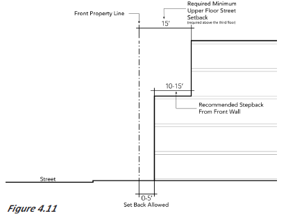 |
e.
Space between buildings. This standard is intended to prevent overly long walls on certain building types which reduce walkability and do not establish a human scale. It ensures adequate room for pedestrians to move between structures, and provides access to light and air for each structure.
Space between buildings applies to: cottage court, rowhouse, flats, mixed-use B/commercial.
f.
Common courtyard dimensions. This design standard is intended to ensure that the common courtyard of the cottage court building form is located at a central point between each individual unit and provides ample shared outdoor space for all residents. Common courtyard dimension requirements also establish a common courtyard of a minimum size that will provide ample light and air access and privacy for each unit. The common courtyard should provide a space for residents to interact and promote a shared sense of community. While the cottage court building form may still provide small side and rear yards for each individual home, the common courtyard seeks to provide shared open space in lieu of larger, private yards.
Common court dimensions applies to: cottage court.
g.
Building alignment. This standard is intended to strengthen the visual relationship between buildings and streets to create an engaging streetscape and discourages orientation of a building that is inconsistent with neighboring and nearby properties. Placing a building parallel to the street helps to frame the street space. Buildings placed parallel to the street promote interaction between buildings and pedestrians.
Building alignment applies to: single-family, two-family, three-plex/four-plex/mansion apartment, cottage court, rowhouse, flats, mixed-use A, mixed-use B/commercial.
h.
Garage and carport location. This standard is intended to prevent unarticulated garage doors close to the street and ensure garages are subordinate to the primary building. This design standard seeks to minimize the visibility and prominence of the garage and carport as viewed from the street. Property owners should seek to locate garages behind primary buildings along alleys where feasible so that the primary building is highlighted. Where locating the garage behind the primary building is not feasible or required, designs should minimize the visibility of garage doors as viewed from the street. This design standard is measured from the front property line to the garage or carport structure, regardless of the structure's orientation. Many building forms also indicate that garage and carports should be accessed from the alley when possible.
Garage and carport location applies to: single-family, two-family, three-plex/four-plex/mansion apartment, cottage court, rowhouse.
i.
Access and driveway width. This standard is intended to minimize potential conflicts between pedestrians and vehicles by concentrating parking along alleys and away from the street, when possible. Properties with alleys shall utilize the alley as an opportunity to place the garage in a location that does not conflict with sidewalks. Where alley access is not possible, driveway widths should be minimized to decrease potential conflicts between pedestrians and vehicles where a driveway crosses a public sidewalk. This standard is also intended to limit overly wide pavement areas that are inconsistent with the rhythm of yards and buildings along a block.
Access and driveway width applies to: single-family, two-family, three-plex/four-plex/mansion apartment, cottage court, rowhouse, flats, mixed-use A, mixed-use B/commercial.
j.
Parking location. This design standard is intended to minimize the visibility of off-street surface parking from the street to promote an engaging and attractive streetscape. Where possible, parking should be located completely behind a primary building so that it is not visible from the street.
Parking location applies to: cottage court, mixed-use A, flats, mixed-use B/commercial.
k.
Parking access. This standard intends to limit the number of access points to a development in order to minimize the visibility of parking and to maintain a built street wall. Parking access focuses specifically on those corridors within the DROD that should be the most oriented towards pedestrians. Minimizing the number of entry and exit points for cars reduces potential conflict points with pedestrians, maintains a street wall along primary streets and maximizes opportunities on along the sidewalk for additional pedestrian amenities.
Parking access applies to: mixed-use B.
l.
Accessory dwelling unit (ADU) location. The design standard is intended to minimize the visibility of an accessory dwelling unit from the street and ensure that the ADU is subordinate to the primary building.
Accessory dwelling unit (ADU) location applies to: single-family.
3.
Building form. Standards in the "building form" category are intended to ensure that the basic parameters of a building's three-dimensional volume are articulated and shaped to fit with the intent of a given DROD area. Requirements focus on the basic scale and dimensions of a building "envelope," including overall maximum building height and building length. Dimension and shape of smaller, individual building components, such as roofs or floors, are also addressed. "Building form" standards ensure that an overall building mass and its key components are sized, shaped and proportioned in a manner that is consistent and compatible with neighboring properties.
a.
Front wall width. This design standard is intended to create a consistent horizontal rhythm of similarly dimensioned front wall elements along a street by minimizing the width of the front wall to reflect the surrounding context of existing structures. It seeks to prevent the construction of long, horizontally-oriented walls along the street that are inconsistent with other detached single-family homes in an area. Figure 4.12 below illustrates how to apply the front wall width design standard requirements: The total permitted front wall width is noted by the letter "A." Only "C" feet of the total front wall width ("A") can be located within "B" feet of the front lot line. "C" is also known as the "front-most wall" of a building. Consult design standards for the proposed building form to determine exact widths and depths that apply to the explanation above.
Front wall width applies to: single-family, two-family, three-plex/four-plex/mansion apartment, cottage court, rowhouse.
| Figure 4.12 | |
|---|---|
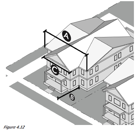 |
b.
Wall length. This design standard is intended to prevent overly long buildings that prevent visual permeability into a site from the street and do not express a human scale consistent with other buildings in downtown Broken Arrow. This design standard also seeks to break up continuous walls on longer blocks.
Wall length applies to: flats, mixed-use A, mixed-use B/commercial.
c.
Building height. This design standard intends to establish overall heights of new structures that respond to surrounding lower scale areas while allowing for taller buildings that contribute to the active, urban environment envisioned for downtown. This design standard also promotes scale that is compatible with Broken Arrow and ensures access to light and air.
Building height applies to: single-family, two-family, three-plex/four-plex/mansion apartment, cottage court, rowhouse, flats, mixed-use A, mixed-use B/commercial.
d.
Finished floor height. The finished floor design standard seeks to establish a separation between the public realm and private buildings by setting the first floor up off the ground, and to match the traditional form of raised porches. Figure 4.13 below shows the finished floor height of a single-family residential building in blue.
Finished ground floor level applies to: single-family, two-family, cottage court, rowhouse, flats, mixed-use A, mixed-use B/commercial.
| Figure 4.13 | |
|---|---|
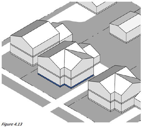 |
e.
Floor height. This design standard seeks to establish consistent ranges of heights of individual floors within each area in order to maintain visual continuity along a street. This also seeks to establish adequate height to support quality space for tenants or owners that is also in the range of traditional floor dimensions, which is particularly important in Downtown, Area 6. Floor height is measured as the vertical distance from the top of a floor's structure to the lowest point of the ceiling of that same floor.
Floor height applies to: single-family, two-family, three-plex/four-plex/mansion apartment, cottage court, flats.
f.
Roof form. This design standard aims to create a consistent use of roof forms throughout an area to provide visual consistency, and to provide for architectural variety in other areas. The use of a given roof form will either maintain consistency in architectural form or support variety, depending on how the standard is applied in a given DROD area.
Roof form applies to: single-family, two-family, 3-plex/4-plex/mansion apartment, cottage court, rowhouse, flats, mixed-use A, mixed-use B/commercial.
g.
Accessory dwelling unit (ADU) building height. This standard is intended to promote accessory dwelling units (ADUs) that are visually compatible with and subordinate to their primary buildings, as well as buildings on their neighboring lots. Providing a maximum height for an ADU promotes scale that is compatible with Broken Arrow and ensures access to air and light.
ADU building height applies to: single-family.
h.
Accessory dwelling unit (ADU) roof form. This standard is intended to promote accessory dwelling units (ADUs) that are visually compatible with and subordinate to their primary buildings, as well as buildings on their neighboring lots. Regulating the roof form of an ADU aims to create a range of roof forms that are consistent with the primary structure, while also providing some architectural variety.
ADU roof form applies to: single-family.
i.
Garage and carport (if visible). This standard seeks to minimize the presence of garages that are visible from the street. It is also intended to ensure that a garage is subordinate to the primary building. This will contribute to street level interest, thereby increasing walkability.
Garage and carport applies to: single-family, two-family, flats.
j.
Garage and carport width. This standard is intended to promote garages and carports that are visually compatible with and subordinate to their primary buildings, as well as the buildings on neighboring lots. Overly wide garages and carports overwhelm the fronts of primary and accessory buildings, creating spaces void of architectural detail, which minimizes street level interest and detracts from the pedestrian experience.
Garage and carport width applies to: single-family and two-family.
k.
Garage door/carport height. This standard is intended to promote garages and carports that are visually compatible with and subordinate to their primary buildings, as well as the buildings on neighboring lots. It promotes scale that is compatible with Broken Arrow and ensures access to air and light. Garages and carports that are too tall can detract from the overall appearance of a primary or accessory building.
Garage and carport height applies to: single-family and two-family.
4.
Building activation. Standards in the "building activation" category focus on the more detailed three-dimensional elements and architectural features on a building. They are intended to ensure that buildings establish a strong visual and physical relationship with the public realm, thereby enhancing walkability and visual interest. As such, standards in this category focus on minimizing blank, lifeless walls and other monotonous features, particularly along a public street. They promote visual connectivity between a building and a street by requiring regularly spaced entries along the street, encouraging windows and storefronts that allow visual permeability into a building, and ensuring that entry elements are visually and physically connected to the street.
a.
First story element. This standard seeks to establish smaller scale building features along the street that express the division between lower and upper floors on front facades to reduce perceived mass on multi-story buildings. Buildings should provide visual evidence or demarcation of the stories of a building to relate to pedestrians and express a human scale. Figure 4.14 below illustrates one example of a shared first story element, in this case, a projecting porch, that is permitted for the two-family building form.
| Figure 4.14 | |
|---|---|
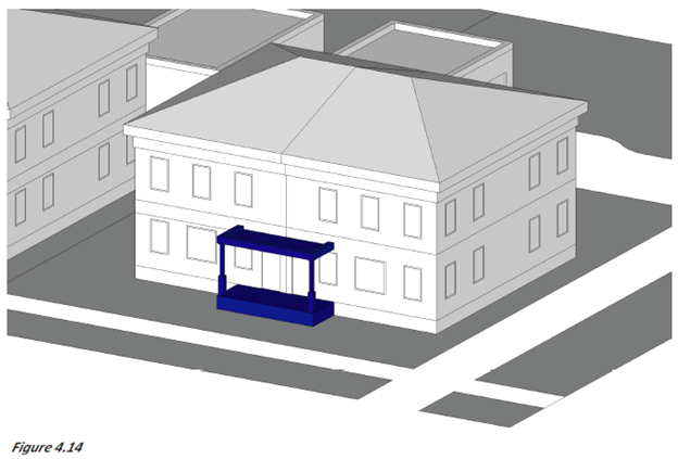 |
b.
Blank street-facing wall. This standard is intended to reduce the overall perceived mass and bulk of buildings on a property as viewed from the street and establish a visual relationship between a building and the street. Designs should articulate building walls by using design techniques and including windows and doors to break up large, expansive wall planes. This standard seeks to enhance street-level pedestrian interest, establish visual continuity along a street and create visual connectivity between the street and a private property.
The blank street-facing wall distance is measured on each individual floor of a building, horizontally between windows and doors. When measuring, the windows and doors vertically extend to cover the floor being measured, creating a Vertical Window/Door Area, as shown in Figure 4.15. Therefore, the blank wall distance is measured horizontally between the established vertical window/door areas on one floor. These distances are always measured from the elevation view of the building. Figure 4.17 illustrates how to measure the blank street-facing wall. Each building type in Chapter 5 specifies the numeric value of the maximum blank street-facing wall distance that is allowed between windows and doors.
Street-facing facade design applies to: single-family, two-family, three-plex/four-plex/mansion apartment, cottage court, rowhouse, flats, mixed-use A, mixed-use B/commercial.
| Figure 4.15 | |
|---|---|
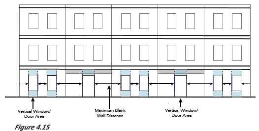 |
c.
Principal windows. Principal windows are one of the most important character defining elements of a building's street-facing wall. Windows are one of the primary opportunities for breaking up large, expansive wall planes and allowing air and light into a structure. Incorporating principal windows also helps create a human scale and enhance street level interest. Principal windows help create visual connectivity between the street and a private property. This standard sets the minimum number of principal windows that should appear on a building's street-facing wall, as well as the minimum size of those windows.
Principal windows applies to: single-family, two-family, three-plex/four-plex/mansion apartment, cottage court, and rowhouse.
d.
Window size—Street-facing wall. This standard is intended to encourage the use of appropriately sized windows on the street-facing wall of a building. Windows are one of the primary opportunities for breaking up large, expansive wall planes and allowing air and light into a structure. Incorporating windows in addition to the principal window also helps create a human scale and enhance street level interest.
Window size—Street-facing wall applies to: single-family, two-family, three-plex/four-plex/mansion apartment, cottage court, and rowhouse.
e.
Entry presence—Facing street. The entry presence is one of a group of standards that intends to establish a relationship between a primary building's entrance and the street. It also seeks to establish visual continuity along the street with a rhythm of clearly demarcated entries. Figure 4.16 below illustrates an entrance that opens onto a porch rather than toward the public realm, which is one of the ways that may be appropriate for a building to visually connect an entrance to the street.
Entry presence—Facing street applies to: single-family, two-family, three-plex/four-plex/mansion apartment, cottage court, rowhouse, flats, mixed-use A, and mixed-use B/commercial.
| Figure 4.16 | |
|---|---|
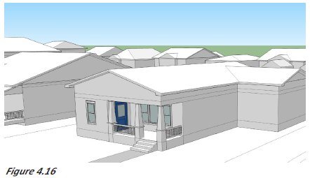 |
f.
Entry location (on street-facing wall). The entry location is one of a group of standards regarding entry design that intends to establish a relationship between a primary building's entrance and the street. It also seeks to establish visual continuity along the street with a rhythm of clearly demarcated entries. Figure 4.17 below illustrates an entry that is located setback from the front-most wall. The permitted distance of this setback depends on the building form.
Entry location (on street-facing wall)—Facing street applies to: single-family, two-family, three-plex/four-plex/mansion apartment, cottage court, rowhouse.
| Figure 4.17 | |
|---|---|
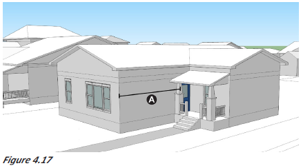 |
g.
Entry number (on street-facing wall). The number of entries is one of a group of standards regarding entry design that intends to establish a relationship between a primary building's entrance and the street. It also seeks to establish visual continuity along the street with a rhythm of clearly demarcated entries. Requiring this intends to provide continuity along a street and to provide access points throughout a larger development.
Entry number applies to: three-plex/four-plex/mansion apartment.
h.
Entries per unit. This standard is one of a group of standards regarding entry design that intends to establish a relationship between a primary building's entrance and the street, and between the entries in a rowhouse development. This standard establishes a minimum number of entries per rowhouse unit. It reinforces that rowhouses should be individual units with their own entries, as opposed to other multi-family building forms that rely on shared public entrances.
Entries per unit applies to: rowhouse.
i.
Entry path. The entry path is one of a group of standards regarding entry design that intends to establish a relationship between a primary building's entrance and the street. It also seeks to establish visual continuity along the street with a rhythm of clearly demarcated entries. Requiring a physical connection from the entry of a building to the street creates a clear space to enter a site and visually relates a building to the public realm.
Entry path applies to: single-family, two-family, cottage court, three-plex/four-plex/mansion apartment, rowhouse, flats, mixed-use A.
j.
Distance between entries. The distance between entries is one of a group of standards regarding entry design that intends to establish a relationship between a primary building's entrance and the street. It also seeks to establish visual continuity along the street with a rhythm of clearly demarcated entries. Requiring a maximum distance between entries intends to provide a distance that is easily traveled by a pedestrian and a distance that creates a pedestrian-scale of development.
Distance between entries applies to: flats, mixed-use A, mixed-use B/commercial.
k.
Building articulation options. This design standard is intended to reduce perceived building mass as viewed from the street by breaking the scale of the building into components that express a human scale. A complete list of building articulation options can be found in the appendix along with definitions and visual examples.
Building articulation options applies to: flats, mixed-use B/commercial.
l.
Active retail storefront (mixed-use A). This design standard seeks to minimize retail uses and activity in mixed-use A buildings in Area 5 to promote compatibility with adjacent residential focused uses.
Active retail storefront applies to: mixed-use A.
m.
Ground floor transparency. Ground-floor transparency intends to establish a minimum percentage of void (windows, doors, etc.) along the ground-floor in order to create street level interest and visual connectivity between the street and the property. Requiring a minimum amount of ground-floor transparency also ensures access to light and air. Ground-floor transparency is calculated based on the total facade area located between two feet and 12 feet above the finished ground-floor level. Figure 4.18 illustrates the area within which ground-floor transparency is measured, and highlights the windows and doors in blue that contribute to the calculation.
Parking screening applies to: mixed-use B/commercial.
| Figure 4.18 | |
|---|---|
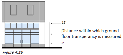 |
n.
Parking screening. This design standard is intended to minimize the visibility of surface parking lots located adjacent to the street to maintain an attractive and pedestrian-friendly streetscape. Figures 4.19, 4.20 and 4.21 illustrate a variety of parking screening options that may be utilized when a parking lot is visible from the street. Parking screening options include landscaping, constructing a wall or constructing a fence.
Parking screening applies to: mixed-use A, mixed-use B/commercial.
| Figure 4.19 Parking Screening with Wall | |
|---|---|
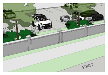 |
| Figure 4.20 Parking Screening with Landscape | |
|---|---|
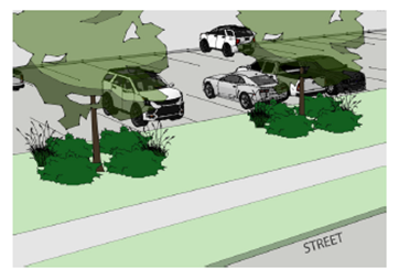 |
| Figure 4.21 Parking Screening with Fence | |
|---|---|
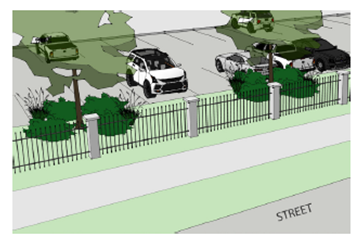 |
E.
Design standards by building form. The design standards are written by building form. The design variables for each of the nine building forms are divided into four categories: lot, site, building form and building activation. Design standards are written for each of the four categories. For those building forms that are permitted in multiple areas, specific design standards are provided for each design variable based on area. After the design standards for one category are provided, an annotated model illustrates the previously presented design standards. Annotations in each model correspond to the letter(s) shown on each design variable table.
The four categories that the design variables for each building form are divided into are described below:
•
Lot. Standards in the "lot" category are intended to ensure that a site is adequately sized and dimensioned to accommodate a particular building form, consistent with the intent of the DROD area in which it is located. Lot dimension requirements help ensure that a consistent and compatible horizontal rhythm of buildings is established along a public street and that a project with multiple units or buildings on one lot does not appear overly dense in relation to residential properties nearby. Lot requirements are particularly important in areas where single-family homes are prominent.
Where a site will be subdivided into more than one parcel (a potential situation for rowhouse, cottage court, two-family and three-plex/four-plex/mansion apartment), lot design standards should be based on the collective area of all parcels. Figures 4.1 and 4.2 illustrate a project site that remains one parcel, despite the individual rowhouse units. Figures 4.3 and 4.4 illustrate a project site that was subdivided into individual parcels based on units. While this project is subdivided, the lot design standards should still be based on the collective area of all parcels.
•
Site. Standards in the "site design" category are intended to ensure that the arrangement and relationship between various elements on a site have a positive impact on the property and the surrounding neighborhood. Site standards identify where buildings, parking and other elements should be located on a site to promote a visually cohesive neighborhood, establish a rhythm of buildings along a street, minimize the visual impact of parking and garages on the neighborhood and ensure that sufficient light, air and privacy are preserved between adjoining properties. They also promote efficient and safe circulation of pedestrians and vehicles, as well as a minimization of pedestrian/vehicle conflicts.
Where a site will be subdivided into more than one parcel (a potential situation for rowhouse, cottage court, two-family and three-plex/four-plex/mansion apartment), site design standards should be based on the collective area of all parcels. Figures 4.5 and 4.6 illustrate a project site that remains one parcel, despite the individual rowhouse units. Figures 4.7 and 4.8 illustrate a project site that was subdivided into individual parcels based on units. While this project is subdivided, the site design standards should still be based on the collective area of all parcels.
•
Building form. Standards in the "building form" category are intended to ensure that the basic parameters of a building's three-dimensional volume are articulated and shaped to fit with the intent of a given DROD area. Requirements focus on the basic scale and dimensions of a building "envelope," including overall maximum building height and building length. Dimension and shape of smaller, individual building components, such as roofs or floors, are also addressed. "Building form" standards ensure that an overall building mass and its key components are sized, shaped and proportioned in a manner that is consistent and compatible with neighboring properties.
•
Building activation. Standards in the "building activation" category focus on the more detailed three-dimensional elements and architectural features on a building. They are intended to ensure that buildings establish a strong visual and physical relationship with the public realm, thereby enhancing walkability and visual interest. As such, standards in this category focus on minimizing blank, lifeless walls and other monotonous features, particularly along a public street. They promote visual connectivity between a building and a street by requiring regularly spaced entries along the street, encouraging windows and storefronts that allow visual permeability into a building, and ensuring that entry elements are visually and physically connected to the street.
1.
Single-family.
| Single-Family Description | |||
|---|---|---|---|
|
The "single-family" building form is a detached house that is a small-scale, freestanding
building, typically one to 2.5 stories in height. This form occurs as a single building
on a lot and it may include building details such as a front porch, front stoop and
attached or detached garage. This type of single-family home is typically set back
from the public right-of-way and adjacent lots, and is slightly elevated above the
ground. It typically includes a moderately pitched roof form and is designed with
the smaller dimension of the building footprint parallel to the street. In some cases,
a flat roof shape is employed. This building form is ideally designed to facilitate
residential uses.
Permitted in Areas 1, 2, 3, 4 and 5. | 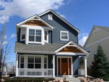 | ||
| Single-Family Lot | |||
|---|---|---|---|
| A | Lot Area | 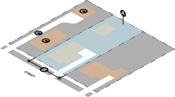 | |
| Area 1 & 5 | 5,000 sq. ft. Min. 1 | ||
| Area 2 & 3 | 5,500 sq. ft. Min. 1 | ||
| Area 4 | 6,000 sq. ft. Min. | ||
| B | Lot Frontage | ||
| Area 1 & 5 |
25' Min.
75' Max. | ||
| Area 2 & 3 |
35' Min.
80' Max. | ||
| Area 4 |
55' Min.
120' Max. | ||
| C | Lot Coverage | ||
| Area 1, 2, 3 & 5 | 55% Max. | ||
| Area 4 | 50% Max. | ||
| Additional Information | |||
| 1 Existing lots 30' wide or less: 3,500 sq. ft. Min. | |||
| Single-Family Site | |||
|---|---|---|---|
| A | Front Setback/Build to Zone (BTZ) | 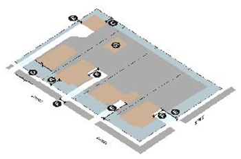 | |
| Area 1 & 5 | 10' Min./65% in BTZ 1 | ||
| Area 2 & 3 | 15' Min./65% in BTZ 1 | ||
| Area 4 | 20' Min./65% in BTZ 1&3 | ||
| B | Side Setback | ||
| Area 1 & 5 | 5' Min., transitional setback required 2&3 | ||
| Area 2 & 3 | 5' Min., transitional setback required 3 | ||
| Area 4 | 5' Min. | ||
| C | Rear Setback | ||
| Area 1, 2, 3 & 5 | 10' Min., transitional setback required 3&4 | ||
| Area 4 | 10' Min. | ||
| D | Building Alignment | ||
| Area 1, 2, 3, 4 | Required 5 | ||
| E | Garage and Carport Location | ||
| Area 1 & 5 | 30' Min. setback from front property line 6&10 | ||
| Area 2 | 35' Min. setback from front property line 6&10 | ||
| Area 3 | Front of garage/carport must be placed behind rear wall of primary structure 6&10 | ||
| Area 4 | 20' Min. 6 | ||
| F | Access and Driveway Width | ||
| Area 1, 2 & 5 | 25' Max. 7&8 | ||
| Area 3 & 4 | 25' Max. 8&9 | ||
| G | Accessory Dwelling Unit (ADU) Location | ||
| Area 1, 2, 3, 4 & 5 | Front of ADU must be placed behind rear wall of primary structure | ||
| Additional Information | |||
|
Note: Sidewalks shall be provided along all street frontages in accordance with the
Subdivision Regulations.
1 65 percent of front wall is required to be placed within ten feet of required front setback. 2 Existing lots 30 feet wide or less: three-foot side setback. 3 For corner lots, the side of the primary structure that does not have a primary entrance, may be set back 15 feet from the property line. 4 If an alley is present, rear setback is two feet minimum. 5 Building alignment: Interior lot: Front wall of primary structure shall be parallel to the street. Corner lot: All or any visible street-facing wall must be placed parallel to the adjacent street. 6 Garage and carport shall not project forward from front-most wall of primary structure. 7 Only 18-foot wide until driveway is within 20 feet of garage entry. 8 Where an alley is improved, access must be provided from the alley. Where an alley is not improved, a street frontage may have up to one driveway. 9 On corner lots, garage/carport only has to setback 20 feet from the LOT line that has the greatest street frontage. | |||
| Single-Family Building Form | |||
|---|---|---|---|
| A | Front Wall Width | 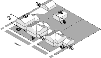 | |
| Area 1 & 5 | 45' Max. 1 | ||
| Area 2 | 50' Max. 2 | ||
| Area 3 | 50' Max. 3 | ||
| Area 4 | 45' Min., 80' Max. | ||
| B | Building Height | ||
| Area 1, 2, 3, 4 & 5 | 2.5 stories/35' Max. 4 | ||
| C | Finished Floor Height | ||
| Area 1, 2, 3, 4 & 5 | 1' Min.; 4' Max. | ||
| D | Floor Height | ||
| Area 1, 2, 3, 4 & 5 | 9' Min. | ||
| E | Roof Form | ||
| Area 1 & 5 | Pitched or flat | ||
| Area 2, 3 & 4 | Pitched | ||
| F | Garage and Carport Width | ||
| Area 1, 2, 3, 4 & 5 | 25' or 40% width of primary structure: Max. street-facing garage door width 5 | ||
| G | Garage Door/Carport Height | ||
| Area 1, 2, 3, 4 & 5 | 9' Max. garage door/carport height | ||
| H | Garage and Carport (If Visible) | ||
| Area 1, 2, 3, 4 & 5 |
If any portion of the garage is located forward of the rear wall of primary structure:
• Roof of garage or carport must match roof of primary structure • Height of garage or carport must be equal to or less than the height of primary structure | ||
| I | ADU Building Height | ||
| Area 1, 2, 3, 4 & 5 | 1 story/15' Max. | ||
| J | ADU Roof Form | ||
| Area 1, 2, 3, 4 & 5 | Must match primary structure | ||
| Additional Information | |||
|
1 Only 30 feet of total front wall width can be located within 25 feet of the front
lot line. The maximum width is a continuous wall. Building activation requirements
apply.
2 Only 40 feet of total front wall width can be located within 30 feet of front lot line. 3 Only 40 feet of total front wall width can be located within 25 feet of front lot line. 4 If a half story is above floor 2, the half story must be contained within the roof. 5 Exception for existing lots 30 feet wide or less. | |||
| Single-Family Building Activation | |||
|---|---|---|---|
| A | First Story Element | 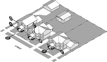 | |
| Area 1 & 5 | Not Required | ||
| Area 2 & 4 | Required 1&3 | ||
| Area 3 | Required 2&3 | ||
| B | Principal Windows | ||
| Area 1, 2, 3 & 5 |
1 Min. on front-most wall
4'x4' Min. dimensions | ||
| Area 4 |
2 Min. on front-most wall
4'x4' Min. dimensions | ||
| C | Blank Street-Facing Wall | ||
| Area 1, 2, 3, 4 & 5 | 8' Max. | ||
| D | Window Size—Street-Facing Wall | ||
| Area 1, 2, 3, 4 & 5 | 2'x3', except for an accent window | ||
| E | Entry Location (On Street-Facing Wall) | ||
| Area 1, 2, 3, 4 & 5 | 10' Max. distance of entry from front-most wall | ||
| F | Entry Presence—Facing Wall | ||
| Area 1, 2, 4 & 5 | Required 4 | ||
| Area 3 | Entry must face the primary street | ||
| G | Entry Path | ||
| Area 1, 2, 3, 4 & 5 | Required 5&6 | ||
| Additional Information | |||
|
1 Must include one of the following elements:
◦ Projecting porch ◦ Recessed porch ◦ Projecting stoop 2 Must include one of the following elements: ◦ Projecting porch ◦ Recessed porch 3 Height of first story element must have an interior clearance of at least eight feet, no greater than 12 feet. Interior clearance is measured from the floor of the first story element to the lowest point of the ceiling of the first story element. 4 In Areas 1 and 2, visually connect entrance to street through one of the following: ◦ Entry faces street ◦ Entry opens onto porch or stoop that faces street 5 Must connect at least one entry to street through physical, demarcated path. 6 Exception for existing lots 30 feet wide or less—not required. | |||
2.
Two-family.
| Two-Family Description | |||
|---|---|---|---|
|
The "two-family" building form exhibits a similar shape and architectural features
to the "single-family" building form, but allows for a slightly higher density. The
two-family building form can be designed as two side-by-side single-family units;
can be a form split with one unit facing the primary street and the other facing a
secondary street, backyard, or side yard; and can be a form with one unit on the ground-level
and the other on the upper-level. Parking is provided for each of the units. Parking
can take the form of a shared, attached garage; a shared, detached garage; individual,
attached garages; or individual, shared garages.
Permitted Areas 1 & 2. | 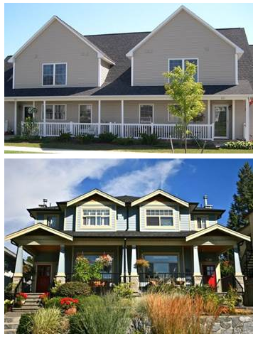 | ||
| Two-Family Lot | |||
|---|---|---|---|
| A | Lot Area | 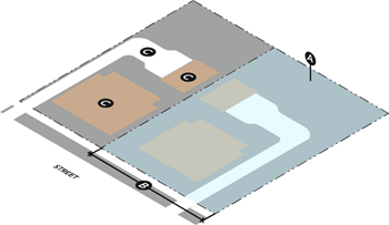 | |
| Area 1 & 5 | 6,500 sq. ft. Min. | ||
| Area 2 | 7,500 sq. ft. Min. | ||
| B | Lot Frontage | ||
| Area 1 & 5 | 110' Max., 45' Min. | ||
| Area 2 | 130' Max., 55' Min. | ||
| C | Lot Coverage | ||
| Area 1 & 5 | 60% Max | ||
| Area 2 | 55% Max. | ||
| Additional Information | |||
| * Where a site will be subdivided into more than one parcel, lot and site design standards should be based on the collective area of all parcels. | |||
| Two-Family Site | |||
|---|---|---|---|
| A | Front Setback/Build to Zone (BTZ) | 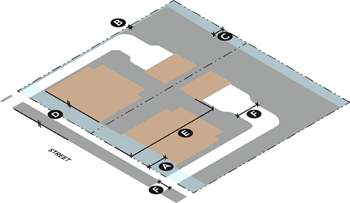 | |
| Area 1 & 5 | 10' Min./65% BTZ 1 | ||
| Area 2 | 15' Min./65% BTZ 1 | ||
| B | Side Setback | ||
| Area 1, 2, & 5 | 5' Min. | ||
| C | Rear Setback | ||
| Area 1 & 5 | 10' Min. 2 | ||
| D | Building Alignment | ||
| Area 1, 2, & 5 | Required 3 | ||
| E | Garage and Carport Location | ||
| Area 1 | 30' Min. setback from front property line | ||
| Area 2 & 5 | 35' Min. setback from front property line | ||
| F | Access and Driveway Width | ||
| Area 1 & 5 | 25' Max. 4&5 | ||
| Additional Information | |||
|
Note: Sidewalks shall be provided along all street frontages in accordance with the
Subdivision Regulations.
* Where a site will be subdivided into more than one parcel, lot and site design standards should be based on the collective area of all parcels. 1 Sixty-five percent of front wall is required to be placed within ten feet of required front setback. 2 If an alley is present, rear setback is two feet minimum. 3 Building alignment: Interior lot: front wall of primary structure shall be parallel to the street. Corner lot: Both street-facing walls of the primary structure shall be parallel to each street. 4 Only 18 feet wide until driveway is within 20 feet of garage entry. 5 Where an alley is improved, access must be provided from the alley. Where an alley is not improved, a street frontage may have up to one driveway. | |||
| Two-Family Building Form | |||
|---|---|---|---|
| A | Front Wall Width | 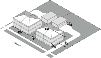 | |
| Area 1 & 5 | 50' Max. | ||
| Area 2 | 65' Max. | ||
| B | Building Height | ||
| Area 1, 2, & 5 | 2 stories/35' Max. | ||
| C | Finished Floor Height | ||
| Area 1, 2, & 5 | 1' Min, 4' Max. | ||
| D | Floor Height | ||
| Area 1, 2, & 5 | 9' Min., 15' Max. | ||
| E | Roof Form | ||
| Area 1 & 5 | Pitched or flat | ||
| Area 2 | Pitched | ||
| F | Garage and Carport Width | ||
| Area 1, 2, & 5 | 25' or 40% width of primary structure: Max. street-facing garage door width 2 | ||
| G | Garage Door/Carport Height | ||
| Area 1, 2, & 5 | 9' Max. garage door or carport height 1 | ||
| Additional Information | |||
|
1 If any portion of the garage is located forward of the rear wall of primary structure:
• Roof of garage or carport must match roof of primary structure. • Height of garage or carport must be equal to or less than the height of primary structure. | |||
| Two-Family Building Activation | |||
|---|---|---|---|
| A | First Story Element | 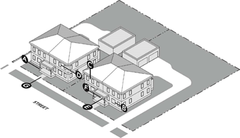 | |
| Area 1, 2, & 5 | Required 1&2 | ||
| B | Principal Windows | ||
| Area 1, 2, & 5 |
1 Min. on front-most wall
4'x4 dimensions 3 | ||
| C | Blank Street-Facing Wall | ||
| Area 1, 2, & 5 | 8' Max. | ||
| D | Window Size—Street-Facing Wall | ||
| Area 1, 2, & 5 | 2'x3', except for an accent window | ||
| E | Entry Location (On Street-Facing Wall) | ||
| Area 1, 2, & 5 | 10' Max. distance of entry from front-most wall | ||
| F | Entry Presence—Facing Street | ||
| Area 1, 2, & 5 | Required 4 | ||
| G | Entry Path | ||
| Area 1, 2, & 5 | Required 5 | ||
| Additional Information | |||
|
1 Must include one of the following elements:
◦ Projecting porch ◦ Recessed porch ◦ Projecting stoop (not permitted in Area 2) ◦ Shared first story element 2 Height of first story element must have an interior clearance of at least eight feet, no greater than 12 feet. Interior clearance is measured from the floor of the first story element to the lowest point of the ceiling of the first story element. 3 If street-facing wall is 35 feet or wider, must have two principal windows. 4 Visually connect entrance to street through one of the following: ◦ Entry faces street ◦ Entry opens on porch that faces street 5 Must connect to street through physical, demarcated path. | |||
3.
Cottage court.
| Cottage Court Description | |||
|---|---|---|---|
|
This building form consists of a series of small, detached structures, providing multiple
units arranged around a common courtyard on one lot, which is oriented perpendicular
to the street. The common courtyard provides usable, shared open space in lieu of
a private rear yard and becomes an important community element. This building form
is sized to fit within single-family and medium density neighborhoods. The cottage
court building form enables appropriately scaled, well-designed higher densities and
is important for providing a broad choice of housing types and promoting walkability.
Parking in cottage court developments can occur in many fashions: as attached or detached
garages tied to individual homes, as attached carports, within detached communal garages,
or within scattered surface parking lots. Courtyards can also be jointly owned by
the community or partitioned to individual owners.
Permitted in Area 1. Special Conditions: 1. There must be a minimum of three units in a cottage court building form. | 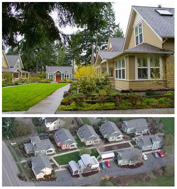 | ||
| Cottage Court Lot | |||
|---|---|---|---|
| A | Lot Area | 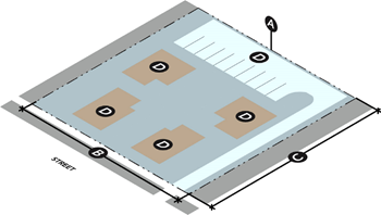 | |
| Area 1 | 10,000 sq. ft. Min. | ||
| B | Lot Frontage | ||
| Area 1 | 100' Min. | ||
| C | Lot Depth | ||
| Area 1 | 100' Min. | ||
| D | Lot Coverage | ||
| Area 1 | 60% Max. | ||
| Additional Information | |||
| * Where a site will be subdivided into more than one parcel, lot and site design standards should be based on the collective area of all parcels. | |||
| Cottage Court Site* | |||
|---|---|---|---|
| A | Front Setback/Build to Zone (BTZ) | 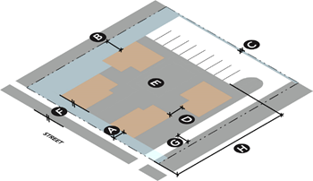 | |
| Area 1 | 10' Min./75% BTZ 1&2 | ||
| B | Side Setback | ||
| Area 1 | 5' Min. | ||
| C | Rear Setback | ||
| Area 1 | 10' Min. 3 | ||
| D | Space Between Buildings | ||
| Area 1 | 10' Min. | ||
| E | Common Courtyard Dimensions | ||
| Area 1 | 30'x40' Min. | ||
| F | Building Alignment | ||
| Area 1 | Required 4 | ||
| G | Access and Driveway Width | ||
| Area 1 | 20' Max. | ||
| H | Garage and Carport Location | ||
| Area 1 | 10' Min. setback from front property line 5&6 | ||
| Additional Information | |||
|
Note: Sidewalks shall be provided along all street frontages in accordance with the
Subdivision Regulations.
* Where a site will be subdivided into more than one parcel, lot and site design standards should be based on the collective area of all parcels. 1 Applies to each wall that is parallel to the street and does not have a building between it and the street. 2 Seventy-five percent of front wall is required to be placed within ten feet of required front setback. 3 If an alley is present, rear setback is two feet minimum. 4 Street-facing walls on end units shall be parallel to street. 5 No parking allowed between street-facing wall and street. 6 Garage door and carport entry cannot face the street. | |||
| Cottage Court Building Form | |||
|---|---|---|---|
| A | Front Wall Width | | |
| Area 1 |
70' Max. total
40' Max. for individual building wall | ||
| B | Building Height | ||
| Area 1 | 2 stories/35' Max. | ||
| C | Finished Floor Height | ||
| Area 1 | 1' Min., 4' Max. | ||
| D | Floor Height | ||
| Area 1 | 9' Min., 15' Max. | ||
| E | Roof Form | ||
| Area 1 | Pitched or flat | ||
| Cottage Court Building Activation | |||
|---|---|---|---|
| A | First Story Element | 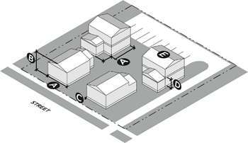 | |
| Area 1 | Required 1&2 | ||
| B | Principal Windows | ||
| Area 1 |
1 Min. on front-most wall
3
4'x'4 Min. dimensions | ||
| C | Blank Street-Facing Wall | ||
| Area 1 | 8' Max. | ||
| D | Window Size - Street-Facing Wall | ||
| Area 1 | 2'x3' Min., except for accent windows | ||
| E | Entry Location (On Street-Facing Wall) | ||
| Area 1 | 10' Max distance of entry from front-most wall | ||
| F | Entry Presence - Facing Street | ||
| Area 1 | Required 4&5 | ||
| G | Entry Path | ||
| Area 1 | Required 6 | ||
| Additional Information | |||
|
1 Must include one of the following elements on the front-most facade of each unit:
• Projecting Porch • Recessed Porch 2 Height of first story element must have an interior clearance of at least eight feet, no greater than 12 feet. Interior clearance is measured from the floor of the first story element to the lowest point of the ceiling of the first story element. 3 If height of front wall is greater than 35 feet, two principal windows are required. 4 Visually connect entrance to street through one of the following: • Entry faces street • Entry opens onto porch that faces street 5 Street-adjacent buildings may visually connect to street instead of common courtyard. 6 Must connect to street through physical, demarcated path. | |||
4.
Three-plex/four-plex/mansion apartment.
| Three-Plex/Four-Plex/Mansion Apartment Description | |||
|---|---|---|---|
|
A three-plex/four-plex/mansion apartment building form provides an opportunity for
increased density in a single-family context. While providing multiple units within
one building, this building form appears to be similar and size and shape to that
of a large single-family house, utilizing a single roof, shared entry or entries and
shared outdoor space. While this building form may be larger than neighboring single-family
buildings, its setbacks, parking location and wall articulation features make it an
appropriate building form that allows for increased density in the single-family context.
Permitted in Areas 1 and 5. |  | ||
| Three-Plex/Four-Plex/Mansion Apartment Lot* | |||
|---|---|---|---|
| A | Lot Area | 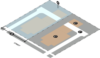 | |
| Area 1 & 5 | 6,500 sq. ft. Min. | ||
| B | Lot Frontage | ||
| Area 1 & 5 | 45' Min., 120' Max. | ||
| C | Lot Coverage | ||
| Area 1 & 5 | 60% Max. | ||
| Additional Information | |||
| * Where a site will be subdivided into more than one parcel, lot and site design standards should be based on the collective area of all parcels. | |||
| Three-Plex/Four-Plex/Mansion Apartment Site* | |||
|---|---|---|---|
| A | Front Setback/Build to Zone (BTZ) | 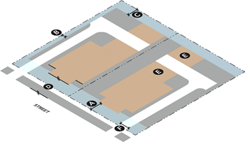 | |
| Area 1 & 5 | 10' Min./65% BTZ 1 | ||
| B | Side Setback | ||
| Area 1 & 5 | 5' Min. | ||
| C | Rear Setback | ||
| Area 1 & 5 | 10' Min. 2 | ||
| D | Building Alignment | ||
| Area 1 & 5 | Required 3 | ||
| E | Garage and Carport Location | ||
| Area 1 & 5 | Parking must be located behind rear wall of primary structure 4 | ||
| F | Access and Driveway Width | ||
| Area 1 & 5 | 20' Max. 5 | ||
| Additional Information | |||
|
Note: Sidewalks shall be provided along all street frontages in accordance with the
Subdivision Regulations.
* Where a site will be subdivided into more than one parcel, lot and site design standards should be based on the collective area of all parcels: 1 Sixty-five percent of front wall is required to be placed within ten feet of required front setback. 2 If an alley is present, rear setback is two feet minimum. 3 Building Alignment: Interior Lot: Front wall of primary structure shall be parallel to the street. Corner Lot: Both street-facing walls of the primary structure shall be parallel to each street. 4 No parking is allowed between street-facing wall and street. 5 Where an alley is improved, access must be provided from the alley. Where an alley is not improved, a street frontage may have up to one driveway. | |||
| Three-Plex/Four-Plex/Mansion Apartment Building Form | |||
|---|---|---|---|
| A | Front Wall Width | 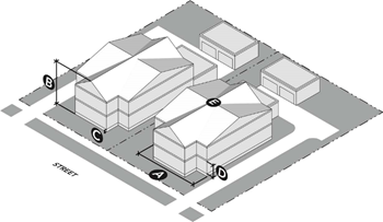 | |
| Area 1 & 5 | 60' Max. 1 | ||
| B | Building Height | ||
| Area 1 & 5 | 2 stories/35' Max. | ||
| C | Finished Floor Height | ||
| Area 1 & 5 | 1' Min., 4' Max. | ||
| D | Floor Height | ||
| Area 1 & 5 | 9' Min., 15' Max. | ||
| E | Roof Form | ||
| Areas 1 & 5 | Pitched or Flat | ||
| Additional Information | |||
| 1 Only 45 feet of total front wall width can be located within 25 feet of the front lot line. | |||
| Three-Plex/Four-Plex/Mansion Apartment Building Activation | |||
|---|---|---|---|
| A | First Story Element | 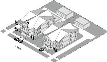 | |
| Area 1 & 5 | Required 1&2 | ||
| B | Principal Windows | ||
| Area 1 & 5 |
1 Min. on front-most wall
3
4'x4' Min. dimensions | ||
| C | Blank Street-Facing Wall | ||
| Area 1 & 5 | 8' Max. | ||
| D | Window Size - Street Facing Wall | ||
| Area 1 & 5 | 2'x3', except for accent windows | ||
| E | Entry Location (On Street-Facing Wall) | ||
| Area 1 & 5 | 10' Max. distance of entry from front-most wall | ||
| F | Entry Number (On Street-Facing Wall) | ||
| Area 1 & 5 | 1 Min. | ||
| G | Entry Presence - Facing Street | ||
| Area 1 & 5 | Required 4 | ||
| H | Entry Path | ||
| Area 1 | Required 5 | ||
| Additional Information | |||
|
1 Must include one of the following elements:
• Projecting Porch • Recessed Porch 2 Height of first story element must have an interior clearance of at least eight feet, no greater than 12 feet. Interior clearance is measured from the floor of the first story element to the lowest point of the ceiling of the first story element. 3 If height of front wall is greater than 35 feet, two principal windows are required. 4 Visually connect entrance to street through one of the following: • Entry faces street • Entry opens on porch or stoop that faces street 5 Must connect to street through physical, demarcated path. | |||
5.
Rowhouse.
| Rowhouse Description | |||
|---|---|---|---|
|
This building form consists of a series of attached units that are narrow and tall,
with entries facing the street (on street adjacent walls). This building form has
a limit to the width of the total building length so that it relates to neighboring
structures and provides a defined front wall for each unit. The rowhouse form is often
raised moderately off the ground and accessed by a porch or stoop to draw attention
to the individual entry for each unit. A variety of articulation methods can be used
to distinguish each rowhouse unit, including changes in material, wall offsets, and
changes in color. Detached garages or a "tuck under garage" (provided within the first
floor of each unit) accessed by an alley or internal access drive is typical.
Permitted in Areas 1, 5 and 6. | 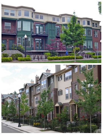 | ||
| Rowhouse Lot* | |||
|---|---|---|---|
| A | Lot Area | | |
| Area 1 | 9,000 sq. ft. | ||
| Area 5 | 9,000 sq. ft. | ||
| Area 6 | N/A | ||
| B | Lot Frontage | ||
| Area 1 & 5 | 65' Min. | ||
| Area 6 | N/A | ||
| C | Lot Coverage | ||
| Area 1 | 60% Max. | ||
| Area 5 | 70% Max. | ||
| Area 6 | N/A | ||
| Additional Information | |||
| * Where a site will be subdivided into more than one parcel, lot and site design standards should be based on the collective area of all parcels. | |||
| Rowhouse Site* | |||
|---|---|---|---|
| A | Front Setback/Build to Zone (BTZ) | 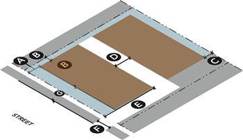 | |
| Area 1 | 10' Min./90% BTZ 1 | ||
| Area 5 | 5' Min./90% BTZ 1 | ||
| Area 6 | 0' Min; 5' Max. 2 | ||
| B | Side Setback | ||
| Area 1, 5 & 6 | 0' Min., End Unit: 5' Min. | ||
| C | Rear Setback | ||
| Area 1, 5 & 6 | 10' Min. 3 | ||
| D | Space Between Buildings | ||
| Area 1, 5 & 6 | 10' Min. | ||
| E | Garage and Carport Location | ||
| Area 1 | 15' Min. setback 4&5 | ||
| Area 5 | 20' Min. setback 4&5 | ||
| Area 6 | 30' Min. setback 4&5 | ||
| F | Access and Driveway Width | ||
| Area 1, 5 & 6 | 20' Max. 6 | ||
| G | Building Alignment | ||
| Area 1, 5 & 6 | Required 7 | ||
| Additional Information | |||
|
Note: Sidewalks shall be provided along all street frontages in accordance with the
Subdivision Regulations.
* Where a Site will be subdivided into more than one parcel, lot and site design standards should be based on the collective area of all parcels. 1 Ninety percent of front wall is required to be placed within five feet of required front setback. 2 Exception for permanently hardscaped public plaza, outdoor seating, etc. that is within five feet of the maximum front setback. 3 If an alley is present, rear setback is two feet minimum. 4 No parking is allowed between street-facing wall and street. 5 No garage door can be visible from the street. 6 Where an alley is improved, access must be provided from the alley. Where an alley is not improved, a street frontage may have up to one driveway. 7 Building Alignment Interior Lot: Front wall of primary structure shall be parallel to street. Corner Lot: Both street-facing walls of primary structure shall be parallel to each street. | |||
| Rowhouse Building Form | |||
|---|---|---|---|
| A | Front Wall Width |  | |
| Area 1 | 100' Max. or 4 units, whichever is less | ||
| Area 5 & 6 | 180' Max. | ||
| B | Building Height | ||
| Area 1, 5 & 6 | 2 stories/25' Min., 3 stories/40' Max. 1 | ||
| C | Finished Floor Height | ||
| Area 1, 5 & 6 | 1' Min., 4' Max. | ||
| D | Roof Form | ||
| Area 1 |
Pitched or Flat
2
If pitched, a slight change in roof pitch must be utilized at least every two units | ||
| Area 5 | Pitched, Flat or Sloped | ||
| Area 6 | Flat | ||
| E | Floor Height | ||
| Area 1, 5 & 6 | 9' Min., 15' Max. | ||
| Additional Information | |||
|
1 Maximum height for a two-story rowhouse is 35 feet.
2 If pitched, a five-degree to ten-degree change in pitch or a two-foot to five-foot change in height must be utilized at least every two units. | |||
| Rowhouse Building Activation | |||
|---|---|---|---|
| A | First Story Element |  | |
| Area 1, 5 & 6 | Required 1&2 | ||
| B | Principal Windows | ||
| Area 1, 5 & 6 | 1 Min. on front-most wall; 4'x4' Min. | ||
| C | Blank Street-Facing Wall | ||
| Area 1, 5 & 6 | 8' Max. | ||
| D | Window Size - Street-Facing Wall | ||
| Area 1, 5 & 6 | 2'x3', except for accent windows 3 | ||
| E | Entries Per Unit | ||
| Area 1, 5 & 6 | 1 Min. | ||
| F | Distance Between Entries | ||
| Area 1, 5 & 6 | 30' Max. | ||
| G | Entry Location (On Street-Facing Wall) | ||
| Area 1, 5 & 6 | 5' Max. from front-most wall | ||
| H | Entry Presence - Facing Street | ||
| Area 1, 5 & 6 | Required 4 | ||
| I | Entry Path | ||
| Area 1, 5 & 6 | Required 5 | ||
| Additional Information | |||
|
1 Must include one of the following elements on the front-most facade of each unit:
• Projecting Porch • Recessed Porch • Projecting Stoop 2 Height of first story element must have an interior clearance of at least eight feet, no greater than 12 feet. Interior clearance is measured from the floor of the first story element to the lowest point of the ceiling of the first story element. 3 If height of front wall is greater than 35 feet, two principal windows are required. 4 Visually connect entrance to street through one of the following: • Entry faces street • Entry opens on porch or stoop that faces street 5 Must connect to street through physical, demarcated path. | |||
6.
Flats.
| Flat Description | |||
|---|---|---|---|
|
A flat is a multi-story, residential building form that increases density in targeted
single-family areas and provides an additional housing option in commercial and mixed-use
areas. A flat includes floors of "stacked" residential units. Common entries and circulation
corridors typically provide access to individual units. Flats may be single-loaded
with a circulation hallway on one side of the building or double-loaded with units
on both sides of a building with a common hallway through the middle. The location
and connection of an entry to the street and the articulation of the building walls
provide architectural interest and create a more pedestrian-friendly environment.
Permitted in Areas: 1, 5, 6 and 7. |  | ||
| Flat Lot | |||
|---|---|---|---|
| A | Lot Area |  | |
| Area 1 & 5 | 9,000 sq. ft. Min. | ||
| Area 6 & 7 | N/A | ||
| B | Lot Frontage | ||
| Area 1 & 5 | 65' Min. | ||
| Area 6 & 7 | N/A | ||
| C | Lot Coverage | ||
| Area 1 | 60% Min. | ||
| Area 5 | 70% Min. | ||
| Area 6 & 7 | N/A | ||
| Flat Site | |||
|---|---|---|---|
| A | Front Setback/Build to Zone (BTZ) |  | |
| Area 1 | 10' Min./65% in BTZ 1 | ||
| Area 5 | 5' Min./75% in BTZ 2 | ||
| Area 6 | 0' Min., 5' Max. 3 | ||
| Area 7 | 10' Min., 75' Max. | ||
| B | Side Setback | ||
| Area 1 & 5 | 5' Min. | ||
| Area 6 | 0' Min., 5' Max. on Exterior Side | ||
| Area 7 | 15' Min. | ||
| C | Rear Setback | ||
| Area 1, 5, 6 & 7 | 10' Min. | ||
| D | Space Between Buildings | ||
| Area 1 & 5 | 10' Min. | ||
| Area 6 | N/A 4 | ||
| Area 7 | 15' Min. | ||
| E | Building Alignment | ||
| Area 1, 5, 6 & 7 | Required 5 | ||
| F | Access and Driveway Width | ||
| Area 1, 5, 6 & 7 | 26' Min., 30' Max. | ||
| G | Parking Location | ||
| Area 1 | 15' Min. 6 | ||
| Area 5 | 20' Min. 6 | ||
| Area 6 | 25' Min. 6 | ||
| Area 7 | None 7 | ||
| Additional Information | |||
|
Note: Sidewalks shall be provided along all street frontages in accordance with the
Subdivision Regulations.
1 Sixty-five percent of front wall is required to be placed within ten feet of required front setback. 2 Seventy-five percent of front wall is required to be placed within five feet of required front setback. 3 Maximum building setback may be increased up to 30 feet if a plaza, outdoor seating or other publicly-accessible amenity is provided within the setback. 4 If there is less than ten feet between buildings, there are building code requirements that must be met. 5 Entry, corner and other accent elements do not have to be parallel to the street as the primary structure is required to be. 6 No parking is permitted between street-facing wall and street. 7 Maximum of one double-row of parking is allowed between street-facing wall and street. | |||
| Flat Building Form | |||
|---|---|---|---|
| A | Wall Length |  | |
| Area 1 | 100' Max. | ||
| Area 5 | 140' Max. | ||
| Area 6 | 180' Max. | ||
| Area 7 | 240' Max. | ||
| B | Building Height | ||
| Area 1 | 2 stories/25' Min.; 3 stories/35' Max. | ||
| Area 5 | 2 stories/25' Min.; 4 stories/45' Max. | ||
| Area 6 | 2 stories/25' Min.; 5 stories/60' Max. | ||
| Area 7 | 2 stories/25' Min.; 6 stories/70' Max. | ||
| C | Finished Floor Height | ||
| Area 1, 5, 6 & 7 | 1' Min., 4' Max. | ||
| D | Floor Height | ||
| Area 1, 5, 6 & 7 | 9' Min., 15' Max. | ||
| E | Roof Form | ||
| Area 1 | Pitched or Flat | ||
| Area 5 | Pitched, Flat or Sloped | ||
| Area 6 | Flat | ||
| Area 7 | Pitched, Flat or Sloped | ||
| F | Garage and Carport (if visible) | ||
| Area 1, 5 & 6 | Not allowed to be visible from street | ||
| Area 7 | If visible from street, 9' Max. Height | ||
| Flat Building Activation | |||
|---|---|---|---|
| A | Entry Number (On Street-Facing Wall) |  | |
| Area 1, 5, 6 & 7 | 1 Min. | ||
| B | Distance Between Entries | ||
| Area 1 | 40' Max. | ||
| Area 5 | 50' Max. | ||
| Area 6 & 7 | 60' Max. | ||
| C | Entry Presence - Facing Street | ||
| Area 1, 5, 6 & 7 | Required | ||
| D | Entry Path | ||
| Area 1 & 5 | Required | ||
| Area 6 | Required, if building is setback | ||
| Area 7 | Required 1 | ||
| E | Blank Street-Facing Wall | ||
| Area 1, 5, 6 & 7 | 8' Max. | ||
| F | Window Size - Street-Facing Wall | ||
| Area 1, 5, 6 & 7 | 2'x3' Min. | ||
| G | Building Articulation Options | ||
| Area 1 & 5 | 1 articulation option (AO) required; 2 AOs required if wall is over 40' wide 2 | ||
| Area 6 | 1 AO required; 3 AOs required if wall is over 60' wide 2 | ||
| Area 7 | 1 AO required; 3 AOs required if wall is over 80' wide 2 | ||
| Additional Information | |||
|
1 To private walk, sidewalk, etc. if it is separated by landscaping or other similar
surface.
2 Building articulation options (AOs) for street-facing facade: • Height variation • Color changes • Increase setbacks • Material change • Stepbacks • Wall offsets • Accent lines | |||
7.
Mixed-use A.
| Mixed-use A Description | |||
|---|---|---|---|
|
This building form facilitates office and residential uses within one structure mixed
vertically and/or horizontally, with limited supporting retail. Its scale and intensity
is limited to facilitate a neighborhood-compatible mixed-use building that transitions
appropriately to areas of strictly residential character. For instance, these may
take the form of a small corner shop with rowhouses or flats continuing down the block.
The ground-floor requires transparency minimums for certain retail uses as well as
limits on the linear percentage of active storefronts. Mixed-use A also accommodates
offices and residential uses. This very flexible building form may include components
of many other building forms described in this chapter. Parking for residents and
office and retail employees in this building form is typically aggregated in adjacent
surface parking lots or structured garages. However, buildings that are predominantly
residential may also incorporate individual garages within the design of the primary
structure. This building form also commonly requires nearby, on-street parking for
short-term office visitors and retail patrons.
Permitted in Area 5. | 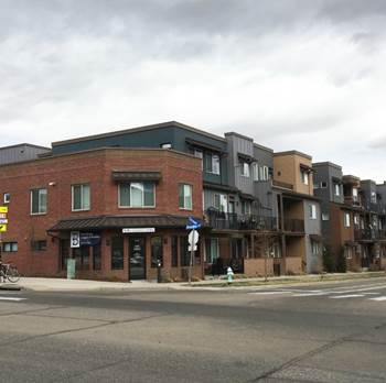 | ||
| Mixed-use A Lot | |||
|---|---|---|---|
| A | Lot Area | 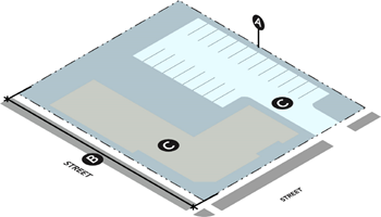 | |
| Area 5 | 9,000 sq. ft. Min. | ||
| B | Lot Frontage | ||
| Area 5 | 65' Min. | ||
| C | Lot Coverage | ||
| Area 5 | 70% Max. | ||
| Mixed-use A Site | |||
|---|---|---|---|
| A | Front Setback/Build to Zone (BTZ) | 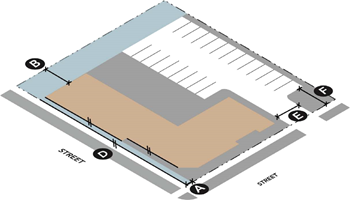 | |
| Area 5 | 5' Min./75% BTZ 1 | ||
| B | Side Setback | ||
| Area 5 | 5' Min. | ||
| C | Rear Setback | ||
| Area 5 | 10' Minimum 2 | ||
| D | Building Alignment | ||
| Area 5 | Required 3&4 | ||
| E | Access and Driveway Width | ||
| Area 5 | 20' Max. forward of street-facing wall | ||
| F | Parking Location | ||
| Area 5 | 30' Min. setback from front property line, 10' Min. setback from residential 5 | ||
| Additional Information | |||
|
Note: Sidewalks shall be provided along all street frontages in accordance with the
Subdivision Regulations.
1 Seventy-five percent of front wall is required to be placed within ten feet of required front setback. 2 If an alley is present, rear setback is two feet minimum. 3 Building Alignment Interior Lot: Front wall of primary structure shall be parallel to street. Corner Lot: Both street-facing walls of primary structure shall be parallel to each street. 4 Exception for corner accent or entry features. 5 No parking between street-facing wall and street. | |||
| Mixed-use A Building Form | |||
|---|---|---|---|
| A | Wall Length | 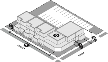 | |
| Area 5 | 160' Max. | ||
| B | Building Height | ||
| Area 5 | 2 stories/25' Min., 4 stories/50' Max. | ||
| C | Finished Floor Height | ||
| Area 5 | 1' Min, 4' Max. 1 | ||
| D | Roof Form | ||
| Area 5 | Pitched, Flat or Sloped | ||
| E | Floor Height | ||
| Area 5 | For mixed-use components, see floor height rules for Mixed-use B; for residential component, see floor height rules for rowhouse for flats | ||
| Additional Information | |||
| 1 No raised foundation is required for a commercial ground floor. | |||
| Mixed-use A Building Activation | |||
|---|---|---|---|
| A | First Story Element | 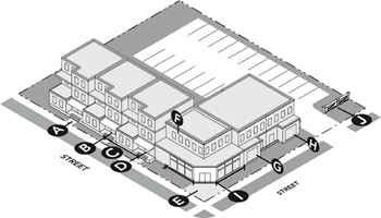 | |
| Area 5 | Required 1&2 | ||
| B | Entry Number (On Street-Facing Wall) | ||
| Area 5 | 1, Minimum | ||
| C | Distance Between Entries | ||
| Area 5 | 30' Max. 3 | ||
| D | Entry Presence - Facing Street | ||
| Area 5 | Required 4 | ||
| E | Entry Path | ||
| Area 5 | Required 5 | ||
| F | Blank Street-Facing Wall | ||
| Area 5 | 10' Max. | ||
| G | Window Size - Street-Facing Wall | ||
| Area 5 | 2'x3' Min., except for accent windows | ||
| H | Ground-Floor Transparency | ||
| Area 5 | 55% Min. | ||
| I | Active Retail Storefront | ||
| Area 5 | 25% Max. of total linear street frontage | ||
| J | Parking Screening | ||
| Area 5 | Required, if visible from street 6 | ||
| Additional Information | |||
|
1 If a rowhouse component is used as part of the mixed-use building form, must include
one of the following elements on the front-most facade of each unit:
• Projecting Porch • Recessed Porch • Projecting Stoop 2 Height of first story element must have an interior clearance of at least eight feet, no greater than 12 feet. Interior clearance is measured from the floor of the first story element to the lowest point of the ceiling of the first story element. 3 Refer to specific building form standards. 4 Visually connect entrance to street through one of the following: • Entry faces street • Entry opens on porch that faces street 5 Must connect to street through physical, demarcated path. 6 Parking screening options include: Site wall, landscaping, fence. | |||
8.
Mixed-use B/commercial.
| Mixed-use B/Commercial Description | |||
|---|---|---|---|
|
This form facilitates the mixing of commercial, office and potentially residential
uses within one structure. Mixed-use B/commercial also accommodates commercial or
office uses as sole uses within a single building. It is characterized by generous
ground floor heights, active ground floor uses (such as shops or offices). In many
cases, office or residential components are included on upper floors with the ground
floor dedicated to retail uses. Entries are typically clearly demarcated for individual
components of a building, like common residential entries or storefronts. Ground floors
are highly articulated and exhibit high percentages of transparency. Internal circulation
is critical to connecting uses within the building and elevators are widely used where
multiple stories exist. Parking for residents and office and retail employees in this
building form is typically aggregated in adjacent surface parking lots or structured
garages. This building form exhibits a high number of visitors and shopping patrons,
which makes high-turnover, on-street parking critical.
Permitted in Areas 6 & 7. | 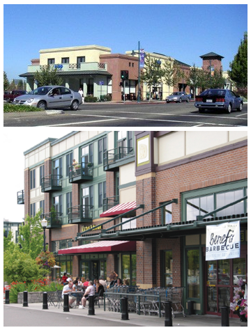 | ||
| Mixed-use B/Commercial Site | |||
|---|---|---|---|
| A | Front Setback/Build to Zone (BTZ) | 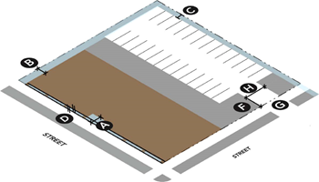 | |
| Area 6 |
0' Min., 5' Max.
1
Upper Floor Street Setback Required 2 | ||
| Area 7 | 10' Min, 75' Max. 1 | ||
| B | Side Setback | ||
| Area 6 | 0' Min, 5' Max. exterior side setback | ||
| Area 7 | 10' Min. | ||
| C | Rear Setback | ||
| Area 6 & 7 | 10' Min. 3 | ||
| D | Building Alignment | ||
| Area 6 & 7 | Required 4&5 | ||
| E | Space Between Buildings | ||
| Area 6 & 7 | 0' Min, 10' Max. | ||
| F | Parking Location | ||
| Area 6 | 30' Min. setback from front property line, 10' Min. setback from residential 6 | ||
| Area 7 |
1 double row Max. between street-facing
10' Min. setback from front property line 10' Min. setback from residential | ||
| G | Parking Access | ||
| Area 6 | Max. 1 access point per block from Main Street and Broadway Avenue 7 | ||
| Area 7 | Limit access from perimeter corridors 8 | ||
| H | Access and Driveway Width | ||
| Area 6 | 20' Max. | ||
| Area 7 | 24' Max. | ||
| Additional Information | |||
|
Note: Sidewalks shall be provided along all street frontages in accordance with the
Subdivision Regulations.
1 Maximum building setback may be increased up to 30 feet if a plaza, outdoor seating or other publicly-accessible amenity is provided within the setback. 2 For buildings above three stories, the fourth story and above must be set back 15 feet from the property line. 3 If an alley is present, rear setback is two feet minimum. 4 Building Alignment Interior Lot: Front wall of primary structure shall be parallel to street. Corner Lot: Both street-facing walls of primary structure shall be parallel to each street. 5 Exception for corner accent or entry features. 6 No parking forward of street-facing wall. 7 Must access parking from alley or side street. 8 Where feasible, access parking from side street. | |||
| Mixed-use B/Commercial Building Form | |||
|---|---|---|---|
| A | Front Wall Width | 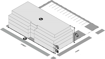 | |
| Area 6 | 300' Max. | ||
| Area 7 | 160' Max. | ||
| B | Building Height | ||
| Area 6 | 2 stories/25' Min, 6 stories/70' Max. | ||
| Area 7 | 6 stories/70' Max. | ||
| C | Floor Height (Ground Floor) | ||
| Area 6 | 14' Min. | ||
| Area 7 | 12' Min. | ||
| D | Floor Height (Non-Ground Floor) | ||
| Area 6 & 7 | 9' Min., 15' Max. | ||
| E | Roof Form | ||
| Area 6 | Flat | ||
| Area 7 | Pitched, Flat or Sloped | ||
| Mixed-use B/Commercial Building Activation | |||
|---|---|---|---|
| A | Blank Street-Facing Wall | 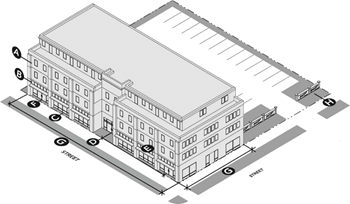 | |
| Area 6 | 8' Max. | ||
| Area 7 | 12' Max. | ||
| B | Window Size - Street-Facing Wall | ||
| Area 6 & 7 | 2'x3' Min., except for accent windows | ||
| C | Ground-Floor Transparency | ||
| Area 6 | 70% Min. | ||
| Area 7 | 60% Min. | ||
| D | Entry Number (On Street-Facing Wall) | ||
| Area 6 & 7 | 1 Min. | ||
| E | Distance Between Entries | ||
| Area 6 | 30' Max. | ||
| Area 7 | 45' Max. | ||
| F | Entry Presence - Facing Street | ||
| Area 6 & 7 | Required on at least one street | ||
| G | Building Articulation Options | ||
| Area 6 | 1 AO required; 3 AOs required if wall is over 60' wide 1 | ||
| Area 7 | 1 AO required; 3 AOs required if wall is over 80' wide 1 | ||
| H | Parking Screening | ||
| Area 6 & 7 | Required if visible from the street 2 | ||
| Additional Information | |||
|
1 Articulation options (AOs) for street-facing facade:
• Height variation • Increase setbacks • Stepbacks • Accent lines • Color changes • Material change • Wall offsets 2 Parking screening options include: • Site wall • Landscaping • Fencing * Refer to Chapter 6 for more information about the articulation options. | |||
F.
Reference sheets. The following tables are included in this chapter:
Tables 2 and 3: Building materials standards tables. Table 2 indicates which building materials are permitted in each area. Table 3 provides illustrations for each of the permitted building materials.
Table 4: Roof types table. Table 4 indicates which roof types are permitted in each area.
Table 5: Definitions table. Table 5 provides a list of key terms that are used in the document. In addition to a definition for each term, illustrations are provided to highlight the term. Definitions of each building articulation method are also provided.
| Table 3: Building Material Standard Illustrations | |||
|---|---|---|---|
| 1. Stucco | |||
| a. Authentic |  | 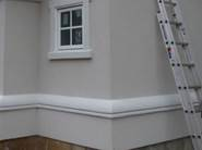 |  |
| b. Synthetic (scored) |  |  |  |
| c. Synthetic (not scored) |  |  |  |
| 2. Masonry | |||
| a. Brick | 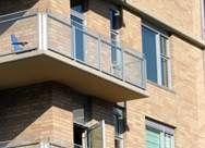 | 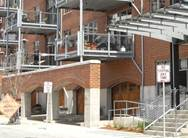 |  |
| b. Stone |  | 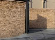 | 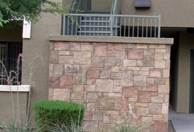 |
| c. Patterned Pre-cast Concrete |  |  |  |
| d. Cement Board Siding |  |  | 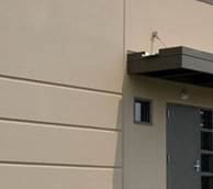 |
| e. Terra Cotta and Ceramic Block | 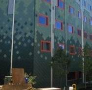 |  | 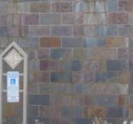 |
| f. Detailed Concrete |  |  | 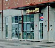 |
| g. Concrete Masonry Unit |  |  |  |
| h. Prefabricated Brick Panels |  | 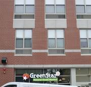 | 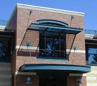 |
| 3. Siding | |||
| a. Wood Shingle |  |  |  |
| b. Cementitious Shingle |  |  |  |
| c. Wood Clapboard |  | 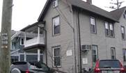 |  |
| d. Cementitious Clapboard |  |  | 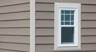 |
| 4. Metal | |||
| a. Metal Panel |  |  |  |
| b. Architectural Metal |  |  |  |
| 5. Glass | |||
| a. Architectural Glass |  |  |  |
| Table 4: Roof Types | |||
|---|---|---|---|
| 1. Flat Roof |  |  | 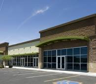 |
| 2. Pitched (Gable) | 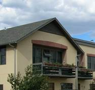 | 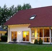 | 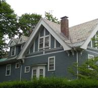 |
| 3. Pitched (Hipped) |  |  |  |
| 4. Sloped (Butterfly) |  |  |  |
| 5. Sloped (Shed) |  |  | 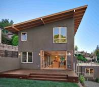 |
| Table 5: Definitions | ||
|---|---|---|
| General Definitions | ||
| Accent element. A building component that provides visual interest and/or texture to an overall building form. An accent element may include a window, wall offset or variation in material. | 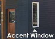 | |
| Alley. A secondary vehicular way or thoroughfare that provides rear access to properties on both sides of a block. An alley is narrower than a street, and can be paved or unpaved. |  | |
| Corner lot. A parcel that is bordered by streets on two sides. A corner lot only has an adjacent property on one side, and may have an alley or another property to the rear. |  | |
| Entry door. An entry door that faces the street is a door that is parallel to and oriented to the street. This could include a door that opens onto a porch or stoop, as long as the door orients to the street. An entry that opens onto a porch that faces the street, on the other hand, is placed perpendicular to the street. This means that from some angles from the public realm, the entry door will not be visible. | 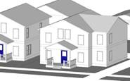 | |
| Finished ground floor height. The ground floor level is the distance from grade to the floor of the first story of a building. This can be shown as the stem wall height. | 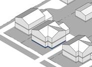 | |
| Floor height. The floor height is measured from the base of the floor to the ceiling of the story. | 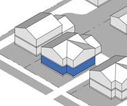 | |
| Front wall. The street-facing (or common courtyard in the case of the cottage court building form) exterior wall of a building. The front wall may consist of multiple wall planes that compose entire front face of the building. The primary entry to a building is on the front wall. | 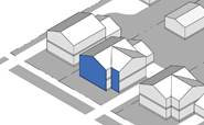 | |
| Front-most wall. The front-most wall of a building that is closest in distance to the street (or the common courtyard in the cottage court building form). | 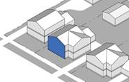 | |
| Interior lot. A parcel with street-access on one side and an alley or separate parcel on the opposite. An additional parcel sits on each side of an interior lot. | 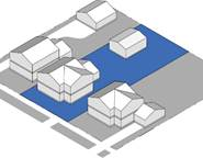 | |
| Porch. A raised, roofed platform attached to the front wall of a building. The primary entry to a building opens onto the porch. A porch can project from the front-facade or be recessed into the building form. A porch must be open on at least one side, must be roofed and must not be taller than the height of the first story of a building. The roof of the porch is permitted to extend above the first story of the building. The minimum dimensions for a porch are ten feet wide by six feet deep. | 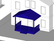 | |
| Stoop. A stoop is a small, raised platform that serves as an entryway to a building. A stoop is open on three sides and is raised off the ground. It is defined primarily by its lack of roof with structural support and instead may be covered by a canopy or awning that projects from the primary structure. The minimum dimensions of a stoop are four feet wide by four feet deep. A stoop must not be more than ten feet deep, and must not be taller than the height of the first story of the building (if a roof is utilized). |  | |
| Street. A primary vehicular way or thoroughfare that provides access to the front of each property on a block. On corner lots, a property can also be accessed by a second street that runs parallel to the side wall of the building. | 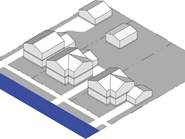 | |
| Street-facing wall. Any side of a building that faces the street (or the common courtyard in the cottage court building form). A street-facing facade/street-facing wall may refer to multiple wall planes on a building that face the street. | 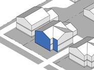 | |
| Window Definitions | ||
| Accent window. A small, decorative, non-operable window that adds visual interest to a wall of a building. This includes stained glass windows, arched windows and oval windows. |  | |
| Principal window. A large window on a front wall of a building. Minimum dimensions for a principal window are provided for each building form. A principal window can be comprised of multiple operable windows placed together with little space between the casing of each window, each at least one foot by one foot in dimension. | 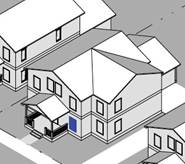 | |
| First Story Element Definitions | ||
| Projecting porch. A projecting porch extends from the front wall of the building and adds semi-private space to the exterior of a building. A projecting porch must be covered and must abide by the minimum porch dimensions as described in "General Definitions." | 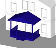 | |
| Projecting stoop. A projecting stoop extends from front-facade of a building, beginning at the primary entry and ending with a step or step(s) onto a path leading to the street. A projecting stoop must abide by the dimensions for a stoop as described in "General Definitions," and may be covered or uncovered and have a railing or no railing. | 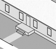 | |
| Recessed porch. A recessed porch recedes into the front wall of a building. A recessed porch has a second story or roof of the building above the porch area, and must abide by the minimum porch dimensions as described in "General Definitions." | 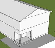 | |
| Building Articulation Options | ||
| 1. Height variation. A height variation is an actual reduction in the vertical scale of a building of at least one floor. (Note that it is not the intent of this variation method to require multiple elevators.) | 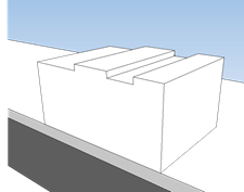 | 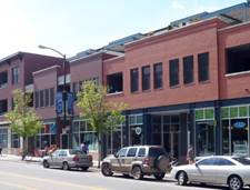 |
| 2. Increased setbacks. An increased setback is similar to a minor wall offset, but with a larger dimension. It is established by providing a larger setback on a portion of a wall for its full height. |  |  |
|
3. Accent lines. Accent lines include vertical and horizontal expression lines on a building wall.
An accent line often projects slightly from the face of a building wall. Examples
include:
• Moldings • Sills • Cornices • Canopies • Spandrels | 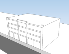 |  |
| 4. Color changes. Color changes include significant vertical or horizontal changes (15 feet to 30 feet minimum) in color on a building wall. | 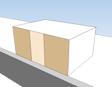 | 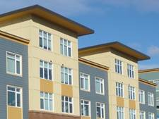 |
| 5. Material change. Material changes include significant vertical or horizontal changes (15 feet to 30 feet minimum) in material on a building wall. | 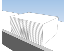 | 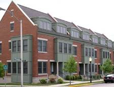 |
| 6. Wall offsets. A wall offset is a vertical expression line created by notching a building wall for its full height. Wall offsets are at least two feet. | 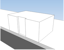 |  |
CHAPTER 1. - INTRODUCTORY PROVISIONS
DIVISION 1.1. GENERAL
§ 1.1.1. Title. This document is the City of Broken Arrow New Orleans Square Overlay District, and is referred to or cited throughout this document as "this Overlay."
§ 1.1.2. Effective date. This overlay was adopted on May 20, 2025, and became effective on July 1, 2025.
§ 1.1.3. Purpose and intent.
A.
This overlay provides new zoning intended to guide the future growth of the area surrounding the intersection of West New Orleans Street (101st) and South Elm Place, often described as "New Orleans Square." This overlay was prepared to encourage redevelopment in and around the existing shopping centers in the area, along with other nearby underutilized land. The Code also responds to the proposed landscape and intersection improvement project (including new landscaping and pedestrian improvements) at New Orleans Street and Elm Place.
B.
This overlay is intended to foster new residential and mixed-use development with more predictable results and a higher-quality public realm by prescribing the physical form of buildings and addressing the relationship between building facades and the public realm, the form and mass of buildings in relation to one another, and the scale and types of streets and blocks.
C.
This overlay has been written with specific application to the New Orleans Square District in mind; however, these zoning districts may be suitable elsewhere in the City.
§ 1.1.4. Application.
A.
Territorial application. This overlay applies within the boundaries of the New Orleans Square District, as shown on the following map.
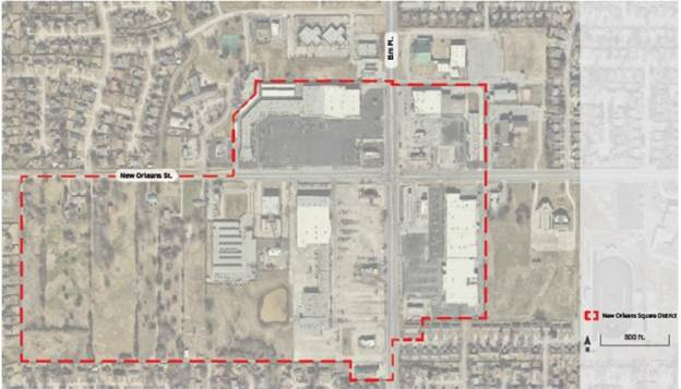
B.
Control over less restrictive private agreements. This overlay does not nullify any private agreement or covenant. However, where this overlay is more restrictive than a private agreement or covenant, this overlay controls. The City will not enforce any private agreement or covenant.
C.
Control over less restrictive laws and regulations. If any condition or requirement imposed by this overlay is more restrictive than a condition or requirement imposed by any other law, rule or regulation of any kind, the more restrictive condition or requirement governs.
D.
References to other laws.
1.
Whenever a provision of this overlay refers to any part of the City of Broken Arrow Municipal Code or to any other law, the reference applies to any subsequent amendment of that law.
2.
Where the Zoning Ordinance or the underlying zoning district standards conflict with standards set out in this overlay, the standards in this overlay control.
3.
Where a standard is required elsewhere in the Zoning Ordinance and is not stated in this overlay, the Zoning Ordinance applies. See also Chapter 6, Administration.
E.
Planned unit development. Existing development permitted as part of an existing planned unit development agreement may be continued. Once a new application is approved, that portion of the planned unit development is subject to the provisions of this overlay. Applications within an existing planned unit development that are submitted after the effective date of this overlay are regulated by this overlay.
F.
Text and graphics. Illustrations, photographs and graphics are included in this overlay to illustrate the intent and requirements of the text. In the case of a conflict between the text of this overlay and any illustrations, the text governs.
G.
Transitional provisions.
1.
Existing applications and permits.
a.
Any project for which a valid and complete application for a permit was received prior to the effective date of this overlay remains valid and, at the applicant's option, may proceed to completion and permits may be issued under the regulations in place immediately prior to the effective date of this overlay, provided that the permit is or can be issued within 90 calendar days of this overlay's effective date and all time frames associated with the permit are observed.
b.
Any project for which a permit cannot be issued within 90 calendar days from the effective date of this overlay must proceed in accordance with these regulations.
DIVISION 1.2. PROJECT HISTORY AND GOALS
§ 1.2.1. Project history. The New Orleans Square Overlay District will guide future growth of the New Orleans Square commercial area and adjacent residential land to the west. The buildings surrounding the New Orleans Street and Elm Place intersection comprises one of Broken Arrow's oldest auto-oriented commercial areas. The intersection was home to several major grocery stores, national big box retailers, and Broken Arrow's only multi-screen movie theater, for several decades. However, by the 2000s, the area faced new competition from other commercial developments in Broken Arrow, which led to the slow departure of several of the intersection's major anchor tenants. The 2019 Elm and New Orleans Small Area Plan and continuing efforts of the New Orleans Square Advisory Committee have created a new vision for the area, focused on making the New Orleans Square District unique among the major arterial intersections in Broken Arrow.
§ 1.2.2. Project goals.
A.
Improve the ability of existing owners to redevelop. This overlay broadens the spectrum of development permitted on parcels within the area by relaxing outdated parking and development standards and shifting development review to focus less on separating specific land uses and more on how new construction will respond to both the public realm and a new network of streets and open space. Property owners closer to the intersection will be freed to pursue mixed-use developments that should prove more resilient as the demand for various land uses fluctuates in the future.
B.
Increase the opportunity for non-auto trips to and within the district. There is a growing awareness from surrounding residents and existing property owners that the success of the area's commercial land uses is directly related to the number of residents that live nearby. Through the creation of a more consistent street and sidewalk network and the encouragement of safer routes for bikers and walkers, this overlay better connects the area's commercial uses to those most likely to use them. This shift has the associated benefit of reducing the demand for vehicle trips for those already living, working and shopping in the district.
C.
Expand housing options for current and future residents. Across Oklahoma, changes in key demographics such as the decrease in household size continue to drive the demand for additional housing options beyond the standard single-family home and the large apartment complex. This overlay responds to this desire through the encouragement of attached townhomes, stacked flats, smaller unit options, and the inclusion of residential uses over commercial spaces.
D.
Establish a framework through zoning to guide future development. This overlay confirms the community's vision for the future of the New Orleans Square District. The quantifiable metrics found in its design standards clearly communicate to current and future owners, as well as the surrounding community how future proposed developments should be designed.
DIVISION 1.3. URBAN DESIGN
§ 1.3.1. Urban design framework.
A.
Urban design framework map. The following urban design framework map was used as the basis for discussions about future zoning with stakeholders from the New Orleans Square area, including property owners within the area. The framework established the basic principles for new development and redevelopment by setting out street, block and access patterns for today and into the future, the potential location for additional open space, proposed building heights, the required transition to existing neighborhoods, and general patterns of use.
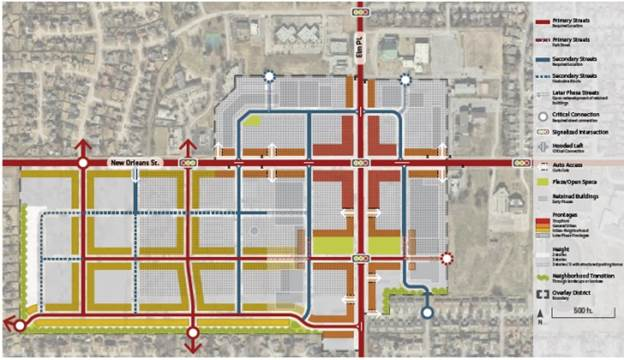
DIVISION 1.4. ZONING
§ 1.4.1. Regulating plan. The following Regulating Plan illustrates the boundaries of the various zoning districts, street alignments, and critical street connections. It refines the urban design framework into the requirements of zoning and subdivision for the area.
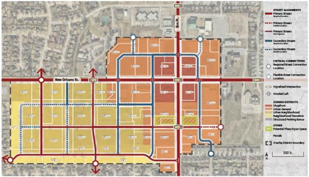
A.
Primary streets. Primary streets include West New Orleans Street and South Elm Place within the boundaries of the New Orleans Square District, as indicated on the Regulating Plan above. Both of these streets near their intersection are currently being redesigned. In addition, new internal primary streets create a functional, pedestrian-oriented street network throughout the overlay area. The primary street network is intended to create convenient and comfortable connections for all users to destinations throughout the New Orleans Square District from within the district and from surrounding areas. Park-adjacent primary streets are subject to primary street standards and are intended to be implemented abutting the plaza/open spaces wherever they are provided.
B.
Secondary streets. New internal secondary streets are designated on the Regulating Plan above to ensure block sizes that are adaptable to a wide range of contextually appropriate development types, while ensuring a walkable mobility framework. The secondary street network supports the primary street network by accommodating vehicular access to parking and service areas.
C.
Critical connections. Critical connections represent important locations for new streets to connect to the existing street network. These critical connections are specifically located to align with existing intersections or to enable connections to surrounding neighborhood streets where key opportunities exist. The designated critical connections are key to the creation of a functional, pedestrian-oriented street network.
D.
Plaza/open space. The generalized location of planned plazas/open spaces are included on the urban design framework map. Several of these locations are specifically shown on the Regulating Plan as potential plaza/open spaces. Applicants are encouraged to consider these locations as the most appropriate for future plazas/open spaces. The plaza/open spaces identified in the Regulating Plan must be surrounded on all sides by either primary frontage or a primary street. The park-adjacent primary streets designated on the Regulating Plan are required only if the adjoining plaza/open spaces are implemented in the location indicated on the Regulating Plan.
§ 1.4.2. Districts established. In order to carry out the purpose and intent of this overlay, the following zoning districts are established:
§ 1.4.3. District naming convention. District names and their abbreviated titles describe the general form of each zoning district. Two letters are used to abbreviate names (example: for NT2, "NT" stands for "Neighborhood Transition"), and the third character is a number that expresses the maximum number of stories allowed in the district (for example: in the district name NT2, the 2 means up to two stories tall). Where a "+" follows a story number, the district is included within the structured parking bonus program, and may allow up to five stories (example: for UN3+, "3+" means up to five stories tall when structured parking is provided).
CHAPTER 2. - ZONING DISTRICTS
DIVISION 2.1. APPLICABILITY
All activity filed after the effective date of this overlay must comply with the standards in this chapter, as further specified below.
§ 2.1.1. Project applicability. Standards apply based on the type of activity proposed. For all zoning districts, the standards apply as shown in the table below. Project activities are further defined in Section 3.1.2., Project Activities. The project applicability may be further specified in the applicability provisions for each set of standards in Chapter 3, Rules of Interpretation.
DIVISION 2.2. NEIGHBORHOOD TRANSITION
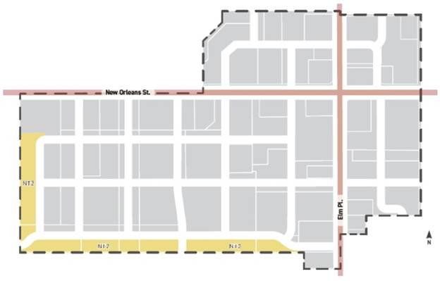
| § 2.2.1. Intent. A walkable neighborhood environment intended to accommodate a variety of housing options in a house-scaled format including detached single-family homes, accessory dwelling units, and duplexes, supporting and within walking distance of neighborhood-serving retail, food and service uses. | 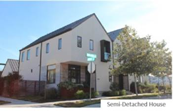 |
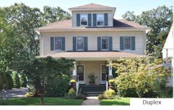 | 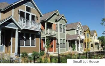 |
§ 2.2.2. NT2 [Neighborhood Transition 2].
| A. SITE AND PLACEMENT | |
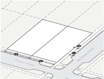 | 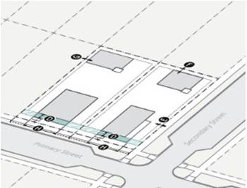 |
| B. MASSING AND ACTIVATION | |
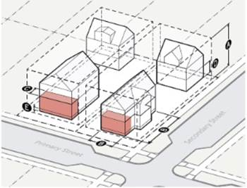 | 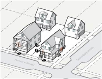 |
§ 2.2.3. Summary of allowed uses.
DIVISION 2.3. URBAN NEIGHBORHOOD
| § 2.3.1. Intent. A walkable neighborhood environment intended to accommodate a variety of medium-intensity housing options including accessory dwelling units, townhouses small apartment buildings as well as larger apartment complexes supporting and within walking distance of urban amenities such as retail, food and service uses. Urban Neighborhood Districts allow for additional neighborhood-serving commercial uses that are limited in scale and extent. UN3 allows up to three stories. UN3+ allows up to five stories through the structured parking bonus. | 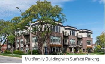 |
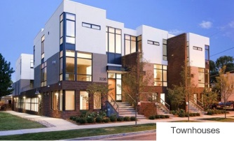 | 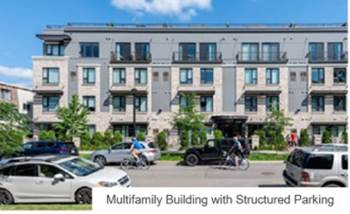 |
§ 2.3.2. UN3 [Urban Neighborhood 3].
| A. SITE AND PLACEMENT | |
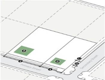 | 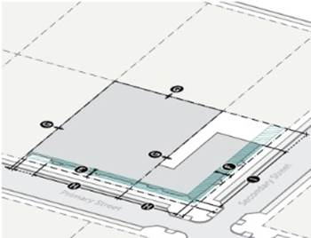 |
| B. MASSING AND ACTIVATION | |
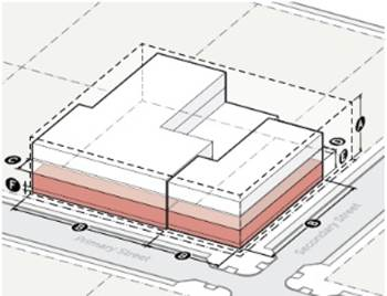 | 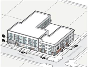 |
§ 2.3.3. UN3+ [Urban Neighborhood 3+].
| A. SITE AND PLACEMENT | |
 | 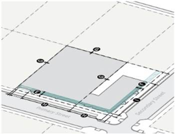 |
| B. MASSING AND ACTIVATION | |
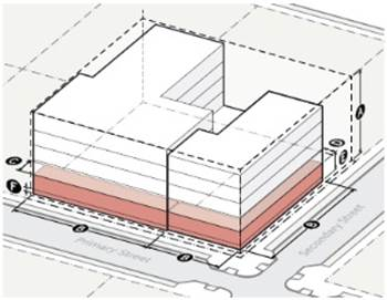 | 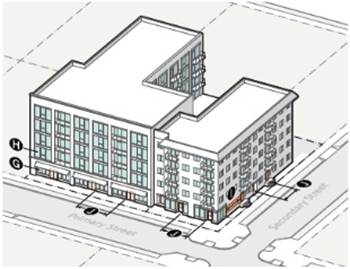 |
§ 2.3.4. Summary of allowed uses.
DIVISION 2.4. URBAN GENERAL
| § 2.4.1. Intent. Moderate intensity mixed-use, office and residential buildings intended to accommodate a variety of residential, retail, service and commercial uses in a vibrant, pedestrian-friendly environment. UG3+ allows up to five stories through the structured parking bonus. | 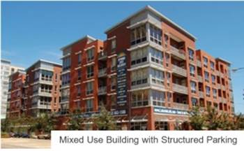 |
 | 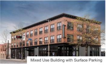 |
§ 2.4.2. UG3 [Urban General 3].
| A. SITE AND PLACEMENT | |
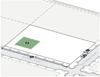 | 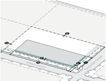 |
| B. MASSING AND ACTIVATION | |
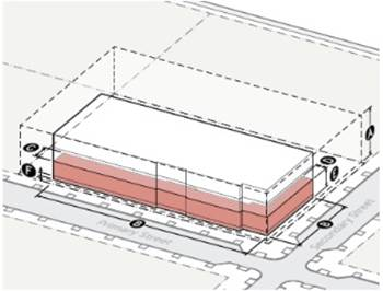 | 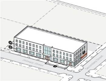 |
§ 2.4.3. UG3 [Urban General 3+].
| A. SITE AND PLACEMENT | |
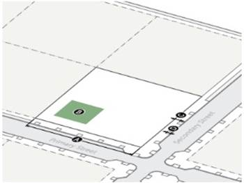 | 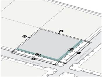 |
| B. MASSING AND ACTIVATION | |
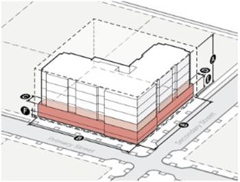 | 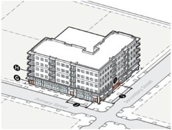 |
§ 2.4.4. Summary of allowed uses.
DIVISION 2.5. SHOPFRONT
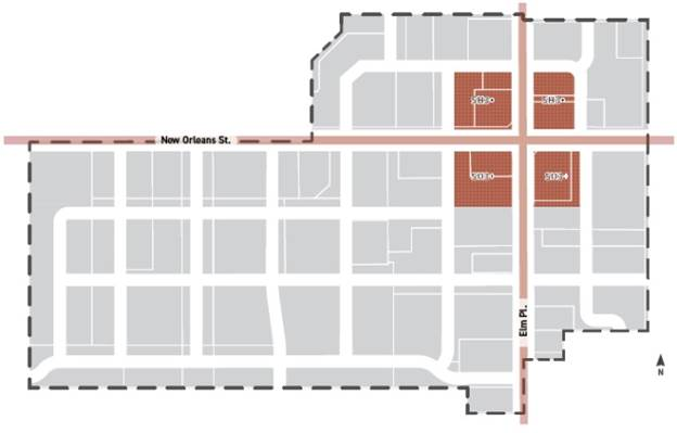
| § 2.5.1. Intent. Moderate intensity mixed-use buildings intended to accommodate a variety of residential, retail, service and commercial uses in a vibrant, pedestrian-friendly storefront environment. Uses are flexible but tall ground floors with large areas of transparent glazing are required to accommodate retail ready ground stories. SH3+ allows up to five stories through the structured parking bonus. | 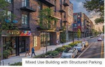 |
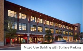 | 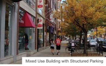 |
§ 2.5.2. SH3+ [Shopfront 3+].
| A. SITE AND PLACEMENT | |
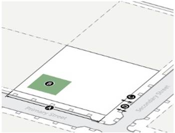 | 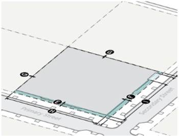 |
| B. MASSING AND ACTIVATION | |
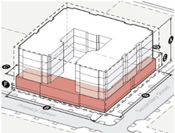 | 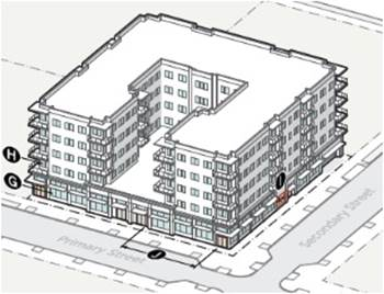 |
§ 2.5.3. Summary of allowed uses.
CHAPTER 3. - RULES OF INTERPRETATION
DIVISION 3.1. GENERAL PROVISIONS
§ 3.1.1. Lot line designations.
A.
General.
1.
Each lot line must have one of the following designations and no lot line can have more than one of the following designations:
a.
Primary street lot line;
b.
Secondary street lot line;
c.
Rear lot line;
d.
Side lot line; or
e.
Alley lot line.
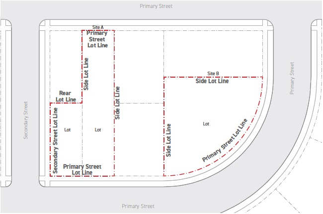
2.
In addition to these required designations, lot lines may also be included into one of the following categories:
a.
Street lot line;
b.
Common lot line; and
c.
Transition lot line.
B.
Primary street lot line.
1.
Any lot line that abuts a primary street right-of-way as indicated on the Regulating Plan (Section 1.4.1.).
2.
Each site must have at least one primary street lot line. A site may have more than one primary street lot line.
3.
A lot line abutting a park, open space, river, trail or pedestrian path must be designated as a primary street lot line.
4.
Once designated for a site, a primary street lot line cannot be changed (e.g., a primary street lot line cannot, for purposes of subsequent development, be re-designated a secondary street lot line).
C.
Secondary street lot line. Any lot line that abuts a secondary street right-of-way as indicated on the Regulating Plan (Section 1.4.1.).
D.
Rear lot line. Any lot line that does not abut a street or alley right-of-way and is opposite and most distant from a primary street lot line.
1.
A site may have no more than one lot line designated as a rear.
2.
In the case of a site that fronts two streets on opposite sides, a site may have no rear lot line.
3.
Where no lot line is clearly opposite to the primary street lot line or where there are multiple primary street lot lines, the lot line having the highest portion of its length serving as the rear lot line of abutting sites is the rear lot line.
E.
Side lot line. Any lot line not determined to be a primary street, secondary street, rear or alley lot line.
F.
Alley lot line. Any lot line separating a site from an alley right-of-way. Even when a lot line qualifies as a rear lot line or side lot line, all lot lines that abut an alley right-of-way are considered an alley lot line.
G.
Street lot line. Any lot line that abuts a street right-of-way. Street lot lines include all primary street lot lines and secondary street lot lines.
H.
Common lot line. Any lot line shared by multiple lots. Common lot lines include all side and rear lot lines.
I.
Transition lot line. All common lot lines at the perimeter of the New Orleans Square Overlay District that abut a parcel zoned residential single-family are considered a transition lot line.
§ 3.1.2. Project activities.
A.
All projects. A project may be composed of one or more project activity. The activities may or may not require a building permit, and may or may not be one application in a series of applications (such as facade modification followed by site modification). Each project activity does not necessarily bring the project into full compliance; however, the set of project activities that comprise the project, once completed, shall bring the project into full compliance. Typically, more than one project activity will apply to a proposed project (for example, a street-facing addition concealing a portion of an existing building facade includes both new construction and a facade modification).
B.
New construction. Any activity that includes the construction of a new building or structure on a lot.
C.
Addition. Any expansion or enlargement of an existing building or structure. Includes activity that increases the floor area or the height of an enclosed space within an existing building.
D.
Site modification. Any modification to a site, including landscaping, trees, fencing, walls, lighting, grading, flatwork, and parking lots including resurfacing and restriping of existing parking lots.
E.
Facade modification. Any change to the exterior envelope of a building. Includes changes to any of the following: the facade of a building; the amount of exterior foundation wall that is exposed above finished grade; or an architectural element (including a balcony, porch or deck) attached to a facade. Includes any change to a facade that goes beyond the definition of maintenance and repair.
F.
Change of use. A change in use or a modification of an area designed and intended for a specific use from the previously approved use. A change of use includes a renovation when the use proposed after the project activity is different than the use occupying that space prior to the change of use. Includes a change in the principal use of any portion of a building, site or lot from one of the uses specified in Chapter 3, Use Regulations, to another. Includes the expansion of floor area, site area or lot area dedicated to a use or an increase in the intensity of a use, such as an increase in seating capacity or the number of persons in care.
G.
Renovation. Modification of the interior of any building or structure that does not expand the building or structure, but includes more than 50 percent of the floor area of any story of the structure. Includes renovation when the proposed use after the project activity is the same use as before the renovation. Does not include interior modifications to meet fire, life safety, and handicapped requirements, regardless of the amount of floor area included. Includes any change that goes beyond the definition of maintenance and repair.
H.
Maintenance and repair. Activity done to correct the deterioration, decay of, or damage to, any part of a building, structure, or lot, that does not involve a change or modification of the existing design, outward appearance or applicable zoning requirements. In-kind replacement of deteriorated or damaged parts of a building is considered maintenance and repair. Maintenance and repair includes repair of site components such as parking lots or landscaping.
§ 3.1.3. Residential and nonresidential uses.
A.
Residential uses include all uses listed in the residential category if allowed in the zoning district—see Section 5.2.2., Permitted Use Table.
B.
Nonresidential uses include all uses listed in the commercial or industrial categories if allowed in the zoning district—see Section 5.2.2., Permitted Use Table.
§ 3.1.4. Site and lot.
A.
Site.
1.
A single lot or group of connected lots owned or functionally controlled by the same person or entity, assembled for the purpose of development.
2.
A site must abut a primary street.
B.
Lot.
1.
A designated parcel, tract, or area of land established by a plat or other means as permitted by law, which is to be used, developed, or built upon.
2.
Every lot must abut a primary street. For changing a street designation from secondary to primary, see Section 3.1.5.B., Street Designation Modifications, below.
3.
No lot may be platted without the minimum primary street frontage required in the zoning district.
4.
No lot may be platted without secondary street or alley access, except for lots zoned with the Neighborhood Transition 2 zoning district.
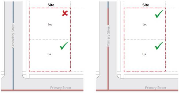
§ 3.1.5. Street designations.
A.
All street designations. Street designations are identified on the Regulating Plan (Section 1.4.1.).
B.
Street designation modifications.
1.
Once designated, a primary street cannot be changed to any other designation without a City Council approved amendment to the Regulating Plan (Section 1.4.1.). For street alignments, see Section 5.2.1., Streets.
2.
The applicant may request that street segments designated as secondary streets in the Regulating Plan (Section 1.4.1.) are re-designated as primary streets. This may be requested for the purpose of establishing new lots fronting on mapped secondary streets. These street designation changes may be approved by the Director provided the following standards area met:
a.
All primary street standards are met on the existing mapped primary streets and existing primary street frontages;
b.
All proposed primary street segments must be adjacent to the development site;
c.
All proposed primary street segments must be contiguous with the primary street network; and
d.
All proposed primary street segments must meet all standards applicable to primary streets, including street standards, Section 5.2.1., all zoning district standards, and development standards as specified for primary streets.
§ 3.1.6. Street-facing building facades.
A.
The portions of a building facade (when projected parallel to the street) with no permanent structure located between the building facade and a primary or secondary street lot line are considered street-facing building facades.
B.
Building facades located more than 50 feet behind the primary or secondary street lot line are exempt from any street-facing requirements, provided that the cumulative width of the exempted facade is no wider than 50 percent of the total building width.
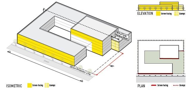
§ 3.1.7. Yard designations.
A.
All yard designations.
1.
All portions of a site between exterior walls of a building and a property line must be designated as either a front yard, secondary street yard, side yard, or rear yard.
2.
No portions of a site may have more than one yard designation.
B.
Front yard.
1.
All portions of a site between a primary street lot line and a principal structure facing a primary street lot line extending the full width of the site.
2.
A front yard does not include any building facade set back more than 15 feet from the principal building's street-facing facade.
3.
Portions of a site that meet the criteria for front yard designation cannot be designated as any other yard.
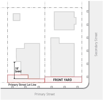
C.
Secondary street yard.
1.
All portions of a site between a secondary street lot line and a principal structure facing a secondary street lot line extending the full depth of the site.
2.
A secondary street yard does not include any building facade set back more than 15 feet from the principal building's street-facing facade.
3.
Portions of a site that meet the criteria for secondary street yard designation cannot be designated as any other yard.
4.
For portions of the site where no principal structure abuts the secondary street yard, the secondary street yard includes only portions of the site included in the secondary street setback.
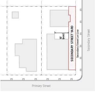
D.
Rear yard. All portions of a site between a rear lot line and a principal structure for the full width of the site. Portions of a site that meet the criteria for rear yard designation cannot be designated as any other yard.
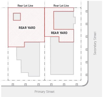
E.
Side yard. All portions of a site between a side lot line and a principal structure. Portions of a site that do not meet the yard designation criteria for any other yard are designated as a side yard.
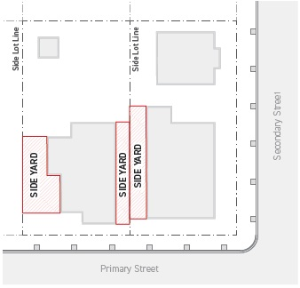
DIVISION 3.2. LOT SIZE
§ 3.2.1. Primary street frontage. The length of primary street lot lines bounding a site.
A.
Intent.
1.
Manage the frequency and extent of driveway interruptions to the streetscape, prioritizing the safety and comfort of pedestrians, while ensuring adequate vehicular access to and from a site, and maintaining flexibility for development to the extent reasonable for and appropriate to the context;
2.
Ensure that all new development is oriented to a continuous network of pedestrian-oriented primary streets, encouraging bicycling and walking, by prioritizing convenience and comfort;
3.
Encourage the consolidation of curb cuts using shared access drives and alleys; and
4.
Ensure the size of new lots are compatible with surrounding properties.
B.
Applicability. The minimum primary street frontage requirement applies only to lots and development sites officially approved and recorded on or after the effective date of this Code.
C.
Standards.
1.
All primary street frontage.
a.
All lots must have a primary street frontage no less than the minimum primary street frontage specified by the zoning district. For the purpose of establishing new lots fronting on mapped secondary streets, secondary streets may be redesignated as primary streets according to Section 3.1.5.B., Street Designation Modifications.
b.
Primary street frontage is measured following the geometry of each primary street lot lines that bounds the site.
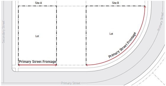
c.
Where a site has two or more primary street frontages along different streets, all primary street frontages must meet the minimum primary street frontage standard.
2.
Street access. Lots that take vehicular access from a primary street (only allowed in NT2 District) or from a secondary street must meet the minimum primary street frontage requirement specified for sites with "street access."
3.
Alley access. The following lots must meet the minimum primary street frontage requirement specified for sites with "alley access":
a.
Lots that take vehicular access only from an alley; and
b.
Lots that take vehicular access through a common lot line via a shared access drive.
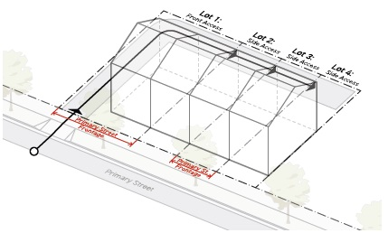
D.
Relief.
1.
A reduction of up to 15 percent of the minimum primary street frontage may be requested in accordance with Section 6.2.2., Administrative Adjustment.
2.
A design that meets the intent of the primary street frontage standard to an extent equal to or better than the district specification may be considered in accordance with Section 6.2.3., Alternative Compliance.
DIVISION 3.3. DENSITY
§ 3.3.1. Units per lot. The number of dwelling units allowed on a lot.
A.
Intent. To help ensure new developments can support a wide variety of housing options at an intensity that is compatible with surrounding properties.
B.
Applicability. Where specified by the zoning district, units per lot applies to all lots on a site.
C.
Standards.
1.
A site cannot exceed the maximum number of dwelling units allowed by the zoning district.
2.
Dwelling units may be detached or attached.
D.
Relief. No administrative relief is allowed.
DIVISION 3.4. AMENITY
§ 3.4.1. Outdoor amenity space. An area on a site reserved for active or passive recreation.
A.
Intent.
1.
Ensure adequate outdoor recreation community gathering areas for residents, tenants and visitors, and to ensure such spaces are highly accessible, usable, comfortable, enjoyable, and safe with sufficient access to light and air;
2.
Discourage under-building and provide flexibility to smaller more constrained sites; and
3.
Encourage projects to provide high-quality, pedestrian-oriented, and publicly accessible gathering spaces along the primary street sidewalk.
B.
Applicability. Where specified by the zoning district, all sites 20,000 square feet or greater must provide outdoor amenity space.
C.
Standards.
1.
All outdoor amenity space.
a.
A site must provide outdoor amenity spaces having a cumulative area no less than the minimum percentage of outdoor amenity space specified by the zoning district, calculated as a percentage of the total site area.
b.
The minimum required outdoor amenity space may be calculated by multiplying the total site area by the minimum outdoor amenity space percentage specified by the zoning district.
c.
The required outdoor amenity space must meet the standards of Section 3.4.1.C.2., Common Outdoor Amenity Space, or Section 3.4.1.C.3., Pedestrian Outdoor Amenity Space.
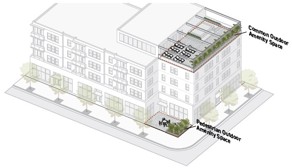
d.
Each individual lot that composes a site is not required to meet the outdoor amenity space requirement. The outdoor amenity space requirement must be met on the site associated with the project.
e.
Outdoor amenity space may not be surrounded by walls for more than two-thirds of its perimeter.
f.
Each outdoor amenity space must have a minimum area of 400 square feet, and no horizontal dimension less than 15 feet, measured perpendicular to any boundary of the space.
g.
No portion of an outdoor amenity space can have a clear height of less than 7.5 feet.
h.
Outdoor amenity space that is roofed must have a minimum clear height of 1.5 times the depth of the roofed area.
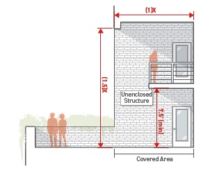
i.
Fully enclosed accessory structures and roofed accessory structures may be permitted within an outdoor amenity space provided they cover a cumulative area no greater than 15 percent of the contiguous outdoor amenity space area.
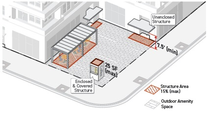
j.
A minimum of 20 percent of the total area of each outdoor amenity space must be planting area. Planting areas can have no horizontal dimension less than three feet and each planting area must have a minimum plant coverage of at least 75 percent. Plant coverage is measured as 70 percent of the plant's anticipated canopy diameter or spread at maturity.
2.
Common outdoor amenity space.
a.
Each square foot of common outdoor amenity space provided counts as one square foot of required outdoor amenity space.
b.
Common outdoor amenity space must meet the requirements of Section 3.4.1.C.1., All Outdoor Amenity Space.
c.
Common outdoor amenity space must be made available to all tenants of a building, at no cost, from sunrise to sunset daily or during the hours of operation of the building, whichever results in a longer period of time. The space may not be reserved or in any way exclude any tenant during the time it is required to be made available to all tenants.
d.
Building facades adjacent to common outdoor amenity space must have a minimum transparency of 15 percent for each story.
e.
Common outdoor amenity space cannot be located in a required transition setback.
3.
Pedestrian outdoor amenity space.
a.
Each square foot of pedestrian outdoor amenity space provided counts as two square feet of required outdoor amenity space.
b.
Pedestrian outdoor amenity space must meet the requirements of Section 3.4.1.C.1., All Outdoor Amenity Space.
c.
The finished floor or ground surface of a pedestrian amenity space must be located within the minimum and maximum ground floor elevations specified by the zoning district.
d.
Pedestrian amenity space must abut and be directly accessible from the public sidewalk along the primary street. Pedestrian amenity space cannot be separated from this public sidewalk by any structure for more than 40 percent of the width of the amenity space, with the exception of a wall or fence with a maximum height of 42 inches. The allowed wall or fence must provide openings for pedestrian access at least once every 35 feet.
e.
All facades facing pedestrian amenity space must meet the applicable window and door standards required by the zoning district for the primary street frontage.
f.
Mechanical and utility equipment cannot be located within a pedestrian amenity space, or between a pedestrian amenity space and an adjacent building facade.
D.
Relief.
1.
A reduction of up to ten percent of the total required area of outdoor amenity space may be requested in accordance with Section 6.2.2., Administrative Adjustment.
2.
A change of up to 15 percent from an outdoor amenity dimensional standard may be requested in accordance with Section 6.2.2., Administrative Adjustment.
3.
A design that meets the intent of the outdoor amenity standards to an extent equal to or better than the specified design standards may be considered in accordance with Section 6.2.3., Alternative Compliance.
DIVISION 3.5. WALL AND FENCE HEIGHT
§ 3.5.1. Wall and fence height. The vertical dimension of walls, fences, and similar structural obstructions located within any yard.
A.
Intent.
1.
To appropriately balance the need for natural surveillance, visual interest, and human-scaled activation along the public realm with the expectation of security and privacy for private ground story uses in a manner reasonable for and appropriate to the context.
2.
To provide security and privacy between lots in a manner reasonable for and appropriate to the context.
B.
Applicability.
1.
Wall and fence height limitations apply to all sites and lots.
2.
Where a screening requirement specifies a wall or fence that is taller than allowed by the wall and fence height specified by the zoning district, the screening requirements supersede (see Section 7.4.2., Screening).
C.
Standards.
1.
No yard may include a fence or wall that exceeds the maximum height specified by the zoning district.
2.
Wall and fence height is measured vertically from adjoining finished grade to the topmost point of the fence or wall along for the full length.
3.
To determine the extent of each yard see Section 3.1.7., Yard Designations.
4.
All walls and fences must comply with ZO Section 5.2.E.3., Design Standards for Fences and Walls.
D.
Relief. An increase of up to ten percent to the allowed wall and fence height may be requested in accordance with Section 6.2.2., Administrative Adjustment.
DIVISION 3.6. STREETSCAPE
§ 3.6.1. Pedestrian zone width. The clear width of the portion of the streetscape located between the furniture zone and the edge of the street right-of-way. It includes a paved sidewalk or trail designed for pedestrian access to destinations and amenities along the street frontage and the movement of pedestrians along a street.
A.
Intent.
1.
To ensure a comfortable, convenient, enjoyable, safe, and continuous area for pedestrian movement within the streetscape.
2.
To provide pedestrians with convenient access to destinations and amenities along the street frontage.
B.
Applicability. The pedestrian zone width requirements apply to all sites.
C.
Standards.
1.
All pedestrian zones.
a.
A clear, direct, continuous, and paved sidewalk or trail must be provided along all existing and future streets.
b.
The sidewalk or trail must be separated from street parking and automobile travel lanes with a furniture zone meeting Section 3.6.2., Furniture Zone Width.
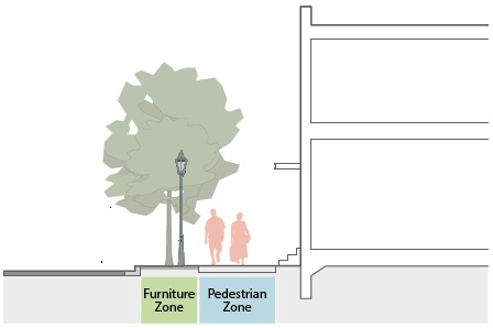
c.
Where there is not enough room available between the back of curb and the edge of the right-of-way for the required pedestrian zone and furniture zone, the pedestrian zone must be provided on-site as a permanent public access easement.
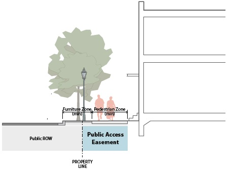
d.
All required sidewalks and trails must be constructed to comply with all City and ADA specifications.
2.
Sidewalks.
a.
No required sidewalk may have a horizontal dimension narrower than the minimum width specified by the zoning district. The sidewalk must not include any fixed obstructions for the minimum specified width.
b.
Where existing sidewalks exist and are determined to be in "good condition" by the Director, they may be used to comply with pedestrian zone width standards provided the sidewalk complies with all standards in this section. An existing substandard sidewalk may be expanded and improved to meet this standard.
c.
To determine which portions of the streetscape are regulated by the primary street and secondary street specifications, see Section 3.1.4., Street Designations.
3.
Trails.
a.
Sites with street frontage along the north side of New Orleans Street must improve the planned multi-use trail by widening the trail for the full length of the street frontage, ensuring that no portion of the trail segment has a horizontal dimension narrower than the minimum 15-foot width specified by the zoning district.
b.
The planned trail will be ten feet wide when built and must be widened by an additional five feet located towards the property's interior (away from the street). Trails do not count toward the zoning district's required minimum sidewalk width.
c.
The expanded portion of the planned trail is considered the pedestrian zone and must comply with Section 3.6.1.C.1., All Pedestrian Zones.
D.
Relief. A decrease of up to ten percent to the required pedestrian zone width may be requested in accordance with Section 6.2.2., Administrative Adjustment.
§ 3.6.2. Furniture zone width. The width of the portion of the streetscape located between the curb and the pedestrian zone. It supports the pedestrian zone by providing pedestrians with shade, lighting, amenities, a buffer from the street, and a safe location for curbside loading. Furniture zones include sidewalks, street furniture, street lighting, bicycle parking, public waste receptacles, tree wells, and tree lawns.
A.
Intent.
1.
To support the pedestrian zone by providing pedestrians with shade and amenities;
2.
To provide a dedicated parking location for bicycles and micro-mobility transportation alternatives;
3.
To provide a buffer between the pedestrian zone and the street; and
4.
To provide a safe location for loading and unloading of passengers and freight for vehicles using street parking and loading areas along the curb and for bicycle parking.
B.
Applicability. The furniture zone width requirements apply to all sites.
C.
Standards.
1.
A continuous furniture zone must be provided along all existing and future streets.
2.
The furniture zone must be located between the back of curb and the pedestrian zone.
3.
No required furniture zone may have a horizontal dimension narrower than the minimum width specified by the zoning district.
4.
Street trees must be provided in all furniture zones in accordance with Section 3.6.3., Street Trees.
5.
Along existing streets where the horizontal dimension between the back of curb and the edge of the street right-of-way is less than the district's required furniture zone width, the furniture zone must be provided on-site as a permanent public access easement.
6.
Where existing furniture zones exist and are determined to be in "good condition" by the Director, they may be used to comply with furniture zone width standards provided they comply with all standards in this section. An existing substandard furniture zone may be widened and improved to meet this standard.
7.
To determine which portions of the streetscape are regulated by the primary street and secondary street specifications, see Section 1.4.1., Regulating Plan, and Section 3.1.4., Street Designations.
D.
Relief. A decrease of up to ten percent to the required furniture zone width may be requested in accordance with Section 6.2.2., Administrative Adjustment.
§ 3.6.3. Street trees. Trees that are planted within the furniture zone of the streetscape.
A.
Intent.
1.
To support the pedestrian zone by providing pedestrians with shade and a physical barrier between vehicles in the roadway and the pedestrian zone;
2.
To mitigate urban heat island effect; and
3.
To provide a continuous wildlife habitat and distributed stormwater infiltration network.
B.
Applicability. Street tree requirements apply to all sites.
C.
Standards.
1.
All street trees.
a.
Required street trees must be large trees. Where required to be planted under an overhead utility wire, required street trees may be small trees.
b.
All required street trees and their planting areas must comply with ZO Section 5.2.B.4., General Landscaping Requirements and Standards.
2.
Street tree planting area type.
a.
All street tree planting area types.
i.
Required street tree planting areas must be located in the furniture zone.
ii.
Street tree planting areas must be provided for each tree required according to Section 3.6.3.C.3., Street Tree Planting Frequency.
iii.
Within the required street tree planting area, soils cannot be compacted and the surface area of the tree lawn or pit must be impervious. For tree pits, pervious pavers or pervious grates may be provided on top of the planting area provided the planting area is protected from compaction.
b.
Tree lawn. Where the zoning districts specifies "tree lawn" for the street tree planting type, a continuous planting area having a minimum width of six feet and a minimum depth of two feet must be provided for the full length of the associated street lot line.
c.
Tree pits. Where the zoning districts specifies "tree pit" for the street tree planting type, a planting area having a minimum width of six feet, a minimum depth of two feet and a minimum length of eight feet must be provided for each required street tree.
d.
Tree lawn/pits.
i.
Where the zoning districts specifies "tree lawn/pits" for the street tree planting type, the applicant may choose to meet their street tree requirements using either a tree lawn or tree pits, or a combination of the both.
ii.
Where a tree lawn is provided, it must comply with Section 3.6.3.C.2.b., Tree Lawn, above.
iii.
Where tree pits are provided, they must comply with Section 3.6.3.C.2.c., Tree Pits, above.
3.
Street tree planting frequency.
a.
Required street trees must be located in the furniture zone.
b.
One large tree from the approved tree list ZO Section 5.2.B.4.a., Approved Tree List for Landscape Requirements, must be planted every 35 feet on center. Tree spacing may vary to accommodate driveways, utilities and other potential conflicts, provided no large street tree is planted closer than 20 feet from another street tree.
c.
Where required to be planted under an overhead utility line, one small or medium tree from the approved tree list ZO Section 5.2.B.4.a., Approved Tree List for Landscape Requirements, must be planted every 25 feet on-center. Tree spacing may vary to accommodate driveways, utilities and other potential conflicts, provided no small or medium street tree is planted closer than ten feet from another street tree.
d.
The minimum number of street trees required along each street is calculated by dividing the length of the street lot line by the minimum planting frequency specified by the zoning district.
e.
Required large street trees must have a minimum two-inch caliper at time of planting.
D.
Relief.
1.
A reduction of up to ten percent to the minimum planting area dimensional standards may be requested in accordance with Section 6.2.2., Administrative Adjustment.
2.
A modification of up to ten percent to the required street tree planting frequency may be requested in accordance with Section 6.2.2., Administrative Adjustment.
DIVISION 3.7. SETBACKS
§ 3.7.1. Primary and secondary street lot line setbacks. The area of a site abutting street rights-of-way not intended for buildings and structures. Includes setbacks from primary street lot lines and secondary street lot lines.
A.
Intent.
1.
To provide a comfortable and enjoyable environment for pedestrians using sidewalks by ensuring an appropriate relationship between the location of buildings and the width of sidewalks.
2.
Secondary street setbacks are deeper than primary street setbacks to ensure that streetscapes may be developed to primary street standards in the future as the market allows.
B.
Applicability. Street lot line building setback requirements apply to all sites.
C.
Standards.
1.
Minimum setbacks.
a.
All buildings and structures on the site must be located at or behind the minimum building setback specified by the zoning district, unless listed as an exception in Section 3.7.1.D. below. All building setbacks are measured inward and perpendicular to the applicable lot line.
b.
Where a lot line abuts an access easement, the setback may be measured from the interior edge of the easement rather than the lot line.
2.
Maximum setbacks.
a.
The area between the minimum and maximum street setbacks defines the build-to zones. For requirements related to the build-to zone see Section 3.9.1., Build-To Width.
D.
Exceptions.
1.
Limited. The following are allowed to encroach beyond the building setback up to the minimum distance from the lot line specified below.
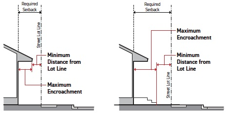
E.
Unlimited. The following can encroach into a required street setback to the extent necessary to perform their proper function.
1.
Handicap ramps and lifts.
2.
Covered structures located entirely below grade. Examples include cellars, basements, storm water storage and cisterns.
3.
Sidewalks, multi-use paths, ramps, driveways, patios and decks 2.5 feet in height or less, measured from grade.
4.
Fences and walls—see Section 3.5., Fence and Wall Height.
5.
Plants. Examples include trees, shrubs, flowers, herbs, vegetables, grasses, ferns, mosses and associated planters and raised planting beds, if applicable.
6.
Natural stormwater devices.
7.
Permanent or movable furniture. Examples include benches, tables and bike and scooter parking racks.
F.
Relief. A reduction in a required street setback of up to 15 percent may be requested in accordance with Section 6.2.2., Administrative Adjustment.
§ 3.7.2. Rear, side and alley lot line setbacks. The area of a site surrounding common and alley lot lines not intended for buildings and structures. Includes setbacks from side lot lines, rear lot lines, and alley lot lines.
A.
Intent. To reduce the impact of buildings or structures on neighboring parcels to an extent appropriate to the planned and exiting context.
B.
Applicability.
1.
The common lot line and alley lot line building setback requirements apply to all sites with common or alley lot lines.
2.
Common lot line setbacks apply only to the perimeter of a development site. These setbacks do not apply to individual lots that are contained entirely within the larger development site.
C.
Standards.
1.
All buildings and structures on the site must be located at or behind the minimum building setback specified by the zoning district, unless listed as an exception in Section 3.7.2.D. below. All building setbacks are measured inward and perpendicular to the applicable lot line.
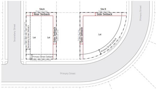
2.
For the purpose of measuring rear setback on triangular or gore-shaped lots, the rear setback is determined based on a line ten feet wide, parallel to the primary street lot line that intersects the two applicable lot lines at its endpoints. Where the primary street lot line is not straight, the rear setback line must be parallel to a line connecting the end points of the primary street lot line.
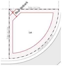
3.
Where a lot line abuts an access easement, the setback may be measured from the interior edge of the easement rather than the lot line.
D.
Exceptions.
1.
Limited. The following are allowed to encroach beyond the building setback up to the minimum distance from the lot line specified below. The encroachments only apply when the zoning district setbacks are equal to or larger than the setbacks specified below.
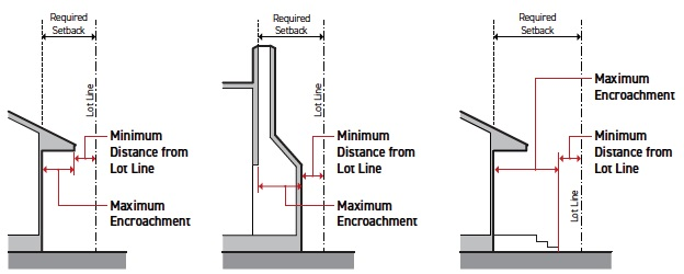
2.
Unlimited. The following can encroach into a required setback to the extent necessary to perform their proper function.
a.
Handicap ramps and lifts.
b.
Equipment related to public or utility operated systems, including related wires, conduits and pipes. Examples include hydrants, transformers, utility cabinets, water utility devices, cable television or phone boxes.
c.
Covered structures located entirely below grade. Examples include cellars, basements, storm water storage and cisterns.
d.
Sidewalks, multi-use paths, ramps, driveways, patios and decks 2.5 feet in height or less, measured from grade.
e.
Fences and walls—see Section 3.5., Fence and Wall Height.
f.
Living organisms, absorbing water and organic substances through its roots and synthesizing nutrients. Examples include trees, shrubs, flowers, herbs, vegetables, grasses, ferns, mosses and associated planters and raised planting beds, if applicable.
g.
Natural stormwater devices.
h.
Permanent or movable furniture. Examples include benches, tables and bike and scooter parking racks.
E.
Relief. A reduction in a required setback of up to 15 percent may be requested in accordance with Section 6.2.2., Administrative Adjustment, provided the resulting setback is at least 1.5 feet.
DIVISION 3.8. TRANSITIONS
§ 3.8.1. Transition type. A package of standards required adjacent to sensitive transitions in scale, intensity, and land use. Transition requirements may include vegetation, fences or walls, building setbacks, and additional setbacks for portions of building above a specified height.
A.
Intent. To mitigate negative visual impacts from development in the New Orleans Square Overlay District to adjacent single-family neighborhoods.
B.
Applicability.
1.
The transition type specified is required along any common lot line of a zoning district that allows a maximum height limit of 25 feet or less, or is located along an existing utility easement containing overhead utility lines.
2.
All sites that abut a transition district lot line must meet the transition requirements of this section.
C.
Standards.
1.
All transition types. The transition type specified by the zoning district must be provided along all transition lot lines. All common lot lines at the perimeter of the New Orleans Square Overlay District that abut a parcel zoned residential single-family are considered a transition lot line.
2.
Type T1.
 | ||
| BUFFER | ||
| A | Transition lot line setback (min) | 10' |
| Large trees (min per 50') | 2 | |
| Shrubs (min per 50') | 10 | |
| WALLS AND FENCES | ||
| B | Height (min/max) | 5.5'/6' |
3.
Type T2.
 | ||
| BUFFER | ||
| A | Transition lot line setback (min) | 10' |
| Large trees (min per 50') | 3 | |
| Shrubs (min per 50) | 15 | |
| WALLS AND FENCES | ||
| B | Height (min/max) | 6'/8' |
| HEIGHT SETBACK | ||
| C | Height without additional setback (max) | 25'/2 stories |
| D | Additional height setback | 20' |
a.
Buffer.
i.
Transition lot line setback. All buildings and structures on the site must be located at or behind the minimum setback specified by the transition type, unless listed as a side/rear setback exception in Section 3.7.2.D. above. Transition lot line setbacks are measured inward and perpendicular from the edge of the utility easement. For transition lot line designations, see Section 3.1.1.I., Transition Lot Lines.
ii.
Large trees and shrubs.
1.
All required plants and their planting areas must be located in the required transition lot line setback and must meet the standards of ZO Section 5.2.B.4., General Landscaping Requirements and Standards.
2.
The number of large trees and shrubs specified by the transition type must be provided for every 50 feet of transition lot line. The length of the transition lot line is measured following the geometry of the transition lot line.
3.
For large trees, see ZO Section 5.2.B.4.a., Approved Tree List for Landscape Requirements.
4.
The number of required trees can be calculated as the total length of the transition lot line divided by 50 feet and multiplied by the specified number of trees per 50 feet. For portions of a tree, round to the nearest whole number.
b.
Walls and fences.
i.
Height.
1.
A continuous fence or wall of the minimum height specified by the transition type must be provided for the full length of the transition lot line.
2.
No fence adjacent to the transition lot line may exceed the maximum fence height specified by the transition type.
3.
Wall and fence height is measured from average grade to the topmost point of the fence or wall structure.
4.
Where the transition type fence or wall height conflicts with the fence and wall height specified by the zoning district, the transition fence and wall height standards supersede.
c.
Height setback.
i.
Height without additional setback.
1.
No structure or portion of a structure's height may exceed the maximum height setback specified by the transition type.
2.
Additional height setback is measured inward and perpendicular from the edge of the utility easement.
ii.
Additional height setback.
1.
No structure or portion of a structure may be located within the additional height setback specified by the transition type.
2.
Additional height setback is measure inward and perpendicular from the edge of the utility easement.
D.
Relief. A required transition dimensional standard may be modified by up to ten percent in accordance with Section 6.2.2., Administrative Adjustment.
DIVISION 3.9. BUILD-TO
§ 3.9.1. Build-to width. The cumulative building width that occupies the build-to zone relative to the width of the site at the street lot line.
A.
Intent. To ensure that buildings are located on a site in a way that frames the street right-of-way with a consistent street wall, promoting walkability through spatially defining an outdoor room, and promoting a strong visual and physical connection between uses inside buildings and the streetscape.
B.
Applicability.
1.
Build-to width requirements apply to all sites.
2.
Build-to width requirements apply only to the ground story of buildings.
C.
Standards.
1.
No building or portion of a building can be located outside of the build-to zone, until the specified primary and secondary street build-to width requirements for the site have been met. Once the minimum build-to width requirements have been met for the site, buildings and structures may occupy the areas outside of the build-to zones.
2.
The build-to zone is measured perpendicular to the primary or secondary street lot line from the minimum primary or secondary street setback to the maximum primary or secondary street setback. See Section 3.7.1., Primary and Secondary Street Setbacks.
3.
Where the zoning district specifies "0%" as the minimum build-to width, 75 percent of the width of buildings provided on the site must be located in the build-to zone regardless of the width of the lot. Width of provided buildings on a site is measured perpendicular to the applicable street lot line from the farthest edge of building in one direction to the farthest edge of building in the opposite direction.
4.
The build-to width requirement is measured as a percentage calculated as the sum of all building widths occupying the build-to zone, divided by the total width of the site.
5.
On a corner site where intersecting street lot lines both have a build-to width requirement, a building must occupy the portion of the site where the two intersecting build-to zones overlap. The building must occupy the build-to zones for both street lot lines for a minimum of 30 feet from the corner. Distance is measured away from the corner, starting at the edge of the building occupying the area of overlap, parallel to the street lot line. This building width counts toward the required build-to width for both street lot lines.
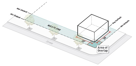
6.
Any portion of a building in the build-to zone that includes a vehicular entrance into or through the building does not count towards the build-to width requirement.
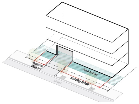
7.
A chamfered corner no more than 20 feet in width located on the ground story of a building and extending outside of the build-to counts towards the build-to width requirement.
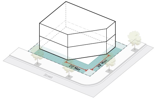
D.
Relief.
1.
Up to a ten percent reduction to the total required width of building occupying the build-to zone may be requested in accordance with Section 6.2.2., Administrative Adjustment.
§ 3.9.2. Pedestrian plaza allowance. The width of pedestrian plaza or pedestrian amenity space in the build-to zone that is allowed to count toward the build-to width requirement.
A.
Intent. To promote the creation of active, human-scaled outdoor spaces as an extension of the streetscape, providing visual interest and vitality to the amenity space and streetscape. The pedestrian plaza allowance provides flexibility to building and site design while maintaining standards essential for ensuring all projects contribute to defining a consistent and legible street wall.
B.
Applicability.
1.
Pedestrian amenity build-to modification standards apply to the following:
a.
Portions of buildings or structures required to meet the build-to width standard in Section 3.9.1., Build-To Width;
b.
Pedestrian plaza facing facades; and
c.
Portions of the lot between the building and the street lot line for the width of the pedestrian plaza provided.
2.
The pedestrian plaza allowance does not apply to Neighborhood Transition 2 (NT2).
C.
Standards.
1.
Where allowed, pedestrian plazas may be provided as a substitute for building width occupying the build-to zone for the maximum percentage of the lot width specified by the zoning district.
2.
Pedestrian plazas must meet the standards of Section 3.4.1.C.3., Pedestrian Outdoor Amenity Space.
3.
Pedestrian plaza spaces may be wider than the maximum allowed pedestrian plaza allowance. However, any part of the pedestrian plaza width that exceeds the allowed pedestrian plaza allowance does not count toward the required building width occupying the build-to zone.
4.
A minimum of 85 percent of the pedestrian plaza perimeter shall abut either a lot line or a building facade. Where the pedestrian plaza abuts a building facade, the building facade must meet all activation standards specified by the zoning district for the abutting street lot line. Where the pedestrian plaza abuts multiple street lot lines, the standards specified for the frontage lot line that abuts the pedestrian plaza for the greatest length applies.
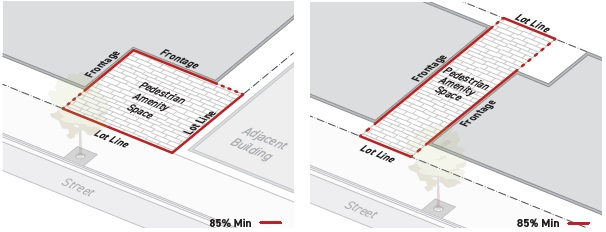
5.
Pedestrian plaza allowance is measured as the cumulative width of pedestrian plazas occupying the build-to zone provided as a substitute for required building width in the build-to zone, divided by the required build-to width.
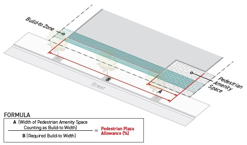
6.
Pedestrian plaza width is measured parallel to the applicable street lot line.
7.
For measuring the required build-to width, see Section 3.9.1., Build-To Width.
D.
Relief.
1.
Up to a ten percent increase to the pedestrian plaza allowance may be requested in accordance with Section 6.2.2., Administrative Adjustment.
2.
A deviation from any pedestrian amenity allowance dimensional standard of ten percent or less may be requested in accordance with Section 6.2.2., Administrative Adjustment.
DIVISION 3.10. PARKING LOCATION
§ 3.10.1. Parking between the building and the street. Where on-site parking is or isn't allowed between the building and the street.
A.
Intent. To minimize the impact of parking on the street right-of-way and to promote a comfortable, safe, engaging and attractive streetscape with active uses and landscaping for pedestrians.
B.
Applicability. Parking location limitations apply to all sites where specified by the zoning district.
C.
Standards.
1.
Between the building and street.
a.
Where the zoning district specifies "no" for parking between the building and street, no parking or area designed for motor vehicle use, except for driveways, can be located between the portion of a building used to meet the build-to width requirement and the street. The driveway must be the minimum width allowed and follow the most direct route from the street to the designated parking area or vehicle use area.
b.
Along a primary street, parking spaces must be located at or behind the street-facing building facade.
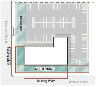
2.
Side drive. Lots located in the NT2 zoning district that take access from a primary street must meet the standards of side drive—see Section 5.3.1.C.3., Side Drive.
D.
Relief. No administrative relief is allowed.
DIVISION 3.11. BUILDING
§ 3.11.1. Height. The vertical dimension of a building or structure measured in feet and stories.
A.
Intent. To provide adequate light, air, safety, and to protect the character of an area and the interests of the general public.
B.
Applicability. Building height limitations apply to all sites in all zoning districts.
C.
Standards.
1.
All height. No building, portion of a building or structure can exceed the maximum number of feet or stories allowed in the zoning district, unless listed as an encroachment in Section 3.11.1.D., Exceptions.
2.
Height in stories.
a.
Height in stories is measured as the number of stories above finished grade. The ground story and all upper stories are included in the calculation of maximum height in stories.
b.
A story is the part of a building included between the surface of one floor and the surface of the next floor above, or if there is no floor above, then the ceiling next above. A mezzanine does not count as a story.
c.
The ground story (or first story) of a building is determined as follows:
i.
The first (facade) story that is exposed a minimum of six feet above finished grade along the full width of the applicable building facade.
ii.
The finished floor of a ground story can be no higher than six feet above finished grade for any portion of the building perimeter. This may mean the ground story may change within the same building.
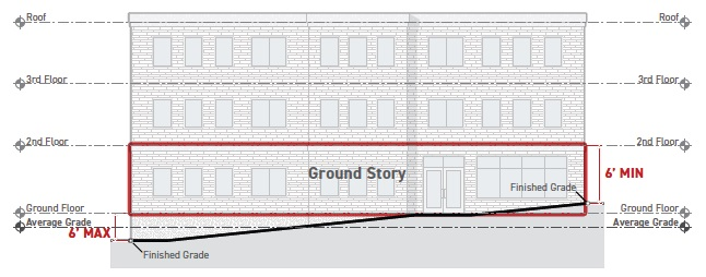
d.
The ground story finished floor elevation may not exceed the maximum specified by the zoning district—see Section 3.12.2., Ground Story Finished Floor Elevation.
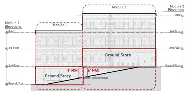
e.
An occupiable space in a building located below the ground story is a basement. Basements are not included in the calculation of maximum height in stories.
f.
Any story located above the ground story is an upper story.
g.
No floor area is allowed above the topmost building story with the exception of attics. For the purpose of height in stories, an attic is defined as an unfinished room located just below the roof that does not exceed 50 percent of the floor area of the story immediately below.
3.
Height in feet. Height in feet is the number of feet from average grade to:
a.
The mid-point of the roof, for a building with a pitched roof;
b.
The top of the roof deck, for a building with a flat roof; and
c.
The topmost point of the structure, for all other structures.
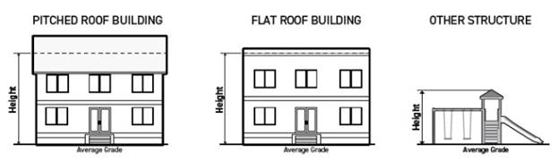
4.
Average grade.
a.
Average grade is calculated by averaging the highest and lowest elevation of the sidewalk in front of the primary street-facing building facade.
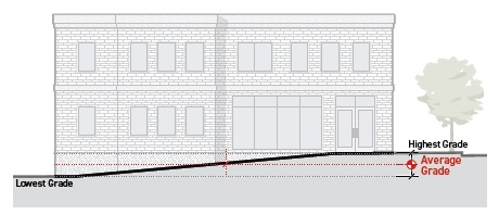
b.
Where the sidewalk is more than five feet from the primary street-facing building facade, average grade is calculated by averaging of the highest and lowest elevation within five feet of the primary street-facing building facade.
c.
Large buildings and those developed on sites with significant topographic variation may calculate average grade independently for each building module that steps up or down the slope.
D.
Exceptions. The following encroachments are allowed beyond the maximum height limit, as specified below:
E.
Relief.
1.
An increase in maximum height in feet of up to ten feet may be requested in accordance with Section 6.2.2., Administrative Adjustment.
2.
An increase to an encroachment dimension of up to 20 percent may be requested in accordance with Section 6.2.2., Administrative Adjustment.
3.
No administrative relief is allowed for maximum height in stories.
§ 3.11.2. Height: Base and structured parking bonus. The vertical dimension of a building or structure located in a zoning district that allows for a structured parking height bonus, measured in feet and stories.
A.
Intent.
1.
To ensure appropriately-scaled buildings that frame the streets and open spaces.
2.
To provide additional building height in zoning districts located near the intersection of New Orleans Street and Elm Place when structured parking is provided on the site.
B.
Applicability.
1.
The base height limitations apply to all sites.
2.
The structured parking bonus height limitations apply only to sites within the Urban Neighborhood 3+ (UN3+), Urban General 3+ (UG3+), and Shopfront 3+ (SH3+) zoning districts.
C.
Standards.
1.
Height: Base.
a.
No portion of a building or structure may exceed the maximum base height as specified by the zoning district, unless the development site meets the criteria for the structure parking bonus below.
2.
Height: Structured parking bonus.
a.
No portion of a building or structure may exceed the maximum base height as specified by the zoning district, unless the development site meets the following criteria:
i.
Eighty-five percent of provided on-site parking must be located within a parking structure and no more than 15 percent of the total site area may be dedicated to surface parking lots and other areas designed for use by motor vehicles.
ii.
A parking space is considered to be located within a parking structure when the parking space is either covered by or on top of a structure with indoor floor area or usable open space located above average grade. Parking structure examples include: tuck-under parking; a stand alone or wrapped parking garage; podium parking; or underground parking.
b.
No portion of a building or structure can exceed the maximum structured parking bonus height as specified by the zoning district, unless listed as an encroachment in Section 3.11.1.C.6., Encroachments.
3.
Height in feet. For measuring height in feet, see Section 3.11.1.C.2, Height in Feet.
4.
Height in stories. For measuring height in stories, see Section 3.11.1.C.3, Height in Stories.
D.
Exceptions. For standards applicable to encroachments, see Section 3.11.1.D., (Height) Exceptions.
E.
Relief. See Section 3.11.1.E., Relief.
§ 3.11.3. Building width. The horizontal dimension of a building on a site.
A.
Intent.
1.
To promote fine-grained patterns of development and prevent long buildings that are significantly out of context with traditional patterns by breaking wide buildings into multiple, clearly distinguished, building widths.
2.
To encourage larger projects to provide open space for pedestrians and recreation.
B.
Applicability.
1.
Building width requirements apply to all street-facing building facades.
2.
Building width requirements apply only to portions of buildings located above the maximum ground floor elevation (Section 3.12.2.B., Ground Story Finished Floor Elevation Applicability) required by the zoning district.
C.
Standards.
1.
No building located can be wider than the maximum building width allowed by the zoning district.
2.
Two buildings can abut one another provided that they have no shared components and are structurally independent from one another.
3.
Building width is measured horizontally and parallel to each abutting primary street or secondary street lot line from one end of an applicable building or collection of connected buildings to the opposite end.
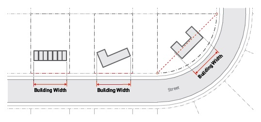
D.
Exceptions. An open space meeting the following standards may be used to establish a continuous structure as separate buildings for the purpose of meeting a maximum building width requirement:
1.
The width of the open space may be no more than one-half the width of the widest adjacent building width and no less than one-fourth the width of widest adjacent building width provided.
2.
A maximum of one open space exception can be used for each building.
3.
The open space must meet Section 3.4.1.C.2., Common Outdoor Amenity Space.
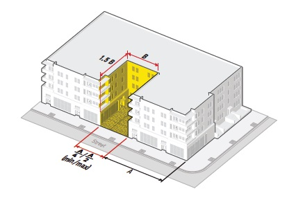
E.
Relief. Increased building width of up to 20 percent may be requested in accordance with Section 6.2.2., Administrative Adjustment.
§ 3.11.4. Active depth. The horizontal depth of a building's ground floor that must contain active uses along primary street, secondary street, and primary street-park frontages.
A.
Intent. To minimize dead space along streetscapes and park frontages to promote a safe and engaging built environment with active uses.
B.
Applicability.
1.
The active depth requirement applies to all portions of a building used to meet a build-to width requirement—see Section 3.9.1., Build-To Width.
2.
The active depth requirement applies to stories of a building above the ground floor active depth.
3.
The active depth requirement applies only to building facades abutting front yards and secondary street yards. See Section 3.1.7., Yard Designation.
C.
Standards.
1.
Applicable portions of a building must provide the minimum active depth required by the zoning district. Active depth is measured from the front building facade inward to the interior of the building.
2.
No more than 20 percent of the floor area of the required active depth can be used for inactive uses, such as storage, hallways, stairwells, elevators and equipment rooms. Parking spaces and motor vehicle use areas are not allowed in any portion of the required active depth.
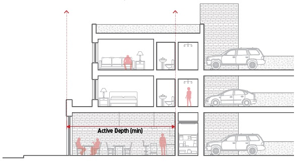
D.
Relief. Reduced active depth of up to 20 percent may be requested in accordance with Section 6.2.2., Administrative Adjustment.
DIVISION 3.12. GROUND STORY
§ 3.12.1. Ground story ceiling height. The ceiling height of first story of a building having its finished floor elevation nearest to the finished ground surface.
A.
Intent. To promote high-quality ground-story spaces that are adaptable and appropriate to their intended use and surrounding context.
B.
Applicability. The ground story ceiling height standards apply to all buildings that contain habitable space on the ground story.
C.
Standards.
1.
Applicable ground story space can be no less than the minimum ground story height required by the zoning district.
2.
Ground story ceiling height is measured from the top of the finished floor of the ground story to the underside of the ceiling or roof structure above.
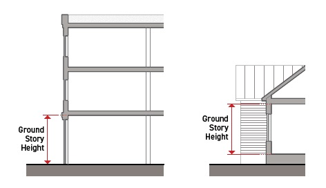
D.
Relief. A reduction in required ground story height of up to six inches may be requested in accordance with Section 6.2.2., Administrative Adjustment.
§ 3.12.2. Ground story finished floor elevation. The finished story of a building having its finished floor elevation nearest to the finished ground surface.
A.
Intent. To promote "eyes" on the street, increase the perception of safety and encourage visual connections between the public realm and the exterior of a building and to encourage a relationship between ground story uses and the street appropriate to the intended use.
B.
Applicability.
1.
The ground floor elevation standards apply to all buildings that contain habitable space on the ground story that are located within 20 feet of a primary street or secondary street lot line.
2.
The ground floor elevation standards apply only to the required ground floor active depth.
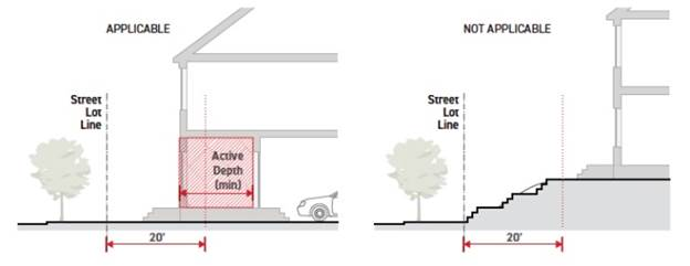
3.
The ground floor elevation standards do not apply to accessory structures, unless the ground story of the accessory structure contains habitable space for a dwelling unit.
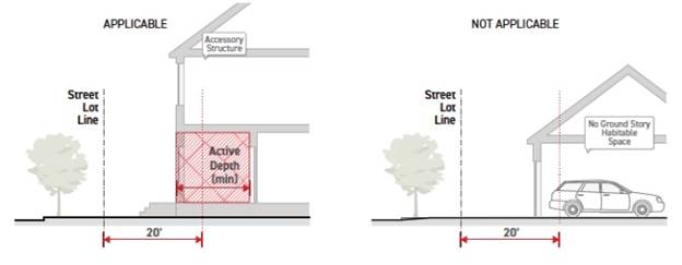
C.
Standards.
1.
All applicable ground stories must have a finished floor surface at:
a.
An elevation no lower than the minimum ground floor elevation required by the zoning district.
b.
An elevation no higher than the maximum ground floor elevation required by the zoning district.
2.
Ground floor elevation for nonresidential floor area in a residential building (lobby, gym, office) may be reduced to minus two feet.
3.
Ground floor elevation is measured from average grade to the top of the finished floor of the ground story. On corner sites, for the purpose of determining ground floor elevation, average grade must be established independently for each street-facing building facade.
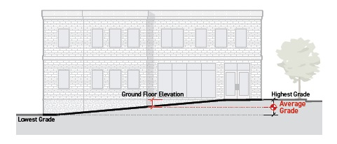
D.
Relief. A change in the minimum or maximum ground floor elevation requirement of up to ten percent may be requested in accordance with Section 6.2.2., Administrative Adjustment.
DIVISION 3.13. WINDOWS
§ 3.13.1. Window area. The amount of transparency into a building interior on a building facade.
A.
Intent. To provide visual interest along the public realm by encouraging visual connections between the street right-of-way and the interior of a building.
B.
Applicability. Transparency requirements apply to all street-facing building facades.
C.
Standards.
1.
Applicable ground and upper story building facades must meet the minimum transparency of the zoning district.
2.
To meet the transparency requirements, window and door glazing must meet the following:
3.
Windows and doors used to meet the transparency requirements may be temporarily covered by operable window treatments, such as curtains or blinds.
4.
Window and door decals may not cover more than 20 percent of the required window area and must meet the standards of ZO Section 5.7., Signs.
5.
Muntins, mullions, window sashes, window frames and door frames that are integral to window and door assemblies that are less than three inches width may be considered transparent when calculating required percentages.
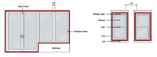
§ 3.13.2. Ground story windows. Street-facing windows located along the ground story of a building facade.
A.
Intent. To provide visual interest along the street right-of-way by encouraging visual connections between the streetscape and a building's ground story interior to reveal interior activities and displays.
B.
Applicability.
1.
Ground story window requirements apply to all street-facing building facades.
2.
Ground story window requirements do not apply to parking structures.
C.
Standards.
1.
All ground story facade areas.
a.
Ground story transparency is measured as a percentage, calculated as the sum of all ground story facade area meeting the standards for transparency divided by the total facade area for the ground story.
b.
No portion of a ground story located below finished grade is included in ground story facade area.
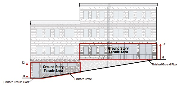
c.
Interior walls and other permanent interior visual obstructions cannot be located within five feet of the window or door opening used to meet the transparency requirement, except for window signs that meet the standards of ZO Section 5.7., Signs.
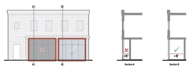
2.
Residential ground story facade area. Residential ground story facade area is measured between 1.5 and eight feet above the top of the finished floor of the ground story.
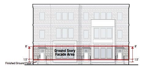
3.
Nonresidential ground story facade area.
a.
Nonresidential ground story facade area is measured between zero and 12 feet above the top of the finished floor of the ground story.
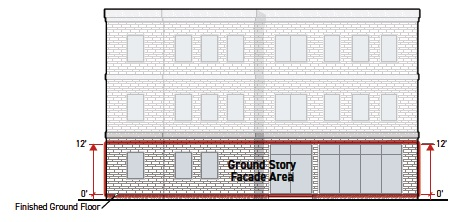
b.
If the ground story height is less than 12 feet, the ground story facade area is measured between the top of the finished floor of the ground story and the top of the finished floor above. When there is no story above, it is measured to the top of the wall plate.
D.
Relief. A reduction to the total amount transparency required for a story of up to a ten percent may be requested in accordance with Section 6.2.2., Administrative Adjustment.
§ 3.13.3. Upper story windows. Street-facing windows located along the upper stories of a building facade.
A.
Intent. To ensure development projects are designed with upper story windows that contribute to the established architectural character of surrounding neighborhoods or districts.
B.
Applicability.
1.
Upper story window requirements apply to all street-facing building facades.
2.
Upper story window requirements do not apply to parking structures.
C.
Standards.
1.
Each upper story facade must meet the required transparency standard independently. All facade area associated with an upper story having the same story designation is considered part of the same upper story facade.
2.
For the purpose of calculating upper story transparency, upper story facade area is measured as the portion of a facade area between the top of the finished floor for that story to the top of the finished floor above. When there is no story above, it is measured to the top of the wall plate.
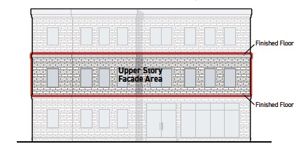
D.
Relief. A reduction to the total amount transparency required for a story of up to a ten percent may be requested in accordance with Section 6.2.2., Administrative Adjustment.
§ 3.13.4. Blank wall width. The distance between widths of ground story facade and foundation wall without window or door openings.
A.
Intent. To provide visual interest along the street right-of-way by limiting the area without visual or physical connections between the street right-of-way and the interior of a building.
B.
Applicability. Blank wall width applies to the following:
1.
Street-facing building facades between three feet and eight feet from the finished ground floor elevation, measured vertically.
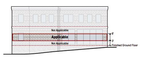
2.
All portions of foundation walls on street-facing building facades that are exposed four feet in height or greater above finished grade. If foundation walls are set back more than ten feet from a sidewalk, exposed height is measured from the lowest elevation of finished grade within five feet, measured from and perpendicular to the foundation wall.
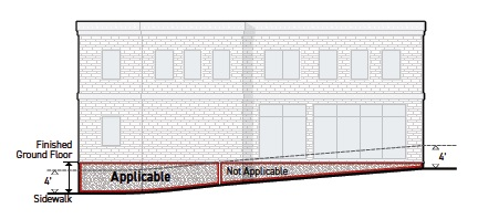
C.
Standards.
1.
Ground story facade blank wall.
a.
Windows and doors meeting Section 3.13.1.C., Window Area Standards, on applicable ground story facades can be separated by a distance no greater than the maximum blank wall width specified by the zoning district.
b.
Ground story facade blank wall width is measured horizontally and parallel to the street lot line from the edge of the window or door to the edge of the window or door, and the edge of the window or door to the edge of ground story facade.
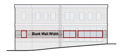
2.
Blank wall treatments. Facades that exceed the maximum allowed blank wall width may apply one or more of the following blank wall treatment options and increase the blank wall width by 100.
| Small Trees Small trees planted between a ground story facade with no window or door openings and the public realm. | ||
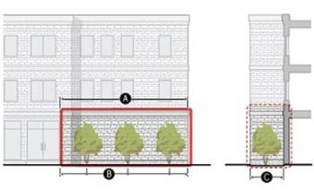 | ||
| DIMENSIONAL STANDARDS | ||
| A | Treatment width (min % of blank wall width) | 100% |
| Tree type | Small | |
| B | Planting frequency (min avg.) | 5 per 100' |
| C | Planting area depth (min) | 7' |
| Large Trees Large trees planted between a ground story facade with no window or door openings and the public realm. | ||
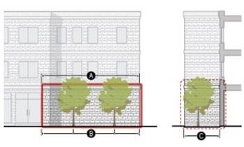 | ||
| DIMENSIONAL STANDARDS | ||
| A | Treatment width (min % of blank wall width) | 100% |
| Tree type | Large | |
| B | Planting frequency (min avg.) | 3 per 100' |
| C | Planting area depth (min) | 15' |
| Living Wall A permanently fixed assembly located between a ground story facade with no window or door openings and the public realm that supports live plants, their growing medium, and irrigation. | ||
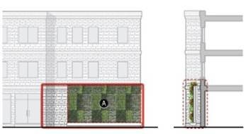 | ||
| DIMENSIONAL STANDARDS | ||
| A | Treatment area (min % of blank facade area) | 75% |
| Mural A noncommercial image located between a ground story facade with no window or door openings and the public realm. Murals must be approved by the City Planning Commission. | ||
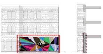 | ||
| DIMENSIONAL STANDARDS | ||
| A | Treatment area (min % of blank facade area) | 75% |
3.
Blank foundation wall width.
a.
Windows and doors meeting Section 3.13.1.C., Window Area Standards, on applicable foundation walls can be separated by a distance no greater than the maximum blank wall width specified by the zoning district.
b.
Blank foundation wall width is measured horizontally and parallel to the street lot line from the edge of the window/door to the edge of the window/door, and the edge of the window/door to the edge of ground story facade.
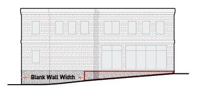
4.
Blank wall treatments. Foundation walls that exceed the maximum allowed blank wall width may apply one or more of the following blank foundation wall treatments and increase the blank wall width by 100 percent.
| Foundation Planting Screening plants located on a foundation wall with no window or door openings and the public realm. | ||
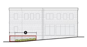 | ||
| DIMENSIONAL STANDARDS | ||
| A | Treatment width (min % of blank wall width) | 75% |
| Plant type | Screening plant | |
| Planting frequency (min avg.) | 3 per 10' | |
| Planting area depth (min) | 3' | |
| Pedestrian Access Stairs or ramps providing pedestrian access to a street-facing entrance located between a foundation wall with no window or door openings and the public realm. | ||
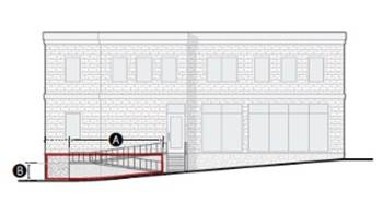 | ||
| DIMENSIONAL STANDARDS | ||
| A | Treatment width (min % of blank wall width) | 75% |
| B | Height above sidewalk (max) | 4' |
| Living Wall A structure permanently attached to a foundation wall with no window or door openings that supports climbing plants. | ||
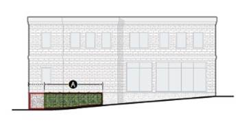 | ||
| DIMENSIONAL STANDARDS | ||
| A | Treatment area (min % of blank foundation wall area) | 75% |
| Planting area depth (min) | 1.5' | |
| Planter Permanent structure containing plants and their growing medium located between a foundation wall with no window or door openings and the public realm. | ||
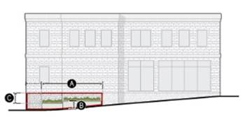 | ||
| DIMENSIONAL STANDARDS | ||
| A | Treatment width (min % of blank foundation wall area) | 75% |
| Plant coverage of planting area (min) | 75% | |
| Planting area depth (min) | 2.5' | |
| B | Height above sidewalk (min/max) | 1.5'/3.5' |
| C | Foundation wall reveal (max) | 2' |
5.
Measurement of blank wall treatment dimensional standards.
a.
Treatment width.
b.
Minimum treatment width is measured as a percentage, calculated as the cumulative width of blank wall treatments divided by the total length of blank wall width.
c.
Treatment area.
d.
Minimum treatment area is measured as a percentage, calculated as the cumulative area of blank wall treatments divided by the total applicable facade area within the blank wall width.
e.
Plant coverage.
f.
Measured as 70 percent of the plant's anticipated canopy diameter or spread at maturity. Tree types must be selected from the City's approved tree list as specified in ZO Section 5.2.B.4.a., Approved Tree List for Landscape Requirements.
g.
Planting frequency.
h.
Planting frequency is measured as a ratio of the minimum number of plants required along the total length of the blank wall width. A minimum of one plant of the required plant type must be provided regardless of the width of blank wall treatment.
i.
Planting area depth.
j.
Minimum planting area depth is measured as the horizontal dimension of growing medium at the narrowest point, measured perpendicular to the applicable street lot line. The planting area must be open to the sky for at least the required planting area depth. All plantings must also meet the standards of ZO Section 5.2., Landscaping, Trees, Screening, and Fencing.
k.
Height above sidewalk.
l.
Height above sidewalk is measured vertically from adjacent finished grade to the topmost point of the blank wall treatment.
m.
If foundation walls are set back more than ten feet from a sidewalk, maximum height is measured from the lowest elevation of finished grade within five feet, measured from and perpendicular to the foundation wall, to the topmost point of the blank wall treatment.
n.
Foundation wall reveal. Foundation wall reveal is measured vertically from the top of an inactive wall treatment to the finished ground floor elevation along the entire treated portion of a blank foundation wall.
D.
Relief. A change to any blank wall dimensional standard of up 15 percent may be requested in accordance with Section 6.2.2., Administrative Adjustment.
DIVISION 3.14. DOORS
§ 3.14.1. Street-facing entrance. A door providing access from the street right-of-way to the interior of a building.
A.
Intent. To provide visual interest along the street right-of-way, orient buildings to the street right-of-way, and promote greater use and activation of the streetscape by limiting the width of frontage without physical connections between the streetscape and the building interior.
B.
Applicability. Street-facing entrance standards apply to all ground story street-facing building facades.
C.
Standards.
1.
All street-facing entrances.
a.
All required building entrances must be street-facing.
b.
To qualify as a street-facing entrance, building entrances must:
i.
Be located on the ground story facade;
ii.
Provide both ingress and egress pedestrian access to the ground story of the building;
iii.
Remain operable at all times but may be controlled and limited to residents or tenants;
iv.
Not provide direct access to motor vehicle use areas, utility areas or fire stairs; and
v.
Have either an exterior door whose surface is angled between zero to 60 degrees, measured parallel to the frontage lot line, or have direct access from an entry feature having a pedestrian access point facing the frontage lot line.
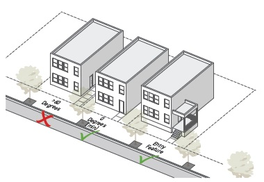
vi.
On a corner lot or a lot with intersecting street lot lines, an entrance facing both intersecting frontage lot lines and angled between 30 to 60 degrees, measured parallel to each of those frontage lot lines, may be used to meet the requirement for a street-facing entrance along both frontages.
vii.
Meet the standards for one of the street-facing entry feature options below.
viii.
Non-required entrances are allowed in addition to required entrances.
2.
Street-facing entry features.
a.
One of the entry features specified in § 3.14.1.C.3., Street-Facing Entry Feature Options, is required for every entrance provided to meet the street-facing entry spacing requirement in accordance with § 3.14.2., Street-Facing Entry Spacing.
b.
An entrance directly accessed from an entry feature counts as a street-facing entrance, regardless if it faces the street.
c.
An entrance directly accessed from an entry feature counts as a street-facing entrance, regardless if it faces the street.
3.
Street-facing entry feature options.
| Porch A wide, raised platform, projecting in front of a street-facing entrance, that is entirely covered but not enclosed. | ||
 | ||
| DIMENSIONAL STANDARDS | ||
| A | Depth (min) | 6' |
| B | Width (min % of building width) | 30% |
| Roofed | Required | |
| C | Finished floor elevation (min/max) | 1.5'/3.5' |
| Fully enclosed | Not allowed | |
| Raised Entry A raised platform accessed from an exterior staircase, providing covered access to a street-facing entrance. | ||
 | ||
| DIMENSIONAL STANDARDS | ||
| A | Depth (min) | 3' |
| B | Width (min) | 4' |
| Covered entrance | Required | |
| C | Finished floor elevation (min/max) | 1.5'/3.5' |
| Fully enclosed | Not allowed | |
| Forecourt A yard screened with a short wall, fence or hedge that provides significant privacy for tenants located on the ground story, near finished grade. | ||
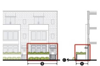 | ||
| DIMENSIONAL STANDARDS | ||
| A | Depth (min) | 8' |
| B | Width (min) | 10' |
| Covered entrance | Required | |
| C | Finished floor elevation (min/max) | -2'/3.5' |
| Wall/fence height (min/max) | 2.5'/4' | |
| Fully enclosed | Not allowed | |
| Recessed Entry A space set behind the primary facade plane providing sheltered access to a street-facing entrance. | ||
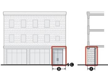 | ||
| DIMENSIONAL STANDARDS | ||
| A | Depth (min) | 3' |
| B | Width (min) | 5' |
| Covered entrance | Required | |
| C | Finished floor elevation (min/max) | -2'/3.5' |
| Fully enclosed | Not allowed | |
| Covered Entry A space set behind the primary facade plane providing sheltered access to a street-facing entrance. | ||
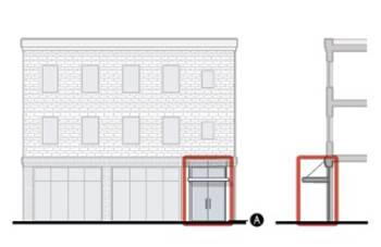 | ||
| DIMENSIONAL STANDARDS | ||
| Covered entrance | Required | |
| A | Finished floor elevation (min/max) | -2'/3.5' |
| Fully enclosed | Not allowed | |
4.
Measurement of street-facing entry feature dimensional standards.
a.
Depth. Minimum depth is measured as the horizontal dimension where the occupiable portion of the entry feature is at its narrowest, measured perpendicular to the applicable primary or secondary street lot line.
b.
Width.
i.
When specified as a percentage, width is measured as the total width of the occupiable portion of entry feature divided by the total width of the building that the entry provides access to, measured parallel to the applicable primary or secondary street lot line.
ii.
When specified in feet, width is measured as the total width of the occupiable portion of the entry feature, as measured parallel to the applicable primary or secondary street lot line.
c.
Roofed. A building or structure is considered roofed when less than 25 percent of its area is open to the sky. A building or structure is considered open when 25 percent or more of its area is open to the sky. A building or structure containing overhead, non-solid structures, such as lattice and pergolas, is considered open when 25 percent or more of its area is open to the sky.
d.
Fully enclosed. A permanently located structure having a roof, four walls and doors and windows that close, all of which conform to the Building Code.
e.
Covered entrance.
i.
When required, a roofed structure must cover the occupiable portion immediately abutting the associated street-facing entrance.
ii.
The minimum depth of the covered area must be the clear height of the covered area divided by three.
iii.
The minimum width of the covered area must be the clear height of the covered area divided by two.
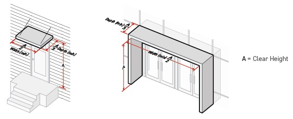
f.
Finished floor elevation. Finished floor elevation is measured from the finished grade along the adjacent sidewalk to the top of the finished floor surface or ground surface of the entry feature. Where no sidewalk exists within ten feet of the entry feature, finished floor elevation is measured from the finished grade within five feet of the entry feature, measured perpendicular to the entry feature area.
g.
Wall or fence height. See Section 3.5.1., Wall and Fence Height, for measurement of wall or fence height.
D.
Relief.
1.
A deviation from entry feature dimensional standard of 15 percent or less may be requested in accordance with Section 6.2.2., Administrative Adjustment.
2.
A deviation from any entry feature standard may be requested as a variance in accordance with Section 6.2.2., Administrative Adjustment.
§ 3.14.2. Street-facing entry spacing. A street-facing door providing access from the street right-of-way to the interior of a building.
A.
Intent. To provide visual interest along the streetscape, orient buildings to the street right-of-way and promote greater use and activation of the public sidewalk by limiting distance without physical connections between the streetscape and the building interior.
B.
Applicability. Street-facing entry spacing requirements apply to all ground story street-facing building facades.
C.
Standards.
1.
A street-facing entrance must be provided to meet the street-facing entrance spacing requirements of the zoning district.
2.
A street-facing entrance cannot be located farther apart than the maximum entrance spacing requirement of the zoning district.
3.
Entry spacing (maximum) is measured as the horizontal distance from edge of door to edge of door and edge of door to edge of the building.
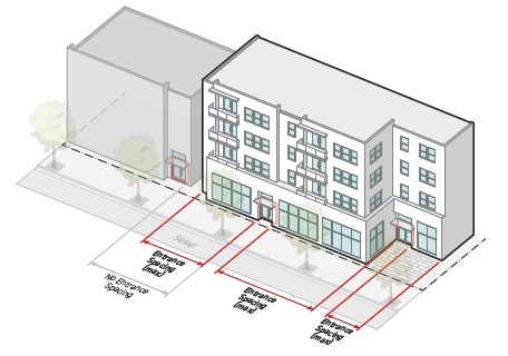
4.
The entry spacing requirement must be met for each building and abutting buildings on the site, but are not applicable to buildings unrelated to the project.
5.
Accessory structures do not have to provide a street-facing entrance and are not included in the calculation of the maximum street-facing entry spacing requirement.
6.
A primary street-facing entrance must front on to a primary street or park as mapped in the Regulating Plan Section 1.3.1., Regulating Plan Map.
7.
A secondary street-facing entrance must front on to a secondary street as mapped in the Regulating Plan Section 1.3.1., Regulating Plan Map.
8.
If a building provides a primary street-facing entrance, a secondary street-facing entrance is only required when the building width along the secondary street is greater than the maximum entry spacing requirement for the zoning district.
9.
On a corner lot, an angled entrance may be used to meet the requirement for a street-facing entrance along both streets. See Section 3.14.1., Street-Facing Entrance.
10.
Non-required entrances are allowed in addition to required entrances.
D.
Relief.
1.
An increase in entrance spacing of 20 percent or less may be requested in accordance with Section 6.2.2., Administrative Adjustment.
2.
Deviation from street-facing entrance and entrance spacing standards may be requested in accordance with Section 6.2.2., Administrative Adjustment.
CHAPTER 4. - USE
DIVISION 4.1. GENERAL PROVISIONS
§ 4.1.1. Use categories.
A.
In order to regulate uses more efficiently, categories of uses have been established.
B.
Use categories provide a systematic basis for assigning land uses to appropriate districts. Use categories classify land uses and activities based on common functional, product, or physical characteristics. These characteristics include, but are not limited to, the following:
1.
The type and amount of activity;
2.
The type of customers or residents;
3.
How goods or services are sold or delivered;
4.
Likely impact on surrounding properties; and
5.
Site conditions.
§ 4.1.2. Principal uses. Principal uses are grouped into use categories. Permitted principal uses are shown in Division 4.2, Allowed Uses. The examples of permitted principal uses listed in Division 4.3, Use Definitions, are not an exhaustive list.
§ 4.1.3. Accessory uses. Accessory uses are allowed in conjunction with a permitted principal use. See Division 4.4, Accessory Uses and Structures.
§ 4.1.4. Director responsibility.
A.
The Director is responsible for categorizing all principal uses. If a proposed use is not listed in a use category, but is similar to a listed use, the Director will place the proposed use under that use category.
B.
When determining whether a proposed use is similar to a listed use in Division 4.3, Use Definitions, the Director will consider the following criteria:
1.
The actual or projected characteristics of the proposed use;
2.
The relative amount of site area or floor area and equipment devoted to the proposed use;
3.
Relative amounts of sales;
4.
The customer type;
5.
The relative number of employees;
6.
Hours of operation;
7.
Building and site arrangement;
8.
Types of vehicles used and their parking requirements;
9.
The number of vehicle trips generated;
10.
How the proposed use is advertised; and
11.
The likely impact on surrounding properties.
DIVISION 4.2. ALLOWED USES
No certificate of occupancy may be issued for a use that is not allowed by this Division. No building, lot or site may be used except for a purpose permitted in the zoning district in which it is located, as specified within this Division.
§ 4.2.1. Use table key.
A.
Permitted uses.
P = A by-right permitted use.
P* = A by-right permitted use subject to additional use standards (cross reference to applicable standards provided in right-hand column of the use table).
B.
Discretionary uses.
C = A use that requires an approved Conditional Use Permit.
C* = A use that requires an approved Conditional Use Permit that is also subject to additional use standards (cross-reference to applicable standards provided in right-hand column of the use table).
C.
Uses not permitted.
— = A use that is not permitted.
§ 4.2.2. Permitted use table.
§ 4.2.3. Additional use standards. These standards apply to uses designated in the use table with a P* or S*.
A.
Household living. Shopfront 3+ (SH3+) Districts—dwelling units are not allowed within the required active depth on the ground floor. Lobbies and other shared facilities (such as a gym, lounge area, meeting space or mail room) are allowed in the active depth on the ground story.
B.
Group living.Neighborhood Transition 2 (NT2) Districts—up to ten unrelated residents, not including resident managers or supervisors, are allowed in each dwelling unit.
C.
Urban agriculture—All districts.
1.
Urban agriculture may be allowed as a transitional use on up to 100 percent of the site area. Transitional uses may be approved for a maximum duration of two years, after which the use must be discontinued or receive a permit renewal. See Division 4.5., Temporary and Transitional Uses.
2.
Urban agriculture may be allowed as a permanent accessory use on up to 20 percent of the site area.
3.
Any equipment or supplies kept on-site must be enclosed or screened from the street and any adjacent residential uses.
4.
Activities and operations must be conducted between the hours of 7:00 a.m. and 7:00 p.m.
5.
Mechanized equipment similar in scale to that designed for household use must be used. Use of larger mechanized equipment is not allowed; provided, however, that during the initial preparation of the land heavy equipment may be used.
6.
The on-site sale of food crops and/or non-food, ornamental crops grown on-site is allowed on up to 12 days per year.
D.
Community service. Neighborhood Transition 2 (NT2) Districts—cannot exceed 5,000 square feet in floor area dedicated to community service uses.
E.
Day dare. All Urban Neighborhood (UN) and Urban General (UG) Districts—cannot be located above the ground floor.
F.
Education. Neighborhood Transition 2 (NT2) Districts—site cannot exceed four acres in area.
G.
Place of assembly. All Urban Neighborhood (UN) Districts—cannot exceed 5,000 square feet in floor area dedicated to places of assembly uses.
H.
Animal care. All Urban General (UG) and Urban Shopfront (SH) Districts—outdoor spaces for animals are limited to supervised play areas and runs. No animals may be kept overnight. No large animal veterinary clinics are permitted.
I.
Eating and drinking. All Urban Neighborhood (UN) Districts—cannot exceed 3,000 square feet in floor area dedicated to eating and drinking uses and at least 50 percent of the floor area dedicated to eating and drinking uses must be located on the ground floor.
J.
Medical services. All Urban Neighborhood (UN) Districts—cannot exceed 3,000 square feet in floor area dedicated to medical service uses.
K.
Office. All Urban Neighborhood (UN) Districts—cannot exceed 3,000 square feet in floor area dedicated to office uses.
L.
Personal services. All Urban Neighborhood (UN) Districts—cannot exceed 3,000 square feet in floor area dedicated to personal service uses and at least 50 percent of the floor area dedicated to personal service uses must be located on the ground floor.
M.
Retail. All Urban Neighborhood (UN) Districts—cannot exceed 3,000 square feet in floor area dedicated to retail uses and at least 50 percent of the floor area dedicated to retail uses must be located on the ground floor.
All districts—no sexually-oriented or other adult businesses are permitted.
N.
Vehicles sales and rental. All Urban General (UG) and Shopfront 3+ (SH3+) Districts—all activity associated with the sales, rental, leasing or cleaning of vehicles must take place within a fully enclosed building. Vehicle sales are limited to new vehicle sales with no outdoor storage of merchandise. No vehicle rental is allowed. Cannot exceed 3,000 square feet in floor area dedicated to vehicle sales.
O.
Bed and breakfast. Neighborhood Transition 2 (NT2) Districts—Type 1 and type 2 bed and breakfast uses are allowed in accordance with Ordinance 3706. Type 3 and 4 bed and breakfast are not allowed.
P.
Makerspace.
1.
All Urban Neighborhood (UN) Districts—cannot exceed 3,000 square feet in floor area dedicated to makerspace uses and at least 50 percent of the floor area dedicated to makerspace uses must be located on the ground floor.
2.
All Urban General (UG) and Shopfront 3+ (SH3+) Districts—cannot exceed 5,000 square feet in floor area dedicated to makerspace uses and at least 50 percent of the floor area dedicated to makerspace uses must be located on the ground floor.
DIVISION 4.3. USE DEFINITIONS
§ 4.3.1. Residential uses.
A.
Household living.
Definition: A facility providing occupancy of a dwelling unit by a household on a monthly or longer basis.
B.
Group living.
Definition: A facility providing residential occupancy on a monthly or longer basis that does not meet that exceeds the definition of household living. Group living facilities have a common eating and cooking areas for residents, and residents may receive care or training.
§ 4.3.2. Open space uses.
A.
Parks and open space.
Definition: A facility focusing on natural areas consisting mostly of vegetation, passive or active outdoor recreation areas, and having few structures.
B.
Urban agriculture.
Definition: A facility for the growing and harvesting of food crops and/or non-food, ornamental crops, such as flowers.
§ 4.3.3. Public/institutional uses.
A.
Community service.
Definition: A facility providing ongoing public safety, educational training, or other services to the general public on a regular basis, without a residential component.
B.
Day care.
Definition: A facility providing care and supervision for compensation during part of a 24-hour day, for children or adults not related by blood, marriage or legal guardianship to the person or persons providing the care.
C.
Education.
Definition: Public and private (including charter or religious) schools at the primary, elementary, middle, junior high, or high school level that provide basic academic education. This use also includes colleges and other institutions of higher learning that offer courses of general or specialized study leading to a degree.
D.
Government.
Definition: A facility, building, structure, or use owned or operated by the federal government, State of Oklahoma, Tulsa County or other county, the City of Broken Arrow or other municipality, or any authority, agency, board, or commission of the above governments, that is necessary to serve a public purpose.
E.
Place of assembly.
Definition: A facility providing meeting areas for religious or community activities. Affiliated preschools are classified as day care. Affiliated schools are classified as schools.
§ 4.3.4. Commercial uses.
A.
Animal care.
Definition: A facility providing care for animals.
B.
Auto-related.
Definition: A facility providing services related to vehicles generally weighing less than 10,000 pounds. This category does not include vehicle sales and rentals (see Section 4.3.4.L).
C.
Eating and drinking.
Definition: An facility that prepares and sells food or beverages for on- or off-premise consumption.
D.
Indoor entertainment.
Definition: A facility that offers entertainment or games of skill to the general public in a primarily indoor setting.
E.
Medical hospital.
Definition: A facility providing primarily in-patient, intensive, medical, or surgical care, including emergency care services. Includes facilities for extended care, intermediate care and out-patient care, living facilities for staff, research and educational facilities, doctor's offices and any administrative offices necessary for operation of the facility.
F.
Medical laboratory.
Definition: A facility conducting medical research or testing and examining of materials derived from the human body, such as fluid, tissue or cells, for the purpose of providing information on diagnosis, treatment, mitigation, cure or prevention of disease.
G.
Medical services.
Definition: A facility providing out-patient medical or surgical care.
H.
Office.
Definition: A facility used for activities conducted in an office setting and generally focusing on business, professional or financial services.
I.
Outdoor recreation.
Definition: Facility providing entertainment or recreation activities primarily in an outdoor setting.
J.
Personal service.
Definition: An establishment that provides individual services related to personal needs. (2)
K.
Retail.
Definition: A facility involved in the sale, lease or rental of new or used products. (1)(2)
L.
Vehicle sales and retail.
Definition: A facility that sells, rents or leases vehicles generally weighing less than 10,000 pounds.
M.
Bed and breakfast.
Definition: A visitor accommodation facility providing for transient accommodation of short-term stays (excluding hotels and motels). See ZO Section 10.3.D.11.a, Bed and Breakfast, for defined bed and breakfast types.
N.
Hotel.
Definition: A building or group of buildings containing nine or more sleeping rooms that are occupied or intended or designed to be occupied as the temporary abiding place of persons who are lodged with or without meals, for compensation.
1. For medical marijuana businesses, see ZO Section 10.3.D.11.a.
2. For sexually-oriented or other adult-oriented businesses, see Ord. No. 3542.
§ 4.3.5. Industrial uses.
A.
Heavy industrial.
Definition: A facility that involves a heavy or intensive uses that may cause excessive smoke, odor, noise, glare, fumes or vibration, and may include uses that are unsightly, noxious or offensive.
B.
Light industrial.
Definition: A facility conducting light manufacturing and repair operations within a fully-enclosed building.
C.
Makerspace.
Definition: A facility for small-scale, craft production, that produces or makes items that by their nature, are designed or made by an artist or craftsman by using hand skills.
D.
Research and development.
Definition: A facility focused primarily on the research and development of new products.
E.
Warehouse and distribution.
Definition: A facility involved in the storage or movement of goods for themselves or other firms. Goods are generally delivered to other firms or the final consumer with little on-site sales activity to customers.
DIVISION 4.4. ACCESSORY USES AND STRUCTURES
§ 4.4.1. General provisions. Accessory uses and structures located within the New Orleans Square Overlay District are required to meet the standards of ZO Section 3.3., Accessory Uses and Structures, with the exception of any standards that conflict with the provisions of this division.
§ 4.4.2. Accessory structures.
A.
All accessory structures must meet the regulations of ZO Section 3.3.
B.
All accessory structures must meet all applicable principal structure requirements except:
1.
Accessory structures cannot encroach into a front yard.
2.
Accessory structures can encroach into a secondary street yard provided:
a.
They are screened by a wall or fence a minimum height of six feet;
b.
The wall or fence is at least 90 percent opaque; and
c.
They do not in total occupy more than 50 percent of the area of any secondary street yard.
§ 4.4.3. Accessory uses.
A.
Permitted accessory use table.
DIVISION 4.5. TEMPORARY AND TRANSITIONAL USES
§ 4.5.1. Temporary uses. Temporary uses located within the New Orleans Square Overlay District are required to meet the standards of ZO Section 3.4., Temporary Uses and Structures, with the exception of any standards that conflict with the provisions of this division.
§ 4.5.2. Transitional uses. Transitional uses may be approved for a maximum duration of two years, after which the use must be discontinued or receive a permit renewal. Permanent structures associated with transitional uses are limited to 200 square feet in floor area.
CHAPTER 5. - DEVELOPMENT STANDARDS
DIVISION 5.1. APPLICABILITY
All applications for development filed after the effective date of this overlay must comply with the standards in this chapter, as further specified below.
§ 5.1.1. Project applicability.
A.
Standards apply based on the type of project activity proposed, as shown in the table below. Additional details about the application of development standards may be included in the specific division for that standard.
DIVISION 5.2. STREETS
§ 5.2.1. Streets.
A.
Intent. To create a connective network that promotes an active public realm and the use of active transportation by creating safe and convenient facilities for pedestrians and bicyclists. To improve the safety of all transportation users throughout the district. And to successfully integrate the district into it's surroundings, while mitigating any negative impacts on adjacent neighborhoods.
B.
Applicability. Sites located within 50 feet from a street shown on the Regulating Plan (Section 1.4.1.) must develop the indicated street according to this section.
C.
Street development.
1.
Streets must be developed in accordance with the Regulating Plan (Section 1.4.1.) and the standards in Section 5.2.1.D, Street Types.
2.
Streets identified on the Regulating Plan (Section 1.4.1.) as "required location" must be developed no more than 50 feet from the location shown on the map.
3.
Streets identified on the Regulating Plan (Section 1.4.1.) as "flexible location" must be developed no more than 150 feet from the location shown on the map.
4.
For modifications to street designations, see Section 3.1.5., Street Designations Modifications.
5.
The length of all sides of a block must be at least 200 feet. Blocks may be separated by either primary or secondary streets. Alleys are included within the calculation of the dimensions of a block.
6.
Streets must meet the standards provided in Section 5.2.1.D, Street Types.
7.
Where a street is proposed to be located along the perimeter of a proposed development site, the street may be built to the appropriate "half-street" standards. Where a "half-street" configuration is provided to meet the requirements of this section, the development of all travel lanes is required. The development of all street and streetscape elements outside of the travel lanes on the side of the street opposite of the new development is not required.
8.
Critical connections identified on the Regulating Plan (Section 1.4.1.) may not be moved from their shown location. Streets must connect to these critical connections as shown on the map. Where an existing parcel conflicts with such a connection, then a stub must be provided adjacent to the parcel to allow for a future connection.
D.
Street types. The following pages describe primary streets, secondary streets, and alleys and provide the standards for each type of street.
1.
Primary street.
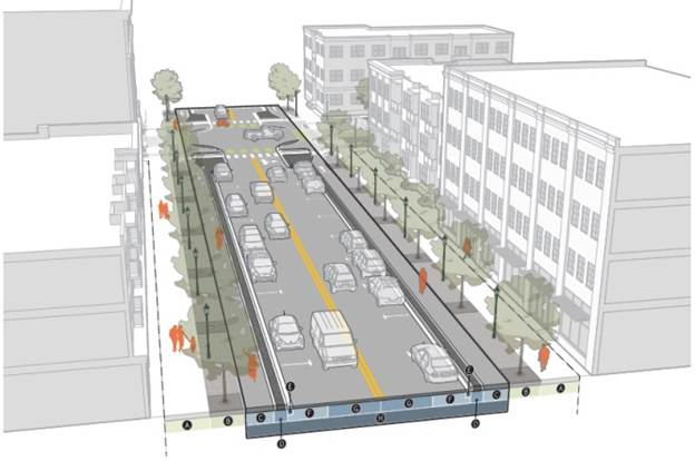
| STREETSCAPE | ||
| A | Pedestrian zone | See District |
| B | Furniture zone | See District |
| STREET | ||
| C | Bike lane | 5' min.* |
| D | Bike buffer | 2' min. |
| E | Gutter pan | 12" min. |
| F | Curb lane | 8' min. |
| Parking | Required | |
| Bulb-outs | Required | |
| G | Travel lane | 9' min./10' max. |
| Turn lane | 10' min./12' max. | |
| * Must not include gutter pan | ||
| FULL-STREET CONFIGURATIONSH | ||
No Bike Lane
 | 34' min. | |
With Bike Lane
 | 48' min. | |
| HALF-STREET CONFIGURATIONS | ||
No Bike Lane
 | 26' min. | |
With Bike Lane
 | 33' min. | |
2.
Secondary street.
| STREETSCAPE | ||
| A | Pedestrian zone | See District |
| B | Furniture zone | See District |
| STREET | ||
| C | Gutter pan | 12" min. |
| D | Curb lane | 8' min. |
| Parking lane | 8' min. | |
| Bike lane | 5' min.* | |
| Bike buffer | 2' min. | |
| E | Travel lane | 9' min./10' max. |
| Turn lane | 10' min./12' max. | |
| * Must not include gutter pan | ||
| FULL-STREET CONFIGURATIONSH | ||
No Bike Lane
 | 34' min. | |
With Bike Lane
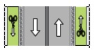 | 34' min. | |
| HALF-STREET CONFIGURATIONS | ||
No Bike Lane
 | 19' min. | |
With Bike Lane
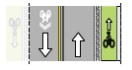 | 26' min. | |
3.
Alley.
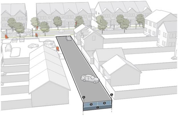
| STREETSCAPE | ||
| Pedestrian zone | n/a | |
| Furniture zone | n/a | |
| A | Flush curb | 6' min. |
| B | Travel lane | 9' min./10' max. |
| STREET CONFIGURATIONSC | ||
Min.
 | 19' min. | |
Max.
 | 22' min. | |
DIVISION 5.3. ACCESS, PARKING, AND LOADING
§ 5.3.1. Access.
A.
Intent. To ensure vehicle access to sites is designed to support the safety of all users by minimizing conflicts with pedestrians, cyclists, transit vehicles, micro-mobility devices, and automobile traffic on the abutting public right-of-way, and to avoid detrimental effects on the surrounding public realm, while providing sufficient access to automobile parking and motor vehicle use areas.
B.
General provisions.
1.
All existing and proposed development that provides on-site parking or loading must provide a satisfactory means of vehicle access to and from a street or alley.
2.
Every platted lot is permitted at least one driveway.
3.
Where an existing or proposed alley exists, vehicle access must take place from the alley.
4.
No driveways are permitted to take access from primary streets, except for lots located in the NT2 District. Sites zoned NT2 that take access from a primary street must meet the standards of Section 5.3.1.C.3., Side Drive.
C.
Driveway design.
1.
Applicability.
a.
All new driveways to or from a street serving an on-site parking area of any size.
b.
The driveway design standards of this section do not apply to driveways that take access from an improved alley.
2.
All driveways.
a.
All driveways must be fully paved and constructed with concrete, asphalt, paving blocks, brick, other similar materials, or pervious surfacing materials intended for outdoor automobile use.
b.
All driveways must meet the following dimensional standards:
c.
Where the Fire Code requires wider paved access, the access width beyond the maximum specified here shall be designed and designated for pedestrian uses and may not accommodate motor vehicle uses with the exception of emergency events.
d.
Lane width is measured separately for each driveway lane from edge of designated lane to edge of designated lane along the street lot line.
3.
Side drive. Sites in the NT2 District that take access from a primary street must meet the following standards:
a.
The driveway may be no wider than ten feet for a depth of 40 feet, measured perpendicular from the primary street lot line.
b.
No designated on-site parking spaces may be located within 40 feet of the primary street lot line.
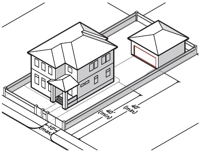
D.
Relief. A vehicle access dimensional standard may be modified by up to ten percent in accordance with Section 6.2.2, Administrative Adjustment.
§ 5.3.2. Parking.
A.
Intent.
1.
To reduce parking demand, support the use of alternative forms of transportation, promote reuse and redevelopment of existing buildings, reduce the overall cost of construction and development and increase the overall efficiency and use of taxable land within the City.
2.
To help ensure parking lots are designed to create safe, comfortable and attractive environments for users and pedestrians, while also mitigating negative environmental effects through landscaping and surface design.
B.
On-site parking.
1.
Required parking.
a.
The minimum number of required parking spaces for a site is 50 percent of the minimum required parking as determined by the regulations of ZO Section 5.4., Off-Street Parking and Loading.
b.
Where the calculation of required parking spaces results in a fractional number, the fractional result is rounded up to the next highest whole number.
2.
Reserved parking. On-site parking spaces may be reserved for a specific tenant or unit, provided that the following standards are not exceeded.
a.
Residential.
i.
A maximum of one space per efficiency or one-bedroom dwelling unit may be reserved.
ii.
A maximum of two spaces per two-bedroom or greater dwelling unit may be reserved.
b.
Nonresidential. No more than one-third of the total provided spaces may be reserved.
C.
Parking lot design.
1.
Applicability. The parking lot design standards of this section apply only to off-street parking lots containing six or more parking spaces.
2.
Design.
a.
All portions of a parking lot must be accessible by automobiles to all other portions of the parking lot without requiring the use of a street (except for an alley).
b.
Full and permanent parking space delineation is required. Delineation may include striping, wheel stops, curbing, or other similar permanent materials which clearly define and delineate parking space. Full parking space delineation means clear markings for all three sides of a space.
c.
All parking areas including drive aisles and driveways must be fully paved and constructed with concrete, asphalt, paving blocks, brick, other similar materials, or pervious surfacing materials intended for outdoor automobile use.
3.
Lighting. Parking lots must be illuminated in accordance with ZO Section 5.6., Exterior Lighting.
4.
Landscaping. Parking lots must be landscaped and screened in accordance with Section 5.4.1., Parking Landscaping.
D.
Parking structure design.
1.
Applicability. The parking structure design standards of this section apply to all street-facing parking structures.
2.
Landscaping. Parking structures must be landscaped and screened in accordance with Section 5.4.1., Parking Landscaping.
E.
Relief. A parking standard may be modified by up to 15 percent in accordance with Section 6.2.2., Administrative Adjustment.
§ 5.3.3. Loading.
A.
Intent. To provide for the location and design of off-street loading areas to accommodate motor vehicles, while balancing the needs of other users of the lot and mitigating any negative effects on adjacent properties.
B.
Off-street loading area design.
1.
With the exception of areas specifically designated by the Director, loading and unloading activities are not permitted on a street, not including an alley.
2.
Loading and unloading activities may not encroach on or interfere with the use of sidewalks, drive aisles or queuing areas.
3.
Loading areas may not be located within a primary street yard. See Section 3.1.7., Yard Determinations, for primary street yard determination.
4.
Where a loading area faces a street or common lot line, the loading area must be screened with a Type B1 common lot line screen, in accordance with Section 5.4.2., Screening.
C.
Relief. A loading area screening requirement may be modified by up to 15 percent in accordance with Section 6.2.2., Administrative Adjustment.
§ 5.3.4. Bicycle parking.
A.
Intent. To promote bicycling as an alternative to automobile transportation and to help ensure safe, secure, accessible, and convenient storage of bicycles for all users.
B.
Applicability. All allowed uses in Chapter 4, Use must meet the bicycle parking standards of this section, with the exception of the following:
1.
Projects with four or fewer dwelling units are not required to provided short or long-term bicycle parking.
2.
Dwelling units with individually accessed private garages are not required to provide long-term bicycle parking.
C.
Required bicycle parking spaces.
1.
Bicycle parking must be provided in accordance with the following table.
2.
When the application of the bike parking results in the requirement of a fractional bicycle parking space, fractions of one-half or more are counted as one space.
D.
Bicycle parking facilities.
1.
General.
a.
Bicycle parking must consist of bicycle racks that support the bicycle frame at two points.
b.
Racks must allow for the bicycle frame and at least one wheel to be locked to the rack.
c.
If bicycles can be locked to each side of the rack, each side may be counted as a required space.
d.
Spacing of bicycle racks must provide clear and maneuverable access.
e.
Bicycle parking spaces must be located on paved or pervious, dust-free surface with a slope no greater than three percent. Surfaces cannot be gravel, landscape stone, or wood chips. Racks must be securely anchored to a permanent surface.
f.
Bicycle parking spaces must be a minimum of two feet wide and six feet long.
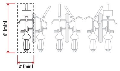
g.
Bicycle parking must be provided in a well-lit area.
2.
Short-term bicycle parking.
a.
Short-term bicycle parking must be publicly accessible, be located on-site, and cannot be located further away than the closest non-accessible parking space. If no parking is provided on-site, then the short-term bicycle parking must be no further than 100 feet from the building it serves.
b.
Short-term bicycle parking may be located within the public right-of-way subject to approval of a license for use of public right-of-way.
c.
Business operators or property owners who choose to install bicycle parking within the public right-of-way are responsible for maintaining the racks.
3.
Long-term bicycle parking.
a.
Long-term bicycle parking offers a secure and weather protected place to park bicycles for employees, residents, commuters, and other visitors who generally stay at a site for several hours.
b.
The bicycle parking area must be located on-site or in an area within 200 feet of the building it serves.
E.
Relief.
1.
A bicycle parking requirement may be reduced by up to ten percent in accordance with Section 6.2.2., Administrative Adjustment. In no case may the requirement be less than two spaces.
2.
A bicycle parking dimensional standard may be modified by up to 15 percent in accordance with Section 6.2.2., Administrative Adjustment.
DIVISION 5.4. LANDSCAPING AND SCREENING
§ 5.4.1. Parking landscaping.
A.
Intent. To ensure parking lots and structures are designed to create safe, comfortable and attractive environments for users and pedestrians, while also mitigating heat island effects, absorbing noise pollution, managing stormwater runoff, sequestering carbon emissions and supporting urban biodiversity through landscaping and surface design.
B.
Applicability.
1.
Interior and median island landscaping is required on all surface parking lots that are located on a site containing more than 20 spaces.
2.
Perimeter screening is required on all street-facing surface parking lots and parking structures located within 50 feet of a street lot line.
C.
Perimeter screening.
1.
Parking lots. Parking lots must be screened with a Type A1 or A2 screen that meets the standards of Section 5.4.2., Screening, for the width of the street-facing portion of the parking lot.
2.
Parking structures. Parking structures must be screened with a Type A1 or A2 screen that meets the standards of Section 5.4.2., Screening, for the width of the street-facing portion of the parking structure.
D.
Interior islands.
1.
A landscaped interior island must be provided every ten parking spaces. Interior islands must be distributed evenly throughout the parking lot. Interior islands may be consolidated or intervals may be expanded in order to preserve existing trees.
2.
An interior island abutting a single row of parking spaces must be a minimum of nine feet in width and 150 square feet in area. Each island must include one large tree.
3.
An interior island abutting a double row of parking spaces must be a minimum of nine feet in width and 300 square feet in area. Each island must include two large trees.
4.
For required trees, see ZO Section 5.2.B.4.a., Approved Tree List for Landscape Requirements.
5.
Interior islands may be installed below the level of the parking lot surface to allow for runoff capture.
E.
Median islands.
1.
A landscaped median island must be provided between every four single parking rows. Intervals may be expanded to preserve existing trees on the lot.
2.
A landscaped median island must be at least six feet wide. A median island with a pedestrian walkway must be a minimum of 12 feet wide.
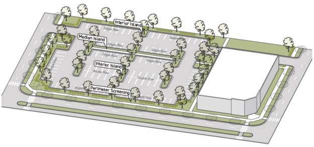
F.
Relief. A parking lot landscaping dimensional standard may be modified by up to 15 percent in accordance with Section 6.2.2., Administrative Adjustment.
§ 5.4.2. Screening.
A.
Intent. To screen the negative impacts of uses on the public realm, promoting visual interest and increasing comfort for users of the adjacent streetscape.
B.
General provisions.
1.
Required walls and fences including their sub-grade elements, such as footings or foundations, must be located entirely on site.
2.
Planting required to meet a screening standard that conflicts spatially with any similar existing vegetation is not required.
3.
No buildings, structures or parking areas are allowed in the screening area.
4.
All walls and fences provided must meet ZO Section 5.2.E.3., Design Standards for Fences and Walls.
5.
All required plants and their planting areas must meet ZO Section 5.2.B.4., General Landscaping Requirements and Standards.
C.
Street lot lines.
1.
Applicability.
a.
Where a parking lot (or drive aisle or other type of area designed for motor vehicles) faces a street lot line, a Type A1 or A2 screen is required along the street lot line for the length of the parking lot.
b.
Where a loading area faces a street lot line, a Type A3 screen is required along the street lot line for the length of the loading area.
c.
Where an outdoor storage area faces a street lot line, a Type A3 screen is required along the street lot line for the length of the outdoor storage area.
2.
Standards.
a.
Where a wall or fence is required as part of the screening type requirements, any required planting must be installed between the wall or fence and the street.
b.
Screens must be located along the street lot line for the perimeter of the use subject to the screening requirements. Breaks for pedestrian, bicycle and vehicle access are allowed, provided the break in the screen is the minimum practical width. Driveways or walkways must cross at or near a perpendicular angle.
3.
Street lot line screening types.
| Type A1 Landscape buffer intended for parking lot and parking structure perimeters (including drive aisles, maneuvering areas and fire lanes) that face a street lot line. | ||
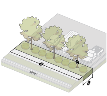 | ||
| SCREENING AREA | ||
| A | Depth (min.) | 10' |
| B | % of perimeter screened (min.) | 80% |
| Required plant type | Screening plants | |
| C | Large trees (min. per 50') | 3 |
| WALLS AND FENCES | ||
| Height (min.) | n/a | |
| Height (max.) | 6' | |
| Opacity | n/a | |
| Type A2 Landscape buffer with a low wall or fence intended for parking lot and parking structure perimeters (including drive aisles, maneuvering areas and fire lanes) that face a street lot line. | ||
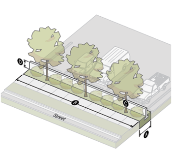 | ||
| SCREENING AREA | ||
| A | Depth (min.) | 7' |
| B | % of perimeter screened (min.) | 80% |
| Required plant type | Screening plants | |
| C | Large trees (min. per 50') | 3 |
| WALLS AND FENCES | ||
| D | Height (min.) | 3.5' |
| Height (max.) | 6' | |
| Opacity | ||
| Below 3.5' (min.) | 90% | |
| 3.5' and above (max.) | 50% | |
| E | Setback from lot line (min.) | 4' |
| Type A3 Landscape buffer with a high wall or fence intended for screening outdoor storage and loading areas that face a street lot line. | ||
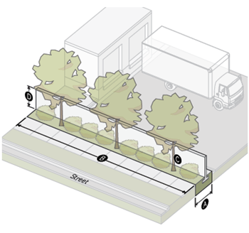 | ||
| SCREENING AREA | ||
| A | Depth (min.) | 7' |
| B | % of perimeter screened (min.) | 80% |
| Required plant type | Screening plants | |
| C | Large trees (min. per 50') | 3 |
| WALLS AND FENCES | ||
| D | Height (min.) | 6' |
| Height (max.) | 8' | |
| Opacity | 90% | |
| E | Setback from lot line (min.) | 4' |
4.
Common lot lines.
a.
Applicability.
i.
Where a loading area faces a common lot line, a Type B1 screen is required along the common lot line for the length of the loading area.
ii.
Where an outdoor storage area faces a common lot line, a Type B1 screen is required along the common lot line for the length of the outdoor storage area.
b.
Standards.
i.
To allow for access for maintenance, the required plantings must be located on the inside of the wall or fence.
ii.
Required common lot line screens must be located along the common lot line for the length of the use or lot line subject to the screening requirement. Breaks for pedestrian, bicycle and vehicle access are allowed, provided the break in the screen is the minimum practical width. Driveways or walkways must cross at or near a perpendicular angle.
D.
Common lot line screening types.
| Type B1 Medium landscape buffer with a high wall or fence intended for screening outdoor storage and loading areas that face a common lot line. | ||
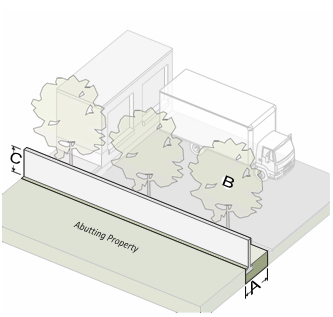 | ||
| SCREENING AREA | ||
| A | Depth (min.) | 7' |
| B | Large trees (min. per 50') | 3 |
| WALLS AND FENCES | ||
| C | Height (min.) | 6' |
| Height (max.) | 8' | |
| Opacity (min.) | 90% | |
| Setback from property line (min.) | 0' | |
| Type B2 Wide landscape buffer with a high wall or fence intended for buffering incompatible uses. | ||
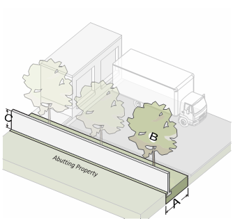 | ||
| SCREENING AREA | ||
| A | Depth (min.) | 10' |
| B | Large trees (min. per 50') | 3 |
| Shrubs (min. per 50') | 15 | |
| WALLS AND FENCES | ||
| C | Height (min.) | 6' |
| Height (max.) | 8' | |
| Opacity (min.) | 90% | |
| Setback from property line (min.) | 0' | |
DIVISION 5.5. UTILITIES AND EQUIPMENT
§ 5.5.1. Utilities and equipment location.
A.
Intent. To mitigate any negative impacts of necessary utilities and equipment on the occupants of a site, adjacent sites, and the public realm.
B.
Applicability. Utilities and equipment location standards apply to all overhead utilities, ground mounted mechanical equipment and refuse collection receptacles provided on-site.
C.
Overhead utilities.
1.
Unless a waiver is authorized by the City Council, all electrical and telephone lines and wires along all primary and secondary streets must be placed underground. Feeder and other major transmission lines may remain overhead. All utility installation must conform to the City's adopted technical standards and specifications.
2.
Overhead utilities may be located along an alley right-of-way.
D.
Mechanical equipment.
1.
Ground-mounted mechanical equipment is not permitted in primary or side street yards.
2.
Wall-mounted mechanical equipment is not permitted on building facades adjacent to a primary or side street yard.
E.
Refuse collection receptacles.
1.
For purposes of this section, the term "refuse collection receptacles" includes dumpsters, garbage cans, debris piles, or grease containers, but does not include trash or recycling receptacles for pedestrians or for temporary construction sites. This section also does not apply to refuse collection receptacles such as garbage cans that are normally stored indoors and brought outdoors on garbage pickup days.
2.
Refuse collection receptacles are not permitted in primary or side street yards.
DIVISION 5.6. SIGNS
§ 5.6.1. Signs.
A.
Intent. To ensure that signs are designed and scaled primarily for pedestrians.
B.
Applicability. Sign standards apply to all districts.
C.
All signs. All signs must follow the standards specified in ZO Section 5.7., Signs.
D.
Monument signs. Monument signs must not exceed four inches in height.
E.
Freestanding signs. Freestanding signs must not exceed eight feet in height and 64 square feet in display area.
CHAPTER 6. - ADMINISTRATION
DIVISION 6.1. LAND SUBDIVISION CODE ;o0; § 6.1.1. Applicability. The Broken Arrow Land Subdivision Code applies in the New Orleans Square Overlay, except as expressly set out within this overlay. Overlay provisions supersede any conflicting provisions in the Land Subdivision Code. In particular, this overlay provides specifications for:
A.
Street designations;
B.
Access, including street and all access;
C.
Streetscape, including pedestrian zones, furniture zones and street trees; and
D.
Street frontage requirements for lots.
DIVISION 6.2. ZONING ORDINANCE
§ 6.2.1. Applicability. The Broken Arrow Zoning Ordinance applies in the New Orleans Square Overlay, except as expressly set out within this overlay. Overlay provisions supersede any conflicting provisions in the Zoning Ordinance. In particular, this overlay provides for:
A.
Zoning districts (ZO Chapter 2);
B.
Use Regulations (ZO Chapter 3), including allowed uses and use standards;
C.
Dimensional Standards (ZO Chapter 4), including measurements and exceptions;
D.
Development Standards (ZO Chapter 5), including multi-family design standards, street standards, street types, parking and access, landscaping and screening, walls and fences, lighting, and district- specific standards;
E.
Review and Approval Procedures (ZO Chapter 6), including procedures for administrative adjustments and alternative compliance.
§ 6.2.2. Administrative adjustment.
A.
Administrative adjustment allows a project to receive minimal relief from specific design standards specified in the rules of interpretation relief sections in Chapter 3 of this overlay.
B.
An application for administrative adjustment must accompany an application for another required process, such as site plan review.
C.
The Director will not approve an administrative adjustment unless all of the following conditions exist:
1.
There are practical difficulties pertaining to the particular piece of property in question because of its size, shape or topography;
2.
The requested adjustment will be in harmony with the purpose and intent of the Zoning Ordinance and this overlay;
3.
The requested adjustment will not be injurious to the neighborhood or to the general welfare; and
4.
The adjustment requested is the minimum adjustment that will make possible the proposed use of the land, building or structure.
D.
Following approval of a project, no further administrative adjustment is allowed.
E.
Where an administrative adjustment is denied by the Director, relief may be granted through the zoning variance process (ZO § 6.8., Variances).
§ 6.2.3. Alternative compliance.
A.
Alternative compliance allows a project to use an alternative design approach to satisfy a particular design standard. The alternative design approach must satisfy the specified intent of the particular design standard, and must generate an outcome equal to or better than the design standard in this overlay or the Zoning Ordinance.
B.
An application for alternative compliance must accompany an application for another required process, such as site plan review.
C.
The Director will determine whether an alternative design approach appropriately satisfies the intent of the design standard, and equals or exceeds the outcome generated by the original design standard.
D.
Following approval of a project, no further alternative compliance is allowed.
E.
Where alternative compliance is denied by the Director, relief may be granted through the zoning variance process (ZO § 6.8., Variances).
Sec. 3-4-5. - Planned unit development.
A.
Purpose. The Planned Unit Development (PUD) overlay district is established as an overlay zoning district that provides an alternative to conventional development, and requires approval under the procedure in Section 6-3-3.4, PUD Site Plan Amendment (Minor), of this ordinance. The PUD provisions are established for one or more of the following purposes:
1.
To permit and encourage innovative land development while maintaining appropriate limitation on the character and intensity of use and assuring compatibility with adjoining and proximate properties;
2.
To permit modify the zoning ordinance and greater flexibility within the development to best utilize the physical features of the particular site;
3.
To encourage the provision and preservation of meaningful open space;
4.
To encourage integrated and unified design and function of the various uses comprising the planned unit development; and
5.
To encourage a more productive use of land consistent with the public objectives and standards of accessibility, safety, infrastructure and land use compatibility.
B.
Standards. Applicability and standards for the PUD overlay can be found in Division 2-6, Planned Unit Developments (PUDs).
Sec. 3-5-1. - Purpose.
This section provides uniform methods of measurement for interpretation and enforcement of the lot and building standards as specified in this ordinance.
Sec. 3-5-2. - Measurements and exceptions.
A.
Lot coverage.
1.
Unless otherwise provided in this ordinance, all structures shall be considered in determining lot coverage except the following:
a.
Windowsills, bay windows, fireplace chases, belt courses, cornices, eaves, and similar incidental architectural features; and
b.
Other structures that may project into required setbacks pursuant to Subsection 3-5-2.B.2, Allowed Projections into Required Setbacks, below.
2.
Unless otherwise provided in this ordinance, no building, structure, or lot shall be developed, used, or occupied unless it meets the lot coverage requirements set forth in Division 3-1, Residential Standards, and Division 3-3, Nonresidential and Mixed-Use Standards, for the zoning district in which it is located.
B.
Lot dimensions. The Director may approve a variation of up to ten percent from the required dimensional standards in Chapter 3, Dimensional and Design Standards, for required lot size and lot width. Refer to subsection 6-3-3.6, Administrative Adjustment.
C.
Setbacks.
1.
Required setbacks.
a.
Setbacks shall be unoccupied and unobstructed by any structure or portion of a structure from thirty inches above grade upward; provided, however, that fences, walls, trellises, poles, posts, ornaments, furniture and other customary yard accessories may be permitted in any setback subject to height limitations and requirements limiting obstruction of visibility.
b.
A building, structure, or lot shall not be developed, used, or occupied unless it meets the minimum setback requirements set forth in Division 3-1, Residential Standards, or Division 3-3, Nonresidential and Mixed-Use Standards, for the zoning district in which it is located, except as otherwise established in this ordinance or unless a variance has been granted.
c.
A setback or other open space required by this ordinance shall not be included as part of a setback or other open space required by this ordinance for another building or structure or lot.
d.
Where a minimum required front setback is less than 25 feet, a front-loaded garage shall have a minimum setback of 25 feet and the remainder of the building may meet the minimum setback that is less than 25 feet.
2.
Contextual front setback. The provisions of this subsection provide flexibility from specifically referenced portions of this ordinance that might, in limited circumstances, provide for requirements that are too rigid. The front setback required for all districts is provided in Chapter 3, Dimensional and Design Standards, and may be reduced subject to the following standards.
a.
Existing neighborhoods. In existing developed areas, if 50 percent or more of the lots on the same side of the block (not counting the applicant's lot) are developed with buildings that are set back at distances that are less than the required front yard setback, the front setback of the applicant's lot may be reduced to the average front setback of all of the developed lots on the same side of the block. (See Figure 3-5-2-1, Contextual Front Setback Reduction.)
b.
New neighborhoods. In subdivisions platted after the effective date of this ordinance, the front setback in Chapter 3, Dimensional and Design Standards, may be averaged for all lots on a block. In order to utilize front setback averaging in this instance, all lots on the block shall meet the following criteria:
i.
Greater than 80 percent. No lot shall have a front setback that is less than 80 percent of the front setback specified.
ii.
Equal to or greater. The average front setback of the block shall be equal to or greater than the front setback of the subdivision's proposed underlying zoning district as specified in Chapter 3, Dimensional and Design Standards. For example, on a block with six lots in the RS districts, where the minimum front setback is 25 feet for a conventional single-family development, the following front setbacks would be permissible: 20 feet, 25 feet, 22 feet, 28 feet, 25 feet, and 30 feet.
iii.
Build-to-zone in DROD. In addition to the above allowance, in the DROD district, the required build-to-zone percentage may be decreased by a maximum of five percentage points for a building provided that the average build-to-zone percentage on the subject block is equal to or greater than the build-to-zone requirement. For example, on a block with six lots in the DROD district, where the build-to-zone percentage is a minimum of 65 percent, the following build-to-zone percentages would be permissible: 60, 70, 65, 65, 60, 70.
| Figure 3-5-2-1
Contextual Front Setback Reduction | |
|---|---|
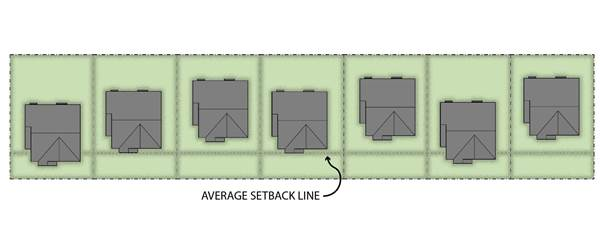 |
3.
Allowed projections into required setbacks.
a.
Paved terraces, patios, and verandas. Paved terraces, patios, verandas, pergolas, and gazebos may project into any required setback, provided that no structures placed there shall violate other requirements of this ordinance and are at least five feet from the lot line.
b.
Unroofed landings, decks, bay windows, stairs and balconies. Unroofed landings, decks, bay windows, and stairs may project into required setbacks, provided that no portion other than a handrail shall extend higher than 30 inches above the finished grade level. Unroofed balconies may project into a required side or rear yard provided these projections are at least five feet from the lot line.
c.
Incidental architectural features. Cornices, awnings, eaves, canopies, shade devices, gutters and downspouts, flues, belt courses, headers, sills, lintels, ornamental features, and other similar architectural features may project not more than two feet into any required yard.
d.
Roofs over porches and other exterior approaches. Roofs over porches, stairways, landings, terraces, or other exterior approaches to pedestrian doorways may encroach up to five feet into a front setback, provided that, where such roof projections encroach within the setback, the roof projections shall comprise no more than 50 percent of the total length of the building's facade. The covered porch or entrance area encroaching into the setback shall remain exterior to the building and enclosed by no more than a railing.
e.
Projections into easements and rights-of-ways prohibited. Projections shall not extend or encroach into any easement(s) or right(s)-of-way except through license agreements.
f.
Accessibility ramps. The Director may allow the installation of access ramps in required front, side, and rear setbacks that pursuant to minimum ADA requirements.
g.
Private garages and carports. A private garage or carport may project into a required setback abutting a public alley, provided that the garage or carport is placed a minimum of two feet from the property line abutting the alley, does not encroach into an easement, and complies with other requirements of this ordinance.
4.
Double-frontage lots. In the case of double-frontage lots, front setbacks shall be provided on all frontages, unless the prevailing front setback pattern on adjoining lots allows for an exception under the contextual front setback provision above.
5.
Setbacks from high pressure pipelines. All residences, buildings, and other habitable structures shall be set back a minimum of 50 feet from all high pressure pipelines, which pipelines are under the regulatory jurisdiction of the United States Department of Transportation and are greater than eight inches in diameter. In cases where an existing pipeline has been abandoned and/or removed, and the property owner and the pipeline company have provided necessary documentation, the setback from the pipeline may be reduced as necessary to facilitate the project.
6.
Corner sight distance (sight or vision clearance triangle). On any corner lot, no wall, fence, structure, sign, or any plant growth that obstructs sight lines between the vertical height of two and one-half feet and six feet above grade shall be maintained in a triangle formed by measuring from the point of intersection of the exterior side lot line (labeled A) and the front lot line (labeled B) a distance of 25 feet along the front and side lot lines and connecting the points so established to form a right triangle on the area of the lot adjacent to the street intersection. See Figure 3-5-2-2, Corner Sight Distance.
| Figure 3-5-2-2, Corner Sight Distance | |
|---|---|
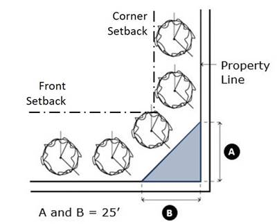 |
7.
Height.
a.
Height requirements generally. No building shall be erected or altered that will exceed the height limit for the respective zoning district, unless otherwise provided elsewhere in this ordinance.
b.
Height exceptions for appurtenances. Except as specifically provided elsewhere in this ordinance, the height limitations contained in this ordinance do not apply to cupolas, flagpoles, chimneys, heating and ventilation equipment, elevator housings, stairwell towers or similar appurtenances; provided, however, the following:
i.
The appurtenance does not interfere with Federal Aviation Regulations;
ii.
The appurtenance does not extend more than 25 feet above the maximum permitted building height, except for flagpoles, and architectural features associated with place of assembly uses that must be of greater height in order to function;
iii.
The appurtenance is not constructed for the purpose of providing additional floor area in the building; and
iv.
The appurtenance complies with the screening requirements for mechanical equipment and appurtenances in Section 4-3-7, Buffers and Screening Standards.
8.
Common open space.
a.
The minimum common open space required by each district is calculated by dividing the total amount of common open space on the parcel proposed for development (Letter "A" in Figure 3-5-2-3, Common Open Space Calculation, below) by the total gross area of the entire parcel proposed for development (Letter "B," below) as depicted on a preliminary plat.
b.
To be counted toward the minimum open space requirements, the subject land shall conform to the standards in Section 3-1-2.G, Open Space Development Standards.
| Figure 3-5-2-3, Common Open Space Calculation | |
|---|---|
 |