
College Station City Zoning Code
ARTICLE 5
- District Purpose Statements and Supplemental Standards
Sec. 5.1.- Residential Zoning Districts.
Occupancy of any dwelling unit in the following districts shall be limited to one (1) family as defined by Article 11, Definitions of this UDO unless otherwise authorized by this UDO.
A.
R Rural.
This district includes lands that, due to public service limitations, inadequate public infrastructure, or a prevailing rural or agricultural character, are planned for very limited development activities. This district is designed to provide land for a mix of large acreages and large residential developments. Open space is a dominant feature of these areas. This district may also serve as a reserved area in which the future growth of the city can occur.
B.
WE Wellborn Estate.
This district includes land that, due to public service limitations or a prevailing rural character, should have limited development activities. These areas tend to consist of low-density single-family residential lots of two (2) acres or more but may be one (1) acre if clustered around undeveloped open space. This zoning district is only permitted in areas designated as Wellborn Estate or Wellborn Estate-Open on the Comprehensive Plan Future Land Use & Character Map. The cluster development option may be used only in the area designated Wellborn Estate-Open on the Comprehensive Plan Future Land Use & Character Map.
C.
E Estate.
This district is designed to provide land for low-density single-family lots. These areas shall consist of residential lots averaging twenty thousand (20,000) square feet when clustered around open space or large lots with a minimum of one (1) acre. Subdivisions within this district may contain rural infrastructure.
D.
WRS Wellborn Restricted Suburban.
This district is designed to provide land for detached medium-density, single-family residential development. These areas shall consist of residential lots of at least eight thousand (8,000) square feet when clustered around open space or larger lots with a minimum of twenty thousand (20,000) square feet. This zoning district is only permitted in areas designated as Wellborn Restricted Suburban on the Comprehensive Plan Future Land Use & Character Map.
E.
RS Restricted Suburban.
This district is designed to provide land for detached medium-density, single-family residential development. These areas shall consist of residential lots averaging eight thousand (8,000) square feet when clustered around open space or larger lots with a minimum of ten thousand (10,000) square feet.
F.
GS General Suburban.
This district includes lands planned for single-family residential purposes and accessory uses. This district is designed to accommodate sufficient, suitable residential neighborhoods, protected and/or buffered from incompatible uses, and provided with necessary and adequate facilities and services.
G.
T Townhouse.
This district contains land, which is to be used for a unique type of dwelling, typically designed for individual ownership, or ownership in-groups of single-family attached residences constructed on individually platted lots.
The following supplemental standard shall apply to this district:
Single-family dwelling units shall conform to GS General Suburban standards.
H.
D Duplex.
This district contains land that has been planned for duplex residential purposes and associated uses. Characterized by moderate density, it may be utilized as a transitional zone.
The following supplemental standards shall apply to this district:
1.
Single-family dwelling units shall conform to GS General Suburban standards.
2.
Where parking is provided in the front yard of a duplex, an eight (8) foot setback shall be required between the property line and the nearest side of the parking pad. This eight (8) foot setback area must contain a three (3) foot screen consisting of a continuous berm, hedge, or wall. In addition, an eight (8) foot setback shall be required between the dwelling unit and the nearest side of the parking pad.
I.
MH Middle Housing.
This district is designed to be flexible and provide a variety of housing options by-right. It allows for detached single-family residences, duplexes, townhouses, courtyard houses, live-work units, and small and medium multiplexes. This district is intended to accommodate a walkable pattern of small lots, small blocks, and a well-connected street pattern adjacent to commercial and neighborhood centers. Developments in this district are ideal on the edge of more intense urban and multi-family areas to serve as a transition to single-family zoning districts. Structures in this district are individually platted, distinguishing them from structures in the MF Multi-Family zoning district.
J.
MF Multi-Family.
This district is designed for areas having intense development. This district is flexible and allows for townhomes, single-unit dwellings, two-unit dwellings, multi-family buildings, and optional mixed-use development.
The following supplemental standards shall apply to this district:
1.
Non-residential uses are permitted up to a maximum of fifty (50) percent of the total floor area if incorporated into the residential structure.
2.
Townhouse dwelling units shall conform to T Townhouse standards.
K.
MU Mixed-Use.
This district is designed for areas having the most intense level of development. This district consists of residential, commercial, and office uses in mixed-use structures.
The following supplemental standards shall apply to this district:
1.
Non-residential uses with a minimum depth of thirty (30) feet are required on the ground floor if adjacent to Texas Avenue, Harvey Road, University Drive, or Earl Rudder Freeway.
2.
A minimum of thirty (30) percent of the total floor area of each development shall be devoted to residential uses. Hotels may be considered a residential use to meet this requirement.
3
The floor area ratio in this district shall be a minimum of 1:1. Structured parking, public plazas, outdoor dining areas, and covered areas attached to the structure may be included in the floor area ratio calculation. Surface parking, even if covered, will not count toward the required floor area ratio.
4.
The ground floor of structures shall be a minimum of twenty-five (25) percent of the lot area.
L.
MHP Manufactured Home Park.
This district contains land that is located, designed, and operated as a site for residential uses consisting of manufactured homes in accordance with the permitted uses.
The following supplemental standards shall apply to this district:
1.
The construction, reconstruction, alteration, or enlargement of a manufactured home park must be pursuant to an approved site plan.
2.
Minimum manufactured home park area is two (2) contiguous acres.
3.
Maximum gross density shall be ten (10) dwelling units per acre.
4.
Minimum setback for a manufactured home from a public street shall be fifteen (15) feet.
5.
Minimum setback for a manufactured home from a lot line shall be fifteen (15) feet.
6.
Minimum setback for a manufactured home from a private street, parking, or other common areas shall be fifteen (15) feet.
7.
Minimum setback between two (2) manufactured homes shall be fifteen (15) feet, except that private accessory storage structures located on an individual manufactured home lot need not maintain a separation from the manufactured home that occupies the same lot.
8.
Parking areas may be located within common parking areas or on individual manufactured home lots, provided that the parking required for each manufactured home is located within two hundred (200) feet of each lot.
9.
Each manufactured home park lot shall have access to public utilities, and it shall have vehicular access to/from either a public right-of-way or private drive.
(Ord. No. 2023-4453, Pt. 1(Exh. A), 8-10-2023)
Sec. 5.2. - Residential Zoning District Dimensional Standards.
A.
Dimensional Standards for Non-Clustered and Clustered Developments.
The following tables establish dimensional standards that shall be applied within residential zoning districts for non-clustered and clustered developments unless otherwise identified in this UDO:
Notes:
(a)
Developments within a single-family overlay district shall follow the standards of the Single-Family Overlay Districts Section below or the Ordinance authorizing the Official Zoning Map amendment for an NCO Neighborhood Conservation Overlay.
(b)
The minimum lot width for a duplex may be reduced to thirty (30) feet per dwelling unit when all required off-street parking is provided in the rear or side yard.
(c)
For lots designated as Neighborhood Conservation in the Comprehensive Plan Future Land Use & Character Map that were created by plat before July 15, 1970, the front setback for a new single-family dwelling unit shall be based on the front setbacks of the adjacent lots per the Required Yards (Setbacks) Subsection in the General Provisions Section of Article 7, General Development Standards of this UDO.
(d)
Minimum front setback may be reduced to fifteen (15) feet when approved rear access is provided, or when side yard or rear yard parking is provided.
(e)
Maximum side street and front setbacks may be measured from the edge of a public easement when it is greater than the maximum setback. Maximum setbacks may be increased to up to eighty-five (85) feet to accommodate a parking lot between the structure and the street. Maximum setback requirements may be fulfilled through the use of plazas, outdoor dining, and bicycle parking.
(f)
Minimum side setback may be reduced to five (5) feet where properties on both sides of a lot line are owned and/or developed simultaneously by a single party. Development under reduced side setbacks requires prior approval by the Administrator and must be established by plat. In no case shall a single-family residence be built within fifteen (15) feet of another primary structure. When reduced side setbacks are approved, sills, belt courses, cornices, buttresses, chimneys, flues, eaves, and other architectural features are prohibited from extending into the required side yard setback.
(g)
Zero lot line construction of a residence is allowed where properties on both sides of a lot line are owned and/or developed simultaneously by a single party. Development under lot line construction requires prior approval by the Administrator. In no case shall a single-family residence or duplex be built within fifteen (15) feet of another primary structure. See Article 8, Subdivision Design and Improvements of this UDO for more information.
(h)
A minimum side setback of seven and one-half (7.5) feet is required for each building or group of contiguous buildings.
(i)
Lot line construction on interior lots with no side yard or setback is allowed only where the building is covered by fire protection on the site or by dedicated right-of-way or easement.
(j)
For lots with approved rear access, the rear setback shall be measured from the nearest boundary of the access easement or alley per the Required Yards (Setbacks) Subsection in the General Provisions Section of Article 7, General Development Standards of this UDO.
(k)
The minimum rear setback may be reduced to fifteen (15) feet when parking is provided in the front yard or side yard.
(l)
Maximum impervious cover is to be defined by the applicable zoning district designation unless otherwise mitigated by an on-site or regional drainage facility and associated drainage study as approved by the City Engineer or their designee.
Work that is performed by the homeowner and/or resident that does not require a building permit, that is less than one hundred twenty (120) square feet, and that does not cause the lot to exceed the applicable maximum impervious cover, does not require an impervious coverage permit.
(m)
Maximum impervious cover shall be determined by an engineered drainage analysis performed in conjunction with the Drainage Section of the Bryan/College Station Unified Design Guidelines and as approved by the City Engineer or their designee.
(n)
Shall abide by the Low-Density Residential Height Protection Subsection in the General Provisions Section of Article 7, General Development Standards of this UDO.
(o)
Refer to the Easterwood Field Airport Zoning Ordinance regarding height limitations.
(p)
Public, civic, and institutional structures shall have a maximum building height of fifty (50) feet in these districts.
(q)
Refer to the Cluster Development Subsection of the General Requirements and Minimum Standards of Design for Subdivisions within the City Limits Section of Article 8, Subdivision Design and Improvements of this UDO when using the cluster development option in the Wellborn Community Plan area.
(r)
Estate lots that are part of a subdivision existing on or before September 12, 2013, are not permitted to use cluster development standards without Official Zoning Map amendment approval, which incorporates the entire subdivision.
(s)
In cluster developments built to urban street standards, there is no minimum lot width per the Cluster Development Subsection of the General Requirements and Minimum Standards of Design for Subdivisions within the City Limits Section of Article 8, Subdivision Design and Improvements of this UDO.
(t)
The minimum setback standards of the base zoning district apply along the perimeter of a cluster development. All detached structures within a cluster development must be separated by a minimum distance of ten (10) feet. Refer to the Cluster Development Subsection in the General Requirements and Minimum Standards of Design for Subdivisions within the City Limits Section of Article 8, Subdivision Design and Improvements of this UDO for more information.
B.
MH Middle Housing Product Types and Dimensional Standards Table.
The following table establishes dimensional standards that shall be applied within the MH Middle Housing zoning district unless otherwise identified in this UDO.
Notes:
(a)
For small multiplex products, lot width may be reduced to thirty (30) feet if the building is two (2) stories or taller.
(b)
The Administrator may decrease the minimum setback to less than fifteen (15) feet, but not less than five (5) feet, with an administrative adjustment if there are no utility or right-of-way constraints.
(c)
For zero lot line development, refer to the Lots Subsection of the General Requirements and Minimum Standards of Design for Subdivisions within the City Limits Section of Article 8, Subdivision Design and Improvements of this UDO.
(d)
The rear setback shall be increased by the width of the required landscaping buffer when abutting Suburban Residential, Estate Residential, or Rural land uses as depicted in the Comprehensive Plan Future Land Use & Character Map.
(e)
The rear setback can be reduced to twenty (20) feet if abutting an alley or front or side parking is provided.
(f)
Maximum impervious cover shall be determined by an engineered drainage analysis performed in conjunction with the Drainage Section of the Bryan/College Station Unified Design Guidelines and approved by the City Engineer or their designee.
(g)
Additional impervious cover may be allowed as determined by an engineered drainage analysis performed in conjunction with the Drainage Section of the Bryan/College Station Unified Design Guidelines and approved by the City Engineer or their designee.
(h)
Public, civic, and institutional structures shall have a maximum building height of fifty (50) feet in this district.
(i)
Refer to the Easterwood Field Airport Zoning Ordinance regarding height limitations.
(j)
Shall abide by the Low-Density Residential Height Protection Subsection in the General Provisions Section of Article 7, General Development Standards of this UDO.
(k)
Front parking shall be allowed only when four (4) or fewer parking spaces are required on the lot.
(Ord. No. 2023-4453, Pt. 1(Exh. A), 8-10-2023; Ord. No. 2023-4467, Pt. 1(Exh. A), 9-14-2023)
Sec. 5.3. - Non-Residential Zoning Districts.
A.
O Office.
This district will accommodate selected commercial businesses that provide a service rather than sell products, either retail or wholesale. The uses allowed have relatively low traffic generation and require limited location identification.
B.
SC Suburban Commercial.
This district is intended to provide for limited commercial uses that are compatible with nearby neighborhoods. The district allows for a range of uses, with the impacts mitigated through minimum distance and buffering requirements from adjacent single-family residential use.
The following supplemental standard shall apply to this district:
The gross floor area of a single structure in this district shall not exceed fifteen thousand (15,000) square feet in area.
C.
WC Wellborn Commercial.
This district is intended to provide for low-density commercial uses that provide services to nearby neighborhoods. Such uses shall be limited in size and not accommodate drive-thru services. Specific design elements should be incorporated into such developments to limit the visual impact on the community and enhance the defined character. This zoning district is only permitted in areas designated as Wellborn Commercial on the Comprehensive Plan Future Land Use & Character Map.
D.
GC General Commercial.
This district is designed to provide locations for general commercial purposes, that is, retail sales and service uses that function to serve the entire community and its visitors.
E.
CI Commercial Industrial.
This district is designed to provide a location for outlets offering goods and services to a limited segment of the general public. The allowed uses in this district primarily serve other commercial and industrial enterprises.
F.
BP Business Park.
This district is designed for uses that primarily serve other commercial and industrial enterprises, and include administrative and professional offices, commercial industrial, research and development-oriented light industrial, light manufacturing, and non-polluting industries. Uses in this district need good access to arterial level thoroughfares but have relatively low traffic generation and require limited location identification.
The development of business parks should be in a campus-like setting with structures grouped and clustered and should be heavily landscaped to minimize the impacts of business park uses and associated parking areas on adjacent properties and public roadways. Impacts of the uses will be limited through buffering and architecture of the buildings.
The following supplemental standards shall apply to this district:
1.
All processes and business activities shall be conducted inside buildings with the exception of commercial gardens.
2.
All BP Business Park zoning districts will be a minimum of five (5) acres in area.
G.
BPI Business Park Industrial.
This district is designed to provide land for manufacturing and industrial activities that have nuisance characteristics greater than activities permitted in the BP Business Park district. Permitted uses within this district are generally not compatible with residential uses of any density or lower intensity commercial uses. Generally, these uses need good access to arterial roadways but should be offset from public roadways and adjacent properties by using the BP Business Park district and its associated development to screen and buffer the uses. The uses allowed have relatively low traffic generation and require limited location identification.
H.
CU College and University.
This district is applied to land which is located within the boundaries of the Texas A&M University campus or is owned by the Texas A&M University System.
I.
NAP Natural Areas Protected.
This district is designed for public or private property intended for the conservation of natural areas. Properties in this district are relatively undeveloped and are often used for recreational or open space purposes or for the conveyance of floodwaters. Properties in this district are not projected for conversion to more intense land use in the future by the Comprehensive Plan.
(Ord. No. 2023-4453, Pt. 1(Exh. A), 8-10-2023)
Sec. 5.4. - Non-Residential Zoning District Dimensional Standards.
The following table establishes dimensional standards that shall be applied within non-residential zoning districts unless otherwise identified in this UDO:
Notes:
(a)
Buildings shall be setback a minimum of fifty (50) feet from all public streets adjacent to the perimeter of the business park development as shown on the approved preliminary plan.
(b)
A minimum side setback of seven and one-half (7.5) feet shall be required for each building or group of contiguous buildings.
(c)
Lot line construction on interior lots with no side yard or setback is allowed only where the building is covered by fire protection on the site or separated by a dedicated public right-of-way or easement of at least fifteen (15) feet in width.
(d)
Shall abide by the Low-Density Residential Height Protection Subsection in the General Provisions Section of Article 7, General Development Standards of this UDO.
(e)
Refer to the Easterwood Field Airport Zoning Ordinance regarding height limitations.
(f)
Maximum building height is two (2) stories and thirty-five (35) feet, measured at the highest point of the roof or roof peak. Buildings over one (1) story shall comply with the Low-Density Residential Height Protection Subsection in the General Provisions Section of Article 7, General Development Standards of this UDO.
(Ord. No. 2023-4453, Pt. 1(Exh. A), 8-10-2023)
Sec. 5.5. - Retired Districts.
Retired districts include districts existing prior to the amendment of this UDO. Existing districts will continue to remain in effect, but these districts are not available for any new Official Zoning Map amendment proposals.
A.
R-1B Single-Family Residential.
This district is designed to provide land for detached single-family residential suburban development. This district contains lots that are larger than the minimum GS General Suburban lot, but smaller than the minimum E Estate lot.
B.
R-4 Multi-Family.
This district provides land for the development of apartment and condominium units at low to medium densities. This district may serve as a transitional zone between low-density residential areas and other residential or non-residential areas.
The following supplemental standards shall apply to this district:
1.
Duplex dwelling units shall conform to D Duplex standards.
2.
Townhouse dwelling units shall conform to T Townhouse standards.
C.
R-6 High Density Multi-Family.
This district contains land used for a variety of housing types, but primarily multi-family dwelling units. This district is designed to provide the highest density in the community for developments close to Texas A&M University.
The following supplemental standards shall apply to this district:
1.
Duplex dwelling units shall conform to D Duplex standards.
2.
Townhouse dwelling units shall conform to T Townhouse standards.
D.
C-3 Light Commercial.
This district is designed to provide locations for commercial sites that are too small for many permitted uses in the GC General Commercial zoning district. These are moderately low traffic generators that have little impact on adjacent areas or thoroughfares.
The following supplemental standards shall apply to this district:
1.
No C-3 Light Commercial zoning district, including adjacent C-3 Light Commercial zoning districts, shall exceed a combined total of five (5) acres in area.
E.
M-1 Light Industrial.
This district is provided for offices, research and development activities, and high technological, light manufacturing, and non-polluting industries that are self-contained. It is further intended that the M-1 Light Industrial zoning district may be compatible with adjacent uses in any other district, depending upon the character of the operation and the conditions imposed.
F.
M-2 Heavy Industrial.
This district is designed to provide land for manufacturing and industrial activities with the generation of nuisance characteristics greater than activities permitted in the CI Commercial Industrial and M-1 Light Industrial zoning districts. Permitted uses within this district are generally not compatible with residential uses of any density or lower intensity commercial uses.
G.
R&D Research & Development.
This district is designed for administrative and professional offices, and research and development-oriented light industrial uses meeting the standards and performance criteria established in this Section. These uses could be compatible with low-intensity commercial uses and all residential uses, thereby maintaining the character and integrity of neighborhoods. This district should be carefully located in areas where there is sufficient access to arterial thoroughfares.
The following supplemental standards shall apply to this district:
1.
Performance Criteria for All Uses.
a.
Impervious cover is limited to seventy (70) percent.
b.
The maximum floor area ratio in this district shall not exceed fifty (50) percent.
c.
Any detached or freestanding signage shall meet the criteria for low-profile signs established in the Signs Section of Article 7, General Development Standards of this UDO.
d.
Uses should be designed to provide adequate access and internal circulation such that travel through residentially zoned or developed areas is precluded. All processes are to be conducted inside buildings and there shall be no outside storage or business activity. Any business operations occurring during the hours between 7:00 p.m. and 6:00 a.m. must meet all the performance criteria established in this Section, as well as limit vehicular access into the site through a designated access point that mitigates any adverse impacts of the traffic on surrounding residential areas.
2.
This Section may be applied to any conditional use proposed in this district when either the Administrator or Development Engineer believes that the existing performance standards contained in this UDO are insufficient to address the proposed use because of its technology or processes and thus, will not effectively protect adjacent existing or future land uses. One (1) or both shall so advise the Planning and Zoning Commission in writing.
In such cases, the Planning and Zoning Commission shall hold a hearing to determine whether a professional investigation or analysis should be performed to identify and establish additional reasonable standards. If so determined, based on the information presented at the hearing, the Planning and Zoning Commission will identify the areas to be investigated and analyzed and will direct the staff to conduct the appropriate research necessary to develop standards for the successful management of the new project. Any costs incurred by the City to develop additional standards shall be charged to the applicant and included as an addition to the cost of either the building permit fee or rezoning application fee.
H.
NPO Neighborhood Prevailing Overlay.
This district is designed to provide standards that preserve single-family neighborhoods by imposing neighborhood-specific yard, lot, and open space regulations that reflect the character of the neighborhood. The NPO Neighborhood Prevailing Overlay does not prevent the construction of new single-family structures or the renovation, remodel, repair, or expansion of existing single-family structures, but rather ensures that new single-family structures are compatible with existing single-family structures. The underlying zoning district establishes the permitted uses and shall remain in full force, and the requirements of the overlay are to be applied in addition to the underlying use and site restrictions.
All single-family and accessory structures within the NPO Neighborhood Prevailing Overlay district are subject to the existing median pattern of development on the subject and opposing blockfaces for the following standards:
1.
Minimum Front Setback.
2.
Maximum Front Setback.
The maximum front setback, or build-to line, is no more than ten (10) feet back from the minimum front setback.
3.
Minimum Side Street Setback.
4.
Minimum Lot Size.
The minimum lot size is calculated as the median building plot size of all existing building plots on the subject and opposing blockface.
5.
Building Height.
Building height refers to the vertical distance measured from the finished grade, or the base flood elevation, where applicable, and the following points:
a.
The average height level between the eaves and ridge line of a gable, hip, or gambrel roof;
b.
The highest point of a mansard roof; or
c.
The highest point of the coping of a flat roof.
6.
Maximum Lot Coverage.
Lot coverage is calculated as the median existing lot coverage on all building plots on the subject and opposing blockface. The maximum lot coverage cannot exceed the maximum impervious cover allowed in the underlying zoning district. Lot coverage includes all structures and impervious surfaces on a site, including but not limited to patios, gravel or paved driveways, accessory structures, and sidewalks.
7.
Garage Location and Orientation.
New garages must be placed in relation to the primary residential structure on the lot consistent with the most frequent pattern of placement on the subject and opposing blockface. New garages must also be oriented consistent with the most frequent direction of orientation on the subject and opposing blockface.
8.
Tree Preservation.
Any existing tree eight (8) inch caliper or greater in good form or condition and reasonably free of damage by insects and/or disease located outside of the buildable area is required to be barricaded and preserved. A barricade detail must be provided on the site plan. Trees must be barricaded one (1) foot per inch caliper measured as a radius from the tree trunk. Barricades must be in place before any development activity on the property including but not limited to grading.
9.
Landscape Maintenance.
Any existing canopy and non-canopy trees in good form and condition and reasonably free of damage by insects and/or disease located within the buildable area removed during construction must be replaced on-site inch caliper for inch caliper, or as determined by the Administrator.
(Ord. No. 2023-4453, Pt. 1(Exh. A), 8-10-2023)
Sec. 5.6. - Retired District Dimensional Standards.
A.
Retired Residential Zoning Districts.
The following table establishes dimensional standards that shall be applied within the retired residential zoning districts unless otherwise identified in this UDO:
Notes:
(a)
Developments within an NPO Neighborhood Prevailing Overlay or NCO Neighborhood Conservation Overlay shall follow the standards of the Neighborhood Prevailing Overlay (NPO) Subsection of the Retired Districts Section or the Districts Subsection of the Single-Family Overlay Districts Section below and the Ordinance authorizing the Official Zoning Map amendment for an NPO Neighborhood Prevailing Overlay or NCO Neighborhood Conservation Overlay.
(b)
Minimum front setback may be reduced to fifteen (15) feet when approved rear access is provided, or when side yard or rear yard parking is provided.
(c)
For lots designated as Neighborhood Conservation in the Comprehensive Plan Future Land Use & Character Map that were created by plat before July 15, 1970, the front setback for a new single-family dwelling unit shall be based on adjacent lots per the Required Yards (Setbacks) Subsection of the General Provisions Section of Article 7, General Development Standards of this UDO.
(d)
Zero lot line construction of a residence is allowed where properties on both sides of a lot line are owned and/or developed simultaneously by a single party. Development under lot line construction requires prior approval by the Administrator. In no case shall a single-family residence or duplex be built within fifteen (15) feet of another primary structure. See Article 8, Subdivision Design and Improvements of this UDO for more information.
(e)
A minimum side setback of seven and one-half (7.5) feet is required for each building or group of contiguous buildings.
(f)
Lot line construction on interior lots with no side yard or setback is allowed only where the building is covered by fire protection on the site or by dedicated right-of-way or easement.
(g)
For lots with approved rear access, the rear setback shall be measured from the nearest boundary of the access easement or alley per the Required Yards (Setbacks) Subsection in the General Provisions Section of Article 7, General Development Standards of this UDO.
(h)
Maximum impervious cover is to be defined by the applicable zoning district designation unless otherwise mitigated by an on-site or regional drainage facility and associated drainage study as approved by the City Engineer or their designee.
(i)
Maximum impervious cover for R-4 and R-6 zoning districts shall be determined by an engineered drainage analysis performed in conjunction with the Drainage Section of the Bryan/College Station Unified Design Guidelines and as approved by the City Engineer or their designee.
(j)
Shall abide by the Low-Density Residential Height Protection Subsection in the General Provisions Section of Article 7, General Development Standards of this UDO.
(k)
Refer to the Easterwood Field Airport Zoning Ordinance regarding height limitations.
(l)
Public, civic, and institutional structures shall have a maximum building height of fifty (50) feet in these districts.
B.
Retired Non-Residential Zoning Districts.
The following table establishes dimensional standards that shall be applied within the retired non-residential zoning districts unless otherwise identified in this UDO:
Notes:
(a)
Lot line construction on interior lots with no side yard or setback is allowed only where the building is covered by fire protection on the site or separated by a dedicated public right-of-way or easement of at least fifteen (15) feet in width.
(b)
A minimum side setback of seven and one-half (7.5) feet shall be required for each building or group of contiguous buildings.
(c)
When abutting land that has a non-residential zoning or existing land use, the rear setback may be reduced to twenty (20) feet.
(d)
Shall abide by the Low-Density Residential Height Protection Subsection in the General Provisions Section of Article 7, General Development Standards of this UDO.
(e)
Refer to the Easterwood Field Airport Zoning Ordinance regarding height limitations.
(Ord. No. 2023-4453, Pt. 1(Exh. A), 8-10-2023)
Sec. 5.7. - Planned Districts (P-MUD and PDD).
A.
Purpose.
The P-MUD Planned Mixed-Use District and the PDD Planned Development District are intended to provide such flexibility and performance criteria that produce:
1.
A maximum choice in the type of environment for working and living available to the public;
2.
Open space and recreation areas;
3.
A pattern of development that preserves trees, outstanding natural topography, and geologic features, and prevents soil erosion;
4.
A creative approach to the use of land and related physical development;
5.
An efficient use of land resulting in smaller networks of utilities and streets, thereby lowering development costs;
6.
An environment of stable character in harmony with surrounding development; and
7.
A more desirable environment than would be possible through the strict application of other Sections or districts in this UDO.
B.
P-MUD Planned Mixed-Use District.
The purpose of this district is to allow areas that encourage the mixing of land uses such as retail/commercial, office, parks, multi-family, and attached single-family. These uses are developed together in a manner that allows interaction between the uses and that allows each use to support the other uses.
Within any P-MUD Planned Mixed-Use District, residential and non-residential land uses shall each constitute at least twenty (20) percent of the overall land uses within the mixed-use development. The remaining sixty (60) percent may be any combination of residential or non-residential land uses. The residential uses supply patrons and employees for office and commercial uses.
The P-MUD Planned Mixed-Use District is appropriate in Redevelopment Areas as identified by the Comprehensive Plan Future Land Use & Character Map. A P-MUD Planned Mixed-Use District may be used to allow new or innovative concepts in land utilization that are not permitted by other zoning districts. While greater flexibility is given to allow special conditions or restrictions that would not otherwise allow the development to occur, procedures are established to prevent the misuse of increased flexibility.
C.
PDD Planned Development District.
The purpose of the PDD Planned Development District is to promote and encourage innovative development that is sensitive to surrounding land uses and the natural environment. If this necessitates varying from certain standards, the proposed development should demonstrate community benefits.
The PDD Planned Development District is appropriate in areas where the specific commercial, residential, or mix of uses proposed in the PDD Planned Development District is reflected in the Comprehensive Plan Future Land Use & Character Map. A PDD Planned Development District may be used to allow new or innovative concepts in land utilization that are not permitted by other zoning districts. While greater flexibility is given to allow special conditions or restrictions that would not otherwise allow the development to occur, procedures are established to prevent the misuse of increased flexibility.
(Ord. No. 2023-4453, Pt. 1(Exh. A), 8-10-2023)
Sec. 5.8. - Design Districts.
A.
WPC Wolf Pen Creek.
This district is designed to promote development that is appropriate along Wolf Pen Creek, which, upon creation was a predominantly open and undeveloped area challenged by drainage, erosion, and flooding issues. Development proposals are designed to encourage the public and private use of Wolf Pen Creek and the development corridor as an active and passive recreational area while maintaining an appearance consistent with the Wolf Pen Creek Master Plan.
All development within the WPC Wolf Pen Creek design district shall be subject to the following supplemental standards:
1.
Development Criteria.
a.
This Section is intended to ensure that development occurs in compliance with the Wolf Pen Creek Master Plan. Pertinent to appearance is the design of the site, buildings and structures, plantings, signs, street hardware, and miscellaneous other objects that are observed by the public.
b.
These criteria are not intended to restrict imagination, innovation, or variety, but rather to assist in focusing on design principles, which can result in creative solutions that will develop a satisfactory visual appearance within the city, preserve taxable values, and promote the public health, safety, and welfare.
c.
To create and preserve a distinctive atmosphere and character in the WPC Wolf Pen Creek design district, elements listed in the Additional Review Criteria for the WPC Wolf Pen Creek Design District Subsection of the Site Plans in WPC Wolf Pen Creek Section of Article 3, Development Review Procedures of this UDO shall be considered in the review of all projects and proposals for development.
2.
Dedication/Development of Drainage and Pedestrian Accessways.
Except for minimum reservation areas dedicated or developed consistent with the Wolf Pen Creek Master Plan, the flood fringe area may be reclaimed upon approval of reclamation plans by the City Engineer.
a.
The upstream phase of the development corridor along Wolf Pen Creek means the area between Texas Avenue and Dartmouth Drive. The area to be dedicated or developed consists of the properties described in Ordinance No. 2003-2640 and the floodway and minimum reservation line as defined in the Wolf Pen Creek Master Plan for all other properties within the upstream phase of the development corridor.
b.
The downstream phase of the development corridor along Wolf Pen Creek means the area between Dartmouth Drive and the Earl Rudder Freeway. The area to be dedicated or developed consists of the property described in Ordinance No. 2001-2534 and shall be referred to as the minimum reservation area.
c.
Where applicable, the floodway and the minimum reservation line for the upstream phase of the development corridor, and/or the minimum reservation area for the downstream development phase, shall be indicated on the site plan.
d.
Upon development of the property within the WPC Wolf Pen Creek design district, the minimum reservation area may be:
1)
Dedicated in fee simple or as a drainage and access easement, or
2)
Improved by the developer to conform with the standards of the development corridor.
e.
Property within the minimum reservation area will:
1)
Provide drainage capacity necessary to convey the floodwaters of Wolf Pen Creek while accommodating the increased runoff from the development of properties along the creek;
2)
Provide an area to accommodate pedestrian access from, to, and between developments along the banks of Wolf Pen Creek to lessen congestion along adjacent roadways for patrons of businesses along the corridor;
3)
Provide an area as necessary to address and prevent erosion of creek banks resulting from development both along the Wolf Pen Creek in the development corridor and floodwaters received from upstream of the development corridor;
4)
Provide an area necessary for public improvements to the development corridor including but not limited to trails, lighting, irrigation, benches, kiosks, footbridges with handrails, trash receptacles, culverts, signage, landscaping, emergency call boxes, public art, and bicycle racks; and
5)
Provide access for drainage and facilities maintenance as necessary to support private development within the development corridor.
f.
All development shall be consistent with the Wolf Pen Creek Corridor Study and Master Plan (1988), the Revised Wolf Pen Creek Master Plan (adopted July 9, 1998, updated March 2005), and the "Conceptual Plan, Trail System" prepared by Robert B. Ruth, dated February 25, 2001.
g.
Permitted private development within the minimum reservation area where dedication is not made may include but is not limited to:
1)
Cleaning and removal of brush and bank stabilization;
2)
Erosion control;
3)
Pedestrian walkways, lighting, and access easements; and
4)
Preservation of the natural setting of the creek.
h.
Cross sections as shown in the original Wolf Pen Creek Master Plan shall be used in designing improvements unless otherwise approved by the Administrator.
i.
The developer or property owner may submit any improvements to the City for dedication. Upon acceptance, the City will maintain those facilities to the same standards as other public development along the creek.
3.
Fill Materials.
Fill materials must be placed or stored in accordance with a site plan approved by the Development Engineer.
a.
Fill must not be placed over existing utility lines without permission of the City.
b.
Fill must not be stored or placed under the driplines of any tree three (3) inch caliper or greater.
c.
Stored fill materials must be maintained in an aesthetically pleasing manner.
d.
Materials may be hauled in or excavated for lake construction.
4.
Lighting.
Exterior lighting shall be part of the architectural concept. Fixtures, standards, and all exposed accessories shall be harmonious with the building design. Light fixtures shall be compatible with fixtures used elsewhere in the district.
5.
Solid Waste.
a.
Owners shall be encouraged in the joint use of solid waste collection agreements. Collection points may also act as vehicular access points for park maintenance vehicles.
b.
Building service areas and solid waste collection points shall be screened from the Wolf Pen Creek corridor, trail system, parking, vehicular use areas, and dedicated streets and shall not be within twenty (20) feet of the minimum reservation line. Screening shall consist of living plant materials, fences, and/or walls.
6.
Relationship of Buildings to Site.
a.
The height and scale of each building shall be compatible with its site and existing (or anticipated) adjoining buildings.
b.
The location and placement of buildings on individual sites shall reflect consideration for roadway access, the preservation of major existing natural vegetation adjacent to the creek, visual impact, and the relationship to surrounding developments.
c.
All developments adjacent to the creek shall orient a focal point (i.e., primary entrance, patio, seating area, etc.) to the floodplain of the creek and have pedestrian access to the trail system. Service areas and loading docks should not directly face the creek.
7.
Relationship of Buildings and Site to Adjoining Area.
Adjacent buildings of different architectural styles shall be made compatible by such means as screens, sight breaks, and materials.
a.
Attractive landscape transition to adjoining properties shall be provided.
b.
Harmony in texture, lines, and masses is required. Monotony shall be avoided.
c.
Joint vehicular access agreements from dedicated streets are encouraged and may be required by the Administrator.
d.
Park access easements for vehicular and pedestrian traffic shall be indicated on the site plan.
8.
Building Design.
All buildings shall comply with the Non-Residential Architectural Standards Section of Article 7, General Development Standards of this UDO, except as follows:
a.
Materials shall be selected for harmony of the building with adjoining buildings.
b.
Any facade visible from the creek must provide a minimum of ten (10) percent of fired brick, natural stone, marble, granite, or any concrete product so long as it has an integrated color and is textured or patterned (not aggregate material) to simulate brick, stone, marble, or granite.
c.
Building colors shall be neutral and harmonious with the existing man-made or natural environment, and only compatible accent colors shall be used. All colors shall be approved by the Administrator.
d.
Mechanical equipment or other utility hardware on the roof, ground, or buildings shall be screened from public view with materials harmonious with the building, or they shall be so located as not to be visible from any public ways.
e.
Monotony of design in single or multiple building projects shall be avoided. Variations of detail, form, and siting shall be used to provide visual interest. In multiple building projects, variable siting or individual buildings may be used to prevent a monotonous appearance.
9.
Miscellaneous Structures and Street Hardware.
a.
Miscellaneous structures and street hardware shall be designed to be part of the architectural concept of design and landscape. Materials shall be compatible with buildings, the scale shall be good, colors shall be in harmony with buildings and surroundings, and proportions shall be attractive.
b.
Lighting in connection with miscellaneous structures and street hardware shall meet the criteria applicable to the site, landscape, buildings, and signs.
10.
Landscaping.
Landscape elements included in these criteria consist of all forms of plantings and vegetation, ground forms, rock groupings, water patterns, and all visible construction except buildings and utilitarian structures. In addition to the requirements of the Landscaping and Tree Protection Section of Article 7, General Development Standards of this UDO, all landscaping shall meet the following:
a.
Where natural or existing topographic patterns contribute to the beauty and utility of a development adjacent to the creek, they should be preserved and incorporated into the design of the development. Modification to topography will be permitted where it contributes to a good appearance.
b.
Grades of walks, parking spaces, terraces, and other paved areas shall provide an inviting and stable appearance for walking, and, if seating is provided, for sitting.
c.
Landscape treatment shall be provided to enhance architectural features, strengthen vistas and important axes, and provide shade.
d.
Unity of design shall be achieved by repetition of certain plant varieties and other materials and by correlation with adjacent developments.
e.
Plant material shall be selected for interest in its structure, texture, color, and its ultimate growth. Plants that are indigenous to the area and others that will be hardy, harmonious to the design, and of good appearance shall be used.
f.
In locations where plants will be susceptible to injury by pedestrian or motor traffic, they shall be protected by appropriate curbs, tree guards, or other devices.
g.
Parking areas and traffic ways shall be enhanced with landscaped spaces containing trees or tree groupings.
h.
Where building sites limit planting, the placement of trees in parkways or paved areas is encouraged.
i.
Screening of service yards and other places that tend to be unsightly shall be accomplished by use of walls, fencing, planting, or combinations of these. Screening shall be equally effective in winter and summer.
j.
In areas where general planting will not prosper, other materials such as fences, walls, and pavings of wood, brick, stone, gravel, and cobbles shall be used. Carefully selected plants shall be combined with such materials where possible.
11.
Signs.
a.
Sign Standards.
1)
Multi-family projects shall follow the requirements of allowed signage for the zoning district appropriate for the specific use in addition to meeting the standards listed below in this Section.
2)
Non-residential projects shall follow the requirements of allowed signage for the zoning district appropriate for the specific use in addition to meeting the standards listed below in this Section.
3)
Mixed-use projects shall follow the requirements of allowed signage for GC General Commercial in addition to meeting the standards listed below in this Section.
b.
Projection Signs.
Example Projection Sign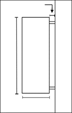
Projection signs will be allowed in the WPC Wolf Pen Creek design district with the following restrictions:
1)
One (1) projection sign per frontage along a public right-of-way will be allowed except where otherwise stated in this Section.
2)
The total square footage of all projection signs used will be applied toward the total allowable area for attached signage.
3)
The division and placement of allowable building signage amongst building tenants shall be the sole responsibility of the owner or property manager, and not the City.
4)
Projection signs shall be mounted perpendicular to buildings.
5)
Internally lit plastic signs will not be permitted.
6)
Projection signs may utilize fabric or other flexible material provided that they remain in good condition at all times.
7)
Projection signs shall have a minimum of eight (8) feet of clearance from the walkway grade and four (4) inches of clearance from the building facade. Excluding the four (4) inch clearance requirement, no part of a projection sign shall project more than three (3) feet from the building facade.
8)
Projection signs shall not extend above the facade of the building to which it is attached.
9)
Buildings with one (1) story may have a sign that shall not exceed eighteen (18) square feet in size. For each additional building story, an additional eight (8) square feet of signage is allowed, up to a maximum of fifty (50) square feet per sign.
10)
Signs may be attached to site lighting located on private property with the following restrictions:
a)
Developments will be allowed one (1) light pole sign for every one hundred fifty (150) feet of building plot frontage in lieu of a permitted freestanding sign.
b)
No part of any sign attached to a light pole will be allowed to overhang or encroach into any portion of the public right-of-way.
c)
Light pole signs shall not exceed six (6) square feet in size and shall have a minimum of eight (8) feet of clearance from the walkway grade.
d)
Light pole signs shall have a minimum clearance of four (4) inches from the edge of the light pole. Excluding the four (4) inches of clearance, light pole signs shall not project more than three (3) feet from the edge of the light pole.
Example Light Pole Sign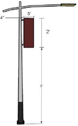
c.
Design Criteria.
In addition to the Signs Section of Article 7, General Development Standards of this UDO, the Administrator shall evaluate all proposed signage according to the following criteria:
1)
Every sign shall be designed as an integral architectural element of the building and site to which it principally relates.
2)
The colors, materials, and lighting of every sign shall be harmonious with the building and site to which it principally relates.
3)
Identification signs of a prototype design and corporation logos shall conform to the criteria for all other signs.
12.
Maintenance.
a.
Continued good appearance depends upon the extent and quality of maintenance. The choice of materials and their use, together with the types of finishes and other protective measures, must be conducive to easy maintenance and upkeep.
b.
Materials and finishes shall be selected for their durability and wear as well as for their beauty. Proper measures and devices shall be incorporated for protection against the elements, neglect, damage, and abuse.
c.
Provision for washing and cleaning of buildings and structures, and control of dirt and refuse, shall be included in the design. Configurations that tend to catch and accumulate debris, leaves, trash, dirt, and rubbish shall be avoided.
d.
Major maintenance activities that occur after a project is complete shall be reviewed by Administrator. These activities include any replacement of light fixtures or standards, and major fence or landscape work or replacement. The intent is to ensure that the development standards of this UDO are maintained throughout the life of a project.
13.
Waivers.
The Design Review Board shall hear and decide requests for waivers to the standards of this Section. The Design Review Board shall approve waivers found to meet the intent of the standards of this Section and the Wolf Pen Creek Master Plan. Financial hardship may not be considered in the review or determination of a waiver proposal.
Design Review Board review and waiver approval shall be limited to the following items:
a.
Relief from specific requirements related to building orientation and access for the improvement of existing buildings if it can be proven by the applicant that existing site characteristics constrain the proposed project from meeting the requirement(s) herein. Relief shall not be considered for building expansions or additions.
b.
Alternatives to the requirements related to building orientation and access when physical characteristics limit the site or provide for unique orientation and access opportunities.
B.
NG Northgate Districts.
Adjacent to Texas A&M University's north side, the Northgate area encompasses one of the oldest urban areas in College Station, and, therefore, Northgate plays a prominent role in the development and service of both the City of College Station and Texas A&M University. It is characterized as a unique "campus neighborhood" containing local businesses, churches, and off-campus housing near the University.
Concepts related to traditional neighborhood development, which promotes a mixture of non-residential and residential uses in a pedestrian-oriented setting, have been incorporated within the standards for the Northgate zoning districts. Other traditional neighborhood development concepts incorporated into the Northgate zoning districts include increased density, compatible high-quality building design, and specialized signage. The result is intended to be a unique, pedestrian-friendly, dense urban environment that allows citizens of College Station and students of Texas A&M University to eat, work, live, and recreate in an area within close proximity to the University.
1.
Districts.
The Northgate area consists of three (3) districts: NG-1 Core Northgate, NG-2 Transitional Northgate, and NG-3 Residential Northgate. Any reference and/or requirement made in this Section shall apply to all Northgate districts unless otherwise specified. These zoning districts incorporate regulations consistent with the Northgate Redevelopment Implementation Plan.
a.
NG-1 Core Northgate.
This mixed-use district applies to areas containing a diversity of pedestrian-oriented retail, dining/restaurant, housing, and entertainment businesses that are close to on- and off-campus dormitories. Regulations are designed to aid structural rehabilitation and redevelopment while promoting new high-density, mixed-use, pedestrian-oriented infill development with an urban character.
b.
NG-2 Transitional Northgate.
This district is intended for areas in Northgate containing larger retail commercial uses and undeveloped land. This district also serves to transition from suburban-style commercial development to high-density, mixed-use redevelopment. This zoning district shall incorporate regulations designed to aid mixed-use development, pedestrian circulation, and redevelopment with an urban character. Any development in NG-2 Transitional Northgate may develop under the standards herein of NG-1 Core Northgate.
c.
NG-3 Residential Northgate.
This district is intended for areas in Northgate containing a variety of residential uses and structures. This district applies to areas determined to be suitable for high-density residential developments due to its proximity to Texas A&M University. NG-3 Residential Northgate incorporates regulations designed to aid pedestrian-oriented redevelopment for high-density residential and limited commercial uses.
2.
Additional Use Standards.
The permitted and conditional uses set forth in the Types of Use Section of Article 6, Use Regulations of this UDO shall meet the following additional requirements related to the district in which the proposed project is located.
a.
NG-1 Core Northgate.
1)
Buildings with frontage on Church Avenue, University Drive, College Main, Boyett Street from University Drive to Church Avenue, and Nagle Street from University Drive to Church Avenue shall not have parking, fraternal lodge, or residential uses on the ground floor. These uses shall be allowed on the ground floor if they are completely located behind a commercial use that meets all other requirements of this UDO.
2)
Parking lots that are an ancillary use must be abutting the primary use.
3)
Residential uses are only allowed in buildings that also contain commercial uses.
4)
The maximum allowable gross floor area on the ground floor per single retail establishment is ten thousand (10,000) square feet.
5)
Freestanding, single-tenant buildings are prohibited except:
a)
For structures existing on or before April 2, 2006; or
b)
For the following uses: casual and fine dining restaurants (not "fast food"), hotels, and theaters.
b.
NG-2 Transitional Northgate.
1)
Buildings with frontage on Church Avenue, University Drive, South College Avenue, and Nagle Street from University Drive to Church Avenue shall not have parking, fraternal lodge, or residential uses on the ground floor. These uses shall be allowed on the ground floor if they are completely located behind a commercial use that meets all other requirements of this UDO.
2)
The maximum allowable gross floor area on the ground floor per single retail establishment is forty thousand (40,000) square feet.
3)
Freestanding, single-tenant buildings are prohibited except:
a)
For structures existing on or before April 2, 2006; or
b)
For the following uses: casual and fine dining restaurants (not "fast food"), hotels, and theaters.
c.
NG-3 Residential Northgate.
Non-residential uses permitted within NG-3 Residential Northgate shall meet each of the following requirements:
1)
Places of worship are exempt from these requirements.
2)
Non-residential uses may occupy no more than fifty (50) percent of the total square footage of any building or group of buildings developed in a building plot.
3)
Any building containing a non-residential use shall have a minimum of one (1) floor wherein one hundred (100) percent of the floor area is occupied by a residential use. Offices and studios maintained within a residence for home occupations may be included within the residential use calculation.
4)
The maximum allowable gross floor area per single retail establishment is five thousand (5,000) square feet.
3.
Building Design Considerations for Historic Properties.
a.
Applicability.
The following existing structures are reflected as a medium or high priority in the Northgate Historic Resources Survey. Possible address discrepancies may be resolved by referencing the Northgate Historic Resources Survey.
b.
Standards.
Rehabilitation of these structures shall follow the following standards:
1)
The historic character of a property will be retained and preserved. Distinctive materials or features and spatial relationships that characterize a property shall not be removed or altered.
2)
Distinctive materials, features, finishes, and construction techniques or examples of craftsmanship that characterize a property will be preserved.
3)
Deteriorated historic features will be repaired rather than replaced. Where the severity of deterioration requires the replacement of a distinctive feature, the new feature will match the old in design, color, texture, and, where possible, materials.
c.
Process.
All proposals affecting the materials, construction, or colors of a historic structure must be approved by the Administrator. The Administrator shall first consider the proposal in light of the standards listed above, then according to the standards set forth below.
4.
Building Design Standards.
The following standards shall apply to all structures in the Northgate zoning districts.
a.
Building Orientation and Access.
1)
All buildings that have right-of-way frontage on Church Avenue shall orient their primary entrance facades toward Church Avenue.
2)
All buildings that have right-of-way frontage on University Drive shall orient their primary entrance facades toward University Drive.
3)
The primary entrance facades of all buildings not on Church Avenue or University Drive shall front a public right-of-way.
4)
If a building has frontage on University Drive and South College Avenue, the primary entrance facade shall be oriented to one (1) of the rights-of-way at the developer's discretion. A public entrance facade shall be oriented toward the other right-of-way(s).
5)
In the event a building has frontage on more than one (1) right-of-way (not including Church Avenue, University Drive, or South College Avenue), the Administrator shall determine to which right-of-way the primary entrance facade shall be oriented. A public entrance facade shall be oriented toward the other right-of-way(s).
6)
In the event more than two (2) facades require a public entrance, the Administrator may determine which two (2) facades require entrances. The Administrator may also forward the question to the Design Review Board for any reason.
7)
All residential dwelling units in a building with less than twelve (12) residential dwelling units shall have access from the primary entrance facade. This access may not be through an area with a fence or wall taller than four (4) feet, a garage, or a parking area.
b.
Building Transparency.
Sanctuaries in places of worship are exempted from this requirement.
1)
For maximum pedestrian visibility of the non-residential uses, non-residential structures and the commercial portions of mixed-use structures shall be at least fifty (50) percent transparent between zero (0) feet and eight (8) feet above ground level of the primary entrance facade and at least thirty (30) percent transparent between zero (0) feet and eight (8) feet on the facade fronting other rights-of-way. In the event more than two (2) facades require transparency, the Administrator may determine which two (2) facades require minimum transparency. The Administrator may also forward the question to the Design Review Board for any reason.
2)
Glass shall be clear or tinted, not reflective. Glass block and other materials that are semi-transparent shall not be used to meet this requirement.
3)
Roll-up doors must be at least seventy-five (75) percent transparent between zero (0) feet and eight (8) feet above ground level for all facades facing a right-of-way.
c.
Architectural Relief.
1)
For all facades facing a right-of-way, the first two (2) stories or first twenty-eight (28) feet above ground level shall use architectural detail to provide visual interest by incorporating a minimum of two (2) design elements every twenty-five (25) feet from the following options: canopies, permanent decorative awnings, hood/drip molding over windows, cornices, corbelling, quoining, stringcourses, pilasters, columns, pillars, arcades, bay/oriel windows, balconies that extend from the building, recessed entries, stoops, and porches.
2)
Along all other facades not facing a right-of-way and not screened by another building located within fifteen (15) feet of the facade, there shall be at least two (2) design elements as listed above for every forty (40) feet. These facades shall be similar and complementary to the primary entrance facade.
3)
Instead of the above requirements, buildings with fewer than twelve (12) residential units shall provide individual architectural relief such as a front porch, balcony, or bay window for each unit on each facade. Architectural relief is not required on facades that are within fifteen (15) feet of another building that screens the facade.
4)
Alternative architectural features may be considered for approval by the Design Review Board.
d.
Roof Type.
1)
Shed, mansard, and gambrel roofs are prohibited.
2)
Hip and gable roofs may only be used when the vertical plane(s) of any roof facing a right-of-way is interrupted by an architectural detail.
e.
Exterior Building Materials.
All structures within a building plot shall have materials that are similar and complement each other. When determining the area herein, windows and doors are included.
1)
The following applies only to the first two (2) stories or the first twenty-eight (28) feet above ground level of all structures, excluding parking garages.
All facades, except those within fifteen (15) feet of another building that screens the facade, shall consist of a minimum of twenty-five (25) percent of one (1) or more of the following building materials. Parking garages are excluded from this requirement. All other materials except as authorized herein or by the Design Review Board, are prohibited.
a)
Fired brick;
b)
Natural stone;
c)
Marble;
d)
Granite;
e)
Tile; and/or
f)
Any concrete product so long as it has an integrated color and is textured or patterned (not aggregate material or split-face CMU) to look like brick, stone, marble, granite, or tile; or is covered with brick, stone, marble, granite, or tile or a material fabricated to simulate brick, stone, marble, granite, or tile.
2)
In addition, all facades may utilize the following materials subject to the stated limitations. Parking garages are excluded from these limitations. All other materials are prohibited.
a)
Stucco, hardboard, split-face CMU with integrated color, or any material equivalent in appearance and quality as determined by the Design Review Board shall not cover more than seventy-five (75) percent of each facade.
b)
Wood or cedar siding, stainless steel, chrome, standing seam metal, and premium grade architectural metal may be used as architectural accents and shall not cover greater than twenty (20) percent of any facade.
c)
Glass block and other materials that are semi-transparent shall not cover more than fifteen (15) percent of any facade. Places of worship are exempted from this limitation.
d)
Continuous ribbon window systems and glazed curtain walls are prohibited.
e)
Smooth face tinted concrete blocks shall only be used as an accent and shall not cover more than five (5) percent of any facade.
f)
Galvanized steel and painted steel are allowed on doors, including roll-up doors.
g)
Steel, standing seam metal, and/or architectural metal may be used as a roof and/or canopy/awning with no limitation of percentage.
3)
The facades of parking garages may utilize any material, but may only use steel, standing seam metal, and/or architectural metal as an architectural accent (limited to twenty (20) percent of any facade) and as a roof and/or canopy/awning (with no limitation).
f.
Exterior Building Colors.
1)
Building colors shall be neutral and harmonious with the existing man-made or natural environment, and only compatible accent colors shall be used. All colors shall be approved by the Administrator.
2)
Metallic (except copper and silver metallic-colored roofs) and fluorescent colors are prohibited on any facade or roof.
3)
When applying brick, colors normally found in manufactured fired brick are permitted. All colors of natural stone are permitted.
4)
Colors samples shall be submitted for approval to the Administrator.
g.
Canopies/Awnings.
1)
Canopies/awnings shall not completely obstruct any window. Transom windows may be located under canopies/awnings.
2)
Canopies/awnings are considered part of the building facade. A maximum of one (1) color shall be used for all canopies/awnings on a single building facade (excluding the business logo).
3)
Canopies/awnings shall consist of cloth, canvas, steel, standing seam metal, architectural metal, and/or perforated metal (not corrugated) and shall be maintained in good repair. Canopies/awnings that are used to meet the required building setback shall not be cloth or canvas but shall be a permanent structure integrated into the building's architecture, consisting of materials similar to that of the rest of the building.
4)
Canopies/awnings located over the public right-of-way shall require a private improvement in the public right-of-way permit in addition to the necessary building permit.
5.
On-Street Parking Standards.
a.
Existing head-in parking that requires backing maneuvers into a right-of-way shall be removed with all proposed development, redevelopment, rehabilitation, and facade projects within any Northgate district.
b.
All proposed development, redevelopment, rehabilitation, and facade projects with frontage on a right-of-way(s) designated for on-street parking shall install such parking. For residential uses, non-metered, parallel spaces may be counted toward off-street parking space requirements.
6.
Off-Street Parking Standards.
All off-street parking shall meet the requirements specified in the Off-Street Parking Standards Section of Article 7, General Development Standards of this UDO, except as specifically provided herein:
a.
Lots with frontage on Church Avenue or University Drive shall not have surface parking that is closer than two hundred (200) feet to the right(s)-of-way or is not completely located behind a habitable structure. Lots with frontage on University Drive and Church Avenue shall not have surface parking that is closer than two hundred (200) feet to Church Avenue or is not completely located behind a habitable structure.
b.
There shall be no minimum number of parking spaces required for non-residential uses.
c.
Off-street parking facilities for residential uses shall meet seventy-five (75) percent of the number of specified parking space requirements of the Number of Off-Street Parking Spaces Required Subsection in the Off-Street Parking Standards Section of Article 7, General Development Standards of this UDO.
d.
Tandem parking, also known as double parking, may be counted towards off-street parking requirements for structured parking areas in Northgate only. The following conditions must be included as a note on the site plan:
1)
The spaces must be reserved and assigned to the same dwelling unit.
2)
Both spaces must be standard size, nine (9) feet by twenty (20) feet. No compact or handicapped accessible spaces are permitted.
3)
No more than ten (10) percent of the total parking spaces required can be tandem. In determining this percentage, both stalls in a tandem parking shall be counted. Fractional amounts shall be increased to the nearest even number.
e.
No interior islands are required.
f.
Where off-street surface parking is to be installed adjacent to a right-of-way, there shall be a six (6) foot setback from the required sidewalk to the parking pavement. The parking area shall be screened along one hundred (100) percent of the street frontage (minus driveways and visibility triangles) with shrubs or a brick, stone, tinted CMU, or concrete product textured or patterned to look like brick or stone wall a minimum of three (3) feet in height, and within three (3) feet of the sidewalk. Walls shall be complementary to the primary building and shall be constructed as sitwalls.
g.
No off-street surface parking or circulation aisle shall be located between the primary entrance façade of a building and a right-of-way. Parking shall be located at the rear or side of a building. Two (2) exceptions are:
1)
Sites on the South College Avenue right-of-way may have up to one (1) circulation aisle against the right-of-way with parking on each side of the aisle.
2)
Hotel and residential uses may have porte cocheres and temporary, loading/unloading parking, not to exceed ten (10) spaces, against the right-of-way.
h.
Ramps shall not be built on the exterior of parking garages.
i.
Steel guard cables on garage façades are prohibited.
j.
To break up the parking lot area, minimize the visual impact on pedestrians, and encourage pedestrian movement through the districts, one (1) or a combination of the following parking concepts is required for parking that provides more than sixty (60) parking spaces with more than one (1) parking row:
1)
Parking is located in a garage.
2)
The parking structure is located on the interior of the block, screened from public view by habitable structures, and is not located adjacent to a right-of-way.
3)
For every sixty (60) parking spaces, there shall be a separate and distinct parking area connected by driving lanes but separated by a landscaping strip a minimum of ten (10) feet wide the full length of the parking row. At a minimum, landscaping shall be one (1) canopy tree (one and one-half (1.5) inch caliper or greater) for every twenty-five (25) linear feet of the landscaping strip.
In addition, at least seventy-five (75) percent of all end islands in the parking lot must be irrigated and landscaped with a minimum one and one-half (1.5) inch caliper canopy tree, one and one-quarter (1.25) inch caliper non-canopy tree, or enough shrubs three (3) feet in height at time of planting to cover seventy-five (75) percent of the island. Islands not landscaped shall be treated with brick pavers, ground cover, and/or perennial grass.
7.
Bicycle Parking Standards.
The following standards are in addition to the requirements of the Off-Street Parking Standards article of this UDO.
a.
For all non-residential uses, a minimum of four (4) bicycle parking spaces plus one (1) additional space for each one thousand (1,000) square feet of floor area above two thousand (2,000) square feet shall be required.
b.
Facilities shall be separated from motor vehicle parking to protect both bicycles and vehicles from accidental damage and shall be separated at least three (3) feet from the building or other walls, landscaping, or other features to allow for ease and encouragement of use. Bicycle parking facilities may be permitted on sidewalks or other paved surfaces with a private improvement in the public right-of-way permit (when necessary) and provided that the bicycles do not block or interfere with pedestrian or vehicular traffic.
c.
Required bicycle parking may be consolidated with the bicycle parking of adjacent properties and provided off-site if the bicycle rack location is within one hundred (100) feet of the main entry façade of the building and with written agreement from the property owners.
8.
Sidewalk Standards.
Sidewalks shall be incorporated into all proposed development and redevelopment projects within any Northgate zoning district. In the event a sidewalk exists on a site before development or redevelopment and does not meet all sidewalk and streetscape standards set forth herein, the sidewalk must be upgraded to meet current standards (including American National Standards and Texas Accessibility Standards).
a.
Sidewalks shall be required along both sides of all rights-of-way.
b.
Sidewalks widths shall be as follows:
1)
Sidewalks shall be a minimum of twelve (12) feet in width on University Drive and South College Avenue.
2)
Sidewalks shall be a minimum of ten (10) feet in width on Church Street and College Main.
3)
Sidewalks shall be a minimum of eight (8) feet in width on all other streets in Northgate.
c.
Sidewalks shall be located directly adjacent to the back of the curb. The Administrator may approve alternate locations to eliminate encroachments of streetscaping materials that would reduce the clear space of the sidewalk to less than six (6) feet. The Administrator may also approve alternate locations for sidewalks along South College Avenue and Wellborn Road to address public safety concerns.
d.
Sidewalks or parts of sidewalks that lie outside, but are located next to, the right-of-way shall be covered by a dedicated public access easement initiated by the property owner so that they will be dedicated for public use and maintenance.
e.
Sidewalks shall be constructed of colored brick pavers on the exterior (visible) layer as specified in the Northgate Specific Standards Section of the City of College Station Site Design Standards.
Sidewalk and Street Tree Requirements for University Drive and South College Avenue
9.
Landscape and Streetscape Standards.
For NG-1 Core Northgate and NG-3 Residential Northgate, the standards set forth herein are instead of the Landscaping and Tree Protection Section of Article 7, General Development Standards of this UDO.
For NG-2 Transitional Northgate, the standards set forth herein are in addition to the Landscaping and Tree Protection Section of Article 7, General Development Standards of this UDO.
Any landscape/streetscape improvements may be located within the public right-of-way pursuant to a private improvement in the public right-of-way permit.
Specific landscaping elements and streetscape hardware (benches, streetlights, etc.) utilized shall be as identified in the Northgate Specific Standards Section of the City of College Station Site Design Standards.
a.
Street Trees.
1)
On University Drive, Church Avenue, Wellborn Road, South College Avenue, First Street, Boyett Street, College Main Avenue, and Nagle Street, installation of street trees that are a minimum of four (4) inch caliper shall be located in at-grade tree wells with tree grates (or raised tree wells or planters on University Drive and College Main Avenue only) and shall be spaced at a maximum of twenty-five (25) feet on center and located adjacent to the back of curb. Back-of-curb placement is not required along Wellborn Road and South College Avenue when an alternative location for the sidewalk is approved as provided for in the Sidewalk Standards Section above. On all other streets not listed above, installation of street trees that are a minimum of three (3) inch caliper shall be located in at-grade tree wells with tree grates (raised tree wells or planters may be used when eight (8) feet of clear space can be maintained on the sidewalk) and spaced at a maximum of twenty-five (25) feet on center and located adjacent to the back of curb.
Alignment of such street trees shall commence twenty (20) feet from street intersections. Spacing and location of street trees may be varied upon approval by the Administrator for the purpose of minimizing conflicts with other streetscape elements and utilities, minimizing conflicts with the required sight distance at street intersections, ensuring unobstructed views of traffic control devices, and ensuring adequate Fire Department access. In areas of concentrated retail activity, street trees may be placed at different intervals upon approval by the Administrator for the purpose of minimizing the obstruction of views of non-residential uses.
2)
In locations where a healthy and mature four (4) inch caliper or greater canopy tree currently exists, the requirements for a new tree may be waived or modified by the Administrator. Such trees must be maintained, barricaded, and otherwise fully protected during the project's construction phase and shall be replaced with trees meeting the specifications herein if they are damaged or die.
3)
All in-ground vegetated areas, trees, and above-ground planters shall include an automated irrigation system. Irrigation will not be required for existing trees that are properly barricaded during construction according to the Landscaping and Tree Protection Section of Article 7, General Development Standards of this UDO.
b.
Landscaping.
Any area between the inside or interior of the sidewalk edge and the building facade and/or parking area not utilized as outdoor cafe seating is required to be one hundred (100) percent landscaped/streetscaped and irrigated. Eligible landscape/streetscape improvements shall include raised masonry planter boxes or planter pots, at-grade planting beds, seating benches, light features, decorative railings, masonry walls not exceeding three (3) feet in height, decorative wrought iron fencing, additional pedestrian areas finished with brick pavers, or other elements in the Northgate Specific Standards Section of the City of College Station Site Design Standards. Live plant material must be included where feasible in each proposal.
c.
Sidewalk Benches.
A minimum of one (1) sidewalk bench shall be provided for every fifty (50) linear feet of building frontage along a right-of-way. In no case shall more than four (4) sidewalk benches per building facade be required.
d.
Building and Site Lighting.
1)
Building illumination and architectural lighting shall be indirect (no light source visible). Exposed neon tube may be used.
2)
Light standards for parking lots shall reflect the style of the building plot's architecture or be complementary to that style. Standards shall not be greater than twenty (20) feet in height.
e.
Streetlights.
1)
Streetlight location and type shall be as determined by College Station Utilities and the Administrator.
2)
The installation and cost of the lighting shall be performed by the developer or their authorized construction representative subject to compliance with the utility streetlight installation standards of College Station Utilities.
3)
Once satisfactorily installed, approved, and accepted by College Station Utilities, the maintenance of the streetlights and the furnishing of electric energy to the streetlights shall be provided by the City.
f.
Trash Receptacles.
If installed, trash receptacle locations shall be shown on the landscape plan. One (1) trash receptacle may be located within an intersection's sight distance triangle described in the General Provisions Section of Article 7, General Development Standards of this UDO.
g.
Newspaper Racks.
If installed, newspaper racks shall be placed so that a four (4) foot minimum clear space is maintained on the sidewalk.
10.
Dumpster and Mechanical Equipment Standards.
The following standards are in addition to the requirements of the Solid Waste Section of Article 7, General Development Standards of this UDO.
a.
Any dumpster and other waste storage area or container other than streetscape trash receptacles shall be located at the rear of the building served by the dumpster, area, and/or container. The Administrator may adjust this standard where a required entrance facade is located at the rear of the building or when parking is provided on the side of a building.
b.
Where feasible, consolidation of dumpsters may be required by the City.
c.
Solid waste storage areas, mechanical equipment, air conditioning, electrical meter, service components, and similar utility devices, whether ground level, wall mounted, or roof-mounted, shall be screened from view from rights-of-way. Exterior screening materials shall be opaque and the same as predominantly used on the exterior of the principal building. Such screening shall be coordinated with the building architecture, colors, and scale to maintain a unified appearance. Acceptable methods of screening various equipment include encasements, parapet walls, partition screens, or brick walls. Screening may be omitted or modified upon approval of the Administrator for the purpose of complying with safe working clearances around electrical meters, electrical panels, transformers, and related electrical service equipment.
d.
Mechanical equipment shall be located to minimize noise intrusion off-site.
11.
Detention Pond Screening Standard.
Detention ponds shall be screened from view along one hundred (100) percent of rights-of-way using berms, shrubs, walls, or a combination of these to achieve a three (3) foot high screen measured from the ground level. Walls shall be coordinated with the building architecture, colors, and scale to maintain a unified appearance.
12.
Sign Standards.
a.
Signage shall not obscure other building elements such as windows, cornices, or architectural details.
b.
Illuminated plastic signs are prohibited.
c.
The following types of signage may be used. All others are prohibited.
1)
Attached Signs.
a)
Refer to the Signs Section of Article 7, General Development Standards of this UDO.
b)
Exposed neon may be used in attached signage.
2)
Window Signs.
a)
Window signs shall allow for the majority of the display area to be open for pedestrian window shopping and shall not cover more than thirty-three (33) percent of the window area.
b)
Exposed neon may be used in window signage.
3)
Hanging Signs.
a)
Hanging signs shall be suspended from canopies/awnings and located in front of building entrances, perpendicular to the facade.
b)
A maximum of one (1) sign per building entrance is allowed.
c)
The sign shall not exceed four (4) square feet in size and shall have a minimum of eight (8) feet of clearance from the walkway grade, four (4) inches of clearance from the building face, and eight (8) inches of clearance from the edge of the canopy/awning.
d)
Hanging signs located in/over the public right-of-way shall require a private improvement in the public right-of-way permit in addition to the necessary building permit.
4)
Projection Signs.
a)
Projection signs are allowed in NG-1 Core Northgate and NG-2 Transitional Northgate only.
b)
Projection signs shall be mounted perpendicular to buildings. They shall have a minimum of eight (8) feet of clearance from the walkway grade and four (4) inches of clearance from the building face (barber poles are exempted from these clearance requirements). All extremities of projection signs, including supports, frames, and the like, shall not project more than three (3) feet from the building face.
c)
A maximum of one (1) sign per building is allowed.
d)
Buildings with one (1) story may have a sign that shall not exceed six (6) square feet in size. For each additional building story, an additional four (4) square feet of signage is allowed, up to a maximum of eighteen (18) square feet.
e)
Projection signs located in/over the public right-of-way shall require a private improvement in the public right-of-way permit in addition to the necessary building permit.
f)
Exposed neon may be used in projection signage.
5)
Low Profile Signs.
a)
In NG-2 Transitional Northgate only, one (1) low profile sign per one hundred fifty (150) linear feet of a building plot along South College Avenue may be permitted.
b)
Refer to the Signs Section of Article 7, General Development Standards of this UDO.
c)
Exposed neon may be used in low-profile signage.
d.
If more than twenty-five (25) percent of the square footage of a building is demolished, any nonconforming signage associated with the building must also be demolished. The signage will not be considered "grandfathered", and no other permits will be issued for the site by the City until the signage has been removed.
13.
Outside Storage and Display Standards.
The following standards are in lieu of the Outdoor Storage and Display Section of Article 7, General Development Standards of this UDO.
a.
Outdoor storage of materials or commodities is prohibited.
b.
Temporary or portable buildings of any kind are prohibited except during the construction of site-planned facilities.
c.
Outside sales/outside display areas shall be located within five (5) feet of a required entrance facade and shall only be located in front of the property/business that is selling item(s). A four (4) foot minimum clear space on sidewalks shall be maintained. This does not apply if a business has a valid Northgate outdoor dining and entertainment permit issued under Chapter 8, Businesses of the City of College Station Code of Ordinances.
d.
All merchandise and/or seasonal items used for outside sales or display shall be moved indoors at the end of business each day.
14.
Waivers.
The Design Review Board shall review requests for deviations from the standards of this Section. The Design Review Board shall approve waivers found to meet the intent of the standards of this Section and the Northgate Redevelopment Implementation Plan. Financial hardship may not be considered in the review or determination of a waiver proposal.
Design Review Board review and waiver approval shall be limited to the following items:
a.
Relief from the building design standards for historic properties if the proposed building improvements or additions generally conform to the Building Design Considerations for Historic Properties Subsection above, and if the property building improvements or additions generally preserve the historical appearance and architectural character of the building.
b.
Relief from specific requirements related to building orientation and access for the improvement of existing buildings if it can be proven by the applicant shows that inherent site characteristics constrain the proposed project from meeting the requirement(s) herein. Relief shall not be considered for building expansions or additions.
c.
Alternatives to the requirements related to building orientation and access when physical characteristics limit the site or provide for unique orientation and access opportunities.
d.
A reduction in the percentage of required building transparency for the rehabilitation of existing buildings if it can be proven by the applicant that inherent site characteristics constrain the proposed project from meeting the requirements herein.
e.
Alternatives to the requirements related to building transparency for new construction if the alternatives substantially provide the same visual interest for the pedestrian.
f.
Alternate architectural features to meet the requirements related to architectural relief when the proposed architectural details substantially provide a level of uniqueness to the building at the pedestrian scale.
g.
Along non-primary entrance facades that do not abut a right-of-way and that require design elements, murals may be considered by the Design Review Board to meet the two-design element requirement. Mural topics may include architecture and/or Texas A&M University. Murals may not contain copy or logo advertising any business.
h.
Substitutions of building materials for buildings if the applicant shows that:
1)
The building material is a new or innovative material manufactured that has not been previously available to the market or the material is not listed as an allowed or prohibited material herein and the material is similar and comparable in quality and appearance to the materials allowed in the Building Design Standards Subsection above; or
2)
The material is an integral part of a themed building (for example, a 50's diner in chrome).
3)
No variance shall be granted to minimum building material requirements specified for buildings ten thousand (10,000) square feet or greater in area or for building plots with a cumulative structure square footage of ten thousand (10,000) square feet or greater.
i.
Alternative materials on facade work that does not involve an expansion of an existing building as defined in Article 9, Nonconformities of this UDO or constitute redevelopment if the applicant shows that:
1)
The materials allowed in the Building Design Standards Subsection above cannot be utilized without a structural alteration(s) to the existing building; and
2)
A licensed professional engineer or architect verifies in writing that a structural alteration is required to apply the permitted facade materials to the building.
j.
Alternatives to the requirements related to surface area parking lots. Alternatives must separate the parking areas so that no more than sixty (60) parking spaces are located in the same vicinity without substantial visual separation from additional parking spaces.
k.
A decrease in parking requirements for residential uses provided that the applicant submits a parking study that supports the decrease based on reasonable assumptions of parking availability. Unless shared or off-site parking is provided as allowed in the Alternative Parking Plans Subsection of the Off-Street Parking Standards Section of Article 7, General Development Standards of this UDO, in no case shall the Design Review Board allow a reduction in the number of required spaces:
1)
To less than the number recommended within the parking study, or
2)
To more than a fifty (50) percent reduction in the amount of parking required for residential uses by the Number of Off-Street Parking Spaces Required Subsection in the Off-Street Parking Standards Section of Article 7, General Development Standards of this UDO.
l.
An increase in the distance requirement for shared and/or off-site parking when shared or off-site parking is provided in a parking garage.
m.
Relief from the sidewalk width standard when bringing an existing sidewalk up to a current standard where existing physical conditions prohibit sidewalk expansion.
n.
Alternatives to the Landscaping and Tree Protection Section of Article 7, General Development Standards of this UDO for projects utilizing an existing structure(s) if it can be proven by the applicant that inherent site characteristics constrain the proposed project from meeting the requirements herein.
o.
Relief from the two-story requirement for casual and fine dining restaurants (not "fast food") and theaters in NG-2 Transitional Northgate if all facades are a minimum of twenty-five (25) feet in height and all facades give the appearance of a two-story structure as determined by the Design Review Board.
p.
Relief from the minimum height requirement in NG-1 Core Northgate and NG-2 Transitional Northgate for an existing structure undergoing only facade rehabilitation if the applicant shows that inherent site characteristics constrain the proposed project from meeting the requirement(s) herein. Relief shall not be considered for building expansions or additions.
(Ord. No. 2023-4453, Pt. 1(Exh. A), 8-10-2023; Ord. No. 2023-4454, Pt. 1(Exh. A), 8-10-2023)
Sec. 5.9. - Design District Dimensional Standards.
The following table establishes dimensional standards that shall be applied within the design districts unless otherwise identified in this UDO:
Notes:
(a)
The minimum front setback may be reduced to fifteen (15) feet when approved rear access is provided or when side yard or rear yard parking is provided.
(b)
Lot line construction on interior lots is allowed where access to the rear of the building is provided on the site or by dedicated right-of-way or easement.
(c)
Minimum/maximum setback from the back of any curb includes lots with single frontage, lots with double frontage, and corner lots with multiple frontages.
(d)
If the width of any public easement or right-of-way is more than the maximum setback, the maximum setback will be measured from the edge of the public easement or right-of-way.
(e)
Maximum setback from the back of curb for University Drive is twenty-five (25) feet, Wellborn Road is thirty-five (35) feet, and South College Avenue is one hundred (100) feet.
(f)
When cafe seating is between the cafe's building and a right-of-way, the building may be setback a maximum of thirty-five (35) feet.
(g)
Refer to the Easterwood Field Airport Zoning Ordinance regarding height limitations.
(h)
The two-story requirement shall not apply to structures existing on or before April 2, 2006.
(i)
Places of worship are exempt from the floor area ratio requirement.
(j)
This area calculation shall not include any lot area encumbered by required easements, setbacks, sidewalks, detention, or an area dedicated to civic features. The area of a porch or arcade fronting a public street is included in the calculation of lot coverage.
(Ord. No. 2023-4453, Pt. 1(Exh. A), 8-10-2023)
Sec. 5.10. - Overlay Districts.
In the event an area is rezoned to apply an overlay district, this district shall apply to all multi-family, commercial, and industrial property, and where applicable, to single-family, duplex, or townhouse development. The underlying district establishes the permitted uses and shall remain in full force, and the requirements of the overlay district are to be applied in addition to the underlying use and site restrictions.
A.
OV Corridor Overlay.
This district is established to enhance the image of gateways and key entry points, major corridors, and other areas of concern, as determined by the City Council, by maintaining a sense of openness and continuity.
The following supplemental standards shall apply to this district:
1.
Setbacks.
All buildings will be set back forty (40) feet from the right-of-way. Where parking is located in the front of the building, there shall be a front setback of twenty (20) feet from the right-of-way to the parking area and all drive aisles.
2.
Signs.
Freestanding signs shall be limited to the restrictions of the Signs Section of Article 7, General Development Standards of this UDO but shall not exceed the height of the building.
3.
Building Colors.
Building colors shall be neutral and harmonious with the existing man-made or natural environment, and only compatible accent colors shall be used. All colors shall be approved by the Administrator. The applicant must provide elevation drawings and color samples.
4.
Special Restrictions for Retail Fuel Sales.
In cases where the underlying zoning district allows fuel sales and a station is proposed, the following restrictions shall apply:
a.
Activities Restricted.
1)
No major emergency auto repair; and
2)
No body, fender, or paint work.
b.
Signs.
1)
Sign height shall be restricted by the provisions of the Signs Section of Article 7, General Development Standards of this UDO but shall not exceed the height of the building.
2)
No freestanding fuel price signage shall be permitted.
3)
Signs for air, water, and other similar services or products must meet the criteria for exempt signs as provided in the Signs Section of Article 7, General Development Standards of this UDO.
B.
RDD Redevelopment District.
The purpose of this district is to facilitate the redevelopment of existing nonconforming commercial centers through flexible or relaxed standards, which can accommodate existing physical limitations and take extraordinary circumstances into account. The RDD Redevelopment District is an overlay district. The permissible uses on any site shall be governed by the underlying zoning.
The following supplemental standards shall apply to this district:
1.
Location.
An RDD Redevelopment District may be established upon any commercially zoned property where the initial development was developed a minimum of twenty (20) years before the rezoning request and the proposed redevelopment meets the intent of this Section. Special consideration should be given to those areas considered "gateways" and/or historic, and those with proximity to Texas A&M University.
2.
Standards.
Although every effort should be made to meet all requirements of this UDO, designated RDD Redevelopment Districts may be allowed to waive up to fifty (50) percent of required parking standards and landscaping where physical limitations and the site's location and relationship to the goals of the Comprehensive Plan warrant consideration. A lesser percentage may be established as part of the approval process.
3.
Criteria for Evaluation.
Evaluation of all sites and site plans for rezoning to RDD Redevelopment District shall consider the following:
a.
Conformance with the Comprehensive Plan;
b.
Aesthetic contribution of the proposed redevelopment;
c.
Economic viability of the existing site;
d.
Physical limitations and the demonstrated inability to meet current requirements;
e.
Public health and safety standards; and
f.
Effort made to meet all standards of this UDO.
g.
Full engineering of sites may not be required for the establishment of an RDD Redevelopment District; however, a preliminary engineering study will be required which assesses parking, vehicular access and circulation, drainage, and utility requirements.
4.
Procedure for Establishment.
The procedure for rezoning to RDD Redevelopment District shall be the same as any other rezoning application except that a site plan of the proposed redevelopment of the site shall be carefully evaluated to ascertain the site plan's benefit to achieving the goals of the Comprehensive Plan.
Elevations of proposed structures may be required as part of the review process, or to determine eligibility for rezoning.
Full engineering may not be required for evaluating a property for rezoning. Varying levels of information may be required by the Administrator depending upon the peculiarities of any given site.
The site plan components shall govern the redevelopment of the site following the approval of an RDD Redevelopment District.
C.
HP Historic Preservation Overlay.
1.
Purpose.
The HP Historic Preservation Overlay is intended to provide for the protection and preservation of places and areas of historical, cultural, and architectural importance and significance. Such action is necessary to promote the economic, cultural, educational, and general welfare of the public.
Specifically, this district has the following expressed purposes:
a.
To protect and enhance the landmarks and districts which represent distinctive elements of College Station's historic, architectural, and cultural heritage;
b.
To foster civic pride in the accomplishments of the past;
c.
To protect and enhance College Station's attractiveness to visitors and the support and stimulus to the economy thereby provided;
d.
To ensure the harmonious, orderly, and efficient growth and development of College Station;
e.
To promote economic prosperity and welfare of the community by encouraging the most appropriate use of such property within College Station; and
f.
To encourage stabilization, restoration, and improvements of such properties and their values.
2.
Applicability.
The HP Historic Preservation Overlay may be applied to districts, areas, or individual property, regardless of the base zoning district or current use of the properties, that:
a.
Are at least forty (40) years old;
b.
Meet at least two (2) of the criteria listed below; and
c.
Possess historic integrity that is evident through historic qualities including location, design, setting, materials, workmanship, feeling, and association.
3.
Criteria for Designation of HP Historic Preservation Overlays.
A property or district may be designated if it:
a.
Possesses significance in history, architecture, archeology, and culture;
b.
Is associated with events that have made a significant contribution to the broad patterns of local, regional, state, or national history;
c.
Is associated with events that have made a significant impact in our past;
d.
Embodies the distinctive characteristics of a type, period, or method of construction;
e.
Represents the work of a master designer, builder, or craftsman;
f.
Represents an established and familiar visual feature of the neighborhood or city; or
g.
Is eligible for listing on the National Register of Historic Places, Recorded Texas Historic Landmark, or a State Archaeological Landmark, as determined by the Texas Historical Commission.
4.
Removal of an HP Historic Preservation Overlay.
Upon recommendation of the Landmark Commission to the Planning and Zoning Commission based upon new and compelling evidence and negative evaluation according to the same criteria and following the same procedures set forth in this UDO for designation, the Planning and Zoning Commission may recommend to the City Council and the City Council may remove an HP Historic Preservation Overlay made under this Section.
D.
Reserved.
(Ord. No. 2023-4453, Pt. 1(Exh. A), 8-10-2023; Ord. No. 2023-4468, Pt. 1(Exh. C), 9-14-2023; Ord. No. 2025-4620, Pt. 1(Exh. D), 9-11-2025)
Sec. 5.11. - Single-Family Overlay Districts.
A.
Purpose.
Single-family overlay districts create an additional zoning district that is superimposed over the underlying zoning district. Single-family overlay districts are intended to provide additional standards for College Station neighborhoods. These standards promote residential development patterns and are intended to protect and enhance desirable neighborhood characteristics, livability, and harmonious, orderly, and efficient growth and development. The underlying zoning district establishes the permitted uses and standards and shall remain in effect. The requirements of the overlay are to be applied in addition to the underlying zoning district standards.
B.
Applicability.
Single-family overlay districts may only be applied to neighborhoods zoned and developed for single-family dwelling units.
C.
General Provisions.
1.
The yard, lot, building height, and open space regulations of the single-family overlay districts must be read in accordance with the yard, lot, building height, and open space regulations in the Residential Dimensional Standards Section above and the General Provisions Section of Article 7, General Development Standards of this UDO. In the event of a conflict between the single-family overlay district and these Sections, the single-family overlay district controls.
2.
The City Council may approve a single-family overlay district for the boundaries of original subdivisions or multiple contiguous phases of original subdivisions that apply jointly.
3.
An application for an Official Zoning Map amendment to include a single-family overlay district may be filed once a petition is signed by property owners of at least fifty (50) percent plus one (1) of the total number of single-family zoned or developed building plots contained within the original subdivision, or multiple contiguous phases of original subdivisions that apply jointly in one application, in support of the overlay. The fifty (50) percent plus one (1) petition signatures must be met for each of the original subdivisions or each phase of an original subdivision that apply jointly.
D.
Reserved.
E.
NCO Neighborhood Conservation Overlay.
1.
Purpose.
The NCO Neighborhood Conservation Overlay is intended to protect and preserve established single-family neighborhoods through a district that is focused on the specific needs of the neighborhood. The NCO Neighborhood Conservation Overlay is intended to provide additional standards for demolitions, new construction, additions, and redevelopment to promote development that is compatible with the existing character of the neighborhood. NCO Neighborhood Conservation Overlays are based on an in-depth study of the existing neighborhood conditions and should be used to protect the unique assets and qualities of the neighborhood. NCO Neighborhood Conservation Overlays may be used for neighborhoods that offer a distinct character that its residents and the City wish to preserve and protect.
2.
Applicability.
The regulations of the NCO Neighborhood Conservation Overlay apply to all single-family and accessory structures within the district.
3.
General Provisions.
a.
The standards set forward in an NCO Neighborhood Conservation Overlay must be based on the findings of the petition committee.
b.
The petition committee may consist of property owners of platted single-family development from the original subdivision, or multiple contiguous phases of original subdivisions that apply jointly.
c.
NCO Neighborhood Conservation Overlays may not apply to neighborhoods originally platted in the last ten (10) years from the date of application submittal.
4.
Options for Inclusion.
In applying for an NCO Neighborhood Conservation Overlay, the following items may be included as standards in the overlay. All single-family development within the district shall be subject to the standards set forth in the rezoning ordinance.
a.
Minimum Front Setback.
If a minimum front setback is selected for inclusion, the petition committee may select one (1) of the following methods of determining minimum front setback based on research of the subject neighborhood:
1)
Contextual front setbacks as provided for in the Required Yards (Setbacks) Subsection of the General Provisions Section of Article 7, General Development Standards of this UDO; or
2)
Contextual front setbacks as provided for in the General Provisions Subsection above; or
3)
Fixed front setbacks. A fixed front setback may be established; however, it may not be less than the setback of underlying zoning or more than the existing median front yard setback of structures in the district.
Example Front Setbacks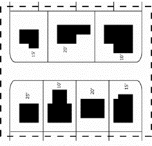
b.
Minimum Side Street Setback.
If a minimum side street setback is selected for inclusion, the petition committee may select one (1) of the following methods of determining minimum side street setback based on research of the subject neighborhood:
1)
Contextual side street setbacks as provided for in the Residential Dimensional Standards Section above; or
2)
Fixed side street setback. A fixed side street setback may be established; however, it may not be less than the side setback of underlying zoning or more than the existing median side street setback of structures in the district.
c.
Minimum Lot Size (Area, Width, and Depth).
If a minimum lot size is selected for inclusion, the petition committee may select one (1) of the following methods of determining the minimum size of new lots based on research of the subject neighborhood:
1)
Lot size (area and width) as provided for in the Platting and Replatting within Older Residential Subdivisions Subsection in the Lots Subsection of the General Requirements and Minimum Standards of Design for Subdivisions within the City Limits Section of Article 8, Subdivision Design and Improvements of this UDO; or
2)
Contextual lot size as provided for in the Residential Dimensional Standards Section above; or
3)
Fixed lot size. A fixed lot size may be established; however, it may not be less than the lot size required by the underlying zoning district or more than the existing median size of building plots in the district.
d.
Maximum Building Height.
If maximum building height is selected for inclusion, the petition committee may select one (1) of the following methods of determining maximum building height based on the research of the subject neighborhood:
1)
Contextual building height as provided for in the Residential Dimensional Standards Section above; or
2)
Fixed building height. A fixed building height may be established; however, it may not be more than the maximum height allowed in the underlying zoning district or less than the median height of all residential structures in the district.
e.
Tree Preservation.
If tree preservation is selected for inclusion, the petition committee may choose to preserve any existing trees with a minimum of eight (8) inch caliper or greater. Preserved trees must be in good form and condition and reasonably free of damage by insects and/or disease and located outside the buildable area. Any preserved tree(s) must be barricaded and preserved during demolition and/or construction. A barricade detail must be provided on the site plan. Trees must be barricaded one (1) foot per inch caliper measured as a radius from the tree trunk. Barricades must be in place before any development activity on the property including but not limited to grading and equipment on site. Choosing this option allows the petition committee to exclude specific tree species from preservation requirements.
f.
Landscape Maintenance.
If landscape maintenance is selected for inclusion, any existing canopy and non-canopy trees in good form and condition and reasonably free of damage by insects and/or disease located within the buildable area removed during construction must be replaced on-site inch caliper for inch caliper, or as determined by the Administrator.
g.
Maximum Impervious Surface.
If a maximum impervious surface is selected for inclusion, a maximum impervious surface may be limited to any number between the calculated neighborhood median and the maximum, as allowed by the UDO.
Impervious surface includes but is not limited to buildings, sidewalks, drives, all-weather surfaces, parking, rooftops, patios, decking, masonry, stone, and other alternative pavements. Alternative materials used for landscaping purposes in non-load bearing areas and the water surface area within the walls of pools are not considered impervious surfaces. An area of gapped decking shall be calculated as fifty (50) percent of the proposed decked area for the purpose of impervious cover.
Example Impervious Surface Identification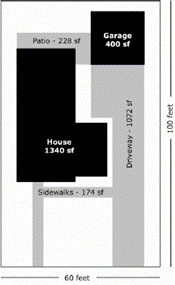
h.
Garage Access.
If garage access is selected for inclusion, the petition committee may choose one (1) of the following methods of garage access based on the most frequent method of garage access within the subject neighborhood:
1)
Front entry; or
2)
Side entry; or
3)
Rear entry.
Garage Access Options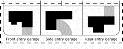
i.
Garage Connection.
If garage connection is selected for inclusion, the petition committee may select one (1) of the following garage connection types based on the most frequent method of garage connection within the subject neighborhood:
1)
Attached to the single-family structure; or
2)
Detached from the single-family structure.
Garage Connection Options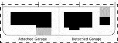
j.
Garage Location.
If garage location is selected for inclusion, the petition committee may select one (1) of the following garage locations based on the most frequent location of garages concerning the primary single-family structure within the subject neighborhood:
1)
In front of the single-family structure; or
2)
To the side of the single-family structure; or
3)
To the rear of the single-family structure.
Garage Location Options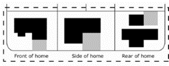
k.
Garage Size.
If garage size is selected for inclusion, the petition committee may set a minimum garage size of one (1), two (2), or three (3) car garage per residential unit based on the most frequently occurring garage size within the subject neighborhood.
l.
Garage Requirement.
If a garage requirement is selected for inclusion, the petition committee may require that a garage be required on properties within the subject neighborhood.
m.
Off-Street Parking.
If off-street parking is selected for inclusion, the petition committee may choose one (1) or more of the following off-street parking options within the subject neighborhood; however, it may only be included if including maximum lot coverage, garage access, garage connection, or garage location:
1)
Set a minimum off-street parking standard of three (3) spaces per residential unit;
2)
Set a maximum number of off-street parking spaces;
3)
Set a maximum parking area and location per yard;
4)
Set a required driveway width between 12 and 25 feet.
n.
Fencing.
If fencing is selected for inclusion, the petition committee may select the maximum height.
(Ord. No. 2023-4453, Pt. 1(Exh. A), 8-10-2023; Ord. No. 2025-4620, Pt. 1(Exh. D), 9-11-2025)