Debary City Zoning Code
CHAPTER 5
OVERLAY DISTRICT STANDARDS
ARTICLE VI - FORM-BASED CODE OVERLAY DISTRICTS: NODES AND CORRIDORS
Healthy cities have a mixture of activity centers and mixed-use corridors. The activity centers typically contain the most intensive commercial activity, and the corridors feature a variety of building types along streets designed for all modes of transportation. While the city zoning classifications address the types and intensity of uses within these nodes and corridors, this article addresses more specific site, building, and public realm standards, also known as Form-Based Code (FBC). It will take a combination of quality private development and public realm improvements to achieve the vision.
Sec. 5.1. - Applicability.
In addition to the regulations and standards set forth by this chapter, certain additional regulations and standards shall apply within areas identified as overlay districts on the Zoning Map. Provisions not specifically mentioned in this chapter but addressed in the City's LDC shall apply to properties within the Overlay Districts. In the event of any conflicts between the provisions of this chapter and other provisions of this Code, the provisions of this chapter shall prevail.
(Ord. No. 01-99, § 1(302), 11-3-1999)
Sec. 5.2. - Overlay districts map established.
The map entitled "Overlay Districts" is hereby made a part of this chapter as depicted by Figure 5-1.
Figure 5 - 1: Overlay Districts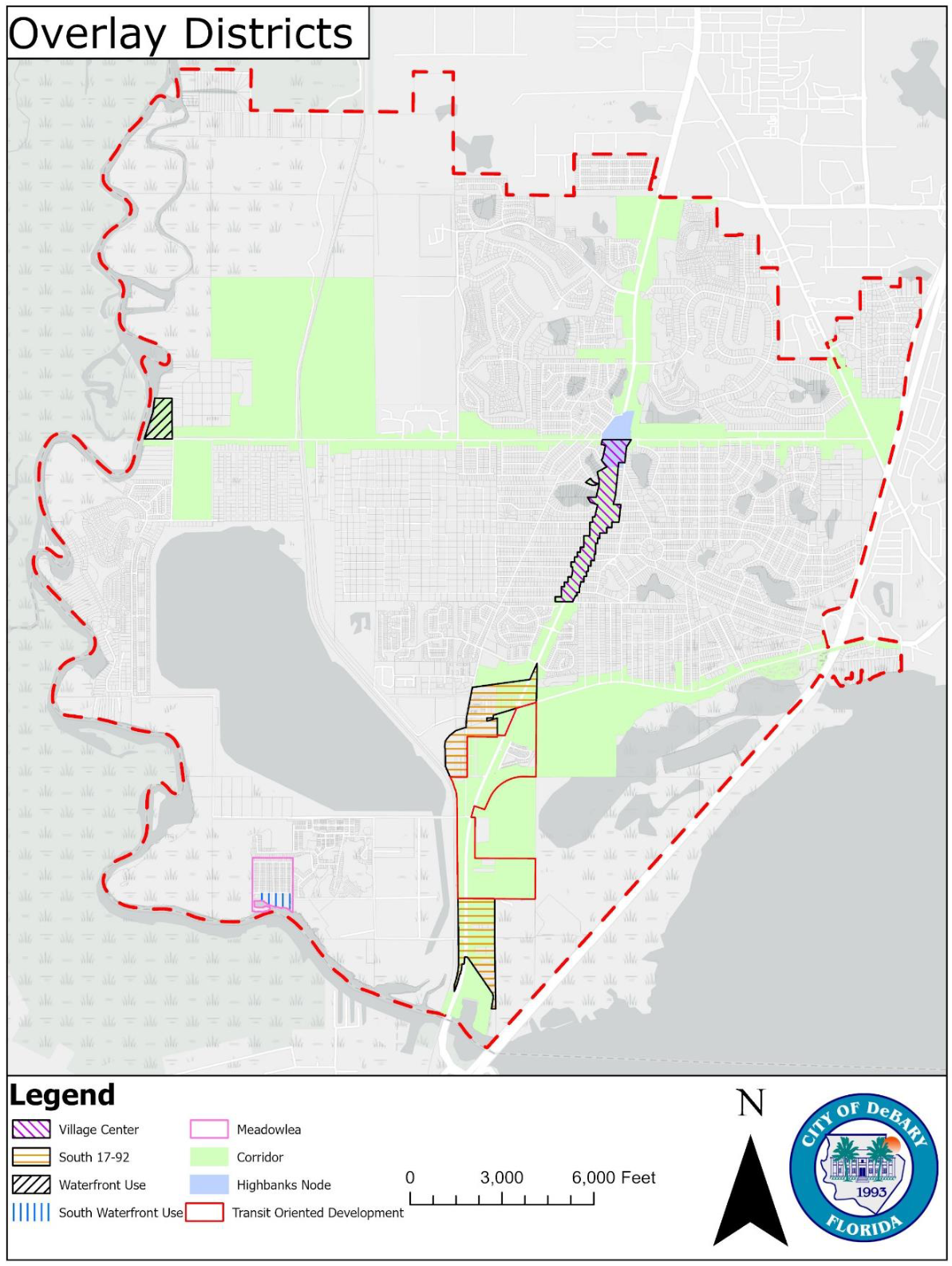
Sec. 5.3. - Purpose and intent.
The purpose of the Waterfront Use Overlay District is to provide additional development restrictions and opportunities for areas used for privately owned public water access consistent with the adopted Comprehensive Plan. The Comprehensive Plan provides for management of areas adjacent to surface water bodies and preservation of the public's ability to access water bodies. It is the intent of this section that adequate flexibility be provided to accommodate the purposes and style of development described in the Comprehensive Plan.
Sec. 5.4. - Applicability.
The provisions of this section shall apply within the area identified on Figure 5-1: Overlay Districts Map as the "Waterfront Use Overlay District."
Sec. 5.5. - Regulations applicable to use and development.
(a)
Uses and development practices not permitted shall include any use or development which restricts public access to surface water bodies utilizing public facilities. This provision does not prevent management of private lands, including private access facilities, by the owner of such land or facilities.
(b)
Additional uses and development practices may be permitted by special exception, including campgrounds and recreational vehicle facilities operated in conjunction with a marina, provided that such facilities shall be served by central sewerage facilities (public or private).
(Ord. No. 01-99, § 1(302.3), 11-3-1999)
Sec. 5.6. - Purpose and intent.
The purpose of the Meadowlea Overlay District is to provide alternative setback requirements to facilitate the installation of newer mobile home dwellings on lots within this district. Due to the average lot size within this district and changes in the size and configuration of modern mobile homes, such installations, as proposed, often do not meet the setback requirements imposed by the MH-5 (Urban Mobile Home) Classification. This overlay district seeks to provide relief to accommodate the installation of newer mobile home units on the lots located within the subdivision.
Sec. 5.7. - Applicability.
The provisions of this article will apply within the area identified on Figure 5-1: Overlay Districts Map as the "Meadowlea Overlay District."
Sec. 5.8. - Regulations applicable to use and development.
(a)
Minimum yard requirements. The following setback requirements will apply in lieu of those prescribed by the MH-5 (Urban Mobile Home) Classification.
Front yard: 20 feet.
Rear yard: 10 feet.
Side yard: 5 feet.
Street side yard: 10 feet.
Waterfront yard: 25 feet.
(b)
All other zoning requirements, including any additional dimensional or setback requirements that are not modified by this article, will remain in effect as set forth in the MH-5 (Urban Mobile Home Classification).
(Ord. No. 06-2021, §§ 2, 3 (Exh. A), 7-21-2021)
Sec. 5.9. - Purpose and intent.
The purpose of the South 17-92 Overlay District is to provide additional development restrictions and opportunities within the area along South U.S. 17-92 consistent with the adopted Comprehensive Plan. The Comprehensive Plan provides for mixed-use and commercial development to support the overall growth and development of the City. It is the intent of this article that adequate flexibility be provided to accommodate the purposes and style of development described in the Comprehensive Plan.
Sec. 5.10. - Applicability.
The provisions of this article shall apply within the area identified on Figure 5-1: Overlay Districts Map as the "South 17-92 Overlay District."
Sec. 5.11. - Use and development standards.
(a)
Shared driveways between adjacent parcels are required for developments where driveway separations per this Code cannot be provided. Shared driveways will be encouraged in all other developments in consideration of driveway separations, median openings, and distance to street intersections. Coordinated development on a single parcel or coordination of developments on adjacent parcels under a unified development plan is encouraged. Where parcels are combined for development purposes, a unity of title agreement must be recorded ensuring that multiple parcels remain under a common ownership or control. The City Council may allow a reduction in the lot area and/or frontage requirements where adjacent developments are coordinated so as to meet the intent of this provision.
(b)
Permitted uses in the South 17-92 Overlay District shall be as regulated by Table 5-1 in Sec. 5.18.
(Ord. No. 01-99, § 1(302.2), 11-3-1999; Ord. No. 16-04, § 2, 11-3-2004; Ord. No. 02-12, § 2(Exh. A), 9-5-2012)
Sec. 5.12. - Purpose and intent.
The purpose of the Village Center Overlay District is to introduce both development restrictions and opportunities within its boundaries, aiming to fortify and guide development toward existing communities while fostering walkable neighborhoods. This overlay district promotes the creation of a compact, multiuse, and mixed-use development area encompassing retail, office, and service spaces, contributing to the overall growth and development of the City. Located just south of the Highbanks Road Node along the US 17-92 corridor as described in Article VI of this chapter, the Village Center Overlay District is strategically positioned as a regional roadway segment connecting multiple communities. Designed to accommodate a diverse range of uses, this overlay district serves the adjoining neighborhoods and passing motorists. The vision for this section of US 17-92 includes a commitment to high-quality development, portraying the City's arrival with an image of a pedestrian and bicycle-friendly environment.
Sec. 5.13. - Applicability.
The provisions of this section shall apply within the area identified on Figure 5-1: Overlay Districts Map as the "Village Center Overlay District."
Sec. 5.14. - Permitted uses.
Permitted uses in the Village Center Overlay District shall be as regulated by Table 5-1 in Sec. 5.18.
(Ord. No. 01-99, § 1(302.1), 11-3-1999; Ord No. 16-04 § 1, 11-3-2004; Ord. No. 22-02, § 3, 12-11-2002; Ord. No. 10-11 § 2, 10-5-2011; Ord. No. 02-12, § 2 (Exh. A), 9-5-2012)
Division 3. - Building Design Standards
This division establishes standards for building design. The standards apply to all development subject to the regulations of this article, except for duplex units and single-family homes/developments. Parking garages are subject to the same building design requirements as all other buildings.
Division 5. - Access, Circulation and Parking Requirements
The intent of the parking standards is to encourage a balance between pedestrian-oriented development and necessary vehicle storage. The goal is to construct neither more nor less parking than is needed.
Division 6. - Landscape, Buffers and Screening Standards
Landscaping, buffering and screening shall be provided in accordance with the following:
Sec. 5.60. - Regulating plan.
(a)
Background. The Florida Department of Transportation in cooperation with the federal government and local officials from the City of Orlando as well as Orange, Osceola, Seminole and Volusia Counties are managing a commuter rail transit service, named SunRail, linking Volusia County to the north with downtown Orlando and Osceola County to the South. The SunRail station has a park and ride lot with a bus drop off area for the DeBary station. The DeBary station is near some of Central Florida's most scenic parks and significant cultural resources, and is easily accessible to Interstate 4.
Commuter rail improves transportation options for DeBary residents, many of whom work in the Orlando area to the south, as well as potentially creating economic development opportunities through a concentrated mix of uses to include retail commercial, office, institutional, civic uses and medium and high density residential development.
In response to commuter rail service in DeBary, the City Council adopted the City's Evaluation-Based Amendments, which includes a Transit Oriented Development (TOD) Overlay District as well as a TOD Master Plan. Transit Oriented Development is the functional integration of land use and transit. It is a land use planning concept that promotes a mix of residential, commercial, office and public uses, all within a comfortable walking distance to maximize access to public transportation, and incorporates features to encourage transit ridership.
(b)
Purpose. To establish the regulatory framework in order to implement the TOD Overlay District and Master Plan adopted by the city through the creation of a regulating plan that will result in the desired built environment. This regulating plan promotes compact land use patterns that support place making, energy efficiency, environmental sensitivity and multi-modal transportation options as well as require street design that creates public space that is safe and welcoming for pedestrians (i.e., complete streets). The general purposes of this document are to:
(1)
Encourage transit use;
(2)
Increase housing opportunities;
(3)
To provide standards to ensure a high quality appearance;
(4)
Provide a functional mix of land uses;
(5)
Promote energy efficient land use patterns;
(6)
Promote walking and bicycling;
(7)
Promote sustainability/resiliency;
(8)
Promote healthy lifestyle.
(c)
General applicability. No premises shall hereafter be used or occupied and no principal building, accessory structure or sign shall be hereafter erected, constructed, moved or altered except in conformity with these regulations.
(1)
The transit-oriented development overlay district is within the Southeast Mixed-Use Area (SEMUA/TOD) as depicted on the city's Future Land Use Map and as described in subsection 5.60(e), TOD Boundaries of this regulating plan.
(2)
Reserved.
(3)
This article applies to all those properties that develop under the TOD Overlay District. Such properties shall comply with the City of DeBary Comprehensive Plan Specifically Future Land Use Policy 5.406(a)(5) and this regulating plan.
(4)
The principles, standards and requirements put forth by this regulating plan (Chapter 5, article VII) shall supersede the standards and requirements presently specified in the Land Development Code unless not addressed herein. Failure of this regulating plan to address a particular condition or term of restriction shall not relieve an applicant of the necessity of complying with the law governing said permitting requirements, conditions, terms or restrictions.
(5)
Agricultural exemption. All land with an underlying agricultural zoning designation shall have the right to utilize the property for agricultural purposes until such time that the property owner chooses to develop under these overlay criteria.
(6)
This article was created with images and figures as important visual aids to enhance understanding and comprehension of plan-making and development, however, in the event there is a conflict or inconsistency between the text of this document and any figure or illustration, the text shall prevail.
(7)
The regulations of this document are organized by development standards with sub-area requirements inter-dispersed through-out each category of development standards. The TOD Overlay District includes three sub-areas. These areas are approximate distances to allow flexibility for desired development to be approved by the DRC. The city may extend these sub-areas if the developments meet the purpose of the TOD Overlay District.
a.
U.S. Hwy. 17-92 TOD—Developments facing U.S. Hwy. 17-92 involving direct design treatments from back of curb to building;
b.
TOD Core—Properties within approximately 1/4 mile of the DeBary Commuter Rail Station;
c.
Outside TOD Core—Properties outside of the TOD Core.
(d)
Administrative procedures.
(1)
A pre-application meeting shall be required prior to submitting any development proposal within the TOD Overlay District. The purpose of this meeting is to review the TOD Overlay District requirements and discuss any deviations from the strict application of the regulation that may be addressed with a development agreement approved by City Council. A conceptual plan for the propose project is required to have a pre-application meeting.
(2)
A development agreement with the City of DeBary is suggested, but not required. However, if a proposed development is going to utilize any bonuses or incentives or is going to deviate from the strict application of this regulating plan, a development agreement shall be required. If a development agreement is utilized by the developer, this agreement will specify any incentives, bonuses and waivers, as provided by the City of DeBary Land Development Code, that the developer may wish to employ in the design of the proposed site. All incentives and bonuses shall be presented to city staff for review and recommendation prior to the development agreement being presented to the City Council for approval. Appropriate incentives and bonuses may be approved by City Council on a project by project basis. Upon approval by the City Council, the developer of the proposed project will have a clear guide to the rules of development for the project.
(3)
Those properties which develop under the TOD Overlay District shall not be required to rezone their property. Properties within the TOD Overlay District which properties, as of September 23, 2020, have an active, effective, and unexpired development order (DO) from the city and/or development agreement (DA) with the city, either of which permit commercial or mixed-use development, except as provided below, shall not be required to comply with the changes to the TOD District that are newly created by Ordinance 06-2020. However, all development of any drive-through restaurants shall meet all of the requirements of the TOD District and City Land Development Code as such may exist as of the date of this ordinance and as hereafter may be adopted by the city. Any DO or DA that expires for any reason, shall be required to meet all of the TOD District and Land Development Code requirements, as such requirements exist at the time of permitting of development for such properties.
(4)
If subdivision is necessary, it shall be in accordance with Chapter 10. The Subdivision Overall Development Plan shall also be reviewed against this regulating plan for code compliance.
(5)
Platting of property within the TOD Overlay District shall also be in accordance with Chapter 3 of the city's Land Development Code.
(6)
A final site plan shall be submitted in accordance with Chapter 3 and be reviewed by the Development Review Committee (DRC) against this regulating plan for code compliance in order to obtain a development order.
(7)
For mixed-use projects, the city shall calculate total allocation of land uses within the TOD Overlay District, based on the proposed mix of uses. Allocation of the proposed uses shall determine allocation of density and intensity (i.e., a commercial/office/residential mixed-use development on one acre, with 50% retail commercial, 25% office and 25% residential uses constructed uses would attribute 1/2 acre to retail commercial allocation, 1/4 acre of office and 1/4 acre of residential allocation to the overall allowance for the TOD Overlay District).
(8)
The Land Development Manager (LDM) shall have the authority to grant minor deviations from final site and subdivision plans where less than 10% of the development plan is impacted by proposed revisions from previously approved plans. Such revisions shall include, but not be limited to the following: setbacks, height, density/intensity, parking, buffers, open space and other site design dimensions. However, all deviations from the plan must meet the minimum criteria set within the Comprehensive Plan and Land Development Code, unless a waiver is sought with adequate justification through a development agreement and approved by City Council. All waivers granted shall only be granted when the City Council has been provided evidence that the requested waiver is necessary to meet the purpose and intent of the given section of this article that said waiver is being requested. Additionally, the purpose of the waiver request shall not be based on economic hardship. Final site plans shall be updated to include all proposed revisions and be resubmitted to the city.
(9)
Density.Chapter 2 of the Land Development Code establishes the density calculation criteria within the TOD boundaries.
(e)
Transit oriented development boundaries. The TOD Overlay District is comprised of approximately 261 acres and is located on the south side of Dirksen Road on the east and west sides of U.S. Hwy. 17-92 running approximately 210 feet south of Buckley Drive.
See Figure 5 - 51 TOD Overlay District Boundary and Figure 5 - 52: TOD Illustrative Plan
Figure 5 - 51: TOD Overlay District Boundary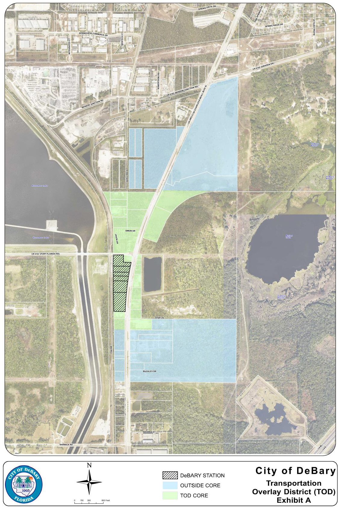
Figure 5 - 52: TOD Illustrative Master Plan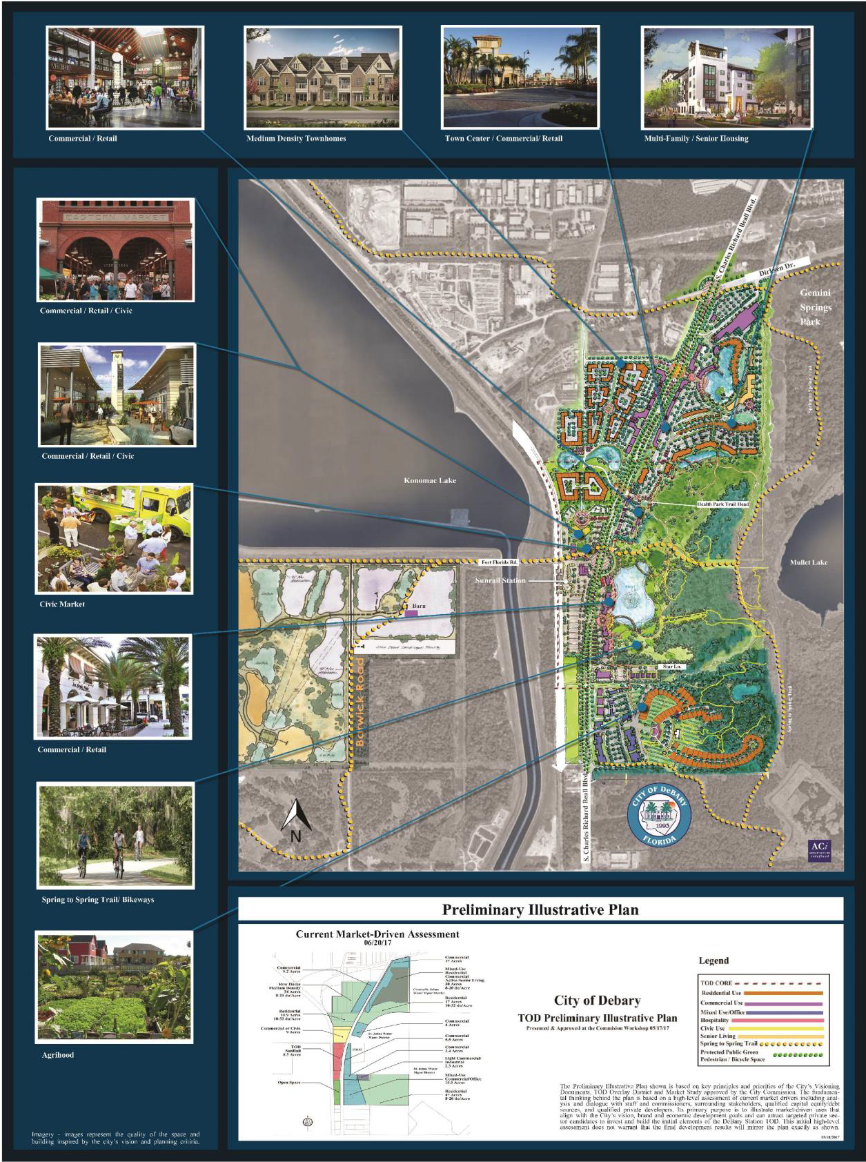
(f)
Incentives. Incentives for developing within the TOD Overlay District include the elimination of the Planned Unit Development zoning requirement, higher densities, increased building heights, additional permitted land uses, and reduced parking. The city may also consider other incentives for development, including, but not limited to, economic incentives, and development and infrastructure standards to enhance the physical and economic feasibility of transit-oriented and pedestrian-friendly development. Such incentives may include:
(1)
A discount on development application fees;
(2)
Modification of impact fees such as, but not limited to, mobility, parks, and government buildings;
(3)
Public/private partnerships to provide infrastructure;
(4)
Modification of building permit fees;
(5)
Establishment of a Community Development District or Special Assessment District;
(6)
Any other financing mechanism deemed appropriate.
(g)
Non-conforming uses. All non-conforming properties, uses and structures previously developed under the TOD Overlay District that do not conform to this regulating plan shall be subject to Sec. 1.6, Nonconforming lots, structures and uses, of the city Land Development Code.
(h)
TOD master plan. The DeBary TOD Master Plan, a copy of which is available for review in the city's records, illustrates the city's vision for the TOD Overlay District, and constitutes part of the regulating plan. In addition to the other standards and criteria under this article, proposed development within the TOD Overlay District shall generally be consistent with the intent of the Illustrative TOD Master Plan. The intent of the TOD Master Plan is to effectively ensure an interconnected pedestrian friendly mobility network, public gathering spaces, greenways, an evenly distributed and publicly accessible parks and recreational system, as well as a village center development pattern so that a cohesive and consistent transit oriented environment is established. The city supports flexibility in the plan and will favorably review deviation(s) from the TOD Master Plan to respond to market conditions upon a determination that such deviation(s) is consistent with the intent of this regulating plan and of this article. Such deviations from the master plan may be approved by the City Manager or his/her designee.
(Ord. No. 13-10, § 2(Exh. A), 12-29-2010; Ord. No. 02-15, § 2, (Exh. A), 8-26-2015; Ord. No. 06-17, § 2, 7-19-2017; Ord. No. 06-20 20, § 2(Exh. A), 9-23-2020)
Sec. 5.61. - Land use and building density.
(a)
Purpose and intent.
(1)
The TOD Overlay District is to improve quality of life by creating walkable and livable areas where people are able to reduce vehicle usage without sacrificing access to neighborhood and community amenities. This is accomplished by the following:
a.
Encourage transit-supportive land uses, which generally have higher densities and intensity within the TOD Core, then stepping down in density, intensity and height to promote neighborhood compatibility.
b.
Create opportunities for shorter, multi-purpose trips by encouraging a mix of uses within the TOD Overlay District.
c.
Locate the highest level of activity and mix of uses within the TOD Core and along major streets.
d.
Provide for and encourage development and redevelopment that contains a compatible mix of residential, commercial services, and employment within close proximity to each other and to the DeBary Commuter Rail Station.
e.
These areas are approximate distances to allow flexibility for desired development to be approved by the DRC.
(2)
The provisions of this section shall apply within the area identified on the Future Land Use Map as the "Southeast Mixed-Use Area/Transit Oriented Development Overlay District."
(b)
Compatible Land Uses. Each of the properties within the TOD Overlay District maintains their current zoning designations until such time as they are developed or redeveloped. Then an administrative rezoning to PUD will be processed by the City after approval of the development agreement and/or development order. To further the intent and purpose of the TOD Overlay District, certain specific and incompatible uses shall be prohibited.
(1)
Purpose and intent.
a.
The purpose of the TOD Overlay District is to provide additional development restrictions and opportunities within the TOD area consistent with the adopted Comprehensive Plan. The plan provides for a compact, pedestrian and transit oriented multi-use and mixed-use development area of retail and service, to support the overall growth and development of the city. It is the intent of this section that adequate flexibility be provided to accommodate the purposes and style of development described in the Plan.
b.
The provisions of this section shall apply within the area identified on the zoning map as the "TOD Overlay District."
c.
Proposed developments are encouraged, to the greatest extent practicable, to be presented as an assemblage of smaller properties or parcels to achieve the greatest development potential and provide for more cohesive integration into the overall development framework within the TOD Overlay District.
d.
Parcels that are located at transition lines between sub-areas of the TOD District Overlay may be allowed to reasonably continue the development densities and intensities from the more intense sub-area into the less intense sub-area, if it is necessary to complete a development project and if approved by City Council.
(2)
Mixed-use requirements. The city's intent is to preserve its commercial development viability along U.S. 17-92 frontages, and to ensure that the TOD is developed with a mixture of uses rather than just residential. Single-use, multifamily residential development projects are generally prohibited on properties five acres or larger.
a.
Multifamily residential development projects on properties from five to 15 acres in size are required to provide a minimum of 5,000 square feet of commercial or office space.
b.
Multifamily residential development projects on properties from 16 to 25 acres in size are required to provide a minimum of 7,500 square feet of commercial or office space.
c.
Multifamily residential development projects on properties larger than 26 acres shall provide a minimum of 10,000 square feet of commercial or office space.
d.
All multifamily residential development projects fronting U.S. 17-92 shall maintain ground floor commercial and office space frontage with the exception of entrances into the multifamily residential development.
e.
No developments within the TOD Main Street Area shall be permitted to construct ground-floor residential developments. Commercial or office space shall be required on the ground floor with residential above.
f.
All commercial and office space shall be provided to unrelated legal entities, including corporate offices, of the multifamily residential development legal entities of owners. (example: apartment leasing offices), gyms, clubhouses, or other recreation space shall not qualify to meet the mixed-use requirements of this Code section.
g.
Properties along U.S. 17-92 or Shell Road, subdivided into parcels smaller than five acres, after the adoption of this Code, shall not be permitted to develop single-use multifamily projects.
(3)
Additional regulations are applicable to permitted and prohibited uses within the TOD Overlay District as specified in the following Comprehensive Land Use Table. Please note that residential uses are prohibited on the ground floor within the entire TOD Main Street Area. See Mixed-use requirements in subsection (b)(2) above.
P (Permitted) - S (Prohibited)
(4)
Continuation of development pattern. The intent of the TOD regulating plan is to ensure that development patterns are consistent throughout. New developments and development plans shall be consistent with developments and approved development plans within close proximity, that meet the intent of the TOD regulating plan. Newly proposed developments are required to hold a pre-application meeting with city staff. During this meeting, the applicant should work with city staff to determine whether the adjacent development patterns (existing or approved) should be implemented within the newly proposed development project. New development shall follow the TOD Design Principles Appendix 3 to ensure consistency and compatibility. Additionally, new developments shall adopt the following existing components of approved development plans within close proximity. This section does not apply to development patterns that were permitted through a waiver.
a.
Existing block structure—Replicate the dimensions of the block size and layout.
b.
Existing road design—Replicate the road cross-section including right-of-way widths for similar classified roadways, paving textures, landscape, hardscape, and utility infrastructure.
c.
Existing building articulation—Replicate the building articulation on street frontage design elements, both horizontal and vertical, that help create a streetscape of consistent interest. Building materials, special ground-floor design treatments, façade modulation, corner treatments, building setbacks for upper stories, and façade elements such as transparency, building entries, and other architectural details help define the public and shall be consistent across different developments projects.
d.
Existing way-finding signage—Including street signs oriented for pedestrians, bicycles, and automobiles.
e.
Existing street lights—Design shall follow the closest available street lamps and poles.
f.
Existing architectural patterns—While architectural design for each project may be somewhat specific to that project, it should not conflict or disrupt the existing approved developments in close proximity. New development shall follow the TOD Development Principles for architectural design.
g.
Existing building scale—New developments shall take into consideration the existing scale of adjacent buildings, either approved, or already built.
h.
Stormwater infrastructure—New developments shall evaluate the existing stormwater infrastructure of adjacent approved or developed projects and determine with city staff, how to best complement and or safely expand the system.
i.
Public space/open space—New developments shall evaluate the existing stormwater public spaces and open space and replicate this format or improve upon it. This may be done by expanding upon existing spaces adjacent to the project, or repeating logical patterns into the new project that already exist in close proximity.
j.
Transportation—Transit infrastructure, such as bus or autonomous vehicle stop shelters, bike racks, and micro mobility zones, shall be replicated in similar design.
(c)
Density/Intensity.
(1)
TOD Core—Minimum 10 du/acre; Maximum 32 du/acre;
(2)
Outside TOD Core—Minimum 8 du/acre; Maximum 20 du/acre;
(3)
Intensity—Minimum 0.4, Maximum 2.0 FAR;
(4)
Parcel assemblage of at least one acre is required for residential mixed-use developments, two acres is recommended for residential mixed-use developments in order to meet minimum residential densities;
(5)
Residential densities below these minimums may be permitted for sites with physical constraints. This shall be determined on a case-by-case basis through DRC during the development review process.
(Ord. No. 13-10, § 2(Exh. A), 12-29-2010; Ord. No. 02-15, § 2, (Exh. A), 8-26-2015; Ord. No. 06-20 20, § 2(Exh. A), 9-23-2020)
Sec. 5.62. - Circulation, connection and streetscape standards.
(a)
Purpose and intent.
(1)
Ensure that site design promotes efficient pedestrian and vehicle circulation patterns.
(2)
Ensure the creation of a high-quality street and sidewalk environment that is supportive of pedestrian and transit mobility and that is appropriate to the roadway context.
(3)
Provide a convenient, safe, and pleasant pedestrian system appropriate for people of all ages and abilities.
(4)
Ensure that trees, sidewalks, and buildings, three of the major elements that make up a streetscape, are arranged in a manner that supports the creation of a safe, human-scaled, and well-defined roadway environment.
(5)
Ensure that there are multiple travel route options for all transportation modes in and around the TOD Overlay District.
(6)
Ensure that vehicular parking is accommodated in a manner that enriches and supports, rather than diminishes, the pedestrian environment, and that does not create a barrier between the pedestrian environment and the buildings.
(7)
Ensure that sites are developed in a manner that supports and encourages connectivity for all modes of travel and that new and existing development, pedestrian and bicycle paths, and open spaces complement and link to one another.
(8)
Connectivity to other areas outside the TOD Overlay District.
(b)
Roadway types.
(1)
The following types of roadways are to ensure a cohesive development pattern along the streets, and to create safe, pleasant and convenient walking environments.
(c)
Streetscape.
(1)
The following streetscape standards specify the typical configuration of the roadway types: U.S. Hwy. 17-92, TOD Corridor Streets, Pedestrian Priority Streets, Local Streets and Main Street.
a.
U.S. Hwy. 17-92—This is a primary state roadway that traverses the center of the TOD Overlay District and carries the highest level of vehicular traffic and transit to the internal mixed-use developments and being most appropriate for non-residential development. A landscaped boulevard can be created along the medians to enhance the pedestrian environment.
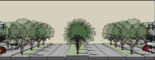
Boulevard
(Source: City of Panama City Beach, 2010)
1.
The streetscape shall include the following:
i.
Street tree/furniture zone shall be the width of the existing unpaved right-of-way, which includes the existing sidewalk width.
ii.
Required 20-foot multi-use buffer. An additional 10-foot wide utility easement may be required by Volusia County along the east side of U.S. Hwy. 17-92. If the utility easement is necessary, a 30-foot multi-use buffer shall be required.
iii.
Placement of street trees/planting strips, street furniture including seating, street lights, waste receptacles, fire hydrants, traffic signs, bus shelters, public utility equipment such as electric transformers and water meters, and similar elements in a manner that does not obstruct pedestrian access or motorist visibility may be permitted within the street tree/furniture zone, utility easement (where applicable) and multi-use buffer. If any of these items are removed or damaged due to maintenance of the utilities within an easement, they must be replaced.
iv.
Sidewalk easement should be a minimum width to encompass the area from road right-of-way to the back of a 12-foot wide sidewalk. The trail placement may extend into the street tree/furniture zone, including utility easement (where applicable), and multi-use buffer by no more than 50% of their respective width, unless otherwise approved as part of the site plan review process.
v.
The street trees should be planted at an average spacing not greater than 50 feet on center. If landscaping within the utility easement is removed for any work/construction, the landscaping must be replaced with similar plant materials and size specifications.
2.
All utility lines shall be underground for all new construction from the building to the property line. Utility lines within the right-of-way shall be placed underground.
3.
Where existing electric utilities remain overhead, the centerline of street trees at their mature size shall be per Right Tree Right Place Standards, unless otherwise approved by the DRC.
4.
The DRC may approve a payment of money into the City sidewalk improvement trust fund as specified in sec. 3.20 of the LDC. The city shall establish a U.S. Hwy. 17-92 TOD sub-fund to construct the sidewalk along U.S. Hwy. 17-92. The city shall also adopt a sidewalk master plan to identify circulation, phasing and design criteria for U.S. Hwy. 17-92.
Figure 5 - 53: U.S. Hwy. 17-92 Streetscape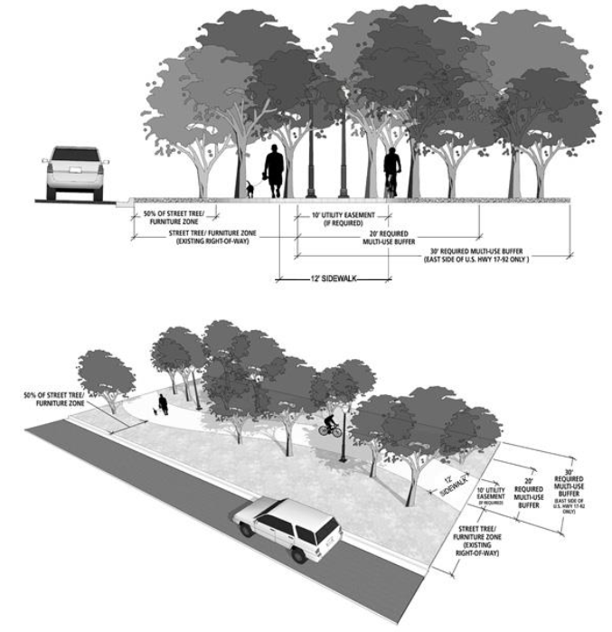
b.
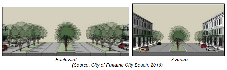
TOD Core streets—These streets will be primary interior roadways of mixed-use developments to support a sufficient population density and mix of uses connecting to U.S. Hwy. 17-92 and the DeBary Commuter Rail Station. These streets will carry vehicular, transit and pedestrian flow and being most appropriate for non-residential and mixed-use developments. A median landscaped boulevard and avenue can be provided to accentuate the entry drive and primary streets with interconnecting alleyways for activities "behind the scene," such as parking, loading areas, trash collection, utility location, etc.
1.
Sidewalk should be a minimum width of 14 feet from back of curb, unless otherwise approved as part of the site plan review process. Sidewalks shall consist of two zones: a street tree/furniture zone located adjacent to the curb, and a sidewalk clear zone.
i.
The street tree/furniture zone shall have a minimum width of six feet (from back of curb) and shall be hardscaped and continuous, and located adjacent to the curb.
ii.
The street tree/furniture zone should be planted with street trees at an average spacing not greater than 40 feet on center.
iii.
The street tree/furniture zone is intended for the placement of street furniture including seating, street lights, waste receptacles, fire hydrants, traffic signs, newspaper vending boxes, bus shelters, bicycle racks, public utility equipment such as electric transformers and water meters, and similar elements in a manner that does not obstruct pedestrian access or motorist visibility.
iv.
The sidewalk clear zone should be a minimum width of eight feet, shall be hardscaped, shall be located adjacent to the street tree/furniture zone, and shall comply with ADA Standards. The sidewalk clear zone shall be unobstructed by any permanent or nonpermanent element.
2.
The minimum sidewalk requirement should apply regardless of the available right-of-way, unless otherwise approved as part of the site plan review process.
3.
Where required, the sidewalk shall extend onto private property with a sidewalk easement provided.
Figure 5 - 54: TOD Core Streetscape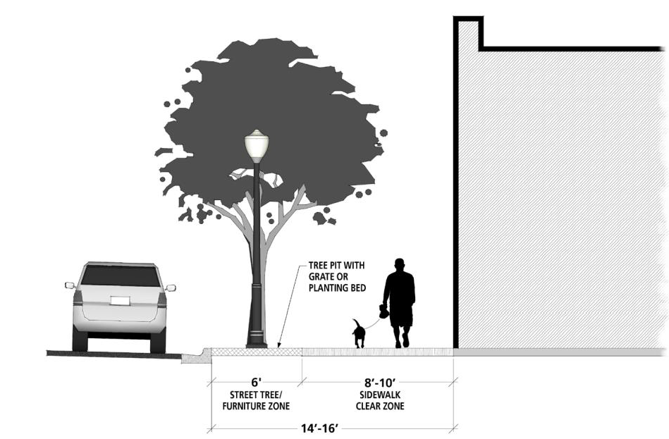
c.
Pedestrian priority streets—These streets serve as primary pedestrian routes outside TOD core leading directly to the TOD Core, connecting to neighborhoods, trails, parks and other public facilities, and being most appropriate for neighborhood commercial, and multifamily and single-family residential developments. A landscaped avenue, road and parkway can be provided with interconnecting alleyways for activities "behind the scene," such as parking, loading areas, trash collection, utility location, etc.
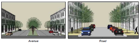
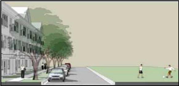
Parkway
(Source: City of Panama City Beach, 2010)
1.
Sidewalk should be a minimum width of 14 feet in width from back of curb, unless otherwise approved as part of the site plan review process. Sidewalks shall consist of two zones: a street tree/furniture zone located adjacent to the curb, and a sidewalk clear zone.
i.
The street tree/furniture zone shall have a minimum width of eight feet (from back of curb) and shall be continuous and located adjacent to the curb.
ii.
The street tree/furniture zone should be planted with street trees at an average spacing not greater than 40 feet on center.
iii.
The street tree/furniture zone is intended for the placement of street furniture including seating, street lights, waste receptacles, fire hydrants, traffic signs, newspaper vending boxes, bus shelters, bicycle racks, public utility equipment such as electric transformers and water meters, and similar elements in a manner that does not obstruct pedestrian access or motorist visibility.
iv.
The sidewalk clear zone should be a width of eight feet, shall be hardscaped, shall be located adjacent to the street tree/furniture zone, and shall comply with ADA Standards. The sidewalk clear zone shall be unobstructed by any permanent or nonpermanent element.
2.
The minimum sidewalk requirement should apply regardless of the available right-of-way, unless otherwise approved as part of the site plan review process.
3.
Where required, the sidewalk shall extend onto private property with a sidewalk easement provided.
Figure 5 - 55: Pedestrian Priority Streetscape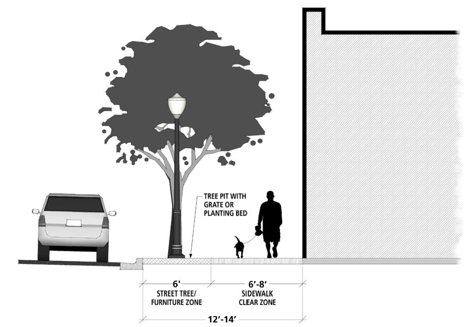
d.
Local streets—These streets serve as secondary routes within the transitional area making up the rest of the street network, while pedestrian accommodation is still prioritized and being most appropriate for commercial and business park developments. A landscaped avenue and roadway can be provided with interconnecting alleyways for activities "behind the scene," such as parking, loading areas, trash collection, utility location, etc.
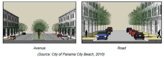
1.
Sidewalk shall be a minimum width of 12 feet in width, unless otherwise approved as part of the site plan review process. Sidewalks shall consist of two zones: a street tree/furniture zone located adjacent to the curb, and a sidewalk clear zone.
i.
The street tree/furniture zone shall have a minimum width of six feet (from back of curb) and shall be continuous and located adjacent to the curb.
ii.
The street tree/furniture zone should be planted with street trees at an average spacing not greater than 50 feet on center.
iii.
The street tree/furniture zone is intended for the placement of street furniture including seating, street lights, waste receptacles, fire hydrants, traffic signs, newspaper vending boxes, bus shelters, bicycle racks, public utility equipment such as electric transformers and water meters, and similar elements in a manner that does not obstruct pedestrian access or motorist visibility.
iv.
The sidewalk clear zone shall be a minimum width of six feet, shall be hardscaped, shall be located adjacent to the street tree/furniture zone, and shall comply with ADA Standards. The sidewalk clear zone shall be unobstructed by any permanent or nonpermanent element.
2.
The minimum sidewalk requirement shall apply regardless of the available right-of-way, unless otherwise approved as part of the site plan review process.
3.
Where required, the sidewalk shall extend onto private property with a sidewalk easement provided.
Figure 5 - 56: Local Streetscape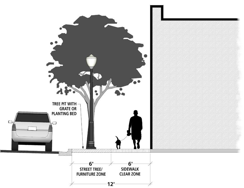
e.
Main Street—This is the area generally known as Shell Road from Benson Junction Road at the north to Ft. Florida Road at the South as well as from the rail road tracks to the west and U.S. 17-92 to the east. The Main Street area is only to be considered within the TOD boundaries and transects through the TOD Core and Outside Core designations. Main street will run parallel to U.S. 17-92 and will intersect with lateral local streets that connect the main street with U.S. 17-92. The intent of this corridor is to serve as the city's main street, which shall primarily consist of ground-floor commercial amenities such as restaurant and retail with office and residential located above. It shall serve as the local commercial corridor that is accessible at the pedestrian scale. Main street shall also be collocated with a central park and stormwater pond. This street shall be designed as a "living street" where vehicles, bicycles and pedestrians equally share the space. This corridor may serve as a central gathering space for main street festivals and could be closed to vehicular traffic during special events.
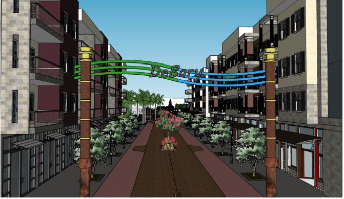
1.
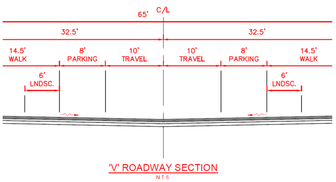
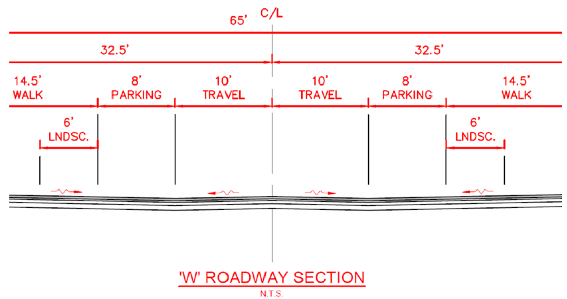
The main street cross-section shall be designed as an inverted "V" crown, or "W" with most surfaces in the entire right-of-way being at a single grade from building façade to building façade (or edge of open space).
2.
The main street right-of-way shall be a minimum of 65 feet wide. Developments fronting the proposed main street area may be required to dedicate adequate right-of-way to meet the 65 foot width requirement.
3.
The travel lane shall be ten feet wide.
4.
On-street parking shall be provided and is to be a minimum eight feet in width.
5.
Sidewalks shall be a minimum width of 14 feet from edge of on-street parking to building facade.
6.
Street tree/furniture zone may be included within the 14-foot sidewalk area, and shall have a minimum width of six feet from edge of vehicular travel lane to sidewalk clear zone. Landscape zones shall be intermittent.
7.
The street tree/furniture zone should be planted with street trees at an average spacing not greater than 40 feet on center.
8.
The street tree/furniture zone is intended for the placement of street furniture including seating, street lights, waste receptacles, fire hydrants, traffic signs, newspaper vending boxes, bus shelters, bicycle racks, public utility equipment such as electric transformers and water meters, and similar elements in a manner that does not obstruct pedestrian access or motorist visibility.
9.
The sidewalk clear zone should be a minimum width of eight feet, shall be hardscaped, shall be located adjacent to the street tree/furniture zone, and shall comply with ADA Standards. The sidewalk clear zone shall be unobstructed by any permanent.
10.
The minimum sidewalk requirement should apply regardless of the available right-of-way, unless otherwise approved as part of the site plan review process.
11.
Where required, the sidewalk shall extend onto private property with a sidewalk easement provided.
12.
A ribbon curb shall be used as the centerline and edge of pavement at travel lanes.
13.
Main street paving surfaces shall utilize brick pavers.
14.
The roadway spaces may be differentiated for automobiles and pedestrians by varying textures and colors of the surface area, and can be separated into safe zones by bollards, landscape islands, parked cars, light posts and other hardscapes.
15.
The sharp deflection in meandering streetscapes as well as landscape and hardscape obstacles slow traffic down to safe speeds so bicycle and pedestrians can all share the same space.
16.
All utility lines shall be underground for all new construction from the building to the property line. Utility lines within the right-of-way shall be placed underground.
(d)
On-street parking.
(1)
On-street parking is required to serve retail, office, and residential parking needs. It is especially important in areas where there are active edge designations to support ground floor businesses and to serve as a buffer for pedestrian activity from the streets.
(2)
On-street parking is required on TOD corridor streets, pedestrian priority streets, local streets, and main street, and located on the same side of the street as the use.
(3)
The parking stall shall be a minimum 22 feet in length and eight feet in width for parallel parking. The design may be accommodated adjacent to the curb line, or travel lane, or by providing parking inside the curb line.
(4)
The streetscape provisions under Sec. 5.62(c) shall continue to apply to on-street parking with both a clear zone and street tree/furniture zone placed adjacent to the curb at the inside of the parking spaces.
(5)
On-street parking spaces may be counted toward the total number of parking spaces.
Figure 5 - 57: On-Street Parking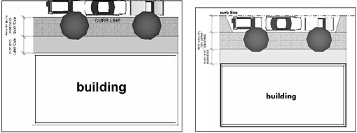
(e)
Connection and circulation.
(1)
All projects that are adding a street(s) must provide a Project Circulation Plan as part of the site plan review process.
(2)
The Project Circulation Plan shall identify the roadway types: U.S. Hwy. 17-92, TOD Corridor Streets, Pedestrian Priority Streets and Local Streets.
a.
The Project Circulation Plan shall demonstrate: How the on-site circulation system will be integrated with surrounding streets, bicycle facilities, trails, existing or future development, etc.
b.
That the street and pathway system will contribute to safe and convenient pedestrian connections between primary destinations (i.e., DeBary Commuter Rail Station, mixed-use, commercial, non-commercial, parks, etc.) and surrounding residential neighborhoods and destinations.
c.
How traffic calming methods have been incorporated into the design of new streets.
(3)
A site shall be generally divided into internal blocks with connecting streets that are interconnected with grid-like transportation system on the site. The block size shall be the following:
a.
TOD Core and Outside TOD Core—Maximum 2.8 acres (300 feet × 400 feet) with intersecting alleyways accessed from the grid pattern streets for parking, loading and service ways.
Figure 5 - 58: Mid-Block Pathway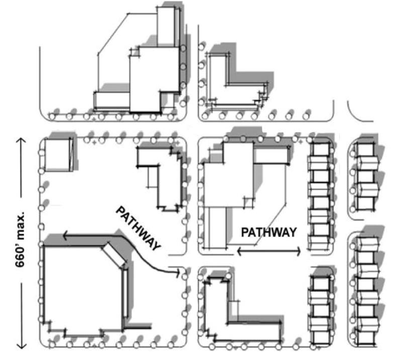
(4)
Curb cuts for vehicular connections:
a.
TOD corridor streets and pedestrian priority streets shall not occur more frequently than every 200 feet.
b.
U.S. Hwy. 17-92 and local streets shall not occur more frequently than every 300 feet.
c.
For a lot with street frontage less than 50 feet wide abutting TOD Core (U.S. Hwy. 17-92), access to the lot shall be provided from a single joint use driveway.
(5)
Curb-cut widths shall comply with the following standards:
a.
Maximum residential driveway width for single family, duplex, and townhome residences shall be 18 feet.
b.
Driveways along street frontages with an active edge designation are discouraged. When they are deemed necessary during site plan review, the maximum driveway width for multifamily residential and commercial uses shall be 30 feet along an active edge.
c.
Other commercial driveways within the TOD Overlay District shall be no more than 30 feet wide.
d.
The maximum curb return radius for all residential driveways shall be ten feet and all commercial driveways shall be 15 feet.
e.
Sidewalk clear zones crossing a driveway shall be continuous and as straight and level as possible. Curb cuts shall ramp up and down to the level of the sidewalk rather than require additional curb ramps along the sidewalk.
(6)
Provide cross access easements, where feasible.
(7)
Alleys are encouraged to focus specific types of activity "behind the scenes" and to potentially allow for another point of access to the site. Alleys may provide space for, but not limited to, the following: loading areas, trash collection, utility location, and access to parking. Alleys shall have a 20-foot right-of-way with a minimum 12-foot paved surface.
(8)
Provide direct pedestrian access from any street adjacent to the property line to a building entrance (the pedestrian access point must be fully accessible during operating hours).
(9)
Where public parkland is adjacent to the property line, provide pedestrian and bicycle access from the trail or walkway system on that parkland to the building entrance (the pedestrian and bicycle access points must be fully accessible during operating hours).
(10)
Minimum five-foot-wide bike lanes along all streets, either demarcated by a symbol or color laneways along U.S. Hwy. 17-92, pedestrian priority streets and local streets.
(Ord. No. 13-10, § 2(Exh. A), 12-29-2010; Ord. No. 02-15, § 2, (Exh. A), 8-26-2015; Ord. No. 06-20 20, § 2(Exh. A), 9-23-2020)
Sec. 5.63. - Site development standards.
(a)
Purpose and intent.
(1)
Ensure that buildings relate appropriately to the surrounding area, create a cohesive visual identity and attractive street scene, and frame the pedestrian environment.
(2)
Ensure that buildings relate appropriately to their roadway context, allowing for easy pedestrian access to buildings and providing well-defined edges to the roadway environment.
(3)
Ensure that building entryways are convenient and easily accessible from the pedestrian circulation system.
(4)
Provide opportunities to enhance the roadway and pedestrian environment, such as outdoor dining, porches, patios, and landscape features.
(5)
Ensure that vehicular parking is accommodated in a manner that enriches and supports, rather than diminishes, the pedestrian environment.
(6)
Provide adequate, secure, and convenient bicycle parking to meet the needs of the users of a development and to encourage cycling activity.
(7)
Ensure that utilities and mechanical equipment are obscured and are not prominent features of a development that negatively impact the visual experience.
(8)
Ensure that exterior lighting creates a safe night-time atmosphere and encourages activity in the evening, but does not overwhelm the environment and intrude onto adjacent properties.
(9)
Provide both private and public open space amenities to residents, workers and visitors of the TOD Overlay District.
(b)
General development standards.
(1)
Lot requirements.
1
Impervious surface includes all buildings, pavements and other impervious surfaces.
2
Refer to subsection 5.61(c)(4) for recommended parcel size to meet minimum residential densities.
(2)
Setbacks and building heights.
Notes:
1
Includes landscape/multi-use buffer, one 90-degree or angle parking bay, two-way travel
lane and walkway.
2
Opportunity for a storefront zone to allow for seating areas, planters/planting areas,
bicycle racks, temporary sale/display of merchandise, moveable sandwich boards, postal/freight
collection boxes, public art, etc.
3
Minimum of eight feet on any one side.
4
Four stories shall not exceed 50 feet in height: five stories shall not exceed 60
feet in height as defined in Chapter 2.
(3)
Building placement.
a.
A minimum percentage of the net frontage length of the property along a site's principal street must consist of continuous building façade built up to the property line or sidewalk clear zone. This will allow the opportunity to create outdoor spaces. Single-family homes shall be exempt from this requirement but must be rear-loaded.
Figure 5 - 59: Percent Net Frontage Building Lengths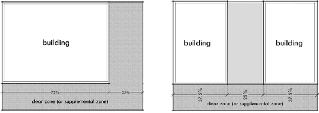
(4)
Landscaping.
a.
All landscaping shall use "Florida-Friendly" plants and guiding principles.
b.
All landscaping shall be irrigated and may be installed with moisture sensors beneath the root systems to properly gauge the watering requirements (i.e., Irrometer).
c.
The plant materials and sizes shall comply with Chapter 8, Article III, of the LDC.
d.
Minimum 6-foot wide planting strips or planters shall be permitted along the building wall to accentuate the entranceway and building façade.
e.
All tree plantings shall require a root barrier or other system that achieves the same intent as a root barrier.
Figure 5 - 60: Landscaping in Front of Building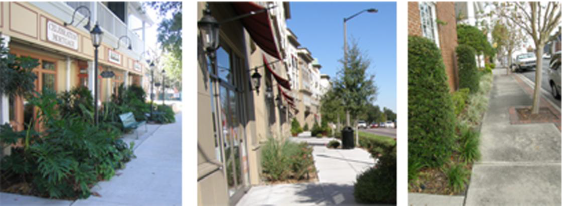
f.
Landscape/multi-use buffer shall be provided along the street front of U.S. Hwy. 17-92 with a minimum depth of 20 feet. The buffer shall contain one canopy tree or two understory trees for each 40 linear feet of buffer with a continuous 30- to 36-inch screen shrubs and at least 50% of the area shall be groundcover. Decorative pedestrian lights may be permitted in the buffer.
Figure 5 - 61: Landscaping along U.S. Hwy. 17-92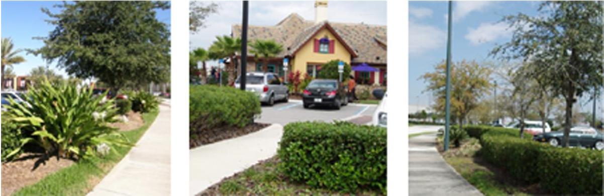
g.
Vehicular use areas.
1.
A minimum buffer width of ten feet shall be required on the perimeter of vehicular use areas, except for the street fronts along U.S. Hwy. 17-92.
2.
The buffer shall contain the following:
i.
Minimum one canopy tree for each 35 linear feet of buffer;
ii.
Minimum one understory tree for each 50 linear feet of buffer;
iii.
Continuous 30- to 36-inch-high screen shrubs.
3.
A three-foot high wall compatible with the architecture of the building may be used with a maximum three-foot-wide landscape strip in front of the wall consisting of the following:
i.
Minimum one understory tree for each 50 linear feet of streetwall; and/or
ii.
Minimum 50% of the area shall be ground cover.
Figure 5 - 62: Landscape Buffers and Streetwalls
4.
Planting areas within vehicular use areas shall equal not less than 20% of the gross area devoted to vehicular use. The perimeter landscaping shall not count toward meeting the required interior landscaping.
5.
Interior planting areas may be located in tree islands, at the end of parking bays, or between rows of parking spaces. There shall be not more than ten contiguous parking spaces between planting areas. Such planting areas shall be landscaped with a canopy or understory tree and may be landscaped with other materials. Trees and other landscaping planted in the planter island areas shall be credited toward the landscaping requirements of the vehicular use area. Planting areas may also be located within driveway medians, provided the median is a minimum of ten feet wide.
6.
Interior planting areas may be located to effectively accommodate stormwater runoff, as well as to provide shade in large expanses of paved areas.
7.
Individual planting areas shall be not less than 400 square feet for medium and large trees. Individual planting areas for all other trees shall not be less than 180 square feet.
8.
A continuous curb or other means of protection shall be provided to prevent injury to vegetation within the planting areas.
9.
One shrub shall be installed for each 50 square feet of planting area.
10.
One square foot of groundcover shall be installed for each five square feet of planting area. At the owner's option, grassed areas may be substituted for up to 50% of the square footage of groundcover required.
11.
A fractional tree or shrub shall be rounded up to the next highest whole number.
h.
Tree preservation. All development shall comply with Chapter 8 of the City of DeBary Land Development Code, with the exception of the provision that requires 15% of the overall development site to be set aside for tree preservation. Instead, a minimum of 2.5% of the overall development site shall be provided for tree preservation within the TOD Core and 7.5% of the overall development site to be provided for tree preservation outside of the TOD Core. These set asides for tree preservation shall be calculated toward the 5% and 15% public/open space requirement for the TOD Core and Outside TOD Core areas respectively. Alternative tree preservation and open space requirements may be considered by the Development Review Committee during the site plan approval process on a case-by-case basis when other site enhancements of the development plan are demonstrated.
i.
Industrial land use buffering. All new development shall provide a 30-foot landscape buffer with a masonry wall along industrial zoned frontages that are not incorporated into the TOD Overlay District. Buffering requirements shall conform with industrial/commercial criteria outlined in the Land Development Code.
(5)
Stormwater facilities.
a.
For application for a standard development, the following additional performance standards shall be used in the design of the project:
1.
Closed basin criteria. See Sec. 10.9.
2.
Retention standards. The discharge hydrograph produced for the developed or redeveloped site shall not exceed, in terms of peak flow and total volume, the hydrograph produced by conditions existing before development or redevelopment for a 24-hour, 25-year frequency storm, unless the intent of this recharge provision will be met through detention of the difference between said volumes, in which case said volume difference may be released over not less than a 24-hour nor greater than a 72-hour period of time. However, the design standards for wet retention areas, when approved by the City Development Engineer, shall prevail. This requirement may be waived by the City Development Engineer for sites consisting predominately of poorly drained soils having permanently and naturally impaired recharge potentials. In addition, the cumulative impact of the outflow hydrograph on downstream flow shall be considered. Runoff rates and volumes resulting from the project, in excess of existing amounts, shall be accommodated on site. Off-site retention may be permitted if, in the opinion of the City Development Engineer, the recharge requirements of this division are met.
b.
To the greatest extent practicable Green Infrastructure principles shall be employed in the site design to reduce stormwater impacts prior to collection and treatment (i.e., pervious/semi-pervious pavement, rainwater collection and reuse, etc.).
c.
The City's intent is that a centralized master stormwater system be created within the TOD Overlay District. The city will seek to create public-private partnerships to achieve these goals. The city may negotiate with a development project to incorporate a master retention element into the design, in return allowing additional development incentives as provided for within the article.
d.
Within the TOD Overlay District, stormwater management facilities shall be designed to allow for conversion to a centralized master stormwater utility.
e.
If a centralized master stormwater pond is not developed within the TOD Core, the stormwater management systems for developments along U.S. Hwy. 17-92 shall be located within the rear yard setbacks, unless they include a water feature and/or passive park or approved by the DRC upon hardship determination.
(6)
Green infrastructure.
a.
The purpose is to:
1.
Reduce the negative impact of development on the natural environment;
2.
Reduce development costs related to construction and the provision of utilities; and
3.
Manage stormwater in a way that mimics natural stormwater management.
b.
The following standards shall apply to the TOD Core and Outside TOD Core (except for single-family, duplex and townhouse developments).
1.
Minimum 20% within TOD Core and 10% Outside the TOD Core of the required Water Quality Volume (WQV) must be treated on-site using green infrastructure facilities. To meet the WQV treatment requirement, such facilities may include, but are not limited to the following:
i.
Reduce impervious surface area by using permeable paving materials.
ii.
Green vegetated roofs.
iii.
Roof rainwater collection.
iv.
Bioretention or infiltration.
2.
In cases where site specific circumstances limit the ability to treat the WQV on-site using green infrastructure, the city may allow fee-in-lieu payments. Payment shall be based on an engineer's opinion of cost to install the required WQV on the subject site.
3.
A developer or group of developers may propose a regional water quality structure that treats the stormwater from at least ten acres of previously untreated offsite land.
c.
Tree preservation using drought-tolerant landscaping shall also be provided where feasible. If this cannot be provided, a viable justification shall be provided to the DRC for consideration.
Figure 5 - 63: Green Infrastructure Bioretention—Parking Lot (left) Rooftop Garden
(right)
Porous Asphalt (left) Porous Concrete Pavers (right)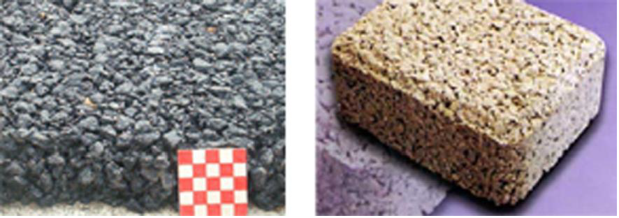
(7)
Private/public common open space and pedestrian amenities.
a.
These standards shall apply to all development sites larger than two acres.
b.
All new developments and redevelopments shall devote a minimum of 5% (TOD Core); 10% (Outside the TOD Core) of the gross site area to one or more of the following types of common open space or pedestrian amenities:
1.
A natural and undisturbed private common open space, for use of the residents, employees, and visitors to the development. Developments with primarily residential uses are encouraged to comply with this requirement.
2.
A landscape area with a minimum depth and width of ten feet and a minimum total area of 200 square feet. The area shall include pedestrian amenities to support these places as gathering areas.
3.
A playground, patio, or plaza with outdoor seating areas, provided the playground, patio, or plaza has a minimum depth and width of ten feet and a minimum total area of 300 square feet. The area shall include pedestrian amenities to support these places as gathering areas.
4.
A combination of the above-listed amenities.
5.
In cases of provable hardship, the DRC may approve a payment of money into a trust fund allocated towards parks and recreational facilities in lieu of construction of private/public common open spaces and pedestrian amenities. The payment shall be equal to the "Just Value" of the area required for the private/public common open space and pedestrian amenities based on the previous year's "Just Value" from the Volusia County property appraiser.
6.
Provable hardship shall comply with the variance criteria pursuant to Sec. 3.10, Variances of the City of DeBary Land Development Code.
c.
To the maximum extent feasible, where significant natural and scenic resource assets exist on a property, the developer shall give priority to their preservation as private common open space.
d.
Lands within the following areas shall not be counted towards private common open space or pedestrian amenities, unless approved by the DRC.
1.
Private yards;
2.
Public or private streets or rights-of-way;
3.
Parking areas and driveways for dwellings;
4.
Water quality and stormwater detention ponds; and
5.
A required street tree/furniture zone.
e.
Land set aside for private/public common open space or pedestrian amenities shall meet the following design criteria:
1.
Common open space areas shall be located so as to be readily accessible and useable by residents or visitors in various locations of the development, unless the lands are sensitive natural resources and access should be restricted.
2.
The lands shall be compact and contiguous unless the land shall be used as a continuation of an existing trail, or specific topographic features require a different configuration. An example of such topographic features would be the provision of a trail or private open area along a riparian corridor.
3.
Where private/public common open space areas, trails, parks, or other public spaces exist adjacent to the tract to be subdivided or developed, the private common open space or pedestrian amenity shall, to the maximum extent feasible, be located to adjoin, extend, and enlarge the presently existing trail, park, or other open area land.
f.
All common open space or pedestrian amenity areas shall be maintained by the owners of the development.
Figure 5 - 64: Common Open Space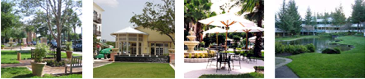
(8)
Transitional areas/compatibility.
a.
Building transitions.
1.
Façade and height transitions between buildings are key elements in creating and maintaining an attractive streetscape. Height and scale of new development and redevelopment shall be compatible with that of surrounding development. In order to accomplish appropriate facade transitions, and to maximize city streetscape aesthetics, the following transitional techniques shall be applied to new development and redevelopment when within 600 feet of an existing building.
i.
Buildings shall be designed to provide transitional elements and architectural features (architectural style, scale, design details, construction materials and the like) that are architecturally compatible with adjacent structures. Buildings that are twice the height, or greater, than an adjacent structure shall also provide transitional elements and features that provide for transitional blending of heights.
ii.
The pattern of placement, proportions and materials of windows and doors shall be harmonious with surrounding structures.
iii.
The ratio of wall surface to openings and the ratio of width and height of windows and doors shall be consistent and compatible with surrounding structures.
iv.
The above-noted requirements may be waived where the city determines that city aesthetics would be enhanced by a change in the pattern of development that has been previously established by adjacent structures. In such a case, the city shall determine the appropriate style and exterior materials for the new development or redevelopment.
Figure 5 - 65: Building Transitions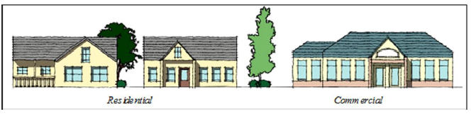
b.
Green/open space transitions.
1.
Public spaces and natural features shall be used to provide a seamless buffer/transition from varying development activities and intensities, and maintaining an attractive streetscape, such as the following:
i.
Green spaces, courts, squares, parks, plazas, and similar spaces that can also function as community gathering places; or
ii.
Natural features including natural differences in topography (not retaining walls), water bodies, existing stands of trees and similar features.
Figure 5 - 66: Green/Open Space Transitions
c.
Intensity transitions.
1.
Site the less-intensive uses as transitions to lower-intensity, adjacent uses (i.e., neighborhood stores, bed & breakfast inns, community facilities, etc.).
Figure 5 - 67: Intensity Transitions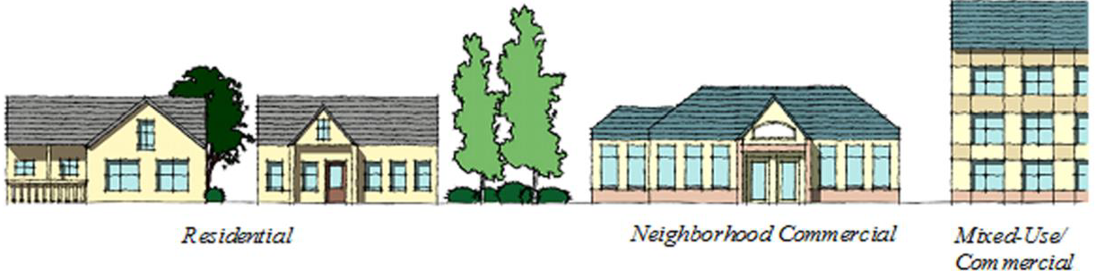
d.
Landscaping and screening transitions.
1.
Use landscape buffering and supplemental fences and walls.
Figure 5 - 68: Landscaping and Screening Transitions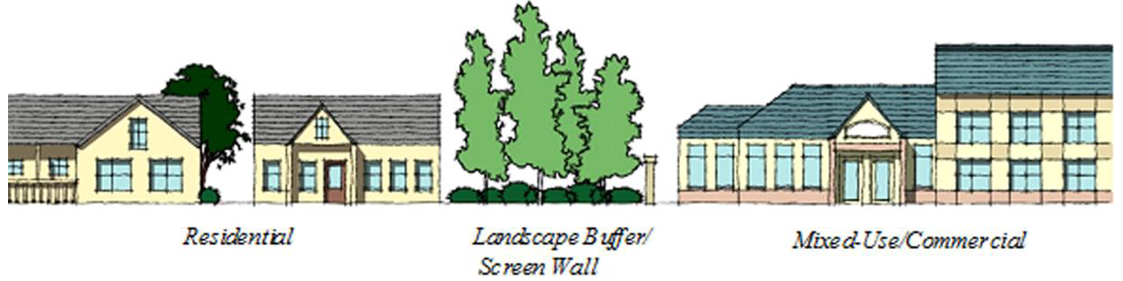
(9)
Off-street parking.
a.
Parking requirements.
1.
Maximum parking requirements shall supersede the minimum parking requirements as outlined in Chapter 7 of the Land Development Code. A minimum of 0.5 parking spaces per residential unit shall apply within the TOD Overlay District.
Note: Refer to Chapter 7 of the LDC for accessible parking requirements.
b.
Additional parking criteria:
1.
In no case may the maximum off-street parking requirements for a project be increased by more than 50% and shall receive approval by the Growth Management Director.
2.
On-street parking spaces may be counted toward the maximum number of parking spaces.
c.
Off-street parking along U.S. Hwy. 17-92 may be located in the side, and rear yards subject to parking lot landscaping and setback requirements. Maximum one 90-degree or angle parking bay and a two-way travel lane along the street front and street side.
d.
Off-street parking shall be located in the rear yard along TOD Core streets, pedestrian priority streets and local streets, and shall not exceed one acre in size. Where feasible, ingress and egress from parking shall be from side streets or alleyways.
e.
Shared and reduced parking is permitted and encouraged. See subsection 5.40(f) for calculation standards.
Figure 5 - 69: Off-Street Parking along TOD Core Streets, Pedestrian Priority Streets
and Local Streets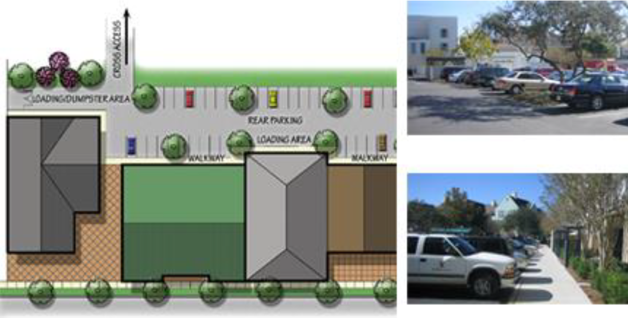
f.
Shared parking is strongly encouraged. On lots serving more than one use, the total number of spaces may be reduced.
g.
Surface parking lots shall provide a minimum 6-foot-wide pedestrian walkways and connections to building entrance(s) or to the sidewalk system.
h.
Parking structure:
1.
Parking structures fronting a public street or public space shall be masked by a liner building a minimum of 30 feet deep.
2.
The first 30 feet of depth of the liner building shall be occupied by office, residential or other non-parking commercial uses.
3.
Liner buildings shall be at least two stories.
4.
Liner buildings may be detached from or incorporated into parking structures.
5.
When a liner building is not possible due to unusually shallow lot depth or unique topographical features, provide a landscaped seating area between the structure and the street.
6.
The parking structure/liner buildings shall be designed to have similar façade treatments with respect to building materials and articulations to complement the architectural theme of the development.
Figure 5 - 70: Parking Structures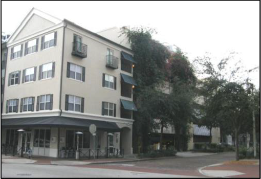
Parking structure behind liner building
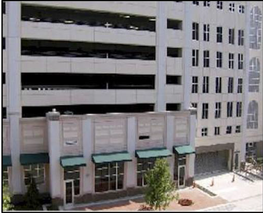
Liner building incorporated into parking structure
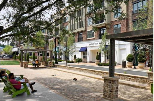
Urban Land Institute example-retail liner building in front of parking structure
i.
Bicycle parking.
1.
Bicycle racks shall be provided on site at a ratio of one space for every 10 automobile parking spaces.
2.
Bicycle parking shall not obstruct the sidewalk clear zone and shall be located in a well-lit, secure and visible location:
i.
Within 50 feet of building entryways; or
ii.
At employee entrances; or
iii.
Within a building; or
iv.
In a covered motor vehicle parking area.
3.
Bicycle parking facilities shall either be lockable enclosures in which the bicycle is stored, or a secure stationary rack, which support the frame so the bicycle cannot easily be pushed or fall to one side.
4.
Racks that require a user-supplied lock should accommodate locking the frame and both wheels using either a cable or U-shaped lock.
5.
Bicycle parking spaces shall be at least six feet long and three feet wide, and overhead clearance in covered spaces shall be a minimum of seven feet.
6.
A 5-foot aisle for bicycle maneuvering, which may be provided with the required sidewalk clear zone, shall be provided and maintained beside or between each row of bicycle parking.
7.
Bicycle racks or lockers shall be securely anchored.
Figure 5 - 71: Bicycle Parking Design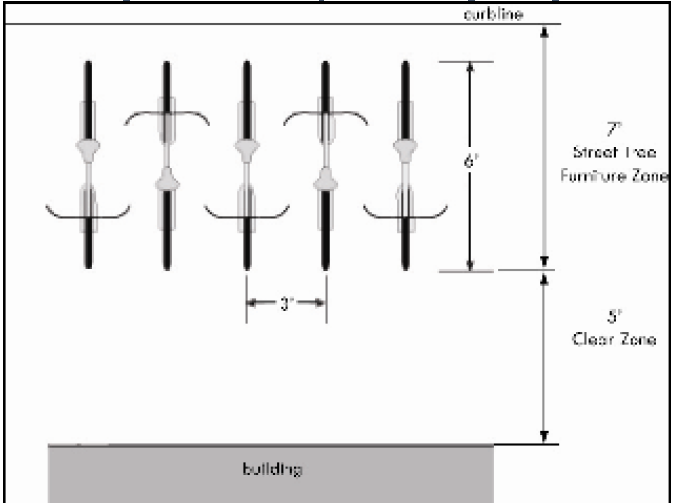
(10)
Loading/delivery docks.
a.
Each loading space shall be at least 12 feet wide by 35 feet long.
b.
Loading and service dock areas shall be integrated into the building design; or located to the rear or sides of a building, away from the main building entrance, or related high visibility areas.
c.
No loading docks shall be located between a building and a residential development unless there is a minimum 60 feet setback between the loading dock and the residential development and that the setback includes a landscape buffer and masonry wall.
d.
Loading spaces, their access drives and maneuvering areas shall be located and designed so that their use does not impede the normal use of parking spaces and access drives.
e.
Loading and service docks shall be screened by the following:
1.
Minimum six feet to a maximum eight feet high masonry wall to be architecturally consistent with the style, colors, construction materials and finish of the building; and/or
2.
Landscape consisting of a minimum five feet high evergreen hedge at least four feet in height when planted, to grow to five feet within one year; and minimum eight feet high understory/canopy trees.
Figure 5 - 72: Loading Areas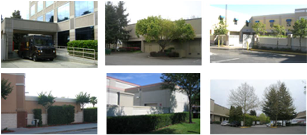
(11)
Exterior lighting.
a.
An exterior building and site lighting master plan detailing areas and structures requiring illumination, lighting fixture styles, light source and light levels shall be included as part of site plan review and meet the standards of Sec. 10.19 and Appendix 2-Technical Standards Manual.
b.
Lighting shall be of the metal halide type, or other lighting that is uniform in color and intensity.
c.
The following outdoor lighting applications shall be illuminated by fixtures that are both fully-shielded and full cut-off:
1.
Street and pedestrian lighting;
2.
Parking lots;
3.
Pathways;
4.
Recreational areas; and
5.
Product display area lighting.
Figure 5 - 73: Outdoor Lighting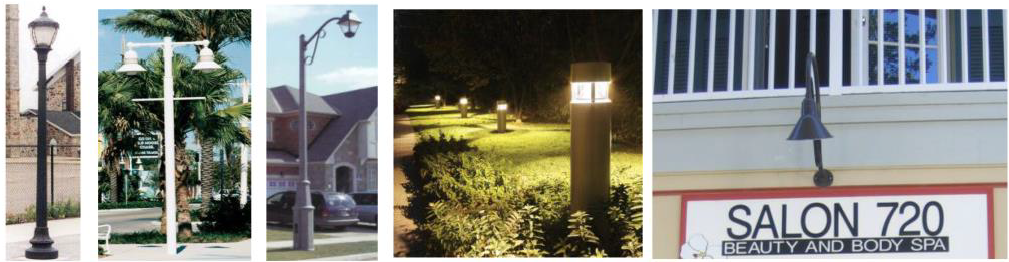
d.
Building façade lighting may only be used to highlight specific architectural features such as principal entrances and towers.
e.
Directional luminaries may be used to illuminate signs and flagpoles. Such luminaries shall be installed and aimed so that they illuminate only the specific object or area and do not shine directly onto neighboring properties, roadways, or distribute excessive light skyward.
f.
Recessed lighting fixtures shall be required in order to conceal the actual source of the light so as to reduce glare and direct the light to specific areas while shielding other areas.
g.
Backlighting of awnings/canopies is not permitted.
h.
Pedestrian scale lighting fixtures no greater than 15 feet in height shall be provided along all sidewalks and walkways to provide ample lighting during nighttime hours.
i.
Parking lot lighting shall be designed as follows:
1.
Light poles shall be located only within landscaped strips, interior landscape islands, or terminal landscape islands. Light poles are not allowed in corridor buffers.
2.
The maximum height of the light pole shall be 20 feet, including the base.
3.
The minimum setback of the light source from the property line shall be a horizontal distance of ten feet.
j.
Neon lighting is not permitted.
k.
Ground level light fixtures shall be of the burial vault type or shall be fully screened by landscaping materials.
(12)
Screening of equipment and utilities.
a.
Mechanical equipment located on the ground, such as air conditioning and heating units, satellite dishes, irrigation pumps, utilities lift stations and the like shall be screened from public view. Screening shall, at a minimum, be at the same height as the equipment. Structural screening shall be architecturally integrated into the overall project design and shall be compatible, in terms of style, construction materials, colors, and finish, with the principal structure. Landscaping may be substituted for structural screening if plantings are compatible with the landscape plan for the project and are of such size and maturity as to be able to provide a fully opaque screen at time of planting.
Figure 5 - 74: Screening of Equipment/Utilities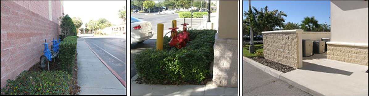
b.
Equipment and appurtenances mounted on rooftops shall be kept to a minimum. All exposed rooftop mounted equipment and appurtenances shall be fully screened from view from any public right-of-way. All screening shall, at a minimum, be at the same height as the equipment and appurtenances. Screening shall be an integral part of the design of the building and shall be architecturally consistent with the style, colors, construction materials and finish of the building.
Figure 5 - 75: Screening of Rooftop Equipment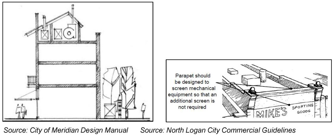
c.
Trash containers.
1.
Trash containers shall be placed at the side or rear of the building and/or centrally located in the parking lot at least 20 feet from any public street/walkway, pedestrian and public spaces and building entrances.
2.
Enclosures shall be unobtrusive and conveniently located for trash disposal by tenants and collection by service vehicles.
3.
Enclosures shall be located away from adjacent residential uses to minimize nuisances to neighboring properties.
4.
Trash enclosures shall consist of a maximum 7-foot high wall with similar finishes, materials, and details as the primary buildings within the project. A decorative door shall also be provided.
Figure 5 - 76: Screening of Trash Containers
(13)
Transit facilities.
a.
Bus stops.
1.
Bus stop needs and design shall be coordinated with VOTRAN.
2.
In addition to VOTRAN requirements individual site plans shall consider the following:
i.
Bus stops shall be evaluated for need every 660 feet from the final design site of the DeBary Commuter Rail Station.
ii.
Bus stops may be accommodated via provision of additional property either on street adjacent to the right-of-way or via dedicated area within a off-street parking area.
iii.
Bus stops shall incorporate a shelter area of no less than 24 square feet including seating.
iv.
Bus Stops shall comply with any architectural standards as established by the City of DeBary.
v.
Bus Stops within the TOD Core Area shall include provision for secure bicycle parking in accordance with subsection 5.63(b)(9)h.
(14)
Drive-through facilities.
a.
Drive-through, walk-up windows, ATMs including as accessory to banks, restaurants, and retail sales and service shall only be permitted provided that:
1.
Drive-through windows shall not be located between the front façade of the principal structure and the street.
2.
Sight visibility shall be designed so as to not interfere with the circulation of pedestrian or vehicular traffic on the site itself, and on the adjoining streets, alleys or sidewalks.
3.
Drive-through lanes and vehicle stacking areas adjacent to public streets or sidewalks shall be separated from such streets or sidewalks by railings or hedges at least 36 inches in height.
4.
Drive through, ATMs and walk-up elements should be architecturally integrated into the building, rather than appearing to be applied or "stuck on" to the building.
5.
Drive-through displays, ordering areas, walk-up windows, ATMs and parking canopies shall not serve as the singularly dominant feature on the site or as a sign or an attention getting device.
6.
Entries and/or exits to drive-through facilities shall be a minimum of 100 feet from any intersection as measured from the edge of the drive closest to the intersection to the property line at the intersection. Shorter distances from road intersections may be approved if the DRC determines that public safety and/or the efficiency of traffic circulation are not being compromised.
7.
Drive-through stacking lanes shall be a minimum of 100 feet from any single-family residential parcel.
8.
All service areas, restrooms and ground mounted equipment associated with the drive through shall be screened from public view.
9.
Landscaping shall screen drive-through aisles from the public right-of-way and adjacent uses and shall be used to minimize the visual impacts of reader board signs and directional signs.
Figure 5 - 77: Drive-Through Facilities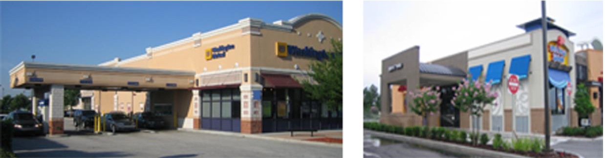
(Ord. No. 13-10, § 2(Exh. A), 12-29-2010; Ord. No. 02-15, § 2, (Exh. A), 8-26-2015; Ord. No. 06-20 20, § 2(Exh. A), 9-23-2020)
Sec. 5.64. - Building design standards.
(a)
Purpose and intent.
(1)
Ensure that buildings foster the creation of a human-scale environment.
(2)
Ensure that trees or man-made shading devices are used alongside roadways and connecting roadside sidewalks to businesses to encourage pedestrian activity by providing a sheltered and comfortable walking environment.
(3)
Ensure that buildings provide an interesting and engaging visual experience at the pedestrian level.
(4)
Ensure that the design and construction of ground floor building space near transit, at visible intersections, and along key streets that lead to transit, accommodates for active pedestrian-oriented uses even though these types of uses may not be supported by current market conditions.
(b)
Building entrances.
(1)
Primary customer and/or resident entrances shall face the principal street and connect directly to the sidewalk clear zone along the principal street. Supplemental customer and/or resident entrances are encouraged on any other building frontage.
(2)
Building entrances shall be provided for each separate ground floor commercial tenant space along the elevation facing the principal street.
(3)
Entryways shall be differentiated from the remainder of the facade through at a minimum, the use of color, change in materials, application of architectural features (arches, columns, colonnades, etc.), setbacks, offsets, level changes, and the like.
(4)
Entryway design shall incorporate landscaping, landscape planters or wing walls with landscaped areas.
(5)
Entryway areas shall be provided with structural or vegetative shading features and benches or other seating components.
(6)
The first floor of all multi-story structures within the TOD Core shall be a minimum of 14 feet in height and a minimum of 12 feet in the Outside Core for non-residential uses.
(c)
Window glazing.
(1)
Glazing provides interest for the pedestrian, connects the building exterior and interior, puts eyes on the street, promotes reusability, and provides a human-scale element on building facades.
(2)
All mixed-use development, non-residential development, and development along the principal street shall satisfy the following:
(3)
Development containing only residential units shall satisfy the following:
(4)
The window glazing shall be clear or lightly tinted low-e glass.
Figure 5 - 78: Window Glazing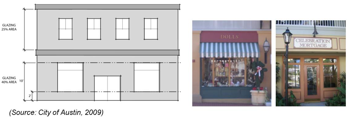
(d)
Building façade articulation.
(1)
To provide visual interest and create community character and pedestrian scale, a building shall comply with the following façade articulation requirements.
a.
A single building mass with more than one tenant shall be varied by height and width so that it appears to be divided into distinct massing elements and architectural details can be viewed from a pedestrian scale.
b.
Buildings shall be designed and built in tri-partite architecture so that they have a distinct base, middle, and top.
Figure 5 - 79: Architectural Elements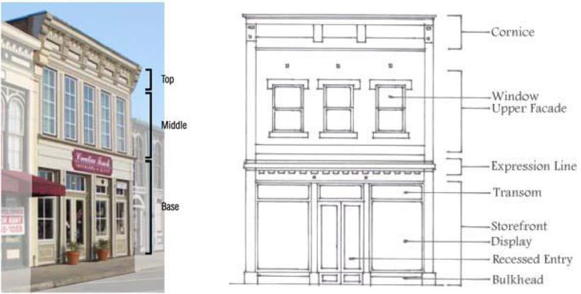
c.
No uninterrupted length of any façade shall exceed 100 horizontal feet.
d.
Facades greater than 100 horizontal feet shall incorporate wall plane projections or recesses having a depth of at least two feet and extending at least 20% of the length of the facade.
Figure 5 - 80: Building Articulation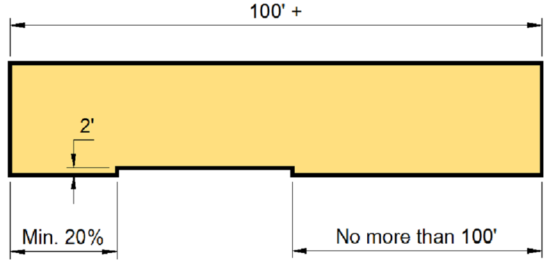
e.
Building facades shall include a repeating pattern that shall include no less than three of the elements listed below. At least one of these elements shall repeat horizontally. All elements shall repeat at intervals of no more than 30 feet, either horizontally or vertically.
i.
Color change;
ii.
Texture change;
iii.
Material module change;
iv.
Expression of architectural or structural bay through a change in plane no less than 12 inches in width, such as an offset, reveal, or projecting rib.
f.
Buildings utilizing frontages such as arcades/galleries, canopies or awnings, courtyards, or stoops meeting the requirements of Sec. 5.33 may encroach into the street setback. See Sec. 5.33 for specific standards and encroachment allowances.
g.
The design of porches must adhere to the following principles:
Porch Principles.
① Width: 10' min.
② Depth: 8' min
③ Clear Height: 8'
④ Porch Floor Height:
Figure 5 - 81: Porch Dimensional Standards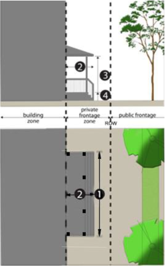
Figure 5-82 illustrates the height that porch floors must be above the sidewalk at various distances to the sidewalk in order to provide proper psychological protection so people will choose to sit on the porch. This diagram shows the proper range and is based on no Frontage Fence between porch and the sidewalk.
Figure 5 - 82: Image created by Architect Steve Mouzon of Mouzon Design and author
of Traditional Construction Patterns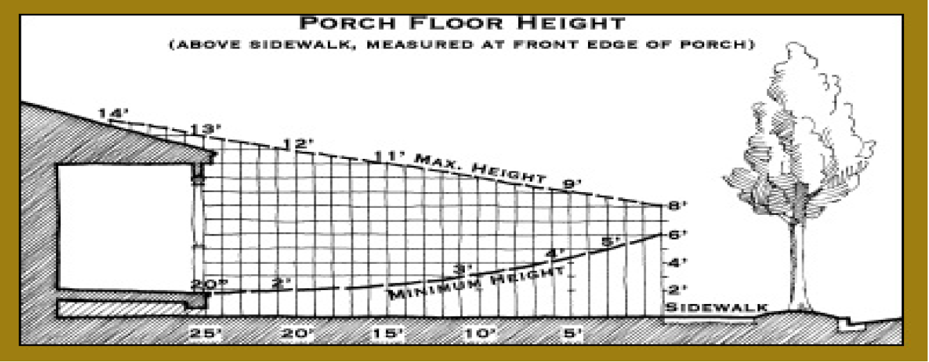
Fence/Hedge/Wall:
Adding Frontage Fence, Frontage Hedge or Frontage Wall allows the minimum porch floor height to be reduced according to this diagram because each of the three provides varying levels of Psychological protection to people sitting on the porch. The maximum height remains unchanged. (See Figure 5-83)
Figure 5 - 83: Image created by Architect Steve Mouzon of Mouzon Design and Author
of Traditional Construction Patterns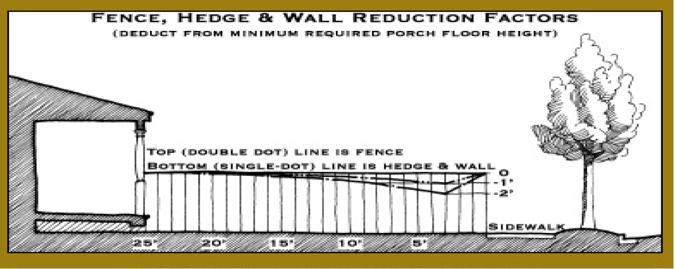
Porch Railing:
Porch railing also provides psychological protection to people sitting on the porch. Porch railing requirements shall be per Florida Building Code. Using heavier wood railings or masonry railings provides more protection and reduces the minimum height. (See Figure 5-84)
Figure 5 - 84: Image created by Architect Steve Mouzon of Mouzon Design and Author
of Traditional Construction Patterns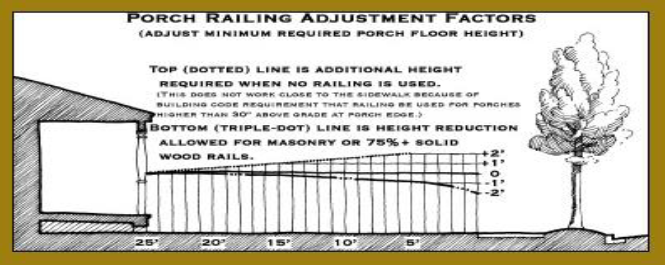
h.
At intersections, buildings located on corner lots shall utilize architectural embellishments to emphasize street intersections as points of interest in the TOD Overlay District. Maximum building heights shall be permitted to exceed by 25% for approximately 25% of the building frontage along each street façade.
Figure 5 - 85: Architectural Embellishments at Intersections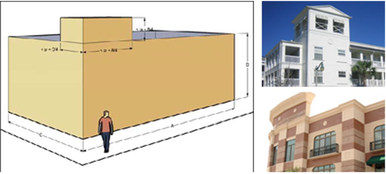
(e)
Exterior materials and colors.
(1)
Exterior building materials and colors contribute significantly to the visual impact of a building on a community, which, in turn, individually and collectively reflect upon the visual character and quality of a community. In order to project an image of high quality City aesthetics, building materials and colors shall conform to the following requirements:
a.
All buildings shall be faced with materials that exhibit a durable, high quality appearance.
b.
Materials shall be of a low maintenance type, retaining a consistent, clean appearance.
c.
Generally accepted exterior facing materials shall relate to the mass of the structure based on square footage as follows:
1.
For all structures, the following materials shall be acceptable on all facades that are or will be exposed to the general public:
i.
Brick;
ii.
Exposed aggregate;
iii.
Stone;
iv.
Cellulose fiber-reinforced cement building boards;
v.
Stucco, if used, shall be flat finish, "knocked-down," or sand finish;
vi.
E.I.F.S. (exterior insulation and finish system).
Figure 5 - 86: Exterior Materials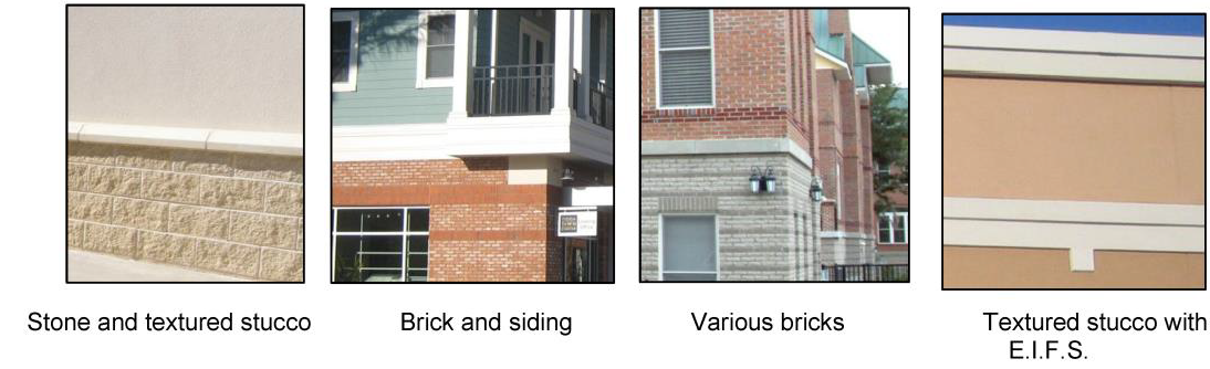
2.
Two wall materials may be combined on any facade, up to four walls, horizontally. The visually heavier facade material must be below and can cover the first third of the overall wall height only.
3.
Exterior colors shall not be specifically limited, but shall be consistent with earth tones, warm tones and muted hues. The selection of pastels shall be limited to those colors having a minimum white content of 90%. Other colors, excluding fluorescents, may be permitted as accent colors, not to exceed 20% of the surface area of any one elevation.
4.
The requirement for earth tones and pastels shall not apply to colors commonly found in natural materials such as brick or stone, unless such material has been artificially colored in a manner which would be contrary to the intent of these regulations.
5.
A color or color scheme which is directly inherent to a unique recognized architectural style or exterior artwork, but not otherwise in compliance with this section, may be permitted through the development plan approval process.
6.
Approval for change of exterior design required. Any exterior change of any nonresidential structure or multifamily structure shall require review and approval by the DRC. Such changes shall include, but not be limited to, colors, materials, roof finishes and signage. The purpose of such approval shall be to ensure that any exterior change is consistent with the intent and requirements of this article.
7.
Building materials and colors shall be consistent around the entire building.
8.
Exposed metal building sidings shall not be permitted.
(f)
Building height. The maximum building height shall be in accordance to subsection 5.63(b)(2), Setbacks and building heights. See Chapter 2, Definitions.
Figure 5 - 87: Building Height Variation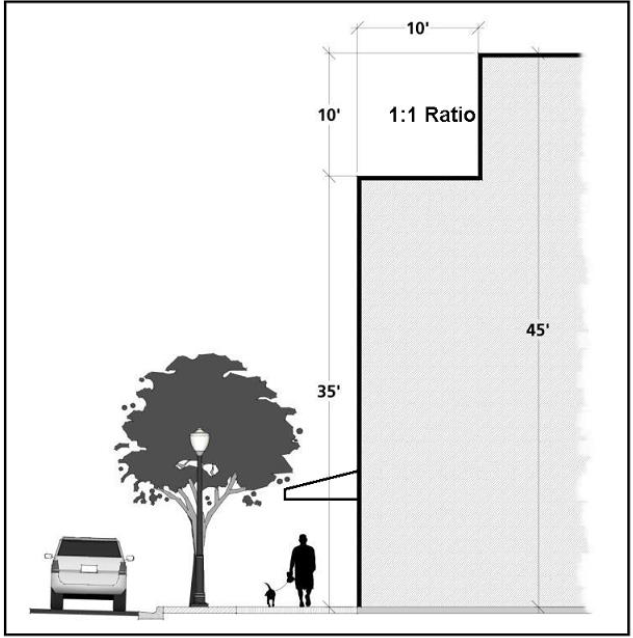
(g)
Roof design and materials.
(1)
Roof features shall be in scale with the building mass and complement the character of the structure, adjacent developments and neighborhoods. Roofs shall be constructed of durable, high quality materials in order to enhance the appearance and attractiveness of the community. Roofs shall incorporate the design elements and materials listed below:
a.
The design of roof structures shall be flat with a parapet wall, hip roof, or gable roof. No mansard roofs shall be allowed. The parapet wall and cornice may extend a maximum of 42 inches above the maximum height of the building or 60 inches if required to enclose rooftop equipment and include decorative brackets. Parapet edges or slopes may use concrete tiles or terra cotta. If the roof surface is visible, hipped or gabled, the material shall be metal standing seam or "V" crimp metal, shingle or tile.
b.
Roofs shall be designed to be of such height, bulk and mass so as to appear structural even when the design is nonstructural.
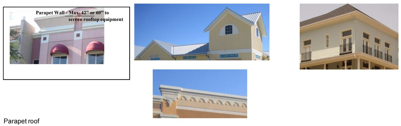
(h)
Fences and walls.
(1)
Design and construction quality of fences and non-building walls are important visual reflections of community character and quality. In order to promote quality site aesthetics, fence and wall design and construction shall comply with the following requirements:
a.
Metal picket fencing located between the building and the street right-of-way shall not exceed three feet in height. Metal picket fencing may be installed on top of a knee wall in proportionate scale (i.e., 1/3 or 1/2), not to exceed a total height of three feet. May be used to delineate outdoor patios/eating areas.
b.
Walls located along the street front exceed three feet in height to prevent potential hiding places and to provide natural surveillance of "eyes on the street."
c.
Metal picket fencing and opaque walls along the side and rear yards shall not exceed six feet in height. Metal picket fencing may be installed on top of a knee wall in proportionate scale (i.e., 1/3 or 1/2), not to exceed a total height of six feet.
d.
Fences and walls located along the street shall be set back at least three feet from the property line.
e.
Fences and walls greater than 30 feet in length shall have columns, pilasters or offsets at least every 30 feet.
f.
Chain link and vinyl fencing is not permitted, unless screened from view from public rights-of-way, parking lots, and adjacent properties. If foliage is used for screening, the foliage must screen the fence from view within 720 days of installation of the fence. Wood fencing shall not be permitted under any circumstances.
Figure 5 - 88. Fences and Walls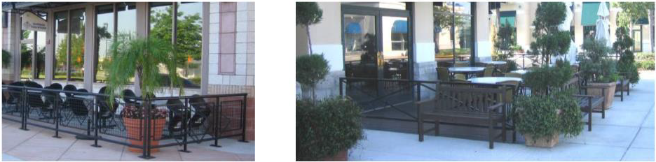
Metal picket fencing delineating outdoor seating areas
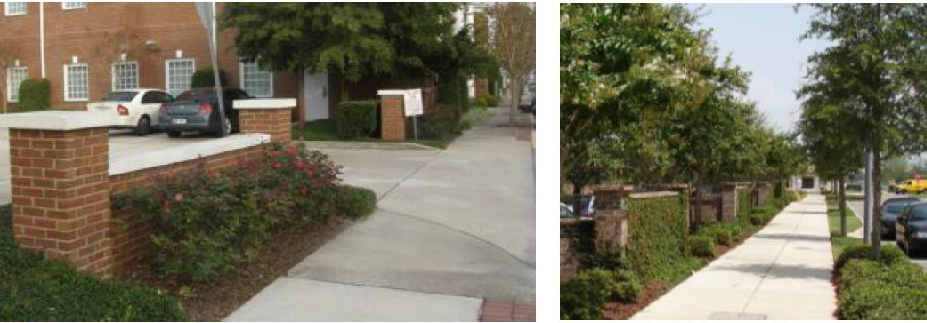
Walls along the street front
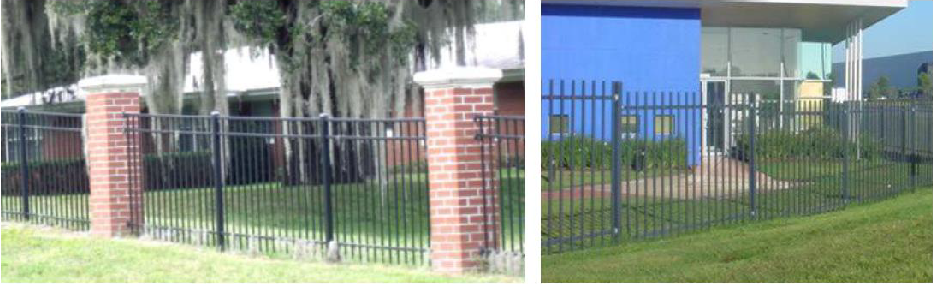
Metal picket fencing alongside/rear yards
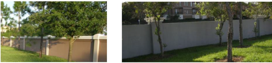
Opaque walls alongside/rear yards
(Ord. No. 13-10, § 2(Exh. A), 12-29-10; Ord. No. 02-15, § 2, (Exh. A), 8-26-2015; Ord. No. 06-20 20, § 2(Exh. A), 9-23-2020)
Sec. 5.15. - Purpose and intent.
The purpose of the standards contained in this article is to ensure that future developments at nodes and corridors:
(a)
Enhance the appearance and quality of development;
(b)
Provide for well landscaped, scenic gateways to the City;
(c)
Minimize visual pollution which may result from uncoordinated uses, structures and buildings;
(d)
Provide for traffic circulation patterns and complete streets that enhance public safety, walkability, and connectivity;
(e)
Maintain and enhance property values;
(f)
Create an active place that is visually, environmentally, and financially sustainable; and
(g)
Increase housing opportunities.
Sec. 5.16. - Nodes & corridors established.
The following overlay districts are established to regulate development within the City's nodes and corridors. These standards for nodes and corridors shall apply regardless of the zoning designation.
(a)
Major corridors. Representing the main gateways into the City, these corridors welcome motorists entering the City and project a distinctive character unique to the City of DeBary. The district includes all properties fronting on US 17-92, Highbanks Road, Enterprise Road, Saxon Boulevard, and Dirksen Drive.
(b)
Highbanks Road node. This zone is the busiest and most central node in the City. It extends north-south from Shell Road North to Poinsettia Drive, and east-west from Naranja Road to Shell Road North. While fully developed at present time, there is potential for future redevelopment at this node.
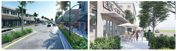
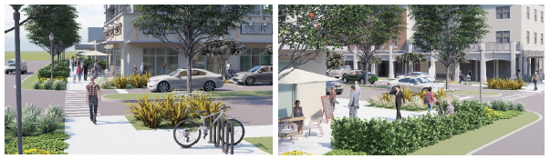
Sec. 5.17. - Applicability.
The regulations contained in this article apply to all properties which, at the time of development approval, are located within a major node or corridor as depicted on Figure 5-1 as follows:
(a)
New development. All new development shall fully comply with all the regulations contained in this chapter. Properties within the Overlay Districts which, as of July 17, 2024, have an active, effective, and unexpired development order (DO) from the City shall not be required to comply with these regulations. Any DO or DA that expires for any reason, shall be required to meet all of the regulations of this chapter, as such requirements exist at the time of permitting of development for such properties.
(b)
Redevelopment. The following provisions address the degree of compliance required for redevelopment projects.
(1)
Substantial redevelopment. The entire development site shall be brought into compliance with this section if one or more of the following conditions are met:
a.
The building floor area is being increased by more than 50%; or
b.
More than 50% of the existing building floor area is being replaced; or
c.
There is a combination of floor area increase and existing floor area replacement exceeding 50% of the original building floor area.
(2)
Non-substantial redevelopment. For redevelopment not meeting the criteria of subsection (1), only the building addition or exterior modifications visible from major corridor right-of-way shall comply with the regulations contained in this article.
(3)
Cumulative improvements. To avoid a situation where incremental improvements result in a substantial redevelopment subject to full code compliance, the improvements listed in subsection (1) shall include all such improvements made within a 5-year period.
(4)
Compliance with parking requirements.Division 5 of this article and Chapter 7 of the LDC shall apply for parking design standards applicable to redevelopment, additions and change of use, with accommodation for adjacent property shared parking requirements.
(5)
Exceptions.
a.
Building setback. All new buildings and additions within the redevelopment site shall be required to meet the building setback provisions. However, existing buildings will not be required to be moved or expanded to meet the setback requirements.
b.
Building height. Existing buildings undergoing redevelopment shall not be required to meet the minimum building height. Any new buildings within the redevelopment site, however, shall meet the requirement.
c.
Building frontage. Existing buildings shall not be required to meet the minimum building frontage requirement. However, new buildings and additions shall be required to comply with the frontage requirements.
d.
Parking requirement. Existing buildings shall not be required to meet the parking requirements of this chapter.
(c)
Single-family homes and duplex units. The provisions of this chapter do not apply to single family homes/developments or duplex units.
(d)
Change in use. A change in use without any modification to the site does not require compliance with this section as long as the new use is permitted in the overlay district, and the new use does not require additional parking, loading zone, or buffering.
(e)
Agricultural exemption. All land with an underlying agricultural zoning designation shall have the right to utilize the property for agricultural purposes until such time that the property owner chooses to develop under these overlay standards.
(f)
Images. This article was created with images and figures as important visual aids to enhance understanding and comprehension of plan-making and development, however, in the event there is a conflict or inconsistency between the text of this document and any figure or illustration, the text shall prevail.
(g)
Non-conforming lots, structures and uses. All non-conforming properties, uses and structures shall be subject to Sec. 1.6, Nonconforming lots, structures and uses, of the city Land Development Code.
(h)
Approval for change of exterior design required. Any exterior change of any nonresidential structure or multifamily structure in a Planned Unit Development, overlay district or conventional zoning classification shall require review and approval by the Growth Management Director. Such changes shall include, but not be limited to, materials, roof finishes and signage. The purpose of such approval shall be to ensure that any exterior change is consistent with the intent and requirements of this article. Routine maintenance and replacement of materials which do not affect the approved exterior design shall be exempt from this subsection.
Sec. 5.18. - Permitted uses.
Refer to the tables of uses in Chapter 4 (Zoning) for a list of permitted uses in the underlying zoning classification. Certain uses are regulated as per the table below. Accessory and temporary uses and structures shall meet the requirements of Chapter 6, unless otherwise specifically addressed in this chapter. While the list of allowable uses in Chapter 4 is expansive the following uses may be listed as permitted in the zoning classifications but shall be permitted (P), permitted by special exception (S), or prohibited (N) within the Overlay Districts as noted below.
Table 5 - 1: Land Use Table
Sec. 5.19. - Building setbacks.
The intent of the building setback standards is to shape the public realm and to strengthen the physical and functional character of the area. Buildings in the Overlay Districts must meet the following setbacks. Figure 5-2 depicts the location of setbacks.
① Front; ② Side; ③ Rear
Figure 5 - 2: Building Setbacks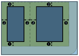
(a)
Minimum Front: Refer to Table 5-2.
(b)
Maximum Front (Build-to-line): Refer to Table 5-2.
(c)
Side: 5' minimum.
(d)
Rear: 10' minimum; 20' minimum if adjacent to a single-family residential zoning classification.
(e)
Maximum impervious surface: Refer to Table 5-2.
(f)
Parking shall not be allowed between the building and the primary street's Right-of-Way (ROW).
Figure 5 - 3: Street Segment Map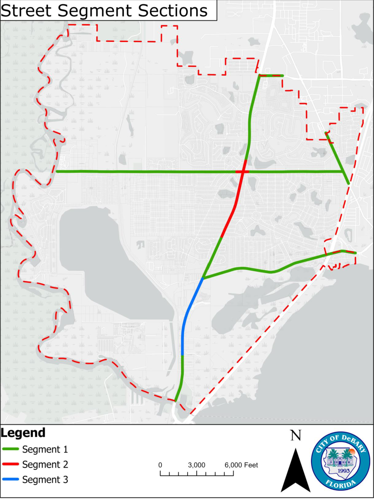
Table 5 - 2: Development Standards
Sec. 5.20. - Streetscape zone.
The space between the back of the curb to the ROW line or the back of the sidewalk, whichever is more, is known as the streetscape zone and is intended to accommodate a public sidewalk and the furnishing zone (see Figure 5-4). Due to the lack of right-of-way to accommodate adequate streetscape zones along certain streets, some development applicants will be required to dedicate an easement to the city to accommodate such zone. The reconstruction of the streetscape zone shall be the responsibility of the development applicant. If the requirements cannot be met due to existing conditions or site constraints, the Growth Management Director has the ability to adjust or waive the requirement to construct the improvements required by this section.
The design of the streetscape zone shall be coordinated with city staff, and shall comply with the requirements of Sec. 7.2(t), Appendix 2-Technical Standards Manual, Florida Greenbook, and Chapter 10 of this Code. Provisions shall be made to connect existing and new sidewalks that have different alignments (see Figure 5-5).
Figure 5 - 4: Streetscape Zone and BTZ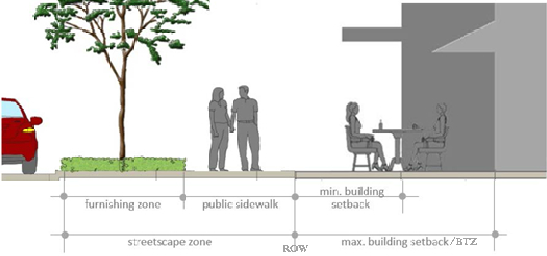
Figure 5 - 5: Connecting Existing and New Sidewalks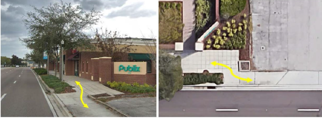
Sec. 5.21. - Street setback zone design.
The intent of the street setback is to provide a transition, both physical and visual, from the street to the building. The zone created by the setback should vary in design depending on the level of privacy desired along the building façade. Commercial buildings usually have a setback zone designed to attract customers into the building, while residential and office buildings often have a setback zone designed to provide privacy to the ground floor rooms, as shown on Figure 5-6.
Figure 5 - 6: Examples of Street Setback Zone Activity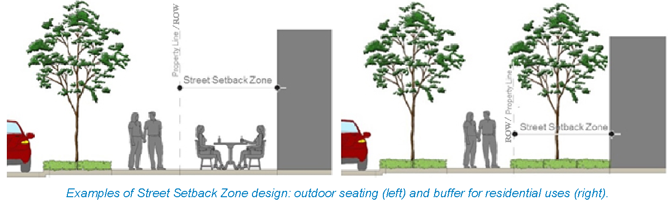
(a)
Street setback zones in front of uses that benefit from pedestrian interaction along the front façade shall include urban landscaping such as containers and/or planter boxes that complement the building mass and architecture.
(b)
Street setback zones in front of uses that do not require pedestrian interaction along the façade (e.g., offices, hotels, multifamily) may be landscaped with a combination of intermediate (understory) trees, palms, shrubs, vines and/or ground covers. Refer to Chapter 8 for Landscaping standards.
(c)
Street furniture such as benches, trash receptacles, and/or bicycle racks may be installed within the street setback zone.
(d)
Outdoor dining is permitted within street setback zones as long as restaurants are a permitted use in the zoning classification.
(e)
Elements within the street setback zone (landscaping and architectural features) shall comply with the sight triangle requirements established using City and standards of the American Association of State Highway and Transportation Officials (AASHTO).
(f)
The proposed building ground floor along the street setback zone shall contain active uses oriented to the street. Active uses may include display or floor areas for retail uses, waiting and seating areas for restaurants, atriums or lobbies for offices, and lobbies or dining areas for hotels or multi-family residential buildings.
Sec. 5.22. - Building orientation.
Buildings shall be oriented to enhance the appearance of the corridor. This requirement shall be met by incorporating the following techniques into project design.
(a)
The building's entrance shall be visible from the public road.
(b)
The building's primary facade shall be built parallel to the public road from which driveway access is provided, as shown in Figure 5-7. Where, because of site constraints or other factors, the building's primary facade is unable to be oriented parallel to the major road providing driveway access, each facade which is clearly visible from a public right-of-way or public area of adjoining properties shall be designed with full architectural treatment.
(c)
Building orientation shall be such that service areas are placed out of view from public rights-of-way, parking areas and adjacent properties. Buildings shall be proportioned in a manner that allows the wider façade to face the street, as shown in Figure 5-7.
Figure 5 - 7: Building Alignment and Orientation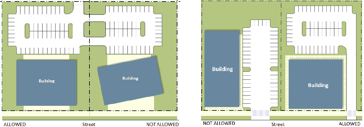
Sec. 5.23. - Building frontage buildout.
The purpose of the building frontage buildout requirement is to ensure façade continuity and activity along the street. The building frontage buildout standards are stated as a proportion of the building width (within the required building setback) relative to the width of the development site. Portions of the building façade outside the required building setbacks do not count as building frontage (see Figure 5-8). See Sec. 5.33 for Building Frontage Design.
Figure 5 - 8: Building Frontage Calculation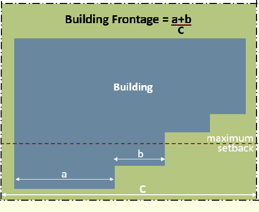
(a)
The minimum building frontage shall be 60%.
(b)
In the event the proposed building width is too narrow to meet the minimum building frontage buildout requirement (Figure 5-9, left graphic), the applicant shall have the option to separate the development site into smaller lots that meet the dimensional requirements through the lot split process provided for in Chapter 3, as shown on Figure 5-9, right graphic. The site plan shall show the unused portion of the site as available for future development and may not include any improvements other than an optional street wall delineating the site. Cross-access easement must be provided before construction plan approval.
Figure 5 - 9: Exceptions to the Building Frontage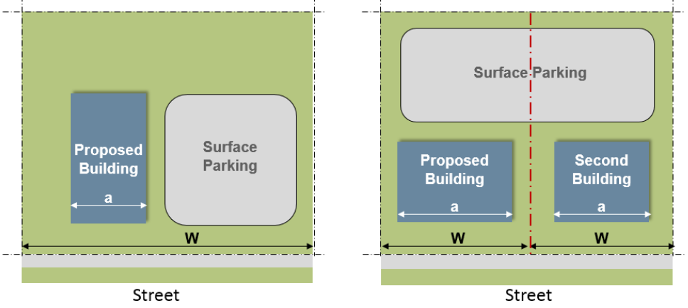
(c)
In the case where the required building frontage cannot be met due to the need to provide vehicular access from the street, a gateway, arch, or similar feature shall be provided to preserve the block continuity and may be counted toward meeting the building frontage requirement, as shown on Figure 5-10.
Figure 5 - 10: Gateway Feature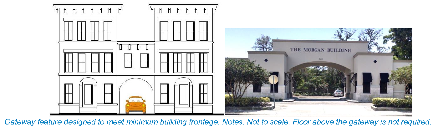
Sec. 5.24. - Building massing.
(a)
Buildings shall be articulated to break down large volumes into smaller volumes grouped together. In no event shall buildings exceed a height to width ratio of 1:3 or a length of 75 feet, whichever is less, without providing a substantial volume break, which may consist of a projection or recess, a tower or bay, and/or an architecturally prominent entrance (see Figures 5-11 and 5-12). Vertical and horizontal projections and recesses shall have a minimum depth of two feet.
(b)
Roofs or assemblies of roofs shall also be articulated to reduce building mass. Roof heights shall vary using the parameters listed in subsection (a), above.
Figure 5 - 11: Massing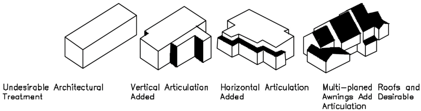
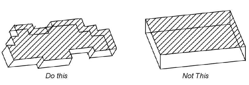
Figure 5 - 12: Example of Building and Roof Articulation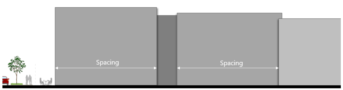
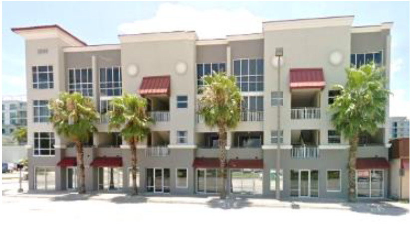
Sec. 5.25. - Architecture.
Structures within the same development shall reflect similar styles, materials, details, and colors and shall be designed with a recognized architectural style. A recognized architectural style shall be one that is recognized by design professionals as having a basis in classical, historical or academic architectural design philosophies. The use of features deemed by this Code to be "integral features of a recognized architectural style" shall have a rational and aesthetic relationship to the elevation of a structure, and be harmonious with the pattern, proportions, and materials of surrounding structures. The following shall not be considered recognized architectural styles:
(a)
Any architecture having a historical reference that is so unique and different from current design philosophy that such reference is inconsistent and incompatible with surrounding structures. Examples of such include igloos, tepees, medieval castles, caves and the like.
(b)
Any kitsch architecture which does not resemble a typical structure, but resembles an exaggerated plant, animal, fish, edible food or other such item such as giant oranges, ice cream cones, and the like.
Sec. 5.26. - Roof design.
Roof features shall be in scale with the building's mass and complement the character of the structure. Roofs shall incorporate the design elements and materials listed below:
(a)
The design of roof structures shall be flat, hip roof, or gable roof. Mansard roofs are prohibited. Flat roofs shall be hidden behind a parapet and a cornice. The material for sloped roofs shall be metal standing seam or "V" crimp metal, shingle or tile.
(b)
Roofs shall be designed to be of such height, bulk and mass so as to appear structural even when the design is nonstructural.
Sec. 5.27. - Façade articulation.
(a)
Facades facing a street or public space shall not exceed 20 horizontal feet and ten vertical feet without including at least one of the elements listed below.
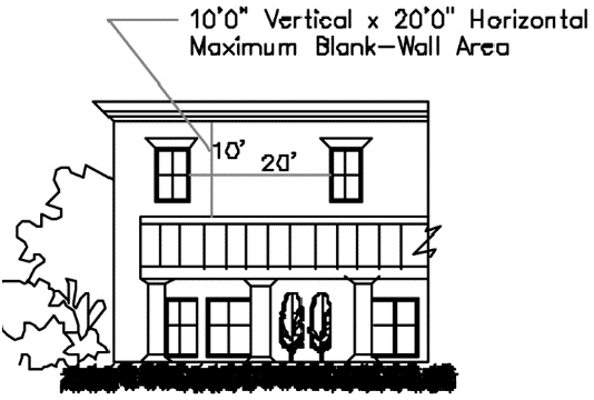
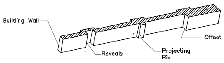
(b)
Storefront awnings, marquees, galleries/arcades, forecourts, stoops, or porches.
(c)
Overhangs of no less than three feet in depth.
(d)
Raised cornice/parapets over a door.
(e)
Expression line between floors.
(f)
An offset, column, reveal, void, projecting rib, band, cornice, or similar element with a minimum depth of six inches.
(g)
Peaked roof forms.
(h)
Clock or bell towers.
(i)
Balconies.
(j)
Windows or doors.
(k)
Any other treatment that meets the intent of this section and is approved during the review of the development plan.
(l)
Columns and posts shall not be spaced further apart than they are tall.
Sec. 5.28. - Doors and windows.
(a)
Entryways shall be designed to provide project focal points. Entryways shall be designed in accordance with the techniques listed below. In the event that the entryway is not oriented toward the major road that, as determined by the City, provides access to the building, the side of the building facing such road should also be designed to comply with this section.
(b)
The primary entrance of every building must directly face a street. Additional building entrances are permitted. Corner lots shall orient the primary entrance to the named major corridor (e.g., US 17-92, Highbank Road, etc.) or may provide a corner entrance. Where two major corridors intersect, the location of the primary entrance is at the discretion of the Growth Management Director.
(c)
Public entry and exit doors which swing outward shall be recessed into the façade a minimum of three feet where the sidewalk abuts the building.
(d)
Windows and doors shall be vertically proportioned or subdivided to appear vertical.
(e)
Windows and doors shall utilize clear glass with no less than 90% Visible Light Transmission (VLT, percentage of light that passes through the window) for retail establishments, and 50% for office and residential uses. Glass block is not considered transparent and shall not count toward the minimum fenestration requirement.
(f)
All building façades fronting on a street or public space shall meet the minimum fenestration requirements outlined below.
(g)
Buildings with storefronts (Figure 5-13).
(1)
Minimum building façade fenestration for ground story: 60%.
(2)
Minimum building façade fenestration for upper stories: 40%.
(h)
Buildings without storefronts (Figure 5-13).
(1)
Minimum building façade fenestration for ground story: 30%.
(2)
Minimum building façade fenestration for upper stories: 20%.
Figure 5 - 13: Facade Fenestration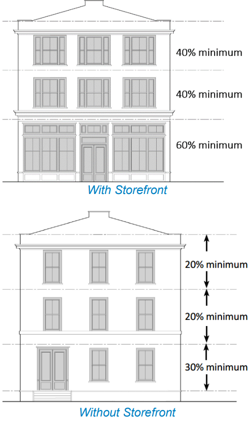
(i)
Interior shelves or furniture shall not fully or partially block windows used to meet the transparency and fenestration requirements.
(j)
In order to provide clear views of merchandise in stores and enhance the pedestrian shopping experience, the first-floor windows of buildings with frontage on a street shall remain unblocked for at least 60% of the surface of the window (this does not include any signs that may be permitted by Chapter 11). Elements such as curtains, blinds, indoor shutters may be used to provide privacy for non-retail uses.
(k)
Storefronts must remain lit until 10:00 p.m. to provide view of display spaces and security to pedestrians.
Sec. 5.29. - Exterior materials.
Exterior building materials contribute significantly to the visual impact of a building on a community, which, in turn, individually and collectively reflect upon the visual character and quality of a community. In order to project an image of high-quality City aesthetics, building materials shall conform to the following requirements:
(a)
For all structures, the following materials shall be acceptable on all facades that are or will be exposed to the general public:
(1)
Brick.
(2)
Exposed aggregate.
(3)
Stone.
(4)
Cellulose fiber-reinforced cement building boards.
(5)
Stucco, if used, shall be flat finish, "knocked-down," or sand finish only for a maximum of 40% of building façade.
(6)
E.I.F.S. (exterior insulation and finish system).
(b)
Prohibited façade materials include cedar shakes or wood shingles; metal/steel walls; corrugated or reflective metal panels (not intended to prohibit metal roofs or architectural accents); unfinished block, textured plywood, mirrored glass, plastic siding, tile (except as an architectural accent), and polyurethane and polystyrene foam products (except as an architectural accent).
(c)
When materials are combined on any facade horizontally, the visually heavier facade material must be below and can cover up to one third of the overall wall height. Changes from one façade to another shall occur at "inside corner" transitions (Figure 5-14).
Figure 5 - 14: Material/Color Change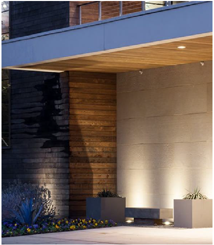
(d)
Changes in material along the vertical direction shall occur at a hard-edge "bump- out" transition which gives materials a surface to terminate against.
(e)
Building materials shall be consistent around the entire building.
(f)
Exposed metal building sidings shall not be permitted.
Sec. 5.30. - Exterior building colors.
Exterior building colors also contribute to the visual impact of a building and community as a whole. In order to project an image of high-quality City aesthetics, building colors shall conform to the following requirements:
(a)
Exterior colors shall not be specifically limited, but shall be consistent with earth tones, warm tones and muted hues. The selection of pastels shall be limited to those colors having a minimum white content of 90%. Other colors, excluding fluorescents, may be permitted as accent colors, not to exceed 20% of the surface area of any one elevation.
The requirement for earth tones and pastels shall not apply to colors commonly found in natural materials such as brick or stone, unless such material has been artificially colored in a manner which would be contrary to the intent of these regulations.
(b)
A color or color scheme which is directly inherent to a unique recognized architectural style or exterior artwork, but not otherwise in compliance with this section, may be permitted through the development plan approval process.
(c)
Building colors shall be consistent around the entire building.
(d)
Murals are permitted subject to staff review and approval.
Sec. 5.31. - Building height.
(a)
Buildings shall not exceed a total height of three stories.
(b)
Towers and cupolas are designed to extend above the roofline and are generally intended to be visual landmarks. Towers/cupolas shall not exceed 30 feet by 30 feet in footprint and shall not exceed ten feet above the height limit (see Figure 5-15).
Figure 5 - 15: Small Footprint Tower (top) and Cupola (bottom)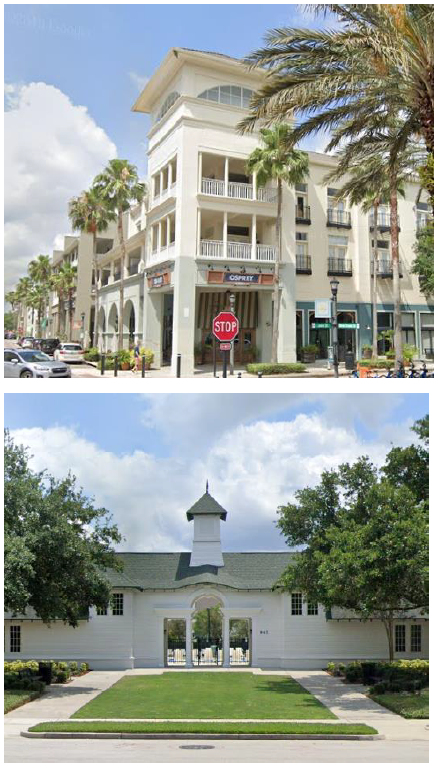
(c)
Any building over two stories in height on a site adjacent to a single family home zoning classification shall step back a minimum of ten feet after the second story. Developers may elect to apply the setback to the top floor only or to the entire façade.
(d)
The first 50 feet of the rooftop closest to a single family zoned lot shall not be occupied by active uses that may produce noise and affect the adjacent residential units (open air restaurant, bar, etc.).
Sec. 5.32. - Floor height.
(a)
Individual stories shall measure a minimum of nine feet from finished floor to finished ceiling.
(b)
Ground-floor uses with storefronts or non-residential uses shall have a minimum of 12 feet in Village Center, South 17-92 overlay districts and the Highbanks Node.
(c)
Stories shall not exceed 14 feet in height from finished floor to finished ceiling, except for a ground floor non-residential function, which shall not exceed 25 feet. A single story exceeding 14 feet, or 25 feet for ground floor non-residential, shall be counted as two stories. Mezzanines extending beyond 33% of the floor area shall be counted as an additional story.
Sec. 5.33. - Building frontage design.
Most buildings have a frontage element that varies depending on the use. For instance, commercial buildings typically have storefronts, and residential buildings have porches. This section contains standards for the various types of frontages that may be used. See Sec. 5.23 for Building Frontage Buildout.
(a)
Storefronts. The design of new storefronts must follow the compositional principles of historic storefronts (Figure 5-16 and 5-17).
(1)
Bulkhead height shall be between one and three feet above the adjacent sidewalk. Bulkhead materials may include masonry, metal, or wood.
(2)
Shopfront windows shall extend up from the sill at least eight feet above the adjacent sidewalk.
(3)
Storefront windows may not be made opaque by window treatments (except operable sunscreen devices within the interior space). See Sec. 5.28(e) for glass transparency requirements.
(4)
Storefront doors shall not be recessed more than five feet from the front façade. If the doors are recessed more than three feet, angled walls leading to the door are recommended to promote the visibility of the entrance.
(5)
Storefront doors shall contain at least 60% transparent glass.
(6)
The top frames of the display windows and the entrance door must align.
(7)
Storefront shall have an expression line above, between the first and second story, or a change in materials.
(8)
Galleries, arcades, awnings and marquees shall be used in conjunction with a storefront.
(9)
The design of the upper stories varies depending upon the architectural style of the building. However, the upper floor must have single or paired, vertically oriented windows with clearly defined sills and lintels, and a cornice topping the parapet if a flat roof is used.
Figure 5 - 16: Composition of Storefronts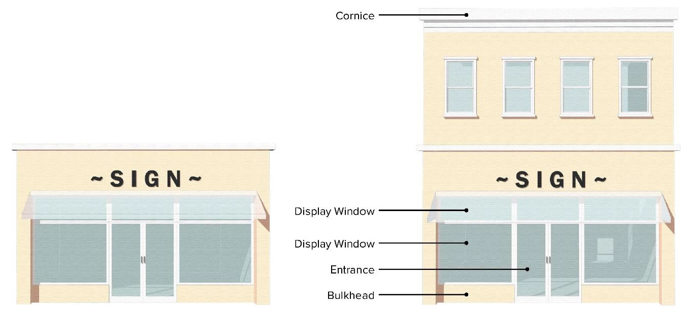
Figure 5 - 17: Examples of Storefronts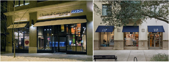
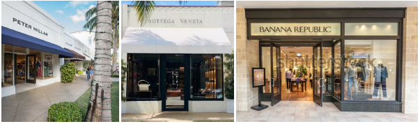
(b)
Arcades and galleries. An arcade is a type of frontage where a cantilevered shed or a colonnade is placed in front of the building to provide protection from sun and inclement weather. Galleries are façades with an attached colonnade that may extend above the ground floor.
(1)
Arcades/galleries shall meet the following dimensional standards:
① Width: May extend for the entire width of the building.
② Depth: 6' min./10' max.
③ Clear Height: 8' min. (1st floor)
● Setback: May encroach into the required building setback but not into the public right-of-way.
● Column Width: 2' max.
Figure 5 - 18: Arcade & Gallery Dimensional Standards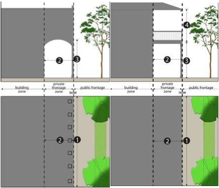
(2)
The roof over the arcade/gallery shall be consistent with the material and scale typical in the district.
(3)
Arcade/gallery openings shall correspond with storefront entrances.
Figure 5 - 19: Examples of Galleries and Arcades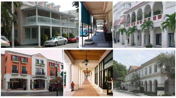
(c)
Canopies and awnings. Canopies and awnings serve similar functions providing shelter as a roof-like structure on the exterior wall. While canopies are constructed in a more permanent manner (made of metal or similarly sturdy material), awnings are often retractable and made of canvas (or similar) material. While some storefronts utilize canopies and awnings, they are not used exclusively on storefronts. Multi-family residential, office and lodging uses may also utilize this type of building frontage.
(1)
The installation of canopies and awnings shall meet the following dimensional standards:
① Width: Shall match the width of:
● The storefront;
● Each window or door; or
● Paired windows (awnings should not extend over multiple windows if the windows are not paired/grouped).
② Depth: 4' min./10' max.
③ Clear Height: 8'6" min.
◦Setback: May encroach into the required building setback but not into the public right-of-way.
Figure 5 - 20: Canopy & Awning Dimensional Standards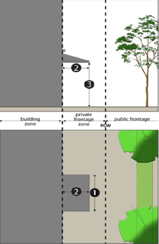
(2)
Canopies/awnings that extend the width of the storefront should not cover the side piers of the building, if side piers are proposed.
(3)
The lowest part of the awnings shall meet the clearance height noted above but shall be no higher than the top edge of the display window.
(4)
The highest portion of the awning shall not be above the expression line between the first and second stories (if one is present) or one foot below the second story window sills. For single story buildings, the highest part of the awning shall be at least one foot below the cornice.
(5)
High gloss/plasticized fabrics and aluminum awnings are prohibited.
(6)
The color of awnings shall complement facade colors; solid colors or stripes are appropriate.
(7)
Lighting of awnings from behind (backlight) is prohibited.
(8)
Canopies/awnings shall not cover architectural elements such as cornices or ornamental features.
(9)
Canopies may be cantilevered or supported by columns/posts or overhear braces attached to the façade.
(10)
Awnings and canopies shall not be used on windows that have shutters.
(11)
Pent roofs (see Figure 5-21) are only allowed in conjunction with Spanish Revival style buildings and must include clay tile.
Figure 5 - 21: Pent Roof
Figure 5 - 22: Examples of Appropriate Canopies and Awnings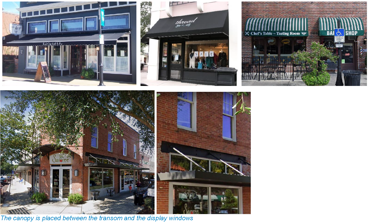
Figure 5 - 23. Examples of Inappropriate Awnings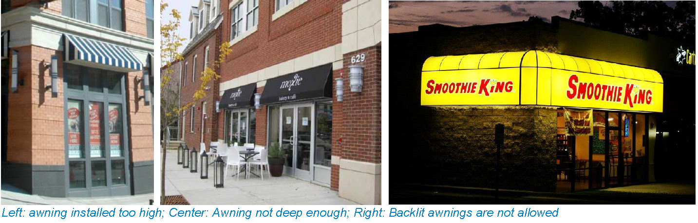
(d)
Courtyard (forecourt). A courtyard is a type of building frontage that has a portion of the façade recessed from the street. They are acceptable frontages in commercial areas and multifamily sites.
(1)
Courtyards shall meet the following dimensional standards:
① Width: 10' min. to 50% of façade width max.
② Depth: 10' min/20' max.
● Elevation: 18" max. above grade.
● Setback: Shall be permitted to encroach into the setback with 0' to the property.
Figure 5 - 24: Courtyard Dimensional Standards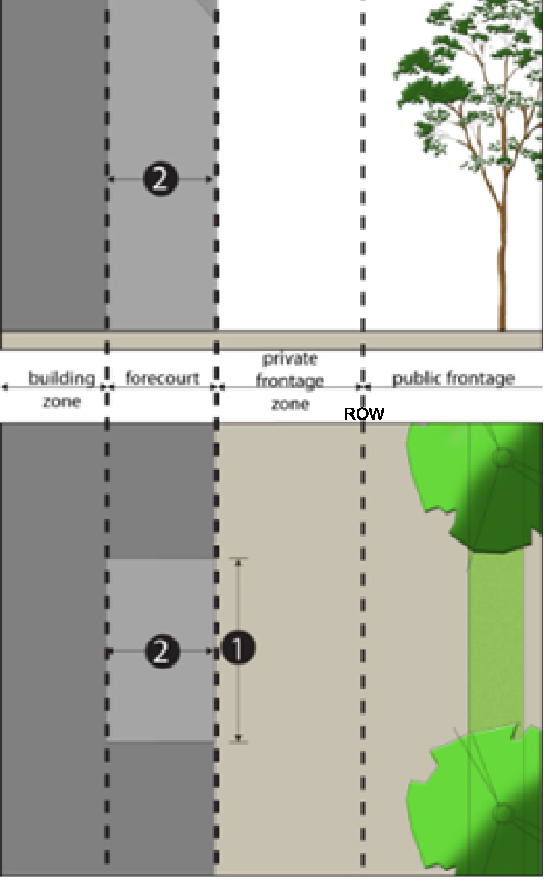
(2)
Courtyard shall be paved and enhanced with landscaping.
(3)
Courtyards are not intended to be covered; however, awnings and umbrellas are allowed and encouraged.
(4)
If a streetwall is used along the front of the courtyard, the wall must not exceed three feet in height.
Figure 5 - 25: Examples of Courtyards (Forecourt)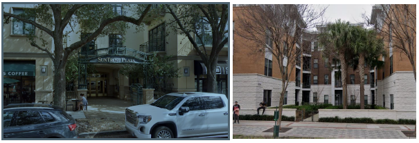
(e)
Porch. A covered yet unenclosed projection from the main wall of a building possibly utilizing columns or other ground supports for structural integrity. The intent of the porch is to enhance street activation and human scale, offering adequate space for comfortable use of an outdoor room.
(1)
Porches shall meet the following dimensional standards:
① Width: 10' min.
② Depth: 8' min
③ Clear Height: 8'
④ Elevation: 21" min. above grade.
Figure 5 - 26: Porch Dimensional Standards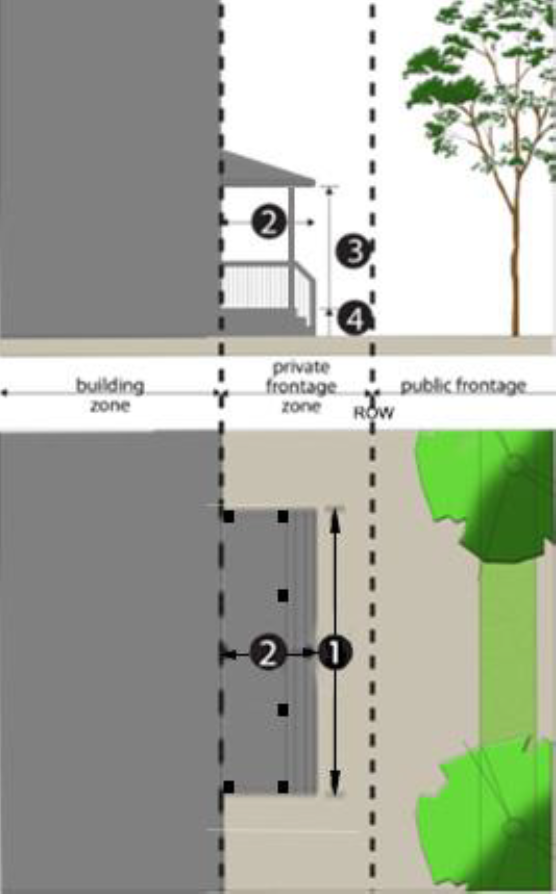
(2)
Porches must correspond directly with the building entry.
(3)
A porch may project no more than 8' into the front setback and shall not be placed less than 3' from the front property line.
(4)
The porch shall be open on all sides except where it is attached to the principal structure. No permanent screening, lattice work, banister, or other permanent, attached, visual obstruction shall be permitted except for safety purposes, not to exceed the minimum to meet building code safety code standards.
(5)
The porch area extending into the private frontage zone may contain a second story balcony.
Figure 5 - 27: Examples of Porches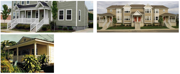
(f)
Stoop. A stoop is a small platform and/or entrance stairway at a door, commonly covered by a secondary roof or awning.
(1)
Stoops shall meet the following dimensional standards:
① Width: 5' min. to 16' max.
② Depth: 5' to 8'
③ Clear Height: 8'
④ Elevation: 21" min. above grade.
Figure 5 - 28: Stoop Dimensional Standards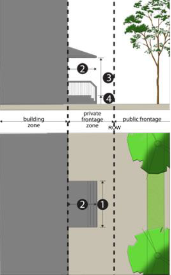
(2)
Stoops must correspond directly with the building entry.
(3)
A stoop may project no more than 8' into the front setback and shall not be placed less than 3' from the front property line.
(4)
The stoop shall be open on all sides except where it is attached to the principal structure. No permanent screening, lattice work, banister, or other permanent, attached, visual obstruction shall be permitted except for safety purposes, not to exceed the minimum to meet building code safety code standards.
Figure 5 - 29: Examples of Stoops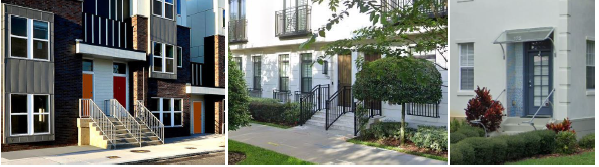
Sec. 5.34. - Service areas and mechanical equipment.
Lack of, or inadequate screening of, service areas and mechanical equipment can have negative visual impacts on the City's streetscape, ambient landscape or community image. Such impacts shall be minimized through compliance with the following requirements:
(a)
Service areas and mechanical equipment located on the ground, such as waste disposal containers, loading docks/spaces, air conditioning units, heating units, satellite dishes, irrigation pumps, propane tanks and refilling areas, utilities, lift stations, and the like shall be located in the rear or to the side of buildings and screened from public view (Figure 5-30). Screening shall, at a minimum, be at the same height as the equipment. Structural screening shall be architecturally integrated into the overall project design and shall be compatible, in terms of style, construction materials, colors, and finish, with the principal structure, as per Division 6 of this article. Landscaping may be substituted for structural screening if plantings are compatible with the landscape plan for the project and are of such size and maturity as to be able to provide a fully opaque screen at time of planting.
Figure 5 - 30: Service Area Screening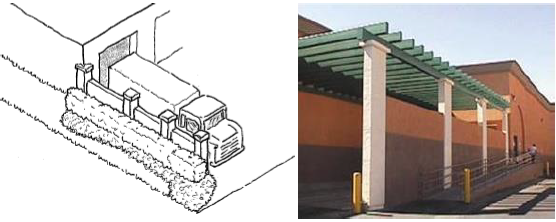
(b)
If mechanical equipment is located at-grade, and is visible from an adjacent street or sidewalk, it shall be inset into the building façade and screened with doors, or screened by a fence or street wall (see Figure 5-31). For the purposes of these standards, mechanical equipment shall include any heating, ventilation, and air conditioning (HVAC) or electrical machinery but also includes air compressors, hoods, mechanical pumps, exterior water heaters, water softeners, utility and telephone company transformers, meters or boxes, garbage cans, storage tanks, generators, geothermal wells, and similar elements. Electric vehicle (EV) chargers are not deemed mechanical equipment.
Figure 5 - 31: Mechanical Equipment Screening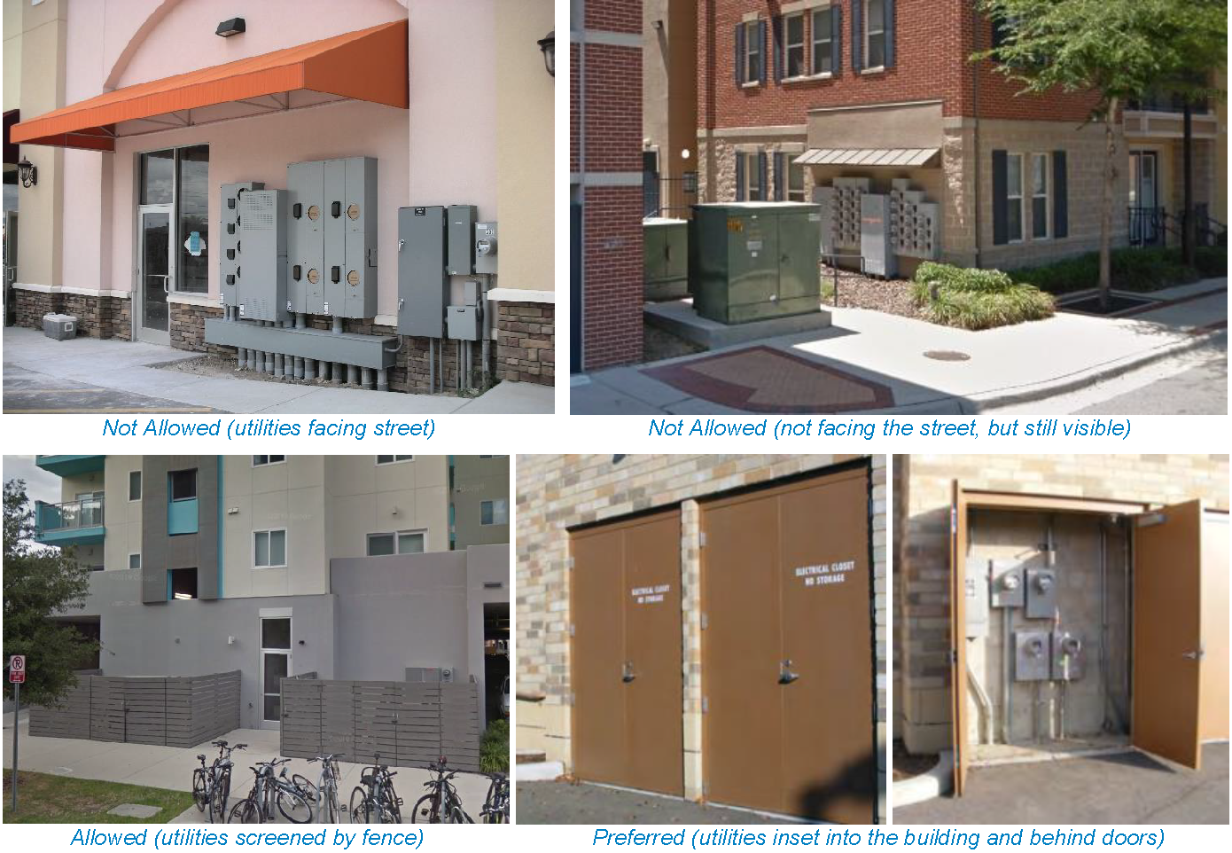
(c)
Equipment and appurtenances mounted on rooftops shall be kept to a minimum. All rooftop mounted equipment and appurtenances shall be fully screened from view from all public rights-of-way (see Figure 5-32). All screening shall, at a minimum, be at the same height as the equipment and appurtenances. Screening shall be an integral part of the design of the building and shall be architecturally consistent with the style, colors, construction materials and finish of the building.
(d)
Rooftop equipment shall be set back from the edge of the roof by a distance at least equal to the height of the screening in order to minimize visibility from surrounding streets.
Figure 5 - 32: Rooftop Units Screening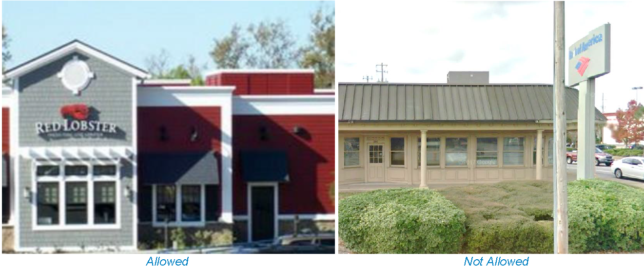
(e)
Service areas shall not be located within 50 feet of single family residentially zoned lots.
(f)
See Chapter 10 for solid waste container standards.
(g)
Shopping cart storage shall be located inside the building or shall be screened by a four-foot wall consistent with the building architecture and materials.
(h)
Electrical transformers and other utility equipment shall be screened from public view on all sides.
Sec. 5.35. - Utilities.
The location and aesthetic treatment of utilities is an important factor in creating an attractive urban environment. In order to enhance and maintain the image of quality in the urban environment, utilities construction and placement shall comply with the following requirements:
(a)
All utility lines, whether new or relocated, shall be installed underground. Any new lines within the corridor right-of-way that are required to serve the development shall be installed underground.
(b)
Utility conduit and utility panels/boxes shall be painted to match the color of the building on which they are placed. Additionally, panels/boxes shall be located on the same facade considered the service side.
(c)
Water and sewer lift stations, pump houses and similar features shall, be located, to the extent possible, at the rear of the project site and shall be fully screened from view by structural or vegetative means. Where screening is accomplished by structural means, such screening shall be compatible in design and color with the main building.
Sec. 5.36. - Gasoline service stations.
If permitted in the district, service stations shall meet the standards of this chapter and the following provisions:
(a)
A ground-floor shopfront (convenience store or service building) shall be located in the front of the site (see Figure 5-33) meeting the required setbacks. All pumps, parking and service bays shall be located to the side (interior only) or rear of the main building.
(b)
A street wall meeting the standards of Sec. 5.48 shall be provided to screen vehicular use areas.
(c)
Accessory car wash structures shall not exceed 20 feet in height, unless they have a hip or gable roof.
(d)
Accessory car wash openings, service and storage areas, and refuse enclosures shall be oriented away from public view.
(e)
Lighted bands or tubes or applied bands of color (other than permitted as signage) are prohibited.
(f)
Site lighting shall minimize direct and reflected glare and excess brightness. Therefore, only cut-off fixtures shall be allowed
Figure 5 - 33: Service Station Examples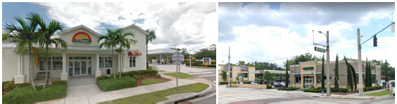
Sec. 5.37. - Drive-through facilities.
Drive through facilities, if allowed, must meet the following:
(a)
Drive-through lanes and windows shall be located along the rear of buildings, away from view from the street (see Figures 5-34 and 5-35). If the use is located within a building that has a parking garage, the drive through windows/bays shall be located within the garage (see Figure 5-36).
(b)
Drive-through facilities on a separate site than the principal use shall not be allowed.
(c)
Vehicular use areas visible from the street shall be screened with a street wall (see Sec. 5.48).
Figure 5 - 34: Appropriately-sited drive-through facilities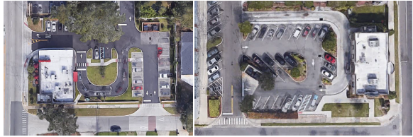
Figure 5 - 35: Exterior Drive-Through Facilities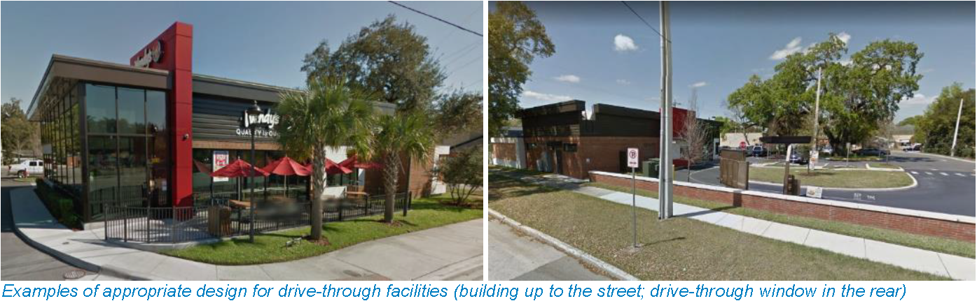
Figure 5 - 36: Interior Drive-Through Facilities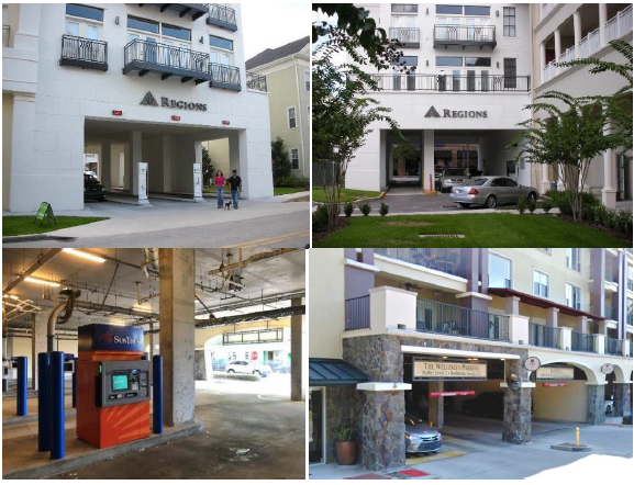
Sec. 5.38. - Self-storage facilities.
Self-storage facilities, if allowed, shall be designed to meet the intent to create a pedestrian-friendly urban environment. Self-storage facilities shall be designed and constructed in accordance with the following requirements (Figure 5-37):
(a)
Self-storage facilities shall be a mixed-use development with a portion of the first floor being an additional office, restaurant, or retail and services use(s). The entirety of the frontage facing the major corridor shall only be the additional uses The entrance of the additional use(s) shall be from the front façade of the principal structure.
(b)
Access to the individual storage units only be provided from interior spaces.
(c)
There shall be no outdoor storage allowed.
(d)
Loading docks shall be located inside the building.
(e)
Privacy fences or walls are not allowed around the property unless they are required by Code.
Figure 5 - 37: Urban Self-Storage Facilities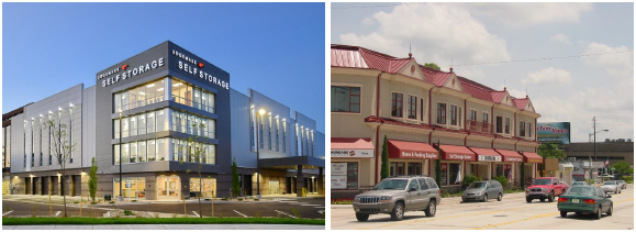
Sec. 5.39. - Access and circulation.
Access shall be provided in accordance with Chapter 7, Appendix 2-Technical Standards Manual and the following provisions:
(a)
It is the intent of the City to minimize the number of curb cuts and driveways along major corridors. Where possible, sites shall be accessed from rear alleys where they exist or from secondary streets (see Figure 5-38 and Chapter 7 for alley standards). If no rear alley or secondary street exists, access shall be provided across neighboring properties utilizing cross-access easements (see Figure 5-39). Cross-access easements must be provided prior to construction plan approval.
(b)
When connecting to adjacent properties through cross-access easements is not feasible at the time of development, the proposed development shall be designed to allow for future connections (stub outs).
(c)
When vehicular access to the site must be directly from a major corridor, the access driveways shall be designed in a way to ensure the safety of pedestrians crossing on the sidewalk.
Figure 5 - 38: Vehicular Site Access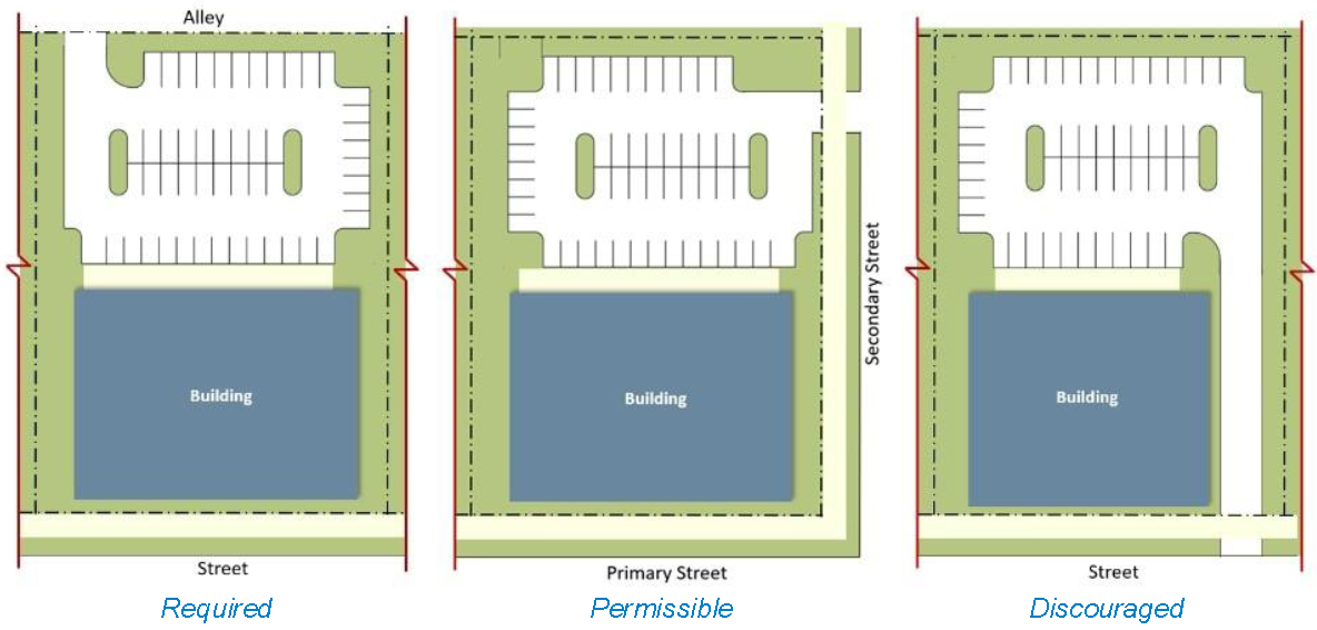
Figure 5 - 39: Joint Use Driveways/Cross-Access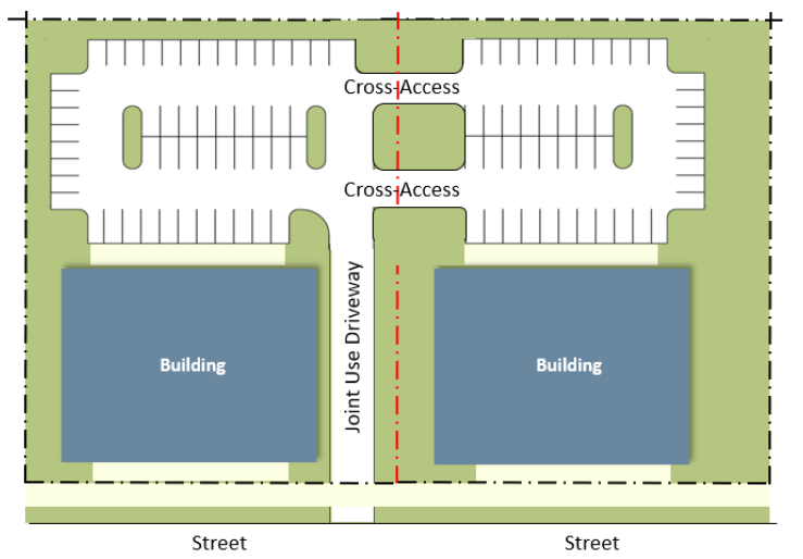
(d)
Vehicular access to non-residential or mixed-use developments from/through single family residential neighborhoods shall not be allowed.
(e)
A clear, safe and convenient pedestrian path shall be provided from the public sidewalk along the corridor right-of-way to the main entry door of each principal structure. The pedestrian path shall be functionally delineated by using construction materials that are different than the materials used for the construction of the parking area (e.g., use of brick, pavers, or concrete for the pedestrian access when the parking lot is an asphalt surface). Such access shall be at least five-foot-wide paved walkways with at least two feet of landscaping on each side leading to entranceways. Access across driveways and parking aisles shall be delineated by crosswalk striping at locations that accommodate convenient pedestrian access.
(f)
Pedestrian connections between parking areas and the main building entrance shall also be provided. This may be achieved through pedestrian passageways (see Figure 5-40) or sidewalks around the building. The pedestrian walkways shall be a minimum of five feet wide.
(g)
Safe pedestrian connections shall be provided not only along the perimeter of the site but also throughout the interior of the site.
(h)
Pedestrian walkways within the development shall be differentiated from driving surfaces through a change in materials and/or grade elevation.
Figure 5 - 40: Pedestrian Linkages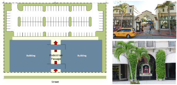
Sec. 5.40. - Parking requirements.
(a)
Parking shall be provided for each use in accordance with the minimum requirements outlined by use in Chapter 7 and Appendix 2-Technical Standards Manual.
(b)
On-street parking, if available, may also be counted towards the parking space requirement if the full length of the space is located directly adjacent to the site. On-street parking shall remain open to the public and cannot be reserved or dedicated for private use.
(c)
Parking shall be located behind the primary building or, if rear parking is not feasible, to the side of the building. The location of parking to the side of the building, however, does not exempt the development from meeting the building frontage requirements of Sec. 5.23 (Building Frontage Buildout). Parking lots located on the side shall be masked from the street by a street wall/fence (see Sec. 5.48). See Figure 5-41.
Figure 5 - 41: Parking Location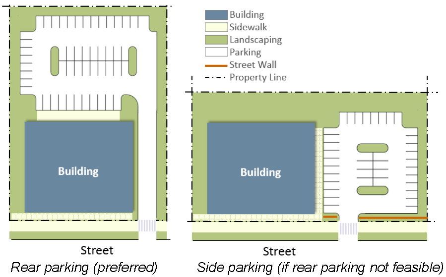
(d)
Surface parking areas adjacent to a street shall have at least the same setback as the building façade facing the same street. See Sec. 5.48 for street wall/fence requirements.
(e)
Surface parking areas abutting other sites shall be setback the distance necessary to allow for the required perimeter landscaping required in Chapter 8.
(f)
Shared and reduced parking is permitted and encouraged. The amount of parking required is calculated by adding the total number of spaces required by each separate function in Chapter 7 and dividing by the appropriate factor from the Sharing Factor matrix (Figure 5-42). However, the required number of handicap spaces cannot be reduced. For example, the residential function requires ten spaces while the office portion requires 12 spaces. Independently they would require 22 spaces, but when divided by the sharing factor of 1.4, they would require only 16 spaces. When more than two uses share parking, the lowest factor shall be used.
Figure 5 - 42: Sharing Factor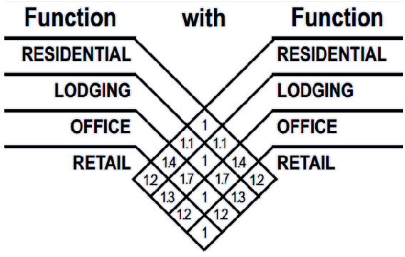
(g)
Bicycle parking shall be provided per Chapter 7.
(h)
Parking stall standards shall be in compliance with Appendix 2-Technical Standards Manual.
Sec. 5.41. - Parking garages.
(a)
The first floor of parking garages that front on a street shall be used for active uses (e.g., commercial, office, residential). The uses may be located within a liner building, or as an integral part of the parking garage building (see Figure 5-43). Additionally, liner buildings may be attached or detached from parking garage.
(b)
Parking garages and liner buildings shall meet the building design standards of this article.
Figure 5 - 43: Parking Garages and Liner Buildings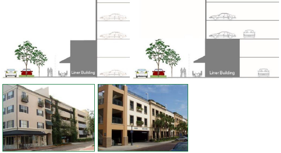
Sec. 5.42. - Exterior lighting.
Lighting fixture design and placement are important components of an attractive urban environment as well as important to public safety. In order to enhance site aesthetics and minimize visual distraction, yet maintain adequate public safety, project lighting shall comply with the requirements listed below:
Lighting Design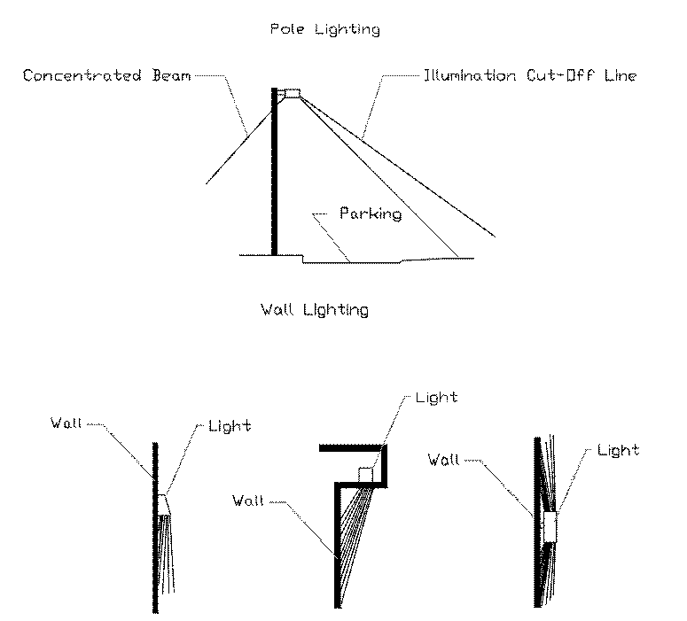
(a)
An exterior building and site lighting master plan detailing areas and structures requiring illumination, lighting fixture styles, light source and light levels shall be included as part of a project's submittal for approval. Refer to Appendix 2-Technical Standards Manual
(b)
Recessed lighting fixtures shall be required in order to conceal the actual source of the light so as to reduce glare and direct the light to specific areas while shielding other areas. Lighting shall be uniform in color and intensity.
(c)
Backlit awnings/canopies are not permitted.
(d)
Light poles shall be located only within landscaped strips, interior landscape islands, or terminal landscape islands.
(e)
The maximum height of the light poles shall be 20 feet.
(f)
The maximum height of pedestrian scale lighting fixtures shall be no greater than 15 feet.
(g)
The minimum setback of the light source from the property line shall be a horizontal distance of ten feet.
(h)
Neon lighting is not permitted.
(i)
Building illumination and architectural lighting shall be indirect and with no visible light source.
(j)
Ground level light fixtures shall be of the burial vault type or shall be fully screened by landscaping materials.
(k)
Parking lot light fixtures shall be designed so that light is directed onto the parking area and away from neighboring residential lots (e.g., house side shields).
(l)
Parking lot fixtures shall be coordinated with the location and spread of trees so that they can still illuminate the parked cars (Figure 5-44).
Figure 5 - 44: Parking Lot Lighting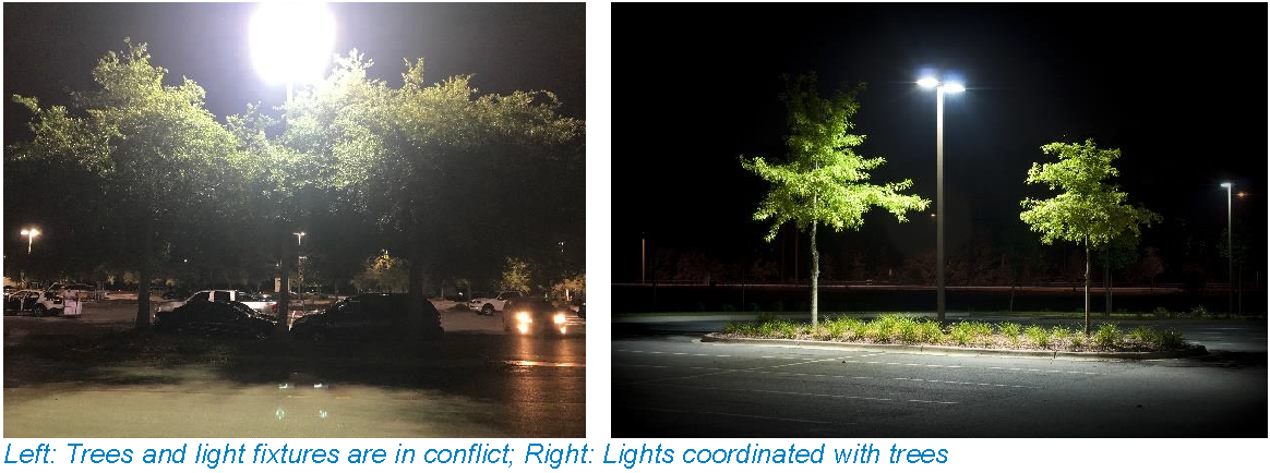
Sec. 5.43. - Landscaping between the building and the street.
Buildings within the Nodes and Corridors are intended to be actively engaged with the street. Therefore, any provisions in Chapter 8 requiring landscaping or buffering between the building and the street are not applicable.
Figure 5 - 45: Planters Adjacent to Buildings
Sec. 5.44. - Parking lot landscaping.
Developments shall be subject to the vehicular use landscaping requirements of Chapter 8 and the following:
(a)
Parking lot layout, landscaping, buffering, and screening shall minimize direct views of parked vehicles from streets and sidewalks; prevent spill-over light, glare, noise, and exhaust fumes from infringing on adjacent properties; and provide the required tree canopy shade.
(b)
Where adjacent surface parking lots are combined into a single, shared parking lot (joint use and cross-access easements will be required), the required perimeter landscaping between the lots shall not be required. See Figure 5-46. All other parking lot landscaping requirements shall be met.
Figure 5 - 46: Adjacent Surface Parking Lots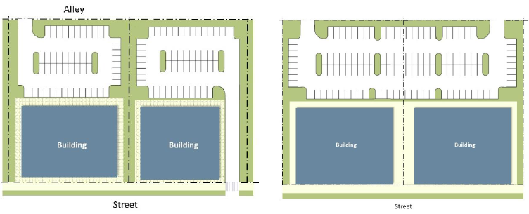
(c)
The design of the landscape shall maximize the use of green infrastructure stormwater best management practices (BMPs) such as pervious paving, bioretention systems, rain gardens, bioswales, and stormwater planters to slow and treat stormwater runoff while providing multiple additional community benefits. Refer to Appendix 2-Technical Standards Manual.
Sec. 5.45. - Street trees.
Street trees shall be provided as required in Chapter 8 and the following provisions.
(a)
Planting strips shall be used strategically to allow for adequate space to plant street trees.
(b)
Coordination will be required to integrate the placement of street trees, signage, and lighting to ensure that each element complements the other.
(c)
Vertical clearance shall comply with Chapter 8 requirements.
(d)
In areas where landscaping cannot be located in the public right-of-way, it shall be located within the street setback zone.
(e)
When street trees are planned for thoroughfares with frequent transit service, the trees shall be placed to be compatible with passenger loading areas and allow maintenance, so branches do not interfere with transit vehicle movements.
(f)
Tree species with tap roots shall be selected to prevent sidewalk and pavement breakage.
Sec. 5.46. - Buffers.
(a)
No buffers or fences are required between non-residential uses, unless specifically required as part of a Special Exception approval.
(b)
Proposed developments abutting residential zoning classifications shall provide buffers, landscaping and screening as required in Chapter 8.
Sec. 5.47. - Perimeter fence and wall design.
Design and construction quality of perimeter fences and walls are important visual reflections of community character and quality. In order to promote quality site aesthetics, fence and wall design and construction shall comply with the following requirements:
(a)
Fences and walls shall be designed as an integral part of the principal structure. Their design shall include the use of similar materials, colors and finishes as the principal structure.
(b)
Chain link and vinyl fencing is not permitted, unless screened from view from public rights-of-way, parking lots, and adjacent properties. If foliage is used for screening, the foliage must screen the fence from view within 720 days of installation of the fence. Natural wood fencing shall not be permitted under any circumstances.
(c)
Privacy fences/walls are not allowed to face the roadway corridors.
Sec. 5.48. - Street wall/fence design.
A freestanding street wall/fence meeting the requirements of this section and intended to mask parking areas from the street and to strengthen the spatial definition of the Public Realm, is the only type of wall or fence permitted within the required front and street side yard setbacks facing the roadway corridors.
(a)
Street walls/fences shall have a minimum height of 2.5 feet and a maximum height of five feet (measured from the elevation of the public sidewalk). The portion of the street wall/fence above 2.5 feet shall be transparent (e.g., wrought iron or similar). Transparent fences shall have columns (one foot by one foot minimum) spaced at a maximum of 24 feet (see Figure 5-47).
Figure 5 - 47: Street Wall Examples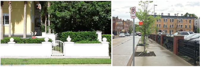
(b)
Street Walls shall have openings no larger than necessary to allow automobile and pedestrian access.
(c)
Street Walls shall be placed in line with the building façade facing the same street.
(d)
Street Walls shall not be permitted in the right-of-way.
(e)
Street Walls shall be constructed of wrought iron, brick, masonry, stone, powder-coated aluminum or other decorative materials that complement the finish on the primary building. Chain link, wood and PVC street walls/fences shall be prohibited.
(f)
The area in front of a street wall shall include a landscaped strip with a minimum width of five feet (with ground cover, hedges, or shrubs). The landscape strip may be waived by the Growth Management Director if the area in front of the wall is needed to expand the public sidewalk (see Figure 5-48).
(g)
The area between the street wall and off-street parking shall include a minimum five-foot wide landscape strip.
(h)
Understory trees shall be planted in front or behind the street wall at a rate of one tree per 25 feet of wall length. If planted behind the street wall, the landscape area shall be at least five feet wide to accommodate such trees. The trees may be waived by the Growth Management Director if they conflict with the required or existing street trees.
Figure 5 - 48: Street Wall Landscaping Examples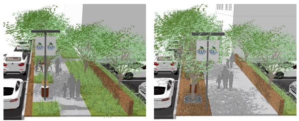
Sec. 5.49. - General standards.
In order to reduce water quality impacts at receiving waters and enhance community character in support of compact development, the standards of this section intend to:
(a)
Manage rainfall as close to where it falls as possible, approximating the natural pre-development hydrology (water quality and water quantity) using natural, decentralized stormwater management practices.
(b)
Celebrate stormwater as an integral part of the built environment.
(c)
Establish watershed sensitive planning and design criteria at the neighborhood scale of development to support shared flood control solutions.
(d)
Apply Low Impact Development (LID) best management practices at the block, street, and site level, appropriate to land use context and site conditions. Some examples of best management practices include the use of bioretention/rain gardens, rainwater harvesting/cisterns, downspout disconnection, vegetated filter strips, grassed swales/channels, infiltration trenches, level spreaders, permeable pavers/pervious pavement, and soil reforestation/revegetation.
Figure 5 - 49: LID Examples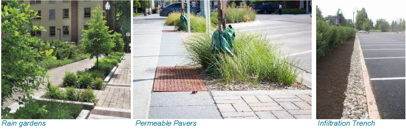
Sec. 5.50. - Design criteria.
Development shall meet the Stormwater Management requirements of Chapter 10 and Appendix 2-Technical Standards Manual.
(a)
Pervious paving shall be permitted and is encouraged to reduce stormwater runoff volume.
(b)
Green roofs shall be permitted for all building types.
(c)
Irrigation systems are encouraged to first make use of all available surface stormwater runoff or other retained or detained stormwater as a water supply.
(d)
Bioretention systems, bioswales, tree filters, and other vegetated stormwater BMPs are encouraged for treatment of stormwater runoff from streets, parking lots, plazas, and other impervious surfaces. These vegetated BMPs can include impermeable liners with underdrains to provide water quality treatment where infiltration is not technically feasible due to site contamination concerns.
(e)
For new construction, retention must be placed in the rear, side yard, or underground, but not facing the public right-of-way, unless it is integrated into the design and featured as a site amenity.
(f)
The maintenance berm around privately owned and maintained ponds, if required, may be reduced to a minimum width of ten feet.
(g)
Applicants may propose other LID or green infrastructure concepts.
Figure 5 - 50: Alternative Stormwater Detention/Retention Facilities