
Ecorse City Zoning Code
ARTICLE 2
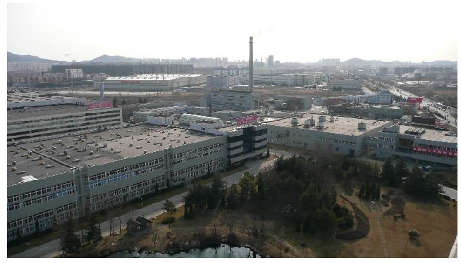
- ZONING DISTRICTS AND MAP
2.1.- Zoning districts established.
For the purpose of this ordinance, the City of Ecorse is hereby divided into the following zoning districts:
2.2. - Intent of established zoning districts.
The intent and purpose of each established zoning district is described in the subsections below.
2.3. - Zoning map.
The boundaries of the zoning districts established by the ordinance are shown on a map or series of maps designated the "official zoning map." The official zoning map including all notations, references, data and other information shown therein, is adopted and made a part of this ordinance as fully as if it were contained within the pages of this ordinance.
A.
Location. The official zoning map is filed in the office of the city clerk.
B.
Updates. The city council may adopt amendments to the district boundaries designated on the official zoning map upon review and recommendation by the city planning commission.
2.2.1. - Single-Family Residential District (SFR).
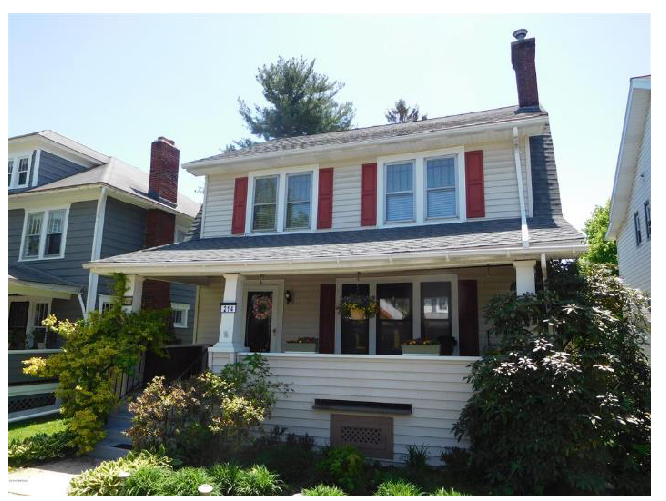
The Single-Family Residential District is designed to be composed of lower-density residential home development. The regulations are intended to stabilize, protect and encourage the residential character of the district and prohibit activities not compatible with a residential neighborhood. Development is limited to single-family dwellings, duplexes and accessory dwelling units, plus such other uses as schools, parks, religious institutions and certain public facilities that serve residents of the district. The district is intended to be walkable with amenities such as sidewalks, street trees, pedestrian-scaled lighting, and connections to neighborhood parks and residential services. This district recognizes that the City of Ecorse has been developed and platted with lots that are smaller than those found in recently urbanized communities, and the standards in article 3 reflect residential development that the citizens of Ecorse find to be compatible.
2.2.2. - Multiple Family Residential District (MFR).
The Multiple Family Residential District is designed to provide sites for multiple family dwelling structures and accessory uses, which will generally serve as zones of transition between the higher intensity nonresidential districts and the less intense lower density Single-Family Residential district. The district has been provided at planned locations in the city which will be compatible, and not injurious, to single-family uses and where necessary utility services, community facilities, and access are available.
2.2.3. - Flexible Residential District (FR).
The Flexible Residential District is intended to provide a location for diverse housing options that include compact single-family, duplexes, triplexes, quadplexes, rowhouses, stacked flats and accessory dwelling units. Future development will create a cohesive neighborhood design that blends with the existing residential pattern. Improved walkability of the district will be achieved through incorporating the pedestrian-scaled elements typical of the Single-Family Residential District, while also helping to strengthen the economic viability of commercial uses along the Jefferson Avenue corridor. Furthermore, the district will serve as an appropriate transition between higher intensity commercial and industrial uses, and the less intense residential uses.
2.2.4. - Manufactured Housing District (MH).
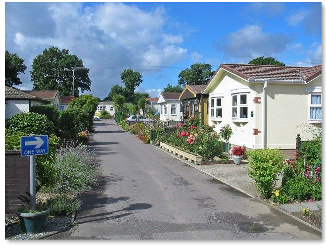
The Manufactured Housing District is intended to allow an alternate form of housing that provides the flexibility of moving living units from place to place. The district is further designed to provide sites for manufactured housing in limited areas to enhance stability, character and property values of the community; increase the possibility of good site planning through the creation of a pleasant residential environment by better facilities for health, sanitation and recreation; and provide the proper community monitoring of all these matters.
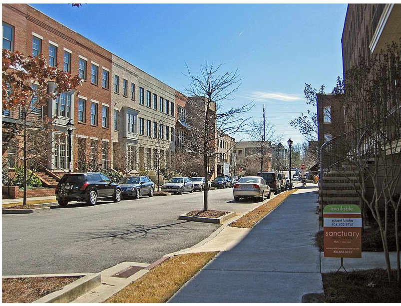
2.2.5. - Neighborhood Mixed Use District (NMU).
The Neighborhood Mixed Use District is intended to permit flexibility in land use and development by allowing the combination of commercial, office and residential uses at a neighborhood scale. This will create convenient access to commonly required goods and services to the residents in proximity to Visger Road and Salliotte Avenue while also creating housing options in a portion of the city limited to single-family residential. Because of the variety of business types permitted in the Neighborhood Mixed Use district, special attention must be focused on site layout, building design, vehicular and pedestrian circulation, and coordination of site features between adjoining sites. Accordingly, developments should be compatible in design with adjacent development, buffered and screened from or located away from existing single-family residential areas, and served by a major thoroughfare, service drive to a major thoroughfare or frontage road for a major thoroughfare.
2.2.6. - Commercial District (C).
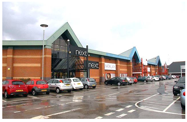
The intent of the Commercial District is to provide for intensive commercial development offering a broad range of goods and services, marketed to the general city population, residents in surrounding communities or region, and people in transit. The development pattern is more auto-centric than other commercial districts and therefore requires additional attention towards its impact on adjacent uses, especially residential. Accordingly, developments should be compatible in design with adjacent development, buffered or located away from residential areas, focused on site layout, building design and circulation patterns, and accessed off a major thoroughfare or through a cross access easement from a development served by a major thoroughfare.
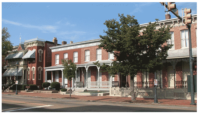
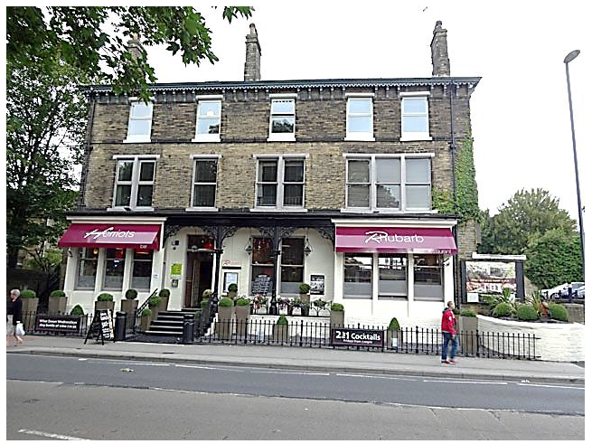
2.2.7. - Corridor Core District (CC).
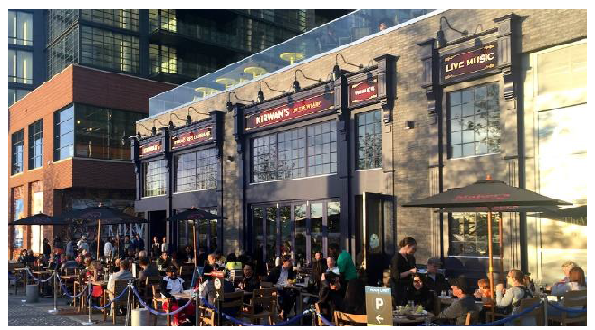
The Corridor Core District is designed to serve as the community's downtown by creating a central anchor for the city. Commercial development in this district will not only allow the convenient transaction of goods and services, but also serve as a desirable gathering place for social interaction. Future development in the district will adhere to historic main street design principles that place the buildings near the front property lines, incorporate traditional building materials, and allow residential uses on upper floors. The pattern of development will not be centered on auto-oriented uses, but rather will focus on a corridor that is safe and accessible to pedestrian and bicycle circulation, facilitates public transit, allows for off-street parking, prohibits parking in the front of buildings, and incorporates streetscape elements such as trees, benches, pedestrian-scaled lighting and outdoor dining.
2.2.8. - Light Industrial District (LI).
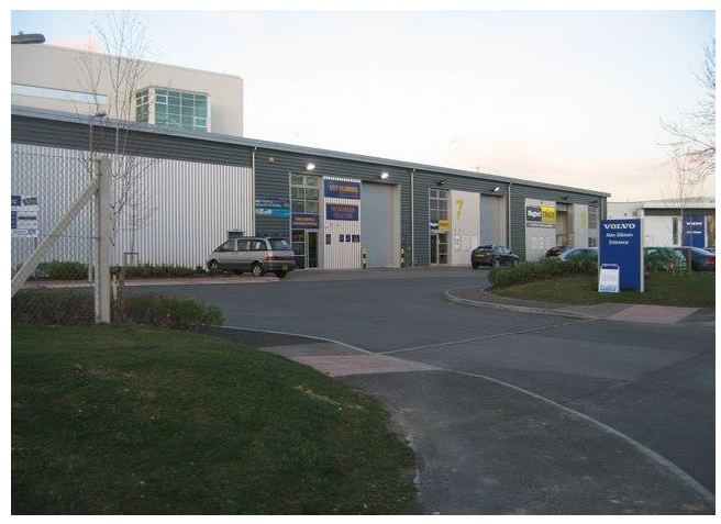
The Light Industrial District is designed to primarily accommodate wholesale activities, warehousing, technology, research, and industrial operations whose external physical effects are restricted to the area of the district and in no manner affect in a detrimental way any of the surrounding districts. The Light Industrial district is so structured as to permit, along with any specified uses, the manufacturing, compounding, processing, packaging, assembly, and/or treatment of finished or semi-finished products from previously prepared material. It is understood office uses related to established industrial uses are acceptable in this district.
2.2.9. - General Industrial District (GI).
The General Industrial District is established primarily for manufacturing, assembling, and fabrication activities including large scale or specialized industrial operations, whose external physical effects will be felt to some degree by surrounding districts. The General Industrial district is so structured as to permit, in addition to Light Industrial uses, the manufacturing, processing and compounding of semi-finished or finished products from raw materials. It is understood office uses related to established industrial uses are acceptable in this district.
2.2.10. - Public/Semi-Public District (PSP).
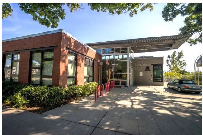
The intent of the Public/Semi-Public District is to accommodate public areas available to the residents and businesses of the city. These areas are designated to provide the community needed recreation areas, governmental facilities, aesthetics, and environmental protection. The protection and enhancement of these areas will be part of shaping the community's identity through, public spaces, memorable architecture, and defining designs.
2.3.1. - Zoning district boundaries.
Where uncertainty exists with respect to the boundaries of the various districts, the following rules shall apply:
A.
The district boundaries are public rights-of-way including either streets, places or alleys unless otherwise shown; where the districts designated on the official zoning map are approximately bounded by street, road, place or alley lines, the same shall be construed to be the boundary of the district.
B.
Where the district boundaries are not otherwise indicated and where the property has been or may hereafter be divided into blocks and lots, the district boundaries shall be construed to be the lot lines; where districts designated on the official zoning map are approximately bounded by lot lines, the same shall be construed to be the boundary of the districts, unless otherwise indicated on the official zoning map.
C.
Whenever any street, road, alley, place or other public way is officially vacated by the city or Wayne County, the district adjoining each side thereof shall be automatically extended to the center of such vacation and all area included in the vacation shall thereafter be subject to all appropriate regulations of the extended districts.
D.
Where physical or natural features existing on the ground are at variance with those shown on the official zoning map, or in other circumstances not covered by rules "A" through "C" above, the zoning board of appeals shall interpret the boundaries.
E.
Any dispute in the determination of the zoning district boundaries shall be heard by the zoning board of appeals.
2.3.2. - Properties with multiple zoning designations.
When an individual recorded parcel, which exists at the time of adoption of this ordinance, has more than one zoning classification, the zoning designation which comprises the majority of the parcel area shall be applied to the entire parcel.