
Estero City Zoning Code
CHAPTER 3
- ZONING DISTRICTS
3-101. - Compliance With Zoning District Standards.
Land in the Village shall not be developed except in accordance with the zoning district regulations of this chapter, and all other relevant provisions of this LDC.
3-102. - Establishment of Zoning Districts.
This LDC establishes the conventional, planned development, and overlay zoning districts identified in Table 3-102: Establishment of Zoning Districts. The boundaries of each of the zoning districts are identified on the Official Zoning Map.
3-103. - Organization of Zoning Districts.
A.
Conventional Zoning Districts.
1.
Conventional zoning districts include Agriculture, Residential, Commercial, and Special Purpose districts, as shown in Table 3-102: Establishment of Zoning Districts. Conventional districts are established initially by the Village's adoption of this LDC, and subsequently by a zoning district map amendment (see Sec. 2-501.C, Rezoning (Zoning Map Amendment)).
2.
The general purpose and standards of each conventional zoning district are set forth in Section 3-2, Agriculture District, through Section 3-6, Legacy Districts.
3.
For each conventional zoning district, the regulations set out the district's purpose, the intensity and dimensional standards applicable in the district, the uses allowed in the district, and any zoning district regulations, if appropriate. Each conventional zoning district also includes an image or images of typical development in the district. Graphics are included for illustrative purposes only. If there is a conflict between an image and the text, the text controls.
B.
Planned Development Districts
1.
The general purpose of planned development (PD) districts, as shown in Table 3-102: Establishment of Zoning Districts, is set forth in Section 3-7, Planned Development Districts.
2.
Planned development districts are adopted by the Village Council as zoning district map amendments in accordance with Sec. 2-501.D, Planned Development. The location of each specific planned development district is shown on the Official Zoning Map and recorded, as appropriate.
3.
Planned development districts are subject to an approved PD Master Concept Plan, which establishes a plan for development, and specific rules for individual PD districts. As provided in Sec. 2-501.D, Planned Development, the PD Master Concept Plan is included with the adopting ordinance, and recorded as appropriate.
4.
Lands may be reclassified from a conventional district to a planned development district in accordance with Sec. 2-501.D, Planned Development. Generally, PD districts require unified control of a parcel and allow for greater flexibility and a wider range of allowed uses than traditional conventional zoning districts allow, in return for innovative design, higher quality development, and community benefits.
C.
Overlay Districts
1.
Overlay zoning districts (see Table 3-102: Establishment of Zoning Districts), are established initially by the Village's adoption of this LDC, and subsequently amended by the future approval of a zoning district map amendment (see Sec. 2-501.C, Rezoning (Zoning Map Amendment)).
2.
Standards governing development in an overlay zoning district shall apply in addition to, or instead of, the standards governing development in the underlying conventional zoning district or PD district, or may provide a more flexible alternative to conventional zoning district standards. If the regulations governing an overlay district expressly conflict with those governing an underlying conventional zoning district, the regulations governing the overlay district shall control, unless expressly stated to the contrary. If land is classified into multiple overlay districts and the regulations governing one overlay district expressly conflict with those governing another overlay district, the more restrictive regulations control.
3-201. - General Purpose.
The purpose and intent of the agricultural district is to provide appropriately located lands for agricultural and nursery production, agricultural support uses, low-density residential dwellings in a rural setting, and related uses.
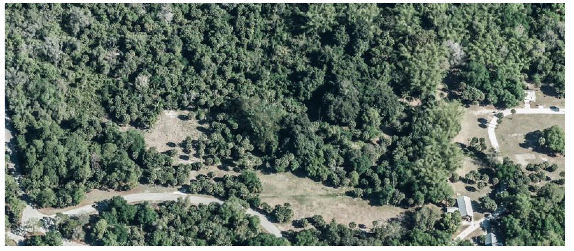
3-202. - Agriculture Zoning District.
The agriculture zoning district is identified in Table 3-202: Agriculture Zoning District.
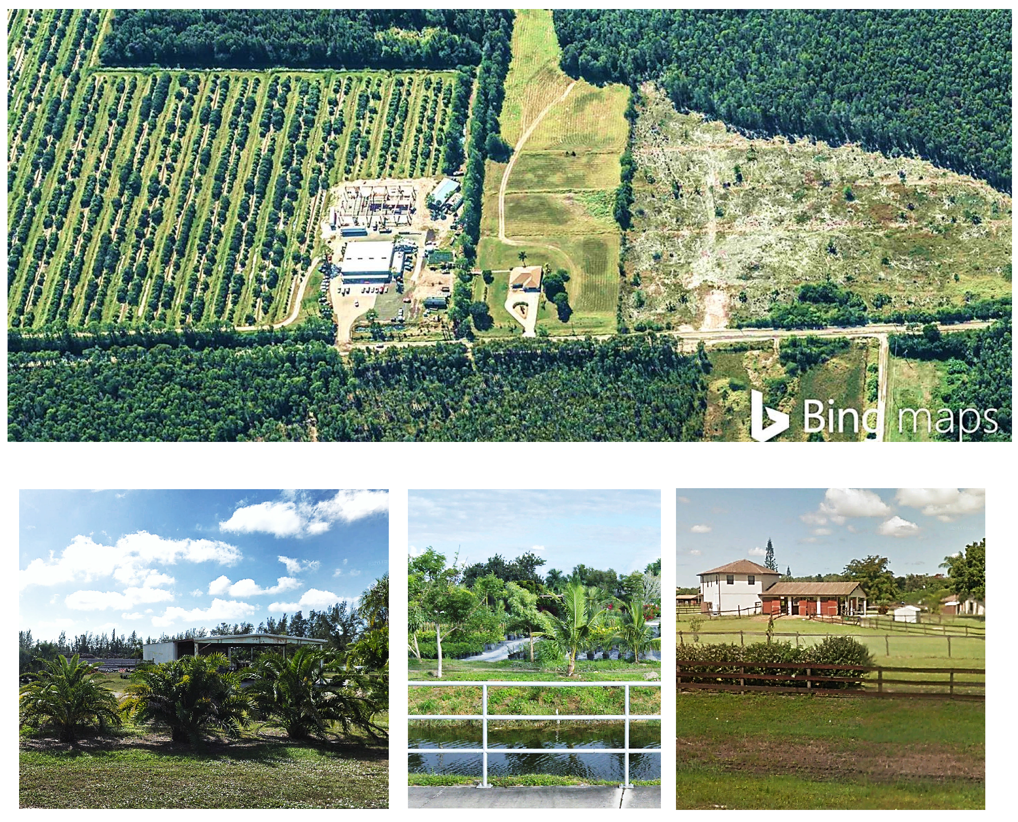
3-203. - Agriculture (AG) District.
A.
Purpose. The purpose of the Agriculture (AG) District is to provide lands to accommodate and maintain agricultural uses and low-density residential development. This is accomplished in the district by providing for agriculture as a primary use and accommodating single-family detached dwellings and mobile homes at low densities (5 acres per dwelling for mobile homes). Development allowed in the AG district includes agriculture uses, nurseries, agricultural support uses and businesses, single-family detached dwellings, animal care, and limited public facilities.
B.
Concept.
C.
Use Table. The allowed principal and accessory uses in the AG District are identified in Table 3-203.C: AG District Uses
D.
Density and Dimensional Standards.
3-301. - General Purpose.
The purpose of the residential zoning districts is to:
A.
Provide appropriately located lands for residential development that are consistent with the goals, policies, and objectives of the comprehensive plan;
B.
Support and preserve the development pattern and character of established neighborhoods;
C.
Provide a range and diversity of housing choices to meet the needs of the Village's citizens;
D.
Provide for safe and efficient vehicular, bicycle, and pedestrian access and circulation, and neighborhoods that promote multiple forms of mobility;
E.
Protect residential neighborhoods from incompatible development;
F.
Protect residential districts from flooding and other adverse environmental impacts;
G.
Provide for the public services and facilities needed to serve residential development;
H.
Maintain the Village's neighborhoods as safe and convenient places to live;
I.
Ensure compatible infill development; and
J.
Promote green building practices in terms of energy efficiency and conservation, the use of alternative energy, greenhouse gas reduction, water supply and water quality protection, food security, materials recycling, and similar goals.
3-302. - Residential Districts.
The residential zoning districts in this LDC are identified in Table 3-302: Residential Zoning Districts.
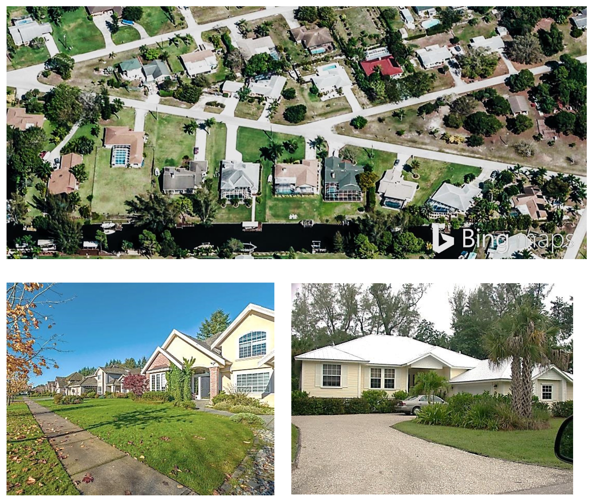
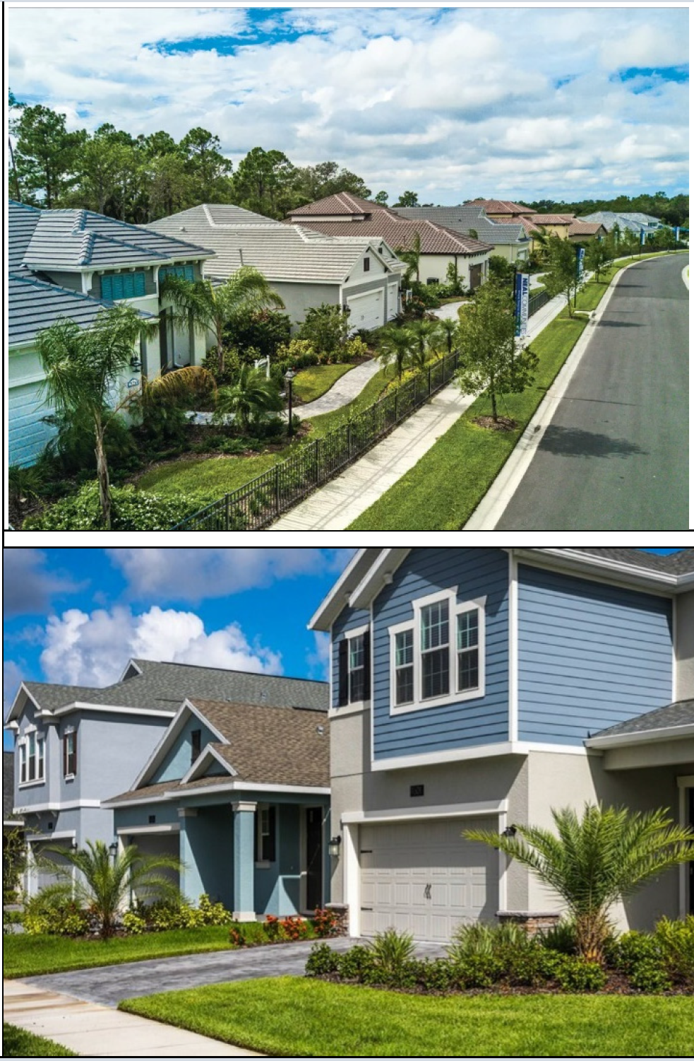
3-303. - Residential Single Family (RSF) District.
A.
Purpose. The purpose of the Residential Single Family (RSF) District is to provide lands that accommodate primarily single-family detached dwellings on lots with a minimum area of 7,500 square feet. District regulations discourage development that substantially interferes with the quiet residential nature of the district.
B.
Concept.
C.
Use Table. The allowed principal and accessory uses in the RSF District are identified in Table 3-303.C: RSF District Uses
D.
Density and Dimensional Standards.
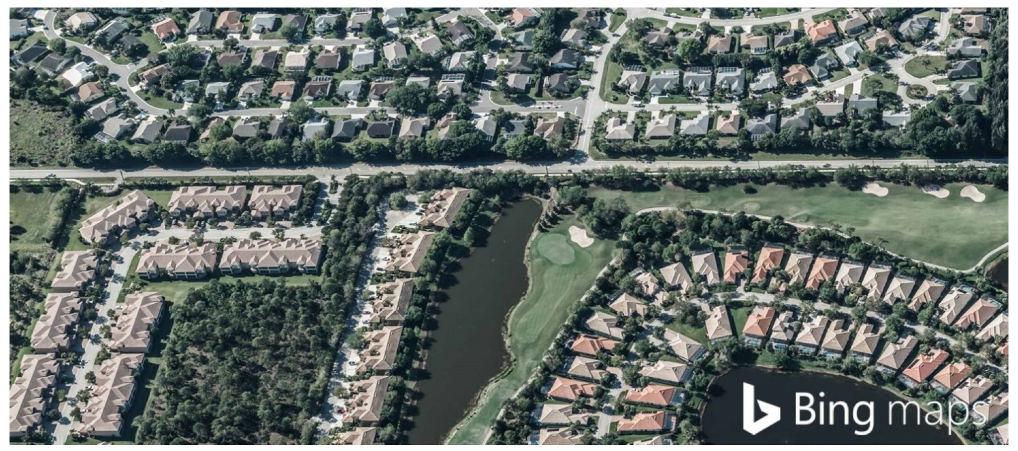
3-304. - Residential Multiple Family (RM-2) District.
A.
Purpose. The purpose of the Residential Multiple Family (RM-2) District is to provide for regulation of lands with an existing designation of RM-2 in appropriate locations that accommodate primarily small and medium scale two-family attached, townhouse, multifamily, and single-family detached development. It is the intent of the Village Council in establishing this district, and applying it to the Official Zoning Map that upon the adoption of this LDC, the RM-2 district not be applied to any additional lands in the Village.
B.
Concept.
C.
Use Table. The allowed principal and accessory uses in the RM-2 District are identified in Table 3-305.C: RM-2 District Uses.
D.
Density and Dimensional Standards.
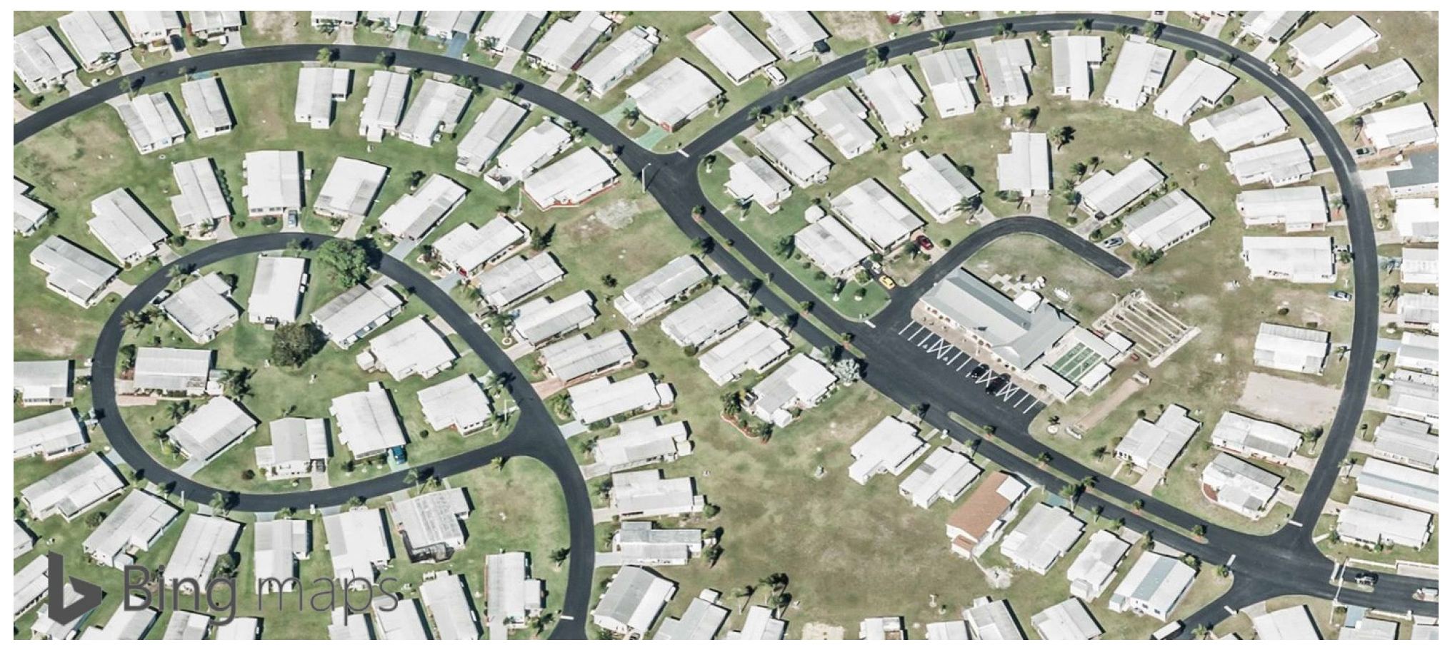
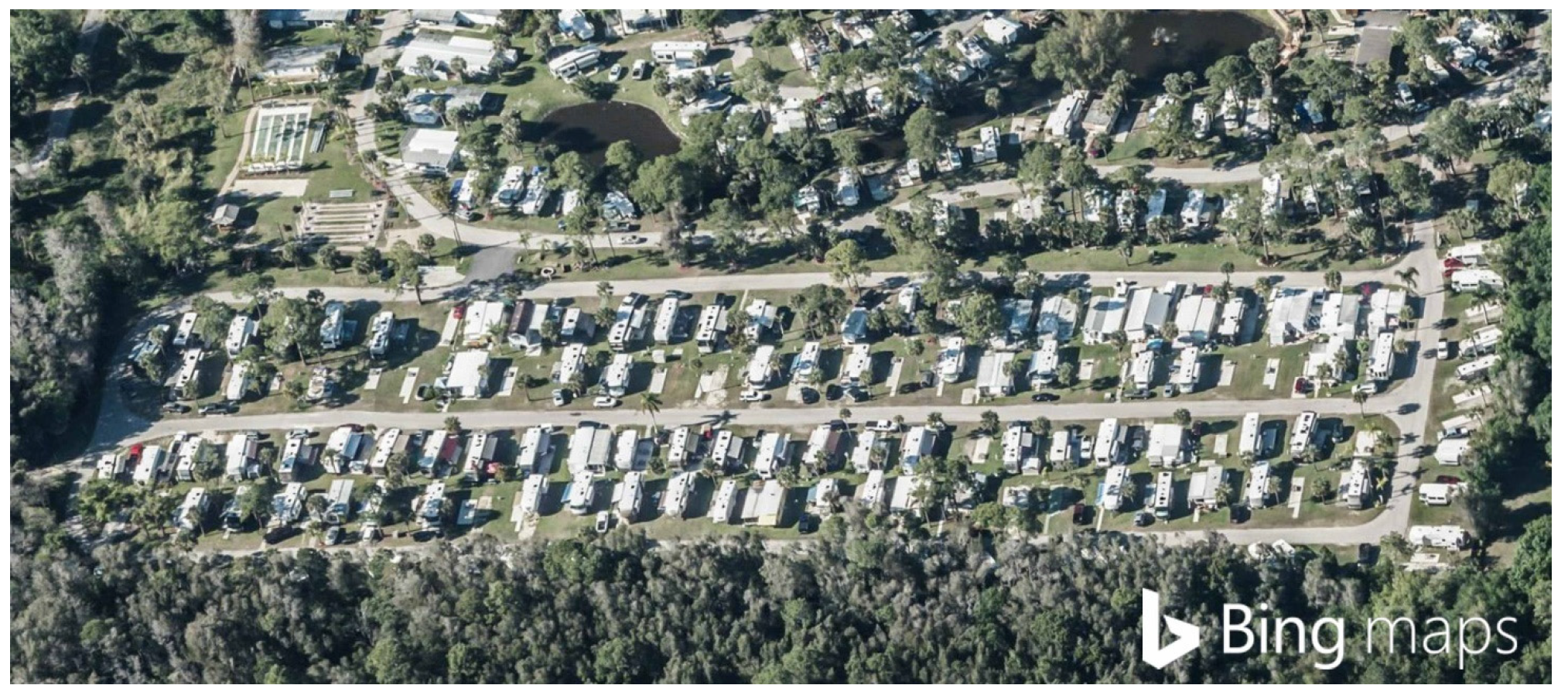
3-305. - Mobile Home (MH) District.
A.
Purpose. The purpose and intent of the Mobile Home (MH) District is to provide lands to accommodate
the housing needs of those residents who prefer mobile home living as an alternative
to conventional residential development, in appropriate locations in the Village.
Uses allowed in the district include primarily mobile home dwellings, single-family
detached dwellings, essential services, administrative offices, recreation facilities,
laundromats, boat ramps, and other related accessory uses. The general layout of the
district is designed to ensure potential adverse impacts on surrounding development
is mitigated. It is the intent of the district standards to allow reasonable additional
investment by allowing the replacement of single-wide mobile homes with double-wide
mobile homes (as long as the replacement complies with the dimensional standards of
the district), the replacement of mobile homes damaged by storm event, the replacement
of a mobile home by a new mobile home as long as it is placed on the same building
footprint, actions that would make the mobile homes less nonconforming, and actions
that ensure the mobile home is maintained in good condition.
The MH District is a district originally established in the Lee County Land Development
Code, and carried forward in this LDC. It is the intent of the Village Council in
establishing this district, and applying it to the Official Zoning Map that upon the
adoption of this LDC, the MH district not be applied to any additional lands in the
Village.
B.
Concept.
C.
Use Table. The allowed principal and accessory uses in the MH District are identified in Table 3-305.C: MH District Uses.
D.
Density and Dimensional Standards.
E.
Other Standards.
3-306. - Recreational Vehicle (RV) District.
A.
Purpose. The purpose of the Recreational Vehicle (RV) District is to provide lands to accommodate seasonal (persons living in the units less than six months a year) or transient living in recreational vehicles and campgrounds. It is the intent of the district standards to allow reasonable additional investment by allowing the replacement of RV units with new or larger recreational vehicle unit as long as the unit complies with the dimensional standards of the district, and the replacement of recreational vehicles if the unit is damaged by storm event. The RV district is a district originally established in the Lee County Land Development Code, and carried forward in this LDC. It is the intent of the Village Council in establishing this district and applying it to the Official Zoning Map upon the adoption of this LDC, that the RV District not be applied to any additional lands in the Village.
B.
Concept.
C.
Use Table. The allowed principal and accessory uses in the RV District are identified in Table 3-306: RV District Uses.
D.
Density and Dimensional Standards.
E.
Other Standards.
3-401. - General Purpose.
The commercial zoning districts are established for the general purpose of ensuring there are lands in the Village that provide a range of retail, office, service, lodging, employment, light industrial, and related development to meet the needs of the Village's residents and visitors, as well as the residents of the region. More specifically, the commercial zoning districts are established to:
A.
Strengthen the Village's economic base, and provide employment, retail, lodging, and related commercial opportunities close to home for Village residents;
B.
Provide appropriately located lands for a full range of business and commercial uses needed by the Village's residents, businesses, workers, and visitors, as well as residents of the region, consistent with the goals, objectives, and policies of the comprehensive plan;
C.
Create suitable environments for various types of mixed-use development, where business, office, retail, service, lodging, and residential development is designed and integrated in compatible ways;
D.
Encourage, support, and ensure a high quality design in retail, office, lodging, service, employment, and related development in the Village;
E.
Accommodate new infill development and redevelopment that is consistent with the goals, objectives, and policies of the comprehensive plan, especially along certain of the Village's older commercial corridors;
F.
Ensure commercial development is located and designed to protect and preserve the character of residential single-family neighborhoods; and
G.
Create suitable environments for various types of businesses, and protect them from the adverse effects of incompatible development.
3-402. - Commercial Zoning Districts.
The commercial zoning districts in this LDC are identified in Table 3-402: Commercial Zoning Districts.
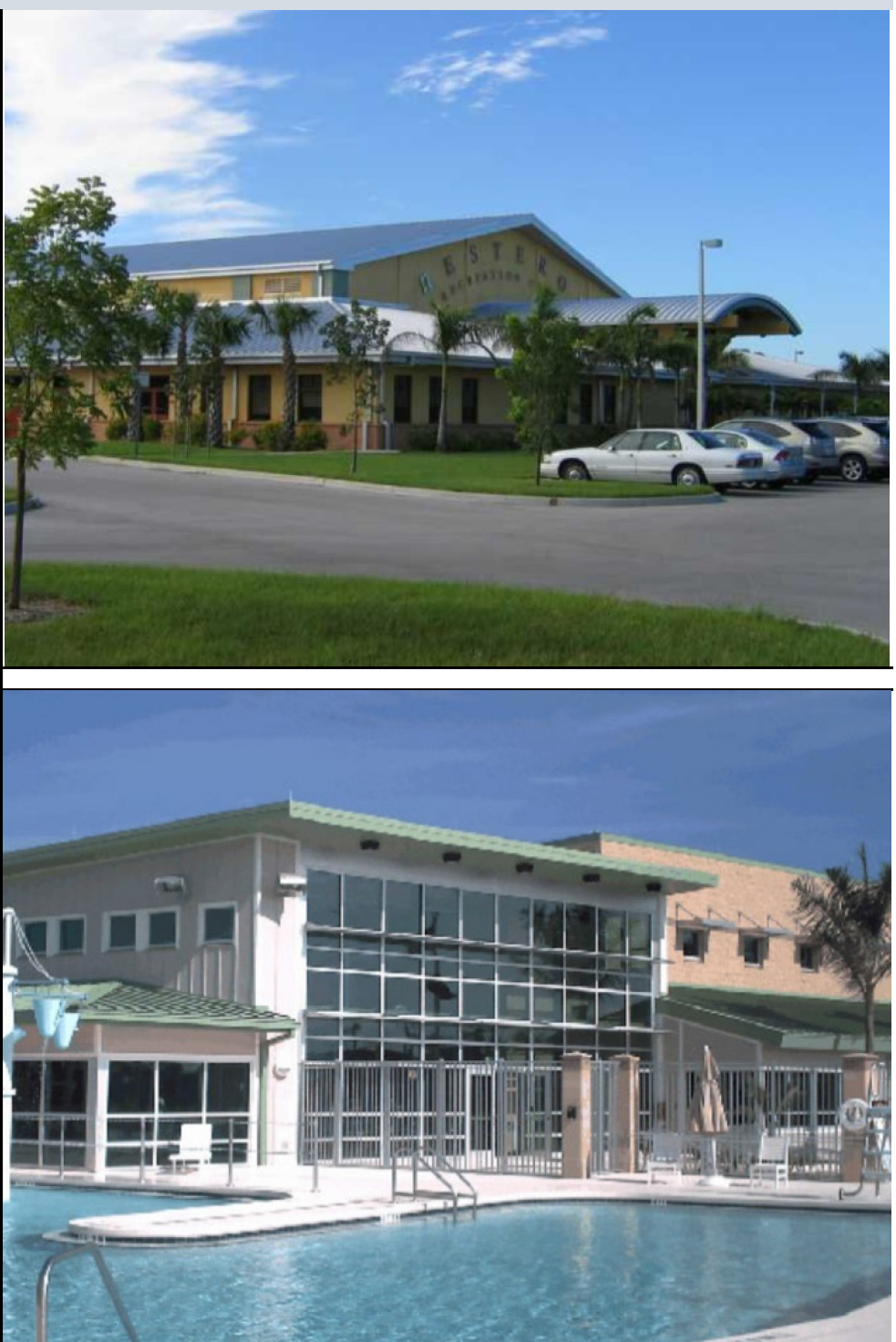
3-403. - Commercial Special Office District (CS).
A.
Purpose. The purpose of the Commercial Special Office (CS) district is to provide lands that accommodate and support suitable locations for the development of offices, and a number of other low-impact uses subject to special exception approval. The district is intended to be used to separate and buffer residential and other low- or medium-intensity uses, such as schools or parks, from higher-intensity commercial and light industrial uses.
B.
Concept.
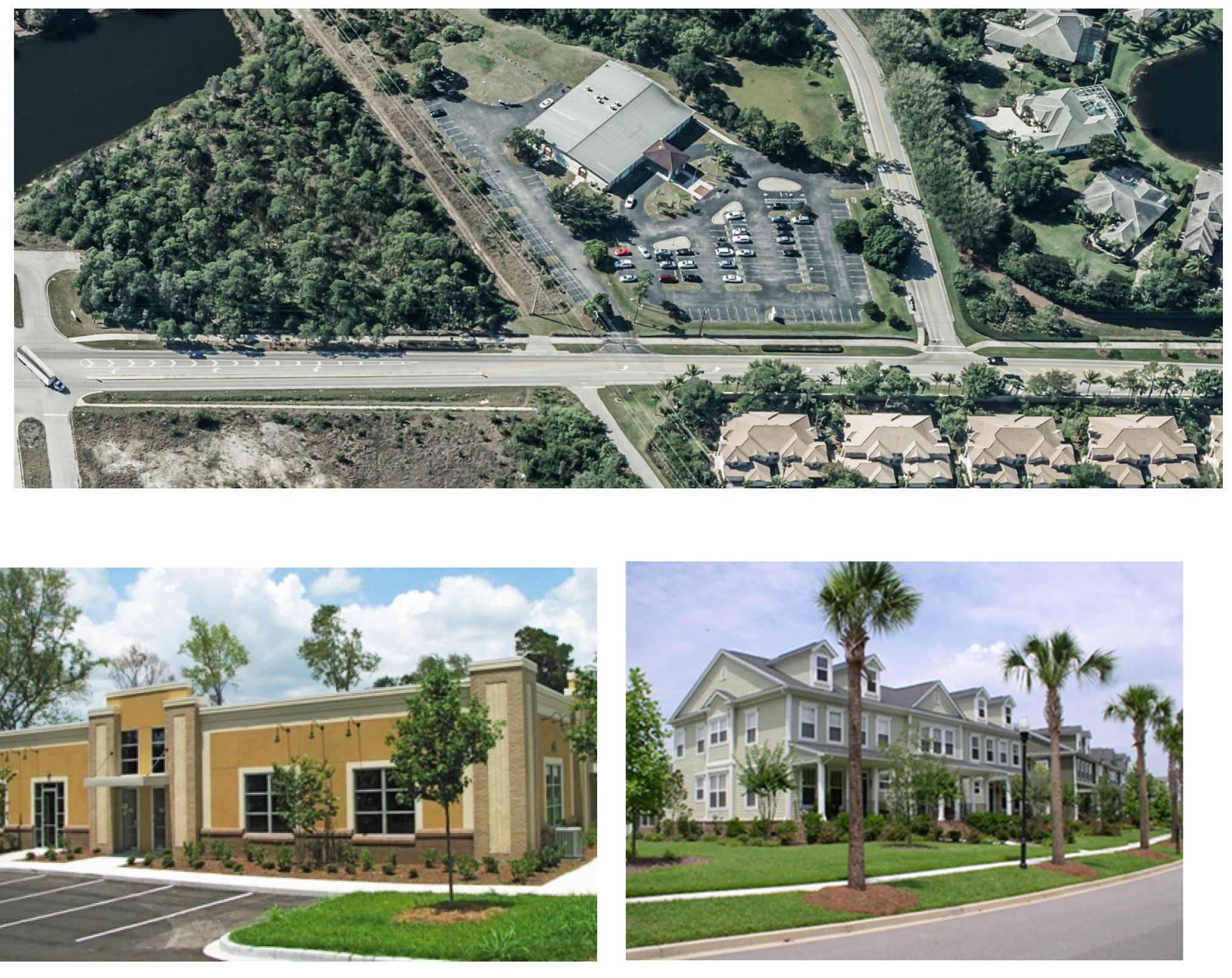
C.
Use Table. The allowed principal and accessory uses in the CS District are identified in Table 3-403.C: CS District Uses
D.
Density and Dimensional Standards.
3-404. - Urban Commercial Redevelopment (UCR) District.
A.
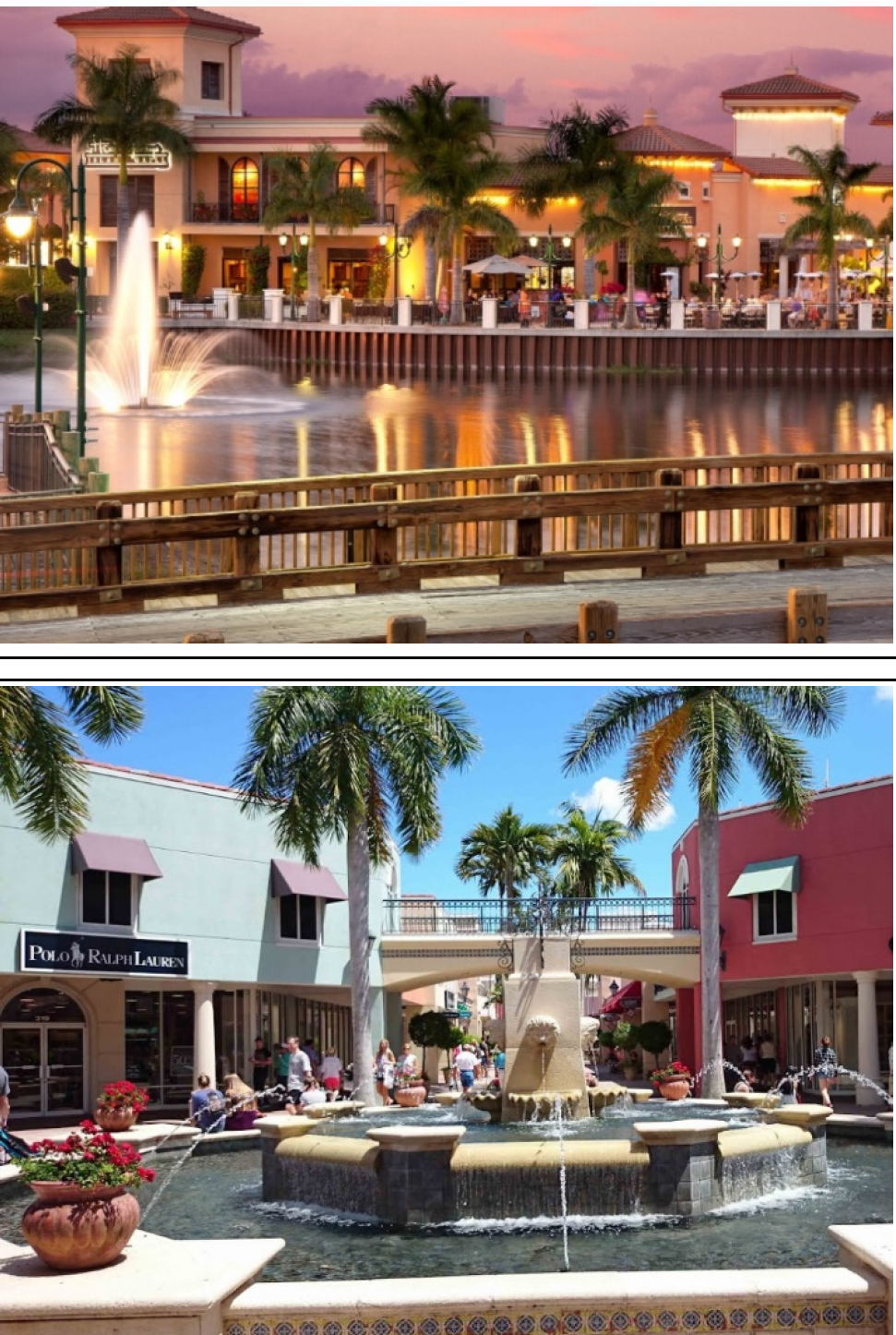
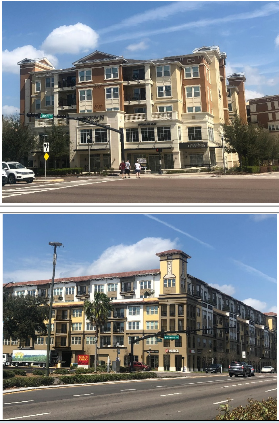
Purpose. The purpose of the Urban Commercial Redevelopment (UCR) District is to provide lands that accommodate and support development, infill, and redevelopment in a high quality, more walkable, and mixed-use context, and fosters the development of unique destinations rather than strip development patterns. Development allowed in the district includes community and neighborhood serving retail, office, lodging (hotels), assisted living, government (public and quasi-public), civic, residential, and mixed-use development. The vertical mixing of residential and nonresidential uses within a single project, with residential development above the ground floor, is strongly encouraged. The horizontal mixing of well-integrated stand-alone residential and nonresidential development is also encouraged.
B.
Concept.
C.
Use Table. The allowed principal and accessory uses in the UCR District are identified in Table 3-404.C: UCR District Uses.
D.
Density and Dimensional Standards.
E.
Other Standards.
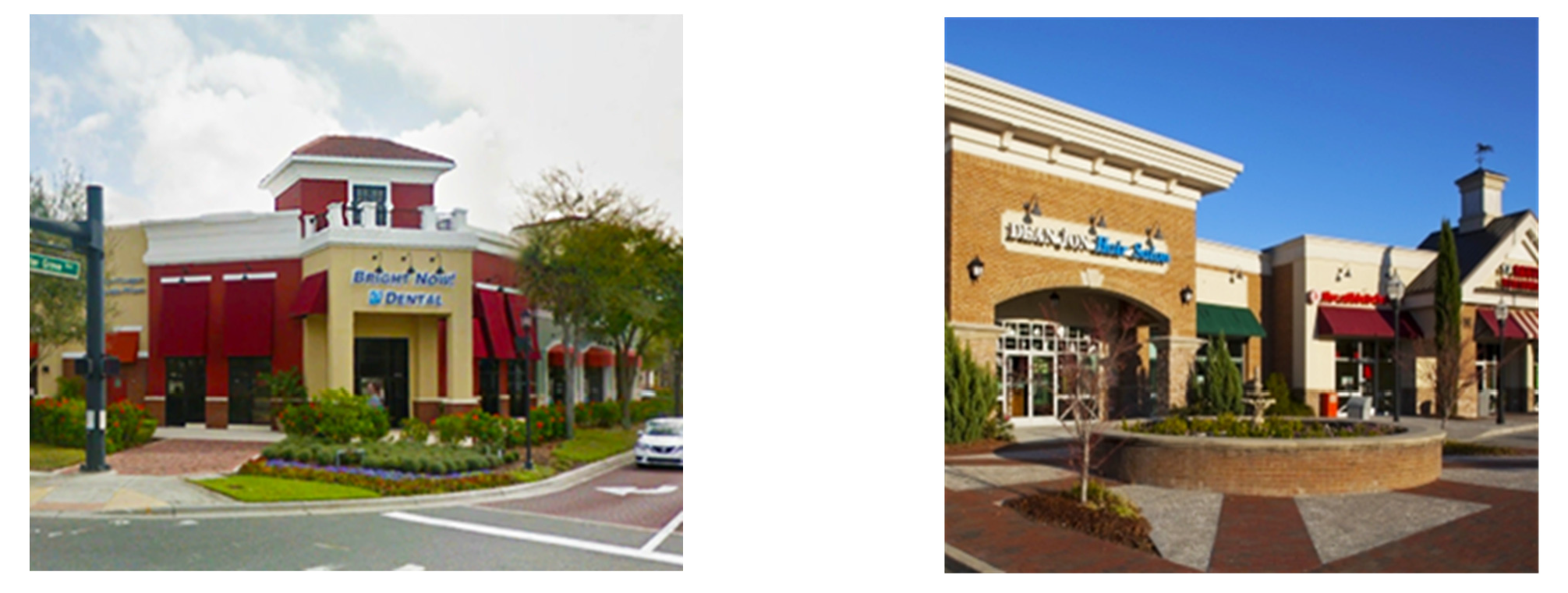
3-405. - Community Commercial (CC) District.
A.
Purpose. The purpose of the Community Commercial (CC) District is to provide lands that accommodate high quality, medium-scale, community-serving commercial development (particularly shopping centers). The primary allowed uses include retail sales, personal services, eating and drinking establishments, offices, recreation/entertainment uses, and vehicle and boat sales and services. Development form should focus on the establishment of high quality, medium-scale, walkable, and connected centers that serve a market area of multiple neighborhoods, and are designed so as not to adversely impact the character of adjacent residential single-family neighborhoods.
B.
Concept.
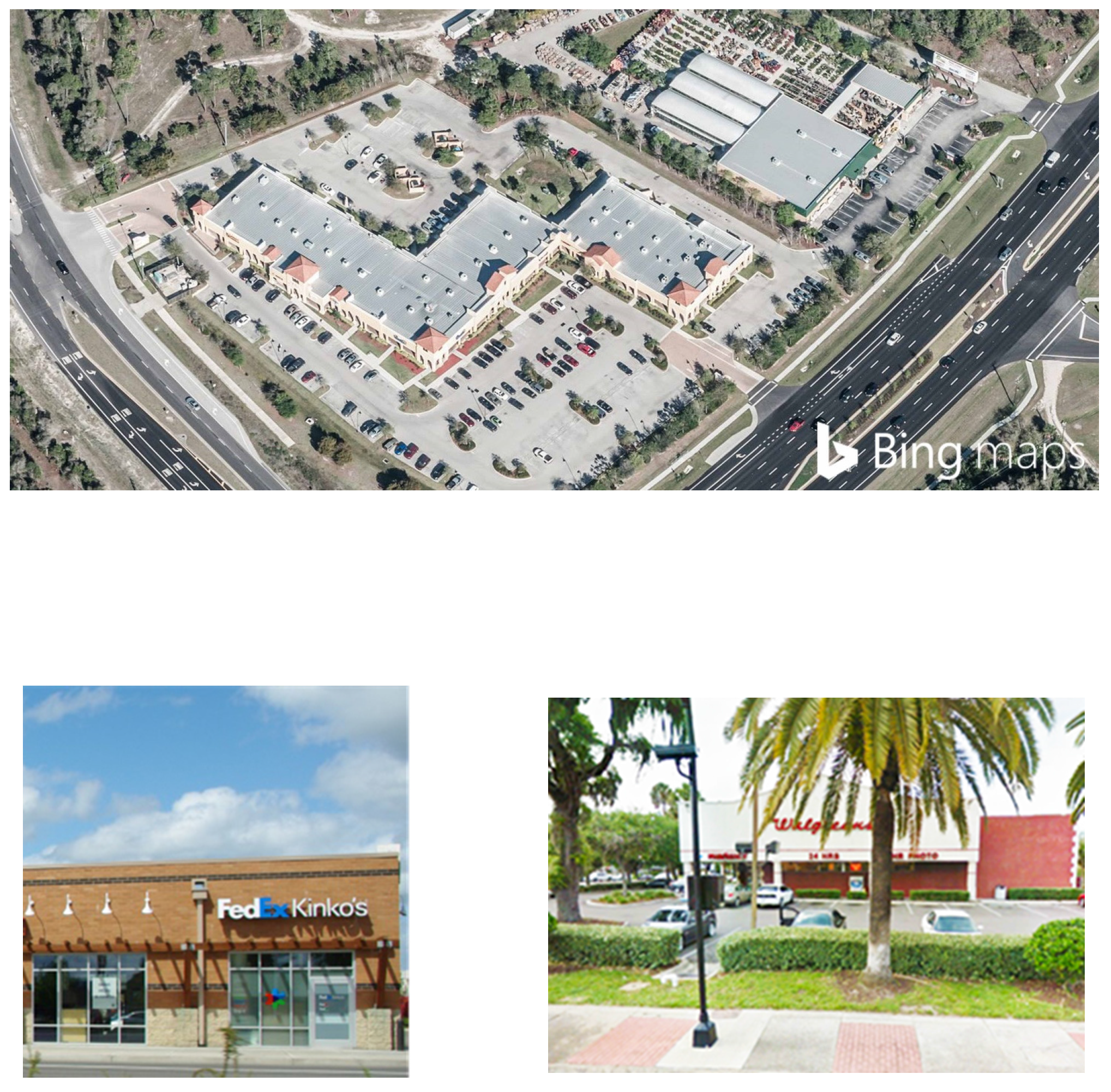
C.
Use Table. The allowed principal and accessory uses in the CC District are identified in Table 3-405.C: CC District Uses
D.
Density and Dimensional Standards.
3-501. - General Purpose.
The purpose and intent of the special purpose districts is to recognize and provide lands for certain types of uses and conditions which are not addressed in the other conventional zoning districts.
3-502. - Special Purpose Zoning Districts.
The special purpose zoning districts in this LDC is identified in Table 3-502: Special Purpose Zoning Districts.
3-503. - Environmentally Critical (EC) District.
A.
Purpose. The purpose and intent of the Environmentally Critical (EC) District is to preserve and protect certain land and water areas in the Village which have critical ecological, hydrological, or physiographic importance, such as wetlands. Classification of lands to the EC district is intended to prevent a public harm by precluding the use of the land for purposes for which it is unsuited in its natural state, and adversely affects the public interest.
B.
Concept.
C.
Use Table. The allowed principal and accessory uses in the EC District are identified in Table 3-503.C: EC District Uses
3-504. - Parks and Community Facilities (P) District.
A.
Purpose. The purpose and intent of the Parks and Community Facilities District is to provide land for active and passive recreation, and for public buildings such as government offices, libraries, and schools. Classification of primarily public lands to the P district is intended to preserve land for public use, including parks, libraries, and noncommercial cultural facilities.
B.
Concept.
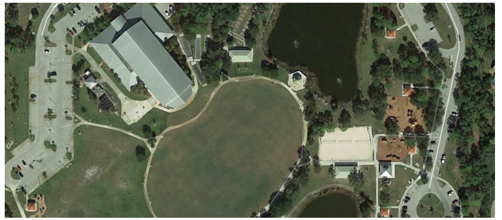
C.
Use Table. The allowed principal and accessory uses in the P District are identified in Table: 3-504.C P District Uses.
D.
Density and Dimensional Standards.
3-601. - General Purpose.
The purpose and intent of the legacy districts is to identify specific lands with valid approvals from Lee County prior to the Village's incorporation, and allow development on these lands to continue in accordance with the terms and conditions of their original approval. The legacy districts are identified on the Official Zoning Map.
3-602. - Legacy Zoning Districts.
The legacy districts are identified in Table 3-602: Legacy Districts.
3-603. - Planned Unit Development (PUD) Legacy District.
The Planned Unit Development (PUD) Legacy District shall consist of the following planned unit developments (PUDs), all approved by Lee County prior to the date of the Village's incorporation. Development in each PUD Legacy District shall comply with the terms and conditions included in their resolutions.
A.
Breckenridge PUD (Laguna Woods): Z-82-038, Z-82-111, ZAB-84-129, ZAB-84-194, PUD-89-001, PUD-89-002, PUD-89-003, PUD-90-001, PUD-90-002, PUD-90-003, PUD-91-017, PUD-92-001, PUD-92-010, PUD-92-018, PUD-95-016, Z-95-073, PUD-96-006, Z-96-014, Z-99-053
B.
The Lakes of Estero PUD (Corkscrew Hammocks): Z-82-111, ZAB-82-111, Z-89-059, ADD2002-00002, ADD2006-00125, ADD2007-00025, ADD2008-00108
C.
The Vines PUD: ZAB-84-018, Z-88-292, Z-89-097, PUD-90-023, Z-92-070, ADD2006-00036
D.
Wildcat Run PUD: Z-80-441, Z-82-060, ZAB-84-171, ZAB-84-171A, PUD-94-030
3-604. - RPD-CPD Legacy District.
The RPD-CPD Legacy District shall consist of the following developments, all approved by Lee County prior to the date of the Village's incorporation. Development in each RPD-CPD Legacy District shall comply with the terms and conditions included in their resolutions.
A.
Pelican Landing RPD/CPD: Z-94-014
3-701. - Planned Development Zoning Districts.
The Planned Development zoning districts in this LDC are identified in Table 3-701: Planned Development Zoning Districts.
3-702. - Planned Development Districts, Generally.
A.
Purpose. The purpose of the Planned Development (PD) zoning districts is to encourage innovative, integrated, and efficient land planning and physical design concepts that are consistent with the comprehensive plan. The planned development districts are intended to achieve a high quality of development, environmental sensitivity, energy efficiency, adequate public facilities and services, and other Village and comprehensive plan goals and objectives by:
1.
Reducing the inflexibility of zoning district standards that sometimes results from strict application of the conventional districts, and the other development, form, and design standards of this LDC;
2.
Allowing greater flexibility in selecting: the form and design of development, the ways by which pedestrians and traffic circulate, how the development is located and designed to respect the natural features of the land and protect the environment, the location and integration of open space and civic space into the development, and design amenities, while providing for consistency and visual harmony;
3.
Where appropriate, supporting a greater mix of land uses within the same development, including a mix of nonresidential development, different housing types, lot sizes, and densities/intensities;
4.
Encouraging the provision of centrally-located open space amenities on the site;
5.
Allowing more efficient use of land, with smaller networks of streets and utilities;
6.
Providing pedestrian connections within the site and to the public right-of way;
7.
Promoting development forms and patterns that respect the character of established neighborhoods and other types of land uses; and
8.
Providing a mechanism for offsetting the increased cost of the premature commitment of capital by a public utility or service provider through developer donations and dedications of capital through operation of services and facilities, or through a system of impact fees and other forms of mitigation.
B.
Classification of Planned Development Zoning Districts. Land shall be classified into a PD zoning district only in accordance with the procedures and standards set forth in Sec. 2-501.D, Planned Development, and this section.
C.
Organization of Planned Development Zoning District Regulations. The following section sets out general standards applicable to the PD zoning districts. Sec. 3-703, Residential Planned Development (RPD) District, Sec. 3-704, Community Facilities Planned Development (CFPD) District, Sec. 3-705: Commercial Planned Development (CPD) District, Sec. 3-706, Mixed-use Planned Development (MPD) District, Sec 3-707, Estero Planned Development (EPD) District, and Sec. 3-708, Compact Community Planned Development (CCPD) District, contain provisions for each of the different types of PD zoning districts, including a purpose statement, a list of the types of form, intensity, dimensional, development, and design standards to be applied as part of the PD Master Concept Plan, and references to applicable use and other standards.
D.
General Standards for All Planned Development Zoning Districts. Before approving a PD zoning district, the Village Council shall find that the application for the PD zoning district classification, as well as the PD Master Concept Plan, comply with the following standards.
1.
Master Concept Plan. As set forth in this subsection, a PD Master Concept Plan is a required component in the establishment of a PD district. The PD Master Concept Plan shall:
A.
Identify the location and explanation of all existing easements, whether or not those easements are recorded. (If an easement is based upon a recorded document, the official records book reference shall be stated.)
B.
Identify the location of all points of vehicular ingress and egress from existing easements or rights-of-way into the proposed planned development.
C.
Identify the individual development areas (i.e. residential, retail, office, light industrial, mixed-use) with detail showing the boundary of each development area within which buildings, parking, or other uses will be located. Also identify the number of residential units (by use type), nonresidential floor area (by use type), residential density, and nonresidential intensity. The residential density and nonresidential intensity shall be consistent with the purposes of the PD zoning district and the specific requirements of the individual PD zoning district.
D.
If the proposed planned development is divided into lots or parcels, show the general location, configuration, and approximate dimensions of the lots or parcels (including outparcels). The proposed use of the lots or parcels shall be keyed to the list of proposed uses.
E.
Where relevant, establish the standards and requirements that ensure development on the perimeter of the PD district is designed and located to be compatible with the character of adjacent existing or approved development. This includes the minimum width and composition of all proposed buffers along the perimeter of the subject property, as well as between the individual uses, if the types of proposed uses require buffer separations. Determination of compatible character shall be based on densities/intensities, lot size and dimensions, building height, building mass and scale, form and design features, hours of operation, exterior lighting, and siting of service areas.
F.
Include an open space design plan delineating the indigenous preserves and/or native tree preservation areas as required by this LDC. (Adjustments and field corrections to the plan can be done administratively at the time of development order, provided the minimum commitments made as part of zoning approval are maintained. No changes to an indigenous or native tree preserve area can be made administratively that would negatively affect screening or buffering to an adjacent property.)
G.
Establish the percentage of open space, unless the proposed development consists solely of conventional single-family dwelling units on lots of no less than 6,500 square feet.
H.
Identify the general location, amount, and type (whether designated for active or passive recreation) of open space, consistent with the purposes of the individual PD district.
I.
Identify the general location of proposed parks and recreation areas and facilities, as well as indigenous areas and flow-ways to be preserved, restored, or created.
J.
Identify the location of environmentally sensitive lands including rare and unique uplands as defined in the Village comprehensive plan and this LDC, resource lands, wildlife habitat, and waterway corridors, and explain how these lands will be protected consistent with the purposes of the individual PD district and the requirements of this LDC.
K.
Identify the on-site pedestrian circulation system, and how it will connect to off-site pedestrian systems in ways that are consistent with the purposes of the individual PD district, and the requirements of this LDC.
L.
Identify the general design and layout of the on-site transportation circulation system, including the general location of all public roads and existing or projected transportation corridors, and how they interface with the pedestrian circulation system (pedestrian and bicycle pathways, and trails), and connect to existing and planned Village, county, and regional systems in a manner consistent with the purposes of the individual PD district, and the requirements of this LDC.
M.
If a subdivision is proposed as part of the planned development, identify the general location of all proposed internal road rights-of-way or easements and the general location of all points of vehicular ingress and egress from the proposed internal rights-of-way or easements into multiple-family, commercial, or industrial use lots.
N.
Identify the general location of on-site potable water and wastewater facilities, and how they will connect to existing and planned Village, county or regional systems (if relevant) in a manner consistent with the comprehensive plan.
O.
Identify the general location of on-site storm drainage facilities, and how they will connect to existing and planned Village systems, in a manner consistent with the purposes of the individual PD district, and the requirements of this LDC; and
P.
Identify the general location and layout of all other on-site and off-site public facilities serving the development, and how they are consistent with the purposes of the individual PD district. The other on-site and off-site public facilities considered shall include but not be limited to parks, schools, and facilities for fire protection, police protection, emergency management, storm water management, and solid waste management.
2.
PD Phasing Plan. If development in a PD zoning district is proposed to be phased, the PD Master Concept Plan shall include a development phasing plan that identifies the general sequence or phases in which the zoning district is proposed to be developed, including how residential and nonresidential development will be timed, how infrastructure (public and private), open space, and other amenities will be provided and timed, how development will be coordinated with the Village's capital improvements program, and how environmentally sensitive lands will be protected and monitored.
3.
Pattern Books. Planned development rezonings and amendments shall include a pattern book that illustrates the anticipated visual character of new development including its architecture and landscaping. All applications for planned development rezonings and amendments shall include at least the following to demonstrate consistency with (or identify modifications from) the standards in this section.
A.
Illustrative colored site plan on an aerial photo that depicts:
1.
Configuration and phasing of all connecting streets. Streets behind/between outparcels and other planned local streets, along with all access points from adjoining streets, as shown on the development plan with cross-sections for each.
2.
Bicycle/pedestrian circulation including potential connections to adjoining property.
3.
Landscaped areas, preserved areas, open spaces, civic spaces, gathering places, natural and cultural resources, and community facilities, where applicable.
4.
Water management areas (conceptual).
5.
Development areas labeled with approximate acreages and with proposed uses.
6.
Location, shape, and size of proposed detention and retention areas.
7.
Location and size of development tracts, labeled with approximate acreages and with proposed uses.
8.
Location and cross-sections of streets, sidewalks, and off-street facilities for walking or biking.
9.
Type of decorative lighting poles and fixtures.
10.
General vehicular circulation.
11.
Sketches and location of requested deviations.
B.
Architectural elevations that depict the generalized architectural theme or themes that will be characteristic of all façades of buildings throughout the development plan, including a proposed color palette describing colors and materials.
C.
A landscaping and open space plan with typical buffer planting detail.
D.
Where pad sites or outparcels are to be developed separately, a plan with detailed examples, figures, or photographs that indicates what unifying themes will be common to those sites (architecture, signage, landscaping, etc.).
E.
For land adjoining the Estero River, a map showing the top of the riverbank and the regulatory floodway designated on the official flood maps. (Depict the proposed setback of buildings and land alterations from the top of the riverbank and the location of all proposed buildings and land alterations within 200 feet of the river.)
F.
For tracts, blocks, or parcels where access would be controlled for security, a plan diagram that shows what land would have controlled access, the proposed method and extent of access control along with the features thereof, and architectural elevations that depict the appearance of the controlled area from the outside of such parcel. The access plan diagram shall also show the layout of the vehicular, pedestrian, and bicycle network, the proposed operation of the access control features, and the proposed locations of sidewalks, trails, bicycle paths, drives, streets, fencing, gates, and walls and their role in the security for such areas.
4.
PD Adopting Ordinance. As set forth in this subsection, approval of a PD district shall include the following in the adopting ordinance:
A.
A statement of planning and development goals for the PD zoning district that is consistent with the comprehensive plan and purposes of the individual PD zoning district.
B.
Identification of the specific uses permitted in the district. They shall be consistent with Table 3-702.E: Planned Development Districts Uses, and the purpose and intent of the individual PD zoning district, and be subject to applicable use specific standards identified in the PD Master Concept Plan and any additional limitations or requirements applicable to the individual PD zoning district.
C.
Identification of the dimensional standards that apply in the individual PD district. The dimensional standards shall be consistent with the requirements of the individual PD district, and its purposes.
D.
If the development is located within a floodplain or flow way, inclusion of a commitment that at the time of development order review or district permitting, there will be mitigation of any impacts to flood storage capacity or flow ways due to filling of the site.
E.
Identification of any mitigation to the road system that will be done to address any traffic impacts identified in the traffic impact statement submitted for the project.
F.
Provisions addressing how transportation, potable water, sanitary sewer, stormwater management, and other public facilities will be provided to accommodate the proposed development.
G.
Identification of the development standards that will be applied to development, spelling out any deviations from the standards in Chapter 5: Site Development Standards, and Chapter 6: Signage. The development standards shall be consistent with the requirements of the individual PD district and its purposes, and the requirements of this LDC, as appropriate. At a minimum, the development standards shall address:
1.
Off-street parking, bicycle, and loading standards (Section 5-2);
2.
Mobility and connectivity (Section 5-3);
3.
Landscape standards (Section 5-4);
4.
Fence and wall standards (Section 5-5);
5.
Exterior lighting standards (Section 5-6);
6.
Architectural, form, and design standards (Section 5-7);
7.
Green building standards (Section 5-8);
8.
Signage (Chapter 6); and
9.
Natural Resources (Chapter 7).
5.
Conditions of Approval. Conditions of approval may be included as part of the PD adopting ordinance to mitigate any reasonably expected impact from the planned development. The conditions of approval shall be reasonably related to the proposed development and any reasonably expected impacts on public services and facilities and the health, safety, and welfare. The conditions of approval shall be adopted as part of the approval of the planned development district and incorporated into the ordinance.
E.
Bonus Density for Planned Developments approved by Lee County Prior to March 17,2015
1.
A planned development approved by Lee County zoning resolution prior to March 17, 2015, which authorizes bonus density units under the Lee County affordable housing bonus density program and in which vertical development was not commenced as of May 17, 2017, may apply to the Village in accordance with the procedures and standards of this section, to use those bonus density units upon the conversion of the contributions agreed to for affordable housing units, to contributions for the preservation of environmentally sensitive lands, Village recreational lands, or open space.
2.
Any landowner requesting to use approved density bonus units in accordance with this section shall, prior to the first development order authorizing vertical construction for a planned development, notify the Director about the number of housing bonus density units approved under the Lee County resolution are proposed to be developed in accordance with this section, and their specific location in the planned development. (The number and location of the bonus density units shall be noted in the local development order.) Furthermore, no development order for vertical construction in which bonus density units will be used shall be approved unless a Pattern Book demonstrating a unified design for the planned development is approved as part of the development order.
3.
On the request of the landowner, the Director shall make a written determination as to whether:
A.
The planned development was approved by Lee County zoning resolution prior to March 17, 2015;
B.
The number of housing bonus density units authorized in the resolution; and
C.
The monetary contribution established by the zoning resolution per bonus density unit.
4.
Upon confirmation that the requirements of subsection 3 above are met, the request shall be forwarded to the Village Council, who shall establish by resolution, which may be amended from time to time, the fee contribution for each housing bonus density unit that can be used in accordance with this section.
5.
Payment of Contribution
A.
To gain approval and use of the housing bonus density units, the landowner shall pay the monetary contribution to the Village prior to the first development order that includes the use of the approved density bonus. Contributions once made, will not be refunded.
B.
The funds collected by the Village in accordance with this section shall be held in a separate account and shall only be used within a reasonable period of time after the contributions are paid, for the purchase of public land acquisition for environmentally sensitive lands, Village recreation lands, or open space.
F.
Planned Development Districts Use Table. The allowed principal and accessory uses in the planned development districts are identified in Table 3-702.F: Planned Development Districts Uses. The table uses the following abbreviations to designate whether and how a principal or accessory use is allowed in a particular zoning district:
A An "A" indicates that the use may be allowed as a part of a specific planned development approval in accordance with Sec. 2-501.D, Planned Development, subject to any referenced use specific standards and other applicable regulations of this LDC.
A blank cell indicates that the use is prohibited in the planned development district.
3-703. - Residential Planned Development (RPD) District.
A.
Purpose. The purpose of the Residential Planned Development (RPD) District is to provide land owners a development option for increased flexibility consistent with the goals, policies, and objectives of the comprehensive plan, if they comply with the provisions of the comprehensive plan, and the project will not have an adverse economic, environmental, fiscal, or social impact to surrounding lands and the Village. The principal types of development allowed in the RPD District are permanent year-round residential dwelling units, along with limited commercial development that primarily serves the residents of the RPD.
B.
Use Standards. All principal and accessory uses shall be consistent with the uses allowed for the RPD District in Table 3-702.F: Planned Development Districts Uses, and be indentified in the PD adopting ordinance, in accordance with Sec. 3-702.D, General Standards for All Planned Development Zoning Districts.
C.
Intensity and Dimensional standards.
D.
District-Specific Development Standards. Development in a RPD district shall comply with the following standards.
1.
Nonresidential Development
A.
The amount of nonresidential development in the PD Master Concept Plan and PD adopting ordinance for the RPD shall comply with the requirements in Table 3-703.D.1.A: Maximum Gross Nonresidential Floor Area Allowed in RPD.
B.
Unless constrained by physical factors or other standards in this LDC (e.g., wetlands preservation), nonresidential development shall be oriented to the interior of the project, located centrally within the development, and not be quickly or easily accessible from the exterior of the development.
C.
Outside display or storage of goods for retail sale is prohibited.
D.
Signage for commercial developments other than project sales shall not be visible from the perimeter of the project, and shall otherwise comply with Chapter 6: Signage.
E.
Parking for commercial development shall comply with Section 5-2, Off-Street Parking, Bicycle Parking, and Loading Standards, unless deviated in accordance with Sec. 3-703.D.3, Deviation from Development Standards, except that up to, but not more than, one-half of the required number of parking spaces may be reduced in direct proportion (one space deleted per dwelling unit) to the number of dwelling units located within one-quarter mile of the nonresidential area, as measured to the geometric center of the nonresidential area, if it is served by a continuous and technically adequate system of pedestrian and bicycle paths or ways.
F.
Real estate sales activity and model homes shall be limited to the RPD project only. Such uses shall be terminated upon the sale of the last dwelling unit in the project or phase, or 12 months after the issuance of the last certificate of occupancy for the last dwelling unit built in the project or phase, whichever occurs first.
G.
No development or occupancy of nonresidential development shall commence until a substantial proportion of the residential development occurs and is occupied. Table 3-703.D.1.G: Maximum Percent of Nonresidential Development Allowed in Relation to Residential Development, indicates the maximum proportion of the total permitted commercial floor space that may be occupied for a minimum proportion of residential land uses commenced. This limit shall not apply to health care facilities.
2.
Pedestrian and Non-motorized Connections. Pedestrian and non-motorized amenities shall be provided to establish connections within the site and to adjacent public streets. Amenities may include, but are not limited to:
A.
Sidewalks and trails;
B.
Wayfinding markers and signage;
C.
Crosswalks, raised intersections, traffic signals, or other safety features;
D.
Curb cuts for bicycles, wheelchairs, and other forms of non-motorized transportation; and
E.
Paths that connect to buildings, parking areas, open space areas, and public streets.
3.
Deviation from Development Standards.
A.
Development in a RPD district shall comply with the standards in Chapter 5: Site Development Standards, Chapter 6: Signage, and Chapter 7: Natural Resources, unless they are deviated from as allowed by Table 3-703.D.3.A: Development Standards Subject to Deviations.
B.
Modifications to development standards, in accordance with Table 3-703.D.3.A: Development Standards Subject to Deviations, shall be:
1.
Consistent with the purposes of the RPD district; and
2.
Documented in the PD adopting ordinance, with a clear basis for why the change is needed and how it supports and is consistent with the comprehensive plan and high-quality development, and how it enhances the planned development.
4.
Site Access. Any streets, alleys, and driveways proposed shall be adequate to serve the residents, occupants, visitors, and other anticipated traffic of the PD district, but may be designed to discourage through traffic from traversing the development.
5.
Utilities. The RPD shall provide for underground installation of utilities (including electricity and telephone) for new development. Provisions shall be made for acceptable design and construction of storm water facilities including grading, gutter, piping, and treatment of turf and maintenance of facilities.
6.
Privacy. The planned development shall provide reasonable visual and acoustical privacy for individual dwelling units, including fences, insulation, walks, and barriers, for protection and aesthetic enhancement of property for the privacy of the occupants.
7.
Sale of Alcoholic Beverage. Sale of alcoholic beverages shall be governed by the provisions of Section 4-5, Alcoholic Beverages, and other special conditions included in the PD adopting ordinance.
3-704. - Community Facilities Planned Development (CFPD) District.
A.
Purpose. The purpose of the Community Facilities Planned Development (CFPD) District is to provide lands to accommodate those governmental, religious, and community service activities which frequently complement and are necessary to the types of activities allowed in other zoning districts, but which, due to their size, intensity, or nature of the use and the potential impact on adjacent uses, roads, or other infrastructure, should not be allowed as a use by right in a conventional zoning district. Flexibility is provided, with an expectation that development quality will surpass what is otherwise achievable through any conventional zoning district. District standards encourage the efficient use of land and resources, promote greater efficiency in providing services and infrastructure, and mitigate potential adverse impacts on surrounding developments.
B.
Use Standards. All principal and accessory uses shall be consistent with the allowed uses for the CFPD District in Table 3-702.F: Planned Development Districts Uses, and be identified and approved in the PD adopting ordinance, in accordance with Sec. 3-702.D, General Standards for All Planned Development Zoning Districts.
C.
Intensity and Dimensional Standards.
D.
District-Specific Development Standards. Development in a CFPD district shall comply with the following standards.
1.
Pedestrian Connections. Pedestrian connections within the site are encouraged. Pedestrian features may include, but are not limited to:
A.
Sidewalks and trails;
B.
Crosswalks, raised intersections, or other safety features;
C.
Sidewalks and paths that connect to buildings, parking areas, open space areas, and public streets.
2.
Deviation from Development Standards.
A.
Development in a CFPD district shall comply with the standards in Chapter 5: Site Development Standards, Chapter 6: Signage, and Chapter 7: Natural Resources, unless they are deviated from as allowed by Table 3-704.D.2.A: Development Standards Subject to Deviations, and this section.
B.
Deviations to development standards, in accordance with Table 3-704.D.2.A: Development Standards Subject to Deviations, shall be:
1.
Consistent with the purpose of the CFPD district; and
2.
Documented in the PD adopting ordinance, stating a clear basis for why the change is needed and how it supports and is consistent with the comprehensive plan and high-quality development, and how it enhances the planned development.
3.
Outdoor Display of Goods. All outdoor display of goods is prohibited.
4.
Outdoor Storage of Goods. Any outdoor storage of goods shall be enclosed by a wall or opaque fence or solid hedge, not less than six feet in height, or otherwise completely and visually buffered.
5.
Site Access. Any roads, alleys, and driveways proposed shall be adequate to serve the development and other anticipated traffic of the CFPD district.
6.
Utilities. The CFPD shall provide for underground installation of utilities (including electricity and telephone) for new development. Provisions shall be made for acceptable design and construction of storm water facilities including grading, gutter, piping, and treatment of turf and maintenance of facilities.
3-705. - Commercial Planned Development (CPD) District.
A.
Purpose. The purpose of the Commercial Planned Development (CPD) District is to provide lands and development options to accommodate commercial and office development with amenities, along with multiple-family, townhouse, live/work, hotel/motel, health care facilities, and other limited institutional development. Flexibility is provided, with an expectation that development quality will surpass what is otherwise achievable through the conventional zoning districts. District standards encourage the efficient use of land and resources, promote greater efficiency in providing services and infrastructure, and mitigate potential adverse impacts on surrounding development.
B.
Use Standards. All principal and accessory uses shall be consistent with the uses allowed in the CPD District in Table 3-702.F: Planned Development Districts Uses, and be identified in the PD adopting ordinance, in accordance with Sec. 3-702.D, General Standards for All Planned Development Zoning Districts.
C.
Intensity and Dimensional Standards.
D.
District-Specific Development Standards. Development in a CPD district shall comply with the following standards.
1.
Industrial Uses
A.
All light industrial and industrial uses shall be conducted within a fully enclosed building.
B.
Any industrial use shall not emit dust, smoke, odor, or other air or water pollutants, glare, sound or other vibration that can be perceived outside the boundaries of the development site.
C.
Industrial uses shall not receive, process, or create hazardous materials.
2.
Pedestrian Connections. The planned development is encouraged to provide pedestrian connections within the site and to adjacent public roads. Amenities may include, but are not limited to:
A.
Sidewalks and paths, including connections to buildings, parking areas, open space areas, and public roads;
B.
Wayfinding markers and signage; and
C.
Crosswalks, raised intersections, traffic signals, or other safety features.
3.
General Development Standards
A.
Development in a CPD district shall comply with the standards in Chapter 5: Site Development Standards, Chapter 6: Signage, and Chapter 7: Natural Resources, unless they are deviated from as allowed by Table 3-705.D.3.A: Development Standards Subject to Deviations.
B.
Modifications to development standards, as allowed in Table 3-705.D.3.A: Development Standards Subject to Deviations, shall be:
1.
Consistent with the purpose of the CPD district; and
2.
Documented in the PD adopting ordinance, stating a clear basis for why the change is needed and how it supports and is consistent with the comprehensive plan and high-quality development, and how it enhances the planned development.
4.
Site Access. Roads, alleys, and driveways proposed shall be adequate to serve the development and other anticipated traffic of the CPD district.
5.
Off-Street Parking. Where appropriate, common driveways and parking areas are encouraged to be provided.
6.
Pedestrian Circulation. The pedestrian circulation system and its related walkways shall be insulated as completely as possible from the vehicular road system in order to provide separation of pedestrian and vehicular movement.
7.
Outdoor Display of Goods. All outdoor display of goods for sale shall be set back from public rights-of-way a minimum of 25 feet.
8.
Outdoor Storage of Goods. Any outdoor storage of retail or wholesale goods shall be enclosed by a wall or opaque fence or solid hedge, not less than six feet in height, or otherwise completely and visually buffered.
9.
Utilities. The CPD shall provide for underground installation of utilities (including electricity and telephone) for new development. Provisions shall be made for acceptable design and construction of storm water facilities including grading, gutter, piping, and treatment of turf and maintenance of facilities.
10.
Sale of Alcoholic Beverage. Package sales and sale of alcoholic beverages for on-premises consumption shall be governed by the provisions of Section 4-5, Alcoholic Beverages, and other special conditions included in the PD adopting ordinance.
3-706. - Mixed-Use Planned Development (MPD) District.
A.
Purpose. The purpose of the Mixed-Use Planned Development (MPD) district is to encourage integrated, well-planned, pedestrian-friendly, mixed-use developments in appropriate locations throughout the Village, including but not limited to lands designated Transitional Mixed Use in the Future Land Use Map in the comprehensive plan. A range of residential and nonresidential uses are allowed, with the intent of providing a variety of housing options and mutually-supportive nonresidential uses that serve the residents and the surrounding neighborhood.
The district accommodates a wide range of commercial, office, lodging (hotels), government (public and quasi-public), residential, and supporting civic uses (like schools and places of worship).
Flexibility is provided, with an expectation that development quality will surpass what is otherwise achievable through the conventional zoning districts. District standards encourage the efficient use of land and resources, promote greater efficiency in providing services and infrastructure, and mitigate potential adverse impacts on surrounding development.
B.
Use Standards. All principal and accessory uses shall be consistent with the uses allowed in the MPD District in able 3-702.F: Planned Development Districts Uses, and be identified in the PD adopting ordinance, in accordance with Sec. 3-702.D, General Standards for All Planned Development Zoning Districts.
C.
Intensity and Dimensional standards.
D.
District-Specific Development Standards. Development in a MPD district shall comply with the following standards.
1.
Use mixing. The development shall provide a mix of residential and nonresidential uses by meeting or exceeding the following thresholds:
A.
Including a residential component of 50 or more dwelling units;
B.
Including a commercial component on a parcel at least two acres in area that includes 30,000 square feet of floor area.
2.
Building Orientation. The front façade of all buildings, as defined by the primary entrance, shall face a street or a courtyard, plaza, or similar open space.
3.
Buildings to the Front. Buildings are strongly encouraged to be brought to the front of the lot, and placed within a build-to zone that is at a minimum 15 feet from the street setback line and a maximum of 40 feet from the street setback line, and ensure that buildings be located along a minimum of 60 percent of the build-to zone. Development is also encouraged to locate outdoor gathering spaces, dining areas, plazas, landscaped areas, and similar uses in the build-to-zone, between the building and the sidewalk.
4.
Pedestrian Connections.
A.
Pedestrian connections shall be provided to establish connections within the site, and to adjacent public streets. Pedestrian elements may include, but are not limited to:
1.
Bicycle lanes, and trails;
2.
Wayfinding markers and signage;
3.
Crosswalks, raised intersections, traffic signals, or other safety features;
4.
Curb cuts for bicycles, wheelchairs, and other forms of non-motorized transportation; and
5.
Sidewalks and paths that connect to buildings, parking areas, open space areas, and public roads, as appropriate.
B.
The vehicular, bicycle, and pedestrian circulation systems of development shall be designed to allow vehicular, bicycle, and pedestrian cross-access between the site and adjacent parcels of land. The Director may waive or modify this requirement on determining that such cross-access is impractical due to site constraints, is inappropriate due to traffic safety issues, or is undesirable due to the proposed development's incompatibility with existing development on the adjacent parcel.
C.
Easements allowing vehicular, bicycle, or pedestrian cross-access between adjoining parcels of land, along with agreements defining maintenance responsibilities of the property owners, shall be recorded in the land records of Lee County.
5.
Parking Location. A minimum of 75 percent of all proposed new or additional surface parking areas shall be located to the side or rear of the development's principal building(s) or in a parking structure. There shall be no more than two rows of parking in the front of the building. Surface parking lots with more than 100 parking spaces shall be organized into smaller modules that contain 50 or fewer spaces each and are visually separated by buildings or landscaped areas. All parking areas and structures containing more than 50 parking spaces shall provide clearly identified pedestrian routes between parking areas and a primary pedestrian entrance(s) to the building(s) served by the parking area.
6.
Pedestrian Circulation. Sidewalks shall be provided on both sides of the street, with a planting strip (street trees at one per 50 feet on center (on average), ground cover and/or grates located in this planting area). To the maximum extent practicable, street trees shall be planted between the sidewalk and the street. Sidewalks shall maintain a pedestrian "clear zone" that is unobstructed by any permanent or nonpermanent object for a minimum width of six feet. Where a sidewalk or other walkway crosses a street, driveway, drive aisle, or parking lot, the crossing shall be clearly marked with a change in paving material, color, or height.
7.
General Development Standards
A.
Development in a MPD district shall comply with the standards in Chapter 5: Site Development Standards, Chapter 6: Signage, and Chapter 7: Natural Resources, unless they are deviated as allowed by Table 3-706.D.7.A: Development Standards Subject to Deviations.
B.
Modifications to development standards, as allowed in Table 3-706.D.7.A: Development Standards Subject to Deviations, shall be:
1.
Consistent with the purpose of the MPD district; and
2.
Documented in the PD adopting ordinance, stating a clear basis for why the change is needed and how it supports and is consistent with the comprehensive plan and high-quality development, and how it enhances the planned development.
8.
Site Access. Roads, alleys, and driveways proposed shall be adequate to serve the development of the PD district, but may be designed to discourage through-traffic from traversing the development.
9.
Outdoor Display of Goods. All outdoor display of goods for sale shall be set back from public rights-of-way a minimum of 25 feet.
10.
Outdoor Storage of Goods. Outdoor storage of retail or wholesale goods is prohibited.
11.
Utilities. The MPD shall provide for underground installation of utilities (including electricity and telephone) for new development. Provisions shall be made for acceptable design and construction of storm water facilities including grading, gutter, piping, and treatment of turf and maintenance of facilities.
12.
Sale of Alcoholic Beverage. Package sales and sale of alcoholic beverages for on-premises consumption shall be governed by the provisions of Section 4-5, Alcoholic Beverages, and other special conditions included in the PD adopting ordinance.
13.
Bonus Density. As part of an application for MPD rezoning for property that is designated Transitional Mixed Use on the Future Land Use Map, the density bonuses listed in Table 3-706.D.13: Transitional Mixed Use Bonus Density, may be granted through the public hearing process:
3-707. - Estero Planned Development (EPD) District.
A.
Estero Planned Development (EPD) District
1.
This LDC contains two zoning districts that encourage land in the Village Center Area to be developed or redeveloped with a greater mix of uses and higher densities when placed in walkable mixed-use patterns. One district is the Compact Community Planned Development (CCPD) District. The other is the Estero Planned Development (EPD) District, which is established in this section. Any rezoning or zoning amendment within the Village Center Area shall be to one of these two districts.
2.
The EPD district contains tiered standards that apply to the Village Center Area. Landowners may apply for an amendment to the Official Zoning Map for planned development (Sec. 2-501.D, Planned Development) to have these new standards and densities applied to specific tracts of land.
B.
General Criteria. The general criteria for the EPD District are as follows and will apply in all tiers, as defined below. These general criteria set out the defining principles used to create the standards for the EPD district and provide the rationale to be followed with respect to any amendment to the Official Zoning Map, or other applications for development in the district. Wherever issues arise in such amendment process or other applications, which are not specifically determined by the EPD District tier standards, the general criteria shall be applied. As part of the approval process with respect to an amendment or other application for development in the EPD District, the Village Council, shall make a written finding as to whether, and to what degree, such application is consistent with these General Criteria.
1.
Goals. The specific goals set forth in the comprehensive plan for the Village Center Area include creating socially vital centers supportive of business both big and small, neighborhoods and streets that are safe and attractive for walking and bicycling, the preservation of community history, and the protection of the environment, particularly along the Estero River.
2.
Reasonable Standards. The provisions of this LDC implementing the EPD District are designed as reasonable standards and guidelines to foster consistent and high quality built results and public spaces by using physical form (rather than separation of uses) as the organizing principle for achieving the goals and objectives set forth in the comprehensive plan relating to the Village Center Area. Such standards designate the requirements for the required pattern books, the locations where different building form standards apply, the relationship of buildings to the public space, and public standards for such elements in the public space as sidewalks, bicycle lanes, automobile travel lanes, on-street parking, street trees, street furniture, and other aspects of the urban built environment that may be applicable to foster interconnection, social vitality, and walkability in the Village Center Area. Such standards also permit other reasonable means that accomplish the goals and objectives of the comprehensive plan in a different or complementary manner by the Village's ability to grant deviations or variances from the standards set forth herein in circumstances where the strict application of the standards will not best achieve the goals underlying such requirements.
3.
Accessibility. The criteria implementing the EPD District for the Village Center Area are designed to make the public space accessible, both socially and physically connected, and walkable. Such guidelines (a) are based on the primacy of the human scale over the automobile, (b) are designed to balance private property interests and property rights with public goals, and (c) enjoy simple, understandable, and physically determined methods to achieve these goals.
4.
Streets. In these criteria the street becomes the key part of the public space. All streets shall in some way become a part of a connected, continuous street network which are designed to encourage the mixing of uses in the Village Center Area. A variety of different types of streets which connect neighborhoods and destinations will serve the public interest by minimizing the traffic load and the need for increased capacity on any one street. Except as specifically set forth in this section, streets shall not end in dead ends, cul-de-sacs, hammerheads, or other forms which do not connect with other streets.
5.
Street Design. Distances between intersections of streets should favor the goals and objectives of enhancing walkability of streets and connectivity. The design of streets shall favor their proper use by pedestrians, where the guiding principle is to calm traffic and to specifically slow traffic at intersections to allow pedestrians to cross streets quickly and safely. Landscaped medians and two-way streets help to achieve these goals and objectives by reducing the apparent width of streets and providing safer crossings. On-street parking, where appropriate and feasible, protects pedestrians from the actual and perceived danger of moving traffic.
6.
Lots and Blocks. The proper application of the principles regarding connectivity of streets will then create a network of local streets which will result in varieties of blocks of land and differing sized lots within such blocks. Rather than specify a particular grid of lots and blocks which may differ within the tiers, variations in the size and dimensions of lots and blocks are permitted so long as the overall objectives for connectivity and walkability are achieved on a performance-based standard. However lots or blocks may be ultimately designed, the sides form a part of the public space and will be defined by the types and varieties of streets that surround them. By way of example, alleys can absorb parking and service loads, and allow the outer faces of blocks to become more intensely pedestrian in nature. These alley-loaded designs are highly desirable in the Village. Within the blocks that are created by the streets. a variety of widths and depths of individual lots will determine the range of building types and densities that will eventually establish the intended urban fabric of the Village Center Area.
7.
The Visual Edge. The sidewalks, setbacks, building façades, and other characteristics of the visual edge of a publicly accessible street are also important features under the standards for the EPD District. The height of the buildings, setbacks, and projections define the enclosure of the street. The maximum width and height of buildings define a building's mass, while the architectural features of the building, especially the interrelationship of the design and the public space will ultimately determine the social vitality of the street. So too are the characteristics of built form and landscape design which are deemed to be mutually dependent.
8.
Architecture. Architectural variety of buildings and unique approaches to design and structure are to be valued under the standards for the EPD District. However, equally important is the fact that adjacent buildings and public spaces that share some of the characteristics of its neighbors will generate a cohesive framework in the Village Center Area.
9.
Quality of Buildings. Buildings are like permanent fixtures in the landscape of the Village. They should be constructed with sufficient material and of such high technical quality to allow for their continuing renovation and adaptive reuse well beyond the expiration of their initial planned use or cost recovery. Building design and construction are encouraged to be cognizant of southwest Florida's unique climate, and ecologically sensitive in their use of materials, particularly recyclables, and with respect to their energy demands.
C.
Applications and Procedures. Except as otherwise specifically set forth in this section, application requirements and approval procedures under this LDC for the EPD District will be the same as for other amendments to the Official Zoning Map for planned developments (see Sec. 2-501.D, Planned Development), except that the Master Concept Plan will be replaced by a Tiered Development Plan as follows:
1.
In place of designating "individual development areas," the development plan shall indicate the connecting street network and proposed tier designations:
A.
The development plan shall show the proposed configuration and location of the connecting street network, including the connection points along the perimeter and the routes between those points.
B.
All land within the development plan shall be designated to be within one or more of the tiers established in Sec. 3-707.D, Tiers.
C.
The development plan shall show additional streets behind and in some cases between outparcels where these streets are required.
D.
For land in Tier 1, only the development plan shall show any additional streets that are planned as connecting streets. as such term is defined in this LDC.
E.
For land in Tiers 2 or 3, the development plan shall show the location of all proposed streets and indicate the classification of streets as described in Sec. 3-707.H.1, Public Versus Private Streets.
2.
Mixes of complementary uses of land are encouraged within the EPD District. The development plan shall indicate the proposed uses of land in each tier. If the development plan includes outparcels along arterial or collector roads, the proposed uses on those sites shall also be indicated.
3.
The development plan shall demonstrate compliance with the additional standards and intent of this section.
D.
Tiers.
1.
This subsection provides standards for four levels of development that will contribute to a walkable mixed-use environment in the Village Center Area:
A.
Tier 1 accommodates residential neighborhoods and incidental commercial uses with a minimum network of connecting streets for the general public and residents to move by car, bike, and on foot.
B.
Tier 2 accommodates residential neighborhoods with higher densities than Tier 1 and a potential for a greater variety of housing types, as well as mixed-use neighborhoods with a higher level of non-residential uses and, in each case greater connectivity than Tier 1.
C.
Tier 3 accommodates mixed-use neighborhoods with similar attributes as Tier 2 but with potentially higher densities and a higher level of non-residential uses as well.
D.
Tier 4 allows an entire development tract to be planned as a compact community.
2.
Applications for the EPD District shall designate at least Tier 1 for the entire property being amended to an EPD District. Applications may also request Tier 2 or Tier 3 for all or portions of the property specified on the development plan. Tiers 2 and 3 can comprise entire compact neighborhoods or can be applied in smaller increments as parts of other neighborhoods. See examples of potential tier arrangements in Figure 3-707.T.2, which is provided for illustrative purposes only. Applicants seeking Tier 4 shall demonstrate the entire property being rezoned complies with Sec. 3-708, Compact Community Planned Development (CCPD) District.
3.
The provisions in Policy FLU-1.7.1 of the comprehensive plan regarding vested rights and the procedure for determining such vested rights shall be utilized in circumstances under this section where a property owner is unclear as to the exact nature of the vested rights that are claimed.
4.
Amendment approvals for the EPD District will not force the reduction in the overall number of dwelling units allowed by an unexpired Master Concept Plan for the same tract and will not nullify any conditions of the original density grant. However, notwithstanding the foregoing sentence, such amendment approvals for the EPD District may require the reconfiguration of streets, individual development areas, access points for connecting streets or other local streets, preserve areas, and other site plan details.
5.
As to any development parcel in the Village Center Area with vested rights to develop under an approved and unexpired Master Concept Plan, nothing in this section shall affect or limit the right of the owner of such parcel to seek an amendment to the Master Concept Plan, and in accordance with the provisions of Sec. 2-501.D¸ Planned Development), through a minor planned development application or, if applicable, by an administrative amendment in accordance with Sec. 2-506.C.2, Administrative Deviation, provided, however, that such amendment seeks no increase in density beyond ten percent of vested dwelling units or an increase in intensity.
E.
Maximum Residential Density
1.
Residential densities within each tier of a proposed development plan are established by the Village Council during the amendment process (Sec 2-501.D¸ Planned Development). These density levels shall be within the density ranges in the comprehensive plan (see Policy FLU-1.2.1).
A.
For land in Tier 1, densities are measured in dwelling units per gross residential acre of Tier 1 land as density is defined in the glossary of the comprehensive plan.
B.
For land in Tiers 2 or 3, or entirely in Tier 4, densities are measured in dwelling units per gross acre for each entire tier, including non-residential land in that tier.
2.
Maximum residential densities for land in each tier are identified in Table 3-707.E: Maximum Residential Densities:
3.
During the amendment process, the Village Council, among other determinations, may reduce the residential density from Table 3-707.E: Maximum Residential Densities, if the Council determines that the proposed project does not meet all of the requirements as well as the intent of the district, or if significant deviations are requested from essential requirements upon which the applicable density increase in the district are sought, or if the incentive offers that are proposed do not provide significant public benefits.
F.
Maximum Building Height.
1.
Building heights in the EPD district are measured the same as for all other development in Estero.
2.
Maximum building heights for land in each tier are identified in Table 3-707.F: Maximum Building Height:
G.
Pattern Books. Planned development amendments shall include a pattern book that illustrates the anticipated visual character of new development including its architecture and landscaping. All applications for the EPD District, except for those in Tier 4, shall meet the requirements listed below for the respective tier within their required pattern book. A pattern book is optional but recommended for Tier 4 applications. The following standards for pattern books required under this section apply to specific tiers. Where there are direct conflicts with another provision of this section, these standards will apply.
1.
Tier 1 Pattern Book. A pattern book for land proposed only for Tier 1 is not as detailed as a pattern book for higher tiers. Pattern book contents for lands designated for Tier 1 development shall include at least the following to demonstrate consistency with (or identify deviations or variances from) the standards outlined in this section.
A.
Illustrative colored site plan on an aerial photo that depicts:
1.
Configuration and phasing of all connecting streets. Streets behind/between outparcels and other planned local streets, along with all access points from adjoining streets, as shown on the development plan with cross-sections for each.
2.
Bicycle/pedestrian circulation including potential connections to adjoining property.
3.
Landscaped areas, preserved areas, open spaces, civic spaces, gathering places, natural and cultural resources, and community facilities, where applicable.
4.
Water management areas (conceptual).
5.
Development areas labeled with approximate acreages and with proposed uses.
B.
Architectural elevations that depict the generalized architectural theme or themes that will be characteristic of all façades of buildings throughout the development plan, and including a proposed color palette.
C.
Landscaping and open space plan with typical buffer planting detail.
D.
Where pad sites or outparcels are to be developed separately, a plan with detailed examples, figures, or photographs that indicates what unifying themes will be common to those sites (architecture, signage, landscaping, etc.).
E.
For land adjoining the Estero River, a map showing the top of the riverbank and the regulatory floodway designated on the official flood maps. (Depict the proposed setback of buildings and land alterations from the top of the riverbank and the location of all proposed buildings and land alterations within 200 feet of the river.)
F.
For tracts, blocks, or parcels where access would be controlled for security, a plan diagram that shows what land would have controlled access, the proposed method and extent of access control along with the features thereof, and architectural elevations that depict the appearance of the controlled area from the outside of such parcel. The access plan diagram shall also show the layout of the vehicular, pedestrian, and bicycle network, the proposed operation of the access control features, and the proposed locations of sidewalks, trails, bicycle paths, drives, streets, fencing, gates, and walls and their role in the security for such areas.
2.
Tier 2 and Tier 3 Pattern Books. All of the Tier 1 standards for pattern books are applicable in Tier 2 and Tier 3 as well. In addition to the underlying Tier 1 standards, the following standards apply to a Tier 2 and Tier 3 pattern book:
A.
On the illustrative site plan, provide the following additional information:
1.
Location, shape, and size of proposed detention and retention areas.
2.
Location and size of development tracts, labeled with approximate acreages and with proposed uses.
3.
Location and cross-sections of streets, sidewalks, and off-street facilities for walking or biking.
4.
A three-dimensional diagram or rendering that shows the scale and massing of buildings proposed in each development tract.
5.
Location and size of common parking areas.
6.
Location and approximate size of lots.
B.
Typical façade detailing for all sides of buildings.
H.
Streets and Street Appurtenances. Pursuant to the General Criteria, under these guidelines the street can become a key part of the public space. The goal of the Village with respect to streets is to incentivize the creation of a variety of different types of streets, which can connect neighborhoods and destinations and serve the public interest by minimizing the traffic load and the need for increased capacity in any one street. The following standards will apply in the EPD District:
1.
Public Versus Private Streets. The public versus private nature of a street can vary. The following street classification is used in the EPD District:
A.
Type A. A public street that will be owned and maintained by the Village. Type A (public streets) shall be dedicated to and accepted by the Village.
B.
Type B. A semi-public street that will be privately owned and maintained through a recorded easement which grants the general public the right to travel by motor vehicle, bicycle, and by foot. Type B streets will not be dedicated to the Village. The semi-public nature of these streets shall be indicated on the site plan and on the plat, if the project is platted, and memorialized on such recorded easement:
C.
Type C. A private street that may or may not be accessible to the public: an easement for public use is not required. Type C will be privately maintained and the private nature of these streets shall be indicated on the site plan and on the plat, if the project is platted.
2.
Connecting Streets.
A.
Connecting street(s) are local streets most of which will not carry significant traffic volumes. An example of connecting street patterns is shown on Figure 3-707.T.1, which is provided for illustrative purposes only. Sidewalks and regularly spaced street trees are required on both sides of connecting streets.
B.
The Framework Plan described in Appendix B: EPD District Framework Plan identifies the approximate points where connecting streets in the EPD District shall connect with surrounding streets (existing and future). The proposed internal alignment of connecting streets shall be shown on the development plan and shall provide reasonably direct routes to such connections. If, and to the extent permitted by law, the connecting streets shown on the Framework Plan are required as a part of an amendment unless the Village grants a deviation from this requirement.
C.
For development sites smaller than 10 acres, connecting streets shall be constructed during the initial development phase.
D.
For development sites larger than 10 acres, construction of the connecting streets may be phased, provided the development plans propose a phasing plan acceptable to the Village that includes guarantees that the connecting street network will be fully constructed.
E.
Developers may propose a variety of different types of local streets in addition to connecting streets and streets behind/between outparcel sites. However, except as specifically provided in subsections 3.B and 3.C below, all streets shall form a part of a connected, continuous street network, and shall not end in dead ends, cul-de-sacs, hammerheads, or other forms which do not connect with other streets.
3.
Street Standards.
A.
Typical cross-sections of connecting streets are shown on Figure 3-707.T.3 for illustrative purposes only, and are strongly encouraged to be followed in all of the tiers with respect to such streets where feasible. Variations of such cross-sections may be allowed by deviation depending on the uses along such streets and as long as the provisions of the General Criteria are met, including without limitation, the goals of connectivity and walkability.
B.
Where required connecting streets or other local streets terminate at the rail corridor or other places where through passage cannot be provided at the time of development application, right-of-way for the street shall be provided to the edge of the development tract and the street shall be temporarily terminated with a cul-de-sac or hammerhead turnaround in accordance with Chapter 19 of the Florida Greenbook (latest edition as published by Florida DOT). The developer is not obligated to obtain permission to cross the rail corridor or to extend a street across property owned by other parties, but the developer and successor owners shall allow these streets to be connected at such time as connections become feasible.
C.
Local streets within residential parcels which are approved pursuant to an amendment of the Official Zoning Map with access control features may utilize cul-de-sacs or hammerhead turnarounds for purposes of automobile circulation, provided that such streets which end in cul-de-sacs or hammerhead turnarounds are connected with other streets in such parcel by a footpath or frail allowing bicycle and walking connectivity between such local streets within such parcel.
D.
If, and to the extent allowed by law, the required connecting streets shown on the Framework Plan with respect to development in any of the tiers shall be publicly accessible either as a Type A Public Street or a Type B Semi-Public Street, the determination to accept a dedication of a street as a Type A public street shall be made solely by the Village. Streets behind/between outparcels are encouraged but not required to be Type B Semi-Public Streets. All other local streets may be either Type B or Type C Private Streets as determined during the amendment process.
E.
The provisions of this section requiring connecting streets as shown on the Framework Plan and requiring that such connecting streets be publicly accessible may be subject to legal limitations, such as the dual rational nexus test or other limitations found in the case law, that may require the Village to provide offsetting impact fee credits or to make public investments under its capital improvements budget with respect to, and to the extent of, the fair compensation for such requirements. The Village will determine whether or not to provide such impact fee credits or public investments, and the value thereof, or will agree to waive the requirements regarding such publicly accessible connecting streets through deviation or variance, in either case at the time of consideration of a development order application by the Village Council.
4.
Streets for Outparcel Sites.
A.
Development plans may propose outparcel sites along arterials for freestanding buildings including commercial and mixed-use buildings. Outparcels may initially accommodate highway-oriented uses so long as they are configured in such a way as to not preclude future redevelopment at higher intensities in a compact walkable form.
B.
The following street requirements apply when outparcel sites are proposed:
1.
A parallel street (or reverse frontage road) shall be provided immediately behind these sites to provide access to and from connecting streets and to integrate these sites with their surroundings.
2.
A short perpendicular street is encouraged as a best practice between the arterial and the parallel street so that there are a reasonable number of access points to such parallel street so as to assure the walkability of such street and enhance connectivity, provided that such access points are otherwise allowable by the governmental agency which owns and maintains such arterial or collector roads. Best practice regarding such perpendicular streets is not required, but is to be viewed as a goal to be attained where reasonable and feasible.
C.
See also Sec. 3-707.H.4, Streets for Outparcel Sites, which provides visible edge standards for outparcel sites.
5.
Utilities along Streets.
A.
Development plans shall indicate the general location of utility lines so that utility easements can be coordinated in a manner that minimizes the impact of utility lines on landscaping and street trees. Where allowed, deviations may be requested from general standards in the LDC for utility easements if needed to allow the proposed placement of utilities.
B.
When alleys or rear lanes are provided, they are the preferred location for "dry" utility lines such as electricity, telephone, cable television, and fiber optic cables. The rights-of-way of local streets are the preferred location for "wet" utility lines such as water and wastewater.
C.
Above-ground utility lines are prohibited in the EPD district.
I.
Lots and Blocks. The overall size and dimensions of lots and blocks in the Village Center Area have a direct impact on the connectivity of the streets. Developments in the EPD District shall have reasonable flexibility in determining the size and dimensions of both lots and blocks within their developments. Rather than specify particular sizes or dimensions for lots and blocks, these standards will allow variations in such forms as long as the overall goals and objectives for connectivity and walkability are achieved. Based on the connectivity requirements set forth in Sec. 3-707.H, Streets and Street Appurtenances, with respect to the creation of a network of streets, the result will likely be the creation of lots and blocks of land with differing sizes and dimensions.
1.
Based on the connectivity of the streets, developable land in Tier 1 may be divided into blocks, and each block may be surrounded in whole or in part by a publicly accessible street. The streets surrounding such blocks may be straight, curved, or bent.
2.
Best practices for block perimeters in the Village Center Area shall not exceed 2,000 linear feet in Tier 1 or 1,600 linear feet in Tiers 2 or 3, in each case as measured along the inner edges of each surrounding street.
3.
However, best practices for block perimeters may be as large as 2,400 linear feet in Tier 1 or 2,000 feet in Tiers 2 or 3, where the following conditions are present:
A.
One side of the block faces an arterial or collector street or a railroad:
B.
The block contains or is bordered by a river, natural flow way, wetlands, or indigenous plant community that is being preserved; or
C.
The block contains a lake or shared amenities for residents of that block.
4.
In Tier 2 and Tier 3, blocks are encouraged to be subdivided with rear lanes or alleys to provide access to parking service areas and utilities. Block perimeter measurements are not affected by the presence of rear lanes or alleys in a block.
5.
The best practices for block perimeters are not required, but are to be viewed as goals to be attained where reasonable and feasible given the nature of the flexible approach to lots and blocks set forth above.
J.
Indigenous Plant Communities and the Estero River Buffer.
1.
Indigenous Plant Communities.Chapter 7: Natural Resources, requires large developments to preserve a portion of the indigenous plant communities that exist on their sites.
A.
Development in the EPD District shall indicate on the development plan the extent to which the indigenous cypress, oak, and cabbage palm plant communities that were on the site when the Village incorporated will be preserved. The Village shall maintain a map of such indigenous plant communities as of December 31, 2014.
B.
Primary preservation areas are those with the densest indigenous plant communities, those nearest to the Estero River, and those with the closest association with the historic Koreshan Unity settlement and its National Register Historic District.
C.
Such preserved indigenous plant communities may be counted toward the 50 percent preservation requirement in Chapter 7: Natural Resources.
D.
Failure of the development plan to preserve a reasonable number of such indigenous plant communities may be grounds for the Village to reduce the proposed base residential density under such development plan.
2.
Waterbody Buffers.
A.
Estero River Buffer.
1.
For land adjoining the Estero River, buildings and other structures shall maintain a separation area from the river. The minimum separation area is designated 75 feet from the top of the river bank on the north side of the Estero River, and 100 feet from the top of the river bank on the south side of the Estero River.
2.
See Sec. 10-304.C, Additional Buffer from the Estero River.
B.
Natural Waterbody Buffer. For land adjoining a natural waterbody other than the Estero River, buildings and other structures shall maintain a separation area from the river. The minimum separation area is designated 50 feet from the edge of the waterbody.
K.
Surface Water Management.
1.
Development plans shall arrange surface water management facilities to minimize impacts on connectivity and walkability. This can be accomplished in many ways, including, without limitation, by having a connecting street or pedestrian way go across larger lakes, by reducing the size of individual lakes, by placing lakes where passage is already constrained, by adjoining uses such as the rail corridor, or similar arrangements designed to be supportive of connectivity and walkability.
2.
Development plans shall provide a unified surface water management system for at least the entire tract and should anticipate water management needs for future intensification anticipated for the site.
3.
In Tier 2, the development plan is encouraged to include deviations from the surface water management standards in Chapter 7: Natural Resources, in order to minimize the amount of land devoted to lakes and channels. Best practices for compact surface water management include pervious or permeable paving to reduce storm water runoff and steeper slopes or a higher percentage of bulkheads along lake banks.
4.
In Tier 3, best practices for compact surface water management include the same methods as in Tier 2, but also may include stormwater detained underground or other advanced methods as may be feasible.
5.
The best practices for compact surface water management are not required, but are to be viewed as goals to be attained where reasonable and feasible. In Tier 2 and Tier 3, deviations are encouraged to accomplish compact surface water management goals, and developers shall make reasonable efforts where feasible to seek and achieve similar deviations with regards to permitting requirements of the South Florida Water Management District.
L.
Visible Edges. The edges of development tracts can be critical transitions between private and public space. Where these edges adjoin streets accessible to the general public, buildings shall present an attractive public face that contributes to public life and activity in the Village Center Area. One of the most important goals set forth in the General Criteria is to create public spaces along connecting streets which enhance and incentivize the social vibrancy of the Village Center Area. The guidelines set forth here are designed to achieve such goals.
1.
Tier 1. The following standards and guidelines apply to the visible edges of development tracts that are nearby and visible from a connecting street or a collector road:
A.
Wherever reasonable and feasible, buildings shall have their principal street façade along the visual edge of such connecting street or collector road. The uninterrupted building length (or combined attached group of buildings) cannot exceed such a length as to create an unreasonably long façade which is either unarticulated, minimally unarticulated, or would become unattractive from a visual perspective along such connecting street or collector road. Illustrations of reasonable and proper placement of buildings on lots are found in Figure 3-707.T.3, which are incorporated herein as requirements in all of the tiers.
B.
Private parking spaces and lots shall be located behind the building and may be accessed by a street, driveway, alley, or lane; these accesses may be secured with an operable metal gate if the gate's structure is not unreasonably opaque so as to become a visual barrier to the view from the connecting street or collector road.
C.
Building entrances shall be clearly visible from and directly accessible from the connecting street. The number of building entrances and the design of single or common entrances for single-family or multifamily or non-residential buildings shall be reasonably related to the number of separate facilities in such building and shall be visually pleasing along the connecting street or connector road. The design for such entrances and any walls between the building and the connecting street or collector road shall be shown in the Pattern Book relating to the appropriate Tier.
D.
Medium height solid walls or solid fences not in excess of approximately 3.5 feet tall, and other non-solid fences, not in excess of six feet tall, may secure space between buildings, but shall be contiguous with, and not project beyond, any adjacent building's front façade unless part of an exterior courtyard entrance.
2.
Outparcel Sites. The following standards apply to the visible edges of development tracts that are designated as outparcel sites (see Sec. 3-707.H.4, Streets for Outparcel Sites,):
A.
Buildings shall be oriented to the parallel road (reverse frontage road) and have at least one entrance in each building clearly visible from and directly accessible from the parallel street.
B.
Service and/or back-of-house functions may not be located between the building and the parallel street without provision for reasonably adequate screening and landscaping so that such functions are not visible from the parallel street.
C.
Exterior façades of out-parcel buildings must be treated as primary façades and must employ architectural, site, and landscaping design elements that are common to the theme used in the main development on site, including colors and materials associated with the main building. The purpose of this requirement is to assure a unified architectural theme and site planning between out-parcels and the main buildings on site, enhance visual impact of the buildings and to provide for safe and convenient vehicular and pedestrian access and movement on site.
3.
Tiers 2 and 3. Visual edges along connecting streets in more intense areas take on increasing importance because more activity takes place outside of vehicles. In addition to the visual edge standards set forth in subsections 1 and 2 above, the following visible edge standards apply in Tier 2 along the edge of all connecting streets and other local streets:
A.
Buildings shall have their principal street façade within a reasonably close distance from the appropriate edge of the street. For connecting streets, if feasible, a reasonably close distance from the street and the pedestrian sidewalk along such connecting street would in any event not be greater than 120 feet, and would be designed to both mitigate building massing along the public space but also to create a more urban environment. For other local streets, such reasonably close distance, where feasible, would likely be nearer to the street and sidewalk, perhaps as close as 20 feet. There is no designated maximum building length; however reasonably appropriate articulation of the mass and form of buildings is required to prevent such building from being unattractive from a visual perspective along such street.
B.
Private parking spaces and lots shall be located behind the building and be visually buffered from the street. Parking may be accessed by a street, driveway, alley, or lane; these accesses may be secured with an operable metal gate if the gate's overall opacity is not unreasonably opaque so as to become a visual barrier to the view from the street.
C.
Building entrances shall be clearly visible from and directly accessible from the street.
1.
One entrance shall be provided for each single-family detached and attached dwelling.
2.
At least one common entrance shall be provided for each multifamily and non-residential building unless units have individual entrances.
D.
Building entrances may open directly to the sidewalk or indirectly through a secure raised dooryard or exterior courtyard that is separated from the sidewalk by a medium height solid wall not in excess of approximately 3.5 feet tall, which wall may also include an open metal fence up to a few feet in additional height, where overall wall and fence does not exceed approximately six feet in height.
E.
Medium height solid walls not in excess of approximately 3.5 feet tall may secure space between buildings but shall be contiguous with, and not project beyond any adjacent building's front façade unless part of an exterior courtyard entrance.
M.
Tier 1 General Standards.
1.
Use. Except as otherwise limited herein, a development plan may propose any type of residential development in Tier 1 land that is an allowed use and otherwise permissible by this LDC. The development plan shall specify the proposed residential uses.
2.
All Tier 1 Land. The total number of dwelling units approved for Tier 1 land shall meet the following requirements:
A.
Density shall be determined by utilizing the portion of a Tier 1 land area that will be devoted to residential and residential accessory uses (stormwater management, open space, and similar features attributable to the residential development). These dwelling units shall be concentrated on no more than 50 percent of the Tier 1 land.
B.
The remaining 50 percent of the Tier 1 land shall be used for open space, surface water management, or held for potential future development in Tier 2 or Tier 3.
C.
Tier 1 land, once developed, may be converted to Tier 2 or Tier 3 through a subsequent amendment (see Sec. 2-501.D¸ Planned Development).
D.
As Tier 1 land is re-designated Tier 2 or Tier 3 through a subsequent amendment, such land then becomes available for the development of additional higher density residential units and for additional non-residential development in accordance with the provisions thereof.
3.
Access Control. If the development plan for a Tier 1 residential development, as set forth in the pattern book provided with respect thereto, delineate areas where access would be controlled by fences, gates, walls, and other forms of barriers to public access of such areas, including, without limitation, public access to the streets, sidewalks, trails, paths, and other interconnection features of such areas, then the following standards shall apply:
A.
The nature and type of access control for such proposed residential development, the design of such access control features and how they will be seen from the connecting streets nearby such development, the distance of such access controlled areas from an arterial or collector road from the perspective of how the public on such roads will see and perceive the nature of such access control, and the factors underlying the need for such access control, particularly the specific need for security regarding such proposed development, will be reviewed and shall be balanced in the rezoning process by the Village against the fact that the public will either not have access to such areas, or such access will be limited, and, as a result of such denial or limitation of access, the overall goals and objectives of the comprehensive plan, this LDC, and the General Criteria of this section with respect to the Village Center Area may be adversely impacted in whole or in part by the access controls under the development plan.
B.
Such a balancing test shall additionally take into consideration the size of the access controlled area as it relates to the total amount of other Tier 1 land, the proposed uses to be put to such other Tier 1 land, the uniqueness of the design of the access control features, and the other features that have been offered in the development plan to mitigate the denial or limitation of public access to such development parcel.
C.
Such a balancing test may result in a determination, among other things, that the proposed development plan may be approved, denied, or approved with conditions, or specifically would not qualify for the maximum residential densities available under the terms of Sec. 3-707.E, Maximum Residential Density,
4.
Tier 1 Land Abutting Arterial or Collector Roads. Where development tracts abut an arterial or collector road, the overall distance between access points along such arterial or collector road into and out of such development tract shall be considered as a part of the amendment of such tract in order to make certain that a reasonable number of connecting streets are provided by such development plan so that the distance between such connecting streets favors the walkability of streets and enhances connectivity.
N.
Tier 2 General Standards. In addition to compliance with the Tier 1 standards set forth in Sec. 3-707.M, Tier 1 General Standards, the following additional standards apply to land within the EPD District that is designated for Tier 2 development.
1.
Primarily Residential Neighborhoods.
A.
Tier 2 accommodates primarily residential neighborhoods that provide a variety of housing types in a walkable mixed-use pattern with higher densities and greater connectivity than Tier 1.
1.
Tier 2 can comprise a small compact neighborhood or can be applied in increments as parts of other neighborhoods.
2.
Development plans may include non-residential uses in Tier 2, provided they are not significant in relationship to the area of Tier 2 residential uses. The combined floor area of all commercial uses (i.e. non-residential uses other than civic and cultural uses) shall not exceed two and one-half (2.5) percent of the total land area within each Tier 2 designated parcel. For example. a Tier 2 designated parcel consisting of ten acres (435,600 square feet) may be developed with up to 10,890 square feet of total non-residential floor area (435,600 x .025 = 10,890). Civic and cultural uses are not limited as to floor area, but shall not occupy more than ten percent of the land area of the Tier 2 development plan. This non-residential allowance can accommodate gathering places (see Sec. 3-707.O.2, Gathering Places, which are highly desirable in Tier 2).
3.
Land used for non-residential purposes will be included in the acreage of Tier 2 land area when determining residential density.
B.
Development plans shall indicate where Tier 2 will be located on the development tract being amended to EPD District. Priority areas for Tier 2 are those that carry out the policies in the Estero Community Plan and which provide higher-intensity development in locations near the primary activity centers for neighborhoods.
2.
Variety of Housing Types.
A.
There are a variety of housing types that may be constructed in Tiers 2 and 3. These include detached houses (including cottages and side-yard houses), two-family attached dwellings, apartment houses, row houses, live-work buildings, courtyard buildings, mixed-use buildings, pedestal buildings, and towers.
B.
The Village's goal is to have a significant variety of housing types in each neighborhood. To encourage flexibility, development plans are not required to identify specific housing types at the time of an amendment to EPD District except that the location of buildings taller than 45 feet shall be identified.
3.
Public Civic Space.
A.
The provision of publicly accessible civic spaces is optional in Tier 1 and is mandatory in both Tiers 2 and 3. Civic spaces shall be strategically placed to encourage public activity. Development plans shall indicate the proposed type and location of civic spaces.
B.
Publicly accessible civic spaces may include greens, squares, plazas, neighborhood parks, playgrounds, community gardens, trails, nature preserves, etc.
O.
Tier 3 General Standards. In addition to compliance with the Tier 1 and Tier 2 standards in Secs. 3-707.M, Tier 1 General Standards, and 3-707.N, Tier 2 General Standards, above, the following additional standards apply to land within the EPD District that is also approved for Tier 3.
1.
Greater Mix of Uses
A.
Tier 3 accommodates mixed-use neighborhoods with similar attributes as Tier 2 but with a minimum requirement for commercial uses. Development plans shall include sufficient commercial floor area to occupy at least the first floors of all buildings that have frontage on at least one primary public gathering place pursuant to Sec. 3-707.O.2, Gathering Places. If necessary, areas designed for commercial use may be adapted and utilized for residential or residential accessory uses until such time as commercial uses become viable or all phases of the Tier 3 development have been completed and occupied, whichever is earlier. At least one-half of the building area designed for commercial use shall be able to accommodate restaurants (accommodate grease traps, etc.).
B.
Development plans shall indicate where Tier 3 will be located on the site being amended to an EPD District. Priority areas for Tier 3 are those that carry out the policies in the Estero Community Plan and which provide the primary center of public activity for neighborhoods desirable to create social vitality. Tier 3 land is often surrounded by or a central part of Tier 2 neighborhoods.
C.
Land used for non-residential purposes shall be included in the acreage of Tier 3 land area when determining residential density.
D.
There are no maximum floor area limitations for non-residential or commercial uses for Tier 3 development parcels.
2.
Gathering Places
A.
The provision of publicly accessible gathering places is strongly encouraged in Tiers 1 and 2, and is mandatory in Tier 3.
B.
Development plans shall indicate the proposed type and location of gathering places, which shall be strategically placed to encourage activity.
C.
Gathering places allow the general public to congregate. Examples include, without limitation:
1.
Outdoor spaces such as parks, plazas, and farmers markets.
2.
Cultural venues such as cinemas, theaters, and museums.
3.
Civic spaces that include meeting rooms.
4.
Businesses such as restaurants, coffee shops, and fitness centers.
5.
Religious and social institutions.
6.
Amenities adjoining sidewalks and trails such as benches, exercise stations, and gazebos.
D.
At least one primary, publicly accessible gathering space shall be provided in Tier 3 in the form of a thoughtfully planned and designed open space that can function as a "third place" for the Village to help create social vitality in the Village Center Area. This gathering place shall be attractive, visible, and easily accessible from a connecting street and shall be clearly located and designed for the larger public benefit, not just for the benefit of the occupants of the development within which it is located. The visual edges of the space shall be at least partially enclosed by buildings with at least the ground floors designed for commercial uses such as restaurants, bakeries, cafes, fitness studios, and other businesses that promote public gathering and social vitality.
P.
Tier 4 General Standards. The additional standards described above apply to Tiers 1, 2, and 3 only. Land approved for Tier 4 shall meet the standards in Sec 3-708, Compact Community Planned Development (CCPD) District.
Q.
Architectural Diversity and High Quality Development.
1.
Architectural design and landscaping design are both seen as important to meet the General Criteria. With respect to mixed-use areas, the ability to combine different, but compatible, uses by unified forms of architectural and landscaping design rather than by separation of uses is required.
2.
Architectural variety of buildings and unique approaches to design and structure are valued under these standards. The design standards set forth in the Estero Community Plan (Goal 19 of the comprehensive plan and Section 5-7, Architectural, Form, and Design Standards) require the developer to choose either a Mediterranean or Old Florida design for buildings in the Village Center Area. Each such design standard allows for a broad palette of historical choices for developers to follow in achieving unique solutions to their individual development plans.
3.
Likewise, and of equal importance, is the compatibility of such unique building designs with surrounding properties, adjacent buildings, and the public space, so that even in their uniqueness, the development plans are encouraged to share some or more of the characteristics of their neighbors. In that fashion, new buildings will be valued if they help to generate a sense of cohesive framework in the Village Center Area.
4.
Of similar importance to the Village is the high quality of the development plans in the Village Center Area. The goal of the Village in this area shall be to create a permanency of structures that will withstand the test and rigors of our Southwest Florida climate in ways that enhance the likelihood that such buildings and other structures will outlast their initial planned use or cost recovery. In such a way, the buildings will be able to be reused or readapted for other uses, which may become market-driven in the future. This goal enhances the value of all buildings and other structures in the Village Center Area by the ability to preserve and adapt to changing economic and social needs for the future. This element of sustainability and high quality will be encouraged and valued with respect to all development plans in the EPD District.
5.
Similar to the requirement of high quality and sustainability of a development plan, the sensitivities of such plan to the unique Southwest Florida climate, ecology, and environment in the Village is also highly valued. The ability to use materials, especially recyclables, which directly impact and reduce both the energy cost to produce such materials and the actual energy demands of the resulting building itself are to be highly valued in the Village Center Area. Building design features that reflect the unique southwest Florida climate and are designed to reduce the impacts of such climate are required to be incorporated in development plans, where feasible.
6.
The overall standards for high quality development and sustainability in terms of environmental and ecological sensitivity are further advanced by the concept of incremental development in the EPD District. Through the tier system, the Village encourages a series of development plans for the larger parcels and tracts in the Village Center Area which would occur over time on a market-driven basis. This incremental development would, over time, continue to create higher values for land remaining undeveloped in such a way as to promote a variety of compatible uses in the Village Center Area based on the changing patterns of land development. The use of high quality construction allows for adaptive reuse of buildings and adds to the incremental value of development over time, benefiting both the Village and the developers.
R.
Public Benefits and Incentives Offers
1.
Additional Densities and Building Heights. Applicants requesting either the EPD District or the Compact Community Planned Development (CCPD) District may choose to make various incentive offers to the Village to advance the public benefits of their unique development proposals. Sec. 3-707.E, Maximum Residential Density, sets forth the maximum residential densities in each of the tiers under the EPD District. and Sec. 3-707.F, Maximum Building Height, sets forth the maximum allowable building heights in each of the tiers. These maximum residential densities and building heights include Base Densities and Base Building Heights, and also Additional Densities and Building Heights if incentive offers are accepted by the Village as providing significant public benefits.
2.
Village Determination.
A.
Incentive offers in connection with amendments or other applications in the EPD District are entirely voluntary on the part of applicants as a means to achieve maximum residential densities allowable under Sec. 3-707.E, Maximum Residential Density, and maximum allowable building heights under Sec. 3-707.F, Maximum Building Height, with respect to a development plan. In each case of incentive offers made to the Village, the Village Council shall determine whether or not such incentive offers:
1.
Meet or exceed the goals and objectives of the comprehensive plan;
2.
Meet or exceed the General Criteria; and
3.
Create significant public benefit commensurate with the value of such incentive offers to the Village, and the appropriateness of such incentive offers to the applicable tier and to the particular development plan. Such determination shall be set out in writing by the Village as a part of its decision to rezone property to the EPD District, or within such EPD District to a higher tier (a "determination").
B.
As a part of the making of a determination, with respect to the approval, approval with conditions, or denial of a development plan, and to the extent allowed by law, the Village may consider a request for the granting of impact fee credits, in whole or in part, for the actual cost of incentive offers which provide for significantly high value and public benefit to the Village, and where it would not be feasible for the Village to pay or develop such a high value public benefit on its own part. As part of its determination, the Village may also consider making public investments under its capital improvements budget, which may encourage additional incentive offers with higher public benefits and value to the Village. Such public investments could include public benefits like advanced street design, crossings for the railroad, off-street parking facilities, and other similar public benefits. All of such impact fee credits or public investments shall be solely and exclusively the decision of the Village.
3.
Types of Incentives. Different types of incentive offers are described in the subsections that follow on a tier basis. The listing of a particular type of incentive offer with respect to a particular tier is not intended to require that such incentive type be limited to that tier. Instead, while incentive offers may be made with any incentives listed in any tier, the appropriateness of the incentive offer to the particular tier in question and to the particular development plan will be an important factor in a determination to be made by the Village.
4.
Value of Incentive Offers.
A.
As to each different type of incentive offer, the general value to the Village in terms of public benefit as related to other listed incentives is also enumerated as a general range of value. The overall value to the Village in terms of public benefit derived from the total of all of the incentive offers shall be weighed in making a determination with respect to the Additional Densities to be allowed with respect to a rezoning or other land use decision.
B.
The fact that an incentive offer is not listed or enumerated as a type of incentive offer that has been valued by the Village shall not be deemed to preclude consideration of other incentive offers. It is not deemed to be an exclusive list. Future incentive offers may be different variations or otherwise new types of incentives that are both appropriate and valued in terms of public benefit and shall be considered by the Village in making a determination. Finally, within the value designation of each type of incentive, there are likely to be a range of relative values, which then impact the overall value and overall public benefit differently. By way of example, an eight foot or wider multimodal path would have a significantly higher value and public benefit that a six foot wide bike path/sidewalk, even though both types of bike/hike paths are considered as having a high value overall.
5.
Tier 1 Incentive Offers.
A.
Interconnectivity. (High Value) In Tier 1, the level of connectivity has the highest value to the Village in terms of overall pubic benefit. To the extent that greater connectivity is offered in excess of the requirements with respect to Tier 1 development, the applicant would increase the likelihood of receiving a favorable determination. Likewise, in Tier 1, if the level of connectivity does not meet the requirements with respect to such tier, the determination may be adversely impacted in terms of meeting the requirements for both Base Densities and Incentive Densities. Examples of interconnectivity offers that have a very high value to the Village include provision for publicly accessible connecting streets where not required or allowed to be required, a bike/walk overpass over the railroad, bridges over the Estero River, provision of additional entrances to the Estero Community Park, solutions that increase the safety of crossing US 41, and similar solutions to needed connectivity such as achieving connections to abutting development parcels not otherwise required to connect.
B.
Best Practices. (High Value) Provision of elements of the guidelines and standards of this section which are designated as "best practices" or are encouraged, but not required, under such guidelines and standards, may be offered as incentives and would increase the likelihood of a favorable determination.
C.
Preserve Additional Indigenous Vegetation (Low-Medium Value). Protect more indigenous habitat for properties where such habitat is present.
D.
Off-site Public Improvements (Medium Value). Off-site improvements such as cross walks, protected bike lanes, protected intersections (e.g. Dutch intersection), landscaping of street medians, street beautification including planting strips, street hardscapes, etc.
E.
Enhanced Site Landscaping (Low-Medium Value). Landscaping of the development site significantly in excess of LDC requirements.
F.
Enhanced Street Design (Medium-High Value). Sidewalks a minimum of six feet wide on both sides of street if residential or a minimum of eight feet wide on both sides of the street if non-residential.
G.
Public Civic Spaces (Medium-High Value). Some level of the on-site development parcel is dedicated to public civic spaces.
6.
Tier 2 Incentive Offers. In addition to Sec. 3-707.R.5, Tier 1 Incentive Offers, the following incentive offers are available:
A.
Public Hike/Bike Trails (High Value). Public Hike and Bike Trails, either on or off-site received one of the highest levels of public support in the Village.
B.
Gathering Places (Medium-High Value). See Sec. 3-707.O.2, Gathering Places, for description.
C.
River Trail Easement (High Value). A trail along the Estero River for properties that abut the River is seen by the public as having a very high value.
D.
Enhanced Estero River Buffer (High Value). Incentive offers which create a wider buffer or separation of developed area from the Estero River than required are highly valued.
E.
Site for Civic Building (Medium Value). Donation of a building site for a civic building such as a transit station or Village Hall.
F.
Architectural Excellence/Innovation Design (High Value). The ability to create structures of high quality both with respect to materials and design within the limitation of the LDC requirements creates lasting high value to the Village. Enhanced designs which increase sustainability and lower ecological and environmental impacts, such as buildings which meet high LEED standards, are highly valued.
7.
Tier 3 Incentive Offers. In addition to Sec. 3-707.R.5, Tier 1 Incentive Offers, and Sec. 3-707.R.6, Tier 2 Incentive Offers, the following incentive offers are available:
A.
On-Street Parking (Medium-High Value). The public benefit of broad connecting streets with traffic calming and the feeling of relative safety by pedestrians from moving vehicles created by a barrier of on-street parked cars is seen as a very highly desirable public benefit.
B.
Off-Street Parking (Medium-High Value). Development plans with deviation requests for reduced on-site parking levels which are accompanied by plans for either centralized off-street parking or structured parking facilities, especially in non-residential areas, will be viewed as high value offers. Such plans may include requests for deviations to reduce the required number of on-site parking requirements under the LDC.
C.
Construct Civic Improvements (Low-Medium Value). Development plans which offer to construct civic improvements for the Village are ranked at a lower level than other incentive offers.
D.
Off-Site Civic Spaces (Low-Medium Value). Construction of civic spaces offsite are seen as a lower value than on-site civic spaces.
E.
Cultural Spaces (High Value). Offers to create or facilitate cultural activities in the Village Center Area are highly valued.
F.
Historic Preservation (High Value). Offers to enhance historic preservation of historically significant structures, especially those near the Estero River, are highly valued.
8.
Tier 4 Incentive Offers. In addition to Sec. 3-707.R.5, Tier 1 Incentive Offers, Sec. 3-707.R.6, Tier 2 Incentive Offers, and Sec. 3-707.R.7, Tier 3 Incentive Offers, the following incentive offers are available:
A.
Vertical Mixed-Use (High Value). Development plans with vertical mixed-use where non-residential uses such as office, retail, or dining are at the ground level and residential uses above.
B.
Other Offers Developers seeking Tier 4 may also choose any of the incentive offers listed for Tiers 1, 2, or 3.
S.
Uses
1.
In-lieu of the methods for assigning uses set forth in Sec. 3-702.F, Planned Development Districts Use Table, requests for an amendment to the EPD District and other forms of land use shall comply with the use provisions set forth in this section.
2.
The uses allowed in Table 3-702.F: Planned Development Districts Use Table, may be permitted in the EPD district when consistent with the goals, objectives. and policies of the comprehensive plan for the Village Center Area land use category, and when approved on the enumerated documentation of the Master Concept Plan, PD adopting ordinance, or the development plan for such property. Uses that are not specifically listed in Table 3-702.F: Planned Development Districts Use Table, may also be permitted if, in the opinion of the Village Council, they are substantially similar to a listed permitted use.
T.
Framework Plan
1.
Connecting Network. A Framework Plan is a schematic diagram for a network of interconnected streets, corridors, trails, and waterways that traverse development tracts. Constructing and maintaining this network or a substantially similar network is vital for creating a series of interconnected neighborhoods and mixed-use areas instead of isolated development projects. Appendix B: EPD District Framework Plan is the Framework Plan for the Village Center Area.
2.
Applicability. A development plan for an EPD District and CCPD District shall demonstrate compliance with all required aspects of the Framework Plan or a substantially similar network.
Figure 3-707.T.1: Connecting Streets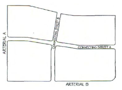
Figure 3-707.T.2: Connectivity Street Patterns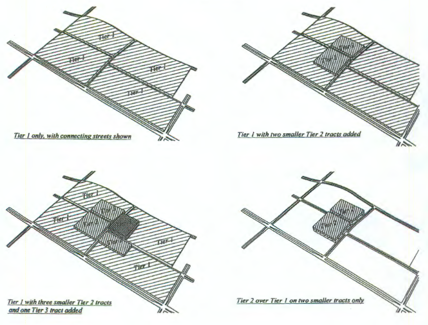
Figure 3-707.T.3: Cross Section of Connecting Streets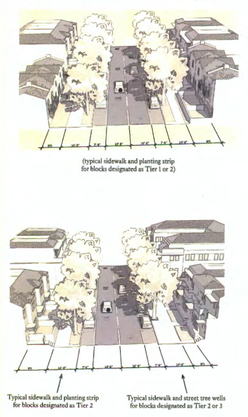
3-708. - Compact Community Planned Development (CCPD) District.
Chapter 32 of the Transitional Land Development Code is incorporated here by reference.
3-801. - General Purpose of Overlay Districts.
The purpose and intent of the Overlay zoning districts is to provide supplemental standards with respect to special areas, land uses, or environmental features, that supersede the standards of the underlying conventional zoning district.
3-802. - Overlay Districts.
The Overlay districts in this LDC are identified in Table 3-802: Overlay Districts.
3-803. - Corkscrew Road Overlay District.
A.
Purpose. The Corkscrew Road Overlay District is one of the Village's Main Streets. The purpose of this overlay district is to ensure development of the corridor includes architecturally appealing and attractively landscaped retail, office, residential, and institutional developments that cater to the needs of the community. Development in the district shall be designed to create people-oriented spaces along the road that are visually attractive, take into consideration human scale and proportion, and provide for pedestrian connections.
B.
Applicability. Development in the district shall comply with the following development standards. If there is a conflict between these standards other standards in this LDC, these standards shall control, unless expressly stated to the contrary in this section.
C.
Street-Front Activity. Development shall be designed to create public spaces to allow for activity to take place along the road front, such as sidewalks and open areas.
D.
Street Corners. Development in the district shall create visually attractive road corners using distinctive building entryways in combination with landscaping or artwork. Buildings on corner lots shall be designed with a maximum setback of 25 feet from each adjacent right-of-way and shall provide pedestrian access from the road intersection. See Figure 3-803.D: Road Corners, Corkscrew Road Overlay District.
Figure 3-803.D: Road Corners, Corkscrew Road Overlay District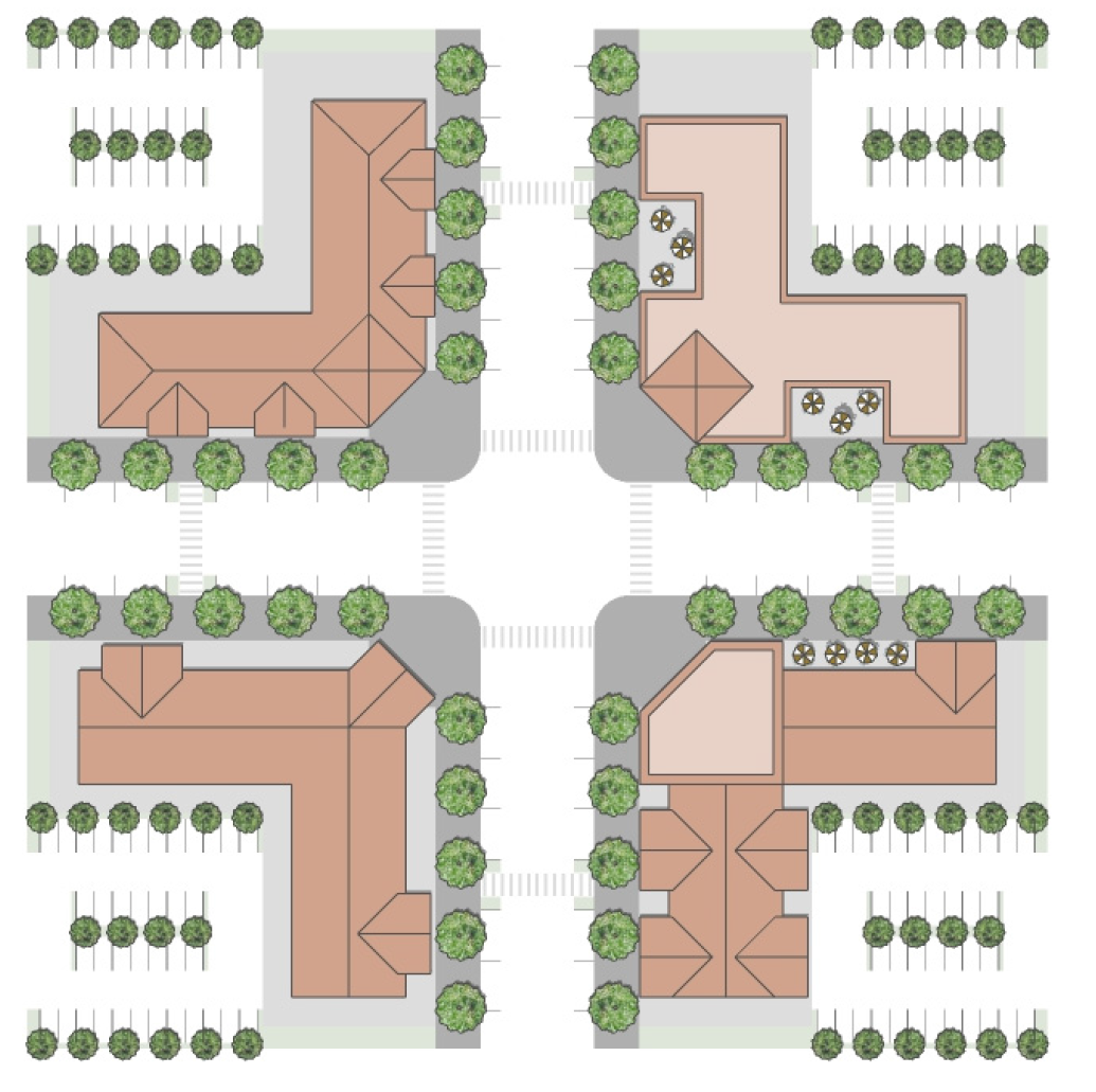
E.
Property Development Regulations. Development in the Corkscrew Road Overlay district shall comply with Table 3-803.E: Property Development Regulations, Corkscrew Road Overlay District, which shall control. Development shall otherwise comply with the other regulations of the underlying conventional zoning district, and all other applicable requirements of this LDC.
3-804. - US 41 Overlay District.
A.
Purpose. The US 41 overlay district will continue to grow as a commercial and residential corridor over the next decade, providing for the regional and local shopping needs of Estero and south Lee County residents. The purpose of the US 41 overlay district is to create a corridor that is well landscaped and aesthetically pleasing while providing for a free flow of traffic through Estero and south Lee County. It is the intent of the US-41 overlay district to create a road corridor that enhances the drive through experience of traveling through Estero.
B.
Applicability. The standards of this section shall apply to all development and redevelopment in the US-41 overlay district. If there is a conflict between these standards and other standards in this LDC, these standards shall control, unless expressly stated to the contrary in this section.
C.
Location of Parking Lots.
1.
Buildings and Shopping Centers of 7,500 Square Feet or Less. Freestanding buildings or shopping center developments containing 7,500 gross square feet of space or less shall not provide more than 20 percent of the parking areas in the front of buildings and/ or be limited to no more than one double row of parking in the front. No more than 20 percent of the parking area shall be located to the side of the building(s), with the balance of parking located to the rear of the building(s).
2.
Buildings Exceeding 7,500 Square Feet. For buildings exceeding 7,500 square feet, and fronting US 41, parking is encouraged to the sides or rear of the building.
3.
Screening of Parking Located Adjacent to US 41. Where parking is located adjacent to US 41, adequate screening, consisting of a minimum Type D buffer, as specified in Section 5-4, Landscape Standards, containing a two to three foot undulating landscaped berm, without a wall, is required. (The intent is to screen parking areas but not buildings.)
3-805. - Airport Compatibility Overlay District.
The Village shall utilize the county adopted airspace notification map, as well as Division 12 Airport Compatibility District, Article VI, Chapter 34 of the Lee County Land Development Code pertaining to airport compatibility districts, zones and regulations, when reviewing temporary structures and equipment such as cranes and permanent structures that are 125 feet or more in height for compliance.