
Fairplay City Zoning Code
ARTICLE V
Zoning Districts and Map
Sec. 16-5-10.- Zone districts established.
In order to regulate the location, height, bulk and size of buildings and other structures; the percentage of lot which may be occupied; the size of lots, courts and other open spaces; the density and distribution of population and the location and uses of land, buildings and structures for trade, industry, residence, recreation, public activities or other purposes, the incorporated area of the Town is hereby divided into the following districts:
(Ord. 2015-3, §1, 1-4-2016)
Sec. 16-5-20. - Description of zone districts.
| Single Family Residential (SF-Res) | |
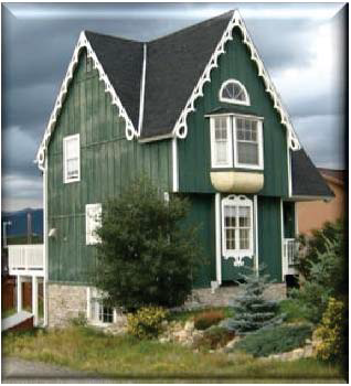 | Single-Family Residential comprises primarily single-family residential uses in neighborhoods. Other more intensive uses such as churches, community facilities and schools must be carefully planned to avoid adverse impacts to the residential character. |
| Multi-family Residential (MF-Res) | |
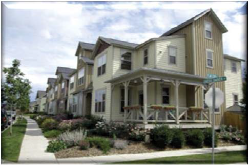 | Multi-family residential permits a variety of residential uses which includes single-family, duplex and multi-family buildings. Other more intensive uses such as churches, community facilities and schools must be carefully planned to avoid adverse impacts to the residential character. |
| Transitional (T) | |
 | Transitional encompasses most of the original town-site lots and includes single-family uses, home offices, small-scale retail, cafés and businesses which coexist with residential neighborhoods. Business use is on the ground-level and do not require much off-street parking. Sidewalks and alleys are important features. |
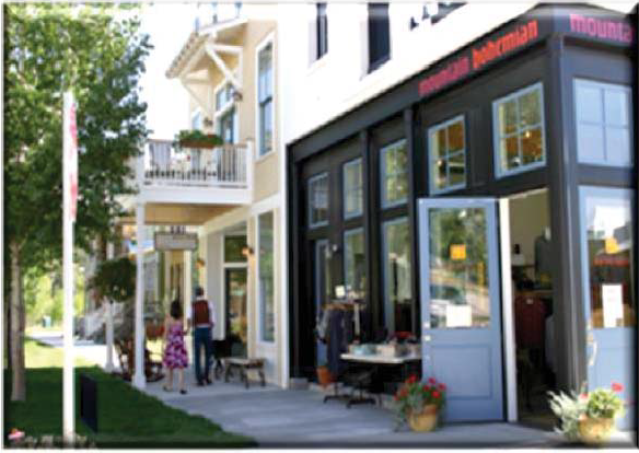
| Town Center (TC) | |
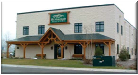
 | The Town Center is the historic core of Fairplay. Uses in Town Center include small businesses, hotels, restaurants, taverns, governmental buildings, professional offices, medical/dental clinics, museums, art galleries and a compatible collection of uses. Residential use requires a special use permit. Buildings front on sidewalks. The Town Center is the hub of civic activity and a place for social interaction. The associated Town Center Overlay District (TCO) ensures that the historic character is maintained. |
| Commercial (C) | |
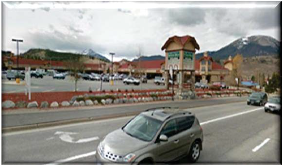 | Commercial adjacent to Highway 285 allows larger more intensive highway oriented commercial. Uses include grocery, restaurants, vehicle service, general retail, business/professional offices, governmental facilities, banks, medical/dental clinics, vehicle sales, motels, car wash, bowling lanes etc. Residential located in the rear of structures or on the second floor primarily serves employees and is secondary to business use. Storage is enclosed and screened with berms, landscaping and/or opaque fencing. |
| Multi-use (MU) | |
 | Multi-Use is a hybrid of Town Center and Multi-family Residential with recreational uses. This designation requires a mix of Town Center uses and residential. Uses include restaurant/cafés, brewpubs, fishing shops, ski/bike/hike/sporting goods, upper floor residential uses, stand-alone multi-use structures with residential and commercial/office uses. Architectural design of structures is important. The district supports design and land-use flexibility. The development community will work with the Town using PUDs to create a unique and inviting neighborhood. |
| Light Industrial (LI) | |
 | Light Industrial areas include larger acreages for industrial uses and should be buffered from other uses to ensure compatibility. Uses include lumber yards, wholesale sales, contractor's yards, offices, manufacturing, cabinet shops, ministorage, vehicle/truck repair, vehicle/equipment sales, jails, county facilities, emergency service facilities, veterinary hospitals and other light industrial activities. Outside storage is screened. Residential use is intended for employees, is allowed on upper stories. |
| Civic Center(CC) | |
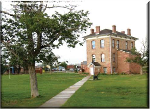 | Civic Center is for public uses and includes governmental facilities, libraries, recreation centers, museums, schools, fairgrounds, utility facilities and like uses. Civic Center architecture is important and shall recognize existing iconic historic buildings. Civic sites that contain governmental facilities with light industrial features are regulated the same as uses in Light Industrial with buffering and screening. |
| Parks-Open Space-Trails (POST) | |
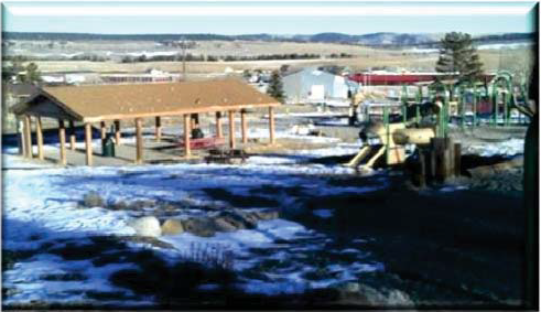 | Parks, Open Spaces and Trails includes active/passive open spaces and trails. Active open space sites include ball fields, playgrounds, "The Beach", sports facilities and fairgrounds. Passive open spaces incorporate natural areas along the Middle Fork of the South Platte River, undeveloped open lands in subdivisions, cemeteries and other areas. Passive sites include primitive trails or educational waysides where human presence is minimized in the landscape. Trails range from hard surfaced paths (including sidewalks) to primitive gravel paths. Parks and open spaces are linked by trails. Areas with more intensive active uses contain adequate parking, restrooms, shade structures and other elements. |
(Ord. 2015-3, §1, 1-4-2016)
Sec. 16-5-30. - Table of uses.
(Ord 3, 2015 §1; Ord. 5, 2018 §1(Exh. A); Ord. 2, 2019, §1; Ord. 8, 2021 §2; Ord. 2, 2022 §4; Ord. 4, 2022 §3; Ord. 8, 2022, § 2)
Sec. 16-5-40. - Table of dimensional standards.
[1] Adjacent to alley.
[2] Plus one thousand (1,000) square feet for each additional dwelling unit over three (3) units.
Building height exceptions: Building height shall not exceed the maximum limitations set forth in the Table of Dimensional Standards except as follows:
a. Parapet walls may extend above the maximum building height by up to thirty (30) inches.
b. Stacks, vents, cooling towers, elevator structures and similar mechanical building appurtenances, spires, domes, cupolas, towers and similar non-inhabitable building appurtenances may extend above the applicable maximum building height limitations by up to ten (10) feet.
Setback encroachments: No structure shall encroach into a required setback except as follows:
a. Uncovered porches and decks, not more than thirty (30) inches above undisturbed grade, may project into required setbacks. Uncovered porches and decks shall be a minimum of five (5) feet from the property line.
b. Balconies and fire escapes, not used as passageways, may project four (4) feet into required setbacks. Balconies and fire escapes shall be a minimum of five (5) feet from the property line.
c. Cornices, eaves, canopies, gutters, chimneys, flues, headers, sills, belt courses, pilasters, ornamental features and other similar architectural features may project two (2) feet into required setbacks. All projections shall be a minimum of five (5) feet from the property line.
d. Slabs, patios and steps may project into required setbacks. All slabs, patios and steps shall be a minimum of one (1) foot from the property line.
e. Walks and handicap access ramps may be located within required setbacks.
(Ord. 2015-3 §1, 2016; Ord. 2016-3 §1, 2016)
Sec. 16-5-50. - Official zoning map and interpretations.
(A)
The Town Zoning Map shall be an integral part of this Chapter and is hereby designated as the Official Zoning Map. The districts set forth and delineated thereon are hereby approved by the Board of Trustees. The Official Zoning Map shall be filed in the office of the Town Clerk.
(B)
Amendments to zone district boundaries made pursuant to the provisions of this Chapter shall be promptly recorded and reflected on the Zoning Map upon their effective date. Data illustrated on the map is subject to the limitations of accuracy of the underlying data and does not constitute a survey of individual lots and parcels. The district map and all information officially entered thereon shall have the same force and effect as if fully set forth in this Chapter.
(C)
All lots and parcels in any newly annexed area shall be given a zone designation under the provisions of the Chapter within ninety (90) days from the effective date of the annexation ordinance. During this period, no building permits shall be issued on any portion or all of the newly annexed area until such time as the property is designated on the Official Zoning Map.
(D)
Where uncertainty exists or should arise with respect to the boundaries of any district shown on the district map, the following rules shall apply:
1.
Where district boundaries are indicated as approximately following the centerlines of streets, alleys, highways, streams, irrigation ditches, rivers, street or railroad right-of-way lines, or such lines extended, such lines shall be construed to be such boundaries.
2.
Where district boundaries are so indicated that they approximately follow lot lines, section lines, mining claim lines, or other property lines, such lines shall be construed to be the boundaries.
3.
Where district boundaries are so indicated that they are approximately parallel to the boundaries or centerlines of streets, alleys, highways or railroads, or rights-of-way of the same, such district boundaries shall be construed as being parallel thereto and at such distance therefrom as indicated on the district map.
(E)
Any use not specifically included in the district regulations as a "use permitted" or a "special use" shall be prohibited in that district. In certain districts, some types of "uses permitted" or "special uses" are general in nature, listing examples of the type of use which shall be permitted in the district. Where a use, or category of uses, which is not listed in a general category of uses is proposed, or where a question of interpretation occurs, the Board of Trustees, with the advice of the staff, may make a determination that such use, or type of use, is or is not appropriate within the district.
(Ord. 2015-3, §1, 1-4-2016)
Sec. 16-5-60. - Amendments and rezoning.
(A)
This Chapter, including the official Zoning Map and any zone district boundaries, may be amended from time to time.
(B)
The Board of Trustees may amend this Chapter, the Official Zoning Map and/or any zone district boundary; including, the number of districts, shape of district boundaries and/or the zoning designation of property. The Trustees may solicit the recommendations of the Town Planner on amendments. No amendment shall be effective unless voted upon by the Board of Trustees after a public hearing thereon at which citizens and parties in interest shall have had an opportunity to be heard. Notice of a public hearing shall be made in compliance with the requirements of Article IV. A zoning amendment or rezoning may be granted where the following findings are made:
1.
That the rezoning is consistent with the Town's goals, policies and plans; and
2.
That the rezoning is substantially compliant with the Fairplay Comprehensive Plan, and
3.
That the land to be rezoned was previously zoned in error and the existing zoning is inconsistent with the Town's goals, policies and plans; or
4.
That the area for which rezoning is requested has changed substantially such that the proposed rezoning better meets the needs of the community; or
5.
That the rezoning is incidental to a comprehensive revision of the Town's zoning map which recognizes a change in conditions and is consistent with the Town's goals, policies and plans.
(C)
Resubmission of a rezoning application previously denied pertaining to the same parcel of ground, or portion thereof, and a similar zone classification will not be accepted for consideration by the Town for one (1) year from the date of said denial unless evidence is presented clearly showing that a substantial change in physical conditions and circumstances warrant a new application.
(Ord. 2015-3, §1, 1-4-2016)
Sec. 16-5-70. - Submittal requirements.
(A)
In addition to the Common Submittal Requirements in Article III, the following submittal items are required.
1.
Applications for rezoning shall include a petition for rezoning signed by the owners of at least fifty percent (50%) of the area of land or area of lots subject to the rezoning application.
2.
Description of proposed zone district change—text amendment or zone district boundary change.
3.
Justification for district change. Please clearly state the basis upon which the proposed zoning change is made including a justification for the change. Examples for justification may include the following: Rezoning of subject property is in compliance with the recommendations of the comprehensive plan or the property was improperly zoned originally or there has been a substantial change in condition and use on the surrounding properties to justify a change of zoning.
4.
Narrative describing the designation of the property in the Fairplay Comprehensive Plan including recommendations on zoning, use, density or other provisions which demonstrate substantial compliance of the request to the Plan.
5.
Identification of the surrounding zoning and land uses.
6.
For text amendments the application shall include (in addition to the previous items) a description of the proposed text amendment and the proposed new text.
(Ord. 2015-3, §1, 1-4-2016)
Sec. 16-5-80. - Zoning/amendment protest.
In the event a written protest is filed with the Town Clerk against proposed changes to the text of this Chapter, or against amendments to the Zoning Map or to the boundaries of a zone district applicable to particular land, at least seventy-two (72) hours prior to the vote of the Board of Trustees thereon, and such protest is signed by the owners of not less than twenty percent (20%) of the land area surrounding and extending one hundred (100) feet from the land area which is the subject of the proposed change, disregarding intervening streets and other public rights-of-way, such change shall not be adopted or become effective except upon the favorable vote of two-thirds (⅔) of all of the members of the Board of Trustees.
(Ord. 2015-3, §1, 1-4-2016)
Sec. 16-5-90. - Applicability of regulations; density limitation.
(A)
No lot shall be created, reduced or diminished nor shall any structure be constructed, enlarged or moved, so as to cause the lot to fall below minimum yard, lot area, lot width, open space or setback requirements for the zoning district where located, except where the Board of Adjustment, within its authority, grants a variance as provided in this Chapter.
(B)
Every building hereafter erected shall be located on a lot, as defined herein, and in no case shall there be more than one (1) principal building or structure on a single lot, except as may be otherwise provided herein.
(C)
Where a line designating the future width of any street or highway is shown on a comprehensive plan, official map or state highway plan, or is established in any other way, a front yard depth or building setback shall be measured from such line instead of from any other existing front line.
(Ord. 2015-3, §1, 1-4-2016)
Sec. 16-5-100. - Enforcement and penalties; void permits.
(A)
In addition to the following provisions, enforcement of the requirements of this Article shall be made in compliance with Article II of this Chapter.
(B)
It is unlawful for any person, including an owner, occupant, builder or agent, to develop or use, or to attempt to develop or use, any real property in violation of the provisions of this Chapter, and violations of this Chapter shall be punishable upon conviction for each separate offense by a fine or imprisonment, or both, as set forth in the general penalty provisions of this Code.
(C)
No building permit, sanitation system permit, water system connection permit, access permit or other permit shall be issued for any building, development, structure, lot or parcel created, used, sold or conveyed in violation of this Chapter.
(D)
All persons are presumed to know the terms and requirements of this Chapter and the extent of the legal authority of the Town and its employees, boards to issue zoning approvals or permits. Any permit or approval issued in error, or otherwise not in conformity with the requirements of this Chapter, shall be void. Similarly, any permit or approval issued in reliance upon or as a result of a materially false statement or representation made in the process of obtaining a permit or development approval shall, likewise, be void. Any person having received a void or voidable permit or approval shall not be relieved from having to comply with all applicable terms and conditions of the Chapter, and the Town shall not be stopped from fully enforcing same.
(Ord. 2015-3, §1, 1-4-2016)