
Greeley City Zoning Code
CHAPTER 10
- SPECIAL DISTRICTS AND AREAS
Sec. 24-1001.- Floodplain overlay district.
a.
Intent. This section creates a floodplain overlay district: a zoning overlay of special standards and regulations for land located within a special flood hazard area (SFHA) as identified by the Federal Emergency Management Agency (FEMA) for the administration of the National Flood Insurance Program (NFIP). It is the intent of this section and the related floodplain management regulations within title 12, chapter 12 of this Code to promote public health, safety, and general welfare and to minimize public and private losses due to flood conditions in specific areas by provisions designed to:
1.
Protect human life and health;
2.
Minimize expenditure of public money for costly flood control projects;
3.
Minimize the need for rescue and relief efforts associated with flooding and generally undertaken at the expense of the general public;
4.
Minimize prolonged business interruptions;
5.
Minimize damage to critical facilities, infrastructure and other public facilities located in floodplains;
6.
Help maintain a stable tax base by providing for the sound use and development of floodprone areas in such a manner as to minimize future flood blight areas; and
7.
Ensure that potential buyers are notified that property is located in a flood hazard area.
This section is not intended to repeal, abrogate or impair any existing easements, covenants or deed restrictions. However, where this chapter and another statute, regulation, ordinance, easement, covenant or deed restriction conflict or overlap, whichever imposes the more stringent restrictions shall prevail.
b.
Applicability. The floodplain overlay district shall apply to all special flood hazard areas and areas removed from the floodplain by the issuance of a FEMA letter of map revision based on fill (LOMR-F) within the jurisdiction of the city.
1.
The special flood hazard areas identified by FEMA and any revisions thereto are hereby adopted by reference and declared to be a part of this section. These special flood hazard areas identified are the minimum area of applicability of this section and may be supplemented by studies designated and approved by the community.
2.
No structure or land shall hereafter be located, altered or have its use changed within the SFHA without full compliance with the standards and requirements in title 12, chapter 12 of this Code. These regulations meet the minimum requirements as set forth by the Colorado Water Conservation Board (CWCB) Rules and Regulations for Regulatory Floodplains in Colorado (2 C.C.R. § 408-1) and the National Flood Insurance Program (44 C.F.R. §§ 50 to 80).
c.
Floodplain development permit. A floodplain development permit shall be required before construction or development (as those terms are defined in section 12-1204 of this Code) within the floodplain overlay district. Refer to section 12-1206 of this Code for floodplain development permit requirements.
d.
Variances. The zoning board of appeals shall hear and render judgment on requests for variances from the requirements of title 12, chapter 12 of this Code. When considering whether to grant a variance, the zoning board of appeals shall not apply the development code variance standards and procedures in section 24-209 and shall instead apply the following standards and procedures:
1.
Prerequisites for granting variances:
(a)
Variances shall only be issued upon a determination that the variance is the minimum necessary, considering the flood hazard, to afford relief.
(b)
Variances shall only be issued upon:
(1)
Showing a good and sufficient cause;
(2)
A determination that failure to grant the variance would result in exceptional hardship to the applicant, and
(3)
A determination that the granting of a variance will not result in increased flood heights, additional threats to public safety, extraordinary public expense, create nuisances, cause fraud on or victimization of the public, or conflict with exiting local laws or ordinances.
(c)
Any applicant to whom a variance is granted shall be given written notice that the structure will be permitted to be built with the lowest floor elevation below the base flood elevation, and that the cost of flood insurance will be commensurate with the increased risk resulting from the reduced lowest floor elevation.
(d)
The floodplain administrator shall be notified of and must have the opportunity to submit written comments or offer testimony to the zoning board of appeals prior to a decision on any proposed variance.
2.
Variances may be issued for new construction and substantial improvements and for other development necessary for the conduct of a functionally dependent use provided that:
(a)
All other criteria for issuing a variance under this subsection are met, and
(b)
The structure or other development is protected by methods that minimize flood damages during the base flood and create no additional threats to public safety.
3.
Variances may be issued for the reconstruction, rehabilitation, or restoration of structures listed on the National Register of Historic Places or the State Inventory of Historic Places, without regard to the procedures set forth in the remainder of this section.
4.
Variances may be issued for the repair or rehabilitation of historic structures upon a determination that the proposed repair or rehabilitation will not preclude the structure's continued designation as a historic structure and the variance is the minimum necessary to preserve the historic character and design of the structure.
5.
Variances may be issued for new construction and substantial improvements to be erected on a lot of one-half acre or less in size contiguous to and surrounded by lots with existing structures constructed below the base flood level, providing the relevant factors in this section have been fully considered. As the lot size increases beyond the one-half acre, the technical justification required for issuing the variance increases.
6.
Variances shall not be issued within any designated floodway if any increase in flood levels during the base flood discharge would result.
7.
Upon considerations of the factors noted above and the intent of this section, the zoning board of appeals may attach such conditions to the granting of variances as they deem necessary to further the purpose and objectives stated in section 24-1001.a.
(Ord. No. 36, 2021, § 5(app. A, § 5), 9-21-2021; Ord. No. 1, 2026, § 1, 1-20-2026)
Sec. 24-1002. - Airport overlay district.
a.
Intent. The intent of this section is to provide regulations restricting the height of structures and objects of natural growth and otherwise regulating the use of property in the vicinity of the Greeley-Weld County Airport by creating the appropriate zones and establishing the boundaries thereof. The use of land within this overlay district affects the safe and efficient operation of the airport and aircraft using the airport, and this section is intended to minimize risks to public safety and hazards to aircraft users and to protect the capacity of the airport to serve the area's air transportation needs, while allowing development that is compatible with the continued operation of the airport.
b.
Applicability. The airport overlay district shall include those lands within the Greeley-Weld County Airport Zoning Map, prepared by Isbill Associates, Inc., Airport Consultants, dated July 1, 1984. The requirements of this section shall supplement those imposed on the same lands by any underlying zoning provision of this code or any other ordinance of the city.
c.
Airport zone.
1.
In order to carry out the provisions of this section, there are hereby created and established certain zones which include all of the land lying beneath the approach surfaces, transitional surfaces, horizontal surfaces and conical surfaces as they apply to the Greeley-Weld County Airport. Such zones are shown on the Greeley-Weld County Airport Zoning Map. An area located in more than one of the following zones is considered to be only in the zone with the more restrictive height limitation. The various zones are hereby established and defined as follows:
(a)
Utility runway visual approach zone. The inner edge of this approach zone coincides with the width of the primary surface and is 250 feet wide. The approach zone expands outward uniformly to a width of 1,250 feet at a horizontal distance of 5,000 feet from the primary surface. The centerline is the continuation of the centerline of the runway.
(b)
Runway larger than utility visual approach zone. The inner edge of this approach zone coincides with the width of the primary surface and is 1,000 feet wide. The approach zone expands outward uniformly to a width of 1,500 feet at a horizontal distance of 5,000 feet from the primary surface. The centerline is the continuation of the centerline of the runway.
(c)
Precision instrument runway approach zone. The inner edge of this approach zone coincides with the width of the primary surface and is 1,000 feet wide. The approach zone expands outward uniformly to a width of [1,600] feet at a horizontal distance of 50,000 feet from the primary surface. The centerline is a continuation of the centerline of the runway.
(d)
Transitional zone. The transitional zone is the area beneath the transitional surface.
(e)
Horizontal zone. The horizontal zone is established by swinging arcs of 5,000 feet radii for all runways designated utility or visual and 10,000 feet for all others from the center of each end of the primary surface of each runway and connecting the adjacent arcs by drawing lines tangent to those arcs. The horizontal zone does not include the approach and transitional zones.
(f)
Conical zone. The conical zone is established as the area that commences at the periphery of the horizontal zone and extends outward therefrom a horizontal distance of 4,000 feet.
2.
Except as otherwise provided in this code, no structure shall be erected, altered or maintained and no tree shall be allowed to grow in any zone created by this section to a height in excess of the applicable height herein established for such zone. Such applicable height limitations are hereby established for each of the zones in question, as follows:
(a)
Utility runway visual approach zone. Slopes 20 feet outward for each foot upward beginning at the end and at the same elevation as the primary surface and extending to a horizontal distance of 5,000 feet along the extended centerline.
(b)
Runway larger than utility visual approach zone. Slope 20 feet outward for each foot upward beginning at the end of and at the same elevation as the primary surface and extending to a horizontal distance of 5,000 feet along the extended runway centerline.
(c)
Precision instrument runway approach zone. Slopes 50 feet outward for each foot upward beginning at the end of and at the same elevation as the primary surface and extending to a horizontal distance of 10,000 feet along the extended runway centerline; thence slopes upward 40 feet horizontally for each foot vertically to an additional horizontal distance of 40,000 feet along the extended runway centerline.
(d)
Transitional zone. Slopes seven feet outward for each foot upward beginning at the sides of and at the same elevation as the primary surface and the approach surface and extending to a height of 150 feet above the airport elevation which is 4,690 feet above mean sea level. In addition to the foregoing, there are established height limits sloping seven feet outward for each foot upward beginning at the sides of and the same elevation as the approach surface and extending to where they intersect the conical surface. Where the precision instrument runway approach zone projects beyond the conical zone, there are established height limits sloping seven feet outward for each foot upward beginning at the sides of and the same elevation as the approach surface and extending a horizontal distance of 5,000 feet measured at ninety-degree angles to the extended runway centerline.
(e)
Horizontal zone. Established at 150 feet above the airport elevation or at a height of 4,840 feet above mean sea level.
(f)
Conical zone. Slopes 20 feet outward for each foot upward beginning at the periphery of the horizontal zone and at 1,500 feet above the airport elevation and extending to a height of 350 feet above the airport elevation.
d.
Use restriction. Except as may otherwise be provided, no use may be made of land or water within any zone established by this section in such a manner as to create electrical interference with navigational signals or radio communication between the airport and aircraft, make it difficult for pilots to distinguish between airport lights and others, result in glare in the eyes of pilots using the airport, impair visibility in the vicinity of the airport, create bird strike hazards, or otherwise in any way endanger or interfere with the landing, takeoff or maneuvering of aircraft intending to use the airport.
e.
Nonconforming use.
1.
The regulations prescribed in this section shall not be construed to require the removal, lowering or other change or alteration of any structure or tree not conforming to the regulations as of the effective date of this section, or otherwise interfere with the continuance of a nonconforming use, except as may otherwise be provided. Nothing contained herein shall require any change in the construction, alteration or intended use of any structure, the construction or alteration of which was begun prior to the effective date of this code.
2.
The owner of any existing nonconforming use or tree shall be required to permit the installation, operation and maintenance of such markers and lights as shall be deemed necessary by the Greeley-Weld County Airport Authority to indicate to the operators of aircraft in the vicinity of the airport the presence of such obstruction. Such markers and lights shall be installed, operated and maintained at the expense of the Greeley-Weld County Airport Authority.
f.
Defined terms. The following terms used in this section shall have the meaning given below. All other terms shall have their usual customary meaning, or the meaning given elsewhere in this code or other applicable uniform or international code adopted by the city, except where the context clearly indicates a different meaning.
Airport means the Greeley-Weld County Airport, located in Sections 2 and 3 and Sections 26 and 35, T5N, R65W of the 6th P.M., Weld County, Colorado.
Airport elevation means the established elevation of the highest point on the usable landing area (4,690 feet above sea level).
Airport reference point means the point established as the geographic center of the airport landing area. The reference point at Greeley-Weld County Airport is a point which geographical coordinates are Latitude 40°26'8" North and Longitude 104°37'55" West.
Approach surface means a surface longitudinally centered on the extended runway centerline, extending outward and upward from the end of the primary surface and at the same slope as the approach zone height limitation slope set forth in this section. In plan view, the perimeter of the approach surface coincides with the perimeter of the approach zone.
Conical surface means a surface extending outward and upward from the periphery of the horizontal surface at a slope of 20:1 for a horizontal distance of 4,000 feet.
Hazard to air navigation means an obstruction determined to have a substantial adverse effect on the safe and efficient utilization of the navigable airspace.
Height, for the purposes of determining the height limits in all zones set forth in this section and shown on the Greeley-Weld County Airport Zoning Map, shall be the mean sea level elevation unless otherwise specified.
Horizontal surface means a horizontal plane 150 feet above the established airport elevation, the perimeter of which in plan view coincides with the perimeter of the horizontal zone (4,808 feet above sea level).
Larger than utility runway means a runway that is constructed for and intended to be used by propeller-driven aircraft of greater than 12,500 pounds maximum gross weight and jet-powered aircraft.
Obstruction means any structure, growth or other object, including a mobile object, which exceeds a limiting height set forth in section 24-1002.c.
Precision instrument runway means a runway having an existing instrument approach procedure utilizing an instrument landing system (ILS). It shall also mean a runway for which a precision approach system is planned and is so indicated on an approved airport layout plan or any other planning document.
Primary surface means a surface longitudinally centered on a runway extending 200 feet beyond each end of that runway. The elevation of any point on the primary surface is the same as the elevation of the nearest point on the runway centerline. The width of a primary surface is:
a.
250 feet for runways having only visual approaches.
b.
1,000 feet for precision instrument runways.
Runway means a defined area on an airport prepared for landing and takeoff of aircraft along its length.
Structure, for the purposes of this section, means an object, including a mobile object, constructed or installed by humans, including, but not limited to, buildings, towers, cranes, smokestacks, earth formations and overhead transmission lines.
Transitional surface means those surfaces which extend outward at 90-degree angles to the runway centerline and the runway centerline extended at a slope of seven feet horizontally for each foot vertically from the sides of the primary and approach surfaces to where they intersect the horizontal and conical surfaces. Transitional surfaces for those portions of the precision approach surfaces, which project through and beyond the limits of the conical surface, extend a distance 5,000 feet measured horizontally from the edge of the approach surface and at 90-degree angles to the extended runway centerline.
Utility runway means a runway that is constructed for and intended to be used by propeller-driven aircraft of 12,500 pounds maximum gross weight and less.
Visual runway means a runway intended solely for the operation of aircraft using visual approach procedures.
(Ord. No. 36, 2021, § 5(app. A, § 5), 9-21-2021)
Sec. 24-1003. - Historic preservation.
a.
Intent. The intent of this section is to:
1.
Designate, preserve, protect, enhance and perpetuate sites, structures, objects and districts which reflect outstanding elements of the city's cultural, artistic, social, ethnic, economic, political, architectural, historic, technological, institutional or other heritage.
2.
Establish a method to draw a reasonable balance between the protection of private property rights and the public's interest in preserving the city's unique historic character by creating a quasi-judicial commission to review and approve or deny any proposed demolition of, moving of or alteration to properties of historic value.
3.
Foster civic pride in the beauty and accomplishments of the past.
4.
Stabilize or improve aesthetic and economic vitality and values of such sites, neighborhoods, structures, objects and districts.
5.
Protect and enhance the city's attraction to tourists and visitors, increase the quality of life for the citizens and enhance future economic development.
6.
Promote the use of outstanding historic or architectural sites, structures, objects and districts for the education, stimulation and welfare of the people of the city.
7.
Promote good urban design.
8.
Promote and encourage continued private ownership and utilization of such sites, structures, objects or districts.
9.
Integrate historic preservation with the city's comprehensive development plan.
b.
Applicability. This section applies to the following properties:
1.
Individually designated properties are subject to the most current version of the historic preservation general design review guidelines.
2.
Individually designated properties contributing in a Greeley Historic Register historic district are subject first to the district designation plan, then to the historic preservation general design review guidelines.
3.
Undesignated properties contributing in a Greeley Historic Register historic district are subject to the district designation plan.
4.
Undesignated structures or buildings that are 40 years or older are subject to an administrative review for potential historic significance
5.
Noncontributing properties located in a historic district are subject to portions of the district designation plan applicable to noncontributing properties, unless specifically excluded under the plan.
6.
All pertinent municipal zoning and building codes are applicable for all properties.
c.
Administrative review of undesignated properties. When application for a permit is made with the city that would make significant alterations to the streetscape view of the exterior of or demolition of any structure or building that is 40 years or older at the time of such request, the application shall be forwarded to and reviewed by the director.
1.
Significant alterations shall include:
(a)
Siding: including new stucco or similar exterior material applied over original or other existing siding materials, including wood, metal or brick exterior; removal of all or a portion of the original or existing siding and replaced with new siding.
(b)
Fenestration: window or door openings enlarged or reduced.
(c)
Roof: changes of roofline or structure.
(d)
Porches: changes to porch visible from streetscape.
(e)
Additions.
(f)
Accessory structures.
(g)
Any building modification as viewed from any public street.
2.
Non-significant alterations shall be excluded from review by the director. Non-significant alterations shall include:
(a)
Fenestration: replacement of windows or doors in original openings.
(b)
Roof: new shingles or deck without changing original roofline.
(c)
Patios: additions of back patios or decks.
(d)
Landscaping.
(e)
Signs.
3.
The director shall have ten business days to review and comment on applications with significant alterations. The ten business days shall commence on the day the permit application is submitted to the building inspection office. Should ten business days expire without written comment from the director, then the director shall not be allowed to comment on the permit.
(a)
The director shall review the property and, if necessary, research the historical significance of the building for which a permit has been applied.
(b)
If the director determines that a building currently holds no historical, architectural and/or geographical significance, then a notice shall be placed with the permit that will be issued through the building inspection office.
(c)
If the director determines that potential significance exists, the director shall make the information available to the groups named in section 24-1003.d.2.
(d)
The director shall issue comments and/or suggestions to the building inspection office. These comments shall recognize the historical, architectural and/or geographical significance or lack thereof concerning the building for which a permit has been requested. The director may also make suggestions of ways to make the changes more compatible or acceptable with the age or type of the structure.
4.
Whenever an application for development includes significant alterations or demolition and is required to go through the community development department review according to this section, the department will use its best efforts to inform the applicant of the ramifications that this section will have on the application.
5.
If a building must be demolished because it poses a threat to the health, safety or welfare of the citizens of the city, this section shall not apply.
d.
Criteria for designation.
1.
Criteria for individual, owner-nominated properties. A property shall be eligible for designation for historic preservation and eligible for economic incentives if it meets one or more criteria in one or more of the following categories:
(a)
Historical significance. The site, building or property:
(1)
Has character, interest and integrity and reflects the heritage and cultural development of the city, state or nation.
(2)
Is associated with an important historical event.
(3)
Is associated with an important individual or group who contributed in a significant way to the political, social and/or cultural life of the community.
(b)
Architectural significance. The property:
(1)
Characterizes an architectural style or type associated with a particular era and/or ethnic group.
(2)
Is identified with a particular architect, master builder or craftsman.
(3)
Is architecturally unique or innovative.
(4)
Has a strong or unique relationship to other areas potentially eligible for preservation because of architectural significance.
(5)
Has visual symbolic meaning or appeal for the community.
(c)
Geographical significance. The property:
(1)
Has proximity and a strong connection or link to an area, site, structure or object significant in the history or development of the city, state or nation.
(2)
Is a visual feature identifying an area or neighborhood or consists of buildings, homes, replicas, structures, objects, properties, parks, land features, trees and sites historically or geographically associated with an area.
2.
Criteria for individual, non-owner-nominated properties. In addition to meeting criteria requirements in section 24-1003.d.1, non-owner nominations shall be reviewed under stricter protections. The nominated property must demonstrate that it possesses the characteristics of compelling historic importance to the entire community, including at least one of the following criteria:
(a)
Unusual or uncommon significance that the structure's potential demolition or major alteration would diminish the character and sense of place in the community of Greeley; or
(b)
Superior or outstanding examples of architectural, historical or geographical significance criteria outlined in the criteria for designation in this section. The term "superior" shall mean excellence of its kind, and the term "outstanding" shall mean marked by eminence and distinction.
3.
Criteria for district designation. A district shall be designated if the city council determines that the proposed district meets the definition of a historic district pursuant to this section and meets one or more of the following criteria:
(a)
Is an area which exemplifies or reflects the particular cultural, political, economic or social history of the community.
(b)
Is an area identified with historical personages or groups or which represents important events in national, state or local history.
(c)
Is an area which embodies distinguishing characteristics of an architectural type or style inherently valuable for the study of a period, method of construction or indigenous materials of craftsmanship.
(d)
Is an area which is representative of the notable work of a master builder, designer or architect whose individual ability has been recognized.
(e)
Is an area which, due to its unique location or singular characteristics, represents established and familiar visual features of the neighborhood, community or city.
4.
Integrity criteria. All properties and districts shall be evaluated for their physical integrity using the following criteria, as defined by the National Park Service in the current version of the publication "How to Apply the National Register Criteria for Evaluation":
(a)
Location—the place where the historic property was constructed or the place where the historic event occurred.
(b)
Design—the combination of elements that create the form, plan, space, structure and style of a property.
(c)
Setting—the physical environment of a historic property.
(d)
Materials—the physical elements that were combined or deposited during a particular period of time and in a particular pattern or configuration to form a historic property.
(e)
Quality/skill—the physical evidence of the crafts of a particular culture or people during any given period in history or prehistory.
(f)
Feeling—a property's expression of the aesthetic or historic sense of a particular period of time.
(g)
Association—the direct link between an important historic event or person and a historic property.
e.
Designation. A property or district may only be nominated once in any 12-month period, unless such nomination is uncontested. Submittal of an incomplete application will result in a delay in the nomination and public hearing process. The following provisions shall apply to the nomination of individual properties and districts:
1.
Owner nominations. Any owner may nominate such owner's area, building, house, replica, structure, object, property, park, land feature, tree and site for designation on the local register, subject to the following procedures:
(a)
Submittal requirements. The owner shall submit a complete application, as determined by historic preservation staff. A complete nomination application will include:
(1)
Nomination form with ownership information, including address of record, signatures of all owners of record or legally authorized representative of the owner, legal description or indication of an attached legal description.
(2)
Historic building inventory form, with the following required minimum information completed: nominated property address, owner, mailing address, phone number, legal description, historic use, present use, date of construction (estimate), original owner (if possible) and significance (determined in consultation with the director if necessary).
(3)
Current photos of the front and sides of the property, and of the rear to the extent possible. If the photos are digital, they should be at least 300 dpi. All photos should be provided with a photo log indicating the name of the photographer, date of the photo, view (front, rear, yard, etc.), direction (looking north, etc.) and the address of the subject property.
(4)
Application fee, payable to the City of Greeley. The fee may be waived under certain circumstances. If the owner has a financial hardship, the owner may submit a request for a reduction or waiver of the nomination fee, explaining the need for the waiver or reduction. The director shall make determinations on fee waiver requests.
(b)
Public hearing procedure.
(1)
Quorum required. At least five members of the commission must be present at a hearing in order to establish a quorum. If a quorum is missing due to attendance, then the chair of the commission may set a new date for a special hearing, or the matters scheduled for that hearing shall be heard on the next regularly scheduled hearing date. If a quorum is missing due to conflicts of interest, then alternate commission members shall be used.
(2)
The hearing shall be electronically recorded and minutes prepared. Hearings shall be of ample length to allow all concerned persons to address the commission.
(3)
Commission action/decision. After the commission has heard all interested parties and relevant evidence, the commission may approve the designation if it casts votes in favor of historic designation by a two-thirds majority of the quorum present. The commission decision is final unless appealed to city council, pursuant to section 24-1003.g.
2.
Non-owner nominations. The planning commission, urban renewal authority, downtown development authority or any legally recognized preservation organization, including nonprofit historic preservation groups, may nominate an area, building, house, replica, structure, object, property, park, land feature, tree or site for designation on the local register, subject the following procedures:
(a)
Submittal requirements. All paperwork for the application must be completed pursuant to the rules of the commission. A complete nomination application will include:
(1)
Nomination form, with ownership information including address of record, signature of an authorized official of the applicant organization and legal description or indication of attached legal description.
(2)
Historic building inventory form, with the following required minimum information completed: nominated property address, owner, mailing address, phone number, legal description, historic use, present use, date of construction (estimate), original owner (if possible), significance (determined in consultation with the director if necessary) and a detailed statement on how the nominated property possesses the characteristics of compelling historic importance to the community.
(3)
Current photos of the front and sides of the property, and of the rear to the extent possible. If the photos are digital, they should be at least 300 dpi. All photos should be provided with a photo log indicating the name of the photographer, date of the photo, view (front, rear, yard, etc.), direction (looking north, etc.) and the address of the subject property.
(4)
Copy of a legally recorded document containing the legal description of the property. This could be an abstract of title, warranty deed, quit claim deed, etc., which may be obtained from the county clerk and recorder.
(5)
Application fee, payable to the City of Greeley.
(b)
Public hearing procedure.
(1)
Quorum required. At least five members of the commission must be present at a hearing in order to establish a quorum. If a quorum is missing due to attendance, then the chair of the commission may set a new date for a special hearing, or the matters scheduled for that hearing shall be heard on the next regularly scheduled hearing date. If a quorum is missing due to conflicts of interest, then alternative commission members shall be used.
(2)
The hearing shall be electronically recorded and minutes prepared. Hearings shall be of ample length to allow all concerned persons to address the commission.
(3)
Commission action/decision. Commissioners may recommend in favor of historic designation for approval of non-owner-nominated properties if five votes are cast in favor of such recommendation, subject to approval by the city council under this section. Owners may appeal the decision pursuant to section 24-1003.g.
(4)
City council action on non-owner nominations. Within 30 days of the commission decision, city council shall hold a public hearing and consider all relevant evidence. The council shall vote and render a decision to affirm, deny or modify the designation with a vote of the simple majority. The council decision constitutes final agency action.
3.
Historic districts. Two or more individuals may nominate a district within which they own property.
(a)
Submittal requirements. All paperwork for the application must be completed pursuant to the rules of the commission. A complete nomination application will include:
(1)
The complete nomination form with original signatures of all applicants. In the case of absentee owners as applicants, original signed statements will meet this requirement.
(2)
Completed historic building inventory form for district properties for all properties within the nominated area. The following fields must be completed: address, legal description, owner name and address, style, materials, stories, other historic designation and designating authority, historic use, present use, date of construction, condition, original owner, associated buildings, architectural description, proposed status and the name, address, phone number and signature of the person or group who completed the inventory form.
(3)
Current digital photos of the front of each property and streetscape photos of each block. The photos should be at least 300 dpi and be provided with a photo log indicating the name of the photographer, date of the photo, view (front, rear, yard, etc.), direction (looking north, etc.) and the address of the subject property.
(4)
List of owners, mailing addresses, district property address and legal description of each property. This item may be supplemented or modified during the nomination process prior to the designation hearing.
(5)
Proposed status of all properties as contributing or noncontributing. The applicants should consult with the director in making these proposed determinations. This item may be supplemented or modified during the nomination process prior to the designation hearing.
(6)
Application fee, payable to the City of Greeley.
(7)
District designation plan, developed in accordance with the requirements in this section. The applicant must submit two unbound copies and an electronic version contained in a PDF file and a Word or other editable file.
(8)
Historic context statement.
(9)
Statement of significance, including a detailed explanation of how the proposed district meets one or more criteria in section 24-1003.d.3 above and how it meets the definition of historic district, as defined in section 24-1003.m.
(10)
Petition with signatures of property owners within the district showing support of the nomination. Support of the nomination for a historic district requires the following:
i.
The petition shall contain no less than 20 signatures or 20 percent of the number of properties or lots within the proposed area, whichever is less.
ii.
Each property or lot shall only be represented by one signature. Properties held in any type of joint ownership do not get split votes.
iii.
The petition shall be considered final for purposes of accounting for the 20 percent at the time of submission to the city.
(b)
District designation plan. Owners of properties being nominated as part of a district must develop a district designation plan. The plan shall address all properties: contributing, noncontributing and properties individually listed on the city's historic register. If a provision of the district designation plan conflicts with this section, then the district designation plan approved by the city council shall prevail unless doing so would negatively affect the city's certification standing regarding historic preservation. Requirements under the plan will be drafted by the applicant, reviewed by the director and considered by the commission. The commission shall forward a recommendation for the plan with the district application to the city council, which shall render the final designation decision.
(c)
Neighborhood meeting. If the nomination is for designation of a historic district, a neighborhood meeting shall be held to describe the proposed designation. All owners of property within the proposed district boundaries will be notified by first-class mail of the time, date and location.
(d)
Owner vote. After the neighborhood meeting but prior to the commission's designation hearing, a vote by property owners of the nominated district shall be cast to ascertain consent or objection about the proposed designation. The vote shall be done by mail ballot, with one ballot per property as sent by first-class mail by the city clerk's office. The city clerk's office will be responsible for conducting the election of the eligible voters in the proposed historic district. The ballot must be received by the city clerk's office by mail or in person by the date and time specified by the city clerk. Greater than 50 percent of votes cast must be in favor of historic designation or the nomination fails. If greater than 50 percent of cast votes are in favor of the district designation, a public hearing shall be scheduled according to section 24-1003.e.5(e).
(e)
Public hearing procedure.
(1)
Quorum required. At least five members of the commission must be present at a hearing in order to establish a quorum. If a quorum is missing due to attendance, then the chair of the commission may set a new date for a special hearing, or the matters scheduled for that hearing shall be heard on the next regularly scheduled hearing date. If a quorum is missing due to conflicts of interest, then alternative commission members shall be used.
(2)
The hearing shall be electronically recorded and minutes prepared. Hearings shall be of ample length to allow all concerned persons to address the commission.
(3)
Commission action/decision. Commissioners may recommend in favor of historic designation for historic districts if five votes are cast in favor of such recommendation, subject to approval by the city council under this section. Owners may appeal the decision pursuant to section 24-1003.g.
(4)
City council action on historic districts. Within 30 days of the commission decision, the city council shall hold a public hearing and consider all relevant evidence. The city council shall vote and render a decision to affirm, deny or modify the designation. The city council decision constitutes final agency action.
(f)
Modification. Modification of a district designation plan will follow the same rules and procedures as for the nomination of a historic district, except no moratorium shall be placed on district properties. Property owners within the district or the commission may propose to modify a district designation plan. Proposals to modify a district designation plan shall be reviewed by the commission for recommendation to the city council.
4.
Recording. The certificate of designation shall be recorded with the county clerk and recorder as follows:
(a)
Owner-nominated properties shall be recorded within five days after the 30-day period for appeal pursuant to section 24-1003.g if no appeal is filed, or within five days after a final city council decision.
(b)
Non-owner-nominated properties or historic districts shall be recorded 35 days after approval by the city council pursuant to the procedures set forth in this Paragraph.
(c)
Recording fees shall be paid by the nominating party.
(d)
Within 15 days after recording of the historic designation, the director shall send, via first-class mail or via e-mail, notice to the owners outlining reasons for the designation.
5.
Moratorium.
(a)
A potential historic property or district which has been nominated but not yet designated shall be legally protected for 120 days or until its status is determined, whichever is sooner.
(b)
Permits to alter or remodel the exterior of a property or to build, relocate or raze shall not be issued during the moratorium, except by written exemption by the commission under the following criteria:
(1)
As necessary by law under federal or state law or city ordinance;
(2)
When deemed to be an emergency;
(3)
Due to unreasonable economic hardship, as defined in section 24-1003.m; or
(4)
Due to improper nomination.
(c)
Owners requesting such exemption may seek an expedited public hearing before the commission at the next scheduled commission meeting by filing such a request with the director. If the commission votes by a two-thirds majority that the property is eligible for exemption, the moratorium or nomination shall be suspended in whole or in part in consideration of the property seeking the waiver.
6.
Signs. A sign approved by the commission may be installed indicating the designation. The commission may supply and pay for uniform signs for designated properties, subject to availability of funds. Such signs shall conform to city ordinances governing other signs in the city.
f.
Notice. Notice of commission public hearings shall be as follows:
1.
Nomination and designation. The director shall send a letter of notification of nomination and public hearing for all Greeley historic register nominations.
(a)
For owner-nominated properties, all owners shall receive notice of the nomination and public hearing by first-class mail, sent by the city, by hand delivery or by electronic mail.
(b)
All owners of non-owner-nominated properties shall receive notice of the nomination and public hearing by certified mail, return receipt requested, sent by the city.
(c)
All owners in a nominated district shall receive notice of the nomination and neighborhood meeting by certified mail, return receipt requested, sent by the city.
(d)
The city shall receive notice for city-owned properties by hand delivery or by electronic mail.
(e)
Notice shall be postmarked no less than 15 days prior to the hearing and shall reference the following:
(1)
Privileges, obligations and restrictions which apply to historic properties or districts.
(2)
For individual owner and non-owner nominations, the time, place and date of the commission public hearing for designation.
(3)
For historic district nominations, such notice shall also include the time, place and date of the district informational neighborhood meeting.
(f)
If sufficient ballots voting in favor of district designation are returned from property owners, a district designation hearing shall be scheduled. For notification of the public hearing for historic district nominations, notice shall include the time, date and place of the public hearing, and letters shall be mailed certified mail, return receipt requested, by the city.
(g)
The notification letters shall be mailed to the owners at such owners' last known address of record.
2.
Newspaper notice. The notice of designation hearing shall also be published in a newspaper of local circulation once a week for two weeks prior to the hearing. Newspaper notice shall include the following information:
(a)
Street address of the property or a list of addresses or boundaries for properties in a proposed historic district;
(b)
Type of application: request for certificate of designation;
(c)
Date, time and place of the public hearing; and
(d)
Statement that additional information about the request is available at the historic preservation office.
3.
Sign. A sign of sufficient size to be readily visible by landowners of adjoining property and from a public right-of-way shall be posted in a prominent place on the property no less than 14 days prior to the public hearing. In the case of nominations for a historic district, postings shall occur in the district in a manner clearly visible from public rights-of-way adjacent to the proposed district.
g.
Appeal.
1.
Administrative decision. A final decision by the director under this section may be appealed by the applicant to the commission.
(a)
Appeals to the commission shall be filed by mailing or hand-delivering to the director a written notice of appeal within 30 days after the applicant has been served with notice of the decision by the director. A determination by the commission shall be issued within 30 days.
(b)
The decision of the commission on appeal shall be final unless the applicant or developer elects to appeal the commission decision to the city council.
2.
Commission decision. Decisions of the commission are reviewable by the city council.
(a)
The findings and determinations of the commission may be reviewed, modified, affirmed or reversed by a simple majority vote of the elected members of the city council.
(b)
Appeals to the city council shall be filed by mailing or hand-delivering to the city clerk a written notice of appeal within 30 days after the determination has been made and entered upon the records of the commission. Determinations issued by the city council shall be conducted within 30 days of filing of the notice of appeal and shall constitute final agency action.
h.
Incentives. An owner of a property that has been designated as historic or an owner of a contributing property in a designated historic district may apply for the following economic incentives for the restoration or rehabilitation of that property and such additional incentives as may be developed by the commission:
1.
Applicable state and federal tax credits.
2.
The low-interest loan pool created by the city pursuant to section 24-1003.l, subject to annual availability.
3.
Building permit fee refund. The building portion of permit fees may be refunded for applications for projects on individually designated properties and all properties in a Greeley Historic Register designated district, including contributing and noncontributing properties. The commission shall develop a format for establishing projected costs and rules of the restoration, preservation or rehabilitation in order that such refund of fees is equitable.
4.
The commission shall attempt to identify and implement other economic incentives for historic properties. The director shall notify the owners of historic properties of economic incentive opportunities available.
5.
The commission shall make the determination for each request for state historic preservation income tax credits.
i.
Alterations to designated property. Owners intending to reconstruct, improve, demolish or in any way significantly alter or change a designated property or a property in an historic district must first submit the owner's plan for review to the appropriate city departments as to compliance with all city codes and ordinances.
1.
All required building, relocation and/or demolition permits shall be applied for. Permits will not be released without commission approval or unless the director determines that the permit should be released due to extenuating or emergency circumstances. The commission or director shall not issue a certificate of approval without evidence of permit application, if required. Certificates of approval shall be issued contingent upon the owner and/or applicant obtaining all required permits.
2.
After consultation with the city's development departments, the owner shall submit a plan for review by the director or commission, and a certificate of approval shall be issued to properties that the director or commission believes can be altered without diminishing the historic character of the property or district.
3.
Major alterations.
(a)
Application requirements. A complete application for major alterations will contain the following: a signed application, legal description, narrative, drawings and mockups as necessary, product literature and/or samples as necessary, and digital photos as determined by the city. Projects shall be reviewed in accordance with the criteria and standards for altering properties set forth in this section.
(b)
Application and hearing process.
(1)
Notification. Upon receipt of a complete application, the director shall schedule a public hearing for a certificate of approval on the matter before the commission, providing sufficient staff review time. Notice will be given by the city in accordance with requirements in section 24-1003.f.
(2)
Public hearing. A quorum must be present at a public hearing for a certificate of approval. If a quorum is missing due to attendance, then the chair of the commission may set a new date for a special hearing, or the matters scheduled for that hearing shall be heard on the next regularly scheduled hearing date. If a quorum is missing due to conflicts of interest, then alternate commission members shall be used.
(3)
The director shall prepare a report which shall include a summary of all comments received on the certificate of approval application, along with the staff recommendation, which shall be presented to the commission. In taking action on a certificate of approval application, the commission shall consider the staff report and recommendation and comments received from the applicant and the public. The commission shall also consider whether the proposed project meets the criteria and standards in section 24-1003.j in taking action to approve, approve with conditions, deny or table the application for future consideration.
(c)
Findings. The findings of the commission shall be based on criteria and standards in section 24-1003.j, and the decision of the commission on a certificate of approval major alteration application shall be considered final unless appealed by the property owner or applicant to the city council, in accordance with the appeal process in section 24-1003.g.
(d)
Certificate of approval. After approval of a certificate of approval major alteration application, the director shall cause the certificate of approval, signed by the commission Chair, which may include plans, drawings, photos and other documents, as approved, to be recorded in the office of the county clerk and recorder. The applicant or property owner shall be responsible for paying all applicable recording fees. Work shall be completed within 12 months of the date of commission approval, with the option for up to two six-month extensions as approved by the director. Work not complete within these time parameters will require new approval through submittal of a new application to the commission for review.
(e)
Denial. If an application for a certificate of approval is denied, the applicant may revise the application extensively or submit a new application for review by the commission. In this case, the application would be considered a new application and would follow the entire process for certificate of approval applications. The applicant may appeal decisions of the director to the commission and decisions of the commission to the city council, in accordance with appeal procedures in section 24-1003.g.
4.
Minor alterations.
(a)
Application requirements. A complete application for minor alterations will contain the following: signed application, photos, narrative, product literature or drawings as necessary and the application fee as determined by the city.
(b)
Application process.
(1)
Notification. Upon receipt of a complete application, the director shall notify the property owner and applicant of receipt of the application and requirement for staff review.
(2)
No public hearing. No public hearing is required for minor alteration applications.
(3)
Findings. The director shall review the application for minor alterations and make findings based on criteria and standards set forth in section 24-1003.j.
(4)
Certificate of approval. The director shall approve the application and issue a certificate of approval if the proposed project meets the criteria and standards set forth in section 24-1003.j, and can be completed without negatively impacting the historical integrity of the property. After approval, the director shall cause the certificate of approval for minor alterations to be signed by the director, which may include plans, photos or other documents, to be recorded in the office of the county clerk and recorder. The applicant or property owner shall be responsible for paying all applicable recording fees.
(5)
If the director finds that the proposed project does not meet the criteria and standards in section 24-1003.j, the director will notify the applicant of the reasons for denial and notify the applicant of the opportunity to appeal the decision to the commission.
5.
Relocation.
(a)
Application requirements. A complete application for relocation will contain the following: signed application, location information, narrative, drawings, digital photos and the application fee as determined by the city.
(b)
Application process. The application process for relocation applications will follow the same process as for major alterations, as set forth in this section.
6.
Demolition.
(a)
Application process and requirements. A complete application for demolition will contain the following: signed application, narrative, digital photos, additional documentation as requested and the application fee as determined by the city.
(b)
Application process. The application process for demolition applications will follow the same process as for major alterations, as set forth in this section.
7.
Emergencies. In the event of an emergency, as defined in section 24-1003.m, owners shall perform necessary measures to preserve the property and notify the director within three days of the emergency event. Owners shall make efforts to document the damage and provide that documentation, including photos and the measures done to preserve the structure, to the director to assist in establishing the proper treatment for the property and to obtain a certificate of approval if necessary.
8.
Requirement of maintenance to prevent demolition by neglect.
(a)
The owner of a designated property and owners of properties in a historic district must perform reasonable maintenance of the properties, as that term is defined in section 24-1003.m.
(b)
The owner of a designated property and owners of properties in a historic district shall not commit demolition by neglect, as that term is defined in section 24-1003.m.
(c)
Noncompliance with this subsection will be punishable in accordance with other violations of this section, the same as for violations that are sanctioned administratively as Code infractions, pursuant to chapter 10 of title 1 of this Code, and shall proceed as set forth in section 24-209.
j.
Criteria for certificate of approval.
1.
Alterations. Criteria and standards for alterations to a designated property or a property in a historic district are as follows:
(a)
The effect of the alteration or construction upon the general historical or architectural character of the designated property.
(b)
The architectural style, arrangement, texture and materials of existing and proposed construction, and their relationship to the other buildings.
(c)
The effects of the proposed work in creating, changing or destroying the exterior architectural features and details of the structure upon which the work shall be done.
(d)
The compatibility of accessory structures and fences with the main structure on the site and with adjoining structures.
(e)
The effect of the proposed work upon the protection, enhancement, perpetuation and use of the landmark or landmark district.
(f)
Compliance with the current Secretary of the Interior's Standards for the Rehabilitation of Historic Properties, as defined in section 24-1003.m.
(g)
If the property is a noncontributing property in a historic district, then alterations will be in accordance with the district designation plan as recommended by the commission and approved by city council.
(h)
Other requirements for alterations of a designated property or contributing property in a district as are required by the procedures and bylaws established by the commission.
2.
Relocation. Criteria for relocation of a designated property or contributing properties in a district are as follows:
(a)
In all cases, it shall be the preference of the commission to keep structures at their original sites.
(b)
For relocation applications, the commission shall consider the following criteria in addition to those described for alterations:
(1)
Original site.
i.
Documentation showing that the structure cannot be rehabilitated or reused on its original site to provide for any reasonable beneficial use of the property.
ii.
The significance of the structure as it relates to its present setting.
iii.
When a governmental entity exercises power of eminent domain, the commission should first consider relocating before demolishing.
iv.
Whether the structure can be moved without significant damage to its physical integrity, and the applicant can show that the relocation activity is the best preservation method for the character and integrity of the structure.
v.
Whether the structure has been demonstrated to be capable of withstanding the physical impacts of the relocation and re-siting.
vi.
Whether a structural report submitted by a licensed structural engineer adequately demonstrates the soundness of the structure proposed for relocation.
(2)
New location.
i.
Whether the building or structure is compatible with its proposed site and adjacent properties and if the receiving site is compatible in nature with the structure proposed to be moved.
ii.
Whether the structure's architectural integrity is consistent with the character of the neighborhood.
iii.
Whether the relocation of the historic structure would diminish the integrity or character of the neighborhood of the receiving site.
iv.
Whether the proposed relocation is in compliance with all city ordinances.
3.
Demolition. Criteria for demolition of a designated property or contributing property in a district. A permit for demolition shall be issued if the applicant can clearly demonstrate that the designated property meets the criteria for demolition as set forth under this section by balancing the criteria of subsections (a) through (d) below versus (e). Not all of the criteria must be met for the commission to recommend demolition. Appeals of the decision shall be made under section 24-1003.g.
(a)
The structure must be demolished because it presents an imminent hazard.
(b)
The structure proposed for demolition is not structurally sound despite evidence of the owner's efforts to properly maintain the structure.
(c)
The structure cannot be rehabilitated or reused on site to provide for any reasonable beneficial use of the property.
(d)
The structure cannot be moved to another site because it is physically or economically impractical.
(e)
The applicant demonstrates that the proposal mitigates to the greatest extent practicable the following:
(1)
Significant impacts that negatively alter the visual character of the neighborhood where demolition is proposed to occur.
(2)
Significant impact on the historical importance of other structures located on the property and adjacent properties.
(3)
Significant impact to the architectural integrity of other structures located on the property and adjacent properties.
(f)
If partial demolition is approved by the commission and is required for the renovation, restoration or rehabilitation of the structure, the owner should mitigate, to the greatest extent possible:
(1)
Impacts on the historical importance of the structure or structures located on the property.
(2)
Impacts on the architectural integrity of the structure or structures located on the property.
k.
Removal from historic register/hardship exemptions. City council may remove the designation of a historically designated property or district if it finds that historic designation creates an undue hardship in accordance with the criteria in this section. If a request to the commission for a certificate of approval does not conform to the applicable criteria, an applicant may request an exemption from the certificate requirements, provided that the intent and purpose of this section are not significantly eroded, and provided that adequate documentation is submitted to the commission either in writing or by testimony to establish qualification for one of the following exemptions. Such documentation or testimony must be substantiated by professional opinion or thorough explanation of how the information was obtained.
1.
Economic hardship exemption. An economic hardship exemption may be granted if:
(a)
The owner is unable to obtain a reasonable return on investment in the property's present condition or in a rehabilitated condition.
(b)
For non-income-producing properties, the owner is unable to resell the property in its current condition or if rehabilitated.
(c)
The economic hardship claimed is not self-imposed, including from lack of maintenance.
2.
Health/safety hardship exemption. To qualify for undue hardship, the applicant must demonstrate that the application of criteria creates a situation substantially inadequate to meet the applicant's needs because of health and/or safety considerations.
3.
Inability to use exemption.
(a)
If no sale can be made or no feasible use is found for the structure within two years of denial of a permit, the owner may request a waiver of all or part of the process described above.
(b)
In determining the applicability of this section, the commission shall include the following factors in its deliberations:
(1)
Written documented evidence illustrating efforts by the owner to make repairs, find an appropriate use or sell the property.
(2)
Written evidence of the owner's efforts to secure assistance for conforming the application with this section without demolition or defacement.
4.
For the purpose of establishing and maintaining sound, stable and desirable historic districts within the city, the removal of historic designation is to be discouraged. This policy is based on the opinion of the city council that the city's historic districts and individually designated properties are the result of a detailed and comprehensive appraisal of the city's present and future needs regarding land use allocation and other considerations while supporting the city's historical significance; and, as such, the policy should not be amended unless to correct manifest errors or because of changed or changing conditions in a particular area of the city in general.
l.
Historic preservation low interest loan program. This section shall be used to promote the intent stated in section 24-1003.a, by providing a pool of available funds which will be loaned at low rates of interest for the maintenance and improvement of properties designated as historic by the city.
1.
Historic preservation loan committee.
(a)
The historic preservation loan committee (HPLC) shall consist of seven voting members as appointed by the historic preservation commission, including:
(1)
A member with experience in residential and/or commercial construction management;
(2)
A member engaged in regional or local history;
(3)
A licensed real estate broker;
(4)
A member of the historic preservation commission;
(5)
The director;
(6)
A planning staff member that administers the historic preservation commission; and
(7)
The assistant city manager.
(8)
Ex officio members: a member of the city attorney's office as the legal advisor; a representative of the city finance department; and one member of the city council.
(b)
One city employee HPLC member shall be appointed by the city manager as the staff liaison to administer the HPLC.
(c)
Appointment of the HPLC members shall be for a maximum of three-year terms. The initial terms will be staggered as established by the historic preservation commission.
(1)
Vacancies on the HPLC shall be filled by the historic preservation commission.
(2)
Members of the HPLC whose terms of office expire may apply for reappointment.
(3)
Members of the HPLC wishing to resign prior to completion of the appointment term shall inform the historic preservation commission in writing, with a copy sent to the HPLC chair and the staff liaison.
(d)
The HPLC shall conduct its proceedings in accordance with "Robert's Rules of Order" and set forth additional rules and procedures in the form of bylaws for the HPLC.
(e)
The HPLC shall have the duty to conduct itself in a professional manner, holding all financial information and other sensitive information in strict confidence; and make all loan decisions with consideration for the future and stability of the loan pool.
2.
Powers of HPLC. The HPLC shall have the power to:
(a)
Establish loan criteria to be approved by council resolution.
(b)
Receive and review applications for credit.
(c)
Approve or deny applications for loans.
(d)
Conduct inspections.
(e)
Supervise and administer a historic preservation loan program between and among the city and the owners of designated properties, including those properties designated on the state register or the National Register of Historic Places.
3.
Application to HPLC.
(a)
Any owner of an eligible property may submit an application for consideration by the HPLC. As part of the application process, the owner shall also submit a detailed description of the owner's plan for the historic preservation and protection of the subject property.
(b)
The property owner shall submit an itemized brands and materials list.
(c)
The owner shall also submit financial statements for all persons applying for historic preservation loans as may be requested by the HPLC.
(d)
The HPLC reserves the right to request such additional information as it determines necessary relative to ownership, financial considerations, plans, contractor information and/or other information the HPLC determines pertinent.
(e)
A person who applies for a loan pursuant to this subsection and whose application is denied may reapply not more than once in any 12-month period. Decisions made by the HPLC are final.
4.
Criteria for approval or denial.
(a)
Applications for participation in the historic preservation loan program shall be in the names of all owners of title. Application in the names of less than all owners shall not be permitted.
(b)
Ownership and title to the property, must be in "good" or marketable title, with all taxes and loans current, liens paid, no foreclosure proceedings pending and all restrictions of record and encumbrances disclosed and approved by the HPLC, and be in compliance with all zoning codes.
(c)
The owner will provide documents and proof of title, including encumbrances, liens, restrictions of record or other evidence of the title to the property as the HPLC may request. The owner shall agree to pay for all ownership and encumbrance reports, title insurance, title searches and other fees as the HPLC may deem necessary or appropriate. All costs must be paid by the owner at the commencement of the loan application process.
(d)
The HPLC shall apply loan repayment criteria to each historic preservation loan application as the HPLC determines is appropriate.
(e)
The HPLC shall, after consultation with the applicants, determine an appropriate loan repayment schedule which may be on a monthly basis, but in no event shall it be on less than a quarterly basis. Forty-five days after failure to make timely payment shall cause the entire principal balance, together with all accrued interest thereon, to become a lien upon the property. The lien shall have priority over all liens, except general taxes and prior special assessments, and the same may be certified by the director of finance, together with all accrued interest and a ten percent collection charge, to the county treasurer for collection as provided by law; provided, however, that, at any time prior to sale of the property, the applicants may pay the amount of all delinquent installment payments, together with all accrued interest and the ten percent collection charge, and any other penalties and costs of collection. Upon payment, the applicants shall be restored to nondelinquent status and may pay in installments in the same manner as if default had not been made.
m.
Defined terms. The following terms used in this section shall have the meaning given below. All other terms shall have their usual customary meaning, or the meaning given elsewhere in this code or other applicable uniform or international code adopted by the city, except where the context clearly indicates a different meaning.
Alteration means any act or process requiring a building permit, moving permit, demolition permit or sign permit for the reconstruction, moving, improvement or demolition of any designated property or district; or any other action in which a review by either the historic preservation commission or the historic preservation staff is necessary under this section and/or the district designation plan and in accordance with the definitions of major and minor alterations.
Area means the geographical region or the extent of land identified with one or more areas of significance as set forth in the criteria for designation at section 24-1003.e, and may be nominated for historic designation on the local register.
Burden of proof under this section shall be a preponderance of the evidence.
Certificate of approval means a certificate issued by the city authorizing the construction, alteration or demolition of property and improvements designated under this section.
Commission means the historic preservation commission as created in section 24-103.e.
Contributing buildings, sites, structures and objects means historic properties within the proposed or designated district and includes individually designated properties and nondesignated properties that contribute to the historic district by their shared and unique architectural, historic or geographical characteristics.
Demolition means any act or process which destroys, in part or in whole, any designated property or property located within a designated historic district.
Demolition by neglect means neglect in maintenance, repair or security of a site, building or structure, resulting in any of the following conditions:
1.
The deterioration of exterior walls or other vertical supports or a portion thereof;
2.
The deterioration of roofs or other horizontal members;
3.
The deterioration of exterior chimneys;
4.
The deterioration of exterior plaster or mortar;
5.
The ineffective weatherproofing of exterior walls, roofs and foundations, including broken windows and doors; or
6.
The serious deterioration of any documented exterior architectural feature or significant landscape feature which, in the judgment of the commission, produces a detrimental effect upon the character of the district.
Designated property means a historic property individually listed on the city's historic register through the procedural requirements and criteria in this section.
District designation plan means a plan generated by the historic district residents and/or owners for commission use in reviewing certificate of approval applications. This plan shall incorporate elements such as, but not limited to, building height, setback, building envelope and new construction.
Emergency means an unexpected and sudden event that must be dealt with urgently in order to stabilize or protect a structure.
Historic district means a geographically definable area with a concentration of buildings, structures, sites, spaces or objects unified by past events, physical development, design, setting, materials, quality, sense of cohesiveness or related historical and aesthetic associations, that is recognized through listing in a local, state or national landmarks register.
Historic property means the public and private resources in the city, including buildings, homes, replicas, structures, objects, properties, parks, land features, trees and sites, that have importance in the history, architecture, archeology or culture of the city, state or nation, as determined by the commission.
Maintenance means measures to protect and stabilize a property, including ongoing upkeep, protection and repair of historic materials and features. "Maintenance" shall include the limited and responsive upgrading of mechanical, electrical and plumbing systems and other Code-required work to make a property safe and functional.
Major alteration means a modification to a structure that has potential to significantly alter the character of the property and includes, but is not limited to, window replacement; building addition; porch enclosure; reconstruction of a portion of the primary building; addition of dormers or other alteration to the roofline; reconstruction of features on a building; material replacement with a different material (e.g., siding); alteration or replacement of a character-defining feature; demolition; relocation; and new construction. "Major alteration" includes any modification that is not considered maintenance or a minor alteration.
Minor alteration means a modification to a structure that does not significantly alter the character of the property and includes, but is not limited to, replacement of roof; installation and repair or replacement of gutters if exterior trim elements are not altered; reconstruction and/or repair of portions of secondary structures; addition or replacement of storm windows and doors to existing windows and doors; repair or replacement of architectural elements with the same material, design, size, color and texture; replacement of less than 50 percent of a porch railing; replacement of original material with the same material (e.g., replacing a portion of wood siding with wood siding of the same size, profile and type); removal of nonoriginal material, such as vinyl, aluminum, etc.; adding awnings; repainting masonry; and signs requiring a permit.
Moving or relocating means lifting a building, structure or object from the existing location and taking it to a new location.
Nomination means the process of filing an application for designation.
Noncontributing buildings, sites and structures means those properties which do not share the architectural, historical or geographical characteristics of the historic district except for their physical presence within the district. These properties do not contribute to the historic district's characteristics. New construction shall be considered a noncontributing building or structure.
Preservation plan means the officially adopted document which provides information about local history and preservation programs, articulates city preservation goals and objectives, and guides decisions and actions of the commission and staff.
Public comment means any notation, observation, remark or recommendation made during a hearing by a member of the public in response to a proposed commission action.
Register means a locally maintained list of properties designated as historic.
Replica means any reconstruction or recreation of any buildings, structures or other resources deemed to be of historic importance by the commission.
Secretary of the Interior's Standards means the Secretary of the Interior's Standards for the Treatment of Historic Properties, in 36 C.F.R. 68, which governs alterations to historic properties listed in the National Register of Historic Places. The standards, which pertain to the exterior and interior of historic buildings, deal with design, methods of construction and materials and define preservation, rehabilitation, restoration and reconstruction as treatments. This reference shall always refer to the current standards and definitions, as amended.
Streetscaping means rehabilitation, preservation and beautification of those exterior elements of a designated property which are visible from a street, including elements and landscaping within a front or street side setback and/or the public right-of-way.
Structure means anything constructed or erected on or in the ground, the use of which requires a more or less permanent location on or in the ground, including, but not limited to, walls, retaining walls, fences, parking lots, parking slabs and oil and gas production facilities.
Unreasonable economic hardship means severe economic impact to the property as determined on a case-by-case basis by the commission.
(Ord. No. 36, 2021, § 5(app. A, § 5), 9-21-2021)
Sec. 24-1004. - Areas of ecological significance.
a.
Intent. The intent of this section is to:
1.
Protect the natural environment and conserve environmentally sensitive lands by directing new development into areas with few natural or environmental constraints.
2.
Mitigate adverse impacts when developing near sensitive areas, including wildlife habitat and areas of native or unique plants.
3.
Plan and integrate topographic features, natural systems and sensitive lands into open space systems, and coordinate open spaces and natural areas with surrounding development patterns.
4.
Improve stormwater management, protect water resources, preserve ecosystems and habitats, and improve sustainability efforts by protecting areas of ecological significance.
5.
Enhance the environmental and ecological function of un-built portions of sites, projects or other areas, in a manner that supports development in nearby areas.
b.
Applicability. This section shall apply to any development application in the impact areas shown on the city's areas of ecological significance map. This map shall be based on the mapping and research done by the Colorado Division of Wildlife and the city, and on file with the community development department. The city may update the map periodically, and may include areas which are not mapped but which upon further investigation are determined to posses similar characteristics as those included in the map. The director may exempt areas from the provisions of this code where a specific investigation demonstrates that the area subject to a development application does not possess the characteristics of areas delineated on the areas of ecological significance map, and applying the standards would not further the intent of this section.
c.
General provisions.
1.
To the maximum extent practicable, all development plans shall be designed and arranged to ensure that little or no disturbance shall occur to any high or moderate impact area identified on the areas of ecological significance map as a result of the development.
2.
If any development generates a disturbance or influence to an impact area or to a natural feature located in an impact area, the development shall restore or replace the natural resource either on the site or off the site in the vicinity as approved by the city after notice has been provided to the adjacent property owners. Any such restoration or replacement shall be equivalent to replace the natural resource which was lost.
3.
To the extent practicable, mitigation measures shall be targeted to the specific natural features, wildlife species and/or wildlife habitat impact brought about by a particular development. Such measures may be mixed and matched to address a diversity of potential impacts encompassed within a single application.
4.
Where more than one species inhabits a site, priority shall be given to that species which is at the highest risk. Development plans shall include provisions to ensure that any habitat that is key or critical to the survival of threatened or endangered species shall not be disturbed or diminished and, to the maximum extent practicable, shall be enhanced.
d.
High and moderate impact areas.
1.
Designation of impact areas. Impact areas as determined on the areas of ecological significance map shall be used to designate specific areas of the site in which limited development may occur upon compliance with the regulations of this chapter. Impact areas may be multiple and noncontiguous on a development plan.
(a)
The boundaries of high and moderate impact areas as mapped are approximate. The true boundary of such areas shown on development plans shall be proposed by the applicant, subject to approval by the city through site evaluation, and shall be based on the ecological characterization of the site in conjunction with the areas of ecological significance map.
(b)
In establishing boundaries for wetlands found on a development site, the applicant and the city may use hydrological evidence, ecological characterization and/or soil analysis. Such information may be existing or the director may request that the applicant provide additional information determined by the director to be necessary for a thorough and comprehensive review.
(1)
Standards and guidelines and/or professional recommendations of the Colorado Division of Wildlife or other agencies or persons with technical expertise in wetland delineation may be used to determine wetland boundaries.
(2)
In no event shall the defined wetland boundary be less inclusive than that which would be determined by the standards used by the U.S. Army Corps of Engineers.
(c)
The following shall be considered in identifying or amending the high and moderate impact areas:
(1)
Ecological character and wildlife use of the impact area, stream corridor and wetland protection and buffering, wildlife movement corridors and type and quality of existing plant communities, preservation of significant tree and shrub stands and native grasslands;
(2)
Foreseeable impacts of development on wildlife usage, ecological character or function of the impact area;
(3)
Visual impacts, including ridge line and hillside protection areas;
(4)
Existence of special habitat features such as key raptor habitat (including hunting roosts, night roosts and nest sites); key production areas, concentration areas and feeding areas for waterfowl; key use areas for shorebirds and water birds; key nesting sites for migrant songbirds and ground-nesting songbirds; deer concentration areas; black-tailed prairie dog colonies over 50 acres in size; grasslands; plains cottonwood-willow riparian habitat; and any wetland;
(5)
Floodplains and floodways;
(6)
Erosion prevention and control, including, but not limited to, protection of natural drainageways and compliance with approved stormwater drainage management plans;
(7)
Water conservation, including, but not limited to, preservation of existing native vegetation, reduction in amounts of irrigated suburban development and other considerations;
(8)
Practical needs of approved construction activity in terms of ingress, egress, necessary staging and operation sites and the extent of proposed construction impact, including utility line construction and installation;
(9)
Character of the completed development in terms of use, density, traffic flow, quantity and quality of water runoff, noise, light and other impacts; and
(10)
Site topography including slope, drainage features, terraces, bluffs and hillsides, or ridge lines.
2.
Biologists report. If a development site contains or is adjacent to an impact area as mapped, then a report prepared by a qualified biologist or ecologist shall be provided unless waived by the city if adequate information is available for the site. The report shall cover the following:
(a)
Areas inhabited by or frequently used by state or federally listed endangered or threatened species and species of special concern;
(b)
Use of the area by significant wildlife including a species list, season of use and the purpose of use that the area provides for wildlife;
(c)
Location of predominant species and characteristics of significant stands of vegetation;
(d)
High water mark of any permanent water body or lake, or bank and 100-year flood zone of any stream or river, if applicable;
(e)
Wildlife movement corridors or special habitat features;
(f)
Ecological functions of the site in relation to surrounding areas;
(g)
Structures or uses that would discourage wildlife use of the area;
(h)
Recommendations concerning desirable and undesirable development features, site improvements and uses; and
(i)
The biologist shall develop recommendations to mitigate the negative impacts of development proposals. Such recommendations shall consider the intentions of the applicant for the development of the property in determining which of the following mitigation measures may apply:
(1)
All measures shall first be considered that avoid potential influences to impact areas if deemed feasible and practicable by the director. If not deemed feasible and practicable, then;
(2)
All measures shall be considered that minimize potential influences to impact areas if deemed feasible and practicable by the director. If not deemed feasible and practicable, then;
(3)
Measures shall be taken to rectify negative influences to impact areas by repairing, rehabilitating or restoring the affected environment if deemed feasible and practicable by the director. If not deemed feasible and practicable, then;
(4)
Measures shall be taken to reduce or eliminate the negative influences to impact areas over time by preservation and maintenance operations during the life of the project if deemed feasible and practicable by the director. If not deemed feasible and practicable, then;
(5)
Measures shall be taken to mitigate the influences to impact areas by replacing or providing substitute resources and/or environments.
3.
Biologist qualifications and cost estimate. The report in section 24-1004.d.2 shall be provided by a qualified biologist or ecologist under contract to the city, the cost of which shall be borne by the applicant. Upon request, the city shall provide an estimate for the cost of the report. Preparation of the biologist's report may be waived if the applicant has a report acceptable to the city to submit as a substitute.
e.
Development standards.
1.
Generally. Development shall be prohibited in high and moderate impact areas unless approved by the city under the provisions herein.
(a)
No disturbance due to approved development activity such as grading or alteration of vegetation shall occur within any impact area except as provided in section 24-1004.d. Disturbance shall include draining, filling, dredging or clearing activities, or stockpiling materials that leads to alteration of habitat within the impact area.
(b)
No construction activity, including grading, excavation or stockpiling of materials, shall be permitted within the impact area prior to approval by the city of a stormwater drainage and erosion control plan.
(c)
If site development causes any disturbance within an impact area, the applicant shall propose appropriate mitigation measures for approval by the city, whose approval shall not be unreasonably withheld. Such mitigation or restoration measures shall be included in the biologist's report, as required by section 24-1004.d.2. Any mitigation or restoration effort shall be equivalent to, or exceed the loss suffered by the community as a result of, the disturbance. Restoration or mitigation plans shall emphasize the use of native plant species.
(d)
In addition to those projects which require a building permit, construction may be permitted within the impact areas subject to approval by the director for:
(1)
Mitigation of damage due to development;
(2)
Restoration of disturbed, degraded or damaged areas;
(3)
Utility work when such activities cannot reasonably be located outside the impact areas or on surrounding lands;
(4)
Public safety purposes; or
(5)
Habitat enhancement projects.
2.
Protection of wildlife habitat and ecological integrity.
(a)
To the extent practicable, construction shall be timed to minimize disturbance of endangered or threatened species or species of special concern occupying or using the site and adjacent lands.
(b)
Black-tailed prairie dogs inhabiting portions of the site shall be relocated or humanely euthanized by the developer or developer's agent using legally approved methods for relocation and euthanasia which do not displace prairie dogs onto other properties prior to the onset of construction activity. Destruction of prairie dog towns shall not occur during the nesting season (March 15—August 31) of the burrowing owl unless the town has been surveyed by a professional biologist/ecologist familiar with burrowing owl behavior and it is found that burrowing owls are not engaged in nesting/brood-rearing activities. If burrowing owls are found actively nesting or brood-rearing on a construction site, a plan shall be developed by the applicant and approved by the city and/or the Colorado Division of Wildlife for protecting the owls from disturbance by construction activity. This plan shall be implemented before development activity may begin.
(c)
If the development site contains existing areas that connect or provide corridors to adjacent impact areas, the development plan shall preserve those connections intact. Developments adjacent to streams, rivers and other designated natural drainage ways shall incorporate movement corridors for wildlife as part of the development plan. Movement corridors in such areas shall not be obstructed by fencing that prevents the free movement of deer and other wildlife along the corridor.
(d)
If the development site contains a lake, reservoir or pond, the development plan shall include enhancements and restoration necessary to protect and provide reasonable wildlife habitat, improve the aesthetic quality and protect areas subject to wind and wave action.
(e)
Water features incorporated as an aesthetic enhancement for developments shall be designed and constructed in a manner that will minimize their attractiveness for Canada geese. The city may not approve water features with large expanses of blue grass immediately surrounding the water impoundment area. Tree and shrub thickets may be used to discourage use by Canada geese in such areas.
3.
Protection during construction.
(a)
Designation of impact areas as approved by the city shall be shown on the final site plan. Impact areas shall be designated and marked in the field by methods approved by the city, prior to the onset of construction activity.
(b)
Temporary construction barrier fencing shall be installed and maintained at the impact area before and during construction. The marking of trees, shrubs and thickets to be preserved within impact areas that will be disturbed during construction shall be done in a way that will not permanently scar or deface the plant.
4.
Proof of compliance.
(a)
When a proposed development will disturb existing wetlands, the applicant shall provide to the city a written statement from the U.S. Army Corps of Engineers that the development plan fully complies with all applicable federal wetland regulations established in the Clean Water Act.
(b)
The applicant shall provide a certification to the city that the development plan complies with all applicable federal, state or county environmental regulations.
f.
Defined terms. The following terms used in this section shall have the meaning given below. All other terms shall have their usual customary meaning, or the meaning given elsewhere in this code or other applicable uniform or international code adopted by the city, except where the context clearly indicates a different meaning.
Community means one or more populations of plants and animals in a common grouped arrangement within a specified area.
Corridor or movement corridor means a belt, band or stringer of vegetation or topography that provides a completely or partially suitable habitat and which animals follow during daily, periodic or seasonal movements.
Development means any construction or activity which changes the basic characteristics or use of land on which construction or activity occurs, including, but not limited to, any non-natural change to improved or unimproved real estate, substantial improvements to buildings or other structures, mining, dredging, filling, grading, paving, extraction or drilling operations.
Ecological character means the natural features and attributes of an area or landscape that, combined, give the area its character.
Enhancement means the improvement of the land or water of the impacted or replacement area beyond that which would occur without the development.
Habitat means areas that contain adequate food, water and cover to enable one or more species of wildlife to live in or use the area for part or all of the year and which typically consists of natural or planted vegetation along with one or more sources of water available in the area or adjacent areas.
Habitat, aquatic, means areas which are typically adjacent to sub-irrigated areas or standing or flowing water and which can be identified by the presence of water at or near the ground surface, including streams, rivers, creeks, lakes, ponds, reservoirs, wetlands, marshes, springs, seep areas, bogs and riparian areas.
Habitat, terrestrial, means trees, shrubs, grasses, forbs and legumes which provide food and/or cover for one or more species of wildlife.
High impact areas means those designated areas which contain significant natural features which would be severely and negatively compromised by development. Such areas are identified on the areas of ecological significance map.
Hydric soils means soils which are saturated or nearly so during all or part of the year.
Hydrophilic plant populations means vegetation that requires standing or flowing water or saturated or nearly saturated soils in order to grow.
Loss means a change in wildlife resources due to development activities that is considered adverse and which would: 1) reduce the biological value of habitat; 2) reduce the numbers of species; 3) reduce population numbers of species; 4) increase population numbers of nuisance/generalist species; 5) reduce the human use of wildlife resources; or 6) disrupt ecosystem structure and function.
Mitigation means a mechanism for addressing undesirable impacts on fish, wildlife, plants, habitat and other natural resources. Mitigation may be accomplished in several ways including reducing, minimizing, rectifying, compensating or avoiding impacts. Mitigation may include: 1) avoiding the impact altogether by not taking a certain action or parts of an action; 2) minimizing impacts by limiting the degree or magnitude of the action and its implementation; 3) rectifying the impact by repairing, rehabilitating or restoring the affected environment; 4) reducing or eliminating the impact over time by preservation and maintenance operations during the life of the action; or 5) compensating for the impact by replacing or providing substitute resources or environments.
Moderate impact areas means those designated areas which contain significant natural features which would be moderately and negatively compromised by development. Such areas are identified on the areas of ecological significance map.
Natural area means aquatic or terrestrial habitats or areas which exist in their natural condition and which have not been significantly altered by human activity.
Natural area corridor means an aquatic or terrestrial corridor that connects one or more impact areas or habitats together.
Natural feature means those features which give an area its general appearance and ecological character and which attract or support the wildlife species that use or inhabit the area.
Practicable means capable of being done within existing constraints, including environmental, economic, technological or other pertinent considerations.
Riparian zone means an area where the presence of surface and/or high subsurface water levels permits the existence of increased vegetative diversity and abundance as contrasted to surrounding areas.
Significant (biologically) means wildlife or habitats that because of their relative attributes deserve greater consideration in resource management decisions. Relative attributes may include: 1) species that have state and/or federal listing as endangered/threatened, or have standing as species of special concern; 2) species with restricted distributions or highly specific habitat requirements; 3) species that are representative of a particular habitat type; 4) indicator species whose physical presence denotes the presence of other species or environmental conditions not readily observed; or 5) species with economic value or possessing traits that are of particular interest to humans.
Significant habitat means an area which is necessary for maintaining viable local populations of organisms.
Species of special concern means those species of wildlife and plants which the Colorado Division of Wildlife has identified and listed as state species of special concern.
Species, endangered, means those species of wildlife and plants which have been identified and listed by the U.S. Fish and Wildlife Service and/or the Colorado Department of Wildlife as endangered.
Species, indicator, means those species of wildlife and plants which can be used to gauge or measure the quantity and/or quality of a particular type of habitat.
Species, sensitive, means those species of wildlife and plants which have specialized habitat needs or species that require habitat that is available only in limited quantity, or those species that are sensitive to noise or other types of disturbances which are usually caused by humans.
Species, threatened, means those species of wildlife and plants which have been identified and listed by the U.S. Fish and Wildlife Service and/or the Colorado Department of Wildlife as threatened.
Stringer means a strip of vegetation that extends into another type of vegetation creating an edge effect and providing a movement corridor for a variety of wildlife species.
Wetlands means lands that are transitional between aquatic and terrestrial habitat where the water table is at or near the surface, or the land is covered by water during a portion of the year. Wetlands are characterized by: 1) hydric soils, with undrained substrate; 2) hydrophilic plant populations; 3) standing water or deposits of leached compounds in surface soils; or 4) high subsurface water table.
Wildlife means wild, native vertebrates (including fish), mollusks, and crustaceans and any species introduced or released by the division of wildlife, whether alive or dead, including any part, egg or offspring thereof.
(Ord. No. 36, 2021, § 5(app. A, § 5), 9-21-2021)
Sec. 24-1005. - Downtown overlay 1.
a.
Intent. The intent of this section is to provide standards for the use and development of land in the core of downtown Greeley. The specific intent is to:
1.
Allow development that reflects the historic development patterns of downtown Greeley.
2.
Complement the scale, mass, form, and design of buildings.
3.
Promote the unique character of downtown Greeley.
4.
Coordinate development in the downtown area with the design and investments in public spaces, including streets, civic spaces, and other gathering places.
5.
Implement the planning and urban design policies for downtown reflected in the comprehensive plan, or any specific plan for any parts of the downtown area.
b.
Applicability. The provisions herein shall apply to all land shown in Figure 24-10-1:
Figure 24-10-1: Downtown Overlay 1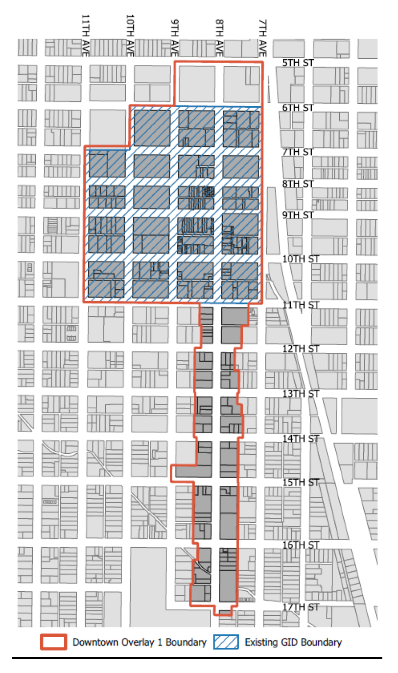
c.
District regulations. Land in the Downtown Overlay 1 is subject to the following:
1.
Uses are exempt from providing off-street parking for automobiles otherwise required by the Development Code. Bicycle parking is required at the rate required of the subject uses. Any automobile or bicycle parking provided must meet Development Code standards for allowable dimensions, locations, design, ADA accessibility, access, lighting, landscaping, setbacks, and other applicable standards.
2.
Development within this overlay is exempt from all limits on density, maximum number of dwelling units, building height, and minimum setbacks.
3.
For nonresidential and mixed-use development, Frontage A (Table 24-6-5) is preferred. For residential development, Terrace Frontage (Table 24-5-7) is preferred. Other frontage types may be approved subject to the director of community development's approval of an alternative compliance request.
4.
Development within the overlay is exempt from providing on-site open space otherwise required in the Development Code. Right-of-way landscaping is required in accordance with Development Code standards. Any open space provided must meet applicable lot open space design standards and landscaping standards.
(Ord. No. 20, 2025, § 3, 6-17-2025)
Editor's note— Ord. No. 20, 2025, § 3, adopted June 17, 2025, repealed § 24-1005 and enacted a new § 24-1005 as set out herein. Former § 24-1005 pertained to General Improvement District and derived from Ord. No. 36, 2021, § 5(app. A, § 5), adopted September 21, 2021.
_____
Sec. 24-1006. - Redevelopment district overlay.
a.
Intent. The intent of this section is to apply alternative standards for the use and development of land and to allow additional discretion via the application of alternative compliance within the redevelopment district. The specific intent is to:
1.
Remove unnecessary barriers to infill development where it reflects the development pattern and scale of a particular district, area or block.
2.
Ensure complimentary development where the purposes of this code and the intent or design objectives can be met by alternative designs.
3.
Provide equivalent standards in a creative way based on a more specific analysis of a site or building, and not modify or reduce requirements of the building or zoning codes.
b.
Applicability. The provisions of this section shall apply to all land located within the redevelopment district, which is all land located within the boundaries of the urban renewal area of the city, as it may be amended from time to time by the city council.
c.
Redevelopment district performance options.
(Ord. No. 36, 2021, § 5(app. A, § 5), 9-21-2021)
Sec. 24-1007. - Character overlay districts.
a.
Intent. The intent of this section is to provide criteria and procedures for the creation of character overlay districts. Generally, overlay districts are used to either create distinctions within a single zoning district, separating areas with distinct characteristics based on a particular context, or blend portions of multiple zoning districts, combining areas with similar characteristics based on a particular context. The specific purpose of this section is to:
1.
Maintain and preserve unique attributes that make up the character of a particular area;
2.
Promote investments that reinforce compatible development patterns, site or landscape design, or architectural characteristics in a definable area.
3.
Promote elements of the comprehensive plan and allow a broader mix of buildings or uses in a specific area based on a broader analysis or plan common urban design attributes throughout the area.
Character overlay districts are not intended to substitute for or take the place of a Historic Preservation District, nor shall it be used to prevent the demolition of any structure.
b.
Applicability. Character overlay districts are a specific form of rezoning and shall follow all procedures for rezoning property included in section 24-204. In addition, any character overlay district initiated by property owners of the district shall include the following:
1.
Name and area. The proposed specific name of the character overlay district and as specific and defined boundary on a map drawn to scale. Where lot lines exist, the boundaries shall follow established lot lines, and otherwise follow the centerlines of rights-of-way, watercourses, or other geographic boundaries. The district shall generally not be less than a block face.
2.
Petition. A petition shall be signed by at least 51 percent of the property owners, both by number of property owners and by area within the district. Evidence shall be provided to show that all property owners were made aware of the application and had the opportunity to participate in the petition. A city-initiated character overlay district is not subject to this requirement, but it may be used as criteria in considering the approval.
3.
Characteristics and standards. A statement or analysis of the justification of the overlay district shall be provided, whether separating the area from similarly zoned property or blending the area of differently zoned property, or both. The statement shall identify the unique attributes of the area, or where established to permit new development define the desired unique attributes for future development. This statement shall be supported by the specific standards applicable in the overlay, which are different from the applicable base zoning district standards, which may include the following:
(a)
Distinct development standards, including lot size, building location, and building dimensions.
(b)
Specific site design standards, including parking, landscape, open space or sign standards.
(c)
Specific building design standards, including frontages, building scale and massing, and façade design or materials, or other architecture details.
(d)
Additions or specific limitations or conditions on uses, including justification of why these additions or limitations are more compatible with the area than the base zoning district use standards.
(e)
A clear delineation of any sub-areas within the district where transitions exist or changes in the standards apply, whether by area, street type or other physical attribute within the district.
4.
Additional information. Any other information, analysis, plans or documentation that may be required by the director to ensure a complete and comprehensive review of the proposed character overlay district.
c.
Effect of decision. Adoption of a character district overlay shall have the same effect as rezoning property. All future development or redevelopment shall be subject to the base zoning district standards, as modified specifically by the character overlay district. The district shall be designated on the official zoning ordinance, and noted in section 24-1007.d, and specific plans, standards, guidelines and procedures for the district may be referenced as an appendix to this code. Any changes to a character overlay district shall only be made through the same procedures establishing the district.
d.
Specific districts. The following character overlay districts have been established through the applicable procedures of this code. Each district may be supported by additional documents in an appendix to this code or otherwise referenced and incorporated.
1.
Northeast Greeley Mercado District.
(a)
Advisory board. There is hereby established a Northeast Greeley Mercado District Advisory Board, the purpose of which is to review and comment to other city boards and the city council concerning area development proposals and related matters as it relates to the objectives of the voluntary architectural and development design guidelines as described in the Mercado del Norte Plan dated May 2001.
(b)
Board members. The Northeast Greeley Mercado District Advisory Board shall be comprised of seven members as provided by this section. Three members shall represent residential land owners; three members shall represent business interests; and one member shall represent at-large interests of the area. A majority of the members shall be landowners of property within the designated Mercado District boundaries.
(Ord. No. 36, 2021, § 5(app. A, § 5), 9-21-2021)
Sec. 24-1008. - Entertainment districts.
a.
Intent. The intent of this section is to authorize the creation of an entertainment district within which, through its local licensing authority, the city may allow the establishment of common consumption areas as provided for in C.R.S. § 44-3-301(11).
b.
Applicability. The provisions herein shall apply to all land designated as an entertainment district of a size no more than 100 acres and containing at least 20,000 square feet of premises licensed as a tavern, hotel and restaurant, brew pub or vintner's restaurant at the time the district is created. The following specific districts are hereby created:
1.
Downtown entertainment district. The downtown entertainment district shall include area within the south curb flow line of 7th Street, the west curb flow line of 8th Avenue, the north curb flow line of 10th Street and the east curb flow line of 9th Avenue. In addition to compliance with all aspects of this section, any promotional association created to manage common consumption areas within the downtown entertainment district shall include an official representative of the downtown development authority as a director of any promotional associations which may be authorized therein by the local licensing authority.
c.
General provisions.
1.
Entertainment districts may be established by the city from time to time as determined to be in the best interest of the public and the specific geographic area to be served, subject to demonstration that the proposed district is consistent with the definition and purpose of an entertainment district contained in this section.
2.
Common consumption areas shall be approved by the local licensing authority, consistent with its authority provided in chapter 13 of title 8 of this Code, provided the local licensing authority finds that, in addition to finding that the applicable requirements of title 8, chapter 13 have been met, all of the following conditions are met:
(a)
The size of the common consumption area is contained wholly within an entertainment district as set forth in this section;
(b)
The area is clearly delineated using physical barriers to close the area to motor vehicle traffic and limit pedestrian access;
(c)
The promotional association governing the common consumption area has obtained and maintained at all times a properly endorsed general liability and liquor liability insurance policy acceptable to the local licensing authority of at least $1,000,000.00 per incident and names the city as an additional insured.
(d)
The promotional association has provided security deemed sufficient by the local licensing authority to assure compliance with the liquor code and limit safety risks to the neighborhood and the general public patronizing the entertainment district. All security within the common consumption area or its attached licensed premises shall complete the state server and seller training program and be approved by the chief of police.
(e)
The promotional association has met the conditions further listed under section 8-492.
(Ord. No. 36, 2021, § 5(app. A, § 5), 9-21-2021)
Sec. 24-1009. - Hillside development standards.
a.
Intent. This intent of this section is to:
1.
Specify the conditions under which development may take place in hillside areas;
2.
Protect the aesthetic, geologic and ecological function of natural feature, including ridge lines, bluffs, rock outcroppings, natural drainage ways and other geologic conditions;
3.
Ensure that development minimizes the removal of existing vegetation and natural features and avoids geologic conditions which may pose a threat to life and property.
b.
Applicability. This section is applicable to all development which contains existing natural slopes greater than 15 percent.
c.
Development and design standards.
1.
Lot size.
2.
Site grading.
(a)
Grading shall be limited to only what is necessary to construct buildings, drives and usable open space. Any allowed grading shall be designed to conserve natural topographic features and appearances by sculpting the land to blend graded slopes and benches with natural topography and retain major natural topographic features, including natural drainage courses and existing vegetation.
(b)
Cuts and fills shall be limited to the extent necessary; and in no event shall cuts and fills occur in areas with slopes in excess of 25 percent, nor disturb more than 75 percent of the area of a lot or site without approval of a variance by the zoning board of appeals.
(c)
All graded areas shall be protected from wind and water erosion through the use of acceptable slope stabilization methods such as planting, retaining walls, or netting.
(d)
Construction equipment and stockpiled soils shall be stored in areas which are to be disturbed during construction, including driveway pad locations and previously disturbed street cuts.
3.
Building siting.
(a)
Buildings shall be sited so that existing land forms serve as backdrops to the buildings rather than using the sky as a backdrop, and shall be designed to fit the site rather than modifying the site to fit the proposed buildings.
(b)
Retaining walls shall be permitted as long as they are not in excess of six feet above final grade. Multiple parallel retaining walls shall be designed to be part of a tiered or terraced retaining wall system.
(c)
If a site has unique geological features, such as rock outcroppings or cliff faces, special care shall be taken to design the buildings for the site so that such site features are preserved.
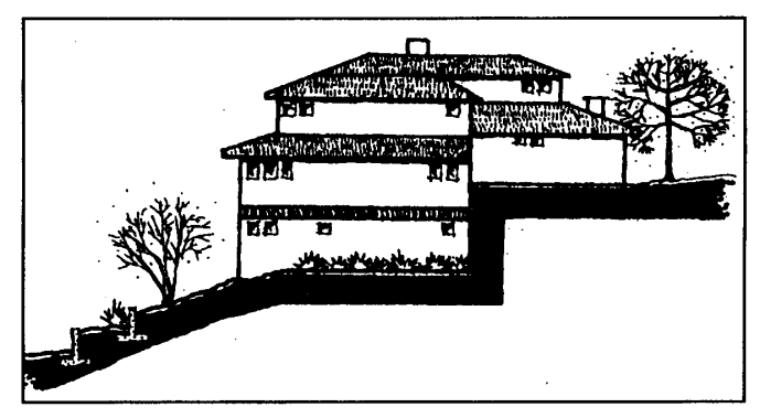
Figure 24-10-2: Building designed to fit site.
4.
Building height.
(a)
The maximum height of a proposed building or structure shall not exceed the mid-point of the tallest building or structure on the adjacent uphill lot. If more than one lot meets the definition of adjacent uphill lot, the measurements required shall be made against the lower lot.
(b)
The maximum height of a proposed structure on a lot which has no adjacent uphill lot shall be as established in the zoning district in which the lot is located.
(c)
No building shall exceed that allowed in the underlying zoning district, nor be limited to less than a single-story structure.
5.
Architecture. Buildings and structures shall be designed to be compatible with the natural surroundings of the area and shall not dominate the natural environment using the following techniques:
(a)
Exterior finishes shall blend in with the natural surroundings by using earth-tone colors and avoiding reflective materials or finishes.
(b)
Varying setbacks, roof lines, innovative building techniques and building and wall forms which blend buildings into the terrain shall be used.
(c)
Building design shall enhance the site's natural features through the use of split level designs and stepped foundations which mirror the slope of a hillside.
(d)
Roof lines shall be broken into smaller components to reflect the irregular natural hillside patterns and shall be oriented in the same direction of the slope contour.
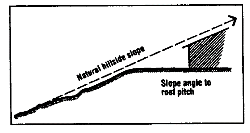
Figure 24-10-3: Roof pitch reflects hillside slope.
6.
Landscape design.
(a)
Buildings shall be sited to incorporate existing vegetation into the site design to preserve the natural hillside image and character of the area.
(b)
Existing vegetation shall be retained wherever possible and shall be used to soften structural mass and help blend buildings into the natural setting. Where vegetation is removed for other than fire safety reasons, replacement of the same or compatible plant material elsewhere on the site shall be required in an equal amount based on the number of plants removed.
(c)
All exposed slopes and graded areas shall be landscaped with ground cover, shrubs and trees, and cuts and fills shall be designed to limit the impact upon existing vegetation on the site.
7.
Street and driveway design.
(a)
Streets shall be designed to follow existing contours, minimizing grading and erosion potential while providing adequate access for vehicles, including emergency service vehicles.
(b)
The maximum street grade shall not exceed five percent unless otherwise approved by the planning commission as part of the platting process, or as a planned unit development.
(c)
Guest parking shall be provided at the ratio provided in chapter 7 of this title either on-street as parallel parking spaces or in off-street locations which are distributed throughout the area for which the spaces are intended to be used.
(Ord. No. 36, 2021, § 5(app. A, § 5), 9-21-2021)