
Greenville City Zoning Code
ARTICLE 19
7. - STORMWATER MANAGEMENT ARCHIVED
Sec. 19-7.1. - Introduction.
This article is one part of the adopted city comprehensive stormwater management plan. It sets forth the minimum requirements for the stormwater management in the city and sets the city as the corporate enforcement authority for the ordinance. The purpose of this article is to allow management and mitigation of the effects of urbanization on stormwater drainage by consolidating the existing stormwater management framework into a uniform structure. The Greenville comprehensive stormwater management plan, adopted by Resolution on May 29, 2007, states, "… that the regulations be uniformly and consistently enforced throughout the city by all agencies."
(Code 1997, § 19-7.1; Ord. No. 2012-91, exh. A, 11-12-2012)
Sec. 19-7.2. - Authority and purpose.
19-7.2.1.
Authority. The powers granted to the City of Greenville by the authority and directions for this article are contained in Act No. 194 of the Acts and Joint Resolutions of 1971 enacted by the general assembly of the state, approved April 23, 1971. In addition to the statutory authority provided for this division in general, the authority of this article arises from S.C. Code 1976, § 6-29-310 et seq., and is adopted pursuant to S.C. Code 1976, § 48-14-10 et seq., S.C. Code 1976, § 5-7-30, and South Carolina Land Resources Conservation Commission Regulations 72-300 through 72-316, and may be cited as the stormwater management ordinance of the City of Greenville and is adopted pursuant to S.C. Code 1976, § 48-14-10 et
seq., S.C. Code 1976, § 5-7-30, and South Carolina Land Resources Conservation Commission Regulations sections 72-300 through 72-316. The administration and enforcement of this article shall be designated by the city manager in the administrative manual.
19-7.2.2.
Purpose. The purpose of this article is to establish reasonable rules and regulations for stormwater management in order to:
(A)
Prevent additional harm due to periodic flooding, including loss of life and property and threats and inconveniences to public health, safety, welfare, and the environment.
(B)
Ensure that development does not increase flood and drainage hazards to others, or create unstable conditions susceptible to erosion.
(C)
Create no new financial burden on the taxpayer for flood control projects, repairs to flood-damaged public facilities and utilities, and for flood rescue and relief operations.
(D)
Protect, conserve and promote the orderly development while protecting and conserving the land and water resources.
(E)
Protect buildings and improvements to buildings from flood damage to the greatest extent possible.
(F)
Conserve the hydrologic, hydraulic, water quality and other beneficial functions of floodprone areas and regulatory floodplains.
(G)
Prevent additional disruption of the economy and governmental services due to stormwater and flood drainage.
(H)
Maintain eligibility for the City of Greenville in the National Flood Insurance Program by equaling or exceeding its requirements and thus make federally subsidized flood insurance available at reduced rates. Comply with the rules and regulations of the National Flood Insurance Program codified as 44 CFR 59-79, as amended.
(I)
Maintain compliance with the provisions of the current, effective state of South Carolina NPDES General permit for stormwater discharges from regulated small municipal separate storm sewer systems, S.C. Water Pollution Control Regulations 61-9. Comply with the rules and regulations of the NPDES codified as 40 CFR 122-131, as amended.
(J)
Conserve and improve the natural hydrologic, hydraulic, water quality and other beneficial functions of wetlands by having, at a minimum, no net loss of wetlands in the city, of Greenville, and further these beneficial functions of wetlands by having an objective of a net gain or improvement of wetland function.
(Code 1997, § 19-7.2; Ord. No. 2012-91, exh. A, 11-12-2012)
Sec. 19-7.3. - Ordinance enforcement.
19-7.3.1.
Duties. One of the primary duties of the administrator or designee shall be to review all stormwater applications and issue permits for those projects that are in compliance with the provisions of this article. The administrator or designee shall be responsible for the administration and enforcement of this article.
19-7.3.2.
Intergovernmental relationship. Included as part of this article as appendix E is a delineation of requirements and duties required of and accepted by the administrator or designee. Certain requirements or duties specified by FEMA and the South Carolina Department of Health and Environmental Control (SCDHEC) in appendix E relate only to the intergovernmental relationship between a community and FEMA, the South Carolina Department of Natural Resources (SCDNR), or SCDHEC for the purposes of that community obtaining or maintaining eligibility for the National Flood Insurance Program (NFIP) and Qualified Local Program Status.
(Code 1997, § 19-7.3; Ord. No. 2012-91, exh. A, 11-12-2012)
Sec. 19-7.4. - Stormwater management utility.
19-7.4.1.
Council findings. The city council has made the following findings:
(A)
The management and regulation of stormwater runoff and sediment is necessary to reduce pollution, siltation, sedimentation, local flooding and stream channel erosion, all of which impact adversely on land and water resources and the health, safety, property and welfare of the residents of the city;
(B)
The city maintains a system of stormwater management facilities, including, but not limited to, inlets, conduits, manholes, outlets, ponds, and certain drainage easements;
(C)
The stormwater management facilities and components of the city need to be regularly maintained, rehabilitated, upgraded or improved, and additional stormwater management facilities and measures need to be installed throughout the city;
(D)
The city needs to upgrade its capability to maintain existing and future stormwater management facilities and measures;
(E)
All parcels of real property in the city, particularly those with improvements, both use or benefit from the stormwater management system and program, and the improvement of existing facilities and construction of additional facilities in the system, will directly or indirectly benefit the owners of all real estate;
(F)
Continued growth in the city will contribute to the need for improvements in and maintenance and regulation of the stormwater management system;
(G)
The city can best manage and regulate the control of stormwater by a policy which regulates the use of real property, both private and public, and which takes reasoned, measured steps to involve the city in additional methods of participation and regulation;
(H)
Owners of real property should finance the stormwater management system to the extent they and the persons they permit to utilize their property contribute to the need for the system, and fees or other charges therefore should bear a substantial relationship to the cost of the service; and
(I)
It is in the best interests of the citizens of this city and, most specifically, the owners of real property, that a stormwater management utility and stormwater management utility fee system be established by ordinance and implemented as part of the city's utility special revenue fund, by whatever name designated.
19-7.4.2.
Title of division; statutory authority. This article may be cited as the "Stormwater Management Ordinance of the City of Greenville" and is adopted pursuant to S.C. Code 1976, § 48-14-10 et seq., S.C. Code 1976, § 5-7-30, and South Carolina Land Resources Conservation Commission Regulations 72-300 through 72-316.
19-7.4.3.
Stormwater management utility established; administration; powers and duties. The city council hereby establishes a stormwater management utility to carry out the purposes, functions and responsibilities set forth in this article. The governing body of the stormwater management utility shall be the city council. The administrator shall administer the stormwater management utility through the public works department or such other departments and divisions as the city manager shall designate. The stormwater management utility shall have the following powers and duties, which powers and duties are not necessarily exclusive to the stormwater management utility:
(A)
Stormwater management planning and preparation of comprehensive watershed master plans for stormwater management.
(B)
Regular inspections and maintenance of public stormwater management facilities and measures for the construction thereof, as well as regular inspections of private stormwater management facilities.
(C)
Maintenance and improvements of stormwater management facilities that have been accepted by the city for purposes of stormwater management.
(D)
Plan review and inspection of sediment control and stormwater management plans, measures and practices.
(E)
Retrofitting designated watersheds to reduce existing flooding problems or to improve water quality.
(F)
Acquisition of interests in land, including easements.
(G)
Design and construction of stormwater management facilities and measures and acquisition of equipment.
(H)
Water quantity and water quality management, including monitoring surveillance.
(I)
Any and all powers and duties delegated or granted to it as a local government implementing agency under the laws and regulations of the state and the ordinances of the city.
19-7.4.4.
Boundaries and jurisdiction. The boundaries and jurisdiction of the stormwater management utility shall extend to the corporate limits of the city, as they may exist from time to time, and such areas lying outside the corporate limits of the city as shall be approved by the city council.
19-7.4.5.
Amount and classifications of fees.
(A)
Criteria for establishing fees. The city council hereby establishes the amount and classifications of fees to be implemented to help fund the stormwater management utility and its programs and projects. In establishing such fees, the city council has considered, among other things, the following criteria:
(1)
The fee system must be reasonable and equitable so that users pay to the extent they contribute to the need for the stormwater management utility, and so that fees or other charges bear a substantial relationship to the cost of service. The city council recognizes that these benefits, while substantial, in many cases cannot be measured directly.
(2)
The components of the calculations used to establish fees must include, but may not be limited to, the following cost factors, which may be associated with the resolution of stormwater problems which the stormwater management utility shall seek to alleviate:
(a)
Stormwater management planning and preparation of comprehensive watershed master plans for stormwater management;
(b)
Regular inspection and maintenance of public stormwater management facilities and measures for the construction thereof, as well as regular inspections of private stormwater management facilities;
(c)
Maintenance and improvement of stormwater management facilities that have been accepted by the city for purposes of stormwater management;
(d)
Plan review and inspection of sediment control and stormwater management plans, measures and practices;
(e)
Retrofitting designed watersheds to reduce existing flooding problems or to improve water quality;
(f)
Acquisition of interests in land, including easements;
(g)
Design and construction of stormwater management facilities and measures and acquisition of equipment;
(h)
Administration and enforcement;
(i)
Water quantity and water quality management, including monitoring surveillance; and
(j)
Debt service and financing costs.
(3)
The components of the calculations used to establish fees must be based on an equivalent residential unit (ERU), determined and approved by the city council, with reasonable general adjustments being made for, but not limited to, the following factors:
(a)
Commercial, service and industrial land uses other than single-family residential;
(b)
Open and/or forested land;
(c)
Lot or tract size;
(d)
The amount of site that is impervious; and
(e)
Other generally accepted factors relevant to such calculations based upon the provisions of this article.
(4)
The practical difficulties and limitations related to establishing, calculating and administering such fees should be addressed with due regard for fairness, efficiency, ease of comprehension, and ease of administration.
(B)
Fee structure. Stormwater management utility fees shall be fixed from time to time by the city council and are set forth in the fee schedule in appendix D to this article. Fee categories are as follows:
(1)
Developed residential property. The fee structure for each parcel of developed residential property shall be allocated between two categories based on size of impervious area:
(a)
Developed residential properties with an impervious area of 1,640 square feet or less; and
(b)
Developed residential properties with an impervious area greater than 1,640 square feet.
(2)
Undeveloped residential property.
(3)
Developed commercial/industrial property.
(4)
Undeveloped commercial/industrial property.
(C)
Credits/fee reduction. The city may provide a system of adjustments against stormwater management utility fees which can be applied to properties on which stormwater management facility construction, or other comparable provisions of construction or design of the premises, substantially mitigates the effect of stormwater runoff from the property on the city's stormwater management system or materially reduces the cost for the city to provide a system of stormwater management. To view a copy of the stormwater utility fee credit policy, contact the city's engineering division.
19-7.4.6.
Determination of amount of impervious area. The administrator or designee will determine the amount of impervious area on each developed commercial/industrial property. A determination will be made using information derived from digital and other photographic data, as maintained by the administrator or designee, commonly designated as Geographic Information System (GIS) Data, and such additional information, if available, as may reliably supplement such data. Upon written request, an owner, or lawful occupant obligated to the owner for payment of the fee, shall be provided a written determination of the amount of impervious area for which a fee has been established.
(A)
Collection of fees.
(1)
Taxable property. The administrator or designee shall prepare and forward all information necessary to the county tax collector or designee for the purpose of an annual billing of the stormwater management utility fee. Notice of the fee shall be included on the property owner's notice of ad valorem real property taxes, and the fee shall be due and payable simultaneously with the taxes. By resolution, the city council may authorize the city manager to implement other reliable means of billing.
(2)
Nontaxable property. The city council recognizes that nontaxable as well as taxable properties generate stormwater runoff and benefit from the stormwater management system and that the principle of fairness dictates that such properties be charged. The administrator or designee shall make arrangements for billing for nontaxable property in the same manner as taxable property. By resolution, the city council may authorize the city manager to implement other reliable means of billing.
(3)
Date of imposition of fee for developed properties. Developed properties shall become subject to the imposition of the stormwater management utility fee at the billing cycle following final approval of site development by the city.
(B)
Use of revenue; investment of funds; borrowing. Funds generated for the stormwater management utility from fees, bond issues, other borrowing and other sources shall be utilized only for those purposes for which the stormwater management utility has been established, including, but not limited to, regulation, planning, acquisition of interests in land, including easements, design and construction of facilities, maintenance of the stormwater management system, billing and administration, and water quantity and water quality management, including monitoring, surveillance, private maintenance inspection, construction inspection and other activities which are reasonably required. Such funds shall be invested and reinvested pursuant to the same procedures and practices established by the city for investment and reinvestment of funds. The city council may use any form of borrowing authorized by law to fund capital acquisitions or expenditures for the stormwater management utility. The city council, in its discretion and pursuant to standard budgetary procedures, may supplement such funds with amounts from the general fund.
(C)
Requests for reconsideration; appeals.
(1)
Request for reconsideration.
(a)
A property owner of record, or a lawful occupant obligated to the owner for payment of the fee, may request a reconsideration of any determination or interpretation by the administrator or designee in the operation of the stormwater management utility. Such request must be in writing and filed with the administrator or designee, or such other person as the city manager may designate, within 30 days of receipt of notification of the determination or interpretation.
(b)
The city shall review the application and make a decision on the request within 30 days of receipt of the request.
(c)
The request shall be made upon such forms and be accompanied by such information as the city, by written policy, shall require.
(2)
Appeals.
(a)
Persons who are authorized to make a request and who are aggrieved by a decision of the city under subsection 19-7.4.6(C)(1) shall have the right to appeal to the city manager, or such person, committee or board as he may establish for such purpose.
(b)
The appeal shall be in writing and shall set forth, in detail, the grounds upon which relief is sought. The person designated to review such appeal shall provide a hearing on the appeal within 30 days of filing and render a decision within 60 days of filing.
(c)
The person designated to review such appeal shall have full authority to affirm, modify or reverse a decision being reviewed upon determining whether the decision was made in compliance with the standards, policies and criteria of this division.
(3)
Payment of fee required. No provision of this division allowing for a request for reconsideration or for an administrative appeal shall be deemed to suspend the due date of the fee with payment in full. Any adjustment in the fee for the person pursuing a request for reconsideration or appeal shall be made by refund of the amount due.
19-7.4.7.
Reserved.
(Code 1997, § 19-7.4; Ord. No. 2012-91, exh. A, 11-12-2012)
Sec. 19-7.5. - Stormwater permits.
(A)
Regulated development. No person, firm, corporation or governmental agency shall commence any development regulated by this article on any lot or parcel of land without first obtaining a stormwater permit or a soil erosion and sediment control permit from the city. A permit shall be issued if the proposed development meets the requirements of this article. A final certificate of occupancy will not be issued until the performance standards of this article are met.
(B)
Stormwater permit fee. The administrator shall compile the requirements for the fees in an administrative manual. The manual shall be approved by the city manager and shall be made available to the public. A stormwater permit is required for any development which:
(1)
Disturbs 10,000 square feet or more or is part of a larger common plan;
(2)
Is located in a regulatory floodplain;
(3)
Modifies a riverine floodprone area where the tributary drainage area is greater than 40 acres;
(4)
Modifies a non-riverine floodprone area where the tributary drainage area is greater than 20 acres;
(5)
Is located in a depressional storage area with a storage volume of 0.75 acre-feet or more;
(6)
Impacts a wetland or riparian environment of one-tenth acre or more within an area defined as waters of the U.S. or waters of the state; or
(7)
Is a commercial or multifamily development that abuts and drains to a single-family detached use and includes any of the following:
(a)
Disturbs 50 percent or more of the parcel, regardless of the total area of disturbance; or
(b)
New construction, renovation, or reconstruction of existing structures that exceeds 25 percent of the current fair market value of the property. This shall be based on a market appraisal performed by a certified appraiser at the applicant's expense or shall be determined by the Greenville County Tax Office. This shall not be construed to require demolition of an existing structure in order to comply with these standards. In such cases, the administrator may grant a waiver of the requirements if presented with a certification by a registered architect or engineer that compliance is not practicable on an existing building. These standards shall not apply to routine maintenance and repair of a structure or other feature on the surrounding site.
(C)
Stormwater permit classification. The stormwater permit has been developed such that the level of permitting required matches the scope of work. One of the following permits shall be required:
(1)
Major stormwater permit. A major stormwater permit typically requires detention, stormwater quality and quantity control, preparation of a stormwater pollution prevention plan, and may include additional requirements for activities in special management areas. A major stormwater permit is required when a development:
(a)
Disturbs more than two acres;
(b)
Creates a new impervious surface greater than or equal to 0.25 acres;
(c)
Is located in a regulatory floodplain;
(d)
Modifies a riverine floodprone area where the tributary drainage area is greater than 40 acres;
(e)
Modifies a non-riverine floodprone area where the tributary drainage area is greater than 20 acres;
(f)
Is located in a depressional storage area which has a volume larger than 0.75 acre-foot;
(g)
Impacts a wetland or riparian environment of 1/10 acre or more within an area defined as waters of the U.S. or waters of the state; or
(h)
Public road or trail development that results in one and one-half acres or more of additional impervious surface per mile, for linear or nonlinear projects.
(2)
Minor stormwater permit. A minor stormwater permit typically requires stormwater quality and may include additional requirements for activities in special management areas. A minor stormwater permit is required when a development:
(a)
Disturbs more than one but less than two acres;
(b)
Has a total impervious surface area ratio of 60 percent or greater and disturbs 50 percent or more of the parcel or larger common plan over a five year period; or
(c)
Is a commercial or multifamily development that abuts and drains to a single-family detached use and includes any of the requirements in section 19-7.5(B)(7).
(3)
Soil erosion and sediment control permit. A soil erosion and sediment control permit is required when a development disturbs 10,000 square feet or more but does not meet any of the thresholds listed above. A soil erosion and sediment control permit may include additional requirements for activities in special management areas.
(D)
Larger common plan.
(1)
Larger common plans ultimately disturb 10,000 square feet or more and are defined as the following:
(a)
A construction activity that is completed in separate stages, separate phases, or in combination with other construction activities; or
(b)
Any proposed development activity that occurs on a lot or parcel of land that has contiguous lots or parcels of lands currently or previously owned in whole, or in part, by the same property owner seeking permit coverage, then the criteria as defined in this article will be applied to the total land area compiled from aggregate ownership parcels.
(2)
A larger common plan expires five years after the site is stabilized in compliance with the requirements of this article, all proposed construction causing land-disturbing activities have been completed, and the notice of termination has been submitted and accepted by the state department of health and environmental control. In the case of single family subdivisions permitted after January 1, 2013, the larger common plan remains in effect until all lots are constructed. Water quantity control shall not be required for modifications to these sites provided that the originally permitted curve number aligns with the proposed impervious surfaces. All other requirements of this article shall be met.
(E)
Exempted development. All development shall meet the minimum state, federal and local regulations. Upon review and verification by the administrator or designee, the following are exempt from the subsequent specific ordinance requirements: 19-7.6.1A, 19-7.6.2, 19-7.6.3 (with the exception of the depressional storage requirements), 19-7.7.4, and 19-7.8.
(1)
Agricultural land management and agricultural practices, or the construction of on-farm buildings and structures less than one acre in size used in a farming operation.
(2)
Construction or land improvement of a single-family residence, a duplex dwelling or their accessory structures which are separately built and are not part of a larger common plan.
(3)
Single-family residences or duplex dwellings not part of a larger common plan.
(4)
Single-family residences or duplex dwellings part of a larger common plan that are constructed in compliance with the approved stormwater permit for the larger common plan.
(5)
Maintenance of existing buildings, facilities, parking lot seal coating and resurfacing of roadways when the overall drainage pattern has not been significantly altered and will not cause impact to adjacent properties. The use of coal-tar based pavement sealcoat is prohibited.
(6)
Mining and mineral resource extraction operations conducted in accordance with a valid mining permit issued by the land and waste management division of the South Carolina department of health and environmental control.
(7)
Land-disturbing activities undertaken on forest land for the production and harvesting of timber and timber products regulated by the U.S. Forestry Service.
(8)
Emergency repairs of existing structures and facilities that require ground to be broken. Provided that the repairs are performed in a manner consistent with these regulations to the maximum extent feasible.
(9)
Construction activities of the state department of transportation conforming to the requirements of the latest edition of the South Carolina Standard Specifications for Highway Construction.
(10)
Activities relating to the routine maintenance and/or repair or rebuilding of the tracks, rights-of-way, bridges, communication facilities and any other related structures and facilities of a railroad company.
(11)
Land-disturbing activities that are conducted pursuant to, and are compliant with, another state or federal environmental permit, license or certification in which the state or federal permitting authority supersedes the city's authority as established by local ordinance and regulation.
(12)
Certain activities undertaken by utility providers that are not substantial land-disturbing activities and therefore are not intended to be regulated by this section. Provided that the repairs are performed in a manner consistent with these regulations to the maximum extent feasible. These activities include, but are not limited to, the following:
(a)
Installation of utilities on sites not part of larger common plan and which disturb less than 10,000 square feet.
(b)
Land-disturbing activities conducted pursuant to a federal environmental permit, including permits issued under Section 404 of the Federal Clean Water Act, and including permits issued by the Federal Energy Regulatory Commission.
(c)
Installation of utilities in a ditch section four feet or less in width.
(d)
Installation of utility poles.
(e)
Maintenance of easements and rights-of-way.
(f)
Service connections, i.e., tapping main lines and/or setting meters, including installation of a manhole, bellhole, underground vault, valve box or fire hydrants.
(13)
Projects for which an encroachment permit has been issued by the state department of transportation that are not part of a larger common plan and which disturb less than 10,000 square feet.
(14)
Land-disturbing activities conducted by a utility provider filing environmental reports, assessments or impact statements with the United States Department of Agriculture, Rural Electrification Administration, in regard to a project.
(15)
Any case in which a waiver or variance has been granted for the permit requirements upon a determination that the integrity of this section will not be violated by such action.
(16)
Fence installation, pole placement, drilling or other minor auxiliary construction activity which does not affect stormwater runoff rates, patterns, or volumes.
(17)
Annexation agreements, if the stormwater management systems are installed, functioning and in compliance with all applicable stormwater regulations of the appropriate jurisdictional entity in effect at the time of construction. Water quantity control shall not be required for modifications to the site provided that the originally permitted curve number aligns with the proposed impervious surfaces. All other requirements of this article shall be met.
(18)
Stormwater permits approved prior to January 1, 2008, if the stormwater management systems are installed and in general compliance with all applicable stormwater regulations then in effect.
(F)
Permit extensions and terminations. Among the causes for terminating a permit during its term or for denying a permit extension include, but are not limited to, the following:
(1)
Noncompliance with any condition of the permit; or
(2)
The permittee's failure to disclose fully all relevant facts in the application process or the permittee's misrepresentation of any relevant facts at any time; or
(3)
If the authorized work is not commenced within one year after issuance of the permit, or if the authorized work is suspended or abandoned for a period of 12 months after the time of commencing the work, unless an extension has been granted in writing by the administrator or designee. The extension should be requested of the administrator or designee in writing 30 days prior to the termination of the stormwater permit.
(Code 1997, § 19-7.5; Ord. No. 2012-91, exh. A, 11-12-2012; Ord. No. 2013-58, exh. A(19-7.5), 9-9-2013; Ord. No. 2017-15, 2-13-2017; Ord. No. 2021-52, Exh. A, 7-12-2021)
Sec. 19-7.6. - All development.
The following performance standards, application requirements and other provisions apply to all development requiring a stormwater permit. All the following application requirements shall be submitted when applicable to the development as determined by the administrator or designee. Subsequent sections include additional provisions for development in special management areas.
19-7.6.1.
Soil erosion and sediment control permit.
(A)
Application requirements. The following requirements shall apply, at a minimum, for all development requiring a soil erosion and sediment control permit.
(1)
A soil erosion and sediment control permit and plans must be prepared, signed, and sealed by a professional engineer, Tier B land surveyor, architect or landscape architect. The person preparing the plans must have professional competence in the area of soil erosion and sediment. All licensees must be of the state.
(2)
A completed soil erosion and sediment control permit application signed by the applicant.
(3)
A report to include:
(a)
A written narrative description of the proposed phasing (construction sequencing) of development of the site, including stripping and clearing, rough grading and construction, and final grading and landscaping. Phasing should identify the expected date on which clearing will begin, the estimated duration of exposure of cleared areas, and the sequence of installation of temporary sediment control measures (including perimeter controls), clearing and grading, installation of temporary soil stabilization measures, installation of storm drainage, paving streets and parking areas, final grading, establishment of permanent vegetative cover, and the removal of temporary measures. It shall be the responsibility of the applicant to notify the administrator or designee of any significant changes that occur in the site development schedule after the initial soil erosion and sediment control plan has been approved.
(b)
A general description of the existing and proposed stormwater management system, including all discharge points, collection, conveyance, and storage facilities.
(c)
Supporting maps to include a FIRMette, USGS quadrangle map, and NRCS soils map.
(d)
A vicinity map identifying the parcel identification numbers of all parcels comprising the proposed development.
(e)
A capacity analysis of the stormwater management system components on-site. An off-site downstream capacity analysis may be required by the administrator or designee when downstream flooding exists.
(f)
Design calculations for sediment and erosion control measures with the drainage area tributary to each sediment control measure delineated on an overall map.
(g)
Description of off-site fill or borrow volumes, locations, and methods of stabilization.
(h)
A color coded map depicting the existing impervious surfaces and total new impervious surfaces along with a summary table.
(i)
Any federal, state and local requirements, including, but not limited to, the applicable SCDHEC notice of intent, ACOE nationwide permit, FEMA letters of map change, jurisdictional wetland determination and endangered species permitting. Reference appendix F for a partial list of additional permits that may be applicable.
(4)
A soil erosion and sediment control plan showing all measures appropriate for the development as approved by the administrator or designee, to meet the objectives of this article throughout all phases of construction and permanently after completion of development of the site. Guidance regarding appropriate methods, procedures, controls measures, and implementation will be provided in the stormwater technical reference manual, but shall, at a minimum, include:
(a)
Proposed and existing elevations tied to the North American Vertical Datum of 1988. Horizontal datum survey control shall be South Carolina State Plane NAD83 HARN International Feet coordinates.
(b)
Off-site and on-site drainage features, overland flow paths, stormwater management system components.
(c)
Existing and proposed utilities which may include septic systems and wells.
(d)
Regulatory floodplains, wetland boundaries, buffer areas.
(e)
Location and description, including standard details, of all sediment control measures, including, but not limited to, construction entrance, silt fence, inlet protection, dust control, stockpile areas management, concrete washout areas, and sediment basins/traps and corresponding outlet details.
(f)
Location and description of all soil stabilization and erosion control measures, including seeding mixtures and rates, types of sod or vegetation, method of seedbed preparation, expected seeding dates, type and rate of lime and fertilizer application, kind and quantity of mulching for both temporary and permanent vegetative control measures, and types of non-vegetative stabilization measures.
(g)
Phased soil erosion and sediment control plans as required to meet the requirements of this article and to mitigate off-site soil migration and erosion throughout construction.
(h)
Adjoining lakes, streams, and other major drainage ways.
(5)
Stormwater Pollution Prevention Plan (SWPPP) that complies with the technical requirements of the effective NPDES General Permit for Storm Water Discharges from Construction Activities (SCR100000) and the Stormwater Technical Reference Manual, for sites that disturb one acre or more.
(6)
Other items as specified on the application form.
(B)
Performance standards. Soil erosion and sediment control related measures are required to be constructed and maintained for any land-disturbance activity permitted under section 19-7.5. In addition, the following requirements shall be met:
(1)
Soil disturbance shall be conducted in such a manner as to minimize erosion. Areas of the development site that are not to be graded shall be protected from construction traffic or other disturbance until final seeding is performed. Soil stabilization measures shall consider the time of year, site conditions and the use of temporary and/or permanent measures.
(2)
Properties and channels adjoining development sites shall be protected from erosion and sedimentation. At points where concentrated flow leaves a development site, energy dissipation devices shall be placed at discharge locations and along the length of any outfall channel as necessary to provide a non-erosive velocity of flow from the structure to the watercourse so that the natural physical and biological characteristics and functions are maintained and protected.
(3)
Soil erosion and sediment control features shall be constructed prior to the commencement of disturbance of upland areas.
(4)
Disturbed areas shall be stabilized with temporary or permanent measures within 14 calendar days following the end of active disturbance, or re-disturbance, consistent with the following criteria or using an appropriate measure as approved by the administrator or designee:
(a)
Appropriate temporary or permanent stabilization measures shall include seeding, mulching, sodding, and/or non-vegetative measures.
(b)
Areas or embankments having slopes greater than or equal to 3H:1V shall be stabilized with staked in place sod, mat, flexible growth medium or blanket in combination with seeding. Slopes with less than four-foot vertical rise shall not be required to meet the requirements of this subsection.
(c)
The 14-day stabilization requirement may be precluded where stabilization by the 14th day is prevented by snow cover or frozen ground conditions, in which case stabilization measures must be initiated as soon as practicable.
(d)
The site shall be considered permanently stabilized when all surface disturbing activities are complete and either of the two following criteria is met:
1.
A uniform (e.g., evenly disturbed, without large bare areas) perennial vegetative cover with a density of 70 percent per square yard of the native background vegetative cover for the area has been established on all unpaved areas and areas not covered by permanent structures; or
2.
Equivalent permanent stabilization measures (such as riprap, gabions, or geotextiles) have been employed.
(5)
Land-disturbance activities in streams shall be avoided, where possible. If disturbance activities are unavoidable, the following requirements shall be met:
(a)
Approved permits from the ACOE will be submitted to the administrator or designee.
(b)
Where stream construction crossings are necessary, temporary crossings shall be constructed of non-erosive material.
(c)
The time and area of disturbance of a stream shall be kept to a minimum. The stream, including bed and banks, shall be re-stabilized as soon as possible and ideally within 72 hours after channel disturbance is completed or interrupted.
(6)
Soil erosion and sediment control measures shall be appropriate with regard to the amount of tributary drainage area as follows:
(a)
Disturbed areas draining greater than 1,000 square feet but less than one acre shall, at a minimum, be protected by a sediment barrier to control all off-site runoff. Sediment barriers may include silt fences meeting the applicable sections of the AASHTO Standard Specification M288 or ASTM Standard Specifications D6461 and D6462 or sediment tubes or other measures providing equivalent sediment control as demonstrated by ASTM D7351.
(b)
Disturbed areas draining more than one but fewer than five acres shall, at a minimum, be protected by a sediment trap with baffles or equivalent control measure at a point down slope of the disturbed area. Sediment traps shall be sized based on 1,800 cubic feet per acre of contributing area unless the site drains to an impaired waterbody which then requires 3,600 cubic feet per acre.
(c)
Disturbed areas draining more than five acres shall, at a minimum, be protected by a sediment basin with baffles and a surface outlet such as a skimmer, flashboard riser, or approved equal. For construction periods exceeding one year, the one-year sediment load and a sediment removal schedule shall be submitted. If the detention basin for the proposed development condition of the site is used for sediment basin, the above requirements will be explicitly met until the final site stabilization is complete.
(d)
For sites draining greater than five acres, soil erosion and sediment control measures shall, at a minimum, achieve an equivalent removal efficiency of 80 percent for suspended solids or 0.5 ML/L peak settleable solids concentration, whichever is less. The efficiency shall be calculated for disturbed conditions for the ten-year 24-hour design event.
(e)
For sites draining more than five acres, release rates for the two-year and ten-year, 24-hour storm events during construction shall be less than the pre-developed discharge rates.
(7)
All drainage features that are or will be functioning during construction shall be protected by appropriate sediment control measure.
(8)
If dewatering services are used, adjoining properties and discharge locations shall be protected from erosion. Discharges shall be routed through an effective sediment control measure (e.g., sediment trap, sediment basin or other appropriate measure).
(9)
All temporary soil erosion and sediment control measures shall be removed within 30 days after final site stabilization is achieved or after the temporary measures are no longer needed. Trapped sediment shall be properly disposed.
(10)
A stabilized construction entrance consisting of aggregate underlain with nonwoven geotextile (or other appropriate measure) shall be located at any point where traffic will be entering or leaving a construction site to or from a public right-of-way, street, alley or parking area. Any sediment or soil reaching an improved public right-of-way, street, alley or parking area shall be removed by sweeping or vacuuming as accumulations warrant and transported to a controlled sediment disposal area. The administrator or designee may require additional stabilized construction entrance methods.
(11)
Earthen embankments shall be constructed with appropriate stabilization and side slopes no steeper than 3H:1V. Steeper slopes may be constructed with appropriate stabilization as approved by the administrator or designee.
(12)
Stormwater conveyance channels, including ditches, swales, and diversions, and the outlet of all channels and pipes shall be designed and constructed to withstand, at a minimum, the expected flow velocity from the ten-year frequency storm with minimal erosion. All constructed or modified channels shall be stabilized as soon as possible and no longer than 72 hours from disturbance.
(13)
Temporary diversions shall be constructed as needed during construction to protect areas from upslope runoff and/or to divert sediment laden water to appropriate traps or stable outlets.
(14)
Soil stockpiles shall not be located in a floodprone area or a designated buffer protecting waters of the United States or waters of the state. Soil stockpiles are defined as having greater than 100 cubic yards of soil and will remain in place for more than seven days. Soil stockpile locations shall be shown on the soil erosion and sediment control plan and shall have the appropriate measures installed at all times to prevent erosion of the stockpile.
(15)
Handbooks. Standards and specifications contained in The SCDHEC stormwater management BMP field manual and the stormwater technical reference manual, as amended, are referenced in this article as guidance for presenting soil erosion and sediment control plan specifications and delineating procedures and methods of operation under site development for soil erosion and sediment control. In the event of conflict between provisions of said manuals and this article, the stricter shall govern.
(16)
The applicant shall provide adequate receptacles for the deposition of all construction material debris generated during the development process. The applicant shall not cause or permit the dumping, depositing, dropping, throwing, discarding or leaving of construction material debris upon or into any development site, channel, waters of the United States or waters of the state.
(17)
Soil erosion and sediment control measures and stormwater management systems shall be functional before construction begins. Where development of a site is to proceed in phases, the soil erosion and sediment control measures and the stormwater management systems needed for each phase shall be functional before the construction of that phase begins.
(C)
Erosion control inspection program standards.
(1)
Inspections must be conducted on all sites greater than one acre by qualified personnel as defined by SCDHEC.
(2)
An independent, third party erosion control inspector, hired by the applicant, is required for all development that exceeds ten acres of hydrologic disturbance or exceeds one acre of hydrologic disturbance and has a regulatory floodplain, waters of the United States or waters of the state on-site or on adjoining property.
(3)
Section 19-7.10 contains inspection requirements for any development meeting the above threshold.
(4)
The applicant shall submit the name of the erosion control inspector to the administrator or designee at or before the pre-construction meeting or commencement of disturbance for the development.
(5)
The administrator or designee shall be notified of a permanent change in the erosion control inspector within 14 days of the change.
19-7.6.2.
Minor stormwater permit. In addition to the above requirements, the following requirements shall apply, at a minimum, for all development requiring a minor stormwater permit:
(A)
Application requirements.
(1)
A minor stormwater permit and plans must be prepared, signed, and sealed by a professional engineer, Tier B land surveyor, or landscape architect for projects that meet the standards of subsection 19-7.5(C)(2)(a) and subsection 19-7.5(C)(2)(b). All licensees must be of the state.
(2)
A completed minor stormwater permit application signed by the applicant.
(3)
A report to include:
(a)
Stormwater measures sized and located in accordance with the City of Greenville Guidelines for Green Infrastructure and Low Impact Development unless addressed in part (e) below.
(b)
An exhibit for review which displays all deed or plat restrictions of record or to be recorded for the stormwater management system.
(c)
Drainage map identifying contributing areas to each stormwater control measure.
(d)
Fully executed maintenance agreement and plan for all post construction stormwater control measures and facilities.
(e)
If the proposed stormwater measures are not in accordance with the City of Greenville Guidelines for Green Infrastructure and Low Impact Development, the report must include:
(1)
A general description of the proposed water quality stormwater control measures.
(2)
Calculations verifying that the proposed LID or water quality stormwater control measures meet the treatment requirements as specified in the article.
(3)
Calculations verifying that the stormwater control measure has the appropriate total flow rate for which the associated pipe network has been designed. Total flow rate includes treated flow and bypass flow.
(4)
Supporting documentation for method used to meet 50-percent hydrocarbon removal.
(4)
Minor stormwater permit plans shall show, at a minimum:
(a)
A survey grade topographic map of the existing conditions of the development site showing the location of all roads, all drainage ways, the boundaries of predominate soil types, the boundaries of predominate vegetation, and the location of any drainage easements, detention or retention basins, including their inflow and outflow structures, if any. The map shall also include the location, size, and flow line elevations of all existing storm and other utility lines within the site. The map shall be prepared using a two-foot or less contour interval and shall be prepared at an appropriate scale for the type of project and shall include specifications and dimensions of any proposed stream channel modifications, location and orientation of cross-sections, if any, north arrow, and a graphic or numerical scale.
(b)
The location and details of proposed LID and water quality devices.
(5)
Other items as specified on the application form.
(B)
Performance standards. Water quality treatment is typically required for minor stormwater permits.
(1)
Water quality treatment is required when either:
(a)
The proposed development has a total impervious surface area ratio of 60 percent or greater and disturbs 50 percent or more of the parcel or larger common plan over a five year period; or
(b)
The proposed development creates a new impervious surface greater than or equal to 0.25 acres.
(2)
For those developments requiring water quality treatment, the following shall be met:
(a)
Water quality treatment shall be provided prior to discharging to waters of the United States or adjoining properties.
(b)
For developments disturbing 50 percent or more of the parcel, the water quality volume referenced below shall be over the entire parcel.
(c)
For developments disturbing 50 percent or more of the larger common plan over a five year period, the water quality volume referenced below shall be over the entire larger common plan.
(d)
For those developments adding more than 0.25 acres of new impervious, the water quality referenced below shall be over the entire disturbed area.
(e)
For dry detention, water quality treatment shall be provided for a volume equal to the first inch over the required treatment area as specified above with a release rate over a 24-hour period.
(f)
For alternate water quality methods (i.e., mechanical water quality), water quality treatment shall be provided for a volume equal to the first inch over the required treatment area as specified above.
(g)
For wet detention, water quality treatment shall be provided for a volume equal to 0.5 inches of runoff over the required treatment area as specified above with a release rate over a 24-hour period. A littoral zone shall be established for water quality treatment to enhance treatment effectiveness.
(h)
For permanent infiltration trenches, water quality treatment shall be provided for a volume equal to the first inch of runoff from all impervious surfaces. Infiltration trenches shall be designed to completely drain of water within 72 hours. Soil must have adequate permeability to allow water to infiltrate; infiltration practices are limited to soils having an infiltration rate of at least 0.30 inches per hour.
(i)
For those sites using alternate water quality methods that treat water quality based on a flow rate, the treated flow rate shall be determined using the method for computing peak discharge for a water quality storm (adapted from Clayton and Schueler, 1996). This methodology relies on the volume of runoff computed using the Small Storm Hydrology Method (Pitt, 1994) and utilizes the NRCS, TR-55 Graphical Peak Discharge Method (USDA, 1986). A sample methodology is presented in the stormwater technical reference manual.
(j)
Hydrocarbon (e.g., oil and grease) removal technology shall be required for all areas accepting flow from parking/loading areas, and vehicle drive surfaces (e.g., roadways and driveways). The volume for hydrocarbon removal shall be based on 0.5 inch over the impervious surfaces described above to each treatment device. The hydrocarbon removal rate shall be a minimum 50 percent. The volume for hydrocarbon removal shall not be in addition to those volumes calculated in subsections 19-7.6.2(B)(2)(b) through (d), provided the method of treatment provides a hydrocarbon removal rate of 50 percent.
(k)
Waters of the state and waters of the U.S. shall not be used for permanent or temporary placement of water quality treatment devices.
(3)
If the project does not meet the standards of subsection 19-7.5(C)(2)(a) and subsection 19-7.5(C)(2)(b), stormwater control measures may be sized and located in accordance with the City of Greenville Guidelines for Green Infrastructure and Low Impact Development for the contributing areas that drain to a single-family detached use.
19-7.6.3.
Major stormwater permit. In addition to the above requirements, the following requirements shall apply at a minimum for all development requiring a major stormwater permit:
(A)
Application requirements.
(1)
A major stormwater permit and plans must be prepared, signed, and sealed by a professional engineer registered in the state of South Carolina.
(2)
A report to include:
(a)
Discharge rate summary tables.
(b)
Pre-development and post-development summary tables to include curve numbers and impervious areas.
(c)
A pre-development drainage area map to include north arrow, graphical and numerical scale, the location of all existing conditions, contours, all drainage ways, flow arrows, watersheds, subwatersheds, runoff characteristic of each, curve number, time of concentration flow path, current aerial photography. The map shall be prepared at an appropriate legible scale for the type of project.
(d)
A post-development drainage area map to include north arrow, graphical and numerical scale, the location of all existing conditions, contours, all drainage ways, flow arrows, watersheds, subwatersheds, runoff characteristic of each, curve number, time of concentration flow path, current aerial photography. The map shall be prepared at an appropriate legible scale for the type of project.
(e)
A report describing the hydrologic and hydraulic analysis performed for the project. The report shall include the name of stream or body of water affected, a jurisdictional determination approved by the U.S. Army Corps of Engineers, a statement of purpose of proposed activity, and a detailed determination of the runoff for the project site under existing and developed conditions. This includes documentation of the design volumes and rates of the proposed runoff for each portion of the watershed tributary to the stormwater management system and receiving channel and high water elevations. Runoff calculations shall include all discharges entering the site from upstream areas.
(f)
For detention facilities, a section in the hydrologic and hydraulic analysis report that includes a plot or tabulation of storage volumes and water surface areas with corresponding water surface elevations, stage-discharge or outlet rating curves, and design hydrographs of inflow and outflow for the two-year, ten-year, 25-year and 100-year, 24-hour storm events under existing and developed conditions.
(g)
A copy of a South Carolina dam safety permit or a letter stating that a dam safety permit is not required if the development includes a dam.
(3)
Major stormwater permit plans shall show, at a minimum:
(a)
Cross-section details for the stormwater management facility showing existing and proposed conditions including principal dimensions of the work, and existing and proposed elevations, normal water and calculated base flood elevations, and overland flow depth and path. The elevations of lowest floor or lowest adjacent grade for structures shall be included on the development plan as applicable.
(b)
All elements necessary to meet the requirements of section 19-7.7, special management area.
(4)
Bonds. The applicant may be required by the administrator to provide a performance bond or sureties or other such adequate security satisfactory to the administrator in an amount deemed sufficient by the administrator to cover all costs of the stormwater management system as minimally necessary to properly manage stormwater and establish permanent stabilization measures as required by the stormwater permit. If such performance bond or sureties or other such adequate security is required, the amount shall be equal to 100 percent for a traditional bond and up to 125 percent for other acceptable sureties or other adequate security. The amount shall be based on the estimated cost to complete construction of the stormwater management system and establish permanent stabilization measures. The estimated probable cost shall be approved by the administrator. Sureties and bonds shall not be duplicated in relation to other bonds or sureties for the same project for the same work. Also, the total surety or bond may be reduced as work is completed and accepted by the administrator.
(5)
The bond shall be in place prior to permit issuance and in place until the permit is closed out.
(6)
As-builts. Upon completion of development, as-builts shall be provided for the stormwater control measures by the engineer of record. As-builts must be prepared by a land surveyor licensed in the state of South Carolina. Horizontal survey datum control shall be based upon, and referenced to, South Carolina State Plane, NAD83 HARN, International Feet coordinates. Vertical survey datum control shall be based upon, and referenced to, the North American Vertical Datum of 1988 (NAVD 88). As-builts shall include calculations showing the as-built volume of compensatory and site-runoff storage. All stormwater control measures and stormwater discharge points from the site will be located with northing and easting. The engineer of record shall submit a statement certifying that the stormwater control measurers were installed per plans. If the volumes or release rates of the stormwater control measures deviate from the approved plans, the engineer of record shall provide updated design calculations.
(B)
Performance standards. Detention is typically required for major stormwater permits.
(1)
Water quantity control is required when the development disturbs more than two acres or creates more than 0.25 acres of new impervious surfaces.
(2)
For those developments requiring water quantity control, the following requirements shall be met:
(a)
Runoff calculations, release rates and discharges.
1.
Design runoff rates shall be calculated using a volume-based hydrograph, such as ICPR, HEC-1, SEDCAD, Hydraflow Hydrographs, etc.
2.
Rainfall data as presented in Appendix G of this article shall be used for rainfall volume, storm distribution, return frequency and event duration.
3.
Watershed specific release rates are tabulated in appendix H of the ordinance from which this article is derived on file in the city's offices. Unless otherwise specified in appendix H, a city-adopted basin plan or floodplain study, the detention volume required shall be calculated using a 24-hour storm event and release rates shall not exceed the two-year, ten-year, and 25-year pre-development release rates.
4.
Adopted basin plans and floodplain studies may be the basis for more specific regulations. These additional or more specific regulations will apply only in the specific study area of the basin plan or floodplain study and supersede those of this article only upon amendment to the stormwater ordinance and formal adoption of the basin plan or floodplain study by the city.
5.
Extreme flood and public safety protection shall be provided by controlling and safely conveying the 100-year, 24-hour storm event such that flood velocities are not exacerbated and flood elevations are not increased to cause damage on adjacent properties.
6.
The design of stormwater management systems shall not result in the inter-basin transfer of drainage, unless no reasonable alternative exists. The administrator or designee may also allow inter-basin transfers if the transfer relieves a known drainage hazard and there is adequate downstream stormwater capacity. In the event of an inter-basin transfer of drainage, detention shall be provided for two-year, ten-year, 25-year and 100-year, 24-hour storm events.
7.
For determination of soil runoff characteristics, areas of the development that are disturbed and compacted shall be changed to that soil types' next highest runoff potential/soil group classification. Conversely, soil groups that are not disturbed will retain their current runoff characteristics.
8.
All concentrated stormwater discharges must be conveyed into an existing drainage outfall, including, but not limited to, pipes and ditches. No new discharges are permitted onto adjacent properties where there was not a discharge point previously, unless a recorded document is received in which the impacted property owner provides permission for such discharge. When the proposed stormwater discharge is near a property line where there is no existing outfall, a level spreader or equal is to be provided in addition to the outfall being situated 20 feet from the property line.
9.
Existing depressional storage volume shall be accounted for when determining the pre-developed runoff from each site. The function of any existing depressional storage shall be hydrologically modeled to determine the existing volume of storage and runoff reduction characteristics. The depressional storage shall be modeled as a pond whose outlet is a weir at an elevation where stormwater currently overflows the depressional storage area. Post-developed release rate for sites with depressional storage shall be for the two-year, ten-year, and 25-year, 24-hour storm events.
(b)
Detention and retention facilities.
1.
All stormwater facilities, when determined applicable by the administrator or designee, shall be provided with:
a.
An emergency overflow structure capable of passing the 100-year, 24-hour storm event without damages to downstream structures or property.
b.
The top of the impounding structure shall be a minimum of one foot above the 100-year, 24-hour storm event peak stage.
c.
Features to facilitate maintenance and emergency ingress and egress capability.
2.
Outlet pipe and orifice diameter shall be designed to prevent clogging and in compliance with the stormwater technical reference manual.
3.
Stormwater infiltration, retention and detention facilities required to meet a development's discharge requirements shall be designed to by-pass off-site tributary flow from streams and channels unless approved by the administrator or designee.
4.
Low impact development measures, bioretention cells, infiltration, and other post-construction practices should be installed only after the drainage area to these practices has been stabilized unless approved by the administrator or designee.
5.
Any development involving the construction, modification or removal of a dam shall obtain from the South Carolina department of health and environmental control a dam safety permit or a letter stating no permit is required. Any permit from the U.S. Army Corps of Engineers is required prior to the start of such activity.
6.
Stormwater retention and detention facilities shall not be constructed in a regulatory floodplain unless approved by the administrator or designee. If a retention or detention facility is constructed in a regulatory floodplain, it shall meet the special management area requirements of this article. The volume of detention storage required to meet the release rate requirements shall be in addition to the floodplain compensatory storage required for the development.
7.
Safety ledges must be constructed on the slopes of all wet detention with a permanent pool greater than three feet deep. Two ledges must be constructed, each four to six feet in width. The first or upper ledge must be located between 1½ feet above the permanent pool level. The second or lower ledge must be located approximately 2.5 feet below the permanent pool level. Alternative safety designs shall be considered by the administrator but the littoral zone requirements shall be met at a minimum.
8.
Underground detention systems must provide the necessary volume through the design life of the structure. A typical design life is recognized as 50 years. The system is to account for lost volume due to sedimentation. The underground detention system is to be designed based on the number of total suspended solids (TSS) that will accumulate in the system over a 50-year design life.
9.
Impounding berms or walls for stormwater retention and detention facilities shall be designed and constructed to withstand all expected forces, including, but not limited to, erosion, pressure and uplift. The applicant shall submit material and compaction design specifications for earthen impoundments and provide as-built information verifying that the constructed condition meets the design requirements. Impounding berms or walls shall be represented on the design plans and signed and sealed by a professional engineer with competency in this area.
10.
On-stream detention.
a.
All on-stream detention shall provide a detention volume safety factor which is equal to one plus 0.05 times the ratio of off-site tributary drainage area to on-site tributary drainage area with a maximum detention volume safety factor of 1.5. The detention volume safety factor applies to the volume of on-stream detention necessary to meet this article's site requirements.
b.
No on-stream detention shall be allowed with an off-site to on-site tributary drainage area ratio greater than 10:1 except for development providing a watershed benefit.
c.
On-stream detention shall not be permissible if the tributary drainage area is greater than 640 acres except for detention that provides a watershed benefit.
d.
The release rate shall not exceed the two-year, ten-year, 25-year and 100-year pre-development release rates of the total tributary drainage area (on-site and off-site). The release rate and on-site detention volume shall be calculated using the 24-hour storm event. This release rate calculation shall be used unless other site conditions warrant more stringent criteria and modification from this standard or unless watershed specific release rates have been adopted.
e.
Impoundment of the stream as part of on-stream detention shall be designed to allow the migration and movement of present, previously present, or potentially present indigenous species, which require access to upstream areas as part of their life cycle. The impoundment shall not cause or contribute to the degradation of water quality or stream aquatic habitat.
f.
No on-stream detention shall be allowed in areas designated as a high quality aquatic resource.
11.
All detention systems shall be located and described within a deed or plat restriction. Detention systems that service a single parcel of property may be excused from this requirement upon approval of the administrator or designee. Modifications to a deed or plat restriction for the detention system shall be approved by the administrator or designee.
(Code 1997, § 19-7.6; Ord. No. 2012-91, exh. A, 11-12-2012; Ord. No. 2013-58, exh. A(19-7.6), 9-9-2013; Ord. No. 2017-15, 2-13-2017; Ord. No. 2021-52, Exh. A, 7-12-2021)
Sec. 19-7.7. - Special management areas.
This article shall apply to all parcels of land that lie either wholly or partially within the jurisdiction of the city.
19-7.7.1.
Regulatory floodplains and regulatory floodways. This article shall apply to all parcels of land that lie either wholly or partially within, or immediately adjacent to, areas of special flood hazard that are within the jurisdiction of the City of Greenville. These areas of special flood hazard are identified by the Department of Homeland Security, Federal Emergency Management Agency (FEMA), National Flood Insurance Program (NFIP), in its flood insurance study, with accompanying maps and other supporting data, which are hereby adopted in appendix C of this article and declared to be a part of this article. Also adopted are any letters of map revision (LOMR) as approved by FEMA. Further, this article shall apply to any areas of special flood hazard established and accepted by the city (city floodplain study) that utilize FEMA NFIP detailed flood study standards (appendix B of this article), or better.
(A)
Location of regulatory floodplain, base flood elevation (BFE) and regulatory floodway.
(1)
The location of the regulatory floodplain and floodway is determined by the more restrictive of:
(a)
Overlaying the FEMA flood insurance rate map (FIRM) floodplain and floodway boundary onto the site.
(b)
Projecting the FEMA flood insurance study (FIS) BFE onto the site topography.
(c)
Projecting the City of Greenville floodplain study BFE onto the site topography and overlaying the City of Greenville floodplain study floodway onto the site.
(2)
In the case of FEMA delineated AH Zones, the elevation noted on the map shall be the BFE. In the case of FEMA delineated AO Zones, the BFE shall be the depth number shown on the map added to the highest adjacent grade, or at least two feet above the highest adjacent grade if no depth number is provided.
(3)
Standards for streams without established base flood elevations and floodways (A Zones):
(a)
For all subdivision proposals containing at least 50 lots or five acres, whichever is less, the applicant shall provide a hydrologic and hydraulic engineering analysis prepared by a professional engineer using FEMA approved methods that generate base flood elevations.
(b)
For all other developments containing less than 50 lots or five acres, when base flood elevation (BFE) data is not available from a federal, state, or other source, one of the following methods may be used to determine a BFE. For further information regarding the methods for determining BFEs listed below, refer to FEMA's manual on managing floodplain development in approximate Zone A areas.
1.
Contour interpolation. Superimpose approximate Zone A boundaries onto a topographic map and estimate a BFE. Add one-half of the contour interval of the topographic map that is used to the BFE.
2.
Data extrapolation. A BFE can be determined if a site within 500 feet upstream of a reach of a stream reach for which a 100-year profile has been computed by detailed methods, and the floodplain and channel bottom slope characteristics are relatively similar to the downstream reaches. No hydraulic structures shall be present.
3.
Hydrologic and hydraulic calculations. Perform hydrologic and hydraulic calculations to determine BFEs using FEMA approved methods and software.
(c)
No encroachments, including fill, new construction, substantial improvements and new development shall be permitted within 100 feet of the stream bank unless certification with supporting technical data by a registered professional engineer is provided demonstrating that such encroachments shall not result in any increase in flood levels during the occurrence of the base flood discharge or a floodway is determined using appropriate FEMA methods.
(4)
Standards for streams with established base flood elevations but without floodways. No encroachments, including fill, new construction, substantial improvements, or other development, shall be permitted unless the following is provided:
(a)
Certification with supporting technical data by a registered professional engineer is provided demonstrating that the cumulative effect of the proposed development, when combined with all other existing and anticipated development, will not increase the water surface elevation of the base flood at any point within the community; or
(b)
An engineering study performed by a registered professional engineer is submitted which will determine a floodway which meets the definition of a regulatory floodway and show that the proposed development will meet the requirements of this article.
(5)
For all X Zones, the BFE shall be determined by a registered professional engineer using a FEMA-approved method. This requirement applies to riverine floodprone areas with greater than 40 acres of tributary drainage area or non-riverine floodprone areas with greater than 20 acres of tributary drainage area. The BFE determination shall be submitted to the city for approval prior to issuance of any permit. BFE determinations shall be based on the critical duration event.
(6)
Nothing contained herein shall prohibit the application of these regulations to land that can be demonstrated by engineering survey to lie within any regulatory floodplain. Conversely, any lands (except for those located in a regulatory floodway) that can be demonstrated by a topographic survey certified by a registered professional engineer or registered land surveyor to lie beyond the regulatory floodplain, and shown, to the satisfaction of the administrator or designee, to have been higher than the BFE as of the effective date of the first floodplain mapping denoting the site to be in a special flood hazard area, shall not be subject to the regulations of this section upon receipt of a letter of map change (LOMC) from FEMA.
(B)
Performance standards applicable to all regulatory floodplain development. The standards of this section apply to all regulatory floodplain development except when superseded by more stringent requirements in the subsequent sections.
(1)
Modification and disturbance of natural riverine regulatory floodplains shall be avoided to protect existing hydrologic and environmental functions. Such disturbances shall be minimized and all negative impacts mitigated as described in a mitigation plan.
(2)
No development shall be allowed in the regulatory floodplain that shall singularly or cumulatively create a damaging or potentially damaging increase in flood heights or velocity or damages or threat to public health, safety and welfare or impair the natural hydrologic or hydraulic functions of the regulatory floodplain or channel.
(3)
For all projects involving stream channel modification, fill, stream maintenance, or levees, the flood-carrying capacity of the regulatory floodplain shall be maintained.
(4)
Zones AH and AO require the identification of adequate drainage paths around structures on slopes, to guide floodwaters around and away from proposed structures.
(5)
Public facilities shall be constructed so as to minimize flood damage.
(6)
Compensatory storage is required for all storage lost or displaced in a regulatory floodplain. Hydraulically equivalent compensatory storage requirements for fill or structures in a riverine regulatory floodplain shall be at least equal to 1.5 times the volume of regulatory floodplain storage lost or displaced. Such compensation areas shall be designed to drain freely and openly to the channel and shall be located opposite or adjacent to fill areas. A deed or plat restriction is required to prohibit any modification to the
compensation area. The regulatory floodplain storage volume lost below the existing ten-year frequency flood elevation must be replaced below the proposed ten-year frequency flood elevation. The regulatory floodplain storage volume lost above the ten-year existing frequency flood elevation must be replaced above the proposed ten-year frequency elevation.
(7)
If the proposed development would result in a change in the mapped regulatory floodplain, regulatory floodway, or the BFE on a site, the applicant shall submit sufficient data to the city and FEMA to obtain the appropriate letter of map change (LOMC). All adjacent property owners, communities, and the state department of natural resources shall be notified prior to any alteration or relocation of a floodplain, and submit copies of such notifications to the city. A LOMC due to fill does not preclude a development from meeting the compensatory storage requirements.
(8)
Upon approval of the administrator or designee, shorelines or streambanks that have experienced erosion may be restored to their condition as of the current FIRM in that community without the need to provide compensatory storage for the fill used to restore the eroded area according to the following criteria:
(a)
The restoration fill shall meet existing grades. Within riverine areas the current effective regulatory floodplain and regulatory floodway conveyance shall be maintained.
(b)
The amount of eroded property being restored shall be documented and submitted by the applicant as part of the permit process. Proper documentation shall be either field survey information or photo documentation of the erosion that has occurred for the property being restored.
(c)
For rivers, lakes and streams where no floodway has been designated, no documentation of past shoreline erosion is required if the applicant does not exceed one cubic yard of fill per lineal foot for a maximum of 300 feet. In this case, the placing of the fill shall not significantly alter the alignment of the shoreline with adjoining properties as determined by the administrator or designee.
(d)
Nondocumentable fills are a one-time allowance on a per property basis and all fills exceeding 300 cubic yards shall be regulated as specified in riparian environment and stream provisions (subsection 19-7.7.3) and compensatory storage requirements of this article.
(e)
Replacement of banks shall be stabilized to withstand all events up to the base flood without increased erosion.
(9)
Top dressing is the placement of not more than four inches of topsoil within the regulatory floodplain for the purposes of stabilizing an existing erosion control problem or establishing vegetative cover. Topdressing shall be allowed by permit on a per-parcel, one-time only allowance, and not impact adjoining property drainage patterns. Upon approval of the administrator or designee, floodplain compensatory storage shall not be required. Top dressing fill shall comply with the soil erosion and sediment control standards and wetlands provisions of this article. This provision shall not be applicable to the design process for new development.
(10)
Public health protection standards.
(a)
For property within the regulatory floodplain, no chemicals, petroleum (hydrocarbon) products, explosives, buoyant materials, animal waste, fertilizers, herbicides, flammable liquids, pollutants, or other hazardous or toxic materials shall be placed or stored below the flood protection elevation.
(b)
New and replacement water supply systems, wells, and sanitary sewer lines may be permitted providing all manholes or other aboveground openings located below the flood protection elevation (FPE) are watertight.
(c)
On-site waste disposal systems shall be located to avoid impairments to them or contamination from them during flooding.
(11)
Building protection requirements.
(a)
All structures shall be constructed by methods and practices that minimize flood damages.
(b)
All new construction and substantial improvements shall be anchored to prevent flotation, collapse, and lateral movement of the structure.
(c)
All new construction and substantial improvements shall be constructed with flood resistant materials and utility equipment resistant to flood damage in accordance with Technical Bulletin 2, Flood Damage-Resistant Materials Requirements, dated August 2008, and available from the Federal Emergency Management Agency.
(d)
Electrical, ventilation, plumbing, heating and air-conditioning equipment (including duct work), and other service facilities shall be designed and/or located so as to prevent water from entering or accumulating within the components during conditions of the base flood plus two feet. Water and sewer pipes, electrical and telephone lines, submersible pumps and other waterproofed service facilities may be located below the base flood elevation (BFE).
(e)
The lowest floor, including basement, of all new residential structures and lateral additions to existing structures shall be elevated up to at least the flood protection elevation (FPE). An attached garage for a new structure must be elevated up to at least one foot above the BFE.
1.
If placed on compacted fill, the top of the fill for residential structure shall be above the FPE. The top of fill for an attached garage shall be one foot above the BFE. The fill pad shall be placed at the appropriate elevation and designed to extend a minimum of ten-feet out from the building's designed footprint unless the building is certified by a registered structural engineer to be protected from damages due to hydrostatic pressures. Additionally, the fill pad shall meet 95 percent of standard proctor density in order to be demonstrated not to settle below the FPE for the residential structure and not below one foot above the BFE for an attached garage, and to be adequately protected against erosion, scour and differential settlement. Foundation excavations shall not extend more than five feet beyond the foundation footprint. When a structure is placed on compacted fill, compensatory storage requirements shall apply.
2.
If elevated by means of walls, pilings, or other foundation, the building's supporting structure must be permanently open to floodwaters and not subject to damage by hydrostatic pressures of the base flood. The permanent openings shall be no more than one foot above the higher of the interior or exterior grade of the opening and below the BFE, and consist of a minimum of two openings on different walls. The openings must have a total net area of not less than one square inch for every one square foot of enclosed area subject to flooding. Only the portions on openings that are below the BFE can be counted towards the required net open area. The foundation and supporting members shall be anchored and aligned in relation to flood flows and adjoining structures so as to minimize exposure to known hydrodynamic forces such as current, waves, ice and floating debris. All areas below the FPE shall be constructed with flood-resistant materials and shall solely be used for parking, access, and storage. An attached garage must be elevated to at least one foot above the BFE.
(f)
The lowest floor including, basement, of all new nonresidential structures and lateral additions to existing structures shall be elevated at least to the FPE or be structurally dry floodproofed to at least the FPE. A nonresidential building may be structurally dry floodproofed (in lieu of elevation) provided that a registered professional engineer or registered structural engineer certify that the building has been structurally dry floodproofed below the FPE and the structure and attendant utility facilities are watertight and capable of resisting the effects of the base flood. The building design shall take into account flood velocities, duration, rate of rise, hydrostatic and hydrodynamic forces, the effects of buoyancy and impacts from debris or ice. Floodproofing measures shall be operable without human intervention and without an outside source of electricity. Levees, berms, floodwalls and similar works are not considered floodproofing for the purpose of this subsection. Structures that are floodproofed are required to have an approved maintenance plan with an annual exercise.
1.
If placed on compacted fill, the top of the fill for the nonresidential structure shall be above the FPE. The fill pad shall be placed at the appropriate elevation and designed to extend a minimum of ten feet out from the building's designed footprint unless the building is certified by a registered structural engineer to be protected from damages due to hydrostatic pressures. Additionally, the fill pad shall meet 95 percent of standard proctor density in order to be demonstrated not to settle below the FPE for the residential structure and not below one foot above the BFE for an attached garage, and to be adequately protected against erosion, scour and differential settlement. Foundation excavations shall not extend more than five feet beyond the foundation footprint. When a structure is placed on compacted fill, compensatory storage requirements shall apply.
2.
If elevated by means of walls, pilings, or other foundation, the building's supporting structure must be permanently open to floodwaters and not subject to damage by hydrostatic pressures of the base flood. The permanent openings shall be no more than one foot above the higher of the interior or exterior grade of the opening and below the BFE, and consist of a minimum of two openings on different walls. The openings must have a total net area of not less than one square inch for every one square foot of enclosed area subject to flooding. Only the portions on openings that are below the BFE can be counted towards the required net open area. The foundation and supporting members shall be aligned in relation to flood flows and adjoining structures so as to minimize exposure to known hydrodynamic forces such as current, waves, ice and floating debris. All areas below the FPE shall be constructed with flood-resistant materials and shall solely be used for parking, access, and storage.
(g)
Substantial improvement.
1.
The lowest floor, including basements, of an existing residential structure less than one foot above the BFE with a substantial improvement shall be elevated to the FPE. An attached garage must be elevated to at least one foot above the BFE. The structural design requirements in subsection 19-7.7.1(B)(11)(e)1 and 2 shall also apply.
2.
For all new nonresidential building and lateral additions to nonresidential buildings, the lowest floor, including the basement, shall be elevated at least to the FPE or be structurally dry floodproofed to at least the FPE. For all new nonresidential buildings less than one foot above the BFE, with a substantial improvement the lowest floor, including the basement, shall be elevated at least to the FPE or be structurally dry floodproofed to at least the FPE. The structural design requirements in subsection 19-7.7.1(B)(11)(f)1 and 2 of this section shall also apply. A nonresidential building may be structurally dry floodproofed (in lieu of elevation) provided that a registered professional engineer or registered structural engineer certify that the building has been structurally dry floodproofed below the FPE and the structure and attendant utility facilities are watertight and capable of resisting the effects of the base flood. The building design shall take into account flood velocities, duration, rate of rise, hydrostatic and hydrodynamic forces, the effects of buoyancy and impacts from debris or ice. Floodproofing measures shall be operable without human intervention and without an outside source of electricity. Levees, berms, floodwalls and similar works are not considered floodproofing for the purpose of this subsection.
(h)
Manufactured homes, substantially improved manufactured homes, and recreational vehicles to be installed on a site for more than 180 days shall be elevated to or above the FPE and shall be anchored to resist flotation, collapse, or lateral movement in accordance with section 19-425.39 of the state manufactured housing board regulations, effective date May 25, 1990, as amended. Additionally, when the elevation requirement would be met by an elevation of the chassis at least 36 inches or less above the grade at the sight, reinforced piers or other foundation elements of at least equivalent strength shall support the chassis. When the elevation of the chassis is above 36 inches in height an engineering certification is required.
(i)
Accessory structures on an existing single-family lot may be constructed with the lowest floor below the FPE in accordance with the following:
1.
The building cost, less installation, shall not exceed $6,000.00 and not be used for human habitation.
2.
Structures shall be designed to have low flood damage potential.
3.
The structure shall be wet floodproofed.
4.
The structure shall be constructed and placed on a building site so as to offer the minimum resistance to the flow of floodwaters.
5.
The structure shall be anchored to prevent flotation, collapse or lateral movement.
6.
Service facilities such as electrical and heating equipment shall be elevated or floodproofed to the FPE.
7.
The structure shall have appropriate flood opening as specified in this article.
8.
The building shall be used only for storage and all public health protection standards shall apply.
(j)
A nonconforming structure damaged by flood, fire, wind or other natural or manmade disaster may be restored unless the damage meets or exceeds 50 percent of its market value before it was damaged, in which case it shall conform to the provisions of this article.
(k)
If the proposed development would result in a change in the mapped regulatory floodplain, regulatory floodway, or the BFE on a site, the applicant shall submit sufficient data to the city and FEMA to obtain the appropriate letter of map change (LOMC). All adjacent property owners, communities, and the state department of natural resources shall be notified prior to any alteration or relocation of a floodplain, and submit copies of such notifications to the city.
(l)
Any work involving construction or modification or removal of a dam or an on-stream structure to impound water shall obtain a state department of health and environmental control dam safety permit, a U.S. Army Corps of Engineers permit, or letters indicating permits are not required prior to the start of development activity.
(m)
If floodproofing construction is required beyond the outside dimensions of an existing habitable, residential or commercial building, the outside perimeter of the floodproofing construction shall be placed no further than ten feet from the outside of the building. Compensation of lost storage and conveyance will not be required for floodproofing activities.
(n)
Critical facilities shall be elevated at a minimum to the 0.2 percent chance (500-year) flood elevation or the highest known historical flood elevation (where records are available), whichever is greater. If no data exists, establishing the 0.2 percent chance flood elevation or the highest known historical flood elevation, the applicant shall provide a hydrologic and hydraulic engineering analysis that generates the 0.2 percent chance flood elevation data. Primary access ways to the critical facility entrance shall also be elevated at a minimum to the 0.2 percent flood elevation.
(12)
Parking lots.
(a)
Parking lots (where the existing depth of flooding for the base event is less than one foot) and aircraft parking aprons are permitted.
(b)
The depth of flooding can be greater than one foot for short-term parking lots where the applicant agrees to restrict access during overbank flooding events and agrees to accept liability for all damages caused by vehicular access during all overbank flooding events. In these cases, the parking spaces shall be appropriately signed.
(13)
Standards for subdivision proposals and other development.
(a)
All subdivision proposals and other proposed new development shall be consistent with the need to minimize flood damage and are subject to all applicable standards in these regulations.
(b)
All subdivision proposals and other proposed new development shall have public utilities and facilities such as sewer, gas, electrical, and water systems located and constructed to minimize flood damage.
(c)
All subdivision proposals and other proposed new development shall have adequate drainage provided to reduce exposure to flood damage.
(14)
All permit applications shall be reviewed to determine whether proposed building sites will be reasonably safe from flooding.
(C)
Additional performance standards for the regulatory floodway. The only development in a regulatory floodway which will be allowed are appropriate uses which will not cause an increase in flood heights for all flood events up to and including the base flood. Appropriate uses do not include the construction or placement of any fill, building additions, buildings or additions thereto on stilts, new structures, fencing (including landscaping or planting designed to act as a fence), and storage of materials except as specifically defined below as an appropriate use. If the development is proposed for the regulatory floodway portion of the regulatory floodplain the following standards apply in addition to the previously stated standards for the regulatory floodplain:
(1)
Only the construction, modification, repair or replacement of the following appropriate uses will be allowed in the regulatory floodway:
(a)
Public flood control projects and private improvements relating to the control of drainage, flooding of existing buildings, erosion, water quality or habitat for fish and wildlife.
(b)
Structures or facilities relating to functionally water dependent uses such as facilities and improvements relating to recreational boating and as modifications or additions to existing wastewater treatment facilities.
(c)
Storm and sanitary sewer outfalls.
(d)
Underground and overhead utilities sufficiently floodproofed.
(e)
Recreational facilities such as playing fields and trail systems including associated parking and any related fencing (at least 50 percent open when viewed from any one direction) built parallel to the direction of flood flows, and including open air pavilions.
(f)
Bridges, culverts and associated roadways, sidewalks and railways necessary for crossing over the regulatory floodway or for providing access to other appropriate uses in the regulatory floodway and any modification thereto.
(g)
Regulatory floodway re-grading, without fill, to create a positive non-erosive slope toward a channel.
(h)
Floodproofing activities to protect previously existing lawful structures including the construction of watertight window wells, elevating structures, or the construction of floodwalls around residential, commercial or industrial principal structures where the outside toe of the floodwall shall be no more than ten feet away from the exterior wall of the existing structure, and which are not considered to be substantial improvements to the structure.
(i)
The replacement, reconstruction or repair of a damaged building, provided that the outside dimensions of the building are not increased and provided that the building is not damaged to 50 percent or more of the building's market value before it was damaged. When damage is 50 percent or more, the activity shall be relocated beyond the limits of the floodway and conform to the building protection provisions and other applicable requirements of this article.
(j)
Modifications to an existing building, which are not substantial improvements, that would not increase the enclosed floor area of the building below the base flood elevation, and which will not block flood flows, including, but not limited to, fireplaces, decks, and patios.
(2)
All appropriate uses shall require a permit from the city and must be in accordance with all provisions of this article.
(3)
Construction of an appropriate use will be considered permissible provided that the proposed project meets the following engineering and mitigation criteria and that of the special management area provisions and is so stated in writing with supporting plans, calculations and data prepared by a registered professional engineer:
(a)
All effective regulatory floodway conveyance lost due to the development of appropriate uses, other than bridge or culvert crossings or on-stream structures or dams, shall be replaced for all flood events up to and including the base flood. In calculating effective regulatory floodway conveyance, the following factors shall be taken into consideration:
1.
Regulatory floodway conveyance (K): K = (1.486/n) AR, 2/3 where "n" is Manning's roughness coefficient, "A" is the effective area of the cross-section, and "R" is the ratio of the area to the wetted perimeter.
2.
The same Manning's n-value shall be used for both existing and proposed conditions unless a recorded maintenance agreement with a federal, state, or local unit of government can ensure the proposed conditions will be maintained or the land cover is changing from a vegetative to a non-vegetative land cover.
(b)
Transition sections shall be provided and used in calculations of effective regulatory floodway conveyance, in the design of excavations in the regulatory floodway, between cross-sections with rapid expansions and contractions, and when meeting the regulatory floodway delineation on adjoining properties. Calculation of transition sections shall be based on state or federal engineering guidance and shall meet the following guidelines unless specific field information can substantiate an alternative value:
1.
The water expansion ratio (horizontal length to flooded stream's length) should not exceed 4:1, nor should it be less than 0.5:1.
2.
The water contraction ratio (horizontal length to flooded stream's length) should not exceed 2.3:1, nor should it be less than 0.7:1.
3.
Water will not expand or contract faster than one-foot vertical for every ten-feet of flooded stream length.
4.
All cross-sections used in the calculations shall be located perpendicular to flood flows.
5.
In the design of excavations in the regulatory floodway, erosion/scour protection shall be provided on land upstream and downstream of proposed transition sections.
(c)
The development of all appropriate uses shall not result in an increase in the average channel or regulatory floodway velocities or stage, for all flood events up to and including the base flood event. However, in the case of bridges or culverts or on stream structures built for the purpose of backing up water in the stream during normal or flood flows, velocities may be increased at the structure site if scour, erosion and sedimentation will be avoided by the use of appropriate design measures.
(d)
In the case of on-stream structures built for the purpose of backing up water, an increase in upstream stage when compared to existing conditions for all flood events up to and including the base flood event shall be contained within recorded easements. A dam safety permit, or letter indicating a permit is not required, must be obtained from SCDHEC Dam Safety Section. A U.S. Army Corps of Engineers permit, or waiver, must be obtained for any structure built for the purpose of backing up water in the stream during normal or flood flow.
(e)
General criteria for analysis of flood elevations.
1.
The flood profiles, flows and regulatory floodway data in the regulatory floodway studies by the city or FEMA must be used for analysis of the base conditions. If the study data appears to be in error or conditions have changed, the city shall be contacted for approval and concurrence on the appropriate base conditions data to use.
2.
If the special flood hazard area at the site of the proposed development is affected by backwater from a downstream receiving stream, this shall be accounted for in the model.
3.
If the applicant is informed by local governments or a private owner that a downstream or upstream restrictive bridge or culvert is scheduled to be removed, reconstructed, modified, or a regional flood control project is scheduled to be built, removed, constructed or modified within the next five years, the proposed development shall be analyzed and shown to meet the requirements of this section for both the existing conditions and the expected flood profile conditions when the bridge, culvert or flood control project is built.
(f)
If the appropriate use will result in a change in the regulatory floodway location or a change in the BFE the applicant shall submit to the city the information required to be issued a conditional letter of map revision (CLOMR) from FEMA. The application will not be considered complete until the CLOMR is received. No filling, grading, dredging or excavating shall take place until a conditional approval is issued by the administrator or designee. The construction or placement of structures within the currently effective floodway boundary shall not take place until a final letter of map revision (LOMR) is issued by FEMA, which revises the floodway boundary.
(4)
Requirements for the construction of new bridges or culvert crossings and roadway approaches or the reconstruction or modification of existing bridges, culvert crossings or roadway approaches.
(a)
The following information shall be submitted to the city:
1.
Analysis of the flood profile due to a proposed bridge, culvert crossings and roadway approaches.
2.
An engineer's determination that an existing bridge or culvert crossing or approach road is not a source of flood damage and the analysis indicating the proposed flood profile.
3.
Alternative transition sections and hydraulically equivalent storage.
(b)
Special considerations.
1.
A proposed new structure shall not result in an increase or decrease of upstream or downstream flood stages when compared to the existing conditions for all flood events up to and including the base flood event. If the proposed new structure would result in a change in the upstream or downstream flood stages, the applicant shall submit sufficient data to the city and FEMA to obtain the appropriate letter of map change (LOMC).
2.
Lost regulatory floodway storage must be compensated for per the regulatory floodplain performance standards of this article except that artificially created storage that is lost or displaced due to a reduction in upstream head loss caused by a bridge, culvert, storm sewer or constructed embankment shall not be required to be replaced, provided no flood damage will be incurred downstream.
3.
Velocity increases must be mitigated per the regulatory floodway performance section of this article except that in the case of bridges or culverts or on stream structures built for the purpose of backing up water in the stream during normal or flood flows, velocities may be increased at the structure site if scour, erosion and sedimentation will be avoided by the use of appropriate measures.
4.
If the structure is a source of flood damage, the applicant's engineer shall submit justification to allow the damage to continue and evaluate the feasibility of relieving the structure's impact. Modifications or replacement structures shall not increase flood stages compared to the existing condition for all flood events up to and including the base flood event.
5.
The hydraulic analysis for the backwater caused by the bridge showing the existing condition and proposed regulatory profile must be submitted to FEMA for concurrence that a conditional letter of map revision (CLOMR) is not required.
6.
For an in-kind culvert replacement, the administrator may choose to waive the hydraulic modeling requirements.
(D)
Application requirements for development in the regulatory floodplain or floodway. In addition to the applicable engineering analyses required above, the applicant shall provide the following information:
(1)
Site location of the property, drawn to scale on the regulatory floodplain map.
(2)
A plan view of the project showing:
(a)
The regulatory floodplain and floodway limits, streams, and water bodies as defined by SCDNR, SCDHEC, or the U.S. Army Corps of Engineers.
(b)
Cross-section views of the project for the impacted reach showing existing and proposed conditions including principal dimensions of the work as shown in plan view, existing and proposed elevations, normal water elevation, ten-year frequency flood elevation, 100-year frequency flood elevation, and graphic or numerical scales (horizontal and vertical).
(3)
Copies of any and all necessary permits from those governmental agencies from which approval is required by federal or state law, including section 404 of the Federal Water Pollution Control Act Amendments of 1972, 33 USC 1334.
(4)
Engineering calculations and supporting data (including model inputs and outputs) showing that the proposed work will meet the performance standards of this article.
(5)
All changes in grade resulting from any proposed excavation or filling; and existing and proposed regulatory floodplain and regulatory floodway limits; the location and dimension of all buildings and additions to buildings; and the elevation of the lowest floor (including basement) of all proposed buildings subject to the requirements of this article.
(E)
Elevation certificate requirements for development in the regulatory floodplain. All structures in or adjacent to the regulatory floodplain must certify building location and elevations as detailed below.
(1)
For buildings adjacent to the regulatory floodplain, a foundation survey is required once piling or other foundation is installed. This survey must show the actual location and dimensions of the foundation, lowest adjacent grade to the foundation, and the location of the special flood hazard area as defined above.
(2)
For buildings within the regulatory floodplain, an "under construction" FEMA elevation certificate shall be provided in conformance with the FEMA guidelines within 21 days of establishing the top of the lowest finished floor level (including basements and attached garages). The elevation certificate completed at this time is an interim document intended to verify that the lowest floor of the structure will be adequately elevated at a stage of construction when any deficiency can be easily corrected.
(3)
Prior to issuing a certificate of occupancy, a "finished construction" FEMA elevation certificate must be submitted along with an as-built survey of the structure.
(4)
Prior to issuing a certificate of occupancy for all nonresidential buildings that are floodproofed, a FEMA flood insurance floodproofing certificate shall be provided.
19-7.7.2.
Wetland provisions. All impacts to jurisdictional waters of the U.S. and waters of the state must be permitted in compliance with all federal and state standards.
(A)
Wetland performance standards.
(1)
The following hierarchy will be observed by all applicants:
(a)
The proposed project will avoid adverse impacts to the greatest extent possible based on consideration of hydrologic conditions, existing topography, vegetation and human activity as it relates to stormwater management.
(b)
The proposed project will minimize the adverse impacts to the greatest extent possible based on consideration of hydrology conditions, water quality, existing topography, vegetation and human activity as it relates to stormwater management.
(2)
Wetlands may be used for on-site stormwater detention subject to the following:
(a)
It must be demonstrated that the use of the wetland for detention will maintain or improve the wetland's beneficial functions.
(b)
Stormwater quality requirements of this article must be satisfied prior to discharging to the wetland.
(c)
Existing depressional storage in wetlands shall be maintained and the volume of detention storage provided to meet the requirements of this article shall be in addition to the existing storage.
(d)
No high-aquatic resource wetlands based upon their functional assessment shall be used for satisfying on-site detention requirements.
(B)
Submittal requirements.
(1)
The applicant shall delineate all wetland area boundaries in accordance with the current federal wetland determination methodology on the plans.
(2)
All federal and state permitting documents relating to wetlands shall be provided to the city along with all permits issued.
(3)
All federal and state wetland monitoring reports shall be provided to the city.
(C)
Restrictions. Preservation of wetlands shall be provided by deed or plat restrictions.
19-7.7.3.
Riparian environment and stream provisions. Stream systems are comprised of both the stream channel conveyance and the riparian environment adjacent to the conveyance channel. Stream systems shall be preserved to the greatest extent possible.
(A)
Riparian environments.
(1)
Riparian environments should be protected to maintain their functions as follows:
(a)
Reduce flood flow rates, velocities, and volumes.
(b)
Prevent erosion and promotes bank stability of streams, lakes, ponds, or wetland shorelines.
(c)
Control sediment from upland areas thus reducing the impact of urbanization on stream habitat and water quality by filtering and assimilating nutrients discharged from surrounding uplands.
(d)
Insulate and moderate daily and seasonal stream temperature fluctuations by maintaining cooler in stream temperatures for areas with overhanging vegetation.
(e)
Serve as important sites for de-nitrification, which reduces development of algal blooms and subsequent depressed levels of dissolved oxygen in-stream.
(f)
Provide an effective mechanism for treatment of contaminated surface runoff.
(g)
Provide habitat corridors for both aquatic and terrestrial fauna and flora.
(h)
Provide recreational and aesthetics values for human use.
(2)
Any applicant proposing development in a riparian environment shall identify the boundaries as the vegetative areas along waterways within the limits of the regulatory floodplain.
(3)
Tree-cutting and vegetation removal shall be minimized within riparian environments, and native revegetation of disturbed areas shall take place as soon as possible. Avoidance and minimization is not necessary for removal of invasive or problematic species.
(4)
To the extent practicable, development in a riparian environment shall not, without mitigation:
(a)
Adversely change the quantity, quality, or temporal and areal distribution of flows entering any adjacent wetlands or waters;
(b)
Destroy or damage vegetation (unless part of a plan for removing non-native, invasive species) that overhangs, stabilizes, provides overland flow filtration, or shades stream channels, wetlands, or impoundments that normally contain water; nor
(c)
Adversely affect any groundwater infiltration functions.
(5)
The length of any mitigated riparian environment shall be equal to or greater than the length of the disturbed area.
(6)
Mitigation requirements for riparian environments shall meet the wetland mitigation requirements of this article.
(B)
Stream channel conveyance.
(1)
Clearing of channel vegetation shall be limited to that which is essential for construction of the channel.
(2)
If a stream meeting the definition of waters of the United States or water of the state is modified, an approved permit from the U.S. Army Corps of Engineers, in addition to a stream mitigation plan, shall be submitted for review and approval to the administrator or designee. The plan shall show how the physical characteristics of the modified channel meet the existing channel length, cross-section, slope, sinuosity and carrying capacity of the original channel. The plan shall also provide specifications and details necessary to effectively re-establish vegetation within the stream channel modification. Native plants shall be used for the re-vegetation plan.
(3)
All disturbed areas associated with a stream modification shall be seeded or otherwise stabilized immediately according to the requirements of this article.
(4)
An approved and effective means to reduce sedimentation and degradation of downstream water quality must be installed before excavation begins and must be maintained throughout construction until final stabilization is achieved.
(5)
New or relocated stream channels shall be built in the dry and all elements of construction, including vegetation, shall be completed prior to diversion of water into the new channel.
(6)
Streams channels shall be expected to withstand all storm events up to the base flood without increased erosion. The armoring of banks using bulkheads, rip-rap and other materials shall be avoided. Structural armoring shall only be used where erosion cannot be prevented in any other way. Preference shall be given to bio-engineering methods of stabilization. Armoring shall have minimal impact on other properties, and the existing land configuration.
(7)
Construction vehicles shall cross streams by the means of existing bridges or culverts. Where an existing crossing is not available, a temporary crossing shall be constructed in conformance with the following:
(a)
Water quality is maintained.
(b)
The approach roads will be 0.5 foot or less above natural grade.
(c)
The crossing will allow stream flow to pass without backing up the water above the streambank vegetation line or above any drainage tile or outfall.
(d)
Any fill in the channel shall be non-erosive material such as rip-rap or aggregate.
(e)
All disturbed streambanks will be seeded or otherwise stabilized as soon as possible in accordance with the provisions of this article upon installation and again upon removal of construction crossings.
(f)
The access road and temporary crossings will be removed within one year after installation, unless an extension of time is granted by the administrator or designee.
19-7.7.4.
Buffer areas. Buffer areas shall be required for all waters of the United States or stream classified as waters of the state. Buffer areas are divided into two types, linear buffers and water body buffers.
(A)
The terms "waters of the United States" and "waters of the state" are defined in appendix A of this article and refer to areas that are under the jurisdictional authority and regulated by the U.S. Army Corps of Engineers or the South Carolina department of health and environmental control, respectively.
(1)
Linear buffers shall be designated along both sides of all channels meeting the definition of waters of the United States or waters of the state. The buffer width shall be determined as follows:
(a)
When the channel has a watershed greater than 20 acres but less than one square mile, the minimum buffer shall be 30 feet on each side of the channel.
(b)
When the channel has a watershed greater than one square mile, the minimum buffer shall be 50 feet on each side of the channel.
(2)
Water body buffers shall encompass all nonlinear bodies of water meeting the definition of either waters of the United States or waters of the state. The buffer width shall be determined as follows:
(a)
For all water bodies or wetlands with a total surface area greater than one-tenth acre but less than one acre, a minimum buffer width of 30 feet shall be established.
(b)
For all water bodies or wetlands with a total surface area greater than or equal to one acre but less than 2.5 acres, a minimum buffer width of 40 feet shall be established.
(c)
For all water bodies or wetlands with a total surface area greater than or equal to 2.5 acres, a minimum buffer width of 50 feet shall be established.
(B)
In areas where state or federal threatened and endangered species are present, buffer widths shall be a minimum of 100 feet.
(C)
Buffer areas for water bodies meeting the definition of waters of the United States or waters of the state shall extend from the ordinary high water mark. Buffer areas for wetlands shall extend from the edge of the delineated wetland. A property may contain a buffer area that originates from waters of the United States or waters of the state on another property.
(D)
Features of the stormwater management system approved by the city may be within the buffer area of a development.
(E)
Access through buffer areas shall be provided, when necessary, for maintenance purposes.
(F)
All roadside drainage ditches, existing excavated detention facilities, existing borrow pits, existing quarries and improvements to existing public road or trail developments or alignments are exempt from buffer requirements.
(G)
Stormwater discharges that enter a buffer shall have appropriate energy dissipation measures to prevent erosion and scour.
(H)
All buffer areas shall be maintained as in-situ vegetation and free from development, including disturbance of the soil, dumping or filling, erection of structures and placement of impervious surfaces, except as follows:
(1)
A buffer area may be used for passive recreation (e.g., bird watching, walking, jogging, bicycling, horseback riding and picnicking) and it may contain pedestrian, bicycle or equestrian trails.
(2)
Structures and impervious surfaces (including trails, paths) may occupy a maximum of 20 percent of the buffer surface area provided the runoff from such facilities is diverted away from the waters of the United States or waters of the state or such runoff is directed to enter the buffer area as nonconcentrated flow.
(3)
Utility maintenance and construction of utility facilities, as approved by the city and appropriate jurisdictional agencies, shall be allowed.
(4)
Boat docks, boathouses and piers shall be allowed and the provisions of subsection 19-7.7.4(G)(2) of this section shall apply.
(5)
Buffer areas disturbed by allowing construction or as part of a re-vegetation plan shall be re-vegetated using native vegetation.
(6)
Removal of invasive species.
(I)
A minimum of a five-foot temporary construction buffer from the limits of the waters of the United States or waters of the state shall be required. The five-foot temporary construction buffer shall be marked by construction fencing and installed prior to the start of all other construction activities. All other construction activities, including soil erosion and sediment control features, shall take place on the non-wetland side of the construction fencing.
(J)
Buffer averaging. The buffer width for a development site may be varied to a minimum of one-half of the buffer width required, upon approval of the administrator or designee, provided that the total buffer area required is achieved adjacent to the waters of the United States or waters of the state being buffered.
(K)
Preservation of buffer areas shall be provided by deed or plat restrictions.
(L)
The buffer area of a development site may be excluded in the determination of the water quality volume requirement.
(Code 1997, § 19-7.7; Ord. No. 2012-91, exh. A, 11-12-2012; Ord. No. 2014-63, 8-11-2014; Ord. No. 2017-15, 2-13-2017; Ord. No. 2019-03, 1-14-2019)
Sec. 19-7.8. - Stormwater conveyance systems.
19-7.8.1.
Storm sewers and swales.
(A)
The ten-year design storm shall be used as a minimum for the design of storm sewers, swales and appurtenances. Runoff shall be conveyed to the detention facility for all storms for which runoff is required to be detained. Conveyance may be a combination of overland, channelized and pipe flow. Overland flow areas shall be unobstructed and stabilized to withstand anticipated velocities. Storm sewer design analysis shall be calculated under full flow conditions, unless prior approval from the administrator or designee is received for an alternate flow condition (e.g., pressure flow).
(B)
For major arterial and multi-lane collector roadways, the storm sewer shall be designed to contain and convey the peak runoff from the 25-year design storm. For minor roads and residential streets, the storm sewer shall be designed to contain and convey the peak runoff from the ten-year design storm. Rerouted off-site drainage shall be designed to contain and convey the peak runoff from the 25-year design storm. In no case shall storm sewers within the public right-of-way have an internal diameter less than 18 inches unless otherwise approved by the administrator or designee.
(C)
Development shall not connect to sanitary sewers as an outflow for the stormwater management system.
(D)
All storm sewers not located in a public road right-of-way shall provide an easement of sufficient width for the maintenance or re-construction of the storm sewer. The easement is to be dedicated to the homeowners' association, property manager, or entity responsible for maintenance.
(E)
All stormwater conveyance systems shall be designed and constructed to withstand the anticipated velocity from the ten-year design storm event with minimal erosion.
(F)
Stabilization adequate to prevent erosion for the ten-year design storm event shall be provided at the outlets for all pipes and channel transitions except for detention outlet pipes which shall withstand the 25-year design storm event without erosion.
(G)
Swales being used as part of the stormwater management system for a development shall be located within a deed or plat restricted area of sufficient size to maintain or reconstruct the swale.
(H)
Surface outflows onto adjoining properties shall be designed to release as sheet flow using level spreader trenches, or equivalent, unless alternative designs are approved by the administrator or designee.
(I)
At the completion of storm sewer installation and prior to project closeout, the owner shall provide the city with an as-built location of the outfalls to any receiving waterways. Horizontal survey datum control shall be based upon, and referenced to, South Carolina State Plane, NAD83 HARN, International Feet coordinates. Vertical survey datum control shall be based upon, and referenced to, the North American Vertical Datum of 1988 (NAVD 88).
19-7.8.2.
Overland flow paths. The following items are general performance standards for overland flow paths and do not excuse development from meeting all other requirements of this article:
(A)
On-site tributary drainage areas.
(1)
The overland flow paths shall be protected from any activity, such as fencing, landscaping, or storage shed placement, which could impair its function.
(2)
All areas of development requiring major and minor stormwater permits must be provided with an overland flow path to the detention pond or stabilized discharge point that will pass the base flood flow without damage to structures or property.
(3)
For overland flow paths with less than 40 acres tributary drainage area, all structures in parcels containing or adjacent to an overland flow path or other high water level designation shall have a lowest adjacent grade a minimum of one foot above the design high water elevation.
(B)
Off-site tributary drainage areas.
(1)
All areas of development requiring a stormwater permit must be provided with an overland flow path for off-site tributary drainage areas through the proposed development that will pass the base flood flow without damage to structures or property.
(2)
A deed or plat restriction shall be established for the flow paths conveying off-site tributary areas. The overland flow paths shall be protected from any activity, such as fencing, landscaping, or storage shed placement, which could impair its function.
(C)
Flow rate. The flow rate for a base flood shall be used to establish overland flow path limits, and it shall include all on-site and off-site tributary areas in accordance with subsection 19-7.6.3(B)(2)(a), runoff calculations, release rates and discharges.
(D)
Overland flow paths. Overland flow paths with greater than 40 acres tributary drainage area are considered to be floodprone areas and are subject to the regulatory floodplain and regulatory floodway requirements.
(Code 1997, § 19-7.8; Ord. No. 2012-91, exh. A, 11-12-2012; Ord. No. 2017-15, 2-13-2017)
Sec. 19-7.9. - Variances, waivers and appeals.
19-7.9.1.
Variances.
(A)
For the regulatory floodplains and regulatory floodways provisions, the city council upon planning commission recommendation, upon application, after hearing, and subject to the process and standards that follow, may grant variances to the provisions of this article as will not cause detriment to the public good, safety, or welfare nor be contrary to the spirit, purpose, and intent of this article where, by reason of unique and exceptional physical circumstances or condition of a particular property, the literal enforcement of the provisions of this article would result in an unreasonable hardship.
(B)
For minor stormwater permits, major stormwater permits, and special management areas (other than the regulatory floodplain and regulatory floodways) provisions, the planning commission, upon application, after hearing, and subject to the process and standards that follow, may grant variances to the provisions of this article as will not cause detriment to the public good, safety, or welfare, nor be contrary to the spirit, purpose, and intent of this article where, by reason of unique and exception physical circumstances or condition of a particular property, the literal enforcement of the provisions of this article would result in an unreasonable hardship.
(C)
Variances shall be granted only upon:
(1)
Showing of good and sufficient cause; and
(2)
A determination that the variance is the minimum necessary to afford relief; and
(3)
A finding that failure to grant the variance would result in exceptional hardship to the applicant; and
(4)
A finding that the granting of a variance would not result in increased flood heights, additional threats to public safety, or any public expense, nor create nuisances, cause fraud or victimization of the public, nor conflict with existing local laws or ordinances and that all buildings will be protected by methods that minimize flood damage during the base flood elevation; and
(5)
A finding that the development activity cannot be located outside the regulatory floodplain; and
(6)
A determination that the activity is not in a regulatory floodway, or if the activity is located within a regulatory floodway, a determination that: (i) the property associated with the development activity contained either a primary structure used for commercial purposes which was damaged or destroyed as a result of a casualty, or a secondary structure integral to the business operated on the property which was damaged or destroyed as a result of a casualty; (ii) no portion of the property was located within a regulatory floodway at the time the owner acquired the property; (iii) no portion of the property was located within a regulatory floodway when the structure was originally constructed; (iv) the structure was in use as an active business being operated as a going concern at such time that any portion of the property was placed in the regulatory floodway by virtue of regulatory action; (v) said use was continuously in operation until such time as the structure was damaged or destroyed as a result of a casualty; (vi) it would be inequitable to deny the property owner of the opportunity to rebuild a structure of the same footprint or less such that the business activity occurring prior to the casualty may be resumed; and (vii) the development activity would not result in any increase in flood levels during the base flood discharge. For development located within a regulatory floodway, no variance shall be granted where the variance was requested more than five years after the damage or destruction of the structure as a result of a casualty. Otherwise, no variances shall be granted to any development located in a regulatory floodway; and
(7)
The applicant's circumstances are unique and do not represent a general problem; and
(8)
The granting of the variance will not alter the essential character of the area involved including existing stream uses.
(D)
A public notice will be issued inviting public comment on all proposed variances. The city shall publish a copy of the public notice 15 days before public hearing to allow for community comment. The planning commission shall hold the public hearing.
(E)
Variances requested in connection with restoration of a historic site or building listed on the National Register of Historical Places or documented as worthy of preservation by the South Carolina Historic Preservation Agency may be granted using criteria more permissive than the requirements contained in this article.
(F)
The administrator or designee shall notify an applicant in writing that a variance from the requirements of the regulatory floodplains and regulatory floodways requirements that would lessen the degree of protection to a building will result in increased premium rates for flood insurance up to amounts as high as $25.00 for every $100.00 of insurance coverage, increase the risks to life and property, and require that the applicant will acknowledge in a signed exception to title the assumption of the risks and liability and will pay upon approval of the variance a recording fee above and beyond the usual permit review fee.
(G)
In a regulatory floodplain, a variance shall not be granted that will result in a loss of the regulatory floodplain storage.
(H)
Variances requested in connection with the redevelopment of previously developed sites that will further the public policy goals of downtown redevelopment and neighborhood revitalization and meet the requirements of subsection 19-7.9.1(C) may be granted provided the variance would not result in an increase in the pre-redevelopment runoff rate for the 25-year, ten-year and two-year storm events and existing adequate downstream stormwater capacity exists.
(I)
Due to the unique nature of a public road project by a public entity occurring in an existing narrow right-of-way instead of an expansive tract of land, variances requested in connection with a public road that will further the public policy of minimizing the condemnation of private or public property may be granted using criteria more permissive than the requirements of this article to the minimum extent necessary to achieve the least amount of condemnation.
(J)
Written findings shall be made public for all variances and shall be on file with the city.
19-7.9.2.
Waivers. For soil erosion and sediment control and stormwater conveyance system provisions, the administrator or designee, upon application, may grant a waiver to these provisions as will not cause detriment to the public good, safety, or welfare, nor be contrary to the spirit, purpose, and intent of this article where, by reason of unique and exceptional physical circumstances or condition of a particular property, the literal enforcement of the provisions of this article would result in an unreasonable hardship. The conditions for granting a waiver shall be the same as those enumerated above for a variance.
19-7.9.3.
Appeals. Appeals to the decision of the administrator or designee as it relates to waivers shall be appealed to the planning commission as detailed in the variance process. A person having a substantial interest affected by a decision of the planning commission may appeal the decision to the circuit court of Greenville county by filing with the clerk of the court a petition setting forth plainly, fully, and distinctly why the decision is contrary to law. The appeal shall be filed within 30 days after the written decision of the council is issued.
(Code 1997, § 19-7.9; Ord. No. 2012-91, exh. A, 11-12-2012; Ord. No. 2013-58, exh. A(19-7.9), 9-9-2013; Ord. No. 2018-26, 4-23-2018)
Sec. 19-7.10. - Access and inspection.
19-7.10.1.
Access. Representatives of the city and of any federal and state unit of government are authorized to enter upon any land or water to inspect development activity, to verify the existing conditions of a development site that is currently under permit review, and to verify compliance with this article whenever the city deems necessary.
19-7.10.2.
Inspection. The City of Greenville adopts the inspections subsection of the most current SCDHEC construction general permit with amendments listed below:
(A)
If at any stage of the grading of any development site the administrator or designee determines that the nature of the site is such that further work authorized by an existing permit is likely to imperil any property, public way, stream, lake, wetland, or drainage structure, the administrator or designee may require, as a condition of allowing the work to be done, that such reasonable special precautions be taken as is considered advisable to avoid the likelihood of such peril. Special precautions may include, but shall not be limited to, a more level exposed slope, construction of additional drainage facilities, berms, terracing, compaction, installation of plant materials for erosion control, and recommendations of a licensed soils engineer and/or engineering geologist which may be made requirements for further work.
(B)
Where the administrator or designee determines that storm damage may result or has resulted during development, work may be stopped and the permittee required to install temporary structures or take such other measures as may be required to protect adjoining property or the public safety. The administrator or designee may require that the operations be conducted in specific stages so as to ensure completion of protective measures or devices prior to the advent of seasonal rains.
(Code 1997, § 19-7.10; Ord. No. 2012-91, exh. A, 11-12-2012)
Sec. 19-7.11. - Illicit discharges, connections, spills and nuisances.
19-7.11.1.
Purpose and intent. The purpose and intent of this section is to provide for the health, safety and general welfare of the citizens of Greenville through the regulation of non-stormwater discharges to the storm drainage system to the maximum extent practicable as required by federal and state law. This section establishes methods for controlling the introduction of pollutants into the municipal separate storm sewer system in order to comply with requirements of the National Pollutant Discharge Elimination System (NPDES) permit process. The objectives of this article are:
(A)
To regulate the contribution of pollutants to the municipal separate storm sewer system by stormwater discharges by any user;
(B)
To prohibit illicit connections and discharges to the municipal separate storm sewer system;
(C)
To establish legal authority to carry out all inspection, surveillance and monitoring procedures necessary to ensure compliance with this article.
19-7.11.2.
Illicit discharges. No person shall discharge or cause to be discharged into the municipal storm drain system or watercourses any materials, including, but not limited to, pollutants or waters containing any pollutants that cause or contribute to a violation of applicable water quality standards, other than stormwater. Prohibited substances include, but are not limited to, oil, anti-freeze, chemicals, animal waste, paints, garbage, and litter. Dumping, depositing, dropping, throwing, discarding or leaving of litter, construction material debris, yard waste and all other illicit discharges into the stormwater management system are prohibited. Saltwater pools shall not be discharged to the stormwater management system. The commencement, conduct or continuance of any illegal discharge to the storm drain system is prohibited except as described as follows:
(A)
The following discharges are exempt from discharge prohibitions established by this article: water line flushing or other potable water sources, landscape irrigation or lawn watering, diverted stream flows, rising groundwater, groundwater infiltration to storm drains, uncontaminated pumped groundwater, foundation or footing drains (not including active groundwater dewatering systems), crawl space pumps, air-conditioning condensation, springs, noncommercial washing of vehicles, commercial carwashes that are in compliance with the NPDES general permit for vehicle wash water discharges, natural riparian habitat or wetland flows, swimming pools or fountain drains (dechlorinated, less than 0.01 parts per million chlorine), firefighting activities, street wash water, and any other water source not containing pollutants.
(B)
Discharges specified in writing by the authorized enforcement agency as being necessary to protect public health and safety.
(C)
Dye testing is an allowable discharge, but requires notification to the authorized enforcement agency prior to the time of the test.
(D)
The prohibition shall not apply to any non-stormwater discharge permitted under an NPDES permit, waiver, or waste discharge order issued to the discharger and administered under the authority of the Federal Environmental Protection Agency or SCDHEC, provided that the discharger is in full compliance with all requirements of the permit, waiver, or order and other applicable laws and regulations, and provided that written approval has been granted for any discharge to the storm drain system.
19-7.11.3.
Illicit connections. Connections to a stormwater conveyance or stormwater conveyance system that allow the discharge of non-stormwater, other than the exclusions described in subsection 19-7.11.2(A), are unlawful. Prohibited connections include, but are not limited to: floor drains, wastewater from washing machines or sanitary sewers, and wastewater from septic systems. Where it is determined that said connection:
(A)
May result in the discharge of hazardous materials or may pose an immediate threat to health and safety, or is likely to result in immediate injury and harm to real or personal property, natural resources, wildlife, or habitat; or
(B)
Was made in violation of any applicable regulation or ordinance, other than this section;
the administrator or designee shall designate the time within which the connection shall be removed. In setting the time limit for compliance, the administrator or designee shall take into consideration:
(A)
The quantity and complexity of the work,
(B)
The consequences of delay,
(C)
The potential harm to the environment, to the public health, and
(D)
The cost of remedying the damage.
19-7-11.4.
Spills. Spills or leaks of polluting substances released, discharged to, or having the potential to be released or discharged to the stormwater conveyance system shall be contained, controlled, collected, and properly disposed. All affected areas shall be restored to their pre-existing condition. Persons in control of the polluting substances immediately prior to their release or discharge, and persons owning the property on which the substances were released or discharged, shall immediately notify the City of Greenville emergency management coordinator and the public works department of the release or discharge, as well as making any required notifications under state and federal law. Notification shall not relieve any person of any expenses related to the restoration, loss, damage, or any other liability which may be incurred as a result of said spill or leak, nor shall such notification relieve any person from other liability which may be imposed by state or other law.
19-7.11.5.
Nuisances. Any condition caused or permitted to exist in violation of any of the provisions of this section is a threat to public health, safety, and welfare, and is declared and deemed a nuisance, and may be summarily abated or restored at the violator's expense, and/or a civil action to abate, enjoin, or otherwise compel the cessation of such nuisance may be taken.
(Code 1997, § 19-7.11; Ord. No. 2012-91, exh. A, 11-12-2012)
Sec. 19-7.12. - Enforcement.
19-7.12.1.
Violations; penalties; maintenance; restoration.
(A)
A person shall be in violation of this article when he:
(1)
Commences or conducts an activity described in this article without prior approval from the environmental bureau;
(2)
Deviates from an approved stormwater permit or drainage plan;
(3)
Fails to maintain drainage facilities under that person's ownership or control; or
(4)
Changes the drainage patterns along the property line or stormwater conveyance system and as a result water has flooded or is reasonably likely to flood land or a building other than that of the property owner.
(B)
Any activity undertaken in violation of this article shall be halted immediately after written notice by the city is issued. The violator shall be required to restore any altered land to its undisturbed condition or restore it to such condition in which it would not shed stormwater in violation of the control requirements for stormwater runoff. In the event that restoration is not undertaken within 30 days, the city may perform restoration on the property. The cost of the restoration shall become a lien upon the real estate where such restoration occurred and shall be collectable in the same manner as the municipal taxes.
19-7.12.2.
Procedure for maintenance or restoration and placing of liens.
(A)
Notice of violation. If land has been altered in violation of this section or drainage facilities are not maintained as required by this article, the record owner of the property shall be notified in writing and the notice shall demand that such owner cause the condition to be remedied. Notice shall be deemed achieved when sent by regular United States mail to the last known address reflected on county tax records, or such address as has been provided by the person to the city. Notice shall also be posted upon the property on which the violation exists. Notice may be served by hand delivery to the owner of record of the property in lieu of mailing.
(B)
Recorded violation. The city may record a notice of violation on the title to the property at the Greenville county recorder of deeds office.
(C)
Appeals. Within ten days after the date of the notice, the owner or the designated agent of the owner may file an appeal to show that the violation alleged in the notice does not exist or has not occurred. The appeal shall be in writing and must be provided to the environmental engineering division of public works.
(D)
Condition may be remedied by city. If no appeal has been made, the violation has not been remedied within 30 days, or remediation has not commenced within a timeline acceptable to the city, the city may elect to cause the condition to be remedied. The costs of remedying the condition as well as such administrative and other costs as are necessary shall be charged against the property as a lien upon the real estate where such restoration occurred and shall be collectable in the same manner as the municipal taxes.
(E)
Preparation of lien. After causing the condition to be remedied, the city shall determine the cost involved in remedying the condition, including all administrative and other costs as are necessary to correct the violation, and shall determine the proportionate costs that each property should bear.
(F)
No duty on the city. This section creates no affirmative duty on the city to inspect, and it imposes no liability of any kind whatsoever on the city for omissions in inspecting. The landowner shall hold the city harmless from any liability in the event the stormwater management system fails to operate properly due to the landowner's failure to abide by the terms of this article.
19-7.12.3.
Stop work order. Whenever the administrator or designee finds a violation of this article or of any permit or order issued pursuant thereto, within their respective jurisdiction, the administrator or designee may issue a stop work order on all development activity on the subject property or on the portion of the activity in direct violation of the article. In every case, the administrator or designee shall issue an order that:
(A)
Describes the violation;
(B)
Specifies the time period for remediation; and
(C)
Requires compliance with this article prior to the completion of the activity in violation.
19-7.12.4.
Fine. Failure by the owner or responsible party to comply with any of the requirements of this article, including conditions and safeguards established in connection with grants of variance or special exceptions, shall constitute a violation. Any violation thereof shall be subject to a fine of not more than $1,000.00, or such additional maximum amount as may become authorized by state law, for each violation. Each day the violation continues shall be considered a separate offense.
19-7.12.5.
Civil penalty. Any person who violates any provision of this article shall be subject to a civil penalty of not more than $1,000.00, or such additional maximum amount as may become authorized by state law, provided the owner or other person deemed to be in violation has been notified of a violation. Notice shall be deemed achieved when sent by regular United States mail to the last known address reflected on the county tax records, or such other address as has been provided by the person to the city. This provision is in addition to the enforcement provisions of the City of Greenville, Code of Ordinances chapter 19, article I, section 19-10.
19-7.12.6.
Other legal action. The city may also take any other legal action necessary to prevent or remedy any violation, including appropriate equitable or injunctive relief and, if applicable, an assessment to the violator for the removal, correction, or termination of any adverse effects upon any property resulting from any unauthorized activity for which legal action under this section may have been brought.
19-7.12.7.
National Flood Insurance Act. The administrator or designee shall inform the owner that any such violation is considered a willful act to increase flood damages and, therefore, may cause FEMA to initiate a Section 1316 of the National Flood Insurance Act of 1968 action.
19-7.12.8.
Exclusivity. The remedies listed in this article are not exclusive of any other remedies available under any applicable federal, state, or local law and is within the discretion of the authorized enforcement agency to seek cumulative remedies.
(Code 1997, § 19-7.12; Ord. No. 2012-91, exh. A, 11-12-2012; Ord. No. 2013-58, exh. A(19-7.12), 9-9-2013; Ord. No. 2017-15, 2-13-2017)
Sec. 19-7.13. - Disclaimer of liability.
It is recognized that although the degree of flood protection required by this article is considered reasonable for regulatory purposes and is based on scientific and engineering considerations, on occasions greater floods can and will occur, and flood heights may be increased by manmade or natural causes. These provisions do not imply that land outside the floodplain areas or that uses permitted within such areas will be free from flooding or flood damages. These provisions shall not create liability on the part of the City of Greenville nor any officer or employee thereof, for any claims, damages or liabilities that result from reliance on this article or any administrative decision lawfully made hereunder.
(Code 1997, § 19-7.13; Ord. No. 2012-91, exh. A, 11-12-2012)
Sec. 19-7.14. - Separability.
The provisions of this article shall be deemed separable and the invalidity of any portion of this article shall not affect the validity of the remainder.
(Code 1997, § 19-7.14; Ord. No. 2012-91, exh. A, 11-12-2012)
Sec. 19-7.15. - Abrogation and greater restrictions.
This article is not intended to repeal, abrogate or impair any existing deed or plat restrictions. Where this article and other ordinance deed or plat restrictions conflict or overlap, whichever imposes the more stringent restrictions shall prevail. This article is intended to repeal the original ordinance or resolution which was adopted to meet the National Flood Insurance Program regulations, but is not intended to repeal the resolution which the City of Greenville passed in order to establish initial eligibility for the program.
(Code 1997, § 19-7.15; Ord. No. 2012-91, exh. A, 11-12-2012)
APPENDIX A. - DEFINITIONS
[The following words, terms and phrases, when used in this appendix, shall have the meanings ascribed to them in this section, except where the context clearly indicates a different meaning:]
Accessory structure means structures that are located on the same parcel of property as the principal structure and the use of which is incidental to the use of the principal structure. Accessory structures should constitute a minimal investment, may not be used for human habitation, and shall be designed to have minimal flood damage potential. Examples of accessory structures are detached garages, carports, storage sheds, pole barns, and hay sheds.
Adequate downstream stormwater capacity means a stormwater management system shall be considered to have adequate downstream stormwater capacity if the system can be shown to store or convey up to and including the 100-year stormwater runoff without increasing damage to adjoining properties or to a point downstream known to the administrator or designee to be a restriction causing significant backwater.
Administrator means the person or persons designated by the city manager to interpret, implement, and enforce all or portions of the stormwater ordinance.
Agricultural practices these practices include normal farming, silviculture and ranching activities such as gardening, plowing, seeding, cultivating, harvesting for the production of food, fiber, forest products, nursery stock and livestock; maintenance of agricultural drain tiles, irrigation and drainage ditches; maintenance of farm roads and other access areas for farm vehicles and equipment use.
Applicant means any person, firm or governmental agency who owns property or the duly appointed representative that wishes to develop that property and one who executes the necessary forms to procure a permit to carry out such development from the city.
As-built drawings means as-built surveys, drawings or plans must be prepared by a land surveyor licensed in the state of South Carolina. Horizontal survey datum control shall be based upon, and referenced to, South Carolina State Plane, NAD83 HARN, International Feet coordinates. Vertical survey datum control shall be based upon, and referenced to, the North America Vertical Datum of 1988 (NAVD 88).
Base flood means the flood having a one percent probability of being equaled or exceeded in any given year. The base flood is also known as the 100-year frequency flood event.
Base flood elevation (BFE) means the elevation delineating the level of flooding resulting from the one percent chance (100-year flood) frequency storm event.
Basement means any enclosed area of a building (below grade) on all sides.
Basin means sub-watershed area within the City of Greenville.
Basin plan means a study and evaluation of an individual drainage basin's stormwater management, flood control, and restoration/mitigation needs.
Best management practice (BMPs) means design, construction, and maintenance practices and criteria for stormwater facilities that minimize the impact of stormwater runoff rates and volumes, prevent erosion and capture pollutants.
Building. See Structure.
Buffer means an area of predominantly vegetated land to be left open, adjacent to drainageways, wetlands, lakes, ponds or other surface waters for the purpose of eliminating or minimizing adverse impacts to such areas.
Bypass means to route tributary drainage area runoff around and not through a stormwater control structure.
Channel modification means alteration of a stream channel by changing the physical dimensions or materials of its bed or banks. Channel modification includes damming, rip-rapping or other armoring, widening, deepening, straightening, relocating and lining and significant removal of bottom or woody vegetation of the channel. Channel modification does not include the clearing of dead or dying vegetation, debris, or trash from the channel.
Compensatory storage means an excavated, hydraulically equivalent volume of storage used to offset the loss of natural flood storage capacity when artificial fill or structures are placed within a regulatory floodplain.
Conditional approval regulatory floodway map change means preconstruction approval by the Federal Emergency Management Agency of a proposed change to the regulatory floodway map and/or BFE. This pre-construction approval, pursuant to this part, gives assurance to the property owner that once an appropriate use is constructed according to permitted plans, the regulatory floodway map and/or BFE can be changed, as previously agreed, upon review and acceptance of as-built plans.
Conditional letter of map revision (CLOMR) means a letter which indicated that the Federal Emergency Management Agency will revise base flood elevations, flood insurance rate zones, flood boundaries or regulatory floodway and/or BFE as shown on an effective flood hazard boundary map or flood insurance rate map, once the as-built plans are submitted and approved.
Control structure means a structure designed to control the rate of flow that passes through the structure, given a specific upstream and downstream water surface elevation.
Critical facility means a facility that is critical to the community's public health and safety, is essential to the orderly functioning of a community, store or produce highly volatile, toxic or water-reactive materials, or house occupants that may be insufficiently mobile to avoid loss of life or injury. Examples of critical facilities include jails, hospitals, schools, fire stations, nursing homes, wastewater treatment facilities, water plants, and gas/oil/propane storage facilities.
Dam means any artificial barrier, together with appurtenant works, including, but not limited to, dams, levees, dikes or floodwalls for the impoundment or diversion of water or other fluids where failure may cause danger to life or property.
Damage means a measurable rise in flood heights on property currently subject to flooding, flooding of property currently not subject to flooding unless it is contained within the streambanks or a deed or plat restricted area or increases in velocity to the point where the rate of land lost to erosion and scour is significantly increased.
Deed or plat restriction means permanent easements, covenants, deed restricted open spaces, outlots, reserved plat areas, and conservation easements dedicated to meet the requirements of this article, or public road rights-of-way that contain any part of the stormwater management system of a development.
Depressional storage areas means nonriverine depressions where stormwater collects.
Design storm means a selected storm event, described in terms of the probability of occurring once within a given number of years, for which stormwater or flood control improvements are designed and built.
Detention facility means a manmade structure for the temporary storage of stormwater runoff with controlled release during or immediately following a storm.
Detention volume safety factor means a multiplication factor applied to a development's detention volume when the detention facility is constructed on-stream.
Developed commercial/industrial property means developed property which does not serve the primary purpose of providing permanent dwelling units for single-family detached units, regardless of the zoning district in which such property is located. Such property shall include all multi-residential and nonresidential property, including, but not limited to, duplexes, apartment buildings and complexes, condominiums, boardinghouses, commercial properties, industrial properties, parking lots, recreational, institutional and governmental facilities, hotels, offices, schools and other educational facilities, theaters and other facilities for performances, and churches and other religious institutions.
Developed property means real property which has been altered from its natural state by the addition and attachment of any improvements such as buildings, structures or other impervious area. For new construction, property shall be considered developed property upon final approval of site improvements by the city.
Developed residential property means developed property which serves the primary purpose of providing a permanent dwelling unit, regardless of the zoning district in which such property is located, for single-family detached units and duplexes, and which may or may not have accessory uses related to the purpose of providing permanent dwelling facilities.
Development means any man-made change to improved or unimproved real estate, including, but not limited to, buildings, or other structures, mining, dredging, filling, grading, paving, excavation or drilling operations, or storage of equipment or materials.
Disturbance means an area where the land surface has been cleared, grubbed, compacted, or otherwise modified to alter stormwater runoff, volumes, rates, flow direction, or inundation duration.
Drainage area means the land area above a given point that contributes stormwater to that point.
Dry detention facility means a dry detention facility is a detention facility designed to drain completely after temporary storage of stormwater flows and to normally be dry over the majority of its bottom area.
Elevation certificate means a form published by the Federal Emergency Management Agency that is used to certify the elevation to which a building has been constructed.
Emergency overflow means the structure in a stormwater management system designed to protect the system in the event of a malfunction of the primary flow structure or a storm event greater than the system design. The emergency overflow capacity initiates at the facility design high water level or base flood elevation.
Equivalent residential unit (ERU) means the total impervious area of a typical single-family residential property, and is defined as the median impervious area of a representative sample of all developed residential properties in the single-family residential category. The equivalent residential unit is 2,389 square feet.
Erosion means the process whereby soil is removed by flowing water or wave action.
Existing manufactured home park or manufactured home subdivision means a manufactured home park or subdivision for which the construction of facilities for servicing the lots on which the manufactured homes are to be affixed (including, at a minimum, the installation of utilities, the construction of streets, and either final site grading or the pouring of concrete pads) is completed before the effective date of the floodplain management regulations adopted by a community.
Expansion to an existing manufactured home park means the preparation of additional sites by the construction of facilities for servicing the lots on which the manufactured homes are to be affixed (including the installation of utilities, the construction of streets, and either final site grading or the pouring of concrete pads).
Fee means the annual monetary amount charged to a property owner of record of real property for the services provided by the stormwater utility system and program.
FEMA means the Department of Homeland Security, Federal Emergency Management Agency and its regulations codified as 44 CFR 59-79. The following documents are incorporated by reference and may be used by the local floodplain administrator to provide further guidance and interpretation of this article as found on FEMA's website at www.fema.gov:
(A)
All FEMA technical bulletins.
(B)
All FEMA floodplain management bulletins.
(C)
FEMA 348 protecting building utilities from flood damage.
Flood means a general and temporary condition of partial or complete inundation of normally dry land areas from overflow of inland or tidal waves, or the unusual and rapid accumulation of runoff of surface waters from any source.
Flood frequency means a period of years, based on a statistical analysis, during which a flood of a stated magnitude may be expected to be equaled or exceeded.
Flood insurance rate maps (FIRM) means an official map of a community, on which the Federal Emergency Management Agency has delineated both the areas of special hazard and the risk premium zones applicable to the community.
Flood insurance study means the official report provided by the Federal Emergency Management Agency with contains flood profiles, as well as the Flood Boundary Floodway Map and the water surface elevation of the base flood.
Floodplain (regulatory). See Regulatory floodplain.
Floodplain management means an overall program of corrective and preventive measures for avoiding or reducing future flood damage.
Foodplain study means a study, formally adopted by the city, excluding base flood determinations performed for a specific development site, that examines, analyzes, evaluates or determines the hydraulic and hydrologic characteristics of flood hazards for a basin or partial basin area. To be used as a regulatory instrument the study shall, at a minimum, meet the FEMA criteria specified in Guidelines and Specifications for Flood Hazard Mapping Partners, most current version.
Floodprone area means any area inundated by the base flood.
Floodproofing means any combination of structural and nonstructural additions, changes, or adjustments to structures or property which reduce or eliminate flood damage to real estate or improved real property, water and sanitary facilities, structures and their contents.
Floodproofing certificate means a form published by the Federal Emergency Management Agency that is used to certify that a building has been designed and constructed to be structurally dry floodproofed to the flood protection elevation.
Flood protection elevation (FPE) means the base flood elevation plus two feet of freeboard required and four feet of freeboard recommended at the discretion of the administrator or designee.
Flood-resistant material means any building material capable of withstanding direct and prolonged contact (minimum 72 hours) with floodwaters without sustaining damage that requires more than low-cost cosmetic repair. Any material that is water-soluble or is not resistant to alkali or acid in water, including normal adhesives for above-grade use, is not flood-resistant. Pressure-treated lumber or naturally decay-resistant lumbers are acceptable flooring materials. Sheet-type flooring coverings that restrict evaporation from below and materials that are impervious, but dimensionally unstable, are not acceptable. Materials that absorb or retain water excessively after submergence are not flood-resistant. Please refer to Technical Bulletin 2, Flood Damage-Resistant Materials Requirements, dated 8/08, and available from the Federal Emergency Management Agency. Class 4 and 5 materials, referenced therein, are acceptable flood-resistant materials.
Floodway (regulatory). See Regulatory floodway.
Freeboard means a factor of safety usually expressed in feet above a flood level for purposes of floodplain management. The term "freeboard" tends to compensate for the many unknown factors that could contribute to flood heights greater than the height calculated for a selected size flood and floodway conditions, such as wave action, bridge openings, and the hydrological effect of urbanization of the watershed.
High quality aquatic resources (HQAR) means waters of the United States or waters of the state that are determined to be critical due to their uniqueness, scarcity, function, and/or value.
Historic structure means any structure that is:
(A)
Listed individually in the National Register of Historic Places or preliminarily determined by the Secretary of the Interior as meeting the requirements for individual listing on the national register;
(B)
Certified or preliminarily determined by the Secretary of the Interior as contributing to the historic district or a district preliminarily determined by the Secretary to qualify as a registered historic district;
(C)
Individually listed on the state inventory of historic places; or
(D)
Individually listed on a local inventory of historic places in communities with historic preservation programs that have been certified:
(1)
By an approved state program as determined by the Secretary of Interior; or
(2)
Directly by the Secretary of Interior in states without approved programs.
Some structures or districts listed on the state or local inventories may not be "historic," as cited above, but have been included on the inventories because it was believed that the structures or districts have the potential for meeting the historic structure criteria of the Department of Interior. In order for these structures to meet NFIP historic structure criteria, it must be demonstrated and evidenced that the South Carolina department of archives and history has individually determined that the structure or district meets Department of Interior historic structure criteria.
Hydraulically equivalent compensatory storage means compensatory storage placed between the proposed normal water elevation and the proposed 100-year flood elevation. All storage lost or displaced below the existing ten-year flood elevation is replaced below the proposed ten-year flood elevation. All storage lost or displaced above the existing ten-year flood elevation is replaced above the proposed ten-year flood elevation.
Hydrologic and hydraulic calculations means engineering analysis which determines expected flood flows and flood elevations based on land characteristics and rainfall events.
Hydrophytic vegetation means Plant life typically adapted for life in saturated soil conditions or water.
Illicit discharge means any discharge or dumping of material into the stormwater management system, a floodprone area, or a water of the U.S./state that is not composed entirely of stormwater, except for discharges allowed under a National Pollution Discharge Elimination System (NPDES) permit or nonpolluting flows.
Impervious surface means any hard-surfaced, manmade area that does not readily absorb or retain water, including, but not limited to, building roofs, parking and driveway areas, graveled areas, sidewalks, and paved recreation areas.
Impervious surface area ratio refers to the ratio of impervious surface to total parcel area.
In-kind replacement (culvert) means an in-kind culvert replacement has an equivalent cross-sectional area, shape, roughness coefficient, and inlet and outlet elevations; or the replacement may be shown to have an equivalent hydraulic capacity using appropriate engineering calculations.
Lake means a natural or artificial body of water encompassing an area of two or more acres which retains water throughout the year.
Lateral addition means improvements that increase the building footprint square footage. If the common wall is demolished as part of the project, then the entire structure must be elevated. If only a doorway is knocked through the existing structure, then only the additional has to be elevated.
Letter of map amendment (LOMA) means the official determination by FEMA that a specific structure is not in a special flood hazard area; amends the effective flood hazard boundary map (FHBM) or flood insurance rate map (FIRM).
Letter of map revision (LOMR) means a letter issued by FEMA that revises base flood elevation, flood insurance rate zones, flood boundaries or regulatory floodways as shown on an effective flood hazard boundary map or flood insurance rate map.
Littoral zones.
(A)
The littoral zone is that portion of a wet detention pond which is designed to contain rooted aquatic plants. The littoral area is usually provided by extending and gently sloping the sides of the pond down to a depth of two to three feet below the normal water level or control elevation. Also, the littoral zone can be provided in other areas of the pond that have suitable depths (i.e., a shallow shelf in the middle of the lake).
(B)
The littoral zone is established with native aquatic plants by planting and/or the placement of wetland soils containing seeds of native aquatic plants. A specific vegetation establishment plan must be prepared for the littoral zone. The plan must consider the hydroperiod of the pond and the type of plants to be established.
Low impact development (LID) means a stormwater management strategy concerned with maintaining or restoring the natural hydrologic functions of a site to achieve natural resource protection objectives and fulfill environmental regulatory requirements.
Lowest adjacent grade means an elevation of the lowest finished ground surface that touches any deck support, exterior walls of a building or proposed building walls.
Lowest floor means the lowest floor of the lowest enclosed area (including basement). An unfinished or flood-resistant enclosure, usable solely for parking of vehicles, building access or storage in an area other than a basement area, is not considered a building's lowest floor; provided that such enclosure is not built so as to render the structure in violation of the applicable non-elevation design requirement of the Code of Federal Regulations 44, Part 60.3.
Manufactured home means a structure, transportable in one or more sections, which is built on a permanent chassis and is designated for use with or without a permanent foundation when connected to the required utilities. The term "manufactured home" also includes park trailers, recreational vehicles, and other similar vehicles installed on-site for more than 180 consecutive days.
Manufactured home park or subdivision means a parcel (or contiguous parcels) of land divided into two or more manufactured home lots for rent or sale.
Market value shall be determined based on:
(A)
An independent appraisal by a professional appraiser. The appraisal must exclude the value of the land and not use the income capitalization approach which bases value on the use of the property, not the structure; or
(B)
Detailed estimates of the structure's actual cash value. The replacement cost for a building, minus a depreciation percentage based on age and condition.
Mitigation means measures taken to eliminate or minimize damage from development activities, such as construction in wetlands or regulatory floodplain filling, by replacement of the resource.
Natural, when used in reference to streams and channels, means those streams and channels formed by the existing surface topography of the earth prior to changes made by man. A modified stream and channel which has regained natural characteristics over time as it meanders and reestablishes vegetation may be considered natural.
NAVD means North American Vertical Datum of 1988. The datum listed as the reference datum on flood insurance rate maps should be used for elevation certificate and floodproofing certificate completion.
New construction, for the purposes of determining insurance rates, means structures for which the start of construction commenced on or after the effective date of an initial FIRM or after December 31, 1974, whichever is later, and included any subsequent improvements to such structures. For floodplain management purposes, the term "new construction" means structures for which the start of construction commenced on or after the effective date of the floodplain management regulation adopted by a community and included any subsequent improvements to such structures.
New impervious surface means means area which is created after the original effective date (February 1, 2008) of this chapter.
New manufactured home park or subdivision means a manufactured home park or subdivision for which the construction of facilities for servicing homes are to be affixed (including, at a minimum, the installation of utilities, the construction of streets, and either final site grading or the pouring of concrete pads) is completed on or after the effective date of floodplain management regulation adopted by a community.
Nonriverine regulatory floodplain means regulatory floodplains not associated with streams, creeks, or rivers, such as isolated depressional storage area or lakes.
On-stream detention means a detention facility constructed in whole or in part on a jurisdictional watercourse.
Ordinary high-water mark means the point on the bank or shore established by the fluctuations of water and indicated by physical characteristics. Distinctive marks may be present, such as by erosion, destruction, or prevention of terrestrial vegetation, predominance of aquatic vegetation, or other such recognized characteristics.
Ownership parcel means any legally described parcel of land. This includes contiguous lots or parcels of land, owned in whole, or in part, by the same property owner.
Pollutant means any substance harmful to the environment that is not authorized for discharge from a storm sewer by a SCDHEC MS4 or NPDES permit.
Pond means a natural or artificial body of water of less than two acres which retains water year-round.
Pre-development means predevelopment conditions for the purpose of this chapter assume land use conditions prior to the proposed development or re-development. In such cases where development is initiated prior to receiving appropriate local, state, and federal permits, the existing land use condition will be assumed to be native forest.
Property owner of record means the person identified as owner by county tax records.
Public flood control project means a flood control project within a deed or plat restricted area, which will be operated and maintained by a public agency to reduce flood damages to existing buildings or structures. A land stewardship not-for-profit corporation, or similar entity, may also own, operate, or maintain a public flood control project. In this circumstance, there shall also be an executed agreement with a public agency to take over ownership, operation, or maintenance if the corporation dissolves or fails to meet the operation and maintenance requirements for the project area. The project shall include a hydrologic and hydraulic study of the existing and proposed conditions of the watershed area affected by the project. Nothing in this definition shall preclude the design, engineering, construction, or financing, in whole or in part, of a flood control project by persons or parties who are not public agencies.
Public road or trail development means any development activities which take place in a public right-of-way or part thereof or easement that is administered and funded, in whole or in part, by a public agency under its respective roadway jurisdiction. A public road development located within a regulatory floodway and which has been approved by the South Carolina department of transportation is exempt from the hydraulic analysis requirements of this chapter. Individual recreation trail systems being constructed as part of another development project are not considered public road or trail development.
Reconstruction means the act of rebuilding a structure.
Recreational vehicle means a vehicle which is:
(A)
Built on a single chassis;
(B)
Four hundred square feet or less when measured at the largest horizontal projection;
(C)
Designed to be self-propelled or permanently towable by a light duty truck; and
(D)
Designed primarily not for use as a permanent dwelling, but as temporary living quarters for recreational, camping, travel, or seasonal use.
Registered professional engineer means an engineer licensed in the state under the S.C. Code of Regulations Chapter 49.
Regulatory floodplain means as defined in subsection 19-7.7.1.
Regulatory floodway means the channel of a river or other watercourse and the adjacent land areas that must be reserved in order to discharge the base flood without cumulatively increasing the water surface elevation more than one foot.
Repair, remodeling or maintenance means activities which do not result in any increases in the outside dimensions of a building or any changes to the dimensions of a structure.
Repetitive loss means flood-related damages sustained by a structure on two separate occasions during a ten-year period for which the cost of repairs at the time of each such flood event, on the average, equals or exceeds 25 percent of the market value of the structure before the damage occurred.
Retention facilities means a facility designed to completely retain a specified amount of stormwater runoff without release except by means of evaporation, infiltration, or pumping.
Revenues means all fees, assessments or other income received by the stormwater utility, including, but not limited to, amounts received from the investment or deposit of monies in any fund or account, and all amounts received as gifts or donations, and the proceeds from the sale of bonds to finance the stormwater management program, or any other type of funds derived from grants, charges or loans which by purpose or effect relate to stormwater management activities.
Riparian environment means vegetated areas within the limits of the regulatory floodplain or floodprone area conveyance path, bordering a waterway that provides habitat or amenities dependent on the proximity to water.
Riverine means relating to, formed by, or resembling a river, creek or stream.
Roadside ditches means drainage ditches within 25 feet from the edge of the outside travel lane.
Section 1316 of the National Flood Insurance Act of 1968 refers to the act that provides that no new flood insurance shall be provided for any property found by the Federal Emergency Management Agency to have been declared by a state or local authority to be in violation of state or local ordinances.
Sedimentation means the process that deposits soils, debris, and other materials either on other ground surfaces or in bodies of water or watercourses.
Special flood hazard area (SFHA) means any area subject to inundation by the base flood from a river, creek, stream, or any other identified channel or ponding and shown on the regulatory floodplain map as listed in appendices B and C.
Start of construction means the date the permit was issued provided the actual start of construction, repair, reconstruction, rehabilitation, addition placement or other improvement was within 180 days of the permit date. The actual start date includes the first day of any land preparation, including clearing, grading, filling, or excavation. For substantial improvements, the actual start of construction means the first alteration of any wall, ceiling, floor, or other structural part of a building whether or not that alteration affects the external dimensions of the building.
Stormwater facility. See Stormwater management system.
Stormwater management means a set of actions taken to control stormwater runoff with the objectives of providing controlled surface drainage, flood control, and pollutant reduction in runoff.
Stormwater management system means all ditches, channels, conduits, bridges, culverts, levees, ponds, natural and manmade impoundments, wetlands, wetland buffers, riparian environment, tile, swales, sewers, BMPs or other natural or artificial structures or measures which serve as a means of draining surface and subsurface water from land.
Stormwater permit means a permit established by this article and issued through the city prior to the approval of a building permit signifying conformance with provisions of this article.
Stormwater technical reference manual (TRM) means the city's technical reference manual. This manual contains design guidance for a development site to meet the stormwater ordinance performance standards.
Stream channel means any river, stream, creek, brook, or branch in or into which surface or groundwater flows, either perennially or intermittently.
Structure means a walled or roofed building, a manufactured home, including a gas or liquid storage tank, that is principally above ground.
Substantial damage means damage of any origin sustained by a structure whereby the cost of restoring the structure to its before damaged condition would equal or exceed 50 percent of the market value of the structure before the damage occurred. Such repairs may be undertaken successively and their costs counted cumulatively. See Substantial improvement.
Substantial improvement means any repair, reconstruction, addition, or improvement of a structure, the cost of which equals or exceeds 50 percent of the market value of the structure before the start of construction of the improvement or repair. The term includes all structures that have incurred repetitive loss or substantial damage, regardless of the actual repair work performed. The term "does not, however, include either:
(A)
Any project of improvement to a structure to correct existing violations of state or local health, sanitary, or safety code specifications which have been identified by the local code enforcement official and which are the minimum necessary to ensure safe living conditions; or
(B)
Any alteration of a historic structure, provided that the alteration will not preclude the structure's continued designation as a historic structure.
Permits shall be cumulative for a period of ten years. If the improvement project is conducted in phases, the total of all costs associated with each phase, beginning with the issuance of the first permit, shall be utilized to determine whether substantial improvement will occur.
Swale means a vegetated channel, ditch, or low-lying or depressional tract of land that is periodically inundated by conveying stormwater from one point to another.
Transition section means the reaches of the stream or regulatory floodway where water flows from a narrow cross-section to a wide cross-section or vice-versa.
Undeveloped commercial/industrial property means undeveloped property located within a zoning district in which multifamily, industrial, service or commercial uses are included as permitted uses.
Undeveloped residential property means undeveloped property located in a district zoned primarily for detached single-family dwelling units, but not included as permitted uses industrial, service and commercial uses.
Violation means failure of a structure, development, or stormwater discharge to be fully compliant with the regulations identified by ordinance.
Water dependent means structures or facilities relating to the use of, or requiring access to, the water or shoreline. Examples of water-dependent uses include, but are not limited to, pumping facilities, wastewater treatment facilities, facilities and improvements related to recreation boating or commercial shipping.
Watershed means the land area above a given point on a channel that contributes stormwater to that point.
Watershed benefit means a decrease in flood damages to structures or an improvement in water quality upstream or downstream of the development site created by installation of the stormwater management system. The benefit must be beyond the benefit provided by meeting the minimum stormwater ordinance standards and stormwater technical reference manual guidance.
Waters of the state. The South Carolina Pollution Control Act defines waters of the state as: lakes, bays, sounds, ponds, impounding reservoirs, springs, wells, rivers, streams, creeks, estuaries, marshes, inlets, canals, the Atlantic Ocean within the territorial limits of the state and all other bodies of surface or underground water, natural or artificial, public or private, inland or coastal, fresh or salt, which are wholly or partially within or bordering the state or within its jurisdiction. The definition includes, but is not limited to:
(A)
All waters such as lakes, rivers, streams (including intermittent streams), mudflats, wetlands, sloughs, wet meadows, or natural ponds.
(B)
All impoundments of waters not otherwise defined as waters of the state under the definition.
(C)
Tributaries of waters identified above.
(D)
Wetlands adjacent to waters identified above.
For clarification, waste treatment systems, including treatment ponds or lagoons designed to meet the requirements of the Clean Water Act (other than cooling ponds as defined in 40 CFR 123.11(m) which also meet the criteria of this definition) are not waters of the state. It should also be noted that the following waters are generally not considered to be waters of the state:
(A)
Drainage and irrigation ditches excavated on dry land.
(B)
Artificially irrigated areas that would revert to upland if the irrigation ceased.
(C)
Artificial lakes created by excavating and/or diking dry land to collect and retain water and which are used exclusively for such purposes as stormwater storage, stock watering, irrigation, or settling basins.
(D)
Artificial reflecting or swimming pools or other small ornamental bodies of water created by excavating and/or diking dry land to retain water for primarily aesthetic reasons.
(E)
Water-filled depressions created in dry land incidental to construction activity and pits excavated in dry land for the purpose of obtaining fill, sand, or gravel unless and until the construction or excavation operation is abandoned and the resulting body of water meets the definition of waters of the state.
Waters of the United States, for the purpose of this chapter, means those water bodies and wetland areas that are under the U.S. Army Corps of Engineers' jurisdiction.
Wet detention facility means a wet detention facility designed to maintain a permanent pool of water at least three feet in depth after the temporary storage of stormwater runoff.
Wetland means lands that are inundated or saturated by surface or groundwater at a frequency and duration sufficient to support, under normal conditions, a prevalence of vegetation adapted for life in saturated soil conditions (known as hydrophytic vegetation). A wetland is identified based upon the three attributes:
(A)
Hydrology;
(B)
Soils; and
(C)
Vegetation as mandated by the current federal wetland determination methodology.
Wetland impact means waters of the U.S. or state that are disturbed or otherwise adversely affected by flooding, filling, excavation, or drainage which results from implementation of a development activity.
(Code 1997, art. 19-7, app. A; Ord. No. 2012-91, exh. A, 11-12-2012; Ord. No. 2014-63, app. A, 8-11-2014)
APPENDIX B. - CITY OF GREENVILLE FLOODPLAIN STUDIES
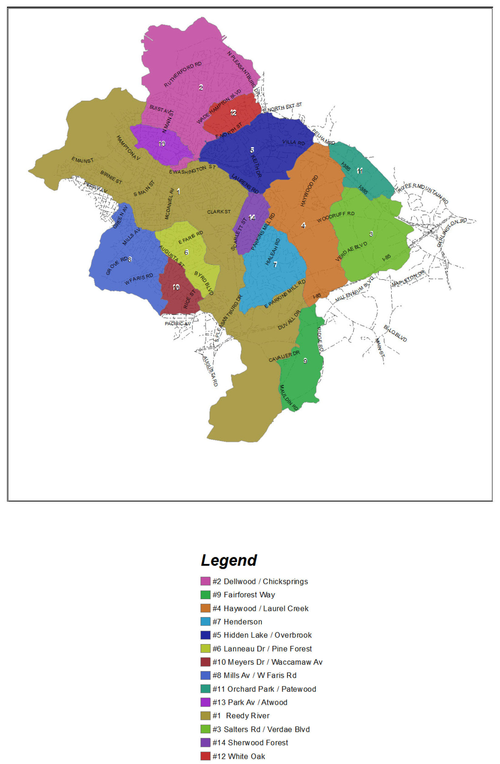
APPENDIX C. - FEMA FLOOD INSURANCE STUDY MAPS AND PROFILES
APPENDIX D. - CITY OF GREENVILLE STORMWATER UTILITY RATES
Refer to appendix A to this Code.
(Code 1997, art. 19-7, app. D; Ord. No. 2012-91, exh. A, 11-12-2012)
APPENDIX E. - ADMINISTRATOR OR DESIGNEE DUTIES
This appendix, as a part of this duly adopted ordinance [from which this chapter was originally derived], delineates requirements or duties required of its designated administrator or designee. Certain requirements or duties specified by FEMA and SCDHEC are for the purposes of the city maintaining eligibility for participation in the National Flood Insurance Program and delegation of state permit authority. These certain requirements or duties relate only to the intergovernmental relationship between the city and FEMA or SCDHEC and they do not and are not intended to create any third party beneficial rights in or for applicants, property owners, or others.
(A)
One of the primary duties of the administrator or designee shall be to oversee the review all stormwater permit applications and issue permits for those projects that are in general compliance with the provisions of the chapter. The administrator or designee shall be responsible for the administration and enforcement of this chapter.
(B)
The administrator or designee shall determine for each development if it is in a special flood hazard area (SFHA) using the criteria specified in subsection 19-7.7.1. If a site is in a SFHA, a determination is required as to whether it is in a regulatory floodway, or a regulatory floodplain on which a detailed study has not been conducted, or a floodprone area with a tributary drainage area equal to or greater than 640 acres, greater than 40 acres, or greater than 20 acres.
(C)
The administrator or designee shall ensure that a SCDHEC dam safety permit or a letter stating that no dam safety permit is required is obtained if the development includes a dam before the issuance of a stormwater permit.
(D)
The administrator or designee may require deed restrictions, performance bonds or sureties, as-built certification, or maintenance guarantees as stipulated in this chapter to ensure projects are built and maintained according to permitted plans. The administrator or designee must approve the estimated probable cost used in determination of the performance bond or other surety.
(E)
A registered professional engineer employed by or under contract with the city, or a reviewer under the direct supervision of a registered professional engineer, shall review any plans, calculations, or analyses submitted by a registered professional engineer pursuant to the requirements of this article.
(F)
The administrator or designee shall ensure that proposed amendments to this article and appendices are done in accordance with applicable state or federal law and approved by SCDHEC and SCDNR.
(G)
Prior to the issuance of a stormwater permit, and based on the reliance that the application requirements have been met, the administrator or designee shall further ensure, to the best of their knowledge and belief, that the applicant has obtained and provided copies of any and all required federal, state permits for all development. Reference appendix F of this article for a partial list of permits that may be applicable.
(H)
The administrator or designee shall inspect all development projects before, during, and upon completion of construction to ensure proper elevation of the structure and to ensure compliance with the provisions of this chapter. The administrator or designee may require a pre-construction meeting as a condition of issuing a permit.
(I)
For the following types of regulatory approvals or permit authority, the city has jurisdiction within depressional floodprone areas with greater than 20 acres of tributary area and riverine floodprone areas with greater than 40 acres of tributary area. FEMA has jurisdiction within all regulatory floodways or floodplains with greater than 640 acres (one square mile) of tributary area.
(1)
Base flood elevation determinations where none now exist.
(2)
Any changes in the base flood elevation.
(3)
Determination that the development is a public flood control project.
(J)
City has regulatory approval or permit authority for the following types of development:
(1)
Determination that an existing bridge or culvert crossing proposed to be modified is not a source of flood damage and the analysis indicating the proposed flood profile.
(2)
Alternative transition sections and hydraulically equivalent compensatory storage.
(3)
Other development as specified within intergovernmental agreements with the City of Greenville.
(K)
The administrator or designee shall administer the submittal of the required data to the Federal Emergency Management Agency (FEMA) and the South Carolina Department of Natural Resources Land (SCDNR), water and conservation division, for proposed revisions to the base flood elevation of a regulatory floodplain study or a relocation of a regulatory floodway boundary. The administrator or designee shall submit reports as required for the National Flood Insurance Program.
(L)
The city will maintain a repository of stormwater management data for the city. Toward that end, the administrator or designee shall:
(1)
Maintain records for a period of five years from project completion for every stormwater permit application, permit, variance, hydrologic and hydraulic data, and enforcement action, and as-built drawings of the stormwater management system required by this chapter and shall allow periodic inspections of the records by FEMA or SCDHEC personnel.
(2)
Maintain an elevation certificate and floodproofing certificate file, to certify the elevation of the lowest floor (including basement) of a residential or nonresidential building or the elevation to which a nonresidential building has been floodproofed, for all buildings constructed in the regulatory floodplain.
(3)
Maintain for public inspection and provide copies upon request of base flood data and maps, variance documentation, conditional letters of map revision, letters of map revision, letters of map amendment, elevation and floodproofing certificate, other stormwater permit related materials, and elevation and floodproofing as-built drawings for all buildings requiring floodproofing or constructed subject to the elevation criteria provisions of this chapter.
(M)
When base flood elevation data and floodway data is not available from FEMA, obtain, review, and reasonably utilize best available base flood elevation data and floodway data available from a federal, state, or other source, including data developed pursuant to the standards for subdivision proposals outlined in 19-7.7-1(a)(3), in order to administer the provisions of this ordinance. Data from preliminary, draft, and final Flood Insurance Studies constitutes best available data from a federal, state, or other source. Data must be developed using hydraulic models meeting the minimum requirement of NFIP approved model. If an appeal is pending on the study in accordance with 44 CFR Ch. 1, Part 67.5 and 67.6, the data does not have to be used.
(N)
Where interpretation is needed as to the exact location of boundaries of the areas of special flood hazard (for example, where there appears to be a conflict between a mapped boundary and actual field conditions), make the necessary interpretation.
(O)
Notify the South Carolina Department of Natural Resources Land, Water and Conservation Division, State Coordinator for the National Flood Insurance Program within six (6) months, of any annexations or detachments that include special flood hazard areas.
(Code 1997, art. 19-7, app. E; Ord. No. 2012-91, exh. A, 11-12-2012; Ord. No. 2014-63, app. E, 8-11-2014)
APPENDIX F. - PARTIAL LIST OF PERMITS REQUIRED (WHEN APPLICABLE)
(A)
United States Army Corps of Engineers (ACOE).
(B)
South Carolina Department of Transportation (SCDOT).
(C)
South Carolina Department of Health and Environmental Control (SCDHEC).
(D)
South Carolina Department of Natural Resources (SCDNR).
(E)
Greenville building permits.
(F)
State Historical Preservation Agency.
(G)
United States Fish and Wildlife Service.
(H)
Federal Emergency Management Agency (FEMA).
(Code 1997, art. 19-7, app. F; Ord. No. 2012-91, exh. A, 11-12-2012)
APPENDIX G. - RAINFALL DEPTH DURATION FREQUENCY TABLES FOR CITY OF GREENVILLE
(Code 1997, art. 19-7, app. G; Ord. No. 2012-91, exh. A, 11-12-2012)