
High Point City Zoning Code
CHAPTER 3
- ZONING DISTRICTS
3.2.- General Zoning Districts Established
Table 3.2, General Zoning Districts Established, sets out the general zoning districts established by this Ordinance. General zoning districts are grouped into Residential, Business, Special, and Planned Development districts.
A.
Classification of General Zoning Districts Land shall be classified or reclassified into a zoning district only in accordance with the procedures and requirements set forth in Section 2.4.20, Zoning Map Amendment, Section 2.4.6, Conditional Zoning, or Section 2.4.9, Planned Development, as appropriate.
B.
Relationship to Overlay Zoning Districts Regulations governing development in an overlay zoning district shall apply in addition to the regulations governing development in the underlying general or conditional zoning district classification. If the standards governing a general zoning district expressly conflict with those governing an overlay zoning district, the standards governing the overlay zoning district shall control.
C.
Organization of General Zoning District Regulations
1.
Sections 3.3 through 3.5 set out the general purposes of each group of zoning districts and contain subsections that set out the specific purpose, density, bulk, and dimensional standards for each individual zoning district.
2.
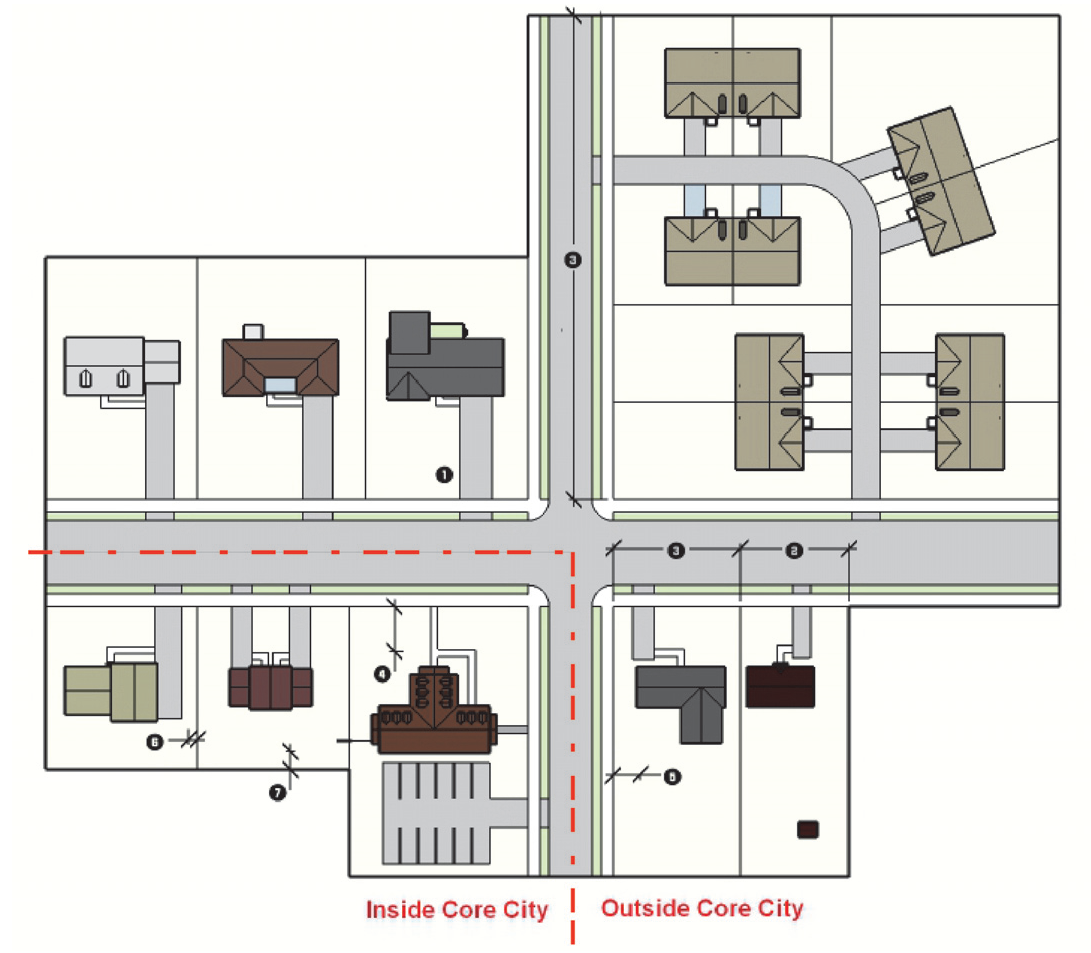
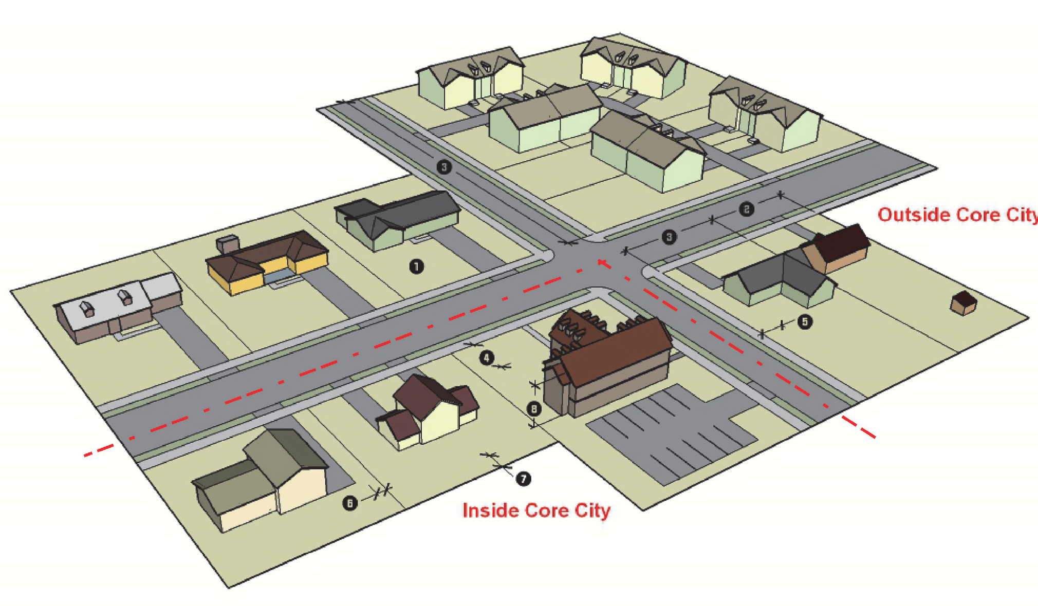
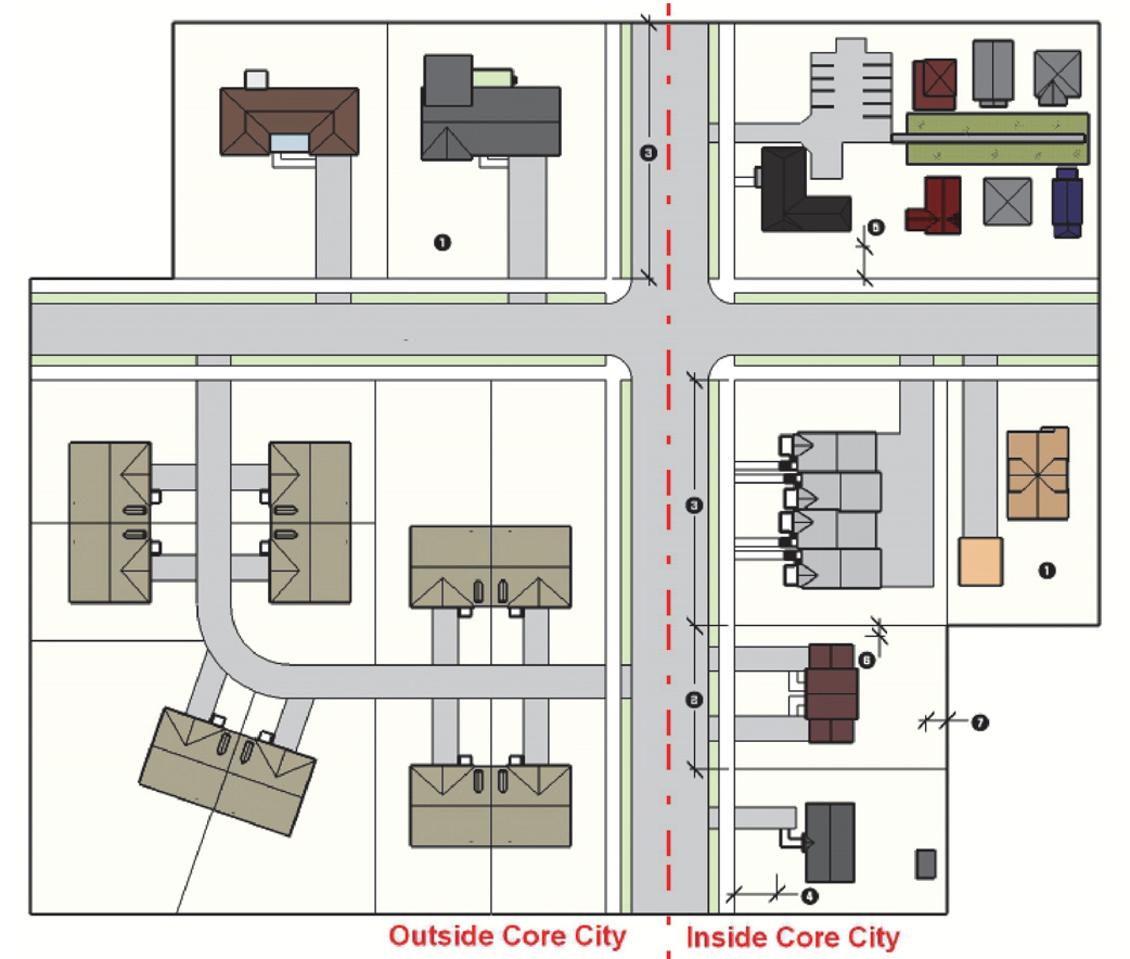
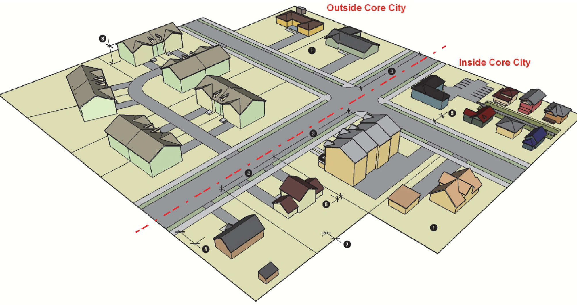
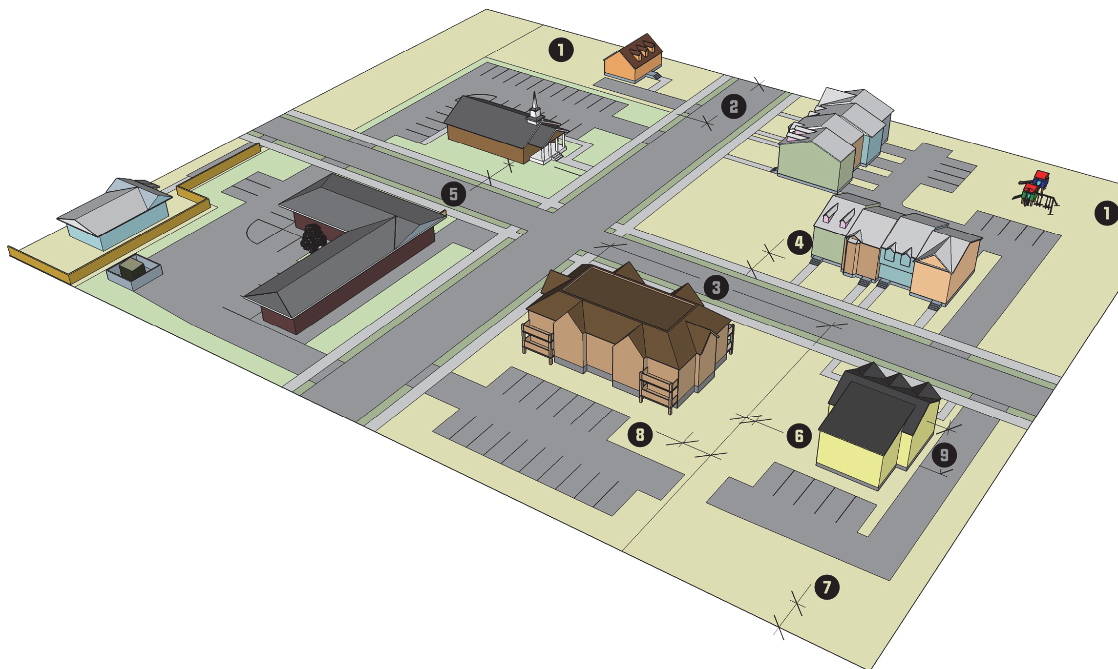
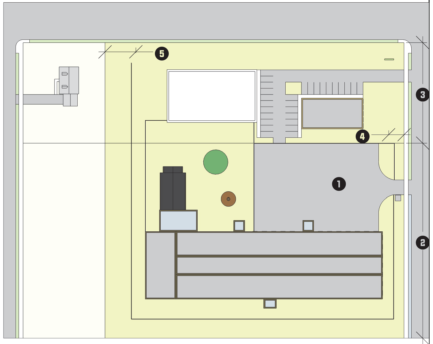
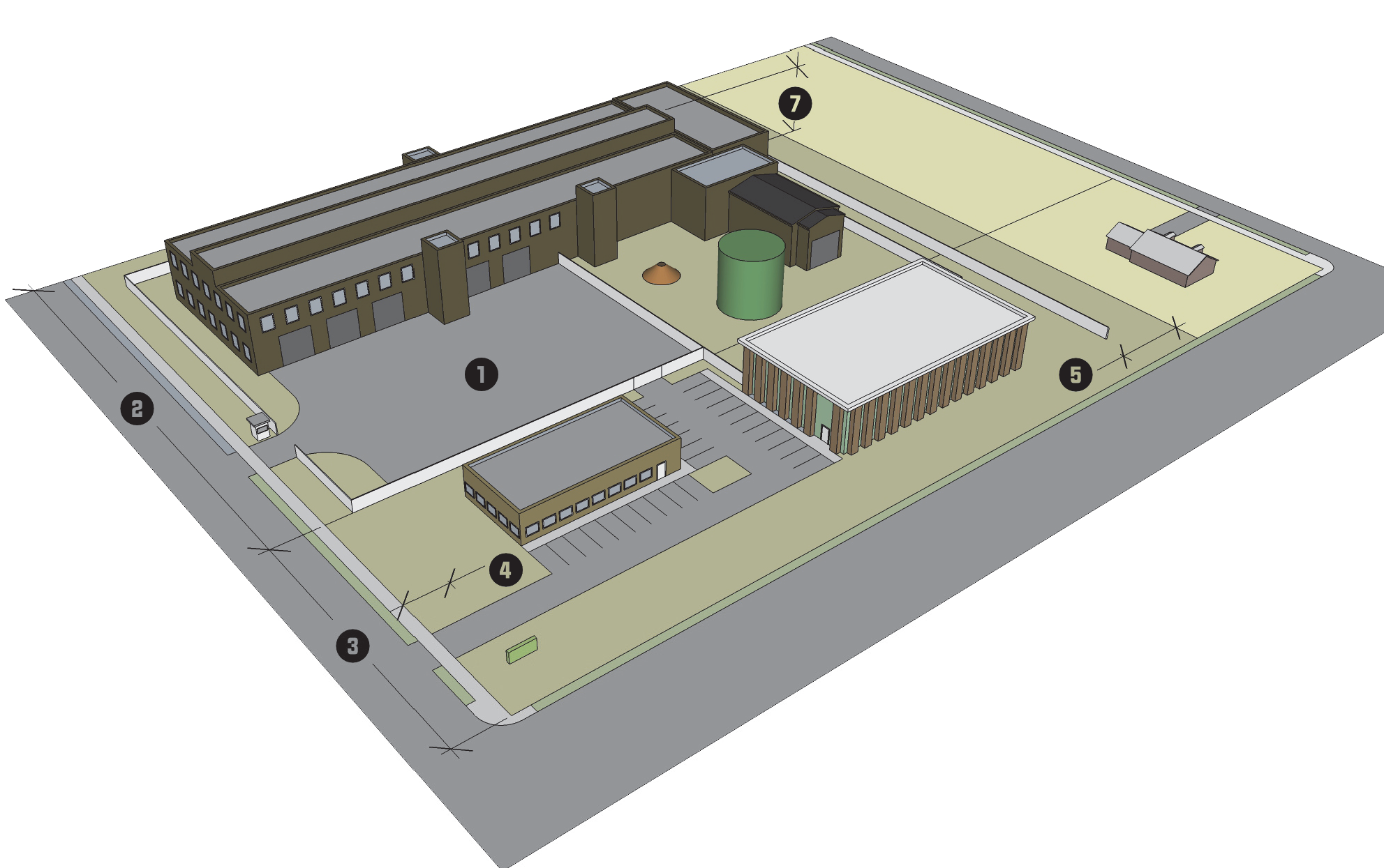
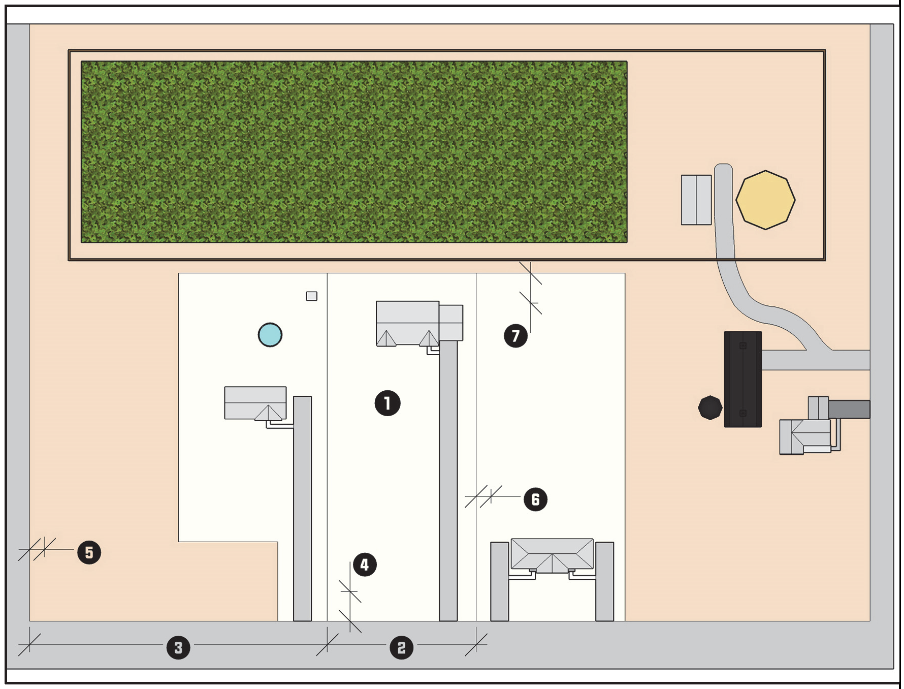
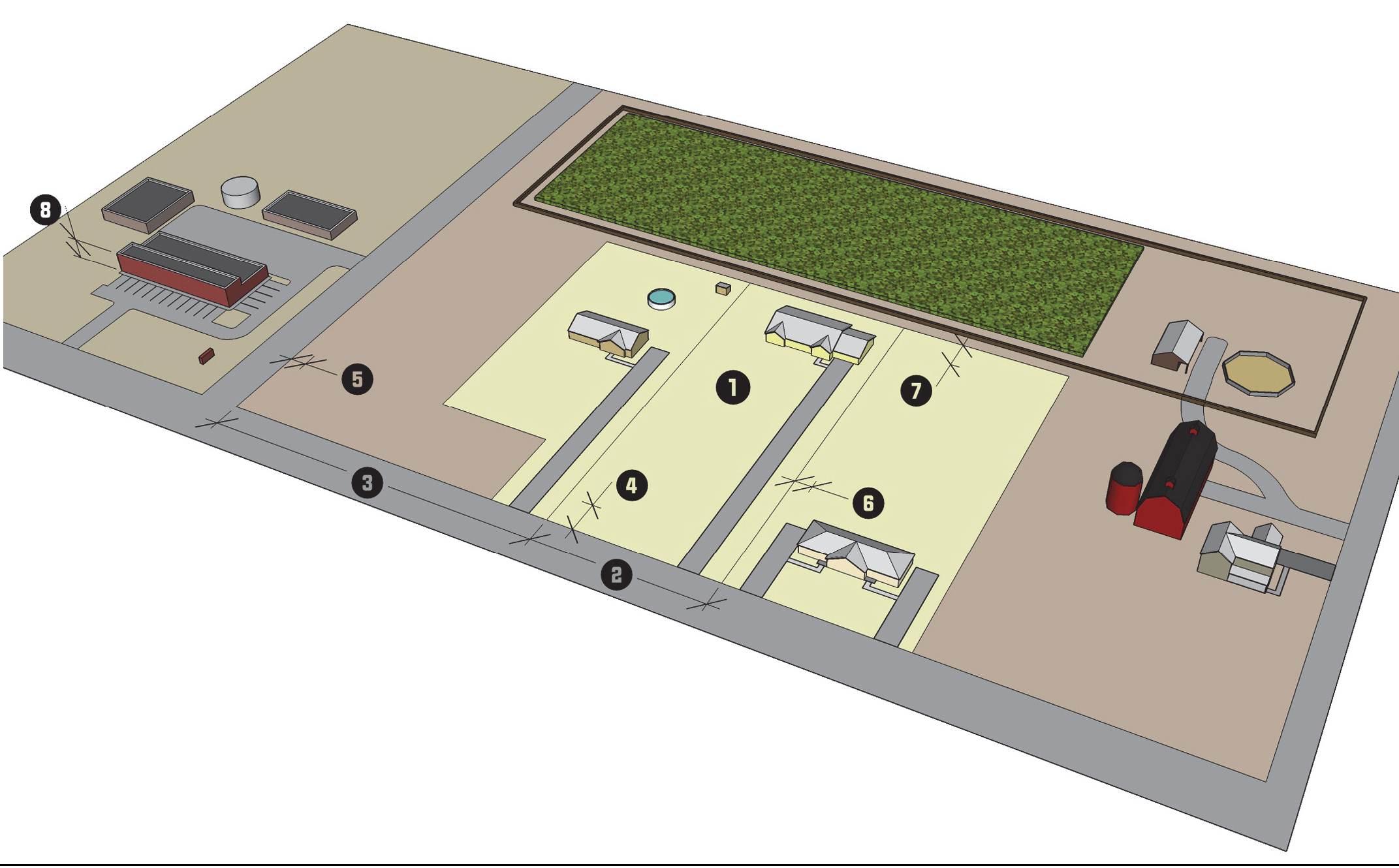
Each district includes a summary table of dimensional standards that include numbers in black circles. The black circles in the dimensional standards table correspond to the black circles depicted in the district graphics.
3.
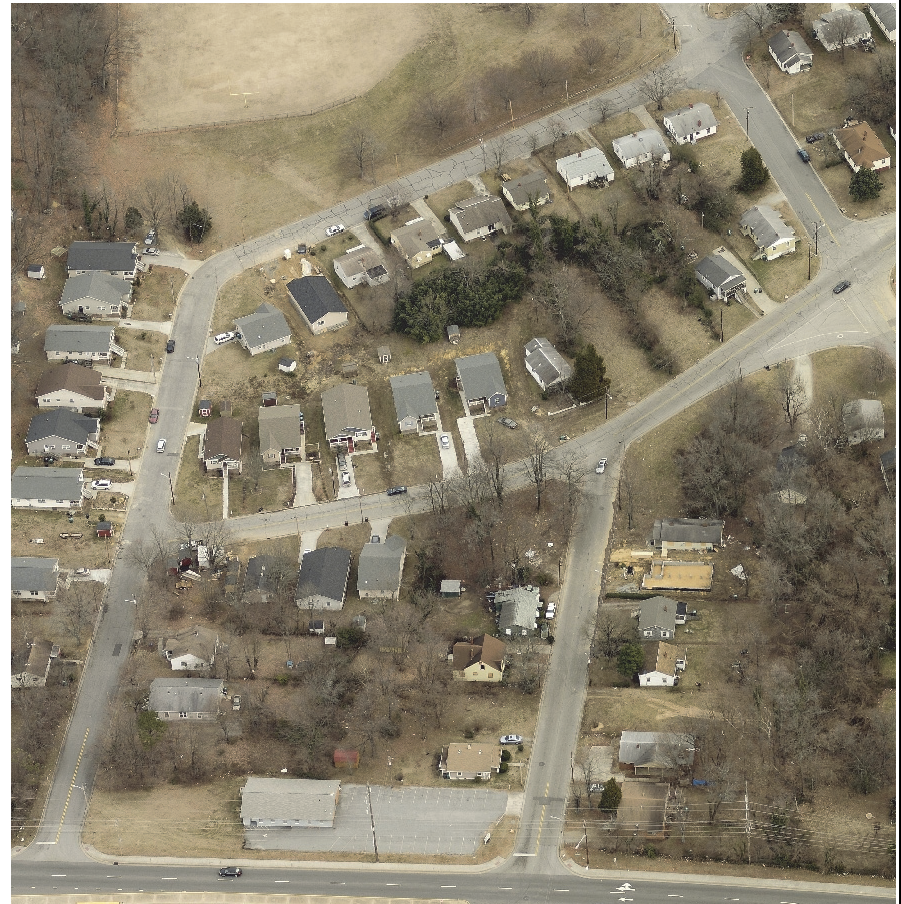
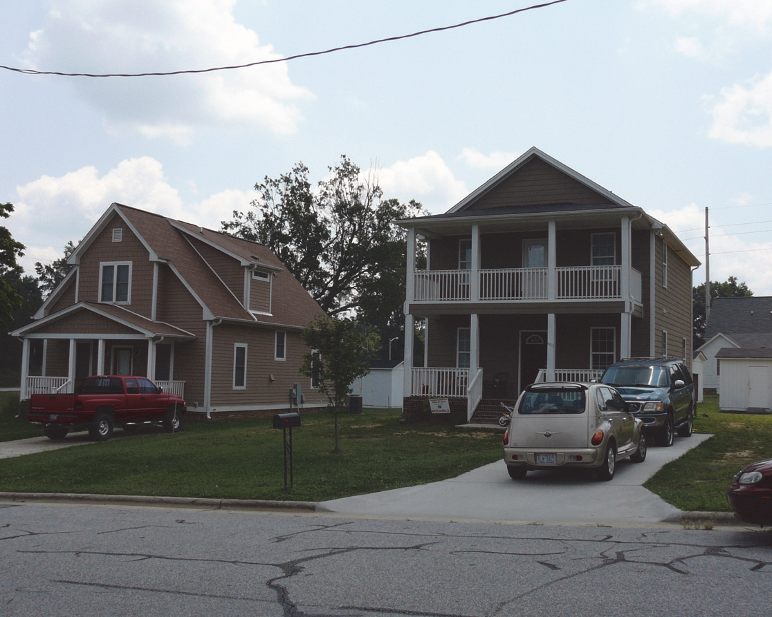
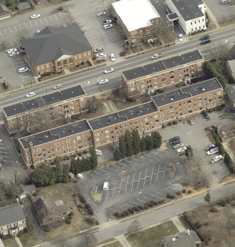
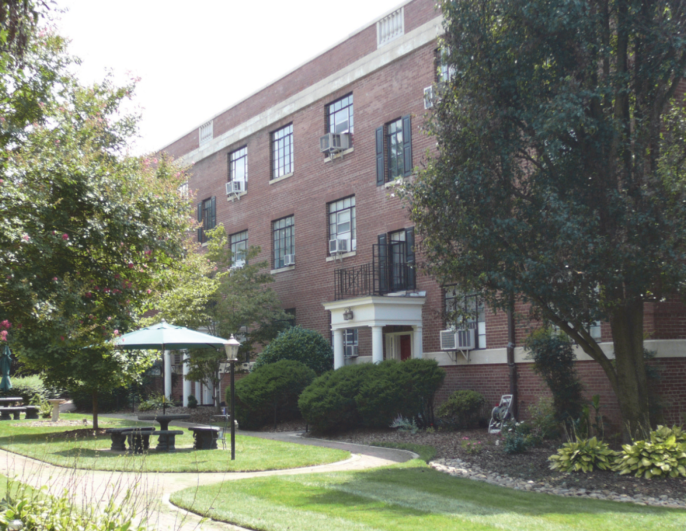
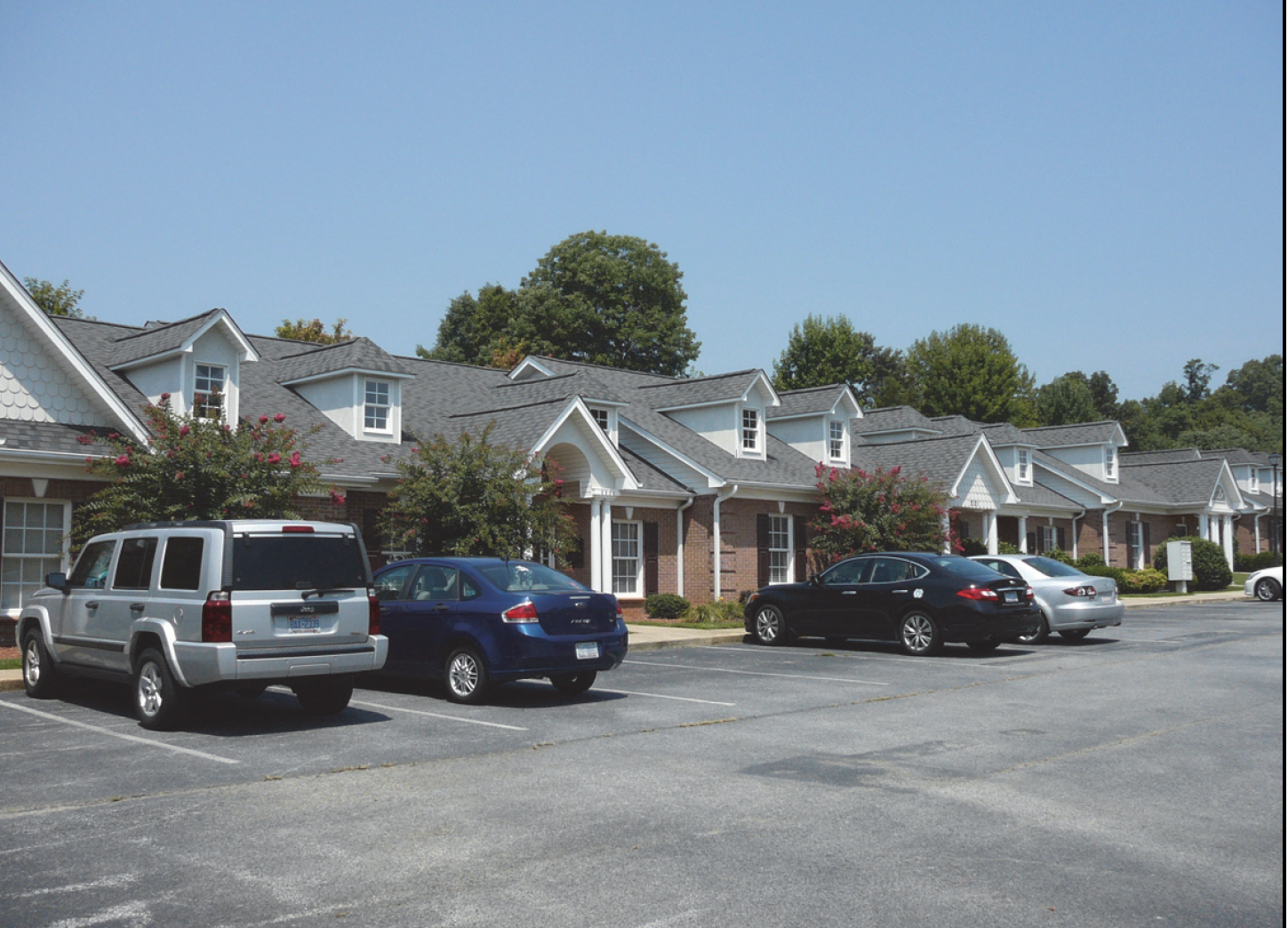
The building form photographs and lot pattern diagrams are for illustrative purposes only. The text of this Ordinance shall control.
4.
The range of allowable uses for each general zoning district are identified in Table 4.1.9, Principal Use Table.
3.1.1.- Types of Zoning Districts
Land within the City is generally classified by this Ordinance to be in one of a number of general zoning districts. Land may be reclassified to one of a number of comparable conditional zoning districts in accordance with Section 2.4.6, Conditional Zoning. Land in any general or conditional district may also be classified into one or more overlay zoning districts, in which case regulations governing development in the overlay district shall apply in addition to the regulations governing development in the underlying general zoning district or conditional zoning district.
3.1.2. - Compliance with District Standards
Land in the City shall not be developed except in accordance with the zoning district regulations of this chapter and all other regulations of this Ordinance, including but not limited to: Chapter 4: Uses, Chapter 5: Development Standards, Chapter 6: Environmental Standards, and Chapter 7: Subdivision Standards.
3.1.3. - Conflict
In the event of a conflict between the standards in Chapter 5: Development Standards, and the district standards in Chapter 3: Zoning Districts, the standards in Chapter 3: Zoning Districts, shall control.
3.1.4. - Maximum Density May be Increased
Unless otherwise indicated in this Ordinance, the maximum density for a zoning district may be increased beyond the amount listed in Section 3.3, Residential Zoning Districts, Section 3.4, Business Zoning Districts, and Section 3.5, Special Zoning Districts, in accordance with the standards and procedure in Section 2.5.2, Administrative Adjustment.
(Ord. No. 7287/17-29, § 2, 4-3-2017)
3.1.5. - Official Zoning Map
A.
General
1.
The Official Zoning Map designates the location and boundaries of the various zoning districts established in this Ordinance. It is maintained solely in digital form. It shall be the final authority as to the status of the current zoning district classification of land in the City's planning jurisdiction, and shall only be amended in accordance with Section 2.4.6., Conditional Zoning, Section 2.4.9., Planned Development, and Section 2.4.20., Zoning Map Amendment.
2.
The Planning and Development Director shall maintain digital or printed copies of superseded versions of the Official Zoning Map for historical reference.
3.
The Official Zoning Map, as well as maps incorporated by reference, shall be kept on file in the Planning and Development Department and is available for public inspection during normal business hours.
B.
Incorporated by Reference
1.
The Official Zoning Map is incorporated herein by reference and made part of this Ordinance.
2.
The City of High Point Water Supply Watershed Map is incorporated herein by reference and made a part of this Ordinance.
3.
The Flood Insurance Rate Maps (FIRM) prepared by the State and the associated Flood Insurance Study (FIS) are incorporated herein by reference and made part of this Ordinance.
4.
The Core City boundary delineated in the Core City Plan adopted February 8, 2007 is incorporated herein by reference and made part of this Ordinance.
C.
Interpretation of Official Map Boundaries The Planning and Development Director shall be responsible for determination of boundaries on the Official Zoning Map in accordance with the standards in Section 2.5.4, Determination, and the following standards:
1.
Boundaries shown as approximately following a utility line or a street, alley, railroad, or other public access way shall be interpreted as following the centerline of the right-of-way or easement for the utility line or access way.
2.
If a street, alley, railroad, or utility easement forming the boundary between 2 separate zoning districts is abandoned or removed from dedication, the district boundaries shall be construed as following the centerline of the abandoned or vacated roadbed or utility easement.
3.
Boundaries shown as approximately following a lot line shall be interpreted as following the lot line as it existed when the boundary was established. If a subsequent minor adjustment (such as from settlement of a boundary dispute or overlap) results in the lot line moving 10 feet or less, the zoning boundary shall be interpreted as moving with the lot line.
4.
Boundaries shown as approximately following a river, stream, canal, lake, or other watercourse shall be interpreted as following the centerline of the watercourse as it actually exists, and as moving with that centerline to the extent the watercourse moves as a result of natural processes (flooding, erosion, sedimentation, etc.).
5.
Boundaries shown as approximately following shorelines of a river, stream, or lake shall be interpreted to follow the shoreline, even in the event of change.
6.
Boundaries shown parallel to or as extensions of features indicated in this subsection shall be interpreted as such.
7.
If the specific location of a depicted boundary cannot be determined from application of the above standards, it shall be determined by using the Official Zoning Map's scale to determine the boundary's distance from other features shown on the map. In the case of flood hazard boundaries, the U.S. Army Corps of Engineers work maps, if available, shall be used for scaling.
8.
Where the actual location of existing physical or natural features vary from that shown on the Official Zoning Map, or in other circumstances are not covered by this subsection, the Planning and Development Director shall have the authority to determine the district boundaries (see Section 2.5.4, Determination).
9.
Interpretations of the floodplain boundary shall be made by the Engineering Services Director, in accordance with the standards in Section 6.4, Flood Damage Prevention.
10.
Outer boundaries of a Watershed Overlay District shall be construed to follow actual drainage basin boundaries. In cases of conflicts between the boundaries as they appear on the Watershed Map and detailed engineering studies, the TRC may rely on the more detailed study in approving watershed development plans.
11.
Locations of perennial and intermittent streams within General Watershed Area and Watershed Critical Area shall be construed to be as depicted on the Watershed Map. In case of conflicts between the locations as they appear on the Watershed Map and detailed engineering studies, the TRC may rely on the more detailed study in approving watershed development plans.
12.
Wherever a single lot is located within 2 or more different zoning districts, each portion of the lot shall be subject to all the regulations applicable to the zoning district where it is located.
D.
Changes to Official Zoning Map Changes made in zoning district boundaries on the Official Zoning Map shall be made in accordance with Section 2.4.20, Zoning Map Amendment. Changes shall be entered on the Official Zoning Map by the Planning and Development Director promptly after the amendment is approved by the P&Z or City Council.
(Ord. No. 7712/21-29, § 8, 5-19-2021; Ord. No. 7969/23-17, § 12, 10-2-2023)
3.3.1.- General Purpose and Intent
The residential zoning districts established in this section are intended to provide a, healthy and safe environment in which to live and recreate. More specifically, they are intended to:
A.
Provide appropriately located lands for residential development that are consistent with the City's adopted policy guidance;
B.
Ensure adequate light, air, privacy, and recreation and open space areas for each dwelling;
C.
Provide for residential housing choice, affordability, and diversity with varying housing densities, types, and designs, including accessory dwelling units where appropriate;
D.
Provide for safe and efficient vehicular access and circulation and pedestrian-friendly neighborhoods in the Core City area;
E.
Provide for public services and facilities needed to serve residential areas while protecting residential areas from incompatible nonresidential development;
F.
Create neighborhoods and preserve existing community character while accommodating new development and redevelopment consistent with the City's goals and objectives.
G.
Preserve the unique character and historic resources of the city's traditional neighborhoods and the community.
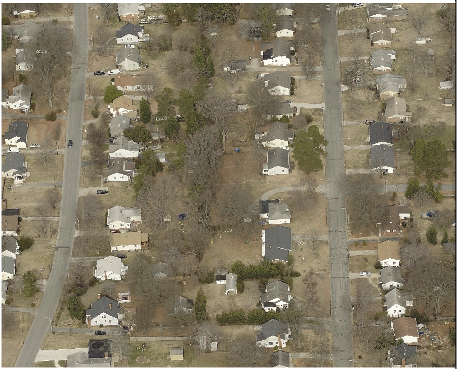
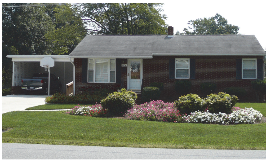
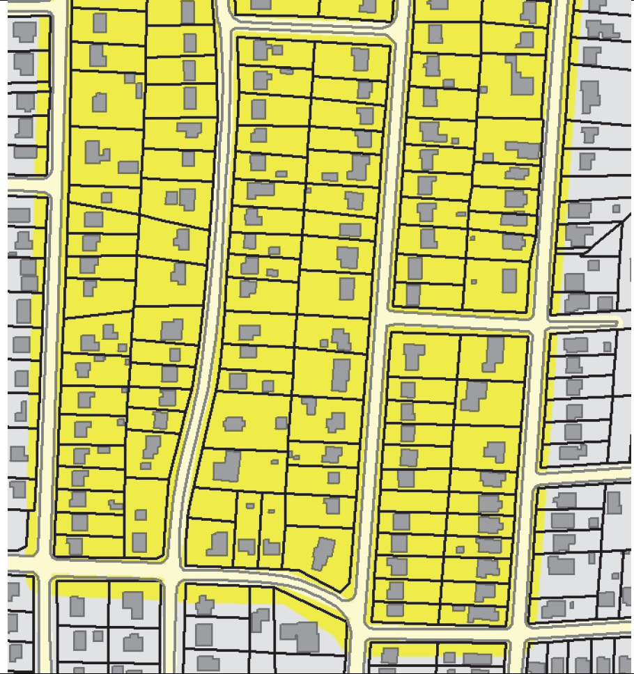
3.3.2. - Residential Single Family - 3 (R-3)
| R-3 RESIDENTIAL DISTRICT | A. DISTRICT PURPOSE | |||||||||
| The R-3 district is established to accommodate principally single-family detached dwellings developed at a density of 3 units an acre, in developments served by public water and sewer. Complimentary uses such as open space, schools, utilities, religious institutions, and recreational facilities are also allowed. District regulations discourage any use that interferes with the development of single-family detached dwellings or that is detrimental to the residential nature of the district. | ||||||||||
| B. DIMENSIONAL STANDARDS | ||||||||||
| STANDARD | REFERENCE # | OUTSIDE CORE CITY AREA | INSIDE CORE CITY AREA | |||||||
SF Detached
|
Duplex
|
SF Attached & Multi-family
|
All Other Uses
|
SF Detached
|
Duplex
|
SF Attached & Multi-family
|
All Other Uses
| |||
| Minimum Lot Area (square feet) | 12,000 [1] | n/a | 20,000 | 12,000 [2] | n/a | 20,000 | ||||
| Minimum Lot Width (feet) [3] | Interior lot | 75 | n/a | 75 | 75 [2] | n/a | 75 | |||
| Corner lot | 85 | 85 | 85 [2] | 85 | ||||||
| Minimum Street Setback (feet) | Front | 30 | n/a | 30 | 30 [2] | n/a | 30 [2] | |||
| Side | 15 | 15 [2] | ||||||||
| Minimum Side Setback (feet) | 10 | n/a | n/a | 5 [2] | n/a | n/a | ||||
| Minimum Rear Setback (feet) | 25 | n/a | n/a | 15 [2] | n/a | n/a | ||||
| Minimum Perimeter Setback (feet) | n/a | n/a | 25 | n/a | n/a | 25 | ||||
| Maximum Building Height (feet) | 50 | n/a | 50 | 50 | n/a | 50 | ||||
| [1] Lots in projects 2 acres or greater in area may be between 75% and 125% of the district minimum lot area, provided the development as a whole maintains an average lot area that equals or exceeds the district minimum (See Section 10.2.3 C.2 Lot Area Averaging). | ||||||||||
| [2] At applicant's option, may be reduced to the lesser of: zoning district minimum or between 75% and 125% of the average for lots on the same block face (See Section 10.2.3 D, Dimensional Standards in the Core City). | ||||||||||
| [3] All development shall comply with the City's Driveway Ordinance requirements. | ||||||||||
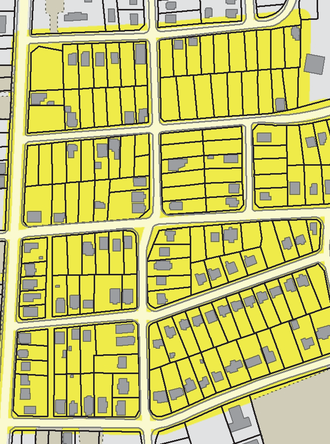
| C. TYPICAL BUILDING FORMS | ||
 |  | |
| D. TYPICAL LOT PATTERNS | E. DISTRICT DIMENSIONS | |
 |  | |
| F. TYPICAL BUILDING CONFIGURATION | ||
 | ||
(Ord. No. 7266/17-08, § 32, 1-17-2017; Ord. No. 7415/18-44, § 3.B, 5-21-2018)
3.3.3. - Residential Single Family - 5 (R-5)
| R-5 RESIDENTIAL DISTRICT | A. DISTRICT PURPOSE | |||||||||
| The R-5 district is established to accommodate principally single-family detached dwellings developed at a density of 5 units an acre that is served by public water and sewer. Complimentary uses such as open space, schools, utilities, religious institutions, and recreational facilities are also allowed. District regulations discourage uses that interfere with the development of residential development or that is detrimental to the residential nature of the district. | ||||||||||
| B. DIMENSIONAL STANDARDS | ||||||||||
| STANDARD | REFERENCE # | OUTSIDE CORE CITY AREA | INSIDE CORE CITY AREA | |||||||
SF Detached
|
Duplex
|
SF Attached & Multi-family
|
All Other Uses
|
SF Detached
|
Duplex
|
SF Attached & Multi-family
|
All Other Uses
| |||
| Minimum Lot Area (square feet) | 7,000 [1] | n/a | 15,000 | 7,000 [2] | 10,000 [2] | 15,000 [3] | 15,000 | |||
| Minimum Development Size (acres) | n/a | 5 | n/a | n/a | ||||||
| Maximum Density (units/acre) | n/a | 5 [4] | n/a | n/a | ||||||
| Minimum Lot Width (feet) [5] | Interior lot | 50 | n/a | 75 + [6] | 50 | 50 [2] | 80 | 50 | ||
| Corner lot | 60 | 70 | 60 [2] | 70 | ||||||
| Minimum Street Setback (feet) | Front | 25 | n/a | 20 | 25 | 25 [2] | 25 [2] | |||
| Side | 15 | 15 [2] | ||||||||
| Minimum Side Setback (feet) | 5 | n/a | n/a | 5 [2] | n/a | |||||
| Minimum Rear Setback (feet) | 20 | n/a | 10 [2] | |||||||
| Minimum Perimeter Setback (feet) | n/a | n/a | 20 | n/a | 15 | 20 | ||||
| Maximum Building Height (feet) | 50 | n/a | 50 | 50 | ||||||
| [1] May be between 75% and 125% of the district minimum lot area, provided the development as a whole maintains an average lot area that equals or exceeds the district minimum (See Section 10.2.3 C.2 Lot Area Averaging). | ||||||||||
| [2] At applicant's option, may be reduced to the lesser of: zoning district minimum or between 75% and 125% of the average for lots on the same block face (See Section 10.2.3 D, Dimensional Standards in the Core City). | ||||||||||
| [3] Minimum development size. | ||||||||||
| [4] The maximum number of attached dwelling units per structure is 2. | ||||||||||
| [5] All development shall comply with the City's Driveway Ordinance requirements. | ||||||||||
| [6] For developments with more than 3 units, minimum lot width is increased by 5 feet per unit up to a maximum width of 120 feet. | ||||||||||
| C. TYPICAL BUILDING FORMS | ||
 |  | |
| D. TYPICAL LOT PATTERNS | E. DISTRICT DIMENSIONS | |
 |  | |
| F. TYPICAL BUILDING CONFIGURATION | ||
 | ||
(Ord. No. 7266/17-08, § 32, 1-17-2017; Ord. No. 7415/18-44, § 3.C, 5-21-2018)
3.3.4. - Residential Single Family - 7 (R-7)
| R-7 RESIDENTIAL DISTRICT | A. DISTRICT PURPOSE | |||||||||
| The R-7 district is established to accommodate principally single-family detached dwellings developed at a density of 7 units an acre, that are served by public water and sewer. Complimentary uses such as open space, schools, utilities, religious institutions, and recreational facilities are also allowed. District regulations discourage any use that interferes with the development of residential development or that is detrimental to the residential nature of the district. | ||||||||||
| B. DIMENSIONAL STANDARDS | ||||||||||
| STANDARD | REFERENCE # | OUTSIDE CORE CITY AREA | INSIDE CORE CITY AREA | |||||||
SF Detached
|
Duplex
|
SF Attached & Multi-family
|
All Other Uses
|
SF Detached
|
Duplex
|
SF Attached & Multi-family
|
All Other Uses
| |||
| Minimum Lot Area (square feet) | 5,000 [1] | 7,000 | n/a | 12,000 | 5,000 [2] | 7,000 [2] | 12,000 [3] | 12,000 | ||
| Minimum Development Size (acres) | n/a | 5 | n/a | n/a | ||||||
| Maximum Density (units/acre) | n/a | 7 [4] | n/a | n/a | ||||||
| Minimum Lot Width (feet) [5] | Interior lot | 40 | 75+ [6] | 50 | 40 [2] | 80 | 50 | |||
| Corner lot | 50 | 65 | 50 [2] | 65 | ||||||
| Minimum Street Setback (feet) | Front | 20 | 20 | 20 | 20 [2] | 20 [2] | ||||
| Side | 15 | 15 [2] | ||||||||
| Minimum Side Setback (feet) | 5 | n/a | 5 [2] | n/a | ||||||
| Minimum Rear Setback (feet) | 15 | 10 [2] | ||||||||
| Minimum Perimeter Setback (feet) | n/a | 20 | n/a | 10 | 20 | |||||
| Maximum Building Height (feet) | 50 | 50 | 50 | |||||||
| [1] May be between 75% and 125% of the district minimum lot area, provided the development as a whole maintains an average lot area that equals or exceeds the district minimum (See Section 10.2.3 C.2 Lot Area Averaging). | ||||||||||
| [2] At applicant's option, may be reduced to the lesser of: zoning district minimum or between 75% and 125% of the average for lots on the same block face (See Section 10.2.3 D, Dimensional Standards in the Core City). | ||||||||||
| [3] Minimum development size. | ||||||||||
| [4] The maximum number of attached dwelling units per structure is 2. | ||||||||||
| [5] All development shall comply with the City's Driveway Ordinance requirements. | ||||||||||
| [6] For developments with more than 3 units, minimum lot width is increased by 5 feet per unit up to a maximum width of 120 feet. | ||||||||||
| C. TYPICAL BUILDING FORMS | ||
 |  | |
| D. TYPICAL LOT PATTERNS | E. DISTRICT DIMENSIONS | |
 |  | |
| F. TYPICAL BUILDING CONFIGURATION | ||
 | ||
(Ord. No. 7266/17-08, § 32, 1-17-2017; Ord. No. 7415/18-44, § 3.D, 5-21-2018)
3.3.6. - Residential Multifamily - 5 (RM-5)
| RM-5 RESIDENTIAL DISTRICT | A. DISTRICT PURPOSE | |||||||||
| The RM-5 district is established to accommodate a mix of residential development at densities of 5 units an acre, that are served by public water and sewer. Complimentary uses such as open space, schools, utilities, religious institutions and recreational facilities are also allowed. District regulations discourage any use that interferes with the development of residential development or that is detrimental to the residential nature of the district. | ||||||||||
| B. DIMENSIONAL STANDARDS | ||||||||||
| STANDARD | REFERENCE # | OUTSIDE CORE CITY AREA | INSIDE CORE CITY AREA | |||||||
SF Detached
|
Duplex
|
SF Attached & Multi-family
|
All Other Uses
|
SF Detached
|
Duplex
|
SF Attached & Multi-family
|
All Other Uses
| |||
| Maximum Density (units/acre) | n/a | 5 | 5 [1] | n/a | 5 | 5 [1] | ||||
| Minimum Lot Area (square feet) | 7,000 [2] | 12,000 | 26,000 [3] | 15,000 | 7,000 [4] | 10,000 [4] | 26,000 [3] | 15,000 | ||
| Minimum Lot Width (feet) [5] | Interior lot | 50 | 75 + [6] | 50 | 50 [4] | 75 + [6] | 50 | |||
| Corner lot | 60 | 70 | 60 [4] | 70 | ||||||
| Minimum Street Setback (feet) | Front | 25 | 25 | 25 [4] | 25 [4] | |||||
| Side | 15 | 15 [4] | ||||||||
| Minimum Side Setback (feet) | 5 | n/a | 5 [4] | n/a | ||||||
| Minimum Rear Setback (feet) | 20 | 10 [4] | ||||||||
| Minimum Perimeter Setback (feet) |
Adjacent to
Residential District | n/a | 20 | n/a | 20 [4] | 20 | ||||
|
Adjacent to
Non-residential District | ||||||||||
| Maximum Building Height (feet) | 50 | 50 | ||||||||
| [1] Mixed-used development is subject to the maximum density standards. | ||||||||||
| [2] May be between 75% and 125% of the district minimum lot area, provided the development as a whole maintains an average lot area that equals or exceeds the district minimum (See Section 10.2.3 C.2 Lot Area Averaging). | ||||||||||
| [3] Minimum development size. | ||||||||||
| [4] At applicant's option, may be reduced to the lesser of: zoning district minimum or between 75% and 125% of the average for lots on the same block face (See Section 10.2.3 D, Dimensional Standards in the Core City). | ||||||||||
| [5] All development shall comply with the City's Driveway Ordinance requirements. | ||||||||||
| [6] For developments with more than 3 units, minimum lot width is increased by 5 feet per unit up to a maximum width of 120 feet. | ||||||||||
| C. TYPICAL BUILDING FORMS | ||||||||||
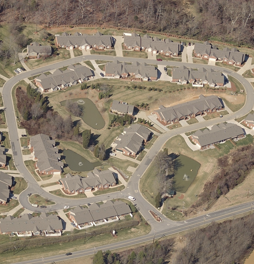 |  | |||||||||
| D. TYPICAL LOT PATTERNS | E. DISTRICT DIMENSIONS | |||||||||
 |  | |||||||||
| F. TYPICAL BUILDING CONFIGURATION | ||||||||||
 | ||||||||||
(Ord. No. 7266/17-08, § 32, 1-17-2017)
3.3.7. - Residential Multifamily - 16 (RM-16)
| RM-16 RESIDENTIAL DISTRICT | A. DISTRICT PURPOSE | |||||||||
| The RM-16 district is established to accommodate a mix of residential development at around 16 units an acre, that is served by public water and sewer. District regulations encourage the development of functioning neighborhoods that include a mix of housing types and a variety of institutional uses. Complimentary uses such as open space, schools, utilities, religious institutions, and recreational facilities are also allowed. | ||||||||||
| B. DIMENSIONAL STANDARDS | ||||||||||
| STANDARD | REFERENCE # | OUTSIDE CORE CITY AREA | INSIDE CORE CITY AREA | |||||||
SF Detached
|
Duplex
|
SF Attached & Multi-family
|
All Other Uses
|
SF Detached
|
Duplex
|
SF Attached & Multi-family
|
All Other Uses
| |||
| Maximum Density (units/acre) | n/a | 16 | 16 [1] | n/a | 16 | 16 [1] | ||||
| Minimum Lot Area (square feet) | 5,000 [2] | 7,000 | 10,000 [3] | 12,000 | 5,000 [4] | 7,000 [4] | 10,000 [3] | 12,000 | ||
| Minimum Lot Width (feet) [5] | Interior lot | 40 | 75 + [6] | 50 | 40 [4] | 75 + [6] | 50 | |||
| Corner lot | 50 | 65 | 50 [4] | 65 | ||||||
| Minimum Street Setback (feet) | Front | 20 | 20 | 20 [4] | 20 [4] | |||||
| Side | 15 | 15 [4] | ||||||||
| Minimum Side Setback (feet) | 5 | n/a | 5 [4] | n/a | ||||||
| Minimum Rear Setback (feet) | 15 | 10 [4] | ||||||||
| Minimum Perimeter Setback (feet) |
Adjacent to
Residential District | n/a | 15 | n/a | 15 [4] | 15 | ||||
|
Adjacent to
Non-residential District | ||||||||||
| Maximum Building Height (feet) | 50 | 50/80 [7] | 50 | 80 [8] | ||||||
| [1] Mixed-use development is subject to the maximum density standards. | ||||||||||
| [2] May be between 75% and 125% of the district minimum lot area, provided the development as a whole maintains an average lot area that equals or exceeds the district minimum (See Section 10.2.3 C.2 Lot Area Averaging). | ||||||||||
| [3] Minimum development size. | ||||||||||
| [4] At applicant's option, may be reduced to the lesser of: zoning district minimum or between 75% and 125% of the average for lots on the same block face (See Section 10.2.3 D, Dimensional Standards in the Core City). | ||||||||||
| [5] All development shall comply with the City's Driveway Ordinance requirements. | ||||||||||
| [6] For developments with more than 3 units, minimum lot width is increased by 5 feet per unit up to a maximum width of 120 feet. | ||||||||||
| [7] For each additional foot of height beyond 50 feet up to 80 feet, the perimeter setbacks shall be increased by 1 foot. | ||||||||||
| [8] When a perimeter setback abuts a single-family residential zoning district, the effected setback shall be increased by 1 foot for each foot in height beyond 50 up to 80 feet. | ||||||||||
| C. TYPICAL BUILDING FORMS | ||||||||||
 |  | |||||||||
| D. TYPICAL LOT PATTERNS | E. DISTRICT DIMENSIONS | |||||||||
 |  | |||||||||
| F. TYPICAL BUILDING CONFIGURATION | ||||||||||
 | ||||||||||
(Ord. No. 7266/17-08, § 32, 1-17-2017)
3.3.8. - Residential Multifamily - 26 (RM-26)
| RM-26 RESIDENTIAL DISTRICT | A. DISTRICT PURPOSE | |||||||||
| The RM-26 district is established to accommodate a mix of residential and institutional uses intended to help establish functioning neighborhoods. The district accommodates residential uses at densities of up to 26 units an acre. Complimentary uses such as open space, schools, utilities, and recreation facilities are also allowed. | ||||||||||
| B. DIMENSIONAL STANDARDS | ||||||||||
| STANDARD | REFERENCE # | OUTSIDE CORE CITY AREA | INSIDE CORE CITY AREA | |||||||
SF Detached
|
Duplex
|
SF Attached & Multi-family
|
All Other Uses
|
SF Detached
|
Duplex
|
SF Attached & Multi-family
|
All Other Uses
| |||
| Maximum Density (units/acre) | n/a | 26 | 26 [1] | n/a | 26 | 26 [1] | ||||
| Minimum Lot Area (square feet) | 4,000 [2] | 7,000 | 8,000 [3] | 10,000 | 4,000 [4] | 7,000 [4] | 8,000 [3] | 10,000 | ||
| Minimum Lot Width (feet) [5] | Interior lot | 30 | 60 + [6] | 50 | 30 [4] | 60 + [6] | 50 | |||
| Corner lot | 40 | 65 | 40 [4] | 65 | ||||||
| Minimum Street Setback (feet) | Front | 20 | 20 | 20 [4] | 20 [4] | |||||
| Side | 15 | 15 [4] | ||||||||
| Minimum Side Setback (feet) | 5 | n/a | 5 [4] | n/a | ||||||
| Minimum Rear Setback (feet) | 15 | 10 [4] | ||||||||
| Minimum Perimeter Setback (feet) |
Adjacent to
Residential District | n/a | 10 | n/a | 10 [4] | 10 | ||||
|
Adjacent to
Non-residential District | ||||||||||
| Maximum Building Height (feet) | 50 | n/a [7] | 50 | n/a [8] | ||||||
| [1] Mixed-use development is subject to the maximum density standards. | ||||||||||
| [2] May be between 75% and 125% of the district minimum lot area, provided the development as a whole maintains an average lot area that equals or exceeds the district minimum (See Section 10.2.3 C.2 Lot Area Averaging). | ||||||||||
| [3] Minimum development size. | ||||||||||
| [4] At applicant's option, may be reduced to the lesser of: zoning district minimum or an amount between 75% and 125% of the average for lots on the same block face (See Section 10.2.3 D, Dimensional Standards in the Core City). | ||||||||||
| [5] All development shall comply with the City's Driveway Ordinance requirements. | ||||||||||
| [6] For developments with more than 3 units, minimum lot width is increased by 5 feet per unit up to a maximum width of 120 feet. | ||||||||||
| [7] For each additional foot of height beyond 50 feet up to 80 feet, the perimeter setbacks shall be increased by 1 foot | ||||||||||
| [8] When a perimeter setback abuts a single-family residential zoning district, the effected setback shall be increased by 1 foot for each foot in height beyond 50 up to 80 feet. | ||||||||||
| C. TYPICAL BUILDING FORMS | ||||||||||
 |  | |||||||||
| D. TYPICAL LOT PATTERNS | E. DISTRICT DIMENSIONS | |||||||||
 |  | |||||||||
| F. TYPICAL BUILDING CONFIGURATION | ||||||||||
 | ||||||||||
(Ord. No. 7266/17-08, § 32, 1-17-2017)
3.4.1.- General Purpose and Intent
The business zoning districts are established for the general purpose of ensuring there are lands in the City that provide a wide range of office, retail, service, industrial, and related uses to meet household and business needs. More specifically they are intended to:
A.
Provide appropriately located lands for the full range of business uses needed by the City's residents, businesses, and workers, consistent with the City's adopted policy guidance;
B.
Strengthen the city's economic base, and provide employment opportunities close to home for residents of the city and surrounding communities;
C.
Create suitable environments for various types of business uses, and protect them from the adverse effects of incompatible uses;
D.
Create suitable environments for various types of mixed-use development, where business, office, retail, and residential uses are designed and integrated in compatible ways;
E.
Preserve the unique character and historic resources of the Core City area; and
F.
Minimize the impact of business development on residential districts and uses, Piedmont Triad International Airport operations, and sensitive natural environments.
3.4.2. - Transitional Office (TO)
| TO TRANSITIONAL OFFICE DISTRICT | A. DISTRICT PURPOSE | |||||||||
| The TO district is intended to provide a transition between residential neighborhoods and higher intensity office and commercial development. The TO district accommodates nonresidential uses in small buildings that are generally similar to the character of residential development. | ||||||||||
| B. DIMENSIONAL STANDARDS | ||||||||||
| STANDARD | REFERENCE # | OUTSIDE CORE CITY AREA | INSIDE CORE CITY AREA | |||||||
SF Detached
|
Duplex
|
SF Attached & Multi-family
|
All Other Uses
|
SF Detached
|
Duplex
|
SF Attached & Multi-family
|
All Other Uses
| |||
| Maximum Density (units/acre) | n/a | 5 | 5 [1] | n/a | 5.5 | 5.5 [1] | ||||
| Minimum Lot Area (square feet) | 7,000 [2] | 12,000 | 26,000 [3] | n/a | 7,000 [4] | 10,000 [4] | 26,000 [3] | n/a | ||
| Minimum Lot Width (feet) [5] | Interior lot | 50 | 75 + [6] | 50 | 50 [4] | 75 + [6] | 50 | |||
| Corner lot | 60 | 70 | 60 [4] | 70 | ||||||
| Minimum Street Setback (feet) | Front | 25 | 25 | 25 [4] | 15 [4] | |||||
| Side | 15 | 15 [4] | ||||||||
| Minimum Side Setback (feet) | 5 | n/a | 5 [4] | n/a | ||||||
| Minimum Rear Setback (feet) | 20 | 10 [4] | ||||||||
| Minimum Perimeter Setback (feet) |
Adjacent to
Residential District | n/a | 20 | n/a | 15 | |||||
|
Adjacent to
Non-residential District | 0/5 [7] | 0/5 [7] | ||||||||
| Maximum Building Height (feet) | 50 | 50 | 50 | |||||||
| [1] Mixed-use development is subject to the maximum density standards. | ||||||||||
| [2] May be between 75% and 125% of the district minimum lot area, provided the development as a whole maintains an average lot area that equals or exceeds the district minimum (See Section 10.2.3 C.2 Lot Area Averaging). | ||||||||||
| [3] Minimum development size. | ||||||||||
| [4] At applicant's option, may be reduced to the lesser of: zoning district minimum or between 75% and 125% of the average for lots on the same block face (See Section 10.2.3 D, Dimensional Standards in the Core City). | ||||||||||
| [5] All development shall comply with the City's Driveway Ordinance requirements. | ||||||||||
| [6] For developments with more than 3 units, minimum lot width is increased by 5 feet per unit up to a maximum width of 120 feet. | ||||||||||
| [7] No setback is required, but if provided, it shall be at least 5 feet. | ||||||||||
| C. TYPICAL BUILDING FORMS | ||
 |  | |
| D. TYPICAL LOT PATTERNS | E. DISTRICT DIMENSIONS | |
 |  | |
| F. TYPICAL BUILDING CONFIGURATION | ||
 | ||
G.
District Standards
1.
Drive-Throughs Drive-through lanes and windows are prohibited.
2.
Outdoor Storage Outdoor storage of materials, supplies, products, or equipment is prohibited for all nonresidential uses. Nothing shall prohibit the outdoor display of merchandise for sale in accordance with Section 4.4.5 K, Outdoor Display.
(Ord. No. 7266/17-08, § 32, 1-17-2017)
3.4.3. - Office Institutional (OI)
| OI OFFICE INSTITUTIONAL DISTRICT | A. DISTRICT PURPOSE | |||||||||
| The OI district is established to primarily accommodate a wide variety of moderate and high intensity office, institutional, and residential uses. In addition, the district accommodates health care, personal services, and retail uses. Supporting services are permitted provided they are located in multi-tenant buildings and limited in floor area. | ||||||||||
| B. DIMENSIONAL STANDARDS | ||||||||||
| STANDARD | REFERENCE # | OUTSIDE CORE CITY AREA | INSIDE CORE CITY AREA | |||||||
SF Detached
|
Duplex
|
SF Attached & Multi-family
|
All Other Uses
|
SF Detached
|
Duplex
|
SF Attached & Multi-family
|
All Other Uses
| |||
| Maximum Density (units/acre) | n/a | 16 | 16 [1] | n/a | 17.6 | 17.6 [1] | ||||
| Minimum Lot Area (square feet) | 5,000 [2] | 7,000 | 10,000 [3] | n/a | 5,000 [4] | 7,000 [4] | 10,000 [3] | n/a | ||
| Minimum Lot Width (feet) [5] | Interior lot | 40 | 75 + [6] | 60 | 40 [4] | 75 + [6] | 60 | |||
| Corner lot | 50 | 50 [4] | ||||||||
| Minimum Street Setback (feet) | Front | 20 | 20 | 20 [4] | 15 [4] | |||||
| Side | 15 | 15 [4] | ||||||||
| Minimum Side Setback (feet) | 5 | n/a | 5 [4] | n/a | ||||||
| Minimum Rear Setback (feet) | 15 | 10 [4] | ||||||||
| Minimum Perimeter Setback (feet) |
Adjacent to
Residential District | n/a | 20 | n/a | 15 | |||||
|
Adjacent to
Non-residential District | 10 | 5 | ||||||||
| Maximum Building Height (feet) | 50 | 50/80 [7] | 50 | 80 [8] | ||||||
| [1] Mixed-use development is subject to the maximum density standards. | ||||||||||
| [2] May be between 75% and 125% of the district minimum lot area, provided the development as a whole maintains an average lot area that equals or exceeds the district minimum (See Section 10.2.3 C.2 Lot Area Averaging). | ||||||||||
| [3] Minimum development size. | ||||||||||
| [4] At applicant's option, may be reduced to the lesser of: zoning district minimum or between 75% and 125% of the average for lots on the same block face (See Section 10.2.3 D, Dimensional Standards in the Core City). | ||||||||||
| [5] All development shall comply with the City's Driveway Ordinance requirements. | ||||||||||
| [6] For developments with more than 3 units, minimum lot width is increased by 5 feet per unit up to a maximum width of 120 feet. | ||||||||||
| [7] For each additional foot of height beyond 50 feet up to 80 feet, the perimeter setbacks shall be increased by 1 foot. | ||||||||||
| [8] When a perimeter setback abuts a single-family residential district, the setback shall be increased by 1 foot for each foot in height beyond 50 feet up to 80 feet. | ||||||||||
| C. TYPICAL BUILDING FORMS | ||
 |  | |
| D. TYPICAL LOT PATTERNS | E. DISTRICT DIMENSIONS | |
 |  | |
| F. TYPICAL BUILDING CONFIGURATION | ||
 | ||
G.
District Standards
1.
Drive-Throughs Drive-through lanes and windows are prohibited.
2.
Maximum Use Size Eating establishments, retail sales, and personal service uses established as a principal use shall be located within a multi-tenant building and shall not exceed more than 4,000 square feet of gross floor area per use and collectively shall not exceed 40 percent of the gross floor area of the multi-tenant building.
3.
Outdoor Storage Outdoor storage of materials, supplies, products, or equipment is prohibited for all nonresidential uses. Nothing shall prohibit the outdoor display of merchandise for sale in accordance with Section 4.4.5 K, Outdoor Display.
(Ord. No. 7266/17-08, § 32, 1-17-2017)
3.4.5. - Limited Business (LB)
| LB LIMITED BUSINESS DISTRICT | A. DISTRICT PURPOSE | |||||||||
| The LB district is established to primarily accommodate low to moderate intensity office, retail, and personal service uses adjacent to and within residential neighborhoods. In addition to commercial uses, the district also allows a variety of residential and institutional uses in stand-alone structures as well as in mixed-use developments. | ||||||||||
| B. DIMENSIONAL STANDARDS | ||||||||||
| STANDARD | REFERENCE # | OUTSIDE CORE CITY AREA | INSIDE CORE CITY AREA | |||||||
SF Detached
|
Duplex
|
SF Attached & Multi-family
|
All Other Uses
|
SF Detached
|
Duplex
|
SF Attached & Multi-family
|
All Other Uses
| |||
| Maximum Density (units/acre) | n/a | 16 | 16 [1] | n/a | 17.6 | 17.6 [1] | ||||
| Minimum Lot Area (square feet) | 5,000 [2] | 7,000 | 10,000 [3] | n/a | 5,000 [4] | 7,000 [4] | 10,000 [3] | n/a | ||
| Minimum Lot Width (feet) [5] | Interior lot | 40 | 75 +[6] | 60 | 40 [4] | 75 + [6] | 60 | |||
| Corner lot | 50 | 50 [4] | ||||||||
| Minimum Street Setback (feet) | Front | 20 | 20 | 15 [4] | ||||||
| Side | 15 | |||||||||
| Minimum Side Setback (feet) | 5 | n/a | 5 [4] | n/a | ||||||
| Minimum Rear Setback (feet) | 15 | 10 [4] | ||||||||
| Minimum Perimeter Setback (feet) |
Adjacent to
Residential District | n/a | 20 | n/a | 15 | |||||
|
Adjacent to
Non-residential District | 10 | 5 | ||||||||
| Maximum Building Height (feet) | 50 | 50/80 [7] | 50 | 80 [8] | ||||||
| [1] Mixed-use development is subject to the maximum density standards. | ||||||||||
| [2] May be between 75% and 125% of the district minimum lot area, provided the development as a whole maintains an average lot area that equals or exceeds the district minimum (See Section 10.2.3 C.2 Lot Area Averaging). | ||||||||||
| [3] Minimum development size. | ||||||||||
| [4] At applicant's option, may be reduced to the lesser of: district minimum or between 75% and 125% of the average of the lots on the same block face (See Section 10.2.3 D, Dimensional Standards in the Core City). | ||||||||||
| [5] All development shall comply with the City's Driveway Ordinance requirements. | ||||||||||
| [6] For developments with more than 3 units, minimum lot width is increased by 5 feet per unit up to a maximum width of 120 feet. | ||||||||||
| [7] For each additional foot of height beyond 50 feet up to 80 feet, the perimeter setbacks shall be increased by 1 foot. | ||||||||||
| [8] When a perimeter setback abuts a single-family residential district, the setback shall be increased by 1 foot for each foot in height beyond 50 feet up to 80 feet. | ||||||||||
| C. TYPICAL BUILDING FORMS | ||||||||||
 |  | |||||||||
| D. TYPICAL LOT PATTERNS | E. DISTRICT DIMENSIONS | |||||||||
 |  | |||||||||
| F. TYPICAL BUILDING CONFIGURATION | ||||||||||
 | ||||||||||
G.
District Standards
1.
Drive-Throughs
(a)
Outdoor speakers associated with a drive-through shall be located at least 50 feet from a residential district.
(b)
Drive-through windows, menu boards, drive aisles, and speakers shall not be located between the principal building line and the front street right-of-way. For corner lots, the drive aisles shall not be located between the principal building line and the front street right-of-way, to the maximum extent practicable.
2.
Nonresidential Development Nonresidential development shall not exceed 50,000 square feet of gross floor area of buildings in the aggregate.
3.
Outdoor Storage Outdoor storage of materials, supplies, products, or equipment is prohibited for all nonresidential uses. Nothing shall prohibit the outdoor display of merchandise for sale in accordance with Section 4.4.5 K, Outdoor Display.
(Ord. No. 7266/17-08, §§ 9, 32, 1-17-2017)
3.4.6. - General Business (GB)
| GB GENERAL BUSINESS DISTRICT | A. DISTRICT PURPOSE | |||||
| The GB district is established to accommodate a wide range of general retail, business, and service uses that serve groups of neighborhoods. GB districts are generally located at major street intersections and along major thoroughfares. Residential uses are encouraged as stand-alone uses and on the upper floors of retail and office buildings as a part of mixed-use development. Uses in the district are subject to standards intended to ensure development is compatible with adjacent residential neighborhoods, particularly within the Core City area. | ||||||
| B. DIMENSIONAL STANDARDS | ||||||
| STANDARD | REFERENCE # | OUTSIDE CORE CITY AREA | INSIDE CORE CITY AREA | |||
| SF Attached & Multi-family | All Other Uses | SF Attached & Multi-family | All Other Uses | |||
| Maximum Density (units/acre) | 26 | 26 [1] | 28.6 | 28.6 [1] | ||
| Minimum Lot Area (square feet) | 8,000 [2] | n/a | 8,000 [2] | n/a | ||
| Minimum Lot Width (feet) [3] | Interior lot | 60 + [4] | 75 | 60 + [4] | 75 | |
| Corner lot | ||||||
| Minimum Street Setback (feet) | 25 | 15 [5] | ||||
| Minimum Perimeter Setback (feet) |
Adjacent to
Residential District | 25 | 10 | |||
|
Adjacent to
Nonresidential District | 10 | 0/5 [6] | ||||
| Maximum Building Height (feet) | n/a [7] | n/a [8] | ||||
| [1] Mixed-use development is subject to the maximum density standards. | ||||||
| [2] Minimum development size. | ||||||
| [3] All development shall comply with the City's Driveway Ordinance requirements. | ||||||
| [4] For developments with more than 3 units, minimum lot width is increased by 5 feet per unit up to a maximum width of 120 feet. | ||||||
| [5] At applicant's option, may be reduced to the lesser of: zoning district minimum or between 75% and 125% of the average of the lots on the same block face (See Section 10.2.3 D, Dimensional Standards in the Core City). | ||||||
| [6] No setback is required, but if provided, it shall be at least 5 feet. | ||||||
| [7] For each additional foot of height beyond 50 feet up to 80 feet, the perimeter setbacks shall be increased by 1 foot. | ||||||
| [8] When a perimeter setback abuts a single-family residential district, the setback shall be increased by 1 foot for each foot in height beyond 50 feet up to 80 feet. | ||||||
| C. TYPICAL BUILDING FORMS | ||||||
 |  | |||||
| D. TYPICAL LOT PATTERNS | E. DISTRICT DIMENSIONS | |||||
 |  | |||||
| F. TYPICAL BUILDING CONFIGURATION | ||||||
 | ||||||
G.
District Standards
1.
Drive-Throughs
(a)
Outdoor speakers associated with the drive-through shall be at least 50 feet from a residential district.
(b)
Drive-through windows, menu boards, drive aisles, and speakers shall not be located between the principal building line and the front street right-of-way. For corner lots, the drive aisles shall not be located between the principal building line and the front street right-of-way, to the maximum extent practicable.
2.
Outdoor Storage Outdoor storage shall:
(a)
Not cover an area greater than 50 percent of the gross ground floor area of the principal building;
(b)
Not be located between a principal building line and a front or side street right-of-way;
(c)
Not be located in any required landscape yard; and
(d)
Be screened from view from adjacent lots and public streets with an opaque fence, wall, or by any other allowed method in Section 5.6.6, Screening Methods, to a height 6 feet above grade level, provided the screen shall not be allowed in any required landscape yard.
(Ord. No. 7266/17-08, § 9, 1-17-2017; Ord. No. 7365/17-108, § 4.A, 11-20-2017; Ord. No. 7476/18-105, § 10.A, 12-3-2018)
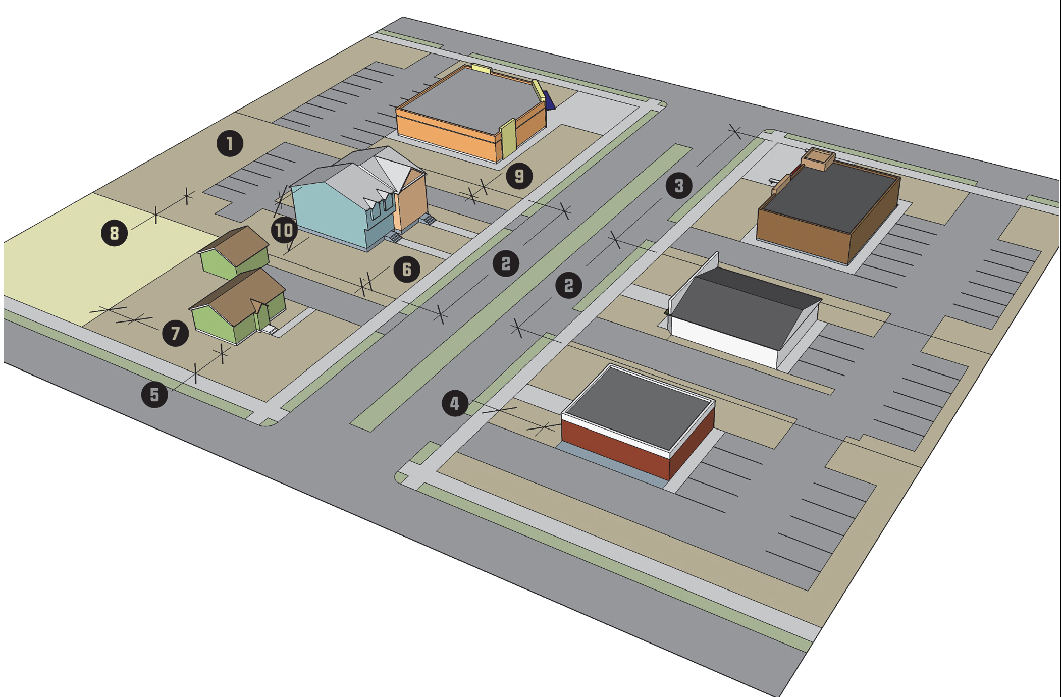
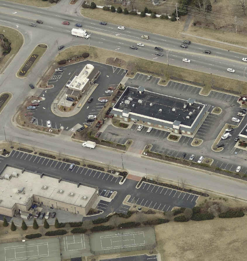
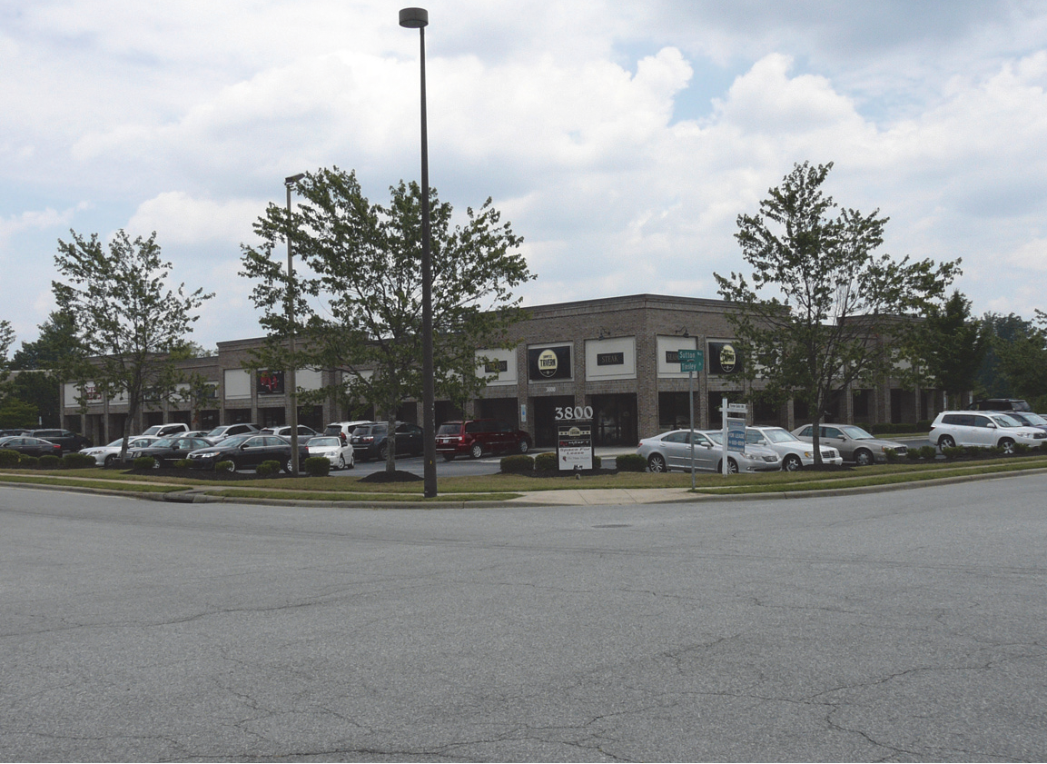
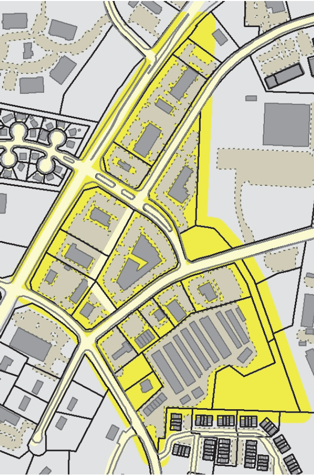
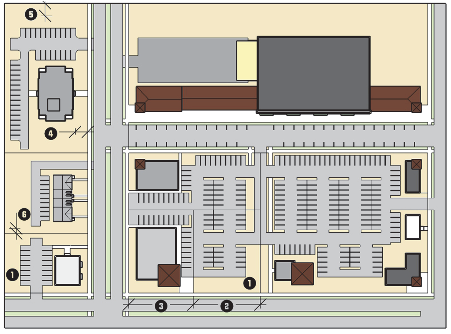
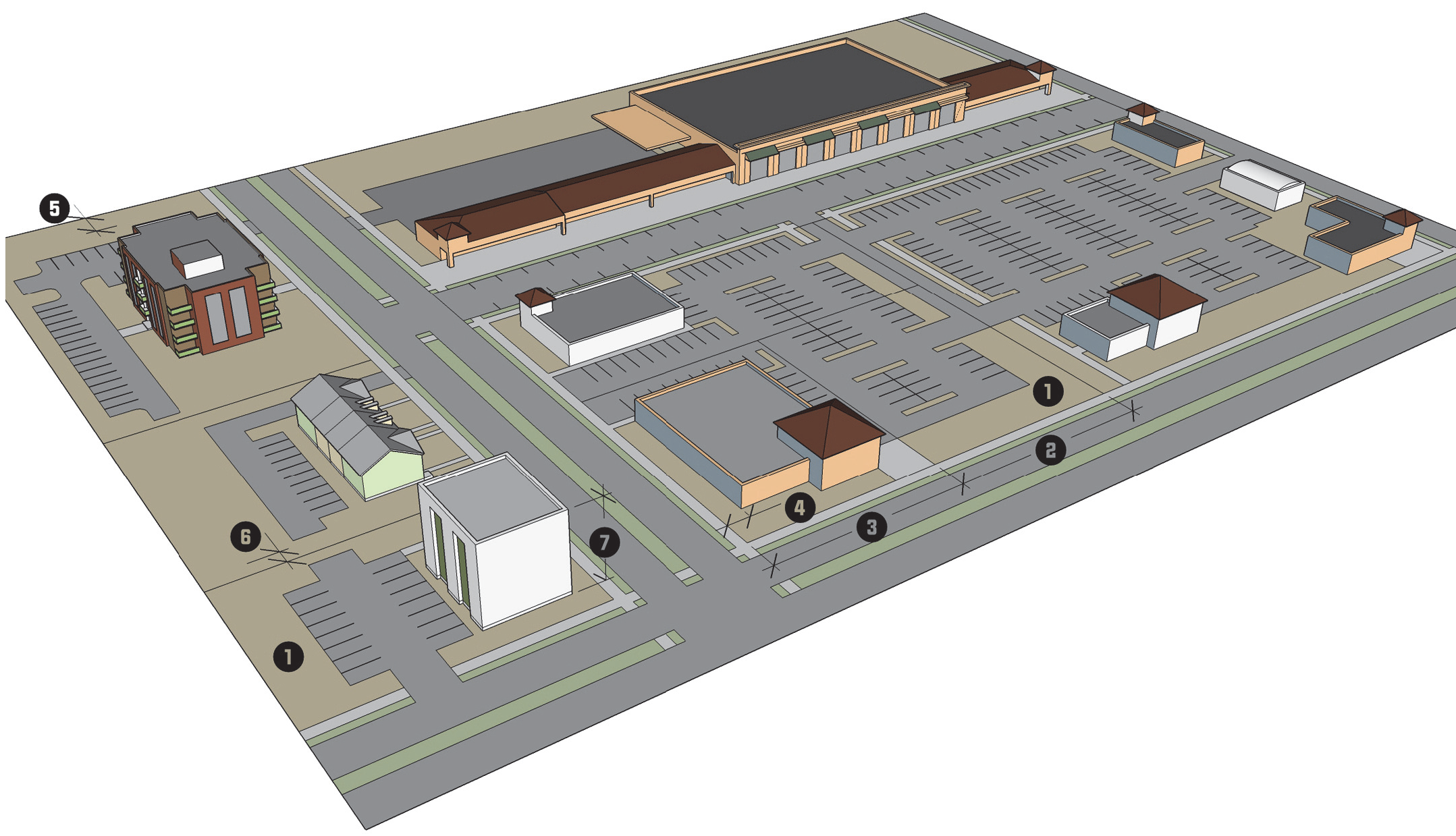
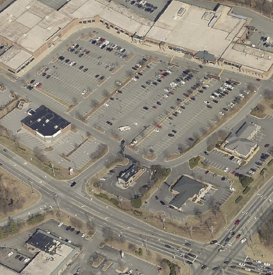
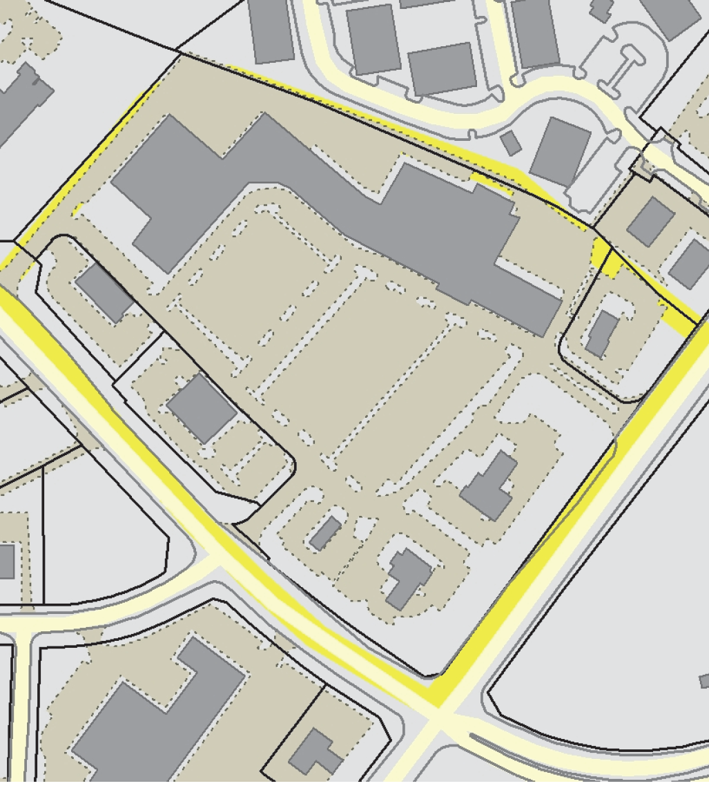
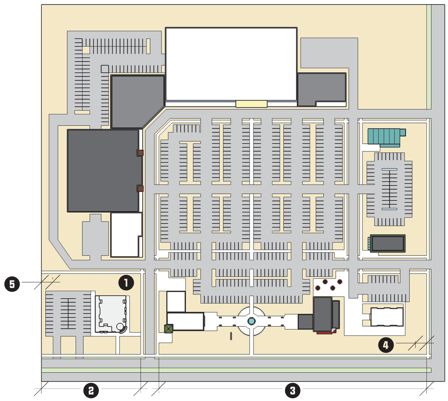
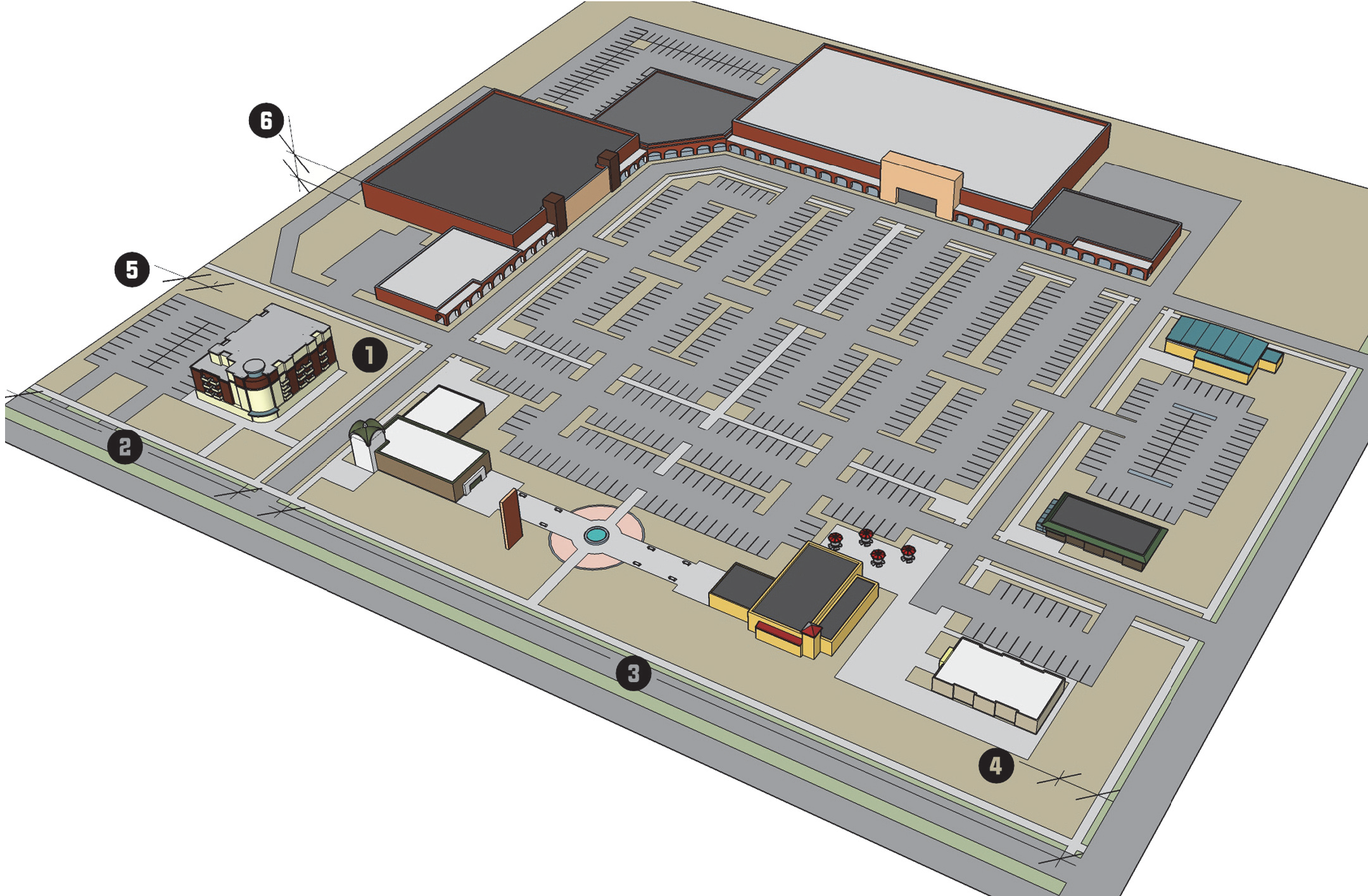
3.4.7. - Retail Center (RC)
| RC RETAIL CENTER DISTRICT | A. DISTRICT PURPOSE | |||||
| The RC district is established to accommodate a diverse range of high-intensity retail, service, and office uses that provide goods and services serving the residents and businesses of the region. The district is typically located at major intersections where visibility and good access are important. Development in the RC district is often configured as large-scale development with multiple uses, shared parking, coordinated signage and landscaping, and deep front setbacks. Higher-density residential uses are encouraged on the upper floors of nonresidential establishments, and may exist as stand-alone buildings as part of a large horizontal mixed-use development. | ||||||
| B. DIMENSIONAL STANDARDS | ||||||
| STANDARD | REFERENCE # | OUTSIDE CORE CITY AREA | INSIDE CORE CITY AREA | |||
|
SF Attached
& Multi-family | All Other Uses |
SF Attached
& Multi-family | All Other Uses | |||
| Minimum District Size (acres) | 5 | 3 | ||||
| Maximum Density (units/acre) | 26 | 26 [1] | 28.6 | 28.6 [1] | ||
| Minimum Lot Area (square feet) | 8,000 [2] | n/a | 8,000 [2] | n/a | ||
| Minimum Lot Width (feet) [3] | Interior lot | 60 + [4] | 100 | 60 + [4] | 100 | |
| Corner lot | ||||||
| Minimum Street Setback (feet) | 30 | 30 [5] | ||||
| Minimum Perimeter Setback (feet) | 30 | 15 | ||||
| Maximum Building Height (feet) | n/a [6] | n/a [7] | ||||
| [1] Mixed-use development is subject to the maximum density standards. | ||||||
| [2] Minimum development size. | ||||||
| [3] All development shall comply with the City's Driveway Ordinance requirements. | ||||||
| [4] For developments with more than 3 units, minimum lot width is increased by 5 feet per unit up to a maximum width of 120 feet. | ||||||
| [5] At applicant's option, may be reduced to the lesser of: zoning district minimum or between 75% and 125% of the average of the lots on the same block face (See Section 10.2.3 D, Dimensional Standards in the Core City). | ||||||
| [6] For each additional foot of height beyond 50 feet up to 80 feet, the perimeter setbacks shall be increased by 1 foot. | ||||||
| [7] When a perimeter setback abuts a single-family residential district, the setback shall be increased by 1 foot for each foot in height beyond 50 feet up to 80 feet. | ||||||
| C. TYPICAL BUILDING FORMS | ||||||
 |  | |||||
| D. TYPICAL LOT PATTERNS | E. DISTRICT DIMENSIONS | |||||
 |  | |||||
| F. TYPICAL BUILDING CONFIGURATION | ||||||
 | ||||||
G.
District Standards
1.
Drive-Throughs
(a)
Outdoor speakers associated with the drive-through shall be at least 50 feet from a residential district.
(b)
Drive-through windows, menu boards, drive aisles, and speakers shall not be located between the principal building line and the front street right-of-way. For corner lots, the drive aisles shall not be located between the principal building line and the front street right-of-way, to the maximum extent practicable.
2.
Outdoor Storage Outdoor storage shall:
(a)
Not cover an area greater than 50 percent of the gross ground floor area of the principal building;
(b)
Not be located between a principal building line and a front or side street right-of-way;
(c)
Not be located in any required landscape yard; and
(d)
Be screened from view from adjacent lots and public streets with an opaque fence, wall, or by any other allowed method in Section 5.6.6, Screening Methods, to a height 6 feet above grade level, provided the screen shall not be allowed in any required landscape yard.
(Ord. No. 7266/17-08, § 9, 1-17-2017; Ord. No. 7365/17-108, § 4.B, 11-20-2017; Ord. No. 7476/18-105, § 10.B, 12-3-2018)
3.4.8. - Central Business (CB)
| CB CENTRAL BUSINESS DISTRICT | A. DISTRICT PURPOSE | ||
| The CB district is established and intended to encourage the urban form and architectural character found in the traditional downtown area as well as promote redevelopment that will make the downtown area, a more diverse and vibrant mixed-use urban center. The CB district is intended to accommodate a well-balanced mix of uses (e.g., office, retail, service, high-density residential, and market showroom development), promote a strong pedestrian-oriented environment (with a reduced need for parking), and preserve and protect the downtown's historical and architectural scale and character. The district is subject to flexible standards intended to support a mixed use urban context. | |||
| B. DIMENSIONAL STANDARDS | |||
| STANDARD | REFERENCE # | ALL USES | |
| Maximum Density (units/acre) | n/a | ||
| Minimum Lot Area (square feet) | n/a | ||
| Minimum Lot Width (feet) | Interior lot | n/a | |
| Corner lot | n/a | ||
| Minimum Street Setback (feet) | 0, 10 from back of curb [1] | ||
|
Maximum Street Setback
(Main Street Only) [2] [3] | 20 | ||
| Minimum Perimeter Setback (feet) | 0/5 [4] | ||
| Maximum Building Height (feet) | n/a | ||
| [1] All buildings shall be at least 10 feet from the back of the curb. | |||
| [2] For all new buildings subject to a maximum street setback, at least 60% of the front building facade shall be located parallel to and within the required setbacks. | |||
| [3] Buildings are exempt from the maximum street setback, if they provide a civic space (see Section 3.4.8 G.2(b) Exemption from Maximum Setback). | |||
| [4] No setback is required, but if provided, it shall be at least 5 feet. | |||
| C. TYPICAL BUILDING FORMS | |||
 |  | ||
| D. TYPICAL LOT PATTERNS | E. DISTRICT DIMENSIONS | ||
 |  | ||
| F. TYPICAL BUILDING CONFIGURATION | |||
 | |||
G.
District Standards
1.
Building Compliance due to Expansion or Exterior Alteration
(a)
In cases where an existing building is expanded or enlarged by 25 percent or less of its gross floor area as it existed on June 5, 2017, or the effective date of the district upon the land, whichever is later, the expansion of the building shall either maintain the current appearance of the existing building or comply with the standards in Section 3.4.8 G.3, Building Standards.
(b)
In cases where an existing building is expanded or enlarged by more than 25 percent of its gross floor area as it existed on June 5, 2017, or the effective date of the district upon the land, whichever is later, the portion of the front and side building facades associated with the expansion or enlargement shall comply with the standards in Section 3.4.8 G.3, Building Standards.
(c)
In cases where the exterior of an existing building is altered, the alterations shall conform to the standards of this section, to the maximum extent practicable. Alterations shall not include the removing, filling-in, or placing a false facade over an existing window, or any other physical changes to obstruct the window. The Planning and Development Director is authorized to grant an administrative adjustment to allow up to 2 windows to be removed or covered for non-occupiable space in an existing building.
2.
Site Standards
(a)
Building Orientation For all new buildings subject to a maximum street setback, at least 60% of the front building facade shall be located parallel to and within the required setbacks.
(b)
Exemption from Main Street Maximum Setback Uses that provide a civic space are exempt from the maximum setback requirement, provided the civic space meets the following requirements:
(1)
The civic space shall be between the front of the principal building and Main Street;
(2)
The area shall not be used for parking or loading, exclusive of valet parking and passenger loading;
(3)
The area shall have landscaping that covers a minimum of 10 percent of the area;
(4)
It may include pedestrian amenities which include but are not limited to: seating, outdoor play areas, bicycle racks, kiosks, water features, public art, freestanding structures such as a clock tower, or similar amenities;
(5)
A decorative fence, a hedgerow, or a combination thereof may be provided along Main Street (or other primary fronting street) to provide a boundary between the civic space and the street right-of-way. If provided, the boundary treatment shall meet the following requirements:
(i)
Walls and fences are limited to a maximum of 4 feet in height. Decorative fences include, but are not limited to: wrought iron, architectural metal, or other transparent decorative fence. Chain-link fencing is prohibited.
(ii)
Hedges used to establish this boundary shall be a minimum height of 18 inches at planting and shall be maintained at a height between 3 and 4 feet at maturity.
(c)
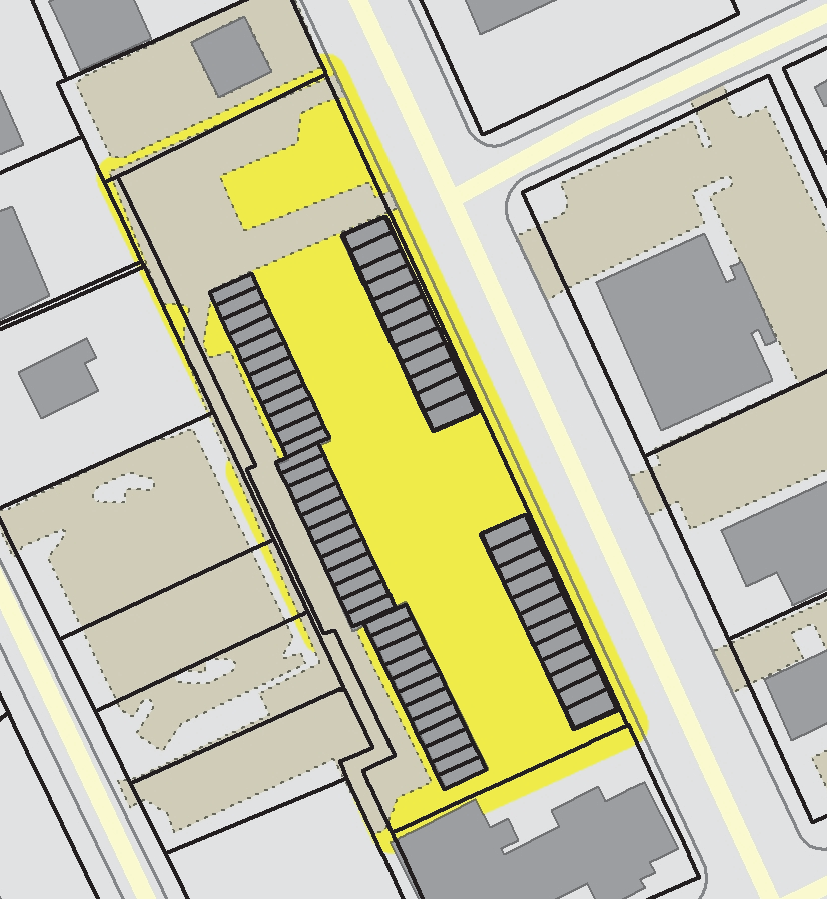
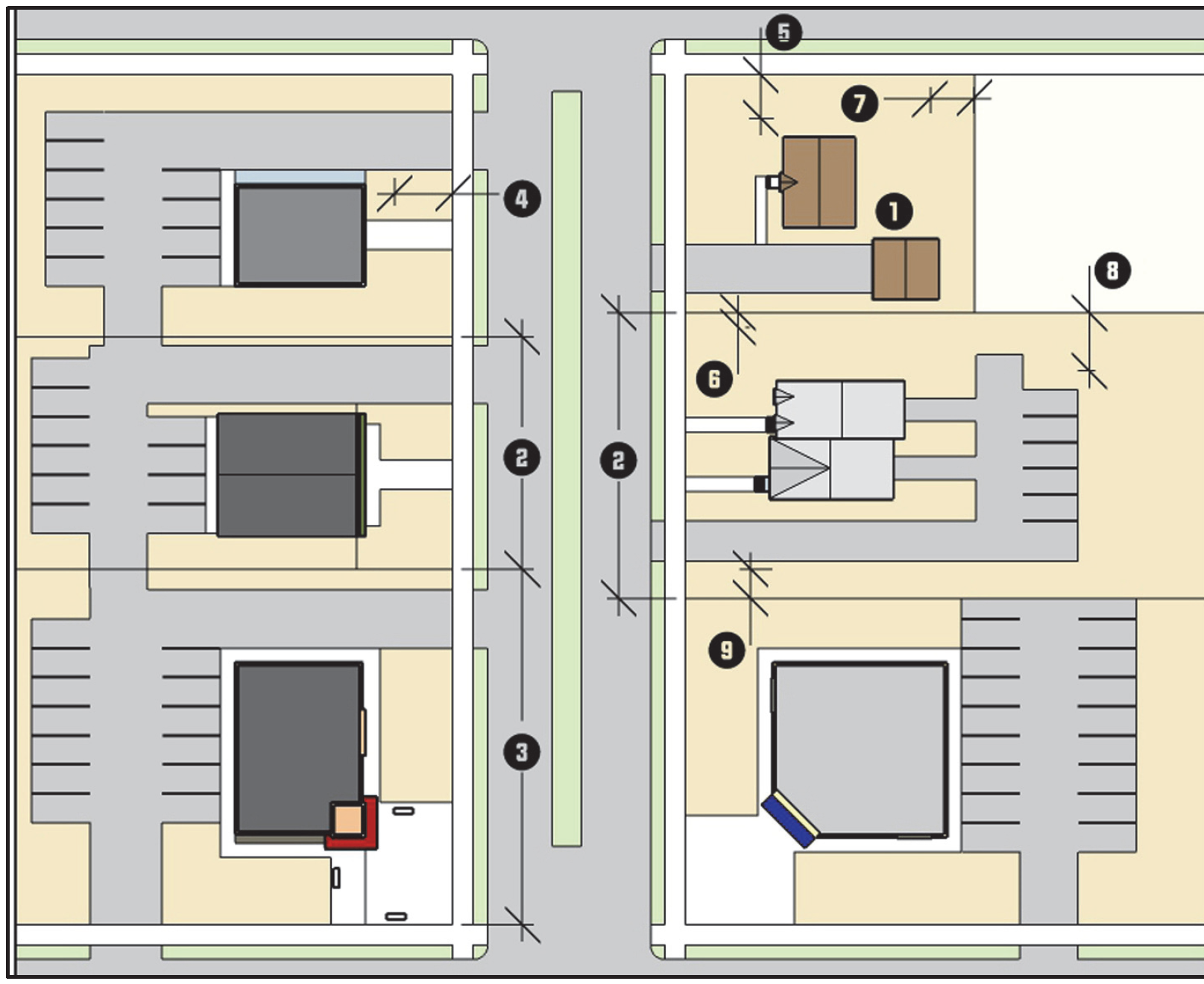
Off-Street Parking Off-Street parking is not required, but when provided, development in the CB district shall comply with the following standards (see Figure 3.4.8.G.2, Parking Lot Location) in addition to the applicable standards in Section 5.4, Off-Street Parking and Loading:
(1)
Off-street parking areas shall not be located between the front building line and the street it faces.
(2)
Off-street parking areas on corner lots shall not contiguously front more than 1 street.
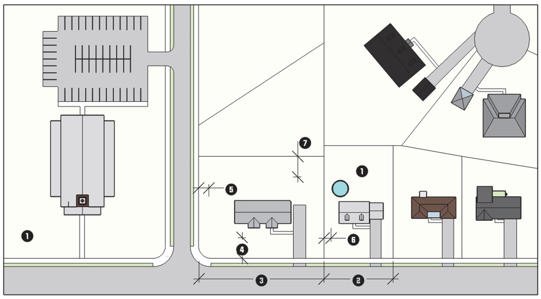
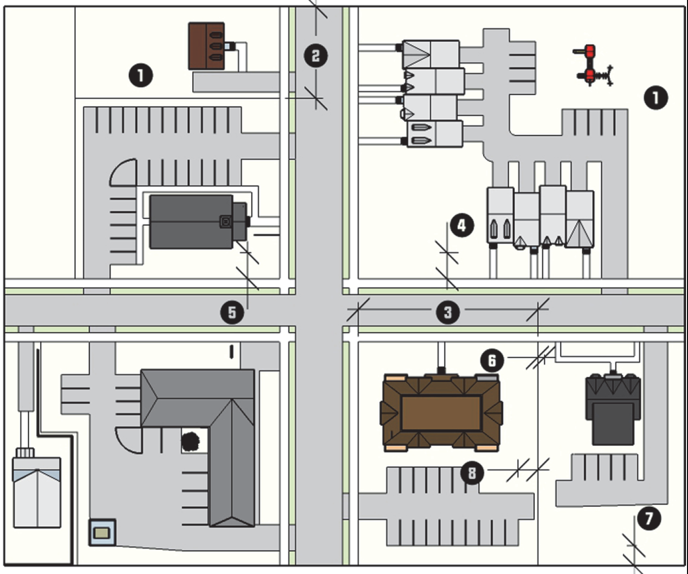
FIGURE 3.4.8.G.2, PARKING LOT LOCATION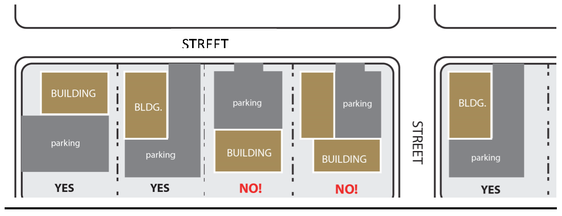
(d)
Drive-Throughs
(a)
Outdoor speakers associated with the drive-through shall be at least 50 feet from a residential district.
(b)
Drive-through windows, menu boards, drive aisles, and speakers shall not be located between the principal building line and the front street right-of-way. For corner lots, the drive aisles shall not be located between the principal building line and the front street right-of-way, to the maximum extent practicable.
(e)
Outdoor Storage Outdoor storage of materials, supplies, products, or equipment is prohibited for all nonresidential uses. Nothing shall prohibit the outdoor display of merchandise for sale in accordance with Section 4.4.5 K, Outdoor Display.
(f)
Sidewalks Sidewalks shall comply with the standards in Section 5.9, Sidewalks, as well as the following:
(1)
Sidewalks shall be located on both sides of all streets except alleys.
(2)
Sidewalks shall be located at the back of the curb and shall maintain a minimum width of 10 feet or up to the existing building line when less than 10 feet.
(3)
Sidewalks may include street tree plantings, street furnishings and sidewalk cafes in accordance with applicable City Codes.
(4)
Sidewalks shall be configured to provide a smooth transition in width between new sidewalks and connections to established sidewalks of a lesser width.
(g)
Accessory Buildings
(1)
Accessory buildings shall be located behind the rear building line of the principal building they serve.
(2)
For group developments, accessory buildings can be located internally to the development. In no instance, shall an accessory building be located between a front building line that is established by a principal building and the street the principal building faces.
(3)
Multi-family residential and nonresidential accessory building facades should use the same materials as the principal building they serve.
3.
Building Standards The following standards are applied to all multi-family residential and nonresidential buildings; except for locally or nationally designated individual historic structures, and contributing structures within a locally or nationally designated historic district, provided such structures comply with the Secretary of Interior's Standards for Rehabilitation or are issued a Certificate of Appropriateness, as applicable:
(a)
Facade Articulation
(1)
Front and side building facades shall include at least 2 or more of the following features at least every 15 feet measured horizontally and vertically per floor:
(i)
Recessed entryways;
(ii)
Display windows;
(iii)
Window indentations (such as but not limited to double-hung, stationary, or casement windows) that are regularly spaced and that incorporate a differing building material, texture, color, awnings, window hoods, or canopies. This shall not include a glass curtain wall or flush mounted glass;
(iv)
Offset surfaces, niches, insets, projections, or bas-relief with a minimum depth of 4 inches;
(v)
Differentiated piers, columns, or pilasters;
(vi)
Pedestrian entrances;
(vii)
Textured materials (such as but not limited to brick or stone);
(viii)
Roofline changes, coupled with correspondingly aligned wall offsets or facade material changes, changes in the roof planes, or changes in the height of a parapet wall; or
(ix)
Changes in wall plane (such as projections or recesses).
(2)
Building facades facing a street should achieve vertical orientation by using regularly spaced vertically oriented windows and doors, in conjunction with features such as: roofline/parapet variations, window hoods, material changes, columns, pilasters, posts, awnings, canopies, stoops, or facade offsets, to create vertically oriented bays, or divisions of space that are approximately 30 feet wide or less. The rhythm within a building facade should be maintained by making each vertically oriented bay the same width.
(3)
Buildings of 2 or more stories are encouraged to have front facades that have a clear and distinct base (ground floor), middle, and top (often defined by a decorative cornice). Features such as an increased ground floor height (including a transom window), the use of a frieze, string course or storefront cornice, a bulkhead or kick plate, and differentiated building materials or coloration are similarly encouraged.
(b)
Facade Materials
(1)
Primary facade materials should not change at outside corners, and should continue around the corner to a logical point of conclusion such as a change in facade plane.
(2)
Exterior building materials shall be continued to the finished grade on any elevation.
(3)
Building facades utilizing smooth-faced concrete block, or unfinished or untreated tilt-up concrete panels, shall be limited to building facades not visible from public streets as seen from the public right-of-way at a height of 6 feet.
(4)
The use of vinyl siding or corrugated and other vertical metal siding as the sole or primary facade material is prohibited.
(c)
Facade Transparency
(1)
The front building facade facing a street shall maintain non-reflective, transparent windows on at least 35 percent of the facade area between 2 and 8 feet above average grade.
(2)
Ground level side facades facing a street shall maintain non-reflective, transparent windows on at least 20 percent of the facade area between 2 and 8 feet of the floor.
(3)
Upper stories on front and side facades facing a street shall maintain windows on at least 20 percent of the upper story facade area per floor as measured between 2 and 8 feet. The window glazing may be opaque.
(4)
Civic, religious institution, and utilities use categories are exempt from these transparency requirements.
(d)
Primary Entrance
(1)
Except for corner buildings, the primary entrance of a building shall face the street from which the building derives its street address.
(2)
Primary entrances on corner buildings may be located to face the corner.
(3)
The primary entrance shall be distinguishable from the balance of the front facade through the use of one or more of any of the following or other similar features:
(i)
Projecting or recessed entry;
(ii)
Transom or sidelight windows;
(iii)
Pediments, columns, or other vertical features; or
(iv)
Marquees, arcades, or overhangs.
(e)
Roof-Mounted Equipment
(1)
Flat roofs shall incorporate parapet walls designed to screen the roof and roof-mounted equipment from view from the primary street fronting the building and any abutting side streets as seen from the public right-of-way at a height of 6 feet. The parapet wall should be finished in the same or similar material and color as the building.
(2)
For sloped roofs, equipment and other roof penetrations should be located and screened to have a minimal visual impact as seen from the public right-of-way at a height of 6 feet.
(3)
In cases where complete screening is not practicable, all roof-mounted equipment and other roof penetrations shall be camouflaged through the use of paint or architectural techniques to minimize its appearance.
(4)
Green roofs, which use vegetation to improve stormwater quality and reduce runoff, are exempt from the screening requirements described in this subsection.
(f)
Service or Vehicular Bays
(1)
Service or vehicular bay doors shall not face the primary fronting street if the door is located within 50 feet of the street right-of-way, unless the doors use similar architectural styling and color to blend in with the building they serve, to the maximum extent practicable.
(2)
Other than the primary fronting street, all service or vehicular bay doors that face a street and are within 50 feet of the street right-of-way shall use the same or a similar color as the building so as to blend it in with the building they serve, to the maximum extent practicable.
(3)
No service or vehicular bay doors shall face Main Street.
(Ord. No. 7302/17-44, §§ 1, 2, 6-5-2017; Ord. No. 7363/17-106, §§ 12—15, 11-20-2017; Ord. No. 7389/18-18, § 1, 2-19-2018; Ord. No. 7476/18-105, § 7.B, 12-3-2018; Ord. No. 7750/21-67, § 18, 11-1-2021; Ord. No. 7926/23-41, § 3, 5-15-2023)
3.4.10. - Employment Center (EC)
| EC EMPLOYMENT CENTER DISTRICT | A. DISTRICT PURPOSE | |||||
| The EC district is established to accommodate office, warehouse, research and development, light industrial, and supporting activities in a well-planned, high quality business park setting. In addition to typical business park uses, the district also allows retail and service uses intended to serve employees working in the immediate vicinity. In addition to an expectation for high quality design, the district includes standards to help ensure compatibility between development and nearby residential uses. Region-serving commercial and intensive forms of industrial development are prohibited as well as outdoor manufacturing, processing, and storage activities. | ||||||
| B. DIMENSIONAL STANDARDS | ||||||
| STANDARD | REFERENCE # | OUTSIDE CORE CITY AREA | INSIDE CORE CITY AREA | |||
| SF Attached & Multi-family | All Other Uses | SF Attached & Multi-family | All Other Uses | |||
| Minimum District Size (acres) | 5 | 2 | ||||
| Maximum Density (units/acre) | 16 | 16 [1] | 17.6 | 17.6 [1] | ||
| Minimum Lot Area (square feet) | 40,000 [2] | n/a | 40,000 [2] | n/a | ||
| Minimum Lot Width (feet) [3] | Interior lot | 150 | 150 [4] | 150 | ||
| Corner lot | ||||||
| Minimum Street Setback (feet) | 15 | 15 [4] | ||||
| Minimum Perimeter Setback (feet) |
Adjacent to
Residential District | 40 | 25 | |||
|
Adjacent to
Nonresidential District | 20 | 10 | ||||
| Max. Building Height (feet) | n/a [5] | n/a [6] | ||||
| [1] Mixed-use development is subject to the maximum density standards. | ||||||
| [2] Minimum development size. | ||||||
| [3] All development shall comply with the City's Driveway Ordinance requirements. | ||||||
| [4] At applicant's option, may be reduced to the lesser of: zoning district minimum or between 75% and 125% of the average of the lots on the same block face (See Section 10.2.3 D, Dimensional Standards in the Core City). | ||||||
| [5] For each additional foot of height beyond 50 feet up to 80 feet, the perimeter setbacks shall be increased by 1 foot. | ||||||
| [6] When a perimeter setback abuts a single-family residential district, the setback shall be increased by 1 foot for each foot in height beyond 50 feet up to 80 feet. | ||||||
| C. TYPICAL BUILDING FORMS | ||||||
 |  | |||||
| D. TYPICAL LOT PATTERNS | E. DISTRICT DIMENSIONS | |||||
 |  | |||||
| F. TYPICAL BUILDING CONFIGURATION | ||||||
 | ||||||
G.
District Standards
1.
Site Standards The following standards are applied to nonresidential development sites:
(a)
Building Orientation Single-building developments shall be oriented so that the front facade faces the street from which the building derives its street address.
(b)
Drive-Throughs Drive-through lanes and windows are prohibited.
(c)
Fences Non-coated chain link fencing shall not be located between the primary facade of a building and the street it faces, and comply with the standards in Section 5.11, Fences.
(d)
Ground-based Mechanical Equipment Screening Ground-based mechanical equipment shall be located to the side or rear of the building and comply with the standards in Section 5.6, Screening.
(e)
Off-Street Loading
(1)
Loading docks and bays shall be located towards the rear of buildings, or located internally within multi-building developments, and shall not face or be adjacent to public streets.
(2)
If located on the side of a building it shall be screened in accordance with Section 5.6, Screening.
(f)
Pedestrian Connections Pedestrian connections with a minimum unobstructed width of 4 feet shall be incorporated to connect a building's primary entrance with all of the following:
(1)
Off-street parking areas of 30 or more spaces located on the same lot;
(2)
The principal entrances of all other principal buildings in a multi-building development;
(3)
The public sidewalk, if one abuts the development;
(4)
On-site pedestrian amenities;
(5)
Greenways, trails, or paths located on-site or abutting the development; and
(6)
Existing or planned transit stops located on-site or abutting the development.
(g)
Accessory Buildings Accessory buildings shall be located to the side or rear of the development they serve, and shall use the same materials and architectural styling as the principal building they serve.
(h)
Outdoor Storage Outdoor storage shall:
(1)
Not cover an area greater than 50 percent of the gross ground floor area of the principal building;
(2)
Be located between the rear building line of the principal building and the rear lot line;
(3)
Not be located in any required landscape yard; and
(4)
Be screened from view from adjacent lots and public streets with an opaque fence, wall, or by any other allowed method in Section 5.6.6, Screening Methods, to a height 6 feet above grade level, provided the screen shall not be allowed in any required landscape yard.
(i)
Outdoor Manufacturing, Processing, Repair, or Assembly Outdoor manufacturing, processing, repair, or assembly is prohibited and must take place within an enclosed building.
2.
Building Standards The following standards are applied to all multi-family residential and nonresidential buildings, except for locally or nationally designated individual historic structures and contributing structures within a locally or nationally designated historic district, provided such structures comply with the Secretary of Interior's Standards for Rehabilitation or are issued a Certificate of Appropriateness, as applicable.
(a)
Articulation
(1)
Building facades facing a public street shall include at least 2 or more of the following features:
(i)
Windows or fenestration;
(ii)
Changes in wall plane (such as projections or recesses) with an offset or depth of at least 1 foot;
(iii)
Roofline changes, coupled with correspondingly aligned wall offset or facade material changes, changes in the roof planes, or changes in the height of a parapet wall;
(iv)
Use of columns, pilasters, piers, architectural boxing, or other technique to break the facade into different volumes;
(v)
Inclusion of eaves or overhangs; or
(vi)
Inclusion of an entryway with a roof form that differs from the rest of the facade.
(b)
Facade Materials
(1)
Exterior building materials should be continued to the finished grade on any elevation.
(2)
Building facades utilizing smooth-faced concrete block, or unfinished or untreated tilt-up concrete panels, shall be limited to building facades not visible from public streets as seen from the public right-of-way at a height of 6 feet.
(3)
The use of vinyl siding or corrugated metal siding and other vertical metal siding is prohibited.
(4)
The use of high intensity (bright), metallic, or fluorescent colors shall be limited to facade trim or accents and total less than 20% of the area of any building facade.
(5)
Primary facade materials should not change at outside corners, and should continue around the corner to a logical point of conclusion such as a window or change in facade plane.
(c)
Roof-Mounted Equipment
(1)
Flat roofs shall incorporate parapet walls designed to screen the roof and roof-mounted equipment from view from the primary street fronting the building and any abutting side streets as seen from the public right-of-way at a height of 6 feet. The parapet wall should be finished in the same or similar material and color as the building.
(2)
For sloped roofs, equipment and other roof penetrations should be located and screened to have a minimal visual impact as seen from the public right-of-way at a height of 6 feet.
(3)
In cases where complete screening is not practicable, all roof- mounted equipment and other roof penetrations shall be camouflaged through the use of paint or architectural techniques to minimize its appearance.
(4)
Green roofs, which use vegetation to improve stormwater quality and reduce runoff, are exempt from the screening requirements described in this subsection.
3.
Retail Sales and Personal Service Uses Retail Sales and Personal Service uses established as a principal use shall be located within a multi-tenant building.
(Ord. No. 7266/17-08, § 7, 1-17-2017; Ord. No. 7365/17-108, § 4.C, 11-20-2017; Ord. No. 7415/18-44, § 2.A, 5-21-2018; Ord. No. 7476/18-105, § 10.C, 12-3-2018)
3.4.11. - Light Industrial (LI)
| LI LIGHT INDUSTRIAL DISTRICT | A. DISTRICT PURPOSE | |||
| The LI district is established to accommodate light manufacturing, assembly, fabrication, processing, distribution, storage, wholesales sales, research and development, and other industrial uses that are small-scale and result in minimal exterior movement of vehicles, materials, and goods, and have minimal visual impacts. The district also allows commercial activities intended to serve the primary businesses in the districts and their employees as well as multi-family, retail, and personal services establishments as adaptive re-uses of existing buildings within the Core City. | ||||
| B. DIMENSIONAL STANDARDS | ||||
| STANDARD | REFERENCE # | OUTSIDE CORE CITY AREA | INSIDE CORE CITY AREA | |
| Minimum Lot Area (square feet) | n/a | n/a | ||
| Minimum Lot Width (feet) [1] | Interior lot | 100 | 100 | |
| Corner lot | ||||
| Minimum Street Setback (feet) | 25 | 15 [2] | ||
| Minimum Perimeter Setback (feet) | Adjacent to Residential District | 40 | 25 | |
| Adjacent to Nonresidential District | 0/5 [3] | 0/5 [3] | ||
| Maximum Building Height (feet) | n/a [4] | n/a [5] | ||
| [1] All development shall comply with the City's Driveway Ordinance requirements. | ||||
| [2] At applicant's option, may be reduced to the lesser of: zoning district minimum or between 75% and 125% of the average of the lots on the same block face (See Section 10.2.3 D, Dimensional Standards in the Core City). | ||||
| [3] No setback is required, but if provided, it shall be at least 5 feet. | ||||
| [4] For each additional foot of height beyond 50 feet up to 80 feet, the perimeter setbacks shall be increased by 1 foot. | ||||
| [5] When a perimeter setback abuts a single-family residential district, the setback shall be increased by 1 foot for each foot in height beyond 50 feet up to 80 feet. | ||||
| C. TYPICAL BUILDING FORMS | ||||
 |  | |||
| D. TYPICAL LOT PATTERNS | E. DISTRICT DIMENSIONS | |||
 |  | |||
| F. TYPICAL BUILDING CONFIGURATION | ||||
 | ||||
G.
District Standards
1.
Outdoor Storage Outdoor storage shall be screened from view from adjacent lots and public streets with an opaque fence, wall, or by any other allowed method in Section 5.6.6, Screening Methods, to a height 6 feet above grade level.
2.
Outdoor Manufacturing, Processing, or Assembly Outdoor manufacturing, processing, or assembly is prohibited.
(Ord. No. 7365/17-108, § 4.D, 11-20-2017)
3.4.12. - Heavy Industrial (HI)
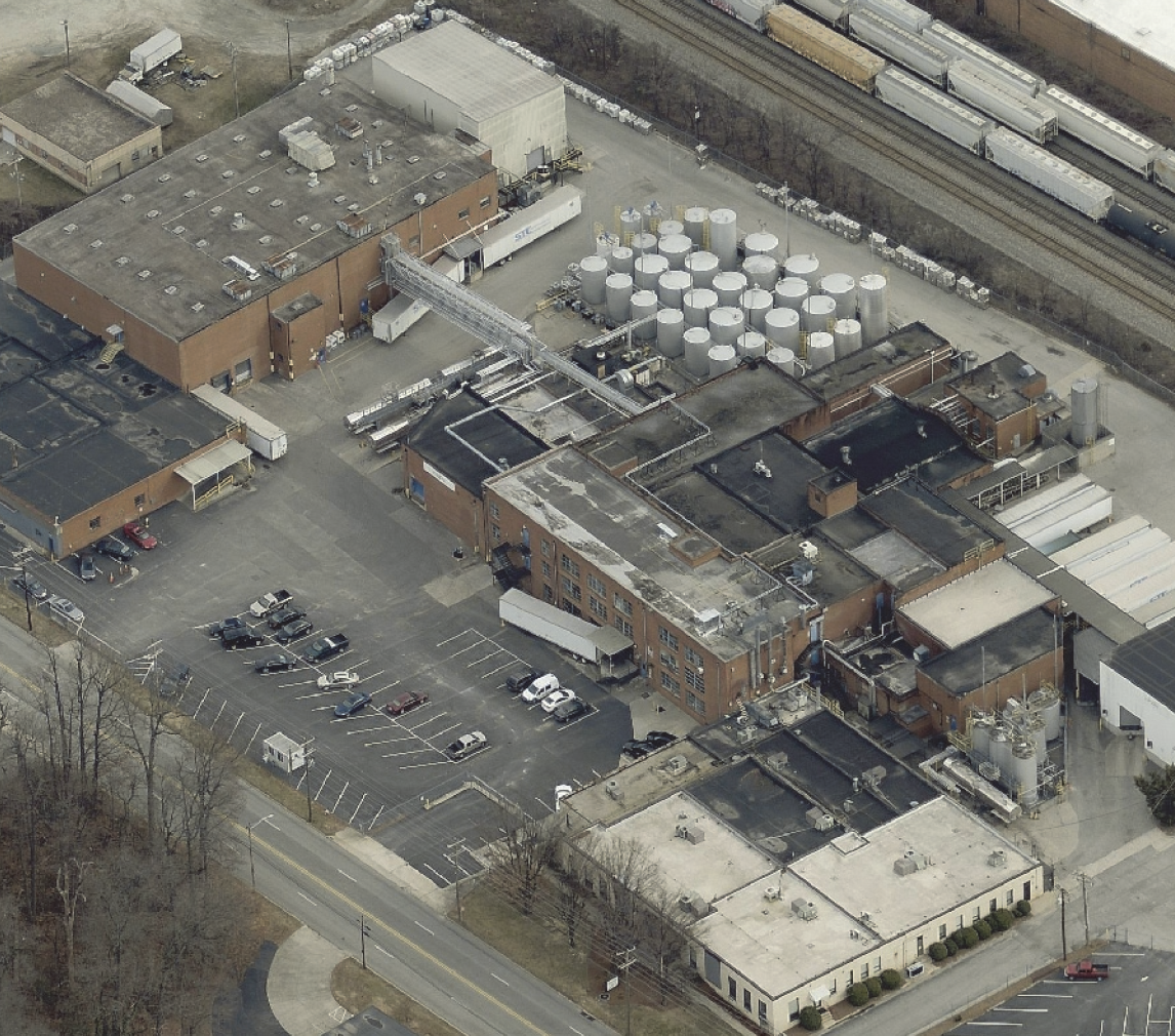
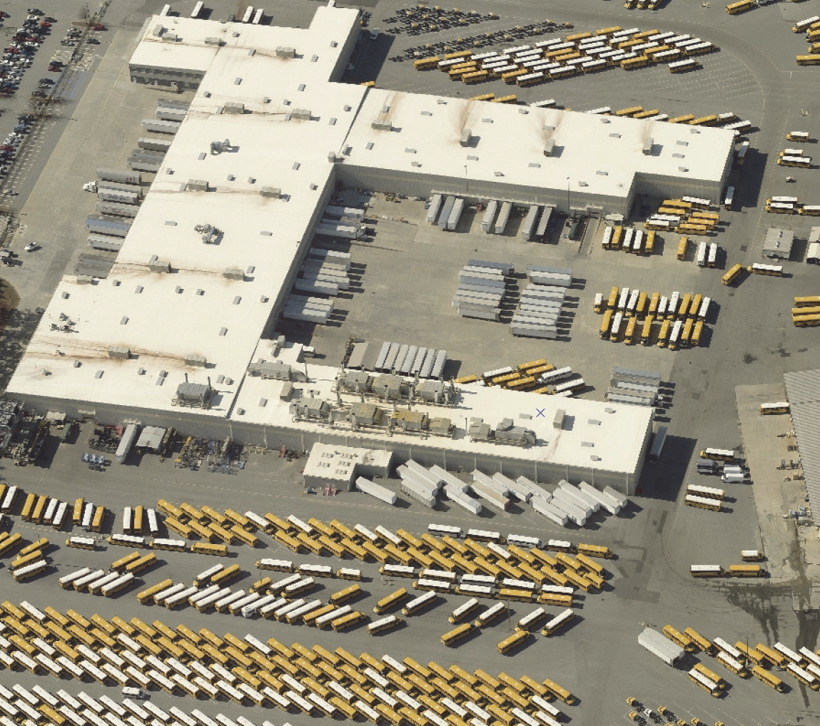
| HI HEAVY INDUSTRIAL DISTRICT | A. DISTRICT PURPOSE | |||
| The HI district is established to accommodate heavy manufacturing, assembly, fabrication, processing, distribution, storage, research and development, and other industrial uses that may be large-scale or otherwise have extensive exterior movement of vehicles, materials, and goods, and greater potential for adverse environmental and visual impacts. | ||||
| B. DIMENSIONAL STANDARDS | ||||
| STANDARD | REFERENCE # | OUTSIDE CORE CITY AREA | INSIDE CORE CITY AREA | |
| Minimum Lot Area (square feet) | n/a | n/a | ||
| Minimum Lot Width (feet) [1] | Interior lot | 100 | 100 | |
| Corner lot | ||||
| Minimum Street Setback (feet) | 25 | 15 [2] | ||
| Minimum Perimeter Setback (feet) [3] | Adjacent to Residential District | 50 | 35 | |
| Adjacent to Nonresidential District | 0/5 [3] | 0/5 [3] | ||
| Maximum Building Height (feet) | n/a [4] | n/a [5] | ||
| [1] All development shall comply with the City's Driveway Ordinance requirements. | ||||
| [2] At applicant's option, may be reduced to the lesser of: zoning district minimum or between 75% and 125% of the average of the lots on the same block face (See Section 10.2.3 D, Dimensional Standards in the Core City). | ||||
| [3] No setback is required, but if provided, it shall be at least 5 feet. | ||||
| [4] For each additional foot of height beyond 50 feet up to 80 feet, the perimeter setbacks shall be increased by 1 foot. | ||||
| [5] When a perimeter setback abuts a single-family residential district, the setback shall be increased by 1 foot for each foot in height beyond 50 feet up to 80 feet. | ||||
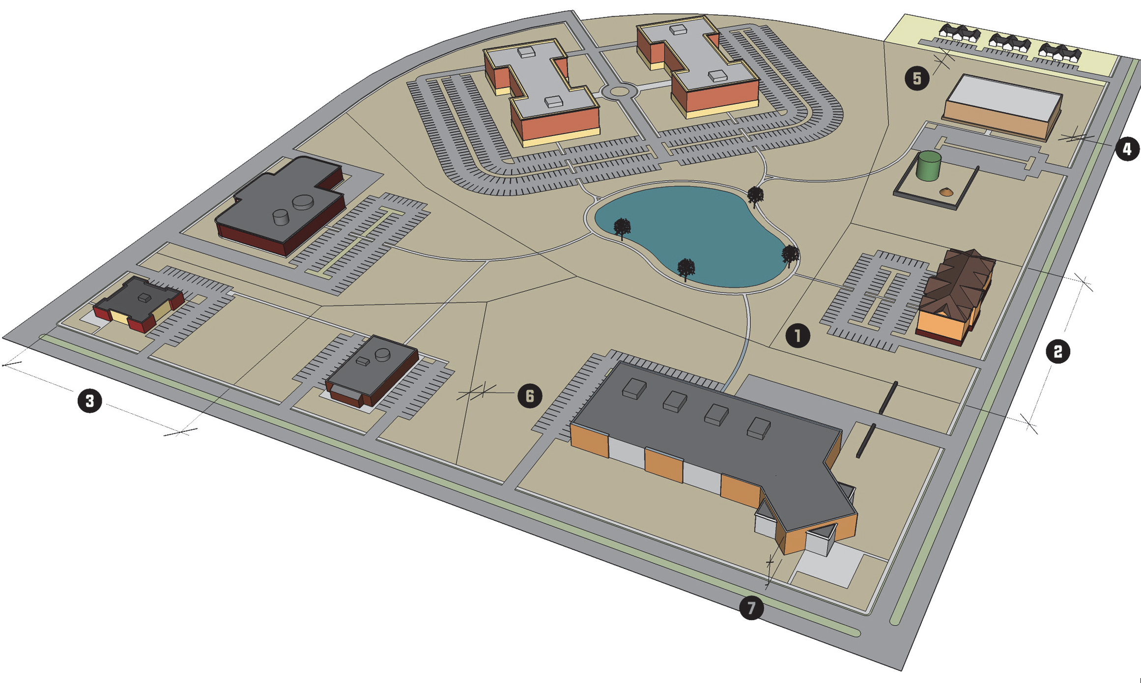
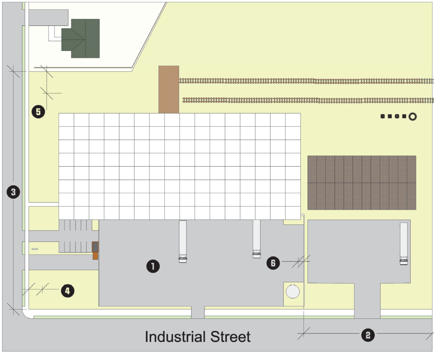
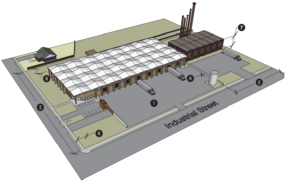
| C. TYPICAL BUILDING FORMS | ||||
 |  | |||
| D. TYPICAL LOT PATTERNS | E. DISTRICT DIMENSIONS | |||
 |  | |||
| F. TYPICAL BUILDING CONFIGURATION | ||||
 | ||||
3.5.1.- General Purpose and Intent
The special zoning districts established in this section are intended to achieve specific planning and design objectives in defined areas of the City and to create suitable environments for distinct uses and development outside the established residential and business districts.
(Ord. No. 7266/17-08, § 8, 1-17-2017)
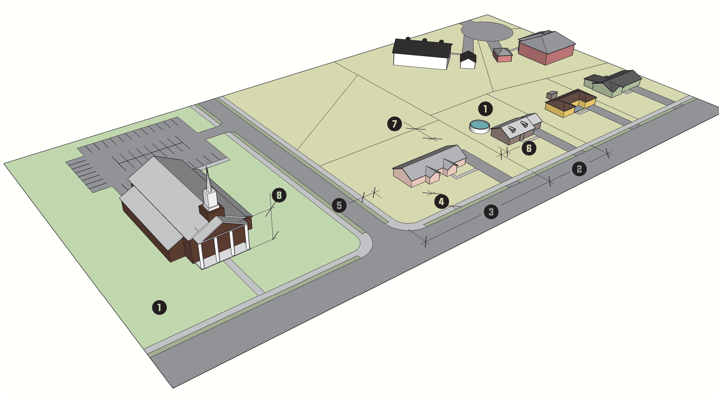
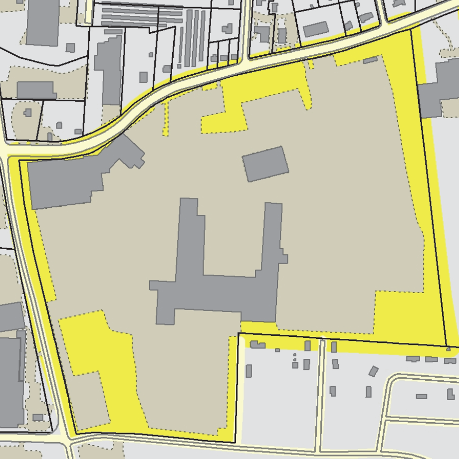
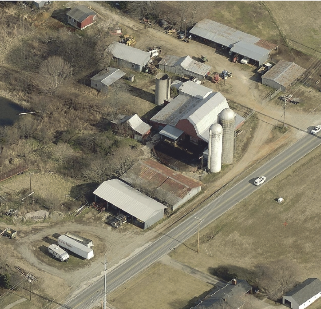
3.5.2. - Agricultural/Rural (AGR)
| AGR AGRICULTURAL/ RURAL DISTRICT | A. DISTRICT PURPOSE | ||
| The AGR district is established to accommodate agricultural and agricultural-related uses as well as very low density residential development on large lots, that are not served by public water or sewer. The district is intended to preserve land for agricultural or forest uses, to provide for the orderly transition to urban use, and protect environmentally-sensitive lands. It encourages residential development that preserves farmland and other open space through flexibly-designed conservation subdivisions. | |||
| B. DIMENSIONAL STANDARDS | |||
| STANDARD | REFERENCE # | ALL USES | |
| Maximum Density (units/acre) | n/a | ||
| Minimum Lot Area (acres) | 5 | ||
| Minimum Lot Width (feet) [1] | Interior lot | 150 | |
| Corner lot | |||
| Minimum Street Setback (feet) | Front | 30 | |
| Side | 15 | ||
| Minimum Perimeter Setback (feet) | 30 | ||
| Maximum Building Height (feet) | 50 [2] | ||
| [1] All development shall comply with the City's Driveway Ordinance requirements. | |||
| [2] Not applied to farm-related accessory structures. | |||
| C. TYPICAL BUILDING FORMS | |||
 |  | ||
| D. TYPICAL LOT PATTERNS | E. DISTRICT DIMENSIONS | ||
 |  | ||
| F. TYPICAL BUILDING CONFIGURATION | |||
 | |||
(Ord. No. 7415/18-44, § 3.A, 5-21-2018)
3.5.4. - Institutional (I)
| I INSTITUTIONAL DISTRICT | A. DISTRICT PURPOSE | |||
| The I district is established to accommodate large-sized public, quasi-public, and institutional uses such as colleges, universities, or hospitals in a campus-like setting. Uses in the I district can have substantial land use impacts or traffic impacts on surrounding uses. This district is not intended to accommodate those smaller public and institutional uses that are typically found in residential districts. The district allows a limited range of residential and institutional development as support uses. | ||||
| B. DIMENSIONAL STANDARDS | ||||
| STANDARD | REFERENCE # | OUTSIDE CORE CITY AREA | INSIDE CORE CITY AREA | |
| All Uses | All Uses | |||
| Minimum District Size (acres) | 20 | 10 | ||
| Maximum Density (units/acre) | 16 [1] | 17.6 [1] | ||
| Minimum Lot Area (square feet) | n/a | n/a | ||
| Minimum Lot Width (feet) [2] | Interior lot | 100 | 100 | |
| Corner lot | ||||
| Minimum Street Setback (feet) | 30 | 30 [3] | ||
| Minimum Perimeter Setback (feet) | 30 | 15 | ||
| Maximum Building Height (feet) | n/a [4] | n/a [5] | ||
| [1] Mixed-use development is subject to the maximum density standards. | ||||
| [2] All development shall comply with the City's Driveway Ordinance requirements. | ||||
| [3] At applicant's option, may be reduced to the lesser of: zoning district minimum or between 75% and 125% of the average of the lots on the same block face (See Section 10.2.3 D, Dimensional Standards in the Core City). | ||||
| [4] For each additional foot of height beyond 50 feet up to 80 feet, the perimeter setbacks shall be increased by 1 foot. | ||||
| [5] When a perimeter setback abuts a single-family residential district, the setback shall be increased by 1 foot for each foot in height beyond 50 feet up to 80 feet. | ||||
| C. TYPICAL BUILDING FORMS | |||
 | 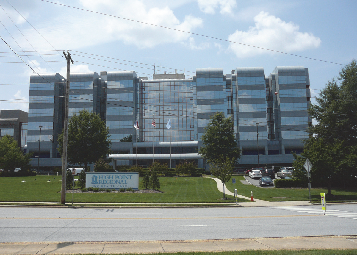 | ||
| D. TYPICAL LOT PATTERNS | E. DISTRICT DIMENSIONS | ||
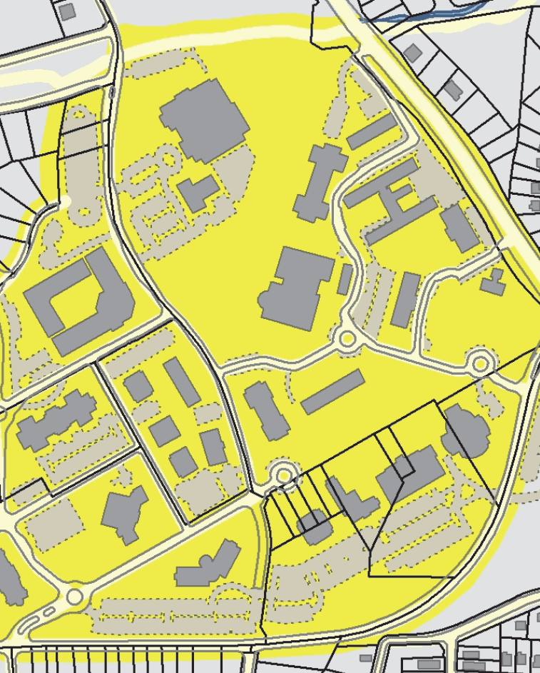 | 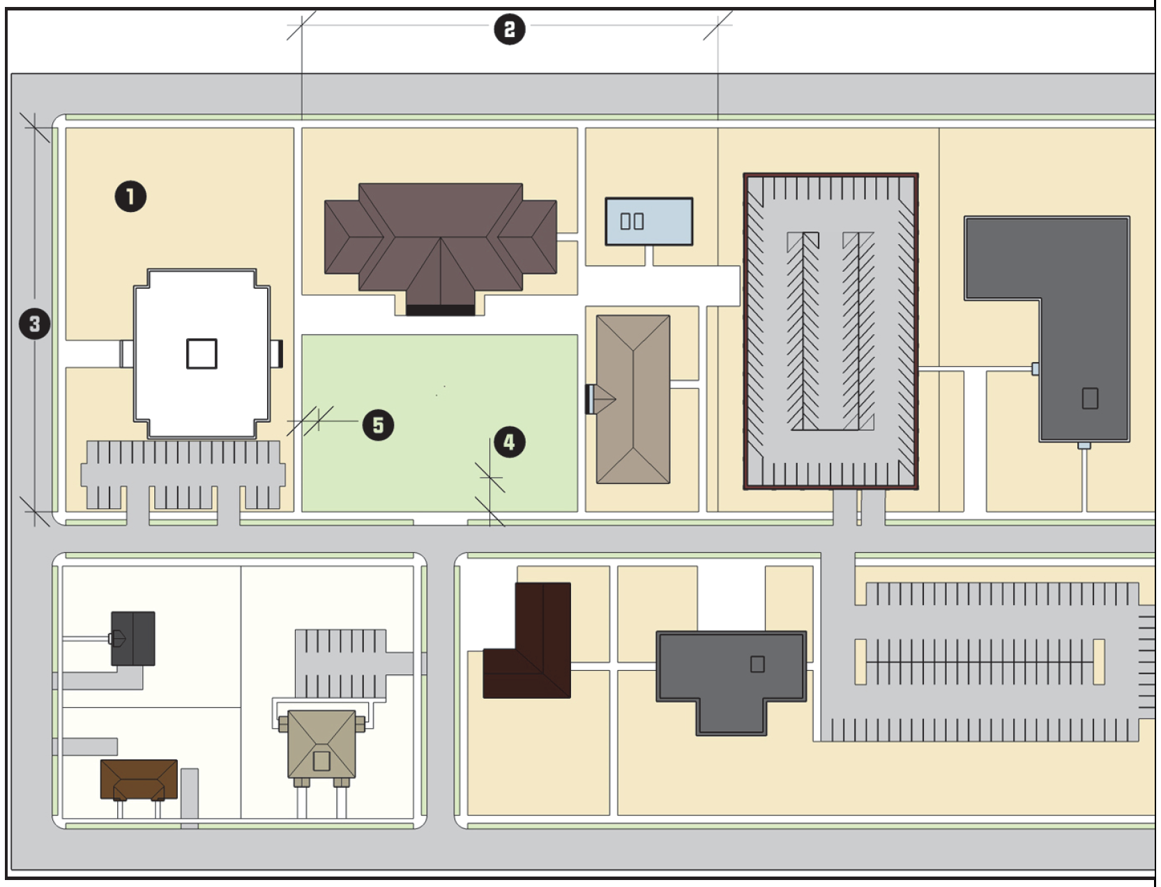 | ||
| F. TYPICAL BUILDING CONFIGURATION | |||
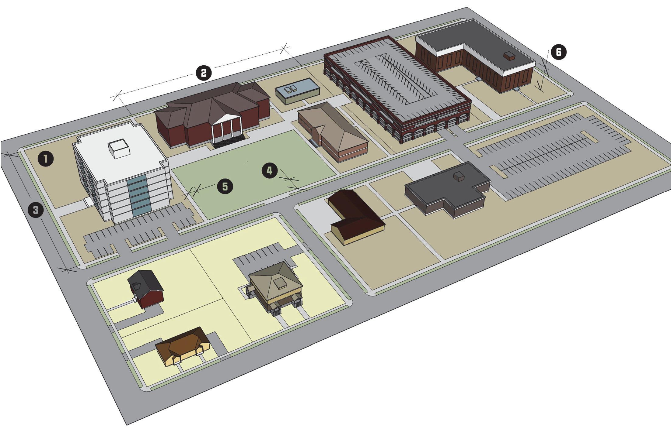 | |||
3.5.6. - Main Street (MS)
| MS MAIN STREET DISTRICT | A. DISTRICT PURPOSE | |||||
| The Main Street (MS) district is established to encourage compact, walkable, pedestrian-oriented, mixed-use development and redevelopment along Main Street. It is intended to enhance the range of goods and services available to shoppers in the Core City area while also providing a wider range of urban housing options for those seeking to live near the central business district. | ||||||
| B. DIMENSIONAL STANDARDS | ||||||
| STANDARD | SUB-DISTRICT A | SUB-DISTRICT B | SUB-DISTRICT C | SUB-DISTRICT D | ||
| Maximum Density (units/acre) | 26 [1] | |||||
| Minimum Lot Area (square feet) | 6,000 | 4,000 | 6,000 | |||
| Minimum Lot Width (feet) [2] | Interior lot | 60 | 40 | 60 | ||
| Corner lot | ||||||
| Minimum Street Setback (feet) | 5, 10 from back of curb [3] | 0, 10 from back of curb [3] | 5, 10 from back of curb [3] | |||
|
Maximum Street Setback (feet)
(Main Street Only) [4] [5] | 25 | 20 | 25 | |||
| Minimum Perimeter Setback (feet) | Adjacent to Residential District | 10 | ||||
| Adjacent to Nonresidential District | 0/5 | |||||
| Maximum Building Height (feet) | n/a [6] | |||||
| [1] Mixed-use development is subject to the maximum density standards. | ||||||
| [2] All development shall comply with the City's Driveway Ordinance requirements. | ||||||
| [3] All buildings shall be at least 10 feet from the back of the curb. | ||||||
| [4] For all new buildings subject to a maximum street setback, at least 60% of the front building facade shall be located parallel to and within the required setbacks. | ||||||
| [5] Buildings are exempt from the maximum street setback, if they provide a civic space (see Section 3.5.6 G.3.(b) Exemption from Maximum Setback). | ||||||
| [6] When a perimeter setback abuts a single-family residential district, the setback shall be increased by 1 foot for each foot in height beyond 50 feet up to 80 feet. | ||||||
| C. TYPICAL BUILDING FORMS | ||||||
 |  | |||||
| D. TYPICAL LOT PATTERNS | E. DISTRICT DIMENSIONS | |||||
 | 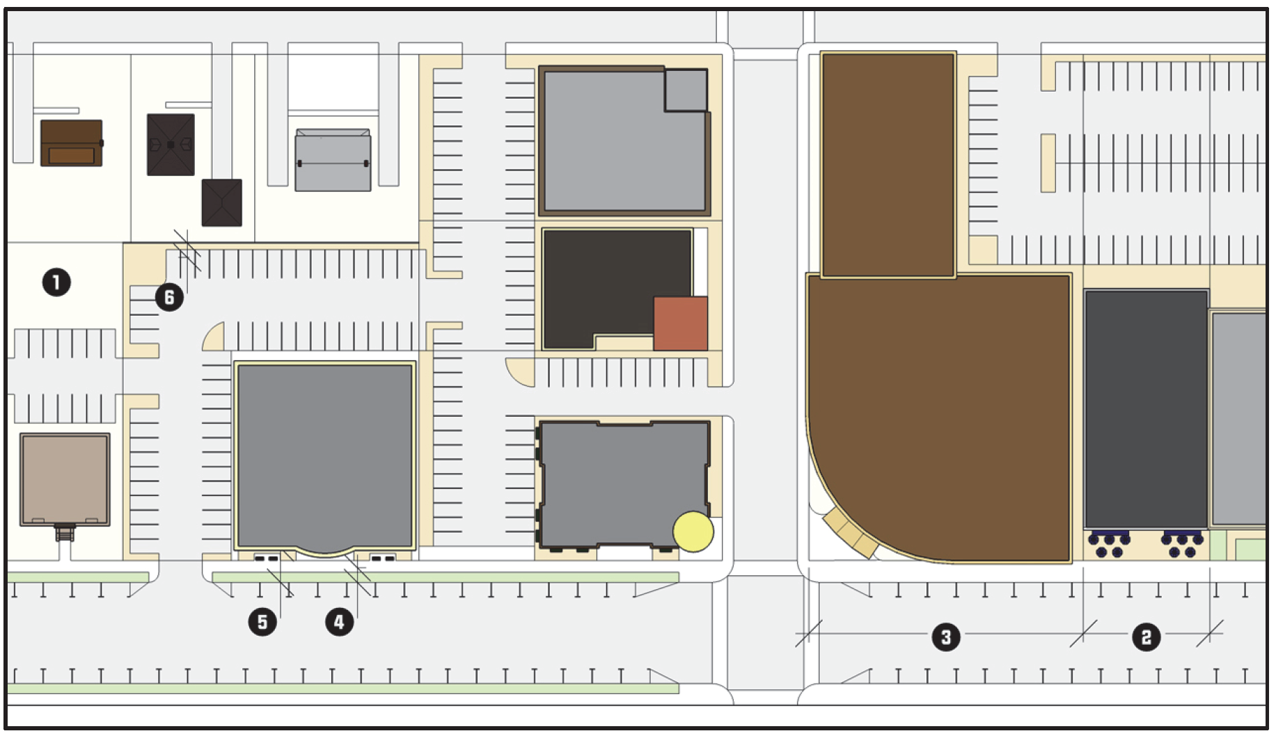 | |||||
| F. TYPICAL BUILDING CONFIGURATION | ||||||
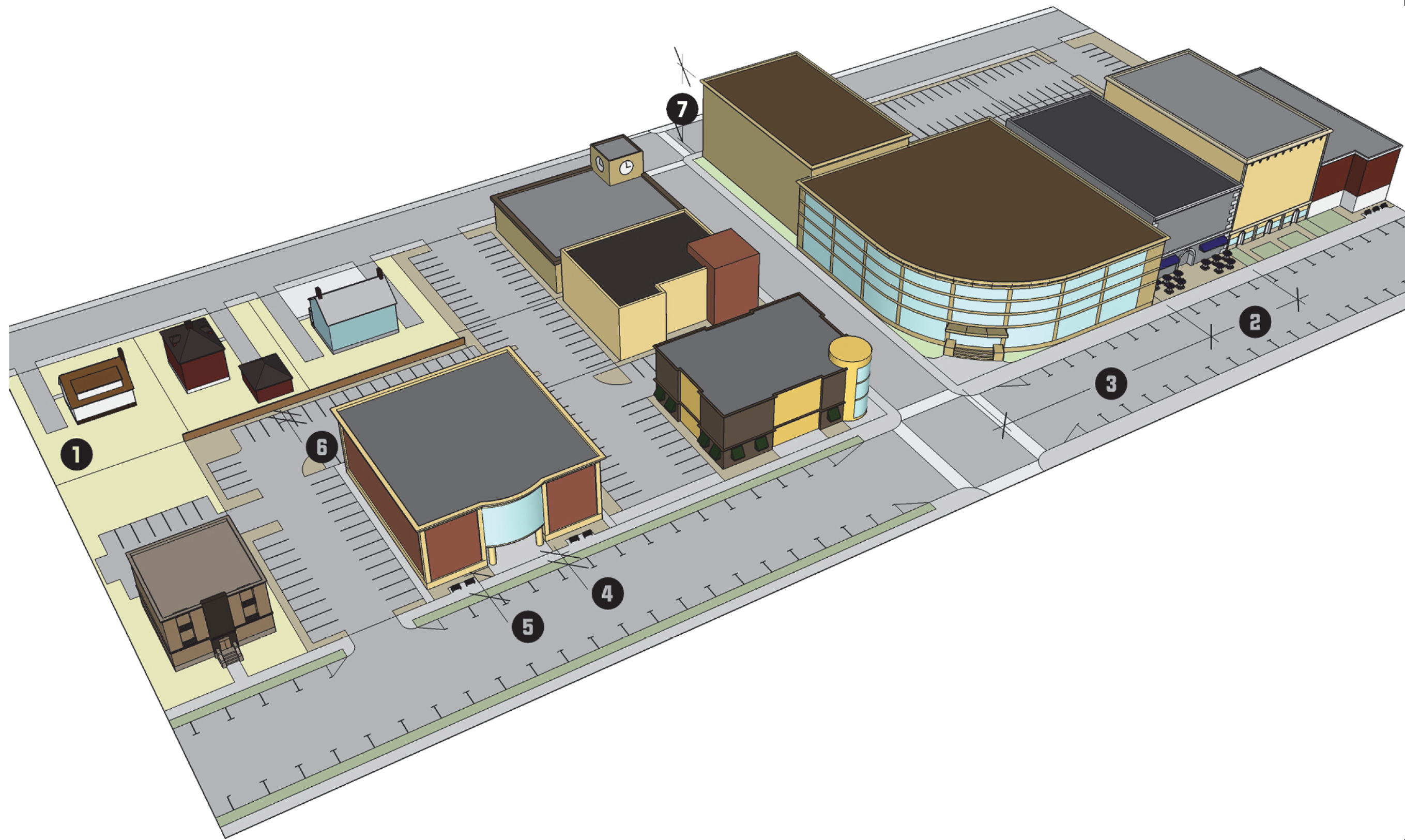 | ||||||
G.
District Standards
1.
Sub-districts Established The MS district is organized into a series of 4 sub-districts (A, B, C, and D, as depicted on the Official Zoning Map) to better recognize the differing development contexts along Main Street. Except where otherwise indicated below, the district standards in this section shall apply to development in all 4 sub-districts.
2.
Building Compliance due to Expansion or Exterior Alteration
(a)
In cases where an existing building is expanded or enlarged by 25 percent or less of its gross floor area as it existed on March 31, 2008, the expansion of the building shall either maintain the current appearance of the existing building or comply with the standards in Section 3.5.6 G.4, Building Standards.
(b)
In cases where an existing building is expanded or enlarged by more than 25 percent of its gross floor area as it existed on March 31, 2008, the portion of the front and side building facades associated with the expansion or enlargement shall comply with the standards in Section 3.5.6 G.4, Building Standards.
(c)
In cases where a building existing on March 31, 2008, does not comply with the minimum and maximum street setbacks, the building may be enlarged or expanded without complying with applicable maximum street setback requirements.
(d)
In cases where the exterior of an existing building is altered, the alterations shall conform to the standards of this section, to the maximum extent practicable. Alterations shall not include the removing, filling-in, or placing a false facade over an existing window, or any other physical changes to obstruct the window. The Planning and Development Director is authorized to grant an administrative adjustment to allow up to 2 windows to be removed or covered for non-occupiable space in an existing building.
3.
Site Standards
(a)
Building Orientation
(1)
Single-building developments shall be oriented so that the front facade faces the street from which the building derives its street address.
(2)
For all new buildings subject to a maximum street setback, at least 60% of the front building facade shall be located parallel to and within the required setbacks.
(3)
Group developments shall configure building walls to frame and enclose the corners of street intersections or entry points into the development, a central pedestrian access corridor within the development site, or other site amenities on at least 3 sides.
FIGURE 3.5.6.G1, DEVELOPMENT FRAMING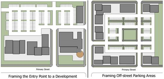
(b)
Exemption from Maximum Setback Uses that provide a civic space are exempt from the maximum setback requirement, provided the civic space meets the following requirements:
(1)
The civic space shall be between the front of the principal building and the street;
(2)
The area shall not be used for parking or loading, exclusive of valet parking and passenger loading;
(3)
The area shall have landscaping that covers a minimum of 10 percent of the area;
(4)
It may include pedestrian amenities which include but are not limited to: seating, outdoor play areas, bicycle racks, kiosks, water features, public art, freestanding structures such as a clock tower, or similar amenities;
(5)
A decorative fence, a hedgerow, or a combination thereof may be provided to provide a boundary between the civic space and the street right-of-way. If provided, the boundary treatment shall meet the following requirements:
(i)
Walls and fences are limited to a maximum of 4 feet in height. Decorative fences include, but are not limited to: wrought iron, architectural metal, or other transparent decorative fence. Chain-link fencing is prohibited.
(ii)
Hedges used to establish this boundary shall be a minimum height of 18 inches at planting and shall be maintained at a height between 3 and 4 feet at maturity.
(c)
Drive-Throughs
(1)
Drive-through lanes and windows are prohibited in sub-district B.
(2)
In sub-districts A, C, and D the following standards shall apply:
i.
Outdoor speakers associated with a drive-through shall be located at least 50 feet from a residential district.
ii.
Drive-through windows, menu boards, drive aisles, and speakers shall not be located between the principal building line and the front street right-of-way. For corner lots, drive aisles shall not be located between the principal building line and the front street right-of-way, to the maximum extent practicable.
(d)
Fuel Pumps and Canopies Fuel pumps and canopies shall be located behind the rear building line of the principal building, to the maximum extent practicable.
(e)
Fences Fences shall comply with the standards in Section 5.11, Fences, as well as the following:
(1)
Chain link, barbed wire fencing, and plain concrete block shall only be permitted behind the rear building line of the principal building and shall not be located within 40 feet of the right-of-way of a public street (excluding alleys).
(2)
Chain link, barbed wire fencing, and plain concrete block walls shall only be permitted along the rear lot line of lots without a principal building.
(3)
Fences located between the minimum and maximum street setback shall be limited to 4 feet in height or less and may not be fully opaque.
(4)
Fences shall be provided along all lot lines that abut a residential zoning district and be opaque to a height 6 feet above grade level.
(f)
Ground-based Mechanical Equipment Screening Ground-based mechanical equipment should be located to the rear of the principal building(s), and shall be screened in accordance with Section 5.6, Screening.
(g)
Landscaping Landscaping shall comply with the standards in Section 5.5, Landscaping, as well as the following:
(1)
Street yards are not required in sub-districts B and C.
(2)
A Type D landscape yard is required in sub-districts A and D for all street frontages.
(3)
Where fencing is provided in accordance with paragraph (4) of Section 3.5.6 G.3.(e) Fences, no landscape yard shall be required. Otherwise, perimeter landscape yards shall be a Type D landscape yard.
(4)
No landscaping shall be required adjacent to a public alley.
(h)
Off-Street Loading If provided, loading areas shall not be on the front facade of the principal building and shall be screened in accordance with Section 5.6, Screening.
(i)
Outdoor Storage Outdoor storage of materials, supplies, products, or equipment is prohibited. Nothing shall prohibit the outdoor display of merchandise for sale in accordance with Section 4.4.5 K, Outdoor Display.
(j)
Off-Street Parking In addition to the applicable standards in Section 5.4, Off-Street Parking and Loading, development in the MS district shall comply with the following standards (see Figure 3.5.6.G2, Parking Lot Location):
(1)
Off-street parking areas shall not be located between the front building line and the street it faces.
(2)
Off-street parking areas on corner lots shall not contiguous front more than 1 street.
(3)
Except for driveway crossings, drive aisles in sub-districts B and C shall not be located in the area between the minimum and maximum street setback.
(4)
Residential uses located within a mixed-use building are exempted from the off-street parking requirements in Table 5.4.4.B, Minimum Off-Street Parking Standards.
FIGURE 3.5.6.G2, PARKING LOT LOCATION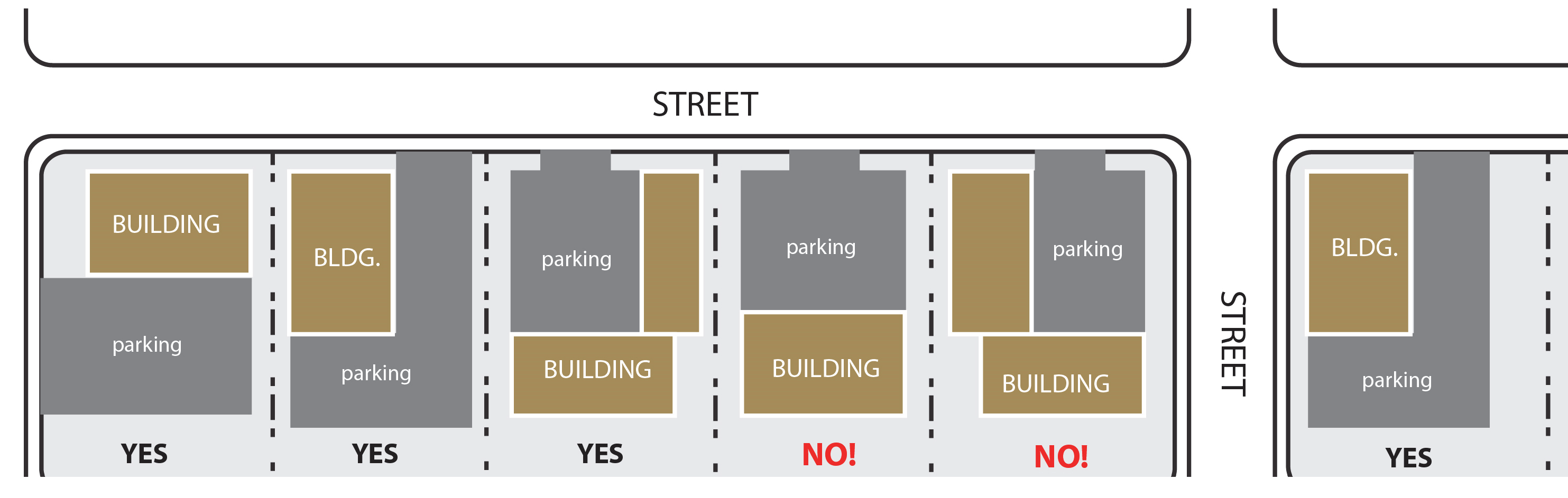
(k)
Sidewalks Sidewalks shall be installed along the abutting public street frontage and shall be constructed in accordance with the standards in Section 5.9, Sidewalks.
(l)
Accessory Buildings
(1)
Accessory buildings shall be located behind the rear building line of the principal building they serve.
(2)
For group developments, accessory buildings can be located internally to the development. In no instance, shall an accessory building be located between a front building line that is established by a principal building and the street the principal building faces.
(3)
Multi-family residential and nonresidential accessory buildings and structures should be similar in materials and architectural style to a principal building.
(m)
Group Developments Additional principal buildings may be built on a site beyond the maximum street setback if there is at least 1 principal building located on the site with a front facade that meets the street setback requirements and covers a minimum of 50 percent of the lot width.
4.
Building Standards The following standards are applied to all multi-family residential and nonresidential buildings; except for locally or nationally designated individual historic structures, and contributing structures within a locally or nationally designated historic district, provided such structures comply with the Secretary of Interior's Standards for Rehabilitation or are issued a Certificate of Appropriateness, as applicable:
(a)
Facade Articulation
(1)
Front and side building facades shall include at least 2 or more of the following features at least every 15 feet measured horizontally and vertically per floor:
(i)
Recessed entryways;
(ii)
Display windows;
(iii)
Window indentations (such as but not limited to double-hung, stationary, or casement windows) that are regularly spaced and that incorporate a differing building material, texture, color, awnings, window hoods, or canopies. This shall not include a glass curtain wall or flush mounted glass;
(iv)
Offset surfaces, niches, insets, projections, or bas-relief with a minimum depth of 4 inches;
(v)
Differentiated piers, columns, or pilasters;
(vi)
Pedestrian entrances;
(vii)
Textured materials (such as but not limited to brick or stone);
(viii)
Roofline changes, coupled with correspondingly aligned wall offset or facade material changes, changes in the roof planes, or changes in the height of a parapet wall; or
(ix)
Changes in wall plane (such as projections or recesses).
(2)
Building facades facing a street should achieve vertical orientation by using regularly spaced vertically oriented windows and doors, in conjunction with features such as: roofline/parapet variations, window hoods, material changes, columns, pilasters, posts, awnings, canopies, stoops, or facade offsets, to create vertically oriented bays, or divisions of space that are approximately 30 feet wide or less. The rhythm within a building facade should be maintained by making each vertically oriented bay the same width.
(3)
Buildings of 2 or more stories are encouraged to have front facades that have a clear and distinct base (ground floor), middle, and top (often defined by a decorative cornice). Features such as an increased ground floor height (including a transom window), the use of a frieze, string course or storefront cornice, a bulkhead or kick plate, and differentiated building materials or coloration are similarly encouraged.
(b)
Facade Materials
(1)
Where 2 or more materials are proposed to be combined on a facade, the heavier and more massive elements should be located below the lighter elements (e.g., brick shall be located below stucco). Heavier materials may also be placed as a detail on the corner of a building or along cornices or windows.
(2)
Primary facade materials should not change at outside corners, and shall continue around the corner to a logical point of conclusion such as a change in facade plane.
(3)
Exterior building materials shall be continued to the finished grade on any elevation.
(4)
Building facades utilizing smooth-faced concrete block, or unfinished or untreated tilt-up concrete panels, shall be limited to building facades not visible from public streets as seen from the public right-of-way at a height of 6 feet.
(c)
Facade Transparency
(1)
The front building facades facing a street shall maintain non-reflective, transparent windows on at least 50 percent of the facade area between 2 and 8 feet above average grade.
(2)
Ground level side facades facing a street shall maintain non-reflective, transparent windows on at least 20 percent of the facade area between 2 and 8 feet of the floor.
(3)
Upper stories on front and side facades facing a street shall maintain non-reflective, transparent windows on at least 20 percent of the upper story facade area per floor as measured between 2 and 8 feet.
(4)
Civic, religious institution, and utilities use categories are exempt from these transparency requirements.
(d)
Main Street Entrance
(1)
Every building on Main Street shall have an entrance that faces the Main Street right-of-way.
(2)
A Main Street entrance on corner buildings may be located to face the corner.
(3)
A Main Street entrance shall be distinguishable from the balance of the front facade through the use of one or more of any of the following or other similar features:
(i)
Projecting or recessed entry;
(ii)
Transom or sidelight windows;
(iii)
Pediments, columns, or other vertical features; or
(iv)
Marquees, arcades, or overhangs.
(4)
Buildings on lots without a frontage on Main Street shall comply with the standards of this subsection for the street they face.
(e)
Roof-Mounted Equipment
(1)
Flat roofs shall incorporate parapet walls designed to screen the roof and roof-mounted equipment from view from the primary street fronting the building and any abutting side streets as seen from the public right-of-way at a height of 6 feet. The parapet wall should be finished in the same or similar material and color as the building.
(2)
For sloped roofs, equipment and other roof penetrations should be located and screened to have a minimal visual impact as seen from adjacent residential uses and the public right-of-way at a height of 6 feet.
(3)
In cases where complete screening is not practicable, all roof- mounted equipment and other roof penetrations shall be camouflaged through the use of paint or architectural techniques to minimize its appearance.
(4)
Green roofs, which use vegetation to improve stormwater quality and reduce runoff, are exempt from the screening requirements described in this subsection.
(f)
Service or Vehicular Bays
(1)
Service or vehicular bays and their doors shall not be located so as to face Main Street (or the primary fronting street for properties located off of Main Street) if the door is located within 50 feet of the street right-of-way.
(2)
Other than the primary fronting street, all service or vehicular bay doors that face a street and are within 50 feet of the street right-of-way shall use the same or a similar color as the building so as to blend it in with the building they serve, to the maximum extent practicable.
5.
Existing Manufacturing Uses in Sub-district A The following standards shall apply to manufacturing uses in sub-district A:
(a)
Any manufacturing use that existed on March 31, 2008 shall be considered a conforming use of land for the purposes of this Ordinance.
(b)
Expansion of an existing manufacturing use is permitted provided all expansions are located at least 200 linear feet from the Main Street right-of-way.
6.
Reserved
7.
Uses Prohibited Table 4.1.9, Principal Use Table, sets out the use types prohibited in the MS district.
(Ord. No. 7266/17-08, § 9, 1-17-2017; Ord. No. 7287/17-29, § 2, 4-3-2017; Ord. No. 7363/17-106, §§ 16—23, 11-20-2017; Ord. No. 7365/17-108, § 1, 11-20-2017; Ord. No. 7415/18-44, § 3.E, 5-21-2018; Ord. No. 7476/18-105, §§ 1.D, 7.C, 12-3-2018; Ord. No. 7521/19-38, § 4, 4-15-2019; Ord. No. 7622/20-38, § 13.A, 8-5-2020)
3.5.7. - Mixed-Use (MX)
MX Mixed-Use District
A.
District Purpose The Mixed-Use (MX) district is intended to establish compact, pedestrian-oriented, mixed-use development and redevelopment at key locations in the Core City in accordance with the City's adopted policy guidance. It seeks to revitalize existing neighborhoods by enabling the development of higher intensity neighborhood centers with new housing, shopping, working, and recreational options in close proximity to one another. The proximity of these uses allows nearby residents to meet some of their daily needs without use of an automobile. The district standards address a variety of design elements including building location, off-street parking, access, land use, and visual quality.
B.
Procedure for Establishment of Mixed-Use (MX) Districts
1.
Mixed-Use Area Plan Prior to establishment of a MX district for a specific mixed-use area, a plan for the specific mixed-use area shall be adopted by the City Council. The mixed-use area plan should comply with the City's adopted policy guidance generally, and the specific recommendations for the mixed-use centers in the Core City Plan. The plan should, at a minimum, describe the characteristics, conditions, boundaries, and development goals of the area.
2.
Mixed-Use Area Plan Approval After completion, the mixed-use area plan shall be forwarded to the P&Z for its review and recommendations following a public hearing. Upon completion of its review, the plan along with the recommendations of the P&Z shall be forwarded to the City Council for review and a public hearing. A mixed-use area plan shall be approved by the City Council for a specific mixed-use area before establishment of a corresponding MX district for the same area.
3.
District Organization
(a)
The MX district is organized into a series of different districts (e.g., Mixed-Use Washington Street (MX-W) as depicted on the Official Zoning Map) to better recognize the differing development contexts.
(b)
The City Council may establish an MX district in accordance with this section, Section 2.4.20, Zoning Map Amendment, and Section 2.4.15, Text Amendment.
(c)
Based on its associated mixed-use area plan, each MX district should, at a minimum, include boundaries, dimensional standards, and any other standards unique to the district. The general standards in Section 3.5.7 C, General Standards for All MX Districts shall also apply. If there is a conflict between the general standards for all MX districts and the specific standards for the individual MX districts, the specific standards for the individual MX district shall control.
C.
General Standards for All MX Districts Except where otherwise indicated below, the standards in this section shall apply to all development in all MX districts.
1.
Building Compliance due to an Expansion or Exterior Alteration
(a)
In cases where an existing building is expanded or enlarged by 25 percent or less of its gross floor area as it existed on the effective date of the ordinance establishing the MX district, the expansion of the building shall either maintain the current appearance of the existing building or comply with the standards in Section 3.5.7 C.3, Building Standards.
(b)
In cases where an existing building is expanded or enlarged by more than 25 percent of its gross floor area as it existed on the effective date of the ordinance establishing the MX district, the portion of the front and side building facades associated with the expansion or enlargement shall comply with the standards in Section 3.5.7 C.3, Building Standards.
(c)
In cases where a building existing on the effective date of the ordinance establishing the MX district, does not comply with the minimum and maximum street setbacks, the building may be enlarged or expanded without complying with applicable maximum street setback requirements.
(d)
In cases where the exterior of an existing building is altered, the alterations shall conform to the standards of this section, to the maximum extent practicable. Alterations shall not include the removing, filling-in, or placing a false facade over an existing window, or any other physical changes to obstruct the window. The Planning and Development Director is authorized to grant an administrative adjustment to allow up to 2 windows to be removed or covered for non-occupiable space in an existing building.
2.
Site Standards
(a)
Building Orientation
(1)
Single-building developments shall be oriented so that the front facade faces the street from which the building derives its street address.
(2)
For all new buildings subject to a maximum street setback, at least 60% of the front building facade shall be located parallel to and within the required setbacks.
(3)
Group developments shall configure building walls to frame and enclose the corners of street intersections or entry points into the development, a central pedestrian access corridor within the development site, or other site amenities on at least 3 sides.
FIGURE 3.5.7.C1, DEVELOPMENT FRAMING
(b)
Exemption from Maximum Setback Uses that provide a civic space are exempt from the maximum setback requirement, provided the civic space meets the following requirements:
(1)
The civic space shall be between the front of the principal building and the street;
(2)
The area shall not be used for parking or loading, exclusive of valet parking and passenger loading;
(3)
The area shall have landscaping that covers a minimum of 10 percent of the area;
(4)
It may include pedestrian amenities which include but are not limited to: seating, outdoor play areas, bicycle racks, kiosks, water features, public art, freestanding structures such as a clock tower, or similar amenities;
(5)
A decorative fence, a hedgerow, or a combination thereof may be provided to provide a boundary between the civic space and the street right-of-way. If provided, the boundary treatment shall meet the following requirements:
(i)
Walls and fences are limited to a maximum of 4 feet in height. Decorative fences include, but are not limited to: wrought iron, architectural metal, or other transparent decorative fence. Chain-link fencing is prohibited.
(ii)
Hedges used to establish this boundary shall be a minimum height of 18 inches at planting and shall be maintained at a height between 3 and 4 feet at maturity.
(c)
Fences Fences shall comply with the standards in Section 5.11, Fences, as well as the following:
(1)
Chain link, barbed wire fencing, and plain concrete block shall only be permitted behind the rear building line of the principal building and shall not be located within 40 feet of the right-of-way of a public street (excluding alleys).
(2)
Chain link, barbed wire fencing, and plain concrete block walls shall only be permitted along the rear lot line of lots without a principal building.
(3)
Fences located between the minimum and maximum street setback shall be limited to 4 feet in height or less and may not be fully opaque.
(4)
Fences shall be provided along all lot lines that abut a residential zoning district and shall be opaque to a height 6 feet above grade level.
(d)
Ground-based Mechanical Equipment Screening Ground-based mechanical equipment should be located to the rear of the principal building(s), and shall be screened in accordance with Section 5.6, Screening.
(e)
Off-Street Loading If provided, loading areas shall not be on the front facade of the principal building and shall be screened in accordance with Section 5.6, Screening.
(f)
Outdoor Storage Outdoor storage of materials, supplies, products, or equipment is prohibited. Nothing shall prohibit the outdoor display of merchandise for sale in accordance with Section 4.4.5 K, Outdoor Display.
(g)
Off-Street Parking Off-Street parking is not required, but when provided, development in the MX district shall comply with the following standards (see Figure 3.5.7.C2, Parking Lot Configuration) in addition to the applicable standards in Section 5.4, Off-Street Parking and Loading:
(1)
Off-street parking areas shall not be located between the front building line and the street it faces.
(2)
Off-street parking areas on corner lots shall not contiguously front more than 1 street.
(3)
When located along the side of a building, vehicular use areas shall not occupy more than 64 linear feet in width as measured along the lot's street frontage.
FIGURE 3.5.7.C2, PARKING LOT CONFIGURATION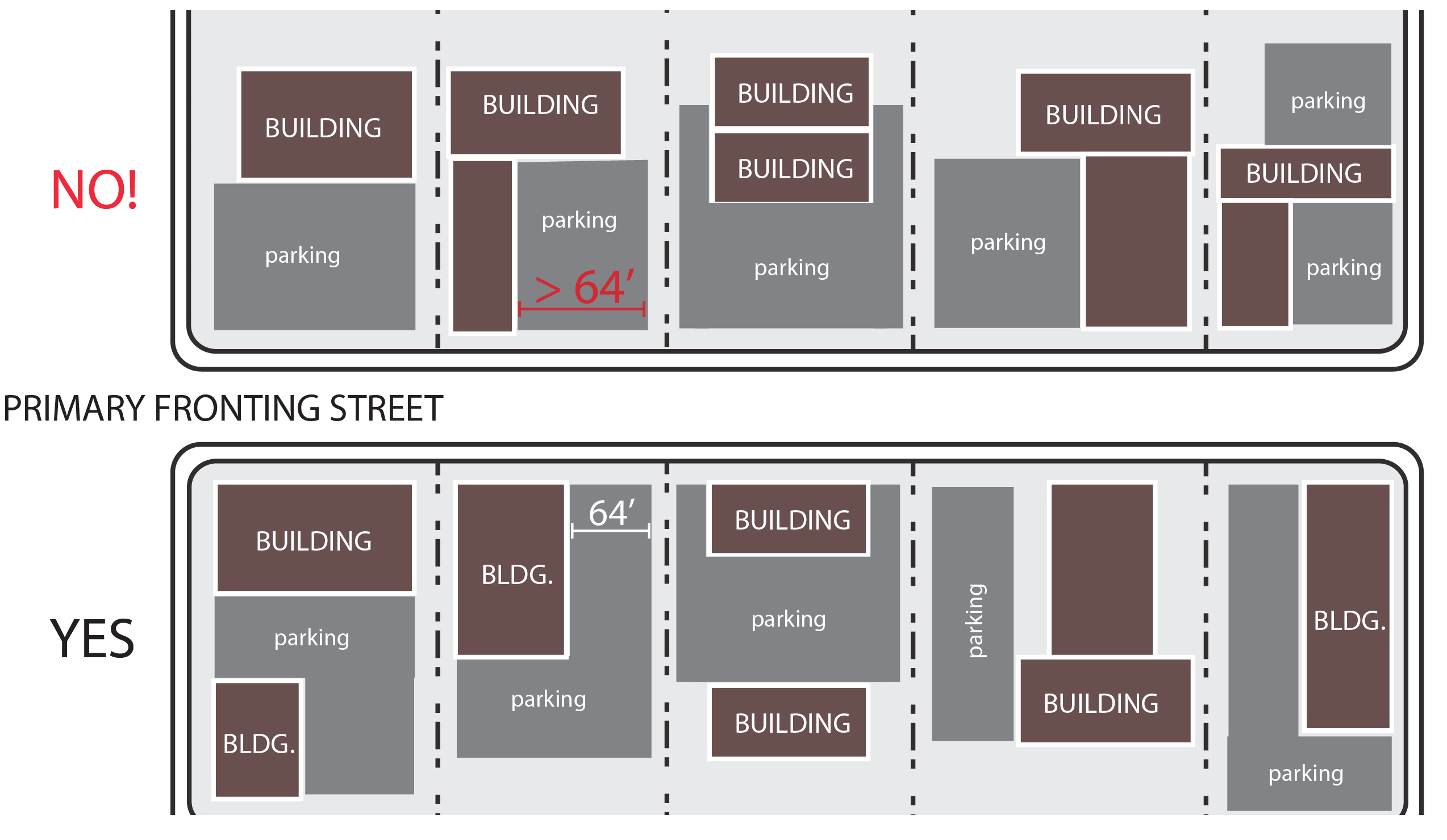
(h)
Sidewalks Sidewalks shall comply with the standards in Section 5.9, Sidewalks, as well as the following:
(1)
Sidewalks shall be located on both sides of all streets except alleys.
(2)
Sidewalks shall be located at the back of the curb and shall maintain a minimum width of at least 12 feet or up to the existing building line when less than 12 feet, unless an alternate width standard is provided in Table 3.5.7.D. - Alternate Sidewalk Width Standards in the MX District.
(3)
Sidewalks may include street tree plantings, street furnishings and sidewalk cafes in accordance with applicable City Codes.
(4)
Sidewalks shall be configured to provide a smooth transition in width between new sidewalks and connections to established sidewalks of a lesser width.
(i)
Accessory Buildings
(1)
Accessory buildings shall be located behind the rear building line of the principal building they serve.
(2)
For group developments, accessory buildings can be located internally to the development. In no instance, shall an accessory building be located between a front building line that is established by a principal building and the street the principal building faces.
(3)
Multi-family residential and nonresidential accessory buildings and structures should be similar in materials and architectural style to a principal building.
(j)
Group Developments Additional principal buildings may be built on a site beyond the maximum street setback if there is at least 1 principal building located on the site with a front facade that complies with the street setback requirements and covers a minimum of 50 percent of the lot width.
3.
Building Standards The following standards are applied to all multi-family residential and nonresidential buildings; except for locally or nationally designated individual historic structures, and contributing structures within a locally or nationally designated historic district, provided such structures comply with the Secretary of Interior's Standards for Rehabilitation or are issued a Certificate of Appropriateness, as applicable:
(a)
Facade Articulation
(1)
Front and side building facades shall include at least 2 or more of the following features at least every 15 feet measured horizontally and vertically per floor:
(i)
Recessed entryways;
(ii)
Display windows;
(iii)
Window indentations (such as but not limited to double-hung, stationary, or casement windows) that are regularly spaced and that incorporate a differing building material, texture, color, awnings, window hoods, or canopies. This shall not include a glass curtain wall or flush mounted glass;
(iv)
Offset surfaces, niches, insets, projections, or bas-relief with a minimum depth of 4 inches;
(v)
Differentiated piers, columns, or pilasters;
(vi)
Pedestrian entrances;
(vii)
Textured materials (such as but not limited to brick or stone);
(viii)
Roofline changes, coupled with correspondingly aligned wall offset or facade material changes, changes in the roof planes, or changes in the height of a parapet wall; or
(ix)
Changes in wall plane (such as projections or recesses).
(2)
Building facades facing a street should achieve vertical orientation by using regularly spaced vertically oriented windows and doors, in conjunction with features such as: roofline/parapet variations, window hoods, material changes, columns, pilasters, posts, awnings, canopies, stoops, or facade offsets, to create vertically oriented bays, or divisions of space that are approximately 30 feet wide or less. The rhythm within a building facade should be maintained by making each vertically oriented bay the same width.
(3)
Buildings of 2 or more stories are encouraged to have front facades with a clear and distinct base (ground floor), middle, and top (often defined by a decorative cornice). Features such as an increased ground floor height (including a transom window), the use of a frieze, string course or storefront cornice, a bulkhead or kick plate, and differentiated building materials or coloration are similarly encouraged.
(b)
Facade Materials
(1)
Where 2 or more materials are proposed to be combined on a facade, the heavier and more massive elements should be located below the lighter elements (e.g., brick shall be located below stucco). Heavier materials may also be placed as a detail on the corner of a building or along cornices or windows.
(2)
Primary facade materials should not change at outside corners, and should continue around the corner to a logical point of conclusion such as a change in facade plane.
(3)
Exterior building materials shall be continued to the finished grade on any elevation.
(4)
Building facades utilizing smooth-faced concrete block, or unfinished or untreated tilt-up concrete panels, shall be limited to building facades not visible from public streets as seen from the public right-of-way at a height of 6 feet.
(c)
Facade Transparency
(1)
The front building facade facing a street shall maintain non-reflective, transparent windows on at least 35 percent of the facade area between 2 and 8 feet above average grade.
(2)
Ground level side facades facing a street shall maintain non-reflective, transparent windows on at least 20 percent of the facade area between 2 and 8 feet of the floor.
(3)
Upper stories on front and side facades facing a street shall maintain non-reflective, transparent windows on at least 20 percent of the upper story facade area per floor as measured between 2 and 8 feet.
(4)
Civic, religious institution, and utilities use categories are exempt from these transparency requirements.
(d)
Primary Entrance
(1)
Except for corner buildings, the primary entrance of a building shall face the street from which the building derives its street address.
(2)
The primary entrance on corner buildings may be located to face the corner.
(3)
The primary entrance shall be distinguishable from the balance of the front facade through the use of one or more of any of the following or other similar features:
(i)
Projecting or recessed entry;
(ii)
Transom or sidelight windows;
(iii)
Pediments, columns, or other vertical features; or
(iv)
Marquees, arcades, or overhangs.
(e)
Roof-Mounted Equipment
(1)
Flat roofs shall incorporate parapet walls designed to screen the roof and roof-mounted equipment from view from the primary street fronting the building and any abutting side streets as seen from the public right-of-way at a height of 6 feet. The parapet wall should be finished in the same or similar material and color as the building.
(2)
For sloped roofs, equipment and other roof penetrations should be located and screened to have a minimal visual impact as seen from the public right-of-way at a height of 6 feet.
(3)
In cases where complete screening is not practicable, all roof-mounted equipment and other roof penetrations shall be camouflaged through the use of paint or architectural techniques to minimize its appearance.
(4)
Green roofs, which use vegetation to improve stormwater quality and reduce runoff, are exempt from the screening requirements described in this subsection.
(f)
Service or Vehicular Bays
(1)
Service or vehicular bays and their doors shall not be located so as to face the primary fronting street if the door is located within 50 feet of the primary fronting street right-of-way.
(2)
Other than the primary fronting street, all service or vehicular bay doors that face a street and are within 50 feet of the street right-of-way shall use the same or a similar color as the building so as to blend it in with the building they serve, to the maximum extent practicable.
4.
Reserved
5.
Block Design In cases where development in the MX district proposes a new street, the following block design standards shall apply:
(a)
Block Length Block length shall be limited to 800 linear feet. The TRC may allow modifications from these block length standards if:
(1)
Environmental or topographic constraints exist;
(2)
A site has an irregular shape; or
(3)
A longer block will reduce the number of railroad grade or major stream crossings.
(b)
Block Width To the maximum extent practicable, the width of a block shall be sufficient to permit at least 2 tiers of lots exclusive of any public alleys, watercourses, or other rights-of-way located outside platted lots.
(c)
Mid-Block Access If a block length exceeds 800 feet, sidewalks or multi-use paths shall be provided mid-block to connect parallel sidewalks on the long side of the block.
6.
Street Network In cases where new streets are proposed, the following standards shall apply:
(a)
The streets in a MX district shall be interconnected to provide efficient connections between uses and to accommodate vehicular, pedestrian, and bicycle circulation, as well as existing or future transit service.
(b)
Streets in a MX district shall maintain a narrow cross section of 3 or fewer travel lanes with a maximum width of 12 feet per lane.
(c)
Streets shall connect with existing streets and be configured in a grid or modified grid pattern.
(d)
New streets shall be a logical continuation of the existing street network.
(e)
On-street parking shall be provided along both sides of all streets (except alleys) in a MX district.
(f)
Alleys of 14 to 16 feet in width shall be provided between tiers of lots in the middle of a block, to the maximum extent practicable.
(g)
Lots served by an alley shall provide vehicular access from the alley.
D.
Specific Standards for the MX-W District
1.
Applicability The Mixed-Use Washington Street District was established on March 31, 2008 in accordance with the Core City Plan and the Washington Drive District Plan. In addition to Section 3.5.7 C, General Standards for All MX Districts, the standards in this section apply to all lands within the MX-W district on the Official Zoning Map.
2.
Dimensional Standards The dimensional standards in Table 3.5.7.E, Dimensional Standards in the MX-W District, shall apply to all development in the MX-W District.
3.
Drive-Throughs Drive-through lanes and windows are prohibited.
E.
Specific Standards for the MX-D District
1.
Applicability The Mixed-Use Downtown district was established on November 20, 2017 in accordance with the High Point Downtown Mixed-Use Area Plan. In addition to Section 3.5.7 C, General Standards for All MX Districts, the standards in this section apply to all lands within the MX-D district on the Official Zoning Map.
2.
Dimensional Standards The dimensional standards in Table 3.5.7.F, Dimensional Standards in the MX-D District, shall apply to all development in the MX-D District.
3.
Service or Vehicular Bays No service or vehicular bay doors shall face Elm Street or Main Street.
4.
Drive-Throughs
(a)
Outdoor speakers associated with the drive-through shall be at least 50 feet from a residential district.
(b)
Drive-through windows, menu boards, drive aisles, and speakers shall not be located between the principal building line and the front street right-of-way. For corner lots, the drive aisles shall not be located between the principal building line and the front street right-of-way, to the maximum extent practicable.
(Ord. No. 7287/17-29, § 2, 4-3-2017; Ord. No. 7363/17-106, §§ 1—4, 11-20-2017; Ord. No. 7365/17-108, § 1, 11-20-2017; Ord. No. 7389/18-18, §§ 2—4, 2-19-2018; Ord. No. 7415/18-44, §§ 3.F, 3.G, 5-21-2018; Ord. No. 7476/18-105, §§ 1.E, 7.D, 12-3-2018; Ord. No. 7622/20-38, § 13.B, 8-5-2020; Ord. No. 7926/23-41, § 4.A—D, 5-15-2023)
3.5.8. - Parks and Natural Resources (PNR)
| PNR PARKS & NATURAL RESOURCES DISTRICT | A. DISTRICT PURPOSE | ||
| The PNR district is established to preserve and protect identifiable natural resources in the city. The district is used to protect watercourses from erosion and sedimentation; retain open spaces and greenways and protect their environmentally-sensitive character; preserve wildlife and plant life habitats and protect them from the intrusions of urbanization; provide for city parks and recreation facilities; and preserve and maintain the aesthetic qualities and appearance of the city. The district also discourages development that creates risks for loss of life or property from normal natural processes and events in natural hazard areas (e.g., floodplains). | |||
| B. DIMENSIONAL STANDARDS | |||
| STANDARD | REFERENCE # | OUTSIDE CORE CITY AREA | INSIDE CORE CITY AREA |
| All Uses | All Uses | ||
| Minimum Development Size (acres) | 5 | 2 | |
| Minimum Lot Width (feet) [1] | 100 | 100 | |
| Minimum Street Setback (feet) | 30 | 30 | |
| Minimum Perimeter Setback (feet) | 30 | 15 | |
| Maximum Building Height (feet) | 50/80 [2] | 80 [3] | |
| [1] All development shall comply with the City's Driveway Ordinance requirements. | |||
| [2] The perimeter setbacks shall be increased by 1 foot in height for each additional foot in height beyond 50. | |||
| [3] When abutting a single-family residential zoning district, the perimeter setbacks shall be increased 1 foot for each foot in height beyond 50 feet. | |||
| C. TYPICAL BUILDING FORMS | |||
 |  | ||
| D. TYPICAL LOT PATTERNS | E. DISTRICT DIMENSIONS | ||
 | 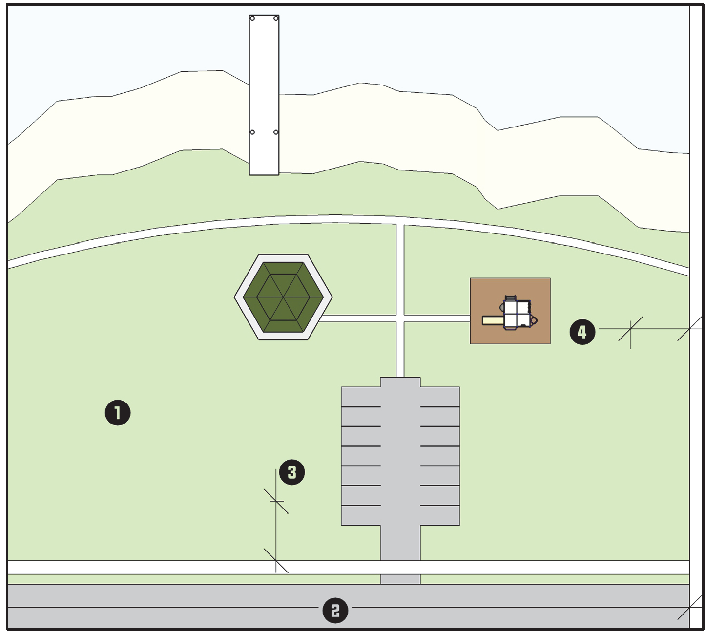 | ||
| F. TYPICAL BUILDING CONFIGURATION | |||
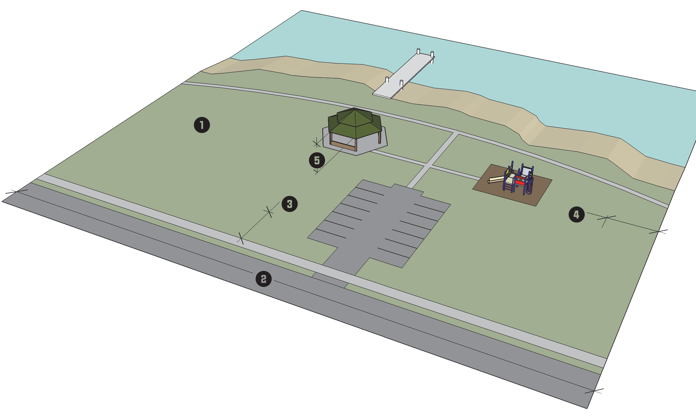 | |||
3.6.1.- Purpose and Intent
The rezoning of land to a conditional zoning district is intended to provide a landowner and the City an alternative to rezoning the land to a general zoning district, where the general zoning district allows certain uses and development that may be appropriate but also allows uses and development that may not conform to adopted policy guidance or would have adverse impacts on public facilities or surrounding lands. Reclassification of land to a conditional zoning district allows a landowner to propose, and the P&Z or City Council to consider, additional conditions or restrictions on the range of allowable uses, use standards, development intensities, development standards, and other regulations applicable in the parallel general zoning district. This enables the City and the landowner to tailor a zoning classification to accommodate desirable development while avoiding or addressing anticipated problems that may arise from development otherwise allowed by the general zoning district.
(Ord. No. 7969/23-17, § 13, 10-2-2023)
3.6.2. - Classification
Land shall be classified into a conditional zoning district only in accordance with the procedures and requirements set forth in Section 2.4.6, Conditional Zoning.
3.6.3. - Districts Established
The following conditional zoning districts, each bearing the designation "CZ", are hereby established:
A.
Residential Conditional Zoning Districts The residential conditional zoning districts include: CZ-R-3, CZ-R-5, CZ-R-7, CZ-RM-5, CZ-RM-16, and CZ-RM-26.
B.
Business Conditional Zoning Districts The business conditional zoning districts include: CZ-TO, CZ-OI, CZ-LB, CZ-GB, CZ-RC, CZ-CB, CZ-EC, CZ-LI, and CZ-HI.
C.
Special Conditional Zoning Districts The special conditional zoning districts include: CZ-AGR, CZ-I, and CZ-PNR.
(Ord. No. 7750/21-67, § 3, 11-1-2021)
3.6.4. - Applicable Standards
Development in a conditional zoning district shall be subject to all the use and development standards and requirements that apply to development in the parallel general zoning district, plus any conditions imposed and agreed to as part of the conditional zoning approval (including a conditional zoning plan, if provided), which may not be less restrictive than the regulations for the parallel general zoning district.
(Ord. No. 7622/20-38, § 6.C, 8-5-2020)
3.6.5. - Conditional Zoning Plan
Applications for establishment of a conditional zoning district may include a conditional zoning plan as part of the application for a conditional zoning. The primary purpose for a conditional zoning plan is to illustrate conditions that are difficult to describe with text. A conditional zoning plan shall be of sufficient detail to depict the conditions proposed by the applicant.
3.6.6. - Relationship to Overlay District Standards
Regulations governing development in an overlay zoning district shall apply in addition to the regulations governing development in the conditional zoning district. If the standards governing a conditional zoning district expressly conflict with those governing an overlay zoning district, the more restrictive standards shall control.
3.7.1.- Purpose and Intent
The Planned Development (PD) districts are established to allow development under unified control to occur utilizing more flexible standards and procedures than would otherwise result from a strict application of general district and development standards. Planned development districts are intended to encourage innovative land planning and site design concepts that will produce a high quality, unified project that will not negatively impact adjacent land. More specifically, the intent of the PD districts is to:
A.
Promote quality design and reduce or diminish the inflexibility of design that sometimes results from strict application of zoning and development standards designed primarily for individual lots;
B.
Allow greater freedom in selecting the means of providing access, open space, and design amenities;
C.
Allow greater freedom in providing a well-integrated mix of residential and non-residential uses in the same development, including a mix of housing types, lot sizes, and densities;
D.
Provide for efficient use of land resulting in smaller networks of utilities and streets and thereby lowering development and housing costs;
E.
Enhance pedestrian orientation and make greater accommodations for alternative forms of transportation such as walking, bicycling, and transit; and
F.
Promote environmentally sensitive development that respects surrounding established land use character and respects and takes advantage of a site's natural and man-made features, such as trees, wetlands, slopes in excess of 25 percent, special flood hazard area, and historic resources.
3.7.2. - General Provisions
A.
Classification of Planned Development Districts Land shall be classified as a planned development zoning district only in accordance with the procedures and requirements set forth in Section 2.4.9, Planned Development, and this section.
B.
Organization of Planned Development District Regulations Section 3.7.3, Standards Applied to All Planned Development Districts, sets out general standards applicable to all planned development districts. Sections 3.7.5, Planned Development-Core City (PD-CC), and 3.7.6, Planned Development-Periphery (PD-P), set out the purpose statements and standards applicable to each of the specific planned development districts. The more restrictive requirements between the general standards in this section and the standards in the PD-CC or PD-P districts shall control.
(Ord. No. 7365/17-108, § 3.B, 11-20-2017)
3.7.3. - Standards Applied to All Planned Development Districts
Before approving a PD zoning district, the P&Z or City Council shall determine that the application, as well as the master plan map, the statement of intent and development standards document, and the common signage plan if included as part of the application, comply with the following standards, unless expressly stated otherwise.
A.
Planned Development Master Plan Map A master plan map shall be included with the application and shall be a part of the planned development approval. It shall:
1.
Identify the general location and acreage of individual development areas by land use(s) and/or development density or intensity;
2.
Depict the general configuration and relationship of the principal elements of the proposed development;
3.
Identify the general location, amount and type (active or passive) of open space;
4.
Identify the general configuration of the on-site transportation network, including public and private vehicular, transit, and pedestrian facilities and how they will connect with existing and planned City systems;
5.
Identify the general location of on-site potable water, sanitary sewer, and stormwater management facilities and how they will connect to City systems;
6.
Identify the general location of any other on-site public facilities serving the development, such as schools, police or fire protection, EMS, and solid waste management; and
7.
Identify the general sequence or phases in which development of the district is proposed to occur.
B.
Statement of Intent and Development Standards The statement of intent and development standards document shall incorporate by reference or include, but not be limited to:
1.
A written statement of intent for the development, including a description of planning objectives and overall vision for the development at build-out;
2.
A listing of all permitted uses;
3.
Residential and non-residential dimensional standards, which include at a minimum, lot area, lot width, setbacks, building height, and setbacks from adjoining residential development or residential zoning districts;
4.
For the entire PD district and each development area, the acreage, types, and mix of land uses, number of residential units (by use type), non-residential acreage (by use type), residential development density, and non-residential intensity standards;
5.
Identification of all areas where a modification from the required development standards or use standards is proposed, description of the proposed modification, and explanation of why it is needed;
6.
The master plan map and specific development standards related to its approval, including any standards related to the form and design of development shown on the master plan map;
7.
Provisions addressing how transportation, potable water, sanitary sewer, stormwater management and other infrastructure will be provided to accommodate the proposed development;
8.
Provisions related to environmental protection and monitoring;
9.
Sign standards for the different use types within the development along with unifying features such as type, illumination, materials, and color schemes;
10.
A phasing narrative, including how residential and non-residential development will be timed, how infrastructure, transportation improvements, and open space will be timed, and how the development will be coordinated with any planned City capital improvements; and
11.
Any other provisions the P&Z or City Council determines are relevant and necessary to the development of the PD in accordance with applicable standards and regulations.
C.
Allowable Uses
1.
Every planned development district shall establish permitted uses by use category and use type as appropriate, from those listed in Table 4.1.9, Principal Use Table.
2.
Proposed uses shall be consistent with the City's adopted policy guidance, the purpose of the particular type of PD district, and are subject to any additional requirements set forth in Sections 3.7.5 and 3.7.6 for the particular type of PD district.
3.
Uses are subject to all applicable use standards for the use type in Section 4.3, Use Standards, unless modified by the statement of intent and standards document.
D.
Mandatory Use Mix Unless exempted by the P&Z or City Council, a PD district shall include at least one use type from 2 of the following four use classifications or at least 2 different use types from the use types listed in the Residential Use Classification, in Table 4.1.9, Principal Use Table:
1.
Residential uses;
2.
Institutional uses;
3.
Commercial uses; and
4.
Industrial uses.
E.
Prohibited Uses The following use categories and use types are prohibited in a PD district:
1.
Extractive industry;
2.
Asphalt plants;
3.
Major manufacturing use types; and
4.
Waste related services.
F.
Development Standards
1.
General
(a)
Unless indicated otherwise, all development in a PD district shall comply with the development standards of Chapter 5: Development Standards, the environmental protection standards in Chapter 6: Environmental Standards, and the subdivision and infrastructure design standards of Chapter 7: Subdivision and Infrastructure Standards.
(b)
Except where otherwise indicated, nothing shall limit the ability of a planned development to modify the development standards of Chapter 5, provided the planned development master plan map and statement of intent and standards document demonstrates how and why the proposed modification is needed.
2.
Open Space All development within a PD district shall comply with the standards in Section 5.12, Open Space, which shall not be modified as part of the approval of a PD district.
3.
Fences In no instance shall a PD master plan modify compliance with the standards in Section 5.11.4, Locational Requirements.
4.
Exterior Lighting Development around the perimeter of a PD district shall comply with the standards in Table 5.10.6.A, Maximum Illumination Levels, which shall not be modified as part of the approval of a PD district.
5.
Screening Development in a PD district shall comply with the standards in Section 5.6, Screening, which shall not be modified as part of the approval of a PD district.
6.
Subdivision and Infrastructure Standards A planned development shall not modify the subdivision and infrastructure standards in Chapter 7 of this Ordinance.
G.
Maximum Allowable Density Dwelling units within a PD district may be concentrated or evenly distributed throughout the development, provided the maximum allowable density for the development as a whole is not exceeded.
H.
Maximum Building Height The maximum building height for all buildings in a PD district shall be specified on the planned development master plan map or the statement of intent and development standards document, but in no instance shall the maximum building height exceed 50 feet within 50 feet of a single-family residential district.
I.
Signs
1.
All signs in any PD district shall meet the requirements of Section 5.7, Signage, except as otherwise provided in this subsection.
2.
A common sign plan shall be approved in accordance with Section 5.7.15, Common Sign Plan.
3.
In preparing the common sign plan, sign specifications shall be no less restrictive than the regulations in Table 3.7.3.I, Planned Development Sign Standards.
J.
Final Plat Approval No final plat for a phase of a planned development shall be approved unless:
1.
All open space and common elements and public improvements included in previous phases have been conveyed, completed, or subject to a valid financial guarantee;
2.
There is no violation of the PD master plan map or any provision or condition of the PD district in any previous phase; and
3.
When a development contains common areas, owners' association documents have been prepared and reviewed, and are ready for recordation, or have been recorded, with the Register of Deeds in the county where the development is located.
(Ord. No. 7266/17-08, § 10, 1-17-2017; Ord. No. 7912/23-27, § 4.B, 4-17-2023; Ord. No. 7969/23-17, § 14(Pts. 1—3), 10-2-2023)
3.7.4. - Amendments to Approved Planned Development Master Plan Map or the Statement of Intent and Development Standards
Amendments or modifications to a planned development master plan map or to the statement of intent and development standards shall be considered in accordance with the standards in Section 2.4.9, Planned Development.
3.7.5. - Planned Development-Core City (PD-CC)
A.
Purpose The PD-CC district is established to provide a flexible means of accommodating high density mixed-use development with an urban character in the Core City area. The district encourages a well-balanced mix of residential, commercial, employment, recreation, and entertainment uses configured in a manner that supports pedestrian orientation and human interaction. It promotes shop fronts, attractive streetscapes, vertical use-mixing, active civic spaces, entertainment destinations for residents after working hours, alternative forms of transportation, and high-quality design.
B.
Allowable Location A PD-CC district may only be established on lots within the Core City area identified on the Official Zoning Map.
C.
Minimum Average Residential Density
1.
When selected as one or both of the two use types required by Section 3.7.3 D, Mandatory Use Mix, the entire area of a PD-CC district shall maintain a residential density of at least four dwelling units per acre.
2.
For the purposes of this section, the residential density shall be determined by dividing the total land area in a PD-CC district by the total number of residential dwelling units proposed in a PD master plan map.
3.
A residential use type included in a PD-CC that is not identified as one of the two use types required by Section 3.7.3 D, Mandatory Use Mix, shall not be subject to the residential density requirement, but shall not occupy more than 1/3 of the total area of the PD-CC district.
D.
District Standards In addition to complying with the standards in Section 3.7.3, Standards Applied to All Planned Development Districts, development in a PD-CC district shall comply with the following standards.
1.
Off-Street Parking In no instance shall development in a PD-CC district deviate from the standards in Section 5.4.7, Standards for Off-Street Parking and Loading Space.
2.
Landscaping A PD-CC district shall comply with the standards in Section 5.5, Landscaping, and may be modified by the PD master plan in ways consistent with the purpose of the district and Section 3.7, Planned Development Zoning Districts, except for the following:
(a)
Vehicular use area landscaping shall be provided around off-street parking lots visible from areas outside the district.
(b)
Screening, in accordance with Section 5.6, Screening, shall be provided around features required to be screened when these features are visible from lands outside the district.
(c)
Perimeter landscape yards are not required.
(d)
If streetyard landscaping requirements are modified by a PD master plan, the PD master plan shall include provisions that ensure an effective transition from the existing streetyard conditions surrounding the PD-CC district.
(Ord. No. 7476/18-105, §§ 11, 12, 12-3-2018)
3.7.6. - Planned Development-Periphery (PD-P)
A.
Purpose The PD-P district is established and intended to encourage the use of innovative and creative design to provide a mix of different residential, nonresidential, and institutional uses in close proximity to services, recreation uses, and open space resources on lands outside the Core City area. The district provides a wide degree of flexibility from the typical development standards with the expectation that the resulting development will exceed the quality that otherwise results from a strict application of the standards in this Ordinance while at the same time not creating adverse impacts on adjacent lands.
B.
Allowable Location A PD-P district may only be established on land located outside the Core City area identified on the Official Zoning Map.
C.
District Standards In addition to complying with the standards in Section 3.7.3, Standards Applied to All Planned Development Districts, development in a PD-P district shall comply with the following standards.
1.
District Size A PD-P district shall be at least 10 acres in area.
2.
Off-Street Parking and Loading Space Development in a PD-P district shall comply with the following:
(a)
Section 5.4.7 E, Dimensional Standards for Parking Spaces and Aisles;
(b)
Section 5.4.7 I, Stacking Space;
(c)
Development in a PD-P may reduce the amount of required off-street parking in Table 5.4.4.B, Minimum Off-Street Parking Standards, by up to 30 percent. Nothing shall limit additional use of the parking flexibility provisions in Section 5.4.8, Parking Alternatives;
(d)
All other standards in Section 5.4, Off-Street Parking and Loading, may be modified by the PD master plan map or statement of intent and development standards in accordance with the standards in Section 3.7.3, Standards Applied to All Planned Development Districts.
3.
Landscaping A PD-P district shall comply with the standards in Section 5.5, Landscaping, and may be modified by the PD master plan map or statement of intent and development standards in ways consistent with the purpose for the district, except for the following:
(a)
Vehicular use area landscaping shall be provided but may be modified through an alternative landscaping plan.
(b)
Perimeter landscape yards shall not be required between uses internal to a PD-P district, but shall be provided along the district perimeter.
(c)
If streetyard landscaping requirements are modified by a PD master plan, the PD master plan shall include provisions that ensure an effective transition from the existing streetyard conditions surrounding the PD-P district.
(Ord. No. 7542/19-59, § 1.A, 7-15-2019)
3.8.1.- Purpose
Overlay zoning districts are superimposed over either all or a portion of 1 or more underlying general zoning districts or conditional zoning districts with the intent of supplementing generally applicable development regulations with additional development regulations that address special area-specific conditions, features, or plans while maintaining the character and purposes of the underlying zoning district.
3.8.2. - Establishment
Table 3.8.2, Overlay Zoning Districts Established, sets out the overlay zoning districts established by this Ordinance.
3.8.3. - Classification
Land shall be classified or reclassified into an overlay zoning district only in accordance with the procedures and requirements set forth in Section 2.4.20, Zoning Map Amendment.
3.8.4. - Relationship to Underlying Zoning Districts
A.
Regulations governing development in an overlay zoning district shall apply in addition to the regulations governing development in the underlying zoning district, unless otherwise expressly stated.
B.
If the standards governing an overlay zoning district expressly conflict with those governing an underlying zoning district, the standards governing the overlay district shall control, unless otherwise stated.
C.
Where land is classified into multiple overlay zoning districts and the standards governing one overlay zoning district expressly conflict with those governing another overlay district, the more restrictive standard shall apply.
3.8.5. - Airport Overlay (ARO)
A.
Purpose The purpose of the Airport Overlay (ARO) district is to establish noise mitigation measures and prohibit certain uses in the vicinity of the Piedmont Triad International Airport (PTIA) and to:
1.
Facilitate orderly development around PTIA.
2.
Ensure land use compatibility by protecting noise sensitive uses from objectionable aircraft noise impacts.
3.
Mitigate noise impacts from aircraft overflights.
4.
Contribute to the safe operation of the airport.
B.
Applicability The ARO district applies to designated land in the vicinity of the PTIA.
1.
The district boundaries are defined on the Official Zoning Map. The boundaries generally follow physical features and property lines and are associated with aircraft noise impacts as identified by the 2007 FAR PART 150 Study, 2020 PART 150 Update and the 2040 PTIA Master Plan.
2.
None of the provisions of the ARO district shall be construed to prohibit the continuance, expansion, or re-establishment of an existing use. The noise level reduction design standards apply only to new uses and not to the expansion of existing uses or to structure additions. Only new subdivisions of land developed within the district shall be required to grant a waiver of claim.
3.
Nothing in the ARO district is intended to state that objectionable levels of noise from overhead aircraft will be confined to the limits of the district.
C.
ARO District Zone Boundaries The ARO district is divided into four zones in order to manage the development of uses that are sensitive to and incompatible with certain levels of daytime and nighttime aircraft noise and to mitigate adverse noise impacts to the public, where possible.
1.
Zone 1 Zone 1 is based on the 2014 65 DNL noise contour developed by the 2007 FAR Part 150 Study and physical boundaries such as Gallimore Dairy Road. The intent of Zone 1 is to prevent the development of uses sensitive to objectionable noise resulting from daytime and nighttime aircraft flights and those uses that could pose safety hazards to aircraft.
2.
Zone 2 Zone 2 is based on the 2014 NA 90(1) contour developed by the 2007 FAR Part 150 Study and 2025 PTIA Part 150 nighttime departure flight tracks. The intent of Zone 2 is to prevent the development of uses sensitive to objectionable noise resulting from nighttime aircraft flights.
3.
Zone 3 Zone 3 is also based on the 2014 NA 90(1) contour developed by the 2007 FAR Part 150 Study, as well as influenced by development patterns that existed prior to the establishment of the Airport Overlay District. The intent of Zone 3 is to protect residential uses and their residents by reducing the interior level of objectionable noise resulting from nighttime aircraft flights.
4.
Zone 4 Zone 4 is based on the NA 85(2) contour developed by the 2007 FAR Part 150 Study and 2025 PTIA Part 150 nighttime departure flight tracks. The intent of Zone 4, along with the other 3 zones, is to provide public notification of potential night time aircraft noise impacts.
D.
Aircraft Noise Mitigation Requirements Aircraft noise mitigation requirements for each zone are identified in Table 3.8.5.D, Aircraft Noise Mitigation Requirements.
E.
Public Notification of Potential Aircraft Noise Impacts Public notification of the potential aircraft noise impacts made to existing landowners and to prospective purchasers of property within the ARO district shall be made in accordance with the following requirements.
1.
Where public notification statements are required or provided for property within the district, the following statement shall be used: "This property is located within the City of High Point Airport Overlay District and is subject to aircraft overflights and to aircraft noise that may be objectionable dependent upon the use and location of the property. Please refer to the City's Airport Overlay District regulations and the Planning and Development Department for more information on potential noise impacts."
2.
In accordance with the N.C. Residential Property Disclosure Act in Section 47E of the North Carolina General Statutes, all landowners and their agents shall provide a public notification statement to all prospective purchasers through a written disclosure statement.
3.
A public notification statement shall appear on the recorded final plat for all subdivisions of land within the district. In addition, the subdivision owner shall provide public notice to all prospective lot purchasers through a written disclosure statement.
4.
The Planning and Development Department shall provide notification of potential aircraft noise impacts to the landowners of lots that are located within the ARO district. After a lot is included in the district, such notice shall be given once by first class mail to the landowner at the address listed on the county tax listing.
F.
Waiver of Claim A waiver of claim shall be required for all subdivisions of land within the ARO district. The waiver shall be executed by the landowner of the property for the benefit of the City, and it shall waive all existing and future landowners' right to any claim or cause of action against the City in connection with adverse aircraft noise impacts or other consequences of the district's noise mitigation requirements. The waiver statement shall appear on the final plat before the plat may be approved and recorded.
G.
Prohibited Uses Unless lawfully established prior to August 7, 2003, or before the effective date of an ordinance applying the ARO designation to other lands after August 7, 2003, uses indicated as prohibited in a particular zone of the ARO district in Table 4.1.9, Principal Use Table, shall be prohibited in the zone.
H.
Noise Level Reduction Design In Zone 3, a new residential use shall be designed to achieve an outside to inside noise reduction level of at least 30 decibels (dB). This performance measure may be achieved by any suitable combination of building design, building materials and construction standards so as to reduce the interior noise levels from overhead aircraft flights. Prior to the issuance of a building permit for a residential use, a qualified acoustical professional satisfactory to the Planning and Development Department shall certify that the design standards, construction methods, and materials used to construct the residential use will achieve at least a 30 dB noise level reduction.
I.
Aircraft Interference No structure may be constructed or altered in a manner or at a height that constitutes a safety hazard to aerial navigation as determined by the FAA in accordance with Section 10.2.6 B, Structure Height Restrictions.
J.
Noise Impact Information
1.
The Planning and Development Department shall maintain and provide district information depicting potential aircraft noise impacts which shall be available to the public and other interested parties.
2.
The noise level reduction design standards and waiver of claim provisions of this section shall not apply to:
(a)
Lots of record in the ARO created prior to August 7, 2003 or the date of an ordinance extending the ARO designation to other lands after August 7, 2003;
(b)
Lots created by a valid preliminary subdivision plan that was approved prior to August 7, 2003 or the date of an ordinance extending the ARO designation to other lands after August 7, 2003; or
(c)
Residential uses in the ARO depicted on a valid site plan or group development plan that was approved prior to August 7, 2003 or the date of an ordinance extending the ARO designation to other lands after August 7, 2003.
(Ord. No. 7266/17-08, § 11, 1-17-2017; Ord. No. 7877/22-97, §§ 1, 2, 11-7-2022)
3.8.7. - Gateway Corridor Overlay (GCO)
A.
Purpose The Gateway Corridor Overlay (GCO) district regulations are intended to enhance the visual appeal of certain thoroughfares in the City, and to:
1.
Preserve and enhance the appearance and operational characteristics of certain designated roadways that serve as gateways to the City; and
2.
Address development issues of special concern along these gateways, with specific requirements which relate to use, development form, traffic movement, access, environment, landscaping, visual quality, image, and aesthetics.
B.
Procedure for Establishment of Gateway Corridor Overlay (GCO) Districts Prior to establishment of a GCO district for a specific gateway corridor, a gateway corridor plan for the specific gateway shall be adopted by the City Council. The gateway corridor plan shall describe the conditions, boundaries, development goals, and standards for the proposed GCO district. The plan shall, at a minimum, address the following:
1.
The arrangement of uses along the corridor which shall create a visually pleasing impression.
2.
The unique qualities of the corridor, such as significant buildings, views and vistas, and natural features which lend themselves to special consideration.
3.
The value of the corridor as an entryway to the City which can influence the perception of citizens and persons or businesses considering investment in the City.
4.
Transportation conditions on the corridor, including vehicular access, dedication of right-of-way, driveway limitations, and traffic impact.
5.
The vision and general goals for development along the corridor, and specific recommendations for regulatory changes to achieve the vision and development goals.
C.
Gateway Corridor Plan Approval The gateway corridor plan shall be forwarded to the P&Z for its review and recommendations. Upon completion of its review, the plan along with the recommendations of the P&Z shall be forwarded to the City Council for review. A gateway corridor plan shall be approved by the City Council for a specific gateway corridor before establishment of a GCO district for the specific corridor.
D.
Establishment The specific GCO district shall be established in accordance with Section 2.4.20, Zoning Map Amendment, and Section 2.4.15, Text Amendment (as appropriate), and included as a district in this section.
E.
General Standards GCO district standards for a specific gateway corridor shall follow the policy direction in the gateway corridor plan approved by the City Council. The GCO district shall, at a minimum, address the following elements:
1.
The name and boundaries of the overlay district.
2.
The development along the corridor to which the overlay district applies (typically all new development and certain expansions and remodels).
3.
Any variations from the requirements of the underlying general zoning district(s).
4.
The uses allowed in the district, if appropriate.
5.
The development and form standards of the overlay district, including some or all of the following:
(a)
Dimensions (height, setbacks, build-to-lines, etc.);
(b)
Streetscape landscaping;
(c)
Sidewalks and pedestrian circulation features;
(d)
Off-street parking;
(e)
Landscaping and tree preservation/reforestation;
(f)
Open space set-asides;
(g)
Signage;
(h)
Exterior lighting;
(i)
Building design and form; and
(j)
Road access and traffic circulation.
6.
The extent to which a general or district-specific standard may be modified.
F.
Eastchester GCO District Standards The Eastchester GCO district is hereby established, and shall be subject to the following standards:
1.
Boundaries of the District The boundaries of the Eastchester GCO district are shown on the Official Zoning Map.
2.
Applicability
(a)
Application The Eastchester GCO district regulations shall apply to all principal and accessory buildings, off-street parking and vehicular storage areas on lots, or open uses of land constructed, reconstructed, or established after November 5, 1986, or the effective date of the district upon the land, or otherwise provided in Section 3.8.7 F.2(b), Exemptions.
(b)
Exemptions The following development is exempt from the requirements of the Eastchester GCO district regulations:
(1)
A single-family detached dwelling or a duplex dwelling on its own lot.
(2)
Lots with an existing structure subject to a building permit application for improvement, repair, or renovation, provided the proposed changes do not result in a change in the type of occupancy under the State Building Code.
(3)
Existing development or development that has a vested right under North Carolina law as of November 5, 1986 or the effective date of the district upon the land.
3.
Minimum Building Setbacks Lots within the Eastchester GCO shall be subject to minimum building setbacks from Eastchester Drive in accordance with the standards in Table 3.8.7.F.3, Minimum Building Setbacks. The minimum building setback may be reduced to the average streetyard width, in accordance with Table 3.8.7.F.5, Eastchester GCO Landscaping Standards, when off-street parking areas are not located between the front building line and Eastchester Drive and the building facades facing a public street include windows or fenestration, and the inclusion of an entryway with a roof form that differs from the rest of the facade.
Ground-based mechanical equipment shall not be placed between the front building line and Eastchester Drive.
4.
Site Standards
(a)
Drive-Throughs
(1)
Outdoor speakers associated with a drive-through shall be located at least 50 feet from a residential district.
(2)
Drive-through windows, menu boards, drive aisles, and speakers shall not be located between the principal building line and the front street right-of-way. For corner lots, drive aisles shall not be located between the principal building line and the front street right-of-way, to the maximum extent practicable.
(b)
Fuel Pumps and Canopies Fuel pumps and canopies shall be located behind the rear building line of the principal building, to the maximum extent practicable.
(c)
Ground-based Mechanical Equipment Screening Ground-based mechanical equipment should be located to the rear of the principal building(s), and shall be screened in accordance with Section 5.6, Screening.
(d)
Off-Street Loading Off-street loading areas shall be located to the side or rear of the principal building and shall not face Eastchester Drive.
5.
Landscaping Requirements Landscaping in the Eastchester GCO shall be in accordance with the provisions of Section 5.5, Landscaping, Table 3.8.7.F.5, Eastchester GCO Landscaping Standards, and the following requirements. In the case of conflict, the stricter standard shall apply.
(a)
Retention of existing trees to meet planting requirements within landscape yards is strongly encouraged. Existing trees may be credited towards landscaping requirements in accordance with Section 5.5.8, Credit for Existing Vegetation.
(b)
Stormwater detention ponds shall be screened with landscaping so as to obscure, to the maximum extent practicable, the view from public right-of-way.
6.
Signs Signs shall be in accordance with Section 5.7 Signs.
7.
Building Standards The following standards are applied to all multi-family residential and nonresidential buildings, except for locally or nationally designated individual historic structures and contributing structures within a locally or nationally designated historic district, provided such structures comply with the Secretary of Interior's Standards for Rehabilitation or are issued a Certificate of Appropriateness, as applicable.
(a)
Facade Materials
(1)
Exterior building materials should be continued to the finished grade on any elevation.
(2)
Building facades utilizing smooth-faced concrete block, or unfinished or untreated tilt-up concrete panels, shall be limited to building facades not visible from public streets as seen from the public right-of-way at a height of 6 feet.
(3)
The use of vinyl siding or corrugated metal siding and other vertical metal siding is prohibited.
(4)
The use of high intensity (bright), metallic, or fluorescent colors shall be limited to facade trim or accents and total less than 20% of the area of any building facade.
(5)
The use of lighting by direct illumination to outline or accentuate all or part of a structure, building or architectural features of a building, including but not limited to rooflines, windows, doors, cupolas, exterior walls, porches, canopies and awnings, with narrow band, strip, tube or other methods of lighting, is prohibited.
(6)
Primary facade materials should not change at outside corners, and should continue around the corner to a logical point of conclusion such as a window or change in facade plane.
(b)
Roof-Mounted Equipment
(1)
Flat roofs shall incorporate parapet walls designed to screen the roof and roof-mounted equipment from view from the primary street fronting the building and any abutting side streets as seen from the public right-of-way at a height of 6 feet. The parapet wall should be finished in the same or similar material and color as the building.
(2)
For sloped roofs, equipment and other roof penetrations should be located and screened to have a minimal visual impact as seen from the public right-of-way at a height of 6 feet.
(3)
In cases where complete screening is not practicable, all roof- mounted equipment and other roof penetrations shall be camouflaged through the use of paint or architectural techniques to minimize its appearance.
(4)
Green roofs, which use vegetation to improve stormwater quality and reduce runoff, are exempt from the screening requirements described in this subsection.
(c)
Service or Vehicular Bays Service or vehicular bays and their doors shall not face Eastchester Drive, to the maximum extent practicable.
(d)
Statement of Design Guidelines
(1)
General Design guidelines for multi-tenant commercial developments and/or nonresidential group developments shall be required for the purpose of facilitating unified developments with compatible architecture, scale, proportion and building elements that provide visual unity and are harmonious with other buildings in the surrounding area. Prior to the development of any phase of a commercial multi-tenant and/or non-residential group development, design guidelines governing the appearance of all buildings within the property shall be submitted by the developer for the review and approval of the Planning and Development Director prior to the approval of any site plan, group development, or final subdivision plat. The guidelines shall address and include the following criteria:
(i)
Common sign standards, such as, type, illumination, materials, and color schemes.
(ii)
Exterior building materials and colors, including examples of materials and colors to be consistent throughout the development.
(iii)
Roof shape and materials, including examples of materials and colors to be consistent throughout the development.
(iv)
Facade design, mass, and rhythm.
(v)
Common landscaping scheme, including street yard, and peripheral plantings, parking area plantings, and tree preservation.
(2)
Amendment
(i)
A statement of design guidelines may be amended by an applicant provided the proposed amendments are in keeping with the character, scale, materials, and configuration of the established development or approved statement.
(ii)
In no instance shall an amendment be requested after 75 percent or more of the total development has been constructed.
8.
Character of Development Located at Entrances to Existing Residential Subdivisions
(a)
Exterior modifications, alterations, additions, or construction of a new multi-family or nonresidential structure on land located at an entrance to a residential subdivision shall retain a residential character, nature and appearance, and be consistent with the following:
(1)
A maximum of 2 stories in height.
(2)
A roofline compatible with adjacent residences.
(3)
Building materials compatible with adjacent residences.
(4)
Parking areas that are located in a manner which minimizes the impact on adjacent residential dwellings.
(5)
Window treatments that are compatible with adjacent residences.
(6)
Landscaping around the foundation of principal buildings.
(7)
Style, size, and location of exterior lighting.
(8)
Location, size, color, materials, height, and illumination of signage.
(b)
The developer shall submit written and/or illustrative information that addresses the above criteria for the review and approval of the Planning and Development Director, either as part of a Statement of Design Guidelines, if design guidelines are required for the proposed development per Section 3.8.7 F.7(d), or as a separate document if design guidelines are not otherwise required. Approval is required prior to the approval of a site plan, group development or final plat, or the issuance of any permit.
(Ord. No. 7266/17-08, § 9, 1-17-2017; Ord. No. 7415/18-44, § 2.B, 5-21-2018; Ord. No. 7488/19-05, § 1, 2-4-2019; Ord. No. 7521/19-38, § 5, 4-15-2019; Ord. No. 7622/20-38, § 14, 8-5-2020; Ord. No. 7750/21-67, § 18, 11-1-2021; Ord. No. 7912/23-27, § 4.C, 4-17-2023)
3.8.8. - Local Historic Overlay (LHO)
A.
Purpose The purpose of the Local Historic Overlay (LHO) district is to maintain the historic integrity of certain areas within the city and to:
1.
Protect, safeguard, and conserve the heritage of the city; and
2.
Promote the sound and orderly preservation of historic areas within the city which embody important elements of the social, economic, political or architectural history of the city, region, state or nation, for the education, pleasure and enrichment of all citizens.
B.
Establishment and Applicability The following actions shall occur prior to the City's initial designation of a LHO district, or any amendment of Official Zoning Map boundaries affecting an existing LHO district.
1.
Local Designation Report The local HPC shall prepare and adopt a local designation report which shall:
(a)
Describe the boundaries of the newly proposed or amended LHO district; and
(b)
Describe the significance of the buildings, structures, features, sites, or surroundings in terms of their historic, pre-historic, architectural or cultural importance, integrity of design, setting, workmanship, materials, feeling and/or association.
2.
Local Designation Report Recommendations
(a)
Local Historic Preservation Commission The local HPC shall forward the local designation report and its recommendation to the North Carolina Department of Cultural Resources (NCDCR) for its review and comment.
(b)
NCDCR
(1)
Based on the local designation report, the NCDCR, acting through the State Historic Preservation Officer, or a designee, shall make an analysis of, and recommendation concerning the proposed LHO district, and shall submit its recommendation to the P&Z.
(2)
Failure of the NCDCR to submit its recommendation to the P&Z within 30 calendar days after receipt of a written request for such from the City, shall relieve the P&Z of its responsibility to await the recommendation.
(c)
Planning and Zoning Commission Prior to action by the P&Z, the Planning and Development Director shall review the recommendations of the HPC and the NCDCR, and forward comments and a recommendation to the P&Z.
(d)
Other Reviewers The P&Z may, prior to taking any action, refer the local designation report and proposed boundaries to other local preservation groups or other interested parties for comment and recommendation.
3.
Action by the Planning and Zoning Commission
(a)
After receipt of the comments and recommendations of the HPC, NCDCR - if received in accordance with the procedures set forth in this section - and the Planning and Development Director, the P&Z, at its discretion, may determine whether to proceed with the initiation of an application for a zoning map amendment for a LHO district, in accordance with Section 2.4.20, Zoning Map Amendment.
(b)
The P&Z shall decide a zoning map amendment application to classify land as a LHO district only after determining that the proposed district is of special significance in terms of its historic, pre-historic, architectural or cultural importance, and possesses integrity of design, setting, workmanship, materials, feeling and/or association.
4.
Architectural and Historic District Design Standards
(a)
Purpose Architectural and historic district design standards provide a framework from which recommendations may be offered about the appropriateness of exterior treatment in an LHO.
(b)
Adoption Following the adoption of an LHO by the P&Z and prior to the effective date of the LHO, the HPC shall adopt detailed architectural and historic district design standards applicable to proposals within a designated LHO. Review and comment by the P&Z shall be required before the HPC adopts any such standards.
(c)
Contents
(1)
These standards shall take into account the historic, architectural, and visual elements of the district.
(2)
The standards should give consideration to exterior form and appearance including, but not limited to:
(i)
Height;
(ii)
Setback, orientation, and lot coverage;
(iii)
Construction materials;
(iv)
Architectural detailing;
(v)
Roof shapes, forms, and materials;
(vi)
Fenestrations (arrangement of doors and windows);
(vii)
General form and proportions;
(viii)
Appurtenant fixtures and features such as lighting;
(ix)
Structural condition and soundness;
(x)
Use of local or regional architectural traditions; and
(xi)
The effect of trees and other landscape elements.
(d)
Amendments The standards may be amended in accordance with the procedures and standards established for their original approval
C.
Certificate of Appropriateness Required A certificate of appropriateness shall be required in accordance with Section 2.4.5, Certificate of Appropriateness, whether a building permit is required or not.
D.
Dimensional Standards and Exceptions Buildings and structures within a LHO district shall comply with all requirements of the underlying zoning district, except as follows:
1.
Buildings erected or altered in a LHO district may use the average setbacks of existing buildings on the same block face.
2.
Variances shall be decided following a recommendation from the HPC and may be granted only if it is found that the request complies with the intent of the architectural and historic standards of the LHO District.
3.
Where the HPC, in considering an application for a certificate of appropriateness, finds the number of off-street parking spaces and/or design standards for parking specified by this Ordinance would render the site incompatible with the historic district design standards and the historic character of the LHO District, it may provide a recommendation for an Administrative Adjustment in accordance with Section 2.5.2, Administrative Adjustment.
E.
Boundaries of Designated LHO Districts The exact boundaries of all LHO Districts are as shown on the Official Zoning Map. In general, they may be described as follows:
1.
Johnson Street Historic District Lots fronting on Johnson Street from East Parkway Avenue north to East Lexington Avenue;
2.
Sherrod Park Historic District Lots fronting on Woodrow Avenue from North Hamilton Street east to Forrest Street;
3.
West High Avenue Historic District Lots fronting on the south side of West High Avenue west of Lindsay Street to its terminus, and lots fronting Oak Street north of West Green Drive; and
4.
Washington Street Historic District Lots fronting on Washington Street from North Centennial Street east to the Toussaint L'Ouverture Lodge No. 524 (1215 Washington Street).
(Ord. No. 7415/18-44, § 8.A, 5-21-2018; Ord. No. 7712/21-29, § 9, 5-19-2021; Ord. No. 7969/23-17, § 15(Pts. 1—3), 10-2-2023; Ord. No. 8016/24-33, § 6(Pts. A, B), 7-15-2024)
3.8.9. - Manufactured Housing Overlay (MHO)
A.
Purpose and Intent The Manufactured Housing Overlay (MHO) district is established as a means of providing reasonable opportunities for the placement of manufactured dwellings in the City's zoning jurisdiction. More specifically, the district is intended to:
1.
Provide alternative, affordable housing opportunities for low and moderate-income residents in residential areas by allowing for the use of manufactured dwellings.
2.
Establish requirements designed to assure acceptable similarity in exterior appearance between manufactured dwellings and single-family dwellings constructed on adjacent or nearby lots.
3.
Protect property values and preserve the character and integrity of the community or individual neighborhoods within the community.
4.
Require new manufactured dwellings to meet the minimum requirements for manufactured dwellings in Section 4.3.2 B.4, Manufactured Dwelling.
B.
Establishment
1.
Manufactured Housing Overlay (MHO) districts shall be established in accordance with Section 160D-910 of the North Carolina General Statutes and Section 2.4.20, Zoning Map Amendment.
2.
MHO districts are permitted in accordance with Table 4.1.9, Principal Use Table.
3.
In requesting the establishment of an MHO district, an applicant shall present factual information to ensure, in the discretion of the P&Z or City Council, that property values of surrounding lands are protected, that the character and integrity of the neighborhood are adequately safeguarded, and the proposed MHO district is consistent with these standards.
4.
To assure acceptable similarity in exterior appearance between proposed manufactured dwellings and dwellings that are constructed on adjacent or nearby land, an applicant may, for illustrative purposes only, present examples of the types and design of such proposed dwellings.
C.
Overlay District Standards Land to be designated with a MHO district classification shall consist of:
1.
10 contiguous lots occupying at least 90,000 square feet in total area, excluding public street rights-of-way; or
2.
Unsubdivided land occupying at least 120,000 square feet in total area, excluding public street rights-of-way.
D.
Development Authorized
1.
Land within an MHO district may accommodate the following types of uses:
(a)
A single manufactured home on an individual lot configured in accordance with 4.3.2 B.4, Manufactured Dwelling;
(b)
A principal use authorized in the underlying zoning district in accordance with Table 4.1.9, Principal Use Table;
(c)
An accessory or temporary use associated with an allowed principal use.
2.
Manufactured homes located on lots or sites outside of a MHO district shall be considered nonconforming in accordance with Section 8.2, Nonconforming Uses.
(Ord. No. 7266/17-08, § 12, 1-17-2017; Ord. No. 7712/21-29, § 1.Q, 5-19-2021; Ord. No. 7969/23-17, § 16, 10-2-2023)
3.8.10. - Neighborhood Conservation Overlay (NCO)
A.
Purpose The Neighborhood Conservation Overlay (NCO) District is intended to protect and preserve the unique design features and character of established neighborhoods throughout the City, and to promote new construction that is compatible with the existing neighborhood character. The NCO district is a flexible tool that may be applied to multiple neighborhoods, each of which will have its own unique architectural, natural, cultural, and historic attributes.
B.
Procedure for Establishment of Individual Neighborhood Conservation Districts
1.
Initiation of Plan Prior to the establishment of an NCO district for a specific neighborhood, a plan shall be initiated by:
(a)
City Council;
(b)
P&Z; or
(c)
By petition of 66 percent or more of the landowners in a neighborhood proposing an NCO.
2.
Criteria for a Neighborhood Conservation Overlay Plan Before commencement of a plan, it shall be verified that the area proposed for an NCO district complies with the following criteria:
(a)
Contains a minimum of 1 block (2 opposing street frontages or sharing common property lines).
(b)
At least 66 percent of the land area within the proposed NCO district, not including street and other right-of-way, was developed at least 25 years prior to the plan being initiated;
(c)
There is existing or the potential for incompatible new development or redevelopment within the district;
(d)
The area possesses one or more of the following distinctive features that create a cohesive identifiable setting, character or association:
(1)
Scale, size, type of construction, or distinctive building materials;
(2)
Lot layouts, setbacks, street layouts, alleys or sidewalks;
(3)
Special natural or streetscape characteristics, such as creek beds, parks, gardens or street landscaping;
(4)
Land use patterns, including mixed or unique uses or activities;
(5)
Abuts or links designated local historic districts and/or landmarks; or
(6)
Designation as a National Register District.
3.
Neighborhood Conservation Overlay Plan Contents The neighborhood plan:
(a)
Should comply with the City's adopted policy guidance;
(b)
Include a map of the proposed boundaries;
(c)
Describe the distinctive features, characteristics and conditions that were identified in the criteria for establishing a neighborhood conservation plan, that make the area unique and could therefore become standards of the overlay district; and
(d)
Development goals for the character of the neighborhood.
4.
Neighborhood Conservation Overlay Plan Approval After completion, the plan shall be forwarded to the P&Z for its review and recommendations following a public hearing. Upon completion of its review, the P&Z shall forward the plan along with its recommendations to the City Council for review and a public hearing. An NCO plan shall be approved by the City Council for a specific neighborhood before establishment of an NCO district for the neighborhood is initiated by City Council.
5.
Establishment of Individual Neighborhood Conservation Districts After the approval of an NCO plan, the City Council may initiate the establishment of an individual NCO district in accordance with this section and the following:
(a)
Section 2.4.20, Zoning Map Amendment; and
(b)
Section 2.4.15, Text Amendment.
C.
District Development Standards The text amendment for each area designated as an individual NCO district shall follow the policy guidance in the NCO plan and identify, with specificity, the standards to be applied to all new construction and expansion of existing structures.
1.
General The NCO shall include an NCO district name and a reference to the district boundaries on the Official Zoning Map.
2.
Standards for All forms of Development The standards chosen should be for the purpose of maintaining the general character and appearance of existing development in the district. Aspects of development that these standards may address, include, but are not be limited to the following (except as prohibited by state law).
(a)
Dimensional standards such as lot area, lot width, and setbacks;
(b)
Location of proposed buildings or additions;
(c)
Building size (for principal and accessory structures), and orientation;
(d)
Landscaping and screening;
(e)
Paving requirements or limitations;
(f)
Exterior lighting;
(g)
Uses; and
(h)
Views of or from specific locations.
3.
Additional Standards for Multi-family and Nonresidential Buildings In addition to the standards in (2) above, multi-family and nonresidential buildings in an NCO may also be subject to the following additional standards:
(a)
Exterior building materials;
(b)
Building roofline and pitch;
(c)
Building foundation treatment; and
(d)
Required features on a front facade.
D.
Compliance for All NCO Districts
1.
Compliance with Underlying Zoning District The development standards of the specific NCO can supplement and can be more or less restrictive than the applicable standards found in the underlying zoning district.
2.
Conflict In the event that standards in a NCO district conflict with the standards in the underlying zoning district, the standards in the NCO shall control.
3.
Compliance with Development Standards Once an NCO district is established, no permit for any new construction or expansion of an existing structure may be issued until the Planning and Development Director determines that the proposal complies with all development standards established for the NCO district where the land is located.
(Ord. No. 7750/21-67, § 18, 11-1-2021)
3.8.12. - Watershed Overlay (WSO)
A.
Purpose The purpose of a Watershed Overlay (WSO) district is to ensure the availability of public water supplies at a safe and acceptable level of water quality, to ensure protection of public water supplies for recreational and aesthetic purposes, to minimize sedimentation of streams, and to protect the public health, safety, and welfare of the residents of High Point. More specifically, these standards are intended to:
1.
Ensure compliance with all applicable federal and state laws governing the protection of water supply watersheds and the provision of stormwater management to protect, maintain and enhance the public health, safety, environment and general welfare.
2.
Protect those portions of designated water supply watersheds which lie closest to existing and proposed water supply reservoirs from activities which could degrade water quality in the reservoirs;
3.
Minimize pollution entering municipal reservoirs to assure the public health and the public provision of a continued supply of safe drinking water thereby protecting the water quality of these water supply reservoirs and promoting public awareness; and
4.
Encourage a low intensity of land development in the most sensitive portions of the water supply watersheds (Watershed Critical Areas) thereby reducing the risks to water quality posed by higher density residential and nonresidential uses.
B.
Standards See Section 6.2, Watershed Protection, for the WSO district standards.