
High Point City Zoning Code
CHAPTER 5
- DEVELOPMENT STANDARDS
5.2.- Zone Lot and Access
Editor's note— Ord. No. 7266/17-08, § 15, adopted Jan. 17, 2017, changed the title of § 5.2 from "Zone Lot and Access Standards" to "Zone Lot and Access."
5.5.- Landscaping
Editor's note— Ord. No. 7266/17-08, § 15, adopted Jan. 17, 2017, changed the title of § 5.5 from "Landscaping Standards" to "Landscaping."
5.7.1.- Purpose and Intent
The purpose of this Section 5.7 (this "Section") is to support and complement the City of High Point's long-range goals of enhancing the City's aesthetic appearance and improving traffic safety along its roadway corridors and streets, while balancing the communication and wayfinding needs of its citizens.
Regulation of signs within the City promotes the health, safety, welfare, convenience, enjoyment and aesthetic values of the community through regulation of sign placement, number, location, size, type, characteristics, appearance, illumination, animation, and maintenance.
This Section is specifically intended to:
A.
Promote the reasonable, orderly, and effective display of permitted signs, displays, and devices;
B.
Promote the economic well-being and appearance of the City by creating a favorable physical image;
C.
Allow and encourage signs to facilitate way-finding through the community;
D.
Protect the public welfare as well as land values by preserving the aesthetic and historic qualities of the City;
E.
Protect the City from excessive and obtrusive signs;
F.
Minimize distractions and view obstructions that contribute to traffic hazards and endanger public safety; and
G.
Promote the efficient identification of information to maintain a viable economy, and a vital cultural and social community served by a variety of organizations.
(Ord. No. 7912/23-27, § 1, 4-17-2023)
5.7.2. - Applicability
The provisions of this Section shall apply to all signs erected, affixed, placed, painted or otherwise established within the City of High Point or its ETJ, except as otherwise provided herein.
A.
Signs are allowed only as an accessory use or structure to a principal use. The selling or leasing space on a sign is not an accessory use of the property.
B.
This Section applies only to signs that are legible from a street or from private or public property other than the lot on which the sign is located. (See Section 10.4, Definitions, for the definition of "Legible")
C.
Any sign that is not expressly allowed under this Section, or under a specific state law, is prohibited. (See Section 5.7.3, Prohibited Signs)
D.
Some signs are allowed without a permit but are still regulated under this Section. (See Section 5.7.7, Signs Allowed Without a Sign Permit)
E.
Many signs are expressly allowed, require a permit, and are subject to specific standards of this Section.
F.
For some signs, the State of North Carolina has preempted or limited the City's regulatory authority. Thus, any applicable state law in effect that conflicts with this Section prevails over this Section.
G.
To the extent allowed by federal or state law, this Section shall apply to the City and any other governmental entities with land or facilities in the City.
(Ord. No. 7266/17-08, § 18, 1-17-2017; Ord. No. 7912/23-27, § 1, 4-17-2023)
5.7.3. - Prohibited Signs
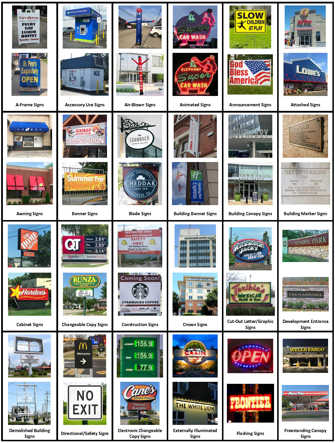
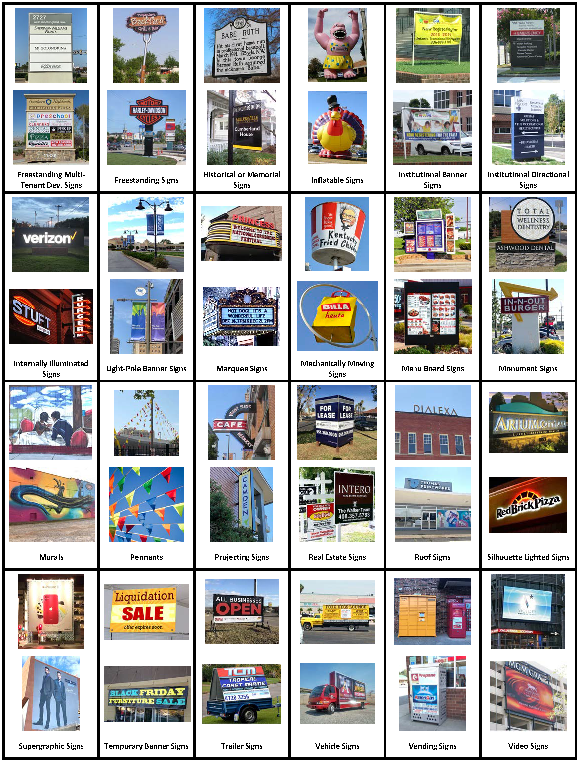
Unless otherwise allowed under this Section, the following signs are prohibited (See Section 5.7.16, Sign Images by Sign Type for visual illustration of these signs):
A.
Air-blown signs/devices;
B.
Animated signs, except video signs as allowed in Section 5.7.10, Electronic Sign Standards;
C.
Flashing signs;
D.
Mechanically moving signs;
E.
Trailer signs;
F.
Vehicle signs;
G.
Windblown signs, except pennants as allowed in Section 5.7.12, Limited Duration Signs;
H.
Signs projecting over a public right-of-way, except as allowed in Subsection 5.7.5.D, Projections into the Right-of-Way and Travel Way, or through an encroachment agreement with the City or NCDOT;
I.
Signs that imitate a traffic control device;
J.
Signs located within the public right-of-way that are painted, pasted, stapled, taped, or otherwise affixed to any bench, bus stop shelter, planter, utility pole, curb, sidewalk, hydrant, bridge, tree, fence, fixture, utility box or pedestal, or refuse container, except those signs erected by or on behalf of a utility or governmental entity.
K.
Signs projected onto a surface by use of lights.
(Ord. No. 7287/17-29, § 8, 4-3-2017; Ord. No. 7912/23-27, § 1, 4-17-2023)
5.7.4. - General Standards
The standards in Section 5.7.4, General Standards, are applicable to all signs.
A.
Rules of Interpretation, Measurement and Definitions. These provisions shall be construed in accordance with the rules of interpretation, measurement and definitions set forth in Chapter 10: Measurement and Definitions of the Development Ordinance.
B.
Compliance with Codes. All signs shall comply with applicable provisions of the State Building Code.
C.
Permits. All signs, except signs subject to Section 5.7.7, Signs Allowed Without a Sign Permit, are required to have a sign permit. In all sign permit applications where a matter of interpretation under this Section arises, the most restrictive interpretation shall prevail in order to carry out the purpose of this Section.
D.
Electrical Service. A sign that operates through the use of electrical service shall be subject to all necessary approvals and permits.
E.
Sign Variance. Only standards pertaining to sign height and location may be modified by approval of a variance in accordance with Section 2.4.16, Variance. No other standards may be modified through a variance.
F.
Nonconforming Signs and Uses
1.
Nonconforming signs shall be subject to the requirements in Section 8.5, Nonconforming Signs.
2.
New signs for a nonconforming use shall be permitted provided the signs comply with the standards in this Section.
G.
Removal or Modification of Signs
1.
Temporary Cover. Due to a change in ownership or use of the property, or for any other reasonable purpose, one sturdy, opaque, weather-proof cover sign may be placed over an existing sign for a period of 90 days, by the end of which an updated permanent sign must be in place.
2.
Temporary Uses. Signs for temporary uses permitted in accordance with Section 4.5, Temporary Uses, shall be removed at the expiration of the permitted time limit indicated on the zoning compliance permit.
3.
Cessation of Use
a)
A nonconforming sign for a use that has ceased shall be removed in accordance with Section 8.5, Nonconforming Signs.
b)
A conforming sign for a use that has ceased shall be removed or covered within 30 days of the use's cessation in the following manner:
(i)
It shall be covered by a sturdy, weather-proof, blank opaque cover, tightly secured and well-maintained until the building is reoccupied; or
(ii)
It shall be covered by a blank opaque panel that fits within the existing sign frame.
c)
If the use remains ceased after the expiration of a 180-day period, any cloth-like sign cover shall be replaced with a blank opaque panel described in Subsection 5.7.4.G.3.(b)(ii) above, until the building is reoccupied.
4.
Demolished Buildings. The following shall apply to signs on a property pending demolition of buildings or demolished buildings:
a)
When a permit is issued for demolition or removal of a building or structure, any freestanding sign associated with the building or structure and its supporting structure shall be removed concurrently with the demolition or removal of the buildings and structures, unless there is a valid approved site plan for a new use prior to the building demolition or removal and the existing sign is a conforming sign. Conforming signs shall be maintained in accordance with Subsection 5.7.4.G.3, Cessation of Use.
b)
After the effective date of this Section, any sign that remains on a property after a building has been demolished or removed thereon, and there is no valid site plan, shall be considered illegal and shall be subject to removal in accordance with Chapter 9: Enforcement of the Development Ordinance.
c)
Subsection 5.7.4.G.4, Demolished Buildings, shall not apply to Outdoor Advertising signs as defined in Section 9-2-2(k)(29) of the previous version of the High Point Development Ordinance, dated December 31, 2016.
5.
Removal of Unsafe Signs. Signs determined by the City to be unsafe to the public shall be removed or remedied in accordance with Chapter 9: Enforcement of the Development Ordinance. If a sign poses an immediate danger, as determined by the City, the sign, or the parts of it posing a danger shall be remedied or removed in accordance with Chapter 9: Enforcement of the Development Ordinance.
H.
Poorly Maintained Signs
1.
A sign shall be maintained in good structural condition, in compliance with the State Building Code, and in conformance with this Section.
2.
A sign which is not properly maintained, including but not limited to: cleaning, painting surfaces and letters, removal of rust and rotted wood and replacement of damaged parts and non-working illumination, shall be remedied in accordance with Chapter 9: Enforcement of the Development Ordinance.
I.
Historic Properties. No freestanding or attached sign shall be located outside of the right-of-way and on the premises of a Guilford County Landmark Property or within a Local Historic Overlay district without a certificate of appropriateness prior to issuance of a sign permit.
J.
Signs on Public Land or in Right-of-Way. A sign installed or placed on public land or right-of-way, except those installed or placed in compliance with this Section and state law, or under an encroachment agreement with NCDOT or the City, or in accordance with the City's Historic Roadside Marker Policy, shall be deemed to be abandoned to the public and shall be subject to removal and disposal by the City in accordance with Chapter 9: Enforcement of the Development Ordinance.
K.
Violation of Building Codes. A sign which is installed in violation of the State Building Code or in violation of this Section is an illegal sign and subject to enforcement action by the City in accordance with Chapter 9: Enforcement of the Development Ordinance.
(Ord. No. 7622/20-38, § 16.C, 8-5-2020; Ord. No. 7912/23-27, § 1, 4-17-2023)
5.7.5. - Installation and Design
A sign shall be designed, constructed, and maintained in accordance with the following standards:
A.
Consent of Owner. A sign may not be placed on private property without the consent of the landowner or occupant.
B.
Obstructions
1.
No sign shall be erected or maintained in a manner that obstructs visibility for motorists at any street intersection in accordance with the standards in Title 6, Chapter 1, Streets and Sidewalks, of the City's Code of Ordinances.
2.
No sign shall interfere with or obstruct pedestrian traffic.
3.
A sign shall not obstruct a fire escape, required exit, window, door opening, or wall opening intended as a means of ingress or egress.
4.
Placement of a sign and its supporting structure shall not interfere with natural or artificial drainageways.
5.
No sign shall be erected or maintained that covers a doorway or window, other than a window sign permitted in accordance with this Section.
C.
Permanence. All signs, except A-frame signs, announcement signs, construction signs, flags, inflatable signs, pennants, real estate signs, temporary banner signs, weekend signs, and window signs, shall be constructed of permanent materials and shall be permanently attached to the ground or building.
D.
Projections into the Right-of-Way and Travel Way
1.
Signs shall be located at least 9 feet above sidewalks and other pedestrian ways and 15 feet above vehicular drives and parking spaces.
2.
No part of a sign may be closer than 3 feet to a curb or street pavement as measured horizontally from the curb to the sign. (See Section 10.2.10, Signs, for rules of measurement)
E.
Utility Clearance
1.
A sign shall be located in such a way that it maintains horizontal and vertical clearance from all existing or planned electrical power lines and communication lines in accordance with the applicable provisions of the National Electrical Safety Code (NESC) and the Development Guide.
2.
A sign and its supporting structure shall maintain clearance from surface and underground utilities, conduits or equipment or lines for water, sewage, gas, electricity, or communication equipment. Signs or supports located within utility easements shall receive written authorization from the easement holder. The City shall not be responsible for damage to, or the repair or replacement of, signs or supports that must be removed to access such easements.
F.
Ventilation Interference. A sign shall not be erected so as to interfere with an opening required for ventilation.
G.
Warning Interference. A sign shall not be erected so as to interfere with any existing sign warning of a hazardous or potentially hazardous condition, such as a buried gas line or power cable.
H.
Wind Loads. All signs, except A-frame signs, announcement signs, construction signs, flags, inflatable signs, pennants, real estate signs, temporary banner signs, weekend signs, and window signs, shall be constructed to withstand minimum wind loads in accordance with the State Building Code.
(Ord. No. 7912/23-27, § 1, 4-17-2023)
5.7.6. - Illumination Standards
The following illumination standards are additional applicable standards to other standards found in this Section. The more restrictive standards between Section 5.7.6, Illumination Standards, and other illumination standards found in this Section shall control.
A.
General Illumination Standards
1.
Externally illuminated freestanding signs requiring a permit are allowed in all residential districts.
2.
Internally illuminated signs are prohibited in all residential districts.
3.
In any nonresidential district, all signs may be externally or internally illuminated, subject to specific standards by district or sign type.
4.
Light sources to illuminate signs shall be located, angled, shielded, and limited in intensity so as not to cast substantial light (spillover) upon an adjacent property or create a visual safety hazard to vehicles and pedestrians.
5.
Illumination of signs shall be by a steady stationary light source.
6.
Lights used to externally illuminate signs shall only produce a white light.
7.
Support structures shall not be internally illuminated or have light reflecting panels.
B.
Illuminated Wall Signs that Abut Residential Uses. If a wall sign faces an abutting single-family detached, single-family attached, or duplex use, then the sign shall only be externally illuminated.
(Ord. No. 7912/23-27, § 1, 4-17-2023)
5.7.7. - Signs Allowed Without a Sign Permit
Certain signs are allowed without a permit in accordance with this Section and the following specific standards. (See Section 5.7.16, Sign Images by Sign Type, for a visual illustration of these signs)
A.
Table of Requirements. Signs subject to the standards in Section 5.7.7, Signs Allowed Without a Sign Permit, shall comply with the applicable provisions in Table 5.7.7.A: Signs Allowed Without a Sign Permit and any additional applicable standards provided in Subsection 5.7.7.C, Specific Standards.
B.
Other Signs Allowed Without a Sign Permit
1.
Lights and decorations that are temporarily displayed on dates around holidays;
2.
Hand carried signs;
3.
Signs affixed to a vehicle where the vehicle is used on a regular basis for the normal transport of goods or persons;
4.
Signs not legible from a street or another zone lot;
5.
Signs painted on an active public water tower, with permission of the tower operator;
6.
Signs on the interior of a building, courtyard, athletic field, or other building or structure which are not designed or oriented in a manner to be legible from the exterior of the building or structure;
7.
Signs erected by or on behalf of the City of High Point, Guilford County, the State of North Carolina, or the United States federal government; and
8.
Signs applied to an umbrella.
C.
Specific Standards. The following are specific standards for signs allowed without a sign permit in accordance with Table 5.7.7.A, Signs Allowed Without a Sign Permit.
1.
A-Frame Sign. An A-Frame sign shall comply with the following standards:
a)
It may be placed on the public sidewalk and must only be placed directly in front of the use;
b)
It shall be displayed only during operational hours of the use and must be removed each day at the close of business;
c)
It shall not include any loose, windblown or moving elements;
d)
It shall provide a minimum of 5 feet of clear passage on the sidewalk between the street and the Sign; and
e)
It shall not be anchored to the sidewalk or affixed to a pole, vending box, or other structure or appurtenance.
2.
Flag. All flags shall comply with the following standards:
a)
The installation of a flagpole may be subject to a permit, in accordance with the State Building Code;
b)
The maximum height of a freestanding flagpole is 40 feet;
c)
Flagpoles attached to buildings shall be mounted on the facade of the building using a flagpole bracket. The flagpole shall not extend above the roof eave or building parapet of the building on which the flagpole is attached; and
d)
Flagpoles attached to a building may project into the street right-of-way in accordance with Subsection 5.7.5.D, Projections into the Right-of-Way and Travel Way.
3.
Menu Board Sign. A menu board sign at a drive-through or drive-up facility shall comply with the following standards:
a)
It shall be located in proximity to the drive-through or drive-up speaker or service window from which an order is placed;
b)
It shall not be legible from any location other than the property on which the menu board is located and shall consist of letters not exceeding 8 inches in height; and
c)
The back of the menu board shall be blank and have no content displayed.
4.
Mural. A mural shall comply with the following standards:
a)
It shall be permitted on only two facades of a structure;
b)
It shall be maintained in good condition and repaired in case of vandalism or accidental destruction or be painted over to match the building;
c)
It shall be applied using weather-resistant paint;
d)
It shall not be painted on or obscure windows or doors;
e)
Nothing in this section shall prevent someone who installs a mural from incorporating their name or other identifying information as part of the mural; and
f)
If any portion of the mural contains a commercial message, a sign permit shall be required for that portion, and the area of the commercial message shall be counted toward the maximum permitted sign area for wall signs.
5.
Weekend Sign. A weekend sign shall comply with the following standards:
a)
It shall be displayed only from 12:00 p.m. (noon) on a Friday to 12:00 p.m. (noon) the following Monday;
b)
It shall be located at least 6 feet from the back of curb or edge of pavement where no curb exists;
c)
It shall be located at least 600 feet from all other such signs unless the sign is placed at a street intersection where the public must make a turn to travel to the lot or zone lot with the event;
d)
Only 1 weekend sign may be placed at a street intersection where the public must turn to travel to the lot or zone lot upon which the event is located;
e)
It shall not be placed on City-owned property or on private property without the consent of the landowner or occupant;
f)
It shall not be placed in medians, traffic islands or any other land within the public right-of-way that is surrounded by the road surface;
g)
It shall not interfere with or obstruct pedestrian or vehicular traffic, or obstruct safe sight distances at intersections;
h)
It shall not be anchored to the sidewalk or affixed to a pole, traffic control box, or other structure or appurtenance in the public right-of-way; and
i)
It shall not include any loose, windblown, or moving elements.
(Ord. No. 7363/17-106, § 10, 11-20-2017; Ord. No. 7488/19-05, §§ 3, 4.A, 4.B, 2-4-2019; Ord. No. 7912/23-27, § 1, 4-17-2023)
5.7.8. - Freestanding Signs Requiring a Sign Permit
A.
Freestanding Signs Generally
1.
Freestanding signs requiring a sign permit in accordance with Section 2.5.13, Sign Permit, shall comply with the general and specific standards of Section 5.7.8, Freestanding Signs Requiring a Sign Permit. Freestanding signs within the Institutional District shall comply with Section 5.7.11, Signs in Institutional Districts. (See Section 5.7.16, Sign Images by Sign Type, for visual illustration of freestanding signs).
2.
A summary of the applicable tables and specific provisions regulating freestanding signs requiring a permit, in addition to general standards and illumination provisions, is provided below.
a)
Table 5.7.8.D: Freestanding Signs - Maximum Permitted Sign Number, Area, and Height establishes within each zoning district the maximum number of permitted freestanding signs, square feet of sign area, and height permitted per lot frontage within each zoning district.
b)
Table 5.7.8.E: Freestanding Specialty Signs - Maximum Permitted Sign Area and Height establishes sign standards for specialty signs, specifically development entrance signs, institutional banner signs, and light-pole banner signs. Freestanding specialty signs do not count towards the maximum sign allowances described in Table 5.7.8.D: Freestanding Signs - Maximum Permitted Sign Number, Area, and Height and Table 5.7.8.F: Freestanding Multi-Tenant Development Sign Area Height and Setback. Freestanding specialty signs are allowed in addition to other allowable freestanding signs.
c)
Table 5.7.8.F: Freestanding Multi-Tenant Development Sign Area, Height and Setback establishes sign standards for freestanding signs permitted on a lot(s) with a multi-tenant building (3 or more tenants), a group development, or multiple lot development.
d)
Subsection 5.7.8.G: Specific Standards for Freestanding Signs establishes additional standards for specific sign types as noted within the tables in Section 5.7.8, Freestanding Signs Requiring a Sign Permit.
B.
General Standards for Freestanding Signs
1.
Freestanding signs shall be allowed only on a lot with an existing principal use.
2.
Freestanding signs greater than 6 feet in height shall not be located within 100 feet of a residential district.
3.
Freestanding signs shall be surrounded by a bed of landscaping. In the CB, MS and MX districts, moveable planters can be used to satisfy this standard.
C.
Illumination By District
1.
Freestanding signs in all residential and AGR districts are limited to external illumination; in all other districts, signs may be internally or externally illuminated.
2.
In the TO, OI, EC, PNR and GCO districts, internal illumination is limited to cut-out letter/graphic or silhouette lighted signs.
3.
Specific illumination standards are provided by sign type in Subsection 5.7.8.G, Specific Standards for Freestanding Signs.
4.
All signs must also comply with the illumination requirements in Section 5.7.6, Illumination Standards.
D.
Freestanding Signs. Signs subject to the standards in Section 5.7.8, Freestanding Signs Requiring a Sign Permit, shall comply with the applicable standards in Table 5.7.8.D: Freestanding Signs - Maximum Permitted Sign Number, Area and Height.
E.
Freestanding Specialty Signs. The sign allowances for freestanding specialty signs shall comply with the applicable provisions of Table 5.7.8.E: Freestanding Specialty Signs - Maximum Permitted Sign Area and Height. Freestanding specialty signs do not count towards the maximum sign allowances described in Table 5.7.8.D: Freestanding Signs - Maximum Permitted Sign Number, Area, and Height and Table 5.7.8.F: Freestanding Multi-Tenant Development Sign Area, Height and Setback. Freestanding specialty signs are allowed in addition to other allowable freestanding signs.
F.
Freestanding Multi-Tenant Development Signs. Freestanding multi-tenant development signs may be placed on a lot with a multi-tenant building with 3 or more tenants, a group development, or multiple lot development and shall comply with the applicable provisions in Table 5.7.8.F: Freestanding Multi-Tenant Development Sign Area, Height and Setback; and Section 5.7.14, Common Sign Plan.
G.
Specific Standards for Freestanding Signs
1.
Signs within the PNR District. Signs within the PNR District along thoroughfare streets may be increased to 60 square feet and may be up to 12 feet in height.
2.
Signs within the Eastchester GCO District. Signs within the Eastchester Gateway Corridor Overlay shall comply with the following standards:
a)
Only monument signs are allowed; and
b)
Only changeable copy signs are allowed, but not electronic changeable copy signs.
3.
Development Entrance Sign. Development entrance signs shall comply with the following standards:
a)
Only permitted in subdivisions with more than 8 lots, group developments with more than 8 dwelling units or over 50,000 square feet of nonresidential gross square feet, and in Institutional Districts;
b)
Each public access point to the development shall be permitted to have 2 signs at no more than two major entrances into the development. All other entrances shall be limited to 1 sign at each entrance;
c)
Enhancement of a development entrance sign with masonry or stone shall not exceed the permitted sign height; and
d)
Development entrance signs may be externally illuminated.
4.
Institutional Banner Sign. Institutional banner signs shall comply with the following standards:
a)
Institutional banner signs shall only be allowed on lots or zone lots being used for uses within the civic, education, and religious institution use categories;
b)
Upon approval of a sign permit, posts to which an institutional banner sign will be attached may be installed at a height not exceeding 6 feet nor be more than 10 feet apart;
c)
One institutional banner sign shall be allowed on each street frontage;
d)
Institutional banner signs shall not be illuminated; and
e)
No additional sign permit is required to change an institutional banner sign after the initial sign permit is issued and the posts are approved, provided the approved posts are not changed.
5.
Light-Pole Banner Sign. A light-pole banner sign shall comply with the following standards:
a)
It shall be attached on at least two ends;
b)
It shall not have separate illumination;
c)
It shall be limited to two light-pole banner signs per pole; and
d)
No additional sign permit is required to change a light-pole banner sign after the initial sign permit is issued and the pole mounts are approved, provided the approved pole mounts are not changed.
(Ord. No. 7286/17-28, § 2, 4-3-2017; Ord. No. 7299/17-41, § 1, 5-15-2017; Ord. No. 7488/19-05, §§ 5.A—5.E, 2-4-2019; Ord. No. 7521/19-38, § 11, 4-15-2019; Ord. No. 7603/20-19, § 1, 3-16-2020; Ord. No. 7912/23-27, § 1, 4-17-2023)
5.7.9. - Attached Signs Requiring a Sign Permit
A.
Attached Signs Generally
1.
Attached signs requiring a sign permit in accordance with Section 2.5.13, Sign Permit, shall comply with the standards of Section 5.7.9, Attached Signs Requiring a Sign Permit. Attached signs within the Institutional District shall comply with Section 5.7.11, Signs in Institutional Districts. (See Section 5.7.16, Sign Images by Sign Type, for visual illustration of attached signs)
2.
A summary of the applicable tables and specific provisions regulating attached signs requiring a permit, in addition to illumination provisions, is provided below.
a)
Table 5.7.9.C: Attached Signs - Maximum Permitted Sign Area Per Principal Building Facade establishes within each zoning district the maximum square feet of sign area permitted on a principal building's facade based on the linear feet of the building's facade (width of the building).
b)
Table 5.7.9.D: Attached Signs - Maximum Permitted Sign Area by Sign Type establishes the number of permitted signs and size limits by each sign type listed in the table; however, the maximum sign area permitted on the building facade is regulated by Table 5.7.9.C: Attached Signs - Maximum Permitted Sign Area Per Principal Building Facade.
c)
Table 5.7.9.E: Attached Specialty Signs - Maximum Permitted Sign Area by Sign Type establishes sign standards for attached specialty signs. Attached specialty signs do not count towards the maximum sign allowances in Table 5.7.9.C: Attached Signs - Maximum Permitted Sign Area Per Principal Building Facade and Table 5.7.9.D: Attached Signs - Maximum Permitted Sign Area by Sign Type. Attached Specialty Signs are allowed in addition to other allowable attached signs.
d)
Subsection 5.7.9.F, Attached Signs on Multi-Tenant Buildings, establishes how standards for signs on multi-tenant buildings are applied on shared building facades.
e)
Subsection 5.7.9.G, Specific Standards for Attached Signs, establishes additional standards for specific sign types as noted within the tables in Section 5.7.9, Attached Signs Requiring a Sign Permit.
B.
Illumination Standards for Attached Signs
1.
Illuminated attached signs are prohibited in residential districts.
2.
In all other districts, signs may be internally or externally illuminated, except that in the AGR, TO, OI, EC, PNR and GCO districts, internal illumination is limited to cut-out letter/graphic or silhouette lighted signs.
3.
Specific illumination standards are also provided by sign type in Subsection 5.7.9.G, Specific Standards for Attached Signs.
4.
All signs must also comply with the illumination requirements in Section 5.7.6, Illumination Standards.
C.
Attached Signs - Maximum Permitted Sign Area Per Principal Building Facade. The maximum sign area permitted per principal building facade shall comply with the provisions in Table 5.7.9.C: Attached Signs - Maximum Permitted Sign Area Per Principal Building Facade.
D.
Attached Signs - Maximum Permitted Sign Area by Sign Type. The permitted number and area by sign type shall comply with the provisions in Table 5.7.9.D: Attached Signs - Maximum Permitted Sign Area by Sign Type.
E.
Attached Specialty Signs. The sign allowances for attached specialty signs, shall comply with the provisions in Table 5.7.9.E: Attached Specialty Signs - Maximum Permitted Sign Area by Sign Type. Attached specialty signs do not count towards the maximum sign allowances in Table 5.7.9.C: Attached Signs - Maximum Permitted Sign Area Per Principal Building Facade and Table 5.7.9.D: Attached Signs - Maximum Permitted Sign Area by Sign Type. Attached specialty signs are allowed in addition to other allowable attached signs.
F.
Attached Signs on Multi-Tenant Buildings. Signs on multi-tenant buildings, with 3 or more tenants and with separate tenant entrances, shall comply with the following standards:
1.
The maximum sign area for each tenant shall be based on its proportionate share of building linear frontage in accordance with Table 5.7.9.C: Attached Signs - Maximum Permitted Sign Area Per Principal Building Facade;
2.
Each attached tenant sign shall comply with all other applicable provisions in Table 5.7.9.D: Attached Signs - Maximum Permitted Sign Area by Sign Type; and
3.
A common sign plan shall be submitted in accordance with Section 5.7.14, Common Sign Plan.
G.
Specific Standards for Attached Signs. The following standards apply to attached signs in additional to all other applicable standards.
1.
Awning Sign. An awning sign shall comply with the following standards:
a)
The face of the awning structure shall determine the allowable sign size; (See Section 10.2.10, Signs, for rules of measurement)
b)
All awnings shall be of opaque material that does not transmit light through the awning; and
c)
External lighting may be placed above the awning.
2.
Blade Sign. A Blade sign shall comply with the following standards:
a)
It shall be located on the building facade a minimum of 9 feet and a maximum of 15 feet above sidewalks and other pedestrian ways; and
b)
It may be internally or externally illuminated provided that cabinet signs are prohibited.
3.
Building Banner Sign. A building banner sign shall comply with the following standards:
a)
It shall be oriented perpendicular to the building facade and shall be attached to a permanent structure on at least two ends;
b)
It shall not be illuminated; and
c)
No additional sign permit is required to change a building banner sign after the initial sign permit is issued and the pole mounts are approved, provided the approved pole mounts are not changed.
4.
Building Canopy Sign. A building canopy sign shall comply with the following standards:
a)
It shall not exceed the vertical edge of the building canopy;
b)
It may extend beyond the top or bottom horizontal edges of the building canopy, or be within the face of the building canopy;
c)
If extended above the top horizontal edge, or on top of the building canopy, the maximum permitted height of the sign copy shall be 2 feet; and
d)
It may have internal illumination that is limited to cut-out letter/graphic or silhouette lighted signs.
5.
Crown Sign. A crown sign shall comply with the following standards:
a)
It shall only be allowed on buildings 60 feet or greater in height;
b)
Only one crown sign shall be located on any one side of a building;
c)
No more than 2 crown signs shall be allowed per building;
d)
It shall not cover windows or architectural details;
e)
It shall not extend above the top of the roofline, or vertical edge of the building facade;
f)
It shall not be placed below the floor of the top floor of the building;
g)
It shall not exceed 75% of the width of the building facade; and
h)
It may have internal or external illumination, but internal illumination is limited to cut-out letter/graphic or silhouette lighted signs.
6.
Freestanding Canopy Sign. A freestanding canopy sign shall comply with the following standards:
a)
It shall be located on the face of the canopy, or be suspended under the canopy;
b)
In no case shall it extend beyond the top horizontal or vertical edge of the canopy to which it is attached;
c)
It shall not be located on top of the canopy; and
d)
It may have internal illumination.
7.
Marquee Sign. A marquee sign shall comply with the following standards:
a)
It may be internally or externally illuminated;
b)
It may have electronic changeable copy in accordance with the standards in Section 5.7.10, Electronic Sign Standards, up to a maximum height of 5 feet; and
c)
It may be located on top of the marquee with up to a maximum height of 3 feet and a maximum width of 75% of the marquee structure. When located on top of the marquee, it may have internal illumination that is limited to cut-out letter/graphic or silhouette lighted signs.
8.
Projecting Sign. A projecting sign shall comply with the following standards:
a)
It shall be located on the building facade facing a street, drive, or pedestrian way;
b)
It shall be located a minimum of 15 feet above sidewalks and other pedestrian ways, and vehicular drives and parking spaces;
c)
It shall not include any loose, windblown or moving elements;
d)
It shall not extend horizontally more than 4 feet from the building facade;
e)
It shall not extend vertically above the roof line;
f)
It shall be separated from other projecting signs by a distance of at least 25 feet;
g)
Sign supports must be an integral part of the sign; and
h)
It may be internally or externally illuminated provided that cabinet signs are prohibited.
9.
Roof Sign. A roof sign shall comply with the following standards:
a)
It shall be no more than 15 feet tall, including the support structure;
b)
It shall comprise only 65 percent of the roof width, or 40 feet, whichever is less;
c)
It shall only be placed on buildings at least 30 feet in height;
d)
It shall be limited to cut-out lettering only;
e)
It may have internal illumination that is limited to cut-out letter/graphic signs.
f)
No crown sign is permitted on the same building with a roof sign;
g)
It shall only be placed on flat roofs;
h)
It shall be set back from the edge of a roof at least 5 feet; and
i)
It shall be securely anchored in accordance with a licensed engineer's or sign manufacturer's specifications.
10.
Supergraphic Sign. Supergraphic signs are intended to recognize the unique characteristics and needs of buildings or structures being used as market showrooms and the High Point Market. A supergraphic sign shall comply with the following standards:
a)
It shall not extend above the top of the roofline, or vertical edge of the building facade;
b)
It shall not cover windows or doors;
c)
It shall be securely anchored in accordance with a licensed engineer's or sign manufacturer's specifications; and
d)
It shall not be illuminated.
(Ord. No. 7266/17-08, § 21, 1-17-2017; Ord. No. 7286/17-28, § 3, 4-3-2017; Ord. No. 7365/17-108, § 8, 11-20-2017; Ord. No. 7622/20-38, § 17, 8-5-2020; Ord. No. 7912/23-27, § 1, 4-17-2023)
5.7.10. - Electronic Sign Standards
A.
General Standards for Electronic Changeable Copy (Alphanumeric Non-Pictorial) and Video Signs
1.
Where permitted, an existing sign may be replaced with a sign that incorporates electronic changeable copy or is a video sign; however, no existing sign shall be modified to add an electronic changeable copy or a video sign. If an existing sign is replaced by a sign having electronic changeable copy or a video sign, the replacement sign may use the existing structure. (See Section 5.7.16, Sign Images by Sign Type, for visual illustration of electronic changeable copy signs and video signs)
2.
The area of the electronic changeable copy or video sign shall be counted toward the applicable maximum allowable sign area.
3.
Illumination
a)
Maximum illumination levels for electronic changeable copy signs shall not exceed 5,000 nits.
b)
Maximum illumination levels for video signs shall not exceed 2,500 nits.
c)
The maximum illumination between sunset and sunrise of an electronic changeable copy sign or a video sign shall not exceed 500 nits.
d)
Illumination levels for signs using LED technology shall provide a minimum LED density of 19/19 mm (bulb cluster spacing on center).
e)
Prior to the issuance of a sign permit, the following shall be required:
(i)
A written certification from the sign manufacturer that confirms the light intensity has been factory pre-set not to exceed the maximum illumination levels specified by Subsection 5.7.10.A.3, Illumination; and
(ii)
The sign shall have a light sensing device, either by photocell (hardwired) or software settings, that will adjust the illumination in real-time as ambient light conditions change, so that the sign does not exceed the maximum illumination levels allowed by this Subsection 5.7.10.A.3, Illumination.
f)
All electronic changeable copy signs and video signs must also comply with the illumination requirements in Section 5.7.6, Illumination Standards.
4.
Historic Properties. No attached electronic changeable copy sign or video sign shall be placed on a structure that has a National Register designation, is located on a Guilford County Landmark property, or is within a Local Historic Overlay district.
B.
Electronic Changeable Copy Signs
1.
Freestanding electronic changeable copy signs are only allowed in the LB, GB, CB, RC, MS, MX and GCO Districts.
2.
Only one freestanding electronic changeable copy sign shall be allowed per lot, which does count towards the allowable freestanding sign per lot frontage.
3.
Freestanding electronic changeable copy signs shall not exceed 33% of the permitted sign area and shall be integrated into the sign face (not a separate sign).
4.
Attached electronic changeable copy signs are only allowed as a marquee sign within the permitted sign area.
5.
An electronic changeable copy sign shall only display non-pictorial text information using alphanumeric characters.
6.
Message
a)
Messages shall be static and complete within itself, with no continuation of content to the next image or message.
b)
Messages shall be limited to 4 lines of information and/or 10 items of information, to allow passing motorists to read the entire copy with minimal distraction.
c)
Changes to messages displayed must be as instantaneous as is technologically feasible, with no flashing, zooming, scrolling, fading, twinkling/sparkling, or other operating mode that imitates movement.
d)
The entire text of a message shall be a maximum of two colors and shall not vary in intensity during its display frame.
e)
The rate of message change for an electronic changeable copy sign shall be no faster than one time each 16 seconds.
C.
Video Signs
1.
Video signs are only allowed in the CB District.
2.
Freestanding Video Signs
a)
Freestanding video signs shall be a maximum of 32 square feet and 6 feet in height and shall be positioned generally parallel to the street to minimize direct view from approaching vehicular traffic.
b)
A zone lot having a freestanding video sign shall not be permitted to have any other non-video freestanding sign.
c)
The number of freestanding video signs shall be limited as follows:
(i)
One freestanding video sign shall be permitted per street front on a zone lot having a street frontage of 100 feet or greater; and
(ii)
One additional freestanding video sign shall be permitted per street front for a zone lot having a street frontage of 200 feet or greater.
d)
No part of a freestanding video sign shall be located within 25 feet of the intersecting street rights-of-way, or closer than 50 feet to another freestanding video sign.
3.
Attached Video Wall Sign
a)
An attached video wall sign shall not exceed 60 square feet and is considered in the maximum sign area per building facade.
b)
The number of attached video wall signs shall be limited as follows:
(i)
One video wall sign shall be permitted per street front on a building having a minimum linear building width of 100 feet or greater; and
(ii)
One additional video wall sign shall be permitted per street front on a building having a minimum building width of 200 feet or greater.
c)
Location/Orientation.
(i)
A video wall sign shall be positioned on a wall generally parallel to the street to minimize direct view from approaching vehicular traffic.
(ii)
A video wall sign shall not extend more than 18 inches from the wall to which it is attached.
(iii)
A video wall sign shall not be positioned on a wall where the top portion of the sign is higher than 40 feet above ground level.
(iv)
No part of a video wall sign shall be located within 25 feet of the intersecting street right-of-way, or closer than 50 feet to another video wall sign.
(Ord. No. 7912/23-27, § 1, 4-17-2023)
5.7.11. - Signs in Institutional Districts
A.
Applicability Section 5.7.11, Signs in Institutional Districts applies to signs located within the Institutional District.
B.
Common Sign Plan
1.
A common sign plan shall be required for all development with new signs requiring a sign permit within the Institutional District in accordance with Section 5.7.14, Common Sign Plan.
2.
Upon the effective date of this Section, existing signs within the Institutional District may change sign copy provided the sign copy area is not increased.
C.
General Standards for Signs in Institutional Districts
1.
Illumination
a)
Illumination standards for the Institutional District are as follows:
(i)
Signs may be externally illuminated; and
(ii)
Internal illumination is limited to cut-out letter graphics or silhouette lighted signs.
b)
All signs must also comply with the illumination requirements in Section 5.7.6, Illumination Standards.
2.
Freestanding Signs. Within a zone lot located in an Institutional District, 1 freestanding sign is allowed per street frontage of up to 100 square feet and 6 feet in height.
3.
Attached Signs. Each building facade may have a maximum of 100 square feet of attached signs. The following sign types are permitted:
a)
Wall sign;
b)
Awning sign, in accordance with Subsection 5.7.9.D, Attached Signs - Maximum Permitted Sign Area by Sign Type; and
c)
Building canopy sign, in accordance with Subsection 5.7.9.D, Attached Signs - Maximum Permitted Sign Area by Sign Type.
4.
Freestanding Specialty Signs. The following freestanding specialty signs may be located in Institutional Districts in accordance with Subsection 5.7.8.E, Freestanding Specialty Signs:
a)
Development entrance signs. Institutional Districts that are divided by a public street shall be considered a separate development in determining the number of allowed development entrance signs;
b)
Institutional banner signs; and
c)
Light-pole banner signs.
5.
Attached Specialty Signs. The following attached specialty signs may be located in Institutional Districts in accordance with Subsection 5.7.9.E, Attached Specialty Signs:
a)
Blade signs;
b)
Crown signs; and
c)
Murals.
6.
Institutional Directional Signs. Institutional directional signs shall meet the following standards: (See Section 5.7.16, Sign Images by Sign Type, for visual illustration of institutional directional signs)
a)
Institutional directional signs may be located at street intersections, private drives and pedestrian connections to the street; and
b)
An institutional directional sign shall not exceed 32 square feet or 8 feet in height.
D.
Alternate Plan
1.
The Planning and Development Director may approve an alternate common sign plan that allows modifications to the standards of Section 5.7.11, Signs in Institutional Districts, based on the following conditions:
a)
Physical conditions of the property;
b)
Block and/or lot configuration;
c)
Impractical situations resulting from the application of the sign standards; or
d)
The need to provide a better coordinated and designed campus sign system than the standards of this Section allow.
2.
The following sign standards may be modified by an alternate common sign plan, provided the maximum square footage of all proposed freestanding and development entrance signs do not exceed the maximum square footage of all allowed signs, as provided in this Section, for a street frontage:
a)
The number of freestanding and development entrance signs may be increased up to a maximum of 2 additional signs per street frontage;
b)
The height of freestanding signs may be increased up to a maximum of 12 feet; and
c)
The maximum size of freestanding signs may be increased up to a maximum of 25 percent.
(Ord. No. 7912/23-27, § 1, 4-17-2023)
5.7.12. - Limited Duration Signs
Limited duration signs requiring approval of a sign permit in accordance with Section 2.5.13, Sign Permit, shall comply with the following standards:
A.
Only inflatable signs, pennants, and temporary banner signs are allowed as limited duration signs. (See Section 5.7.16, Sign Images by Sign Type, for visual illustration of these signs).
B.
Limited duration signs are allowed in all nonresidential districts for nonresidential uses and in residential districts for outdoor seasonal sales as provided for in Section 4.5.4.D, Outdoor Seasonal Sales, up to a maximum of 30 days, two times per year. The 30-day maximum duration is allowed to run consecutively.
C.
Illumination is not allowed.
D.
Pennants must be contained within the lot or zone lot and shall not be anchored to the sidewalk or affixed to a pole, traffic control box, or other structure or appurtenance in the public right-of-way.
E.
One freestanding temporary banner sign per lot or zone lot is allowed up to a maximum of 32 square feet and up to 6 feet in height.
F.
One attached temporary banner sign per business is allowed up to a maximum 32 square feet.
G.
Inflatable signs shall comply with the following standards:
1.
One inflatable sign shall be permitted per lot or zone lot not exceeding 15 feet in height or 10 feet at its widest horizontal dimension;
2.
An inflatable sign shall be securely anchored in accordance with a licensed engineer's or sign manufacturer's specifications and tethered in a manner that does not create a hazard; and
3.
An inflatable sign shall not include any loose, windblown or moving elements.
(Ord. No. 7912/23-27, § 1, 4-17-2023)
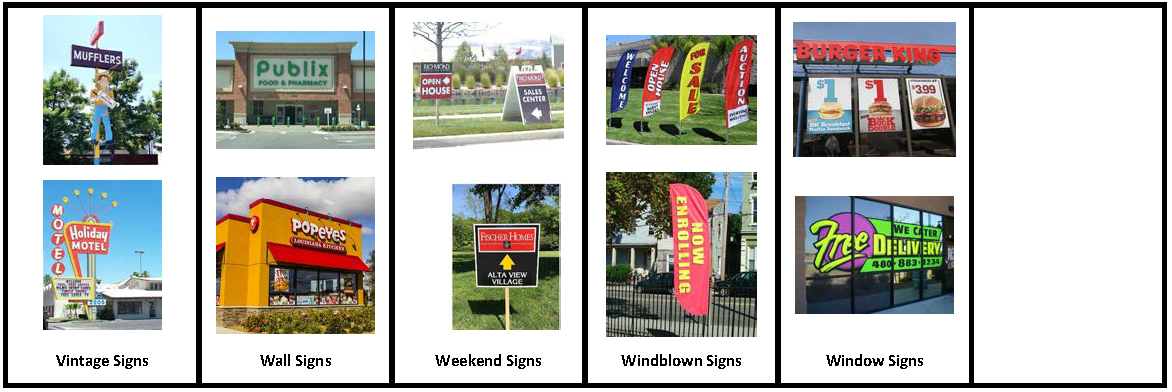
5.7.13. - Vintage Signs
A sign may be designated a vintage sign and reconstructed, restored, or replicated in accordance with the following standards of Section 5.7.13 Vintage Signs. (See Section 5.7.16, Sign Images by Sign Type, for visual illustration of vintage signs)
A.
Qualifications. A sign proposed to be reconstructed, restored, or replicated as a vintage sign shall:
1.
Have no outstanding violations or proposed changes to the property, or structure that would cause the property, or structure to lose its historic designation; and
2.
A vintage sign may be any sign type and may be located in any zoning district as long as it complies with Section 5.7.13, Vintage Signs.
B.
Application. A sign permit application to reconstruct, restore, or replicate a sign as a vintage sign shall include the following:
1.
Evidence of the existence (past or present) of the sign, and its location on the structure or property;
2.
Evidence that the sign was associated with the original or other early use of the structure or grounds, or that such sign itself has historic significance;
3.
If the sign exceeds the permitted height, setback, or sign area, evidence shall be provided that the proposed sign will not exceed the extent of nonconformity of the original sign;
4.
If a sign is proposed to be located somewhere other than where the original sign was located, evidence shall be provided that the sign will be located on grounds or structures that are historically relevant or individually listed on the National Register of Historic Places, or designated as a Guilford County Landmark property;
5.
Evidence that the sign will not pose a hazard to pedestrian or vehicular movements, and that the erection of such sign meets the applicable provisions of the State Building Code and the National Electrical Safety Code (NESC); and
6.
If the sign is being replicated, evidence shall be provided showing how the new sign will imitate the former sign in at least 5 of the following elements: size, shape, materials, coloration, lettering style, graphic art style, illumination, and type of sign (overhanging, roof mounted, wall, freestanding, etc.).
C.
Limitations
1.
If a vintage sign is not permitted in the zoning district where it is proposed, it may be approved if only one such sign is proposed, and it is in place of an otherwise permitted freestanding or attached sign.
2.
Approval for the reconstructing, restoring, or replicating a vintage sign shall not modify the number of permitted signs allowed under this Section.
(Ord. No. 7912/23-27, § 1, 4-17-2023)
5.7.14. - Common Sign Plan
A.
Applicability. Common sign plans shall apply to site plans with multiple buildings, multiple lot developments, group developments, planned developments, preliminary subdivision plans, and the Institutional District.
B.
Procedure
1.
A common sign plan shall be approved prior to the issuance of any sign permit(s).
2.
Any new common sign plan shall include a schedule that requires bringing all permanent signs not conforming to the proposed plan into compliance within 90 days.
C.
Standards. A common sign plan may be more restrictive than the requirements of this Section and shall provide for coordination among the following sign elements:
1.
General locations of proposed signs within the development, for both freestanding and attached signs;
2.
Shape of signs, including proposed maximum sign height and sign area;
3.
Unifying colors and/or lettering, including specific sign or font colors, fonts or script types and any specification or variation in font or script type size and/or color;
4.
Consistent type of sign illumination;
5.
Types of freestanding and attached signs allowed;
6.
Characteristics of sign faces (translucent, partially translucent, silhouette, cut-out letters, etc.);
7.
Allowable materials and colors for signs and sign support structures, including mounting details for attached signs;
8.
Provisions for shared usage of freestanding multi-tenant development signs;
9.
Incorporation and consideration of any overlay district sign requirements; and
10.
Any additional sign elements elected by the applicant to unify the development.
D.
Conflict. In case of any conflict between the provisions of such a common sign plan and any other provision of this Section, the more restrictive standards shall control.
E.
Effect. After approval of a common sign plan, no signs shall be erected, affixed, placed, painted or otherwise established except in conformance with the approved plan. The common sign plan may be enforced in the same way as any other provision of this Section.
F.
Amendment
1.
Minor Changes. Unless expressly prohibited by a condition of approval or an approved common sign plan, the following minor changes may be requested by an applicant and approved by the Planning and Development Director:
a)
Changes to the location of freestanding or attached signs; and
b)
Changes to the provisions for shared usage of freestanding multi-tenant development signs.
2.
Amendment. Changes that are beyond the scope of a minor change are considered amendments and shall comply with the standards provided for in Subsection 5.7.14.C, Standards, and be approved by the Planning and Development Director.
3.
Appeal.
a)
Upon receipt of the proposed amended common sign plan, the Planning and Development Director shall give notice to all owners and leaseholders of the lot or zone lot included within the proposed amended sign plan and shall either provide them with copies of the proposed amended common sign plan or shall specify how such persons may obtain or review a copy. The notice shall give those persons receiving the notice a period of 10 calendar days to consent or file a protest to the proposed amended common sign plan. Silence in response to such notice shall be deemed consent.
b)
If any party receiving notice files a protest, it shall be considered an appeal from the decision of the Planning and Development Director (see Section 2.4.3, Appeal).
(Ord. No. 7912/23-27, § 1, 4-17-2023)
5.7.15. - Savings Clause
Subject to the property owner's consent, a noncommercial message of any type may be substituted in whole or in part for the message displayed on any sign for which the sign structure or mounting device is legal. Any change to the structure or mounting device, or the refacing of a sign shall be subject to the requirements of this Section, a common sign plan, and permitting, as may be applicable.
(Ord. No. 7488/19-05, § 7, 2-4-2019; Ord. No. 7912/23-27, § 1, 4-17-2023)
5.7.16. - Sign Images by Sign Type
5.11.1.- Purpose and Intent
The purpose and intent of this section is to regulate the location, height, and appearance of fences to protect adjacent properties from the indiscriminate placement of fences, ensure the safety, security, and privacy of land, and ensure that fences are subject to timely maintenance, as needed.
5.11.2. - Applicability
The provisions of this section shall apply to all construction or replacement of fences, unless exempted in accordance with Section 5.11.3, Exemptions. A fence may only be erected in accordance with Section 2.5.16, Zoning Compliance Permit.
(Ord. No. 7680/20-96, § 5, 12-9-2020)
5.11.3. - Exemptions
The following are exempted from the standards in this section:
A.
Temporary fences for construction sites, including but not limited to: fencing necessary for soil erosion and sedimentation control and tree protection.
B.
The fence height limitations in this section shall not apply to fences built in conjunction with the following:
1.
Utility Facilities, Major and Minor;
2.
Landfills, Major and Minor;
3.
Correctional Facilities;
4.
Military facilities; or
5.
Hazardous Waste Disposal Facilities.
C.
Below-ground low voltage electric fences used for the purpose of keeping pets.
D.
Battery-charged security fence that complies with the requirements set forth in G.S. 153A-134.1.(b) and is located on property that has been zoned exclusively for nonresidential use.
(Ord. No. 7266/17-08, § 22, 1-17-2017; Ord. No. 7737/21-54, § 1.A, 8-16-2021; Ord. No. 8052/25-30, § 4, 7-21-2025)
5.11.4. - Locational Requirements
A.
General
1.
Fences shall be located outside of the public right-of-way.
2.
Fences may be located within any required yard or setback.
B.
In Utility Easements Fences located within utility easements shall receive written authorization from the easement holder. The City shall not be responsible for damage to, or the repair or replacement of, fences that must be removed to access such easements.
C.
Blocking Natural Drainage Flow A fence shall not be installed so it blocks or diverts a natural drainage flow onto or off of any other land.
D.
Obstructions at Intersections No fence shall be erected or maintained in a manner that obstructs visibility for motorists at any street intersection in accordance with the standards of Title 6, Chapter 1, Streets and Sidewalks, of the City's Code of Ordinances.
E.
Within the Local Historic Overlay (LHO) A fence constructed within an LHO district shall comply with the requirements in Section 2.4.5, Certificate of Appropriateness, and all applicable LHO district standards.
(Ord. No. 7287/17-29, § 10, 4-3-2017; Ord. No. 7622/20-38, § 16.D, 8-5-2020)
5.11.5. - Height Standards
A.
Measurement Maximum fence height shall be determined in accordance with Section 10.2.12, Fences.
B.
Residential Uses The maximum fence height for residential uses is as shown in Table 5.11.5.B, Fence Height for Residential Uses.
C.
Nonresidential and Mixed Uses No fence may be erected that exceeds 8 feet in height, unless the fence is 15 feet from a lot line, or it complies with the minimum setback requirements as applied to the principal structure, whichever is greater; or it is a low-voltage electric fence, as allowed in accordance with Section 5.11.6, Materials.
D.
Athletic Fields Athletic fields, tennis courts, playgrounds, or similar recreational areas abutting a street may include a non-opaque fence with a maximum height of 15 feet, provided the fence is not located within a required landscape area.
E.
Colleges or Universities College or universities may erect fences with a maximum height of 8 feet in residential districts provided:
1.
The land is contiguous to and within 350 feet of a campus area of at least 10 acres in area;
2.
The land is owned by the college or university, at which time the fence may be placed on any part of the lot;
3.
If the land is not owned by the college or university, a fence easement must be obtained from the landowner. The fence may not be located between the right-of-way and the front of an existing dwelling.
(Ord. No. 7365/17-108, §§ 1, 10, 11-20-2017; Ord. No. 7737/21-54, § 1.B, 8-16-2021)
5.11.6. - Materials
A.
General The following fencing materials are permitted for fences:
1.
Masonry or stone;
2.
Ornamental iron, steel, or aluminum;
3.
Wood;
4.
Composite materials designed to appear as wood, metal, or masonry; or
5.
Chain-link, except where prohibited by this Ordinance.
B.
Restricted Materials
1.
Barbed wire, razor wire, concertina wire, and similar materials may only be used in the following instances:
(a)
Fences for correctional institutions may use barbed, razor, and concertina wire.
(b)
Fences enclosing livestock may use barbed wire.
(c)
Fences for other nonresidential uses may use barbed wire, razor wire, and concertina wire provided all of the following are met:
(1)
The wire portion of the fence shall be at least six feet above the grade; and
(2)
The wire shall be included in the overall height determination of the fence.
2.
Fences that carry an electrical current are allowed for the purposes of enclosing livestock (nothing shall prohibit below-ground electrical fences intended for the keeping of pets).
3.
Low voltage electric fences with a maximum of 12 volts, primary voltage, are allowed in the Light Industrial (LI) and Heavy Industrial (HI) districts for nonresidential uses provided all of the following are met:
(a)
It shall not exceed 10 feet in height, or 2 feet taller than the permitted fence by which it is enclosed, whichever is greater;
(b)
It shall be enclosed by a non-electric fence or wall with a minimum height of 6 feet;
(c)
It shall be separated from any non-electric fence or wall by a minimum of 6 inches, except when enclosed by a gate; and
(d)
It shall be identified by signs, each not to exceed 4 square feet in area.
C.
Prohibited Materials Fences made of debris, junk, rolled plastic, sheet metal, untreated or unpainted plywood, or waste materials, unless the materials have been recycled and reprocessed, for marketing to the general public, as building materials designed to resemble new building materials (e.g., picket fencing made from recycled plastic and fiber).
(Ord. No. 7737/21-54, § 1.C, 8-16-2021)
5.11.7. - Finished Side
When a fence is primarily parallel to and within 15 feet of a public street, it shall be configured so that the finished side of the fence faces the street right-of-way other than when required by the State Building Code. For the purposes of this section, the finished side does not include any supporting members or bracing.
5.11.8. - Maintenance
Fences shall be maintained in a safe manner plumb (vertical) to the ground. Fences not maintained in a safe manner through neglect, lack of repair, manner of construction, method of placement, or otherwise shall be repaired, replaced, or demolished.
5.1.1.- Within Corporate Limits
When development occurs within the corporate limits of the City, it shall be served by the City's public water and sewer systems, unless the Public Services Director determines that it is not required in accordance with the City Code.
5.1.2. - Within the ETJ
When development occurs within the City's ETJ, the applicable County Health Department is authorized to approve private well and on-site wastewater treatment systems. Connections to the City's public water and sewer system is authorized only in accordance with established City Council policy.
5.2.1.- Principal Buildings on a Zone lot
Every building must be located on a zone lot. No more than 1 principal building is permitted on a zone lot, except as follows:
A.
Nonresidential Group Development Two or more principal nonresidential buildings are permitted on a zone lot pursuant to a group development plan approved in accordance with Section 2.5.9, Group Development, and provided that vehicular access is maintained to each building for service and emergency vehicles.
B.
Residential Group Development Two or more principal buildings are permitted on a zone lot in a multi-family, single-family attached, pocket neighborhood or tiny home neighborhood development pursuant to a group development plan approved in accordance with Section 2.5.9, Group Development, and provided that access is maintained to each building for service and emergency vehicles.
C.
Multiple Lot Development Two or more principal buildings are permitted on a zone lot pursuant to Section 5.14.5, Multiple Lot Development, and provided that vehicular access is maintained to each building for service and emergency vehicles.
(Ord. No. 7266/17-08, § 16, 1-17-2017; Ord. No. 7399/18-28, § 2, 3-19-2018)
5.2.2. - Street Access
A.
General Standards Except where an alternative configuration is allowed is accordance with Section 5.2.2 B, Alternative Configuration, all development shall comply with the following standards:
1.
Every zone lot shall abut and have direct access to a publicly-maintained street.
2.
No building or structure shall be constructed or placed on a zone lot that does not have direct access to a publicly-maintained street.
3.
Direct access for a use to a publically maintained street through another zoning district is not allowed unless the other zoning district:
(a)
Is classified as a business or special district; or
(b)
Allows the use; or
(c)
Provides the sole means of access for the use.
B.
Alternative Configuration As an alternative to compliance with the general standards in section (A) above, development may incorporate one of the following alternative street access standards:
1.
Dead-End Streets The terminus of a dead-end street does not provide the required access to a publically maintained street unless it is configured as a circular turnaround or other turnaround approved and constructed in conformance with Chapter 7: Subdivisions Standards.
2.
Private Streets Private streets may be used to meet the access requirements for single-family lots in a planned development district, single-family attached developments, and multiple lot developments, provided the district or development as a whole abuts and has direct access to a publicly-maintained street.
3.
Single-Family Attached Development
(a)
Individual lots shall have rights of access through a common area containing private streets or private drives that are at least of 24 feet in width and lead to a publicly-maintained street.
(b)
Direct access to a publicly-maintained street from an individual lot containing a single-family attached dwelling shall require approval from the TRC.
4.
Multiple Lot Development Individual lots in a multiple lot development must have shared rights of access along private streets or private drives that are at least 24 feet in width and lead to a publicly-maintained street.
5.
Access Through Easement Lots of record established as of July 1, 1992 that do not abut a publicly-maintained street may establish access through a recorded access easement provided the lot is used for only 1 single-family detached dwelling and meets the following criteria:
(a)
The minimum easement width shall be 25 feet.
(b)
The minimum separation between the easement and any other platted access or right-of-way shall be 150 feet.
(c)
The location of the easement must be recorded on a plat.
(d)
The easement shall permit ingress, egress, and regress and necessary utilities to serve the lot.
6.
Access Through Unimproved Right-of-Way A single zone lot that has frontage on an existing unimproved public right-of-way, may obtain access through such right-of-way, provided that the following minimum criteria are met:
(a)
A site plan, signed and sealed by a professional surveyor, shall be submitted that shows the lot has no other frontage on an improved public street;
(b)
The unimproved public right-of-way is at least 20 feet in width;
(c)
The access shall serve only 1 single-family detached dwelling and its uninhabited accessory structures;
(d)
The access shall serve only 1 zone lot. If the unimproved public right-of-way is the sole means of access to more than 1 zone lot in the same block, access pursuant to this subsection shall not be approved;
(e)
If the zone lot contains multiple parcels, they shall be combined into 1 parcel as a condition of approval;
(f)
The access shall be maintained by the lot owner; and
(g)
Utilities shall be located within the unimproved right-of-way and extended to the lot in accordance with City standards. The lot owner shall maintain water and sewer utility lines from the edge of the existing street right-of-way to the dwelling. Any proposed dwelling must be within 500 feet of an approved fire hydrant.
7.
Special Purpose Lot Special purpose lots may establish access through an easement a minimum of 10 feet in width, in accordance with Section 7.1.6 B.6, Special Purpose Lots.
(Ord. No. 7266/17-08, § 17, 1-17-2017)
5.2.3. - Cross-Access
A.
Purpose and Intent The intent of this section is to provide for cross-access between comparable commercial and industrial land uses that front thoroughfare streets so that vehicles leaving one lot may access the adjoining lot without having to re-enter the public street system. It is not the intent of this section to reduce the number of driveways beyond what is allowed in the City's Driveway Ordinance.
B.
Applicability The provisions of this section shall apply to commercial and industrial uses, as defined in Section 4.2, Use Classifications, Use Categories, and Use types, on zone lots that front thoroughfare streets with the following, unless exempted in accordance with Section 5.2.3 C, Exemptions:
1.
New Buildings or Uses New principal buildings or new open uses of land.
2.
Expansions Individual or collective expansions of existing principal buildings, open uses of land, or off-street parking that exceed 50 percent.
C.
Exemptions Cross-access is not required when any of the following conditions are present:
1.
Adjacent lots do not have common frontage along a thoroughfare;
2.
Significant topographical differences in existing or proposed conditions are present;
3.
Significant natural features exist in the only viable location for cross-access connections;
4.
Vehicular safety factors including, but not limited to, unsafe turning movements or pedestrian conflicts;
5.
Sufficient cross-access already exists, or an existing non-thoroughfare street performs the cross-access function (i.e. frontage road or service road);
6.
Residential, institutional, or other incompatible land uses, as defined in Section 4.2, Use Classifications, Use Categories, and Use Types, are present on adjacent lots;
7.
Bed and breakfast establishments;
8.
Existing infrastructure obstructions; or
9.
Other safety or security factors.
D.
Easement Recordation A cross-access easement must be recorded on the final plat for property involving a subdivision, or recorded by separate instrument when no plat is proposed.
E.
No Obstruction of Access All cross-accessways shall be built to the lot line, to the maximum extent practicable. An accessway shall not be obstructed unless approved by the Transportation Director.
F.
Off-street Parking Where a required cross-accessway eliminates required off-street parking spaces, replacement spaces shall not be required.
G.
Perimeter Landscaping Where a required cross-accessway eliminates a required landscape planting area, the landscaping requirements shall be reduced to accommodate the cross-accessway and replacement landscaping shall not be required.
H.
Connection Required Development subject to these standards shall include cross-accessways installed to the shared property line. However, if the abutting landowner that does not already have a cross-accessway stub is unwilling to allow the cross-accessway to be built to the shared property line due to the impact of the grading equipment or other construction activity on their property, then the Transportation Director shall notify the unwilling property owner that they will be responsible for completing the cross-accessway when development subject to these standards occurs there.
(Ord. No. 7266/17-08, § 18, 1-17-2017; Ord. No. 7521/19-38, § 7, 4-15-2019; Ord. No. 7542/19-59, § 4.A, 11-4-2019)
5.4.1.- Purpose and Intent
The purpose and intent of this section is to ensure the provision of safe off-street parking and loading space for development allowed by this Ordinance. The standards in this section are intended to avoid requiring an over-supply of parking that pose economic and environmental impacts while ensuring off-street parking is provided to mitigate impacts to streets and neighborhoods.
(Ord. No. 7542/19-59, § 1.C, 7-15-2019)
5.4.2. - Applicability
The provisions of this section shall apply to zone lots with the following, unless exempted in accordance with Section 5.4.3, Exemptions:
A.
New Buildings or Uses New principal buildings or new open uses of land.
B.
Changes in Use Changes in the principal use, except that if the use change results in an increase of less than 5 percent in the required number of parking spaces, or less than 5 additional parking spaces, no additional parking spaces area required.
C.
Expansions Expansions of existing principal buildings, vehicular use areas or open uses of land.
(Ord. No. 7266/17-08, § 18, 1-17-2017; Ord. No. 7750/21-67, § 10.A, 11-1-2021)
5.4.3. - Exemptions
A.
CB and MX Districts Development on land within the CB and MX districts shall comply with the requirements of this section, except that it is exempt from the minimum off-street parking requirements of Table 5.4.4.B, Minimum Off-Street Parking Standards.
B.
Historic Properties No off-street parking is required for:
1.
Rehabilitation or reuse of a National Register site or locally designated landmark;
2.
Rehabilitation or reuse of a contributing building within a National Register district or the LHO; and
3.
Rehabilitation or reuse of a structure that is on the North Carolina National Register Advisory Committee's Study List.
(Ord. No. 7363/17-106, § 7, 11-20-2017; Ord. No. 7415/18-44, § 6, 5-21-2018)
5.4.4. - Off-Street Parking Requirements
A.
Parking Plan Required Every application for a site plan, group development plan, building permit, or zoning compliance permit, shall ensure that adequate off-street parking is provided for the uses or buildings contained in the application. Off-street parking must be provided to meet the parking demand without use of public streets, except as specifically allowed by this section.
B.
Minimum Off-Street Parking Standards The minimum number of off-street parking spaces required for development shall be in accordance with Table 5.4.4.B, Minimum Off-street Parking Standards.
C.
Uses Not Listed For uses that do not correspond to the use types listed in Table 5.4.4.B, Minimum Off-Street Parking Standards, the Planning and Development Director shall determine the minimum parking space requirement. In such instances, the application shall provide adequate information for review, which includes, but is not limited to the type of use(s), number of employees, the occupancy of the building, square feet of sales, service and office area, parking spaces proposed and hours of operation.
D.
Other Vehicles Located Off-street The following vehicles are not included in Table 5.4.4.B, Minimum Off-Street Parking Standards, and shall be parked or located outside required parking spaces and any public street right-of-way in accordance with this Ordinance:
1.
Vehicles for sale or lease;
2.
Vehicles being stored, serviced or repaired; or
3.
Vehicles belonging to the use, such as company vehicles.
E.
Multiple-Use Development Development containing more than 1 principal use shall provide parking spaces in an amount equal to the total of all individual principal uses, except as allowed in Section 5.4.8, Parking Alternatives.
F.
Driveways Used to Meet Requirements Except for multi-family dwellings, driveways may be used to meet the minimum off-street parking space requirements for all use types in the Household Living use category, provided that sufficient space is available to meet the standards of this section.
G.
On-Street Parking Credited The use of on-street parking to meet the minimum off-street parking space requirements is permitted for nonresidential development in the Core City, subject to the following standards:
1.
On-street parking exists within 500 linear feet of the primary entrance of the development;
2.
The on-street parking spaces directly abut (not across the street) the lot containing the development and is served by a sidewalk;
3.
There is not a negative impact to existing or planned traffic circulation patterns; and
4.
The on-street spaces shall not be reserved for sole use by the development.
H.
Administrative Adjustment The Planning and Development Director is authorized to grant an administrative adjustment to the minimum required parking spaces in accordance with Section 2.5.2, Administrative Adjustment.
(Ord. No. 7287/17-29, § 2, 4-3-2017; Ord. No. 7476/18-105, §§ 3.B, 18, 12-3-2018; Ord. No. 7750/21-67, § 5.F, 11-1-2021)
5.4.5. - Bicycle Parking Requirements
Bicycle parking, in accordance with this section, is required in the MX, MS, and RM-26 districts for residential developments with 30 or more dwelling units and nonresidential development with 10,000 or more square feet of gross floor area.
A.
General Standards
1.
Bicycle parking shall be provided at the rate of 1 bicycle space for every 30 residential dwelling units or every 5,000 square feet of nonresidential gross floor area. A minimum of at least 2 bicycle parking spaces shall be provided.
2.
A bicycle rack or other device shall be provided to enable bicycles to be secured.
3.
Bicycle parking shall be located where it does not interfere with pedestrian traffic and is protected from conflicts with vehicular traffic.
4.
Bicycle parking should be accessible to the primary entrances of the development and in a visible, well-lighted area.
B.
Shared Bicycle Parking Adjoining developments may share required bicycle parking spaces provided:
1.
Each use provides or is served by an improved walkway from the bicycle parking spaces to the primary entrance.
2.
The shared bicycle parking spaces and the improved walkway are depicted on a site plan or group development plan, whichever is appropriate.
(Ord. No. 7750/21-67, § 10.B, 11-1-2021)
5.4.6. - Off-Street Loading Requirements
A.
Loading Space Required Every application for a site plan, group development plan, building permit, or zoning compliance permit for a nonresidential use shall ensure that adequate loading space is provided so that loading vehicles do not occupy required off-street parking spaces, block vehicular access, or prevent appropriate on-site maneuvering.
B.
Minimum Off-Street Loading Space Requirements A minimum number of loading spaces is not established; however, off-street loading space shall be provided and maintained in sufficient numbers to adequately handle the needs of a nonresidential use.
5.4.7. - Standards for Off-Street Parking and Loading Space
Off-street parking, stacking, and loading space along with drive aisles and private drives are referred to a "vehicular use area". Vehicular use areas shall meet the standards of this section.
A.
General
1.
All required off-street parking, stacking, and loading space shall be located on the same zone lot as the principal use it serves, except as allowed in Section 5.4.8, Parking Alternatives.
2.
All required off-street parking, stacking, and loading space shall not be used for any other purpose, including, but not limited to the storage or display of goods or the sale, lease, storage, or repair of vehicles.
3.
Required off-street parking shall be maintained for the duration of the principal use and shall not be reduced unless the principal use ceases or changes.
4.
Off-street loading space shall be not be located in any required parking space or protrude into any public street.
B.
Easements A vehicular use area shall not be located within an easement without approval of the easement holder.
C.
Parking Space Access All off-street parking spaces shall be accessed directly from drive aisles or private driveways and not directly from public streets.
D.
Vehicle Backing
1.
Vehicular use areas shall be designed so that a vehicle is not required to back onto a public street to enter or exit the vehicular use area, a parking space, or a stacking space.
2.
Except in the CB district, off-street loading space shall be designed so that no backing into or from a public street is necessary.
E.
Dimensional Standards for Parking Spaces and Aisles Standards for parking spaces and parking aisles shall comply with the minimum dimensional standards established in Table 5.4.7.E, Dimensional Standards for Parking Spaces and Aisles.
F.
Handicapped Accessibility Development providing off-street parking spaces must ensure a portion of the off-street parking spaces are designated, located, and reserved for use by persons with physical disabilities in accordance with the standards of the State Building Code.
G.
Dimensional Standards for Loading Space Except for loading space used by semi-tractor trailers, off-street loading space shall be at least 12 feet wide and at least 25 feet long. Off-street loading space used by semi-tractor trailers shall be at least 60 feet long. Overhead clearance shall be at least 14 feet.
H.
Pedestrian Connections Pedestrian connections between the principal buildings on a development site and a public street(s) must be provided through improved walkways with a minimum unobstructed width of 4 feet. Parking spaces shall be designed to ensure vehicles do not encroach into the walkways.
I.
Stacking Space
1.
General Uses with drive-through facilities and other auto-oriented uses where vehicles queue up to access a service shall provide adequate stacking space on-site for the uses or buildings in accordance with this section. Such uses include but are not limited to: restaurants with drive-through, convenience store with fuel sales, and other uses with service bays or drive-throughs.
2.
Design Stacking space is subject to the following design and layout standards:
(a)
Size Individual stacking spaces shall be a minimum of 9 feet wide and 16 feet long.
(b)
Traffic Movements Stacking space shall not impede vehicular traffic movements or movements into or out of parking spaces, whether on-site or off-site.
(c)
Bicycle and Pedestrian Movement Stacking space shall not impede on-site or off-site bicycle or pedestrian traffic movements, whether on-site or off-site.
(d)
Separation Stacking space shall be clearly delineated through such means as striping, landscaping, pavement design, or curbing.
J.
Private Drives
1.
A vehicular use area shall be connected to a public street in a manner that affords safe and convenient ingress and egress.
2.
A one-way drive shall be at least 12 feet wide and a 2-way drive shall be at least 20 feet wide.
3.
Off-street parking spaces shall not be directly accessible off a private drive, except as allowed for use types in the Household Living use category in Section 5.4.4 F, Driveways Used to Meet Requirements.
4.
A private drive for vehicular use areas containing 200 or more parking spaces shall be unobstructed for at least 30 feet in length from the right-of-way line to a drive aisle or parking space to accommodate the ingress and egress of at least 2 vehicles without conflict with vehicles accessing parking spaces or drive aisles and creating an obstruction in the public street.
5.
The design and location of private drives accessing public streets shall be subject to the City's Driveway Ordinance.
K.
Surface Material
1.
All required parking spaces, drives, and loading space in a vehicular use area shall be paved and maintained with concrete, asphalt, or similar material of sufficient thickness and consistency to support anticipated traffic volumes and weights, except as provided in this section.
2.
The use of pervious or semi-pervious materials may be approved as an alternate means of paving provided it is demonstrated that the materials will function in a similar fashion as required materials.
3.
Private drives accessing public streets shall be paved and maintained from the curb line or edge of pavement to a point at least 10 feet from the public street right-of-way for all vehicular use areas and at least 30 feet for all vehicular use areas with 200 or more parking spaces, whether the vehicular use area is paved or unpaved.
4.
Except for required parking facilities for the disabled, required parking may be constructed with gravel or other approved comparable all-weather surface for:
(a)
Parking used on an irregular basis for religious institutions, private minor assembly uses, and other similar nonprofits organizations;
(b)
Parking for residential uses or a bed and breakfast establishment where 6 or fewer spaces are required;
(c)
Parking for an office use converted from a single-family detached dwelling where 4 or fewer spaces are required;
(d)
Parking for all uses in the AGR district; and
(e)
Parking for industrial uses in the HI district, or manufacturing and production uses in the LI district.
5.
Required parking facilities and associated access for the disabled shall be paved in accordance with the State Building Code.
L.
Grading and Drainage The vehicular use area shall be graded, properly drained, stabilized, and maintained to minimize dust and erosion.
M.
Curb and Gutter Where vehicular use areas are paved, curb and gutter or an equivalent drainage system shall be provided along the periphery of the area.
N.
Markings All spaces and lanes in vehicular use areas shall be clearly delineated with paint lines, curbs, or other treatment, whether the vehicular use area is paved or unpaved.
O.
Curbs and Wheel Stops All parking spaces provided shall have curbs or wheel stops located so that no part of the parked vehicle will extend onto a sidewalk, walkway, adjacent property or landscape area, whether the vehicular use area is paved or unpaved.
P.
Exterior Lighting Exterior lighting in vehicular use areas shall be designed to prevent glare or illumination exceeding maximum allowable levels on adjacent land and shall comply with the standards of Section 5.10, Exterior Lighting, as appropriate.
Q.
Landscaping Landscaping shall be provided in accordance with Section 5.5.10, Parking Lot Landscaping.
(Ord. No. 7266/17-08, § 19, 1-17-2017; Ord. No. 7542/19-59, § 1.D, 7-15-2019; Ord. No. 7750/21-67, § 10.C, 11-1-2021)
5.4.8. - Parking Alternatives
The Planning and Development Director is authorized to approve an alternative parking plan for development that proposes alternatives to providing the number of off-street parking spaces required by Table 5.4.4.B, Minimum Off-Street Parking Standards, in accordance with the standards of this sub-section. Nothing in this section shall limit the utilization of one or more of the following off-street parking alternatives by a single use.
A.
Shared Parking
1.
The required off-street parking for a use may be met off-site with the required off-street parking spaces of another use in accordance with the following standards:
(a)
The shared parking is located within 1,000 feet as measured from the entrance of the use to the nearest shared parking space.
(b)
An improved walkway is provided to the shared parking area from the use.
(c)
If the shared parking is located across a thoroughfare, then an adequate and safe pedestrian street crossing, as determined by the Transportation Director, shall exist to safely manage pedestrian crossings. If pedestrian improvements are needed for safe crossings, then the improvements shall be installed prior to use of the shared parking.
(d)
The uses served by the shared parking plan must have different peak parking demands, differences in hours or days of operation, or otherwise operate such that the uses have access to the required minimum parking spaces when in operation.
2.
The Planning and Development Director may approve up to 100 percent of the minimum parking requirement of a use through a shared parking plan.
3.
A written agreement allowing the shared use of parking shall be executed by the owners involved and filed with the Planning and Development Director prior to the use of shared parking facilities. The agreement must guarantee the long-term availability of parking. Should the agreement cease, then the use shall be considered to contain nonconforming site conditions if the required parking is not met and future expansions of the use shall be prohibited unless the use is brought into compliance with the minimum parking requirements of this section.
B.
Off-Site Parking
1.
The required off-street parking for a use may be met off-site in accordance with the following standards:
(a)
The off-site parking is located within 1,000 feet as measured from the entrance of the use to the nearest shared parking space.
(b)
An improved walkway is provided to the off-site parking area from the use.
(c)
If the off-site parking is located across a thoroughfare, then an adequate and safe pedestrian street crossing shall exist to safely manage pedestrian crossings. If pedestrian improvements are needed for safe crossings, then the improvements shall be installed prior to use of the off-site parking.
2.
A written agreement allowing the off-site use of parking shall be executed by the owners involved and filed with the Planning and Development Director prior to the use of off-site parking facilities. The agreement shall guarantee the long-term availability of parking. Should the agreement cease, then the use shall be considered to contain nonconforming site conditions if the required parking is not met and future expansions of the use shall be prohibited unless the use is brought into compliance with the minimum parking requirements of this section.
C.
Compact Spaces Up to 20 percent of the required off-street parking spaces may be provided as compact car spaces in accordance with the following standards:
1.
Each compact car space shall be at least 8 feet wide and 16 feet deep.
2.
Compact car spaces shall be clearly marked or posted for compact cars only.
(Ord. No. 7476/18-105, §§ 14.C, 14.D, 12-3-2018)
5.5.1.- Purpose and Intent
The purpose of this section is to establish minimum requirements for landscaping. These standards are intended to:
A.
Advance the general purposes of this Ordinance;
B.
Ensure and encourage the planting, maintenance, restoration, and survival of trees, shrubs, and other plants;
C.
Promote the conservation of existing healthy trees and vegetation, and provide for the restoration of land denuded as a result of grading and construction;
D.
Ensure visual screening of unsightly areas;
E.
Establish appropriate landscape yards and screening features to reduce the negative impacts of glare, noise, trash, odors, lack of privacy, and visual appearance that can occur when higher intensity land uses locate near lower intensity land uses;
F.
Safeguard and enhance property values and aesthetic qualities, and protect public and private investment;
G.
Encourage the use of low impact development techniques and sustainable development practices;
H.
Protect and improve environmental functions and conditions by providing eco-system features such as shade, air purification and oxygen regeneration, filtering of stormwater runoff, and mitigation of noise, glare, and heat; and
I.
Assure that the appearance of High Point positively contributes to its growth and economic prosperity.
5.5.2. - Applicability
The provisions of this section shall apply to zone lots with the following, unless exempted in accordance with Section 5.5.3, Exemptions:
A.
New Buildings or Uses New principal buildings or new open uses of land.
B.
Changes in Use Changes in use of one or more in land use intensity (see Table 5.5.11.C, Land Use Intensity).
C.
Expansions In the case of an expansion of an existing building, outdoor use area, or off-street parking lot, the following standards shall apply:
1.
For individual or collective expansions of 50 percent or less, the standards in this section shall apply only to the expanded portion; or
2.
For individual or collective expansions that exceed 50 percent, the standards in this section shall be applied to the entire zone lot.
(Ord. No. 7266/17-08, § 18, 1-17-2017)
5.5.3. - Exemptions
The following development is exempted from the standards in this section:
A.
Single-family detached dwellings;
B.
Duplex dwellings;
C.
Development in the CB and MX districts, except for parking areas;
D.
Repaving or restriping of an existing parking area;
E.
Where lot lines abut the following forms of development, no landscape yard is required:
1.
Railroad rights-of-way or easements;
2.
Utility easements of 60 feet or more in width; and
3.
Street right-of-way that has remained unopened for a period of at least 15 years.
F.
Where outdoor seating is provided between a building and a street, no plant material is required in the corresponding portion of the streetyard.
G.
No perimeter landscape yard shall be required when single-family detached and single-family attached dwelling units abut one another within the same development.
H.
No parking lot landscaping shall be required for parking lots on the same zone lot as the principal use they serve if they have less than 5 parking spaces outside the Core City, or 20 or fewer spaces inside the Core City.
(Ord. No. 7266/17-08, § 18, 1-17-2017; Ord. No. 7363/17-106, § 8, 11-20-2017)
5.5.4. - District Standards
Some zoning districts and overlay districts, such as the MS and the GCO districts, include additional district-specific landscaping standards (See Chapter 3: Zoning Districts).
(Ord. No. 7750/21-67, § 11, 11-1-2021)
5.5.5. - General Requirements
A.
Conceptual Landscape Plan
1.
A conceptual, or generalized landscape plan is required as part of a submittal for a land disturbance permit. The purpose of the conceptual plan is to ensure that landscape yard requirements can be met, required undisturbed areas and buffers can be maintained, and slopes in required landscape yards will meet the standards of Section 5.5.12, Landscape Yards on Slopes.
2.
Nothing shall prohibit an applicant from filing a revised landscape plan that differs from a conceptual landscape plan.
B.
Landscape Plan Required
1.
A landscape plan depicting how required landscaping will be planted on a development site shall be included with an application for site plan, group development, or building permit, as appropriate, to ensure compliance with this section.
2.
The landscape plan shall be approved prior to, or concurrent with, the approval of a site plan, group development plan, or the issuance of a building permit.
3.
A landscape plan shall contain, as a minimum, the following:
(a)
Location of required planting material;
(b)
Identification of trees and plants, including their scientific names;
(c)
Minimum and maximum dimensions of all landscape yard areas (see Section 10.2, Rules of Measurement);
(d)
Calculations determining the number of canopy trees, understory trees, and shrubs required (see Section 10.2, Rules of Measurement);
(e)
Locations, species, and sizes of existing vegetation to be retained and counted towards minimum landscaping requirements; and
(f)
Existing topography, or proposed topography where site grading is proposed to occur.
C.
Stormwater Detention Pond Landscaping If landscaping is proposed around or on the embankment of a stormwater detention pond, a landscape plan must be submitted for review to determine that the safety and functionality of the device will not be compromised by the addition of trees and/or shrubs.
D.
Landscaping in Bio-retention Cells Trees and shrubs used in bio-retention cells or rain gardens located in parking lots or within landscape yards may be counted toward tree or shrub requirements provided they meet the minimum specifications in Section 5.5.6, Plant Material Specifications.
E.
Phased Development Development that is planned in phases may submit a landscape plan for the entire development, or separate landscape plans for each phase, which shall be approved prior to approval of the final plat.
5.5.6. - Plant Material Specifications
A.
Canopy Tree Size
1.
Canopy trees shall have a minimum height at maturity of 40 feet or a minimum crown width of 30 feet.
2.
All canopy trees shall have a minimum caliper size of 2 inches at planting.
3.
Evergreen trees shall be a minimum of 6 feet in height at planting.
B.
Understory Tree Size
1.
Understory trees shall have a minimum height at maturity of 25 to 40 feet, except that trees to be placed below overhead utility lines may not exceed a mature height of 20 feet.
2.
Drought tolerant understory trees must have a minimum caliper size of 1 inch at planting.
3.
All other understory trees must have a minimum caliper size of 2 inches at planting.
C.
Shrub Size and Type
1.
Required shrubs in a Type A landscape yard or shrubs located parallel to the edge of parking lots, access drives, loading space, and outdoor storage shall be evergreen.
2.
Required shrubs in a Type B landscape yard shall be 50 percent or more evergreen.
3.
Required shrubs in a Type C landscape yard shall be 25 percent or more evergreen.
4.
Required shrubs in a streetyard or in a Type D landscape yard may be evergreen or deciduous.
5.
All shrubs must be at least a 3-gallon size and have a minimum height or spread of 15 inches at the time of planting. Shrubs shall reach a minimum height of 36 inches and a spread of 30 inches within 3 years of planting.
D.
Species Plant species used in required landscape yards must be native species or species of a locally adapted nature. Other species may be approved by the Planning and Development Department Director. Refer to the Development Guide for listings of acceptable plant material, which includes drought tolerant species and species suitable for planting within 20 feet of overhead utilities.
E.
Species Diversity To curtail the spread of disease or insect infestation in a plant species, new plantings shall comply with the following standards:
1.
When fewer than 20 trees are required on a site, at least 2 different species shall be utilized, in roughly equal proportions.
2.
When more than 20 but fewer than 40 trees are required to be planted on site, at least 3 different species shall be utilized, in roughly equal proportions.
3.
When 40 or more trees are required on a site, at least four different species shall be utilized, in roughly equal proportions.
4.
A larger number of different species than specified may be utilized.
5.
In no instance shall invasive species be utilized as landscaping materials to meet the requirements of this section.
F.
Stabilization Landscape yards shall be stabilized and maintained with ground cover, mulch, or other approved materials to prevent soil erosion and allow rainwater infiltration. Landscape yards with slopes of 15 percent or more shall be stabilized with vegetative cover to minimize erosion and mulch washout. Use of landscape fabric on slopes of 15 percent or more is discouraged.
G.
Grouping of Plant Material
1.
Except within a Type A landscape yard, plant material may generally be grouped or clustered within the required landscape yards, however, the overall intent of the particular landscape yard must be adequately addressed. Groupings or clusters shall be depicted on the landscape plan and be approved by the Planning and Development Director.
2.
Perimeter landscaping materials adjacent to parking lots, access drives, loading and unloading areas, and outdoor storage may not be grouped.
3.
Required plant material in a Type A landscape yard may not be grouped, and shall be planted according to the required on-center spacing in Table 5.5.11.B, Perimeter Landscape Yard Types.
H.
Berms
1.
Berms may be used independently, or in conjunction with a wall or fencing, to meet the screening intent of the Type A landscape yard.
2.
Berms must be stabilized, have a slope not exceeding 3:1 (horizontal to vertical), have a crown width at least ½ the berm height, and may be no taller than 8 feet above the toe of the berm slope.
3.
A berm may not damage the roots of existing healthy vegetation designated to be preserved.
4.
A berm may not be designed or placed as to interfere with required sight distances.
I.
Fences
1.
Opaque fences, a minimum of 5 feet in height, constructed within required landscape yards, may reduce the minimum and average landscape yard width requirement in accordance with Table 5.5.11.B, Perimeter Landscape Yard Types.
2.
If utilized, fences shall be located within the landscape yard and all required shrubs shall be planted between the fence and the lot line. Required trees may be planted behind the fence.
J.
Planters
1.
Planters shall be constructed of masonry, stone, or pressure treated lumber stamped for ground contact. Other materials may be approved, based upon their durability, by the Planning and Development Director,
2.
Planters shall have a minimum height of 30 inches and have an effective planting area of 7 feet (measured in any direction) if trees are to be planted and an effective planting area of 4 feet (measured in any direction) if no trees are to be included.
3.
The minimum height of shrubs in the planter, except for ground cover, shall be 6 inches at the time of planting.
4.
ADA-approved grates must be used atop all tree wells.
(Ord. No. 7287/17-29, § 7, 4-3-2017; Ord. No. 7542/19-59, § 1.E, 7-15-2019)
5.5.7. - Limitations on Landscaping Placement
A.
Easements
1.
Required trees and shrubs planted within a utility or a water quality conservation easement must be approved by the easement holder (whether such easement pertains to above or below ground rights).
2.
When trees or shrubs are planted in a utility easement or a water quality conservation easement, the landowner is responsible for replacement of any required vegetation if maintenance or other utility requirements result in its removal.
3.
When trees or shrubs are planted in a water quality conservation easement, they shall not impact the easement design or impede the flow of water through the easement.
4.
When required landscaping is permitted to be placed in an easement, the easement width may be counted toward the minimum landscape yard width. Additional area outside the easement shall be provided to meet minimum and average required landscape yard widths.
5.
Where an easement and a required landscape yard coincide, and there is a prohibition on planting within a portion of the easement, and the remaining width is not sufficient to properly contain required plant material, then the landscape yard width shall be expanded in an amount necessary to include all required plant material.
B.
Fire Protection System Minimum clear separation distances required by the current adopted version of the North Carolina Fire Code shall be maintained for landscaping near a fire protection system.
C.
Obstructions at Intersections No trees or shrubs shall be planted or maintained in such a manner as to obstruct visibility for motorists at any street intersection in accordance with the standards of Title 6, Chapter 1, Streets and Sidewalks, of the City's Code of Ordinances.
D.
Plantings in the Right-of-Way Required planting materials shall not be located within a public right-of-way unless approved in accordance with Section 5.5.13, Alternate Landscape Plan, and shall be subject to an encroachment agreement between the landowner and the City.
E.
Permitted Encroachments The following are permitted in required landscape yards as indicated, provided the landscaping requirements are met and there is no interference with visibility at intersections.
1.
The following features may be located entirely within landscape yards required by this section:
(a)
Landscaping features such as, ornamental pools, planting boxes, sculpture, arbors, trellises, and birdbaths;
(b)
Pet shelters;
(c)
At-grade patios or decks;
(d)
Play equipment;
(e)
Outdoor furniture and fireplaces;
(f)
Ornamental entry columns, gates, fences, walls, and retaining walls;
(g)
Flagpoles of 30 feet in height or less;
(h)
Lamp and address posts;
(i)
HVAC equipment, well houses, and utility cabinets of 4 feet in height or less;
(j)
Mailboxes and incidental signage;
2.
The following features may encroach up to 2½ feet into a required landscape yard, but no closer than 3 feet from any lot line:
(a)
Cornices;
(b)
Steps;
(c)
Canopies;
(d)
Overhanging eaves and gutters;
(e)
Window sills, bay windows or similar architectural features;
(f)
Chimneys; and
(g)
Fire escapes, fire balconies, and fire towers.
3.
Up to 15 percent of a required landscape yard may be occupied by walkways and steps that are not connected to any above-grade structure.
4.
A stormwater facility with an approved alternate landscape plan.
5.
Handicap ramps, but not porches or landings.
F.
Multiple-Lot Development
1.
A multiple-lot development, such as a shopping center, that is configured and developed as a single entity shall be treated as a single zone lot for the purposes of applying the parking lot, landscape yard, and streetyard standards.
2.
Individual lots within a multiple-lot development shall be subject to the screening requirements in Section 5.6, Screening.
(Ord. No. 7622/20-38, § 16.B, 8-5-2020)
5.5.8. - Credit for Existing Vegetation
A.
General Standards Existing healthy, well-formed canopy and understory trees that are in or within 10 linear feet of a required landscape yard and that meet or exceed the standards of this section may be credited toward the applicable tree planting requirements of this section, in accordance with the following:
1.
The landowner or developer has provided a plan showing the location and size of canopy and understory trees to be credited, and trees depicted on the plan have been marked or identified on the site.
2.
The canopy and understory trees to be credited are protected before and during development by tree protection fencing in accordance with the Development Guide.
3.
The location of the existing canopy and understory trees to be credited contribute to the screening or buffering functions of the landscaping.
4.
Any canopy or understory trees for which credit has been received that die shall be replaced in a manner that ensures the landscaping meets the requirements of this section.
B.
Amount
1.
Existing trees meeting the standards in (A) above that are retained during and after development shall be credited towards the minimum landscape requirements at a rate of 1.25 times the tree's actual DBH.
2.
Trees to be credited shall be verified prior to credit being provided.
C.
Credit Determination
1.
The amount of credit towards the number of required new trees is determined by dividing the total DBH of trees to be retained by the minimum caliper inch size of required plantings (see Section 5.5.6, Plant Material Specifications). Example: A development site that retains 3 8-inch DBH canopy trees will be credited for a total of 30 inches DBH of existing trees ((8x3) x 1.25 = 30 DBH), or 10 newly-planted canopy trees (30/3=10).
2.
The Planning and Development Director shall verify and approve trees to be credited in accordance with this section.
D.
Streetyard Requirements Regardless of the number or size of preserved trees in required streetyards, there shall be at least 1 canopy tree for every 50 linear feet of required streetyard.
5.5.9. - Time for Installation of Required Landscaping
A.
Timing Required landscaping (including mulching and seeding) shall be installed in accordance with this section prior to the issuance of a certificate of occupancy unless a financial guarantee is established to ensure installation at a later date.
B.
Financial Guarantee A financial guarantee prepared in accordance with Section 2.6, Financial Guarantees, shall be in place whenever occupancy is desired and required landscaping has not been completed. The maximum length of time for a landscaping financial guarantee shall be 6 months, which may be extended one time for up to 90 days by the Planning and Development Director.
C.
Multi-Phase Development Multi-family, nonresidential, and mixed-use development that is planned and developed in phases shall be required to install landscaping that is associated with the active phase or phases only, unless an alternative arrangement is otherwise agreed to by the Planning and Development Director and the developer. An active phase of a development is the one that is subject to permitted and on-going development activity.
(Ord. No. 7622/20-38, § 11.C, 8-5-2020)
5.5.10. - Parking Lot Landscaping
A.
General Standards
1.
Two or more parking lots on the same zone lot that are physically separated by buildings and are not physically connected by internal drives shall be considered independently.
2.
Parking lot landscaping shall include at least 1 canopy tree for every 12 parking spaces.
3.
Placement of Canopy Trees
(a)
Required interior and perimeter parking lot canopy trees shall be placed such that no parking space is more than 80 feet from the trunk of a canopy tree for new or redeveloped nonresidential parking areas, and 50 feet for new or redeveloped residential parking areas.
(b)
In cases where an approved alternate landscape plan permits understory trees to be substituted for canopy trees, they shall be placed such that no parking space is more than 50 feet from the trunk of an understory tree for nonresidential parking areas, and 30 feet for residential parking areas.
(c)
Additional trees above the minimum number required may be used to meet this standard.
B.
Interior Landscaping Standards
1.
General Standards
(a)
For the purposes of parking lot landscaping, the interior of a parking lot shall be all of the area within the outer boundary of the parking lot including interior and corner landscape islands intended to fulfill the interior parking lot landscaping requirements, but not including perimeter landscape yards (see Figure 5.5.10.B, Parking Lot Landscaping Area).
(b)
These standards shall not apply to parking structures, or vehicle display areas.
(c)
Required interior canopy trees shall be distributed throughout parking areas and may be located in landscape islands, landscape divider medians between rows of parking, or in driveway medians. Trees used to satisfy the general rate requirement in Section 5.5.10 A.2. may not be counted toward any landscape yard requirement.
FIGURE 5.5.10.B, PARKING LOT LANDSCAPING AREA
2.
Landscaping Islands and Strips A parking aisle with more than 12 spaces in a single row shall provide and maintain landscaping islands or strips in accordance with the following standards.
(a)
Islands for planting canopy trees shall have a minimum dimension of 9 feet and a minimum area of 162 square feet, including the curb.
(b)
Landscape islands that do not contain canopy trees may contain understory trees and shall contain 3 or more shrubs. Landscape islands that do not contain canopy trees shall have minimum dimension of 5 feet, including the curb.
(c)
Landscape strips between adjoining rows of parking spaces or serving as driveway medians shall have a minimum dimension of 7 feet, including the curb, if canopy trees are included and 5 feet in all other cases, including the curb. Landscape strips that do not have canopy trees shall include shrubs planted no more than 10 feet on center.
3.
Separation of Light Poles and Trees In order to prevent the need to excessively trim trees within landscape areas and to maintain the effectiveness of parking area lighting, light poles shall be spaced at least 10 linear feet from a canopy tree trunk, to the maximum extent practicable.
4.
Protection of Landscape Islands Landscape islands shall be protected from vehicle damage by the installation of curbing, wheel stops or other comparable methods. The placement of plant material within landscape islands shall allow for a 2-foot vehicle overhang from the face of the curb or wheel stop.
5.
Stormwater Management A landscape island may be designed to function as a stormwater management device.
C.
Parking Lot Perimeter Landscaping Required Where a parking lot abuts a street or other development (other than another parking lot), landscaping shall be provided and maintained in accordance with the following:
1.
Intent Parking lot perimeter landscaping shall be designed to soften the view of the parking lot from an abutting street or development and to filter spillover light from vehicle headlights. Required plant material shall be planted in such a way as to best achieve this intent.
2.
Location
(a)
Required plant material shall be evergreen and shall be placed adjacent to the perimeter of the parking area.
(b)
Depending upon the geometric relationship of the parking lot to the property lines or to topographic conditions, plant material may be placed away from the edge of the parking area, if necessary, to best achieve the intent of this subsection.
3.
Planting Rate
(a)
Parking lot perimeter landscaping shall be provided in an amount equivalent to a Type D landscape yard except that plant material shall be uniformly distributed along the parking lot perimeter.
(b)
Parking lot perimeter landscaping shall be credited toward the perimeter landscape yard planting requirement along the portion of the lot line parallel to the parking lot perimeter landscaping.
4.
Size of Plant Material Evergreen shrubs used for parking lot perimeter landscaping shall be in accordance with Section 5.5.6 C, Shrub Size and Type.
5.
Alternative Configuration An opaque or semi-opaque (50 percent opaque or more) decorative fence may be provided in-lieu of the shrub requirement if the fence is 48 inches above grade level, located adjacent to the perimeter of the parking lot, and is made of brick, stone, wrought iron, decorative aluminum or steel, painted or stained wood, or composite material. Upon review, the Planning and Development Director may require up to 50 percent of the required number of shrubs where a semi-opaque fence is proposed to ensure the parking lot is sufficiently screened. Chain link fencing, with or without slats, shall not be credited towards landscaping requirements, but may be incorporated between a perimeter landscape strip and the parking area.
6.
Exemptions Where parking lots are adjacent to one another, but on different lots, a perimeter landscape yard is not required along the common boundary of the parking lots. However, the requirements of Section 5.5.10, Parking Lot Landscaping, shall be met.
(Ord. No. 7266/17-08, § 18, 1-17-2017; Ord. No. 7521/19-38, § 8, 4-15-2019)
5.5.11. - Perimeter Landscape Yards
A.
General Standards
1.
Landscape yards are required along the perimeter, extending inward from the lot line, of a zone lot or development site in accordance with Table 5.5.11.B, Perimeter Landscape Yard Types, and Table 5.5.11.C1, Land Use Intensity. They are intended to mitigate potential adverse impacts that may result when higher intensity land uses are located adjacent to lower intensity land uses.
2.
The width of permitted driveways and permitted cross-access easements, measured at the lot line, shall be excluded from the calculation of required plant material.
3.
A perimeter landscape yard may be located along shared access easements between parcels in nonresidential development.
4.
A perimeter landscape yard in a multiple lot development that is configured and developed as a single entity, is only required around the outer perimeter of the development.
5.
Stormwater management devices that incorporate vegetation (e.g., bio-retention cell, rain garden, constructed wetlands, etc.) may be placed within a perimeter landscape yard provided the screening function of the landscape yard is maintained. Any plant material meeting the minimum requirements for the landscape yard may be counted toward the requirements.
B.
Types of Landscape Yards Table 5.5.11.B, Perimeter Landscape Yard Types, establishes standards for the following different landscape yards:
1.
Streetyard;
2.
Type A Opaque Landscape Yard;
3.
Type B Semi-Opaque Landscape Yard;
4.
Type C Intermittent Landscape Yard; and
5.
Type D Basic Landscape Yard.
The standards are based on whether the development is within or outside the Core City.
| TABLE 5.5.11.B: PERIMETER LANDSCAPE YARD TYPES | |||
|---|---|---|---|
| LANDSCAPE YARD TYPE | DESCRIPTION/MINIMUM REQUIREMENTS | ||
| INSIDE CORE CITY | OUTSIDE CORE CITY | ||
| STREETYARD | |||
| Intent: This landscape yard functions to distinguish the edge of the street right-of-way and adjacent private land and to provide continuity of vegetation along public streets. | 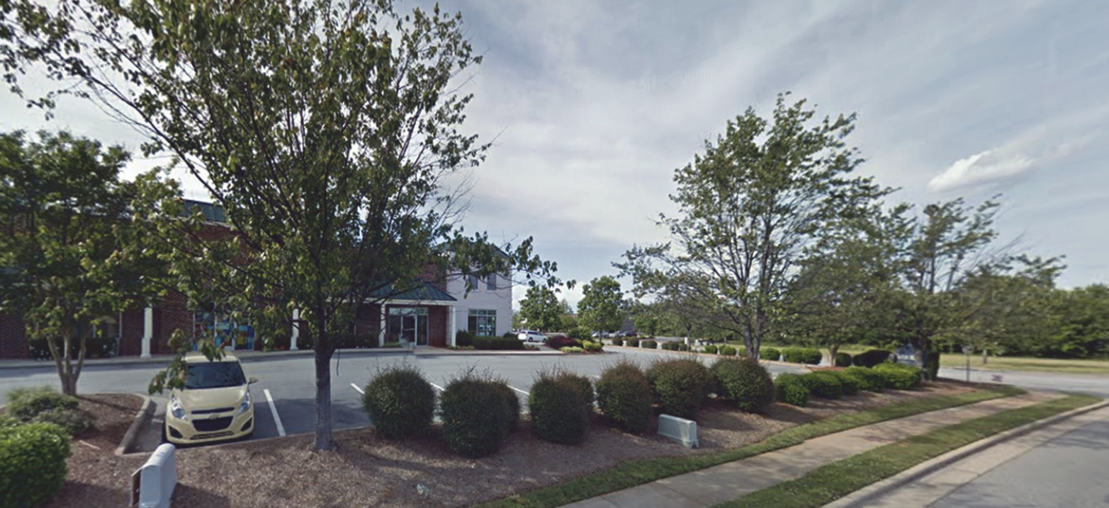 | ||
| Average width (feet) [1] | 8 | 10 | |
| Minimum width (feet) [2] | 5 | 8 | |
| Maximum width (feet) | 15 | 15 | |
| Canopy trees per 100 linear feet | 2 | 2 | |
| Shrubs per 100 linear feet | 17 | 17 | |
| TYPE A: OPAQUE LANDSCAPE YARD | |||
|
Intent: This landscape yard functions as an opaque screen from the ground to a height
of 8 feet. This type of buffer prevents visual and auditory contact between uses and
creates a strong impression of total separation.
Yard shown at maturity | 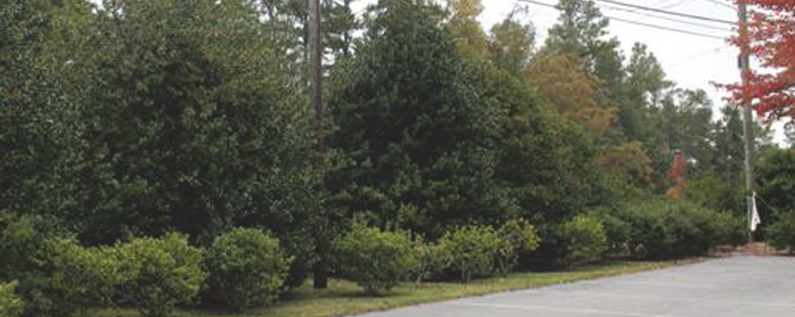 | ||
| Average width (feet) | 25 | 45 | |
| Minimum width (feet) [2] | 20 | 35 | |
| Maximum width (feet) | 30 | 70 | |
| Canopy trees per every 100 linear feet/on-center spacing (feet) | 2/50 | 4/25 | |
| Understory trees per every 100 linear feet/on-center spacing (feet) | 5/20 | 10/10 | |
| Evergreen shrubs per every 100 linear feet/on-center spacing (feet) | 10/10 | 33/3 | |
| 5-foot opaque fence | Reduces average and minimum widths by 5 feet | Reduces average and minimum widths by 10 feet | |
| TYPE B: SEMI OPAQUE LANDSCAPE YARD | |||
|
Intent: This landscape yard functions as a partially opaque screen from the ground
to a height of 6 feet. This type of buffer prevents visual contact between uses and
creates a sense of spatial separation.
Yard shown at maturity | 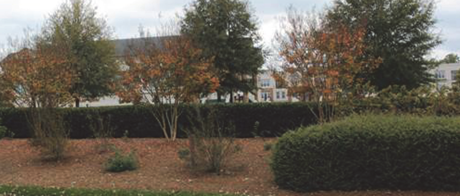 | ||
| Average width (feet) | 15 | 25 | |
| Minimum width (feet) [2] | 12 | 20 | |
| Maximum width (feet) | 25 | 45 | |
| Canopy trees per every 100 linear feet | 2 | 4 | |
| Understory trees per every 100 linear feet | 4 | 6 | |
| Shrubs per every 100 linear feet [3] | 8 | 25 | |
| 5-foot opaque fence | Reduces average width by 3 feet and minimum width by 2 feet | Reduces average and minimum widths by 5 feet | |
| TYPE C: INTERMITTENT LANDSCAPE YARD | |||
|
Intent: This landscape yard functions as an intermittent visual screen from the ground
to a height of 5 feet. It is intended to partially block visibility between different
uses but not totally obstruct visual contact from one use to another.
Yard shown at maturity | 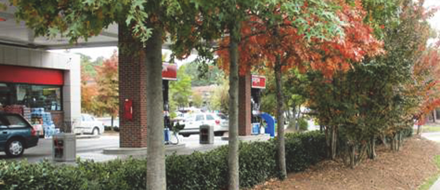 | ||
| Average width (feet) | 10 | 15 | |
| Minimum width (feet) [2] | 8 | 10 | |
| Maximum width (feet) | 20 | 35 | |
| Canopy trees per every 100 linear feet | 2 | 3 | |
| Understory trees per every 100 linear feet | 3 | 4 | |
| Shrubs per every 100 linear feet [3] | 6 | 20 | |
| 5-foot opaque fence | Reduces average width by 2 feet | Reduces average and minimum widths by 5 feet | |
| TYPE D: BASIC LANDSCAPE YARD | |||
|
Intent: This landscape yard functions as a means to demarcate boundaries between different
uses and provide only a slight visual obstruction between different uses.
Yard shown at maturity |  | ||
| Average width (feet) | 5 | 8 | |
| Minimum width (feet) [2] | 5 | 5 | |
| Maximum width (feet) | 10 | 15 | |
| Canopy trees per every 100 linear feet | None | ||
| Understory trees per every 100 linear feet | 2 | 2 | |
| Shrubs per every 100 linear feet [3] | 12 | 15 | |
| 5-foot opaque fence | No additional reductions | ||
| NOTES: | |||
| [1] Within the Core City, where a required streetyard cannot be accommodated due to the location of existing development or other site related issue, an adjustment may be approved in accordance with Section 2.5.2, Administrative Adjustment | |||
| [2] If the required principal building setback is less than the required landscape yard width, the principal building setback controls and the landscape yard width shall be reduced only along the length of the building wall that encroaches into the landscape yard. Regardless of reduction in streetyard width, the required planting material must be installed, though its location may be modified in accordance with Section 5.5.13, Alternate Landscape Plan. | |||
| [3] A percentage of the required shrubs must be evergreen. See Section 5.5.6 C, Shrub Size and Type. | |||
C.
Landscape Yard Type Application
1.
To determine the type of landscape yard required, first identify the land use intensity of the proposed (new, changed, or expanded) use, then identify the land use intensity of each existing use on adjacent sites (see Table 5.5.11.C1, Land Use Intensity). Then, using Table 5.5.11.C2, Type of Landscape Yard Required, the intersection of the row associated with the proposed use and the column associated with the adjacent use shows the type of landscape yard required.
2.
The land use intensity is a number that corresponds to the intensity of development.
3.
A land use is considered to "exist" on an adjacent property when a building permit is issued.
4.
If a zone lot contains uses with different land use intensities, the higher numbered land use intensity applies unless an alternate landscape plan is approved in accordance with Section 5.5.13 Alternate Landscape Plan.
5.
No landscape yard shall be required where a proposed use is adjacent to an existing agricultural use.
6.
For purposes of determining the required landscape yard type, vacant land, as defined by this Ordinance, shall be assigned a land use intensity score by the Planning and Development Director, based upon the most recent use of the property, with consideration given to the current zoning district.
D.
Streetyard Standards
1.
Streetyard landscaping shall be installed in accordance with Table 5.5.11.B, Perimeter Landscape Yard Types. Trees associated with streetyard landscaping shall not be located within 4 feet of the right-of-way line.
2.
Off-street parking, storage, or display shall be prohibited within a streetyard.
3.
No streetyard landscaping shall be required along an alley.
(Ord. No. 7266/17-08, § 18, 1-17-2017; Ord. No. 7365/17-108, § 1, 11-20-2017; Ord. No. 7415/18-44, § 7, 5-21-2018; Ord. No. 7521/19-38, §§ 9, 10, 4-15-2019; Ord. No. 7542/19-59, § 4.B, 7-15-2019; Ord. No. 7750/21-67, §§ 5.E, 9.B, 11-1-2021)
5.5.12. - Landscape Yards on Slopes
Slopes over 50 percent shall not be used to meet a landscape yard requirement. Slope areas of between 33 percent and 50 percent may be used to meet a landscape yard requirement in accordance with the following:
A.
Existing Slope with Adequate Tree Cover If the required number of trees for the applicable landscape yard exists on the slope, then the slope area is deemed to meet the landscape yard requirements, provided that no healthy trees or other vegetation are removed and no grading or clearing of the slope occurs.
B.
Existing Slope without Adequate Tree Cover If the slope area lacks the required number of trees for the applicable landscape yard, then additional trees and vegetation shall be provided to meet the landscape yard requirement. No existing healthy trees or vegetation may be removed and no grading or clearing of the slope may occur.
C.
Newly-graded Slope If the slope area is newly graded, the slope area shall be replanted to provide tree cover over the entire area. Plans for replanting shall include a minimum of one canopy tree per 400 square feet of surface area and may be made up of a mixture of deciduous hardwood and evergreen trees meeting the minimum standards of Section 5.5.6, Plant Material Specifications. Replanting plans are subject to the approval of the Planning and Development Director, and upon installation will be deemed to meet the tree requirement for the applicable landscape yard.
5.5.13. - Alternate Landscape Plan
An alternate landscape plan may be approved by the Planning and Development Director, that allows modifications to the requirements of this section. Natural physical conditions (such as streams, wetland areas, and topography), lot configuration, utility easements, desire to retain existing vegetation, and impractical situations that would result from application of Section 5.5 Landscaping Standards, may justify approval of an alternate landscape plan.
A.
Intent Any alternate landscape plan approved shall meet the intent of the applicable landscape yard(s) and the purpose and intent of the landscaping standards of this section.
B.
Allowable Modifications
1.
The following landscape standards may be modified by an alternate landscape plan.
(a)
The location of required plant materials;
(b)
The configuration of required plant materials; and
(c)
The number of required plant materials.
2.
The alternative landscape plan shall include justification for the modifications requested, based upon but not limited to the following:
(a)
The presence or planned location of public utilities, infrastructure, or easements;
(b)
The location of existing healthy vegetation or other beneficial site features to be retained after development;
(c)
The size, shape, or topographic elevation of the site relative to the street(s) it abuts; and
(d)
The need to protect solar access or avoid permanently shaded areas on the site.
5.5.14. - Additional Landscape Yard Flexibility
A.
Substitution
1.
Canopy trees may be substituted for shrubs at the rate of 1 canopy tree for 8 shrubs, and understory trees may be substituted for shrubs at the rate of 1 understory tree for 5 shrubs if approved by the Planning and Development Director.
2.
Understory trees may be substituted for canopy trees at the rate of 2 understory trees for each canopy tree when a conflict exists due to overhead utility lines.
B.
Existing Lots of Record
1.
On lots of record that existed prior to March 1, 1992 that are less than 55,000 square feet in area, no development is required to landscape more than 15 percent of the lot. Priority shall be placed on meeting streetyard requirements first, then on other perimeter landscape yards.
2.
Where a required landscape yard is reduced in width by 10 feet or more than the minimum requirement, and the differential in land use intensity is 2 or more categories, a 5-foot opaque fence may be required by the Planning and Development Director.
C.
Plantings in Shaded Areas Where a building is located less than 10 feet from a lot line, and the landscape yard would be heavily shaded by buildings on either side of the lot line, required trees and shrubs may be planted outside the shaded area to improve their chances of survival.
5.5.15. - Landscape Yard Maintenance
A.
General The landowner is responsible for maintaining all required plant materials and landscape yards in good health and appearance. Any dead, unhealthy, severely damaged, or missing plants (whether preserved or installed) must be replaced with new plant material equal in quantity and quality. Replacement plant material shall be installed within 180 days of the date of owner notification. The obligation for continuous maintenance is binding on any subsequent owners of the land, or any other parties having a controlling interest in the property.
B.
Protection of Plant Material The landowner or developer shall take actions to protect trees and landscaping from unnecessary damage during all facility and site maintenance operations. When landscape yards are adjacent to parking lots or drives, plants shall be protected from damage by vehicles, lubricants, or fuels.
C.
Maintain Shape and Function All required trees (whether canopy or understory) shall be maintained in their characteristic natural shape, be allowed to reach their mature size, and shall not be severely pruned, sheared, topped, or shaped as shrubs. Trees (including, but not limited to crepe myrtles) that have been so altered, such that they no longer serve their intended function as trees within the landscaping yard, shall be considered as damaged vegetation and shall be replaced in accordance with this section.
D.
Trimming and Pruning Trimming and pruning of trees shall be conducted in compliance with ANSI standards and the Development Guide. Shrubs shall be maintained in a way that does not obstruct sight distances at public street intersections, obstruct traffic signs or devices, or interfere with the use of sidewalks or pedestrian trails.
5.5.16. - Removal or Relocation of Trees and Shrubs
A.
Authorized Removal
1.
Once installed and inspected, required landscape material shall not be removed or relocated without approval of a revised landscape plan.
2.
If approved, all plant material removed shall be replaced at a ratio of one-to-one.
B.
Hazardous Trees If any required tree is determined to be in a hazardous condition such that it is an immediate danger to the public safety, or it is an immediate threat to or has caused disruption of public services, the Planning and Development Director may authorize the removal of the tree without prior alternate landscape plan approval. Following removal, the Planning and Development Director shall determine if tree replacement is necessary in accordance with section (A)(2) above.
C.
Unauthorized Removal
1.
Except in accordance with Section 5.5.16 B, Hazardous Trees, if any required plant material is removed without approval of an alternate landscape plan, it shall be considered a violation of this Ordinance in accordance with Chapter 9: Enforcement.
2.
In addition to the applicable remedies in Chapter 9: Enforcement, unauthorized removal of trees and shrubs shall result in the requirement for landscape material replacement in accordance Table 5.5.16.C, Replacement of Landscape Material Following Unauthorized Removal. All replacement landscaping shall be placed in the same yard area from which it was removed, unless it is approved in accordance with Section 5.5.13, Alternate Landscape Plan.
D.
Replacement of Dead or Diseased Material The replacement of dead or diseased trees and shrubs in a 1:1 ratio in the same location is considered normal landscape yard maintenance and shall not require approval of an alternate landscape plan.
(Ord. No. 7365/17-108, § 1, 11-20-2017)
5.6.1.- Purpose and Intent
These screening standards are intended to reduce the impact of necessary site structures and equipment upon adjacent property and enhance the aesthetics of the public streetscape.
5.6.2. - Applicability
The provisions of this section shall apply to solid waste collection facilities, loading docks and loading bays, and ground-based mechanical equipment on zone lots with the following, unless exempted in accordance with Section 5.6.3, Exemptions:
A.
New Buildings or Uses New principal buildings or new open uses of land.
B.
Changes in Use Changes in use of one or more in land use intensity (see Table 5.5.11 C, Land Use Intensity).
C.
Expansions Expansions of principal buildings that exceed 1,000 square feet of gross floor area (GFA) or the total expansions of principal buildings, open uses of land or off-street parking that individually or collectively exceed 3,000 square feet.
(Ord. No. 7266/17-08, § 18, 1-17-2017)
5.6.3. - Exemptions
The following shall be exempt from the standards in this section:
A.
Heavy Industrial (HI) District Solid waste collection facilities, loading docks and bays, and ground-based mechanical equipment in the HI district are exempt from the requirements of this section, unless the structure or equipment is within 100 feet of a lot with an existing residential use.
B.
Loading Docks and Bays
1.
Loading docks and bays in the CB and MX districts are exempt from the requirements of this section.
2.
Loading docks and bays in the LI district that face an industrial street are exempt from the requirements of this section.
C.
Areas Hidden from Off-Site View Screening is not required where site or topographic features effectively prevent off-site views of equipment and structures to be screened, as determined by the Planning and Development Director.
D.
Single-family Attached and Multi-family Single-family-attached and multi-family developments are exempt from the screening requirements for ground-based mechanical equipment.
(Ord. No. 7363/17-106, § 9, 11-20-2017; Ord. No. 7542/19-59, § 1.F, 7-15-2019)
5.6.4. - General Standards
A.
Screening from Streets and Residential Uses Applicable structures and equipment shall be screened from view from any street, and from any adjacent residential use, as seen from any point on the lot line at a height of 6 feet.
B.
Area and Height May Vary The area and height of required screening depend upon the location of the structure or equipment relative to any adjacent residential lot and the view from the street, as determined by the Planning and Development Director.
5.6.5. - Specific Standards for Solid Waste Collection Facilities
In addition to the general standards, solid waste collection facilities:
A.
Behind Rear Line of Principal Building Should be located behind the rear building line of the principal building; and
B.
Enclosed Shall be enclosed when located within 50 feet of a lot containing a residential use.
(Ord. No. 7542/19-59, § 1.G, 7-15-2019)
5.6.6. - Screening Methods
Solid waste collection facilities, loading docks and bays, and ground-based mechanical equipment may be screened by any of the following methods, in single use or in combination:
A.
Vegetation Evergreen vegetation meeting the requirements of Section 5.5.6, Plant Material Specifications, so as to achieve the minimum screening height within 3 years of planting;
B.
Berms Berms meeting the requirements of Section 5.5.6, Plant Material Specifications;
C.
Fencing Opaque fence constructed of treated wood, rot-resistant wood (such as cypress or redwood), plastic, or vinyl;
D.
Walls
1.
Masonry wall constructed of brick, textured concrete masonry units, or stuccoed block; or
2.
Walls of a principal or accessory structure.
(Ord. No. 7542/19-59, § 1.H, 7-15-2019)
5.6.7. - Prohibited Screening Materials
Chain-link fencing with woven slats of opaque materials is not an allowable method for screening compliance.
5.9.1.- Purpose and Intent
The purpose of these standards is to ensure greater pedestrian safety and ease of access for pedestrians in the City in accordance with the City's adopted policy guidance. More specifically the intent of these standards is to:
A.
Establish Locations Establish the locations where new sidewalks are required to be installed as part of development;
B.
Promote Walking Promote expanded opportunities for recreational walking and running;
C.
Meet Daily Needs Help ensure City residents can meet their daily needs without use of an automobile;
D.
Allow Access Allow easier access to shopping and commercial areas;
E.
Clarify Timing Clarify the timing of sidewalk installation; and
F.
Fee In-Lieu Establish provisions for the payment of a fee in-lieu of sidewalk installation when sidewalk installation would conflict with other infrastructure improvements.
5.9.2. - Applicability
The provisions of this section shall apply to the following, unless exempted in accordance with Section 5.9.3, Exemptions:
A.
Subdivisions Subdivisions, including group developments.
B.
New Buildings or Uses New principal buildings or new open uses of land that are subject to a site plan.
C.
Expansions Individual or collective expansions of existing principal buildings, open uses of land, or off-street parking that are subject to a site plan and that exceed 50 percent.
(Ord. No. 7266/17-08, § 18, 1-17-2017)
5.9.3. - Exemptions
Sidewalks shall not be required in the following instances:
A.
Residential Areas Along existing local residential streets where the TRC determines the following conditions exist:
1.
The proposed development is within an area consisting predominately of single-family detached residential development, where no sidewalks are present and have not been otherwise required; and
2.
The character and size of the proposed development will not result in substantial additional pedestrian facility needs; and
3.
There are no new pedestrian facilities planned that would provide a pedestrian connection to the proposed development.
B.
Subdivisions and Group Developments Along an existing local street abutting a proposed development where the TRC determines the following conditions exist:
1.
No new pedestrian facilities are planned along the existing street; and
2.
The abutting street does not have a sidewalk and has minimal potential for additional development along it such that the need for pedestrian facilities is greatly reduced; or
3.
Sidewalk construction is deemed substantially challenged or unreasonable due to existing topography or other physical constraints.
C.
Industrial Areas As determined by the Transportation Director, sidewalks are not required along new and existing local and collector streets within industrial areas where all of the following conditions exist:
1.
The proposed development is within an area consisting mostly of industrial uses where the majority of developed parcels do not have sidewalks;
2.
The character, size, and density of the developments are such that pedestrian demand is expected to be limited; and
3.
No transit service or greenway route exists or is planned in that location.
D.
Cul-De-Sac and Dead End Streets Along cul-de-sac streets and permanent dead-end streets of 800 feet or less in length, except when they contain cluster mailbox units.
E.
Controlled Access Roads Along streets that are designated North Carolina Department of Transportation controlled access facilities.
(Ord. No. 7365/17-108, § 9, 11-20-2017; Ord. No. 7542/19-59, § 2, 7-15-2019; Ord. No. 7622/20-38, § 18.A, 8-5-2020)
5.9.4. - Standards
A.
General Sidewalks required by this Ordinance shall be constructed along the full length of street(s) that have frontage within or that abut the development.
B.
Thoroughfare Streets Sidewalks shall be installed along both sides of thoroughfare streets.
C.
Collector Streets
1.
Sidewalks shall be installed on 1 side of collector streets.
2.
The TRC may determine, during review of a development application, that a collector street requires sidewalks along both sides of the street if one or more of the following conditions exists:
(a)
The current or projected average daily traffic volume is greater than 8,000 vehicles per day.
(b)
The posted speed limit is greater than 35 miles per hour.
(c)
The street is identified as a pedestrian route on a City sidewalk plan.
(d)
Other pedestrian safety, access, or circulation needs are identified.
D.
Local Streets Sidewalks shall be installed along 1 side of local streets, unless other pedestrian safety, access, or circulation needs are identified.
E.
Side Determination Where sidewalks are required to be installed on only 1 side of a street, the TRC shall determine which side of the street is most appropriate.
F.
Cluster Mailbox Units Sidewalk access must be provided to all areas that contain cluster mailbox units.
G.
Configuration The configuration of the sidewalk is subject to the approval of TRC.
(Ord. No. 7622/20-38, § 18.B, 8-5-2020)
5.9.5. - Additional Zoning District Standards
In addition to the standards in this section, development subject to these standards shall also address all applicable sidewalk standards in Chapter 3: Zoning Districts.
5.9.6. - Timing of Installation
The site plan, subdivision preliminary plan, or group development plan shall address the phasing and timing criteria for the installation of required sidewalks, including a maximum timeframe for completion.
(Ord. No. 7622/20-38, § 22, 8-5-2020)
5.9.7. - Payment in-Lieu of Required Installation
A payment in lieu of the installation of required sidewalks may be accepted in accordance with Section 2.7, Payment in-Lieu of Required Improvements.
(Ord. No. 7622/20-38, § 12.D, 8-5-2020)
5.10.1.- Purpose and Intent
The purpose of this section is to regulate exterior lighting to ensure the safety of motorists and pedestrians and to minimize adverse effects on adjacent land uses due to excessive light intensity or due to light trespass and glare.
5.10.2. - Applicability
The provisions of this section shall apply to zone lots with the following, unless exempted in accordance with Section 5.10.3, Exemptions.
A.
New Buildings or Uses New principal buildings or new open uses of land.
B.
Expansions In the case of an expansion of an existing building, outdoor use area, or off-street parking lot, the following standards shall apply:
1.
For individual or collective expansions of 50 percent or less, the standards in this section shall apply only to the expanded portion; or
2.
For individual or collective expansions that exceed 50 percent, the standards in this section shall be applied to the entire zone lot.
(Ord. No. 7266/17-08, § 18, 1-17-2017)
5.10.3. - Exemptions
The following are exempted from the standards of this section:
A.
Special events and holiday displays;
B.
FAA-required lighting on buildings, towers or other structures;
C.
Security lighting controlled and activated by motion sensor devices for a duration of 15 minutes or less;
D.
Outdoor light fixtures producing light directly by the combustion of fossil fuels, such as kerosene lanterns or gas lamps;
E.
Public street lighting;
F.
Lighting of official government flags;
G.
Temporary lighting necessary for construction or emergencies, used by construction workers or emergency personnel; and
H.
Single-family detached, attached, triplex, quadplex, and duplex dwellings, except that these forms of development shall be subject to Section 5.10.4, Prohibited Lighting.
(Ord. No. 7912/23-27, § 4.R, 4-17-2023)
5.10.4. - Prohibited Lighting
The following forms of exterior lighting shall be prohibited:
A.
Traffic Control Signal
1.
Lighting that imitates an official highway or traffic control light or sign;
2.
Lighting in the direct line of sight with any traffic control light or sign;
B.
Flashing or Revolving Flashing, revolving, or intermittent exterior lighting visible from any lot line or street, and
C.
High Intensity Lighting High intensity light beams, such as searchlights, laser, or strobe lights, except when used by federal, state, or local authorities.
(Ord. No. 7912/23-27, § 4.S, 4-17-2023)
5.10.5. - Lighting Plan
A.
Elements to Include Site plans, group development plans, and building permit applications, as appropriate, must indicate the following:
1.
Fixture type;
2.
Pole height; and
3.
Fixture shielding.
B.
Certification Certification must be provided by the person preparing any plans that the proposed development complies with the exterior lighting standards of this section.
5.10.6. - General Standards for On-Site Exterior Lighting
A.
Maximum Illumination Value at Lot Line Exterior lighting shall be designed and located such that the maximum illumination measured in footcandles at ground level at any lot line shall not exceed the standards in Table 5.10.6.A, Maximum Illumination Levels.
B.
Maximum Height The height of exterior lighting, whether mounted on poles, walls, or by other means, shall be no greater than 35 feet above grade at the base of the fixture, except for the following:
1.
Lighting for outdoor public recreation, outdoor assembly and similar uses; and
2.
Where a larger pole is required to accommodate multiple light fixtures, cameras or similar equipment, or to meet wind load requirements for attached banners, the maximum height may be increased up to 45 feet.
C.
Light Trespass
1.
All outdoor light fixtures that produce more than 4,050 lumens shall be cut-off fixtures that are located, angled, or shielded to focus light on the intended subject or area and prevent light trespass onto adjacent properties or skyward as depicted in Figure 5.10.6.C, Cut-Off Light Fixtures. The lumen output of a lighting fixture is specified by the manufacturer.
2.
Exterior lighting devices that produce 4,050 lumens (and need not be cut-off, angled, or shielded) include, but are not limited, to:
(a)
200 watt standard incandescent;
(b)
150 watt tungsten-halogen (quartz);
(c)
50 watt high pressure sodium;
(d)
50 watt cool white fluorescent; and
(e)
30 watt low pressure sodium.
FIGURE 5.10.6.C, CUT-OFF LIGHT FIXTURES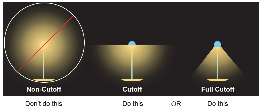
3.
Wall packs shall be cut-off and floodlights shall be shielded (e.g., true cut-off type bulb or light source not visible from off-site) to direct light downward and eliminate light pollution above the facade of a structure.
(Ord. No. 7365/17-108, § 1, 11-20-2017; Ord. No. 7542/19-59, §§ 4.C, 5, 7-15-2019)
5.10.7. - Design Standards for Specific Uses and Site Features
A.
Awnings Awnings used for building accents over doors, windows, etc., shall not be internally illuminated (e.g.., from underneath or behind the awning) unless the awning material does not allow light to transmit through it.
B.
Canopy Lighting Lighting under a canopy shall not exceed 30 footcandles and shall be designed to not create glare off-site. This may be accomplished by one or both of the following:
1.
Recessed fixture incorporating a lens cover that is either recessed or flush with the bottom of the ceiling of the canopy that provides a full cut-off or fully-shielded light distribution.
2.
Surface mounted fixture incorporating a flat glass that provides a full cutoff or fully-shielded light distribution.
C.
Outdoor Public Recreation, Outdoor Assembly and Similar Uses All outdoor public recreation, outdoor assembly, and similar lighting fixtures shall be equipped with louvers, shields, or similar devices, and aimed so that light is contained within the primary playing area or performance area and minimizes adverse impacts on traffic safety and residentially-zoned land.
(Ord. No. 7287/17-29, § 9, 4-3-2017)
5.10.8. - Measurement
Measurement of glare or light trespass shall be accomplished in accordance with the standards in Section 10.2.11, Exterior Lighting.
5.10.9. - Alternate Lighting Plan
An alternate lighting plan may be approved by the Planning and Development Director where unreasonable or impractical situations would result from the application of the lighting requirements. Such situations may result from physical constraints, from other constraints, or when federal, state or local law prevents compliance with this Ordinance. Alternate plans or fixtures must provide equal or better performance to meet the purpose and intent of this Ordinance. However, the alternate plan shall meet the requirements of Section 5.10.6 A, Maximum Illumination Value at Lot Line.
5.12.1.- Purpose and Intent
The purpose of this section is to:
A.
Establish Standards Establish the standards under which development shall set aside a portion of the development area as open space;
B.
Distinguish Characteristics Distinguish between the characteristics, requirements, and appropriate locations for open space; and
C.
Establish Ownership Standards Establish minimum ownership and maintenance standards related to open space.
5.12.2. - Applicability
The provisions of this section apply to the following developments, unless exempted in accordance with Section 5.12.3, Exemptions:
A.
Outside Core City
1.
Single-family detached residential subdivisions in the R-7 district greater than 5 acres in area;
2.
Single-family attached residential developments greater than 5 acres in area;
3.
Multi-family developments; and
4.
Development in a PD-P district.
B.
Inside Core City
1.
Single-family attached residential developments with 30 or more dwelling units;
2.
Multi-family developments with 30 or more dwelling units; and
3.
Development in a PD-CC district.
5.12.3. - Exemptions
Open space requirements are exempted for development in the CB, MS, and MX districts.
5.12.4. - Minimum Open Space Amount
A.
General Table 5.12.4.A, Minimum Open Space Amount, sets out the minimum open space requirements for development subject to the standards in this section.
B.
Administrative Adjustment The Planning and Development Director is authorized to grant an administrative adjustment to the minimum required amount of open space in accordance with Section 2.5.2, Administrative Adjustment.
(Ord. No. 7287/17-29, § 2, 4-3-2017; Ord. No. 7365/17-108, § 1, 11-20-2017; Ord. No. 7476/18-105, § 3.C, 12-3-2018)
5.12.5. - Open Space Standards
A.
Features Counted as Open Space The following features within a development shall be credited towards the open space requirements:
1.
Environmentally-sensitive lands including water features (drainageways, lakes, streams, etc.), wetlands, floodplains, and protected stream buffers, provided no more than 50 percent of a development's total open space may be located in environmentally-sensitive lands;
2.
Landscaping areas, including areas containing required landscaping and tree protection areas credited toward landscaping requirements;
3.
Pedestrian amenities;
4.
Stormwater management lands, including retention and detention ponds, and bio-retention devices that are designed and improved with pedestrian amenities;
5.
Farm and forestry lands within the boundary of the development;
6.
Park lands, trails, and greenways, both public and private;
7.
Active recreation areas;
8.
Passive recreation areas; and
9.
Urban features including: plazas, fountains, courtyards, roof gardens, pedestrian areas, indoor atriums open to public, and public sidewalks at least 6 feet in width with pedestrian amenities.
B.
Not Counted as Open Space The following areas shall not be counted as open space set-asides:
1.
Private yards;
2.
Street right-of-way or private street common area;
3.
Vehicular use areas, including parking spaces, drive aisles, and private drives;
4.
Land covered by buildings not designated for active recreational use; and
5.
Outdoor storage areas.
C.
Design Except for environmentally-sensitive lands, landscaping, farmland, forestry lands, and urban features, credited open space shall meet the following design standards:
1.
Access Open space shall be accessible by residents and users of the development by means of a street, private drive, or an all-weather walkway within a common area or easement a minimum of 20 feet in width.
2.
Configuration
(a)
Open space shall be at least 24 feet in width and 1,000 square feet in area.
(b)
Urban features credited towards the requirements in this section shall maintain a minimum width of 24 feet and a minimum area of at least 600 square feet.
D.
Multi-family Development Multi-family developments with 30 or more dwelling units shall provide an active recreational area as a part of the total credited open space, unless an administrative adjustment is approved by the Planning and Development Director.
E.
Multi-Phase Developments Open space shall be provided for each phase of a phased development in a cumulative amount sufficient to satisfy the open space requirements for the subject phase of development and all preceding phases of development.
F.
Incentives for Active Recreational Features When provided by the developer, an allowable active recreational feature and the land associated with the feature may be located within an environmentally sensitive area and counted towards the requirements in Table 5.12.4.A, Minimum Open Space Amount, above and beyond the maximum amount allowed in Section 5.12.5 A.1, Features Counted as Open Space.
G.
Ownership and Maintenance Open space areas shall be owned and maintained in accordance with Section 7.3, Homeowners' or Property Owners' Association.
(Ord. No. 7266/17-08, § 23, 1-17-2017; Ord. No. 7365/17-108, § 1, 11-20-2017; Ord. No. 7476/18-105, § 3.D, 12-3-2018)
5.14.1.- General
A.
Purpose and Intent The standards in this section are intended to establish additional design and development standards for certain types of development that pose unique characteristics of use, configuration, or both. More specifically, these standards are intended to:
1.
Recognize that some forms of development are unique and require additional standards not typically applied to other forms of development;
2.
Promote a strong sense of place and pedestrian-friendly development through visual design interest and human-scale site design;
3.
Accommodate greater housing choice and options within infill and redevelopment contexts in the Core City area;
4.
Address the impacts and compatibility of large-scale retail developments; and
5.
Establish requirements for appropriate retail development in street intersection contexts.
B.
Development Types Distinguished The following development types are hereby established:
1.
Conservation subdivision;
2.
Corner retail;
3.
Large retail;
4.
Multiple lot development;
5.
Pocket neighborhood; and
6.
Tiny home neighborhood.
C.
Applicability When an applicant indicates, or the Planning and Development Director finds that a proposed development is consistent with one or more of the development types in this section, the standards in this section shall be applied.
D.
Time of Review Review of proposed development to ensure compliance with the standards of this section shall occur during review of a site plan, group development plan, preliminary plan, or building permit, as appropriate.
E.
Compliance with This Ordinance Development types listed in this section shall comply with the appropriate standards in this section as well as all other applicable standards in this Ordinance.
F.
Conflict In the event of a conflict between the applicable standards in this section and other standards in this Ordinance, the standards in this section shall control.
(Ord. No. 7399/18-28, § 1, 3-19-2018; Ord. No. 7622/20-38, § 22, 8-5-2020)
5.14.2. - Conservation Subdivision
A.
Purpose and Intent The purpose and intent of this section is to provide landowners in the AGR and R-3 districts a development option that provides additional development flexibility to build on smaller lots when additional open space set-asides are provided, and the development is designed and located in a way that protects the agricultural activities or natural and historic features on the site. This is done in order to:
1.
Conserve Open Land Conserve open land, including those areas containing productive agricultural soils, unique and sensitive natural features such as floodplains, wetlands, river and stream corridors, areas with mature hardwood trees, and watersheds;
2.
Retain and Protect Natural Resources Retain and protect existing environmental, natural, and cultural resources;
3.
Link Open Spaces Create a linked network of open lands;
4.
Promote Rural Character Promote existing rural character within the AGR and R-3 districts; and
5.
Provide Reasonable Use of Land Provide reasonable economic use of the land.
B.
Applicability This conservation subdivision option shall be used for single-family detached subdivisions of 4 or more lots in the AGR and R-3 districts.
C.
Procedure Development utilizing the conservation subdivision option shall be approved as a preliminary plan in accordance with the procedures and standards in Section 2.5.11, Preliminary Plan, after approval of a conservation and development plan in accordance with this section.
1.
Conservation and Development Plan Prior to review of an application for preliminary plan for a conservation subdivision, an applicant shall have a conservation and development plan for the land reviewed and approved, or approved with conditions by the Planning and Development Director in accordance with this section and the standards of Section 5.14.2 D, Conservation Subdivision Standards, and Section 5.14.2 E, Delineation of Conservation Areas and Development Areas.
2.
Conservation and Development Plan Requirements
(a)
Step 1—Site Analysis Map The applicant shall prepare a site analysis map that provides information about existing site conditions and context, and that comprehensively analyzes existing conditions both on the land proposed for the development site and on land within 500 feet of the site, and submit the site analysis map to the Planning and Development Director. It is the intent of this section that the information required to be presented in the site analysis map be produced primarily from existing sources, maps, and data.
(b)
Step 2—Site Inspection After receipt of the site analysis map, the Planning and Development Director shall schedule a site inspection of the land with the applicant. The applicant or the applicant's representative shall attend the site inspection with a Planning and Development Department staff member. The purpose of this site visit is to:
(1)
Familiarize the staff with the existing site conditions and natural and historic features of the site;
(2)
Identify potential site development issues; and
(3)
Provide an opportunity to discuss site development concepts, including the general layout of conservation areas and potential locations for proposed structures, utilities, streets, and other development features. Comments made by the staff during the site inspection shall be interpreted as being only suggestive. No official decision on the conservation and development plan shall be made during the site inspection.
(c)
Step 3—Conservation and Development Areas Map Based on the site analysis map and the information obtained during the site inspection, the applicant shall prepare a conservation and development areas map that depicts proposed primary conservation areas, secondary conservation areas, and development areas, in accordance with Section 5.14.2 E, Delineation of Conservation Areas and Development Areas.
(d)
Step 4—Conservation and Development Plan Based on the site analysis map, the information obtained during the site inspection, and the conservation and development areas map, the applicant shall prepare and submit to the Planning and Development Director a conservation and development plan. The conservation and development plan shall include the following:
(1)
A site analysis map;
(2)
A conservation and development areas map; and
(3)
A preliminary site improvements plan, showing proposed site development, including utilities, streets, other development features, buffers (if applicable), and lot lines located in the proposed development area(s).
3.
Review of Conservation and Development Plan The Planning and Development Director shall review the conservation and development plan in accordance with the procedures and requirements of Section 5.14.2 D, Conservation Subdivision Standards, and Section 5.14.2 E, Delineation of Conservation Areas and Development Areas.
4.
Review and Approval of Conservation Subdivision Following review and approval or approval with conditions of the conservation and development plan by the Planning and Development Director, the application for a preliminary plan of the conservation subdivision shall be submitted and reviewed in accordance with Section 2.5.11, Preliminary Plan.
D.
Conservation Subdivision Standards A conservation subdivision shall comply with the following standards:
1.
Location Conservation subdivisions shall be limited to the AGR and R-3 districts.
2.
Minimum Project Size Conservations subdivisions shall be at least 10 acres in area.
3.
Required Conservation Area The amount of the conservation area may vary in the AGR or R-3 districts in accordance with the dimensional standards in Section 3.5.2, Agricultural/Rural (AGR), and Section 3.3.2, Residential Single Family - 3 (R-3) as appropriate, but in no instance shall the conservation area occupy less than 50 percent of the total acreage of the conservation subdivision site.
4.
Maximum Residential Density A conservation subdivision shall be limited to the maximum density for a conservation subdivision in the district in which it is located.
5.
Dimensional Requirements Lots within a conservation subdivision are not required to meet the minimum dimensional requirements for the zoning district where located, but the conservation subdivision, as a whole, shall comply with the requirements in this section.
6.
Setbacks Lots in a conservation subdivision shall not be subject to minimum yard setback standards, except as required from streets, wetlands/surface waters, or other protected natural areas.
7.
Maximum Lot Coverage Conservation subdivisions shall ensure that development on a lot does not exceed a maximum lot coverage of 60 percent.
8.
Low Impact Design Conservation subdivisions shall incorporate low impact design features, in accordance with Section 6.2.10, Low Impact Design, where practicable.
E.
Delineation of Conservation Areas and Development Areas The conservation area and development area on the conservation and development areas map shall comply with the following standards:
1.
Primary Conservation Areas
(a)
Features to be Preserved The following features shall be located and delineated on the conservation and development areas map, and shall be preserved in the following priority order as primary conservation areas:
(1)
Wetlands and wetland buffers;
(2)
Protected critical watershed areas;
(3)
Rivers and streams;
(4)
Riparian buffers;
(5)
Habitat utilized by endangered or threatened species; and
(6)
Steep slopes (slopes greater than 25 percent).
(b)
Amount to be Preserved All areas occupied by features comprising a primary conservation area shall be set aside and reserved for conservation purposes in accordance with the following standards:
(1)
Primary Conservation Area is Less than Minimum Required In cases where the geographic area occupied by all features comprising the primary conservation area is less than the minimum required conservation area, then all lands comprising the primary conservation area shall be set aside.
(2)
Primary Conservation Area Exceeds the Minimum Required
(i)
In the event the geographic area of all features identified and prioritized as the primary conservation area results in a primary conservation area exceeding the conservation area requirement (for example, conservation of the first type of prioritized features constitute 47 percent of a site, and the next prioritized feature consists of 5 percent and the minimum required conservation area is 50 percent of the site area, the applicant may identify which portions of the features exceeding the 50 percent conservation area requirement will be designated for conversion to development area). To the maximum extent practicable, priority for retention shall be given to the highest quality portion of the features to be conserved.
(ii)
Development on lands made available for conversion to development area shall be in accordance with the standards in this Ordinance.
(c)
Allowable Uses Uses located within a primary conservation area shall be limited to:
(1)
Unpaved pedestrian trails, walkways, and boardwalks;
(2)
Above ground and below ground public utilities and associated easements, provided no feasible alternative exists;
(3)
Street or driveway crossings, provided such crossings do not violate this Ordinance, or other State or Federal laws; and
(4)
Stormwater management systems, where no practicable alternative exists.
2.
Secondary Conservation Areas
(a)
Features to be Preserved In addition to primary conservation areas, the conservation and development areas map shall also identify secondary conservation areas, which shall be preserved in the following priority order:
(1)
Historic, archeological, and cultural resources;
(2)
Prime agricultural lands, including existing pastures (whether in use or otherwise);
(3)
Existing and mature woodland forests, natural fields, and meadows (especially those greater than 5 acres);
(4)
Scenic corridors and views; and
(5)
Areas that could serve to extend existing greenways, trails, parks, or recreation areas.
(b)
Amount to be Preserved All areas occupied by features comprising a secondary conservation area shall be set aside and reserved as a part of the conservation area in accordance with the following standards:
(1)
Primary Conservation Area Occupies More than that Required In the event that the geographic area set aside as the primary conservation area is more of the required conservation area, no additional lands occupied by secondary conservation features shall be required to be included in the conservation area.
(2)
Primary Conservation Area Occupies Less than that Required In the event the geographic area set aside as the primary conservation area is less than the required conservation area, then lands containing secondary conservation features shall also be set aside as part of the conservation area in priority order.
(c)
Allowable Uses Uses located within a secondary conservation area shall be limited to:
(1)
All uses allowed in a primary conservation area;
(2)
Uses allowed in the Agricultural Use classification in Table 4.1.9, Principal Use Table;
(3)
Individual or community water supply and septic systems;
(4)
Stormwater management systems;
(5)
Required drainage or other utility easements;
(6)
Mitigation of development activities, including restoration of disturbed or degraded areas to enhance habitat and scenic value.
3.
Ownership
(a)
Landowner or Association A conservation area shall be owned jointly or in common by the owners of the development or through a recognized homeowners or property owners association, which shall be established in accordance with Section 7.3, Homeowners' or Property Owners' Association.
(b)
Nonprofit Organization The landowners may decide to convey a conservation area to a nonprofit organization such as a land trust or land conservancy for management and maintenance if the City is provided adequate assurance the area will be properly managed and maintained.
(c)
Dedicated to City or Other Public Agency In some cases, certain lands designated as conservation areas, such as greenways, may be dedicated to the City, a nonprofit organization, or other public agency during the development review process, at the landowner's discretion. If offered by the landowner, the City Council shall determine whether that land is appropriate for dedication to the City or other public agency.
4.
Development Areas After identifying the primary and secondary conservation areas, the development area shall be identified. It is the area within which development may occur, and shall include the area within the site where:
(a)
Any clearing or grading activities will take place;
(b)
Ingress and egress will be located;
(c)
Individual or community wells and septic systems may be located (if not located within the secondary conservation area);
(d)
Streets, utilities, and other similar structures will be located; and
(e)
All allowable uses may be located.
(Ord. No. 7622/20-38, § 22, 8-5-2020)
5.14.3. - Corner Retail
A.
Purpose and Intent The corner retail development type is proposed to establish standards to facilitate the placement of small-scale, low-intensity, neighborhood serving retail sales, eating establishments, and personal services uses on corner lots within and adjacent to higher density residential and transitional areas.
B.
Applicability Minor restaurants, minor personal service, and minor retail sales are only permitted in the RM-26 and TO districts as a corner retail development type, provided the proposed development complies with the standards of this section.
C.
Standards
1.
Corner Lot Required A corner retail use may only be established on a lot that abuts 2 or more streets, not including alleys.
2.
Maximum Building Size The building housing the corner retail use shall have a maximum gross ground floor area of 5,000 square feet.
3.
Maximum Building Height The corner retail use shall be limited to a maximum of 50 feet in height.
4.
Maximum Street Setbacks
(a)
The corner retail use shall be configured so that structure is located within 5 feet of the street right-of-way abutting the front lot line.
(b)
Street setbacks may be increased up to a maximum of 25 feet when the area between a building facade and the adjacent street is used for outdoor seating or outdoor dining.
5.
Site Standards
(a)
Drive-Throughs Drive-through lanes and windows are prohibited.
(b)
Off-Street Parking In cases where off-street parking areas directly abut a single-family detached dwelling, an opaque fence or wall with a minimum height of 6 feet shall be located between the parking area and the adjacent dwelling.
(c)
Bicycle Parking The corner retail use shall provide a minimum of 2 dedicated bicycle spaces configured in accordance with the requirements in Section 5.4.5, Bicycle Parking Requirements.
(d)
Outdoor Storage and Display
(1)
Outdoor storage is prohibited.
(2)
Outdoor display of goods for sale is permitted in accordance with Section 4.4.5 K, Outdoor Display, except that products displayed must be removed from the outdoor display area at the close of business.
(e)
Outdoor Seating Areas Outdoor seating areas are encouraged to be located between a building facade and an abutting street. They shall not be located along lot lines that are adjacent to a single-family detached dwelling.
(f)
Signs
(1)
Signs shall comply with the sign standards in Section 5.7, Signs, for the Transitional Office (TO) district.
(2)
A-Frame signs are allowed in accordance with Section 5.7.7., Signs Allowed Without a Sign Permit.
(3)
Limited Duration Signs are allowed in accordance with Section 5.7.12, Limited Duration Signs.
6.
Building Standards
(a)
Facade Transparency
(1)
The ground floor front facade shall maintain non-reflective, transparent windows on at least 50 percent of the façade area between 2 and 8 feet above average grade.
(2)
Ground floor side facades facing a street shall maintain non-reflective, transparent windows on at least 40 percent of the façade area between 2 and 8 feet of the floor.
(3)
Upper stories on front and side facades facing a street shall maintain non-reflective, transparent windows on at least 20 percent of the upper story facade area per floor as measured between 2 and 8 feet.
(b)
Awnings or Overhangs The corner retail use shall incorporate awnings, overhangs, or other forms of suitable weather protection for pedestrians along the front facade of the building.
(Ord. No. 7266/17-08, § 24, 1-17-2017; Ord. No. 7287/17-29, § 5, 4-3-2017; Ord. No. 7415/18-44, § 2.C, 5-21-2018; Ord. No. 7476/18-105, § 10.D, 12-3-2018; Ord. No. 7912/23-27, § 4.T, 4-17-2023)
5.14.4. - Large Retail
A.
Applicability These standards shall apply outside the Core City to all new commercial uses in the Commercial Use classification in Table 4.1.9, Principal Use Table that have:
1.
A gross ground floor area of more than 50,000 square feet for a single tenant; or
2.
A gross ground floor area of more than 150,000 square feet serving multiple tenants, including outparcels.
B.
Development Standards Development subject to the requirements of this section shall comply with the following standards:
1.
General
(a)
Facades that face a street, parking lots on the interior of the site, or other areas that are interior to the site shall have articulation along at least 60 percent of the ground floor facade, in accordance with Section 5.14.4 B.3(a), Facade Articulation. This requirement includes the facade of the building that functions as the rear, yet faces a street (see Figure 5.14.4.B, Facade Facing a Street).
FIGURE 5.14.4.B, FACADE FACING A STREET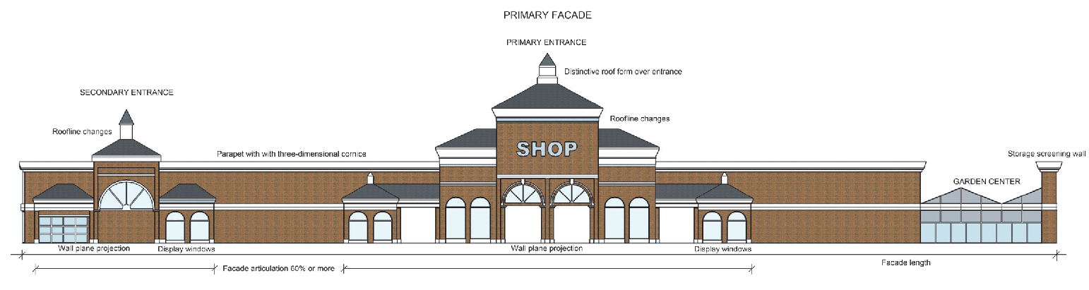
(b)
The building facade containing the primary entrance shall be considered the primary facade.
(c)
Minimum street setbacks may be reduced to 10 feet if the development meets all required and recommended standards of this section.
(d)
Within developments with multiple buildings, building heights shall be varied to avoid the appearance of an elongated building mass. This can be achieved by stair-stepping building heights or by varying roof forms.
2.
Site Standards
(a)
Compliance with Multiple Lot Development Standards Large retail development configured as a multiple building development shall comply with the standards in Section 5.14.5, Multiple Lot Development, in addition to the standards for a large retail development type.
(b)
Building Location and Orientation
(1)
Street Corner Location Buildings placed at a street corner should be designed to address both street frontages in an "L" configuration.
(2)
Multi-building Development
(i)
Buildings should be located and configured so as to enclose parking areas.
(ii)
Buildings should include a consistent level of architectural styling and facade articulation on facades facing streets, internal drives, parking lots, or pedestrian amenities.
(c)
Pedestrian Areas A portion of the spaces between or along the frontages of the buildings should include pedestrian areas such as small plazas, patios, or central gathering spaces with pedestrian amenities. The pedestrian amenities include but are not limited to: seating, outdoor play areas, bicycle racks, kiosks, water features, public art, freestanding structures such as a clock tower, or similar amenities.
(d)
Loading Docks and Bays Loading docks and bays shall:
(1)
Be located towards the rear of buildings, or located internally within multi-building developments;
(2)
Not face or be adjacent to streets, to the maximum extent practicable; and
(3)
Meet the minimum requirements of Section 5.6, Screening.
(e)
Accessory Buildings Accessory buildings shall comply with the standards in Section 4.4, Accessory Structures and Uses, and use the same materials and architectural styling as the principal building they serve.
3.
Building Standards
(a)
Facade Articulation Walls requiring articulation must use 2 or more of the following features:
(1)
Recessed entryways;
(2)
Display windows;
(3)
Window indentations (such as but not limited to double-hung, stationary, or casement windows) that are regularly spaced and that incorporate a differing building material, texture, color, awnings, window hoods, or canopies. This shall not include a glass curtain wall or flush mounted glass;
(4)
Offset surfaces, niches, insets, projections, or bas-relief with a minimum depth of 4 inches;
(5)
Columns, pilasters, piers, architectural boxing, or other technique to break the facade into different volumes;
(6)
Textured materials (such as but not limited to brick or stone);
(7)
Roofline changes, coupled with correspondingly aligned wall offset or facade material changes, changes in the roof planes, or changes in the height of a parapet wall; or
(8)
Changes in wall plane (such as projections or recesses) with an offset or depth of at least 1 foot and a width of at least 10 feet, located a minimum of every 30 feet.
(b)
Facade Materials
(1)
Where 2 or more materials are proposed to be combined on a facade, the heavier and more massive elements should be located below the lighter elements (e.g., brick shall be located below stucco). Heavier materials may also be placed as a detail on the corner of a building or along cornices or windows.
(2)
Primary facade materials should not change at outside corners, and should continue around the corner to a logical point of conclusion such as a window or change in facade plane.
(3)
Exterior building materials shall be continued to the finished grade on any elevation.
(4)
Building facades utilizing smooth-faced concrete block, or unfinished or untreated tilt-up concrete panels, shall be limited to building facades not visible from public streets as seen from the public right-of-way at a height of 6 feet.
(5)
The use of vinyl siding or corrugated and other vertical metal siding as the sole or primary facade material is prohibited.
(c)
Façade Transparency When provided, ground floor windows shall maintain non-reflective, transparent glass between 3 feet and 8 feet of the floor.
(d)
Primary Entrances The primary entrance shall be clearly defined and incorporate the following features:
(1)
Multi-Tenant Buildings
(i)
Overhangs, awnings, canopies, or other projections of at least 8 feet, from the building wall;
(ii)
Windows within or beside entry doors that allow entrants to see into the building.
(2)
Single Tenant Buildings Distinctive roof forms, towers, gables, roof ridges, peaks, or other features that differ in height by 3 feet or more from the balance of the roof. Outparcels are exempt from this standard.
(e)
Roof-Mounted Equipment
(1)
Flat roofs shall incorporate parapet walls designed to screen the roof and roof-mounted equipment from view from the primary street fronting the building and any abutting side street as seen from the public right-of-way at a height of 6 feet. The parapet wall should be finished in the same or similar material and color as the building.
(2)
For sloped roofs, roof-mounted equipment and other roof penetrations should be located and screened to have a minimal visual impact as seen from the public right-of-way at a height of 6 feet.
(3)
In cases where complete screening is not practicable, all roof- mounted equipment and other roof penetrations shall be camouflaged through the use of paint or architectural techniques to minimize its appearance.
(4)
Green roofs, which use vegetation to improve stormwater quality and reduce runoff, are exempt from the screening requirements described in this subsection.
(Ord. No. 7365/17-108, § 1, 11-20-2017; Ord. No. 7415/18-44, § 2.D, 5-21-2018; Ord. No. 7476/18-105, § 10.E, 12-3-2018; Ord. No. 7542/19-59, § 1.I, 7-15-2019)
5.14.5. - Multiple Lot Development
The purpose of this section is to allow a unified designed and functioning development with multiple lots, pursuant to a preliminary plan approved in accordance with Section 2.5.11, Preliminary Plan, and a final plat in accordance with Section 2.5.7, Final Plat, provided the development complies with the standards of this section.
A.
Applicability To qualify as a multiple lot development, the development must:
1.
Contain 2 or more nonresidential uses designed to function as a unified development; and
2.
Contain all of the following:
(a)
Common private streets or drives;
(b)
Common off-street parking;
(c)
A common signage plan; and
(d)
A common landscape plan.
B.
Common Features
1.
An approved multiple lot development shall be treated as a single zone lot for the purposes of providing required off-street parking, required landscape yards, required street access, exterior lighting, compliance with zoning district dimensional standards, and compliance with signage standards.
2.
Compliance with the off-street parking and street access requirements are met by considering the development as a whole and not on an individual lot basis.
3.
Compliance with the landscaping standards are met if the required perimeter landscape yards are provided along the multiple lot development perimeter and all parking lot landscaping requirements are met.
C.
Establishment The establishment of a multiple lot development occurs through the approval of a preliminary plan and a final plat.
1.
The preliminary plan shall illustrate that the development will have common private streets or drives and common parking.
2.
Prior to the approval of a final plat, the proposed development must have approved common signage and common landscape plans.
3.
The final plat must be recorded displaying a prominent note identifying it as a multiple lot development and explaining that the property must be developed with common private streets or drives and off-street parking and be subject to a common signage plan and common landscaping plan. The note shall further state that should the property cease to conform to the definition of a multiple lot development, the property will then be in violation of this Ordinance and shall be retrofitted with conventional parking and landscaping, even if doing so requires the removal of previously installed improvements.
(Ord. No. 7622/20-38, § 22, 8-5-2020; Ord. No. 7750/21-67, § 12, 11-1-2021)
5.14.6. - Pocket Neighborhood
A.
Purpose and Intent The pocket neighborhood development type is proposed to establish standards to facilitate the voluntary development of a group of smaller single-family detached dwellings built in close proximity to one another around a small green or open space with off-street parking areas to the rear or in common areas. This approach is well-suited to small, vacant or undeveloped infill sites in established neighborhoods.
B.
Applicability The pocket neighborhood development option is applicable only within the Core City area, in zoning districts that permit single-family detached dwellings.
C.
Site Configuration
1.
Development Size It shall be located on a parcel of land at least one-third (⅓) of an acre and no greater than 4 acres in area, with at least 50 feet of frontage along a public street.
2.
Allowable Uses Only the following uses shall be allowed: single-family detached dwellings and incidental and subordinate accessory uses, along with a building for the purposes of common storage or recreation, and other common elements.
3.
Number of Dwellings It shall include at least 4 dwellings but no more than 12 dwellings. In no instance shall the gross density of the development exceed a 10 percent increase in the density of the underlying base zoning district.
4.
Common Elements
(a)
It shall include common elements that comprise at least 40 percent of the total site and include open space, improved pedestrian walkways that provide pedestrian access to each dwelling and connect to the public sidewalk network, a shared parking area(s), and a perimeter buffer area that incorporates landscaping materials, existing vegetation, or other features to buffer the pocket neighborhood from adjacent development.
(b)
The common open space shall include a central green, lawn, or garden area fronting the dwellings, containing at least 375 square feet of area for each dwelling in the development.
(c)
If a common building is provided, it shall not be larger than 1,000 square feet in gross floor area and shall not be used as a permanent dwelling unit.
5.
Perimeter Landscape Yard
(a)
A pocket neighborhood shall incorporate a Type C perimeter landscape yard, in accordance with Section 5.5, Landscaping Standards, where the neighborhood abuts lots with existing single-family detached dwellings. The perimeter landscape yard shall be considered part of the common elements.
(b)
No individual lot or dwelling unit shall encroach into the perimeter landscape yard.
6.
Lot Frontage
(a)
The lots in pocket neighborhoods are exempt from the minimum street frontage requirement for platted lots in Section 7.1.6 B.9, Minimum Street Frontage.
(b)
At least 60 percent of the individual building lots shall front the common open space area, not a street or alley.
7.
Off-Street Parking
(a)
Pocket neighborhoods are exempt from the parking standards in Table 5.4.4.B, Table of Minimum Parking Standards.
(b)
The pocket neighborhood shall include a shared parking area that accommodates resident and guest parking.
(c)
Off-street parking areas shall include at least 1 parking space for each dwelling unit plus 1 designated guest parking space for every four dwelling units.
(d)
Provision of resident parking spaces within a shared parking area is not required in cases where resident parking is provided through individual driveways or by parking spaces along alleys.
(e)
In no instance shall a parking space be more than 300 linear feet from the dwelling it serves.
8.
Private Drives Vehicular entryways into pocket neighborhoods and accessways serving off-street parking areas and individual dwelling lots shall be configured as private drives.
9.
Detached Shared Garages If provided, detached garages serving more than 1 dwelling shall be accessed via a private drive or alley. A garage shall not exceed 5 car bays or include individual garage doors wider than 12 feet each.
10.
Storage Space Each individual dwelling shall have at least 40 square feet of covered storage space outside the heated floor area. Storage space may be located on an individual lot or on common land adjacent to a common building.
D.
Individual Lot Configuration
1.
Each individual lot in a pocket neighborhood shall contain only 1 dwelling unit. Table 5.14.6.D, Pocket Neighborhood Lots, sets out the dimensional requirements for individual lots.
2.
Use Easement Any lot abutting another lot used for residential purposes in a pocket neighborhood shall be subject to a use easement on one side that extends from the lot line to the exterior wall of the dwelling (see Figure 5.14.6.D1, Use Easement). The purpose for the use easement is to ensure each dwelling has a private outdoor space.
FIGURE 5.14.6.D, USE EASEMENT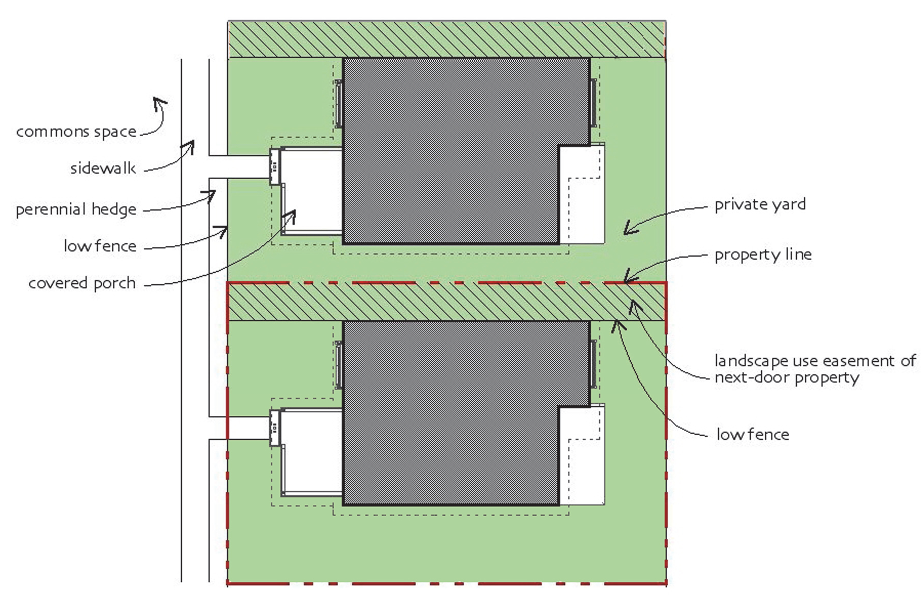
E.
Dwelling Unit Configuration
1.
Maximum Height A dwelling unit shall not exceed 24 feet above grade.
2.
Dwelling size A pocket neighborhood dwelling unit shall have not more than 2,000 square feet of gross floor area.
3.
Fences
(a)
Pocket neighborhoods are exempted from the standards in Section 5.11, Fences.
(b)
Fences within front yards or side yards forward of the front facade plane shall not exceed 3 feet in height. Fences in rear yards or side yards behind the front facade plane shall not exceed 6 feet in height.
(c)
In no instance shall a fence be placed within a use or access easement.
FIGURE 5.14.6.E EXAMPLES OF DWELLING UNIT CONFIGURATION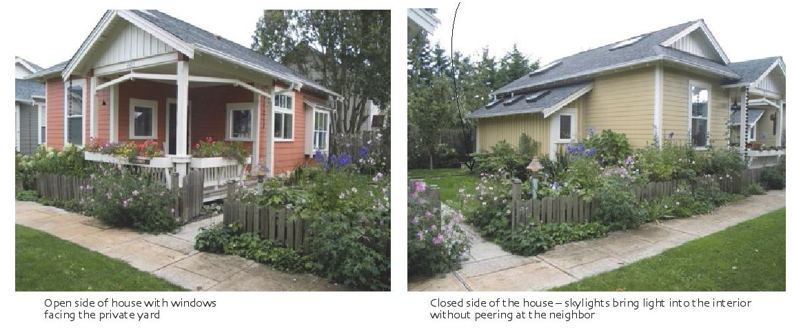
F.
Homeowner's Association A pocket neighborhood shall have a homeowner's or property owner's association that maintains control of all common elements and is responsible for the maintenance of such elements within the neighborhood. Association documents shall be reviewed by the City prior to approval of the development, and recorded with the development.
(Ord. No. 7287/17-29, § 11, 4-3-2017; Ord. No. 7365/17-108, § 1, 11-20-2017; Ord. No. 7399/18-28, §§ 4.A—4.C, 3-19-2018; Ord. No. 7542/19-59, § 4.D, 7-15-2019; Ord. No. 7622/20-38, § 19, 8-5-2020)
5.14.7. - Tiny Home Neighborhood
A.
Purpose and Intent The tiny home neighborhood development type is proposed to establish standards to facilitate the voluntary development of a group of very small single-family detached dwellings built in close proximity to one another on minimally sized lots and including common open space. This approach is well-suited to small, vacant or undeveloped infill sites in established neighborhoods.
B.
Applicability The tiny home neighborhood development option is applicable only within the Core City area, in zoning districts that permit single-family detached dwellings.
C.
Site Configuration
1.
Development Size It shall be located on a parcel of land at least one-fourth (¼) of an acre and no greater than 2 acres in area, with at least 50 feet of frontage along a public street.
2.
Allowable Uses Only the following uses shall be allowed: single-family detached dwellings and incidental and subordinate accessory uses, along with a building for the purposes of common storage or recreation, and other common elements.
3.
Number of Dwellings It shall include at least 4 dwellings but no more than 12 dwellings.
4.
Common Elements
(a)
It shall include common elements that comprise at least 40 percent of the total site area that include open space, improved pedestrian walkways that access each dwelling and connect to the public sidewalk network, and a perimeter landscape yard that incorporates landscaping materials, existing vegetation or other features to buffer the tiny home neighborhood from adjacent development.
(b)
It may include a shared parking area, a common building used for recreation and/or storage, a picnic area, community garden space, or other common amenity.
(c)
If a common building is provided, it shall not be larger than 1,000 square feet in gross floor area and shall not be used as a permanent dwelling unit.
5.
Perimeter Landscape Yard
(a)
A tiny home neighborhood shall incorporate a Type C perimeter landscape yard, in accordance with Section 5.5, Landscaping Standards, where the neighborhood abuts lots with existing single-family detached dwellings. The perimeter landscape yard area shall be considered part of the common elements.
(b)
No individual lot or dwelling unit shall encroach into the perimeter landscape yard.
6.
Lot Frontage The lots in tiny home neighborhoods are exempt from the minimum street frontage requirement for platted lots in Section 7.1.6 B.9, Minimum Street Frontage.
7.
Off-Street Parking
(a)
Tiny home neighborhoods are exempt from the parking standards in Table 5.4.4.B, Table of Minimum Parking Standards.
(b)
If provided, off-street parking areas shall meet the standards in Table 5.4.7.E, Dimensional Standards for Parking Spaces and Aisles, and shall meet the paving and maintenance requirement for a private drive accessing a public street (Section 5.4.7 K.3).
8.
Private Drives Vehicular entryways into a tiny home neighborhood and accessways serving off-street parking areas shall be configured as private drives.
9.
Fences Fences are permitted only within the perimeter landscape yard and to protect community garden areas, and shall meet the standards of Section 5.11, Fences, except that fences around community garden areas shall be 4 feet or less in height.
D.
Individual Lot Configuration Each individual lot in a tiny home neighborhood shall contain only 1 dwelling unit. Table 5.14.7.D, Tiny Home Neighborhood Lots sets out the dimensional requirements for individual lots.
E.
Dwelling Unit Configuration
1.
Maximum Height A tiny home dwelling unit shall not exceed 18 feet above grade.
2.
Dwelling Size A tiny home dwelling unit shall have less than 600 square feet of gross floor area.
3.
Dwelling Orientation A tiny home dwelling shall face interior common open space or a street. No dwelling shall face a perimeter landscape yard.
F.
Homeowner's Association A tiny home neighborhood shall have a homeowner's or property owner's association that maintains control of all common elements and is responsible for the maintenance of such elements within the neighborhood. Association documents shall be reviewed by the City prior to approval of the development, and recorded with the development.
(Ord. No. 7399/18-28, § 3, 3-19-2018; Ord. No. 7542/19-59, § 4.E, 7-15-2019; Ord. No. 7750/21-67, § 13, 11-1-2021)
5.15.1.- Purpose and Intent
The purpose of this section is to promote sustainable development practices as a means of protecting and conserving natural resources and ensuring a high quality of life for residents. More specifically, they are intended to provide incentives for new development to incorporate measures that conserve energy, conserves water, and promotes a healthy landscape.
5.15.2. - Applicability
The incentives included in this section are available to all new development in the City.
5.15.3. - Procedure
A.
Written Request Development seeking to use incentives shall include a written request with the development application that demonstrates how compliance with these standards will be achieved.
B.
Incentive Amount Development may include a sufficient number of sustainable development practices to take advantage of more than one type of incentive, but in no instance shall the amount of an incentive be increased or decreased (as appropriate) beyond the maximum listed in this section.
C.
Time of Review Review for compliance with this section, and granting of requests in accordance with this section shall occur during review of a site plan, group development plan, preliminary plan, PD master plan, use permit, or building permit, as appropriate. The decision-making body responsible for review of the development application shall also be responsible for the review of sustainable development incentive request.
D.
Earning Incentives The incentive shall be based on the number of sustainable development practices provided, in accordance with Table 5.15.3.E, Sustainable Development Incentives, and Section 5.15.4, Sustainable Development Features. To earn a particular incentive, development must provide the minimum number of associated sustainable development features from Schedule A and Schedule B in Table 5.15.3.E. An applicant may select the kinds of sustainable development features provided to comply with Table 5.15.3.E.
E.
Provide Features from Both Schedules The ability to take advantage of a sustainable development incentive requires new development to include sustainability features from both Schedule A and Schedule B in Table 5.15.4, Sustainable Development Features. The applicant may choose which features to include as long as the minimum number of features from each of the schedules is provided. Generally, items in Schedule A are typically more expensive than items in Schedule B, though this will depend upon the proposed development, site conditions, type of uses proposed, and many other features.
(Ord. No. 7266/17-08, § 25, 1-17-2017; Ord. No. 7365/17-108, § 1, 11-20-2017; Ord. No. 7622/20-38, § 22, 8-5-2020)
5.15.4. - Sustainable Development Features
One or more of the sustainable development features in Table 5.15.4, Sustainable Development Features, may be offered by an applicant for proposed development in accordance with Table 5.15.3.E, Sustainable Development Incentives.
(Ord. No. 7365/17-108, § 1, 11-20-2017)
5.15.5. - Failure to Install or Maintain Sustainable Development Practices
The failure to install or maintain approved sustainable development features is a violation of this Ordinance, shall render the subject development nonconforming, and may result in revocation of the development permit or approvals.