
Highlands County Unincorporated
City Zoning Code
City Zoning Code
ARTICLE 5
- DISTRICTS AND SUPPLEMENTARY DISTRICT REGULATIONS
Section 12.05.100. - Establishment of districts; provisions for official zoning atlas.
A.
The county is hereby divided into zones or districts as shown in the official zoning atlas, which, together with all explanatory material therein, is hereby adopted by reference and declared to be a part of this Code.
B.
Each page of the official zoning atlas shall be identified by the seal of the county and affixed with original or facsimile signatures of the chairman of the board of county commissioners and the clerk of the circuit court under the following words:
This is to certify that this map is the official zoning atlas, adopted this day of _______, A.D.,
Board of County Commissioners,
Highlands County, Florida
Attest: By:
Clerk, Circuit Court
By:
Chairman
C.
If changes are made in district boundaries or any other matter portrayed on the official zoning atlas, such changes shall be made to the official zoning atlas promptly after the amendment has been approved by the BCC, together with an entry in a log, to be placed at the front of the official zoning atlas, as follows: "On (date) by Resolution of the BCC, the following changes were made on Page Number _______, of the Official Zoning Atlas." A brief description of the nature of the change shall be entered by the zoning supervisor.
D.
No changes of any nature shall be made in the official zoning atlas or matter shown therein except in conformity with the procedures set forth in this chapter.
E.
The official zoning atlas shall be located in the office of the zoning supervisor and shall be the final authority as to the current zoning status of lands, buildings and other structures in the county.
(Ord. No. 05-06-05)
Section 12.05.101. - Rules for interpretation of the official zoning atlas boundaries.
Where uncertainty exists as to the boundaries of districts shown in the official zoning atlas, the rules pursuant to section 12.01.107 of this chapter shall be followed and the additional following rules shall apply:
A.
For clarity and convenience in mapping, zoning of water areas is not shown in the official zoning atlas but unless otherwise zoned the water surface and land under the water surface of all canals, rivers, waterways, ponds, lakes and other water areas shall be interpreted as being in the same zoning district as the abutting land. If the zoning districts shown in the official zoning atlas are different on opposite sides of the water area, then the district on each side shall be deemed to extend to the centerline or midpoint of the water area.
B.
Distances not specifically indicated in the official zoning atlas shall be determined insofar as possible by the scale of the map.
C.
Where due to scale or illegibility of the official zoning atlas, or where street or property layout existing on the ground is at variance with that shown in the atlas, or where there is uncertainty, contradiction or conflict as to the intended location of any district boundary, the zoning supervisor shall make an administrative determination as to the location of such district boundary and shall record such determination in a log book to be maintained with the official zoning atlas.
(Ord. No. 05-06-05)
Section 12.05.102. - Application of regulations.
A.
Except as hereinafter provided, no building, structure, or land shall hereafter be used or occupied, and no building or structure or part thereof shall hereafter be erected, constructed, reconstructed, moved or structurally altered, unless in conformity with all of the regulations herein specified for the district in which it is located; and provided further that no building or other structure shall hereafter be erected or altered:
1.
To exceed the height.
2.
To accommodate or house a greater number of families.
3.
To occupy a greater percentage of lot area.
4.
To have narrower or smaller rear yards, front yards, side yards or other open spaces; than herein allowed; or in any manner contrary to the provisions of this chapter.
B.
No part of a required yard, or other open space, or off-street parking or loading space or in connection with any building or use shall be included as part of a required yard, open space or off-street parking or loading space for any other building or use.
C.
No required yard, lot setback, clearance, parking area or other space existing as of August 18, 1970, shall be reduced in size or area below the minimum requirements set forth herein. Yards or lots created after January 1, 1971, shall meet the minimum requirements established by this Code.
D.
Within each district, the regulations of this Code shall be minimum regulations and shall apply uniformly to each class or kind of structure or land.
(Ord. No. 05-06-05)
Section 12.05.200. - AU Agricultural District.
A.
Intent. The AU agricultural district is intended to apply to those areas presently and primarily agricultural.
B.
Permitted principal uses and structures are:
1.
One-family dwellings;
2.
Community residential homes licensed by the State of Florida providing for six or fewer residents which otherwise meet the definition of a "community residential home" as that term is defined in F.S. ch. 419, provided that such community homes shall not be located within a radius of 1,000 feet of another existing community residential home with six or fewer residents (see definition # 55B);
3.
Church, and accessory residence;
4.
Golf course, country club, private club, or outdoor recreation club, provided all buildings must be at least 50 feet from any road right-of-way line and 100 feet from any private lot line;
5.
Grove, produce farm, truck garden, horticultural farm, botanical garden, floriculture, nursery, sod farm, crop raising, hydroponic garden, greenhouse, slat house, forestry, beekeeping with use or keeping animals only as incidental or accessory thereto;
6.
Cattle or stock raising and grazing, dairy farm, but not including commercial goat, sheep or hog raising;
7.
Raising or keeping a maximum, collectively, of nine hogs, sheep, and goats, of which not more than three may be hogs;
8.
Dock, noncommercial boat pier, slip or boathouse for docking private water craft;
9.
Railroad right-of-way and tracks, team tracts, but not including yards, shops or roundhouses;
10.
Agricultural worker housing subject to the requirements of section 12.08.124;
11.
Individual mobile home on individual lot, subject to requirements of this chapter;
12.
Wayside stands for sale of agricultural products only as an accessory use to an adjacent farm when that farm is the principal use;
13.
The parking of one nonagricultural commercial vehicle, on a minimum of one acre, where the resident of the premises is an authorized driver of the commercial vehicle;
14.
Central wastewater treatment and water treatment facilities serving a single development;
15.
Public parks/recreation;
16.
Schools, public and private (see definition # 263);
17.
Central potable water facilities;
18.
Fish farm;
19.
Guesthouse as an accessory to a principal dwelling, provided that the owner shall sign an agreement that such guesthouse will not be used for rental purposes, and subject to the limitations set out in section 12.05.200.G.
C.
Limitations on uses. The following limitations on uses in this district shall apply:
1.
Structures for the commercial raising of cattle, horses, sheep, goats and the like (excluding hogs and poultry) shall not be located within 500 feet of a dwelling under separate ownership or within 500 feet of residentially zoned property or within 100 feet of any lot line. Structures for raising poultry or hogs shall not be located within 500 feet of any dwelling under separate ownership or within 500 feet of residentially zoned property or within 200 feet of any lot line. For purposes of this paragraph, structures which are located and begin use in conformity with this section and with this chapter, subsequent rezoning of nearby land to residential zoning or construction of a dwelling under separate ownership shall not put such structure in violation of this chapter. The following structures are exempt from this requirement:
a.
Fences that meet the minimum yard requirements as specified in section 12.05.306, provided that all other separation requirements of this section are met;
b.
Signs that meet the minimum yard requirements as specified in section 12.05.200.L.; and
c.
Structures for the temporary placement of livestock provided that all other minimum yard requirements of this section are met.
2.
Hogs or poultry shall not be placed, kept or permitted within 100 feet of any dwelling under separate ownership or within 50 feet of residentially zoned property or within 50 feet of any lot line.
3.
The raising of hogs, sheep, goats, cattle, horses, and poultry by 4-H or FFA members for exhibition at 4-H exhibitions, FFA exhibitions, county fairs or state fairs is allowed and shall not be required to comply with setbacks otherwise required by this section for raising those animals. For purposes of this paragraph, the structures for the raising of hogs, sheep, goats, cattle, horses, and poultry shall not be located within 100 feet of any dwelling under separate ownership or within 50 feet of any lot line. (Also see section 12.05.200.G.6.)
4.
Central wastewater treatment facilities or structures or water treatment facilities or structures shall conform to the standards contained in section 12.08.131.
5.
Nonagricultural commercial vehicle shall not be parked in any front yard or nearer than 25 feet to any side or rear lot line unless placement is determined otherwise by the BOA during a special exception hearing.
6.
All central potable water facilities shall comply with all applicable state and federal laws, rules, and regulations, including permitting requirements.
D.
Permitted accessory uses and structures. Accessory uses and structures allowed in this district are accessory to the principal structures and uses.
E.
Prohibited uses and structures. Listed permissible uses in this district do not include, either as a principal or accessory use, any of the following which are listed for emphasis:
1.
Manufacturing or industrial establishments;
2.
Wholesale warehouse or storage establishments;
3.
Junkyards, house wrecking yard, automobile wrecking, used auto parts, display, storage or sale;
4.
Automobile, truck or trailer display, storage, service, repair or sale;
5.
Oil, asphalt or petroleum products, storage, processing or sale except as incidental to approved oil well drilling or to agriculture;
6.
Building supplies or material display, storage or sale, except for storage of building materials incidental to agriculture;
7.
Contractor construction or equipment yard;
8.
Any business established for display, storage or sale of used or secondhand merchandise.
F.
Special exceptions. Permissible in this district by the BOA after public hearing and subject to appropriate conditions and safeguards are:
1.
Cemetery, crematory, columbarium, mausoleum;
2.
Race track for animals or vehicles when non-commercial in nature;
3.
Airport, air park or air field with turf or grass runways, etc.;
4.
Public utility facilities;
5.
Dude ranch, riding stable, livery stable, boarding place, fur farm, dog kennel;
6.
The raising or keeping of more than three hogs, or, collectively, more than nine hogs, sheep, and goats, raising or keeping of 100 or more poultry, poultry slaughtering or dressing;
7.
Reserved;
8.
Raising or keeping or slaughtering or dressing crocodilians for commercial purposes on a lot with a minimum of 20 acres. Structures for this purpose shall not be located within 500 feet of a dwelling under separate ownership, within 500 feet of residentially zoned property, or within 100 feet of any lot line. These separation requirements are not applicable where a dwelling is located on property which is utilized for the same type of purpose as the use which would otherwise be required to provide specified separation.
9.
Boat storage, service, repair or building, marine railway marina, mooring and operations incidental thereto;
10.
Golf driving range;
11.
Outdoor or indoor rifle range and shotgun and pistol shooting range;
12.
Eleemosynary or philanthropic institution, including library, public museums/galleries, schools and similar institutions of a noncommercial nature;
13.
Wireless communications facility (WCF) or transmission tower or tower, including lattice towers, guyed towers, monopole towers, ground-mounted towers and alternative tower structure or other similar wireless communications facilities, pursuant to the standards contained in sections 12.08.133, 12.08.134 and 12.08.135 of this Code;
14.
Sand, gravel, rock or stone pit quarry or other mining operation involving the extraction of natural materials, removing of earth or topsoil;
15.
Rodeos and carnivals;
16.
Day care, residential group home or sanitarium or institution, convalescent home, nursing home, or penal or correctional institution;
17.
Reserved;
18.
Temporary or permanent housing to house farm labor when located within 300 feet of any property under separate ownership, when such farm labor is not employed on the same property upon which housing is located, or when housing has a greater capacity than one dwelling unit or two persons for each five acres of land contained in the property upon which the housing is located and the farm labor used;
19.
Crushing, screening and processing of materials excavated on premises;
20.
Storage in bulk of sand, rock or stone for the purpose of transhipment or distribution;
21.
Oil wells and oil drilling;
22.
Sale of nursery products;
23.
Off-street parking of motor vehicles accessory to a use not located on the same premises or which is located outside of the district;
24.
Commercial activity directly serving agricultural pursuits and limited to the service of agricultural pursuits;
25.
Camping grounds for temporary camping with primitive or tent camping only and with RVs developed at a gross density of less than two per acre with the maximum stay per resident set at the public hearing but less than three months per any one year;
26.
Fireworks or other explosives, manufacture or storage facilities authorized by permit or license by the Bureau of Alcohol, Tobacco and Firearms (BATF);
27.
Parking of more than one nonagricultural commercial vehicle on a minimum of two acres, where the commercial vehicles are driven by residents of the premises;
28.
Central wastewater and water treatment facilities serving more than one development;
29.
Reserved;
30.
Landfill limited exclusively to natural vegetative material, and/or clean and asbestos free concrete, cinder block, bricks, and ceramic tile;
31.
Store, recycle, or crush clean and asbestos free concrete, cinder block, bricks, and ceramic tile;
32.
Store, recycle, or mulch, soil, sand, muck and natural vegetative material;
33.
Convent, monastery and parish house;
34.
Wayside stands for sale of agricultural products when a principal use or not adjacent to a farm;
35.
Keeping of exotic and wild animals pursuant to section 12.05.316 of this Code;
36.
Landscaping and lawn care services, other than those allowed under section 12.08.109 home occupations;
37.
community shelters for victims of domestic violence (see definition # 55C) or community residences for the developmentally disabled (see definition # 55A);
38.
Solar energy systems.
39.
Placement of a fully enclosed, detached garage on a vacant lot as an accessory to a principal residential structure which is located on a lakefront lot of record. The principal residential structure lot and the detached garage lot shall have the same owner(s) and shall be located directly across the street from one another, as measured by extending one or both of the side lot lines across the street. The detached garage shall meet the minimum yard requirements for this zoning district, and shall be designed, constructed and at all times maintained architecturally similar to the principal residential structure, including similar roof style, material, paint color(s), and/or siding, regardless of whether or not one of the structures is taller than the other. Further, in consideration for the granting of the special exception, the owner(s) shall record a covenant encumbering the title to the properties which states the owner(s) and any successors in ownership shall not allow the detached garage lot to be sold, leased, or conveyed separately from the lakefront lot upon which the principal residential structure is located. For the purposes of this section, the term "lakefront" shall exclude streams, rivers, and manmade ponds and canals.
G.
Minimum lot requirements in regard to area and width shall be as follows:
1.
Area, minimum. Five acres and a minimum width of 100 feet; provided that the property has legal access. Other parcels less than five acres must be created under the following conditions:
a.
Parcels created pursuant to the family homestead provisions of the Florida Statutes and subsection 12.05.200.N. family homestead provisions of this chapter must have a minimum lot size of one acre.
b.
Parcels other than those created under the family homestead provision at a density greater than one dwelling unit per five acres (less than five acres in size) pursuant to either clustering or transfer of development rights subject to the provisions of subsection 12.05.200.O. transfer of development rights/cluster lots.
(1)
One dwelling unit per one acre on receiving parcel when a density transfer is pursuant to a transfer of development rights or clustering; or
(2)
One unit per one-half acre on the receiving parcel when transfer of development rights or clustering is required on-site to protect natural resources on sending parcels as identified on the conservation overlay map or as known to occur.
2.
Wetland and floodplain density. A density of one dwelling unit for every ten acres shall be assigned to any delineated jurisdictional wetland and floodplain area, within the agriculture land use category which is depicted on the future land use map series.
3.
A lot with minimum area of 5,000 square feet and minimum width of 50 feet, platted as single lot or acquired by present owner prior to January 1, 1971, may be utilized for single-family dwelling unit or a single-family mobile home.
4.
Parcels of land created and recorded in the public records of Highlands County, Florida prior to June 26, 1973, with a minimum area of one acre and width of 100 feet, provided that the property has legal access and obtains a driveway permit pursuant to section 12.09.105.A., may be utilized for all uses permitted in this district and special exceptions.
5.
Parcels of land created and recorded in the public records of Highlands County, Florida between June 26, 1973, and January 1, 1991, with a minimum area of one acre and width of 100 feet, provided that the property has legal access and obtains a driveway permit pursuant to section 12.09.105.A., may be used for a single-family dwelling, all permitted uses in this district, and all special exceptions except for a mobile home unless the lot contains a minimum area of five acres and a width of 100 feet.
6.
Parcels of land created and recorded in the public records of Highlands County, Florida prior to April 18, 2006, with a minimum area of one acre and width of 100 feet, provided that the property has legal access, may be used or any bona fide agriculture use, but none of the special exceptions.
H.
Reserved.
I.
Setbacks. The minimum setbacks in this district shall be the following distances measured from the nearest adjacent lot line or road right-of-way line, whichever is closest to the structure:
1.
Front: 25 feet.
2.
Side: Ten feet for one-family dwelling and 25 feet for all other uses and 25 feet for parcels of five acres or more as provided in subsection N. of this section.
3.
Rear: 25 feet.
4.
Corner: 15 feet and 25 feet for parcels of five acres or more, as provided in subsection N. of this section.
J.
Maximum height of structures. No portion intended for human occupancy shall exceed 50 feet in height, except as provided in sections 12.05.302, 12.08.133, and 12.08.135. See definition of height of buildings in section 12.02.104.
K.
Minimum area of structures. Minimum area of structures in this district shall be 480 square feet for a mobile home and otherwise 400 square feet for one person occupancy; 750 square feet for a family dwelling unit.
L.
Limitations on signs shall apply in this district as follows: No signs intended to be read from off the premises, except:
1.
Service signs and off-site signs, subject to general regulations.
2.
One non-illuminated sign, indicating the name of the occupant and a permitted home occupation, such sign being a wall or ground sign, not exceeding 12 square feet in area.
3.
One identification sign for each farm, ranch, grove, nursery or other permitted agricultural use, such sign not to exceed 32 square feet in area for each 500 feet or major fraction thereof of street frontage on the street along which the sign is placed.
4.
One bulletin board, not exceeding 32 square feet in area for each church, club, library, museum, institution or public building or public owned or operated use, in addition to any identification sign, not to exceed 32 square feet in area. These uses may each have one combination vertical and roof sign, not to exceed 100 square feet in total area, five feet in projection beyond the wall or ten feet in height above the roof.
5.
Directional signs on a lot, none to exceed 12 square feet in area.
6.
Trespassing or caution sign, none to exceed 12 square feet in area.
7.
No ground sign shall exceed 25 feet in overall height above the ground or grade of the adjacent road, whichever may be higher.
8.
Where use of land is authorized pursuant to special exception, the BOA may also allow signs of such size, number and location as the BOA may find appropriate and consistent with this chapter;
9.
Signs shall have a minimum setback of 15 feet from the front property line, provided that all other setback requirements are met;
10.
All signage must be located entirely within the property of the applicant; and
11.
No sign shall be placed that would obstruct the visibility of pedestrians or motorists, or that would minimize or restrict access to adjoining properties.
M.
Reserved.
N.
Family homestead provisions. A minimum of one acre with at least 100 feet of width, provided that the property has legal access and obtains a driveway permit pursuant to section 12.09.105.A, shall be required for a parcel of property used solely as the homestead by an individual who is the grandparent, parent, stepparent, adopted parent, sibling, child, stepchild, adopted child or grandchild of the person who conveyed the parcel to said individual; provided, however, that the family homestead provision of the Florida Statutes and this Code shall apply only once to any individual and further provided that:
1.
The parcel of land so created shall be established and recorded in the official records of the county in accordance with the applicable land subdivision requirements of the county; and
2.
The individual provides the county with a written certification that he has not taken title to more than one such property pursuant to F.S. § 163.3179; and
3.
The deed with which the individual takes title to the property affirmatively states that it is a conveyance pursuant to F.S. § 163.3179; and
4.
The parcel of land so created shall have direct access to a publicly maintained road; and
5.
The parcel of land so created shall have at least one-half acre of upland which will accommodate the proposed development, in accordance with wetland and other land protection polices contained in Comprehensive Plan Natural Resources Element Objective 3; and
6.
The remaining portion of the original parcel shall have a minimum lot requirement of one acre and 100 feet of width, provided that the property has legal access and obtains a driveway permit pursuant to section 12.09.105.A, to be recognized as a legal lot of record.
O.
Transfer of development rights/cluster lots. Parcels other than those created under the family homestead provisions at a density greater than one dwelling unit per five acres (less than five acres in size) pursuant to either clustering or transfer of development rights are subject to the following requirements:
1.
A minimum lot size of one-half acre with at least 100 feet frontage on a road is required; and
2.
The requirements adopted by the BCC for clustering or transfer of development rights are followed; and
3.
The gross land use density is not exceeded without an approved transfer of development rights agreement; and
4.
The proposal must achieve the purposes of comprehensive plan FLUE policy 4.3, or protect agriculture lands that are being used for farming, or achieve the purposes of the land protection objectives of comprehensive plan natural resources element objectives 3 and 4 and comply with division 6 of article 12 of this Code (Environmental Clearance and Land Clearing Permits); and
5.
The proposal must conform to all other requirements of the adopted land development regulations (including platting requirements), zoning code, and comprehensive plan; and
6.
The parcel must have direct access to a publicly maintained road; and
7.
The parcel must have at least one acre of upland which will accommodate the proposed development, in accordance with wetland and other land protection polices contained in comprehensive plan natural resources element objectives 3 and 4; and
8.
The owners of the parcel must record a legal instrument that acknowledges the receipt and understanding of the provisions of F.S. § 823.14, the Florida Right to Farm Act; and
9.
The receiving parcel must provide a minimum of 50 feet buffer and building setback from any property line between an adjacent agriculture use and any non-agriculture use proposed on the property; and
10.
Use of the undeveloped portion of the tract that is the sending parcel and is used to transfer development density to the receiving parcel, pursuant to the transfer provisions and requirements of the transfer of development rights ordinance, must be restricted by either an agriculture, open space, or conservation easement. The agriculture, open space, or conservation easement shall not be extinguished unless an equivalent transfer of density from another parcel and an equivalent easement is accepted by the BCC and recorded meeting identical purposes of comprehensive plan FLUE policy 4.3, including protection of agriculture lands that are being used for farming or achieving the purposes of the land protection objectives of comprehensive plan natural resources element objectives 3 and 4; and
11.
The sending parcel's density must be equal to or less than the receiving parcel's density; and
12.
The easement required in subparagraph 10. of this paragraph shall result in the preservation of at least 75 percent of the combined acreage of both the sending and receiving parcels; and
13.
Subdivision development for lots each of which is equal to or greater than five acres shall not be required to follow the clustering or transfer of development rights provisions stated above but shall be required to conform to the platting requirements of the land development regulations and to all other requirements of the adopted land development regulations, zoning regulations, and comprehensive plan; and
14.
New subdivisions which create more than 20 lots shall be required to cluster. Such lots shall have frontage on a publicly maintained road and shall have reasonable access to other urban services.
P.
Special Use Permits: Permissible in this district by the BCC after public hearing and subject to appropriate conditions and safeguards are:
1.
Ethanol or Biofuel Production pursuant to the requirements of 12.08.102.
(Ord. No. 05-06-05; Ord. No. 05-06-30, §§ 8—12; Ord. No. 05-06-33, §§ 6, 7; Ord. No. 06-07-4, §§ 6—8; Ord. No. 06-07-29, §§ 1, 2; Ord. No. 06-07-37, § 5; Ord. No. 07-08-32, §§ 3—6; Ord. No. 07-08-31, § 2; Ord. No. 08-09-64, §§ 3, 4; Ord. No. 09-10-03, § 1; Ord. No. 11-12-04, §§ 36—38; Ord. No. 13-14-02, §§ 5, 6; Ord. No. 14-15-01, §§ 1, 2; Ord. No. 16-17-17, §§ 27—37; Ord. No. 19-20-09, §§ 5—11; Ord. No. 22-23-08, § 2; Ord. No. 22-23-11, § 3)
Editor's note— Ord. No. 07-08-32, § 3, adopted Aug. 26, 2008, changed the title of § 12.05.200 from "AU Agricultural" to "AU Agricultural District." The historical notation has been preserved for reference purposes.
Section 12.05.201. - EU Estate District.
A.
Intent. The EU estate district is intended to be single-family residential area, ranging from low to medium population density with minimum lot area.
B.
Permitted principal uses and structures in this district are:
1.
One-family dwelling. Single-family dwelling or a modular home not including a mobile home.
2.
Community residential homes licensed by the Florida Department of Health and Rehabilitative Services having six or fewer residents which otherwise meet the definition of a "community residential home" as that term is defined in F.S. Ch. 419, provided that such community homes shall not be located within a radius of 1,000 feet of another existing community residential home with six or fewer residents. (See Definition # 55B)
3.
Home occupations, as allowed pursuant to section 12.08.109 such as any occupation or profession carried on by a member of the family residing on the premises. There shall be no exterior advertising of such home occupation, other than a nameplate, not exceeding one square foot in area, or any display that will indicate from the exterior that the building is used for any purpose other than that of a dwelling and there shall not be kept thereon any stock in trade and provided that such home occupation is incidental to the main use of the building as a dwelling.
4.
Recreation buildings and facilities, playgrounds, play fields, parks and beaches, owned and operated by federal, state, county or municipal governments.
5.
Existing cemetery, crematory or mausoleum.
6.
Existing railroad right-of-way, not including switching, freight or storage tracts, yards, buildings or maintenance structures.
7.
Publicly owned or operated library, art gallery or museum.
8.
Central wastewater treatment and water treatment facilities serving a single development.
9.
Schools, public and private (see in definitions # 263).
10.
One guesthouse as an accessory to a principal dwelling, provided that the owner shall sign an agreement that such guesthouse will not be used for rental purposes.
C.
Permitted accessory uses and structures in this district shall be uses accessory to any of the permitted uses when located on the same lot, and not involving conduct of any business, trade, occupation or profession, except a home occupation as allowed in section 12.08.109.
D.
Special exceptions. Permissible in this district by the BOA after public hearing and subject to the appropriate conditions and safeguards are:
1.
Public utility facilities.
2.
Educational, recreational and social centers not operated for profit and intended to serve the surrounding neighborhood.
3.
Churches.
4.
Reserved.
5.
Golf course, not including miniature golf course or practice driving tee, providing lot comprises at least 100 acres of land in one parcel and any accessory parking area, building or structure is located not less than 100 feet from any residentially zoned property which is not a part of the plat.
6.
Open parking lots accessory only to the permitted uses either as a first permitted use or by special exception in the district in which the special exception is being sought.
7.
Placement of a fully enclosed, detached garage on a vacant lot as an accessory to a principal residential structure which is located on a lakefront lot of record. The principal residential structure lot and the detached garage lot shall have the same owner(s) and shall be located directly across the street from one another, as measured by extending one or both of the side lot lines across the street. The detached garage shall meet the minimum yard requirements for this zoning district, and shall be designed, constructed and at all times maintained architecturally similar to the principal residential structure, including similar roof style, material, paint color(s), and/or siding, regardless of whether or not one of the structures is taller than the other. Further, in consideration for the granting of the special exception, the owner(s) shall record a covenant encumbering the title to the properties which states the owner(s) and any successors in ownership shall not allow the detached garage lot to be sold, leased, or conveyed separately from the lakefront lot upon which the principal residential structure is located. For the purposes of this section, the term "lakefront" shall exclude streams, rivers, and manmade ponds and canals.
8.
The keeping or pasturing of hoofed animals, fowl, or livestock, as an ancillary use to a permitted use, and subject to the appropriate conditions and safeguards pertaining to setbacks from property lines and dwellings under separate ownership, number and type of hoofed animals, fowl, or livestock, to be kept which shall be set at the public hearing. Such setbacks for structures shall be not less than otherwise allowed in that district without a zoning variance.
9.
Central wastewater and water treatment facilities serving more than one development.
10.
Agricultural worker housing subject to the requirements of section 12.08.124.
11.
Model homes for the purposes of advertising lots and/or homes for sale within the subdivision in which the model home is proposed with conditions related to number of model homes, duration of model home(s), plan for transition of model home(s) and other relevant conditions required by the county.
E.
Minimum lot requirements.
1.
When located in an area mapped for low density residential use on the comprehensive plan future land use map, the minimum lot requirements in the EU district shall be 20,000 square feet minimum lot area and 100 feet minimum lot frontage; or
2.
When located in an area mapped for general agriculture use on the comprehensive plan future land use map, the minimum lot requirements in the EU district shall be five acres or greater minimum lot area and 100 feet minimum lot frontage for all parcels except those described in paragraph 3. of this subsection; or
3.
Parcels that are one acre or greater, have 100 feet of frontage, and are created pursuant to the family homestead provisions of the Florida Statutes and zoning regulations must meet the requirements of section 12.05.200.N. of this Code.
F.
Maximum lot coverage. Maximum lot coverage by all buildings in this district shall be 50 percent.
G.
Minimum yard requirements. The depth of front and rear yards, width of side yards for a residence in this district shall be:
1.
Front: 25 feet, minimum.
2.
Side: Ten feet, minimum.
3.
Rear: 25 feet, minimum.
4.
Corner: 15 feet, side street, minimum.
H.
Maximum height of structures. Maximum height of structures shall be as follows:
1.
Residence. No dwelling shall exceed 35 feet in height, except as provided in section 12.05.302. See definition of height of buildings in section 12.02.104.
2.
Permitted non-residence. Same, except that with approval of BOA, maximum height may be 50 feet if BOA shall find such action will not injure surrounding property and accords with spirit and purpose of this chapter. Exceptions as provided in section 12.05.302 may apply. See definition of height of buildings in section 12.02.104.
I.
Permitted nonresidential structures or uses in this district shall be subject to the following yard requirements:
1.
Front: 35 feet (except accessory buildings, structures or uses).
2.
Side: 20 feet, with increase in minimum of one foot for each two feet of height of structure in excess of 20 feet (except accessory buildings, structures or uses).
3.
Rear: 25 feet (except accessory buildings, structures or uses).
4.
Corner: 25 feet.
J.
Minimum floor areas in this district shall be 1,000 square feet excluding carports, porches, patios, storage and utility.
K.
Limitations on signs shall apply in this district as follows: No signs intended to be read from off the premises, except:
1.
One non-illuminated wall or ground sign not over six square feet in area, advertising sale or rental of property upon which the sign is located.
2.
One non-illuminated wall or ground sign not over two square feet in area to prohibit trespassing, for safety or caution.
3.
On a lot containing permitted, nonresidential use other than an accessory use, one identification wall sign not over 12 square feet in area and one bulletin sign not over 32 square feet in area on each side street.
4.
Two soft lighted illuminated subdivision identification signs and two non-illuminated project signs on a subdivision under development to advertise the sale of lots or new houses, each having an area not over 128 square feet, provided such subdivision has an area of at least three acres.
5.
No animated, roof or projecting type signs permitted. Overall height of any ground sign not to exceed four feet above the ground, except that bulletin sign or subdivision sign may extend a maximum height of 12 feet above the ground.
6.
One temporary construction project ground sign, not to exceed 32 square feet of area, on each street side on which lot abuts, such sign not to be closer than 15 feet to any property line, not to be erected more than 60 days prior to beginning actual construction and to be removed upon completion of construction. If construction is not begun within 60 days after sign is erected or if construction shall not be continuously and actively prosecuted to completion, sign shall be removed.
7.
Neon-type signs prohibited.
8.
Strip lighting prohibited.
9.
Signs shall have a minimum setback of 15 feet from the front property line, provided that all other setback requirements are met.
10.
All signage must be located entirely within the property of the applicant.
11.
No sign shall be placed that would obstruct the visibility of pedestrians or motorists, or that would minimize or restrict access to adjoining properties.
L.
Limitations on uses. The following limitations on uses apply in this district:
1.
Central wastewater treatment facilities or structures or water treatment facilities or structures shall conform to the standards contained in section 12.08.131.
2.
All central potable water facilities shall comply with all applicable federal and state laws, rules, and regulations, including permitting requirements.
(Ord. No. 05-06-05; Ord. No. 05-06-30, §§ 13—15; Ord. No. 06-07-37, § 6; Ord. No. 07-08-32, §§ 7, 8; Ord. No. 09-10-03, § 2; Ord. No. 13-14-02, §§ 7, 8; Ord. No. 16-17-17, §§ 38—42; Ord. No. 19-20-09, §§ 12—16; Ord. No. 21-22-24, § 2; Ord. No. 22-23-08, § 2; Ord. No. 22-23-11, § 4; Ord. No. 24-25-01, § 2)
Section 12.05.210. - R-1A residential district.
A.
Intent. The R-1A residential district is intended to be single-family residential area, medium population density with minimum lot area.
B.
Permitted principal uses and structures are as follows:
1.
Any use permitted in EU district, except for a guesthouse.
2.
Central wastewater treatment and water treatment facilities serving a single development.
3.
Schools, public and private (see definitions in # 263).
C.
Permitted accessory uses and structures. Permitted accessory uses and structures in this district shall be accessory uses and structures when located on the same lot and not involving the conduct of any business, trade, occupation or profession, except as permitted in the EU district.
D.
Special exceptions. Permissible in this district by the BOA after public hearing and subject to appropriate conditions and safeguards are:
1.
Any special exception in EU district except the keeping or pasturing of livestock or animals.
2.
Unattached guesthouse as an accessory to a principal dwelling, provided that the owner shall sign an agreement that such guesthouse will not be used for rental purposes.
3.
Raising, keeping, or maintaining up to two caged female chickens (hens) or other domesticated fowl, but not including roosters, so long as the raising, keeping or maintenance does not create a nuisance. The structure housing the animals shall be no less than 25 feet from all property lines, unless a reduced setback is approved at the public hearing and under no circumstance shall such structure be located in any front yard.
4.
Placement of a fully enclosed, detached garage on a vacant lot as an accessory to a principal residential structure which is located on a lakefront lot of record. The principal residential structure lot and the detached garage lot shall have the same owner(s) and shall be located directly across the street from one another, as measured by extending one or both of the side lot lines across the street. The detached garage shall meet the minimum yard requirements for this zoning district, and shall be designed, constructed and at all times maintained architecturally similar to the principal residential structure, including similar roof style, material, paint color(s), and/or siding, regardless of whether or not one of the structures is taller than the other. Further, in consideration for the granting of the special exception, the owner(s) shall record a covenant encumbering the title to the properties which states the owner(s) and any successors in ownership shall not allow the detached garage lot to be sold, leased, or conveyed separately from the lakefront lot upon which the principal residential structure is located. For the purposes of this section, the term "lakefront" shall exclude streams, rivers, and manmade ponds and canals.
E.
Minimum lot requirements in regard to area and width, in this district are 10,000 square feet lot area; minimum 80-foot frontage.
F.
Maximum lot coverage by all buildings. The maximum lot coverage by all buildings in this district shall be 50 percent.
G.
Minimum yard requirements. The minimum depth of front and rear yards and width of side yards, for a residence in this district shall be:
1.
Front: 25 feet.
2.
Side: Seven and one-half feet.
3.
Rear: 25 feet.
4.
Corner: 15 feet side street setback.
H.
Maximum height of structures. Maximum height of structures shall be as follows:
1.
Residence: No dwelling shall exceed 35 feet in height, except as provided in section 12.05.302. See definition of height of buildings in section 12.02.104.
2.
Permitted nonresidential: Same as EU Estate District.
I.
Permitted nonresidential structure or use yards. Yards of permitted nonresidential structures or uses in this district shall be subject to the same requirements as for the EU district.
J.
Minimum floor area in this district shall be 1,000 square feet excluding carports, porches, patios, storage, and utility rooms.
K.
Limitation on signs shall apply in this district. No signs intended to be read from off the premises, except:
1.
Same as EU district.
L.
Limitations on uses. The following limitations on uses apply in this district:
1.
Central wastewater treatment facilities or structures or water treatment facilities or structures shall conform to the standards contained in section 12.08.131.
2.
All central potable water facilities shall comply with all applicable federal and state laws, rules, and regulations, including permitting requirements.
(Ord. No. 05-06-05; Ord. No. 05-06-30, §§ 16, 17; Ord. No. 06-07-37, § 7; Ord. No. 09-10-03, § 3; Ord. No. 13-14-02, § 9; Ord. No. 16-17-17, §§ 43—46; Ord. No. 19-20-09, §§ 17—20; Ord. No. 22-23-08, § 2)
Section 12.05.211. - R-1 residential district.
Regulations for the R-1 residential district shall be the same as the R-1A district, except the minimum floor area shall be 750 square feet with same exclusions.
(Ord. No. 05-06-05)
Section 12.05.212. - R-2 two-family dwelling district.
A.
Permitted principal uses and structures in the R-2 two-family dwelling district shall be:
1.
Any use permitted in R-1 district, subject to the limitations, requirements and procedures specified for such use, unless such use is specifically permitted in this district.
2.
Two-family dwelling, which may be under multiple ownership with proper fire separation as required under section 704.4 Standard Building Code.
3.
Two one-family dwellings.
4.
Church.
5.
Central wastewater treatment and water treatment facilities serving a single development.
B.
Permitted accessory uses and structures in this district shall be accessory uses and structures when located on the same lot and not involving the conduct of any business, trade, occupation or profession, except as permitted in R-1 district.
C.
Special exceptions. Permissible in this district by the BOA after public hearing and subject to appropriate conditions and safeguards are:
1.
Public utility facilities.
2.
Same as for R-1 district, except that churches are permitted in R-2 districts, and guesthouses shall not be a permitted special exception.
3.
Central wastewater and water treatment facilities serving more than one development.
D.
Minimum lot requirements in this district, in regard to area and width, are: Residential: 10,000 square feet; frontage, 80 feet.
E.
Maximum lot coverage. Maximum lot coverage by all buildings in this district shall be 50 percent.
F.
Minimum yard requirements. The minimum depth of front and rear yards, and width of side yards, for a residence in this district shall be:
1.
Front: 25 feet.
2.
Side: Seven and one-half feet.
3.
Rear: 25 feet.
4.
Corner: 15 feet side yard.
G.
Maximum height of structures. No portion intended for human occupancy shall exceed the limits as provided for R-1 and R-1A districts.
H.
Permitted nonresidential structures or uses in this district shall be subject to the following requirements:
1.
Front: 30 feet.
2.
Side: Ten percent of frontage width; minimum ten feet; maximum 20 feet.
3.
Rear: 25 feet.
4.
Corner: 20 feet.
I.
Minimum floor area in this district shall be 750 square feet, except that the minimum for the second unit in a two-family dwelling is 600 square feet under same roof.
J.
Limitations on signs shall apply in this district as follows: No signs intended to be read from off the premises, except:
1.
Same as EU district.
K.
Limitations on use. The following limitations on uses apply in this district:
1.
Central wastewater treatment facilities or structures or water treatment facilities or structures shall conform to the standards contained in section 12.08.131.
2.
All central potable water facilities shall comply with all applicable federal and state laws, rules, and regulations, including permitting requirements.
(Ord. No. 05-06-05; Ord. No. 05-06-30, §§ 18, 19; Ord. No. 13-14-02, § 10; Ord. No. 16-17-17, §§ 47—50; Ord. No. 19-20-09, §§ 21—23)
Section 12.05.213. - R-3 multiple-family dwelling including motel and hotel district.
A.
Permitted principal uses and structures in the R-3 multiple-family dwelling including motel and hotel district are:
1.
Any use permitted in R-2 district, subject to the limitations, requirements and procedures specified for such use, unless such use is specifically permitted in this district.
2.
Two-family dwelling which may be under multiple ownership with proper fire separation as required under section 704.4 standard building code; multiple-family dwellings which may be under multiple ownership with proper fire separation as required under section 704.4 standard building code; apartment houses; cooperative apartments; motels and hotels; tourist home; boardinghouse.
3.
Hospitals.
4.
Orphanages.
5.
Private club; lodge; fraternity; sorority and other similar uses not operated for profit.
6.
Institutions of an educational; philanthropic or eleemosynary character; not operated for profit; other than penal or correctional institutions or vocational or trade schools.
7.
Colleges and universities offering courses of study leading to an academic degree and meeting the requirements of the Southern Association of Colleges and Secondary Schools.
8.
Medical or dental office or clinic.
9.
Schools, public, and private. (see in definitions # 263).
10.
Nursery school or child care center, when building is located not less than 20 feet from any other lot in a residential district, enclosed by a fence not less than five feet in height.
11.
Community garage for parking.
12.
Central wastewater treatment and water treatment facilities serving a single development.
13.
Assisted living facility (see definition # 26A).
14.
Boarding home for sheltered care (see definition # 32A).
15.
Community residences for the developmentally disabled (see definition # 55A).
16.
Community residential home for up to 14 unrelated residents (see definition # 55B).
17.
Community shelters for victims of domestic violence (see definition # 55C).
18.
Congregate living facility (see definition # 62A).
19.
Continuing care retirement community (see definition # 67A).
20.
Convalescent home (see definition # 70).
21.
Extended care facility (see definition # 114A).
22.
Health services (see definition # 143).
23.
Intermediate care facility (see definition # 157A).
24.
Nursing home (see definition # 211).
25.
Residential health care facility (see definition # 250A).
26.
Sanitarium (see definition # 262).
B.
Permitted accessory uses and structures in this district shall be uses accessory to any of the permitted uses when located on the same lot, and not involving conduct of any business, trade, occupation or profession, except as permitted in the R-1 district, and as follows:
1.
Hotels, apartment hotels, or motels having less than 50 rental units or sleeping rooms may have restaurants, excluding any sales of alcoholic beverages, subject to the approval by the county health department and Florida Hotel and Restaurant Commission approval.
2.
Hotels, apartment hotels and motels having 50 or more rental units or sleeping rooms may have restaurants, nightclubs, dining rooms or bars which permit the sale of alcoholic beverages, pursuant to the requirements of section 12.08.101, which are located in the main building and which are of such design and size as to cater primarily to the guests of the main use.
3.
Hotels, apartment hotels, multiple-family dwellings and motels having 100 or more guest rental units or sleeping rooms may have retail stores, personal service shops, offices and similar uses for the convenience of their guests.
C.
Special exceptions. Permissible by the BOA after public hearing and subject to appropriate conditions and safeguards are:
1.
Same as for R-2 district.
2.
Mobile home parks, providing each park shall meet all applicable requirements of sections 12.08.117 and 12.08.119 of article 8 of this chapter, applicable provisions of the county subdivision regulations on mobile home subdivisions and all other pertinent regulations.
3.
Central wastewater and water treatment facilities serving more than one development.
4.
Alcoholic beverage sales of beer and wine only in restaurants located in hotels, apartment hotels, or motels with less than 50 rental units or sleeping rooms and at least 20 rental units or sleeping rooms and possessing an appropriate license from the State of Florida. The extent of alcoholic beverage sales shall be decided by the BOA at public hearing.
D.
Minimum lot requirements in this district, in regard to area and width, are:
1.
Single-family residential or duplex: Area: 10,000 square feet; frontage: 80 feet.
2.
All other permitted uses: Width: 100 feet; Area: 12,000 square feet.
E.
Maximum lot coverage by all buildings in this district is as follows:
1.
One-story, 50 percent.
2.
Two-story, 48 percent.
3.
Three-story, 47 percent.
4.
Four-story, 45.5 percent.
5.
Five-story, 44 percent.
6.
Six-story, 42.5 percent.
7.
Seven-story, 41 percent.
8.
Eight-story, 39.5 percent.
9.
Nine-story, 38 percent.
10.
Ten-story, 36 percent.
11.
11-story, 34.5 percent.
12.
12-story, 33 percent.
13.
13-story, 32 percent.
14.
14-story, 31 percent.
15.
15-story, 30 percent.
F.
Minimum yard requirements. The minimum depth of front and rear yards, width of side yards in this district shall be as follows:
1.
Front: 25 feet, plus two and one-half feet front yard depth for each ten feet or major fraction thereof by which height of building exceeds 100 feet.
2.
Side: One or two-family, seven and one-half feet; all other permitted uses, ten feet, plus three feet for each ten feet or major fraction thereof by which height of building exceeds 22 feet.
3.
Rear: 25 feet, plus two feet for each ten feet or major fraction thereof by which height of building exceeds 50 feet.
4.
All corner lots: Front yard as specified and side yard 15 feet, unless greater width is required as stated above.
G.
Maximum density and height of structures.
1.
A one or two-family dwelling shall be permitted on a legal lot of record in this zoning district, and any additional units shall be subject to density regulations as set forth in the Highlands County Comprehensive Plan, except that assisted living facilities shall be allowed with central potable water and central wastewater not to exceed 30 units per acre.
2.
No structure shall exceed a maximum of 150 feet in height, except as provided in section 12.05.302. See definition of height of buildings in section 12.02.104.
3.
Medical and dental offices or clinics are not to exceed three stories or 35 feet.
H.
Minimum floor area in this district shall be as follows:
1.
Each dwelling unit: Two-family, same as for R-2.
2.
Multiple-family dwelling: 400 square feet.
3.
Rental sleeping room: 150 square feet.
I.
Limitations on signs shall apply in this district as follows: No signs intended to be read from off the premises except:
1.
Signs as permitted in R-2 district.
2.
Where the principal use of premises is for hotel, motel, apartment, villas, bungalow court or any combination thereof:
a.
One on-site ground sign which may have two faces, each not over 300 square feet in area, not over 25 feet in overall height above the ground, may be located in a required front yard or street side yard, but not to exceed nearer than ten feet to any street line or base building line;
b.
One on-site pylon sign, which may have two faces, each not over 300 square feet in area, not to extend more than 25 feet above roof line of main building;
c.
One on-site combination vertical and roof sign not to exceed 400 square feet on either face, or a height of 15 feet above the roof line, for one story building and a total area of 800 square feet on either face, or a height of 30 feet above roof line for building over one story in height. Signs are not to project more than four feet beyond the building wall;
d.
One on-site wall sign not to exceed 400 square feet in area for a one story building, with an additional 100 square feet of area permitted for each story above the first story;
e.
One on-site wall sign not over 32 square feet in area for advertising the permitted special accessory uses;
f.
One on-site ground sign which may have two faces, each not exceeding 40 square feet in area to advertise a restaurant;
g.
Signs shall have a minimum setback of 15 feet from the front property line, provided that all other setback requirements are met;
h.
All signage must be located entirely within the property of the applicant; and
i.
No sign shall be placed that would obstruct the visibility of pedestrians or motorists, or that would minimize or restrict access to adjoining properties.
3.
Neon type signs allowed.
4.
Strip lighting allowed.
J.
Limitations on uses. The following limitations on uses apply in this district:
1.
Central wastewater treatment facilities or structures or water treatment facilities or structures shall conform to the standards contained in section 12.08.131.
2.
All central potable water facilities shall comply with all applicable federal and state laws, rules, and regulations, including permitting requirements.
3.
Site specific criteria of assisted living facilities. All ALF facilities must meet the following:
a.
Have access on or to a traffic collector or arterial road;
b.
Have access to on-site or adjacent open space areas or be near a county or city park or recreation area; and
c.
Have central potable water and central wastewater or equivalent or comply with the restrictions of F.A.C. 64E-6 and 64E-8.
(Ord. No. 05-06-05; Ord. No. 05-06-30, §§ 20—24; Ord. No. 06-07-37, § 8; Ord. No. 09-10-03, § 4; Ord. No. 13-14-02, § 11; Ord. No. 16-17-17, §§ 51—57; Ord. No. 19-20-09, §§ 24—27; Ord. No. 22-23-08, § 2)
Section 12.05.214. - R-3 NC non-commercial multiple-family dwelling.
A.
Intent. The R-3 NC district is designed to primarily accommodate a mixture of multiple-family dwelling units with higher density in areas served by central potable water and central wastewater and to assure a comfortable, healthy, safe, and pleasant environment in which to live, buffered from incompatible and disruptive activities that properly belong in non-residential districts.
B.
R-3 NC permitted principal uses and structures are:
1.
Community residential homes licensed by the Florida Department of Children and Families having six or fewer residents which otherwise meet the definition of a "community residential home" as that term is defined in F.S. Ch. 419, provided that such community homes shall not be located within a radius of 1,000 feet of another existing community residential home with six or fewer residents (see definition # 55B);
2.
Home occupations, such as any occupation or profession carried on by a member of the family residing on the premises. There shall be no exterior advertising of such home occupation, other than a nameplate, not exceeding one square foot in area, or any display that will indicate from the exterior that the building is used for any purpose other than that of a dwelling and there shall not be kept thereon any stock in trade and provided that such home occupation is incidental to the main use of the building as a dwelling;
3.
Recreation buildings and facilities, playgrounds, play fields, parks and beaches, owned and operated by federal, state, county or municipal governments or special districts;
4.
Existing railroad right-of-way, not including switching, freight or storage tracts, yards, buildings or maintenance structures;
5.
One-family dwelling unit;
6.
Two-family dwelling which may be under multiple ownership with proper fire separation as required under section 704.4 standard building code; multiple-family dwellings which may be under multiple ownership with proper fire separation as required under section 704.4 standard building code; apartment houses; cooperative apartments;
7.
Reserved;
8.
Assisted living facilities, as defined by F.S. § 429.02;
9.
Adult day-care facilities, as defined by F.S. § 429.901;
10.
Central wastewater treatment and water treatment facilities serving a single development;
11.
Assisted living facility (see definition # 26A);
12.
Boarding home for sheltered care (see definition # 32A);
13.
Community residences for the developmentally disabled (see definition # 55A);
14.
Community residential home for up to 14 unrelated residents (see definition # 55B);
15.
Community shelters for victims of domestic violence (see definition # 55C);
16.
Continuing care retirement community (see definition # 67A);
17.
Convalescent home (see definition # 70);
18.
Extended care facility (see definition # 114A);
19.
Health services (see definition # 143);
20.
Residential health care facility (see definition # 250A).
C.
R-3 NC Permitted accessory uses and structures in this district shall be uses accessory to any of the permitted uses when located on the same lot, and not involving conduct of any business, trade, occupation or profession, except as permitted in the R-1 district, and as follows:
1.
Multiple-family dwellings having 75 or more dwelling units may have retail stores, personal service shops, offices and similar uses, restaurants, dining rooms or bars which are for the convenience of their occupants, located in the main building, and which are of such design and size as to cater primarily to the occupants of the main use not to exceed a total of ten percent of the total floor area of the combined living area of the dwelling units;
2.
Community garage for parking.
D.
R-3 NC special exceptions. Permissible by the BOA after public hearing and subject to appropriate conditions and safeguards are:
1.
Central wastewater and water treatment facilities serving more than one development;
2.
Public utility facilities;
3.
Educational, recreational and social centers, not operated for profit and intended to serve the surrounding neighborhood;
4.
Churches;
5.
Open parking lots accessory to residential uses;
6.
Guesthouse, providing that for any grant of special exception for such purpose, the owner shall sign an agreement that such guesthouse will not be used for rental purposes and providing such guesthouse shall have a minimum floor area of 600 square feet.
7.
Raising, keeping, or maintaining up to two caged female chickens (hens) or other domesticated fowl, but not including roosters, so long as the raising, keeping or maintenance does not create a nuisance. The structure housing the animals shall be no less than 25 feet from all property lines, unless a reduced setback is approved at the public hearing, and under no circumstance shall such structure be located in any front yard.
8.
Placement of a fully enclosed, detached garage on a vacant lot as an accessory to a principal residential structure which is located on a lakefront lot of record. The principal residential structure lot and the detached garage lot shall have the same owner(s) and shall be located directly across the street from one another, as measured by extending one or both of the side lot lines across the street. The detached garage shall meet the minimum yard requirements for this zoning district, and shall be designed, constructed and at all times maintained architecturally similar to the principal residential structure, including similar roof style, material, paint color(s), and/or siding, regardless of whether or not one of the structures is taller than the other. Further, in consideration for the granting of the special exception, the owner(s) shall record a covenant encumbering the title to the properties which states the owner(s) and any successors in ownership shall not allow the detached garage lot to be sold, leased, or conveyed separately from the lakefront lot upon which the principal residential structure is located. For the purposes of this section, the term "lakefront" shall exclude streams, rivers, and manmade ponds and canals.
9.
Agricultural worker housing subject to the requirements of section 12.08.124.
E.
Minimum lot requirements in regard to area and width are:
1.
Single-family residential or duplex: Area: 10,000 square feet; frontage: 80 feet.
2.
All other permitted uses: Width: 100 feet; Area: 12,000 square feet.
F.
Maximum lot coverage by all buildings:
1.
One-story, 50 percent.
2.
Two-story, 48 percent.
3.
Three-story, 47 percent.
4.
Four-story, 45.5 percent.
5.
Five-story, 44 percent.
6.
Six-story, 42.5 percent.
7.
Seven-story, 41 percent.
8.
Eight-story, 39.5 percent.
9.
Nine-story, 38 percent.
10.
Ten-story, 36 percent.
11.
11-story, 34.5 percent.
12.
12-story, 33 percent.
13.
13-story, 32 percent.
14.
14-story, 31 percent.
15.
15-story, 30 percent.
G.
Minimum yard requirements. The minimum depth of front and rear yards, and width of side yards shall be:
1.
Front: 25 feet, plus two and one-half feet front yard depth for each ten feet or major fraction thereof by which height of building exceeds 100 feet;
2.
Side: Two-family, seven and one-half feet; all other permitted uses, ten feet, plus three feet for each ten feet or major fraction thereof by which height of building exceeds 22 feet;
3.
Rear: 25 feet, plus two feet for each ten feet or major fraction thereof by which height of building exceeds 50 feet;
4.
All corner lots: Front yard as specified and side yard 15 feet, unless greater width is required as stated above.
H.
Maximum density and height of structures.
1.
The maximum density without central potable water and central wastewater is four dwelling units per acre up to nine dwelling units per acre, pursuant to the requirements of F.S. § 381.0065 and approval of the county health department and the maximum density is 12 units per acre with central potable water and central wastewater, except that assisted living facilities shall be allowed with central potable water and central wastewater not to exceed 30 units per acre.
2.
No structure shall exceed a maximum of 150 feet in height, except as provided in section 12.05.302. See definition of height of buildings in section 12.02.104.
I.
Minimum floor area shall be:
1.
Each dwelling unit floor area. 750 square feet, except that the minimum for the second unit in a two-family dwelling is 600 square feet under same roof;
2.
Multiple-family dwelling. 400 square feet.
J.
Limitations on signs shall apply as follows: No signs intended to be read from off the premises except:
1.
One non-illuminated wall or ground sign not over six square feet in area, advertising sale or rental of property upon which the sign is located;
2.
One non-illuminated wall or ground sign not over two square feet in area to prohibit trespassing, for safety or caution;
3.
On a lot containing permitted, nonresidential use other than an accessory use, one identification wall sign not over 24 square feet in area and one bulletin sign not over 32 square feet in area on each side street;
4.
Two soft lighted illuminated subdivision identification signs and two non-illuminated project signs on a subdivision under development to advertise the sale of lots or new houses, each having an area not over 128 square feet, provided such subdivision has an area of at least three acres;
5.
No animated, roof or projecting type signs permitted. Overall height of any ground sign not to exceed four feet above the ground, except that bulletin sign or subdivision sign may extend a maximum height of 12 feet above the ground;
6.
One temporary construction project ground sign, not to exceed 32 square feet of area, on each street side on which lot abuts, such sign not to be closer than 15 feet to any property line, not to be erected more than 60 days prior to beginning actual construction and to be removed upon completion of construction. If construction is not begun within 60 days after sign is erected or if construction shall not be continuously and actively prosecuted to completion, sign shall be removed;
7.
Neon-type signs prohibited;
8.
Strip lighting prohibited;
9.
Signs shall have a minimum setback of 15 feet from the front property line, provided that all other setback requirements are met;
10.
All signage must be located entirely within the property of the applicant; and
11.
No sign shall be placed that would obstruct the visibility of pedestrians or motorists, or that would minimize or restrict access to adjoining properties.
K.
Limitations on uses. The following limitations on uses apply in this district:
1.
Central wastewater treatment facilities or structures or water treatment facilities or structures shall conform to the standards contained in section 12.08.131.
2.
All central potable water facilities shall comply with all applicable federal and state laws, rules, and regulations, including permitting requirements.
3.
Site specific criteria of assisted living facilities. All ALF facilities must meet the following:
a.
Have access on or to a traffic collector or arterial road;
b.
Have access to on-site or adjacent open space areas or be near a county or city park or recreation area; and
c.
Have central potable water and central wastewater or equivalent or comply with the restrictions of F.A.C. 64E-6 and 64E-8.
(Ord. No. 05-06-05; Ord. No. 05-06-30, §§ 25—28; Ord. No. 09-10-03, § 5; Ord. No. 13-14-02, § 12; Ord. No. 16-17-17, §§ 58—66; Ord. No. 19-20-09, §§ 28—30; Ord. No. 22-23-08, § 2)
Section 12.05.220. - M-1 mobile home subdivisions district.
A.
Intent. Only those properties with M-1 mobile home subdivisions district classification on September 16, 2024, shall be permitted to maintain such zoning classification. Thereafter, M-1 shall no longer be an available zoning classification. The M-1 mobile home subdivisions district is intended to be mobile home residential area, medium density with minimum lot area.
B.
Permitted principal uses and structures.
1.
Mobile homes.
2.
Central wastewater treatment and water treatment facilities serving a single development.
C.
Permitted accessory uses and structures in this district shall be accessory uses and structures when located on the same lot and not involving the conduct of any business, trade, occupation or profession, except as permitted in the R-1 district.
D.
Special exceptions. Permissible in this district by the BOA after public hearing and subject to appropriate conditions and safeguards are:
1.
Retail stores and personal service establishments for the primary use of the residents subject to article 10 of this chapter.
2.
Central wastewater and water treatment facilities serving more than one development.
3.
Raising, keeping, or maintaining up to two caged female chickens (hens) or other domesticated fowl, but not including roosters, so long as the raising, keeping or maintenance does not create a nuisance. The structure to house the animals shall be no less than 25 feet from all property lines, unless a reduced setback is approved at the public hearing, and under no circumstance shall such structure be located in any front yard.
4.
Placement of a fully enclosed, detached garage on a vacant lot as an accessory to a principal residential structure which is located on a lakefront lot of record. The principal residential structure lot and the detached garage lot shall have the same owner(s) and shall be located directly across the street from one another, as measured by extending one or both of the side lot lines across the street. The detached garage shall meet the minimum yard requirements for this zoning district, and shall be designed, constructed and at all times maintained architecturally similar to the principal residential structure, including similar roof style, material, paint color(s), and/or siding, regardless of whether or not one of the structures is taller than the other. Further, in consideration for the granting of the special exception, the owner(s) shall record a covenant encumbering the title to the properties which states the owner(s) and any successors in ownership shall not allow the detached garage lot to be sold, leased, or conveyed separately from the lakefront lot upon which the principal residential structure is located. For the purposes of this Section, the term "lakefront" shall exclude streams, rivers, and manmade ponds and canals.
E.
Minimum lot requirements in this district, in regard to area and width, are 5,000 square feet with minimum frontage of 50 feet, with central wastewater and central potable water. In addition, the lot must meet state air and water pollution regulations.
F.
Maximum lot coverage by all buildings in this district shall be 50 percent.
G.
Special requirements for this district are:
1.
Septic systems and individual wells, minimum lot area 10,000 square feet, minimum 80 feet frontage and subject to county health department approval.
2.
Setback requirements as for R-1.
H.
Minimum yard requirements with central wastewater and central potable water are:
1.
Front: Ten feet.
2.
Sides: Seven and one-half feet.
3.
Rear: Ten feet.
4.
Corner: 15 feet on one or the other abutting street.
I.
Minimum yard requirements with septic systems and individual wells are:
1.
Front: 25 feet.
2.
Sides: Seven and one-half feet.
3.
Rear: 25 feet.
4.
Corner: 15 feet on one or the other abutting street.
J.
Minimum floor area is 480 square feet.
K.
Encroachments of minimum yard requirements. No encroachment of minimum yard requirements with any accessory additions or structures (i.e., carport, patio, utility building, cabana) is allowed without zoning variance or special exception, unless the lot or parcel is regulated by section 12.05.220.I., requiring a minimum front and rear setback of 25 feet. Said lots or parcels regulated by section 12.05.220.I. shall be allowed encroachments pursuant to section 12.05.401.
L.
Proximity of accessory utility buildings to rear or inside lot line. Accessory utility building may be located not less than seven and one-half feet from a rear or inside lot line.
M.
Maximum height of structures. No structure shall exceed 16 feet in height, except as provided in section 12.05.302. See definition of height of buildings in section 12.02.104.
N.
Limitations on signs shall apply in this district as follows: No signs intended to be read from off the premises, except:
1.
One non-illuminated wall or ground sign not over six square feet in area advertising sale or rental of property upon which sign is located;
2.
One non-illuminated wall or ground sign not over two square feet in area to prohibit trespassing for safety or caution;
3.
Two non-illuminated subdivision or project signs, ground only, each having an area not over 128 square feet on a subdivision under development to advertise the sale of lots, provided such subdivision has an area of at least three acres;
4.
Signs shall have a minimum setback of 15 feet from the front property line, provided that all other setback requirements are met;
5.
All signage must be located entirely within the property of the applicant; and
6.
No sign shall be placed that would obstruct the visibility of pedestrians or motorists, or that would minimize or restrict access to adjoining properties.
O.
Limitations on uses. The following limitations on uses apply in this district:
1.
Central wastewater treatment facilities or structures or water treatment facilities or structures shall conform to the standards contained in section 12.08.131.
2.
All central potable water facilities shall comply with all applicable federal and state laws, rules, and regulations, including permitting requirements.
(Ord. No. 05-06-05; Ord. No. 05-06-30, § 29; Ord. No. 09-10-03, § 6; Ord. No. 16-17-17, §§ 67—76; Ord. No. 19-20-09, §§ 31—34; Ord. No. 22-23-08, § 2; Ord. No. 23-24-33, § 3)
Section 12.05.221. - M-1-S mobile home and residential subdivisions district.
A.
Intent. Only those properties with M-1-S mobile home and residential subdivisions district classification on September 16, 2024, shall be permitted to maintain such zoning classification. Thereafter, M-1-S shall no longer be an available zoning classification. The M-1-S mobile home and residential subdivisions district is intended to encumber certain existing recorded and unrecorded subdivisions in which residential use is accomplished by conventional construction and mobile homes. These areas are to remain in mixed residential use as a choice of the individual ownerships.
B.
Permitted principal uses and structures in this district are:
1.
One-family dwelling.
2.
Mobile home.
3.
Recreation buildings and facilities, playgrounds, play fields, parks and beaches owned and operated by federal, state, county or municipal governments.
4.
Central wastewater treatment and water treatment facilities serving a single development.
C.
Permitted accessory uses and structures in this district shall be accessory uses and structures when located on the same lot and not involving the conduct of any business, trade, occupation or profession, except as permitted in the R-1 district.
D.
Special exceptions. Permissible in this district by the BOA after public hearing and subject to appropriate conditions and safeguards are the same as R-1.
E.
Minimum lot requirements in this district, in regard to area and width, are the same as for R-1.
F.
Maximum lot coverage by all buildings in this district is the same as for R-1.
G.
Minimum yard requirements. The minimum depth of front and rear yards and width of side yards, in this district is the same as for R-1.
H.
Maximum height of structures. Residential is the same as for R-1; mobile homes is 16 feet in height. Exceptions as provided in section 12.05.302 may apply. See definition of height of buildings in section 12.02.104.
I.
Permitted nonresidential structure or use. Yard requirements for permitted nonresidential structures or uses in this district are the same as for R-1.
J.
Minimum floor area in this district is for residential construction, 750 square feet; for mobile homes, 600 square feet.
K.
Limitations on signs in this district are the same as for R-1.
L.
Reserved.
M.
Proximity of accessory utility building to rear or inside lot line. Accessory utility building may be located not less than seven and one-half feet from a rear or inside lot line.
N.
Limitations on uses. The following limitations on uses apply in this district:
1.
Central wastewater treatment facilities or structures or water treatment facilities or structures shall conform to the standards contained in section 12.08.131.
2.
All central potable water facilities shall comply with all applicable federal and state laws, rules, and regulations, including permitting requirements.
(Ord. No. 05-06-05; Ord. No. 05-06-30, § 30; Ord. No. 09-10-03, § 7; Ord. No. 16-17-17, §§ 77, 78; Ord. No. 19-20-09, §§ 35—37; Ord. No. 22-23-08, § 2; Ord. No. 23-24-33, § 3)
Section 12.05.222. - M-2 manufactured home parks district (FUD).
A.
Intent. The M-2 manufactured home parks district (FUD) is intended to regulate the establishment and approval of manufactured home parks where manufactured homes and recreational vehicles (RVs), which may also include travel trailers, campers, motor homes, van conversions, park models, and recreation units, are placed on rental spaces on transient, seasonal or permanent basis. Only single-family use of manufactured homes and RVs is allowed.
B.
Permitted principal uses and structures in this district are:
1.
Manufactured homes.
2.
Recreational vehicles (RVs), which may also include travel trailers, campers, motor homes, van conversions, park models, and recreation units.
C.
Permitted accessory uses and structures in this district are:
1.
Single-family residence for owner, manager or custodian of park.
2.
Accessory buildings for storage or maintenance incidental to operation of park.
3.
A designated area to allow self-storage and outdoor storage of boats, campers, RVs, and other similar recreational or motor vehicles owned by the park owner or by the owners of the units located on rental spaces within the manufactured home park when at least 100 feet from the nearest rental space and approved by the board of directors or the park owner. The storage area shall be paved in compliance with Section 12.10.205 and shall comply with the transitional protective yard type C of this chapter.
D.
Special exceptions. Permissible by the BOA after public hearing and subject to appropriate conditions and safeguards are:
1.
While public water and wastewater connections are preferred and are mandatory where available, private wastewater and water treatment facilities may be allowed where public water and wastewater systems are not available. For purposes of this section, public water and/or wastewater systems shall be deemed "available" if the nearest connection point to such systems is located within one mile of any boundary of the proposed development site.
a.
As part of the special exception application, the property owner shall provide sufficient evidence of the following at a minimum, along with such other and further information deemed necessary and appropriate by the county:
i.
A letter from the area public utility provider specifically stating that water and/or wastewater services are being refused, or that the nearest connection point to such water and/or wastewater systems are not located within one mile of any boundary of the property being developed; and,
ii.
A comprehensive engineering report prepared by a professional engineer licensed in the State of Florida, demonstrating that connection to public utilities is not technically and economically feasible; and,
iii.
Engineered plans and drawings for the private facilities which meet all applicable state and federal standards for design, construction and operation; and,
iv.
County engineer and health department review and approval of the proposed private facilities; and,
iv.
A detailed plan for eventual connection of the private facilities to public water and/or wastewater systems when available.
b.
Any private water or wastewater facility permitted under this section shall be designed and constructed to facilitate future connection to public systems.
c.
Any private water or wastewater facility permitted under this section shall be required to connect to a public system once a public system is within one mile of any boundary of the property and the property owner(s) shall provide financial assurance, for such future connection to the public system, in the form of a bond or other financial guarantee as deemed acceptable in the sole discretion of the County.
d.
Failure to comply with the requirements of maintaining private water and wastewater facilities, or to comply with any part of this section or the approved special exception, may result in revocation of the special exception, code enforcement proceedings or any other legal remedies available to the county.
2.
A designated area to allow self-storage and outdoor storage of boats, campers, RVs, and other similar recreational or motor vehicles owned by the park owner or by the owners of the units located on rental spaces in the manufactured home park when stored less than 100 feet from the nearest rental space and approved by the board of directors or the park owner. The storage area shall be paved in compliance with Section 12.10.205 and shall comply with the transitional protective yard type C of this chapter.
E.
Special requirements in this district are:
1.
All manufactured home parks are to be flexible unit developments (FUDs).
2.
All plans submitted for manufactured home park approval will first be approved by the state department of health and rehabilitative services. No manufactured home or RV will be permitted within 100 feet of the ordinary high-water line of waterfront property.
3.
All uses shall comply with the parking requirements of this code.
4.
All rental spaces containing an RV shall have a parking pad upon which the permitted unit, and any pop-out, slide-out, or accessory structure thereto, is completely located. No part of any RV shall project beyond the parking pad area, including any pop-out or slide-out.
F.
Minimum park area and rental space requirements. Twenty acres of land area for the M-2 (FUD) district. Each rental space shall have a minimum width of 50 feet and a minimum area of 4,500 square feet.
G.
Maximum park coverage. Maximum park coverage by all structures is 50 percent of total park area, excluding streets.
H.
Maximum height of structures. Maximum height of structures shall be as follows:
1.
Residence. No structure shall exceed 16 feet in height, except as provided in Section 12.05.302. See definition of height of buildings in Section 12.02.104.
2.
Required disaster shelter. A disaster shelter required by Section 12.08.120 shall not exceed 35 feet in height.
3.
Other permitted structures. No structure shall exceed 16 feet in height, except that with approval of BOA, maximum height may be 35 feet if the BOA finds such action will not injure surrounding property and accords with spirit and purpose of this chapter. Exceptions as provided in Section 12.05.302 may apply. See definition of height of buildings in Section 12.02.104.
I.
Maximum density per acre in this district shall be eight manufactured homes or RVs permitted per acre with central potable water and central wastewater facilities provided by public utilities.
J.
Minimum yard requirements in this district are:
1.
Front, 15 feet to the edge of pavement.
2.
Sides, 15 feet between structures, ten feet between parking pads for RVs, and ten feet between a structure on a manufactured home space and a parking pad on an RV space.
3.
Rear, 15 feet between structures, 15 feet between parking pads for rental spaces that contain RVs, and 15 feet between a structure on a manufactured home space and a parking pad on an RV space.
4.
Corner, 15 feet to the edge of pavement.
5.
Perimeter, no structure or parking pad is to be closer than 25 feet to outside perimeter line of a manufactured home park.
K.
Encroachments of minimum yard requirements. No encroachment of minimum yard requirements with any accessory additions or structures (i.e., carport, patio, utility building, cabana) is allowed without a zoning variance.
L.
Minimum street and right-of-way width. Right-of-way widths shall meet the requirements of Section 12.09.104, and the paved road shall be no less than 22 feet wide, with inverted crown for drainage, and meet all other private road standards in the Technical Standards Manual, current edition. Internal roadways shall be maintained by the manufactured home park or property owner, as applicable, in perpetuity.
M.
Nonconforming parks.
1.
All mobile home parks licensed and operating prior to June 26, 1973, including M-2 parks, as long as the same shall remain licensed, shall not be required to comply with the provisions of this chapter, except a five-foot setback shall be kept in front and rear. Mobile and manufactured homes may be removed and replaced with manufactured homes of like size and appurtenances. Should a park be substantially destroyed such that more than 50 percent of the park requires redevelopment, the entire park shall be brought into compliance with the then current regulations upon redevelopment and shall be required to change the zoning in the event the zoning classification for such property is M-1 or M-1-S.
2.
Proposed manufactured home parks for which a zoning or future land use change application had been determined to be complete and sufficient by the planning and zoning division or for which the application for site plan approval was under review by the engineering department and for manufactured home parks for which the development was under construction or had all approvals in place to start construction as of February 20, 2024, as well as mobile home, manufactured home, and RV parks licensed and operating as of July 2, 2024, so long as the same remain licensed, shall not be required to comply with the amended minimum setback, street width, water and sewer connection, and minimum rental space requirements of this section, and shall instead be subject to those regulations in effect on September 16, 2024, except as provided for in paragraph 1, of this subsection.
N.
Limitations on uses. The following limitations on uses apply in this district:
1.
Manufactured homes shall not be older than 20 years from the date of manufacture to the date of installation on a rental space in a manufactured home park.
O.
Limitations on signs shall apply in this district as follows. No signs intended to be read from off the premises, except:
1.
Signs as permitted for B-2.
2.
No sign within 50 feet of R-1A, R-1, R-2, R-3, M-1-S, M-1 or E-U district.
3.
No ground sign to exceed 25 feet in overall height above ground.
4.
No off-site signs permitted.
5.
Roof signs not to exceed 25 feet in height above the roof and not to obstruct light or air of adjacent property.
6.
Vertical projecting signs, not to extend over five feet beyond the wall.
7.
Temporary construction signs. Same as for R-3.
8.
Signs shall have a minimum setback of 15 feet from the front property line, provided that all other setback requirements are met.
9.
All signage must be located entirely within the property of the applicant.
10.
No sign shall be placed that would obstruct the visibility of pedestrians or motorists, or that would minimize or restrict access to adjoining properties.
P.
Additional requirements.
1.
The proposed park shall have not less than 25 rental spaces completed and available at first occupancy and shall have no more than a maximum of eight rental spaces per gross acre.
2.
A landscaped vegetative buffer zone, ten feet in width and eight feet in height, shall be provided where a park adjoins other lot lines or public rights-of-way not contained within the park.
3.
Fire hydrants shall be provided throughout the park, located not more than 800 feet apart, and located so that no structure or rental space is more than 500 feet from a hydrant.
4.
No manufactured home or addition thereto shall be placed within 15 feet of any other manufactured home or addition thereto, as measured from wall to wall, or within 15 feet of an RV parking pad, as measured from the wall of the structure to the edge of the RV parking pad. No parking pad for RVs shall be placed within ten feet of any other parking pad for RVs, measured between the sides of the pads, or within 15 feet measured between the rear of the pads. No manufactured home or addition thereto or parking pad for an RV shall be located within 25 feet of any accessory or service building or structure used in connection with the manufactured home park.
5.
Access roads shall be provided to each rental space. Roads in new parks and roads added to existing parks shall comply with Section 12.09.104, and the paved road shall be no less than 22 feet wide, with inverted crown for drainage, and meet all other private road standards in the Technical Standards Manual, current edition. Internal roadways shall be maintained by the manufactured home park or property owner, as applicable, in perpetuity.
6.
A central potable water and wastewater supply, provided by public utilities, shall be supplied to each rental space. No manufactured home or RV shall be located more than 200 feet from approved toilet and bathing facilities, except that this provision shall be deemed to have been met where approved central potable water and wastewater hookups are supplied by public utilities to each rental space and where the unit to be placed on the rental space contains adequate toilet and bathing facilities.
7.
Garbage, trash and refuse collection shall be provided to each site.
8.
Porches, additions and other appurtenances to permitted units shall comply with this chapter and the building regulations of the county. All canvas, portable or demountable roofs, porches or appurtenances shall be dismantled and stored if the manufactured home or RV is not to be occupied for a period of 30 days or more. A roof, porch or appurtenance constructed under a building permit issued by the county building department is not subject to dismantling and storage provisions.
9.
A manufactured home park providing more than 40 rental spaces may have retail stores and personal service establishments for the primary use of the occupants of the manufactured home park, providing that such uses are conducted within a completely enclosed building, no signs or displays indicating such uses are visible from any public street and such uses are for the convenience of the occupants of the manufactured home park and are not normally available to other persons.
10.
A recreation area shall be provided equivalent to 100 square feet of area for each rental space; such recreation area shall not be longer than two times its width. The area shall be developed and maintained in a clean and presentable condition.
11.
In a manufactured home park, display or sale of manufactured homes and RVs is prohibited, except an occupied unit, or an unoccupied unit previously occupied on the same site, or a unit affixed to a space and shown as a model for sale, may remain on the space.
12.
Service stations or repair garages are prohibited in manufactured home parks. No secondhand merchandise shall be offered for sale, displayed, or stored on the premises, except as incidental to the bona fide sale of a manufactured home or RV.
13.
Dwelling units or living quarters, other than those listed as a permitted accessory use, are prohibited in a manufactured home park.
14.
No exterior public address system shall be permitted.
15.
Required recreation/disaster shelter building shall be provided if required by section 12.08.120.
(Ord. No. 05-06-05; Ord. No. 05-06-30, §§ 31—34; Ord. No. 09-10-03, § 8; Ord. No. 13-14-02, § 13; Ord. No. 16-17-17, §§ 79—88; Ord. No. 19-20-09, §§ 38—41; Ord. No. 22-23-08, § 2; Ord. No. 23-24-33, § 3)
Section 12.05.223. - RV park (FUD).
A.
Intent. The RV park (FUD) district is intended to regulate the establishment and approval of RV parks where recreational vehicles (RVs), which also includes the terms travel trailer, camper, motor home, van conversion, and park model, are placed on rental spaces on transient, seasonal or permanent basis. Only single-family use of RVs is permitted. All units required to have park and service permit.
B.
Permitted principal uses and structures in this district are:
1.
Recreational vehicle (RV) parking.
2.
RV carport or roof over to cover a permitted unit and any appurtenances.
3.
A screen room, vinyl room, or cabana room consisting of no more than 500 square feet combined, without plumbing, unless approved otherwise in the FUD. All such uses shall require a permit issued by the county building department and shall be firmly attached to the unit or to the ground so as to withstand winds as required by the Florida Building Code.
4.
Individual utility buildings consisting of no more than 65 square feet, with no more than one electrical outlet and no plumbing, unless approved otherwise in the FUD. All such utility buildings shall be anchored in a manner which will withstand winds as required by the Florida Building Code. All utility buildings shall meet all state and county setback requirements. No more than one utility building may be located on any rental space.
C.
Permitted accessory uses and structures in this district are:
1.
Single-family residence for owner, manager or custodian of park.
2.
Accessory building for storage incidental to operation of park.
3.
A designated area to allow self-storage and outdoor storage, of boats, campers, RVs, and other similar recreational or motor vehicles owned by the park owner or by the owners of the RVs and park models located on rental spaces within the RV park when at least 100 feet from the nearest rental space and approved by the board of directors or the RV park owner. The storage area shall be paved in compliance with Section 12.10.205 and shall comply with the transitional protective yard type C of the land development regulations.
D.
Special exceptions. Permissible by the BOA after public hearing and subject to appropriate conditions and safeguards are:
1.
While public water and wastewater connections are preferred and are mandatory where available, private wastewater and water treatment facilities may be allowed where public water and wastewater systems are not available. For purposes of this section, public water and/or wastewater systems shall be deemed "available" if the nearest connection point to such systems is located within one mile of any boundary of the proposed development site.
a.
As part of the special exception application, the property owner shall provide sufficient evidence of the following at a minimum, along with such other and further information deemed necessary and appropriate by the county:
i.
A letter from the public utility provider specifically stating that water and and/or wastewater services are being refused, or that the nearest connection point to such water and/or wastewater systems are not located within one mile of any boundary of the property being developed; and,
ii.
A comprehensive engineering report prepared by a professional engineer licensed in the State of Florida, demonstrating that connection to public utilities is not technically and economically feasible; and,
iii.
Engineered plans and drawings for the private facilities which meet all applicable state and federal standards for design, construction and operation; and
iv.
County engineer and health department review and approval of the proposed private facilities; and,
v.
A detailed plan for eventual connection of the private facilities to public water and/or wastewater systems when available.
b.
Any private water or wastewater facility permitted under this section shall be designed and constructed to facilitate future connection to public systems.
c.
Any private water or wastewater facility permitted under this section shall be required to connect to a public system once a public system is within one mile of any boundary of the property and the property owner(s) shall provide financial assurance, for such future connection to the public system, in the form of a bond or other financial guarantee as deemed acceptable in the sole discretion of the county.
d.
Failure to comply with the requirements of maintaining private water and wastewater facilities, or to comply with any part of this section or the approved special exception, may result in revocation of the special exception, code enforcement proceedings or any other legal remedies available to the county.
2.
A designated area to allow self-storage and outdoor storage, of boats, campers, RVs, and other similar recreational or motor vehicles owned by the park owner or by the owners of the units located on rental spaces in the RV park when stored less than 100 feet from the nearest rental space and approved by the board of directors or the RV park owner. The storage area shall be paved in compliance with Section 12.10.205 and shall comply with the transitional protective yard type C of the land development regulations.
E.
Special requirements in this district are:
1.
All RV parks (FUD) are to be flexible unit developments.
2.
All plans submitted for RV park (FUD) approval must first be approved by the state department of health and rehabilitative services. No unit will be permitted within 100 feet of the ordinary high-water line of waterfront property.
3.
Not more than 50 percent of the total park area is covered by structures, excluding streets.
4.
Required recreation/disaster shelter building shall be provided if required by Section 12.08.120.
5.
All uses shall comply with the parking requirements of this code.
6.
Each rental space shall contain a parking pad upon which the permitted unit, and any pop-out, slide-out, or attachment thereto, is completely located thereon. No part of any unit or attachment thereto shall project beyond the parking pad area.
F.
Minimum park area and rental space requirements. Twenty acres of land area for RV park (FUD). Each rental space shall have a minimum lot width 40 feet and a minimum area of 2,400 square feet.
G.
Maximum park coverage by all structures is 50 percent of total park area, excluding streets.
H.
Maximum height of structures. Maximum height of structures shall be as follows:
1.
Permitted structures or units on rental spaces. No structure shall exceed 16 feet in height, except as provided in Section 12.05.302. See definition of height of buildings in Section 12.02.104.
2.
Required disaster shelter. A disaster shelter required by 12.08.120 shall not exceed 35 feet in height.
3.
Other permitted structures. No structure shall exceed 16 feet in height, except that with approval of BOA, maximum height may be 35 feet if the BOA finds such action will not injure surrounding property and accords with spirit and purpose of this chapter. Exceptions as provided in Section 12.05.302 may apply. See definition of height of buildings in Section 12.02.104.
I.
Maximum density per acre in this district shall be determined by the FUD at the public hearings by the P&Z and the BCC but shall in no circumstance be greater than 12 units per gross acre.
J.
Minimum yard requirements.
1.
Front, ten feet to the edge of pavement.
2.
Sides, ten feet between parking pads and ten feet between structures.
3.
Rear, ten feet between parking pads and ten feet between structures.
4.
Corner, ten feet to the edge of pavement.
5.
Perimeter, no structure or parking pad is to be closer than ten feet to outside perimeter line of RV park.
K.
Encroachment of minimum yard requirements. No encroachment of minimum yard requirements with any parking pad or principal or accessory additions or structures (i.e., carport, patio, utility building, screen room, vinyl room, or cabana room) is allowed.
L.
Minimum street and right-of-way width. Right-of-way widths shall meet the requirements of Section 12.09.104, and the paved road shall be no less than 22 feet wide, with inverted crown for drainage, and meet all other private road standards in the Technical Standards Manual, current edition. Internal roadways shall be maintained by the RV park or property owner, as applicable, in perpetuity.
M.
Reserved.
N.
Limitations on signs shall apply in this district as follows. No signs intended to be read from off the premises, except:
1.
Signs as permitted for B-2.
2.
No sign within 50 feet of R-1A, R-1, R-2, R-3, M-1-S, M-1 or E-U district.
3.
No ground sign to exceed 25 feet in overall height above ground.
4.
No off-site signs permitted.
5.
Roof signs not to exceed 25 feet in height above the roof and not to obstruct light or air of adjacent property.
6.
Vertical projecting signs, not to extend over five feet beyond the wall.
7.
Temporary construction signs: Same as for R-3.
8.
Signs shall have a minimum setback of 15 feet from the front property line, provided that all other setback requirements are met.
9.
All signage must be located entirely within the property of the applicant.
10.
No sign shall be placed that would obstruct the visibility of pedestrians or motorists, or that would minimize or restrict access to adjoining properties.
O.
Minimum size and completion. The proposed park shall contain not less than 20 acres, shall have not less than 25 spaces completed and available at first occupancy and shall meet all flexible unit development requirements.
P.
Buffer zone. A landscaped vegetative buffer zone, ten feet in width and eight feet in height, shall be provided where a park adjoins other lot lines or public rights-of-way not contained within the park.
Q.
Minimum spacing. No part of any RV or addition thereto shall be located outside of the parking pad area upon which it is located. All parking pads shall be separated by a minimum of ten feet. All other permitted accessory structures shall be separated by a minimum of ten feet from the neighboring parking pad or ten feet from a neighboring accessory structure. No parking pad shall be located within 25 feet of any accessory or service building or structure used in connection with the RV park.
R.
Roads. Access roads shall be provided to each rental space. Roads in new parks and roads added to existing parks shall meet the requirements of Section 12.09.104, and the paved road shall be no less than 22 feet wide, with inverted crown for drainage, and meet all other private road standards in the Technical Standards Manual, current edition. Internal roadways shall be maintained by the RV park or property owner, as applicable, in perpetuity.
S.
Utilities. A central potable water and wastewater supply shall be supplied to each rental space. No RV or other permitted unit shall be located more than 200 feet from approved toilet and bathing facilities, except that this provision shall be deemed to have been met where approved central potable water and wastewater hookups are supplied by public utilities to each rental space and where the unit to be placed on the space is provided with adequate toilet and bathing facilities. Garbage, trash and refuse collection shall be provided to each site.
T.
Porches, additions and other appurtenances. Porches, additions and other appurtenances to RVs shall comply with this chapter and the building regulations of the state and county. All canvas, portable or demountable roofs, porches or appurtenances shall be dismantled and stored if the RV is not to be occupied for a period of 30 days or more. A roof, porch or appurtenance constructed under a building permit issued by the county building department is not subject to dismantling and storage provisions.
U.
Retail stores and personal service establishments. An RV park providing more than 40 spaces may have retail stores and personal service establishments for the primary use of the occupants of the RV park, providing that such uses are conducted within a completely enclosed building, no signs or displays indicating such uses are visible from any public street and such uses are for the convenience of the occupants of the RV park and are not normally available to other persons.
V.
Recreation area. A recreation area shall be provided equivalent to 100 square feet of area for each rental space. That recreation area shall not be longer than two times its width. That recreation area shall be developed and maintained in a clean and presentable condition.
W.
Activities prohibited in RV-FUD parks.
1.
In an RV park, display or sale of RVs is prohibited, except an occupied RV, or an unoccupied RV previously occupied on the same rental space or an RV shown as a model for sale, is permitted to remain on that rental space.
2.
Service stations and repair garages are prohibited in RV parks. No secondhand merchandise shall be offered for sale or displayed or stored on the premises, except as incidental to the bona fide sale of an RV, park model, mobile home or manufactured home.
3.
Dwelling units or living quarters, except in an RV or as an allowed accessory use, are prohibited in an RV park.
4.
No exterior public address system shall be allowed.
(Ord. No. 05-06-05; Ord. No. 05-06-30, § 35; Ord. No. 07-08-32, §§ 9, 10; Ord. No. 08-09-63, § 2; Ord. No. 09-10-03, § 9; Ord. No. 16-17-17, §§ 89—96; Ord. No. 19-20-09, §§ 42—44; Ord. No. 22-23-08, § 2; Ord. No. 23-24-33, § 3)
Section 12.05.224. - CG-1 campground district.
A.
Intent. The CG-1 district is intended to regulate the establishment and approval of campgrounds for public use of campsites rented for use as temporary living quarters for recreational purposes.
B.
Permitted principal structures and uses in this district are:
1.
Campsites for tents, travel trailers and recreation units.
2.
Sanitary facilities, baths and toilets.
3.
Community recreational facilities.
4.
Fish camps with camping or with cottage facilities may have boat rentals, bait, etc.
5.
Individual utility buildings consisting of no more than 65 square feet, with not more than one electrical outlet and no plumbing. All such utility buildings shall be anchored in a manner to withstand winds pursuant to the requirements of article 16 Building Code. All utility buildings shall meet all state and county setback requirements. No more than one utility building may be located on any campsite.
6.
There shall further be permitted awnings or screen enclosures of nonrigid, canvas or fabric construction, except for kick panel with a maximum height of 24 inches and rigid frame screen door, supported by the travel trailer or recreational unit or by supports attached to the ground. All screen enclosures and awnings shall be manufactured by travel trailer or recreation unit manufacturers. No homemade structures shall be permitted.
7.
Central wastewater treatment and water treatment facilities serving a single development.
8.
Outdoor storage, of boats, campers, RVs, and other similar recreational or motor vehicles owned by the owner of the RV park or by the owners of the RVs and park models located on RV site in the RV park when at least 100 feet from the nearest dwelling space and approved by the board of directors or the campground owner. The requirements shall comply with the transitional protective yard type C of the land development regulations.
C.
Permitted accessory structures and uses in this district are:
1.
Single-family residence for campground owner or operator; and
2.
Storage buildings for campground owner's equipment and supplies.
D.
Special exceptions. Permissible by the BOA after public hearing and subject to appropriate conditions and safeguards are:
1.
Central wastewater and water treatment facilities serving more than one development.
2.
Outdoor storage, of boats, campers, RVs, and other similar recreational or motor vehicles owned by the owner of the RV park or by the owners of the RV's and park models located on RV site in the RV park when stored less than 100 feet from the nearest dwelling space and approved by the board of directors or the campground owner. The requirements shall comply with the transitional protective yard type C of the land development regulations.
E.
Special requirements.
1.
All plans submitted for campsite approval must first be approved by the state department of health and rehabilitative services. All existing and future campgrounds shall comply with the regulations of the state department of health and rehabilitative services and the Highlands County Health Department. No structure intended for human habitation shall be permitted within 100 feet of the mean high water line of lakefront property.
2.
All structures, improvements and additions thereto may be made only after the campground owner has applied for and received a building permit from the Highlands County Building Department. All such applications must be signed by the campground owner, and the campground owner shall be responsible for assuring that all construction, when completed, complies with the provisions of this Code.
3.
All building permit applications must be accompanied by a schematic plan showing the size of the campsite, the location of each corner of the campsite, the location and setbacks, both side, front and back, of every structure located and to be located on the campsite. No permit shall be issued by the Highlands County Building Department without having first received this schematic plan.
4.
The requirements of sections 12.08.105 and 12.08.120 of this chapter shall also be satisfied.
F.
Minimum lot requirements. A minimum of five acres of land will be required for campground classification.
G.
Maximum density. A maximum of 15 campsites per acre with central potable water and central wastewater with a maximum density of four campsites per acre up to nine campsites per acre without central potable water and central wastewater, pursuant to the requirements of F.S. § 381.0065 and approval of the county health department will be allowed in this district. A maximum of one camping unit per campsite will be allowed.
H.
Minimum separation.
1.
Front, five feet.
2.
Sides, no roof line to be closer than ten feet to adjacent roof line.
3.
Rear, no roof line to be closer than ten feet to adjacent roof line.
4.
Corner, no roof line to be closer than ten feet to adjacent roof line.
5.
No roof line closer than ten feet to outside perimeter line of campground.
I.
Maximum height. Maximum height of structures shall be as follows:
1.
Residence. No structure shall exceed 16 feet in height, except as provided in section 12.05.302. See definition of height of buildings in section 12.02.104.
2.
Permitted non-residence. Same, except that with approval of BOA, maximum height may be 35 feet if BOA shall find such action will not injure surrounding property and accords with spirit and purpose of this chapter. Exceptions as provided in section 12.05.302 may apply. See definition of height of buildings in section 12.02.104.
J.
Reserved.
K.
Limitations on uses. The following limitations on uses apply in this district:
1.
Central wastewater treatment facilities or structures or water treatment facilities or structures shall conform to the standards contained in section 12.08.131.
2.
All central potable water facilities shall comply with all applicable federal and state laws, rules, and regulations, including permitting requirements.
3.
Park trailer shall not exceed 400 square feet and shall comply with the requirements of ANSI A-119.5 standards, pursuant to F.S. § 320.01.
4.
Permanent attachments such as screen rooms, cabana rooms, carports, etc. are not permitted.
L.
Limitations on signs shall apply in this district as follows: No signs intended to be read from off the premises, except:
1.
Signs as permitted for B-2.
2.
No sign within 50 feet of R-1A, R-1, R-2, R-3, M-1-S, M-1 or E-U district.
3.
No ground sign to exceed 25 feet in overall height above ground.
4.
No off-site signs permitted.
5.
Roof signs not to exceed 25 feet in height above the roof and not to obstruct light or air of adjacent property.
6.
Vertical projecting signs, not to extend over five feet beyond the wall.
7.
Temporary construction signs.
8.
Signs shall have a minimum setback of 15 feet from the front property line, provided that all other setback requirements are met.
9.
All signage must be located entirely within the property of the applicant.
10.
No sign shall be placed that would obstruct the visibility of pedestrians or motorists, or that would minimize or restrict access to adjoining properties.
M.
Required recreation/disaster shelter building shall be provided if required by section 12.08.120.
(Ord. No. 05-06-05; Ord. No. 05-06-30, §§ 36—40; Ord. No. 07-08-32, §§ 11—13; Ord. No. 08-09-63, § 3; Ord. No. 09-10-03, § 10; Ord. No. 13-14-02, § 14; Ord. No. 16-17-17, §§ 97—102; Ord. No. 19-20-09, §§ 45—47; Ord. No. 22-23-08, § 2)
Section 12.05.225. - CG-2 campground district.
The CG-2 campground district is intended to include private not-for-profit, quasi-public, and public camps, e.g., Boy Scouts or Girl Scouts, with facilities for daily, weekly or monthly operation. Regulations for the CG-2 campground district shall be the same as for the CG-1 campground district. August 18, 1970, § 5 scheduled CG-2) and Ordinance No. 85-1.
(Ord. No. 05-06-05)
Section 12.05.226. - CG-3 campground district.
Only those areas having CG-3 campground district classification on both January 1, 1990, and October 31, 1990, shall be permitted to have CG-3 campground district classification. Regulations for the CG-3 campground district shall be the same as for the CG-1 campground district, except that:
A.
A maximum of 11 campsites will be allowed per acre, pursuant to the requirements of F.S. § 381.0065 and approval of the county health department;
B.
Park models shall also be allowed;
C.
No travel trailer, park model or recreation unit having an exterior area in excess of 500 square feet when in the setup mode (including, but not limited to, expandable rooms, tip outs, slide ins, add-a-rooms, sunrooms, bay windows and other extrusions other than screen rooms, vinyl rooms, cabana rooms, and rigid awnings) shall be allowed. If the travel trailer, park model, or recreation unit has an exterior area of more than 800 square feet inclusive of the appurtenances listed in subsections 12.05.226.C and 12.05.226.D then the campsite must have a minimum area of 2,400 square feet;
D.
A screen room, vinyl room, cabana room or rigid awning consisting of no more than 500 square feet, without plumbing, designed and installed to withstand winds as required by the Florida Building Code and the requirements of article 16 (Building Code) will be allowed. If the travel trailer, park model, or recreation unit has an exterior area of more than 800 square feet inclusive of the appurtenances listed in subsections 12.05.226.C and 12.05.226.D then the campsite must have a minimum area of 2,400 square feet;
E.
The campground owner shall, at all times, display a copy of the campground plat showing the tenant on each campsite by name and address;
F.
Reserved;
G.
A recreation/disaster shelter building shall be provided if required by section 12.08.120;
H.
Mobile homes and manufactured homes shall also be allowed when the following requirements are satisfied:
1.
The mobile home or manufactured home has an exterior area of not more than 1,000 square feet, inclusive of the appurtenances listed in subsections 12.05.226.C and 12.05.226.D;
2.
The mobile home or manufactured home replaces one or more campsites located on campsites in existence on July 1, 2005;
3.
The mobile home or manufactured home is located on a campsite which has a minimum width of 40 feet and a minimum area of 2,400 square feet and the applicant shall:
a.
Provide a boundary survey and site plan schematic, signed and sealed by a Florida professional land surveyor, showing the boundary of the area being changed together with permanent reference markers;
b.
Include as a part of the site plan schematic pursuant to the approximate location of the campsites in reference to the centerlines of the streets within the campground; the streets shall be referenced with permanent control points;
c.
Post a copy of said site plan schematic in the campground office; and
d.
Submit seven copies each of the boundary survey and site plan schematic to the county engineer for distribution to county staff prior to the issuance of a building permit for a mobile home or manufactured home pursuant to subsection 12.05.226.D;
4.
Mobile homes and manufactured homes shall have no more than 50 percent lot coverage;
5.
Not more than 50 percent of the total campground area is covered by structures, excluding streets.
(Ord. No. 05-06-05; Ord. No. 05-06-30, § 41; Ord. No. 13-14-02, § 15; Ord. No. 16-17-17, § 103; Ord. No. 22-23-08, § 2)
Section 12.05.227. - Nonconforming campground uses.
A.
Nonconforming uses. Any structure located within the confines of CG-1 campgrounds, CG-2 campgrounds or CG-3 campgrounds on October 31, 1993, in violation of this chapter shall be declared a nonconforming use.
B.
Declaration. Every campground owner shall make a declaration to the Highlands County Zoning Department on or before December 31, 1993, identifying each nonconforming use within the campground owner's campground as of October 31, 1990. Every nonconforming use not identified on that declaration shall be conclusively deemed to be a post-October 31, 1990, nonconforming use and shall be immediately removed at the expense of the campground owner.
C.
No structures constructed without a building permit. Every structure constructed or installed without a building permit issued by the Highlands County Building Department or constructed or installed in a manner other than that allowed by such permit shall be immediately removed at the expense of the campground owner.
D.
No alterations or additions. No alterations or additions may be made to any nonconforming use. In the event any alteration or addition is made by a campground owner or operator or any other person to a nonconforming use, the campground owner and operator shall be deemed to be in violation of this section, and the nonconforming use shall immediately be removed at the expense of the campground owner.
E.
Limitation on restoration. In the event any nonconforming use should be destroyed in excess of 50 percent of its physical value, it shall not be restored as a nonconforming use. In such event, any restoration or reconstruction shall be done in full and complete compliance with all then-existing provisions of this chapter.
F.
Removal. The removal of any part of a structure shall void this grandfather provision for the nonconforming use, and the remainder of the structure shall immediately be removed at the expense of the campground owner.
G.
License revocation. In addition to the penalties imposed pursuant to this Code, violation of this section shall constitute grounds for revocation of the county occupational license for the campground.
(Ord. No. 05-06-05)
Section 12.05.240. - B-1 neighborhood business district.
A.
Intent. The B-1 neighborhood business district is intended primarily to provide for very limited retail and personal service needs for a limited surrounding residential area. The retail and service establishments permitted therein are intended to provide convenience goods and personal service needs which are customary daily necessities for residential neighborhoods. Such establishments do not require large lots and do not do large volumes of business. Businesses of a type deleterious to residential property by reason of excessive noise, lights or night operation are prohibited.
B.
Permitted principal uses and structures in this district are:
1.
Retail outlets for sale of food and nonalcoholic beverages, wearing apparel, sundries and notions, drugs, hardware, garden supplies, including fertilizer packaged for retail sale, toys and similar products. Florist, gift and jewelry shops, pet and hobby supply outlets are permitted. Other retail outlets of similar character are permitted.
2.
Personal service establishments, such as barber shops, beauty parlors, shoe repair and shine shops, restaurants, self-service laundry, ice stations, tailor or dressmaking shop, watch or jewelry repair, laundry or dry cleaning pickup station.
3.
Miscellaneous uses such as medical or dental office, church, school, nursery school or child care center, parking lot and parking garage.
4.
Central wastewater and water treatment facilities serving a single development.
5.
Assisted living facility (see definition # 26A).
6.
Boarding home for sheltered care (see definition # 32A).
7.
Congregate living facility (see definition # 62A).
8.
Intermediate care facility (see definition # 157A).
9.
Nursing home (see definition # 211).
C.
Limitation on uses. The following limitations on uses apply in this district:
1.
Sale, display, preparation and storage to be conducted within a completely enclosed building.
2.
No sale, display or storage of secondhand or used merchandise, except as incidental to the sale of new merchandise.
3.
No retail store to have floor area open to the public, including display, service and sale of greater than 5,000 square feet.
4.
Products to be sold at retail only.
5.
a.
Central wastewater treatment facilities or structures or water treatment facilities or structures shall conform to the standards contained in section 12.08.131.
b.
All central potable water facilities shall comply with all applicable federal and state laws, rules, and regulations, including permitting requirements.
D.
Permitted accessory uses and structures in this district are accessory uses and structures, including residential uses incidental to a permitted use.
E.
Prohibited uses and structures. Listed permissible uses in this district do not include, either as a principal or accessory use, any of the following, which are listed for emphasis:
1.
Automobile, truck, trailer, motorcycle, boat or machinery sales, storage or service, including repair garages, used car lots and washing and polishing establishments.
2.
Mortuaries.
3.
Business offices and professional offices not listed under permitted uses.
4.
Vocational or business schools.
5.
Drive-in restaurants or drive-in refreshment stands.
6.
Wholesale establishments.
7.
Pawnshops.
8.
Sales, storage or display of lumber or building materials.
9.
Theaters, nightclubs, establishments for sale or consumption of alcoholic beverages on or off the premises.
10.
Plumbing, electrical or sheet metal shops.
11.
Animal hospitals and veterinary clinics.
12.
Cabinet or carpenter shops.
13.
Storage or warehouse uses, except as incidental to a permitted use.
14.
Any other use first permitted in a less restrictive district.
F.
Special exceptions. Permissible in this district by the BOA after public hearing and subject to appropriate conditions and safeguards are:
1.
Service stations, but not to include garage repair services.
2.
Central wastewater and water treatment facilities serving more than one development.
3.
Wireless communications facility (WCF) or transmission tower or tower, including lattice towers, guyed towers, monopole towers, ground-mounted towers and alternative tower structure or other similar wireless communications facilities, pursuant to the standards contained in sections 12.08.133 and 12.08.135 of this Code.
G.
Minimum lot requirements in this district, in regard to area and width, are 80 feet frontage, 10,000 square feet.
H.
Minimum yard requirements. (Depth of front and rear yards, width of side yards.) See sections 12.05.307 and 12.05.402 of this Code. Side yard, seven and one-half feet minimum.
I.
Maximum intensity (floor area ratio) and height of structures.
1.
No portion intended for human occupancy shall exceed:
a.
For use first permitted in B-1 district, 30 feet in height, except as provided in sections 12.05.302, 12.08.133, and 12.08.135. See definition of height of buildings in section 12.02.104.
b.
For any other use: 50 feet in height, except as provided in sections 12.05.302, 12.08.133, and 12.08.135. See definition of height of buildings in section 12.02.104.
2.
Maximum intensity (floor area ratio): Up to 0.70 FAR for office; up to 0.80 for other commercial uses.
J.
Limitations on signs shall apply in this district as follows: No sign intended to be read from off the premises except:
1.
Signs as permitted in R-3.
2.
No off-site, animated, projecting or roof signs, except as specified.
3.
No signs within 50 feet of EU, M-1-S, M-1, M-2, R-1A, R-1, R-2 or R-3 districts.
4.
On-site ground sign each not to exceed 100 square feet in area and not exceeding 12 feet in overall height above ground.
5.
On-site wall signs not exceeding 20 percent of wall area upon which such signs are placed.
6.
Marquee signs not to extend beyond marquee and not to exceed four feet in height.
7.
On-site combination vertical and roof signs, not to extend more than four feet above the building wall and not to extend more than five feet above the roof.
8.
Aggregate area of all signs not to exceed four square feet in area for each foot of frontage of building displaying sign or two square feet for each foot of frontage of property occupied by such buildings or devoted to such use, whichever is the greatest.
9.
Neon type sign allowed.
10.
Strip lighting allowed.
11.
Signs shall be permitted along the front edge of any required front yard, provided all other setback requirements are met.
12.
All signage must be located entirely within the property of the applicant.
13.
No sign shall be placed that would obstruct the visibility of pedestrians or motorists, or that would minimize or restrict access to adjoining properties.
(Ord. No. 05-06-05; Ord. No. 05-06-30, §§ 42—44; Ord. No. 09-10-03, § 11; Ord. No. 13-14-02, § 16; Ord. No. 16-17-17, §§ 104—107; Ord. No. 19-20-09, §§ 48—50)
Section 12.05.241. - B-2 limited business district.
A.
Intent. The B-2 limited business district is intended to provide retail and service needs for several neighborhoods or a substantial territory. Retail stores include convenience, fashion and durable goods. Service needs extend beyond the provision of purely personal services, but repair activities are limited. Professional uses are encouraged.
B.
Permitted principal uses and structures in this district are:
1.
Any use permitted in a B-1 district.
2.
Hotel, motel.
3.
Retail establishments, such as department stores, household furnishings and home appliances, office furniture and equipment, automobile new parts and accessories, camera and photographic supply, package liquor, sporting goods, bait and tackle, musical instruments, television and radio, including repair incidental to sales, paint and wallpaper, pet store.
4.
Service establishments such as service stations, utility trailer display and storage incidental to service station, with not more than five such rental trailers, radio and television repair, hospitals and other health institutions, interior decorator, photographic studio, drive-thru restaurants.
5.
Office uses, such as banks and financial institutions, business and professional offices, governmental and utilities offices, travel agencies, employment office, and newspaper office.
6.
Miscellaneous commercial uses, such as business, commercial, art, dancing, music, radio, television, day nursery or nursery schools, fortune telling, artist studio, dental or medical laboratory or research or experimental activity.
7.
Noncommercial uses such as church, church school, library, museum, community buildings, private club, lodge, fraternity and similar uses not operated for profit.
8.
Central wastewater and water treatment facilities serving a single development.
9.
Community residences for the developmentally disabled (see definition # 55A).
10.
Continuing care retirement community (see definition # 67A).
11.
Convalescent home (see definition # 70).
12.
Extended care facility (see definition # 114A).
13.
Intermediate care facility (see definition # 157A).
14.
Nursing home (see definition # 211).
15.
Residential health care facility (see definition # 250A).
C.
Limitations on uses. The following limitations on uses apply in this district:
1.
Sale, display, preparation and storage to be conducted within a completely enclosed building.
2.
Products produced to be sold only at retail.
3.
No sale, display or storage of secondhand or used merchandise, except in an antique shop, or as incidental to the sale of new merchandise.
4.
a.
Central wastewater treatment facilities or structures or water treatment facilities or structures shall conform to the standards contained in section 12.08.131.
b.
All central potable water facilities shall comply with all applicable federal and state laws, rules, and regulations, including permitting requirements.
D.
Permitted accessory uses and structures in this district are accessory uses and structures, including residential uses incidental to a permitted use.
E.
Prohibited uses and structures. Listed permissible uses in this district do not include, either as a principal or accessory use, any of the following, which are listed for emphasis:
1.
Automobile, truck, trailer, motorcycle or machinery sales, display, storage or repair, including repair garages, new car agencies, used car lots and auto carwash.
2.
Mortuaries, vocational schools, except as specifically permitted.
3.
Drive-in theaters, drive-in restaurants, drive-in refreshment stands, establishments for the consumption of alcoholic beverages on-premises.
4.
Bulk sales, storage or display of lumber or building materials.
5.
Wholesale establishments.
6.
Pawnshops.
7.
Display or sale of secondhand or used merchandise, except in antique shop, or as incidental to the sale of new merchandise.
8.
Cabinet, carpenter, plumbing, electrical, sign or sheet metal shops.
9.
Animal hospital or veterinary clinic.
10.
Storage or warehouse uses, except as accessory to a permitted use.
11.
Any other use first permitted in a less restricted district.
F.
Special exceptions. Permissible in this district by the BOA after public hearing and subject to appropriate conditions and safeguards are:
1.
Fishing or amusement pier.
2.
Public utility facilities.
3.
Central wastewater and water treatment facilities serving more than one development.
4.
Wireless communications facility (WCF) or transmission tower or tower, including lattice towers, guyed towers, monopole towers, ground-mounted towers and alternative tower structure or other similar wireless communications facilities, pursuant to the standards contained in sections 12.08.133 and 12.08.135 of this Code.
G.
Minimum lot requirements in this district, in regard to area and width, are 100 feet frontage, 15,000 square feet.
H.
Minimum yard requirements. (Depth of front and rear yards, width of side yards.) Minimum side yard depth seven and one-half feet. See sections 12.05.307 and 12.05.402 of this Code.
I.
Maximum intensity (floor area ratio) and height of structures.
1.
No portion intended for human occupancy shall exceed 50 feet in height, except as provided in sections 12.05.302, 12.08.133, and 12.08.135. See definition of height of buildings in section 12.02.104.
2.
Maximum intensity (floor area ratio):
a.
When the comprehensive plan category is commercial/industrial mixed use: Up to 0.80 FAR.
b.
When the comprehensive plan category is commercial: Up to 0.70 FAR for office; up to 0.80 for other commercial uses.
J.
Minimum floor areas in this district shall be: 120 square feet for each sleeping room.
K.
Limitations on signs in this district shall be: No signs intended to be read from off the premises except:
1.
Signs as permitted for B-1.
2.
No signs within 50 feet of R-1A, R-1, R-2, R-3, M-1-S, M-1, M-2 or EU districts.
3.
No ground signs to exceed 25 feet in overall height above ground, and not to exceed 200 square feet in area.
4.
Off-site signs permitted subject to general regulations for such signs.
5.
Marquee signs.
6.
Wall, ground, roof and pylon signs. Roof sign not to exceed 25 feet in height above roof and not to obstruct light or air of adjacent property.
7.
Combination vertical and roof signs not to exceed 200 square feet in area for one story building, plus additional 50 square feet of area for each story above first story. Such signs not extending more than four feet from building wall and not more than 15 feet above roof.
8.
Temporary construction signs: Same as for R-3.
9.
Neon type signs allowed.
10.
Strip lighting allowed.
11.
Signs shall be permitted along the front edge of any required front yard, provided all other setback requirements are met.
12.
All signage must be located entirely within the property of the applicant.
13.
No sign shall be placed that would obstruct the visibility of pedestrians or motorists, or that would minimize or restrict access to adjoining properties.
(Ord. No. 05-06-05; Ord. No. 05-06-30, §§ 45—47; Ord. No. 09-10-03, § 12; Ord. No. 13-14-02, § 17; Ord. No. 16-17-17, §§ 108—111; Ord. No. 19-20-09, §§ 51—54)
Section 12.05.242. - B-3 business district.
A.
Intent. The B-3 business district is intended to apply to general business, retail and wholesale, warehouse storage and other services of a general character.
B.
Permitted principal uses and structures in this district are:
1.
Any use permitted in a B-1 or B-2 district.
2.
Retail establishments such as those for display and sale of heavy machinery, new automobiles, trucks, mobile homes and boats; display and sale of used automobiles in running order and of used mobile homes and boats; display and storage of utility trailers for sale or rental; tires and batteries; plumbing and electrical fixtures; lawnmower service, sale and rental; dairy supplies; feed and fertilizer; flea markets—inside only.
3.
Service establishments such as repair and service garage; pest control agency; carwash, hand laundry, home appliance repair—inside only, job printing shop or newspaper plant, locksmith, barbecue stand or drive-in restaurant or refreshment stand, pawnshop, auction houses, plant nursery or landscaper, taxidermist, veterinarian or animal hospital or boarding kennels; dyeing; cleaning; carpet or rug cleaning establishments; diaper service; linen supply; crating, packing, shipping service, including fruit packing and shipping; distribution service; packing, delivery, wholesale magazine agency; milk distribution agency or creamery; soft drink bottling; telephone exchange.
4.
Commercial sports activities, such as bowling alley, golf driving range or miniature golf course, skating rink, swimming pool, archery range, pony ride.
5.
Commercial recreation activities, such as boxing, sports arena or go-cart track; nightclub, tavern, bar or other establishment for consumption of alcoholic beverages on-premises, pool room, theater, aquarium, assembly hall, museum and exhibits, games of skill and chance, penny arcades.
6.
Sale and display of automobile secondhand parts, (no wrecking); secondhand merchandise, inside storage only; construction machinery and equipment, tractors, agricultural implements, heavy machinery; pumps; welding equipment and supplies; restaurants and hotel supplies and equipment; motorcycles; monuments; building supplies (in a building); lumberyard; utility trailers (including storage).
7.
Service establishments, such as ambulance service, trade or vocational school.
8.
Miscellaneous utility uses, such as express office, gas regulator station, railroad freight yards and storage tracks, transformer and electrical switching station, motor bus terminal.
9.
Repair and shop uses, such as auto body and paint shop, awning and canvas shop, carpenter, cabinet or furniture repair shop, heating, roofing, sheet metal, electrical or plumbing contractor or repair shop, sign shop, upholstering, tinsmith, boat and boat motor repair (up to 45 feet).
10.
Light assembly of pre-manufactured products.
11.
Water related uses, such as boat and marine motor service and repair while boats are in water, boat rental, charter boats, commercial wharves, piers, slips and anchorages.
12.
Wholesale, warehouse or storage uses, such as ice or cold storage plant and frozen food lockers; wholesale establishments, storage warehouse.
13.
Residential uses when accessory to a commercial use, provided that the residential FAR does not exceed the commercial FAR, does not exceed 50 percent of the property, and is located behind or above the commercial use.
C.
Permitted accessory uses and structures in this district are accessory uses and structures, including residential uses incidental to a permitted use.
D.
Prohibited uses and structures. Permissible uses in this district do not include, either as a principal use or accessory use, any of the following, which are listed for emphasis:
1.
Motor freight terminal.
2.
Open air display, sale or storage of used building materials.
3.
Any use first permitted in a less restricted district.
E.
Special exceptions. Permissible in this district by the BOA after public hearing and subject to appropriate conditions and safeguards are:
1.
Mobile home as accessory use for security to protect property against vandals, thieves, etc., providing that any grant of a special exception shall set a time limit of not to exceed five years. However, this shall not permit the use of an RV or travel trailer for this purpose.
2.
Central wastewater and water treatment facilities serving more than one development.
3.
Wireless communications facility (WCF) or transmission tower or tower, including lattice towers, guyed towers, monopole towers, ground-mounted towers and alternative tower structure or other similar wireless communications facilities, pursuant to the standards contained in sections 12.08.133 and 12.08.135 of this Code.
4.
Keeping of exotic and wild animals pursuant to section 12.05.316 of this Code.
5.
Flea market, open. Approval shall be subject to the conditions and requirements pursuant to section 12.08.108 of this Code.
F.
Minimum lot requirements in this district, in regard to area and width, are:
1.
Width: 100 feet.
2.
Area: 20,000 square feet.
G.
Minimum yard requirements. (Depth of front and rear yards, width of side yards). Minimum side yard width seven and one-half feet. See sections 12.05.307 and 12.05.402 of this Code.
H.
Maximum intensity (floor area ratio) and height of structures.
1.
No portion intended for human occupancy shall exceed 90 feet in height, except as provided in sections 12.05.302, 12.08.133, and 12.08.135. See definition of height of buildings in section 12.02.104.
2.
Maximum intensity (floor area ratio):
a.
When the comprehensive plan category is commercial/industrial mixed use: Up to 0.80 FAR.
b.
When the comprehensive plan category is commercial: Up to 0.70 FAR for office; up to 0.80 for other commercial uses.
I.
Limitations on signs shall apply in this district as follows. No signs intended to be read from off the premises, except:
1.
Signs as permitted for B-2.
2.
No sign within 50 feet of R-1A, R-1, R-2, R-3, M-1-S, M-1, M-2 or EU district.
3.
No ground sign to exceed 25 feet in overall height above ground.
4.
Off-site signs permitted subject to general regulations for such signs.
5.
Roof signs not to exceed 25 feet in height above the roof and not to obstruct light or air of adjacent property.
6.
Vertical projecting signs, not to extend over five feet beyond the wall.
7.
Temporary construction signs. Same as for R-3.
8.
Signs shall be permitted along the front edge of any required front yard, provided all other setback requirements are met.
9.
All signage must be located entirely within the property of the applicant.
10.
No sign shall be placed that would obstruct the visibility of pedestrians or motorists, or that would minimize or restrict access to adjoining properties.
J.
Limitations on uses. The following limitations on uses apply in this district:
1.
Light assembly uses shall not require the processes or machinery which could, by the emission of noise, vibration, odor, water or pollution create conditions detrimental to the value of, or existing use of adjacent properties.
2.
Central wastewater treatment facilities or structures or water treatment facilities or structures shall conform to the standards contained in section 12.08.131.
3.
All central potable water facilities shall comply with all applicable federal and state laws, rules, and regulations, including permitting requirements.
(Ord. No. 05-06-05; Ord. No. 05-06-30, §§ 48—50; Ord. No. 09-10-03, § 13; Ord. No. 13-14-02, § 18; Ord. No. 16-17-17, §§ 112—116; Ord. No. 19-20-09, §§ 55—58; Ord. No. 22-23-08, § 2)
Section 12.05.243. - B-4 business district.
A.
Intent. The B-4 business district is only those areas having B-4 business district classification on October 27, 2003, shall be permitted to have B-4 business district classification, intended to apply to general business, retail and wholesale, warehouse storage and other services of a general character. Regulations for the B-4 business district shall be the same as for the B-3 business district, except that:
B.
Permitted principal uses and structures in this district are:
1.
Any use permitted in B-1, B-2, and B-3 districts.
2.
Retail establishments, such as those for the display and sale of heavy machinery, dairy supplies; feed and fertilizer; secondhand merchandise.
3.
Service establishments such as repair and service garage; pest control agency; auction houses; large animal hospital or boarding kennels; laundering; dyeing; cleaning; carpet or rug cleaning establishments; diaper service; linen supply; crating, packing, shipping service, including fruit packing and shipping; distribution service; packing, delivery, wholesale magazine agency; milk distribution agency or creamery; soft drink bottling.
4.
Commercial sports activities such as boxing, sports arena or go-cart track.
5.
Miscellaneous utility uses, such as express office, gas regulator station, railroad freight yards and storage tracks, transformer and electrical switching station, motor bus terminal.
6.
Central wastewater treatment and water treatment facilities serving a single development.
C.
Permitted accessory uses and structures in this district are accessory uses and structures, including residential uses incidental to a permitted use.
D.
Prohibited uses and structures. Permissible uses in this district do not include, either as a principal use or accessory use, any of the following, which are listed for emphasis:
1.
Motor freight terminal.
2.
Open air display, sale or storage of used building materials.
3.
Any use first permitted in a less restricted district.
4.
Dwelling, except as an accessory to a permitted use.
5.
Hospitals, sanitarium, orphanages and similar institutions for the care or treatment of persons.
E.
Special exceptions. Permissible in this district by the BOA after public hearing and subject to appropriate conditions and safeguards are:
1.
Mobile home as accessory use for security to protect property against vandals, thieves, etc., provided that any grant of a special exception shall set a time limit of not to exceed five years. However, this shall not permit the use of an RV or travel trailer for this purpose.
2.
Central wastewater and water treatment facilities serving more than one development.
3.
Flea market, open. Approval shall be subject to the conditions and requirements pursuant to section 12.08.108 of this Code.
4.
Wireless communications facility (WCF) or transmission tower or tower, including lattice towers, guyed towers, monopole towers, ground-mounted towers and alternative tower structure or other similar wireless communications facilities, pursuant to the standards contained in sections 12.08.133 and 12.08.16 of this Code.
5.
Keeping of exotic and wild animals pursuant to section 12.05.316 of this Code.
F.
Minimum lot requirements in this district, in regard to area and width, are:
1.
Width: 100 feet.
2.
Area: 20,000 square feet.
G.
Minimum yard requirements. (Depth of front and rear yards, width of side yards.) See sections 12.05.307 and 12.05.402 of this Code. Side yard width shall be a minimum of seven and one-half feet.
H.
Maximum intensity (floor area ratio) and height of structures.
1.
No portion intended for human occupancy shall exceed 90 feet in height, except as provided in sections 12.05.302, 12.08.133, and 12.08.135. See definition of height of buildings in section 12.02.104.
2.
Maximum intensity (floor area ratio):
a.
When the comprehensive plan category is commercial/industrial mixed use: Up to 0.80 FAR.
b.
When the comprehensive plan category is commercial: Up to 0.70 FAR for office; up to 0.80 for other commercial uses.
I.
Limitations on signs shall apply in this district as listed below. No signs intended to be read from off the premises except:
1.
Signs as permitted for B-2.
2.
No sign within 50 feet of R-1A, R-1, R-2, R-3, M-1-S, M-1, M-2 or EU districts.
3.
No ground sign to exceed 25 feet in overall height above the ground.
4.
Off-site signs permitted subject to general regulations for such signs.
5.
Roof signs not to exceed 25 feet in height above the roof and not to obstruct light or air of adjacent property.
6.
Vertical projecting signs, not to extend over five feet beyond the wall.
7.
Temporary construction sign, same as for R-3.
8.
Signs shall be permitted along the front edge of any required front yard, provided all other setback requirements are met.
9.
All signage must be located entirely within the property of the applicant.
10.
No sign shall be placed that would obstruct the visibility of pedestrians or motorists, or that would minimize or restrict access to adjoining properties.
J.
Limitations on uses. The following limitations on uses apply in this district:
1.
Central wastewater treatment facilities or structures or water treatment facilities or structures shall conform to the standards contained in section 12.08.131.
2.
All central potable water facilities shall comply with all applicable federal and state laws, rules, and regulations, including permitting requirements.
(Ord. No. 05-06-05; Ord. No. 05-06-30, § 51, 52; Ord. No. 09-10-03, § 14; Ord. No. 13-14-02, § 19; Ord. No. 16-17-17, §§ 117—121; Ord. No. 19-20-09, §§ 59—61)
Section 12.05.244. - O office district.
A.
Intent. The O office district is intended to provide for the establishment of small-scale office activities at strategic locations where the transition between nonresidential and residential land uses may be problematic or where nonretail-oriented services may be conveniently provided to adjoining neighborhoods as a means to reduce highway travel.
B.
Permitted principal uses and structures in this district are:
1.
Accounting, auditing and bookkeeping services.
2.
Architect and design studios.
3.
Artist's studio.
4.
Branch banks, savings and loans, thrifts, brokerage houses, investment counseling and financial services.
5.
Data processing and information services.
6.
Engineering and survey offices.
7.
Health care professional offices.
8.
Insurance agencies.
9.
Law firm and other legal services.
10.
Libraries and reading rooms.
11.
Marketing and advertising services.
12.
Photographic studios.
13.
Private investigation and security office.
14.
Real estate agencies.
15.
Secretarial, stenographic, telephone and similar business services.
16.
Travel and touring agencies.
17.
Central wastewater and water treatment facilities serving a single development.
C.
Limitations on uses. The following limitations on uses apply in this district:
1.
Central wastewater treatment facilities or structures or water treatment facilities or structures shall conform to the standards contained in section 12.08.131.
2.
All central potable water facilities shall comply with all applicable federal and state laws, rules, and regulations, including permitting requirements.
3.
Accessory retail uses, and display or storage of merchandise are permitted when:
a.
In conjunction with and completely incidental to a permitted use such as the dispensing of medicines, medical supplies, optical products, etc., from a doctor's office or clinic;
b.
A pharmacy is less than 10,000 square feet; or
c.
A lunch counter, snack bar or restaurant serves the users of the building in which it is located or is less than 5,000 square feet.
D.
Permitted accessory uses and structures. Uses accessory to a principal permitted use are allowed.
E.
Prohibited uses and structures. Listed permissible uses in this district do not include, either as a principal or accessory use, any of the following which are listed for emphasis:
1.
Businesses and stores that rely on continuous retail sales from customer traffic, except pursuant to subsection 12.05.244.C.
2.
Outside storage or display areas for any purpose.
3.
Any industrial activities.
F.
Special exceptions. Permissible in this district by the BOA after public hearing and subject to appropriate conditions and safeguards are:
1.
Automobile parking lots (unsigned, landscaped and not to include vehicle storage lots);
2.
Child or adult day care facilities;
3.
Civic, social and fraternal orders, associations or institutions;
4.
Churches and other sanctuary building complexes for a religious order;
5.
Medical, prosthetic and pharmacological products in connection with prescribed medical treatments;
6.
Residential model and home sale building;
7.
Residential nursing care facilities for up to eight unrelated individuals plus staff for the mentally or physically disabled, not to include residential lockup, detention facilities or mainstream facilities for juvenile delinquents, convicted criminals or persons with severe mental illness or contagious diseases;
8.
Veterinary clinics, treatment only, no boarding or grooming;
9.
Other office uses which, in the opinion of the P&Z, are similar in nature, intensity and scope to the business categories listed under permitted principal uses and structures in subsection B. of this section and which are consistent with the purpose and intent of the O zoning district; and
10.
Central wastewater and water treatment facilities serving more than one development.
G.
Minimum lot requirements in this district, in regard to area and width, are 100 feet frontage, 12,000 square feet.
H.
Minimum yard requirements. The minimum depth of front and rear yards and width of side yards, in this district shall be:
1.
Front: 25 feet.
2.
Side: Ten feet.
3.
Rear: 25 feet.
4.
Corners: 15 feet side street setback.
I.
Maximum height of structures. No structure shall exceed 30 feet in height, except as provided in sections 12.05.302. See definition of height of buildings in section 12.02.104.
J.
Maximum intensity (floor area ratio): Up to 0.70 FAR.
K.
Reserved.
L.
Limitations on signs in this district shall be: No signs intended to be read from off the premises, except:
1.
One on-site ground monument sign not to exceed 32 square feet in area and not exceeding eight feet in overall height above ground as measured from the finished grade at the base of the sign to its topmost component.
2.
On-site wall signs not exceeding 20 percent of wall area upon which such signs are placed.
3.
Illuminated signs are allowed and shall be accomplished by exterior uplighting to the exclusion of all other types of lighting.
4.
Signs shall be permitted along the front edge of any required front yard, provided all other setback requirements are met.
5.
All signage must be located entirely within the property of the applicant.
6.
No sign shall be placed that would obstruct the visibility of pedestrians or motorists, or that would minimize or restrict access to adjoining properties.
(Ord. No. 05-06-05; Ord. No. 05-06-30, § 53 4-18-06; Ord. No. 09-10-03, § 15; Ord. No. 13-14-02, § 20; Ord. No. 16-17-17, §§ 122—125; Ord. No. 19-20-09, §§ 62—64)
Section 12.05.245. - BC-1 business campus, research, and light manufacturing park district.
A.
Intent. The BC-1 Business Campus, Research, and Light Manufacturing Park district is intended to locate uses within integrated and structurally designed developments which would have similar or less intensive impacts than the I-1 Industrial district uses and are amenable to the development of highly specialized and technological industries, industrial support facilities, research and experimental institutions and administrative facilities that would create more diversity of uses within the site than allowable in a single zoning district. It is intended that these parks be created to:
1.
Produce a campus-like setting;
2.
Be, aesthetically pleasing and able to not decrease property values in the surrounding area;
3.
Provide employment generating uses other than retail except for ancillary businesses supporting workers and visitors of the primary businesses;
4.
Be located so as to be readily accessible to major transportation facilities;
5.
Provide compatibility between the uses both internal and external to the site; and
6.
Have central potable water and central wastewater services.
B.
Permitted principal uses and structures in this district are:
1.
Professional and business offices including but not limited to call centers and back office operations (NAICS 561 = Administrative and support services).
2.
Office-warehouses, warehouses, or general warehousing and storage (NAICS 493 = Warehousing and storage).
3.
Specialized and technological industrial activities including research and development laboratories and offices with ancillary teaching and instructional facilities, such as:
a.
Data processing and computer centers including centers for programming and software development.
b.
Solar and alternative energy technologies and applications.
c.
Laser technology and applications.
d.
Communications equipment sales, service, and repair.
e.
Medical laboratories engaged in genetic research, experimentation, display, demonstration, or testing.
f.
Research, testing, design, development, and training for aerospace, aeronautics, telecommunications, automobile, satellite, medical, computer, electronics, and robotics research and development.
g.
Research, testing, design, development, and training for food and agricultural products research and development.
h.
Similar uses for design of pilot or experimental products.
4.
Processing and/or light manufacturing, fabrication, assembly of components, and assembly line operations shall be permitted, including storage, warehousing and distribution for such facilities and products, and uses as in I-1 industrial district.
5.
Wholesaling — distribution and wholesale (includes all NAICS 421 = Durable goods and NAICS 422 = Non-durable goods) including but not limited to: Sporting and recreational goods, motor vehicle supplies and new parts, medical and hospital equipment, electronic parts and equipment, and drugs, proprietaries and sundries.
6.
Medical and dental or chiropractor offices and clinics.
7.
Manufacturer's agents and display rooms, banks and financial institutions, offices of building trades contractor (not including outside storage or use of a vehicle in excess of one ton capacity or any equipment, machinery, ditching machines, tractors, bulldozers or other heavy construction equipment).
8.
Research, dental and medical laboratories, manufacturers of prosthetic appliances, dentures, eyeglasses, hearing aids, and similar products.
9.
Radio or television broadcasting offices or studios, but not transmitters or antennas.
10.
Parcel distribution and shipping such as UPS, Fed Express, and the Post Office.
11.
Central wastewater treatment and water treatment facilities serving a single development.
C.
Permitted accessory uses and structures in this district include retail (commercial) establishments to support the workers and visitors, such as restaurants, convenience stores, dry cleaners, gift shops or "news-stands." Accessory retail shall not exceed 15 percent of the total permitted floor area of the development site and shall be located within the park facilities in such a way as to minimize drawing traffic from adjacent highways. Accessory uses shall include essential services, including central potable water, central wastewater, gas, telephone, radio and electric, and off-street parking lots for premises requiring off-street parking lots, meeting the requirements and standards listed in subsection F. of this section.
D.
Prohibited uses and structures in this district include, either as a principal or accessory use, any of the following, which are listed for emphasis:
1.
Landfill, mining, dumping, or disposal of trash.
2.
Incineration of garbage, waste material, or trash.
3.
The manufacture of any product or the utilization of any process or operation expressly specified for the I-2 Industrial district, except as specifically permitted in subsection B. of this section.
4.
Junk yards, recycling.
5.
Paint or varnish manufacture; oil compounding or barreling.
6.
Manufacture of asphalt, brick, tile, cement, lime, plaster, concrete or products thereof.
7.
Storage in bulk of asphalt, brick, building materials, butane, cement, clay products, concrete products, coal, contractor's equipment, cotton, fuel, gasoline, grain, gravel, grease, hay, ice, lead, lime, liquor, plaster, pipe, lumber, machinery, propane, roofing, rope, sand, stone, tar, tarred or creosoted products, terra cotta, timber, wood or wool.
8.
Institutions for the housing, care or treatment of sick, indigent, aged or adolescent persons.
9.
Dwellings, except when permitted as an accessory use allowed pursuant to subsection E. of this section, mobile homes, RV or travel trailers, apartments, rooming, boarding or lodging-houses, villas, bungalow courts.
10.
Motor freight terminals.
E.
Special exceptions. Permissible in this district by the BOA after public hearing and subject to appropriate conditions and safeguards.
1.
Dormitories ancillary to research facilities to temporarily house visiting students, faculty and researchers.
2.
Accessory apartment(s) (i.e. not a freestanding home) for security personnel.
3.
Accessory kennels for security animals.
4.
Communication towers pursuant to sections 12.08.133 and 12.08.135 of the Code.
5.
Retail sales of all types of merchandise, service establishments including restaurants, and the retail sale and service of alcoholic beverages for either on-premises or off-premises consumption or both. Alcoholic beverages for on-premises consumption shall not exceed 25 percent of the building of which it is a part or 40 seats, whichever is greater.
6.
Day care centers.
7.
Hotels and motels.
8.
Central wastewater and water treatment facilities serving more than one development.
9.
Governmental and utility offices.
10.
Vocational schools.
11.
Educational facilities associated with research facilities in the development.
12.
Mobile home as accessory use for security to protect property against vandals, thieves, etc., providing that any grant of a special exception shall set a time limit of not to exceed five years. However, this shall not permit the use of an RV or travel trailer for this purpose.
F.
Minimum development standards. Minimum requirements in this district:
1.
Minimum park size. No minimum park size for this zoning district.
2.
Minimum lot size. One acre minimum lot size.
3.
Minimum lot width. 100 feet.
4.
Minimum setbacks. Front: 25 feet, rear: 15 feet; all other sides: 15 feet. All property that directly abuts a residential district, without a street, alley, canal, or other open space between them, shall have a required setback of 25 feet.
5.
Maximum lot coverage and intensity (floor area ratio). The maximum area of allowable coverage of a lot or parcel by structures in the district is determined by application of the provisions of this subsection, including F.6. of this subsection and by the following:
a.
When the comprehensive plan category is commercial/industrial mixed use: Maximum intensity (floor area ratio): Up to 0.80 FAR.
b.
When the comprehensive plan category is industrial: Maximum intensity (floor area ratio): Up to 1.00 FAR.
6.
Reserved.
7.
External boundary buffers and landscaping. External boundary buffers for the entire project shall be 20 feet along all property boundaries and shall incorporate a landscape transitional protective yard Type C, pursuant to section 12.11.203 of the Code of Ordinances.
8.
Maximum height of structures. No structure shall exceed 45 feet, or 35 feet in height when located within 100 feet of any residentially zoned property. Exceptions to height of structures may apply as provided in sections 12.05.302, 12.08.133, and 12.08.135. See definition of height of buildings in section 12.02.104.
9.
Enclosed processing. All assembly, manufacturing and processing activities, functions, operations, and uses shall be conducted within enclosed buildings or structures.
10.
Outdoor storage. No outdoor storage is allowed except when screened by a solid wall, which is the height of the primary wall of the building which it services or six feet in height, whichever is greater. The height of the stored materials shall not exceed the height of the solid wall. No storage shall be located on any easement.
11.
Temporary structures or trailers. No temporary structure, trailers, or open-sided covered structures will be permitted.
12.
Screening. One single load space (ten feet by 20 feet) is permitted in the front or side of a building for small truck (single rear axle) deliveries. Loading spaces for larger trucks shall be located to the side or rear of the building such that the loading dock and related door are not facing the street. All large truck-loading areas shall be screened from view by a solid wall and the walls screening that storage shall not be located within required setbacks. All equipment, electrical substations, and mechanical devices shall be screened from view from all public and private streets and adjacent property. Screened from view shall mean totally hidden from view by a solid wall built to a minimum of six feet in height where no structure or item being screened is visible from either public or private road or from adjacent property at ground floor level. Parking lots located in either the side or rear yards shall be screened with a transitional protective yard Type D, pursuant to section 12.11.203 of the Code of Ordinances.
13.
Accessory buildings. Accessory buildings, when such are required for the function of the principal use(s), are permitted provided that all such accessory buildings comply with all setbacks, screening and facade design which are required for principal buildings.
14.
On-street parking. On-street parking is not permitted.
15.
Central wastewater treatment and central potable water facilities. No uses shall be permitted unless served by central wastewater treatment and central potable water facilities. Limitations on uses related to central wastewater treatment facilities and central potable water facilities shall be the same as in the I-1 Industrial district.
16.
Pedestrian access, sidewalks and bicycle path. All public or private roads within the development shall accommodate a pedestrian and/or bicycle path within the right-of-way. The bicycle path may be shared with the roadway as a specifically marked lane, but the pedestrian path must be separated from the roadway by a minimum of six feet. This system may occur in part within the open spaces of the development. The grade level of all proposed structures shall provide for safe pedestrian access and be coordinated with the location of these paths.
17.
Underground utilities. All electric, telephone, telecommunications, and other service lines within the project boundaries shall be underground and comply with local codes. Temporary lines may be overhead during the construction periods, but must be removed upon issuance of a certificate of occupancy.
18.
Streets. At the time of construction, all public streets and private streets within the property shall be landscaped pursuant to transitional protective yard Type D, pursuant to division 2 of article 11 of chapter 12 of the Code of Ordinances. These areas shall also be irrigated pursuant to division 2 of article 11 of chapter 12 of the Code of Ordinances.
19.
Signs shall be as follows:
a.
Each lot is permitted one freestanding identification (business name and address) sign that shall be of a monument style no higher than five feet.
b.
The park may have one freestanding identification sign at each entrance to the park. If there is only one entrance, a second freestanding identification sign may be permitted. The identification of the sign shall be limited to the address of the park (if appropriate) and the name of the park.
c.
Attached identification signs (signs on the building of the business name) shall be located on the front facade and shall not exceed ten percent of the surface area of the front facade.
d.
Attached directional or information signs are permitted on all sides of the building and shall be of a uniform style. The size of such signs shall be consistent with other local, state, or federal regulations.
e.
All other directional or information signs shall be of a uniform design and shall be consistent with other local, state, or federal regulations.
f.
No strip lighting is permitted.
g.
No monument signs shall encroach into required clear zones.
h.
Signs shall be permitted along the front edge of any required front yard, provided all other setback requirements are met.
i.
All signage must be located entirely within the property of the applicant.
j.
No sign shall be placed that would obstruct the visibility of pedestrians or motorists, or that would minimize or restrict access to adjoining properties.
20.
Developer's agreement. A developer's agreement between the county and developer or property owner shall govern the installation of all improvements required by this district. Covenants and related deed restrictions shall be administered by the property owners' association (POA), which shall maintain the public facilities including but not limited to roads, central potable water, central wastewater, and common areas, open space, landscaping, and all other requirements of the developer's agreement. The following issues may, at the discretion of the developer, be addressed as elements of the developer's agreement, once the site plan is approved.
a.
Architectural style. Consideration must be given within the development program to architectural design and appearance within the campus development. Conceptual building elevations are to be incorporated with the individual site plans in order that the siting characteristics and structural elements will be compatible with the pedestrian scale and enhance existing structures already in place within the campus development. Architectural performance standards, according to a theme, may be established by the developer.
b.
Smart park technology. The developer may provide the infrastructure necessary to make available current technologies to all potential companies coming into the campus development. These technologies include digital switching and integrated digital networks, fiber optics, internet access, video conferencing and wireless capabilities.
21.
Performance standards. No land or structure in the district will be used or occupied in any manner, which create dangerous, injurious, noxious or otherwise objectionable conditions through emission of odor, fumes, dust, smoke, gas, noise or vibration.
22.
Surface drainage retention areas shall be sculptured into the site design, utilizing slope rations of 3:1 or greater and prohibiting the use of the engineered concrete box or ditch or pit.
G.
General site design guidelines. The following general design and functional elements shall be included in the development of the site plan and shall be used as one basis for the review of the site plan.
1.
Open space. The development shall incorporate a system of open spaces that will include common spaces comprising:
a.
Natural and landscaped areas which encourage the use of existing site vegetation, especially at the perimeters of the development, as well as the designed buffer areas.
b.
Active and passive recreation areas specially designed and provided for the workers within the development by their respective employers.
c.
Internal green ways provided by existing environmental habitats and/or drainage ways on site or green way corridors linking together activity nodes facilitating pedestrian movement within the campus development.
2.
Pedestrian pathways or sidewalks. An integrated walkway available to all workers within the total development for their use and enjoyment and a means to establish a campus environment for the pedestrian within the working hours.
3.
Landscape plan. A landscape plan that will provide for the uniform landscaping of the individual lots and common areas of the project.
4.
Lighting plan. An integrated lighting plan that will provide sufficient illumination within the campus development, security for all users of the facilities within the campus and assurance that the disturbance caused by excessive ambient light does not impact adjacent uses within and outside the campus development. Also, a common family of lighting fixtures may be considered.
H.
Limitations on uses. The following limitations on uses apply in this district:
1.
Structures for central wastewater treatment facilities or water treatment facilities shall conform to the standards contained in section 12.08.131.
2.
All central potable water facilities shall comply with all applicable federal and state laws, rules, and regulations, including permitting requirements.
3.
When the comprehensive plan category is commercial/industrial, the mixed use ratio: Up to 40 percent of gross site area can be used for the secondary industrial use. There is no similar restriction when the comprehensive plan category is industrial.
(Ord. No. 05-06-05; Ord. No. 05-06-30, §§ 54, 55; Ord. No. 09-10-03, § 16; Ord. No. 13-14-02, § 21; Ord. No. 16-17-17, §§ 126—132; Ord. No. 19-20-09, §§ 65—67)
Section 12.05.246. - BC-2 business campus, research, and light manufacturing park district.
A.
Regulations for the BC-2 district shall be the same as the BC-1 district, and all permitted principal uses and structures in the BC-1 district shall also be permitted in the BC-2 district. The following additional manufacturing uses shall be allowed in the BC-2 district:
1.
Aircraft engines, parts, rebuilding (NAICS 33641 = Aerospace products and parts manufacturing).
2.
Aircraft parts and auxiliary equipment; search, detection, navigation, guidance, aeronautical and nautical systems and instruments (NAICS 3345 = Navigational, measuring, electro medical, and control instruments manufacturing).
3.
Motor vehicle parts and accessories (NAICS 336 = transportation equipment manufacturing).
4.
Miscellaneous plastic products (NAICS 326 = Plastics product manufacturing); Plastics bottles; Plastics foam products; Plastics plumbing fixtures (NAICS 326191 =Plastics plumbing fixture manufacturing).
5.
Bakery products (NAICS 3118 = Bakeries and tortilla manufacturing, 31181 = Bread and bakery product manufacturing). Cookies and crackers.
6.
Canned and frozen food products, canned fruit and vegetables (NAICS 31142 = Fruit and vegetable canning, pickling, and drying), Frozen specialties, (NAICS 31141 = Frozen food manufacturing).
7.
Frozen bakery products (NAICS 311813 = Frozen cakes, pies, and other pastries manufacturing).
8.
Sporting and athletic goods (NAICS 33992 = Sporting and athletic goods manufacturing).
9.
Industrial machinery and equipment, pumps and pumping equipment (NAICS 33391 = Pump and compressor manufacturing), blower and fans (NAICS 333412 = Industrial and commercial fan and blower manufacturing), packaging machinery (NAICS 333993 = Packaging machinery manufacturing), General industrial machinery.
10.
Boat building and repairing (NAICS 336612 = Boat manufacturing, 326199 = Boats, inflatable plastics manufacturing).
11.
Medical equipment including surgical and medical instruments (NAICS 3391 Medical Equipment and Supplies Manufacturing) and Electromedical Apparatus (NAICS 3345 = Navigational, measuring, electro medical, and control instruments).
(Ord. No. 05-06-05)
Section 12.05.251. - I-1 industrial district.
A.
Intent. The I-1 industrial district is intended to locate certain industrial occupancies which, though they may be large in area, will not require the use of equipment, processes or machinery which will, by the emission of noise, vibration, odor, water or other pollution create conditions detrimental to the value or existing use of adjacent properties, or in any way be incompatible with nearby residential districts. In order to preserve the character and to minimize conflict in this district, uses which are permitted in a higher restricted district are prohibited.
B.
Permitted principal uses and structures in this district are:
1.
Any use permitted in B-3 and B-4 districts which is not permitted in a more restricted district; and
2.
Processing and/or manufacture, including storage, warehousing and distribution facilities for such products as:
a.
Food and food products, but not to include slaughtering or products specifically assigned to the I-2 districts.
b.
Precision instruments and electronic devices.
c.
Television, radio, phonograph, electrical fixtures.
d.
Clothing and leather products, but not including tanning.
e.
Cosmetics, toiletries and pharmaceuticals.
f.
Tobacco products.
g.
Electrically fired ceramics and pottery.
h.
Hardware or cutlery.
i.
Jewelry.
j.
Orthopedic and medical appliances.
k.
Canvas products.
l.
Musical instruments.
m.
Brooms and brushes.
n.
Novelties.
o.
Small parts and devices.
p.
Heavy equipment.
q.
Miscellaneous processes such as:
(1)
Motion picture studio.
(2)
Pattern tool.
(3)
Gauge shop.
(4)
Hatchery.
(5)
Cutting and blending of liquor.
(6)
Battery repair and rebuilding.
(7)
Auto body and/or paint shop.
(8)
Sign manufacturing.
r.
General warehouse and storage activities, including ice or cold storage plant and frozen food lockers.
s.
Pest control agency.
t.
Sexually oriented businesses subject to regulation pursuant to section 12.08.125 and article IV of chapter 4 of this Code.
u.
Central wastewater treatment and water treatment facilities serving a single development.
C.
Permitted accessory uses and structures in this district are accessory uses and structures, including living quarters, accessory to a permitted use.
D.
Prohibited uses and structures. Permissible uses in this district do not include, either as a principal or accessory use, any of the following, which are listed for emphasis:
1.
The manufacture of any product or the utilization of any process or operation expressly specified for an I-2 district.
2.
Paint or varnish manufacture; oil compounding or barreling.
3.
Manufacture of asphalt, brick, tile, cement, lime, plaster, concrete or products thereof.
4.
Storage in bulk of asphalt, brick, building materials, butane, cement, clay products, concrete products, coal, contractors equipment, cotton, fuel, gasoline, grain, gravel, grease, hay, ice, lead, lime, liquor, plaster, pipe, lumber, machinery, propane, roofing, rope, sand, stone, tar, tarred or creosoted products, terra cotta, timber, wind, wood or wool.
The above prohibition does not apply to storage of these materials in warehouses.
5.
Use of automatic screw machines.
6.
Institutions for the housing, care or treatment of sick, indigent, aged or adolescent persons.
7.
Dwellings, except as accessory to a permitted use.
8.
Hotels, motels, apartment hotels, rooming, boarding or lodging houses, villas, bungalow courts.
9.
Motor freight terminals.
E.
Special exceptions. Permissible in this district by the BOA after public hearing and subject to appropriate conditions and safeguards are:
1.
Mobile home as accessory use for security to protect property against vandals, thieves, etc., provided that any grant of a special exception shall set a time limit of not to exceed five years. However, this shall not permit the use of an RV or travel trailer for this purpose.
2.
Central wastewater and water treatment facilities serving more than one development.
3.
Flea market, open. As permitted in the B-4 district.
4.
Wireless communications facility (WCF) or transmission tower or tower, including lattice towers, guyed towers, monopole towers, ground-mounted towers and alternative tower structure or other similar wireless communications facilities, pursuant to the standards contained in sections 12.08.133 and 12.08.135 of the Code.
5.
Uses as permitted in the B-1 and B-2 districts when those uses are not allowed in the B-3 and B-4 as a permitted use.
6.
Increase in the maximum height of structures to exceed the maximum established in section 12.05.251.H. but not to exceed 110 feet or eleven stories.
F.
Minimum lot requirements in this district, in regard to area and width are:
1.
Width: 200 feet.
2.
Area: 20,000 square feet.
G.
Minimum yard requirements. (Depth of front and rear yards) See sections 12.05.307 and 12.05.402 of the Code.
H.
Maximum intensity (floor area ratio) and height of structures.
1.
No portion intended for human occupancy shall exceed 50 feet in height. Exceptions to height of structures may apply as provided in sections 12.05.302, 12.08.133, and 12.08.135. See definition of height of buildings in section 12.02.104.
2.
Maximum intensity (floor area ratio):
a.
When the comprehensive plan category is commercial/industrial mixed use: Up to 0.80 FAR.
b.
When the comprehensive plan category is industrial: Up to 1.00 FAR.
I.
Limitations on signs. The following limitations on signs shall apply in this district: No signs intended to be read from off the premises, except:
1.
Signs as permitted in B-2.
J.
Limitations on uses. The following limitations on uses apply in this district:
1.
Central wastewater treatment facilities or structures or water treatment facilities or structures shall conform to the standards contained in section 12.08.131.
2.
All central potable water facilities shall comply with all applicable federal and state laws, rules, and regulations, including permitting requirements.
3.
When the comprehensive plan category is commercial/industrial, the mixed use ratio: Up to 40 percent of gross site area for the secondary industrial use. There is no similar restriction when the comprehensive plan category is industrial.
(Ord. No. 05-06-05; Ord. No. 05-06-30, §§ 56—58; Ord. No. 09-10-03, § 17; Ord. No. 13-14-02, § 22; Ord. No. 16-17-17, §§ 133—135; Ord. No. 19-20-09, §§ 68—70)
Section 12.05.252. - I-2 industrial district.
A.
Intent. The I-2 industrial district is intended to locate industrial and manufacturing occupancies which, due to employment of heavy equipment and machinery, may create noise and vibration objectionable to residential or business neighborhoods. All occupancies in this district will utilize all safeguards to prevent pollution of air, land and water by the emission of fumes, toxic gases, dust, smoke, toxic effluents and other wastes and to mitigate their effects.
B.
Permitted principal uses and structures in this district are:
1.
Any use permitted in the I-1 district which is not permitted in a more restricted district.
2.
Automobile accessories and tires.
3.
Textiles, mattresses, rope, boxes, etc.
4.
Disinfectants and insecticides.
5.
Malt beverages and liquor.
6.
Cork or excelsior; concrete or metal culvert, septic tanks.
7.
Construction or contractors yard.
8.
Machine or welding shop.
9.
Millwork, lumber or planing mill.
10.
Automobile assembly plant.
11.
Truck or motor freight terminal and depot.
12.
Meat processing, fish smoking, curing and canning.
13.
Storage in bulk of such products as building materials, butane, clay and concrete products, grain, gravel, sand, hay, ice, lead, liquor, machinery, timber, wool, oil or gasoline.
14.
Concrete batching or transit mix plant, paving plant.
15.
Asphalt storage—Liquid or solid.
16.
Electric power plant.
17.
Feed grinding and processing.
18.
Livestock auction and sale.
19.
Excavation, removal, distribution, crushing and screening of rock, sand, gravel or soil.
20.
Reserved.
21.
Septic system service.
22.
Monument works.
23.
Vessel, boat and ship building and repair.
24.
Bulk storage of petroleum and petroleum products; gas holder, butane and propane.
25.
Cold compounding of nonodorous fertilizer materials foundry.
26.
Storage of poisonous gases.
27.
Bag cleaning.
28.
Iron or steel fabrication.
29.
Sandblasting.
30.
Such miscellaneous activities as:
a.
Airport or sea plane base.
b.
Circus or carnival.
c.
Animal cemetery or refuge.
d.
Correctional or penal institution.
31.
Sexually oriented businesses subject to regulation pursuant to section 12.08.125 and article IV of chapter 4 of this Code.
32.
Central wastewater treatment and water treatment facilities serving a single development.
33.
Sugar-based feedstock ethanol production pursuant to the requirements of section 12.05.252.J.
34.
Store, recycle, or crush clean and asbestos free concrete, cinder block, bricks, and ceramic tile.
C.
Permitted accessory uses and structures in this district are accessory uses and structures, including living quarters, accessory to a permitted use.
D.
Prohibited uses and structures in this district do not include, either as a principal or accessory use, any of the following, which are listed for emphasis:
1.
Dwellings, except as accessory to a permitted use.
2.
Hotels, motels, apartment hotels, rooming, boarding or lodging houses, villas, bungalow courts.
3.
Institutions for the housing, care or treatment of sick, indigent aged, adolescent or other persons.
E.
Special exceptions. Permissible in this district by the after public hearing and subject to appropriate conditions and safeguards are:
1.
Racetrack—Auto, horse, dog, motorcycle.
2.
Rifle range.
3.
Animal slaughterhouse or abattoir; asphalt manufacture or refining; asphalt paving plant; corrosive acid manufacture including hydrochloric, nitric, sulphurous and sulfuric acids; bone distillation; blast furnace; butane and propane manufacture or storage; cement; lime gypsum or plaster of paris, manufacture or grinding; creosote manufacture or treatment; coke oven; distillation of coal tar, petroleum, refuse, grain or wood; drilling, production or refining of petroleum or inflammable liquids; drop forge plant; fat rendering; fertilizer manufacture, except the cold compounding of nonodorous materials foundry; gunpowder, fireworks or other explosives, manufacture or storage, except as incidental to a permitted use; garbage, offal, dead animals, refuse, rancid fats; incineration, reduction of storage, glue size or gelatin manufacture, where the processes used include the refining or recovering of products from fish, animal refuse or offal; house wrecking yards, used building material yards; junkyards, automobile wrecking yards; salvage yard; paper and pulp mills; pyroxylin and pyroxylin product manufacture; rubber manufacture from raw materials; sewage disposal plants; smelting or refining of metals or ores; steel manufacture by Bessemer, open hearth or other process; steel mills, rolling mills, blooming mills; stock yards or feeding pens, tanning, curing or storage of raw hides or skins, except as incidental to taxidermy; tallow, grease or lard manufacture or refining from animal fat; extraction of animal, vegetable or fish fat and oils; poisons, poison gases; acids, batteries, die casting, foundry, drop forging, stamping, dyeing, shearing or punching of metal.
4.
Mobile home as accessory use for security to protect property against vandals, thieves, etc., provided that any grant of a special exception shall set a time limit of not to exceed five years. However, this shall not permit the use of an RV or travel trailer for this purpose.
5.
Landfill limited exclusively to natural vegetative material.
6.
Landfill limited exclusively to clean concrete, clean cinder block, bricks and ceramic tile.
7.
Store, recycle, or mulch, soil, sand, muck and natural vegetative material.
8.
Wireless communications facility (WCF) or transmission tower or tower, including lattice towers, guyed towers, monopole towers, ground-mounted towers and alternative tower structure or other similar wireless communications facilities, pursuant to the standards contained in sections 12.08.133 and 12.08.135 of this Code.
9.
Uses as permitted in the B-1, B-2, B-3, and B-4 zoning districts.
F.
Minimum lot requirements in this district, in regard to area and width, are, for use first permitted in I-2 district:
1.
Width: 200 feet.
2.
Area: 20,000 square feet.
G.
Minimum yard requirements. (Depth of front and rear yards, width of side yards) see sections 12.05.307 and 12.05.402 of this Code.
H.
Maximum intensity (floor area ratio) and height of structures.
1.
No portion intended for human occupancy shall exceed 150 feet in height. Exceptions to height of structures may apply as provided in sections 12.05.302, 12.08.133, and 12.08.135. See definition of height of buildings in section 12.02.104.
2.
Maximum intensity (floor area ratio): Up to 1.00 FAR.
I.
Limitations on signs shall apply in this district as follows: No signs intended to be read from off the premises, except:
1.
Signs as permitted in B-2.
2.
Temporary construction sign. Same as for R-3.
J.
Limitations on uses. The following limitations on uses apply in this district:
1.
Central wastewater treatment facilities or structures or water treatment facilities or structures shall conform to the standards contained in section 12.08.131, wall or similar structure may be substituted in lieu of the vegetative screening.
2.
All central potable water facilities shall comply with all applicable federal and state laws, rules, and regulations, including permitting requirements.
3.
All sugar-based feedstock ethanol production facilities shall:
a.
Not locate any production facility closer than 1,000 feet from an existing residential use;
b.
Have a fire safety plan approved by the county fire marshal, pursuant to subsection 12.08.102.E.13.;
c.
Have no outdoor lighting fixtures allowed to shine or glare onto adjacent properties. All illumination from lights/fixtures shall be directed towards the ground and shielded to ensure that illumination does not radiate upon other properties unless other adjacent property is developed together and adopted as a single plan; and
d.
Have a deed restriction or covenant running with the land that will be in favor of the county and surrounding land owners that is recorded which consents to controlled burns on surrounding properties.
(Ord. No. 05-06-05; Ord. No. 05-06-30, §§ 59, 60; Ord. No. 07-08-31, §§ 3, 4; Ord. No. 09-10-03, § 18; Ord. No. 13-14-02, §§ 23, 24; Ord. No. 16-17-17, §§ 136, 137; Ord. No. 19-20-09, §§ 71, 72; Ord. No. 22-23-08, § 2)
Section 12.05.260. - TND: Traditional neighborhood development district.
A.
Intent. The intent of this chapter is to create an implementing district that will allow the optional development and redevelopment of land within the unincorporated areas of Highlands County consistent with the program and design principles of the traditional neighborhoods development (TND). This district is intended to implement the mixed use (MU) designation on the future land use map (FLUM). The establishment of this urban development vernacular should contain most of the following attributes which identify an authentic traditional neighborhood development in that it: (See Figure 1 in subsection I. of this section.)
1.
Is compact. Compact development is an essential principle in traditional neighborhood development. It has proven to be more efficient in the use of land and has effectively reduced the costs of providing public infrastructure and services. Also, compactness provides the propinquity of activities that promotes social interaction between individuals engaged in those activities. The approximate distance out from the established center of the neighborhood should be approximately one-quarter mile (1,320 feet) or the time it takes to walk in five minutes.
2.
Is designed to the human scale. This compactness provides the opportunity to design development to the human scale, where the relationship between the dimensions of the human body and the proportions of the spaces people use are in balance.
3.
Provides a mix of residential, commercial, office, public institutional and recreational activities in close proximity to each other within the confines of the neighborhood. The traditional neighborhood concept brings different, but supporting uses or activities together providing a continuing and sustainable relationship between non-residential uses such as in the work place, retail facilities and public services into a juxtaposition with residential uses.
4.
Provides a mix of housing types, styles and sizes, including auxiliary and affordable units to accommodate households of all ages, sizes and incomes. Because of the integration of multiple uses within the traditional neighborhood concept, opportunities are present to incorporate various housing types and sizes such as townhouses, rowhouses, garden apartments, studios and single-family attached and detached houses with options for auxiliary and affordable dwelling units to accommodate different family sizes and persons of all ages and incomes.
5.
Incorporates a system of narrowed interconnected streets with sidewalks, bikeways and transit stops that offer multiple routes for motorists, pedestrians and bicyclists on streets that are connected to adjacent existing and future developments. The vehicular circulation patterns within the traditional neighborhood are designed to promote the safe and efficient use of various transportation modes utilizing an hierarchy of interconnected streets. This interconnected grid pattern is meant to preclude the use of the cul-de-sac which forces the major portion of vehicular trips onto a few directional major collectors, and to provide a number of alternative routes to any one selected destination, thereby distributing the vehicular trips more evenly within the roadway network. This attribute will also facilitate the effective quick response for emergency vehicles in the event of a blocked street. Incorporated within this circulation system is the interblock network of service alleys which provide access to individual garages, solid waste collection and service to the retail shops within the neighborhood.
Given the compact design of the traditional neighborhood, the conventional wide subdivision street is replaced with a pedestrian scale, narrowed tree lined roadway with shorter blocks and closer intersections. The narrowed roadway and traffic calming devices promote slower vehicular speeds making them more attractive to pedestrian and bicyclist use as a means to access the workplace, the retail shops and recreation in lieu of the automobile. (Also see Figure 2 in subsection I. of this section.)
6.
Retains existing buildings and historic and/or architectural features that gives the sense of place and visual enhancement of the community. Traditional neighborhood development is a coherent, visible choice in the way a community is created and it is not exclusive only to new development. It is a quintessential means to also redevelop or recreate existing neighborhoods, retaining the richness of "place". An integral attribute of the neighborhood's sense of place would be the deliberate consideration and preservation of the features and elements that contributed to its historic founding.
7.
Incorporates significant environmental elements into the development program and design of the neighborhood. Environmental issues such as wetlands, floodplains, steep slopes or terrain, critical wildlife areas and areas of highly erodible soils are no longer viewed as constraints to development but are viewed as assets and community wide amenities when prudently incorporated into the public open space and recreation system. Also, environmentally sensitive management of surface drainage systems, coupled with the prudent preservation of selected existing vegetative cover and the use of indigenous (native) plant materials within the new landscape would be essential characteristics of traditional neighborhood development.
8.
Focuses on an identifiable neighborhood center. The neighborhood center is both a civic focus and informal place of gathering for the neighborhood community. It not only may contain places of work, shopping and commercial services, but also may provide space for ceremonies, fairs, concerts and casual meetings among neighbors. The neighborhood center is not intended to function as the town or village center, which should be the focus of a number of neighborhoods.
9.
Has designated sites for civic buildings. Civic buildings represent a community's collective spirit. They are physical symbols of its social, cultural and religious activities prominently located as visual terminus for streets and open spaces. They preserve the lessons and instruments of culture, offer a forum for timely issues, encourage democratic initiatives and consequently ensure the balanced development of the larger community of which the neighborhood is a part.
10.
Is organized to be self-governing deciding matters of neighborhood maintenance, security and physical change. Organizational associations, such as home owners associations (HOA), property owners association (POA), neighborhood planning associations (NPA) or similar quasi-public associations, which represent the will of the vested interests within the neighborhood, will be in place to determine distribution of responsibilities pertaining to neighborhood maintenance, security, enforcement of covenants and changes in the physical plan of the neighborhood. Taxation is the responsibility of the larger community or local government.
B.
Permitted principle uses. The traditional neighborhood development comprises designated residential areas and mixed use areas of residential, commercial, professional/commercial office, public or institutional and open space uses. The mixed uses or facilities are generally located within or near the neighborhood center. All residents in the community should be within approximately one-quarter mile or a five-minute walk to any of these mixed uses. Individual businesses should not exceed 5,000 square feet in GFA. Any business exceeding this size is perhaps more appropriately located within the town center or within a regional, commercial area. Also, similar land uses shall face each other across streets and thoroughfares. Dissimilar land uses may face each other across a square, plaza, park or other similar transitions, or abut at the rear lot lines.
1.
Residential areas. Maximum height for single-family structures shall not exceed 35 feet. Maximum height for multiple-family units shall not exceed 50 feet when combined with commercial uses. Exceptions to height of structures may apply as provided in section 12.05.302. See definition of height of buildings in section 12.02.104.
a.
Single-family detached dwellings, including manufactured homes;
b.
Single-family attached dwellings, including duplexes, townhouses, rowhouses;
c.
Multi-family dwellings, including senior housing;
d.
Secondary (auxiliary) dwelling units or in-law units; and
e.
Affordable housing units shall be indistinguishable from other surrounding homes and integrated into the market rate units.
2.
Mixed use (residential/commercial) areas:
a.
Single-family: Attached dwellings, including duplexes, townhouses and row houses. No detached dwellings.
b.
Multiple-family: Apartments or suites atop commercial structures, including senior and special assisted living facilities.
c.
Live/work units: Units that combine a residence with a workplace, including structures consisting of residences in the rear of commercial or business units, an artist's loft, or other home occupation.
3.
Commercial use areas. Maximum height of commercial structures shall not exceed 35 feet unless topped with commercial offices or residential uses which allows structures up to 50 feet in height. See definition of height of buildings in section 12.02.104.
a.
Food services: Neighborhood grocery stores, butcher shops, bakeries, restaurants, cafes, coffee shops, neighborhood bars and pubs, and other food services permitted in B-2; no drive-through that serves customers in their automobiles.
b.
Retail uses: Convenience stores, florists, hardware stores, stationery stores, book stores, studios, galleries and shops for artists and artisans and other retail uses permitted in B-2.
c.
Services: Day care centers, music, dance or exercise studios, offices including professional and medical, barber hair salon, dry cleaning outlets and other services permitted in B-2, precluding all vehicular oriented uses.
d.
Accommodations: Bed and breakfast establishments, small hotels or inns and other accommodations permitted in B-2.
4.
Public or institutional uses. These uses may be designed architecturally within the structural program of the neighborhood center or more appropriately stand alone as the visual focus within their pre-determined planned locations.
a.
Public: Government agency/offices, fire stations, libraries, museums, community meeting facilities and post offices.
b.
Institutional: Places of worship and educational facilities.
c.
Transportation: Transit shelters or stops.
5.
Open space uses. Uses identified here should be incorporated into the traditional neighborhood development as appropriate. Large open recreation areas should be located at the periphery or edge of the neighborhood boundary rather than near central locations in order that the facility may interface with adjacent neighborhoods for greater interactive use.
a.
Assembly and recreation. These open spaces are essential elements within the neighborhood center and shall include either a central plaza or square, neighborhood park and/or an open water body, all with attendant facilities to engage the assembled residents. These areas would also create the focus of access and activity to the neighborhood center for the walkway and trail systems within the neighborhood. A transit stop and bicycle parking would be appropriate within these areas.
b.
Environmental corridors such as open space linkages between larger conservation areas, wildlife forage access corridors, floodplains and pedestrian trail systems;
c.
Protected natural areas such as wetlands, within and at the edge of the neighborhood;
d.
Community parks;
e.
Streams, creeks, ponds and larger water bodies;
f.
Stormwater detention/retention facilities when of sufficient size to be designed as open free play areas. When used otherwise, the ubiquitous engineered angular ditch, pit or channel shall be avoided in favor of earth sculpturing into curved depressions integrated into the corresponding hard surface designs for which they accommodate. Over-designed flood control devices are to be avoided and replaced with imaginative innovations consistent with landscape architectural principles sufficient to effect the minimum engineered requirements.
6.
Total open space. At least 20 percent of the gross acreage of the traditional neighborhood development must be in open space. Open space may include undevelopable areas such as steep slopes, wetlands, and stormwater detention and retention areas. If these detention/retention areas are used in the calculations, they must be designed and appear as integral elements within the open space and not appear as pits, trenches or ditches, as cited in [subsection] B.5.f. above. At least 25 percent of the open space must be common open space dedicated to the public as parkland. The common open space, circumstances permitting, must be within one-quarter mile or a five-minute walk from residential areas.
C.
Size and density. The traditional neighborhood development (TND) district is an alternative or optional set of regulations for development within Highlands County. The number of residential dwelling units and the amount of non-residential development (excluding open spaces) shall be determined as follows:
1.
Small development size. The minimum development size is 60 acres, unless a smaller development functions as an infill or extension of an existing development, manifesting the essential attributes of a TND, or by its being adjacent to an existing TND development.
2.
Large development size. The minimum development is 150 acres. Developments larger than 150 acres shall be developed as multiple neighborhoods, each individually subject to all these requirements. (Rule: The approximate distance out from the established center of the neighborhood should be approximately one-quarter mile (1,320 feet) or the time it takes to walk in five minutes. The neighborhood size to optimize this walking distance is 125 to 150 acres.)
3.
Minimum density. Five dwelling units per gross acre computed on the total size of the proposed neighborhood development. A critical mass of residents in close proximity to daily commercial services and activities is necessary to support local businesses, therefore, it is recommended that the average neighborhood density exceed five dwelling units per gross acre, with the maximum density determined at the time of application.
4.
Range in densities/intensities.
a.
In areas designated residential:
(1)
The number of single-family detached and/or attached shall be five to eight dwellings units per gross acre.
(2)
The number of multiple-family units or suites shall not exceed 30 dwelling units per gross acre.
(3)
Secondary (auxiliary) dwelling units on the same lot may be permitted in this section. However, the total number of secondary (auxiliary) dwelling units may comprise, but not exceed 15 percent within the total number of authorized dwelling units.
(4)
For each affordable housing unit provided under this section, one additional dwelling unit shall be permitted, not to exceed a 15 percent increase in the authorized number of dwelling units.
b.
In areas designated mixed use (residential/commercial):
(1)
The number of single-family and multiple-family dwelling units permitted shall be determined the same as [subsection] a. above, plus an additional number of affordable housing units may be added, not to exceed 15 percent of the authorized amount.
(2)
All dwelling units constructed above commercial uses shall be included in the number of dwelling units authorized under this section. The actual numbers designated above commercial uses shall be a factor of the prevailing market. However, at least 15 percent of the authorized dwelling units above commercial uses shall be a minimum requirement for the neighborhood center.
c.
In areas designated commercial.
(1)
Minimum: 50 square feet of commercial GFA per dwelling unit.
(2)
Maximum: 75 square feet of commercial GFA per dwelling unit.
5.
Continuity. Similar land uses shall face each other across streets and thoroughfares. Dissimilar land uses may face each other across a square, plaza, park or other similar transitions, or abut at the rear lot lines.
a.
Affordable housing units shall be indistinguishable from other surrounding homes and integrated into the market rate units.
D.
Lot size standards. Lot widths may vary depending on the type of structure being proposed. The range in lot widths for the following building types are: (Also see Figure 3 of subsection I. of this section.)
1.
Detached residential:
45 to 60 feet for an interior lot.
55 to 70 feet for a corner lot.
2.
Attached residential:
20 feet for an interior lot.
30 feet for a corner lot.
3.
Mixed residential:
45 feet for an interior lot.
55 feet for a corner lot.
4.
Commercial/residential:
45 feet for an interior lot.
55 feet for a corner lot.
5.
Commercial: May vary.
6.
Civic/public: May vary.
All lots shall have frontage on a street providing the main pedestrian entrance to each principle structure on the lot. Auxiliary buildings must access from an alley, unless the auxiliary structure is associated with a detached residence and is set back the full depth of the residential structure in order to access the street.
E.
Building setbacks. Setbacks vary with the use.
1.
Front.
Residential and mixed residential use—15 feet porches may extend into the setback area.
Mixed non-residential use—Zero feet, commercial, institutional and public buildings should abut the sidewalks.
2.
Back.
Residential and mixed residential use—25 feet for the primary residence and five feet for the garage/auxiliary dwelling unit when on an alley.
Mixed non-residential use—Zero feet, off-street parking is to be accommodated with rear shared facilities.
3.
Side. Residential and mixed residential use — single-family detached may use zero lot-line with 15 feet between structures (or one 15 feet side yard). Single-family attached, rowhouses, etc. zero feet. All corner lots ten feet side yard Mixed non-residential Use — Interior lot zero feet. Corner lot five feet.
F.
Limitations on uses. The following limitations apply to this district:
1.
The TND must be serviced by central potable water and central wastewater treatment facilities.
2.
No special exceptions are to be granted beyond the established pre-determined TND land use program and plan.
3.
The TND must not be divided or severed by a vehicular arterial exceeding two lanes.
G.
Application procedures and approval process. See section 12.04.200, Application and review procedures.
H.
Traditional neighborhood development land development regulations. See section 12.08.128, Traditional neighborhood development.
I.
Graphic illustrations to explain certain TND requirements.
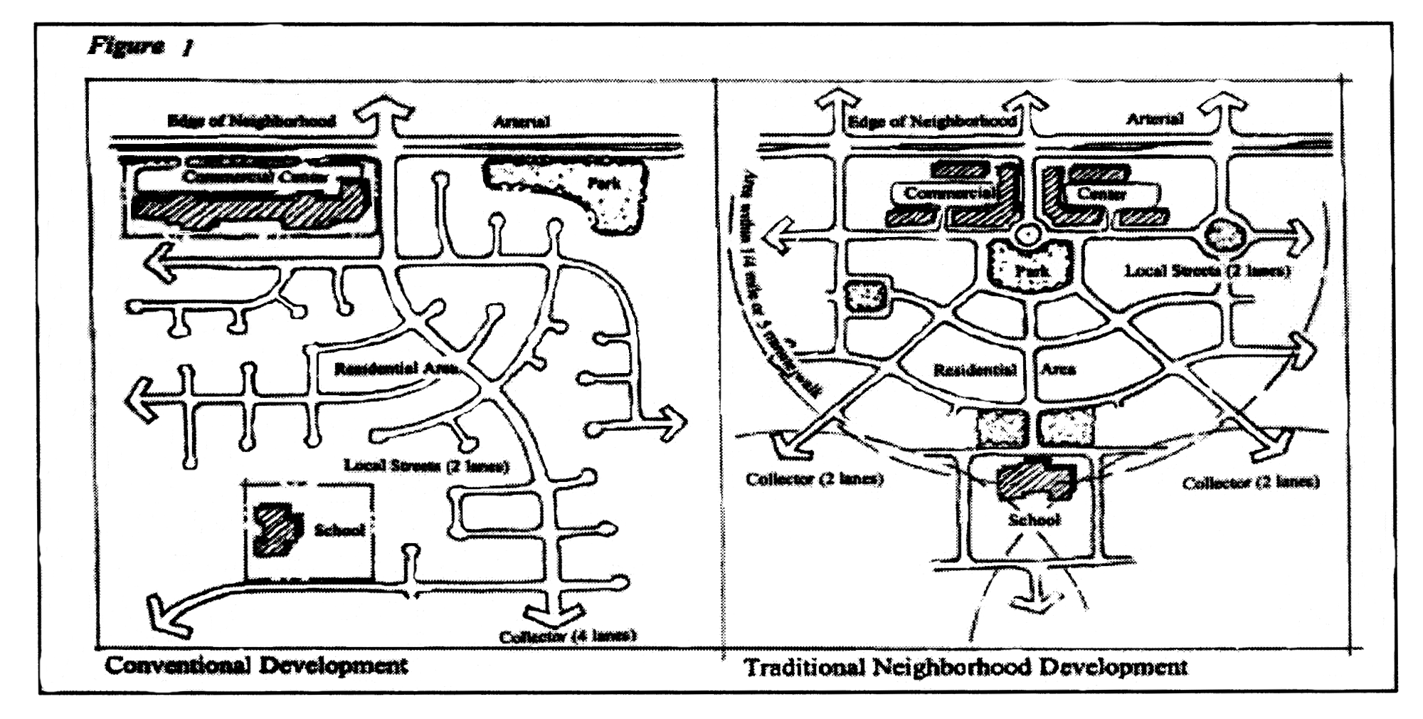
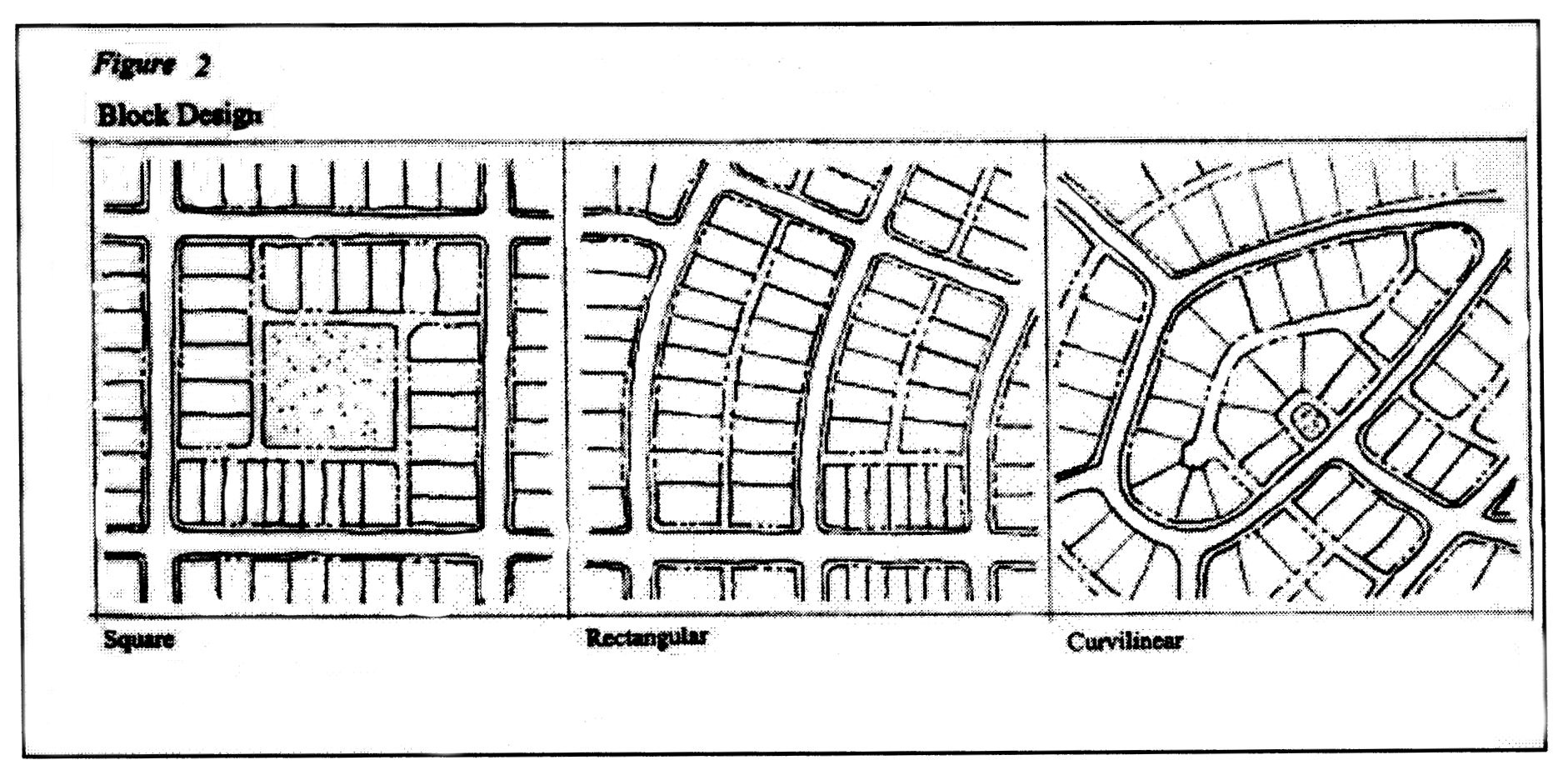
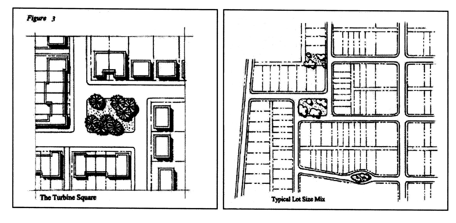
(Ord. No. 05-06-05; Ord. No. 06-07-4, §§ 9, 10; Ord. No. 09-10-03, §§ 19, 20; Ord. No. 16-17-17, §§ 138—140; Ord. No. 19-20-09, § 73)
Section 12.05.280. - P public and quasi-public lands district.
A.
Intent. The P public and quasi-public lands district implements the public/quasi-public facility and institutional lands comprehensive plan land use category. The district allows lands, uses and structures in public ownership, or owned by not for profit organizations used for the purposes described in this section.
B.
Permitted principal uses and structures are used for:
1.
Public uses, including: Recreation, athletic sports, stadiums, elementary, middle, and high schools, college and university campuses, military training and management, flood control, sanitary landfill, central potable water and central wastewater treatment plants, land for sludge application, civic buildings, public utilities, public utility facilities, and government activities.
2.
Churches and church owned land that is used for other than regular worship services such as retreats, camps, parochial schools, and playgrounds.
3.
Lodges and meeting halls of not-for-profit fraternal organizations when directly related to the major purpose of the not-for-profit organization.
4.
Cemeteries that are open to the public.
5.
Hospitals.
6.
Libraries, museums, elementary, middle, and high schools, college and university campuses, and all other similar institutional uses.
Any uses or changes in uses that are requested by the property owner but are not listed in this section shall be submitted in the application for amendment and presented at public hearing to the P&Z and the BCC.
C.
Reserved.
D.
Special exceptions. Permissible in this district by the BOA after public hearing and subject to appropriate conditions and safeguards, are:
1.
Wireless communications facility (WCF) or transmission tower or tower, including lattice towers, guyed towers, monopole towers, ground-mounted towers and alternative tower structure or other similar wireless communications facilities are special exceptions, pursuant to the requirements of this chapter and the standards contained in sections 12.08.133 and 12.08.135 of this Code.
2.
Residence for on-site manager or custodian or similar personnel.
3.
Access and on-site parking for on-site manager and/or research personnel.
4.
Trailhead facilities and on-site parking.
5.
Reserved.
6.
Utility companies, railroads or airport facilities including related administrative headquarters, storage and repair yards; and power stations and electrical substations.
7.
Residential density in church retreats when that density exceeds one unit per acre.
8.
When a development is proposed to exceed the maximum intensity (FAR) for non-residential uses pursuant to section 12.05.280.J. or maximum building height pursuant to section 12.05.280.M., below.
E.
Limitation on uses. The following limitations on uses in this district shall apply:
1.
Central wastewater treatment facilities or structures or water treatment facilities or structures shall conform to the standards contained in section 12.08.131.
2.
Landfills and incinerators shall be allowed in this district only on lands owned by the BCC.
3.
All central potable water facilities shall comply with all applicable federal and state laws, rules, and regulations, including permitting requirements.
F.
Permitted accessory uses and structures in this district are uses and structures accessory to the permitted principal use, not including living quarters.
G.
Prohibited uses and structures are any uses not listed either as permitted or as special exceptions.
H.
Minimum parcel requirements. 20,000 square feet and a minimum of 80 feet of road frontage for a quasi-public use.
I.
Development capacity. Permanent residential uses between one unit/acre and one unit/five acres, plus facilities and improvements necessary for the intended use or activity. The density or development capacity at campgrounds, rental units, or sleeping rooms at church retreats shall be governed by the building envelope established in paragraphs 12.05.280.J., K., L., M., and N. below and shall be approved as part of the special exception required in paragraph 12.05.280.D.
J.
Maximum intensity for non-residential uses. Floor area ratio.
1.
All uses fronting US 27: Up to 1.00 FAR.
2.
All uses not fronting US 27: Up to 0.30 FAR.
3.
Any request for FAR greater than allowed in this paragraph is subject to a special exception approved by the BOA with appropriate safeguards and conditions.
K.
Reserved.
L.
Minimum yard requirements. (Depth of front and rear yards, width of side yards). Minimum side yard depth seven and one-half feet. See sections 12.05.307 and 12.05.402 of this Code.
M.
Maximum height of structures. No portion intended for human occupancy shall exceed 50 feet in height. Any request beyond 50 feet is subject to approval by the BOA with appropriate safeguards and conditions. Exceptions as provided in sections 12.05.302, 12.08.133, and 12.08.135 may apply. See definition of height of buildings in section 12.02.104.
N.
Minimum area of structures for human occupancy. The minimum area of structures for human occupancy in this district shall be 480 square feet for a mobile home, rental units or sleeping rooms at church retreats shall be at least 150 square feet, and otherwise 750 square feet.
O.
Limitations on signs. The following limitations on signs shall apply in this district. No signs intended to be read from off the premises, except:
1.
Signs as permitted for B-2 with the exception of off-site signs.
2.
No sign within 50 feet of R-1A, R-1, R-2, R-3, M-1-S, M-1, M-2 or EU district.
3.
No ground sign to exceed 25 feet in overall height above ground.
4.
Roof signs not to exceed 25 feet in height above the roof and not to obstruct light or air of adjacent property.
5.
Vertical projecting signs, not to extend over five feet beyond the wall.
6.
Temporary construction signs: Same as for R-3.
7.
Signs shall be permitted along the front edge of any required front yard, provided all other setback requirements are met.
8.
All signage must be located entirely within the property of the applicant.
9.
No sign shall be placed that would obstruct the visibility of pedestrians or motorists, or that would minimize or restrict access to adjoining properties.
(Ord. No. 05-06-05; Ord. No. 05-06-30, § 61; Ord. No. 06-07-4, § 13; Ord. No. 09-10-03, § 21; Ord. No. 13-14-02, §§ 25, 26; Ord. No. 16-17-17, §§ 141—145; Ord. No. 19-20-09, §§ 74—77; Ord. No. 22-23-08, § 2)
Section 12.05.281. - PW public water supply district.
A.
Intent. This district is intended to: (1) attain consistency with the public water supply land use classification, as required by F.S. Ch. 163; (2) maintain and protect the natural and manmade environment and resources in a manner protective of the water supply; (3) ensure the availability of adequate dependable sources of good quality water for domestic, residential, commercial, and industrial use, as required by F.S. Ch. 163; (4) protect both quantity and quality of groundwater supply and to protect groundwater supplies from potential contamination and depletion; and (5) safeguard the health, safety, and welfare of the citizens of Highlands County.
B.
Applicability. This zoning district shall apply to all central potable water facilities that have a PW public water supply district classification on or before March 3, 2020.
C.
Permitted principal uses. Only uses functionally related to the water supply system, open space, parks, playgrounds, playing courts, open air shelters, and other similar recreation facilities are allowed.
D.
Permitted accessory structures. Only structures accessory to the permitted principal uses are allowed.
E.
Prohibited uses. No parking areas, structures, or impervious surfaces, except for those shown as permitted or accessory shall be allowed.
F.
Minimum lot requirements. A minimum lot necessary to provide for both the zone of control and zone of exclusion, as required by division 3 of article 12 of the Highlands County Code of Ordinances. A smaller lot may be allowed if the use predates the adoption of this chapter or the special use approval allows a smaller lot.
G.
Special use permit may be granted by the BCC after receiving a recommendation from the P&Z at a public hearing and subject to appropriate conditions and safeguards for a public water facility covered or included by Florida Administrative Code 40D-2 or 40E-2. Proof and specific evidence shall be provided that the following requirements and the standards contained in sections 12.03.107 and 12.03.411 of this Code are satisfied. Potable water facility covered or included by Florida Administrative Code 40D-2 or 40E-2 must satisfy the following standards:
1.
Will complete an environmental impact report that certifies that the ground water, lake levels, native habitat, and natural resources under the Highlands County Comprehensive Plan Natural Resources Element will be protected; and
2.
Will comply with water well or treatment facility standards contained in the applicable water use permit issued by the water management district. This compliance shall include reasonable assurances, on both an individual and a cumulative basis, that the use:
a.
Is reasonable and beneficial to the public and residents of the developments; and
b.
Is in the public interest; and
c.
Will not interfere with any existing legal use of water; and
d.
Is necessary to fulfill a certain reasonable demand; and
e.
Will not cause quantity or quality changes which adversely impact the water resources, including both surface and ground waters; and
f.
Will not cause adverse environmental impacts to wetlands, lakes, streams, estuaries, fish and wildlife or other natural resources; and
g.
Will not cause water levels or rates of flow to deviate from the ranges set forth in Chapter 40D-8; and
h.
Will utilize the lowest water quality the applicant has the ability to use; and
i.
Will not significantly induce saline water intrusion; and
j.
Will not cause pollution of the aquifer; and
k.
Will not adversely impact offsite land uses existing at the time of the application; and
l.
Will not adversely impact an existing legal withdrawal; and
m.
Will utilize local water resources to the greatest practicable extent; and
n.
Will not cause water to go to waste; and
o.
Will not otherwise be harmful to the water resources within the county; and
p.
Will submit a completed surface and ground water management plan that addresses the requirements listed above.
(Ord. No. 05-06-05; Ord. No. 05-06-30, § 62; Ord. No. 16-17-17, §§ 146, 147; Ord. No. 19-20-09, § 78)
Section 12.05.282. - CM conservation/management lands district.
A.
Intent. The conservation/management lands district is intended to apply to all lands in public ownership for the purpose of preserving sensitive vegetative communities and wildlife habitats, watershed and riverine resources, receiving areas for off-site environmental mitigation banking and areas being reclaimed from river realignment and floodplain restoration. This district also accommodates those quasi-public and private uses that are committed to environmental and agricultural research and managed without public participation, but enjoying the benefit of tax exemptions. This district implements the conservation/management lands future land use map designation with three categories in order to differentiate lands dedicated to conservation and lands managed in non-urban uses that could be construed as lands that are not conservation. These three categories are: Conservation, research, and managed.
B.
Permitted principal uses and structures.
1.
Conservation category includes:
a.
Conservation and recreation lands.
b.
Water management district lands.
c.
State parks and monuments.
d.
Open space and conservation easements and rights-of-way.
e.
State natural wildlife and plant preserves.
f.
Delineated watersheds and wetland systems.
g.
Off-site environmental mitigation banks.
h.
Environmental interpretive and educational facilities.
i.
County natural wildlife and plant preserves.
j.
River and creek green ways and trails.
k.
Recreational green way corridors.
l.
Trail head facilities, and campgrounds owned and managed by a public entity such as a federal, state, water management district, county, city, or special improvement district.
m.
Other similar public, quasi-public, or private lands.
n.
Residence for on-site manager or custodian.
o.
Residence for research personnel.
p.
Access and on-site parking for on-site manager and/or research personnel.
2.
Research category includes:
a.
Environmental research and experimentation facilities.
b.
Agricultural research and experimentation facilities.
c.
Research arboretum.
d.
Environmental interpretive and educational facilities.
e.
Other similar public, quasi-public, or private lands.
3.
Managed category includes:
a.
Federal military reservation and open space management.
b.
Public lands leased for agricultural use.
c.
Museum for historic and contemporary agricultural practices.
d.
Indigenous peoples reservation.
e.
Other similar public, quasi-public, or private lands.
4.
Any uses or changes in uses that are requested by the property owner but are not listed in this section shall be submitted in the application for amendment and presented at public hearing to the P&Z and the BCC.
5.
Central wastewater and water treatment facilities serving a single development.
C.
Limitation on uses. The following limitations on uses in this district shall apply:
1.
Central wastewater treatment facilities or structures or water treatment facilities or structures shall conform to the standards contained in section 12.08.131.
2.
All central potable water facilities shall comply with all applicable federal and state laws, rules, and regulations, including permitting requirements.
D.
Permitted accessory uses and structures. Accessory structures are permitted.
E.
Prohibited uses and structures.
1.
Any uses not listed either as permitted or deem necessary by the BCC or as special exceptions.
F.
Special exceptions. Permissible in this district, by the BOA, after public hearing and subject to appropriate conditions and safeguards are:
1.
Central wastewater treatment and water treatment facilities serving more than one development.
G.
Minimum parcel requirements. None.
H.
Maximum development capacity and floor area ratio.
1.
Development capacity: One unit/80 acres, plus facilities and improvements necessary for the intended conservation use or activity, excluding campgrounds owned and managed by a public entity such as a federal, state, water management district, county, city, or special improvement district or one unit on a lot of record or vested lot.
2.
Floor area ratio: Up to 0.15 FAR.
I.
Minimum yard requirements. The minimum depth of front and rear yards and width of side yards in this district shall be as follows:
1.
Front: 50 feet.
2.
Side: 25 feet.
3.
Rear: 50 feet.
4.
Corner, side: 50 feet.
J.
Maximum height of structures. No portion intended for human occupancy shall exceed 35 feet, in height except as provided in section 12.05.302. See definition of height of buildings in section 12.02.104.
K.
Minimum area of structures. The minimum area of structures for human occupancy in this district shall be 750 square feet.
L.
Limitations on signs. The following limitations shall apply in this district:
1.
One non-illuminated wall or ground sign, not to exceed 12 square feet in area, identifying the parcel or facility;
2.
One non-illuminated directional sign, not to exceed six square feet in area;
3.
One non-illuminated wall or ground sign, not to exceed two square feet in area, identifying each principal structure;
4.
Trespassing or caution sign, none to exceed four square feet in area;
5.
Where use of land is authorized pursuant to special exception, the BOA may allow additional signs of such number and location, but consistent with the above cited sizes, as it may find appropriate and consistent with this chapter;
6.
All other sign uses and types are prohibited except by authorization of the BCC;
7.
Signs shall have a minimum setback of 15 feet from the front property line, provided all other setback requirements are met;
8.
All signage must be located entirely within the property of the applicant;
9.
No sign shall be placed that would obstruct the visibility of pedestrians or motorists, or that would minimize or restrict access to adjoining properties.
(Ord. No. 05-06-05; Ord. No. 05-06-30, §§ 63—66; Ord. No. 09-10-03, § 22; Ord. No. 13-14-02, § 27; Ord. No. 16-17-17, §§ 148—151; Ord. No. 19-20-09, §§ 79—81)
Section 12.05.283. - A-1 airport district.
A.
Intent. The A-1, airport district, is designed to accommodate airport uses which involve certain influences and hazards, but which are essential for the economic viability of the area. This district is designed to protect adjacent residential areas while at the same time ensuring adequate areas for airport and economic development activities. This district is designed to provide adequate space in appropriate locations for uses that serve economic development and the needs of the motoring and aviation related public. The A-1, airport district, should serve the major transportation interchanges of vehicle, rail and air transportation.
B.
Permitted principal uses and structures. In the A-1, airport district, the following uses and their accessory uses are permitted, unless prohibited in subsection E. below:
1.
At any location within the district that is not within 500 feet of a residentially zoned property or recreation or drainage facilities that are a part of that residential development:
a.
Any use permitted in the I-2 industrial district;
b.
Any use permitted in the B-3 business district;
c.
Any use permitted in the BC-2 business campus, research, and light manufacturing park district;
d.
Any use permitted in the CG-1 campground district;
e.
Airports and aviation related uses;
f.
Automobile raceways;
g.
Cultural and recreational services;
h.
Transient habitation; hotels and motels;
i.
Motor vehicle rentals;
j.
Food and beverage services;
k.
Food service; takeout; and
l.
Public transport, communication, and utility services.
2.
At any location:
a.
Any use permitted in the O office district;
b.
Any use permitted in the B-1 neighborhood business district;
c.
Government administrative services;
d.
Automotive parking; and
e.
Mixed use transit residential development, otherwise known as hangar homes.
C.
Permitted uses as special exceptions. Reserved.
D.
Signs. No signs intended to be read from off the premises, except:
1.
Signs as permitted in B-2.
2.
Temporary construction sign: Same as for R-3.
E.
Prohibited uses.
1.
Uses not specifically permitted.
2.
Sexually oriented businesses.
3.
Rifle range.
4.
Animal slaughterhouse or abattoir; asphalt manufacture or refining; paving plant; corrosive acid manufacture including hydrochloric, nitric, sulphurous and sulfuric acids; bone distillation; blast furnace; creosote manufacture or treatment; coke oven; distillation of coal tar, petroleum, refuse, grain of wood; drilling, production or refining of petroleum or inflammable liquids; fat rendering; fertilizer manufacture, except the cold compounding of non-odorous materials foundry; gunpowder, manufacture or storage of fireworks or other explosives, except as incidental to a permitted use; incineration, reduction or storage of garbage, offal, dead animals (not including the Highlands County Animal Control Department), refuse, rancid fats; glue size or gelatin manufacture, where the processes used include the refining or recovering of products from fish, animal refuse or offal (not including the tanning of animal hides); house wrecking yards, used building material yards; junkyards, automobile wrecking yards; salvage yard; paper and pulp mills; pyroxylin and pyroxylin product manufacture; rubber manufacture from raw materials; smelting or refining of metals ores; steel manufacture by Bessemer, open hearth or other process; steel mills, rolling mills, blooming mills; stock yards or feeding pens; tallow, grease or lard manufacture or refining from animal fat; extraction of animal, vegetable or fish fat and oils; poisons, poison gases; acids, batteries.
5.
Landfill.
6.
Store, recycle, or mulch, soil, sand, muck and natural vegetative material.
7.
Correctional or penal institution.
F.
Buffer. Where a use is established in a portion of an A-1 zoned district, which abuts property that is zoned residential, the airport or other developer of said use shall provide a transitional protective yard Type A, pursuant to the requirements of article 11 of chapter 12 of the land development regulations.
G.
Height limits. All structures, including towers, are not to exceed the height requirements established by the FAA for land side improvements. All airspace management and approach procedures are to take precedence in setting height limitations on all structures. When adjacent to residential uses, towers are not to be located any closer than 500 feet.
(Ord. No. 05-06-05)
Section 12.05.290. - PD planned development district.
A.
Purpose and intent of the district. The PD district is designed to allow an applicant to submit a proposal for consideration, and to allow the BCC to approve any proposal which it determines to be in the best interest of the public health, safety, and welfare, along with any conditions or requirements or limitations thereon which the board deems advisable. The PD district is intended to:
1.
Promote more efficient and economic uses of land;
2.
Provide opportunities for design innovations by individual planned developments which are not provided for or allowed in the underlying zoning districts established by this chapter;
3.
Promote home ownership opportunities for all residents of the community;
4.
Encourage flexibility in design and permit planned integration of multiple uses and structures;
5.
Encourage uses of land which reduce transportation impacts;
6.
Provide for more usable and suitably located recreational facilities, open spaces and scenic areas, either commonly owned or publicly owned, than would otherwise be provided under conventional land development procedures;
7.
Lower development and building costs by permitting smaller lots, networks of utilities, and streets and the use of more economical building types and shared facilities; and
8.
Accomplish more desirable living and working environments than would be possible through the strict application of the minimum requirements of the county's other zoning and subdivision regulations.
B.
Voluntary procedure. Rezones to the PD district shall be an entirely voluntary procedure to be pursued only at the option of the applicant, and the county shall not itself initiate such rezoning on privately owned lands.
C.
Establishment of planned development districts. Planned development districts can occur in all zoning districts. Planned development districts will be established from designated existing zoning districts by amendment of the official zoning map.
D.
Effect of planned development approval. When approved pursuant to the provisions of this Code, the conceptual development plan and other documents as are adopted by resolution shall constitute an amendment to these regulations. Development within a planned development shall occur in conformity with the approved conceptual development plan.
E.
Application of other ordinances. All building codes, housing codes, and other land use regulations of the county are applicable to the PD district. Special exceptions and zoning variances pursuant to chapter 12 are not allowed.
F.
Application requirements. The completeness of an application shall be determined by the development services director pursuant to the requested data and analysis cited in the options below.
G.
PD development plan. Any petition for planned development district zoning shall be accompanied by a professionally prepared master development plan of the development that will convey the general extent and character of the proposed improvements and which shall comply with one of the three following options:
1.
Information required in a PD development plan. A PD development plan, drawn to acceptable scale, which shall include:
a.
The title of the project and name of developer; and
b.
A general location map; and
c.
A site as-built map indicating the boundaries of the subject property, all existing streets, buildings, water courses, the existing topography at contour intervals adequate to show drainage, existing land uses, and other important physical features within the proposed project; and
d.
The PD site development plan should illustrate the proposed use of all land within the project boundaries, including all buildings and building sites, the location and function of all areas proposed to be dedicated or reserved for community or public use, the proposed public and private circulation system, including vehicular and pedestrian if applicable, as well as, primary access points to the existing street network, and, if applicable, illustrate anticipated development phasing; and
e.
The anticipated demand and impacts from the anticipated project population or an estimate of consumer and/or employee and/or residential dwelling unit impact on all proposed drainage, central potable water, central wastewater, and other utility service systems, solid waste generation, and parks and recreation based on the levels of service (LOS) established by the comprehensive plan; and
f.
Location of xeric uplands, wetlands, and cutthroat seeps; and a list of permit applications for state or federal environmental reviews; and
g.
A conceptual development program statement that includes: for residential development, the anticipated numbers of dwelling units, by type, the area of all individual uses, the potential population estimate at build-out; and/or for non-residential development, the gross floor area, the floor area ratio (FAR) or building mass on the plan.
h.
Traffic analysis: A traffic impact analysis (TIA) study as required by the county engineer.
i.
Affidavit of ownership: An affidavit documenting ownership, including written legal description of the subject property, together with names and addresses of all owners of record.
j.
Other information: Optional graphic material may be submitted to illustrate the proposed residential product through architectural elevations and perspective sketches for conveying and clarifying the nature of the proposed development. The same will be accepted for non-residential developments.
2.
Option # 1 development: All information required in section 12.05.290.G.1. shall be provided for an Option # 1 development.
3.
Option # 2 small scale PD development: All small scale PDs shall have less than ten acres, commercial development shall meet the criteria for commercial small scale comprehensive plan amendments, and residential development shall have less than 12 units per acre. All applications within this district shall include the same information required in Option # 1 except sections 12.05.290.G.1.c. and 12.05.290.G.1.e. The county engineer and the development services director shall determine if a traffic impact analysis identical to the requirements of small scale comprehensive plan amendments is required or if a development is exempt.
4.
Option # 3 De Minimis PD development, as defined by the Highlands County Technical Standards Manual, current edition, division 3; all such applications including those for redevelopment or an expansion of existing development within this district shall include the same information required in Option # 2.
5.
General requirements:
a.
Permitted uses: Any use permitted in the underlying zoning district may be permitted. The BCC may delete specific uses permitted in the underlying district. Any use not expressly permitted in the underlying district may be permitted with the approval of the BCC.
b.
Other development standards: All other development standards will be established by the underlying district. However, the BCC, may permit modification of any specific requirement of the underlying district.
c.
Phasing: When provisions for phasing are included in the development plan, each phase of the development must be so planned and so related to previous development, surrounding properties, and the available public facilities and services that a failure to proceed with subsequent phases of development will have no adverse impact on the completed phase(s) or surrounding properties.
d.
Other conditions: The BCC may establish, in addition to concurrency requirements and the time limits set by relevant development orders cited in the land development regulations, reasonable conditions, including periods of time for completing the project or phases thereof including any dedicated public facilities which are a part of the development.
6.
Status of previously approved FUDs or PDs: Any active or completed flexible unit development or planned development project previously approved shall continue to be governed by the approved FUD or PD plan and any agreements, terms and conditions to which the approval may be subject, as long as the project continues to be actively under development.
7.
Amendments to approved planned development plan: Whenever any application is made to substantially modify the approved PD plan or to undertake a new development on part or all of the property, the application shall be made under the terms and procedures of the PD district. Major amendments to an existing planned development must be approved by the BCC. An individual or cumulative increase in density or intensity of less than one percent does not require an amendment. Minor amendments to an existing planned development may be approved by the development services director. Minor changes include the following:
a.
An individual or cumulative increase of between one and five percent in the density or intensity in the approved development plan; (An individual or cumulative increase of density or intensity above five percent requires an amendment.)
b.
Internal realignment of rights-of-way, other than a relocation of access points to the PD itself, except as provided for in this section, where there is no net reduction of the size of conservation/preservation areas or required easements;
c.
Relocation of access point(s) when the new location is on the same property line and/or roadway as approved in the original PD, and only if deemed necessary by the county engineer or other government agency responsible for determining driveway location(s) or issuing driveway permit(s). A letter from the county engineer or other government agency indicating the necessity of the relocation shall be provided by the applicant to the development services director;
d.
Relocation of building envelopes where there is no encroachment upon required conservation or preservation areas and no reduction in the setbacks between the buildings and perimeter boundary lines;
e.
Relocation of swimming pools, clubhouses, or other recreation or other common facilities when such relocation will have no net impact on adjacent properties or land uses; and
f.
Relocation, reduction, or reconfiguration of lakes, ponds, or other water facilities subject to the submittal and approval of revised water management plans.
8.
Review and approval process: Except as provided in subsection 4., all amendments, changes in uses, conditions or development standards and any other change in an approved PD will be submitted at public hearings, to the P&Z for recommendation and to the BCC for approval.
(Ord. No. 05-06-05; Ord. No. 05-06-30, § 67; Ord. No. 05-06-33, § 8; Ord. No. 16-17-17, §§ 152, 153; Ord. No. 22-23-08, § 2)
Section 12.05.291. - Flexible unit development (FUD) district.
A.
Flexible unit developments. (FUD) can be established from a designated existing zoning district by amendment of the official zoning map. FUDs can include any type development.
B.
Voluntary procedure. Rezones to the FUD districts shall be an entirely voluntary procedure to be pursued only at the option of the applicant, and the county shall not itself initiate such rezoning on privately owned lands.
C.
Effect of FUD approval. When approved pursuant to the provisions of this Code, the FUD development plan and other documents as are adopted by resolution shall constitute an amendment to these Regulations. Development within a FUD shall occur in conformity with the approved FUD development plan.
D.
Application requirements. The completeness of an application shall be determined by the development services director pursuant to the requested data and analysis cited in the options below. All petitions for FUD district zoning shall be accompanied by a FUD development plan which shall include the title of the project, name of developer, and a general location map. The plan shall convey the general extent and character of the proposed improvements, drawn to acceptable scale in order to illustrate the proposed use of all land within the project boundaries, including all buildings and building sites, the location and function of all areas proposed to be dedicated or reserved for community or public use, the proposed public and private circulation system, including vehicular and pedestrian if applicable, as well as, primary access points to the existing street network, and, if applicable, illustrate anticipated development phasing.
E.
General requirements.
1.
Permitted uses. Any use permitted in the underlying zoning district may be permitted. The BCC may delete specific uses permitted in the underlying district.
2.
Development standards. All other development standards will be established by the underlying district. Density or intensity, lot sizes, setbacks, minimum living area, and other requirements are to be established by the BCC on each individual layout submitted for approval. The BCC may also establish other reasonable conditions, including but not limited to provisions for phasing, time limits set by relevant development orders cited in the land development regulations, time for completing the project or phases, completion of public facilities which are a part of the development and other conditions that respond to the site development issues contained on the FUD development plan.
F.
Status of previously approved FUDs. Any active or completed FUD project previously approved shall continue to be governed by the approved FUD plan and any agreements, terms and conditions to which the approval may be subject, as long as the project continues to be actively under development.
G.
Amendments to approved FUD plan. Whenever any application is made to substantially modify the approved FUD plan or to undertake a new development on part or all of the property, the application shall be made under the terms and procedures of the FUD district. Major amendments to an existing FUD must be approved by the BCC. An individual or cumulative increase in density or intensity of less than one percent does not require an amendment. Minor amendments to an existing FUD may be approved by the development services director. Minor changes include the following:
1.
An individual or cumulative increase of between one and five percent the density or intensity in the approved development plan (an individual or cumulative increase of density or intensity above five percent requires an amendment);
2.
Internal realignment of rights-of-way, other than a relocation of access points to the FUD itself, where there is no net reduction of the size of conservation/preservation areas or required easements;
3.
Relocation of building envelopes where there is no encroachment upon required conservation or preservation areas and no reduction in the setbacks between the buildings and perimeter boundary lines;
4.
Relocation of swimming pools, clubhouses, or other recreation or other common facilities when such relocation will have no net impact on adjacent properties or land uses; and,
5.
Relocation, reduction, or reconfiguration of lakes, ponds, or other water facilities subject to the submittal and approval of revised water management plans.
H.
Review and approval process. Except as provided in section 12.05.291.G., all amendments, changes in uses, conditions or development standards and any other change in an approved FUD will be submitted at public hearings, to the P&Z for recommendation and to the BCC for approval.
(Ord. No. 05-06-05; Ord. No. 05-06-30, § 68; Ord. No. 05-06-33, § 9; Ord. No. 11-12-04, § 39; Ord. No. 16-17-17, § 154; Ord. No. 19-20-09, § 82)
Section 12.05.292. - Conditional use districts.
Conditional use districts may be regulated within any of the broader districts by appropriate identification of the specific use; provided, however, such use shall be the sole permitted use, and said use shall run with the title to the land until zoned otherwise by the BCC.
(Ord. No. 05-06-05)
Section 12.05.300. - Accessory uses and detached accessory structures in residential districts and in the AU district on lots that are one acre or less in size.
A.
All customary accessory uses and detached buildings will be incidental and shall:
1.
Not be located in any front yard. (Lakefront property has the option of declaring the lake side the front yard. However, if the lake side is declared the front, accessory structures shall meet the minimum front yard setback required for the district in which it is located.)
2.
Be located at least seven and one-half feet from any lot line and at least 15 feet from any side street line and 25 feet from any front street line.
3.
Accessory structures shall not be taller than the principal structure, unless it is architecturally similar to the principal structure, including similar roof style and material, and shall not exceed 24 feet in height. For the purposes of this section, height shall be measured from the established grade at the center of the front of the building to the peak of the roof.
4.
No mobile home shall be converted into an accessory structure.
B.
Flagpoles and advertising signs may be permitted in any required yard or along the edge of any yard, provided that all other regulations of this chapter are met.
(Ord. No. 05-06-05; Ord. No. 16-17-17, §§ 155, 156; Ord. No. 17-18-15, § 1; Ord. No. 22-23-08, § 3)
Section 12.05.301. - Uses and structures used for accessory purposes in nonresidential districts.
All uses and structures used for accessory purposes in nonresidential districts and which are not permissible as principal uses or structures shall:
A.
Be located on the half or quarter of the lot farthest from any street or streets on which the lot abuts.
B.
Not exceed the height of the principal building on the lot provided that this limitation shall not apply in an I-2 district.
C.
Flagpoles may be permitted in any required yard or along the edge of any yard, provided that all other regulations of this chapter are met.
(Ord. No. 05-06-05; Ord. No. 16-17-17, § 157)
Section 12.05.302. - Exclusions from height limit.
Parapet walls may extend not more than five feet above the allowable building height. The following may exceed the height limits by not more than 25 percent:
A.
Penthouses, scenery lots, towers (other than towers which are wireless communication facilities), cupolas, steeples and domes not exceeding in gross area at maximum horizontal section 30 percent of roof area.
B.
Flagpoles, airplane beacons, chimneys, stacks, tanks and roof structures.
(Ord. No. 05-06-05)
Section 12.05.303. - Use of residentially zoned property for access.
No residentially zoned land shall be used for driveway, walkway or access purposes to any land that is non-residentially zoned or to any land used for any purpose not permitted in residential districts.
(Ord. No. 05-06-05)
Section 12.05.304. - Grade of residential buildings.
The minimum floor elevation above finish grade of residential buildings: Eight inches minimum shall be required for concrete block, above the finish grade and 12 inches minimum shall be required above finish grade for frame construction, except that where topographical conditions are such that in the opinion of the building official, compliance would be impracticable or would cause grade level conditions detrimental to adjacent or nearby property, the building official may modify the application of this requirement.
(Ord. No. 05-06-05)
Section 12.05.306. - Fences, walls and hedges.
As used in these regulations the term "fence" shall include fences, walls, and hedges.
A.
Notwithstanding other provisions of this chapter, fences may be permitted in any required yard or along the edge of any yard in residential districts, provided that:
1.
No fence along the sides or front edge of any required front yard shall exceed a height of four feet except for a chain link fence of five feet in height, or a decorative fence of five feet in height with air space equal to or greater than the width of the vertical pickets. However, fences that are placed farther into any required yard, i.e. beyond the sides or front edge of any required front yard, are permitted to exceed the four feet and five feet height limitations, but shall comply with the front yard setback requirement of the zoning district in which the fence is located;
2.
No fence in residential areas shall exceed a height of six feet unless the fence complies with the accessory structure setback requirements or is permitted as stated in paragraph 3. of this section;
3.
Where a fence is placed adjacent to a non-residentially zoned property, the fence shall not exceed a height of eight feet along the lot line dividing the residentially and non-residentially zoned properties; and
4.
Where a fence is placed along the perimeter of a mobile home park or campground the height of the fence shall not exceed eight feet.
B.
Notwithstanding other provisions of this chapter, fences may be permitted in any required yard or along the edge of any yard in non-residential districts, provided that no fence shall exceed a height of eight feet.
C.
All fencing must be located entirely within the property of the applicant.
D.
In the event there is a conflict, the height requirements in article 11 of this chapter shall prevail.
(Ord. No. 05-06-05; Ord. No. 05-06-33, § 10; Ord. No. 07-08-32, § 14; Ord. No. 16-17-17, § 158)
Section 12.05.307. - Base building lines established.
Base building lines are hereby established for all districts whereby no building or structure shall be constructed or erected closer than 15 feet from the street or road right-of-way line, unless said right-of-way line is a platted alleyway less than 15 feet in width and is not used for frontage, in which case no structure shall be constructed or erected closer than 7.5 feet from the street or right-of-way line. If a future right-of-way has been established and recorded, the recorded and proposed right-of-way shall be used for establishment of setbacks and base building lines.
(Ord. No. 05-06-05; Ord. No. 22-23-08, § 3)
Section 12.05.308. - Central wastewater disposal.
Under all zoning classifications in all districts for all structures where a central wastewater disposal system exists or is later installed within a reasonable distance, a connection thereto shall be required. Where no central wastewater system exists and an individual septic system is required, it shall conform with the standards and requirements of the county health department, and building permits shall not be issued for those sites upon which the proposed method of central wastewater disposal is not approved by the county health department. Accompanying the building permit application, there shall be a scale drawing of the building and plot plan showing clearly the proposed central wastewater disposal system.
(Ord. No. 05-06-05; Ord. No. 16-17-17, § 159)
Section 12.05.309. - Setback requirements for certain functional classifications of roadways.
A.
Any new development, or alteration or expansion of an existing structure, occurring on a roadway with a functional classification as set forth hereafter shall adhere to the stated front setbacks. The following setback requirement shall be in addition to any other setback and/or base building line requirement provided in a particular zoning district of this Code.
B.
Arterial roadway (major and minor) is defined as a route providing service which is relatively continuous, of high traffic volume, of long average trip length, of high operating speed and of high mobility importance. In addition, all United States or State of Florida numbered highways shall be principal arterial roadways.
C.
Collector roadway (major and minor) is defined as a route providing service which is relatively of moderate average traffic volume, moderately average trip length and moderately average operating speed. These routes also collect and distribute traffic between local roads and arterial roads and serve as a linkage between land access and mobility needs.
D.
General roadway includes local, marginal access, frontage, ingress/egress easements and private roads, and is defined as a roadway providing service of relatively low traffic volume, short average trip length or minimal through traffic movements.
E.
Corner lots or lots having double road frontage on more than one roadway with a functional classification as set forth herein shall measure setbacks from both roads.
F.
Lot front determination shall be where the principal vehicular access to the lot abuts the roadway.
G.
This front setback requirement shall be considered in conjunction with any required roadway improvements necessary to serve the needs of the development and its impacts.
H.
The list of county roadway functional classifications shall be maintained in the office of the county engineer, shall be amended from time to time and shall be available to the public during normal business hours.
I.
In the event, at the time of development, it is not, or does not appear to be feasible or practical for the property owner to comply with the functional classification setback requirement of this Code, such matter shall be brought as a public hearing before the Highlands County Board of County Commissioners at a regularly scheduled meeting. The decision of the board related to any deviation of the functional classification setback requirement set forth in this code shall be final.
(Ord. No. 20-21-21, § 2)
Section 12.05.310. - Boats, boathouses and docks.
Due to the great diversity in shapes of water bodies and the shapes of lots adjacent to those water bodies, particularly with respect to the alignment of side lot lines, no single rule for placement of docks and boathouses is fair and equitable. Consequently, consideration must be given to numerous factors, including, but not limited to, access to the water body and view of the water body from adjacent lands. To achieve an equitable balance between public and private rights, the following requirements are hereby imposed on the issuance of building permits for docks and boathouses:
A.
As used in these regulations, the term "dock" shall include docks and boathouses, the term "lot" shall include platted lots and other parcels of land, and the term "marginal dock" shall mean a dock placed immediately adjacent and parallel to the shoreline or seawall, bulkhead or revetment.
B.
No boat or vessel may be used for sleeping or living purposes or otherwise as a place of residence on any body of water in the county.
C.
In residential districts, no boathouse may be erected or altered to an overall height exceeding 18 feet measured above mean lake level. Buildings accessory to a boathouse shall be attached thereto. Boathouses, including structures accessory thereto, shall not exceed 36 feet in width, measured on a line parallel to the waterway line, or exceed 24 feet in depth, measured at right angles to the waterway line on canals. The option of reversing the measurements is permitted on lakes. No boathouse shall project beyond the waterway line or established bulkhead line more than 33 percent or one-third of the width of the waterway or as approved by the state.
D.
Dockage space and facilities for mooring pleasure boats and noncommercial craft are permitted in any residential district on any waterway as an accessory use to residential occupancy of the land or as an accessory use to residential occupancy of other land having the same owner(s) which is located within 150 feet of the property from which the dockage space or mooring facilities is or are constructed measured by a straight line distance between the closest property corner or property line of the property from which the dockage space or mooring facilities is or are constructed to closest property corner or property line of said residentially occupied land.
E.
A building permit to alter or erect any boathouse under this section shall not be issued unless and until evidence has been presented showing that the proposed boathouse or alteration has been cleared with and approved by the appropriate state and federal authorities, or until a showing has been made that such approval or approvals are not required by such authorities.
F.
No dock shall project more than five feet beyond the waterway line or established bulkhead line into any waterway 100 feet or less in width, except when the dock does not extend past the covered area or boathouse. No dock shall project beyond the ordinary high water line more than ten percent of the width of the waterway when the waterway is 100 feet or more in width, but no such dock shall extend beyond 200 feet. The 200-foot limitation is subject to the granting of a waiver by the development services director.
G.
No building permit shall be issued for any dock, which would obstruct access to the water body from adjacent lots or waterways.
H.
All dock permits shall require red reflective markers not less than three inches in diameter, placed at intervals of eight feet along each side of the dock and along the furthest end of the dock which extends into the water body.
I.
All dock permits shall contain the following statement:
None of the provisions of this policy shall be implemented in a manner that would unreasonably infringe upon the traditional common law riparian rights, as defined in Section 253.141, Florida Statutes, of upland property owners adjacent to sovereignty submerged lands. Rule 18-21.004(3)(d), Florida Administrative Code, provides, in part, that subject to certain exceptions therein provided, all structures must be set back a minimum of 25 feet inside the applicant's riparian rights lines.
J.
No building permit shall be issued for a dock, the alignment of which would prevent or seriously interfere with construction of a similar dock extending into the water body from an adjacent lot.
K.
Except as provided in paragraphs 4., 5., and 6. of this subsection, no dock shall be constructed within a setback, 25 feet wide, from the extended side lot lines of a lot. Such extended lot lines shall be determined as follows:
1.
Where an existing pattern of alignment for construction of docks exists, that alignment shall be followed. While primary consideration shall be given to the alignment of the docks, if any, extending into the water body from the immediately adjoining lots on each side of the lot from which the proposed dock will be constructed, consideration may also be given to the alignment of docks extending from other lots in the general area, particularly when dock alignments are irregular or when one or more dock alignments is irregular considering the general alignment of docks in that area. Side lot lines shall then be extended into the water body on an angle which is consistent with the angle of docks extending into the water body from adjacent lots.
2.
To the extent possible, considering the prevailing spacing between docks and prevailing alignment of docks, the placement and alignment of the proposed dock should minimize loss of access to and view of the water body from the lots on either side of the lot from which the dock will be constructed.
3.
Where no existing alignment of docks constructed from adjacent lots exists, the lot lines shall generally be extended into the water body at right angles to the shoreline unless that alignment will interfere with the construction of a similar dock extending from adjacent lots or view of the water body from adjacent lots, and in those cases, the side lot lines shall be extended into the water body in a manner which would allow construction of similar docks extending from adjacent lots and causes the loss of view to be borne by the lot from which the dock is constructed to the maximum extent which is feasible.
4.
The minimum setback for marginal docks on a lake shall be 15 feet inside the extended lot lines of the lot from which the dock is constructed, those lot lines being extended into the water body at right angles to the shoreline. Marginal docks on a canal shall have a zero setback.
5.
For private residential single-family docks associated with a parcel that has a shoreline frontage of less than 65 feet, no dock shall be constructed within a setback, ten feet wide, from the extended side lot lines of the lot, those extended lot lines being determined as provided in this paragraph, and the dock shall, to the extent feasible, be centered between those extended lot lines.
6.
Deviation from placement and alignment requirements prescribed above may be allowed when the affected adjacent lot owner(s) consent(s) to the placement and alignment of the proposed dock, in writing, and provides a notarized signature on a form issued by the Highlands County Zoning Division.
L.
For determination of the placement and alignment of a dock, the applicant shall furnish scale drawings of the proposed dock and the lot from which the dock will be constructed. For construction of a dock on a lake, the applicant for a building permit shall also provide an aerial photograph of the water body showing the docks in the area of the lot from which the dock will be constructed. That aerial photograph shall be the most recent aerial photograph available from the Highlands County Property Appraiser having a lot line overlay. The applicant shall also furnish with that aerial photograph a list identifying all docks which extend into the water body from lots adjacent to the lot from which the dock will be constructed which are in existence or under construction as of the date of the application but are not shown on the aerial photograph.
M.
These rules apply to the construction of docks, for which a permit from the Florida Department of Environmental Protection is not required, which have 500 square feet or less of over-water surface area and are located in an area designated as outstanding florida waters or 1,000 square feet or less of over-water surface area and are located in an area which is not designated as outstanding florida waters. No building permit shall be issued for a dock for which a permit or letter of consent from the Florida Department of Environmental Protection is required until that permit or letter of consent has been issued.
(Ord. No. 05-06-05; Ord. No. 16-17-17, § 160; Ord. No. 19-20-09, § 83; Ord. No. 22-23-08, § 3)
Section 12.05.311. - Tents.
No tent shall be erected, used or maintained for living quarters, except in campgrounds and recreational areas properly certified by the state health and rehabilitative services for such use.
(Ord. No. 05-06-05)
Section 12.05.312. - Use of abutting similarly classified incorporated and unincorporated areas.
Land uses permitted in the regulations for zoning districts in incorporated areas, when abutting a common boundary with an area of similar zoning classification in the unincorporated area of the county, will be permitted in such area by special exception, subject to the provisions of this Code.
(Ord. No. 05-06-05)
Section 12.05.313. - Reserved.
Editor's note— Ord. No. 16-17-17, § 161, adopted September 19, 2017, repealed § 12.05.313, which pertained to utility trailers areas and derived from Ord. No. 05-06-05.
Section 12.05.314. - Storage or display of used or secondhand merchandise.
A.
Whenever storage or display of used or secondhand merchandise, except motor vehicles, farm machinery, boats, mobile homes and travel trailers in running condition, is located outside of a building, there shall be provided and maintained in good condition a continuous fence at least six feet high around the entire display or storage area. Such fence shall be of similar composition, construction and color throughout and shall completely screen the merchandise stored in this area. Plans for such fence shall be submitted to the P&Z, who shall determine whether or not the proposed fence will meet the requirements of this chapter. No building permit shall be issued for the construction of such fence until the approval of the P&Z has been secured. Such fence shall be maintained in good order, shall not be allowed to deteriorate and no signs shall be permitted thereon.
B.
In the case of storage or display areas for used or secondhand merchandise which existed on January 1, 1971, the owner, lessee or operator thereof shall within 90 days after such date construct a fence around the storage or display area as above provided.
(Ord. No. 05-06-05)
Section 12.05.315. - Temporary shelter permits.
Temporary shelter permits may be issued by the county administrator or a designee thereof for temporary shelter purposes as set forth in this section.
1.
For the purposes of this section, the term "temporary shelter" includes, but is not limited to, a recreational vehicle, trailer, or similar structure placed on a residential property.
2.
Following the declaration of a state of emergency issued by the governor or a local state of emergency declared by the board of county commissioners, for a natural emergency as defined in Florida Statutes, Section 252.34(8), during which a permanent residential structure was damaged and rendered uninhabitable, a property owner may place one temporary shelter on the residential property for a maximum permit term of 36 months from the date of the declaration or until a certificate of occupancy is issued for the permanent residential structure on the property, whichever occurs first, provided all of the following circumstances apply:
a.
The property owner is making a good faith effort to rebuild or renovate the damaged permanent residential structure, which good faith effort may include but shall not be limited to, applying for a building permit, submitting signed and sealed building plans to the county, or obtaining a construction loan;
b.
The temporary shelter is connected to water and electric utilities and does not present a threat to health and human safety; and
c.
The occupant of the property is living in the temporary structure.
3.
To be considered for a temporary shelter permit the applicant shall file a complete application with the county administrator, or his/her designee, in the form deemed necessary and appropriate by the county, and submit all supporting materials deemed necessary and appropriate by the county in order to evidence the above stated requirements.
4.
The applicant shall have the burden of proof showing the necessity of the temporary shelter, including, but not limited to, an inspection report conducted by a licensed inspector which deems the permanent residential structure as uninhabitable.
5.
The applicant must submit a site plan indicating the proposed location of the temporary shelter on the property and clearly depicting how the temporary shelter is to be connected to water and electric utilities.
a.
For the purpose of this section, wastewater utilities may include connection to an existing on-site wastewater disposal system (septic) or proof of a contracted pump-out service.
i.
If connecting to an existing on-site wastewater disposal system (septic), the applicant must submit notification of such connection to the Florida Department of Health and include proof of such notification with the application for a temporary use permit.
ii.
If contracting a pump-out service, the waste must be pumped out on a regular basis to prevent sanitary nuisance.
b.
For the purpose of this section, if electric service has been restored to the area by the service provider, allowable electric utilities shall not include a generator or other noise emitting power source which would cause a violation of Article III, Chapter 5.6, Highlands County Code of Ordinances.
6.
While the applicant is compiling the necessary plans, documents and instruments in order to secure a temporary shelter permit, the applicant may obtain a preliminary temporary shelter permit for up to six months from the date of the declaration, which may be extended for one additional period of six months. In order to be issued a preliminary temporary shelter permit, or extension thereof, the burden is on the applicant to show evidence, satisfactory to the county, that he/she is actively working toward obtaining the plans, documents and instruments necessary to secure a temporary shelter permit.
7.
Failure to complete repairs or reconstruction in accordance with building permit requirements may cause a temporary shelter permit to be revoked immediately.
(Ord. No. 05-06-05; Ord. No. 19-20-09, § 85; Ord. No. 22-23-08, § 3; Ord. No. 23-24-07, § 2)
Section 12.05.316. - Keeping and maintaining animals including exotic and wild animals.
A.
Except as provided by this section and section 12.05.201 of this chapter, it shall be unlawful for any person to keep or maintain any hoofed animals, fowl or livestock regardless of number, or permit them to be on any lot or premises within the limits of the unincorporated areas of Highlands County, Florida, unless it is zoned for agricultural purposes.
1.
One pure-bred pot-bellied pig may be maintained, possessed or kept in a single-family dwelling located on a lot that is zoned EU, R-1A, or R-1 and has a minimum area of 10,000 square feet provided that:
a.
The pot-bellied pig must be kept primarily inside the dwelling unit and must be leashed when it is outside the owner's real property;
b.
Any area where the pot-bellied pig is kept must be cleaned of feces and urine and sanitized daily. Any odor from pot-bellied pig feces detectable at the lot line shall be a violation of this Code. Any pot-bellied pig excreta occurring off the owner's real property must be removed immediately; and
c.
Pot-bellied pigs must be neutered or spayed and be free from any communicable disease within the species. Upon request by Highlands County, the owner shall verify pedigree, providing pure-bred lineage and a veterinarian's certificate, renewed annually, that states the pot-bellied pig's weight and that the pot-bellied pig has appropriate vaccinations and is free from parasitic disease.
2.
A property owner may apply for a special exception, which must comply with the conditions listed in clauses a, b, and c of paragraph 1 of this section, to allow one pure-bred pot-bellied pig on lots that are zoned R-2, R-3, and R-3 NC or are zoned EU, R-1A, or R-1 but have less than 10,000 square feet.
B.
It shall be unlawful for any person to keep or maintain any of the following animals regardless of number on any lot or premises within the limits of Highlands County, Florida, unless it is zoned for agricultural purposes in the AU agricultural district or is in the B-3 business district or the B-4 business district, all necessary state and federal permits are obtained, a special exception is approved pursuant to the standards and requirements of section 12.03.205.C., and the standards of subsections C., D., and E. of this section are satisfied:
1.
Carnivores (order Carnivora) other than domestic dogs (Canis familiaris) and domestic cats (Felis catus).
2.
Poisonous arachnids.
3.
Poisonous reptiles.
4.
Crocodilians exceeding 36 inches in length.
5.
Nonpoisonous snakes exceeding 96 inches in length.
6.
Except as exempted in subsection F. of this section, any other poisonous or venomous Class I or Class II wildlife so classified by the Florida Fish and Wildlife Conservation Commission (FFWCC), which require permits for their possession or exhibition as specified in F.S. Ch. 372.
C.
The application for the special exception required by subsection B. of this section shall specify the number and type of animals proposed on the property and adequacy of the security measures designed for the protection of neighbors.
D.
The property upon which one or more animals is located must be at least five acres in area for the animals listed above in subsection B. of this section. However, crocodilians exceeding 36 inches in length shall be located on a property at least 20 acres in area pursuant to section 12.05.200.F.8.
E.
It shall be unlawful for any person to keep or maintain any household pet(s) on an otherwise vacant property, unless they are the occupant of a dwelling on an abutting or adjoining property.
F.
Subsections A—D of this section shall not apply to:
1.
Licensed schools engaged in vocational agricultural instruction or businesses licensed for the care of animals;
2.
Class I wildlife, as classified by the Florida Fish and Wildlife Conservation Commission, used for food and associated agricultural uses, e.g., ostriches;
3.
Animals which are domesticated and have the appropriate State of Florida permits;
4.
Temporary zoological parks, performing animal exhibitions, circuses which utilize wild animals in their performances or exhibitions and are permitted and regulated by the State of Florida or another section of the Highlands County Code of Ordinances;
5.
Any animal rehabilitation center licensed by the State of Florida used primarily for the treatment and temporary housing of sick, injured or orphaned animals and the maintenance of permanently disabled animals, which is located on at least five acres and charges no fees.
(Ord. No. 05-06-05; Ord. No. 14-15-02, § 2; Ord. No. 16-17-17, § 162; Ord. No. 19-20-09, § 84; Ord. No. 22-23-08, § 3)
Section 12.05.317. - Unity of title agreement.
In order to meet minimum area requirements and in other instances when it is deemed necessary for compliance with these regulations for the owner of adjacent lots or parcels to execute an agreement whereby such lots or parcels shall be considered an undivided parcel for zoning or development purposes, a "unity of title agreement" shall be required to be executed by the owner and recorded in the public records of Highlands County. This agreement shall be considered to be a restriction running with the land and shall bind the heirs, successors and assigns of the owner, and shall not be dissolved unless done so by the county administrator or his or her designee.
(Ord. No. 05-06-05; Ord. No. 19-20-09, § 85; Ord. No. 22-23-08, § 3)
Section 12.05.318. - Waivers.
A.
Purpose and intent. The intent of this section is to establish a fair procedure by which the development services director may provide relief to owners of land by granting an administrative waiver of certain restrictions of this chapter when doing so does not endanger or cause detriment to the health, safety, or welfare of the adjacent property owners, neighborhood or general public. The development services director may authorize waivers for the following:
1.
Height of fence where the maximum height of the fence does not exceed 50 percent over the allowable fence height.
2.
Location of detached accessory structures, not encroaching minimum yard requirements.
3.
Minimum front yard requirements for carports where the encroachment does not exceed ten feet and does not encroach into a required setback or base building line.
4.
Extending the 200-foot limitation for a dock.
5.
Placement of an accessory structure taller than the principal structure, without being architecturally similar to the principal structure, and shall not exceed 24 feet in height.
B.
Application submission requirements. To request an administrative waiver as provided by this section, the applicant must file with the development services director an application for administrative waiver on a form provided by the county together with a site plan drawn to scale, other supporting documentation and payment of the applicable fee. The application for administrative waiver must show facts establishing that:
1.
Special conditions and circumstances exist that are peculiar to the land, structure, or building involved that are not applicable to other lands;
2.
A literal interpretation of the provisions of this chapter would deprive the applicant of rights commonly enjoyed by other properties in the same district under the terms of this chapter;
3.
The special conditions and circumstances do not result from the actions of the applicant;
4.
The granting of an administrative waiver will not confer on the applicant any special privilege that is denied by the code to other lands, structures or buildings in the same district;
5.
Granting of an administrative waiver will not injure the value of adjoining or abutting property;
6.
Adjacent property owners have consented in writing, on forms approved by the county, to the granting of the requested administrative waiver;
7.
The application of the provisions of this chapter would cause unnecessary and undue hardship on the use of the applicant's land, building or structure;
8.
The granting of the requested administrative waiver is the minimum adjustment that will make possible the reasonable and permitted use of the applicant's land, building or structure;
9.
The granting of the requested administrative waiver will be in harmony with the general intent and purpose of this chapter;
10.
The administrative waiver will not be injurious or detrimental to adjacent property, the neighborhood or the public health, safety or welfare;
11.
The granting of an administrative waiver will not likely result in setting a precedent for a similar administrative waiver request in the immediate vicinity of the applicant's property; and
12.
All other avenues of relief, other than a hearing by the zoning board of adjustment, have been exhausted.
C.
Burden of proof. The applicant has the burden of satisfying the requirements for an administrative waiver from the fence height and minimum yard requirements of this chapter.
D.
Review process; findings; issuance of decision.
1.
Upon receipt of an application for administrative waiver, site plan drawn to scale, and review fee, the development services director shall review the application for an administrative waiver to determine whether the application is complete. If the development services director determines that the application is incomplete, the development services director shall identify any areas of incomplete or omitted information and return the application to the applicant, within ten business days after receipt of the application by the development services director.
2.
If the applicant desires further consideration of the application, the applicant must resubmit the corrected application to the development services director within ten business days. If the applicant fails to resubmit the application to the development services director within ten business days, the application shall be deemed abandoned, and the applicant shall be required to submit a new application for an administrative waiver and pay the applicable fee.
3.
Upon determining that the application is complete, the development services director shall further determine whether the application and supporting documentation provide the facts required to establish that the requirements of subsection B. of this section have been satisfied.
4.
If the development services director finds that the application for administrative waiver and supporting documentation satisfy all of the requirements of subsection B. of this section, the development services director shall issue an administrative waiver, which shall include the development services director's findings of fact and conclusions of law for each of the 12 requirements of subsection B. of this section; the code requirement or requirements being waived, including a specific citation to each of those code sections, subsections, paragraphs, subparagraphs, and clauses; and the specific waiver being granted, including the exact extent of the waiver. If the development services director finds that the applicant has failed to satisfy all of the requirements of subsection B., the development services director shall deny the request for an administrative waiver.
5.
The development services director shall respond in writing, within ten business days after receiving a complete application for an administrative waiver, either granting or denying the application in writing, as provided in this section.
E.
Appeals. Any person aggrieved by any decision of the development services director may, within 30 days after the decision is issued, but not thereafter, apply to the board of adjustment for relief in the manner provided by the Highlands County Land Development Regulations for the board of adjustment to conduct administrative review of determinations made by an enforcing official.
(Ord. No. 16-17-17, § 163; Ord. No. 19-20-09, §§ 86, 87; Ord. No. 22-23-08, § 3)
Section 12.05.400. - Intent.
Yard requirements stated in the schedule of district regulations of this Code and in this article are designed to ensure adequate light, air, ventilation, safety and privacy.
(Ord. No. 05-06-05)
Section 12.05.401. - Encroachments into yards.
Every part of a required yard shall be open and unobstructed from the ground to the sky except as provided in this section or otherwise permitted by this chapter. The following items may project into a required yard to the extent noted in those districts where such maximum requirements, as are set out in the schedule of district regulations in this Code, are met:
A.
Sills and belt courses, 12 inches.
B.
Cornices, eaves, baywindows, and gutters, three feet, provided that where yard is less than five feet in width, projections shall not exceed one-half of the yard width.
C.
Chimneys, fireplaces or pilasters, two feet.
D.
Movable awnings over doors and windows may not project closer than one foot to any lot line.
E.
Unroofed and unenclosed fire escapes, stairways and balconies of a multiple family dwelling, hotel or motel, five feet into rear yard, three feet eight inches into side yard.
F.
Meter rooms not over seven feet in height, five feet into rear yard.
G.
Unenclosed porches or terraces not over three and one-half feet above ground except for railings and roof, five feet into front yard; ten feet into rear yard; three feet into side yard. No such structure having a roof shall extend closer than two feet to any lot line. The measurement of the setback is from the eave or edge of roof.
H.
Hoods, canopies and marquees, three feet but may not extend closer than one foot to any lot line.
I.
Fences, walls and hedges are permitted as specified in section 12.05.306 this Code.
J.
Accessory structures may be located as specified in section 12.05.300 this Code.
K.
Air conditioning unit, generator, or any similar type use may not be closer than five feet to the side yard lot line.
L.
A pool enclosure consisting of a frame with screen panels may be located not less than seven and one-half feet from a rear or inside lot line.
M.
Propane tanks which are not regulated by state or federal agencies may be located within any required side or rear yard if completely underground or otherwise may be located no closer than five feet to the side or rear lot line. Propane tanks shall not be located in or encroach into any easement.
N.
The development services director may approve a minor reduction to minimum setbacks or yard requirements, not to exceed ten percent of the required setback or yard. The request shall be made on a form provided by the county and shall be accompanied by a site plan and boundary survey, if required, showing all existing structures and any proposed structures related to the request. If approved, the approval shall only apply to the specific structure(s) listed on the request form and indicated on the site plan.
O.
Construction of a fence on a platted lot of record which is located between two streets with a non-access easement over the lot along one of the streets and lot frontage on the other street such that the fence may only be constructed in the yard of the lot encumbered by the platted non-access easement.
(Ord. No. 05-06-05; Ord. No. 06-07-4, § 15; Ord. No. 07-08-32, §§ 15, 16; Ord. No. 16-17-17, § 164; Ord. No. 22-23-08, § 4; Ord. No. 24-25-01, § 2)
Section 12.05.402. - Provision of yard on district boundary lines where a residential district adjoins a public, business, or industrial district.
A.
Since yard requirements are not set for public, business, or industrial districts, where such a district is separated by a street from a residential district, any such lot in such public, business, or industrial district adjacent to the separating street shall be provided with a yard at least 20 feet in depth along such separating street.
B.
Where a public, business, or industrial district directly abuts a residential district without any separator, such as a street, alley, canal or other open space between them, then the lots in such public, business, or industrial districts shall be required to provide yards adjacent to the residential districts of depth as noted:
1.
B-1, B-2, O, P: 20 feet.
2.
B-3, B-4, BC-1, BC-2, I-1, I-2: 25 feet.
C.
Any yard required by this section may be used for walkways, driveways or landscaping but not for any other use.
(Ord. No. 05-06-05; Ord. No. 16-17-17, § 165)
Section 12.05.403. - Provision of yards for residential uses in nonresidential districts.
Where a lot or a portion of a lot in a nonresidential district is utilized for a permitted residential use, yards shall be required as follows:
A.
Front, side and rear yards for particular residential use involved as specified for lots in R-3 districts.
B.
Lots used for hotels and motels are not required to provide any more or greater yards than would be required for a nonresidential use on the particular lot involved.
(Ord. No. 05-06-05; Ord. No. 22-23-08, § 4)
Section 12.05.404. - Provision of yards for lots without buildings.
Lots utilized for a permitted use without buildings shall have the side yards and front yards required for such lot, unless otherwise stipulated by this chapter. Side yards are not required on lots used for private garden purposes where there are no buildings or structures, nor are side yards required for public recreation areas.
(Ord. No. 05-06-05)
Section 12.05.405. - Provision of yards for group housing.
Where two or more separate buildings for dwelling purposes are erected on the same lot, minimum front, rear and side yards shall be provided as required. The spacing, arrangement and distance between buildings on the lot shall be subject to the approval of the P&Z to assure adequate light, air, safety, ventilation and privacy.
(Ord. No. 05-06-05)
Section 12.05.500. - Purpose and intent—Applicability.
A.
Purpose and intent. An overlay district is a zoning tool that provides specific design standards for development in a designated area. An overlay district is used to either protect the pre-existing character of an area or to create a character that would not otherwise be possible through the enforcement of the existing development standards of the current base zoning district. Overlay districts exist as an additional layer of regulation over an underlying base zoning district, providing development standards that are typically above and beyond those already established. The boundaries of an overlay district may or may not coincide with the boundaries of an underlying base zoning district, and in some cases may cover more than one underlying base zoning district.
B.
Applicability. Regulations applicable to the underlying zoning district remain in full force and effect except where superseded herein. Where there is a provision not expressed in the underlying zoning district, or where a provision herein is in conflict with the underlying zoning regulations, the provision of the overlay district shall supersede and regulate the development. Where a regulation is more restrictive in other sections of this Code, the more restrictive regulation shall apply.
(Ord. No. 21-22-12, § 3)
Section 12.05.501. - Lake Placid Regional Plan (LPRP) Overlay District.
A.
Purpose and intent. The purpose of the Lake Placid Regional Plan (LPRP) Overlay District is to implement the goals established in Objective 12 of the future land use element of the Highlands County 2030 Comprehensive Plan for the area described on FLU Map 2, 2030 LPRP Growth Management Areas of the Highlands County Future Land Use Map Series. The LPRP overlay district standards included herein are designed to protect the character and intent of the Lake Placid area; recognize private property rights; and encourage sustainable development and conservation of environmentally sensitive lands and open space. The LPRP overlay district is a planning tool to guide the transition of the Lake Placid area in unincorporated Highlands County into a planned community and allows the annexation of properties into the Town of Lake Placid (Town) to ensure development has public infrastructure.
B.
Applicability.
1.
This section applies to development within the LPRP overlay district, the boundaries which are shown on FLU Map 2, 2030 LPRP Growth Management Areas of the Highlands County Future Land Use Map Series. The LPRP overlay district is geographically described as including the lands on the Lake Wales Ridge bounded approximately by the State Road 70 corridor to the south, and near Lake Apthorpe and Lake Francis to the north. The major platted subdivisions, Placid Lakes, Leisure Lakes, Sun 'N Lake Estates, and Highlands Park Estates, are not included in the LPRP, but are considered for their potential effect on the LPRP overlay district roadway network. Comprehensive plan future land use map amendments and zoning changes in place or in process, and ultimately approved, which establish land use greater than those established in this overlay district are not impacted by this overlay district relative to density; provided however, all other aspects of the overlay district apply.
2.
Development within the LPRP overlay district shall be accomplished using a planned development (PD) ordinance including without limitation, commercial, residential, industrial, parks, and lake shore parks. There shall be no land use change, plat, or rezoning or subdivision without a PD ordinance. At the landowner's option, the PD ordinance may be created at the same time or after a future land use change. Development may proceed using zoning or land use existing at the time of the adoption of the LPRP without a PD ordinance. PDs shall be consistent with section 12.05.501.V. and section 12.05.290. Exemptions to PD approval include existing single-family dwelling units and existing platted lots of record intended for single-family use. The development services director shall make this determination.
3.
The Lake Placid Regional Plan (LPRP) Applicability Map (Map 12.05.501.1) indicates the areas in which the LPRP overlay district applies. Regulations specific to the LPRP overlay district include design requirements for big box retail, signs, architectural standards, utilities, landscaping, multi-purpose trails and paths, building heights, PD, transfer of development rights, and density.
4.
The LPRP overlay district shall be guided by density policies allowing for a maximum of three dwelling units per gross acre by encouraging clusters with net densities not to exceed 12 units per net acre.
5.
If there is any conflict between the provisions of this section and the underlying zoning district or other general provisions of the land development regulations (LDRs), the provision imposing the greater restriction or requirement shall prevail.
6.
Development within the LPRP overlay district shall be consistent with Objective 12 of the future land use element of the Highlands County 2030 Comprehensive Plan.
7.
The Town of Lake Placid Land Development Code and the Highlands County Land Development Regulations regarding the Lake Placid Regional Plan Overlay District shall be consistent in implementing the Lake Placid Regional Plan (similar to the consistency between Objective 6 of the Town of Lake Placid 2030 Comprehensive Plan Future Land Use Element and Objective 12 of the Highlands County 2030 Comprehensive Plan Future Land Use Element).
8.
While the town recognizes the county's medium and high density future land use categories, the town does not allow for mobile homes and mobile home parks as allowed in unincorporated Highlands County. No new mobile parks or RV parks may be permitted within the LPRP without the appropriate zoning district as of January 18, 2022.
Map 12.05.501.1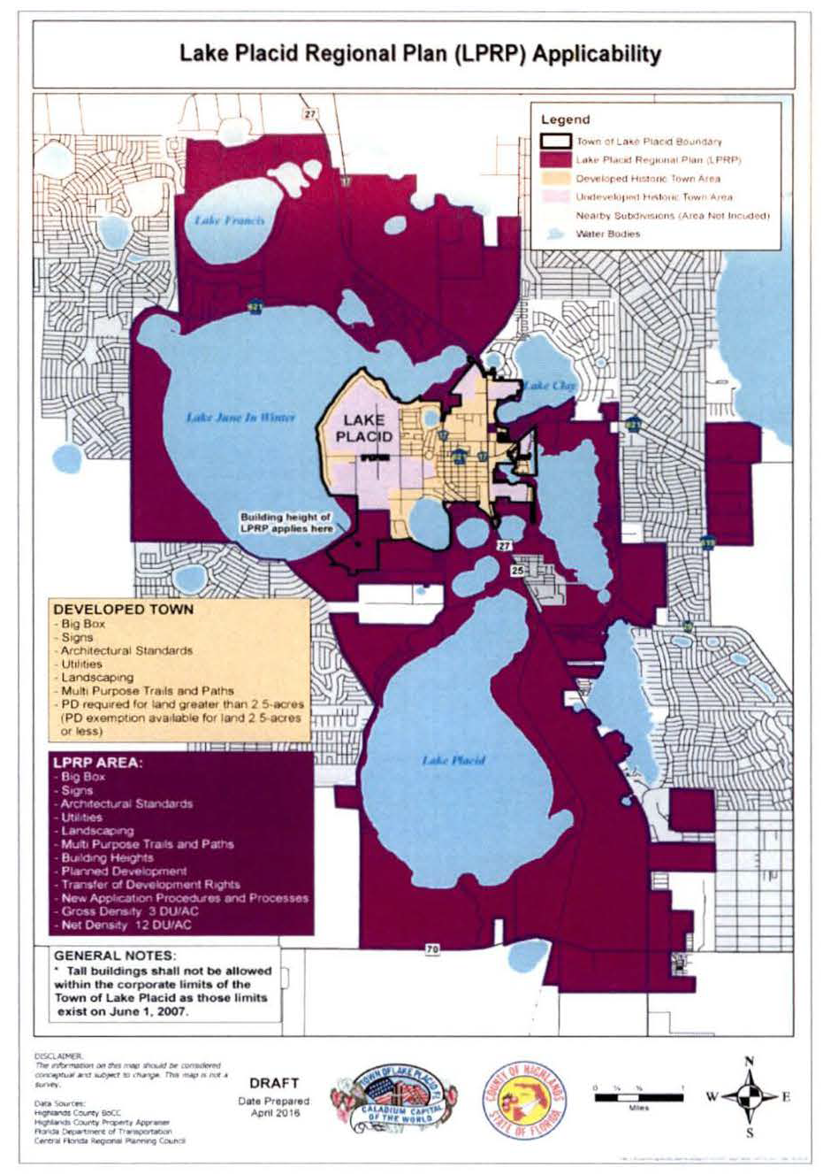
C.
Development principles of the Lake Placid Regional Plan (LPRP) Overlay District. Upon implementation of a Lake Placid Regional Plan (LPRP) Overlay District, the following development principles shall be used as a guide to facilitate sustainable development:
1.
Planned development (PD) process required. All development within the Lake Placid Regional Plan Area shall be accomplished using a PD. There shall be no land use change, plat, rezone or subdivision without a PD (with the exception of existing agricultural uses, developed lands including existing single-family dwelling units, and existing platted lots of record intended for single-family use). The PD may be created at the same time or after land use change, provided, however that development may proceed using zoning or land use existing at the time of the adoption of this policy without a PD, at the landowner's option.
a.
Property rights. Property rights regarding density, and land use (including land use and zoning changes in process) or property rights vested before the adoption of the LPRP overlay district Land Development Regulations (LDRs) will continue to be vested or may select to utilize the standards created herein through the PD process. All other parts of the LPRP overlay district Land Development Regulations (LDRs) apply to all development. However, this vision and plan does not establish density in platted or developed lands. The effective date of the Lake Placid Regional Plan Area Overlay is January 18, 2022.
b.
Planning framework. The LPRP overlay district establishes the framework for development of the Lake Placid Area. In some cases, it establishes minimum criteria for development. However, the LPRP overlay district LDRs do not establish all development parameters needed for the Lake Placid Area. The PD process will apply reasonable development standards based upon the site and surrounding lands which may be set at a level beyond minimum standards within the LPRP overlay district LDRs.
2.
Density. The LPRP Overlay shall be guided by density policies allowing for a maximum of three dwelling units per gross area and 12 units per net acre which encourages clustering open space and pedestrian connectivity.
a.
Density. The residents of the Lake Placid area like the quality of life provided by its low to medium residential densities. New residents are attracted to the Lake Placid area for the same reason. New development (not developed lands) in the area shall have a gross density of up to three residential dwelling units per acre. Existing residential platted or otherwise developed lands may apply to redevelop said platted lands at the densities herein addressed.
b.
Clustering and transfer of density. In order to maximize open space and green areas including sustainable agriculture, development clustering and transfer of density within a specific area is permitted. To achieve these goals, the use of innovative development techniques, such as but not limited to, the following: Varying lot patterns and sizes, taller buildings with varied heights and roof lines, mixed uses, including residential above or as part of commercial, and office development. Maximum density per development parcel for residential land use shall be 12 units per net acre within the overall gross density cap of three units per acre for the area.
i.
Residential density may be transferred or clustered only through the PD process.
ii.
Density may only be transferred within each identified planning area and not to another planning area.
iii.
No residential area should be established in or be transferred from the Paul Business Campus to other lands. See Map 12.05.501.2.
iv.
The Highlands County LDRs section 12.13.300 shall apply to all transfer of development rights applications.
v.
Residential density may be transferred or clustered only through the PD process to achieve the vision of the Lake Placid Area and upon the following general concepts:
(a)
Legislative approval. Transfer and clustering of density is not an automatic right. The PD process shall be used to assure that transfer and clustering of density remains reasonable and within the LPRP overlay district LDRs. For cluster and transfer of density purposes, density on a parcel of land is vested for the sending parcel when the owner joins this plan (once approved) by recorded document. Transfer of density is set forth in Section 12.13.300 of the Highlands County Land Development Regulations.
(b)
Land standards compatibility with surrounding development. Consideration shall be given to the surrounding uses when transferring or clustering density to an area. Appropriate safeguards shall be applied in the PD process to protect surrounding land uses.
(c)
Environmental lands. Transfer and clustering of density should be used to encourage the dedication to public use, ownership, and protection of environmentally significant lands.
(d)
Net density. Within the three-units per gross acre, individual parcels ranging in size may be developed at a residential density of up to and including 12 units per net acre.
(e)
Density transfer. Subject to the provisions of this section, density may be transferred only within an area identified within this LPRP overlay district. For example, density may be transferred within the South Area, but not from the South Area to any other property or area (i.e. North Area). Density may be transferred from the SR 8 Sub-Area to the balance of the South Area. Density may not be clustered to or transferred to the SR 8 Sub-Area. Map 12.05.501.1 identifies the planning areas referenced above.
(f)
Protection of clustered and transferred density. When density is transferred or clustered, the land relieved of density shall be encumbered by a recorded easement or conservation easement, and PD prohibiting the re-imposition of density forever. Such instruments may prohibit any development of the restricted area or reduce density of a defined area.
(g)
Lakes. When considering the transfer and clustering of density to lake areas, additional safeguards for the lake and existing riparian owners, such as preservation of shoreline, height restriction, open space, setbacks, and lake size shall be required in the PD.
(h)
Developed or platted lands. Density may not be clustered or transferred to or from developed or platted lands.
Map 12.05.501.2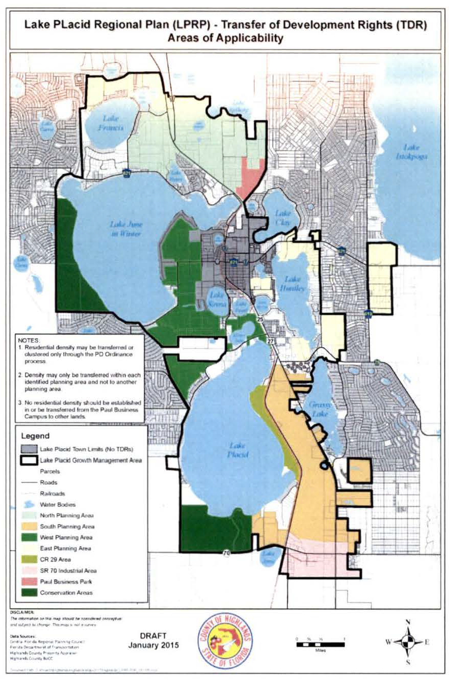
D.
Annexation.
1.
Municipal services. Highlands County should encourage the provision of municipal services by the Lake Placid Regional Utility, subject to the annexation standards set out below.
2.
Annexation of lands developed for urban use. All lands being developed for urban residential, non-residential including commercial, office, industrial, and mixed uses within the Lake Placid Regional Plan Overlay District shall be required to consent to annex into the Town of Lake Placid. This does not include agricultural land uses until such time that conversion to urban uses are proposed. Areas within the LPRP are provided in section 12.05.501.B.
3.
Infrastructure. Off-site infrastructure serving private development within the Lake Placid Regional Plan Overlay District including roads, water, sanitary sewer, and other public facilities, shall be funded privately by developers according to law. On-site infrastructure shall be provided by the developer or landowner.
4.
Development approval process/annexation. Within the Lake Placid Regional Plan Overlay District, undeveloped land being developed for urban use shall ultimately be annexed into the Town of Lake Placid. The intent of this policy is to facilitate such annexation.
a.
Development approval process. The following process shall be utilized for comprehensive plan amendments, rezoning and development orders for all undeveloped land being requested for conversion into urban and/or commercial uses within the Lake Placid Regional Plan Overlay District.
b.
Comprehensive plan amendments and rezoning applications. Areas contiguous to Lake Placid — Undeveloped land contiguous to the Town of Lake Placid may either submit applications for rezoning and/or comprehensive plan amendments to Highlands County for review and approval or may submit an annexation and comprehensive plan amendment/rezoning application to the Town of Lake Placid. The review process shall then proceed through the normal procedure of the governmental jurisdiction where the application has been filed.
c.
Comprehensive plan and/or rezoning applications. Non-contiguous land — Lands which are not contiguous with the town limits shall submit their petitions for comprehensive plan amendments and/or rezoning to Highlands County for processing through the standard county review process.
5.
Annexation consent required. When a petitioner seeks a comprehensive plan amendment, rezoning, PD rezoning, platting, zoning variance, special exception or any other development approval (hereinafter the "petition") through the county, an annexation consent (including all of the petitioner's contiguous property within the LPRP overlay district) shall be required as part of the petition process. The annexation consent shall be recorded in the county's public records upon the granting of the first of the foregoing petitions. The principles of this policy shall be inherent in each annexation consent recorded under this provision. The consent may be more restrictive, but not less (unless the less restrictive terms are specifically called out and approved by the county commission). The foregoing notwithstanding, a property owner may file an annexation consent at any time prior to filing a petition.
a.
Annexation before consent. Until a consent drafted according to this policy has been recorded, the town may annex according to law. Once an annexation proceeding is commenced by the town, the filing of an annexation consent by a property owner shall not provide annexation immunity (described below) to that proceeding.
b.
Time of annexation. The annexation consent shall provide for the annexation of the subject property when any one of the following has occurred:
i.
When a property owner voluntarily requests annexation prior to the events in [subsection] ii. or iii. below;
ii.
Upon the approval of a preliminary plat, that portion of the consent parcel subject to the preliminary plat shall be annexed; or
iii.
For unplatted properties, that portion of the consent area covered by the building permit application shall be annexed upon the issuance of a building permit.
6.
Life of county approvals. The annexation consent shall specifically provide that all county land use and zoning approvals shall be full force and effect until a future land use, rezoning, or subdivision of the property being annexed into the town unless the town and the property owner both consent to modifications thereto.
7.
Annexation phases. Annexation may occur in phases. The petitioner's entire contiguous property shall be included in the annexation consent but need not be rezoned nor annexed at one time. However, such phasing shall not create an unreasonable impediment to the annexation of other properties otherwise eligible for annexation. The creation of "spite strips" or other parcel configurations calculated to prevent legitimate annexations by the town are prohibited. The final phase under an annexation consent shall not be less than ten percent of the original annexation parcel, nor less than 20 acres (excluding parks and lands with environmental concerns, which shall be annexed sooner rather than later).
8.
Involuntary annexation. For parcels of land within the Lake Placid Regional Plan Area for which an annexation consent has been properly executed and recorded pursuant, no annexation shall occur prior to the time set forth in the recorded annexation consent. The foregoing notwithstanding, an parcel (or phase) constituting an enclave or otherwise preventing the legal voluntary annexation of other parcels eligible for annexation may be annexed pursuant to Florida law, but only to the minimum extent necessary to affect the legal voluntary annexation of said eligible parcels.
E.
Expedited application review and approval. The Town of Lake Placid (town) and Highlands County (county) shall implement expedited application review and approval where development applications that are consistent with the LPRP overlay district may be promptly and efficiently reviewed and approved. A checklist shall be developed consistent with the LPRP. Areas within the LPRP are provided in section 12.05.501.B.
1.
Components of expedited review include:
a.
Pre-application meeting. The governing jurisdiction (town/county) shall conduct a pre-application meeting with the applicant to provide and discuss the LPRP overlay district requirements.
b.
Application completeness review. Upon receipt of a submitted application for comprehensive plan amendment, rezoning or site plan, the governing jurisdiction (town/county) shall provide a sufficient and completeness review within ten business days of receipt. If the application is not sufficient and complete, the governing jurisdiction (town/county) staff shall contact the applicant.
c.
Development review. Upon receipt of a "sufficient and complete" application, the governing jurisdiction (town/county) staff shall provide development review comments (including planning, transportation, engineering, public safety) within 30 business days of receipt.
d.
Completed review. After completed review, the application for the comprehensive plan amendment/rezoning will be scheduled for public hearings. Site plans will be approved upon completion of all requirements consistent with the land development regulations.
2.
The governing jurisdiction (town/county) shall provide for the following as it implements expedited review:
a.
Pre-application review. The county shall provide for each pre-application project review to include all applicable departments, building an integrated, multi-departmental approach over time.
b.
Establish an ombudsman. The county shall provide one point of contact to guide customers throughout the entire approval process.
c.
Time is of the essence. The county shall minimize the steps for project approval depending on the scope of development request, including but not limited to PD, subdivision, and permitted conditional use.
d.
Minimize approval steps. The county shall commit to regular evaluations of the development review and permitting process to ensure an efficient and value-added process. The county shall implement processes and technology improvements as appropriate and feasible.
F.
Intergovernmental coordination for application review within unincorporated Highlands County and areas within the town within 300 feet of the county.
1.
Coordination. The town and county shall advise each other of future land use and zoning (and site plan) applications and proceedings within the LPRP overlay district. This includes applications within the town that are within 300 feet of unincorporated Highlands County. Review of such applications by the reviewing (rather than governing) jurisdiction shall be a courtesy review and no hearings shall be conducted by the review jurisdiction. To facilitate this, the following procedures shall be adhered to by both the town and the county.
2.
Upon receipt of application. Upon receipt of a future land use map amendment or rezoning application by the governing jurisdiction (town/county), an electronic copy of the application shall be provided to the reviewing jurisdiction (town/county) within three business days for comments.
3.
Review. The reviewing jurisdiction (town/county) staff and any members of the public shall provide the governing jurisdiction (town/county) with any review comments within eight business days of receipt of the application.
4.
Governing jurisdiction public hearings. The governing jurisdiction (town/county) shall provide no less than ten days' notice of any scheduled public hearings to the reviewing jurisdiction.
5.
Public hearing schedule. The reviewing jurisdiction (town/county) shall not delay the governing jurisdiction's (town/county) public hearing schedule for the future land use or rezoning application.
G.
Tall building height. The county shall manage building height to ensure the community's "neighborly small town" integrity is maintained, and many viewsheds are protected for present and future residents of the Greater Lake Placid Area.
1.
Tall buildings are not a right. The appropriateness of a tall building, including site, architecture, and height, shall be determined through the PD zoning process.
2.
Tall buildings are defined as follows: Tall buildings exceed the height allowed by existing zoning and may be as tall as, but not more than 108 feet tall for residential and commercial structures; or 128 feet tall, which would include two parking floors, excluding the architectural roof treatment complementing the building. There shall be no more than nine residential/commercial floors. Tall buildings shall have architectural features on the top. Roof treatments are required and therefore not included in the calculation of the building height. Mechanical features, such as cooling, heating, and elevators, shall not be open to exterior view. The height of the architectural treatments must be approved through the PD zoning process.
3.
Tall buildings may be allowed within areas specified as residential, commercial, and mixed use through the use of PD zoning, and upon the following:
a.
Impact. The actual height of individual buildings and the location of buildings over three stories will be determined at the time of PD zoning approval for the proposed development.
b.
Density. Tall buildings may not be used to increase gross density. However, density may be clustered in the area of tall buildings up to 12 dwelling units per net acre on the subject parcel.
c.
Added green space. The impact of tall buildings shall be offset by the addition of green space; not parking or water management facilities. The additional green space shall be in the vicinity of the tall building and shall increase proportionately with the mass of the building.
d.
Neighborhood opinion. Neighborhood opinion should be considered.
e.
Minimum land area. Tall buildings shall be on proportionately larger parcels of land, not counting natural water bodies.
f.
Commercial nodes. Tall buildings, especially mixed-use tall buildings, shall be encouraged in commercial nodes.
g.
Mitigation. Tall buildings shall be situated on the site in such a way as to minimize negative impacts on scenic vistas, which may include lake or significant natural landscape features. A variety of building heights in residential structures may be allowed in order to create a panorama and interest in the horizon.
h.
Enforcement. The final development shall be documented by a PD development order and a deed restriction, condominium covenant or easement.
i.
Architecture. Tall buildings shall have significant architectural features.
j.
Green space requirements. Green space requirements shall increase to at least 40 percent if residential and/or commercial development is proposed for four or more stories in height to encourage the use of structured parking and to mitigate building height. This additional green space shall be in the area of the taller building.
H.
Commercial architectural standards. All buildings within the agricultural future land use and zoning districts within the Lake Placid Regional Plan (LRPR) Overlay District are exempt from the regulations in section 12.05.501.B. The county may adopt a resolution containing graphics and images of desired architectural styles to serve as a guide for developers.
1.
Primary facades on commercial building. Primary facades on commercial buildings shall be constructed according to the following standards:
a.
Facade means the exterior face of the building.
b.
Primary facade means a facade that faces a public or private street, entry courtyard or right-of-way. A maximum of two facades will be considered primary facades, when more than two facades of a building have frontage on public streets.
2.
Color. An earth tone palette (browns and beiges) are encouraged to the maximum extent possible. The use of black, fluorescent, primary and secondary colors should be limited to no more than ten percent of the affected facade, or the roof area. Building trim and accent areas may feature any color.
3.
Exterior building materials.
a.
The following is a non-comprehensive list of preferred exterior building materials:
i.
Stucco;
ii.
Concrete;
iii.
Brick;
iv.
Wood;
v.
Stone veneer.
b.
The use of neon or neon-type tubing is not permitted to outline the exterior or the roof of a building.
c.
The following shall not be used as exterior finishes: Metal (except for the roof, mansard, soffit, fascia and ten percent exterior finish), struck concrete block, plywood, T-111 and similar products.
d.
Upon temporary approval by the county in an emergency, a mobile and/or modular unit shall be exempt from the exterior building material requirement. Mobile and modular units shall not be used as temporary or permanent commercial or industrial buildings, except as approved by the county in an emergency and for less than nine months or until not needed, whichever comes first.
4.
Primary facades.
a.
Buildings located along a public or private street or pedestrian right-of-way shall be designed with an entrance to the building or an entry courtyard facing or abutting the street or pedestrian right-of-way.
b.
Design features. The design of the primary facades shall include, at a minimum, two of the following design features:
i.
Glazing covering at a minimum 30 percent of the primary facade area, consisting of window and glazed door openings.
ii.
Projected, or recessed covered public entry providing a minimum horizontal dimension of eight feet, and a minimum area of 100 square feet.
iii.
Covered walkway, or arcade (excluding canvas type). The structure shall be permanent, and its design shall relate to the principal structure. The minimum width shall be eight feet, with a total length measuring 60 percent of the length of the associated facade.
5.
Out-parcels.
a.
Primary facades. All facades on an out-parcel building which face a street (public or private) are considered primary facades and shall be constructed as primary facades (provided however that one side of the building may be constructed without facade compliance). Out-parcels are not limited by subsection 12.05.501.H.1.b. to two facades.
b.
When the use of common wall, side-by-side development occurs, continuity of facades and consolidated parking for several businesses on one parking lot may be used.
c.
Out-parcel structures that are adjacent to each other must provide for vehicular connection between their respective parking lots and provide for connection of pedestrian walkways.
I.
Roof treatments. Roof treatments on commercial buildings shall be constructed to the following standards:
1.
Roof types and materials.
a.
The following roof types are permitted:
i.
Dome;
ii.
Gable;
iii.
Hip; or
iv.
Parapet.
b.
The following roof materials are permitted, exclusively:
i.
Tile;
ii.
Metal; or
iii.
Shingles, except that asphalt shingles are prohibited, unless such asphalt shingles are laminated, 320 pound, 30-year architectural grade asphalt shingles or better.
2.
Mansard roofs and canopies are prohibited, unless they meet the following standards including the Florida Building Code, whichever is more restrictive:
a.
Minimum height clearance of eight feet is required for buildings larger than 20,000 square feet;
b.
Minimum height clearance of seven feet is required for buildings of up to 20,000 square feet of gross floor area;
c.
The roof angle shall not be less than 25 degrees, and not greater than 70 degrees.
3.
Parapets.
a.
Capped parapets are required on all flat roofs.
b.
If a roof contains rooftop equipment, the parapet must be sufficient to conceal such rooftop equipment from ground-level public view.
Figure 12.05.501.1
Architectural Terms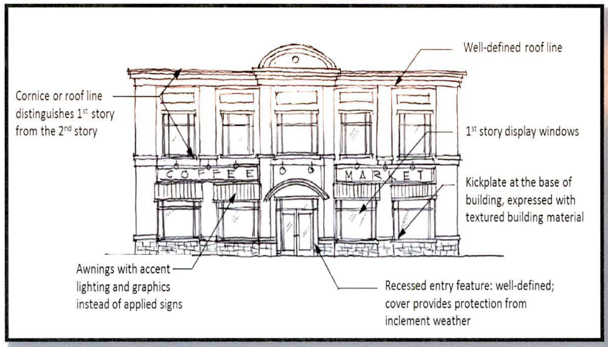
4.
Ceilings in commercial buildings.
a.
Interior ceilings in commercial buildings may be no less than ten feet above the floor height immediately below the ceiling section in question.
b.
Pre-existing, noncomplying buildings may apply for an exception to this requirement prior to redevelopment or a new use are exempt from this requirement.
J.
Big box store.
1.
Location. Big box stores shall be located in a PD zoning district with a commercial or mixed-use future land use designation.
2.
Big box store setbacks. At the minimum, all improvements shall be set back 200 feet from the front and side property lines, and 100 feet from the rear property lines. Provided however, that improvements shall be set back 300 feet from the property lines of all residentially zoned property. The setback space shall be densely landscaped, irrigated and maintained so that the view of all buildings and improvements are blocked from all public streets and private property. These setbacks are minimum requirements to assure protection of the surrounding property from visual and noise pollution created by the big box store and its suppliers and customers.
3.
Big box store buildings. Big box store buildings may cover no more than 20 percent of the big box store parcel. Each big box store shall reserve at least 30 percent of the big box store parcel as landscaped open space (such space shall not be used for buildings, parking, water management facilities or streets).
4.
Restrictions. These restrictions apply to all big box stores granted through a PD zoning district. The board of county commissioners may adjust these standards provided that substitute restrictions provide equivalent or better protection to the public and surrounding landowners.
5.
Definition. A big box store is any building designed for or devoted to retail use and which is in excess of 50,000 square feet measured from inside the exterior walls. In no event shall a big box store exceed 100,000 square feet, regardless of the lot size.
6.
Minimum parcel size. A big box store may be permitted by special exception on a parcel of land in excess of 20 contiguous acres.
7.
Building design standards for big box stores.
a.
Standards.
i.
Definitions.
(a)
A primary facade is one that is in the public view and faces or abuts a public or private street, entry court or right-of-way.
(b)
A maximum of two facades will be considered primary facades, when more than two facades of a building have frontage on public or private streets. The two exterior facades with the most right-of-way exposure will adhere, to the extent possible, to the requirements of this article with respect to architectural design treatments for primary facades. A deviation from the above requirement for such elements as location of service door, minimum window area, or covered walk requirements may be considered through the PD process.
ii.
Primary facade standards.
(a)
Building entrances. Buildings located along a public or private street or pedestrian right-of-way shall be designed with an entrance to the building or an entry courtyard facing or abutting the street or pedestrian right-of-way.
(b)
Design standards. The design of the primary facades shall include, at a minimum, two of the following design features:
1.
Glazing.
a.
Glazing covering at a minimum 30 percent of the primary facade area, consisting of window and glazed door openings.
b.
In the alternative, up to 30 percent of the required glazing area may be covered with a trellis in lieu of glazing.
2.
Projected, or recessed covered public entry providing a minimum horizontal dimension of eight feet, and a minimum area of 100 square feet.
3.
Covered walkway, or arcade (excluding canvas type). The structure shall be permanent, and its design shall relate to the principal structure. The minimum width shall be eight feet, with a total length measuring 60 percent of the length of the associated facade.
4.
Design features. Each primary facade of a building shall have at least six of the following building design treatments:
i.
Canopies, porticos, or porte-cocheres, integrated with the building's massing and style,
ii.
Overhangs, minimum of three feet,
iii.
Colonnades or arcades, a minimum of eight feet clear in width,
iv.
Sculptured artwork,
v.
Cornice minimum two feet high with 12-inch projection,
vi.
Peaked or curved roof forms,
vii.
Arches with a minimum 12-inch recess depth,
viii.
Display windows,
ix.
Ornamental or structural architectural details, other than cornices, which are integrated into the building structure and overall design,
x.
Clock or bell tower, or other such roof treatment (i.e. dormers, belvederes, and cupolas),
xi.
Emphasized building base, a minimum of three-feet high, with a minimum projection from the wall of two inches,
xii.
Additional roof articulation above the minimum standards,
xiii.
Curved walls,
xiv.
Columns,
xv.
Pilasters, or
xvi.
Metal or tile roof material.
b.
Facade/wall height transition.
i.
Purpose and intent. The intent of this section is to ensure that the proposed buildings relate in mass and scale to the immediate streetscape and the adjacent built environment.
ii.
Applicability. Buildings that are more than the height of any existing conforming land use (i.e. what is permitted under the current zoning, but not the existing structure) shall provide transitional massing elements to transition between the existing land uses of lower height, and the proposed development.
iii.
Transitional elements. No less than 60 percent of the length of the facade, which is in part or whole within the 150 feet of an existing building, shall incorporate any combination of the following transitional massing elements:
(a)
Wall plane changes.
(b)
Roofs.
(c)
Canopies.
(d)
Colonnades.
(e)
Balconies.
(f)
Other similar architectural features.
c.
Variation in massing. A single, large, dominant building mass shall be avoided. Changes in mass shall be related to entrances, the integral structure and the organization of interior spaces and activities, and not merely for cosmetic effect. False fronts or parapets create insubstantial appearance and are discouraged. All facades, excluding courtyard area, shall be designed to employ the following design treatments:
i.
Projections and recesses. A maximum length or uninterrupted curve of any facade, at any point, shall be 150 linear feet. Projections and recesses shall have a minimum depth of 12 feet.
ii.
Wall plane changes.
(a)
Any facade with horizontal length exceeding 50 linear feet shall incorporate wall plane projections or recesses having a depth of at least three feet, with a single wall plane limited to no more than 60 percent of each affected facade.
(b)
If a building has a projection or recess of 40 feet or more, each is considered a separate facade, and shall meet the requirements for wall plane changes.
d.
Site design elements. All projects shall have a minimum of two of the following:
i.
Decorative landscape planters or planting areas, a minimum of five feet wide, and areas for shaded seating consisting of a minimum of 100 square feet,
ii.
Integration of specialty pavers, or stamped concrete along the building perimeter walkway. Said treatment shall constitute a minimum of 60 percent of walkway area,
iii.
Water elements, a minimum of 100 square feet in area, or
iv.
Two accent or specimen trees, above the minimum landscape code requirements, along the primary facade(s) with a minimum height of 18 feet at planting.
e.
Windows and entrances.
i.
Windows shall not be false or applied. Spandrel panels in curtain wall assembly are allowed but may not be included in the maximum glazing required for primary facade.
ii.
The first floor of primary facades shall utilize transparent windows for no less than 30 percent of the horizontal length of the building facade. The bottoms of such windows shall be no more than three feet above the walkway grade and the tops of such windows shall not be less than eight feet above the walkway grade.
f.
Detail features.
i.
Design elements. The design elements in the following standard shall be an integral part of the building's design and shall be integrated into the overall architectural style. This element shall not consist solely of applied graphics or paint.
ii.
Blank wall areas. Blank, opaque wall areas shall not exceed 10 feet in vertical direction or 20 feet in the horizontal direction of any primary facade. For facades connected to a primary facade, this shall apply to a minimum of 33 percent of the attached facades measured from the connection point. Control and expansion joints within this area shall constitute blank wall area unless used as a decorative pattern and spaced at intervals of six feet or less. The depth of the relief and reveal work must be a minimum of two inches.
g.
Roof treatments.
i.
Roof edge and parapet treatment. Roofs, other than mansard roofs, with the slope ratio of 3:12 or higher, are exempt from the preceding requirements for vertical change for the facades, which are not longer than 199 feet. One roof edge, or parapet line change, shall be provided for every 200 linear feet of the facade length.
ii.
Design standards.
(a)
Parapets.
1.
When parapets are used to conceal rooftop equipment and flat roofs, the height of the parapet(s) shall be sufficient to conceal such roof equipment from the ground-level public view.
2.
The use of parapets cannot constitute a roof change for purposes of this section.
3.
No more than four vertical feet of parapet area may be used to calculate permissible sign area.
4.
Architectural detailing shall be present on parapets.
(b)
When a flat roof is screened with a parapet wall or mansard roof at any facade, the parapet or mansard roof treatment shall be extended along the remaining facades.
(c)
Prohibited roof types and materials. The following roof types and roof materials are prohibited.
1.
Asphalt shingles.
2.
Mansard roofs and canopies, unless they meet the following standards:
a.
Minimum vertical height clearance of eight feet.
b.
The roof angle shall not be less than 25 degrees, and not greater than 70 degrees.
3.
Awnings used as mansard or canopy roofs.
h.
Awning standards. These standards apply to awnings associated with and attached to the big box store structure.
i.
Mansard awnings, which are those awnings that span 90 percent or more of a facade length, and those which do not provide a connection between facades, shall adhere to all roof standards of section 12.05.501.1., roof treatments.
ii.
All other awnings, which are awnings that constitute less than 90 percent of a facade length, and those that do not provide a connection between facades, shall adhere to the following standards:
(a)
The location of awnings shall relate to the window and door openings.
(b)
Backlighting on awnings is prohibited.
i.
Overhead doors.
i.
Required screening. Overhead doors shall not be located on primary facades, unless sufficient screening is proposed. If an overhead door is required in a primary facade, a screening wall, with a minimum height of 90 percent of the overhead door height, or a landscape buffer achieving 75 percent opacity within one year, shall be provided. The placement and length of these screening devices shall block the view of the overhead doors from the street.
ii.
Doors facing one another. Overhead doors facing one another may be treated as interior space, provided that the buildings meet all other requirements of this section, and the distance between the doors facing one another is no more than 50 feet.
j.
Entryways/customer entrance treatments.
i.
Purpose and intent. Entryway design elements are intended to give protection from the sun and adverse weather conditions. These elements are to be integrated into a comprehensive design style for the project.
ii.
Big box store structure shall have clearly defined, highly visible, customer entrance(s). The customer entrance shall meet the following standards:
(a)
An outdoor patio area shall be provided adjacent to the customer entrance, with a minimum of 200 square feet in area. The patio area shall incorporate the following:
(1)
Benches or other seating components,
(2)
Decorative landscape planters or wing walls which incorporate landscaped areas, and
(3)
Structural or vegetative shading.
(b)
Front entry shall be set back from a driveway or parking area by a minimum distance of 15 feet.
k.
Materials and colors.
i.
Purpose and intent. Exterior building colors and materials contribute significantly to the visual impact of buildings on the community. The colors and materials shall be well designed and integrated into a comprehensive design style for the project.
ii.
Exterior building colors. Earth and/or pastel tones are encouraged to the maximum extent possible. The use of black, fluorescent, primary and secondary colors is limited to no more than 10 percent of the affected facade, or the roof area. Building trim and accent areas may feature any color.
iii.
Exterior building materials. The following building finish materials are limited to no more than 33 percent of the facade area:
(a)
Corrugated, or reflective metal panels,
(b)
Smooth concrete block.
iv.
Neon tubing. The use of neon or neon type tubing is not permitted to outline the exterior or the roof of a building.
l.
Additional requirements. In addition to the PD requirements herein set out, the board of county commissioners may apply such additional requirements as are reasonable to ensure that a big box store when in use, or if abandoned, shall be screened from public view and include all infrastructure reasonably required to support its maintenance and operation, including, without limitation, water supply, sewage disposal, irrigated and maintained green space.
K.
Electric utilities.
1.
Underground utility services. All utilities shall be underground in all new developments and redevelopments (individual residential lots, residential subdivisions, commercial development).
2.
Electric distribution service location. To avoid conflicting with right-of-way and landscaping, electric distribution and utilities shall be within established utility corridors or within utility easements adjacent to each road. All plats and PDs shall include utility easements for this purpose. Utility companies shall have the opportunity to review preliminary plats.
3.
Electric transmission. Utility service corridors around the populated areas should be established for electric transmission service lines and utilities. The use of road right-of-way for above ground electric transmission lines should not be permitted when a feasible alternative is available.
4.
Underground utility fund. The town and county should adopt the appropriate ordinance to add fees to each monthly electric bill to be used exclusively to pay the cost of undergrounding utilities in the Lake Placid Area. Priority shall be given to funding undergrounding projects with one or more features (the more features, the higher the priority):
a.
Significant matching funds.
b.
Lower cost per line mile (cost effective projects).
c.
Lines with higher public visibility.
d.
Lines being installed or reinstalled, provided the construction or reconstruction cost is applied to the undergrounding (after a hurricane would be a good time).
e.
Preservation of the most spectacular views.
L.
Multipurpose trails and paths. Collector roads shall include right-of-way of at least 15 feet for such paths. Developers shall either construct path segments adjacent to the proposed development or pay for the construction of similar improvements off-site related to the impacts of the development. The paths are part of a coordinated trail and multiuse path system that provides interconnectivity for the entire planning area. The system design will accommodate an eight- to ten-foot pathway, adequate landscaping area, and maintenance.
On existing roads in developed areas, trails should be added to the extent that right-of-way is available. If right-of-way is not available in developed areas, paved shoulders at least five feet wide may be substituted. Trails are not required (but are encouraged) within private gated communities, and along low traffic neighborhood roads.
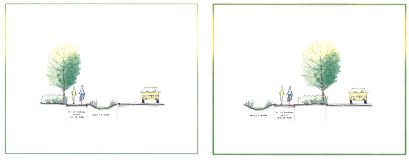
M.
Access management standards.
1.
Access to U.S. 27 and collector roads shall be managed through the use of, service roads (including frontage and backage roads) and access roads in a manner that protects the taxpayer's investment in the road system by reducing traffic impacts. Developers shall use to the greatest extent possible, shared drives, service roads, and linked parking lots. Division of property after July 1, 2006, shall not be used to create new parcels acquiring separate access rights to U.S. 27 or any other road (such newly created parcels shall have access only through the parent tract, unless reasonable benefit to the public is demonstrated by the applicant).
2.
Access to individual parcels or parcels as part of an overall project, either requested for approval at one time or over a cumulative basis, shall be by an internal road system, frontage roads, cross-access easements, shared ingress/egress access easements, or some combination of these, off of a main access to a collector or arterial road.
3.
Different uses shall incorporate shared ingress/egress facilities even if on the same parcel or multiple parcels.
N.
Driveways. Private driveways for new platted lots on an existing collector or arterial road and new collector and arterial roads shall be prohibited. Driveways in proposed developments will be serviced by internal (public or private) community roadways. All parking spaces shall be accessed by a driveway and shall not have direct access to collectors and arterial roads.
O.
Residential drives on major and minor collectors. Residential drives shall not be allowed on major or minor collectors; however, an exception may be made where this policy prevents the reasonable use of land. This exception should not be used to simply increase density. Parcels divided after the effective date of the LPRP overlay district may not rely upon this exemption to gain additional curb cuts or driveways. Where existing conditions require exception, individual drives shall be discouraged in favor of combined drives.
P.
Parking. Parking requirements for residential and nonresidential development may be decreased or increased through a waiver process if the developer presents a parking study demonstrating a reduced need based on the proposed use. The use of unpaved parking areas should be allowed, where appropriate, to increase green space and pervious area.
1.
Parking requirements may be increased if parking study shows that a specific use requires additional parking.
2.
Change in use should be allowed only if the owner provides parking for the new use.
3.
When constructed or expanded, adjacent parking lots shall be linked, unless good cause is shown that linking is not practicable.
Q.
Dumpsters.
1.
Every commercial, industrial, and multifamily development shall be required to provide a dumpster or appropriate trash receptacle on-site with adequate screening from public view. Such trash receptacles shall not interfere with the required parking.
2.
Dumpster Screening: Dumpsters shall be fully screened from view. A dumpster enclosure shall be constructed at a height of seven-feet using durable building materials and colors coordinated with the overall building design as illustrated in Figure 12.05.501.3.
Figure 12.05.501.3: Example of Dumpster Enclosure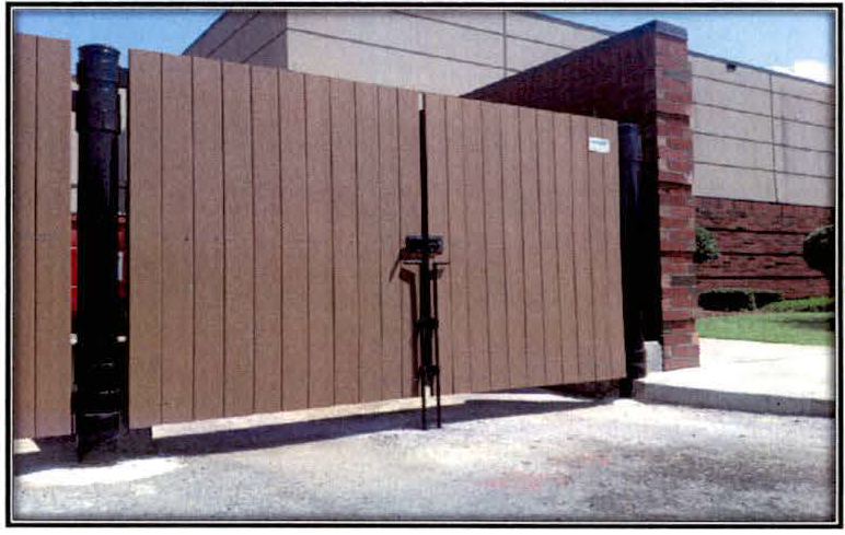
R.
Traffic circulation system (within developments). Traffic circulation system within developments shall be designed utilizing a network system that will be open to the public. However, the network may incorporate a grid system, a curvilinear design pattern and traffic circles where appropriate. The design of the circulation system shall encourage internal capture of road trips, thereby preserving capacity on the existing exterior arterials. Gated communities may be permitted. Ownership of the arterial, collector and local roadway system may be held by an appropriate governmental entity, community development district, master homeowner's association, or a combination thereof. The internal roadway system shall be a combination of a two-lane undivided and a two-lane divided system. Where appropriate, four lane-divided systems may also be utilized. The divided lane system will be landscaped to improve the traveling experience and to provide beautification to the development.
Figure 12.05.501.4: Example of 4-lane divided corridor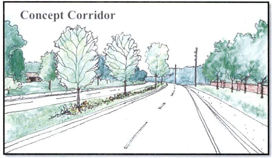
S.
Outdoor storage. To maintain the aesthetic character of the LPRP overlay district, proposed uses approved through PD process that have been approved for outdoor storage shall meet the following standards:
1.
Outdoor storage shall be allowed to the rear and sides of the lot.
2.
On corner lots, outdoor storage shall not extend toward the road frontage by more than one-half the length of the building structure in the rear yard or forward of the front building line in the side yard.
3.
Outdoor storage shall be prohibited on through-lots.
4.
Outdoor storage for multiple buildings shall only be permitted behind the front building line of the building that is farthest from any street.
5.
All outdoor storage shall be screened from off-site view.
T.
Compatibility, landscaping and buffering standards shall adhere to article 11, division 1 of this chapter.
U.
Signs.
1.
Definitions for signage in the LPRP. Definitions pertaining to signs in the LPRP are provided below:
Aggregate sign area: The total available sign area of all sides or portions of a sign.
Animated sign: Any sign using actual motion or the illusion of motion.
Awning: A roof-like cover made of cloth, canvas or other similar material that projects from the wall of a building for the purpose of shielding a doorway, walkway or window from the elements.
Awning sign: Any building sign attached to an awning.
Balloon display: Any air inflated object, which may be of various shapes, made of flexible fabric and restrained, attached, or anchored in place by a cord, rope, cable, or similar method.
Banner: Any strip of cloth, plastic or other flexible material on which a sign is printed, painted, or otherwise displayed that is intended to be hung or mounted to a structure by cord, rope, cable, or similar method. "Banner" does not include blade signs.

Example Banner
Bench sign: Any sign on a bench which displays advertising or which is intended for the display of advertising and when such benches are to be located on the public way or when such benches are to be located on private property, but the advertising is intended to be viewed from the public way.
Billboard: A permanently constructed sign structure composed of one or more large surfaces for permanent or changeable messages, supported by vertical posts and generally used off-premises.
Blade sign (aka feather sign, teardrop sign): A temporary sign that is constructed of cloth, canvas, plastic fabric or similar lightweight, non-rigid material and that is supported by a single vertical pole mounted into the ground or on a portable structure.
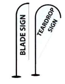
Example Blade Signs
Building sign: An on-premises sign displayed upon or attached to any part of the exterior of a building, including walls, windows, doors, canopies, awnings, marquees and roofs.
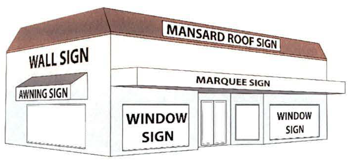
Examples of Building Signs
Canopy: A permanent roof-like shelter, open on at least three (3) sides, to protect an area from the elements, such as over gasoline pumps.
Canopy sign: Any building sign attached to a canopy.
Example Canopy Sign
Changeable copy sign (digital): A sign upon which copy is changed or changes automatically.
Changeable copy sign (manual): Any sign with copy that can be manually changed, rearranged, or altered without changing face of the sign.

Example Changeable Copy Sign (Manual)
Copy: The linguistic or graphic content of a sign.
Directional sign: Any permanent sign whose sole purpose is to provide direction to pedestrian and vehicular traffic.
Double-face sign: A sign with equal sized back-to-back parallel faces provided that the faces are joined on the same support and separated by not more than two (2) feet.
Eaves: The lowest horizontal line of a sloping roof or the plane of a flat roof.
Flag: A sign, usually square or rectangular shaped, made of plastic or fabric of any kind and intended to be hung from a flagpole by being tethered along one side.
Flagpole: A freestanding ground mounted structure, or a structure mounted to a building or wall and used for the sole purpose of displaying a flag.
Freestanding sign: A sign that is set firmly in or upon the ground surface and is not attached to any building or other structure. Freestanding signs include, but are not limited to, ground-mounted, monument, and pole signs.
Ground sign or ground-mounted sign: A permanent, freestanding sign that is supported by one (1) or more columns, upright poles, or braces extended from the ground or from an object on the ground, or that is erected on the ground, where no part of the sign is attached to any part of a building. Ground sign or ground-mounted sign does not include "pole sign."
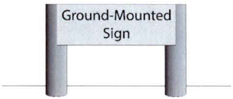
Example Ground-Mounted Sign
Hazardous sign: Any sign which constitutes a traffic hazard or a detriment to traffic safety by reason of its size, location, movement, contents, coloring, or methods of illumination, or which obstructs the visibility of any official traffic-control devise or which diverts or tends to divert the attention of drivers of moving vehicles form traffic movement on streets, roads, intersections, or access facilities.
Illuminated sign: A sign in which an artificial source of light is used in connection with the display of such sign.
Internal illumination: Illumination of a sign which is affected by an artificial source of light, which is contained within the sign itself.
Laser-Light Sign: A sign having a laser light source and/or emitting a laser light.
Mansard roof sign: A sign attached parallel to a mansard roof (a type of roof where all sides slope downwards to the walls, usually with a fairly gentle slope).
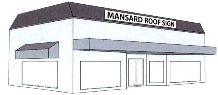
Example Mansard Roof Sign
Marquee: A structure projected from and supported by a building which extends beyond the building line and usually fully or partially covers a sidewalk, porch, public entrance or other pedestrian way.
Marquee sign: Any sign attached to a marquee.
Monument sign: A permanent, freestanding sign, with a solid base, designed with a continuous structural element of approximately the same dimension from the ground to the top of the sign.
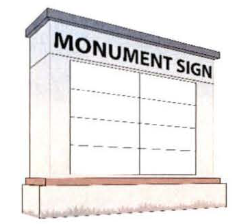
Example Monument Sign
Murals: Original, painted, art forms on walls or similar building areas.
Neon sign: Any sign which is formed by luminous or gaseous tubes in any configuration, and such tubes are visible.
Nonconforming sign: A sign lawfully existing at the date it was erected, but could not be erected under the terms of this chapter, or as it may be amended.
Off-premises sign: Any sign relating to an activity or place not on the premises on which the sign is located. A sign bearing a non-commercial message is deemed to be on-premises.
On-premises sign: Any sign relating to an activity or place on the same premises on which the sign is located.
Parasite sign: Any sign attached to another sign, for which no permit has been issued.
Pedestrian sign: A sign painted on or attached to the underside of a canopy, awning or marquee. Pedestrian signs shall have a minimum eight feet of clearance between the bottom of the sign and the sidewalk.
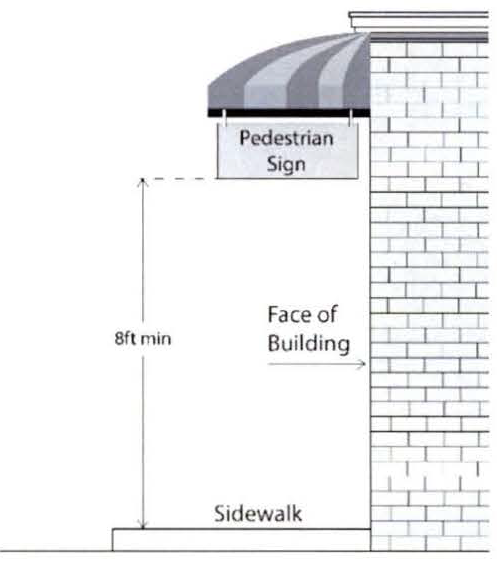
Example Pedestrian Sign
Permanent sign: A sign designed and constructed to be attached to a building or structure, or to the ground, in a manner that precludes ready removal or movement of the sign, and whose intended use appears to be indefinite.
Pole sign: A permanent, freestanding sign, other than a ground or monument sign, which is mounted on a freestanding pole or poles embedded in the ground.
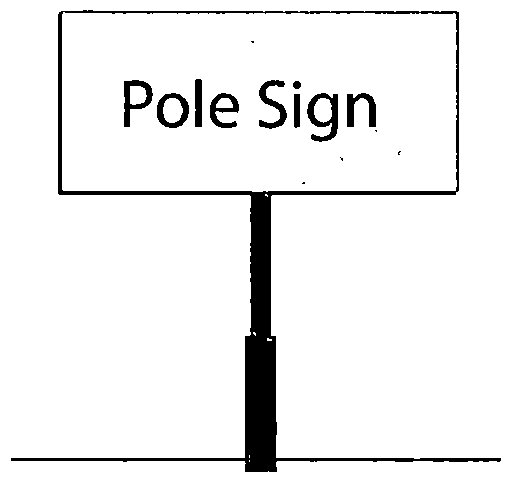
Example Freestanding Pole Sign
Portable sign: Any sign which is manifestly designed to be transported by trailer or on its own wheels, including any such sign even though the wheels may be removed and the remaining chassis or support structure converted to an A- or T-frame sign and attached temporarily or permanently to the ground. Any sign designed, used or intended for use on a bicycle or other human-powered vehicle while located upon a bicycle path.
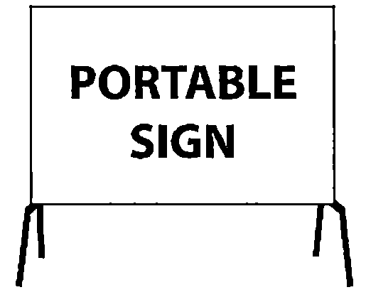
Example of Portable Sign
(may also be on wheels)
Projected sign: Any sign which is affixed to any building wall or structure and extends no more than 12 inches horizontally from the plane of the building wall.
Right angle sign: A sign which extends, at a 90-degree angle, no more than five feet from the building wall, or one-half the width of the sidewalk, whichever is less. Right angle signs shall have a minimum eight feet of clearance between the bottom of the sign and the sidewalk.
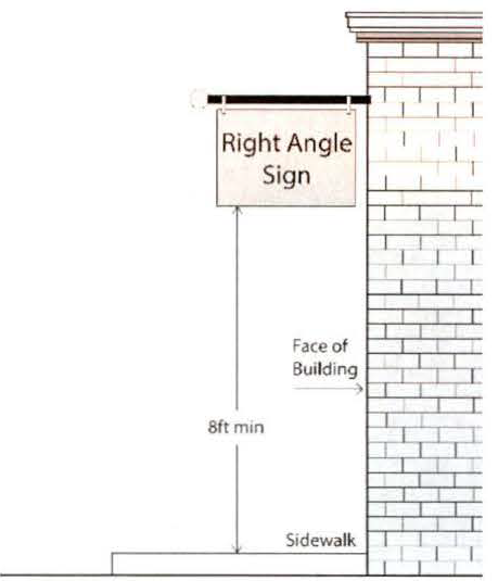
Example Right Angle Sign
Roof line: The horizontal line which is the highest part of a roof.
Roof sign: Any sign erected or constructed and maintained above the eaves and under the roof line of any building.
Sandwich Board sign: A freestanding, self-supporting, temporary sign joined at the top to form an inverted "V" with up to two sign faces with each sign face totaling not more than 12 square feet, and each sign face not more than 4 feet tall or 3 feet wide.

Example Sandwich Board Sign
Scroll: A mode of message transition on a changeable copy (automatic) sign where the message appears to move vertically or horizontally across the display surface.
Searchlight: Any apparatus designed to project a beam of light for the purpose of advertisement during hours of darkness.
Sign: Any writing, pictorial presentation, number, illustration, decoration, or other device including the sign's area, face, and structure, which is used to announce, direct attention to, identify, advertise or otherwise make anything known. The term "sign" shall not be deemed to include the terms "building", "landscaping", or any architectural embellishment of a building not intended to communicate information.
Sign face (sign plane): The part of a sign that is or may be used for copy.
Sign face area (sign plane area): The area of any regular geometric shape (square, rectangle, parallelogram, triangle, circle, or semicircle) which contains the entire surface area of a sign upon which copy may be placed.
Sign structure: Any construction used or designed to support a sign, including all supports, braces, guys and anchors, electrical parts, wires and lighting fixtures, and all painted and display areas attached to or placed around the sign structure.
Snipe sign: Any sign, made of any material, when such sign is tacked, nailed, posted, pasted, glued or otherwise attached to trees, or light, electric or telephone poles, fences, sticks or other objects.
Tablet sign: A sign located on the permanent part of a building which denotes nameplates, the name of the building, date of construction, historical significance, dedication or other information.
Temporary sign: Any sign designed, constructed, and intended to be used on a limited-term basis, and which is not permanently installed. A permanent sign with periodic changes to the message shall not be considered a temporary sign. This definition shall include, but is not limited to, such signs as banner signs, yard signs, and sandwich board signs.
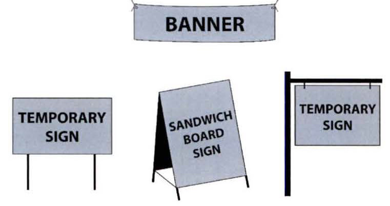
Examples of Temporary Signs
Trailer sign: Any sign mounted on a vehicle normally licensed by the state as a trailer and used for advertising or promotional purposes.
Travel: A mode of message transition on a changeable copy (automatic) sign where the message appears to move horizontally across the display surface.
Unsafe sign: Any sign that is not secure, in danger of falling or blown about, or otherwise unsafe in the opinion of the building official or town designee.
Vehicle sign: Any vehicle with commercial signage utilized in a fashion that simulates an actual freestanding sign, and not being used for transportation.
Wind Sign: Any sign or display including but not limited to balloons, inflatable devices, and rotating devices, fastened in such a manner to move upon being subjected to pressure by air, wind, or a breeze.
2.
Lake Placid Regional Plan sign districts (U.S. 27 and General). The Lake Placid Regional Plan (LPRP) sign district includes both the U.S. 27 district and the general district. This LPRP district shall consist of parcels outside of the town limits as of May 1, 2017, that are located within the LPRP. The U.S. 27 (LPRP) district regulations shall apply to non-residential parcels with frontage on U.S. 27. The General (LPRP) Sign District shall apply to all other areas in the LPRP annexed after May 1, 2017. Signs in place prior to May 1, 2017 are grandfathered to the extent of their current lease.
Map 12.05.501.3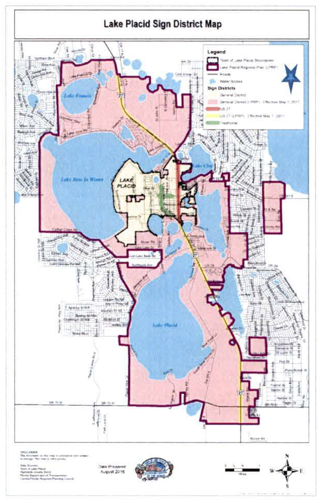
♦ The general district (yellow) and the traditional district are not applicable to the unincorporated area of Highlands County within the Lake Placid Regional Plan Overlay District.
3.
Lake Placid Regional Plan sign district (U.S. 27 and general). In addition to the regulations in the U.S. 27 District and the general district, the following regulations shall apply throughout the Lake Placid Regional Plan District. Where inconsistency exists between these sign regulations, the more restrictive requirement shall apply.
a.
Small directional off-premise signs. Small directional off-premise signs may be permitted.
i.
Such signs shall not exceed two square feet.
ii.
No more than two signs shall be permitted and shall be located within a one and one-half mile radius of the geographic center of the property referenced on said sign.
b.
Sign height. Sign height in the LPRP sign district shall not exceed eight feet.
i.
Sign face area. Sign face area in the LPRP sign district shall not exceed 64 square feet.
ii.
Community and public events. Banners and other attractors are prohibited within public right-of-way with the exception of those placed by local government to announce upcoming community and public events.
c.
One-time event signs. One-time display (event) signs. The owner of record of a non-residential use, as determined through a business tax receipt, may apply for a sign permit to display one-time display (event) signs once during the lifetime of their non-residential use, for a period of up to 30 consecutive calendar days. Signs may include banners and other allowable temporary signs, and the sign area of such signs shall not exceed the square footage requirements in Tables 14 and 15. A new application for a one-time display (event) sign shall be allowed on the same property if there is a change in use and/or ownership that requires a new or revised business tax receipt.
d.
Monument signs. Monument signs rather than pole signs and ground signs are permitted to create a pedestrian scale signage and to allow for uniform signage throughout this district. Pole signs are prohibited.
e.
Sign area and height calculations.
i.
Wall sign area computation. In computing sign area in square feet, standard mathematical forms for known common shapes will be used. Common shapes shall include squares, rectangles, cones, spheres, trapezoids, triangles, circles, ovals, cylinders and other simple forms for which surface area formulas are established. The area of a wall sign shall include the areas between all letters, logos and things within the signage so that all area within the perimeter of the sign shall be included. All words and components of a sign or related message shall be included as one sign.
ii.
Sign border calculation. When signs are enclosed in a border or highlighted by background graphics, the perimeter of such border or background will be used to compute area.
iii.
Deviations. The town planning and zoning official shall have the discretion to make minor adjustments and/or deviations from the principles stated herein in order to assure that the reasonable intent of this section is fulfilled, that equality is achieved in the computation, and that reasonable advertising exposure is allowed.
iv.
Double-face signs. All surfaces of a double-face sign shall be equally sized back-to-back parallel faces and contained within a common perimeter. Only one side of a double-face sign shall be considered in computing square footage requirements for area limitations.
v.
Measurement of sign height. The height of a sign shall be measured at the bottom from the finished grade of the parcel in the area of the sign (not from an artificially created mound) to the highest point of the sign.
vi.
Logos. Logos are to be counted as part of a permitted sign as to height and size.
f.
Location.
i.
Roof line. No sign attached to any building shall be located above the roof line of the portion of the building upon which it is situated.
ii.
Right-of-way. No sign, except those placed by an authorized governmental agency, shall be placed on the public right-of-way.
iii.
Traffic safety. No sign shall interfere with traffic or be confused with or obstruct the view or effectiveness of any official traffic sign, traffic signal, or traffic marking or obstruct the sight distance of motorists or pedestrians.
iv.
In right-of-way. Supports for signs or sign structures shall not be placed in or upon a public right-of-way or public easement, except those placed by an authorized governmental agency.
v.
Over right-of-way. No sign shall project over a public right-of-way, except those placed by an authorized governmental agency.
vi.
Blocking exits, fire escapes, etc. No sign or sign structure shall be erected that impedes use of any fire escape, emergency exit, or standpipe.
vii.
Sign separation. Ground and monument signs located along street frontages shall comply with all sign separation requirements.
viii.
No sign shall obstruct the sight distance triangle area as consistent with county requirements.
g.
Illumination standards.
i.
Sign lighting may not be designed or located to cause confusion with traffic lights.
ii.
Illumination by floodlights, spotlights, or unshielded bulbs is permissible so long as none of the light emitted shines directly onto an adjoining property or into the eyes of motorists or pedestrians using or entering public streets. This standard applies to sign illumination originating inside of business windows or sign illumination originating on signs which are outside.
iii.
Lights used for external sign illumination shall not have lighting mechanisms that project more than 18 inches perpendicularly from any surface of the sign or over public space.
iv.
Lights used for external sign illumination shall be so designed as to concentrate the illumination upon the sign, and such lights shall not glare upon the street or upon adjacent property.
v.
Unshielded lights used for external sign illumination that produce glare or are a hazard or a nuisance to motorists or occupants of adjacent properties are prohibited.
h.
Specific signs. The following provisions apply to the indicated type of sign:
i.
Changeable copy sign (digital). On-premise, freestanding, changeable copy signs (digital) shall only be allowed in the general district and the United States Highway 27 Sign Districts subject to compliance with all applicable requirements contained in this sign code and the following standards:
(a)
No more than one changeable copy sign (digital) shall be allowed per site.
(b)
No more than one-third of the sign area may be composed of changeable copy signage.
(c)
Changeable copy signs (digital) shall be allowed provided the copy is included within an allowed ground-mounted or monument sign, it does not constitute more than one-third of the allowed sign area of any one side of the sign, and is architecturally integrated into the sign.
(d)
Changeable copy signs (digital) shall display static images only and the copy may be changed or represented only once every 24 hours. The change of copy must be completed instantly. Other than change of copy, the changeable copy sign (digital) shall not flicker, vary in light intensity or color.
(e)
Continuous scrolling and/or traveling, flashing, spinning, rotating and similar moving effects are prohibited.
(f)
Changeable copy signs (digital) located on properties along state and county highways may be subject to state and county sign and permitting requirements.
(g)
All changeable copy signs (digital) shall come equipped with automatic shut-off technology so that the display will go dark during sign malfunction.
(h)
All changeable copy signs (digital) shall comply with the building and electrical codes.
(i)
Changeable copy signs (digital) shall not be placed or illuminated so as to obscure or interfere with traffic control devices.
(j)
All changeable copy signs (digital) shall come equipped with automatic dimming technology which automatically adjusts the sign's brightness based on ambient light conditions.
(k)
No changeable copy sign (digital) shall exceed a brightness level of 0.3 foot candles above ambient light, as measured perpendicular to the face of a sign using a foot candle (Lux) meter at a preset distance in relation to sign area as follows:
Table 12.05.501.1
Sign Area vs. Measurement Distance
For signs with an area in square feet other than those specifically listed in the table (e.g., 12 square feet, 200 square feet, etc.) the measurement distance may be calculated with the following formula: Measurement distance = √(area of sign square feet by 100. (Source: International Sign Association (ISA), Recommended Night-Time Brightness levels for electronic message centers (EMC's). A compilation summary with extracts from Industry Reports, April 2011.)
ii.
Changeable copy sign (manual). No more than one on-premise, freestanding, changeable copy sign (manual) shall be allowed per site and only within the General and United States Highway 27 Sign Districts. Such signs shall be allowed provided the copy is included within an allowed freestanding sign, it does not constitute more than one-third of the allowed sign area of any one side of the sign and is architecturally integrated into the sign.
iii.
Internal site signs. Permanent, freestanding, menu boards of no more than 36 square feet each shall be allowed for signage internal to the site including but not limited to drive-thru facilities. Such signs shall not exceed seven feet in height and shall be located adjacent to, or oriented toward, the drive-thru areas or other areas internal to the site. The square footage for menu boards shall not count towards or be included in sign area requirements. These signs are designed to be viewed on-site only.
iv.
Banners. Banners shall only be allowed consistent with community events and post disaster signage. A parcel may display banner signs with an aggregate sign area of up to 15 square feet in a residential zoning district and 48 square feet in a non-residential zoning district.
v.
Community event banner. A community event is one pertaining to recreational events, sporting events, events promoting a local industry (but not a particular business), concerts, noncommercial events and held primarily on public property and within the Greater Lake Placid area. Community events shall be open to the general public and may charge an admission fee. Banners for community events may be allowed by permit issued by the county for the day(s) of the community event, and up to 21 days leading up to the community event. Conditions of the permit shall include: At least $1,000,000.00 of public liability insurance coverage related to the banner; indemnification by the event sponsor (including at least one live person) for claims related to the banner; up to 28 days of display; a rendering to scale of the banner contents; description of the banner's proposed dimension and materials; and the specific location of the banner. Banner locations shall be approved by resolution of the county, and if across a county road, shall be approved by the county engineer. Additional requirements may be included in the permit or by county resolution.
vi.
Sandwich board signs. Entities owning or leasing a parcel of land in the county (in any sign district) with a business situated thereon may place a single sandwich board sign on the property owned or leased by the said entity. Sandwich board signs may only be displayed outside of the business when the business is open; shall be secured inside of the business at all other times; and shall not contain flags, lights, banners, or sound. There may be only one sandwich board sign per business.
A sandwich board sign shall not be placed on public property (including without limitation, streets, alleyways, parking and sidewalks). Sandwich board signs shall be well maintained and shall consist of good quality materials that are safe and have no protruding or sharp edges that are a danger to the public.
vii.
Temporary freestanding signs. A temporary freestanding sign may be allowed in all sign districts and shall comply with the following requirements:
(a)
Temporary signs shall not be allowed as permanent signage and may not be illuminated.
(b)
One additional temporary sign, not to exceed the square footage requirements provided in subsection (c), dimensional requirements, below, is allowed for a parcel that has no permanent sign, provided that such sign is not displayed for a period of more than 60 days or until installation of the permanent sign, whichever occurs first.
(c)
Dimensional requirements.
1.
The square footage of a temporary sign shall not be included in the calculation of the total sign area allowance for a parcel.
2.
A parcel may display temporary signs with an aggregate sign area of up to 12 square feet.
3.
Parcels of two or more acres and multiple tenants (e.g., strip shopping centers or strip malls) shall be permitted temporary signs not to exceed 16 square feet of aggregate sign area for the parcel. The owner of the strip shopping center or mall shall be responsible for any penalties accrued for non-compliance by the tenants.
4.
Temporary signs shall not exceed six feet in height in the U.S. Highway 27 Sign District.
5.
Temporary signs shall not exceed four feet in height in all other sign districts.
6.
Temporary signs shall have a minimum five-foot setback from the property line.
(d)
Duration. Temporary signs shall be removed within five calendar days after the end of the scheduled occurrence or purpose to which it relates.
viii.
Prohibited signs and violations. The following signs are prohibited, constitute a violation of this Code, and shall not be permitted, erected or allowed:
(a)
Any sign not specifically permitted by these sign regulations is prohibited.
(b)
Abandoned signs. Abandoned signs shall be removed by the property owner. In determining whether a sign is abandoned, the following factors, among other factors shall be considered, to wit: The existence of a current occupational license; utilities service deposit at that location; use of the premises and relocation of a business. Signage shall be presumed (a rebuttable presumption) abandoned if the business advertised is closed for 60 consecutive days.
(c)
Signs on public right-of-way, unless otherwise expressly permitted by this Code.
(d)
Billboards. Billboards, whether off-premises or on-premises.
(e)
Bench signs.
(f)
Signs with moving lights. Signs with lights or illuminations that flash, move, rotate, scintillate, blink, flicker, or vary in intensity or color, running, visible moving, revolving, or rotating parts or visible mechanical movement of any description or other apparent visible movement achieved by electrical, electronic, or mechanical means, except as otherwise expressly permitted by this Code for public service signs. This includes signs with the optical illusion of movement by means of a design that presents a pattern capable of giving the illusion of motion or changing of copy.
(g)
Hazardous signs. No sign shall be erected in such a manner as to obstruct the vision of pedestrians or drivers. Any sign, which by glare, or methods of illumination or intensity, constitutes a hazard to traffic, is prohibited. No sign may use the words, phrases, symbols, or characters in such a manner as to interfere with traffic, mislead or confuse drivers or pedestrians. Signs may not create a visual impairment for motorists.
(h)
Parasite signs.
(i)
Laser-lights.
(j)
Off-premises signs.
(k)
Portable signs.
(l)
Searchlights.
(m)
Trailer signs.
(n)
Wind signs.
(o)
Banners. Banners are prohibited, except as otherwise expressly permitted by this Code. To the extent not otherwise permitted, banners shall not exceed 15 square feet in residential zoning districts and 48 square feet in non-residential zoning districts.
(p)
Animated signs, except as otherwise expressly permitted by this Code.
(q)
Flying things. Signs containing flying paraphernalia.
(r)
Noise signs. Signs which produce noise or sound capable of being heard even though the sounds produced are not understandable sounds.
(s)
Emissions. Signs which emit visible smoke, vapor, particles, or odor.
(t)
Communication interference signs. Signs with any lighting or control mechanism which causes radio or television or other communication interference.
(u)
Motion pictures. Motion picture mechanism in conjunction with any outdoor advertising structure, accessory sign, or advertising statuary used in such a manner as to permit or allow the images to be visible from any public street or sidewalk.
(v)
Snipe signs.
(w)
Vehicle signs. Signs attached to or painted onto a vehicle parked on a public thoroughfare for the sole purpose of advertising.
(x)
Obscenity. This sign ordinance does not regulate the content of the message of the sign. However, signs containing any statement, word, character or illustration of an obscene, indecent or immoral nature that are not protected by the First Amendment of the United States and Article I, § 4 of the Constitution of the State of Florida are prohibited.
(y)
Signs that are painted, pasted, or printed on any curbstone, flagstone, pavement, sidewalk or street, except house numbers and traffic control signs.
(z)
Blade signs.
4.
Tables of sign development requirements by sign district.
a.
Table of sign development requirements for the Lake Placid Regional Plan Sign District.
Table 12.05.501.2: U.S. 27 Sign District (Lake Placid Regional Plan)
Note: Maximum total building signage. The total signage allowed on one building (wall, roof and additional building signage) shall not exceed one square foot of signage for each linear foot of street frontage, for each street frontage (up to three street frontages). The square foot signage shall be restricted to the street the signage fronts. Signs fronting two streets shall count in both.
1 No part of any permanent freestanding sign shall extend beyond any right-of-way line or building setback.
2 Awnings are allowed and shall count in allowable signage for the building.
3 Mansard roof sign and sign structures shall not extend above the roof line.
4 Except where the locations of existing ground or pole signs on adjacent lots would make this requirement impossible to meet.
5 Signage is allowed on the front wall of the building.
6 Signage and graphics may not extend beyond the wall surface (top or sides).
Table 12.05.501.3: General Sign District (Lake Placid Regional Plan)
Note: Additional building signage (three signs up to ten square feet each) may be used on awnings, doors, canopies, marquees and windows.
7 Mansard roof sign and sign structures shall not extend above the roof line.
8 Either one (1) on building or one (1) on roof. Cannot be sloped roof.
9 Either one (1) on roof or one (1) on building. Cannot be sloped roof.
5.
United States Highway 27 Sign District. The United States Highway 27 Sign District consists of every non-residential parcel with any frontage on United States Highway 27. The following signage is permitted in this district and the following sign development standards are also provided in Tables 15 and 16. Unless otherwise expressly permitted by this sign code, all other signage is prohibited in this district:
a.
Maximum total building signage. The total signage allowed on one building (wall, roof and additional building signage) shall not exceed one square foot of signage for each linear foot of street frontage, for each street frontage (up to three street frontages). The square foot signage shall be restricted to the street the signage fronts. Signs fronting two streets shall count in both.
b.
Awning sign. Awning signs as herein defined are permitted in this district. An awning sign built in accordance with the Standard Building Code and so as not to interfere with safe vehicle traffic flow shall be permitted and shall count in allowable signage for the building.
c.
Mansard roof signs. Mansard roof signs as herein defined are permitted in this district. Mansard roof signs and sign structures shall not extend beyond the roof. Mansard roof signs shall extend no more than 24 feet above ground and shall be no more than 30 percent of the road front roof face upon which it is situated.
d.
Wall sign. Each business is entitled to signage on any wall of its building with street frontage (a maximum of three streets). The sign may occupy up to 30 percent of the respective wall. Signage and graphics may not extend beyond the wall surface (top or sides). No wall sign or supporting structure shall project more than 12 inches horizontally from the wall of the building. Where an exterior parapet wall projects above the roof line, such signs may extend to the top of such wall. However, no wall sign shall extend more than 24 feet above ground level to the top of the sign, nor above the roof line.
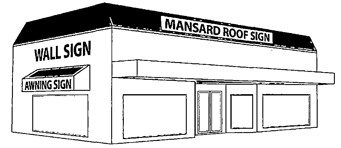
Example Building Signage
e.
Ground-mounted or monument signs. Ground-mounted or monument signs as herein defined are permitted in this district. A ground-mounted or monument sign shall only be permitted when the lot upon which it is to be placed has a minimum of 60 linear feet of road frontage. No ground-mounted, or monument sign shall be erected closer than 40 feet to any other ground-mounted or monument sign, except where the locations of existing ground-mounted or monument signs on adjacent lots would make this requirement impossible to meet. No part of any sign shall extend beyond any right-of-way line. Any such ground-mounted, monument, or pole sign may have two faces, each up to 64 square feet. The maximum height of ground-mounted and monument signs in this district shall not exceed eight feet, except as provided in paragraph g below.
f.
One changeable copy sign may be allowed per site providing the copy is included within a permitted monument sign, it does not constitute more than one-third of the sign area of any one side of the sign, and it is architecturally integrated into the sign.
g.
Shopping center ground-mounted and monument signs. Ground-mounted and monument signs for shopping centers must be approved by the local planning agency. Each shopping center or strip mall is allowed one sign for each road frontage contiguous to the shopping center parcel. Each sign should be no more than 24 feet tall with a sign face of up to 125 square feet. A solid support structure (not mere poles) devoid of signage and lighting may not be counted as sign face.
h.
Multiple advertisers. Shopping centers with more than five separate stores may petition the local planning agency for up 200 square feet of sign face on each sign side. A maximum of one changeable copy sign (manual or digital) may be permitted per site. No more than one-third of the sign area may be composed of changeable copy.
6.
General sign district. The general sign district consists of every parcel within the Town of Lake Placid that is not contained in another sign district. The following signage is permitted in this district, and the following sign development standards are also provided in Table 12.05.501.3. Unless otherwise expressly permitted by this sign code, all other signage is prohibited in this district.
a.
Ground-mounted and monument signs. Ground-mounted and monument signs are permitted in the district. Illumination (if provided) shall be light fixtures mounted on the subject sign or indirectly from lights mounted near the sign. The maximum height of ground-mounted and monument signs in this district shall not exceed six feet. Said ground-mounted signs may have two sign faces, each up to 60 square feet.
b.
Building signs. Signs on buildings are permitted within this district. Each parcel may have signs on the building wall or mansard roof (but not sloped roof) containing up to but not more than 30 percent of the respective wall or 30 percent of the face of the respective roof, but not both.
c.
Additional signage. Additional building signage (three signs up to 10 square feet each) may be used on awnings, doors, canopies, marquees and windows.
d.
One changeable copy sign is allowed per business. Changeable copy shall not make up great than one-third of the total sign area.
V.
Planned development.
1.
General requirements. The following requirements apply to all planned developments (PDs). Requirements of section 12.05.290 also apply.
a.
Permitted uses. Any use permitted in the underlying zoning district may be permitted. The county may delete specific uses permitted in the underlying district. Any use not expressly permitted in the underlying district may be permitted with the approval of the board of county commissioners (BOCC). A new PD zoning district with no underlying zoning shall include proposed permitted uses (subject to BOCC approval).
b.
Development standards. PD applications may propose development standards based on underlying zoning district or the PD Zoning District but are subject to approval by the BOCC. All other development standards will be established by the underlying district. However, the BOCC may permit modification of any specific requirement of the underlying district.
c.
Phasing. When provisions for phasing are included in the development plan, each phase of the development must be so planned and so related to previous development, surrounding properties, and the available public facilities and services that a failure to proceed with subsequent phases of development will have no adverse impact on the completed phase(s) or surrounding properties.
d.
Compliance with comprehensive plan required. A PD must be consistent with the county's comprehensive plan. However, the BOCC may increase those standards, as appropriate to meet the impacts of the PD.
e.
Other conditions may be imposed by the BOCC. The BOCC may establish, in addition to concurrency requirements and the time limits set by relevant development orders cited in the land development regulations, reasonable conditions, including periods of time for completing the project or phases thereof including any dedicated public facilities which are a part of the development or required by the development.
f.
Underground utilities. All utilities shall be installed underground (except electric transmission lines). Underground utilities better survive storms and are cost effective if installed as a development is being constructed.
g.
Access management standards. Access to U.S. 27 and collector roads shall be managed through the use of, service roads (including frontage and backage roads) and access roads in a manner that protects the taxpayer's investment in the road system by reducing traffic impacts. Developers shall use to the greatest extent possible, shared drives, service roads, and linked parking lots. Division of property after July 1, 2006, shall not be used to create new parcels acquiring separate access rights to U.S. 27 or any other road (such newly created parcels shall have access only through the parent tract, unless reasonable benefit to the public is demonstrated by the applicant).
Access to individual and/or uses as part of an overall project, either requested for approval at one time or over a cumulative basis, shall be by an internal road system, frontage roads, cross-access easements, shared ingress/egress access easements, or some combination of these, off of a main access to a collector or arterial road.
Different uses shall incorporate the use of shared ingress/egress facilities even if on the same parcel or multiple parcels.
h.
Multipurpose paths or trails. Collector roads shall include right-of-way of at least 15 feet for such paths. Developers shall either construct path segments adjacent to the proposed PD; or pay for the construction of similar improvements off-site related to the impacts of the PD. The paths are part of a coordinated trail and multi-use path system that provides interconnectivity for the entire planning area. The system design will accommodate an eight-foot pathway, adequate landscaping area, and maintenance.
On existing roads in developed areas, trails should be added to the extent that right-of-way is available. If right-of-way is not available in developed areas, paved shoulders at least five feet wide may be substituted. Trails are not required (but are encouraged) within private gated communities, and along low traffic neighborhood roads.
Figure 12.05.501.5
Multi-Use Trail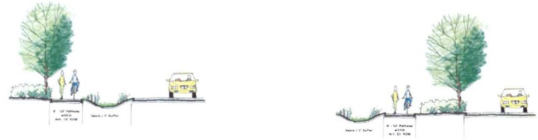
i.
Parks. Parks and recreation shall be provided (and maintained) to meet the following level of service for the Lake Placid area, based on state recommended standards and comparable cities for a total of ten acres per 1,000 people (parks classifications).
j.
Applicant to pay fair share. The applicant shall pay the fair share of the total traffic impacts caused by the PD. The calculation of traffic impacts shall recognize the existing and committed development (at build out) which impact the PD. Existing trip capacity in the road system (capacity existing on July 1, 2006) shall be equitably allocated to the landowners in the affected area based upon the area's total build-out and related concurrency requirements. Developers will be required to construct or otherwise provide traffic system improvements (based upon the impact of the PD) even though the impacts will not drop traffic below LOS C.
k.
Buffering. Provide maintenance, landscaping, landscaped berms, and irrigation to buffer roads, multipurpose paths, and nonresidential development.
l.
Infrastructure. Off-site infrastructure serving private development including roads, water, central wastewater, and other public facilities shall be funded privately by developers according to law. On-site infrastructure shall be provided by the developer or landowner. Infrastructure improvements shall be addressed through a binding infrastructure agreement.
m.
Payment in lieu of parks. Developers may contribute money equal to the value of the number of developed park acres required; or in the alternative, acquire and convey park acreage equal in value to the required developed park acreage in lieu of park acreage. The advanced approval of the payment in lieu of park land or the park acreage to be conveyed is required. The acres contributed or the payment in lieu shall both include the cost of improving the land to become functional parkland (land cost, clearing, engineering, construction and management fee, shall be included in the payment). Payment in lieu of parks shall only be done through the PD Ordinance process. Payments in lieu of parks in the LPRP shall be spent in the LPRP.
n.
Lake shore parks. Public parks and private parks along the shore of lakes should be allowed if contiguous to the land served, but only as herein regulated. Said parks may contain docks, picnic areas, marinas, restaurants, and boat ramps. However, the development and use of these parks shall be balanced with reasonable accommodations to protect the respective lakes and the affected riparian homeowners and neighbors. The following general standards apply:
i.
Lake shore parks should provide services (land areas and lake front) in proportion to their anticipated use. Lake shore parks with higher anticipated use should be proportionately sized and should provide adequate maintained landscape buffers from adjacent residential uses.
ii.
The park's level of service should be a minimum size for lake parks (ten acres per 1,000 persons). A long narrow parcel should not be used. The parcel shall have significant lake front relative to the lake park acreage. The actual design, setback, and buffer of every lake front park shall be included in and approved only through the PD Ordinance.
iii.
Lake shore parks should have no more than two boat slips and two personal watercraft slips per 100 feet of lake front. Only one dock shall be allowed per park. Parking and other facilities needed to accommodate the park and slips shall be required. This is not intended to allow on-water boat storage or the rental or sale of boat slips.
iv.
Boat ramps, docks, slips, and structures adjacent to vested residential development shall be significantly buffered from neighbors. The need for buffering decreases with the setback of the ramp and slips from vested residential neighborhoods.
v.
The amenities (docks, slips and ramps) and setbacks on smaller lakes should be smaller than those on the larger lakes.
vi.
Lake shore parks may be allowed with appropriate safeguards. A lot with less than 100 feet on the lake will not be adequate for a lake shore park with a dock. Maintenance and security shall be addressed in the PD Ordinance.
o.
Green space, open space and maximum lot coverage.
i.
Open space within the area should be at least 30 percent for new development (residential). Open space for redevelopment may be less and shall be determined by the government with jurisdiction at the time of PD.
ii.
Maximum lot coverage shall be 40 percent in the multi-family parcels (that percentage may increase/decrease with height of building—taller buildings should have more open space). Lot coverage includes the building footprint, impervious parking spaces, roads, and other impervious surfaces. Pools, tennis courts, and similar amenities are considered open space and not lot coverage.
iii.
Green space shall be at least ten percent of the open space.
iv.
Green space requirements should increase to 40 percent if residential development is proposed for four or more stories in height to encourage the use of structured parking, and to mitigate building height. This additional green space should be in the area of the taller building.
p.
Driveways. Private driveways for new platted lots on an existing collector or arterial road and new collector and arterial roads shall be prohibited. Driveways in proposed developments will be serviced by internal (public or private) community roadways. All parking spaces shall be accessed by a driveway and shall not have direct access to collectors and arterial roads.
q.
Residential drive on major and minor collectors. Residential drives shall not be allowed on major or minor collectors; however, an exception may be made where this policy prevents the reasonable use of land. This exception should not be used to simply increase density. Parcels divided after the effective date of the LPRP may not rely upon this exemption to gain additional curb cuts or driveways. Where existing conditions require exception, individual drives shall be discouraged in favor of combined drives.
r.
Parking. Parking requirements for residential and nonresidential development may be decreased or increased if the developer presents a parking study demonstrating a reduced need based on the proposed use. The use of unpaved parking areas may be allowed, where appropriate, to increase green space and pervious area. Parking requirements may be increased if parking study shows that a specific use requires additional parking.
s.
Traffic circulation systems (within developments). Traffic circulation system within developments shall be designed utilizing a network system that will be open to the public. However, the network may incorporate a grid system, a curvilinear design pattern and traffic circles where appropriate. The design of the circulation system shall encourage internal capture of road trips, thereby preserving capacity on the existing exterior arterials. Gated communities may be permitted. Ownership of the arterial, collector and local roadway system may be held by an appropriate governmental entity, community development district, master homeowner's association, or a combination thereof. The internal roadway system shall be a combination of a two-lane undivided and a two-lane divided system. Where appropriate, four lane-divided systems may also be utilized. The divided lane system will be landscaped to improve the traveling experience and to provide beautification to the development.
Figure 12.05.501.6: Example of 4-lane divided corridor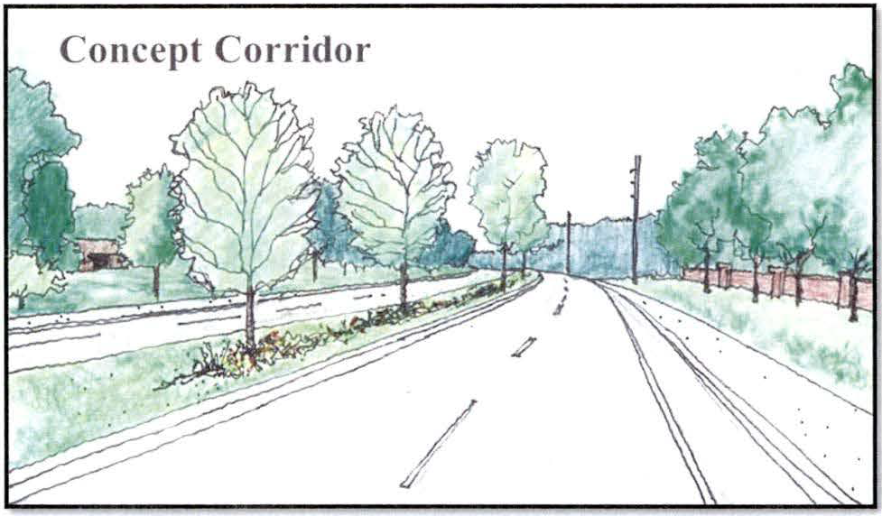
t.
Outdoor storage.
i.
To maintain the aesthetic character of the Lake Placid Regional Plan Overlay District, proposed uses approved through PD process that have been approved for outdoor storage shall meet the following standards.
ii.
Outdoor storage shall be allowed to the rear and sides of the lot.
iii.
On corner lots, outdoor storage shall not extend toward the road frontage by more than one-half the length of the building structure in the rear yard or forward of the front building line in the side yard.
iv.
Outdoor storage shall be prohibited on through-lots.
v.
Outdoor storage for multiple buildings shall only be permitted behind the front building line of the building that is farthest from any street.
vi.
All outdoor storage shall be screened from off-site view.
(Ord. No. 21-22-12, § 3)