
Huntersville City Zoning Code
ARTICLE 7
LANDSCAPING AND OPEN SPACE
Draft TA25-07 (Zoning)
Draft TA25-08 Part 1
TA25-04
TA22-17
TA23-03
Draft TA25-06 Buffer Yards
TA23-01
Numbering Section 7.7
7.0 Purpose And Intent
These regulations are established to protect and enhance the natural landscape of Huntersville and to ensure the appropriate use of plant material in new construction. It is the intent of these regulations to preserve natural tree cover and to include new tree planting with development in order to:
- reinforce community identity;
- reduce visual blight, noise, and glare;
- increase building and property values;
- prevent soil erosion;
- reduce storm water runoff;
- increase groundwater recharge; and
- create shade and reduce solar overheating.
7.1 Applicability
- This Article shall apply to any activity, which requires the issuance of a Land Disturbing permit, except as follows:
- This Article shall not apply to any portion of property included within the limits of a valid Land Disturbing Permit issued prior to February 17, 2003 (the effective date of this Part), provided that all time constraints relating to the permit issued shall be observed. In no event shall any vested project be extended for a greater time period than 24 months from the date of enactment of this ordinance.
- All plant and/or tree nurseries and botanical gardens shall be exempt from the terms and provisions of this ordinance in relation to those trees which are being grown for relocation and continued growth in the ordinary course of business or for some public purpose.
- Land clearing or clearing and grubbing activities for agricultural purposes shall be exempt from the provisions of this ordinance and requires a valid permit issued by Mecklenburg County.
- Timber harvesting (selective cutting or clear-cutting) for pulpwood or saw timber shall be exempt within all zoning districts and requires a bona-fide farm permit issued by Mecklenburg County or have a Forest Management Plan written by the NC Forest Service or Registered Forester.
- Subdivisions approved prior to February 17, 2003 which are vested under the provisions of section 2.2 of this ordinance are subject to the landscaping requirements in effect at the time of vesting.
7.2 General Regulations
- All trees and shrubs plantings required by this ordinance shall be selected from the approved Huntersville Tree and Shrub List. Other species and cultivars not on the list may be approved by the Planning Director on a case by case basis, but must be locally adapted to the area and meet the specifications for the measurement, quality, and installation of trees and shrubs in accordance with the American Standards for Nursery Stock, published by the American Horticulture Industry Association. Native species and related cultivars are encouraged.
- Installation of trees and shrubs shall comply with the Land Development Standards Manual.
- Landscaping, including berms where permitted, shall not obstruct the view of motorists using any street, private driveway, parking aisles or the approach to any street intersection so as to constitute a traffic hazard or a condition dangerous to the public safety upon any such street, driveway, parking aisle, or street intersection. Required NCDOT sight distance triangles and sight triangles in Section 8.9 shall apply to street trees. Any sight obstruction determined by the town shall be corrected immediately.
- Commercial parcels shall be landscaped while vacant to stabilize the site and maintain an attractive appearance. Landscaping shall consist of, at a minimum, turf grass or other vegetative ground cover to stabilize the soil. Shrubs, trees, or any other vegetative cover may be planted that will and create an attractive appearance.
- All required plantings shall be installed in a manner that ensures the availability of sufficient soil and water for healthy growth and that is not intrusive to aboveground and underground utilities.
- Small maturing trees are required to be substituted for large maturing trees whenever located within 25 feet of an overhead utility line.
- Monoculture and over planting shall be avoided except that a single species of tree may be planted in formal parks or in conjunction with a streetscape plan.
- The Zoning Administrator may approve revisions to a landscaping plan approved by the Town Board or Planning Board in order to accommodate seasonal planting problems or a lack of plant availability as long as:
- There is no reduction in the quantity of plant material.
- There is no significant change in the size or location of plant materials.
- The new plants are of the same general category and have the same general design characteristics as the materials being replaced.
- Existing trees and shrubs shall count towards meeting the buffer yard and screening requirements of sections 7.5 and 7.6 of this Article as long as such are: 1) free from disease or growth problems, 2) clearly shown on the site plan, 3) approved by the zoning administrator prior to development as meeting the intent of the landscaping requirements, 4) are not considered nuisance or noxious plants, and 5) are adequately protected during grading and development of the site.
- In addition to the Tree Save Area required in this Article, every reasonable effort shall be made to protect and retain existing trees and shrubs not actually lying in planned roadways, drainageways, building foundation sites and construction activity areas. Except when necessary to provide access to a site or to ensure the safety and security of people and property, any existing healthy trees that are eight inches or greater in caliper, located within a public right-of-way or undeveloped required yard shall be retained unless approved for removal by staff during site plan review.
- Berms are not permitted anywhere within the town’s jurisdiction except in conformity with this Article.
- All trees shall be a minimum of 2 inches in caliper and 8 feet in height at the time of planting, unless otherwise specified.
- All shrubs shall be a minimum of 3 feet in height at the time of planting with an expected minimum height of at least 6 feet at maturity, unless otherwise specified.
7.3 Maintenance Of Required Landscaping
- The owner, occupant, tenant, and respective agent of each, if any, shall be jointly and severally responsible for the perpetual maintenance and protection of buffer yards, trees, berms, and landscaping planting required by this ordinance.
- Staff is hereby authorized to order diseased, infested, dying, dead or damaged landscaping required herein to be replaced.
- Buffer yards that, over a period of time, lose their screening ability shall be replanted to meet the requirements of this ordinance.
- Replacement of trees and landscaping is permitted and shall be in accordance with the applicable provisions of this ordinance.
- Maintenance includes actions necessary to keep landscaping materials healthy, neat, and orderly in appearance and free of litter and debris. Mulch and ground cover shall be organic. Tire mulch and impervious materials shall not be used in landscape areas.
- Pruning of trees shall be done according to the National Arborists’ Association Standards in a manner that preserves the character of the tree. Pruning shall not occur in order to give visibility to a structure, use, or sign.
- Once streets have been accepted by the town or the state, street trees shall be maintained and cared for by the property owner adjacent to the tree except in subdivisions where the property owners’ association provides maintenance and care. Prior to street acceptance, the developer shall be responsible for ensuring maintenance and care. Maintenance shall include replacement and trimming as necessary. A maintenance responsibility statement shall be provided on the Final Plat and documented within the homeowners’ association articles of incorporation or the restrictive covenants/deed restrictions for the development.
- Whenever shrubs are required for screening and buffer yards, they shall be maintained such that they retain their foliage to within 6 inches of the ground on a year-round basis. Further, such shrubs shall not be pruned to be less than the required mature height.
7.4 Tree Preservation, Protection, And Removal
- Purpose. Wooded sites provide distinct aesthetic, economic, and environmental significance and value as a natural resource of the Town. Existing vegetation plays a critical role in maintaining aesthetics, water quality, minimizing erosion and downstream flooding, and increasing quality of life.
- Tree Preservation.
- Applicability. Significant forest stands, specimen trees, and heritage trees, as defined in this ordinance, shall be preserved. Forested areas and vegetated areas and areas whose physical site conditions render them unsuitable for development shall be set aside as conservation areas or as open space. Wooded sites shall be developed with careful consideration of the natural characteristics of the site. When portions of forested stands must be developed, careful consideration shall be given to preserving wooded perimeters or the most desirable natural features in order to retain the aesthetic or visual character of the site. Isolated pockets of existing trees, specimen trees and heritage trees shall be protected as a valuable asset of the property.
- Tree Preservation Plan. For the purposes of identification and preservation, a site analysis by a North Carolina Landscape Architect, Engineer, or other professional approved by staff is required for all development. The site analysis shall be submitted to planning staff prior to sketch plan review and prior to any clearing. The plan shall include the delineation and calculated area of the canopy of the site, and the diameter at breast height (DBH), location, and species of all trees 12 inches in DBH and above. The survey may include only 24 inches and above if the licensed professional certifies that no small maturing specimen trees under 24 inches exist on the stie. See Article 12.2.1 for the definition of a Specimen Tree. The developer and/or the design firm shall review plans with staff to determine the best areas for potential tree save. Refer to Section 6.0 of the Subdivision Ordinance for all site analysis requirements.
- Method for Calculating Existing Tree Save and Proposed Tree Save Areas. Existing tree save area shall be considered the area in which the drip line of the existing tree or trees is located on the property plus an additional 5 feet around the perimeter, prior to development. Proposed tree save area shall be considered the area in which the drip line of the remaining tree or trees is located on the property plus an additional 5 feet around the perimeter after development. If root disturbance or construction activities occur within the drip line of any trees designated as tree save, only the area actually being protected will be included in the proposed Tree Save Area. However, for lots two (2) acres in size or less, the dripline of the protected trees may be disturbed and still counted as tree save area, provided that:
- Tree Preservation Plan prepared and signed by a certified arborist is submitted,
and - The Tree Preservation Plan demonstrates that the proposed reduced dripline area is sufficient to maintain the long-term health and stability of the preserved tree(s) based on the following factors:
- Tree species, size, and condition;
- Soil conditions, proposed root damage, and drainage;
- Proximity to construction or grading activity; and
- tree protection measures proposed during and after construction.
- Tree Preservation Plan prepared and signed by a certified arborist is submitted,
- Tree Selection Criteria. The development manager, working with staff will determine the trees of greatest priority to designate as tree save areas. The following characteristics shall be considered when selecting trees to be protected and saved:
- Tree vigor. Healthy trees shall be preserved. A tree of low vigor is susceptible to damage by environmental changes that occur during site development. Healthy trees are less susceptible to insects and disease. Indications of poor vigor include dead tips of branches, small annual twig growth, stunted leaf size, sparse foliage, and pale foliage color. Hollow or rotten trees; cracked, split, or leaning trees; or trees with broken tips also have less chance of survival.
- Tree age. Old, picturesque trees may be more aesthetically valuable than smaller, younger trees, but they may require more extensive protection.
- Tree species. Preserve those species that are most suitable for site conditions and landscape design. Tree species that are short lived or brittle or are susceptible to attack by insects and disease are poor choices for preservation.
- Tree aesthetics. Choose trees that are aesthetically pleasing, shapely, large, or colorful. Avoid trees that are leaning or in danger of falling. Occasionally, an odd shaped tree or one of unusual form may add interest to the landscape if strategically located; however, be certain that the tree is healthy.
- Wildlife benefits. Choose trees that are preferred by wildlife for food, cover, or nesting. A mixture of evergreens and hardwoods may be beneficial. Evergreen trees are important for cover during the winter months, whereas hardwoods are more valuable for food.
- Environmental benefits. Choose trees that help to reduce runoff and erosion, disconnect impervious areas, serve as stormwater filters, and/or buffer onsite perennial streams.
- Tree Save Delineation. All trees save areas must be specified on the recorded plat, individual recorded deeds, and all property association documents for land held in common.
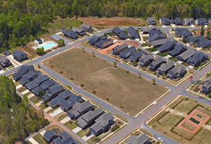
- Tree Preservation Requirements. Tree preservation areas (tree save) shall be determined once a site analysis plan has been completed demonstrating the amount of existing tree canopy on a site and identifying specific locations of all heritage and specimen trees. The percentages listed below are based on existing trees as established above under Method for Calculating Existing and Proposed Tree Save Area (7.4.2 C). The following is the minimum tree preservation required per district: 1 If the tree save requirement does not meet 10% of the total site area, then additional trees must be planted. Each large maturing tree planted shall be given a canopy equivalent of 2,000 sq. ft. and each small maturing tree planted a canopy equivalent of 500 sq. ft. to reach the total of 10% of the total site area. Trees planted in buffer yards shall count towards meeting the required planting rate. However, street trees and newly planted residential lot trees shall not. Trees planted shall be a minimum of 2 inches in caliper and shall be 75% large maturing and 25% evergreen.
Zoning District Minimum Tree Preservation Required Existing canopy ³10% of total site area Existing canopy < 10% of total site area Heritage Trees Specimen Trees R 50% of existing trees 2, 3, 4 10% of total site area (existing and planted) 1, 2, 3, 4 100%2 50%2,4 TR 35% of existing trees 2, 3 10% of total site area (existing and planted) 1, 2, 3 100%2 35%2 GR and NR Districts 10% of total site area (existing and planted) 2, 3 10% of total site area (existing and planted) 1, 2, 3 100%2 10%2 TC, CI, TND, NC, TOD, HC, SP, CB, VS Districts 0% 0% 100%2 30%2
2 Where circumstances prevent locating the required tree plantings or preservation standards on site, the developer may mitigate protected tree canopy removal by planting new trees on the site whose canopy equals that of the canopy to be removed (new tree canopy credits are described above). If site conditions are not conducive for healthy tree replacement planting on site, the developer may contribute to a Tree Fund/Bank set up by the town for the planting and maintenance of such trees elsewhere in the community. A combination of planting and contribution in lieu of planting is acceptable. The amount of contribution is based on the total cost of the required mitigation trees plus that of their installation. Planning staff will be responsible for reviewing and approving all tree mitigation plans consistent with the mitigation standards of this section, but only up to 30% of the minimum preservation area may be mitigated as described above.
For Specimen Tree Mitigation, the developer may mitigate the removal of specimen trees by planting new trees on the site whose total caliper (DBH) equals 100% of the total caliper of trees (DBH) to be removed above the ordinance requirement. Heritage Tree Mitigation shall be calculated at 200% of the total caliper (DBH) of trees to be removed above the ordinance requirement. If site conditions are not conducive for healthy tree planting on site, the developer may contribute to a Tree Fund/Bank as described above. Newly planted street trees, parking lot trees, and buffer trees do not count toward the mitigation calculation. Mixed use zoning districts and non-residential uses may mitigate up to 50% of the specimen and heritage trees required to remain. Residentail zoning districts may mitigate up to 30%.
3 When calculating the tree save area, 150% of the canopy area of each specimen tree and 200% of the canopy area of each heritage tree shall count towards the required tree save area. For example:4 In the Rural district (R) minimum tree save required for non-residential uses are reduced to require preservation of >30% of existing canopy and specimen trees.Saved Number of Trees Canopy Area of Saved Trees Calculated Tree Save Area 4 Specimen trees 3900 sq. ft. 5850 sq. ft. 2 Heritage trees 2000 sq. ft. 4000 sq. ft. - Residential Development along Thoroughfares. All residential development fronting a major or minor thoroughfare shall provide a 20-foot landscape easement located within common area between the future right-of-way and any proposed lots or public streets. The easement shall be placed on a map of record and a note on the record plat shall state
“The homeowners association shall be responsible for the continued preservation and maintenance of this area.”
All existing vegetation shall remain unless the Zoning Administrator determines the existing vegetation does not meet or exceed the opaque screening standards of this Article..
Along thoroughfares, berms may be installed in a landscape easement adjacent to residential development only in areas devoid of existing vegetation. Installation of berms shall not exempt development from the opaque planting requirement as listed above. If included in the landscape design, berms shall:- Have a minimum height of 2 feet, a minimum crown width of 8 feet, and a side slope with a width to height ratio of no greater than 3 to 1 (3:1) if 4 feet or less in height. Berms shall not exceed 6 feet in height and, if greater than 4 feet in height, shall have a minimum crown width of 8 feet, and a side slope with a width to height ratio of no greater than 4 to 1 (4:1). Exceptions may be made to the maximum or minimum height of berms by the zoning administrator where, in his opinion, topographical changes dictate such exception.
- Be designed and constructed with an undulating appearance which mimics as much as is practicable a natural topographical feature of the site.
- Be substantially planted and covered with live vegetation. No berm shall consist entirely of turf grass, ground cover, mulch, or similar material. If a berm is greater than 2 feet in height all trees shall be arranged so that they are planted within 2 vertical feet of the natural grade, unless irrigation is provided.
- Be fully installed, planted and stabilized prior to certification of zoning compliance.
- Be designed to prevent standing water or to impede the flow of stormwater from adjacent properties.
- Free of structures, including fences, unless approved by the Town as part of the landscaping requirements for a development site.
- Not be used as part of any outdoor living space by adjacent property owners within the development.
- Tree Protection.
- Applicability. A Tree and Root Preservation Plan delineating areas of tree save shall be incorporated as part of the Landscaping, Grading, and Erosion Control Plans. The following measures shall be followed to protect existing trees on a developing site.
- Prior to demolition, clearing, construction, grading, and installation of erosion control measures, tree protective barriers must be installed around all tree save areas by the developer and approved by the Town.
- The tree protection barrier shall be located along the perimeter of the tree save area (drip line plus 5 feet). Tree protection barrier for a forest canopy stand area is to be located along the perimeter of the tree save area around the forest edge. Tree protection barriers shall consist of orange safety fencing or a combination of orange safety fencing with silt fencing at a minimum of 4 feet in height on metal or wood posts.
- All tree protection areas must be designated as such with prominent "tree save area signs” posted in addition to the required protective fencing. Signs requesting subcontractor cooperation and compliance with tree protection standards are recommended for site entrances.
- No soil disturbance or compaction, stock piling of soil or other construction material, vehicular traffic, or storage of equipment and materials are allowed within the tree save area.
- No ropes, signs, wires, unprotected electrical installation or other device or material shall be secured or fastened around or through a tree or shrub in a tree save area.
- All appropriate protective measures shall be maintained throughout the land disturbing and construction process and shall not be removed until final landscaping is installed.
- Encroachment. If encroachment into a required Tree Save/Preservation Area occurs which causes irreparable damage to trees, the Tree Preservation and/or Replacement Plan shall be revised to compensate for the loss. Encroachments shall be subject to the penalties listed in Article 7.9. Encroachments, damage, and removal of vegetation in a tree save/preservation area shall result in replanting in accordance with Article 7.4.5.
- Applicability. A Tree and Root Preservation Plan delineating areas of tree save shall be incorporated as part of the Landscaping, Grading, and Erosion Control Plans. The following measures shall be followed to protect existing trees on a developing site.
- Tree Removal. A Land Disturbing Permit is required. Land disturbing activities shall not commence until such activities have been authorized by issuance of a valid Land Disturbing Permit as specified under the provisions of the Land Development Standards Manual and Erosion and Sedimentation Control Manual.
- Post Site Plan Approval Disturbance Mitigation. If a required tree save/preservation area or required undisturbed buffer yard is disturbed for any reason, after tree preservation plan approval by staff, it shall be restored at a rate of 5 trees per 1,000 square feet. Trees to be planted shall have a minimum caliper of 2 inches, shall be 8-10 feet in height at installation, and shall be at least 75% large maturing hardwood varieties. Where a disturbed area also functioned to buffer adjacent properties or public street(s), at least 50% of the trees shall be evergreen varieties. Trees shall be distributed throughout the disturbed area in such a way as to effectively replace the vegetation disturbed. Where under story vegetation is removed or disturbed it shall be replaced at a rate of 20 shrubs per 1,000 square feet. Shrubs shall be evergreen and 3 feet in height when installed and are expected to reach a minimum height of 6 feet at maturity. When a tree is destroyed due to an act of God, it shall be replaced with the same species or comparable species, 2 inch in caliper in size. A planting plan is required for staff review and approval prior to planting.
7.5 Buffer Yards
.1 Purpose. The general purpose of buffer yards is to establish regulations protecting and preserving the appearance, character, and value of property within the town. The objectives are to exclude visual contact, create spatial separation and to minimize any adverse impacts on adjacent properties. Where topographical changes, the size and shape of existing lots of record, or other spatial conditions exist which would make adherence to the basic requirement either impossible or ineffective in meeting the purpose of the buffer yard, alternate buffer yard plans will be considered or may be required.
.2 Applicability. All applicable development plans shall comply with the provisions of this section. A change of use, expansion of existing heated square footage of a building, or and expansion of parking and loading areas will require compliance with these provisions as prescribed per Article 11.5.6, Non-conforming landscaping and screening. When multiple buffer categories apply to a development, the most restrictive standard shall be enforced. These provisions shall not apply to developments in the Town Center (TC) except edge conditions, Transit-Oriented Development (TOD-R), and Transit-Oriented Development-Employment (TOD-E) zoning districts.
.3 Function. A buffer yard shall function as an opaque or semi-opaque barrier between the viewer and the use or structure to be buffered at maturity. Therefore, the exact location and arrangement of materials in the buffer yard will be determined based upon an analysis of site topography and sight lines from public spaces or private properties, which are to be protected. The density of the buffer yard is determined by the intensity of the use and the zoning district.
- An opaque buffer is intended to exclude all visual contact between the buffere structure or use. Performance of the buffer shall meet or exceed the following standards:
- To produce an opaque buffer, intermittent planting of deciduous and evergreen trees shall obtain a height at maturity of no less than 35 feet and have no unobstructed opening between tree canopies upon maturity.
- At installation, shrub plantings shall have a minimum height of 3 feet with expected height at maturity of least 12 feet, and no unobstructed openings wider than four feet.
- At least 75 percent of the required trees and 100 percent of the required shrubs shall be evergreen species
A semi-opaque buffer is intended to obscure visual contact with the buffered structure or use. It can be used as a device to reduce the perceived scale and massing of a structure and to enhance its compatibility with the existing built and natural environment. Performance of the buffer shall meet or exceed the following standards: - To produce a semi-opaque buffer, intermittent planting of deciduous and evergreen trees shall obtain a height at maturity of no less than 35 feet and have no unobstructed openings wider than 10 feet between tree canopies upon maturity.
- At installation, shrub plantings shall have a minimum height of 3 feet, expected height of at least 6 feet at maturity, and no unobstructed openings wider than four feet.
- 100 percent of the required shrubs shall be evergreen species.
Buffer yard plantings shall meet or exceed the following standards:
| Description | Condition where Buffer required | Width | Trees1 | Shrubs1 |
| Opaque I-77 Buffer | Any property abutting I-77 right-of-way | 50 feet, greater if required by the district | 5 trees per 1000 sq/ft of buffer area; 75% large maturing evergreen; 25% small maturing | 8 shrubs per 1000 sq/ft 100% evergreen |
| Opaque CI, CB,SP, R, and TR Buffer | Any property zoned CI, CB, or SP2 Major Subdivisions along existing state-maintained roads and future thoroughfares | 80 feet abutting street right-of-way and property lines2 | 5 trees per 1000 sq/ft of buffer area; 75% large maturing evergreen; 25maturing25% small maturing | 8 shrubs per 1000 sq/ft 100% evergreen |
| Opaque Buffer for Non-residential uses not otherwise listed | Any developing non-residential use abutting a lesser intense use and/or district when not internal to a planned development3, 5 | 30 feet6 | 5 trees per 1000 sq/ft of buffer area; 75% large maturing evergreen; 25% small maturing | 8 shrubs per 1000 sq/ft 100% evergreen |
| Civic Uses • schools • religious institutions • government buildings • libraries | Any civic use abutting a property zoned residential or current use is residential 3, 5 | 30 feet6 | 4 trees per 1000 sq/ft of buffer area; 50% large maturing evergreen; 25% small maturing | 7 shrubs per 1000 sq/ft 100% evergreen |
| Semi-Opaque Major Subdivision Buffer | Any major subdivision abutting a property zoned residential or developed residential, not internal to a planned community4 | 30 feet minimum when density is two times greater than the existing development except in Town Center zone when adjoining the Town Center zone. In all other cases 20 feet minimum is required. | 4 trees per 1000 sq/ft of buffer area; 50% large maturing evergreen; 25% small maturing | 7 shrubs per 1000 sq/ft 100% evergreen |
| R, TR | Any minor residential subdivision | 10 feet | Preserve any existing trees located within the required buffer | Preserve any existing shrubs located within the required buffer |
| Semi-Opaque Apartment Buffer | Apartment building type, one building on one lot Multi-building site development with apartment buildings | 30 feet | 4 trees per 1000 sq/ft of buffer area; 75% large maturing evergreen; 25% small maturing | 7 shrubs per 1000 sq/ft 100% evergreen |
| Opaque Buffer for Town Center Edge Conditions | Any apartment, mixed-use, or non-residential development on the perimeter of the Town Center district | 20 feet4 | 5 trees per 1000 sq/ft of buffer area; 75% large maturing; 25% small maturing | 8 shrubs per 1000 sq/ft 100% evergreen |
1Minimum tree size is 2” caliper, with minimum height 8’ to 10’ at time of planting. Shrubs planted shall have a minimum height of 3’ at installation, expected height of 6’ at maturity.
2The CB, CI, and SP buffer is not required if the subject property is abutting a property zoned CB, CI, or SP. Further, a full eighty (80) foot buffer may be removed along street frontages where the building proposed addresses the public street with architecture and design consistent with the building type requirements of Article 4. The 80 foot buffer may be reduced to the width below along street frontages when the following conditions are met:
- 40 foot buffer
- Along any thoroughfare where only passenger vehicle parking is located between the building and the street, and/or the architecture of the building does not meet the building type requirements of Article 4.
- Along interior streets of existing or proposed business parks where loading, storage, truck dock, or utility areas are located between the building and the street.
- 20 foot buffer
- Along interior streets of established or proposed business parks where only passenger vehicle parking is located in between the building and street, and/or the architecture of the building does not meet the building type requirements of Article 4.
- Any building that meets the architectural standards of Article 4 but whose building is moved further from the street than the required build to line.
- Reduced street buffer widths may be disturbed and replanted so long as a complete visual opaque buffer is established at planting maturity between the building and street.
3Where non-residential uses are a part of a mixed-use development, buffer yards are not required between lesser intense uses.
4Except where non-residential uses in the HC and VS district abut residential uses, buffer yard width may be reduced to 10’ if evergreen shrubs are used that will reach a minimum height of 8’ at maturity. Shrubs shall be planted to create a complete visual buffer.
5The hierarchy of uses from lower intensity to higher intensity for purposes of determining buffer yards shall be as follows: Residential; Civic; Commercial/Office; Industrial.
.4 Additional Buffer Yard Standards.
- Buffers are not required for internal property boundaries of a planned community with mixed uses, but will be required to be placed at the perimeter of the project.
- Perimeter parking lot landscaping shall count towards the buffer requirements.
- Berms shall be permitted as part of a successful buffer program providing that they:
- Are not permitted along public streets as a means of meeting the buffering requirement of this section.
- Have a minimum height of 2 feet, a minimum crown width of 8 feet, and a side slope with a width to height ratio of no greater than 3 to 1 (3:1) if 4 feet or less in height. Berms shall not exceed 6 feet in height and, if greater than 4 feet in height, shall have a minimum crown width of 8 feet, and a side slope with a width to height ratio of no greater than 4 to 1 (4:1). Exceptions may be made to the maximum or minimum height of berms by the zoning administrator where, in his opinion, topographical changes dictate such exception.
- Are designed and constructed with an undulating appearance which mimics as much as is practicable a natural topographical feature of the site.
- Are substantially planted and covered with live vegetation. No berm shall consist entirely of turf grass, ground cover, mulch or similar material. If a berm is greater than 2 feet in height all trees shall be arranged so that they are planted within 2 vertical feet of the natural grade, unless irrigation is provided.
- Are fully installed, planted, and stabilized prior to certification of zoning compliance.
- Are designed to prevent standing water or to impede the flow of stormwater from adjacent properties.
- Are free of structures, including fences, unless approved by the town as part of the landscaping requirements for a development site.
- Are held and maintained by a legally constituted homeowners association if located in a residential development and shall not be used as part of any outdoor living space by adjacent property owners within the development.
- Are not used for the display of vehicles or other merchandise, except that, when approved by the town, the berm and any other required landscaping area may be used as a display site for landscaping materials and plants for sale by an adjacent use.
- Berms are not permitted where installation will destroy or damage required tree save areas.
.5 Spacing of plantings. Clustering and/or random spacing of plants and trees is encouraged to produce a natural appearance in the landscape to the extent that the plantings meet the screening intent of this section.
.6 Grading and Development within the Buffer Yard Area. No grading, clearing, or land disturbing activities shall occur within the required buffer yard area. Areas completely devoid of existing trees may be graded with slopes no greater than 3:1 as long as the future grades do not change the functionality of the required buffer yard (example: grading of a buffer yard to where the planted vegetation is below the property to be buffered). No fill or grading shall occur in any tree save area. Grading shall not create a new drainage pattern that is harmful to existing vegetation.
.7 Alternate Buffer Yard Plan. In the event of unusual topography or elevation of a development site, soil or other sub-surface condition on the site, or the presence of existing vegetation, the Zoning Administrator may alter the buffer yard requirements as long as the existing features of the development site comply with the spirit and intent of this Article. Such an alteration may occur only at the request of the property owner, who shall submit a plan to the Plan Reviewer showing existing site features that would buffer the proposed use and any additional buffer yard materials the property owner will plant or construct to buffer the proposed use. The Plan Reviewer shall not alter the requirements of the buffer yard unless the developer demonstrates that existing features and any additional buffer yard materials will buffer the proposed use as effectively as the required buffer yard. In deciding whether to approve such a plan, the Plan Reviewer shall consult with the Zoning Inspector. Plans must be reviewed and approved prior to final plat.
.8 All buffer yards shall remain undisturbed except for the following:
Utility easements may cross a buffer yard, but may not be planted laterally in a buffer yard. To the extent possible, the path cleared shall be replaced with plant materials which are consistent with those that existed prior to the easement.
Driveways and street crossings may cross a buffer yard but may not be installed laterally in a buffer yard.
Sidewalks and other pedestrian or bicycle paths may cross a buffer yard or be placed within it if such avoid disturbing existing vegetation.
Landscaping installation, maintenance, and replacement shall be exempt.
.9 In situations where the required buffer yard width is partially or completely contained within an existing easement (e.g. power or natural gas transmission, etc.) the planting requirements of this Ordinance shall be met outside of the easement area. This area shall be identified as a buffer yard on all site, grading, erosion control, and landscape plans.
Amended by Ord. TA22-17 on 3/20/2023
Amended by Ord. TA23-03 on 7/17/2023
Amended by Ord. Draft TA25-06 Buffer Yards on 8/19/2025
Amended by Ord. Draft TA25-08 Part 1 on 8/19/2025
7.6 Screening
- Purpose. The purpose of a screen is to provide a visual barrier between an unsightly or out of scale development feature and the view from public streets and abutting properties. It is required as specified below:
- dumpster or trash handling areas: opaque screen
- mechanical and utility equipment at ground level or rooftop equipment: opaque screen or as otherwise provided in Article 4.
- service entrances or utility facilities for building operation: semi-opaque screen
- loading docks or spaces: semi-opaque screen
- above ground backflow preventer: semi-opaque
- all other uses for which screening is specifically required under these regulations (see Article 9, Conditions for Certain Uses).
- Opaque Screens.
- Intent. An opaque screen is intended to exclude all visual contact with the screened structure or use.
- Composition. An opaque screen may be composed of:
• a wall
• wood fence
• planted vegetation
• existing vegetation
• a combination of these elements which will meet the purpose of the requirement - Width. The width of the screen is that which is necessary to accommodate the screening materials.
- Location. To provide maximum sight line obstruction, a screen shall be placed immediately adjacent to the structure or use to be screened except as otherwise approved by staff.
- Performance. Performance of the screen shall meet or exceed the following standards:
- To produce an opaque screen, intermittent planting of deciduous and evergreen trees shall obtain a height at maturity of no less than 35 feet and have no unobstructed openings between tree canopies upon maturity.
- At installation, shrub plantings shall have a minimum height of 3 feet with an expected height at maturity at least 12 feet, and no unobstructed openings wider than four feet.
- At least 50 percent of the required trees and at least 75 percent of the required shrubs shall be evergreen species.
- A structural screening material such as a wall or wood fence must be augmented with vegetation. Exceptions may include the screening of dumpsters in rear yard parking lots. Man-made berms are not permitted along public streets as a means of meeting the screening requirement of this section. Natural changes in topography will, however, be taken into account when evaluating sight lines.
- Semi-Opaque Screens.
- Intent. A semi-opaque screen is intended to obscure visual contact with the screened structure or use. It can be used as a device to reduce the perceived scale and massing of a structure and to enhance its compatibility with the existing built and natural environment.
- Composition. An semi-opaque screen may be composed of:
• a wall
• wood fence
• planted vegetation
• existing vegetation
• a combination of these elements which will meet the purpose of the requirement - Width. The width of the screen is that which is necessary to accommodate the screening materials.
- Location. To provide maximum sight line obstruction, a screen shall be placed immediately adjacent to the structure or use to be screened except as otherwise approved by staff.
- Performance. Performance of the screen shall meet or exceed the following standards:
- To produce a semi-opaque screen, intermittent planting of deciduous and evergreen trees shall obtain a height at maturity of no less than 35 feet and have no unobstructed openings wider than 10 feet between tree canopies upon maturity.
- At installation, shrub plantings shall have a minimum height of 3 feet, expected height of at least 6 feet at maturity, and no unobstructed openings wider than four feet.
- At least 75 percent of the required shrubs shall be evergreen species.
- When the builder or developer chooses a structural screening material such as a wall or wood fence, it shall be augmented with shrubs planted 6 feet on center. Man-made berms are not permitted along public streets, as a means of meeting the screening requirements of this section. Natural changes in topography will, however, be taken into account when evaluating sight lines.
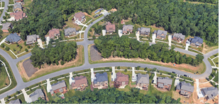
7.7 Street Trees And Internal Landscaping
- Purpose. The purpose of this section is to regulate the protection, installation, and long-term management of trees and shrubs within the Town. The regulation of street trees along public and private streets within the Town ensures a pedestrian friendly environment along with providing distinct aesthetic, economic and environmental significance, and value as a future natural resource to the Town.
- Spacing and Location of Street Trees. Small maturing street trees are required to be within a minimum 7 foot planting strip located between the existing street and proposed sidewalk and large-maturing street trees are required to be within a minimum 9-foot planting strip between the existing street and proposed sidewalk.1 Planting shall be provided as follows:
- Large maturing canopy trees shall be planted at a spacing not to exceed 40 feet on center except that spacing may be altered slightly to accommodate driveways.
- maturing “canopy –like” trees shall be planted 30 feet on center where existing overhead utility lines prohibit the use of large maturing canopy trees.
- property located on a major or minor thoroughfare, excluding the Town Center (TC) zoning district, an additional row of street trees are required to be located behind the proposed sidewalk in a 10-foot landscape easement to be recorded on a plat of record prior to issuance of a building permits. The interior row of trees shall be staggered from the trees provided within the right-of-way.
- All street trees must be listed as an approved street tree on The Town of Huntersville Tree and Shrub List.
1 For lots greater than 50 feet in width with a front build-to-area depth of greater than 40 feet, in lieu of providing a planting strip located between the existing street and proposed sidewalk, the development may provide a minimum 5-foot green zone and one front-yard tree in addition to the required supplemental landscaping provisions for residential lots in the following section.
- Supplemental Landscaping Provisions for Residential Lot Trees.
- Required Yard Trees. In order to maintain or replenish the urban tree canopy in areas of new residential subdivision, except when located in the TOD-R zoning district, each lot shall provide canopy trees in accordance with the following schedule:
Lot Size Number of Canopy Trees Less than 10, 000 sq./ft. 1 Front yard, 1 Rear Yard 10,000 – 15,000 sq./ft. 1 Front yard, 2 Rear Yard 15,001 – 20,000 sq./ft 2 Front yard, 2 Rear Yard than 20,000 sq./ft. 3 Front yard, 3 Rear Yard - Existing Trees. The use of existing trees to satisfy this requirement is encouraged. Supplemental plantings may be required in the addition to native material. Existing canopy trees over 6’” in caliper may be counted towards fulfilling this requirement. Required street trees may not be counted towards the fulfillment of this requirement.
- Location and Spacing. All trees required within this section shall be planted within the private lot and must be spaced at a width sufficient to accommodate mature growth. In cases where the front build-to-range or setback is 25 feet or less, small-maturing trees may be permitted. All trees shall be listed as an approved tree on The Town of Huntersville Tree and Shrub List.
- Required Yard Trees. In order to maintain or replenish the urban tree canopy in areas of new residential subdivision, except when located in the TOD-R zoning district, each lot shall provide canopy trees in accordance with the following schedule:
7.8 Installation Guarantees And Maintenance Sureties
- Installation Guarantee Required. A final Certificate of Occupancy may be issued prior to the installation of trees and shrubs, excluding yard trees, during the non-planting season if a Cash Bond, Surety Bond or Letter of Credit is issued for 120% of the cost of materials and installation. Planting shall be completed during the next planting season.
The planting season shall run from October 15 to March 15, except for extreme weather conditions as determined by staff. - Warranty Required. Developers shall enter into a Warranty agreement with the Town of Huntersville guaranteeing the viability of street trees and trees and shrubs planted in buffer yards for a period of 1 year following planting. The amount of the warranty shall be equal to 50% of the value of the new trees or landscape material and their installation. The warranty shall be provided when all of the required trees and shrubs have been planted.
7.9 Compliance And Penalties
The developer/owner shall be held responsible for compliance with the provisions of this Article and shall cooperate with the town in its efforts to administer and enforce these requirements.
Any act constituting a violation of this Article that results in the destruction, removal, or damage of trees, shrubs, and any vegetation, shall subject the landowner and the violator to a civil penalty in the amount of $2.00 for every square foot of area of damaged or destroyed vegetation, not to exceed $30,000, payable to the Town of Huntersville. In addition, any tree, shrub, or required vegetation that has been removed or destroyed shall be replaced in accordance with an approved re-vegetation plan.
Section 11.2, Enforcement, shall also apply except for the amount of the penalty and time period of Section 11.2(3)(g). A warning citation or notice shall be issued and destruction and removal shall cease immediately. If the offender fails to pay the civil penalties within ten (10) days after having been cited, the Town may recover the penalties in a civil action in the nature of debt.
7.10 Open Space - Purpose, Intent And Definitions
Regulations are intended to provide quality open space within a subdivision, multi-building site or commercial development.
There are five types of open space Urban, Agricultural, Common, Natural, and Recreational. Encouragement is given to apply creative design and allow flexibility to aid application of open space typologies. When determining placement of open space within a subdivision evaluation should occur when siting services and infrastructure by reducing road length, utility runs, and pavement. The creation of compact neighborhoods accessible to open space amenities aid strong community identity.
- Open Space Typologies Defined.
- Urban Open Space. Planned and improved open space, accessible and usable. For small lot subdivisions urban open space shall be provided to persons living within 1/4 mile measured along rights-of-way. In large lot subdivisions, urban open space application is required at 1/2 mile.
- Agricultural Open Space. Preserve agricultural lands and rural character that would likely be lost through conventional development approaches.
- Common Open Space. Any portion of a land that is not part of a private lot or tract of land such as, but not limited to, area devoted to water quality/quantity measures, entryway features including the landscape material, signage and, if applicable berm and any other open space area that is not defined by one of the four other open space types.
- Natural Open Space. Preserve forested lands, natural features, and rural character that would likely be lost through conventional development approaches.
- Recreational Open Space. To provide for active and passive recreation, included but not limited to, implementation of associated long range Town/County plans.
- All zoning districts, except Rural, require Urban Open Space to be incorporated into the design. All open space areas outside of landscape and SCM (stormwater) easements and lots that are not specified as Urban Open Space shall meet one or a combination of the remaining four open space typologies, Agricultural, Common, Natural and Recreational. Article 3 and Article 7.11 shall be referenced for further information.
- Rural Zoning shall incorporate a combination of Agricultural, Common, Natural, or Recreational open space typologies. Article 3.2.1 and Article 7.11 shall be further referenced.
- Below is a table outlining what types of open space options are available to meet zoning district standards.
Zoning Districts R TR GR NR, NC, TC, HC, CI, CB, SP, TND-U, TND-R, VS, TOD-R, and TOD-E Ordinance Reference Open Space Type Common X X X X 7.10.1.c. Agricultural X X 7.10.1.b. Natural X X 7.10.1.d. Recreational X X 7.10.1.e. Urban - Types 7.11.1.f Community Garden X X Forecourt X X Green X X Greenbelt X X Greenway X X Park X X Parkway X X Pedestrian Passage X X Plaza X X Promenade X X Square X X Woonerf X X
7.11 Urban, Agricultural, Common, Natural And Recreational Open Space
- Urban Open Space.
- Urban Open Space is defined as all areas not divided into private or civic building lots, streets, right-of-way, parking or easements.
- Urban Open Space shall be planned and improved, accessible and usable by persons living nearby. Improved shall mean cleared of underbrush and debris and may contain one or more of the following improvements: landscaping, walls, fences, walks, statues, fountains, ball fields, and/or playground equipment. Walls and fences shall be made of brick, stone, wrought iron, or wood and shall not exceed 3.5 ft. in height. (Exceptions: fences used in conjunction with ball fields.) Urban Open Space shall conform to one of the Urban Open Space types described in this section, or to a minor variation of same.
- In major subdivisions and multi-building developments in all zoning districts except Rural, urban open space shall be integrated into the design of the site. Such open space, whether on-site or off-site, shall be located within ¼ mile of each building lot as measured along the rights-of-way of streets providing access between the two. In large-lot subdivisions such urban open space shall be integrated into the design of the site so that, whether located on-site or off-site, such open space is located within 1/2 mile of all building lots, as measured along the rights-of-way of streets providing access between the two.
- Urban Open Space features should provide focal points for the neighborhood. A central square or green, for example, may comprise a majority of the open space. There should be a hierarchy of open space within new neighborhoods to serve the needs of all residents.
- No more than twenty-five (25) percent of each above ground water quality/quantity treatment system (SCM) within an urban open space area can be used. Any above ground SCMs located within an Urban Open Space must add to the overall quality of the open space, rather than detract from area devoted to SCM. Such SCM design shall incorporate a combination of the following design elements; but not limited to, pathways, boardwalks, ponds with fountains, and landscape material. Underground SCMs are not limited.
- Urban Open Space types include Community Garden, Forecourt, Green, Greenbelt, Greenway, Park, Parkway, Pedestrian Passage, Plaza, Promenade, Square, and Woonerf, and are characterized as described below or to a minor variation of same.
Community Gardens should be centrally located and accessible to residents for participation. Maintenance of the site shall be continued year round, as the intent is for the garden to be all-season. Should the garden become abandoned then the garden area will be required to be seeded with grass and used as a recreational area. Community Gardens shall be a minimum of 500 sq. ft. 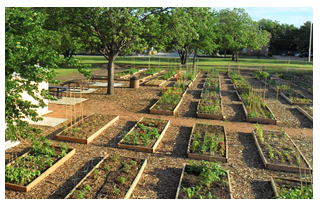
Forecourts are open space areas which act as buffers between residential buildings and non-residential buildings or streets. Forecourts are entirely bounded by streets. It is recommended that forecourts be planted parallel to all street ROW’s with one tree species. Such plantings shall be a minimum of 10 ft. on center and a maximum of 30 ft. on center. 
Greenbelts run along the perimeter of a neighborhood or town and serve to buffer from surrounding non-compatible uses such as a highway corridor, industrial district, or from agricultural areas or adjacent towns.
Greenbelts are left natural, but may include walking trails or passive recreation. In addition, schools located adjacent to Greenbelts can provide all recreational and athletic fields within the greenbelt. Streets bordering greenbelts shall match the Residential Street standards in Article 5 and the Huntersville Engineering Standards and Procedures Manual.
A Green is typically landscaped with trees at the edge and an open expanse of grass in the center that is externally surrounded directly or indirectly by buildings. 
Greenways are generally linear in nature and may bisect or border developments. They are designed to incorporate natural settings such as creeks and significant stands of trees with neighborhoods. Recreational uses shall be provided, at a minimum, trails for walking, jogging and/or bicycling. A greenway may be bound by a public street, but not required. Greenways dedicated to Town/County as identified on the adopted greenway plan will be counted toward tree save area, if relevant. Upon completion of the publicly dedicated greenway any trees removed due to construction are not required to be replaced. 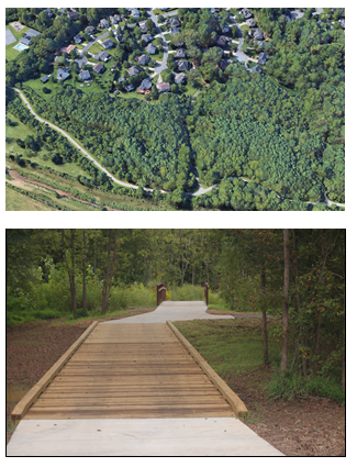
Parks may be designed for passive and/or active recreational use. Parks shall be bounded by streets on a minimum of 25% of their perimeter, and are encouraged to be enclosed by streets on all sides. Mini Parks, such as, but not limited to dog parks, playgrounds, pocket parks and splash pads can be incorporated throughout a development to meet the ordinance requirements.
Where mini parks are not used, the minimum size shall be 1 acre and maximum size 3 acres. Maximum park size may exceed 3 acres, if through design, the park creates a central open space, which services an entire neighborhood or group of neighborhoods; or incorporates physical features, which are an asset to the community (i.e. lake, high ground, significant stand of trees).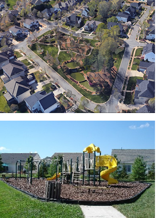
Parkways are open spaces designed to incorporate natural settings such as creeks and significant stands of trees within a neighborhood. Parkways may be entirely bounded by streets or pedestrian ROW’s within developed areas. Parkways differ from parks and squares in that their detailing is natural (i.e. informally planted). Parkways are used for walking, jogging or bicycling. In addition, small scale recreational features such as playground area or soccer field are appropriate in parkways. Streets bordering the parkway shall match the Residential Street standards in Article 5 and the Huntersville Engineering Standards and Procedures Manual. 
A Plaza is an open area adjacent to a civic, commercial, or residential building/s. Plazas function as gathering places. Limited parking is also permitted. Plazas are always paved in brick or another type of paver or crushed stone. Plazas shall be level, stepped, or gently sloping (less than 5% grade). The following sizes are recommended but may be smaller or larger depending on the building or facility design. At no time shall a plaza’s horizontal length or width be greater than 3 times the height of surrounding buildings. Plazas may be left unplanted. If planted, trees should form the geometric frame of the plaza space or for the structure the plaza services. Spacing shall be a minimum of 10 ft. on center and a maximum of 30 ft. on center. Minimum size is 2,000 sq. ft. and maximum size is 30,000 sq. ft. 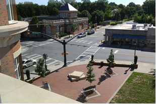
Pedestrian passageways are relatively narrow public spaces located in dense areas between buildings, allowing pedestrian access to the public front. These passageways can be successful locations for store entries, window displays, café seating or public meeting space. The passageway shall incorporate fixtures such as, but not limited to fountains, benches, landscape materials, sculptures, and other decorative elements. 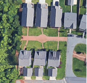
A Promenade is a large, linear-designed area, usually adjacent to buildings lined with trees and shrubbery, which can be used as a public walk. Typically parking surrounds a promenade. 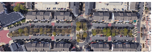
Squares are areas for passive recreational use. Squares shall be bounded by streets on a minimum of three sides or 75% of their perimeter. Minimum size: 500 sq. ft.; Maximum size: 1 acre. Squares may be entirely paved in crushed gravel, brick paver, or similar material, or partially paved with other areas of soft landscape. Squares are encouraged to be planted parallel to all street ROW’s with one tree species planted a minimum of 10 ft. on center and at a maximum of 30 ft. on center. Geometrical tree planting layouts for internal plantings are encouraged. A close can function as a square. 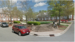
A Woonerf is an access way where the primary use is by pedestrian and bicycles with secondary use by vehicles. By removing curbs and any indication of a car travel line, while at the same time adding landscaping and street furniture, the public realm for pedestrians is expanded into what was the street. Parking areas shall be dispersed. 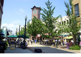
- Agricultural Open Space. Shall include areas set aside for agricultural purposes such as livestock, growing fruits, vegetables, grains, forestry, etc. The goals of the agricultural open space are as follows:
- To conserve areas of the town with productive soils for continued agricultural use by preserving large blocks of land large enough to allow for efficient operations.
- To minimize site disturbance and erosion though retention of existing vegetation and avoiding development in sensitive farmland areas.
- To protect scenic views and elements of the town's rural character, and to minimize perceived density by minimizing views of new development from existing roads.
- To preserve and maintain historic and archaeological sites and structures that serve as significant visible reminders of the town's social and architectural history.
- Common Open Space. Shall include all other areas that are not suitable within the other open space categories. These areas can include, but are not limited to the following:
- Entryway monumentation to include the landscaped area, berm (if applicable)
- Water quality/quantity feature, known as Stormwater Control Measures (SCMs): The required maintenance easement shall be included as common open space. SCMs include, but are not limited to, sand filters, detention ponds, dry ponds, rain gardens, swales, and level spreaders.
- Natural Open Space. Shall include areas where natural features, such as topography, rock outcroppings, hills and valleys are not altered. Only minimal thinning of vegetation shall be permitted to promote overall health of the natural area in accordance with the tree protection regulations of Article 7. The goals of natural open space are as follows:
- To conserve areas of the town with productive soils for forestry use by preserving large blocks of land large enough to allow for efficient operations.
- To encourage the maintenance and enhancement of habitat for various forms of wildlife and to create new woodlands through natural succession and reforestation where appropriate.
- To minimize site disturbance and erosion though retention of existing vegetation and avoiding development in sensitive areas.
- To conserve open land, including those areas containing unique and sensitive features such as natural areas and wildlife habitats, streams and creeks, wetlands and floodways.
- To protect scenic views and elements of the town's rural character, and to minimize perceived density by minimizing views of new development from existing roads.
- Recreational Open Space. Shall include areas where natural features may be altered to provide for recreational activities without impacting the impervious quality of the soil except as provided herein. These activities may include ballfields, equestrian trails, hiking trails, picnicking, primitive camping, golf courses, green spaces (manicured or not), etc. Structures related to the recreation space may count towards open space provided they do not create an impervious area over 100 sq. ft. The goals of recreational open space are as follows:
- To preserve and maintain historic and archaeological site and structures that serve as significant visible reminders of the town's social and architectural history.
- To provide for active and passive recreational needs of town residents, including implementation of associated town long range plans.
7.12 Location Of Natural, Recreational And Agricultural Open Space
- The location of open space conserved through compact residential development shall be consistent with the policies contained in these provisions and other long-range documents adopted by the Town of Huntersville. All lands within areas required to be maintained as open space shall be protected by a permanent conservation easement, prohibiting further development, and setting other standards safeguarding the site’s special resources from negative changes.
- Lands to be preserved as open space should include wetlands; floodways; soils unsuitable for septic systems as identified by onsite analysis or by using the USDA Soil Conservation Survey; mature woodlands; significant wildlife habitat; prime agricultural farmland; historic, archeological and cultural features listed (or eligible to be listed) on national, state or local registers or inventories; significant views into and out from the site; and aquifers and their recharge areas.
- General Locational Standards: Subdivisions shall be designed around the total required open space. The design process should therefore commence with the delineation of all potential open space, after which potential house sites are located. Following that, access road alignments are identified, with lot lines being drawn in as the final step.
- Open space shall be placed in undivided preserves, which may adjoin housing areas that have been designed more compactly to create larger areas that may be enjoyed equally by all residents of the development.
- Undivided open space shall be directly accessible to the largest practicable number of lots within the development. To achieve this, the majority of houselots should abut undivided open space in order to provide direct views and access. Safe and convenient pedestrian access to the open space from all lots not adjoining the open space shall be provided (except in the case of farmland, or other resource areas vulnerable to trampling damage or human disturbance). Where the undivided open space is designated as separate, non-contiguous parcels, no parcel should have a length-to-width ratio in excess of 4:1, except such areas that are specifically designed as village greens, ballfields, upland buffers to wetlands, waterbodies or watercourses, or designed as trail links.
- Interconnected Open Space Network: As these policies are implemented, the protected open space in each new subdivision will eventually adjoin each other, ultimately forming an inter-connected network of open across the town and adjoining communities. To avoid the issue of the “taking of land without compensation”, the only elements of this network that would necessarily be open to the public are those lands that have been required to be dedicated for public use.
7.13 Open Space Evaluation Criteria
- In evaluating the layout of lots and open space, the following criteria will be considered by the town as indicating design appropriate to the site’s natural, historic, and cultural features, and meeting the purposes of this ordinance. Diversity and originality in lot layout shall be encouraged to achieve the best possible relationship between development and conservation areas. Reference Subdivision Ordinance 6.300. Accordingly, the town shall evaluate proposals to determine whether the proposed subdivision plan:
- Protects and preserves all floodways, and wetlands.
- Preserves and maintains mature woodlands, existing fields, pastures, meadows, and orchards, and creates sufficient buffer areas to minimize conflicts between residential and agricultural uses. For example, locating house lots and driveways within wooded areas is generally recommended, with two exceptions. The first involves significant wildlife habitat or mature woodlands which raise an equal or greater preservation concern, as described in “e” and “h” below. The second involves predominantly agricultural areas, where remnant tree groups provide the only natural areas for wildlife habitat.
- If development must be located on open fields or pastures because of greater constraints in all other parts of the site, dwellings should be sited on the least prime agricultural soils, or in locations at the far edge of a field, as seen from existing public roads. Other considerations include whether the development will be visually buffered from existing public roads, such as by a planting screen consisting of a variety of indigenous native trees, shrubs and wildflowers (specifications for which should be based upon a close examination of the distribution and frequency of those species found in a typical nearby roadside verge or hedgerow).
- Maintains or creates an upland buffer of natural native species vegetation adjacent to wetlands and surface waters, including creeks, streams, springs, lakes and ponds.
- Designs around existing hedgerows and tree lines between fields or meadows. Minimizes impacts on large woodlands (greater than five acres), especially those containing many mature trees or a significant wildlife habitat, or those not degraded by invasive vines. However, woodlands in poor condition with limited management potential can provide suitable locations for residential development. When any woodland is developed, great care shall be taken to design all disturbed areas (for buildings, roads, yards, septic disposal fields, etc.) in locations where there are no large trees or obvious wildlife areas, to the fullest extent that is practicable.
- Leaves scenic views and vistas unblocked or uninterrupted, particularly as seen from public roadways. For example, in open agrarian landscapes, a deep “no-build, no plant” buffer is recommended along the public roadway where those views or vistas are prominent or locally significant. In wooded areas where the sense of enclosure is a feature that should be maintained, a deep “no-build, no-cut” buffer should be respected, to preserve existing vegetation.
- Avoids siting new construction on prominent ridges by taking advantage of lower topographic features.
- Protects wildlife habitat areas of species listed as endangered, threatened, or of special concern by the US Environmental Protection Agency and/or by the North Carolina Department of Environment, Health and Natural Resources.
- Designs around and preserves sites of historic, archaeological or cultural value, and their environs, insofar as needed to safeguard the character of the feature, including spring houses, barn foundations, cellar holes, earthworks, burial grounds, etc.
- Protects rural roadside character and improves public safety and vehicular carrying capacity by avoiding development fronting onto existing public roads. Establishes buffer zones along the scenic corridor of rural roads with historic buildings, hedgerows, etc.
- Landscapes common areas such as cul-de-sac islands, and both sides of new streets with native species shade trees and flowering shrubs providing high wildlife conservation value listed on the approved tree and shrub list.
- Provides active recreational areas in suitable locations offering convenient access by residents, and adequately screened from nearby houselots.
- Includes a pedestrian circulation system designed to assure that pedestrians can walk safely and easily on the site, between properties and activities or special features within the neighborhood open space system. All roadside footpaths should connect with off-road trails, which in turn should link with potential open space on adjoining undeveloped parcels (or with existing open space on adjoining developed parcels, where applicable).
- Provides open space that is reasonably contiguous. For example, fragmentation of open space should be minimized so that these resource areas are not divided into numerous small parcels located in various parts of the development. To the greatest extent practicable, this land shall be designed as a single block with logical, straightforward boundaries. Long thin strips of conservation land shall be avoided, unless the conservation feature is linear or unless such configuration is necessary to connect with other streams or trails. The open space shall generally abut existing or potential open space land on adjacent parcels, and shall be designed as part of larger contiguous and integrated greenway systems.
7.14 Ownership Of Open Space
- Open space may be owned or administered by one or a combination of the following methods: fee simple ownership by a unit of government or private non-profit land conservancy; owned by a homeowners association; or by individual private ownership such as a farmer, developer or other private entity that maintains the open space (i.e. farming, equestrian facility, etc.).