
Lees Summit City Zoning Code
ARTICLE 5
- OVERLAY DISTRICTS
DIVISION V. - NEIGHBORHOOD STABILIZATION OVERLAY DISTRICT
The neighborhood stabilization overlay district (NSO) has been created to provide continued opportunities in the creation of affordable housing while maintaining both the neighborhood character and the neighborhood quality in the process.
Sec. 5.010. - Purpose.
A.
The purpose of the Airport Hazard Overlay District regulations is to:
1.
Establish land uses that are compatible with continued airport operations.
2.
Reduce hazards that may endanger the lives and property of the public and aviation users.
3.
Protect the viability of the Lee's Summit Municipal Airport.
4.
Discourage siting of incompatible land uses that may impair the future development and operation of the Lee's Summit Municipal Airport.
5.
Protect navigable airspace from obstructions which are of sufficient height as to constitute a danger to aircraft flight.
B.
To carry out the provisions of this division throughout certain zones, there are hereby established certain zones that include all of the land lying beneath the approach surfaces, transitional surfaces, horizontal surfaces, and conical surfaces as they apply to the Lee's Summit Municipal Airport. These zones are shown on the adopted Airport Layout Plan (ALP), as amended, consisting of drawings, prepared to Federal Aviation Administration (FAA) and Missouri Department of Transportation (MODOT) Aviation Section standards as required under Federal Aviation Regulations Part 77 Objects Affecting Navigable Airspace.
Sec. 5.020. - Definitions.
The following definitions of words, terms or districts shall apply to the Airport Hazard Overlay District:
Airport elevation means 1,004 feet above mean sea level. ;pl0; Airport zones means an area located in more than one of the following zones is considered to be only in the zone with the more restrictive height limitation. The various zones are hereby established and defined as follows:
1.
Other than utility, non-precision instrument runway with a visibility minimum greater than three-quarter statute mile non-precision instrument approach zone. The inner edge of this zone coincides with the width of the primary surface and is 500 feet wide. This zone expands outward uniformly to a width of 3,500 feet at a horizontal distance of 10,000 feet from the primary surface. Its centerline is the continuation of the centerline of the runway.
2.
Runway larger than utility with a visibility minimum as low as three-quarter mile non-precision instrument approach zone. The inner edge of this zone coincides with the width of the primary surface. This zone expands outward uniformly to a width of 4,000 feet at a horizontal distance of 10,000 feet from the primary surface. Its centerline is the continuation of the centerline of the runway.
3.
Precision instrument runway approach zone. The inner edge of this zone coincides with the width of the primary surface. This approach zone expands outward uniformly to a width of 16,000 feet at a horizontal distance of 50,000 feet from the primary surface. Its centerline is the continuation of the centerline of the runway.
4.
Transitional zones. The transitional zones are the areas beneath the transitional surfaces.
5.
Horizontal zone. The horizontal zone is established by swinging arcs of 10,000 feet radii from the center of each end of the primary surface and connecting the adjacent arcs by drawing lines tangent to those arcs. The horizontal zone does not include the approach and transitional zones.
6.
Conical zone. The conical zone is established as the area that commences at the periphery of the horizontal zone and extends outward therefrom a horizontal distance of 4,000 feet.
7.
Runway Protection Zone. The Runway Protection Zone (RPZ) is trapezoidal in shape and centered about the extended runway centerline. The central portion of the RPZ and controlled activity area are the two components of the RPZ. The central portion of the RPZ extends from the beginning to the end of the RPZ, centered on the runway centerline. The controlled activity area is the area within the RPZ to the sides of the central portion of the RPZ. The dimensions and location of the RPZs for runway 18-36 and 11-29 are included in Exhibits A and B of this article. The purpose of this zone is to maintain areas that are generally free of structures and other obstructions, and avoid uses that allow human occupation or significant concentrations of people for any significant period of time.
Approach surface means a surface longitudinally centered on the extended runway centerline, extending outward and upward from the end of the primary surface and at the same slope as the approach zone height limitation slope set forth in section 5.030 of this ordinance. The perimeter of the approach surface coincides with the perimeter of the airport zone.
Conical surface means a surface extending outward and upward from the periphery of the horizontal surface at a slope of 20 to one for a horizontal distance of 4,000 feet.
Hazard to air navigation means an obstruction determined to have a substantial adverse effect on the safe and efficient utilization of the navigable airspace.
Height means for the purpose of determining the height limits in all zones set forth in this article and shown on the zoning map, the datum shall be mean sea level elevation unless otherwise specified.
Horizontal surface means a horizontal plane 150 feet above the established airport elevation, the perimeter of which coincides with the perimeter of the horizontal zone.
Obstruction means any structure, growth, or other object, including a mobile object that exceeds a limiting height set forth in this article.
Precision instrument runway means a runway having an existing instrument approach procedure utilizing an instrument landing system (ILS). It also means a runway for which a precision approach system is planned and is so indicated on an approved airport layout plan or any other planning document.
Primary surface means a surface longitudinally centered on a runway. When the runway has a specially prepared hard surface, the primary surface extends 200 feet beyond each end of that runway; when the runway has no specially prepared hard surface, or planned hard surface, the primary surface ends at each end of that runway. The elevation of any point on the primary surface is the same as the elevation of the nearest point on the runway centerline. The width of the primary surface is:
(1)
Five hundred feet for non-precision instrument runways having visibility minimums greater than three-quarters mile.
(2)
One thousand feet for precision instrument runways and non-precision instrument runways having a non-precision instrument approach with visibility minimums as low as three-quarters mile.
Runway means a defined area on an airport prepared for landing and takeoff of aircraft along its length.
Runway other than utility, non-precision instrument runway means a runway having an existing instrument approach procedure utilizing air navigation facilities with only horizontal guidance, or area type navigation equipment, for which a straight-in non-precision instrument approach procedure has been approved or planned.
Transitional surfaces means these surfaces extend outward at 90 degree angles to the runway centerline and the runway centerline extended at a slope of seven feet horizontally for each foot vertically from the sides of the primary and approach surfaces to where they intersect the horizontal and conical surfaces. Transitional surfaces for those portions of the precision approach surfaces, which project through and beyond the limits of the conical surface, extend a distance of 5,000 feet measured horizontally from the edge of the approach surface and a 90 degree angle to the extended runway centerline.
Sec. 5.030. - Airport zone height limitations.
Except as otherwise provided in the Airport Hazard Overlay District, no structure shall be erected, altered, or maintained, and no tree shall be allowed to grow in any zone created by this district to a height in excess of the applicable height limit herein established for such zone. The applicable height limitations are hereby established for each of the zones in question as follows:
A.
Non-precision instrument runway with a visibility minimum greater than three-quarters mile non-precision instrument approach zone. Slopes 34 feet outward for each foot upward beginning at the end of and at the same elevation as the primary surface and extending to a horizontal distance of 10,000 feet along the extended runway centerline.
B.
Precision instrument runway approach zone. Slopes 50 feet outward for each foot upward beginning at the end of and at the same elevation as the primary surface and extending to a horizontal distance of 10,000 feet along the extended runway centerline; thence slopes upward 40 feet horizontally for each foot vertically to an additional horizontal distance of 40,000 feet along the extended runway centerline.
C.
Transitional zones. Slopes seven feet outward for each foot upward beginning at the sides of and at the same elevation as the primary surface and the approach surface, and extending to a height of 150 feet above the airport elevation which is 1,154 feet above mean sea level. In addition to the foregoing, there are established height limits sloping seven feet outward for each foot upward beginning at the sides of and at the same elevation as the approach surface, and extending to where they intersect the conical surface.
D.
Horizontal zone. Established at 150 feet above the airport elevation or at a height of 1,154 feet above mean sea level.
E.
Conical zone. Slopes 20 feet outward for each foot upward beginning at the periphery of the horizontal zone and at 150 feet above the airport elevation and extending to a height of 350 feet above the airport elevation.
F.
Approach obstruction clearance surface. This surface is at a height within a terminal obstacle clearance area including an initial approach segment, a departure area, and a circling approach area, that would result in the vertical distance between any point on the object and an established minimum instrument flight altitude within that area ore segment to be less than the required obstacle clearance for that instrument approach procedure.
G.
Excepted height limitations. Nothing in this article shall be construed as prohibiting the construction or maintenance of any structure, or growth of any tree to a height up to 50 feet above the surface of the land.
Sec. 5.040. - Use restrictions.
Notwithstanding any other provisions of the Airport Hazard Overlay District, no use may be made of land or water within any zone established by this article in such a manner as to create electrical interference with navigational signals or radio communication between the airport and aircraft, make it difficult for pilots to distinguish between airport lights and others, result in glare in the eyes of pilots using the airport, impair visibility in the vicinity of the airport, create bird strike hazards, or otherwise in any way endanger or interfere with the landing, takeoff, or maneuvering of aircraft intending to use the airport.
Sec. 5.050. - Nonconforming uses.
A.
Regulations not retroactive. The regulations prescribed by the Airport Hazard Overlay District shall not be construed to require the removal, lowering, or other change or alteration of any structure or tree not conforming to the regulations as of the effective date of this ordinance, or otherwise interfere with the continuance of a legal nonconforming use. Nothing contained herein shall require any change in the construction, alteration, or intended use of any structure, the construction or alteration of which was begun prior to the effective date of this ordinance, and is diligently prosecuted.
B.
Marking and lighting. Notwithstanding the other provision of this District, the owner of any existing legal nonconforming structure or tree is hereby required to permit the installation, operation, and maintenance thereon of such markers and lights as shall be deemed necessary by the Director, to indicate to the operators of aircraft in the vicinity of the airport the presence or such airport obstruction. Such markers and lights shall be installed, operated, and maintained at the City's expense.
Sec. 5.060. - Development.
A.
Future uses. Except as specifically provided in this chapter, no material change shall be made in the use of land, no structure shall be erected or otherwise established, and no tree shall be planted in any zone hereby created unless approved through the development process.
1.
In the runway protection zone (RPZ) the following land uses are allowed without further evaluation:
a.
Farming that meets the minimum buffers as shown in FAA Advisory Circular 150/5300-13A, Chapter 3.
b.
Irrigation channels as long as they do not attract birds.
c.
Airport service roads, as long as they are not public roads and are directly controlled by the airport operator.
d.
Underground facilities, as long as they meet other design criteria, such as runway safety area requirements, as applicable.
e.
Unstaffed NAVAIDs and facilities, such as equipment for airport facilities that are considered fixed-by-function in regard to the RPZ.
f.
Permits shall be required for all trees and structures within the RPZ.
g.
Evaluation and approval of other land uses in the RPZ. The FAA Office of Airports must evaluate and approve any proposed land use located within the limits of land controlled by the airport owner of an existing or future RPZ that is not specifically allowed in subsections 4.a. through 4.e. above. The FAA's Evaluation and Approval of RPZ Land Use Guidelines outlines the procedures for the FAA's Office of Airports review of proposed land uses in the RPZ. This document also provides direction on the evaluation of existing land uses in an RPZ and methods and procedures available to communities to protect the RPZ and prevent the congregation of people and property on the ground.
2.
Nothing contained in any of the foregoing exceptions shall be construed as permitting or intending to permit any construction, or alteration of any structure, or growth of any tree in excess of any of the height limits established by this article except as set forth in Section 5.030.
B.
Existing uses. No nonconforming use, structure, or tree shall be allowed to become a greater hazard to air navigation than it was on the effective date of this chapter or any amendments thereto.
C.
Nonconforming uses abandoned or destroyed. Whenever the Director determines that a legal nonconforming tree or structure has been abandoned or more than 80 percent torn down, physically deteriorated, or decayed, the structure or tree shall not be allowed to exceed the applicable height limit or otherwise deviate from the zoning regulations.
Sec. 5.070. - Development near the airport.
No material change shall be made in the use of land, no structure shall be erected or otherwise established, and no tree shall be planted in any zone created by Article 5, Division I of this chapter within the City unless approved through the development process.
Sec. 5.100. - Statutory authorization.
The Legislature of the State of Missouri has in RSMo 89.020 delegated the responsibility to local governmental units to adopt floodplain management regulations designed to protect the health, safety, and general welfare. Therefore, the City Council of the City of Lee's Summit, Missouri ordains as follows.
Sec. 5.110. - Findings of fact.
A.
Flood losses resulting from periodic inundation. The special flood hazard areas of the City are subject to inundation that results in loss of life and property, health, and safety hazards, disruption of commerce and governmental services, extraordinary public expenditures for flood protection and relief, and impairment of the tax base; all of which adversely affect the public health, safety and general welfare.
B.
General causes of these flood losses. These flood losses are caused by:
1.
The cumulative effect of obstruction in floodways causing increases in flood heights and velocities; and
2.
The occupancy of flood hazard areas by uses vulnerable to floods or hazardous to others that are inadequately elevated or otherwise unprotected from flood damages.
C.
Methods used to analyze flood hazards. The Flood Insurance Study (FIS) that is the basis of this division of the UDO uses a standard engineering method of analyzing flood hazards which consist of a series of interrelated steps.
1.
Selection of a base flood that is based upon engineering calculations which permit a consideration of such flood factors as its expected frequency of occurrence, the area inundated, and the depth of inundation. The base flood selected for this division of the UDO is representative of large floods which are characteristic of what can be expected to occur on the particular streams subject to this division of the UDO. The base flood is the flood that is estimated to have a one percent chance of being equaled or exceeded in any given year, as delineated on the Federal Insurance Administrator's Flood Insurance Study (FIS), and illustrative materials for Jackson County, Missouri dated December 7, 2023 as amended, and any future revisions thereto.
2.
Calculation of water surface profiles based upon a standard hydraulic engineering analysis of the capacity of the stream channel and overbank areas to convey the regulatory flood.
3.
Computation of the floodway required to convey this flood without increasing flood heights more than one foot at any point.
4.
Delineation of floodway encroachment lines within which no development is permitted that would cause any increases in flood height.
5.
Delineation of the floodway fringe, i.e., that area outside the floodway encroachment lines, but still subject to inundation by the base flood.
(Ord. No. 9782, § 4, 11-14-2023)
Sec. 5.120. - Statement of purpose.
It is the purpose of this division to promote the public health, safety and general welfare; to minimize those losses described above to establish or maintain the City's eligibility for participation in the National Flood Insurance Program (NFIP) as defined in 44 Code of Federal Regulations (CFR) 59.22(a)(3); and to meet the requirements of 44 CFR 60.3(d) by applying the provisions of this division to:
A.
Restrict or prohibit uses which are dangerous to health, safety, or property in times of flooding or cause increased flood heights or velocities;
B.
Require that uses vulnerable to floods, including public facilities that serve such uses, be provided with flood protection at the time of initial construction;
C.
Protect individuals from buying lands that are unsuited for intended purposes due to the flood hazard; and
D.
Assure that eligibility is maintained for property owners in the City to purchase flood insurance in the Federal Flood Insurance Program.
Sec. 5.130. - Definitions.
The following definitions shall apply to the Floodplain Overlay District:
100-year flood. See base flood.
Accessory structure means the same as "appurtenant structure."
Actuarial rates. See risk premium rates.
Administrator means the Federal Insurance Administrator.
Agency means the Federal Emergency Management Agency (FEMA).
Agricultural commodities means agricultural products and livestock.
Agricultural structure means any structure used exclusively in connection with the production, harvesting, storage, drying, or raising of agricultural commodities.
Appeal means a request for review of the Floodplain Administrator's interpretation of any provision of this ordinance or a request for a variance.
Appurtenant structure means a structure that is on the same parcel of property as the principle structure to be insured and the use of which is incidental to the use of the principal structure.
Area of special flood hazard is the land in the floodplain within the City subject to a one percent or greater chance of flooding in any given year.
Base flood means the flood having a one percent chance of being equaled or exceeded in any given year.
Basement means any area of the structure having its floor subgrade (below ground level) on all sides.
Building. See structure.
Chief Executive Officer or Chief Elected Official means the official of the City who is charged with the authority to implement and administer laws, ordinances, and regulations for the City.
City means the City of Lee's Summit, which is the designated authority to adopt and enforce floodplain management regulations for the areas within its jurisdiction.
Development means any man-made change to improved or unimproved real estate, including but not limited to buildings or other structures, levees, levee systems, mining, dredging, filling, grading, paving, excavation or drilling operations, or storage of equipment or materials.
Elevated building means for insurance purposes, a non-basement building which has its lowest elevated floor raised above ground level by foundation walls, shear walls, posts, piers, pilings, or columns.
Eligible community or participating community means a community for which the Administrator has authorized the sale of flood insurance under the National Flood Insurance Program (NFIP).
Existing construction means for the purposes of determining rates, structures for which the "start of construction commenced before the effective date of the FIRM or before January 1, 1975, for FIRMs effective before that date. "Existing construction may also be referred to as "existing structures."
Existing manufactured home park or subdivision means a manufactured home park or subdivision for which the construction of facilities for servicing the lots on which the manufactured homes are to be affixed (including, at a minimum, the installation of utilities, the construction of streets, and either final site grading or the pouring of concrete pads) is completed before the effective date of the floodplain management regulations adopted by the City.
Expansion to an existing manufactured home park or subdivision means the preparation of additional sites by the construction of facilities for servicing the lots on which the manufactured homes are to be affixed (including the installation of utilities, the construction of streets, and either final site grading or the pouring of concrete pads).
Flood or flooding means a general and temporary condition of partial or complete inundation of normally dry land areas from: (1) the overflow of inland, and/or (2) the unusual and rapid accumulation or runoff of surface waters from any source.
Flood boundary and floodway map (FBFM) means an official map of the City on which the Administrator has delineated both special flood hazard areas and the designated regulatory floodway.
Flood elevation determination means a determination by the Administrator of the water surface elevations of the base flood, that is, the flood level that has a one percent or greater chance of occurrence in any given year.
Flood elevation study means an examination, evaluation and determination of flood hazards.
Flood fringe means the area outside the floodway encroachment lines, but still subject to inundation by the regulatory flood.
Flood hazard boundary map (FHBM) means an official map of the City, issued by the Administrator, where the boundaries of the flood areas having special flood hazards have been designated as (unnumbered or numbered) A zones.
Flood insurance rate map (FIRM) means an official map of the City, on which the Administrator has delineated both the special flood hazard areas and the risk premium zones applicable to the City.
Flood insurance study (FIS) means an examination, evaluation and determination of flood hazards and, if appropriate, corresponding water surface elevations.
Floodplain or flood-prone area means any land area susceptible to being inundated by water from any source (see "flooding").
Floodplain management means the operation of an overall program of corrective and preventive measures for reducing flood damage, including but not limited to emergency preparedness plans, flood control works, and floodplain management regulations.
Floodplain Management Regulations means zoning ordinances, subdivision regulations, building codes, health regulations, special purpose ordinances (such as floodplain and grading ordinances) and other applications of police power. The term describes such state or local regulations, in any combination thereof, that provide standards for the purpose of flood damage prevention and reduction.
Floodproofing means any combination of structural and nonstructural additions, changes, or adjustments to structures that reduce or eliminate flood damage to real estate or improved real property, water and sanitary facilities, or structures and their contents.
Floodway or regulatory floodway means the channel of a river or other watercourse and the adjacent land areas that must be reserved in order to discharge the base flood without cumulatively increasing the water surface elevation more than one foot.
Floodway encroachment lines means the lines marking the limits of floodways on federal, state and local floodplain maps.
Freeboard means a factor of safety usually expressed in feet above a flood level for purposes of floodplain management. "Freeboard tends to compensate for the many unknown factors that could contribute to flood heights greater than the height calculated for a selected size flood and floodway conditions, such as bridge openings and the hydrological effect of urbanization of the watershed.
Functionally dependent use means a use that cannot perform its intended purpose unless it is located or carried out in close proximity to water. This term includes only docking facilities and facilities that are necessary for the loading and unloading of cargo or passengers, but does not include long-term storage or related manufacturing facilities.
Highest adjacent grade means the highest natural elevation of the ground surface prior to construction next to the proposed walls of a structure.
Historic structure means any structure that is: (a) listed individually in the National Register of Historic Places (a listing maintained by the Department of Interior) or preliminarily determined by the Secretary of the Interior as meeting the requirements for individual listing on the National Register; (b) certified or preliminarily determined by the Secretary of the Interior as contributing to the historical significance of a registered historic district or a district preliminarily determined by the Secretary to qualify as a registered historic district; (c) individually listed on a State Inventory of Historic Places in states with historic preservation programs which have been approved by the Secretary of the Interior; or (d) individually listed on a local inventory of historic places in communities with historic preservation programs that have been certified either: (1) by an approved state program as determined by the Secretary of the Interior, or (2) directly by the Secretary of the Interior in states without approved programs.
Lowest floor means the lowest floor of the lowest enclosed area, including basement. An unfinished or flood-resistant enclosure, usable solely for parking of vehicles, building access, or storage, in an area other than a basement area, is not considered a building's lowest floor, provided that such enclosure is not built so as to render the structure in violation of the applicable floodproofing design requirements of this ordinance.
Manufactured home means a structure, transportable in one or more sections, that is built on a permanent chassis and is designed for use with or without a permanent foundation when attached to the required utilities. The term "manufactured home does not include a "recreational vehicle."
Manufactured home park or subdivision means a parcel (or contiguous parcels) of land divided into two or more manufactured home lots for rent or sale.
Map means the flood hazard boundary map (FHBM), flood insurance rate map (FIRM), or the flood boundary and floodway map (FBFM) for a community issued by the Federal Emergency Management Agency (FEMA).
Market value or fair market value means an estimate of what is fair, economic, just and equitable value under normal local market conditions.
Mean Sea level means, for purposes of the National Flood Insurance Program (NFIP), the National Geodetic Vertical Datum (NGVD) of 1929 or other datum, to which base flood elevations shown on the City's flood insurance rate map (FIRM) are referenced.
New construction means, for the purposes of determining insurance rates, structures for which the "start of construction commenced on or after the effective date of an initial FIRM or after December 31, 1974, whichever is later, and includes any subsequent improvements to such structures. For floodplain management purposes, "new construction means structures for which the "start of construction commenced on or after the effective date of the floodplain management regulations adopted by the City and includes any subsequent improvements to such structures.
New manufactured home park or subdivision means a manufactured home park or subdivision for which the construction of facilities for servicing the lot on which the manufactured homes are to be affixed (including at a minimum, the installation of utilities, the construction of streets, and either final site grading or the pouring of concrete pads) is completed on or after the effective date of floodplain management regulations adopted by the City.
NFIP means the National Flood Insurance Program (NFIP).
Participating community also known as an eligible community, means a community in which the Administrator has authorized the sale of flood insurance.
Person includes any individual or group of individuals, corporation, partnership, association, or any other entity, including federal, state, and local governments and agencies.
Principally above ground means that at least 51 percent of the actual cash value of the structure, less land value, is above ground.
Recreational vehicle means a vehicle which is (a) built on a single chassis; (b) 400 square feet or less when measured at the largest horizontal projections; (c) designed to be self-propelled or permanently towable by a light-duty truck; and (d) designed primarily not for use as a permanent dwelling but as temporary living quarters for recreational, camping, travel, or seasonal use.
Remedy a violation means to bring the structure or other development into compliance with federal, state, or local floodplain management regulations; or, if this is not possible, to reduce the impacts of its noncompliance.
Repetitive loss means flood-related damages sustained by a structure on two separate occasions during a ten-year period for which the cost of repairs at the time of each such flood event, equals or exceeds 25 percent of the market value of the structure before the damage occurred.
Risk premium rates means those rates established by the Administrator pursuant to individual City studies and investigations which are undertaken to provide flood insurance in accordance with Section 1307 of the National Flood Disaster Protection Act of 1973 and the accepted actuarial principles. Risk premium rates include provisions for operating costs and allowances.
Special flood hazard area. See area of special flood hazard.
Special hazard area means an area having special flood hazards and shown on an FHBM, FIRM or FBFM as zones (unnumbered or numbered) A and AE.
Start of construction includes substantial-improvements, and means the date the building permit was issued, provided the actual start of construction, repair, reconstruction, rehabilitation, addition placement, or other improvements were within 180 days of the permit date. The actual start means either the first placement of permanent construction of a structure on a site, such as the pouring of slabs or footings, the installation of piles, the construction of columns, any work beyond the stage of excavation, or the placement of a manufactured home on a foundation. Permanent construction does not include land preparation, such as clearing, grading and filling, the installation of streets and/or walkways, excavation for a basement, footings, piers, foundations, the erection of temporary forms, nor installation on the property of accessory structures, such as garages or sheds not occupied as dwelling units or not part of the main structure. For a substantial-improvement, the actual start of construction means the first alteration of any wall, ceiling, floor, or other structural part of a building, whether or not that alteration affects the external dimensions of the building.
State Coordinating Agency means that agency of the state government, or other office designated by the governor of the state or by state statute at the request of the Administrator to assist in the implementation of the National Flood Insurance Program (NFIP) in that state.
Structure means, for floodplain management purposes, a walled and roofed building, including a gas or liquid storage tank, that is principally above ground, as well as a manufactured home. "Structure for insurance purposes, means a walled and roofed building, other than a gas or liquid storage tank that is principally above ground and affixed to a permanent site, as well as a manufactured home on a permanent foundation. For the latter purpose, the term includes a building while in the course of construction, alteration or repair, but does not include building materials or supplies intended for use in such construction, alteration or repair, unless such materials or supplies are within an enclosed building on the premises.
Substantial-damage means damage of any origin sustained by a structure whereby the cost of restoring the structure to its before damaged condition would equal or exceed 50 percent of the market value of the structure before the damage occurred. The term includes repetitive loss buildings (see definition).
For the purposes of this definition, "repair" is considered to occur when the first repair or reconstruction of any wall, ceiling, floor, or other structural part of the building commences.
The term does not apply to:
(1)
Any project for improvement of a building required to comply with existing health, sanitary, or safety code specifications which have been identified by the Code Enforcement Official and which are solely necessary to assure safe living conditions,
(2)
Any alteration of a "historic structure" provided that the alteration will not preclude the structure's continued designation as a "historic structure," or
(3)
Any improvement to a building.
Substantial improvement means any combination of reconstruction, alteration, or improvement to a building, taking place during a ten-year period, in which the cumulative percentage of improvement equals or exceeds 50 percent of the current market value of the building. For the purposes of this definition, an improvement occurs when the first alteration of any wall, ceiling, floor, or other structural part of the building commences, whether or not that alteration affects the external dimensions of the building. This term includes structures, which have incurred "repetitive loss" or "substantial damage", regardless of the actual repair work done.
The term does not apply to:
(1)
Any project for improvement of a building required to comply with existing health, sanitary, or safety code specifications which have been identified by the Code Enforcement Official and which are solely necessary to assure safe living conditions,
(2)
Any alteration of a "historic structure" provided that the alteration will not preclude the structure's continued designation as a "historic structure," or
(3)
Any building that has been damaged from any source or is categorized as repetitive loss.
Substantially improved existing manufactured home parks or subdivisions is where the repair, reconstruction, rehabilitation or improvement of the streets, utilities and pads equals or exceeds 50 percent of the value of the streets, utilities and pads before the repair, reconstruction or improvement commenced.
Variance means a grant of relief by the City from the terms of a floodplain management regulation. Flood insurance requirements remain in place for any varied use or structure and cannot be varied by the City.
Violation means the failure of a structure or other development to be fully compliant with the City's floodplain management regulations. A structure or other development without the elevation certificate, other certifications, or other evidence of compliance required by this ordinance is presumed to be in violation until such time as that documentation is provided.
Water surface elevation means the height, in relation to the National Geodetic Vertical Datum (NGVD) of 1929 (or other datum where specified) of floods of various magnitudes and frequencies in the floodplain.
Sec. 5.140. - General provisions.
A.
Land to which ordinance applies. This division shall apply to all lands within the jurisdiction of the City identified as numbered and unnumbered A zones and AE zones on the flood insurance rate map (FIRM) for Jackson County on map panels 29095C0294G, 29095C0313G, 29095C0314G, 29095C0404G, 29095C0407G, 29095C0408G, 29095C0409G, 29095C0411G, 29095C0412G, 29095C0413G, 29095C0414G, 29095C0416G, 29095C0417G, 29095C0418G, 29095C0419G, 29095C0430G, 29095C0435G, 29095C0436G, 29095C0437G, 29095C0438G, 29095C0439G, 29095C0441G, 29095C0445G, 29095C0526G, 29095C0530G, 29095C0531G, 29095C0532G, 29095C0535G, 29095C0551G, 29095C0552G, and 29095C0553G, dated January 20, 2017 as amended, and any future revisions thereto. In all areas covered by this division, no development shall be permitted except through the issuance of a floodplain development permit, granted by the Governing Body or its duly designated representative under such safeguards and restrictions as the Governing Body or the designated representative may reasonably impose for the promotion and maintenance of the general welfare, health of the inhabitants of the City, and as specifically noted in Article 2.
B.
Floodplain Administrator. The City Engineer is hereby designated as the Floodplain Administrator under this ordinance.
C.
Compliance. No development located within the special flood hazard areas of this City shall be located, extended, converted, or structurally altered without full compliance with the terms of this ordinance and other applicable regulations.
D.
Abrogation and greater restrictions. It is not the intent of the Floodplain Overlay District to repeal, abrogate or impair any existing easements, covenants or deed restrictions. However, where the Floodplain Overlay District imposes greater restrictions, the provision of this division shall prevail. All other provisions inconsistent with this division are hereby repealed to the extent of the inconsistency only.
E.
Interpretation. The interpretation and application of the provisions of the Floodplain Overlay District shall be held to be minimum requirements and shall be liberally construed in favor of the City and shall not be deemed a limitation or repeal of any other powers granted by state statutes.
F.
Warning and disclaimer of liability. The degree of flood protection required by this division is considered reasonable for regulatory purposes and is based on engineering and scientific methods of study; however, larger floods may occur and flood heights may be increased by man-made or natural causes, such as ice jams and bridge openings restricted by debris. The Floodplain Overlay District does not imply that areas outside floodway and floodway fringe district boundaries or land uses permitted within these districts will be free from flooding or flood damage. This District shall not create liability on the part of the City or any officer or employee thereof for any flood damages that may result from reliance on this division or any administrative decision lawfully made thereunder.
G.
Severability. If any section, clause, provision, or portion of this ordinance is adjudged unconstitutional or invalid by a court of appropriate jurisdiction, the remainder of this ordinance shall not be affected thereby.
Sec. 5.150. - Administration.
A.
Floodplain Development Permit required. A floodplain development permit shall be required for all proposed construction or other development, including placement of manufactured homes, in the areas described in Article 15. No person, firm, corporation, or unit of government shall initiate any development or substantial-improvement or cause the same to be done without first obtaining a separate floodplain development permit for each structure or other development..
B.
Designation of Floodplain Administrator. The City Engineer is hereby appointed to administer and implement the provisions of this ordinance.
C.
Duties and responsibilities of Floodplain Administrator. Duties of the City Engineer shall include, but not be limited to:
1.
Review of all applications for floodplain development permits to assure that sites are reasonably safe from flooding and that the floodplain development permit requirements of this ordinance have been satisfied;
2.
Review of all applications for floodplain development permits for proposed development to assure that all necessary permits have been obtained from federal, state, or local governmental agencies from which prior approval is required by federal, state, or local law;
3.
Review all subdivision proposals and other proposed new development, including manufactured home parks or subdivisions, to determine whether such proposals will be reasonably safe from flooding;
4.
Issue floodplain development permits for all approved applications;
5.
Notify adjacent communities and the Missouri State Emergency Management Agency (Mo. SEMA) prior to any alteration or relocation of a watercourse, and submit evidence of such notification to the Federal Emergency Management Agency (FEMA);
6.
Assure that the flood carrying capacity is not diminished and shall be maintained within the altered or relocated portion of any watercourse.
7.
Verify and maintain a record of the actual elevation (in relation to mean sea level) of the lowest floor, including basement, of all new or substantially improved structures;
8.
Verify and maintain a record of the actual elevation (in relation to mean sea level) that the new or substantially improved non-residential structures have been floodproofed;
9.
When floodproofing techniques are utilized for a particular non-residential structure, the City Engineer shall require certification from a registered professional engineer or architect.
D.
Application for floodplain development permit. To obtain a permit, the applicant shall first file an application therefore in writing on a form furnished for that purpose. Every floodplain development permit application shall:
1.
Describe the land on which the proposed work is to be done by lot, block, tract and house and street address, or similar description that will readily identify and definitely locate the proposed building or work;
2.
Identify and describe the work to be covered by the permit for which application is made;
3.
Indicate the use or occupancy for which the proposed work is intended;
4.
Indicate the assessed value of the structure and the fair market value of the improvement;
5.
Specify whether development is located in designated flood fringe or floodway;
6.
Identify the existing base flood elevation and the elevation of the proposed development;
7.
Be accompanied by plans and specifications for proposed construction;
8.
Be signed by the permittee or his authorized agent, who may be required to submit evidence to indicate such authority;
9.
Be accompanied by elevations (in relation to mean sea level) of the lowest floor (including basement) or in the case of floodproofed non-residential structures, the elevation to which it has been floodproofed; and
10.
Give such other information as reasonably may be required by the City Engineer.
Sec. 5.160. - Establishment of zoning districts.
The mapped floodplain areas within the jurisdiction of the City are hereby divided into the two following districts: A floodway overlay district (FW) and floodway fringe overlay district (FF) identified in the flood insurance study and shown on the flood insurance rate maps. The boundaries of these districts shall become part of the official zoning map. Within these districts all uses not meeting the standards of this ordinance and those standards of the underlying zoning district shall be prohibited. These zones shall be consistent with the numbered and unnumbered A zones and AE zones as identified on the official FIRM and identified in the flood insurance study provided by the Federal Insurance Administration.
Sec. 5.170. - Standards for flood hazard reduction in floodway and floodway fringe overlay districts.
In all areas of special flood hazards (floodway and floodway fringe), the following standards must be met:
A.
General standards.
1.
No permit for floodplain development shall be granted for new construction, substantial-improvements, and other improvements, including the placement of manufactured homes, within any numbered or unnumbered A zones and AE zones, unless the conditions of this section are satisfied.
2.
All areas identified as unnumbered A zones on the FIRM are subject to inundation of the 100-year flood; however, the base flood elevation is not provided. Development within unnumbered A zones is subject to all provisions of this ordinance. If flood insurance study data is not available, the City shall obtain, review, and reasonably utilize any base flood elevation or floodway data currently available from federal, state, or other sources.
3.
Until a floodway is designated, no new construction, substantial improvements, or other development, including fill, shall be permitted within any numbered A zone or AE zone on the FIRM, unless it is demonstrated that the cumulative effect of the proposed development, when combined with all other existing and anticipated development, will not increase the water surface elevation of the base flood more than one foot at any point within the City.
4.
All new construction, subdivision proposals, substantial-improvements, prefabricated structures, placement of manufactured homes, and other developments shall require:
a.
Design or adequate anchorage to prevent flotation, collapse, or lateral movement of the structure resulting from hydrodynamic and hydrostatic loads, including the effects of buoyancy;
b.
Construction with materials resistant to flood damage;
c.
Utilization of methods and practices that minimize flood damages;
d.
All electrical, heating, ventilation, plumbing, air-conditioning equipment, and other service facilities be designed and/or located so as to prevent water from entering or accumulating within the components during conditions of flooding;
e.
New or replacement water supply systems and/or sanitary sewage systems be designed to minimize or eliminate infiltration of flood waters into the systems and discharges from the systems into flood waters, and on-site waste disposal systems be located so as to avoid impairment or contamination; and
f.
Subdivision proposals and other proposed new development, including manufactured home parks or subdivisions, located within special flood hazard areas are required to assure that:
(1)
All such proposals are consistent with the need to minimize flood damage;
(2)
All public utilities and facilities, such as sewer, gas, electrical, and water systems are located and constructed to minimize or eliminate flood damage;
(3)
Adequate drainage is provided so as to reduce exposure to flood hazards; and
(4)
All proposals for development, including proposals for manufactured home parks and subdivisions, of five acres or 50 lots, whichever is lesser, include within such proposals base flood elevation data.
5.
Storage, material, and equipment:
a.
The storage or processing of materials within the special flood hazard area that are in time of flooding; buoyant, flammable, explosive, or could be injurious to human, animal, or plant life is prohibited.
b.
Storage of other material or equipment may be allowed if not subject to major damage by floods, if firmly anchored to prevent flotation, or if readily removable from the area within the time available after a flood warning.
6.
Accessory structures: Structures used solely for parking and limited storage purposes, not attached to any other structure on the site, of limited investment value, and not larger than 400 square feet, may be constructed at-grade and wet-floodproofed provided:
a.
There is no human habitation or occupancy of the structure;
b.
The structure is of single-wall design;
c.
A variance has been granted from the standard floodplain management requirements of this ordinance; and
d.
A floodplain development permit has been issued.
7.
Hazardous materials: All hazardous material storage and handling sites shall be located out of the floodplain.
8.
Cumulative improvement: A structure may be improved (remodeled or enlarged) without conforming to current requirements for elevation so long as the cumulative value of all work done within the last five calendar years does not exceed 50 percent of the structure's current market value. If the cumulative value of the improvement exceeds 50 percent of the structure's current market value, the structure must be brought into compliance with Section 5.170.B.1., which requires elevation of residential structures to or above the base flood elevation, or the elevation/floodproofing of non-residential structures to or above the base flood elevation.
9.
Critical facilities:
a.
All new or substantially improved critical nonresidential facilities including, but not limited, to governmental buildings, police stations, fire stations, hospitals, orphanages, penal institutions, communication centers, water and sewer pumping stations, water and sewer treatment facilities, transportation maintenance facilities, places of public assembly, emergency aviation facilities, and schools shall be elevated above the 500-year flood level or together with attendant utility and sanitary facilities, be floodproofed so that below the 500-year flood level the structure is water tight with walls substantially impermeable to the passage of water and with structural components having the capability of resisting hydrostatic and hydrodynamic loads and the effects of buoyancy. A registered professional engineer or architect shall certify that the standards of this subsection are satisfied. Such certification shall be provided to the Floodplain Administrator as set forth in the National Flood Insurance Program (NFIP) regulations.
b.
All critical facilities shall have access routes that are above the elevation of the 500-year flood.
10.
Agricultural structures: Structures used solely for agricultural purposes in connection with the production, harvesting, storage, drying, or raising of agricultural commodities, including the raising of livestock, may be constructed at-grade and wet-floodproofed provided there is no human habitation or occupancy of the structure; the structure is of single-wall design; there is no permanent retail, wholesale, or manufacturing use included in the structure; a variance has been granted from the floodplain management requirements of this ordinance; and a floodplain development permit has been issued.
B.
Specific standards.
1.
In all areas identified as numbered and unnumbered A zones and AE zones, where base flood elevation data have been provided, as set forth in Section 5.170.A.2., the following provisions are required:
a.
Residential construction: New construction or substantial-improvement of any residential structures, including manufactured homes, shall have the lowest floor, including basement and all mechanical, electrical, and/or other utility equipment, elevated to two feet above the base flood elevation.
b.
Non-residential construction: New construction or substantial-improvement of any commercial, industrial, or other non-residential structures, including manufactured homes, shall have the lowest floor, including basement, elevated to two feet above the base flood elevation or, together with attendant utility and sanitary facilities, be floodproofed so that below the base flood elevation the structure is watertight with walls substantially impermeable to the passage of water and with structural components having the capability of resisting hydrostatic and hydrodynamic loads and effects of buoyancy. A registered professional engineer or architect shall certify that the standards of this subsection are satisfied. Such certification shall be provided to the Floodplain Administrator as set forth in Section 5.150.C.9.
c.
Require, for all new construction and substantial-improvements that fully enclosed areas below lowest floor used solely for parking of vehicles, building access, or storage in an area other than a basement and that are subject to flooding shall be designed to automatically equalize hydrostatic flood forces on exterior walls by allowing for the entry and exit of floodwaters. Designs for meeting this requirement must either be certified by a registered professional engineer or architect or meet or exceed the following minimum criteria:
(1)
A minimum of two openings having a total net area of not less than one square inch for every square foot of enclosed area subject to flooding shall be provided; and
(2)
The bottom of all opening shall be no higher than one foot above grade. Openings may be equipped with screens, louvers, valves, or other coverings or devices provided that they permit the automatic entry and exit of floodwaters.
C.
Manufactured homes.
1.
All manufactured homes to be placed within all unnumbered and numbered A zones and AE zones, on the City's FIRM shall be required to be installed using methods and practices that minimize flood damage. For the purposes of this requirement, manufactured homes must be elevated and anchored to resist flotation, collapse, or lateral movement. Methods of anchoring may include, but are not limited to, use of over-the-top or frame ties to ground anchors.
2.
Require manufactured homes that are placed or substantially improved within unnumbered or numbered A zones and AE zones, on the City's FIRM on sites:
a.
Outside of manufactured home park or subdivision;
b.
In a new manufactured home park or subdivision;
c.
In an expansion to and existing manufactured home park or subdivision; or
d.
In an existing manufactured home park or subdivision on which a manufactured home has incurred substantial-damage as the result of a flood, be elevated on a permanent foundation such that the lowest floor of the manufactured home is elevated to two feet above the base flood elevation and be securely attached to an adequately anchored foundation system to resist flotation, collapse, and lateral movement.
3.
Require that manufactured homes to be placed or substantially improved on sites in an existing manufactured home park or subdivision within all unnumbered and numbered A zones and AE zones, on the City's FIRM, that are not subject to the provisions of Subsection C.2. of this section, be elevated so that either:
a.
The lowest floor of the manufactured home is at two feet above the base flood level; or
b.
The manufactured home chassis is supported by reinforced piers or other foundation elements of at least equivalent strength that are no less than 24 inches in height above grade and be securely attached to an adequately anchored foundation system to resist flotation, collapse, and lateral movement.
D.
Floodway. Located within areas of special flood hazard established in Section 5.140.A. are areas designated as floodways. Since the floodway is an extremely hazardous area due to the velocity of flood waters that carry debris and potential projectiles, the following provisions shall apply:
1.
The City shall select and adopt a regulatory floodway based on the principle that the area chosen for the regulatory floodway must be designed to carry the waters of the base flood without increasing the water surface elevation of that flood more than one foot at any point.
2.
The City shall prohibit any encroachments, including fill, new construction, substantial improvements, and other development within the adopted regulatory floodway unless it has been demonstrated through hydrologic and hydraulic analyses performed in accordance with standard engineering practice that the proposed encroachment would not result in any increase in flood levels within the City during the occurrence of the base flood discharge.
3.
If Section 5.170.D.2. is satisfied, all new construction and substantial-improvements shall comply with all applicable flood hazard reduction provisions of Section 5.170.
4.
In unnumbered A zones, the City shall obtain, review, and reasonably utilize any base flood elevation or floodway data currently available from federal, state, or other sources as set forth in Section 5.170.A.2.
E.
Recreational vehicles. Recreational vehicles placed on sites within all unnumbered and numbered A zones and AE zones on the City's FIRM shall be either:
1.
Be on the site for fewer than 180 consecutive days,
2.
Be fully licensed and ready for highway use*; or
3.
Meet the permitting, elevation, and the anchoring requirements for manufactured homes of this ordinance.
*A recreational vehicle is ready for highway use if it is on its wheels or jacking system, is attached to the site only by quick-disconnect type utilities and security devices, and has no permanently attached additions.
(Ord. No. 10040, § 4(Exh.), 12-17-2024)
Sec. 5.180. - FW Floodway Overlay District.
A.
Permitted uses. Only uses having a low flood-damage potential and not obstructing flows shall be permitted within the Floodway District to the extent that they are not prohibited by any other sections of this chapter and provided they do not require structures, fill or storage of materials or equipment. No use shall increase the flood levels of the regulatory flood elevation.
B.
Uses within specified districts. The following uses are permitted where the uses are also permitted by the appropriate zoning district:
1.
Agricultural uses such as general farming, pasture, nurseries, forestry;
2.
Residential uses such as lawns, gardens, parking and play areas;
3.
Non-residential areas such as loading areas, parking, airport landing strips; and
4.
Public and private recreational uses such as golf courses, archery ranges, picnic grounds, parks, wildlife and nature preserves.
Sec. 5.190. - FF Floodway Fringe Overlay District.
A.
Permitted uses. Any use permitted in Section 5.220, Nonconforming use, shall be permitted in the Floodway Fringe Overlay District. Other uses that are permitted by the appropriate zoning district shall be permitted subject to the standards set forth in Section 5.170.
Sec. 5.200. - Certification and information.
A.
Flood proofing. Applicants for a development permit for a flood-proofed structure shall provide certification by a registered professional engineer or architect that the flood proofing plans are adequate to be water tight with walls impermeable to the passage of water and withstand the hydrostatic and hydrodynamic forces associated with the 100-year flood.
B.
Flood proofing approval. Flood proofing of residential structures will not be allowed unless an exception is specifically granted from the provisions of this ordinance by the Administrator of the Federal Insurance Administration.
C.
Elevation of property. The applicant shall provide information identifying the elevation of the property in relation to mean sea level of the lowest floor (including the basement of the proposed structure) to which structures are flood proofed. In addition, the applicant shall provide this information for the second lowest floor when the lowest floor is below grade on one or more sides.
D.
Records. The City Engineer will maintain the records of certification when issuing development permits in conformance with this section.
Sec. 5.210. - Floodplain management variance procedures.
A.
Establishment of Appeal Board. The Board of Zoning Adjustment as established by the City of Lee's Summit shall hear and decide appeals and requests for variances from the floodplain management requirements of this ordinance.
B.
Responsibility of Appeal Board.
1.
Where an application for a floodplain development permit or request for a variance from the floodplain management regulations is denied by the City Engineer, the applicant may apply for such floodplain development permit or variance directly to the Board of Zoning Adjustment, as defined in Section 5.210.A.
2.
The Board of Zoning Adjustment shall hear and decide appeals when it is alleged that there is an error in any requirement, decision, or determination made by the City Engineer in the enforcement or administration of this ordinance.
C.
Further appeals. Any party aggrieved by the decision of the Board of Zoning Adjustment or any taxpayer may appeal such decision to the Jackson County Circuit Court as provided in RSMo 89.110.
D.
Floodplain management variance criteria. In passing upon such applications for variances, the Board of Zoning Adjustment shall consider all technical data and evaluations, all relevant factors, standards specified in other sections of this ordinance, and the following criteria:
1.
The danger to life and property due to flood damage;
2.
The danger that materials may be swept onto other lands to the injury of others;
3.
The susceptibility of the proposed facility and its contents to flood damage and the effect of such damage on the individual owner;
4.
The importance of the services provided by the proposed facility to the City;
5.
The necessity to the facility of a waterfront location, where applicable;
6.
The availability of alternative locations, not subject to flood damage, for the proposed use;
7.
The compatibility of the proposed use with existing and anticipated development;
8.
The relationship of the proposed use to the comprehensive plan and floodplain management program for that area;
9.
The safety of access to the property in times of flood for ordinary and emergency vehicles;
10.
The expected heights, velocity, duration, rate of rise and sediment transport of the flood waters, if applicable, expected at the site; and,
11.
The costs of providing governmental services during and after flood conditions, including maintenance and repair of public utilities and facilities such as sewer, gas, electrical, and water systems; streets; and bridges.
E.
Conditions for approving floodplain management variances.
1.
Generally, variances may be issued for new construction and substantial-improvements to be erected on a lot of one-half acre or less in size contiguous to and surrounded by lots with existing structures constructed below the base flood level, providing items 2. through 6. below have been fully considered. As the lot size increases beyond the one-half acre, the technical justification required for issuing the variance increases.
2.
Variances may be issued for the reconstruction, rehabilitation, or restoration of structures listed on the National Register of Historic Places, the State Inventory of Historic Places, or local inventory of historic places upon determination provided the proposed activity will not preclude the structures continued historic designation.
3.
Variances shall not be issued within any designated floodway if any increase in flood levels during the base flood discharge would result.
4.
Variances shall only be issued upon a determination that the variance is the minimum necessary, considering the flood hazard, to afford relief.
5.
Variances shall only be issued upon.
a.
A showing of good and sufficient cause,
b.
A determination that failure to grant the variance would result in exceptional hardship to the applicant, and
c.
A determination that the granting of a variance will not result in increased flood heights, additional threats to public safety, extraordinary public expense, create nuisances, cause fraud on or victimization of the public, or conflict with existing local laws or ordinances.
6.
The City shall notify the applicant in writing over the signature of a City official that:
a.
The issuance of a variance to construct a structure below base flood level will result in increased annual premium rates for flood insurance up to amounts as high as $25.00 for $100.00 of insurance coverage,
b.
Such construction below the base flood level increases risks to life and property, and
c.
Such notification shall be maintained with the record of all variance actions as required by this ordinance.
F.
Conditions for approving variances for accessory structures. Any variance granted for an accessory structure shall be decided individually based on a case by case analysis of the building's unique circumstances. Variances granted shall meet the following conditions as well as those criteria and conditions set forth in Sections 5.210.D. and E. of this ordinance.
In order to minimize flood damages during the 100-year flood and the threat to public health and safety, the following conditions shall be included for any variance issued for accessory structures that are constructed at-grade and wet-floodproofed.
1.
Use of the accessory structures must be solely for parking and limited storage purposes in zone A only as identified on the City's flood insurance rate map (FIRM).
2.
For any new or substantially damaged accessory structures, the exterior and interior building components and elements (i.e., foundation, wall framing, exterior and interior finishes, flooring, etc.) below the base flood elevation, must be built with flood-resistant materials in accordance with Section 5.170.A.4.b. of this ordinance.
3.
The accessory structures must be adequately anchored to prevent flotation, collapse, or lateral movement of the structure in accordance with Section 5.170.A.4.a. of this ordinance. All of the building's structural components must be capable of resisting specific flood-related forces including hydrostatic, buoyancy, and hydrodynamic and debris impact forces.
4.
Any mechanical, electrical, or other utility equipment must be located above the base flood elevation or floodproofed so that they are contained within a watertight, floodproofed enclosure that is capable of resisting damage during flood conditions in accordance with Section 5.170.A.4.d. of this ordinance.
5.
The accessory structures must meet all National Flood Insurance Program (NFIP) opening requirements. The NFIP requires that enclosure or foundation walls, subject to the 100-year flood, contain openings that will permit the automatic entry and exit of floodwaters in accordance with Section 5.170.B.1.c. of this ordinance.
6.
The accessory structures must comply with the floodplain management floodway encroachment provisions of Section 5.170.D.2. of this ordinance. No variances may be issued for accessory structures within any designated floodway, if any increase in flood levels would result during the 100-year flood.
7.
Equipment, machinery, or other contents must be protected from any flood damage.
8.
No disaster relief assistance under any program administered by any federal agency shall be paid for any repair or restoration costs of the accessory structures.
9.
The City shall notify the applicant in writing over the signature of a City official that:
a.
The issuance of a variance to construct a structure below base flood level will result in increased annual premium rates for flood insurance up to amounts as high as $25.00 for $100.00 of insurance coverage, and
b.
Such construction below the base flood level increases risks to life and property. Such notification shall be maintained with the record of all variance actions as required by this ordinance.
10.
Wet-floodproofing construction techniques must be reviewed and approved by the City and registered professional engineer or architect prior to the issuance of any floodplain development permit for construction.
G.
Conditions for approving variances for agricultural structures. Any variance granted for an agricultural structure shall be decided individually based on a case by case analysis of the building's unique circumstances. Variances granted shall meet the following conditions as well as those criteria and conditions set forth in Sections 5.210.D. and E. of this ordinance.
In order to minimize flood damages during the 100-year flood and the threat to public health and safety, the following conditions shall be included for any variance issued for agricultural structures that are constructed at-grade and wet-floodproofed.
1.
All agricultural structures considered for a variance from the floodplain management regulations of this ordinance shall demonstrate that the varied structure is located in wide, expansive floodplain areas and no other alternate location outside of the special flood hazard area exists for the agricultural structure. Residential structures, such as farm houses, cannot be considered agricultural structures.
2.
Use of the varied structures must be limited to agricultural purposes in zone A only as identified on the City's flood insurance rate map (FIRM).
3.
For any new or substantially damaged agricultural structures, the exterior and interior building components and elements (i.e., foundation, wall framing, exterior and interior finishes, flooring, etc.) below the base flood elevation, must be built with flood-resistant materials in accordance with Section 5.170.A.4.b. of this ordinance.
4.
The agricultural structures must be adequately anchored to prevent flotation, collapse, or lateral movement of the structures in accordance with Section 5.170.A.4.a. of this ordinance. All of the building's structural components must be capable of resisting specific flood-related forces including hydrostatic, buoyancy, and hydrodynamic and debris impact forces.
5.
Any mechanical, electrical, or other utility equipment must be located above the base flood elevation or floodproofed so that they are contained within a watertight, floodproofed enclosure that is capable of resisting damage during flood conditions in accordance with Section 5.170.A.4.d. of this ordinance.
6.
The agricultural structures must meet all National Flood Insurance Program (NFIP) opening requirements. The NFIP requires that enclosure or foundation walls, subject to the 100-year flood, contain openings that will permit the automatic entry and exit of floodwaters in accordance with Section 5.170.B.1.c. of this ordinance.
7.
The agricultural structures must comply with the floodplain management floodway encroachment provisions of Section 5.170.D.2. of this ordinance. No variances may be issued for agricultural structures within any designated floodway, if any increase in flood levels would result during the 100-year flood.
8.
Major equipment, machinery, or other contents must be protected from any flood damage.
9.
No disaster relief assistance under any program administered by any federal agency shall be paid for any repair or restoration costs of the agricultural structures.
10.
The City shall notify the applicant in writing over the signature of a City official that:
a.
The issuance of a variance to construct a structure below base flood level will result in increased annual premium rates for flood insurance up to amounts as high as $25.00 for $100.00 of insurance coverage, and
b.
Such construction below the base flood level increases risks to life and property. Such notification shall be maintained with the record of all variance actions as required by this ordinance.
11.
Wet-floodproofing construction techniques must be reviewed and approved by the City and a registered professional engineer or architect prior to the issuance of any floodplain development permit for construction.
Sec. 5.220. - Nonconforming use.
A.
A structure or the use of a structure or premises that was lawful before the effective date of passage or amendment of this ordinance, but that is not in conformity with the provisions of this division may be continued subject to the following instructions:
1.
No such use or substantial improvement of that use shall be expanded, changed, enlarged or altered in a way that increases its nonconformity.
2.
If the use is discontinued for three consecutive months, any future use of the building premises shall conform to this ordinance. The Water Utilities Department shall notify the City Engineer in writing of instances of legal nonconforming uses where utility services have been discontinued for a period of three months.
3.
Uses or adjuncts thereof that are or become nuisances shall not be entitled to continue as nonconforming uses.
B.
If any legal nonconforming use or structure is destroyed by any means, including flood, it shall not be reconstructed if the cost is more than 50 percent of the market value of the structure before the damage occurred, except if it is reconstructed in conformity with the provisions of this ordinance. This limitation does not include the cost of any alteration to comply with existing state or local health, sanitary, building or safety codes or regulations, or the cost of any alteration of a structure listed on the National Register of Historic Places or a State Inventory of Historic Places, or local inventory of historic places upon determination.
Sec. 5.230. - Amendments.
The regulations, restrictions, and boundaries set forth in this ordinance may from time to time be amended, supplemented, changed or appealed to reflect any and all changes in the National Flood Disaster Protection Act of 1973, provided, however, that no such action may be taken until after a public hearing pursuant to Article 2, at which parties in interest and citizens shall have an opportunity to be heard. Notice of the hearing shall be provided pursuant to Article 2. The regulations of this division are in compliance with the National Flood Insurance Program Regulations.
Sec. 5.240. - Floodplain development permit—When required.
No person shall initiate any development within floodway and floodway fringe overlay districts or cause development to be undertaken therein without first obtaining a separate floodplain development permit for each building, structure or other development, pursuant to the requirements set forth in Section 5.190, FF Floodway Fringe Overlay District, of this chapter.
Sec. 5.250. - Penalties for penalties for violation.
Violation of the provisions of this ordinance or failure to comply with any of its requirements (including violations of conditions and safeguards established in connection with granting of variances) shall constitute a misdemeanor. Any person who violates this ordinance or fails to comply with any of its requirements shall, upon conviction thereof, be fined not more than $500.00, and in addition, shall pay all costs and expenses involved in the case. Each day such violation continues shall be considered a separate offense.
Nothing herein contained shall prevent the City of Lee's Summit or other appropriate authority from taking such other lawful action as is necessary to prevent or remedy any violation. In Addition, the City my seek injunctive relief through civil remedies to mitigate development performed on land in FW and FF overlay districts without approved permits or in violation of Article 5, Division II of this ordinance.
Sec. 5.260. - Floodplain development permit—Appeals.
The applicant may appeal the non-issuance of a floodplain development permit, and a permit holder may appeal the revocation of a floodplain development permit, to the Board pursuant to Article 2, Division VII, Board of Zoning Adjustment.
Sec. 5.310. - Statement of purpose and intent.
It is hereby declared as a matter of public policy that the protection and enhancement of cultural resources are required in the interest of promoting the educational, cultural, economic and general welfare of the City. The purpose of this division is to:
A.
Protect, enhance and perpetuate cultural resources that represent or reflect elements of the city's cultural, social, economic, political and architectural history;
B.
Safeguard the City's historic, aesthetic and cultural heritage as reflected in these sites, buildings, structures or land improvements on single parcels of land and in historic districts;
C.
Foster civic pride in the beauty and accomplishments of the past;
D.
Protect and enhance historic sites, buildings, structures landscape elements, and objects or works of art in order to create an attraction to visitors thereby strengthening the economy of the city;
E.
Promote the use of landmarks and historic districts as educational and cultural resources of the City;
F.
Reconstruct, retain, stabilize, restore, and rehabilitate those properties which contribute to the character of landmarks and historic districts and to encourage their adaptation for current use or adaptive reuse;
G.
Assure that alterations of and/or additions to existing structures are compatible with the character of the landmark and historic district;
H.
Assure new construction and subdivision of lots are compatible with the character of the local landmark and local historic district;
I.
Promote interaction with persons, organizations, corporations, foundations, and public agencies in matters involving historic restoration, preservation, rehabilitation and reuse;
J.
Make provisions for review of any applications for certificates of no effect (CNE) and for certificates of appropriateness (COA) including appropriate plans, drawings, building façade elevations, historic photography, archeological finds and other information as may be necessary for decisions to be made;
K.
Promote the exploration of and identification, evaluation, protection and interpretation of the prehistoric and historic archaeological site resources within the corporate limits of the city;
L.
Promote the safety and general welfare of the residents of the city.
Sec. 5.320. - Definitions.
The following definitions shall apply to the landmark and historic district:
Alteration means any architectural, mechanical or structural change requiring the addition, removal, reconstruction, change in the location, or extension of any main building or accessory building or site configuration.
Certificate of appropriateness (COA) means a certificate approved by the Historic Preservation Commission and issued by the Department of Planning and Development stating that proposed major work on a local landmark and/or structure within a local historic district designated property is compatible with the historic character of the property and associated local historic district and the design guidelines associated with the applicable local landmark and/or local historic district.
Certificate of no effect (CNE) means a certificate approved and issued by the Department of Planning and Development stating that proposed minor work on a local landmark and/or structure within a local historic district designated property will have no adverse effect on the historic character of the building or property.
Construction means reconstruction, rehabilitation, restoration, and stabilization of an existing building or structure, placing an addition on to an existing structure, or the erection of a new main structure or an accessory structure on a lot or property.
Cultural resource(s) means any single structure, site, portions of structures, landscape elements, objects, works of art, spring house, root cellar or well located on a single property so designated as a landmark and structures or sites, portions of structures, groups of structures, landscape elements, objects, works of art, spring house, root cellar or well integrated combinations designated as a historic district of special historic, aesthetic, archeological or architectural significance.
Demolition means any act or process that destroys in part or in whole a cultural resource. Demolition does not consider in this case the removal of solely interior elements that do not alter exterior features or that is not clearly visible from outside a building or structure.
Demolition approval means authorization for removal of all or part of a structure located within a local historic overlay district or under application(s) for designation as a cultural resource, local landmark or local historic district designation.
Design guidelines means specific standards adopted by the Preservation Commission in conjunction with, and accepted by, the owners of the designated cultural resource as adopted by the City Council. These are specific standards by which an appropriate construction activity will preserve the historic and architectural character of the designated cultural resource.
Design review criteria means general criteria adopted by ordinance by the City Council at time of cultural resource designation. These criteria are to be considered in establishing design guidelines for each specific designated cultural resource.
Exterior architectural appearance means the architectural character and general composition of the exterior of any building or structure including but not limited to the kind, color, and texture of the building material and the type, design, and character of all windows, window openings, doors, door openings, roofing and siding materials, light fixtures, signs, and other like building elements.
Historic Preservation Commission means the Lee's Summit Historic Preservation Commission, as established in Article 14, Administration of the Unified Development Ordinance (UDO).
Local historic district means an area designated as a "historic district" by ordinance of the City Council that may contain, within an identifiable geographic boundary, a significant concentration, linkage or continuity of properties, sites, buildings, structures or objects, known as landmarks and/or contributing properties in a historic district, united by past events or aesthetically by plan or physical development and which is worthy of rehabilitation, restoration, stabilization and/or preservation and interpretation.
Local landmark means a single property, site, building, structure or object, so designated by ordinance of the City Council, which due to its historic, architectural or archaeological significance to the City, is worthy of rehabilitation, restoration, stabilization and/or preservation and interpretation.
Preservation means the application of measures to sustain the existing form, integrity and material of a cultural resource without significant reconstruction or restoration. These measures may include stabilization and a regular maintenance program to arrest or retard deterioration.
Reconstruction means the accurate re-creation of a deteriorated, beyond repair or a non-surviving site, landscape, a vanished or irreplaceably damaged building, structure or part thereof, or object with all new materials replicating documented species and/or materials which existed on the no longer existing site, landscape, building, structure or object. The new construction re-creates the building's exact form and detail as they appeared at some point in history.
Rehabilitation means the act or process of returning a property site, building or structure to a state of utility through repair or alteration which makes possible an efficient contemporary use while preserving those portions or features of the property which are significant to its historical, architectural, and cultural values.
Removal or relocation means the physical displacement of a building or structure on its site or its relocation to another site.
Repair means to restore an element of or a portion of a building or structure to a sound condition after deterioration, neglect, or damage has occurred.
Restoration means the process of accurately recovering the form and details of a building or structure and its setting as it appeared at a particular period of time by means of the removal of materials from other periods or by the replacement of missing original work.
Site means any area or location occupied by an enclosure, building or structure and/or utilized by humans for a sufficient length of time to construct features, or deposit a number of artifacts or any place with evidence of past human activity. Sites include, but are not limited to, occupation, location, work areas, evidence of farming or hunting and gathering, burial remains, artifacts and structures of all types.
Stabilization means the act or process of applying measures designed to reestablish a weather-resistant enclosure and the structural stability of an unsafe or deteriorated property while maintaining the essential form as it exists at present.
Structure means that which is built or constructed. A combination of materials to form a construction for use, occupancy or ornamentation whether installed on, above or below the surface of land or water.
Sec. 5.330. - Designation of landmarks and historic districts.
A.
Preliminary research. The Preservation Commission shall establish and maintain a cultural resource survey of historic properties in accordance with standards and guidelines established by the Secretary of the Interior's "Standards and Guidelines for Historic Preservation" (36 CFR Part 61). The cultural resource survey shall be compatible with Missouri's statewide Historic Preservation Comprehensive Planning Process. In establishing the foregoing information, the Preservation Commission shall place particular emphasis upon evaluating and incorporating the findings and studies and surveys already completed.
B.
Application evaluation. Upon receiving a complete application for a local landmark and/or local historic District(s) the Historic Preservation Commission shall hold a public information meeting in accordance with Section 5.310 to consider the application. City staff shall prepare a written staff report subject to the designation criteria found in Section 5.330.C. below, describing the character and significance of the proposed local landmark or local historic district outlining its proposed boundaries. The Historic Preservation Plan applicable to the area to be affected by designation should also be considered in the Historic Preservation Commission's recommendation.
C.
Designation.
1.
Evaluation criteria for designation. The Preservation Commission shall evaluate each parcel of property within an area that is included in the application for a demonstrated quality of significance in local, regional, state, or national history, architecture, archaeology, engineering or culture, and integrity of location, design, setting, materials, workmanship and association.
A structure or site, portion of a structure, group of structures, landscape element(s), objects, works of art, or any integrated combination thereof may be designated for preservation if it:
a.
Has significant character, interest or value, as part of the development, heritage or cultural characteristics of the city, state or nation; or is associated with the life of a person or persons significant in the past;
b.
Exemplifies the cultural, political, economic, social or historical heritage of the City;
c.
Portrays the environment in an era of history characterized by a distinct architectural style;
d.
By being part of or related to a park or other distinctive area, should be developed to preserve according to plan based on an historic, cultural or architectural motif;
e.
Owing to its unique location or singular physical characteristics, represents an established and familiar visual feature of the neighborhood, community or city;
f.
Any prehistoric/historic site(s) containing information of archaeological value in that it has produced or can be expected to produce data affecting theories of historic or prehistoric research interest as set forth in the state historic preservation program master plan for cultural resources;
g.
Embody the distinctive characteristics of a type, period or method of construction or that represent the work of a master or that possess high artistic values or that represent a significant and distinguishable entity whose components may lack individual distinction; or
h.
Are at least 50 years old, or have achieved significance within the past 50 years if the property is of exceptional importance.
2.
The Historic Preservation Commission shall, when applying the evaluation criteria for designation, draw the boundaries of a landmark or historic district as carefully as possible to ensure that:
a.
The landmark or historic district contains documented historic, architectural or archaeological resources;
b.
The historic district boundaries coincide with documented historic boundaries such as early roadways, subdivision plats or property lines;
c.
Other district boundaries coincide with logical physical or manmade features and reflect recognized neighborhood or area boundaries; and
d.
Other, non-historic resources or vacant land is included where necessary to create appropriate boundaries to assist in meeting the criteria for designation as stated above.
3.
Applications for a landmark or a historic overlay district or an amendment thereto shall be considered a rezoning.
Sec. 5.340. - Public notice requirements.
A.
Preservation Commission public meeting notification.
1.
Time of mailing. The applicant shall mail all notices at least 15 days prior to the public meeting, notifying the property owner of the opportunity to be heard.
2.
Mailed notice requirements. Mailed notice shall be sent, by regular mail, to the last known record owner of all property within 185 feet from the boundaries of the property for which the application is being considered. The notice shall state the time and place of the meeting, and include a general description of the proposal, a location map of the property, the general street location of the property subject to the proposed change, and a statement explaining that the public will have an opportunity to be heard at the public meeting. Failure to receive mailed notice shall not invalidate any action taken on the application.
3.
Proof of notification. A copy of the mailed notice and a list of notified property owners with their addresses, along with an affidavit, shall be filed with the City prior to the public meeting certifying that notice has been sent in accordance with this section.
B.
Planning Commission and City Council public hearing notification. Upon receipt of a recommendation from the Historic Preservation Commission to consider an application for a cultural resource designation, notification shall be provided for Planning Commission and City Council public hearings in accordance with Article 2 of this chapter. Mailed notice shall be sent to both, owners of record of properties within the proposed area to be designated and to owners of properties within 185 feet of the boundaries thereof.
Sec. 5.350. - Public hearing procedure.
A.
Action by Planning Commission. After notice as required by law, the Planning Commission shall hold a public hearing on each proposed designation of a local landmark or local historic district. After the conclusion of the public hearing, the Planning Commission shall make a recommendation in accordance with other provisions of this section with respect to the proposed designation. The recommendation may be for approval, disapproval or approval in part. The recommendation, together with a record of the hearing shall be forwarded to the City Council.
B.
Action by the City Council. Upon receipt of the recommendations of the Commission and Preservation Commission, the City Council shall hold a public hearing on the proposed designation. Following the public hearing the City Council shall either adopt an ordinance approving all or a part of the recommendation or shall disapprove the recommendation of the proposed designation in its entirety.
C.
Protest.
1.
By owner(s) of property to be designated. If an owner of a proposed local landmark or 51 percent or more of the owners of property proposed to be included in a local historic district file a written protest to the requested designation, in affidavit form, with the City Clerk prior to consideration of an ordinance adopting the designation, then the requested designation shall not be approved.
2.
By owners of property within 185 feet of the local landmark or local historic district to be designated. If the owners of property(ies) of 30 percent or more of the total land area, exclusive of streets and alleys, that is located within an area determined by lines drawn parallel to and 185 feet distance from the boundaries of the property(ies) proposed to be designated as local landmark or a local historic district shall file a written protest, in affidavit form, with the city clerk's office against the designation of the property as a local landmark or local historic district, prior to consideration of an ordinance regarding the proposed designation, then the proposed designation shall not be approved by ordinance except by a two-thirds majority vote of the City Council.
Sec. 5.360. - Overlay district designation.
A.
Designation ordinance. Upon favorable approval by ordinance of a proposed designation by the City Council, the local landmark or historic district shall be classified and designated as an "H" historic overlay district as provided in this section. Following the passage of the designating ordinance, applicable design guidelines specific to the local landmark or local historic district shall be adopted by the Preservation Commission and accepted by the owners of the designated resource.
B.
Notification of approved designation. Within 20 days after adoption of the designation ordinance by the City Council, the City Clerk shall send, by certified mail, a copy of the ordinance to the owner(s) of record of the cultural resource so designated.
C.
Administrative delay on application for reconstruction, rehabilitation, removal, restoration, stabilization, construction, alteration or demolition while designation pending. No application for a permit to reconstruct, rehabilitate, remove, restore, stabilize, construct, alter or demolish any cultural resource in a proposed landmark or historic district shall be considered from the date on which the landmark or historic district application is deemed complete by the Director until the application for designation is finalized. However, if after 180 days have elapsed from the date the application has been deemed complete, final action on the designation has not been completed by adoption of an ordinance, the permit application shall be processed pursuant to existing ordinance.
D.
Emergency repairs. If an emergency situation exists regarding a physical condition of the proposed cultural resources, temporary repairs required to prevent imminent damage to the cultural resource may be authorized by the Director of Codes Administration. Within 48 hours after the repairs are made to stabilize the resource, the person making such authorized temporary repairs shall notify the Director of Codes Administration and such actions shall be presented to the Preservation Commission for their concurrence. If any work intended to be permanent was performed or is to be performed, a certificate of appropriateness (COA) must be obtained from the Preservation Commission in accordance with this article and the Historic Preservation Commission action thereon shall supersede the emergency approval.
E.
Zoning district. The "H" historic overlay zoning district designation shall not change the existing underlying zoning designation within the local landmark or local historic district. The existing zoning standards for each underlying zoning district are set forth in this chapter and shall be complied with unless the standards conflict with the provisions of the ordinance designating the local landmark or local historic district and design guidelines specific to the landmark or district as adopted by the Historic Preservation Commission and accepted by the owners thereof. In the event of a conflict, the provisions of the historic district ordinance and associated design guidelines shall prevail.
Sec. 5.370. - Certificate of no effect and certificate of appropriateness applications.
A.
Certificate of no effect (CNE) or a certificate of appropriateness (COA) required.
1.
A certificate of no effect (CNE) or a certificate of appropriateness (COA) shall be required before any person may take any of the following actions to any designated cultural resource:
a.
Demolition (whole or part of);
b.
Moving or relocation on the current site or to another site;
c.
Material change(s) in the exterior appearance caused by additions, alterations, reconstruction, rehabilitation, restoration, stabilization or maintenance involving preparation for and application of exterior paint applications;
d.
New construction of a principal building, building addition, accessory building, landscape elements, objects or works of art located within a landmark or historic district;
e.
Construction of parking areas, driveways, or parking lots located within a local landmark or local historic district;
f.
Installation or placement of signs for a local landmark or for a building located in a local historic district.
2.
The applicant shall schedule a pre-application meeting with City Staff to review site plans, façade elevations, details and supporting documents.
3.
City staff shall visit the site and review the submitted documents to determine the appropriate process.
B.
Review of certificate of no effect (CNE) application.
1.
If determined to be the appropriate process, the applicant may make application for a CNE accompanied by the supporting documentation and appropriate fee.
2.
City staff shall review the application for completeness and issue the CNE provided:
a.
It is determined the proposed work is clearly identified as a minor project and clearly is in accord with adopted design guidelines.
b.
Proposed work is compatible with specific design review guidelines established for and pertinent to the historic district in which the property is located.
c.
Changes are kept to a minimum when adapting a building or site to a compatible new use.
d.
Alterations are avoided which seek to create an earlier appearance or style.
e.
Changes are retained that show the development of a building or site over time, where the changes are considered significant.
f.
The distinctive stylistic features or examples of skilled craftsmanship on a building, structure or site are treated in a sensitive manner.
g.
The repair of deteriorated features is the first priority. If replacement is necessary, the applicant must match the visual qualities of the old or original feature using substantiated evidence.
h.
The use of the gentlest method of cleaning is specified and which is appropriate for each building material. The sandblasting process will not be accepted as an approved cleaning process unless it can be documented that it will not damage a particular building material in any manner.
i.
Any proposed work will protect and preserve archaeological resources on the site in question or any adjoining site.
j.
The alterations, additions and new construction are designed and implemented in a manner that are compatible with the size, scale, color, material, and character of the historic building, structure, or site.
k.
The design of new additions and alterations are implemented so that the essential form and integrity of the historic buildings or structures would be preserved if the additions or alterations were removed at some future date.
l.
New secondary or accessory buildings within historic districts shall be visually compatible with the significant buildings, structures, and places to which they are visually related.
m.
The proposed work will not diminish, eliminate or adversely affect the historic and architectural character of the subject property (landmark) or its effect on the historic district.
n.
The proposed work, when at any time thereafter may be removed, will not diminish, eliminate or adversely affect the historic and architectural character of the subject property or its effect on the historic district.
3.
If the CNE is approved, the applicant may apply for a building permit if one is required.
4.
If denied or determined not to be the appropriate application, city staff shall refer the application to the Preservation Commission for consideration as a certificate of appropriateness (COA).
C.
Review of certificate of appropriateness (COA) application.
1.
The applicant shall submit a complete application form for a COA with all supporting documentation and appropriate fees.
2.
Staff shall prepare a public information sign stating the time and place for the public information meeting to be held by the Preservation Commission to consider the requested action. The applicant shall post the sign on the subject property at least 15 days prior to the public information meeting date.
3.
Staff shall prepare a COA report for the Preservation Commission agenda along with supporting documentation and staff recommendation.
4.
The Preservation Commission shall review the affected area to determine the potential for the presence of historic, architectural or archeological sites and resources.
5.
The Preservation Commission shall conduct the public information meeting and approve, modify, or disapprove the application, in whole or in part, or suspend action on it for a period not to exceed 60 days for the purpose of obtaining additional information or documentation.
6.
If the COA is approved, staff shall prepare and issue the certificate of appropriateness. If not approved or approved in part, staff will prepare a written response to the applicant stating the basis for the Preservation Commission's decision.
7.
The applicant shall post the COA permit, along with the building permit if required, on the premises while the work is in progress and until the work is completed and approved by the City.
8.
If the COA is approved, staff shall prepare and issue the COA. If the COA is denied in whole or in part, the Director of Planning and Development, or his designee, will prepare a written decision to the applicant stating the basis for the Preservation Commission's decision. An applicant may appeal the Preservation Commission's decision by filing a written appeal to the City Clerk within 30 days following the date of the decision. The written appeal shall include all documentation which the applicant believes relates to the applicant's entitlement to a COA. If a person fails to appeal the Preservation Commission's decision within 30 days as set forth in this subsection, the decision shall be final and no appeal shall be heard. The City Clerk shall provide notice to the applicant of the date, time and place of hearing, where the person will have full opportunity to present evidence and testimony in support of the applicant's appeal. The hearing shall be conducted by the City Council as a contested case under the provisions of RSMo ch. 536, and the City Council shall issue a final decision within 30 days of the hearing date. The decision shall include written findings of fact and conclusions of law. The decision of the City Council shall be final for purposes of appeal pursuant to RSMo ch. 536.
D.
Guidelines for rehabilitation. Design guidelines shall be the criteria developed to identify design concerns for rehabilitating historically designated properties, and to preserve the property's historic and architectural character. The design guidelines shall be accepted by the affected property owners, adopted by the Preservation Commission, and used as the basis for review of property rehabilitation of landmarks and historic districts.
E.
Conformance to certificate of no effect (CNE) or certificate of appropriateness (COA) application. All work performed pursuant to the issuance of a CNE or COA shall conform to the requirements of the certificate. The applicant shall inform City staff when the work subject to the CNE or COA is complete. It shall be the duty of City staff to inspect any work performed in accordance with the CNE or COA to insure compliance. In the event work is not performed in compliance with the CNE or COA, City staff shall issue a stop work order and all work shall cease. If the property owner does not respond to the stop work order, a notice of violation shall be issued and all necessary action shall be taken to gain compliance. No person, firm or corporation shall undertake any work on a project as long as the work stop order continues in effect.
F.
Lapse of work. If a building permit has been issued and work has been suspended or abandoned for a period exceeding 180 days, the CNE or COA shall be null and void and the applicant shall be required to submit a new application for consideration.
G.
Plan changes. No changes shall be made to the approved plans of a project after issuance of a CNE or COA without resubmittal of a revised CNE or COA plan to the Historic Preservation Commission for their review and approval. Review of the amended plans shall be in the same manner as originally approved.
H.
Expiration period. A CNE and COA shall expire one year from the date of issuance unless work has started and progressed within that time.
Sec. 5.380. - Demolition.
A.
CNE/COA determination.
1.
Minor demolition shall require a CNE determination as provided in this article. Minor demolition includes the following:
a.
Porch removal and like reconstruction;
b.
Garage or carport removal and like reconstruction;
c.
Chimney removal and like replacement.
2.
Major demolition shall require a COA as provided below and shall include all other demolition applications that do not receive a CNE determination.
B.
Factors for consideration in determining major demolition permit. In the case of the proposed demolition of an existing cultural resource located within the designated historic district the Preservation Commission shall review the COA application and consider the following factors:
1.
The city's interest in protecting the public's health, safety, and general welfare;
2.
The detrimental impact upon the historic architectural, cultural, or economic character of the district or City in general;
3.
The structural feasibility of rehabilitation considering both the technological feasibility and the economic feasibility;
4.
The excessive cost of rehabilitation and the remaining economic use of the property if rehabilitated, and the economic impact and hardship upon the owner; and
5.
A determination of the potential for occurrence of archaeological sites and resources.
C.
Demolition permit process. The application and review process for any major demolition permit shall be the same as required herein for a COA. Additional exhibits required for consideration include:
1.
Photographs and negatives of the front facade; perspective views of the façade including one side, the rear and opposing side; detail front entrance and/or typical window; general view from a distance showing environment, landscaping, out buildings, adjacent buildings, and street from each direction; exterior details including, but not limited to, cornices, commercial storefront or residential front, upper façade ornamentation, historic signs, etc.
2.
All photographs shall be processed on archival-safe paper and in archival-safe manner.
3.
A scaled site plan showing the existing structure and relationship to other buildings on the block.
4.
A scaled floor plan showing existing entrances, windows, doorways and stairwells, etc.
5.
The Preservation Commission may require the owner to record the historic structure with the State Historic Preservation Officer (SHPO) and/or the National Park Service (NPS), at the owner's expense, according to documentation standards of the Historic American Buildings Survey (HABS) and the Historic American Engineering Record (HAER) and provide a copy of the recorded document with the Preservation Commission.
D.
Demolition alternatives. As an alternative to demolition, the applicant and property owner have an obligation to first attempt to sell the property, to seek tenants for it and to explore potential reuses.
1.
Alternatives. Before approving any application for demolition of a cultural resource, the Preservation Commission shall assist the applicant in investigating alternatives to demolition, including:
a.
Sale of the building/structure, etc. (as noted above), on its present site(s);
b.
Whether there is a reasonable likelihood that some person or group other than the owner is willing to purchase, move and preserve the building/structure, etc.;
c.
Whether the owner has made continuing bona fide and reasonable efforts to sell the building/structure, etc. to any such purchaser willing to preserve such building/structure, etc.; and
d.
Whether any public or quasi-public agencies have any potential use for the property, building/structure, etc., know of any potential users or purchasers for it, or have financial programs that could assist in the preservation of the building/structure, etc.
2.
Time frame for determination. The Preservation Commission shall have up to 90 days from the date of their first regularly scheduled meeting following receipt of an application for demolition to render a decision.
3.
Appeal. Applicants denied a demolition permit may appeal the decision of the Preservation Commission to the City Council by filing a written appeal with the City Clerk within 30 days of the Preservation Commission decision. (See the appeal process under "review of certificate of appropriateness application.")
E.
Demolition delay. No permit for demolition shall be issued until all plans for future use and development of the site have been filed and approved pursuant to this chapter or building code for a building permit whichever is deemed appropriate by the Director.
F.
Emergency demolition. If an existing cultural resource presents a threat to safety, due to fire, weather or other disaster, the Codes Administrator may take any emergency actions necessary to mitigate the threat, pursuant to the property maintenance code.
Sec. 5.390. - Sign application.
A.
Certificate required. Regardless of provisions in any ordinance of the City relating to signs, including Article 9 of this chapter, all signs for a local landmark or building in a local historic district must receive a CNE or COA prior to issuance of any sign permit. Staff may issue a CNE provided the sign has been determined to meet the respective design guidelines. If staff determines that the requested sign does not meet the design guidelines, the applicant may request consideration of a COA by the Historic Preservation Commission. The Historic Preservation Commission shall review the proposed signage in accordance with the following provisions of this section.
B.
General.
1.
General sign regulations included in Article 9 of this chapter.
2.
It is not the intent of these standards to create uniformity of signage or to inhibit creative initiative.
3.
Signs shall be designed and placed so as to appear an integral part of the building design, and to respect neighboring properties and the district in general. Signs shall be designed with appropriateness relative to the services of the establishment served.
C.
Recommended signage.
1.
Signs should be maintained if they are determined to be an original part of a building as it was originally constructed.
2.
Some signs, though not original to a building may have acquired significance by virtue of their age, design, materials and craftsmanship. These signs should be maintained and preserved.
3.
Some existing signs may not be appropriate, especially if they disguise, obstruct, or detract from significant facade elements.
4.
Wall signs. Each ground floor occupant in a building shall have no more than one sign oriented to each street on which the premises have frontage. The sign(s) should identify the predominant use of the occupant or identify the building as a whole. The design of wall signs shall be compatible with the design guidelines adopted for the respective local landmark or local historic district in which the primary building is located.
5.
Secondary wall signs. Each occupant in a building may have one or more secondary wall signs. These signs should identify occupants on upper floors or those not considered the primary occupants. The design of secondary wall signs shall be compatible with the design guidelines adopted for the respective historic district in which the primary building is located.
6.
Projecting signs. The Historic Preservation Commission may adopt a standardized sign that may project beyond property lines of a commercially zoned historic overlay district and which may be used by all property owners or businesses within that district. The sign shall be no lower than seven feet six inches nor higher than 16 feet above the elevation of the ground floor, shall extend from the property line not more than three feet, and shall have no dimension greater than three feet.
7.
Illumination. Any sign lighting shall not have an internal light source and shall be properly shielded or diffused so as to eliminate glare.
D.
Additional signage permitted. The following are appropriate in addition to those signs listed above:
1.
Names of buildings, dates of erection, monumental citations, and commemorative tablets that do not exceed 20 square feet in area when made a permanent integral part of a building.
2.
Educational signs not exceeding ten square feet providing bulletin or poster display space, identifying or explaining local history or other processes.
3.
Signs that have special aesthetic, artistic or historical merit or appropriateness.
Sec. 5.400. - Projections beyond property line.
There should be no projections beyond the property line other than as described below, or as allowed by other sections of this division:
A.
Sun protection/weather protection devices are permitted only in the form of awnings. Awnings should be of canvas, or of a metal or similar smooth surface. Awnings should be located no higher than 16 feet and should extend no lower than eight feet. Awnings should be of a color(s) and design that compliments the existing facade and that do not cover or damage significant structural or decorative elements.
B.
Individual wall lighting fixtures projecting beyond property lines may be used providing fixtures are consistent with the period or the design of the building facade; the total wattage per fixture is not more than 100 watts; the fixture does not emit glare or harsh bright spots; the fixture is mounted no lower than seven feet six inches nor higher than nine feet above the elevation of the ground floor; and the fixture extends from the property line not more than 16 inches, with no dimensions greater than 16 inches.
Sec. 5.410. - Rezoning, preliminary development plan and special use permit applications.
Applications for rezonings, preliminary development plans and special use permits for a landmark or buildings in a historic district shall be referred by staff to the Preservation Commission for comment. The Preservation Commission may review these applications provided their review is pursuant to the respective design guidelines for the landmark or historic district. The Preservation Commission shall forward its comments to staff for inclusion into the staff report for consideration by the Planning Commission at its public hearing.
Sec. 5.420. - Exemptions.
Nothing in this division shall be construed to prevent the ordinary maintenance or repair of any exterior element of any building or structure. Ordinary maintenance shall be defined as work for which a building permit is not required by law.
Sec. 5.440. - Statement of finding.
The Governing Body finds that the construction of new single-family detached dwellings and associated accessory dwellings that are incompatible with existing dwellings within certain established single-family neighborhoods are detrimental to the character, stability, and livability of those neighborhoods and the city as a whole.
Sec. 5.450. - Purpose and intent.
The neighborhood stabilization overlay district (NSO) attempts to identify the fundamental characteristics of the established residential neighborhoods and provide direction for new construction with respect to the single-family neighborhood context and basic design elements. Characteristics include the way in which a building is located on its site, the manner in which it relates to the street, and its basic mass, form and scale. Visual compatibility occurs when these characteristics are incorporated into new building designs in order to be complementary to those typically seen in the area.
The standards for new construction within the NSO are most concerned with whether the proposed building design and plot plan respect the existing neighborhood's patterns and rhythms along the street frontage that will be compatible with and contribute to the quality of the neighborhood.
A.
The neighborhood stabilization overlay district (NSO) is intended to preserve single-family neighborhoods by imposing specific yard, lot and space regulations for any new construction that reflect the existing character found in certain existing neighborhoods throughout the Old Lee's Summit Area outside of the downtown core boundaries.
B.
The NSO does not prevent construction of new single-family detached dwellings, accessory dwelling units or the renovation, remodeling, repair or expansion of existing dwellings. However, the NSO does seek to ensure new residential construction respects the character of the neighborhood in which they are to be located and to maintain compatibility with existing single-family dwellings along the same street frontage.
C.
The NSO does not dictate construction materials.
D.
The NSO does, through the requirements listed below, address appropriate size, scale, massing, setback, building form, orientation, rhythm and alignment.
E.
Accessory dwellings are permitted provided that the character of the neighborhood is maintained.
F.
NSO districts are distinguished from historic overlay districts, which preserve historic residential or commercial places, and from conservation overlay districts, which conserve a residential or commercial area's distinctive architectural or cultural attributes.
Sec. 5.460. - Factors for consideration.
A.
Building alignment. New buildings shall be arranged along a line of similar distance from the street or property line to the front of the building similar to that found within the neighborhood.
B.
Building form. A building shall have basic roof and building forms (overall shapes) that are similar to those found in the neighborhood.
C.
Development context. The project shall be compatible with those neighborhood characteristics that result from common ways of building such as the three-dimensional character of the buildings, structures, streetscape and immediate surroundings of a given building or site.
D.
Mass and scale. The traditional mass (physical size and bulk) and scale (size as it appears to the pedestrian) of the area shall be maintained.
E.
Orientation. The traditional patterns of the placement of a structure on its lot with regard to other structures and natural features and the manner in which a building relates to the street shall be maintained.
F.
Rhythm. The pattern of development characterized by regularly recurring elements shall be maintained along a street or block front.
G.
Size. The size of a building shall be measured in square feet of the structure, not the building height.
Sec. 5.470. - Designation.
A.
The use of the NSO district is primarily intended to be applied to R-1 single-family neighborhoods within the Old Lee's Summit Area of the Downtown Master Development Plan. Other areas may be considered upon a case by case review provided that a petition is presented to the Governing Body as provided below.
B.
An application for NSO designation may only be filed at the direction of the Governing Body. Such filing may either be City initiated or initiated by a neighborhood petition signed by the owners of record of not less than 51 percent of the parcels within the neighborhood boundary included in the petition.
C.
Except as otherwise provided herein, the designation of a NSO shall follow the same process for rezoning property in Article 2 of this chapter.
D.
All property owners within an area proposed for NSO designation shall be provided notice in addition to the notice requirements of Article 2 of this chapter. Such notice shall be provided by the City if they are the applicant or by a designated representative of the neighborhood petition.
E.
A NSO district shall only be placed on an area that is zoned R-1 single-family and developed primarily with single-family dwellings. A NSO district shall not be placed on a neighborhood with a conservation or historic overlay district or on a new subdivision being developed.
Sec. 5.480. - Neighborhood stabilization overlay criteria and specifications.
The following criteria shall be applied to all new construction including additions and accessory buildings within the NSO:
A.
Building location.
1.
Orientation.
a.
The front of the principal structure and its primary entry shall be oriented to the street. Orientation on corner lots shall be considered on a case by case basis. The context of the neighborhood shall be considered in determining which street should receive the structure orientation.
b.
The primary entrance shall be clearly defined by using a raised front porch or stoop.
2.
A sense of visual continuity shall be provided by aligning the front and sides of a new building with other structures in the neighborhood.
3.
The construction of a new building shall be located to fit with the predominant pattern of yard dimensions found within the block in which located including front, side and rear yard setbacks.
B.
Driveways, parking areas and garages.
1.
Driveways and parking areas shall be subordinate to residential buildings, designed to minimize their visual impact and be accessed from an alley where one exists.
a.
Lots backing on an alley shall utilize the alley for access to a detached garage or off-street parking.
b.
Lots not accessible from an alley shall locate parking to the rear of the lot from a driveway accessed from the street.
c.
Corner lots adjacent to an alley shall utilize the alley for access to a detached garage or off-street parking or the side street where such access patterns occur.
2.
Parking areas and driveways shall be planned in a manner that minimizes the number of curb cuts on the block.
a.
Avoid new curb cuts whenever possible.
b.
Shared driveways and curb cuts are encouraged.
c.
Circular driveways are only permitted if the neighborhood includes an existing pattern of such driveways.
3.
The visual impact of driveways shall be minimized.
a.
Minimize the width of a driveway and related curb cuts.
b.
Curb cuts should accommodate single car access.
c.
Maintain single car width until the driveway extends beyond the rear of the primary building.
d.
Parking strips may be utilized to minimize the amount of paved surface.
4.
Garages should not dominate the street scene.
a.
Minimize the visual impact of a garage by locating it to the rear of a building lot.
b.
Detached garages are preferred.
c.
If a garage must be accessed from the street, it shall be set back behind the primary building such that parking will not extend beyond the front plane of the primary building.
d.
Detached garages may be attached to the primary building by a breezeway or enclosed passageway.
e.
Attached garages, either one or two car, are acceptable only if the neighborhood contains such attached garages.
f.
New construction within neighborhoods without garages may utilize tandem parking (front to back). This provision shall supersede the UDO requirement for two enclosed parking spaces. A detached one or two car garage located to the rear of the lot is the preferred alternative.
g.
New construction within neighborhoods with detached one car garages may provide either one or two car detached garages depending on mass and scale compatibility within the neighborhood. The UDO requirement for two covered parking spaces shall be superseded by this provision.
C.
Primary buildings—Mass and scale. The mass and scale of a new building is an important design issue in the older established residential neighborhoods. Traditional scale enhances the pedestrian friendly character of the streetscape. New construction should maintain this smaller more human scale to lessen any negative impacts on abutting residential properties. While new buildings may be larger than many of the earlier houses, new construction should not be so large that the visual continuity of the neighborhood is compromised. It should be noted that in some circumstances in order for a project to comply with the full intent of these provisions and guidelines, it may not be possible to build to the maximum setbacks and footprint coverage allowed in the underlying zoning district.
1.
The front elevation shall be similar in scale to those seen on the same block.
a.
The primary plane of the front shall not appear taller than other residential buildings in the neighborhood.
b.
The back side of a building may be taller than the front and still appear in scale if appropriately designed and compatible with the primary structure.
2.
Minimize the perceived scale of a building by stepping down its height toward the street and neighboring smaller structures.
3.
The primary building face shall not exceed the average width of single-family structures in a similar context within the same block.
4.
Garage doors are to be designed to minimize their visual impacts by utilizing architectural bands or similar features or windows that are compatible with the primary building.
D.
Building form.
1.
Building forms shall be similar to those found on existing single-family residential structures within the same block.
2.
Roof forms shall be similar to those found on existing single-family residential structures within the same block.
E.
Primary building additions—Character elements.
1.
Additions shall be designed to complement the existing character of a building.
2.
Additions shall not alter the perceived character of the original building.
3.
Roofs of additions shall be in character with that of the original building.
F.
Primary building additions—Mass and scale.
1.
New additions shall be compatible in size and scale with the primary building and with the neighborhood.
2.
The mass of a new addition shall be subordinate to the primary building, or, if larger than the primary building, the addition shall be connected at the rear of the primary building to minimize visual impacts from the street.
G.
Secondary (accessory) structures—Site design.
1.
Locate accessory structures to the rear of the lot and along an alley when feasible.
2.
When considering a two story accessory use such as a detached garage with a loft dwelling above, the second story should be set back a minimum of ten feet from the rear property line or close to the primary building. An evaluation of setbacks will be considered in context of the existing situation.
3.
Doors and windows on accessory structures shall be located in such a way as to respect the privacy of neighboring properties to the extent possible.
H.
Secondary (accessory) structures—Mass and scale.
1.
An accessory structure shall be similar in mass, scale and height to those accessory structures within the neighborhood.
2.
An accessory structure shall relate to the general architectural character of the primary building mass, scale and form.
I.
Bulk regulations.
1.
Front yard setback. R-1 zoning district regulation, or if varying setbacks exist, then within five feet of the average setback along the block frontage.
2.
Side yard setback. Shall comply with the R-1 zoning district regulation.
3.
Rear yard. R-1 district regulation, except that garages accessed by an alley may be four feet off the alley.
4.
Height. Maximum building height shall be the average height, measured from the street grade to the highest point of the ridge line, of the most common single-family residential structure along the block frontage; i.e. if the most common structure is a single story, even though there may be several two storied structures along the block frontage, the average of the most common structure height shall be utilized.
5.
Transitional heights. New construction located between two structures of differing heights and proposing to transition from a single-story to a multi-story may be considered on a case by case basis. Such cases may be allowed provided the transition maintains the mass and scale of the neighborhood.
6.
Garage. Garage size shall be limited to the size of existing garages on the same block, except that where none exist or those that do exist are too small for today's standards, a two car garage may be constructed provided the mass and scale of the neighborhood is not compromised.
7.
Structure size:
a.
Single story. The maximum area of a new single story residential structure shall not exceed one and one-half times the square footage size of the average of the single story residential structures along its block frontage, provided that the mass and scale is compatible with existing structures along the same block frontage.
b.
Multi-story. The maximum area of a new multi-story residential structure shall not exceed one and one-half times the square footage of the average of the multi-storied residential structures along the block frontage, provided the mass and scale is compatible with existing structures along the same block frontage.
c.
Accessory structure. Accessory structures shall meet the accessory structure bulk regulations in Article 6, Division IV for the R-1 district, provided the mass and scale of the neighborhood character is found to be compatible.
Sec. 5.490. - Review process.
A.
Pre-application conference. An administrative pre-application conference with planning and development staff is required prior to any building permits being issued for any new construction within a NSO.
B.
Application. An application shall be submitted along with architectural drawings including all building elevations with dimensions and a plot plan drawn to scale for review and analysis.
C.
Additional submittals. An applicant shall also submit, with the application, photographs of other buildings within the same block along the street frontage with their respective plot plans in support of the placement of the new building within the neighborhood. Staff will field verify this support documentation and use it in the administrative review process. If further support documentation is requested by staff it shall be the applicant's responsibility to provide such additional documentation.
D.
Administrative review. The Director or his or her representative shall review the application and support documentation for conformance to these regulations, and for compatibility to existing residential structures and with the overall neighborhood character within the same block in which the new structure is proposed to be located. The Director's determination shall be final except that the Director's decision may be appealed to the Governing Body as further described below.
Sec. 5.500. - Appeal to Governing Body.
Appeals from the Director's decision shall be made in writing to the City Clerk and shall be forwarded to the Governing Body at their next reasonably available City Council meeting. The appeal shall include sufficient documentation to explain the reasons as to why the appeal is being taken and why the Director's decision should be overturned.
Sec. 5.510. - M-150 CDO design standards.
A.
General provisions.
1.
Purpose. The purpose of the M-150 (CDO) is to facilitate the development of property in the M-150 corridor in accordance with the M-150 Sustainable Corridor Vision and Framework Plan (M-150 Corridor Plan) with the highest possible levels of community and building design consistent with the healthy economic development and redevelopment of the plan area. Except as further amended by this article, the administration, enforcement, and amendment of this M-150 Corridor Development Overlay shall be consistent with the M-150 Sustainable Corridor Vision and Framework Plan. All amendments to the CDO should maintain and enhance the consistency between the CDO and the M-150 Corridor Plan.
2.
Applicability. The CDO is applicable to specific land parcels along M-150 and M-291 traffic corridors identified on Map 1, below, as now or hereafter established. Development standards shall be applicable to multi-family and non-residential construction, reconstruction, alteration, or expansion. No land, building, structure, or premises shall be used for any purpose or in any manner other than that which is permitted in the applied zoning district and CDO standards.
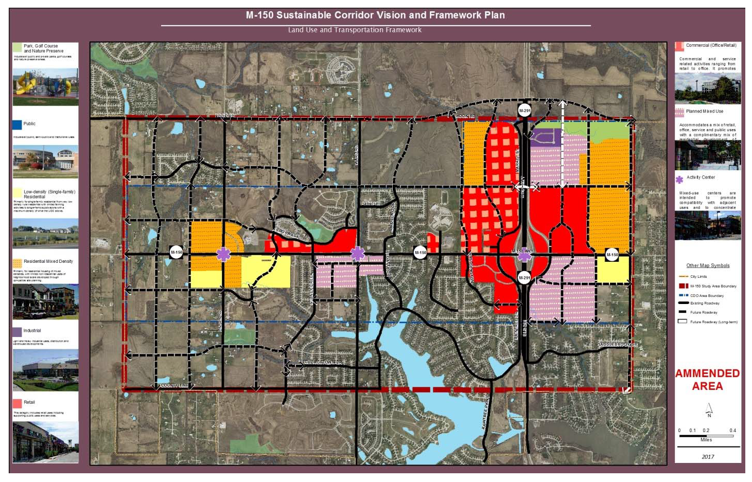
Map 1: M-150 CDO Boundaries
3.
Land use and transportation framework. The following legends on the Framework Map above are more fully described below and correlate to their respective locations on the map:
a.
Activity center—Mixed-use. Activity centers or "commercial nodes" are situated at primary intersections along M-150 and are to include a concentrated mixed-use development that can be easily accessed and supported by existing and future neighborhoods. Ideally these centers will be multi-storied with a vertical mix of uses. These are not intended to be large developments but should be designed with social gathering places. Residential use above the first floor is highly recommended.
b.
Retail. Retail categories are intended to support large commercial retail stores, either individually or grouped together. These types of developments have increased traffic and parking demands, increased impervious surfaces and increased environmental impacts. Developments within this category are expected to increase necessary controls to minimize the environmental impacts they generate.
c.
Commercial (office/retail). Commercial areas include both office and retail uses which can be standalone buildings or a vertical mix of uses within a single building. This category promotes creative integration of more intensive retail uses and less intensive office uses in one general area.
d.
Residential mixed density. This area supports residential housing of mixed densities with limited non-residential uses of neighborhood scale developed through compatible site planning.
e.
Planned mixed-use. Planned mixed-use accommodates a mix of retail, office, service and public uses with a complimentary mix of residential development of varying densities. Business park type of uses may also be mixed with retail and office uses where appropriate.
f.
Park, golf course, nature preserve, open space. This category includes all public and private parks, golf courses and nature preserve areas.
4.
Conflict. These design standards are additive; more than one set of standards may apply to a particular development project. The more restrictive provision, as determined by the Director, shall control in cases where standards conflict.
5.
Alternative equivalent compliance.
a.
Purpose and scope. To encourage creative and unique design, "alternative equivalent compliance" allows development to occur in a manner that meets the intent of this CDO yet through an alternative design that does not strictly adhere to the CDO's standards. This is not a general waiver of regulations. Rather, this section authorizes a site-specific plan that is equal to or better than the strict application of the standard in meeting the goals and policies in the M-150 Corridor Plan.
b.
Decision-making responsibility. Final approval of any alternative compliance proposed under this section shall be the responsibility of the decision-making body responsible for deciding upon the application. Administratively approved projects proposing alternative compliance shall receive written approval of the alternative compliance from the Director.
c.
Criteria. Alternative equivalent compliance may be approved if the applicant demonstrates that following criteria have been met by the proposed alternative:
(1)
Achieves the intent of the subject standard to the same or better degree than the subject standard;
(2)
Advances the goals and policies of the M-150 Corridor Plan and this CDO to the same or better degree than the subject standard;
(3)
Results in benefits to the community that are equivalent to or exceed benefits associated with the subject standard; and
(4)
Imposes no greater impacts on adjacent properties than would occur through compliance with the specific requirements of this ordinance.
d.
Effect of approval. Alternative compliance shall apply only to the specific site for which it is requested and shall not establish a precedent for approval of other requests.
B.
Development standards.
1.
Sensitive lands and natural resources. The provisions of the stream preservation standards in the City's Design and Construction Manual shall be applicable to development in the CDO. Green design provisions as further listed herein shall be applied to all development within the CDO.
2.
Pedestrian and bicycle connectivity and mobility.
a.
Purpose. The purpose of this section is to:
(1)
Support the creation of a highly connected transportation system within Lee's Summit in order to provide choices for drivers, bicyclists, and pedestrians;

Figure 5.510.B-1: Sidewalks on Both Sides of Street
(2)
Increase effectiveness of local service delivery; promote walking and bicycling; connect neighborhoods to each other and to local destinations such as employment, schools, parks, and shopping centers;
(3)
Reduce vehicle miles traveled; improve air quality and reduce emergency response times;
(4)
Mitigate the traffic impacts of new development, and free up arterial capacity for long-distance travel needs; and
(5)
Avoid the creation of large, isolated tracts without routes for through traffic or pedestrian and bicycle connections.
b.
Sidewalks required. Sidewalks shall be installed on both sides of all arterials, collector streets, and local streets pursuant to the standards of City's Design and Construction Manual. Connectivity is an important element in the implementation of the goals related to the "community for all ages" initiative that the City has embraced and is committed to. The Director may allow the use of alternative paving materials if a community improvement district or other long-term oversight board and funding mechanism is established to provide for ongoing maintenance.
c.
Block pattern.
(1)
New development shall establish a regular pattern of blocks to the extent feasible to avoid creating large "superblocks" that limit pedestrian, bicycle, and vehicular circulation.
(2)
On large sites or where block consolidation is proposed as part of redevelopment (by right-of-way abandonment), pedestrian, bicycle, and vehicular circulation access to surrounding neighborhoods shall be maintained to the maximum extent feasible.
d.
On-site pedestrian connections.
(1)
All development in the CDO shall provide a network of on-site pedestrian walkways with a minimum width of five feet to and between the following areas:
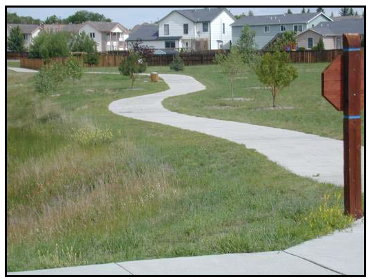
Figure 5.510.B-2: On-Site Pedestrian Connections
(a)
Entrances to each building on the site, including pad site buildings;
(b)
Public sidewalks, walkways, or trails on adjacent properties that extend to the boundaries shared with the subject development;
(c)
Public sidewalks along the perimeter streets adjacent to the development;
(d)
Adjacent land uses and developments;
(e)
Adjacent public park, greenway, or other public or civic use; and
(f)
Adjacent public transit station areas, transit stops, park and ride facilities, or other transit facilities.
(2)
On-site pedestrian connections shall be constructed of stone, slate, exposed aggregate concrete, plain concrete, or concrete pavers. Jogging trails and pathways in multi-family residential neighborhoods may be constructed of approved synthetic or natural material provided that the property owner's association is required to ensure long-term maintenance.
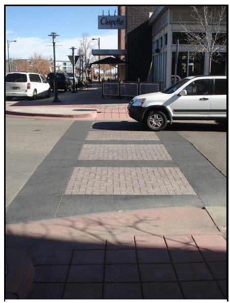
Figure 5.510.B-3: Decorative Materials for
Pedestrian Crossings
(3)
Internal pedestrian walkways shall be provided through parking areas in excess of 50 spaces, constructed of materials distinguishable from the driving surface pursuant to Section 5.370.C.7.e(1), below.
e.
Off-site pedestrian connections
(1)
In high traffic areas, pedestrian walkways and crosswalks in public streets shall be identified to motorists and pedestrians through the use of one or more of the following methods:
(a)
Changing paving color;
(b)
Painted crosswalks; or
(c)
Stamped concrete.
Additional identification methods may be used in private streets provided an improvement district or other funding mechanism is provided for long-term maintenance.
(2)
Pedestrian circulation routes along storefronts shall be emphasized with special design features that establish them as areas where pedestrians are physically separated from the flow of vehicular traffic and/or are protected from the elements. Techniques shall include one or more of the following:
(a)
Arcades, porticos, or other shade structures;
(b)
Pedestrian light features;
(c)
Bollards;
(d)
Seat walls or benches;
(e)
Drinking water fountains; and
(f)
Landscape planters.
(3)
The placement of street furniture and other decorative or functional items on the sidewalk shall not narrow the sidewalk at any point to less than four feet wide.
f.
Trail linkages.
(1)
Trail linkages shall be incorporated into the design of all new multifamily, and non-residential developments in support of the "community for all ages" initiative. Trail linkage shall be located and designed so as to provide public access, to connect residences and businesses to open space and the City's trail system, and to promote pedestrian and bicycle movement between residential areas and employment/ business areas.
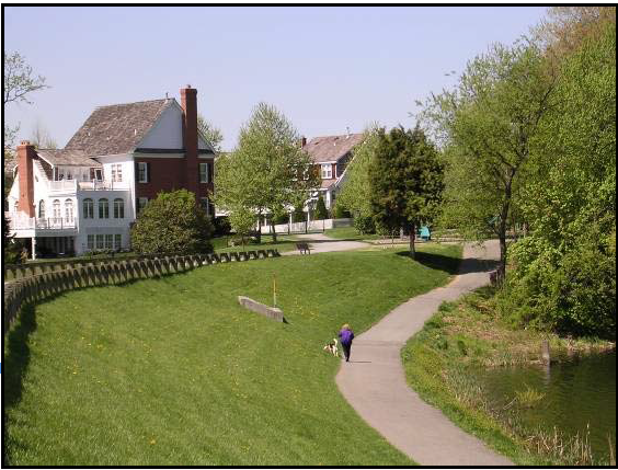
Figure 5.510.B-4: Residential Trail
Connection
(2)
All development shall be required to demonstrate that the design of the proposed development includes trail linkages pursuant to the M-150 Corridor Plan, Lee's Summit Greenway Master Plan, Metro Green, or other applicable plan.
(3)
Trails shall be constructed at the time of development in accordance with adopted City standards and specifications.
3.
Screening. The following screening standards shall apply in the M-150 CDO in addition to the requirements of Article 8, Division III, Landscaping, Buffers, and Tree Protection:
a.
Multi-family, mixed-use, and commercial screening. The following mechanical equipment screening standard shall apply to the maximum extent practicable.
(1)
Roof-mounted mechanical equipment. Roof-mounted mechanical equipment shall be screened by a parapet wall or similar feature that is an integral part of the building's architectural design. The parapet wall or similar feature shall be of a height equal to or greater than the height of the mechanical equipment being screened. Roof-mounted mechanical equipment, except solar energy collection systems, is prohibited on single-family residential dwellings.
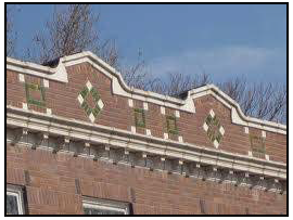
Figure 5.510.B-5: Parapet Wall
Screening Roof Mounted
Equipment
(2)
Wall-mounted mechanical equipment. Wall-mounted mechanical equipment, except air conditioning equipment (e.g., window AC units), that protrudes more than six inches from the outer building wall shall be screened from view by structural features that are compatible with the architecture and color of the subject building. Wall-mounted mechanical equipment that protrudes six inches or less from the outer building wall shall be designed to blend with the color and architectural design of the subject building.
(3)
Ground-Mounted Mechanical Equipment. Ground-mounted mechanical equipment shall be screened from view by landscaping or by a decorative wall that is compatible with the architecture and landscaping of the development site. The wall shall be of a height equal to or greater than the height of the mechanical equipment being screened.
(4)
Utilities.
(a)
Utility poles (other than wooden poles erected by a public utility company) and supports shall be painted or be of materials neutral in color.
(b)
All transformers and other facilities and equipment, including telecommunications equipment, shall either be screened through the use of architectural materials compatible with the architectural materials present on the site or, alternatively, through landscape screening.
(c)
Such screening shall be adequate to completely screen such facilities from all rights-of-way.
(5)
Alternate screening. Mechanical equipment that is not screened in full compliance with the screening standards of this section shall be reviewed in accordance with the procedures of Section 5.510.C.5., Alternative equivalent compliance. Alternate screening methods may include, but shall not be limited to, increased setbacks, increased landscaping, grouping the equipment on specific portions of a site, and painting or otherwise camouflaging the equipment.
b.
Screening of service, loading, and storage areas.
(1)
Applicability. These screening requirements are applicable to all service, loading, and storage areas. Owners are encouraged to locate the types of features listed in this subsection where they are not visible from off-site or from public areas of a site, so that screening is unnecessary.
(2)
Placement.
(a)
All service areas shall be placed at the rear, on the side of, or inside buildings.
(b)
No service area shall be visible from a public right-of-way or from adjacent residential areas.
(c)
Service areas and access drives shall be located so they do not interfere with the normal activities of building occupants or visitors on driveways, walkways, in parking areas or at entries.
(3)
Outside storage areas and loading docks.
(a)
All storage areas, service areas, and loading docks not screened by an intervening building shall be screened from view from any public street right-of-way. In addition, storage and loading areas must be screened from view from any adjoining property when that property requires a buffer as identified in Table 14.1, Buffer/Screen Impact. On property zoned or used industrial, all outside storage areas that are adjacent to nonindustrial zoned property must also be screened from view.
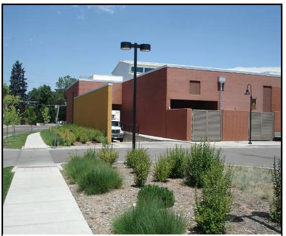
Figure 5.510.B-6: Loading Area
Placement and Screening
(b)
An opaque screen consisting of one or a combination of the following shall be used:
1)
Freestanding walls, wing walls, or fences;
2)
Earthen berms in conjunction with trees and other landscaping; or
3)
Landscaping, that must be opaque and eight feet in height within 18 months of planting.
(c)
Screening shall be a minimum height of eight feet to screen truck berths, loading docks, areas designated for permanent parking or storage of heavy vehicles and equipment or materials.
(d)
Screening shall be long enough to screen the maximum size trailer that can be accommodated on site. Sites that can accommodate a full size tractor-trailer shall provide a 48-foot wing wall, where wing walls are used.
(4)
Shopping cart storage. All shopping carts shall be stored inside the building they serve. Shopping cart corrals shall be made of a material suitable for withstanding weathering and rusting. Plastic corrals are prohibited.
(5)
Refuse facility screening. All refuse facilities, including new refuse facilities placed on an existing development, shall be large enough to accommodate a trash dumpster and shall be completely screened from view of public streets and adjoining nonindustrial zoned properties by:
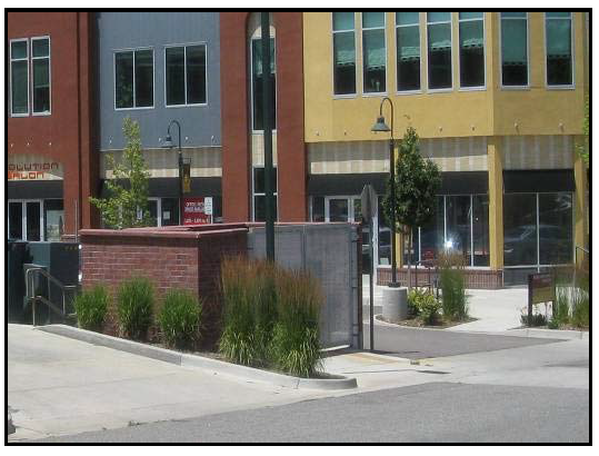
Figure 5.510.B-7: Refuse Facility
Screening
(a)
Meeting the requirements of the other sections of this section; or
(b)
Screening on three sides by a minimum six-foot masonry wall surrounded by evergreen landscaping. An opening shall be situated so that the container is not visible from adjacent properties or public streets and the opening shall be a metal clad opaque gate. Chain-link gates are not permitted. Gates must have tie backs to secure in the open position.
(6)
Design of screening. All screening shall be complementary to the building served in landscaping approach and through the use of similar colors and material palette.
4.
Multi-family development design standards.
a.
Applicability: Triplex, fourplex, townhome, apartment.
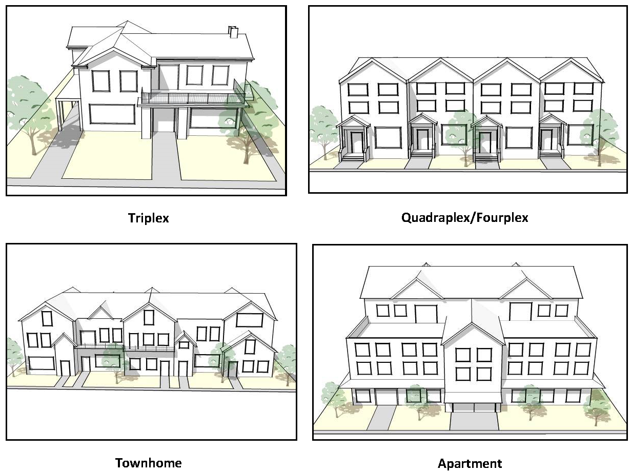
Figure 5.510.B-8
(1)
The design standards in this subsection apply to all new dwellings to be occupied by three or more households, including individually constructed buildings, townhomes, and multiple buildings constructed as parts of a larger development.
(2)
Elevator required. Multi-family buildings, three stories and above, shall, at a minimum, equip one out of every three buildings with an ADA approved elevator. This requirement is an instrument to establish the goals set out in the City's commitment to provide "a community for all ages."
(3)
This section replaces Sections 8.030 to 8.040 in the M-150 CDO. Sections 8.050, Planned Residential District Open Space Requirements; 8.060, Residential Street Design; 8.080.B, Pedestrian Lighting; 8.090, Residential Parking Locations; and 8.100, Residential Traffic Calming, are applicable within the M-150 CDO.
b.
Site layout and building orientation.
(1)
Minimum Building Separation. Multi-family structures shall be separated pursuant to the standards of the Building Code.
(2)
Building orientation:
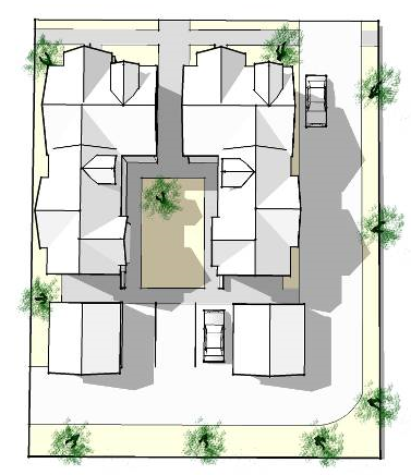
Figure 5.510.B-9: Courtyard
Orientation
(a)
Individual buildings within a multi-family development shall be oriented to:
1)
Common open space, such as interior courtyards or on-site natural areas or features;
2)
Perimeter streets;
3)
Other residential buildings; or
4)
Through-access drives.
(b)
To the maximum extent practicable, buildings shall be oriented or arranged in a manner to enclose common open spaces such as gardens, courtyards, recreation or play areas, that shall contain a minimum of three of these features:
1)
Seasonal planting areas,
2)
Trees,
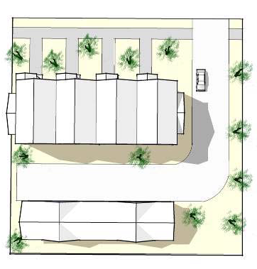
Figure 5.510.B-10: Perimeter Street
Orientation
3)
Pedestrian-scaled lighting,
4)
Gazebos or other decorative shelters,
5)
Seating,
6)
Play structures for children, or
7)
Natural features or areas, unless the City determines that for preservation reasons the buildings should avoid the feature or area.
(3)
Entrance orientation:
(a)
Primary entrances and façades shall not be oriented towards parking lots, garages, or carports.
(b)
All multi-family buildings shall comply with at least two of the following requirements:
1)
At least one main building entry faces an adjacent public street;
2)
A building entrance faces a courtyard or common open space that has a direct and visible connection to an adjacent public street;
3)
A building entry is connected to a public sidewalk by a system of interior walkways; or
4)
The pedestrian entries to the site from the public right-of-way are emphasized with enhanced landscaping, special paving, gateways, arbors, or similar features.
(c)
All ground-floor units with frontage along the primary street shall have an entrance that faces the street. Multi-family buildings located with multiple street frontages shall provide entrances to the building along each local street frontage.
1)
Exterior entrances from a public sidewalk or common open space are permitted for dwelling units on the ground floor.
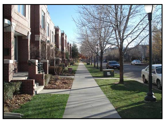
Figure 5.510.B-11: Ground-Floor Unit Entrances
2)
Exterior entrances shall be raised from the finished ground-floor level of the sidewalk a minimum of two feet.
(d)
Dwelling units above the ground floor shall have interior unit entrances, except that exterior stairs are permitted for access to upper-floor units only if they are oriented towards a central plaza not visible from any street.
(4)
Private common space. Developments with at least four units shall provide 400 square feet of private common open space for each multi-family dwelling unit. A minimum of 40 percent of the open space shall be usable for recreation, including uses such as swimming pools, sport courts, playgrounds with equipment, and/or community gardening. Required landscaping is excluded from open space calculations.
c.
Building design.
(1)
Four-sided design. All sides of a multi-family building visible from property occupied by or designated for single-family residential uses, an existing public street right-of-way, or other public lands shall display a similar level of quality and architectural detailing as on the front elevation.
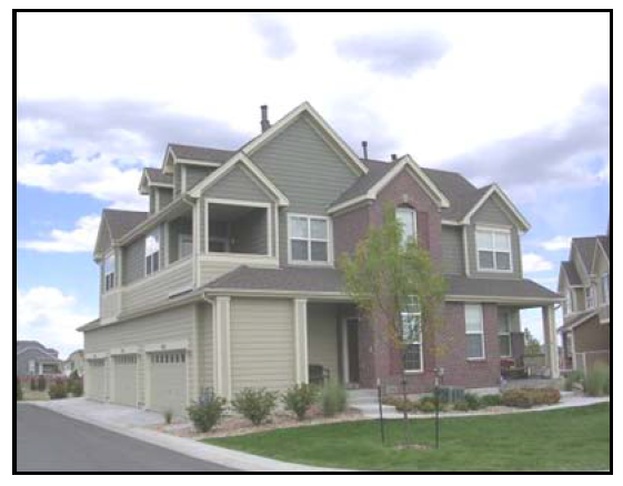
Figure 5.510.B-12: Four-Sided Design
(2)
Single-family attached dwelling façades.
(a)
The attached single-family dwellings in any one row structure shall be required to have distinctly different facades. No attached single-family structure facade shall be repeated more than once every four structures on the same side of the street.
(b)
The facades of single-family attached townhomes shall be punctuated by a change in texture or material, offset, or other architectural feature to differentiate individual units.
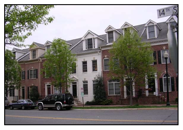
Figure 5.510.B-13: Single-Family
Attached Building Articulation
(c)
Any building (excluding parking garages and other accessory buildings) viewed from a public right-of-way or public open space shall either face such right-of-way or open space, or shall have a façade facing such area in keeping with the character of the front façade, including the utilization of similar fenestration and materials.
(3)
Building mass and articulation.
(a)
The elevations of all multi-family buildings shall be articulated through the incorporation of at least three or more of the following:
1)
Balconies;
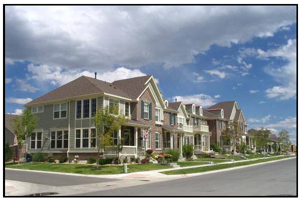
Figure 5.510.B-14: Multi-Family
Building Articulation
2)
Bay or box windows;
3)
Porches or covered entries;
4)
Dormers or other variations in the roof plane;
5)
Accent materials such as brick, stone, or stucco with banding highlights;
6)
Shutters;
7)
Variation in window sizes and shapes; or
8)
Vertical elements that demarcate building modules.
(b)
The height of each multi-family building taller than 35 feet shall be stepped down from its highest roofline at least one full story on any end of the building located within 50 feet of an adjacent area zoned or used for single-family residential.
(c)
Multi-family buildings shall provide concentrated unit access points. Access balconies and corridors running the length of the exterior of a building are prohibited.
(4)
Vertical articulation.
(a)
For all structures three stories or more in height, the base (first 20 feet) of a building shall be distinguished from the remainder of the building by providing a minimum of three of the design elements listed above in subsection (4)(a).
(b)
Multi-family buildings shall be designed to incorporate visually heavier and more massive elements at the building base, and lighter elements above the base. Upper stories shall not appear heavier or demonstrate greater mass than the lower stories of the building.
(5)
Building length. The maximum length of any multifamily building shall be 180 feet. Additional building length may be utilized when a minimum off-set of 4 feet for every 100 feet of building length to create a visually pleasing effect.
(6)
Transparency. At least 20 percent of all walls facing a public street shall contain windows or doorways.
(7)
Design of multiple buildings.
(a)
Developments with more than one multi-family building shall incorporate a variety of distinct building designs according to the scale of the development, as follows:
1)
Two to six buildings: Two models minimum; and
2)
Seven or more buildings: Three models minimum.
(b)
Distinct building designs, as required above, shall be easily distinguished through a minimum of two of the following:
1)
A variation in length;
2)
A variation in the footprint of the building;
3)
A distinct variation in color and use of materials;
4)
A variation in the type of dwelling unit contained in the building that results in a significantly different scale and mass, i.e., apartments vs. townhomes; or
5)
A distinct variation in building height and roof form.
(8)
Materials. All material shall be durable and long-lasting. The following materials are acceptable for multi-family residential construction:
Figure 5.510.B-15: Multi-Family
Parking Located Behind
Primary Structure
(a)
Brick, concrete stucco, stone, stone facing, wood, glass in combination with metal, or similar, durable architectural materials as approved by the Planning Commission.
(b)
Vinyl siding, EIFS, or synthetic stucco may be approved by the Planning Commission on a case-by-case basis.
d.
Parking location and layout.
(1)
Location and layout.
(a)
To the maximum extent feasible, garage entries, carports, parking areas, and parking structures shall be internalized in building groupings or oriented away from street frontage.
(b)
Parking areas and freestanding parking structures (detached garages or carports) shall not occupy more than 30 percent of each perimeter public street frontage of a multi-family development.
(c)
To the maximum extent practicable, freestanding parking structures that are visible from perimeter public streets shall be sited so that the narrow end of the parking structure is perpendicular to the perimeter street.
(2)
Carports and detached garages.
(a)
Detached garages and carports shall incorporate compatible materials, scale, colors, architectural details, and roof slopes similar to those of the primary multi-family buildings.
(b)
Rear walls of detached garages over 40 feet in length that back onto the perimeter street shall be articulated or punctuated through the use of window openings or other similar techniques.
5.
Mixed-use/non-residential design standards.
a.
Applicability. The design standards in this section apply to all mixed-use and commercial structures. These standards replace the standards in Article 8, Division I, Subdivision 3: Office, Commercial, and Industrial district design standards and Subdivision 4: Other Required Design Standards. Industrial development in the M-150 Corridor is not subject to these standards and remains subject to the provisions of Article 8, Division I.
b.
Vertical mixed-use. Vertical mixed-use developments are highly desirable within the CDO. Areas indicated as activity centers shall require multi-storied vertical mixed uses with buildings placed up to the front property line at the street. These areas are located at the major intersections of M-150 and Pryor Road, Ward Road and M-291. The required placements of these buildings enhance the desired urban environment along this corridor. Parking proposed in front of buildings located in the activity center areas is highly discouraged and, if allowed, shall only be permitted on a very limited basis through the development approval process. Additional planting materials shall be provided to minimize the visual impact for front loaded parking from the street.
c.
Site layout and building organization.
(1)
Private common spaces.
(a)
Required private common spaces. Mixed-use, commercial, and office development shall incorporate at least one on-site indoor or outdoor common space per building. Common space shall be visible and accessible and shall be located, where possible, along street frontages. Common spaces shall be connected, to the maximum extent practicable, to pedestrian areas, sidewalks, trails, or public open space in order to create functional pedestrian connectors.
Figure 5.510.B-16: Private Common Space
(b)
Features and amenities. The following features may be used to satisfy the private common space standard:
1)
Patio or plaza with seating and landscaping;
2)
Landscaped mini-parks or square;
3)
Rooftop or community garden; or
4)
Similar features as approved by the Director.
(c)
Design. Private common spaces shall be constructed of materials that are of a comparable quality and be of a compatible design as the building they are attached to or the public space in which they are placed.
(d)
Quantity and amount. The quantity and amount of required private common spaces shall vary as follows:
1)
For buildings 10,000 square feet or less — 1,000 square feet;
2)
For buildings between 10,001 and 20,000 square feet — 2,000 square feet that may be divided into two 1,000 square foot spaces; and
3)
For buildings over 20,000 square feet — An extra 1,000 square feet of common space per 10,000 square feet of building or portion thereof.
(2)
Building orientation.
(a)
Individual buildings. In cases where the long axis of a building is perpendicular to the primary street, the portion of the structure facing the primary street shall be configured with at least one operable entrance and one or more transparent windows as approved by the Director.
(b)
Multi-building developments.
1)
Buildings shall be organized to promote a compact pattern of development, pedestrian-friendly spaces, streetscapes, areas of naturalized landscaping, and to screen parking areas.
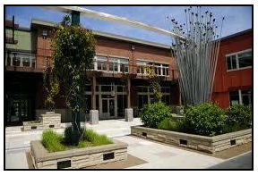
Figure 5.510.B-17: Buildings Arranged
to Create Pedestrian-Friendly Spaces
2)
Buildings shall be arranged and grouped so that their primary orientation complements one another and adjacent, existing development by:
a)
Framing the corner of an adjacent street intersection or entry point to the development;
b)
Framing and enclosing a pedestrian and/or vehicle road or access corridor within or adjacent to the development site;
c)
Framing and enclosing on at least three sides parking areas, public spaces, or other site amenities;
d)
Framing and/or enclosing outdoor dining or gathering spaces for pedestrians between buildings; or
e)
Framing one or more areas of natural vegetation.
(c)
Entrance orientation.
1)
To the maximum extent feasible, the principal building entrance shall face:
a)
An adjacent public street;
b)
An adjacent public plaza; or
c)
An adjacent primary public walkway.
2)
In cases where the principal entrance does not face the principal street, the entrance shall be connected to the street and adjacent parking areas with a sidewalk(s).
(3)
Outparcel development.
(a)
To the maximum extent practicable, outparcels and their buildings shall be clustered in order to define street edges, entry points, and intimate spaces for gathering or seating between buildings. The even dispersal of outparcel sites in a widely-spaced pattern along streets is strongly discouraged.
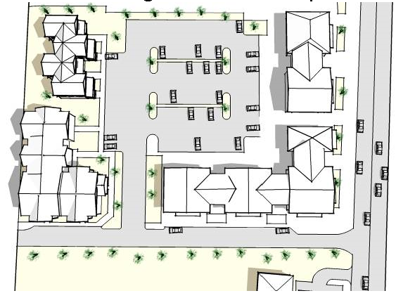
Figure 5.510.B-18: Site Layout of Outparcel
Development
(b)
Spaces between buildings on outparcels shall be improved to provide small-scale pedestrian amenities such as plazas, seating areas, pedestrian connections, gathering spaces, or well-landscaped parking areas.
d.
Streetscape design and character.
The following standards apply in lieu of the standard sidewalk requirements:
(1)
Public sidewalks required. In order to create an environment that is supportive of transit and pedestrian mobility, public sidewalks shall be provided along both sides of all streets in the mixed-use districts. Such sidewalks shall be at least 12 feet in width and no more than 16 feet in width, unless otherwise approved as part of the design review process. The 12-foot minimum requirement shall apply regardless of the available right-of-way. Where required, the sidewalk shall extend onto private property to fulfill the 12-foot minimum requirement, with a sidewalk easement provided. Property adjacent to M-150 or an arterial road shall provide a 10-foot wide landscaped linear buffer or a single-loaded row of parking between the public sidewalk and the roadway.
(2)
Delineation of sidewalk area. Sidewalks shall be organized into two distinct areas: A street tree/furniture area located adjacent to the curb, and a clear area.
(a)
Street tree/furniture area. The street tree/furniture area shall have a minimum width of six feet (from face-of-curb) and shall be continuous and located adjacent to the curb. The area shall be planted with street trees at an average spacing of 20 to 30 feet on center, based on the mature canopy width of the tree species selected and in accordance with Article 8, Division III. The area also is intended for the placement of street furniture including seating, street lights, waste receptacles, fire hydrants, traffic signs, newspaper vending boxes, bus shelters, bicycle racks, public utility equipment such as electric transformers and water meters, and similar elements designed to city specifications and located in a manner that does not obstruct pedestrian access or motorist visibility, and subject to applicable requirements of this UDO.
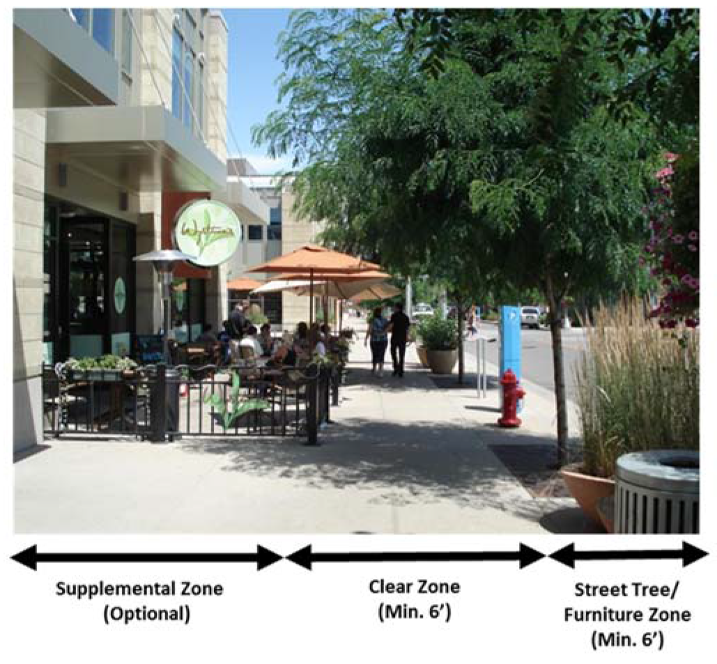
Figure 5.510.B-19: Delineation of
Sidewalk Area
(b)
Clear area. The clear area shall be a minimum width of six feet, shall be hardscaped, and shall be located adjacent to the street tree/furniture area. The clear area shall be unobstructed by any permanent or nonpermanent element for a minimum width of six feet and a minimum height of eight feet. Additional sidewalk width located between the clear area and the building may be used for outdoor dining or seating areas.
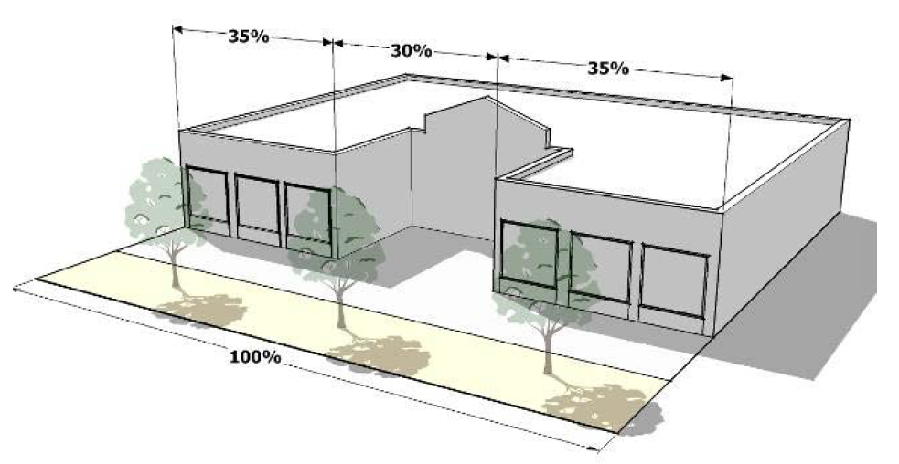
Figure 5.510.B-20: Building Set to
Sidewalk Clear Area
(c)
Supplemental zone. A supplemental zone may be provided at the option of the applicant between the street-facing façade or a side-facing facade and the required clear area, to provide additional areas for outdoor dining, porches, terraces, landscape and water features, and plazas. A supplemental zone, if provided, may be a maximum of 20 feet deep and may extend up to 30 percent of the linear frontage of the development. The supplemental zone shall not provide any parking or vehicle circulation areas.
(d)
Improvement district. An improvement district or other long-term oversight board and funding mechanism shall be established to provide for the maintenance of required streetscape.
(3)
Building placement. At least 70 percent of the building facade facing a public street shall be brought up to the clear area if provided.
(4)
Sidewalk entries.
(a)
Spacing. Sidewalk entries shall be provided to all buildings and individual units that front on the sidewalk.
(b)
Sidewalk entry hierarchy. Entrances into residential buildings in mixed-use areas are encouraged to follow a hierarchy of sizes and functions as follows:
1)
Carriage way: A centrally located twelve-foot wide entrance at sidewalk level for visual and direct access to a private courtyard.
2)
Secondary entry: A six-foot wide entrance with ornamental entrance gate and defined by a stoop with low cheek walls and planters at the sidewalk. Mailboxes, bike racks, and trash receptacles should be grouped around these secondary entries.
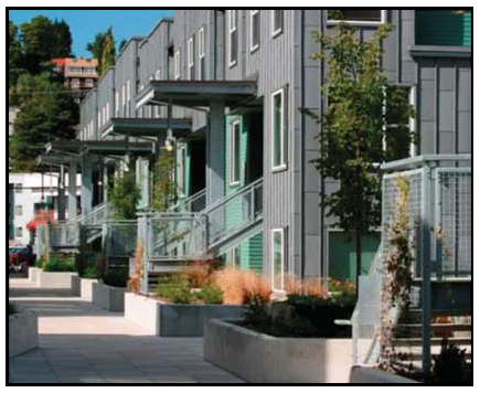
Figure 5.510.B-21: Secondary Entry
3)
Other entries: Home office and retail storefront entries which are either at grade or stooped shall be sized to accommodate specific requirements of the individual space.
(5)
Utilities. Transformers, switchgear, and related utility service equipment shall not be located above-ground in pedestrian access easements. Building service panels are to be located on the inside of all buildings.
(6)
Paving. Paving is intended to highlight or accentuate special areas along the ground plane while at the same time complementing the design of adjacent building and streetscape elements.
e.
Mix of uses. A diverse range of commercial, office, residential, and civic uses are desired within the PMIX zoned districts. The appropriate mix of uses will vary by its location, size, and the surrounding development contexts. Generally, larger sites located in areas where higher levels of activity are desirable should have a greater mix of uses than smaller sites. Vertical mixed-use developments are encouraged to create the desired urban context being promoted along the corridor.
(1)
Ground-floor uses.
(a)
Intent. The incorporation of commercial uses such as retail shops and restaurants at the street level is strongly desired within the mixed-use districts to promote a more active environment for pedestrians and support residential and office uses located within the same building (on upper floors) or nearby.
Figure 5.510.B-22: Active Street-Level
Uses and Outdoor Gathering Spaces
(b)
Standards.
1)
Location. Commercial uses shall be concentrated adjacent to transit stops, major public spaces, and in other areas where a high level of pedestrian activity and visibility is desirable. If a limited portion of a structure's ground level will be devoted to commercial space, such space shall be located along those facades adjacent to or most visible from transit corridors, primary street frontages, or major pedestrian walkways.
2)
Design and use of commercial space. Although the ground-floor commercial spaces may be used for residential units/office use, they should be designed for easy conversion to retail/commercial uses and shall be constructed to commercial standards.
(2)
Residential uses. Residential uses, where included, shall be incorporated within a mixed-use development to be visually and/or physically integrated with nonresidential uses. This shall be achieved by ensuring that residential uses meet at least two of the following:
(a)
Residential uses are vertically located above street-level commercial uses;
(b)
Residential uses are horizontally integrated into site development to provide a transition between the highest intensity uses within the center or development and the adjacent neighborhood;
(c)
No internal block walls are used that separate residential and nonresidential uses from each other; and
(d)
A pedestrian circulation system (i.e., sidewalks, crosswalks, trails, etc.) is provided that reduces conflict between pedestrian and vehicular movements and increases pedestrian activity between residential and nonresidential uses.
f.
Parking standards for mixed-use districts. The purpose of parking area requirements is to ensure that the parking areas themselves are not the dominant feature of the mixed-use development. These requirements severely restrict on-site surface parking (other than incidental parking in association with residential development leasing offices, or head-in or parallel spaces to support retail uses) and encourage physical consistency throughout the development, including the appearance of parking garages. In all mixed-use districts, the following standards apply:
(1)
Allowable parking. On-street parking shall not be designated per individual business or occupancy but may count toward the minimum parking requirements for the entire structure along the adjacent frontage. Parallel parking, head-in parking along streets, and/or minimal surface parking is permitted subject to approval through the site plan or development plan process and approval of a maintenance agreement.
(2)
Parking location. Off-street parking is prohibited between the principal street and the corresponding street-facing facade line.
(3)
Bicycle parking shall be provided for all developments as follows:
(b)
Design and location.
1)
Bicycle parking facilities shall include a rack or storage facility (e.g., locker) that enables bicycles to be secured. Where racks are used, they shall meet the following standards:
a)
The bicycle frame and one wheel can be locked to the rack with a high-security, U-shaped shackle lock if both wheels are left on the bicycle;
b)
A bicycle six feet long can be securely held with its frame supported so that the bicycle cannot be pushed or fall in a manner that will damage the wheels or components; and
c)
The rack must be securely anchored.
2)
Bicycle racks and storage facilities shall be accessible without moving another bicycle.
3)
Bicycle racks and storage facilities shall be located in convenient, visible, well-lit areas with easy access and near main entrances of all commercial, residential, and institutional buildings. Such locations shall be clearly noted with signage.
4)
The racks and storage facilities shall be located so they do not interfere with pedestrian traffic and shall be protected from potential damage by motor vehicles.
5)
Bicycle parking shall not be within any required landscape area nor interfere with any pedestrian pathway.
(4)
Parking lot screening. In all mixed-use districts, all surface parking lots adjacent to a public street shall be screened using one of the following methods below:
(a)
An informal hedge at least three feet in height at maturity consisting of a double row of shrubs planted three feet on-center in a triangular pattern; or
(b)
Berming of the grade to at least 2½ feet in height above the finish grade of the parking lot, and with slopes no greater than 2:1. Slopes shall be covered with shrubs spaced a maximum of three feet on center. Trees and flowering plants may be included in the berm plantings where the Director finds that long-term maintenance will be provided.
(5)
Parking structure design. The off-street parking required by mixed-use and non-residential development may be located in a parking structure. Such structure shall be subject to the following standards:
(a)
Design.
1)
Parking structures shall be constructed of materials of similar quality and shall be compatible in appearance with adjacent buildings and shall contain lighting sufficient for security as approved by the City.
2)
Ground floor facades of parking structures not occupied by active public uses shall be articulated through the use of three or more of the following architectural features:
a)
Windows or window-shaped openings with decorative mesh or similar features as approved by the Director;
b)
Masonry columns;
c)
Decorative wall insets or projections;
d)
Awnings;
e)
Changes in color or texture of materials;
f)
Approved public art;
g)
Integrated landscape planters; or
h)
Other similar features approved by the Director.
(b)
Entry design. Vehicle entries to off-street parking structures shall be integrated into the placement and design of adjacent buildings or oriented away from the primary street frontage. At a minimum, parking structures shall have user vehicles access from a location that minimizes conflicts with pedestrian circulation.
(c)
Wrapping of parking structure. Where feasible, the ground floor of parking structures in mixed-use or non-residential districts shall be wrapped with active public uses along at least 60 percent of the ground-floor street frontage. Parking structures with ground floors that are not wrapped with active public uses on the sides facing a public street or open to public view shall not:

Figure 5.510.B-23: Parking Structure Wrapped with Active Uses
1)
Abut street intersections or public/civic use areas,
2)
Be adjacent to public squares, or
3)
Occupy sites that are the terminus of a street vista.
g.
Building design.
(1)
Four-sided design.
(a)
All sides of a building shall be architecturally finished with equal levels of materials and detailing. Blank walls void of architectural details or other variation are prohibited.
Figure 5.510.B-24: Franchise Design Consistent with Surrounding Structures
(b)
Exceptions from the above standard may be granted for those areas of the building envelope that the applicant can demonstrate are not visible from adjacent development and public spaces.
(c)
Corporate or franchise architecture is discouraged in favor of architecturally compatible designs. The Director may require photographic examples of the more minimized corporate architecture in the designs and completed structure by the same company in other communities.
(2)
Consistent architectural theme.
(a)
The architectural design within a multi-building development of structures (including freestanding outparcel structures) shall be organized around a consistent architectural theme in terms of the character, materials, texture, color, and scale of buildings. Themed restaurants, retail chains, and other franchise-style structures shall adjust their standard architectural model to be consistent with a development's architectural character.
(b)
All buildings in a single development, whether developed at a single time or in phases, shall share at least four architectural features in order to create continuity within the overall development. These features include, but are not limited to, the following:
1)
Overhangs,
2)
Canopies or porticos,
3)
Recesses/projections,
4)
Arcades,
5)
Raised corniced parapets over the entrance,
6)
Peaked roof forms,
7)
Arches,
8)
Outdoor patios,
9)
Tower elements (at strategic locations),
10)
Display windows,
11)
Integral planters that incorporate landscaped areas or seating areas, and
12)
Public art/sculptures.
(3)
Building materials and colors.
(a)
Permitted materials. Building materials shall comply with Section 8.210.
(b)
Mix of materials:
1)
No single building material shall cover more than 80 percent of the front building façade. Windows and doors shall not be counted as additional building materials.
2)
Structures 20,000 square feet or less shall require a minimum of two distinct building materials on all facades to provide architectural detail and interest.
3)
Structures over 20,000 square feet shall require a minimum of three distinct building materials on all facades to provide architectural detail and interest.
(c)
Prohibited materials. The following materials are prohibited as primary cladding or roofing materials:
1)
Aluminum siding or cladding,
2)
Plastic or vinyl siding,
3)
Exposed aggregate, and
4)
Wood shingles.
Figure 5.510.B-25: Mix of Building Materials
(d)
Façade colors.
1)
Colors of paint, stains, and other finishes or materials shall complement each other.
2)
Generally, no more than four colors per building are permitted.
3)
Fluorescent colors are prohibited.
4)
Primary colors are prohibited.
5)
The use of stark white is discouraged.
(e)
Transparency and glazing.
1)
At least 25 percent of all walls facing a public street shall contain windows or doorways.
2)
Glazing shall be effectively clear, and shall not exceed 40 percent reflectance. Divided-light windows are encouraged. Materials that create noticeable glare or which restrict the ability of the public to view the inside of a structure from the outside are generally prohibited but may be allowed in limited locations in structures intended for financial or other uses with documentable safety concerns.
3)
Energy conserving window films and coatings are permissible within these standards.
(4)
Gateways. Buildings located at entrances to a development demarcate a gateway that will create an overall identity, set the tone for the development, and mark arrival or entry.
(a)
At major entry points of a development with three or more buildings, buildings shall be organized along the street and at the intersection to create a gateway.
(b)
Architectural features shall be incorporated into the facades of buildings at major entry points to help emphasize arrival or entry points into the development. These features may include, but are not limited to:
1)
Eaves,
2)
Planters,
3)
Mounted signs,
4)
Pilasters,
5)
Tower elements,
6)
Water features, or
7)
Arcades.
h.
Building massing and form.
(1)
Vertical articulation. Buildings greater than two stories or taller than 30 feet shall be designed to reduce apparent mass by including a clearly identifiable base, body, and top, with horizontal elements separating these components. The component described as the body must constitute a minimum of 50 percent of the total building height.

Figure 5.510.B-26: Vertical Articulation
(2)
Horizontal articulation. Buildings shall be designed to reduce apparent mass by dividing facades into a series of smaller components. No individual component shall have a length of more than 60 feet. Components shall be distinguished from one another through two or more of the following:
(a)
Variations in roof form and parapet heights;
(b)
Pronounced recesses and projections;
(c)
Distinct changes in texture and color of wall surfaces;
(d)
Ground level arcades and second floor galleries/balconies;
(e)
Protected and recessed entries; and
(f)
Vertical accents or focal points.
(3)
Relationship to surrounding development. New developments that are significantly larger than adjacent existing development in terms of their height and/or mass shall provide a development transition using an appropriate combination of the following techniques:
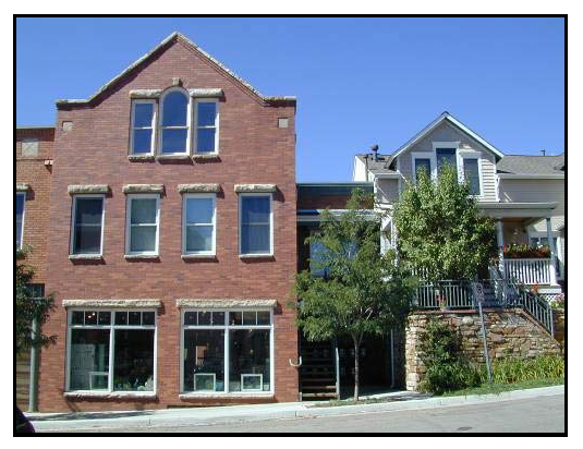
Figure 5.510.B-27: Appropriate Transition in Building Height and Mass
(a)
Wrapping the ground floor with a building element or integrated architectural feature (e.g., pedestrian arcade) that is the same height as the adjacent structure;
(b)
Graduating building height and mass in the form of building step-backs or other techniques so that new structures have a comparable scale with existing structures; or
(c)
Orienting porches, balconies, and other outdoor living spaces away from the shared property line to protect the privacy of adjacent residents where applicable.
(4)
Entrances and pedestrian areas.
Figure 5.510.B-28: Entrance Design
(a)
Primary entries and pedestrian frontages shall be clearly visible from the street and accentuated from the overall building facade by:
1)
Differentiated roof, awning, or portico;
2)
Covered walkways or arcades;
3)
Projecting or recessed entries from the surrounding building facade;
4)
Detailed doors and doorways with transoms, sidelights, trim details, and/or framing; and
5)
Windows within doorways equivalent in size to 50 percent of door surface area.
(b)
Secondary entrances shall have minor architectural detailing that adds visual interest to that portion of the façade.
(5)
Roofs.
(a)
Roofline articulation. Variations in roof lines shall be used to add interest and reduce the scale of large buildings. Roof features shall complement the character of the overall development.
(b)
Flat roofs. Flat roofs shall include parapets that adhere to articulation requirements for the main face of the structure. The average height of the parapet shall not exceed 15 percent of the height of the supporting wall, unless rooftop equipment cannot be sufficiently screened. A three-dimensional cornice treatment is encouraged for parapets. Parapets shall look complete from all sides if visible at any distance from the ground.
(c)
Overhanging eaves. Overhanging eaves shall extend no less than three feet past the supporting walls.
(d)
Roof pitch. Pitched roofs shall have a pitch consistent with the majority of buildings within 1,000 feet. This requirement excludes roofs for entries and dormers.
(e)
Architectural elements. Architectural elements that add visual interest to the roof, such as dormers and masonry chimneys, are encouraged.
(f)
Roof materials.
1)
Asphalt shingles, industry-approved synthetic shingles, standing seam metal or tile roofs are allowed.
2)
Wood shingles are prohibited. Corrugated metal, tar paper, and brightly-colored asphalt shingles may be permitted by the Director where they will not be visible from a roadway, public park, or residential district or use.
(6)
Awnings, canopies, arcades, and overhangs. Structural awnings are encouraged at the ground level to enhance the articulation of the building and provide shade.
(a)
The material of awnings and canopies shall complement the building.
(b)
Awnings shall not be internally illuminated.
(c)
Canopies shall not exceed 40 linear feet without a break.
(d)
Awnings shall not extend more than five feet over the sidewalk, unless otherwise approved by the Director, up to a maximum of 10 feet, and are in keeping with the architectural style of the building.
(e)
Canopies shall respect the placement of street trees and lighting and shall not interfere with them.
(f)
All large canopies that require structural columns for support shall have a minimum six-foot masonry (or other approved material) finish measured from the finished grade. Materials used on columns and canopies shall be complementary to the building.
i.
Residential compatibility standards.
(1)
Applicability. The residential compatibility standards in this subsection apply when nonresidential or mixed-use development is proposed adjacent to lots used by or zoned for detached or attached single-family structures in a residential district.
(2)
Use limitations. Where these compatibility standards apply, the following uses or features shall be prohibited as principal or accessory uses:
(a)
Public address/loudspeaker systems;
(b)
Outdoor storage; and
(c)
Uses providing delivery services via large tractor trailers (not including package delivery services).
(3)
Off-street parking location.
(a)
Off-street parking shall be established in one or more of the locations listed below. The locations are listed in priority order; the applicant shall select the highest feasible location from this list, and shall demonstrate why that application was selected over other alternative locations.
1)
Adjacent to off-street parking lots serving nonresidential uses on abutting lots;
2)
Adjacent to lot lines abutting nonresidential development;
3)
Adjacent to lot lines abutting mixed-use development;
4)
Behind the building;
5)
In front of the building; or
6)
Adjacent to lot lines abutting residential uses.
(b)
In cases where an off-street parking lot serving a nonresidential use is located on an abutting lot, connection between the two parking areas via a cross-accessway with a minimum width of 12 feet and a maximum width of 24 feet is strongly encouraged. A cross-access easement shall be recorded.
(4)
Relationship to surrounding uses.
(a)
Multi-building developments shall be configured to locate the tallest and largest structures within the core of the site and provide a gradual decrease in building height and mass towards adjacent residential land uses.
Figure 5.510.B-29: Gradual Decrease in Building
Height and Mass Towards
Adjacent Residential Uses
(b)
Horizontally integrated mixed-use developments shall locate nonresidential uses away from lots in adjacent residential areas.
(c)
Medium to high density housing shall be incorporated to the maximum extent feasible both within and around the development to facilitate connections between residential and non-residential uses.
(d)
Nonresidential structures taller or larger than adjacent residential uses shall be broken up into modules or wings with the smaller or shorter portions of the structure located adjacent to residential uses.
(5)
Facade configuration.
(a)
Service functions like refuse collection, incidental storage, and similar functions shall be integrated into the architecture of the building unless an alternate location places these functions farther from adjacent residential uses.
(b)
Windows shall be arranged to avoid direct lines-of-sight into abutting residential uses.
(c)
Multi-story structures with balconies, patios, or other public gathering spaces more than 24 feet above grade shall orient these features to avoid direct views into lots in low- and medium-density residential districts.
(6)
Landscaping. Native landscape materials are required. (See the native plant list at http://grownative.org/native-plant-info/plant-picker as amended from time to time).The native plant list provides plant species that are well suited for growing in the Midwest. Plants from this list shall be incorporated into all development landscape plans. The use of materials other than those listed is prohibited unless specifically approved as part of the development plan approval.
(7)
Landscaping/screening.
(a)
Screening shall not interfere with public sidewalks, vehicular cross-accessways, or improved pedestrian connections.
(b)
Any parking designated for trucks, recreational vehicles and other large vehicles shall be placed in a location which is not adjacent to either any street or to any residentially zoned property.
(8)
Operation.
(a)
Nonresidential uses with outdoor components (e.g., outdoor dining, performance venues) located adjacent to lots in a residential district shall curtail outdoor activities by 10:00 p.m.
(b)
Loading or unloading activities shall take place only between the hours of 7:00 a.m. and 11:00 p.m.
(c)
Alternate hours of activities may be approved through the development plan approval process.
j.
Green design. (See the sustainability subsection below.)
C.
Sustainability.
1.
Purpose. This section is intended to promote sustainable development within the M-150 Corridor by:
a.
Encouraging infill and redevelopment to slow the absorption of raw land and promote a more compact pattern of growth;
b.
Encouraging the integration of water and energy conservation techniques in site planning and building design;
c.
Protecting natural features, wooded areas, and mature trees that absorb greenhouse gases, reduce storm water runoff and pollutants, and provide wildlife habitat;
d.
Encouraging development patterns that encourage bicycling, walking, and other alternative modes of travel to promote a healthy community and improved air quality;
e.
Encouraging local production of food; and
f.
Encouraging the use of alternative energy sources.
2.
Sustainability requirements:
a.
New mandatory minimum development requirements:
(1)
Stormwater Best Management Practices (BMP's) identified in Section 5600 of the Kansas City Metropolitan Chapter of APWA Design Criteria and Section 5600 of Lee's Summit's Design and Construction Manual as amended from time to time shall be utilized in all new and redevelopment projects as further provided herein.
Environmental health and quality of life issue requires mitigation of the environmental impact of increased stormwater runoff due to development. By controlling the large water quantities produced by developing watersheds and minimizing resulting impairment, peak flows and overall quantity of stormwater can be maintained upon completion of the development activities.
Proposed stormwater management system design is sensitive to site characteristics including slopes, soil types, cover types, and infiltration capacity. These characteristics shall be considered in the site layout to improve both site drainage and water quality. The following BMP's shall be utilized either independently or in combination to meet the requirements established in the City's Design and Construction Manual.
(a)
Source control BMP's for stormwater management may include:
•
Infiltration trenches;
•
Filter strips;
•
Pervious paving;
•
Rain gardens;
•
Spill prevention;
•
Street and storm drain maintenance.
(b)
Source filtration BMPs may include:
•
Bio-retention;
•
Storm filters;
•
Dry swales and grass channels.
(c)
Regional retention and treatment may include:
•
Wet ponds;
•
Constructed wetlands;
•
Extended retention wetlands.
(2)
Erosion control as established in the Design and Construction Manual and maintained throughout the completion of the project or development.
(3)
LED lighting with flat lens full cut-off approved fixtures adhering to the International Dark-Sky Association (IDA).
(4)
Native plants per the approved list.
(5)
Locally sourced construction materials when possible.
(6)
Solar ready buildings.
(7)
Durable materials.
(8)
Construction and demolition debris and waste management plan. The waste management plan is intended to reduce the amount of construction/demolition related debris going into the land fill and to cull out recyclable materials for future use. Such waste management plan shall include provisions relating to:
(a)
Land clearing debris;
(b)
Waste handling procedures;
(c)
Location of waste dumpsters/bins;
(d)
Waste segregation if proposed;
(e)
Potential recycle location.
(9)
Waste containment on site shall be documented as to:
(a)
Method of containment;
(b)
Pick up/removal schedule;
(c)
Person in control of collection including method of 24-hour contact.
(10)
Construction staging area including:
(a)
Fencing material;
(b)
Location on site.
b.
New buildings shall incorporate a minimum of three of the following features:
(1)
Solar (passive or active), wind or geothermal renewable energy systems;
(2)
Energy-efficient materials, including recycled materials that meet the requirements of this Code;
(3)
Materials that are produced from renewable resources;
(4)
A green roof, such as a vegetated roof, or a cool roof;
(5)
Materials and designs that meet the U.S. Green Building Council's LEED-NC certification requirements;
(6)
A greywater recycling system;
(7)
Electrical vehicle charging station;
(8)
Xeriscape or water-conserving landscape materials;
(9)
Drip irrigation system for landscaped areas;
(10)
Shared parking;
(11)
Shade structures, covered parking, or shaded walkways.
3.
Renewable energy system standards.
a.
Solar array standards. All solar arrays shall be accessory to a principal use and shall comply with the following requirements:
(1)
Setbacks, location, and height.
(a)
A solar array shall not be located in the front yard between the principal structure and the public right-of-way.
Figure 5.510.C-1: Accessory Solar
Arrays in a Parking Lot
(b)
A solar array shall be located a minimum of six feet from all property lines and other structures.
(c)
An accessory solar array in any residential district shall not exceed the greater of one-half the footprint of the principal structure or 600 square feet, whichever is greater. The size of accessory arrays in mixed-use and nonresidential districts shall not exceed one-half of the footprint of the principal structure.
(d)
Solar arrays are permitted as an accessory use in a parking lot. However, the maximum lot coverage of any solar array shall not exceed 80 percent.
(e)
A solar array shall not exceed 20 feet in height.
(2)
Code compliance. Solar arrays shall comply with all applicable building and electrical codes contained in the adopted building code.
(3)
Solar easements. A property owner who has installed or intends to install a solar array shall be responsible for negotiating with other property owners in the vicinity for any necessary solar easement and shall record the easement with the county register of deeds.
b.
Solar collection standards.
(1)
Setbacks, location, and height.
(a)
A solar collection system shall be located a minimum of six feet from all property lines and other structures, except the structure on which it is mounted.
(b)
A solar collection system shall not extend more than five feet above the roofline or the maximum height permitted in the zoning district in which it is located, whichever is less.
(c)
A solar collection system may be located on an accessory structure.
(d)
A development proposed to have a solar collection system located on the roof or attached to a structure, or an application to establish a system on an existing structure, shall provide a structural certification as part of the building permit application.
(2)
Code compliance. Solar collection systems shall comply with all applicable building and electrical codes contained in the City's adopted building code.
(3)
Solar easements. A property owner who has installed or intends to install a solar collection system shall be responsible for negotiating with other property owners in the vicinity for any necessary solar easement and shall record the easement with the county register of deeds.
Sec. 5.610. - Introduction.
EnVision LS was first conceived at the announcement of the new diverging diamond interchange soon to replace the existing outdated and overburdened South M-291/US 50 Highway interchange. The City Council identified the area in and around the interchange as a targeted redevelopment opportunity directing staff to prepare a Master Development Plan for consideration. The Master Development Plan was to include Pine Tree Plaza, Adesa property and adjacent parcels along South M-291, the old Calmar property and the 85-acre Westcott Investment Group, LLC property just to the south of Calmar and bisected by Bailey Road.
Staff prepared a Conceptual Master Development Plan which was adopted by the City Council along with rezoning the properties to Planned Mixed Use, PMIX.
Envision LS — Adopted Conceptual Master Development Plan
Following adoption of the Conceptual Master Development Plan and PMIX zoning, Westcott Investment Group, LLC made Preliminary Development Plan application for "The Grove," an 85-acre mixed-use development with an established set of quality design standards. Approvals were subsequently granted for both the development plan and design standards.
EnVision LS Area Development Plan Design Standards shall be applied to all property within the EnVision LS area with the exception of the 85-acre development known as "The Grove" which will be governed by its own adopted set of design standards.
Planning Areas for Design Standards
The Conceptual Master Plan and associated Design Standards outlined herein exhibit the City's desire and commitment to a vision of "establishing and achieving a desired aesthetic and a high quality gateway community at a prime commercial location". These Design Standards were created to establish the minimum design standards necessary for the implementation of the expressed vision.
EnVision LS Design Standards serve to provide a structure for the development community to follow in preparation for development plan application submittals.
Sec. 5.620. - EnVision LS Area Development Plan (ADP).
A.
The ADP (Conceptual Master Development Plan) represents the desired mix and intensity of uses. However, uses depicted on the ADP are considered flexible and will be viewed and considered per development application and site location. The overall mix of uses should remain consistent with the overall approved ADP.
B.
Buildings should be located close to the street, two to five stories tall, have a high level of exterior finish, utilize brick and/or stone, and include heavy architectural elements, canopies, overhangs, and patios or balconies. The design of the buildings should include variable roof and exterior wall planes and trim details that divide the mass of the buildings and add visual interest.
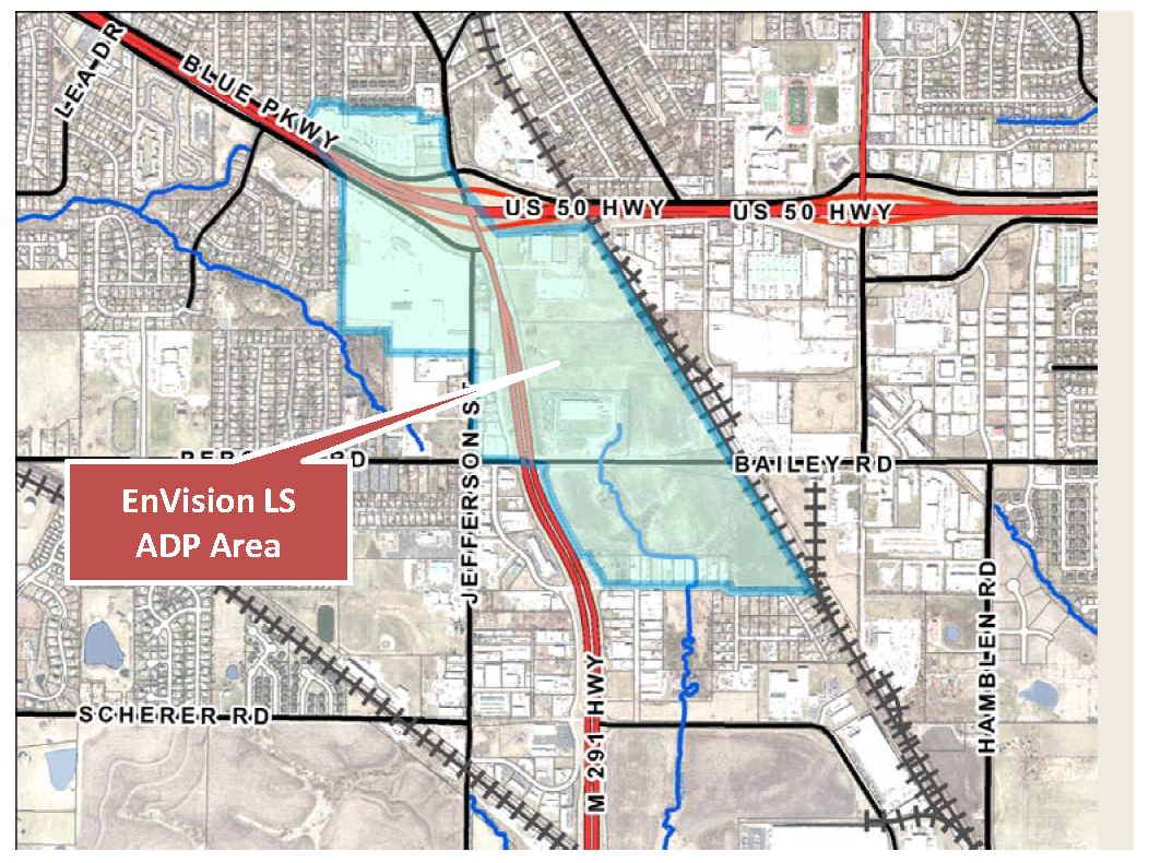
Area Development Plan Boundaries
C.
The larger EnVision LS Area Development Plan, ADP, is divided into three primary development areas, excluding "The Grove Area" for purposes of applying these design standards and further herein referred to as the ADP:
1.
LS Gateway (Pine Tree Plaza).
2.
LS Mixed Use (Adesa and properties adjacent to M-291 north of Persels).
3.
LS Arts and Entertainment District.
Planning Subareas for Design Standards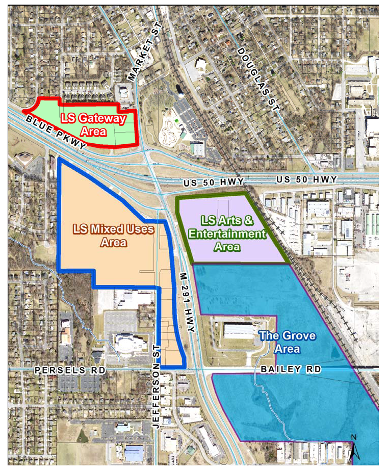
Sec. 5.630. - General provisions.
A.
Purpose. The purpose of these development standards is to facilitate the development of all property within the EnVision LS Area Development Plan located adjacent to and in close proximity to the new interchange improvements at South M-291 and US 50 Highway with the highest possible levels of community and building design consistent with the Area Development Plan (ADP).
Development standards within the ADP have been established to create a healthy and viable economic development and redevelopment area. The administration, enforcement, and amendment of these standards shall be consistent with the ADP. Amendments to these standards should only be considered when a proposed development plan is providing a higher standard than that reflected in the ADP.
B.
Applicability. These development standards are applicable to all property identified on the map labeled "Planning Subareas for Design Standards" in Section 5.620, as now or hereafter established. Development standards shall be applicable to all construction, reconstruction and expansion, but shall not be applicable to repairs and alterations. No land, building, structure, or premises shall be used for any purpose or in any manner other than that which is permitted under the approved uses established for each development as a part of their respective preliminary development plan.
C.
Conflict. These development standards are additive; more than one set of standards may apply to a particular development project. The more restrictive provision, as determined by the Director of Planning and Special Projects (Director), shall control in cases where standards conflict.
D.
Alternative equivalent compliance.
1.
Purpose and scope. To encourage creative and unique design, "alternative equivalent compliance" allows development to occur in a manner that meets the intent of these standards yet through an alternative design that does not strictly adhere to these standards. This is not a general waiver of regulations. Rather, this section authorizes a site-specific plan that is equal to or better than the strict application of these adopted standards while still meeting the goals and policies established herein.
2.
Decision-making responsibility. Final approval of any alternative compliance proposed under this section shall be the responsibility of the decision-making body responsible for deciding upon the application. Administratively approved projects proposing alternative compliance shall receive written approval of the alternative compliance from the Director.
3.
Criteria. Alternative equivalent compliance may be approved if the applicant demonstrates that the following criteria have been met by the proposed alternative:
a.
Achieves the intent of the subject standard to the same or better degree than the subject standard;
b.
Advances the goals and policies of the ADP to the same or better degree than the subject standard;
c.
Results in benefits to the community that are equivalent to or exceed benefits associated with the subject standard; and
d.
Imposes no greater impacts on adjacent properties than would occur through compliance with the specific requirements of this article.
4.
Effect of approval. Alternative compliance shall apply only to the specific site for which it is requested and shall not establish a precedent for approval of other requests.
(Ord. No. 8694, § 1, 8-6-2019)
Sec. 5.640. - Development standards.
A.
Sensitive lands and natural resources. The provisions of the stream preservation standards in the City's Design and Construction Manual shall be applicable to development in the ADP.
B.
Pedestrian and bicycle connectivity and mobility.
1.
Purpose. The purpose of this section is to:
a.
Support the creation of a highly connected transportation system within Lee's Summit in order to provide choices for drivers, bicyclists, and pedestrians;
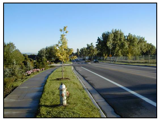
Sidewalks on Both Sides of Street
b.
Increase effectiveness of local service delivery; promote walking and bicycling; connect "development communities" to each other and to local destinations such as employment centers, parks, multi-family units and shopping centers;
c.
Reduce vehicle miles traveled; improve air quality and reduce emergency response times;
d.
Mitigate the traffic impacts of new development, and free up arterial capacity for long-distance travel needs; and
e.
Avoid the creation of large, isolated tracts without routes for traffic, pedestrian and bicycle connections.
2.
Sidewalks required. Sidewalks shall be installed on both sides of all streets pursuant to the standards of City's Design and Construction Manual. The Director may allow the use of alternative paving materials if a community improvement district or other long-term oversight board and funding mechanism is established to provide for ongoing maintenance.
3.
On-site pedestrian connections.
a.
Development within the ADP shall provide a network of on-site pedestrian walkways with a minimum width of five feet to and between the following areas:
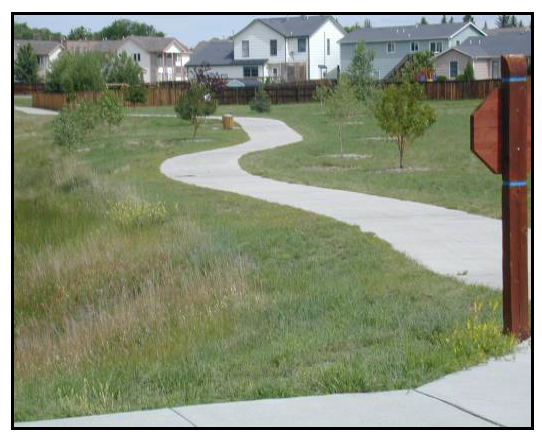
On-Site Pedestrian Connections
(1)
Entrances to each building on the site, including pad site buildings;
(2)
Public sidewalks, walkways, or trails on adjacent properties that extend to the boundaries shared with the subject development;
(3)
Public sidewalks along the perimeter streets adjacent to the development;
(4)
Adjacent land uses and developments;
(5)
Adjacent public park, greenway, or other public or civic use; and
(6)
Adjacent public transit station areas, transit stops, park and ride facilities, or other transit facilities.
b.
On-site pedestrian connections shall be constructed of materials distinguishable from the driving surface such as:
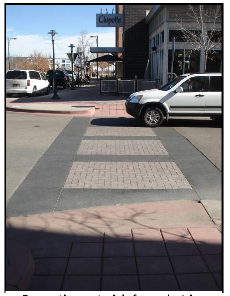
Decorative Materials for
Pedestrian Crossings
(1)
Changing paving color;
(2)
Painted crosswalks; or
(3)
Stamped concrete.
Additional identification methods may be used provided an improvement district or other funding mechanism is provided for long-term maintenance.
c.
Pedestrian circulation routes along storefronts shall be emphasized with special design features that establish them as areas where pedestrians are physically separated from the flow of vehicular traffic and/or are protected from the elements. Techniques shall include one or more of the following:
(1)
Arcades, porticos, or other shade structures;
(2)
Pedestrian light features;
(3)
Bollards;
(4)
Seat walls or benches;
(5)
Drinking water fountains; and
(6)
Landscape planters.
d.
The placement of street furniture and other decorative or functional items on the sidewalk shall not narrow the sidewalk at any point to less than four feet wide.
4.
Trail linkages.
a.
Trail linkages shall be incorporated into the design of all developments where practical. Trail linkages shall be located and designed to provide public access, connecting residential units and businesses to open space and the City's existing trail system where practical, and to promote pedestrian and bicycle movement between residential areas and employment/business areas.
Residential Trail Connection
b.
All development shall be required to demonstrate that the design of the proposed development includes trail linkages pursuant to Lee's Summit Greenway Master Plan, Metro Green, or other applicable plan.
c.
Trails shall be constructed at the time of development in accordance with adopted City standards and specifications.
C.
Screening. The following screening standards shall apply in the ADP in addition to the requirements of UDO Article 8, Division III, Landscaping, Buffers, and Tree Protection.
1.
Multi-family, mixed-use, and commercial screening. For all developments the following mechanical equipment screening standard shall apply to the maximum extent practicable.
Parapet Wall Screening Roof Mounted Equipment
a.
Roof-mounted mechanical equipment. Roof-mounted mechanical equipment shall be screened by a parapet wall or similar feature that is an integral part of the building's architectural design. The parapet wall or similar feature shall be of a height equal to or greater than the height of the mechanical equipment being screened.
b.
Wall-mounted mechanical equipment. Wall-mounted mechanical equipment, except air conditioning equipment (e.g., window AC units), that protrudes more than six inches from the outer building wall shall be screened from view by structural features that are compatible with the architecture and color of the subject building. Wall-mounted mechanical equipment that protrudes six inches or less from the outer building wall shall be designed to blend with the color and architectural design of the subject building.
c.
Ground-mounted mechanical equipment. Ground-mounted mechanical equipment shall be screened from view by landscaping or by a decorative wall that is compatible with the architecture and landscaping of the development site. The wall shall be of a height equal to or greater than the height of the mechanical equipment being screened.
d.
Utilities.
(1)
Utility poles and supports shall be painted or be of materials neutral in color. Wooden poles shall be prohibited.
(2)
All transformers and other facilities and equipment, including telecommunications equipment, shall either be screened through the use of architectural materials compatible with the architectural materials present on the site or, alternatively, through landscape screening.
(3)
Such screening shall be adequate to completely screen such facilities from all rights-of-way.
2.
Screening of service, loading, and storage areas.
a.
Applicability. These screening requirements are applicable to all service, loading, and storage areas. Owners are encouraged to locate the types of features listed in this subsection where they are not visible from off-site or from public areas of a site, so that screening is unnecessary.
b.
Placement.
(1)
All service areas shall be placed at the rear, on the side of, or inside buildings.
(2)
No service area shall be visible from a public right-of-way or from adjacent residential areas.
(3)
Service areas and access drives shall be located so they do not interfere with the normal activities of building occupants or visitors on driveways, walkways, in parking areas or at entries.
c.
Outside storage areas and loading docks.
(1)
All storage areas, service areas, and loading docks not screened by an intervening building shall be screened from view from any public street right-of-way. In addition, storage and loading areas must be screened from view from any adjoining property when that property requires a buffer as identified in UDO Table 8.890, Buffer/Screen Impact.
Loading Area Placement and
Screening
(2)
An opaque screen consisting of one or a combination of the following shall be used:
(a)
Freestanding walls, wing walls, or fences;
(b)
Earthen berms in conjunction with trees and other landscaping; or
(c)
Landscaping, that must be opaque and eight feet in height within 18 months of planting.
(3)
Screening shall be a minimum height of eight feet to screen truck berths, loading docks, areas designated for permanent parking or storage of heavy vehicles and equipment or materials.
(4)
Screening shall be long enough to screen the maximum size trailer that can be accommodated on site. Sites that can accommodate a full size tractor-trailer shall provide a 48-foot length wing wall, where wing walls are used.
d.
Shopping cart storage. All shopping carts shall be stored inside the building they serve. Shopping cart corrals shall be prohibited.
e.
Refuse facility screening. All refuse facilities, including new refuse facilities placed on an existing development, shall be large enough to accommodate a trash dumpster and shall be completely screened from view of public streets and adjoining nonindustrial used properties by:
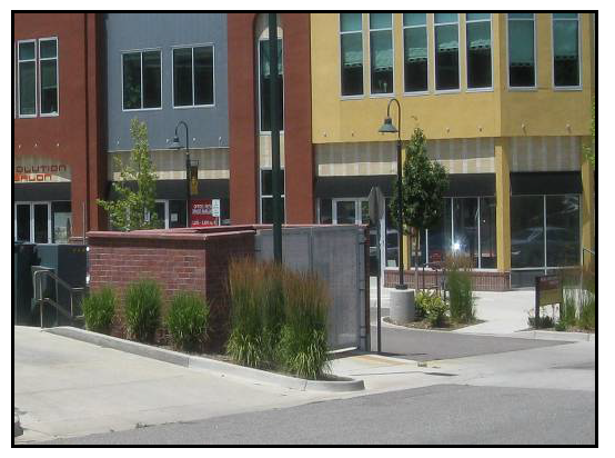
Refuse Facility Screening
(1)
Meeting the requirements of the other sections of this section; or
(2)
Screening on three sides by a minimum six-foot masonry wall surrounded by evergreen landscaping. An opening shall be situated so that the container is not visible from adjacent properties or public streets and the opening shall be a metal clad opaque gate or an alternate approved metal framed gate with black high density mesh screen. Chain-link gates are not permitted. Gates must have tie backs to secure in the open position.
f.
Design of screening. All screening shall be complementary to the building served in landscaping approach and through the use of similar colors and material palette.
D.
Multi-family residential development standards.
1.
Purpose. The purpose of the multi-family residential development standards is to enhance the quality and character of the built environment in the City. More specifically, the purposes of this section are to:
a.
Encourage high quality development as a strategy for investing in the ADP;
b.
Emphasize the unique character anticipated for the ADP;
c.
Maintain and enhance the quality of life for the City's citizens;
d.
Shape the City's appearance, aesthetic quality, and spatial form;
e.
Protect and enhance property values;
f.
Provide property owners, developers, architects, builders, business owners, and others with a clear and equitable set of parameters for developing land within the ADP;
g.
Promote the sustainability of both the structure and the overall community; and
h.
Promote the establishment of a gateway into the historic downtown.
2.
Design standards. Design standards in this subsection apply to all new multi-family development.
a.
Minimum building separation (for individual free standing buildings). Multi-family structures shall be separated pursuant to the standards of the Building Code.
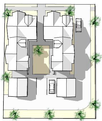
Courtyard Orientation
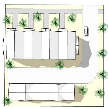
Perimeter Street Orientation
b.
Building orientation.
(1)
Individual buildings within a multi-family development shall be oriented to:
(a)
Common open space, such as interior courtyards or on-site natural areas or features;
(b)
Perimeter streets;
(c)
Other residential buildings; or
(d)
Through-access drives.
(2)
To the maximum extent practicable, individual buildings shall be oriented or arranged in a manner to enclose common open spaces such as gardens, courtyards, recreation or play areas, that shall contain a minimum of three of these features:
(a)
Seasonal planting areas,
(b)
Trees,
(c)
Pedestrian-scaled lighting,
(d)
Gazebos or other decorative shelters,
(e)
Seating,
(f)
Play structures for children, or
(g)
Natural features or areas, unless the City determines that for preservation reasons the buildings should avoid the feature or area.
c.
Entrance orientation.
(1)
Primary entrances and façades shall not be oriented towards parking lots, garages, or carports.
(2)
All individual multi-family buildings shall comply with at least two of the following requirements:
(a)
At least one main building entry faces an adjacent public street;
(b)
A building entrance faces a courtyard or common open space that has a direct and visible connection to an adjacent public street;
(c)
A building entry is connected to a public sidewalk by a system of interior walkways; or
(d)
The pedestrian entries to the site from the public right-of-way are emphasized with enhanced landscaping, special paving, gateways, arbors, or similar features.
(3)
All ground-floor units with frontage along the primary street shall have an entrance that faces the street. Individual multi-family buildings located with multiple street frontages shall provide entrances to the building along each local street frontage.
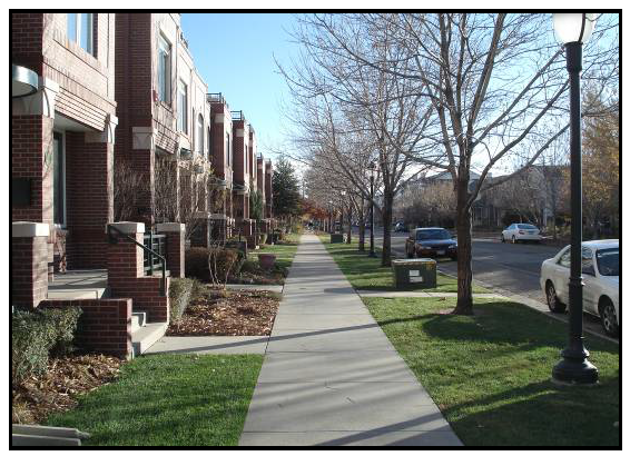
Ground-Floor Unit Entrances
(a)
Exterior entrances from a public sidewalk or common open space are permitted for dwelling units on the ground floor.
(b)
Exterior entrances shall be raised from the finished ground-floor level of the sidewalk a minimum of two feet.
(4)
Dwelling units above the ground floor shall have interior unit entrances including fire stair towers.
d.
Private common space. Individual multi-family building developments shall provide private common open space for recreation, including uses such as swimming pools, sport courts, playgrounds with equipment, and/or community gardening. Required landscaping is excluded from open space calculations.
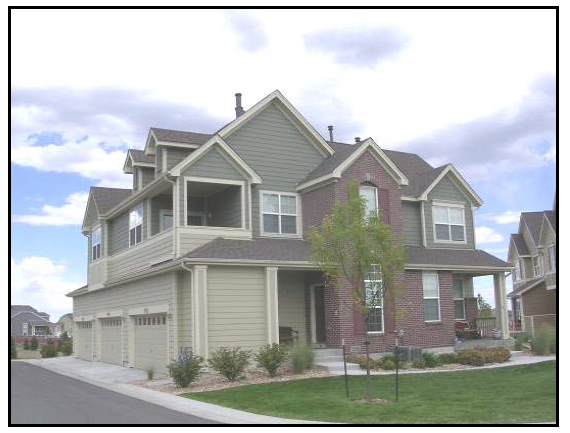
Four-Sided Design
3.
Building design.
a.
Four-sided design. All sides of a multi-family building shall display a similar level of quality and architectural detailing as on the front elevation.
b.
Building mass and articulation.
(1)
The elevations of all multi-family buildings shall be articulated through the incorporation of at least three or more of the following:
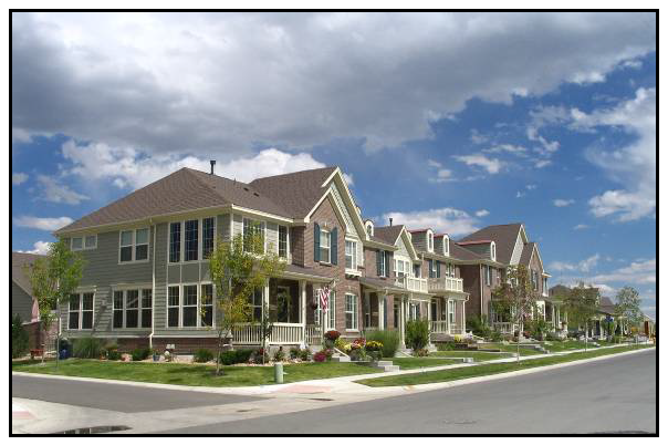
Multi-Family Building Articulation
(a)
Balconies;
(b)
Bay or box windows;
(c)
Porches or covered entries;
(d)
Dormers or other variations in the roof plane;
(e)
Accent materials such as brick, stone, or stucco with banding highlights;
(f)
Shutters;
(g)
Variation in window sizes and shapes; or
(h)
Vertical elements that demarcate building modules.
(2)
Multi-family buildings shall provide concentrated unit access points. Access balconies and corridors running the length of the exterior of a building are prohibited.
c.
Vertical articulation.
(1)
For all structures three stories or more in height, the base (first 20 feet) of a building shall be distinguished from the remainder of the building by providing a minimum of three of the design elements listed above in subsection b.(1).
(2)
Multi-family buildings shall be designed to incorporate visually heavier and more massive elements at the building base, and lighter elements above the base. Upper stories shall not appear heavier or demonstrate greater mass than the lower stories of the building.
d.
Building length. The maximum length of any multifamily building shall be 180 feet without offsets to break up the building length.
e.
Transparency. At least 20 percent of all walls facing a public street shall contain windows or doorways.
f.
Design of multiple buildings.
(1)
Developments with multiple buildings shall incorporate a variety of distinct building designs according to the scale of the development.
(2)
Distinct building designs shall include one or more of the following:
(a)
A variation in length of 30 percent or more;
(b)
A variation in the footprint of the building of 30 percent or more;
(c)
A distinct variation in color and use of materials; or
(d)
A distinct variation in building height and roof form.
g.
Materials. All material shall be durable and long-lasting. The following materials are acceptable for multi-family residential construction:
(1)
Brick, concrete stucco, stone, stone facing, wood, glass in combination with metal, or similar, durable architectural materials as approved by the Planning Commission.
(2)
Vinyl siding is prohibited and EIFS may only be utilized in a limited portion for detailed architectural elements above the second story.
4.
Parking location and layout.
Multi-Family Parking Located
Behind Primary Structure
a.
Location and layout.
(1)
To the maximum extent feasible, garage entries, carports, parking areas, and parking structures shall be internalized in building groupings or oriented away from street frontage.
(2)
Parking areas and freestanding parking structures (detached garages or carports) shall not occupy more than 30 percent of each perimeter public street frontage of a multi-family development.
(3)
To the maximum extent practicable, freestanding parking structures that are visible from perimeter public streets shall be sited so that the narrow end of the parking structure is perpendicular to the perimeter street.
b.
Carports and detached garages.
(1)
Detached garages and carports shall incorporate compatible materials, scale, colors, architectural details, and roof slopes similar to those of the primary multi-family buildings.
(2)
Rear walls of detached garages over 40 feet in length that back onto the perimeter street shall be articulated or punctuated through the use of window openings or other similar techniques.
E.
Mixed-use and commercial design standards.
1.
Applicability. The design standards in this section apply to all mixed-use and commercial (nonresidential) structures.
2.
Site layout and building organization.
a.
Private common spaces.
Private Common Space
(1)
Required private common spaces. Mixed-use, commercial, and office development shall incorporate at least one on-site indoor or outdoor common space per building. Common space shall be visible and accessible and shall be located, where possible, along street frontages. Common spaces shall be connected, to the maximum extent practicable, to pedestrian areas, sidewalks, trails, or public open space in order to create functional pedestrian connectors.
(2)
Features and amenities. The following features may be used to satisfy the private common space standard:
(a)
Patio or plaza with seating and landscaping;
(b)
Landscaped mini-parks or square;
(c)
Rooftop or community garden; or
(d)
Similar features as approved by the Director.
(3)
Design. Private common spaces shall be constructed of materials that are of a comparable quality and be of a compatible design as the building they are attached to or the public space in which they are placed.
b.
Building orientation.
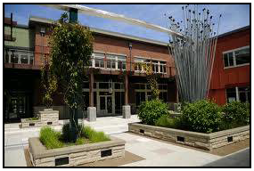
Buildings Arranged to Create
Pedestrian-Friendly Spaces
(1)
Individual buildings. In cases where the long axis of a building is perpendicular to the primary street, the portion of the structure facing the primary street shall be configured with at least one operable entrance and one or more transparent windows as approved by the Director.
(2)
Multi-building developments.
(a)
Buildings shall be organized to promote a compact pattern of development, pedestrian-friendly spaces, streetscapes, areas of naturalized landscaping, and to screen parking areas.
(b)
Buildings shall be arranged and grouped so that their primary orientation complements one another and adjacent, existing development by:
1)
Framing the corner of an adjacent street intersection or entry point to the development;
2)
Framing and enclosing a pedestrian and/or vehicle road or access corridor within or adjacent to the development site;
3)
Framing and enclosing on at least three sides parking areas, public spaces, or other site amenities;
4)
Framing and/or enclosing outdoor dining or gathering spaces for pedestrians between buildings; or
5)
Framing one or more areas of natural vegetation.
(3)
Entrance orientation.
(a)
To the maximum extent feasible, the principal building entrance shall face:
1)
An adjacent public street;
2)
An adjacent public plaza; or
3)
An adjacent primary public walkway.
(b)
In cases where the principal entrance does not face the principal street, the entrance shall be connected to the street and adjacent parking areas with a sidewalk(s).
c.
Outparcel development.
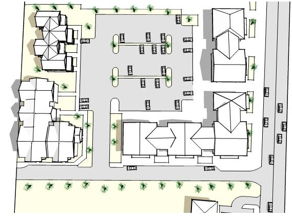
Site Layout of Outparcel Development
(1)
To the maximum extent practicable, outparcels and their buildings shall be clustered in order to define street edges, entry points, and intimate spaces for gathering or seating between buildings. The even dispersal of outparcel sites in a widely-spaced pattern along streets is strongly discouraged.
(2)
Spaces between buildings on outparcels shall be improved to provide small-scale pedestrian amenities such as plazas, seating areas, pedestrian connections, gathering spaces, or well-landscaped parking areas.
3.
Streetscape design and character. The following standards apply in lieu of the standard sidewalk requirements:
a.
Public sidewalks required. In order to create an environment that is supportive of transit and pedestrian mobility, public sidewalks shall be provided along both sides of all streets in the mixed-use districts. Such sidewalks shall be at least ten feet in width and should not be more than 16 feet in width, unless otherwise approved as part of the design review process. The ten-foot minimum requirement shall apply regardless of the available right-of-way. Where required, the sidewalk shall extend onto private property to fulfill the ten-foot minimum requirement, with a sidewalk easement provided.
b.
Delineation of sidewalk area. Sidewalks shall be organized into two distinct areas: A street tree/furniture area located adjacent to the curb, and a clear area.
(1)
Street tree/furniture area. The street tree/furniture area shall have a minimum width of six feet (from face-of-curb) and shall be continuous and located adjacent to the curb. The area shall be planted with street trees at an average spacing of 20 to 30 feet on center, based on the mature canopy width of the tree species selected and in accordance with Article 8, Division III. The area also is intended for the placement of street furniture including seating, street lights, waste receptacles, fire hydrants, traffic signs, newspaper vending boxes, bus shelters, bicycle racks, public utility equipment such as electric transformers and water meters, and similar elements designed to city specifications and located in a manner that does not obstruct pedestrian access or motorist visibility, and subject to applicable requirements of this UDO.
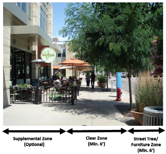
Delineation of Sidewalk Area
(2)
Clear area. The clear area shall be a minimum width of six feet, shall be hardscaped, and shall be located adjacent to the street tree/furniture area. The clear area shall be unobstructed by any permanent or nonpermanent element for a minimum width of six feet and a minimum height of eight feet. Additional sidewalk width located between the clear area and the building may be used for outdoor dining or seating areas.
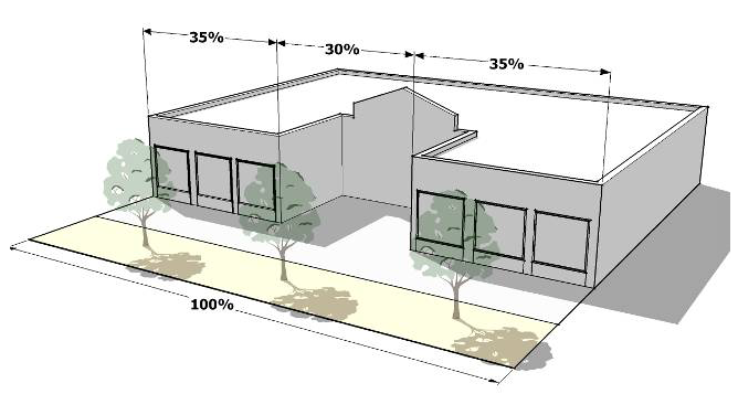
Building Set to Sidewalk Clear Area
(3)
Supplemental zone. A supplemental zone may be provided at the option of the applicant between the street-facing façade or a side-facing facade and the required clear area, to provide additional areas for outdoor dining, porches, terraces, landscape and water features, and plazas. A supplemental zone, if provided, may be a maximum of 20 feet deep and may extend up to 30 percent of the linear frontage of the development. The supplemental zone shall not provide any parking or vehicle circulation areas.
(4)
Improvement district. An improvement district or other long-term oversight board and funding mechanism shall be established to provide for the maintenance of required streetscape.
c.
Building placement. At least 70 percent of the building facade facing a public street shall be brought up to the clear area.
d.
Sidewalk entries.
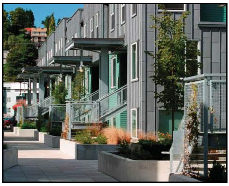
Secondary Entry
(1)
Spacing. Sidewalk entries shall be provided to all buildings and individual units that front on the sidewalk.
(2)
Sidewalk entry hierarchy. Entrances into residential buildings in mixed-use areas are encouraged to follow a hierarchy of sizes and functions as follows:
(a)
Carriage way: A centrally located twelve-foot wide entrance at sidewalk level for visual and direct access to a private courtyard.
(b)
Secondary entry: A six-foot wide entrance with ornamental entrance gate and defined by a stoop with low cheek walls and planters at the sidewalk. Mailboxes, bike racks, and trash receptacles should be grouped around these secondary entries.
(c)
Other entries: Home office and retail storefront entries which are either at grade or stooped shall be sized to accommodate specific requirements of the individual space.
e.
Utilities. Transformers, switchgear, and related utility service equipment shall not be located above-ground in pedestrian access easements. Building service panels are to be located on the inside of all buildings.
f.
Paving. Paving is intended to highlight or accentuate special areas along the ground plane while at the same time complementing the design of adjacent building and streetscape elements.
4.
Mix of uses. A diverse range of commercial, office, residential, and civic uses is desired within the ADP, zoned Planned Mixed Use (PMIX). The appropriate mix of uses will vary by its location, size, and the surrounding development contexts. Generally, the ADP should be followed to create the appropriate mix of uses.
Active Street-Level Uses and Outdoor Gathering Spaces
a.
Ground-floor uses.
(1)
Intent. The incorporation of commercial uses such as retail shops and restaurants at the street level is strongly desired within the mixed-use districts to promote a more active environment for pedestrians and support for residential and office uses located within the same building (on upper floors) or nearby.
(2)
Standards.
(a)
Location. Commercial uses shall be concentrated adjacent to transit stops, major public spaces, and in other areas where a high level of pedestrian activity and visibility is desirable. If a limited portion of a structure's ground level will be devoted to commercial space, such space shall be located along those facades adjacent to or most visible from transit corridors, primary street frontages, or major pedestrian walkways.
(b)
Design and use of commercial space. Ground-floor commercial spaces should not be used for residential units. However, residential unit leasing offices, fitness centers, and related accessory uses are appropriate for commercial ground floor use in a mixed use developments.
b.
Residential uses. Residential uses, where included, shall be incorporated within a mixed-use development to be visually and/or physically integrated with commercial (nonresidential) uses. This shall be achieved by ensuring that residential uses meet at least one of the following:
(1)
Residential uses are vertically located above street-level commercial uses;
(2)
Residential uses are horizontally integrated into site development to provide a transition between the highest intensity uses within the center or development and the adjacent neighborhood; and
(3)
A pedestrian circulation system (i.e., sidewalks, crosswalks, trails, etc.) is provided that reduces conflict between pedestrian and vehicular movements and increases pedestrian activity between residential and nonresidential uses.
5.
Parking standards for mixed-use districts. The purpose of parking area requirements is to ensure that the parking areas themselves are not the dominant feature of the mixed-use development. These requirements severely restrict on-site surface parking (other than incidental parking in association with residential development leasing offices, or head-in or parallel spaces to support retail uses) and encourage physical consistency throughout the development, including the appearance of parking garages. In all mixed-use districts, the following standards apply:
a.
Allowable parking. On-street parking shall not be designated per individual business or occupancy but may count toward the minimum parking requirements for the entire structure along the adjacent frontage. Parallel parking, head-in parking along streets, and/or minimal surface parking is permitted subject to approval through the site plan or development plan process and approval of a maintenance agreement.
b.
Bicycle parking design and location.
(1)
Bicycle parking facilities shall include a rack or storage facility (e.g., locker) that enables bicycles to be secured. Where racks are used, they shall meet the following standards:
(a)
The bicycle frame and one wheel can be locked to the rack with a high-security, U-shaped shackle lock if both wheels are left on the bicycle;
(b)
A bicycle six feet long can be securely held with its frame supported so that the bicycle cannot be pushed or fall in a manner that will damage the wheels or components; and
(c)
The rack must be securely anchored.
(2)
Bicycle racks and storage facilities shall be accessible without moving another bicycle.
(3)
Bicycle racks and storage facilities shall be located in convenient, visible, well-lit areas with easy access and near main entrances of all commercial, residential, and institutional buildings. Such locations shall be clearly noted with signage.
(4)
The racks and storage facilities shall be located so they do not interfere with pedestrian traffic and shall be protected from potential damage by motor vehicles.
(5)
Bicycle parking shall not be within any required landscape area nor interfere with any pedestrian pathway.
c.
Parking lot screening. In all mixed-use districts, all surface parking lots adjacent to a public street shall be screened using one of the following methods below:
(1)
An informal hedge at least three feet in height at maturity consisting of a double row of shrubs planted three feet on-center in a triangular pattern; or
(2)
Berming of the grade to at least two and one-half feet in height above the finish grade of the parking lot, and with slopes no greater than 2:1. Slopes shall be covered with shrubs spaced a maximum of three feet on center. Trees and flowering plants may be included in the berm plantings where the Director finds that long-term maintenance will be provided.
d.
Parking structure design. The off-street parking required by mixed-use and non-residential development may be located in a parking structure. Such structure shall be subject to the following standards:
(1)
Design.
(a)
Parking structures shall be constructed of materials of similar quality and shall be compatible in appearance with adjacent buildings and shall contain lighting sufficient for security as approved by the City.
(b)
Ground floor facades of parking structures not occupied by active public uses shall be articulated through the use of three or more of the following architectural features.
1)
Windows or window-shaped openings with decorative mesh or similar features as approved by the Director;
2)
Masonry columns;
3)
Decorative wall insets or projections;
4)
Awnings;
5)
Changes in color or texture of materials;
6)
Approved public art;
7)
Integrated landscape planters; or
8)
Other similar features approved by the Director.
(2)
Entry design. Vehicle entries to off-street parking structures shall be integrated into the placement and design of adjacent buildings or oriented away from the primary street frontage. At a minimum, parking structures shall have user vehicles access from a location that minimizes conflicts with pedestrian circulation.
(3)
Wrapping of parking structure. Where feasible, the ground floor of parking structures in mixed-use or non-residential districts shall be wrapped with active public uses along at least 60 percent of the ground-floor street frontage. Parking structures with ground floors that are not wrapped with active public uses on the sides facing a public street or open to public view shall not:
Parking Structure
(a)
Abut street intersections or public/civic use areas,
(b)
Be adjacent to public squares, or
(c)
Occupy sites that are the terminus of a street vista.
6.
Building design.
Franchise Design Consistent With Surrounding Structures
a.
Four-sided design.
(1)
All sides of a building shall be architecturally finished with equal levels of materials and detailing. Blank walls void of architectural details or other variation are prohibited.
(2)
Exceptions from the above standard may be granted for those areas of the building envelope that the applicant can demonstrate are not visible from adjacent development and public spaces.
(3)
Corporate or franchise architecture is discouraged in favor of architecturally compatible designs. The Director may require photographic examples of the more minimized corporate architecture in the designs and completed structure by the same company in other communities.
b.
Consistent architectural theme.
(1)
The architectural design within a multi-building development of structures (including freestanding outparcel structures) shall be organized around a consistent architectural theme in terms of the character, materials, texture, color, and scale of buildings. Themed restaurants, retail chains, and other franchise-style structures shall adjust their standard architectural model to be consistent with a development's architectural character.
(2)
All buildings in a single development, whether developed at a single time or in phases, shall share at least four architectural features in order to create continuity within the overall development. These features include, but are not limited to, the following:
(a)
Overhangs,
(b)
Canopies or porticos,
(c)
Recesses/projections,
(d)
Arcades,
(e)
Raised corniced parapets over the entrance,
(f)
Peaked roof forms,
(g)
Arches,
(h)
Outdoor patios,
(i)
Tower elements (at strategic locations),
(j)
Display windows,
(k)
Integral planters that incorporate landscaped areas or seating areas, and
(l)
Public art/sculptures.
c.
Building materials and colors.
(1)
Permitted materials. Building materials shall consist of brick, stone, precast masonry, and stucco. Pre-authorized use of limited amounts of conditional materials may be approved including architectural metal, CMU's and exterior insulated finishing systems (EIFS).
(2)
Mix of materials.
(a)
No single building material shall cover more than 80 percent of the front building façade. Windows and doors shall not be counted as additional building materials.
(b)
Structures 20,000 square feet or less shall require a minimum of two distinct building materials on all facades to provide architectural detail and interest.
(c)
Structures over 20,000 square feet shall require a minimum of three distinct building materials on all facades to provide architectural detail and interest.
(3)
Prohibited Materials. The following materials are prohibited as primary cladding or roofing materials:
(a)
Aluminum siding or cladding,
(b)
Plastic or vinyl siding,
(c)
Exposed aggregate, and
(d)
Wood shingles.
(4)
Façade colors.
(a)
Colors of paint, stains, and other finishes or materials shall complement each other.
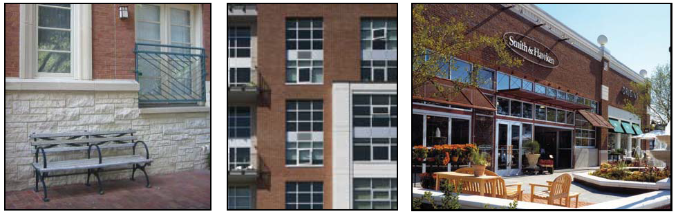
Mix of Building Materials
(b)
Generally, no more than four colors per building are permitted.
(c)
Fluorescent colors are prohibited.
(d)
Primary colors are prohibited.
(e)
The use of stark white is discouraged.
(5)
Transparency and glazing.
(a)
At least 25 percent of all walls facing a public street shall contain windows or doorways.
(b)
Glazing shall be effectively clear, and shall not exceed 40 percent reflectance. Divided-light windows are encouraged. Materials that create noticeable glare or which restrict the ability of the public to view the inside of a structure from the outside are generally prohibited but may be allowed in limited locations in structures intended for financial or other uses with documentable safety concerns.
(c)
Energy conserving window films and coatings are permissible within these standards.
d.
Gateways. Buildings located at entrances to a development demarcate a gateway that will create an overall identity, set the tone for the development, and mark arrival or entry.
(1)
At major entry points of a development with three or more buildings, buildings shall be organized along the street and at the intersection to create a gateway.
(2)
Architectural features shall be incorporated into the facades of buildings at major entry points to help emphasize arrival or entry points into the development. These features may include, but are not limited to:
(a)
Eaves,
(b)
Planters,
(c)
Mounted signs,
(d)
Pilasters,
(e)
Tower elements,
(f)
Water features, or
(g)
Arcades.
7.
Building massing and form.
a.
Vertical articulation. Buildings greater than two stories or taller than 30 feet shall be designed to reduce apparent mass by including a clearly identifiable base, body, and top, with horizontal elements separating these components. The component described as the body must constitute a minimum of 50 percent of the total building height.
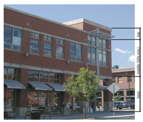
Vertical Articulation
b.
Horizontal articulation. Buildings shall be designed to reduce apparent mass by dividing facades into a series of smaller components. No individual component shall have a length of more than 60 feet. Components shall be distinguished from one another through two or more of the following:
(1)
Variations in roof form and parapet heights;
(2)
Pronounced recesses and projections;
(3)
Distinct changes in texture and color of wall surfaces;
(4)
Ground level arcades and second floor galleries/balconies;
(5)
Protected and recessed entries; and
(6)
Vertical accents or focal points.
c.
Relationship to surrounding development. New developments that are significantly larger than adjacent existing development in terms of their height and/or mass shall provide a development transition using an appropriate combination of the following techniques:
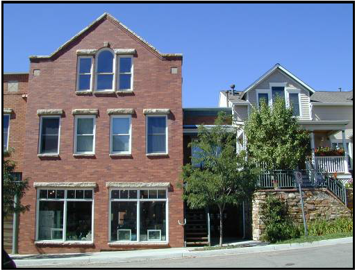
Appropriate Transition in Building Height and Mass
(1)
Wrapping the ground floor with a building element or integrated architectural feature (e.g., pedestrian arcade) that is the same height as the adjacent structure;
(2)
Graduating building height and mass in the form of building step-backs or other techniques so that new structures have a comparable scale with existing structures; or
(3)
Orienting porches, balconies, and other outdoor living spaces away from the shared property line to protect the privacy of adjacent residents where applicable.
d.
Entrances and pedestrian areas.
(1)
Primary entries and pedestrian frontages shall be clearly visible from the street and accentuated from the overall building façade by:
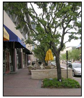
Entrance Design and
Pedestrian Areas
(a)
Differentiated roof, awning, or portico;
(b)
Covered walkways or arcades;
(c)
Projecting or recessed entries from the surrounding building facade;
(d)
Detailed doors and doorways with transoms, sidelights, trim details, and/or framing; and
(e)
Windows within doorways equivalent in size to 50 percent of door surface area.
(2)
Secondary entrances shall have minor architectural detailing that adds visual interest to that portion of the façade.
e.
Roofs.
(1)
Roofline articulation. Variations in roof lines shall be used to add interest and reduce the scale of large buildings. Roof features shall complement the character of the overall development.
(2)
Flat roofs. Flat roofs shall include parapets that adhere to articulation requirements for the main face of the structure. The average height of the parapet shall not exceed 15 percent of the height of the supporting wall, unless rooftop equipment cannot be sufficiently screened. A three-dimensional cornice treatment is encouraged for parapets. Parapets shall look complete from all sides if visible at any distance from the ground.
(3)
Overhanging eaves. Overhanging eaves shall extend no less than three feet past the supporting walls.
(4)
Roof pitch. Pitched roofs shall have a pitch consistent with the majority of buildings within 1,000 feet. This requirement excludes roofs for entries and dormers.
(5)
Architectural elements. Architectural elements that add visual interest to the roof, such as dormers and masonry chimneys, are encouraged.
(6)
Roof materials.
(a)
Asphalt shingles, industry-approved synthetic shingles, standing seam metal or tile roofs are allowed.
(b)
Wood shingles are prohibited. Corrugated metal, tar paper, and brightly-colored asphalt shingles may be permitted by the Director where they will not be visible from a roadway, public park, or residential district or use.
f.
Awnings, canopies, arcades, and overhangs. Structural awnings are encouraged at the ground level to enhance the articulation of the building and provide shade.
(1)
The material of awnings and canopies shall complement the building.
(2)
Awnings shall not be internally illuminated.
(3)
Canopies shall not exceed 40 linear feet without a break.
(4)
Awnings shall not extend more than five feet over the sidewalk, unless otherwise approved by the Director, up to a maximum of 10 feet, and are in keeping with the architectural style of the building.
(5)
Canopies shall respect the placement of street trees and lighting and shall not interfere with them.
(6)
All large canopies that require structural columns for support shall have a minimum six-foot masonry (or other approved material) finish measured from the finished grade. Materials used on columns and canopies shall be complementary to the building.
8.
Compatibility standards.
a.
Applicability. The compatibility standards in this subsection only apply when nonresidential or mixed-use development is proposed adjacent to lots used by or zoned for detached or attached single-family structures in a residential district outside of the ADP.
b.
Use limitations. Where these compatibility standards apply, the following uses or features shall be prohibited as principal or accessory uses:
(1)
Public address/loudspeaker systems;
(2)
Outdoor storage; and
(3)
Uses providing delivery services via large tractor trailers (not including package delivery services).
c.
Off-street parking location.
(1)
Off-street parking shall be established in one or more of the locations listed below. The locations are listed in priority order; the applicant shall select the highest feasible location from this list, and shall demonstrate why that application was selected over other alternative locations.
(a)
Adjacent to off-street parking lots serving nonresidential uses on abutting lots;
(b)
Adjacent to lot lines abutting nonresidential development;
(c)
Adjacent to lot lines abutting mixed-use development;
(d)
Behind the building;
(e)
In front of the building; or
(f)
Adjacent to lot lines abutting residential uses.
(2)
In cases where an off-street parking lot serving a nonresidential use is located on an abutting lot, connection between the two parking areas via a cross-accessway with a minimum width of 12 feet and a maximum width of 24 feet is strongly encouraged. A cross-access easement shall be recorded.
d.
Relationship to surrounding uses.
(1)
Multi-building developments shall be configured to locate the tallest and largest structures within the core of the site and provide a gradual decrease in building height and mass towards adjacent residential land use.
Gradual Decrease in Building Height
and Mass Towards Adjacent
Residential Uses
(2)
Horizontally integrated mixed-use developments shall locate nonresidential uses away from lots in adjacent residential areas.
(3)
Medium to high density housing shall be incorporated to the maximum extent feasible both within and around the development to facilitate connections between residential and non-residential uses.
e.
Façade configuration.
(1)
Service functions like refuse collection, incidental storage, and similar functions shall be integrated into the architecture of the building unless an alternate location places these functions farther from adjacent residential uses.
(2)
Windows shall be arranged to avoid direct lines-of-sight into abutting residential uses.
(3)
Multi-story structures with balconies, patios, or other public gathering spaces more than 24 feet above grade shall orient these features to avoid direct views into lots in low- and medium-density residential districts.
f.
Landscaping/screening.
(1)
Screening shall not interfere with public sidewalks, vehicular cross-accessways, or improved pedestrian connections.
(2)
Any parking designated for trucks, recreational vehicles and other large vehicles shall be placed in a location which is not adjacent to either any street or to any residentially zoned property.
g.
Operation.
(1)
Nonresidential uses with outdoor components (e.g., outdoor dining, performance venues) located adjacent to lots in a residential district shall curtail outdoor activities by 10:00 p.m.
(2)
Loading or unloading activities shall take place only between the hours of 7:00 a.m. and 11:00 p.m.
(3)
Alternate hours of activities may be approved through the conditional use permit process.
9.
Green design. To the maximum extent practicable, new buildings are encouraged to incorporate one or more of the following features:
Commercial Building With Solar Panels
a.
Opportunities for the integration of renewable energy features in the design of buildings or sites, such as: Solar, wind, geothermal, biomass, or low-impact hydro sources;
b.
Energy-efficient materials, including recycled materials that meet the requirements of this Code;
c.
Materials that are produced from renewable resources;
d.
A green roof, such as a vegetated roof, or a cool roof;
e.
Materials and design meeting the U.S. Green Building Council's LEED-NC certification requirements; or
f.
A greywater recycling system.
Sec. 5.650. - Area development plan (ADP) permitted uses.
A.
ADP permitted uses. The following uses are permitted throughout the ADP unless further modified in each "Specific Area" below or listed under "E. ADP Prohibited Uses":
1.
CP-2 office and retail uses permitted by right (P) in Table 6-1 of the Unified Development Ordinance.
2.
Loft dwellings.
3.
Multi-family residential apartments, market rate, age restricted and senior.
4.
Drug store including drive-up window.
5.
Financial services, including drive-up window and drive-through facility, as a "C" use such as banks and credit unions.
6.
Bars and taverns as a "C" use.
7.
Hotel.
8.
Massage therapy as a "C" use.
9.
Restaurant, general as a "C" use.
10.
Civic or fraternal organization as a "C" use.
11.
Research, design, marketing and production needs of the general business community.
12.
Other uses specifically approved as part of a Preliminary Development Plan or further modified from the "Specific Area Uses" or "Prohibited Uses".
•
Uses shown as "C" uses must comply with the conditions established in UDO Article 6, Division II unless further modified through the approval process.
B.
LS Gateway—Specific area uses.
1.
Rooftop restaurants.
2.
Medical clinic.
3.
Fitness center.
C.
LS mixed use—Specific area uses.
1.
Restaurants/coffee shops including drive-through.
2.
Indoor fitness/recreation center.
3.
Convenience store (C-Store).
4.
Business and vocational schools.
5.
Churches.
D.
LS arts and entertainment center—Specific area uses.
1.
Rooftop restaurants.
2.
Restaurants/coffee shops located within a larger building.
3.
Artist studio, video production labs.
4.
Performing arts.
5.
Hospital, medical clinic prohibited.
6.
Restaurant—Drive-up and drive-thru services prohibited.
E.
ADP prohibited uses.
1.
Automotive/truck related uses.
2.
Retail—Big box in excess of 80,000 square feet on one level.
3.
Call centers.
4.
Industrial uses.
5.
Outdoor storage.
6.
Indoor storage facility.
7.
Office warehouse.
8.
Pet and animal hospitals.
9.
Adult business, entertainment, personal services, bookstores, novelties and similar uses.
10.
Title loan, check cashing and unsecured loan businesses.
11.
Appliance repair unless accessory to the primary retail business, i.e., servicing what is being sold on the premises.
12.
Construction material sales and service.
13.
Car wash indoor or outdoor or automated.
14.
Equipment rental/lease.
15.
Building or ground maintenance.
16.
Bus terminal.
17.
Day care except as an accessory use located within a larger building complex for a permitted business use.
18.
Exterminating service.
19.
Martial arts studio except when associated with a fitness center.
20.
Pet grooming/pet motel.
21.
Plumbing and heating equipment dealers.
22.
Radio and TV repair.
23.
Repair services non-automotive.
24.
Reupholstery or furniture repair.
25.
Tattoo parlor, permanent cosmetic services, body piercing studio.
26.
Used merchandise sales, including thrift stores, second hand sales, refurbished equipment etc.
F.
Appeals for prohibited uses.
1.
Filing with City Clerk. If an applicant seeks relief from the restrictions in Subsection E. of this section (ADP Prohibited Uses), the applicant may file a written appeal with the City Clerk which shall include the following information:
a.
Date prepared;
b.
Name, address and telephone number of the applicant and the name, address and telephone number of the landowner if different than the applicant;
c.
Affidavit testifying to proof of ownership or of authorization of agent pursuant to Section 2.020, if applicable:
d.
Name, address and telephone number of all persons preparing any technical studies, maps, drawings and documents submitted with the appeal;
e.
Accurate legal description, accompanied by a legal description closure report for metes and bounds descriptions, of the property for which the application is submitted;
f.
Description of the proposed use, including size of the propose structure(s), floor area of each use within each structure, a description of the alterations, repairs or improvements that are proposed to existing structures, and any additional information needed to understand the location, extent and character of the proposed development, including whether the proposed development will be one or more new structures or alteration to one or more existing structures;
g.
A statement setting forth the reasons why relief should be granted and why the prohibited use should be allowed; and
h.
Any additional information required by City staff in order to evaluate the request.
2.
City Council hearing. The City Clerk shall schedule a hearing before the City Council within 30 days following the date that the appeal is filed, or as soon thereafter as practicable in the normal course of managing Council agendas, at which the applicant shall bear the burden of establishing that the requested relief should be granted.
3.
Decision and standards for determination. The standard to be applied to the Council's decision on the appeal shall be the same standard that applies to legislative decisions of the City Council. The Council may grant approval to the appeal or deny the appeal by motion, resolution or ordinance. By granting an appeal, such decision will only provide relief from the prohibited use restriction set forth in part E of this Section, in that the proposed use will be considered as a potentially allowable use for the applicant's subject property, but no additional rights shall accrue to the applicant. All other UDO requirements which would apply to development of the property shall be satisfied if an appeal is granted. An appeal granted by the Council shall apply only to the property that is legally described in the written appeal and shall not be transferrable to any other property in the ADP or any other property owned by the applicant.
4.
Development application. If the appeal is granted by the City Council, a subsequent application may be made by the applicant or property owner and such application shall be processed according to all applicable UDO requirements.
(Ord. No. 8693, § 1, 8-6-2019)
Sec. 5.660 - Signage.
Refer to development plan sign package or UDO Article 9, Signs.