
Middleton City Zoning Code
ARTICLE II
ESTABLISHMENT OF ZONING DISTRICTS
10.02.01 - PURPOSE
The area located within the jurisdiction of this Chapter is hereby divided into zoning districts of such number as is necessary to achieve compatibility of land uses within each district, to implement the City of Middleton Comprehensive Plan, and to achieve the other purposes of this Chapter.
10.02.02 - STANDARD ZONING DISTRICTS
(1)
For the purpose of this Chapter, all areas within the jurisdiction of this Chapter are hereby divided into the following standard zoning districts.
(2)
Vacation of public streets and alleys shall cause the land vacated to be automatically placed in the same district as the abutting side to which the vacated land reverts. See Wis. Stat. § 66.1003.
(3)
Annexations to or consolidations with the City subsequent to the effective date of this Chapter shall be placed in the AGR Agricultural zoning district, unless the annexation ordinance temporarily places the land in another district. Within one (1) year of the date of annexation, the Plan Commission shall evaluate and recommend a permanent district classification to the Common Council.
10.02.03 - INTERPRETATION OF ZONING DISTRICT BOUNDARIES
The following rules shall be used to determine the precise location of any zoning district boundary shown on the Official Zoning Map of the City of Middleton:
(1)
Zoning district boundaries shown as following or approximately following the limits of any city, town, or county boundary shall be construed as following such limits.
(2)
Zoning district boundaries shown as following or approximately following streets or railroad lines shall be construed as following the centerline of such streets or railroad lines.
(3)
Zoning district boundary lines shown as following or approximately following platted lot lines or other property lines as shown on the City or Dane County tax maps shall be construed as following such lines.
(4)
Zoning district boundaries shown as following or approximately following the centerlines of streams, rivers, or other continuously flowing watercourses shall be construed as following the channel centerlines of such watercourses, and, in the event of a natural change in the location of such streams, rivers, or other watercourses, the zoning district boundary shall be construed as moving with the channel centerline.
(5)
Zoning district boundaries shown as following or approximately following ridgelines or watershed boundaries shall be construed as following such lines.
(6)
Zoning district boundaries shown as separated from, any of the features listed in Subsections (1) through (5), above, shall be construed to be at such distances there from as are shown on the Official Zoning Map.
(7)
Where any uncertainty exists as to the exact location of a zoning district boundary line, as shown on the Official Zoning Map, the location of the line shall be determined by the Zoning Administrator.
10.02.04 - DESCRIPTION AND PURPOSE OF ZONING DISTRICTS
The following Sections specify the description and purpose of the standard zoning districts established by this Chapter, establish principal and accessory uses permitted by right or as conditional uses, establish bulk, density, and intensity standards, and reference other applicable regulations. The Intent statement of each zoning district is intended to convey the approximate gross densities for reference purposes, not regulatory purposes. Density on a given lot is determined through the bulk dimensional standards such as lot size, height, and setbacks. Definitions and regulations for land uses are provided in Article III. Section 10.03.05 includes a Table of Land Uses indicating which land uses are allowed in each zoning district, and whether they are permitted by right, by conditional use, as accessory uses, or as temporary uses. See Article IV for additional requirements on the location and bulk dimensions of structures in both residential and nonresidential developments.
10.02.10 - (SR-L) SINGLE-FAMILY RESIDENTIAL—LOW DENSITY ZONING DISTRICT
(1)
Intent
This district is intended to create, preserve, and enhance areas for moderate density single-family detached dwellings with approximate gross densities of six (6) dwelling units per acre.
(2)
Principal Uses Permitted by Right
Refer to Article III for detailed definitions and requirements for each of the following land uses.
(a)
Single-Family Dwelling Unit.
(b)
Manufactured Home.
(c)
Individual Family Living Arrangement.
(d)
Outdoor Open Space Institutional.
(e)
Passive Outdoor Recreation.
(f)
Active Outdoor Recreation.
(g)
Small Scale Public Services and Utilities.
(h)
Community Living Arrangement (one (1) to eight (8) residents) meeting the requirements of Section 10.03.12.
(i)
Community Garden.
(3)
Principal Uses Permitted Only as Conditional Use
Refer to Article III for detailed definitions and requirements for each of the following land uses.
(a)
Boarding House Living Arrangement.
(b)
Bed and Breakfast.
(c)
Community Living Arrangement (nine (9) to fifteen (15) residents) meeting the requirements of Section 10.03.12.
(d)
Communication Tower.
(e)
Cultivation.
(4)
Accessory Uses Permitted by Right
Refer to Section 10.03.05 Table of Land Uses and Section 10.03.28 for detailed definitions and requirements.
(5)
Accessory Uses Permitted Only as Conditional Use
Refer to Section 10.03.05 Table of Land Uses and Section 10.03.28 for detailed definitions and requirements.
(6)
Temporary Uses
Refer to Section 10.03.05 Table of Land Uses and Section 10.03.30 for detailed definitions and requirements.
(7)
Density, Intensity, and Bulk Regulations for the (SR-L) Single-Family Residential — Low Density District
(Ord. No. O1657, §§ 6—8, 6-17-2025)
10.02.11 - (SR-M) SINGLE-FAMILY RESIDENTIAL—MEDIUM DENSITY ZONING DISTRICT
(1)
Intent
This district is intended to create, preserve, and enhance areas for moderate density single-family detached dwellings with approximate gross densities of eight (8) dwelling units per acre.
(2)
Principal Uses Permitted by Right
Refer to Article III for detailed definitions and requirements for each of the following land uses.
(a)
Single-Family Dwelling Unit.
(b)
Manufactured Home.
(c)
Individual Family Living Arrangement.
(d)
Outdoor Open Space Institutional.
(e)
Passive Outdoor Recreation.
(f)
Active Outdoor Recreation.
(g)
Small Scale Public Services and Utilities.
(h)
Community Living Arrangement (one (1) to eight (8) residents) meeting the requirements of Section 10.03.12.
(i)
Community Garden.
(3)
Principal Uses Permitted Only as Conditional Use
Refer to Article III for detailed definitions and requirements for each of the following land uses.
(a)
Boarding Housing Living Arrangement.
(b)
Bed and Breakfast.
(c)
Community Living Arrangement (nine (9) to fifteen (15) residents) meeting the requirements of Section 10.03.12.
(d)
Communication Tower.
(e)
Cultivation.
(4)
Accessory Uses Permitted by Right
Refer to Section 10.03.05 Table of Land Uses and Section 10.03.28 for detailed definitions and requirements.
(5)
Accessory Uses Permitted Only as Conditional Use
Refer to Section 10.03.05 Table of Land Uses and Section 10.03.28 for detailed definitions and requirements.
(6)
Temporary Uses
Refer to Section 10.03.05 Table of Land Uses and Section 10.03.30 for detailed definitions and requirements.
(7)
Density, Intensity, and Bulk Regulations for the (SR-M) Single-Family Residential — Medium Density District
(Ord. No. O1657, §§ 9—11, 6-17-2025)
10.02.12 - (SR-H) SINGLE-FAMILY RESIDENTIAL—HIGH DENSITY ZONING DISTRICT
(1)
Intent
This district is intended to create, preserve, and enhance areas for high density single-family detached dwellings with approximate gross densities of fourteen (14) dwelling units per acre.
(2)
Principal Uses Permitted by Right
Refer to Article III for detailed definitions and requirements for each of the following land uses.
(a)
Single-Family Dwelling Unit.
(b)
Manufactured Home.
(c)
Individual Family Living Arrangement.
(d)
Outdoor Open Space Institutional.
(e)
Passive Outdoor Recreation.
(f)
Active Outdoor Recreation.
(g)
Small Scale Public Services and Utilities.
(h)
Community Living Arrangement (one (1) to eight (8) residents) meeting the requirements of Section 10.03.12.
(i)
Community Garden.
(3)
Principal Uses Permitted Only as Conditional Use
Refer to Article III for detailed definitions and requirements for each of the following land uses.
(a)
Boarding Housing Living Arrangement.
(b)
Bed and Breakfast.
(c)
Community Living Arrangement (nine (9) to fifteen (15) residents) meeting the requirements of Section 10.03.12.
(d)
Communication Tower.
(e)
Cultivation.
(4)
Accessory Uses Permitted by Right
Refer to Section 10.03.05 Table of Land Uses and Section 10.03.28 for detailed definitions and requirements.
(5)
Accessory Uses Permitted Only as Conditional Use
Refer to Section 10.03.05 Table of Land Uses and Section 10.03.28 for detailed definitions and requirements.
(6)
Temporary Uses
Refer to Section 10.03.05 Table of Land Uses and Section 10.03.30 for detailed definitions and requirements.
(7)
Density, Intensity, and Bulk Regulations for the (SR-H) Single-Family Residential — High Density District
(Ord. No. O1657, §§ 12—14, 6-17-2025)
10.02.13 - (MH-D) MANUFACTURED HOME RESIDENTIAL ZONING DISTRICT
(1)
Intent
This district is intended to create, preserve, and enhance subdivisions exclusively for manufactured and mobile home developments with approximate gross densities of six (6) dwelling units per acre.
(2)
Principal Uses Permitted by Right
Refer to Article III for detailed definitions and requirements for each of the following land uses.
(a)
Single-Family Dwelling Unit.
(b)
Manufactured Home.
(c)
Individual Family Living Arrangement.
(d)
Outdoor Open Space Institutional.
(e)
Passive Outdoor Recreation.
(f)
Active Outdoor Recreation.
(g)
Small Scale Public Services and Utilities.
(h)
Community Living Arrangement (one (1) to eight (8) residents) meeting the requirements of Section 10.03.12.
(i)
Community Garden.
(3)
Principal Uses Permitted Only as Conditional Use
Refer to Article III for detailed definitions and requirements for each of the following land uses.
(a)
Manufactured Home Subdivision or Park.
(b)
Bed and Breakfast.
(c)
Community Living Arrangement (nine (9) to fifteen (15) residents) meeting the requirements of Section 10.03.12.
(d)
Communication Tower.
(e)
Cultivation.
(4)
Accessory Uses Permitted by Right
Refer to Section 10.03.05 Table of Land Uses and Section 10.03.28 for detailed definitions and requirements.
(5)
Accessory Uses Permitted Only as Conditional Use
Refer to Section 10.03.05 Table of Land Uses and Section 10.03.28 for detailed definitions and requirements.
(6)
Temporary Uses
Refer to Section 10.03.05 Table of Land Uses and Section 10.03.30 for detailed definitions and requirements.
(7)
Density, Intensity, and Bulk Regulations for the (MH-D) Manufactured Home Residential District
(Ord. No. O1657, § 15, 6-17-2025)
10.02.20 - (TR-D) TWO-FAMILY RESIDENTIAL—DUPLEX ZONING DISTRICT
(1)
Intent
This district is intended to create, preserve, and enhance areas for single-family detached and two-family attached dwellings with approximate gross densities of eight (8) dwelling units per acre.
(2)
Principal Uses Permitted by Right
Refer to Article III for detailed definitions and requirements for each of the following land uses.
(a)
Single-Family Dwelling Unit.
(b)
Manufactured Home.
(c)
Duplex.
(d)
Twin House.
(e)
Two-Flat.
(f)
Individual Family Living Arrangement.
(g)
Outdoor Open Space Institutional.
(h)
Passive Outdoor Recreation.
(i)
Active Outdoor Recreation.
(j)
Small Scale Public Services and Utilities.
(k)
Community Living Arrangement (one (1) to eight (8) residents) meeting the requirements of Section 10.03.12.
(l)
Community Living Arrangement (nine (9) to fifteen (15) residents) meeting the requirements of Section 10.03.12.
(m)
Community Garden.
(3)
Principal Uses Permitted Only as Conditional Use
Refer to Article III for detailed definitions and requirements for each of the following land uses.
(a)
Board House Living Arrangement.
(b)
Bed and Breakfast.
(c)
Communication Tower.
(d)
Cultivation.
(4)
Accessory Uses Permitted by Right
Refer to Section 10.03.05 Table of Land Uses and Section 10.03.28 for detailed definitions and requirements.
(5)
Accessory Uses Permitted Only as Conditional Use
Refer to Section 10.03.05 Table of Land Uses and Section 10.03.28 for detailed definitions and requirements.
(6)
Temporary Uses
Refer to Section 10.03.05 Table of Land Uses and Section 10.03.30 for detailed definitions and requirements.
(7)
Density, Intensity, and Bulk Regulations for the (TR-D) Two-Family Residential — Duplex District
(Ord. No. O1657, §§ 16—18, 6-17-2025)
10.02.21 - (TR-F) TWO-FAMILY RESIDENTIAL—TWO-FLAT ZONING DISTRICT
(1)
Intent
This district is intended to create, preserve, and enhance areas for single-family detached and attached two-family dwellings with approximate gross densities of twelve (12) dwelling units per acre.
(2)
Principal Uses Permitted by Right
Refer to Article III for detailed definitions and requirements for each of the following land uses.
(a)
Single-Family Dwelling Unit.
(b)
Manufactured Home.
(c)
Two Flat.
(d)
Individual Family Living Arrangement.
(e)
Outdoor Open Space Institutional.
(f)
Passive Outdoor Recreation.
(g)
Active Outdoor Recreation.
(h)
Small Scale Public Services and Utilities.
(i)
Community Living Arrangement (one (1) to eight (8) residents) meeting the requirements of Section 10.03.12.
(j)
Community Living Arrangement (nine (9) to fifteen (15) residents) meeting the requirements of Section 10.03.12.
(k)
Community Garden.
(3)
Principal Uses Permitted Only as Conditional Use
Refer to Article III for detailed definitions and requirements for each of the following land uses.
(a)
Boarding Housing Living Arrangement.
(b)
Bed and Breakfast.
(c)
Communication Tower.
(d)
Cultivation.
(4)
Accessory Uses Permitted by Right
Refer to Section 10.03.05 Table of Land Uses and Section 10.03.28 for detailed definitions and requirements.
(5)
Accessory Uses Permitted Only as Conditional Use
Refer to Section 10.03.05 Table of Land Uses and Section 10.03.28 for detailed definitions and requirements.
(6)
Temporary Uses
Refer to Section 10.03.05 Table of Land Uses and Section 10.03.30 for detailed definitions and requirements.
(7)
Density, Intensity, and Bulk Regulations for the (TR-F) Two-Family Residential — Two-Flat District
(Ord. No. O1657, §§ 19—21, 6-17-2025)
10.02.22 - (MR-L) MULTI-FAMILY RESIDENTIAL—LOW DENSITY ZONING DISTRICT
(1)
Intent
This district is intended to create, preserve, and enhance areas for multi-family uses in small buildings such as townhouses, multiplexes, or apartments at low densities, with approximate gross densities of twelve (12) to thirty (30) dwelling units per acre.
(2)
Principal Uses Permitted by Right
Refer to Article III for detailed definitions and requirements for each of the following land uses.
(a)
Single-Family Dwelling Unit.
(b)
Manufactured Home.
(c)
Duplex.
(d)
Twin House.
(e)
Two Flat.
(f)
Townhouse.
(g)
Multiplex.
(h)
Apartment.
(i)
Individual Family Living Arrangement.
(j)
Outdoor Open Space Institutional.
(k)
Passive Outdoor Recreation.
(l)
Active Outdoor Recreation.
(m)
Small Scale Public Services and Utilities.
(n)
Community Living Arrangement (one (1) to eight (8) residents) meeting the requirements of Section 10.03.12.
(o)
Community Living Arrangement (nine (9) to fifteen (15) residents) meeting the requirements of Section 10.03.12.
(p)
Community Garden.
(3)
Principal Uses Permitted Only as Conditional Use
Refer to Article III for detailed definitions and requirements for each of the following land uses.
(a)
Boarding Housing Living Arrangement.
(b)
Live/Work Unit.
(c)
Group Day Care (nine (9) or more children).
(d)
Community Living Arrangement (sixteen (16) + residents) meeting the requirements of Section 10.03.12.
(e)
Institutional Residential.
(f)
Transit Center.
(g)
Off-Site Parking Lot.
(h)
Off-Site Structured Parking.
(i)
Communication Tower.
(j)
Cultivation.
(4)
Accessory Uses Permitted by Right
Refer to Section 10.03.05 Table of Land Uses and Section 10.03.28 for detailed definitions and requirements.
(5)
Accessory Uses Permitted Only as Conditional Use
Refer to Section 10.03.05 Table of Land Uses and Section 10.03.28 for detailed definitions and requirements.
(6)
Temporary Uses
Refer to Section 10.03.05 Table of Land Uses and Section 10.03.30 for detailed definitions and requirements.
(7)
Density, Intensity, and Bulk Regulations for the (MR-L) Multi-Family Residential — Low Density District
(Ord. No. O1657, §§ 22—24, 6-17-2025)
10.02.23 - (MR-M) MULTI-FAMILY RESIDENTIAL—MEDIUM DENSITY ZONING DISTRICT
(1)
Intent
This district is intended to create, preserve, and enhance areas for multi-family uses in small and mid-sized buildings such as townhomes, multiplexes, or apartments at medium densities, with approximate gross densities of thirty (30) to sixty (60) dwelling units per acre.
(2)
Principal Uses Permitted by Right
Refer to Article III for detailed definitions and requirements for each of the following land uses.
(a)
Single-Family Dwelling Unit.
(b)
Manufactured Home.
(c)
Duplex.
(d)
Twin House.
(e)
Two Flat.
(f)
Townhouse.
(g)
Multiplex.
(h)
Apartment.
(i)
Individual Family Living Arrangement.
(j)
Outdoor Open Space Institutional.
(k)
Passive Outdoor Recreation.
(l)
Active Outdoor Recreation.
(m)
Small Scale Public Services and Utilities.
(n)
Community Living Arrangement (one (1) to eight (8) residents) meeting the requirements of Section 10.03.12.
(o)
Community Living Arrangement (nine (9) to fifteen (15) residents) meeting the requirements of Section 10.03.12.
(p)
Community Garden.
(3)
Principal Uses Permitted Only as Conditional Use
Refer to Article III for detailed definitions and requirements for each of the following land uses.
(a)
Boarding House Living Arrangement.
(b)
Live/Work Unit.
(c)
Group Daycare Center (nine (9) or more children).
(d)
Community Living Arrangement (sixteen (16) + residents) meeting the requirements of Section 10.03.12.
(e)
Institutional Residential.
(f)
Transit Center.
(g)
Off-Site Parking Lot.
(h)
Off-Site Structured Parking.
(i)
Communication Tower.
(j)
Cultivation.
(4)
Accessory Uses Permitted by Right
Refer to Section 10.03.05 Table of Land Uses and Section 10.03.28 for detailed definitions and requirements.
(5)
Accessory Uses Permitted Only as Conditional Use
Refer to Section 10.03.05 Table of Land Uses and Section 10.03.28 for detailed definitions and requirements.
(6)
Temporary Uses
Refer to Section 10.03.05 Table of Land Uses and Section 10.03.30 for detailed definitions and requirements.
(7)
Density, Intensity, and Bulk Regulations for the (MR-M) Multi-Family Residential — Medium Density District
(Ord. No. O1657, §§ 25—27, 6-17-2025)
10.02.24 - (MR-H) MULTI-FAMILY RESIDENTIAL—HIGH DENSITY ZONING DISTRICT
(1)
Intent
This district is intended to create, preserve, and enhance areas for multi-family uses in mid-sized or large buildings such as townhomes, multiplexes, or apartments at higher densities, with approximate gross densities of sixty (60) to one hundred (100) dwelling units per acre or even higher.
(2)
Principal Uses Permitted by Right
Refer to Article III for detailed definitions and requirements for each of the following land uses.
(a)
Single-Family Dwelling Unit.
(b)
Manufactured Home.
(c)
Duplex.
(d)
Twin House.
(e)
Two Flat.
(f)
Townhouse.
(g)
Multiplex.
(h)
Apartment.
(i)
Individual Family Living Arrangement.
(j)
Outdoor Open Space Institutional.
(k)
Passive Outdoor Recreation.
(l)
Active Outdoor Recreation.
(m)
Small Scale Public Services and Utilities.
(n)
Community Living Arrangement (one (1) to eight (8) residents) meeting the requirements of Section 10.03.12.
(o)
Community Living Arrangement (nine (9) to fifteen (15) residents) meeting the requirements of Section 10.03.12.
(p)
Community Garden.
(3)
Principal Uses Permitted Only as Conditional Use
Refer to Article III for detailed definitions and requirements for each of the following land uses.
(a)
Boarding House Living Arrangement.
(b)
Live/Work Unit.
(c)
Group Daycare Center (nine (9) or more children).
(d)
Community Living Arrangement (sixteen (16) + residents) meeting the requirements of Section 10.03.12.
(e)
Institutional Residential.
(f)
Transit Center.
(g)
Off-Site Parking Lot.
(h)
Off-Site Structured Parking.
(i)
Communication Tower.
(j)
Cultivation.
(4)
Accessory Uses Permitted by Right
Refer to Section 10.03.05 Table of Land Uses and Section 10.03.28 for detailed definitions and requirements.
(5)
Accessory Uses Permitted Only as Conditional Use
Refer to Section 10.03.05 Table of Land Uses and Section 10.03.28 for detailed definitions and requirements.
(6)
Temporary Uses
Refer to Section 10.03.05 Table of Land Uses and Section 10.03.30 for detailed definitions and requirements.
(7)
Density, Intensity, and Bulk Regulations for the (MR-H) Multi-Family Residential — High Density District
(Ord. No. O1657, §§ 28—30, 6-17-2025)
10.02.30 - (INST) INSTITUTIONAL ZONING DISTRICT
(1)
Intent
This district is intended to permit both large- and small-scale institutional development compatible with both residential and nonresidential zoning districts.
(2)
Principal Uses Permitted by Right
Refer to Article III for detailed definitions and requirements for each of the following land uses.
(a)
Office.
(b)
Personal or Professional Service.
(c)
Artisan Production Shop.
(d)
Commercial Kitchen.
(e)
Group Daycare Center (nine (9) or more children).
(f)
Indoor Institutional.
(g)
Outdoor Open Space Institutional.
(h)
Passive Outdoor Recreation.
(i)
Active Outdoor Recreation.
(j)
Small Scale Public Services and Utilities.
(k)
Community Living Arrangement (one (1) to eight (8) residents) meeting the requirements of Section 10.03.12.
(l)
Community Garden.
(3)
Principal Uses Permitted Only as Conditional Use
Refer to Article III for detailed definitions and requirements for each of the following land uses.
(a)
Boarding Housing Living Arrangement.
(b)
Physical Activity Studio.
(c)
Food and Beverage Counter Service and Walk-In Pickup.
(d)
Indoor Maintenance Service (Nonresidential).
(e)
Large Scale Public Service and Utilities.
(f)
Community Living Arrangement (nine (9) to fifteen (15) residents) meeting the requirements of Section 10.03.12.
(g)
Community Living Arrangement (sixteen (16) + residents) meeting the requirements of Section 10.03.12.
(h)
Institutional Residential.
(i)
Transit Center.
(j)
Off-Site Parking Lot.
(k)
Off-Site Structured Parking.
(l)
Communication Tower.
(m)
Cultivation.
(4)
Accessory Uses Permitted by Right
Refer to Section 10.03.05 Table of Land Uses and Section 10.03.28 for detailed definitions and requirements.
(5)
Accessory Uses Permitted Only as Conditional Use
Refer to Section 10.03.05 Table of Land Uses and Section 10.03.28 for detailed definitions and requirements.
(6)
Temporary Uses
Refer to Section 10.03.05 Table of Land Uses and Section 10.03.30 for detailed definitions and requirements.
(7)
Density, Intensity, and Bulk Regulations for the (INST) Institutional District
(Ord. No. O1657, §§ 31—35, 6-17-2025)
10.02.31 - (MU-N) MIXED-USE NEIGHBORHOOD ZONING DISTRICT
(1)
Intent
This district is intended to provide for a variety of employment, retail, and community service opportunities in a small-scale setting while allowing some residential uses to occur at a density that can be accommodated within the bulk requirements of this zoning district.
(2)
Principal Uses Permitted by Right
Refer to Article III for detailed definitions and requirements for each of the following land uses.
(a)
Single-Family Dwelling Unit.
(b)
Manufactured Home.
(c)
Duplex.
(d)
Twin House.
(e)
Two-Flat.
(f)
Townhouse.
(g)
Multiplex.
(h)
Apartment.
(i)
Individual Family Living Arrangement.
(j)
Mixed-Use Building.
(k)
Live/Work Unit.
(l)
Commercial Kitchen
(m)
Office.
(n)
Personal or Professional Service.
(o)
Indoor Sales or Service.
(p)
Bed and Breakfast.
(q)
Indoor Maintenance Service (Nonresidential).
(r)
Indoor Institutional.
(s)
Outdoor Open Space Institutional.
(t)
Passive Outdoor Recreation.
(u)
Active Outdoor Recreation.
(v)
Small Scale Public Services and Utilities.
(w)
Community Living Arrangement (one (1) to eight (8) residents) meeting the requirements of Section 10.03.12.
(x)
Community Garden.
(3)
Principal Uses Permitted Only as Conditional Use
Refer to Article III for detailed definitions and requirements for each of the following land uses.
(a)
Boarding House Living Arrangement.
(b)
Artisan Production Shop.
(c)
Physical Activity Studio.
(d)
Food and Beverage Counter Service and Walk-In Pickup.
(e)
Restaurants, Taverns, and Indoor Commercial Entertainment.
(f)
Drive-Through and In-Vehicle Sales or Service.
(g)
Outdoor Commercial Entertainment.
(h)
Group Daycare Center (nine (9) or more children).
(i)
Community Living Arrangement (nine (9) to fifteen (15) residents) meeting the requirements of Section 10.03.12.
(j)
Community Living Arrangement (sixteen (16) + residents) meeting the requirements of Section 10.03.12.
(k)
Institutional Residential.
(l)
Transit Center.
(m)
Off-Site Parking Lot.
(n)
Off-Site Structured Parking.
(o)
Communication Tower.
(p)
Cultivation.
(4)
Accessory Uses Permitted by Right
Refer to Section 10.03.05 Table of Land Uses and Section 10.03.28 for detailed definitions and requirements.
(5)
Accessory Uses Permitted Only as Conditional Use
Refer to Section 10.03.05 Table of Land Uses and Section 10.03.28 for detailed definitions and requirements.
(6)
Temporary Uses
Refer to Section 10.03.05 Table of Land Uses and Section 10.03.30 for detailed definitions and requirements.
(7)
Density, Intensity, and Bulk Regulations for the (MU-N) Mixed-Use Neighborhood
(Ord. No. O1657, §§ 36—42, 6-17-2025)
10.02.32 - (MU-A) MIXED-USE AVENUE ZONING DISTRICT
(1)
Intent
This district is intended to permit areas, generally on established commercial corridors, that are or are planned to become mixed-use in character and to establish standards that are compatible with the existing mix of land uses and redevelopment objectives. This district is intended to provide for a variety of employment, retail, and community service opportunities, while allowing some residential uses intended to occur at a density that can be accommodated within the bulk requirements of this zoning district. Uses shall be compatible not only with other uses within the district, but land uses in adjoining zoning districts as well.
(2)
Principal Uses Permitted by Right
Refer to Article III for detailed definitions and requirements for each of the following land uses. A Townhouse, Multiplex, or Apartment land use can only be a Principal Use Permitted by Right if the principal structure is located on a lot that has one (1) street frontage, not including alleys. If the principal structure is located on a lot at the corner of two (2) intersecting streets, such uses are not permitted unless they are a component of a Mixed-Use Building.
(a)
Townhouse.
(b)
Multiplex.
(c)
Apartments.
(d)
Individual Family Living Arrangement.
(e)
Mixed-Use Building.
(f)
Live/Work Unit.
(g)
Office.
(h)
Personal or Professional Service.
(i)
Indoor Sales or Service.
(j)
Commercial Kitchen.
(k)
Food and Beverage Counter Service and Walk-In Pickup.
(l)
Restaurants, Taverns, and Indoor Commercial Entertainment.
(m)
Group Daycare Center (nine (9) or more children).
(n)
Bed and Breakfast.
(o)
Commercial Indoor Lodging.
(p)
Indoor Maintenance Service (Nonresidential).
(q)
Indoor Institutional.
(r)
Outdoor Open Space Institutional.
(s)
Passive Outdoor Recreation.
(t)
Active Outdoor Recreation.
(u)
Small Scale Public Services and Utilities.
(v)
Community Living Arrangement (one (1) to eight (8) residents) see Section 10.03.12.
(w)
Transit Center.
(x)
Community Garden.
(3)
Principal Uses Permitted Only as Conditional Use
Refer to Article III for detailed definitions and requirements for each of the following land uses.
(a)
Boarding House Living Arrangement.
(b)
Outdoor Sales and Display.
(c)
Artisan Production Shop.
(d)
Physical Activity Studio.
(e)
Outdoor Commercial Entertainment.
(f)
Drive-Through and In-Vehicle Sales or Service.
(g)
Vehicle Sales.
(h)
Vehicle Service and Repair.
(i)
Water-Related Recreation.
(j)
Community Living Arrangement (nine (9) to fifteen (15) residents) see Section 10.03.12.
(k)
Community Living Arrangement (sixteen (16) + residents) see Section 10.03.12.
(l)
Institutional Residential.
(m)
Off-Site Parking Lot.
(n)
Off-Site Structured Parking.
(o)
Communication Tower.
(p)
Cultivation.
(4)
Accessory Uses Permitted by Right
Refer to Section 10.03.05 Table of Land Uses and Section 10.03.28 for detailed definitions and requirements.
(5)
Accessory Uses Permitted Only as Conditional Use
Refer to Section 10.03.05 Table of Land Uses and Section 10.03.28 for detailed definitions and requirements.
(6)
Temporary Uses
Refer to Section 10.03.05 Table of Land Uses and Section 10.03.28 for detailed definitions and requirements.
(7)
Density, Intensity, and Bulk Regulations for the (MU-A) Mixed-Use Avenue District
(Ord. No. O1657, § 43, 6-17-2025)
10.02.33 - (MU-U) MIXED-USE URBAN ZONING DISTRICT
(1)
Intent
This district is intended to permit a wide range of freestanding large and mid-scale mixed-use, office, retail, service, lodging, and entertainment uses that are compatible with the desired community character along major commercial corridors. Residential uses are intended to occur at a density that can be accommodated within the bulk requirements of this zoning district.
(2)
Principal Uses Permitted by Right
Refer to Article III for detailed definitions and requirements for each of the following land uses. A Townhouse, Multiplex, or Apartment land use can only be a Principal Use Permitted by Right if the principal structure is located on a lot that has one (1) street frontage, not including alleys. If the principal structure is located on a lot at the corner of two (2) intersecting streets, such uses are not permitted unless they are a component of a Mixed-Use Building.
(a)
Townhouse.
(b)
Multiplex.
(c)
Apartments.
(d)
Individual Family Living Arrangement.
(e)
Mixed-Use Building.
(f)
Live/Work Unit.
(g)
Office.
(h)
Personal or Professional Service.
(i)
Indoor Sales or Service.
(j)
Commercial Kitchen.
(k)
Food and Beverage Counter Service and Walk-In Pickup.
(l)
Restaurants, Taverns, and Indoor Commercial Entertainment.
(m)
Group Daycare Center (nine (9) or more children).
(n)
Bed and Breakfast.
(o)
Commercial Indoor Lodging.
(p)
Indoor Maintenance Service (Nonresidential).
(q)
Indoor Institutional.
(r)
Outdoor Open Space Institutional.
(s)
Passive Outdoor Recreation.
(t)
Active Outdoor Recreation.
(u)
Community Living Arrangement (one (1) to eight (8) residents) meeting the requirements of Section 10.03.12.
(v)
Transit Center.
(w)
Community Garden.
(3)
Principal Uses Permitted Only as Conditional Use
Refer to Article III for detailed definitions and requirements for each of the following land uses.
(a)
Boarding House Living Arrangement.
(b)
Outdoor Sales and Display.
(c)
Artisan Production Shop.
(d)
Physical Activity Studio.
(e)
Outdoor Commercial Entertainment.
(f)
Drive-Through and In-Vehicle Sales or Service.
(g)
Vehicle Sales.
(h)
Vehicle Service and Repair.
(i)
Water-Related Recreation.
(j)
Community Living Arrangement (nine (9) to fifteen (15) residents) meeting the requirements of Section 10.03.12.
(k)
Community Living Arrangement (sixteen (16) + residents) meeting the requirements of Section 10.03.12.
(l)
Institutional Residential.
(m)
Production Greenhouse.
(n)
Indoor Food Production and Processing.
(o)
Off-Site Parking Lot.
(p)
Off-Site Structured Parking.
(q)
Communication Tower.
(r)
Cultivation.
(4)
Accessory Uses Permitted by Right
Refer to Section 10.03.05 Table of Land Uses and Section 10.03.28 for detailed definitions and requirements.
(5)
Accessory Uses Permitted Only as Conditional Use
Refer to Section 10.03.05 Table of Land Uses and Section 10.03.28 for detailed definitions and requirements.
(6)
Temporary Uses
Refer to Section 10.03.05 Table of Land Uses and Section 10.03.30 for detailed definitions and requirements.
(7)
Density, Intensity, and Bulk Regulations for the (MU-U) Mixed-Use Urban District
(Ord. No. O1657, §§ 44, 45, 6-17-2025)
10.02.34 - (MU-D) MIXED-USE DOWNTOWN ZONING DISTRICT
(1)
Intent
This district is intended to permit downtown commercial and mixed-use development at an intensity which provides significant incentives for infill development, redevelopment, and the continued economic viability of existing development in a modern urban downtown development pattern that is compatible with traditional "Main Street" characteristics of the core blocks in Middleton's historic downtown as depicted by the Downtown Design Overlay Zoning District. Residential uses are intended to occur at a density that can be accommodated within the bulk requirements of this zoning district.
(2)
Principal Uses Permitted by Right
Refer to Article III for detailed definitions and requirements for each of the following land uses. A Townhouse, Multiplex, or Apartment land use can only be a Principal Use Permitted by Right if the principal structure is located on a lot that has one (1) street frontage, not including alleys. If the principal structure is located on a lot at the corner of two (2) intersecting streets, such uses are not permitted unless they are a component of a Mixed-Use Building.
(a)
Townhouse.
(b)
Multiplex.
(c)
Apartments.
(d)
Individual Family Living Arrangement.
(e)
Mixed-Use Building.
(f)
Live/Work Unit.
(g)
Commercial Kitchen.
(h)
Office.
(i)
Personal or Professional Service.
(j)
Indoor Sales or Service.
(k)
Food and Beverage Counter Service and Walk-In Pickup.
(l)
Restaurants, Taverns, and Indoor Commercial Entertainment.
(m)
Group Daycare Center (nine (9) or more children).
(n)
Bed and Breakfast.
(o)
Commercial Indoor Lodging.
(p)
Indoor Maintenance Service (Nonresidential).
(q)
Indoor Institutional.
(r)
Outdoor Open Space Institutional.
(s)
Passive Outdoor Recreation.
(t)
Active Outdoor Recreation.
(u)
Small Scale Public Services and Utilities.
(v)
Community Living Arrangement (one (1) to eight (8) residents) meeting the requirements of Section 10.03.12.
(w)
Transit Center.
(x)
Community Garden.
(3)
Principal Uses Permitted Only as Conditional Use
Refer to Article III for detailed definitions and requirements for each of the following land uses.
(a)
Boarding House Living Arrangement.
(b)
Artisan Production Shop.
(c)
Physical Activity Studio.
(d)
Outdoor Commercial Entertainment.
(e)
Community Living Arrangement (nine (9) to fifteen (15) residents) meeting the requirements of Section 10.03.12.
(f)
Community Living Arrangement (sixteen (16) + residents) meeting the requirements of Section 10.03.12.
(g)
Institutional Residential.
(h)
Off-Site Parking Lot.
(i)
Off-Site Structured Parking.
(j)
Communication Tower.
(k)
Cultivation.
(4)
Accessory Uses Permitted by Right
Refer to Section 10.03.05 Table of Land Uses and Section 10.03.28 for detailed definitions and requirements.
(5)
Accessory Uses Permitted Only as Conditional Use
Refer to Section 10.03.05 Table of Land Uses and Section 10.03.28 for detailed definitions and requirements.
(6)
Temporary Uses
Refer to Section 10.03.05 Table of Land Uses and Section 10.03.30 for detailed definitions and requirements.
(7)
Density, Intensity, and Bulk Regulations for the (MU-D) Mixed-Use Downtown District***
(Ord. No. O1657, §§ 46—50, 6-17-2025)
10.02.40 - (I-L) LIGHT INDUSTRIAL ZONING DISTRICT
(1)
Intent
This district is intended to permit both small- and mid-scale industrial at an intensity which is consistent with economic development objectives and compatible with adjacent development. The primary distinguishing feature of this district is that it is geared toward indoor industrial activities with some loading and unloading which are not typically associated with high noise, soot, odors and other potential nuisances for adjoining properties.
(2)
Principal Uses Permitted by Right
Refer to Article III for detailed definitions and requirements for each of the following land uses.
(a)
Commercial Kitchen.
(b)
Indoor Maintenance Service (Nonresidential).
(c)
Small Scale Public Services and Utilities.
(d)
Light Industrial.
(e)
Indoor Storage and Wholesaling.
(f)
Community Garden.
(3)
Principal Uses Permitted Only as Conditional Use
Refer to Article III for detailed definitions and requirements for each of the following land uses.
(a)
Commercial Animal Daycare.
(b)
Outdoor Sales and Display.
(c)
Artisan Production Shop.
(d)
Vehicle Sales.
(e)
Outdoor Open Space Institutional.
(f)
Passive Outdoor Recreation.
(g)
Active Outdoor Recreation.
(h)
Large Scale Public Services and Utilities.
(i)
Production Greenhouse.
(j)
Indoor Food Production and Processing.
(k)
Transit Center.
(l)
Distribution Center.
(m)
Off-Site Parking Lot.
(n)
Off-Site Structured Parking.
(o)
Communication Tower.
(p)
Cultivation.
(4)
Accessory Uses Permitted by Right
Refer to Section 10.03.05 Table of Land Uses and Section 10.03.28 for detailed definitions and requirements.
(5)
Accessory Uses Permitted Only as Conditional Use
Refer to Section 10.03.05 Table of Land Uses and Section 10.03.28 for detailed definitions and requirements.
(6)
Temporary Uses
Refer to Section 10.03.05 Table of Land Uses and Section 10.03.30 for detailed definitions and requirements.
(7)
Density, Intensity, and Bulk Regulations for the (I-L) Light Industrial District
(Ord. No. O1657, §§ 51, 52, 6-17-2025)
10.02.41 - (R-P) RESEARCH PARK ZONING DISTRICT
(1)
Intent
It is the intent of the City to enable research parks to be developed to enhance the future of business growth of the City in planned areas for the general mix of business, industrial, distribution, and limited retail operations. Retail use may be permitted providing such uses are compatible with the adjoining Research Park uses and do not contribute to excessive congestion, alter the character, or otherwise detract from the primary purpose of the Research Park as a business/industrial employment center.
(2)
Principal Uses Permitted by Right
Refer to Article III for detailed definitions and requirements for each of the following land uses.
(a)
Office.
(b)
Personal or Professional Service.
(c)
Commercial Kitchen.
(d)
Indoor Institutional.
(e)
Small Scale Public Services and Utilities.
(f)
Light Industrial.
(g)
Community Garden.
(3)
Principal Uses Permitted Only as Conditional Use
Refer to Article III for detailed definitions and requirements for each of the following land uses.
(a)
Outdoor Sales and Display.
(b)
Artisan Production Shop.
(c)
Physical Activity Studio.
(d)
Food and Beverage Counter Service and Walk-In Pickup.
(e)
Indoor Sales or Service.
(f)
Restaurants, Taverns, and Indoor Commercial Entertainment.
(g)
Outdoor Commercial Entertainment.
(h)
Drive-Through & In-Vehicle Sales or Services.
(i)
Group Daycare Center (nine (9) or more children).
(j)
Commercial Animal Daycare.
(k)
Commercial Indoor Lodging.
(l)
Outdoor Open Space Institutional.
(m)
Passive Outdoor Recreation.
(n)
Active Outdoor Recreation.
(o)
Large Scale Public Services and Utilities.
(p)
Transit Center.
(q)
Distribution Center.
(r)
Off-Site Parking Lot.
(s)
Off-Site Structured Parking.
(t)
Communication Tower.
(u)
Cultivation.
(4)
Accessory Uses Permitted by Right
Refer to Section 10.03.05 Table of Land Uses and Section 10.03.28 for detailed definitions and requirements.
(5)
Accessory Uses Permitted Only as Conditional Use
Refer to Section 10.03.05 Table of Land Uses and Section 10.03.28 for detailed definitions and requirements.
(6)
Temporary Uses
Refer to Section 10.03.05 Table of Land Uses and Section 10.03.30 for detailed definitions and requirements.
(7)
Density, Intensity, and Bulk Regulations for the (R-P) Research Park District
(Ord. No. O1657, §§ 53—58, 6-17-2025)
10.02.42 - (I-M) MEDIUM INDUSTRIAL ZONING DISTRICT
(1)
Intent
This district is intended to permit mid-scale to large-scale industrial at an intensity which is consistent with economic development objectives and compatible with adjacent development. The primary distinguishing feature of this district is that it is geared toward indoor industrial activities with some raw materials or finished products stored outside. This district tends to be more intense uses than the I-L or R-P districts, but not typically a nuisance for adjoining properties.
(2)
Principal Uses Permitted by Right
Refer to Article III for detailed definitions and requirements for each of the following land uses.
(a)
Commercial Kitchen.
(b)
Indoor Maintenance Service (Nonresidential).
(c)
Small Scale Public Services and Utilities.
(d)
Large Scale Public Services and Utilities.
(e)
Light Industrial.
(f)
Indoor Food Production and Processing.
(g)
Indoor Storage and Wholesaling.
(h)
Distribution Center.
(i)
Freight Terminal.
(j)
Community Garden.
(3)
Principal Uses Permitted Only as Conditional Use
Refer to Article III for detailed definitions and requirements for each of the following land uses.
(a)
Commercial Animal Daycare.
(b)
Vehicle Service and Repair.
(c)
Outdoor Open Space Institutional.
(d)
Passive Outdoor Recreation.
(e)
Active Outdoor Recreation.
(f)
Heavy Industrial.
(g)
Production Greenhouse.
(h)
Outdoor Storage and Wholesaling.
(i)
Personal Storage Facility.
(j)
Transit Center.
(k)
Off-Site Parking Lot.
(l)
Off-Site Structured Parking.
(m)
Communication Tower.
(n)
Cultivation.
(4)
Accessory Uses Permitted by Right
Refer to Section 10.03.05 Table of Land Uses and Section 10.03.28 for detailed definitions and requirements.
(5)
Accessory Uses Permitted Only as Conditional Use
Refer to Section 10.03.05 Table of Land Uses and Section 10.03.28 for detailed definitions and requirements.
(6)
Temporary Uses
Refer to Section 10.03.05 Table of Land Uses and Section 10.03.30 for detailed definitions and requirements.
(7)
Density, Intensity, and Bulk Regulations for the (I-M) Medium Industrial District
(Ord. No. O1657, §§ 59—62, 6-17-2025)
10.02.43 - (I-H) HEAVY INDUSTRIAL ZONING DISTRICT
(1)
Intent
This district is intended to provide space for self-contained and isolated manufacturing and industrial operations which are incompatible with residential and commercial uses because of potential nuisance or hazard generation. The primary distinguishing feature of this district is that it is geared toward both indoor and outdoor industrial activities which may be associated with high noise, soot, odors, and other potential nuisances for adjoining properties. The City will consider the use of this zoning district on a case-by-case basis at the request of a property owner.
(2)
Principal Uses Permitted by Right
Refer to Article III for detailed definitions and requirements for each of the following land uses.
(a)
Office.
(b)
Indoor Maintenance Service (Nonresidential).
(c)
Vehicle Service and Repair.
(d)
Small Scale Public Services and Utilities.
(e)
Large Scale Public Services and Utilities.
(f)
Light Industrial.
(g)
Heavy Industrial.
(h)
Production Greenhouse.
(i)
Indoor Food Production and Processing.
(j)
Indoor Storage and Wholesaling.
(k)
Distribution Center.
(l)
Freight Terminal.
(m)
Community Garden.
(3)
Principal Uses Permitted Only as Conditional Use
Refer to Article III for detailed definitions and requirements for each of the following land uses.
(a)
Indoor Shooting Range.
(b)
Adult-Oriented Entertainment Business.
(c)
Intensive Outdoor Activity.
(d)
Outdoor Open Space Institutional.
(e)
Passive Outdoor Recreation.
(f)
Active Outdoor Recreation.
(g)
Outdoor Storage and Wholesaling.
(h)
Personal Storage Facility.
(i)
Transit Center.
(j)
Off-Site Parking Lot.
(k)
Off-Site Structured Parking.
(l)
Communication Tower.
(m)
Composting Facility.
(n)
Indoor Recycling Facility.
(o)
Large Wind Energy System.
(p)
Large Solar Energy System.
(q)
Cultivation.
(r)
Agricultural Services.
(4)
Accessory Uses Permitted by Right
Refer to Section 10.03.05 Table of Land Uses and Section 10.03.28 for detailed definitions and requirements.
(5)
Accessory Uses Permitted Only as Conditional Use
Refer to Section 10.03.05 Table of Land Uses and Section 10.03.28 for detailed definitions and requirements.
(6)
Temporary Uses
Refer to Section 10.03.05 Table of Land Uses and Section 10.03.30 for detailed definitions and requirements.
(7)
Density, Intensity, and Bulk Regulations for the (I-H) Heavy Industrial District
(Ord. No. O1657, §§ 63, 64, 6-17-2025)
10.02.50 - (IOS) INTENSIVE OUTDOOR STORAGE ZONING DISTRICT
(1)
Intent
This district is intended to permit large-scale outdoor storage uses associated with significant impacts on neighboring properties, particularly related to material usage, aesthetic, visibility, and other potential nuisances for adjoining properties. The City will consider the use of this zoning district on a case-by-case basis at the request of a property owner.
(2)
Principal Uses Permitted by Right
Refer to Article III for detailed definitions and requirements for each of the following land uses.
(a)
Office.
(b)
Outdoor Sales and Display.
(c)
Indoor Maintenance Service (Nonresidential).
(d)
Outdoor Open Space Institutional.
(e)
Passive Outdoor Recreation.
(f)
Active Outdoor Recreation.
(g)
Small Scale Public Services and Utilities.
(h)
Light Industrial.
(i)
Production Greenhouse.
(j)
Indoor Storage and Wholesaling.
(k)
Outdoor Storage and Wholesaling.
(l)
Personal Storage Facility.
(m)
Salvage or Junkyard.
(n)
Community Garden.
(3)
Principal Uses Permitted Only as Conditional Use
Refer to Article III for detailed definitions and requirements for each of the following land uses.
(a)
Large Scale Public Services and Utilities.
(b)
Heavy Industrial.
(c)
Transit Center.
(d)
Distribution Center.
(e)
Freight Terminal.
(f)
Off-Site Parking Lot.
(g)
Off-Site Structured Parking.
(h)
Communication Tower.
(i)
Cultivation.
(4)
Accessory Uses Permitted by Right
Refer to Section 10.03.05 Table of Land Uses and Section 10.03.28 for detailed definitions and requirements.
(5)
Accessory Uses Permitted Only as Conditional Use
Refer to Section 10.03.05 Table of Land Uses and Section 10.03.28 for detailed definitions and requirements.
(6)
Temporary Uses
Refer to Section 10.03.05 Table of Land Uses and Section 10.03.30 for detailed definitions and requirements.
(7)
Density, Intensity, and Bulk Regulations for the (IOS) Intensive Outdoor Storage District
10.02.51 - (IOC) INTENSIVE OUTDOOR COMMERCIAL ZONING DISTRICT
(1)
Intent
This district is intended to permit large-scale outdoor commercial entertainment uses associated with significant impacts on neighboring properties, particularly related to traffic, parking, noise, operating hours, and lighting. The City will consider the use of this zoning district on a case-by-case basis at the request of a property owner.
(2)
Principal Uses Permitted by Right
Refer to Article III for detailed definitions and requirements for each of the following land uses.
(a)
Office.
(b)
Restaurants, Taverns, and Indoor Commercial Entertainment.
(c)
Outdoor Commercial Entertainment.
(d)
Campground.
(e)
Indoor Maintenance Service (Nonresidential).
(f)
Outdoor Maintenance Service (Nonresidential).
(g)
Intensive Outdoor Activity.
(h)
Water-Related Recreation.
(i)
Outdoor Open Space Institutional.
(j)
Passive Outdoor Recreation.
(k)
Active Outdoor Recreation.
(l)
Small Scale Public Services and Utilities.
(m)
Community Garden.
(3)
Principal Uses Permitted Only as Conditional Use
Refer to Article III for detailed definitions and requirements for each of the following land uses.
(a)
Large Scale Public Services and Utilities.
(b)
Outdoor Storage and Wholesaling.
(c)
Off-Site Parking Lot.
(d)
Off-Site Structured Parking.
(e)
Communication Tower.
(f)
Cultivation.
(4)
Accessory Uses Permitted by Right
Refer to Section 10.03.05 Table of Land Uses and Section 10.03.28 for detailed definitions and requirements.
(5)
Accessory Uses Permitted Only as Conditional Use
Refer to Section 10.03.05 Table of Land Uses and Section 10.03.28 for detailed definitions and requirements.
(6)
Temporary Uses
Refer to Section 10.03.05 Table of Land Uses and Section 10.03.30 for detailed definitions and requirements.
(7)
Density, Intensity, and Bulk Regulations for the (IOC) Intensive Outdoor Commercial District
10.02.52 - (EXD) EXTRACTION/DISPOSAL ZONING DISTRICT
(1)
Intent
This district is intended to provide for quarrying, sand and gravel extraction, and landfill uses which, if sited properly, can be located within the City.
(2)
Principal Uses Permitted by Right
Refer to Article III for detailed definitions and requirements for each of the following land uses.
(a)
Office.
(b)
Indoor Maintenance Service (Nonresidential).
(c)
Outdoor Maintenance Service (Nonresidential).
(d)
Outdoor Open Space Institutional.
(e)
Passive Outdoor Recreation.
(f)
Active Outdoor Recreation.
(g)
Small Scale Public Services and Utilities.
(h)
Light Industrial.
(i)
Indoor Storage and Wholesaling.
(j)
Extraction.
(k)
Composting Facility.
(l)
Indoor Recycling Facility.
(m)
Waste Disposal/Landfill.
(n)
Salvage or Junkyard.
(o)
Sand and Mineral Processing.
(p)
Community Garden.
(3)
Principal Uses Permitted Only as Conditional Use
Refer to Article III for detailed definitions and requirements for each of the following land uses.
(a)
Large Scale Public Services and Utilities.
(b)
Heavy Industrial.
(c)
Off-Site Parking Lot.
(d)
Off-Site Structured Parking.
(e)
Communication Tower.
(f)
Large Wind Energy System.
(g)
Large Solar Energy System.
(h)
Cultivation.
(4)
Accessory Uses Permitted by Right
Refer to Section 10.03.05 Table of Land Uses and Section 10.03.28 for detailed definitions and requirements.
(5)
Accessory Uses Permitted Only as Conditional Use
Refer to Section 10.03.05 Table of Land Uses and Section 10.03.28 for detailed definitions and requirements.
(6)
Temporary Uses
Refer to Section 10.03.05 Table of Land Uses and Section 10.03.30 for detailed definitions and requirements.
(7)
Density, Intensity, and Bulk Regulations for the (EXD) Extraction/Disposal District
10.02.53 - (AIR) AIRPORT ZONING DISTRICT
(1)
Intent
This district is established on lands owned by the City of Middleton and operated in conjunction with the activities of the Middleton Municipal Airport-Morey Field. Also, see Chapter 31 of the Municipal Code for Airport Regulations.
(2)
Principal Uses Permitted by Right
Refer to Article III for detailed definitions and requirements for each of the following land uses, all of which shall be aviation-related and directly pertain to operations at Middleton Municipal Airport-Morey Field.
(a)
Airport.
(b)
Heliport.
(c)
Office.
(d)
Indoor Maintenance Service (Nonresidential).
(e)
Outdoor Maintenance Service (Nonresidential).
(f)
Outdoor Open Space Institutional.
(g)
Passive Outdoor Recreation.
(h)
Small Scale Public Services and Utilities.
(3)
Principal Uses Permitted Only as Conditional Use
Refer to Article III for detailed definitions and requirements for each of the following land uses.
(a)
Restaurants, Taverns, and Indoor Commercial Entertainment.
(b)
Large Solar Energy System.
(c)
Cultivation.
(4)
Accessory Uses Permitted by Right
Refer to Section 10.03.05 Table of Land Uses and Section 10.03.28 for detailed definitions and requirements.
(5)
Accessory Uses Permitted Only as Conditional Use
Refer to Section 10.03.05 Table of Land Uses and Section 10.03.28 for detailed definitions and requirements.
(6)
Temporary Uses
Refer to Section 10.03.05 Table of Land Uses and Section 10.03.30 for detailed definitions and requirements.
(7)
Density, Intensity, and Bulk Regulations for the (AIR) Airport District
10.02.54 - (PR) PARKS AND RECREATION ZONING DISTRICT
(1)
Intent
This district is established on lands owned by the City of Middleton and operated in conjunction with the activities of the Middleton Parks and Recreation Department.
(2)
Principal Uses Permitted by Right
Refer to Article III for detailed definitions and requirements for each of the following land uses.
(a)
Indoor Institutional.
(b)
Outdoor Open Space Institutional.
(c)
Passive Outdoor Recreation.
(d)
Active Outdoor Recreation.
(e)
Small Scale Public Services and Utilities.
(f)
Community Gardens.
(3)
Principal Uses Permitted Only as Conditional Use
Refer to Article III for detailed definitions and requirements for each of the following land uses.
(a)
Food and Beverage Counter Service and Walk-In Pickup.
(b)
Restaurants, Taverns, and Indoor Commercial Entertainment.
(c)
Outdoor Commercial Entertainment.
(d)
Campground.
(e)
Water-Related Recreation.
(f)
Large Scale Public Services and Utilities.
(g)
Off-Site Parking Lot.
(h)
Communication Tower.
(i)
Cultivation.
(4)
Accessory Uses Permitted by Right
Refer to Section 10.03.05 Table of Land Uses and Section 10.03.28 for detailed definitions and requirements.
(5)
Accessory Uses Permitted Only as Conditional Use
Refer to Section 10.03.05 Table of Land Uses and Section 10.03.28 for detailed definitions and requirements.
(6)
Temporary Uses
Refer to Section 10.03.05 Table of Land Uses and Section 10.03.30 for detailed definitions and requirements.
(7)
Density, Intensity, and Bulk Regulations for the (PR) Parks and Recreation District
(Ord. No. O1657, § 65, 6-17-2025)
10.02.55 - (CON) CONSERVANCY ZONING DISTRICT
(1)
Intent
This district is established on lands that encompass lowland wetlands, combined with lands on the edge or fringe of wetlands, and upland areas. These areas are intended to be preserved as open space, natural habitat, scenic areas, lakeshores, wetlands, floodplains, drainageways, steep slopes, upland woodlands forests, floodways, or other similar environments, in addition to the provision below are also subject to the various overlay districts present on the property (see Section 10.02.80). Where there is no overlay district present, the following regulations shall apply (Subsection (2)-(7) below).
(2)
Principal Uses Permitted by Right
Refer to Article III for detailed definitions and requirements for each of the following land uses.
(a)
Outdoor Open Space Institutional.
(b)
Passive Outdoor Recreation.
(3)
Principal Uses Permitted Only as Conditional Use
Refer to Article III for detailed definitions and requirements for each of the following land uses.
(a)
Small Scale Public Services and Utilities.
(b)
Cultivation.
(c)
Community Garden.
(4)
Accessory Uses Permitted by Right
Refer to Section 10.03.05 Table of Land Uses and Section 10.03.28 for detailed definitions and requirements.
(5)
Accessory Uses Permitted Only as Conditional Use
Refer to Section 10.03.05 Table of Land Uses and Section 10.03.28 for detailed definitions and requirements.
(6)
Temporary Uses
Refer to Section 10.03.05 Table of Land Uses and Section 10.03.30 for detailed definitions and requirements.
(7)
Density, Intensity, and Bulk Regulations for the (CON) Conservancy District
10.02.56 - (UTR) UTILITY, TRANSPORTATION, AND RIGHT-OF-WAY
(1)
Intent
This District is intended for parcels accommodating purely utilitarian, nonresidential uses with no principal structure or significant natural resources features. The UTR district is intended for parcels that are unsuitable for most forms of residential, commercial, or other structural development due to their size, width, location, proximity to a roadway, division by municipal boundaries or other circumstance.
(2)
Principal Uses Permitted by Right
Refer to Article III for detailed definitions and requirements for each of the following land uses.
(a)
Outdoor Open Space Institutional.
(b)
Passive Outdoor Recreation.
(c)
Small Scale Public Services and Utilities.
(d)
Community Garden.
(e)
Public or private roadway.
(f)
A transportation, utility, communication, or other use required by law.
(3)
Principal Uses Permitted only as Conditional Use
Refer to Article III for detailed definitions and requirements for each of the following land uses.
(a)
Cultivation.
(b)
A transportation, utility, communication, or other similar uses, not required by law.
(4)
Accessory Uses Permitted by Right
Refer to Section 10.03.05 Table of Land Uses and Section 10.03.28 for detailed definitions and requirements.
(5)
Accessory Uses Permitted only as Conditional Use
Refer to Section 10.03.05 Table of Land Uses and Section 10.03.28 for detailed definitions and requirements.
(6)
Temporary Uses
Refer to Section 10.03.05 Table of Land Uses and Section 10.03.30 for detailed definitions and requirements.
(7)
Density, Intensity, and Bulk Regulations for the (UTR) Utility, Transportation, Right-of-Way District
(Ord. No. O1657, § 66, 6-17-2025)
10.02.60 - (AGR) AGRICULTURAL ZONING DISTRICT
(1)
Intent
This district is intended to preserve productive agricultural lands in the long-term, protect existing farm operations from encroachment by incompatible uses, promote further investments in farming, and may maintain eligibility for farming incentive programs. This district is also intended to permit very low-density Single-Family detached residential development at a density of no more than one (1) dwelling unit for every thirty-five (35) gross acres.
(2)
Principal Uses Permitted by Right
Refer to Article III for detailed definitions and requirements for each of the following land uses.
(a)
Single-Family Dwelling Unit.
(b)
Individual Family Living Arrangement.
(c)
Artisan Production Shop.
(d)
Commercial Animal Daycare.
(e)
Commercial Animal Boarding.
(f)
Outdoor Open Space Institutional.
(g)
Passive Outdoor Recreation.
(h)
Active Outdoor Recreation.
(i)
Small Scale Public Services and Utilities.
(j)
Community Living Arrangement (one (1) to eight (8) residents) meeting the requirements of Section 10.03.12.
(k)
Cultivation.
(l)
Intensive Agriculture.
(m)
Agricultural Services.
(n)
Community Garden.
(3)
Principal Uses Permitted Only as Conditional Use
Refer to Article III for detailed definitions and requirements for each of the following land uses.
(a)
Bed and Breakfast.
(b)
Campground.
(c)
Indoor Maintenance Service (Nonresidential).
(d)
Outdoor Maintenance Service (Nonresidential).
(e)
Intensive Outdoor Activity.
(f)
Water-Related Recreation.
(g)
Indoor Institutional.
(h)
Large Scale Public Services and Utilities.
(i)
Production Greenhouse.
(j)
Indoor Storage and Wholesaling.
(k)
Outdoor Storage and Wholesaling.
(l)
Communication Tower.
(m)
Composting Facility.
(n)
Indoor Recycling Facility.
(o)
Large Wind Energy System.
(p)
Large Solar Energy System.
(q)
Husbandry.
(r)
On-Site Agricultural Retail.
(4)
Accessory Uses Permitted by Right
Refer to Section 10.03.05 Table of Land Uses and Section 10.03.28 for detailed definitions and requirements.
(5)
Accessory Uses Permitted Only as Conditional Use
Refer to Section 10.03.05 Table of Land Uses and Section 10.03.28 for detailed definitions and requirements.
(6)
Temporary Uses
Refer to Section 10.03.05 Table of Land Uses and Section 10.03.30 for detailed definitions and requirements.
(7)
Density, Intensity, and Bulk Regulations for the (AGR) Agricultural District
(Ord. No. O1657, §§ 67—69, 6-17-2025)
10.02.70 - PLANNED UNIT DEVELOPMENT ZONING DISTRICT (GDP OR SIP)
(1)
Purpose
The purpose of this district is to provide for the possible relaxation of certain development standards pertaining to the base standards of any zoning district. In exchange for such flexibility, it is anticipated that development within a Planned Unit Development District will reflect the City's planning policies as set forth in the City's Comprehensive Plan and offer one (1) or more of the following advantages:
(a)
Positively contribute to the appearance and function of land uses and site design in the area.
(b)
Promote a greater level of architectural quality while ensuring compatibility with other structures in the area.
(c)
Conserve and protect environmentally sensitive areas, areas of natural beauty, and natural green spaces.
(d)
Preserve the cultural and historic character and significance of existing structures or areas.
(e)
Provide substantial buffers and transitions between different land uses and densities.
(f)
Reduce congestion on streets and improve pedestrian and bicycle circulation.
(g)
Development would not conflict with or cause overload on such facilities as schools, highways, police, fire, or utility services.
(h)
Ensure proper maintenance and preservation of any common areas for recreation and esthetic enhancement.
(2)
Intent
Planned unit developments are intended to encourage, promote, and provide improved environmental design by allowing for greater freedom, imagination, and flexibility in the development of land, while ensuring substantial compliance with the basic intent of this Chapter and the City of Middleton Comprehensive Plan. To this end, planned unit developments allow diversification and variation in the relationship of uses, structures, open spaces, and heights of structures in developments conceived and implemented as comprehensive and cohesive unified projects. The Planned Unit Development District shall allow development to be designed, reviewed, approved, constructed, and managed as approved by the City Council rather than required by the underlying zoning district.
(a)
The City may permit flexibility in the types of uses, area and yard requirements, off-street parking, and/or other regulations set forth in this Chapter by use of exceptions/base standard modifications subject to the demonstration of their appropriateness for the area under consideration.
(b)
It is not intended that the City will automatically grant exceptions/base standard modifications in a Planned Unit Development District, and it is expected the City will grant only such exceptions when they are consistent and comparable with benefits to the community that result from the Planned Unit Development.
(c)
The City may require, as conditions of approval, any reasonable stipulation, limitation, or design factor which will promote suitable development in the Planned Unit Development District.
(d)
A public hearing process is required to review a request for a Planned Unit Development. This process will essentially combine the process for a Zoning Map Amendment (for the General Development Plan (GDP) Step) with that required for a Conditional Use (for the Specific Implementation Plan (SIP) Step), with several additional requirements. See Section 10.10.45 for the General Development Plan and Specific Implementation Plan requirements.
(3)
Provision of Flexible Development Standards for Planned Unit Developments
(a)
Permitted Location
1.
Planned Unit Developments shall be permitted with the approval of Planned Unit Development zoning map amendment, specific to the approved Planned Unit Development, within all zoning districts.
(b)
Flexible Development Standards
1.
The following exemptions to the development standards of a base zoning district may be provided with the approval of a Planned Unit Development.
a.
Land Use Requirements
i.
All land uses listed as "Residential," "Institutional," "Mixed-Use," "Commercial" or "Industrial" in Article III may be permitted within a Planned Unit Development.
b.
Density, Intensity, and Bulk Requirements
i.
All requirements listed in Article IV Bulk Regulations and Article II for Density, Intensity, and Bulk Regulations within the SR-L, SR-M, SR-H, MH-D, TR-D, TR-F, MR-L, MR-M, MR-H, I, MU-ON, MU-N, MU-A, MU-U, MU-D, I-L, R-P, I-M, I-H, and AIR Zoning Districts may be waived within a Planned Unit Development.
c.
Landscaping Requirements
i.
All requirements listed in Article VIII may be waived within a Planned Unit Development.
d.
Parking and Loading Requirements
i.
All requirements listed in Section 10.06.06 and 10.06.07 may be waived within a Planned Unit Development.
(4)
Applicability
Areas that may be deemed appropriate for a Planned Unit Development include, but are not limited to:
(a)
Transitional areas that involve locations with a mix of different land uses where new development is proposed in an area of preexisting uses and buildings.
(b)
Infill areas located in a developed area that involve parcels that may have been bypassed during the normal course of urbanization or that have been cleared.
(c)
Redevelopment areas where first or subsequent uses and/or structures are to be replaced by new uses and/or structures.
(d)
Special areas that include locations that are considered community gateways or entryway corridors and those areas identified as special planning areas in the City's Comprehensive Plan.
(e)
Development areas where base zoning standards may not be appropriate and/or needed, and where the developer and community will benefit from a greater level of flexibility in land use and bulk controls.
(5)
Existing Planned Unit Developments
The following applies to any Planned Unit Development, or portion thereof, that was adopted prior to the effective date of this Chapter. (Prior to the effective date of this Chapter, Planned Unit Developments were referred to as Planned Development Districts or "PDDs." For purposes of this Chapter and the Official Zoning Map, any reference to "Planned Development District" or "PDD" shall mean Planned Unit Development.)
(a)
Any existing Planned Unit Development which has received both General Development Plan approval and Specific Implementation Plan approval, shall hereby reference the following most equivalent zoning district, as determined by the Zoning Administrator:
Figure 10.02.70a Zoning District Translation Table
(b)
Any existing Planned Unit Development which has received both General Development Plan and Specific Implementation Plan approval, but is not yet effective because all required conditions have not yet been met, shall hereby meet all required conditions of the adopted General Development Plan and Specific Implementation Plan prior to seeking building permits. If the required conditions are not met and the Planned Unit Development expires per Section 10.10.45, the property shall revert back to the most equivalent zoning district in Figure 10.02.70a based on its pre-GDP approval, as determined by the Zoning Administrator.
(c)
Any existing Planned Unit Development which has received only General Development Plan approval, but has not received Specific Implementation Plan approval, shall hereby be subject to all requirements for Specific Implementation Plan approval in Section 10.10.45. If the Specific Implementation Plan is not approved and the Planned Unit Development expires per Section 10.10.45, the property shall revert back to the most equivalent zoning district in Figure 10.02.70a based on its pre-GDP approval, as determined by the Zoning Administrator.
10.02.80 - OVERLAY ZONING DISTRICTS
(1)
Purpose
The purpose of this Article is to establish overlay zoning districts wherein certain additional requirements are superimposed on the underlying standard zoning districts set forth above in this Chapter. Each overlay district is intended to address a special land use circumstance beyond those addressed by the underlying zoning district. Special requirements include protections against natural hazards, protections of valued natural and cultural resources, and guidelines for unique development situations. Any nonconforming situation (lot, use, structure, and/or site) shall adhere to the provisions of Article V.
(2)
How to Use Sections 10.02.81—10.02.87
(a)
A given property may lie within one (1) or more overlay zoning district based on its geographic location. The provisions of this Article are intended to be consulted before issuance of any building permit, site plan approval, conditional use permit, zoning permit, zoning change, or land division to ensure the intended use meets all of the requirements of any applicable overlay district, in addition to the underlying standard zoning district. For each overlay district established in this Article, a definition of the resource or geographic area is provided, followed by the specific purposes of the protective regulations governing the resource or geographic location, the method of delineating the boundaries of the overlay district, and the development regulations.
(3)
For the purpose of this Chapter, the following overlay zoning districts are hereby established.
(a)
(WH) Well-Head Protection Overlay Zoning District.
(b)
(S) Shoreland Overlay District.
(c)
(DD) Special Area Design Overlay District
(d)
(A) Airport Height Limit Overlay District.
(e)
(EC) Environmental Corridor Overlay District.
(f)
(F) Floodplain Overlay District. See Chapter 24 of the City Municipal Code.
(g)
(W) Wetland Overlay District. See Chapter 29 of the Municipal Code.
(4)
Map of Overlay Zoning Districts
(a)
Except where otherwise indicated in this Article, the overlay zoning districts are represented on the Official Zoning Map, adopted and from time to time amended by the City of Middleton.
(Ord. No. O1657, § 70, 6-17-2025)
10.02.81 - WELL-HEAD PROTECTION OVERLAY ZONING DISTRICT
(1)
Purpose, Authority, and Applicability
(a)
Residents in the City of Middleton depend exclusively on groundwater for a safe drinking water supply. Certain land use practices and activities can seriously threaten or degrade groundwater quality. The purpose of this Section is to institute land use regulations and restrictions to protect the City's drinking water and well fields, and to promote the health, safety and general welfare of the residents of the City of Middleton.
(b)
Authority of the City to enact these regulations is established by the Safe Drinking Water Act in 42 U.S.C. § 300h-7; Wis. Stat. § 281.62(2)(a)5; Wis. Stat. §§ 62.23(7)(a) and (c); and Wis. Admin. Code § NR 811.16(5).
(2)
Definitions
(a)
"Aquifer" means a saturated, permeable, geologic formation that contains, and will yield, significant quantities of water.
(b)
"Cone of Depression" means the area around a well, in which the natural water level has been lowered at least by 1/10 of a foot by pumping of the well.
(c)
"Existing Facilities" mean current facilities, practices and activities which may cause or threaten to cause environmental pollution within that portion of the City's wellhead protection area that lies within the corporate limits of the City. Existing facilities include but are not limited to the type listed in the Department of Natural Resources form 3300-215, "Public Water Supply Potential Contaminant Use Inventory Form" which is incorporated herein as if fully set forth.
(d)
"Five Year Time of Travel" means the recharge area upgradient of the cone of depression, the outer boundary of which is defined by the estimated distance at all points from any pumping well that groundwater will take five (5) years to travel to any pumping well.
(e)
"Recharge Area" means the land area which contributes water to a well by infiltration of water into the subsurface and movement with groundwater toward the well. This area extends beyond the corporate limits of the City of Middleton.
(f)
"Well Field" means a parcel of land used for construction of a well to supply a municipal water system.
(3)
Wellhead Protection Area
Wellhead Protection Areas are hereby established consisting of requirements for minimum separation distances from municipal wells and designation of wellhead protection zones, in which land uses are regulated. These regulations overlay the regulations for the underlaying zoning district designated for the area. Whenever the regulations in the Wellhead Protection Area and the underlaying zoning regulations conflict, the more restrictive regulation shall apply.
(a)
Separation Distances
The following minimum separation distances shall be maintained from all municipal wells.
1.
Fifty (50) feet between a municipal well and storm sewer main.
2.
Two hundred (200) feet between a municipal well and:
a.
Any sanitary sewer main, sanitary sewer manhole, or lift station. A lesser separation distance may be allowed for sanitary sewer mains where the sanitary sewer main is constructed of water main materials and joints and pressure tested in place to meet current American Waterworks Association (AWWA) C600 specifications. In no case may the separation distance between a municipal well and sanitary sewer main be less than fifty (50) feet; or
b.
Single-Family residential fuel oil tank.
3.
Four hundred feet between a municipal well and:
a.
A septic tank or soil adsorption unit receiving less than eight thousand (8,000) gallons per day; or
b.
A cemetery; or
c.
A storm water pond.
4.
Six hundred (600) feet between a municipal well and any gasoline or fuel oil storage tank installation that has received written approval from the Wisconsin Department of Commerce (hereafter "Commerce") or its designated agent under Wis. Admin. Code § Comm. 10.10.
5.
One thousand (1,000) feet between a municipal well and:
a.
Land application of municipal, commercial or industrial waste; or
b.
The boundaries of a land spreading facility for spreading of petroleum-contaminated soil regulated under Wis. Admin. Code Chap. NR 718 while that facility is in operation; or
c.
Industrial, commercial or municipal waste water lagoons or storage structures; or
d.
Manure stacks or storage structures; or
e.
A septic tank or soil adsorption unit receiving eight thousand (8,000) gallons per day or more.
6.
Twelve hundred (1,200) feet between a municipal well and:
a.
Any solid waste storage, transportation, transfer, incineration, air curtain destructor, processing, wood burning, one time disposal or small demolition facility; or
b.
Sanitary landfill; or
c.
Any property with residual groundwater contamination that exceeds Wis. Admin. Code Chap. NR 140 enforcement standards that is shown on the Department of Natural Resources' geographic information system registry of closed remediation sites; or
d.
A coal storage area; or
e.
A salt or deicing material storage area; or
f.
Gasoline or fuel oil storage tanks that have not received written approval from Commerce or its designated agent under Wis. Admin. Code Chap. Comm 10.10; or
g.
Bulk fuel storage facilities; or
h.
Pesticide or fertilizer handling or storage facilities.
(b)
Wellhead Protection Zones
1.
Zone A
Zone A is the primary source of water for the municipal well aquifer and as the area most likely to transmit groundwater contamination to the municipal wells. Zone A is equal to the Five Year Time of Travel.
2.
Zone A - Permitted Uses
The following uses are permitted within Zone A of the Wellhead Protection Area. Uses not listed shall be prohibited:
a.
Parks, provided there is no on-site wastewater disposal or fuel storage tank facilities associated with this use.
b.
Playgrounds.
c.
Wildlife areas.
d.
Non-motorized trails, such as bike, skiing, nature and fitness trails.
e.
Residential, commercial and industrial property which is served by municipal sanitary sewer and lack underground and above-ground storage tanks.
3.
Zone B
Zone B is the secondary source of water for the municipal well aquifer because of the large cone of depression and a greater time of travel. Zone B is the area beyond the boundary of Zone A but within a one thousand two hundred (1,200) foot radius of a municipal well.
4.
Zone B - Permitted Uses
The following uses are permitted within Zone B of the Wellhead Protection Area. Uses not listed shall be considered prohibited:
a.
All uses listed as permitted in Zone A.
b.
Modified agricultural activities, including any crop not treated with pesticides and/or synthetic fertilizers.
c.
Above-ground petroleum product storage tanks less than six hundred sixty (660) gallons. All new or replaced tanks shall be installed in compliance with Wis. Admin. Code Chap. Comm. 10.
d.
Residential, commercial and industrial property which is served by municipal sanitary sewer or has a state-approved private on-site waste treatment system.
e.
Motor vehicle filling and service stations that have received written approval from the Wisconsin Department of Commerce under Wis. Admin. Code Chap. Comm. 10.
5.
Mapping
The location and boundaries of the Wellhead Protection Areas established by this Section shall be set forth in the City of Middleton Wellhead Protection Plan adopted pursuant to Wis. Admin. Code § NR 811.16(5) including plan components for existing wells. The provisions of the City of Middleton Wellhead Protection Plan and all future amendments thereto, are hereby incorporated into this Section as though fully set forth and described herein. The official copy of the City of Middleton Wellhead Protection Plan shall be kept in the office of the City Clerk and shall be available for view at City Hall.
(4)
Review of Building Permit Application prior to the issuance of a building permit for any use in the Wellhead Protection Area, the Zoning Administrator shall review the proposed use to ensure that the use is consistent with this Ordinance.
(5)
Exceptions and Revocations
(a)
Applicants may seek exceptions to this Ordinance by requesting a variance from the Zoning Board of Appeals. The Zoning Board of Appeals shall apply the same standards for granting variances to this Section as for all zoning variances. Under no circumstances shall a variance be issued unless the Zoning Board of Appeals finds that the variance along with any conditions attached thereto will adequately protect the groundwater from contamination. Such conditions may include, but are not limited to requirements to post a bond or surety to guarantee funds to meet obligations, future groundwater monitoring.
(b)
No variances shall be granted for any gasoline or fuel oil storage tank.
(c)
Applicants for a variance shall be solely and exclusively responsible for any cost associated with the application, including but not limited to all of the following:
1.
The cost of any environmental impact study or other information gathering reasonably required by the Zoning Board of Appeals.
2.
The cost of City employees' time associated in any way with the application based on the hourly rate paid to the employee multiplied by a factor, determined by the City Administrator, representing the City's costs for expenses, benefits, insurance, sick leave, holidays, overtime, vacation and other similar benefits.
3.
The cost of City equipment employed in evaluating the application.
4.
The cost of mileage reimbursed to City employees in evaluating the application.
(d)
The Zoning Board of Appeals may revoke a variance if any one (1) or more of the following occur:
1.
A provision of this Ordinance has been violated, and the violation has not been or cannot be satisfactorily remedied within a reasonable time frame as determined by the Zoning Board of Appeals.
2.
A condition imposed on the approval has been violated, and the violation has not been or cannot be satisfactorily remedied within a reasonable time frame as determined by the Zoning Board of Appeals.
3.
Use of the property is discontinued for a period of one (1) year.
(6)
Requirements for Existing Facilities and Land Uses Within Wellhead Protection Areas
(a)
Existing facilities and land uses shall, unless such facilities constitute a public nuisance or an imminent threat to public health and safety, shall be entitled to continue as a legal nonconforming use pursuant to Article V. This Section shall not be interpreted to prohibit normal maintenance or minor repairs.
(b)
The Director of Public Works may require existing facility owners to create, file, and maintain a contingency plan satisfactory to the Director of Public Works which details how the facility owner intends to respond to any emergency which may cause or threaten to cause environmental pollution that may occur at the facility, including, but not limited to plans for notifying State, County, and local officials.
(7)
Enforcement and Penalties
(a)
In the event any contaminants are released which could endanger the water quality within a Wellhead Protection Area, the owner, operator or other responsible party causing said release shall immediately cease and desist all activities and operations posing any risk to groundwater quality, and shall provide notification and cleanup satisfactory to the Director of Public Works. Following any such discharge, the Director of Public Works may require owner to perform additional groundwater monitoring or other environmental analysis.
(b)
The owner, operator or other responsible party shall be responsible for all costs of cleanup, including but not limited to, all of the following:
1.
The actual cost of City consultant fees at the invoice amount.
2.
The cost of City employees' time associated in any way with the cleanup based on the hourly rate paid to the employee multiplied by a factor determined by the City Administrator, representing the City's cost for expenses, benefits, insurance, sick leave, holidays, overtime, vacation, and similar benefits.
3.
The cost of City equipment employed in the cleanup.
4.
The cost of mileage reimbursed to the City employees attributed to the cleanup.
(c)
Violations
It shall be unlawful to construct or use any structure, land or water in violation of this Ordinance. Violations of this Section shall constitute a public nuisance. Any person who is specifically damaged by such violations may institute appropriate action or proceeding to enjoin a violation of this Section.
(d)
Penalties
Any person, firm or corporation who fails to comply with the provisions of this Section shall, upon conviction thereof, forfeit not less than one hundred dollars ($100.00) nor more than five hundred dollars ($500.00) plus statutory costs, assessments and penalties. Each day a violation exists or continues shall constitute a separate offense.
(8)
Severability Clause
If any section, subsection, sentence, clause paragraph or phrase of this Ordinance is for any reason held to be invalid or unconstitutional by the decision of any court of competent jurisdiction, or other applicable administrative body, such decision shall not affect the validity of any other section, subsection, sentence, clause, paragraph or phrase or portion thereof. The Common Council of the City of Middleton hereby declares that they would have passed this Ordinance and each section, subsection, sentence, clause, paragraph or phrase thereof irrespective of the fact that any one or more other sections, subsections, sentences, clauses, subsections, or phrases may be declared invalid or unconstitutional.
10.02.82 - SHORELAND OVERLAY ZONING DISTRICT
(1)
Purpose
Uncontrolled use of shorelands and pollution of the navigable waters of the municipality adversely affects the public health, safety, convenience, and general welfare in various ways, including destruction of habitat for fish and aquatic life, the promotion of shoreline erosion, the destruction of shoreline cover and destruction of natural beauty. Pursuant to Wis. Stats. § 62.233, this ordinance is enacted to preserve regulations relating to certain shorelands previously subject to county shoreland regulations under Wis. Stats. § 59.692.
(2)
District Boundaries
The Shoreland Overlay District shall encompass all shorelands annexed by the City of Middleton after May 7, 1982, and that prior to annexation was subject to a county shoreland zoning ordinance under Wis. Stat. § 59.692. Shorelands, for purposes of this Section, shall include:
(a)
All lands within one thousand (1,000) feet of the ordinary high water mark of navigable lakes, ponds or flowages. Except as limited by Subsection (c), lakes, ponds or flowages shall be presumed to be navigable if they are listed in the Wisconsin Department of Natural Resources Surface Water Data viewer available on the DNR website, or are shown on United States Geological Survey quadrangle maps or other zoning base maps; and
(b)
All lands within three hundred (300) feet of the ordinary high water mark of navigable rivers or streams, or to the landward side of the floodplain, whichever distance is greater. Except as limited by Subsection (c), rivers and streams shall be presumed to be navigable if they are designated as continuous waterways or intermittent waterways on United States Geological Survey quadrangle maps. Flood hazard boundary maps, flood insurance rate maps, flood boundary-floodway maps, county soil survey maps or other existing county floodplain zoning maps shall be used to delineate floodplain areas.
(c)
Shorelands shall not include lands adjacent to an artificially constructed drainage ditch, pond, or retention basin if the drainage ditch, pond or retention basin is not hydrologically connected to a natural navigable water body.
(3)
Determinations of Navigability
Determinations of navigability and ordinary high water mark location shall initially be made by the Zoning Administrator. When questions arise, the Zoning Administrator shall contact the appropriate district office of the Wisconsin Department of Natural Resources for a final determination of navigability or ordinary high water mark.
(4)
Applicability of Shoreland Overlay Regulations
Application of the Shoreland Overlay District designation does not repeal any existing zoning district designation or any other applicable ordinance, statute or other regulation. The Shoreland Overlay District regulations set forth under this Section supplement existing regulations shall apply whenever they establish a standard that is either not imposed by any other ordinance, statute or regulation or when they establish a standard that is more restrictive than that imposed by any other ordinance statute or regulation.
(5)
Shoreland Overlay District Regulations
(a)
Setback from Water
1.
All principal and accessory buildings shall be set back at least seventy-five (75) feet from the ordinary high-water mark.
2.
A setback less than seventy-five (75) feet for a principal building may be allowed if all of the following apply:
a.
The principal building is constructed or placed on a lot or parcel of land that is immediately adjacent on each side to a lot or parcel of land containing a principal building; and
b.
The principal building is constructed or placed within a distance equal to the average setback of the principal buildings on the adjacent lots or thirty-five (35) feet from the ordinary high-water mark, whichever distance is greater.
(b)
Vegetative Buffer Zone
A vegetative buffer zone shall extend the entire length of the shoreline and thirty-five (35) feet inland. Existing vegetation within the vegetation buffer zone shall be maintained except as follows:
1.
If the vegetation in a vegetative buffer zone contains invasive species or dead or diseased vegetation, the owner of the shoreland property may remove the vegetation, except that if the owner removes all of the vegetation in the vegetative buffer zone, the owner shall establish a vegetative buffer zone with new vegetation.
2.
Vegetation may be removed in order to establish a viewing or access corridor that is no greater than thirty (30) feet wide for every one hundred (100) feet of shoreline frontage and that extends no more than thirty-five (35) feet inland from the ordinary high-water mark.
(Ord. No. O1657, § 71, 6-17-2025)
10.02.83 - AIRPORT HEIGHT LIMIT OVERLAY ZONING DISTRICT
(1)
Statutory Authorization
This Section is adopted pursuant to Wis. Stat. § 114.136.
(2)
Definitions
(a)
"Airport" means middleton Municipal Airport—Morey Field, which is located in Section 3, Town 7 North, Range 8 East, in the City of Middleton, Dane County, Wisconsin.
(b)
"Nonconforming Use" means any structure which does not conform to the provisions of this Ordinance or an amendment thereto, as of the effective date of this Ordinance.
(c)
"Person" means any individual, firm, partnership, corporation, company, limited liability company, limited liability partnership, association, joint stock associations, or body politic, and includes any trustee, receiver, assignee, or other similar representative thereof.
(d)
"Structure" means any object, including a mobile object, constructed, installed or located by a person.
(e)
"Height" means the elevation above Mean Sea Level of the top of the structure, including any appurtenance installed thereon.
(f)
"Permit" means written permission from the City of Middleton on a form provided by the City stating that the proposed structure site either conforms to this Section or has been granted a variance, per Subsection (6).
(3)
Airport Height Restriction Areas
All zones established by this Section are as shown on the map dated September 4, 2003 entitled, "Height Limitation Zoning Map, Morey Airport, Dane County, Wisconsin," which is attached hereto and adopted as part of this Section.
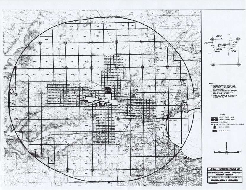
(4)
Nonconforming Uses
(a)
Not Retroactive
The regulations prescribed by this Section shall not be construed to require the removal, lowering or other change or alteration of any structure not conforming to the regulations as of the effective date of this Section, or otherwise interfere with the continuance of any nonconforming use, except as otherwise provided by Subsection (6). Nothing herein contained shall require any change in the construction, alteration or intended use of any structure, if the construction or alteration of such was begun prior to the effective date of this Section, and if such is diligently prosecuted.
(b)
Removal by Purchase
This Section shall not interfere with the removal of nonconforming uses by purchase or the use of eminent domain.
(5)
Airport Height Limitations
No structure shall be constructed, altered or located to a height in excess of the elevation indicated on the map referred to in Subsection (3) of this Section. Any structure constructed, altered, or located in violation of this Section shall be removed at the owner's expense.
(6)
Permits
(a)
Future Uses
No structure shall hereafter be constructed or located that exceeds the height indicated in any zone created by Subsection (3) of this Section until the owner or his or her agent shall have applied in writing and obtained a permit from the City Zoning Administrator. Application for such permit shall indicate the purpose for which the permit is desired, with sufficient information to permit the Zoning Administrator to determine whether such structure would conform to the regulations herein prescribed. If such determination is in the affirmative, the permit shall be granted.
(b)
Existing Uses
Before any nonconforming structure may be replaced, altered, or rebuilt, a permit shall be applied for and secured in the manner prescribed in Subsection (6)(a) authorizing such change, replacement or repair. Such permit shall be granted if the structure will not become a greater hazard to air navigation than it was on the effective date of this Ordinance, or than it was when the application for permit was made.
(c)
Exemptions
Permits are not required for structures less than thirty-five (35) feet in height above the ground and within 1/2 mile of the airport boundary, for structures less than fifty (50) feet in height above the ground within the area beginning 1/2 mile from the airport boundary and extending to one (1) mile from the airport boundary, and for structures less than one hundred (100) feet in height above the ground within the area beginning one (1) mile from the airport boundary and extending to three (3) miles from the airport boundary.
(d)
Posting
Said permit shall be posted in a prominent place on the premises prior to and during the period of construction, erection, installation or establishment.
(e)
Variances
Upon appeal in special cases the Board of Appeals may, after investigation and public hearing, grant a variance from the terms of this Ordinance. Such variance shall not be contrary to the public interest or create a hazard to the safe, normal operation of aircraft.
(7)
Administration
It shall be the duty of the City Zoning Administrator to administer and enforce the regulations prescribed herein. Applications for permits and variances shall be made on a form provided by the Zoning Administrator. Applications for permits and applications for variances shall be granted or denied within forty-five (45) days of the date of filing. Applications for variances shall include evidence of Federal Aviation Administration review of the proposed construction (FAA Form 7460-1, "Notice of Proposed Construction"). Appeals shall be transmitted by the Zoning Administrator to the Board of Appeals for hearing and decision.
(8)
Board of Appeals
The City Zoning Board of Appeals, as established under Section 10.10.13, shall:
(a)
Hear and decide appeals from any determination made by the Zoning Administrator in the enforcement of this Ordinance; and
(b)
Hear and decide specific variances.
(9)
Appeals and Review
(a)
Aggrieved Person
Any person aggrieved or affected by any decision or action of the Zoning Administrator made in the administration of this Section may appeal such decision or action to the Board of Appeals.
(b)
Procedure
Any appeal taken pursuant to this Section shall be in conformity with the procedure established by the applicable Wisconsin Statutes (Wis. Stat. § 114).
(c)
Meetings
In reviewing appeals under this Section, all meetings and hearings of the Zoning Board of Appeals shall be open to the public. Notice of all meetings of the Zoning Board of Appeals under this Section shall be given to the applicant, the Zoning Administrator and to the Clerk of the municipality where the property of the aggrieved person is located, if that property is outside the corporate limits of the City of Middleton. The Zoning Board of Appeals shall conduct a public hearing on each such matter that comes before it, preceded by publication of a Class 1 notice.
(10)
Fees
Permit and appeal fees shall be paid in the amount set forth in the Fee Schedule under Section 3.12 of the City of Middleton Municipal Code.
(11)
Penalties
Any person violating any of the provisions of this Section shall, upon conviction, be subject to a forfeiture as set forth in Section 30.04 of the City of Middleton Municipal Code.
(12)
Severability
If any of the provisions of this Section or the application thereof to any persons or circumstances is held invalid, such invalidity shall not affect other provisions or applications of the Section which can be given effect without the invalid provision or application, and to this end the provisions of this Section are declared to be severable.
(13)
Conflicting Regulations
Where there exists a conflict between any of the regulations or limitations prescribed in this Section and any other regulations applicable to the same area, whether the conflict be with respect to the height of the structure or any other matter, the more stringent limitations or requirements shall govern and prevail.
(14)
Effect
This Section shall take effect and be in force upon passage and publication. This Section supersedes any previous Section regulating the height of structures in the vicinity of the airport.
10.02.84 - SPECIAL AREA DESIGN OVERLAY ZONING DISTRICTS
(1)
Purpose
Such districts are intended to implement the urban design recommendations of the Comprehensive Plan by preserving and enhancing the aesthetic qualities (historical and visual) of areas considered uniquely distinctive to the community and by attaining a consistent visually pleasing image for those areas as defined by their boundaries on the Zoning Map. Design requirements can be found in Sections 10.07.50. Design review and approval procedures can be found in Section 10.10.44.
(2)
Downtown Design Overlay Zoning District
(a)
Applicability
This subsection pertains to new development and changes to the exterior of any building within the mapped boundaries of the Downtown Design Overlay Zoning District.
(Ord. No. O1657, § 72, 6-17-2025)
10.02.85 - ENVIRONMENTAL CORRIDOR OVERLAY ZONING DISTRICT
(1)
Purpose
This district is intended to preserve, protect, and enhance lakes, ponds, wetlands, woodlands, wildlife habitat areas, areas of rough topography, and related scenic areas. The preservation, protection and enhancement of these areas will serve to maintain safe and healthful conditions; maintain and improve water quality, both ground and surface; prevent flood damage; protect wildlife habitat; protect native plant communities; avoid location of structures on soils which are generally not suitable for such use; control erosion and sedimentation; and maintain the natural beauty of the City of Middleton.
(2)
District Boundary
The Environmental Corridor (EC) Overlay District encompasses those areas delineated as environmental corridors by the Capital Area Regional Planning Commission (CARPC), as amended from time to time; archaeological and historical sites mapped by the State Historic Preservation Office (SHPO) or the Wisconsin Historical Society; any drainageway mapped by the Wisconsin Department of Natural Resources, CARPC or United States Geological Survey (USGS); and any drainageway of concern as determined by the City Engineer. The boundaries are depicted on the Official Zoning Map. Refinement of these boundaries is required by on-site delineation:
(a)
Refinement of Overlay Zoning
District boundaries by on-site delineation. Because the mapping of environmental and cultural resource areas protected by the City of Middleton as provided by county, state, and federal sources is general and not provided at a surveyed level of accuracy, the boundary of each resource on a parcel proposed for development activity that is identified on the City's map of overlay zoning districts and online map viewer shall be subject to a site visit and staking of each resource boundary located on the parcel. This staking shall be conducted by an expert in the resource officially recognized by the agency responsible for the general source mapping of that resource.
1.
For the wellhead protection area, the staking shall be done by the City Engineer.
2.
For any archeological site mapped by the SHPO or the Wisconsin Historical Society, the staking shall be done by an expert recognized by that agency.
3.
For any historical site mapped by the Wisconsin Historical Society, the staking shall be done by an expert recognized by that agency.
4.
For any environmental corridor mapped by the Capital Area Regional Planning Commission (CARPC), the staking shall be approved by that agency and the Zoning Administrator.
5.
For any wetland mapped by the Wisconsin Department of Natural Resources, the staking shall be done by an expert recognized by that agency.
6.
For any floodway, flood fringe, or flood storage area identified by FEMA or the Floodplain Zoning Ordinance, the staking shall be done by a licensed surveyor or civil engineer and approved by the Floodplain Zoning Administrator.
7.
For any steep slopes area, any woodland, any stream or drainageway, the staking shall be done by a licensed surveyor or civil engineer.
8.
For the Ordinary High Water Mark (OHWM) of a navigable waterway, the staking shall be performed in consultation with the Wisconsin Department of Natural Resources and approved by the Zoning Administrator.
(b)
The mapping of all resource area staking shall be conducted by a licensed surveyor or civil engineer, and all resource areas present on the parcel shall be depicted on all site plans, grading and erosion control plans, and stormwater management plans required for submittal to the City for development activity proposed for the parcel.
(c)
Existing developed impervious areas are exempt from inclusion within the environmental corridors.
(3)
Components of Environmental Corridors
Environmental corridor lands contain the following natural resource components: navigable and non-navigable natural streams and natural drainageways as mapped by WisDNR, CARPC, or USGS; drainageways of concern as determined by the City Engineer; vegetative buffers for wetlands and shorelands (per the Shoreland Overlay see Section 10.02.82); 100-year floodplains and floodways; steep slopes (with a twelve (12) percent gradient and higher in the glaciated portions of the City, twenty (20) percent gradient and higher for the driftless portion of the City); public lands, parks, and conservancy areas; wetlands; woodlands; navigable waterways; archaeological and historic sites; problem soil areas and unique geologic formations; endangered and sensitive habitats (based on DNR determination), stormwater facilities; significant or sensitive groundwater recharge areas.
(4)
Permitted Uses
The following uses are permitted in the EC Overlay Zoning District:
(a)
Construction and maintenance of fences, piers, docks, walkways, including those built on pilings.
(b)
Hiking, fishing, trapping, hunting, swimming, and boating, unless prohibited by other laws or ordinances.
(c)
Harvesting of wild crops, such as marsh hay, ferns, moss, wild rice, berries, syrup, tree fruits and tree seeds in a manner that is not injurious to the natural reproduction of such crops and that does not involve filling, flooding, draining, dredging, ditching, tiling, or excavating.
(d)
Silviculture, including the planting, thinning, and harvesting of timber, provided that no filling, flooding, draining, dredging, ditching, tiling, or excavating is done except for temporary water level stabilization measures to alleviate abnormally wet or dry conditions which would have an adverse impact on silvicultural activities if not corrected.
(e)
Existing agricultural uses, provided that they do not involve extension of cultivated areas, extension of or creation of new drainage systems, and further provided, that they do not substantially disturb or impair the natural fauna, flora, topography, or water regimen.
(f)
Ditching, tilling, dredging, excavating, or filling done to maintain or repair an existing agricultural drainage system, only to the extent necessary to maintain the level of drainage required to continue the agricultural use.
(g)
Maintenance, repair, replacement and reconstruction of existing streets, roads and bridges.
(h)
Forest and game management.
(i)
Park and recreational activities and passive recreational trails.
(j)
Preservation of scenic, historic, natural areas and critical species habitat sites.
(k)
Grading, filling, and slope stabilization methods and structures such as retaining walls (including the removal of vegetation in such areas) used to remove, reduce, and stabilize steep slope areas as depicted on a grading and erosion control plan approved by the City Engineer.
(5)
Conditional Uses
The following uses are permitted as conditional uses within the EC District:
(a)
Public services and utilities.
(b)
Land disturbing activity (other than grading, filling, and slope stabilization per Subsection (4)(k) above), meeting the requirements of this Section.
(c)
Development regulations within the EC District. Development may be accommodated in the upland portions of the EC District (not located within a floodway, floodplain, flood storage area, or the buffer of a wetland, lake, pond, navigable stream, or other drainageway) as a conditional use. The following provisions shall apply:
1.
All development shall comply with all of the requirements of the underlying standard zoning district, all other applicable overlay zoning districts, and the requirements of this Section specific to the EC District.
2.
All land disturbing activities shall comply with City land division regulations (Chapter 19) and the construction and erosion control ordinance (Chapter 28).
3.
Development does not result in significant adverse water quality impacts or erosion potential as determined by the City engineer.
4.
Development of the remaining environmental corridor lands is prohibited by a conservation easement or deed restriction in a manner approved by the City attorney.
5.
The development shall not threaten the environmental integrity or function of the remaining corridor.
6.
Development is compact rather than scatted in nature.
7.
No structures shall be erected within the separation distances specified in Subsection (6), below.
8.
No lands shall be disturbed within the separation distances specified in Subsection (6), below.
9.
No vegetation shall be removed from within the separation distances specified in Subsection (6), below, except for invasive, non-native, dead or diseased vegetation. All development shall meet the separation distance requirements in Subsection (6), below.
(6)
Separation Distance Requirements
(a)
The disturbed or developed area shall be located a minimum of ten (10) feet from woodlands.
(b)
The disturbed or developed area shall be located a minimum of ten (10) feet from steep slopes.
(c)
All lands within fifty (50) feet of the ordinary high-water mark of any other navigable water (including lakes, navigable ponds, navigable streams, or other navigable features) as mapped by WisDNR.
(d)
All lands within thirty (30) feet of the top-of-bank of any non-navigable drainageway mapped by WisDNR, CARPC, or USGS; and any other drainageway of concern as determined by the City Engineer.
(e)
For the required setback of disturbed or developed areas from wetlands, shorelands, and floodplains, see Section 10.02.82 and Chapters 24 and 29 of the City of Middleton Municipal Code.
(7)
Tree Cutting and Shrubbery Clearing Limited
Except as permitted under a conditional use permit, lands lying within the EC District shall not be clear cut of trees, shrubbery or underbrush. No more than ten (10) percent of the natural vegetation shall be removed from a parcel unless the city forester determines the species to be invasive. Areas not occupied by structures or driveways shall be replanted with other vegetation that is equally effective in minimizing runoff, preventing erosion, and preserving natural beauty. Normal pruning, trimming and shearing of vegetation; removal of dead, diseased, insect-infested vegetation; and silvicultural thinning conducted under the recommendation of a forester shall be exempt from this restriction.
(8)
Variances
Any requested variation from this Section shall be subject to review and approval by the Zoning Board of Appeals as described in Section 10.10.51.
(9)
Enforcement
(a)
Penalty
Any person who violates, neglects, or refuses to comply with any of the provisions of this Section shall be subject to a penalty as provided by Section 30.04 of the City of Middleton Municipal Code.
(b)
Injunction
The City may, in addition to any other remedy, seek an injunction or restraining order against the party alleged to have violated the provisions of this Section.
(c)
Restoration Costs
The person in violation of this Section shall perform mitigation measures, such as reforestation wetland enhancements, erosion mitigation, or slope stabilization as determined appropriate by the City. As a substitute for, or in addition to any other action, the City may commence legal action against the person in violation of this Section.
(Ord. No. O1657, § 73, 6-17-2025)
10.02.86 - FLOODPLAIN OVERLAY ZONING DISTRICT
See Chapter 24 of the City Municipal Code.
10.02.87 - WETLAND OVERLAY ZONING DISTRICT
See Chapter 29 of the City Municipal Code.