
Northfield City Zoning Code
ARTICLE 2
- ZONING DISTRICTS AND USE REGULATIONS
2.1 - Official Zoning Map.
2.1.1
Map and Land Development Code. All land within Northfield is placed into zoning districts as shown on the Official Zoning Map. The Official Zoning Map, along with all notations, references, and other information, are hereby adopted as part of this LDC. A certified copy of the Official Zoning Map shall be kept on file with the city clerk.
2.1.2
Annexed Land or Land Not Otherwise Designated.
(A)
Any land located within the Northfield municipal boundaries that is not designated with a zoning district shall be included in the Agricultural (A-S) district.
(B)
Any land which may be annexed to the city in the future shall be placed in the A-S district until such time that the city council may amend the zoning district, provided the city council does not designate the zoning district for the parcel at the time of annexation.
2.1.3
Identification of the Official Zoning District Map.
The Official Zoning Map, with any amendments made thereon, shall be identified by the signatures of the mayor and city clerk under the following words:
Official Zoning District Map, Northfield, Minnesota: This is to certify that this is the Official Zoning Map referenced by Section 2.1, Official Zoning Map, of the Land Development Code.
Adopted by the City Council, Northfield, Minnesota.
2.1.4
Zoning District Boundary. The boundaries of the zoning districts are shown upon the Official Zoning Map. When uncertainty exists with respect to the boundaries of zoning districts as shown on the Official Zoning Map, the following rules shall apply:
(A)
Where zoning district boundary lines are indicated as approximately following a center line of a street or highway, alley, railroad easement, or other right-of-way, or a river, creek, or other watercourse, such centerline shall be the zoning district boundary. In the event of a natural change in the location of such streams, rivers, or other water courses, the zoning district boundary shall be construed as moving with the channel centerline.
(B)
Where zoning district boundary lines are indicated as approximately following a lot line, such lot line shall be the zoning district boundary.
(C)
Where zoning district boundary lines are indicated as approximately being parallel to a centerline or a property line, such zoning district boundary lines shall be parallel to a centerline or a property line and, in the absence of a specified dimension on the map, at such scale and distance as indicated on the Official Zoning Map.
(D)
Whenever any street, alley or other public way is vacated by official action of city council, the zoning district adjoining each side of such street, alley or public way shall be automatically extended to the center of such vacation, and all areas included in the vacation shall then and henceforth be subject to all appropriate regulations of the extended district or districts.
(E)
The boundary for the Floodplain Overlay (FP-O) district has been taken from the flood insurance study dated April 2, 2003, for the City of Northfield, prepared by the Federal Emergency Management Agency (FEMA) and others as may be referenced in this LDC or the Northfield Municipal Code.
(F)
The boundary for the Wild and Scenic River/Shoreland/Public Waters Overlay (WS-O) district has been established by the Department of Natural Resources (DNR).
(G)
When the actual street, right-of-way, property line boundary or other existing ground condition is in conflict with that shown on the Official Zoning Map, the zoning board of appeals shall review the necessary interpretation. The person contesting the location of the district boundary shall be given a reasonable opportunity to present their case to the city and to submit technical evidence if so desired pursuant to the appeals process as established in Section 8.5.17, Appeals.
2.1.5
Legend and Use of Color or Patterns. There shall be provided on the Official Zoning Map a legend that shall list the name and symbol for each zoning district. In lieu of a symbol, a color or black and white pattern may be used on the Official Zoning Map to identify each zoning district as indicated in the legend.
2.2 - Establishment of Zoning Districts.
2.2.1
Districts Established. The districts in Table 2.2-1 are hereby established to encourage sustainable development practices, to carry out the purposes of this LDC, and to assist in implementing the comprehensive plan.
2.2.2
Relationship of Overlay Districts to Base, Special, and Floating Districts.
(A)
Where land is classified into an overlay zoning district, the regulations governing development in the overlay district shall apply in addition to the regulations governing the underlying base, special, or floating zoning district unless otherwise noted in the district specific standards of Section 2.3, Base Zoning Districts, 2.4, Special Base Zoning Districts, Section 2.5, Overlay Zoning Districts, or Section 2.6, Floating Zoning Districts. In the event of an express conflict between the standards of the overlay zoning district and the base, special, or floating zoning district, the standards governing the overlay district shall control.
(B)
In some instances, land may be classified into multiple overlay districts. In the event of an express conflict between the standards of the multiple overlay districts, the most restrictive standards shall apply.
2.2.3
References to Previous Zoning Districts. Some of the district classifications and names established within this LDC differ from previous versions of this LDC. In instances where there may be references to the previous zoning district nomenclature, Table 2.2-2 identifies how each of the previous district classifications were renamed for this LDC. This section shall only be used for comparison purposes.
2.2.4
Fixed-Boundary Districts. Fixed-Boundary districts are districts that are currently located on the zoning map but which may not be applied to other locations. The intent of a Fixed-Boundary district is to allow existing uses to remain and to expand under the development standards for that particular zoning district. Certain districts have fixed boundaries because the preferred future development pattern is described in districts that do not have fixed boundaries.
2.3 - Base Zoning Districts.
2.3.1
Residential District (R1).
(A)
Purpose.
(1)
The R1 district should generally apply to those areas designated as "Neighborhood Central" on the framework map of the comprehensive plan.
(2)
The Residential (R1) district generally includes the established neighborhoods surrounding downtown Northfield that are characterized by traditional urban development qualities such as a grid pattern street network, sidewalks, and a range of single-family, two-family, and some multi-family dwellings on smaller lots. The purpose of the R-1B district is to continue to support single-family, two-family, and three-family attached and detached dwellings within the existing character of the city's older neighborhoods. The essential, existing character of the R1 district should be reinforced with any infill or redevelopment of properties. The primary intent of this zone is to strengthen the character of existing historic neighborhoods within Northfield and to protect and enhance the unique character of those existing neighborhoods, particularly in locations where this character may be most susceptible to change.
(B)
Neighborhood Compatibility Requirement. Due to the developed character and context of existing development in the R1 district, all new development or structures, whether as a single expansion or made through multiple expansions, shall be subject to the neighborhood compatibility standards established in Section 3.4, Neighborhood Compatibility Standards.
(C)
Site Development Standards. See Section 3.2.2, Residential Site Development Standards, and Table 3.2-1 for the site development standards that apply to the R1 district.
(D)
Other Development Standards. In addition to the standards established for the R1 district in this article, all development shall be subject to all other applicable standards in Article 3: Development Standards.
2.3.2
Medium Density Residential District (R2) [Fixed-Boundary District].
(A)
Purpose. The purpose of the Medium Density Residential (R2) district is to maintain the city's existing housing stock that is comprised of medium density residential uses at densities ranging from 8.1 to 15 units per acre. These existing residential areas are located within the areas designated as "Neighborhood General 1" in the framework map of the comprehensive plan.
(B)
Fixed-Boundary District. The R2 district is a Fixed-Boundary district and is maintained in this LDC to minimize the creation of nonconformities (See Section 2.2.4, Fixed-Boundary Districts). Applications for amendments to the Official Zoning Map for the R2 district shall be prohibited after the effective date of this LDC.
(C)
Site Development Standards. See Section 3.2.2, Residential Site Development Standards, and Table 3.2-1 for the site development standards that apply to the R2 district.
(D)
Other Development Standards. In addition to the standards established for the R2 district in this article, all development shall be subject to all other applicable standards in Article 3: Development Standards.
2.3.3
High Density Residential District (R3) [Fixed-Boundary District].
(A)
Purpose. The purpose of the High Density Residential (R3) district is to maintain the city's existing housing stock that is comprised of high density, multi-family residential uses at densities ranging from 15.1 to 25 units per acre. These existing residential areas are located within the areas designated as "Neighborhood Central" and "Neighborhood General 1" in the framework map of the comprehensive plan.
(B)
Fixed-Boundary District. The R3 district is a Fixed-Boundary district and is maintained in this LDC to minimize the creation of nonconformities (See Section 2.2.4, Fixed-Boundary Districts). Applications for amendments to the Official Zoning Map for the R3 district shall be prohibited after the effective date of this LDC.
(C)
Site Development Standards. See Section 3.2.2, Site Development Standards, and Table 3.2-1 for the site development standards that apply to the R3 district.
(D)
Other Development Standards. In addition to the standards established for the R3 district in this article, all development shall be subject to all other applicable standards in Article 3: Development Standards.
2.3.4
Manufactured Home Park District (R4).
(A)
Purpose.
(1)
The R4 district should generally apply to those existing manufactured home park areas designated as "Neighborhood General 1" on the framework map of the comprehensive plan.
(2)
The purpose of the Manufactured Home Park (R4) district is to allow manufactured home parks in areas of the city. Manufactured homes shall be located in manufactured home parks, and may be located in other residential zoning districts as long as a manufactured home adheres to all other zoning and state building code requirements applicable to other residential uses. Manufactured home parks shall provide ingress and egress roadways, storm shelters, open space for playgrounds, recreation and park purposes, necessary sewer, water, electricity, and refuse services.
(B)
Site Development Standards. See Section 2.9.12, Manufactured Home Parks, Section 3.2.2, Residential Site Development Standards, and Table 3.2-1 for the site development standards that apply to the R4 district.
(C)
Other Development Standards. In addition to the standards established for the R4 district in this article, all development shall be subject to all other applicable standards in Article 3: Development Standards.
2.3.5
Neighborhood General 1 District (N1) [Fixed-Boundary District].
(A)
Purpose.
(1)
The N1 district should generally apply to those areas developed and/or final platted and designated as "Neighborhood General 1" on the framework map of the comprehensive plan.
(2)
The Neighborhood General 1 (N1) district is applied to existing residential neighborhoods of the city that are found outside the R1 district. The N1 district is characterized by primarily single family homes, or attached housing, on parcels that are generally larger than those found in the R1, and that are located on streets more curvilinear and less connected than traditional urban development patterns. The essential, existing character of the N1 district should be reinforced with any infill or redevelopment of properties. When feasible, infill or redevelopment in the N1 district should also create a more pedestrian-friendly, walkable development pattern with a mixture of housing types.
(B)
Fixed-Boundary District. The N1 district is a Fixed-Boundary district and is maintained in this LDC to minimize the creation of nonconformities (See Section 2.2.4, Fixed-Boundary Districts). Applications for amendments to the Official Zoning Map for the N1 district shall be prohibited after the effective date of this LDC.
(C)
Site Development Standards. See Section 3.2.2, Residential Site Development Standards, and Table 3.2-1 for the site development standards that apply to the N1 district.
(D)
Other Development Standards. In addition to the standards established for the N1 district in this article, all development shall be subject to all other applicable standards in Article 3: Development Standards.
2.3.6
Neighborhood General 2 District (N2).
(A)
Purpose.
(1)
The N2 district should generally apply to those areas intended for residential neighborhoods designated as "Pipeline" and "Managed Growth" on the conservation and development map of the comprehensive plan, and those areas designated as "Neighborhood General 1" on the framework map of the comprehensive plan and Neighborhood General 2 on the Zoning Map.
(2)
The Neighborhood General 2 (N2) district is applied to residential neighborhoods of the city that may include larger vacant areas within the current city limits and areas that will be within city limits through future annexations. The N2 district will create a pedestrian-friendly environment, such as found in the R1 district, with strong neighborhood qualities, such as a grid-like street pattern, consistent block size, compact development, a range of housing types and architectural styles, street connectivity, sidewalks, and homes located in close relationship to the street. In addition, the N2 district will include greenways and natural areas, and options for neighborhood-serving commercial. This development pattern is the preferred future pattern for the city, as expressed in the comprehensive plan.
(B)
Site Development Standards. See Section 3.2.2, Residential Site Development Standards, and Table 3.2-2 for the site development standards that apply to the N2 district.
(C)
Other Development Standards. In addition to the standards established for the N2 district in this article, all development shall be subject to all other applicable standards in Article 3.
(D)
Mixture of Dwelling Unit Types.
(1)
For the purpose of promoting a mixture of dwelling unit types within a single neighborhood and subdivision, a mixture of dwelling unit types shall be required in accordance with Table 2.3-1 based on the size of the subdivision. This dwelling unit type mixture shall be distributed throughout the subdivision, not clustered in one area.
(2)
Final plats for all phases of any residential subdivision shall adhere to the dwelling unit mixture requirements as specified in Table 2.3-1.
2.3.7
Downtown District (C1).
(A)
Purpose.
(1)
The C1 district applies to those areas designated as "Core," "Center" and, in part, "Corridor" on the Framework map of the Comprehensive Plan.
(2)
The C1 district, which includes Northfield's historic town square, the Cannon River, Northfield's original flour mill, and historically preserved commercial center, creates Northfield's brand and a unique sense of place.
(3)
The purpose of the Downtown (C1) district is to sustain the historic central business district, make the Highway 3 corridor a more integral and attractive part of Downtown, provide design transitions to surrounding zoning districts, provide a strong relationship to the Cannon River and thus enhance the beauty, appreciation and benefits of the river, and to augment and increase Downtown viability and prosperity.
(4)
The C1 District aims to provide a compact, pedestrian friendly, active mix of land uses including business, hospitality, offices and services, housing, arts and culture, government, public gathering places and points of interest for residents and visitors alike.
(5)
The design standards of this district reflect the character of the historic downtown and will help create a sense of arrival and center by locating buildings close to the sidewalk or road, providing compatible facades along the Cannon River, building intimate places for people to gather outdoors, or minimizing negative effects on residential neighborhoods.
(B)
Sub-Districts. The C1 District has three sub-districts, each with slightly different standards:
(1)
The Historic District Sub-District
Properties in the National Register Historic District
(2)
The East of Highway 3 Sub-District
Properties east of Highway 3 excluding the Historic District Sub-District
(3)
The West of Highway 3 Sub-District
Properties located west of Highway 3
Specific standards for the C1 District and its sub-districts are located in Section 3.2.3, C1 District Site Development Standards.
(C)
Additional Site Development Standards. In addition to the standards established for the C1 district, all development shall be subject to all other applicable standards in Article 3: Development Standards.
(D)
Relationship to the Comprehensive Plan. Refer to Appendix A for a description of the relationship between the C1 District regulations or standards and the Northfield Comprehensive Plan.
2.3.8
Highway Commercial District (C2).
(A)
Purpose.
(1)
Provide locations for retail and service businesses that benefit from access to and visibility from the highway.
(2)
Provide for a wider range of commercial building and site sizes than may be possible in other zoning districts.
(3)
Provide locations for mixed-uses within buildings and sites.
(4)
Support efficient use of the limited highway commercial land supply, attract and retain businesses that contribute to economic growth and job creation, and enhance the economic vitality of the district and of Northfield.
(5)
Provide locations for businesses that rely on easy auto access and parking plus visibility from the highway while providing safe and attractive routes to businesses for pedestrians and bicyclists from neighboring sites and the rest of the city.
(6)
Create buildings and sites that are visually attractive and that can be adapted to changing business and community needs.
(7)
Enhance the sense of gateway and arrival along Highway 3.
(8)
Minimize the negative effects of commercial site development on housing in adjacent residential zoning districts.
(B)
Site Development Standards. See Section 3.2.4, C2 District Site Development Standards and Guidelines, for the site development standards that apply to the C2 district.
(C)
Additional Site Development Standards. In addition to the standards established for the C2 district, all development shall be subject to all other applicable standards in Article 3: Development Standards.
(D)
Relationship to the Comprehensive Plan. Refer to Appendix A for a description of the relationship between the C2 District regulations or standards and the Northfield Comprehensive Plan.
2.3.9
Industrial District (I1).
(A)
Purpose.
(1)
The I1 district should generally apply to those areas designated as "District" on the Framework map of the comprehensive plan.
(2)
The purpose of the Industrial (I1) district is to provide an area to accommodate manufacturing uses, general businesses, offices, service and repair businesses, warehousing and office showroom uses in a functional, attractive manner that does not unduly affect the development or use of nearby property. Limited and incidental retailing shall be allowed in this district. The portion of the district that abuts the Cannon River shall be developed in a manner that enhances, restores, augments and maintains the ecology and beauty of this natural corridor.
(B)
Site Development Standards. See Section 3.2.5, I1 District Site Development Standards, for the site development standards that apply to the I1 district.
(C)
Additional Site Development Standards. In addition to the standards established for the I1 district, all development shall be subject to all other applicable standards in Article 3: Development Standards.
(D)
Relationship to the Comprehensive Plan. Refer to Appendix A for a description of the relationship between the I1 District regulations or standards and the Northfield Comprehensive Plan.
(Ord. No. 1071, § 1, 12-3-2024)
2.4 - Special Base Zoning Districts.
2.4.1
Agricultural District (A-S).
(A)
Purpose. The purpose of the Agricultural (A-S) district is to allow primarily for agricultural uses and open space within the city limits while recognizing that privately owned land may be developed for non-agricultural purposes in the near to long-term. It is designed specifically for areas within the city that are presently agricultural uses not zoned as PB-S, Public Benefit, but that will remain as long term agricultural uses, or that may be converted to non-agricultural urban uses in the future.
(B)
Site Development Standards. See Section 3.2.6, A-S District Site Development Standards for the site development standards that apply to the A-S district.
(C)
Other Development Standards. In addition to the standards established for the A-S district in this article, all development shall be subject to all other applicable standards in Article 3: Development Standards.
2.4.2
College Development District (CD-S).
(A)
Purpose. Carleton College and St. Olaf College are essential and defining parts of Northfield's unique identity, valued contributors to community life, and powerful drivers of the local economy. The purpose of the College Development (CD-S) district is to allow college facilities and operations within the city limits while providing boundaries which respect the function and character of the colleges and their adjoining districts, particularly adjoining residential and commercial districts. Development near the edges of the campus referred to as the Perimeter Transition Area (PTA), which adjoins existing and/or planned residential and commercial districts, will utilize a wider process of dialog and input to facilitate compatibility between the campus and adjoining districts.
(B)
Applicability.
(1)
The CD-S district should generally apply to those areas designated as an "educational district" on the framework map of the comprehensive plan.
(2)
The CD-S district shall include regulations applicable to two separate sub-zones referred to as the Internal Development Area (IDA) and the Perimeter Transition Area (PTA).
(a)
The Internal Development area is all that area within the CD-S zone that is internal to the core of the college campus and is located a distance away from the CD-S district edge by 200 feet or more.
(b)
The Perimeter Transition Area (PTA) shall be defined as an area inside the CD-S district that is within 200 feet of the boundary of the CD-S district. Where applicable, this area shall be measured from the midpoint of public rights-of-way adjoining the edge of college properties and/or from the closest property line shared with a non-CD-S zoned property. If a public right-of-way adjoining the college property edge (with no adjoining buildings) is wider than 200 feet and contains no existing or planned buildings, then no PTA standards shall be applied and the area may develop consistent with the IDA standards. PTA procedures and standards shall be applicable where the PTA adjoins all districts except areas zoned agricultural and industrial. Areas adjacent to property zoned agricultural and industrial may develop consistent with the IDA standards and procedures.
(C)
Purpose Statement and General Description of Development Process - IDA/PTA. In order to reflect the differing levels of impact that college development may have on non-college properties, two distinct development review and decision processes are applicable for development in the CD-S zone.
(1)
For development proposed in the IDA sub-zone, such development will be subject to development standards and development review processing that is more general, flexible and administrative in nature using the Type 2 review procedure (See Section 8.4.5, Type 2 Review Procedure, City Planner Decision with Development Review Committee Review).
(2)
For development proposed in the PTA sub-zone, except as specifically noted in (B)(2)(b) above, such development will be subject to development standards that are applicable to Conditional Use Permit criteria and will be subject to a thorough public review and decision process using the Type 4 review procedure with a Neighborhood meeting requirement (See Section 8.4.7, Type 4 Review Procedure, Planning Commission or Heritage Preservation Commission Recommendation and City Council Decision).
(3)
For all development proposed in the CD-S zone a parking study shall be prepared and provided to the city that analyzes campus wide parking supply and parking demand as a basis of determining the amount of parking that is needed to comply with the parking requirements as established in Section 3.6, Off-Street Parking, Loading, and Mobility. The parking study shall include at a minimum the following data and information:
(a)
Background of study and description of study methodology;
(b)
Existing supply and demand analysis including existing supply, existing demand by user type including faculty, staff, student and visitor parking demand;
(c)
Parking occupancy and adequacy analysis;
(d)
Proposed mitigation strategies to reduce parking demand, and analysis of short and long-term impacts of those strategies on parking demand;
(e)
Proposed mitigation strategies to reduce the environmental, social, and economic impacts of surface parking;
(f)
Future demand analysis, including implementation of demand mitigation strategies;
(g)
Future planned parking facility expansion, including proposed impact and demand mitigation strategies;
(h)
Conclusions and recommendations.
2.4.3
Public Benefit District (PB-S).
(A)
Purpose. The purpose of the Public Benefit District (PB-S) is to distinguish city owned parks and open space areas and the privately owned golf course and cemetery facilities which are devoted to the use by the public or the specific members of the golf course or religious institution that own the facilities from other open space agricultural areas that are intended for long term agricultural productivity or nearer term conversion to some other urban development use. The Public Benefit District (PB-S) is intended to primarily apply to city owned park and open space areas and facilities as shown on Map 8.1 Existing Park and Trail System Plan of the comprehensive plan. Additionally, the Public Benefit District (PB-S) has a more limited application related to privately owned golf course facilities and grounds and cemeteries. The use of land that is zoned Public Benefit District (PB-S) will be subject to limited regulatory requirements since the primary land use activity is that of open space, low intensity land use with minimal impact on the surrounding neighborhoods and the city infrastructure and services needed to support this land use.
(B)
Site Development Standards. Building and development that occurs on city owned property shall comply with the site development standards that are found in Section 3.2.7, PB-S Public Benefit Site Development Standards to the greatest extent possible. All other building and development on privately owned property in areas zoned PB-S shall adhere to the standards found in Section 3.2.7, PB-S Public Benefit Site Development Standards.
(C)
Other Development Standards. In addition to the standards found in Section 3.2.7, PB-S Public Benefit Site Development Standards, all buildings and development shall adhere to other requirements of Article 3: Development Standards of this LDC as they may apply and all other requirements of the City.
(D)
All development and building that is to occur in areas zoned PB-S shall be subject to the development review procedures found in Article 8: Development Procedures of this LDC as outlined in the Type 2 review procedure (See Section 8.4.5, Type 2 Review Procedure, City Planner Decision with Development Review Committee Review).
2.4.4
Public Institutional District (PI-S).
(A)
Purpose.
(1)
The PI-S district can potentially apply to any land in any category on the framework map of the comprehensive plan.
(2)
The Public Institutional (PI-S) district is intended to establish and protect sites for city, state, federal, and school district uses while also ensuring compatibility with the surrounding neighborhoods. The PI-S zone implements and is consistent with the land use designations of the comprehensive plan.
(B)
Additional Site Plan Review Requirements. In addition to the requirements established for site plan review in Section 8.5.6, Site Plan Review, the city engineer shall have the authority to require a traffic impact study or stormwater management study depending on the size and impact of the proposed use.
(C)
Other Development Standards.
(1)
More than one principal building may be located on a single lot.
(2)
In addition to the standards established for the PI-S district, all development shall be subject to all other applicable standards in Article 3: Development Standards.
(Ord. No. 1066, § 2, 10-15-2024)
2.5 - Overlay Zoning Districts.
2.5.1
Floodplain Overlay District (FP-O).
(A)
Purpose. It is the purpose of the Floodplain Overlay (FP-O) district to promote the public health, safety, and general welfare and to minimize the potential losses by flooding, as described in this section, by enacting the provisions contained herein.
(B)
Development Standards.
(1)
The development standards for the underlying base zoning district shall apply unless otherwise modified by the FP-O district.
(2)
Additional standards for the FP-O district are located in Section 4.1, Development Standards for the FP-O District.
(C)
Statutory Authorization, Findings of Fact, and Purpose. The legislature of the State of Minnesota has, in Minn. Stat., chapters 103F and 462, delegated the responsibility to local government units to adopt regulations designed to minimize flood losses. Therefore, the city does ordain as follows:
(1)
The flood hazard areas of Northfield, Minnesota, are subject to periodic inundation which results in potential loss of life, loss of property, health and safety hazards, disruption of commerce and governmental services, extraordinary public expenditures for flood protection and relief, and impairment of the tax base, all of which adversely affect the public health, safety, and general welfare.
(2)
This section is based upon a reasonable method of analyzing flood hazards, which is consistent with the standards established by the Minnesota Department of Natural Resources.
(3)
This section and this LDC are adopted to comply with the rules and regulations of the National Flood Insurance Program codified as 44 Code of Federal Regulations Parts 59-78, as amended, so as to maintain the city's eligibility in the National Flood Insurance Program.
(D)
Establishment of Subdistricts.
(1)
Subdistricts. There are hereby established the following three subdistricts of the FP-O district:
(a)
The Floodway (FW) subdistrict shall include those areas designated as floodway on the flood insurance rate map referred to in Section 4.1.2, General Provisions.
(b)
The Flood Fringe (FF) subdistrict shall include those areas shown as being within zone AE, zone AO, or zone AH, but being located outside of the floodway, on the Flood Insurance Rate Map (FIRM) as referred to in Section 4.1.2, General Provisions.
(c)
The General Floodplain (GF) subdistrict shall include those areas designated as zone A or zones AE, zone AO, or zone AH without a floodway on the flood insurance rate map referred to in Section 4.1.2, General Provisions.
(2)
Compliance. No new structure or land shall hereafter be used and no structure shall be constructed, located, extended, converted, or structurally altered without full compliance with the terms of this section and other applicable regulations that apply to uses within the jurisdiction of this section. Within the floodway, flood fringe, and general flood plain subdistricts, all uses not listed as permitted uses or conditional uses in this section shall be prohibited. In addition:
(a)
New manufactured homes, replacement manufactured homes, and certain travel trailers and travel vehicles are subject to the general provisions of this section and specifically Section 4.1.9, Manufactured Homes and Manufactured Home Parks and Placement of Recreational Vehicles.
(b)
Modifications, additions, structural alterations, normal maintenance and repair, or repair after damage to existing nonconforming structures and nonconforming uses of structures or land are regulated by the general provisions of this section and specifically Section 4.1.11, Nonconforming Uses.
(c)
As-built elevations for elevated or flood proofed structures must be certified by ground surveys and flood proofing techniques must be designed and certified by a registered professional engineer or architect as specified in the general provisions of Section 4.1, Development Standards for the FP-O District.
(E)
Amendments.
(1)
The flood plain designation on the official zoning map shall not be removed from flood plain areas unless it can be shown that the designation is in error or that the area has been filled to or above the elevation of the regulatory flood protection elevation and is contiguous to lands outside the flood plain. Special exceptions to this rule may be permitted by the commissioner of natural resources if it is determined that, through other measures, lands are adequately protected for the intended use.
(2)
All amendments to this section, including amendments to the flood plain designation on the official zoning map, must be submitted to and approved by the commissioner of natural resources prior to adoption. Changes in the official zoning map must meet the Federal Emergency Management Agency's (FEMA) Technical Conditions and Criteria and must receive prior FEMA approval before adoption. The commissioner of natural resources must be given a ten-day written notice of all hearings to consider an amendment to this section and said notice shall include a draft of the chapter amendment or technical study under consideration.
2.5.2
Wild and Scenic River/Shoreland/Public Waters Overlay District (WS-O).
(A)
Purpose. The purpose of the Wild and Scenic River/Shoreland/Public Waters Overlay (WS-O) district is to protect and preserve the scenic, recreational, natural and historical values of the Cannon River in the city by ensuring that development within this river corridor is consistent with the state Wild and Scenic Rivers Act, to provide for the protection and wise development of shoreland areas along the Cannon River, with the Shoreland Management Act, and to provide for the protection and wise development of shoreland areas in accordance with the Shoreland Management Act.
(B)
Development Standards.
(1)
The development standards for the underlying base zoning district shall apply unless otherwise modified by the WS-O district.
(2)
Additional standards for the WS-O district are located in Section 4.2, Development Standards for the WS-O District.
(C)
Designation of the WS-O District. The WS-O district combines the regulations pertaining to state shoreland management and the wild and scenic river management programs. The public waters located within the city limits have been classified as follows:
(1)
Spring Creek, general development.
(2)
Heath Creek, general development.
(3)
Rice Creek (Spring Brook), natural environment.
(4)
Sibley Marsh, unclassified.
In addition, in order to preserve and protect the Cannon River and its adjacent land that possesses scenic, recreational, natural, and historical values, the Cannon River in the city has been given a recreational river classification under the Minnesota Wild and Scenic Rivers Act and is divided into two districts as undeveloped land and developed land. It shall be unlawful to fill, excavate, or deposit any materials in or on the beds of public waters without securing a permit from the commissioner of natural resources.
(D)
Permitted Uses. In addition to all permitted uses allowed in and regulated by the underlying zoning district, as indicated on the official zoning map of the city, the following uses are permitted by-right (no conditional use permit required):
(1)
Governmental campgrounds;
(2)
Other governmental open space recreational uses;
(3)
Government resource management for improving fish and wildlife habitat; wildlife management areas; nature areas; accessory roads;
(4)
Public access to rivers and streams; and
(5)
Public access, road access type with boat launching facilities.
(E)
Conditional Uses. In addition to all conditional uses and applicable attached conditions allowed in and regulated by the applicable zoning districts underlying this shoreland overlay district as indicated on the official zoning map of the city, the following conditional uses are permitted:
(1)
Private campgrounds.
(2)
Other private open space recreational uses.
(3)
Utility transmission lines, subject to the conditions of all applicable state rules.
(4)
Public roads, subject to the conditions of all applicable state rules.
(5)
Sand and gravel extraction, subject to the conditions of all applicable state rules.
(6)
Canoe rental establishments, subject to the conditions of all applicable state rules, except that inner tube rentals shall be prohibited.
2.5.3
Historic Overlay District (H-O).
(A)
Purpose.
(1)
The city council declares as a matter of public policy that the preservation, protection, perpetuation and use of areas, places, buildings, structures, and other objects having special historical interest or value is a public necessity and is required in the interest of the health, safety, welfare and prosperity of the people.
(2)
Additionally, this overlay district has the purpose to:
(a)
Safeguard the heritage of the city by preserving sites and structures which reflect elements of the city's cultural, social, economic, political, visual or architectural history;
(b)
Protect and enhance the city's appeal to residents, visitors and tourists and serve as a support and stimulus to business and industry;
(c)
Foster civic pride in the beauty and notable accomplishments of the past; and,
(d)
Promote the preservation and continued use of historic sites and structures for the education and general welfare of the people of the city.
(B)
Northfield Downtown Historic District. The boundary of the current historic overlay district is the Northfield Downtown Historic District that has been registered with the federal government and certified by the state. The boundaries of such overlay district shall be as shown on the Official Zoning Map.
(C)
Certificate of Appropriateness. No activity within the H-O district shall occur on a heritage preservation site without having first received a certificate of appropriateness issued by the HPC pursuant to Section 8.5.8, Heritage Preservation Commission's Certificate of Appropriateness. All supporting documents relating to the certificate of appropriateness (e.g., plans and photographs) shall be kept on file by the city planner. Activity initiated or completed without the consent of the HPC and the city as required shall be considered to be in violation of this LDC.
2.5.4
Planned Unit Development Overlay District (PD-O) [Fixed-Boundary District].
(A)
Purpose. The purposes of the Planned Unit Development Overlay (PD-O) district is to allow for the continuance of planned unit developments approved prior to the effective date of this LDC.
(B)
Fixed-Boundary District. The PD-O district is a Fixed-Boundary district and is maintained in this LDC to minimize the creation of nonconformities. Applications for amendments to the Official Zoning Map for the PD-O district shall be prohibited after the effective date of this LDC.
(C)
Approved Plans Continue. All preliminary and final development plans approved as part of a planned unit development prior to the effective date of this LDC shall remain in full force and effect as part of this overlay district. Provided new development in the PD-O district is in compliance with the approved plans, the development shall be considered in conformance with this LDC.
(D)
Amendments. Amendments to any approved plans as part of a planned unit development shall be reviewed pursuant to Section 8.5.5, Amendments to the PD-O District.
2.6 - Floating Zoning Districts.
2.6.1
Neighborhood Center Floating District (NC-F).
(A)
Purpose.
(1)
The NC-F district should generally apply in areas designated as "Neighborhood Central" and "Neighborhood General 1" on the framework map of the comprehensive plan.
(2)
The purpose of the NC-F district is to promote and enhance the vitality of existing neighborhoods by providing for the opportunity to develop nonresidential, multi-family (up to eight units) or mixed-uses in existing neighborhoods where the principal building is designed to be consistent with the size, scale, and massing of the surrounding residential uses. Additionally, the uses should be of an intensity that will create minimal traffic and noise impacts on the surrounding neighborhood.
(B)
Development Standards.
(1)
All buildings shall be subject to the neighborhood compatibility standards of Section 3.4, Neighborhood Compatibility Standards.
(2)
NC-F districts may only be considered on lots that are located at the intersection of two street types with a functional classification of collector and/or arterial pursuant to Section 5.2.3, Streets.
(C)
Other Development Standards. In addition to the standards established for the NC-F district, all development shall be subject to all other applicable standards in Article 3: Development Standards.
2.6.2
Reserved.
Editor's note— Ord. No. 1071, § 2, adopted December 3, 2024, repealed § 2.6.2, which pertained to economic development floating district (ED-F).
(Ord. No. 1051, § 1, 2-21-2023; Ord. No. 1071, § 2, 12-3-2024)
2.7 - Permitted Principal Uses.
2.7.1
General Provisions. Table 2.7-1 lists the principal uses allowed within all zoning districts except for the overlay zoning districts. The uses permitted in the overlay districts shall be controlled by the underlying base zoning district unless otherwise modified in the district standards of this article.
2.7.2
Explanation of Table of Permitted Uses.
(A)
Organization of Table. Table 2.7-1 organizes the uses by use categories and use types.
(1)
Use Categories. The use categories provide a systematic basis for assigning present and future land uses into broad general classifications (e.g., household living, mixed-use, commercial, etc.). The use classifications then organize land uses and activities into specific "use types" based on common functional, product, or physical characteristics, such as the type and amount of activity, the type of customers or residents, how goods or services are sold or delivered, and site conditions.
(2)
Use Types. The use categories are divided into specific use types. The use types identify the specific uses that are considered to fall within characteristics identified in the broader use category. For example, single-family dwellings, two-family dwellings, and townhome clusters are some of the specific use types that fall under the "household living" use category.
(3)
Use Categories and Use Types Defined. Use categories and use types are defined in Section 2.8, Use Definitions.
(B)
Symbols in Table. The symbols used in Table 2.7-1 are defined as follows:
(1)
Permitted Uses (P). A "P" in a cell indicates that a use type is allowed by-right in the respective zoning district subject to compliance with the use-specific standards set forth in the final "use-specific standards" column of Table 2.7-1. Permitted uses are subject to all other applicable standards of this LDC, including those set forth in Article 3: Development Standards.
(2)
Conditional Uses (C). A "C" in a cell indicates that a use type is allowed as a conditional use in the respective zoning district subject to compliance with the use-specific standards set forth in the final "use-specific standards" column of Table 2.7-1 and approval of a conditional use permit in accordance with Section 8.5.9, Conditional Use Permit are subject to all other applicable standards of this LDC, including those set forth in Article 3: Development Standards.
(C)
Pre-Existing Uses (PE). A "PE" in a cell indicates that a use type existed in the applicable zoning district prior to the effective date of this LDC and it is the intent of the city to allow the continuance of the use, regardless if the use is no longer permitted by-right (P) or conditionally allowed (C) in the district. Unless otherwise specifically provided, designated pre-existing uses are not nonconforming uses subject to the limitations of Section 2.12, Nonconformities, and may continue in accordance with Section 2.13, Pre-existing Uses. Pre-existing uses shall register with the city through the zoning certificate process (See Section 8.5.1(B)(1), Type 1 Review Procedure).
(D)
Prohibited Uses. A cell with a "—" or a blank cell indicates that the listed use type is prohibited in the respective zoning district.
(E)
Use-Specific Standards. The "use-specific standards" column of Table 2.7-1 cross-reference standards that are specific to an individual use type and are applicable to that use in all districts unless otherwise stated in the use-specific standards.
(F)
Unlisted Uses. If an application is submitted for a use that is not listed in Table 2.7-1, the city planner is authorized to classify the new or unlisted use, with consultation from appropriate city departments, into an existing use type that most closely fits the new or unlisted use. If no similar use determination can be made, the city planner shall refer the use to the planning commission, who may initiate an amendment to the text of this LDC to clarify where and how the use should be permitted.
(Ord. No. 971, 6-16-2015; Ord. No. 973, 7-7-2015; Ord. No. 975, 8-18-2015; Ord. No. 1051, § 2, 2-21-2023; Ord. No. 1071, § 3, 12-3-2024; Ord. No. 1077, § 1, 5-20-2025; Ord. No. 1078, § 8, 5-20-2025; Ord. No. 1080, § 1, 7-1-2025)
2.8 - Use Definitions.
2.8.1
Agricultural Use Category. The agricultural use category is comprised of uses characterized by general active and on-going agricultural uses, activities, and related uses. An agricultural use, in general, means the use of land for the growing and/or production of field crops, livestock, and livestock products for the production of income.
(A)
Agricultural Buildings. Any building or structure, existing or erected, which is used primarily for agricultural purposes, with the exception of dwelling units.
(B)
Commercial Solar Farm. A facility that converts sunlight into electricity whether by photovoltaic action (PV), concentrating solar thermal devices (CST), or other conversion technology for the sale to an electric utility company.
(C)
Community Solar Garden. A solar electric (photovoltaic) array that provides retail electric power (or a financial proxy for retail power) to multiple community members or businesses residing or located off site from the location of the solar energy system, under the provisions of Minn. Stat. § 216B.1641 or successor statute.
(D)
Crop Raising. The growing and harvesting of legal agricultural crops or produce for commercial agricultural purposes, including cannabis and hemp cultivation.
(E)
Stable and Raising of Livestock. A detached accessory building for the raising and sheltering of horses and other livestock for the private use of the occupants of a principal dwelling and their guests. See also provisions for the keeping of chickens as an accessory use in Section 2.10, Accessory Uses and Structures.
(F)
Cannabis/hemp Cultivation, Outdoor. An establishment used for the growing, storage, and sale of legal cannabis seeds and plants and lower-potency hemp seeds and plants cultivated locally for retail or wholesale sales.
(G)
Wholesale or Commercial Plant Nurseries. An establishment used for the growing, storage, and sale of legal garden plants, shrubs, trees, or vines, including commercial cannabis and hemp for retail or wholesale sales.
2.8.2
Group Living Use Category. Residential uses characterized by a group of unrelated persons living in a group setting where there are shared bedroom, kitchen, and/or bathroom facilities and where the group is not living as a single housekeeping unit.
(A)
Dormitories/Residence Halls. A building used principally to provide rooms for sleeping accommodations at Schools, Institutions of Higher Education (College, Seminary, or University) for 20 occupants or more, which may also include common kitchen, sanitary, and social gathering rooms.
(B)
Residential-Care, Licensed In-Home for Six or Fewer Persons. A licensed, public or private, residential care facility located in a residential dwelling unit that provides six or fewer persons with a 24-hour-per-day substitute for care, food, lodging, training, education, supervision, habilitation, rehabilitation and treatment they need, but which for any reason cannot be furnished in the client's own home. Residential facilities include, but are not limited to, state institutions for human services, foster homes, residential treatment centers, maternity shelters, group homes, residential programs, supportive living residences for functionally impaired adults, or schools for children with developmental disabilities.
(C)
Residential-Care, Licensed for More than Six Persons. A licensed, public or private, residential care facility located in a residential dwelling unit that provides seven or more persons with a 24-hour-per-day substitute for care, food, lodging, training, education, supervision, habilitation, rehabilitation and treatment they need, but which for any reason cannot be furnished in the client's own home. Residential facilities include, but are not limited to, state institutions for human services, foster homes, residential treatment centers, maternity shelters, group homes, residential programs, supportive living residences for functionally impaired adults, or schools for children with developmental disabilities.
(D)
Specialized Care Facilities. Any facility where the primary function is the provision, on a continuing basis, of nursing services and health-related services for the treatment and in-patient care of two or more unrelated individuals, including facilities known by varying nomenclature or designation such as nursing homes, independent living facilities, assisted living facilities, memory care facilities, and hospices. This does not include the home or residence of any individual who cares for another family member as defined in Article 9.
2.8.3
Household Living Use Category. Residential uses characterized by a family or group of unrelated persons living together as a single housekeeping unit.
(A)
Bed and Breakfast Establishments. An owner-managed and owner-occupied residential structure used as a lodging establishment where rooms are rented on a nightly basis and in which breakfast is the only meal and is included as part of the basic compensation. All uses related to a boardinghouse and/or rooming house and/or a group residential facility shall be strictly prohibited as bed and breakfast establishments.
(B)
Dwelling, Multi-Family (Apartment Building). A building designed to incorporate nine or more dwelling units, each dwelling unit to be totally separated from the other by a wall or a ceiling.
(C)
Dwelling, Multi-Family (Apartment House). A building designed to incorporate four to eight dwelling units, each dwelling unit to be totally separated from the other by a wall or a ceiling. The apartment house is designed to appear as a large single-family dwelling unit rather than a traditional apartment building.
(D)
Dwelling, Multi-Family (Rowhouse). A group of at least four attached dwelling units, separated by fire walls, in which each residence has its separate exterior entrance and there is no internal access to adjacent dwelling units. Each dwelling unit is located on an individual lot.
(E)
Dwelling, Single-Family. Housing located on individual lots, physically unconnected with any adjacent homes, occupied by a single housekeeping unit.
(F)
Dwelling, Two-Family. A building designed or intended for occupancy by two housekeeping units, each dwelling unit to be totally separated from the other by a wall or a ceiling.
(G)
Dwelling, Three-Family. A building designed or intended for occupancy by three housekeeping units, each dwelling unit to be totally separated from the other by a wall or a ceiling.
(H)
Live Work. A structure or a portion of a structure that combines a commercial activity allowed in the zone with a residential living space for the owner of the commercial business or the owner's employee and that person's household. The resident owner or employee of the business is responsible for the commercial activity performed within the structure.
(I)
Live/Work-Rowhouse. A structure that includes a group of at least four attached dwellings separated by fire walls, in which each residence has at least one separate exterior entrance with no internal access to adjacent dwelling units where each dwelling is located on an individual lot that also combines a commercial activity allowed in the district where the occupant of the attached dwelling is owner of the commercial business or the occupant of the attached dwelling is an employee of the owner of the business.
(J)
Manufactured Home. A dwelling unit generally defined as a structure, transportable in one or more sections, which is built on a permanent chassis and is designed for use with or without a permanent foundation when attached to the required utilities. The term "manufactured home" does not include the term "recreational vehicle." Manufactured home shall be as specifically defined in Minn. Stat. § 327.31, subd. 6.
(K)
Manufactured Home Park. Any site, lot, field, or tract of land upon which two or more manufactured homes are located and includes any building, structure, vehicle, or enclosure intended for use as a part of the equipment of such manufactured home park (See also Minn. Stat. § 327.14, Subd. 3).
(L)
Mixed Use Commercial/Residential. A structure in which commercial activity is located on the ground floor and residential living spaces are located above on the second or third floors, or behind the commercial unit on the first floor.
2.8.4
Commercial Use Category. Establishments that contain businesses where the intent is of realizing profit from the sale of goods and services.
(A)
Adult Uses. Adult uses mean any of the following activities and businesses (See Section 9.2, Definitions):
(1)
Adult Body Painting Studio. An establishment or business that provides the service of applying paint or other substance, whether transparent or nontransparent, to the body of a patron when such body is wholly or partially nude in terms of specified anatomical areas.
(2)
Adult Bookstore. A building or portion of a building used for the barter, rental or sale of items consisting of printed matter, pictures, slides, records, audiotape, videotape, or motion picture film if such building or portion of a building excludes minors because of age and if a substantial or significant portion of such items is distinguished or characterized by an emphasis on the depiction or description of specified sexual activities or specified anatomical areas.
(3)
Adult Cabaret. A building or portion of a building for providing dancing or other live entertainment, if such building or portion of a building excludes minors by virtue of age and if such dancing or other live entertainment is distinguished or characterized by an emphasis on the presentation, display, or depiction of specified sexual activities or specified anatomical areas.
(4)
Adult Carwash. A wash facility for any type of motor vehicle that allows employees, agents, independent contractors, or other persons to appear in a state of partial or total nudity in terms of specified anatomical areas.
(5)
Adult Companionship Establishment. A companionship establishment that excludes minors because of age and that provides the service of engaging in or listening to conversation, talk or discussion between an employee of the establishment and a customer, if such service is distinguished or characterized by an emphasis on specified sexual activities or specified anatomical areas.
(6)
Adult Conversation/Rap Parlor. A conversation/rap parlor that excludes minors because of age, and which provides the service of engaging in or listening to conversation, talk, or discussion, if such service is distinguished or characterized by an emphasis on specified sexual activities or specified anatomical areas.
(7)
Adult Establishment. Any establishment in which an adult use comprises more than ten percent of the floor area of the establishment in which it is located or more than 20 percent of the gross receipts in any month for the entire business operation.
(8)
Adult Health/Sport Club. A health or sport club which excludes minors because of age, if such club is distinguished or characterized by an emphasis on specified sexual activities or specified anatomical areas.
(9)
Adult Hotel and Motel. A hotel or motel where minors are specifically excluded from patronage because of age and where material is presented which is distinguished or characterized by an emphasis on matter depicting, describing or relating to specified sexual activities or specified anatomical areas.
(10)
Adult Massage Parlor and Health Club. A massage parlor or health club that restricts minors because of age, and which provides the services of massage, if such service is distinguished or characterized by an emphasis on specified sexual activities or specified anatomical areas.
(11)
Adult Mini-Motion Picture Theater. Any building or portion of a building with a capacity of fewer than 50 persons used for presenting material if such building or portion of a building as a prevailing practice excludes minors because of age and if such material is distinguished or characterized by an emphasis on specified sexual activities or specified anatomical areas for observation by patrons therein.
(12)
Adult Miscellaneous Use. Any establishment, business, or service whose products or services are substantially or significantly distinguished or characterized by an emphasis on specified sexual activities or specified anatomical areas.
(13)
Adult Modeling Studio. An establishment whose major business is the provision, to customers, of figure models who are so provided with the intent of providing sexual stimulation or sexual gratification to such customers and who engage in specified sexual activities or display specified anatomical areas while being observed, painted, painted upon, sketched, drawn, sculptured, photographed, or otherwise depicted by such customers.
(14)
Adult Motion Picture Arcade. Any place to which the public is permitted or invited wherein coin- or slug-operated or electronically, electrically or mechanically controlled or operated still or motion picture machines, projectors or other image-producing devices are maintained to show images to five or fewer persons per machine at any one time, and where the images so displayed are distinguished or characterized by an emphasis on depicting or describing specified sexual activities or specified anatomical areas. The phrase "used for" in this definition means a regular and substantial course of conduct and not a one-time presentation of such material.
(15)
Adult Motion Picture Theater. Any building or portion of a building with a capacity of 50 or more persons used for presenting material if such building or portion of a building as a prevailing practice excludes minors because of age and if such material is distinguished or characterized by an emphasis on specified sexual activities or specified anatomical areas for observation by patrons therein.
(16)
Novelty Business. A business that has as a principal activity the sale of devices which stimulate human genitals or devices which are designed for sexual stimulation.
(17)
Sauna. A sauna that excludes minors because of age or which provides a steam bath or heat bathing room used for the purpose of bathing, relaxation, or reducing, utilizing steam or hot air as a cleaning, relaxing or reducing agent, if the service provided by the sauna is distinguished or characterized by an emphasis on specified sexual activities or specified anatomical areas.
(18)
Steam Room/Bathhouse Facility. Any building or portion of a building used for providing a steam bath or heat bathing room used for the purpose of pleasure, bathing, relaxation, or reducing, utilizing steam or hot air as a cleaning, relaxing or reducing agent if such building or portion of a building restricts minors because of age or if the service provided by the steam room/bathhouse facility is distinguished or characterized by an emphasis on specified sexual activities or specified anatomical areas.
(B)
Animal Hospital/Veterinary Clinics. Any building or portion of a building where animals or pets are given medical or surgical treatment and are cared for at the time of such treatment, including facilities with offices and/or laboratories for operation and/or functioning of a research and development facility. Use as a kennel shall be limited to short time boarding and shall be incidental to such animal hospital use.
(C)
Auto Service Stations. A building, structure, or land used for the general repair and maintenance of automobiles, motorcycles, trucks, trailers, or similar vehicles including, but not limited to, muffler, oil change and lubrication, tire service and sales, installation of accessory, or engine repair.
(D)
Banks or Financial Institutions. Establishments engaged in deposit banking. Banks and financial institutions may include, but are not limited to, commercial banks, loan or mortgage companies, stockbrokers, savings institutions, credit unions, and other similar uses.
(E)
Banquet Halls. A facility or building available for lease by private parties that may include kitchen facilities for the preparation or catering of food, the sale of alcoholic beverages for on-premises consumption during scheduled events not open to the public, and/or outdoor gardens, decks, or reception facilities.
(F)
Bars, Taverns, Nightclubs. Any building or structure devoted primarily to the selling, serving or dispensing and drinking of malt, vinous, or other alcoholic beverages in which the serving of food may occur incidental to the consumption of such alcoholic beverages.
(G)
Brewpub. Brew pub is a brewer who also holds one or more retail on-sale licenses and who manufactures fewer than 3,500 barrels of malt liquor in a year, at any one licensed premises, the entire production of which is solely for consumption on tap on any licensed premises owned by the brewer, or for off-sale from those licensed premises as permitted in Minn. Stat. 340A.24, subd. 2.
(H)
Brewer Taproom. A facility on the premises of or adjacent to the premises owned by a brewer, licensed under Minn. Stat. § 340A.301, intended for the on-sale consumption and limited off-sale of beer produced on site by the brewer as authorized by Minn. Stat. § 340A.26.
(I)
Cannabis retail. A cannabis business with a license or endorsement authorizing the retail sale of immature cannabis plants and seedlings, cannabis flower, and packaged cannabis products directly to consumers.
(J)
Cannabis mezzobusiness. A cannabis business permitted, with the relevant endorsements for such activities from the Office of Cannabis Management, to cultivate cannabis, manufacture cannabis and hemp products, and package such products for sale to customers or another licensed business. A cannabis mezzobusiness may operate up to three retail locations with a retail operations endorsement from the Office of Cannabis Management. A cannabis mezzobusiness location operating with a cannabis retail component must comply with all standards applicable to a cannabis retail use.
(K)
Cannabis microbusiness. A cannabis business permitted, with the relevant endorsements from the Office of Cannabis Management, to cultivate cannabis, manufacture cannabis and hemp products, and package such products for sale to customers, including on-site consumption, or to another licensed business. A cannabis microbusiness may operate a single retail location with a retail operations endorsement from the Office of Cannabis Management. A cannabis micro business location operating with a cannabis retail component must comply with all standards applicable to a cannabis retail use.
(L)
Cocktail Room. A facility on or adjacent to the premises of a microdistillery licensed under Minn. Stat. § 340A.22, which has been issued a cocktail room license for the on-sale of distilled liquor produced by the distiller for consumption on the premises of or adjacent to one distillery location owned by the distiller.
(M)
Commercial Truck Storage and Parking. A lot or building used for the storage or temporary parking of commercial vehicles.
(N)
Convenience Stores. A retail store where the sale of food items such as hot or cold drinks, prepackaged foods, and tobacco, road maps, magazines and other publications, and other retail items that may be readily purchased. A convenience store does not sell gasoline or other fuels unless associated with a "gasoline station."
(O)
Day Care Facilities. A facility providing care for children, the elderly, or functionally impaired adults in a protective setting for a portion of the day.
(P)
Day Care Facilities, In-Home. A day care facility licensed under rules and statutes of the State of Minnesota serving and providing care to 14 or fewer children or adults.
(Q)
Drive-Through Establishments. Any restaurant, financial institution, product- or service-vending enterprise where business is transacted through a window or other mechanical device with a patron who is in a vehicle.
(R)
Farm Implement Sales and Service. An establishment selling, renting, or repairing agricultural machinery, equipment, and supplies for use in soil preparation and maintenance, the planting and harvesting of crops, and other operations and processes pertaining to farming and ranching.
(S)
Firearms Dealer. Any person engaged in the sale, lease, trade, or other transfer of firearms or ammunition at wholesale or retail. Firearms dealer shall not include any person only in the business of repairing firearms.
(T)
Funeral Homes. A building, or part thereof, used for human funeral services and which may include space for the embalming and other services used in the preparation of the dead for burial, the storage of caskets, funeral urns, and other related supplies, the storage of funeral vehicles, facilities for cremation, chapels, and other related uses.
(U)
Gasoline Station (Fuel Sales). A facility for the retail sales of leaded, unleaded and diesel gasoline.
(V)
Greenhouses, Garden, and Landscaping Sales and Service. Facilities that may include greenhouses (glassed or translucent enclosures used for the cultivation and protection of plants) and where the primary business is the sale of plants, including commercial cannabis cultivation up to 15,000 square feet, landscaping materials, and related products.
(W)
Hotel, Motel, Extended Stay Establishments. A building in which temporary lodging, with or without meals, is offered for compensation and in which there are individual sleeping rooms.
(X)
Kennels. A facility for the boarding, breeding, raising, grooming, selling, training, or other animal husbandry activities for dogs, cats, or other animals for financial or other compensation.
(Y)
Lower-potency Hemp Edible Manufacturer. A hemp business licensed by the Office of Cannabis Management to manufacture artificially derived cannabinoids as well as lower-potency hemp edibles for public consumption and package such lower-potency hemp edibles for sale to consumer.
(Z)
Lower-potency Hemp Edible Retailer. A hemp business licensed by the Office of Cannabis Management to sell packaged lower-potency hemp edibles for sale to consumer.
(AA)
Medical Clinics. A facility providing medical, psychiatric, or surgical service for sick or injured persons on an outpatient basis, including emergency treatment, diagnostic service, training, administration, and related services to outpatients, employees or visitors.
(BB)
Microbrewery. A facility that manufactures and distributes intoxicating malt liquor or wine in total quantity not to exceed 250,000 barrels a year. A microbrewery may have space dedicated as a taproom to distribute on-sale and off-sale alcohol in compliance with Minn. Stat. § 340A.26.
(CC)
Microdistillery. A distillery operated within the state producing premium, distilled spirits in total quantity not to exceed 40,000 proof gallons in a calendar year and licensed under Minn. Stat. § 340A.22.
(DD)
Neighborhood-serving Commercial. Small scale commercial uses, including retail, personal services, or professional offices, that are not otherwise included as Permitted or Conditional Uses in the N2 district, that reflect the neighborhood character or the surrounding residential context with respect to form, scale, and massing. This definition does not include adult uses, auto service stations, drive through establishments, firearms dealers, and gasoline stations (fuel sales). A neighborhood-serving commercial use is intended to serve the residents of the local area and not be a destination site for the general community that would encourage motorized traffic. Commercial or retail uses intended to draw from a larger area, and/or having a substantial reliance on vehicle-based customer trips, are better located in commercial districts.
(EE)
Offices, Business. Establishments providing executive, management, administrative, or professional services including, but not limited to, real estate, architecture, legal, travel, contractor, employment, advertising, design, engineering, accounting, and similar uses.
(FF)
Parking Lots or Ramps. Land that is surfaced in accordance with Section 3.6, Off-Street Parking, Loading and Mobility and used for the temporary parking of vehicles.
(GG)
Personal Services. Establishments that are primarily engaged in providing services generally involving the care of the person or person's possessions. Personal services may include, but are not limited to, laundry and dry-cleaning services, barber shops, beauty salons, health and fitness studios, music schools, informational and instructional services, tanning salons, and portrait studios.
(HH)
Private Clubs. Buildings or premises owned or operated by a corporation, association, or group of persons for a social, educational, or recreational purpose, but not primarily for profit or to render a service which is customarily carried on as a business.
(II)
Recreational Vehicle Parks. A campground provided for the day use or overnight accommodations for travel trailer, pick-up camper, converted bus, tent-trailer, motor home, camping trailer, or similar vehicular dwelling used for travel, vacation, or recreational purposes.
(JJ)
Restaurant. An establishment whose principal business is the selling of food and beverages to the customer in a ready to consume state, in individual servings.
(KK)
Restaurant, Drive Through. A restaurant where most customers order and are served food at a counter or in a vehicle (through a drive-through establishment) in packages prepared to leave the premises, or able to be taken to a table or counter to be consumed.
(LL)
Restaurant, Limited Service. A small-scale restaurant that serves a limited menu that may include cafes, coffee shops, and small specialty restaurants.
(MM)
Retail Sales and Service. Establishments primarily engaged in the sale of goods and materials to the general public. Retail commercial uses may include, but are not limited to, bookstores, antique stores, convenience stores, bakeries, grocery stores, and other similar uses.
(NN)
Short-term rental. Any residential property, dwelling unit, or a portion thereof that is rented to a transient for less than 30 consecutive days.
(OO)
Theaters. A building or part of a building devoted to showing motion pictures, or for dramatic, dance, musical, or other live performances.
(PP)
Vehicle, Boat or Recreational Sales and Service. Facilities where new or used boats, trailers, and recreational vehicles, in operational condition, are sold or leased to customers.
(QQ)
Vehicle, Motor Sales and Rental. Facilities where new or used vehicles, in operational condition, are sold, leased, or rented to customers.
(RR)
Transportation and Delivery Services. This use shall include cannabis businesses licensed or endorsed as cannabis delivery services and/or cannabis transporters by the Office of Cannabis Management.
2.8.5
Industrial, Manufacturing, Research, and Wholesale Use. Business uses associated with the manufacturing, processing, servicing, and storage of goods and materials. This use category may also include uses such as truck distribution and research facilities that have related impacts but do not necessarily involve manufacturing of products.
(A)
Automobile or Truck Repair, Including Body Work. A facility that provides service and collision repair services, including body frame straightening and repair, replacement of damaged parts, and painting.
(B)
Bulk Storage of Liquids. A use associated with the bulk storage of oil, gasoline, liquid fertilizer, chemicals, and similar liquids.
(C)
Data Processing Facility. A building or complex in which substantial portion of the gross square footage is dedicated to the housing of three or more interconnected computers housed together in a facility whose primary function is to perform data processing.
(D)
Distribution Facilities. A use where goods are received and/or stored for delivery to the ultimate customer or user at remote locations.
(E)
Industrial Uses (Indoors). A facility for the manufacturing, processing, or assembly of products within a fully enclosed structure where noise, odor, light, or vibrations is not noticeable from the adjacent properties. These uses include the incidental storage of bulk liquid and materials subject to local, state and federal regulations. Industrial uses, (indoors) includes, but is not limited to, the following:
(1)
More than 15,000 square feet of cannabis or hemp product manufacturing within an indoor facility.
(2)
Except in industrial districts, the use of volatile solvents for cannabinoid extractions is prohibited.
(F)
Industrial Uses with Outdoor/Open Storage of Parts, Products, or Fuels.
(1)
Uses engaged in the basic processing and manufacturing of materials or products predominately from extracted or raw materials and also uses engaged in the operation, parking, and maintenance of vehicles, cleaning of equipment or work processes involving solvents, recycling establishments, truck terminals, public works yards, and container storage.
(2)
Outdoor/open storage of parts, products, or fuels (exterior storage) means any land used or occupied for the purpose of the storing of the goods and materials used for the principal industrial use.
(G)
Lumberyards and Construction Material Sales. Lots and related structures used for the sale of construction materials, lumber, and related materials that may or may not be within an enclosed structure.
(H)
Mining, Extraction, and Aggregate Processing.
(1)
Mining means the extraction of sand, gravel, rock, soil or other material from the land and either the removing thereof from the site or processing the extracted materials. The only exclusion from this definition shall be removal of materials associated with construction of a building (e.g. removal of soil and rock for footings and basements), provided such removal is an approved item in the building permit.
(2)
Extraction means any artificial or mechanical act by which earth, sand, rock or any other similar material is dug into, cut, quarried, uncovered, removed, displaced, relocated or moved and shall include the resulting conditions, including but not limited to gravel pits and not including the impacts of such operation.
(I)
Mini-Warehouses. A building or group of buildings in a controlled access compound that contains equal or varying sizes of individual, compartmentalized, and controlled access stalls or lockers for the storage of residential or commercial customer's goods or wares. Such facilities do not include sales, service, or storage of hazardous materials.
(J)
Recycling of Aggregate Material. A facility or site used to recycle aggregate materials such as concrete, asphalt, and other composite materials.
(K)
Renewable Energy Technology Production and Processing. A facility or site where activities associated with renewable energy technology is engineered, produced, processed, recycled, and/or researched.
(L)
Warehouses and Yards. Structures used for the storage or distribution of goods where there is no sale of items to retailers or the general public unless permitted as an accessory use to the warehouse. This may include the storage of construction materials for contracting and related equipment and any office space associated with such use.
(M)
Wholesale Commercial Use. The sale of merchandise, much of which is stored on the premises, to retail and service commercial uses, office uses, or institutional uses, or to other wholesalers, but not to the general public. This use shall include cannabis businesses licensed or endorsed as cannabis or hemp wholesalers by the Office of Cannabis Management. Wholesale commercial uses may also mean acting as an agent or broker in the buying, selling, delivery or transport of merchandise.
2.8.6
Public Facilities, Telecommunication, Utilities Use Category.
(A)
Essential Services. Essential services means overhead or underground electrical, gas, steam or water distribution systems and structures or collection, communication, supply or disposal systems and structures used by public utilities or governmental departments or commissions or as are required for the protection of the public health, safety or general welfare, including towers, poles, wires, mains, drains, sewers, pipes, conduits, cables, fire alarm boxes, police call boxes, and accessories in connection therewith, but not including buildings.
(B)
Telecommunication Facilities and Antennas. A facility that transmits and/or receives electromagnetic signals. It includes antennas, microwave dishes, horns, and other types of equipment for the transmission or receipt of such signals and telecommunication towers or similar structures supporting the equipment, equipment buildings, parking areas, other accessory development and related equipment.
2.8.7
Public, Institutional, or Recreational Use Category. Uses that are related to government provided services, non-profit services, institutional uses, and the recreational field.
(A)
Campgrounds. Temporary or permanent buildings, tents, or other structures established or maintained as a temporary living quarters, operated continuously for a period of five days or more for recreation, religious, education or vacation purposes.
(B)
Cemeteries. Land used or dedicated to the burial of the dead, including crematoriums, mausoleums, necessary sales, and maintenance facilities. Mortuaries shall be included when operated within the boundary of such cemetery.
(C)
College Related Office. A building or a group of rooms in a building where professional activities engaged in the academic, administrative, financial and programmatic activities of a college, seminary or university. College related office activities involve limited interaction with the public outside of the college faculty, alumni, staff and student population.
(D)
College-related Uses. See definition for Schools, Institutions of Higher Education (College, Seminary, or University).
(E)
Cultural Facilities. Public or private facilities with the primary function of display, performance, or enjoyment of heritage, history, or the arts. This use includes, but is not limited to, museums, libraries, art performance venues, cultural centers, and interpretative sites but does not include "theaters."
(F)
Golf Courses. A tract of land laid out with at least nine holes for playing a game of golf and improved with tees, greens, fairways, and hazards. A golf course includes a clubhouse and shelters as accessory uses.
(G)
Hospitals. An institution licensed by the state providing health care services and medical or surgical care to persons, primarily inpatient, suffering illness, disease, injury, and other physical and mental conditions. Hospitals shall include, as an integral part of the facility, related activities such as laboratories, outpatient facilities or training facilities.
(H)
Open Space and Conservation Areas. Parks or open spaces where there is no grading of the land, the construction of facilities, lighting, or development of ball fields with the exception that passive parks, recreational facilities, and conservation areas may include the development of trails and sidewalks.
(I)
Open Spaces, Urban (Plazas). Open spaces that are strategically placed to serve a specialized community function. An urban open space is for active use and may be configured as a formal green, square, plaza, park, playground, or community garden. A preserved open space allows only passive recreational uses and may be a project boundary buffer or above-ground stormwater management area or a natural area worthy of preservation.
(J)
Public Accesses to Rivers and Streams. Shall mean land or facilities that provide a point of access to rivers and streams for public use including, but not limited to, access for boating, swimming, and fishing where allowed by law.
(K)
Public and Semipublic Buildings. Buildings containing public or civic uses of special significance to residents, employees, or visitors. Public and semipublic buildings are used for the following purposes: community services, day care, education, government, places of worship, or social services. Public and semipublic buildings do not include retail buildings, residential buildings, or buildings with private offices.
(L)
Recreational Facilities, Indoor. Indoor Recreational Facility shall mean public or private recreational facilities located completely within an enclosed building that includes, but is not limited to, bowling alleys, roller and ice skating rinks, and driving ranges.
(M)
Recreational Facilities, Outdoor. A park or recreational facility that requires grading of the land, construction of facilities, and lighting, or is developed for ball fields, tennis courts, swimming pools, skate parks, disc golf, miniature golf courses and other active sports facilities with the exception of bike and hike trails.
(N)
Religious Institutions. A building, together with its accessory buildings and uses, where persons regularly assemble for religious worship and which building, together with its accessory buildings and uses, is maintained and controlled by a religious body organized to sustain public worship.
(O)
Schools (Elementary or Secondary). Buildings or structures used to teach students that may include primary schools, elementary schools, middle schools, or high schools. Elementary or secondary schools shall not include colleges, vocational schools, and other similar uses.
(P)
Schools, Institutions of Higher Education (College, Seminary, or University). Public or other not-for-profit schools conducting regular academic instruction at the college level, including graduate schools, universities, community and junior colleges, colleges, non-profit research institutions, seminaries, and religious institutions, and including related instructional, research, recreational, and other college-related uses such as dormitories, administration facilities, classrooms, laboratories, greenhouses, cultural facilities, theaters, chapels, stadiums, gymnasiums, field houses and playing fields, outdoor and indoor tracks, open space and conservation areas, gardens, urban open space, public access to rivers and streams, public and semi-public buildings and grounds, dining rooms, restaurants and stores open to the public, heating plants, power generation facilities, water towers, radio antennae, garages, workshops, warehouses, parking lots and parking structures, and other college-related facilities. Such schools must either:
(1)
Offer general academic instruction equivalent to the standards prescribed by the state board of education, or
(2)
Confer degrees as a college or university, junior college or community college with undergraduate or graduate standing, or
(3)
Conduct research, or
(4)
Give religious instruction.
This definition does not include schools, academies or institutions, incorporated or otherwise, which operate for profit, nor does it include commercial, trade or business schools, college related office buildings and uses, or college related residential uses (See Section 2.8.7(C), College Related Office).
(Q)
Schools (Nursery or Kindergarten). A school providing general daytime care and/or instruction for children 12 years of age or younger which conducts no instructional programs certified by the state board of education as meeting the minimum educational requirements for compulsory-age children (ages 6-18 years).
(R)
Schools (Trade, Business, or Other). A school operated for profit, which teaches business, professional or technical trades or skills, or a school not otherwise included within the provisions of this LDC.
(Ord. No. 971, 6-16-2015; Ord. No. 973, 7-7-2015; Ord. No. 1071, §§ 4, 5, 12-3-2024; Ord. No. 1077, §§ 2—5, 5-20-2025; Ord. No. 1078, § 9, 5-20-2025)
2.9 - Use-Specific Standards.
2.9.1
Purpose and Applicability.
(A)
This section provides site planning, development, and/or operating standards for certain land uses that are permitted or conditionally permitted in Table 2.7-1.
(B)
The land uses and activities covered by this section shall comply with the applicable standards for the specific use in all districts unless otherwise specified, in addition to all other applicable provisions of this LDC.
2.9.2
Adult Uses.
(A)
Findings and Purpose. Studies conducted by the Minnesota Attorney General, the American Planning Association, and the Texas City Attorneys' Association and cities such as St. Paul, Minnesota; Indianapolis, Indiana, Hopkins, Minnesota, Ramsey, Minnesota; Rochester, Minnesota; Phoenix, Arizona; Los Angeles California; Seattle, Washington; St. Croix County, Wisconsin; Adams County and the City of Denver, Colorado have studied the impacts that adult establishments have in those communities. These studies have concluded that adult establishments have adverse impacts on the surrounding neighborhoods. These impacts include increased crime rates, lower property values, increased transience, neighborhood blight, and potential health risks. The adverse impacts which adult uses have on surrounding areas diminish as the distance from the adult establishments increases. Based on these studies and findings, the city council concludes:
(1)
Adult establishments have adverse secondary impacts of the types set forth above on the neighborhoods surrounding them, which is distinct from the impact caused by other commercial uses.
(2)
The adverse impacts caused by adult establishments tend to diminish if adult establishments are governed by geographic, licensing, and health requirements.
(3)
It is not the intent of the city council to prohibit adult establishments from having a reasonable opportunity to locate in the city.
(4)
Many members of the public perceive areas within which adult establishments are located as less safe than other areas that do not have such uses.
(5)
A reasonable licensing procedure is an appropriate mechanism to place the burden of reasonable regulation on the owners and the operators of the adult establishment. A licensing procedure will place an incentive on the operators to see that the adult establishment is run in a manner consistent with the health, safety and welfare of its patrons and employees, as well as the residents of the city. It is appropriate to require reasonable assurances that the licensee is the actual operator of the adult establishment, fully in possession and control of the premises and activities occurring therein.
(6)
The fact that an applicant for an adult establishment license has been convicted of a sexually-related crime is rationally related to the legitimate concern that the applicant may engage in similar criminal conduct in the future.
(7)
The barring of individuals with sexually-related criminal convictions from the management of adult establishments for a period of time serves as a deterrent to future criminal conduct.
(8)
The general health, safety, and welfare of the community are promoted by prohibiting nudity in adult establishments. This prohibition is based on concerns of potential adverse effects such as prostitution, the transmission of sexually-transmitted diseases, exposure to minors, obscenity and unsanitary conditions in public places.
(9)
Smaller cities throughout Minnesota experience many of the same adverse impacts of adult establishments that are present in larger metropolitan communities.
(10)
The public health, safety, morals and general welfare will be promoted by the city adopting regulations governing adult establishments.
(11)
The city council finds the characteristics of the city are substantially similar to those of the cities cited when considering the effects of adult establishments.
(12)
The city council finds, based upon the report and the studies cited, that adult uses may have adverse secondary effects upon certain preexisting land uses within the city, and that the public health, safety, and general welfare will be promoted if the city adopts regulations regarding adult uses.
(13)
The city council finds that the adverse secondary effects tend to diminish if adult uses in the city are regulated by locational and licensing requirements.
(B)
Permitted Location for Adult Uses. Only one adult use establishment is allowed per free-standing building. Adult use establishments shall be located at least 500 feet as measured in a straight line, from the main public entrance of the adult establishment to the nearest boundary line of the following:
(1)
Any residential zoning district, existing residential use within or outside of city limits, or any PD-O district;
(2)
Any daycare center;
(3)
Any school;
(4)
Any youth organization facility;
(5)
Any establishment with a liquor license;
(6)
Library;
(7)
Any public park;
(8)
Any religious institution;
(9)
Any public playground or other public recreational facility, not including trails or walkways;
(10)
Nearest lot line of any other adult use;
(11)
From the right-of-way of Highways #3 and #19 (See Table 2.7-1).
2.9.3
Bed and Breakfast Establishments. Bed and breakfast establishments are subject to the following standards:
(A)
The owner shall reside on the property.
(B)
The establishment shall comply with the city rental ordinance in the Chapter 14, Article III, and liquor license regulations in Chapter 6, both chapters from the Northfield Municipal Code.
(C)
The establishment shall conform to state health and building code requirements and shall show proof of inspection or proof of proper operating licenses by the state and/or county.
(D)
Only overnight guests shall be served unless otherwise authorized as part of a conditional use permit.
(E)
The facility shall be limited to no more than four guestrooms with a maximum guest capacity as determined by fire and building regulations.
(F)
The total amount of off-street parking shall be as specified in Section 3.6, Off-Street Parking, Loading and Mobility. All parking areas for four or more vehicles shall meet the standards of Section 3.6, Off-Street Parking, Loading, and Mobility, and shall be set back a minimum of ten feet from all property lines, and shall be screened from adjacent residential uses and public streets.
(G)
On-premises advertising for any bed and breakfast establishment shall comply with the city's sign regulations in Section 6, Signage. The content of any such sign shall be limited to identifying not more than the name and address of the facility. No sign shall be internally illuminated.
(H)
No external vending machines shall be allowed.
2.9.4
Bulk Storage of Liquids. The bulk storage of liquids shall be subject to all applicable local, state, and federal laws.
2.9.5
Commercial Solar Farms or Community Solar Gardens.
(A)
Uses.
(1)
Commercial solar farms and community solar gardens with a nameplate capacity greater than 100 kW AC may be permitted as a Conditional Use in the (A-S) Agricultural and (I1-B) Industrial district.
(2)
Non-commercial solar farms, community solar gardens with a nameplate capacity 100KW or less, and other non-community solar energy systems are allowed as Accessory Uses and regulated according to Table 2.10.1 and Section 2.10.4 (K).
(B)
Site Plan Review. The compliance of commercial solar farms and community solar gardens with the standards set forth in this section shall be reviewed through the site plan review process established in Section 8.5.6.
(C)
Setbacks. Structures included within commercial solar farms and community solar gardens shall comply with the following front, interior side, corner street side, and rear setback requirements:
Front = 50 feet
Interior side = 15 feet
Corner street side = 50 feet
Rear = 15 feet
Panels shall not encroach into the setbacks in any manner at maximum tilt.
(D)
Height. Ground-mounted solar energy systems shall not exceed twenty (20) feet in height.
(E)
Coverage. Notwithstanding anything in the LDC to the contrary, the modules and racking equipment included within commercial solar farms and community solar gardens shall not constitute impervious surfaces for purposes of calculating lot coverage for such systems.
(F)
Fencing. Security fencing may be installed around commercial solar farms and community solar gardens. Security fencing installed around commercial solar farms and community solar gardens shall be exempt from the ban on barbed wire fences set forth in Section 3.3.2(B)(4) and may be of chain link construction.
(G)
Support Structures. Support structures shall be constructed with quality materials and properly maintained to avoid signs of deterioration, rust or weathering.
(H)
Landscaping, Screening, and Buffering. All commercial solar farms and community solar gardens shall be subject to the requirements of Section 3.5, Landscaping, Screening, and Buffering Standards. The components of commercial solar farms and community solar gardens do not constitute "ground-mounted mechanical equipment," as such term is used in Section 3.5.10(B). Landscaping shall be installed and maintained along the portions of the project boundaries for commercial solar farms and community solar gardens that are adjacent to (a) public roadways, and (b) properties zoned for residential, commercial or public use for the purpose of mitigating visual impacts to the extent reasonably feasible considering the technological requirements of the systems and the solar access required for the systems.
(I)
Feeder Lines. Any electric lines accompanying a commercial solar farm or community solar garden, other than those attached to on-site structures by leads, shall be buried within the interior of the project footprint of the commercial solar farm or community solar garden, unless there are existing lines in the area to which the lines accompanying a solar energy system can be attached.
(J)
Glare. Commercial solar farms and community solar gardens shall be located and installed so as to not create or cause unreasonable glare on aircraft, other property, or public roadways. For purposes of the LDC, "unreasonable glare" shall mean a public safety hazard as determined by the city council or the appropriate roadway authority.
(K)
Building Codes. All commercial solar farms and community solar gardens shall conform to the requirements of the Minnesota State Building Code, the Minnesota Electrical Act, and the National Electrical Code.
(L)
Certifications. Components of commercial solar farms and community solar gardens shall be certified by Underwriters Laboratories, Inc., and solar thermal systems shall be certified by the Solar Rating and Certification Corporation or other appropriate certification(s) as reasonably determined by the city.
(M)
Utility Connection. All grid inter-tie solar energy systems shall have an agreement with a local utility company prior to receiving a building permit. Off-grid solar energy systems are exempt from this requirement.
(N)
Wetlands. Commercial solar farms and community solar gardens shall comply with all federal and state wetland regulations and mitigation requirements.
(O)
Permits. No commercial solar farm or community solar garden shall be erected and maintained in the city without first securing a building permit from the city. Additionally, commercial solar farms and community solar gardens with a nameplate capacity greater than 100 kW AC shall also require the issuance of a conditional use permit in accordance with the requirements of the LDC.
(P)
Abandonment. If a commercial solar farm or community solar garden remains nonfunctional or inoperative for a continuous period longer than one year, and is thereafter not brought into operation within the time specified by the city, the system shall be presumed to be abandoned and shall constitute a public nuisance. The owner of the real property on which the commercial solar farm or community solar garden is located shall remove the abandoned system at the owner's expense after a demolition permit has been obtained from the city. Removal of the commercial solar farm or community solar garden shall include removal of all modules and racking equipment and all structures erected in connection with the system. As a condition for the city's issuance of a conditional use permit for a commercial solar farm or community solar garden with a nameplate capacity greater than 100 kW AC, the applicant shall either (i) provide evidence to the City that an escrow or other financial guarantee has been or will be created to secure the payment of the solar energy system removal costs, or (ii) furnish to the city a financial guarantee, in one of the forms listed in Section 3.10.4(E)(4), in the amount of the solar energy system removal costs, which financial guarantee must remain in full force and effect until removal of the commercial solar farm or community solar garden has been completed in accordance with the requirements of this section.
(Q)
CUP Termination. If a commercial solar project is not built as per the timeline set in a Conditional Use Permit or is built and abandoned, then any Conditional Use Permit issued will terminate.
2.9.6
Day Care Facilities.
(A)
Day care facilities shall be subject to all standards of this LDC and requirements imposed by the State of Minnesota.
(B)
Picking up and dropping off of children shall not create unsafe conditions. Loading and unloading of children from vehicles shall only be allowed in the driveway or in an approved parking area.
2.9.7
Drive-Through Establishments. The following standards shall apply to businesses that contain a drive-through establishment, regardless if the drive-through is part of another use (e.g., restaurant or financial institution) or if it is a stand-alone use (e.g., automatic teller machine).
(A)
General Standards.
(1)
Audible electronic devices such as loudspeakers, automobile service order devices, and similar instruments shall not be located within 300 feet of any residential dwelling unit, and shall not be audible at levels greater than those established in Section 3.3.5(1), Noise.
(2)
All drive-through areas, including but not limited to menu boards, stacking lanes, trash receptacles, loudspeakers, drive up windows, and other objects associated with the drive-through area shall be located in the side or rear yard of a property to the maximum extent feasible, and shall not cross, interfere with, or impede any public right-of-way.
(3)
A fence or screen between four and six feet in height shall be constructed along any property line abutting a residential district.
(B)
Building Location. A commercial building associated with a drive-through establishment shall be located at the property line along the street. If the property is a corner lot, the building shall be located no more than ten feet from the property line on the corner street side.
(C)
Stacking Space and Lane Requirements.
(1)
The number of required stacking spaces shall be as provided for in Table 2.9-1.
(2)
Stacking lanes shall be provided for any use having a drive-through establishment and shall comply with the following standards:
(a)
Drive-through stacking lanes shall have a minimum width of ten feet.
(b)
When stacking lanes are separated from other stacking lanes, bypass lanes or from other site areas, the separation shall be by means of a raised concrete median, concrete curb, or landscaping.
(c)
Stacking lanes shall be set back 25 feet from rights-of-way.
2.9.8
Firearms Dealers.
(A)
Firearms dealers shall be located at least 500 feet from residential dwellings, religious institutions, schools (Grades K through 12), child care centers, residences, family or group family day cares, libraries, or parks.
(B)
No firearms or ammunition shall be displayed in window areas or any area where they can be viewed from any public right-of-way.
(C)
Firing ranges shall be prohibited.
(D)
The use shall meet all applicable standards mandated by Minnesota statutes.
2.9.9
Gasoline Stations (Fuel Sales). The layout of a gasoline station site and its site features shall comply with the following standards.
(A)
Building Location. A commercial building associated with a gasoline station shall be located at the property line along the street. If the property is a corner lot, the building shall be located no more than ten feet from the property line on the corner street side (See Figure 2-1).
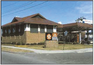
Figure 2-1: A building associated with a gas station is required to be close to the
street to create a well-defined street edge.
(B)
Pump Canopies.
(1)
Pump canopies shall be setback at least 15 feet from any side or rear property line. This setback is measured from the outer edge of the canopy to the property line.
(2)
Canopy height, as measured from the finished grade to the lowest point on the canopy fascia, should not exceed 14 feet. The overall height of a canopy should not exceed 17 feet.
(3)
Signs, including lighted bands or tubes applied in corporate colors, shall not be located on the canopy. Signs may be located on the pump islands.
(C)
Pavement. A service station site shall be paved with a permanent surface of concrete or asphalt material. Any unpaved portion of the site shall be landscaped and separated from the paved area by curbs or other barrier.
2.9.10
Industrial Uses (Indoors).
(A)
Industrial uses (indoors) located within areas zoned C1 shall adhere to the following use specific standards in addition to all standards found in Section 3.2.3, C1 District Site Development Standards.
(B)
Industrial uses indoors shall be limited to no more 50 percent of the area of a building or 5,000 square feet, whichever is less.
(C)
Industrial uses indoors, if on the first floor, shall be located in the rear portion of the building so that the front one half of the building is used for any commercial use permitted in the C1 district. Indoor uses may be located on any floor either above or below grade meeting all other code requirements.
(D)
All vertical and horizontal separation requirements of the building code shall be strictly applicable to industrial uses indoors located in the C1.
(E)
The performance standards found in Section 3.3.5, Performance Standards of this LDC shall be strictly applicable to industrial uses indoors that are located in the CI district.
(F)
Cannabis businesses with a cultivator or manufacture license or endorsement may operate up to 30,000 square feet of cannabis cultivation, cannabis product manufacturing, or lower-potency hemp edible manufacturing within an indoor facility.
(1)
All such uses are intended to be compatible with adjacent commercial and service uses. Odors, noise, vibration, glare and other potential side effects of manufacturing or cultivation processes shall not be discernable beyond the property line.
2.9.11
Live/Work.
(A)
The residential portion of a live/work use shall not occupy more than 50 percent of the entire square footage of the structure.
(B)
The residential portion of the live/work use, if located on the ground floor, shall be completely located behind the commercial portion of the building such that the ground floor street façade is a commercial use and commercial façade.
(C)
The residential portion of the live/work use shall have at least one entrance that exits to grade and is separate from any commercial entrance or commercial portion of the structure.
(D)
Work units are subject to Section 3.3.5, Performance Standards.
(E)
Signage regulations for live/work units shall adhere to Article 6, Signage, except that pylon and internally lit ground signs are prohibited. Signage shall be externally lit and downcast.
(F)
The following are business activities that are prohibited as work units:
(1)
Automotive and other vehicle repair and service;
(2)
Construction contractor facilities and storage (an office-only use is allowed) and other outdoor storage;
(3)
Dismantling, junk, or scrap yards;
(4)
Parking on, or dispatching from the site any vehicle used in conjunction with an automobile wrecking or towing service, or with a taxi or similar passenger or delivery service, whether based on the site or elsewhere;
(5)
Welding and machine shop operations;
(6)
Wood cutting businesses; or
(7)
Other similar uses as determined by the city planner.
2.9.12
Mixed Use Commercial/Residential.
(A)
Purpose. The purpose of mixed use commercial and residential in the C1 district is to allow for rental and ownership opportunities in the second and third floors above, or on the first floor behind, commercial spaces throughout the downtown.
(B)
General Standards.
(1)
Residential units may be located in the floors above or in the space commercial spaces throughout the C1 district. The residential portion, if located on the ground floor, shall be completely located behind the commercial portion of the building such that the ground floor street façade is a commercial use and commercial façade.
(2)
The residential portion of the mixed use shall have at least one entrance that exits to grade and is separate from any commercial entrance or commercial portion of the structure.
(3)
Signage regulations for mixed use units shall adhere to Section 6.10 (B), Signage for C1 districts.
2.9.13
Manufactured Home Parks.
(A)
Public Health Standards. Public health standards for manufactured home parks shall be as follows:
(1)
The condition of soil, groundwater level, drainage, and topography shall not create hazards to the property or to the health and safety of the occupants. The site should not be exposed to objectionable smoke, noise, odors, or other adverse influences, and no portion shall be subject to unpredictable and/or sudden flooding.
(2)
All manufactured homes shall be properly connected to a central water supply and a central sanitary sewer system. All water and sewer systems shall be constructed in accordance with plans and specifications approved by the city and the state department of health.
(3)
The storage, collection, and disposal of refuse in the manufactured home park shall be so conducted as to create no health hazards, rodent harborage, insect breeding, accident or fire hazards, or air pollution.
(B)
Streets in the R4 District.
(1)
All manufactured home parks shall be provided with safe and convenient vehicular access from abutting public streets or roads. Each manufactured home lot shall be provided access by a system of private streets, driveways, or other means of access within the park.
(2)
Entrances to manufactured home parks shall be designed to minimize congestion and hazards and allow free movement of traffic on adjacent streets. No vehicle parking shall be permitted on the park entrance street for a distance of 100 feet from its point of intersect with a public street.
(3)
Private surfaced roadways within the park shall be of adequate width to accommodate anticipated traffic, and in any case shall meet the following minimum requirements:
(a)
All streets shall meet the street width requirements for a local street (residential) as defined in Section 5.2.3, Streets, unless they are minor streets that are no more than 500 feet long and serve less than 25 manufactured homes. In such cases, the minor street shall have a minimum width of 20 feet.
(b)
Dead-end streets shall be limited in length to 500 feet and shall be provided at the closed end with a turnaround having an outside roadway diameter of at least 90 feet. All dead-end streets shall be marked with approved signs at the entrance to the dead-end street.
(4)
All streets shall be provided with a paved concrete or bituminous surface. Pavement edges shall be protected to prevent raveling of the wearing surface and shifting of the pavement base. Street surfaces shall be maintained in a satisfactory condition.
(a)
Longitudinal grades of all streets shall range between 0.40 percent and 8.00 percent. Transverse grades of all streets shall be sufficient to ensure adequate transverse drainage.
(b)
Streets within 50 feet of an intersection shall be at right angles.
(c)
A distance of at least 85 feet shall be maintained between the centerlines of offset intersecting streets within the park. Intersections of more than two streets at one point shall be avoided.
(C)
Sidewalks.
(1)
Each manufactured home stand shall have a sidewalk or other walkway connecting the stand to the public street and any sidewalk or public walk system.
(2)
A common sidewalk system shall be provided and maintained between locations where pedestrian traffic is concentrated. Such sidewalks shall have a minimum width of five feet.
(D)
Other Design Standards.
(1)
Lighting in an R4 district shall be subject to the standards of Section 3.3.4, Outdoor Lighting Standards.
(2)
The total amount of off-street parking shall be as specified in Section 3.6, Off-Street Parking, Loading, and Mobility.
(3)
A properly landscaped area shall be adequately maintained around each manufactured home park. Exposed ground surfaces in all parts of every manufactured home park shall be paved or covered with stone screenings or other solid material or protected with a vegetative growth that is capable of preventing soil erosion and of eliminating objectionable dust.
(4)
All manufactured home parks shall be subject to the landscaping and screening requirements of Section 3.5, Landscape, Screening, and Buffering Standards.
(E)
Manufactured Home Stands.
(1)
The general design standards for manufactured home stands are as follows:
(a)
Each park may have up to 200 manufactured home stands.
(b)
The manufactured home stand shall provide for the practical placement of the manufactured home and removal of the manufactured home from the manufactured home space.
(c)
Access to the manufactured home stand shall be kept free of trees or other immovable obstructions.
(d)
The manufactured home stand shall be constructed of appropriate material (such as concrete), be properly graded, placed and compacted in order to provide durable and adequate support of the maximum loads during all seasons of the year. The manufactured home stand shall react as a fixed support and remain intact under the weight of the manufactured home due to frost action, inadequate drainage, vibration, wind, or other forces acting on the structure. Adequate surface drainage shall be obtained by proper grading of the manufactured home stand and the manufactured home space.
(e)
Manufactured home stands shall not occupy an area in excess of one-third of the respective manufactured home space.
(f)
Ground anchors shall be installed by the lot owner or developer at each manufactured home stand, prior to or when the manufactured home is located thereon to permit tie downs of the manufactured home. Ground anchors shall meet manufacturer's recommendations and applicable administrative rules of the State of Minnesota.
(g)
Every owner or occupant of a manufactured home shall secure the same against wind damage, and every owner, operator or person in charge and control of a manufactured home park shall inspect and enforce this requirement.
(h)
The frame, wheels, crawl space, storage areas, and utility connections of all manufactured homes shall be concealed from view by skirting made of durable all-weather construction material that is consistent with the exterior of the manufactured home. Installation of the skirting must be completed within 60 days of the placement of the manufactured home on the stand. No obstruction shall be permitted that impedes the inspection of plumbing and electrical facilities.
(2)
The dimensional requirements for manufactured homes and manufactured home stands shall be as follows:
(a)
There shall be a minimum lot width of 35 feet.
(b)
Manufactured homes shall be set back a minimum of 20 feet from the edge of the street pavement for internal streets and 40 feet from any right-of-way of a public street.
(c)
There shall be a minimum setback of 20 feet from all other manufactured homes or principal buildings in the park.
(d)
The setback between manufactured homes and accessory buildings shall be five feet.
(F)
Structures. Every structure in the manufactured home park shall be developed and maintained in a safe, approved, and substantial manner. A building permit shall be required for all structures and shall conform to the state building code. The exterior of every such structure shall be kept in good repair. Portable fire extinguishers rated for electrical and liquid fires shall be kept in all service buildings and other locations conveniently and readily accessible for use by all occupants. All structures shall also require a smoke detector.
(G)
Community Buildings.
(1)
Each manufactured home park shall have one or more central community buildings with central heating that must be maintained in a safe, clean, and sanitary condition. The building shall be constructed in such a manner as to provide safe conditions during storms.
(2)
All manufactured home parks shall have an area set aside for long-term storage for such items as boats, boat trailers, hauling trailers, and other equipment not generally stored within each manufactured home and/or utility building on the manufactured home lot. This storage area shall be screened with a fence or enclosure so as to not be visible.
(H)
Park Management. Management of the manufactured home park shall be in accordance with the following:
(1)
The operator of a manufactured home park shall operate the park in compliance with this section and shall provide adequate supervision to maintain the park, its facilities and equipment in good repair and in a clean and sanitary condition.
(2)
The operator shall notify park occupants of all applicable subsections of this section and inform them of their duties and responsibilities under this Section.
(3)
The operator of every manufactured home park shall maintain a registry in the office of the manufactured home park indicating the name and address of each permanent resident. Each manufactured home site shall be identified by number, letter or both.
(4)
No public address or loudspeaker system shall be permitted.
(I)
Exemptions. Nothing in this article shall have the effect of altering the existing densities, lot size requirements, or manufactured setback requirements in any manufactured home park constructed before January 1, 1995, if the manufactured home park, when constructed, complied with the then existing density lot size and setback requirements, if any.
2.9.14
Data Processing Facility.
(A)
Purpose. The purpose of this section is to minimize conflicts with adjacent land uses and to ensure the effect of any such enterprise is minimized. Potential effects include, but are not necessarily limited to, very high energy usage, noise pollution, and the disposal of electronic waste. The high energy consumption of data processing operations runs counter to the City of Northfield and State of Minnesota objectives to reduce contributions to climate change. Equipment at these facilities has the potential to create noise pollution that negatively impacts nearby residents, businesses, and wildlife. In addition, electronic waste contains heavy metals and known carcinogens that have the potential to damage human health, and air and water quality if not handled correctly
(B)
General Standards.
(1)
Noise. Noise testing shall be required prior to issuance of a Certificate of Occupancy to ensure compliance with the Noise Ordinance.
(2)
Height. Buildings shall be a minimum of 25 feet in height. The maximum height limitation if all setbacks are increased by one foot for each two feet of height in excess of 50 feet is 65 feet.
(3)
Linkages. Convenient functional linkages shall be achieved by providing vehicular, bicycle, and pedestrian connections to promote the circulation and flow of vehicles, bicycles, and pedestrians between the development and existing uses.
(4)
Electric grid connectivity and use. No grid-connected data processing system shall receive a certificate of occupancy until evidence has been provided by the operator that installation of the system has been approved by the electrical utility provider. Systems demonstrating use of as close to 100 percent renewable energy as possible shall be exempt from this requirement.
(5)
Renewable energy. Facilities shall develop or purchase sufficient new renewable energy to offset as much of the electricity consumed as possible. Facilities that demonstrate a commitment to onsite renewable electricity generation or other means to increase use and production of local renewable energy are preferred.
(6)
Site design.
(a)
In addition to the standards in Section 3.2.5. principal buildings shall meet the following:
(i)
A minimum floor area ratio of .5.
(ii)
A maximum single front elevation of 300 feet in length unless special architectural landscaping, or topographic treatment, such as a change of material, texture, depression, berm, or other similar change, is employed.
(b)
Data processing facilities shall be located on land with a minimum acreage of 25 acres in size, at least 3,950 feet from an existing or planned park. trail, or other recreation feature, and the use shall be within a structure that is at least 200 feet from any residential dwelling.
(c)
The use of cargo containers, railroad cars, semi-truck trailers and other similar storage containers for any permanent component of the operation is strictly prohibited.
(d)
All fencing along roadways shall be decorative. If security fencing is proposed, vegetative screening must be placed between the fence and the public view. Fencing must be made of high-quality materials and is subject to planner approval. Chain-link and similar woven metal or plastic fencing shall not be used.
(e)
To minimize visibility from adjacent roads and adjacent properties, ground level and roof top mechanical equipment and loading areas shall be screened. Roof top screening shall be provided by principal building parapet. Ground level equipment shall be screened by a visually solid screen wall constructed of materials compatible with those used in exterior construction of the principal building. Mechanical equipment located in a manner found to have no adverse impact on adjacent roads and adjacent property, as determined by the planner shall not be required to be screened.
(f)
No building housing data processing equipment shall be located within 60 feet of a collector or local roadway. Site line studies shall be provided to confirm screening of equipment from adjacent roads and properties.
(g)
A 20-foot heavy planted landscape buffer shall be required along public roadways and adjacent or abutting non-industrial uses. Use of natural topography and preservation of existing vegetation, supplemented by new vegetation, if needed, may be substituted for the above requirements when found by the city planner to provide screening at the appropriate density, depth and height. Landscape shall be maintained for the life of the project. Photographic documentation shall be provided for city record prior to issuance of certificate of occupancy.
(C)
Performance Standards. These standards are intended to mitigate potential detrimental effects on adjacent properties. All applications for site plan approval must be accompanied by a registered engineer's certification that the use complies with all the performance standards. If, after occupancy of the structures, continuous or frequent (even if intermittent) violations of the performance standards occur, and after notice is given, bona fide and immediate corrective work is not performed which successfully prevents the violation(s) from reoccurring, the planner or building official may suspend or revoke the certificate of occupancy and require the operations and occupancy to immediately cease. The certificate of occupancy will be reinstated after the property owner demonstrates to the city's satisfaction, that operation of the facilities is able to conform to these requirements.
(1)
Air Quality. Air emissions shall meet applicable state and federal regulations. Where emissions could be released as a result of accident or equipment malfunction, standard safeguards for safe operation of the industry involved shall be taken and documented.
(2)
Odors. Any use producing odors shall implement best available practices and use best available technology so that offensive or obnoxious odor shall not be perceptible to a person of normal sensitivity at or beyond the property line.
(3)
Heat and Humidity.
(a)
Any use or activity producing heat or humidity in the form of steam or moist air shall be demonstrated to be designed in a manner that the heat or humidity will not be perceptible at or beyond the property line.
(b)
Any data processing operation shall ensure that no more than 20 percent of the heat dissipated by the activity shall be released directly to the outside when the average daily temperature is less than 40 degrees Fahrenheit.
(4)
Energy use. Any data processing operation shall document and certify that the buildings are designed to an average power usage effectiveness (PUE) of 1.4 or better.
(5)
Water use. Any data processing operation shall document a water usage effectiveness ratio upon start-up.
(a)
Data processing centers using free cooling, direct liquid, rack, or room cooling technologies may be permitted without a conditional use permit.
(b)
A conditional use permit is required for data processing centers proposing to use water for cooling. Water use must meet at least two of the following conditions:
(i)
Recycled and non-potable water makes up at least 60 percent of water withdrawals.
(ii)
The data processing operation shall be operated at or near the ASHRAE-recommended upper limit for temperature.
(iii)
The data processing operation shall ensure the humidity control system is optimized. and the data center is running at the low end of the ASHRAE-recommended guidelines for humidity (5.5°C dew point).
(iv)
Demonstrate and document implementation of all appropriate best practice airflow management strategies to improve cooling efficiency.
(6)
Glare. Any activity producing glare shall be carried on in such a manner that the glare is not perceptible at or beyond the property line. Artificial lighting shall be hooded or shaded so that direct light of high intensity lamps will not result in glare when viewed from public streets or neighboring properties.
(7)
Vibrations. Every use shall be so operated that any air or ground vibration recurrently generated from equipment other than vehicles is not perceptible without instruments at any point on or beyond the property line; nor may any vibration produce a particle velocity of two inches per second measured at or beyond the property line. This provision does not apply between adjoining data processing facilities.
(8)
Hazardous Materials. The manufacture, use, processing or storage of hazardous materials shall be permitted in accordance with the regulations of the State Building Code, State Fire Code, the National Fire Protection Association standards, the Minnesota Department of Natural Resources, Pollution Control Agency, Department of Health, and/or any other state or nationally recognized standards that may apply to the particular use, building, or process.
(9)
Industrial and Electronic Wastes. The storage, processing, or disposal of potentially hazardous waste, including electronic waste, shall be subject to the regulations of State Building Code, State Fire Code, the National Fire Protection Association standards, the Minnesota Department of Natural Resources, Pollution Control Agency, Department of Health, and/or any other state or nationally recognized standards that may apply to the particular use, building, or process. Verification that all hazardous and electronic waste will be handled by a qualified electronic waste recycling firm is required.
(10)
Electromagnetic Interference. Electric fields and magnetic fields shall not be created that adversely affect the public health, safety, and welfare, including but not limited to interference with the normal operation of equipment or instruments or normal radio, telephone, or television reception from off the premises where the activity is conducted.
(a)
This section does not apply to telecommunication facilities which are regulated by the FCC under the Federal Telecommunications Act of 1996 or its successor.
(11)
Noise. Noise emanating from a use or activity within an industrial zone which exceeds the maximum permissible noise levels set forth in this chapter and shown in Table 3.3-3: maximum decibels by district shall not be permitted.
2.9.15
Mining, Extraction, and Aggregate Processing
(A)
Purpose. The purpose of this section is to control mining, extraction, and aggregate processing so as to minimize conflicts with adjacent land uses and to ensure that the mining area is restored at the completion of the mining operation.
(B)
Scope. The following operations shall be covered by this section:
(1)
The removal, crushing, washing, refining, borrowing or processing of material.
(2)
In stone quarries, the production or manufacturing of veneer stone, sills, lintels, cut flagstone, hearthstones, paving stone and similar architectural or structural stone, and the storing or stockpiling of such products on the site.
(3)
The manufacture of concrete building blocks or other similar blocks, if conducted on the site, the production or manufacture of lime products, the production of ready-mixed concrete and any similar production or manufacturing processes that might be related to the mining operations.
(C)
Performance Standards. For such operations approved after the effective date of this LDC, the following are required:
(1)
The cutting of vegetation and construction, maintenance and operation of equipment shall be in accordance with the following:
(a)
Weeds and any other unsightly or noxious vegetation shall be cut or trimmed as may be necessary to preserve a reasonably neat appearance and to minimize seeding on adjacent property.
(b)
All equipment used for mining and extraction operations shall be constructed, maintained and operated in such a manner as to minimize, as far as is practicable, noises, dust and vibrations adversely affecting the surrounding property.
(2)
The mining and extraction operation shall be conducted in such a manner as to minimize interference with the surface water drainage outside of the boundaries of the mining operation.
(3)
Safety fencing may be required around all or portions of the mining operation.
(4)
The intersection of mining access roads with any public roads shall be selected such that traffic on the access roads will have a sufficient distance of public roads in view so that any turns onto the public road can be completed with a margin of safety as determined by the city engineer.
(5)
To minimize problems of dust and noise and to shield mining operations from public view, a screening barrier may be required between the mining site and adjacent properties. A screening barrier may also be required between the mining site and any public road located within 500 feet of any mining or processing operations.
(6)
Mining operations shall not be conducted closer than 30 feet to the right-of-way line of any existing or platted street, road or highway, except that excavating may be conducted within such limits in order to reduce the elevation thereof in conformity to the existing or platted street, road or highway.
(7)
All mining operations shall be conducted between the hours of 7:00 a.m. and 7:00 p.m.
(8)
All access roads from mining operations to public highways, roads or streets or to adjoining property shall be paved or surfaced to minimize dust considerations.
(9)
Mining operations within the WS-O district shall be conducted in accordance with the following:
(a)
Commercial manufacturing of sand and gravel byproducts shall be a prohibited use.
(b)
Mining operations shall not take place within 300 feet of the Cannon River. This distance does not apply to water pumps needed for mining operations. However, appropriation of water from the river shall require a permit from the Minnesota Department of Natural Resources
(c)
No sand and gravel operation shall be conducted on parcels of land or a combination of parcels less than 20 acres.
(10)
Stormwater and process water runoff from the site shall be treated so as not to degrade received waters.
(D)
Land Rehabilitation. All mining sites shall be rehabilitated immediately after mining operations cease. Rehabilitation shall be complete within one year. The following standards shall apply:
(1)
Within three months after the final termination of a mining operation or within three months after abandonment of such operation for a period of six months or within three months after expiration of a mining permit, all buildings and structures incidental to such operation shall be dismantled and removed by, and at the expense of, the mining operator last operating such buildings and structures. A temporary extension may be granted by the planning commission for one year, after which the buildings, structures, and machinery shall be removed.
(2)
The peaks and depressions of the area shall be graded and backfilled to a surface which will result in a gently rolling topography, not exceeding 18 percent in grade, in substantial conformity to the land area immediately surrounding.
(3)
Reclamation shall begin after the mining of 25 percent of the total area (planned for mining) or the first four acres of area is mined, whichever is less. Once these areas have been depleted of the mine deposit, they shall be sloped and seeded as per the mining plan approved through the conditional use permit process.
(4)
Reclaimed areas shall be surfaced with soil of a quality at least equal to the topsoil of land areas immediately surrounding, and to a depth of at least six inches. The topsoil shall be seeded, or planted with legumes and grasses. Trees and shrubs may also be planted, but not as a substitute for legumes and grasses.
2.9.16
Multi-Family Dwellings.
(A)
Standards in the N2 District.
(1)
General Standards.
(a)
Standards for building location for multi-family buildings are found in Table 3.2-2.
(b)
All multi-family dwellings shall be oriented so that a primary entrance faces the street from which the building is addressed.
(c)
Side façades shall incorporate a minimum of 15 percent facade area glazing.
(d)
Garages serving multi-family buildings shall be located to the side or rear of such buildings.
(e)
To the degree practicable, all rooftop mechanical equipment shall be located on the rear elevations or configured to have a minimal visual impact as seen from the street (see Section 3.5.10(B)(4)).
(f)
Except for structures designed for persons with physical disabilities, the finished floor elevation at the front façade shall be located above grade in accordance with the following standards:
(i)
If the building is located 15 feet or less from the front property line, the finished floor elevation of the front façade shall be a minimum of 18 inches above grade;
(ii)
Exposed foundation walls or piers shall be clad in face brick, stone, stucco or some other masonry material accurately imitating these materials. Screening shall be installed between piers on front and side building façades.
(2)
Apartment Building with Nine or More Units.
(a)
Front façades shall incorporate wall offsets in the form of projections and/or recesses in the façade plane a minimum of every 40 feet of façade frontage.
(b)
Wall offsets shall have a minimum depth of two feet.
(c)
Each apartment unit at grade shall have a separate entrance.
(d)
If an apartment building is constructed with a height of between 40 and 50 feet, the building shall incorporate one of the requirements listed below:
(i)
Be located a distance of 25 feet from the front yard property line rather than 15 feet; or
(ii)
Incorporate a courtyard as regulated in subsection (e), below; or
(iii)
The height of the building above 40 feet shall be set back five feet from the building façade.
(e)
If an apartment building has a courtyard, the courtyard shall be constructed with the following standards:
(i)
Courtyards shall be designed to provide a central courtyard along the front yard.
(ii)
Minimum courtyard dimensions shall be 30 feet wide and 30 feet deep.
(iii)
Building wings facing the courtyard shall be constructed at the front building location as shown in Table 3.2-2.
(iv)
Courtyards shall be connected to the public right-of-way by a minimum five foot wide sidewalk.
(v)
The main entrance to each ground floor apartment unit shall be directly off the courtyard or directly from the street.
(vi)
The courtyard shall be enclosed with a fence or garden wall so that the building street face will be viewed as continuous.
(3)
Apartment House with Four to Eight Units.
(a)
Apartment houses may have common interior entries or separate exterior entries to each individual unit.
(b)
Apartment houses shall be given the appearance of a large single-family detached home through the use of porches, pillars, bay windows, dormer windows, cupolas, roof line changes, parapets, multiple windows, and similar architectural treatments.
(4)
Rowhouse.
(a)
Each rowhouse unit shall include a front stoop that may encroach into the building setback (See Figure 2-2).
(b)
Patios facing streets shall be enclosed with fencing or a similar barrier.
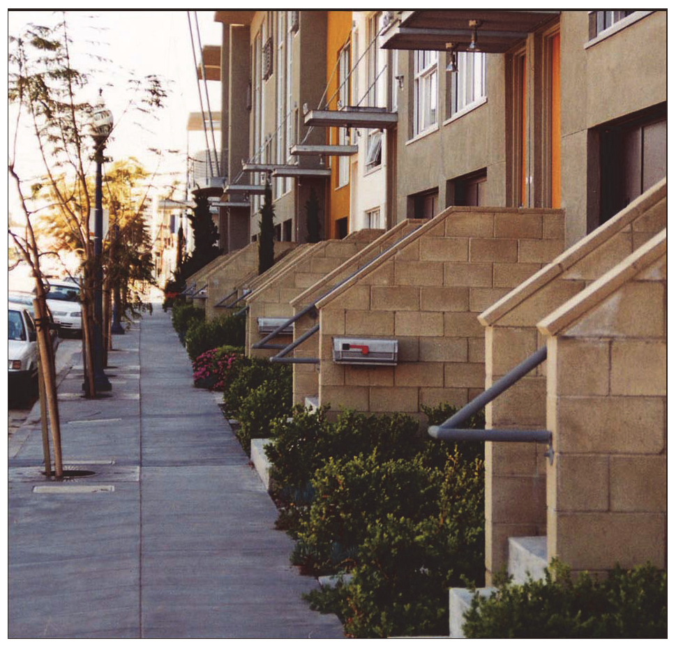
Figure 2-2
Illustration of a front stoop required for each rowhouse unit.
2.9.17
Neighborhood-serving Commercial.
(A)
A neighborhood-serving commercial shall be allowed in the N2 district provided it is located at least one half mile from other neighborhood-serving commercial uses.
(B)
Buildings associated with a neighborhood-serving commercial use are limited to 3,500 square feet in size on the ground level, may contain no more than two stories, and may contain a residential component.
(C)
Development subject to requirements of this section shall comply with the following standards:
(1)
Site Plan Review. The standards of this section shall be reviewed through the site plan review process established in Section 8.5.6, Site Plan Review.
(2)
Site Layout.
(a)
Off-Street Parking
(i)
The total amount of off-street parking shall be as specified in Section 3.6, Off-Street Parking, Loading, and Mobility.
(ii)
Off-street parking shall be established in one of the following locations (listed in priority order):
•
Behind the building;
•
Adjacent to lot lines abutting nonresidential development;
•
On a lot's corner side;
•
Off-street parking may be established adjacent to lot lines abutting residential uses only if the applicant can demonstrate that there is no other alternative location for the parking, and can demonstrate that the parking area will be screened from view.
(b)
Landscaping/Screening. Screening established with vegetation, walls, fences, berms, or a combination of these features shall be as required in Table 3.6-4, as prescribed for a required buffer area "A."
(i)
Screening shall not interfere with public sidewalks or improved pedestrian connections.
(ii)
Mechanical equipment, waste receptacles, and recycling containers shall be fully screened from adjacent residential uses by a fence, wall, landscaping, or combination of these features (See Section 3.5.10, Screening Requirements).
(c)
Outdoor Lighting. Outdoor lighting shall:
(i)
Have a maximum height of 15 feet;
(ii)
Be fully-shielded;
(iii)
Be configured so that the source of illumination is not visible;
(iv)
Be directed down and away from adjacent residential lots; and
(v)
The requirements of Section 3.3.4, Outdoor Lighting Standards, shall also apply.
(d)
Signage regulations for neighborhood serving commercial uses shall adhere to Article 6, Signage, except that pylon and ground signs are prohibited.
2.9.18
Recreational Facilities, Outdoor. Outdoor recreational facilities may only be considered for a conditional use permit in the R1, R2, R3, N1, N2, C1, I1 and A-S districts when it is accessory to a school.
2.9.19
Retail Sales and Service.
(A)
Retail sales and service may be permitted in the I1-B district provided that the total square footage of retail sales is limited to a maximum of 20 percent of the total floor area and is related to items manufactured on site.
(B)
Except in the I1-B district, a conditional use permit is required for new construction of a cannabis retail business covering more than 15,000 square feet of land to ensure size and design compatibility with the location.
(C)
A cannabis businesses with a retail license or a cannabis retail endorsement is prohibited from sharing a common entrance with a business licensed as a tobacco products shop.
(D)
Cannabis businesses with a retail license or a cannabis retail endorsement shall be located a minimum distance of 300 feet from any primary or secondary school, measured from the property line of the school to the principal structure of the cannabis retail business.
(E)
Cannabis businesses with a retail license or cannabis retail endorsement shall be separated from other such cannabis retail businesses by a minimum distance of 1,320 feet.
2.9.20
Telecommunication Facilities and Antennas.
(A)
Purpose. In order to accommodate the communication needs of residents and businesses while protecting the public health, safety, and general welfare of the community, the city council finds that this section is necessary in order to:
(1)
Facilitate the provision of telecommunication services to the residents and businesses of the city;
(2)
Minimize adverse visual effects of towers through careful design and siting standards;
(3)
Avoid potential damage to adjacent properties from tower failure through structural standards and setback requirements; and
(4)
Maximize the use of existing and approved towers and buildings to accommodate new wireless telecommunication antennas.
(B)
Exemptions. The following telecommunication facilities and antennas, included but not limited to, shall be exempt from the requirements of this section.
(1)
A single ground- or building-mounted receive-only radio or television antenna, including any mast, for the sole use of the resident occupying a residential parcel on which the radio or television antenna is located, with an antenna height not exceeding 40 feet;
(2)
A ground- or building-mounted citizens band radio antenna, including any mast, if the height (post and antenna) does not exceed 35 feet;
(3)
A ground-, building-, or tower-mounted antenna operated by a federally licensed amateur radio operator as part of the Amateur Radio Service, existing on July 17, 2000 subject to the requirements of Section 2.10.4(H)(1), Amateur Radio Antennas;
(4)
A ground- or building-mounted receive only radio or television satellite dish antenna (TVRO) subject to the requirements of Section 2.10.4(H)(2), Satellite Dishes provided the dish is not located in the front yard of the parcel on which it is located and provided the height of the dish does not exceed the height of the ridgeline of the principal structure on the parcel;
(5)
All citizens band radio antennas or antennas operated by a federally licensed amateur radio operator as part of the Amateur Radio Service which existed on July 17, 2000;
(6)
Mobile services providing public information coverage of news events of a temporary nature;
(7)
Handheld devices such as cell phones, business-band mobile radios, walkie-talkies, cordless telephones, garage door openers and similar devices as determined by the city planner;
(8)
City-government-owned and -operated towers supporting receive and/or transmit antennas, including supporting structures, for all public safety and service purposes;
(a)
Such tower shall conform to the accessory structure setback for the zoning district in which it is located. Guy wires shall be set back no less than one foot from property lines;
(b)
Such tower shall be installed in accordance with the instructions furnished by the manufacturer of the tower model. Antennas mounted on a tower may be modified and changed at any time so long as the published allowable load on the tower is not exceeded and the structure of the tower remains in accordance with the manufacturer's specifications; and
(c)
Such towers shall be exempt from the requirements of subsections (F) to (I), (K) and (L).
(C)
Towers in the R1, R2, R3, R4, A-S, or CD-S Districts. The construction of commercial towers and antennas in a R1, R2, R3, R4, A-S, or CD-S district are prohibited, except as follows:
(1)
Towers supporting commercial antennas and conforming to all applicable sections of this article shall be allowed as a conditional use, and only in the following locations:
(a)
Church sites, when camouflaged as steeples or bell towers. Antennas and all other associated structures shall also be camouflaged;
(b)
Park sites, when compatible with the nature of the park, provided that the requirements of Section 2.9.20(F)(2) are met; and
(c)
Government, school, utility and institutional sites.
(2)
No tower supporting commercial antennas, the construction of which is permitted as a conditional use by this section, shall exceed 120 feet in height.
(3)
Towers supporting commercial antennas shall be set back from all property lines abutting property zoned or used for residential purposes or adjacent to the Cannon River no less than 50 percent of the tower height. Towers shall be set back from all property lines abutting nonresidential property no less than 25 percent of the total tower height.
(4)
Equipment buildings, shelters or cabinets shall comply with the accessory building setbacks for the residential zoning district in which it is located.
(D)
Towers in C1 and C2 Districts.
(1)
Towers supporting commercial antennas are prohibited in the C1 district.
(2)
Towers supporting commercial antennas and conforming to all applicable sections of this article shall be allowed in the C2 district as a conditional use.
(3)
The maximum height of any tower, the construction of which is permitted by this section, including all antennas and other attachments, shall not exceed 150 feet in height or 180 feet in height in the I1 district.
(4)
Towers shall be set back from all property lines no less than 25 percent of the tower height, with a minimum setback of 20 feet. Towers shall be set back from all property lines abutting property zoned or used for residential purposes or adjacent to the Cannon River no less than 50 percent of the total tower height.
(5)
Equipment buildings, shelters or cabinets shall comply with the principal building setbacks for the commercial zoning district in which it is located.
(E)
Towers in the I1 and ED-F Districts.
(1)
In all industrial zoning districts, towers supporting commercial antennas and conforming to all applicable sections of this section shall be allowed as a permitted use.
(2)
The maximum height of any tower, the construction of which is permitted by this section, including all antennas and other attachments, shall not exceed 180 feet in height.
(3)
Towers shall be set back from all property lines no less than 25 percent of the tower height, with a minimum setback of 20 feet. Towers shall be set back from all property lines abutting property zoned or used for residential purposes or adjacent to the Cannon River no less than 50 percent of the total tower height.
(4)
Equipment buildings, shelters or cabinets shall comply with the principal building setbacks for the industrial zoning district in which it is located.
(F)
Location Requirements. All commercial, wireless telecommunication facilities erected, constructed, or located within the city shall comply with the following requirements:
(1)
Priority of Location. The following establishes the order of priority for locating new commercial, wireless telecommunication facilities. A proposal for such facilities shall not be approved on any of the following locations unless the applicant shows and the city finds that the applicant is unable to locate the facilities on any location which has a higher priority:
(a)
Place antennas and towers on sites where other public facilities are located or planned.
(b)
Place antennas and towers on private institutional property and structures.
(c)
Place antennas on other appropriate existing structures such as buildings, communications towers, water towers and smoke stacks.
(d)
Place antennas on new towers on other private property.
(2)
Collocation. Towers shall be collocated as follows:
(a)
A proposal for a new commercial wireless telecommunication tower shall not be approved unless the city finds that the telecommunication equipment planned for the proposed tower cannot be accommodated on an existing or approved tower or building within a one-mile search radius from the point of the proposed tower for towers in excess of 100 feet in height, within a one-half-mile search radius for towers of 80 to 100 feet in height, and within a one-quarter-mile search radius for towers 80 feet and lower in height, due to one or more of the following reasons:
(i)
The planned equipment would exceed the structural capacity of the existing or approved tower or building, as documented by a qualified and licensed professional engineer, and the existing or approved tower cannot be reinforced, modified, or replaced to accommodate planned or equivalent equipment at a reasonable cost.
(ii)
The planned equipment would cause interference materially impacting the feasibility of other existing or planned equipment at the tower or building, as documented by a qualified and licensed professional engineer approved by the city, and the interference cannot be prevented at a reasonable cost.
(iii)
Existing or approved towers and buildings within the search radius cannot accommodate the planned equipment at a height necessary to function reasonably as documented by a qualified and licensed professional engineer approved by the city.
(iv)
Other unforeseen reasons exist that make it infeasible to locate the planned telecommunication equipment upon an existing or approved tower or building.
(b)
It shall be the responsibility of the applicant to provide, at no cost to the city, an inventory of available structures in the subject area to the city.
(c)
Any proposed commercial wireless telecommunication service tower shall be designed structurally, electrically, and in all respects to accommodate both the applicant's antennas and comparable antennas for at least two additional uses if the tower is over 100 feet in height or at least for one additional use if the tower is 60 to 100 feet in height. Towers must be designed to allow for future rearrangement of antennas upon the tower and to accept antennas mounted at varying heights.
(d)
The applicant shall allow the city access to the tower for city-government-owned and -operated receive and/or transmit antennas for all public safety and service purposes to enhance communications for such purposes, provided that any attached communication equipment does not interfere with the applicant's equipment.
(e)
As a condition of approval, the applicant shall make available unutilized space for collocation of other telecommunication facilities, including space for those entities providing similar competing services. A good-faith effort in achieving collocation shall be required of the host entity.
(f)
Requests for utilization of facility space shall be made to the community development department. Collocation will not be required when the addition of the new service or facilities would cause quality of service impairment to the existing facility or if it becomes necessary for the host to go off line for a significant period of time.
(g)
The host is entitled to reasonable compensation from any co-locator for the use of its facility. Such compensation would include reimbursement for the cost of constructing the facility as it relates to any co-locator as well as a proportionate share of any rents paid by the host.
(G)
General Location Standards for Telecommunication Facilities. All telecommunication facilities, except exempt facilities as identified in Section 2.9.20(B), Exemptions, shall be located so as to minimize their visibility and the number of distinct facilities present. To this end all of the following measures shall be implemented for all telecommunication facilities, except exempt facilities as identified in Section 2.9.20(B), Exemptions:
(1)
No telecommunication facility shall be installed at a location where special painting or lighting will be required by Federal Aviation Administration (FAA) regulations unless technical evidence acceptable to the city is submitted showing that this is the only technically feasible location for the facility;
(2)
No commercial telecommunication facility shall be installed on an exposed ridgeline, public trail, public park or other outdoor recreation area, or on property designated as floodplain or park or open space, unless it blends with the surrounding existing natural and manmade environment in such a manner as to be effectively unnoticeable and a finding is made that no other location is technically feasible;
(3)
No commercial telecommunication facility that is readily visible from off-site shall be installed closer than one-half mile from another readily visible un-camouflaged or unscreened telecommunication facility unless it is a collocated facility, situated on a multiple-user site, or blends with the surrounding existing natural and manmade environment in such a manner as to be effectively unnoticeable, or technical evidence acceptable to the city is submitted showing a clear need for the facility and the infeasibility of collocating it on one of the existing sites; and
(4)
No commercial telecommunication facility that is readily visible from off-site shall be installed on a site that is not already developed with telecommunication facilities or other public or quasi-public uses unless it blends with the surrounding existing natural and manmade environment in such a manner so as to be effectively unnoticeable or technical evidence acceptable to the city is submitted showing a clear need for the facility and the unfeasibility of collocating it on one of the existing sites.
(H)
Roads and Parking. All telecommunication facilities, except exempt facilities as identified in Section 2.9.20(B), Exemptions, shall be served by the minimum roads and parking areas necessary. To this end all of the following measures shall be implemented for all telecommunication facilities, except exempt facilities as identified in Section 2.9.20(B), Exemptions:
(1)
Existing roads shall be used for access, whenever possible, and shall be upgraded the minimum amount necessary to meet standards specified by the fire chief and city engineer. Any new roads or parking areas built shall, whenever feasible, be shared with subsequent telecommunication facilities and/or other permitted uses. In addition, they shall meet the width and structural requirements of the fire chief and the city engineer.
(2)
Existing parking areas shall, whenever possible, be used.
(3)
Any new parking areas constructed shall comply with the parking standards established in Section 3.6, Off-Street Parking, Loading, and Mobility of this section.
(I)
Landscaping and Screening. All telecommunication facilities, except exempt facilities as identified in Section 2.9.20(B), Exemptions, shall be installed in such a manner so as to maintain and enhance existing native vegetation and to install suitable landscaping to screen the facility, where necessary. To this end all of the following measures shall be implemented for all telecommunication facilities, except exempt facilities as identified in Section 2.9.20(B), Exemptions:
(1)
A landscape plan shall be submitted with the project application submittal indicating all existing vegetation, identifying landscaping that is to be retained on the site, any additional vegetation that is needed to satisfactorily screen the facility from adjacent land uses and public view areas, and the type of vegetation to be restored in all areas that will be disturbed. All significant trees, as defined by the city tree preservation policy, shall be identified in the landscape plan with indication of species type and whether it is to be retained or removed with project development.
(2)
Existing trees and other screening vegetation in the vicinity of the facility and along the access roads and power/telecommunication line routes involved shall be protected from damage, both during the construction period and thereafter. To this end, the following measures shall be implemented:
(a)
A tree preservation plan, which meets the requirements of the city tree preservation policy, shall be submitted with the conditional use permit application or building permit;
(b)
Grading, cutting/filling, and the storage/parking of equipment/vehicles shall be prohibited in landscaped areas; and
(c)
All underground lines shall be routed such that a minimum amount of damage is done to the tree's essential root systems.
(3)
All areas disturbed during project construction other than the access road and parking areas shall be replanted with vegetation compatible with the vegetation in the surrounding area (e.g., ornamental shrubs or natural brush, depending upon the circumstances) according to the approved landscape plan.
(4)
Any existing trees or significant vegetation, on the facilities site or along the affected access area, that die shall be replaced with native trees and vegetation of a size and species subject to Table 3.6-2.
(5)
No actions shall be taken subsequent to project completion with respect to the vegetation present that would increase the visibility of the facility itself or the access road and power/telecommunication lines serving it.
(J)
Environmental Resource Protection. All telecommunication facilities shall be sited so as to minimize the effect on environmental resources. To that end the following measures shall be implemented for all telecommunication facilities, except exempt facilities as identified in Section 2.9.20(B), Exemptions:
(1)
Potential adverse visual impacts which might result from project-related grading or road construction shall be minimized;
(2)
Potential adverse impacts upon nearby public use areas such as parks or trails shall be minimized; and
(3)
Drainage, erosion, and sediment controls shall be required as necessary to abate soil erosion and sedimentation of waterways. Structures and roads on slopes of ten percent or greater shall be avoided. Erosion control measures shall be incorporated for any proposed facility which involves grading. Natural vegetation and topography shall be retained to the extent feasible.
(K)
Noise and Traffic. All telecommunication facilities shall be constructed and operated in such a manner as to minimize the amount of disruption caused to the residents of nearby homes and the users of nearby recreational areas such as public parks and trails. To that end all of the following measures shall be implemented for all telecommunication facilities:
(1)
Outdoor noise-producing construction activities shall only take place on weekdays (Monday through Friday, non-holiday) between the hours of 7:30 a.m. and 5:30 p.m. unless allowed at other times as a condition of the conditional use permit;
(2)
Backup generators shall only be operated during power outages and for testing and maintenance purposes. If the facility is located within 100 feet of a residential dwelling unit, noise attenuation measures shall be included to reduce noise levels to an exterior noise level of at least an Ldn of 60 dB at the property line and an interior noise level of an Ldn of 45 dB. Testing and maintenance shall only take place on weekdays between the hours of 7:30 a.m. and 5:30 p.m.; and
(3)
Traffic, at all times, shall be kept to an absolute minimum, but in no case more than two round trips per day on an average annualized basis once construction is complete.
(L)
Visual Compatibility. All telecommunication facilities, except exempt facilities as identified in Section 2.9.20(B), Exemptions, shall be constructed and sited so as to minimize the visual effect of such facilities on the surrounding area. To that end the following measures shall be implemented for all telecommunication facilities, except exempt facilities as identified in Section 2.9.20(B), Exemptions:
(1)
Facility structures and equipment shall be located, designed and screened to blend with the existing natural or built surroundings so as to reduce visual impacts to the extent feasible considering the technological requirements of the proposed telecommunication service and the need to be compatible with neighboring residences and the character of the community;
(2)
The facility shall be designed to blend with any existing supporting structure and shall not substantially alter the character of the structure or local area;
(3)
Following assembly and installation of the facility, all waste and debris shall be removed and disposed of in a lawful manner; and
(4)
A visual analysis, which may include photo montage, field mockup, or other techniques, shall be prepared and submitted by or on behalf of the applicant in conjunction with an application for a conditional use permit or a building permit, which identifies the potential visual impacts, at design capacity, of the proposed facility. Consideration shall be given to views from public areas as well as from private residences. The analysis shall assess the cumulative impacts of the proposed facility and other existing and foreseeable telecommunication facilities in the area and shall identify and include all feasible mitigation measures consistent with the technological requirements of the proposed telecommunication service. All costs for the visual analysis and applicable administrative costs shall be borne by the applicant.
(M)
Construction Requirements. Construction requirements shall be as follows:
(1)
Towers and antennas shall be designed to blend into the surrounding environment through the use of color and camouflaging treatment, except when the color is dictated by federal or state authorities. Materials employed shall not be unnecessarily bright, shiny, or reflective and shall be of a color or type which blends with the surroundings to the greatest extent possible.
(2)
Towers shall not be illuminated by artificial means and shall not display strobe lights unless such lighting is specifically required by federal or state authorities. When incorporated into the design of the tower, light fixtures, such as streetlights, are permitted.
(3)
The use of any portion of a tower for signs, other than warning or equipment information signs, is prohibited.
(4)
Sufficient anti-climbing measures must be incorporated into the facility, as needed, to reduce potential for trespass and injury.
(5)
All towers, masts and booms shall be made of noncombustible material, and all hardware, such as brackets, turnbuckles, clips and similar type equipment subject to rust or corrosion must be protected either by galvanizing or sheradizing after forming.
(N)
Abandoned or Unused Towers or Portions of Towers. Abandoned or unused towers or portions of towers shall be removed as follows:
(1)
All abandoned or unused towers and associated facilities shall be removed within 12 months of the cessation of operations at the site unless a time extension is approved by the city planner. If the tower is not removed within 12 months of the cessation of operations at a site, the tower and associated facilities may be removed by the city and the cost of removal assessed against the property owner.
(2)
Unused portions of towers above a manufactured connection shall be removed within six months of the time of antenna relocation. The replacement of portions of a tower previously removed requires the issuance of a new application and/or request for variance if applicable.
(O)
Measurement of Tower Height. The height of a tower shall be determined by measuring the vertical distance from the tower's point of contact with the ground or rooftop structure to the highest point of the tower, including all antennas or other attachments. If the tower with its antenna can be telescoped from low to high positions, the height measurement shall be made with the tower in its lowest position. When towers are mounted upon other structures, the combined height of the structure and the tower must meet the height restrictions set forth in this article for the particular zoning district.
(P)
Review Procedure. Procedures for reviewing a permit are as follows:
(1)
It shall be unlawful for any person to erect, construct, place, re-erect, replace, or repair any tower without first making application for a zoning certificate prior to applying for a building permit (See Section 8.5.1, Zoning Certificate).
(2)
If a conditional use permit is required for a requested tower, the requirements of Section 8.5.9, Conditional Use Permit shall apply.
(3)
Site plan review will be required for all towers that are listed as a permitted use in the applicable zoning district (See Section 8.5.6, Site Plan Review).
(4)
The applicant shall provide, at the time of application, sufficient information to indicate the construction, installation, and maintenance of the antenna and tower will not create a safety hazard or damage to the property of other persons.
(5)
Adjustment or replacement of the elements of an antenna already affixed to a tower or antenna shall not require a permit, provided that the replacement does not reduce the safety factor. The city planner shall issue a decision related to the zoning certificate application upon review of all required materials listed in this section and shall respond to the request in an expeditious and reasonable timeframe.
2.9.21
Vehicle Rental. For those properties zoned C1, the maximum number of vehicles for rent stored on the property shall not exceed five.
(Ord. No. 973, 7-7-2015; Ord. No. 1066, § 3, 10-15-2024; Ord. No. 1071, §§ 6—8, 12-3-2024; Ord. No. 1077, §§ 6, 7, 5-20-2025)
2.10 - Accessory Uses and Structures.
2.10.1
Purpose. This section authorizes accessory uses and structures that are incidental and customarily subordinate to principal uses. The intent of this section is to allow accessory uses while not creating adverse impacts on surrounding lands. Examples of accessory uses and structures include accessory dwelling units, detached garages, detached sheds, gazebos, swimming pools, hot tubs and spas, and courts for tennis and other recreational sports.
2.10.2
General Provisions.
(A)
Fencing and walls will not be subject to the requirements of this section. Standards for fencing and walls are established in Section 3.3.2, Fencing and Walls.
(B)
An accessory use structure will be incidental to the principal use of the site, and shall not negatively alter the character of the principal use.
(C)
Small accessory structures such as arbors, benches, doghouses, play sets, garden decorations, pergolas, and firewood cribs are exempt from the provisions of this section, but cannot be located in public rights-of-way.
(D)
Accessory structures will only be constructed concurrent with or after the construction of the principal building on the same site.
(E)
Accessory structures located on lots with stream or river frontage may be located between the public road and the principal structure, provided it is clearly demonstrated that physical conditions require such a location.
(F)
Uses and structures that are accessory to a conditional use permit for a principal use shall be permitted in accordance with this section, without requiring a conditional use permit amendment, unless specifically required as a condition of the conditional use permit approval.
(G)
An accessory structure in residential districts that is detached from the principal building will comply with the following standards, unless otherwise stated in this section and the use-specific standards of Section 2.10.4, Standards for Specific Accessory Uses and Structures.
(1)
Setbacks.
(a)
An accessory structure will not be located within a front yard.
(b)
An accessory structure will maintain a front and corner side setbacks at least as great as the setback of the principal building, except that an existing non-conforming detached residential garage may be replaced or expanded to a distance of at least three feet to the interior side or rear yard property line.
(c)
An accessory structure shall maintain at least a five foot separation from other accessory structures and the principal building.
(2)
Size and Height Limits.
(a)
With the exception of sheds and detached garages, the maximum height of a detached accessory structure will be ten feet.
(b)
Detached sheds on residential properties shall not be larger than 200 square feet, and cannot exceed an eight foot sidewall and a peak height of 13 feet from grade.
(c)
No detached garage used or intended for the storage of vehicles on a residential property shall exceed 864 square feet nor shall any access door or other opening exceed the height of 12 feet.
(d)
Detached garages will not exceed 18 feet in height, or 24 feet in height if the structure includes an accessory dwelling unit.
(3)
Maximum Number and Building Coverage.
(a)
Up to three accessory structures may be permitted on a single lot, but only one of those detached structures may be a garage. For the purposes of this subsection, accessory structures shall only include detached garages, sheds, accessory dwelling units, swimming pools, hot tubs, spas, and courts for tennis or other recreational sports.
(b)
Detached garages are included in the building coverage requirements in Table 3.2-1.
(H)
An accessory structure in non-residential districts that is detached from the principal building will comply with the following standards, unless otherwise stated in this section and the use-specific standards of Section 2.10.4, Standards for Specific Accessory Uses and Structures:
(1)
Setbacks. One half of the required setback for the principal building, but in no instance less than ten feet except for properties zoned C1.
(2)
Height limits. The maximum height shall be 20 feet.
(3)
Maximum size. The maximum size shall be no greater than 50 percent of the building area of the principal building.
2.10.3
Permitted Accessory Uses.
(A)
The symbols used in Table 2.10-1 are defined as follows:
(1)
Permitted Uses (P). A "P" in a cell indicates that the accessory use or structure is allowed by-right in the respective zoning district subject to compliance with the use-specific standards set forth in the final "use-specific standards" column of Table 2.10-1.
(2)
Conditional Uses (C). A "C" in a cell indicates that the accessory use or structure is allowed as a conditional use in the respective zoning district subject to compliance with the use-specific standards set forth in the final "additional requirements" column of Table 2.10-1 and approval of a conditional use permit in accordance with Section 8.5.9, Conditional Use Permit.
(3)
Prohibited Uses. A cell with a "—" indicates that the listed use type is prohibited in the respective zoning district.
(4)
Use-Specific Standards. The "use-specific standards" column of Table 2.10-1 cross-references standards that are specific to an individual use type and are applicable to that use in all districts unless otherwise stated.
(B)
Unlisted Uses. If an application is submitted for an accessory use or structure that is not listed in Table 2.10-1, the city planner is authorized to classify the new or unlisted use, with consultation from appropriate city departments, into an existing use type that most closely fits the new or unlisted use. If no similar use determination can be made, the city planner shall refer the use to the planning commission, who may initiate an amendment to the text of this LDC to clarify where and how the use should be permitted.
(Ord. No. 985, 2-7-2017; Ord. No. 1071, § 9, 12-3-2024; Ord. No. 1077, § 8, 5-20-2025)
2.10.4
Standards for Specific Accessory Uses and Structures. The following requirements apply to the specific types of accessory uses and structures listed, in addition to the requirements of Section 2.10.2, General Provisions, as applicable.
(A)
Accessibility Ramps. Ramps that provide access to buildings for the disabled are permitted in all zoning districts and may encroach in all setbacks but shall not encroach on a public right-of-way.
(B)
Accessory Dwelling Units. This section allows the creation of detached accessory dwelling units on existing lots in residential zoning districts that already contain legally created dwelling units.
(1)
Accessory Dwelling Unit Development Standards.
(a)
Only one accessory dwelling unit shall be permitted on a lot, and shall be included in the maximum number of allowable dwelling units on a property as shown in Table 2.7-1.
(b)
Except in the C2-B and I1-B Zoning Districts, Churches shall be allowed one accessory dwelling unit with up to 1,000 square feet of living area. Church accessory dwelling units must comply with Northfield Municipal Code, Chapter 14, Article III. Rental Housing, except that accessory dwelling units licensed hereunder are not subject to the requirements contained in Section 14-97, Limitation on rental properties in low density neighborhoods, or the parking requirements contained in Section 14-123 Parking.
(c)
An accessory dwelling unit may be located as part of a detached garage.
(d)
An accessory dwelling unit shall contain separate kitchen and bathroom facilities connected to city sanitary sewer and water services or, if applicable, connected to the private well and individual sewage treatment system serving the principal dwelling on the lot if said principal dwelling is not otherwise served by or required to be served with city sewer and water services, and the same shall be in compliance with City Code, chapters 22 and 82, as the same may be amended from time to time.
(e)
An accessory dwelling unit shall not exceed, 50 percent of the gross floor area of the primary dwelling or 1,000 square feet of gross floor area, whichever is less. The maximum height for an ADU shall be the lesser of 24 feet or the height of the primary dwelling.
(f)
An accessory dwelling unit shall be constructed so as to be compatible with the existing principal dwelling, as well as the surrounding neighborhood in terms of design, form, height, materials, and landscaping.
(g)
A detached accessory dwelling unit shall be separated from the principal dwelling by a minimum distance of ten feet.
(h)
Accessory dwelling units do not count towards the building area ratio for the lot.
(i)
Unrestricted, improved access must be provided from the street to the primary entrance of the accessory dwelling unit.
(2)
An accessory dwelling unit may be rented if it complies with the Northfield Municipal Code, chapter 14, Article III. Rental Housing, but the owner of the principal building on the property must reside on the property. Accessory dwelling units are not subject to the requirements contained in Section 14-97, Limitation on rental properties in low density neighborhoods, or the parking requirements contained in Section 14-123 Parking.
(C)
Chickens.
(1)
Property owners are permitted to raise and keep chickens on all properties of five acres or more in size without complying with the requirements of this section.
(2)
For properties that are less than five acres, the keeping of six adult chickens is permitted provided that:
(a)
The principal use of the lot is as a dwelling;
(b)
No person shall keep any rooster;
(c)
The chickens shall be provided with a covered enclosure and must be kept in the covered enclosure or a fenced enclosure at all times, that may include chicken wire fencing with a minimum height of 18 inches; and
(d)
No enclosure shall be located closer than 25 feet to any residential structure on an adjacent lot.
(D)
Courts, Tennis and Other. Noncommercial outdoor tennis courts and courts for other sports, including basketball and racquetball, accessory to a residential use, shall comply with the following requirements:
(1)
No court shall be located within a required setback, or within five feet of a lot line;
(2)
Court fencing shall comply with Section 3.3.2, Fencing and Walls; and
(3)
Court lighting shall require a zoning certificate approval, and shall not exceed a maximum height of 20 feet, measured from the court surface. The lighting shall be directed downward and shall only illuminate the court.
(E)
Home Businesses. The following standards for home businesses are intended to provide reasonable opportunities for employment within the home, while avoiding changes to the residential character of a dwelling that accommodates a home business, or the surrounding neighborhood, where allowed by this section.
(1)
Prohibited Home Businesses. The following are business activities that are prohibited as home businesses:
(a)
Animal hospitals and boarding facilities;
(b)
Automotive and other vehicle repair and service;
(c)
Construction contractor facilities and storage (an office-only use is allowed) and other outdoor storage;
(d)
Dismantling, junk, or scrap yards;
(e)
Medical clinics or laboratories;
(f)
Parking on, or dispatching from the site any vehicle used in conjunction with an automobile wrecking or towing service, or with a taxi or similar passenger or delivery service, whether based on the site or elsewhere;
(g)
Uses that require explosives or highly combustible or toxic materials;
(h)
Welding and machine shop operations;
(i)
Wood cutting businesses; or
(j)
Other similar uses as determined by the city planner.
(2)
Operating Standards. Home businesses shall comply with all of the following operating standards:
(a)
The operator of a home business in a rental unit shall be able to demonstrate that the property owner has authorized the use of the unit for a home business;
(b)
The home business shall be clearly secondary to the full-time use of the property as a residence;
(c)
Home business activities shall not occupy more than 50 percent of the gross floor area of the dwelling unit;
(d)
The use shall not require any exterior modification to the structure not customarily found in a dwelling;
(e)
There shall be no advertising signs other than one sign, not exceeding four square feet in area, and only if attached flush to a wall of the structure;
(f)
Activities conducted and equipment or material used shall not change the fire safety or occupancy classifications of the premises. The use shall not employ the storage of explosive, flammable, or hazardous materials beyond those normally associated with a residential use;
(g)
No home business activity shall create nuisances as described in Section 3.3.5, Performance Standards beyond those normally associated with a residential use, as determined by the city planner;
(h)
There shall be no window display or outdoor storage or display of equipment, materials, or supplies associated with the home business;
(i)
A home business shall have no on-site employees other than full-time residents of the dwelling; except that up to two non-resident employees may be allowed with a conditional use permit approval (See Section 8.5.9, Conditional Use Permit);
(j)
The home business shall be operated so as to not require more than eight vehicle trips per day of clients, customers, visitors, and/or service visits to the residence. On-site presence of clients or customers shall be limited to one client or family at a time, and only between the hours of 9:00 a.m. and 8:00 p.m.;
(k)
There shall be no motor vehicles used or kept on the premises, except residents' passenger vehicles, and/or one pickup truck, van, or similar vehicle not exceeding 1.5 ton carrying capacity. The home business shall not involve the use of commercial vehicles for delivery of materials to or from the premises in a manner different from normal residential usage, except for FedEx, UPS, or USPS-type home deliveries/pick-ups; and
(l)
No utility service to the dwelling shall be modified solely to accommodate a home business, other than as required for normal residential use.
(3)
Small-scale commercial wood and metal working, or similar uses as determined by the city planner, may be authorized by a conditional use permit as a home business, provided that the planning commission may attach conditions to the conditional use permit approval limiting hours of operation, noise levels, and/or any other aspect of the operation, to ensure compatibility with on-site and adjacent residential uses.
(F)
Outdoor Wood Fire Boilers or Furnaces.
(1)
Zoning Certificate Required. A zoning certificate shall be required prior to the installment or erection of an outdoor wood boiler or furnace (See Section 8.5.1, Zoning Certificate).
(2)
Development Standards.
(a)
Outdoor wood boilers or furnaces shall only be permitted as an accessory use on lots with a minimum lot area of five acres.
(b)
Outdoor wood furnaces shall be set back:
(i)
A minimum of 200 feet from all lot lines;
(ii)
A minimum of 300 feet from the boundaries of all recorded subdivisions with lots less than five acres in size; and
(iii)
A minimum of 500 feet from all residential dwellings not located on the property where the outdoor wood furnace will be situated.
(c)
The boiler or furnace shall have a permanent chimney that extends at least 15 feet above the ground surface.
(d)
Only boilers or furnaces certified by the U.S. Environmental Protection Agency as Phase 2 qualified models are allowed.
(3)
Permitted and Prohibited Fuels.
(a)
Fuel burned in any new or existing outdoor wood furnace shall be only natural untreated wood, wood pellets, corn products, biomass pellets, or other listed fuels specifically permitted by the manufacturer's instructions such as fuel oil, natural gas, or propane backup.
(b)
The following fuels are strictly prohibited in new or existing outdoor wood furnaces:
(i)
Grass clippings and other landscaping or vegetative refuse;
(ii)
Wood that has been painted, varnished or coated with similar material and/or has been pressure-treated with preservatives and contains resins or glues as in plywood or other composite wood products.
(iii)
Rubbish or garbage, including but not limited to food wastes, food packaging, or food wraps.
(iv)
Any plastic materials, including but not limited to nylon, PVC, ABS, polystyrene or urethane foam, and synthetic fabrics, plastic films and plastic containers.
(v)
Rubber, including tires or other synthetic rubber-like products.
(vi)
Any other items not specifically allowed by the manufacturer or this section.
(G)
Porches. Screened porches or other porch types that are enclosed by walls and a roof shall be considered a part of the principal structure and may not encroach into the setback and build to requirements with Section 3.1.5(F), Allowed Encroachments into Setbacks and Build-to Lines.
(H)
Solar Energy Sources and Systems.
(1)
Placement and Design Standards. Northfield encourages the installation of productive solar energy systems and recognizes that a balance must be achieved between character and aesthetic considerations and the reasonable desire of building owners to harvest their renewable energy resources. Roof and ground-mounted solar energy systems that meet the provisions of Section (b) below are permitted accessory uses in all districts where buildings are permitted. Pursuant to Minn. Stat. § 462.357, subd. 6(2), solar energy systems that cannot satisfy the standards set forth in subparagraphs (a) through (e) below and receive adequate access to direct sunlight shall satisfy the practical difficulties standard applicable to variance applications under Section 8.5.16 of this Chapter 34.
(a)
Height - Solar energy systems must meet the following height requirements:
(i)
Building mounted solar energy systems shall not exceed the maximum allowed height in any zoning district.
(ii)
Freestanding solar energy systems shall not exceed 20 feet in height in any zoning district when oriented at maximum tilt.
(b)
Setback—Solar energy systems must meet the following setback requirements:
(i)
Building mounted solar energy systems - The collector surface and mounting devices for building mounted solar energy systems shall not extend beyond the required setbacks of the building on which the system is mounted.
(ii)
Freestanding solar energy systems - Freestanding solar energy systems may not extend into the side-yard or rear setback when oriented at minimum design tilt.
(c)
Coverage - Freestanding solar energy systems are not allowed in a front yard.
(i)
They may cover no more than 35 percent of a rear yard, and no more than 3 freestanding accessory solar structures are allowed on lots with one- and two- family dwellings.
(d)
Visibility
(i)
Building-mounted solar energy systems shall be designed to be flush- mounted with the roof when facing the public right-of-ways other than alleys. The color of the solar collector is not required to be consistent with other roofing materials.
(ii)
Building-integrated Photovoltaic Systems: Building-integrated photovoltaic systems shall be allowed regardless of visibility, provided the building component in which the system is integrated meets all required setback and land use standards for the district in which the building is located.
(e)
Historic Buildings - Solar energy systems on buildings within designated historic districts or on locally designated historic buildings (exclusive of State or Federal historic designation) will require a conditional use permit and the accompanied Historic Preservation Committee review.
(2)
General Standards.
(a)
Feeder lines - Any electric lines accompanying a solar energy system, other than those attached to on- site structures by leads, shall be buried within the interior of the subject parcel, unless there are existing lines in the area which the lines accompanying an solar energy system can be attached.
(b)
Commercial - All solar energy systems shall be limited to the purpose of on- site energy production, except that any additional energy produced above the total onsite demand may be sold to the operator's regular electrical service provider in accordance Minn. Stat. § 216B.164 or successor statute.
(c)
Northfield encourages solar access to be protected in all new subdivisions and allows for existing solar to be protected consistent with Minnesota Statutes. Any solar easements filed, must be consistent with Minn. Stat. § 500.30.
(3)
Abandonment. A solar energy system that is allowed to remain in a nonfunctional or inoperative state for a period of 12 consecutive months, and which is not brought in operation within the time specified by the city, shall be presumed abandoned and shall constitute a public nuisance that may be removed by the City and the costs thereof certified as a special assessment against the owner of the property on which the abandoned solar energy system was located.
(I)
Swimming Pools, Hot Tubs, and Spas.
(1)
No swimming pool, hot tub, or spa shall be constructed, altered, or renovated without first obtaining a zoning certificate (See Section 8.4.4, Type 1 Review Procedure (City Planner Decision without Development Review Committee Review).
(2)
Swimming pools, hot tubs, and spas shall be constructed so as to avoid hazard or injury to any person. While under construction, the swimming pool area shall be fenced with security barriers.
(3)
No portion of a swimming pool, hot tub, spa, related deck, or related appurtenance shall be located beyond the front building setback line nor within any public or private utility and/or drainage easement or ingress or egress easement, and they shall also meet the following minimum setbacks:
(a)
Interior side or rear property line: five feet.
(b)
Corner side property line: 15 feet.
(4)
All private swimming pools, hot tubs, and spas shall be surrounded at all times by a barrier that is designed to be insurmountable and impenetrable by young children. The city hereby adopts, by reference, the United States Consumer Product Safety Commission's guidelines for safety barriers for swimming pools to apply to all permanent or temporary swimming pools and hot tubs and spas.
(J)
Telecommunication Facilities and Antennas.
(1)
Purpose. In order to accommodate the communication needs of residents and businesses while protecting the public health, safety, and general welfare of the community, the city council finds that this section is necessary in order to:
(a)
Facilitate the provision of telecommunication services to the residents and businesses of the city;
(b)
Minimize adverse visual effects of towers through careful design and siting standards;
(c)
Avoid potential damage to adjacent properties from tower failure through structural standards and setback requirements; and
(d)
Maximize the use of existing and approved towers and buildings to accommodate new wireless telecommunication antennas.
(2)
Exemptions. The following telecommunication facilities and antennas shall be exempt from the requirements of this section.
(a)
A single ground- or building-mounted receive-only radio or television antenna, including any mast, for the sole use of the resident occupying a residential parcel on which the radio or television antenna is located, with an antenna height not exceeding 40 feet; antenna height is measured from the average nearby ground level to the top of the receiving apparatus;
(b)
A ground- or building-mounted citizens band radio antenna, including any mast, if the height (post and antenna) does not exceed 35 feet;
(c)
A ground-, building-, or tower-mounted antenna operated by a federally licensed amateur radio operator as part of the Amateur Radio Service, existing on July 17, 2000 subject to the requirements of Section 2.10.4(H)(1), Amateur Radio Antennas;
(d)
A ground- or building-mounted receive only radio or television satellite dish antenna (TVRO) subject to the requirements of Section 2.10.4(H)(2), Satellite Dishes provided the dish is not located in the front yard of the parcel on which it is located and provided the height of the dish does not exceed the height of the ridgeline of the principal structure on the parcel;
(f)
Mobile services providing public information coverage of news events of a temporary nature;
(g)
Handheld devices such as cell phones, business-band mobile radios, walkie-talkies, cordless telephones, garage door openers and similar devices as determined by the city planner;
(h)
City-government-owned and -operated towers supporting receive and/or transmit antennas, including supporting structures, for all public safety and service purposes;
(i)
Such tower shall conform to the accessory structure setback for the zoning district in which it is located. Guy wires shall be set back no less than one foot from property lines;
(ii)
Such tower shall be installed in accordance with the instructions furnished by the manufacturer of the tower model. Antennas mounted on a tower may be modified and changed at any time so long as the published allowable load on the tower is not exceeded and the structure of the tower remains in accordance with the manufacturer's specifications; and
(iii)
Such towers shall be exempt from the requirements of subsections 2.9.20(F) to (I).
(3)
Prohibited Areas. Wireless telecommunication towers shall not be allowed in the following areas:
(a)
The R1, R2, R3, R4, A-S, or CD-S districts, except for a few exceptions outlined in Sections 2 (d) and (e), above, which do not exceed 120 feet in height;
(b)
The C1 district;
(c)
Any location where special painting or lighting will be required by Federal Aviation Administration (FAA) regulations unless technical evidence acceptable to the city is submitted showing that this is the only technically feasible location for the facility;
(d)
An exposed ridgeline, public trail, public park or other outdoor recreation area, or on property designated as floodplain or park or open space, unless it blends with the surrounding existing natural and manmade environment in such a manner as to be effectively unnoticeable and a finding is made that no other location is technically feasible;
(4)
Permitted Areas. Towers supporting commercial antennas and conforming to all applicable sections of this article shall be allowed as a permitted use in the following areas.
(a)
In the I1 and ED-F districts
(b)
On publicly owned property, as approved by the City Council
(5)
Conditional Uses. Towers supporting commercial antennas and conforming to all applicable sections of this article shall be allowed in the following cases as a conditional use subject to the procedure established in Section 8.5.9 of this Chapter:
(a)
Church sites, when camouflaged as steeples or bell towers. Antennas and all other associated structures shall also be camouflaged;
(b)
Park sites, when compatible with the nature of the park, provided that the requirements of Section 2.9.20(F)(2) are met; and
(c)
Government, school, utility and institutional sites.
(d)
In the C2 district
(6)
Location Requirements. All commercial, wireless telecommunication facilities erected, constructed, or located within the city shall comply with the following requirements:
(a)
Priority of Location. The following establishes the order of priority for locating new commercial, wireless telecommunication facilities. A proposal for such facilities shall not be approved on any of the following locations unless the applicant shows and the city finds that the applicant is unable to locate the facilities on any location which has a higher priority:
(i)
Place antennas and towers on sites where other public facilities are located or planned.
(ii)
Place antennas and towers on private institutional property and structures.
(iii)
Place antennas on other appropriate existing structures such as buildings, communications towers, water towers and smoke stacks.
(iv)
Place antennas on new towers on other private property.
(b)
Collocation. Towers shall be collocated as follows:
A proposal for a new commercial wireless telecommunication tower shall not be approved unless the applicant submits a letter of denial for collocation for all existing or approved towers or buildings within a one-mile search radius from the point of the proposed tower for towers in excess of 100 feet in height, within a one-half-mile search radius for towers of 80 to 100 feet in height, and within a one-quarter-mile search radius for towers 80 feet and lower in height, due to one or more of the following reasons:
(i)
The planned equipment would exceed the structural capacity of the existing or approved tower or building, as documented by a qualified and licensed professional engineer, and the existing or approved tower cannot be reinforced, modified, or replaced to accommodate planned or equivalent equipment at a reasonable cost.
(ii)
The planned equipment would cause interference materially impacting the feasibility of other existing or planned equipment at the tower or building, as documented by a qualified and licensed professional engineer approved by the city, and the interference cannot be prevented at a reasonable cost.
(iii)
Existing or approved towers and buildings within the search radius cannot accommodate the planned equipment at a height necessary to function reasonably as documented by a qualified and licensed professional engineer approved by the city.
(iv)
Other unforeseen reasons exist that make it infeasible to locate the planned telecommunication equipment upon an existing or approved tower or building.
(c)
The applicant shall allow the city access to the tower for city- government-owned and -operated receive and/or transmit antennas for all public safety and service purposes to enhance communications for such purposes, provided that any attached communication equipment does not interfere with the applicant's equipment.
(d)
The host is entitled to reasonable compensation from any co-locator for the use of its facility. Such compensation would include reimbursement for the cost of constructing the facility as it relates to any co-locator as well as a proportionate share of any rents paid by the host.
(7)
Tower Standards. Wireless telecommunication towers shall comply with the following standards unless the City Council grants a variance as necessary to reasonably accommodate the wireless telecommunication tower.
(a)
Tower and Accessory Structure Height. In the following districts where the construction of a tower supporting commercial antennas is permitted as an allowed or conditional use, the tower shall not exceed the designated height limit:
(i)
In the R1, R2, R3, R4, A-S, or CD-S Districts, the tower shall not exceed 120 feet in height.
(ii)
In the C1 and C2 Districts, the tower shall not exceed 150 feet in height.
(iii)
In the I1 and ED-F Districts, the tower shall not exceed 180 feet in height.
(b)
Tower and Accessory Structure Setback. Towers shall be set back from all property lines no less than 25 percent of the tower height, with a minimum setback of 20 feet. Towers shall be set back from all property lines abutting property zoned or used for residential purposes or adjacent to the Cannon River no less than 50 percent of the total tower height.
(c)
Tower and Accessory Structure Design. Facility structures and equipment shall be located, designed and screened to blend with the existing natural or built surroundings so as to reduce visual impacts to the extent feasible considering the technological requirements of the proposed telecommunication service and the need to be compatible with neighboring residences and the character of the community. To that end the following measures shall be implemented for all telecommunication facilities, except exempt facilities:
(i)
The facility shall be designed to blend with any existing supporting structure and shall not substantially alter the character of the structure or local area;
(ii)
Materials employed in the design of the tower and antenna shall not be unnecessarily bright, shiny, or reflective and shall be of a color or type which blends with the surroundings to the greatest extent possible.
(iii)
Towers shall not be illuminated by artificial means and shall not display strobe lights unless such lighting is specifically required by federal or state authorities. When incorporated into the design of the tower, light fixtures, such as streetlights, are permitted.
(iv)
The use of any portion of a tower for signs, other than warning or equipment information signs, is prohibited.
(v)
Sufficient anti-climbing measures must be incorporated into the facility, as needed, to reduce potential for trespass and injury.
(vi)
All towers, masts and booms shall be made of noncombustible material, and all hardware, such as brackets, turnbuckles, clips and similar type equipment subject to rust or corrosion must be protected either by galvanizing or sheradizing after forming.
(vii)
All towers shall be designed structurally, electrically, and in all respects to accommodate both the applicant's antennas and comparable antennas for at least two additional uses if the tower is over 100 feet in height or at least for one additional use if the tower is 60 to 100 feet in height. Towers must be designed to allow for future rearrangement of antennas upon the tower and to accept antennas mounted at varying heights.
(viii)
As a condition of approval, the applicant shall make available unutilized space for collocation of other telecommunication facilities, including space for those entities providing similar competing services. A good-faith effort in achieving collocation shall be required of the host entity.
(8)
Landscaping and Screening. All telecommunication facilities, except exempt facilities as identified in Section 2.9.20(B), Exemptions, shall be installed in such a manner so as to maintain and enhance existing native vegetation and to install suitable landscaping to screen the facility, where necessary. To this end all of the following measures shall be implemented for all telecommunication facilities, except exempt facilities as identified in Section 2.9.20(B), Exemptions:
(a)
Existing trees and other screening vegetation in the vicinity of the facility and along the access roads and power/telecommunication line routes involved shall be protected from damage, both during the construction period and thereafter. To this end, the following measures shall be implemented:
(i)
Grading, cutting/filling, and the storage/parking of equipment/vehicles shall be prohibited in landscaped areas; and
(ii)
All underground lines shall be routed such that a minimum amount of damage is done to the tree's essential root systems.
(b)
All areas disturbed during project construction other than the access road and parking areas shall be replanted with vegetation compatible with the vegetation in the surrounding area (e.g., ornamental shrubs or natural brush, depending upon the circumstances) according to the approved landscape plan.
(c)
Any existing trees or significant vegetation, on the facilities site or along the affected access area, that die shall be replaced with native trees and vegetation of a size and species subject to Table 3.6-2.
(d)
No actions shall be taken subsequent to project completion with respect to the vegetation present that would increase the visibility of the facility itself or the access road and power/telecommunication lines serving it.
(9)
Environmental Resource Protection. All telecommunication facilities shall be sited so as to minimize the effect on environmental resources. To that end the following measures shall be implemented for all telecommunication facilities, except exempt facilities as identified in Section 2.9.20(B), Exemptions:
(a)
Potential adverse visual impacts which might result from project-related grading or road construction shall be minimized;
(b)
Potential adverse impacts upon nearby public use areas such as parks or trails shall be minimized; and
(c)
Drainage, erosion, and sediment controls shall be required as necessary to abate soil erosion and sedimentation of waterways. Structures and roads on slopes of ten percent or greater shall be avoided. Erosion control measures shall be incorporated for any proposed facility, which involves grading. Natural vegetation and topography shall be retained to the extent feasible.
(10)
Abandoned or Unused Towers or Portions of Towers. Abandoned or unused towers or portions of towers shall be removed as follows:
(a)
All abandoned or unused towers and associated facilities shall be removed within 12 months of the cessation of operations at the site unless a time extension is approved by the city planner. If the tower is not removed within 12 months of the cessation of operations at a site, the tower and associated facilities shall constitute a public nuisance that may be removed by the City and the costs thereof certified as a special assessment against the owner of the property on which the abandoned tower and associated facilities were located.
(b)
Unused portions of towers above a manufactured connection shall be removed within six months of the time of antenna relocation. The replacement of portions of a tower previously removed requires the issuance of a new application and/or request for variance if applicable.
(11)
Review Procedure. Procedures for reviewing a permit are as follows:
(a)
It shall be unlawful for any person to erect, construct, place, re-erect, replace, or repair any tower without first making application for a zoning certificate prior to applying for a building permit (See Section 8.5.1, Zoning Certificate).
(b)
If a conditional use permit is required for a requested tower, the requirements of Section 8.5.9, Conditional Use Permit shall apply.
(c)
Site plan review will be required for all towers that are listed as a permitted use in the applicable zoning district (See Section 8.5.6, Site Plan Review).
(d)
The applicant shall provide, at the time of application, sufficient information to indicate the construction, installation, and maintenance of the antenna and tower will not create a safety hazard or damage to the property of other persons.
(e)
Adjustment or replacement of the elements of an antenna already affixed to a tower or antenna shall not require a permit, provided that the replacement does not reduce the safety factor. The city planner shall issue a decision related to the zoning certificate application upon review of all required materials listed in this section and shall respond to the request in an expeditious and reasonable timeframe.
(f)
In addition to the above requirements, the applicant shall submit:
(i)
An inventory of available structures in the subject area to the city.
(ii)
A landscape plan with the project application submittal indicating all existing vegetation, identifying landscaping that is to be retained on the site, any additional vegetation that is needed to satisfactorily screen the facility from adjacent land uses and public view areas, and the type of vegetation to be restored in all areas that will be disturbed. All significant trees, as defined by the city tree preservation policy, shall be identified in the landscape plan with indication of species type and whether it is to be retained or removed with project development.
(iii)
A tree preservation plan, which meets the requirements of the city tree preservation policy, shall be submitted with the conditional use permit application or building permit;
(K)
Temporary Family Health Care Dwelling
(1)
Placement and Design Standards. Temporary family health care dwelling must:
(a)
Be no more than 240 gross square feet;
(b)
Be located on an improved surface with a slope not greater than three percent;
(c)
Be set at least five feet from the front, side and rear property lines and 5 feet from any other structure;
(d)
Have adequate access for emergency service providers;
(e)
Not be attached to a permanent foundation, but must be anchored to the ground to prevent wind damage;
(f)
Provide access to water and electric utilities either by connecting to the utilities that are serving the principal dwelling on the lot or by other approved comparable means;
(g)
Be equipped with a fresh water backflow check valve.
(h)
Have exterior materials that are compatible in composition, appearance, and durability to the exterior materials used in standard residential construction;
(i)
Have a minimum insulation rating of R-15;
(j)
Be universally designed and meet state-recognized accessibility standards;
(k)
Be primarily assembled at a location other than its site of installation;
(l)
Be able to be installed, removed, and transported by a one-ton pickup truck as defined in Minn. Stat. § 168.002, subdiv. 21b, a truck as defined in Minn. Stat. § 168.002, subdiv. 37, or a truck tractor as defined in Minn. Stat. § 168.002, subdiv. 38; and
(m)
Be built to either Minnesota Rules, chapter 1360 or 1361 [prefabricated buildings], and contain an Industrialized Buildings Commission seal and data plate or to American National Standards Institute Code 119.2 recreational vehicles.
(2)
Application and Review Procedure.
(a)
Applications for temporary family health care dwellings shall be subject to the Type 1 review procedure as established in Section 8.4.4, Type 1 Review Procedure (city planner decision without development review committee review).
(b)
The caregiver or relative must apply for a permit from the city. The permit application must be signed by the primary caregiver and the owner of the property on which the temporary family health care dwelling will be located. The application must include:
(i)
The name, address, and telephone number of the property owner and the primary caregiver responsible for the care of the mentally or physically impaired person; and the name of the mentally or physically impaired person who will live in the temporary family health care dwelling;
(ii)
Proof of the provider network from which the mentally or physically impaired person may receive respite care, primary care, or remote patient monitoring services;
(iii)
A written certification that the mentally or physically impaired person requires assistance with two or more instrumental activities of daily living, signed by a physician, a physician's assistant, or an advanced practice registered nurse licensed to practice in this state;
(iv)
An executed contract for septic service management or other proof of adequate septic service management;
(v)
An affidavit that the applicant has provided notice to adjacent property owners and residents of the application for the temporary dwelling permit; and
(vi)
A site plan and other information addressing the items under sub-section (1), Placement and Design Standards;
(vii)
Letter of approval from homeowners association, if applicable.
(viii)
If the TFHC unit is leased, provide a copy of the lease agreement.
(3)
Permit Term, Fee and Revocation.
(a)
The initial temporary dwelling permit is valid for six months. The applicant may renew the permit once for an additional six months.
(b)
The approved permit shall be visibly displayed showing its date of expiration.
(c)
Permit fees will be set by city council in the city fee schedule.
(d)
The city may revoke the temporary dwelling permit if the permit holder violates any requirement of this section. If the city revokes a permit, the permit holder has 30 days from the date of revocation to remove the temporary family health care dwelling.
(4)
Inspection.
(a)
The city may require that the permit holder provide evidence of compliance with this section as long as the temporary family health care dwelling remains on the property. The city may inspect the temporary family health care dwelling at reasonable times convenient to the caregiver to determine if the temporary family health care dwelling is occupied and meets the requirements of this section.
(L)
Wind Energy Conversion Systems (WECS).
(1)
Established Wind Resource. All WECS shall only be installed where there is an established wind resource. An established wind resource can be documented in the following ways:
(a)
The planned turbine site has a minimum 11 MPH average wind speed at the designed hub height, as documented on the Minnesota Department of Commerce statewide wind speed maps.
(b)
The planned turbine has a minimum hub height of 80 feet and the blade arc is 30 feet higher, on a vertical measurement, than all structures and trees within 300 feet of the tower.
(2)
Height.
(a)
The maximum total height from grade for non-commercial and commercial WECS shall be 400 feet.
(b)
For micro-WECS, the maximum total height shall be 70 feet.
(3)
Setback.
(a)
Micro-WECS shall be located as follows:
(i)
Free-standing micro-WECS shall be setback from all property lines by a minimum of the height of the tower plus ten feet. Freestanding tower height is measured from the base of the tower to the top of the WECS mechanism.
(ii)
Building mounted micro-WECS shall be setback from property lines by a distance equal to the tower height as measured from the base of the tower to the top of the WECS mechanism.
(b)
Non-commercial and commercial WECS:
(i)
Shall not be located between a principal structure and a public street, unless the city determines that such a location would lessen the visibility of the WECS or would lessen the negative impacts of such a WECS on nearby properties.
(ii)
Shall not be installed in a Fresnel zone where the proximity of the WECS to existing fixed broadcast, retransmission, or reception antenna for radio, television, or wireless phone or other personal communication systems would produce electromagnetic interference with signal transmission or reception in violation of FCC regulations.
(iii)
Shall have a minimum setback distance from the base of the monopole of 1.5 times the WECS height from any property line, public right-of-way, electric substation, transmission line or other WECS. WECS height is measured from the base of the tower to the top of the WECS mechanism.
(c)
In addition, commercial WECS shall abide by the following guidelines:
(i)
Shall have a minimum setback distance from the base of the monopole of 1.5 times the WECS height to any occupied structure or public use area. WECS height is measured from the base of the tower to the top of the WECS mechanism including the blades.
(ii)
Shall have a minimum setback distance from the base of the WECS monopole of 600 feet from any property used or guided as park or public open space in the city's comprehensive plan.
(iii)
No portion of a WECS blade shall extend within 50 feet of the ground. No blades may extend over parking areas, driveways (except driveways used exclusively for servicing the WECS) or sidewalks.
(4)
Design. All WECS shall meet the following standards:
(a)
All WECS shall be designed with a tubular, monopole type tower without a guy wires support structure.
(b)
No lights shall be installed on the tower, unless required to meet FAA regulations.
(c)
Any ladder, step bolts, rungs, or other features used for tower access shall not extend within eight feet of the ground.
(d)
One sign, not to exceed four square feet, shall be posted at the base of a WECS prohibiting trespassing, warning of high voltage, and providing the emergency contact information for the operator. All other signs shall be prohibited on the units. This restriction shall not apply to manufacturer identification, unit model numbers, and similar production labels.
(e)
All WECS shall be equipped with both a manual and automatic braking device capable of stopping the WECS operation in high winds (40 mph or greater).
(f)
The WECS shall be white or light gray in color. Other neutral colors may be allowed at the discretion of the city council. The surface shall be non- reflective.
(g)
Batteries or other energy storage devices shall be designed consistent with the Minnesota Electric Code and Fire Code.
(h)
All electrical lines associated with the WECS shall be located underground.
(i)
All WECS shall comply with Minnesota Rules 7030 governing noise, or shall not exceed 50 dB(A) when measured from the outside of the nearest residence, business, school, hospital, religious institution, or other inhabited structure.
(j)
Historic Buildings - WECS within designated historic districts or on locally designated historic buildings will require a conditional use permit and the accompanied Historic Preservation Committee review.
(5)
Avoidance and Mitigation of Damages to Public Infrastructure by Commercial WECS.
(a)
Roads - Applicants for commercial WECS shall identify all county, city or township roads to be used for the purpose of transporting WECS substation parts, cement, and/or equipment for construction, operation or maintenance of the WECS and or substation and obtain applicable weight and size permits from impacted road authority(ies) prior to construction.
(b)
At the request of the road authority, the applicant shall post bonds or other financial assurance, subject to approval of the city council, sufficient to restore the road(s) to pre-construction conditions.
(c)
Drainage System - The applicant shall be responsible for immediate repair of damage to public drainage systems stemming from construction, operation or maintenance of the WECS.
(d)
Green Infrastructure - The applicant shall meet the most recent version of the Minnesota Department of Natural Resources Guidance for Wind Projects for siting wind energy facilities and mitigation of risk to natural resources.
(6)
Abandonment. A WECS shall be considered abandoned after one year without energy production, unless a plan is developed and submitted to the Zoning Administrator outlining the steps and schedule for returning the WECS to service. An abandoned WECS shall constitute a public nuisance that may be removed by the city and the costs thereof certified as a special assessment against the owner of the property on which the abandoned solar energy system was located. All WECS and accessory facilities shall be removed to ground level within 80 days of abandonment.
(7)
Review Procedure.
(a)
Approval or denial of an application for a conditional use permit to allow construction of a WECS shall be made by the city council as outlined in Section 8.5.9 Conditional Use Permit of this section.
(b)
An application for a WECS shall be made on the forms provided by the city planner and shall be accompanied by the following:
(i)
A site plan, showing the following
a.
Location of proposed tower and setback from property lines;
b.
Location and full dimensions of all buildings existing on the property including exterior dimensions, height of buildings and all uses on property;
c.
Location and dimensions of any other natural or manmade features within 350 feet of the property such as trees, above ground utility lines, water bodies, buildings, roadways, or bridges.
(ii)
Drawings, to scale, of the structure, including the tower, base, and footings. The drawings shall show the proposed height of the structure.
(iii)
Engineering certification that turbine, foundation, and tower design are within accepted professional standards, given local soil and climate conditions. For non-commercial and micro-WECS, certification can be demonstrated by the manufacturer's engineer or another qualified engineer.
(iv)
Evidence from the manufacturer or dealer that the WECS has been successfully operated in atmospheric conditions and is warranted against any system failures under reasonably expected severe weather operating conditions.
(v)
If the WECS is proposed to be interconnected to a public utility, provide a letter of intent to interconnect, which has been signed by the utility company.
(vi)
Evidence that the proposed WECS will comply with applicable FAA regulations.
(vii)
The application for commercial WECS shall also include a shadow flicker model that demonstrates that shadow flicker shall not fall on, or in, any existing residential structure. Shadow flicker expected to fall on a roadway or a portion of a residentially zoned property may be acceptable if the flicker does not exceed 30 hours per year; and the flicker will fall more than 100 feet from an existing residence; or the traffic volumes are less than 500 vehicles (ADT). The shadow flicker model shall:
a.
Map and describe within a 1,000 foot radius of the proposed dispersed wind energy system the topography existing residences and location of their windows, location of other structures, wind speeds and directions, existing vegetation and roadways. The model shall represent the most probable scenarios of wind constancy, sunshine constancy, and wind directions and speed;
b.
Calculate the locations of shadow flicker caused by the proposed project and the expected durations of the flicker at these locations, calculate the total number of hours per year of flicker at all locations.
c.
Identify problem areas where shadow flicker will interfere with existing or future residences and roadways and describe proposed mitigation measures, including, but not limited to, a change in siting WECS, a change in the operation of the WECS, or grading or landscaping mitigation measures.
(viii)
A site specific written statement from a qualified telecommunications/broadcast engineer describing the extent of expected interference from the WECS with respect to existing services within the electromagnetic spectrum, the methods that will be used to avoid or minimize the potential interference before and during construction, and the methods that will be used to mitigate signal degradation or interference after construction.
(ix)
An analysis conducted by a certified wind energy installer or site assessor (North American Board of Certified Energy Professional, NABCEP, or equivalent) that includes estimates of wind speed at turbine height based on measured data, estimated annual production, and compliance with the turbine manufacturer's design wind speed.
(M)
Workshop. The workshop footprint for an accessory structure intended as a workshop or studio for artwork, crafts, light hand manufacturing, or hobbies, shall not occupy an area larger than 25 percent of the building footprint of the principal residence; except where a workshop is combined with a detached garage. In that circumstance, a workshop is included in the maximum square footage of 864 square feet for a detached garage.
(Ord. No. 985, 2-7-2017; Ord. No. 1000, § 1, 6-4-2019; Ord. No. 1049, § 1, 1-17-2023; Ord. No. 1071, § 8, 12-3-2024)
2.11 - Temporary Uses and Structures.
2.11.1
Purpose. This section allows for the establishment of certain temporary uses and structures of limited duration, provided that such uses or structures do not negatively affect adjacent properties, and provided that such uses or activities are discontinued upon the expiration of a set time period. Temporary uses and structures shall not involve the construction or alteration of any permanent building or structure. The regulations of this section are not applicable to special events that are otherwise subject to leases, permits, or other forms of permission that are duly established between the special event organization and the City.
2.11.2
Table of Allowed Temporary Uses and Structures. Table 2.11-1 summarizes allowed temporary uses and structures and any general or specific standards that apply. Temporary uses or structures not listed in the table are prohibited.
2.11.3
General Standards for Temporary Uses and Structures. Temporary uses or structures shall:
(A)
Obtain a zoning certificate (See Section 8.4.4, Type 1 Review Procedure, City Planner Decision without Development Review Committee Review) from the city planner, where applicable as shown in Table 2.11-1;
(B)
Not be detrimental to property or improvements in the surrounding area or to the public health, safety, or general welfare;
(C)
Be compatible with the principal uses taking place on the site;
(D)
Not have substantial adverse effects or noise impacts on nearby residential neighborhoods;
(E)
Not include permanent alterations to the site;
(F)
Not maintain temporary signs associated with the use or structure after the activity ends;
(G)
Not violate the applicable conditions of approval that apply to a site or use on the site;
(H)
Not interfere with the normal operations of any permanent use located on the property; and
(I)
Contain sufficient land area to allow the temporary use, structure, or special event to occur, as well as adequate land to accommodate the parking and traffic movement.
2.11.4
Specific Regulations for Certain Temporary Uses and Structures.
(A)
Construction Dumpster. Temporary trash receptacles or dumpsters shall comply with the following standards:
(1)
Be located outside public rights-of-way to the extent possible;
(2)
Be located to the side or the rear of the site, to the maximum extent practicable;
(3)
Be located as far as possible from lots containing existing development;
(4)
Not be located within a floodplain or otherwise obstruct drainage flow;
(5)
Not be placed within five feet of a fire hydrant; and
(6)
Not be placed within a required landscaping area where it may destroy landscaped materials.
(B)
Construction Trailer. Construction trailers may be permitted on a construction site provided that the trailer is:
(1)
Located on the same site or in the same development as the related construction;
(2)
Not located within a required open space set-aside or landscaping area; and
(3)
Associated with development subject to a valid building permit.
(C)
Garage/Yard Sales. Garage sales may be held on residential property by the owner or resident of that property for no more than three consecutive days, on three separate occasions per calendar year. The hours of operation for garage/yard sales are limited to between 7:00 a.m. and 8:00 p.m.
(D)
Real Estate Sales Office/Model Home. One temporary real estate sales office or model home per builder or developer shall be permitted in a section or phase of a new residential or nonresidential development, provided that the use:
(1)
Is located on a lot approved as part of a development agreement;
(2)
Is aesthetically compatible with the character of surrounding development in terms of exterior color, predominant exterior building materials, and landscaping;
(3)
Is operated by a developer or builder active in the same phase or section where the use is located; and
(4)
Is removed or the model home is converted into a permanent residential use once 85 percent occupancy in the section or phase of the development is reached.
(E)
Seasonal Agricultural Sales. Seasonal agricultural sales, including the sale of such items as Christmas trees, pumpkins, seasonal produce, and similar agricultural products, may be permitted in accordance with the following standards:
(1)
Location.
(a)
The property contains an area that will support the proposed temporary sale of products without encroaching into or creating a negative impact on existing vegetated areas, open space, landscaping, traffic movements, or parking-space availability.
(b)
The sale of goods shall not occur within the public right-of-way.
(c)
On property where the owner of the property has provided permission for the seasonal sale of agricultural products.
(2)
Range of Goods Limited. The range of goods or products available for sale shall be limited to products obtained primarily through farming or agricultural activities, including, but not necessarily limited to: pumpkins; grains and seed crops; fruits of all kinds; vegetables; nursery, floral, ornamental, and greenhouse products; trees and forest products, including Christmas trees, and firewood; bees and beekeeping products; seafood; and dairy products.
(3)
Hours of Operation. The hours of operation of the seasonal sale of agricultural products shall be between the hours of 7:30 a.m. and 9:00 p.m., or the same hours of operation as a principal use on the same lot, whichever is more restrictive.
(F)
Temporary Storage in a Portable Shipping Container. Temporary storage in a portable shipping container shall be allowed to serve a permitted use provided it is placed on a paved surface and is, to the maximum extent practicable, located in the side or rear yards.
(G)
Temporary Structures. Temporary structures serving public, institutional, or recreational uses shall comply with the following standards:
(1)
Location.
(a)
The structure shall be located to the side or rear of the principal structure(s) and at least five feet from any other structure.
(b)
The structure shall be permitted within the building envelope but not within required rights-of-way, off-street parking, open space set-aside, or required landscaping areas.
(2)
Standards.
(a)
Under skirting or other materials shall be used to prevent unauthorized access underneath the structure.
(b)
Parking shall be provided for the temporary structure in conformance with Section 3.6, Off-Street Parking, Loading, and Mobility.
(c)
The use shall not be required to be compatible with the existing principal structure exterior colors or materials.
(3)
Approval and Duration. This use is permitted, if approved by the city planner, and may remain on the site for no more than one year. This period may be renewed for one 365-day period, for good cause shown, upon approval of a written request, submitted to the city planner at least 30 days prior to the expiration of the certificate of zoning compliance. In no event, however, shall such extensions allow the temporary structure to remain on the site for more than two years.
2.12 - Nonconformities.
2.12.1
Purpose. In the provisions established by this LDC, there exist uses of land, structures and lots of record, that were lawfully established before this LDC was adopted or amended, that now do not conform to its terms and requirements. The purpose and intent of this section is to regulate the continued existence of those uses, structures, and lots of record that do not conform to the provisions of this LDC, or any amendments thereto.
2.12.2
General Provisions.
(A)
Authority to Continue. Any lawfully existing nonconformity including nonconforming uses, structures, and lots of records, but excluding adult establishments, may be continued so long as it remains otherwise lawful.
(B)
Determination of Nonconformity Status. The burden of establishing that a nonconformity lawfully exists shall be on the owner of the land on which the purported nonconformity is located.
(C)
Ordinary Repair and Maintenance. Normal maintenance and incidental repair or replacement, and installation or relocation of non-bearing walls, non-bearing partitions, fixtures, wiring or plumbing, may be performed on any structure that is devoted in whole or in part to a nonconforming use or structure.
(D)
Nonconformities and Variances.
(1)
The granting of a variance for a lot or structure that would otherwise comply with this LDC shall not create a nonconformity upon the approval of the variance.
(2)
When a property owner or authorized agent is granted a variance for a nonconforming structure or lot that addresses all nonconformities, the structure or lot shall no longer be considered nonconforming (See Section 8.5.16, Variance).
2.12.3
Nonconforming Uses.
(A)
Change in Use.
(1)
Unless a use is identified as a pre-existing use in Table 2.7-1, a nonconforming use of land or of a structure shall not be changed to any use other than to a use permissible in the applicable zoning district.
(2)
When such nonconforming use has been changed to a permissible use, it shall only be thereafter used for a use permissible in the applicable zoning district.
(3)
For purposes of this subsection, a use shall be deemed to have been changed when an existing nonconforming use has been terminated and the permissible use has commenced and continued for a period of one month.
(B)
Extensions or Expansions.
(1)
Nonconforming uses shall not be extended, expanded, enlarged or increased in intensity. Such prohibited activity shall include:
(2)
Extension of such use to any structure or land area other than that occupied by such nonconforming use on the effective date of this LDC, or any amendment to this LDC that causes such use to become nonconforming.
(3)
Extension of such use within a building or other structure to any portion of the floor area that was not occupied by such nonconforming use on the effective date of this LDC, or any amendment to this LDC that causes such use to become nonconforming.
(4)
Operation of such nonconforming use in a manner that conflicts with, or to further conflict with, this LDC or any amendments to this LDC, or any use limitations established for the district in which such use is located.
(5)
New construction, reconstruction, or structural alteration.
(C)
Relocation. No structure that is devoted in whole or in part to a nonconforming use shall be relocated in whole or in part to any other location on the same or any other lot, unless the entire structure and the use of the structure after its relocation conform to all the regulations of the district in which the structure and use are located after being so relocated.
(D)
Abandonment or Discontinuance. When a nonconforming use of land or a nonconforming use of part or all of a structure is discontinued or abandoned for a period of 365 consecutive days (regardless of any reservation of an intent not to abandon and to resume such use), such use shall not thereafter be reestablished or resumed. Any subsequent use or occupancy of such land or structure shall comply with the regulations of the district in which such land or structure is located.
(E)
Damage or Destruction.
(1)
In the event that any non-conforming use is destroyed by fire or other peril to the extent of greater than 50 percent of its estimated fair market value as indicated in the records of the county assessor at the time of damage and no building permit has been applied for within 180 days of when the property is damaged, the non-conforming use may be continued, but the city may impose reasonable conditions upon a zoning or building permit in order to mitigate any newly created impact on an adjacent property or water body.
(2)
Any such damaged non-conforming use may be repaired, replaced, restored and/or reconstructed and used for the same purposes as it was before the damage or destruction, provided that such repair or reconstruction is commenced and completed within 12 months of the date of such damage or destruction.
2.12.4
Nonconforming Structures.
(A)
Enlargement, Repair, Alterations. Any nonconforming structure may be enlarged, maintained, repaired or altered provided, however, that no such enlargement, maintenance, repair or alteration shall either create an additional nonconformity or increase the degree of the existing nonconformity of all or any part of such structure.
(B)
Damage or Destruction.
(1)
In the event that any nonconforming structure is damaged or destroyed, by any means, to the extent of more than 50 percent of the assessed fair market value of such structure immediately prior to such damage, and no building permit has been applied for within 180 days of when the structure is damaged, the non-conforming structure may be required and/or reconstructed, but the city may impose reasonable conditions upon a zoning or building permit in order to mitigate any newly created impact on an adjacent property or water body.
(2)
When such nonconforming structure is damaged or destroyed, by any means, by 75 percent or less of the assessed fair market value of the structure immediately prior to such damage, such structure may be repaired or reconstructed, provided that the repairs or restorations begin and are diligently pursued to completion within 12 months of the date of such damage.
(C)
Damage or Destruction in the WS-O District. When a non-conforming structure in the WS-O district (See Section 4.2, Wild and Scenic River/Shoreland/Public Waters Overlay District) that is located closer to the ordinary high water mark than 50 percent of the required setback is destroyed by fire or other peril to a degree greater than 50 percent of its estimated fair market value as indicated in the records of the county assessor, a permit may be issued to repair the structure and such structure shall be required to be set back from the ordinary high water mark a greater distance, if practicable, and reasonable conditions may be placed on a zoning or building permit to mitigate impacts on adjacent property or the water body.
(D)
Relocation. No nonconforming structure shall be relocated in whole or in part to any other location on the same or any other lot unless the entire structure shall thereafter conform to the regulations of the district in which such structure is located after being relocated.
(E)
Nonconforming Accessory Uses and Structures. No use or structure which is accessory to a principal nonconforming use or structure shall continue after such principal use or structure shall have ceased or terminated, unless such accessory use or structure shall thereafter conform to all the regulations of the district in which it is located.
(F)
Governmental Acquisition of a Portion of a Lot. Governmental acquisition of a portion of a lot for a public purpose that results in reduction in a required yard or building setback below that required in the applicable zoning district shall not render the structure nonconforming.
2.12.5
Non-Conforming Lots of Record.
(A)
Nonconforming Lots of Record in Residential Zoning Districts.
(1)
Authority to Use for Single-Family Residence. In any district in which single-family detached dwellings are a permitted use, notwithstanding the regulations imposed by any other provisions of this LDC, a single-family detached dwelling which complies with the regulations of the paragraph below may be erected on a nonconforming lot that is not less than 25 feet in width, and which:
(a)
Has less than the prescribed minimum lot area, width and depth, or any of them;
(b)
Is shown by a recorded plan or deed to have been a lot of record owned separately and individually from adjoining tracts of land at a time when the creation of a lot of such size, depth and width at such location would not have been prohibited by this LDC or any other ordinance; and
(c)
Has remained in separate and individual ownership from adjoining tracts of land continuously since.
(2)
Regulations for Single-Family Use of Nonconforming Lots.
(a)
The dwellings shall be placed on the lots so as to provide a yard on each side of the dwelling;
(b)
The sum of the widths of the two side yards on such lots shall not be less than the smaller of:
(i)
25 percent of the width of the lot; or
(ii)
The minimum total for both side yards prescribed by the building envelope standards of said zoning district; and
(iii)
No side yard shall be less than three feet.
(B)
Nonconforming Lots of Record in the C2 District. For any nonconforming lot of record in the C2 district, development may be authorized through a conditional use permit pursuant to Section 8.5.9, Conditional Use Permit.
(C)
Nonconforming Lots of Record in the I1 District. For any nonconforming lot of record in the I1 district, development may be authorized through a conditional use permit pursuant to Section 8.5.9, Conditional Use Permit.
(D)
Governmental Acquisition of a Portion of a Lot. Governmental acquisition of a portion of a lot for a public purpose that results in reduction in a required lot area, lot width, or other code provision below that required in the applicable zoning district shall not render the structure or use nonconforming.
2.12.6
Nonconforming Parking. A use or structure with nonconforming off-street parking may be physically enlarged or undergo a change in use in compliance with the provisions of this subsection.
2.13 - Pre-Existing Uses.
2.13.1
Purpose. A Pre-Existing use identified in Table 2.7-1 with a "PE" is not a nonconforming use and may continue whether or not the use is a permitted or conditional use in a particular district under this code. However, if a major amendment or change to the use is proposed to be made (as defined in Section 8.5.9(E), Amendments to an Approved Conditional Use Permit, of this code), such proposal shall be reviewed using the procedures and criteria of Section 8.5.9, Conditional Use Permit. A major amendment means an increase in floor space by 20 percent or more or a change in the type of use (e.g., residential to commercial). The conditions imposed by any pre-existing conditional use permit shall continue to apply unless otherwise approved by the City.
Unless otherwise specifically provided by this code (e.g. 320 3 rd Street E.), pre-existing college-related office uses in a residential district shall be treated as nonconforming uses subject to Section 2.12, Nonconformities, rather than as pre-existing uses under this section.
2.13.2
Abandonment or Discontinuance. In the event that a pre-existing use is abandoned or discontinued, only a use classified as the same as the abandoned pre-existing use may be reestablished in the structure or on the land. For example, only a restaurant may be permitted in a structure or on land that was formerly used as a restaurant.
2.13.3
Damage or Destruction. If a structure that contained a pre-existing use is damaged or destroyed to any extent, it may be fully reconstructed. Any new structure or reconstruction shall be contained within the same footprint of the previous structure and shall not exceed the height of the previous structure.