
Orange City Zoning Code
ARTICLE 12
600 - ZONING DISTRICTS AND OTHER REGULATIONS
Sec. 12.601 - Zoning Districts
Residential Zoning Districts
R-1 Low Density Residential Zoning District
R-2 Medium Density Residential Zoning District
R-3 High Density Residential Zoning District
R-4 Residential - Manufactured Homes Zoning District
Commercial Zoning Districts
C-1 Light Commercial Zoning District
C-2 Commercial Zoning District
C-S Commercial Special Zoning District
C-S Cove Commercial Special Cove Zoning District
OTC Old Town Center/Waterfront Zoning District
IDC Interstate Development Corridor Zoning District
I Industrial Zoning District
MUZD Mixed Use Zoning District
Overlay Zoning Districts
HOZD Historic Overlay Zoning District
Sec. 12.602 - Residential Zoning Districts
The purpose of the regulations applicable to the residential zoning districts is to protect the character of existing residential neighborhoods, and provide for orderly and quality development of new residential neighborhoods of various types in appropriate densities.
(1)
R-1 - Low Density Residential.
(A)
Land Uses. The land uses allowed by right, the uses allowed with approval of a special exception, and the uses which are not allowed are listed in the land uses matrix.
(B)
Lot Size. Minimum lot size is six thousand (6,000) square feet. Minimum lot width is sixty (60) linear feet. Minimum lot depth is one hundred (100) linear feet.
(C)
Building Setback Lines.
Front—Twenty-five (25) feet.
Rear—Fifteen (15) feet.
Side—Five (5) feet.
Corner Side—Fifteen (15) feet.
(D)
Height. Not to exceed thirty-five (35) feet, with the exception of normal appurtenances usually required to be placed above the roof level and not intended for occupancy.
(E)
Density. One (1) primary building per lot.
(F)
Open Space. Twenty-five (25) percent.
(G)
In addition to the regulations contained in this section, see the Site Design Regulations, Section 12.610, and Supplementary Regulations, Section 12.611.
(2)
R-2 - Medium Density Residential.
(A)
Land Uses. The land uses allowed by right, the uses allowed with approval of special exception, and the uses which not allowed are listed in the land uses matrix.
(B)
Lot Size. Minimum lot size is five thousand (5,000) square feet. Minimum lot width is fifty (50) linear feet. Minimum lot depth is one hundred (100) linear feet.
(C)
Building Setback Lines.
Front-Twenty-five (25) feet.
Rear—Fifteen (15) feet.
Side—Five (5) feet.
Corner Side—Fifteen (15) feet.
(D)
Height. Not to exceed thirty-five (35) feet, with the exception of normal appurtenances usually required to be placed above the roof level and not intended for occupancy.
(E)
Density. One (1) primary building per lot.
(F)
Open Space. Twenty-five (25) percent.
(G)
In addition to the regulations contained in this section, see the Site Design Regulations, Section 12.610, and Supplementary Regulations, Section 12.611.
(3)
R-3—High Density Residential.
(A)
Land Uses. The land uses allowed by right, the uses allowed with approval of a special exception and the uses which are not allowed are listed in the land uses matrix.
(B)
Lot Size. Minimum lot size is four thousand (4,000) square feet, with the exception of apartments.
(C)
Building Setback Lines.
Front-Twenty (20) feet.
Rear—Ten (10) feet.
Side—Five (5) feet.
Corner Side—Fifteen (15) feet.
(D)
Height. Not to exceed thirty-five (35) feet, with the exception of normal appurtenances usually required to be placed above the roof level and not intended for occupancy.
(E)
Density. One (1) primary building per lot.
(F)
Open Space. Twenty-five (25) percent.
(G)
In addition to the regulations contained in this section, see the Site Design Regulations, Section 12.610, and Supplementary Regulations, Section 12.611.
(4)
R-4—Residential—Manufactured Homes. The purpose of the R-4 Zoning District is to allow HUD-code manufactured homes in appropriate areas with regulations that are designated to protect the character of the district and protect property values.
(A)
Land Uses. The land uses allowed by right, the uses allowed with approval of a special exception, and the uses which are prohibited are listed in the land use matrix.
(B)
Reserved. Repealed by Ordinance 2010-6.
(C)
Lot Size. Minimum lot size is five thousand (5,000) square feet. Minimum lot width is fifty (50) linear feet. Minimum lot depth is one hundred (100) linear feet.
(D)
Building Setback Lines.
Front—Twenty (20) feet.
Rear—Ten (10) feet.
Side—Ten (10) feet.
Corner Side—Ten (10) feet.
(E)
Height. Not to exceed fifteen (15) feet, with the exception of normal appurtenances usually required to be placed above the roof level and not intended for occupancy.
(F)
Density. One (1) primary building per lot.
(G)
Open Space. Twenty-five (25) percent.
(H)
In addition to the regulations contained in this section, see the Site Design Regulations, Section 12.610, and Supplementary Regulations, Section 12.611.
(Ordinance 2010-6, (Exh. A), adopted 3/9/10; Ordinance 2021-10, §§ 1, 2, adopted 7/13/21)
Sec. 12.603 - Commercial Zoning Districts
(a)
C-1—Light Commercial. The purpose of the C-1 Zoning District is to provide for the establishment of light commercial land uses to serve the conveniences and needs of the immediate neighborhood. The light commercial land uses must be compatible with the residential character and environment of the neighborhood and generally result in limited traffic generation.
(1)
Land Uses. The uses allowed by right, the uses allowed with approval of a special exception, and the uses which are not allowed are listed in the land uses matrix.
(2)
Building Setback Lines.
Front—Twenty-five (25) feet.
Rear—Twenty (20) feet.
Side—No setback.
Corner Side—Ten (10) feet.
Rear adjacent to a residential zone—Twenty (20) feet.
Side adjacent to a residential zone—Ten (10) feet.
(3)
Height. Not to exceed thirty (30) feet, with the exception of normal appurtenances usually required to be placed above the roof level and not intended for occupancy.
(4)
Floor Area Ratio. There is no floor area ratio restriction.
(5)
Density. One (1) primary building per lot.
(6)
In addition to the regulations contained in this section, see the site design regulations, Section 12.610, and supplementary regulations in Section 12.611.
(b)
C-2—Commercial. The purpose of the C-2 Zoning District is to provide for the establishment of businesses and services that serve Orange and the surrounding community. These C-2 land uses typically impact the surrounding areas more than light commercial, C-1, uses. Generally these C-2 uses will create greater traffic generation and noise, will require more stringent lighting and signage regulations, and will most often require frontage on major streets.
(1)
Land Uses. The uses allowed by right, the uses allowed with approval of a special exception, and the uses which are prohibited are listed are contained in the land uses matrix.
(2)
Building Setback Lines.
Front—Fifteen (15) feet.
Rear—Ten (10) feet.
Rear adjacent to a residential zone or a C-1 zone—Twenty (20) feet.
Side—No setback.
Corner Side—Ten (10) feet.
Side adjacent to residential zone—Ten (10) feet.
(3)
Height. Not to exceed thirty (30) feet, with the exception of normal appurtenances usually required to be placed above the roof level and not intended for occupancy.
(4)
Floor Area Ratio. There is no floor area ratio restriction.
(5)
In addition to the regulations contained in this section, see the site design regulations, Section 12.610, and supplementary regulations in Section 12.611.
(c)
C-S - Commercial Special District C-S Cove - Commercial Special Cove District. All C-S Districts standards specifically regulate mixed land uses along designated major thoroughfares, which are also in close proximity to residentially zoned land uses and where certain types of mixed commercial and residential development currently exist.
(1)
Land Uses within the C-S District and the C-S Cove District. The land uses allowed by right, the uses allowed with the approval of a special exception, and uses which are not allowed are listed in the Land Use Matrix in Section 6.
(2)
Residential Development within the C-S District and the C-S Cove District. Residential development is allowed within the C-S District and the C-S Cove District. The lot area, lot width, density, and setback regulations for residential structures shall be the same as those in the R-3 District.
(3)
Building Setback Lines.
a.
For the C-S District
Front - 50 feet on 16 th Street, 25 feet on all other streets
Rear - 10 feet
Side - 7.5 feet
Corner Side - 15 feet
Side adjacent to residential use - 10 feet
Rear adjacent to residential zone - 20 feet
b.
For the C-S Cove District
Front - 25 feet
Rear - 15 feet
Side - 5 feet
Corner Side - 15 feet
Side adjacent to residential use - 10 feet
(4)
Lot Size
a.
For the C-S District
Minimum lot size is 6,250 square feet.
Minimum lot width is 50 linear feet at the front setback line.
Minimum lot depth is 125 linear feet.
b.
For the C-S Cove District
Minimum lot size is 5,000 square feet.
Minimum lot width is 50 linear feet at the front setback line.
Minimum lot depth is 100 linear feet.
(5)
Height for the C-S District and the C-S Cove District. Not to exceed forty (40) feet except for church steeples, spires, belfries, cupolas, or other normal appurtenances usually required to be placed above the roof level and not intended for human occupancy.
(6)
Density Requirements.
a.
C-S - one (1) or more buildings per lot.
b.
C-S Cove - one (1) primary building per lot.
(7)
Special Regulations Applicable to C-S District and the C-S Cove District.
a.
Accessory Structures: Accessory structures shall not occupy a required front or corner side yard, or project beyond the front building line of the principal structure on a site. Accessory structures shall be set back at least ten (10) feet from interior side and rear property lines. A minimum distance of not less than ten (10) feet shall be maintained between the main structure and accessory buildings. No accessory building or other obstructions including decks, pools, paving, landscaping structures, or trees and fountains, may be erected on any easement.
b.
Reserved.
c.
Ingress - egress: All access to commercial locations in the district and along 16 th Street shall be limited to 16 th Street or adjacent side streets. In no case shall any property have access from the rear of the properties.
(d)
OTC - Old Town Center/Waterfront. The Old Town Center/Waterfront Zoning District regulations are designed to provide opportunities and activities for new investment in the Old Town Center, and to develop the waterfront area of Orange as an activity generator and major visual amenity.
(1)
Land Uses. The uses allowed by right, the uses allowed with approval of a Special Exception, and the land uses which are not allowed are listed in the Land Use matrix.
(2)
Setbacks. There are no setback restrictions in the OTC zone.
(3)
Height. Not to exceed eighty (80) feet.
(4)
Floor Area Ratio. There is no floor area ratio restriction.
(5)
Landscaping. A minimum of five (5%) percent of the property proposed for development shall be landscaped with trees and shrubs in a location deemed reasonable by the director of planning and community development.
(6)
Parking. Off-street parking in the OTC zone shall be provided in an amount and location deemed reasonable by the director of planning and community development.
(7)
All new utilities in the OTC Zoning district shall be placed underground at the expense of the developer.
(8)
In addition to the regulations contained in this section, see the Site Design Regulations, Section 12.610, and the Supplementary Regulations, Section 12.611.
(e)
IDC-Interstate 10 Development Corridor. The IDC District is intended to permit much greater variety of service and retail use than other retail and general commercial districts. This district is designed to contain some uses that have intensities greater than that which would be desired to be placed adjacent to residential neighborhoods. This is designed to be a transition between manufacturing and residential uses through the conditions established by this section. In addition, it is also the intent of this district to enhance the development opportunities along I-10 corridor for establishing parameters for both new and existing business enterprises. This district is intended to be in harmony with the general purpose and intent of the comprehensive zoning ordinance and master plan of the city. All regulations contained in this Section 5.c.(4) apply and are specific to the IDC Zone only.
(1)
Land Uses. The land uses allowed by right, the uses allowed with the approval of a special exception, and the uses which are not allowed are listed in the Land Use Matrix.
(2)
Building Setback Lines.
Front - Thirty (30) feet.
Rear - Fifteen (15) feet.
Rear adjacent to a residential zone - Twenty (20) feet.
Side - Seven and one-half (7.5) feet.
Side adjacent to a residential zone - Seventeen and one-half (17.5) feet.
(3)
Lot Size. Minimum lot area is twenty thousand (20,000) square feet. Minimum lot width is one hundred (100) feet. Maximum lot depth is not to exceed three (3) times its width.
(4)
Height. There are no height restrictions for the IDC zone.
(5)
Floor Area. The total ground floor area of any building on a lot in the IDC District shall not exceed sixty-five (65) percent of allowed building area (after setbacks are deducted).
(6)
Special Regulations Applicable to IDC. The following supplementary district regulations are applicable to the IDC:
(A)
Fence: An eight (8) foot opaque fence shall be required along a property line abutting a residential zoning district.
(B)
Small Lots: The owner of a recorded lot located within this zoning district which does not conform to the width, depth or area requirements of this zoning district, may apply to the zoning board of adjustment for a variance from the terms of this zone for the purposes of development not consistent with the spirit and intent of this ordinance.
(C)
Lighting: Any light used for security or to illuminate the parking area shall be so arranged and shielded as to reflect away from any adjacent residential property.
(D)
Reserved.
(E)
Temporary Permits: None permitted.
(F)
Parking Requirements: Parking spaces shall be one (1) for every two hundred (200) square feet of building area except where otherwise noted in this ordinance and as follows:
Churches - One (1) for every three (3) seats;
Restaurant - One (1) for every three (3) seats;
Civic Clubs - One (1) for every three (3) seats.
(7)
Landscaping Requirements.
(A)
Five (5) percent of the total development lot(s) area, excluding interior courtyards, shall be landscaped and permanently maintained. Landscaped areas shall be located on the development tract for maximum engagement of the property and shall be visible from adjacent streets. Required landscaping areas shall not include driveways, paved walks, or right-of-way, or easement for streets or alleys. A minimum of fifty (50) percent of the required landscape area shall be contained in the front yard. If the portions of the front yard are utilized for parking or interior drives, then thirty (30) percent of the total landscaped area required shall be continued between the front property line and the front yard parking area. On corner lots with multiple front yards as a result of intersecting streets or drives and both front yards are used for parking, then a minimum of fifty (50) percent of the total landscaped area required shall be continued between the front property lines and the parking areas. The landscaped areas between the front property lines and the parking areas shall in all cases be a minimum of ten (10) feet wide. Any landscaping placed within the visibility triangle of a corner lot must be in compliance with the subdivision and traffic regulation codes of the City of Orange.
(B)
On tracts of land where only a portion of that tract is being developed, the minimum landscaping standards established above shall be required only on that portion of the tract which is being developed. The area of a tract subject to these provisions, for the purposes of establishing the minimum required amount of landscaping area shall be determined by the city manager.
(C)
For the purposes of preparing landscaping area calculations, all development phases, as established by subsection (6)(B) above which have no frontage on a street, shall be included as part of the nearest adjacent phase with a front yard on a public street.
(D)
Except where otherwise provided, all areas set aside to be landscaped to meet the requirements above as well as all other remaining unpaved yards, setbacks, parking, service and recreation areas, shall be landscaped with lawns, trees, shrubs, flowers, vines, ground covers, or other live plant materials. These areas shall be permanently maintained in a near and orderly manner as a condition of acceptance by the applicant of a certificate of occupancy.
(E)
Any portion of the right(s)-of-way adjacent to this property not used for streets, sidewalks or alleys shall also be landscaped and permanently maintained as per subsection (D) above. Any landscaping placed in public right(s)-of-way must be in compliance with the zoning and subdivision codes of the City of Orange.
(F)
All landscaping areas on the development tract and adjacent public rights-of-way shall have immediate availability of water (i.e. water faucets) or an irrigation system, either system to be capable of sustaining plant materials. Irrigation systems shall meet acceptable industry standards. Irrigation systems adjacent to public streets shall not spray onto adjacent streets or gutters.
(8)
In addition to the regulations contained in this section, see the Site Design Regulations, Section 12.610 and the Supplementary Regulations, Section 12.611.
(Ordinance 2003-15, § I(Exh. A), adopted 5/13/03; Ordinance 2018-16, § 3, adopted 11/13/18; Ordinance 2020-05, § 1, adopted 3/10/20; Ordinance 2021-13, § 1, adopted 7/13/21)
Sec. 12.604 - I - Industrial Zoning District
The purpose of the Industrial Zoning District is to provide a wide range of commercial and industrial activities subject to limitations intended to protect nearby residential and commercial districts and to protect the permitted uses from one another. The Industrial District consists mainly of areas occupied or suitable for manufacturing and other industrial activities.
(1)
Land Uses. The uses allowed by right, the uses allowed with approval of a Special Exception and the uses which are not allowed are listed in the Land Uses matrix.
(2)
Building Setback Lines.
Front - Fifteen 15 feet.
Rear - Twenty-five (25) feet.
Rear adjacent to a residential district - Thirty-five (35) feet.
Side - Ten (10) feet.
Side adjacent to a residential district - Thirty-five (35) feet.
Corner Side - Fifteen (15) feet.
(3)
Lot Size. Minimum lot width is one hundred (100) linear feet.
(4)
Height. There is no height restriction. However, any structure which exceeds one hundred (100) feet in height shall be set back an additional one (1) foot for each additional four (4) feet of height over one hundred (100) feet.
(5)
Floor Area Ratio. There is no floor area ratio restriction.
(6)
Additional Regulations. In addition to the regulations contained in this section, see the Site Design Regulations, Section 12.610, and Supplementary Regulations in Section 12.611.
(1982 Code of Ordinances, Chapter 13, Section 6)
Sec. 12.605 - MUZD - Mixed Use Zoning District
In certain instances the purposes of the zoning ordinance can be achieved by the development of land uses which do not conform in all aspects with the land use regulations of the specific underlying zone. The purpose of the mixed use zoning district (MUZD) regulations is to permit greater flexibility than is permissible with the strict application of the zoning regulations thus encouraging creative and outstanding design of new development. A MUZD may consist of singular land uses, such as a mixture of residential and commercial land uses or commercial and industrial land uses. The purpose of the MUZD areas if to encourage high quality development compatible with adjacent land uses, both functionally and visually. Development within the MUZD should encourage pedestrian circulation in addition to vehicular access. The character and function of development within a MUZD should be complimentary to each other.
(1)
Application of Mixed Use Zoning District to Existing Zoning Districts.
(A)
A Mixed Use Zoning District may amend an existing zoning district in the manner specified by this zoning ordinance. The MUZD application shall include all plans for development within the MUZD including the proposed landscaping and signage plans.
(B)
The director of planning and community development shall review the application for completeness.
(C)
Upon determination that the application is complete, the director shall make a written recommendation to the planning and zoning commission and city council based upon the findings necessary for approval in subsection (3) of this section.
(2)
Mixed Use Zoning District (MUZD) Land Uses.
(A)
An MUZD may consist of commercial or residential land uses, either singular or combined.
(B)
Industrial land uses shall be allowed within a "MUZD" by Special Exception and shall only be combined with compatible commercial uses.
(3)
Findings of Approval for a MUZD. The planning and zoning commission shall recommend approval or conditional approval of a Mixed Use Zoning District application to the city council if the following findings of approval are made:
(A)
Development within the MUZD encourages pedestrian circulation between structures and open spaces;
(B)
The mixture of uses planned within the MUZD are complimentary in function, encourage complimentary use, and pose minimal impact on adjacent land uses;
(C)
Vehicular circulation within the MUZD is pedestrian friendly, emphasizing slow vehicular speeds, and safe crosswalks where necessary;
(D)
Development within the MUZD is functionally pleasing emphasizing professionally designed, constructed, and maintained landscape areas using plants that are appropriate to the greater Orange area with shaded pedestrian gathering areas, landscaped parking lots, and landscaping which visually enhances all structures within the MUZD;
(E)
Signage within the MUZD and signage which serves the MUZD but is located outside the boundaries of the MUZD, is designed and located to be visually pleasing and not compete with view of buildings, does not impede pedestrian or vehicular flow, and uses natural products to the extent possible;
(F)
Development within the zone is visually and functionally compatible with surrounding developed property.
The planning and zoning commission must be presented with the facts necessary and sufficient to make the findings for approval. Additionally, the planning and zoning commission may conditionally approve the MUZD application if, with the imposition of specific conditions, findings for approval can be made.
(4)
Development within a MUZD. All development following approval of a MUZD shall be in conformance with the MUZD plan. If development is proposed that is different from the MUZD approved plan, a MUZD plan amendment shall be submitted to the director of planning and community development and reviewed by the planning and zoning commission in the same manner as the original MUZD application.
(5)
Minimum Area of a MUZD. The minimum area of a MUZD is one (1) acre.
(6)
Setbacks for Structures within a MUZD. Setbacks for structures within the MUZD shall be those approved in the MUZD development plan.
(7)
Height Restrictions within a MUZD. Height restrictions for buildings within the MUZD shall be those approved in the MUZD Development Plan.
(8)
Floor Area Ratio within MUZD. The maximum floor area ratio within a MUZD is based on the approved MUZD Development Plan.
(9)
Screening within MUZD. The approved landscaping plan for the MUZD shall include provisions for permanently screening all mechanical equipment, trash receptacles, and other materials located outside a building, with suitable fencing or landscaping.
(10)
Landscaping within MUZD. The minimum landscaping standards for development within the MUZD shall be based on the landscape plan which is designed for development within the MUZD and approved by the planning and zoning commission.
(11)
Signs within MUZD. The MUZD Development Plan shall specify and regulate size, height, number and location and design of all signs within the MUZD.
(1982 Code of Ordinances, Chapter 13, Section 6; Ordinance 1998-34a adopted 8/11/98; Ordinance 1998-35 adopted 8/11/98)
Sec. 12.606 - HOZD - Historic Overlay Zoning District
The purpose of the Historic Overlay Zoning District is to recognize the historic importance and character of neighborhoods that contain historic features, protect the integrity of historic sites and structures, and enhance historic preservation efforts in Orange.
(1)
Historic Preservation Officer. The director of planning and community development shall be designated as the Historic Preservation Officer upon the adoption of this zoning ordinance.
(2)
Effect of Historic Overlay Zoning District. The HOZD is a zoning district with special regulations designed to preserve historic areas of Orange as designated by this article. The underlying zoning district and its accompanying regulations apply to all development within the zone, in addition to the HOZD regulations contained in this section.
(3)
Criteria for Establishment of Historic Overlay Zoning District. At least five (5) of the following criteria must be met in order to establish an Historic Overlay Zoning District:
(A)
The district shall contain character, interest or value as part of the development, heritage or cultural characteristics of Orange, the State of Texas, or the United States of America;
(B)
The district contains an area of a significant historic event;
(C)
The district is identified with a person or group of people who significantly contributed to the culture, history or development of the city;
(D)
The district exemplifies the cultural, educational, economic, patriotic, social or historic heritage of the city;
(E)
The district contains distinctive examples of an architectural period, style or movement or can be identified with the work of an architect or builder whose work has influenced the development of the city;
(F)
The district is associated with important religious, cultural, governmental, or social development of the city;
(G)
The district has a unique location or physical characteristics which represent a visual feature of the city;
(H)
The district contains designated city, state or national historic landmarks which are reasonably close in proximity to each other.
(4)
Process for Designating an Historic Overlay Zoning District. Conditional upon an affirmative recommendation by the Historic Preservation Commission, the process for designating an Historic Overlay Zoning District shall be the same process as for a zoning amendment with the Historic Preservation Commission acting as the applicant.
(5)
Application of Historic Overlay Zoning District. The following areas are designated as Historic Overlay Zoning Districts and their boundaries are noted on the Historic District Map:
A.
Old Orange:
a.
Zone I—All lots within the Old Orange District from 15 th Street on the west to the center of Blocks 119, 125, 64, 67, 90, 93, 116 and E, Sheldon Addition on the east and the north side of Green Avenue on the south to the lots fronting Park Avenue on the north as shown on the Historic District Map.
1.
Lots within Zone 1 shall meet all requirements of the Historic Overlay District.
b.
Zone II—All lots from 15 th Street on the west to Simmons Drive on the east and from the north boundary lines of the lots fronting Park Avenue on the south to the lots fronting the north side of John Avenue to the north. Also, all lots from the center of Blocks 119, 125, 64, 67, 90, 93 and 116 Sheldon Addition on the west to Simmons Drive on the east and from Green Avenue on the south to the lots fronting the north side of Park Avenue on the North.
2.
Lots within Zone II shall meet all requirements of the Historic Overlay District except for new residential construction as stated in subsection (6)A.(s), New Construction Zone II.
B.
Dupont Homes.
C.
Bennett Addition.
(6)
Historic Overlay Zoning District General Design Standards.
A.
General Design Standards for the Old Orange HOZD and the Dupont Homes/Bennett Addition HOZD.
(a)
Definitions. Unless the context clearly indicates otherwise, in this section:
(1)
Attention getting device means any device, except for permitted signs and flags, that is used for the purpose of attracting the attention of the public to a commercial establishment. An attention getting device shall include, but not be limited to, streamers, flags (other than U.S. or state), balloons, pennants or decorations.
(2)
Banner means a sign made of fabric or any nonrigid material with no enclosing framework.
(3)
Blockface means all of the lots on one side of a block.
(4)
Certificate of appropriateness means a certificate issued by a city to authorize the alteration of the physical character of real property in a district, or any portion of the exterior of a structure on the property, or the placement, construction, alteration, nonroutine maintenance, expansion, or removal of any structure on or from the property.
(5)
Column means the entire column including the base and capital, if any.
(6)
Contributing structure means a structure which physically or historically contributes to the historic value of an historic district.
(7)
Corner side facade means the main building facade facing the side street.
(8)
Director means the director of the planning division or his/her representative.
(9)
Educational land uses (see Institutional land uses).
(10)
Exterior architectural feature means, but shall not be limited to, the kind, color and basic texture of all exterior building materials and such features as windows, doors, lights, signs and other exterior fixtures.
(11)
Fluorescent color means colors defined (Munsell Book of Color) as having a minimum chroma value of eight (8) and a maximum of ten (10).
(12)
Front facade means the main building facade facing the street upon which the main building is addressed.
(13)
Furniture, street means manmade, above ground items that are usually found in street rights-of-way, including benches, kiosks, plants, canopies, shelters and phone booths.
(14)
Institutional land uses means those properties owned or otherwise administered by organizations of high education, vocational training centers and museums. Churches, synagogues, social, civic, fraternal and professional organizations, specialty schools, residential care facilities, day care centers, nursing homes, clinics and hospitals and all other uses not specially excluded are bound by the terms of this section.
(15)
Masonry paver means a solid brick or block of masonry material used as a paving material.
(16)
Metallic color means a paint color which has pigments that incorporate fine flakes of bronze, aluminum, or copper metal.
(17)
Move-in building means a building that has been moved onto an existing lot.
(18)
Preservation criteria means the standards considered by the director and the historic landmark commission to determine whether a certificate of appropriateness should be granted or denied.
(19)
Rehabilitation means the process of returning a property to a state of utility, through repair or alteration, which makes possible an efficient contemporary use while preserving those portions and features of the property which are significant to its historic, architectural, and cultural values.
(20)
Sign, fence means signs attached or affixed to any type of fence.
(21)
Sign, mobile means business signs used to advertise an establishment or service which are on or, otherwise affixed to, trucks, automobiles, trailers or other vehicles used primarily to support or display such signs while parked.
(22)
Sign, moving means signs which in whole, or part, do not remain stationary at all times, regardless of power source which effects movement.
(23)
Trim color means a paint color other than the dominant color. Stain is not a trim color. Trim color does not include the color of screen and storm doors and windows, gutters, downspouts, porch floors and ceiling.
(b)
Reconciliation with other ordinances. All City of Orange codes, as amended, apply to all historic districts unless expressly modified by ordinance.
(c)
Enforcement.
(1)
Certificate of appropriateness required. A person commits an offense if (s)he is responsible for an alteration of the physical character of any real property located in an historic district, or any portion of the exterior of a structure on the property, or the placement, construction, maintenance, expansion, or removal of any structure on or from the property, unless the act is expressly lawfully authorized by a certificate of appropriateness.
(2)
Exceptions. An alteration may be excused from strict enforcement under subsection (1) hereinabove if it is:
a.
In a rear yard not exceeding six (6) feet in height;
b.
In a side yard, six (6) feet or less in height, and totally screened by a fence, as permitted by this section, or hedge that is at least six (6) feet in height;
c.
the installation, maintenance, or replacement of:
(i)
A yard sprinkler system; or
(ii)
A central air conditioning unit in the side or rear yard; or
(iii)
A room air conditioning unit.
d.
Temporary in nature. An alteration is temporary in nature if it occurs no more than two (2) time periods per calendar year for a maximum of five (5) days per time period.
(3)
Additional offenses. A person commits an offense if (s)he is responsible for a violation of the use regulations or development standards of this section.
(4)
Responsibility. A person is responsible for a violation if (s)he:
a.
Commits or assists in the commission of an act in violation; or
b.
Owns part or all of the land or a structure on the land where a violation exists.
(d)
Use regulations for historic districts. All previous uses legally permitted by the underlying zoning district receiving historic-cultural landmark preservation designation shall remain so upon adoption of this section.
(e)
Development standards for historic districts. The following development standards apply to historic districts:
(1)
Density. Structures within a historic district must comply with standards established in the City of Orange Code of Ordinances (section 12.602).
(2)
Height. Structures within a historic district must comply with standards established in the Code of Ordinances (sections 12.602 and 12.603) for the underlying zoning district or thirty-five (35) feet, whichever is less.
(3)
Story limitation. For the purpose of this section, the maximum permitted number of stories is three (3).
(4)
Lot size. Lots within a historic district must comply with standard established in the City of Orange Ordinances (section 9.114).
(5)
Special exception. Lots platted, meaning already approved by the City of Orange Planning Division or Planning Commission, on or before the effective date of this section, are legal building sites even though they may not conform to the requirements of this section.
(6)
Setbacks. All structures within a historic district must comply with the standards established in the City of Orange Code of Ordinances (sections 12.602 and 12.603).
(7)
Off-street parking. All structures within a historic district must comply with the standards established in the City of Orange Code of Ordinances (sections 12.602 and 12.603). In addition:
a.
In general. All off-street parking, whether used to fulfill minimum parking requirements or as excess parking, must be provided on the lot occupied by the primary use or on a separate lot located within one hundred (100) feet of said property. All off-street parking must be set back along street frontages not less than the required yard setbacks or as far back as the front of immediately adjacent buildings, whichever is greater.
b.
Parking on vacant lots. On vacant lots, no permanent off-street surface parking is permitted on grassed areas. Said grassed areas may not be paved or otherwise destroyed without a certificate of appropriateness.
c.
Parking in front or side yards. Within front or side yards, off street surface parking is not permitted on grassed areas. Said grassed areas may not be paved or otherwise destroyed without a certificate of appropriateness. Vehicles may only be parked on paved surfaces.
d.
Structured parking. Vehicular access to parking structures with a vehicle storage capacity of three (3) or more is not permitted to or from the street on which the main building fronts, unless the lot abuts no other street or alley.
e.
Screening. Screening of off-street parking for multiple-family, commercial and industrial uses must comply with standards established in the Code of Ordinances (section 12.610).
f.
Surface materials. The only permitted off-street parking surface materials are brushed or aggregate concrete, hot mix asphalt or masonry pavers. Grass, caliche, dirt, gravel, shell, slag and clay surfaces are not permitted.
g.
Driveways. Driveway widths shall not exceed the following dimensions:
Residential:
Single-Family .....20 feet
Two-Family .....20 feet
Multi-Family .....24 feet
Commercial .....24 feet
Industrial .....35 feet
(8)
Signs. Signs must not obscure significant architectural features, windows or doors of the building. The shape, materials, color, design, and letter style of signs must be typical of and compatible with the style and period of the architecture of the building and complement the district. Signs shall only be allowed where permitted by section 30-28 of this Code. In addition, all signs within the district must comply with the following standards:
a.
Detached signs. Only one (1) detached sign is permitted on each lot and subject to the following restrictions.
(i)
The structural support of the sign must be located at least five (5) feet from any public right-of-way or property line dividing properties of different ownership. No part of any sign shall overlay any property line.
(ii)
The sign must be three (3) feet or less in height;
(iii)
The sign shall not be illuminated; and
(iv)
The sign shall not exceed twelve (12) square feet in area.
b.
Attached signs. One attached signs is permitted on each building side having street frontage. Each sign must:
(i)
Not be illuminated, except by one external floodlight not to exceed one hundred fifty (150) watts in power,
(ii)
Not exceed twelve (12) square feet in area; and
(iii)
Not be located in or in front of any window or doorway.
c.
Prohibited signs. The following types of signs are prohibited in a historic district:
(i)
Advertising signs;
(ii)
Illuminated signs;
(iii)
Neon or fluorescent signs;
(iv)
Signs affixed, either permanently or temporarily, to street furniture;
(v)
Portable signs, excluding political and realty signs as defined in section 12.1000, sign regulations, as outlined in the City of Orange Code of Ordinances;
(vi)
Mobile signs;
(vii)
Moving signs; and
(viii)
Fence signs.
(ix)
Banners for commercial use, to exclude one (1) U.S. and one (1) state flag, neither to exceed four (4) feet by six (6) feet in size.
(x)
Other attention-getting devices used by commercial establishments.
(9)
Litter/trash and junk. Section 6.300, litter control and section 6.100, solid waste collection by the city, as outlined in the City of Orange Code of Ordinances, applies to all properties within any historic district. In addition, an approved container as defined by same must be located in the rear yard of the subject property with exception allowed for pickup and disposal of said litter not to exceed a twenty-four-hour period. All fixed or otherwise immobile trash containers must be set back from the property line no less than twenty-five (25) feet or be completely screened from view from any street via landscaping and fencing.
(10)
Outdoor furniture. Furniture or appliances which are constructed of materials which are intended for indoor use only or would otherwise be susceptible to water damage, rot or destruction must not be placed on an open porch or outdoors.
(11)
Outdoor merchandising. No business shall display any merchandise outdoors within a historic district.
(f)
Rehabilitation guidelines. The following standards for rehabilitation shall be employed by the director and the historic landmark commission to evaluate a certificate of appropriateness.
(1)
Every reasonable effort should be made to provide compatible uses for properties mandating minimal alteration of the building, structure, or site and its environment.
(2)
The distinguishing original qualities or character of a building, structure, or site and its environment should not be destroyed. The removal or alteration of any historic materials or distinctive architectural features should be avoided when possible.
(3)
All buildings, structures, and sites should be recognized as products of their own time. Alterations that have no historical basis and which seek to create an earlier appearance will be discouraged.
(4)
Changes which may have taken place in time are evidence of the history and development of a building, structure, or site and its environment. These changes may have acquired significance in their own right, and should be recognized and respected.
(5)
Distinctive stylistic features or examples of skilled craftsmanship which characterize a building, structure, or site should be treated with sensitivity.
(6)
Deteriorated architectural features should be repaired rather than replaced if possible. In the event replacement is necessary, the new material should match the material being replaced in composition, design, color, texture, and other visual qualities. Repair or replacement of mission architectural features should be based on accurate duplications of features, substantiated by historic, physical, or pictorial evidence rather than on conjectural designs or the availability of different architectural elements from other buildings or structures.
(7)
The surface cleaning of structures should be undertaken with the gentlest means possible. Sandblasting and other cleaning methods that will damage the historic building materials should not be undertaken.
(8)
Every reasonable effort should be made to protect and preserve archeological resources affected by, or adjacent to any project.
(9)
Contemporary design for alterations and additions to existing properties should not be discouraged when such alterations and additions do not destroy significant historic, architectural or cultural material, and such design is compatible with the size, scale, color, material, and character of the property and its environment.
(10)
Wherever possible, new additions or alterations to structures should be done in such a manner that if such additions or alterations were to be removed in the future, the essential form and integrity of the structure would be unimpaired.
(g)
Preservation criteria for a historic designation.
(1)
Building placement form and treatment.
a.
Accessory building. Accessory buildings are only permitted in the rear yard and the interior side yard and must be compatible with the scale, shape, roof form, materials, detailing, and color of the main building. Accessory buildings must have pitched roofs. Prefabricated metal accessory buildings, except POD-type and Conex-type buildings, are permitted if they are completely screened from view from any abutting street.
b.
Additions. Additions to a main building are only permitted on the side and rear facades, except that a porch may be added to the front facade. All additions to a building must be compatible with the dominant horizontal or vertical characteristics, scale, shape, roof form, materials, detailing, and color of the building.
c.
Architectural detail. Materials, colors, structural and decorative elements, and the manner in which they are used, applied, or joined together must be typical of the style and period of the other buildings, if any, on the blockface and compatible with the contributing structures in the historic district.
d.
Awnings. Awnings on the front and corner side facade must be made of fabric or wood and complement the main building in style and color. Metal and corrugated plastic awnings are only permitted on an accessory building or the rear facade of a main building. Other awnings must be typical of the style and period of the main building, and compatible with the contributing structures of a similar style in the historic district.
e.
Building placement. All structures within a historic district must comply with the standards established in the City of Orange Code of Ordinances (section 12.602 and 12.603).
f.
Building widths. All structures within a historic district must comply with the property setback standards established in the City of Orange Code of Ordinances (section 12.602 and 12.603).
g.
Chimneys. All chimneys must be compatible with the style and period of the main building and the contributing structures of a similar style in a historic district. Chimneys on the front fifty (50) percent of a main building or on a corner side facade must be:
(i)
Constructed of brick or other materials that look typical of the style and period of the main building; and
(ii)
Of a style and proportion typical of the style and period of the main building.
(h)
Color.
(1)
In general. When painting the exterior of structures, property owners shall use dominant colors that comply with the officially adopted acceptable color range as maintained in the office of the planning director. Any dominant colors that are not within the officially adopted acceptable color range must be reviewed and approved by the historic landmark commission based on their appropriateness to and compatibility with the structure, blockface and the historic district.
(2)
Brick surfaces. Brick surfaces not previously painted may not be painted unless the applicant establishes that the color and texture of replacement brick cannot be matched with that of the existing brick surface or that the painting is necessary to restore or preserve the brick itself.
(3)
Certain colors prohibited. Fluorescent and metallic colors are not permitted on the exterior of any structure in a historic district.
(4)
Dominant and trim colors. All structures must have a dominant color and no more than five (5) trim colors. Trim colors must complement the dominant color of a structure and be appropriate to and compatible with the structure, blockface and the overall character of the historic district. The colors of a structure must be complementary to each other and the overall character of the historic district.
(5)
Gutters and downspouts. Where appropriate, gutter and downspouts must be painted or colored to match the trim color or the roof color of the structure.
(6)
Roof colors. Roof colors must complement the style and overall color scheme of the structure.
(7)
Stain. The use and color of stain must be typical of the style and period of the building.
(i)
Columns.
(1)
Function. Columns are only permitted as vertical supports near the front entrance of the main building or as vertical supports for porches.
(2)
Materials. Columns must be constructed of brick, wood, aluminum or other materials that look typical of the style of the main building.
(j)
Facade materials.
(1)
In general. The only permitted facade materials are brick, wood siding, vinyl siding and wood and fiber cement products that look like wood siding. Metal, such as used for POD-type and Conex-type containers, is not allowed in a historic overlay zoning district. All facade treatments must be done in a manner so as not to change the character of the building or irreversibly damage or obscure the architectural features and trim of the building.
(2)
Facades. Existing facades must be preserved to appear in a manner for which they were originally intended (no existing wood or stucco facade may be bricked). Wood shingles are not permitted as a primary facade material unless same is historically correct.
(k)
Front entrances and porches.
(1)
Detailing. Railings, moldings, tile work, carvings, and other detailing and architectural decorations on front entrances and front porches must be typical of the style and period of the main building and the contributing structures of a similar style in the historic district.
(2)
Enclosures. A front entrance or front porch may not be enclosed with any material, including iron bars, glass, or mesh screening without a certificate of appropriateness.
(3)
Floor coverings. Indoor/outdoor carpeting is permitted as a front porch floor or step covering.
(4)
Style. Each front porch and entry treatment must have a shape, roof form, materials, and colors that are typical of the style and period of the building, and must reflect the dominant horizontal or vertical characteristics of the main building and the contributing structures of a similar style in the historic district.
(l)
Porte cocheres. Porte cocheres must be preserved as architectural features and not be enclosed by fences, gates, or any other materials without a certificate of appropriateness.
(m)
Roof forms.
(1)
Materials and colors. Roof materials and colors must complement the style and overall color scheme of the building or structure. On residential structures, tar and gravel (built-up) is permitted only as a roof material on covered porches and porte cocheres with flat roofs. Carpet is not permitted as a roof material. Composition shingle, cedar shingle, and metal roofing materials may be permitted.
(2)
Overhang. The minimum permitted roof overhang for a new or move-in main building is twelve (12) inches. A replacement roof on an existing building must have an overhang equal to or greater than the overhang of the roof it replaces.
(3)
Patterns. Roof patterns of a main building must be typical of the style and period of the architecture of the building and the contributing structures of a similar style in the historic district.
(4)
Slope and pitch. The degree and direction of roof slope and pitch must be typical of the style and period of the main building and compatible with existing building forms in the historic district. In no case is a roof permitted with a pitch less than a four and one-half (4½) inch rise in any twelve (12) inch horizontal distance. Flat roof designs are not permitted on main or accessory buildings or structures, except that a covered porch or porte cocheres may have a flat roof that is typical of the style and period of the main building.
(n)
Windows and doors.
(1)
Front facade openings.
1.
Glass. Clear, decorative stained, beveled, etched, and clear leaded glass may be permitted in any window opening. Reflective, mirrored glass and plastic are not permitted in any opening. No glass pane may exceed sixteen (16) square feet in area unless part of the original design.
2.
Screens, storm doors, and storm windows. A screen, storm door, or storm window on a front or side facade of a main building may be permitted only if:
a.
Its frame matches or complements the color scheme of the main building; and
b.
It does not obscure significant features of the window or door it covers.
3.
Shutters. Shutters must be typical of the style and period of the building and appear to be installed in a manner to perform their intended function.
4.
Style.
a.
All windows and doors in the front or side facade of a main building must be proportionally balanced in a manner typical of the style and period of the building.
b.
No single, fixed plate glass is allowed except as part of an original period design. The size and proportion of window and door openings located on the front and side facades of a main building must be typical of the style and period of the building.
c.
All windows, doors, and electrical lights in the front and side facades of a main building must be typical of the style and period of the building. Windows must contain at least two (2) window panes. Sidelights must be compatible with the door or windows with which they are associated.
d.
The frames of windows should be trimmed in a manner typical of the style of the building.
(2)
Fences. Fence heights, location and opaqueness must meet the same standards as set forth in Article 12.611(6) "Fences, Residential, Commercial, Industrial, Commercial adjacent to Residential" in the Code of Ordinances. In addition, the following regulations apply:
a.
A fence must run either parallel or perpendicular to a building wall or lot line.
b.
A fence in a front or corner side yard must be constructed of wrought iron, wood or brick. Concrete block fences are permitted where opaque fences are allowed, not to exceed four (4) feet in height above the average grade.
c.
The color, texture, pattern and dimensions of masonry and the color, width, type and elevation or mortar joints in a fence column or base must match the masonry and mortar joints of the main building as nearly as practicable.
d.
Wrought iron and metal fences must be compatible with the style and period of the main building. Chain link fences are permitted in in all areas with the appropriate height restrictions.
e.
Wooden fences.
(i)
All wooden structural posts must be at least four (4) inches by four (4) inches (nominal size).
(ii)
The side of the wooden fence facing a public street must be the finished side.
(iii)
Wooden fences may be painted or stained a color that is complementary to the main building.
(o)
Review procedures for certificates of appropriateness in a historic district.
(1)
In general. The review procedure for maintenance, replacement, additions, deletions and new construction apply to any historic district except as expressly modified by this section.
(2)
Time limit. Certificates of appropriateness shall be valid for a period of six (6) months from time of issuance. One (1) or more extensions of time for periods of not more than ninety (90) days each may be allowed by the planning director for the application, provided the extension is requested in writing and justifiable cause is demonstrated. If work ceases for ninety (90) days, the applicant must reapply.
(p)
Nonconforming uses and structures.
(1)
In general. Except as otherwise provided in this section, section 12.306 of the Code of Ordinances relating to nonconforming uses and structures, applies to all historic districts.
(2)
Rebuilding damaged or destroyed buildings or structures. If a lawful nonconforming building or structure in a historic district is damaged by fire, explosion, act of God or other calamity, the building or structure may be rebuilt at the same location with the approval of the director as long as the building does not increase whatsoever the degree of nonconformity. New construction that replaces damaged buildings and would increase the degree of nonconformity must comply with the design guidelines provided in this section.
(q)
Designation as a contributing structure. For the purposes of this section, a property owner may wish to have a structure within a historic district to be singularly distinguished as a contributing structure. To obtain this designation, a property owner must follow the standard procedure set forth in section 12.607 of the Code of Ordinances.
(r)
New construction—Zone I:
(1)
The city understands that the historic district evolves over time and that styles of construction change, however new construction within the district should complement the existing buildings in order to maintain the integrity of the district.
a.
New structures need not be exact replicas of existing older structures but should be distinguishable as new structures while at the time exhibiting respect to the traditional designs of the district.
(2)
All new construction shall meet all existing codes pertaining to site placement and construction standards.
(3)
Architectural features must be in proportion with those of other structures within the district.
(4)
Building material shall be consistent with that used on other structures within the district.
(5)
All new structures shall contain at least three (3) architectural features found on other structures within the district. These features shall not be replicated exactly but designed in a contemporary manner.
(6)
All proposed new construction designs shall be reviewed and must be approved by the Historic Preservation Commission before construction. Applicants shall submit a letter of request for a review, with the following information, to the commission when applying for a new structure permit:
a.
Site location;
b.
Site plan;
c.
Building plans;
d.
Front elevation;
e.
Contractor information;
f.
List of architectural features incorporated into the design that are found within the district.
(s)
New construction—Zone II
(1)
All new construction shall be compatible to those structures within Zone II.
(2)
All new construction shall meet all existing codes pertaining to site placement and construction standards.
(3)
Architectural features must be in proportion with those of other structures within the zone.
(4)
Building material shall be consistent with that used on other structures within the zone.
B.
All applications for house moving into or out of the HOZD shall be reviewed and approved by the commission. Housing units to be moved into the district shall conform with the general requirements for any structure within the district. Owners of housing units to be moved out of the district shall provide information as to why the structure is to be moved and also a plan of action for the property in question.
C.
If an applicant's plans are rejected by the commission, the applicant may appeal to the city council by submitting a letter requesting such appeal to the city manager.
(7)
Areas With Historical Significance. An area of historical significance in an area which is easily identified as a neighborhood having historical significance, but not to the extent of being designated as a Historic Overlay District. These areas will be identified and supported by the Commission, but will not be required to meet the standards of Historic Overlay Districts. The following neighborhoods shall be designated as areas of historical significance and their boundaries are noted on the Historical District Map:
Downtown Orange
(8)
Demolition. This section shall only apply to structures within the HOZD.
(A)
All proposed demolition projects shall be reviewed by the commission at a regular meeting before any work is performed.
(B)
The commission may delay demolition if the structure is deemed suitable for salvage and the owner is willing to restore the structure. The commission shall refrain from delaying the demolition of a structure which is obviously unfeasible to restore
(C)
No demolition project shall delayed for more than six (6) months from the date of the commission's decision.
(D)
The commission, if possible, shall assist the owner of a historically significant structure, proposed to be demolished, in finding technical assistance for the restoration of the building if the owner so desires.
(E)
The commission may aid the property owners in salvaging materials having historic significance.
(9)
Signage and Street Lighting. The commission shall set uniform standards for all signage and street lighting within an HOZD. The following shall be approved by the commission:
(A)
Signs designating the Historical District. The commission in conjunction with the public works director shall also determine the location of said signs.
(B)
Historic landmark markers.
(C)
Street lights. The commission will rely upon the city to replace the existing lights as an ongoing project. Individual property owners may purchase and install street lights under the direction of the public works director.
(Ordinance 2000-27 adopted 8/8/00; Ordinance 2004-25, (Exh. B), adopted 12/14/04; Ordinance 2004-26, (Exh. A), adopted 12/14/04; Ordinance 2010-18, § I(Exh. A), adopted 9/28/10; Ordinance 2018-16, § 4, adopted 11/13/18; Ordinance 2022-25(12-13-2022), §§ 1, 2, adopted 12/13/22)
Sec. 12.607 - Designation of Historic Landmarks
(a)
The preservation, protection, perpetuation, enhancement and use of sites, buildings, structures, works of art or other objects having a special historical or architectural value is a public necessity required in the interest and general welfare of the people of Orange. The purpose of this section is to provide a means to:
(1)
Preserve, protect, perpetuate, enhance and use historic landmarks;
(2)
Delay the sudden or arbitrary demolition of an historic landmark;
(3)
Positively influence the remodeling of a landmark in a manner that retains its historic character, when such remodeling would otherwise have the effect of destroying or changing the historic character;
(4)
Safeguard the heritage of Orange by preserving landmarks which reflect the city's cultural, social, economic, political, archeological, or architectural history;
(5)
Enhance and protect the city's attractiveness to residents and visitors;
(6)
Foster civic pride in the beauty and notable accomplishments of the past and enrich community life in its educational, patriotic, civic and cultural aspects;
(7)
Preserve and encourage varied architectural styles reflecting various periods of the city's history;
(8)
Promote the active use of historic landmarks for the general welfare of the people of Orange and its visitors;
(9)
Foster knowledge and appreciation of the living heritage of the city's historic past;
(10)
Take necessary steps to safeguard the property rights of the owner whose property is declared to be a landmark; and
(11)
Make an intensive effort to obtain partnership and consent with the property owner on the historic landmark designation.
(b)
Designation by Ordinance for an Historic Landmark. The city council may designate by ordinance a site, building, structure, monument, work of art or other object in the city as an historic landmark. The decision shall be based upon the criteria and findings cited herein and on the recommendation of the Historic Preservation Commission.
The ordinance designating a historic landmark shall include a description of the characteristics which support the designation and a description of the location and particular features intended to be preserved.
(c)
Criteria and Findings Necessary for Historic Landmark Designation. In order to designate a landmark the city council must find that the designation is consistent with the purpose of this article and must find present at least three (3) of the following conditions:
(1)
it has character, interest or value as part of the development, heritage or cultural characteristics of Orange, the State of Texas, or the United States of America;
(2)
its location is an area or site of a significant historic event;
(3)
it is identified with a person who significantly contributed to the culture, history or development of the city;
(4)
it exemplifies the cultural, educational, economic, patriotic, social or historic heritage of the city;
(5)
it represents a distinctive example of an architectural period, style or movement or its identification as the work of an architect or builder whose work has influenced the development of the city;
(6)
it embodies elements of architectural design, detail, materials, or craftsmanship which represent a significant architectural innovation;
(7)
it is distinguished as a work of art;
(8)
it is associated with important religious, cultural, governmental or social development of the city;
(9)
it has an unique location or singular physical characteristic representing an established and familiar visual feature of a neighborhood or of the entire city.
(c)
Nominations for an Historic Landmark. A proposal for the designation of an historic landmark may be made to the Historic Preservation Commission by a member of the Historic Preservation Commission or by the owner of the subject property proposed to be designated. The proposal shall be submitted to the Historic Preservation Officer on the appropriate application form. The city shall solicit the cooperation and participation of the property owner in the landmark designating process. The Historic Preservation Officer shall inform the property owner in writing of the effect of a landmark designation under this chapter at least 30 days in advance of the public hearing.
The proposal shall include the following information, as applicable:
(1)
identification and description of the subject landmark;
(2)
photographs;
(3)
an explanation of the historic background and events of the proposed landmark;
(4)
the reasons which justify the proposed historic landmark designation;
(5)
other information requested by the Historic Preservation Officer to fully identify the historic importance of the subject landmark.
(d)
Historic Preservation Commission Recommendation on Historic Landmark Designations.
(1)
The Historic Preservation Commission shall hold a public hearing on each nomination for an historic landmark. If the commission's decision is to recommend designation as an historic landmark, the commission shall submit a written affirmative recommendation to the city council.
(2)
If the decision of the Historic Preservation Commission is to recommend that the property not receive designation as an historic landmark, its decision is final unless appealed to the city council.
(3)
The Historic Preservation Officer shall send written notice of the commission's decision to the property owner within three (3) days of the decision.
(e)
City Council Action on Historic Landmark Designations.
(1)
The city council shall hold a public hearing on each nomination for an historic landmark:
(A)
which the Historic Preservation Commission has recommended approval; or
(B)
which is appealed from the Historic Preservation Commission.
The council may approve, approve with conditions or deny the designation. If it approves the designation, it shall do so by ordinance. The ordinance shall contain a description of the landmark site boundaries and the primary features of the landmark which are considered to be of historical significance. A simple majority vote of the city council is required to approve an historic landmark designation.
(2)
The city secretary shall notify the property owner of the council's decision and, when a landmark is designated by the city council, the city secretary shall send a copy of the adopted ordinance to the property owner.
(f)
Time Limit on Re-Nomination for an Historic Landmark. If the application is denied, a proposal to designate the same item as an historic landmark may not be considered for at least one year, from the date such application is denied.
(g)
Time for Making Decisions on Historic Landmark Applications. The city council shall make its decision regarding a proposed landmark within 120 days from the date an application is submitted to the department of planning and community development.
If final action on the proposed landmark designation is not taken within the time prescribed, the Historic Preservation Officer shall decide upon any application for a land use entitlement without considering the property as a landmark after notifying the Historic Preservation Commission and city council.
(h)
Elimination or Modification of Landmark Designation. The city council may eliminate or modify the designation of an historic landmark by following the procedures for the original designation. A simple majority vote of the city council is required to eliminate or modify the designation.
(i)
Current List of Historic Landmarks. The Historic Preservation Officer shall maintain a current list of the designated historic landmarks in the city.
(j)
Effect of Pending Designation of Historic Landmark. The city may accept an application for a land use entitlement from a property owner involving property for which a completed application for a proposed historic landmark designation has been submitted and is pending, so long as the land use entitlement does not alter the historic character or features of the proposed landmark. This ordinance does not affect a land use entitlement application if it precedes the application for historic landmark designation.
(k)
Fees for Historic Landmark Application. No fees shall be imposed by the city for processing an historic landmark designation application or for the review of a land use entitlement which involves an historic landmark.
(l)
Public Access to Designated Historic Landmarks. A historic landmark designation does not give the public the right to enter the property.
Sec. 12.608 - Regulation of Historic Landmarks
(a)
Approval Required to Change or Demolish a Landmark. No person may make a change to an historic landmark without first obtaining city approval of a landmark improvement plan. This plan may be approved, conditionally approved, or denied.
The property owner may change an historic landmark in an emergency to protect public safety and the structure. The owner shall notify the Historic Preservation Officer and describe the emergency circumstances and the scope of the work emergency and conduct only the necessary emergency work. Emergency work does not require landmark improvement plan approval.
(b)
Application for Landmark Improvement Plan. An application for landmark improvement plan shall be submitted to the department of planning and community development on the appropriate application. The application shall be accompanied by the information which is required to obtain the related land use entitlement, together with photographs of the historic landmark and a description of how the historic landmark will be affected by the proposed change.
(c)
Reviewing Body for Landmark Improvement Plan.
(1)
Historic Preservation Officer. The Historic Preservation Officer may grant landmark improvement plan approval where the application involves only minor changes to the landmark which do not materially affect the particular features intended to be preserved and which do not alter the historic character of the landmark. The Historic Preservation Officer shall advise the Historic Preservation Commission of his or her decisions under this subsection.
(2)
Historic Preservation Commission. The Historic Preservation Commission is the reviewing body for applications not decided by the Historic Preservation Officer under subsection (1) above. The planning and zoning commission shall hold a public hearing on the application. A decision of the Historic Preservation Commission may be appealed to the city council.
(d)
Decision to Approve or Deny a Change to an Historic Landmark.
(1)
The Historic Preservation Commission shall expeditiously grant landmark improvement plan approval if it finds that the proposed change:
(A)
will not adversely affect a significant historic or aesthetic feature or historic character of an historic landmark and is appropriate and consistent with the spirit and purpose of this chapter;
(B)
is the necessary and appropriate method of correcting an unsafe or dangerous condition when the condition has been declared in writing to pose a danger to life safety by the building inspector, fire chief or health department officer. In such case, only the work necessary to correct the condition is permitted. Such work shall be done with regard for preserving the landmark; or
(C)
is necessary to avoid extreme hardship to the owner or applicant because of conditions peculiar to the particular landmark and not created by an act of the owner. The burden is on the applicant to present evidence of extreme hardship.
(2)
The Historic Preservation Commission may grant approval of the landmark improvement plan, subject to reasonable conditions, and shall notify the city council of its action. If the landmark improvement plan does not meet the criteria set forth herein, it shall be denied. In this case, the Historic Preservation Commission may suspend action on the application for a period not to exceed 180 days from the date the application was denied.
(3)
During any such suspension period, the Historic Preservation Commission shall consult with civic groups, historic preservation organizations, public agencies, the property owner, and interested citizens and shall make recommendations to the city council for:
(A)
acquisition of the property by public or private entities;
(B)
relocation of the structure(s);
(C)
other reasonable measures taken with the consent of the owner, which are necessary to further the purposes of this section.
(4)
If, at the end of the suspension period, the city has not taken measures to legally preclude issuance of the permit applied for, or the application has not been withdrawn, said permit shall be approved in accordance with this article. A permit for demolition or removal shall be approved or a permit for other land use entitlement shall be processed without regard to this section.
(e)
Non-Applicability of Historic Landmark Regulations. This section does not apply to a change to an historic landmark if, before April 30, 1996, the property owner has obtained a building permit or demolition permit for the change.
(Ordinance 1997-19, adopted 8/26/97)
Land Use Matrix
P = Permitted Use
X = Not Permitted
SE = Special Exception
AA = Requires Approval by Administrative Action
(Refer to the Standard Industrial Classification Manual, United States Office of Management and Budget)
(Ordinance 2001-24, § I, adopted 9/25/01; Ordinance 2002-16, § I, adopted 7/9/02; Ordinance 2003-11, § I, adopted 4/22/03; Ordinance 2003-31, § I, adopted 9/30/03; Ordinance 2004-19, § I, adopted 8/24/04; Ordinance 2006-6, § I(Exh. A), adopted 4/25/06; Ordinance 2006-12, § I, adopted 6/13/06; Ordinance 2006-13, § I, adopted 6/27/06; Ordinance 2006-35, § I, adopted 11/28/06; Ordinance 2008-32, Exh. A, adopted 12/9/08; Ordinance 2009-14, § I, adopted 4/28/09; Ordinance 2011-5, § I, adopted 5/24/11; Ordinance 2013-4, § I(Exh. A), adopted 2/26/13; Ordinance 2014-5, § I(Exh. A), adopted 2/25/14; Ordinance 2016-10, § 1, adopted 5/24/16; Ordinance 2017-12, § 1(Exh. A), adopted 5/23/17; Ordinance 2019-25, § 1(Att.), adopted 11/12/19; Ordinance 2021-12, § 1(Exh. A), adopted 7/13/21; Ordinance 2021-23, § 1(Exh. A), adopted 11/9/21; Ordinance 2024-14, §§ 1, 3, adopted 6/25/24)
Editor's note— This land use matrix was administratively corrected to conform with the city's document entitled "Land Use Matrix," dated July 10, 2015, and supersedes all prior legislation.
Sec. 12.609 - Zoning District Designation for Newly Annexed Areas
The purpose of this section is to take special care to protect property values, and encourage appropriate development of land newly annexed into the city limits of Orange.
In the case of annexation, the city shall make every effort to consider annexation and land use zoning simultaneously. If land is annexed without a zoning designation being assigned, the land shall automatically be zoned R-1, Low Density Residential, and subject to the applicable regulations of the R-1 Zoning District.
Sec. 12.610 - Site Design Regulations
(a)
Requirements for the Submission of a Site Plan. Site plans submitted to the department of planning and community development shall have the following information at a minimum, as applicable:
(1)
Scale and all dimensions to scale
(2)
North arrow
(3)
Description of project; Example: A five hundred (500) square foot master bedroom addition to an existing one thousand five hundred (1,500) square foot one-story residence
(4)
Property lines with dimensions
(5)
Existing/proposed structures with floor area
(6)
Distance of structures to property lines (setbacks)
(7)
Existing/proposed fences
(8)
Existing/proposed signs with area, height
(9)
Trash collection area
(10)
Existing trees over eighteen (18) inches in caliper as measured four (4) feet from grade
(11)
Existing/proposed landscaping
(12)
Existing/proposed water features (creeks, rivers, lakes)
(13)
Existing easements
(14)
Existing/proposed drainage pattern
(15)
Existing/proposed impervious surface - driveways, patios, sidewalks
(16)
Parking lot/loading area layout with aisles, amount of parking spaces required and provided and all dimensions
(17)
Streets, alleys—name of street and width of right-of-way and pavement points of ingress/egress (driveway openings)
(18)
Owner, applicant, architect, engineer, surveyor, draftsman, with address and phone number, fax number
(19)
Address of subject property
(20)
Legal description of property; Example: Block 1, Lot I of White Oak Subdivision, Volume 10, Page 10 of the Orange County Property Records
(21)
Name of project
(b)
Landscaping Regulations.
(1)
Purpose. The provisions of this section for the installation and maintenance of landscaping and screening are intended to protect the character and stability of residential, commercial, institutional and industrial areas, to conserve the value of land and buildings of surrounding properties and neighborhoods, to enhance the aesthetic and visual image of the community, to encourage the preservation of large trees which once removed can be replaced only after generations, and to assist with clean air. In no case shall these provisions restrict ADA requirements.
(2)
Application of Landscaping Requirements. The minimum landscaping requirements identified in this section are applicable to:
A.
All new nonresidential projects;
B.
All multifamily construction over four units;
C.
When any nonresidential renovations or additions are permitted for an amount exceeding fifty (50) percent of the current appraised value of the existing structure.
(3)
Definitions.
A.
Berm. Landscaped earthen hill of three (3) feet height or greater.
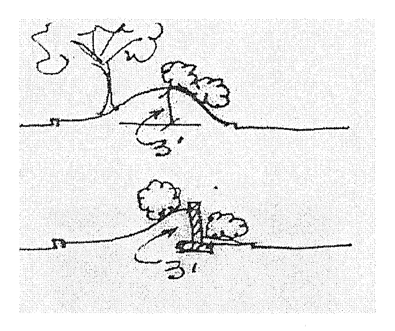
B.
Buffer planting strip. The area between single-family residential and any other zoned property. This strip is to include required trees.
C.
Caliper. The measure of the diameter of a tree at eighteen (18) inches above grade.
D.
Class A tree. A tree with a mature height of thirty (30) feet or more. See recommended list. Class A trees must be two (2) inches in caliper or greater when planted.
E.
Class B tree. A tree with a mature height of less than thirty (30) feet. See recommended list. Class B trees if multitrunked, must have a minimum of three (3) trunks of one-inch caliper each when planted.
F.
Critical root zone. A circular region measured outward from the tree trunk to the dripline representing the area of roots that must be maintained or protected for the tree's survival.
G.
Dripline. A vertical line extending from the outermost edge of the tree canopy or shrub branch to the ground.
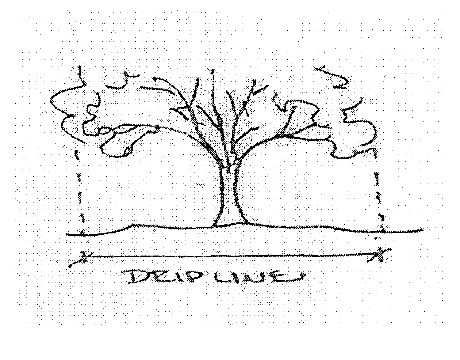
H.
Easement. The legal grant of right-of-use to an area of designated private property, utilized by public corporations (states, municipalities) and also made to companies providing public services such as gas, electricity and telephone.
I.
Island. A curbed landscaped area in a parking lot that is surrounded on all sides by parking spaces.
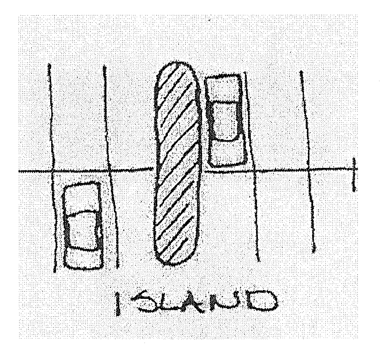
J.
Landscaped. Shall consist of any combination of turf/grass/ground cover, shrubs and trees. It must be installed in a sound manner and in accordance with accepted standards of the nursery industry.
K.
Median. A curbed landscaped area in a parking lot that separates parking aisles.
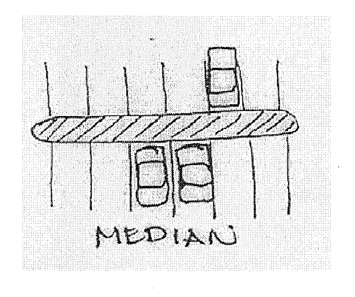
L.
Planting strip. The area between the curb and sidewalk, two (2) curbs, a curb and fence, or a sidewalk and fence.
M.
Peninsula. A curbed landscaped area that protrudes into parking aisles and adjoins other nonparking open space.
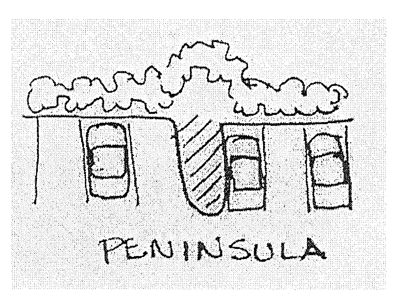
N.
Public right-of-way. The entire strip of land lying between the property line and a street or thoroughfare, alley, crosswalk or easement.
O.
Shrub. A woody plant of low or medium height, usually multistemmed. See recommended list of three-foot high hedge.
P.
Street Perimeter Landscaping. A landscaped strip along any parking lots adjoining a street.
Q.
Vehicular use area. The total area of all parking spaces and drives serving the parking area.
(4)
Buffer Perimeter landscaping.
A.
When a commercial or industrial use is established on a lot or premises located adjacent to any residential zoning district, or when any multiple-family dwelling use is established on a lot or premises adjacent to any property located in a single-family residential zoning district, a buffer perimeter ten (10) feet wide shall be installed and maintained by the owner, developer or operator of the commercial or industrial use, between the two (2) uses.
B.
The buffer perimeter shall have one (1) Class A tree or two (2) Class B trees planted and maintained for every twenty-five (25) linear feet. The required trees may be planted anywhere within the buffer strip with a minimum of ten (10) feet apart for Class A trees and a minimum of five (5) feet apart for Class B trees. Refer to definitions on tree size.
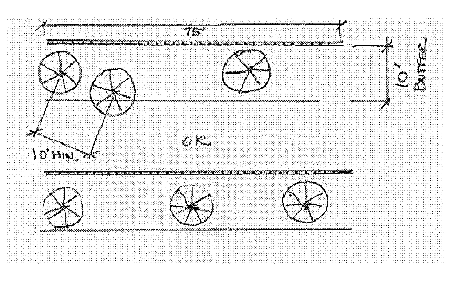
C.
In lieu of a buffer fence, a thirty-foot wide landscape buffer for the purpose of screening, may be provided along the property line.
i.
The thirty-foot wide landscape buffer shall have one (1) Class A tree or two (2) Class B trees planted and maintained for each ten (10) lineal feet of buffer. The required trees may be planted anywhere within the buffer strip with a minimum of twenty (20) feet apart for Class A trees and a minimum of ten (10) feet apart for Class B trees. Refer to definitions of tree size.
ii.
The provisions of this perimeter landscaping and screening shall not apply where districts are separated by a public street.
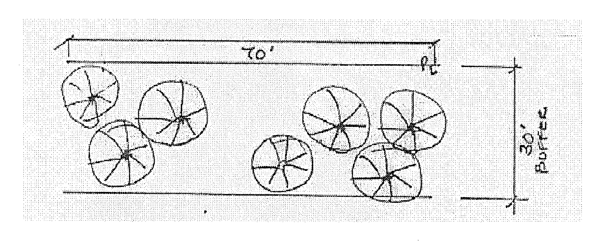
(5)
Street Perimeter Landscaping.
A.
A landscaping edge or buffer shall be required along each public street right-of-way adjacent to the property in question.
B.
The landscaping edge shall be no less than six (6) feet wide and shall be entirely on private property.
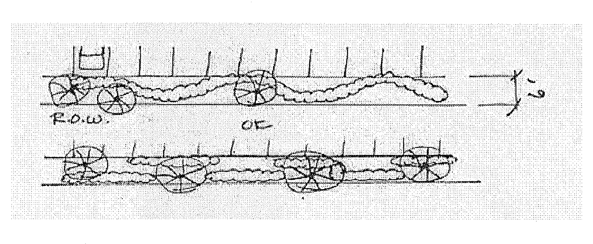
C.
The landscaping edge shall contain no less than one (1) Class A tree or two (2) Class B trees for each twenty-five (25) linear feet or fraction thereof.
D.
The required trees may be located anywhere within the six-foot landscape edge with a minimum of ten (10) feet apart for Class A trees and a minimum of five (5) feet apart for Class B trees. Refer to definitions on tree size.
E.
If overhead lines are present along the street perimeter landscaping, no trees having a mature height of more than fifteen (15) feet will be permitted in that perimeter landscape edge. In addition, no trees having a mature height of more than fifteen (15) feet shall be permitted within a thirty-foot distance of the outermost power line.
F.
A screen of no less than three (3) feet height comprised of berm, or plant material or combination of, shall be provided along the entire length of the street perimeter landscaping. The screen does not have to be straight with the street or parking edge.
i.
The three-foot high screen shall not be on the right-of-way.
ii.
The three-foot high screen shall not be required across driveways.
iii.
The three-foot high screen shall not be within three (3) feet of a driveway or restrict a driver's line of sight of approaching vehicles as determined by the city.
iv.
The required three-foot high screen, when planted, shall be a minimum of two (2) feet in height. See list of suggested shrubs.
v.
A minimum width of three (3) feet is required for the bed containing the planted screen.
vi.
The required three-foot high screen shall be maintained at no less or more than three (3) feet high.

(6)
Parking Lot Landscaping.
A.
All required off-street parking lots containing more than twenty (20) parking spaces shall have islands, mediums and/or peninsulas which will be permanently landscaped as required by the following:
i.
Sites having less than one hundred (100) parking spaces: One (1) landscaped island, peninsula, or median per twenty (20) parking spaces is required.
ii.
Sites having more than one hundred (100) parking spaces: One (1) landscaped island, peninsula, or median per ten (10) parking spaces is required.
B.
The landscaped islands or peninsulas located within the parking spaces shall be no less than nine (9) feet wide or if a landscaped median, shall be no less than six (6) feet wide.
C.
Each island or peninsula required herein shall at minimum contain one (1) Class A tree or two (2) Class B trees.
D.
Each median required herein shall at minimum contain one (1) Class A tree or two (2) Class B trees for each twenty-five (25) linear feet of median.
E.
All such landscaped areas shall be protected from vehicular access to these areas by curbing or other protective devices. No automobile or other type of vehicle shall be driven on any required landscaped space.
F.
An increase in the size of an existing parking lot by twenty-five (25) percent in the number of parking spaces or more shall require the entire parking lot, in addition to the twenty-five (25) percent expansion, to be brought into compliance with this section.
(7)
Landscape plan required. All building permit applications for new building construction shall be accompanied by two (2) blueline or blackline prints of the landscape plan to be approved by development services before issuance of the building permit. The landscape plan shall contain sufficient detail to show the following:
A.
The date, scale, north arrow and names and address and phone numbers of each property owner and person preparing the plans.
B.
The footprint of all existing and proposed structures.
C.
Remaining and/or proposed site elements such as power poles, fences, walls, drainage sales, easements, sidewalks, parking lot layout, pedestrian walkways and other such elements.
D.
A schedule identifying name, size, number and location of all landscape elements.
E.
Name, location and size of existing trees, and type and location of other vegetation proposed to remain for credit purposes.
F.
The size and location of the parking lot and the number of spaces, and how the owner proposes to address the interior landscaping requirement.
G.
Such other information as may be reasonably necessary to administer and enforce the provisions of the ordinance from which this section derives.
H.
Drawn at a scale of one-inch equals fifty (50) feet or greater.
(8)
Irrigation required.
A.
All buildings greater than three thousand (3,000) square feet shall require an automatic irrigation system sufficient to provide complete coverage of required screening landscaped areas.
B.
An irrigation system shall be installed and operational prior to issuance of a certificate of occupancy or final building inspection.
C.
State law requires installation by licensed irrigations.
D.
Irrigation systems shall be maintained in good and operating condition.
E.
For buildings three thousand (3,000) square feet or less, hose bibs may be used for irrigation purposes.
(9)
Certificate of Occupancy. No certificate of occupancy for new construction shall be issued or final approval of parking lot expansion made unless complying with terms and conditions required herein.
(10)
Variances. If a developer wishes to deviate from the regulations set forth in the landscape regulations a variance may be applied for through the Zoning Board of Adjustments. In granting any variance the Board shall minimize any change to these regulations as much as possible.
(11)
Installation and Maintenance.
A.
All landscaping shall be installed in accordance with accepted standards of the Texas Nurseryman's Manual.
B.
All plant material shall be true to name, variety and size and shall conform to all applicable provisions of the American Standards for Nursery Stock, latest edition.
C.
The owner and/or tenant shall be responsible for installing and maintaining all landscaping according to standard horticultural practices.
D.
All landscaping shall be maintained in a healthy, neat and orderly condition.
E.
No trees may be located within ten (10) feet of a fire hydrant.
F.
No trees may be topped if the limbs are three (3) inches in diameter or greater.
G.
Required three-foot hedges shall be maintained at three (3) feet in height.
H.
Dead, dying or damaged landscaping material shall be immediately replaced in conformance herein.
I.
Irrigation systems must be in good and operating condition.
J.
Failure to install required material or maintain landscaping within sixty (60) days of notification shall be subject to legal action pursuant to Section 12.704 of the Code of Ordinances of the city.
K.
Any request for a modification to the terms of the ordinance from which this section derives must be submitted in writing and responded to in writing by the Building Official. Any substantial modification will require a hearing with the Zoning Board of Adjustments.
(12)
Landscaping bonus provisions.
A.
In order to receive credit for preserved trees, the owner must include as part of the landscape plan submittal, a tree preservation plan which must be approved by development services.
i.
The tree preservation plan shall include the name, location, size and condition of each tree to be preserved, along with an indication of proposed development features which may impact such trees, and any other pertinent information as required to evaluate existing and proposed conditions.
ii.
The tree preservation plan shall include a detailed description of all methods to be used to ensure the survival of all trees scheduled for preservation credit, including information that may be required to interpret the intent and methodology proposed.
iii.
Any tree to be preserved for credit shall be protected from excavation and all construction by fencing off the area which constitutes the critical root zone as defined herein.
iv.
All building material, dirt, debris and equipment shall be kept outside the fenced area.
v.
All tree preservation methodology shall conform to the standards of the Texas Department of Agriculture and Forestry.
vi.
If a preserved tree dies within five (5) years, it is the responsibility of the owner to replace that tree with the number of Class A trees credited or a matching basis within six (6) months.
B.
Credit may be received for preservation of existing trees as follows:
i.
For each existing tree between two (2) and four (4) inches in caliper, a tree credit of one (1) for one (1) allowed.
ii.
For each existing tree between five (5) and twelve (12) inches in caliper, a tree credit of two (2) for one (1) is allowed.
iii.
For each existing tree over twelve (12) inches in caliper, a tree credit of three (3) for one (1) is allowed.
(13)
Class A Trees.
A.
Trees having a mature height greater thirty (30) feet with branches beginning at six (6) feet. All Class A trees must be two (2) inches or greater in caliper when planted.
(14)
Class B Trees.
A.
Trees having a mature height of less than thirty (30) feet. All Class B trees must be between eight (8) and ten (10) feet in height when planted. Those trees denoted with an asterisk should have a mature height of less than fifteen (15) and can be planted near overhead power lines.
(15)
Shrubs.
A.
All shrubs must be at least three (3) feet and maintained at three (3) feet in height to avoid blocking visibility along street lines. All shrubs must be evergreen.
(d)
Parking and Parking Lot Design Standards. In order that land uses in Orange provide adequate vehicular off-street parking spaces, the following parking requirements are applicable:
(1)
Amount of Parking Spaces. The following parking regulations apply to all zoning districts with the exception of the Old Town Center/Waterfront Zoning District (OTC):
(2)
Loading Requirements
(A)
Any building having a gross floor area of three thousand (3,000) square feet or more, which is occupied by a use requiring the receipt of distribution by vehicles of materials or merchandise, there shall be provided and maintained in the same lot with such building, at least one (1) off-street loading space plus one (1) additional loading space for each thirty thousand (30,000) square feet or major fraction thereof of gross floor area so used in excess of three thousand (3,000) square feet.
(B)
Each loading space shall be no less than ten feet (10′) wide, twenty-five (25%) in length, and fourteen feet (14′) of clear, overhead height. Such space may occupy all or part of any required yard space.
(3)
Computation of Parking Spaces. Where the required number of parking spaces is not a whole number, a fraction of .5 or greater shall be rounded up and a fraction of .49 or less shall be rounded down.
(4)
Shared Parking.
(A)
Shared parking is intended to make use of parking areas that are not used during certain times of the day. Shared parking is permitted only with written agreement of the subject landowners. The agreement shall be maintained in the office of the department of planning and community development.
(B)
Property on which shared parking is proposed shall be no further than three hundred (300) feet from the boundary of the principal property, as measured along public rights-of-way, such as streets or sidewalks.
(C)
No more than seventy-five percent (75%) of the total amount of parking spaces required for the principal use shall be shared parking spaces.
(D)
Handicapped parking spaces shall not be shared parking spaces.
(5)
Parking Lot Design Standards. The purpose of the following parking lot design standards is to ensure that parking lots are designed to encourage smooth and safe vehicular and pedestrian flow, and to improve the visual quality of parking lots. The standards identified below are minimum standards and any variation from the standards require prior approval of a variance by the zoning board of adjustment.
User Definitions for Matrix:
Single User. One (1) individual user less than five thousand (5,000) square feet.
Small Strip. A strip center less than twenty thousand (20,000) square feet.
Medium Strip or Single User. A strip center more than twenty thousand (20,000) square feet or a single user more than five thousand (5,000) square feet.
Large Single User. Strip or Mall. A strip center more than fifty thousand (50,000) square feet, or a single user more than ten thousand (10,000) square feet, or an enclosed group of businesses.
Per Zoning Ordinance. Means as specified by this Zoning Ordinance.
ADA. Means as specified by the American Disabilities Act.
Aisle Width. The area between the parking spaces, measured from the end of the parking spaces on each side of the aisle.
Optional. Means not required, at the option of the property owner, except where required by the ADA.
Discretion. Means permanent asphalt, concrete or pavers at the discretion of the property owner; in the Industrial Zone, a dustless stone/rock surface may be used (such as Number 57 Kentucky Bluestone or Quartz). Limestone shall not be considered a dustless surface.
Directional Painting. Means arrows or other directional diagram painted on the parking surface to identify the correct direction a vehicle should travel.
Stall Striping. The painted marking for parking stall.
Wheel Stops. A barrier to stop the wheels of a vehicle.
Cart Holders. Enclosures which are used for the purpose of retaining shopping carts.
Pedestrian Crossing. An area where pedestrians cross from the parking lot to the place of business.
(6)
Vehicular Backing. No parking space shall be designed which would require a vehicle to back onto a public street or across a public sidewalk, except for residential parking spaces.
(7)
Replacing Existing Parking. Additions or remodels to existing land uses shall not replace required parking unless additional off-street parking is constructed in conformance with this section to meet the minimum parking regulations.
(8)
Parking Requirements for Unspecified Land Uses. When a land use is proposed that is not identified in this section, the director of planning and community development shall determine the parking requirements based on the parking requirements of the most closely associate land use.
(9)
[Driveways Accessing Public Streets.] All driveways accessing public streets shall be at a minimum of twenty (20) feet from the nearest intersection.
(e)
Flood Hazard Prevention Districts.
(1)
Statutory Authorization. The Legislature of the State of Texas has in the Flood Control Insurance Act, Texas Water Code, Section 16.315, delegated the responsibility of local governmental units to adopt regulations designed to minimize flood losses. Therefore, the City of Orange, Texas does ordain as follows:
(2)
Findings of Fact.
(A)
The flood hazard areas of the City of Orange are subject to periodic inundation which results in loss of life and property, health and safety hazards, disruption of commerce and governmental services, and extraordinary public expenditures for flood protection and relief, all of which adversely affect the public health, safety and general welfare.
(B)
These flood losses are created by the cumulative effect of obstructions in floodplains which cause an increase in flood heights and velocities, and by the occupancy of flood hazard areas by uses vulnerable to floods and hazardous to other lands because they are inadequately elevated, floodproofed, or otherwise protected from flood damage.
(3)
Statement of Purpose. It is the purpose of these regulations to promote the public health, safety and general welfare and to minimize public and private losses due to flood conditions in specific areas by provisions designed to:
(A)
Protect human life and health;
(B)
Minimize expenditure of public money for costly flood control projects;
(C)
Minimize the need for rescue and relief efforts associated with flooding and generally undertaken at the expense of the general public;
(D)
Minimize prolonged business interruptions;
(E)
Minimize damage to public facilities and utilities such as water and gas mains, electric, telephone and sewer lines, streets and bridges located in floodplains;
(F)
Help maintain a stable tax base by providing for the sound use and development of flood-prone areas in such a manner as to minimize future flood blight areas; and
(G)
Insure the potential buyers are notified that property is in a flood area.
(4)
Methods of Reducing Flood Losses. In order to accomplish its purposes, this section uses the following methods:
(A)
Restrict or prohibit uses that are dangerous to health, safety or property in times of flood, or cause excessive increases in flood heights or velocities;
(B)
Require that uses vulnerable to floods, including facilities which serve such uses, be protected against flood damage at the time of initial construction;
(C)
Control the alteration of natural floodplains, stream channels and natural protection barriers, which are involved in the accommodation of floodwaters;
(D)
Control filling, grading, dredging and other development which may increase flood damage;
(E)
Prevent or regulate the construction of flood barriers which will unnaturally divert floodwaters or which may increase flood hazards to other lands.
(5)
General Provisions.
(A)
Lands to which these Provisions Apply. These provisions shall apply to all areas of special flood hazard within the jurisdiction of the City of Orange, Texas.
(B)
Basis for Establishing the Areas of Special Flood Hazard. The areas of special flood hazard identified by the Federal Emergency Management Agency in a scientific and engineering report entitled "The Flood Insurance Study for the City of Orange, Texas," dated July 6, 1982, with accompanying Flood Insurance Rate Maps and Flood Boundary Floodway Maps (FIRM and FBFM) and any revisions thereto are hereby adopted by reference and declared to be part of this section.
(C)
Establishment of Development Permit. A Development Permit shall be required to ensure conformance with the provisions of this section.
(D)
Compliance. No structure or land shall hereafter be located, altered, or have its use changed without full compliance with the terms of this section and other applicable regulations.
(E)
Abrogation and Greater Restrictions. This section is not intended to repeal, abrogate, or impair any existing easements, covenants, or deed restrictions. However, where this section and another conflict or overlap, whichever imposes the more stringent restrictions shall prevail.
(F)
Interpretation. In the interpretation and application of this section all provisions shall be:
1)
Considered as minimum requirements;
2)
Liberally construed in favor of the governing body; and
3)
Deemed neither to limit, nor repeal any other powers granted under State statutes.
(G)
Warning and Disclaimer or Liability. The degree of flood protection required by this section is considered reasonable for regulatory purposes and is based on scientific and engineering considerations. On rare occasions greater floods can and will occur and flood heights may be increased by manmade or natural causes. This section does not imply that land outside the areas of special flood hazards or uses permitted within such areas will be free from flooding or flood damages. This section shall not create liability on the part of the community or any official or employee thereof for any flood damages that result from reliance on these provisions or any administrative decision lawfully made hereunder.
(6)
Administration.
(A)
Designation of the Floodplain Administrator. The Director of Planning and Community Development or his designee is hereby appointed the Floodplain Administrator to administer and implement the provisions of this section and other appropriate sections of 44 CFR (Emergency Management Assistance - National Flood Insurance Program Regulations) pertaining to floodplain management.
(B)
Duties and Responsibilities of the Floodplain Administrator. Duties and responsibilities of the Floodplain Administrator shall include, but not be limited to the following:
(i)
Maintain and hold open for public inspection all records pertaining to the provisions of this section.
(ii)
Review permit application to determine whether to ensure that the proposed building site project, including, the placement of manufactured homes, will be reasonably safe from flooding.
(iii)
Review, approve or deny all applications for development permits required by adoption of this section.
(iv)
Review permits for proposed development to assure that all necessary permits have been obtained from those Federal, State or local governmental agencies (including Section 404 of the Federal Water Pollution Control Act Amendments of 1972, 33 U.S.C. 1334) from which prior approval is required.
(v)
Where interpretation is needed as to the exact location of the boundaries of the areas of special flood hazards (for example, where there appears to be a conflict between a mapped boundary and actual field conditions) the Floodplain Administrator shall make the necessary interpretation.
(vi)
Notify, in riverine situations, adjacent communities and the State Coordinating Agency which is the Texas Commission on Environmental Quality, prior to any alteration or relocation of a watercourse, and submit evidence of such notification to the Federal Emergency Management Agency.
(vii)
Assure that the flood-carrying capacity within the altered or relocated portion of any water course is maintained.
(viii)
When base flood elevation data has not been provided in accordance with subsection (5)(B), the Floodplain Administrator shall obtain, review, and reasonably utilize any base flood elevation data and floodway data available from a federal, state, or other source, in order to administer the provisions of subsection (7).
(ix)
When a regulatory floodway has not been designed, the Floodplain Administrator must require that no new construction, substantial improvements or other development (including fill) shall be permitted within Zones A1-30 and AE on the community's FIRM, unless it is demonstrated that the cumulative effect of the proposed development, when combined with all other existing and anticipated development, will not increase the water surface elevation of the base flood more than one (1) foot at any point within the community.
(x)
Under the provisions of 44 CFR Chapter 1, Section 65.12, of the National Flood Insurance Program regulation, a community may approve certain development in Zones A1-30, AE, AH, on the community's FIRM which increases the water surface elevation of the base flood by more than one (1) foot, provided that the community first competes all of the provisions required by Section 65.12.
(C)
Permit Procedures.
(i)
Application for a floodplain development permit shall be on an appropriate application form furnished by the Floodplain Administrator and may include, but not be limited to, plans in duplicate drawn to scale showing the locations, dimensions and elevation of proposed landscape alterations, existing and proposed structures, and the location of the foregoing in relation to areas of special flood hazard. Additionally, the following information is required:
(aa)
Elevation (in relation to mean sea level), of the lowest floor (including basement) of all new and substantially improved structures;
(bb)
Elevation in relation to mean sea level to which any nonresidential structure shall be floodproofed;
(cc)
A certificate from a registered professional engineer or architect that the nonresidential floodproofed structure shall meet the floodproofing criteria of subsection (7)(B)(ii).
(dd)
Description of the extent to which any watercourse or natural drainage will be altered or relocated as a result of proposed development;
(ee)
Maintain a record of all such information in accordance with subsection (6)(B)(i).
(ii)
Approval or denial of a development permit by the floodplain Administrator shall be based on all of the provisions of this section and the following relevant factors:
(aa)
The danger to life and property due to flooding or erosion damage;
(bb)
The susceptibility of the proposed facility and its contents to flood damage and the effect of such damage on the individual owner;
(cc)
The danger that materials may be swept onto other lands to the injury of others;
(dd)
The compatibility of the proposed use with existing and anticipated development;
(ee)
The safety of access to the property in times of flood for ordinary and emergency vehicles;
(ff)
The costs of providing governmental services during and after flood conditions including maintenance and repair of streets and bridges and public utilities and facilities such as sewer, gas, electrical and water systems;
(gg)
The expected heights, velocity, duration, rate of rise and sediment transport of the floodwaters and the effects of wave action, if applicable, expected at the site;
(hh)
The necessity to the facility of a waterfront location, where applicable;
(ii)
The availability of alternative locations, not subject to flooding or erosion damage, for the proposed use.
(D)
Variance Procedures.
(i)
The Zoning Board of Adjustment, as established by the community, shall hear and render judgment on requests for variances from the requirements of this section.
(ii)
The Zoning Board of Adjustment shall hear and render judgment on an appeal only when it is alleged there is error in any requirement, decision, or determination made by the Floodplain Administrator in the enforcement or administration of this section.
(iii)
Any person or persons aggrieved by the decision of the Zoning Board of Adjustment may appeal such decision in the courts of competent jurisdiction.
(iv)
The Floodplain Administrator shall maintain a record of all actions involving an appeal and shall report variances to the Federal Emergency Management Agency upon request.
(v)
Variances may be issued for the reconstruction, rehabilitation or restoration of structures listed on the National Register of Historic places or the State Inventory of Historic Places, without regard to the procedures set forth in the remainder of this section.
(vi)
Variances may be issued for new construction and substantial improvements to be erected on a lot of one-half (½) acre or less in size contiguous to and surrounded by lots with existing structures constructed below the base flood level, providing the relevant factors in subsection (6)(C)(ii) have been fully considered. As the lot size increases beyond the one-half-acre, the technical justification required for issuing the variance increases.
(vii)
Upon consideration of the factors noted above and the intent of this section, the appeal board may attach such conditions to the granting of variances as it deems necessary to further the purpose and objectives of subsection (C) of this section.
(viii)
Variances shall not be issued within any designated floodway if any increase in flood levels during the base flood discharge would result.
(ix)
Variances may be issued for the repair or rehabilitation of historic structures upon a determination that the proposed repair or rehabilitation will not preclude the structure's continued designation as a historic structure and the variance is the minimum necessary to preserve the historic character and design of the structure.
(x)
Prerequisites for granting variances:
(aa)
Variances shall only be issued upon a determination that the variance is the minimum necessary, considering the flood hazard, to afford relief.
(bb)
Variances shall only be issued upon; (1) a showing of good and sufficient cause; (2) a determination that failure to grant the variance would result in exceptional hardship to the applicant; and (3) a determination that the granting of a variance will not result in increased flood heights, additional threats to public safety, extraordinary public expense, create nuisances, cause fraud on or victimization of the public, or conflict with existing local laws or ordinances.
(cc)
Any application to which a variance is granted shall be given written notice that the structure will be permitted to be built with a lowest floor elevation below that base flood elevation, and that the cost of flood will be commensurate with the increased risk resulting from the reduced lowest floor elevation.
(xi)
Variances may be issued by a community for new construction and substantial improvements and for other development necessary for the conduct of a functionally dependent use provided that; (1) the criteria outlined in subsections (aa) through (cc) above are met; and (2) the structure or other development is protected by methods that minimize flood damages during the base flood and create no additional threats to public safety.
(7)
Provisions for Flood Hazard Reduction.
(A)
General Standards. In all areas of special flood hazards the following provisions are required for all new construction and substantial improvements:
(i)
All new construction and substantial improvements shall be designed (or modified) and adequately anchored to prevent flotation, collapse, or lateral movement of the structure resulting from hydrodynamic and hydrostatic loads, including the effects of buoyancy;
(ii)
All new construction or substantial improvements shall be constructed by methods and practices that minimize flood damage;
(iii)
All new construction or substantial improvements shall be constructed with materials resistant to flood damage;
(iv)
All new construction or substantial improvements shall be constructed with electrical, heating, ventilation, plumbing, and air conditioning equipment and other service facilities that are designed and/or located so as to prevent water from entering or accumulating within the components during conditions of flooding;
(v)
All new and replacement water supply systems shall be designed to minimize or eliminate infiltration of floodwaters into the system;
(vi)
New and replacement sanitary sewage systems shall be designed to minimize or eliminate infiltration of floodwaters into the system and discharges from the systems into floodwaters; and,
(vii)
On-site waste disposal systems shall be located to avoid impairment to them or contamination from them during flooding.
(B)
Specific Standards. In all areas of special flood hazards where base flood elevation data has been provided as set forth in subsections (5)(B), (6)(B)(viii), and (8)(D) of this section, the following provisions are required:
(i)
Residential Construction - New construction or substantial improvement of any residential structure shall have the lowest floor, including basement, elevated to or above the base flood elevation. A registered professional engineer, architect or land surveyor shall submit a certification to the Floodplain Administrator that these standards as proposed in subsection (6)(C)(i)(aa), are satisfied.
(ii)
Nonresidential Construction - New construction or substantial improvement of any commercial, industrial or other nonresidential structure shall either have the lowest floor, including basement, elevated to or above the base flood level or, together with attendant utility and sanitary facilities, be designed so that below the base flood level the structure is watertight with walls substantially impermeable to the passage of water and with structural components having the capability of resisting hydrostatic and hydrodynamic loads and effects of buoyancy. A registered professional engineer or architect shall develop and/or review structural design, specifications and plans for the construction, and shall certify that the design and method of construction are in accordance with accepted standards of practice as outlined in this subsection. A record of such certification which includes the specific elevation (in relation to mean sea level) to which such structures are floodproofed shall be maintained by the Floodplain Administrator.
(iii)
Enclosures - New construction and substantial improvements, with fully enclosed areas below the lowest floor that are usable solely for parking of vehicles, building access or storage in an area other than a basement and which are subject to flooding shall be designed to automatically equalize hydrostatic flood forces on exterior walls by allowing for the entry and exits of floodwaters. Designs for meeting this requirement must either be certified by a registered professional engineer or architect or meet or exceed the following minimum criteria:
(aa)
A minimum of two (2) openings on separate walls having a total net area of not less than one (1) square inch for every square foot of enclosed area subject to flooding shall be provided.
(bb)
The bottom of all openings shall be no higher than one (1) foot above grade.
(cc)
Openings may be equipped with screens, louvers, valves or other coverings or devices provided that they permit the automatic entry and exit of floodwaters.
(iv)
Manufactured Homes
(aa)
Require that all manufactured homes to be placed within Zone A, shall be installed using methods and practices which minimize flood damage. For the purpose of this requirement, manufactured homes must be elevated and anchored to resist flotation, collapse or lateral movement. Methods of anchoring may include, but are not limited to, use of over-the-top or frame ties to ground anchors. This requirement is in addition to applicable state and local anchoring requirements for resisting wind forces.
(bb)
Require that manufactured homes are placed or substantially improved within Zones A1-30, AH and AE on the community's FIRM on sites, outside of a manufactured home park or subdivision; in a new manufactured home park or subdivision; in an expansion to an existing manufactured home park or subdivision; or in an existing manufactured home park or subdivision on which a manufactured home has incurred "substantial damage" as a result of a flood, be elevated on a permanent foundation such that the lowest floor of the manufactured home is elevated to or above the base flood elevation and be securely anchored to an adequately anchored foundation system to resist flotation, collapse and lateral movement.
(cc)
Require that all manufactured homes to be placed or substantially improved on sites in an existing manufactured home park or subdivision within Zones A1-30, AH and AE on the City's FIRM, that are not subject to the provisions of subsection (iv) of this section be elevated so that either: the lowest floor of the manufactured home is at or above the base flood elevation; or the manufactured home chassis is supported by reinforced piers or other foundation elements of at least equivalent strength that are no less than thirty-six (36) inches in height above grade and be securely anchored to an adequately anchored foundation system to resist flotation, collapse and lateral movement.
(v)
Recreational Vehicles - Require that recreational vehicles placed on sites within Zones A1-A-30, AH and AE on the community's FIRM either; (1) be on the site for fewer than one hundred eighty (180) consecutive days; or (2) be fully licensed and ready for highway use; or (3) meet the permit requirements of Subsection (6)(C)(i) and the elevation and anchoring requirements for "manufactured homes" in subsection (iv) of this section. A recreational vehicle is ready for highway use if it is on its wheels or jacking system, is attached to the site only by quick disconnect utilities and security devices, and has no permanently attached additions.
(8)
Standards For Subdivision Proposals.
(A)
All subdivision proposals including manufactured home parks and subdivisions shall be consistent with subsections (2), (3), and (4) of this section.
(B)
All proposals for the development of subdivisions including manufactured home parks and subdivisions shall meet development permit requirements of subsections (5)(B) and (6)(C) of this section.
(C)
Base flood elevation data shall be generated for subdivision proposals and other proposed development including manufactured home parks and subdivisions which are greater than fifty (50) lots or five (5) acres, whichever is lesser, if not otherwise provided pursuant to subsections (5)(B) and (6)(B)(viii) of this section.
(D)
All subdivision proposals including manufactured home parks and subdivisions shall have adequate drainage provided to reduce exposure to flood hazards.
(E)
All subdivision proposals including manufactured home parks and subdivisions shall have public utilities and facilities such as sewer, gas, electrical and water systems located and constructed to minimize or eliminate flood damage.
(9)
Standards For Areas Of Shallow Flooding (AO/AH Zones). Located within the areas of special flood hazard established in subsection (5)(B) are areas designated as shallow flooding. These areas have special flood hazards associated with base flood depths of one (1) to three (3) feet where a clearly defined channel does not exist and where the path of flooding is unpredictable and where velocity flow may be evident. Such flooding is characterized by ponding or sheet flow. Therefore, the following provisions apply:
(A)
All new construction and substantial improvements of residential structures have the lowest floor (including basement) elevated to or above the base flood elevation or the highest adjacent grade at least as high as the depth number specified in feet on the community's FIRM (at least two (2) feet) if no depth number is specified).
(B)
All new construction and substantial improvements of nonresidential structures:
(i)
Have the lowest floor (including basement) elevated to or above the base flood elevation or the highest adjacent grade at least as high as the depth number specified in feet on the community's FIRM (at least two (2) feet if no depth number is specified).
(ii)
Together with attendant utility and sanitary facilities be designated so that below the base specified flood depth in an AO Zone, or below the Base Flood Elevation in an AH Zone, level the structure is watertight with walls substantially impermeable to the passage of water and with structural components having the capability of resisting hydrostatic and hydrodynamic loads of effects of buoyancy.
(C)
A registered professional engineer or architect shall submit a certification to the Floodplain Administrator that the standards of this section, as proposed in subsection (6)(C), are satisfied.
(D)
Require within Zones AH and AO, adequate drainage paths around structures on slopes, to guide floodwaters around and away from proposed structures.
(10)
Floodways. Floodways located within areas of special flood hazard established in subsection (5)(B) are areas designated as floodways. Since the floodway is an extremely hazardous area due to the velocity of floodwaters which carry debris, potential projectiles and erosion potential, the following provisions shall apply:
(A)
Encroachments are prohibited, including fill, new construction, substantial improvements and other developments within the adopted floodway unless it has been demonstrated through hydrological and hydraulic analyses performed in accordance with standard engineering practice that the proposed encroachment shall not result in any increase in flood levels within the community during the occurrence of the base flood discharge.
(B)
If subsection (A) above is satisfied, all new construction and substantial improvements shall comply with all applicable flood hazard reduction provisions of subsection (7).
(C)
Under the provisions of 44 CFR Chapter 1, Section 65.12, of the National Flood Insurance Program Regulations, a community may permit encroachments within the adopted regulatory floodway that would result in an increase in base flood elevations, provided that the community first completes all of the provisions required by Section 65.12 of the National Floodplain Regulations.
(1982 Code of Ordinances, Chapter 13, Section 6; Ordinance 1997-10, adopted 5/28/97; Ordinance 2007-24, Exh. A, adopted 9/25/07; Ordinance 2008-8, Exh. A, adopted 2/26/08; Ordinance 2014-13, § I, adopted 3/25/14)
Sec. 12.611 - Supplementary Regulations Applicable to All Zoning Districts
The following regulations are applicable to all zoning districts, except where specifically stated otherwise:
(1)
Application of Setbacks. Required setback lines shall apply to any structure, as defined herein, including principal structures, accessory structures, pools, hot tubs, decks elevated thirty (30) inches above grade; not including paved areas, boundary fences and boundary walls, signs, and retaining walls. The setback requirement for accessory storage buildings shall be no less than five (5) feet from side or rear property lines within rear yards only.
(2)
Building Front Determination. The front of a building is the direction from which the building takes its access, its address, or has its direction of orientation. To determine the front of a building all three factors should apply. Should these determining factors conflict, the director of planning and community development (the "director") shall have the authority to determine the building front.
(3)
Carports. Single-family residential carports are subject to the following provisions, unless otherwise regulated by restrictions for the subdivision in which a carport is located:
(A)
Front yard setback of five (5) feet as measured from the street right-of-way line, except for corner lots;
(B)
Carports on corner lots are subject to the corner side yard setback as required for the zone, and a front yard setback that is necessary for traffic safety, not to exceed the setback required for the principal residence and not less than a five-foot front yard setback; and
(C)
Carports must remain open on all sides.
(4)
Certificate of Occupancy (CO). The purpose of a Certificate of Occupancy inspection is to insure that all aspects of the plans which were approved for a building permit have been complied with by verifying such with an on-site visual inspection of the project.
(A)
At the completion of a building project, a request for a Certificate of Occupancy inspection shall be made to the department planning and community development (the "department") for the following types of projects:
(i)
New residences;
(ii)
New commercial buildings;
(iii)
Additions to existing commercial buildings;
(iv)
Change of commercial use; changes of occupancy load of a commercial use; and
(v)
Changes of tenancy of a commercial use.
(B)
A Certificate of Occupancy shall be issued by the department following verification that all aspects of the plans which were approved for a building permit have been followed.
(5)
Commercial Temporary Uses. Commercial temporary uses, including, but not limited to, carnivals, Christmas tree sales, plant sales, pumpkin sales, agricultural products sales, are allowed in any zone except residential zones, subject to the following conditions:
(A)
An application must be made to the director, along with the appropriate fee.
(B)
The director shall approve the application if it is demonstrated that the commercial temporary use conforms to the intent of this zoning ordinance, and that the use will not constitute a nuisance or be detrimental to the welfare of the community.
(C)
Commercial temporary uses may be approved for a period not to exceed sixty (60) total days per year.
(6)
Fences (Residential, Commercial, Commercial adjacent to Residential).
(A)
Residential Properties Including Residential Properties in a Historic District.
(i)
All fences must be set back from the property line as follows:
(a)
All fences in the front yard must be set back at least one (1) horizontal foot from the property line, sidewalk or the street right-of-way and may not be more than four (4) feet in height above the average grade and must not exceed fifty (50) percent opacity. The fence may extend two (2) feet or more into the corner side yard or interior side yard.
(b)
Any fence in the corner side yard and extending into the rear yard that is less than three (3) horizontal feet from the property line, sidewalk or street right-of-way must be set back at least one (1) horizontal foot from the property line, sidewalk or the street right-of-way and may not be more than four (4) feet in height above the average grade.
(c)
All fences set back three (3) horizontal feet or more from the property line, sidewalk or street right-of-way and is located in the corner side yard (at least two (2) horizontal feet behind the front wall of the primary building) and extending into the rear yard may be a maximum of six (6) feet in height above the average grade.
(d)
No fence located in the interior side yard may exceed eight (8) feet in height above the average grade.
(e)
No fence located in the rear yard that adjoins an alley or other property (not a street or sidewalk) may exceed eight (8) feet in height above the average grade except as provided in (b) and (c) above.
(f)
No fence within the corner side yard nor interior side yard may extend to within two (2) feet of the front wall of the primary structure and may not be more than six (6) feet in height above the average grade from the side wall of the primary structure to the side property line.
(ii)
No fence on property used for a residential purpose shall contain barbed, razor or electric wire.
(iii)
All fences shall be maintained in good condition.
(iv)
In a corner side yard, the fence must be consistent in height along the front and side of the property.
(B)
Commercial Including Commercial Properties in a Historic District.
(i)
No fence shall be allowed in the front yard of a commercial use located within a "C-1", "C-S", or "C-S Cove" Zoning District.
(ii)
A non-opaque fence no higher than six (6) feet in height above the average grade may be placed within the front yard of a commercial use located within a "C-2" or "IDC" Zoning District with approval from the Director of Planning and Community Development or his/her designee.
(iii)
If the fence request is denied by the Director of Planning and Community Development or his/her designee an appeal can be made to the City Council by filing a written request for such action with the City Manager.
(iv)
Any fence erected within the front yard must be placed behind any required landscaping, so that the landscaping is totally visible from the street.
(v)
All fences shall be a height of six (6) feet above the average grade in the rear or side yard and shall be opaque.
(vi)
All fences shall be maintained in good condition (no missing pickets and plumb).
(vii)
All dumpsters shall be screened with an opaque fence of eight (8) feet above the average grade.
(viii)
The lowest part (except for support poles) of any barbed wire, razor or electric fences must be located at least seven (7) feet in height above the average grade.
(C)
Commercial Uses Adjacent to Residential Zones Including Historic Districts.
(i)
Shall be opaque and six (6) feet in height above average grade and may not extend past the front wall of either the primary structure or the front wall of the adjacent property, whichever is closest to the street. If no primary structure exists on adjacent property, the fence cannot extend past the front wall of the primary structure on the subject property.
(ii)
An addition to a commercial use that exceeds fifty percent (50%) of the existing floor area and the commercial use is adjacent to a residential zone, shall require construction of an opaque fence of six (6) feet above average grade in accordance with (C)(i) above.
(iii)
All fences adjacent to residential zones shall be maintained by the owner to prevent unsightliness and shall be maintained in good order, plumb and to prevent openings in the fence.
(iv)
The fence requirement for commercial uses adjacent to residentially zoned property may be waived by the Director of Planning and Community Development if there is a natural or constructed barrier (such as a cluster of trees or other vegetation that screens the property, railroad track, drainage ditch, or street) between the commercial property and the adjacent residential property.
(v)
The lowest part (except for support poles) of any barbed wire, razor or electric fences must be located at least seven (7) feet in height above the average grade.
(D)
Industrial. Fences on property used for industrial purposes are exempt from this section except that The lowest part (except for support poles) of any barbed wire, razor or electric fences must be at least seven (7) feet above the average grade.
(E)
Permit Required. Any owner, authorized agent or contractor who desires to construct, enlarge or alter a fence, or to cause any such work to be done, within the city limits, shall first make application to the building official of the city, and obtain the required permit therefor. No permit shall be issued until the permit fee is paid. The fees are set out in Appendix A, "Fee Schedule" in the City of Orange Code of Ordinances.
(F)
Plot Diagrams May Be Required. The building official may, if necessary, require a plot diagram showing the location of the proposed fence, with property lines indicated thereon. If property line markers are not available, he may require same to be established by a qualified surveyor, at the expense of the property owner.
(G)
Fence Contractor's Bond Required. It shall be the duty of every contractor who shall make contracts for the construction, enlargement or alteration of fences for which a permit is required to furnish a good and sufficient bond of ten thousand dollars ($10,000.00), said bond to be in all respects the same as required for building construction under the building code.
(7)
Home Occupations. The city recognizes that home occupations are becoming a more common method of working, help alleviate traffic, help decrease the cost of doing business, allow people to work who might otherwise be unable to work, and are appropriate within residential areas, subject to certain provisions which are established to maintain the character and property values of existing residential areas. A home occupation shall be approved by the director of planning and community development if it meets all of the following requirements:
(A)
The home occupation shall be within the principal residence or a permitted accessory building.
(B)
The home occupation shall not occupy more than fifty (50) of the gross floor area of the principal residence.
(C)
There shall be no exterior indication that the home occupation is taking place.
(D)
There shall be no employees for the home occupation other than immediate members of the family, such as mother, father, sister, brother, son, daughter.
(E)
There shall be no traffic generated by the home occupation other than that normally associated with a residential use.
(F)
There shall be no use of equipment or process carried on that would create a nuisance to the neighboring properties.
(8)
Exterior Storage. Equipment, construction materials, building materials, household or commercial or industrial trash, shall not be stored in the front or side yard of any property, or be visible from any street for longer than fourteen (14) calendar days, unless such material is directly related to new construction for which a building permit has been issued.
(9)
Materials Storage. Storage of materials which are incidental to the primary use located on the same lot, including garbage dumpsters are permitted under the following conditions:
(A)
The storage may not extend beyond the front of the building.
(B)
The storage may not be located in area devoted to parking.
(C)
The stored materials must be behind an opaque screening fence or wall and at least six (6) feet in height but no higher than eight (8) feet.
(D)
The stored materials may not protrude above the height of screening fence or wall.
(10)
Projection into Required Setbacks. Open building projections such as outside stairways and fire escapes, balconies, terraces or porches, awnings, eave and roof extensions, and ornamental features may project into the required yards for a distance not to exceed four (4) feet. In no case shall such projections be located closer than three (3) feet from the property line. Awnings or canopies for use by gas service stations may not be located closer than ten (10) feet from the property lot line.
(11)
Recreational Vehicles.
(A)
Recreational vehicles (RVs) may be stored or parked outdoors within residential districts with the following regulations:
(i)
The RV shall be no closer than ten (10) feet from the front street curb.
(ii)
The RV may be parked on the side or rear setback.
(iii)
The RV shall not be parked in the front yard setback.
(iv)
The RV shall be parked on a hard surface as defined in Section 12.610(d)(5) or on a compactable road base material.
(v)
If the RV is parked on a side or rear setback, the RV shall be screened from the adjacent property by a privacy fence six (6) to eight (8) feet in height.
(B)
Recreational vehicles may not be stored in a commercial district unless in a permitted storage yard or inside a storage structure.
(C)
Habitation.
(i)
Recreational vehicles may be used for habitation not exceeding thirty (30) days within a residential district at a location having a residential structure and shall not be connected to any utility service except for electrical and this by temporary means.
(ii)
Recreational vehicles may not be used for habitation under any circumstances on a vacant lot or tract of property.
(12)
Residential Temporary Outdoor Sales. Residential temporary outdoor sales, such as a yard sale or garage sale, are allowed in the residential zones for no longer than two (2) consecutive days and no more than four (4) total days per month.
(13)
Sexually Oriented Business (SOB). The city finds that the unrestricted operation of certain sexually oriented businesses may be detrimental to the health, safety, and welfare by contributing to the decline of residential and commercial neighborhoods and the growth of criminal activity. The following regulations apply to Sexually Oriented Businesses (SOB), as defined by this section:
(A)
Location of a Sexually Oriented Business. An SOB may be located only in an Industrial Zone and not closer than 1,000 linear feet from an existing SOB. In an Industrial Zone, the SOB cannot be closer than 500 linear feet, measured in a straight line from the nearest property line to the nearest property line, from the following uses that are located within the city:
(i)
A residential zone;
(ii)
A place of worship;
(iii)
A public or private school;
(iv)
A public or private university or college;
(v)
A licensed day care for children;
(vi)
A public park, a chamber of commerce;
(vii)
A tourist information center;
(viii)
A hotel/motel;
(ix)
A convention center;
(x)
A cultural institution, such as a museum;
(xi)
An historic district or landmark.
(B)
Lot Size of a Sexually Oriented Business. There is no minimum lot size.
(C)
Parking for a Sexually Oriented Business. Twelve (12) parking spaces per 1,000 gross square feet of building area.
(D)
Lighting for a Sexually Oriented Business. Exterior lighting shall be designed to illuminate the entire property, at an intensity of no less than six (6) foot candles per square foot.
(E)
Signage for a Sexually Oriented Business. All aspects of the Sign Regulations of this zoning ordinance shall apply, in addition to the following sign regulations:
(i)
No pole signs are allowed.
(ii)
No roof-mounted signs are allowed.
(iii)
No sign or sign copy shall be designed to rotate, move or flash in any manner.
(iv)
No temporary signs are allowed.
(v)
No internally lit signs are allowed.
(vi)
No awning signs.
(F)
Building Design of a Sexually Oriented Business.
(i)
Exterior building color for sexually oriented businesses including facade, doors, window frames, and all appurtenances, shall be limited to gray, tan or beige.
(ii)
Roof color is limited to shades of gray, black or brown.
(iii)
Trim color is limited to a shade of the principal color of the building or white.
(iv)
The activities or merchandise of a SOB shall not be visible from anywhere outside the building.
(G)
Landscaping for a Sexually Oriented Business. In addition to the landscaping requirements for a commercial building, the following landscaping requirements shall apply to an SOB land use:
(i)
The front and side facade of a building used for a SOB shall be landscaped with a shrub hedge that is a minimum of four (4) feet in height at the time of planting.
(ii)
The area in front of the building shall have a landscaped bufferyard area between the front building wall and the parking lot or driveway not less than eight (8) feet in width. The landscaping shall consist of a combination of trees, ground cover or additional shrubs with trees planted on twenty (20) foot centers for the entire width of the building.
(iii)
The perimeter of the parking lot, with the exception of the rear of the building, shall be surround with a shrub hedge that is a maximum of three (3) feet in height from natural ground.

(H)
Special Exception for a Sexually Oriented Business. An SOB is allowed in an Industrial Zone, subject to prior approval of a special exception by the zoning board of adjustment.
(14)
Commercial Vehicle Storage. No motor vehicle having a gross weight (GVW) over fifteen thousand (15,000) pounds and no commercial tractor/trailer or heavy equipment shall be parked in any residential district or parked on a public street within said districts except where loading, unloading or rendering a service. This section shall not apply to recreational vehicles, pick-up trucks or tractors having less than forty-five (45) horsepower.
(15)
Storage of Unlicensed Vehicles. No vehicles may be stored or parked outside, except behind the rear wall of the primary structure in any residential zone without a valid license plate or inspection sticker.
(16)
Child Care Facilities. The city acknowledges the need for affordable, high quality child day care and its importance to the well being of the community; and to provide a process and standards whereby the child care facilities meet the needs of the community and preserve the residential character of the neighborhoods in which they are placed. Child care facilities shall be considered as one of the following three categories and shall meet the requirements as set forth:
(A)
Family Day Care Home. A residential dwelling occupied by the care giver where six (6) or fewer children, not including the care giver's children, are cared for less than twenty-four (24) hours in a day.
(i)
Family day care home are considered home occupations and are required to obtain a permit as a home occupation with the department of planning and community development. The boundary of a parcel or lot containing a family day care shall be separated from the boundary of any other parcel or lot containing a group day care home by not less than four hundred (400) feet as measured along the shortest traveled distance;
(ii)
No signs shall be permitted.
(B)
Group Day Care Home. A residential dwelling occupied by the care giver where seven (7) to twelve (12) children, not including the care giver's children, are cared for less than twenty-four (24) hours in a day. A group day care home shall be considered a quasi-commercial use and is required to obtain a special exception prior to starting operations.
(i)
The facility shall comply with all state licensing requirements and all city codes pertaining to buildings, fire safety and health;
(ii)
The facility shall conform to the requirements of the zoning district where it is located;
(iii)
One (1) non-resident employee is permitted;
(iv)
One (1) off-street parking place shall be provided for in addition to the two (2) spaces required for the residents, the driveway/garage may be acceptable for this purpose;
(v)
If located on an arterial or collector street as defined by the City of Orange, an offstreet pick-up area shall be provided that is acceptable to the city;
(vi)
Reserved;
(vii)
No structural or decorative alteration that will alter the single-family character of an existing residential structure or is incompatible with surrounding residences is permitted;
(viii)
The boundary of a parcel or lot containing a group day care home shall be separated from the boundary of any other parcel or lot containing a group day care home by not less than four hundred (400) feet as measured along the shortest street traveled distance.
(C)
Child Day Care Centers. Commercial enterprises (located in commercial districts only) where more than twelve (12) children are cared for less than twenty-four (24) hours in a day. In addition to the requirements of the zoning district where the center is located, the center shall also conform to the following:
(i)
The facility, will comply with state licensing requirements and all city codes pertaining to building, fire safety and health;
(ii)
Signage shall conform to the provisions of the City's Sign Regulation Code;
(iii)
One site vehicle turnaround, separate entrance and exit points, passenger loading/unloading areas shall be provided to allow safe traffic circulation.
(17)
All signs erected within the city shall meet all requirements as set forth in the Sign Regulation Code (adopted September 1996) and the Southern Standard Building Code (as adopted).
(18)
An ATM machine no larger than six (6) feet in length by three (3) feet in width by five (5) feet in height may be placed within a required setback. The structure must be placed so that it meets Chapter 11-42.B, Traffic Obstructions Prohibited in Triangle, at Street Intersections, on Corner Lots and shall be approved by the director of planning or his designee. The structure shall be placed in such a fashion that it poses the least obstruction to safety as possible. A canopy not exceeding eight (8) feet by twelve (12) feet and ten (10) feet in height with columns one (1) foot in diameter or less may be placed over the structure, however the area between the top of the structure and the bottom of the canopy must be clear to provide for visibility. If the placement of the ATM is not approved an appeal to the decision may be filed with the city council at the next available meeting date.
(19)
Group Homes.
(A)
Purpose. It is the purpose of this article to recognize that group homes serve the function of providing a residential environment for various parties in our society. The recognition of these homes through definition and placement in this Code serves to permit their use in various residential and commercial zones, pursuant to regulations which maintain the health, safety and residential character.
Other purposes include:
(i)
To support federal and state goals regarding de-institutionalization of handicapped persons as defined by the Federal Fair Housing Act.
(ii)
To support the rights of handicapped persons to live in stable, affordable housing, in settings that maximize community integration and opportunities for acceptance.
(iii)
To make reasonable accommodations in rules, policies, and practices to afford handicapped individuals equal opportunity to use and enjoy a dwelling.
(B)
Definitions.
Community Home. Means a family-based facility which contains more than six (6) residents and one (1) residential staff or supervisory personnel or two (2) staff or supervisory personnel present at any time, but not more than fifteen (15) residents and three (3) supervisory or staff personnel present at any time, which provides 24-hour care in a protected living arrangement for the mentally and/or physically impaired, developmentally disabled, or victims of abuse or neglect. This classification includes congregate living facilities for the elderly, maternity homes, foster homes, emergency shelters during crisis intervention for victims of crime, abuse or neglect, and residential services licensed by the Texas Commission on Alcohol and Drug Abuse, but not primarily for criminal rehabilitation.
Family. Means any individual or two (2) or more persons related by blood, adoption or marriage or not more than five (5) unrelated persons living and cooking as a single housekeeping unit or home and expressly excluding lodging, boarding or fraternity houses, day-care uses, and nursing homes.
Family Home. Means a family-based residential home containing not more than six (6) handicapped persons and one (1) residential staff or supervisory personnel or two (2) staff or supervisory personnel at any time, and which otherwise meets the requirements of the Community Homes for Disabled Persons Location Act, V.T.C.A., Human Resources Code Chapter 123.001. This definition does not include the uses defined as a "day care center" and/or "home occupation".
Halfway House. Means a family-based facility providing 24-hour care in a protected living arrangement for not more than fifteen (15) residents and not more than three (3) supervisory or staff personnel present at any time. This is a facility providing for the housing and rehabilitation or training adults on probation, parole, early or pre-release of any other form of executive, judicial, or administrative release from a penal institution, including without limitation community residential facilities established in accordance with Vernon's Ann. C.C.P. Art. 42.18, as amended from time to time. " Halfway house" includes facilities which provide in-patient treatment for chemical dependency to persons on probation, parole, early or pre-release or any other form of executive, judicial or administrative release from a penal institution if such persons are ordered to obtain such treatment for chemical dependency as a condition of release. For purposes of this definition, an adult is a person age 18 or over.
Handicap. Means, pursuant to 42 U.S.C. Section 3602, with respect to a person:
(i)
A physical or mental impairment which substantially limits one (1) or more of such person's major life activities;
(ii)
A record of having such an impairment; or
(iii)
Being regarded as having such an impairment, but such term does not include current, illegal use of or addiction to a controlled substance (as defined in 21 U.S.C. Section 802).
Major life activities. Means pursuant to 42 U.S.C. Sec. 3002, major life activities include self-care, receptive and expressive language, learning, mobility, self-direction, capacity for independent living, economic self-sufficiency, cognitive functioning, and emotional adjustment.
Physical or mental impairment. Means taken from the federal regulations promulgated pursuant to the Federal Fair Housing Act:
(i)
Any physiological disorder or condition, cosmetic disfigurement, or anatomical loss affecting one (1) or more of the following body systems: Neurological; musculoskeletal; special sense organs; respiratory, including speech organs; cardiovascular; reproductive; digestive; genito-urinary; hemic and lymphatic; skin; and endocrine; or
(ii)
Any mental or psychological disorder, such as mental retardation, organic brain syndrome, emotional or mental illness, and specific learning disabilities. The term " physical or mental impairment" includes, but is not limited to, such diseases and conditions as orthopedic, visual, speech and hearing impairments, pre-senile dementia, cerebral palsy, autism, epilepsy, muscular dystrophy, multiple sclerosis, cancer, heart disease, diabetes, mental retardation, emotional illness, drug addiction (other than addiction causes by current illegal use of a controlled substance) and alcoholism.
(C)
General Requirements.
(i)
Family homes, community homes, and halfway houses may be permitted in accordance with the following matrix:
(ii)
A family home, community home and halfway house may be permitted in accordance with the land use matrix as provided in section B, provided that community homes and halfway houses are located no less than one-half ( 1,2>)-mile radius from any existing community home or halfway house and that family homes are located no less than a one-quarter (<frax/1,4 )-mile radius from any existing family home, community home or halfway house.
(iii)
All family homes, community homes, and halfway houses, operating within the city will have to register with the Department of Planning and Community Development for the City of Orange. All registrants will need to supply the company name(s), physical address of business, phone numbers of local contact(s), and Texas Department of Human Services proof of certification. This information must be updated and maintained by the group home operating within the city.
(iv)
The residents of a family home, community home, or halfway house may not park on the premises of the home more than one (1) motor vehicle for each bedroom.
(v)
Before a permit for a family home facility is issued, all of the following requirements must be approved by the Fire Marshal and Building Official. If all requirements are met a Certificate of Occupancy will be issued. If at any time a family home fails to meet any or all of its requirements the City of Orange shall have the right to revoke its permit. Any family home not meeting these requirements at the time of adoption of this ordinance shall have six (6) months to comply.
a.
Installation of hardwired, battery back-up, interconnected smoke detectors in each sleeping area and family room.
b.
Installation of a five (5) lb. fire extinguisher which must be inspected yearly by a certified fire safety company.
c.
Installation of a residential vent-a-hood with exterior vent.
d.
A disaster evacuation plan shall be maintained on the premises.
e.
Staff must be present in the home on a twenty-four (24) hour basis.
f.
That each sleeping area shall have a minimum of two (2) exits.
g.
That no patient will be housed above the first floor of the residence.
h.
That the facility will have regular health care inspections conducted by a licensed medical professional.
i.
That annual fire inspections will be conducted by the Fire Marshall.
j.
That the Fire Marshall will approve an annual prefire plan.
k.
That the Texas Department of Health abuse/neglect hotline number will be posted in a visible location on the premise.
l.
That fire drills will be conducted regularly on the premises with minimum staffing.
m.
That this list of requirements will be posted in a visible location on the premise.
(20)
Performance Standards.
(A)
Purpose. The purpose of this section is to set forth regulations which protect the public from the potential negative effects of industrial, intense commercial development and also residential uses by regulating smoke and particulate matter, odorous matter, toxic and noxious matter, glare, vibrations and noise in the vicinity of such sites.
(B)
Compliance Required. Except as otherwise provided herein, no land, building or structure in any district shall be used or occupied in any manner so as to create any dangerous, injurious, noxious, or otherwise objectionable fire, explosive, or other hazard; noise or vibration; smoke, dust, or other form of air pollution; heat, cold, dampness, electrical or other substance, condition or dangerous element in such a manner or in such amount as to adversely affect the surrounding area or adjoining premises. Permitted uses as set forth in this Ordinance shall be undertaken and maintained only if they conform to the regulations of the section.
(C)
Performance Standard Regulation. The following standards shall apply in the various zoning districts as indicated:
(i)
Exterior Noise: The following noise standards, unless otherwise specifically indicated, shall apply to all property within the City of Orange:
a.
For noise emanating from a facility on property located within any residential zoning district, the allowable noise level shall be as follows:
b.
For noise emanating from a facility on property located within any commercial zoning district, the allowable noise level shall be as follows:
c.
For noise emanating from a light industrial facility on property located within a Mixed Use zoning district, the allowable noise level shall be seventy-five (75) dB(A).
d.
For noise emanating from a facility on property located within an Industrial zoning district, the allowable noise level shall be eighty-five (85) dB(A).
e.
Noise emanating from property within any zoning district may exceed:
1.
The allowable noise level plus up to five (5) dB(A) for a cumulative period of no more than thirty (30) minutes in any hour; or
2.
The allowable noise level plus six (6) to ten (10) dB(A) for a cumulative period of fifteen (15) minutes in any hour; or
3.
The allowable noise level plus eleven (11) to fifteen (15) dB(A) for a cumulative period of five (5) minutes in any hour; or
4.
The allowable noise level plus sixteen (16) dB(A) or more for a cumulative period of (1) minute in any hour.
f.
In the event the ambient noise level exceeds the allowable noise levels in subparagraphs (b), (c), and (d) above, the allowable noise level for the property in question shall be increased to equal the maximum ambient noise level.
g.
For the purpose of determining compliance with the noise standards in this section, the following noise sources shall not be included:
1.
Noises not directly under the control of the property owner, lessor, or operator of the premises.
2.
Noises emanating from construction, grading, repair, remodeling or any maintenance activities between the hours of 7:00 a.m. and 8:00 p.m.
3.
Noises of safety, signals, warning devises and emergency pressure relief valves.
4.
Transient noise of mobile sources, including automobiles, trucks, airplanes, and railroads.
5.
Activities conducted on public parks, playgrounds and public or private schools.
6.
Occasional outdoor gatherings, public dances, shows and sporting and entertainment events provided said events are conducted pursuant to a permit or license issued by the appropriate jurisdiction relative to the staging of said events.
7.
Air conditioning or refrigeration systems or associated equipment.
h.
For the purpose of determining compliance with the noise standards in this section, noise levels are to be measured at any residential property line within any permanent residential zoning district.
i.
For the purpose of determining compliance with the foregoing subparagraphs (c) through (f), and with regard to noise emanating from property already zoned industrial at the time this Ordinance is enacted, noise levels are to be measured at residential property lines within residential zoning districts are such residential zoning district lines exist at the time this Ordinance is enacted.
(ii)
Vibration: No vibration from any use within any zoning district shall be permitted which is perceptible without instruments at any residential property line within any permanent residential zoning district. For the purpose of determining compliance with this standard, and with regard to vibration generated from any property already zoned industrial at the time this ordinance is enacted, vibration is to be measured at residential property lines within residential zoning districts as such residential zoning district lines exist at the time this Ordinance is enacted.
(iii)
Glare: Primary and secondary glare (both direct and reflective glare) having a source on private property shall not be permitted to produce visual discomfort for viewers on other property in any residential zoning district or on adjacent street rights-of-way. Direct glare which produces visual discomfort is to be corrected or avoided by reducing the intensity of the light source and/or the uses of directional lighting or shading devices. Welding, new construction and repairs of facilities shall be exempt from these regulations. Provided, however, that no requirements will be imposed in derogation of federal or state safety and health regulations.
(iv)
Particulate Air Contaminants: No emissions, dust, fumes, vapors, gases, or other forms of air pollution shall be permitted in violation of the rules and regulations of the Texas Air Control Board and the Environmental Protection Agency.
(D)
Exceptions from Performance Standards. The owner or operator of any building, structure, operation or use which violates any performance standard may file an application for a variance from the provisions thereof wherein the applicant shall set forth all actions taken to comply with said provisions and the reasons why immediate compliance cannot be achieved. The Board of Adjustment may grant exceptions with respect to time of compliance, subject to such terms, conditions and requirements as it may deem reasonable to achieve maximum feasible compliance with the provisions of this Section of the Ordinance. In its determinations, the Board of Adjustment shall consider the following:
(i)
The magnitude of the nuisance caused by the violation.
(ii)
The uses of property within the area of impingement by the violation.
(iii)
The time factors related to study, design, financing and construction of remedial work.
(iv)
The economic factors related to age and useful life of the equipment.
(v)
The general public interest, welfare and safety.
(E)
Exemptions. The provisions of this section shall not apply to industrial uses, or expansion thereof upon adjacent property, which exist within the City on the effective date of this Ordinance.
(21)
Containers.
(A)
POD-Type Moving and Shipping Containers
(i)
Any number of POD-type containers may be located at a warehousing facility (Standard Industrial Code 4225) located in the C-1, C-2, C-S, C-S Cove, OTC, IDC and I zoning districts provided the containers are arranged in a neat and orderly manner, there is an eight-foot opaque fence screening the container from the street and there are also mini-warehouses located on the property.
a.
No POD-type container or Conex-type container shall be stacked on top of another container, on a building, structure or other means to elevate the container above the natural grade of the ground beneath the container.
b.
All POD-type containers and Conex-type containers shall be used for on-site storage at the warehousing facility and shall not be used for lease, rental or sale for off-site storage.
(ii)
No more than two (2) POD-type containers may be located per business classified as other than Standard Industrial Code 4225 in the side yard or rear yard on a lot or parcel of land in the C-1, C-2, C-S, C-S Cove, OTC, IDC, or I zoning districts.
a.
No POD-type container or Conex-type container shall be stacked on top of another container.
b.
All POD-type containers and Conex-type containers shall be used for on-site storage at the warehousing facility and shall not be used for lease, rental or sale for off-site storage.
(iii)
One (1) POD-type container may be located per residence in the R-1, R-2, R-3, R-4, C-S or C-S Cove zoning districts due to damage to the primary structure from a declared hurricane or other declared disaster not to exceed one (1) year from the date of the declared hurricane or other declared disaster. The city council may take action to extend this time period as it deems necessary.
(iv)
POD-type containers may be used for no more than two (2) weeks for moving purposes in any zoning district.
(B)
Shipping containers (Conex-type containers)
(1)
Any number of shipping containers (Conex-type containers) may be located at a warehousing facility (Standard Industrial Code 4225) in a C-1, C-2, C-S, C-S Cove, OTC, IDC and I zoning district provided the containers are arranged in a neat and orderly manner, there is an eight-foot opaque fence screening the container from the street and there are also at least five hundred (500) mini-warehouse units located on the property.
a.
No POD-type container or Conex-type container shall be stacked on top of another container, on a building, structure, or other means to elevate the container above the natural grade of the ground beneath the container.
b.
All POD-type containers and Conex-type containers shall be used for on-site storage at the warehousing facility and shall not be used for lease, rental, or sale for off-site storage.
(2)
No more than two (2) shipping containers (Conex-type containers) shall be allowed per business classified as other than Standard Industrial Classification Code 4225 on a lot or parcel of land in the C-1, C-2, C-S, C-S Cove, OTC, IDC, and I zoning districts provided the containers are arranged in a neat and orderly manner. All Conex-type containers shall be located on either the side yard or the rear yard of the property.
a.
No Conex-type container shall be stacked on top of another container on a building, structure, or other means to elevate the container above the natural grade of the ground beneath the container.
b.
All Conex-type containers shall be used for on-site storage at the warehousing facility and shall not be used for lease, rental, or sale for off-site storage.
(3)
Unless a permitted primary building per Section 12.602, or a permitted accessory building per Section 12.502, shipping containers (Conex-type containers) are not allowed in the R-1, R-2, R-3, R-4, residential uses in the C-S, residential uses in the C-S Cove zoning districts at any time. All permitted primary buildings per Section 12.601 and permitted accessory building per Section 12.502 shall be permanently installed on the site. No shipping containers (Conex-type containers) are allowed as a primary building or a permitted accessory building in a historic overlay zoning district.
(4)
All Conex-type containers shall meet the requirements of federal, state and local floodplain laws and ordinances.
(C)
No more than two (2) POD-type containers or shipping containers (Conex-type containers), in any combination, shall be placed on a lot or parcel of land where both types of containers are permitted unless the business is classified as Standard Industrial Classification Code 4225.
(22)
Searchlights or Beacons. Any apparatus capable of projecting a powerful beam or beams of light directed into the atmosphere or directed at one (1) or more points not on the same zone lot as the light source; also any light with one (1) or more beams that rotate or move. Does not include any kind of lighting device required or necessary under the safety regulations described by the Federal Aviation Agency or similar agencies and does not include commercially-produced laser light shows.
(A)
Time. A no-cost sign permit is required. The sign permit must be displayed in a conspicuous place visible from the street for the purpose of walk-up inspection. A sign permit shall not be issued until the city has issued a certificate of occupancy for the business that elects to display a searchlight or beacon. One (1) searchlight or beacon can be placed for a thirty-day period three (3) times a year and with a minimum thirty-day interval between placements. A single permit for a searchlight or beacon may be issued for only one (1) twenty-four-hour period at a time. A business can only display one (1) searchlight or beacon at a time.
(B)
Place. A searchlight or beacon shall not be located in required parking spaces, or driveways that provide access to parking spaces or fire lanes, nor shall any searchlight or beacon or its securing devices encroach into a right-of-way. Searchlights and beacons are only permitted within a nonresidential zoning district.
(C)
Manner. Searchlights or beacons shall not be located within two hundred (200) feet of a residence and shall not shine into the eyes of occupants in any vehicle or into any residential window or where the illumination interferes with the readability of any traffic signal or device.
(1982 Code of Ordinances, Chapter 13, Section 6; Ordinance 1996-22, adopted 10/22/96; Ordinance 1998-4, adopted 1/27/98; Ordinance 1998-11, adopted 3/24/98; Ordinance 1999-20, adopted 7/27/99; Ordinance 2001-2, § I, adopted 1/23/01; Ordinance 2003-33, § I(Exh. A), adopted 10/14/03; Ordinance 2005-8, § I(Exh. A), adopted 5/24/05; Ordinance 2012-10, § I(Exh. A), adopted 8/28/12; Ordinance 2014-6, § I, adopted 2/25/14; Ordinance 2014-7, § I, adopted 2/25/14; Ordinance 2014-8, § I, adopted 2/25/14; Ordinance 2014-12, § I(Exh. A), adopted 3/25/14; Ordinance 2014-17, § I, adopted 4/22/14; Ordinance 2014-18, § I, adopted 4/22/14; Ordinance 2014-23, § I, adopted 5/27/14; Ordinance 2016-5, § 2, adopted 3/8/16; Ordinance 2018-16, § 5, adopted 11/13/18; Ordinance 2022-05, § 1, adopted 1/25/22; Ordinance 2022-25(12-13-2022), § 3, adopted 12/13/22)
Sec. 12.612 - Governmental Properties
Any property or building owned by a federal, state, local, educational, special district or political subdivision of the State of Texas is hereby exempt from the fence requirements and building height requirements of this Code.
(Ordinance 2020-17, § 1, adopted 12/8/20)