
San Luis Obispo County Unincorporated
City Zoning Code
City Zoning Code
ARTICLE 10
COMMUNITY PLANNING STANDARDS
22.100.010 - Purpose of Article 10.
The chapters in this Article provide standards for proposed development and new land uses that are specific to each of the communities and villages defined by the Land Use Element with urban or village reserve lines. These standards are mandatory requirements, intended to address the local planning issues of each planning area.
[Amended 2014, Ord. 3256]
22.100.020 - Applicability.
A.
General applicability. The standards of this article apply to all proposed development and new land uses. Compliance with these standards is required to enable a permit for a new use to be approved, and for a newly-constructed project to be used. These standards apply to proposed projects in addition to all other applicable provisions of this Title. Where these standards conflict with other provisions of this Title, these standards control, except as provided in Subsection B.
B.
Density - TDC program. Where additional density is granted through participation in the TDC Program (Chapter 22.24 or 22.26), the base density determined in compliance with Chapters 22.24 or 22.26 is established from the standards of this article for minimum parcel size. Any density bonus shall comply with the provisions of Chapters 22.24 or 22.26, unless the density bonus is specifically set forth in the area plan standard.
C.
Effect of designations. In any case where a property is designated in the Open Space (OS) or Recreation (REC) land use categories, in the Sensitive Resource Area (SRA) or Historic Area (H) combining designations, or where standards identify a need for open space preservation through easement, contract or other instrument, these designations shall not in themselves convey or imply any right of public use, access, trespass, or violation of privacy.
[Amended 2014, Ord. 3256]
22.102.010 - California Valley Standards.
The following standards apply within the California Valley Village Reserve Line in the land use categories or specific areas listed.
A.
Community-wide standards. The following standards apply to all lands within the California Valley village reserve line, in the land use categories or specific areas listed.
1.
Road improvements - Residences. The establishment of a new residence shall require the construction of an all-weather 16-foot-wide road with a minimum of 4 inches of Class III aggregate base across the property frontage and to the nearest publicly- maintained road. Subsequent development on the opposite side of the road is to complete an additional 4 feet of improvement. These improvements are to be completed prior to occupancy.
2.
Offer of dedication. Prior to the issuance of a land use permit, offer for dedication a public right-of-way across the entire property frontage along the proposed road. Offered rights-of-way are to follow platted alignments and are to be one-half of a 50-foot wide road Section from the centerline.
B.
Residential Rural (RR) - Limitation on land division. Existing lots of record in the Residential Rural land use category shall not be further subdivided.
C.
Residential Suburban (RS). The following standards apply within the Residential Suburban land use category.
1.
Septic tank use. Percolation test results demonstrating soil conditions adequate to support safe septic system operation are to be provided the Building Official prior to issuance of any Building Permit. The tests shall be performed in compliance with the Building and Construction Ordinance.
2.
Fence heights in setbacks. Fencing located within a required front or street side setback may be constructed higher than three feet only if it is open wire or chain link and no higher than 6'-6."
3.
Outdoor storage of agricultural vehicles. A maximum of one agricultural vehicle may be stored outdoors accessory to a residence regardless of whether agricultural activities occur on a site, but within the buildable area of a site consisting of at least 2.5 gross acres. The maximum area of such storage shall be 300 square feet.
4.
Non-standard mobile homes. The minimum site area for a mobile home that does not comply with the provisions of Section 22.30.450, and that is proposed for an individual lot outside of a mobile home park shall be 2.5 gross acres.
[Amended 1987, Ord. 2321; 2012, Ord. 3222; 2014, Ord. 3256]
22.104.010 - Creston Village Standards.
The off-street parking requirements of Chapter 22.18 are waived in the Commercial Retail (CR) land use category within the village of Creston for any commercial use with a total floor area less than 2,500 square feet.
[Amended 2003, Ord. 3014; 2014, Ord. 3256]
22.104.020 - Garden Farms Village Standards.
The following standards apply within the Garden Farms Village Reserve Line in the land use categories or specific areas listed, in addition to the requirements of Section 22.94.080.
A.
Commercial Retail (CR). The following standards apply within the Commercial Retail land use category.
1.
Landscaping and parking requirements. Any new development or expansion of existing commercial uses shall include drought-tolerant landscaping of front and side yards. Existing parking lots shall be improved with landscaping and identified entrances and exists.
2.
Building design requirement. Architectural style shall be compatible with the existing styles and scale within Garden Farms.
B.
Residential Suburban (RS). The following standards apply within the Residential Suburban land use category.
1.
El Camino Real setback. A 50-foot setback is required from the El Camino Real right-of-way for residential, residential accessory and agricultural accessory development on properties adjacent to El Camino Real.
2.
Landscaping requirement. A landscaping plan is required with new subdivisions that will provide landscaping to buffer or partially screen project development from Santa Margarita, Highway 101 or El Camino Real as applicable.
[Amended 2014, Ord. 3256]
22.104.030 - Heritage Ranch Village Standards.
The following standards apply within the Heritage Ranch village reserve line, specifically to the Heritage Ranch project, in addition to the requirements of Section 22.94.070.
A.
Communitywide standards. The following standards apply within the Heritage Ranch project, regardless of the applicable land use category.
1.
Specific Plan. The Land Use Element, North County Area Plan and this Chapter serve as the Specific Plan for development of Heritage Ranch in compliance with Government Code Sections 66450 et seq. and 66474.5 et seq.
2.
Limitation on residential units. The total number of residential units (including existing RV sites) allowed at Heritage Ranch shall be 2,900 in accordance with the following table:
3.
Circulation standards. Applications for development, land divisions and new land uses within the Heritage Ranch village reserve line shall include provisions for the following.
a.
Provide the County with irrevocable offers of dedication and construct all streets and roads to applicable County Standards. All streets and roads shall be owned and maintained by the Heritage Ranch homeowner's association or considered for maintenance under a zone of benefit within the applicable governmental jurisdiction.
b.
Development, subdivision or construction which generates additional traffic shall contribute to a proportional share of the cost to fund road improvements necessary to mitigate traffic impacts to Lake Nacimiento Drive, either as part of discretionary approvals or upon adoption of an ordinance establishing road improvement fees.
4.
Water and wastewater disposal. Prior to application acceptance, land use, land division, and building permit applications shall include a written verification of water and sewer service and or acceptable wastewater disposal is proposed from the Heritage Ranch Community Services District.
5.
Water consumption. As each new phase of development is proposed, the applicable land use permit or land division application shall include a tabulation of existing water use within the total project and an estimate of the amount of water needed to supply the proposed new development. This data shall be reviewed and approved by the Heritage Ranch Community Services District prior to approval of the development application.
6.
Water resource monitoring. The applicant shall submit figures showing the total amount of water being used in the project to the Heritage Ranch Community Services District.
7.
Wastewater Disposal. All applicable land use permit or land division applications shall submit a wastewater disposal plan to include the amount of flow, disposal issues and options for alternative disposal for review and approval by the Heritage Ranch Community Services District.
8.
Site planning and development standards. Proposed development shall be designed and constructed in compliance with the following standards.
a.
Snake and Dip Creeks. Retain Snake and Dip Creeks in their natural state, except for stock ponds, creek crossings, and low intensity recreational uses such as trails and picnic areas.
b.
Vegetation Protection. Site new development to avoid areas of dense brush and oak woodland vegetation to the maximum extent feasible.
c.
Slopes. Site new development to avoid areas with slopes exceeding 30 percent.
d.
Use Limitation. No mobile home, recreational vehicle, tent or other temporary living quarters shall be located on any lot not specifically authorized for such use.
e.
Setback. Provide a minimum open space setback of 500 feet from the centerline of Lake Nacimiento Drive for all structures.
f.
Tree Protection. Restrict removal and impacts to the root zones of oak or grey pine trees which measure more than eight inches in diameter at four feet above existing grade to proposed road rights-of-way, parking areas, and building pads, except where authorized by an approved Zoning Clearance, Minor Use Permit, Conditional Use Permit, or Tree Removal permit.
g.
Tree Replacement. Replacement trees shall be planted at a ratio of two trees for every one tree impacted and four trees planted for every one tree removed. Replacement trees shall be one gallon and shall be the same species as the tree removed or impacted.
h.
Parking. Provide a minimum of two parking spaces, one of which shall be covered, for each new residential unit in a new development.
i.
Biological Resources. At the time of construction, land use or land division permit application, whichever occurs first, the applicant shall provide a botanical and biological report, prepared by a qualified botanist and biologist, approved by the environmental coordinator.
j.
Botanical surveys. Surveys shall be performed during the appropriate blooming period for the plant species. Any sensitive species/communities or trees found within project boundaries shall be shown on all applicable construction plans. New structures shall be placed in a manner that avoids removal of special status species, sensitive plant communities, and trees. If the property owner shows the County that the special status species, sensitive plant communities, or trees cannot be avoided, the project proponent shall obtain appropriate permits from other agencies with jurisdiction (e.g., USFWS or CDFG), to ensure that there is no violation of policy or legislation that protects the special status plant species, sensitive plant community, or trees. As appropriate, the project proponent shall also provide the County with a plan to relocate and/or replace special status plants and/or trees that are removed or impacted.
k.
Low Impact Development (LID). All development that will result in an increase in impervious area shall incorporate LID design features into the project. The selected LID features shall address downstream flooding, higher peak flows, a reduction in groundwater recharge, and polluted runoff
9.
Subdivision standards. The following standards apply to all new land divisions.
a.
Limitation on further subdivision. Further division of existing parcels created by Tracts 424, 446, 447, 452, 466, 474 and 475 is prohibited.
b.
Deed restrictions for slopes. New land divisions shall provide deed restrictions on building sites to limit building to areas with slopes less than 30 percent.
c.
Clustering requirement. New land divisions in areas other than Residential Single Family, shall be designed in compliance with the cluster division provisions of Section 22.22.140.
d.
Fire hydrants. Fire hydrants shall be provided by the developer at locations approved by the California Department of Forestry between development clusters.
e.
Common ownership lots. All lots designated as common ownership lots within any subdivision shall be conveyed to the Heritage Ranch Property Owner's Association by grant deed. These lands and facilities shall be conveyed to the association, and shall be offered for dedication to the County for acceptance and administration in the event that the property owner's association does not fulfill the commitments set forth in its articles of incorporation and bylaws.
f.
Required open space. New land divisions shall collectively maintain an open space area of 5,229.30 acres including contiguous areas of the ranch outside and adjacent to the village reserve line. Compliance with the required open space area and its configuration shall be reviewed with each land division application and shall be in compliance within each subdivision with the following table:
10.
Height limitations. For lots within Tract 452 and 474, two-story structures are allowed only on the following lots:
a.
Tract 452: Lots 21-38, 49-55, 58-66, 91-97, 115-118, 140-143, 150-154, 159-199, 207-230, 225-260, and 273.
b.
Tract 474: Lots 1-45.
B.
Commercial Retail (CR). The following standards apply within the CR land use category.
1.
Limitation on use. All land uses identified by Section 22.06.030 as allowable, permitted, or conditional uses within the CR land use category may be authorized in compliance with the land use permit requirements of that Section, except: auto, mobile home and vehicle dealers (supplies sales allowed); outdoor sports and recreation; and multi-family dwellings.
2.
Sign standards. One monument sign with a maximum of 60 square feet, is allowed for each 300 linear feet of site frontage or portion thereof. All other signs shall be located on building facades at consistent locations rather than on roofs, and shall be integrated into the architecture of the building.
C.
Open Space (OS). The following standards apply within the OS land use category.
1.
Limitation on use. Land uses shall be limited to: a single shooting range, equestrian facilities and incidental camping, hiking and riding trails, picnic areas; grazing and other agricultural uses; energy-generating facilities (limited to accessory renewable energy facilities); public utility facilities; communication facilities; and pipelines and transmission lines, in compliance with the land use permit requirements of Section 22.06.030.
2.
Limitation on use - Open space lots. Use of the open space lots in Tracts 424, 446, 447, 452, 466, 474, and 475 shall be limited to hiking and riding trails, energy-generating facilities (limited to renewable energy facilities) and approved facilities for recreational, drainage, and utility purposes. These lots shall be retained in permanent open space. Open space lots in future subdivisions shall be subject to this Limitation on use.
D.
Recreation (REC). The following standards apply within the REC land use category.
1.
Limitation on use. Land uses shall be limited to the following in the areas shown, in compliance with the land use permit requirements of Section 22.06.030.
a.
Within the recreational vehicle subdivisions, recreational vehicles and appurtenant uses subject to Subsection D.2.
b.
Within the marina/launch ramp area, marinas, boat access areas, vehicle storage and outdoor sports and recreation.
c.
A guest ranch with a public restaurant, organizational camps, outdoor sports and recreation, rural recreation and camping.
d.
Within the recreational vehicle storage complex, vehicle storage.
e.
Within the recreational centers, public assembly and outdoor sports and recreation.
f.
The equestrian center, wilderness, family, and ball parks - outdoor sports and recreation.
g.
The REC zoned portion of APN 012-191-068 ( Portion of Lot 6, Tract 720, formerly Tr 1503) is limited to residential development and recreational vehicle storage. Residential subdivisions are limited to Residential Single-Family cluster divisions or Residential Multi-Family developments with the density as listed in the table provided in Section 22.102.040.A.2. Required open space shall be in accordance with Section 22.102.040A.9.F
2.
Site development standards - New RV lots. New applications for recreational vehicle subdivisions are subject to the following standards.
a.
A comprehensive grading, drainage and landscaping plan shall be submitted with the application, providing a minimum of 1,250 square feet of reasonably flat area per lot.
b.
The tentative tract map shall include CC&Rs that require use of a consistent design and appropriate maintenance on all on-site storage structures.
c.
Each new RV lot shall have a minimum area of 2,500 square feet.
E.
Residential Rural (RR). The following standards apply within the RR land use category.
1.
Limitation on use. Land uses shall be limited to single-family dwellings, residential accessory uses, home occupations, animal keeping and agricultural uses, energy-generating facilities (limited to renewable energy facilities), cannabis dispensaries, cannabis transport facilities, and cannabis cultivation in compliance with the land use permit requirements of Section 22.06.030.
2.
Limitation on land division. Lots existing on the effective date of the Land Use Element shall be maintained at their present size without further land divisions.
3.
Minimum parcel size. The minimum parcel size for new land divisions is 20 acres.
4.
Sales complex. Use of the sales complex shall be terminated. Uses of the structure are limited to residential single family or residential accessory uses with building permit approval. If the complex shall be converted to residential use, it will be included in the maximum allowable 2,900 units.
F.
Residential Suburban (RS). The following standards apply within the RS land use category.
1.
Subdivision fencing. New applications shall include a plan and specifications for lot perimeter fencing. The responsibility for the construction of the fencing shall be incorporated into the CC&Rs. This fencing shall be maintained under responsibility of the owner associations through CC&Rs.
2.
Limitation on use - Open space lots. Use of the open space lots in new land divisions shall be limited to agricultural uses, energy-generating facilities (limited to renewable energy facilities), biking and riding trails, and approved facilities for recreation, drainage and utility purposes. These lots shall be retained in permanent open space use.
3.
Soils reports. New land division and Conditional Use Permit applications shall include a soils report on the feasibility of on-site sewage systems, if these systems are proposed.
G.
Residential Single-Family (RSF). The following standards apply within the RSF land use category.
1.
Limitation on use - Single-family dwellings. Land uses in Tracts 424, 446, 452 and 474 shall be limited to single-family dwellings, residential accessory uses, and home occupations, in compliance with the land use permit requirements of Section 22.06.030.
1.
Limitation on use - Single-family dwellings. Land uses in Tracts 424, 446, 452 and 474 shall be limited to single-family dwellings, residential accessory uses, energy-generating facilities (limited to accessory renewable energy facilities), and home occupations, in compliance with the land use permit requirements of Section 22.06.030.
3.
Subdivision design.
a.
Appropriate open space shall be established through the land division process consistent with the Heritage Ranch Open Space Inventory Table.
b.
An open space buffer of no less than 200 feet between existing and proposed residences shall be maintained between any new land division and the Ibis Lane residential area.
c.
All proposed cluster subdivisions shall provide open space areas, with uses limited to agricultural uses, hiking and riding trails and facilities for drainage, parking, and utilities.
4.
Subdivisions adjacent to Public Facility (PF) category. Any proposed subdivisions adjacent to the Community Services District wastewater treatment ponds shall record a notice to future property owners of the existence of the wastewater ponds and the possibility of odor. The applicant shall consult with the Heritage Ranch Community Service District to address potential issues with odors and the adjacent residential uses.
H.
Reserved.
[Amended 1982, Ord. 2112; 1983, Ord. 2122; 1983, Ord. 2133; 1986, Ord. 2270; 1989, Ord. 2399; 2011, Ord. 3216; 2013, Ord. 3256; 2015, Ord. 3291; 2017, Ord. 3358; 2018, Ord. 3369; 2018, Ord. 3377; 2020, Ord. 3409]
22.104.035 - Lake Nacimiento Resort Standards.
The following standards apply within the Heritage village reserve line, to all land use categories within the Lake Nacimiento Resort project.
A.
Specific Plan included by reference. The 1976 Lake Nacimiento Resort Specific Plan is hereby incorporated into this Title as though it were fully set forth here. All development within the Lake Nacimiento Resort shall be in conformity with the adopted Specific Plan. In the event of any conflict between the provisions of this Chapter and the Specific Plan, this Chapter shall control. Any deviation of existing or proposed development from the provisions of the Specific Plan shall occur only after appropriate amendment of the Specific Plan.
B.
Limitation on use. All land uses identified by Section 22.06.030 as allowable, permitted, or conditional uses within the applicable land use categories may be authorized in compliance with the land use permit requirements of that Section, except sports assembly, and public assembly and entertainment.
C.
Permit requirement. Any changes to previously approved Conditional Use Permits or Development Plans require Conditional Use Permit approval. Conditional Use Permit approval is required prior to any new construction. Subsequent projects consistent with the approved Conditional Use Permit are subject to the permit requirements of Section 22.06.030.
D.
Resort entrance. Resort entrance facilities shall be expanded to eliminate traffic congestion on the entry road and at the entry on Lake Nacimiento Drive prior to approval of any additional Conditional Use Permits.
E.
Sewage treatment. The previously approved sewage treatment plant shall be constructed in accordance with the Specific Plan prior to approval of any additional Conditional Use Permits.
F.
Circulation. All roads within Lake Nacimiento Resort shall be improved and maintained by the developer.
22.104.040 - Oak Shores Village Standards.
The following standards apply within the Oak Shores village reserve line, to the land use categories and specific areas listed, in addition to the standards of Section 22.94.070.
A.
Communitywide standards. The following standards apply within Oak Shores, in all land use categories, as applicable.
1.
Specific plan. The Land Use Element, Nacimiento area plan, and this Chapter serve as the Specific Plan for the development of Oak Shores in compliance with Government Code Sections 66450 et seq. and 66474.5 et seq.
2.
Limitation on residential units. The maximum allowable number of dwelling units within the Oak Shores village reserve line shall be 1,786, including RV sites and all tracts existing and recorded as of the effective date of the Land Use Element. See Figure 104-1 for the allocation of units. The number of allowed units is further allocated to individual properties by the adopted Oak Shores Phasing Plan.
3.
Permit requirement - Previous approvals. Any changes to previously approved Conditional Use Permits shall require Conditional Use Permit approval.
4.
Consistency with phasing plan. Subdivision and land use permit applications for projects within the village area shall not be approved unless they are consistent with the Oak Shores Phasing Plan, as approved or amended in compliance with the Conditional Use Permit process (Section 22.62.060).
5.
Residential development prior to approval of phasing plan. In land use categories allowing the construction of residences, no more than four residences shall be constructed on any building site prior to approval of the village phasing plan required by Subsection A.4 above, subject to Zoning Clearance.

Figure 104-1: Dwelling Unit Allocations for Oak Shores Neighborhoods
6.
Circulation standards. All streets shall be built to County standards and offered for dedication. Ownership and maintenance of collector streets shall remain the responsibility of area residents until the County accepts the offer of dedication and assumes maintenance responsibility. If local streets are to be potentially maintained, funding of maintenance shall be considered under a zone of benefit within the applicable governmental jurisdiction.
7.
Water resources. Water for development shall be supplied through negotiated contracts with the San Luis Obispo County Flood Control and Water Conservation District for purchase of Lake Nacimiento water.
8.
Water consumption. As each new phase of development is proposed the applications to be included in a tabulation of existing water use within the total project and an estimate of the amount of water needed to supply the proposed new development. This data shall be reviewed and approved by the County Public Works and Planning and Building Department's prior to approval of the development application.
9.
Water resource monitoring. The applicant shall submit figures showing the total amount of water being used in the project to the County Public Works and Planning and Building Departments for evaluation as part of the annual review of the General Plan.
10.
Site development standards. The following site design criteria apply to all development.
a.
Tree and vegetation removal. Only trees and other vegetation that are located in proposed road rights-of-way, parking areas, and building sites may be removed. No other trees or vegetation shall be removed unless required by Section 4105 of the California Public Resources Code for fire protection, or the enhancement of the natural environment by means of pruning and thinning native vegetation. All free standing trees and the outline of all groves of trees and clumps of shrubs shall be clearly indicated on proposed Conditional Use Permits. Aerial photos may be used as the basis for defining these areas on plans.
b.
Landscape plans. Landscape plans are required of all developments. Such plans and proposed plant species shall be reviewed for their enhancement of the area and their compatibility with the environment and native vegetation. Plant species shall also be reviewed for potential fire hazard. Plans for fences, walls, and other minor structures, including signs, indicating the location, area, height, elevations, and material shall be submitted with the landscape plans for review and approval.
c.
Architecture. The architectural character of all structures shall be rustic western ranch styling reflecting a rustic or wood-like character. All styles will reflect a design appropriate to resort area living. A rustic western ranch theme is required of all public recreation and commercial uses.
11.
Architectural and design controls. The following standards apply to all lots in the existing subdivisions, Tracts 378, 379, 380 and 381:
a.
Construction of any building or structure must be fully completed within 18 months once the foundation is erected. No residence shall be occupied until the exterior is completely enclosed. No structure, permanent or mobile, on a lot shall be lived in during construction of a residence without prior approval of the Tract Committee and the County.
b.
Only one residence of 800 square feet minimum shall be constructed on each residential lot. Any structure on posts must have a minimum of 60 percent solid area surface covered to grade. No fencing wall or hedging will exceed 7 feet in height, nor will any landscaping be placed to obstruct or diminish views. No white or shiny roofing materials will be used; fire resistant materials are encouraged.
B.
Commercial Retail (CR) - Limitation on use. Land uses shall be limited to the following, in compliance with the land use permit requirements of Section 22.06.030 (Allowable Land Uses and Permit Requirements).
1.
West (tennis) neighborhood - Convenience and liquor stores, gas stations, general retail, grocery stores, and personal services.
2.
East (equestrian) neighborhood - Convenience and liquor stores, gas stations, and grocery stores.
C.
Open Space (OS). The following standards apply within the OS land use category.
1.
Limitation on use. Land uses within areas designated for open space shall be limited to riding and hiking trails, energy-generating facilities (limited to renewable energy facilities), and utilities, in compliance with the land use permit requirements of Section 22.06.030.
2.
Open space administration. All areas shown as open space within the village reserve line (excluding lands owned by the Bureau of Land Management, Monterey County Flood Control and Water Conservation District, or other comparable agency) shall be retained as open space.
D.
Public Facilities (PF) - Permit requirement. Minor Use Permit approval shall be required for all uses proposed on the area of Lot 3, Tract 1293 near Lakeview Drive within the PF land use category, unless Conditional Use Permit approval is otherwise required by this Title.
E.
Recreation (REC). The following standards apply within the REC land use category.
1.
Limitation on use. All allowable uses may be permitted in compliance with the land use permit requirements of Section 22.06.030 except for the following, which are not permitted in the areas noted:
a.
Equestrian center. RV parks, airfields, vehicle storage and service stations.
b.
The marinas. Off-road vehicle courses, hotels, motels and vehicle storage.
c.
Recreation centers and parks. Convenience and liquor stores, general retail, grocery stores, personal services, off-road vehicle courses, hotels and motels, RV parks, or any transportation use.
d.
Campground and storage yard. Allowable uses are limited to recreational vehicle campground; RV, boat and vehicle storage yard with accessory storage structures; caretaker residence; and fuel sales. Access to these uses shall be limited to the existing road.
2.
Cal Shasta property (APN 80-062-04). The development potential for this property shall be transferred into the residential clusters. The property shall then be retained in open space, with its preservation being guaranteed by agreement, easement, contract or other appropriate instrument.
3.
Design, development and maintenance. Recreational facilities shall reflect ranch-type design characteristics and be of a rustic, wood-like nature. Facilities shall be built by the developer and operated and maintained by the Oak Shores Homeowner's Association (or other comparable entity).
F.
Residential Single-Family (RSF). The following standards apply within the RSF land use category.
1.
Limitation on use. Land uses shall be limited to single-family dwellings, residential accessory uses, home occupations, and religious facilities, and energy-generating facilities (limited to renewable energy facilities), in compliance with the land use permit requirements of Section 22.06.030.
2.
Subdivision design. The following standards apply to new subdivisions proposed in the east and west neighborhoods outside Tracts 378 through 381.]
a.
Slope limitations. Site new land divisions and development in areas with a slope of less than 30 percent, unless parcels having an average slope steeper than 30 percent would have unobtrusive visual impact as seen from public streets, the lake and surrounding development and minimal site disruption for access and impact on adjacent properties.
b.
View orientation. New residential lots shall be sited so primary views from the parcels are oriented to existing or proposed undeveloped areas (including Lake Nacimiento).
c.
Street layout. On slopes greater than 20 percent, street systems shall be designed to avoid multiple rows of streets tiered on the hillside.
d.
Protection of native vegetation. New parcels and development shall be sited where possible to avoid areas of dense brush and oak woodland vegetation, and locate building sites along ridges or hilltops where development would not be silhouetted against the sky, as seen from existing and proposed collector and arterial streets.
e.
Fire hydrants. Fire hydrants shall be provided by the developer at locations between development clusters as approved by the California Department of Forestry.
f.
Open space areas. Provide open space areas within and adjacent to subdivisions, with uses limited to hiking and riding trails, agricultural uses and facilities for drainage, access parking and utility purposes.
g.
Setback requirements. Maintain a setback of at least 100 feet from the right-of-way of Oak Shores Drive, from the northerly village reserve line to where the road enters the existing central neighborhood.
h.
Access corridors. New subdivisions shall provide access corridors to open space areas through or at the edge of clustered lots. Improved trail systems shall also be provided to and through open space areas that provide visual amenities and link residential and public areas. Maintenance shall be the responsibility of the Owners' Association.
i.
Design review. On lots where a proposed structure may be visible uphill from other structures or from the lakefront, the tract architectural review committee shall review the proposed building to ensure that building design and landscape buffering adequately screen and minimize its appearance as seen from below.
3.
Density. Residential development shall not exceed a net density of six units per acre.
4.
Development standards - Specific tracts. The following standards apply only to Tracts 378, 379, 380 and 381.
a.
All residences shall have a minimum floor area of 800 square feet of enclosed living area, excluding sun porches, patios, garages or carports. Yard setbacks shall be as prescribed on the recorded subdivision maps.
b.
The siting and construction of proposed building foundations shall be reviewed and approved by the Building Official on the following lots:
Tract 378
Lots 14, 15, 18-22, 26, 28, 29, 40, 41-45, 61-63, 66-70, 76, 126-128.
Tract 379
Lots 1-3, 5, 6, 11-16, 34, 35, 38-40, 70-77, 97-105, 111-116, 123, 124, 130, 133-164, 172, 175-181, 183-185, 187-210.
Tract 380
Lots 1-10, 12-37, 49, 51, 60, 63, 64, 71-79, 89, 90, 94, 95, 108-119, 129-113, 137, 138, 141-143, 169-172, 175-179, 181-184, 186-192, 195, 200-206.
Tract 381
Lots 1, 2, 11, 12, 20-31, 33, 37-47, 51-60, 63, 64, 72, 76-89, 91-110, 112, 113, 121, 126-136, 152-166, 170-176, 178-187, 190, 192-210, 225, 227-232, 244, 252-261, 267-287, 291-294.
5.
Building Permits - Tracts 378, 379, 380 and 381. No grading or Building Permit shall be issued until the applicant has filed with the Department certification that the Tract Committee for the Oak Shores Subdivision as it then exists and functions, has:
a.
Reviewed pertinent plans and specifications and any applicable Zoning Clearance, Minor Use Permit or Conditional Use Permit; and
b.
Approved or disapproved such plans and specifications.
If the Tract Committee has disapproved the plans and specifications, the certification shall set forth the reasons for disapproval. The Review Authority shall review the reasons for disapproval of the plans and specifications by the committee. The Review Authority is not bound by any decision of the committee, and may grant permits and approvals under these provisions.
6.
Road impact mitigation payment. Prior to the issuance of Building Permits for lots in Tracts 1291, 1293 and 1294, the remaining 1/3 payment for G-14 road impact mitigation shall be paid to the County Public Works Department.
7.
Site Plan requirement. No grading or construction permit shall be issued for building sites on Lot 2 of Tract 1293 until the following conditions are met.
a.
For the eastern-most building site, a Minor Use Permit shall be required for the primary residence and any accessory structures. The Minor Use Permit shall propose locating the residence and any accessory structures such that oak tree removal and visual impacts from the development are minimized.
b.
For the western-most building site, a report by a registered Engineering Geologist and a Registered Professional Engineer with expertise in soils engineering shall be reviewed and approved by the Public Works Department, certifying that the site is, or can be made to be geologically stable.
[Amended 1982, Ord. 2112; 1983, Ord. 2133; 1984, Ord. 2190; 1985, Ord. 2226; 1986, Ord. 2289; 1987, Ord. 2331; 1989, Ord. 2411; 2006, Ord 3097; 2011, Ord. 3216; 2014, Ord. 3256; 2015, Ord. 3291; 2020, Ord. 3409]
22.104.050 - Pozo Village Standards.
The following standards apply within the Pozo village reserve line, in the land use categories or specific areas listed.
A.
Historic (H) combining designation - Pozo Saloon. Conditional Use Permit approval is required for all uses. Any new or expanded use or structure shall be designed and constructed to enhance the historic character and setting of the Pozo Saloon, as determined by the Commission and documented in the findings for Conditional Use Permit approval.
B.
Commercial Retail (CR). The following standards apply within the CR land use category.
1.
Limitation on use. Land uses shall be limited to bars and night clubs, convenience and liquor stores, single-family dwellings, gas stations, general retail, grocery stores, restaurants, and energy-generating facilities (limited to accessory renewable energy facilities), in compliance with the land use permit requirements of Subsection B.2.
2.
Permit requirement. Conditional Use Permit approval is required for development, or expansion of existing uses.
3.
Architectural style. Proposed commercial uses shall be of an architectural character compatible with the pioneer style of the Pozo Saloon. Any new or expanded use or structure shall be designed and constructed to enhance the historical character and setting of the Pozo Saloon as determined by the Commission and documented in the findings for Conditional Use Permit approval.
C.
Residential Suburban (RS) - Limitation on use. Land uses within the RS land use category shall be limited to single-family dwellings, and religious facilities, and energy-generating facilities (limited to renewable energy facilities), in compliance with the land use permit requirements of Section 22.06.030.
(2015, Ord. 3291)
22.104.060 - San Miguel Community Standards.
The following standards apply within the urban reserve line of San Miguel, in addition to the requirements of Section 22.94.070.
A.
Communitywide standards. The following standards apply within the San Miguel urban reserve line, regardless of the applicable land use category.
1.
Site Plan Review required. All new construction and exterior alteration of existing structures shall be approved per the process described in Subsection B—Prescriptive Site Plan Process, except for the following, which are subject to the permit requirements of the Land Use Ordinance unless otherwise specified:
a.
Minor exterior alterations (as determined by the Planning Director).
b.
Building expansions not exceeding 300 square feet, if approved by the Planning Director.
c.
A new use proposed to occupy an existing development.
d.
Single family residences, duplexes, and residential accessory structures.
e.
Development for which a Conditional Use Permit is otherwise required by the Land Use Ordinance.
f.
Projects in the San Lawrence Terrace neighborhood.
g.
Projects, other than those in preceding items a through f, that do not comply with the provisions of Subsection B — Prescriptive Site Plan process, shall require Minor Use Permit approval.
2.
Prescriptive Site Plan process—criteria for approval. The Planning Director may approve a Site Plan Review application, per Section 22.62.040, only when all of the following criteria have been met:
a.
Referral to San Miguel Advisory Council. A referral has been provided to the San Miguel Advisory Council, and the Council has had a minimum of 14 days prior to their next regularly scheduled meeting to review and provide comments on the project.
b.
Standards. The Site Plan application, in addition to the requirements of Section 22.62.040, addresses the applicable standards of this Chapter.
c.
Design Guidelines. Residential multi-family projects are subject to Section 22.104.060.J.2 Commercial and Industrial Projects shall comply with a minimum of five of the design guidelines found in Section 22.104.060.C.3.
3.
Subdivisions. In addition to those requirements established in Title 21 (Real Property Division Ordinance) of the County Code, the following standards shall be applied to new divisions of land:
a.
Fiber optics. Installation of conduit for fiber optic connections to each parcel shall be required as part of the subdivision improvements.
b.
Road names. Road names in new subdivisions shall reflect San Miguel's cultural history to the greatest extent feasible. Where possible names should be selected from the list contained in Appendix F of the San Miguel Community Plan.
c.
Access to a publicly maintained road. A parcel is only eligible to be subdivided if it meets one of the following access criteria:
(1)
The parcel to be subdivided directly accesses a publicly maintained road.
(2)
The parcel to be subdivided is or will be accessed by a paved road under organized maintenance.
d.
Homeowners association. New residential subdivisions in the Recreation and Residential Multi-Family categories consisting of five or more residential units shall include a homeowner's association or other mechanism (i.e. Community Services District) for the enforcement of covenants, conditions, and restrictions (CC&Rs) and parking regulations. The Review Authority may approve an adjustment to this standard, pursuant to Section 21.03.020 if they find that adequate enforcement measures are already addressed.
4.
Noise barriers. If noise barriers are proposed in the Central Business District between 10th and 15th Streets, they should maintain a high-quality appearance and common design.
5.
Projects along the railroad.
a.
Environmental site assessment. A Phase II environmental site assessment is required for all projects within 135 feet of the railroad.
b.
Railroad barrier. Fencing or a barrier is required at the railroad property line in order to deter trespass. The fencing/barrier must allow passage of San Joaquin kit fox and must conform with the County-approved "barrier design."
c.
Noise disclosure. As a condition of development approval, all projects within 135 feet of the railroad shall include a disclosure to potential buyers or tenants regarding the daytime and nighttime noise levels naturally occurring with nearby freight rail service.
d.
Exterior noise reduction. Proposed residential development within 180 feet of the UPRR track shall be designed so that exterior use areas are shielded by walls or buildings to the extent feasible, in order to reduce exterior noise levels below the 60 dBA Ldn exterior threshold. Interior living spaces, particularly for multi-family dwelling units, shall comply with the interior 45 dBA Ldn standard.
6.
Street trees. Street trees are required with all new development at a ratio of one tree for each 30 feet of street frontage. Trees shall be selected from the San Miguel Master Tree List, Appendix C of the San Miguel Community Plan.
7.
Residential uses in non-residential land use categories. Residential uses existing prior to the adoption of the San Miguel Community Plan may continue and be expanded or remodeled as a primary use without the limitations imposed by Section 22.72.050, Nonconforming Uses of Land and without being required to include commercial development.
8.
Art in Public Places. Public art installed in conformance with the San Miguel Masters in Artful Places Program (Appendix E of the San Miguel Community Plan) is exempt from the requirements of Chapter 22.20 (Signs).
9.
Alternative stormwater management. Any regulated project that cannot prepare a Stormwater Control Plan consistent with the requirements of Section 22.10.155 of the Land Use Ordinance, shall be addressed in a plan that incorporates an acceptable alternative compliance procedure as provided in Section 22.10.155.G. of the Land Use Ordinance and in Section B.6. of Attachment 1 to RWQCB Resolution No. R3-2013-0032. Approval by the Executive Director of the RWQCB shall be provided to the County Department of Planning and Building prior to the issuance of a building permit for any such regulated project. In the event the San Miguel Drainage Plan is updated and implemented, and is approved by the Executive Director of the RWQCB as an acceptable watershed or regional drainage plan for purposes of post-construction stormwater management, then this mitigation measure will be fulfilled.
Possible specific measures that may be components of an alternative compliance plan include an adjustment of up to 10 percent in the runoff retention standard that otherwise applies to post-construction stormwater management. Control of runoff through a specific offsite improvement may be acceptable in some projects. Use and justification of an alternate level of runoff control may be acceptable. The condition and flow characteristics of the receiving body of water, the Salinas River in this case, may influence the acceptability of an alternative compliance plan. Fulfilling objectives related to enhancing pedestrian-oriented and/or public transit-oriented development may also be a factor, although this would require approval of the San Miguel area as an "Urban Sustainability Area" prior to such consideration. This list is not exhaustive, since the RWQCB alternative compliance provisions also allow for other situations as approved by the Central Coast Water Board Executive Officer (RWQCB Resolution No. R3-2013-0032, Attachment 1, Section C.4).
10.
Expansion of the Urban Reserve Line. When the Urban Reserve Line is expanded, suitable land for community and neighborhood parkland, to allow for intensification of land use development, shall be identified.
B.
Environmental review. Discretionary development projects seeking to rely on or tier off of the Environmental Impact Report for the San Miguel Community Plan shall be required to adhere to the following mitigation measures:
1.
Biological resources.
a.
Outdoor Lighting Design. Outdoor lighting shall be designed to be minimally disruptive to wildlife. This may be accomplished through the use of hoods to direct light away from natural habitat, using low intensity lighting, and using a few lights as necessary to achieve the goals of the project.
b.
Native tree removal. If it is determined that construction may impact native trees protected by County, the applicant shall procure all necessary tree removal permits. Trees protected by the County include any existing trees within urban or village reserve lines with the exception of those stated in Section 22.56.020.A of the Land Use Ordinance. A tree protection plan shall be developed by a certified arborist as appropriate and in conformance with County standards regarding oak protection. The plan shall include, but would not be limited to, an inventory of trees to within the construction site, setbacks from trees and protective fencing, restrictions regarding grading and paving near trees, direction regarding pruning and digging within root zone of trees, and requirements for replacement and maintenance of trees. If protected trees will be removed, replacement tree plantings of like species in accordance with County standards. If a protected tree shall be encroached upon but not removed, a certified arborist shall be present to oversee all trimming of roots and branches.
c.
Riparian setbacks. New development shall be setback a minimum of 25 feet from the upland extent of the willow-cottonwood riparian forest associated with the Salinas River and its tributaries within the Plan area, unless a smaller setbacks is approved by the California Department of Fish and Wildlife (CDFW) or the United States Fish and Wildlife Service (USFW). For discretionary land use permits or land division application, larger setbacks could be determined by the County on a project-by-project basis, such as for occupied buildings, if deemed appropriate. The riparian setbacks do not apply to low impact (non-structural) features such as trails.
d.
The upland extent of the riparian vegetation shall be included on site plans, and be determined by a qualified biologist, if necessary.
e.
San Joaquin kit fox habitat loss.
(1)
Compensatory impact calculation. The following compensatory mitigation ratios shall apply based upon the location of development as shown in Figure 4.4-6:
Mitigation Ratio—Figure 4.4-6
The number of compensatory acres required shall be determined by multiplying the area impacted by the project by the appropriate mitigation ratio identified in the table above.
f.
Special Status Species Habitat Loss Minimization. The County shall work with future applicants to encourage preservation or enhancement of upland habitat for wildlife species to the maximum extent feasible on parcels slated for development containing suitable habitat (e.g. areas used for foraging, breeding, dispersal, etc.). To the extent feasible, habitat preservation and enhancement should be encouraged throughout the CPU area in a way that promotes regional connectivity by siting preserved or enhanced areas in a way that they are connected to other preserved or enhanced areas and/or suitable habitat to the extent feasible. Siting of preserved or enhanced areas in a way in which they are isolated should be discouraged.
g.
Biological Resources Assessment, Discretionary Projects. Discretionary land use permits and land division applications shall include a biological resources assessment (BRA) to document the existing biological resources within the project footprint plus any necessary buffer to determine potential impacts to those resources. The BRA shall be conducted by a County-approved biologist and conform to the requirements set forth in the County guidance document, Guidelines for Biological Resources Assessments—Guidelines for Biological Consultants.
(1)
Special Status Plant Species Surveys. If the BRA determines that special status plant species may occur on-site, surveys for special status plants shall be completed. The surveys shall be floristic in nature and shall be seasonally timed to coincide with the target species identified in the BRA. All plant surveys shall be conducted by a County-approved biologist no more than two years before initial ground disturbance. All special status plant species identified on-site shall be mapped onto a site-specific aerial photograph and topographic map. Surveys shall be conducted in accordance with the most current protocols established by the CDFW, USFWS, and the County if said protocols exist. A report of the survey results shall be submitted to the Department of Planning and Building, and the CDFW and/or USFWS, as appropriate, for review and approval.
(a)
Special Status Plant Species Avoidance, Minimization, and Mitigation. If Federal listed, State listed or California Rare Plant List 1B species are found during special status plant surveys, then the project shall be re-designed to avoid impacting these plant species, if feasible. Rare plant occurrences that are not within the immediate disturbance footprint, but are located within 50 feet of disturbance limits of construction shall have bright orange protective fencing installed at least 30 feet beyond their extent, or other distance as approved by a County-approved biologist, to protect them from direct and indirect impacts.
(b)
Restoration and Monitoring. If special status plant species cannot be avoided, all impacts shall be mitigated at a minimum ratio of 2:1 (number of acres/individuals restored to number of acres/individuals impacted) for each species. A restoration plan shall be prepared and submitted to the County as well as other State or Federal agencies as appropriate. The restoration plan shall include, at a minimum, the following components:
• Description of the project/impact site (i.e., location, responsible parties, areas to be impacted by habitat type);
• Goal(s) of the compensatory mitigation project [type(s) and area(s) of habitat to be established, restored, enhanced, and/or preserved; specific functions and values of habitat type(s) to be established, restored, enhanced, and/or preserved];
• Description of the proposed compensatory mitigation site (location and size, ownership status, existing functions and values);
• Implementation plan for the compensatory mitigation site (rationale for expecting implementation success, responsible parties, schedule, site preparation, planting plan);
• Maintenance activities during the monitoring period, including weed removal as appropriate (activities, responsible parties, schedule);
• Monitoring plan for the compensatory mitigation site, including no less than quarterly monitoring for the first year (performance standards, target functions and values, target acreages to be established, restored, enhanced, and/or preserved, annual monitoring reports);
• Success criteria based on the goals and measurable objectives; said criteria to be, at a minimum, at least 80 percent survival of container plants and 30 percent relative cover by vegetation type;
• An adaptive management program and remedial measures to address any shortcomings in meeting success criteria;
• Notification of completion of compensatory mitigation and agency confirmation; and
• Contingency measures (initiating procedures, alternative locations for contingency compensatory mitigation, funding mechanism).
(2)
Special Status Species Habitat Assessment and Protocol Surveys. If the results of the BRA determine that suitable habitat may be present for special status species, prior to issuance of construction permits, protocol habitat assessments/surveys shall be completed in accordance with California Department of Fish and Wildlife (CDFW), United States Fish and Wildlife Service (USFW), and County, protocols, as applicable. If through consultation with the CDFW and/or USFWS it is determined that protocol habitat assessments/surveys are not required, said consultation shall be documented prior to issuance of any construction permits. Each protocol has different survey and timing requirements. Applicants for each project shall be responsible for ensuring that the protocol requirements are followed.
(a)
Special Status Species Avoidance and Minimization. Based on the results of the Special Status Species Habitat Assessment and Protocol Surveys required by BIO-1(f), the following measures may be applied to aquatic and/or terrestrial species and should be applied to each project, as applicable. It should be noted that if an Endangered or Threatened species may be impacted by a given project, the CDFW and/or USFWS would likely require additional permits to authorize take under the Federal Endangered Species Act and California Endangered Species Act. These permits could also include additional measures and requirements in which project applicants will need to comply with:
• Ground disturbance shall be limited to the minimum necessary to complete the project. The project limits of disturbance shall be flagged. Areas of special biological concern within or adjacent to the limits of disturbance shall have highly visible orange construction fencing installed between said area and the limits of disturbance.
• All projects occurring within/adjacent to aquatic habitats (including riparian habitats and wetlands) shall be completed between April 1 and October 31, if feasible, to avoid impacts to sensitive aquatic species.
• Pre-construction clearance surveys shall be conducted within 14 days of the start of construction (including staging and mobilization) by a County-approved biologist. The surveys shall cover the entire disturbance footprint plus a minimum 200 foot buffer, if feasible, and shall identify all special status animal species that may occur on-site. All non-listed special status species shall be relocated from the site either through direct capture or through passive exclusion (e.g., American badger). The results of the pre-construction survey shall be submitted to the County and construction shall not commence without authorization from the County.
• All projects occurring within or adjacent to sensitive habitats that may support special status species shall have a County-approved biologist present during all initial ground disturbing/vegetation clearing activities. Once initial ground disturbing/vegetation clearing activities have been completed, said biologist shall conduct daily pre-activity clearance surveys for Endangered/Threatened species, as appropriate. Alternatively, said biologist may conduct site inspections at a minimum of once per week to ensure all prescribed avoidance and minimization measures are begin fully implemented.
• No Endangered/Threatened species shall be captured and relocated without expressed permission from the CDFW and/or USFWS.
• If at any time during construction of the project an Endangered/Threatened species enters the construction site or otherwise may be impacted by the project, all project activities shall cease. A CDFW/USFWS-approved biologist shall document the occurrence and consult with the CDFW and/or USFWS as appropriate.
• All vehicle maintenance/fueling/staging shall occur not less than 100 feet from any riparian habitat or water body. Suitable containment procedures shall be implemented to prevent spills. A minimum of one spill kit shall be available at each work location near riparian habitat or water bodies.
• At the end of each work day, excavations shall be secured with cover or a ramp provided to prevent wildlife entrapment.
• All trenches, pipes, culverts or similar structures shall be inspected for animals prior to burying, capping, moving, or filling.
• Upon completion of the project, a qualified biologist shall prepare a Final Compliance report documenting all compliance activities implemented for the project, including the pre-construction survey results. The report shall be submitted to the County within 30 days of completion of the project.
• If special status bat species may be present and impacted by the project, a qualified biologist shall conduct within 30 days of the start of construction presence/absence surveys for special status bats in consultation with the CDFW where suitable roosting habitat is present. Surveys shall be conducted using acoustic detectors and by searching tree cavities, crevices, structures and other areas where bats may roost. If active roosts are located, exclusion devices such as netting shall be installed to discourage bats from occupying the site. If a roost is determined by a qualified biologist to be used by a large number of bats (large hibernaculum), bat boxes shall be installed near the project site. The number of bat boxes installed will depend on the size of the hibernaculum and shall be determined through consultations with the CDFW. If a maternity colony has become established, all construction activities shall be postponed within a 500-foot buffer around the maternity colony until it is determined by a qualified biologist that the young have dispersed. If the maternity colony cannot be avoided, projects shall be redesigned to avoid the colony. If redesign is not feasible the maternity colony can only be removed in consultation with and authorization from the County and CDFW. For State listed bat species in addition, a maternity colony can only be removed if authorized by the CDFW and covered under an incidental take permit.
(3)
Worker Environmental Awareness Program (WEAP). Prior to initiation of construction activities (including staging and mobilization), all personnel associated with project construction shall attend WEAP training, conducted by a County-approved biologist, to aid workers in recognizing special status resources that may occur in the project area. The specifics of this program shall include identification of the sensitive species and habitats, a description of the regulatory status and general ecological characteristics of sensitive resources, and review of the limits of construction and mitigation measures required to reduce impacts to biological resources within the work area. A fact sheet conveying this information shall also be prepared for distribution to all contractors, their employers, and other personnel involved with construction of the project. All employees shall sign a form documenting provided by the trainer indicating they have attended the WEAP and understand the information presented to them. The form shall be submitted to the County to document compliance.
(4)
Preconstruction Surveys for Nesting Birds. For construction activities occurring during the nesting season (generally February 1 to September 15), surveys for nesting birds covered by the California Fish and Game Code and the Migratory Bird Treaty Act shall be conducted by a County-approved biologist no more than 14 days prior to vegetation removal. The surveys shall include the entire segment disturbance area plus a 500 foot buffer around the site. If active nests are located, all construction work shall be conducted outside a buffer zone from the nest to be determined by the qualified biologist. The buffer shall be a minimum of 50 feet for non-raptor bird species and at least 300 feet for raptor species. Larger buffers may be required depending upon the status of the nest and the construction activities occurring in the vicinity of the nest. The buffer area(s) shall be closed to all construction personnel and equipment until the adults and young are no longer reliant on the nest site. A County-approved biologist shall confirm that breeding/nesting is completed and young have fledged the nest prior to removal of the buffer. The results of the pre-construction survey shall be submitted to the County and construction shall not commence without authorization from the County.
2.
Cultural resources.
a.
Cultural Resource Protection. Where cultural resources have been identified and preservation is not feasible, the significance of each resource shall be evaluated according to current professional standards and appropriate mitigation measures shall be implemented prior to County approval of any development. Mitigation may include, but not be limited to, data recovery and graphic documentation (photographs, drawings, etc.).
Alterations and/or the adaptive reuse of historical resources shall conform to the Secretary of the Interior's Standards. Prior to a project's approval, the County should confirm that a proposed project that contains a historical resource will conform to the Secretary of the Interior's Standards, or implement other feasible mitigation measures such that significant adverse impacts on historic resources will be reduced or avoided.
b.
Historical Resource Protection, Discretionary Projects. For discretionary land use permits and land division applications involving historical resources, alterations and/or the adaptive reuse of historical resources shall conform to the Secretary of the Interior's Standards, or implement other feasible mitigation measures such that significant adverse impacts on historic resources will be reduced or avoided.
c.
Historical Resource Protection. At the time of application for discretionary land use permits, subdivisions, or construction or demolition permits that involve the demolition, substantial alteration, or relocation of buildings or structures that were identified in the Historic Resources Inventory found in Appendix X, the applicant shall retain a historian or architectural historian who meets the Secretary of Interior's Professional Qualifications Standards to document and evaluate the historical significance of the affected buildings or structures. If such documentation and evaluation indicates that the building or structure qualifies as a significant historical resource, further documentation to reduce impacts to the historical resource shall be provided, including but not limited to archival quality photographs, measured drawings, oral histories, interpretive signage, and/or other measures.
d.
Archeological Resource Protection, Discretionary Projects. At the time of application for discretionary land use permits or land division applications that will involve any grading, trenching, or other ground disturbance, the applicant shall retain a County qualified Registered Professional Archaeologist to complete a Phase 1 archaeological inventory of the project site. In addition to the surface survey, the inventory shall include sufficient background archival research and field sampling to determine whether subsurface prehistoric or historic remains may be present.
Any prehistoric or historic archaeological remains so identified shall be evaluated for significance and eligibility to the California Register of Historic Resources (CRHR). Phase 2 evaluation shall include any necessary archival research to identify significant historical associations as well as mapping of surface artifacts, collection of functionally or temporally diagnostic tools and debris, and excavation of a sample of the cultural deposit to characterize the nature of the sites, define the artifact and feature contents, determine horizontal boundaries and depth below surface, and retrieve representative samples of artifacts and other remains. Any excavation at Native American sites shall be monitored by a tribal representative. Cultural materials collected from the sites shall be processed and analyzed in the laboratory according to standard archaeological procedures. The results of the investigations shall be presented in a technical report following the standards of the California Office of Historic Preservation publication "Archaeological Resource Management Reports: Recommended Content and Format (1990 or latest edition)." Upon completion of the work, all artifacts, other cultural remains, records, photographs, and other documentation shall be curated at the Repository for Archaeological and Ethnographic Collections of the University of California, Santa Barbara, or another facility approved by the Environmental Coordinator.
If any of the resources meet CRHR significance standards, then all feasible recommendations for mitigation of archaeological impacts shall be incorporated into the final design and any permits issued for development. Any necessary data recovery excavation shall be carried out by a County qualified Registered Professional Archaeologist according to a research design reviewed and approved by the County Environmental Coordinator prepared in advance of fieldwork and using appropriate archaeological field and laboratory methods consistent with the California Office of Historic Preservation Planning Bulletin 5 (1991), Guidelines for Archaeological Research Design, or the latest edition thereof.
New recreational sites (parks, trails, and related developments) shall be sited and designed to avoid impacts to archaeological and historical resources. Prior to approval of grading permits, proposed recreation sites should be surveyed and redesigned where necessary to avoid archaeological or historical resources, subject to final approval by the County Environmental Coordinator.
e.
Paleontological Resource Construction Monitoring. Excavations that will exceed five feet in depth in areas shown in Figure 104-1 shall be monitored by a qualified paleontological monitor. The frequency of monitoring shall be determined by the paleontologist. If no fossils are observed during the first 50 percent of excavations that exceed three feet in depth, or if the paleontologists can determine that excavations are not disturbing Pleistocene or Pliocene aged sediments, then the frequency of monitoring may at the discretion of the paleontologist.
Fossil Salvage. If fossils are discovered, then work shall be stopped to allow a qualified paleontologist to recover the fossils. Once salvaged, fossils shall be identified to the lowest possible taxonomic level, prepared to a curation-ready condition and curated in a scientific institution with a permanent paleontological collection, along with all pertinent field notes, photos, data, and maps.
Figure 104-2—Paleontological Sensitivity
3.
Construction and grading activities.
a.
Construction equipment emissions reduction. Construction projects shall implement the following emissions control measures in accordance with San Luis Obispo Air Pollution Control District (SLOAPCD) and California Air Resources Board (ARB) regulations.
(1)
Maintain all construction equipment in proper tune according to manufacturer's specifications;
(2)
Fuel all off-road and portable diesel powered equipment with ARB certified motor vehivle diesel fuel (non-taxed version suitable for use off-road);
(3)
Use diesel construction equipment meeting ARB's Tier 2 certified engines or cleaner off-road heavy-duty diesel engines, and comply with the State Off-Road Regulation;
(4)
Use on-road heavy-duty trucks that meet the ARB's 2007 or cleaner certification standard for on-road heavy-duty diesel engines, and comply with the State On-Road Regulation;
(5)
Construction or tucking companies with fleets that do not have engines in their fleet that meet the engine standards identified in c and d above (e.g captive or NOx exempt are fleets) may be eligible by proving alternative compliance;
(6)
All on and off-road diesel equipment shall no idle for more than 5 minutes. Signs shall be posted in the designated queuing areas and/or job sites to remind drivers and operators of the 5 minute idling limit;
(7)
Diesel idling within 1,000 feet of sensitive receptors is not permitted;
(8)
Staging and queuing areas shall not be located within 1,000 feet of sensitive receptors;
(9)
Electrify equipment when feasible;
(10)
Substitute gasoline-powered in place of diesel-powered equipment, where feasible; and
(11)
Use alternatively fueled construction equipment on-site where feasible, such as compressed natural gas (CNG), liquefied natural gas (LNG), propane or biodiesel.
b.
Fugitive dust control measures. Construction projects shall implement the following dust control measures so as to reduce PM10 emissions in accordance with San Luis Obispo Air Pollution Control District (SLOAPCD) requirements.
(1)
Reduce the amount of the disturbed area where possible;
(2)
Use of water trucks or sprinkler systems in sufficient quantities to prevent airborne dust from leaving the site. Increased watering frequency would be required whenever wind speeds exceed 15 mph. Reclaimed (non-potable) water should be used whenever possible;
(3)
All dirt stick pile areas should be spraying daily as needed;
(4)
Permanent dust control measures identified in the approved project revegetation and landscape plans should be implemented as soon as possible following completion of any soil disturbing activities;
(5)
Exposed ground areas that are planned to be reworked at dates greater than one month after initial grading should be sown with a fast germinating, non-invasive grass seed and watered until vegetation is established;
(6)
All disturbed soil areas not subject to revegetation should be stabilized using approved chemical soil binders, jute netting, or other methods approved in advance by the SLO APCD;
(7)
All roadways, driveways, sidewalks, etc. to be paved should be completed as soon as possible after grading unless seeding or soil binders are used;
(8)
Vehicle speed for all construction vehicles shall not exceed 15 mph on any unpaved surface at the construction site;
(9)
All trucks hauling dirt, sand, soil, or other loose materials are to be covered or should maintain at least two feet or freeboard (minimum vertical distance between top of load and top of trailer) in accordance with CVC Section 23114;
(10)
Install wheel washers where vehicles enter and exit unpaved roads onto streets, or wash off trucks and equipment leaving the site;
(11)
Sweep streets at the end of each day if visible soil material is carried onto adjacent paved roads. Water sweepers with reclaimed water should be used where feasible;
(12)
All of these fugitive dust mitigation measures shall be shown on grading and building plans; and
(13)
The contractor or build shall designate a person or persons to monitor the fugitive dust emissions and enhance the implementation of the measures as necessary to minimize dust complaints, reduce visible emissions below 20 percent opacity, and to prevent transport of dust offsite. Their duties shall include holidays and weekend periods when work may not be in progress. The name and telephone number of such persons shall be provided to the APCD Compliance Division prior to the start of any grading, earthwork or demolition.
c.
Valley Fever exposure reduction. For all projects requiring a grading permit, property owners and applicants shall incorporate applicable recommendations from the Public Health Department regarding recognition and control of Valley Fever in safety plans and worker training material.
d.
Construction Best Management Practices (BMPs) during construction. The following best management practices shall be required for development within or adjacent to jurisdictional areas.
(1)
Access routes, staging, and construction areas shall be limited to the minimum area necessary to achieve the project goal and minimize impacts to other waters including locating access routes and construction areas outside of jurisdictional areas to the maximum extent feasible.
(2)
To control sedimentation during and after project implementation, appropriate erosion control materials shall be deployed to minimize adverse effects on jurisdictional areas in the vicinity of the project.
(3)
Project activities within the jurisdictional areas should occur during the dry season (typically between June 1 and November 1) in any given year to the extent practicable, or as otherwise directed by the regulatory agencies.
(4)
During construction, no litter or construction debris shall be placed within jurisdictional areas. All such debris and waste shall be picked up daily and properly disposed of at an appropriate site.
(5)
All project-generated debris, building materials, and rubbish shall be removed from jurisdictional areas and from areas where such materials could be washed into them.
(6)
Raw cement, concrete or washings thereof, asphalt, paint or other coating material, oil or other petroleum products, or any other substances which could be hazardous to aquatic species resulting from project-related activities, shall be prevented from contaminating the soil and/or entering jurisdictional areas.
(7)
All refueling, maintenance, and staging of equipment and vehicles shall occur at least 60 feet from bodies of water where possible, and in a location where a potential spill would not drain directly toward aquatic habitat (e.g., on a slope that drains away from the water source). Reduced distances shall be approved by the County. Prior to the onset of work activities, a plan must be in place for prompt and effective response to any accidental spills. All workers shall be informed of the importance of preventing spills and of the appropriate measures to take should an accidental spill occur.
e.
Noise and vibration reduction plan. Projects that involve grading, demolition, and/or construction on lots adjacent to occupied residential structures shall implement the following applicable performance standards to ensure that sensitive receptors are not adversely impacted by construction related noise:
(1)
Shield especially loud pieces of stationary construction equipment;
(2)
Locate portable generators, air compressors, etc. away from sensitive noise receptors;
(3)
Limit grouping major pieces of equipment operating in one area to the greatest extent feasible.
4.
Noise Study, Discretionary Projects. For discretionary land use permits or land division applications where new development would be located adjacent to existing residential uses, a site specific noise study should be conducted to demonstrate compliance with the County noise standards in the Land Use Ordinance (Section 22.10.120). For this section, "adjacent" includes properties immediately bordering the existing use where the existing structures are within 50 feet of the project site. This study shall determine the area of impact and present appropriate mitigation measures.
C.
Combining Designations.
1.
Flood Hazard (FH). The following standards apply within the Flood Hazard combining designation:
a.
Residential density. Flood Hazard-designated areas shall not be included in density, maximum lot coverage, and minimum open area requirements pursuant to Section 22.10.130 (Residential Density).
b.
Density in cluster subdivisions. Flood Hazard-designated areas shall not be included in the gross site area used to determine density in cluster subdivisions pursuant to Section 22.22.140 (Cluster Divisions).
c.
Sensitive Communities Minimization. To the maximum extent feasible, trail development should be designed to avoid impacts to willow-cottonwood riparian forest. All areas that can be avoided shall be demarcated in the field with highly visible orange construction fencing wherever possible to protect this vegetation community that will not be impacted during construction. A County-approved botanist shall provide oversight during the installation of the fence and he or she or a designee (e.g., construction foreman) will return to the site once a week during the duration of construction activities to ensure that the fence remains intact.
d.
Willow-cottonwood Riparian Forest Restoration and Monitoring. If trail development, notably the proposed Airport Loop Trail and Salinas River Trail, cannot avoid impacts to this vegetation community, a County-approved biologist shall prepare a Habitat Restoration Plan in accordance with the requirements described in Mitigation Measure BIO-1(e) of the CPU EIR. Compensatory mitigation ratios for this vegetation community shall be a minimum of 2:1 ratio (area restored/created/enhanced: area lost). Mitigation for loss of or trimming of trees shall be done according to the tree removal and trimming standards set forth by the County.
e.
Jurisdictional Delineation. If future trail development occurs within or adjacent to wetlands, drainages, riparian habitats, or other areas that may fall under the jurisdiction of the CDFW, USACE, and/or RWQCB, a County-approved biologist shall complete a jurisdictional delineation. The jurisdictional delineation shall determine the extent of the jurisdiction for each of these agencies and shall be conducted in accordance with the requirement set forth by each agency. The result shall be a preliminary jurisdictional delineation report that shall be submitted to the County, USACE, RWQCB, and CDFW, as appropriate, for review and approval.
f.
Jurisdictional Waters and Wetlands Restored. Impacts to jurisdictional waters and wetlands shall be mitigated at a minimum ratio of 2:1 (area restored/created/enhanced: area lost), which is typically the standard for the USACE and RWQCB; but it should be noted that these agencies could request more mitigation during the permitting process. Furthermore, the CDFW mitigation ratios typically range between 3:1 and 5:1 for temporary and permanent impacts, respectively. Mitigation shall occur on-site or as close to the impacted habitat as possible. A mitigation and monitoring plan shall be developed by a County-approved biologist in accordance with the requirements described in BIO-1(e) of the CPU EIR.
D.
Commercial, industrial, recreation, and mixed use developments. The following standards apply to commercial, industrial, recreation, and mixed use developments in any land use category where such a use is allowable:
1.
Parking requirements.
a.
New commercial development—Mission Street between 11thand 14thStreets. New commercial development shall provide parking at a ratio of 1 space per 1,000 gross square feet of commercial building space.
b.
Waiver of parking requirements—West side of Mission between 11thand 16thStreets. Uses in existing commercial buildings on the west side of Mission Street between 11th and 16th Streets are exempt from parking requirements.
c.
Reduction of required parking—Mission Street north of 14thStreet or south of 11thStreet. On-site parking required by the Land Use Ordinance may be reduced by the number of on-street parking spaces fronting the property.
d.
Residential uses in commercial areas. Regardless of the parking reductions allowed for commercial uses, off-street parking shall be provided for all residential uses based on Land Use Ordinance requirements.
2.
Mission Street—commercial and mixed use development standards. The following standards apply to all commercial and mixed use development proposed in the Commercial Retail land use category along Mission Street.
a.
Setbacks.
(1)
West side of Mission Street between 11thand 14thStreets. Except as provided by Subsection 2.a(3), buildings shall be located at the front property line and extend completely to the side property line.
(2)
East side of Mission Street between 11thand 14thStreets. Except as provided by Subsection 2.a(3), the front setback is six feet (6') and the buildings shall extend completely to the side property lines. The rear setback is five feet (5').
(3)
Exceptions to front and side setback requirements. Front and side setbacks may be larger than otherwise required by Subsections B.2.a and B.2.b. as follows:
(a)
Side setbacks may be greater than zero feet (0') in order to provide pedestrian access from a parking lot located at the rear of the lot.
(b)
A front setback may be greater than zero feet (0') if the additional setback is useable by the public as an extension of the sidewalk or by customers as an outdoor dining area.
(c)
The second floor may be setback from the Mission Street lot line to provide a porch or balcony.
b.
Height limit. The maximum height is two stories, except that three stories are allowable when the fire agency has approved a fire safety clearance letter affirming its ability to provide fire suppression services. Regardless of the number of stories, no structure shall exceed the height limits established in Title 22.
c.
Driveways to Mission Street prohibited. Sites with access to a rear alley or a side street shall not be allowed driveway access from Mission Street, in order to preserve on-street parking. The Public Works Director may approve an adjustment to this standard in order to accommodate temporary parking facilities.
d.
Prohibited building materials. Exposed concrete block, highly reflective surfaces, reflective glass, glass block, metal siding, painted brick, plastic, and unpainted/un-anodized aluminum are prohibited building materials.
e.
Pole signs prohibited. Pole signs are not allowed.
f.
Tree planting required.
(1)
Tree planting is required for all new commercial developments involving a Minor Use Permit or Conditional Use Permit.
(2)
Trees within commercial landscapes shall be selected from the San Miguel Master Tree List, in Appendix B of the San Miguel Community Plan.
3.
Commercial and industrial design guidelines.
a.
Rear setback—west side of Mission Street between 11thand 14thStreets. The rear setback should be large enough to allow efficient use of the site for parking and circulation in conjunction with the parking and circulation layout on adjoining parcels.
b.
Parking layout.
(1)
West side of Mission Street between 11thand 14thStreets. Parking spaces and parking circulation aisles should allow for vehicular circulation between parcels.
(2)
East side of Mission Street between 11thand 14thStreets. Site design should anticipate future site area (e.g. Union Pacific lands) for parking.
(3)
Mission Street north of 14thStreet or south of 11thStreet. On-site parking should be located at the rear of the parcel. Parking may be located at the side only where there is a solid wall along the street-fronting property line to maintain façade continuity.
(4)
Loading zones. Commercial projects should designate loading zones as part of the permit approval process. Loading zones should be selected so as not to block line-of-sight for vehicles traveling within the public right-of-way.
c.
Height and proportion. Along Mission Street, a building's height should be no greater than the building's width.
d.
Roofs. Along Mission Street, roofs should be consistent with surrounding commercial buildings: shallow-pitch gable with parapet wall facing the street.
e.
Pedestrian scale details. Buildings should include:
(1)
Facade articulation: cornices, moldings, overhangs, awnings
(2)
Plenty of windows and door glazing to display merchandise.
(3)
Recessed building entries.
f.
Preferred building materials. Materials that evoke the design themes of the mission or early railroad era are encouraged. These include natural finish or painted wood, stucco, unpainted brick, wood window frames and moldings, and mission tile roofs.
g.
Signage. Signs should be consistent with the mission, early railroad, or pre-1950s design themes. Signs should not be made of plastic. They should not be internally lighted (neon tubing is okay). Signs should be directly illuminated with building-mounted light fixtures. Signage perpendicular to building facades is encouraged.
h.
Exterior lighting. Exterior light fixtures should be designed to direct light away from roads, streets, or dwelling units.
E.
Commercial Retail (CR) land use category.
1.
Loading zones. All applications for Site Plan, Minor Use Permit, or Conditional Use Permit shall include an analysis of how truck loading will be accommodated.
2.
Residential uses in mixed-use developments. Mixed use developments that combine residential uses with commercial uses are encouraged along Mission Street. Through the Conditional Use Permit process, the Review Authority may authorize multi-family dwellings as a principal use, provided the following standards are met:
a.
Commercial uses shall occupy a minimum of 25 percent of the project's floor area.
b.
At least 50 percent of ground floor space shall be reserved for commercial storefronts. The commercial storefronts shall front Mission Street.
c.
All ground floor spaces are to be designed to accommodate commercial occupancy.
d.
A town square has been designated on the east side of Mission Street at the terminus of 13 th Street. The ground floor of any development in this area shall be reserved for commercial uses.
3.
Cemetery Road (Figure 104-3). The following standards apply to the Cemetery Road site, as shown on Figure 104-3.
Figure 104-3—CR—Cemetery Road site
a.
Limitation on use. Only the following uses are allowed on the Commercial Retail (CR) portion of the site:
Accessory storage
Bars and night clubs
Convenience and liquor stores
Energy-generating facilities (limited to renewable energy facilities)
Gas stations
Grocery stores and general retail (tourist oriented, limited to 2,000 square feet each, to total no more than 30,000 square feet in areas 1 and 2)
Hotels and motels
Outdoor retail sales (plaza festivals and art shows)
Recreational vehicle park (on the southerly half of the site)
Restaurants
Small-scale manufacturing
b.
Conditional Use Permit required. A Conditional Use Permit is required prior to development of any uses on the site. The Conditional Use Permit shall encompass both the Commercial Retail (CR) and Commercial Service (CS) portions of the site and address the following factors:
(1)
Site planning shall locate buildings situated around plazas or courtyards that are designed to attract pedestrian movement and sitting, with vehicle circulation, storage and utilities located elsewhere on the perimeter. Landscaped sidewalks shall be utilized that are separated from vehicle circulation and loading. Parking lots shall be limited in size by separating them into sub-areas divided by landscaping or structures.
(2)
Reduction of visual and noise impacts by buffering uses from Highway 101.
(3)
Buffering commercial uses from adjacent residential and agricultural uses.
(4)
On-site circulation that minimizes and separates truck and RV traffic from other vehicular traffic.
(5)
A traffic study that demonstrates the proposed project will not generate traffic to where the level of service (LOS) for the Highway 101/10th Street interchange would exceed LOS D for the year 2035 with the projected level of development under the San Miguel Community Plan.
F.
Commercial Service (CS) land use category.
1.
Limitation on use. The following uses are prohibited: concrete, gypsum, and plaster products.
2.
N Street area (Figure 104-4). The following standards apply to the Commercial Service land use category along N Street, south of 14 th Street/River Road, as shown in Figure X-X:
Figure 104-4—CS—N Street Area
a.
Limitation on use. The following uses are prohibited: agricultural processing, horse ranches, recycling—scrap and dismantling, and truck stops.
b.
Residential compatibility. All commercial development shall incorporate measures to assure compatibility with nearby residences (including on-site caretaker units), with regard to impacts associated with, but not limited to, noise, vibration, odor, light, glare, hazardous materials, truck traffic, exhaust, unsightliness, or hours of operation. Land use permit applications shall include a description of activities that may be incompatible with residential neighbors and measures to avoid or mitigate those incompatibilities. This may require the applicant to submit special studies, such as a noise study, to address the issue(s).
c.
Architecture. Building massing and architectural style shall be compatible with adjacent residential development in appearance when viewed from N Street.
d.
Outdoor storage location. Outdoor storage is limited to the interior or rear portion of the site, and it shall be screened from off-site views.
e.
Residential caretaker units.
(1)
Caretaker units are not subject to the size limitation found in Section 22.30.430F.
(2)
If access easement can be obtained, access to the caretaker unit shall be from a private road as shown in Figure 3-O of the Community Plan.
Figure 104-5—Conceptual Development—N Street Area
(3)
Adequate on-site parking shall be provided.
(4)
Useable outdoor space shall be provided for the caretaker unit.
3.
Cemetery Road (Figure 104-3). The following standards apply to the Cemetery Road site, as shown on Figure 104-3.
a.
Limitation on use. All uses allowed in the Commercial Service land use category may be established on the CS-designated portion of the site except the following:
Apparel products
Farm equipment supplies and sales
Fuel dealers
Laundries and dry cleaning plants
Outdoor storage yards
Retail uses greater than 9,999 square feet, except where the Review Authority finds the CR portion of the site cannot accommodate the proposed use
Sales lots
Swap meets
Truck stops
b.
Conditional Use Permit required. A Conditional Use Permit is required prior to development of any uses on the site.
G.
Commercial Service/Residential Single Family (CS/RSF) land use category—Indian Valley Area (Figure 104-6). The following standards apply only to the Indian Valley site, as identified in Figure 104-6.
Figure 104-6—CS/RSF—Indian Valley Area
1.
Extension of water and sewer services. Prior to development of the project site, the landowner shall work with San Miguel Community Services District to determine how extension of water and sewer services will be funded and phased.
2.
Project intensity—on-site septic systems. Prior to extension of the sewer system to the east side of the river residential parcels shall be limited to either 20,000 square feet or one acre in size based on the "sewer test" of Section 22.22.080.C, and commercial development shall be limited to on-site septic system requirements of the individual uses proposed. Community water shall be required.
3.
Project intensity—community sewer. Extension of the sewer is envisioned for this site and is required for development at a greater intensity than allowed above (i.e., residential lots smaller than 20,000 square feet or commercial uses with a high number of employees).
4.
Residential location. Bluff lots overlooking the Salinas River are encouraged.
5.
Separation between residential and commercial uses. Separation between the commercial uses and residential shall be provided, including solid walls, landscape buffers, and street rights-of-way. Access to commercial uses shall not be from the residential streets.
6.
Trail dedication. A perimeter trail consistent with the County Trails plan shall be dedicated with the first land division.
7.
Parkland required. Parkland shall be provided in a location that is accessible to the on-site residents and the general community. The parkland shall include active-use areas and a connection to the perimeter trail.
8.
Farmland Conservation. Prior to the recordation of a final map, issuance of a grading permit, or issuance of a construction permit, whichever comes first, for urban development on the Indian Valley Road site (Figure 3-M), the applicant shall do the following:
a.
Submit evidence to the County Department of Planning and Building that funds have been paid, as determined sufficient by the Agricultural Commissioner or designee to purchase a farmland conservation easement, deed restriction, or other farmland conservation mechanism, which will provide for the conservation of farmland, within the same agricultural region in San Luis Obispo County of similar quantity and quality, to the farmland being converted on the Indian Valley Road site, based on a 1:1 ratio.
b.
As approved by the Agricultural Commissioner or designee, the applicant shall pay to the California Farmland Conservancy Program or similar program compensation for the administrative costs incurred by the implementation of this standard.
9.
Soil Sampling and Remediation, Application Content. For the first discretionary land use permit or land division application for urban development on the Indian Valley Road site as shown in Figure 3-M, the applicant shall submit a contaminated soil assessment. Soil samples shall be collected under the supervision of a professional geologist or professional civil engineer to determine the presence or absence of contaminated soil on the site. Soil analysis and sampling density shall be in accordance with guidance from San Luis Obispo County Environmental Health Services. If soil sampling indicates the presence of pesticides exceeding applicable environmental screening levels, the soil assessment shall identify the volume of contaminated soil to be excavated.
If concentrations of contaminants warrant remediation, contaminated materials shall be remediated prior to grading and construction activities, and an Environmental Site Assessment shall be prepared. The remediation program shall also be approved by a regulatory oversight agency, such as the County Environmental Health Services, the Regional Water Quality Control Board, or the Department of Toxic Substances Control.
10.
Preliminary Endangerment Assessment, Application Content. Due to the cleanup status and the potential presence of unknown contaminants of concern associated with the San Miguel Rec Site and San Miguel War Housing Project cleanup sites (as shown on Figure X.X), applicants for building plans or grading permits for development within 500 feet of these sites shall include a Preliminary Endangerment Assessment (PEA) or equivalent. The evaluation shall include a determination of whether no further action, removal, remedial action, or further extensive investigation of the site is necessary.
H.
Industrial (IND) land use category—Limitation on use. Land uses within the Industrial land use category shall be limited to: offices; accessory storage; cannabis distribution facilities; cannabis processing facilities; cannabis testing; cannabis transport facilities; storage yards; vehicle and freight terminals; warehousing and energy-generating facilities (limited to renewable energy facilities).
I.
Recreation (REC) land use category.
1.
Southern gateway/Mission San Miguel area.
a.
Mission properties east of the railroad tracks (Figure 104-7)—Limitation on use. Land uses on mission lands east of the railroad tracks shall be limited to religious facilities, libraries and museums, outdoor sports and recreation, energy-generating facilities (limited to accessory renewable energy facilities), temporary events, or other similar uses that can be found compatible and consistent with existing cultural resources.
Figure 104-7—REC—Southern Gateway/Mission San Miguel Area
b.
Between the mission and Highway 101 (Figure 104-8)—Design guidelines. Development between Highway 101 and the mission should not detract from views of the mission buildings as seen from the freeway. Building height, roof design, roofing materials and signage are the most important considerations. Building height should be limited to one story, buildings should have gable roofs and mission tile, and pole signs should not be allowed.
Figure 104-8—REC—Between the Mission and Highway 101
2.
N Street (Figure 104-9)—Limitation on use. Land uses along N Street within the Recreation category shall be limited to: Equipment rental—non-motorized; indoor amusement and recreation facilities; museums; outdoor retail sales; public parks and playgrounds; recycling—collection stations; temporary events; and vehicle storage (parking lots or structures).
Figure 104-9—REC—N Street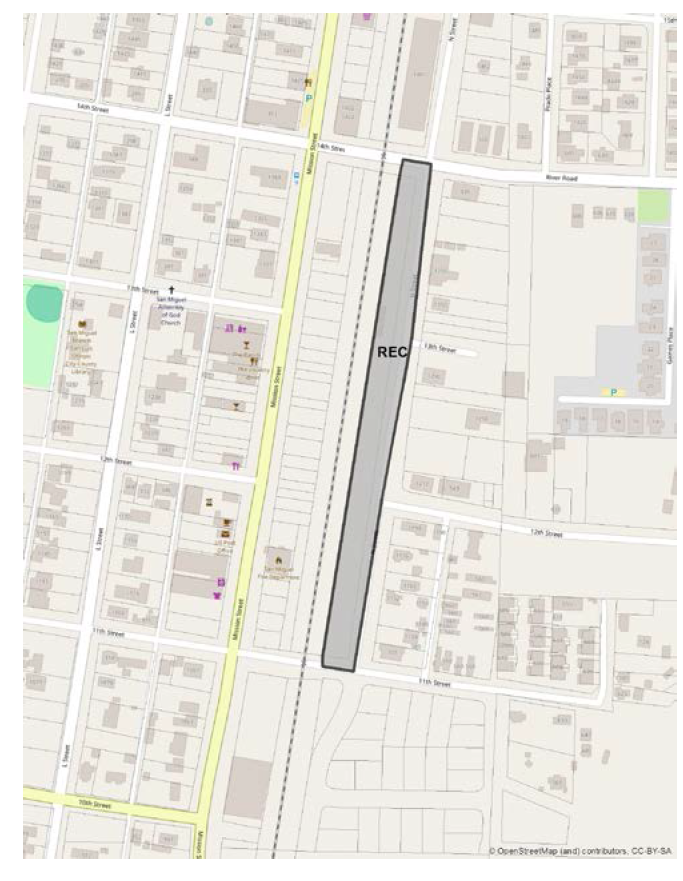
3.
East end of 11thStreet (Figure 104-10).
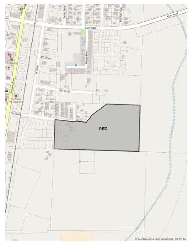
Figure 104-10—REC—N Street
a.
Land uses. The East 11 th Street area is primarily intended for residential development. The community plan envisions a mix of housing types, but also allows for recreational uses such as equestrian facilities. Only those land uses identified in Section 22.06.030 for the Recreation land use category may be authorized, except the following:
Mines and quarries
Recycling collection stations
Off-road vehicle courses
Automobile service stations/ Gas stations
Outdoor retail sales
Storage—outdoor storage yards
Temporary construction yards (off-site)
Transit stations and terminals
Vehicle storage
b.
Residential Density. The overall residential density shall be that of the single family land use category—5.5 to 7.0 units per acre net (excluding the Flood Hazard [FH] zone). The FH may be used as open space or as usable yard area for lots fronting on the river. Residential structures west of the Verde Place extension (in Figure 3-N of the Community Plan) shall resemble single family dwellings with a maximum of four units per building.
Figure 104-11—REC—East End of 11th Street
4.
West Side of N Street.
a.
Residential development is prohibited along the west side of N Street.
J.
Residential Single Family (RSF) land use category.
1.
Curbs, gutters, and sidewalks. Required for all development in the RSF land use category, except in the "blanket waiver area" shown in Figure 104-12 below.
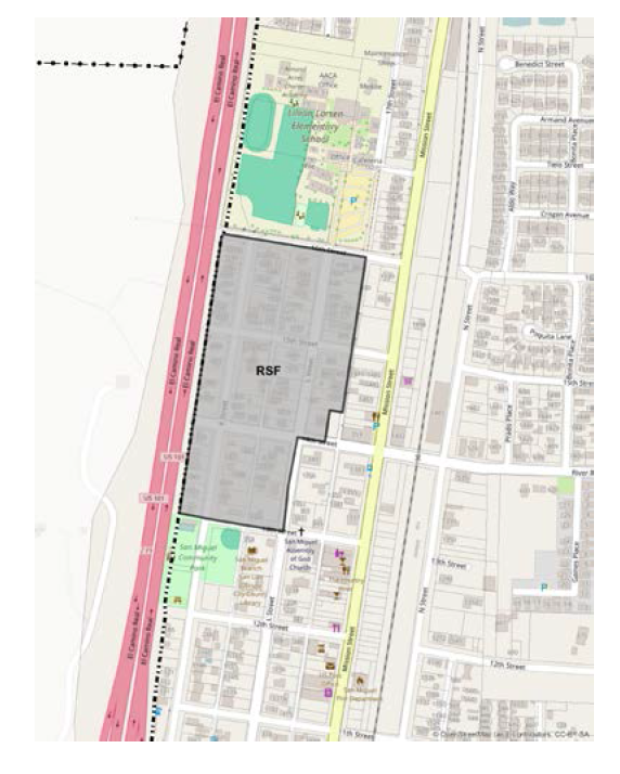
Figure 104-12—RSF—Curb, Gutter and Sidewalk Blanket Waiver Area
2.
Parking where an alley is primary access. New single-family residential development with an alley as its primary access is required to have two on-site parking spaces in addition to those normally required in order to compensate for the lack of street parking. These spaces may be located in the setback from an alley.
3.
Setbacks for parcels fronting only an alley. Parcels with no street frontage other than an alleyway shall maintain the following setbacks:
a.
A minimum of 20 feet from the alley, in order to accommodate parking between the structure and the alley.
b.
A minimum of 5 feet from parcel lines perpendicular to the alley.
c.
A minimum of 10 feet from the parcel line parallel to and opposite the alley frontage.
4.
Mission Gardens site (Figure 104-13). The following standards apply only the Mission Gardens site, as shown in Figure 104-11.
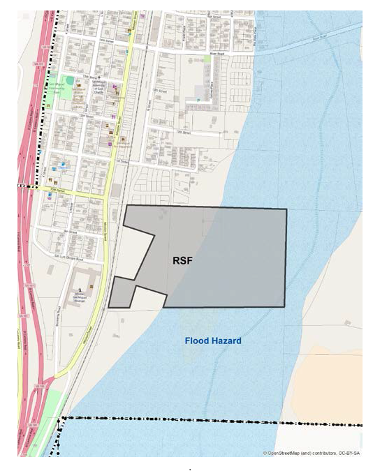
Figure 104-13—RSF—Mission Gardens Site
a.
Cluster requirement. Land divisions shall be clustered west of the Flood Hazard (FH) combining designation.
b.
Open space requirement. Flood hazard areas and areas reserved to reduce noise, protect visual resources, or to preserve cultural resources shall remain in open space.
5.
Mission Vineyard Estates site (Figure 104-14). The following standards apply only to the Mission Vineyard Estates site, as shown in Figure 104-14.
5.
Mission Vineyard Estates site (Figure 104-14). The following standards apply only to the Mission Vineyard Estates site, as shown in Figure 104-14.
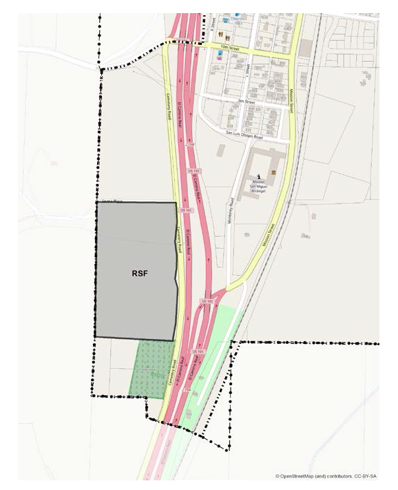
Figure 104-14—RSF—Mission Vineyard Estates Site
a.
Ridgetop development prohibited. Development must occur below the 687-foot contour.
b.
Visual mitigation requirements.
(1)
All development shall blend in with existing topography.
(2)
Cut and fill slopes shall be rounded to reduce the transition between slope angles.
(3)
Finished building pads should be at or below the average natural elevation.
(4)
Building height shall not exceed 20 feet.
(5)
Hipped-roof design is required.
(6)
Colors must be dark, muted, earth-tone shades.
(7)
A landscaping plan must be submitted to provide 50 percent screening within 5 years and 80 percent screening within 10 years.
(8)
An exterior lighting plan shall be submitted and reviewed to ensure illumination levels arethe minimum needed for public safety.
c.
Landscape buffers. Landscape buffer areas are required as follows:
(1)
15 feet along the southern property boundary.
(2)
100 feet along the eastern property boundary.
(3)
40 feet along the northern property boundary.
d.
Subdivisions. Open space is required above the 687-foot elevation.
K.
Residential Multi-Family (RMF) land use category.
1.
Useable open areas. New RMF development must include usable open areas (e.g. patios, gardens, play areas, swimming pools, etc.) based on the following standards:
a.
Development with useable common open areas. Development shall meet the provisions specified in Subsections B.e.(1), B.e.(2), and B.e.(3) of Land Use Ordinance Section 22.22.145 (Planned Development). The minimum open area required by Section 22.10.130.B.2 shall include usable common open areas. In addition, each unit shall include a usable private open area containing a minimum of 175 square having minimum dimensions of 10 feet. Upper story units with no ground floor shall have a minimum of 60 square feet of usable private outdoor area having a minimum dimension of six feet.
b.
Development with useable private yards. This standard applies to multi-family projects (such as duplexes, row houses, or detached units) that propose individual private yards rather than usable common open areas. A usable common open area is not required, provided that the minimum open area of Section 22.10.130.B.2 is met, and a minimum of 750 square feet of usable private yards, with a minimum dimension of 15 feet, is provided for each unit.
2.
Building height. Buildings with dwelling units that have entries not located on the ground floor are limited to two stories in height. Buildings that are designed to resemble single family dwellings, town houses, row houses or similar structures where each unit's entry is on the ground floor, are subject to the height limits of Section 22.10.090.
3.
Residential Multi-Family design guidelines. Residential multi-family project shall meet a minimum of five of the following guidelines.
a.
Unit size and type. Developments where all units are the same size and type are discouraged. Larger multi-family developments should provide a mix of unit sizes and types.
b.
Units per building. Buildings should be limited to no more than six dwellings.
c.
Front setback should not be used for parking. The space between the building and the front property line where there is street frontage should not be used for parking. Parking should be in the interior of the site or on the sides where they can be screened by landscaping.
d.
Entries. Each unit of a multi-family development should have its own separate main entry from the outdoors. Any building having frontage on a public street should have at least one-half of its entries face the street.
Alternatively, multi-family residential structures that are constructed to mimic the design, scale, siting, and form of a single-family residence may propose a single consolidated entry point for all units. Any consolidated entry point should face the street.
e.
Footprints. Building footprints should resemble a series of partially overlapping rectangles as opposed to a single rectangle.
f.
Details. Buildings should include details associated with single-family residences, for example, porches, bay windows, chimneys, trellises, built-in planters, integrated low walls, etc.
g.
Building variations. Where two buildings are adjacent to one another with the same orientation, different design features should be used to differentiate between the buildings. In instances where there is a row of more than two buildings, a maximum of two adjacent units may have identical wall and roof lines.
h.
Elevations. All sides of multi-family residential developments and garages should be detailed and articulated with relief elements and changes in plane.
i.
Parking layout. No more than six parking spaces or carport stalls should be grouped together, and landscaping should be installed between each group of parking spaces. Any carport structures should be architecturally compatible with adjacent residential structures and should be integrated with patio or building walls whenever possible.
j.
Covered parking. In order to ensure that covered parking areas are retained for parking rather than storage, carports are favored over garages.
k.
Landscape details. Multi-family units should have landscape features commonly associated with single-family homes, such as flowering plants, fenced yards, private parking areas, planter boxes, stone or stepping stone pathways, etc.
4.
Development east of the railroad tracks. The following standards apply to development in the RMF land use category east of the railroad tracks as shown as Area A in Figure 104-15, below:
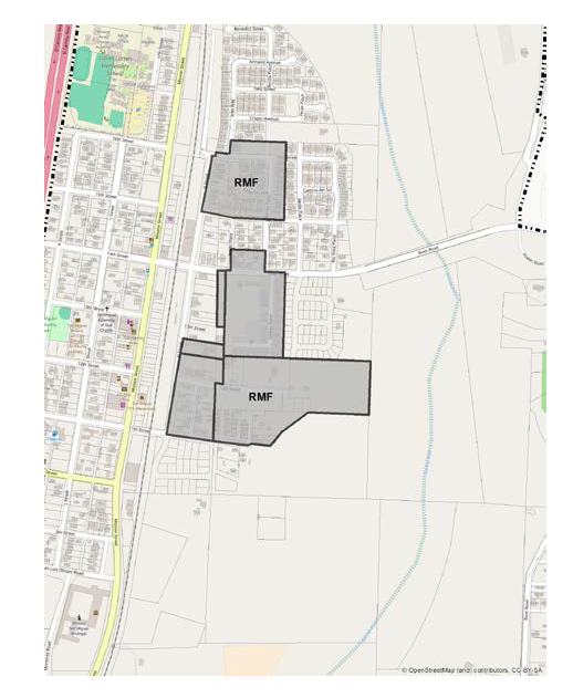
Figure 104-15—RMF—East of the Railroad Tracks
a.
Link cul-de-sacs and dead end streets.
b.
Incorporate traffic calming features into the design of new streets to reduce vehicle speed.
c.
Include easements for bikeways and pedestrian walkways.
d.
Provide sidewalks, landscaping, and on-street parking.
e.
Include adequate lighting for sidewalks and crosswalks.
f.
Provide secure on-site bicycle parking.
g.
Provide easements or land dedications for trails, consistent with the Parks and Recreation Element, for development near the Salinas River.
h.
Submit a vernal pool habitat evaluation and a botanical survey shall be submitted with grading, construction or land use permit applications.
i.
Cluster development on the areas west of the Flood Hazard (FH) combining designation. Retain FH areas in as usable open areas or open space.
j.
Limit density to 20 units per net acre (excluding the Flood Hazard Zone, rights-of-way and access easements).
5.
L Street area. Within the L Street Area, as identified in Figure 104-16, new residential developments proposing access from the alley shall be evaluated by a traffic engineer for improvement and safety recommendations.
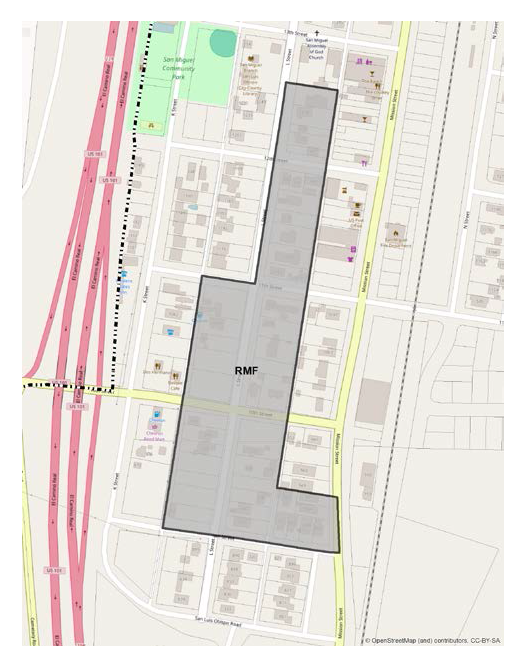
Figure 104-16—RMF—L Street Area
6.
N Street Site (Figure 104-17). The following standards apply to development in Area B in Figure 9-E.
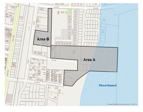
Figure 104-17—RMF—N Street Side
a.
Density. The maximum density is 15 units per acre.
b.
Access. For those sites fronting on a private road, as shown on Figure X-X, access shall be taken from the private road.
c.
Parking. Adequate on-site parking shall be provided for sites fronting the private road, where the road's width is too narrow to allow on-street parking.
7.
16thStreet and Bonita Place. The overall density shall be limited to 10 units per gross acre. Residential development shall be designed to blend in with the surrounding single-family residential neighborhood.
[Added 2003, Ord. 3010; Amended 2005, Ord. 3073; 2006, Ord. 3105; 2014, Ord. 3256; 2016, Ord. 3341; 2015, Ord. 3291; 2017, Ord. 3358; 2018, Ord. 3377; 2021, Ord. 3455]
22.104.070 - Santa Margarita Community Standards.
The following standards apply within the Santa Margarita Urban Reserve Line, in the land use categories or specific areas listed, in addition to the standards of Section 22.94.080.
A.
Communitywide. The following standards apply to all land use categories inside the Santa Margarita Urban Reserve Line.
1.
Compliance with the Santa Margarita Community Design Plan. All Minor Use Permit and Conditional Use Permit applications shall be in conformity with the Santa Margarita Design Plan, and any amendments thereto. The Santa Margarita Design Plan was duly approved by the Board of Supervisors in Resolution 01-413 and is on file in the Office of the Clerk of the Board of Supervisors and which is hereby incorporated by reference herein as though set forth in full. In the event of any conflict between the provisions of the Salinas River Area Plan and the design plan, the design plan shall prevail.
Applicants and the general public are encouraged to read the Santa Margarita Design Plan. The standards are requirements that supersede and replace any conflicting standards in Articles 1 through 8 of this Title. The guidelines are flexible standards for discretionary land use permits that are intended to provide for interpretation and flexibility in designing a project, such that "equal or better" design features may be approved.
2.
Permit requirements.
a.
Minor Use Permit approval is required for all new construction or exterior alteration of existing structures where a land use permit is otherwise required by this Title, except for the following:
(1)
Minor exterior alterations, as well as expansions not to exceed 10 percent of the existing floor area, may be exempted from this requirement by the Director of Planning and Building. Such projects are still subject to other applicable requirements.
(2)
Exterior facade remodeling and expansions that exceed 10 percent of the existing floor area may be approved as "minor" Minor Use Permits if they are determined to be categorically exempt from the California Environmental Quality Act by the Director of Planning and Building and are in conformance with the Santa Margarita Design Plan.
(3)
New uses that are proposed to occupy existing development. Such uses are still subject to other applicable permit requirements.
(4)
Single-family and multi-family residences and residential accessory structures, accessory dwelling units, and agricultural accessory structures.
(5)
Where Conditional Use Permit approval is otherwise required by this Title.
3.
Street tree requirement. Before final building inspection, plant deciduous shade trees with low water-using irrigation along streets and pedestrian lanes when new residential tracts are developed, when multi-family residences, commercial or other non-residential buildings are constructed, or for any new or expanded use requiring a Minor Use Permit or Conditional Use Permit. Trees shall be selected and located to have a continuous row of shade canopy along the street right-of-way within 10 years after planting.
B.
Commercial Service (CS). The following standards apply within the Commercial Service land use category.
1.
Limitation on use. All land uses identified by Section 22.06.030 as allowable, permitted, or conditional uses within the CS land use category may be authorized in compliance with the land use permit requirements of that Section, except: concrete, gypsum and plaster products, and electric generating plants.
2.
Permit requirement. Minor Use Permit approval is required where Site Plan Review would otherwise be required by this Title, for all initial construction or exterior alteration to existing buildings
New uses that are proposed to occupy existing development are not subject to the above requirement but are subject to land use permit approvals as required by this Title, with the exception that the following uses are required to have Minor Use Permit approval, to review potential water, wastewater, hazardous material, odor, noise, traffic, solid waste and potential impacts that may apply: Ag processing; drive-in theater; sports assembly; apparel products; electrical equipment, electronic and scientific instruments; furniture and fixture products; metal industries, fabricated; small scale manufacturing; recycling and scrap; stone and cut stone products; laundries and dry cleaning plants.
C.
Industrial (IND). The following standards apply within the Industrial land use category.
1.
Limitation on Use - Railroad property. Allowable land uses are limited on lands in Southern Pacific Railroad ownership to offices, accessory storage, storage yards, vehicle and freight terminals, pipelines and transmission, public utility facilities, warehousing and energy-generating facilities (limited to renewable energy facilities).
D.
Recreation (REC). The following standards apply within the Recreation land use category.
1.
Limitation on use. Land uses shall be limited to libraries and museums, membership organization facilities, outdoor sports and recreation, public assembly and entertainment, sports assembly, temporary events, government offices and caretaker residences and energy-generating facilities (limited to accessory renewable energy facilities).
2.
Permit requirement. Minor Use Permit approval is required for any construction of new buildings, unless a Conditional Use Permit is otherwise required by this Title.
3.
Setback requirement. A 20-foot front setback is required, within which a landscaped parkway between the curb and sidewalk shall be provided.
E.
Residential Single-Family (RSF). The following standards apply within the Residential Single-Family land use category.
1.
Building height. For properties with less than 75 feet of frontage, the maximum height for a new residence or addition to an existing residence is 18 feet, or one story, whichever is less, unless a greater height is authorized by Minor Use Permit approval to consider privacy and neighborhood character.
2.
Minimum building site. The minimum building site for existing adjoining lots under single ownership shall be 6,000 square feet with 50 feet of frontage.
3.
Design Standards - New subdivisions and Zoning Clearances for single-family residences. The following standards apply to proposed subdivisions and new single-family residential development unless modified by a Minor Use Permit or Conditional Use Permit on individual lots:
a.
Varied front yard setbacks. The required 25-foot front yard setback shall be adjusted at least five feet in either direction if a building site is between or adjacent to two residences that are located at the required front setback. Existing front building setbacks shall be shown on application submittals.
b.
Driveway frontage and garage location. No more than 25 percent of a lot's frontage shall be utilized for a driveway opening, unless it is necessary to allow a 16-foot width for a two-way drive, except for flag lots, cul-de-sac lots and lots with less than 40 feet frontage.
Garages and carports shall be located five feet further back from the street than the front of residences, except where limited site area, width and/or access make the required setback infeasible, an adjustment may be approved in compliance with Section 22.70.030.
c.
Fence and wall requirement. Fences and walls that are proposed at or within the front setback or visible from public streets, shall be constructed of stuccoed masonry, river cobblestone or wood, and shall be designed, painted or stained similar to the building architecture and colors. Fences or walls constructed of other materials or finishing shall be set back at least 10 additional feet and continuously screened by landscaping from the street right-of-way.
F.
Residential Multi-Family (RMF). The following standards apply within the Residential Multi-Family land use category.
1.
Minimum site frontage. New multi-family development shall have a minimum 75-foot street frontage.
2.
Height limit. Building height shall be no more than 28 feet.
3.
Design standards - All land use permits. Multi-family residential structures and accessory buildings shall comply with the following design standards, or their intent if a discretionary permit is applicable, in addition to the Residential Single-Family category standards in Subsections E.3.a through E.3.c, unless modified by a Minor Use Permit.
a.
Parking location. Parking spaces shall not be located between the front property line and buildings.
b.
Wall, roof and balcony articulation. Building walls and balconies shall be inset or notched at least once for every 30 linear feet. Insets shall be at least one foot and shall be extended to the roof cornice or penetrate the roof plane. Roofs shall not be mansard style. Exterior stairs, balconies and porches shall be covered by the roof plane and form part of the building articulation.
c.
Private Patios and balconies. Residential private outdoor use areas shall be provided for individual units. Private balconies shall be provided, with a depth of at least 6 feet and width of 10 feet. Private ground-level patios shall be provided with an area of at least 150 square feet.
d.
Building materials. Wall surface materials shall be wood or wood-appearing materials, stucco, brick, or rock. Prohibited wall materials include metal siding, unfinished or painted concrete block, metal window awnings, and reflective glass.
e.
Building trim. Cornices and moldings shall be provided at building corners, eaves, baseboard lines, and window borders except where windows are not flush with a wall surface.
[Amended 1996, Ord. 2776; Added 2001, Ord. 2947; Amended 2006, Ord 3097; 2014, Ord. 3256; 2015, Ord. 3291; 2020, Ord. 3409]
22.104.080 - Shandon Urban Area Standards.
The following standards apply within the Shandon urban reserve line to the land use categories or specific areas listed.
A.
Community-wide standards. The following standards apply to all land use categories within the Shandon urban reserve line.
1.
Environmental mitigation. New development shall comply with the applicable mitigation measures in the Shandon Community Plan Update and San Juan Village (Fallingstar Phase I) Project Final Environmental Impact Report. Table 9.1 in the Shandon Community Plan identifies the type of development for which the mitigation measures in the Final Environmental Impact Report are required.
2.
Building height. The maximum building height in the Residential and Commercial land use categories shall be 28 feet. Exceptions may be granted pursuant to Subsections 22.10.090.C.2a or c.
3.
Urban edge. To avoid creating a sharp urban edge, development adjacent to the Urban Reserve Line shall include a landscaped area that breaks-up the view of building facades, fences and walls from public roads and nearby rural areas. The landscaped area shall include trees selected from the Shandon Community Plan Master Tree List and be consistent with the applicable mitigations for biological resources in Appendix D of the Shandon Community Plan. If adjacent to the Agriculture land use category or an agricultural use, an agricultural buffer shall be provided consistent with the Ag Buffer policy.
4.
Stream bank setbacks. Buildings shall be set back a minimum of 100 feet from the top of the stream bank.
5.
Energy and water conservation. New development shall implement the following water and energy-saving measures: Installation of low flow or dual flush toilets, low flow shower heads and water faucets and energy efficient appliances; drip irrigation or micro-sprayers on appropriate landscaped areas; Use of devices such as soil monitors and rain shutoff devices for all automatic irrigation systems; and use of mulch in non-turf areas, permeable hardscape to the extent feasible, soil amendments to increase soil moisture holding capacity of soil and native low water using landscaping.
In addition, new development shall include at least four of the following conservation techniques:
a.
Install renewable energy facilities or alternative energy equipment and devices such as solar heating and hot water systems.
b.
Integrate, where feasible, alternative energy mechanical equipment and accessories within roofing materials and/or blend them with a structure's architectural form.
c.
Pre-wire commercial and residential development for rooftop photovoltaic (PV) panels or other advanced technology.
d.
Employ passive solar design and natural daylighting techniques in the design and construction of buildings.
e.
Provide surfaces and windows (with "low-e" glazing), on south-facing walls, that add significant thermal mass, with proper ventilation, to control and distribute energy throughout structures.
f.
Use deciduous shade trees on the south, east and west sides of buildings, and low shrubbery immediately south of buildings to maximize passive solar performance; and use evergreen trees, where appropriate, to protect buildings from winter winds, provided the evergreen trees do conflict with the purpose of the deciduous trees.
g.
Use energy-saving landscaping around buildings and in parking lots to reduce solar gain in summer and allow solar gain in winter.
h.
Use building materials, components, and systems found locally or regionally to reduce energy use, emissions and transportation costs.
i.
Use non-toxic building products (e.g. formaldehyde-free insulation, low Volatile Organic Compounds [VOC] paints, etc.).
j.
In new buildings, use the lowest water-using or waterless plumbing fixtures, implement water saving practices, and install greywater recycling systems.
6.
Domestic water supply. Domestic (non-agricultural) water supply shall be provided by CSA-16 or successor water provider, except for the following:
a.
The land within the Agriculture land use category, as shown in Figure 104-9.
b.
Parcels fronting on Peaceful Valley Lane, as shown in Figure 104-9, that are 2.5 acres or larger in size.
c.
Development of an allowable residential use, pursuant to Table 2-2, except for mobile home parks and multi-family dwellings, on a lot legally created prior to the adoption of the Shandon Community Plan that is within a Residential land use category and outside of the CSA-16 service area.
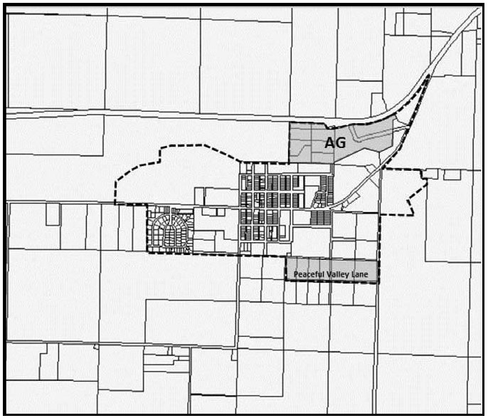
Figure 104-18: Domestic Water Supply
7.
Domestic water supply - requirement for new development. The standards below apply to the following new development:
1) development resulting from new land divisions, 2) land use permits that result in greater than four (4) dwelling units, 3) development of more than 9,999 square feet of floor area for uses listed under the industry, manufacturing and processing land use group, 4) development of more than 2,499 square feet of floor area for uses listed under all other non-residential use groups. All criteria are cumulative for a single site.
a.
The domestic (non-agricultural) water supply for new development listed above shall not be from groundwater, except as provided in Subsection A.7.c.
b.
Prior to issuance of construction permits, the applicant for new development shall pay a "fair share" of the costs of the water project, pursuant to the Shandon Community Plan Natural Resources Implementation Program NRIP-4, that delivers State water to Shandon in excess of CSA-16's 2012 allocation of 100 acre-feet per year. The "fair share" is to be determined by CSA-16 or successor water provider based on the project's net new water demand. The project's contribution to recharge from the wastewater treatment facility shall be taken into account in determining net new water demand.
Note: "Net new water demand" is the amount of non-agricultural water to be used by new development minus the volume of water returned to the groundwater basin through wastewater return flows. The calculation of net new water demand is the sole responsibility of the Planning Director using water demand factors for the proposed land uses.
c.
In the event the Board of Supervisors determines, after completion of the necessary background studies, that the delivery of additional State water to Shandon is not adequate or viable for new development, and the Board of Supervisors has determined that the Paso Robles Groundwater Basin is no longer in Level of Severity III, the applicant shall participate in one or both of the following:
(1)
A water conservation program approved by the Board of Supervisors that results in reducing groundwater pumping within the Paso Robles Groundwater Basin, or
(2)
A fee program approved by the Board of Supervisors that results in reducing groundwater pumping within the Paso Robles Groundwater Basin.
8.
Water conservation. New development shall limit the irrigated landscape area as follows:
a.
The irrigated landscape area for a single family dwelling shall be limited to a maximum of 15 percent of the lot area or 1,500 square feet, whichever is less. Turf area shall be limited to 20 percent of the irrigated landscape area. Example: a 6,000 square foot lot may have up to 900 square feet of irrigated landscape. Of that 900 square feet, up to 180 square feet may be turf.
b.
The irrigated landscape area for a multi-family project shall be limited to a maximum of 6,000 square feet per acre. Irrigated turf is limited to common active use areas only and may not exceed 20 percent of the irrigated landscape area.
c.
All other uses shall be landscaped in compliance with Chapter 22.16 - Landscaping Standards. Irrigated turf may be authorized by the Review Authority for active use areas only.
9.
Public facilities and capital improvements. Prior to recording a final map, issuance of construction permits or establishment of a use, public facility fees shall be paid per the Shandon Capital Improvement Plan (SCIP), unless, as part of the approval of a prior discretionary land use permit or land division application, the appropriate public facility fees were paid and/or public facilities were constructed consistent with the SCIP or Chapter 8 of the Shandon Community Plan in order to cover the cost of the public facility fees for subsequent projects or land uses.
Prior to the adoption of the SCIP and adoption of an associated fee ordinance, land division applications of five or more parcels, or projects located on lots that were legally created prior to the adoption of the Shandon Community Plan where the intensity of the proposed development is such that wastewater disposal cannot be accommodated with an on-site septic system, public facilities shall be constructed pursuant to Subsection A.20.j. This standard does not apply to Master Plan Areas, which are otherwise subject to Subsection B.
10.
Street improvements required. Sidewalks, curbs, gutters, street pavement, and street trees (consistent with the Shandon Community Plan Master Tree List, Appendix C of the Shandon Community Plan), are required in all land use categories, except in the Agriculture land use category. Street improvements, including sidewalk locations and parkway widths, shall be consistent with the Shandon Community Plan Street Sections. As necessary, additional right-of-way may be need to be dedicated to accommodate the improvements. Alternative storm water conveyance methods require County Department of Public Works approval.
11.
Sewage disposal. All new development shall connect to a community sewer system, except that new development on lots that were legally created prior to the adoption of the Shandon Community Plan that meet the minimum site area requirements of Section 22.10.110 are not required to connect to a community sewer system until such time the following criteria are met:
a.
The wastewater treatment plant is built with capacity to handle existing properties; and
b.
Sewer mains and/or collectors are installed within the existing neighborhood right-of-way; and
c.
The subject property is within 200 feet of a sewer main or collector; and
d.
The septic system on the subject property fails or the property owner obtains a building permit for a project that includes features that would increase potential wastewater generation (e.g., adding a bathroom or bedroom); or
e.
The State Regional Water Quality Control Board (or under the authority of another state or federal agency) mandates connection to the sewer.
12.
Master tree list. When required, all street trees, and trees within commercial landscapes shall be selected from the Shandon Master Tree List, Appendix C of the Shandon Community Plan. When located within the public right-of-way, the street tree type and location shall also be approved by the County Department of Public Works.
13.
Drainage. The following standards apply to all discretionary land use permits and land divisions:
a.
Drainage shall be handled to maximize percolation and recharge.
b.
Limit the amount of impervious surfaces to reduce runoff volumes.
c.
Runoff control measures shall be included in new development to minimize the discharge of urban pollutants into drainage areas.
d.
Stormwater quality measures, such as vegetated swales, linear bio-retention cells within open channels, and permeable paving materials shall be incorporated in new development.
14.
Habitat conservation. All land use permits, land divisions and other "covered activities" as defined in the Shandon Community Plan Habitat Conservation Plan (HCP) or other applicable plan shall be developed consistent with HCP. Prior to adoption of an HCP, projects shall be consistent with the applicable mitigation measures shown in Appendix D of the Shandon Community Plan for biological resources.
15.
Solid waste disposal. New discretionary development shall be required to subscribe to waste collection and recycling service.
16.
Cultural resources protection. New development shall protect cultural resources as follows:
a.
All applications for land divisions and land use permits subject to discretionary review that involve grading, trenching or other ground disturbance shall include a Phase I archaeological survey of the site performed by a qualified archaeologist approved by the Environmental Coordinator. The survey shall include sufficient background archival research and field sampling to determine whether subsurface prehistoric or historic remains may be present. Any further evaluations and investigations and mitigation measures shall comply with County requirements and the provisions of Appendix D of the Shandon Community Plan relating to cultural resources.
b.
All applications for land divisions and discretionary land use permits that involve the demolition or alterations of buildings or structures greater than 50 years old shall include documentation and evaluation of the historical significance of the those buildings or structures. The documentation and evaluation shall be performed by a qualified historian or architectural historian approved by the Environmental Coordinator. If such evaluation concludes that the buildings or structures are significant historical resources, then the qualified historian or architectural historian shall recommend measures to reduce impacts on historical resources, such as archival quality photographs, measured drawings, oral histories, and interpretive signs. Such measures shall be included in the project design, as applicable.
17.
Natural gas. New development shall connect to natural gas facilities as follows:
a.
All subdivisions shall install gas lines consistent with Title 21 of the County Code.
b.
New single family residences or accessory dwelling units on individual lots shall connect to natural gas where gas lines exist in the fronting right-of-way or where the property is adjacent to a gas line easement.
c.
Multi-family or commercial uses shall connect to natural gas facilities.
18.
On-street diagonal parking. On-street diagonal parking within public rights-of-way may be approved with Conditional Use Permit approval where adequate right-of-way is provided, and the Review Authority finds that there is adequate parking within a reasonable distance to the project for longer vehicles that cannot use diagonal parking.
19.
Public improvements. Public improvements shall be installed or bonded for prior to recording final maps or final inspection. If necessary, the subject property shall be annexed into CSA-16.
20.
Land divisions. The following standards apply to new land divisions:
a.
Conditional Use Permit required. Applications for land divisions shall require concurrent Conditional Use Permit approval.
b.
Block length. Blocks lengths shall promote through circulation that accommodates vehicles, pedestrians, and bicycles consistent with Chapter 5 of the Shandon Community Plan. Residential blocks developed with single family lots or other small lot development shall be no longer than 400 feet. Block lengths in the Commercial Retail land use category shall be determined by the Review Authority based on the proposed uses, size of building and parking requirements (pedestrian connection are required pursuant to Section Subsection C.3.a). Where traditional downtown commercial blocks are proposed, shorter block lengths between 250 feet and 350 feet are encouraged. The Review Authority may approve longer blocks for large lot development or where site conditions (such as adjacency to a creek) do not necessitate though circulation.
c.
Culs-de-sac. Through-streets are preferred over culs-de-sac, which should be limited. Where culs-de-sac are proposed and they are adjacent to a park, other legally accessible open space, or a collector or arterial street, they shall be open-ended to allow visible and convenient pedestrian and bike circulation (see Figure 104-19).
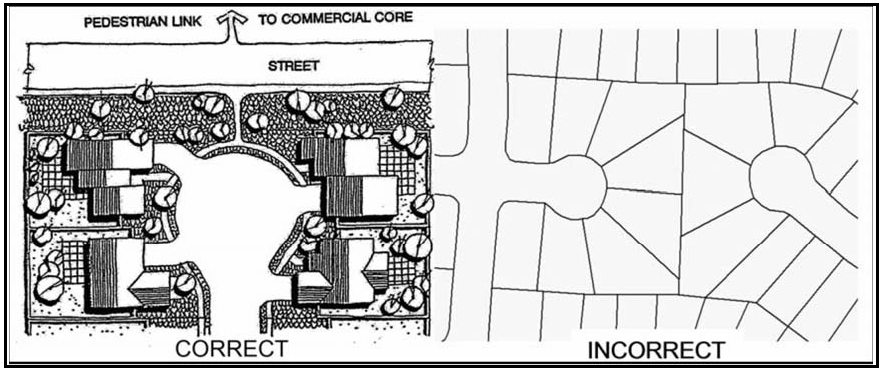
Figure 104-19: Culs-de-sac
d.
Common areas. When common areas are proposed or required, applicants shall establish mechanisms for guaranteed long-term management and maintenance of the common areas.
e.
Notice to future tenants. Applicants shall give notice to future owners and tenants of any conditions of approval or requirements associated with the project that are applicable to their particular lot or common areas within the subdivision.
f.
Water system. Each development shall have at least two points of connection to the community water system, as determined appropriate by the County Public Works Department.
g.
Wastewater system. New development shall install "backbone" wastewater pipelines, consistent with the approved Shandon Capital Improvement Plan (SCIP) or, prior to the adoption of the SCIP, Chapters 7 and 8 of the Shandon Community Plan, to meet upstream full-buildout demand, as determined appropriate by the County Public Works Department.
h.
Drainage. Applications for new land divisions shall include an assessment of a project's potential impacts on the local and sub-regional storm drainage systems so that the County can determine appropriate measures to ensure that system capacity and peak flow restrictions are not exceeded, as determined appropriate by the County Public Works Department.
i.
Public facilities and capital improvements. New land divisions shall require the development of the applicable public facilities identified in the Shandon Capital Improvement Plan (SCIP). Public improvements shall be installed or bonded for prior to recordation of final maps and, if necessary, a reimbursement agreement shall be made with the County, consistent with Ordinance 3129. The following standard applies prior to adoption of the SCIP.
j.
Prior to the adoption of the Shandon Capital Improvement Plan (SCIP), the first land division resulting in five or more parcels shall be responsible for constructing the following public facilities (if not previously constructed by a separate entity).
(1)
The circulation improvements listed as items A-1, A-7, and A-12 in Table 8.3.a of the Shandon Community Plan.
(2)
The following water system improvements listed in Table 8.3b of the Shandon Community Plan, as determined to be appropriate by County Public Works: items B-1 through B-6 if the land division is located east of San Juan Creek, or items B-1 through B-5 and items B-7 through B-10, if the land division is located west of San Juan Creek. Water system improvements shall be consistent with the CSA-16 Water Master Plan. If the CSA-16 Water Master Plan has not been updated subsequent to the adoption of the Shandon Community Plan, then the water system improvements shall provide the following:
(i)
Project-specific evaluations of velocities and pressure throughout the system at various demand scenarios, and
(ii)
Project-specific hydraulic modeling and fire flow analyses to evaluate impacts to operating pressures and fire flow availability in the existing and proposed water system and determine what, if any, additional water system upgrades may be required for the project, and
(iii)
Design criteria and standards for various components of the water system, including pipe sizing, well capacities, fire flow requirements, pipe velocities and pressures.
(3)
The following wastewater system improvements listed in Table 8.3.c of the Shandon Community Plan, as determined to be appropriate by County Public Works: items C-1 through C-12, if the land division is located east of San Juan Creek, or items C-1 through C-4, and items C-13 and C-14, if the land division is located west of San Juan Creek.
These improvements shall be consistent with Chapters 7 and 8, and Appendices B and E of the Shandon Community Plan. Public improvements shall be installed or bonded for prior to recording final maps. If necessary, the applicant shall enter into a reimbursement agreement, consistent with County Ordinance 3129, and the subject property shall be annexed into CSA-16 and receive a Conditional Will-Serve Letter from CSA-16.
k.
Street lights. Street lights shall be included with all new land divisions. They shall be designed and installed to limit light pollution, consistent with best practices endorsed by the International Dark Sky Association, and be low-energy-using fixtures, such as LED. If necessary, the subdivision shall be annexed into CSA-16 or another established special district.
B.
Master Plan Areas. The following standards apply to the Master Plan Areas as shown in Figure 104-20.
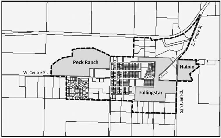
Figure 104-20: Master Plan Areas
1.
Permit requirement. Conditional Use Permit approval is required prior to any new development in any of the Master Plan Areas shown in Figure 104-11, unless the property owner elects to prepare a Specific Plan, consistent Government Code Sections 65450 and 65457. The Conditional Use Permit or Specific Plan shall address, at a minimum, the following:
a.
Specify permit requirements for subsequent development.
b.
If not previously constructed by a separate entity, require the construction of the circulation improvements listed in Subsection A.20.j(1).
c.
If not previously constructed by a separate entity, as determined appropriate by the Public Works Department, require the construction of the water system improvements and wastewater system improvements listed in Subsections A.20.j (2) and (3).
d.
Pursuant to the Shandon Capital Improvement Plan (SCIP) or Chapter 8 of the Shandon Community Plan if the SCIP is not adopted, Public Facility reimbursement payments shall be determined, if the project's "associated costs" for each improvement type (circulation, water, wastewater and drainage (based on the SCIP or Table 8.4 of the Shandon Community Plan) exceed the total costs for each improvement type the applicant is obligated to construct as required by Subsections B.1.b and B.1.c. Example: Project A is conditioned or "obligated" to construct circulation items totaling $1.2 million but the project's total "associated" (fair share) costs for all of the circulation items is $2.0 million, then Project A would be responsible to pay $800,000 in reimbursement. If an applicant's "obligated costs" exceed the "associated costs," the applicant shall enter into a reimbursement agreement, consistent with County Ordinance 3129.
e.
Address the requirements of Section 3.2.1 of the Shandon Community Plan.
f.
Provide for appropriately-sized parks, pursuant to Section 6.2 of the Shandon Community Plan.
2.
Master Plan Area consistency requirements. Development within each Master Plan Area shall be consistent with the land use plans shown in Figures 3.3 or 3.4, and corresponding Tables 3.5, 3.6 or 3.7 of the Shandon Community Plan. In addition, development shall follow the Master Plan Objectives, Master Plan Sustainability Principles, and the Master Plan Design Principles found in Section 3.2.2, 3.2.3 and 3.3 of the Shandon Community Plan. Public facility improvements shall be consistent with Shandon Capital Improvement Plan (SCIP), or if a SCIP has not been adopted, Chapters 7 and 8 and Appendices B and E of the Shandon Community Plan.
3.
Land use category changes. A General Plan amendment shall be processed concurrently with the processing of the first discretionary entitlements for the Halpin and Peck Ranch Master Plans. The General Plan Amendment shall include the necessary land use category changes from Agriculture to urban land use categories, consistent with Figure 3.1 of the Shandon Community Plan and changes to the Central Business District boundary consistent with the vision for the Centre Street Commercial Corridor described in Section 3.1.2 of the Shandon Community Plan.
C.
Commercial Retail (CR) and Commercial Service (CS). The following standards apply to both the Commercial Retail and Commercial Service land use categories. They are intended to help implement the commercial design policies of the Shandon Community Plan and create a welcoming and aesthetically pleasing built environment that is well-connected to surrounding neighborhoods, providing easy accessibility by both vehicles and pedestrians.
1.
Permit requirement. Minor Use Permit approval is required, unless a Conditional Use Permit is otherwise required by the Land Use Ordinance.
2.
Design policies and guidelines. Development shall be consistent with the Commercial Land Use and Neighborhood Design Policies in Chapter 3 of the Shandon Community Plan. The Commercial Design Guidelines found in Section 9.6 of the Shandon Community Plan shall be used in project design. Guidelines are not to be applied as individual standards but rather as a list of options for design techniques or project features.
3.
Site design and architecture. New development shall comply with the following design standards.
a.
Site design, building orientation and placement shall carefully integrate pedestrian connections to any adjoining residential neighborhoods in ways that maximize ease of access and ensure the safety and security of both commercial and residential uses.
b.
For sites adjacent to land in the Agriculture land use category, buildings shall be located, designed, and oriented to protect agricultural resources.
c.
Pedestrian furniture, landscaping (including trees) and other "streetscape" amenities located within the public right-of-way shall require an encroachment permit issued by the County Department of Public Works. The permit will identify maintenance and liability responsibilities of the adjacent property owners.
d.
Parking shall be designed for safe ingress and egress to commercial centers. Pedestrian connections and linkages shall have a well-defined separation from vehicle circulation. A landscape buffer with a minimum width of five feet shall be provided between parking lots and pedestrian rights-of-way.
e.
Parking lots on sites that have at least two driveways that serve buildings that are greater than 100 feet from street parking shall include at least two on-site spaces that accommodate long vehicles. These may be tandem spaces that allow for a vehicle to "pull-through" the parking spaces. This standard may be waived or modified with Minor Use Permit approval.
f.
Loading, delivery and service areas shall be located at the rear or side of the site rather than the front. This does not include areas for short-term deliveries made by standard-sized vehicles or delivery vans. Loading, delivery and service areas shall be separate and screened from public areas, or where adjacent to a residential use or Residential land use category, by the use of decorative walls and landscape features.
g.
Trash enclosures shall be screened from view with a combination of landscaping and solid walls.
4.
Lighting. Exterior lighting shall kept to the minimum as needed for safety and security to illuminate building entrances, parking and loading areas, and pedestrian walkways. The style of the fixtures shall be consistent with the overall project architectural concept and harmonious with the building design. Lighting shall be oriented away from sensitive uses, hooded or shielded, located to direct light pools downward and prevent glare, and consistent with best practices endorsed by the International Dark Sky Association. An exterior lighting plan shall be submitted with all discretionary projects and prepared by a qualified professional who is a current member of the Illuminating Engineering Society of North America.
5.
Commercial traffic. If development of a non-residential project results in the community exceeding the maximum communitywide floor area for the applicable non-residential land use as shown in Table 3.1 of the Shandon Community Plan, an additional traffic study shall be submitted with the required land use permit application.
D.
Commercial Retail (CR). The following standards apply only within the Commercial Retail land use category.
1.
Site design and architecture. In addition to Subsection C.3, new development in the CR land use category shall be consistent with the following site design and architecture standards:
a.
Significant buildings with prominent architectural features shall be located near corners and intersections whenever possible.
b.
At least 75 percent of the ground floor length of street-fronting buildings shall include architectural elements or details such as recessed windows and entries, display windows, offset surfaces, differentiated piers and columns, offset planes, textured materials, awnings, and compatible landscaping, or other details which are of interest to pedestrians.
c.
For the areas shown in Figure 104-12 that are within the Central Business District, fronting on East Centre Street between San Juan Creek and San Juan Road, or on the portions of the Peck Ranch Master Plan Area not fronting on West Centre Street, orient building entrances toward the street. Front setback shall be from zero to five feet, except that greater setbacks may be authorized by the Review Authority to accommodate pedestrian plazas, patios, courtyards or other entry features of interest. Where site area allows, additional buildings may be located to the rear of a site. On-site parking shall be located behind the front buildings. On sites where additional buildings are located on the rear of a site, parking may be located in front of those buildings.
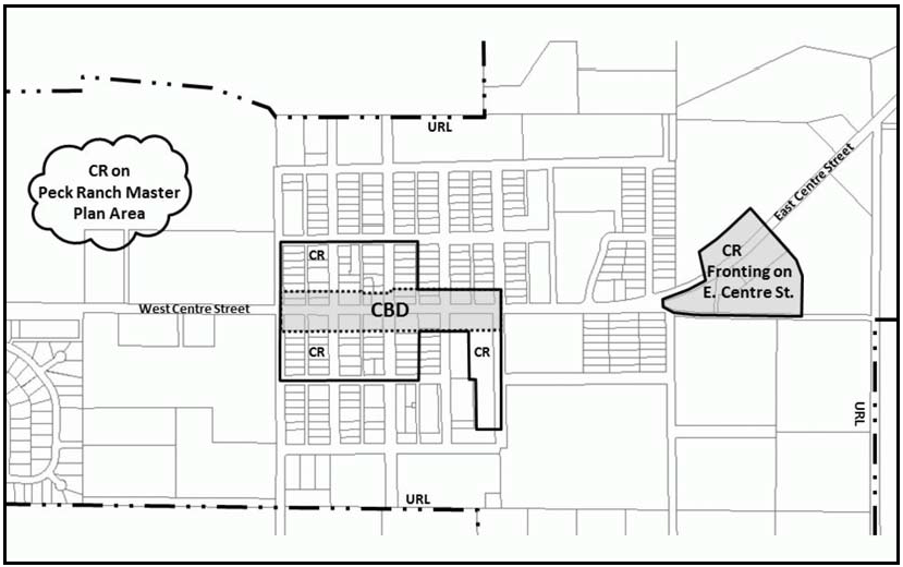
Figure 104-21: CR - Areas with Building Location Requirements
d.
Parking lots. Parking lots shall consist of small bays with 24 or fewer spaces and include walkways and landscaping between the parking bays.
e.
Downtown parking. Within the Central Business District (CBD), on-street parking fronting the subject site may be counted toward the required number of on-site parking spaces. The Review Authority may approve a greater reduction in the number of required parking spaces, based on the findings found in Section 22.18.020.H, because the characteristics of the immediate vicinity (the CBD) is compact, pedestrian oriented, and multiple businesses may be visited in one stop by using the same parking space.
f.
Parking lot access. Access to parking lots in the CBD shall be from either a side street or an existing alley (but not Centre Street), except for the following locations:
(1)
On the south side of Centre Street between Third and Fourth Streets, a new mid-block alley may be created for access, provided that it is shared by both parcels on that block.
(2)
On the south side of Centre Street between Fourth and Fifth Streets, if access from Fifth Street is not feasible due to required creek setbacks, a second access point onto Centre Street is allowable.
2.
Limitation on use. Residential uses are not allowed on properties in the Commercial Retail land use category, except for the mixed-use areas as shown in Figure 104-13 and described in the standards in Subsection D.3.
3.
Mixed Use Standards. The following standards apply only in the Commercial Retail land use category in the areas intended for mixed-use development as shown in Figure 104-22, and to the specific mixed-use development areas described in the following subsections, as applicable.
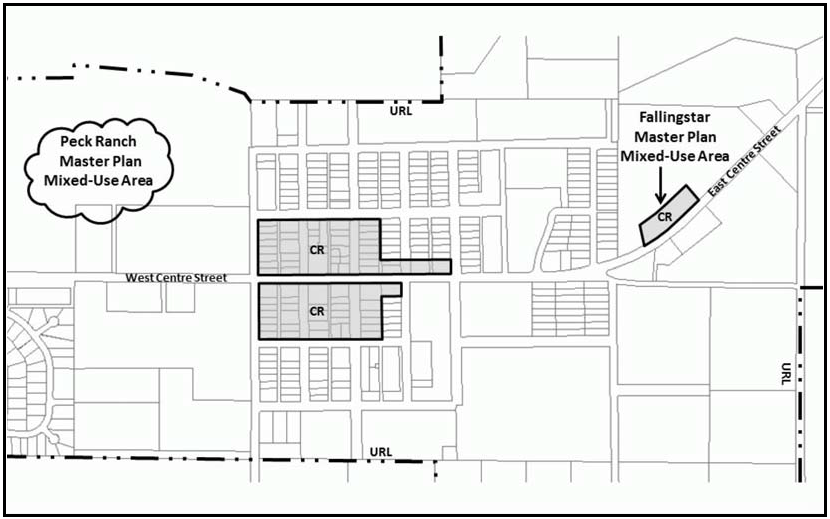
Figure 104-22: CR - Mixed Use
a.
In the Peck Ranch Master Plan Area, mixed-use development is limited to the Commercial Retail area that is located north of the community park and fire station and is not allowed on the Commercial Retail area fronting on Centre Street. The maximum total number of residential units in the Peck Ranch Master Plan area shall be 40 units, and the maximum total acreage of mixed use development shall be limited to four acres.
b.
In the Fallingstar Master Plan Area, mixed-use development is limited to the Commercial Retail area that is located north of Centre Street. The maximum total number of residential units in the Fallingstar Master Plan Area shall be 21 units, and the maximum total acreage of mixed-use development shall be limited to 2.2 acres.
c.
New development shall consist of a combination of a primary non-residential use and a secondary residential use with an equal or lesser floor area, except for properties that front only on First, Second, Third, Camatti, or Cholame Streets (as shown in Figure 104-23), where the commercial portion of the development may have less floor area than the residential use, as determined appropriate by the Review Authority.
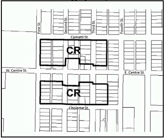
Figure 104-23: CR - Fronting Properties
d.
Residential uses existing prior to adoption of the Shandon Community Plan and located on properties that front only on First, Second, Third, Camatti or Cholame Streets (as shown in Figure 104-23), may continue and be expanded or remodeled as a primary use without the limitations imposed by Section 22.72.050 - Nonconforming Uses of Land and without being required to include commercial development.
e.
Minimum site area and residential density. The minimum site area for mixed-use development is 3,500 square feet. The maximum residential density is 10 units per gross acre, calculated using the acreage of the entire site, except for properties that front only on First, Second, Third, Camatti or Cholame Streets (as shown in Figure 104-14). For properties that front only on First, Second, Third, Camatti or Cholame Streets, the maximum number of dwelling units is one primary dwelling, and, on lots equal to or greater than 6,000 square feet, one additional dwelling that meets the standards of Section 22.30.470 - Residential - Accessory Dwellings.
f.
Floor area and open area. The maximum floor area and minimum open area requirements in Section 22.10.130.B.2 shall not apply. Instead, the land use permit shall require an amount of private open space and common area for privacy, recreation, light, and air that is appropriate for the nature of the project.
g.
Location of residential development. For properties fronting on Centre Street, between First and Fifth Streets, residential development shall be located only on the upper floor above the primary non-residential use of the site.
4.
The southeast corner of Fourth Street and East Centre Street. At the time of the adoption of the Shandon Community Plan, this site was located in both the Commercial Retail and Residential Single Family land use categories. Prior to the first new development on this site, Conditional Use Permit approval is required to determine the precise location of the land use category boundary, pursuant to Section 22.02.020.D.4.
E.
Commercial Service (CS) - Business Park Sites. The following standards apply to the business park sites described in Chapter 3 of the Shandon Community Plan and shown in Figure 104-24.
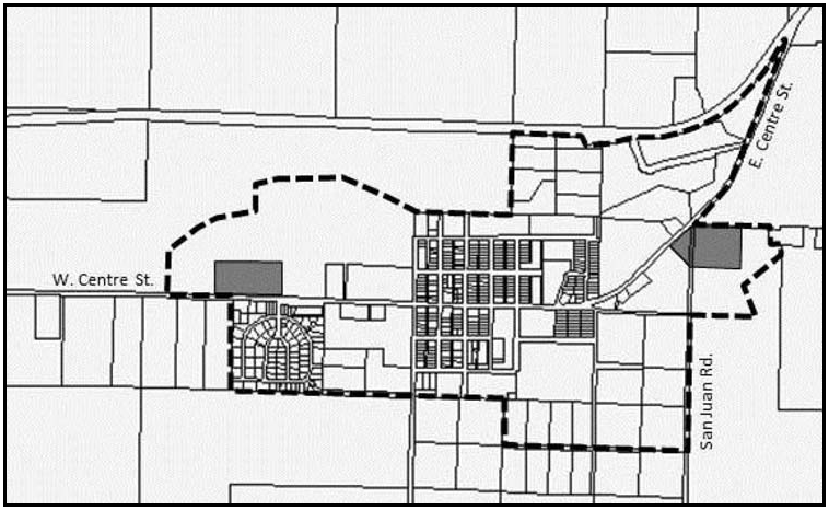
Figure 104-24: CS - Business Park Sites
1.
Limitation on use. Land uses shall be limited to the those in the following use groups: Industry, Manufacturing and Processing, excluding concrete, gypsum and plaster products, recycling - scrap and dismantling yards, and stone and cut stone products; Recreation, Education & Public Assembly, excluding outdoor sports and recreation facilities and sports assembly; Services (includes offices); Retail Trade-limited to uses that are in support of the business park; and Agriculture, Resource, and Open Space-limited to agricultural processing and nursery specialties and energy-generating facilities (limited to accessory renewable energy facilities) only.
2.
Setbacks. The minimum setback shall be 15 feet along Centre Street and San Juan Road in order to help create a tree-lined streetscape and gateway into Shandon.
F.
Commercial Service (CS) - East Centre Street and Highway 46. The following standards apply to the property located at the intersection of East Centre Street and Highway 46 as shown in Figure 104-25.

Figure 104-25: CS - East Centre Street and Highway 46
1.
Limitation on use. Allowable uses shall be limited to ag processing, energy-generating facilities (limited to renewable energy facilities only), animal hospitals and veterinary medical facilities, crop production and grazing, nursery specialties, small scale manufacturing (limited to artisan and craftsman-type operations), indoor amusement and recreation facilities, outdoor sports and recreational facilities, public assembly and entertainment facilities, automobile service stations/gas stations, general retail, restaurants, and lodging, and personal services.
2.
Project design. Buildings and associated improvements shall be designed to be small and low-profile, with a maximum height of 28 feet above average natural grade. Architecture shall be a village and/or agricultural style that blends with the surrounding area. Structures shall connect to natural gas facilities. This standard may be waived with Conditional Use Permit approval provided propane tanks, if proposed, can be adequately screened from public view.
3.
Signage. Allowed signs shall be complementary to the site design and surrounding area. Signage is limited to monument signs of three feet or less in height, highway identification signs a maximum of 32 square feet in area and ten feet in height and one projecting, suspended, marquee or wall sign with a maximum area of 20 square feet, or one suspended sign with a maximum area of 10 square feet for each tenant or business.
4.
Landscape. In addition to the requirements of Chapter 22.16 (Landscaping) landscape materials shall be selected to break up the view of the project from Highway 46 and West Centre Street. Trees shall be selected from the Shandon Community Plan Master Tree List. Landscaping shall use permeable hardscape to the greatest extent feasible and native low water using landscape materials. Irrigated turf may be authorized by the Review Authority for active use areas only.
G.
Recreation (REC) - Limitation on use. Within the Recreation land use category, uses are limited to: Crop Production and Grazing, Energy-Generating Facilities (limited to Renewable Energy Facilities only), Recycling - Collection Stations, Libraries and Museums, Outdoor Sports and Recreational Facilities, Public Assembly and Entertainment Facilities, Sports Assembly, Temporary Events, and Outdoor Retail Sales. Areas adjacent to Crawford W. Clarke Memorial Park are limited to the expansion of the community park.
H.
Residential Suburban (RS). The following standards apply within the Residential Suburban land use category.
1.
Cholame Creek area - cluster requirement. For property located north of East Centre Street, as shown in Figure 104-17, land divisions shall be clustered in compliance with Section 22.22.140, unless through a standard land division, building sites can be located a minimum of 100 feet from the top of the stream bank.
I.
Residential Single Family (RSF). The following standards apply within the Residential Single Family land use category
1.
Density limitation and total number of units. The maximum density on sites with areas of five or more acres shall be limited to 12 units per gross acre in portions of the site, provided that the overall density shall not exceed 4.3 units per gross acre. The cumulative total number of dwelling units within each Master Plan Area shown in Figure 104-11 shall not exceed the unit totals specified in its respective land use table, Table 3.5, 3.6 or 3.7 in the Shandon Community Plan. The cumulative number of units within the Shandon URL shall not exceed the total specified in Table 3.1 in the Shandon Community Plan.
2.
Setback requirements. Minimum front yard setbacks shall be as follows:
a.
15 feet for the habitable portion of the residence;
b.
10 feet for covered porches or detached entry feature, such as an arbor or pergola;
c.
Garages shall be setback 10 feet further back than the front of the habitable portion of the residence. Garage access from an alley or internal drive is preferred to access from the fronting street.
3.
Minimum parcel size. The minimum parcel size for new land divisions shall be 4,500 square feet. Parcel sizes may be reduced through approval of a Specific Plan, Conditional Use Permit for a Master Plan, cluster division, condominium, Planned Development or similar residential unit ownership project in accordance with Section 22.22.080.
4.
Fourth Street south of East Centre Street - lot dimensions. This standard applies to the RSF-portion of the property located on the east side of Fourth Street between Centre and Cholame Streets, as shown in Figure 104-26. Lot widths shall have dimensions that are similar to the lots on the westside of Fourth Street. Because there are two land use categories on this property, the precise location of the Residential Single Family land use category shall be determined through Conditional Use Permit approval pursuant to Section 22.02.020.D.4. This will also establish the depth of the residential lots.

Figure 104-26: RSF - Fourth Street
5.
Peaceful Valley Lane - land divisions. For properties shown in Figure 104-27, the maximum density for land divisions is six lots per five acres (gross). Proposed lots on the northerly portion of the site shall have a minimum parcel size of 6,000 square feet, be clustered on the northerly portion of the site and use community water and sewer. On the southerly portion of the site, the minimum parcel size is 2.5 acres, and may use an on-site septic system, and community water or an on-site well. Figure 104-20 shows examples of lot layouts.
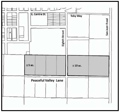 Figure 104-27 - RSF - Peaceful Valley Lane Figure 104-27 - RSF - Peaceful Valley Lane | 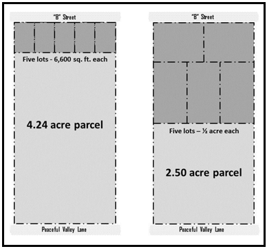 Figure 104-20 - RSF - Lot Layout Examples Figure 104-20 - RSF - Lot Layout Examples |
J.
Residential Multi-Family (RMF). The following standards apply within the Residential Multi-Family land use category.
1.
Limitation on use. All land uses identified by Section 22.06.030 as allowable, permitted or conditional uses within the RMF land use category may be authorized in compliance with the land use permit requirements of that Section, except for Warehousing (mini-storage facilities) as a primary use.
2.
Density requirements and total number of units. The minimum density shall be 13 units per gross acre. The minimum density may be reduced by the Review Authority where lots are physically or environmentally constrained. The maximum density shall be 20 units per gross acre, not including affordable housing bonuses, provided that the cumulative total number of dwelling units within each Master Plan Area shown in Figure 104-11 does not exceed the unit totals specified in its respective land use table, Table 3.5 or 3.7 in the Shandon Community Plan. The cumulative number of units within the Shandon URL shall not exceed the total specified in Table 3.1 in the Shandon Community Plan.
3.
Site development. Project site plans shall provide for connectivity to adjacent neighborhoods and commercial areas.
4.
Development with individual yards. The following standards apply to multi-family projects that propose individual private yards rather than a usable common area.
a.
Usable private yards. Usable common area is not required for development that includes usable private yards (for example, duplexes, half-plexes, row houses, or detached units), provided that the minimum open area of Section 22.10.130.B.2 is met, and the Review Authority finds that each unit will have an adequate amount of usable private space that is appropriate for a small-lot, single family residence. If multiple units are under single ownership, front yards and other shared spaces, such as parking or trash collection areas, shall be maintained collectively by the property owner.
b.
Setback requirements. Minimum front yard setbacks shall be as follows:
(1)
15 feet for the habitable portion of the residence;
(2)
10 feet for covered porches or detached entry features, such as an arbor or pergola;
(3)
Garages shall be set back 10 feet further than the front of the habitable portion of the residence. Garage access from an alley or internal drive is preferred to access from the fronting street.
5.
Large-lot developments. The following standards apply to multi-family projects that provide usable common areas rather than usable private yards. This may include all forms of multi-family projects (apartments, row houses, patio homes, duplexes or detached units). Projects may be under single ownership or condominiums.
a.
Open area. The minimum open area required by Section 22.10.130.B.2 shall include usable common open areas, not including front yard setbacks and private open areas, with a minimum of 200 square feet per unit.
b.
Private open area. Each unit shall include a private open area with a minimum of 225 square feet of usable outdoor space having minimum dimensions of 10 feet. Upper story units with no ground floor shall have a minimum of 60 square feet of private area having a minimum dimension of six feet.
c.
Parking location. Parking areas shall not be located in the front of the lot between the street and the buildings.
d.
Setback requirements. Minimum front yard setbacks shall be as follows:
(1)
15 feet for the habitable portion of the residence;
(2)
10 feet for covered porches or detached entry feature, such as an arbor or pergola.
e.
Common area maintenance. Where common areas are proposed or required, the applicant shall establish mechanisms for guaranteed long-term management and maintenance of common areas.
[Added 2012, Ord. 3222; Amended 2014, Ord. 3256; 2015, Ord. 3291; 2017, Ord. 3358; 2018, Ord. 3377; 2020, Ord. 3409]
22.104.090 - Templeton Community Standards.
The following standards apply within the Templeton Urban Reserve Line, in the land use categories or areas listed, in addition to the requirements of Section 22.94.080.
A.
Communitywide. The following standards apply to all land use categories inside the Templeton Urban Reserve Line.
1.
Compliance with the Templeton Community Design Plan. All Minor Use Permit, Conditional Use Permit and subdivision applications shall be in conformity and compliance with the Templeton Community Design Plan, dated January 11, 1991 and subsequent amendments, which was duly adopted by the Board in Resolution No. 90-688 and is on file in the Office of the Clerk of the Board, and which is hereby incorporated by reference herein as though set forth in full.
Applicants and the general public are encouraged to read the Templeton Community Design Plan. The guidelines in the Templeton Community Design Plan are intended to provide for interpretation and flexibility in designing a project.
2.
Permit requirements.
a.
Minor Use Permit approval is required for all new construction or exterior alteration of existing structures where a land use permit is otherwise required by this Title, except for the following:
(1)
Agricultural and residential accessory structures;
(2)
Minor exterior alterations, as well as expansions not to exceed 100 square feet, that are in conformance with the Templeton Community Design Plan may be exempted from this requirement by the Director. These projects are still subject to other applicable permit requirements;
(3)
Multi-family residences and their accessory buildings that are required by this Title to have Zoning Clearance approval;
(4)
Public parks;
(5)
Single-family dwellings, additions to single family dwellings that are not adjacent to riparian habitats associated with blue line streams such as Toad Creek; or
(6)
Accessory dwelling units; or
(7)
Where Conditional Use Permit approval is otherwise required by this Title.
Site Plan Review or Zoning Clearances are classified as "ministerial" projects that by law are required to conform only to clearly defined criteria. The criteria in the following standards are based on the guidelines included in the Templeton Community Design Plan.
b.
New uses that are proposed to occupy existing development are not subject to the above permit requirement but are subject to land use permit approvals as required by this Title.
c.
Compliance with all authorized land use permits and proof of adequate water availability from the Templeton Community Services District shall be determined before issuance of a business license, in compliance with Chapter 22.02.
3.
Preservation of natural features. New development and proposed subdivisions shall be designed to retain significant features such as oak trees, riparian habitats, and prominent hills.
4.
Allowable use. The existing cattle auction yard located on 1991 Assessors Parcel Number 040-211-015 shown in Figure 104-28 is an allowable conforming use in its present location.
Figure 104-28
B.
Combining Designations - Flood Hazard (FH) - Toad Creek Restoration. In new development and subdivision applications on properties within the Toad Creek flood hazard area identified in the official maps, riparian plants, such as native trees and willows, shall be used for habitat restoration and enhancement without sacrificing flood protection, in addition to the creek preservation requirements on pages III-6 and 7 of the Templeton Community Design Plan.
C.
Commercial Retail (CR). The following standards apply within the Commercial Retail category.
1.
Fence and wall requirement. This standard applies to solid fences and walls that are proposed along public roads and will be visible from the public road. Fences and walls shall be constructed of durable and high quality materials including, but not limited to: masonry, river cobblestone, stucco or a combination of wood with stone or stucco columns. Solid wood fences are not allowed unless they are continuously screened with landscaping and maintained. Refer to the Templeton Community Design Plan, page V-16 through V-18, for criteria on fence and wall materials and detailing.
2.
Las Tablas Road and Vineyard Drive areas.
a.
Streetside improvements. Curbs, gutters, sidewalks and street paving are required with all projects.
b.
Multi-Family dwellings outside the Central Business District. Multi-family dwellings are allowable as an incidental use outside the central business district and may be authorized through Minor Use Permit approval, unless this Title would otherwise require a Conditional Use Permit. Multi-family dwellings that would be affordable to employees of proposed projects should be encouraged in all discretionary land use permits for commercial projects.
c.
Limitation on use.
(1)
The following applies only to the land located on Las Tablas Road, west of Highway 101. All uses identified by Section 22.06.030 (Allowable Land Uses and Permit Requirements) as being allowable, permitted, or conditional uses may be authorized in compliance with the land use permit requirements of that Section, except the following: commercial retail uses that have a floor area on any one floor of 90,000 square feet or more.
(2)
The following applies only to the land located on Vineyard Drive. All uses identified by Section 22.06.030 (Allowable Land Uses and Permit Requirements) as being allowable, permitted, or conditional uses may be authorized in compliance with the land use permit requirements of that Section, except the following: recycling collection stations, small scale manufacturing, mobile home parks, auto, mobilehome and vehicle dealers and supplies, recreational vehicle parks, and vehicle storage.
3.
Ramada Drive area - Conditional Use Permit requirement. A Conditional Use Permit is required for each property ownership within the areas shown in Figure 104-29, prior to approval of subdivision or land use permit applications. The Templeton Community Design Plan shall guide the Conditional Use Permit.
Figure 104-29: CR - Ramada Drive Properties - Templeton
4.
Main from Eighth to Tenth Streets - Multi-family dwellings. Multi-family dwellings as a principal use may be authorized through Conditional Use Permit approval on Blocks 27 and 30 of the Town of Templeton, shown in Figure 104-30.

Figure 104-30: CR - Main from Eighth to Tenth Street Templeton
5.
Highway 101/North Main Street Interchange. The following standards apply to the area located south of and adjacent to the Highway 101/North Main Street interchange on the east side of Highway 101 corresponding to Figure 104-31.
Figure 104-31: CR - Highway 101/North Main Street - Templeton
a.
Limitation on use. Land uses shall be limited to: bars and nightclubs, restaurants; gas stations; offices; hotels and motels, in compliance with the land use permit requirements of Section 22.06.030. In addition to these uses, residential single-family uses are allowed on the southernmost parcel shown in Figure 104-31.
b.
Site planning. Proposed development shall provide a minimum of 25-foot landscaped setback from the Highway 101 right-of-way and any adjacent residential category for buffering and screening foreground views from the Highway 101 corridor and residential areas, while retaining background views. Other provisions for minimizing the visual impacts of grading and development as seen from Highway 101 and North Main Street shall integrate site development with the public facilities category and the grade elevation of North Main Street.
D.
Commercial Service (CS). The following standards apply within the Commercial Service category.
1.
Limitation on use within special setbacks. All land uses identified by Section 22.06.030 (Allowable Land Uses and Permit Requirements) as being allowable, permitted, or conditional uses may be authorized in compliance with the land use permit requirements of that Section, except the following, which are prohibited within 200 feet of collector and arterial streets, and residential categories: concrete, gypsum and plaster products; metal industries, fabricated; recycling and scrap; fuel dealers; storage yards and sales lots that are primary uses; and vehicle storage.
2.
Fence and wall requirement. This standard applies to solid fences and walls that are proposed along public roads and will be visible from the public road. Fences and walls shall be constructed of durable and high quality materials including, but not limited to: masonry, river cobblestone, stucco or a combination of wood with stone or stucco columns. Solid wood fences are not allowed unless they are continuously screened with landscaping and maintained. Refer to the Templeton Community Design Plan, page V-16 through V-18, for criteria on fence and wall materials and detailing.
3.
Theater Drive/Highway 101 interchange. The following standards apply to a property on the west side of the Theater Drive/Highway 101 interchange, as shown in Figure 104-32.
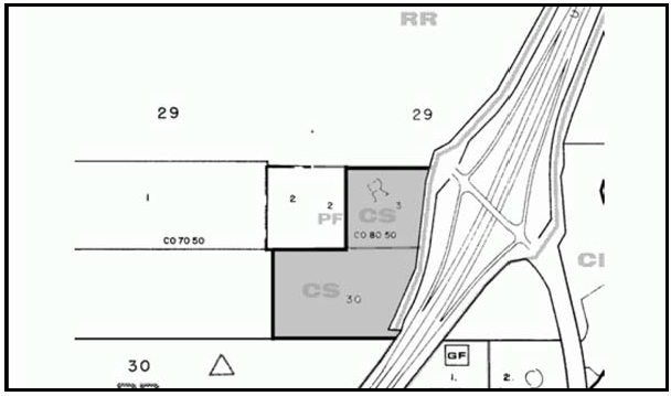
Figure 104-32: CS - West side of Theater Dr. at Highway 101 and Main Street Interchange
a.
Limitation on use. Allowable land uses shall be limited to Building Materials and Hardware and incidental outdoor storage, Nursery Specialties, Energy-Generating Facilities (limited to Renewable Energy Facilities only), Cannabis Distribution Facilities, Cannabis Transport Facilities, and Vehicle and Freight Terminals.
b.
Height limitation. The height of structures shall not exceed 25 feet, except that an additional five feet may be utilized for architectural features such as cupolas or gabled vents on no more than one-third the length of any building. This 25-foot height limitation may be increased subject to an adjustment in compliance with Section 22.70.030 subject to a visual study that supports a finding that buildings will have appropriate forms to minimize their visual impact on surrounding properties and Highway 101. On 2006 Assessor's Parcel Number 040-201-024, no buildings or structures exceeding six feet in height shall be permitted within 150 feet of the east property line.
c.
Landscaping/screening. Upon application for a land use permit or construction permit, a landscaping plan shall be submitted and shall meet the requirements of Chapter 22.16 of the County Land Use Ordinance. The landscaping plan shall include a buffer on the west, south and east sides that is deep enough for staggered in-depth plantings of shrubs and trees (evergreen with incidental deciduous species) with a minimum 15-foot height at plant maturity, to achieve a solid, natural-appearing screen from most angles of viewing. A minimum six-foot tall solid fence or screening wall (consistent with the Templeton Community Design Plan) shall be constructed at the interior boundary of the buffer area, and landscaping shall be installed in between the property lines and the fence or wall.
d.
Noise. Upon application for a land use or construction permit, a noise mitigation plan shall be submitted. The plan shall include measures such as buffers, solid fencing, vegetated earthen berms, and site design that would ensure that generation of noise would not significantly affect existing or future residential uses. Orientation of buildings shall be away from Residential Rural properties.
e.
Exterior Lighting. Exterior lighting shall be located and designed to direct light downward and to the interior of the site and to avoid the light source being visible from other properties, streets and Highway 101, by such means as shielding and full-cut off lights. A photometric analysis shall be provided with the submittal of any land use permit or change in lighting to determine the extent of off-site lighting and glare.
f.
Hours of operation. With any land use permit application, hours of operation shall be addressed to minimize night-time hours of operation including truck deliveries and unloading, to avoid noise impacts onto adjacent residential properties.
g.
Permit Requirement. A Conditional Use Permit application shall be submitted within 60 days of June 14, 2007, the effective date of the ordinance.
4.
Theater Drive. The following standards apply to a property on the west side of the Theater Drive/Highway 101 interchange, as shown in Figure 104-33.
a.
Limitation on use. Land uses shall be limited to agricultural processing, agricultural accessory structures, caretaker residence, crop production and grazing, energy-generating facilities (limited to renewable energy facilities), incidental offices, accessory storage, outdoor storage yards, cannabis distribution facilities, cannabis transport facilities, and vehicle and freight terminals.
b.
Screening. Any structures, parking areas and access roads visible from Highway 101, Main Street or Theater Drive shall be screened with landscaping capable of providing 80 percent screening within five years of installation.
c.
Noise. A noise mitigation plan shall be submitted with application for land use permit or land division. The plan shall include measures such as buffers, solid feeding, vegetated earthen berms and site design that would ensure that generation of noise would not significantly affect future residential uses on adjacent sites.
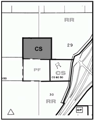
Figure 104-33: CS - Theatre Drive
E.
Multiple Use Code (CR/CS). The following standards apply within the CR/CS mixed land use category:
1.
New land uses and development in the CR/CS mixed land use category shall comply with the standards above for the CR and CS land use categories.
2.
Special Setback. On the 40-acre property shown in Figure 104-34, the following uses, if proposed, shall be setback at least 450 feet from Ramada Drive: Electricity Generation, all uses in the Industry, Manufacturing, and Processing Uses Group (except when the uses are confined entirely within a building); Sales Lots; Swap Meets; Auto and Vehicle Repair and Service; Construction Contractors; Outdoor Storage Yards; Truck Stops; and Petroleum Extraction.
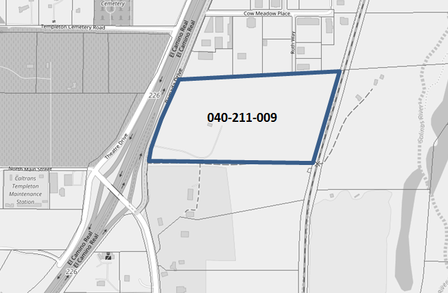
Figure 104-34 - Westerly 20 acres of APN 040-211-009
F.
Office and Professional (OP). The following standards apply within the Office and Professional category.
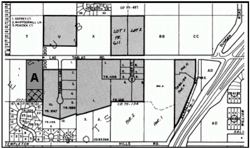
Figure 104-35: OP - Las Tablas Road - Templeton
1.
Fence and wall requirement. This standard applies to solid fences and walls that are proposed along public roads and will be visible from the public road. Fences and walls shall be constructed of durable and high quality materials including, but not limited to: masonry, river cobblestone, stucco or a combination of wood with stone or stucco columns. Solid wood fences are not allowed unless they are continuously screened with landscaping and maintained. Refer to the Templeton Community Design Plan, page V-16 through V-18, for criteria on fence and wall materials and detailing.
2.
Las Tablas Road - Residential uses. Multi-family dwellings are encouraged in the Office and Professional land use category on Las Tablas Road west of Highway 101, as shown in Figure 104-27, as part of mixed use projects and may be allowed as an incidental use, or as a principal use on no more than 50 percent of a site, through Conditional Use Permit approval. Residential units on property "A" as shown in Figure 104-35, may only be located in the crosshatched area and may be structurally detached from the commercial or office use on the site. Multi-family dwellings that would be affordable to employees of proposed projects should be encouraged in all discretionary land use permits for office and professional projects.
G.
Industrial (IND). The following standards apply within the Industrial category.
1.
Permit requirement. Minor Use Permit approval is required for new industrial construction or subdivision unless a Conditional Use Permit is otherwise required by this Title. Plan proposals shall include design provisions for internal orientation and circulation; substantial fencing and landscape screening to buffer adjoining residential areas; provide an amenable view from fronting streets; and provisions for mitigating noxious effects, appropriate services and adequate circulation.
2.
Buffer requirement. Storage yards and other Industrial outdoor use areas shall be set back 100 feet from adjacent residential uses and land use categories.
3.
Limitation on use - Railroad property. Allowable land uses are limited to: offices; accessory storage; storage yards; vehicle and freight terminals; warehousing and energy-generating facilities (limited to renewable energy facilities).
H.
Public Facilities (PF). The following standards apply within the Public Facilities land use category.
1.
North County Regional Center site. The following standards apply only to the County property at the No. Main Street and Highway 101 interchange as shown in Figure 104-36.
a.
Setback requirement. A 25-foot landscaped setback is required from the Highway 101 right-of-way for buffering and screening views from Highway 101.
b.
Architecture. Buildings should exemplify the historic character of Templeton
2.
West side of the railroad between Gibson and Phillips Roads. The following standards apply only to the property west of the railroad between Gibson and Phillips Roads shown in Figure 104-36, in addition to Subsection H.1.
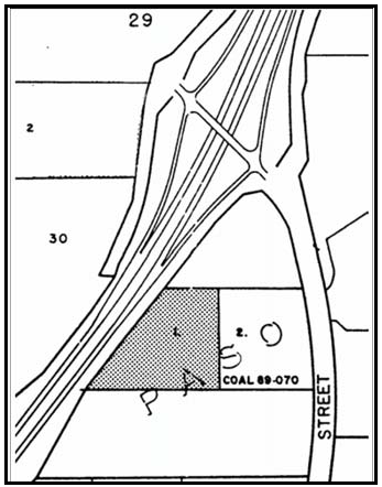
Figure 104-36: PF - North County Regional Center - Templeton

Figure 104-37: PF - West Side of Railroad - Templeton
a.
Limitation on use. Land uses shall be limited to libraries and museums, outdoor sports and recreation, public assembly and entertainment, and energy-generating facilities (limited to renewable energy facilities), in compliance with the land use permit requirements of Section 22.06.030.
b.
Access limitations. To minimize impacts to the existing residences on Gibson Road until a "through connection" is established, land uses shall be limited to libraries and museums, and outdoor sports and recreation. The project shall be limited to the capacity for traffic on Gibson Street at level-of-service (LOS) C, reserving capacity for other development affecting the street at build-out.
c.
Operational standards. To minimize the impacts of noise, water use, and night time illumination, proposed development shall comply with the requirements of the Noise Element of the General Plan, and the water-efficient landscape standards in Chapter 22.16.
d.
Hours of operation. All loud outdoor activity shall be limited to the hours between 7:00 a.m., and 10:00 p.m.
3.
South Main Street and Templeton Road site. The following standards apply only to the property located at the corner of South Main Street and Templeton Road as shown in Figure 104-38.

Figure 104-38: PF South Main St. and Templeton Rd
a.
Trail Corridor. New development shall be accompanied by development of a 20-foot wide recreational trail corridor in the vicinity of either South Main Street or the Southern Pacific Railroad right-of-way. The location and development of the trail corridor shall be at the discretion of County General Services-Parks Division.
b.
Limitation on access. Direct access onto Templeton Road shall be prohibited
c.
Limitation on use. Land uses shall be limited to indoor amusement and recreation facilities, libraries and museums, outdoor athletic facilities, public parks and play-grounds, schools, sports assembly, temporary events, health care services, social service organizations, caretaker quarters, offices, public assembly and entertainment facilities, transit stations and terminals, and energy-generating facilities (limited to renewable energy facilities only), in compliance with the land use permit requirements of Section 22.06.030.
d.
Design Standards. Development shall be in conformance with Templeton Community Design Plan. Prohibited exterior building materials include metal siding, unfinished or painted concrete block, and highly reflective surfaces.
4.
South Main Street site. The following standards apply only to the property located between South Main Street and Highway 101 as shown in Figure 104-39.
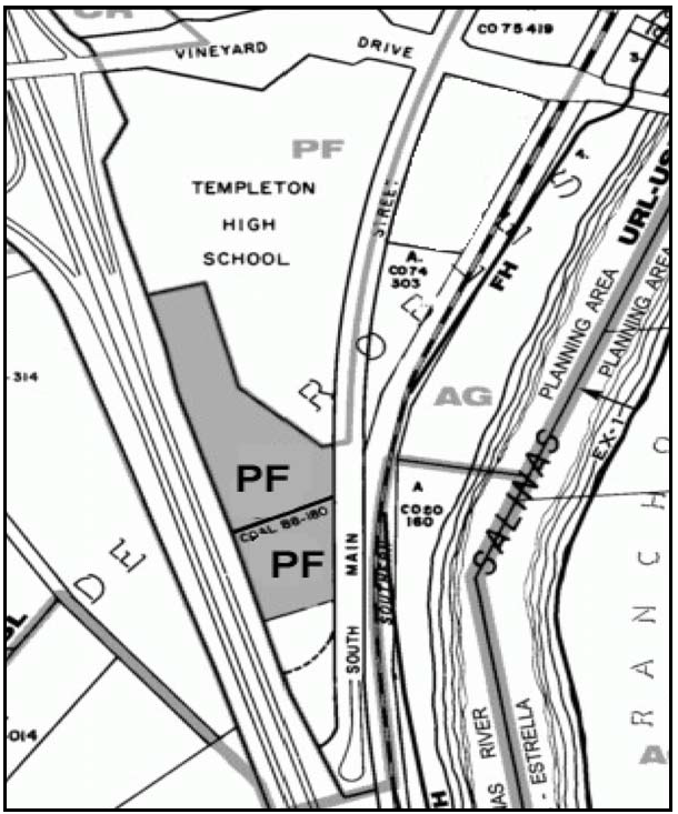
Figure 104-39: PF South Main Street
a.
Setback requirement. A minimum 25-foot landscaped setback is required from Highway 101 right-of-way for buffering and screening views from Highway 101.
b.
Limitation on use. Land uses shall be limited to indoor amusement and recreation facilities, libraries and museums, outdoor athletic facilities, public parks and playgrounds, schools, sports assembly, temporary events, health care services, social service organizations, caretaker quarters, offices, public assembly and entertainment facilities and transit stations and terminals, and energy-generating facilities (limited to renewable energy facilities only), in compliance with the land use permit requirements of Section 22.06.030.
c.
Design Standards. Development shall be in conformance with Templeton Community Design Plan. Prohibited exterior building materials include metal siding, unfinished or painted concrete block, and highly reflective surfaces.
I.
Residential Rural (RR) - Theatre Drive and North Main Street. The following Residential Rural standards apply only to the properties shown in Figure 104-40.

Figure 104-40: RR - Theatre Drive and North Main Street
1.
Density limitation. The maximum residential density shall be as allowed by the Agriculture land use category. The maximum residential density may be increased to that allowed by the Residential Rural category by purchase of all additional development credits as part of a transfer of development credits program.
2.
Cluster subdivision requirement. New land divisions proposing more than two parcels shall be clustered in compliance with Section 22.22.140, or utilize other techniques that achieve the same result as clustering. Open space parcels shall be located on the visible portions of sites as viewed from Highway 101 and where agricultural operations can be continued, as well as other applicable locations. Refer to the cluster development guidelines on page V-10 in the Templeton Community Design Plan.
J.
Residential Suburban (RS). The following standards apply within the Residential Suburban land use category.
1.
Fence and wall requirement. This standard applies to solid fences and walls that are proposed along public roads and will be visible from the public road. Fences and walls shall be constructed of durable and high quality materials including, but not limited to: masonry, river cobblestone, stucco or a combination of wood with stone or stucco columns. Solid wood fences are not allowed unless they are continuously screened with landscaping and maintained. Refer to the Templeton Community Design Plan, page V-16 through V-18, for criteria on fence and wall materials and detailing.
2.
Mobile home parks and mobile home subdivisions - Density limitation. Mobile home parks and subdivisions are limited to a density no greater than one unit and residential parcel per acre.
3.
Limitation on siting. Development on APN 39-381-047 and 048, and 39-411-021, 028 and 029, shown in Figure 104-41, shall be set back a minimum of 100 feet northerly of the 800-foot contour elevation traversing the site. Development shall be designed to maximize visual rural separation between Templeton and Atascadero.
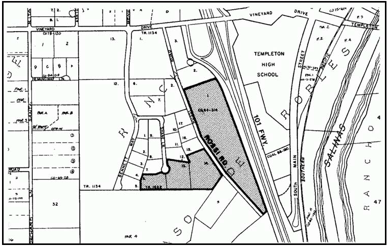
Figure 104-41: RS - Limitation on Siting - Templeton
4.
South of Vineyard Drive. The following standard applies only to land south of Vineyard Drive, as shown in Figure 104-42.

Figure 104-42: RS - South of Vineyard Drive - Templeton
a.
Land division requirement. Land divisions shall be clustered in compliance with the cluster division requirements of Section 22.22.140. Part of the required open space shall be offered to the County for a park and multi-use paths for walking and bicycling.
b.
Density Limitation. The maximum residential density shall be as allowed by the Agriculture land use category. The maximum residential density may be increased to that allowed by the Residential Suburban category by purchase of all additional development credits as part of a transfer of development credits program.
c.
Lot 99 of Tract 2324. The following standards apply to the southwest corner of Vineyard Drive and Bethel Road, site No. 1 as shown in figure 104-34 instead of Subsection D.4.a and b:
i.
The site shall be designated as a Transfer of Development Credits receiver site.
ii.
Density shall be limited to a maximum of four parcels unless a larger parcel size is otherwise required by the Land Use Ordinance (for base and bonus density under the Transfer of Development Credit Program). Density for subdivision of this parcel may also be based on the overall allowable density over the entire acreage of Tract 2324. The purchase of development credits is required for each parcel created.
iii.
Residential development shall be similar and compatible with Tract 2324 including setbacks, architectural design and colors.
iv.
CC&Rs shall be established that are similar and compatible with the CC&Rs for Tract 2324 or the site shall be incorporated into the existing Homeowners Association for Tract 2324.
5.
Casper Road - Noise standards. To minimize freeway noise impacts, new development within the RS category along Casper Road (Figure 104-43) shall comply with the Noise Element of the General Plan and Section 22.10.120. When an acoustical report is required the report shall, at a minimum, contain existing and build-out noise levels. The report shall also identify mitigation measures to reduce noise to acceptable interior and exterior levels in compliance with the Noise Element and the least noise-sensitive areas of the property for habitable development.
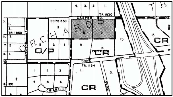
Figure 104-43: RS - Casper Road - Templeton
6.
Championship Lane (Parcel 3 of Parcel Map 79/65-68) - Initial Development or Subdivision. Approval of a conditional use permit is required prior to initial development unless a subdivision map, subdividing Parcel 3 of Parcel Map 79/65-68 (as shown in Figure 104-43.5) into four or more parcels, is approved and the final map for the subdivision is recorded.
a.
Developable Areas. The conditional use permit or subdivision map shall identify and establish designated developable areas to avoid sensitive habitats, oak trees, and other biological resources, as recommended by a biological resource assessment.
b.
Subsequent Developments. Subsequent developments that are in compliance with the approved conditional use permit or recorded final map are not required to obtain further conditional use permit approvals, unless required by other applicable regulations.
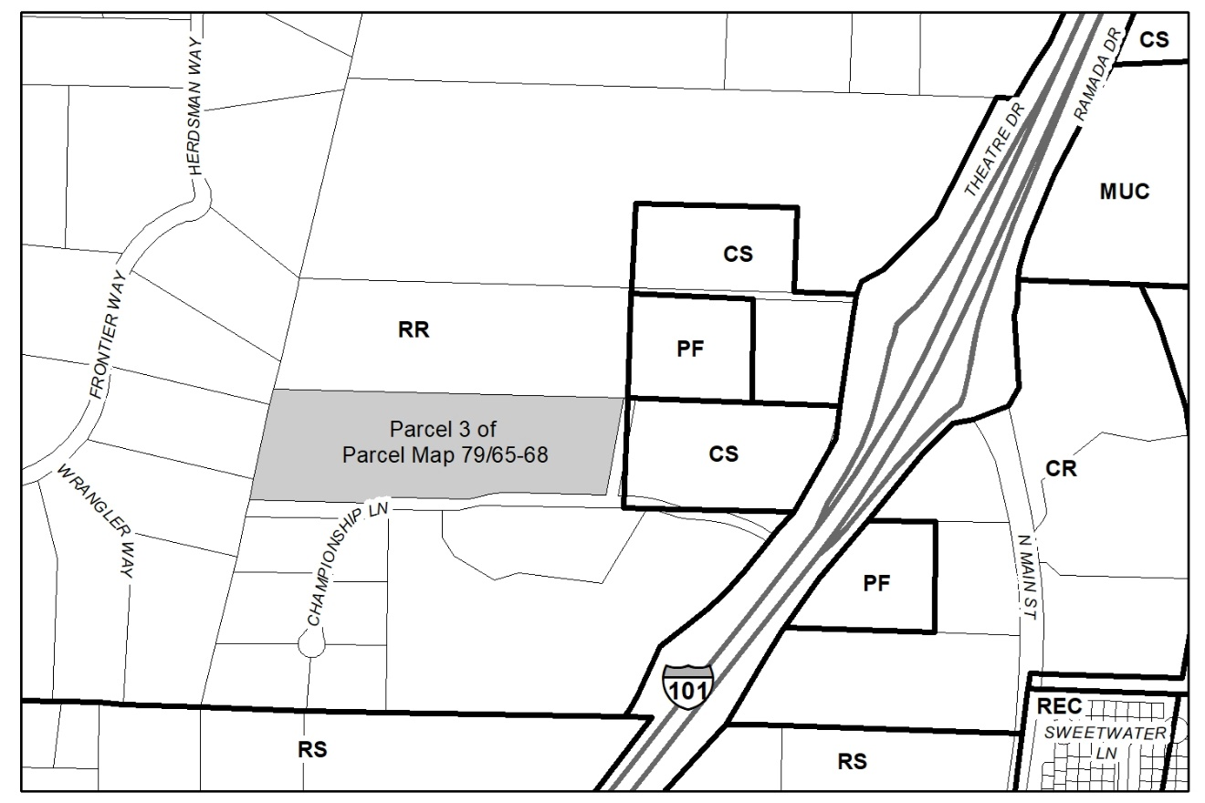
Figure 104-43.5: RS - Championship Lane, Parcel 3 of Parcel Map 79/65-68
K.
Residential Single-Family (RSF). The following standards apply within the Residential Single-Family category.
1.
Land division limitation. Single family lots created through new land divisions shall be at least 7,500 square feet. Affordable housing projects may have smaller parcels in compliance with Chapter 22.22. See the Templeton Community Design Plan for other guidelines on subdivisions.
2.
Design standards - Zoning Clearances for single-family residences. New single-family residential development shall comply with the following standards unless modified through a Minor Use Permit or Conditional Use Permit:
a.
Driveway frontage. Driveway width is limited to a maximum 16 feet, except for flag lots, cul-de-sac lots and lots with less than 40 feet frontage, or where a wider driveway is needed for County Fire Department requirements.
b.
Garage location. Garages and carports shall be located five feet further back from the street than the front of residences, except where limited site area, width and/or access make the required setback infeasible, an adjustment may be approved in compliance with Section 22.70.030.
Refer to the Templeton Community Design Plan, pages V-5 and 6, for more guidance on driveways and garage location.
c.
Fence and wall requirement. This standard applies to solid fences and walls that are proposed along public roads and will be visible from the public road. Fences and walls shall be constructed of durable and high quality materials including, but not limited to: masonry, river cobblestone, stucco or a combination of wood with stone or stucco columns. Solid wood fences are not allowed unless they are continuously screened with landscaping and maintained. Refer to the Templeton Community Design Plan, page V-16 through V-18, for criteria on fence and wall materials and detailing.
3.
Golden Meadow Drive. The maximum number of parcels allowed in the Residential Single-Family land use category located north and south of Golden Meadow Drive (Lots 1-5 and 29-33 of Rosemead Farms No. 1) as shown in Figure 104-44, shall be calculated on the basis of one lot per 20,000 square feet of gross site area.

Figure 104-44: RSF - Golden Meadow Drive - Templeton
L.
Residential Multi-Family (RMF). The following standards apply within the Residential Multi-Family category.
1.
Density limitation. Allowable density is limited to a maximum of 26 dwelling units per acre, with maximum floor area and minimum open area to be in compliance with the medium density criteria in Chapter 22.22. An exception is provided that the area shown in Figure 104-45 is limited to a maximum of 12 dwellings per acre, with maximum floor area and minimum open area to be in compliance with the low density criteria in Chapter 22.22.

Figure 104-45: RMF - Low Density Multi-Family Area - Templeton
2.
Design standards - Zoning Clearances for four or fewer multi-family residential and accessory buildings. Multi-family residential structures and accessory buildings that are required by Section 22.06.030 (Allowable Land Uses and Permit Requirements) to have Zoning Clearance approval shall comply with the following design standards. Applicants who wish to design a project differently than allowed by these standards may apply for a Minor Use Permit to be reviewed for conformance with the Templeton Community Design Plan. An exception or modification to these standards may be granted through approval of a Minor Use Permit.
a.
Driveway width. Driveway width is limited to a maximum 16 feet, except for flag lots and cul-de-sac lots, or where a wider driveway is needed for County Fire Department requirements. Refer to the Templeton Community Design Plan, pages V-5 and 6, for more guidance on driveways.
b.
Garage location. Garages and carports shall be located further back from the street than the front of residences, except where limited site area, width and/or access make the required setback infeasible, an adjustment may be approved as authorized in Chapter 22.70.030. Refer to the Templeton Community Design Plan, pages V-5 and 6, for more guidance on garage location.
c.
Street tree requirement. One street tree is required at least every 50 feet adjacent to a street, within 15 feet of the street right-of-way. Street trees shall be from the street tree list in the Templeton Community Design Plan, page V-9.
d.
Fence and wall requirement. This standard applies to solid fences and walls that are proposed along public roads and will be visible from the public road. Fences and walls shall be constructed of durable and high quality materials including, but not limited to: masonry, river cobblestone, stucco or a combination of wood with stone or stucco columns. Solid wood fences are not allowed unless they are continuously screened with landscaping and maintained. Refer to the Templeton Community Design Plan, page V-16 through V-18, for criteria on fence and wall materials and detailing.
e.
Wall, roof and balcony articulation. Building walls and balconies shall be inset or notched at least once for every 30 linear feet. Insets shall be at least one foot and shall be extended to the roof cornice or penetrate the roof plane. Roofs shall be pitched and shall not be mansard style. Refer to the Templeton Community Design Plan, page V-14, for guidance on massing of buildings.
Exterior stairs, balconies and porches shall be covered by the roof plane and form part of the building articulation. Refer to the residential architectural guidelines starting on page VI-18 in the Templeton Community Design Plan.
f.
Private patios and balconies within multi-family projects. Private outdoor use areas shall be provided for individual dwelling units. Private balconies shall be provided with a depth of at least six feet and a width of at least 10 feet. Private ground level patios shall be provided with an area of at least 150 square feet. Refer to pages VI-20 and 24 of the Templeton Community Design Plan.
g.
Building materials. Wall surface materials shall be wood or wood-appearing materials, stucco, brick, or rock. Prohibited wall materials include metal siding, unfinished or painted concrete block or brick, metal window awnings, and reflective glass. Refer to page VI-21 of the Templeton Community Design Plan for more discussion concerning materials.
h.
Building trim and color. Cornices and moldings at building corners, eaves, baseboard lines, and window borders shall be provided except for windows that are not flush with a wall surface. Refer to the residential architectural guidelines starting on page VI-18 in the Templeton Community Design Plan.
Building color shall be equal to or greater than 4 in value and no brighter than 6 in chroma on the Munsell color scale, on file at the Department. Trim colors shall be complementary to wall colors. Refer to pages VI-16 of the Templeton Community Design Plan for more information.
i.
Garage doors. Garage doors shall be inset into the wall plane and not be flush with it. See page VI-25 of the Templeton Community Design Plan.
j.
Chimneys. Where used in exterior walls, chimneys shall be projected at least 8 inches from the wall plane. See page VI-25 of the Templeton Community Design Plan for more information.
[Amended 1996, Ord. 2776; 1999, Ord. 2865; 2003, Ord. 3010; Added 2006, Ord. 3096; Amended 2006, Ord. 3097; 2007, Ord. 3116; 2007, Ord. 3125; 2010, Ord. 3207; 2014, Ord. 3256; 2015, Ord. 3291; Ord. 3352, 2017; 2017, Ord. 3358; 2018, Ord. 3377; 2020, Ord. 3409; 2024, Ord. 3517; Ord. 3518, 2024]
22.104.100 - Whitley Gardens Village Standards.
The following standards apply within the Whitley Gardens village reserve line to the land use categories or specific areas listed, in addition to the requirements of Section 22.94.025 (Paso Robles Groundwater Basin).
A.
Residential Suburban (RS). The following standards apply within the Residential Suburban land use category.
1.
Limitation on land division. Further division of lots existing on the effective date of the Land Use Element are allowed only after the community water system is brought into conformity with County Health Department standards.
2.
Parcel size. The minimum allowable parcel size for new land divisions after completion of upgrading of the Whitley Gardens community water system is 2½ acres unless a larger size would otherwise be required by Chapter 22.22.
[Amended 2014, Ord. 3256]
22.106.010 - Avila Beach Community Standards.
The following standards apply within the Avila Beach urban reserve line to the land use categories or specific areas listed.
A.
Community-wide standards. The following standards apply within Avila Beach, in all land use categories, as applicable.
1.
Avila Beach Drive and San Luis Bay Drive Level of Service. The level of service (LOS) for Avila Beach Drive and San Luis Bay Drive shall be based on the average hourly weekday two-way 3:00 p.m. to 6:00 p.m. traffic counts to be conducted during the second week in May of each year.
2.
Avila Valley. The Avila Valley area is defined in Figure 106-1.
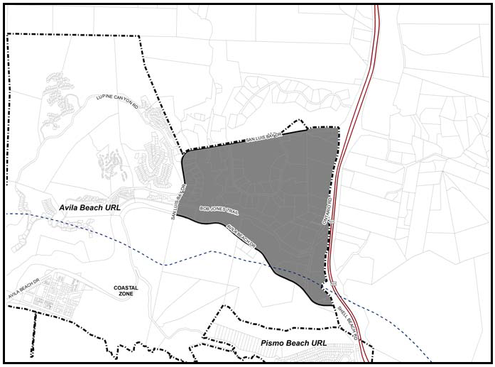
Figure 106-1: Avila Valley Area
3.
San Luis Bay Estates. The San Luis Bay Estates Area is defined in Figure 106-2. The approved Master Conditional Use Permit / Development Plan ("Master Development Plan") for San Luis Bay Estates, as amended by the Local Coastal Program Land Use Plan and as it may be amended in the future by the Commission or Board is hereby incorporated into this Title as though it were fully set forth here. All development within the Master Development Plan area (see Figure 106-2) shall comply with the adopted Master Development Plan, as amended by the Local Coastal Program Land Use Plan. In the event any conflict between the provisions of this Title and the Master Development Plan, the Master Development Plan shall take precedence. Any deviation of existing or proposed development from the provisions of the Master Development Plan shall occur only after appropriate amendment of the Master Development Plan. All references in the Master Development Plan to Site Plan Review approval shall be construed as Minor Use Permit approval in compliance with Section 22.62.050.
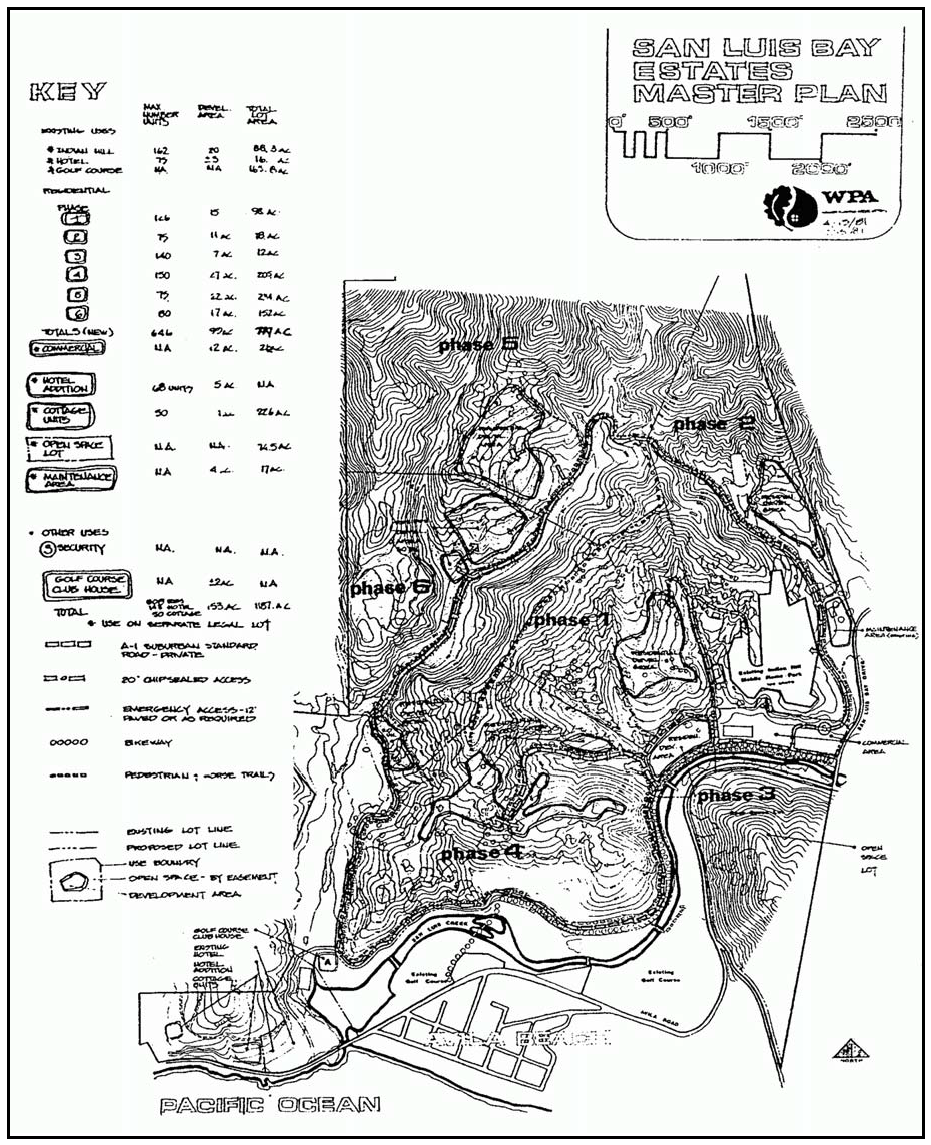
Figure 106-2: San Luis Bay Estates Master Use Permit
B.
Rural Lands (RL). The following standards apply within the Avila Valley Rural Lands land use category.
1.
Permit requirement. Conditional Use Permit approval is required for all uses adjacent to Avila Road.
2.
Open space preservation. New development proposals shall include provisions for guaranteeing preservation of the steep wooded slopes south of Avila Road extending to Ontario Ridge. Guarantees of open space preservation may be in the form of agreements, easements, contracts or other appropriate instrument, provided that such guarantee is not to grant public access unless desired by the property owner.
C.
Commercial Retail (CR). The following standards apply within the Commercial Retail land use category.
1.
Avila Valley. The following standards apply only to Avila Valley (see Figure 106-1), to the specific areas listed.
a.
Limitation on use. Land uses shall be limited to highway and tourist oriented uses and energy-generating facilities (limited to accessory renewable energy facilities).
b.
Permit requirement. Conditional Use Permit approval is required for all uses.
c.
Access - Commercial site at San Luis Bay Drive and Highway 101. Primary access to the commercial site shall be from San Luis Bay Drive.
2.
San Luis Bay Estates. The following standards apply only to the San Luis Bay Estates (see Figure 106-2), to the specific areas listed.
a.
Limitation on use. Land uses in the commercial village shall be limited to bars and night clubs, convenience and liquor stores, financial services, general retail, grocery stores, health care services, offices, personal services, public assembly and entertainment, restaurants and energy-generating facilities (limited to renewable energy facilities).
b.
Permit requirement. Conditional Use Permit approval is required for the commercial "village."
c.
Location criteria - Commercial uses. Commercial uses shall be located north of the main access road, west of San Luis Bay Drive.
D.
Open Space (OS). The following standards apply within the Open Space land use category:
1.
Density calculations. Within the San Luis Bay Estates Open Space land use category, the parcel lying southerly of Avila Road shall be included in overall project density calculations to determine the required open space acreage for the entire project under the cluster division provisions of this Title.
2.
Riparian vegetation. Within the Open Space land use category, riparian vegetation shall be retained along the creek.
E.
Recreation (REC). The following standards apply within the Recreation land use category.
1.
Avila Valley. The following standards apply only to Avila Valley (see Figure 106-1), to the specific areas listed.
a.
Pacific Coast Railroad right-of-way. Allowable uses are limited to the proposed railroad line, bicycle and hiking trails. Construction of the proposed railroad shall be authorized by Conditional Use Permit approval.
b.
RV park expansion. The existing camper park south of San Luis Obispo Creek is not to be expanded into the creek floodplain.
c.
Sycamore Hot Springs - Development standards. Continuing expansion of existing facilities shall occur in accordance with the approved Conditional Use Permit. The area north of Avila Road may be developed with low intensity recreation and open space uses (see Subsections E.1d(1) through d(3)).
d.
Avila Road. The following standards apply to the area bounded by San Luis Obispo Creek on the north, San Luis Bay Drive on the west, Ontario Road on the east and Avila Beach Drive on the south, except for the area shown in Figure 106-3.
(1)
Limitation on use.Land uses shall be limited to those uses identified by Section 22.06.030 as being allowable, permitted, or conditional uses in the Open Space land use category, with the addition of the uses included under the definition of outdoor sports and recreation.
(2)
Permit requirements.Conditional Use Permit approval is required for all uses.
(3)
Flood protection. Structural uses shall be protected from flooding or clustered on contiguous parcels under the same ownership.
e.
Intersection of Ontario Road and Avila Beach Drive. The following standards apply to the area at the intersection of Ontario Road and Avila Beach Drive shown in Figure 106-3.
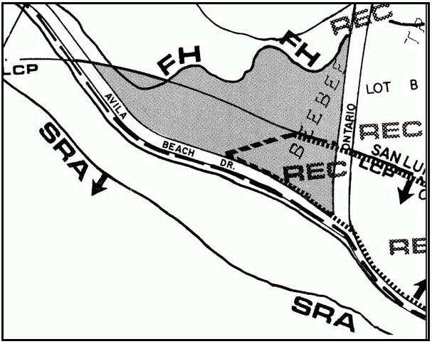
Figure 106-3: Intersection of Ontario Road and Avila Beach Drive
(1)
Limitation on use. Land uses shall be limited to those identified by Section 22.06.030 as allowable, permitted, or conditional uses in the Open Space land use category, with the addition of: libraries and museums, outdoor sports and recreation, restaurants, grocery stores, and roadside stands.
(2)
Permit requirements.Minor Use Permit approval is required for all new uses proposed in existing structures. Conditional Use Permit approval is required for all new uses that propose any additional structures. Land use permit applications shall include a review of potential traffic impacts to Avila Beach Drive and the intersection of Avila Beach Drive and Ontario Road.
(3)
Site design criteria. Commercial development (existing and proposed structures) shall be limited to a total of 6,000 square feet. All development shall be located at least 100 feet from the upland extent of riparian vegetation. All structures shall be located outside of the Flood Hazard Combining Designation
f.
Tract 699 - Offer of dedication. Lot 31 of Tract 699 along San Miguelito Creek has been offered for dedication to the County for future recreational and open space purposes. Until such time as the offer of dedication is accepted by the County, private use of this area shall not hinder or preclude potential future public recreational and open space use and shall not disturb riparian vegetation.
2.
San Luis Bay Estates. The following standards apply only to the San Luis Bay Estates (see Figure 106-2), to the specific areas listed.
a.
Limitation on use. Land uses shall be limited to the following, in compliance with the land use permit requirements of Section 22.06.030: accessory storage; bars and night clubs; caretaker residence; convenience and liquor stores; grocery stores; hotels and motels; indoor amusements and recreation; outdoor sports and recreation; pipelines and transmission lines; public safety facilities; restaurants; rural recreation and camping; temporary events and energy-generating facilities (limited to renewable energy facilities).
b.
Floodplains. Floodplain areas containing natural habitats shall be preserved in their natural state.
c.
Trails. New residential and commercial development shall be accompanied by construction of trails adjacent to San Luis Obispo Creek connecting the Avila Valley and Avila Beach recreation areas.
F.
Residential Suburban (RS). The following standards apply within the Residential Suburban land use category.
1.
Avila Valley. The following standards apply only to Avila Valley (see Figure 106-1), to the specific areas listed.
a.
Limitation on use. Land uses within the residential clusters shall be limited to: home occupations; residential accessory uses; single-family dwellings; temporary dwellings; public safety facilities; public utility facilities; pipelines and transmission lines and storage accessory, and energy-generating facilities (limited to renewable energy facilities only). The range of uses allowed shall be further refined through preparation of the project Master Use Permit, so that uses will be compatible with the character of each cluster.
b.
Permit requirement. Conditional Use Permit approval is required for all uses (except accessory dwelling units) prior to approval of a Tentative Map for land division. Preservation of existing views and scenic values are factors to be considered in the Review of the Conditional Use Permit.
c.
Application content. Conditional Use Permit applications shall include sufficient information to determine the proper method of sewage treatment and disposal based on site characteristics.
d.
Site planning. Proposed projects shall be planned in compliance with the cluster division provisions of Section 22.22.140. The minimum size for new parcels is 10,000 square feet, or as otherwise required by the method of sewage disposal to be used. Density credits will be given for open space and hazard lands, except for land within actual flood channels.
e.
Tract 699. The following standards apply to Tract 699, in addition to the standards in Subsections F.1.a through F.1.d, where applicable.
(1)
Density limitation - Land divisions. Net density for Lot 28, including any open space lot subsequently created, is not to exceed one dwelling unit per 3.3 acres, consistent with sewage disposal requirements. Lot 31, the area offered for dedication to the County for open space and recreation purposes, shall have no dwelling unit entitlement. No other lots within Tract 699 shall be re-subdivided or split into lots of lesser size than the original lot.
(2)
Location requirements. Development of Lot 28 shall be primarily located east of a line extending along the north-south ridge running through the property, with landscape screening where needed, so that development is generally out of view of San Luis Bay Drive. A maximum of three dwelling units may be located west of the north-south ridge, subject to the following criteria.
(a)
Development shall be partially screened from San Luis Bay Drive with landscaping conforming to the character of the natural landscape of the surrounding area.
(b)
As part of the required Conditional Use Permit application, a visual analysis shall be prepared by a consultant approved by the Environmental Coordinator that analyzes three dimensional building envelopes for dwellings and accessory structures. A conceptual grading analysis shall also be prepared. The conceptual grading analysis and visual analysis shall demonstrate that the following criteria are met.
i.
All structures shall be located so that they do not extend above the horizon line of the ridgeline as viewed from San Luis Bay Drive.
ii.
Grading shall be minimized and retaining walls greater than three feet in height and all graded slopes shall not be visible from San Luis Bay Drive.
iii.
Setbacks from San Luis Bay Drive shall be maximized, but in no case shall structures be closer than 50 feet from San Luis Bay Drive.
(3)
Permit requirement. Minor Use Permit approval is required for all uses except accessory dwelling units prior to any grading or construction, to ensure compliance with the objectives and requirements of the approved Conditional Use Permit. Minor Use Permits are subject to the following criteria.
(a)
Plans shall be approved by the Architectural and Planning Board for Avila Valley Estates prior to submittal to the Department.
(b)
Buildings shall be placed within required building site envelopes unless an exception is approved through the required Minor Use Permit approval process.
(c)
Plans shall include grading plans which shall minimize grading and prohibit alteration of established drainage patterns.
(d)
Structures are limited to a single story unless proposals for taller structures will not appreciably increase obstruction of views and reduction of scenic values. Multi-level structures may be appropriate to reduce grading on sloping sites.
(e)
Design and landscaping shall harmonize with the natural landscape. Accessory uses, structures, and activities which conflict with natural aesthetic values shall be prohibited.
(f)
Plans shall include septic systems approved by the County Public Works and Health Departments. Engineered specialized septic systems shall be used unless conventional systems meet the conditions of tract map approval.
(4)
Circulation and access. Development on Lot 28 which generates additional traffic shall contribute a proportional share of fees and/or improvements to mitigate cumulative traffic impacts (as determined by a comprehensive traffic study prepared by the applicant or made available by others during the environmental review for the required Conditional Use Permit or subdivision application) on Avila Road and San Luis Bay Drive, if necessary. Traffic mitigation fees shall be required either as part of discretionary approvals or upon adoption of an ordinance establishing traffic mitigation fees.
Access for development on Lot 28 shall be provided by no more than two road connections to San Luis Bay Drive. The road connections shall be aligned with existing intersections where feasible and shall maximize sight distances.
(5)
Mitigation of land use conflicts. In order to mitigate potential land use conflicts between agricultural activities, the adjacent elementary school and proposed residential development, the required Conditional Use Permit for development on Lot 28 of Tract 699 shall address animal keeping, crop production and grazing and animal facilities uses. The criteria in the following items (a) through (d) shall be incorporated into the project design and/or conditions of approval of the Conditional Use Permit. Item (e) shall be addressed during the environmental review for the Conditional Use Permit.
(a)
A buffer area and fencing between agricultural uses and the elementary school shall be established as approved by the Director, the Agricultural Commissioner, and the San Luis Coastal Unified School District.
(b)
Animal densities shall be determined and barns, stables and animal enclosures shall be located away from the elementary school to minimize health, safety and nuisance impacts, in a manner approved by the Director in consultation with the County Environmental Health Division, and the San Luis Coastal Unified School District.
(c)
Agricultural practices will be governed by the Agricultural Commissioner's Office to ensure compliance with all applicable regulations and requirements regarding the use of restricted pesticides. Restricted pesticides shall only be used in accordance with a current restricted materials permit issued by the County Agricultural Commissioner.
(d)
Agricultural practices shall comply with all applicable requirements of the Water Quality Control Plan, Central Coast Basin regarding limiting water quality impacts to San Miguelito/San Luis Obispo Creek.
(e)
During environmental review, a plan shall be submitted by the applicant incorporating measures for minimizing potential impacts of nonrestricted pesticide use on the elementary school and proposed residential development. The plan shall be reviewed in consultation with the San Luis Coastal Unified School District and the County Agricultural Commissioner.
2.
San Luis Bay Estates. The following standards apply only to the San Luis Bay Estates (see Figure 106-2), to the specific areas listed.
a.
Limitation on use. Land uses within the residential clusters shall be limited to: home occupations; residential accessory uses; single-family dwellings; temporary dwellings; public safety facilities; public utility facilities; pipelines and transmission lines and storage accessory, and energy-generating facilities (limited to renewable energy facilities). The range of uses allowed shall be further refined through preparation of the project Master Use Permit, so that uses will be compatible with the character of each cluster.
b.
Permit requirement. Conditional Use Permit approval is required for each proposed residential cluster. Application materials submitted shall include details of siting, grading, structure locations, circulation within the cluster and connection to the overall circulation system, in addition to items required in the Master Use Permit.
c.
Site area. Where dwellings shall be built as multi-family units, the minimum area of buildable lots may be as small as 2,500 square feet.
[Amended 1981, Ord. 2075; 1982, Ord. 2106; 1987, Ord. 2321; Ord. 2331; 1988, Ord. 2353; 1989, Ord. 2399; 1993, Ord. 2634; Ord. 2646; 1994, Ord. 2702; 2006, Ord. 3097; 2014, Ord. 3256; 2015, Ord. 3291; 2018, Ord. 3369; 2020, Ord. 3409]
22.106.020 - Los Ranchos/Edna Village Standards.
The Los Ranchos/Edna Village Specific Plan, adopted by the Board on June 5, 1984 in compliance with Resolution No. 84-238, as amended, is hereby incorporated into this Title as though it were fully set forth here. All development within the Los Ranchos/Edna Village Specific Plan area, as identified in Figure 106-4 shall be in conformity with the adopted Specific Plan and the standards contained therein. Any deviation of existing or proposed development from the provisions of the Specific Plan shall occur only after appropriate amendment of the Specific Plan. The requirements of Section 22.96.040 also apply to lands within the Los Ranchos-Edna Village.
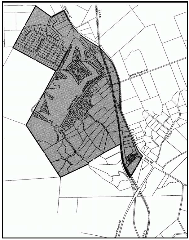
Figure 106-4: Los Ranchos/Edna Village Area Specific Plan Area
[Amended 2014, Ord. 3256]
22.108.010 - Black Lake Village Standards.
The 1983 Black Lake Specific Plan as amended is hereby incorporated into this Title as though it were fully set forth here. All development within the Black Lake Specific Plan Area (see Figure 108-1) shall comply with the adopted Specific Plan. In the event of any conflict between the provisions this Section and the Specific Plan, the Specific Plan shall control. Any deviation of existing or proposed development from the provisions of the Specific Plan shall occur only after appropriate amendment of the Specific Plan.

Figure 108-1: Black Lake Specific Plan Area
[Amended 1984, Ord. 2190; 1988, Ord. 2830; 2014, Ord. 3256]
22.108.020 - Callender-Garrett Village Standards.
A.
Community-wide standards. The following standards apply to all portions of the Callender-Garrett village area outside of the Coastal Zone.
1.
Access to Highway 1. Land divisions and developments proposed adjacent to Highway l shall be designed to not have direct access to the highway, unless an alternative road access cannot be designed.
2.
Setback from Highway 1. The building setback for properties adjacent to Highway 1 shall be a minimum of 50 feet. Retain a buffer of trees adjacent to the highway right-of-way. Eucalyptus may be removed unless benefits from visual character and monarch butterfly habitat warrant further protection. Where eucalyptus are removed, replace with native trees, retaining older, mature "landmark" eucalyptus where possible.
B.
Industrial (IND) - North of Highway 1. The following standards apply to the area in the Industrial land use category north of Highway 1, shown in Figure 108-2.
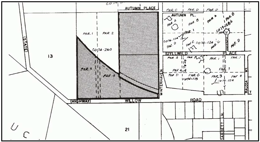
Figure 108-2: IND - North of Highway 1
1.
Permit requirement. Minor Use Permit approval is required for all new construction unless a Conditional Use Permit is otherwise required by this Title.
2.
Site planning. Design sites for an "industrial-park" appearance, with an interior circulation system linking parcels, complementary building design, community water supply and sewage disposal facilities.
3.
Limitation on use. All uses identified by Section 22.06.030 as allowable, permitted, or conditional within the IND land use category may be authorized subject to the land use permit requirements of that Section except: chemical products; metal industries-primary; petroleum refining and related industries; plastics and rubber products.
C.
Residential Suburban (RS). The following standards apply within the Residential Suburban land use category.
1.
Minimum parcel size. Except as noted below, the minimum parcel size for new land divisions is 2.5 acres, unless a larger minimum parcel size is otherwise required by Chapter 22.22. For properties shown in Figure 108-3, the minimum parcel size is established by Chapter 22.22.
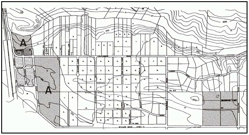
Figure 108-3: RS - One-Acre Minimum Parcel Size
2.
Subdivision design - New land divisions for properties larger than 10 acres. Include a conceptual design of the ultimate breakdown of the property with coordinated circulation to other properties, to demonstrate the feasibility of further land division.
3.
Setbacks. Residences proposed on lots adjacent to the Industrial category shall be located at least 50 feet from the Industrial category boundary, to provide a buffer area from industrial uses. Accessory structures may be located within this setback area.
4.
Land division requirements. Any proposed subdivision of land shown in area "A" in Figure 108-3 shall be accomplished through a resubdivision of up to 88 parcels presently with certificates of compliance that exist within the same ownership, representing the owner's existing entitlements. The resubdivision shall utilize the cluster division criteria of Section 22.22.140 pertaining to parcel size and open area requirements. The following shall be achieved through the resubdivision:
a.
Circulation. The design of new residential parcels shall not allow direct access to Highway 1. Access to Highway 1 shall be gained through use of Callender Road and/or a new street access along the southwesterly portion of the property.
b.
Open space. The open space allocation requirement shall be located for the following purposes, at a minimum:
(1)
Along the southerly portion of the property for community park purposes.
(2)
Dedication of the Black Lake Sensitive Resource Area at the northerly end of the property.
(3)
A pedestrian/equestrian path system.
(4)
A visual buffer area between the adjacent residential and industrial areas and the cluster division.
[Amended 2014, Ord. 3256]
22.108.030 - Los Berros Community Standards.
The following standards apply within the Los Berros village area to the land use categories or specific areas listed.
A.
Community-wide standards - Water supply. When a village-wide water system is constructed, all users shall connect to the system; individual wells shall be used for non-domestic purposes only.
B.
Residential Suburban (RS). The following standards apply within the Residential Suburban land use category.
1.
Minimum building site required. The minimum building site for any structure on properties located south of Los Berros Road is one acre.
2.
Limitation on use. All uses identified by Section 22.06.030 as allowable, permitted, or conditional in the RS land use category may be authorized subject to the land use permit requirements of that Section, except rural recreation and camping, and nursing and personal care.
[Amended 2014, Ord. 3256]
22.108.040 - Nipomo Community Standards.
The following standards apply within the Nipomo urban area to the land use categories or specific areas listed.
A.
Community-wide standards. The following standards apply to all land use categories within the Nipomo urban reserve line.
1.
Connection to community sewers. New parcels within the Nipomo Urban Services Line shall be designed to provide for future connection to the community sewage system, except for the areas shown in Figure 108-20 - low density residential areas.
2.
Right-of-way requirements for residential categories. On all streets outside the central business district, an offer of dedication shall be made for parcels adjacent to public streets at the time of subdivision or new development, for a minimum eight-foot parkway between the curb and sidewalk, unless adequate right-of-way exists, as illustrated in Figure 108-4. The area of dedication may be included in the net acreage calculation of allowable density. Landscaping improvements shall be provided and include a minimum of one street tree per fifty feet frontage and lawn or low-maintenance plants. For right-of-way requirements for residential categories within the Dana Reserve Specific Plan (DRSP), refer to 22.108.040.J.
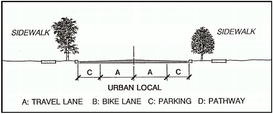
Figure 108-4: Street Edge Illustration
3.
Plan Line for Tefft Street. Building setbacks shall be measured from the 100-foot-wide plan line for Tefft Street between Pomeroy Road and Sparks Avenue, as shown in Figure 108-5.
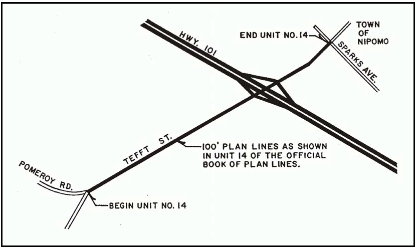
Figure 108-5: Plan Line for Tefft Street
4.
Nipomo lowland areas - Drainage plan requirement. All land use permit applications for new structures or additions to the ground floor of existing structures shall require drainage plan approval in compliance with Chapter 22.52 if the project is located within the area shown on Figure 108-6, unless the County Engineer determines that the individual project site is not subject to or will not create drainage problems.
5.
Creek preservation - Nipomo Creek. Retain Nipomo Creek in an open condition within 50 feet of the floodway and incorporate it into site development with landscaping that is compatible with riparian habitat (as recommended by the Department of Fish and Game) as well as compatible with County drainage requirements. All other development, including pedestrian seating and pathways, must be at least 50 feet away from the floodway for Nipomo Creek. Within the central business district (CBD), this provision shall remain in effect until such time that this issue is further evaluated, defined and approved through the Nipomo CBD Design Plan.
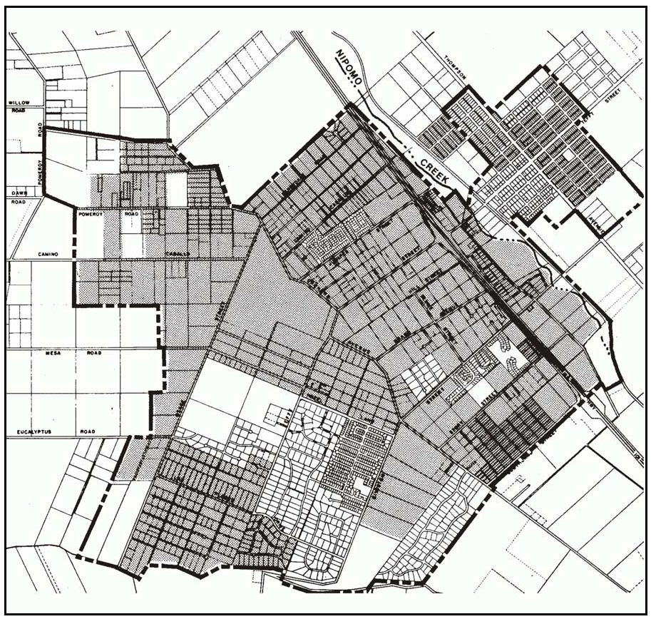
Figure 108-6: Nipomo Drainage Plan Requirements
6.
West Tefft Corridor Design Plan. The following standards apply to the Commercial Retail, Office and Professional, Recreation, Public Facility and Residential Single Family land use categories within the area shown in Figure 108-7.
a.
Compliance with the West Teft Design Plan. The West Teft Design Plan and any amendments thereto, is hereby incorporated into this Section as though it were fully set forth here. All Zoning Clearances, Minor Use Permit, Conditional Use Permit and land division applications within the West Teft Design Plan Area (see Figure 108-7) shall be in conformity and compliance with the West Teft Design Plan. In the event of any conflict between the provisions of this Title and the Design Plan, the Design Plan shall control.
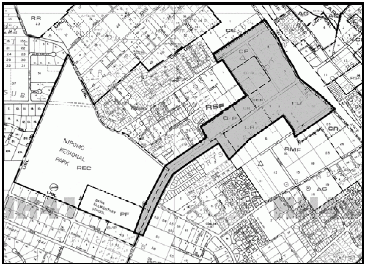
Figure 108-7: West Tefft Design Plan
b.
Permit requirements. Minor Use Permit approval is required for all new construction or exterior alteration of existing structures where a land use permit is otherwise required by this Title, except for the following:
(1)
Minor exterior alterations, as well as expansions not to exceed 10 percent of the existing floor area, may be exempted from this requirement by the Director of Planning and Building. Such projects are still subject to other applicable requirements.
(2)
Exterior facade remodeling and expansions that exceed 10 percent of the existing floor area may be approved as "minor" Minor Use Permits if they are determined to be categorically exempt from the California Environmental Quality Act by the Director of Planning and Building and are in conformance with the West Tefft Corridor Design Plan
B.
Agriculture (AG) - Agricultural preserve status. When the present agricultural preserve contract is terminated on the land within the Nipomo urban reserve line in the Agriculture land use category, the property owner shall initiate a request to amend the Land Use Element in order to determine the appropriate land use category to be placed on the property.
C.
Commercial Retail (CR). The following standards apply within the Commercial Retail land use category.
1.
Central Business District (CBD). The following standards apply within the Central Business District (CBD) area shown in Figure 108-8, to achieve an intensive, compact and pedestrian-oriented commercial development pattern. The CBD is divided into areas situated both east and west of Highway 101.
a.
Compliance with design and circulation plan required. All land use permit and land division applications (located on the "east side" as delineated in Figure 108-8) shall be in conformity and compliance with the Olde Towne Nipomo Design and Circulation Plan dated October 28, 1998, which was adopted by the Board in Resolution No. 2865 and is on file in the Office of the Clerk of the Board of Supervisors, and which is hereby incorporated into this Title by reference as though fully set forth here.
Applicants and the general public are encouraged to read the Olde Towne Nipomo Design and Circulation Plan. The guidelines in the Plan are intended to provide for interpretation and flexibility in designing a project.

Figure 108-8: Nipomo Central Business District
b.
Permit requirements. Minor Use Permit approval is required for all new construction or exterior alteration of existing structures where a land use permit is required by Section 22.06.030, except:
(1)
Minor exterior alterations, and expansions not exceeding 1,000 square feet, that are in conformance with the Olde Towne Nipomo Design and Circulation Plan; these projects are still subject to all other applicable permit requirements;
(2)
Where Conditional Use Permit approval is otherwise required by this Title; and
(3)
Projects located on the "west side" as shown in Figure 108-8, which shall be subject to the land use permit requirements established by Section 22.06.030, or applicable standards of this Article.
c.
Visitor-serving priority area. Applications for visitor-serving uses are encouraged around the Tefft Street/Highway 101 interchange within the area shown in Figure 108-9, particularly restaurants, grocery stores, gas stations, financial services, hotels and motels, personal services and transit stations.
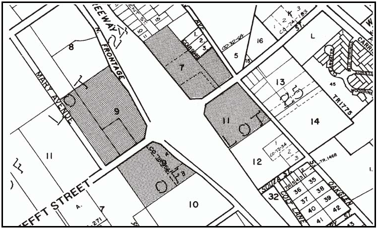
Figure 108-9: Preferred Visitor-Serving Area
d.
Residential uses. Mixed-use projects that combine residential uses with commercial or office uses are encouraged. Multi-family dwellings as a principal use may be authorized by Conditional Use Permit approval.
2.
Northeast Corner of Tefft Street and Highway 101. The following standards apply only to Parcels 2 and 3 of Parcel Map CO 72-11, shown in Figure 108-10.
a.
Application content. In addition to the requirements of Subsection C.1, applications shall include coordinated site planning for both parcels, however, the sites may be developed in phases. Primary access to both parcels shall be provided only from Tefft Street. Particular attention shall be given to location of uses, building design, signing, fencing, screening and landscaping to minimize potential conflicts with adjacent residential uses.
b.
Limitation on use. All land uses identified by Section 22.06.030 as allowable, permitted, or conditional in the CR land use category may be authorized in compliance with the land use permit requirements of that Section, except: outdoor sports and recreation; public assembly and entertainment; recycling collection stations; small scale manufacturing; auto, mobile home and vehicle dealers and supplies; and vehicle storage.
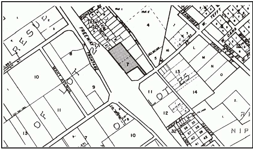
Figure 108-10: Northeast Corner of Tefft Street and Highway 101
3.
Neighborhood commercial centers. The following standards apply to sites for neighborhood commercial uses, shown in Figure 108-11.
Guidelines. Commercial uses should be developed that serve neighborhood daily shopping needs and that are compatible with and complement nearby residential uses. Small-scale businesses should be scaled to serve neighborhoods within a one-half to one mile radius.
a.
Limitation on use. Land uses shall limited to the following, in compliance with the land use permit requirements of Section 22.06.030: grocery stores; restaurants; offices; financial services; personal services; consumer repair services; general retail; building materials and hardware; indoor amusements and recreation; gas stations; and multi-family or caretaker dwellings, and energy-generating facilities (limited to renewable energy facilities), except that gas stations shall not be allowed within Area "A" on Figure 108-11.
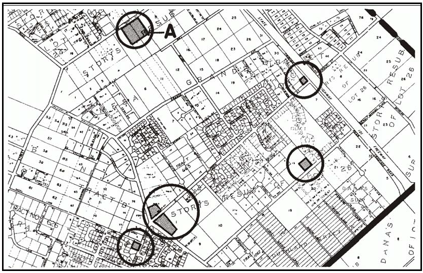
Figure 108-11: CR - Neighborhood Commercial Sites
b.
Zoning Clearance and Site Plan Review requirements. The following standards apply to projects requiring Zoning Clearance (Building Permit) or Site Plan Review.
(1)
Limitation on floor area.No store or use shall exceed 8,000 square feet of floor area, except that general retail stores shall not exceed 2,000 square feet each. General retail stores cumulatively for each site shall not exceed 25 percent of the total floor area.
(2)
Sign limitation. On-site free-standing signs are limited to monument signs.
(3)
Setbacks.Front and street side setbacks shall be 20 feet, except that where street-front entrances are provided on building frontages, up to 50 percent of such building frontage can be within 10-foot setbacks. Building locations shall have a maximum setback of 20 feet on at least 40 percent of the front and street sides before other on-site building locations are utilized.
For area "A" on Figure 108-11, the following setbacks apply. Front and street side setbacks shall be 20 feet, except that where street-front entrances are provided on building frontages, such building frontage can be within a 10-foot setback.
Setbacks shall be landscaped to buffer commercial development visually from nearby residential neighborhoods.
(4)
Landscaping.15 percent of the interior site area, not including buildings, setbacks and parking areas, shall be landscaped meeting the standards of Chapter 22.16. Parking areas shall meet the standards of Section 22.18.040.F and G.
(5)
Parking lot connections. For area "A" on Figure 108-11, the parking lot design shall provide, at a minimum, for vehicle connection between adjacent commercial parcels and may provide for connection to adjacent non-residential sites.
c.
Minor Use Permit and Conditional Use Permit requirements. Projects requiring Minor Use Permit or Conditional Use Permit approval should comply with the provisions of Subsection C.3.b and the following standards. Alternative designs may be allowed where the Review Authority determines that the intent of the standards is met.
(1)
Architecture. Buildings shall be designed to be compatible with the residential scale and character of nearby neighborhoods, through such means as utilizing pitched roofs, wood, wood-appearing or stucco siding, extensive use of eaves, arcades, moldings and ornamentation.
(2)
Site planning. Site planning should cluster buildings, visually link store entrances and show varied building footprints. Pedestrian access to the site and circulation between stores should be emphasized and be separated from parking, loading and service walks. The physical needs of pedestrians should be served by paved surfaces, outdoor seating, shade and landscaping. On sloping sites, development should respond to the site with stepped buildings yet achieve nearly level grades throughout the parking and building areas.
D.
Commercial Service (CS). The following standards apply within the Commercial Service land use category.
1.
Limitation on uses. All land uses identified by Section 22.06.030 as allowable, permitted, or conditional in the CS land use category may be authorized in compliance with the land use permit requirements of that Section, except: ag processing; cannabis processing facilities; animal keeping; drive-in theaters; public assembly and entertainment; sports assembly; petroleum extraction; restaurants larger than 5,000 square feet; grocery stores larger than 5,000 square feet; general retail, cannabis dispensaries, and personal services that are larger than 2,000 square feet each and that occupy more than 25 percent of the total floor area of a site; offices and cannabis testing facilities (except allowable in community gateway projects in Subsection D.4.); lodging uses listed by Table 2-2, Section 22.06.030 in the "Services" use group; concrete, gypsum and plaster products; airfields and landing strips; gas stations; and truck stops.
The following uses are not permitted on properties that are adjacent to Residential Land Use Categories: collection stations; metal industries-fabricated; recycling and scrap; stone and cut stone products; auto and vehicle repair and service.
2.
Site planning. Buildings shall be located at the front setback, and street-corner side setback if applicable, and shall be oriented to the street with outdoor activity and parking at the side and rear. Design on-site circulation so that trucks can move forward through the site, except where infeasible because of site area or configuration. Locate loading areas or bays separate from parking aisles and driveways. Landscaping and fencing design shall be similar between uses, with a continuous canopy of trees along streets.
Where projects are located adjacent to residential land use categories, particular attention shall be given to building design, signing, fencing, downward-directed lighting and landscaping to minimize potential operational and visual conflicts.
3.
Architecture. Building design shall extend elements that are utilized on the street-fronting sides, such as parapets, fascias, cornice lines or roof treatments, around the interior sides of buildings to provide an identity to the total project. Changes in materials shall occur only with an offset in the building facade. Projects that have retail uses or no identified tenants proposed shall utilize door and window moldings, separate shop entrance doors from bay doors, and eaves, awnings or other porch entries.
4.
Community gateway projects - Permit requirements. Development of properties that front Highway 101 or South or North Frontage Road and are within one-quarter mile of the urban reserve line is subject to Minor Use Permit approval unless a Conditional Use Permit is otherwise required by this Title. Buildings shall be located at the street and street-corner side nearest to the urban reserve line, as illustrated in Figure 108-12. Landscaping shall occupy at least 60 percent of street frontage and provide a continuous line of trees. Buildings on such properties are encouraged to be at least two stories, with offices an allowable use as an incentive. Architecture shall be similar to the Dana adobe and early California Mission styles, with stucco walls and tile roofs and other details and ornamentation as required by the Olde Towne Nipomo Design and Circulation Plan. Vertical elements such as clock or viewing towers are allowed. A consistent design theme and use of materials shall be utilized throughout site development.
5.
Sign height limitation. Free-standing signs are limited to a height of 24 feet or no higher than the project's building, whichever is less.
E.
Office and Professional (OP). The following standards apply only to land in the Office and Professional land use category.
1.
Compliance with CBD Design Plan. After adoption of the CBD design plan (which shall include lands in the Office and Professional category), all proposed new developments or remodeling projects shall be in compliance with that plan.
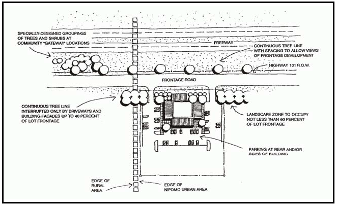
Figure 108-12: Community Gateway Development
2.
Development prior to approval of the CBD Design Plan. Development applications shall comply with Standards 2 and 3 for the Commercial Retail category.
3.
Limitation on use. All land uses identified by Section 22.06.030 as allowable, permitted, or conditional in the OP land use category may be authorized in compliance with the land use permit requirements of that Section, except: indoor amusements and recreation; public assembly and entertainment; elementary schools through colleges and universities; airfields and landing strips.
4.
Residential uses. Multi-family and single-family dwellings as incidental uses may be authorized by Minor Use Permit approval, subject to the standards and findings required by Section 22.30.490.
F.
Recreation (REC) - Dana Adobe. The following standards apply only to the Dana Adobe, shown in Figure 108-13.
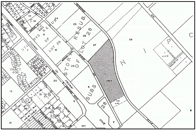
Figure 108-13: Property Surrounding the Dana Adobe Property
1.
Limitation on use.
a.
Prior to completion of access and egress for emergency responders, visitors, and occupants, land uses shall be limited to those identified as allowable, permitted, or conditional in the Residential Suburban land use category by Section 22.06.030, except for nursing and personal care, and residential care.
b.
After completion of an access and egress for emergency responders, visitors, and occupants, all land uses that are identified by Section 22.06.030 as allowable, permitted, or conditional in the Recreation land use category may be authorized in compliance with the land use permit requirements of that Section.
2.
Permit requirement. The initial development of any non-agricultural or non-residential uses shall be subject to Conditional Use Permit approval. The Conditional Use Permit shall identify the area to be developed, the types of uses to be established, and an architectural style compatible with the adobe and the site's interpretation and educational components. Future structures or uses not approved as part of the initial Conditional Use Permit shall comply with the requirements of Section 22.06.030 (Table 2-2) and Section 22.30 (Standards for Specific Land Uses) of the Land Use Ordinance.
3.
Subdivision requirement. All new subdivisions on the site of the Dana adobe shall be clustered in compliance with Chapter 22.22. An area shall be located around the Dana adobe site, to be offered for dedication to the County, another agency, or appropriate caretaker organization for maintenance and improvements. Funding shall be provided to contribute to the improvement of the adobe and its site in an amount to be determined through the subdivision review process. The residential lots shall be located a compatible distance from the adobe. The architecture of structures within the subdivision shall be compatible with the adobe, through the use of deed covenants, conditions and restrictions (CC&Rs).
4.
Development requirements. Future development proposals shall also include measures to address the following issues as appropriate:
a.
Siting and architecture of both residential and nonresidential uses shall be visually compatible with the Dana adobe. Physical linkage with the adobe site shall be designed that encourages pedestrian travel and interpretation of the site's resources. Landscaping should be used to buffer views between the adobe and support buildings and project infrastructure such as parking lots. Should the nonprofit organization, the Dana Adobe Nipomo Amigos, cease to exist, the 30 acre site (Figure 108-13) should be offered for dedication to the County, another nonprofit agency, or appropriate caretaker organization for maintenance and improvements.
b.
Air Quality.
(1)
The proposed project shall include measures to reduce construction-related air emissions, operational air emissions, and greenhouse gas emissions based on the current air quality model approved by the County of San Luis Obispo Air Pollution Control District (APCD), such as CalEEMod and guidance provided in the APCD's CEQA Handbook.
c.
Biological Resources.
(1)
The proposed project shall include to avoid or minimize impacts to special status species and sensitive habits, such as pre-construction surveys, biological monitoring, construction avoidance during wet season and nesting bird season, oak tree protection and replanting for impacted trees, habitat restoration, and coordination with appropriate regulatory agencies.
d.
Cultural Resources.
(1)
The proposed project shall include measures to address potentially significant impacts to cultural resources based on analysis by a County-approved archaeologist. Measures may include, but are not limited to, avoidance by design, protective soil capping, detailed research design and data recovery, surface documentation, archaeological monitoring, protection by recordation of open space easements, an operational management program, and an interpretive program.
(2)
The proposed project shall include measures to address potentially significant impacts to paleontological resources, such as construction monitoring by a County-approved paleontologist.
e.
Geology and Soils.
(1)
The proposed project shall include measures to reduce erosion and sedimentation and ensure water quality standards are met, such as provision of a SWPPP.
f.
Noise.
(1)
The proposed project shall include measures to reduce potential noise impacts, such as limitations on maximum noise level, duration of special events, noise monitoring, and remediation for complaints.
g.
Transportation and Circulation.
(1)
The proposed project shall include measures to reduce impacts to roads and intersections in the area, such as adjustments to peak hour trip generation, payment of road fees, and street improvements based on consultation with the County Department of Public Works.
h.
Water Resources.
(1)
The proposed project shall include measures as required or recommended by the County's Stormwater Management Program to promote groundwater recharge through the application of Low Impact Development (LID) design techniques, such as directing parking lot and roof runoff to vegetated swales and rain gardens, and maximum pervious surfacing where feasible.
G.
Residential Suburban (RS). The following standards apply within the Residential Suburban land use category.
1.
Dana Adobe vicinity - Subdivision requirement. New land divisions of the properties shown in Figure 108-14 shall be designed to retain areas that are important views from the Dana Adobe property in open space. The developer may wish to investigate the cluster division provision in Section 22.98.070D. This standard applies in addition to the Historic combining designation standard in Section 22.98.020D.2.
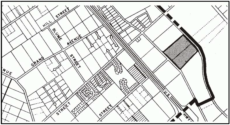
Figure 108-14: RS - Subdivision Open Space Requirement
2.
Osage Road area - Minimum parcel size. Minimum parcel size for new land divisions west of Osage Road (see Figure 108-15) is 2½ acres, unless larger parcel sizes would otherwise be required by Chapter 22.22.
3.
Calimex Plantation Tract - New land divisions. Future land divisions of the tier of lots on the north side of Las Flores Drive between Osage Street and Tefft Street (see Figure 108-15) shall utilize a single common driveway to serve all proposed lots.
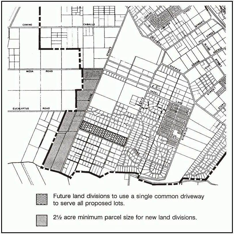
Figure 108-15: RS - Osage Road Area
4.
Pomeroy Road area. The following standard applies to the parcels shown in Figure 108-16.
a.
Subdivision requirements. Land divisions shall be clustered in compliance with Section 22.22.140. Cluster open space parcels shall be located along Pomeroy Road to create a visual and noise buffer for the residential parcels. Driveway access to parcels shall be from interior streets or Live Oak Ridge Road. Residential parcels shall be at least one acre along the east property line, to be consistent with adjacent allowed parcel sizes.
b.
Building setback. Residential development shall be set back at least 80 feet from Pomeroy Road.

Figure 108-16: RS - Pomeroy Road Area
H.
Residential Single-Family (RSF). The following standards apply within the Residential Single-Family land use category.
1.
General standards.
a.
Minimum density - New land divisions in low density areas. The minimum density is as follows for low density areas within Nipomo shown in Figure 108-17:
(1)
Half-acre density areas. The minimum parcel size is 20,000 square feet within the half-acre density areas shown in Figure 108-17, unless a larger size is otherwise required by Chapter 22.22.
(2)
10,000 square foot density area. The minimum parcel size within the 10,000 square foot density area shown in Figure 108-17 is one acre prior to the provision of a community sewer system, except that 20,000 square-foot parcels may be allowed if granted an exemption by the Regional Water Quality Control Board.
After the provision of a community sewer system, and the issuance of a will-serve letter to a proposed site by the applicable service-provider, the minimum parcel size shall be 10,000 square feet unless a larger parcel size is otherwise required by Chapter 22.22. Affordable housing projects that qualify in compliance with that chapter may have smaller parcel sizes than this base density.
Applications for 20,000 square-foot and larger parcels shall provide a conceptual plan for the ultimate division of the property into 10,000 square-foot parcels to show future circulation and subdivision design.
b.
Minimum building site - Southland Tract A. The minimum building site area is one acre for the Southland Tract A, shown in Figure 108-17, until community sewage disposal is available.
c.
Subdivision requirements. New subdivisions shall subdivide existing lots into blocks generally no longer than 1,300 feet perimeter and 400 feet in length, with alleys, where proposed, no more than 20 feet in width which shall be maintained by an owners association or other private entity.
d.
Minimum setbacks - Properties with alleys. The front setback on properties that have alleys located at the rear is 15 feet, if garages and driveways are located with access to the rear only.
e.
Permit requirement. Land divisions that propose parcels of one acre or larger before division shall be authorized by Minor Use Permit approval prior to approval of a Tentative Map. The Minor Use Permit shall indicate ultimate division, setbacks, open space corridors, building sites, utility extensions and offers of dedication for the ultimate street pattern.
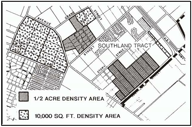
Figure 108-17: RSF - Low Density Single Family Areas
2.
Knotts Street area. The following standards apply only to the property southeast of Knotts Street, shown in Figure 108-18.

Figure 108-18: RSF - Knotts Street Area
a.
Subdivision requirement. New residential subdivisions within area "A" shown in Figure 108-18 shall be limited to a total of 46 parcels when accompanied by the following:
(1)
A re-subdivision of the parcels in area "B" to the minimum size for supporting productive commercial agriculture;
(2)
Permanent agriculture/open space agreement(s) for area "B";
(3)
Adequate agricultural buffers to be determined through project review;
(4)
Dedication of approximately 10 acres within area "A" for a community park located optimally to serve the existing and new neighborhoods;
(5)
A lot pattern that locates smaller parcels near Knotts Street that are similar in size with the neighborhood, and larger parcels at the edge of the subdivision.
(6)
A trail/linear park easement shall be dedicated between Knotts Street and Rancho Road along Thompson Road.
(7)
A building setback of 100 feet from Thompson Road between Rancho Road and Knotts Street.
(8)
Street access to Thompson Road shall be limited to one point in addition to Knotts Street.
(9)
Reservation of sufficient, long-term water production capacity for both areas A and B shown in Figure 108-18.
b.
Water supply. A detailed hydro-geologic analysis shall be completed at the time of Conditional Use Permit application for the residential subdivision,. The analysis shall be prepared such that long-term water availability is determined to be adequate for the residential subdivision and the agricultural use of areas A and B shown in Figure 108-18. The data used in the analysis shall provide for conclusions with a high degree of certainty, and shall be based on 1) monitoring over a certain period (as recommended by the hydro-geologist), 2) recent, detailed existing information on water availability, or 3) a combination of these two.
I.
Residential Multi-Family (RMF). The following standards apply within the Residential Multi-Family land use category.
1.
Density limitations. Multi-family development is allowable at a base density for areas as shown in Figure 108-19 using the medium density criteria in Chapter 22.22, except that the minimum open area shall include required setbacks and all areas of the site except buildings, parking aisles or driveways and parking spaces.
a.
Minimum density. A minimum density of 10 units per acre is required for parcels larger than two acres.
b.
Density bonuses. The base density may be supplemented by the affordable housing density bonus in Chapter 22.22. Where this standard allows 10 and 15 dwellings per acre, the base density may be increased by adding up to 30 percent additional studio or one-bedroom dwelling units, of which 25 percent of the number of bonus units shall be designed to be handicapped accessible.
c.
Density related to property size - West of Highway 101. Subdivision of larger parcels is discouraged in the 10- and 15-units per acre areas within Figure 108-19, by limiting the allowable density for smaller lots. Allowable density as shown in Figure 108-19 shall be related to the size of the parent parcel as follows:
d.
Detached dwelling densities in 10-units-per-acre areas. In areas with an overall density of 10 units per acre, detached single-family or duplex dwelling units are required, to achieve the appearance of a compact single-family neighborhood.
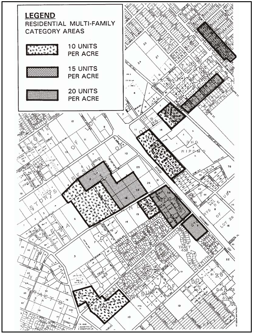
Figure 108-19: RMF - Residential Multi-Family Areas in Nipomo
2.
Permit requirement. Minor Use Permit approval is required before any subdivision, lot line adjustment or development of five or more multi-family units, unless a Conditional Use Permit is otherwise required by this Title. The approval shall ensure a lot pattern, including the possibility of clustering, to accommodate building sites that provide a varied distribution of buildings and articulated building layout with usable open space area and a gradation to adjacent neighborhoods and the freeway to maximize compatibility and mitigation of potential noise impacts.
3.
Site planning criteria. Site design shall provide a varied distribution of buildings, separated by usable private and common open spaces and parking areas. Vary the edges of buildings to avoid creating long straight sides. Use common open spaces and parking areas as illustrated in Figure 108-20 to separate the units from adjacent properties in other land use categories.
a.
Private outdoor space. Private outdoor space shall be provided with at least a 15-foot depth and width for ground floor units, and six-foot depth and 15-foot width for upstairs units.
b.
Active recreation area. Common area open space shall include at least one usable, active recreation area with the following area and features for every number of dwelling units listed:
Examples: An eight-unit project would have at least 500 square feet of usable outdoor area, with two tables with benches and shades and playground equipment, as shown in Figure 108-20. A 100-unit project would have a combination of passive and active playground areas totaling 6,250 square feet, enclosed mail rooms, and an enclosed common room.
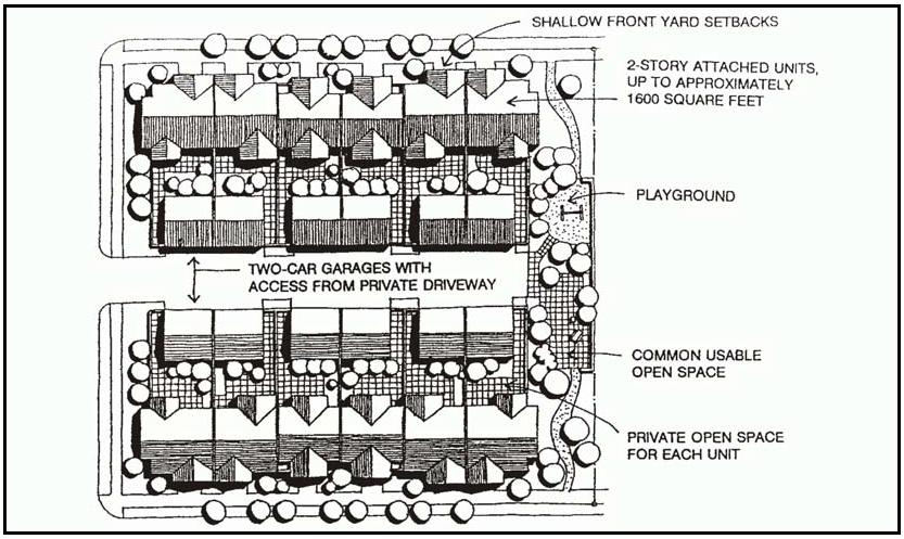
Figure 108-20: Typical Multi-Family Project at 20 Units/Acre
4.
Subdivision requirements. New subdivisions shall subdivide existing lots into blocks generally no longer than 1,300 feet perimeter and 400 feet in length. Alleys may be included if they are no more than 20 feet in width and are maintained by an owners association or other private entity. Where a specific condominium or planned unit development project is not proposed, a variety of lot sizes shall be proposed to accommodate smaller projects.
5.
Minimum setbacks - Properties with alleys. The front setback on properties that have alleys located at the rear is 15 feet, if garages and driveways are located with access to the rear only.
6.
Road dedication requirement. An offer of dedication shall be made for parcels adjacent to public streets at the time of subdivision or new development for an eight-foot parkway between the curb and sidewalk. Landscaping improvements shall be provided for street trees, lawn or low-maintenance plants.
7.
Nipomo Creek properties. New development on properties with frontage along Nipomo Creek shall provide a 40-foot building setback for open space uses and access to the creek.
J.
Dana Reserve Specific Plan (DRSP). The following apply within the Dana Reserve Specific Plan land use category.
1.
Dana Reserve Specific Plan (DRSP). The Dana Reserve Specific Plan is hereby incorporated by reference. Development within the Dana Reserve Specific Plan Area shall be consistent with the adopted Specific Plan and/or approved amendments thereto.
[Amended 1981, Ord. 2063; 1982, Ord. 2106; 1983, Ord. 2122; 1986, Ord. 2257, Ord. 2270; 1996, Ord. 2786; 1997, Ord. 2800; 1999, Ord. 2865; Added 2007, Ord. 3119; Amended 2013, Ord. 3254; 2014, 3256; 2015, Ord. 3291; 2017, Ord. 3358; 2018, Ord. 3369; 2018, Ord. 3377; 2020, Ord. 3409; 2024, Ord. 3509]
22.108.050 - Oceano Community Standards.
The following standards apply within the Oceano urban reserve line to the land use categories or specific areas listed.
A.
Communitywide. The following standards apply to all land use categories inside the Oceano Urban Reserve Line.
1.
Oceano Specific Plan Included by Reference. The 2001 Oceano Specific Plan, and any amendments made thereto, is hereby incorporated into this Title as though it were fully set forth here. All development within the Oceano Specific Plan planning area, which coincides with the Oceano Urban Reserve Line, is to be in conformity with the adopted Specific Plan, in addition to any applicable planning area standards. In the event of any conflict between the provisions of this Chapter and the Specific Plan, the Specific Plan shall control. Any deviation of existing or proposed development from the provisions of the Specific Plan is to occur only after appropriate amendment of the Specific Plan.
2.
Curb, gutter and sidewalk required. Curb, gutter and sidewalk is required with any project in the Ocean urban area, excluding the Halcyon area as shown on Figure 108-22, in all land use categories.
a.
When required.
(1)
Curb, gutter and sidewalk in the Industrial, Commercial Retail and Service, Office and Professional, and Residential Multi-Family land use categories is required to be installed as set forth in this section when such improvements do not already exist, and:
(a)
The value of any new structures or changes to existing structures, items or equipment (that add value to the property but would be exempt from a construction permit or would not be subject to a "valuation" by the department) proposed during a period of 12 months (as indicated by all building permits issued for the site during the 12-month period) exceed 25 percent of the total of all improvements existing on the site as determined by the assessment roll or by a current appraisal. The appraisal shall be completed by an appraiser with a "Certified General License" issued by the State Office of Real Estate Appraisal and shall determine full market value of the parcel, allocating for land and existing site improvements based on the Uniform Standards of the Professional Appraisal Practices as published by the Appraiser Standards Board of the Appraisal Foundation. Both of these methods shall be determined at the time of the first building permit (within the 12-month period) is applied for.
(b)
A new structure is moved on to a site (rather than constructed in place).
(2)
Curb, gutter and sidewalk in all other land use categories is required to be installed as set forth in this section when such improvements do not already exist, and:
(a)
The value of any new structures exceed 25 percent of the total of all improvements existing on the site as determined by the assessment roll or by a current appraisal. The appraisal shall be completed by an appraiser with a "Certified General License" issued by the State Office of Real Estate Appraisal and shall determine full market value of the parcel, allocating for land and existing site improvements based on the Uniform Standards of the Professional Appraisal Practices as published by the Appraiser Standards Board of the Appraisal Foundation. Both of these methods shall be determined at the time of the first building permit (within the 12-month period) is applied for.
(b)
More than 25 percent of the square footage of an existing structure is demolished and replaced.
(c)
More than a 20 percent expansion of square footage of an existing structure is added.
(d)
A new structure is moved on to a site (rather than constructed in place).
(3)
Curb, gutter and sidewalk is required to be installed in new land divisions, in compliance with Title 21 of the County Code.
b.
Extent of improvements. Curb, gutter and sidewalk improvements are to be constructed along the entire street frontage(s) of the site, and also along the street frontage of any adjoining lots in the same ownership as the site.
c.
Exceptions. Curb, gutter and/or sidewalk may be waived, modified or delayed as set forth in Section 22.54.030 of this Title.
d.
Design and construction. Curb, gutter and sidewalk improvements shall be designed and constructed as set forth in Section 22.54.030 of this Title. Where there is existing curb, gutter and sidewalk, Public Works may determine that the existing improvements have deteriorated so as to be unusable, or are improperly located, and that reconstruction of such street frontage improvements is required.
e.
Timing of installation. Curb, gutter and sidewalk improvements shall be completed as set forth in Section 22.64.090 (Project Completion), Section 22.64.110 (Occupancy with Incomplete Site Improvements) prior to occupancy, or Section 22.54.030G (Encroachment Permit Fee and Agreement Required) of this Title.
B.
Combining Designations - Airport Review Area (AR).
1.
Limitation on uses within Airport Review Area. Land uses shall be limited to those designated as "compatible" or "conditionally approvable" by the adopted Oceano County Airport Land Use Plan.
2.
Site design and development standards - Airport site. New development projects in County-owned portions of the site of the Oceano County Airport shall be consistent with the adopted Airport Use Permit, and shall comply with all applicable provisions of the airport lease site standards instead of the provisions of Articles 3 and 4 of this Title.
3.
Site design and development standards - Private lands. All development applications for the area within the boundary of the adopted Oceano County Airport Land Use Plan are subject to the development standards set forth in that plan, in addition to all applicable provisions of this Title. In the event of conflicts between the provisions of the Airport Land Use Plan and this Title, the more restrictive provisions shall prevail.
C.
Commercial Retail (CR).
1.
Permit requirement. Minor Use Plan approval is required for all new construction or exterior alteration of existing structures where a land use permit is otherwise required by this Title, except for the following:
a.
Minor exterior alterations, as well as expansions not to exceed 10 percent of the existing floor area, may be exempted from this requirement by the Director of Planning and Building. Such projects are still subject to other applicable requirements.
b.
Exterior facade remodeling and expansions that exceed 10 percent of the existing floor area may be approved as "minor" Minor Use Permits if they are determined to be categorically exempt from the California Environmental Quality Act by the Director of Planning and Building and are in conformance with the Oceano Specific Plan.
c.
New uses that are proposed to occupy existing development. Such uses are still subject to other applicable permit requirements.
d.
Single-family residences and residential accessory structures, and agricultural accessory structures.
e.
Where Conditional Use Permit approval is otherwise required by this Title.
2.
Block 45 of Town of Oceano #2. The following standards apply only to the Commercial Retail designated land in Block 45 of Town of Oceano #2, as shown on Figure 108-21.
Figure 108-21: Block 45 of Town of Oceano #2
a.
Mixed Use. Proposed residential uses shall be limited to upper floors or behind buildings fronting Cienaga Street.
b.
Blank Walls. Any project proposing development within 5 feet of side property line, excluding street side property lines, where California Building Code standards would require a firewall with no (or minimized) window openings and where the wall would be open to public view, the applicant shall develop an architectural relief plan for the side wall. The architectural relief plan shall include one or both of the following:
(1)
Architectural features used on the northerly (Cienaga Street frontage) of the building shall be continued onto the easterly wall. "False" windows shall be used along the wall replicating the same window rhythm as that used on the northerly wall of the building.
(2)
Artistic pieces shall be affixed to the wall.This may include sculptures and/or murals in compliance with Subsection 22.20.040.B.23. Artistic pieces shall be sufficient to minimize large blank portions of the wall.
c.
Limitation on Use. Land uses identified by Section 22.06.030 as allowable, permitted, or conditional within the Commercial Retail land use category may be authorized in compliance with the land use permit requirements of that section except the following uses: horse ranches and other equestrian facilities, kennels, zoos, recycling collection stations, mobile home and vehicle dealers, vehicle storage, dry cleaners, industrial launderers, beauty shops with manicure and/or pedicure services, funeral parlors, automobile service stations/gas stations, and printing and publishing.
d.
Fast Food Restaurant Use. No more than 15 percent of the floor area of the commercial use on a site shall be designated for fast food restaurant use.
e.
Drainage. At the time of application for a land use permit and/or building permit, the applicant shall submit a drainage plan in compliance with the requirements of Chapter 22.52 of the Land Use Ordinance. In no circumstance shall drainage shall be directed towards Highway 1.
f.
Southeast Corner of 21st and Cienaga Streets. The following requirements apply only to the to Site "A" as shown in Figure 108-21.
(1)
Design. Future development on this site shall be mixed-use and incorporate the following:
(a)
Residential density shall be greater than or equal to 10 units per acre.
(b)
At least 15 percent of residential units shall be no larger than 900 square feet.
(c)
Parking shall be placed behind the structures fronting Cienaga Street.
(d)
All buildings with street frontage shall face the street with visible entrances.
(e)
Site design shall maximize solar access for residential units. At least 80 percent of residential units shall have south-facing windows.
(f)
Landscaping shall be irrigated through drip irrigation.
(g)
Pedestrian walkways shall be landscaped and illuminated with pedestrian-scaled elements.
(h)
All residential units shall be provided with pedestrian access to the exterior sidewalks via pedestrian route where automobile access has minimum impact on the pedestrian experience (i.e. not a driveway).
(2)
Parking. Applicants proposing non-residential uses that do not qualify with a "general retail" parking calculation according to Chapter 22.18, shall prepare a parking plan. The plan will need to address the following, at a minimum:
(a)
A list shall be provided of all existing uses in the commercial buildings, including applicable details needed to determine parking calculations (i.e. square footage, percentage used for storage, number of barber chairs, etc.).
(b)
An estimate shall be provided showing the number of parking spaces required for all existing uses based on the calculations in Chapter 22.18 of the Land Use Ordinance.
(c)
For the purposes of the parking plan, vacant commercial space shall be assumed to be "general retail" with 90 percent of floor space for sales and 10 percent of floor space for storage.
(d)
If parking calculations exceed the number of parking spaces provided for the commercial component under the Minor Use Permit or Conditional Use Permit for the mixed use development, a new Minor Use Permit (requiring special findings pursuant to Section 22.18.020.H.) for parking adjustment may be necessary to establish the use.
(3)
Access. Open area for a potential future easement shall be reserved on Site "A" in Figure 108-22 to ultimately facilitate rear access to Site "B" in Figure 108-22 from Twenty-First Street. Plans submitted for land use permits, subdivisions, and building permits, shall clearly delineate the possible future alignment of this access.
3.
Block 28 of Town of Oceano. The following standards apply only to Block 28 of Town of Oceano, Map 2, as shown on Figure 108-22.
Figure 108-22: Corner of 17thSt. and Ocean St.
a.
Limitation on Use. On Lots #23 and #24, Multi-family residential development as a principal use may be authorized through Minor Use Permit approval, if all of the following standards, in addition to all other applicable standards, are satisfied.
b.
Residential Density. Lots #23 and #24 shall be developed with a total maximum of 5 residential multi-family units. This standard supersedes the allowable residential density, minimum open area, and maximum floor area requirements in Section 22.10.130 for multi-family dwellings.
c.
Site design and development standards. Compliance with the standards set forth in the Oceano Specific Plan for Commercial Retail Areas is required for development on Lots #23 and #24.
D.
Commercial Service (CS).
1.
Limitation on use. All land uses identified by Section 22.06.030 as allowable, permitted, or conditional uses within the CS land use category may be authorized in compliance with the land use permit requirements of that Section except: drive-in theaters; concrete, gypsum and plaster products; marinas; hotels and motels; marine terminals and piers.
2.
Permit Requirement. Minor Use Plan approval is required for all new construction or exterior alteration of existing structures where a land use permit is otherwise required by this Title, except for the following:
a.
Minor exterior alterations, as well as expansions not to exceed 10 percent of the existing floor area, may be exempted from this requirement by the Director of Planning and Building. Such projects are still subject to other applicable requirements.
b.
Exterior facade remodeling and expansions that exceed 10 percent of the existing floor area may be approved as "minor" Minor Use Permits if they are determined to be categorically exempt from the California Environmental Quality Act by the Director of Planning and Building and are in conformance with the Oceano Specific Plan.
c.
New uses that are proposed to occupy existing development. Such uses are still subject to other applicable permit requirements.
d.
Single-family residences and residential accessory structures, and agricultural accessory structures.
e.
Where Conditional Use Permit approval is otherwise required by this Title.
E.
Industrial (IND).
1.
Limitation on use. All land uses identified by Section 22.06.030 as allowable, permitted, or conditional uses within the Industrial land use category may be authorized in compliance with the land use permit requirements of that Section except: drive-in theaters; petroleum refining and related industries; petroleum extraction; airfields and landing strips; marine terminals and piers.
2.
Permit Requirement. Minor Use Plan approval is required for all new construction or exterior alteration of existing structures where a land use permit is otherwise required by this Title, except for the following:
a.
Minor exterior alterations, as well as expansions not to exceed 10 percent of the existing floor area, may be exempted from this requirement by the Director of Planning and Building. Such projects are still subject to other applicable requirements.
b.
Exterior facade remodeling and expansions that exceed 10 percent of the existing floor area may be approved as "minor" Minor Use Permits if they are determined to be categorically exempt from the California Environmental Quality Act by the Director of Planning and Building and are in conformance with the Oceano Specific Plan.
c.
New uses that are proposed to occupy existing development. Such uses are still subject to other applicable permit requirements.
d.
Single-family residences and residential accessory structures, and agricultural accessory structures.
e.
Where Conditional Use Permit approval is otherwise required by this Title.
F.
Recreation (REC) - Limitation on use. Land uses within the Recreation land use category between Highway 1 and the railroad right-of-way shall be limited to recreational vehicle parks in compliance with Ordinance 1215 and energy-generating facilities (limited to accessory renewable energy facilities).
G.
Residential Single-Family (RSF). The following standards apply within the Residential Single-Family land use category.
1.
Halcyon - Development standards. All proposed uses within the Halcyon area (see Figure 108-23) shall comply with the provisions of Ordinance 1913, summarized as follows:
[Following text comes from Ordinance 1913]
a.
The maximum residential density for the area shown in Figure 108-23 is 36 residential units. No more than 32 units shall be allowed on Site "A" and no more than 4 units shall be allowed on Site "B."
b.
Clustering of residential units and submittal of a master Departmental Review to process more than one application to construct a residence at a time is permitted.
Figure 108-23: Halcyon (Ordinance 1913)
2.
Southeast Corner of 23rd Street and Wilmar Avenue - Land division standards. Prior to any division of the property at the southeast corner of 23rd Street and Wilmar Avenue, a subdivision plan indicating ultimate lotting and street layout shall be approved by the Commission as required by Ordinance 1590. Subsequent land divisions shall be consistent with the approved plan.
H.
Residential Multi-Family (RMF). The following standards apply within the Residential Multi-Family land use category.
1.
Permit Requirement. Minor Use Plan approval is required for all new construction or exterior alteration of existing structures where a land use permit is otherwise required by this Title, except for the following:
a.
Minor exterior alterations, as well as expansions not to exceed 10 percent of the existing floor area, may be exempted from this requirement by the Director of Planning and Building. Such projects are still subject to other applicable requirements.
b.
Exterior facade remodeling and expansions that exceed 10 percent of the existing floor area may be approved as "minor" Minor Use Permits if they are determined to be categorically exempt from the California Environmental Quality Act by the Director of Planning and Building and are in conformance with the Oceano Specific Plan.
c.
New uses that are proposed to occupy existing development. Such uses are still subject to other applicable permit requirements.
d.
Single-family residences, accessory dwelling units and residential accessory structures, and agricultural accessory structures.
e.
Where Conditional Use Permit approval is otherwise required by this Title.
2.
Maximum Density. New multi-family development is not to exceed a density of 15 units per acre. Maximum floor area may not exceed 48 percent. This standard does not apply to development proposals accepted for processing by the Department of Planning and Building prior to the effective date of general plan amendments included in the Spring Cycle, 2002.
3.
South of Highway 1. The following standards apply only to the Residential Multi-Family land use category located south of Highway 1.
a.
Limitation on use. Land uses shall be limited to the following, in compliance with the land use permit requirements of Section 22.06.030: mobile home parks; except that on 1989 Assessor Parcel Number 75-032-05 as shown in Figure 108-24, land uses shall be limited to: animal keeping; crop production and grazing; energy-generating facilities (limited to accessory renewable energy facilities); religious facilities; membership organization facilities; home occupations; one single-family dwelling or mobile home; residential accessory uses; public safety facilities; storage, accessory; pipelines and transmission lines; and public utility facilities.
b.
Density calculations. Portions of property that comprise Arroyo Grande Creek channel and dikes are not to be used in computing overall density in proposed projects.
c.
Fencing requirement. Arroyo Grande Creek dikes and channels shall be fenced at the time adjoining properties develop to prevent resident access from adjacent mobile home and recreational vehicle parks.
d.
Signs. Signs shall be for identification purposes only and shall be located at the main entrance to the park. Signs are not to be more than 20 square feet in area, with a maximum height of 10 feet.
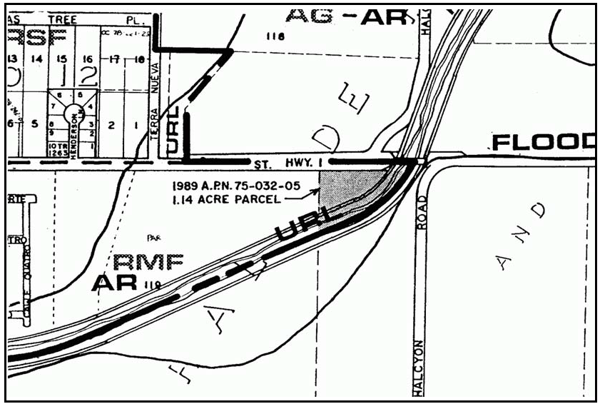
Figure 108-24: Parcel Near Southwest Corner of Highway 1 & Halcyon Rd. - Oceano
[Amended 1982, Ord. 2106; 1984, Ord. 2206; 1986, Ord. 2257; 1987, Ord. 2331; 1990, Ord. 2443 ; Added 2001, Ord. 2944; Added and Amended 2002, Ord. 2968; Added 2008, Ord. 3162; 2014, Ord. 3256; 2015, Ord. 3291; 2018, Ord. 3369; 2020, Ord. 3409; 2023, Ord. No. 3501]
22.108.060 - Palo Mesa Village Standards.
The following standards apply within the Palo Mesa village area in the land use categories or specific areas listed.
A.
Community-wide standards. The following standards apply to the entire village area.
1.
Water supply. When a village-wide water system is constructed all users shall connect to the system; individual wells shall be used for non-domestic purposes only.
2.
Drainage plan requirement. All land use permit applications for new structures or additions to the ground floor of existing structures within the area shown on Figure 108-25, shall require drainage plan approval in compliance with Chapter 22.52, unless the County Engineer determines that the individual project site is not subject to or will not create drainage problems.
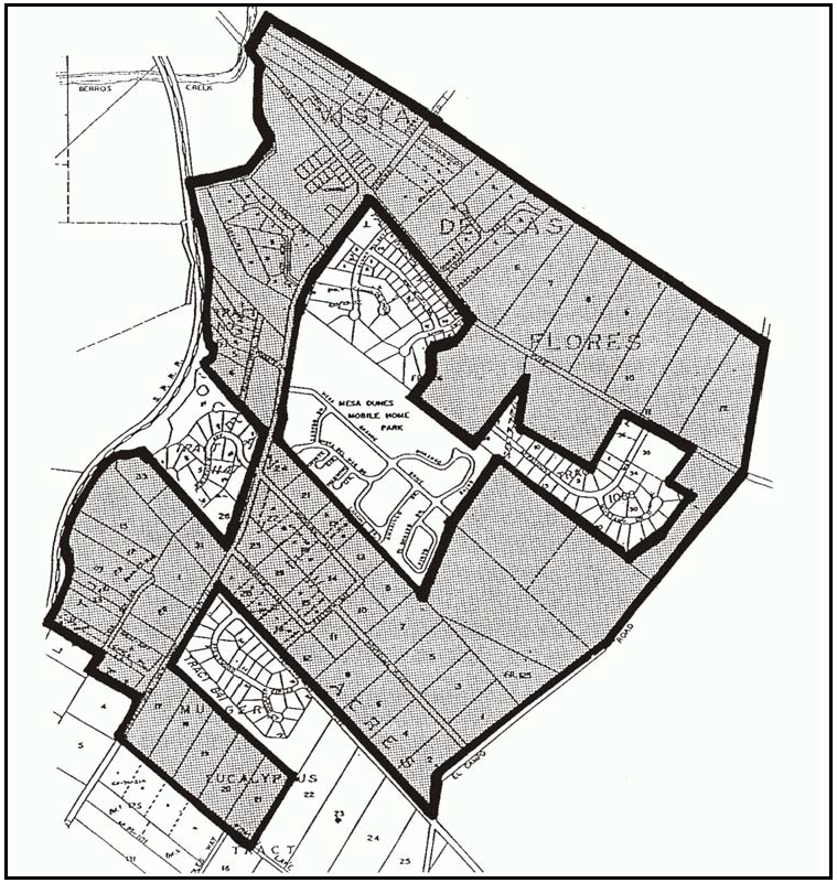
Figure 108-25: Palo Mesa Drainage Plan Requirements
3.
Circulation. In addition to the circulation standards in Section 22.98.070C, development that is subject to Minor Use Permit or Conditional Use Permit approval shall provide adequate circulation measures to minimize an increase in vehicle turning movements to and from Highway 1 and Halcyon Road.
B.
Commercial Retail (CR). The following standards apply within the Commercial Retail land use category.
1.
Limitation on use. Land uses shall be limited to: bars and night clubs; caretaker dwellings; consumer repair services; convenience and liquor stores; financial services; gas stations; general retail; hardware stores; indoor amusements and recreation; offices; personal services; restaurants and energy-generating facilities (limited to accessory renewable energy facilities).
2.
Zoning Clearance and Site Plan Review requirements. The following standards apply to all projects requiring Zoning Clearance or Site Plan Review. Applicants that cannot or choose not to comply with the provisions of this Subsection may instead apply for Minor Use Permit approval.
a.
Access. Primary access on the east side of Highway 1 shall be from Halcyon Road.
b.
Limitation on floor area. Each store or use shall be limited to 5,000 square feet of floor area, except that general retail, financial services and offices shall be no more than 2,000 square feet each. General retail cumulatively shall not exceed 25 percent of the total floor area on a site.
c.
Site planning. Building entrances to uses shall be visible from the street. Building layout shall be varied as conceptually illustrated in Figure 108-26. Pedestrian access between on-site uses and adjacent commercial properties shall be provided. Loading and service areas shall be separated from other circulation areas. Street sidewalks shall be separated from curbs by parkways. Outdoor seating, shade and small plazas shall be provided.
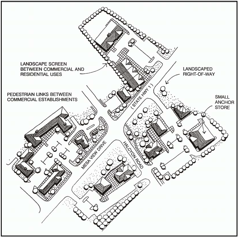
Figure 108-26: CR - Commercial Area Design Concept
d.
Architecture. Architecture shall utilize pitched roofs with hipped or gable ends and eaves, wall materials that are linear wood or wood appearing siding, such as lap siding or channel tongue and groove, stucco, brick or stone. Changes in wall and roof planes shall occur at least every 30 feet by the use of offsets and directional shifts. Extensive use of moldings, cornices and other architectural ornamentation shall be provided.
e.
Sign limitation. Free-standing signs shall be limited to monument signs.
f.
Setbacks. Building locations shall have a maximum setback of 20 feet on at least 40 percent of the front and street-corner sides before other on-site building locations are utilized.
g.
Landscaping. At least 15 percent of the site area, not including buildings and setbacks shall be landscaped for shading, screening and pedestrian use of walkways, plazas and seating areas.
3.
Minor Use Permit and Conditional Use Permit requirements. Projects requiring Minor Use Permit or Conditional Use Permit approval shall conform with the requirements of Subsection B.2 as guidelines for new development. These standards may be modified where the Review Authority determines that the intent of the standards is met by alternative designs.
C.
Recreation (REC). The following standards apply within the Recreation land use category within the area shown on Figure 108-27.
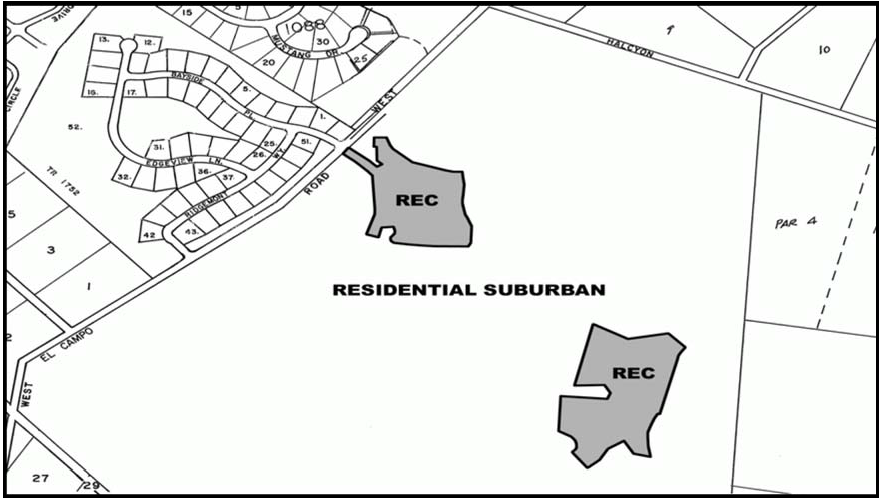
Figure 108-27: REC - Cypress Ridge Recreation Land Use Category
1.
Limitation on Use. The allowed uses are as follows:
a.
"previously-approved uses" per D890413D are allowed, including: golf course and related uses, specific commercial uses within the "Village Center," single family residences, eating and drinking places;
b.
additional uses as follows: hotel (not to exceed 103-units), a facility of an approximate 14, 000 square foot footprint (pro-shop, hotel registration, and full service restaurant (200 seat)), employee housing, additional "Village Center" use to allow general public to conduct meetings and social events, child care facilities and energy-generating facilities (limited to accessory renewable energy facilities).
2.
Open Space. Maintaining the open space as previously approved on the Development Plan/Subdivision (D890413D/TR1933); and
3.
Residential Density. Not increasing residential density as set forth in the approved Development Plan/Subdivision (D890413D/TR1933).
D.
Residential Single-Family (RSF) - Access at Halcyon Road and Highway 1. Uses within the Residential Single-Family land use category on Lots 1, 2 & 3, Block 3, Tract 151 (see Figure 108-28) shall have access only from Camino Del Rey, not from Highway 1.
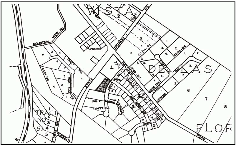
Figure 108-28: RSF - Southeast Corner of Halcyon Road and Highway 1
E.
Residential Suburban (RS). The following standards apply within the Residential Suburban land use category.
1.
Access to Highway 1. Residential properties shall gain access to Highway l by way of local streets wherever possible.
2.
Woodland Dairy. The following standards apply only to the former Woodland Dairy property (see Figure 108-29).

Figure 108-29: RS - Woodland Dairy
a.
Permit requirement - Specific Plan. A Specific Plan shall be prepared in compliance with Government Code Section 65450 under the guidance of the County prior to the approval of further subdivision development of the property, although a clustered land division in compliance with Section 22.22.140 may be approved without Specific Plan approval.
b.
Specific Plan objectives. The Specific Plan shall be prepared to achieve the following objectives:
(1)
Project design consistent with the resource carrying capacities of the site and vicinity and compatible with the suburban and rural residential character of the site vicinity.
(2)
Protection of the resources of Black Lake Canyon.
(3)
Project design and development for residential clusters, recreational and incidental small-scale resort and retail commercial uses, with close proximity among and between uses achieving a central village orientation, with convenient pedestrian access to and within open space areas.
(4)
Formulation of methods to fund and implement areawide circulation, public service and facility improvements to support the population growth accommodated by the project and areawide development.
(5)
Use of reclaimed water to satisfy as much of the project non-potable water demands as possible.
c.
Specific Plan - Content. Preparation of the Specific Plan shall include all information required by Government Code Sections 65450 et seq., and shall also include development and analysis of the following information:
(1)
Resource capacities of the project site and site vicinity including water, sewage disposal suitability, schools and traffic.
(2)
Site layout and development concepts for all uses on the property, including location of clustered residential sites and the proposed number of units within each cluster. Development shall utilize the cluster division provisions of Section 22.22.140 with a maximum density of one dwelling per acre.
(3)
A phasing plan for implementation of the project.
(4)
Circulation patterns and street alignments in the project that will minimize vehicle travel, with an emphasis on pedestrian and bicycle access to and through open space areas.
(5)
Proposed means of protecting the resources of Black Lake Canyon.
(6)
Proposed programs to study and where appropriate, to be part of the funding and implementation of areawide circulation, public facility and service improvements necessary to support the growth accommodated by the project and areawide development.
d.
Permit requirements - Development after Specific Plan. The Specific Plan shall include a section that identifies the permitting and processing requirements for development of the property after adoption of the Specific Plan.
e.
Site access. Access to the project site is not to be from the south edge of the property in Black Lake Canyon. Proposed parcels within the development shall be accessed from the internal street system.
f.
Community services. Establish community water supply and sewage disposal systems. The community water system shall be integrated into a village-wide water system, if possible.
g.
Mitigation measures. The Specific Plan shall incorporate wherever possible the mitigation measures identified in the Final Environmental Impact Report prepared for the Bjerre General Plan amendment application (County file no. G831130:1).
[Amended 1981, Ord. 2063; 1985, Ord. 2239; 1997, Ord. 2800; Added 2002, Ord. 2968; Amended 2014, Ord. 3256; 2015, Ord. 3291]
22.108.070 - Woodlands Village Area Standards.
The 1998 Woodlands Specific Plan and any amendments thereto, is hereby incorporated into this Section as though it were fully set forth here. All development within the Woodlands Specific Plan Area (see Figure 108-30) shall be in conformity with the adopted Specific Plan. In the event of any conflict between the provisions of this Title and the Specific Plan, the Specific Plan shall control. Any deviation of existing or proposed development from the provisions of the Specific Plan shall occur only after appropriate amendment of the Specific Plan.

Figure 108-30: REC/CR/CS - Woodlands Specific Plan Area
[Amended 1999, Ord. 2865; 2014, Ord. 3256]