
San Luis Obispo County Unincorporated
City Zoning Code
City Zoning Code
ARTICLE 9
PLANNING AREA STANDARDS
22.90.010 - Purpose of Article 9.
The chapters in this Article provide standards for proposed development and new land uses that are specific to each of the planning areas defined by the Land Use Element. These standards are mandatory requirements, intended to address the local planning issues of each planning area.
22.90.020 - Applicability.
A.
General applicability. The standards of this article apply to all proposed development and new land uses. Compliance with these standards is required to enable a permit for a new use to be approved, and for a newly-constructed project to be used. These standards apply to proposed projects in addition to all other applicable provisions of this Title. Where these standards conflict with other provisions of this Title, these standards control, except as provided in Subsection B.
B.
Density — TDC program. Where additional density is granted through participation in the TDC Program (Chapter 22.24 or 22.26), the base density determined in compliance with Chapters 22.24 or 22.26 is established from the standards of this article for minimum parcel size. Any density bonus shall comply with the provisions of Chapters 22.24 or 22.26, unless the density bonus is specifically set forth in the area plan standard.
C.
Effect of designations. In any case where a property is designated in the Open Space (OS) or Recreation (REC) land use categories, in the Sensitive Resource Area (SRA) or Historic Area (H) combining designations, or where standards identify a need for open space preservation through easement, contract or other instrument, these designations shall not in themselves convey or imply any right of public use, access, trespass, or violation of privacy.
[Amended 2014, Ord. 3256]
22.92.010 - Purpose and Applicability.
This Chapter provides standards for proposed development and new land uses that are specific to the Carrizo planning area defined by the Land Use Element. These standards apply to proposed development and new land uses as provided by Section 22.90.020 (Applicability), and are organized according to the specific areas and/or land use categories within the planning area to which they apply.
[Amended 2014, Ord. 3256]
22.92.020 - Combining Designation Standards.
A.
Sensitive Resource Area (SRA). The following standards apply within the Sensitive Resource Area combining designation.
1.
Limitation on use - Soda Lake. Resource extraction and new construction is prohibited within the Soda Lake SRA.
2.
BLM Wilderness Study Areas. New development within BLM wilderness study areas is allowed only in accordance with the Federal Land Policy and Management Act of 1976.
3.
Off-Road Vehicles. Off-road vehicles are prohibited except on designated trails in BLM lands.
[Amended 2014, Ord. 3256]
22.94.010 - Purpose and Applicability.
This Chapter provides standards for proposed development and new land uses that are specific to the North County planning area defined by the Land Use Element. These standards apply to proposed development and new land uses as provided by Section 22.90.020 (Applicability), and are organized according to the specific areas and/or land use categories within the planning area to which they apply.
[Amended 2014, Ord. 3256]
22.94.020 - Combining Designation Standards.
A.
Airport Review (AR). The following standards apply within the Airport Review Area (AR) combining designation shown in Figure 94-1:
1.
Airport Land Use Plan included by reference. The Paso Robles Municipal Airport Land Use Plan, and any amendments thereto, are hereby incorporated into this Title by reference as though it were fully set forth here.
2.
Limitation on use. Land uses shall be limited to those designated as "compatible" or "conditionally approvable" by the Paso Robles Municipal Airport Land Use Plan, in compliance with the land use permit requirements of Section 22.06.030 (Allowable Land Uses and Permit Requirements).
3.
Review for compliance with Airport Land Use Plan. All discretionary land use permits, land divisions, general plan amendments, specific plans, specific plan amendments, and land use ordinance amendments must be found consistent with the Paso Robles Municipal Airport Land Use Plan adopted by the San Luis Obispo County Airport Land Use Commission. In accordance with the requirements of the Public Utilities Code of the State of California, such finding of consistency may be made only by referral and action of the Airport Land Use Commission of San Luis Obispo County.
4.
Site design and development standards - Private lands. All development applications for the area within the boundary of the Paso Robles Municipal Airport Land Use Plan are subject to the development standards set forth in that plan, in addition to all applicable provisions of this Title. In the event of conflicts between the provisions of the Airport Land Use Plan and this Title, the more restrictive provisions shall prevail.
5.
Site design and development standards — Airport site. New development projects in County-owned portions of the Paso Robles Municipal Airport shall be consistent with the Airport Master Plan and any amendments thereto, and shall comply with all applicable provisions of Articles 3 and 3 of this Title.
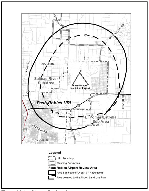
Figure 94-1: Airport Review Area
B.
Flood Hazard (FH) — Shandon Sub-area. New development within the 100-year floodplain inside the master plan areas as shown on Figure 94-2 is prohibited, unless the use is exempt from the FH standards in Chapter 22.14 or there are no feasible alternative building sites on the property.
Figure 94-2: Master Plan Areas
C.
Geologic Study Area (GSA). Land use permit applications for hillside development proposals within the Geologic Study Area (GSA) adjacent to the City of Morro Bay shall include a geologic report.
D.
Sensitive Resource Area (SRA).
1.
Off-road vehicles are prohibited within the SRA (Sensitive Resource Area) combining designation in the following locations:
a.
The Santa Margarita Lake watershed, because the lake is a domestic water terminal reservoir.
b.
The Shandon Sub-area, as shown in Figure 94-5; except that off-road vehicles are allowed on designated trails in BLM lands.
2.
Within the Los Padres Sub-area and Salinas River Sub-area, as shown in Figure 94-5, access to or through SRA areas shall be limited to existing roads, trails or to proposed trails shown on the latest Forest Service Off-Road Vehicle Plan. Any proposed changes in this plan should be submitted to the County and affected private property owners for review.
3.
Within the Nacimiento Sub-area, as shown in Figure 94-5, projects requiring Conditional Use Permit approval within the SRA combining designation shall concentrate proposed uses in the least sensitive portions of properties. Native vegetation shall be retained as much as possible.
4.
Within the Shandon Sub-area, as shown in Figure 94-5, new development within BLM wilderness study areas is allowed only in accordance with the Federal Land Policy and Management Act of 1976.
5.
Shandon Vicinity Creek and Habitat Areas SRA. The following standards apply within the Shandon Vicinity Creek and Habitat Areas SRA combining designation within the Shandon Community Plan Study Area as shown on Figure 94-3.
Figure 94-3: Shandon Community Plan Study Area
a.
Land divisions and discretionary land use permits shall include open space or scenic preservation easements on the portion of the property within the SRA combining designation.
b.
Applications for land use permits and land divisions shall provide proof of an approved jurisdictional determination when the site may contain wetland features, including those identified in Figure 4.4-2 of the Final Environmental Impact Report (EIR) for the Shandon Community Plan Update and San Juan Village (Fallingstar Phase I) Project. New development shall be set back a minimum of 100 feet from the edge of a delineated wetland and riparian habitat. Activities within the setback area shall be limited to fuels reduction for fire safety purposes. New development shall comply with County requirements and the provisions of Appendix D of the Shandon Community Plan relating to biological resources including the following:
(1)
Jurisdictional delineation. A jurisdictional delineation shall be conducted by a County-approved qualified biologist for all properties that may contain wetland features prior to issuance of land use permits. The jurisdictional delineation shall examine the entire project site and shall determine if features on-site fall under the jurisdiction of the U.S. Army Corps of Engineers, Regional Water Quality Control Board, and/or California Department of Fish and Game. The result will be a preliminary jurisdictional delineation report which shall be submitted to the appropriate agencies for review and approval, and permits shall be obtained from each agency where applicable. No permits shall be issued until compliance with all applicable federal and state laws has been demonstrated.
(2)
Mitigation of impacts to wetlands and riparian habitat. All proposed projects shall be designed to avoid impacts to wetlands and riparian habitats. All wetland and riparian habitat and appropriate buffer zones shall be clearly demarcated on-site with highly visible construction fencing to ensure that these areas are not impacted during construction-related activities.
If wetland and/or riparian habitat cannot be avoided, permits shall be obtained from the appropriate regulatory agency: U.S. Army Corps of Engineers, Regional Water Quality Control Board, and/or California Department of Fish and Game. Loss of such features shall be mitigated at a ratio to be determined by the permitting agencies, but shall not be less than 1:1 (one acre of habitat created to one acre of habitat lost). Mitigation shall occur on-site. Locally native riparian and wetland species shall be used and removal of native species shall be prohibited; however, select willow cuttings (from the site or within the Study Area) and emergent plant division are permissible. A mitigation plan shall be prepared by a qualified biologist and shall include success criteria, monitoring methods, a monitoring schedule, contingency planning, weed control/management provisions, irrigation methods and schedule, and annual reporting requirements. Created riparian and wetland habitat shall be monitored for a minimum of five years or as otherwise determined by the permitting agencies. Prior to commencement of grading, a performance bond shall be filed with the County to complete habitat creation and maintain plantings for the duration of the mitigation program.
If mitigation on-site is not feasible, mitigation off-site at a location approved by the permitting agencies shall occur. Alternatively, payment into an in-lieu fee program and/or purchase of credits at an approved mitigation bank may be allowed by the permitting agencies for impacts to wetlands.
(3)
Plan requirements and timing. All grading and construction plans shall depict on-site wetland and riparian habitat and appropriate setbacks, and shall be submitted along with applicable permits, a performance bond, and proof of payment into an in-lieu fee program and/or purchase of wetland credits (if applicable) to Planning and Building for approval prior to issuance of land use permits. In addition, prior to issuance of land use permits a letter from the County Fire Department shall be submitted identifying that no riparian vegetation removal is needed for fire safety purposes.
(4)
Monitoring. The site shall be inspected by an approved monitor during all phases of construction to ensure compliance with appropriate avoidance and minimization measures.
c.
Uses within the habitat buffer areas along the eastern edge of the community as shown in Figure 94-4 shall be limited to recreational trails, habitat corridors, or other uses that are consistent with Shandon Community Plan Habitat Conservation Plan (HCP) or other applicable HCP. These standards will apply to any proposed development consistent with the masterplan buildout areas and would have comparable impacts on the wildlife migration corridor as contemplated in the Shandon Community Plan. They do not apply to development on Agriculture-designated lots of record existing at the time of adoption of the Shandon Community Plan, which may be approved for development consistent with their agricultural zoning.
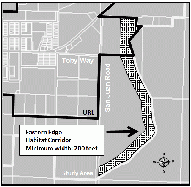
Figure 94-4: Habitat Buffer Area
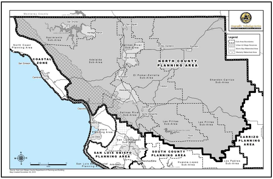
Figure 94-5: North County Planning Area
[Amended 1984, Ord 2206; 2003, Ord 3014; 2012, Ord. 3222; 2014, Ord. 3256; 2025, Ord. 3527]
22.94.025 - Paso Robles Groundwater Basin.
A.
Applicability. The following standards apply to lands where development uses or will use water from the Paso Robles Groundwater Basin in the areas shown in Figure 94-6, which include the following:
1.
Portions of the rural Adelaida, El Pomar-Estrella, Las Pilitas, Los Padres, Nacimiento, Salinas River, and Shandon-Carrizo Sub-areas of the North County Planning Area.
2.
The village of Whitley Gardens.
B.
Definitions. The following definitions are for the purposes of this section.
1.
"Net increase" means the expected increase in water use due to proposed development requiring a discretionary permit, taking into account net existing demand.
2.
"Net existing water demand" is the amount of water used for non-agricultural purposes on the site of proposed development requiring a discretionary permit minus the volume of water returned to the groundwater basin through wastewater return flows. The calculation of net existing water demand is the sole responsibility of the Planning Director using historical water records if available or other means if records are not available.
3.
"Net new water demand" is the amount of water used for non-agricultural purposes by new development requiring a discretionary permit minus the volume of water returned to the groundwater basin through wastewater return flows. The calculation of net new water demand is the sole responsibility of the Planning Director using water demand factors for the proposed land uses.
4.
"Water used for non-agricultural purposes" is water that has never been used, whether on or off the site, for an agricultural activity such as cultivation, growing, harvesting and production of any agricultural commodity and appurtenant practices incidental to the production of agricultural commodities.
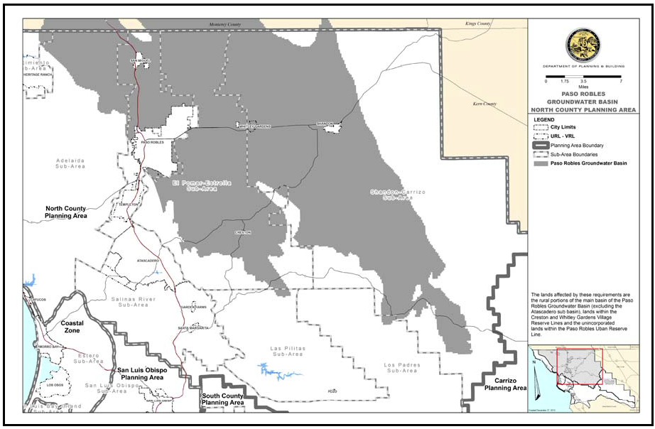
Figure 94-6: Paso Robles Groundwater Basin
C.
General plan amendments. General Plan amendment applications that would result in a net increase in the amount of water used for non-agricultural purposes shall not be approved until a Level of Severity I is certified for the Basin by the Board of Supervisors after adoption of a Resource Capacity Study.
D.
Land divisions. Divisions of land shall not be approved until a Level of Severity I is certified for the Basin by the Board of Supervisors after adoption of a Resource Capacity Study. Exceptions to this provision may be approved by the review authority only when the proposed land division is:
1.
For a public use or facility (e.g. fire station), or
2.
Required for conservation purposes and found to be consistent with the Conservation and Open Space Element of the General Plan.
E.
Outdoor water use, discretionary permits. New development requiring discretionary land use permits is subject to the following requirements:
1.
Residential uses shall have no more than 25% percent of the area of irrigated, ornamental landscaping planted with turf.
2.
All landscaped areas shall be irrigated with automatic irrigation systems, including irrigation controllers and moisture sensors.
3.
All landscape plantings shall be low-water using.
4.
Non-irrigated, drought resistant landscaping is encouraged in lieu of irrigated landscaping. The portion of a parcel that is not used for structural development, landscaping or driveways is encouraged to be left in a native state.
5.
Rainwater capture or other alternative water systems are encouraged in compliance with Titles 8 and 19 of the County Code, as applicable.
6.
In cases where these standards conflict with other provisions of this Title that are more stringent, the more stringent provisions shall apply.
F.
Offset requirements for discretionary permits. New development requiring discretionary land use permits shall offset the resulting net new water demand as follows:
1.
Land use permit applications shall include existing water use data, if it is available, that is sufficient to calculate net existing water demand on the proposed project site. The land use application shall include descriptions of all proposed uses on the site in a level of detail adequate to calculate the proposed project's net new water demand. In any case, determinations of net new water demand, net existing water demand and net increase shall be the responsibility of the Planning Director or designee.
2.
The net new water demand shall be offset at a ratio of 2:1 through participation in water conservation programs listed in subsection c below. Any net existing water demand shall be taken into account in the calculation of required offsets of net new water demand.
3.
Programs to offset water used for non-agricultural purposes may include but are not limited to the following, but in any case, shall conserve only water used or potentially used for non-agricultural purposes:
a.
Retiring the development potential of lots in the Paso Robles Groundwater basin through an agreement with the County or qualified land trust.
b.
Retrofitting plumbing fixtures in the Paso Robles Groundwater Basin.
c.
Purchasing supplemental water for a water supplier that uses groundwater from the main Paso Robles Groundwater Basin.
d.
Participating in an approved water conservation program in the Paso Robles Groundwater Basin that results in water savings.
e.
Reducing water demand in the Paso Robles Groundwater Basin through other means approved by the Planning Director.
f.
Water from the Nacimiento or State Water Projects shall not be used for development in the rural area.
4.
Any required offset of net new water demand shall be completed at the time of final inspection or issuance of a certificate of occupancy unless an alternative completion time (which may be more or less time) is approved by the review authority. In any case, the review authority must find the offsets to be verifiable, permanent and enforceable.
5.
Agricultural Processing uses (as defined in the Land Use Ordinance), including outdoor and other appurtenant water use, shall be exempt from the preceding offset requirements for discretionary permits. Instead, agricultural processing uses shall be subject to project-specific land use and/or water conservation mitigation measures required by the review authority based on environmental review.
G.
Resource Management System Biennial Summary Report. Included with the biennial summary report shall be a review of this subsection, including whether amendment or repeal of this subsection is warranted based on the certified level of severity (LOS) for the Basin changing from a LOS III to a LOS I. Any amendment or repeal of this subsection shall be processed consistent with Section 22.70.040.
[Added 2012, Ord. 3231; Amended 2014, Ord. 3256]
22.94.030 - Adelaida Sub-area Standards.
All development and new land uses in the Adelaida Sub-area, as shown in Figure 94-5, shall comply with the following standards, where applicable.
A.
Adelaida Road - Rock walls. Existing rock walls along Adelaida Road shall be preserved in the design and construction of road improvements.
B.
Road design and construction. Road alignments proposed in new land division applications shall be designed and constructed to minimize terrain disturbance consistent with safety and construction cost. Altered slopes shall be replanted with indigenous plants or protected by other appropriate erosion control measures.
C.
Cayucos Planning Impact Area. Within the planning impact area shown in Figure 94-7, land divisions, general plan amendments and all other discretionary applications shall be referred to the Cayucos Citizens Advisory Council or its successor for review and comment.
Figure 94-7: Cayucos Planning Impact Area
[Added 2004, Ord 3047; Amended 2014, Ord. 3256]
[Added 2007, Ord. 3138; Deleted 2010, Reso 2010-192 (Viewshed)]
22.94.032 - Land Use Category Standards for the Adelaida Sub-area.
A.
Agriculture (AG). The standards of this Section apply within the AG land use category to the entire Estero Marine Terminal ownership as shown in Figure 94-8.
1.
Storage Tanks and Related Equipment. Any necessary storage tanks or related above-ground equipment shall be dismantled in accordance with the required Conditional Use Permit, and any environmentally hazardous conditions corrected.
2.
Abandonment of the Marine Terminal.
a.
Permit Requirement. A Conditional Use Permit shall be filed within six months from closure of the offshore components of the marine terminal.
b.
Application Content. The Conditional Use Permit application shall include the following:
(1)
A site characterization study of soil and groundwater contamination.
(2)
A phasing plan for abandonment indicating the anticipated timetable.
(3)
Plans for proposed decommissioning, site restoration environmental mitigation, and reuse of existing facilities that will facilitate use of the site for uses allowable in the Agriculture category. The plans shall be coordinated with plans for new uses.
3.
Subsequent Development. After abandonment of the marine terminal and associated facilities, all subsequent development shall be consistent with the Agriculture land use category.
Figure 94-8: Estero Marine Terminal
B.
Rural Lands (RL).
1.
Applicability. The standards of this Section apply within the RL land use category north and northeast of Niderer Road, as shown in Figure 94-9 and described in the following maps on record with the County Clerk-Recorder:.
a.
COAL81-0224: recorded in Book 31, Page 54 of Parcel Maps.
b.
CO97-0039 and recorded in Book 54, Page 55 of Parcel Maps.
2.
Minimum parcel size. The minimum area for new parcels is 40 acres unless a larger parcel size is required by Chapter 22.22.
3.
Setback requirements. Proposed dwellings shall be set back a minimum of 200 feet from the Agriculture land use category boundary adjacent to the north, south, and east sides of the sites.
4.
Site "A." The following standards apply only to Site "A" as shown on Figure 92-6. Residential density. Residential development shall be limited to one single-family dwelling on any lot of less than 80 acres, in addition to the existing historical single-family dwelling.
5.
If the historical single-family dwelling is destroyed, it shall not be replaced.
6.
If new dwelling units are constructed (other than the four existing dwellings situated on the 160 acre parcel), the existing dwellings shall be demolished or otherwise brought into compliance with this Subsection and all other applicable provisions of this Title.
7.
Fire safety. Proposed land divisions shall be designed to incorporate the following fire safety standards:
a.
An interior loop road providing alternate access to the majority of the property;
b.
Residential sprinkler systems installed within all new dwellings; and
c.
Designation of new building sites on the map to minimize terrain disturbance and the need for tree removal
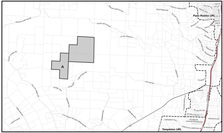
Figure 94-9: Niderer Road Area (COAL81-0224 and CO97-0039)
[Added & Amended 2004, Ord 3047; Amended 2014, Ord. 3256; 2020, Ord. 3409]
22.94.040 - El Pomar-Estrella Sub-area Standards.
All development and new land uses in the El Pomar-Estrella Sub-area, as shown on Figure 94-5, shall comply with the following standards, where applicable.
A.
Archaeological Resources. All land use permit applications subject to discretionary review that propose development within 100 feet of the bank of a creek (appearing as a solid, dotted, or dashed blue line on the applicable U.S. Geological Survey 7.5 -minute topographic quadrangle map), and within 300 feet of a creek where the slope of the site is less than 10 percent, shall be subject to the following requirements.
1.
Preliminary site survey required. Before issuance of a land use or construction permit, a preliminary survey shall be conducted by a qualified archaeologist approved by the County Environmental Coordinator to determine the likelihood of existence of resources. The report of the archaeologist shall be submitted to the Planning Department and considered in the evaluation of the development request by the applicable approval body.
2.
When a mitigation plan is required. If the preliminary site survey determines that proposed development may have significant effects on an existing, known or suspected archaeological resource, a Minor Use Permit shall be required and shall include a plan prepared by the archaeologist for mitigation to protect the resource. The plan may recommend further study, subsurface testing, monitoring during construction, project redesign or other appropriate actions. The plan shall require approval by the Environmental Coordinator prior to consideration of the development request by the applicable approval body.
3.
If resources are found. In the event archaeological resources are found on the site, construction activities shall cease, and the Environmental Coordinator and Planning Department shall be notified so that the extent and location of discovered material may be recorded by a qualified archaeologist and artifacts may be /preserved in accordance with state and federal law. In the event archaeological resources are found to include human remains, the County Coroner shall also be notified.
B.
Riparian and Wildlife Corridors. New development in new land divisions and on publicly-owned property, and all new development subject to discretionary review shall be set back a minimum of 50 feet from the top of the bank of any watercourse, as defined in the Land Use Ordinance, or outside the dripline of riparian vegetation, whichever distance is greater, as shown in Figure 94-10. Trails may be located within this required setback only if trail design and construction avoid or mitigate environmental impacts. Adjustments to this standard may be made only if all of the following are met:
1.
Alternatives are determined to be infeasible or more environmentally damaging.
2.
Native vegetation compatible with riparian habitat is used for all revegetation and landscaping within the setback from the watercourse.
3.
Adequate erosion and sedimentation control measures are implemented during grading and construction.
4.
No alteration of riparian vegetation is necessary (except for creek crossings, which shall be minimized).
5.
The setback from the top of the bank shall not be less than 30 feet.
6.
When significant impacts to stream or riparian resources will occur, the applicant shall fund mitigation approved by the County or another public agency with jurisdiction, plus monitoring and restoration measures implemented by qualified professionals.
Stream alteration may be allowed for water supply and flood control projects, maintenance of existing roads or channels, projects to address public safety concerns, improvement of fish and wildlife habitat, or approved surface mining operations, provided that no practical alternative is available.
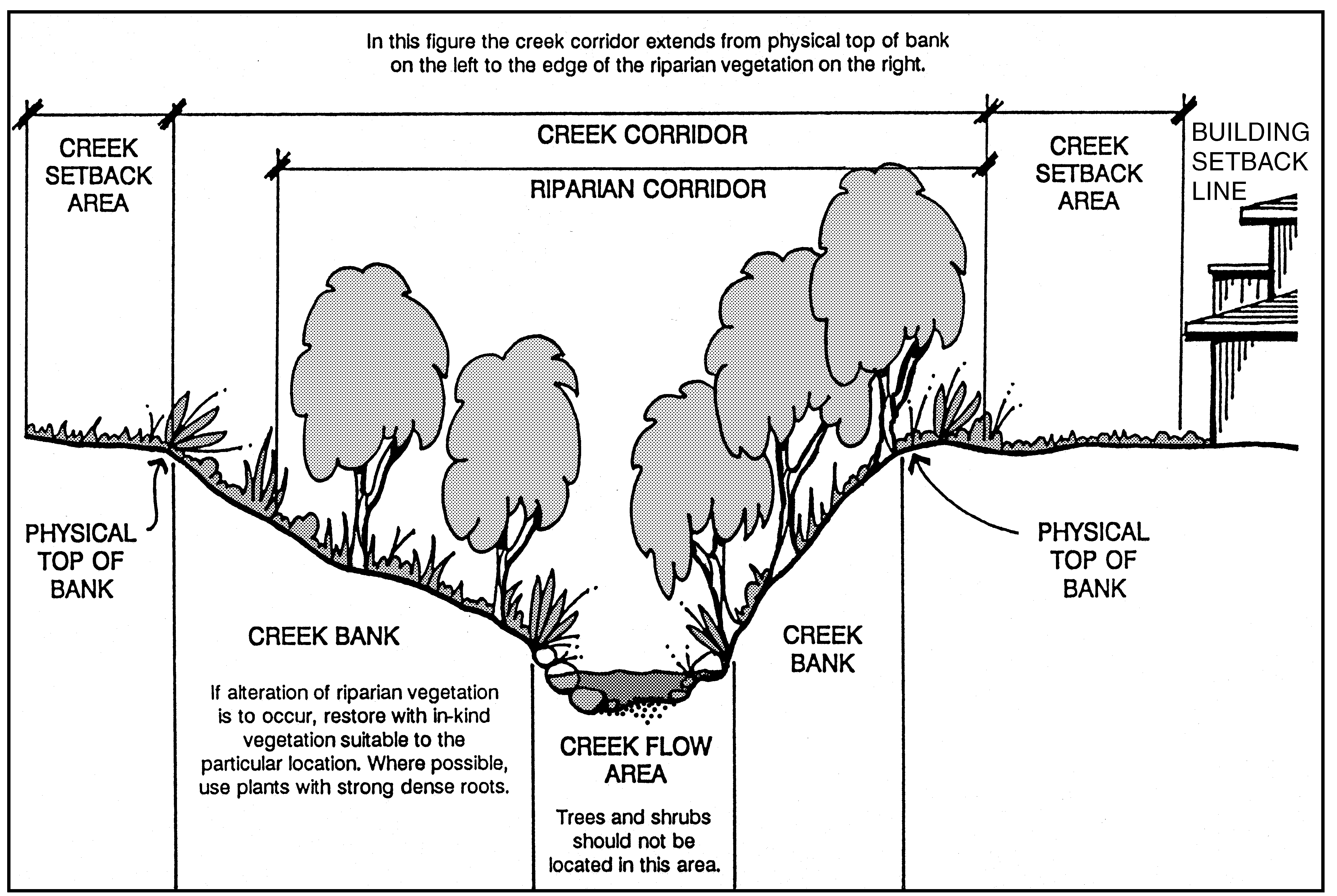
Figure 94-10: Riparian and Wildlife Corridors
C.
Grading, Removal of Vegetation, and Fuelbreaks. The following standards are intended to recognize the importance of agriculture and the need for fuel reduction for forestry and fire protection purposes, while promoting safe and environmentally responsible grading, earthwork, vegetation clearance, and erosion control practices.
1.
Grading, Vegetation Removal. Notwithstanding the definition of "grading" in Section 22.52.060 of the Land Use Ordinance, in this Planning Area, "grading" for the purposes of applying the standards of Chapter 22.52 of the Land Use Ordinance shall be defined as follows:
a.
All new earthwork that involves one or more of the following activities: excavations, fills, dams, reservoirs, impoundments, diking, dredging, borrow pits, stockpiling, or compaction of fill where the amount of material cumulatively for any of the above mentioned operations exceeds 10 cubic yards, OR
b.
Removal of more than 10,000 square feet of vegetation on slopes of 20 percent or steeper (if done for agricultural purposes, such removal of vegetation shall be considered agricultural grading for the purposes of applying the standards of Chapter 22.52 of the Land Use Ordinance).
2.
Fuelbreaks. Notwithstanding Section 22.52.050 of the Land Use Ordinance, removal of more than 10,000 square feet of vegetation in this Planning Area on slopes of 20 percent and steeper for fuel reduction or fire protection purposes shall employ sound practices such as those recognized by USDA Natural Resources Conservation Service (for example, practices 314, 342 and 394 in the NRCS Field Operations Technical Guide) that will not adversely affect slope stability or groundwater recharge and that will prevent off-site drainage, erosion and sedimentation impacts.
D.
Light and Glare. At the time of application for any land use permit or land division, the applicant shall provide details on any proposed exterior lighting, if applicable. All lighting fixtures shall be shielded so that neither the lamp nor the related reflector interior surface is visible from adjacent properties. Light hoods shall be dark-colored.
E.
Planning Impact Areas. The following standards apply to land within the planning impact areas of the cities of Paso Robles and Atascadero (shown in Figures 94-11 and 94-12). These areas are not intended to be considered as a basis for annexation or establishing spheres of influence.
1.
Application Referral. Discretionary permit and general plan amendment applications shall be referred to the city of Paso Robles or Atascadero for review and comment.
2.
Development Impacts. Discretionary projects with potential impacts that are associated with and that include, but are not limited to, water quantity and quality, drainage, erosion and sedimentation, traffic and circulation, public safety, and cumulative impacts, shall be addressed as subjects for additional consideration as part of the environmental review process.
3.
Consistency with City Plans. Improvements and/or offers of dedication consistent with city plans shall be considered and may be required for projects depending on the location and scale of the proposed development, and an appropriate and feasible connection between the proposed development and the improvement.
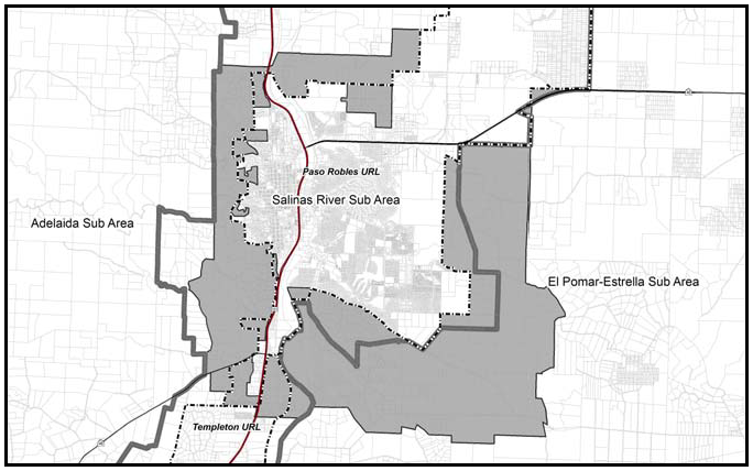
Figure 94-11: City of Paso Robles Planning Impact Area
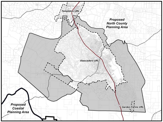
Figure 94-12: City of Atascadero Planning Impact Area
F.
Rocky Canyon Quarry Specific Plan Area. All development within the Rocky Canyon Quarry Specific Plan Area (see Figure 94-13) shall comply with the adopted specific plan dated April 23, 1996 and amended May 2, 2002, including the objectives, policies and standards of the Rocky Canyon Quarry Specific Plan. In the event of any conflict between the provisions of this Title and the Specific Plan, the Specific Plan shall control. Any deviation of existing or proposed development from the provisions of the Specific Plan shall occur only after appropriate amendment of the Specific Plan.
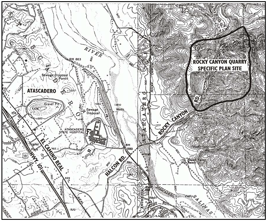
Figure 94-13: Rocky Canyon Specific Plan Area
G.
Landfill Operations-Disclosure. Any approval of land use permits, land divisions and general plan amendments within one-half mile of either the Paso Robles Municipal Landfill or the Chicago Grade Landfill (shown in Figures 94-14 and 94-15) shall include a recordation of a disclosure statement as provided by the Planning and Building Department. The disclosure statement shall include language regarding possible inconveniences and discomforts resulting from continuing and future landfill operations, including possible expansion of the landfills, and shall state that persons are not prevented from notifying appropriate agencies or seeking available remedies concerning any improper or unlawful activities at the landfills.
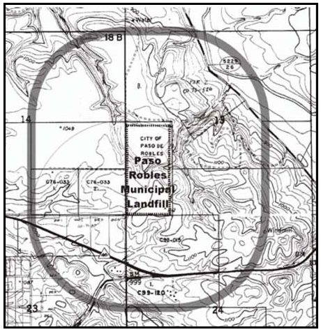
Figure 94-14: Paso Robles Municipal Landfill Area
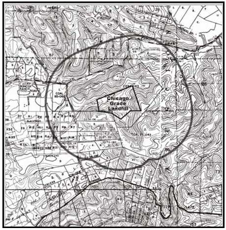
Figure 94-15: Chicago Grade Landfill Area
[Added 1996, Ord. 2760; Amended 1998, Ord. 2830; 2002, Ord. 2968; Added 2003, Ord. 3014; Amended 2010, Ord. 3188; 2014, Ord. 3256]
22.94.042 - Land Use Category Standards for the El Pomar-Estrella Sub-area.
All development and new land uses in the El Pomar-Estrella Sub-area, as shown in Figure 94-5, shall comply with the following standards, as applicable to each land use category.
A.
Agriculture (AG). The following standards apply within the Agriculture land use category.
1.
Protection of Productive Agricultural Land. For projects requiring discretionary approval on irrigated lands or dry farm lands (as defined in the Agriculture Element), new buildings, structures and roads shall be located on the least productive area of the property or closest to access roads, so that development does not diminish the utility of farm fields, unless the discretionary review shows there is no practical alternative for siting the proposed improvements.
2.
Buffers on Non-Agricultural Land. Any required buffer between agricultural operations and residential development shall lie completely within the property proposed for non-agricultural development, except for perimeter roads on agricultural property that are included as part of the required buffer.
3.
Tracts 3, 4, 14, 16, 18, 20, 21, 22 and 23. The following standards apply only to properties shown in Figures 94-16 through 94-18.
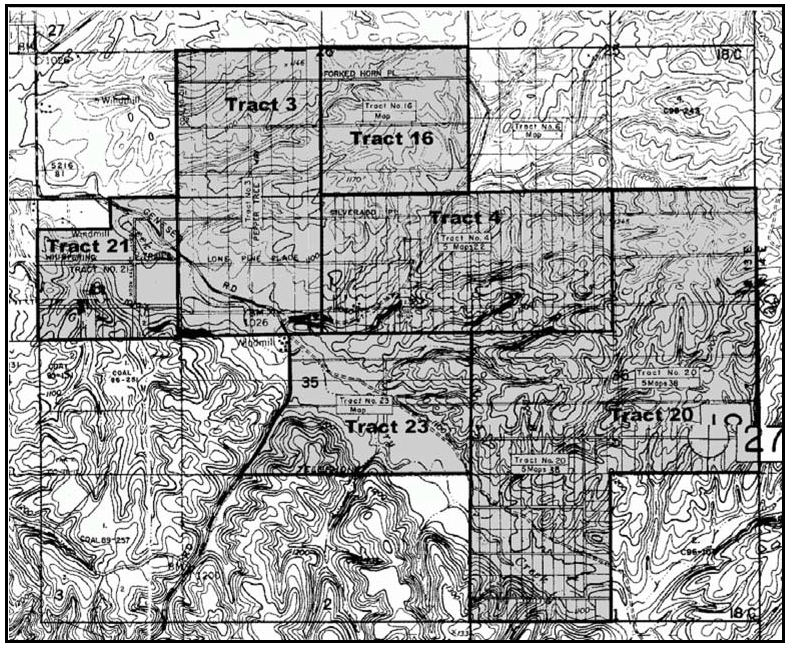
Figure 94-16: Tracts 3, 4, 16, 20, 21 and 23
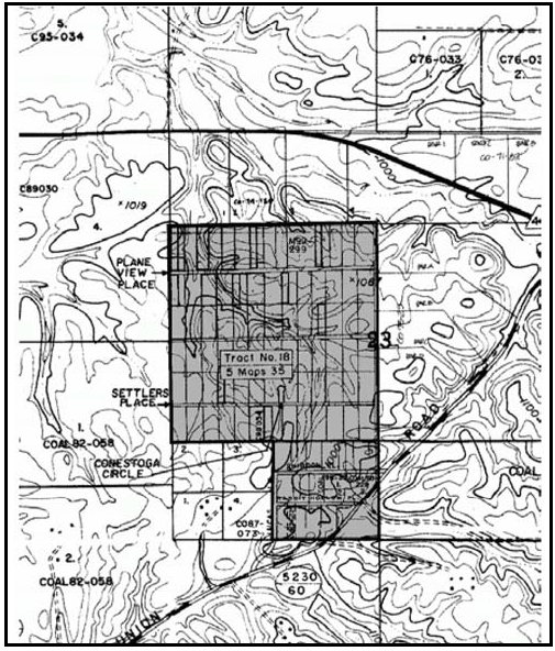
Figure 94-17: Tract 18
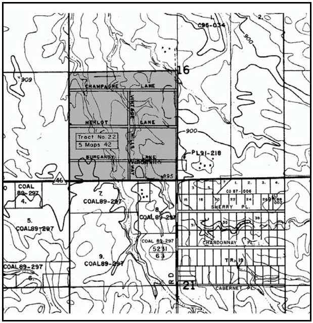
Figure 94-18: Tract 22
a.
Offer of Dedication. Prior to issuance of any land use permit, offer for dedication a public road right-of-way across the entire property frontage along the proposed road. Offered rights-of-way should follow platted road alignments where feasible, and are to be one-half of a 50-foot wide road section from the future centerline
4.
Martingale Circle, Tract 1280. The following standards apply within Tract 1280 as shown on Figure 94-19 and recorded with the County Clerk-Recorder in Book 16, Page 9 of Maps.
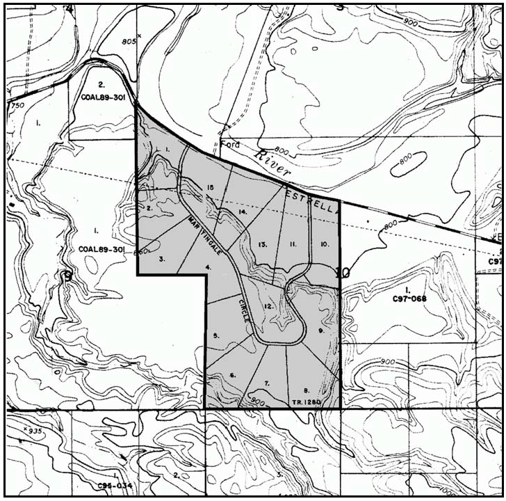
Figure 94-19: Martingale Circle - Tract 1280
a.
Permit Requirement. Minor Use Permit approval is required before residential and agricultural development of each parcel within Tract 1280. Each application shall show: a) the location and type of accessory buildings and other pertinent construction related to a horse-breeding operation or other agricultural use that qualifies for a 20-acre minimum parcel size per the Land Use Ordinance, and b) the size, location and design of any proposed residential site. Each application shall also show information necessary to comply with the conditions of Development Plan D850320:2 and Tentative Tract 1280.
b.
Density Limitation. Each parcel may develop with no more than one single-family dwelling and one farm support unit that qualifies consistent with the Land Use Ordinance.
B.
Rural Lands (RL). The following standards apply within the Rural Lands (RL) land use category.
1.
Old Adobe Way, Kingsbury Road and Vicinity. The following standard applies only to those parcels shown in Figure 94-20.
a.
Land Division Requirements — Road Improvements. New land divisions shall be conditioned to require that: a) the road providing access to the site be improved to county paved road (A-1 rural) standards fronting the site and continuing to the nearest publicly-maintained road, and b) an offer of dedication be made to the county for one-half of a 50-foot right-of-way fronting the site.
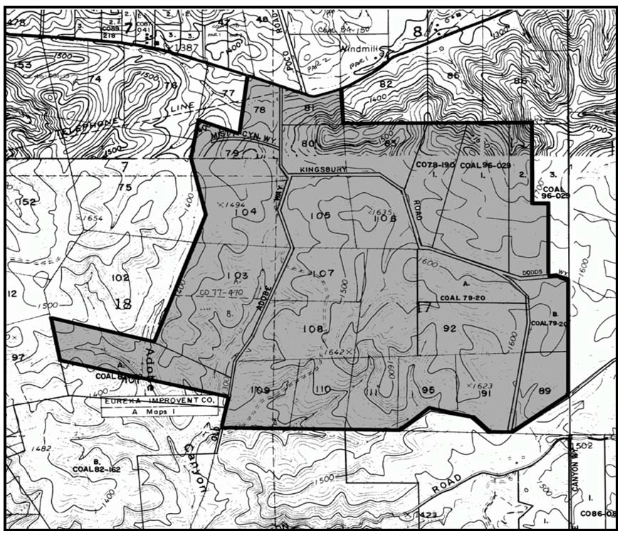
Figure 94-20: Old Adobe Way, Kingsbury Road and Vicinity
C.
Residential Rural (RR). The following standards apply within the Residential Rural (RR) land use category.
1.
General standards. The following standards apply to all parcels within the RR land use category, as applicable.
a.
Offer of dedication. Prior to the issuance of any land use permit, offer for dedication a public road right-of-way across the entire property frontage along the proposed road. Offered rights-of-way should follow platted road alignments where feasible, and are to be one-half of a 50-foot wide road Section from the future centerline.
2.
Eddy Ranch (Assessors Book 36) and Independence Tracts 6, 6A, 6B and 6D: The following standard applies only to properties shown in Figures 94-21 and 94-22.
a.
Access Location. At the time of development, lots fronting the south side of Highway 41 (Eddy Ranch) and Hog Canyon Road (Independence Tracts 6, 6A, 6B and 6D) are to be provided with access roads from the building site to the internal street system of the subdivision wherever the County Engineer determines sight distances to be adequate and where the access roads can be constructed with slopes less than 15 percent.
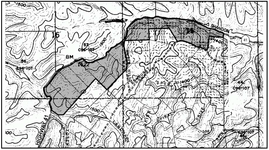
Figure 94-21: Portion of Eddy Ranch
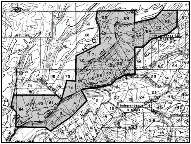
Figure 94-22: Portion of Independence Tract
3.
Dunning and Dresser Tract (including the Town of Linne) and a portion of Dresser Subdivision No. 1: The following standard applies only to properties shown in Figures 94-23 and 94-24.
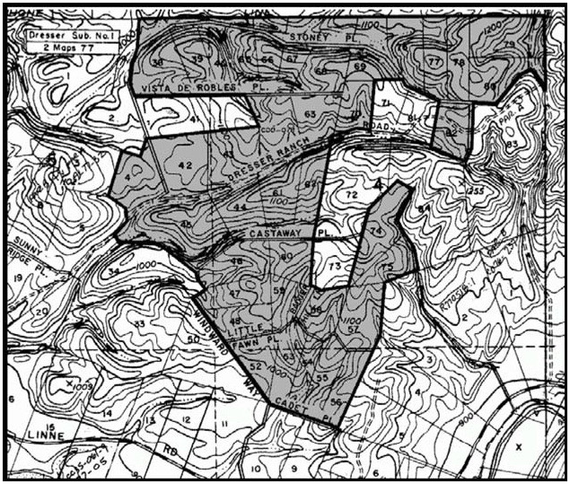
Figure 94-23: Portions of Dunning and Dresser Tract and Dresser Subdivision No. 1
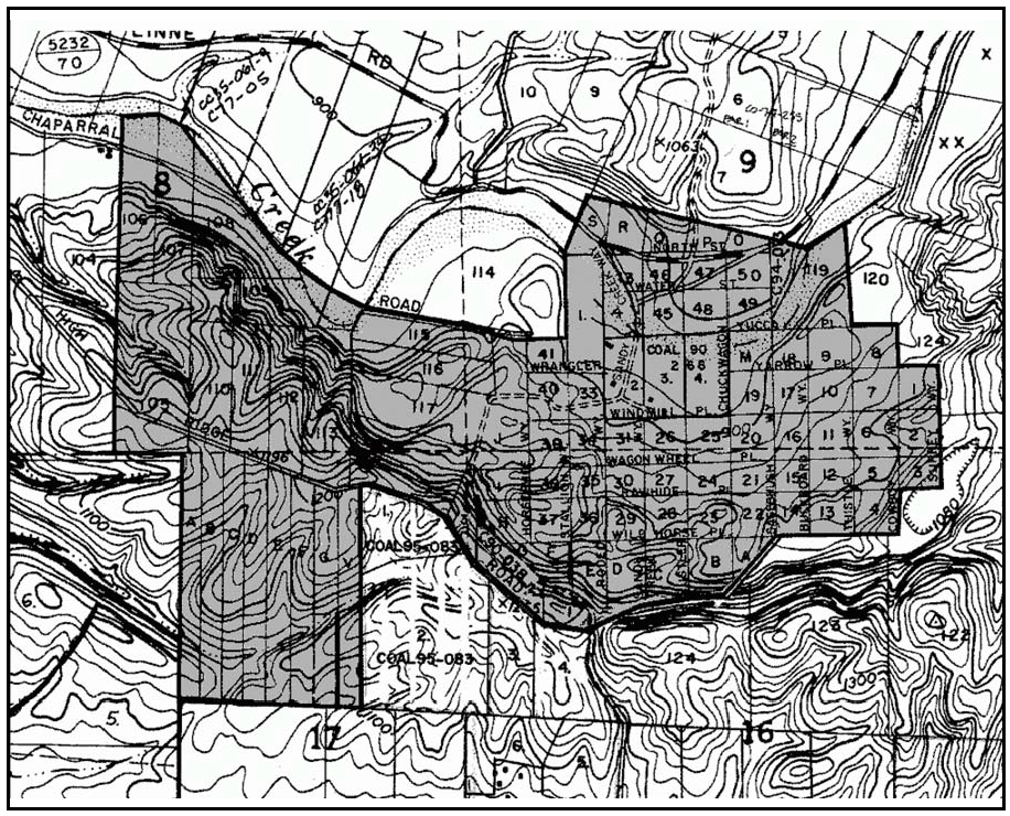
Figure 94-24: Portion of Dunning and Dresser Tract, including Town of Linne
a.
Parcel Size. The minimum allowable parcel size for new land divisions is 20 acres, unless a larger minimum parcel size would otherwise be required by Chapter 22.22 of the Land Use Ordinance
4.
Tract 1371 and Vicinity, Portion of Bowers Orchard Tract, and a Portion of Almond Ridge Orchard Tract No. 1. The following standard applies only to those parcels shown in Figure 94-25.
a.
Minimum Parcel Size. The minimum allowable parcel size for new land divisions is 10 acres, unless a larger minimum parcel size is otherwise required by the Land Use Ordinance.
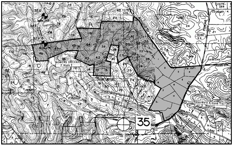
Figure 94-25: Tract 1371 and Vicinity, Portion Bowers Orchard Tract, and a Portion
of Almond Ridge Orchard Tract No. 1
5.
Northwest and Northeast Corners of Highway 41 and Poco Road. The following standards apply only to the parcels at the northwest and northeast corners of Highway 41 and Poco Road shown in Figure 94-26.
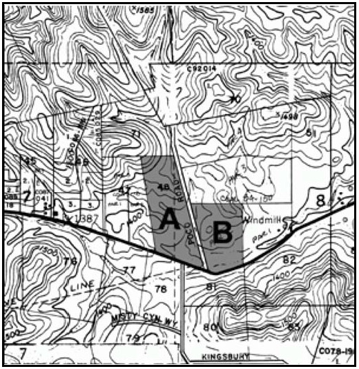
Figure 94-26: Northwest and Northeast Corners of Highway 41 and Poco Road
a.
Minimum Parcel Size. The minimum allowable parcel size for new land divisions in areas A and B is 10 acres.
b.
Residential Density. The maximum allowable residential density in area A is one dwelling unit per ten acres.
6.
Tract 2308. The following standards apply only to the parcels in Tract 2308 for possible future roadway purposes, as shown in Figure 94-27.
a.
Required Setback. A 150-foot setback shall be maintained along the southerly boundary of Tract 2308 for possible future roadway purposes. No structures shall be allowed to be constructed within this setback. Roads and driveways may be constructed within the setback.
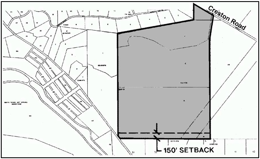
Figure 94-27: Tract 2308
7.
Southwest Corner of Neal Spring Road and Hollyhock Lane. The following standards apply to all of the those parcels shown in Figure 94-28.
a.
Subdivision and development requirements. Prior to approval of a tentative parcel map, the applicant for a subdivision shall designate building sites and parcel access roads that demonstrate how the following requirements can be met with approval of the map: The parcel layout shall, to the extent feasible, provide (1) residential building sites situated below ridges and hilltops such that allowed residential and accessory development will reduce silhouetting against the sky as seen from public roads, (2) road access with minimal visibility from public roads, (3) alternate residential setbacks from the interior and public roads, and (4) plant a minimum of six trees per lot clustered within the setback, to provide a generous landscape setting and significant screening so as to minimize their presence along this portion of the street. Any proposals should retain the intent of minimizing urban or suburban or rural residential character.
b.
Prior to submitting subdivision improvement plans and recording a subdivision map, the applicant shall include the following requirements on an additional map sheet and include relevant information on the subdivision improvement plans as applicable:
(1)
At the time of submittal of subdivision improvement plans and/or application for construction permits, the applicant shall clearly delineate the height of new development above the existing natural ground surface on the project plans, such that the appearance of buildings will be minimized from Neal Spring Road and Hollyhock Lane, and will reduce silhouetting against the sky as seen from public roads. New development on no less than half or two of the proposed or existing parcels (whichever is more) shall not exceed 20 feet and one story in height above the existing ground surface.
(2)
At the time of submittal of subdivision improvement plans and/or application for construction permits, the applicant shall clearly delineate the vertical height of all cut and fill slopes on the project plans and the border of cut slopes and fills rounded off to a minimum radius of five feet. No cut or fill area that will be visible from Neal Spring Road or Hollyhock Lane shall exceed five feet in vertical height above or below the existing ground surface. For any visible cuts from Neal Spring Road or Hollyhock Lane, sufficient topsoil shall be stockpiled and reapplied or re-keyed over these visible cut areas to provide at least 8" of topsoil for the reestablishment of vegetation. As soon as the grading work has been completed, the cut and fill slopes shall be reestablished with non-invasive, fast-growing vegetation.
(3)
At the time of submittal of subdivision improvement plans and/or application for construction permits, the applicant shall clearly delineate on the project plans the location and visual treatment of any new water tank(s), detached residential accessory and other out-buildings. All such structures shall be located in the least visually prominent location feasible when viewed from Neal Spring Road or Hollyhock Lane. Screening with topographic features, existing vegetation or existing structures shall be used as feasible. If the structures cannot be fully screened with existing elements, then they shall be a neutral or dark, non-contrasting color, and landscape screening shall be provided. The applicant shall provide evidence that the proposed tank(s) are as low profile as is possible, given the site conditions. Landscape material must be shown to do well in existing soils and conditions, be fast-growing, evergreen and drought tolerant. Shape and size of landscape material shall be in scale with proposed tank(s) and surrounding native vegetation. Plans shall show how plants will be watered and what watering schedule will be applied to ensure successful and vigorous growth.
(4)
At the time of submittal of subdivision improvement plans and/or application for construction permits, the applicant shall submit architectural elevations of all proposed structures to the Department of Planning and Building for review and approval in consultation with the Environmental Coordinator. The elevations shall show exterior finish materials, colors, and height above the existing natural ground surface. Colors shall minimize the structure massing of new development by reducing the contrast between the proposed development and the surrounding environment. Colors shall be compatible with the natural colors of the surrounding environment, including vegetation, rock outcrops, etc. Darker, non-reflective, earth tone colors shall be selected for walls, chimneys etc. and darker green, grey, slate blue, or brown colors for the roof structures. All color selections shall fall within a "chroma" and "value" of 6 or less, as described in the Munsell Book of Color (review copy available at County).
(5)
At the time of submittal of subdivision improvement plans and/or application for construction permits, the applicant shall submit landscape, irrigation, landscape maintenance plans and specifications to the Department of Planning and Building for review and approval in consultation with the Environmental Coordinator. The landscape plan shall be prepared as provided in Chapter 22.16 of the San Luis Obispo County Land Use Ordinance and shall provide at least six screening trees and other vegetation that will adequately blend the new development, including residences, driveways, access roads, outbuildings, water tanks, etc., into the surrounding environment when viewed from Neal Spring Road.
(6)
At the time of submittal of subdivision improvement plans and/or application for construction permits, the applicant shall demonstrate that retaining walls, sound walls, and understories that exceed six feet in height shall be constructed in colors and tones compatible with the surrounding environment, and shall use textured materials and/or construction methods which create a textured effect, when viewed from Neal Spring Road or Hollyhock Lane. Landscaping that will either screen from in front or grow over from above the wall shall be established prior to final inspection or issuance of a certificate of occupancy, whichever occurs first.
(7)
At the time of submittal of subdivision improvement plans and/or application for construction permits, the applicant shall demonstrate that the access road from Neal Spring Road or Hollyhock Lane to any subdivision shall be located and designed to avoid, or if not feasible, to minimize grading and tree impacts, and to minimize traffic and noise impacts to adjacent property, while still satisfying sight distance requirements.
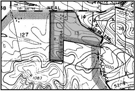
Figure 94-28: RR - Southwest corner of Neal Spring Road and Hollyhock Lane
D.
Residential Suburban (RS). The following standards apply within the RS land use category.
1.
Offer of dedication. Prior to the issuance of any land use permit, a public road right-of-way across the entire property frontage along the proposed road shall be offered for dedication. Offered rights-of-way should follow platted road alignments where feasible, and are to be one-half of a 50-foot wide road section from the future centerline.
[Amended 1985, Ord. 2226; 1986, Ord. 2270; 1993, Ord. 2646; Added 1994, Ord. 2674, 2686; Added 2003, Ord. 3014; 2006, Ord. 3106; 2007, Ord. 3126; 2014, Ord. 3256; 2020, Ord. 3409]
22.94.050 - Las Pilitas Sub-area Standards.
All development and new land uses in the Las Pilitas Sub-area, as shown on Figure 94-5, shall comply with the following standards, as applicable to each land use category.
A.
Rural Lands (RL). The following standards apply within the RL land use category.
1.
Limitation on use. All land uses identified by Section 22.06.030 as allowable, permitted, or conditional uses within the RL land use category may be authorized in compliance with the land use permit requirements of that Section, except off-road vehicle courses and correctional institutions.
2.
Access limitation - BLM lands. Development of private properties bordering BLM lands shall not provide direct access to the government land.
B.
Commercial Retail (CR) - Limitation on use. Land uses shall be limited to: bars and night clubs, caretaker residences, convenience and liquor stores, gas stations, general retail, grocery stores, restaurants, and vehicle storage, in compliance with the land use permit requirements of Section 22.06.030.
C.
Recreation (REC). The following standards apply within the REC land use category.
1.
Location criteria. New development proposals for private lands along the Santa Margarita Lake entrance road shall be located below the ridgetop (approximately the 1,600-foot elevation).
2.
Sewage disposal. New developments shall provide for transporting sewage effluent out of the Santa Margarita Lake watershed for disposal.
3.
Water supply - Land divisions. New developments in the Recreation land use category shall be served by shared wells or community water systems rather than individual wells.
D.
Residential Rural (RR). The following standards apply within the RR land use category.
1.
Minimum parcel size. The minimum size for new parcels in the Residential Rural land use category is 10 acres, unless a larger minimum parcel size is required by Chapter 22.22 of the Land Use Ordinance.
2.
Limitation on use. All land uses identified by Section 22.06.030 as allowable, permitted, or conditional uses within the RR land use category may be authorized in compliance with the land use permit requirements of that Section except residential care, and outdoor sports and recreation.
3.
Driveways - New land divisions. New land divisions shall include where possible design provisions for combining driveways and private access roads serving proposed parcels wherever terrain and adequate sight distance on the public road allow.
[Amended 2014, Ord. 3256]
22.94.060 - Los Padres Sub-area Standards.
All development and new land uses in the Los Padres Sub-area, as shown on Figure 94-5, shall comply with the following standards where applicable.
A.
The County shall refer all land divisions proposed within the Los Padres Sub-area to the U.S. Forest Service for review.
[Amended 2014, Ord. 3256]
22.94.070 - Nacimiento Sub-area Standards.
All development and new land uses in the Nacimiento Sub-area, as shown on Figure 94-5, shall comply with the following standards, where applicable.
A.
Finished floor elevations. Within the Lake Nacimiento watershed, the first floor of a building used for habitation shall not be constructed below the 825-foot elevation, except that habitable structures destroyed in the 2016 Chimney Fire may be reconstructed upon prior authorization by the Monterey County Water Resources Agency and issuance of a construction permit. Reconstruction shall be limited to the footprint and height of the destroyed structure.
B.
Water treatment. Where use of lake water is authorized by the County, the treatment of lake water shall include storage, coagulation, sedimentation, filtration, and chlorination. Intake systems shall be protected to prevent contamination either by means of a closed zone or other approved method. The systems shall be designed by a registered civil engineer and approved by the County Health Department.
C.
Sewage disposal.
1.
Individual sewage disposal systems. Individual sewage disposal systems are not permitted:
a.
On lots with an area less than 2½ acres per dwelling unit, except where a parcel is located within a cluster subdivision in compliance with Section 22.22.140 with a maximum density of 2½ acres or more per dwelling unit;
b.
Below an elevation of 825 feet above mean sea level (MSL);
c.
In any case closer than 200 feet, horizontal projection, from the lake's high water elevation of 800 feet;
d.
On slopes of 30 percent or greater; or
e.
Where percolation rates are less than one inch in 30 minutes.
2.
Substandard sewage disposal systems. Substandard sewage disposal systems that do not meet the requirements of the building code or the Regional Water Quality Control Board shall be replaced in conjunction with any new development.
D.
Circulation - New land divisions and Conditional Use Permit Plan projects.
1.
Proposals shall be integrated into areawide circulation and utility easements, providing for future extensions into adjacent undeveloped properties wherever feasible or where known areawide rights-of-way are planned.
2.
Road alignments shall be designed and constructed to minimize terrain disturbance consistent with safety and construction cost. Altered slopes shall be replanted with indigenous plants where practical or protected by other appropriate erosion control measures.
3.
New projects shall include an offer of dedication for interior and abutting roads where needed for public access and circulation. Until these roads are accepted for public use, maintenance shall remain the responsibility of the involved property owners.
4.
New developments shall include, where possible, design provisions for combining driveways and private access roads serving proposed parcels wherever terrain and adequate sight distance on the public road allow.
5.
New developments shall provide for safe and site-sensitive pedestrian and bike circulation facilities in the design of roads where feasible.
E.
Density calculations - Usable area. In the Lake Nacimiento watershed only land above the 800-foot elevation shall be used when computing density or minimum building site area.
F.
Easterly of the Santa Lucia Range. The following standards apply only to the area east of the Santa Lucia Range corresponding to the pre-1990 boundaries of the Nacimiento Planning Area as shown in Figure 94-29.
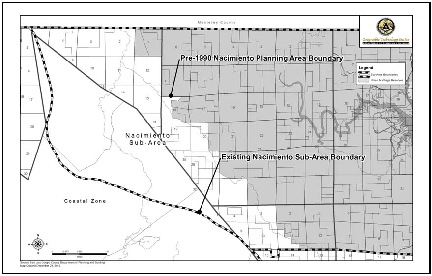
Figure 94-29: Pre-1990 Nacimiento Planning Area Boundaries
1.
Open space preservation. Approval of an application for land division, Site Plan, Minor Use Permit, or Conditional Use Permit is contingent upon the applicant executing an agreement with the County to maintain portions of the site not intended for development in open space use. Guarantees of open space preservation may be in the form of agreements, easements, contracts or other appropriate instrument, provided that such guarantees are not to grant public access unless desired by the property owner.
2.
RV parks - Location criteria. Proposed recreational vehicle parks shall be located within one mile of a road improved to County standards.
3.
Public recreation. Future public campgrounds or picnic areas shall be designed and located in compliance with the densities and location specified in Figure B.1-1 and Table B.1-2 in Appendix B of the Area Plans.
4.
Sloping Sites. Conditional Use Permit proposals for sites with varied terrain shall include design provisions for concentrating developments on moderate (less than 20 percent) slopes, retaining steeper (20 percent or greater) slopes that are visible from public roads undeveloped where practical except that outside of the pre-1990 planning area boundaries as shown in Figure 94-28, steeper slopes that are visible from public roads shall be kept undeveloped.
G.
Utility services - Undergrounding with Conditional Use Permit projects. All projects requiring Conditional Use Permit approval (including commercial and residential uses fronting the shoreline) shall provide for utilities being placed underground unless the Commission determines either that: the proposed development will be of low intensity or in an isolated location; or that supporting overhead utilities will not be visible from public roads; or that overriding operational, economic or site conditions of the project warrant waiver of this requirement.
H.
Site selection criteria. New development shall be located to not be visible from Highway 1, as follows:
1.
Sites shall be selected where hills and slopes would shield development, unless no alternative location exists or the new development provides visitor-serving facilities; and
2.
New development shall be located so that no portion extends above the highest horizon line of ridgelines as seen from Highway 1.
[Amended 2014, Ord. 3256; Amended 2019, Ord. 3381]
22.94.072 - Land Use Category Standards for the Nacimiento Sub-area.
All development and new land uses in the Nacimiento Sub-area, as shown in Figure 94-5, shall comply with the following standards, as applicable to each land use category.
A.
Rural Lands (RL) - Limitation on use. All land uses identified by Section 22.06.030 as allowable, permitted, or conditional uses within the RL land use category may be authorized in compliance with the land use permit requirements of that Section, except correctional institutions.
B.
Commercial Retail (CR). The following standards apply within the Commercial Retail land use category.
1.
Bee Rock - Area of use. Future development, expansion or alteration of the Bee Rock store shall not exceed one acre in total area.
a.
Minor Use Permit approval is required for all allowable uses.
b.
Access to the site shall be from Bee Rock Road.
c.
Curbs and gutters are not required but ingress and egress shall be defined by landscaping or barricades.
2.
North Entrance to Oak Shores. The following standards apply only to the land designated Commercial Retail and located on the west side of Oak Shores Drive adjacent to its intersection with Lynch Canyon Drive at the north entrance to the Oak Shores community as shown in Figure 94-30.
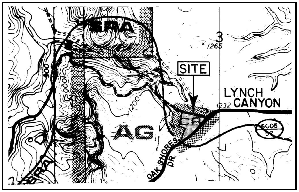
Figure 94-30: CR Land Use Category at North Entrance to Oak Shores
a.
Limitation on use. Land uses shall be limited to convenience and liquor stores, gas stations, general retail, grocery stores, and offices (real estate offices only), in compliance with the land use permit requirements of Section 22.06.030.
b.
Permit requirement. Minor Use Permit approval is required for new development, unless Conditional Use Permit approval would otherwise be required by this Title for a particular use. The Review Authority shall adopt conditions of approval that provide for the preservation of trees to the maximum extent feasible.
C.
Recreation (REC) - Limitation on use - Bee Rock. Within the Recreation land use category at Bee Rock (Sections 13, 23 and 24 in T25S, R9E, and Section 18 in T25S, R10E), all uses identified by Section 22.06.030 as allowable, permitted, or conditional within the REC land use category may be authorized subject to the land use permit requirements of that Section, except multi-family dwellings, all uses listed by Table 2-2, Section 22.06.030 in the Retail Trade use group; financial services; health care services; personal services; storage yards and sales lots; and hotels and motels.
D.
Residential Rural (RR) - Limitation on use. All land uses identified by Section 22.06.030 as allowable, permitted, or conditional uses within the RR land use category may be authorized in compliance with the land use permit requirements of that Section, except nursing and personal care.
[Amended 1982, Ord. 2112; 2014, Ord. 3256]
22.94.074 - South Shore Nacimiento Standards.
The following standards apply within the South Shore area of Lake Nacimiento as shown in Figure 94-31, to the land use categories and specific areas listed.
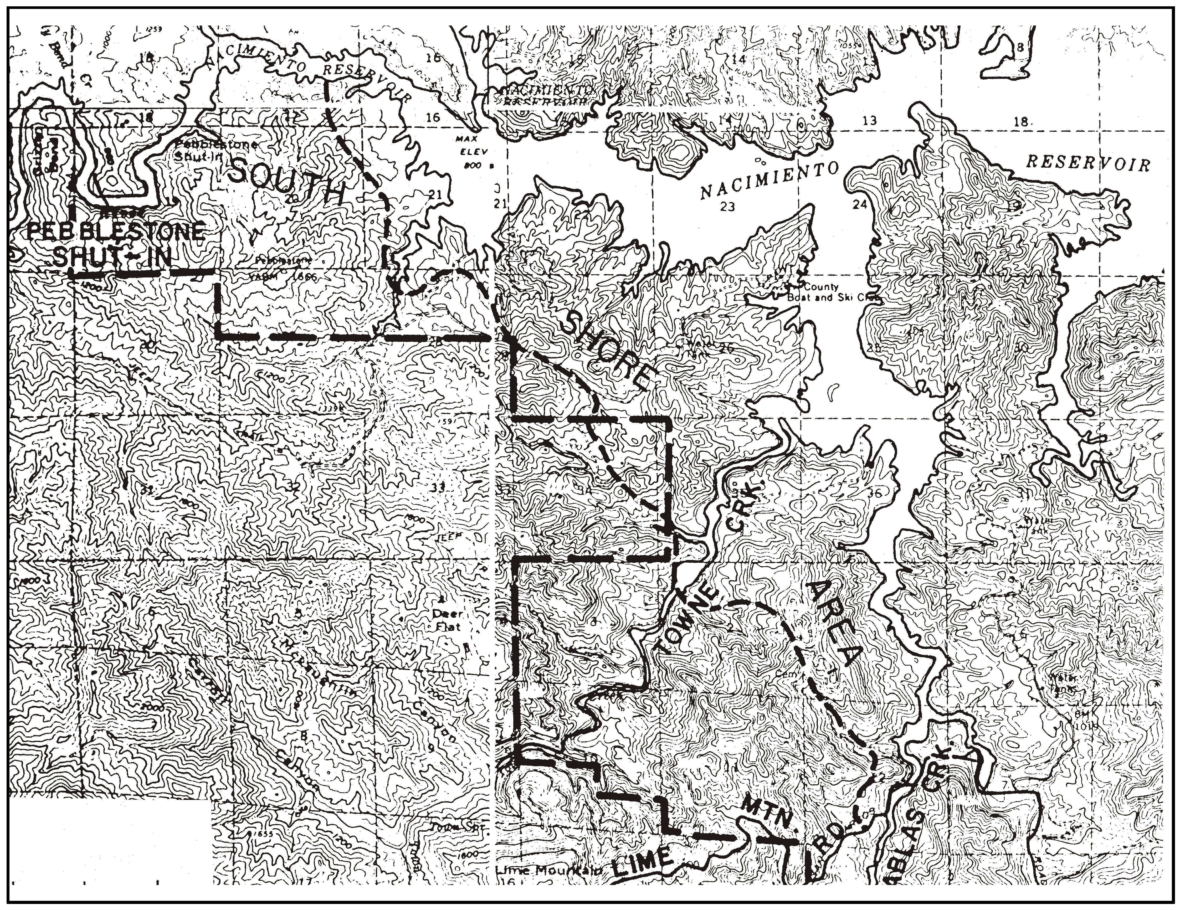
Figure 94-31: South Shore
A.
Areawide standards.
1.
Applicability. The standards of this Subsection apply to all lands within the South Shore area as applicable, regardless of the land use category applicable to any particular site.
2.
Road access for new subdivisions. Land divisions proposing parcels of less than 80 acres or densities exceeding 80 acres per unit shall not be approved unless the access road between the property and the nearest County-maintained road satisfies—at minimum—the access standards of the Uniform Fire Code as adopted by the County, or will be improved as a condition of the land division to satisfy those standards.
B.
Rural Lands (RL). The following standards apply within the RL land use category.
1.
Limitation on use. All land uses listed in Section 22.06.030 as allowable, permitted, or conditional within the RL land use category may be authorized in compliance with the land use requirements of that Section, except residential care, manufacturing and processing activities, cannabis manufacturing, cannabis processing, correctional institutions, ag processing and farm equipment and supplies, which are not allowed.
2.
Minimum parcel size. The minimum parcel size for the area designated Rural Lands west of Chimney Rock Road and accessed from High Meadow Way or Tres Vista Place, shown in Figure 94-32, is 80 acres instead of the minimum otherwise required by this Title. This area is more specifically described as Parcel Map CO83-0204, recorded with the County Clerk-Recorder in Book 39, Page 73 of Parcel Maps.
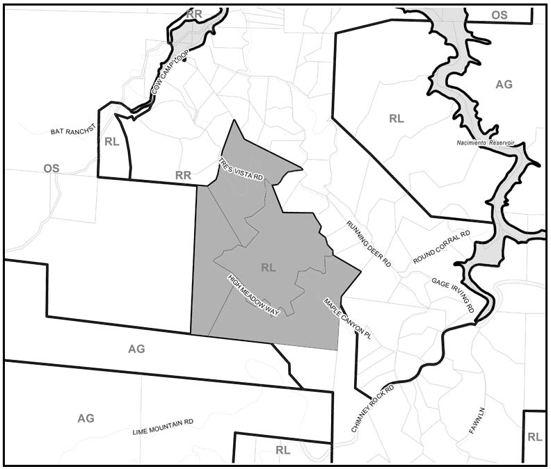
Figure 94-32: Parcel Map CO83-0204
C.
Recreation (REC). The following standards apply within the REC land use category.
1.
Limitation on use. Land uses shall be limited to crop production and grazing, marinas, rural recreation and camping, recycling collection stations, animal keeping, single-family dwellings, mobile homes, and fisheries and game preserves, in compliance with the land use permit requirements of Section 22.06.030.
2.
Application content - Development Plans. Where Conditional Use Permits are required for residential projects and all uses under the definitions of hotels and motels, RV parks, religious facilities, and rural recreation and camping, the Conditional Use Permit application shall include documentation of the adequacy of water, sewerage, drainage, fire and police services.
3.
Campground standards. Public campgrounds and picnic areas shall comply with the following requirements.
a.
Permit requirement. Campgrounds shall require Conditional Use Permit approval.
b.
Site design standards. Proposed campgrounds and alterations to existing campgrounds shall be designed in compliance with the following standards.
(1)
Proposed facilities shall be planned for average rather than peak use, for more efficient year-round utilization.
(2)
Trailer sites shall be concentrated in small clusters at a density of 10 units per acre, with intervening open space.
(3)
Tent sites shall be developed at a maximum density of four units per acre.
(4)
Picnic sites shall be developed at a maximum density of eight units per acre.
(5)
Campsites shall be designed for maximum privacy; clearing of vegetation and grading shall be minimal.
4.
Residential density and minimum lot size. Residential projects may be approved with minimum lot sizes of 6,000 square feet only when an overall density of one unit per 2½ acres is maintained.
5.
Parking facilities. New parking areas shall be dispersed into small clusters separated by landscaped areas.
D.
Residential Rural (RR). The following standards apply within the RR land use category.
1.
Limitation on use. All land uses listed in Section 22.06.030 as allowable, permitted, or conditional within the RR land use category may be authorized in compliance with the land use requirements of that Section, except animal facilities, farm equipment and supplies, nursery specialties, cannabis cultivation, cannabis nurseries, grocery stores and restaurants.
2.
Land division standards - North of Towne Creek. New land divisions shall comply with the following standards.
a.
New land divisions shall be designed in compliance with the cluster division provisions of Chapter 22.22.
b.
Building sites shall be located on soils best suited for septic system use.
c.
Provide coordinated interior streets.
d.
Provide lake access for the involved property owners through roads, easements, or common open space areas.
e.
Serve clustered lots by a common water source rather than individual wells.
f.
Common areas shall be owned and maintained by property owners groups.
g.
Locate new building sites on slopes less than 20 percent.
E.
Open Space (OS). The following standards apply within the OS land use category.
1.
Limitation on use and permit requirement. Land uses shall be limited to crop production and grazing, fisheries, hunting, riding and hiking trails, in compliance with the land use permit requirements of Section 22.06.030. Primitive trail-side camps, walk-in picnic areas, and picnic areas accessible by boat may be allowed subject to Conditional Use Permit approval. Clearing and grading shall be minimal.
2.
Public lands. Public lands shall be retained in public ownership with a minimum parcel size of 640 acres.
[Amended 1983, Ord. 2122; 1989, Ord. 2399; Amended 1990, Ord. 2488; 2014, Ord. 3256; 2017, Ord. 3358; 2018, Ord. 3377]
22.94.080 - Salinas River Sub-area Standards.
All development and new land uses in the Salinas River Sub-area, as shown on Figure 94-2, shall comply with the following standards, where applicable.
A.
Santa Lucia Mountains Coordination of land divisions. Proposed discretionary permits and land divisions within the area in the Santa Lucia Mountains shown in Figure 94-33 shall be referred by the County to the U.S. Forest Service for review and comment.
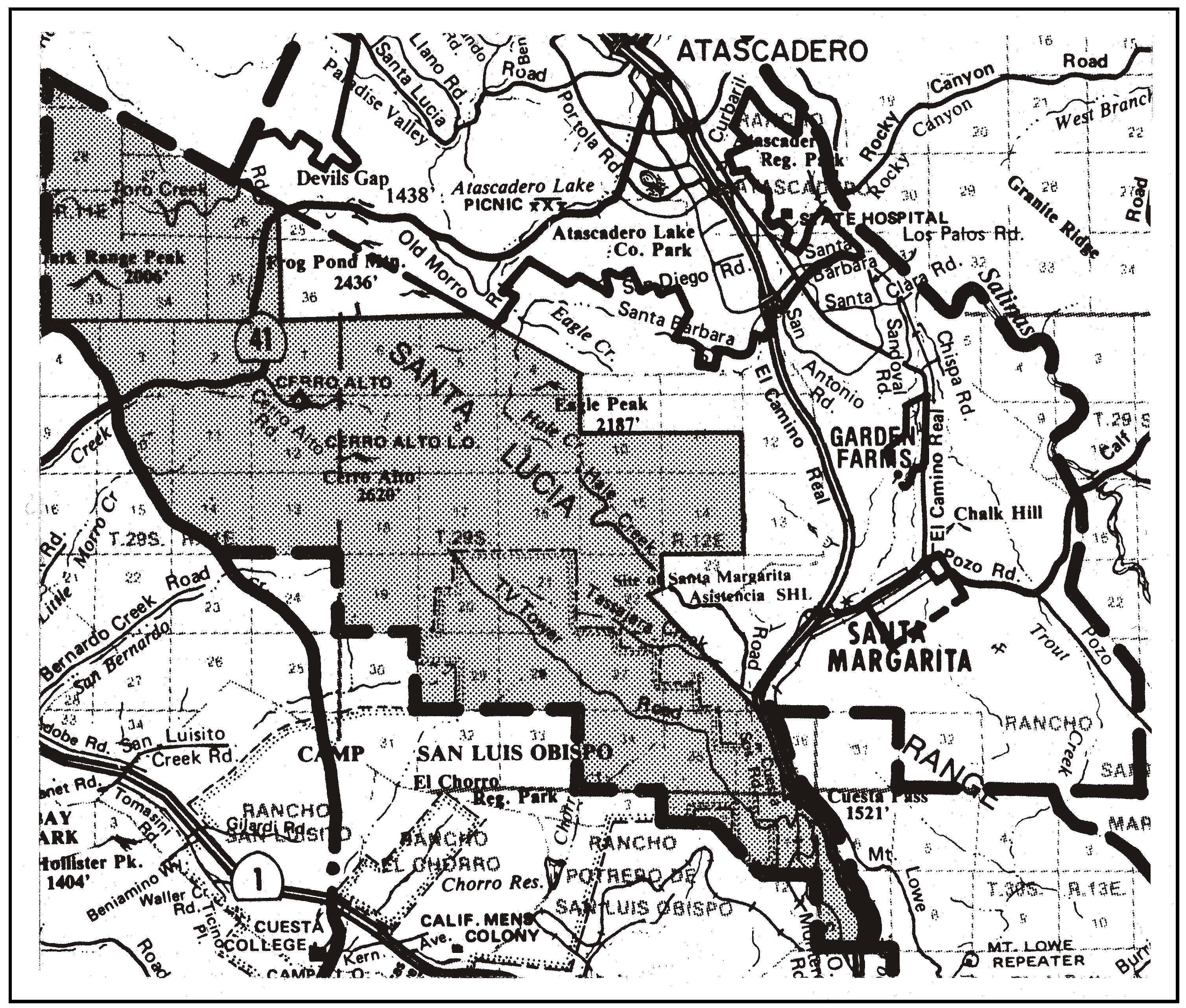
Figure 94-33: Santa Lucia Mountains - Rural
B.
Planning impact areas. The following standards apply within the planning impact areas of the cities of Paso Robles and Atascadero, shown in Figures 94-34 and 94-35. These areas are not intended to be considered as a basis for annexation or establishing spheres of influence.
1.
Application referral. Discretionary permit, General Plan Amendment and Ordinance Amendment applications shall be referred to the cities of El Paso de Robles or Atascadero, as applicable, for review and comment prior to approval.
2.
Development impacts. Discretionary projects with potential impacts that are associated with and that include, but are not limited to, water quantity and quality, drainage, erosion and sedimentation, traffic and circulation and cumulative impacts, shall be addressed as subjects for additional review as part of the environmental review process.
3.
Consistency with City Plans. Improvements and/or offers of dedication consistent with City plans shall be considered and may be required for projects depending on the location, scale of the proposed development and an appropriate and feasible connection between the proposed development and the improvement.
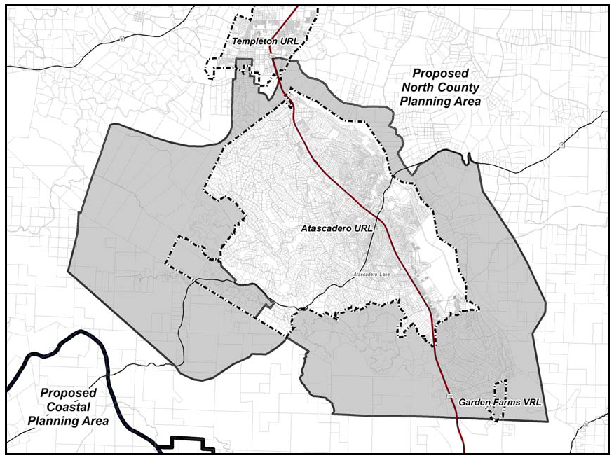
Figure 94-34: Atascadero Planning Impact Area
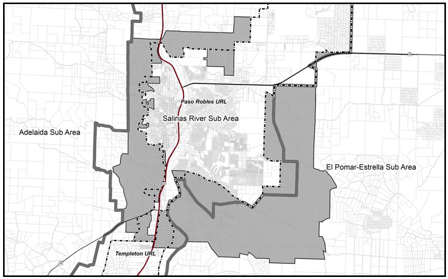
Figure 94-35: Paso Robles Planning Impact Area
C.
Open space preservation. The following standards apply to land where important physical, biological, visual or historic resources are identified both on-site and on adjacent properties, to offer incentives and encourage such measures as cluster land divisions that will leave such resources in permanent open space.
Guideline: New land divisions should retain land in open space that will preserve oak woodlands, riparian and other important biological habitats, physical landmarks, prime agricultural, visual and historic areas.
1.
Cluster land division incentive. Cluster divisions of land may utilize an open space parcel area that is smaller than otherwise required by Chapter 22.22 where an important biological habitat, riparian creek corridor, scenic site or historic place is identified through the application's review process. The size of the open space area may be determined by a biological, visual or other applicable analysis of the area in question. The analysis shall identify the area necessary to maintain open space or to preserve the features of the applicable resource while not impeding its natural function.
2.
Lot Line Adjustments. In cases where land that is intended for development includes more than one legal lot, the lot lines may be adjusted to concentrate development in suitable areas and leave other areas undeveloped and subject to open space or conservation easements.
D.
Salinas River resource protection. Within the Salinas River floodplain as defined by the Flood Hazard combining designation shown on the official maps in both rural and urban areas, discretionary permits and land divisions shall protect the habitats and resource integrity of the floodplain. Development shall be designed and located to protect the river as a water resource and to maintain the natural features and habitats within the floodplain.
E.
Prime agricultural areas - Prime soils retention. New development on land that is classified by the Soil Conservation Service as prime, Class I or II soil if irrigated, shall be designed to minimize the loss of prime agricultural soils for potential agricultural use by selective placement of buildings and new parcels.
F.
Other land of agricultural value - Soils retention. New development on land that has existing agricultural production or that is classified by the Soil Conservation Service as Class III and IV soils shall be designed to minimize the loss of soils for potential agricultural use by selective placement of buildings and new parcels.
[Amended 2014, Ord. 3256]
22.94.082 - Land Use Category Standards for the Salinas River Sub-area.
All development and new land uses in the Salinas River Sub-area, as shown in Figure 94-2, shall comply with the following standards, as applicable to each land use category.
A.
Agriculture (AG) Santa Margarita Ranch. The following standards apply only to the area shown in Figure 104-24 within the Agriculture land use category.
1.
Subdivision requirement. All new land divisions that are proposed prior to approval of the Specific Plan required by Subsection A.2 shall cluster the allowed residential density of the Santa Margarita Ranch property ownership shown in Figure 94-36 in compliance with agricultural lands clustering standards of Section 22.22.150. This agricultural clustering division shall reconfigure and/or relocate existing parcels with minimal or no visual impact on Santa Margarita, Garden Farms and Highway 101.
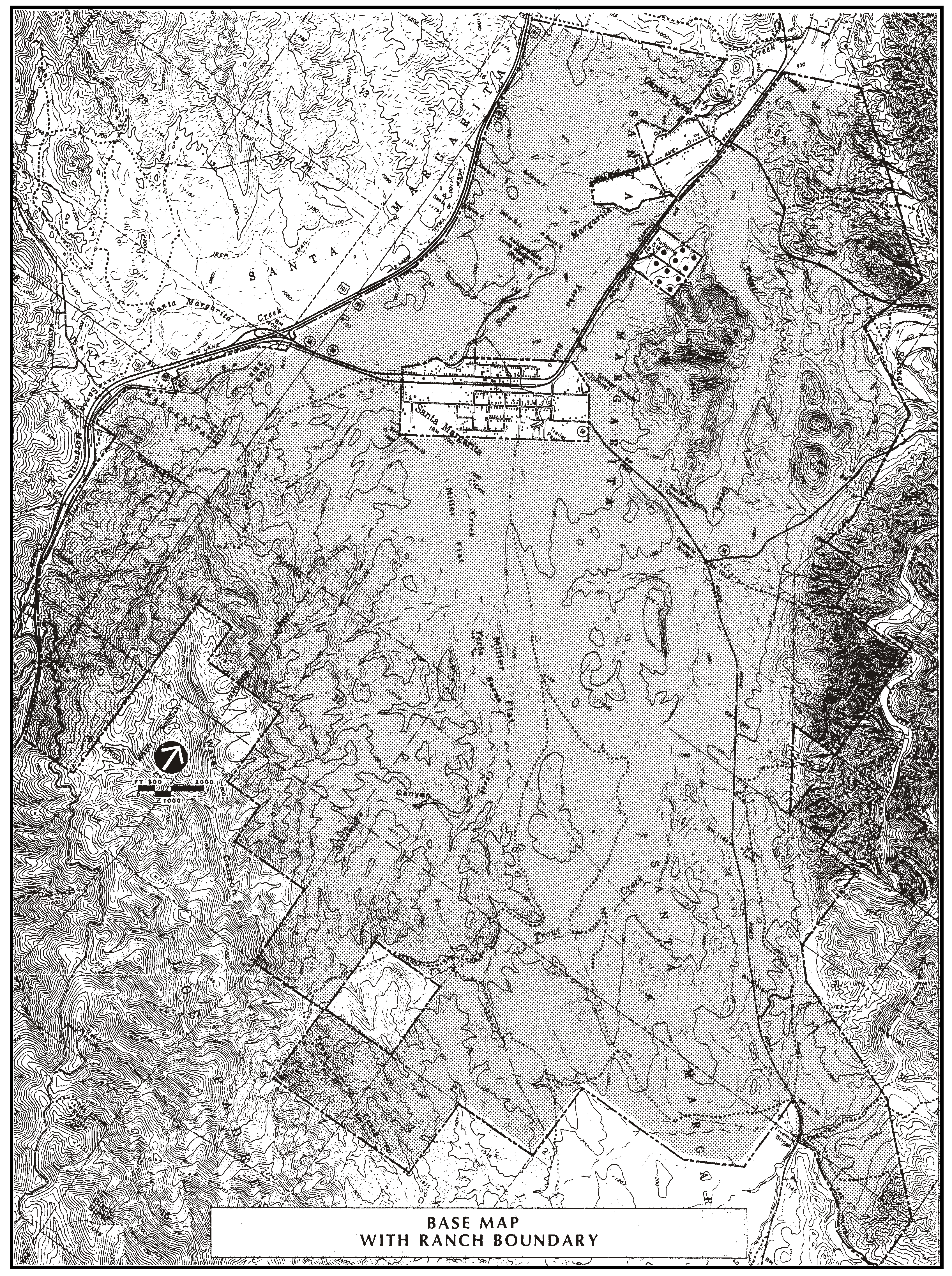
Figure 94-36: Santa Margarita Ranch - Rural
2.
Specific Plan requirement. A Specific Plan shall be prepared in compliance with Government Code Section 65450 for the entire Santa Margarita Ranch as shown in Figure 94-36, for review and approval before an application is approved for any subdivision of land other than the agricultural cluster division that is allowed by Subsection A.1. This restriction shall not apply to lot line adjustments.
A development agreement in compliance with Government Code Section 65864 et seq. that reflects the standards that follow shall be entered into between the ranch owners and the Board in an expeditious manner.
A General Plan amendment to implement the land use designations at the locations shown in the Specific Plan may be filed concurrently with the Specific Plan.
The following principles shall guide the Specific Plan preparation:
a.
Public participation. The public shall be provided opportunities to participate in each component of the Specific Plan process through meetings, written comments, surveys, and other means of dialogue with the applicant and staff.
b.
Resource constraints. Development proposals shall reflect the resource constraints of the Santa Margarita Ranch and the North County region.
c.
Limited development areas. Development area(s) shall be selected from within 1,800 acres consistent with the existing agricultural character of the ranch.
d.
Open space surroundings. Development shall be located with clearly defined edges surrounded by other residential uses, or by open space and agricultural uses which serve as a greenbelt adjacent to the project.
e.
Economic integration. Development shall be designed and operated to be available for a mix of income levels.
f.
Mixed land uses. Development shall be organized to provide a convenient mix of land uses to residents.
g.
Pedestrian orientation. Development shall be located for convenient pedestrian access to potential transit and to neighborhood convenience and civic functions or downtown Santa Margarita.
3.
Specific Plan objectives. The Specific Plan shall be prepared to achieve the following objectives:
a.
Agricultural protection. Identify and avoid development on land capable of supporting viable agricultural operations:
(1)
Identify areas capable of supporting viable agricultural operations, areas where agricultural operations will be marginal and/or not viable, and lands which may best be utilized for other purposes.
(2)
Define buffer standards for agricultural/residential interfaces where needed.
(3)
All of the approximately 900 acres of prime soils (Class I and II) which have access to bedrock aquifers of the Santa Margarita formation shall be protected by permanent agricultural easement(s).
(4)
7,500 acres (totaling 8,400 acres when combined with the land referred to in Subsection A.3) shall be protected for agricultural uses, and watershed protection and management, through the use of permanent agricultural easements (nos. 3 and 4 can comprise eight parcels).
(5)
3,600 acres shall be protected for agricultural uses by placement into a Williamson Act agricultural preserve contract(s) for a 40-year term (no. 5 can be comprised of four or five parcels).
(6)
The remainder of the 1,800 acres described in Subsection A.2.c that is outside areas designated for development and public uses shall be protected for agricultural uses by placement into a Williamson Act agricultural preserve contract(s) for a 40-year term.
b.
Open space preservation and use. Utilize an assessment of open space resources as a primary guide for locating development areas:
(1)
Inventory environmentally sensitive areas that are appropriate to be preserved for open space. Areas with the highest biological sensitivity shall be included in the permanent protection provided as a part of Subsections A.3.a(3) and A.3.a(4).
(2)
Non-structural golf course and other resort uses may be included in open space areas (except a clubhouse and other support buildings).
(3)
Identify areas that are suitable for public parklands and recreation.
(4)
Require measures to permanently protect scenic viewsheds, environmentally sensitive areas, public parklands and recreation areas.
(5)
Conduct a viewshed analysis from public highways and arterial streets to identify areas with ratings and recommendations for a range of open space values, to protect views from Highway 101 and to identify potential impacts to views from other areas.
(6)
Define grazing practices and/or protective barriers to eliminate or minimize cattle access to creeks and vernal pools to restore riparian habitat.
c.
Resource and service capacities. Identify the existing and projected resource and service capacities of the Santa Margarita Ranch for potential development, utilizing relevant environmental documents and additional new information for such site-specific resources as water supply and drainage. Topics for this Subsection include those required for an environmental impact report by the California Environmental Quality Act.
d.
Residential density. Utilizing the documentation in Subsections A.3.a, b. and c., prepare a development program for 500 residential units plus 50 affordable residential units.
The program shall identify thresholds for potential environmental and fiscal impacts on site and regional resources and services at different numbers of residential units or other development. It shall identify points at which certain community benefits, at various degrees of improvement, are warranted and shall be required.
e.
Local employment opportunities. To deter encouraging long-distance commuting, identify local employment opportunities associated with ranch development as well as build-out of the existing commercial and industrial areas. Identify the potential types of commercial, industrial, service and office uses that would be most related to local needs with special emphasis on maintenance and restoration of a viable downtown commercial district.
4.
Specific Plan - Land use categories. The Specific Plan shall identify locations for appropriate land use categories to implement the following concepts:
a.
Agriculture (AG). Reconfiguration of the ranch parcels into locations for ranch and farm operations on properties that are adequately sized to support the long-term economic viability of appropriate types of productive agriculture within ranch resource constraints. The ranch shall be reconfigured into no more than 14 parcels.
b.
Residential uses. Residential areas shall be clustered with the first priority to be an extension of the community of Santa Margarita, or within open space surroundings such as adjacent to park land, agriculture or a golf course.
Clusters shall be oriented to have a small-scale village environment that will encourage social interaction. Traditional town planning principles shall be emphasized, with residences in close proximity to each other, fronting the street.
The residential clusters shall contain a variety of housing types and prices for different economic and age groups.
The location of all residential uses shall be generally south and east of the existing community of Santa Margarita.
Notwithstanding the foregoing, the project may be done as a new village, expansion of the existing community, or both.
c.
Non-residential uses - Optional. In an effort to provide a more balanced community, the following private and public non-residential uses and mitigation measures shall be considered but not required in the Specific Plan:
(1)
A golf course and accessory buildings, clubhouse and incidental cafe.
(2)
A guest ranch and lodge.
(3)
One equestrian center with horse boarding, outdoor show arena, stables and other animal facilities.
(4)
Public parklands dedication to accommodate passive and active recreation areas that are buffered appropriately from residential areas and streets, sized to function as mini-parks, neighborhood, community and regional parks, and community center enhancement.
(5)
Public separated bikeways between Santa Margarita and south Atascadero.
(6)
Depending on the results of the environmental analysis, public improvements may include a community drainage basin upstream from Santa Margarita, local street and/or creek drainage improvements or clean-up; a sewage treatment plant and collection system serving ranch development; community water well and storage tank sites; realignment of Highway 58 diverting traffic around Santa Margarita; El Camino Real Street improvements in Santa Margarita and Garden Farms in addition to other street improvements that are identified in environmental review; and school site dedication(s).
d.
Non-residential uses - Required. The following amenities and mitigation measures shall be required in the Specific Plan.
(1)
Dedication of land within Santa Margarita or five acres elsewhere for a community swimming pool and payment of $500 per approved dwelling unit (up to 500 units) in contribution for construction funding.
(2)
Dedication of land for a potential future sewage treatment facility for the existing community if necessary (up to 10 acres).
(3)
Dedication of five acres for an expansion of the cemetery.
(4)
Dedication of public hiking/equestrian trails connecting and looping between Santa Margarita, Garden Farms, national forest and the ranch boundary;
5.
Specific Plan - Allowable uses. The Specific Plan shall refine the list of allowable land uses in Section 22.06.030 (Allowable Land Uses and Permit Requirements) with more specific types of uses related to the development concepts in Subsection A.4.
6.
Development phasing. The Specific Plan shall contain a phasing plan that relates the major thresholds of development to specific mitigating actions for the following topics:
a.
Project sequence. Location and order of each development project, with criteria to implement each phase consistent with environmental documents and with the residential unit thresholds.
b.
Public improvements. Identify public improvement projects and funding and responsibility for implementation as needed to provide mitigation for each development phase and the cumulative impacts of ranch development.
c.
Agricultural management. Identify the location, size and phase for creation of proposed agricultural parcels and the location and phasing of improvements proposed, if any, to increase opportunities for viable agricultural operations.
d.
Agricultural protection. Timing for implementation of agricultural protection measures that are identified in compliance with Subsections A.3.a(3, 4, 5 and 6).
e.
Resource conservation. Projects to minimize resource usage, such as water conservation, transportation management, riparian habitat protection, and hardwood forest protection and reforestation.
7.
Design guidelines. The Specific Plan shall contain design guidelines that are compatible with local architecture and address the scenic, rural and historic character of the ranch and community.
The Specific Plan shall contain traditional site planning and architectural elements for each development area and show the conceptual location for proposed circulation systems including roads and trails. At minimum, the design guidelines shall, at a conceptual level, also identify road widths and levels of improvement, permitted building heights, minimum lot size, percentage of lot coverage and setbacks from roads or trails within each proposed development area.
B.
Rural Lands (RL). The following standards apply within the Rural Lands land use category.
1.
Santa Margarita Ranch — Application contents. Within the area shown in Figure 94-37, residential Zoning Clearance or other land use permit applications shall demonstrate compliance with the following to minimize the visual impact of development, unless modified by Minor Use Permit or Conditional Use Permit:
(1)
Building height. Maximum building height shall be 25 feet.
(2)
Building color. Building colors other than trim shall be no brighter than 6 in value and chroma on the Munsell color scale, on file in the Department.
(3)
Roofs. Roofs shall be pitched 3:12 or greater, with eave overhangs of one foot or more.
(4)
Landscaping. Drought-tolerant landscaping for residences and residential accessory buildings shall be provided and use trees and large-growing shrubs consistent with fire hazard regulations and the water-conserving landscaping provisions of Chapter 22.16 (Landscaping Standards).
2.
Biaggini Ranch. The following standards apply to the property shown in Figure 94-38.
a.
Density limitation. The maximum density and the number of parcels allowed shall be computed on the basis of one parcel per 160 acres of gross site area.
b.
Primary residence limitation. No more than one primary residence shall be constructed on each parcel.
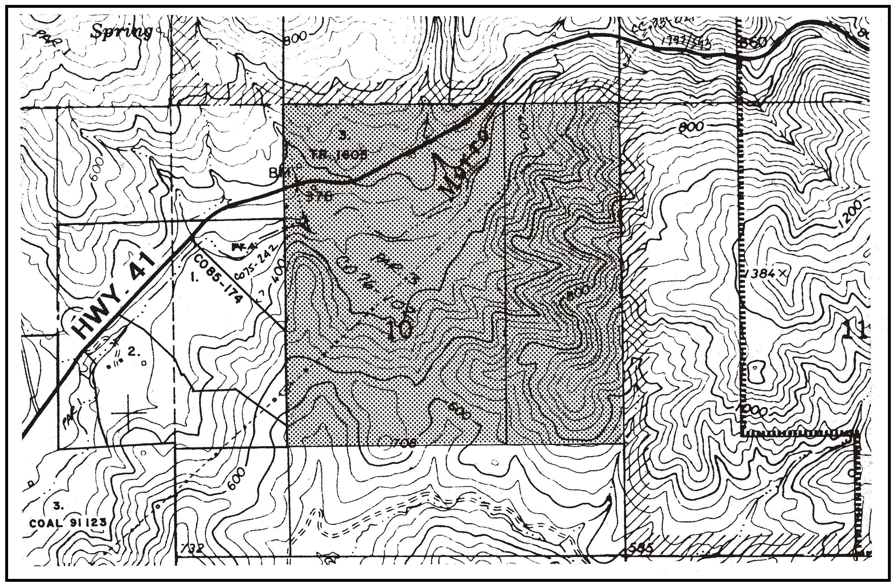
Figure 94-38: RL - Biaggini Ranch - Rural
C.
Commercial Retail (CR) - Stockdale Road area. The following standards apply within the Commercial Retail land use category on Stockdale Road, as shown in Figure 94-39.
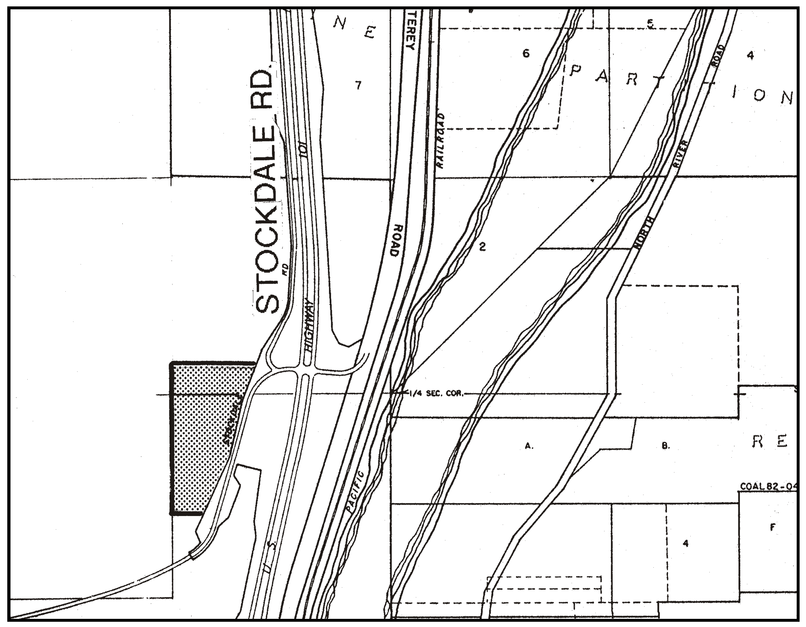
Figure 94-39: CR - Stockdale Road Area - Rural
1.
Limitation on use. Land uses shall be limited to the following:
2.
Permit requirement. Minor Use Permit approval is required for any new use and any expanded use that increases use area more than 10 percent, unless a Conditional Use Permit is otherwise required by this Title.
3.
Development intensity and standards. Land use permit applications shall include a traffic study, and shall comply with Subsections D.4, and D.7 through D.15 for the Wellsona Road area in the Commercial Service category.
D.
Commercial Service (CS) - Wellsona Road area. The following standards apply within the Commercial Service category from the vicinity of the intersection of Highway 101 and Wellsona Road to the Exline Road intersection with the highway, as shown in Figure 94-40.
1.
Limitation on use - Wellsona Road area. Allowable land uses on the Wellsona Road properties shown in Figure 94-40 are limited to:
Agriculture accessory structures
Bars and night clubs
Bed and breakfast inns
Cannabis testing facilities
Cannabis distribution facilities
Cannabis processing facilities
Cannabis transport facilities
Caretaker residences
Concrete, gypsum and plaster products
Construction contractors
Convenience and liquor stores (maximum gross floor area of 2,000 square feet)
Crop production and grazing
Energy-generating facilities (limited to renewable energy facilities)
Existing motorcycle dealers
Gas stations
General retail (limited to gifts, novelties, souvenirs, and antiques)
Grocery stores (maximum gross floor area of 5,000 square feet)
Hotels, motels if associated with truck stops as uses
Mail order and vending
Personal services
Public safety facilities
Recreational Vehicle Parks
Recycling and scrap
Recycling collection stations
Residential accessory use
Restaurants
Small scale manufacturing
Stone and cut stone products
Storage, accessory
Storage yards
Temporary offices
Transmission facilities
Truck stops
Vehicle and freight terminals
Vehicle retail sales (limited to Class A trucks only, no passenger cars or light trucks)
Vehicle service and repair (limited to Class A trucks only, no passenger cars or light trucks
Vehicle storage
Warehousing
Wholesaling and distribution
2.
Limitation on use - Other Commercial Service properties. Land uses shall be limited to the following for other Commercial Service properties shown in Figure 94-40. Retail sales are limited only to the incidental sale of goods produced, assembled or manufactured on the site. All other sales shall be wholesale to other businesses only.
Ag accessory structures
Cannabis distribution facilities
Cannabis transport facilities
Cannabis processing facilities
Caretaker residence
Concrete, gypsum and plaster products
Construction contractors
Crop production and grazing
Energy-generating facilities (limited to renewable energy facilities)
Existing motorcycle dealers
Public safety facilities
Recreational vehicle parks are also an allowable use on a property at Exline and Stockdale Roads, as shown in Figure 94-41.
Recycling and scrap
Recycling collection stations
Residential accessory uses
Small scale manufacturing
Stone and cut stone products
Storage, accessory
Storage yards
Temporary offices
Transmission facilities
Vehicle and freight terminals
Vehicle storage
Warehousing
Wholesaling and distribution
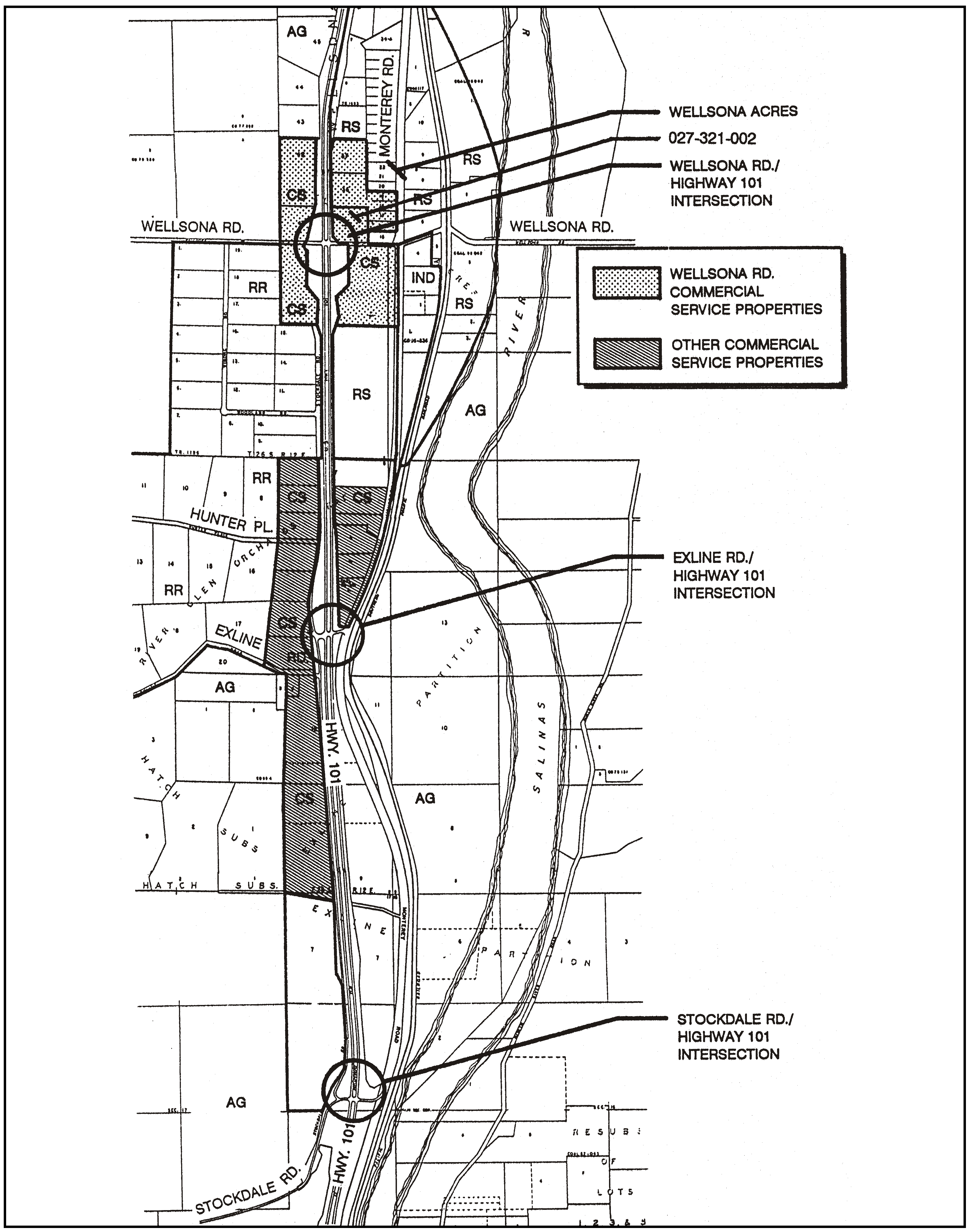
Figure 94-40: CS - Wellsona Road Area - Rural
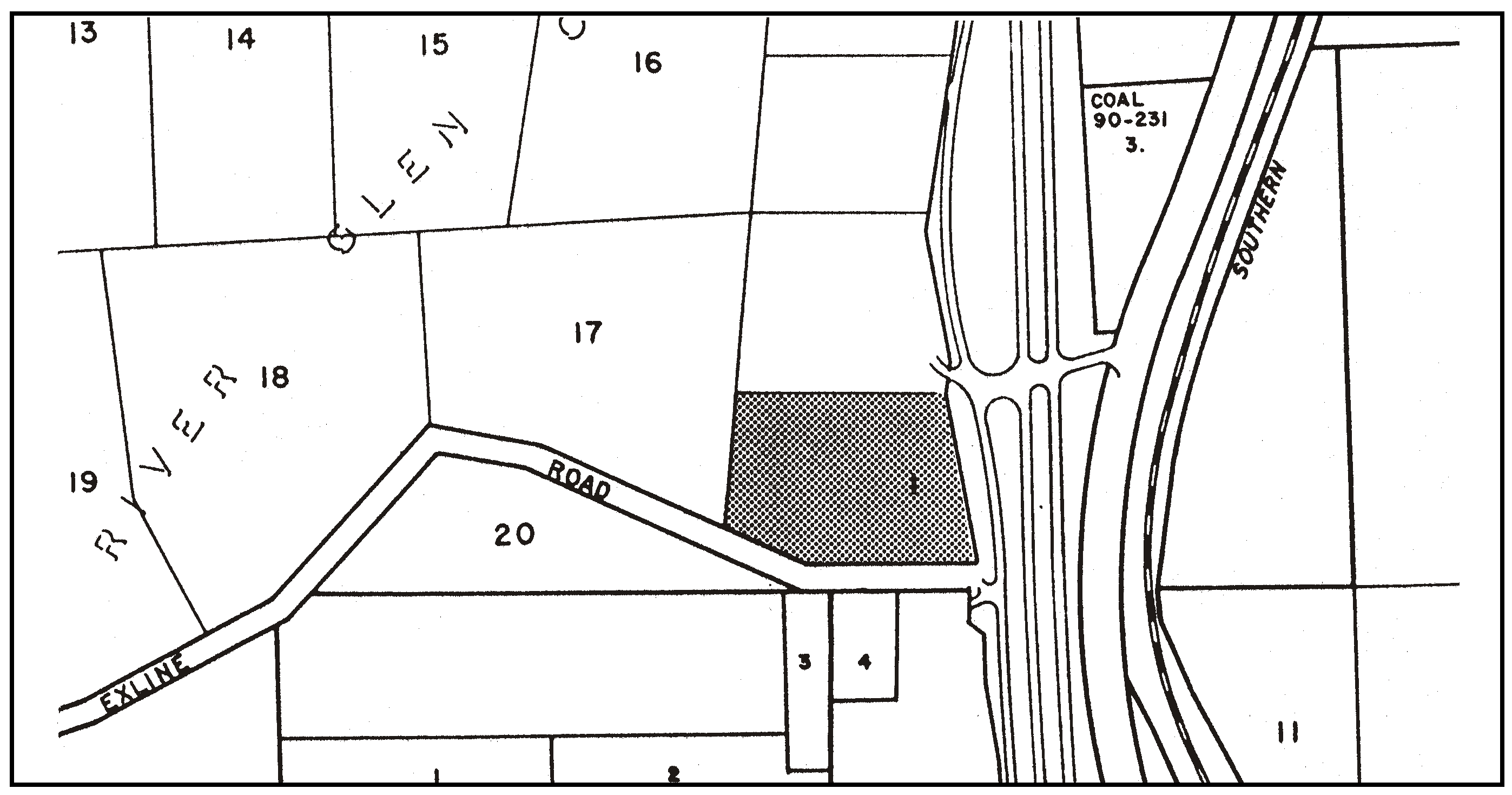
Figure 94-41: CS - Exline and Stockdale Roads
3.
Permit requirement. Minor Use Permit approval is required for all new uses, or expanded uses that increase use area more than 10 percent, unless a Conditional Use Permit is otherwise required by this Title.
4.
Development limitation. The Minor Use Permit or Conditional Use Permit shall include a traffic study showing existing and projected traffic volumes at all Highway 101 intersections shown in Figure 94-40, including the proposed development and other development that is approved but not yet constructed in the study area. Those figures shall be compared to the threshold volume of 2,300 trips per day for either side of each intersection (per the Final Environmental Impact Report for the Moe and Dotson General Plan Amendments, ED 85-195 and 85-223). A traffic study shall not be required if the Environmental Coordinator determines that it would be unnecessary for the proposed scale of development.
a.
Development may be permitted within the Wellsona Road area shown in Figure 94-40 to the extent that:
(1)
Existing traffic;
(2)
Plus traffic to be generated from any filed and accepted Conditional Use Permit applications;
(3)
Plus traffic to be generated from approved but unbuilt development applications in the vicinity;
(4)
Plus project-generated traffic, do not exceed the threshold volume of 2,300 trips per day on either side of each of the Highway 101 intersections.
b.
When any Highway 101 intersection shown in Figure 94-40 reaches the threshold traffic volume described in Subsection D.4.a, no further development shall occur for that intersection in the Commercial Service category until construction of the needed interchange improvements described in the EIR are funded and programmed.
5.
Offer of dedication. Development on the parcel located at the southeast corner of Highway 101 and Wellsona Road, as shown in Figure 94-42, requires that approximately three acres needed for a loop interchange (as described in the EIR referenced in Subsection D.4) shall be offered for dedication. The offer shall not be accepted until the Highway 101/Wellsona interchange is programmed for construction. The value of the property offered for dedication shall be credited against any future assessment district fees or other funding mechanisms for the interchange improvements.
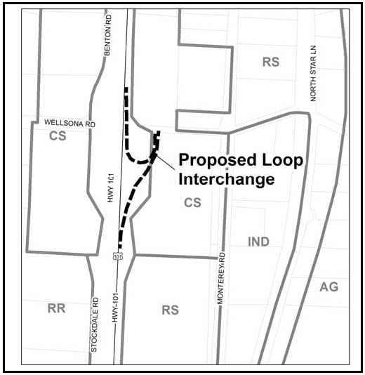
Figure 94-42: Wellsona-Dotson Interchange
6.
Development intensity. The ratio of gross floor area (exclusive of parking and non-structural development) to net site area shall be limited in reference to the following slope gradients. The coverage ratio of all use areas (including buildings, parking and outdoor use areas) to the net site area shall be no more than the following:
7.
Minimum parcel size. The minimum parcel size for new land divisions is five acres.
8.
Minimum frontage width. For new subdivisions, the minimum lot width at the frontage on any street or road is 300 feet.
9.
Site access. Access to each site from any street or road shall be at a single point or driveway and shall be shared between properties if feasible given existing terrain and vegetation, as shown in Figure 94-43. Where a creek or arroyo divides a site, an additional access point to the road may be provided to reduce impacts to the creek. Access shall be provided between sites for pedestrian and vehicle movement to reduce traffic conflicts on the road, as shown in Figure 94-43.
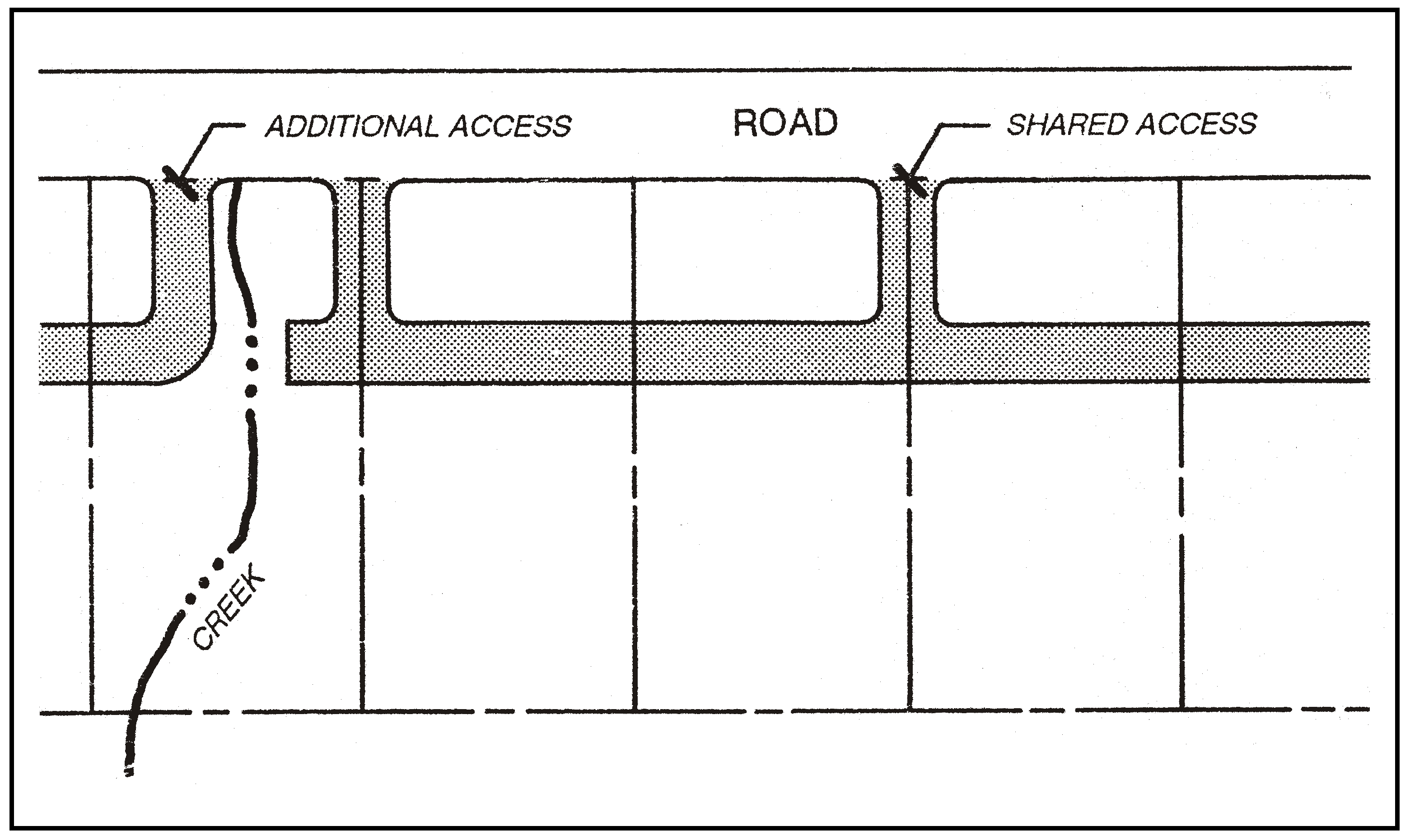
Figure 94-43: Site Access Concepts
10.
Setbacks.
a.
Landscaping setback. A landscaped buffer shall be located in the following setbacks, in which no use areas, including building, parking or outdoor use, are allowed:
Setback areas shall be fully landscaped for an attractive natural appearance. Trees shall be planted in groups at a density of two trees for every 25 feet of frontage, and in a continuous canopy at a density of one tree for every 25 feet of side or rear yards. A combination of trees and shrubs shall be used to provide at least 50 percent screening in front, and full screening in side and rear yards if visible from Highway 101. Plant material shall be a mix of evergreen and non-evergreen species. Tree species shall be selected that will achieve heights equal to or greater than the heights of project buildings.
Within setbacks that separate the roadway from parking or outdoor use areas, a berm shall be constructed to aid in screening parking or outdoor uses. The berm shall not conflict with native vegetation and have a slope no steeper than 3 to 1. Height of the berm shall be at least three feet, which may necessitate a wider setback than prescribed above on some topography.
b.
Building setback. The required setbacks for structures are in relation to their height and location on the site, in order to scale development back from view of Highway 101 and adjacent residential properties, as follows:
Figure 94-44 illustrates the front setbacks as an example of both the landscaping and building setbacks.
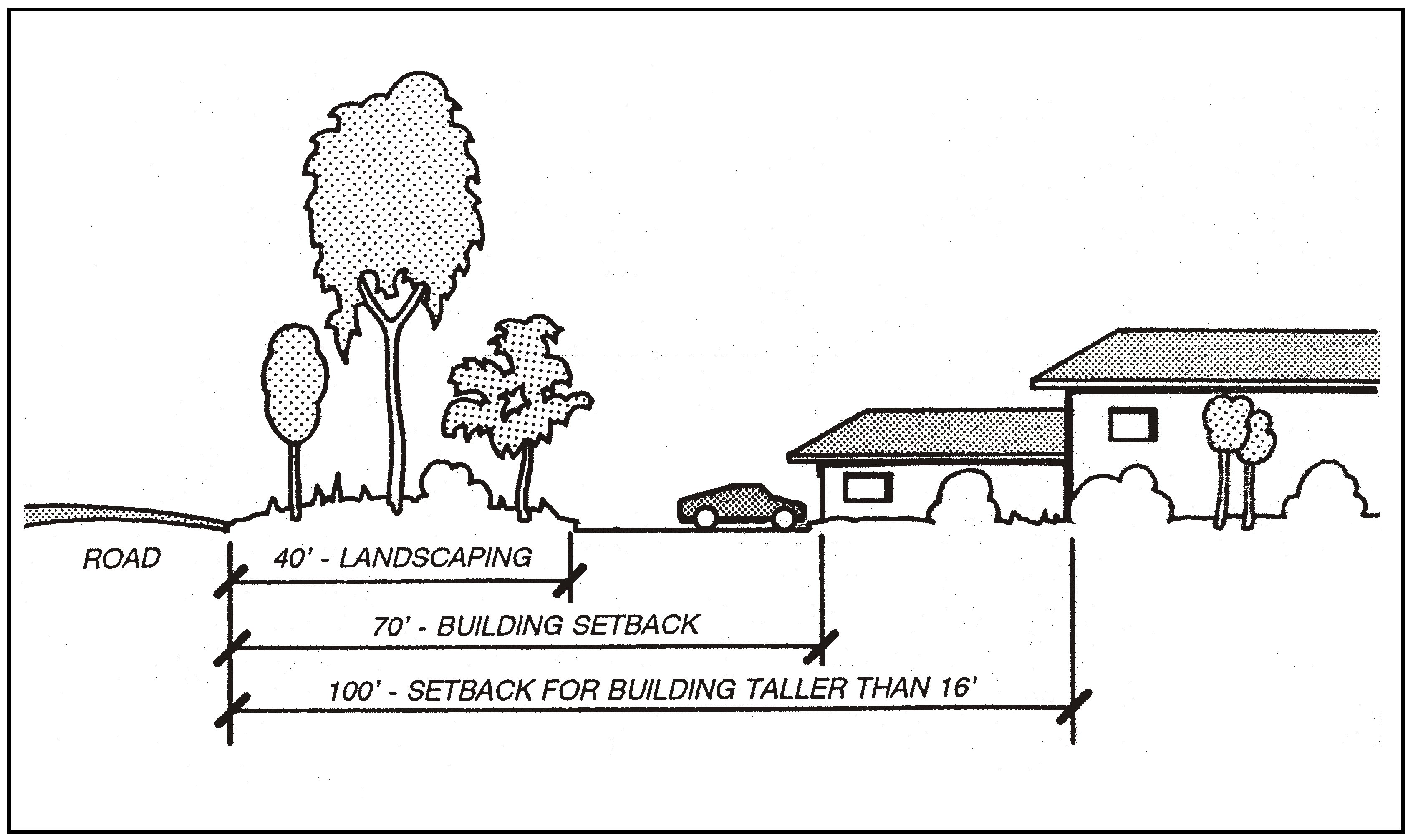
Figure 94-44: Front Setbacks Illustration
c.
Creek/arroyo setback. All development shall be set back at least 20 feet from the bank of any creek, arroyo or drainage swale.
11.
Height limitation. The maximum height for structures is 25 feet if parapet walls are used, and 30 feet if pitched roof lines are used, as illustrated in Figure 94-45.
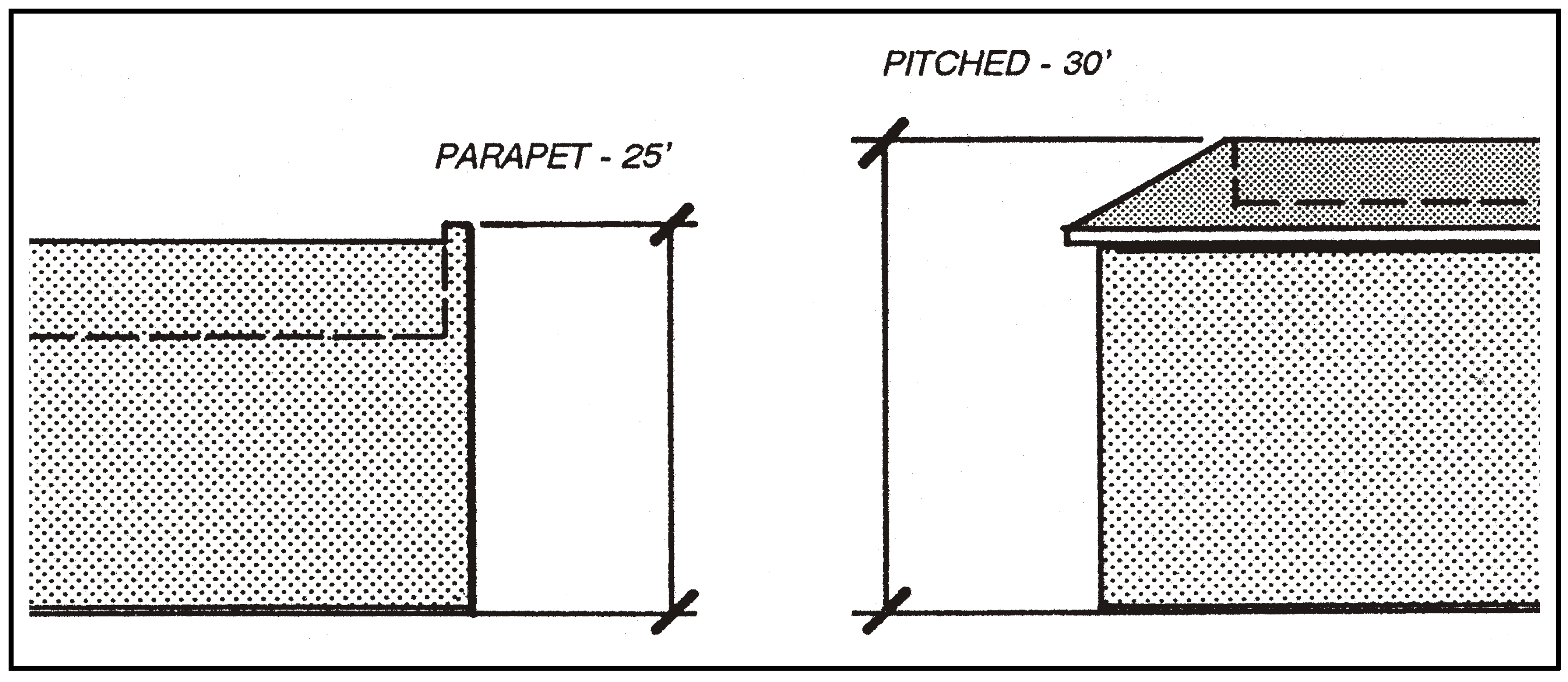
Figure 94-45: Building Heights
12.
Building color. Building color shall be in harmony with surrounding natural colors, be greater than or equal to 4 in value, and no brighter than 6 in chroma on the munsell color scale on file at the Department. Trim colors shall be complementary to wall colors (not contrasting), and shall comprise no more than five percent of any wall surface.
13.
Sign limitation. Free-standing signs are limited to a height of 12 feet. Freeway identification signs, as identified in Chapter 22.20, are not allowed.
14.
Building design. Architecture shall be responsive to the need to minimize building massing as seen from Highway 101 and from adjacent residential properties.
a.
Massing. Building walls and height shall be varied to avoid a "boxy" appearance and to transition from ground level to the top of the walls using canopies, porches, arcades or awnings.
b.
Orientation. Buildings will be oriented so that customer entrances face the front or side, and bay doors do not face the road or Highway 101, as illustrated in Figure 94-46.
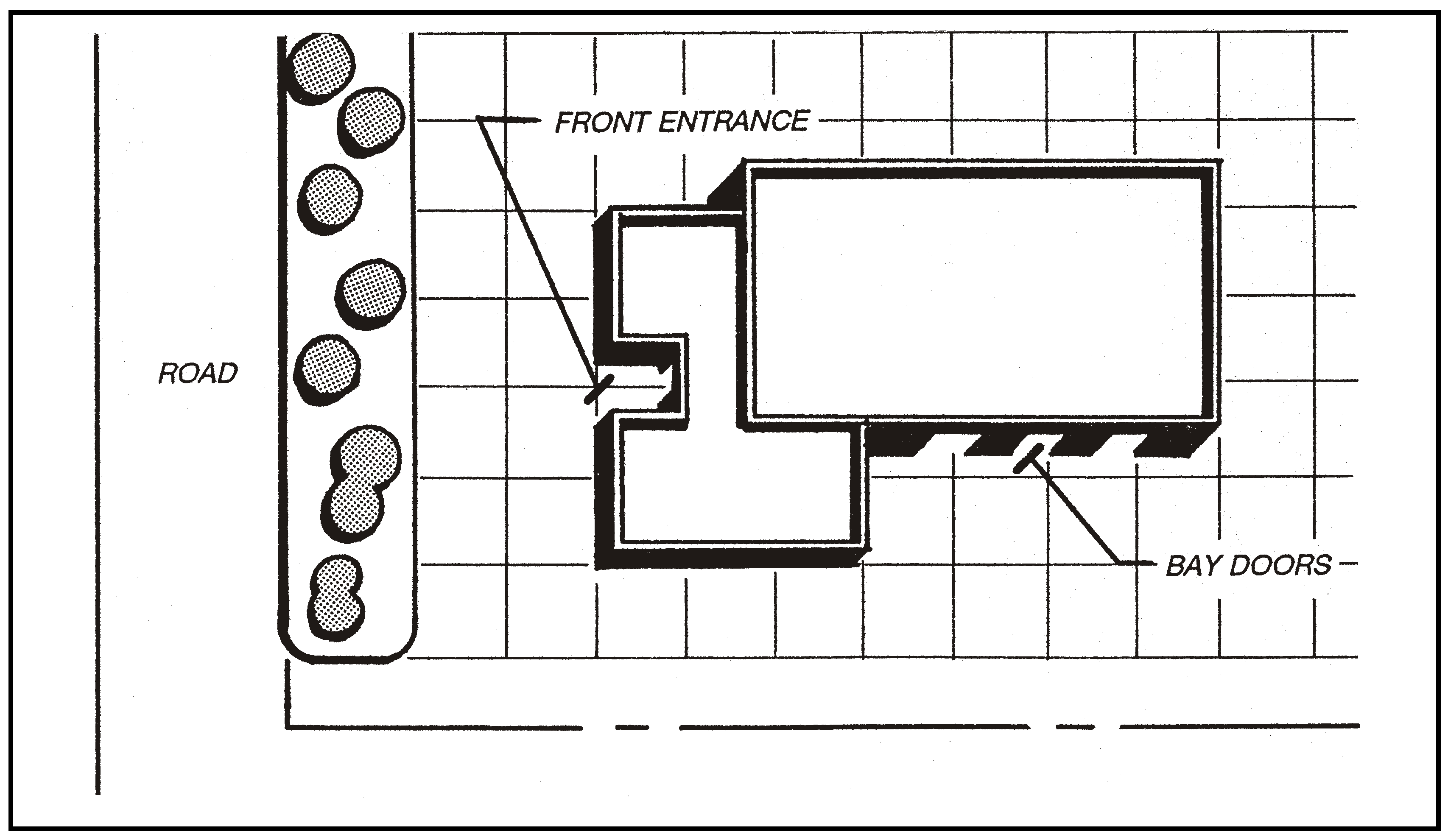
Figure 94-46: Building Orientation
c.
Windows. The major entry facade shall be 30 percent transparent, but no more than 50 percent of any facade may be glass or reflective material.
d.
Materials. Non-reflective materials shall be utilized. Primary wall material should be stucco, wood or anodized painted metal. Particular attention should be given to trim and accent materials that include wood, brick, split masonry block, river rock or unglazed tile. Materials such as unpainted metal, unfinished or painted concrete block, unfinished concrete "tilt-up" construction, or box-like pre-fabricated metal structures are not appropriate.
15.
Fencing. Fencing materials shall include wood, wood-appearing concrete, finished (stuccoed) or split-face masonry block. Solid fencing locations on sides and rear of a site shall be within the landscaped setback required by Subsection D.10.a as illustrated in Figure 94-47, or open fencing may be located on side and rear property lines outside of the required landscaping.
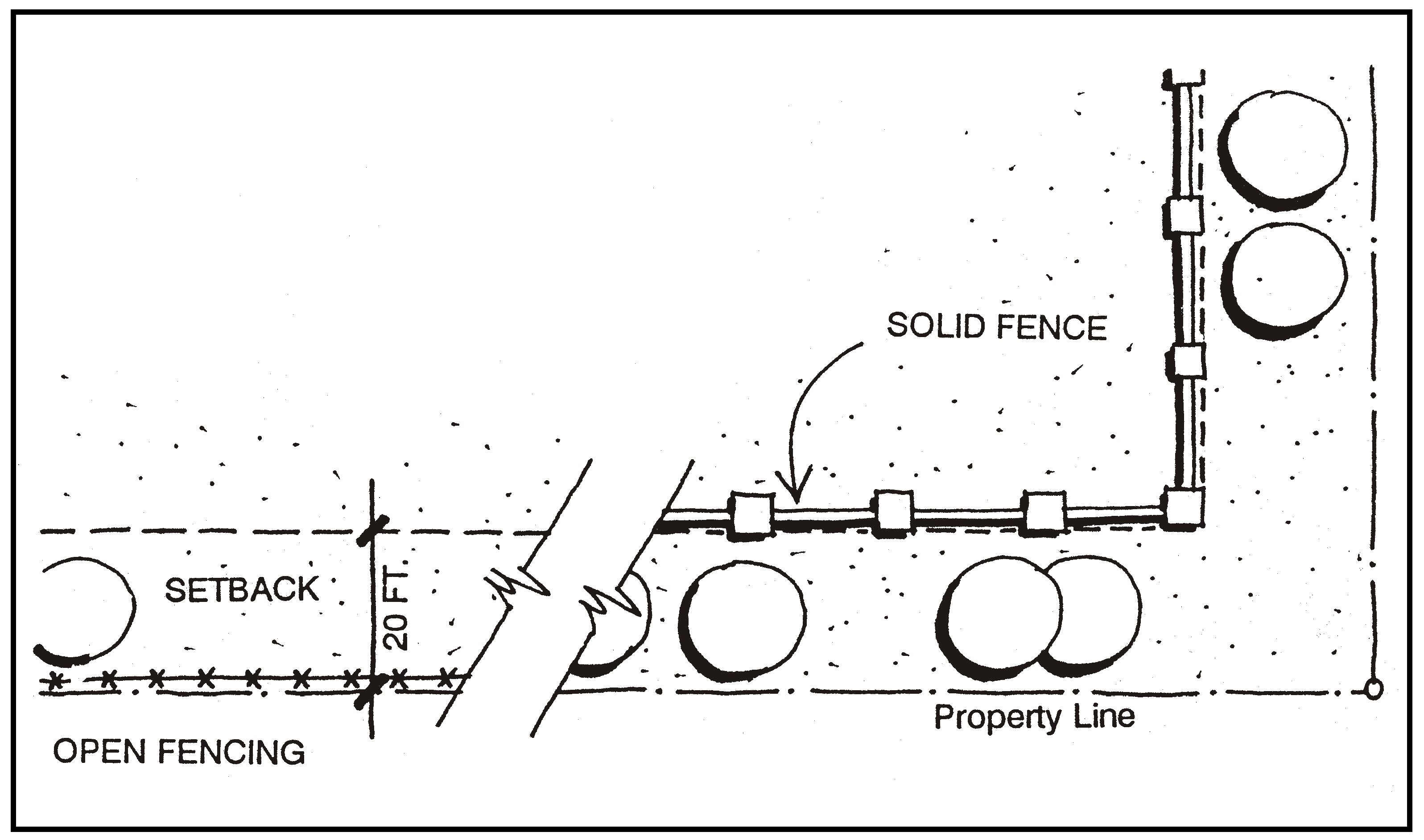
Figure 94-47: Fencing Location
E.
Industrial (IND). The following standards apply within the Industrial land use category located at Wellsona Road east of Highway 101 as shown in Figure 94-48.
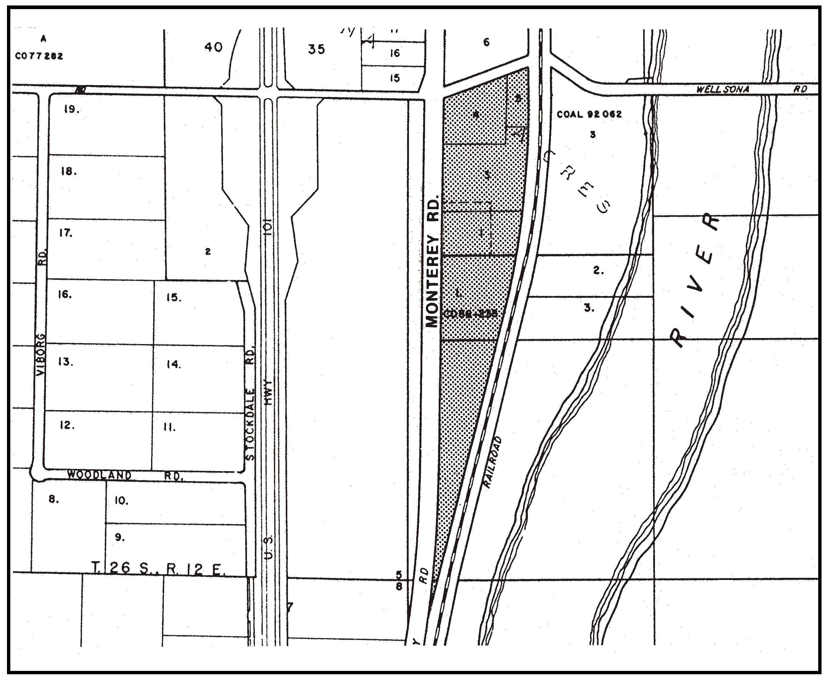
Figure 94-48: IND - Wellsona Road Area - Rural
1.
Limitation on use. Land uses shall be limited to fuel dealers, energy-generating facilities (limited to renewable energy facilities) and those listed in Table 2-2, Section 22.06.030 within the Manufacturing and Processing group as allowable, permitted, or conditional in the Industrial land use category. Retail trade uses are only allowed incidental to the manufacture, assembly or processing of products on the same site.
2.
Permit requirement. Minor Use Permit approval is required for all proposed uses, unless a Conditional Use Permit is otherwise required by this Title.
F.
Recreation (REC) - Cerro Alto area - Limitation on use. Land uses shall be limited to the following in the Recreation category on Highway 41 shown in Figure 94-49, in compliance with the land use permit requirements of Section 22.06.030.
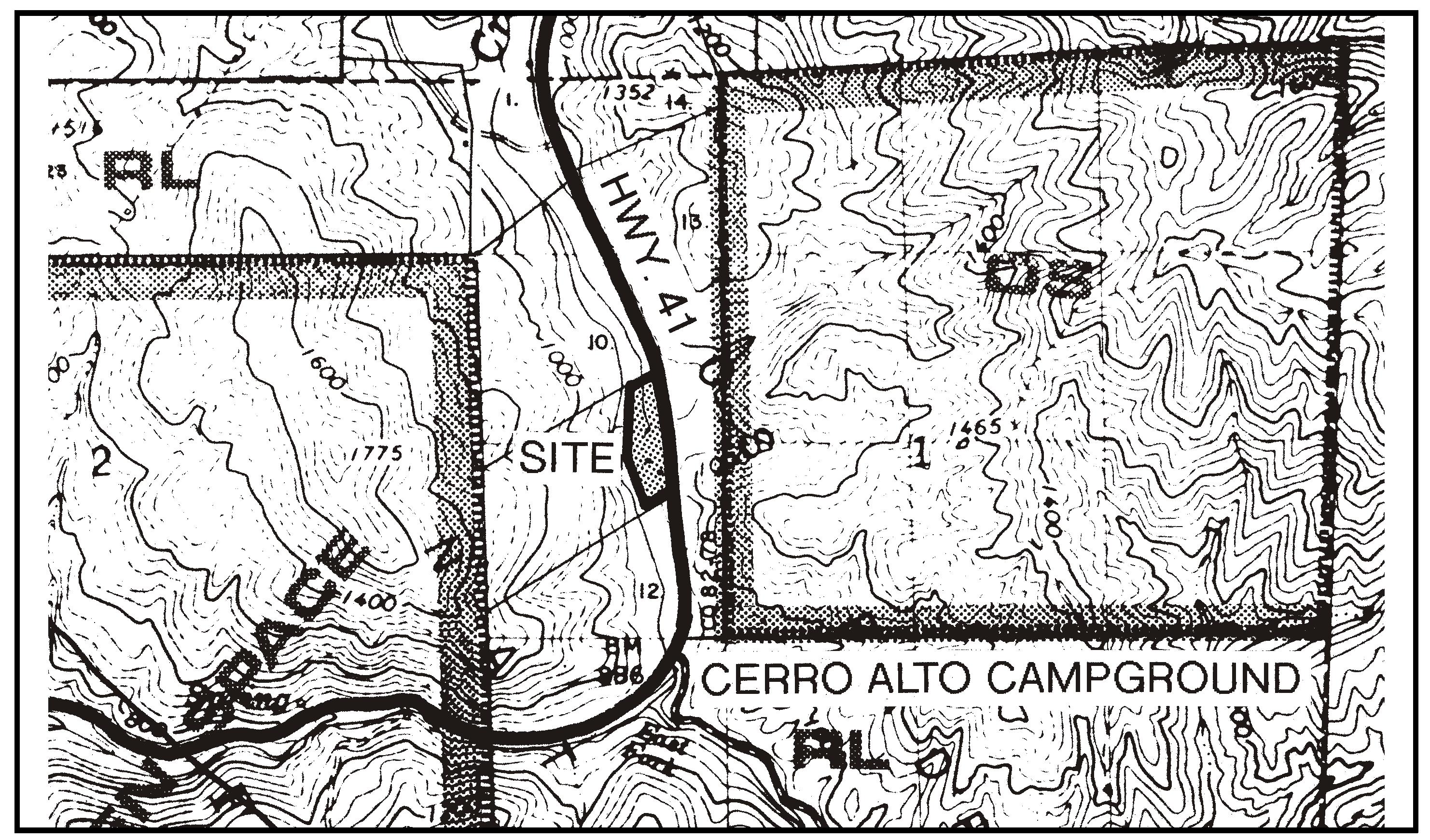
Figure 94-49: REC - Highway 41 - Cerro Alto Area
G.
Residential Rural (RR). The following standards apply within the Residential Rural land use category.
1.
North of 10th Street, west of Highway 101, San Miguel - Minimum parcel size. For the lands comprising Parcel Map CO84-0143, as shown in Figure 94-50 and recorded with the County Clerk-Recorder in Book 35, Page 77 of Parcel Maps,, the maximum number of lots shall be computed on the basis of one residential lot per 15 acres of gross site area unless Chapter 22.22 would otherwise require larger sizes.

Figure 94-50: RR - North of 10th Street, West of 101 - Rural
2.
Wellsona Road area - Minimum parcel size and residential density. The maximum density and the number of residential lots allowed on the land north of Wellsona Road and west of Highway 101, as shown in Figure 94-51, shall be computed on the basis of one residential lot and single-family dwelling per 10 acres of gross site area.

Figure 94-51: RR - Wellsona Road Area - Rural
3.
Stockdale Road area - Subdivision requirement. On the land west of Stockdale Road, north of Paso Robles shown in Figure 94-52, land divisions creating residential parcels shall be clustered in compliance with Section 22.22.140. Permanent open space shall include but not be limited to prime agricultural soil areas.
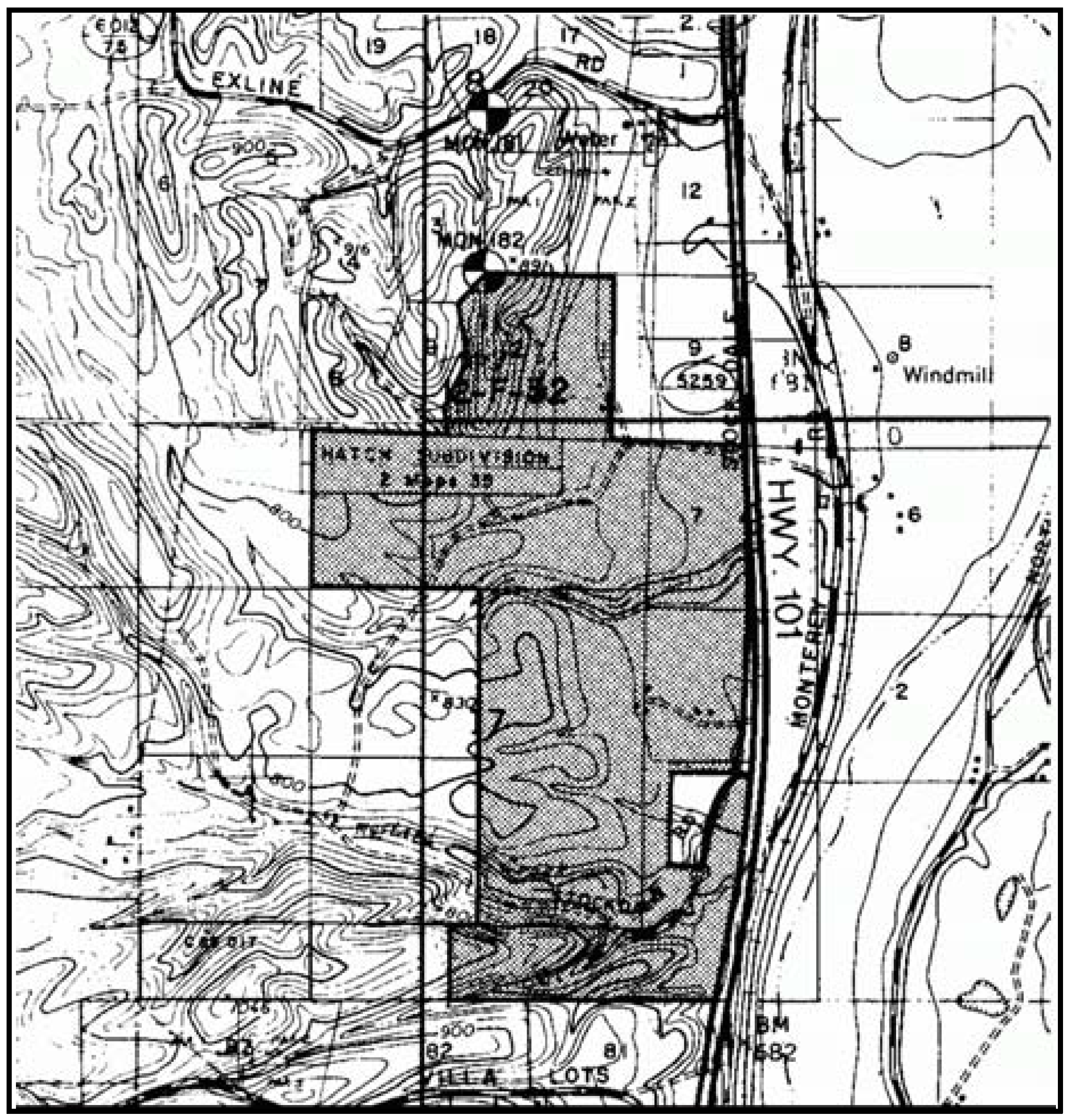
Figure 94-52: RR - Stockdale Road Area - Rural
4.
Spanish Camp Area. The following standards apply only to the area south of Charolais Road, east of Highway 101, as shown in Figure 94-53.
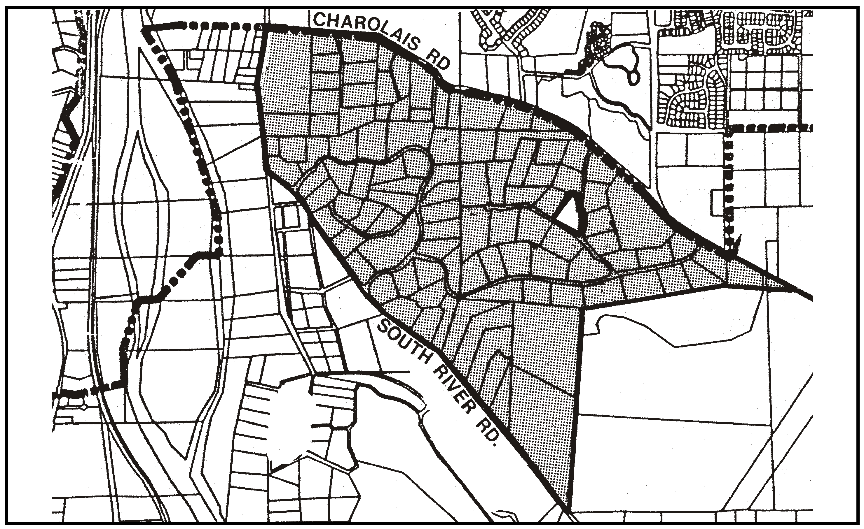
Figure 94-53: RR - Spanish Camp Area - Rural
a.
Limitation on use - Spanish Camp area. Land uses shall be limited to the following, in compliance with the land use permit requirements of Section 22.06.030: agricultural accessory structures; cannabis cultivation; cannabis dispensaries; cannabis transport facilities; crop production and grazing; caretaker residence; animal keeping; energy-generating facilities (limited to renewable energy facilities); home occupations; residential accessory uses; single-family dwellings; storage accessory; temporary construction yards.
b.
Access - Spanish Camp area. Wherever possible, land divisions shall use existing roads for access, and combine driveways adjacent to Creston and South River Roads where feasible based upon terrain and safe sight distance.
5.
Almira Park area. Allowable land uses within the Almira Park area as shown in Figure 94-54 are limited to agricultural accessory structures; crop production and grazing; caretaker residences; cannabis cultivation; cannabis dispensaries; cannabis transport facilities; animal keeping; energy-generating facilities (limited to renewable energy facilities); home occupations; residential accessory uses; single-family dwellings; storage accessory; temporary construction yards; and bed and breakfast inns.

Figure 94-54: RR - Almira Park Area - Rural
a.
Design standards for accessory dwelling units. Accessory dwelling units proposed within the Almira Park area as shown in Figure 94-54 shall comply with the following design standards.
(1)
Accessory dwelling units shall be subject to all standards set forth in Section 22.30.470 in addition to the following standards, except where Subsection 22.30.470F.3 would allow the Review Authority to approve alternatives to Subsection 22.30.470C.2, no alternatives shall be allowed.
(2)
Driveway consolidation. The primary and accessory dwelling units shall use combined driveways, where feasible, based upon terrain and safe sight distance.
(3)
Tree protection/Vegetation Removal. Avoid native vegetation removal. Where vegetation removal can not be avoided then removal shall be minimized. No removal of trees having a diameter of more than eight inches at four feet above grade shall occur.
(4)
Aesthetics. All development shall visually blend with the existing topography, including minimization of grading and design of the accessory dwelling unit so that it does not silhouette against the sky. Development shall be sensitive to the character of the area and shall protect public viewsheds. Structures shall be located away from exposed ridges or hilltops to areas of minimum visibility. Existing vegetation, topographic features and landscaping shall be used to screen the visibility of development. Exterior colors be muted, earthtone shades, and shall not have a Munsell chroma or value greater than six. Building height shall not exceed 25 feet above average natural grade.
(5)
Slope. No development, including new access roads and driveways, shall be permitted on slopes steeper than 15 percent. Alteration of land forms shall be minimized. Locate development to minimize grading for residences and access roads. An erosion control and drainage plan in compliance with Chapter 22.52, and landscaping plan, emphasizing vegetation to stabilize and screen all visible cut and fill slopes, shall be submitted at time of application for a construction or land use permit. Adequate erosion and sedimentation control measures shall be implemented during grading and construction.
(6)
Riparian protection. The second dwelling on the site shall be set back a minimum of 30 feet from the top of the bank of any watercourse, as defined in the Land Use Ordinance, or outside the dripline of riparian vegetation, whichever distance is greater.
(7)
Noise exposure. A noise study shall be submitted at time of application for a construction permit for the second dwelling on the site if the site is located within 1,000 feet of Highway 101, unless an existing intervening landform is located between the residence and the highway.
(8)
Water conservation. Water conservation measures shall be incorporated into the design and operation of the second dwelling on the site in accordance with Chapter 22.16 (Water efficient landscaping methods) and Chapter 19.20 (Water conservation provisions) of the County Code.
(9)
Road Fees. Evidence shall be submitted at the time of application for a construction permit for the second dwelling on the site, that all applicable City of Paso Robles road fees have been paid to the City of Paso Robles.
(10)
Air Quality. Evidence shall be submitted at the time of application for a construction permit for the second dwelling on the site, that an agreement has been entered into between the applicant and the Air Pollution Control District that prohibits backyard burning.
(11)
Energy Efficiency. Construction plans for the second dwelling on the site shall incorporate measures to increase the building energy efficiency rating by 10 percent above what is required by Title 24 requirements.
6.
Kiler Canyon Road, Highway 46 West, and Vineyard Drive Areas - Minimum parcel size and residential density. The maximum density and the number of residential lots allowed shall be computed on the basis of one residential lot and single-family dwelling per 10 acres of gross site area, on the following properties:
a.
The Kiler Canyon Road area shown in Figure 94-55.
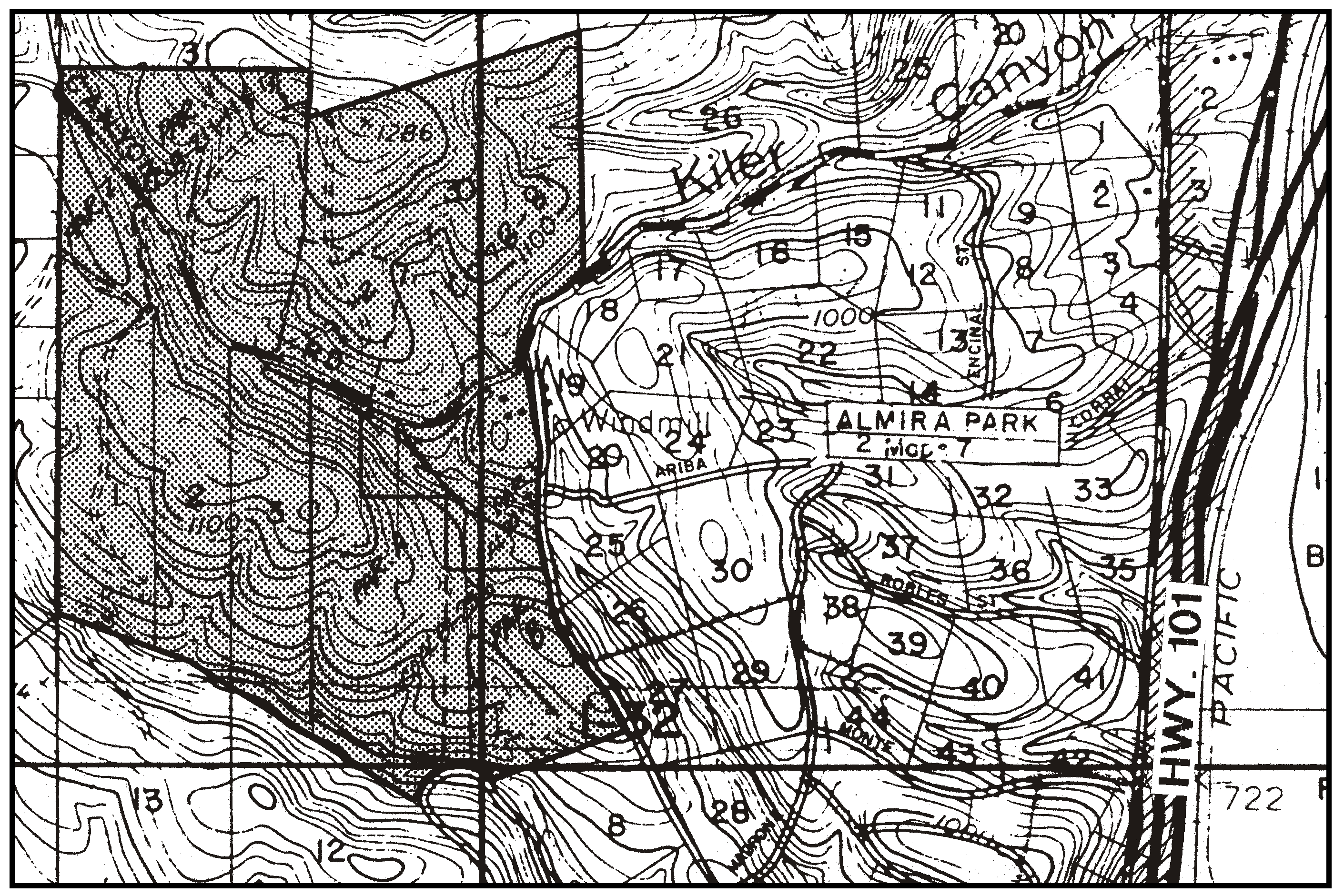
Figure 94-55: RR - Kiler Canyon Road Area - Rural
b.
The area north and south of Highway 46 West near Classen Ranch Lane, Twelve Oaks Drive, and Arbor Road area shown in Figure 94-56. This area includes the land comprising the following subdivision maps, on file with the County Clerk-Recorder:
(1)
Parcel Map CO84-0031, recorded in Book 44, Page 11 of Parcel Maps.
(2)
Parcel Map CO85-0057, recorded in Book 48, Page 61 of Parcel Maps.
(3)
Parcel Map CO88-0077, recorded in Book 45, Page 99 of Parcel Maps.
(4)
Parcel Map CO89-0145, recorded in Book 46, Page 86 of Parcel Maps.
(5)
Parcel Map CO91-0231, recorded in Book 57, Page 5 of Parcel Maps.
(6)
Parcel Map CO93-0044, recorded in Book 50, Page 97 of Parcel Maps.
(7)
Tract Map 1464, recorded in Book 14, Page 83 of Maps.
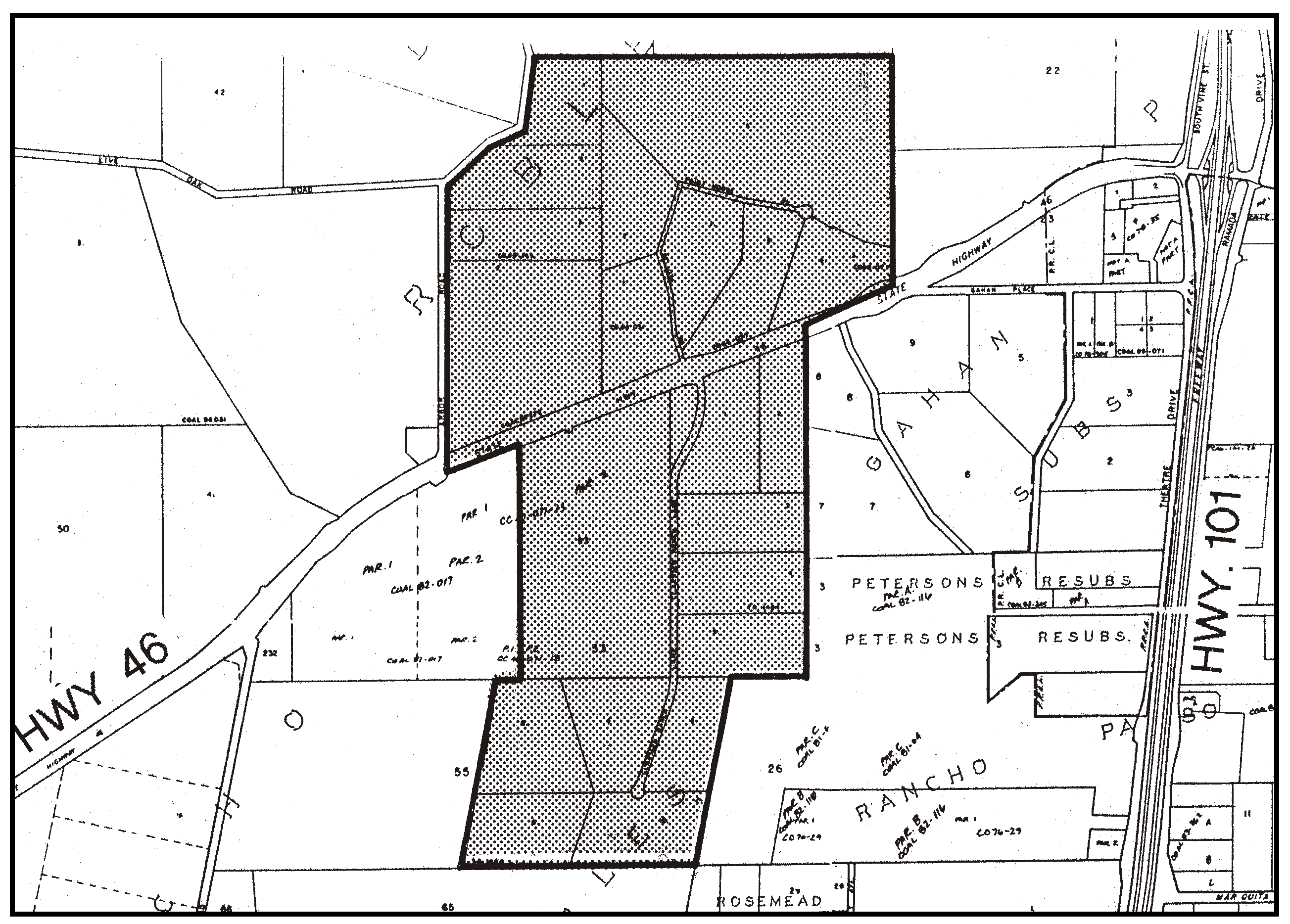
Figure 94-56: RR - Highway 46, West of 101 - Rural
c.
The 44-acre area on Vineyard Drive shown in Figure 94-57. This area is comprised of the land shown in Parcel Map CO 86-0239, on file with the County Clerk-Recorder in Book 48, Page 17 of Parcel Maps.
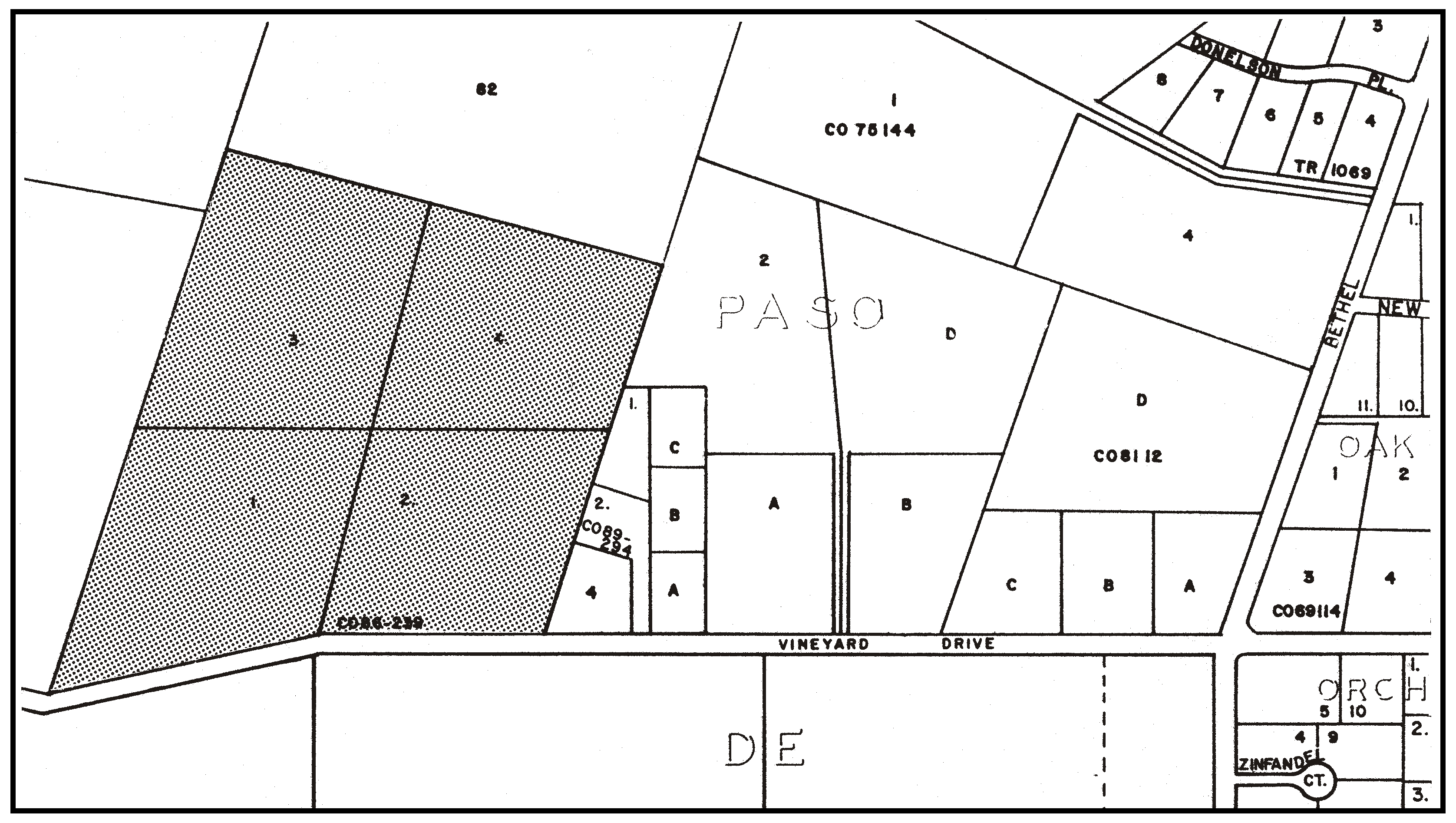
Figure 94-57: RR - Vineyard Drive -Rural
7.
Paso Robles Creek area. Within the Paso Robles Creek area shown in Figure 94-58, open space dedications shall be retained in perpetuity and no further subdivision shall be permitted. Residential density has been transferred to this area through the Transfer of Development Credits program, and legal lots have been established through the recordation of the following maps, on file with the County Clerk-Recorder:
a.
Tract 2365, recorded in Book 19, Page 93 of Maps.
b.
Tract 2423, recorded in Book 21, Page 5 of Maps.
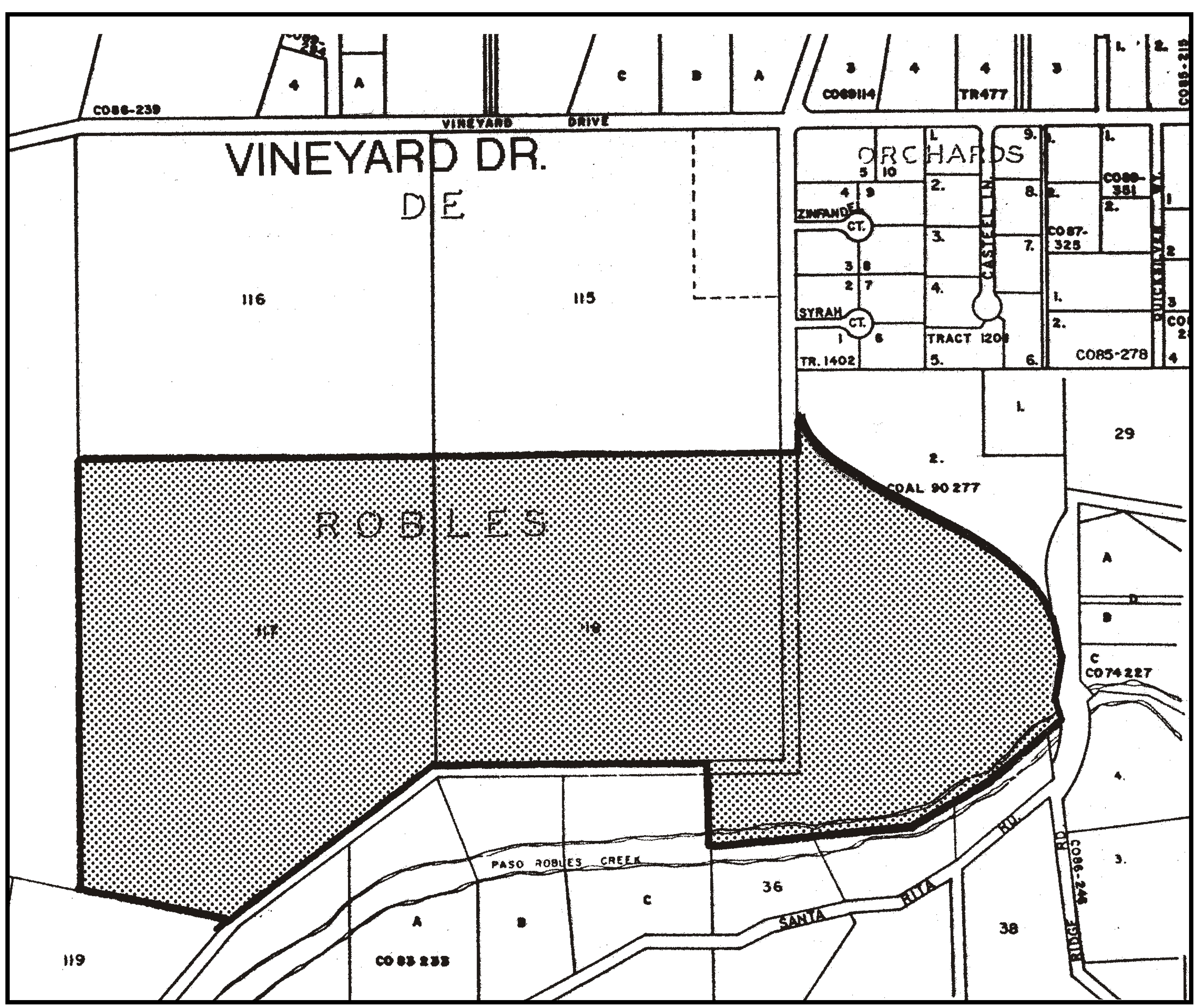
Figure 94-58: RR - Paso Robles Creek - Rural
8.
Tassajara Canyon. The following standards apply only to Tassajara Canyon as shown in Figure 94-59.
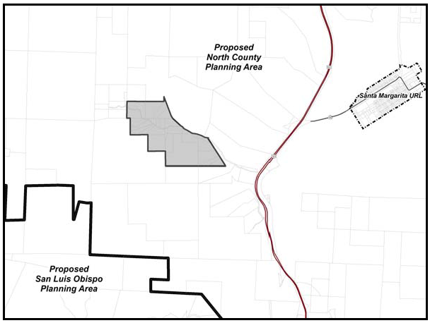
Figure 94-59: RR - Tassajara Canyon - Rural
a.
Limitation on creek crossings. New land divisions proposing lots that require crossing Tassajara Creek shall be designed using a single creek crossing for access to the proposed parcels.
b.
Permit requirement. Proposed methods and locations of proposed crossings of Tassajara Creek shall be approved by the California Department of Fish and Game.
c.
Stream protection. Channelization, culverts or major alterations which may adversely affect the stream bed or course or cause siltation of the creek through grading are prohibited.
H.
Residential Suburban (RS). The following standards apply within the Residential Suburban land use category as shown in Figure 94-60.
1.
Minimum parcel size - Atascadero Colony. For new land divisions the maximum number of residential lots allowed shall be computed on the basis of one lot per a minimum parcel size of 2 ½ acres, unless Chapter 22.22 would otherwise require larger parcel sizes
2.
Driveway consolidation. Shared driveways are encouraged between parcels for access to individual residences to minimize the number of access points to the street.
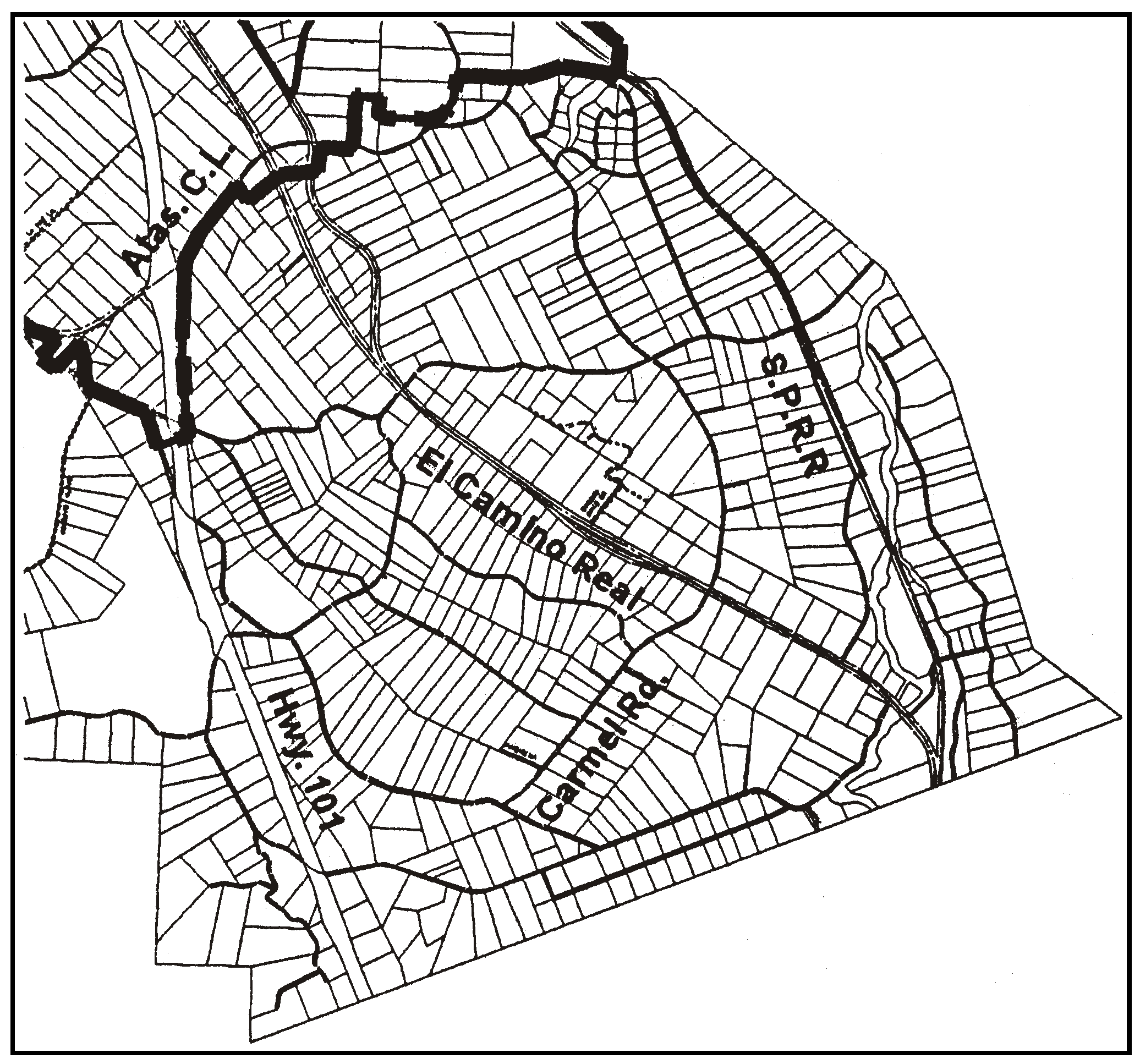
Figure 94-60: RS - South Atascadero - Rural
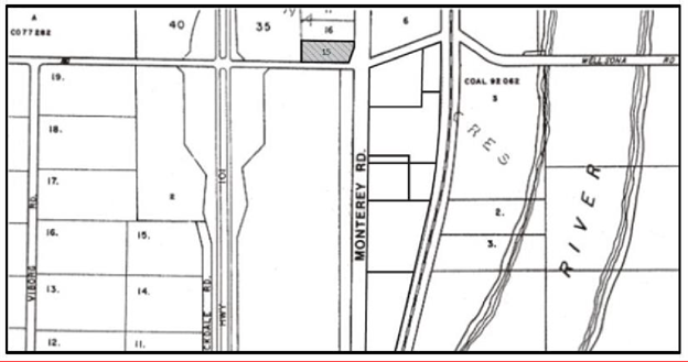
Figure 94-60(b):MU IND/CS - 90 Wellsona Road - Rural
I.
Multiple Use Industrial/Commercial Service (MU IND/CS). The following standards apply within the Multiple Use Industrial/Commercial Service land use category located at 90 Wellsona Road east of Highway 101 and north of Wellsona Road as shown in Figure 94-60(b).
1.
Applicable land use category standards. New land uses and expansion of existing land uses shall comply with whichever set of land use category standards (IND or CS) are the less restrictive.
2.
Permit requirement. Minor Use Permit approval is required for animal hospitals, veterinary medical facilities, and all other non-agricultural land uses, unless a Conditional Use Permit is otherwise required by this Title.
3.
Maximum allowed water use for non-agricultural uses. Non-agricultural land uses shall not exceed a water demand of two and one-half acre-feet per year (AFY) until a Level of Severity I is certified for the Paso Robles Groundwater Basin by the Board of Supervisors after adoption of a Resource Capacity Study. This water limit does not exempt any land uses from the Paso Robles Groundwater Basin standards (Section 22.94.025). This maximum water use limitation is based on an estimate of potential water use allowed by the previous RS land use category. The required water offset for non-agricultural uses shall be based on actual existing water demand on site, not the maximum allowed water use.
[Amended 1990, Ord. 2443; 1996, Ord. 2776; 2003, 3013; 2004, Ord. 3054; 2014, Ord. 3256; 2015, Ord. 3291; 2017, Ord. 3358; 2018, Ord. 3376; 2018, Ord. 3377; 2020, Ord. 3409; 2024, Ord. 3508]
22.94.084 - Atascadero Urban Area Standards.
The standards of Section 22.94.080 apply to areas within the Atascadero Urban Reserve Line that are outside the City limits, in the land use categories or specific areas listed.
[Amended 2014, Ord. 3256]
22.94.086 - Paso Robles Urban Area Standards.
The standards of Section 22.94.080 and the following standards apply within the Paso Robles Urban Reserve Line that are outside the City limits, in the land use categories or specific areas listed.
A.
Combining Designations Airport Review Area (AR). All development applications for private lands within the boundary of the Paso Robles Municipal Airport Land Use Plan shown in Figure 94-1 and on the official maps are subject to the development standards set forth in that plan, in addition to all applicable provisions of this Title. In the event of conflicts between the provisions of the Airport Land Use Plan and this Title, the more restrictive provisions shall prevail.
B.
Commercial Service (CS). The following standards apply within the Residential Suburban land use category.
1.
Theater Drive. The following standards apply only to the Commercial Service category on Theater Drive shown in Figure 94-61.
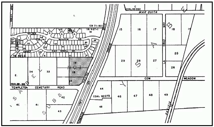
Figure 94-61: CS - Theatre Drive - Paso Robles Urban Area
a.
Limitation on use. All land uses identified by Section 22.06.030 as allowable, permitted, or conditional uses within the CS land use category may be authorized in compliance with the land use permit requirements of that Section, except: concrete, gypsum and plaster products; metal industries, fabricated; recycling and scrap; fuel dealers; storage yards and sales lots; and vehicle storage.
b.
Subdivision and development requirement. Conditional Use Permit or Tentative Map approval is required to establish a plan for the development of the entire property. The plan shall set circulation, site planning and architectural requirements consistent with the character of the area.
C.
Residential Rural (RR). The following standards apply within the Residential Rural land use category.
1.
Subdivision design. Proposed land divisions that abut properties within the Agriculture land use category shall be planned in compliance with the cluster provisions of Section 22.22.140, or other measures that will achieve the same purpose as clustering. Residential parcels and building sites shall be located outside the agricultural buffer area east of Buena Vista Drive shown in Figure 94-62.
2.
Subdivision circulation. Prior to Tentative Map recordation, the applicant shall submit an agreement to participate in the formation of assessment districts for water, sewer and circulation when it becomes necessary to provide future facilities.
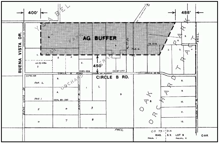
Figure 94-62: RR - Circle B Road - Ag Buffer - Rural
D.
Residential Suburban (RS). The following standards apply within the Residential Suburban land use category.
1.
Cluster land divisions. New land divisions are encouraged to be clustered in compliance with Section 22.22.140, or utilize similar techniques that achieve the same result as clustering.
2.
Tract 7. The following standards apply to the properties in Tract 7 shown in Figure 94-63.
a.
Offer of dedication. Prior to the issuance of any land use permit that increases the number of dwelling units or parcels, offer for dedication a public road right-of-way across the entire property frontage along the proposed road. Offered rights-of-way shall follow platted road alignments and shall be one-half of a 50-foot wide road section from the future centerline.
b.
Road improvements - Residences. New residences shall be provided public safety access road improvements in compliance with the Uniform Fire Code and California Public Resources Code Section 4290, prior to final building inspection. Depending on the condition of existing roads, improvements may be required to provide emergency response access along the frontage of the project site and between the project site and the nearest improved road.
c.
Fire safety plan. A fire safety plan is required for all new residential development, in compliance with Chapter 22.50.
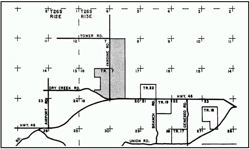
Figure 94-63: RS - Tract 7 - Paso Robles Urban Area
[Amended 2014, Ord. 3256]
22.94.090 - Shandon Sub-area Standards.
The following standards apply to all development and new land uses in the Shandon Sub-area, as shown on Figure 94-5, as applicable to each land use category.
A.
Agriculture (AG). The following standard applies to the Shandon wastewater treatment facility site as shown in Figure 94-64.
1.
Permit required. Conditional Use Permit approval is required for the development of the Shandon wastewater treatment facility. The Review Authority shall find that the wastewater treatment facility is consistent with the applicable provisions of the Shandon Community Plan. The facility shall be designed with an emphasis on groundwater replenishment. It shall be sited to minimize off-site odor and be adequately screened from public view.
[2018, Ord. 3369]
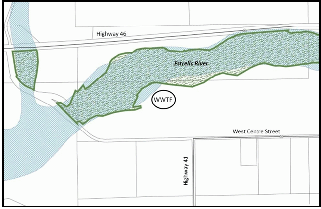
Figure 94-64\Shandon Wastewater Treatment Facility Site
B.
Commercial Retail (CR). The following standards apply within the Commercial Retail land use category.
1.
Cholame commercial area defined. The Cholame commercial area on the west side of Highway 46 is 200 feet wide and 500 feet in length, in the northwest quarter of the southwest quarter of Section 30, Township 25 South, Range 16 East.
2.
Permit requirement. Minor Use Permit approval is required for all new uses unless Section 22.06.030 or Article 4 would otherwise require Conditional Use Permit approval.
C.
Commercial Service (CS). The following standards apply within the Commercial Service land use category.
1.
Highway 46 between Shandon and Cholame - Commercial Service area. The following standards apply to the area located on the northwest side of Highway 46 East between Shandon and Cholame, as shown on Figure 94-65.
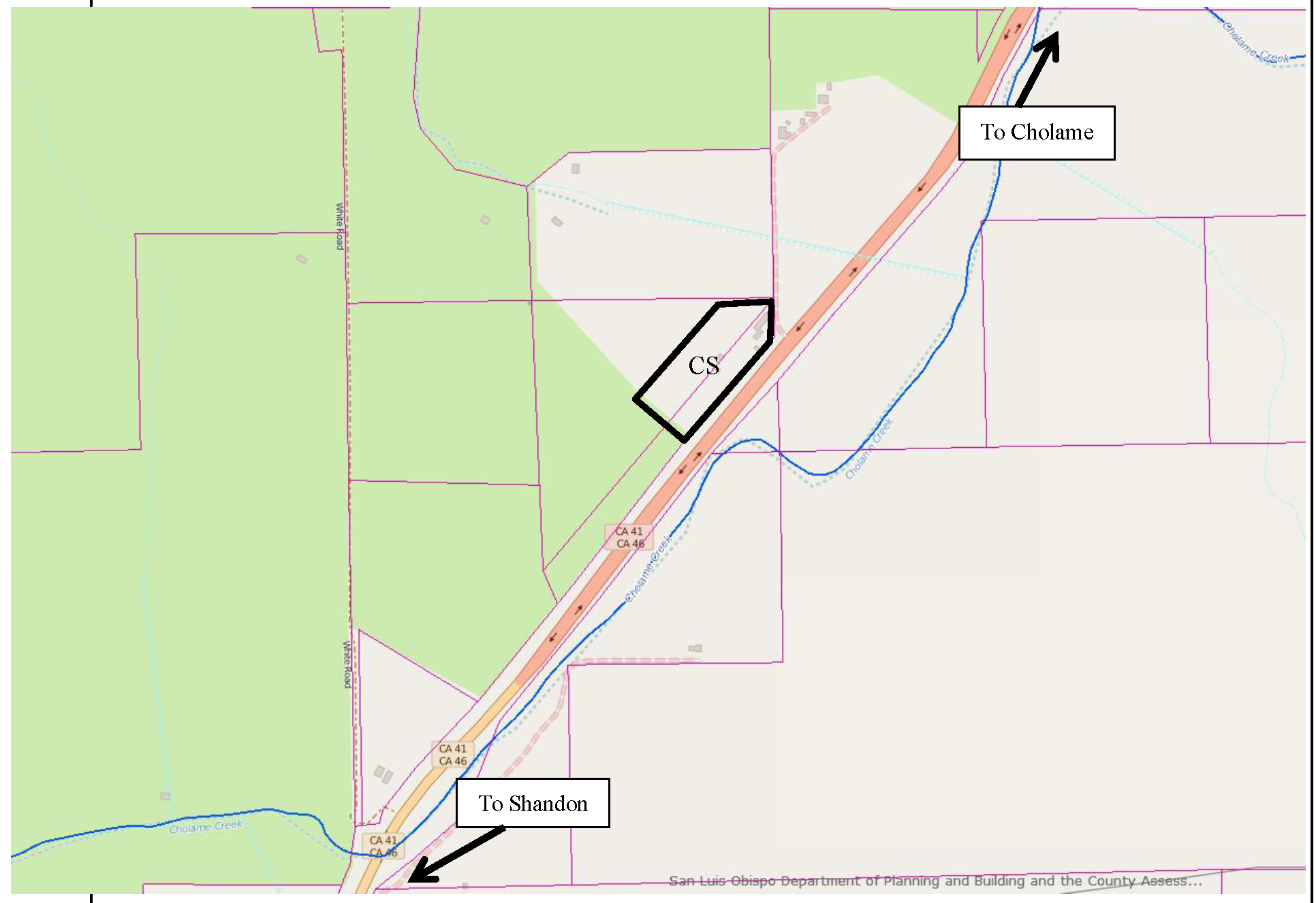
Figure 94-65: Service Commercial Area
a.
Limitation on use - service commercial area. Land uses shall be limited to the following, subject to the land use permit requirements of Section 22.06.030: Metal Industries - Fabricated; Small Scale Manufacturing; Agricultural Processing (excluding wine tasting and special events); Construction Contractors, Energy-Generating Facilities (limited to Accessory Renewable Energy Facilities), Farm Equipment and Sales, Warehousing (no wholesale or retail sales from the site), Caretakers Quarters and Residential Accessory Uses. All uses are limited to the producing, assembling, manufacturing and storing of goods and products that are for rural or agricultural applications or operations.
b.
Permit requirement. Minor Use Permit approval is required for all new or expanded uses, unless a Conditional Use Permit is otherwise required by this Title.
[2016, Ord. 3331]
2.
West Centre and Highway 46. The following standards apply to the property near the intersection of West Centre Street and State Highway 46 as shown in Figure 94-66.
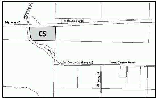
Figure 94-66: CS - West Centre Street and Highway 46
a.
Permit requirement. Conditional Use Permit is required prior to the first entitlement on the site. The Conditional Use Permit shall specify the permit requirements for the full build-out of the site for all new construction. If a separate entitlement has not been obtained prior to the master Conditional Use Permit for the Peck Ranch Master Plan area required by Section 22.110.050.B.1, development of this site shall be included as part of that master Conditional Use Permit.
b.
Limitation on use. Allowable uses shall be limited to Ag Processing, Animal hospitals and veterinary medical facilities, Crop Production and Grazing, Nursery Specialties, Small Scale Manufacturing (limited to artisan/craftsman type operations), Indoor Amusement and Recreation Facilities, Energy-Generating Facilities (limited to Accessory Renewable Energy Facilities), (Automobile Service Stations and Gas Stations, Restaurants, Libraries and Museums, Outdoor Sports and Recreational Facilities, Public Assembly and Entertainment Facilities, General Retail, Restaurants, Lodging and Personal Services.
c.
Groundwater offset. New non-agricultural uses of groundwater shall be completely offset through one or more of the means listed below prior to issuance of construction permits for any of the following new development: 1) development resulting from new land divisions, 2) development of more than 9,999 square feet of floor area for allowed Small Scale Manufacturing uses, 3) development of more than 2,499 square feet of floor area for all other uses listed in Subsection C.2.b. All criteria are cumulative for a single site. In determining the amount of groundwater to offset, recharge from on-site septic system(s) shall be taken into account.
(1)
Retrofit high-flow toilets and other plumbing fixtures within the Paso Robles Groundwater Basin with low-flow toilets and plumbing fixtures;
(2)
Participate in a county approved plumbing retrofit program for the Paso Robles Groundwater Basin;
(3)
Use the California Urban Water Conservation Council's (CUWCC) best management practices for water conservation;
(4)
Pay a "fair share" of the costs for delivering State water in excess of CSA-16's 2011 allocation of 100 acre-feet per year;
(5)
Participate in a county approved lot retirement program for the Paso Robles Groundwater Basin;
(6)
Participate in the County's Transfer of Development Credits (TDC) program pursuant to Chapter 22.24, provided eligible sending sites are located within the Paso Robles Groundwater Basin, and receiving sites shall not be eligible for a density bonus. The receiver site will receive credit for the water demand that the sending site would have otherwise used, if developed. The ground water off-set shall be determined at the same time the receiver site determination is made.
(7)
Participate in a county-approved rural water conservation program that results in reducing groundwater pumping within the Paso Robles Groundwater Basin.
(8)
Participate in a county-approved fee program that results in reducing groundwater pumping within the Paso Robles Groundwater Basin.
d.
Project design. Buildings and associated improvements shall be designed to be small and low-profile, with a maximum height of 28 feet above average natural grade. Architecture shall be a village and/or agricultural style that blends with the surrounding area. Structures shall connect to natural gas facilities. This standard may be waived with Conditional Use Permit approval provided propane tanks, if proposed, can be adequately screened from public view.
e.
Signage. Allowed signs shall be complementary to the site design and surrounding area. Signage is limited to monument signs of three feet or less in height, highway identification signs a maximum of 32 square feet in area and ten feet in height and one projecting, suspended, marquee or wall sign with a maximum area of 20 square feet, or one suspended sign with a maximum area of 10 square feet for each tenant or business.
f.
Landscape. In addition to the requirements of Chapter 22.16 (Landscaping) landscape materials shall be selected to break up the view of the project from Highway 46 and West Centre Street. Trees shall be selected from the Shandon Community Plan Master Tree List. Landscaping shall use permeable hardscape to the greatest extent feasible and native low water using landscape materials. Irrigated turf may be authorized by the Review Authority for active use areas only.
g.
Stream bank setbacks. Buildings shall be setback a minimum of 100 feet from the top of the stream bank, delineated wetland and riparian habitat.
h.
Circulation.
(1)
Transportation impact fees. Prior to recording a final map, issuance of construction permits or establishment of a use, transportation impact fees shall be paid per the Shandon Capital Improvement Plan (SCIP), unless, as part of the approval of a prior discretionary land use permit or land division application, the appropriate fees were paid and/or circulation facilities were constructed consistent with the SCIP or Chapter 8 of the Shandon Community Plan in order to cover the cost of the transportation impact fees for subsequent projects or land uses.
Prior to the adoption of the SCIP and an associated impact fee ordinance circulation facilities shall be constructed pursuant to Section 22.110.050.A.20.j(1), unless the Review Authority finds, based on a subsequent traffic study, that alternative circulation improvements are sufficient to mitigate the project's transportation impacts.
(2)
Road improvements required. West Centre Street shall be improved to Caltrans standards with new development.
i.
Drainage.
(1)
Drainage shall be handled to maximize percolation and recharge.
(2)
Limit the development of impervious surfaces to reduce run-off volumes.
(3)
Run-off control measures shall be included in new development to minimize the discharge of urban pollutants into drainage areas.
(4)
Stormwater quality measures, such as vegetated swales, linear bio-retention cells within open channels, and permeable paving materials shall be incorporated in new development.
j.
Energy conservation.
(1)
New development shall use energy-efficient equipment, including but not limited to Energy Star appliances, high-energy efficiency equipment, heat recovery equipment, and building energy management systems.
(2)
New development shall include at least four of the following energy conserving techniques:
(a)
Install alternative energy equipment and devices such as solar thermal heating;
(b)
Integrate, where feasible, alternative energy mechanical equipment and accessories within roofing materials and/or blend them with a structure's architectural form;
(c)
Pre-wire commercial and residential development for rooftop photovoltaic (PV) panels or other advanced technology;
(d)
Employ passive solar design and natural daylighting techniques in the design and construction of buildings;
(e)
Provide surfaces and windows (with "low-e" glazing), on south-facing walls, that add significant thermal mass, with proper ventilation, to control and distribute energy throughout structures;
(f)
Use deciduous shade trees on the south, east and west sides of buildings, and low shrubbery immediately south of buildings to maximize passive solar performance; and use evergreen trees, where appropriate, to protect buildings from winter winds, provided the evergreen trees do conflict with the purpose of the deciduous trees.
(g)
Use energy-saving landscaping around buildings and in parking lots to reduce solar gain in summer and allow solar gain in winter;
(h)
Use building materials, components, and systems found locally or regionally to reduce energy use, emissions and transportation costs;
(i)
Use non-toxic building products (e.g. formaldehyde-free insulation, low Volatile Organic Compounds [VOC] paints, etc.); and
(j)
Use lowest water-using or waterless plumbing fixtures, water saving practices, and greywater recycling systems.
k.
Solid waste disposal. New development shall be required to subscribe to waste collection service.
l.
Cultural resources protection. All applications for land divisions and land use permits subject to discretionary review that involve grading, trenching or other ground disturbance shall include a Phase I archaeological survey of the site performed by a qualified archaeologist approved by the Environmental Coordinator. The survey shall include sufficient background archival research and field sampling to determine whether subsurface prehistoric or historic remains may be present. Any further evaluations and investigations and mitigation measures shall comply with County requirements and the provisions of Appendix D of the Shandon Community Plan relating to cultural resources.
m.
Habitat conservation. All land use permits, land divisions and other "covered activities" as defined in the Shandon Community Plan Habitat Conservation Plan (HCP) or other applicable plan shall be developed consistent with HCP. Prior to adoption of an HCP, projects shall be consistent with the applicable mitigation measures shown in Appendix D of the Shandon Community Plan for biological resources.
n.
Environmental mitigation. New development shall comply with the applicable mitigation measures in the Shandon Community Plan Update and San Juan Village (Fallingstar Phase I) Project Final Environmental Impact Report. Table 9.1 in the Shandon Community Plan identifies the type of development for which the mitigation measures in the Final Environmental Impact Report are required.
D.
Residential Rural (RR) - Parcel size. The minimum allowable parcel size for new land divisions in the Residential Rural land use category is 10 acres unless a larger parcel size would otherwise be required by Chapter 22.22.
[Amended 1987, Ord. 2331; 2004, Ord. 3045; 2012, Ord. 3222; 2014, Ord. 3256; 2015, Ord. 3291]
22.96.010 - Purpose and Applicability.
This Chapter provides standards for proposed development and new land uses that are specific to the San Luis Obispo planning area defined by the Land Use Element. These standards apply to proposed development and new land uses as provided by Section 22.90.020 (Applicability), and are organized according to the specific areas and/or land use categories within the planning area to which they apply.
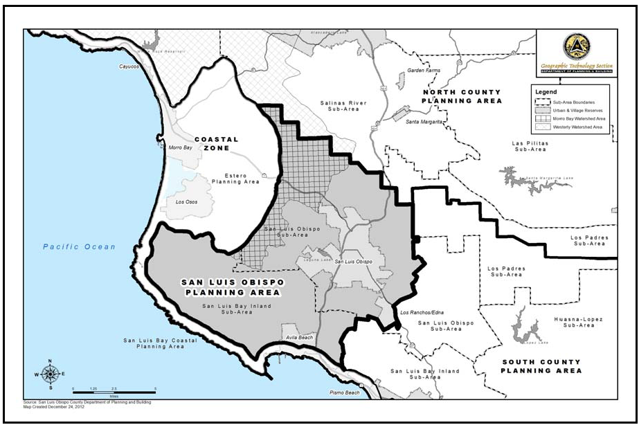
Figure 96-1: San Luis Obispo Planning Area showing boundary between sub-areas
[Amended 1993, Ord. 2646; 2014, Ord. 3256]
22.96.020 - Combining Designation Standards.
A.
Airport Review Area (AR). The following standards apply within the Airport Review combining designation, as shown in Figure 96-2:
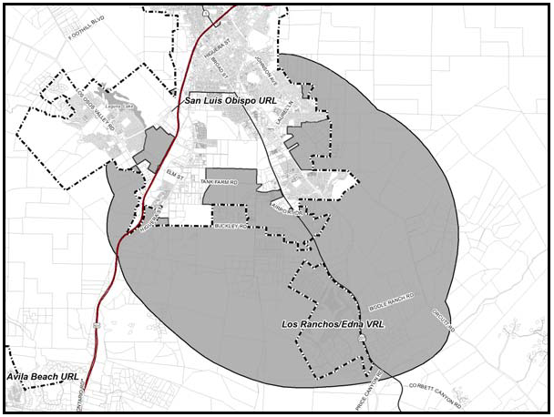
Figure 96-2: San Luis Obispo Airport Review Area
1.
Airport Land Use Plans included by reference. The adopted San Luis Obispo County Airport Land Use Plan, and any amendments thereto, is hereby incorporated into this Title by reference as though it were fully set forth here.
2.
Limitation on uses within Airport Review Area. Allowable uses are limited to those designated as "compatible" or "conditionally approvable" by the San Luis Obispo County Airport Land Use Plan, as applicable, in compliance with the land use permit requirements of Section 22.06.030 (Allowable Land Uses and Permit Requirements.
3.
Review for compliance with Airport Land Use Plan. All land use permits, land divisions and General Plan amendments must be found consistent with the San Luis Obispo County Airport Land Use Plan adopted by the San Luis Obispo County Airport Land Use Commission.
4.
Site Design and development standards - Private lands. All development applications for the area within the boundary of the San Luis Obispo County Airport Land Use Plan shall comply with the development standards in that plan, in addition to all applicable provisions of this Title. In the event of conflicts between the provisions of the Airport Land Use Plan and this Title, the more restrictive provisions shall prevail.
5.
Site design and development standards - Airport site. New development projects in County-owned portions of the site of the San Luis Obispo County Airport shall be consistent with the adopted Airport Use Permit (the land use plan for the airport itself), and shall comply with all applicable provisions of the airport lease site standards instead of the provisions of Articles 3 and 4 of this Title.
B.
Historic Area (H) — Historic sites. The following standard applies within the Historic combining designation.
1.
San Luis Obispo Sub-area. Within the San Luis Obispo Sub-area, as shown in Figure 96-1, the provisions of Section 22.14.080 requiring Minor Use Permit approval applies only to the historic structures identified in Chapter 6 of the San Luis Obispo Area Plan (see page IV.6-2), and an area within 200 feet of the structure, and not to other structures or uses which exist or are proposed on the site or to vegetation removal, routine maintenance, repairs or similar activities.
2.
Historic site - Octagon Barn. The following standards apply to the Octagon Barn site within the Historic combining designation, in addition to the provisions of Subsection B.1.
a.
Once the Octagon Barn is restored to provide for public safety and preservation of the historic resource, the sale of agricultural products within the Octagon Barn may be approved in compliance with Section 22.30.510 (roadside stands), except that the agricultural products sold are not limited to those grown on properties owned by the owner of the site of the proposed roadside stand, as long as they are grown within the County.
b.
A new parcel smaller than otherwise permitted by Chapter 22.22 (Subdivision Standards) may be created as a "public lot" through interim ownership by the County and then transferred to a non-profit organization approved by the County.
C.
Sensitive Resource Area (SRA). The following standards apply within the Sensitive Resource Area (SRA) combining designation.
1.
Indian Knob - Required plant species inventory. Prior to approval of any land use permit in the Indian Knob area (see Figure 96-3) a site survey shall be conducted to accurately locate the extent of the rare shrub, Eriodictyon Altissimum. Proposed development shall be located such that the subject plant is preserved.
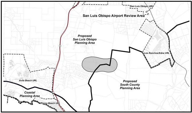
Figure 96-3: Indian Knob Mountainbalm SRA
2.
Pismo Beach Hillsides (SRA). (See Figure 96-4)

Figure 96-4: Pismo Beach Hillsides Sensitive Resource Area
a.
Permit requirement. Conditional Use Permit approval is required for oil and gas production facilities. Each application shall comply with the following criteria before acceptance.
b.
Application content. Provide a visual analysis in the form of topographic maps with lines of sight, cross sections, photographs and other supporting documentation that demonstrate that the project will comply with the site development standards in Subsection C.2.c.
c.
Site development standards.
(1)
Proposed facilities above the 200-foot elevation, including cut and fill banks, tanks, stacks, and chimneys shall be located so that at least 90 percent of the site is screened by existing topography from view within the City of Pismo Beach and Highway 101. Created topography and vegetation as detailed by plans can be considered to complete the existing "screening" using native vegetation where possible and conform to naturally occurring topographic trends. Exploration and production facilities shall not be allowed in the unobstructed visible hillside above the 200-foot elevation.
(2)
Proposed access roads shall have the minimum feasible cross slopes and visibility, with a maximum road cut of five feet maintained wherever possible in visible areas. Prepare a grading, erosion control and landscaping plan, emphasizing vegetation to screen all visible cut and fill slopes.
(3)
Any new application that proposes facilities at any site other than an existing developed location, must demonstrate through a combination of technical and economic analysis not including proprietary information to the industry that new facilities cannot be reasonably incorporated into existing developed locations.
(4)
Steam generators and other venting equipment shall incorporate the best available technology to minimize the appearance of a smoke or steam plume.
(5)
Steam generators and other equipment that cause smoke or steam, and production facilities for oil resources having high concentrations of sulphur compounds, shall not be emitted within 1,000 feet of a residence and the Pismo Beach City limits.
(6)
Normal workover procedures should not exceed the average maintenance cycle, with the exception of breakdowns and emergencies that are verified to the Director through the Division of Oil and Gas' closest office to the well location.
3.
San Luis Bay Sub-area. Within the San Luis Bay Sub-area, as shown in Figure 96-1, projects requiring Conditional Use Permit approval shall concentrate proposed uses in the least sensitive portions of properties. Native vegetation shall be retained as much as possible.
4.
San Luis Obispo Hillside SRA. All projects within the Sensitive Resource Areas identified in the San Luis Obispo Sub-area are subject to the Highway Corridor Standards contained in Section 22.96.050F.
5.
Upper Diablo Canyon - Access limitation. Further construction of access roads through upper Diablo Canyon (see Figure 96-5) is prohibited.
6.
Upper Diablo Canyon - Transmission lines. Future transmission lines in upper Diablo Canyon (see Figure 96-5) shall be confined to the existing corridor. All exposed grading cuts (except for actual roadways and structure sites) and areas of vegetation removal shall be graded and replanted to blend with existing terrain.
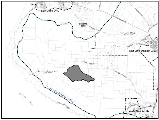
Figure 96-5: Upper Diablo Area
[Amended 1985, Ord. 2215; 2014, Ord. 3256]
22.96.030 - San Luis Bay Sub-area Standards.
All development and new land uses in the San Luis Bay Sub-area, as shown on Figure 96-1, shall comply with the following standards where applicable.
A.
Circulation standards.
1.
Areawide systems Conditional Use Permit projects. Projects requiring Conditional Use Permit approval shall be integrated into areawide circulation and utility easements, providing for future extensions into adjacent undeveloped properties wherever feasible or where known areawide rights-of-way are planned.
2.
Driveways - New land divisions. Where possible, new land divisions shall be designed to combining driveways and private access roads serving proposed parcels wherever terrain and adequate sight distance on the public road allow.
3.
Pedestrian and bikeways - New land divisions. Provide for safe and site-sensitive pedestrian and bike circulation facilities in the design of roads for new subdivisions where feasible.
4.
Road design and construction - New land divisions.
a.
Site disturbance. Road alignments proposed in new land division applications shall be designed and constructed to minimize terrain disturbance consistent with safety and construction cost. Altered slopes shall be replanted with indigenous plants or protected by other appropriate erosion control measures.
b.
Circulation. New land divisions adjacent to the city limits of an incorporated city shall be designed to include offers-to-dedicate for roads connecting with the city such that the street right-of-way widths will reasonably correspond to those required under City standards. Appropriate transitions in road improvements shall be provided between City and County roads adjacent to the City limits. In addition, logical existing or future street connections to City streets shall be provided to encourage an efficient circulation system.
B.
Site planning on sloping sites - Conditional Use Permit projects. Except for lands in the Agriculture category east of Montana de Oro as shown in Figure 96-6, projects requiring Conditional Use Permit approval on sites with varied terrain shall include design provisions for concentrating developments on moderate slopes, retaining steeper slopes visible from public roads undeveloped.
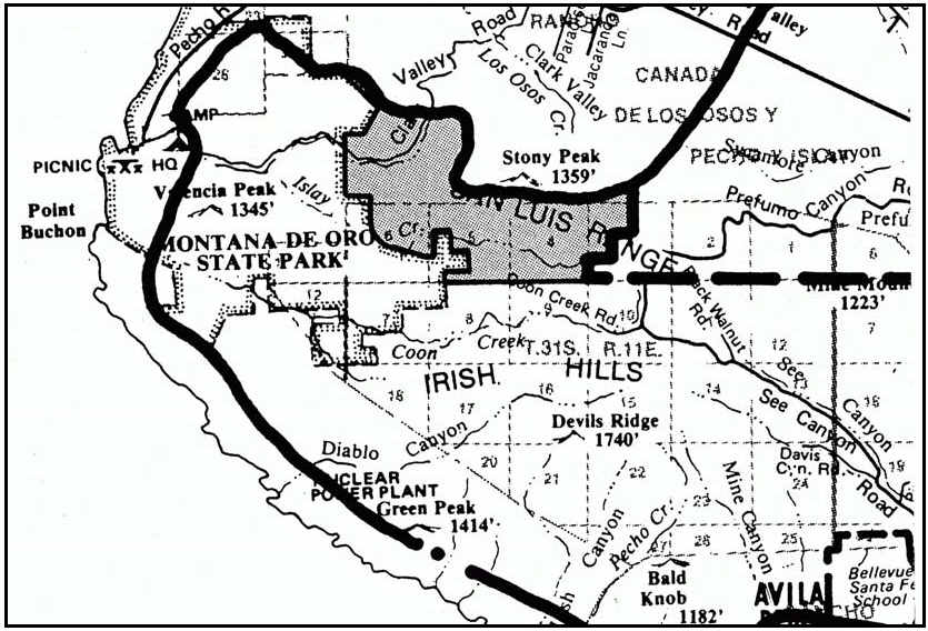
Figure 96-6: Agricultural Area near Montana de Oro
C.
Utility Services - Undergrounding requirement for Conditional Use Permit projects. All projects requiring Conditional Use Permit approval (including commercial and residential uses fronting the shoreline) shall provide for utilities being placed underground unless the Commission determines either that: the proposed development will be of low intensity or in an isolated location; or that supporting overhead utilities will not be visible from public roads; or that overriding operational, economic or site conditions of the project warrant waiver of this requirement.
[Amended 1993, Ord. 2646; 2014, Ord. 3256]
22.96.040 - San Luis Obispo Sub-area Standards.
All development and new land uses in the San Luis Obispo Sub-area, as shown on Figure 96-1, shall comply with the following standards where applicable.
A.
Undergrounding - Conditional Use Permit projects. All projects requiring Conditional Use Permit approval shall provide for utilities being placed underground unless the Commission determines either that the proposed development will be of low intensity or in an isolated location; or that supporting overhead utilities will not be visible from public roads; or that overriding operational, economic or site conditions of the project warrant waiver of this requirement.
B.
Planning Impact Areas. The following standards apply to land within the planning impact areas of the cities of San Luis Obispo and Pismo Beach, and the community of Los Osos. The planning impact area for the City of San Luis Obispo includes the entire San Luis Obispo Planning Area as shown on the Official Maps. The planning impact areas for the City of Pismo Beach Beach, and the community of Los Osos are shown in Figure 96-7. Please refer to the areawide standards in Chapter 7 of the Estero Area Plan to see the remainder of the planning impact area for Los Osos.
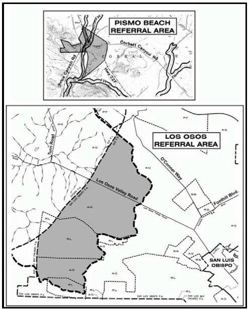
Figure 96-7: Referral areas for Los Osos and the City of Pismo Beach
1.
Application referral - Cities of San Luis Obispo and Pismo Beach. Applications for discretionary land use permits, land divisions, or General Plan amendments shall be referred by the County to the City of San Luis Obispo and (if in its planning impact area) to the City of Pismo for review and comment. The County shall consider requiring improvements and/or offers of dedication from projects where there is an appropriate and feasible connection between the proposed development and the improvement, subject to the following:
a.
Required improvements and/or dedications may include, but are not limited to, future streets in compliance with a city's General Plan, sewer lateral extensions from project septic systems (or other sewage disposal systems) to facilitate connection to a sewer system after annexation by a city or other public agency that will provide a community sewage disposal system, water system extensions, drainage improvements or other necessary public improvements.
b.
Street improvements and offers of dedication shall be made to either City or County standards, depending upon the scale and location of the proposed development.
2.
Application referral - Los Osos. Applications for discretionary land use permits, land divisions, or general plan amendments within the planning impact area for Los Osos shall be referred by the County to the Los Osos Community Advisory Council or its successor for review and comment.
C.
Open space preservation. The following standards apply to land where important physical, biological, visual or historic resources are identified both on-site and on adjacent properties, to offer incentives and encourage such measures as cluster land divisions that will leave such resources in permanent open space. As mentioned in Chapter 4 of the San Luis Obispo Area Plan, other incentives include agricultural preserves and the proposed minor ag cluster and transfer of development credits.
1.
Cluster land division incentive. Cluster divisions of land may utilize an open space parcel area that is smaller than otherwise required by Chapter 22.22 where an important biological habitat, riparian creek corridor, scenic view or historic place is identified and protected through the application's review process on a case-by-case basis. The size of the open space area may be determined by a biological, visual or other applicable analysis of the area in question. The open space parcel shall be sufficient in size to preserve the resource.
2.
Lot Line Adjustments. In instances where land that is intended for development includes more than one legal lot, the lot lines may be adjusted to concentrate development in suitable areas and leave other areas undeveloped and subject to open space or conservation easements.
D.
Production agricultural areas. New development shall be designed to minimize the loss of existing and potential production agricultural areas by the placement of buildings and new parcels outside the most agriculturally capable areas. For the purposes of this standard, production agricultural areas consist of prime soils (Class I and II irrigated soils according to the U.S. Natural Resource Conservation Service) and other areas capable of agricultural production which primarily consist of Class III and IV soils, but may also include productive areas with Class VI soils.
[Amended 2004, Ord. 3047; 2014, Ord. 3256; 2018, Ord. 3369]
22.96.050 - Land Use Category Standards.
All development and new land uses shall comply with the following standards, as applicable to each land use category.
A.
Agriculture (AG). The following standards apply within the Agriculture land use category.
1.
O'Connor Way/West Foothill Area. The following standards apply to development projects that are accepted as complete for processing after September 20, 2002 and only to lands within the Agricultural land use category in the O'Connor Way/West Foothill Area, as shown in Figure 96-8.
Guideline: Development should be designed to blend with the existing rural development and preserve the rural and agrarian character of the area.
a.
Limitation on Use. Uses identified in Table 2-2 as "A" allowable, "P" permitted, or a conditional use "MUP" or "CUP are limited to: agricultural accessory structures; agricultural processing; airfields and landing strips; animal raising and keeping; bed and breakfast facilities; caretaker residence; churches; communications facilities; cannabis cultivation; cannabis nurseries; cannabis processing facilities; cannabis manufacturing; cannabis dispensaries; cannabis transport facilities; crop production and grazing; energy-generating facilities; (solar electric facilities and wind energy conversion systems only); farm equipment and supplies; agricultural worker housing; fisheries and game preserves; food and kindred products; forestry; home occupations; libraries and museums; membership organization facilities; mining; mobile homes; nursery specialties; offices, temporary; outdoor retail sales; petroleum extraction; pipelines and transmission lines; public safety facilities; public utility facilities; residential accessory uses; residential care (for 6 or fewer); roadside stands; rural recreation and camping; schools-specialized education and training; single-family dwellings; small scale manufacturing; specialized animal facilities; storage accessory; temporary construction trailer parks; temporary construction yards; temporary dwelling; temporary events; warehousing; and wholesaling and distribution.
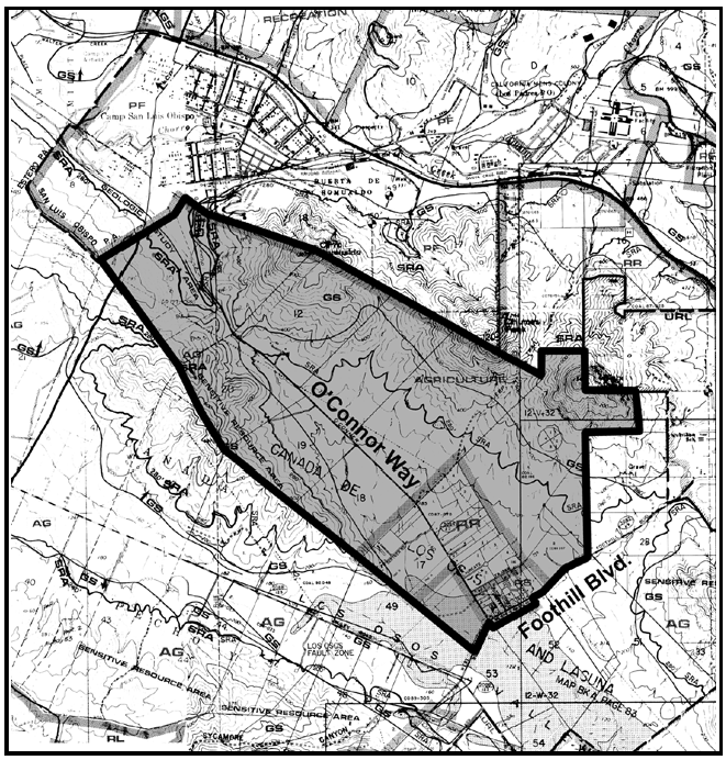
Figure 96-8 O'Connor Way
B.
Rural Lands (RL). The following standards apply within the Rural Lands land use category.
1.
Irish Hills - Limitation on use. Land uses within the Irish Hills (see Figure 96-9) shall be limited to the following, in compliance with the land use permit requirements of Section 22.06.030: ag accessory structures; animal facilities; cannabis cultivation; cannabis dispensaries; cannabis nurseries; cannabis processing facilities; cannabis transport facilities; crop production and grazing; nursery specialties; energy-generating facilities; (limited to renewable energy facilities); communications facilities; animal keeping; residential accessory uses; single-family dwellings; mobile homes; temporary dwellings; roadside stands; outdoor retail sales; accessory storage; pipelines and transmission lines.
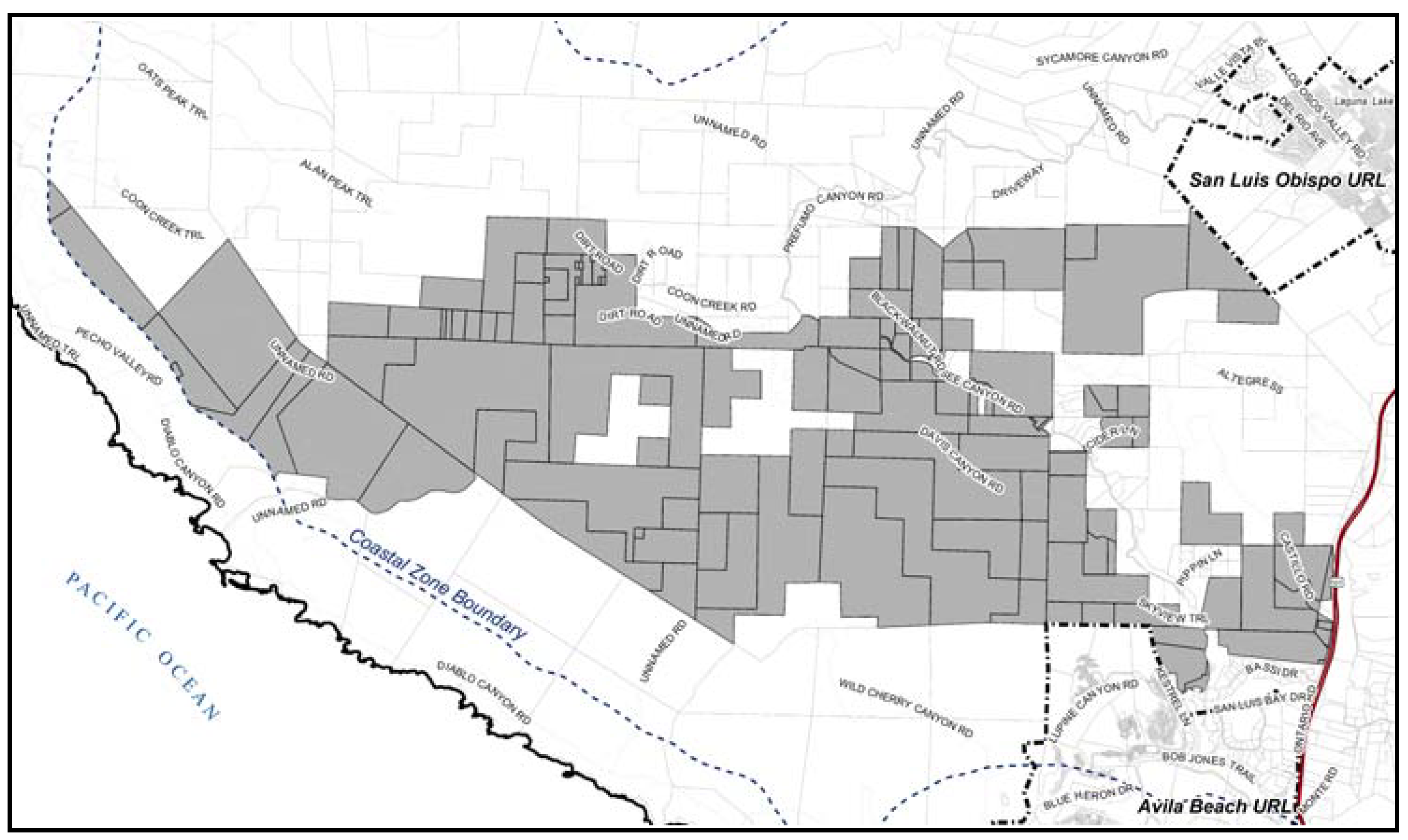
Figure 96-9: Irish Hills Area
2.
San Luis Obispo Sub-area - Limitation on use. All land uses identified by Section 22.06.030 as allowable, permitted, or conditional in the Rural Lands land use category within the San Luis Obispo Sub-area (as shown in Figure 96-1) may be authorized in compliance with the land use permit requirements of that Section, except residential care, correctional institutions, and uses listed by Table 2-2, Section 22.06.030 in the Industry, Manufacturing and Processing use group.
C.
Industrial (IND) - Edna and Buckley Roads - Limitation on use. Land uses on the shaded parcel within the Industrial land use category shown in Figure 96-10 shall be limited to construction contractors, caretaker residences and storage yards (sales lots prohibited) and energy-generating facilities (limited to accessory renewable energy facilities).
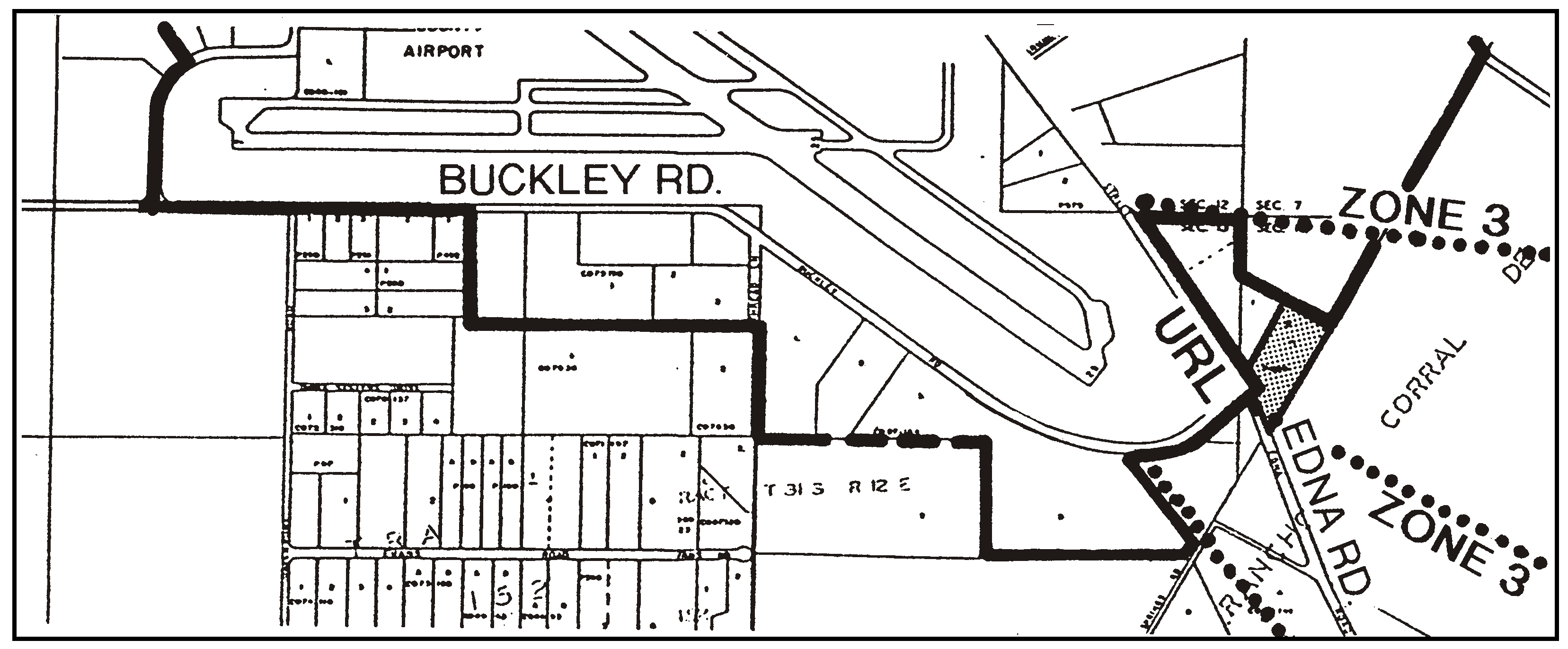
Figure 96-10: Industrial parcel at Edna and Buckley Roads
D.
Public Facilities (PF) - County Office of Education. The following standards apply to the site of the County Office of Education located on Highway 1.
1.
Permit requirement. Minor Use Permit approval is required for all new development unless Articles 4 or 5 of this Title would otherwise require Conditional Use Permit approval.
2.
Location criteria. New development shall be located north of Pennington Creek, out of view from Highway 1.
E.
Residential Rural (RR). The following standards apply within the Residential Rural land use category.
1.
San Luis Obispo Sub-area - New land divisions. New land divisions in the San Luis Obispo Sub-area, as shown in Figure 96-1, are subject to the following requirements:
a.
Driveways. New land divisions shall include, where possible, design provisions for combining driveways and private access roads serving proposed parcels wherever terrain and adequate sight distance on the public road allow.
b.
Parcel size. The minimum parcel size for new land divisions shall be 10 acres unless a larger minimum size would otherwise be required by Chapter 22.22.
2.
O'Connor Way/West Foothill Area. The following standards apply to development projects that are accepted as complete for processing after September 20, 2002 and only to lands within the Residential Rural land use category in the O'Connor Way/West Foothill Area, as shown in Figure 96-8.
Guideline: Development should be designed to blend with the existing rural development and preserve the rural and agrarian character of the area.
a.
Limitation on Use. Uses identified in Table 2-2 as "A" allowable, "P" permitted, or a conditional use "MUP" or "CUP are limited to: agricultural accessory structures; animal raising and keeping; bed and breakfast facilities; caretaker residence; cemeteries and columbaria; churches; communications facilities; cannabis cultivation; cannabis dispensaries; cannabis nurseries; cannabis transport facilities; crop production and grazing; energy-generating facilities; (solar electric facilities and wind energy conversion systems only); farm equipment and supplies; agricultural worker housing; fisheries and game preserves; food and kindred products; forestry; home occupations; libraries and museums; membership organization facilities; mining; mobile homes; nursery specialties; offices, temporary; outdoor retail sales; petroleum extraction; pipelines and transmission lines; public safety facilities; public utility facilities; residential accessory uses; residential care (for 6 or fewer); roadside stands; rural recreation and camping; schools-specialized education and training; single-family dwellings; small scale manufacturing; specialized animal facilities; storage accessory; temporary construction trailer parks; temporary construction yards; temporary dwelling; temporary events; warehousing; and wholesaling and distribution.
b.
Water Supply. At the time of non-residential discretionary land use permit or land division application, a detailed hydro-geologic analysis prepared by a qualified individual shall be submitted. The analysis shall be prepared to determine long-term water availability and potential impacts of proposed development on existing nearby wells.
c.
Traffic Report. At the time of non-residential discretionary land use permit or land division application, a traffic report shall be submitted. The report shall include, but not be limited to, how the proposed project would not reduce the Level of Service (LOS) on local roadways or the intersection of Foothill Road/O'Connor Way below LOS C.
d.
Drainage. All drainage from future development shall be detained in a drainage basin on the property, or an offsite location approved by County Public Works.
e.
Nursery Specialties and Agricultural Accessory Structure. Building size shall be limited to 5,000 square feet of total cumulative floor area unless a larger structure is approved with a Minor Use Permit.
f.
Lighting. All lighting fixtures shall be shielded so that neither the lamp nor the related reflector interior surface is visible from any location off the project site. All lighting poles, fixtures, and hoods shall be dark colored. No exterior lighting shall be installed operated in a manner that would throw light, either reflected or directly, in an upward direction.
g.
Sign Height. All internally illuminated or externally lighted signs shall be a maximum of six feet in height.
3.
West of Bear Valley Estates (Tract 502). The following standards apply only to the parcel located west of Tract 502 as shown in Figure 96-11.
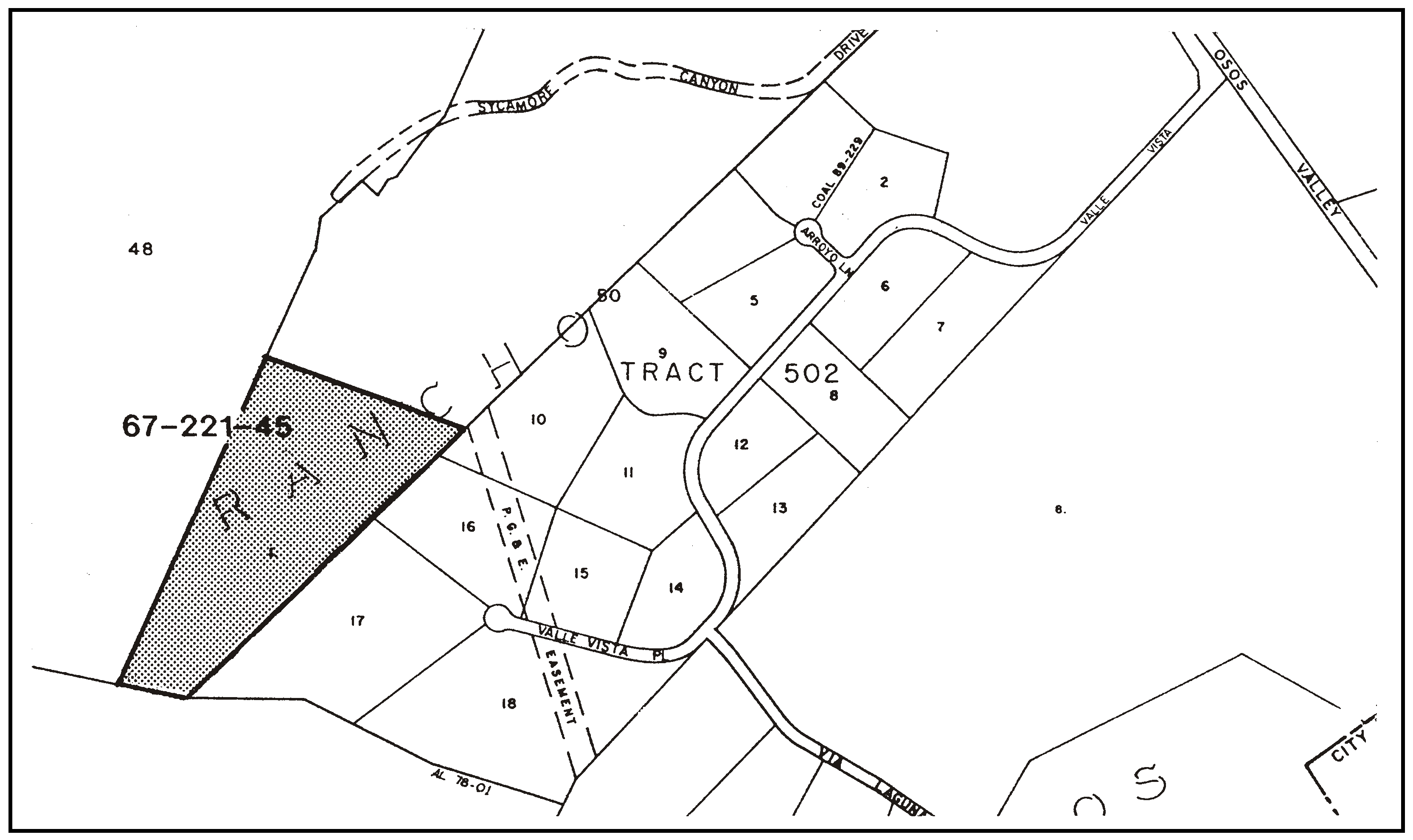
Figure 96-11: Residential Rural Category Land West of Bear Valley Estates
a.
Limitation on use. Land uses shall be limited to agricultural accessory structures, animal keeping, cannabis cultivation, cannabis dispensaries, cannabis transport facilities, crop production and grazing, and energy-generating facilities (limited to renewable energy facilities).
b.
Open space preservation. Prior to or concurrent with establishment of the approximately 18-acre site as a legal parcel either through a land division or lot line adjustment, an open space easement shall be recorded over the entire site. The open space easement shall specify that only agricultural uses shall be permitted in perpetuity.
c.
Access. Any needed access shall be taken from Valle Vista Place.
4.
Bishop Peak Ranch. The following standards apply only to property shown in Figure 96-12, which includes a portion of Bishop Peak.
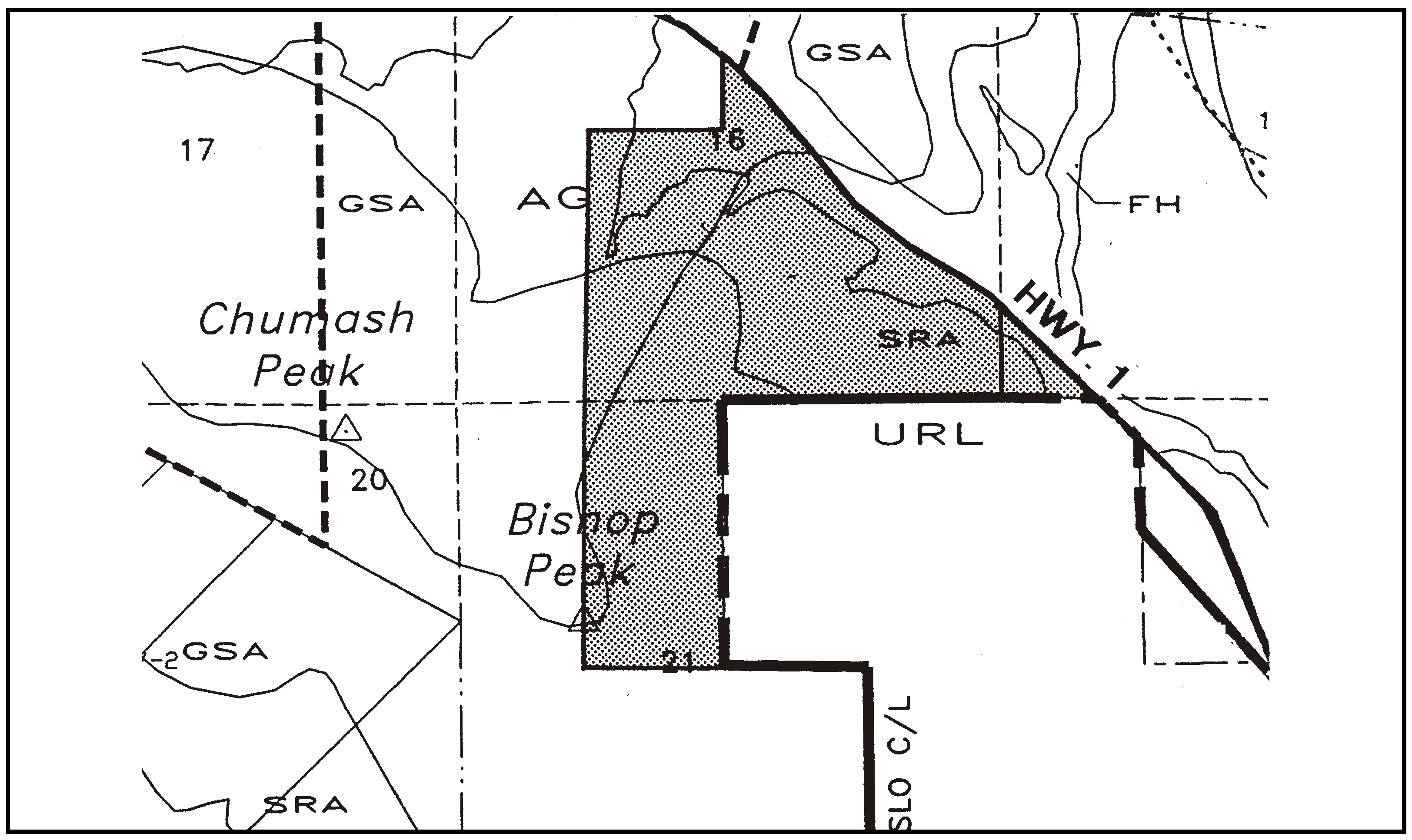
Figure 96-12: Residential Rural Category Bishop Peak Properties
a.
Residential density. The maximum allowable residential density shall be as follows:
(1)
The number of dwellings allowable without a cluster division shall be as provided by Chapter 22.22.
(2)
The number of dwellings allowable through a cluster division shall be no more than one dwelling per 12 acres, up to a maximum of 21 dwellings for the entire property, except as provided by Subsection E.4.a(3).
(3)
If a portion of the property is purchased by a public or non-profit organization approved by the County for provision of open space, the number of dwellings allowable through a cluster division shall be no more than one dwelling per 10 acres, up to a maximum of 17 dwellings.
b.
Locations for dwellings. New residential development shall be located to the maximum extent feasible in portions of the property subject to low to moderate biological, geological, visual and slope constraints as shown in the report Preliminary Constraints Analysis, Bunnell Property, dated August 21, 1995.
5.
Serpa Ranch.
a.
Land division. At the time of application for subdivision within the area designated "A," as shown in Figure 96-13, the applicant shall provide an archaeological surface survey, conducted by a qualified archaeologist approved by the Environmental Coordinator, which assesses the potential impacts of all ground disturbing activities (e.g. access roads, driveways, residences, utility trenches). The applicant shall implement the recommendations of the archaeologist, as required by the Environmental Coordinator.
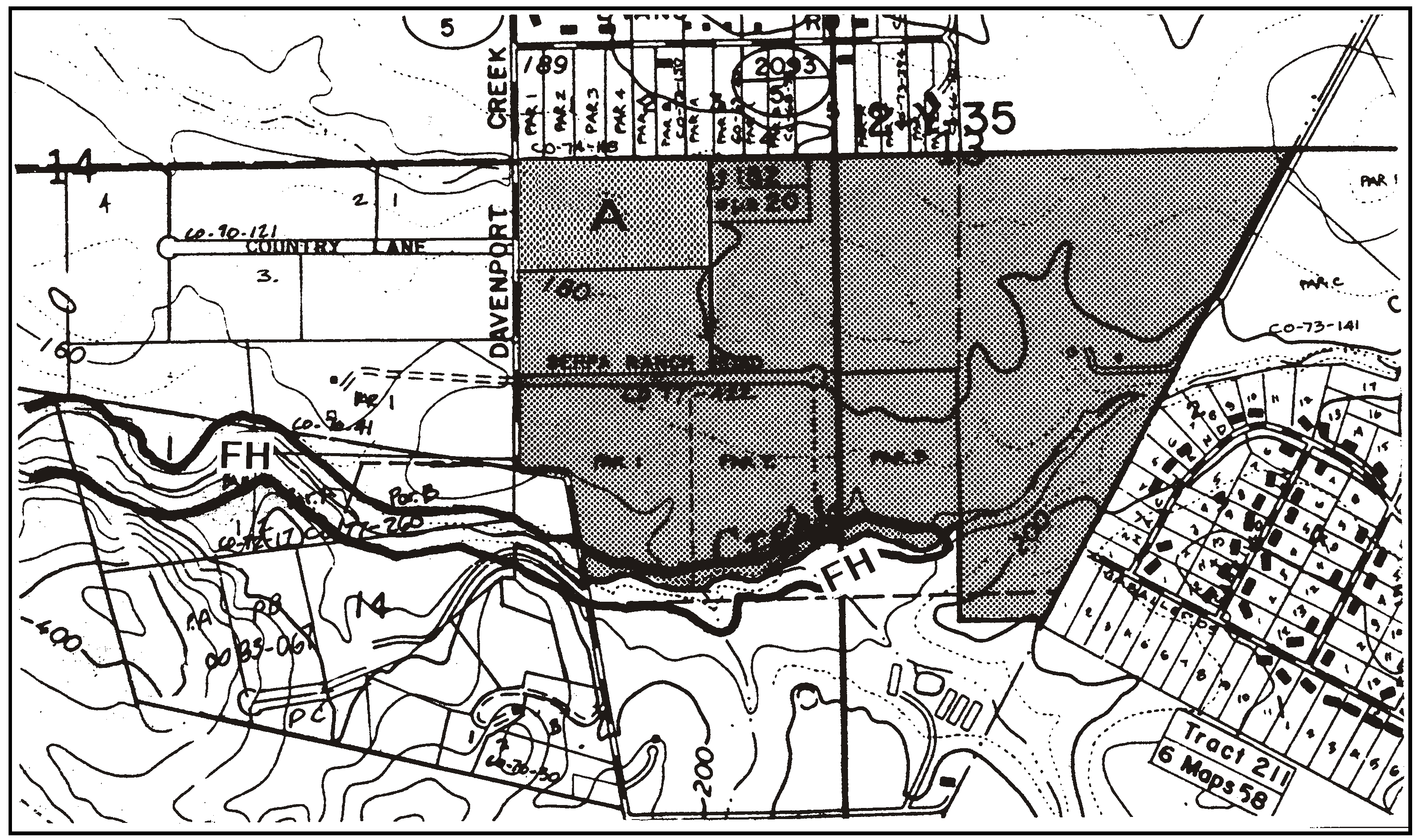
Figure 96-13: Residential Rural category land known as the Serpa Ranch
6.
Parcel Size - See Canyon (A). The minimum parcel size for new land divisions in the Residential Rural land use category located in See Canyon (A) (see Figure 96-14) is 10 acres.

Figure 96-14: See Canyon Areas A, B and C
7.
Standards - See Canyon (B). The following standards apply to development and division of Parcels 1-3 of Parcel Map CO 96-0085 as shown on Figure 96-14 as See Canyon (B).
a.
Building envelopes. Designated building envelope(s) shall be required for each allowable lot. The building envelope(s) shall be located outside of the oak and chaparral covered slopes and environmentally sensitive areas, so as to minimize the following types of impacts: oak tree and other vegetation removal, topographic alteration (for both access roads and building sites), and visual impacts. The building envelope(s) shall not extend beyond the existing grassland/pasture area.
b.
Riparian setbacks. The designated building envelope(s) shall be at least 50 feet from the edge of the riparian corridor. The only activities allowed within 50 feet of the edge of the riparian corridor are those related to approved erosion control, necessary access and revegetation.
c.
Water supply. The Tentative Map application shall include evidence that adequate water is available on the site(s), including a static and recovery pump test that shows an adequate recovery time for each well proposed to serve the land division. If a shared well is used to serve the proposed parcels, an agreement shall be recorded that specifies each parcel's right to the water.
8.
Maximum density - CO 82-040, Parcels 1 and 3. (See Site "C" in Figure 96-14). The maximum allowable density for new land divisions shall be one unit per five acres, unless Chapter 22.22 would otherwise require a larger minimum parcel size. The allowable lots shall be clustered outside of environmentally sensitive areas in compliance with Section 22.22.140 (Cluster Division), or if clustering is not used, building sites shall be located in the least environmentally sensitive areas consistent with an environmental constraints analysis and previously approved building sites. Future parcels or building sites shall be designed to use combined access with the existing access from See Canyon Road and shall also minimize the following types of impacts: wastewater disposal, water availability, oak tree removal, visual impacts (including landscape screening), topographic alteration and archeological resources.
9.
Monte Road—North. The following standards apply to the site as shown in Figure 96-15 as Monte Road area A and B.
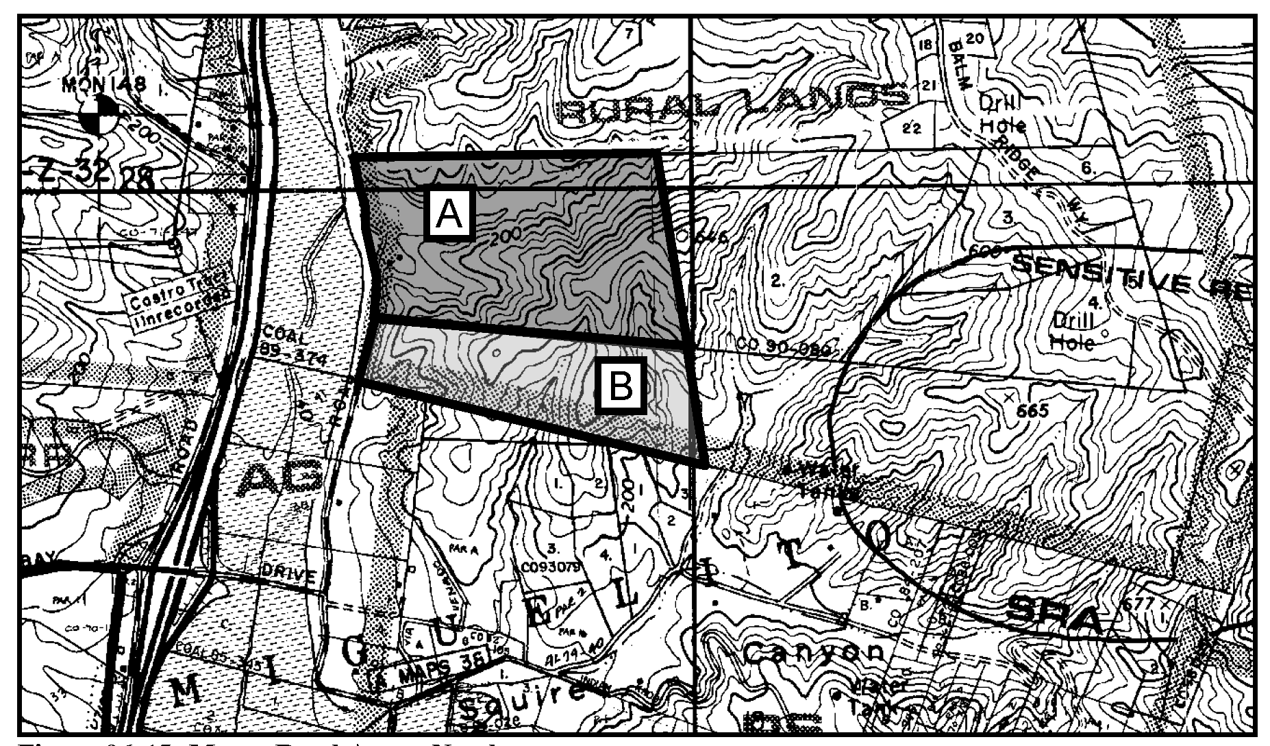
Figure 96-15: Monte Road Area—North
a.
Residential development. Residential development shall comply with the following requirements:
(1)
Elevation. Residential development, including structures, grading, and other improvements, shall occur entirely below the 200-foot elevation contour.
(2)
Agricultural buffer. A minimum agricultural buffer of 200 feet as measured from the Monte Road right-of-way line shall be established. No habitable residential development shall occur within the buffer zone.
(3)
Watercourse setback. A watercourse setback of 50 feet from top-of-bank and/or extent of riparian vegetation, whichever is more restrictive, shall be required.
(4)
Exterior colors. Residences shall use dark, muted, earth-toned colors for all exteriors, including roofing. Colors must have a value and chroma of less than 6 on the Munsell scale. Applicants shall submit a colors and materials board with any application for construction or land use permits.
(5)
Height. Residential and residential accessory structures shall be limited to a maximum height of 25 feet above average natural grade.
(6)
Roofing. Building architecture shall include hip roofs with a minimum pitch of 3:12.
(7)
Overhangs. Building architecture shall include deep overhangs for any elevation visible from Highway 101.
(8)
Lighting. All exterior lighting fixtures visible from Highway 101 shall be dark sky certified or equivalent.
(9)
Erosion control. An erosion and sedimentation control plan shall be prepared prior to any proposed site work. The erosion and sedimentation control plan shall comply with the required contents and standards in Chapter 22.52 of the Land Use Ordinance.
(10)
Drainage plan. Land use permit, subdivision, construction, and grading permit applications shall include a drainage plan in compliance with Chapter 22.52 of the Land Use Ordinance. All future construction shall be in conformance with the San Luis Obispo Creek Watershed Drainage and Design Manual.
(11)
Habitat assessment. Prior to any site disturbance, a qualified biologist shall conduct a habitat assessment of the watercourses on the project site, in accordance with County and Department of Fish and Game protocol, to determine if California red-legged frog (CRLF) or southwestern pond turtle (SWPT) exist on the site. If these species do not exist on the site, no further study needs to be undertaken. BR-7. If CRLF and/or SWPT exist(s) on site, the applicant and the project biologist shall consult with the California Department of Fish and Game (CDFG) and/or the US Fish and Wildlife (USFWS), as applicable, prior to site disturbance to determine appropriate measures to be undertaken in order to ensure significant impacts will not occur. At a minimum, the following measures shall occur:
(a)
The project biologist shall demonstrate that they are qualified to conduct the appropriate biological work to the satisfaction of the Department of Fish and Game and/or the US Fish and Wildlife Service (as applicable).
(b)
The approved biologist shall conduct a training session for all construction personnel prior to commencement of site disturbance. At a minimum, the training shall include a description of the CRLF and/or SWPT and their habitat, the specific measures that are being implemented to conserve the CRLF and/or SWPT for the current project, and the boundaries where site disturbance may occur.
(c)
The project biologist shall have the authority to stop work or redirect work to occur in areas that will not disturb the individual(s), or to relocate the individual(s) pursuant to USFWS/CDFG guidelines.
(d)
The approved biologist shall be present at the work site until all CRLF/SWPT have been removed, workers have been instructed, and disturbance of habitat has been completed.
(e)
During construction/ground disturbing activities, all trash that may attract CRLF and/or SWPT predators will be properly contained, removed from the work site, and disposed of regularly. Prior to occupancy or final inspection, whichever occurs first, all trash and construction debris will be removed from work areas.
(f)
During construction/ground disturbing activities, all refueling, maintenance, and staging of equipment and vehicles shall occur at least 100 feet from riparian habitat or water bodies and in a location where a spill would could not drain directly toward aquatic habitat.
(12)
Permits. Prior to site disturbance, the applicant shall demonstrate to the County that they have obtained any and all necessary permits from the California Department of Fish and Game and the US Fish and Wildlife Service, or demonstrate that such permits are not necessary.
b.
Use restriction - Area B. All land uses identified by Section 22.06.030 as allowable, permitted, or conditional uses in the RR land use category may be authorized in compliance with the land use permit requirements of that section, except that such uses in Area B (Figure 106-7) shall be limited to: crop production and grazing, and pipelines and transmission lines.
c.
New land divisions.
(1)
The minimum parcel size shall be 40 acres.
(2)
Subdivision of Area A (Figure 106-7) shall require the granting of an open space easement covering at least 85 percent of the site. The open space easement agreement shall include the following restrictions:
(a)
Prohibition on grazing and/or crop production within the open space easement area.
(b)
Prohibition on planting of ornamental vegetation within the open space easement area.
(c)
Requirement that development of new water sources and systems within the open space easement area be done in such a manner as to avoid any impact to or removal of oaks and/or manzanitas.
(3)
Building envelopes for subdivision of Area A (Figure 106-7) shall be established in an area with average slopes of less than 30 percent.
(4)
Subdivision of Area A (Figure 106-7) shall comply with the mitigation agreement recorded as Instrument 1997-071413 of Official Records, and any subsequent mitigation agreements that supersede or amend this agreement. The applicant shall enter into a mitigation agreement with the County of San Luis Obispo, reaffirming the measures identified in Instrument 1997-071413. The new mitigation agreement shall also incorporate all applicable planning area standards identified in Subsections D.5.a and D.5.c.
10.
Monte Road - South. The following standards apply to the site as shown in Figure 96.15.5 as Monte Road.
a.
Parcel Size. The minimum parcel size for new land division in Monte Road South shall be 5 acres. No more than two parcels shall be allowed in any subsequent subdivision on the 16.74 acre parcel.
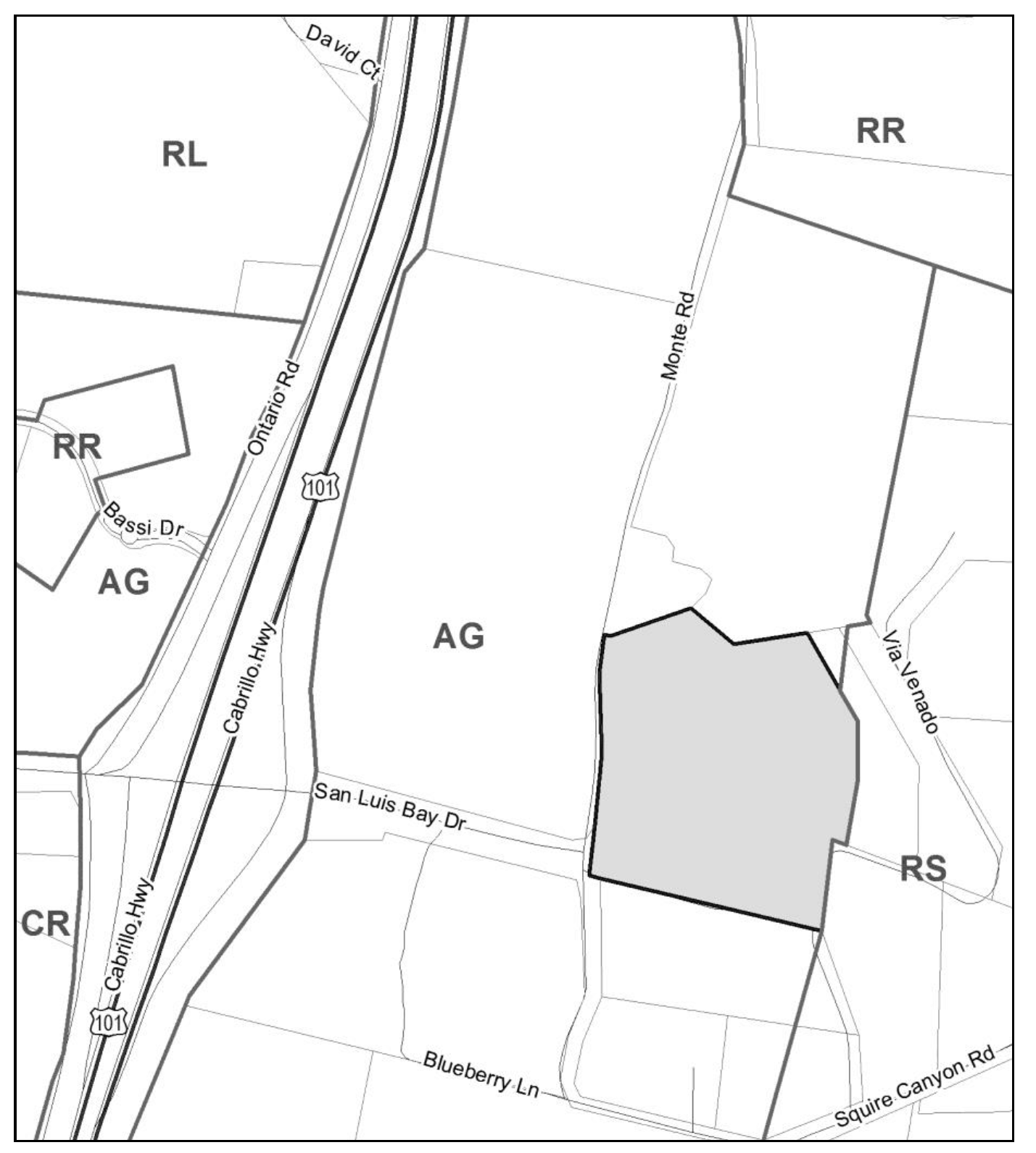
Figure 96-15.5: Monte Road South
11.
Tiburon Way. The following standard applies to the site as shown in Figure 96-16.
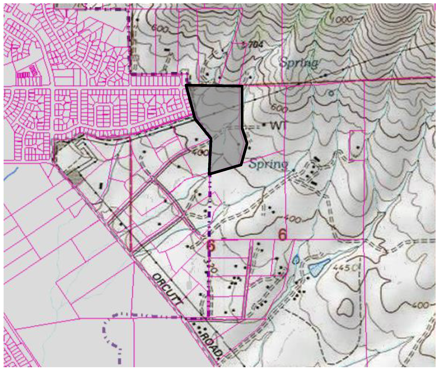
Figure 96-16: Tiburon Way
a.
Land division and Land use applications. Subdivision and/or residential development shall comply with the following requirements:
(1)
Biological Report Required. At the time of application of any land division or development of the project site, the applicant shall assess the impact of the proposed land division or development on native species and habitat diversity, including special-status species (e.g. Pismo clarkia), sensitive natural communities, wetlands, and important wildlife nursery areas and movement corridors. A Biological Report will be required to be submitted for a subdivision and/or any development on the property to be reviewed and approved by the Planning Department. Recommendations outlined I n the report shall be applied to the proposed project.
12.
Monte Road - West. The following standards apply to the site as shown in figure 96-16 as Monte Road.
a.
Land division and Land use applications. Future subdivision of the property shall be designed in compliance with Land Use Ordinance Section 22.22.140 (Cluster Division) and limited to two buildable parcels and one open space parcel not to be developed with structural uses except for agricultural accessory buildings. The buildable parcels shall be located in the hatched area shown in Figure 96-17.
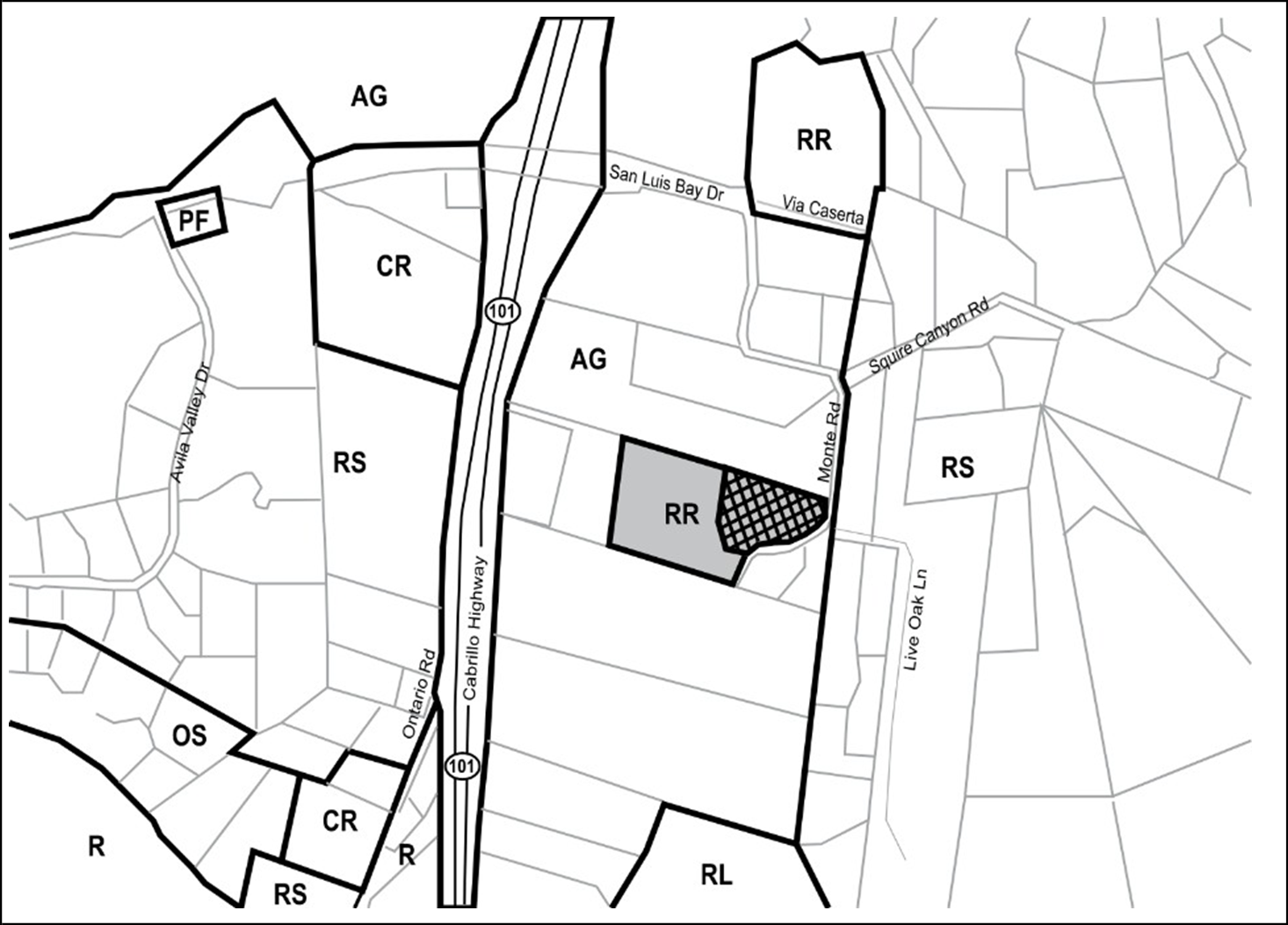
Figure 96.17. Monte Road West Area
F.
Residential Suburban (RS). The following standards apply within the Residential Suburban land use category.
1.
Limitation on use. All land uses identified by Section 22.06.030 as allowable, permitted, or conditional uses in the RS land use category may be authorized in compliance with the land use permit requirements of that Section except mobile home parks.
2.
Evans Tract. The following standards apply to the Evans Tract, Figure 96-18.
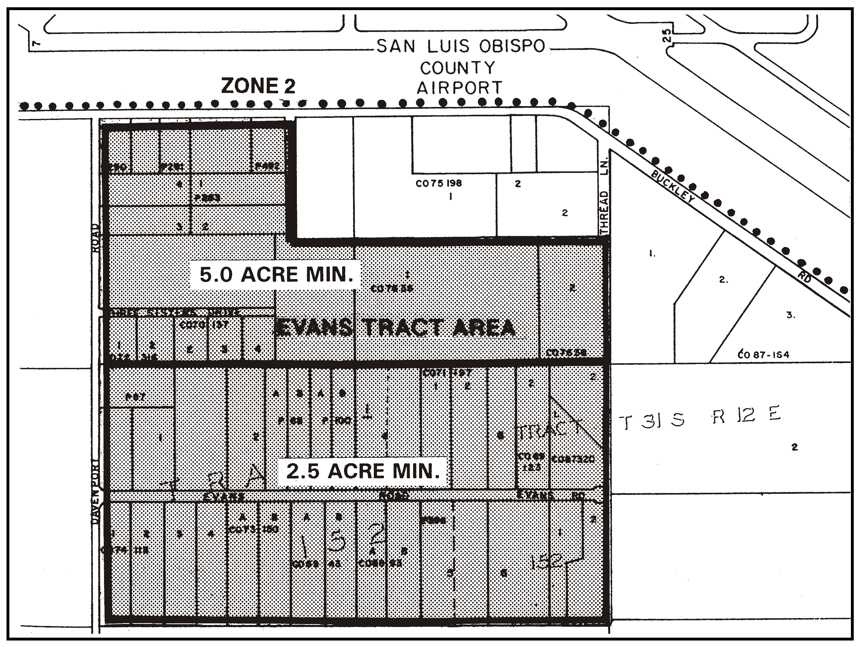
Figure 96-18: Evans Tract
a.
Parcel Size - Evans Road frontage. Minimum parcel size is 2½ acres for the southern half of the area as shown in Figure 96-18 unless a larger size would otherwise be required by Chapter 22.22 (Subdivision Standards).
b.
Parcel Size - North of Evans Road. Minimum parcel size is five acres for the -northern half of the area as shown in Figure 96-18 unless a larger size would otherwise be required by Chapter 22.22 (Subdivision Standards).
3.
Squire Canyon. The following standards apply to the Residential Suburban land use category in Squire Canyon (see Figure 96-19).
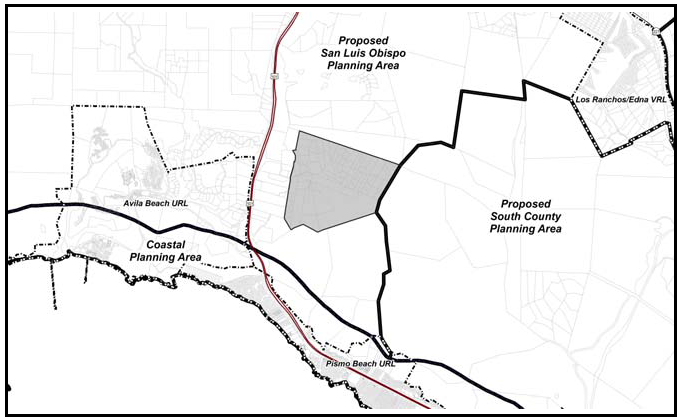
Figure 96-19: Squire Canyon
a.
Limitation on use. Land uses in the area northeast of the intersection of Squire Canyon and Indian Knob roads shall be limited to the following (as required by Ordinance 824): agricultural accessory structures; crop production and grazing; energy-generating facilities (limited to renewable energy facilities); communications facilities; animal keeping; animal facilities (with the only use limited to keeping not more than six adult dogs per parcel, with a kennel license being required for raising more than four adult dogs, in compliance with County Code Section 9.04.120); home occupations; residential accessory uses; single-family dwellings; temporary dwellings; pipelines and transmission lines.
[Amended 1982, Ord. 2106; 1989, Ord. 2399; 1994, Ord. 2686; 1996, Ord. 2760; 2007, Ord. 3120; 2007 Ord. 3121; Added 2009, Ord. 3182; Amended 2014, 3256; 2015, Ord. 3291; 2016, Ord. 3317; 2017, Ord. 3358; 2018, Ord. 3369; 2018, Ord. 3377; 2020, Ord. 3409; 2020, Ord. 3417; 2023, Ord. No. 3496]
22.96.060 - San Luis Obispo Urban Area Standards.
In addition to the requirements of Section 22.96.030, the following standards apply to all unincorporated lands within the City of San Luis Obispo urban reserve line, or to the land use categories or specific areas listed.
A.
Communitywide standards. The following standards apply to all unincorporated properties within the urban reserve line.
1.
Sewage disposal. Residential developments shall provide on-site conventional subsurface (individual or community) wastewater disposal systems until the property can be annexed to the city and city services provided (rather than wastewater treatment packaged plants).
2.
Water supply. Developments shall provide on-site water supply, or a community water supply system with the capacity to serve 50 or more connections (customers) may be permitted, until annexed to the city and city services are provided.
3.
Limitation on use. Prior to annexation by the City of San Luis Obispo, land uses shall be limited to those listed as allowable, permitted, and conditional within the Agriculture land use category by Section 22.06.030, except for Cannabis Activities, which shall be allowable in the Agriculture, Rural Lands, Residential Rural, Commercial Service, and Industrial land use categories only, pursuant to Chapter 22.40, or as otherwise allowed for specific areas (such as the Airport Area) by this Section.
4.
Airport area. The following standards apply only to the land shown in Figure 96-18.
a.
Minimum parcel size. The minimum parcel size is 20 acres. Commercial condominium or planned unit developments may use smaller parcel sizes to be determined by the Review Authority through Conditional Use Permit approval.
b.
Dry sewer/water facilities. Water supply and sewage disposal systems shall be designed to accommodate future connection to city systems where feasible.
c.
Septic systems maintenance. New septic systems shall be inspected and maintained annually.
d.
Business license clearance. Compliance with all applicable conditions of land use permits shall be determined before issuance of a business license, in compliance with Section 22.62.020.
e.
Signs. Free-standing signs shall be monument signs with a maximum height of six feet.
f.
Use limitation disclosure. A notice listing the authorized land uses for a site shall be recorded in the Office of the County Recorder at the time the Final Map is recorded for any commercial condominium or planned unit development or before final condition compliance of any Conditional Use Permit or Minor Use Permit.
g.
Limitation on use. Land uses shall be limited to those listed in the following table or where other planning area standards of this Chapter, or other standards of this Title further limit permitted uses. Land use categories (and subareas) are abbreviated in the table as follows:
LUIS OBISPO ALLOWABLE LAND USES AND PERMIT REQUIREMENTS
;sz=8q;KEY TO PERMIT REQUIREMENTS
;sz=8q;See NOTES on next page.
SAN LUIS OBISPO ALLOWABLE LAND USES AND PERMIT REQUIREMENTS
NOTES (The following notes apply only to these two facing pages)
(1)
See Article 8 for definitions of the listed land uses.
(2)
See Article 9 for any restrictions or special permit requirements for a listed use in a specific community or area.
(3)
L.U.C. means "land use category." See Section 22.04.020, Table 2-1, for a key to the land use category abbreviations.
(4)
Business License Clearance may also be required; see Section 22.62.020
(5)
Use allowed on private land with Site Plan Review only when authorized by a recorded open space easement executed by the property owner and the County. Use allowed on public land subject to Conditional Use Permit approval.
(6)
Licensing of all kennels by the County Tax Collector is required by Section 9.04.120 of this code.
;sz=8q;See KEY TO PERMIT REQUIREMENTS on previous page.
SAN LUIS OBISPO ALLOWABLE LAND USES AND PERMIT REQUIREMENTS
;sz=8q;KEY TO PERMIT REQUIREMENTS
See NOTES on next page.
[2015, Ord. 3292]
SAN LUIS OBISPO ALLOWABLE LAND USES AND PERMIT REQUIREMENTS
NOTES (The following notes apply only to these two facing pages)
(1)
See Article 8 for definitions of the listed land uses.
(2)
See Article 9 for any restrictions or special permit requirements for a listed use in a specific community or area.
(3)
L.U.C. means "land use category." See Section 22.04.020, Table 2-1, for a key to the land use category abbreviations.
(4)
Business License Clearance may also be required; see Section 22.62.020
(5)
Allowable use limited to bakeries, ice cream and candy shops, and other similar uses, where the majority of production is for on-site retail. Permit requirement determined by 22.xx.xxx for retail trade and services.
(6)
Use limited to enclosed facilities.
See KEY TO PERMIT REQUIREMENTS on previous page.
[2015, Ord. 3292]
SAN LUIS OBISPO ALLOWABLE LAND USES AND PERMIT REQUIREMENTS
;sz=8q;KEY TO PERMIT REQUIREMENTS
See NOTES on next page.
SAN LUIS OBISPO ALLOWABLE LAND USES AND PERMIT REQUIREMENTS
NOTES (The following notes apply only to these two facing pages)
(1)
See Article 8 for definitions of the listed land uses.
(2)
See Article 9 for any restrictions or special permit requirements for a listed use in a specific community or area.
(3)
L.U.C. means "land use category." See Section 22.04.020, Table 2-1, for a key to the land use category. abbreviations.
(4)
Business License Clearance may also be required; see Section 22.62.020
(5)
Use limited to gymnasiums and health clubs.
See KEY TO PERMIT REQUIREMENTS on previous page.
SAN LUIS OBISPO ALLOWABLE LAND USES AND PERMIT REQUIREMENTS
;sz=8q;KEY TO PERMIT REQUIREMENTS
;sz=8q;See NOTES on next page.
SAN LUIS OBISPO ALLOWABLE LAND USES AND PERMIT REQUIREMENTS
NOTES (The following notes apply only to these two facing pages)
(1)
See Article 8 for definitions of the listed land uses.
(2)
See Article 9 for any restrictions or special permit requirements for a listed use in a specific community or area.
(3)
L.U.C. means "land use category." See Section 22.04.020, Table 2-1, for a key to the land use category. abbreviations.
(4)
Business License Clearance may also be required; see Section 22.62.020.
(5)
Use allowed on private land with Site Plan Review only when authorized by a recorded open space easement executed by the property owner and the County. Use allowed on public land subject to Conditional Use Permit approval.
(6)
No land use permit required for Residential Care facilities with 6 or fewer clients.
See KEY TO PERMIT REQUIREMENTS on previous page.
SAN LUIS OBISPO ALLOWABLE LAND USES AND PERMIT REQUIREMENTS
KEY TO PERMIT REQUIREMENTS
See NOTES on next page.
SAN LUIS OBISPO ALLOWABLE LAND USES AND PERMIT REQUIREMENTS
NOTES (The following notes apply only to these two facing pages)
(1)
See Article 8 for definitions of the listed land uses.
(2)
See Article 9 for any restrictions or special permit requirements for a listed use in a specific community or area.
(3)
L.U.C. means "land use category." See Section 22.04.020, Table 2-1, for a key to the land use category abbreviations.
(4)
Business License Clearance may also be required; see Section 22.62.020
(5)
Use limited to a maximum floor area of 5,000 square feet.
(6)
No more than six gas pumps are allowed.
See KEY TO PERMIT REQUIREMENTS on previous page.
SAN LUIS OBISPO ALLOWABLE LAND USES AND PERMIT REQUIREMENTS
;sz=8q;KEY TO PERMIT REQUIREMENTS
See NOTES on next page.
SAN LUIS OBISPO ALLOWABLE LAND USES AND PERMIT REQUIREMENTS
NOTES (The following notes apply only to these two facing pages)
(1)
See Article 8 for definitions of the listed land uses.
(2)
See Article 9 for any restrictions or special permit requirements for a listed use in a specific community or area.
(3)
L.U.C. means "land use category." See Section 22.04.020, Table 2-1, for a key to the land use category abbreviations
(4)
Business License Clearance may also be required; see Section 22.62.020
(5)
Use allowed on private land with Site Plan Review only when authorized by a recorded open space easement executed by the property owner and the County. Use allowed on public land subject to Conditional Use Permit approval.
See KEY TO PERMIT REQUIREMENTS on previous page.
SAN LUIS OBISPO ALLOWABLE LAND USES AND PERMIT REQUIREMENTS
KEY TO PERMIT REQUIREMENTS
See NOTES on next page.
SAN LUIS OBISPO ALLOWABLE LAND USES AND PERMIT REQUIREMENTS
NOTES (The following notes apply only to these two facing pages)
(1)
See Article 8 for definitions of the listed land uses.
(2)
See Article 9 for any restrictions or special permit requirements for a listed use in a specific community or area.
(3)
L.U.C. means "land use category." See Section 22.04.020, Table 2-1, for a key to the land use category abbreviations.
(4)
Business License Clearance may also be required; see Section 22.62.020.
(5)
Use allowed on private land with Site Plan Review only when authorized by a recorded open space easement executed by the property owner and the County. Use allowed on public land subject to Conditional Use Permit approval
;sz=8q;See KEY TO PERMIT REQUIREMENTS on previous page.
h.
Nonconforming uses. Existing uses in the Industrial, Commercial Service, Industrial or Commercial Retail land use categories that become nonconforming as a result of Subsection A.4.g may be expanded in compliance with the land use permit required by Section 22.06.030 or Article 4 (where applicable), provided the proposed expansion will not increase the building floor area or outdoor activity area by more than 25 percent.
i.
Limitation on size of convenience, liquor, and grocery stores. No convenience, liquor, or grocery store shall exceed 5,000 square feet of floor area.
j.
Street setbacks. The following minimum setbacks along public roads shall be provided with any development or land division. Specific right-of-way dedications and improvements shall be required as needed during the discretionary review process.
(1)
Prado Road, Santa Fe Road (north of Tank Farm Road), South Higuera Street, and Tank Farm Road (West of Broad Street). The setback along these public roads shall be a minimum of 75 feet from the roadway centerline shown on recorded survey maps.
(2)
Buckley Road, Industrial Way, Santa Fe Road (South of Tank Farm Road), Suburban Road, and Vachell Lane. The setback along these public roads shall be a minimum of 60 feet from the roadway centerline shown on recorded survey maps.
(3)
Margarita Avenue. The setback along this public road shall be a minimum of 67 feet where the PG&E high-voltage towers are located within Margarita Avenue and 60 feet where the towers are not located within the roadway, both measured from the roadway centerline shown on recorded survey maps.
(4)
Broad Street. The setback from Broad Street shall be a minimum of 50 feet from the existing right-of-way.
(5)
All other public roads. The setback along all public roads except the public roads specified above shall be a minimum of 25 feet from the property line.
k.
Landscaping. Any new development requiring land use permit approval and any land division shall include screening of outdoor storage, loading and parking areas from all public streets by native or drought-tolerant landscape and plant materials, and shall provide street trees along the property frontage on all public streets.
l.
Reduction in required parking. The Review Authority may authorize a reduction in required parking by up to 20 percent for an employer who implements a trip reduction plan approved by the Air Pollution Control District.
Figure 96-20: Airport Area
B.
Commercial Retail/Visitor Serving (CR) - Permit requirement. The approval of any land use permits in the area within the Commercial Retail land use category designated in Figure 96-21 as "Commercial Retail/Visitor Serving" shall require a finding by the Review Authority that the proposed uses will primarily serve persons traveling through the area by means of the airport or Highway 227, and not just local residents, or that the uses require access to the airport for transport of goods.
Figure 96-21: Areas Designated as "Commercial Retail/visitor-serving"
C.
Commercial Service (CS). The following standards apply within the Commercial Service land use category
1.
Limitation on recycling & scrap uses. Recycling & scrap uses shall not include vehicle wrecking, dismantling or storage.
2.
Limitation on office uses. All office uses are allowable except accounting; auditing and bookkeeping services; writers and artists; advertising agencies; employment, stenographic, secretarial and word processing services; reporting services; attorneys; counseling services; and government offices except those related to the airport, environmental monitoring and laboratories, public safety, and maintenance.
3.
Limitation on use. For the area shown in Figure 96-22, all uses specified in Section 22.108.050A.4.g are allowable except those uses in Subsections 1 and 2 above and the following uses: ag accessory structures, Ag processing, animal raising & keeping, crop production & grazing, nursery specialties, recycling collection stations, recycling & scrap, service stations, pipelines & transmission lines, and transit stations.
Figure 96-22: Santa Fe Road - CS
4.
Commercial Service - Business parks. The following standards apply within the Commercial Service areas shown for business parks (CS/BP) in Figure 96-23.
a.
Master Plans for business parks. Proposals for developments required to have Minor Use Permit or Conditional Use Permit approval, or any proposed land divisions, within the areas designated for business parks shall include:
(1)
Master plans for circulation and building setbacks covering the entire affected site to demonstrate that the business park will not interfere with the ultimate development of the site.
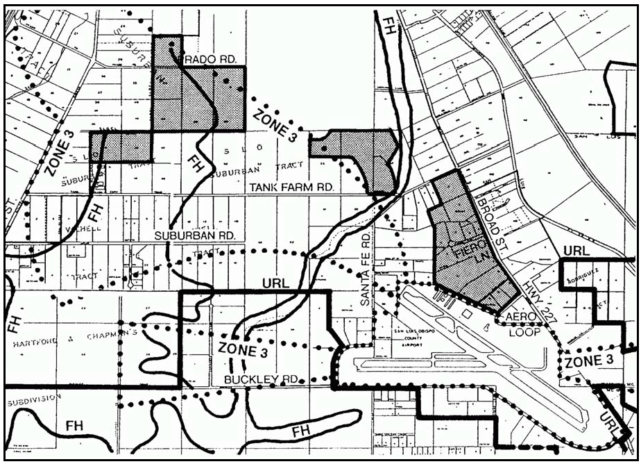
Figure 96-23: Areas Designated as "Commercial Service/business Park"
(2)
The master plans shall also show schematic designs for future municipal sewage collection and water supply systems, using City of San Luis Obispo engineering standards.
b.
Site planning. Site planning shall be "campus-like" with building situated around plazas or courtyards that are designed to attract pedestrian movement and sitting, with vehicle circulation, storage, and utilities located elsewhere on the perimeter.
(1)
Building entries shall be oriented to each other and so that pedestrian circulation is attractive and convenient. Landscaped sidewalks shall be utilized that are separated from vehicle circulation and loading.
(2)
Work bays shall be oriented away from prevailing wind and fronting streets, or screened by landscaping.
(3)
Parking lots shall be limited in size by separating them into sub-areas divided by landscaping or structures.
(4)
Building orientation shall take advantage of active and passive solar opportunities.
(5)
Site planning shall avoid vehicle parking at the front of the lot between the buildings and the street.
(6)
The use of fences and walls shall be minimized except where required for screening outdoor storage and noise. When proposed, fences/walls shall be solid, attractive, two-sided, and designed for low maintenance, with materials and colors that are complementary to the building.
(7)
Above ground site utilities such as meters and back flow preventers shall be located outside the front setback and screened and landscaped.
c.
Building design. Building design shall be thematic within a site, with variation encouraged within a theme.
(1)
Individual building design should be unified and emphasize single, larger scale structures rather than multiple small, detached structures.
(2)
Building design shall be compatible with adjacent sites and structures.
(3)
Roof and wall planes shall be relieved by articulation, shadow or textural interest.
All subsequent developments or land divisions shall be consistent with the approved master plans. The initial business park master plans and any subsequent amendments to the master plans shall be processed as Conditional Use Permits in compliance with Section 22.62.060.
D.
Industrial (IND) - The following standards apply within the Industrial land use category.
1.
Tank Farm Road Corridor. The following standards apply to the Industrial properties shown in Figure 96-24.
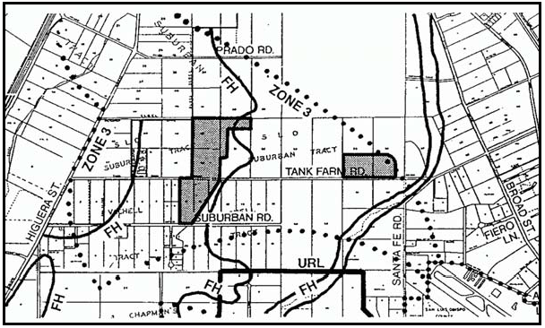
Figure 96-24: Industrial Tank Farm Road Corridor
a.
Setback requirement. Proposed structures shall be set back a minimum of 25 feet from the Tank Farm Road right-of-way and on project boundaries that are visible from Tank Farm Road, for screening landscaping.
b.
Landscaping requirement. Dense, screening landscaping, berming and solid fencing or walls shall be established and maintained within the Tank Farm Road setback, and on project boundaries that are visible from Tank Farm Road.
c.
Access. Access to project sites on Tank Farm Road shall be from intersecting street extensions if feasible, or designed to consolidate several sites' access from single points.
2.
Edna and Buckley Roads. The following standards apply only to the land shown in Figure 96-25 in addition to the Community-wide standards for the Airport Area (Standard A4).
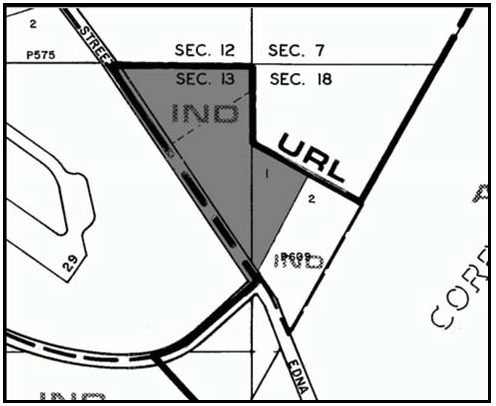
Figure 96-25: IND - Edna and Buckley Roads
a.
Limitation on use. Allowable uses are limited to construction contractors, storage yards (sales lots prohibited), and warehousing.
b.
Permit requirement. Development Plan approval is required for any construction of new buildings.
c.
Design Standards. The following design requirements apply to any new development.
(1)
Height Limit. Building height shall be in accordance with Airport Land Use Plan restrictions.
(2)
Building Design. Buildings should exemplify the agricultural character of the nearby vineyards. Building materials and colors compatible with nearby agriculture production (earth tones and non-reflective paints) shall be used on exterior surfaces of all structures, including fences and walls.
(3)
Landscaping. Dense, screening landscaping, berming and fencing or walls shall be established and maintained within the setback, and on project boundaries that are visible from Broad Street. The landscape treatment should reflect the transitional character of the area by maintaining a plant palette that is natural and agrarian in character.
(4)
Lighting. A lighting plan shall be required demonstrating a low level of ambient lighting that protects the rural ambience, while being consistent with public safety needs.
E.
Recreation (REC). The following standards apply within the Recreation land use category.
1.
Limitation on retail uses. Retail uses in the Recreation land use category shall be incidental to the primary recreational or educational use of the site.
2.
Water supply. Water supply for landscape irrigation purposes (including any golf courses) shall utilize reclaimed sewage effluent from the City of San Luis Obispo sewage treatment plant if authorized by the City. If reclaimed water from the City is not available, the landscaped areas shall be irrigated using water from a community water supply system with a capacity to serve 50 or more connections (unless the Review Authority determines that such a system is not available and is not feasible to provide). The intent of this standard is to reduce the total demand for groundwater and imported water supplies for land uses in the planning area.
3.
South of Tank Farm Road - Limitation on use. Land uses in the area of the Recreation category on the south side of Tank Farm Road shown in Figure 96-26 shall limited to agricultural accessory structures and crop production & grazing, until additional uses are authorized through Conditional Use Permit approval, including outdoor sports & recreation (limited to golf courses, golf driving ranges, miniature golf courses, tennis courts, and swim & tennis clubs), bars and night clubs, restaurants, and general retail (limited to merchandise related to the on-site sports activities).
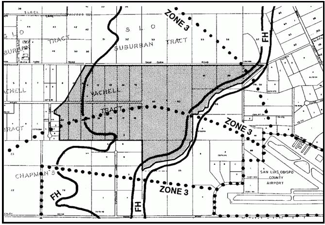
Figure 96-26: Site of Proposed Tank Farm Road Golf Course
F.
Residential Suburban (RS). The following standards apply within the Residential Suburban land use category.
1.
Tract 681. The following standards apply only to Tract 681 as shown in Figure 96-27.
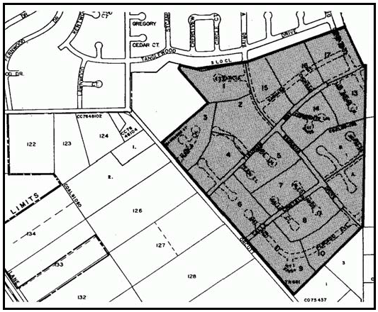
Figure 96-27: Residential Suburban Category Land Known as Tract 681
a.
Parcel size. Minimum parcel size is two acres unless a larger size would otherwise be required by Chapter 22.22 (Subdivision Standards) except that the existing parcels can be split into only two new parcels.
b.
Limitation on use. All uses identified by Section 22.06.030 as allowable, permitted, or conditional within the RS land use category may be authorized subject to the land use permit requirements of that Section.
2.
Site located between Los Osos Valley Road and Via Laguna Vista. The following standards apply to the area shown in Figure 96-28.
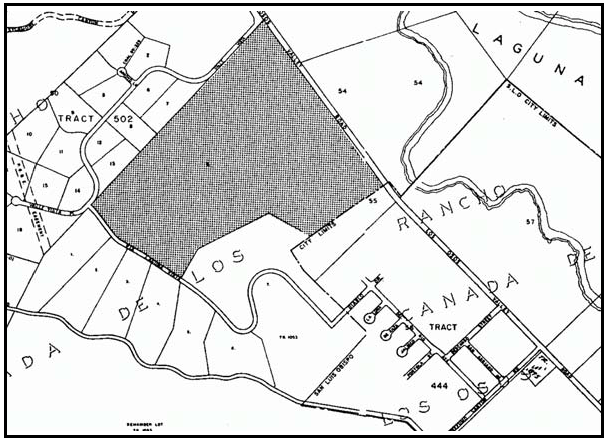
Figure 96-28: Site located between LOVR and Via Laguna Vista
a.
Subdivision design. Subdivision of the site shall either: 1) be designed in compliance with cluster subdivision requirements of Section 22.22.140, or 2) use cluster subdivision design elements such as clustering of the allowed density in areas where there are less site constraints and use of smaller parcel sizes (one to two acres) and the provision of open space areas.
b.
Agricultural buffer. New dwelling units shall be setback at least 200 feet along the westerly property line of the site as shown in Figure 108-27 from Los Osos Valley Road south for a distance of 900 feet, for the purposes of an agricultural buffer. The buffer area may be within an open space parcel and no structures used for human habitation shall be constructed within the buffer area. The buffer shall no longer be in effect if the adjacent agricultural land use designation is changed.
c.
Geologic resources. The recommendations in the Fault Investigation Report (Earth Systems Consultants, March 11, 1998) on file with the Department shall apply to this site.
d.
Water supply. The following water resource standards apply to this site.
(1)
Water service shall be from an existing mutual or community water system. Each parcel shall have a water meter installed in a location approved by the water purveyor. The meters shall be read no less than once every two months.
(2)
A Water Conservation Education Program shall be prepared and submitted to the Director for review and approval.
(3)
A second well, in addition to the existing well (#8), shall be drilled and tested on the property. The well shall be brought into service at a time as determined by the Division of Environmental Health.
e.
Air quality requirements. The following air quality standards apply to this site.
(1)
A dust control program meeting the standards as set forth in the mitigations contained in the Expanded Initial Study dated August 1998, on file with the Department shall be submitted and approved. The program shall be incorporated into future projects through conditions of approval and/or recordation of an additional map sheet with a Final Map. The program is to be implemented during land division improvement construction, as well as construction of individual residences.
(2)
To minimize construction-related traffic noise and disturbance, the applicant shall submit a Construction Traffic Plan to the Department for review and approval.
f.
Biological requirements. The following biological standards shall apply to the site.
(1)
The location and extent of driplines for all trees shall be identified. Construction envelopes shall be designated outside the driplines of all oak trees and riparian areas. All ground disturbances including grading for building, accessways, easements, subsurface grading, sewage disposal and well placement shall be prohibited outside construction envelopes.
(2)
All oak trees within 25 feet of proposed ground disturbances shall be temporarily fenced with chain-link or other material throughout all grading and construction activities. The fencing shall be installed six feet outside the dripline of each oak tree, and shall be staked every six feet. No construction equipment shall be staged, parked, stored or operated within six feet of any oak tree dripline.
(3)
During construction, washing of concrete, paint or equipment shall occur only in areas where polluted water and materials can be contained for later removal from the site. Washing shall not be allowed near sensitive biological resources. An area designated for washing functions shall be identified. All trees located within 25 feet of proposed buildings shall be protected from stucco or paint during construction.
(4)
Paving shall be pervious material where access roads or driveways encroach within 20 feet of an oak trees dripline. No permanent irrigation shall occur within the dripline of any existing oak tree.
(5)
No fill soil, rocks, or construction materials shall be stored or placed within six feet of the dripline of all oak trees. Any trenching required within the dripline or sensitive root zone of any oak tree shall be done by hand. Any construction activity required within three feet of an oak trees dripline shall be completed with hand tools.
(6)
The standards in Subsections g(1) through g(5) shall be noted and shown on all grading and building plans, as well as an additional map sheet recorded with any Final Map in order to describe the activities prohibited outside the approved envelopes.
(7)
Any unanticipated damage that occurs to trees or sensitive habitats resulting from construction activities shall be mitigated in a manner approved by the Director. This mitigation may include, but is not limited to, posting of a performance security, tree replacement and hiring of an outside consultant biologist to assess the damage and recommend mitigation. The required mitigation shall be done immediately unless otherwise authorized by the Director. Any performance securities required for installation and maintenance of replacement trees will be released after its inspection and approval of such installation.
(8)
Prior to recordation of a Final Map for a land division on the property, the developer shall submit a riparian habitat restoration and enhancement plan for review and approval.
g.
Fire safety requirements. All residences shall be constructed with interior water sprinkler systems, in addition to compliance with the requirements of Chapter 22.50 (Fire Safety).
h.
Wastewater disposal requirements. The following wastewater standards shall apply to the site and shall be completed prior to recordation of a Final Map for any land division.
(1)
A comprehensive percolation testing report shall be submitted for review and approval by the San Luis Obispo County Public Health Department. The report shall provide all information regarding soil conditions that are required to evaluate and determine the suitability of soils to support installation of a septic system.
(2)
A Septic System Maintenance and Monitoring Program shall be prepared and approved. The program shall contain procedures for periodic inspection of septic systems installed on individual parcels to assure proper functioning of each system.
i.
Visual standards. The following visual and aesthetic standards shall apply to the site.
(1)
The design, scale and character of the project architecture shall be compatible with vicinity development.
(2)
All building heights on lots within the SRA (above the 200-foot contour) are limited to 22 feet unless specifically approved for 25 feet through the Minor Use Permit process. All building heights for lots located below the SRA are limited to 28 feet.
(3)
Natural building materials and colors compatible with surrounding terrain (earth tones and non-reflective paints) shall be used on exterior surfaces of all structures, including fences.
(4)
Electric, telephone and cable television lines shall be installed underground.
(5)
A landscape screening plan for an open space parcel associated with a cluster subdivision shall be submitted to the Department prior to recordation of a Final Map for any land division. Landscaping shall be installed or bonded for before a Final Map is recorded for a land division. The developer or homeowners association shall maintain the landscaping in perpetuity.
j.
Cultural resource requirements. The following cultural resource standards shall apply to the site.
(1)
Known archaeological sites shall be designated as unbuildable areas. The areas shall not be identified as archaeological sites on any plans, maps or recorded documents A buffer of 150 feet from the sites identified as cultural resources sites shall be established.
(2)
In the event any grading is proposed within the buffer, archaeological monitoring shall accompany the grading. Such grading will be preceded by a pre-construction workshop for contractors concerning the nature of cultural resources, protection of such resources under CEQA, procedures for accidental discovery and scheduling for monitoring during such grading.
(3)
Any trails developed in connection with a project or land division, they shall be designed and constructed in a manner and location such that they do not come within the buffer zones wherever possible. In the event any trail or construction of trails is proposed within the buffer, the applicant shall employ a qualified archaeologist to either monitor the application of a fill soil cap to protect the archaeological site areas, or conduct additional field work to identify, catalogue and store any resources which may be found.
(4)
In the event archaeological remains are encountered during grading, work shall be stopped immediately or redirected until a qualified archaeologist and Native American representative, approved in advance by the Department, are retained by the applicant to evaluate the significant of the find. If remains are found to be significant, they shall be subject to a Phase 3 mitigation program funded by the applicant. This condition shall be printed on all building and grading plans.
G.
Residential Single-Family (RSF) and Residential Multi-Family (RMF) - Parcel size. Prior to annexation by the City of San Luis Obispo, the minimum parcel size for new land divisions shall be 40 acres.
[Added 2000, Ord. 2912, Amended 2014, 3256; 2017, Ord. 3358; 2018, Ord. 3369; 2020, Ord. 3409; 2020, Ord. 3417]
22.98.010 - Purpose and Applicability.
This Chapter provides standards for proposed development and new land uses that are specific to the South County planning area defined by the Land Use Element. These standards apply to proposed development and new land uses as provided by Section 22.90.020 (Applicability), and are organized according to the specific areas and/or land use categories within the planning area to which they apply.
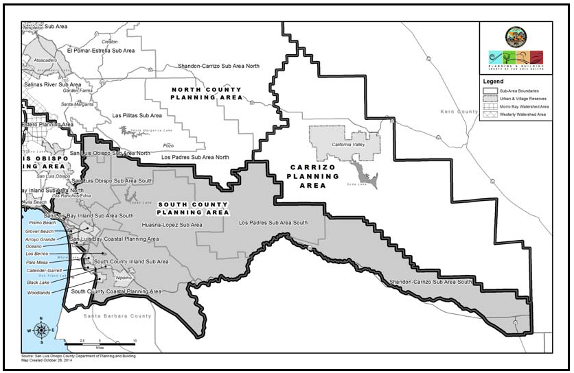
Figure 98-1: Figure showing Sub-Areas
22.98.020 - Combining Designation Standards.
A.
Airport Review Area (AR). The following standards apply within the Airport Review combining designation, as shown in Figures 98-2 and 98-3:
1.
Airport Land Use Plans included by reference.
a.
The adopted Oceano County Airport Land Use Plan, and any amendments thereto, is hereby incorporated into this Title by reference as though it were fully set forth here.
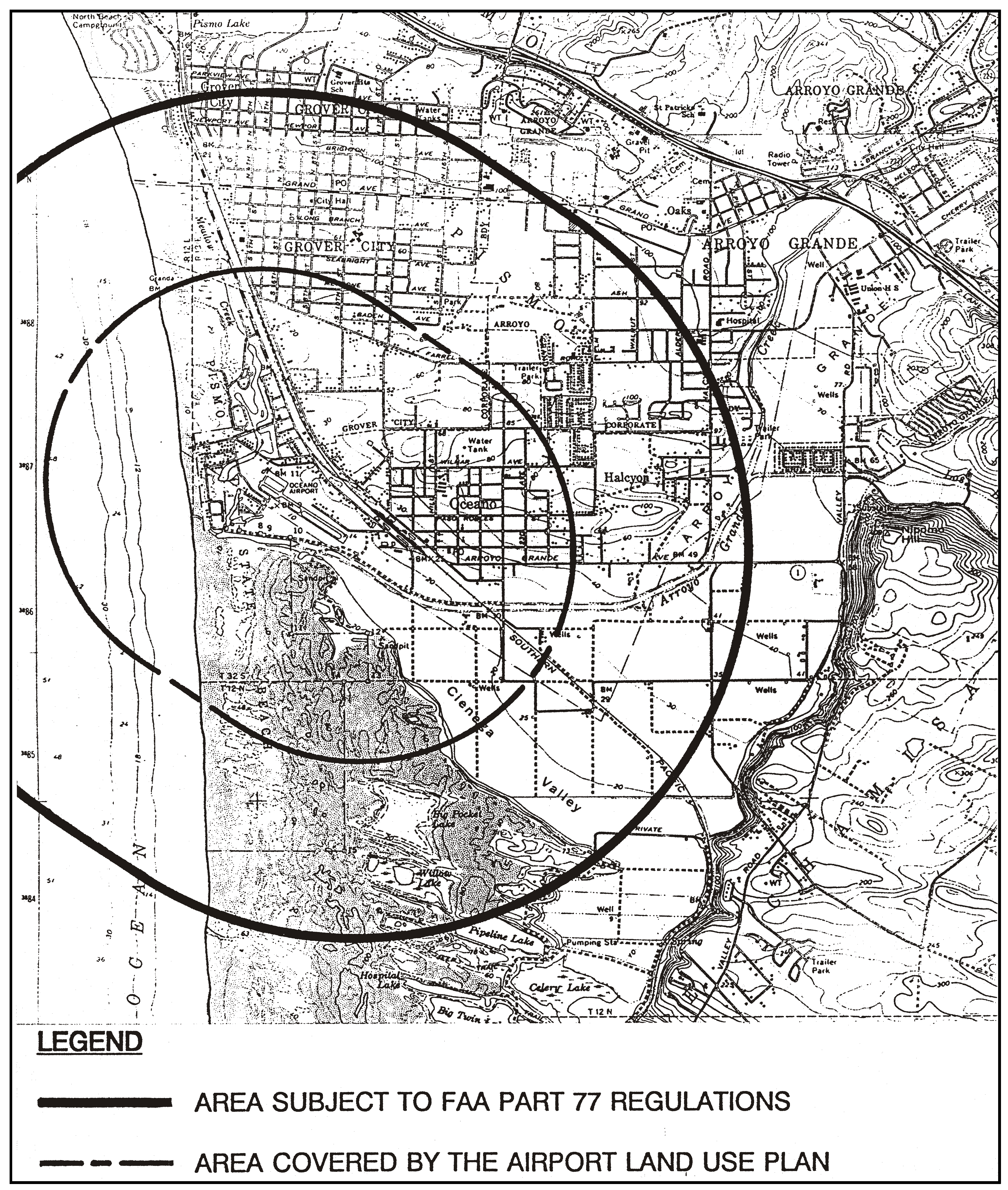
Figure 98-2: Airport Review Area - Oceano County Airport
b.
The adopted San Luis Obispo County Airport Land Use Plan, and any amendments thereto, is hereby incorporated into this Title by reference as though it were fully set forth here.
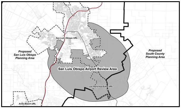
Figure 98-3: San Luis Obispo Airport Review Area
2.
Limitation on uses within Airport Review Area. Allowable uses are limited to those designated as "compatible" or "conditionally approvable" by the Oceano County Airport Land Use Plan and San Luis Obispo County Airport Land Use Plan, as applicable, in compliance with the land use permit requirements of Section 22.06.030 (Allowable Land Uses and Permit Requirements.
3.
Review for compliance with Airport Land Use Plan. All land use permits, land divisions and General Plan amendments must be found consistent with the Airport Land Use Plan adopted by the San Luis Obispo County Airport Land Use Commission for the Oceano County Airport Review Area and the San Luis Obispo County Airport Review Area, as applicable.
4.
Site Design and development standards - Private lands. All development applications for the area within the boundary of the Oceano County Airport Land Use Plan and the San Luis Obispo County Airport Land Use Plan shall comply with the development standards in the respective plans, in addition to all applicable provisions of this Title. In the event of conflicts between the provisions of the Airport Land Use Plan and this Title, the more restrictive provisions shall prevail.
5.
Site design and development standards - Airport site. New development projects in County-owned portions of the site of the San Luis Obispo County Airport shall be consistent with the adopted Airport Use Permit (the land use plan for the airport itself), and shall comply with all applicable provisions of the airport lease site standards instead of the provisions of Articles 3 and 4 of this Title.
B.
Energy and Extractive Resource Areas (EX) - Permit requirement for Price Canyon Oilfield.
1.
Oilfield Expansion. Conditional Use Permit approval is required for any expansion of existing oilfield operations in Price Canyon, Tiber Canyon and in the hills off Ormonde Road into adjacent land use categories.
2.
Residential Development. Notwithstanding the Minor Use Permit requirement of Section 22.14.040, residential development not otherwise requiring Minor Use Permit or Conditional Use Permit approval pursuant to Chapters 22.06 and 22.08 may be authorized through Zoning Clearance approval, subject to the following requirements:
a.
A licensed land surveyor shall identify the locations and status of all wells on record with the California Department of Conservation - Division of Oil, Gas, and Geothermal Resources (DOGGR) on the site.
b.
No structures shall be placed within 10 feet of any abandoned oil well.
C.
Mineral Resource Area (MRA) - Santa Maria and Sisquoc River Specific Plan. The following standards apply within the Mineral Resource Area (MRA) combining designation in and along the Santa Maria River.
1.
Compliance with Specific Plan required. All development within the Santa Maria and Sisquoc Rivers Specific Plan Area (see Figure 98-4) shall comply with the adopted Specific Plan. In the event of any conflict between the provisions of this Title and the Specific Plan, the Specific Plan shall control. Any deviation of existing or proposed development from the provisions of the Specific Plan shall occur only after appropriate amendment of the Specific Plan.
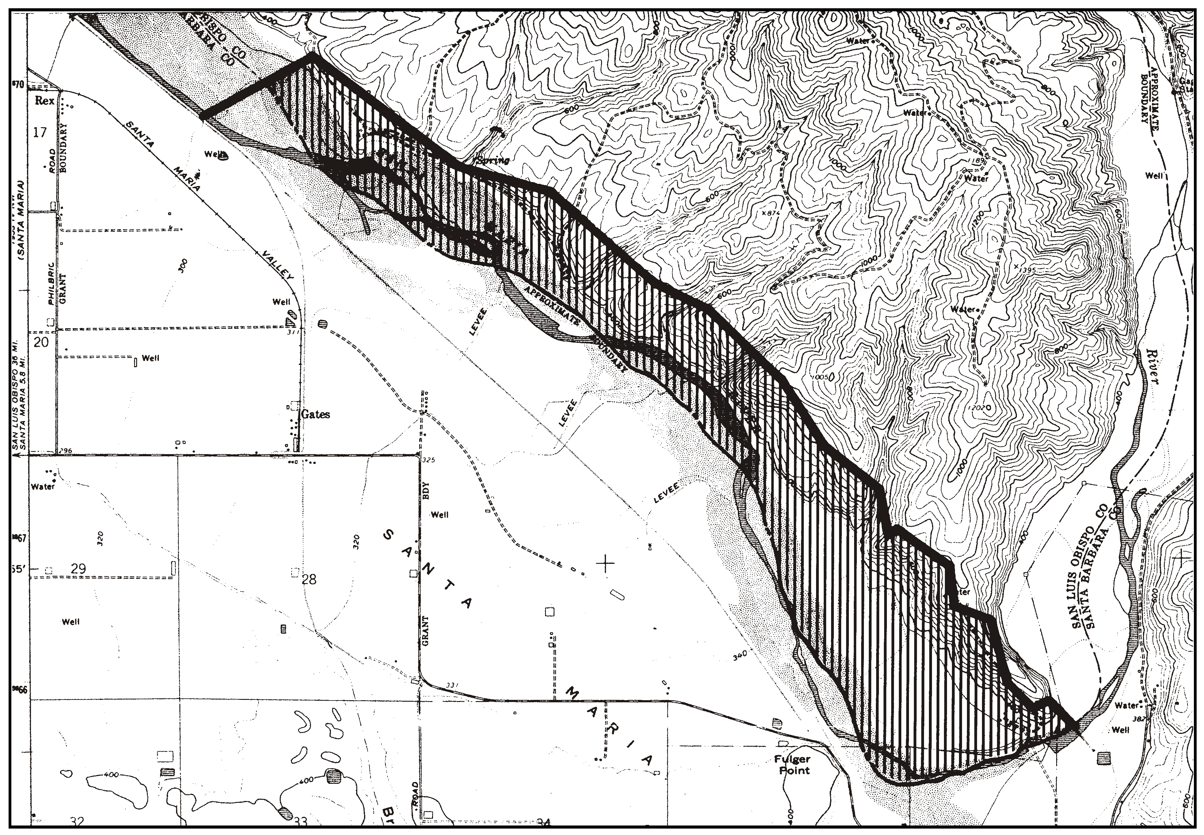
Figure 98-4: Santa Maria and Sisquoc Rivers Specific Plan
2.
New mining operations. Proposals for new mining operations located in the MRA Combining Designation shall apply for and fund appropriate amendments to update the existing Santa Maria and Sisquoc Rivers Specific Plan. Where a substantial change to the operation of a mine with a vested right is proposed (as described in Chapter 22.36, and as provided by Public Resources Code (PRC) Section 2776), the operation will be considered a new mining operation and a new land use permit and reclamation plan shall be required.
3.
Review of proposed operations on prime agricultural land. Land use permits for mining on prime agricultural land (as defined in Government Code Section 51201) are subject to review and recommendations by the Agricultural Preserve Review Committee or its equivalent prior to review and approval by the Commission.
D.
Historic Area (H) — Historic sites. The following standard applies within the Historic combining designation.
1.
San Luis Obispo Sub-area. Within the San Luis Obispo Sub-area, as shown in Figure 98-0, the provisions of Section 22.14.080 requiring Minor Use Permit approval applies only to the historic structures identified in Chapter 6 of the San Luis Obispo Area Plan (see page IV.6-2), and an area within 200 feet of the structure, and not to other structures or uses which exist or are proposed on the site or to vegetation removal, routine maintenance, repairs or similar activities.
2.
Historic Area (H) - Dana Adobe. Development of any tourist-related facilities, residential or accessory uses at the site of the Dana Adobe (see Figure 98-5) shall be consistent with Section 22.108.040.F.
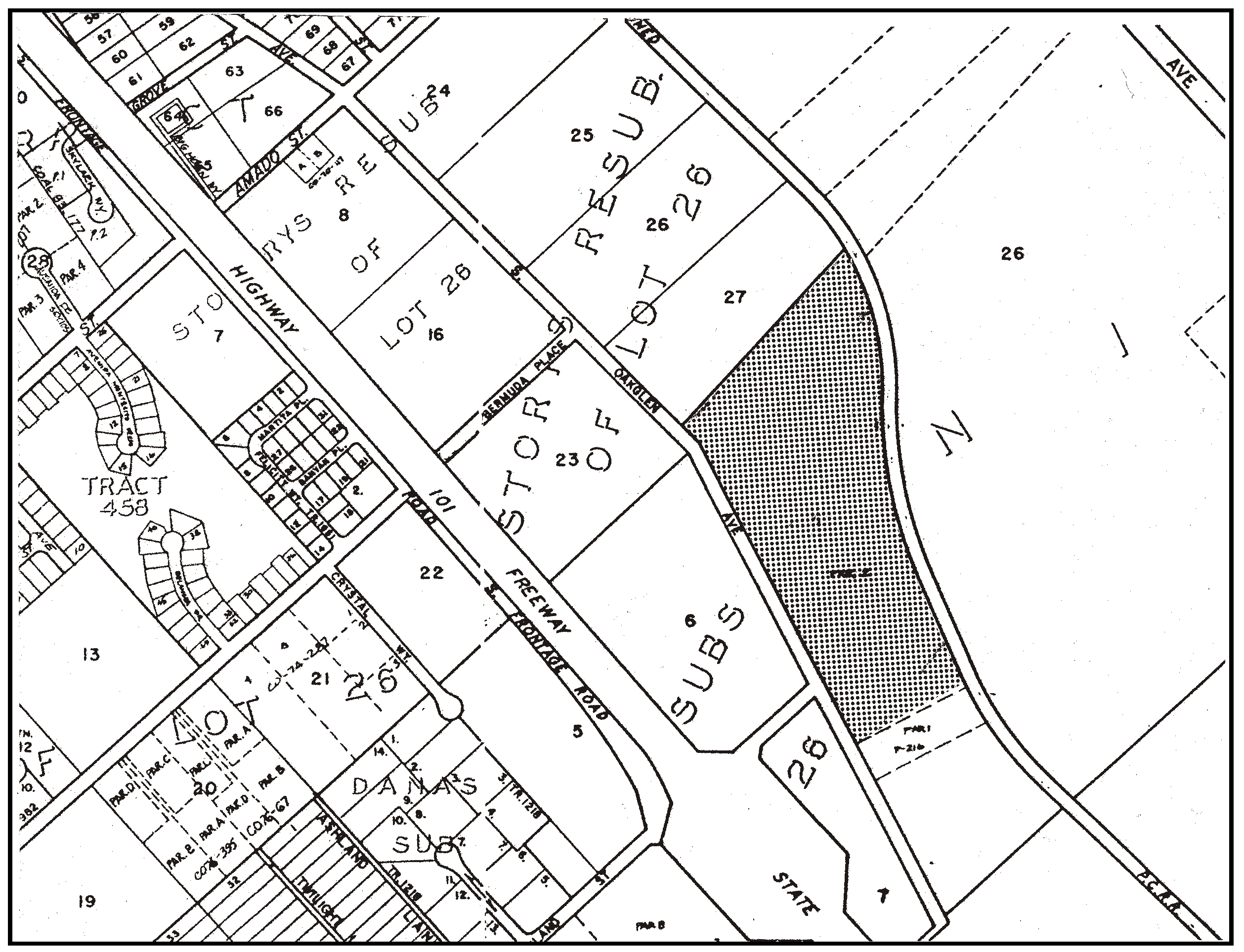
Figure 98-5: Dana Adobe Site
E.
Sensitive Resource Area (SRA). The following standards apply within the Sensitive Resource Area (SRA) combining designation.
1.
Black Lake Canyon. The following standards apply to all properties in the Black Lake Canyon SRA combining designation except for the replacement or reconstruction of existing water wells, which are subject only to Subsection E.1.i. These standards will be considered for clarification and revision during the Black Lake Canyon General Plan amendment and environmental impact review process. As part of the General Plan amendment, an inventory of canyon resources and necessary protective measures is being prepared in the Black Lake Canyon Enhancement Plan.
a.
Access limitation. Road access to new and existing parcels shall be from local streets above the canyon rim, except that below the canyon rim, access from adjacent parcels may be to a possible public road crossing of the canyon if no other access is feasible.
b.
Limitations on improvements. No permanent structures, impervious surfacing, grading, removal of natural vegetation, sewage disposal systems or water wells are allowed below the canyon rim except as provided by Subsections E.1.d through E.1.f. A determination of whether proposed activities will extend below the canyon rim shall be made by the Department as individual applications are reviewed.
c.
Setbacks. Maintain at least a 20-foot building setback from the rim of the canyon.
d.
Environmental review for new water well permits. All applications to permit the drilling of new water wells (excluding the replacement or reconstruction of existing legal nonconforming wells) below the rim of the canyon and outside the Sensitive Resource Area boundary shall be subject to the environmental review procedures as contained in the County Environmental Quality Act Guidelines, and as required by the conditions of the negative declaration ED 81-08 for the County General Plan amendment G810519:2. The environmental review, with a completed environmental determination, shall be accomplished prior to the issuance of a well-drilling permit from the County Department of Public Health.
e.
Location of new well sites. New well sites shall be located a minimum 150 feet from the marsh vegetation. Access roads to the well site shall not impinge on the marsh site, and shall be located and limited in use as determined by the environmental review process.
f.
Grading permit. A grading permit, subject to the environmental review procedures contained in the California Environmental Quality Act and completed in compliance with Chapter 22.52, shall be required for any proposed grading activities or site disturbances that will occur below the rim of Black Lake Canyon outside of the Sensitive Resource Area boundary, including grading for agricultural uses. The grading permit application shall include a comprehensive erosion and sedimentation control plan utilizing soil erosion prevention and protection measures as recommended by the Natural Resources Conservation Service, and provision of a wildlife corridor of native vegetation extending from the canyon rim to the canyon bottom. The location and size of the corridor shall be determined through the environmental review process. Installation of permanent or temporary structures utilized for controlling drainage may be permitted within the Sensitive Resource Area designation only if such structures are approved as part of the approved sedimentation and erosion control plan.
g.
Rare or endangered plant species. The provision of protective measures for rare or endangered plant species, as designated on the current, official list of the California Department of Fish and Game Commission, shall be accomplished as part of the environmental review for individual applications.
h.
Protection of wetlands. Properties proposed for development that contain wetlands or are adjacent to wetlands shall develop a small diameter observation well to monitor the groundwater level in the shallow upper aquifer. Significant declines in the shallow water table attributable to the production from proposed new wells shall necessitate the implementation of protective measures by the property owner to preserve water levels within marsh areas. The details of the monitoring program shall be developed by the Office of the Environmental Coordinator at the time of the environmental review of individual water well permit applications.
i.
Well reconstruction and replacement. The following standards apply to the reconstruction or replacement of existing legal nonconforming wells.
(1)
Location of replacement well sites. Where the existing well being replaced is within 150 feet of a marsh and/or wetland area, the replacement well shall be located no closer to the marsh or wetland than the well being replaced.
(2)
Permit requirements for replacement wells. The application for a well-drilling permit shall include a Zoning Clearance showing the location of the well being replaced, its casing size and depth and the approximate operational capacity prior to its failure; the location of the proposed new well; the access route to the proposed drilling site; and relationship to marsh or wetland areas if they exist on the property.
(3)
Construction standards for replacement wells. Replacement wells shall be "in-kind" wells; they shall not exceed the capacity of the well being replaced. The new well shall be constructed to the standards contained in the conditional negative declaration (ED 83-206) for General Plan amendment G831019:2, on file with the Department and the Department of Public Health.
2.
Indian Knob - Required plant species inventory. Prior to approval of any land use permit in the Indian Knob area (see Figure 98-6) a site survey shall be conducted to accurately locate the extent of the rare shrub, Eriodictyon Altissimum. Proposed development shall be located such that the subject plant is preserved.
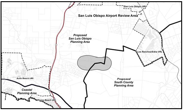
Figure 98-6: Indian Knob Mountainbalm SRA
3.
Lopez Lake. The standards of this Section apply within the Agriculture and Rural Lands categories that are also within the Lopez Lake SRA.
a.
Limitation on use. All land uses identified by Section 22.06.030 as allowable, permitted, or conditional within the applicable land use categories may be authorized within the Lopez Lake SRA, in compliance with the land use permit requirements of that Section, except that mining and related operations are only allowed to reclaim existing mines.
b.
Surface mining. Applications for surface mining outside the Lopez Lake SRA, where applicable, shall include plans to reclaim and revegetate any existing mines or related excavations that are located within the SRA on the same site.
c.
Special requirements for residential development.
(1)
Permit requirement. Minor Use Permit approval is required for all new residential development involving structures and access road construction.
(2)
Application content. All Minor Use Permit and Conditional Use Permit applications shall include a grading plan, erosion control plan, landscaping plan and architectural elevations. Applications shall also include a visual analysis of the project to show how the location and design of the project will mitigate its visual impact on the Lopez Lake Recreation Area. A visual analysis shall include topographic maps with lines of sight, cross Sections, photographs, or other supporting documentation to demonstrate that the project complies with the location and site development criteria of Subsections E.3.c(3) through E.3.c(5).
(3)
Building site limitation. Wherever feasible on properties proposed for development, all building sites and access roads shall be located outside the SRA area, so as not to be visible from the recreation area.
(4)
Location criteria. If development cannot comply with Subsection E.3.c(3), compliance with the following location criteria shall be required:
(a)
Structures shall be located away from exposed ridges or hilltops to areas of minimum visibility from the Recreation Area.
(b)
Locate development to minimize grading for residences and access roads
(c)
No development, including access roads, shall be permitted on slopes steeper than 30 percent.
(d)
Locate access roads to have minimum feasible cross slopes and visibility.
(e)
New access to development shall use existing roads wherever feasible.
(5)
Site development criteria.
(a)
Utilize existing vegetation, topographic features and landscaping to screen the visibility of development.
(b)
Residences shall be limited to a single story where necessary to reduce visibility.
(c)
A maximum road cut of five feet shall be maintained wherever possible in visible areas.
(d)
Altered slopes shall be replanted with native plant species.
d.
Special requirements for oil and gas exploration and production facilities.
(1)
Permit requirement. Conditional Use Permit approval is required for oil and gas exploration and production facilities. Each application shall comply with the following criteria before acceptance.
(2)
Application content. Provide a visual analysis in the form of topographic maps with lines of sight, cross Sections, photographs and other supporting documentation that demonstrate that the project will mitigate the visual impact on Lopez Lake Recreation Area by compliance with the site location and development standards below.
(3)
Location criteria. Wherever possible, oil and gas exploration and production facilities shall locate outside the SRA boundary. Any application proposing facilities within the SRA area must demonstrate this need to do so through a combination of technical and economic analysis not including proprietary information to the industry. Exploration and production facilities shall not be allowed on unobstructed, visible hilltops or ridgelines. If a project cannot comply with this standard, it shall comply with the site development standards of Subsection E.3.d(4).
(4)
Site development standards.
(a)
Proposed facilities shall be screened from view by existing topography, vegetation, earthen berms and/or solid fencing. Berms and fencing shall be buffered with specimen-sized evergreen vegetation.
(b)
Project site design shall include the maximum consolidation of facilities and minimal feasible heights, possibly including recessed or sunken features below existing grade.
(c)
Proposed access roads shall have the minimum feasible cross slopes and visibility, with a maximum road cut of five feet maintained wherever possible in visible areas. Prepare a grading, erosion control and landscaping plan, emphasizing vegetation to screen all visible cut and fill slopes.
4.
Los Padres Sub-area. Within the Los Padres Sub-area, as shown in Figure 98-0, access to or through SRA areas shall be limited to existing roads, trails or to proposed trails shown on the latest Forest Service Off-Road Vehicle Plan. Any proposed changes in this plan should be submitted to the County and affected private property owners for review.
5.
Pismo Beach Hillsides (SRA). (See Figure 98-7)
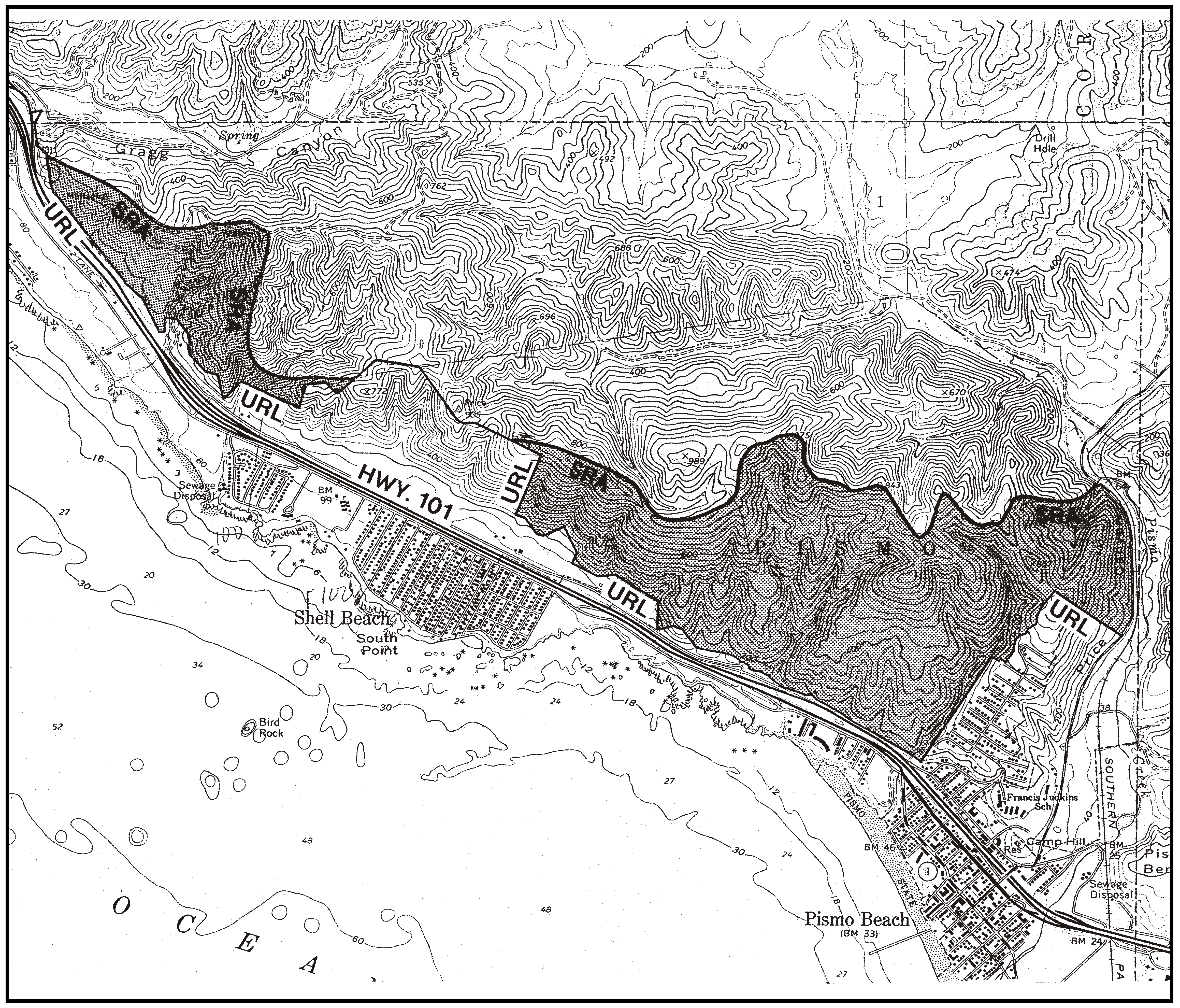
Figure 98-7: Pismo Beach Hillsides Sensitive Resource Area
a.
Permit requirement. Conditional Use Permit approval is required for oil and gas production facilities. Each application shall comply with the following criteria before acceptance.
b.
Application content. Provide a visual analysis in the form of topographic maps with lines of sight, cross sections, photographs, and other supporting documentation that demonstrate that the project will comply with the site development standards in Subsection E.5.c.
c.
Site development standards.
(a)
Proposed facilities above the 200-foot elevation, including cut and fill banks, tanks, stacks, and chimneys shall be located so that at least 90 percent of the site is screened by existing topography from view within the City of Pismo Beach and Highway 101. Created topography and vegetation as detailed by plans can be considered to complete the existing "screening" using native vegetation where possible and conform to naturally occurring topographic trends. Exploration and production facilities shall not be allowed in the unobstructed visible hillside above the 200-foot elevation.
(b)
Proposed access roads shall have the minimum feasible cross slopes and visibility, with a maximum road cut of five feet maintained wherever possible in visible areas. Prepare a grading, erosion control and landscaping plan, emphasizing vegetation to screen all visible cut and fill slopes.
(c)
Any new application that proposes facilities at any site other than an existing developed location, must demonstrate through a combination of technical and economic analysis not including proprietary information to the industry that new facilities cannot be reasonably incorporated into existing developed locations.
(d)
Steam generators and other venting equipment shall incorporate the best available technology to minimize the appearance of a smoke or steam plume.
(e)
Steam generators and other equipment that cause smoke or steam, and production facilities for oil resources having high concentrations of sulphur compounds, shall not be emitted within 1,000 feet of a residence and the Pismo Beach City limits.
(f)
Normal workover procedures should not exceed the average maintenance cycle, with the exception of breakdowns and emergencies that are verified to the Director through the Division of Oil and Gas' closest office to the well location.
6.
San Luis Bay Sub-area. Within the San Luis Bay Sub-area, as shown in Figure 98-1, projects requiring Conditional Use Permit approval shall concentrate proposed uses in the least sensitive portions of properties. Native vegetation shall be retained as much as possible.
7.
Shandon-Carrizo Sub-area. The following standards apply in the Shandon-Carrizo Sub-area, as shown in Figure 98-1.
a.
BLM Wilderness Study Areas. New development within BLM wilderness study areas is allowed only in accordance with the Federal Land Policy and Management Act of 1976.
b.
Off-Road Vehicles. Off-road vehicles are prohibited except on designated trails in BLM lands.
[Amended 1982, Ord. 2096; 1983, Ord. 2157; 1984, Ord. 2206; 1985, Ord. 2215; 1997, Ord. 2800; Added 1998, Ord. 2847; Amended 2013, Ord. 3254; 2014, Ord. 3256; 2018, Ord. 3369; 2025, Ord. 3531]
22.98.030 - Huasna-Lopez Sub-area Standards.
All development and new land uses in the Huasna-Lopez Sub-area, as shown on Figure 98-1, shall comply with the following standards where applicable.
A.
Driveways Land divisions. New land divisions shall include, where possible, design provisions for combining driveways and private access roads from Lopez Drive where terrain and adequate sight distance permits.
B.
Road design and construction. New road alignments proposed in land division applications shall be designed and constructed to minimize terrain disturbance consistent with safety and construction cost. Altered slopes shall be replanted with indigenous plants or protected by other appropriate erosion control measures.
C.
Oil and gas exploration and production facilities. The following standards shall apply to new oil and gas exploration and production facilities which propose truck traffic on Huasna Road and Huasna Townsite Road, in addition to the applicable standards in Article 3.
1.
All parking and loading activities related to well drilling or test production shall occur on-site.
2.
Large trucks (three or more axles) serving the site with equipment deliveries and oil transport shall be limited to specific times as determined by permit approval.
3.
Large trucks either traveling singly or in groups shall be preceded by a convoy vehicle equipped with warning devices. The convoy area shall be between U.S. Highway 101 and the site.
[Amended 2014, Ord 3256]
22.98.032 - Land Use Category Standards for the Huasna-Lopez Sub-area.
All development and new land uses in the Huasna-Lopez Sub-area, as shown in Figure 98-1, shall comply with the following standards, as applicable to each land use category.
A.
Rural Lands (RL). The following standards apply within the Rural Lands land use category.
1.
Limitation on use. All land uses identified by Section 22.06.030 as allowable, permitted, or conditional uses within the RL land use category may be authorized in compliance with the land use permit requirements of that Section except correctional institutions, off-road vehicle courses and residential care facilities.
2.
Minimum parcel size Alisos Road. For the Rural Lands property on Alisos Road, the minimum parcel size for calculating density of new land divisions shall be 80 acres unless a larger minimum size is required by Chapter 22.22.
[Amended 2014, Ord 3256]
22.98.040 - Los Padres Sub-area Standards.
All development and new land uses in the Los Padres Sub-area, as shown on Figure 98-1, shall comply with the following standards where applicable.
A.
The County shall refer all land divisions proposed within the Los Padres Sub-area to the U.S. Forest Service for review.
[Amended 2014, Ord 3256]
22.98.050 - San Luis Bay Sub-area Standards.
All development and new land uses in the San Luis Bay Sub-area, as shown on Figure 98-1, shall comply with the following standards where applicable.
A.
Planning impact areas. The following standards apply within the cites of Arroyo Grande and Grover Beach planning impact areas, shown in Figure 98-8. Area "A" is an impact area for both cities; Area "B" is an impact area for Arroyo Grande.
1.
Application referral. Applications for discretionary land use permits, land divisions or General Plan amendments within the planning impact areas for the cities of Grover Beach and Arroyo Grande shall be referred by the County to the appropriate city or cities for review and comment.
2.
Development impacts. The County shall address potential impacts, including cumulative impacts, that are associated with impacts to water quantity and quality, drainage, erosion and downstream sedimentation, and traffic and circulation as critical subjects for additional evaluation as part of the environmental review process.
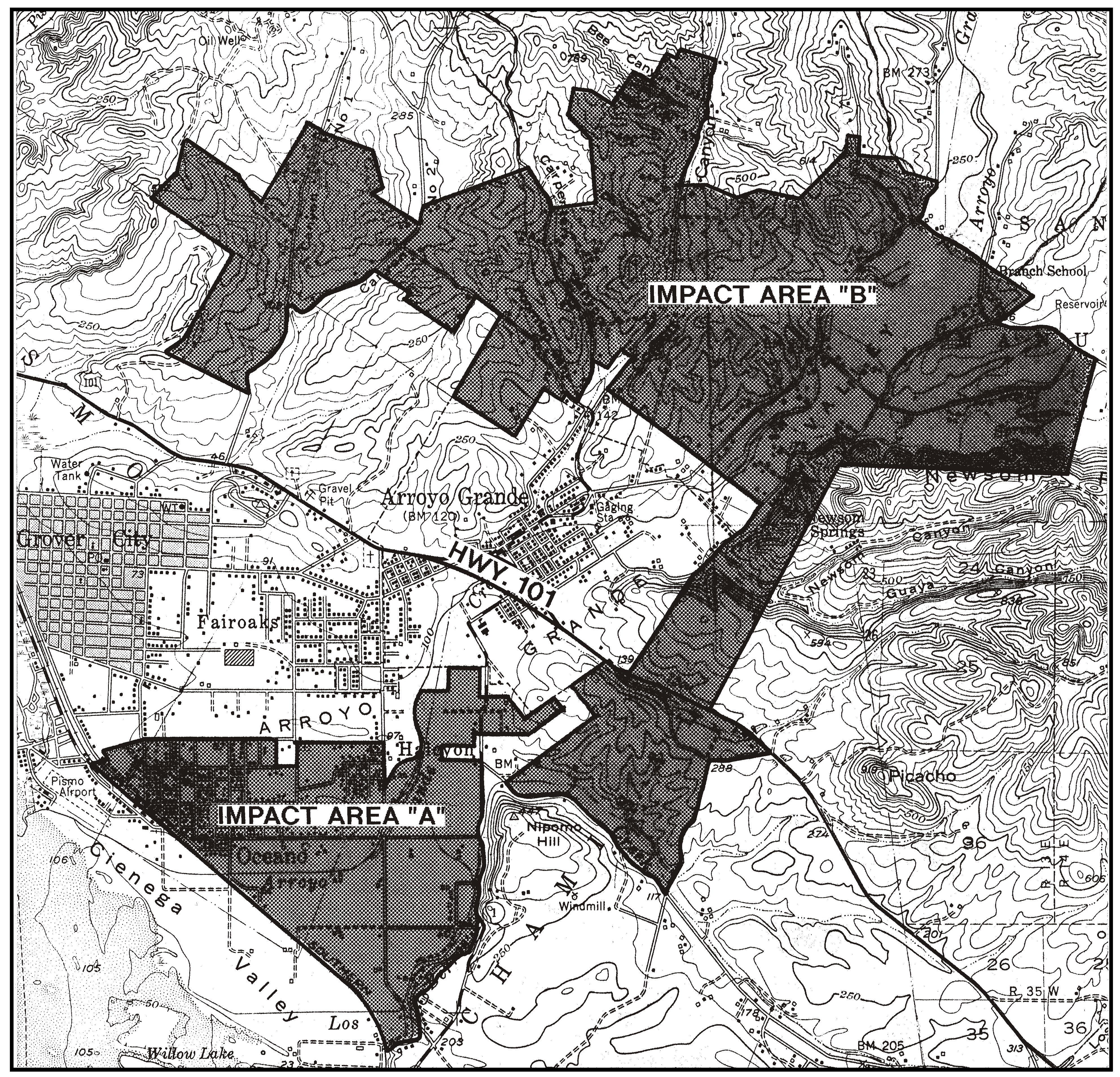
Figure 98-8: Planning Impact Areas "A" and "B"
B.
Circulation standards.
1.
Areawide systems - Conditional Use Permit projects. Projects requiring. Conditional Use Permit approval shall be integrated into areawide circulation and utility easements, providing for future extensions into adjacent undeveloped properties wherever feasible or where known areawide rights-of-way are planned.
2.
Driveways - New land divisions. Where possible, new land divisions shall be designed to combining driveways and private access roads serving proposed parcels wherever terrain and adequate sight distance on the public road allow.
3.
Pedestrian and bikeways - New land divisions. Provide for safe and site-sensitive pedestrian and bike circulation facilities in the design of roads for new subdivisions where feasible.
4.
Road design and construction - New land divisions.
a.
Site disturbance. Road alignments proposed in new land division applications shall be designed and constructed to minimize terrain disturbance consistent with safety and construction cost. Altered slopes shall be replanted with indigenous plants or protected by other appropriate erosion control measures.
b.
Circulation. New land divisions adjacent to the city limits of an incorporated city shall be designed to include offers-to-dedicate for roads connecting with the city such that the street right-of-way widths will reasonably correspond to those required under City standards. Appropriate transitions in road improvements shall be provided between City and County roads adjacent to the City limits. In addition, logical existing or future street connections to City streets shall be provided to encourage an efficient circulation system.
C.
Site planning on sloping sites - Conditional Use Permit projects. Projects requiring Conditional Use Permit approval on sites with varied terrain shall include design provisions for concentrating developments on moderate slopes, retaining steeper slopes visible from public roads undeveloped.
D.
Utility Services - Undergrounding requirement for Conditional Use Permit projects. All projects requiring Conditional Use Permit approval shall provide for utilities being placed underground unless the Commission determines either that: the proposed development will be of low intensity or in an isolated location; or that supporting overhead utilities will not be visible from public roads; or that overriding operational, economic or site conditions of the project warrant waiver of this requirement.
E.
Arroyo Grande and Cienega Valleys - Limitation on use. Within the Arroyo Grande and Cienaga Valleys (see Figure 98-10), land uses shall be limited to the following in compliance with the land use permit requirements of Section 22.06.030: agricultural accessory structure; crop production and grazing; animal keeping; agricultural worker housing; single-family dwellings; mobile homes; temporary dwellings; roadside stands; outdoor retail sales; public safety facilities; pipelines and transmission lines.
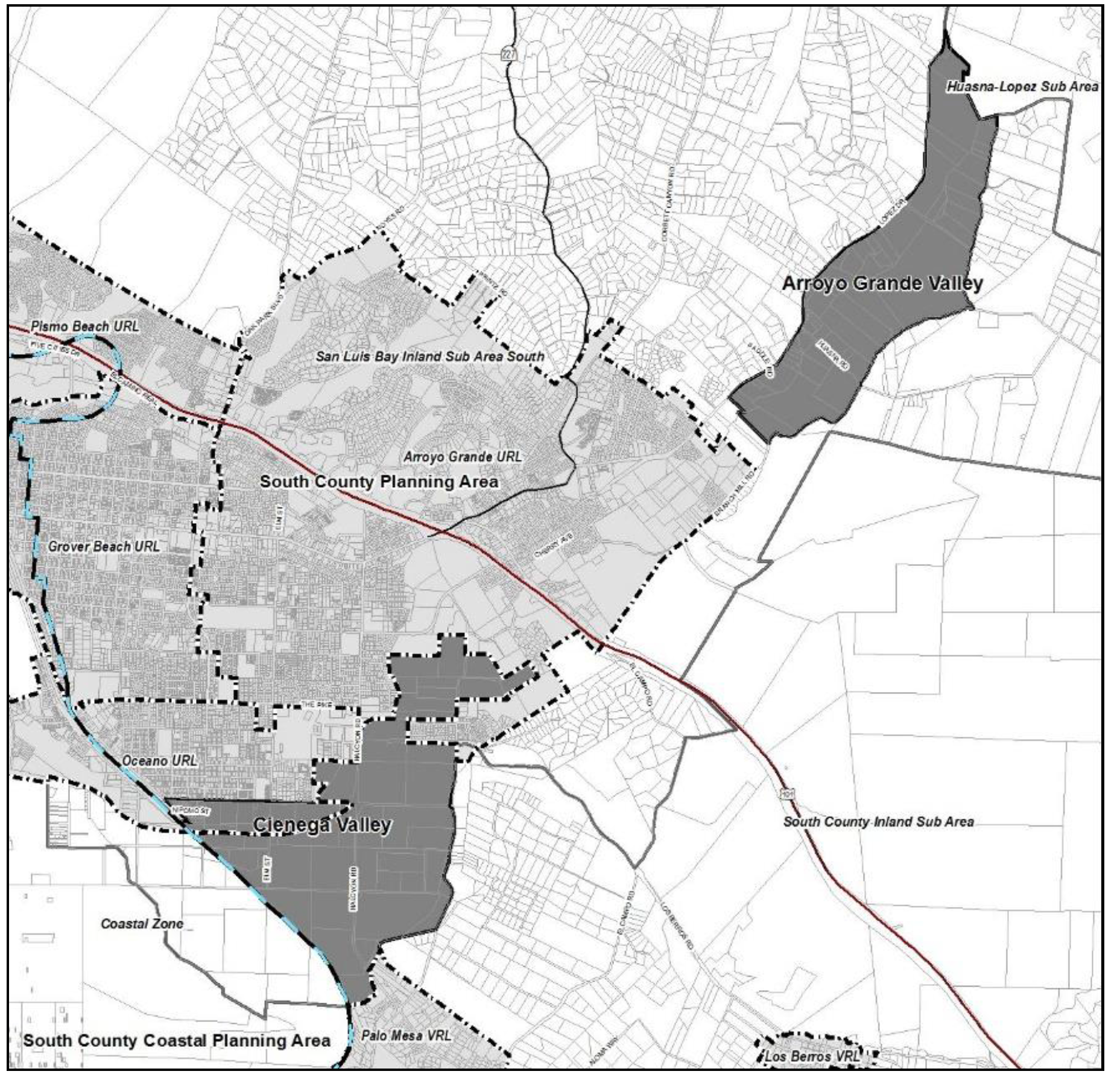
Figure 98-9: Arroyo Grande and Cienaga Valleys
[Amended 1983, Ord. 2133; 1989, Ord. 2399; 1993, Ord. 2646; 2014, 3256; 2018, Ord. 3369; 2020, Ord. 3417]
22.98.052 - Land Use Category Standards for the San Luis Bay Sub-area.
All development and new land uses in the San Luis Bay Sub-area, as shown in Figure 98-1, shall comply with the following standards, as applicable to each land use category.
A.
Rural Lands (RL). The following standards apply within the Rural Lands land use category.
1.
Oak Park Road - Proposed private school. Development of the private school on Oak Park Road east of Highway 101 (Parcel C of CO 78-249) shall include water conservation measures both indoors and outdoors. Water conservation measures shall be maximized to the greatest extent feasible. Conditions shall be applied at the time of the land use permit approval to address water conservation. Additionally, the following requirements shall apply:
a.
A meter shall be provided on all wells. The Landowner shall report water usage information annually to the County.
b.
The Landowner shall retain and reserve all groundwater, and all appropriative, prescriptive, contractual or other water rights appurtenant to the Property, in perpetuity, as follows:
(1)
On-site groundwater resources shall not be used as a municipal water source.
(2)
The Landowner shall not transfer, assign, encumber, lease, sell, or otherwise separate such quantity of water or water rights from the Property's title. No separation of water or water rights shall be permitted.
(3)
All water shall be retained for use on the Property itself.
This restriction shall be enforceable by the County in perpetuity and memorialized through the recordation of mitigation agreement in a form acceptable to County Counsel prior to issuance of grading and/or construction permits. To initiate this process, the applicant shall submit a recent (within six months) title report or lot book guarantee to the Department of Planning and Building at the time of application for grading and/or construction permits.
B.
Residential Rural (RR). The following standards apply within the Residential Rural land use category.
1.
Alisos Road. The following standards apply to the site as shown in Figure 98-10 as Alisos Road area A and B.
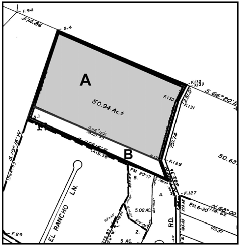
Figure 98-10: RR - Alisos Road
a.
Parcel size. The minimum parcel size for new land divisions in Alisos Road areas A and B shall be 10 acres unless Chapter 22.22 would otherwise require a larger minimum parcel size.
b.
Density limitation. Residential density in Alisos Road area A shall be limited to a maximum of one primary single family residence for each 10 acre parcel.
c.
New land divisions.
(1)
New divisions in Alisos Road area A shall share the existing driveway access.
(2)
An open space easement shall be recorded that covers all prime soils and riparian vegetation prior to recordation of the final parcel or tract map.
C.
Residential Suburban (RS). The following standards apply within the Residential Suburban land use category.
1.
Tract 1256. The following standards apply only to the Residential Suburban category in Tract 1256 south of Arroyo Grande (see Figure 98-10).
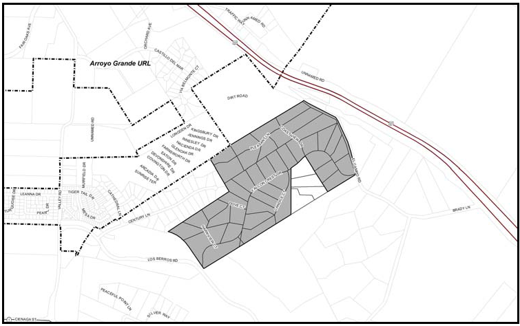
Figure 98-11: Tract 1256
a.
Parcel size. The minimum allowable parcel size for new land divisions is 2.5 acres, unless Chapter 22.22 would otherwise require larger sizes.
[Amended 1986, Ord. 2257; Added 2003, Ord. 3003; Amended 2006, Ord. 3097; 2010, Ord. 3206; 2014, Ord. 3256; 2018, Ord. 3369; 2020, Ord. 3409]
22.98.054 - Arroyo Grande Fringe Standards.
The following standards apply within the area of the Arroyo Grande Fringe (within the San Luis Bay Sub-area and identified in the South County Planning Area maps) to the land use categories or specific areas listed, in addition to the San Luis Bay Sub-area standards. The area standards respect and mitigate special site potentials and constraints, ensure new land divisions compatibility with present and potential adjacent land uses within the context of the area's suburban character and ensure that developments are designed to provide safe vehicular movement.
A.
Residential Rural (RR). The following standards apply within the Residential Rural land use category.
1.
Limitation on use. Land uses identified by Section 22.06.030 as allowable, permitted, or conditional uses in the RR land use category may be authorized in compliance with the land use permit requirements of that Section, except farm equipment and supplies; animal facilities; small-scale manufacturing; correctional institutions; and airfields and landing strips.
2.
New land divisions.
a.
New divisions of parcels fronting Highway 227 shall be designed so that access to homesites is from a local internal street rather than directly to the state highway.
b.
Prior to acceptance of an application for land division as complete, the applicant shall provide information to demonstrate to the satisfaction of the Director, in consultation with, the Director of Environmental Health and the Environmental Coordinator that: (1) adequate groundwater resources are available to serve the proposed land division and (2) each proposed parcel can accommodate an individual sewage disposal system. The results of this information shall be incorporated into the design and proposed density of the land division.
B.
Residential Suburban (RS). The following standards apply within the Residential Suburban land use category.
1.
Limitation on use. Land uses identified by Section 22.06.030 as allowable, permitted, or conditional in the RS land use category may be authorized in compliance with the land use permit requirements of that Section, except nursing and personal care, and correctional institutions.
2.
Animal facilities. Land use permit applications for animal facilities shall address and mitigate any identified impacts of erosion and downstream sedimentation that would be caused by the establishment of the facilities.
3.
New land divisions. Prior to acceptance of any application for land division as complete, the applicant shall provide information to demonstrate to the satisfaction of the Director, in consultation with, the Director of Environmental Health that: (1) adequate groundwater resources are available to serve the proposed land division and (2) each proposed parcel can accommodate an individual sewage disposal system. The results of this information shall be incorporated into the design and proposed density of the land division.
[Amended 1993, Ord. 2646; 2014, Ord. 3256]
22.98.056 - Arroyo Grande Urban Area Standards.
The following standards apply within the City of Arroyo Grande urban reserve line (but outside the city limits) to the land use categories or specific areas listed.
A.
Residential Single-Family (RSF). The following standards apply within the Residential Single-Family land use category.
1.
Annexation required. The areas at the end of Woodland Drive and along Farroll Avenue shall be annexed to the City of Arroyo Grande prior to any development requiring extension of City services.
2.
Development standards. All proposed developments shall comply with applicable on and off-site improvement standards of the City of Arroyo Grande.
B.
Residential Multi-Family (RMF) - Density limitation. Within the Residential Multi-Family land use category, new residential uses shall exceed a maximum density of 26 units per acre.
[Amended 2014, Ord. 3256]
22.98.058 - Pismo Beach Urban Area Standards.
The following standards apply within the city of Pismo Beach urban reserve line (but outside the city limits) to the land use categories or specific areas listed.
A.
Combining Designations - Pismo Beach Hillsides (SRA).
1.
Permit requirement. Conditional Use Permit approval is required for oil and gas production facilities. Each application shall comply with the site development standards in Subsection B.3 before acceptance.
2.
Application content. Provide a visual analysis in the form of topographic maps with lines of sight, cross Sections, photographs and other supporting documentation that demonstrate that the project will comply with the site development standards in Subsection B.3.
3.
Site development standards.
a.
Facilities proposed above the 200-foot elevation, including cut and fill banks, tanks, stacks, and chimneys shall be located so that at least 90 percent of the site is screened by existing topography from view within the City of Pismo Beach and Highway 101. Created topography and vegetation as detailed by plans can be considered to complete the existing screening using native vegetation where possible and conform to naturally occurring topographic trends. Exploration and production facilities shall not be allowed in the unobstructed visible hillside above the 200-foot elevation.
b.
Proposed access roads shall have the minimum feasible cross slopes and visibility, with a maximum road cut of five feet maintained wherever possible in visible areas. Prepare a grading, erosion control and landscaping plan, emphasizing vegetation to screen all visible cut and fill slopes.
c.
Any new application that proposes facilities at any site other than an existing developed location, must demonstrate through a combination of technical and economic analysis not including proprietary information to the industry that new facilities cannot be reasonably incorporated into existing developed locations.
d.
Steam generators and other venting equipment shall incorporate the best available technology to minimize the appearance of a smoke or steam plume.
e.
Steam generators and other equipment that cause smoke or steam, and production facilities for oil resources having high concentrations of sulphur compounds, shall not be emitted within 1,000 feet of a residence and the city limits of Pismo Beach.
B.
Agriculture (AG) - Location criteria. Any development proposed within the Agriculture land use category shall be located on slopes less than 30 percent.
[Amended 1985, Ord. 2215; 2014, Ord. 3256]
22.98.060 - San Luis Obispo Sub-area Standards.
All development and new land uses in the San Luis Obispo Sub-area, as shown on Figure 98-12, shall comply with the following standards where applicable.
A.
Undergrounding - Conditional Use Permit projects. All projects requiring Conditional Use Permit approval shall provide for utilities being placed underground unless the Commission determines either that the proposed development will be of low intensity or in an isolated location; or that supporting overhead utilities will not be visible from public roads; or that overriding operational, economic or site conditions of the project warrant waiver of this requirement.
B.
Planning Impact Areas. The following standards apply to land within the planning impact areas of the cities of San Luis Obispo and Pismo Beach, and the community of Los Osos. The planning impact area for the City of San Luis Obispo includes the entire San Luis Obispo Sub-area of the San Luis Obispo Planning Area and the San Luis Obispo Sub-area of the South County Planning Area as shown on the Official Maps. The planning impact areas for the City of Pismo Beach, and the community of Los Osos are shown in Figure 98-11. Please refer to the areawide standards in Chapter 7 of the Estero Area Plan to see the remainder of the planning impact area for Los Osos.
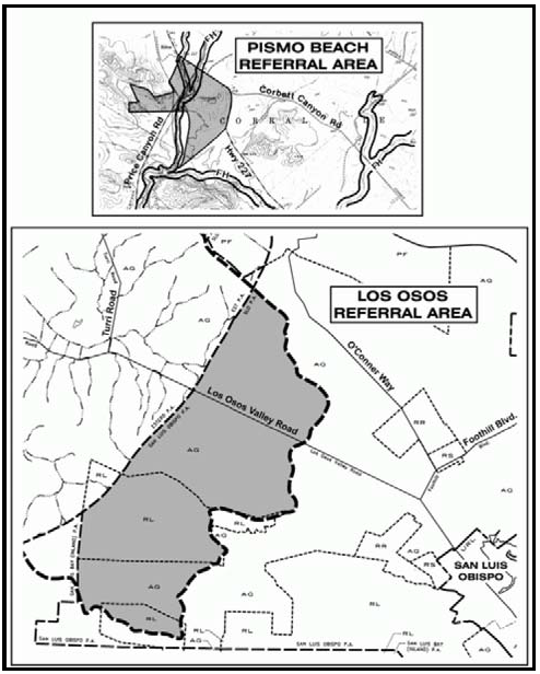
Figure 98-12: Referral areas for Los Osos
and the City of Pismo Beach
1.
Application referral - Cities of San Luis Obispo and Pismo Beach. Applications for discretionary land use permits, land divisions, or General Plan amendments shall be referred by the County to the City of San Luis Obispo and (if in its planning impact area) to the City of Pismo for review and comment. The County shall consider requiring improvements and/or offers of dedication from projects where there is an appropriate and feasible connection between the proposed development and the improvement, subject to the following:
a.
Required improvements and/or dedications may include, but are not limited to, future streets in compliance with a city's General Plan, sewer lateral extensions from project septic systems (or other sewage disposal systems) to facilitate connection to a sewer system after annexation by a city or other public agency that will provide a community sewage disposal system, water system extensions, drainage improvements or other necessary public improvements.
b.
Street improvements and offers of dedication shall be made to either City or County standards, depending upon the scale and location of the proposed development.
2.
Application referral - Los Osos. Applications for discretionary land use permits, land divisions, or general plan amendments within the planning impact area for Los Osos shall be referred by the County to the Los Osos Community Advisory Council or its successor for review and comment.
C.
Open space preservation. The following standards apply to land where important physical, biological, visual or historic resources are identified both on-site and on adjacent properties, to offer incentives and encourage such measures as cluster land divisions that will leave such resources in permanent open space. As mentioned in Chapter 4 of the San Luis Obispo Area Plan, other incentives include agricultural preserves and transfer of development credits.
1.
Cluster land division incentive. Cluster divisions of land may utilize an open space parcel area that is smaller than otherwise required by Chapter 22.22 where an important biological habitat, riparian creek corridor, scenic view or historic place is identified and protected through the application's review process on a case-by-case basis. The size of the open space area may be determined by a biological, visual or other applicable analysis of the area in question. The open space parcel shall be sufficient in size to preserve the resource.
2.
Lot Line Adjustments. In instances where land that is intended for development includes more than one legal lot, the lot lines may be adjusted to concentrate development in suitable areas and leave other areas undeveloped and subject to open space or conservation easements.
D.
Production agricultural areas. New development shall be designed to minimize the loss of existing and potential production agricultural areas by the placement of buildings and new parcels outside the most agriculturally capable areas. For the purposes of this standard, production agricultural areas consist of prime soils (Class I and II irrigated soils according to the U.S. Natural Resource Conservation Service) and other areas capable of agricultural production which primarily consist of Class III and IV soils, but may also include productive areas with Class VI soils.
[Amended 2004, Ord. 3047; 2014, Ord. 3256; 2018, Ord. 3369]
22.98.062 - Land Use Category Standards for the San Luis Obispo Sub-area.
All development and new land uses in the San Luis Obispo Sub-area, as shown in Figure 98-1, shall comply with the following standards, as applicable to each land use category.
A.
Rural Lands (RL) Limitation on use. All land uses identified by Section 22.06.030 as allowable, permitted, or conditional in the Rural Lands land use category may be authorized in compliance with the land use permit requirements of that Section, except residential care, correctional institutions, and uses listed by Table 2-2, Section 22.06.030 in the Industry, Manufacturing and Processing use group.
B.
Residential Rural (RR). The following standards apply within the Residential Rural land use category.
1.
Driveways - New land divisions. New land divisions shall include, where possible, design provisions for combining driveways and private access roads serving proposed parcels wherever terrain and adequate sight distance on the public road allow.
2.
Parcel size. The minimum parcel size for new land divisions size shall be 10 acres unless a larger minimum size would otherwise be required by Chapter 22.22.
3.
Tiffany Ranch Road area. The following standards apply to the Tiffany Ranch Road area as shown in Figure 98-13.
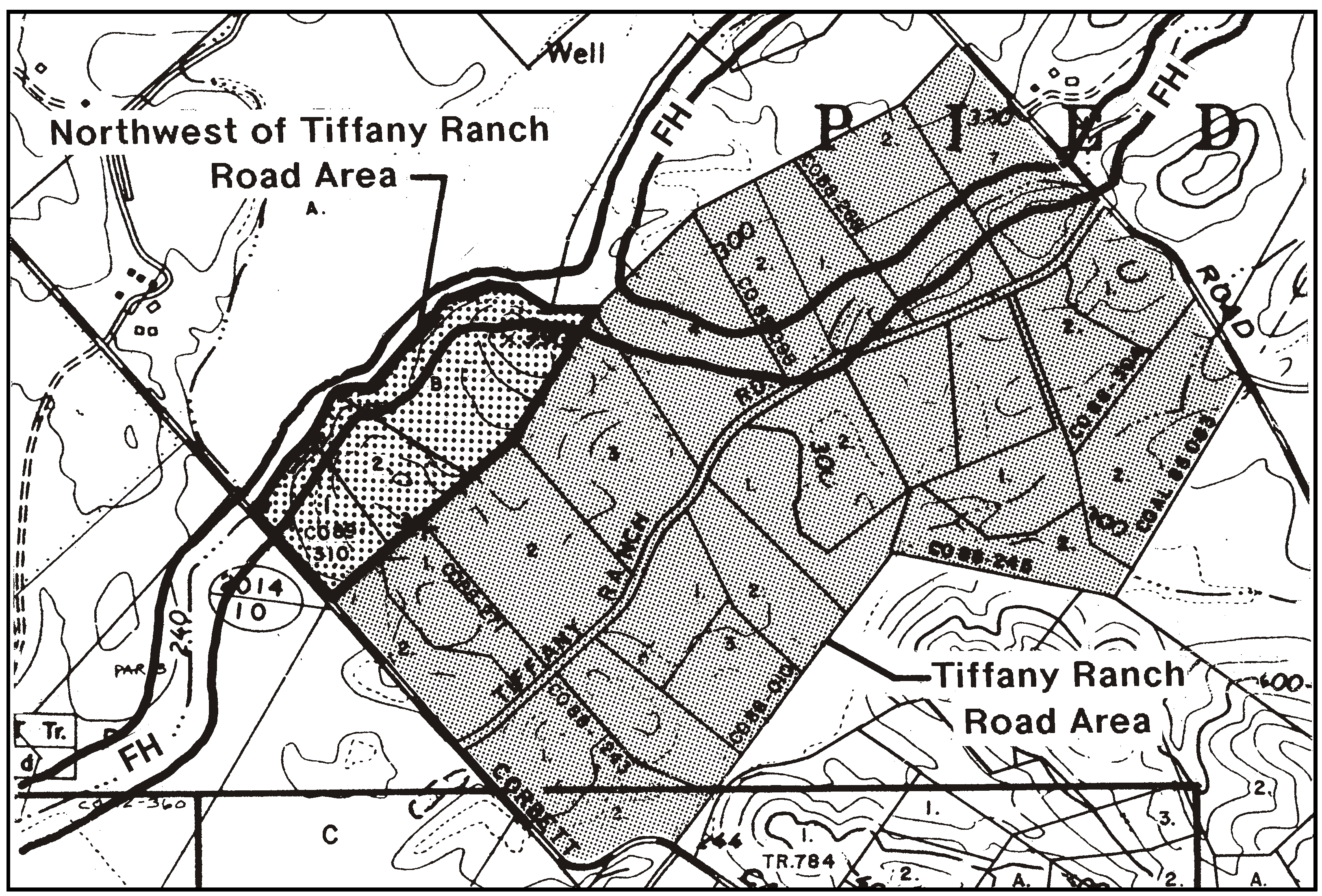
Figure 98-13: Tiffany Ranch Road Area
a.
Residential density. The maximum allowable residential density for parcels less than 20 acres is one primary dwelling, one guesthouse and one caretaker's residence.
b.
Architectural committee. No grading, building or land use permit shall be issued, and no tract or parcel map or lot line adjustment shall be approved or recorded until the applicant has filed with the Department certification that the Tiffany Ranch Association Architectural Committee, as it then exists and functions: 1) has reviewed pertinent plans and specifications; and 2) recommends approval or disapproval of such plans and specifications.
If the Architectural Committee recommends disapproval of the plans and specifications, the certification shall set forth the reasons for such disapproval. The Review Authority shall review the reasons for disapproval of the plans and specifications by the committee.
In the event the committee fails to make its recommendation within 30 days after the plans and specifications have been submitted to it, no recommendations will be required and the proposed plans and specifications shall be deemed to be favorably recommended. The Review Authority is not bound by any decision of the committee, and may grant permits and approvals under these provisions.
c.
Limitation on use. Land uses shall be limited to the following, in compliance with the land use permit requirements of Section 22.06.030: agricultural accessory structures; animal keeping; cannabis cultivation; cannabis dispensaries, cannabis nurseries; cannabis transport facilities; crop production and grazing; animal facilities (horse ranches and other equestrian facilities only); energy-generating facilities (limited to renewable energy facilities); caretaker residences; home occupations; mobile homes; residential accessory uses; single-family dwellings; storage, accessory; and public utility facilities. Notwithstanding the provisions of this standard, it is the applicant's responsibility to ensure that any proposed land uses comply with the Tiffany Ranch covenants, conditions and restrictions (CC&Rs).
4.
Northwest of Tiffany Ranch Road area. The following standards apply only to the area located northwest of the Tiffany Ranch Road area, as shown in Figure 98-13.
a.
Limitation on use. Land uses shall be limited to those specified for the Tiffany Ranch Road area in Subsection B.3.c.
b.
Residential density. The maximum allowable residential density for each parcel less than 20 acres in size is one primary dwelling, one guesthouse and one caretaker's residence.
c.
Agricultural buffer. New dwelling units shall be set back to provide a buffer from lands in the Agriculture land use category to the north, northeast, northwest, and southwest as shown in Figure 98-14.
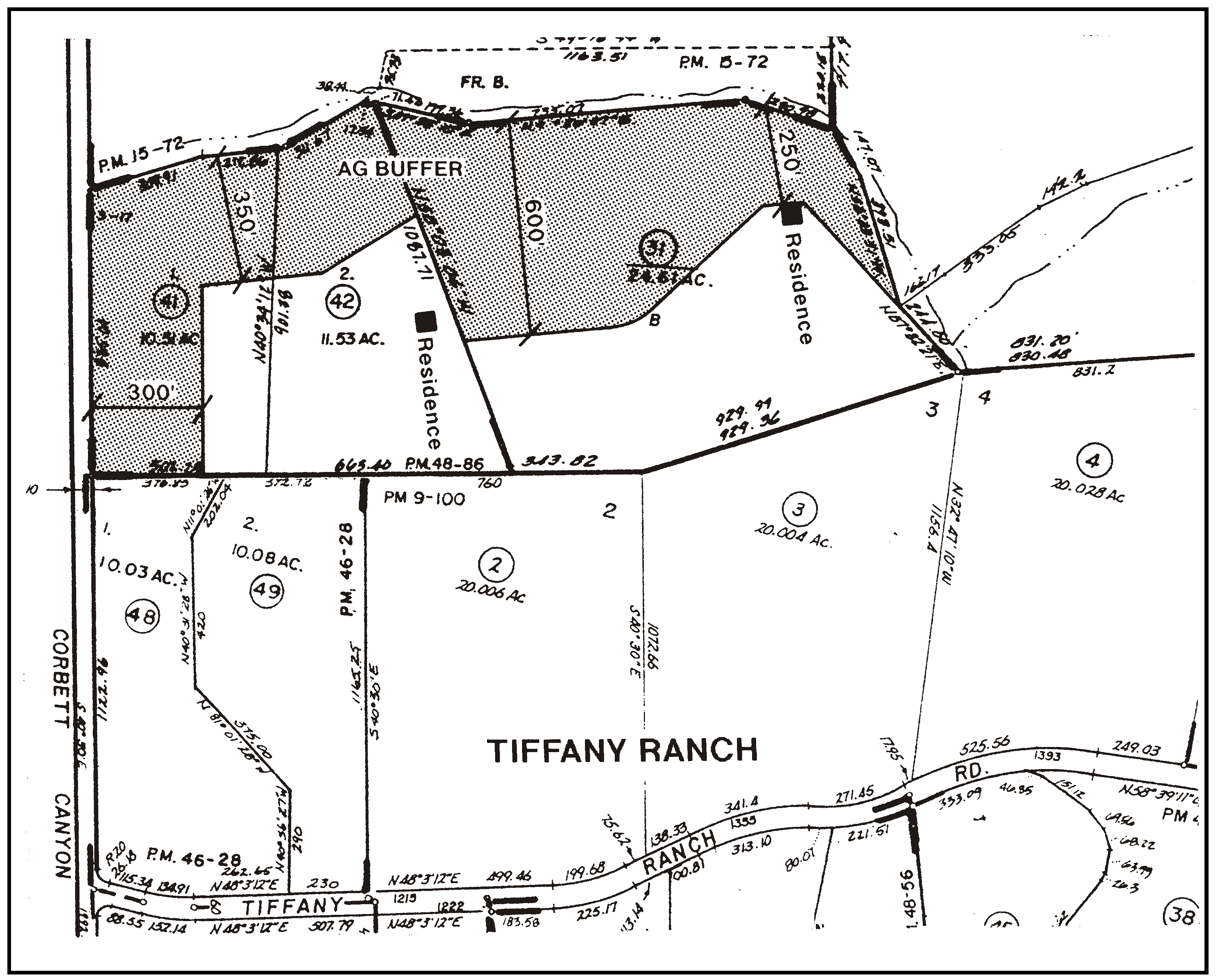
Figure 98-14: Agricultural Buffer Northwest of Tiffany Ranch Road Area
[Amended 2007, Ord. 3121; 2014, Ord. 3256; 2015, Ord. 3291; 2017, Ord. 3358; 2018, Ord. 3369; 2018, Ord. 3377]
22.98.070 - South County Sub-area Standards.
All development and new land uses in the South County Sub-area, as shown on Figure 98-1, shall comply with the following standards where applicable.
A.
General sub-areawide standards. The following standards apply to land both in the rural and community areas, in the land use categories and specific areas listed.
1.
Compliance with a Countywide Design Plan. After adoption of a countywide design plan, all proposed new developments, remodeling projects and subdivisions are to be in conformance with that plan.
2.
Groundwater recharge areas. New development shall be located to preserve existing natural drainage areas and aquifer recharge areas and shall incorporate natural drainage systems in new developments to aid in groundwater recharge.
B.
Edge of the Nipomo Mesa. The following standards apply to all land located on the edge of the Nipomo Mesa, including the area along Nipomo Creek. The edge of the Nipomo Mesa is defined as the point of change in topography where slope exceeds 15 percent descending directly from the Mesa to the Santa Maria, Cienega, Los Berros and Nipomo Valleys, shown in Figure 98-15. Moderate erosion impacts potentially occur on disturbed slopes of Oceano dune sand (which typifies the Nipomo Mesa) that are steeper than 15 percent.
1.
Drainage plan requirement. Land use permit and land division applications shall include a drainage plan in compliance with Chapter 22.52. The plan shall identify the point of change to 15 percent slope, in addition to other required drainage plan contents. The drainage plan requirement may be waived through an adjustment approved in compliance with Section 22.70.030, where a development will be located a sufficient distance from the bluff edge to be of no concern.
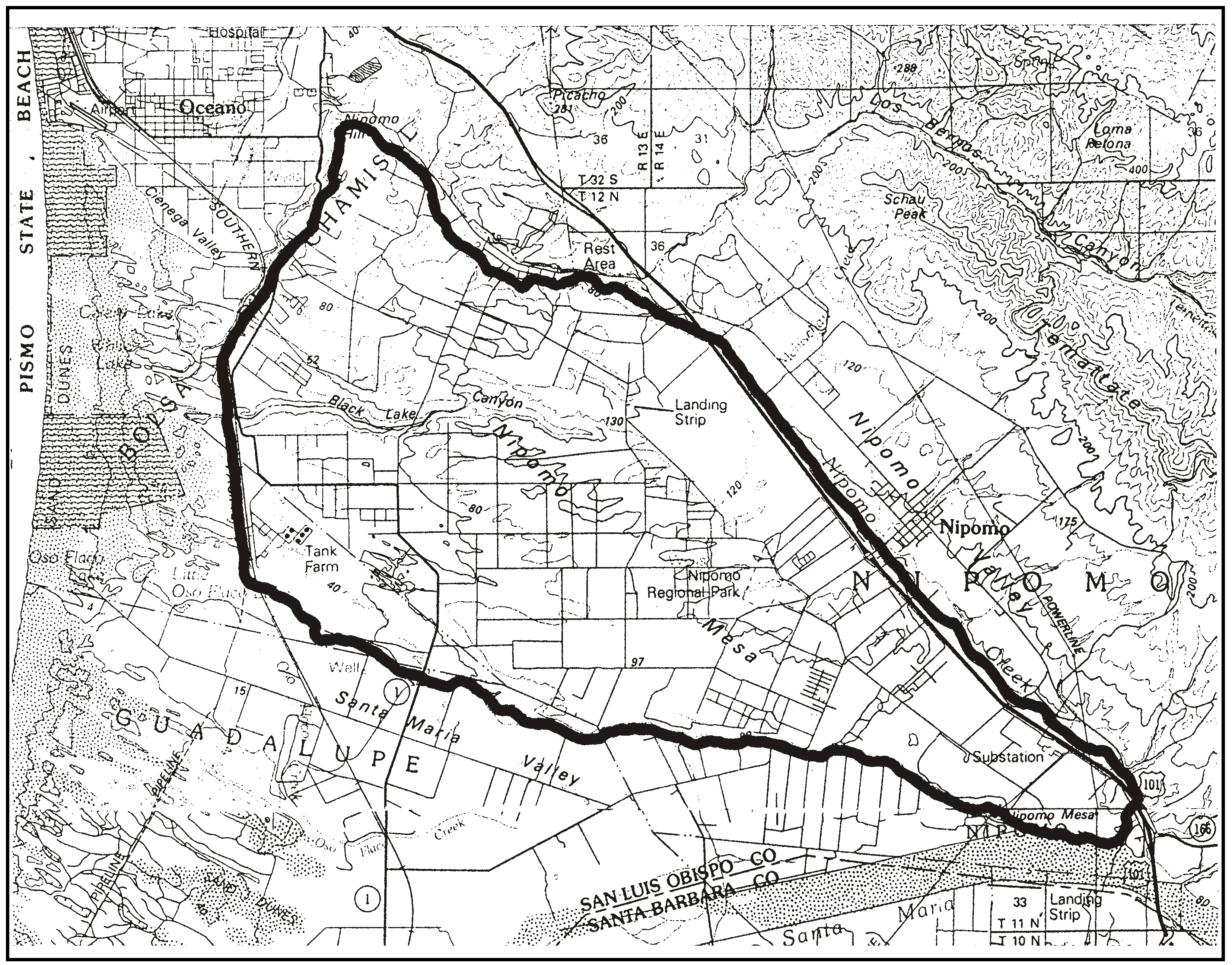
Figure 98-15: Edge of Nipomo Mesa
2.
Standards for projects requiring Zoning Clearance or Site Plan Review. Projects requiring Zoning Clearance or Site Plan Review shall be designed in compliance with the following standards, as illustrated in Figure 98-15. Projects that are unable to meet these requirements may be considered through Minor Use Permit review, with the applicant paying the difference in fees.
a.
Grading limitation. Locate all grading, such as for building pads or access roads, away from slopes steeper than 15 percent on the bluff edge of the Nipomo Mesa to avoid erosion and visual impacts associated with grading, except for transmission lines and pipelines.
b.
Setbacks. All new structures shall be set back at least 50 feet from the top edge and the toe of the slope bank to prevent slope failure. Structures are not permitted on the slope of the bluff face, except for transmission lines and pipelines.
c.
Drainage control. Runoff created by new development shall be conveyed away from the bluff toward the interior of the Mesa. On-site or off-site retention/recharge basins shall be utilized for storage and infiltration of all runoff.
d.
Septic system locations. If a subsurface disposal system shall be located within 150 feet of the edge of the steeper bluff slopes (30 percent or greater), the system shall be designed to meet the Central Coast Basin Plan requirements for site suitability and the prevention of "daylighting" of effluent. This system must be approved by the Building Official prior to installation.
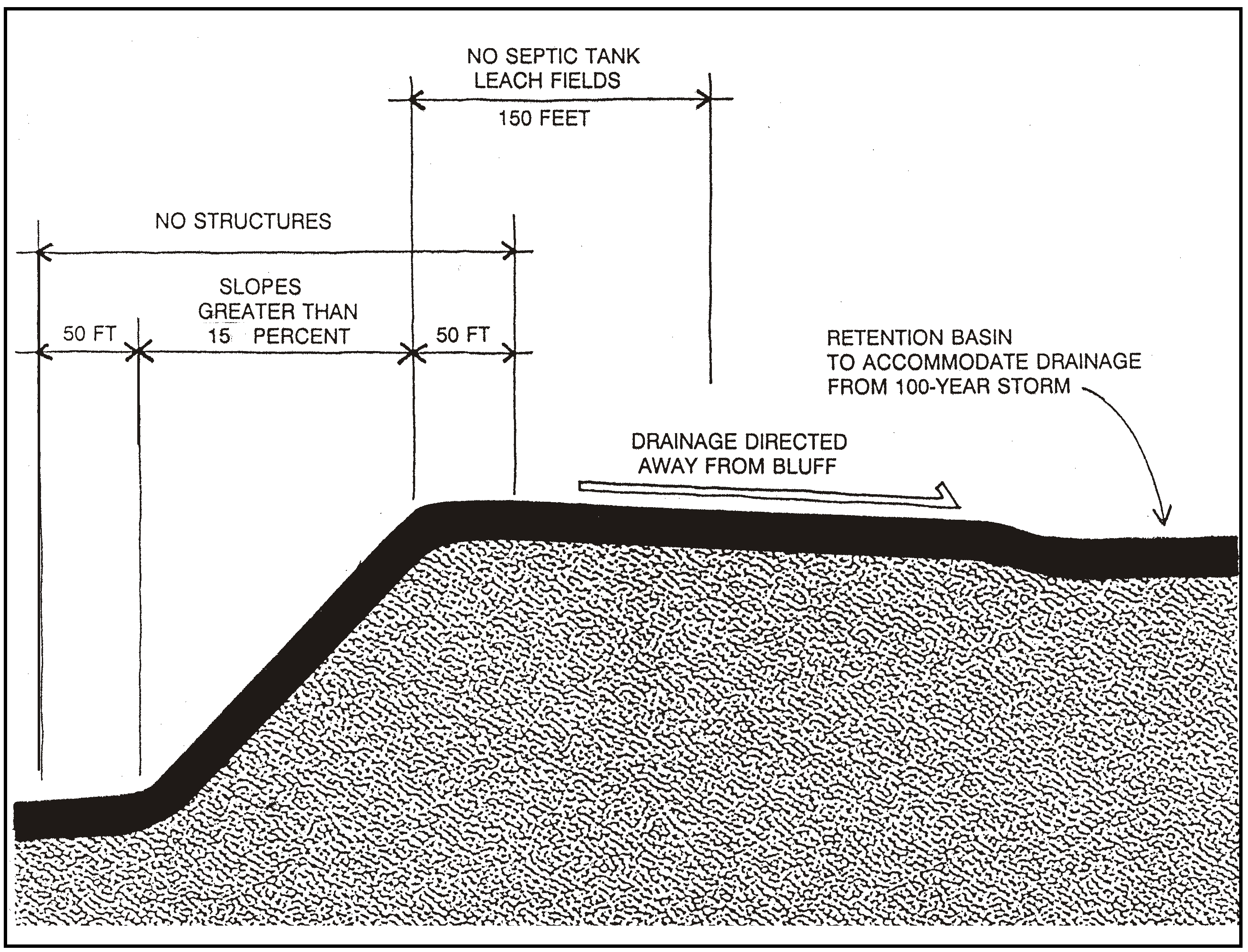
Figure 98-16: Development Concepts - Edge of Nipomo Mesa
3.
Standards for projects requiring Minor Use or Conditional Use Permit and land division approval. Minor Use Permit, Conditional Use Permit and new land division applications shall include proposals to address drainage requirements, erosion concerns and septic effluent issues. In addition, the proposal shall address visual, historical and environmental mitigation.
C.
Circulation planning.
1.
Public right-of-way dedications. Applications for land divisions or Conditional Use Permits shall provide an offer of dedication for public streets, bikeways and pathways where necessary to mitigate the impacts of the project and to implement the Circulation Element and the parks and Recreation Element.
2.
Pathways in new land divisions. Land division applications that propose public pathways that are adjacent to the road may utilize the gross acreage to calculate the allowable number of parcels, instead of the net acreage as otherwise required by this Title.
3.
Traffic noise mitigation. Noise-sensitive land uses that are proposed near collector, arterial streets and highways shall be reviewed for potential noise impacts and mitigated, if needed, in compliance with the Noise Element. Where feasible, possible mitigation measures shall be prioritized in the following order:
a.
Setbacks/open space separation;
b.
Site layout, orientation and shielding of noise sensitive uses with non-noise sensitive uses;
c.
Construction of earthen berms;
d.
Structural measures: acoustical treatment of buildings, walls.
D.
Open space preservation - Cluster division incentive. This standard applies to land where important physical, biological or historic resources are identified both on-site and on adjacent properties, to encourage cluster land divisions that will leave the resources in open space areas. Clustered land divisions may utilize an open space parcel area that is smaller than otherwise required by Chapter 22.22 where an important biological habitat, such as an oak woodland or the Nipomo Creek corridor, or land near an historic site such as the Dana Adobe, is identified through the application's review process. The size of the open space area may be determined by a visual, biological or other applicable analysis of the area in question. The analysis shall identify the area that is necessary to maintain open space to preserve the features of the applicable resource.
Guideline: Retain land in open space in new land divisions that will preserve oak woodlands, riparian and other important biological habitats, and historic place surroundings.
E.
Arroyo Grande Planning Impact Area. The following standards apply to land shown within the planning impact area of the City of Arroyo Grande, as shown in Figure 98-17, that has been identified as an area of critical concern.
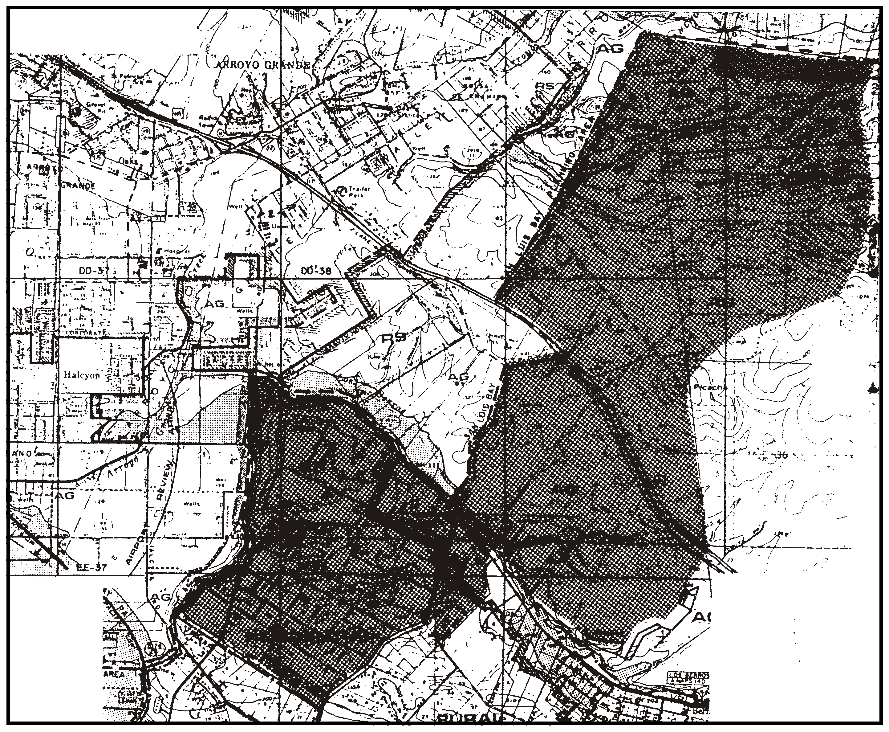
Figure 98-17: Arroyo Grande Planning Impact Area
1.
Application referral. Discretionary permits, land divisions and General Plan amendment applications shall be referred to the City of Arroyo Grande for review and comment.
2.
Development impacts. Discretionary projects with potential impacts, including cumulative ones, that are associated with impacts to water quantity and quality, drainage, erosion and downstream sedimentation, traffic and circulation shall be addressed as critical subjects for additional review as part of the environmental review process.
3.
Application content - New land divisions. Applications for new land divisions shall comply with the applicable submittal requirements and development standards in the Real Property Division Ordinance (Title 21 of the County Code) with respect to water supply, drainage and grading, sewage disposal, road connections to city roads, and efficient neighborhood and areawide circulation
F.
Nipomo Mesa Water Conservation Area. The following standards apply to all land in the Nipomo Mesa Water Conservation Area shown in Figure 98-18.
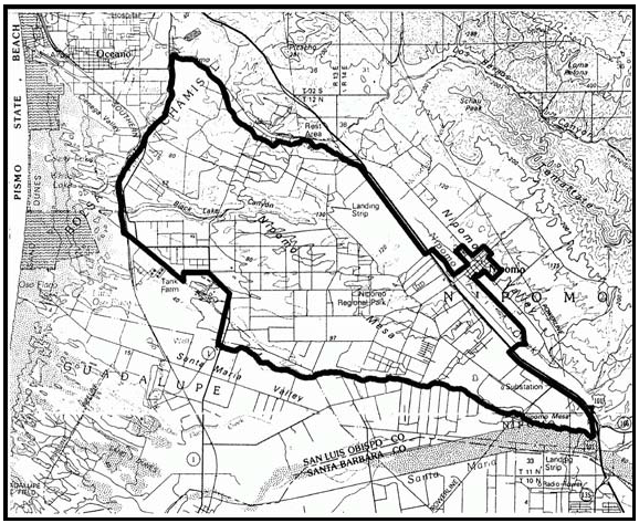
Figure 98-18: Nipomo Mesa Water Conservation Area
1.
General Plan Amendments and land divisions. Applications for general plan amendments and land divisions in the Nipomo Mesa Water Conservation Area shall include documentation regarding estimated existing and proposed non-agricultural water demand for the land division or development that could occur with the General Plan Amendment. If this documentation indicates that the proposed non-agricultural water demand exceeds the demand without the requested amendment or land division, the application shall include provisions for supplemental water as follows:
a.
General Plan Amendments. Where the estimated non-agricultural water demand resulting from the amendment would exceed the existing nonagricultural demand, the application shall not be approved unless supplemental water to off-set the proposed development's estimated increase in nonagricultural demand has been specifically allocated for the exclusive use of the development resulting from the general plan amendment, and is available for delivery to the Nipomo Mesa Water Conservation Area.
b.
Land Divisions. Where the estimated non-agricultural water demand resulting from the land division would exceed the existing non-agricultural demand, a supplemental water development fee shall be paid for each dwelling unit or dwelling unit equivalent, at the time of building permit issuance, in the amount then currently imposed by county ordinance, not to exceed $13,200. If the development resulting from the land division is subject to payment of supplemental water development fees to an entity other than San Luis Obispo County, the amount of these other fees shall be deducted from the County fee.
2.
Landscape standards. The standards in Chapter 22.16 apply to the following projects within the Nipomo Mesa Water Conservation Area (NMWCA). Only exceptions, as set forth in Subsection 22.16.020.B.2, 4, 6, and 7, are allowed within this area:
a.
Public projects. Development projects completed by a public agency that require a land use permit.
b.
Other projects. All development projects not included in subsection 2a in and outside of urban and village reserve lines.
c.
Irrigation Systems. Irrigation systems shall include the following components:
(1)
Smart controllers. Irrigation controllers that are climatologically controlled without human intervention, that adjust irrigation based on the amount of moisture lost from soil and plant material since the previous irrigation by utilizing climate data (evapotranspiration rates) broadcast to the controller from the California Irrigation Management Information System and other sources, and that have been tested and certified 100% for irrigation adequacy and schedule shall be installed and maintained on all irrigated and landscaped areas.
(2)
Drip Irrigation. Drip irrigation systems shall be utilized for all landscape plant material with the exception of turf.
(3)
A separate meter for outdoor water; and
(4)
An operating manual to instruct the building occupant how to use and maintain the water conservation hardware.
d.
Turf area limits.
(1)
Multi Family dwellings: The site's total irrigated landscape area shall be limited to 300 square feet per unit.
(2)
All other projects: The maximum amount of turf (lawn) area shall not exceed twenty percent of the site's total irrigated landscape area. In all cases, the site's total irrigated landscape area shall be limited to 1,500 square feet. The review authority may approve exceptions to this requirement in order to allow the minimum amount of irrigated landscaped or turf area needed for schools, parks and other uses that typically require larger irrigated landscape areas when the applicant can demonstrate the need for the additional irrigated landscaped area based on the characteristics of the use and the site.
3.
Building Permits. Building permits issued for construction in the Nipomo Mesa Water Conservation Area shall comply with Section 19.07.042.
G.
Circulation. The following standards apply to the circulation features proposed in applications for all discretionary land use permits including land divisions.
1.
Areawide circulation linkages. All land division and Conditional Use Permit applications shall be integrated into areawide circulation and utility easements, providing for future extensions into adjacent undeveloped properties wherever feasible or where known areawide rights-of-way are planned.
2.
Driveways - New land divisions. New land divisions shall include, where possible, design provisions for combining driveways and private access roads serving proposed parcels from collector or arterial roads wherever terrain and adequate sight distance on the public road allow.
3.
Equestrian, pedestrian and bike paths - Conditional Use Permits and New Land Divisions. Safe and site-sensitive equestrian, pedestrian and bicycle circulation facilities shall be provided in projects subject to Conditional Use Permits and new land divisions where feasible either within the street right-of-way or in separated locations as illustrated in Figure 98-18 subject to the County Parks and Recreation Element. Unless determined to be infeasible or to result in significant effects on the environment, density may be calculated in such new land divisions on the basis of gross site acreage when such facilities are provided, instead of net site acreage as otherwise required by this Title.
4.
Road Design and Construction - New Land Divisions. Road alignments proposed in new land division applications shall be designed and constructed to minimize terrain disturbance consistent with safety and construction cost. Altered slopes shall be replanted with indigenous plants or protected by other appropriate erosion control measures.
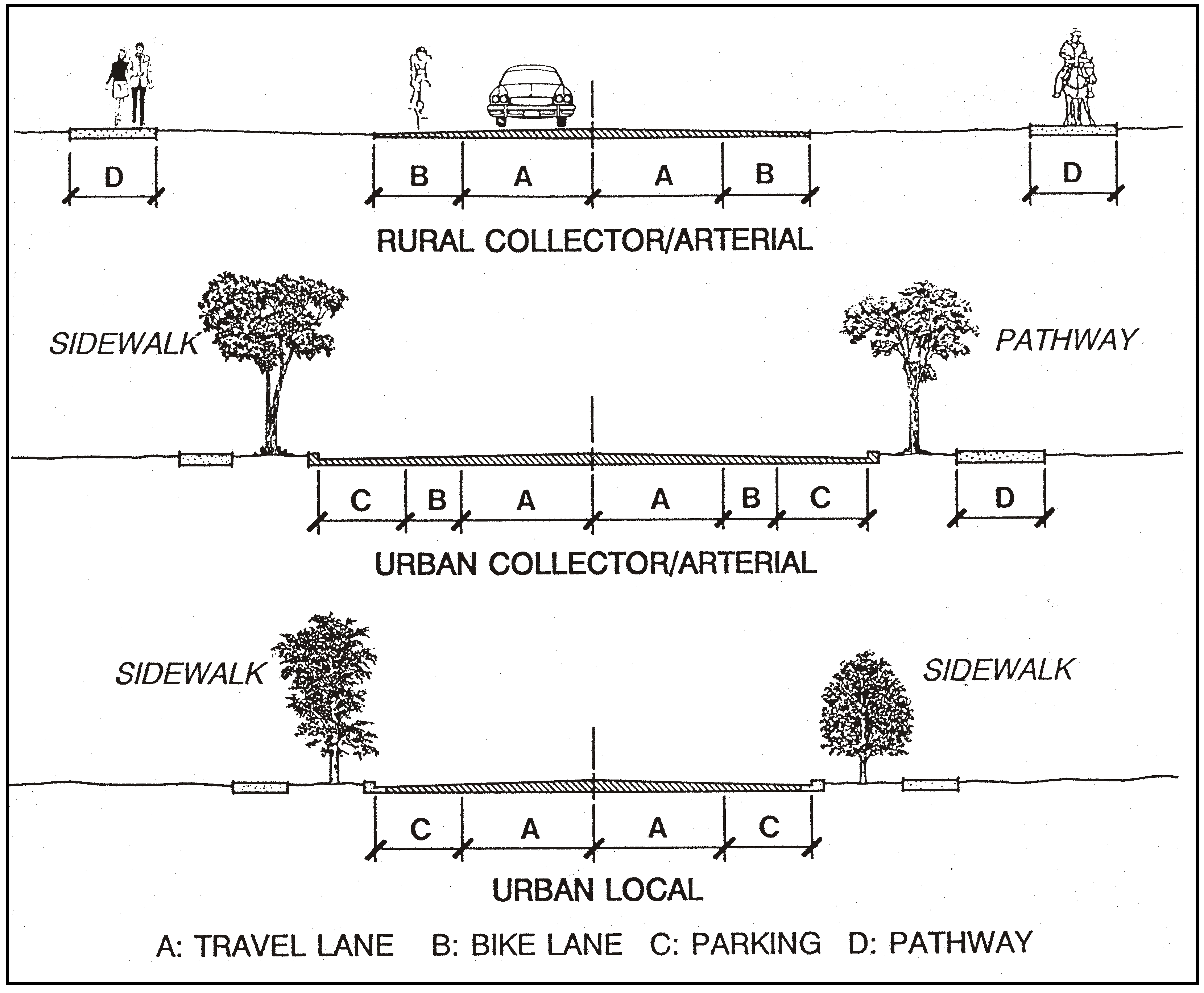
Figure 98-19: Selected Street Improvements
H.
Drainage. The following standards apply to all projects requiring discretionary land use permits including land divisions.
1.
Potential flooding within undrained depressions - New land divisions. New land divisions located in the vicinity of undrained depressions shall designate building sites above the spill elevation of the depression; or, utilize the cluster division provisions of this Title to locate new parcels and building sites out of areas subject to flooding. (See Figure 98-20.) Where the enclosed depression is large and the above mechanisms are not feasible, prepare a detailed flood analysis for review and approval by the County Public Works Department to delineate the extent of the flood hazard and identify the areas for suitable building sites.
2.
Runoff toward the Nipomo Mesa edge. Developments in areas that are found to potentially drain to the edge of the bluff shall be designed so that runoff will be contained by natural-appearing retention/recharge basins capable of accommodating a 100-year storm. The design of such basins may require percolation testing to establish rates of infiltration.
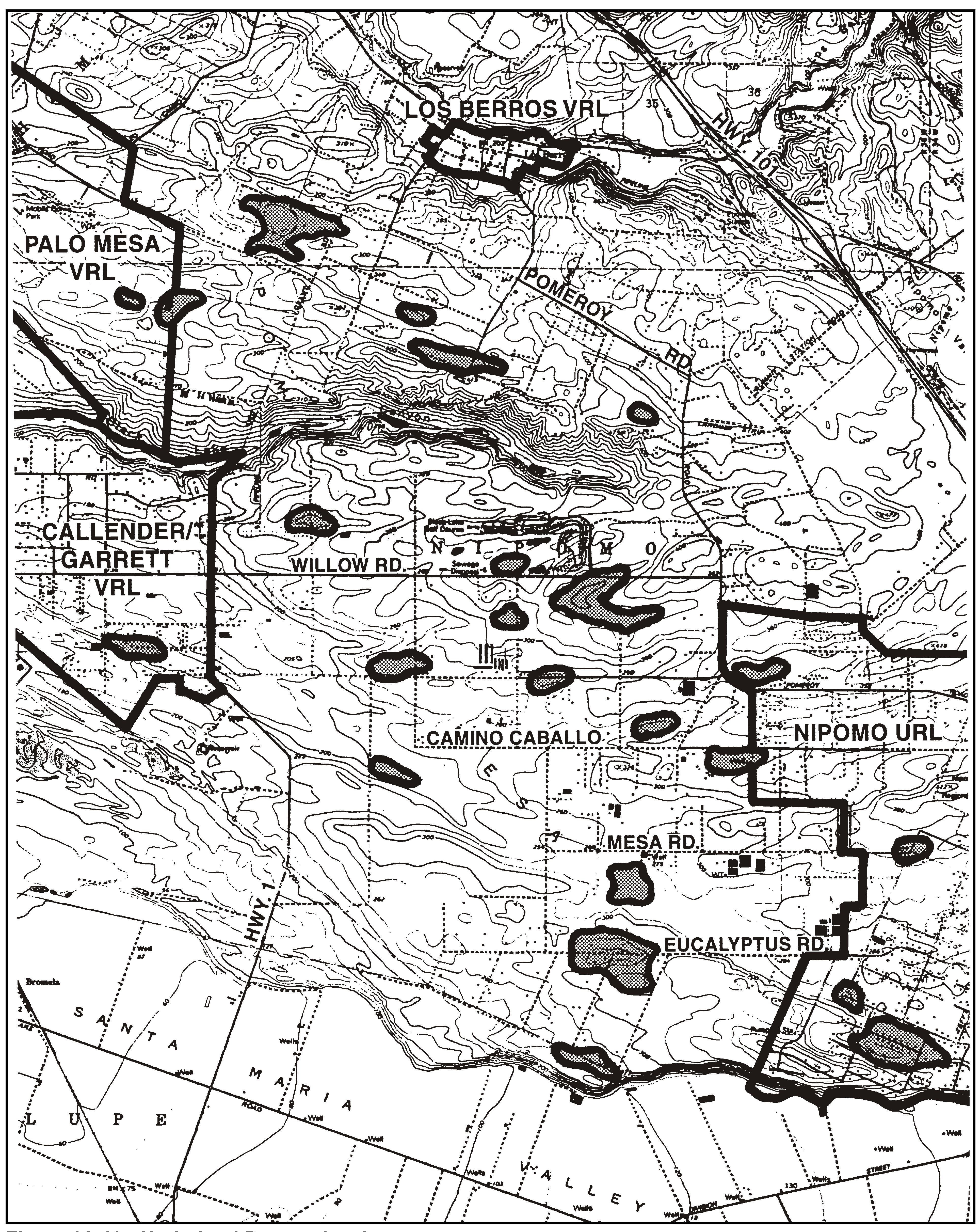
Figure 98-20: Undrained Depression Areas
I.
Rural village. The following standards apply to properties shown in Figure 98-21 for development of a prototype rural village. The village should be a concentration of development within a rural setting, offering a choice of housing types, basic services, community facilities and daily needs shopping. It may also offer specialized jobs appropriate to its character.
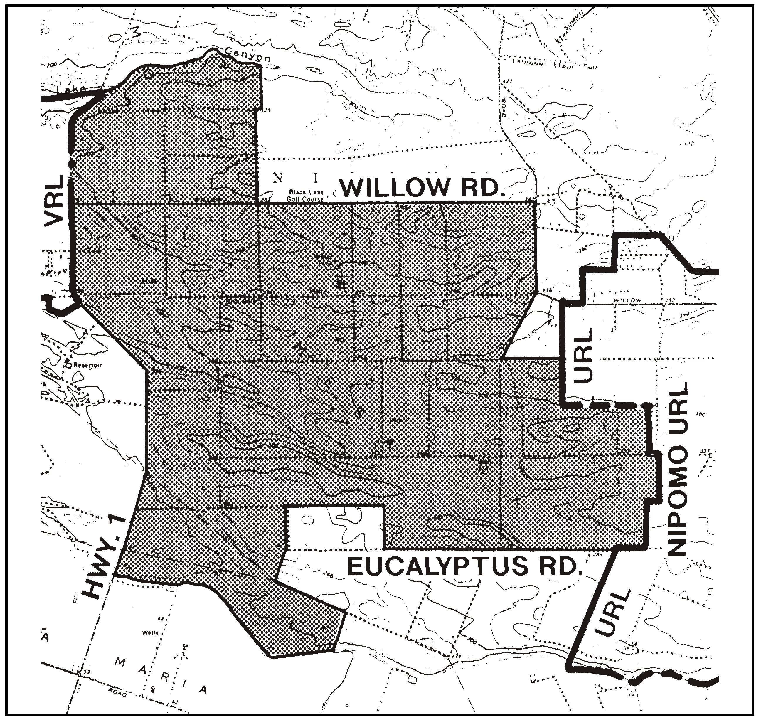
Figure 98-21: Area in Which a Prototype Rural Village May Be Proposed
1.
Mix of land uses. The village shall contain a mix of land uses that may include a sheltered postal center, community hall, large central park and other smaller recreation areas and facilities. A variety of residential housing types shall be provided, including affordable housing opportunities for the incomes of people who work within the South County planning area. Higher residential densities shall be located toward the village center where they should be mixed with nonresidential uses.
2.
Site planning. The village shall have a compact arrangement of residential densities within a street and pedestrian path system that orients travel to a central core area and specific peripheral uses, as shown in Figure 98-22. Permanent open space should be utilized for agriculture, community recreation, circulation and as a buffer between other surrounding properties.
Figure 98-22: Rural Village Concept
a.
Core area. The village should have a central core area located close to a collector or arterial street laid out to form an entrance and destination. A park or plaza should be located within the core area. Civic uses should be adjacent to the park or plaza, such as a self-serve post office, recreation and meeting building, workshops and offices. The core area should be attractive for gathering, meeting and lounging.
b.
Circulation. A system of connected streets shall provide alternative routes of travel from any one location. Use of slightly curving streets to create a changing perspective for visual interest is encouraged. Local streets should be narrower than standard County streets, if possible, to enhance the rural character of the village. The number of street connections to off-site arterial and collector roads shall be minimized. Streets shall be designed in blocks to maximize access by all modes of travel - automobile, bicycle and walking. Locate any transit stops within easy walking distance of all residents.
c.
Residential areas. Residential densities shall be higher adjacent to the core area and lowest at the periphery of the village. Residential design should be oriented to the street for pedestrian security.
d.
Non-residential uses. Non-residential uses should be developed at a scale that is appropriate to the village size and location. Civic structures should be provided in the core area, such as for postal services, recreation, meetings, eating, workshops and office work. Commercial structures shall be provided as determined to be feasible in the core area for grocery stores, restaurants, personal services, offices, small-scale manufacturing, general retail, social gatherings, and offices. Agriculture should be maintained and enhanced where feasible, and water conserving irrigation methods should be encouraged. Recreational uses and structures should be developed for residents and visitors, such as golf courses, equestrian facilities, linear parkways, parks, playgrounds and other open space uses.
3.
Open space. Clustering of residential densities shall be accompanied with at least 60 percent of the parent site in private and/or dedicated public open space. A minimum 200-foot-wide open space buffer shall be provided adjacent to all arterial and collector perimeter roads and be landscaped to shield the improved village area. Golf course fairways, equestrian trails are potential open space uses. A community focal point such as a central park or plaza shall be provided. Smaller improved parks should be incorporated into neighborhoods. A network of continuous pedestrian, equestrian and bicycle paths should connect neighborhoods and centralized destinations.
4.
Specific Plan requirement. A Specific Plan shall be prepared in compliance with Government Code Section 65450 under the guidance of the County upon the application and funding by property owner(s). The Specific Plan shall address both on and off-site issues concerning environmental constraints, site planning and development, financing of improvements and evaluation of the potential for a transfer of development credit (TDC) program.
5.
Scale and Intensity. The Specific Plan shall determine the scale and intensity of residential and non-residential development that will be compatible with resources, public services, roads and facilities, and other destinations such as employment centers in the South County planning area. The evaluation of project size shall utilize an environmental constraints analysis as well as market feasibility and fiscal impact studies. The following subsections I.6 through I.11 provide primary factors for evaluating the appropriate size and density of a village.
6.
Constraints analysis. A constraints analysis shall be prepared to address, but not be limited to, project market feasibility analysis, fiscal impact analysis and analysis of biological resources, cultural resources, agricultural resources, water supply and groundwater recharge, traffic, air quality and noise.
a.
Feasibility analysis. An economic feasibility analysis shall be the basis of the whole project and should identify incentives that can be offered to business operators to help ensure their success. A feasibility analysis shall be the basis of the whole project, and for private commercial, office and service uses to meet the basic services and daily shopping needs of the village residents. It should identify incentives that can be offered to business operators to help ensure their success.
b.
Fiscal impact analysis. An economic feasibility analysis shall be the basis of the whole project, and it should identify incentives that can be offered to business operators to help ensure their success in providing private commercial, office and service uses that will contribute to the basic daily service and shopping needs of the village residents.
c.
Open space provisions. Designation of open space areas should be utilized to minimize impacts to and from affected commercial agricultural operations, important biologic resources and important historical and archaeological resources.
d.
Water resources. To minimize water consumption, drought-tolerant low water-using plants are required for landscaping purposes. To improve groundwater recharge from surface runoff, fewer and larger drainage basins shall be provided.
e.
Traffic and air quality. Alternative development designs should be prepared that will minimize impacts to traffic circulation and air quality, including but not limited to the orientation and access of the village to any adjacent or nearby village or urban area, and minimal impacts on smaller rural roads and optimal use of larger roads.
7.
Size. Depending on the size of the parent parcel(s), the developed village site should be a compact village with a boundary no more than one-half mile long on any side in order to achieve a sufficient central density for interaction and convenient pedestrian access.
8.
Transfer of development credits (TDC). Additional development entitlements may be achieved through a transfer of development credits from other locations in the planning area through a County-approved TDC program, as one method to achieve additional density.
9.
Number of allowable residential units. The allowable number of units shall be determined by the size of the parent parcel, the resource, market and fiscal constraints on development identified in the Specific Plan, and the extent of public facilities provided by the developer.
a.
Base number of units. A base number of dwelling units shall be established at one unit per five acres.
b.
Additional dwelling units. Additional dwelling units may be proposed beyond the base number up to a density of one unit per acre, depending on the evaluation in the Specific Plan regarding the following incentive bonuses, including:
(1)
An initial incentive for participating;
(2)
Transfer of development credits (TDC) from other land identified in a South County TDC program;
(3)
Proposals for providing for a community-serving need, such as a community school, park or recreational facility, major public works improvements, or environmental enhancements that exceed the minimum mitigation measures that are required.
10.
Residential densities. Densities within the village should occur within a range from two to 20 units per acre. The average density within the village site should be at least five dwelling units per acre, which is intended to achieve a predominant single-family character. Suburban densities at two units per acre should be balanced by multi-family densities to maintain this average.
11.
Collector or arterial street access. The village site should be located so that residents will be within walking distance (one-quarter to one-half mile) of a collector or arterial road, shown on the Circulation map.
[Amended 1997, Ord. 2800; Added 2006, Ord. 3090; Amended 2006, Ord. 3104; 2008, Ord. 3161; 2014, Ord. 3256; 2018, Ord. 3369; 2020, Ord. 3409]
22.98.072 - Land Use Category Standards for the South County Sub-area.
All development and new land uses in the South County Sub-area, as shown in Figure 98-1, shall comply with the following standards, as applicable to each land use category.
A.
Agriculture (AG). The following standards apply within the Agriculture land use category.
1.
Nipomo and Santa Maria (Oso Flaco) Valleys. The following standard applies within the Nipomo and Santa Maria valleys (see Figure 98-23).
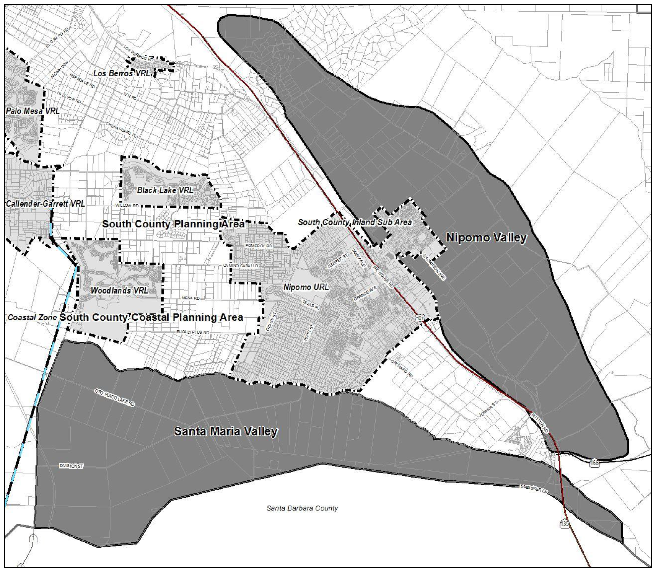
Figure 98-23: Nipomo and Santa Maria Valleys
a.
Limitation on use. Land uses are limited to the following within Agriculture land use category in the Nipomo and Santa Maria (Oso Flaco) Valleys, subject to the land use permit requirements of Section 22.06.030:
Ag processing
Agricultural accessory structures
Agricultural worker housing
Animal keeping
Cannabis cultivation
Cannabis nurseries
Cannabis manufacturing
Cannabis processing facilities
Cannabis dispensaries
Cannabis transport facilities
Communications facilities
Crop production and grazing
Energy-generating facilities (limited to accessory renewable energy facilities)
Home occupations
Mining and concrete batch plants (within the area along the Santa Maria River shown in Figure 98-23 which corresponds to the MRA or subsequently designated EX combining designation)
Mobile homes
Nursery specialties (Conditional Use Permit required)
Outdoor retail sales
Pipelines and power transmission lines
Residential accessory uses
Roadside stands
Single-family dwellings
Temporary dwellings
b.
Concrete batch plant permit requirements. Minor Use Permit approval is required for concrete batch plants in the Agriculture land use category within the area shown in Figure 98-22. Visibility of the batch plant shall be minimized if necessary by siting, minimal structural height, and landscape screening of the structures and yard area, including tall-growing trees. Potential traffic conflicts and land use compatibility shall also be addressed.
2.
Los Berros Road property - Subdivision and residential development limitation. Further subdivision of the property between Los Berros Road and Highway 101 (see Figure 98-24 for residential purposes is limited to a division of the property from a larger parcel. Residential development is limited to one primary residence and agricultural worker housing. Residential entitlements, and subdivision entitlements for additional parcels, have been transferred to another portion of the property that is in the Recreation category.
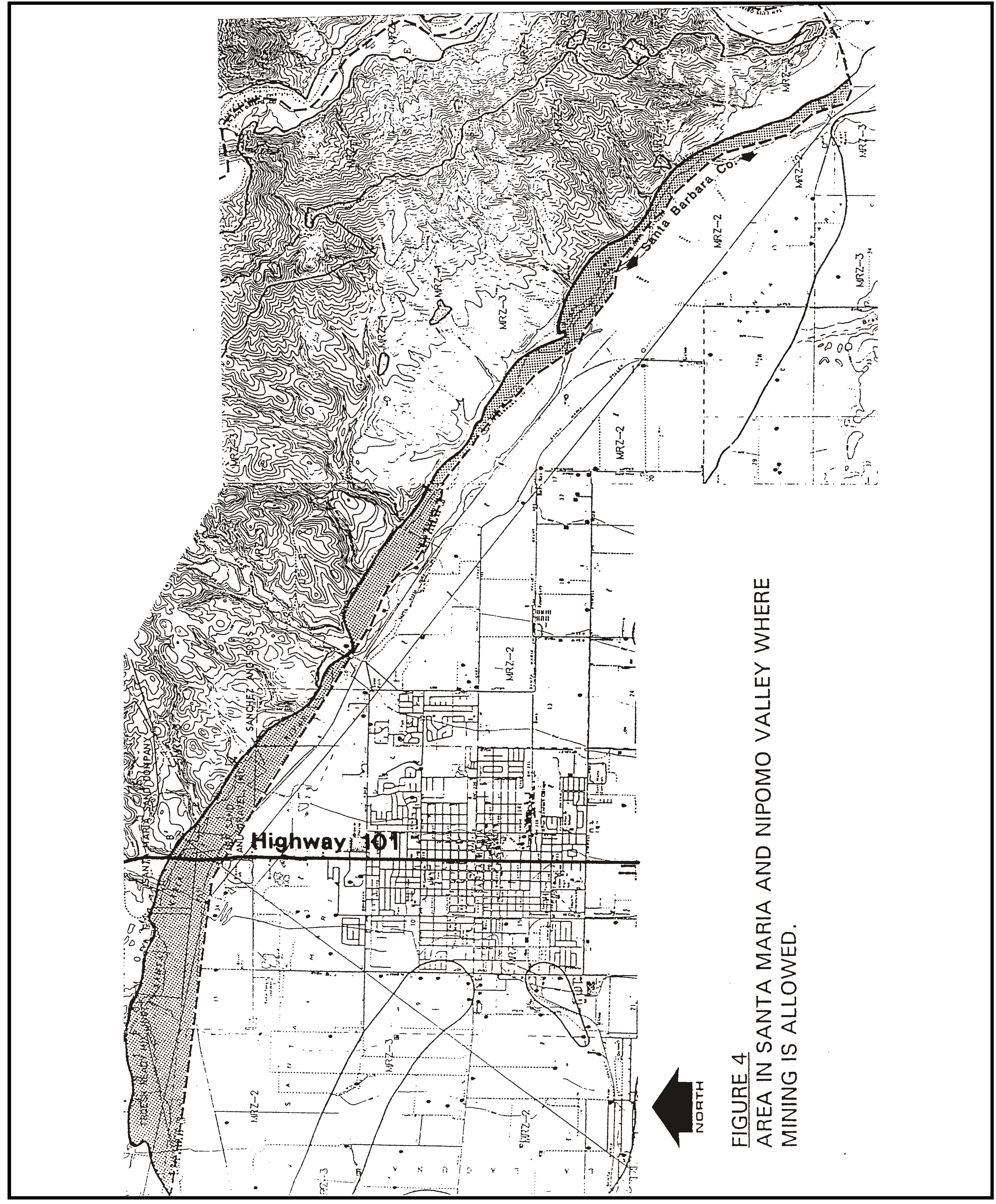
Figure 98-24: Area in Santa Maria and Nipomo Valleys Where Mining is Allowed
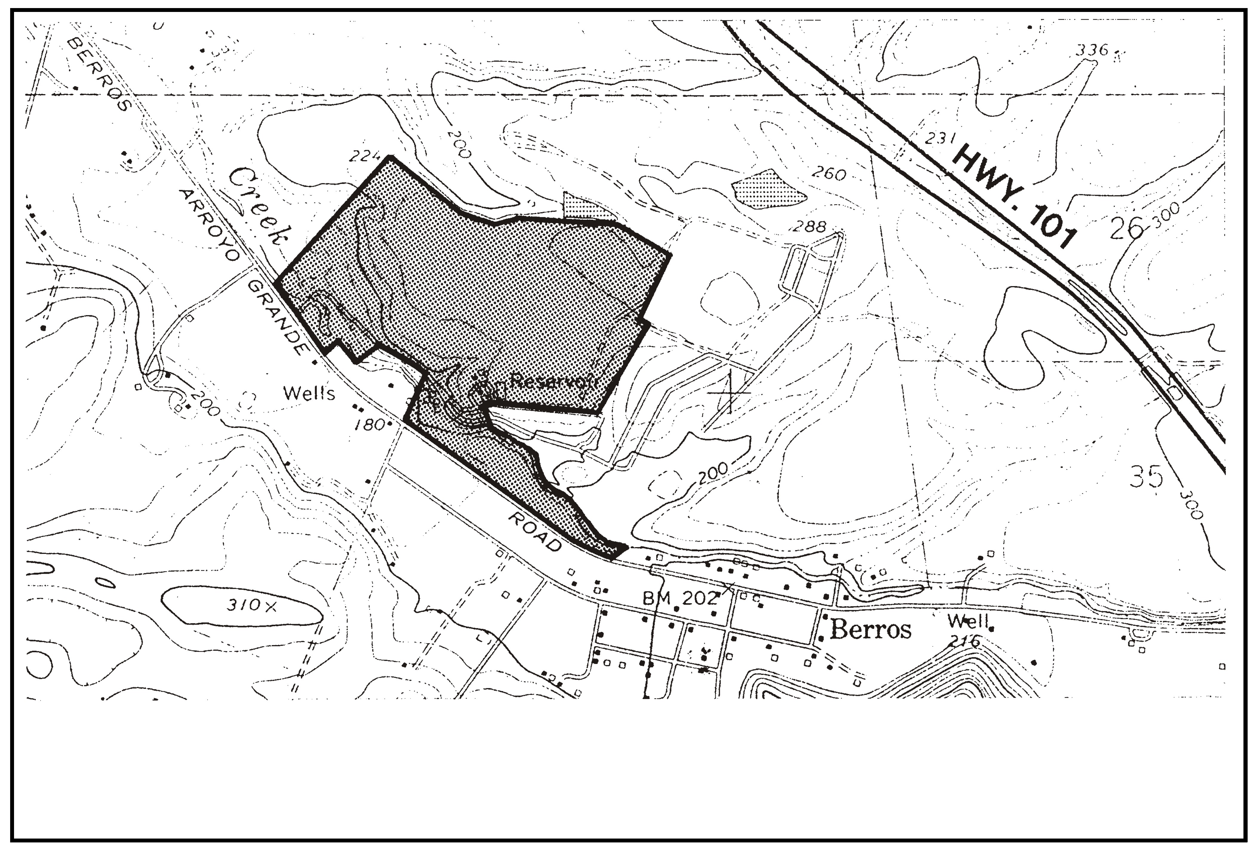
Figure 98-25: AG - Los Berros Road Property
B.
Rural Lands (RL). The following standards apply within the Rural Lands land use category.
1.
Upper Los Berros Canyon and Temettate Ridge - Limitation on use. All uses identified by Section 22.06.030 as allowable, permitted, or conditional within the RL land use category may be authorized subject to the land use permit requirements of that Section in the area of Upper Los Berros Canyon and Temettate Ridge (see Figure 98-26) except: farm equipment and supplies; off-road vehicle courses; recycling and scrap; correctional institutions; waste disposal sites; airfields and landing strips.
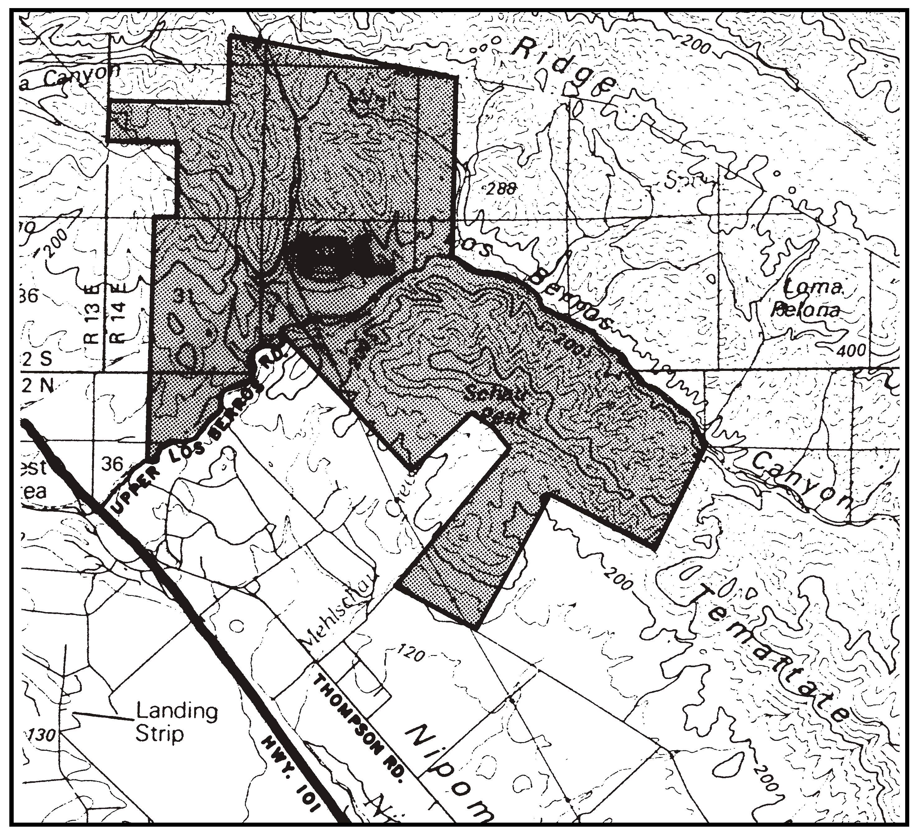
Figure 98-26: Upper Los Berros Canyon and Temattate Ridge
2.
Southland Street Specific Plan Area. The following standards apply only to land shown in Figure 98-27 for the purpose of planning an industrial park, shown.
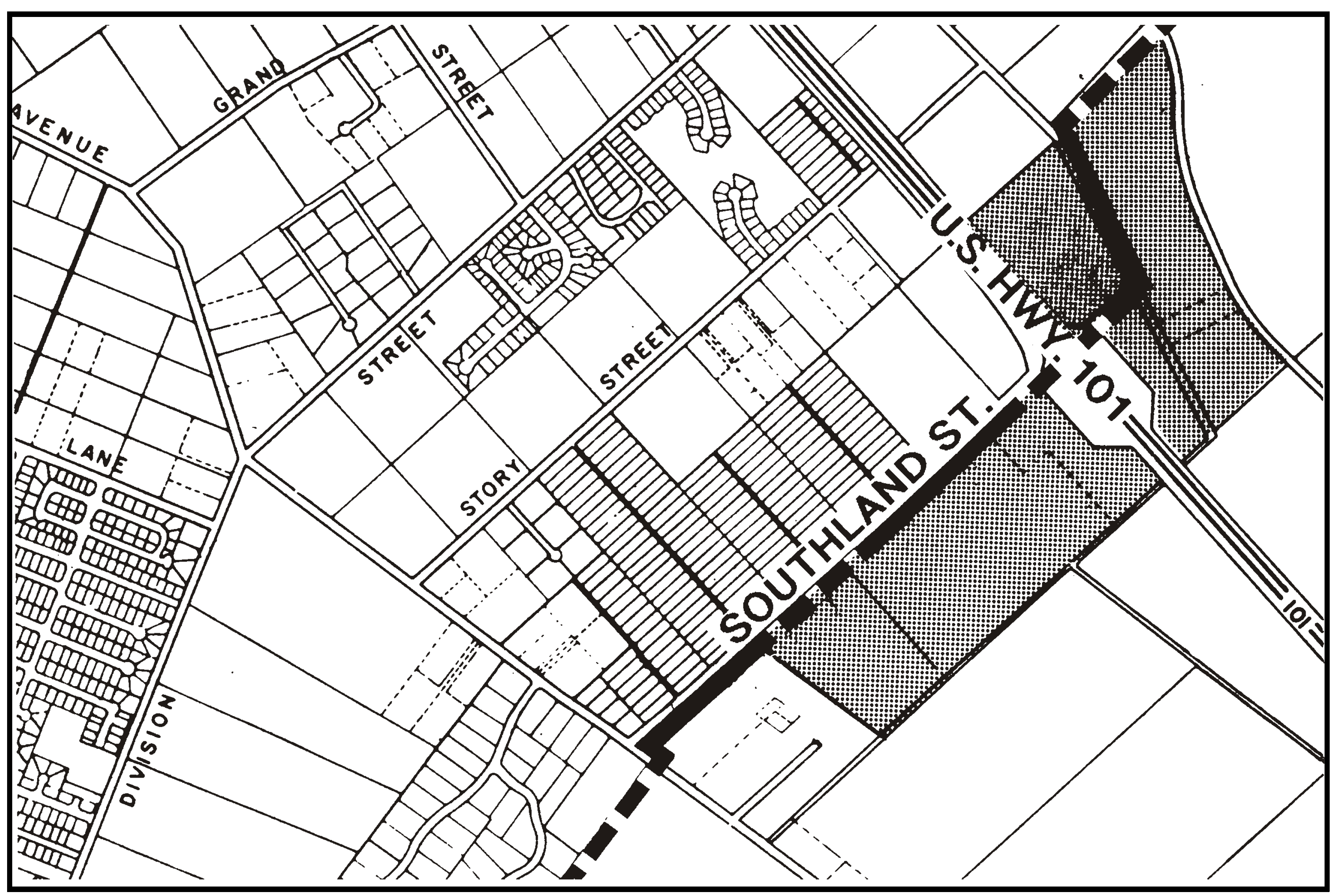
Figure 93-27: RL - Southland Street Industrial Park
a.
Specific Plan requirement. Specific Plan(s) shall be prepared under the guidance of the County prior to the approval of land division applications, except that a clustered land division that is proposed in compliance with the Rural Lands category, Section 22.22.140, and other and applicable Sections of this Title, may be approved without Specific Plan preparation. Adjacent properties within the Residential Suburban category may participate in the Specific Plan to transfer their development entitlement to the larger Specific Plan area near the interchange. The Specific Plan(s) shall be prepared in compliance with Government Code Section 65450 to plan for the development as described in following Subsections B.2.b through B.2.e.
b.
Types of uses. West of Highway 101, light industrial uses such as small-scale manufacturing or electronics assembly, business support and services, research and development, incidental public facility, retail and personal service uses to serve on-site emergency and employee are encouraged within a scale for adequate circulation. East of Highway 101, visitor-serving uses that are listed in Chapter 7 of Framework for Planning for the Commercial Retail category, and uses that are allowable in the Recreation category.
c.
Pedestrian-oriented site planning. Location of workplaces, convenience shopping, services, public buildings, parks and plazas in close proximity to each other and streets in order to facilitate walking and alternative transportation.
d.
Architecture and landscaping. Guidelines for architecture and landscaping that respond to the character of the area and provide a consistent quality of architecture and site planning.
e.
Resource, facility and services needs. Extent of necessary public, or private where applicable, services including, but not limited to, safety, health, waste management and water supply.
C.
Commercial Service (CS). The following standards apply within the Commercial Service land use category.
1.
Limitation on use. Land uses identified by Section 22.06.030 as allowable, permitted, or conditional uses within the CS land use category may be authorized in compliance with the permit requirements of that Section except: agricultural processing; broadcasting studios; indoor amusements and recreation; membership organizations; public assembly and entertainment; schools-specialized education and training; outdoor sports and recreation; sports assembly; apparel products; electrical equipment, electronic and scientific instruments; lumber and wood products; plastics and rubber products; building materials and hardware; auto and vehicle repair and services; laundries and dry cleaning plants; personal services; consumer repair services; and vehicle storage.
Land uses shall be limited to concrete batch plants, surface mine processing and concrete recycling within the area shown as "A" in Figure 98-28.
Agricultural Processing (commercial composting only) is allowed as a permitted use within the CS land use category only within the areas shown as "B" in Figure 98-28 (Troesh Property) in addition to all uses listed above. Agricultural processing is not otherwise allowable as a permitted or conditional use within the CS land use category.
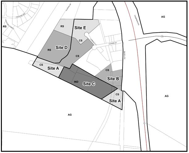
Figure 98-28: CS & IND - Santa Maria River Area
2.
Permit requirement. Minor Use Permit approval is required for all new construction unless a Conditional Use Permit is otherwise required by this Title.
3.
Project design. Architecture shall emphasize an attractive appearance from Highway 101 by achieving the following: provide a varied roof design and materials, coordinate design to be compatible between projects, minimize rooftop clutter and integrate or screen mechanical equipment. Coordinate signs and share them between adjoining uses where feasible, with the minimum height and size needed to identify businesses from the freeway. Landscaping shall include tall-growing trees to buffer views of buildings from the freeway and soften views of roofs, parking and outdoor uses.
4.
Application submittal - Troesh Property. The following items are required at the time of land use permit application only within the areas shown as "B," "D," and "E" in Figure 98-28.
a.
Noise Assessment. At the time of land use permit application, a detailed noise assessment shall be submitted. The noise assessment shall be conducted by a qualified acoustical engineer to determine the extent of project-related noise impacts and any required mitigation measures (limitation of hours or duration of operations or the provision of noise barriers).
b.
Drainage Plan. At the time of land use permit application, the applicant shall submit a drainage plan, specifically addressing the control of sediments and any oils or grease so that they will not adversely affect the Santa Maria River.
c.
On-Site Wells. At the time of land use permit application, the applicant shall provide a letter from the Division of Environmental Health indicating that the on-site well is in conformance with the Department of Resources Bulletin 74-81, Water Well Standards: State of California and all standards required by the County Environmental Health Department. This letter is required only in the event that the application for the wood chipping facility (commercial composting) use is initiated prior to the development of the previously approved landscape materials sales and storage facility.
d.
Cultural Resources - Historic. Prior to acceptance as complete for processing, for any application for any new development on 2008 Assessor Parcel Number 090-302-026 ("Site D" in Figure 98-28), a qualified cultural resource professional, as approved by the County (historian/architectural historian) shall be retained to conduct a historical evaluation of the Nelson farmhouse and barn, and any associated outbuildings, animal pens, and farm equipment. The historic structure evaluation should include the history of the property, and the farm complex should be recorded on appropriate California Department of Parks and Recreation (DPR) forms. Any important/significant historic resources identified shall be mitigated as specified by the historical evaluation prior to its demolition or relocation.
e.
Cultural Resources - Pre-Historic. Prior to acceptance as complete for processing for any application for any new development on 2008 Assessor Parcel Numbers 090-302-34 and 090-302-35 ("Site E" in Figure 98-28), a Phase I archaeological survey shall be conducted. All recommended measures shall be required of new development to reduce impacts to less than significant levels.
D.
Industrial (IND). The following standards apply within the Industrial land use category in the rural portions of the planning area.
1.
Applicability - Highway 1 and Willow Road. The following standards apply only to the property located at the southeast corner of Highway 1 and Willow Road, shown in Figure 98-29.
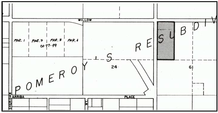
Figure 98-29: IND - Southeast Corner of Highway 1 and Willow Road
2.
Permit Requirement - Modification or expansion. Any proposed modification or expansion of the existing pipe manufacturing business is subject to Conditional Use Permit approval.
3.
North of Santa Maria River Area. The following standards apply only to the property shown as Area C in Figure 98-28.
a.
Highway 101 Visibility. To minimize visual impacts as seen from Highway 101, new development shall adhere to the following guidelines:
(1)
A landscape plan shall be provided upon application submittal to screen at least 50 percent of buildings and outdoor storage areas, as viewed from Highway 101.
(2)
An exterior lighting plan shall be provided upon application submittal that shows all exterior lighting will be directed down and into the development with no direct light visible from Highway 101.
(3)
Exterior elevations shall be provided upon application submittal that shows all exterior colors to be darker, muted colors.
(4)
All utilities shall be placed underground unless shown to be unfeasible due to site specific characteristics, creation of additional environmental impacts, or cost.
b.
Air Quality. Prior to specific-project acceptance, staff will coordinate with Air Pollution Control District (APCD) on the level of air quality assessment study to be conducted by a qualified air quality specialist at the time a new use is proposed. The level of effort will be commensurate to the level the proposed project will exceed the established air quality thresholds or will involve hazardous materials. If necessary, the APCD may require the completion of a comprehensive facility-wide health risk assessment.
c.
Biological Resources. For projects subject to discretionary approval, to protect riparian and wetland habitat associated with Nipomo Creek and Santa Maria River, any project within 150 feet of these water courses the project shall:
(1)
Provide evidence to the County that California Department of Fish and Game (CDFG) and the United Stated Army Corps of Engineers (USACE) have reviewed the plans being considered by the county, and that substantial revisions will not be necessary.
(2)
Prior to construction permit issuance, obtain any required CDFG/USACE permits, where all of their recommendations have been incorporated into the plans.
(3)
Within 30 days of, and prior to, any vegetation clearance or grading, a qualified biologist shall conduct pre-activity surveys for special-status wildlife species (e.g., California red-legged frog, southwestern pond turtle, two-striped garter snake, etc.) according to regulatory agency protocols. In the event that these species are identified, then the appropriate regulatory agencies (USFWS and/or CDFG) shall be contacted prior to development activities to determine appropriate buffers from project activities and any additional appropriate project-specific mitigation measures to be implemented.
(4)
Prior to acceptance as complete for processing for any application for any new development, where it is determined the potential exists for Black-flowered figwort, have a qualified biologist evaluate the project site for the presence of this species, using appropriate regulatory agency protocols. In the event that this species is identified, then the appropriate regulatory agencies (USFWS and/or CDFG) shall be contacted prior to project approval to determine what measures are appropriate (e.g. development setbacks, etc.).
(5)
Upon application submittal, provide a landscape plan that shows compatible and non-invasive plants for the riparian/wetland area are proposed.
d.
Hazardous Materials. For any development that includes reportable hazardous waste or storage, prior to acceptance as complete for processing, the project proponent must submit a hazardous materials business plans to the County Certified Unified Program Agency, and shall be designed to prevent storm water associated with a 100-year flood event from inundating the storage area (e.g. flood walls with heights above 100-year flood elevation).
e.
Noise. Upon application submittal, all noise-generating uses shall be specified. A project-specific acoustical study shall be conducted by a qualified acoustical engineer should any proposed noise generating use exceed 50 dB at the property line of any adjacent property with a noise sensitive use, or result in exceeding the existing ambient noise level by one decibel (dBA Leq) for any nearby sensitive noise receptors. The study shall quantify impacts to sensitive noise receptors, and specify noise reduction measures to the extent feasible to reach acceptable noise thresholds, as determined by the County.
f.
Public Service. Upon application submittal, a Water/Fire Suppression Master Plan shall be prepared, to the satisfaction of CAL FIRE. The scope of the Master Plan shall be prepared in collaboration with CAL FIRE, the New Cuyama Mutual Water Company and the San Luis Obispo County Department of Planning and Building. Should a pro-rata reimbursement agreement be developed, the benefitting property owners shall contribute their fair-share pursuant to a Reimbursement Agreement.
g.
Santa Maria River Trail. Prior to approval of any new discretionary development on properties that include Santa Maria River, or connect to the southern portion of Hutton Road shall coordinate with the County of San Luis Obispo Parks Division to determine the feasibility of establishing a multi-use trail easement through the subject parcel and provide an offer to dedicate, as appropriate.
h.
Traffic Study. Upon application submittal, all traffic-generating uses shall be specified. Where substantial amounts of traffic are proposed or traffic safety concerns are identified, a traffic study shall be conducted by a qualified transportation engineer. The study shall quantify impacts to existing roadways, including Highways 166 and 101, and specify measures to reduce impacts to acceptable levels, as determined by the County Public Works Department and/or Caltrans.
i.
On-site Wastewater. Where on-site wastewater systems are proposed, upon application submittal, late winter/spring piezometer testing for groundwater levels and percolation testing shall be submitted to determine recharge rates. As needed, based on this information, an appropriate wastewater system shall be proposed that will meet County and State requirements for on-site systems.
j.
Surface Water Quality. Upon application submittal, a Sediment and Erosion Control Plan (SECP) will be provided. The SECP will include: slope surface stabilization measures, erosion control devices, sedimentation control measures, regular maintenance of all drainage devices and basins to ensure in good working order, as well as check during 10-year storm event; confining land clearing and grading operations to between April 15 and October 15; minimize land area disturbed and the period of exposure to the shortest feasible time; install long-term drainage devices for site drainage, including headwalls, basins, culverts with down-drains and energy dissipating devices (riprap or diffusers).
k.
Water Use. Upon application submittal, at a minimum, plans shall reflect the requirements of the Nipomo Mesa Groundwater subarea in place at the time of submittal. All efforts shall be used to minimize water usage and maximize water conservation.
E.
Public Facilities (PF).
1.
Jack Ready Property. The following standards apply only to land shown in Figure 98-29 at the south end of Illinois Way along the Nipomo mesa bluff.
a.
Limitation on use. Land uses identified by Section 22.06.030 as allowable, permitted, or conditional uses within the PF land use category may be authorized in compliance with the permit requirement of that Section except: Mines and quarries, petroleum extraction, recycling, swim and racquet clubs, schools, residential care, outdoor retail sales, cemeteries and columbariums, correctional institutions, health care services, lodging, waste disposal site, airfields and heliports, and vehicle storage.
All uses shall be open and available to the general public and shall not be unreasonably limited or restricted.
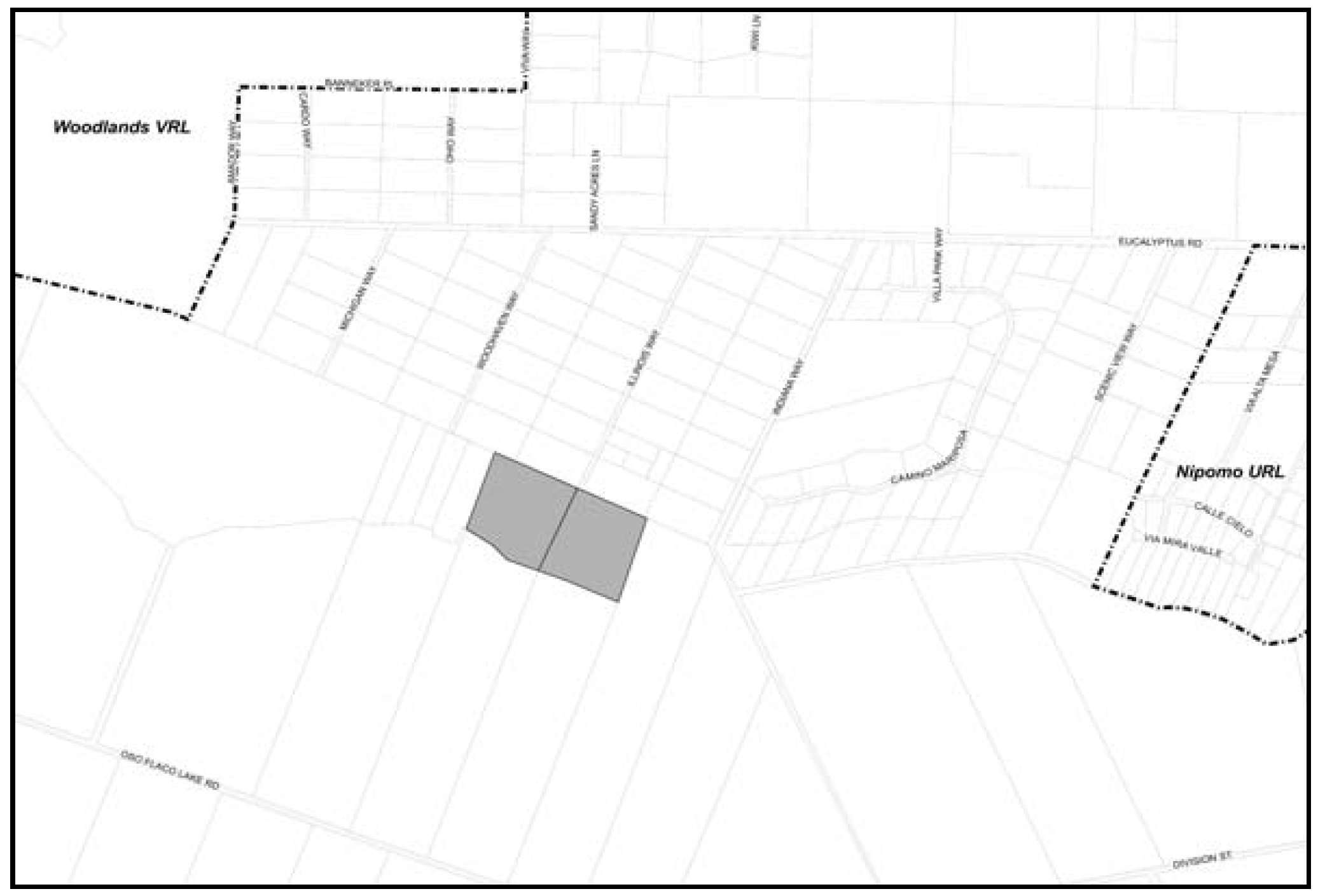
Figure 98-30: Jack Ready Property
F.
Recreation (REC)/Public Facilities (PF). The following standards apply within the Recreation/Public Facilities land use category in the rural portions of the South County planning area.
1.
North west corner of Willow and Via Concha. The following standards apply only to the property shown as Area B in Figure 98-31.
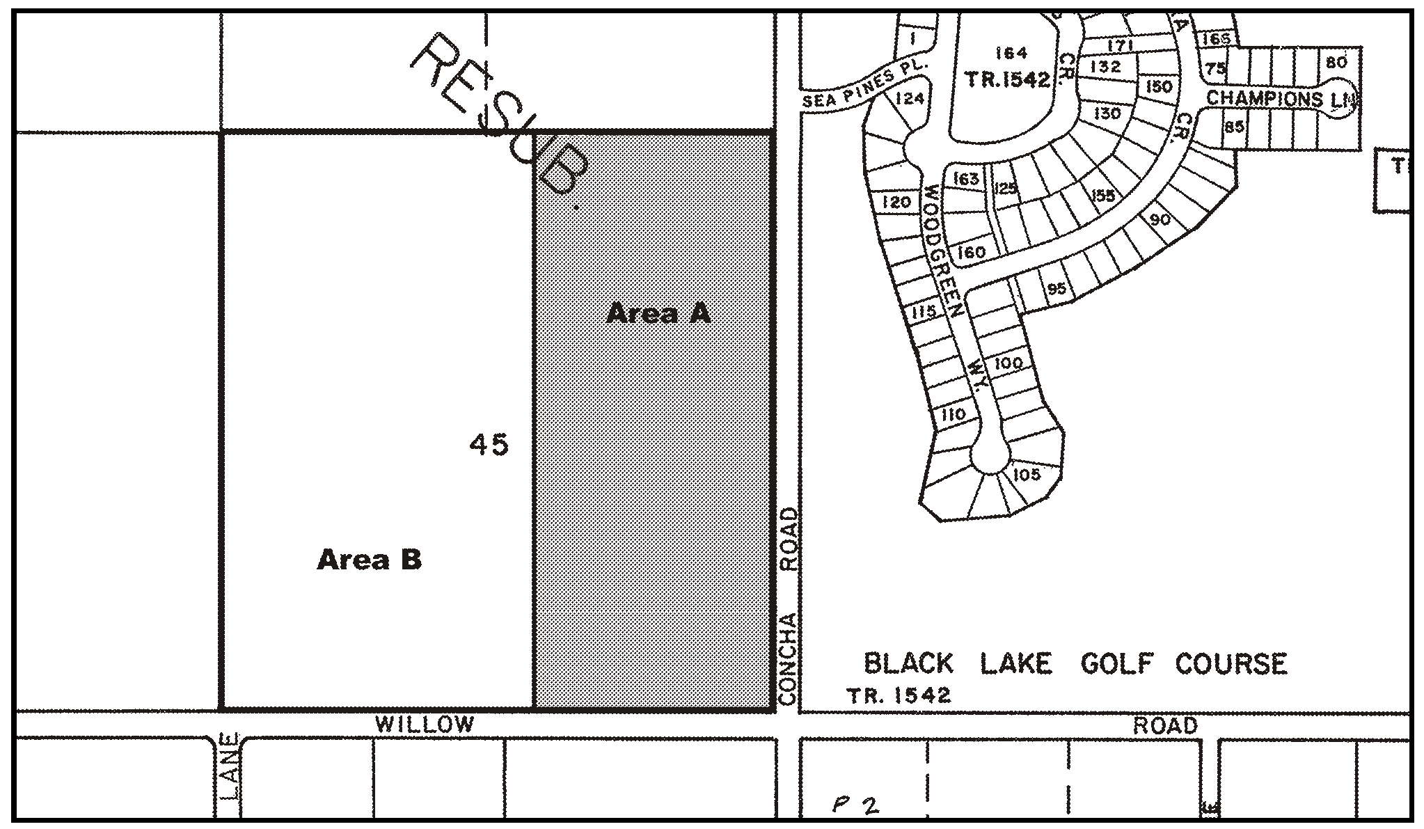
Figure 98-31: REC-Northwest Corner of Via Concha & Willow Rd
a.
Limitation on Use.
(1)
Land uses within the REC/PF land use category shall be limited to: Schools - Elementary and Secondary and energy-generating facilities (limited to accessory renewable energy facilities) if the site is acquired and developed by the Lucia Mar Unified School District.
(2)
Land uses within the REC/PF land use category shall be limited to Crop Production and Grazing, Outdoor Sports and Recreation, Energy-Generating Facilities (Limited to Accessory Renewable Energy Facilities); Parks, and active and passive Open Space if the site is not acquired and developed by the Lucia Mar Unified School District.
b.
Drainage. All drainage from future development shall be retained on site.
c.
Rural Character. To maintain a rural character, as seen from Willow Road, all future development shall provide sufficient landscaping to accomplish an 80 percent screening of new development and limit night lighting so that it is directed down and into the development with no direct light visible from surrounding public roads.
d.
Willow Road/Via Concha Access. Prior to issuance of a county encroachment permit for school access:
(1)
Public Works shall review proposed project's circulation plan to verify that Via Concha access is used for all traffic ingress/egress and adequately sized for bus movements. If any egress onto Willow Road is proposed, it must be shown to Public Works satisfaction how left-turn movement will be avoided.
(2)
The LMUSD shall install a traffic signal at the intersection of Willow Road and Via Concha Road, in accordance with the approved Signal Design Plan. If a Signal Design Plan has not yet been prepared, the District will prepare such a Plan for approval by County Public Works.
e.
Agricultural Resources. As long as commercial agricultural activities to the north and west remain, the following shall apply. Future school design shall place all outdoor activity areas along the southeastern portion of the property to be as far from existing agricultural operations. Extensive landscape planting of tree and shrubs shall be completed along the north and west perimeters with the intent of providing a solid screen of evergreen vegetation to intercept aerial pesticide drift. All habitable buildings shall include air conditioning units with air purifying filters that are regularly maintained. The District shall work with the County Agricultural Commissioner's Office to verify these measures have been installed in a manner that maximizes protection of human health. The District will consider incorporating any other protective measures recommended by the Agricultural Commissioner's Office.
f.
Water Service. Prior to development of the site with a school, the property shall annex to the Nipomo Community Service District for water service. An "intent-to-serve" letter from the NCSD shall be provided.
g.
Water Usage. All feasible water conservation measures shall be incorporated into future development of the site with a school. All landscaping shall be low water using and drought tolerant.
G.
Recreation (REC). The following standards apply within the Recreation land use category in the rural portions of the South County planning area.
1.
Hutton Road area. The following standards apply only to the existing auto racetrack property west of Hutton Road (see Figure 98-32).
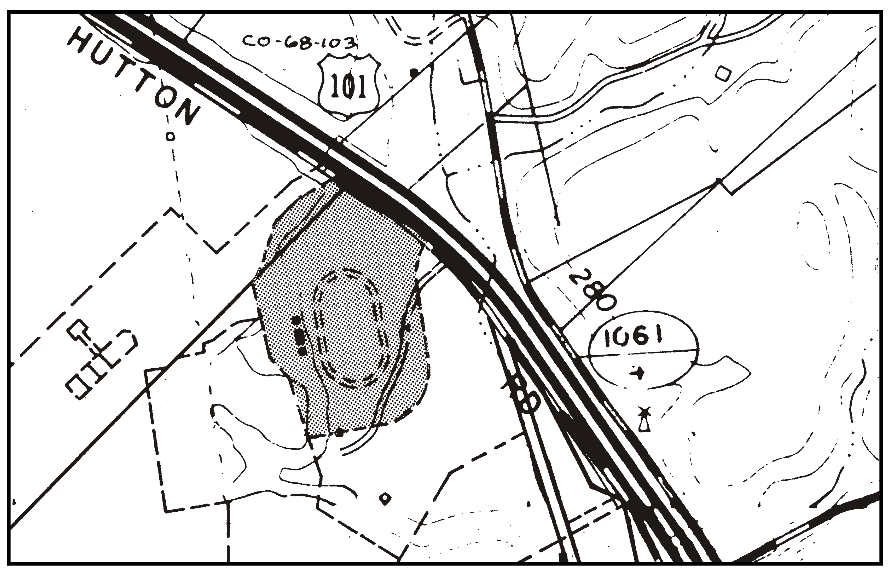
Figure 98-32: REC - Hutton Road Area
a.
Limitation on use. Land uses shall be limited to sports assembly, temporary events and public assembly and entertainment.
b.
Permit requirement. Minor Use Permit approval is required, unless a Conditional Use Permit is otherwise required by Chapter 22.06, prior to any further construction or land divisions that will increase or expand the permanent facilities of the site, except for the construction of restrooms or the renovation or maintenance of concession buildings. Emphasis shall be given in the Minor Use Permit to the provision of adequate on-site parking, drainage and landscaping to buffer or partially screen the site from Highway 101.
2.
Bartleson Ranch. The following standards apply only to the property shown in Figure 98-33.
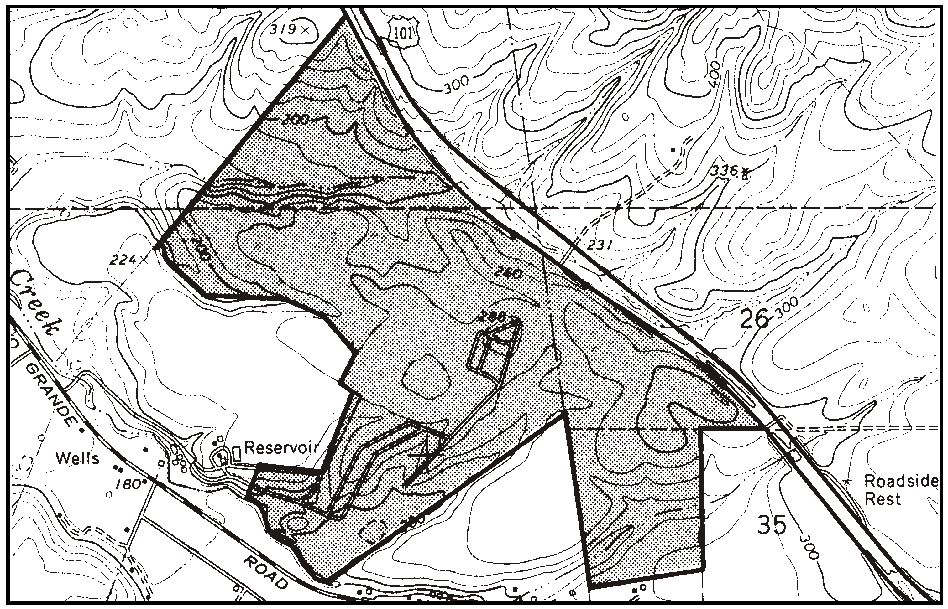
Figure 98-33: REC - Bartleson Ranch
a.
Limitation on use. Land uses shall be limited to crop production and grazing, animal keeping, agricultural accessory structures, golf course and related facilities, overnight tourist accommodations, a restaurant, health and athletic facilities that are predominately outdoor, equestrian facilities and trails, temporary events and single-family dwellings.
The analysis shall be prepared such that long-term water availability is determined to be adequate for the golf course, the residential/small scale tourist accommodation component, and intensive agricultural use for the property remaining i conclusions with a high degree of certainty, and shall be based on 1) monitoring over a certain period (as recommended by the hydrogeologist), 2) recent, detailed existing information on water availability; or 3) a combination of these two. Residential development/small scale tourist accommodations shall also be carefully sited to minimize potential visual impacts from Highway 101 as well as provide for adequate sewage disposal systems.
3.
North west corner of Willow and Via Concha. The following standards apply only to the property shown as Area A in Figure 98-31.
a.
Limitation on Use. Land uses identified by Section 22.06.030 as allowable, permitted, or conditional within the REC land use category may be authorized in compliance with the land use permit requirements of that Section, in the Agriculture land use category. The data used in the analysis shall provide for only if those uses are allowable, permitted, or conditional in the RS land use category.
b.
Land Division. No more than 16 residential parcels shall be created within the approximately 20 acre portion shown as Area A in Figure 98-31 at an average density of no less than one acre.
c.
Cluster Land Division Incentive. Cluster divisions of land may use an open space parcel area that is smaller than otherwise required by Land Use Ordinance Chapter 22.22 where an important biological habitat, or public use for passive recreational purposes is identified through the application's review process. The size of the open space shall be no less than 60 percent. The analysis shall identify the area that can best accommodate the sensitive biological resources, passive recreational needs, school access and still provide for the allowed residential density.
d.
Allowed Density. The maximum allowable residential density within the area shown as Area A in Figure 98-31 is one dwelling unit per parcel.
e.
Drainage. All drainage from future development shall be retained on site to the satisfaction of County Public Works.
f.
Rural Character. To provide for rural character, as seen from Willow Road and Via Concha, all future development shall provide sufficient landscaping to accomplish an 80 percent screening of new development within 5 years of planting and limit night lighting so that it is directed down and into the development with no direct light visible from surrounding public roads;
g.
Future School Access. As a part of any future land division, an access easement onto Via Concha shall be provided for the future school site to the west.
h.
Willow Road/Via Concha Intersection. Based on the cumulative traffic impacts of residential development and the future school on the adjacent Public Facilities property, the following shall be completed as a part of any residential development:
(1)
Submittal of a Signal Design Plan for the installation of a traffic signal at the Willow Road/Via Concha Road intersection, for review and approval by the County of San Luis Obispo Department of Public Works.
(2)
Prior to recordation of final map, the applicant shall install signal poles with luminaries only and install traffic signal conduit at the northwest and southeast corners of the Willow Road and Via Concha Road intersection, as recommended by the San Luis Obispo County Department of Public Works.
i.
Water Service. Prior to recordation of final map for residential development, the property shall annex to the Nipomo Community Service District for water service. An "intent-to-serve" letter from the NCSD shall be provided with application for land division.
j.
Water Usage. All feasible water conservation measures shall be incorporated into future residential development. All landscaping shall be low water using and drought tolerant. Turf areas shall be minimized.
k.
Noise. Future subdivision design shall demonstrate how all outdoor use areas will not exceed the exterior noise threshold of 60 db when buildout traffic is reached on Willow Road.
l.
Biological Resources. Prior to approval of future development, a botanical assessment (conducted at proper time of year) shall be prepared to evaluate for potentially sensitive species. All efforts shall be made to avoid any sensitive species found.
m.
Archaeological Resources. Prior to approval of future development, the entire property shall be evaluated for archaeological resources. Any future land division shall be designed in a manner that first considers avoiding known resources and if not possible, fully mitigate potential impacts.
n.
Safety - Golf Hazards. As a part of any land division or residential building permit submittal, the application shall show how the project will maximize protection of development from potential golf hazards of the adjacent golf course.
H.
Residential Rural (RR). The following standards apply within the Residential Rural land use category.
1.
Areawide. The following standards apply within the Residential Rural category where standard large-lot subdivisions are proposed, as illustrated in Figure 98-34.
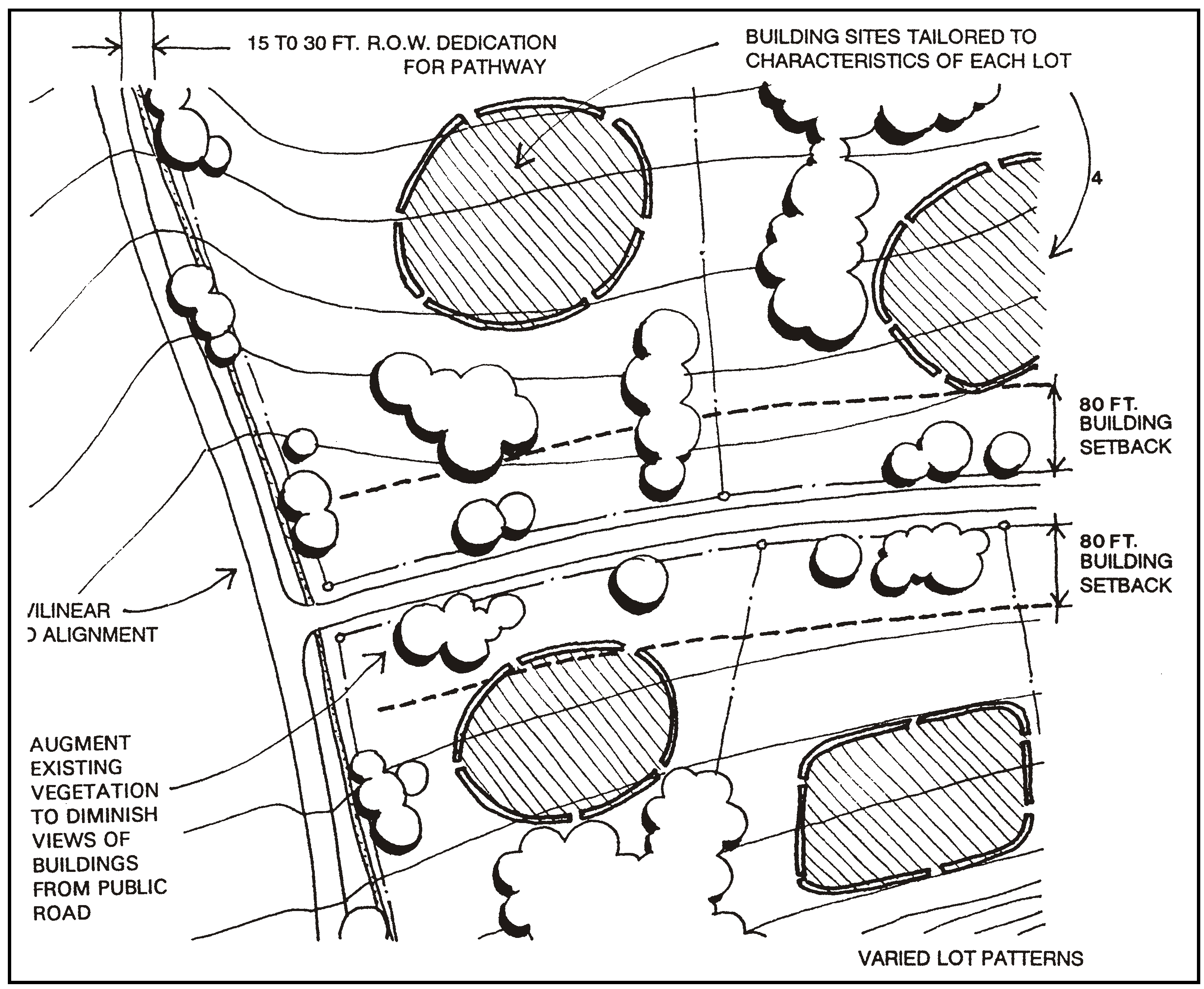
Figure 98-34: Concept of Standard Rural Subdivision
a.
Road right-of-way. Provide a dedication of land for road right-of-way between 15 and 30 feet for the construction of a separate pathway, as determined to be feasible by the County Public Works Department, utilizing the Circulation Element and the County Parks and Recreation Element. Properties affected by this standard may use gross acreage in calculating the allowable density.
b.
Curvilinear roads. Road alignments shall respond to natural land forms, be slightly curvilinear and provide alternate routes of travel. Straight roads are not encouraged.
c.
Setbacks. Provide a 80-foot front setback, except that where site average slope is greater than 10 percent, the front setback may be less than 80 feet where necessary for sensitive siting within topographic constraints.
d.
Varied lot pattern and geometry. Design parcels to have varied front dimensions and a different overall geometry, responding to natural topography and the location of natural features such as vegetation, to provide interest and avoid rectilinear grid lot patterns.
e.
Landscaping. Retain and incorporate existing vegetation as much as feasible into the subdivision design. Plant California native trees within the dedicated road right-of-way where feasible and in the front setback area in staggered, natural-appearing patterns to buffer views from the public road. Eucalyptus trees may be removed unless benefits from visual character and monarch butterfly habitat warrant further protection. Where eucalyptus trees are removed, replace with California native trees, retaining older, more mature eucalyptus trees where possible.
f.
Siting of buildings. Locate building envelopes that are subordinate to rural character, such as by varying their elevation along hills and ridges, and where siting below the highest elevations takes advantage of wind-protected locations.
2.
South Mesa area. The following standards apply within the Port Harford Eucalyptus Tract No. 61, portion of lots 41 and 42 of Rancho Guadalupe at the southern edge of the mesa, and the Los Berros Tract, located south of Eucalyptus Road, shown in Figure 98-35.
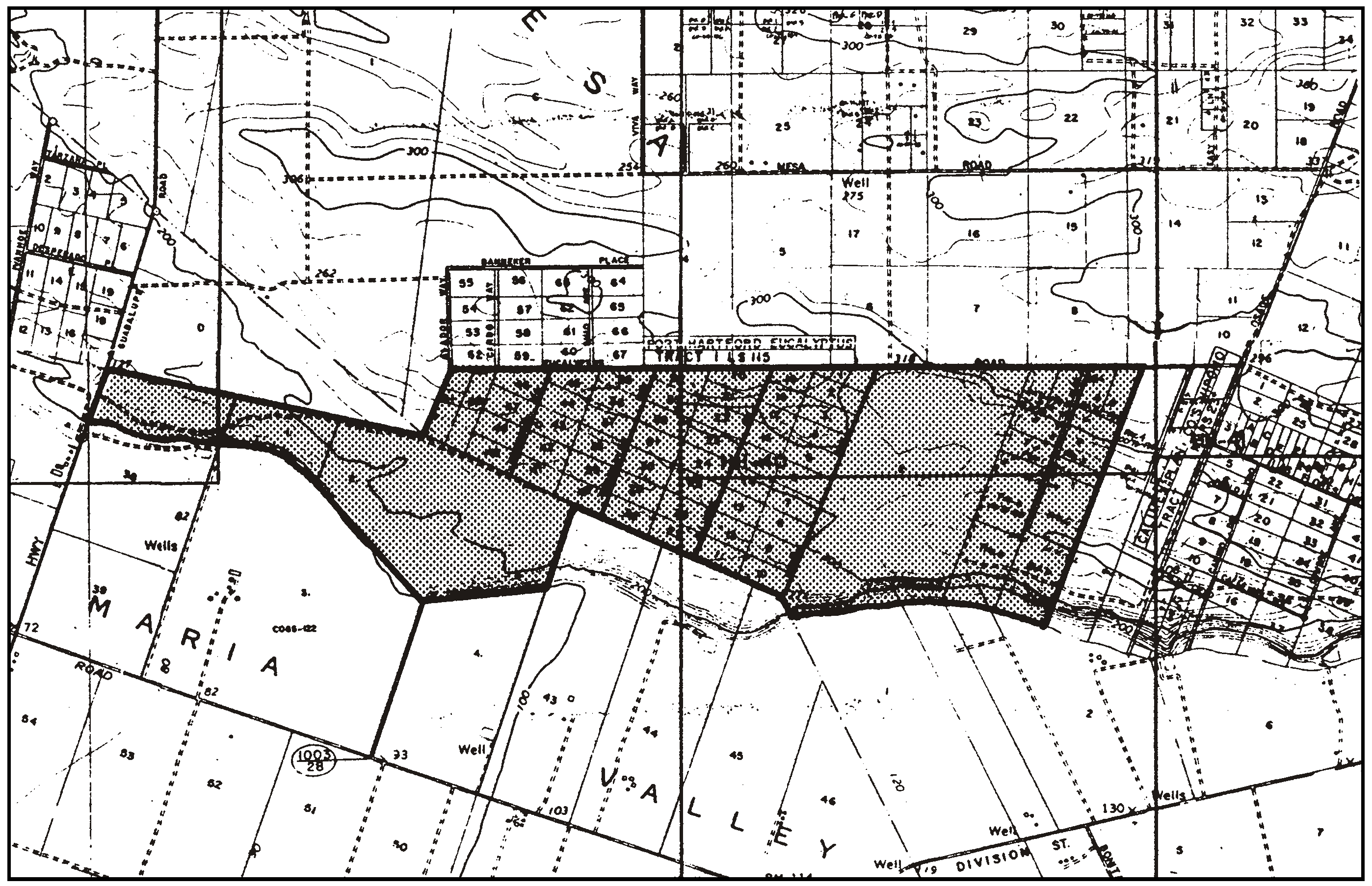
Figure 98-35: RR - South Mesa Edge
a.
Vegetation buffer. Retain a vegetation buffer at least 10 feet in width at the perimeter of each lot, consistent with fire safety regulations. Eucalyptus trees may be removed unless benefits from visual character and monarch butterfly habitat warrant further protection. Where eucalyptus trees shall be removed, replace with California native trees, retaining older, mature "landmark" eucalyptus trees where possible.
b.
Limitation on use. Land uses identified by Section 22.06.030 as allowable, permitted, or conditional may be authorized in compliance with the land use permit requirements of that Section, except: airfields and landing strips; farm equipment and supplies; grocery stores; restaurants; and mining.
c.
Permit requirement - New land divisions. All new land divisions of five or more parcels shall utilize the cluster division provisions of Section 22.22.140, and provide for locations of parcels and building sites which minimize visibility from Highway 1 and Oso Flaco Road.
d.
Road improvements. Road improvements shall be integrated between each tract, and shall include improvement of the existing circulation system for any adjacent tract as deemed necessary by the County.
3.
Porter Pacific Eucalyptus Tract. The following standards apply within the Porter Pacific Eucalyptus Tract except for the replacement or reconstruction of existing water wells which are subject to Subsection 3.h (see Figure 98-36). These standards will be considered for clarification and revision during the Black Lake Canyon General Plan amendment and environmental impact review process. As part of the General Plan amendment, an inventory of canyon resources and necessary protective measures is being prepared in the Black Lake Canyon Enhancement Plan.
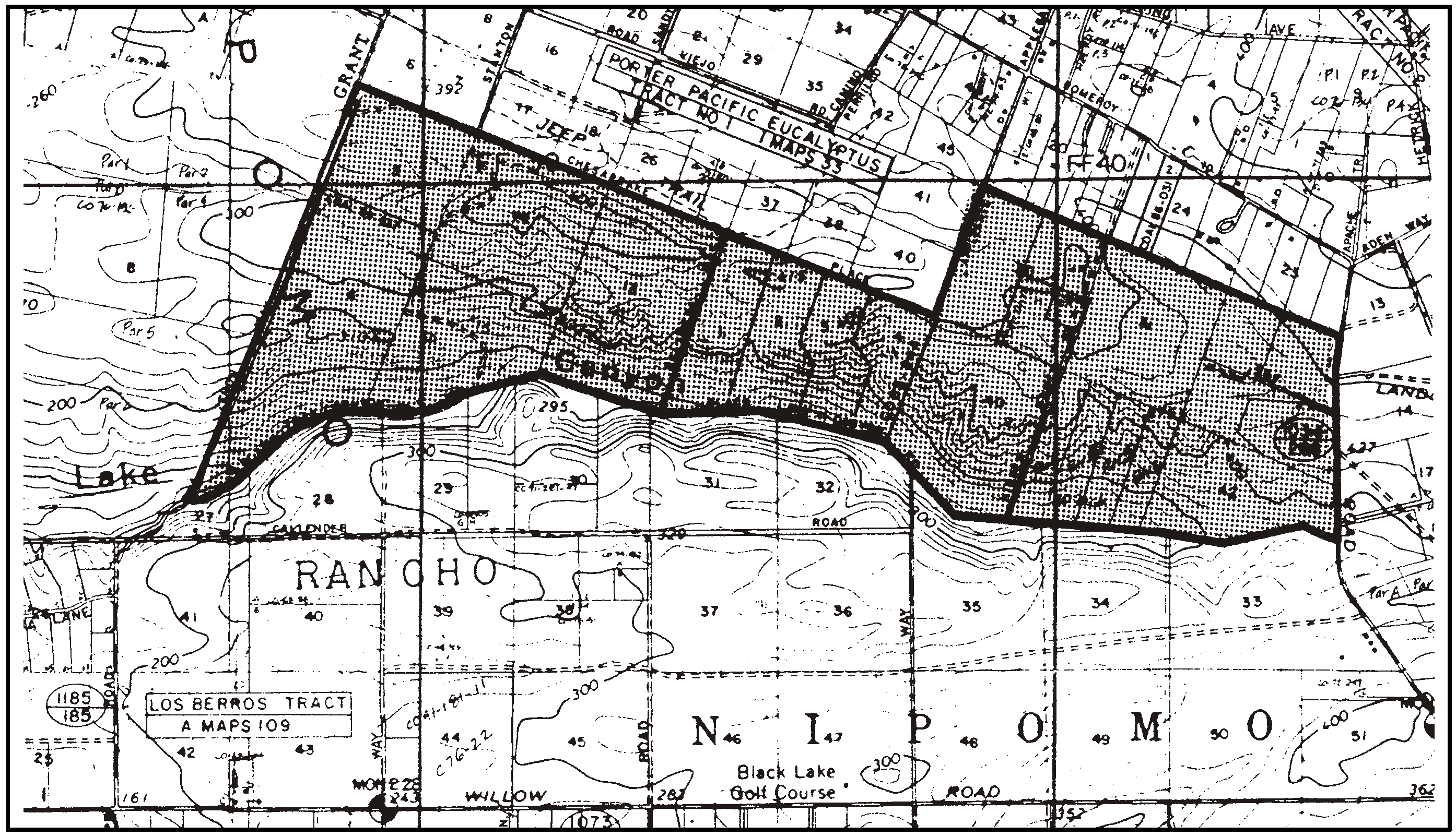
Figure 98-36: RR - Porter Pacific Tract
a.
Limitations on improvements. No permanent structures, impervious surfacing, grading, removal of natural vegetation, sewage disposal systems or water wells are allowed below the canyon rim, except as provided by Subsections H.3.d through H.3.f. The Department shall determine whether proposed activities will extend below the canyon rim as individual applications are reviewed.
b.
Setbacks. Maintain at least a 20-foot building setback from the rim of the canyon.
c.
Environmental review for new water well permits. All applications to permit the drilling of new water wells (excluding the replacement or reconstruction of existing legal nonconforming wells) below the rim of the Black Lake Canyon and outside the Sensitive Resource Area Boundary shall be subject to the environmental review procedures in the County's Environmental Quality Act Guidelines, and as required by the conditions of the negative declaration (ED 81-08) for the County General Plan amendment G810519:2. The environmental review, with a completed environmental determination, shall be accomplished prior to the issuance of a well-drilling permit from the County Department of Public Health
d.
Location of new well sites. New well sites shall be located a minimum 150 feet from the marsh vegetation. Access roads to the well site shall not impinge on the marsh site, and shall be located and limited in use as determined by the environmental review process.
e.
Grading permit. A grading permit, subject to the environmental review procedures contained in the California Environmental Quality Act and completed in compliance with Chapter 22.52, shall be required for any proposed grading activities or site disturbances that will occur below the rim of Black Lake Canyon outside of the Sensitive Resource Area boundary, including grading for agricultural uses. The grading permit application shall include a comprehensive erosion and sedimentation control plan utilizing soil erosion prevention and protection measures as recommended by the Natural Resources Conservation Service, and provision of a wildlife corridor of native vegetation extending from the canyon rim to the canyon bottom. The location and size of the corridor shall be determined through the environmental review process. Installation of permanent or temporary structures utilized for controlling drainage may be permitted within the Sensitive Resource Area designation only if such structures are approved as part of the approved sedimentation and erosion control plan.
f.
Rare or endangered plant species. The provision of protective measures for rare or endangered plant species, as designated on the current, official list of the California Department of Fish and Game Commission, shall be accomplished as part of the environmental review for individual applications.
g.
Protection of wetlands. Properties proposed for development that contain wetlands shall develop a small diameter observation well to monitor the groundwater level in the shallow upper aquifer. Significant declines in the shallow water table attributable to the production from proposed new wells shall necessitate the implementation of protective measures by the property owner to preserve water levels within marsh areas. The details of the monitoring program shall be developed by the Office of the Environmental Coordinator at the time of the environmental review of individual water well permit applications.
h.
Reconstruction or replacement of existing wells. The following standards apply to the reconstruction or replacement of existing legal nonconforming wells:
(1)
Location of replacement well sites. Where the existing well being replaced is within 150 feet of a marsh and/or wetland area, the replacement well shall be located no closer to the marsh or wetland than the well being replaced.
(2)
Permit for replacement wells. The application for a well-drilling permit submitted to the County Department of Public Health shall include a Zoning Clearance showing the location of the well being replaced, its casing size and depth and the approximate operational capacity prior to its failure; the location of the proposed new well; the access route to the proposed drilling site, and relationship to marsh or wetland areas if they exist on the property.
(3)
Construction standards for replacement wells. Replacement wells shall be "in-kind" wells; they shall not exceed the capacity of the well being replaced. The new well shall be constructed to the standards contained in the conditional negative declaration (ED 83-206) for County General Plan amendment G831019:2, on file with the Department and the Department of Public Health.
4.
Sheehy Road, Dana-Foothill Road, upper Los Berros Road and Highland Hills Road area. The following standards apply within the Sheehy Road and Highland Hills Road area on the northeast side of Dana-Foothill Road and southeast side of Upper Los Berros Road (see Figure 98-37).
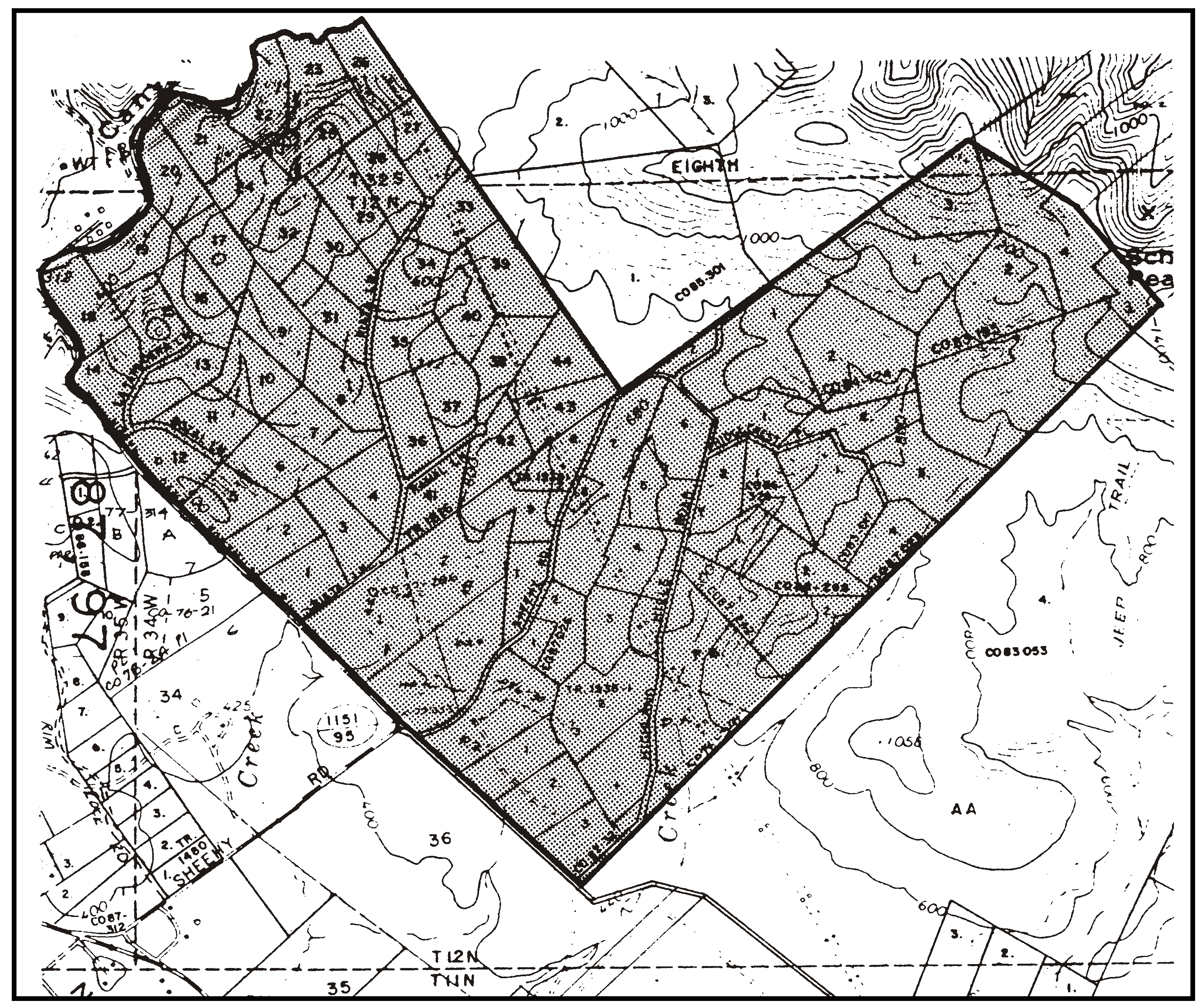
Figure 98-37: RR Sheehy Road Area
a.
Minimum parcel size. The maximum density and the number of residential lots allowed shall be computed on the basis of one residential lot and single-family dwelling per 10 acres of gross site area, except that 20 acres shall be used to calculate allowable density on Parcels A through D of Parcel Map CO 83-195 if the cluster division standards of this Title are not utilized for proposed land divisions.
b.
Limitations on use. Land uses identified by Section 22.06.030 as allowable, permitted, or conditional within the RR land use category may be authorized in compliance with the land use permit requirements of that Section, except: airfields and landing strips; farm equipment and supplies; grocery stores; organizational houses; outdoor sports and recreation; restaurants; rural recreation and camping; schools - pre to secondary; mining.
c.
Residential density. The maximum allowable residential density is one dwelling unit and one caretaker's residence or accessory dwelling unit per parcel, with caretaker's residences subject to Minor Use Permit approval, except that the maximum allowable residential density for Parcels A through D of Parcel Map CO 83-195 shall be one dwelling only per parcel if the cluster division standards of this Title are used for proposed land divisions.
d.
Site planning - new land divisions. Building sites and driveways shall be sited in order to reduce topographic alteration of the site and minimize visual impacts to surrounding properties. Common driveways shall be encouraged. Designation of building sites and driveways shall be required as part of subdivision and parcel map approvals.
5.
Sheehy Ranch - Building sites. All buildings on the Sheehy Ranch (Parcel A of CO 78-71 and Parcels A through D of CO 80-07, shown in Figure 98-38) shall be located in building sites as designated in Parcel Map CO 80-07 and on land unused or unusable for cropland on Parcel A of CO 78-7.
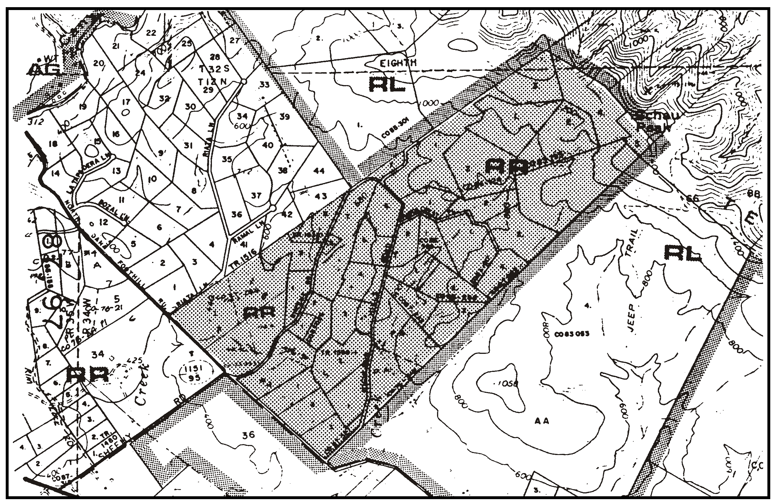
Figure 98-38: RR - Sheehy Ranch
6.
Tract No. 49 - Tree buffer. Retain the existing rows of eucalyptus trees along the northerly and southerly boundaries of Tract No. 49 (see Figure 98-39).
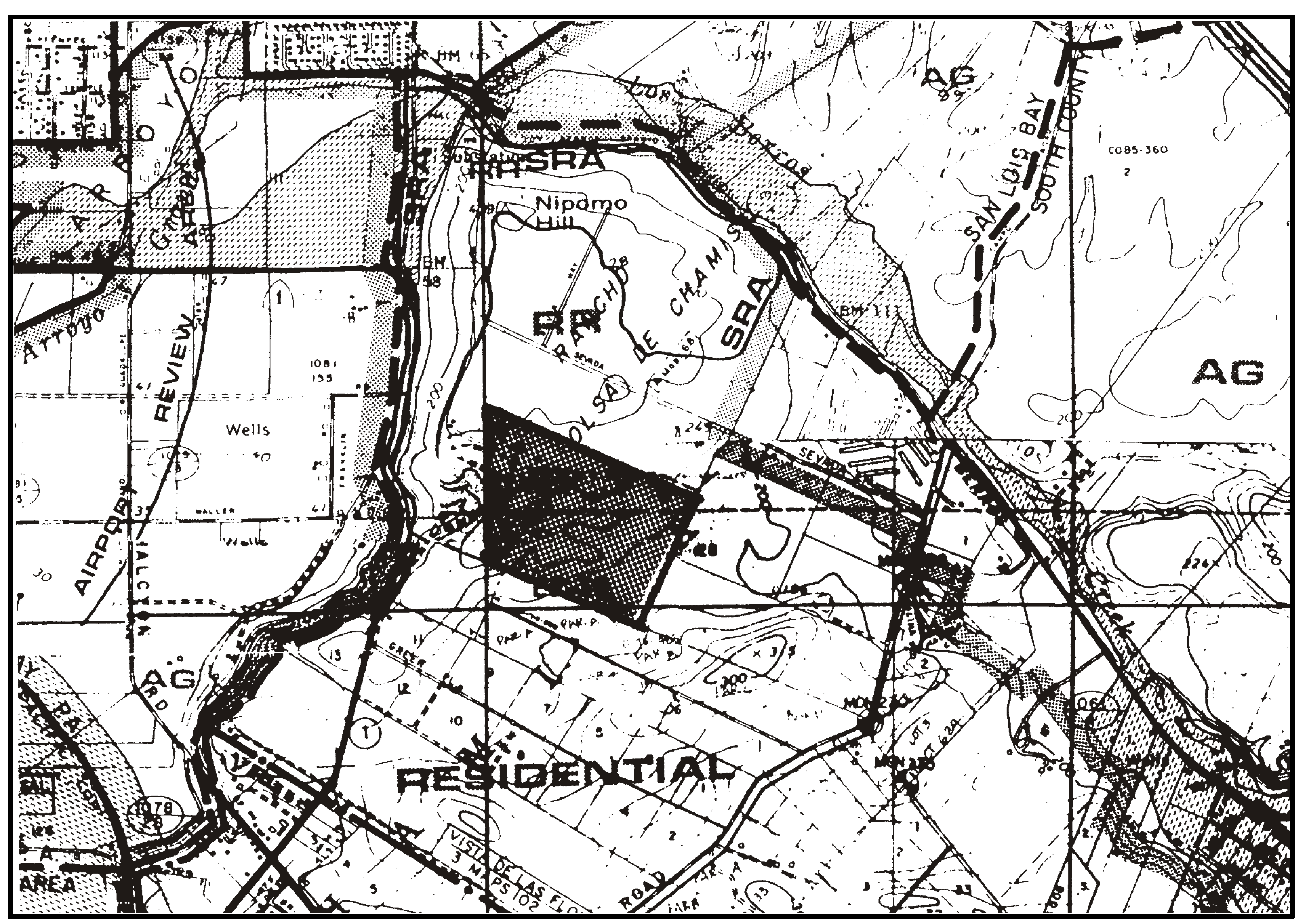
Figure 98-39: RR - Tract 49
7.
Zenon Way area - Control of erosion affecting Black Lake Canyon. Development proposed on properties created by parcel map CO 76-196, located west of Zenon Way and bordered on the south by Black Lake Canyon (see Figure 98-39), shall utilize one of the following techniques to minimize any erosion impacts on the Black Lake Canyon sensitive resource area that might result from new development:
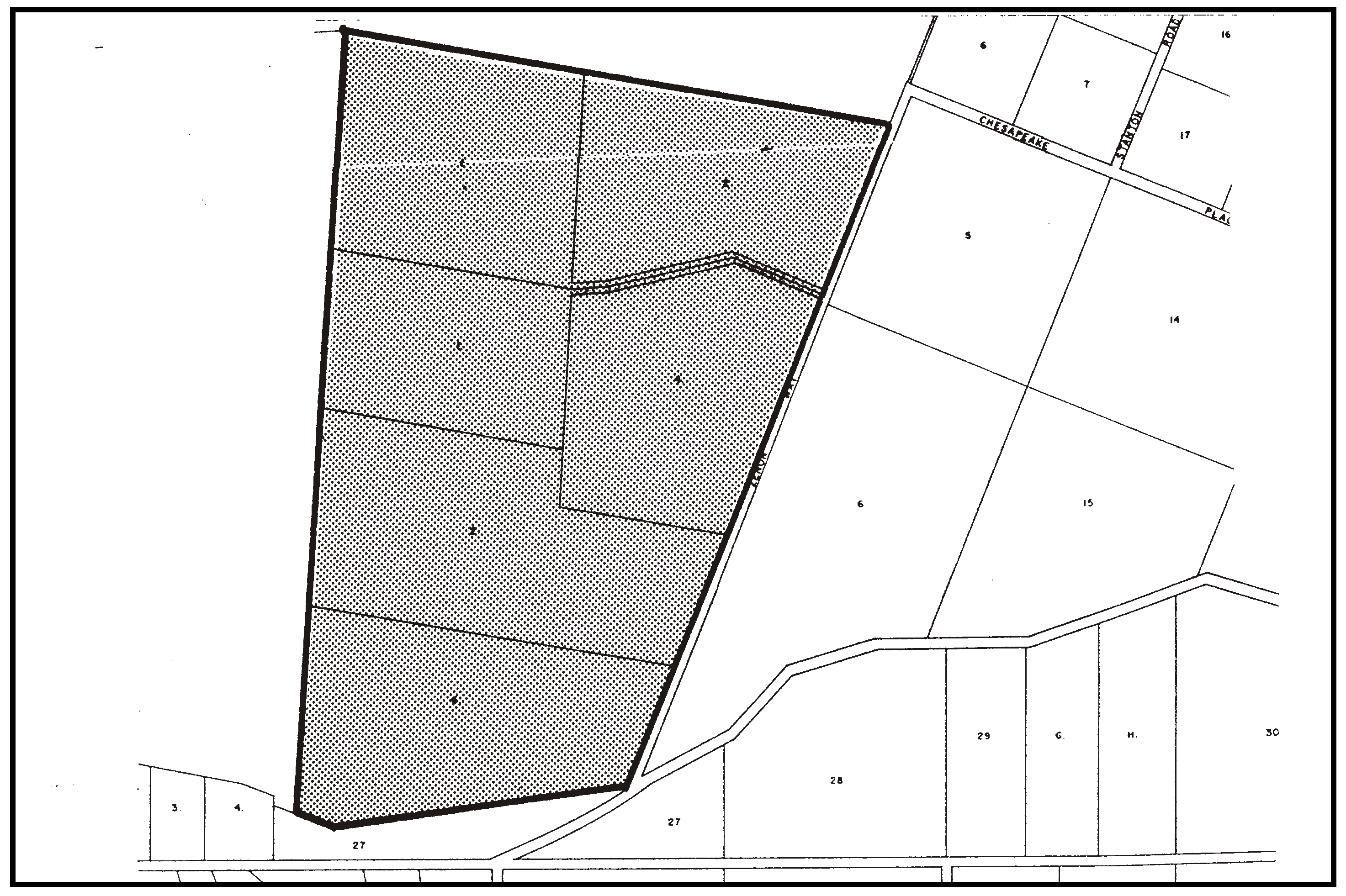
Figure 98-40: RR - Zenon Way Area
a.
Cluster development north of the crest of the major dune ridge that forms the boundary of the canyon drainage area (see Figure 6 of the final EIR for General Plan Amendment G830513:1, Mesa Property Owners Association); or
b.
If development is proposed south of the dune ridge, prepare a drainage and erosion control plan in compliance with Chapter 22.52, and to include at least the collection of concentrated runoff in non-erosion devices for conveyance to the bottom of the canyon with energy dissipators provided at the outlets in the canyon bottom.
These standards will be considered for clarification and revision during the Black Lake Canyon General Plan amendment and environmental impact review process. As part of the General Plan amendment, an inventory of canyon resources and necessary protective measures is being prepared in the Black Lake Canyon Enhancement Plan.
8.
Summit Station Road area - Development standards with community water service. The following standards apply to the Summit Station Road area as shown in Figure 98-42. The land owners may elect or choose to establish a community water service system within the boundaries of the Summit Station Road area shown in Figure 98-41. If community water service provided by a public agency is established within this area, then the following standards apply to all properties within the service area boundaries:
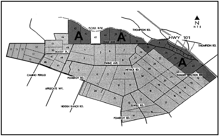
Figure 98-42: RR - Summit Station Road
a.
Agency approval. Prior to establishment of water service, the purveyor shall obtain approval from all appropriate agencies in order to provide water service within Summit Station Road area and to install the necessary improvements.
b.
Area boundaries. There shall be no change to the Summit Station Road area boundaries shown in Figure 98-41 that will result in an expansion of the boundary area or that increases the number of parcels that may be served without an amendment to this Title for that purpose.
c.
Community services. No urban level community services except for community water service shall be provided within the Summit Station Road area.
d.
Archaeological Resources. At the time of construction, land use and land division permit application submittal, the applicant shall provide an archaeological/historic surface survey, conducted by a qualified (historic) archaeologist approved by the environmental coordinator for all ground disturbing activities (e.g., roads, driveways, residences). If any resources are found by the archaeologist or were identified from a previous survey, the following process shall be used to minimize impacts:
(1)
Development shall be relocated so no building and grading activities will occur within the identified archaeologically sensitive area(s).
(2)
If the applicant can satisfactorily show to the county that construction cannot avoid identified archaeological resources, the applicant shall implement the recommendations of the archaeologist as determined appropriate by the environmental coordinator.
(3)
For parcels located along the eastern terminus of Summit Station Road and along Frontage Road and Los Berros Road (shown as "A" in Figure 98-41), the cultural resources reconnaissance shall include analysis of the potential presence of historic resources associated with the former Pacific Coast Railroad.
e.
Biological Resources. At the time of construction, land use or land division permit application, whichever occurs first, the applicant shall provide a botanical and biological report, prepared by a qualified botanist and biologist, approved by the environmental coordinator.
(1)
These reports shall, at a minimum, include the following sensitive species:
(A)
Special Status Plant Species - Well's manzanita; sand mesa manzanita; Santa Margarita manzanita; Santa Lucia manzanita; Mile's milk-vetch; San Luis mariposa lily; Brewer's spineflower; Pismo clarkia; leafy tarplant; dune larkspur; Kellogg's horkelia; San Luis Obispo County lupine; and black-flowered figwort; and any other special status species identified by the state or federal government or other recognized source.
(B)
Sensitive Plant Communities - Maritime Chaparral, Oak woodland/savannah; Eucalyptus woodland; and Wildlife movement habitat.
(C)
Trees - All tree species, the location, diameter at breast height (four feet from the ground) and the number of trees to be removed or impacted (disturbance within the trees canopy/drip line).
(D)
Monarch butterfly habitat (prepared during the over-wintering period, generally November and March, and only in areas of high concentrations of eucalyptus groves);
(E)
California tiger salamander and western spadefoot toad aestivation habitat (habitat in which the salamanders remain dormant during the summer months and months of drought); and
(F)
Burrowing owls nesting habitat (February through July);, loggerhead shrike nesting habitat (generally February through June); or raptor nesting habitat (generally March through August).
(2)
Botanical surveys shall be performed during the appropriate blooming period for the plant species. Any sensitive species/communities or trees found within project boundaries shall be shown on all applicable construction plans. New structures shall be placed in a manner that avoids removal of special status species, sensitive plant communities, and trees. If the property owner shows the County that the special status species, sensitive plant communities, or trees cannot be avoided, the project proponent shall obtain appropriate permits from other agencies with jurisdiction (e.g., USFWS or CDFG), to ensure that there is no violation of policy or legislation that protects the special status plant species, sensitive plant community, or trees. As appropriate, the project proponent shall also provide the County with a plan to relocate and/or replace special status plants and/or trees that are removed or impacted.
f.
Drainage. Unless otherwise specified by the County Public Works Department, all drainage from future development shall be retained on-site.
g.
Fire Safety. New development shall comply with the following measures:
(1)
Application for accessory dwelling units, land divisions and allowed commercial development shall show how the project will meet the adopted Fire Code. Primary residences are allowed on undeveloped lots created prior to January 1, 2005 if evidence is provided with the construction permit application that a minimum fire flow of 500 gpm at 20 psi is available and that additional fire safety measures will be installed prior to the final inspection as specified by the County Fire Department.
(2)
Prior to occupancy of any new residence, all recommended fire safety plan measures shall be in place and approved by CDF, as necessary. Access roads and driveways shall be paved as determined necessary by CDF.
h.
Air Quality. Ultramafic bedrock (which may include naturally-occurring asbestos) is sometimes associated with fault zones. A fault zone and shallow ultramafic bedrock have been encountered on the east side of Highway 101. Therefore, the following measures shall be adhered to during all ground moving activities and shown on all applicable plans prior to permit issuance:
(1)
During all grubbing, excavating and grading of the site, adequate watering of all areas where earthmoving is occurring shall be done as often as necessary to avoid creating any airborne dust. Any exposed soils to be left for more than 30 days shall be regularly wetted and hydroseeded, or treated in a manner that eliminates airborne dust, as soon as the earthwork is completed.
(2)
Should bedrock (Bedrock is generally considered the solid rock that underlies unconsolidated material or soil, and does not include alluvium, terrace deposits, colluvium, basin deposits, beach deposits or dune deposits). be encountered, work shall stop within 50 feet of this area and a geologic investigation shall be prepared to determine the presence of naturally-occurring asbestos, and then submitted to the county. Until results have been provided on the presence of asbestos, this area shall be kept moist at all times.
If naturally occurring asbestos is found at the site, the applicant must comply with all requirements outlined in the Asbestos State Air Resources Board Air Toxics Control Measure (ATCM) for Construction, Grading, Quarrying, and Surface Mining Operations, before grading continues in this area. These requirements may include, but are not limited to, 1) preparation of an "Asbestos Dust Mitigation Plan", which must be approved by APCD before grading in this area continues; 2) an "Asbestos Health & Safety Program", as determined necessary by APCD. (For any questions regarding these requirements, contact the County of San Luis Obispo Air Pollution Control District.
i.
Water Conservation Plan. Prior to construction permit issuance, a Water Conservation Plan shall be submitted for county approval. The plan shall incorporate all feasible indoor and outdoor water conservation measures to reduce water consumption. County-approved measures shall be included on all applicable plans and installed prior to final inspection.
j.
Water Service. Prior to issuance of a construction application for new development, a valid "intent-to-serve" letter from the Nipomo Community Services District shall be submitted to the county. A valid District "will-serve" letter shall be submitted to the county prior to final inspection or occupancy, whichever occurs first.
9.
Los Berros Road property. The following standards apply to the property on Los Berros Road (see Figure 98-43).
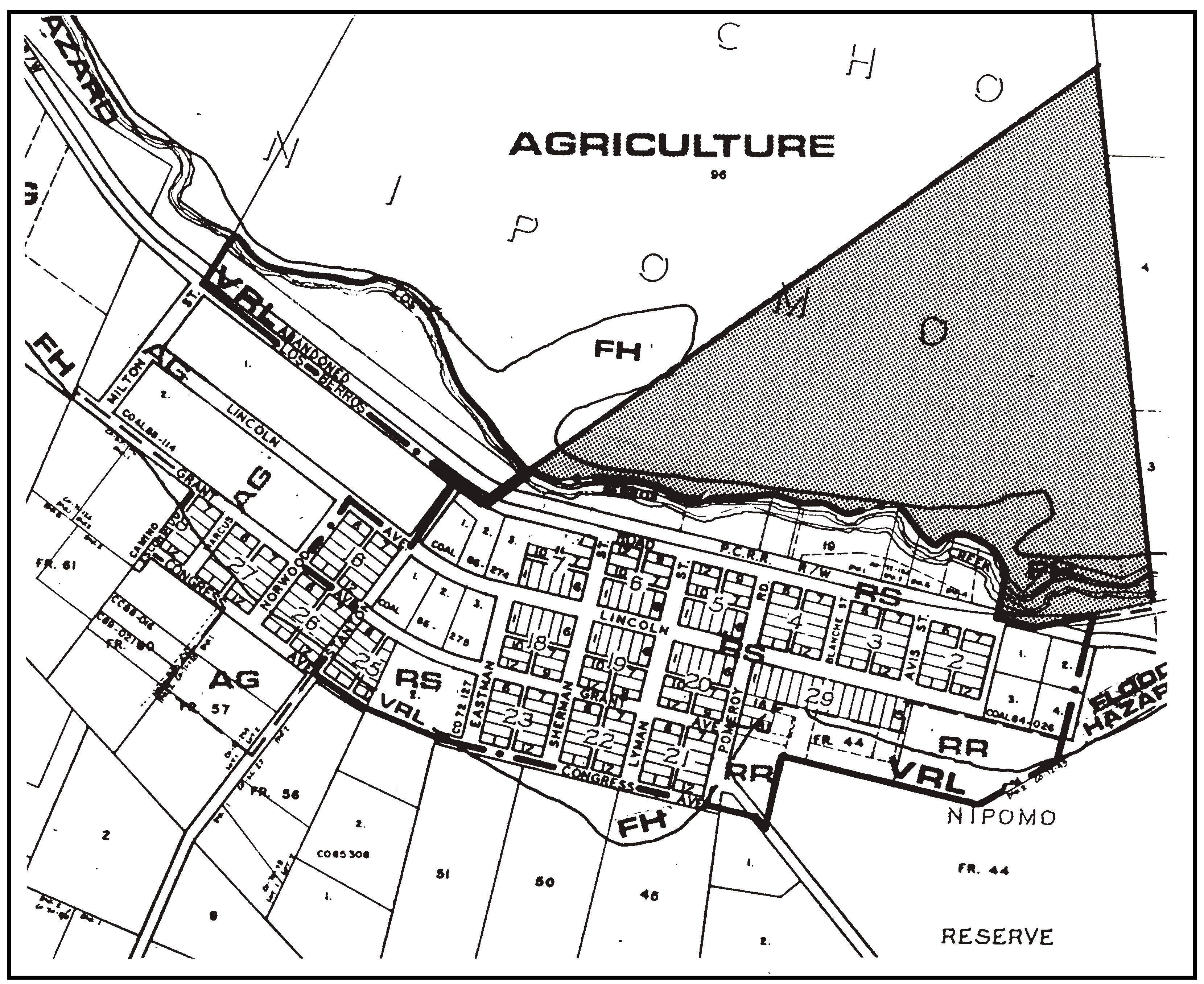
Figure 98-43: RR - Los Berros Road Property
a.
Subdivision requirement. Land divisions shall be clustered in compliance with Section 22.22.140. The residential parcels shall be located to avoid significant potential impacts on agricultural use of the prime Class II soils and on the riparian habitat of Los Berros Creek.
b.
Density limitation. The number of parcels shall be based on no more than one parcel per 10 acres.
c.
Water supply. At the time of Conditional Use Permit application for the residential subdivision, a detailed hydro-geologic analysis shall be completed. The analysis shall be prepared such that long-term water availability is determined to be adequate for the residential subdivision and agricultural use of the property. The data used in the analysis shall provide for conclusions with a high degree of certainty, and shall be based on 1) monitoring over a certain period (as recommended by the hydrogeologist), 2 recent, detailed existing information on water availability, or 3) a combination of these two.
10.
Green Canyon Property. The following standards apply only to land shown in Figure 98-44 south of Woodhaven Way.
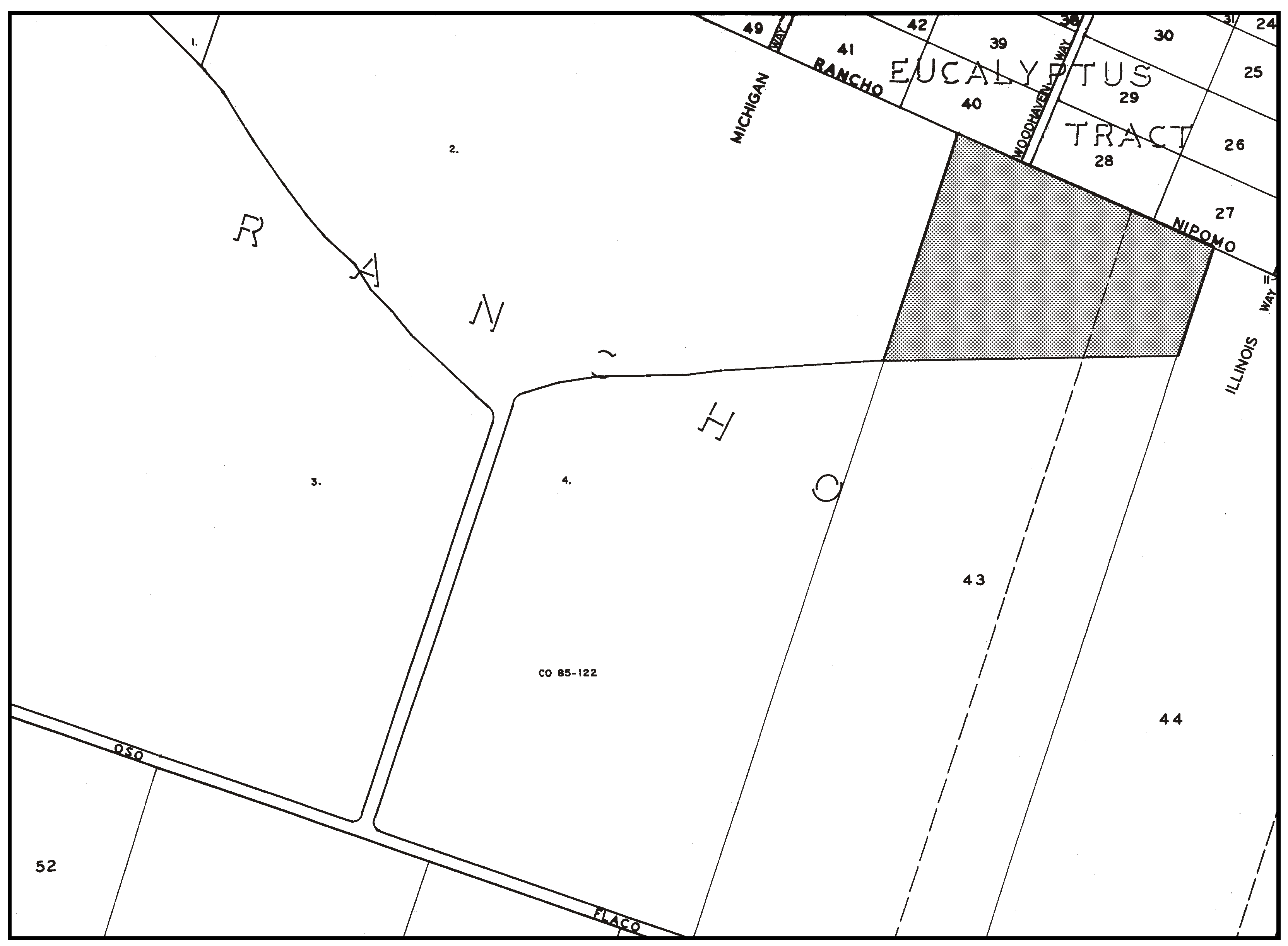
Figure 98-44: RR - Green Canyon Property
a.
Biological Resources. To protect maritime chaparral and coastal dune scrub habitats, the following measures shall be followed for all development:
(1)
No vegetation clearance shall occur until such time as specific development is proposed. At that time, all efforts will be made to preserve the existing chaparral and coastal scrub habitats. Prior to any vegetation removal a botanical report shall be prepared for all areas proposed for disturbance. In the event sensitive plant species or habitats are encountered, appropriate measures (e.g., avoidance, on-site reestablishment, off-site acquisition, etc.) shall be completed to reduce impacts to less than significant levels.
(2)
All future landscaping shall be of native plants compatible with existing chaparral and coastal scrub habitats.
(3)
Equestrian activity shall be limited to the on-site trail.
(4)
All underground utilities shall be either immediately adjacent to or within all access driveways.
(5)
No grazing animals shall be allowed.
(6)
No vegetation shall be removed below the edge of the bluff top.
b.
Drainage, Sedimentation and Erosion Control. To avoid potential bluff face impacts, the following measures shall be required for all new development:
(1)
All drainage from future development, including the multi-use trail, shall be retained on site and directed away from the bluff face;
(2)
No grading or ground disturbance shall be allowed below the top edge of bluff;
(3)
All grading or ground disturbance shall adhere to the "Black Lake Canyon/Nipomo Bluff Grading & Vegetation Removal Guidelines."
c.
Rural Character. To maintain a rural character, new development shall adhere to the following guidelines:
(1)
Sufficient native landscaping will be used or use of existing topography to accomplish an 80 percent screening of new development, as seen from Highway 1 and Oso Flaco Road;
(2)
All night lighting shall be directed down and into the development with no direct light visible from surrounding public roads;
(3)
Cluster subdivisions are not allowed
d.
Cultural Resources. Prior to any ground disturbance:
(1)
An archaeological surface survey shall be prepared for areas where disturbance is proposed (including any disturbance needed for off-site improvements). In the event sensitive areas are encountered, any necessary additional work shall be performed and all feasible measures (e.g., avoidance, redesign, clustering, etc.) shall be incorporated into the ground disturbing activities to minimize impacts to the greatest extent possible.
e.
Multi-Use Trail. The trail easement dedicated as part of Parcel Map CO03-0336 shall be retained in perpetuity for an equestrian and hiking trail (above the bluff top edge). When developed, the trail shall include the following elements: provides a connection to existing bluff top trail and/or dedicated trail easement, avoids drainage and erosion impacts to bluff face, and minimizes impacts to existing native vegetation and archaeological resources.
11.
Northeast corner Willow and Guadalupe roads. The following standards apply only to land shown in Figure 98-45 at the northeast corner of the intersection of Willow Road and Guadalupe Road.
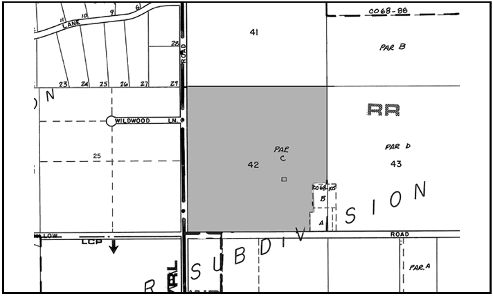
Figure 98-45: RR - Corner Willow and Guadalupe Roads
a.
Application submittal. At the time of land division application, the applicant shall submit the following information and incorporate the following design standards into the proposed project, in addition to the areawide standards set forth in Subsection H.1:
(1)
If street lighting is proposed, a street lighting plan shall be submitted at the time of application for land division. The street lighting plan shall include only the number of light posts and fixtures necessary for public safety. The lighting plan shall be designed to minimize the amount of light and glare visible to public roadways including Willow Road and Highway 1.
(2)
A survey for over-wintering monarch butterflies prepared by a County approved biologist during the over-wintering period between October and February shall be submitted at the time of application for land division. The report shall include documentation of any observed monarch butterflies on or adjacent to the project site, a discussion of potential impacts, and recommended mitigation measures including strategic timing of development and buffer zones. The design of the proposed land division shall include any recommendations contained in the report.
(3)
A comprehensive botanical survey report prepared by a County approved biologist, in compliance with CDFG guidelines, and conducted during the flowering period after rains have subsided shall be submitted at the time of application for land division. The report shall include survey findings, a map showing the location of any sensitive, special-status plant species, and recommended mitigation measures. The design of the proposed land division shall include any recommendations contained in the report.
(4)
A noise study prepared by a County-approved noise analyst shall be submitted at the time of application for land division. The noise study shall document the existing ambient noise level contours on the project site, identify areas potentially affected by significant levels of noise (both indoor and outdoor), and recommend mitigation measures to avoid or reduce noise impacts. The design of the proposed land division shall include any recommendations contained in the report.
(5)
Soil borings at each proposed leach line location showing adequate separation, or if inadequate separation, plans for an engineered wastewater system shall be submitted at the time of application for land division.
(6)
The design of the proposed land division shall Incorporate agriculture buffers and site design consistent with the County's Agriculture and Open Space Element.
12.
Sejera Property. The following standards apply only to land shown in Figure 98-46 located 1,400 feet north of the Los Berros/Thompson Road highway interchange.
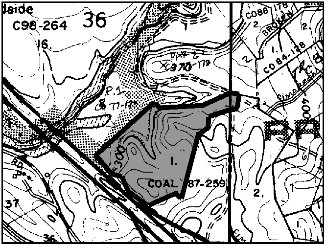
Figure 98-46: RR - North of Los Berros/Thompson Interchange
a.
Application submittal. At the time of land division application, the applicant shall submit the following information and incorporate the following design standards into the proposed project, in addition to the areawide standards set forth in Subsection H.1:
(1)
At the time of land division application, the applicant shall show no more than five parcels on the tentative map.
(2)
At the time of land division application, building sites shall be shown on the tentative map. The building sites shall:
•
avoid any sensitive and special status plant and animal species as shown through the preparation of a comprehensive biological survey report prepared by a County approved biologist;
•
be located in the least visible portions of the sites as shown through the preparation of a visual analysis prepared by a County approved visual consultant; and
•
be located outside of the 60dbA or less area as delineated in the Noise Element of the County General Plan.
•
All new residential development shall be located within the building control lines.
(3)
At the time of land division application, the applicant shall submit architectural elevations of all proposed structures to the Department of Planning and Building for review and approval in consultation with the Environmental Coordinator. The elevations shall show exterior finish materials, colors, and height above the existing natural ground surface. Colors shall minimize the structure massing of new development by reducing the contrast between the proposed development and the surrounding environment. Colors shall be compatible with the natural colors of the surrounding environment, including vegetation, rock outcrops, etc. Darker, non-reflective, earth tone colors shall be selected for walls, chimneys etc. and darker green, grey, slate blue, or brown colors for the roof structures. All structures shall have a maximum building height of 25 feet above natural grade.
(4)
The design of the proposed land division shall incorporate agriculture buffers within a range of 250 to 500 feet and site design consistent with the County's Agriculture and Open Space Element. Future subdivision applications shall be referred to the County Department of Agriculture for review and recommendation of the specific agriculture buffer required.
(5)
At the time of land division application, soil borings at each proposed leach line location showing adequate separation, or if inadequate separation, plans for an engineered wastewater system shall be submitted.
13.
West El Campo Road Area. The following standards apply only to land highlighted in 98-47 near the West El Campo Road and Los Berros Road intersection.
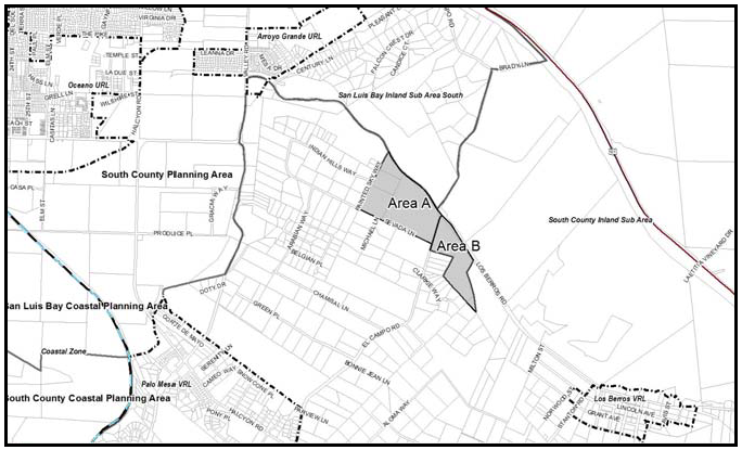
Figure 98-47: RR - West El Campo Road Area
a.
Subdivision requirement. The following standards apply only to Area B as shown in Figure 98-47.
(1)
Land division shall be clustered in compliance with the cluster division requirements in Section 22.22.140. Required open space parcel(s) shall be used to minimize impacts to visual resources.
(2)
Development requirements of Subsection H.14.b shall be included on an additional map sheet with any subdivision and CC&Rs as necessary to inform lot purchasers and owners.
b.
Development requirements. The following standards apply only to Area B as shown in Figure 98-46. At the time of application for construction permits, the applicant shall clearly delineate the following items:
(1)
The top of all cut and fill slopes on the project plans shall be rounded off to a minimum radius of five feet. No cut or fill area that will be visible from Los Berros Road shall exceed five feet in vertical height above or below the existing ground surface. For any visible cuts from Los Berros Road, sufficient topsoil shall be stockpiled and reapplied or re-keyed over these visible cut areas to provide at least 8" of topsoil for the reestablishment of vegetation. As soon as the grading work has been completed, the cut and fill slopes shall be reestablished with non-invasive, fast-growing vegetation.
(2)
The height of new development above the existing natural ground surface on the project plans. New development shall not exceed 20 feet in height above the existing ground surface.
(3)
All water tanks shall be located in the least visually prominent location feasible when viewed from Los Berros Road. Screening with topographic features, existing vegetation or existing structures shall be used as feasible. If the tank(s) cannot be fully screened with existing elements, then the tank(s) shall be a neutral or dark, non-contrasting color, and landscape screening shall be provided. The applicant shall provide evidence that the proposed tank(s) are as low profile as is possible, given the site conditions. Landscape material must be shown to do well in existing soils and conditions, be fast-growing, evergreen and drought tolerant. Shape and size of landscape material shall be in scale with proposed tank(s) and surrounding native vegetation. Plans shall show how plants will be watered and what watering schedule will be applied to ensure successful and vigorous growth.
(4)
The elevations of proposed buildings shall show exterior finish materials, colors, and height above the existing natural ground surface. Colors shall minimize the structure massing of new development by reducing the contrast between the proposed development and the surrounding environment. Colors shall be compatible with the natural colors of the surrounding environment, including vegetation, rock outcrops, etc. Darker, non-reflective, earth tone colors shall be selected for walls, chimneys etc. and darker green, grey, slate blue, or brown colors for the roof structures. All color selections shall fall within a "chroma" and "value" of 6 or less, as described in the Munsell Book of Color (review copy available at County.
(5)
Landscape, irrigation, landscape maintenance plans and specifications shall be submitted to the Department of Planning and Building for review and approval in consultation with the Environmental Coordinator. The landscape plan shall be prepared as provided in Chapter 22.16 of the San Luis Obispo County Land Use Ordinance and shall provide vegetation that will adequately blend the new development, including driveways, access roads, outbuildings, water tanks, etc., into the surrounding environment when viewed from Los Berros Road.
(6)
Retaining walls, sound walls, and understories that exceed six feet in height shall be constructed in colors and tones compatible with the surrounding environment, and shall use textured materials and/or construction methods which create a textured effect, when viewed from Los Berros Road. Landscaping that will either screen from in front or grow over from above the wall shall be established prior to final inspection or issuance of a certificate of occupancy, whichever occurs first.
c.
Agricultural Resource Protection. The following standards apply only to Areas A and B as shown in Figure 98-46.
(1)
Subdivision map requirement. Future land divisions should be referred to the Agriculture Department to evaluate potential impacts due to proposed site configuration or to current agricultural operations. Any subdivision map shall include an Additional Map Sheet with the requirement that prior to transfer of the parcels created by any subdivision, the applicant shall disclose to the prospective buyers of all parcels created by the proposal concerning the consequences of existing and potential intensive agricultural operations on adjacent parcels including, but not limited to: dust, noise, odors and agricultural chemicals and the county's Right to Farm ordinance currently in effect at the time said deed(s) are recorded.
(2)
Agricultural Buffers. Before recordation of a subdivision map, a specific recorded buffer distance determination should be made at the time of future division, similar to the buffer areas shown in Figure 98-48. If development of the parcels occurs before subdivision, prior to issuance of construction permits, the applicant shall provide agricultural buffer(s) for future occupied structures, to be recorded in the chain of title on the subject properties equal to the distances shown in Figure 98-48. At the time of application for construction permits, the applicant shall clearly delineate the agricultural buffer on the project plans and locate any proposed habitable structure outside of this buffer. No structures intended or used for human habitation shall be constructed in the buffer area. The agricultural buffer shall no longer be in effect if the adjacent agricultural use is discontinued.
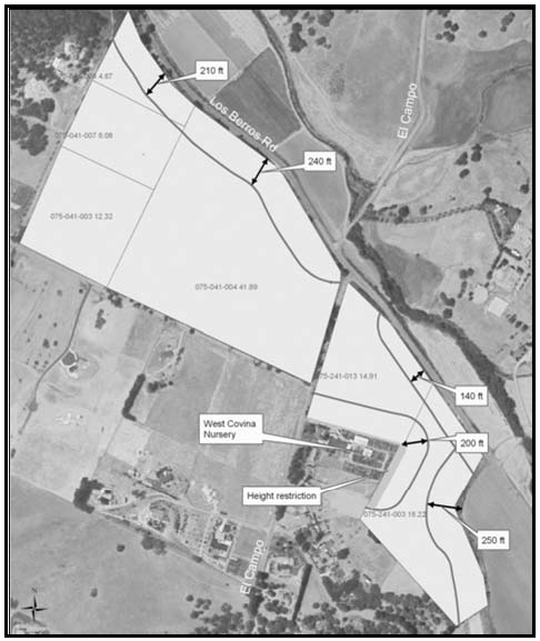
Figure 98-48: RR - Ag Buffers
(3)
Drainage Plan. Prior to issuance of construction permits, provide a Drainage/Erosion and Sediment Control Plan to show the installation of on-site stormwater facilities. Stormwater facilities should be adequately sized and engineered to avoid impacts to down-gradient agricultural fields.
(4)
Height limitations for Area B, as shown in 98-47. These height limitations are to ensure that vegetation and/or structural development will not adversely shade the adjoining nursery operation. The height limitation along the western border of Area A within the 200-foot agricultural buffer shall be stepped with increasing distance from the property line. The height limit for either vegetation or structures shall be: (1) 6 feet within 15 feet of the property line, (2) 10 feet within 15-30 feet of the property line, (3) 20 feet within 30-60 feet of the property line, as shown in Figure 98-49.
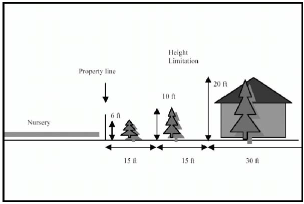
Figure 98-49: RR - Setbacks and Height Limits
d.
Biological Resources. The following standards apply only to land highlighted in Figure 98-46:
(1)
Biological Report. At the time of construction, land use or land division permit application, whichever occurs first, the applicant shall provide a botanical and biological report, prepared by a qualified botanist and biologist, approved by the environmental coordinator. Botanical surveys shall be performed during the appropriate blooming period for the plant species. These reports shall, at a minimum, include the following sensitive species:
(i)
Special Status Plant Species - Pismo clarkia; dune larkspur; and any other special status species identified by the state or federal government or other recognized source.
(ii)
Sensitive Plant Communities - Eucalyptus woodland
(iii)
All tree species, the location, diameter at breast height (four feet from the ground) and the number of trees to be removed or impacted (disturbance within the trees canopy/drip line).
(iv)
Monarch butterfly habitat (prepared during the over-wintering period, generally November and March, and only in areas of high concentrations of eucalyptus groves);
(v)
Burrowing owls nesting habitat (February through July);, loggerhead shrike nesting habitat (generally February through June); or raptor nesting habitat (generally March through August).
(2)
New Development. Any sensitive species/communities or trees found within project boundaries shall be shown on all applicable construction plans. New development (including roads and infrastructure) shall be placed in a manner that avoids removal of special status species, sensitive plant communities, and trees. If the special status species, sensitive plant communities, or trees cannot be avoided, appropriate permits from other agencies with jurisdiction (e.g., USFWS or CDFG) shall be obtained, to ensure that there is no violation of policy or legislation that protects the special status plant species, sensitive plant community, or trees. As appropriate, a plan to relocate and/or replace special status plants and/or trees that are removed or impacted shall be submitted.
(3)
Open Space Easement. If the botanical or biological report indicates the presence of sensitive species, an open space easement should be provided over the location of the remaining population (excluding small separate populations where it would be difficult to manage and enforce the open space easement). In the open space easement, indicate allowable uses such as existing roads, mowing or grazing between Sept 1 and March 1. A perimeter fence around the sensitive species population - including 50-foot buffer - should be considered. Grazing and mowing should only be allowed from September 1st to March 1st. No discing should be allowed for sensitive species areas.
e.
Cultural Resources. The following standards apply only to land highlighted in Figure 98-46:
(1)
Archeological Report. At the time of construction, land use or land division permit application submittal, the applicant shall provide an archaeological/ historic surface survey, conducted by a qualified archaeologist approved by the environmental coordinator. If any resources are found by the archaeologist or were identified from a previous survey, the following process shall be used to minimize impacts:
(i)
Development and/or subdivision plans shall be redesigned so no building and grading activities will occur within the identified archaeologically sensitive area(s).
(ii)
If the applicant can satisfactorily show to the county that construction cannot avoid identified archaeological resources through the design and/or scale of the project, the applicant shall implement the recommendations of the archaeologist as determined appropriate by the environmental coordinator, including additional archaeological investigations.
(iii)
For parcels located along the Los Berros Road, the cultural resources reconnaissance shall include analysis of the potential presence of historic resources associated with the former Pacific Coast Railroad.
I.
Residential Suburban (RS) Hutton Road area. The following standards apply only to the area within the Residential Suburban land use category west of Hutton Road (see Figures 98-28 and 98-50).
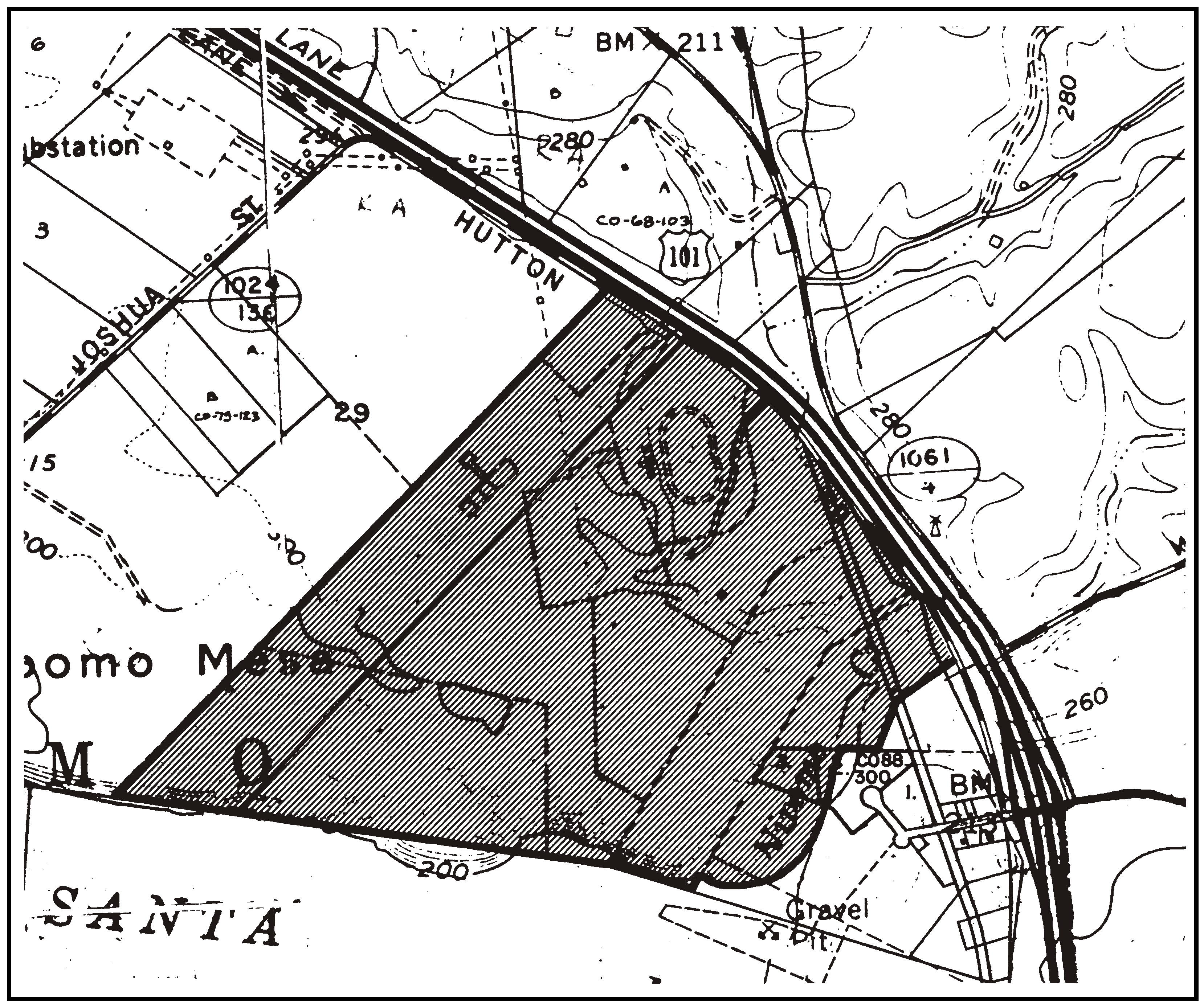
Figure 98-50: RS - Hutton Road Area
1.
Limitation on use. Land uses identified Section 22.06.030 as allowable, permitted, or conditional uses within the RS land use category may be authorized in compliance with the land use permit requirements of that Section, except: child day care; grocery stores; schools - elementary and secondary; nursing and personal care; and restaurants.
2.
Permit requirement. Conditional Use Permit approval is required prior to any further division of these properties.
3.
Site planning. Proposed projects shall be planned in compliance with the provisions of Section 22.22.140 for cluster development.
4.
Location criteria - Residential uses. Residential uses are not permitted in the area used for row crops lying south of the existing race track, west of Hutton Road.
5.
Storm water run-off. Storm water run-off caused from man-made impervious surfacing or from grading that alters the natural landscape shall be retained on-site.
6.
Minimum floor elevation. All buildings must be constructed to have a minimum floor elevation of 209 feet above mean sea level.
7.
Nipomo Creek restoration. Where determined necessary, provide plantings, fencing and other appropriate construction to restore the Nipomo Creek riparian habitat.
8.
Cultural Resources - Historic. Prior to acceptance as complete for processing, for any application for any new development on 2008 Assessor Parcel Number 090-302-026 (shown as "Site D" in Figure 98-27), a qualified cultural resource professional, as approved by the County (historian/architectural historian) shall be retained to conduct a historical evaluation of the Nelson farmhouse and barn, and any associated outbuildings, animal pens, and farm equipment. The historic structure evaluation should include the history of the property, and the farm complex should be recorded on appropriate California Department of Parks and Recreation (DPR) forms. Any important/significant historic resources identified shall be mitigated as specified by the historical evaluation prior to its demolition or relocation.
9.
Cultural Resources - Pre-Historic. Prior to acceptance as complete for processing for any application for any new development on 2008 Assessor Parcel Numbers 090-302-34 and 090-302-35 (shown collectively as "Site E" in Figure 98-27), a Phase I archaeological survey shall be conducted. All recommended measures shall be required of new development to reduce impacts to less than significant levels.
[Amended 1982, Ord. 2096; 1983, Ord. 2122; 1983, Ord. 2157; 1985, Ord. 2215; 1986, Ord. 2289; Added 1993, Ord. 2614; 2002, Ord. 2968; Amended 1997, Ord. 2800; 2002, Ord. 2968; Added 2004, Ord. 3031; Amended 2004, Ord. 3030; Added 2004, Ord. 3031; Amended 2004, Ord. 3053; Rescinded 2004, Ord. 3055; Added 2005, Ord. 3068; 2005, Ord. 3074; Amended 2006, Ord. 3097; 2006, Ord. 3104; Added 2008, Ord. 3144; 2010, Ord. 3208; 2014, Ord. 3256; 2015, Ord. 3291; 2017, Ord. 3358; 2018, Ord. 3369; 2018, Ord. 3377; 2020, Ord. 3409; 2020, Ord. 3417; 2024, Ord. 3509; 2025, Ord. 3531]