
Seguin City Zoning Code
CHAPTER 3
- ZONING AND LAND USE
Sec. 3.1. - [In general.]
3.1.1.
Intent. The purpose of this section is to protect and promote the public health, safety and general welfare, and to implement the policies of the Comprehensive Master Plan by classifying and regulating the uses of land and structures within the City of Seguin in a manner consistent with the Master Plan. To achieve this purpose, it is the intent of this section to:
•
Provide standards for the orderly development of the City and continue a stable pattern of land uses;
•
Conserve and protect the historical integrity and character of the City's neighborhoods;
•
Maintain and protect the value of property;
•
Ensure the provision of adequate open space for light, air, and fire safety;
•
Promote the economic stability of existing land uses that conform to the master plan and protect them from intrusions by inharmonious or harmful land uses;
•
Ensure compatibility between land uses; and
•
Encourage a pedestrian-friendly community by promoting a mix of land uses and pedestrian-oriented development in commercial areas.
3.1.2.
Application of Requirements. This section applies in the following areas:
3.1.3.
Chapter Components. This chapter includes the following sections:
º
Official Zoning Map
º
Zoning Districts
º
Overlay Districts
º
Limited Uses
º
Lot Dimensional Requirements
3.1.4.
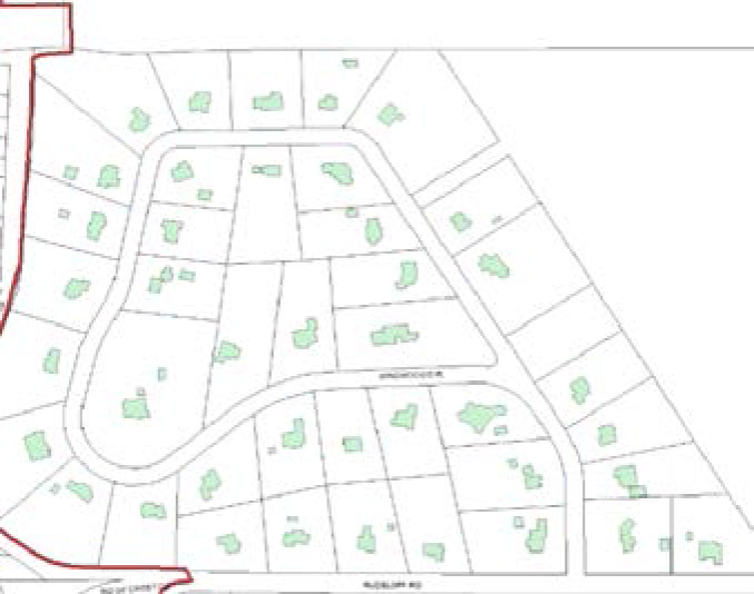
Official Zoning Map. The City is hereby divided into zones or districts, and the boundaries of zoning districts set out are delineated upon the Zoning Map of the City. The Zoning Map is maintained by the Planning Director.
3.1.5
Deleted byOrd. No. 2015-44.
(Ord. No. 2015-44, § 1, 7-1-15)
Sec. 3.2. - Zoning districts.
3.2.0.
The zoning districts included in this chapter provide for the type and character of development that is allowed in various parts of the City. This Unified Development Code includes provisions for 18 zoning districts and 7 overlay districts.
3.2.1.
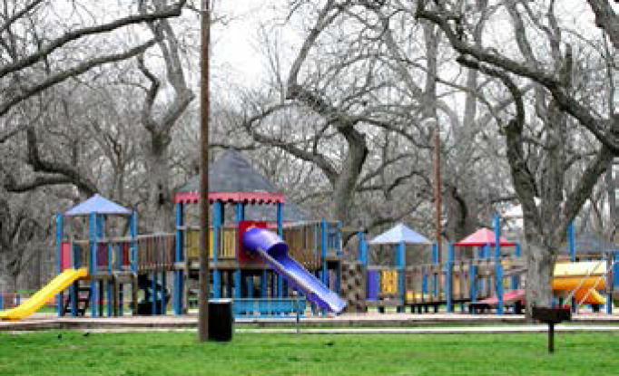
Agricultural Ranch (A-R).
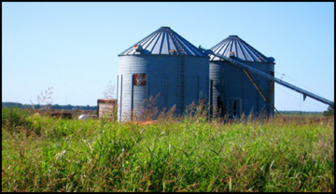

Above pictures are general representations of structures and uses found within zoning district
A.
Purpose. The Agricultural-Ranch District is designed to promote orderly, timely, economic growth and to recognize current land use conditions. It is the intent of this district that agricultural land and ranch land be held in that use for as long as is practical and reasonable.
B.
Uses. For a detailed listed of permitted, limited and special uses please refer to the land use matrix. General permitted uses include the following:
•
Single-family home
•
Community Center
•
Playground
•
Vet hospital/clinic
•
Farming, ranching and related activities
C.
Site Development Requirements.Chapter 5 contains information on the following site development requirements:
•
Landscaping
•
Buffering
•
Screening
•
Parking
•
Tree Removal
•
Lighting
•
Fencing
•
Detention and Drainage
•
Building Setbacks
•
Lot Requirements
3.2.2.
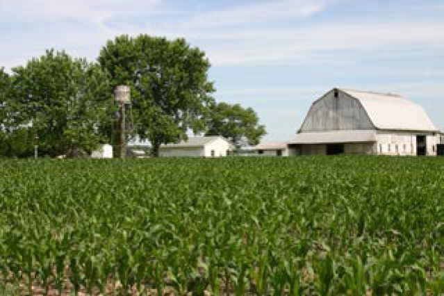
Rural Residential (R-R).
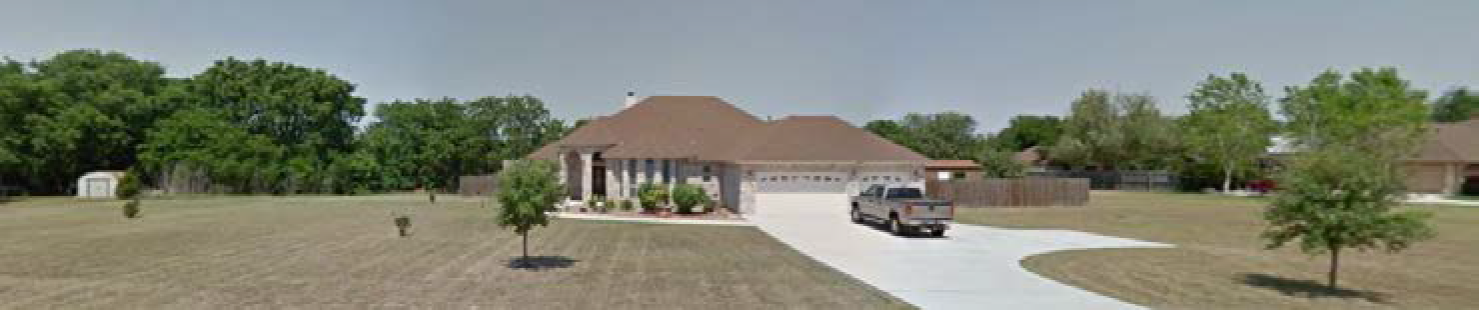
Above pictures are general representations of structures, open space, lot size and uses found within zoning district
A.
Purpose. To provide areas for large-lot residential home sites, on land that has minimal farming or ranching value, that create country living in a rural atmosphere while preserving the vegetation, significant geological features, wildlife habitat/corridors, views and privacy, and provide an appropriate transition from urban development to agricultural areas.
B.
Uses. For a detailed listed of permitted, limited and special uses please refer to the land use matrix. General permitted uses include the following:
•
Single-family home
•
Community Center
•
Playground
C.
Site Development Requirements.Chapter 5 contains information on the following site development requirements:
•
Landscaping
•
Buffering
•
Screening
•
Parking
•
Tree Removal
•
Lighting
•
Fencing
•
Detention and Drainage
•
Building Setbacks
•
Lot Requirements
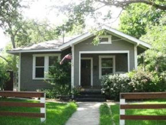
3.2.3.
Suburban Residential (S-R).
Above pictures are general representations of structures and uses found within zoning district
A.
Purpose. The S-R zoning district is intended as an area for low density residential uses with minimum lot size of 20,000 square feet and maximum density of two units per net acre. It is intended that S-R zoning district is utilized to provide an appropriate transition from urban development to agricultural areas.
B.
Uses. For a detailed listed of permitted, limited and special uses please refer to the land use matrix. General permitted uses include the following:
•
Single-family home
•
Community Center
•
Playground
C.
Site Development Requirements.Chapter 5 contains information on the following site development requirements:
•
Landscaping
•
Buffering
•
Screening
•
Parking
•
Tree Removal
•
Lighting
•
Fencing
•
Detention and Drainage
•
Building Setbacks
•
Lot Requirements
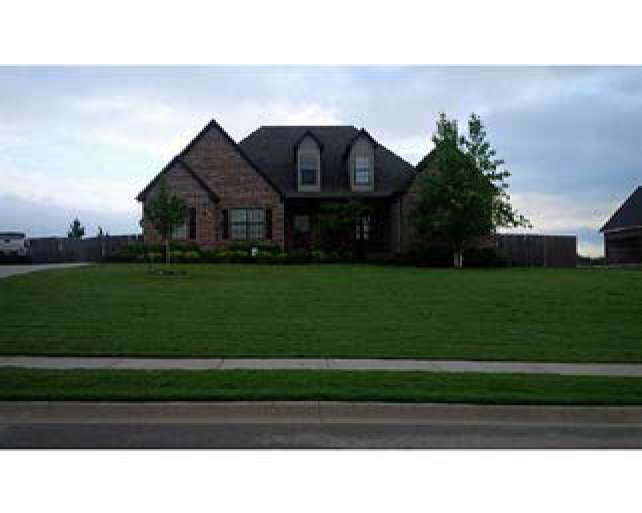
3.2.4.
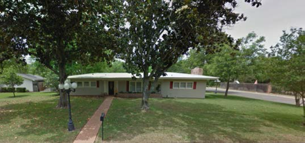
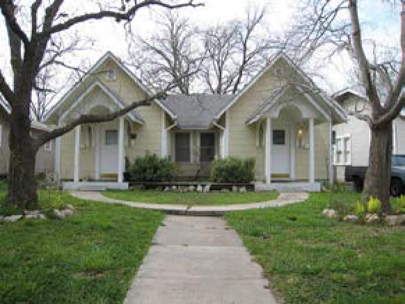
Single-Family Residential.
(1)
R-1.
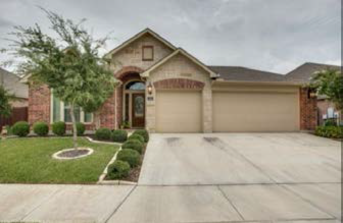
Above pictures are general representations of structures and uses found within the zoning district
A.
Purpose. The R-1 zoning district provides for the development of single-family detached dwellings on standard sized residential lots and for other compatible and complimentary uses. It is intended that the R-1 zoning district is utilized to provide an appropriate transition from urban development to agricultural areas.
B.
Uses. For a detailed list of permitted, limited and special uses please refer to the land use matrix. General permitted uses include the following:
•
Single-family home
•
Community Center
•
Playground
C.
Site Development Requirements.Chapter 5 contains information on the following site development requirements:
•
Landscaping
•
Buffering
•
Screening
•
Parking
•
Tree Removal
•
Lighting
•
Fencing
•
Detention and Drainage
•
Setbacks
•
Lot Requirements
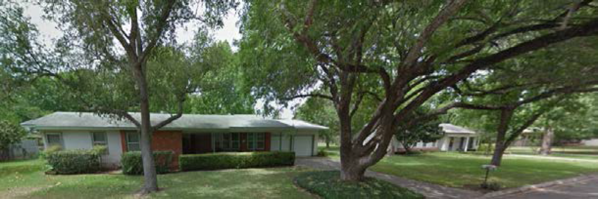
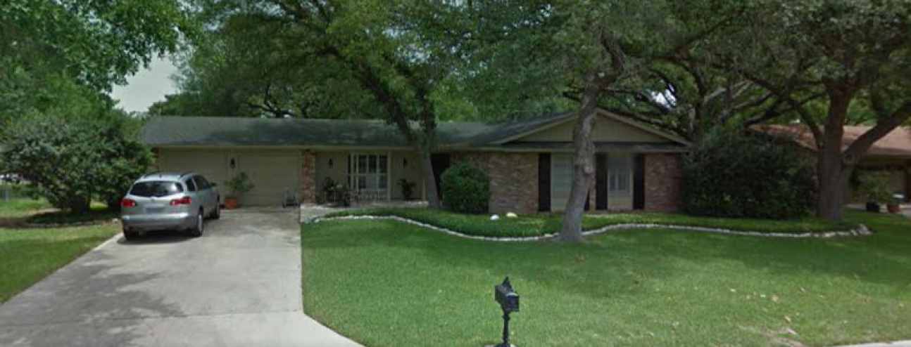
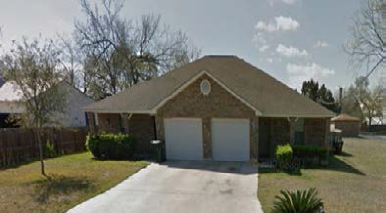
(2)
R-2.
Above pictures are general representations of structures and uses found within the zoning district
A.
Purpose. The R-2 zoning district provides for the development of single-family detached dwellings on standard sized residential lots with smaller front setbacks than the R-1 zoning district. The intent is to provide a variety of housing options in the community by creating residential neighborhoods with smaller front yards while still maintaining adequate space between the garage and the property line for off-street parking. Due to the reduced front setback in R-2 districts sidewalks are required to be built along the street curb.
B.
Uses. For a detailed list of permitted, limited and special uses please refer to the land use matrix. General permitted uses include the following:
•
Single-family home
•
Community Center
•
Playground
C.
Site Development Requirements.Chapter 5 contains information on the following site development requirements:
•
Landscaping
•
Buffering
•
Screening
•
Parking
•
Tree Removal
•
Lighting
•
Fencing
•
Sidewalks
•
Detention and Drainage
•
Setbacks
•
Lot Requirements
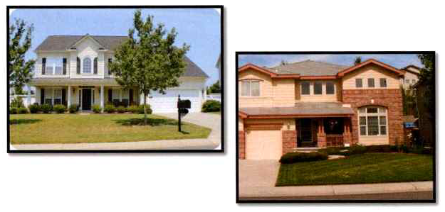
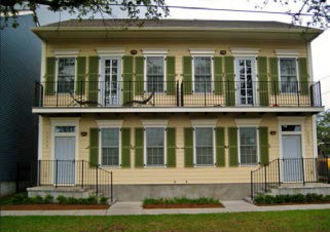
3.2.5.
Duplex Low Density (DP-1).

Above pictures are general representations of structures and uses found within zoning district
A.
Purpose. The DP-1 zoning district provides for the development of two family attached dwellings on standard sized residential lots and for other compatible and complimentary uses. The intent is to stabilize and protect the essential residential characteristics of the following areas:
1.
Residential areas in the vicinity of neighborhood retail areas that are primarily developed with single-family dwellings; and
2.
Areas adjacent to both single-family residential and multiple family residential.
A density of up to 6 dwelling units per acre is permitted.
B.
Uses. For a detailed list of permitted, limited and special uses please refer to the land use matrix. General permitted uses include the following:
•
Single-family home
•
Two-family home
•
Community Center
•
Playground
C.
Site Development Requirements.Chapter 5 contains information on the following site development requirements:
•
Landscaping
•
Buffering
•
Screening
•
Parking
•
Tree Removal
•
Lighting
•
Fencing
•
Detention and Drainage
•
Setbacks
•
Lot Requirements
3.2.6.
Duplex High Density (DP-2).

Above pictures are general representations of structures and uses found within zoning district
A.
Purpose. The DP-2 zoning district provides for the development of two family attached dwellings on standard sized residential lots and for other compatible and complimentary uses. The intent is to stabilize and protect the essential residential characteristics of the following areas:
1.
Residential areas in the vicinity of neighborhood retail areas area that are primarily developed with single-family dwellings; and
2.
Areas adjacent to both single-family residential and multiple family residential.
A density of up to 14 dwelling units per acre is permitted.
B.
Uses. For a detailed listed of permitted, limited and special uses please refer to the land use matrix. General permitted uses include the following:
•
Single-family home
•
Two-family home
•
Community Center
•
Playground
C.
Site Development Requirements.Chapter 5 contains information on the following site development requirements:
•
Landscaping
•
Buffering
•
Screening
•
Parking
•
Tree Removal
•
Lighting
•
Fencing
•
Detention and Drainage
•
Setbacks
•
Lot Requirements
3.2.7.
Zero Lot Line (ZL).
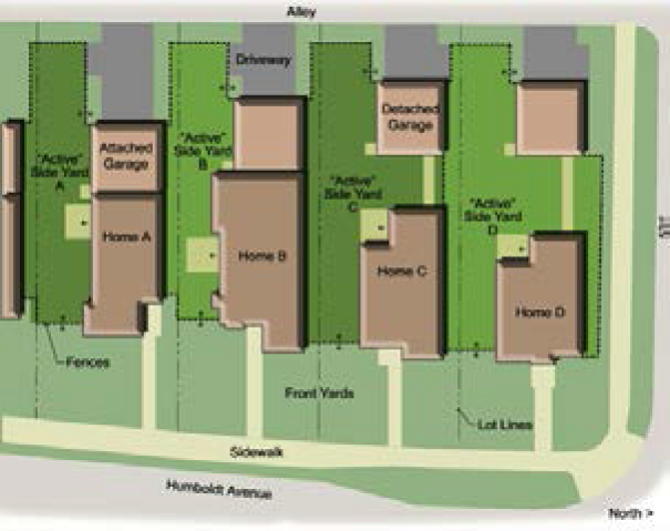
Above pictures are general representations of structures, open space, lot size and uses found within zoning district
A.
Purpose. The purpose of the zero lot line district is to allow housing which has the attributes of detached single-family dwellings but which allows placement of dwellings against one of the property lines, permitting the outdoor space to be grouped and utilized to its maximum benefit. Zero lot line development allows individual ownership of each unit/lot instead of condominium-based ownership of undivided land.
B.
Uses. For a detailed list of permitted, limited and special uses please refer to the land use matrix. General permitted uses include the following:
•
Single-family home
•
Community Center
•
Playground
C.
Site Development Requirements.Chapter 5 contains information on the following site development requirements:
•
Landscaping
•
Buffering
•
Screening
•
Parking
•
Tree Removal
•
Lighting
•
Fencing
•
Detention and Drainage
•
Setbacks
•
Lot Requirements
D.
Subdivision Requirements. A subdivision plat for ZL developments shall incorporate the following requirements:
•
Zero lot line homes will be uniformly located on the same side of the lot within a street block.
•
Zero lot line homes shall have no windows on the side of the house which abuts the property line.
•
No area shall be designated ZL that contains less than five (5) adjoining lots on each street.
•
The entire frontage of one side of the street in the block must be included in the ZL designation.
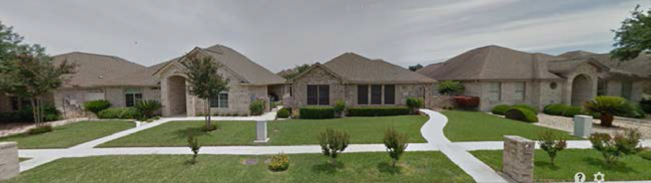
3.2.8.
Multi-family Low Density (MF-1).
Above pictures are general representations of structures and uses found within zoning district
A.
Purpose. The MF-1 zoning district provides for multi-unit residential structures and developments. Buildings are typically low-rise developments or transition in height from a low rise development to a multi-story development when adjacent to single family or two family developments. The MF-1 zoning district is generally intended to serve as a transition use between low density, single family developments and more intensive uses, while also providing an opportunity to provide for a diversity in housing stock and to allow for multi-generational neighborhoods. The goal is to avoid more than twenty-five (25) acres of contiguous land having a multi-family zoning designation. MF-1 development shall not exceed a density of more than six (6) dwelling units per gross acre.
B.
Uses. For a detailed list of permitted, limited and special uses please refer to the land use matrix. General permitted uses include the following:
•
Apartments/Condominiums
•
Park/Playground
•
Community Center
C.
Site Development Requirements.Chapter 5 contains information on the following site development requirements:
•
Landscaping
•
Buffering
•
Screening
•
Parking
•
Tree Removal
•
Lighting
•
Fencing
•
Detention and Drainage
•
Setbacks
•
Lot Requirement
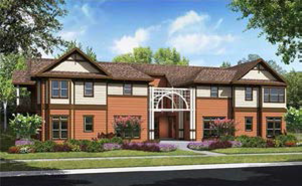
3.2.9.
Multi-family Medium Density (MF-2).
Above picture are general representations of structures and uses found within zoning district
A.
Purpose. The MF-2 zoning district provides for multi-unit residential structures and developments, such as apartment and condominium complexes, garden and courtyard multifamily residential buildings, and residential loft buildings. Such components are generally intended to serve as a transition use between low density, single family developments and more intensive uses such as commercial uses or higher traffic roadways. The MF-2 zoning district is intended to create more variety in housing opportunities but is intended to be utilized in small areas to avoid large tracts devoted to strictly to multi-family residential development. The goal is to avoid more than twenty-five (25) acres of contiguous land having a multi-family zoning designation. MF-2 development shall not exceed a density of twelve (12) dwelling units per gross acre.
B.
Uses. For a detailed list of permitted, limited and special uses please refer to the land use matrix. General permitted uses include the following:
•
Apartments/Condominiums
•
Park/Playground
•
Community Center
C.
Site Development Requirements.Chapter 5 contains information on the following site development requirements:
•
Landscaping
•
Buffering
•
Screening
•
Parking
•
Tree Removal
•
Lighting
•
Fencing
•
Detention and Drainage
•
Setbacks
•
Lot Requirements
3.2.10.
Multi-family High Density (MF-3).
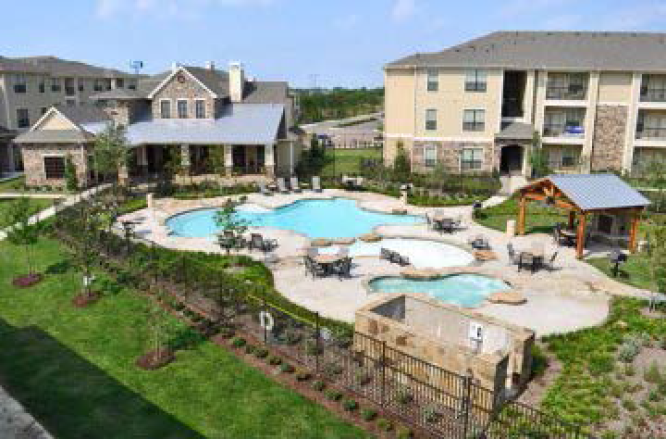
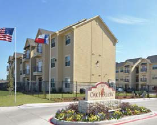
Above pictures are general representations of structures and uses found within zoning district
A.
Purpose. The MF-3 zoning district provides for multi-unit residential structures and developments, such as apartment and condominium complexes, garden and courtyard multifamily residential buildings, and residential loft buildings. Such components are generally intended to serve as a transition use between low density, single family developments and more intensive uses such as commercial uses or higher traffic roadways. The MF-3 zoning district is intended to create more variety in housing opportunities but is intended to be utilized in small areas to avoid large tracts devoted to strictly to multi-family residential development. The goal is to avoid more than twenty-five (25) acres of contiguous land having a Multi-Family component. A maximum density of 20 units per acres is permitted. Access should be provided by a collector or higher classification street.
B.
Uses. For a detailed list of permitted, limited and special uses please refer to the land use matrix. General permitted uses include the following:
•
Apartments/Condominiums
•
Park/Playground
•
Community Center
C.
Site Development Requirements.Chapter 5 contains information on the following site development requirements:
•
Landscaping
•
Buffering
•
Screening
•
Parking
•
Tree Removal
•
Lighting
•
Fencing
•
Detention and Drainage
3.2.11.
Manufactured and Residential (M-R).
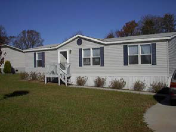
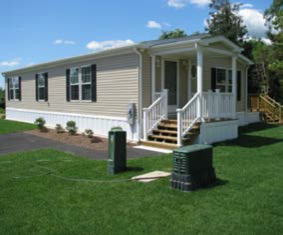
Above pictures are general representations of structures and uses found within zoning district
A.
Purpose. The purpose of the M-R zoning district is to provide a residential zoning district for manufactured homes on individual platted residential lots that may be conveyed to individual lot owners.
B.
Uses. For a detailed list of permitted, limited and special uses please refer to the land use matrix. General permitted uses include the following:
•
Manufactured home (1 per lot)
•
Site built single family dwelling (1 per lot)
•
Parks/Playground
•
Community Center
C.
Site Development Requirements.Chapter 5 contains information on the following site development requirements:
•
Landscaping
•
Buffering
•
Screening
•
Parking
•
Tree Removal
•
Lighting
•
Fencing
•
Detention and Drainage
•
Setbacks
•
Lot Requirements
D.
Manufactured Home Standards.
1.
Manufactured homes shall be of adequate quality and safe design, as certified by a label stating that the unit is constructed in conformance with the Federal Manufactured Housing Construction and Safety Standards in effect on the date of manufacture.
2.
Manufactured homes shall have no outside horizontal dimension less than sixteen (16) feet, except for original extensions or subsequent additions (i.e. garages, porches, etc.). Extensions or additions must contain less than fifty (50) percent of the total enclosed floor area.
3.
Each manufactured home shall be totally skirted with metal, masonry, pressure-treated wood, or other nondegradable material which is compatible with the structure's exterior siding.
4.
Driveways and off-street parking shall be provided in accordance with the requirements for single-family dwellings.
5.
Living area additions, carports and garages are permitted, provided they are constructed of material compatible with the primary structure, meet the minimum standards of the zoning districts and comply with the structural standards as required of the primary structure.
3.2.12.
Manufactured Home Park (MHP).
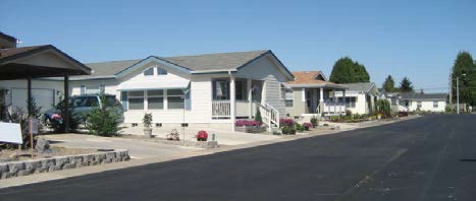
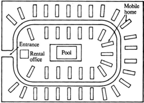
Above pictures are general representations of structures, open space, lot size and uses found within zoning district
A.
Purpose. The purpose of the MHP zoning district is to provide a residential zoning district for the manufactured home park land use and to ensure quality development equal to that found in other types of residential areas throughout the City. Excellence of design, usability, development and maintenance that support a quality residential environment is the desired objective.
B.
Uses. For a detailed listed of permitted, limited and special uses please refer to the land use matrix. General permitted uses include the following:
•
Manufactured home
•
Park/Playground
•
Community Center
C.
Site Development Requirements.Chapter 5 contains information on the following site development requirements:
•
Landscaping
•
Buffering
•
Screening
•
Parking
•
Tree Removal
•
Lighting
•
Fencing
•
Detention and Drainage
D.
Manufactured Home Standards.
1.
Manufactured homes shall be of adequate quality and safe design, as certified by a label stating that the unit is constructed in conformance with the Federal Manufactured Housing Construction and Safety Standards in effect on the date of manufacture.
2.
Manufactured homes shall have no outside horizontal dimension less than sixteen (16) feet, except for original extensions or subsequent additions (i.e. garages, porches, etc.). Extensions or additions must contain less than fifty (50) percent of the total enclosed floor area.
3.
Each manufactured home shall be totally skirted with metal, masonry, pressure-treated wood, or other nondegradable material which is compatible with the structure's exterior siding.
4.
Driveways and off-street parking shall be provided in accordance with the requirements for single-family dwellings.
5.
Living area additions, carports and garages are permitted, provided they are constructed of material compatible with the primary structure, meet the minimum standards of the zoning districts and comply with the structural standards as required of the primary structure.
E.
Open Space Requirements.
1.
Not less than eight (8) percent of total gross area of a Manufactured Home Park must be devoted to open space and recreational facilities, generally provided in a central location.
2.
Maximum building coverage in required open space is 10%, unless the building is specifically designed for recreational purposes.
3.
Common open space must be maintained in park like manner by management and all planned amenities be shown on a site plan for staff approval.
F.
Perimeter Treatment and Setbacks.
1.
Perimeter fencing and/or landscaping of the development shall be required.
2.
The development shall be separated by at least 20 feet from adjoining properties by way of a street or setback. The normal building setback is in addition to this requirement.
G.
Parking and Storage Requirements.
1.
Two paved parking spaces per unit shall be required.
2.
Other uses in the development, i.e. washeteria, pool, recreational facilities, etc., shall include parking spaces.
3.
A central location for storage of travel trailers, boats, RV's, shall be provided or they shall not be permitted within the manufactured home park.
4.
If dumpsters are to be used, they must be properly screened in accordance with the City's garbage container screening requirements. Individual trash containers shall be stored from public view when not being serviced.
5.
No outdoor storage of machinery, building materials, and appliances shall be permitted. Secondary storage structures in accordance with the ordinance shall be permitted in rear yards only.
H.
Standards for Internal Streets.
1.
Internal streets shall be private and not dedicated to the City. All streets must be designed, constructed and inspected to meet all City standards.
2.
All internal streets shall be named, signed and units numbered.
3.
Internal sidewalks shall be required, meeting the same specifications as City sidewalks.
4.
A paved walkway from each parking area to the unit shall be required.
5.
Internal lighting shall be based on public street standards.
I.
Operational and Maintenance Standards.
1.
Manufactured home parks shall provide a permanent manager or operator accessible at all times by tenants and public officials.
2.
Owners must maintain all facilities and infrastructure in a safe, clean, neat and orderly manner. Landscaping and fencing must be maintained.
3.
Management shall provide insect and rodent control, and remove litter.
4.
An annual operating license should be required to own and operate a manufactured home park. The license should include an annual inspection to verify compliance with all codes and municipal ordinances. Revocation of a license shall include, but not be limited to, the following penalties: No new occupancies, enforcement action in accordance with this Unified Development Code.
J.
Development Standards.
1.
A development designed as a manufactured home park shall be for the explicit purpose of renting or leasing of manufactured home sites and shall not be construed to permit the sale of such spaces as lots.
2.
At no time may an existing manufactured home park be converted to a manufactured home subdivision without first meeting all the platting requirements of the City Subdivision Ordinance and receiving approval by the Planning Commission.
3.
At no time may an existing manufactured home park be converted to a manufactured home subdivision without first obtaining the appropriate zoning change.
4.
Minimum lot area:
a.
Internal lot: 3,500 square feet or 4 times the area of the manufactured home, whichever is greater.
b.
Corner lot: 4,500 square feet, where manufactured home space adjoins a public thoroughfare or 4 times the area of the manufactured home, whichever is greater.
c.
No manufactured home park shall have less than ten (10) manufactured home lots, or consist of less than three (3) acres in total area.
d.
No manufactured home park shall exceed a density of more than ten (10) dwelling units per gross acre.
5.
Minimum lot frontage on a public street or private drive:
a.
Internal lot: 40 feet.
b.
Corner lot: 55 feet.
6.
Minimum lot depth: 80 feet.
7.
Minimum depth of front setback:
a.
From private drive: 10 feet.
b.
From public street: 25 feet.
8.
Minimum rear setback: 20 percent of lot depth, up to a maximum of 7½ feet.
9.
Minimum width of side setback:
a.
Internal lot: 10 percent of lot width/7½ feet maximum.
b.
Corner lot: 25 feet as measured from the lot line adjoining a public street.
10.
Maximum building coverage as a percentage of lot area: 50 percent.
11.
Maximum accessory building coverage of rear yard: 30 percent.
12.
Unit separation:
a.
Side to side: 25 feet minimum.
b.
End to end: 15 feet minimum.
K.
Fees. An annual license fee shall be assessed.
3.2.13.
Neighborhood Commercial (NC).
Above pictures are general representations of structures, open space, lot size and uses found within zoning district
A.
Purpose. The neighborhood commercial district is to provide for various types of small scale, limited impact commercial, retail, personal services, and office uses located in close proximity to their primary customers. The development standards and use restrictions specified for this district are intended to ensure compatibility with adjacent residential districts or uses, while promoting the harmonious growth of retail and commercial uses.
B.
Uses. For a detailed list of permitted, limited and special uses please refer to the land use matrix. General permitted uses include the following:
•
Retail under 10,000 square feet in size
•
Professional Office
•
First floor commercial with second story apartment
•
Community Center
•
Parks/Playground
•
Medical office
•
Restaurants
C.
Site Development Requirements.Chapter 5 contains information on the following site development requirements:
•
Landscaping
•
Buffering
•
Screening
•
Parking
•
Tree Removal
•
Lighting
•
Fencing
•
Detention and Drainage
•
Setbacks
•
Lot Requirements
3.2.14.
Commercial (C).

Above pictures are general representations of structures, open space, lot size and uses found within zoning district
A.
Purpose. The Commercial District is the primary commercial and service zoning district of the community. This district is an intensive classification in which the commingling of many retail, service and office uses is permitted. Structures located in this district may vary from freestanding buildings to community and regional shopping centers.
B.
Uses. For a detailed list of permitted, limited and special uses please refer to the land use matrix. General permitted uses include the following:
•
Retail
•
Professional Office
•
First floor commercial with second story apartment
•
Community Center
•
Parks/Playground
•
Medical office
•
Restaurants
•
Drive-thru windows - retail and/or restaurant
•
Indoor entertainment facilities
•
Day care
•
Auto Repair
•
Gas Station
C.
Site Development Requirements.Chapter 5 contains information on the following site development requirements:
•
Landscaping
•
Buffering
•
Screening
•
Parking
•
Tree Removal
•
Lighting
•
Fencing
•
Detention and Drainage
•
Setbacks
•
Lot Requirements
3.2.15.
Public (P).
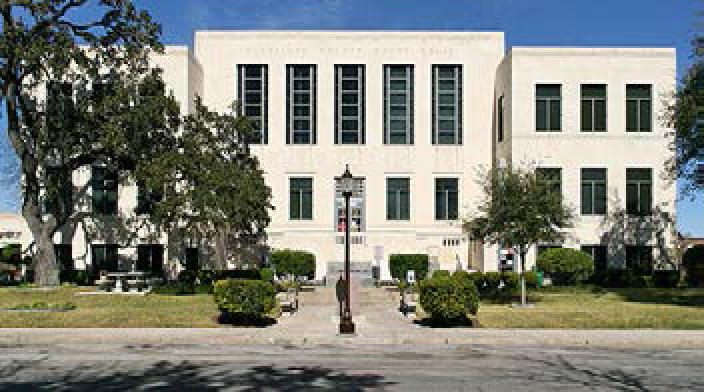


Above pictures are general representations of structures, open space, lot size and uses found within zoning district
A.
Purpose. The Public District is intended to encourage the use of unique areas especially suited for public assembly, meetings, recreational areas, schools, places of worship, and similar uses.
B.
Uses. For a detailed list of permitted, limited and special uses please refer to the land use matrix. General permitted uses include the following:
•
Places of Worship
•
City, County, State or Federal government facilities
•
Schools
•
Parks/Playgrounds
C.
Site Development Requirements.Chapter 5 contains information on the following site development requirements:
•
Landscaping
•
Buffering
•
Screening
•
Parking
•
Tree Removal
•
Lighting
•
Fencing
•
Detention and Drainage
•
Setbacks
•
Lot Requirements
3.2.16.
Light Industrial (LI).

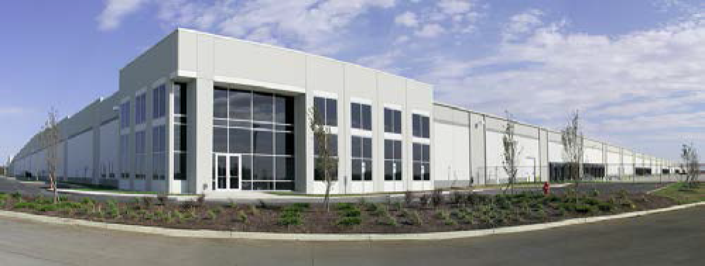
Above pictures are general representations of structures, open space, lot size and uses found within zoning district
A.
Purpose. The Light Industrial zoning district consists of commercial enterprises involved in research and development, light manufacturing, packaging, warehousing, distribution, and skilled mechanical trades. The uses permitted within this district are primarily uses that will take place inside of a building, will have minimal or no outdoor storage, and do not emit detectable particulates, odor, smoke, gas fumes, light, vibrations or noise beyond the property lines.
B.
Uses. For a detailed list of permitted, limited and special uses please refer to the land use matrix. General permitted uses include the following:
•
Auto repair/paint and body facilities
•
Warehouse
•
Assembly Plants
•
Office/warehouse facilities
•
Storage facilities
C.
Site Development Requirements.Chapter 5 contains information on the following site development requirements:
•
Landscaping
•
Buffering
•
Screening
•
Parking
•
Tree Removal
•
Lighting
•
Fencing
•
Detention and Drainage
•
Setbacks
•
Lot Requirements
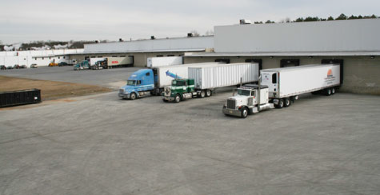
3.2.17.
Industrial (I).


Above pictures are general representations of structures, open space, lot size and uses found within zoning district
A.
Purpose. The Industrial district is intended primarily for the conduct of heavy manufacturing, assembling and fabrication activities that do not typically depend upon frequent customer or client visits. Such uses generally require accessibility to major thoroughfares, major highways, and/or other means of transportation such as the railroad.
B.
Uses. For a detailed list of permitted, limited and special uses please refer to the land use matrix. General permitted uses include the following:
•
Manufacturing Facility
•
Warehouse
•
Distribution Center
•
Freight Terminal
•
Auto Crushing Facility
•
Contractor's equipment yard
•
Truck Stop
•
Recycling Center
C.
Site Development Requirements.Chapter 5 contains information on the following site development requirements:
•
Landscaping
•
Buffering
•
Screening
•
Parking
•
Tree Removal
•
Lighting
•
Fencing
•
Detention and Drainage
•
Setbacks
•
Lot Requirements
3.2.18 Planned Unit Development (PUD).
A.
Purposes. In certain instances, the purposes of this chapter may be achieved by the development of a planned unit development (PUD) that does not conform in all respects with the land use pattern designated on the zoning map, the district regulations prescribed by the zoning ordinance, or the requirements of this chapter. A PUD may include a combination of different dwelling types and/or a variety of land uses, which creatively complement each other and harmonize with existing and proposed land uses in the vicinity. In order to encourage creative development of the land, provide locations for well-planned comprehensive developments, and provide for variety in the development pattern of the City, which conforms with the purposes of the comprehensive plan, the City Council is empowered to approve planned unit developments.
B.
Planned Unit Development requirements. Any proposed use within a Planned Unit Development shall be based upon a General Land Use Plan approved by the City Council. The General Land Use Plan shall identify the proposed modifications to the requirements of Chapters 3 and 5 of the Unified Development Code (UDC) in addition to design standards that elevate and enhance the development. The General Land Use Plan shall propose modifications that provide a higher quality project design than can be obtained through the adopted zoning districts and site development standards.
C.
Procedure:
1.
The initial request for a zoning change to the Planned Unit Development (PUD) district shall be accompanied by an application for a General Land Use Plan (GLUP). A complete application shall be submitted to the Planning Department in accordance with deadlines established for public meetings. Written notice to surrounding property owners shall be in accordance with the general process for notifications for zoning map amendments. The Planning Commission shall hold a public hearing and provide a recommendation to the City Council. The City Council shall be the final decision maker and shall hold a public hearing before taking action on a request for a General Land Use Plan. A vote of three-fourths (3/4) of all members of the City Council is required to overrule a recommendation of the Commission that the proposed General Land Use Plan be denied.
2.
All amendments to the GLUP, and related PUD documents, must be approved by the Planning & Zoning Commission and City Council and shall be submitted in the same manner as the original application except that the Planning Director may approve minor changes which do not alter the basic relationship of the proposed development to adjacent property. A minor change is one that does not alter the uses permitted or increases the density, height, or coverage of the site, or decrease the off-street parking ratio or reduce the setbacks as indicated on the approved GLUP.
3.
City staff shall review every building permit application within the Planned Unit Development District for conformance with the GLUP and related documents.
4.
An applicant making application for the approval of a General Land Use Plan shall accompany his application with plans and documents consisting of the following, as applicable:
(a)
Existing topography of the property.
(b)
Existing & proposed land uses and their location.
(c)
Location of all streets, alleys, sidewalks, parking.
(d)
Location of all proposed public uses, such as schools, parks, playgrounds, open spaces, landscaping.
(e)
Drainage plan.
(f)
Present ownership & any planned change in ownership.
(g)
Schedule of development.
(h)
All agreements, covenants & deed restrictions.
5.
The Planning & Zoning Commission and subsequently, City Council, may, in the interest of the public welfare and to assure compliance with the intent of this ordinance, require such modifications as are deemed to be important to the welfare and protection of adjacent property and the community as a whole.
6.
No building permit shall be issued on the land within the Planned Unit Development District until the General Land Use Plan has been approved.
7.
Where applicable, all City of Seguin subdivision requirements shall be followed.
8.
If no construction has commenced or no use established within two (2) years from the approval of the GLUP, the GLUP shall lapse and be of no further effect. Reapplication shall be the same as an original application.
(Ord. No. 2015-27, § 1, 5-5-15; Ord. No. 2016-70, § 2, 11-1-16; Ord. No. 2024-005, § 3, 2-20-24)
Sec. 3.3. - Overlay districts.
3.3.0.
[In general.] Overlay zoning district is a special zone placed over an existing zoning district. The overlay zone includes a set of regulations that is applied to property within the overlay zone in addition to the requirements of the underlying or base zoning district (for example: additional landscaping, screening, sign regulations or other development regulations meant to either protect a scenic route/resource or enhance development in certain areas).
3.3.1.
Intent. It is the intent of the Corridor Overlay Districts to establish a series of community gateway corridors with special architectural and landscaping requirements to enhance the visual and aesthetic character within the areas listed above.
3.3.2.
Applicability. All new development or redevelopment of properties described in the above table. In the case of a redevelopment of an existing site or structure only the new portion of the site or structure shall come into conformance with the applicable requirements of the overlay district unless one of the following exists:
•
The redevelopment of the property includes a 50-percent or more increase in square footage; or
•
If the extent of the proposed modifications is 50% or more of the site's assessed value over a 5-year time period. For the purposes of the code the assessed value of a structure shall be the value cited by the Guadalupe County Appraisal District.
In such case the site in its entirety must be brought into conformance with the requirements of this code.
3.3.3.
Exemptions. The development requirements associated with the overlay districts are not applicable to single family residential development.
3.3.4.
Development Standards. The development standards outlined below will require developers to exceed the minimum development requirements applicable to properties located outside of the overlay districts. If a specific development standard is not identified below the proposed development is subject to the minimum development standards outlined in the individual sections of this code.
A.
Building Materials and Design Requirements.
1.
Masonry (shall be painted and/or treated, i.e. stucco), wood, brick, simulated siding and glass are approved.
2.
No portion of a building constructed of unadorned concrete block or corrugated and/or any metal surface shall be visible from any adjoining right-of-way. Side and rear building facades may be permitted if those frontages are sufficiently landscaped to obscure the facade up to 75% of the building height.
3.
Adorned facades may include eaves treatments, relief features, pitched gable designs, ornamental window casings, or other architectural detail.
B.
Outdoor Display/Storage.
1.
Only 10% of the area between the front property line and the front building setbeck shall be used for outdoor display.
2.
Outdoor storage behind the main structure on a site may be permitted if storage is completely screened from public view through the use of buildings, landscaping or fencing.
3.
No temporary or manufactured office/housing or manufactured home sales lots shall be permitted except construction type office used during the construction phase only.
4.
All temporary, manufactured office or housing used during the construction phase of development shall be removed prior to the issuance of a Certificate of Occupancy.
3.3.5.
Historic Districts and Landmarks.
A.
Intent. The City Council of the City of Seguin, Texas has declared that as a matter of public policy the protection, enhancement and perpetuation of landmarks of historical and cultural importance and significance is necessary to promote the economic, cultural, educational and general welfare of the public. It is recognized that historic properties represent the unique confluence of time and place that shaped the identity of generations of citizens, collectively and individually, and produced significant historic, architectural and cultural resources that constitute their heritage. This historic overlay district and associated requirements are intended to:
•
Protect and enhance the landmarks, which represent distinctive elements of the historic, architectural and cultural heritage of Seguin.
•
Foster civic pride in the accomplishments of the past.
•
Protect and enhance the attractiveness to visitors and the support and stimulus to the economy thereby provided.
•
Ensure the harmonious, orderly and efficient growth and development of Seguin.
•
Promote economic prosperity and welfare of the community by encouraging the most appropriate use of such property within the city.
•
Encourage stabilization, restoration and improvements of such properties and their values.
B.
Definitions.
Alteration shall mean any exterior change, demolition, or modification to a property with a landmark designation or located within a historic district, including but not limited to:
1.
Exterior changes to or modifications of structures, architectural details, or visual characteristics.
2.
Construction of new structures.
3.
Disturbance [of] archeological sites or areas; or
4.
Placement or removal of exterior objects that affect the exterior qualities of the property.
Applicant shall mean the owner of record of a property designated as a landmark or located within a historic district, the agent or lessee thereof with the approval of the owner of record in a notarized form, or a person holding a bona fide contract to purchase the property with approval of the property owner.
Archeological resource shall mean site with archeological or paleontological value in that it has produced or can be expected to produce data affecting theories of historic or prehistoric interest.
Architectural feature shall mean the architectural elements embodying style, design, general arrangement, and components of the exterior of any building or structure, include, but not limited to, the kind, color, and texture of the building materials, and the style and type of all windows, doors, lights, signs, and porches.
Building shall mean a structure for business or residential use, created to shelter people or things, such as a house, barn, church, hotel, warehouse or similar structure, including a historically related complex, such as a courthouse and jail or a house and barn. When separated by dividing walls without openings, each portion of such structure so separated shall be deemed a separate building.
Certificate of Appropriateness shall mean the certificate issued by the City approving alteration, rehabilitation, construction, reconstruction, or improvement of a property with a landmark designation or located within a historic district.
Certified Local Government shall mean a federal government program authorized by the National Historic Preservation Act, 16 U.S.C. 470 et seq., that provides for the participation of local governments in a federal/state/local government partnership.
City shall mean the City of Seguin, Texas, as represented by the Mayor and City Council.
Commission shall mean the Historic Preservation & Design Commission (HPDC) created in Section 1.2.4 of the Unified Development Code.
Construction shall mean the addition or placement of any improvement to a property within a landmark designation or located within a historic district.
Contributing shall mean a building, structure, site, or object within a designated historic district which:
1.
Embodies the significant physical features and characteristics of the district, or adds to the historical association, historical architectural qualities, or archeological values identified for the district; and
2.
Was present during the period of significance relating to the documented significance of the district; and
3.
Possesses historic integrity or is capable of yielding important information about the period.
Dangerous structure shall mean a structure that poses an imminent threat to public health or safety.
Demolition shall mean the complete or partial removal of a building, structure, object, or site, including landscape features and archeological sites.
Demolition by neglect shall mean improper maintenance, neglect in the maintenance of, or lack of maintenance of any structure or property within a landmark designation or located within a historic district, which results in deterioration of the structure and threatens the preservation of the structure.
Design guidelines shall mean the "Design Guidelines for Historic Seguin, Texas" as adopted by the City Council and as may be amended from time to time.
Designation shall mean the process by which the City Council may designate certain buildings, land, areas, and districts in the City within a landmark designation or located within a historic district and define, amend, and delineate the boundaries thereof.
Economic hardship shall mean the inability of an owner to obtain a reasonable return or a reasonable beneficial use from a property in the landmark designation or located within a historic district. A reasonable economic return does not have to be the most profitable return possible or allow the highest and best use of the property.
Historic district shall mean an area of the City containing a grouping of historic properties that are designated within a landmark designation or located within a historic district that may contain properties that are both contributing and non-contributing, but that is united historically or aesthetically. For the purpose of this section, the entirety of a landmark designation or located within a historic district.
Historic Landmark shall mean any building, structure, object, site, or portion thereof within a landmark designation or within a historic district.
Historic preservation officer shall mean the City of Seguin staff person designated by the City Manager shall serve as the historic preservation officer for the City and shall oversee the historic preservation program of the City.
Historic resource shall mean any building, structure, or object within the landmark designation or located within a historic district being considered for relocation.
Improvement shall mean any building, structure, or object constituting a physical betterment of real property, or any part of such betterment, including but not limited to streets, alleys, curbs, lighting fixtures, signs and the like.
Initiated designation shall mean the historic designation procedure is considered to be initiated immediately when the City Council, the Planning and Zoning Commission, or the Historic Preservation & Design Commission votes to initiate it or, in the case of initiation by the property owner(s), when the designation report is filed with the Historic Preservation Officer.
Landscape shall mean any improvement or vegetation including but not limited to: shrubbery, trees, plantings, outbuildings, walls, courtyards, fences, swimming pools, planters, gates, street furniture, exterior lighting, and site improvements, including but not limited to subsurface alterations, site regarding, fill deposition, and paving.
Low-income homeowner shall mean any homeowner that meets the U.S. Department of Housing and Urban Development (HUD) qualifications for low income.
National Historic Landmark shall mean a district, site, building, structure, and/or object that has been formally designated as a National Historic Landmark by the U.S. Secretary of the Interior and possesses exceptional value or quality in illustrating or interpreting the heritage of the United States in history, architecture, archeology, engineering, and culture and that possesses a high degree of integrity of location, design, setting, materials, workmanship, feeling, and association. National Historic Landmarks are automatically listed in the National Register.
National Register of Historic Places shall mean a federal list of cultural resources worthy of preservation, authorized under the National Historic Preservation Act of 1966 as part of a national program to coordinate and support public and private efforts to identify, evaluate, and protect the nation's historic and archeological resources. The National Register Program is administered by the Commission, by the state historic preservation office, and by the National Park Service under the Department of the Interior. Significant federal benefits may accrue to owners of properties listed or determined eligible for listing in the National Register.
Noncontributing shall mean a building, site, structure, or object that is located within a designated historic district, but does not add to the historic associations, historic architectural qualities, or archeological values for which the district is significant because:
1.
It was not present during the period of significance;
2.
It does not relate to the documented significance of the property; and/or
3.
Due to alterations, disturbances, additions, or other changes, it no longer possesses historic integrity and/or is capable of yielding important information about the period.
Object shall mean a material thing of functional, cultural, historical, or scientific value that may be, by nature of design, movable, yet is related to a specific setting or environment.
Ordinary repair or Ordinary maintenance shall mean any work that does not constitute a change in design, material, or outward appearance, and that includes in-kind (same original material) replacement or repair.
Relocation shall mean any changes in the location of a building, object, or structure, either within its present setting or to another setting.
Secretary of the Interior's Standards for the Treatment of Historic Properties shall mean a federal document providing standards and guidelines for the appropriate rehabilitation, preservation, restoration, and reconstruction of historic buildings.
Site shall mean the location of a significant event, a prehistoric or historic occupation or activity, or a building or structure, whether standing, ruined, or vanished, where the location itself maintains historical or archeological value regardless of the value of any existing buildings, or objects.
Structure shall mean a work made up of interdependent and interrelated parts in a definite pattern of organization constructed by man. The term includes, but is not limited to engineering projects, earthworks, and bridges.
C.
Designation of Historic Landmarks and Districts.
Criteria for Designation.
a.
Any building, structure, site, or object, may be designated for a local historic landmark designation if it is significantly associated with the history, architecture, archaeology, engineering, or cultural heritage of the community; if it has integrity; is at least fifty years old, or is of lesser age and has exceptional importance; and if it falls in at least one of the following categories.
1.
Is associated with events that have made a significant contribution to the broad patterns of national, state, or local history.
2.
Embodies the distinctive architectural characteristics of a type, period, style or method of design or construction, or represents a significant and distinguishable entity whose components may lack individual distinction.
3.
Is an outstanding work of a designer, builder, or architect who has made a substantial contribution to their field.
4.
Exemplifies or reflects special elements of the county's history.
5.
Is associated with the lives of persons significant in national, state, or local history.
6.
Has yielded or may be likely to yield important archaeological information related to history or prehistory.
7.
Is an historic building or cultural resource removed from its original location but which is significant for architectural value, or association with an historic person or event, or prehistory.
8.
Is a birthplace or grave of a prehistoric or historical figure of outstanding importance and is the only surviving structure or site associated with that person.
9.
Is a cemetery or burial site which derives its primary significance from age, from distinctive design features, or from association with historic events, or cultural patterns.
10.
Is a reconstructed building that has been executed in a historically accurate manner on the original site.
b.
Designation of historic districts will need to contain properties and an environmental setting which meet one or more of the criteria for designation of a landmark and constitutes a distinct section of the City of Seguin. Additional criteria considered for designation of districts is included in the Technical Manual.
Process for Designation.
a.
The designation of historic landmarks and districts shall be subject to the following requirements:
1.
Each property designated as an historic landmark or located within a designated historic district shall be recorded with the City Historic Preservation Officer and the City Planning Director. An historic landmark designation shall mean that such property is subject to the terms of this Code; however, with regard to site plans, uses, setbacks and other development land use regulations, such property shall be governed by the zoning regulations of the City.
2.
An historic landmark or historic district or expansion of a district shall be considered for approval only with the written application submitted by the property owner(s) or initiated by the City of Seguin. A designation pursued without owner's consent will require a three-quarters approval of all governing bodies within the decision process, to include the Commission, Planning & Zoning Commission and City Council. No property owned by an organization that qualifies as a religious organization under V.T.C.A., Tax Code, § 11.20 shall be designated without the owner's consent. A property owner shall have the right to withdraw their consent for the designation at any time during the process. Property owners of proposed historic landmarks and districts shall be notified to any hearing or vote on the recommended designation, as well as notification of regulations impacting the future use of the property and any incentives and tools offered for preservation of local landmarks. At the City Council's public hearing, owners, interested parties and technical experts may present testimony or documentary evidence which will become part of a record regarding the historic, architectural or cultural importance of the proposed historic landmark.
3.
All applications for historic landmark or historic district designation, shall have an initial review by the HPO, who will then distribute to the Board of Directors of the Seguin Conservation Society and the Guadalupe County Historical Commission to allow them fifteen (15) days to provide comments. After the comment period, the application shall be placed on the agenda of the next HPDC for action.
Individual Landmark Applications: If HPDC recommends approval of designation, Seguin City Council will act on designation.
Historic District Applications: If HPDC recommends approval of a new district or expansion of an existing district, the Planning and Zoning Commission shall take action at their next meeting. After Planning and Zoning Commission recommendation, Seguin City Council will act on designation.
4.
The City Council shall take appropriate action on the recommendation from the Historic Preservation & Design Commission within forty-five (45) days of receipt of the recommendation of the Commission.
5.
Upon designation of a building, object, site or structure as an historic landmark, the HPO shall cause the designation to be recorded in the Real Property Records of Guadalupe County, Texas, the tax records of the city and the Guadalupe County Appraisal District.
D.
Certificate of Appropriateness.
a.
Applicability. A certificate of appropriateness shall be required in the following circumstances before the commencement of development within or work upon any property with a local historic landmark designation and/or within a historic district overlay:
1.
Whenever such work or development requires a building permit issued by the City;
2.
Whenever such work includes the erection, moving, demolition, reconstruction, restoration, or alteration of the exterior of a property with a historic landmark designation or within a historic district overlay, except when such work satisfies all the requirements of ordinary maintenance and repair as defined in Section B of Sec. 3.3.5 of the Seguin Unified Development Code.
b.
Certificate of Appropriateness required. No building permit shall be issued by the building official for any property with a historic landmark designation or located within a historic district overlay zoning until the application for such permit has been reviewed and a certificate of appropriateness has been approved by the HPO or the Commission.
c.
Procedures.
1.
After an application for a certificate of appropriateness is submitted, the HPO shall determine whether the application shall be eligible for administrative review or the application shall be considered by the Commission.
2.
An application shall be eligible for administrative review by the HPO for the following:
i.
Paint colors for the exterior of a structure including siding, trim, doors, steps, porches, railings, and window frames. This shall not include painting or otherwise coating previously unpainted masonry;
ii.
The placement and screening, if necessary, of roof-mounted equipment and other mechanical equipment of various types;
iii.
The placement and design of screening treatments for trash and recycling receptacles;
iv.
Fences to be installed in the rear and/or side yard;
v.
Ground lighting;
vi.
Elements attached to a façade [of] any building, garage or carriage house including, but not limited to door hardware, hinges, mailboxes, light fixtures, sign brackets, street address signage and historic interpretive signage.
vii.
Replacing roofing materials or color on a flat roof that will not be visible from the ground or from immediately adjacent taller buildings;
viii.
Gutters and downspouts;
ix.
Installation or removal of landscaping, including trees;
x.
Accessibility ramps;
xi.
Changes to awning fabric color for an existing awning;
[xi.i]
Signage;
xii.
Landscape elements, including but not limited to walks, paving, benches, outdoor furniture, planters, pools, trellises, arbors and gazebos;
xiii.
Installation of any elements required by other codes such as emergency lighting;
xiv.
Modifications that are considered non-permanent such as, but not limited to, window films and temporary features to weatherize or stabilize a historic resource;
xv.
Minor modifications to an existing certificate of appropriateness that still meets the intent of the original approval;
xvi.
Renewal of an expired certificate of appropriateness.
3.
If an application for administrative review is approved or approved with conditions, the HPO shall issue a certificate of appropriateness pursuant to section (d) below.
4.
The HPO will forward the application to the Commission if it does not meet the criteria administrative review, or if the applicant wishes to appeal the administrative decision or associated conditions of the certificate of appropriateness application. An appeal of an administrative decision shall be filed with the Commission within ten business days of said decision.
5.
When an application is to be considered by the Commission, the HPO shall inform the applicant of the meeting date at which the application shall be considered. The applicant shall have the right to be heard and may be accompanied or represented by counsel and/or one or more construction or design professionals at the meeting.
6.
The HPO shall review the application and make a recommendation based on the Secretary of the Interior's Standards to the Commission during the meeting at which the application shall be considered.
7.
After hearing the applicant and any other interested parties, and considering the recommendation from the HPO, the Commission shall take one of the following actions:
i.
Approve the proposed work or development and issue a certificate of appropriateness.
ii.
Approve the prosed work or development with conditions and issue a conditional certificate of appropriateness.
iii.
Disapprove the certificate of appropriateness.
8.
In the case of the disapproval of a certificate of appropriateness by the Commission, the Commission shall state in writing the reasons for such disapproval and may include suggestions in regard to actions the applicant might take to secure the approval of the Commission concerning future issuance of a certificate of appropriateness.
d.
Certificate.
1.
It shall be the responsibility of the HPO to issue the actual certificate of appropriateness following administrative approval for approval by the Commission with any designated conditions, and to maintain a copy of the certificate of appropriateness, together with the proposed plans. These shall be public documents for all purposes.
2.
Work performed pursuant to the issuance of a certificate of appropriateness shall conform to the requirements of such certificate. It shall be the duty of City staff to inspect from time to time any work performed pursuant to a certificate of appropriateness to assure such compliance. In the event that such work is not in compliance, the building official shall issue a stop work order and/or citation. The Commission may request that the building official inspect the work and issue a stop work order.
e.
Criteria. The HPO or the Commission shall determine whether to grant a certificate of appropriateness based on the proposed work meeting the Secretary of Interior's Standards for the Treatment of Historic Properties, adopted City of Seguin Design Guidelines and other criteria as defined in the City of Seguin Technical Manual.
f.
Certificate of appropriateness for demolition.
1.
Certificate required. No historic property shall be demolished or removed unless such demolition shall be approved by the Commission and a certificate of appropriateness for such demolition shall be granted.
2.
Procedure.
i.
The procedure for issuance of a certificate of appropriateness for demolition shall be the same as for the issuance of other certificate of appropriateness with the following modification.
ii.
After the hearing, the Commission may approve the certificate of appropriateness, thereby authorizing the demolition, or the Commission may disapprove the certificate of appropriateness and postpone the demolition for removal for a period of one hundred twenty (120) days. The purpose of such a postponement would be to allow the Commission and any interested parties to explore alternatives to demolition.
A.
The Commission may extend the postponement period for an additional sixty (60) days in order to enable the completion of ongoing negotiations.
B.
Notwithstanding any provision of this ordinance, the City Council reserves the right to prohibit the demolition of a landmark structure with a majority vote.
3.
Supplemental demolition criteria. In determining whether to issue a certificate of appropriateness for demolition, the Commission, and, on appeal, the City Council, shall consider the following criteria, in addition to the criteria specified in this section.
i.
The uniqueness of the property as a representative type or style of architecture, historic association, or other element of the original designation criteria applicable to such structure or tract.
ii.
The condition of the property from the standpoint of structural integrity and the extent of work necessary to stabilize the property.
iii.
The economically viable alternatives available to the demolition applicant, including:
A.
Donation of a part of the value of the subject structure or site to a public or nonprofit agency, including the conveyance of development rights and façade easement.
B.
The possibility of sale of the property, or any part thereof, to a prospective purchaser capable of preserving such property.
C.
The potential of the property for renovation and its potential for continuing use.
D.
The potential of the property for rezoning in an effort to render such property more compatible with the physical potential of the property. The ability of the property to produce a reasonable economic return or investment for its owner, provided, however, that this factor shall not have exclusive control and effect, but shall be considered along with all other criteria contained in this section.
g.
Certificate of appropriateness for relocation.
1.
Certificate required. No historic resource shall be relocated unless such relocation shall be approved by the Commission and a certificate of appropriateness for such relocation shall be granted. For the purposes of this subsection concerning relocation, the term "historic resource" shall be used to describe an individual building, structure, or object designated according to the procedures in Section 29.8.
2.
Procedure. The procedure for issuance of a certificate of appropriateness for relocation shall be the same as for the issuance of other certificates or appropriateness with the following additions.
i.
If the historic resource is a Recorded Texas Historical Landmark or listed on the National Register of Historic Places, the applicant shall be required to notify the appropriate party at the Texas Historical Commission and receive a response in writing, prior to submitting an application for the relocation to the HPDC.
ii.
Documentation shall be provided to the Commission at the time of application for a certificate of appropriateness that provides the following information:
A.
Overview of the proposed relocation of the historic resource, including:
a-1.
Reasons for relocating the historic resource; and
a-2.
Reasons for selection of destination site.
B.
Photographs, which document all aspects of the historic resource. Requirements for photographs shall be provided by the Commission. At a minimum, photographs provided by the applicant shall include but are not limited to:
b-1.
Each elevation of the building;
b-2.
Street view;
b-3.
All prominent architectural features; and
b-4.
Any additional accessory buildings that also have historic overlay zoning, showing how they relate to the primary structure.
b-5.
Requirements for photographs shall be maintained and provided by the Commission.
C.
Site plan of historic resource in current location.
D.
Site plan of historic resource in new location.
iii.
Public notices of the proposed relocation shall be required as follows:
A.
Mailed notice.
a-1.
Ten (10) business days prior to the Commission meeting when the application will be heard, written notices shall be mailed to each owner, as indicated by the most recently approved City tax roll, of real property within 300 feet of the existing property with the resource proposed for relocation and 300 feet of the proposed new location. Notice may be served by its deposit in the U.S. Mail in the City, properly addressed with postage paid.
a-2.
Mailed notices shall contain at least the following specific information:
1.
The general location of land that is the subject of the application and/or a location map.
2.
The legal description of street address;
3.
The substance of the application;
4.
The time, date and location of the HPDC meeting;
5.
A phone number to contact the City; and
6.
A statement that interested parties may appear at the hearing.
iv.
When a historic resource is relocated to a new site, the historic resource shall retain the historic overlay and therefore continue to be subject to the requirements of a certificate of appropriateness.
3.
Supplemental relocation criteria. In determining whether to issue a certificate of appropriateness for relocation, the Commission, and, if necessary, on appeal, the City Council, shall consider the following criteria, in addition to the criteria specified in this subsection:
i.
The historic resource is imminently threatened by demotion or removal of historic overlay zoning.
ii.
Reasonable alternative have been examined to mitigate the threat to the historic resource, in lieu of relocation. Alternatives may include, but are not limited to:
A.
Modification of the proposed project affecting the historic resource to avoid its impact on the location of the historic resources.
B.
Incorporation of the historic resource, in its entirety, into the proposed project that would affect the location of the historic resource.
iii.
When relocated, the historic resource shall remain in the City of Seguin.
iv.
The structural condition of the historic resource has been examined so that it has been determined that the historic resource may be moved and that damage to the historic resource which would result for the move can be minimized. Stabilization of the historic resource prior to and/or during the move may be required.
v.
A new location for the historic resource has been determined that would be compatible with the architectural aspects of the historic resource, to the extent possible. Consideration shall include the review of all of the following:
A.
Size of the resource and destination lot;
B.
Massing;
C.
Architectural style;
D.
Review of all adopted design guidelines by the Commission in determining compatibility; and
E.
Other historic resources, which are not the primary resource on the site, but are historically associated with the primary resource, also should be relocated, if possible, and may be considered for relocation with the primary resource on the same certificate of appropriateness.
vi.
Any historic resource relocated pursuant to this section shall be required to conform to any siting conditions at the new location. These siting conditions shall include, but are not limited to, setback requirements, structural alteration requirements such as enclosed parking requirements, and architectural requirements such as exterior finishes and orientation.
vii.
The applicant agrees to the following additional conditions of the certificate of appropriateness.
A.
The historic resource shall be secured from vandalism and other damage for the time that is remains vacant as a result of the relocation process.
B.
The applicant shall be required to display a plaque, provided and paid for by the City, which documents the historic resource's original location, date of relocation, and reason for relocation.
C.
The historic overlay shall convey with the historic resource to its new location.
D.
The historic overlay shall be removed from the originating property, unless one of the following applies:
d-1.
The property is located within an historic district; or
d-2.
Only an accessory structure has been moved and the primary structure on the site remains; or
d-3.
The site itself is historically significant.
E.
The City may apply the historic overlay to the destination lot(s), by following the procedures for applying historic overlay in Section 29.8 of this code. If the historic resource is being moved into an already designated historic district, the historic overlay shall remain and apply to the destination lot or lot(s).
F.
The applicant shall provide photographs to the HPO of the relocated historic resource once relocation is complete.
G.
Information regarding the relocation shall be filed in the appropriate City and county records.
h.
Appeals. Appeals of certificate of appropriateness decisions made by the Commission shall be made within fifteen (15) days to the City Council, through the office of the City Secretary, for review of the decision and the approval, denial, modification of, or deviation from, the HPO and the HPDC's decision. The appeal application shall be set before the City Council at the first available City Council meeting. The City Council's decision shall be final.
E.
Ordinary maintenance. Nothing in this chapter shall be construed to prevent the ordinary maintenance, or repair of any exterior architectural feature of an historic landmark or a property or structure within an historic district that does not involve a change in design or material, or outward appearance. In-kind replacement or repair and repainting is included in this definition of "ordinary maintenance", unless painting involves an exterior masonry surface that was not previously painted. However, no person shall make any material or aesthetic change in the light fixtures, windows, signs, sidewalks, fences, steps, paving, or other exterior elements visible from a public right-of-way which affects the appearance and cohesiveness of any historic landmark or any property within a historic district without applying for a Certificate of Appropriateness. The HPO shall determine what is "ordinary maintenance."
F.
Minimum maintenance standards.
a.
No owner or person with an interest in real property designated as an historic landmark or a property located within a historic district shall permit the property to fall into a serious state of disrepair so as to result in the significant deterioration of any exterior architectural feature which would, in the judgement of the Commission, create a detrimental effect upon the historic character of the landmark or district.
b.
Examples of serious disrepair or significant deterioration include:
i.
Deterioration of exterior walls, foundations, or other vertical support that causes leaning, sagging, splitting, listing, or buckling.
ii.
Deterioration of external chimneys that causes leaning, sagging, splitting, listing, or buckling.
iii.
Deterioration or crumbling of exterior plaster finishes, surfaces or mortars.
iv.
Ineffective waterproofing of exterior walls, roofs, and foundations, including broken windows or doors.
v.
Defective protection or lack of weather protection for exterior wall and roof coverings, including lack of paint, or weathering due to lack of paint or other protective covering.
vi.
Rotting, holes, and other forms of material decay.
vii.
Deterioration of exterior stairs, porches, handrails, window and door frames, cornices, entablatures, wall facings, and architectural details that causes delamination, instability, loss of shape and form, or crumbling.
viii.
Deterioration that has a detrimental effect upon the special character of the district as a whole or the unique attributes and character of the contributing structure.
ix.
Deterioration of any exterior feature so as to create or permit the creation of any hazardous or unsafe conditions to life, health, or other property.
G.
Demolition by Neglect.
a.
Demolition by Neglect refers to the gradual deterioration of a property when routine or minimum maintenance is not performed. The HPO and the planning department staff work together in an effort to reduce Demolition by Neglect involving properties with historic overlay zoning. A Demolition by Neglect citation as determined by the Commission may be issued against the owner of the property for failure to comply with the minimum maintenance standards by permitting the subject property to exhibit serious disrepair or significant deterioration as outlined in minimum maintenance standards herein.
b.
Initial identification is made by visual inspection of the area by the HPO, a HPDC member, fire marshal or building official, or a written referral submitted by the public to the HPO.
c.
Once the initial identification is made, followed by a preliminary determination by the HPO, the property owner shall be notified by U.S. mail of the defects of the building and informed of various incentive programs that may be available for repair. The letter may or may not include specific code violations. The owner is given thirty (30) days in which to respond to the preliminary determination by submitting a stabilization proposal to the HPO. The stabilization proposal will be presented to the HPDC at the next available meeting. If the HPDC approves the proposal, a Certificate of Appropriateness (if necessary) may be issued administratively by the HPO. The approval will detail the specific work which is necessary to correct the Demolition by Neglect conditions, as well as a time period to begin and complete the work. The HPO shall update the HPDC on the status of the property every thirty (30) days once work begins on the property.
d.
If the property owner disagrees with the determination of the letter, they may request a hearing to present evidence that the property is not in neglect.
e.
If the property owner receives the letter regarding the preliminary determination, but fails to respond, a second notice shall be sent in the same manner as described above.
f.
If the property owner fails to receive and/or respond to the letter regarding the preliminary determination after two (2) attempts, the matter returns to the HPDC for a citation hearing. The HPO shall send a third notice via certified mail informing the owner of the hearing, the property is posted with a notice of the violation, surrounding property owners are notified via mail of the hearing, and a public hearing on the citation is scheduled.
g.
At the public hearing the owner is invited to address the HPDC's concerns and to show cause why a citation should not be issued. The HPDC may take action to approve any proposed work, defer the matter to give the owner more time either to correct the deficiencies or make a proposal for stabilization, or issue a citation to the owner of the property for failure to correct the Demolition by Neglect conditions. If the property owner is given more time, the owner must put a bond in an amount to be determined by the HPDC, allowing the City of Seguin to make the necessary repairs if the owner fails to do so.
h.
If the owner is cited for the condition of Demolition by Neglect of the property, he is given fourteen (14) days to submit a stabilization proposal to the HPO, and at the discretion of the HPDC, up to one (1) year to correct the defects. The HPO shall update the HPDC on the status of the property every thirty days once the work has begun on the property.
i.
After being cited, if the owner fails to submit a stabilization proposal within the fourteen days, at the discretion of the City Attorney in consultation with the HPO and building official, the property owner will begin incurring fines as set forth in Section 1-14 of the City of Seguin's Code of Ordinances of up to $2,000 per day the property is in violation. If funds are available, the City may consider making the necessary repairs and placing a lien on the property.
H.
Economic Hardship.
a.
No certificate of appropriateness for demolition involving a claim of economic hardship may be approved, nor shall a demolition permit be issued by the City unless the owner proves compliance with the following standards for economic hardship:
i.
The property is incapable of earning a reasonable return in its current or rehabilitated state, regardless of whether that return represents the most profitable return possible; and
ii.
The property cannot be adapted for any other use, whether by the current owner or by the purchaser, which would result in a reasonable return; and
iii.
Earnest and reasonable efforts to find a purchaser interested in acquiring the property and preserving it have failed; and
iv.
The property cannot be moved or relocated to another site similar site or within the District.
b.
The City shall adopt by resolution separate criteria for review in considering claims of economic hardship for investment for income-producing and non-income-producing properties, as recommended by the Commission. Non-income properties shall consist of owner-occupied single-family dwellings and non-income-producing institutional properties. All standards for review shall be made available to the owner prior to the hearing. The information to be considered by the City may include, but not be limited to, the following:
i.
Purchase date price and financing arrangements.
ii.
Current market value.
iii.
Form of ownership.
iv.
Type of occupancy.
v.
Cost estimates of demolition plans for development.
vi.
Maintenance and operating costs.
vii.
Inspection report by licenses architect or structural engineer having experience working with historic properties.
viii.
Costs and engineering feasibility for rehabilitation.
ix.
Property tax information.
x.
Rental rates and gross income from the property.
xi.
Other additional information as deemed appropriate.
c.
Claims of economic hardship by the owner shall not be based on conditions resulting from:
i.
Evidence of demolition by neglect or other willful and negligent acts by the owner.
ii.
Purchasing the property for substantially more than market value at the time of purchase.
iii.
Failure to perform normal maintenance and repairs.
iv.
Failure to diligently solicit and retain tenants.
v.
Failure to provide normal tenant improvements.
d.
Throughout the process, the applicant shall consult in good faith with the HPO, local preservation groups, and interested parties in a diligent effort to seek an alternative that will result in preservation of the property. Such efforts must be demonstrated to the Commission at the hearing.
I.
Enforcement.
(1)
All work performed pursuant to a certificate of appropriateness issued under this ordinance shall conform to any requirements included therein. It shall be the duty of the building inspector to inspect periodically any such work to ensure compliance. Building permits shall not be issued for any building subject to a certificate of appropriateness unless the certificate of appropriateness is submitted as part of the building permit application.
(2)
Work performed under the certificate of appropriateness shall also conform to applicable City ordinances and code and is subject to inspection by the building inspectors. If the building inspector finds that the work fails to comply with city ordinances or the certificate of appropriateness, then the inspector shall issue a stop work order. After issuance of a stop work order the discrepancies shall be brought to the HPDC for further consideration.
(3)
In the event that work is not being performed in accordance with the certificate of appropriateness, or upon notification of such fact by the Commission and verification by the HPO, the building inspector shall issue a stop work order and all work shall immediately cease. A certificate of occupancy shall not be issued for any building where there are outstanding compliance issues with the certificate of appropriateness.
(4)
The property owner shall then be required to apply for a hearing before the Commission to explain the non-compliance. No further work shall be undertaken on the project as long as a stop work order is in effect until a decision is rendered by the Commission on the application.
(5)
In cases where the procedures for a certificate of appropriateness were not followed, or renovation or other construction was not performed in accordance with the directives in the certificate of appropriateness the building or project shall not be eligible for any grants or other incentives offered by, or administered by the City.
(6)
Citations and Penalties. It shall be unlawful for any persons to fail to follow the prescribed procedures set forth in in Section 3.3.5, including obtaining and adhering to a certificate of appropriateness. A violation of this Section is subject to citation, per violation, per day, punishable as provided in Section 1-14 of the Seguin Code of Ordinances.
J.
Downtown Historic District.
a.
Applicability. The Downtown Historic District includes those blocks located in the Inner Lots and Acre Lots of the City of Seguin, Guadalupe County, Texas, as shown on the above map. Any person carrying out any work that requires a permit for exterior alteration, restoration, reconstruction, new construction, demolition, or moving of a landmark or property with a Historic Landmark Designation or located in a Historic District must first obtain a Certificate of Appropriateness from the Historic Preservation Officer.
b.
Uses. Please see section 3.4.3, land use matrix to identify uses permitted within the district.
c.
Site Development Requirements. The required setbacks and landscape requirements do differ from the base zoning designation for properties within this overlay district. The front setback for all non-residential structures shall be the property line, except as may be allowed by the Historic Preservation & Design Commission. Please refer to those sections for specific requirements. Off street parking requirements shall not apply in the Downtown Historic District except for overnight lodging facilities (hotel, motel, or bed and breakfast).
d.
Current District:
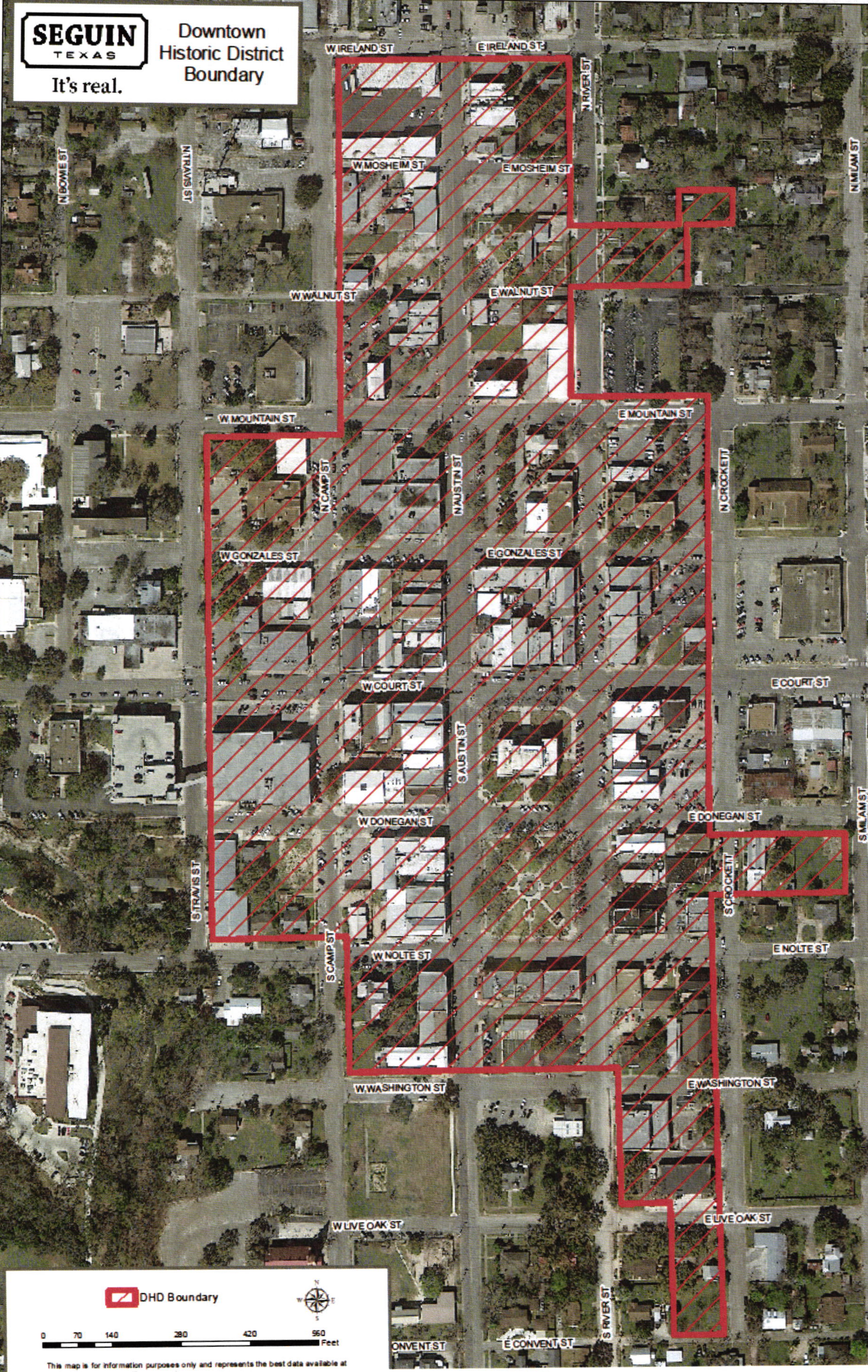
(Ord. No. 2015-94, § 1, 12-1-15; Ord. No. 2017-34, pt. 1, 7-18-17; Ord. No. 2019-005, § 4, 2-19-19; Ord. No. 2020-014, § 2, 2-18-20; Ord. No. 2023-069, § 1, 11-21-23; Ord. No. 2025-002, pt. 1, 1-21-25)
Sec. 3.4. - Use.
3.4.1.
Permitted, Limited, Specific, Unlisted and Prohibited Uses. The use of land and/or buildings shall be in accordance with those listed in the following Land Use Matrix. No land or building shall hereafter be used and no building or structure shall be erected, altered, or converted other than for those uses specified in the zoning district in which it is located or for activities consistent with the nonconforming provisions of this Chapter.
3.4.2.
Unlisted Uses. It is recognized that new types of land use will arise in the future, and forms of land use not presently anticipated may seek to locate in the City. A new and unlisted use may be interpreted by the Planning Director as similar to a listed use if the unlisted use possesses the majority of characteristics of the listed use. If the unlisted use is deemed similar to a listed use by the Planning Director, no amendment of the Land Use Matrix is required. If the use is not deemed by the Planning Director to be similar to an existing listed use the unlisted use determination must be submitted to the Planning and Zoning Commission and City Council and shall subsequently is treated as an ordinance amendment.
A person requesting the addition of a new or unlisted use shall submit to the Planning Director or his/her designee, all information necessary for the classification of the use, including but not limited to the following:
A.
The nature of the use and whether the use involves residential activity, sales, services, or processing;
B.
The type of product sold or produced;
C.
Whether the use has enclosed or open storage and the amount and nature of the storage;
D.
Anticipated employment typically anticipated with the use;
E.
Transportation requirements - estimate of number of trips per day;
F.
The nature and time of occupancy and operation of use;
G.
The parking and loading requirements;
H.
The amount of noise, odor, fumes, dust, toxic materials and vibration likely to be generated;
I.
General description of development needs for use (impervious cover, utilities, etc.).
3.4.3.
Land Use Matrix.
* If selling alcohol on site the limited use requirement for bar/ nightclub shall apply.
◇ Refer to chapter 22 of the Seguin Code of Ordinances for additional regulations and requirements for short-term rentals.
(Ord. No. 2015-27, § 2, 5-5-15; Ord. No. 2015-28, § 4, 5-5-15; Ord. No. 2015-33, §§ 2, 3, 6-16-15; Ord. No. 2015-44, § 6, 7-21-15; Ord. No. 2015-65, § 2, 9-15-15; Ord. No. 2015-81, §§ 1—4, 10-20-15; Ord. No. 2016-11, § 1, 1-19-16; Ord. No. 2016-25, § 1, 4-5-16; Ord. No. 2016-70, § 3, 11-1-16; Ord. No. 2017-19, § 1, 4-18-17; Ord. No. 2018-048, pt. 1, 8-14-18; Ord. No. 2019-027, § 1, 5-21-19; Ord. No. 2019-039, §§ 1, 2, 7-16-19; Ord. No. 2020-069, § 1, 12-15-20; Ord. No. 2021-008, § 1, 2-23-21; Ord. No. 2023-035, § 1, 6-20-23; Ord. No. 2024-018, pt. 1, 4-16-24; Ord. No. 2025-002, pt. 1, 1-21-25; Ord. No. 2025-036, pt. 1, 7-15-25; Ord. No. 2025-044, pt. 1, 9-16-25)
Sec. 3.5. - Limited uses.
3.5.1.
Purpose. The purpose of a limited uses permit is to allow certain uses that that have previously required a specific use permit to be permitted administratively with certain conditions of development that will ensure compatibility with adjacent uses.
3.5.2.
Timing of Compliance. The standards of this section apply at the time a limited use is requested to be established in an existing or new structure and/or when one of the following thresholds are met:
A.
An existing limited use is proposed to be expanded by more than 50% of the existing square footage currently devoted to the use.
B.
If the extent of the proposed modifications is 50% or more of the site's assessed value over a 5-year time period. For the purposes of the code the assessed value of a structure shall be the value cited by the Guadalupe County Appraisal District.
3.5.3.
Development Standards.
A.
Apartments/Condominiums. Apartments/Condominiums are identified as limited uses in the neighborhood commercial and commercial zoning districts. If an apartment is desired in one of these zoning designations the apartment must be on the second or above story of the building. The first floor shall be reserved for commercial development.
B.
Manufactured Home.
As an accessory use: The use of manufactured homes in the AR zoning designation is identified as a limited use. The following requirement must be met in order to allow the use. One manufactured home shall be permitted per lot, as an accessory residential use to an existing single-family residential home built on site. The manufactured home must meet the requirements of the manufactured home zoning designations and must be located behind the site built single-family home.
Primary Use: One manufactured home may be allowed per lot. Unit shall be placed where visibility of unit is limited from right-of-way.
C.
Modular/Industrialized Homes. The use of a modular/industrialized home shall meet the following requirements:
1.
Single-family or duplex industrialized housing must have all local permits and licenses that are applicable to other single-family or duplex dwellings.
2.
All housing shall:
a.
Have a value equal to or greater than the median taxable value for each single-family dwelling located within 500 feet of the lot on which the industrialized housing is proposed to be located, as determined by the most recent certified appraisal for the County; "Value" means the taxable value of the industrialized housing and the lot after installation of the housing;
b.
Have exterior siding, roofing, roof pitch, foundation fascia, and fenestration compatible with the single-family dwellings located within 500 feet of the lot on which the industrialized housing is proposed to be located;
c.
Comply with City aesthetic standards, building setbacks, side and rear yard off-sets, subdivision control, architectural landscaping, square footage, and other site requirements applicable to single-family dwellings; and
d.
Be securely fixed to a permanent foundation as defined by the City of Seguin adopted building codes.
3.
In addition to any other information otherwise required for building permits, the building permit application shall provide the following information:
a.
Identify each single-family dwelling located within 500 feet of the lot on which the industrialized housing is to be located, and show the taxable value for each dwelling as determined by the most recent certified tax appraisal roll for the county;
b.
Describe the exterior siding, roofing, roof pitch, foundation fascia, and fenestration for each single-family dwelling located within 500 feet of the lot on which the industrialized housing is to be located;
c.
Describe the permanent foundation and method of attachment proposed for the industrialized housing;
d.
State the taxable value of the industrialized housing and the lot after installation of the industrialized housing;
e.
Provide documentation from the seller of the industrialized home indicating the sales price; and
f.
Indicate the deed restrictions, if any, otherwise applicable to the real property on which the industrialized housing is to be located.
D.
Accessory Dwelling. The use of an accessory dwelling is identified as a limited use within the P zoning district. An accessory dwelling may be permitted within a P zoning district if it is a parsonage sharing the same lot as a place of worship.
E.
Religious Assembly Facilities. When religious facilities are identified as a limited use on the land use matrix the facility shall meet the lot development requirements associated with the "P" zoning district.
F.
Bar/Nightclub. It shall be unlawful for any person to sell any beer, wine, intoxicating liquor or other alcoholic beverage, as defined in V.T.C.A., Alcoholic Beverage Code § 1.04, at any place of business located within 300 feet of any church; public, private or parochial school; or public hospital. The measurements shall be along the property lines of the street fronts and from front door to front door and in a direct line across intersections of streets, where such intersections occur, pursuant to V.T.C.A., Alcoholic Beverage Code § 109.33. Please see section 2.16 of this Code for procedures to request a variance of the distance requirements for establishments dispensing alcoholic beverages for on-premises consumption.
Procedures. Any business selling alcoholic beverages for on-premises consumption that seeks to locate the business at a location that is closer to a school or church than permissible under this code, or State law, must seek a variance.
G.
Outdoor festivals. The use of a carnival/circus shall only be done so on a temporary basis within the City limits and with an issuance of an outdoor festival permit. See section 2.15 for requirements.
H.
Auto Repair and Servicing (work done either partially or completely outdoors). When auto repair and servicing work is either partially or completely done outdoors in the "C" zoning district all work must be screened from the view of all public rights-of-way, adjacent uses both commercial and residential and all outdoor work must have limited work hours of 8:00 a.m. to 5:00 p.m. Monday through Saturday.
I.
Commercial Communication Tower. Construction of all commercial communication towers are required to submit a building permit and adhere to the following requirements:
1.
Distance requirements from all residential lots shall be a minimum of 110% of height of tower to nearest residential lot or lot zoned residential.
2.
Commercial Communication Towers shall be setback a minimum of fifty feet (50') from any property line.
3.
All accessory structures shall comply with the setback standards for the zoning district in which it is located.
4.
A fence not less than eight feet (8') in height from finished grade shall be constructed around each tower and accessory structure. Access to the tower shall be through a locked gate. If adjacent to residential lots, all mechanical equipment and accessory structures must be screened by a solid fence and/or appropriate landscaping approved by the Planning Director through a limited use permit. A tower that is located over three (3) times the tower height from the nearest residential lot is excluded from requirement to construct a solid fence or landscape screening.
5.
All tower property must be screened from all adjacent rights-of-way by a landscape barrier at the perimeter and adjacent to the right-of-way. Landscaping shall be placed on the outside of fencing and, at a minimum, shall consist of a continuous row of shrubs of at least 4' in height upon maturity, and a tree planted every fifty (50') feet.
6.
Commercial Communication Towers shall not encroach into or through any established public or private airport approach as established by the Federal Aviation Administration.
7.
Any high voltage or other risk to public safety must be clearly identified by way of signage approved by the Planning Commission.
J.
Gardeners/Farmers Market. Farmers market shall be allowed with limited use permit, subject to meeting the below requirements, in the following zoning districts: "AR", "P", "NC", "C" and within the Downtown historic District. Requirements are as follows:
1.
Designated parking area must be provided and parking plan shall be approved by the Director of Planning.
2.
Must be for a specified period of time approved by the Planning Director.
3.
Must be an accessory use and not the primary use of a site.
K.
Drive-through facilities (retail establishments, restaurants, and financial institutions). Drive-through facilities in the Downtown Historic District shall be subject to a limited use permit and the following requirements:
1.
No service speaker shall be located within seventy-five (75) feet of a residential district unless such district is utilized for a non-residential use.
2.
Service speakers include speakers used to conduct business with people outdoors or in partially enclosed structures including, but not limited to, drive-through payment windows, drive through restaurant ordering boards, service station pump islands and car washes.
L.
Artisan Manufacturing. Artisan Manufacturing uses in Commercial zoning and the Downtown Historic District require a limited use permit and a specific use permit. The proposed use shall be required to meet the following criteria before being able to apply for a specific use permit for the Planning and Zoning Commission's review:
1.
The proposed use doesn't result in adverse impacts, such as noxious odor, smoke, dust or dirt, or cause objectionable sounds.
2.
The square footage of the proposed use doesn't exceed 4,000 square feet (3,000 square feet for the production area and the remaining 1,000 square feet for office/retail.) The maximum square footage is further reduced to 2,000 square feet for production if the proposed use is located within 200 feet of single-family residential zoning districts.
M.
Retail Services with outdoor storage/display. Outdoor display and storage of merchandise is identified as a limited use in some zoning districts and shall be subject to the following requirements:
1.
Only 10% of the front designated parking area shall be used for outdoor display.
2.
Outdoor storage behind the main structure on a site may be permitted if storage is completely screened from public view through the use of buildings, landscaping or fencing.
N.
Sexually Oriented Businesses. Shall be subject to the requirements of the City Code found in Chapter 22 Division 9.
O.
Overnight Lodging Facilities. Overnight Lodging facilities in the Historic Downtown Overlay District are identified as a limited use on the land use matrix and are not exempt from the off-street parking requirements. Facilities shall meet the parking requirements applicable to the use as outlined in the off-street parking requirements.
P.
Event Facilities/Meeting Halls. Event facilities/Meeting Halls are identified as a limited use/specific use permit on the land use matrix for properties zoned R-1. Facilities shall be required to meet the following criteria before being able to apply for a specific use permit for the Planning and Zoning Commission's review:
•
Must be located on a major arterial roadway as defined on the City's thoroughfare plan;
•
Must be located on a corner;
•
Must have a parking plan that allows for off-street parking for patrons of the proposed facility. The parking plan may consist of off-site parking and must be approved by the Director of Planning.
Q.
Packaging/Assembly Facilities. Packaging, assembly, and/or treatment of finished or semi-finished products may be conducted indoors as long as no adverse external effects such as noise or odor extend beyond the property lines of the site. Outdoor storage shall be screened as required in Section 5 of UDC.
R.
Microbrewery/Brewpub.
1.
A microbrewery/brewpub that sells alcohol for on-premises consumption shall meet the distance requirements in section 6-2 in the City's Code of Ordinances or obtain a variance as allowed under this Unified Development Code.
2.
All production shall be within enclosed structures.
3.
The facility shall not produce obnoxious odors.
4.
No unscreened outdoor storage shall be allowed.
5.
With the application for a limited use permit, the applicant shall submit a loading/unloading plan that demonstrates:
a.
Pedestrian/vehicular traffic is not unreasonably obstructed.
b.
Neighbors are not negatively impacted.
c.
Loading and unloading facilities are located on-site where possible.
S.
Mobile Food Vendor Park.
1.
All mobile food vendors parked or operating within the Mobile Food Vendor Park shall meet all of the requirements established in Section 22, Article X of the Seguin Code of Ordinances.
2.
The applicant shall provide the proposed operations of the Mobile Food Vendor Park. This shall include hours and days of operation, maximum number of mobile food vendors allowed, and any accessory uses proposed in conjunction with the Mobile Food Vendor Park. The Planning Director shall review the operations for compatibility with the surrounding land uses and may place conditions and/or restrictions in order to prevent possible nuisances to surrounding properties.
3.
The application for the Limited Use Permit shall include a site plan that identifies the areas designated for mobile food vendor parking and operation, customer dining, customer parking, trash receptacles, site lighting, restroom facilities, and any accessory uses proposed in conjunction with the Mobile Food Vendor Park. The site plan shall also include how the site will be accessed by the public, including driveways and traffic flow through the site. Off-site parking and/or restrooms may be considered if the parking/restroom facilities are within 300' of the site and there is adequate pedestrian access to the site. Written permission from the property owner of the parking/restroom facilities is required and shall be submitted with the Limited Use Permit application.
4.
The site plan shall also identify the existing and proposed site surface improvements. The Planning Director shall review the site plan and determine if the surface improvements are adequate based on the proposed frequency of operations and the compatibility with the surrounding land uses.
5.
Restroom facilities will be required and shall be identified on the site plan. The requirement for temporary or permanent restroom facilities shall be determined by the Planning Director and shall be based on the proposed frequency of operations and the compatibility with the surrounding land uses.
T.
Vape and CBD Shops. Vape and CBD Shop uses in the Downtown Historic District require a limited use permit. The proposed use shall be required to meet the following requirements:
1.
No Vape and CBD Shop shall be within 300 feet of another Vape & CBD Shop (door to door).
2.
No Vape and CBD Shop shall be within 300 feet of a church (door to door).
3.
No Vape and CBD Shop shall be within 300 feet of a school or day care (door to door).
4.
No Vape and CBD Shop shall be within 300 feet of a park.
U.
Community Center. Community centers in the Downtown Historic District are identified as a limited use on the land use matrix and are not exempt from the off-street parking requirements. Facilities shall meet the parking requirements applicable to the use as outlined in the off-street parking requirements.
V.
Food Bank. Food banks in the Downtown Historic District shall be subject to a limited use permit and the following requirements:
1.
Submit a trash/refuge plan to properly dispose of expired food.
2.
Submit a plan for food distribution that will lessen traffic congestion to neighboring properties.
W.
Tattoo Studios. Tattoo studios in the Downtown Historic District shall be subject to a limited use permit and the following requirements:
1.
No tattoo studio shall be within 300 feet of a school or church (door to door).
2.
No tattoo studio shall be within 300 feet of another tattoo studio (door to door)
X.
Bail Bonds. Bail bonds in the Downtown Historic District shall be subject to a limited use permit and the following requirements:
1.
No bail bonds shall be within 300 feet of a school or church (door to door).
2.
No bail bonds shall be within 300 feet of another bail bonds (door to door).
Y.
Pay Day Loans. Pay Day Loans in the Downtown Historic District shall be subject to a limited use permit and the following requirements:
1.
No pay day loan lender shall be within 300 feet of another pay day loan lender (door to door).
Z.
Pawn Shops. Pawn shops in the Downtown Historic District shall be subject to a limited use permit and the following requirements:
1.
No pawn shop shall be within 300 feet of another pawn shop (door to door).
(Ord. No. 2015-65, § 3, 9-15-15; Ord. No. 2015-81, § 5, 10-20-15; Ord. No. 2016-25, § 2, 4-5-16; Ord. No. 2017-19, § 2, 4-18-17; Ord. No. 2019-039, §§ 1, 2, 7-16-19; Ord. No. 2020-069, § 2, 12-15-20; Ord. No. 2023-035, § 2, 6-20-23; Ord. No. 2024-018, pt. 2, 4-16-24)
Sec. 3.6. - Lot dimensional and development standards.
3.6.1.
General. All development shall comply with all of the applicable dimensional and development standards within this section.
3.6.2.
Standards—Residential Districts.
* In the R-2 district, the garage (attached or detached) and all accessory structures must meet the 20' front setback; the front of the primary structure may encroach an additional 5' into the front setback.
3.6.3.
Standards—Non-residential Districts.
•
Setbacks shall not apply to uncovered steps, uncovered balconies, uncovered porches, or roof eaves projecting not to exceed twenty-four (24") inches, and ordinary projections of window sills and other architectural features lying completely under the roof eave.
•
Edge of in ground or above ground pool or spa shall be at least 10 feet from primary structure and at least 5 feet from side and rear lot;
•
See MHP and DHD zoning district sections for setback requirements.
(Ord. No. 2015-27, § 3, 5-5-15; Ord. No. 2016-68, § 3, 10-18-16; Ord. No. 2021-009, § 1, 2-23-21)