
Seguin City Zoning Code
CHAPTER 4
- SUBDIVISIONS
Sec. 4.1. - [In general.]
4.1.1.
Intent. The regulations of this Subdivision Ordinance are authorized under the authority of Texas Local Government Code, Chapter 212 (including Subchapter B) and the City's charter. The provisions of this Subdivision Ordinance expressly extend to all areas inside the City limits and throughout the City's extraterritorial jurisdiction (ETJ), as either may be adjusted in the future, and as provided in the City's interlocal agreement with Guadalupe County. The regulations contained within this chapter are intended to protect the interests of the public and of private parties. This Ordinance is designed and intended to achieve the following purposes, and shall be administered so as to:
•
Create orderly, efficient and coordinated development within the City's jurisdiction.
•
Provide neighborhood conservation and prevent the development of slums and blight.
•
Harmoniously relate the development of the various tracts of land to the existing community and facilitate the future development of adjoining tracts.
•
Provide the most attractive relationship between the land as developed and the circulation of traffic throughout the municipality, having particular regard to the avoidance of congestion on the streets and highways, and the pedestrian traffic movements appropriate to the proposed development, and to provide for the proper location and width of streets.
•
Ensure that public or private facilities are available and will have a sufficient capacity to serve proposed subdivisions and developments within the City's jurisdiction.
•
Protect and provide for the public health, safety and general welfare of the community.
•
Provide open space and recreational areas in the form of parks and park improvements necessary for the health, welfare, and well-being of the public.
4.1.2.
Application of Requirements. This section applies in the following areas:
4.1.3.
Chapter Components. This chapter includes the following sections:
º
Subdivision Design
•
Lot configurations
•
Easements
•
Street Design
•
Property under common ownership
•
Stormwater and Drainage Standards
º
Construction of Subdivision Improvements
•
Required Improvements
•
Developers Responsibility
•
Timing of Improvements
•
Phasing of Requirements
•
Maintenance Responsibilities
•
Street Construction Requirements
•
Water Requirements
•
Waste Water Requirements
•
Electric Requirements
•
Street Lighting
º
Road adequacy standards
•
Boundary Street Improvements
•
Traffic Impact Analysis
º
Parkland
•
Dedication
•
Improvements
•
Fee-in-lieu
4.1.4.
General Principles of Acceptability for Subdivision Design. Subdivision lot configuration shall follow the following principles of acceptability for Subdivision Design:
A.
The subdivision shall conform to the City of Seguin Comprehensive Master Plan. The subdivision layout shall be in accordance with existing easements, rights-of-way, restrictions, and conditions. Where parks, trails, or roadways are identified on a City adopted master plan the developer for which the park, trail, or roadway traverses through a specific property shall incorporate the park, trail, or roadway into the proposed concept.
B.
The subdivision layout shall make reasonable provisions for development of and connection to adjacent land. All parcels shall have frontage on a public right-of-way. Land locked parcels shall not be permitted.
C.
Lot sizes must conform to the minimum lot area, minimum lot width, and minimum yard standards required in the underlying zoning district; ETJ lots shall conform to the requirements of the Interlocal Cooperation Agreement between Guadalupe County and the City of Seguin.
D.
Lots that front on more than one street other than corner lots, resulting in the need for a large development perimeter walls along a roadway, shall be minimal or avoided.
E.
The street pattern shall provide for adequate circulation within the subdivision and in a manner so as to discourage excessive through traffic on minor streets. The arrangement, character, extent, width, grade, and location of all streets shall conform to the comprehensive master plan and shall be considered in their relation to existing and planned streets, to topographical conditions, to public safety and convenience, and in their appropriate relation to the proposed uses of the land to be served by such streets. If any portion of a collector or major street, as depicted by the City's master plan, traverses any part of the land being subdivided, that portion of the major or collector street as planned shall be incorporated into the subdivision plan.
F.
The street layout shall be devised for the most advantageous development of the entire subdivision and shall conform to connecting streets in land adjacent to the new subdivision. Provision shall be made within the subdivision to provide street access to adjacent undeveloped acreage in such a way as to assure adequate circulation for future development. Dead-end streets and those which do not conform to adjacent established streets are to be avoided.
G.
The street system layout shall be designed (insofar as practicable) to preserve natural features such as vegetation, creeks, views, and related amenities.
H.
If the subdivision is located in a special flood hazard area as identified by the Federal Emergency Management Agency in the current scientific and engineering report entitled, "The Flood Insurance Study (FIS) for Guadalupe County, Texas and Incorporated Areas," effective March 27, 2024, with accompanying Flood Insurance Rate Maps dated March 27, 2024, and any revisions thereto, the subdivision is subject to the standards of Chapter 54-Floods of the City Code.
I.
New "island" subdivisions, lots, or streets that would be surrounded by floodwater of the one percent annual chance storm shall not be allowed unless the area is accessible to high ground by a street elevated one foot above the one percent annual chance ultimate condition storm elevation.
J.
Proposed subdivisions or developments shall be developed to ensure that all such proposals are consistent to minimize flood damage; all public utilities and facilities, such as sewer, gas, electric and water systems are located, elevated and constructed to minimize or eliminate flood damage; and adequate drainage is provided so as to reduce exposure to flood hazards.
(Ord. No. 2015-28, § 5, 5-5-15; Ord. No. 2017-74, § 1, 12-19-17; Ord. No. 2019-054, § 7, 9-17-19; Ord. No. 2023-004, pt. 2, 1-17-23; Ord. No. 2024-026, pt. 1(Att.), 5-21-24)
Sec. 4.2. - Lot configuration.
4.2.1.
Lot Access. Access to arterials and collectors shall be approved by the City Engineer and shall be in accordance with generally accepted traffic management guidelines. Rear and side driveway access to major thoroughfares or expressways shall be prohibited.
4.2.2.
Lot Frontage. Double-frontage lots are highly discouraged and prohibited except when they back on to major thoroughfares. If double frontage lots are created the plat shall include a note regarding maintenance of any boundary fencing/wall and maintenance of sidewalk and landscaping between property line and curb.
4.2.3.
Lot Shape. Irregular-shaped lots shall have sufficient width at the building line to meet lot width and frontage requirements of the appropriate zoning district (if within the City's limits) and shall provide a reasonable building pad without encroachment into front, side or rear yard setbacks or into any type of easement. Also, the rear width shall be sufficient to provide access for all necessary utilities, including access for driveways and solid waste collection when rear alleys are present (minimum 20-foot alley frontage). In general, triangular, severely elongated or tapered, "flag" or "panhandle" lots should be avoided.
Sec. 4.3. - Easements.
4.3.1.
General. All easements for City owned public utilities must be dedicated to the City and their locations shall be clearly denoted on the plat.
4.3.2.
Drainage Easement (DE). Where conditions require, there shall be provided an adequate stormwater drainage easement, as required by the Stormwater Criteria Manual. In areas where there is an approved and/or mapped floodplain, the subdivider or developer shall designate a drainage easement(s) for the floodplain. Where such easement is adjacent to lots, tracts, or reserves, the easement shall be noted on the final plat as follows: "The easement indicated shall be kept clear of fences, buildings, planting, and other obstructions to the operation and maintenance of the drainage facility, and abutting property shall not be permitted to drain into this easement except by approved means." For one- and two-family residential subdivisions, drainage easements crossing lots and property lines are prohibited. Drainage easement shall be placed on separate common area lots, as stipulated in the Stormwater Criteria Manual.
4.3.3.
Public Utility Easements (PUE). The location and width of necessary public utility easement shall be determined by utilities staff, or, in the instance of private utilities, by the private utility company concerned. Where necessary, adequate easements shall be provided for underground street lighting service lines. A PUE shall be provided parallel to the public right of way located within the front yard and side yard for corner lots. The minimum width of the PUE for new developments shall be no less than 10 feet. The location and width of easements shall be determined by utilities staff.
(Ord. No. 2022-042, 5-24-22; Ord. No. 2023-004, pt. 3, 1-17-23; Ord. No. 2024-026, pt. 1(Att.), 5-21-24)
Sec. 4.4. - Streets design.
4.4.1.
General. The street pattern shall provide for adequate circulation within the subdivision and in a manner so as to discourage excessive through traffic on minor streets. The arrangement, character, extent, width, grade, and location of all streets shall conform to the City's Thoroughfare Plan and Technical Manual, and shall be considered in their relation to existing and planned streets, to topographical conditions, to public safety and convenience, and in their appropriate relation to the proposed uses of the land to be served by such streets. If any portion of a collector or major street, as depicted by the City's Thoroughfare Plan, traverses any part of the land being subdivided, that portion of the major or collector street as planned shall be incorporated into the subdivision plan. The street layout shall be devised for the most advantageous development of the entire subdivision and shall conform to connecting streets in land adjacent to the new subdivision. Provision shall be made within the subdivision to provide street access to adjacent undeveloped acreage in such a way as to assure adequate circulation for future development. Dead-end streets and those which do not conform to adjacent established streets are to be avoided whenever possible.
4.4.2.
Block length. Block lengths shall not exceed 1,200 feet or be less than 500 feet. The maximum block length along a railroad, body of water, or similar barrier shall be 2,400 feet, except under special conditions and upon approval by the Planning and Zoning Commission. Cul-de-sac streets shall have a maximum length of 500 feet.
4.4.3.
Half Streets. Partial or Half Streets shall only be permitted on divided roadway sections with the approval of the City Engineer. Additional plat notes may be required.
4.4.4.
Sidewalks. Sidewalks shall be provided along both sides of all streets within a subdivision. The width of the sidewalk will vary depending on the street classification. See specific standards in sidewalk section of Chapter 5 and detailed street cross-sections within the Technical Manual.
4.4.5.
Street Classifications. Proposed roads serving new development shall provide a complete, safe and functional system for vehicular, bicycle and pedestrian circulation and shall be properly designed based on the context of the current and anticipated development within the area. Streets shall be extended to the boundary lines of the tract as necessary for eventual extension to the adjacent tract(s) to ensure that block lengths do not, in general, exceed the limits defined by this code and to provide access to adjacent property. Provisions shall be made for the appropriate extension of existing and proposed streets. Streets intended to be extended from an adjacent tract shall be extended. Street right-of-way shall be dedicated with the plat, and the street shall be constructed with the public infrastructure permits for the plat, for the full length and/or width of the lots in the subdivision adjacent to such street, unless otherwise approved. Exceptions may be granted by the Planning and Zoning Commission to allow a lesser width in townhouse or cluster developments.
A.
Alleys. The use of alleys to access garages, trash pick-up, and/or utilities is permitted when the alley is constructed to City standards and privately maintained by a HOA or similar entity approved (see below maintenance standards for private streets and alleys) or constructed of concrete. When utilities are installed in the rear of the adjacent lot or within an alley a public utility easement may be required. Alleys, where provided, shall not be less than 20 feet in width. Intersecting alleys shall have corner cutoffs of at least 20 feet on a side. Alleys with only one point of access shall have either a turnaround with a minimum radius of 20 feet at their closed ends or an alternate means of turnaround within dedicated right-of-way.
B.
Minor Street. A minor street is used primarily for access to abutting properties or developments, serving to carry traffic to collector streets or a major thoroughfare. Minor streets comprise all streets not classified and designated as a major thoroughfare or collector street on the Thoroughfare plan. Minor streets are divided into three subcategories: minor residential streets, minor local-nonresidential or minor rural residential road. Unless approved by the City Engineer and Planning Director, a local street shall not connect to two separate higher classification streets or connect directly to arterial streets. All minor residential streets shall have a minimum right-of-way width of 50 feet.
C.
Collector. A collector street which carries traffic from activity centers on minor streets to arterial streets. The streets are designated on the Future Thoroughfare Plan. Land access is permitted but should be more limited than local streets. Industrial, commercial, and collector streets shall have a minimum right-of-way width of 60 feet.
D.
Major Thoroughfare/Arterial. Major Thoroughfare/Arterial streets are used which are used primarily for fast and heavy traffic flow and is used as traffic arteries for inter-connection among large areas. Major thoroughfares depicted by the City of Seguin Future Thoroughfare Plan, or revisions thereto, having a right-of-way width greater than 60 feet shall be deemed a requisite of platting and shall be subject to dedication with approval of the plat.
4.4.6.
Street Names. The names of proposed streets shall conform to the names of existing streets of which they are or may become extensions, and shall not duplicate or conflict with the recognized name of any other street located within the County.
4.4.7.
Maintenance of Private Streets. The developer of any subdivision in which private streets are approved for construction shall establish a property or home owner's association, or similar entity, (the "HOA") that will have a binding, continuing responsibility for the maintenance and operation of the private streets and shall establish adequate funding for such maintenance and operation. The HOA's maintenance obligation shall be noted on the plat and in the restrictive covenants filed of record for the subdivision in a form that is acceptable to the City. The restrictive covenants shall provide for a monthly or annual assessment sufficient to fund the maintenance and operation of the private streets. Compliance with this section shall be a condition of final plat approval.
4.4.8.
Private Streets; Required Easements. The developer of any subdivision in which private streets are approved for construction shall grant the City a public safety easement and a public utility easement over the private streets in the subdivision in the form acceptable to the City, said public utility easement to include cable, gas telecommunications, and other public utilities. Compliance with this section shall be a condition of final plat approval. Private streets shall meet public street standards for emergency street access.
(Ord. No. 2023-003, pt. 3, 1-17-23; Ord. No. 2023-004, pt. 4, 1-17-23)
Sec. 4.5. - Private facilities/property under common ownership.
When a subdivider proposes that any part of a subdivision, planned development, or any other development of land include any privately maintained facilities (e.g. community postal box pavilion, private park, streets, amenity, drainage or detention facilities, or any other improvement), a property owner's association (or comparable mechanism) shall be created and be responsible for the following:
•
Maintenance. Total responsibility for maintenance in perpetuity of such private improvements is borne by the association.
•
Funding program. A program is established whereby the association can accomplish the maintenance of private facilities.
The documents creating the required property owner's association shall be reviewed and approved by the City Attorney prior to the recordation of the first subdivision plat for the proposed subdivision.
Sec. 4.6. - Stormwater and drainage standards.
4.6.1 General Requirements. All proposed developments shall provide for new drainage facilities, the improvement of existing drainage facilities, channel improvements, grading, driveway adjustments, culvert improvements or other drainage improvements determined by the City Engineer to provide for the stormwater drainage needs of the development and the downstream areas, designed and constructed in accordance with the requirements specified in the Stormwater Criteria Manual. The developer shall provide all necessary information and calculations to the City Engineer to demonstrate that the proposed development does not exceed the capacities of the stormwater management systems as a result of the development. If any appreciable adverse impacts still exist at a distance of 2.000 feet downstream of the proposed development, the City Engineer may require the construction of additional drainage facilities until any remaining adverse impacts are deemed de minimis (at no cost to the City).
It is the responsibility of the developer to provide for conveyance of off-site storm water. The developer's design package submitted to the City shall include a description of all potential off-site impacts caused by the development and the proposed mitigation procedures for the impacts, including but not limited to:
•
Alteration of existing upstream drainage areas and/or conveyance systems due to the proposed development.
•
The detention facility discharge shall be located to provide the least impact on downstream conditions, including requirements for the discharge to be routed to street curbs, bar ditches, storm sewer or other drainage way.
•
The impact of flow concentration from the detention facility discharge point on existing drainage areas and/or conveyance systems.
•
Extension of existing conveyance systems through the development.
•
The altering of existing on-site conveyance systems.
In order to mitigate the impact of the proposed development, the phasing of development, the use of off-site control methods or the construction of off-site drainage improvements may be necessary. Calculations to verify downstream adequacy shall be performed to the nearest receiving waterway(s). Should projected stormwater runoff from the proposed development exceed the capacity of the existing drainage facilities and/or natural channels, the developer shall be responsible for improvingthe existingfacilities at its own cost.
4.6.2 Design Criteria. All drainage systems shall be designed and constructed in accordance with the UDC Technical Criteria Manual, City of Seguin Stormwater Criteria Manual, and City of Seguin Standard Details.
4.6.3 Stormwater Management. Stormwater management shall be designed and constructed to prevent adverse conditions from arising on property adjoining and downstream of the subdivision site. Adverse conditions include increases in peak flows, water surface elevations, concentration of flow and flow velocity. The Stormwater Management Report shall show that mitigation of the impacts of development on the drainage system will be provided as part of the development. Mitigation may include detention, retention, infiltration, channel improvements, and other means acceptable to the City Engineer. Stormwater Management facilities shall be designed to reduce post-development peak flow rates of discharge to pre-development rates for the 2, 10, 25, 50 and 100-year storm events at all points of discharge. The Stormwater Management Report shall also include an evaluation of downstream conditions. Drainage improvements shall accommodate runoff from the upstream drainage area in its anticipated maximum "build-out" or "fully developed" ultimate condition and shall be designed to prevent overloading the capacity of the downstream drainage system. No person, individual, partnership, firm or corporation shall deepen, widen, fill, reclaim, reroute or change the course or location of any existing ditch, channel, stream or drainageway without first obtaining written permission (or approved engineering and drainage studies) and a grading permit from the city engineer and any other applicable agency having jurisdiction, such as FEMA or U.S. Army Corps of Engineers. The costs of such study, if required, shall be borne by the developer.
4.6.4 Detention and Drainage Facilities. On-site stormwater detention shall be required for all new developments to offset increased runoff resulting from new developments except for those developments for which approved regional detention facilities have been established or for which alternate plans have been approved by the City Engineer in accordance with the City's Stormwater Criteria Manual.
4.6.5 Floodplain. When a proposed subdivision or development has within it a drainageway where no regulatory floodway has been designated and is located within a FEMA mapped floodplain, no new construction, substantial improvement or other development, including fill, shall be permitted in an area that may have flood hazards, unless it is demonstrated that the cumulative effect of the proposed development or improvements, when combined with all other existing and anticipated development and improvements will not substantially increase the water surface elevation. In areas where there is an approved and/or mapped floodway, the subdivider or developer shall designate a drainage easement(s) for the floodway. In areas where a floodway is mapped and approved by the city, a flood study or demonstration of "no flood height increase" shall be required.
If a proposed subdivision is within an area where flooding may occur, where there is no floodplain shown on a city-approved floodplain map, or where there is located an approved floodplain but not floodway, the subdivider shall:
•
Conduct a study of where the base flood elevation would be, assuming a fully developed watershed, show a drainage easement on the plat, and show the elevation of the floodplain at intervals of every 500 lineal feet, designate the area equivalent to the floodway to be a drainage easement; or
•
Conduct a study, using HEC or similar modeling that is approved by the city engineer, to ensure that the proposed development would not increase the elevation of the one percent annual chance base flood and the area equivalent to the floodway will be designated as a drainage easement; or
•
Request a variance from the above requirements, The request for the variance shall be assessed with respect to proposed density, land use, lot sizes, building sizes, anticipated impervious cover, and the width and depth of the existing floodplain. All wavier requests shall be considered and decided by the Planning Commission.
(Ord. No. 2023-004, pts. 5—7, 1-17-23; Ord. No. 2024-026, pt. 1(Att.), 5-21-24)
Sec. 4.7. - Subdivision improvements.
4.7.1
General. All subdivision improvements shall be designed and installed in accordance with all applicable elements of the Comprehensive Master Plan and Thoroughfare Plan and shall meet the minimum requirements established by this UDC, the Stormwater Criteria Manual, and City Standard Details and Specifications. All improvements shall be designed and installed so as to provide for a logical system of utilities, drainage and streets and to create continuity of improvements for the development of adjacent properties. Water, wastewater, transportation and drainage improvements shall be extended to the perimeter of the development.
4.7.2.
Required improvements. The developer or applicant must make all of the following improvements:
A.
Dedicate right-of-way necessary to achieve the width required by applicable transportation related plans for streets adjoining the property;
B.
Dedicate land and construct trails within the residential subdivision as per the Seguin Comprehensive Master Plan and/or Parks and Recreation Master Plan. Unless specified otherwise by the Director of Parks and Recreation, or designee, all such trails shall be constructed of concrete and shall conform to the requirements of the American with Disabilities, as amended. Specifications for concrete shall be provided by the Director of Parks and Recreation, or designee. Trails in the Trails Master Plan shall be constructed in accordance with the Technical Manual by the developer at the developer's expense as trails are considered by the City as infrastructure. Trails shall be placed in a right-of-way or pedestrian access easement. Pedestrian access easements shall be a minimum of fourteen (14) feet in width. This may be a shared easement with public utilities as approved by the City;
C.
Pave and install curbs and gutters along streets adjoining the property;
D.
Install sidewalks and pedestrian pathways;
E.
Install street lighting;
F.
For residential development, provide open space and recreational facilities or fee-in lieu of parkland and improvements for parkland;
G.
Install all utilities;
H.
Install required drainage related facilities and easements required to adequatelycontain and convey stormwater runoff;
I.
Landscaping, drainage, fire protection, and all applicable UDC requirements.
4.7.3
Developer responsibility. The developer shall construct or provide all applicable subdivision improvements required by this chapter. All improvements which the developer is required to make shall be made at the developer's expense without reimbursement by the City, except as provided otherwise in this UDC.
4.7.4
Timing and inspection of improvements. Unless otherwise stated, a developer cannot begin construction activities in the jurisdiction, including clearing and/or rough grading, before first obtaining all City approvals and permits. For detailed information on the public infrastructure permit process or post permit approval please refer to Chapter 2. For applications materials and information please refer to the UDC Technical Manual.
4.7.5
Phasing plan requirements. Proposals for projects to be developed in multiple phases must meet all the following requirements unless otherwise approved by the City Engineer and Planning Director:
A.
A Subdivision Concept Plan outlining the proposed phases of the development must be submitted and approved in accordance with the process identified in Chapter 2 of this UDC;
B.
Each phase of a development needs to be for utilities, fire protection, streets and stormwater and drainage management. It is highly recommended that a preliminary plat be submitted and approved to ensure lot layout consistency with the infrastructure layout;
C.
Public Infrastructure Permits for each standalone phase shall be approved by the City Engineer in accordance with the process identified in Chapter 2 of this UDC;
D.
Phase lines must follow reasonable and logical boundaries, such as terminating at intersections or following topographical breaks;
E.
Phases must be constructed in the approved manner to ensure orderly and planned development;
F.
Phases must be planned to ensure the efficient construction of adjacent future phases (phases immediately next to the subject phase, sharing a common boundary line), and to ensure that phased development is contiguous;
G.
Right-of-way and/or easements for public infrastructure servicing the respective phase must be recorded with the first plat.
4.7.6.
Maintenance of required improvements. The owner or owners of the subdivision shall be responsible for the maintenance of all required improvements within said subdivision until such improvements are completed and accepted for maintenance by the City of Seguin. This shall include the maintenance and repair of all drainage and erosion control features and facilities on-site and off-site pertaining to the development, the daily cleanup of paved streets and of drainage areas impacted by on-site or off-site construction, the strict adherence of the site's stormwater pollution prevention plan (SWPPP, SW3P) and all state and federal requirements. Upon completion of the required improvements, the owner or owners of the subdivision shall request, in writing, acceptance for maintenance by the City of said improvements. Upon receipt of such request, the City Engineer shall inspect the required improvement and, if found to be in compliance with the approved engineering plans and specifications for said improvements, shall notify within five days, in writing, the subdivider of acceptance for maintenance by the City. Should the City Engineer find noncompliance with said plans and specifications, he shall notify within ten days, in writing, the subdivider of those deficiencies which must be corrected prior to acceptance for maintenance by the City of the required improvements. Prior to acceptance for maintenance of the completed improvements by the City, the subdivider shall file with the City Engineer either:
•
A two-year warranty bond executed by a corporate surety licensed in the State of Texas, warranting the improvements are free from defects in materials and workmanship; or
•
A letter of credit in the amount of the cost of the improvements from a banking or other financial institution authorized to do business in the State of Texas, committing funds for the correction and repair of any defects in materials or workmanship for a period of two years.
All drainage improvements constructed or installed shall be maintained in accordance with the following:
•
Drainage improvements located in the public rights-of-way that have been accepted by the City will be maintained by the appropriate jurisdiction.
•
All natural drainage channels, swales, etc., located on private property and which are publicly dedicated easements shall be maintained by the property owner or property owner's association. When such easements are shown on the subdivision plat, this exclusivity and restriction will be noted on the plat and included in the restrictive covenants. The use of drainage easements on private property shall be minimized as much as practical. Existing drainage between developed lots shall remain the responsibility of the affected property owners.
4.7.7.
Streets. All applications for plat approval, Site Plan approval, or PUD rezoning (depicted on a General Land Use Plan) shall provide for adequate roads to support proposed development through compliance with the following minimum standards governing dedication and improvement of internal roadways and adjacent thoroughfares. For purposes of this Section "adjacent thoroughfares" shall include thoroughfares abutting the proposed subdivision, whether located within the boundaries of the subdivision or within public rights-of-way. The property owner shall dedicate and improve all required rights-of-way for internal roadways and adjacent thoroughfares required by these regulations in accordance with the classification of streets contained in the Thoroughfare Plan. For technical requirements regarding street design and construction specifications please refer to the Technical Manual.
4.7.8.
Street signs. All street designation signs and traffic control signs and devices shall be installed by the developer/applicant. These signs shall be of a type approved by the City, and shall be installed according to the City standards prior to the acceptance of the subdivision/public improvements by the City Engineer.
4.7.9.
Water. All water systems shall be designed and constructed in accordance with the UDC Technical Manual and City of Seguin Standard Details. The water distribution system shall be designed so as to provide service to each lot within the subdivision, in accordance with applicable engineering design criteria and requirements of the State Board of Insurance for fire flows, water mains and fire hydrants and the State Department of Health.
A.
Property within 300 feet of infrastructure must connect. Except as provided in subsection B, if a subject property is within 300 feet of public water infrastructure the developer/subdivider shall connect to the public water facilities.
B.
Limited waiver of connection requirement. If the city's director of water/wastewater utilities makes a written determination that a subject property within 300 feet of public water infrastructure cannot be served by the infrastructure due to lack of water availability through such infrastructure as of the time a plat application for the property is filed, the city manager may defer the requirement to connect until water becomes available through the infrastructure if adequate capacity from surface or groundwater rights associated with the property are available to serve the proposed uses on the property. If a plat is approved on the basis of such alternative water source and the water rights are unable to be exercised due to water quality or other environmental prohibitions or regulations, no site development or building permits may be issued for development on the property until water service becomes available to the property through the public water infrastructure. As a condition of plat approval subject to this subsection, the foregoing restriction shall be disclosed in a written notice, the form of which is approved by the city attorney, recorded in the official public records of the county in which the property is located.
4.7.10.
Wastewater. All wastewater systems shall be designed and constructed in accordance with the UDC Technical Manual and City of Seguin Standard Details. The sanitary sewerage system shall be designed so as to provide service to each developable lot within the subdivision, in accordance with applicable engineering design criteria and requirements of the State Department of Health. The use of on-site sewage facilities in subdivision development is prohibited within the City, but may be permitted on existing lots and minor plats where no main exists within 300 feet, with the approval of the City Engineer and Planning Director. All on-site sewage facilities must be in compliance with all local, state and federal requirements. No septic tank system can be installed on a lot or part of a lot that contains less than one acre, unless the subdivision includes four or fewer buildable lots. In addition, no part of a septic tank system shall be installed any closer to a flowing stream than 150 feet. Buildable lots, in this section, shall refer to lots in which a structure or building is allowed to be constructed on the lot. In either the City limits or within the extraterritorial jurisdiction, a subdivider may, in the alternate, install at his own expense a temporary or package sewerage treatment plant, provided the use of such plant is approved by the City Engineer. Such plant shall be designed to serve the property being subdivided and shall meet all applicable requirements of the state water quality board and Environmental Protection Agency, but in no event shall the effluent exceed the following requirements: 20 parts per million BOD; 20 parts per million suspended solids. It shall be the responsibility of the subdivider to secure all necessary discharge permits. The subdivision shall maintain the treatment plant until such time as the improvements within the subdivision are accepted by the City.
4.7.11.
Main Extension. Refer to section 102-179 of the City's Code of Ordinances for all applicable requirements for subdivision development under this Chapter.
4.7.12.
Electrical Service. The electrical distribution system shall be designed so as to provide service to each lot within the subdivision, in accordance with applicable engineering design criteria and all electrical code requirements of the City.
A.
One- and Two-Family Dwelling Residential. All electrical distribution lines for one- and two-family dwelling residential developments shall be installed underground with the exception of feeder lines that are installed along the perimeter of a subdivision. For the purposes of this section (4.7.11), the perimeter shall be defined as the continuous line forming the boundary of the subdivision.
B.
Multi-Family and Non-Residential. Electrical distribution lines for multi-family and non-residential developments may be installed overhead along the perimeter of a subdivision or lot when installed along interior property lines that do not run parallel to public rights-of-way. Utility service lines providing electric service to each lot must be installed underground. The Planning Director and the Director of Electric Utility of the City of Seguin may waive this requirement and allow overhead electrical distribution lines along public rights-of-way when determined by the City to be necessary and appropriate.
C.
City Review of Electrical Distribution Systems. The location of all electrical distribution lines within the City of Seguin's service area shall be reviewed and approved by the Director of Electric Utility. If electric service is provided by an agency other than the City, the electric service provider shall notify the City of the location(s) of the proposed distribution lines for the development before installation of the lines begins. If written comments are not returned to the electric provider within five (5) business days of being notified, the electric provider may begin installation of the lines as proposed.
4.7.13.
Street lighting.
A.
Location. For new developments, streetlights shall be installed by the developer at all intersections, at the end of cul-de-sacs, and shall not exceed 500 feet along street frontage. In newly annexed areas, and areas developed prior to the adoption of this article, or for areas served by an electric utility other than the City of Seguin, streetlight locations shall be based on the availability of service and other safety requirements at the discretion of the City of Seguin Director of Electric Utility, and/or the electric provider if other than the City of Seguin. In areas not exceeding a residential density of two units per acre, streetlight requirements may be waived by the Director of Electric Utility, where it is determined that the area does not require such street lighting for safe pedestrian or vehicular traffic.
B.
Fixtures. The type, size and service of street lighting shall be determined by the Director of Electric Utility. For areas not served by the City of Seguin, the utility provider shall determine the type, size and service of streetlight service.
C.
Maintenance and installation. Streetlights shall be installed by the subdivider, developer or property owner in new developments. The City of Seguin or electric provider may install streetlights within previous developed areas or areas where accommodations cannot be made to make the installation safe for the subdivider, developer, or property owner. The City of Seguin or electric provider may require the installation of conduit by the subdivider, developer, or property owner in this case. Service lines to streetlights shall be underground and shall be extended within an appropriate easement or right-of-way to available transformers and junction boxes. Service lines shall be provided and installed at the sole cost of the subdivider, developer or property owner. The City of Seguin shall be responsible for streetlight maintenance for all nonmetered, public streetlights within the City of Seguin service territory, which have been approved by the Director of Electric Utility. Decorative or other nonstandard streetlight fixtures shall be approved by the Director of Electric Utility. The subdivider, developer or property owner shall be responsible for the installation and maintenance of all private, metered streetlights.
(Ord. No. 2016-01, § 1, 1-5-16; Ord. No. 2017-17, § 2, 4-18-17; Ord. No. 2017-74, § 2, 12-19-17; Ord. No. 2019-054, § 7, 9-17-19; Ord. No. 2020-043, § 1, 6-16-20; Ord. No. 2022-043, § 2, 5-24-22; Ord. No. 2023-003, pt. 3, 1-17-23; Ord. No. 2023-012, pt. 1, 3-21-23; Ord. No. 2024-026, pt. 1(Att.), 5-21-24)
Sec. 4.8. - Road adequacy standards.
4.8.1. General. New development must be supported by an adequate roadway network. It is necessary and desirable to obtain rights-of-way for off-site, abutting, and internal streets to support new development at the time of platting or development of the land. There must be a rough proportionality between the traffic impacts created by a new development and requirements placed on the property owner to dedicate and improve off-site and abutting street rights-of-way. The method for determining proportionality shall be identified in the Technical Manual. The City desires to assure both that development impacts are mitigated through contributions of street rights-of-way and improvements and that a development project contribute no more than its proportional share of street costs.
4.8.2. Boundary Street Improvements.
A.
Applicability. The developer's obligations concerning boundary streets are as follows:
1.
For developments adjacent to existing or future streets identified on the Thoroughfare Plan, the property owner shall dedicate one-half of the right-of-way needed to meet the specifications in the Thoroughfare Plan.
2.
The City may require additional land and improvements for rights-of-way for adjacent thoroughfares where necessary to achieve adequacy of the road network and where such additional land and improvements are proportional to the traffic impacts generated by the proposed development, depending on factors such as the impact of the development on the adjacent thoroughfare, the timing of development in relation to need for the thoroughfare, and the likelihood that adjoining property will develop in a timely manner.
3.
When a proposed development abuts and/or takes access from one or both sides of an existing substandard street, the developer shall be required to improve the substandard street and its appurtenances (such as curbs and gutters, storm drainage, sidewalks, barrier-free ramps, etc.) to bring the same to City standards, or to replace it with a standard City street, at no cost to the City other than as may be provided in the City's cost-sharing policies, including the City's Impact Fee Ordinance that are in effect at the time of Final Plat approval. The exclusion of appurtenances associated with improvements to substandard streets is at the discretion of the city engineer.
4.
If the proposed development is located along only one side of an existing substandard street, and if the City makes a determination that it is not feasible to improve the full width of said substandard street at that time the City may require the developer to pay into escrow, in accordance with Section 2.9.10, funds for the future improvement of the street as a condition of Final Plat approval for the development.
5.
When a roadway or other improvement listed in this section is included in the Capital Improvement Plan for Roadway Impact Fees, the developer may request offset or credits against capital recovery fees for roadways in accordance with the City's Code of Ordinances dealing with Capital Recovery Fees [102-364].
B.
Exemptions for Boundary Street Construction Payment and/or Construction.
1.
For developments adjacent to designated, state or federal roadways no financial contribution other than dedication of right-of-way is required.
2.
Developments in the ETJ that create 4 lots or less.
3.
Development in the ETJ which front on a street which is not identified on the Thoroughfare Plan.
4.
Developments in the City that create 4 single-family lots or less and front on a street which has not been identified as a collector, or larger thoroughfare (only applicable to streets already improved and accepted by the City).
4.8.3.Traffic Impact Analysis.
A.
Applicability. All subdivision plats and project/driveway access request shall require a traffic impact analysis (TIA) worksheet or TIA, as provided for in this section, to be completed by the developer and approved by the City Engineer. A TIA may also be required by the Planning Director, the Planning and Zoning Commission or the City Council as part of a zoning change application. A TIA or TIA worksheet shall be performed by the property owner or its agent. The type of submittal required shall be based upon the number of peak hour trips (PHT) generated by the proposed development, as set forth in the following table:
B.
TIA Table Submittal Type.
When the use or design of a site changes from that on which a previous TIA was submitted and accepted, the property owner or its agent shall perform and submit to the city an amended TIA worksheet. If the use or design of a site changes from that on which a previous TIA was submitted and accepted such that the number of PHT increases by the greater of either 10% or 100 or more PHT, the property owner or its agent shall perform and submit to the city an amended TIA.
C.
Impact area. The impact area is the area within which any traffic impact analysis is conducted in order to determine compliance with the level of service standards as described in the UDC Technical Manual. This area shall be based on the PHTs projected to be generated by the proposed development. The impact areas shall be established as shown in the following table:
D.
TIA Requirements/Peak Hour Trips Generation Form and Application Materials. Please see UDC Technical Manual for specific requirements on analysis requirements. A study-scoping meeting with city staff may be required prior to starting a full traffic impact analysis.
E.
City evaluation and action. The City shall evaluate the adequacy of the Traffic Impact Analysis (TIA) prepared by the applicant. Based upon such evaluation, the City shall determine whether the application may be approved in the absence of dedication of rights-of-way or construction of improvements to each affected thoroughfare and the extent of the applicant's obligations to make such dedications or improvements. If the TIA indicates that the proposed development would cause a reduction in the level of service for any roadway or intersection within the impact area that would cause the roadway or intersection to fall below the level of service C, the City shall condition the approval of the subdivision application on one or more of the following performances by the applicant:
1.
Delay or phasing of development until thoroughfares with adequate capacity or intersection improvements are constructed;
2.
A reduction in the density or intensity of the proposed development sufficient to assure that the road network has adequate capacity to accommodate the additional traffic to be generated by the development;
3.
The dedication or construction of thoroughfares or traffic control improvements needed to mitigate the traffic impacts generated by the proposed development.
(Ord. No. 2017-46, pt. 1, 9-12-17; Ord. No. 2022-033, pt. 1, 4-19-22)
Sec. 4.9. - Parkland and open space dedication.
4.9.1.
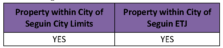
Application of Requirements. This section applies to all residential subdivisions in the following areas:

* Subdivisions in the ETJ are subject to the requirements of fee-in-lieu of land dedication and park development. Public parkland dedication and park development is not accepted in the ETJ.
4.9.2.
Intent. The primary purpose of the parkland requirements is to ensure that the need for parkland and park amenities that arises from new residential development is satisfied by the development, so that those who generate the need for park areas and recreation facilities contribute their proportionate share. In some instances, the need for parks and park improvements resulting from new development may be addressed most effectively through the development and acquisition of community or regional parks, or the improvement or expansion of an existing park serving several neighborhoods.
4.9.3.
Applicability and Overview of Requirements. A subdivider or a developer of all residential subdivisions, not exempted by this ordinance, is required to set aside and convey to the public sufficient and suitable lands for the purpose of parkland, or contribute a fee in-lieu-of land conveyance, or a combination thereof, including park improvements as determined by the Parks and Recreation Advisory Board and approved by the Planning and Zoning Commission. Additionally, the requirements of this section shall apply when a property is being redeveloped from a non-residential use to a residential use. The following dedications and improvements must be installed before the approval of the final plat for a subdivision or issuance of a building permit for existing lots with proposed increase in density, in conformance to the standards of this section. It is highly encouraged that the subdivider meets with the Director of Parks and Recreation, or designee, early on in the conceptual stages of a subdivision to discuss the preferred location of parkland and park amenities needed.
4.9.4.
General Provisions to this Section.
A.
Subsequent Change. If the actual number of completed dwelling units exceeds the figure upon which the original parkland dedication/development or cash contribution was completed, such additional parkland dedication/development or cash contribution shall be required, and shall be made by payment of a fee in-lieu-of dedication/development, or by conveyance of an equivalent parkland and park development prior to the recordation of the final plat. All new lots within a replat or addition to an existing subdivision shall comply with the parkland dedication/development or cash contribution requirements as outlined in this section, as specified below. Sufficient land shall be dedicated and trails constructed within the residential subdivision as per the Seguin Comprehensive Master Plan and/or Parks and Recreation Master Plan. Unless specified otherwise by the Director of Parks and Recreation, or designee, all such trails shall be constructed of concrete and shall conform to the requirements of the American with Disabilities, as amended. Specifications for concrete shall be provided by the Director of Parks and Recreation, or designee. Trails in the Trails Master Plan shall be constructed in accordance with the Technical Manual by the developer at the developer's expense as trails are considered by the City as infrastructure. Trails shall be placed in a right-of-way or pedestrian access easement. Pedestrian access easements shall be a minimum of fourteen (14) feet in width. This may be a shared easement with public utilities as approved by the City.
B.
Right of City to reject proposed parkland. If either the Parks and Recreation Advisory Board or the Planning and Zoning Commission determines that sufficient parkland already exists to serve the proposed subdivision or that the public would be better served by expanding existing parkland, the City may refuse the proposed dedication and require a cash payment as stipulated in this section.
C.
Exceptions. This section shall not apply to:
•
Alterations or expansions of existing residential units or buildings of multiple units where no additional residential units are created and where the use is not changed.
•
Subdivisions with four or fewer lots fronting on an existing street.
D.
Park Development Agreement. When the requirements of this section are proposed to be met by floodplain property, private parkland, offsite conveyance/improvements, a combination of dedication and fee-in-lieu, phased compliance, or any other means described in this section other than parkland dedication via subdivision plat along with associated parkland improvements of fee-in-lieu of dedication or improvement, the City may require a park development agreement between the City and the applicant to outline terms of compliance, City Council shall consider park development agreements based on criteria for parks and parkland in this section and general health, safety, and welfare.
4.9.5.
Required Parkland Dedication or Contribution.
A.
Calculation. At a minimum, the amount of land required to be dedicated for parkland will be calculated as one (1) acre of parkland dedicated for each seventy-five (75) residential dwelling units, or an equivalent ratio thereof.
B.
Selecting a Location.
1.
The Director of Parks and Recreation, or designee, will assist the developer in determining a suitable location for parkland dedication along with appropriate park amenities to install. Ultimately, the location of parkland dedication and appropriate park amenities to install shall be recommended by the Parks and Recreation Advisory Board to the Planning and Zoning Commission for approval.
2.
The location of dedicated parkland may be required at the edge of a residential subdivision so that additional land may be added at such time as adjacent land is subdivided or acquired for public use. Unique or other natural areas that provide an opportunity for linkages between parks or that preserve the natural character of the surrounding environment, including riparian areas, may be required by the City to be included in the calculated areas dedicated for parks and recreational purposes. Otherwise, a centralized location within the residential development is preferred for dedicated parkland.
C.
Floodplain Property. Each acre of proposed dedicated parkland that is located in a designated floodplain shall count as one-half acre of land towards the subdivider's required parkland dedication. Not more than 50 percent of the total acres to be dedicated as parkland shall be on land that is in a designated floodplain. Dedication of parkland within a floodplain shall be readily accessible by road frontage and of suitable topography for recreational activities as identified by the Director of Parks and Recreation, or designee.
Example:
750 homes planned = 10 acres parkland dedication required
Since floodplain acreage only counts half, 10 acres of floodplain land would count towards 5 acres of required dedications. The remaining 5 acres must be outside the floodplains, so the dedication would be as follows: 10 acres in floodplain plus 5 acres outside floodplain to meet the 10-acre dedication.
D.
Private Parkland Dedication. Up to 75 percent of a subdivision's required parkland dedication and park development requirements may be satisfied through the dedication of private parkland, subject to a recommendation by the Parks and Recreation Advisory Board to the Planning and Zoning Commission for approval. Either public dedication or fees in-lieu-of dedication and development, to be determined by the City, may satisfy the remaining portion. See below section for additional requirements.
E.
Fee In-Lieu-Of Parkland Dedication and Park Development. The City may, at its option, require a fee to satisfy the parkland dedication and park development required under the following circumstances:
1.
When less than two acres of parkland is required to be conveyed.
2.
When a replat or amending plat within the City limits is submitted with increased density.
3.
When the City determines that the potential for that subdivision would be better served by expanding or improving an existing nearby park or constructing and/or improving a larger community or regional park suitable for several neighborhoods.
4.
When the development is located in the ETJ.
5.
When the density on an existing lot is being increased.
6.
Any multifamily project.
4.9.6.
Methods of Parkland Dedication or Contribution.
A.
General. Whenever a final plat is filed with Guadalupe County for residential development in accordance with the platting regulations of the City, such plat shall contain a clear fee simple dedication of an area of land to the City for parks and recreational purposes. The subdivider shall meet with the Director of Parks and Recreation, or designee, as to the preferred location of parkland and park amenities needed. The Parks and Recreation Advisory Board shall make recommendations based upon the Seguin Comprehensive Master Plan and/or Parks and Recreation Master Plan, as adopted by the City, and the standards and provisions contained herein, to the Planning and Zoning Commission concerning the amount and location of parkland, including park amenities, and/or fees in-lieu-of parkland dedication and development.
B.
Procedures for Parkland Dedication via Subdivision Plat.
1.
Concept Plans and Final Plats. Parkland to be conveyed shall be designated as public parkland on both the concept plans and final plats as "Parkland Dedicated to the City of Seguin" with the perimeter dimensions and acreage denoted. A note referencing the dedication shall be placed on the concept plan and final plat. Parkland to be privately owned and maintained shall be designated as private parkland and so noted on both the concept plan and final plat.
2.
Deed Required. Prior to recording the final plat, the developer shall deliver to the City a deed, in a form approved by the City Attorney, conveying parkland shown on the final plat. The parkland deeded to the City shall not be subject to reservations of record, encumbrances, or easements that will interfere with the use of the land for parks and recreational purposes. The deed delivered to the City shall be recorded in conjunction with the recordation of the final plat.
C.
Off-site Conveyance of Parkland and Park Improvements. Upon a recommendation by the Parks and Recreation Advisory Board to the Planning and Zoning Commission for approval, the City may accept parkland and park improvements that are not part of a subdivision in order to meet the parkland and park improvement requirements, subject to the following requirements:
1.
At a minimum, parkland conveyance is in accordance with this section, as described above.
2.
At a minimum, the site is improved in accordance with park improvements of this section, as described below.
3.
At a minimum, the site meets the park development standards of this section, as described below.
4.
A deed shall be required in accordance with the provisions above.
D.
Private Parkland. Up to 75 percent of a subdivision's required parkland dedication and park development requirements may be satisfied through the dedication of private parkland, subject to a recommendation by the Parks and Recreation Advisory Board to the Planning and Zoning Commission for approval. Either public dedication or fees in-lieu-of dedication and development, to be determined by the City, may satisfy the remaining portion. Where park areas and recreational facilities are to be provided in a proposed subdivision, and where such areas and facilities are to be privately owned and maintained by the future residents of the subdivision, these areas and facilities may satisfy the requirement of parkland dedication and park development if the following standards are met:
1.
At a minimum, parkland dedication is in accordance of this section, as described above.
2.
At a minimum, the park site is improved in accordance with park improvements of this section, as described above.
3.
At a minimum, the site meets the park development standards of this section, as described below as identified by the Director of Parks and Recreation, or designee.
4.
The private ownership and maintenance of such park areas and facilities are adequately provided for by recorded written park development agreement, conveyance, deed, plat, and/or restrictions.
5.
The use of such areas and facilities are restricted for parks and recreational purposes by a recorded covenant, which runs with the land in favor of the future owners of the property and which cannot be defeated or eliminated without the consent of the City.
6.
The property owners association or equivalent is responsible for the maintenance of the private parkland and any park amenities in perpetuity. The City Attorney shall review and approve the property owners association or equivalent documents as it relates to the maintenance of the private parkland and any park amenities.
7.
In order to receive the private parkland credit, the developer shall provide documents to the City at the time of final plat filing sufficient to establish that the requirements as described above have been satisfactorily met. Construction payment receipts shall be submitted to the Director of Parks and Recreation, or designee, to ensure that the value of park improvements is equivalent to the amount of the fee in-lieu-of park development as described above. In the event that the developer proposes to construct the improvements at a later date, as in a phased development, the City shall require that the developer obtain a surety bond, performance bond, park development agreement, and/or other form(s) of guarantee that the recreational amenities will be installed concurrent with the build-out plan of the subdivision as required by the City. In cases where the equivalency of the park improvements is disputed, the required level of park improvements shall be as determined by the Planning and Zoning Commission.
E.
Parkland Dedication Fee. Where the payment of a fee in-lieu-of parkland dedication is required or acceptable upon a recommendation by the Parks and Recreation Advisory Board to the Planning and Zoning Commission, as provided for in this section, such fee shall be on a per residential dwelling unit basis, as set out in the annual fee schedule approved by the City Council.
4.9.7.
Park Development Standards. Parkland conveyed to the City, as provided in this Section, shall meet the standards set forth below:
A.
Each corner of the parkland to be dedicated shall be marked with a permanent monument consisting of three-fourths-inch iron pins set in concrete. Monuments shall be located and identified on a recordable land survey completed by a land surveyor registered in the State of Texas and provided to the City by the owner or developer.
B.
Removal of all trash, dead trees, and other non-usable material including all briars, poison ivy, bull nettles, and similar undesirable plant material as identified by the Director of Parks and Recreation, or designee.
C.
The developer shall provide adequate drainage through the proposed park to eliminate standing water and other health hazards as identified by the Director of Parks and Recreation, or designee.
D.
The parkland shall have frontage on a street as identified by the Director of Parks and Recreation, or designee.
E.
Parkland shall not be encumbered with existing or proposed unsightly public utility easements or drainage channels that would unduly restrict the development and/or beauty of the site for active and passive recreational purposes as identified by the Director of Parks and Recreation, or designee.
F.
Paved frontage with curbs and gutters and sidewalks for all required street frontages abutting the outside perimeter of the parkland as identified by the Director of Parks and Recreation or designee.
G.
A sidewalk and lighting installed, in conformance with the requirements of this Code, along all street frontage of the park.
H.
A proposed residential subdivision adjacent to a park or open space area shall not be designed to restrict reasonable access or visibility into the park. No lots shall have their rear yard abutting a public park unless public access to the park is provided as identified by the Director of Parks and Recreation, or designee.
I.
Street connections between residential neighborhoods shall be provided, wherever practicable, to provide reasonable access to parks and open space areas to all residents within reasonable proximity to such parks and open space areas, as identified by the Director of Parks and Recreation, or designee. Proposed access and public availability of parkland, both physical and visual, shall be recommended by the Parks and Recreation Advisory Board to the Planning and Zoning Commission for approval.
J.
Dedicated parkland should have and retain existing native trees or other scenic elements.
K.
Where a non-residential use must directly abut a park, the use must be separated by a screening wall or fence and landscaping as identified by the Director of Parks and Recreation, or designee. Access points to the park from the non-residential use may be allowed as recommended by the Parks and Recreation Advisory Board to the Planning and Zoning Commission for approval. Exceptions to screening requirements may be considered for Civic uses, schools, churches and commercial.
L.
Water, wastewater, electrical services, and all other utilities provided to the remainder of the residential subdivision shall be provided to the park as part of standard residential subdivision improvements as identified by the Director of Parks and Recreation, or designee.
M.
All park areas and playground equipment shall be in accordance with the U.S. Consumer Products Safety Commission, Publication 325, as currently amended.
N.
The owner shall agree that no construction materials be disposed of or deposited within dedicated parkland by its contractors, subcontractors, employees, or agents at any time while the residential subdivision is being built unless approved in writing by the Director of Parks and Recreation, or designee.
O.
Prior to the dedication of parkland, the developer shall make full disclosure of the presence of any hazardous materials, substances, and/or underground storage tanks.
P.
As a condition of City acceptance of the park improvements, the developer shall also provide the City a copy of the application and subsequent inspection report prepared by the Texas Department of Licensing and Regulation or their contracted reviewer for compliance with the Architectural Barriers Act, codified as Article 9102, Texas Civil Statutes, as amended.
Q.
As a condition of City acceptance of the park improvements, the developer shall be required to warranty the park improvements for a two-year period.
R.
All park improvements may be inspected by the City while park construction is in progress and the developer shall provide the City with reasonable access to perform such inspections. Once construction of the park improvements are completed as determined by the Director of Parks and Recreation, or designee, the City shall accept the improvements in writing. Any utility charges shall be paid by the developer while the park is under construction and up until final park acceptance by the City.
4.9.8.
Park Improvements.
A.
General. In conjunction with the required parkland dedication or fee-in-lieu of land dedication as required by this code, the subdivider shall pay a park development fee or improve parkland to City Standards and equivalent amount than what would be required of the park development fee. The park improvement fee shall be paid for each residential lot or dwelling unit, in the case of multi-family development, within the subdivision or development at or prior to the recordation of the final plat or issuance of a building permit for development taking place on an existing lot. The park development fee shall be set in the annual fee schedule approved by the City Council as found in Appendix C of the Seguin Code of Ordinances.
B.
Conveyed Parkland. Parkland conveyed to the City shall be improved as required by this paragraph with a recommendation of the Parks and Recreation Advisory Board to the Planning and Zoning Commission for approval. At a minimum, park improvements shall be of a value equivalent to the amount of the fee in-lieu-of park development, as described below. Construction receipts shall be submitted to the Director of Parks and Recreation, or designee, to ensure that the value of park improvements is equivalent to the amount of the fee in-lieu-of park development. The subdivider shall indicate the proposed parkland improvement(s), which shall be constructed in accordance with the Park Development Plan. Please refer to the UDC Technical Manual for requirements for a park development plan and associated specifications.
Should the subdivider/developer choose to dedicate and improve parkland to meet the requirements of this code a Park Development Plan must be submitted to the Director of Parks and Recreation, or designee, for review, with a recommendation by the Parks and Recreation Advisory Board to the Planning and Zoning Commission for approval. A complete list of requirements for a Park Development Plan can be found in the UDC Technical Manual.
B.[C.]
Park Development Fee. In addition to the fee in-lieu-of parkland dedication, where the payment of a fee in-lieu-of park development is required or acceptable upon a recommendation by the Parks and Recreation Advisory Board to the Planning and Zoning Commission, as provided for in this section, such fee shall be on a per residential dwelling unit basis, as set out in the annual fee schedule approved by the City Council.
1.
Timing of Payment. Such payment in-lieu-of parkland dedication and park development shall be made at or prior to the recordation of the final plat or as outlined in a park development agreement.
2.
Use of Cash Contribution. Fees paid in-lieu-of parkland dedication and the development for a neighborhood park may be utilized for a community or regional park if such use satisfies the purposes of parkland dedication and park development as provided for herein, as determined by the City.
(Ord. No. 2017-18, §§ 1—3, 4-18-17; Ord. No. 2019-054, § 7, 9-17-19)