
Stuart City Zoning Code
CHAPTER III
SPECIAL ZONING CODES
3.00.00.- PURPOSE
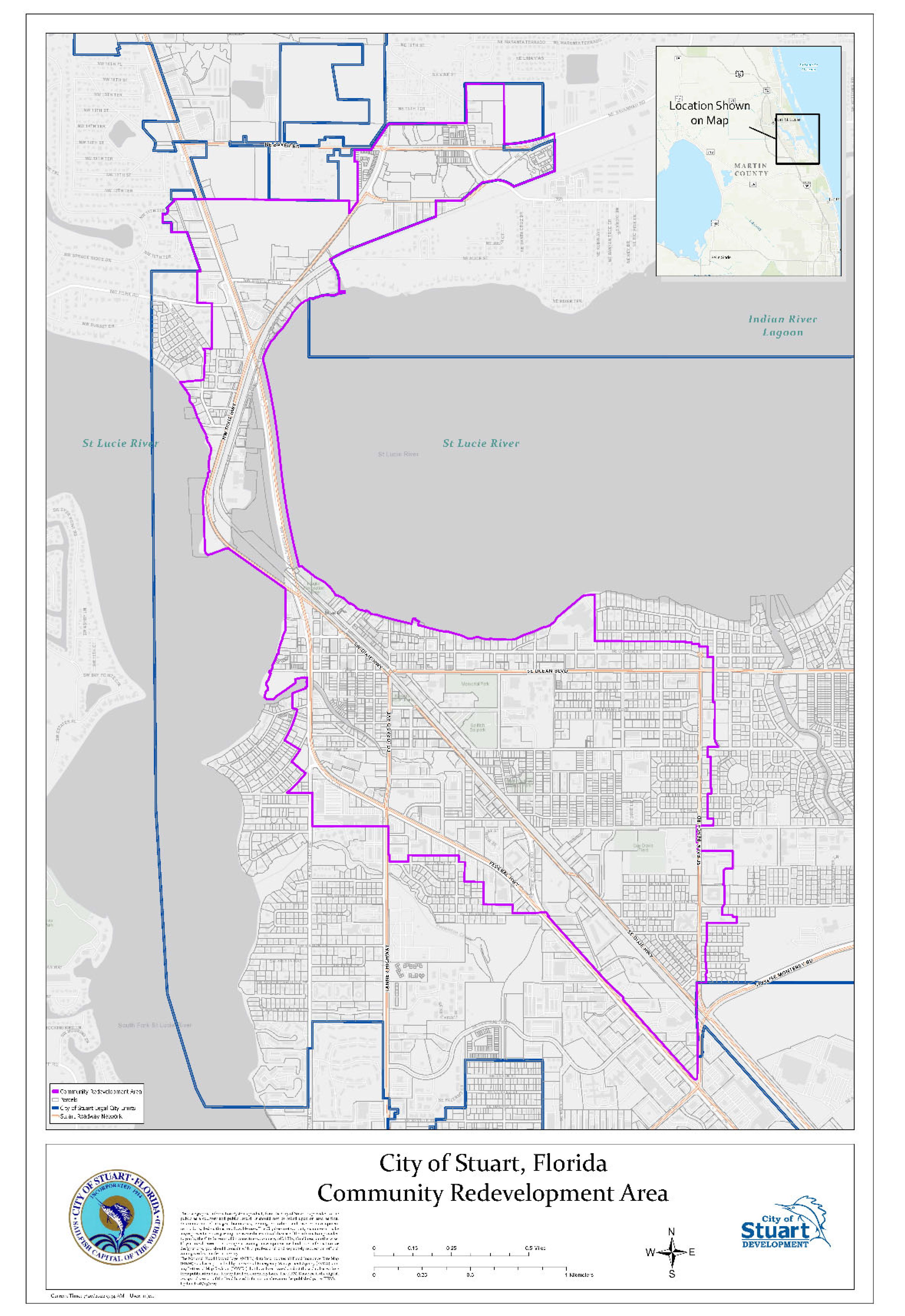
The purpose of this section is to describe specific designated areas with special development regulations. The locations of these areas are established by the City of Stuart based on the need for special protective measures, additional design standards, and redevelopment incentives. At present, the Urban Code District and East Stuart Neighborhood are located within the City of Stuart Community Redevelopment Area. The boundaries of the Community Redevelopment Area are illustrated in the map below.
(Ord. No. 2498-2023, § 1(Exh. A), 2-13-23)
(Ord. 1872-02, § 1, 10-10-02; Ord. No. 1978-04, § 1, 6-28-04; Ord. No. 2062-05, § 1, 1-9-06; Ord. No. 2498-2023, § 1(Exh. A), 2-13-23)
3.01.00.- URBAN CODE
3.02.00.- EAST STUART NEIGHBORHOOD CODE[1]
Editor's note— Ord. No. 2507-2023, § 1(Exh. A), adopted Feb. 13, 2023, repealed the former §§ 3.02.00—3.02.14, and enacted new §§ 3.02.00—3.02.12 as set out herein. The former §§ 3.02.00—3.02.14 pertained to East Stuart Code and derived from Ord. No. 2062-05, § 1, adopted Jan. 6, 2006; and Ord. No. 2145-07, § 1, adopted Nov. 26, 2007.
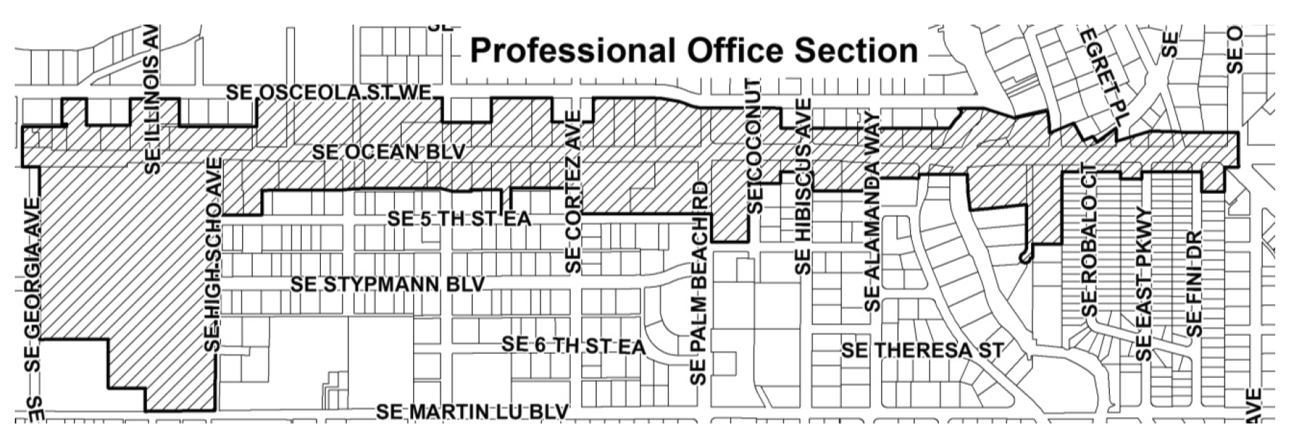
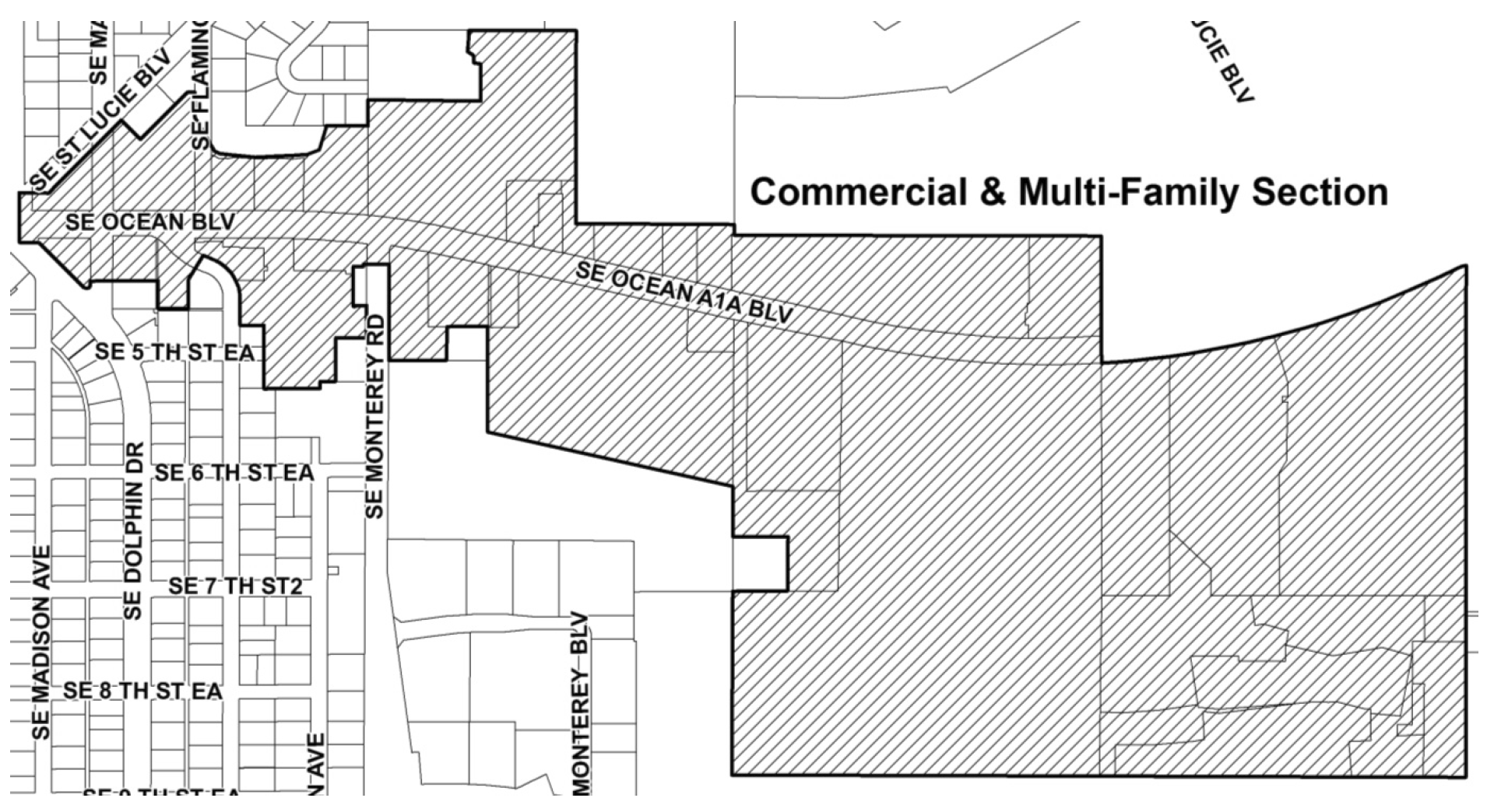
3.03.00.- S.E. OCEAN BOULEVARD OVERLAY ZONE
A.
Title. The provisions of this section 3.03.00 shall be known as the "S.E. Ocean Boulevard Overlay Zone Design Standards."
B.
Area defined. The S.E. Ocean Boulevard Overlay Zone shall be that geographical area of the City of Stuart as encompassed by the following description:
THE AREA AND PROPERTIES FRONTING THE NORTH AND SOUTH SIDES OF S.E. OCEAN BOULEVARD (CR A1A), BOUNDED BY S.E. GEORGIA AVENUE TO THE WEST AND THE ST. LUCIE RIVER TO THE EAST AS DELINEATED BY COMMON PROPERTY OWNERSHIP.
There are two sections in the S.E. Ocean Boulevard Overlay Zone — the "Professional Office Section" and the "Commercial and Multi-family Section." These sections are defined as:
Professional Office Section: That area bounded by S.E. Georgia Avenue to the West and S.E. Dolphin Drive to the East.
Commercial & Multi-Family Section: That area bounded by S.E. Dolphin Drive to the West and the St. Lucie River to the East.
C.
Definitions. The terms used in this S.E. Ocean Boulevard design standards are defined in chapter XII, Definitions.
Sec. 3.00.01.- Administration.
The provisions of this Code shall be administered and enforced by the development director whose duties shall include receiving and reviewing building permits and other land development permit applications, assisting applicants in procedures required hereunder, making decisions regarding the application of this Code to particular properties, inspecting premises, and issuing permits and certificates of occupancy.
(Ord. No. 2498-2023, § 1(Exh. A), 2-13-23)
Sec. 3.00.02. - Amendment to this Code.
In the continued administration of the intent of this Code, the commission may find it reasonable and necessary to adopt amendments to the text, zoning, and regulating plan(s). All such amendments shall follow the procedures in chapter XI.
(Ord. No. 2498-2023, § 1(Exh. A), 2-13-23)
Sec. 3.00.03. - Violations and remedies.
It shall be unlawful and a violation of this Code for any person to construct, renovate or remodel a building within the Special Zoning Codes except in compliance with the provisions of this Code. A violation of this Code shall be deemed a zoning violation.
(Ord. No. 2498-2023, § 1(Exh. A), 2-13-23)
Sec. 3.01.01.- Generally.
A.
Intent. The purpose of the Urban Code is to encourage redevelopment, historic restoration, and infill development, and generally to promote a sense of place within the Urban Code district, described below, by providing standards and development incentives that are not otherwise available. This includes the promotion of traditional building types with arcades, balconies, railings, and porches and the enabling of social interaction on downtown streets. This Urban Code provides for mandated building alignments to define coherent streets spaces, the location of outbuildings at the rear of parcels for affordable housing, the visual protection of the streetscape from parking lots, and traditional, historically relevant, durable construction which is harmonious with the architectural heritage of downtown Stuart.
(Ord. No. 2539-2025, § 2, 4-16-25)
B.
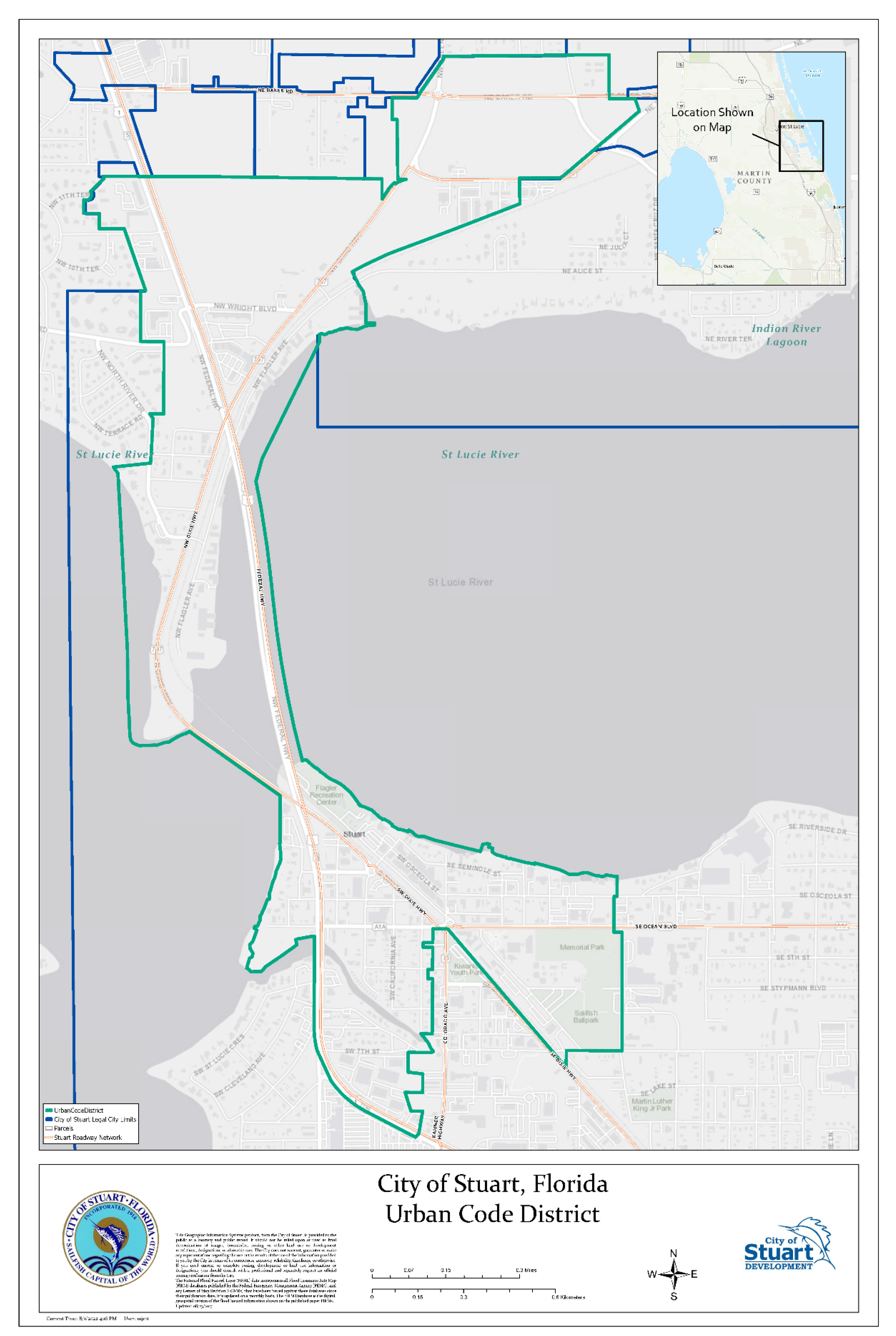
The Urban Code District. There is hereby established within the City of Stuart an "Urban Code District," including subdistricts, the boundaries of which are generally shown in the map below.
(Ord. No. 1978-04, § 1, 6-28-04)
(Ord. No. 2498-2023, § 1(Exh. A), 2-13-23)
C.
Applicability. The provisions of this Urban Code shall apply to new development, new construction, and to substantial renovation, as defined in chapter XII of the Code within the Urban Code District.
(Ord. No. 1453-96, 6-1-96; Ord. No. 2014-05, § 1, 2-14-05)
D.
Effective date. The provisions of this Urban Code shall apply to all development within the Urban Code District for which a complete application for a development permit pursuant to submittal requirements of plan document as defined in chapter XII of this Code has not been filed with the city development department on or before December 2, 2003.
(Ord. No. 1872-02, § 1, 10-10-02; Ord. No. 1978-04, § 1, 6-28-04)
E.
Non-conforming uses. Non-conforming uses created by the adoption of this ordinance code on the 28th day of June 2004 shall be deemed legal non-conforming uses subject to the provisions of section 8.03.00 of this Code.
(Ord. No. 1978-04, § 1, 6-28-04)
Sec. 3.01.02. - Administration, enforcement, procedures, and penalties.
A.
Administration. The provisions of this Urban Code shall be administered and enforced by the city development director whose duties shall include receiving and reviewing building permit and other land development permit applications, assisting applicants in procedures required hereunder, making decisions regarding the application of this Urban Code to particular properties, inspecting premises, and issuing permits and certificates of occupancy. Nothing in this Urban Code is intended to conflict with the building and fire prevention codes of the city.
B.
Application permits. No building or other land development permit shall be issued by the city development director unless all provisions of this Urban Code have been met, including approved conditional use approvals, based on the development review and approval process.
C.
Procedures for application.
1.
Pre-application conference. Before beginning any new development, substantial renovation, renovation development, renovation, or demolition on private or public land, a pre-application conference with the city development department is strongly encouraged. Upon submittal of a conceptual site plan, floor plans, and elevations a non-binding preliminary written response of the city development director may be requested by the applicant.
2.
Application. After the pre-application conference, if any, an application for development shall be submitted to the city development department in accordance with this Code. Applications for development permits, excluding interior tenant finishes, within the Urban Code District shall meet the requirements of plan documents as defined in chapter XII of this Code. Completed applications shall include a general vicinity or location map, legal description, map of vegetative cover, proposed development activities and design, building plans, front, rear, and side architectural elevations, floor elevations, documentation related to streets, parking, and loading; tree removal and protection, landscaping, signs, , and any other documentation as required by the city development director in order to demonstrate compliance with this Urban Code.
(Ord. No. 1715-2000, 2-28-00; Ord. No. 1849-02, § 1, 4-8-02; Ord. No. 1978-04, § 1, 6-28-04)
D.
Violations and remedies. It shall be unlawful and a violation of this Code for any person to construct, renovate or remodel a building within the Urban Code District except in compliance with the provisions of this Urban Code. A violation of this Urban Code shall be deemed a zoning violation. In such event the city development director may initiate code enforcement proceedings to compel compliance. The city commission may initiate appropriate civil proceedings including, but not limited to, a declaratory action, injunction action and mandamus action to compel compliance.
E.
Reserved.
(Ord. No. 1849-02, § 1, 4-8-02; Ord. No. 1872-02, § 1, 10-10-02; Ord. No. 1978-04, § 1, 6-28-04)
Sec. 3.01.03. - Urban standards and regulations for designated urban subdistricts.
The geographic locations and current characteristics of the five urban subdistricts are broadly described below:
Urban center ("UC"), inclusive of the "historic downtown," characterized by relatively dense, walkable, mixed-use, development pattern generally located at or near the established downtown area. The UC is the most urban in terms of density, mix of uses, pedestrian activity, historic restoration, and civic/cultural venues. In the South Point, UC is generally located in portions of the Potsdam subdivision (that triangular portion bound by Albany Avenue, West Ocean Boulevard, and SR 707/Dixie Highway), along both sides of the historic downtown core block (Osceola Street and Flagler Avenue), along portions of SE Ocean Boulevard.
(Ord. No. 2498-2023, § 1(Exh. A), 2-13-23; Ord. No. 2539-2025, § 2, 4-16-25)
Urban general ("UG"), characterized by less intensive mixed-use development, with substantial residential uses, generally located adjacent to the urban center. In the North Point, UG is generally located along the triangular area bound by Wright Boulevard, SE Federal Highway and SR 707/Dixie Highway. In the South Point, UG is generally located along portions of SE Ocean Boulevard (both north and south).
(Ord. No. 2498-2023, § 1(Exh. A), 2-13-23)
Urban neighborhood ("UN"), characterized by a predominantly residential nature located along low-volume, pedestrian-friendly streets. In the North Point, UN is generally located in the non-waterfront portions of the Riverside Park subdivision (that portion generally bound by North River Drive, Palm Street, SR 707/Dixie Highway, and Fern Street). In the south point, UN is generally located in the Frazier Addition (the triangular area generally bound by Frazier Creek, West Ocean Boulevard, and the properties fronting Colorado Avenue) and the non-waterfront portions of the Frazier Crescent subdivision (along Channel Avenue and 6th and 7th Streets).
Urban highway ("UH"), occurs along both sides of SE Federal Highway as it traverses the Urban Code District. This area allows large front setbacks and highway-oriented commercial or high density residential uses with generous parking lots. In the North Point, UH is generally located along the western side of SE Federal Highway and along the western side of the proposed Green River Parkway. In the South Point, UH is generally located along both sides of SE Federal Highway.
Urban waterfront ("UW"), refers to special waterfront-oriented uses, including marinas, restaurants, entertainment, hotels, and higher-density residential. Existing "marine industrial" uses are conditionally permitted. In both the North and South Points, UW is generally located along all waterfront properties throughout the CRA with the exception of those waterfront properties on the north side of Frazier Creek and on the east side of the "North Point" peninsula south of Fern Street.
(Ord. No. 1978-04, § 1, 6-28-04)
The following urban standards and regulations of "building placement," "building height," "parking," "architectural requirements," "outbuildings," "signage," and "curb cuts" apply to each respective urban subdistrict.
A.
Urban center (UC).
1.
Principal building placement.
a.
The front building facade shall be constructed parallel to the street along the front property line with a required build-to line of zero feet.
b.
The side setbacks may be zero feet.
c.
The rear setback may be zero feet.
d.
The front street facade width of the principal building shall not be less than 80 percent of the parcel width. A ten-foot driveway may be allowed if no alley access is available in the rear or side of the parcel.
e.
If a property abuts public rights-of-way at its front and rear property lines, any building facade which is 100 feet or more in facade width measured parallel to the public right-of-way shall include a via to allow for pedestrian access to the public rights-of-way. A via shall be not less than six feet in width and not less than ten feet in height. A via may be enclosed; however, a via shall be open to the public during the business hours of operation of the building(s) in which it is located.
f.
The front street facade of the building may be set back to form a public courtyard for a maximum of 33 percent of the facade width.
2.
Principal building height.
a.
The maximum building height is three stories and 35 feet. The minimum building height shall be two stories or 26 feet. If 25 percent or more of the building is residential or hotel, a fourth story shall be permitted. The maximum building height for a four story building is 45 feet.
b.
Four story buildings in the Old Downtown District are prohibited. There is no major Urban Code conditional use available for an additional story or building height in the Old Downtown District.
3.
Parking.
a.
All parking areas shall be located behind the rear facade of the principal building or screened from public rights-of-way by a streetwall, other screening approved by the city development director, or landscape buffer as described in section 6.04.00, Landscaping, of this Code.
4.
Architectural requirements.
a.
Balconies are required along all street facades for all buildings. The aggregate length of balconies shall not be less than 50 percent of building facade from which it projects on each floor level.
b.
Arcades are required on the west side of Colorado Street between Confusion Corner and Frazier Creek and on the north side of 2nd Street between U.S. 1 and Dixie Highway. Arcades shall conform to the standards in section 3.01.04 C.
c.
The ground floor along the front facade of the building shall have doorways, arcades, or glazed openings with aggregate width equal to at least 50 percent of the total facade width.
5.
Outbuildings.
a.
Outbuildings shall be located behind the rear facade of the principal building or in the rear one-half of the property subject to a minimum five-foot side and rear yard setbacks from the property line. On corner parcels the side setback shall be ten feet. There shall not be less than five feet separation between an outbuilding and a principal building.
6.
Curb cuts.
a.
Where buildings do not have alleys in the rear of the property, not more than one curb cut shall be permitted for every 75 feet of frontage.
b.
For properties with access from a rear alley, no curb cuts shall be permitted.
(Ord. No. 1978-04, § 1, 6-28-04)
B.
Urban general (UG).
1.
Principal building placement.
a.
The front building facade shall be constructed parallel along the front property line with a required setback of not less than ten feet.
b.
The minimum side setbacks are not less than five feet on each side.
c.
The rear setback shall be not less than 15 feet.
d.
The front street façade width of the principal building shall not be less than 60 percent of the parcel width.
2.
Principal building height.
a.
The maximum building height is three stories and 35 feet. If 50 percent or more of the building is residential or hotel, a fourth story shall be permitted. The maximum building height for a four story building is 45 feet.
3.
Parking.
a.
Parking areas shall be located as follows:
i.
For new development, all parking areas shall be located behind the rear facade of a principal building or screened from public rights-of-way by a wall, trellis, other screening approved by the city development director or landscape buffer as described in section 6.04.00, Landscaping, of this Code.
ii.
For substantial renovation, where possible, parking areas shall be located behind the rear building facade or at the side property line and screened from the public view and from public rights-of-way by a streetwall, other screening approved by the city development director, or landscape buffer as described in section 6.04.00, Landscaping, of this Code.
4.
Architectural requirements.
a.
Porches are required on the front building facade. Porches shall have a minimum depth of six feet and a minimum length of 50 percent of the building facade width. Porches may project four feet into the front setback.
5.
Outbuildings.
a.
Outbuildings shall be located behind the rear facade of the principal building or in rear one-half of the property subject to a minimum five-foot side and rear yard setbacks from the property line. On corner parcels the side setback shall be ten feet. There shall not be less than five feet separation between an outbuilding and a principal building.
6.
Curb cuts.
a.
Where buildings do not have alleys in the rear of the property, not more than one curb cut shall be permitted for every 75 feet of frontage.
b.
For properties with access from a rear alley, no curb cuts shall be permitted.
(Ord. No. 1978-04, § 1, 6-28-04)
C.
Urban neighborhood (UN).
1.
Principal building placement.
a.
The front building facade shall be constructed parallel to the street along the front property line with a required setback of not less than ten feet.
b.
The side setbacks are not less than five feet on each side.
c.
The rear setback shall be not less than 15 feet.
d.
The front street facade width of the principal building shall not be less than 60 percent of the parcel width.
2.
Principal building height.
a.
The maximum building height is three stories and 35 feet.
b.
There is no major Urban Code conditional use available for an additional story or building height in this subdistrict.
3.
Parking.
a.
Parking areas shall be located as follows:
i.
For new development, all parking areas shall be located behind the rear facade of a principal building or screened from public rights-of-way by a streetwall, other screening approved by the city development director, or landscape buffer as described in section 6.04.00, Landscaping, of this Code.
ii.
For substantial renovation, parking areas shall be located, where possible, behind the rear building facade or at the side property line and screened from public rights-of-way by a streetwall, other screening approved by the city development director, or landscape buffer as described in section 6.04.00, Landscaping, of this Code.
4.
Architectural requirements.
a.
Porches are required on the front building facade. Porches shall have a minimum depth of six feet and a minimum length of 70 percent of the building width. On corner properties, porches must be constructed along both street facades. Porches may project two feet into the front setback.
b.
Walls, wood picket fences, wrought iron fences, or hedges are required along the front property line and on corner parcels, along the side property lines and shall have a minimum height of three feet and a maximum height of four feet along the front and side property lines to the front facade of the principal building. Along the side property lines behind the front facade and along the rear property line a wall or fence may be six feet in height. Arbors and trellises are permitted in the front yard and may be located along property lines. The maximum height for arbors and trellises shall be ten feet. Above walls and fences, architectural features of up to 12 inches in height shall be allowed, spaced a minimum of four feet apart.
c.
Chain link fences shall not be visible from public rights-of-way. Chain link fences shall be vinyl coated using only black or dark green colors.
5.
Outbuildings.
a.
Outbuildings shall be located behind the rear facade of the principal building or in rear one-half of the property subject to a minimum five-foot side and rear yard setbacks from the property line. On corner parcels the side setback shall be ten feet. There shall not be less than five feet separation between an outbuilding and the principal building.
6.
Curb cuts.
a.
Where buildings do not have alleys in the rear of the property, not more than one curb cut shall be permitted for every 50 feet of frontage. However one curb cut shall be permitted for a single family residence utilized as a residence regardless of the existence of a rear alley.
b.
For properties with access from a rear alley, no curb cuts shall be permitted.
7.
Trees.
a.
When a permit for new construction or renovation is issued, the owner shall be responsible for planting two shade trees no closer than three feet and no further than five feet from the right-of-way that abuts the front property line. All required shade trees, as defined by chapter XII of this Code, shall be 14 feet in height at installation, and have a DBH of not less than two and one-half inches, and be selected from the CRA landscape palette, if adopted by the city. The development director may grant a reduction for existing trees that meet these requirements.
8.
Buffer for single family residential.
a.
A buffer for the single family neighborhood on the west side of NW North River Drive shall be provided. The buffer shall conform to section 6.04.00, Landscaping, of this Code.
(Ord. No. 1978-04, § 1, 6-28-04)
D.
Urban highway ("UH").
1.
Principal building placement.
a.
The front building facade shall be constructed parallel to the street along the front property line with a minimum setback of 15 feet and a maximum setback of 40 feet for properties fronting on US-1/SW Federal Hwy. If a property does not front on US-1/SW Federal Hwy, then the minimum setback shall be zero feet and the maximum setback shall be not more than 10 feet.
b.
The side setbacks may be zero feet on each side.
c.
The rear setback is not less than 15 feet.
d.
For parcels fronting US-1/SW Federal Hwy, the front street facade width of the principal building shall not be less than 40 percent of the parcel width. For other parcels, the width of the principal building shall be not less than 70 percent of the parcel width.
(Ord. No. 2520-2023, § 1(Exh. A), 10-23-23)
2.
Principal building height.
a.
The maximum building height is three stories and 35 feet. For parcels fronting on SE Federal Highway a fourth story is permitted if all off-street parking is located at the rear of building. The maximum building height for a four story building is 45 feet. The minimum building height is two stories or 26 feet.
3.
Parking.
a.
All parking areas shall be located behind the rear facade of a principal building or screened from public rights-of-way by a streetwall, trellis, other screening approved by the city development director, or landscape buffer as described in section 6.04.00, Landscaping, of this Code. The parking shall be setback from the front public right-of-way a minimum distance equal to 40 percent of the parcel depth.
4.
Outbuildings.
a.
Outbuildings shall be located behind the rear facade of the principal building or in the rear one-half of the property subject to a minimum five-foot side and rear yard setbacks from the property line. On corner parcels the side setback shall be ten feet. There shall not be less than five feet of separation between an outbuilding and the principal building.
5.
Curb cuts.
a.
Where buildings do not have alleys in the rear of the property, not more than one curb cut shall be permitted for every 100 feet of frontage.
(Ord. No. 1978-04, § 1, 6-28-04)
E.
Urban waterfront ("UW").
1.
Principal building placement.
a.
The front building facade shall be constructed parallel to the street along the front property line with a minimum setback of not less than ten feet except for waterfront properties on SW Channel Avenue, Seminole Street, and SW Atlanta Avenue which shall be not less than five feet.
b.
The side setbacks shall not be less than ten feet on each side except for waterfront properties on SW Channel Avenue, Seminole Street, and SW Atlanta Avenue which shall not be less than five feet.
c.
The rear setback for all structures shall not be less than ten feet from the mean high water line or the water-side of a seawall or bulkhead.
d.
A vista shall be a designated area along the side of a property that provides an unobstructed view from any public right-of-way to the St. Lucie River or its tributaries, and shall be the same width as the required side setback. Only ten-foot clear trunk plant material and decorative fencing shall be located within the vista. Any equipment such as air conditioning units within a vista shall be not more than three feet in height, unless required by any applicable flood zone regulations.
e.
The maximum cumulative front building facade width is 160 feet measured parallel to the nearest body of water.
f.
If a building facade is 100 feet or more in width, measured parallel to the nearest body of water, an additional vista shall be provided within the building's facade which is not less than 12 feet in width, not less than 12 feet in height, and which allows a visual corridor from the public right-of-way to the St. Lucie River or its tributaries.
g.
Any fencing included within a vista shall have a minimum width of three inches and a maximum width of five inches for all vertical members and shall have a minimum spacing of three inches between the vertical members. Said fences shall be a minimum height of three feet and a maximum height of four feet.
h.
In order to create additional vistas, a minimum separation of 15 feet shall be provided between multiple buildings on the same parcel.
2.
Principal building height.
a.
The maximum building height is three stories and 35 feet. If 50 percent or more of the building is residential or hotel, a fourth story shall be permitted. The maximum building height for a four story building is 45 feet.
b.
Four story buildings in the Old Downtown District (as described in Section 3.01.03 F.1.a.i.a.) are prohibited. There is no major Urban Code conditional use available for an additional story or building height in the Old Downtown District.
3.
Parking.
a.
Parking shall not be located within ten feet of the front and side property lines and shall not be located between the rear building facade and the water.
b.
Parking shall be screened in the front and the sides from public rights-of-way by a wall, trellis, other screening approved by the city development director, or landscape buffer as described in section 6.04.00, Landscaping, of this Code.
4.
Architectural requirements.
a.
Reserved.
b.
Balconies and balcony rails are required on the waterfront side of a building for a minimum of 50 percent of the fenestration.
c.
Reserved.
d.
Porches may project five feet into the front setback.
5.
Outbuildings.
a.
One outbuilding is permitted behind the rear facade of a principal building or in the rear one-half of the parcel and one outbuilding is permitted in the front of the parcel. Outbuildings shall be set back not less than five feet from the side and front property lines, not less than ten feet from the rear property lines, not be less than five feet separation between an outbuilding and the principal building and shall not be located within a vista.
b.
Outbuildings may have marina or waterfront accessory uses.
6.
Curb cuts.
a.
Where buildings do not have alleys in the rear of the property, not more than one curb cut shall be permitted for every 65 feet of frontage.
F.
Additional regulations and requirements.
1.
Parking.
(Ord. No. 2539-2025, § 2, 4-16-25)
a.
The Old Downtown District.
i.
Old Downtown District identified.
a)
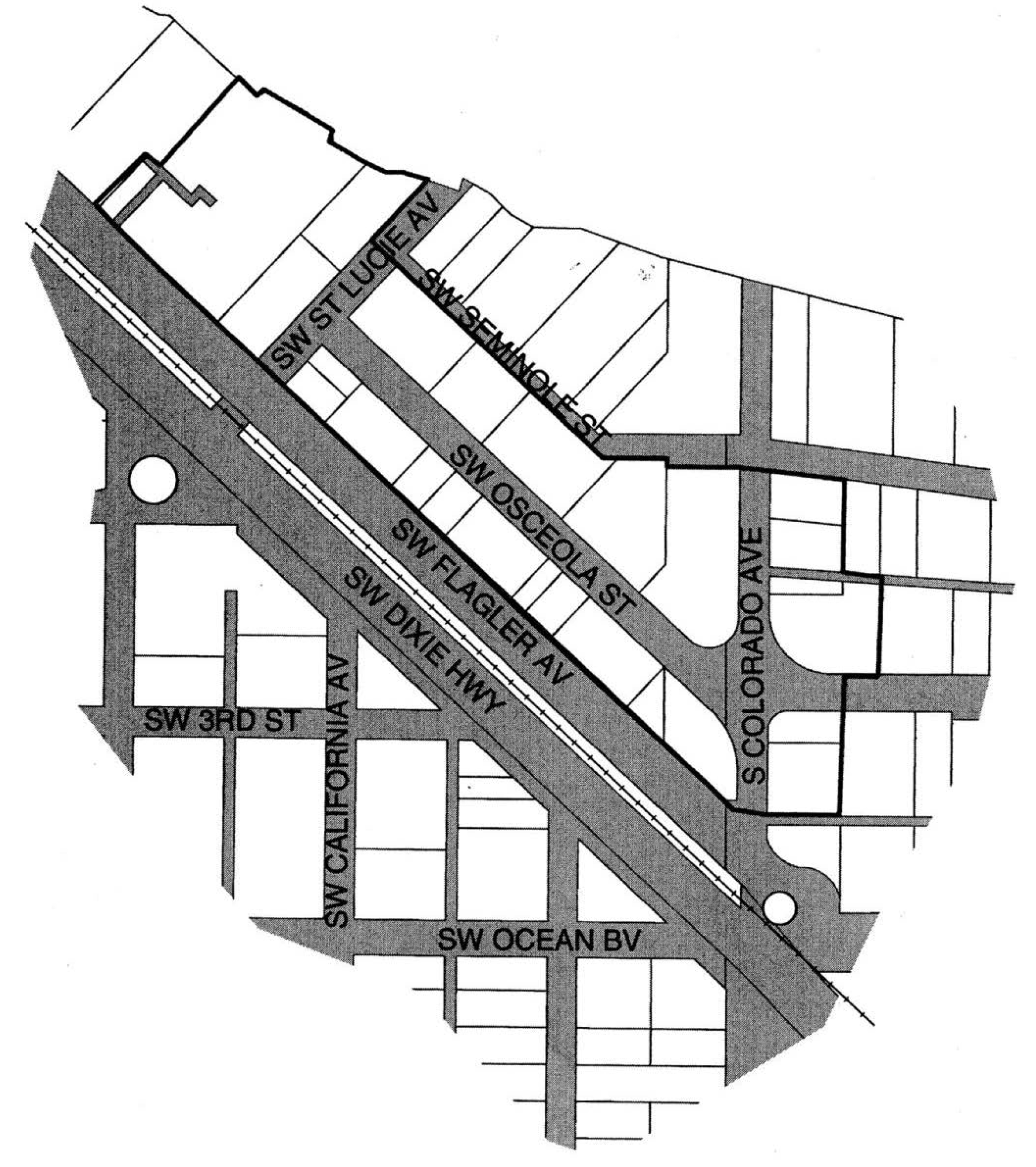
Those properties within the boundary of the centerlines of SW Seminole Street on the north, SW Flagler Avenue on the south, S Colorado Avenue on the east, and SW Saint Lucie Avenue on the west; the city hall property west of and contiguous to SW Saint Lucie Avenue, being Lot 36 according to the plat of The Feroe Subdivision recorded in the public records of Martin County, Florida, at Plat Book 2, page 25 and Lots 3, 4, 5, 6, 7, 7A, 8, 9, and 9A according to the plat of Revised Danforth's Addition recorded in the public records of Martin County, Florida, at Plat Book 5, page 69; and those properties located east of and contiguous to S Colorado Avenue, being Lots 8, 9, 12, and 24-28, Block 3, and Lots 19-23, Block 4, amended plat of Porter's Addition recorded in the public records of Martin County, Florida at Plat Book 2, page 75.
ii.
Parking requirements.
a)
Properties located in the "Old Downtown District" shall be exempt from the parking requirements of this Code.
b)
The four properties located east of and contiguous to Colorado Avenue, being Lots 8, 9, 12, and 24-28, Block 3, and Lots 19-23, Block 4, amended plat of Porter's Addition (Plat Book 2, page 75), shall be exempt from the parking requirements of this Code provided each such property shall hereafter maintain not less than the number of on-site parking spaces existing as of November 13, 1995, as follows:
c)
In the Old Downtown District required parking for any use permitted may be accommodated via payments to the payment in lieu of parking program as described in chapter VI of this Code.
d)
The six properties located on the north side of S.W. Seminole Street, between S.W. Saint Lucie Avenue and S. Colorado Avenue, being Lots 2 thru 8, Feroe Subdivision, Plat Book 2, Page 25, Palm Beach County (now Martin) and Porter's Addition, Lots 1, 2 & 3 Blk 2 and Lot 9, Feroe Subdivision (a replat of Lots 9 & 10) shall be exempt from the parking requirements of this Code, provided that each property shall maintain not less than the number of on-site parking spaces existing as of April 1, 2013, as follows:
iii.
Parking exemption not applicable.
a)
For properties identified by paragraphs F.1.a.i.a) and F.1.a.ii.b) above, if a building is demolished by an owner, parking for all uses within the newly constructed building shall be provided. Buildings which are destroyed by accident or an act of God and are replicated, shall remain exempt from parking requirements.
b)
For properties identified by paragraphs F.1.a.i.a) and F.1.a.ii.b) above, this exemption from the parking requirements of this Code applies to the building floor space existing as of January 1, 2004. This exemption does not apply to additional building floor space and to the uses thereof that is constructed on and after January 1, 2004 or to any expanded use of the exterior premises which creates additional parking demand. The uses of additional building floor space shall meet the parking requirements of this Code.
c)
Reserved.
(Ord. No. 2498-2023, § 1(Exh. A), 2-13-23)
d)
For the six properties located on the north side of S.W. Seminole Street, between S.W. Saint Lucie Avenue and S. Colorado Avenue, identified by paragraph F.1.a.ii.d) above, if a building is demolished, whether by the owner or by accident or act of God, any newly constructed building shall remain exempt from parking requirements only to the extent that the gross square footage of the newly constructed building does not exceed the gross square footage of the previously existing building. The use of additional building square footage shall meet the parking requirements of this Code. In the event a permit for demolition of a building is sought, the city shall have up to 120 days from the date of application to take possession of the building at no cost to the city and to move the building off site at no cost to the property owner.
e)
For the six properties located on the north side of S.W. Seminole Street between S.W. Saint Lucie Avenue and S. Colorado Avenue, identified by paragraph F.1.a.ii.d) above, this exemption from the parking requirements of this Code applies to the building floor space existence as of May 1, 2013. This exemption does not apply to additional building floor space and to the uses thereof that is constructed on and after May 1, 2013 or to any expanded use of the exterior premises which creates additional parking demand, provided that an outside seating area, covered or uncovered, of up to 500 square feet is permitted without regard to parking requirements. Said seats shall not be creditable toward the acquisition of a state SRX liquor license. The uses of additional building floor space shall meet the parking requirements of this Code.
b.
Where it does not currently exist, on-street parking, constructed to City Code, may be used to offset the required number of parking spaces. Such parking shall abut the proposed development. The cost of the pavement modifications shall be borne by the private development. An approved revocable permit from the city commission is required for on-street parking.
c.
Historic buildings shall receive a parking credit for the existing use and shall provide at least 50 percent of the required parking for a more intense use on the site. Up to 50 percent of the required parking for any new use permitted may be accommodated via payments to the payment in lieu of parking program as described in section 6.01.19 of this Code.
d.
Payment in-lieu-of parking ("PILOP"): In lieu of providing up to three parking spaces required for any use located in Stuart Community Redevelopment Area, a developer may pay into the "Stuart Payment in Lieu of Parking Trust Fund" as described in section 6.01.19 of this Code.
e.
Modifications: Within the Urban Code District, the parking design standards set forth in section 6.01.14 may be modified as follows:
i.
For all but 90 degree parking spaces, the one-way traffic aisle width may be reduced to ten feet. For 90 degree parking spaces, the one-way traffic aisle width may be reduced to 20 feet.
ii.
The width of a two-way traffic drive aisle may be reduced to 20 feet. The two-way drive aisle width may be reduced from 20 feet to a minimum of 12 feet for parking areas of eight spaces or less. Within a reduced drive aisle area, parking spaces are prohibited, with the exception of parallel parking spaces.
iii.
Where alleyways are located along the side or rear property lines, said alleyways may be used as the required back-up dimension for parking spaces.
iv.
For developments requiring ten or fewer parking spaces, parking areas may be constructed with mulch, gravel, turf blocks, paver blocks, or other alternative materials approved by the city development director. Additional maintenance requirements may be required of a property owner utilizing alternative materials such as daily sweeping of gravel, mulched areas maintained at a certain depth.
v.
The width of parking spaces may be reduced to eight and one-half feet for up to ten percent of the required parking.
vi.
Up to two required parking spaces may be provided as "stacked" spaces, where one parking space is located behind the other.
f.
Boats, campers, and recreational trailers shall be parked in rear yard setbacks only where possible and shall not be parked in vistas.
2.
Urban Code District uses.
a.
The following uses are permitted and are all-inclusive individually or in combination in the Urban Code District subject to the regulations pertaining to formula businesses in section 2.06.12.
b.
The following uses are permitted as conditional uses by major conditional use approval and are all-inclusive individually or in combination in the Urban Code District subject to the regulations pertaining to formula businesses in section 2.06.12.
3.
Density. A density of 15 dwelling units per acre is permitted in all Urban Code subdistricts. The number of dwelling units may be increased to a maximum of 20 dwelling units per acre with a major Urban Code conditional use.
4.
Storage sheds. One storage shed may be located on any parcel within the Urban Code District, provided that it is not visible from the principal public right-of-way.
5.
Multiple frontages. In the event a single parcel abuts more than two streets, the setback and architectural requirements for the corresponding Urban Code District shall only apply to two street facades.
6.
Conflicts with utilities. In instances where the required location of a building, including architectural requirements, conflicts with existing utilities or other public infrastructure, the developer shall be required to relocate such utilities if the cost of relocation is less than five percent of the cost of the proposed building or improvements (excluding land value) and the utilities can be relocated within 150 feet of the subject property. Otherwise, the city development director may adjust the requirements of this Urban Code to rectify any conflicts with utilities or other public infrastructure. No utilities shall be located beneath a principal building.
7.
Historic buildings. The requirements of this Urban Code may be adjusted by a major Urban Code conditional use for the purposes of preserving a historic building.
8.
Finished floor elevations. The requirements of section 6.03.02 B.4. relating to finished floor elevations may be modified if the engineer for a proposed development can demonstrate a lower elevation is appropriate and will not be detrimental regarding flooding to adjacent properties.
9.
Parcel coverage. For the purposes of this Urban Code, there shall be no impervious coverage requirement; however, all development must meet the requirements of section 6.03.00 entitled "Stormwater Management" of this Code, as amended from time to time.
10.
Parcel area requirements. For purposes of this Urban Code there shall be no minimum parcel area or parcel width requirement as defined in section 2.04.00.
11.
Stormwater management. With the proper legal documentation and consent of the property owner, stormwater runoff from properties within the Urban Code District may be conveyed onto adjacent private properties. Otherwise, stormwater runoff must be conveyed to the public right-of-way, and the quality of the runoff must be considered. Proposed development may not obstruct existing drainage patterns. If a site is designed such that stormwater is captured by an internal stormwater management system, the applicant must illustrate how the stormwater reaches the public stormwater management system. If a site is designed such that there is no internal stormwater management system, the applicant must illustrate how the stormwater runoff will be conveyed to the public stormwater management system and demonstrate that said system could accommodate the additional runoff. Pervious surfaces such as perforated pavers, mulched areas, and other similar examples may be considered in the calculation for stormwater detention. For all development, stormwater quality treatment prior to discharge shall be provided in compliance with section 6.03.00 of this Code.
12.
Public art. Public art shall be required of all development and redevelopment and shall equal not less than one percent of the total costs of vertical construction. Public art may include fountains, murals, sculptures, paintings, or other generally acceptable art form as directed by the community redevelopment board which is displayed in a public venue. All public art required under this section shall be readily visible to the public. All public art intended to meet the requirements of this section that is visible from a public right-of-way or is exterior to a building must be approved by the community redevelopment board as a minor Urban Code conditional use. A single family home on a single parcel of record is exempt from this requirement.
13.
Curb cuts. Distance regulations between curb cuts shall be measured from the centerlines of each curb cut.
14.
Shoreline protection zone. In accordance with section 5.06.00, the shoreline protection zone for any water body shall be ten feet measured from the waterside parcel line or perpendicular to the mean high waterline as established by a licensed surveyor, whichever is nearer to the principal structure on the same parcel; or perpendicular to the centerline of a seawall.
(Ord. No. 1978-04, § 1, 6-28-04; Ord. No. 2010-05, § 3, 2-14-05; Ord. No. 2539-2025, § 2, 4-16-25)
G.
Landscaping.
1.
All development in the Urban Code District shall comply with the landscaping requirements as described in section 6.04.00, the landscape code, with the following exceptions:
a.
The width of landscape buffers shall be determined by the required side and rear setbacks as described in this Urban Code, and buffer screens shall be 25 percent of those setbacks.
b.
The width of the landscaped strip of land located between parking areas and an abutting public right-of-way shall be the required setback for parking areas for the respective urban subdistrict.
c.
The width of the landscaped strip of land located between parking areas and abutting private property shall be the required setback for parking areas for the respective urban subdistrict.
d.
The width of the landscaped area located along the sides of a building, which abuts any parking area, shall be 2½ feet.
e.
The width of the landscaped strip of land located between the building walls of a multi-family development and parking areas shall be five feet.
f.
The width of the landscaped strip of land located between a parking area of a multi-family development and an abutting right-of-way shall be the required setback for parking areas for the respective urban subdistrict.
g.
The street facade of a building shall contain a hedge, potted plants, or trees planted in public right-of-way. The dimensions for such landscape materials shall comply with section 6.04.05 A. of this Code. In the urban center and urban general subdistricts, no hedge shall be planted between the principal building front and the curb of the street, and trees shall be placed in a continuous sidewalk. If necessary, due to right of way conditions, the requirement for trees may be mitigated subject to the approval of the city development director.
h.
Terminal and interior islands within parking areas may be used for stormwater retention.
i.
A maximum of 20 percent of the pedestrian arcade walkway may be planted. No plantings are required within the arcade.
2.
In the case of renovation development and vacant development as described in the landscape code where the location of required landscaping is precluded by existing buildings or permanent site improvements, the placement of landscaping may occur off-site, in planters, in openings within paved areas, or in other locations as determined by the city development director.
(Ord. No. 1872-02, § 1, 10-10-02; Ord. No. 1922-03, § 1, 3-10-03)
Sec. 3.01.04. - Architectural standards and regulations.
The following described architectural standards and regulations are governed by the categories of building and activities related thereto and shall apply to new development, to substantial renovation, to renovation development, to renovation and to building exterior refinishing. It is the responsibility of the applicant to demonstrate to the satisfaction of the city development director that any alternative building or other materials have at least a ten-year history of successful application in climates that are comparable to the City of Stuart.
(Ord. No. 2539-2025, § 2, 4-16-25)
A.
Building walls. The exterior walls of the principal building shall be constructed of any of the following materials and in the following specified manner. All materials shall be used over the entire building or as continuous horizontal bends only. No panelizing shall be permitted or other simulations except as noted below.
1.
Materials.
a.
Stucco with a "float finish," smooth or coarse, machine spray, dash and troweled.
b.
Wood clapboard five inches to the weather.
c.
Wood shingles seven inches to the weather.
d.
Cement siding, or similar composite plank in individual clapboard-style boards, which has a proven successful application in a climate comparable to Stuart's of not less than ten years.
e.
On residential buildings only, wood board or batten board of a board width from eight inches to 12 inches.
f.
Wood shiplap siding, smooth face, seven inches to the weather.
g.
Coral, keystone, or tabby.
h.
Modular unit masonry, either brick or concrete, coursed in regular ashlar pattern, flush sawn, wire cut, or sand finish.
i.
Cast stone.
2.
Other design standards. Except for single-family residential, all developments which are less than 20,000 square feet shall incorporate a minimum of four of the following building design standards, and all developments which exceed 20,001 square feet shall incorporate a minimum of five of the following building treatments:
a.
Overhangs;
b.
Arcades as defined by this Code;
c.
Sculptured artwork and/or fountains;
d.
Raised cornice parapets over doors;
e.
Peaked roof forms;
f.
Display windows;
g.
Ornamental and structural architectural details, other than cornices, which are integrated into the building structure and overall design;
h.
Clock or bell towers;
i.
Decorative landscape planters or planting areas, a minimum of five feet in width, and areas for shaded seating consisting of a minimum of 100 square feet;
j.
Integration of specialty pavers, or stamped, colored concrete along the building's walkway to constitute a minimum of 60 percent of walkway area;
k.
Water elements, a minimum of 50 square feet in area; and
l.
Courtyards along the front building facade.
(Ord. No. 1957-03, § 1, 10-13-03; Ord. No. 1978-04, § 1, 6-28-04)
B.
Roofs and gutters. The roofs and gutters of the principal building shall be constructed of any of the following materials and in the following specified manner.
1.
Materials.
a.
Cedar shingles with factory treated class B finish.
b.
Steel, copper and factory painted aluminum standing seam, batten seam, or Bermuda roofing.
c.
Galvanized steel "5-V crimp" roofing panels.
d.
Galvanized metal or copper shingles of Victorian or diamond shape or pattern or of another dimension, which is approved by the city development department.
e.
Asphalt dimensional shingles for residential buildings only.
f.
Built-up roof behind parapets.
g.
Exposed half-round gutters of copper or galvanized steel.
h.
Clay or cement barrel, s-shaped, flat cement, or mission tiles which are a shade of "red," "ochre," "cream" and "white" color shades provided that such coloring is integral to the clay or cement. No glazed or painted clay or cement tiles shall be allowed. No other shape of clay or cement tiles shall be permitted.
(Ord. 1445-95, 1-22-96; Ord. No. 1978-04, § 1, 6-28-04)
2.
Manner.
a.
Gable and simple hip roofs.
b.
Flat with railings or parapets.
c.
Shed roof attached to a wall higher than the ridge.
d.
Rafters at overhangs shall be exposed.
e.
Pitch:
i.
On principal building from 5-12 up to 12-12.
ii.
On sheds, porches and balconies not less than 3-12.
iii.
Tower roofs may be any pitch.
f.
Aluminum fascia and soffits shall not be allowed.
(Ord. No. 1453-96, 6-1-96)
g.
For buildings which are located not more than five feet from the front property line, gutters must be shielded and may not drain onto the surface of public sidewalks. Gutters may be enclosed within a column or other architectural feature.
(Ord. No. 1841-02, § 3, 6-10-02)
C.
Arcades and porches. The arcades and porches of the principal building shall be constructed of any of the following materials and in the following specified manner. No simulations shall be permitted.
1.
Arcades shall conform to the following requirements:
a.
An arcade shall have a minimum clear height of 12 feet from the lowest point of the ceiling and a minimum clear width of ten feet in the UC, eight feet wide otherwise.
b.
Both ends of an arcade must remain open at all times, and the side of an arcade which runs parallel to the building to which it is attached must be open from four feet above grade to its roof.
c.
With the approval of the city development director, an arcade may be extended over public right-of-way and may include landscape materials or planters, and the display of merchandise or outdoor seating; however, the arcade must maintain at least four feet of open sidewalk width under cover to allow for unobstructed pedestrian circulation.
d.
Arches or lintels shall be not less than 16 inches in depth. Masonry piers shall be no less than 16 inches by 16 inches and wood posts shall be no less than eight inches by eight inches. Balusters shall be separated not more than five inches on center.
2.
Porches shall conform to the following requirements:
a.
A porch shall include columns no less than four inches by four inches that support its roof and floor.
b.
A porch shall have a minimum depth of six feet.
c.
Porches which are 30 inches above grade must meet the building code's standards for railings and railing heights. Porches which are lower than 30 inches above grade may have railings between 36 inches and 42 inches in height or may be open, the latter subject to approval via a minor Urban Code conditional use.
3.
Materials shall either be of wood or conform to the construction materials of the principal building. Alternatively, round steel columns may be used on Flagler Avenue west of Colorado Avenue, and on Osceola Street and Seminole Street.
(Ord. No. 1978-04, § 1, 6-28-04)
D.
Windows and doors. The windows and doors of the principal building shall be constructed with any of the following materials, configurations, operations and options.
1.
Materials.
a.
Glass.
i.
Clear, low-e, stained, or leaded and beveled.
ii.
On side and rear elevations, translucent glass may be used.
iii.
Tinted glass may be used; however, in no case shall a streetside display window be of tinted glass other than to meet current energy efficiency codes.
iv.
Glass block may be used for architectural accents only.
b.
Frames.
i.
Painted and stained wood.
ii.
Aluminum and vinyl-clad wood.
iii.
Steel and aluminum.
c.
Flat skylights in sloped roofs.
2.
Configurations.
a.
Square and vertical rectangular.
b.
Circular and semi-circular.
c.
Semi-ellipse.
d.
Octagonal.
e.
Diamond.
3.
Operations.
a.
Single and double hung.
b.
Casement.
c.
Fixed with frame.
d.
Awning windows.
e.
On side and rear elevations, sliders may be used.
f.
Jalousie windows are prohibited, except as replacement windows.
4.
Options.
a.
Operable wood shutters which are sized to match openings.
b.
Fabric awnings excluding quarterballs.
c.
Bahama shutters.
d.
Screened windows and doors.
e.
Security grills of a pattern approved by the city development director.
(Ord. No. 1978-04, § 1, 6-28-04)
E.
Garden walls. The garden walls of the principal building shall be constructed of either wood, wrought iron, simulated aluminum wrought iron, or PVC lattice, or shall conform to the construction materials of the principal building, including stone, brick, and stucco. Chain link fence concealed by landscaping may be used along the side and rear of the property provided that no chain link fencing is visible from public right-of-way. No simulations shall be permitted. All chain link fences must be black or dark green vinyl-clad.
(Ord. No. 1978-04, § 1, 6-28-04)
F.
Outbuildings. Outbuildings permitted within the Urban Code District shall be constructed of the same materials used in the principal building. Outbuildings may include detached garages and carports, greenhouses, slat houses, cabanas and detached garage apartments and "granny flats." Canvas outbuildings are not permitted. There shall be not less than five feet of separation between the outbuilding and the principal building.
Outbuildings shall conform to the following requirements:
1.
Only one outbuilding per principle building is permitted.
2.
Outbuildings are subject to a minimum five-foot side and rear yard setbacks from the property line, with the exception of the Urban Waterfront (UW) Subdistrict. On corner parcels the side setback shall be ten feet.
3.
Outbuildings shall not exceed a maximum building footprint of 1,000 square feet and a maximum gross floor area of 2,000 square feet.
4.
Outbuildings shall not exceed 30 feet in height. Outbuildings may not exceed the height of the principal building on the same property.
5.
An outbuilding may have an unenclosed porch of up to 50 percent of the gross floor area of the outbuilding.
6.
Outbuildings may be constructed as elevated buildings that include the location of open parking below an enclosed structure; however, open parking shall be shielded from public right-of-way by landscaping, lattice or other screening material that is not less than 42 inches in height.
7.
Outbuildings may be connected to the principal building by a covered walkway element, trellis, or other structural link, which shall not be enclosed so as to create occupiable space.
8.
Outbuildings may be connected to an outbuilding on an adjacent property and shall be structurally separated by a fire wall on the common boundary line and shall have a five-foot minimum rear yard setback.
(Ord. No. 1978-04, § 1, 6-28-04; Ord. No. 2539-2025, § 2, 4-16-25)
G.
Building colors and finishes. All exterior building wall colors used within the Urban Code District shall be restricted to muted pastel or earth-toned shades. The use of black or florescent colors is prohibited as a predominant exterior building color. Exterior colors shall be approved by the city development director. Building trim may be any color. Wall murals shall be permitted on any structures, and shall require the approval of a minor Urban Code conditional use. Building roofs shall be a solid color; however, a variegated roof color scheme consisting of approved roof colors may be permitted by the city development director.
(Ord. No. 1946-03, § 1, 7-21-03; Ord. No. 1978-04, § 1, 6-28-04)
H.
Prohibited uses in front yard. The following uses shall be prohibited within all Urban Code Districts:
1.
Clothes lines and other clothes drying apparatus.
2.
Electrical meters.
3.
Air conditioning equipment, including window units on the building facade.
4.
Antennas and satellite dishes.
5.
Chain link fences.
6.
Fences greater than four feet in height.
7.
Stockade fences.
(Ord. No. 1978-04, § 1, 6-28-04)
I.
Sidewalks. When a permit for new construction or renovation is issued, the owner shall be responsible for the installation of a minimum six-foot wide, continuous sidewalk along the entire length of the parcel frontage that abuts a public street. Where identified by the city development director, sidewalks shall be constructed of paver block, brick or pink concrete.
J.
Lighting.
1.
The use of neon exposed lighting on any property is prohibited.
2.
All building and site lighting fixtures shall be decorative.
(Ord. No. 1978-04, § 1, 6-28-04)
K.
Elevated buildings. Permitted in all urban subdistricts. Parking is prohibited beneath an elevated building.
(Ord. No. 1978-04, § 1, 6-28-04)
L.
Parking located within a building envelope.
1.
Except as provided below and for the Old Downtown District, parking located within a building envelope, below, above, or at grade, may be permitted in all Urban Code subdistricts by a major Urban Code conditional use:
a.
A single family home shall not require a major Urban Code conditional use to provide parking located within a building envelope.
2.
Parking located within a building envelope shall conform to the following requirements:
a.
Buildings which have parking located within the envelope shall be consistent with the design of the facades and the street side shall be entirely screened. When feasible, landscaping shall be installed along the ground floor facade, within the public sidewalk and within on-street landscape islands.
b.
Access drives into the parking area on the ground floor shall be limited to one drive aisle at a maximum of 24 feet in width for buildings less than 100 linear feet in width and two drive aisles at a maximum of 24 feet in width each for buildings 100 linear feet in width and greater. If the property is adjacent to an alley two drive aisles at a maximum of 24 feet in width each shall be permitted for buildings less than 100 linear feet in width. The development director may permit two 12-foot drive aisles for buildings less than 100 square feet in width.
c.
A parking level construction entirely below the lowest permissible finished first floor elevation shall not be deemed a story. The visual impact of garage doors shall be minimized through architectural design.
(Ord. No. 1978-04, § 1, 6-28-04)
M.
Balconies. Balconies shall conform to the following requirements:
1.
On corner parcels, a balcony shall extend along two street facades, but it does not have to be continuous.
2.
A balcony may extend over a public sidewalk or right-of-way but may not be designed or used as a means of building ingress or egress above a public right-of-way.
3.
Where balconies are required, the aggregate length of balconies shall be not less than (50 percent) of the building facade at the floor level from which it projects on each floor level.
4.
A balcony shall have a minimum clear height of ten feet at ground level above sidewalks and a minimum depth of three feet.
5.
"Paris" balconies, having a minimum projection from the building face of 12 inches and a wrought iron railing, are permitted, if the balcony is accessed by French doors.
(Ord. No. 1978-04, § 1, 6-28-04; Ord. No. 2539-2025, § 2, 4-16-25)
N.
Screens. All rooftop utilities and facilities such as air conditioning units, as well as all exterior mechanical equipment, shall be screened so as to not be visible from public view, including from balconies and windows of adjacent buildings.
(Ord. No. 1978-04, § 1, 6-28-04)
O.
Signage. The use of exposed neon tubing, or similar, on any property is prohibited. All signage in the Urban Code District shall comply with the sign requirements as described in section 6.11.00, the sign code, with the following exceptions:
1.
Backlit sign panels and internally illuminated cabinet signs shall be prohibited.
2.
Signs affixed to the exterior of a building should be architecturally compatible with the style, composition, materials, colors and details of the building and with other signs used on the building site.
(Ord. No. 1978-04, § 1, 6-28-04); Ord. No. 2014-05, § 1, 2-14-05; Ord. No. 2145-07, § 1, 11-26-07)
P.
Fences. Fences shall adhere to the requirements in section 6.09.05, except for the following; fences located in the front yard shall have a maximum height of four feet along the front and side property lines to the front facade of the principal building. Along the side property lines behind the front facade and along the rear property line a fence may be six feet in height. Chain link fence concealed by landscaping may be used along the side and rear of the property provided that no chain link fencing is visible from public right-of-way. No simulations shall be permitted. All chain link fences must be black or dark green vinyl-clad.
(Ord. No. 1978-04, § 1, 6-28-04)
Q.
Architectural feature. Tower features shall not be more than 300 square feet in area and shall not be more than 15 feet above the maximum building height. Architectural features may encroach into a setback the lesser of five feet or 60 percent of the width of a setback. For facades built with a zero setback, cornices, parapets, and bay windows at upper stories may project a maximum of three feet.
(Ord. No. 1978-04, § 1, 6-28-04)
R.
Parapet walls. A parapet wall shall not exceed 24 inches in height, provided however, a greater height of up to ten feet may be permitted by the city development director if necessary to conceal rooftop utilities such as stairway and elevator bulkheads and other roof equipment, or to achieve architectural enhancement. No height of greater than 24 inches shall be permitted for more than 40 percent of any facade of a building. A parapet wall shall be designed to be consistent and compatible with the design and treatment of the facade of the structure.
(Ord. No. 1978-04, § 1, 6-28-04)
S.
Residential rooftop use occupancy. Residential uses occupancy of a flat rooftop which are ancillary to residential occupancies shall be limited to uses which are ancillary to residential occupancies only and shall be enclosed by a code-compliant safety railing or other approved barrier. Except as otherwise permitted by this code, no permanently affixed structures, including, gazebos, trellises, or other similar structures shall be allowed on the roof of a four-story building. Maintenance and repairs shall not be deemed occupancy as that term is used in this paragraph.
(Ord. No. 1978-04, § 1, 6-28-04)
T.
Rooftop dining. Rooftop dining, as defined by this Code, are permitted as a major conditional use, and in accordance with the supplemental regulations set forth in Section 2.06.19.
(Ord. No. 1978-04, § 1, 6-28-04)
Sec. 3.01.05. - Old Downtown District regulations.
A.
Urban code district regulations applicable in the Old Downtown District. Except as amended or superseded by the regulations in this section, all development regulations set forth in this Urban Code and in this Code shall apply in the Old Downtown District.
B.
Building height. The maximum building height is three stories or 35 feet. There is no major Urban Code conditional use available for an additional story or building height in the Old Downtown District.
C.
Roofs. All buildings constructed in the Old Downtown District shall be a flat roof design. An alternative design may be permitted by major Urban Code conditional use.
D.
Vehicle access prohibited. Within the Old Downtown District vehicle access to properties shall be prohibited from all property fronting S Colorado Avenue, SW Flagler Avenue, SW Osceola Street, and SW St Lucie Avenue.
E.
Elevated buildings. Permitted in all urban subdistricts. Parking is prohibited beneath an elevated building.
F.
Parking located within a building envelope.
1.
Parking located within a building envelope in the Old Downtown District on the city block between SW Flagler Avenue and SW Osceola Street is prohibited.
2.
Parking located within a building envelope in the Old Downtown District on the city block between SW Osceola Street and SW Seminole Street shall have occupiable space at a minimum 50 percent of the ground floor area of a building. The building facade fronting SW Osceola Street shall be 100 percent occupiable space.
(Ord. No. 1978-04, § 1, 6-28-04)
G.
Parking. Additional parking requirements for this district are set forth in section 3.01.03.
(Ord. No. 1978-04, § 1, 6-28-04)
H.
Dumpsters, enclosures. All development within the Old Downtown District is exempt from the 'dumpster enclosure' requirements set forth in this Code.
Sec. 3.01.06. - Urban code conditional use requirements.
A.
Major and minor Urban Code conditional uses. As provided below, the city commission may grant a major Urban Code conditional use and the city community redevelopment board may grant a minor Urban Code conditional use. The review of major and minor Urban Code conditional use applications shall follow the procedures set forth in section 11.01.11 relating to major conditional use approval review, including, but not limited to, required findings of fact, conditions, notice, public hearing, standards, the burden of proof, revocation and expiration. Approval of an Urban Code conditional use shall only be granted if the applicant can demonstrate that the request is consistent with and will further the implementation of this Code, the CRA redevelopment plan, and the city comprehensive plan and will measurably improve the form, function and traditional neighborhood characteristics of the Urban Code District. The procedure for a major Urban Code conditional use shall follow the procedures set forth at section 11.01.11 with respect to submittal information and required notice for a major conditional use approval. The procedure for a minor Urban Code conditional use shall follow the procedures set forth in section 11.01.11 with respect to submittal information and required notice for a major conditional use approval; however, mailed notice shall only be required to be provided to property owners which are directly abutting the subject property, and a minor Urban Code conditional use shall be granted by the city community redevelopment board.
1.
Minor Urban Code conditional use. A minor Urban Code conditional use shall be required for relief from the following regulations of the Urban Code; public art, and architectural materials.
2.
Major Urban Code conditional use. A major Urban Code conditional use shall be required for relief from the following regulations of the Urban Code; density, permitted uses, setbacks, location of parking, location of buildings and structures, conflicts with utilities, curb cuts, historic buildings, pitched roofs in the Old Downtown District, number of stories, building height not to exceed 45 feet, parking located within a building envelope, location of a formula business, and architectural requirements.
a.
Review. Upon submittal of an application for a major Urban Code conditional use the city development department shall review all applicable portions of this code and the comprehensive plan and shall make a recommendation to the community redevelopment board followed by a recommendation to the city commission. Prior to its consideration by the city commission, the city community redevelopment board shall review the application and make an advisory recommendation thereon to the city commission. A major Urban Code conditional use may be granted by the city commission upon a determination that the design objectives set forth in this section and site qualitative design development standards set forth in section 6.00.04 have been substantially satisfied. Unless a longer timetable is granted by the community redevelopment board and city commission, a building permit shall be obtained no later than 12 months from the approval date of a major Urban Code conditional use. A certificate of occupancy shall be obtained no later than 30 months from the issuance of a building permit.
b.
Design objectives. The design objectives established in this section are intended to promote superior site and building design and shall be applied by the city in the review of a development plan. In order to achieve substantial conformance with the design objectives the city commission may impose development conditions and operational requirements in order to satisfy the design objectives. A major Urban Code conditional use may be granted only when an applicant presents clear and convincing evidence that the proposed development will result in a superior product that is compatible with the surrounding neighborhood and achieves substantial conformance with the design objectives outlined in this section.
1.
Building height. The proposed building is proportional and complimentary to surrounding buildings in the area.
2.
Additional building setbacks. Three- and four-story buildings have an additional five-foot setback on each side.
3.
Mixed residential unit types. The proposed development includes a mix of one- and two-bedroom units 1,000 square feet or less of gross floor area.
(Ord. No. 2539-2025, § 2, 4-16-25)
4.
Architectural treatments. Architectural treatments on the principal building facade should be continued around all sides of the building that are visible from the public realm.
5.
Architectural features for mixed-use buildings. In mixed-use buildings, the ground floor shall be differentiated from upper floors through the use of strong cornice lines, awnings, distinct but compatible exterior colors or materials, exterior lighting, colonnades or overhangs that cover the sidewalk, increased setback for upper floors or similar treatments.
6.
Defined entrance. The primary building entrance is a prominent feature that is well lit and visible and directly accessible from a public street. To the extent possible, the primary building entrance should be defined and articulated with pediments, pilasters, columns, porticoes, porches, overhangs, railings, or other architecturally compatible elements.
7.
Pedestrian amenities. Pedestrian amenities in the form of benches, potted plants, flower boxes, outdoor patio area, murals, or other acceptable forms of amenities located adjacent to a public sidewalk and/or right-of-way.
8.
Patio gardens. The proposed structure incorporates gardens which include a mixture of flower boxes, arbors, trellis, flowering vines, and other landscaping materials.
9.
Varying roof lines. Roofs shall have three or more roof slope planes per primary facade, sloping roofs or have vertical roof changes with a minimum change in elevation of two feet.
10.
Elevation plane variation. The elevation plane variation is identified as the exterior wall of a structure or building. For planes 50 feet or less, the secondary plane shall project at least two feet from the primary plane and make up at least five percent of the entire elevation. For planes larger than 50 feet, the secondary plane shall project at least two feet from the primary plane and make up at least 30 percent of the entire elevation.
11.
Blank walls. Long, windowless, uninterrupted walls shall be avoided. Transparent windows or faux windows or shutters shall comprise at least 30 percent of street and water side exterior elevations and blank wall areas shall not exceed ten feet in vertical direction and 20 feet in horizontal direction of any facade.
12.
Solar hot water, electric, or air. Installation of solar water heaters, photovoltaic panels, and/or solar space heating (either passive or active) systems. Solar facility shall be installed for each individual residential or non-residential unit through a common system supplying each residential or non-residential unit. The solar unit shall be designed to be the primary heat or electrical source for the residential or non-residential unit being served.
13.
Enhanced landscaping. Landscaping shall be planted over and above city code requirements with respect to size, quantity, and quality.
14.
Improvements to the surrounding neighborhood. The applicant proposes to make improvements such as; burying utility lines, replacing existing sidewalks with stamped concrete or pavers, providing pedestrian walkways constructed of stamped concrete or pavers, or other improvements.
15.
Green Space. The development preserves open space,
a.
A tot lot or park is provided on site.
b.
Land is donated to the city to use as public green space.
c.
A monetary contribution is made to the city public enhancement fund.
d.
An additional vista(s) of at least five feet is provided in the Urban Waterfront Subdistrict.
16.
Decorative paving. The development includes the use of brick pavers or stamped or color concrete, in accordance with city specifications, on the site.
17.
Historic preservation. For buildings identified in the City of Stuart update to the 1991 historic property survey dated April 2003 and any subsequent updates thereof; or any other structure which has local architectural, historical, or cultural significance, the following shall apply:
a.
The existing facades of historic structures are preserved and incorporated into the overall design of the proposed development.
b.
Any expansion of an existing building is historically or architecturally consistent with the existing building.
c.
Historic structures are relocated within the city limits, within Martin County, or outside Martin County.
d.
A monetary contribution is made to the relocation of historic buildings fund.
(Ord. No. 1978-04, § 1, 6-28-04; Ord. No. 2014-05, § 4, 2-14-05; Ord. No. 2062-05, § 1, 1-6-06; 2498-2023, § 1(Exh. A), 2-13-23)
Sec. 3.01.08. - Public art.
A.
Intent. The intent of this section is to further the commitment of the city to the aesthetic enrichment of the Urban Code District through the private acquisition of works of art so that citizens and visitors to the Urban Code District of the city will be afforded an opportunity to enjoy and appreciate works of art.
B.
Applicability. The provisions of this section shall apply to all new development and substantial renovations in the Urban Code Districts, including the Creek District, with the exception of a duplex, single-family home and single-family home subdivisions.
(Ord. No. 2498-2023, § 1(Exh. A), 2-13-23)
C.
Requirements for receiving building permit. All new development and renovation development pursuant to chapter XII shall elect one of the options listed below prior to the issuance of a building permit:
1.
Provide work of art on the development site provided the work is an original and must be created individually by a professional artist or team of artists. Bronze sculptures in limited editions of not more than 50 in all sizes and materials by a single artist are allowed. The value of the work of art shall not be less than one percent of the vertical construction cost of the development. The nature of the work of art shall be proposed by the developer and shall be submitted to the city's community redevelopment board which shall review the proposal for conformity with the public art standards set forth below. An approved work of art shall be incorporated into the site plan, public lobby floor plan or the landscape plan for the development as part thereof.
2.
Contribute an amount equal to or greater than one percent of the vertical construction cost in lieu of providing a work of art, a developer may pay the sum of one percent of the vertical construction cost into the public art trust fund described below. Such payment shall be made prior to issuance of a building permit for any portion of the development.
3.
If the value of on-site work of art proposed on the development site is less than one percent of the vertical construction cost of the development, a developer may have an option to contribute the remaining balance of the public art fee to the public art trust fund as described below.
D.
Performance security required.
1.
If a work of art has not been approved by the community redevelopment board at the time of application for a building permit, the permit applicant shall provide a performance security bond or other surety acceptable to the city, in the amount of one percent of the value of the vertical construction which shall be posted until the work of art is approved by the community redevelopment board. The cost estimate or bid for work of art shall be provided by the artist or representative and accepted by the city. The surety may be extended no more than 12 months from the original surety expiration date. This surety shall be cancelled, or returned when the work of art has been approved by the community redevelopment board.
2.
In the event an approved work of art has not been properly constructed and installed prior to the issuance of the first certificate of occupancy for any portion of the development, the permit applicant shall provide a performance security bond or other surety acceptable to the city, in the amount of one percent of the value of the vertical construction which shall be posted until the work of art is completed. The surety may be extended no more than 12 months from the original surety expiration date. This surety shall be cancelled, or returned when the work of art has been properly constructed and installed. The surety may be forfeited to the public art trust fund, and the developer and property owner cited with a code violation for failing to provide the required work of art.
E.
Application for work of art for development projects. An application for a minor code conditional use shall be made to construct and install a work of art. The application shall include the artist's resume and portfolio establishing the artist's credentials and abilities, a detailed description of the work of art, its proposed location on the development site and the cost evaluation as set forth below. Drawings and renderings depicting the artist(s) portfolio, the proposed work of art in terms of size/scale, color, shape,
(Ord. No. 2498-2023, § 1(Exh. A), 2-13-23)
F.
Standards for work of art. The community redevelopment board shall be governed by the following criteria in the exercise of their discretion to approve, approve with conditions, or disapprove the proposed installation of public art. In specific cases, the board shall have the authority to exercise discretion and approve a proposal that proves to be an exceptional work of art yet does not meet all of the following criteria.
1.
The proposed art conforms to the definition of public art contained in this section;
2.
The proposed art meets or exceeds the valuation requirement as provided herein;
3.
The proposed art meets the location requirements;
4.
The proposed art is visible from a public right-of-way and will enrich the open space;
5.
The proposed art is of exceptional quality and enduring value;
6.
The proposed art is an appropriate scale to the development site;
7.
The proposed art is compatible with the neighborhood and not injurious to the neighborhood or otherwise detrimental to the public welfare;
8.
The proposed art work reflects cultural diversity;
9.
The proposed art does not constitute a safety hazard:
10.
The proposed art does not require extraordinary maintenance.
G.
Maintenance of work of art. A work of art provided and located on public or private property pursuant to this section shall be and remain the sole property of the property owner. The property owner shall be responsible for maintenance and care of the public work of art. A constructed and installed work of art approved pursuant to this section shall be retained on site in its approved condition and location and shall not be removed, replaced or altered without prior approval of the community redevelopment board.
H.
Removal or replacement. After a work of art has been approved by the community redevelopment board, such works of art shall be retained on site in its approved location and shall not be removed without prior approval of the community redevelopment board unless replaced with a reasonably equivalent replacement work of art, except when deemed to be unsafe by the building official, in which case it must be replaced within 12 months. This includes displacement damages by natural disasters, in which case the replacement timeframe shall be at the discretion of the development director.
I.
Additional public works of art. Following the construction and installation of a required work of art approved pursuant to this section, additional works of art are encouraged and may be constructed and installed without the approval of the community redevelopment board.
J.
Public art trust fund created.
1.
There is hereby created a public art trust fund for the deposit of payments made in lieu of the construction and installation of a work of art as required in this section.
2.
Funds in the public art trust fund shall be used solely for the selection, acquisition, transportation, installation, maintenance and promotion of works of art to be displayed in the city and all expenditures from the fund for such purposes shall be approved by the community redevelopment agency. The cost of insurance for public art located on property owned by the city may be paid with funds in the public art fund.
3.
All works of art purchased with funds in the public art trust fund shall be and remain the sole property of the city.
4.
The public art fund shall be kept in an interest bearing account, separate from general revenues and all accrued interest shall be deposited in the public art fund.
K.
Process for commissioning artworks for public right-of-way or public places.
1.
Artist identification. The community redevelopment board will make a recommendation to the community redevelopment agency on the selection process that will be used for each particular project. The options for selecting artwork are:
a.
Direct purchase. An existing artwork is selected for a particular project.
b.
Commission purchase (or invitation). Artist is chosen to create a site-specific work of art.
c.
Limited or open competition:
1)
Limited. One or more artists are invited to submit proposals for selection.
2)
Open. Any artist may apply subject to criteria established by the community redevelopment board in the "call for artists."
1.
Request for qualification (RFQ) may be used when the commissioning body is interested in a larger pool or applicants for a project. Applicants are asked to submit qualifying material only (resume, images of past work, letter of interest, etc.) that a panel will use to determine suitability for the project. Based on the qualifying materials submitted, the pool of applicants is narrowed by a panelist to 3—5 artists to move forward in the competition. Finalist may be asked to submit a more detailed proposal, visit the site or make a presentation.
2.
Request for proposal (RFP) may be used to look for proposals for a specific project/site/theme. Artists are asked to submit qualification materials and a proposal for the project.
2.
Review of submittals. The community redevelopment board shall review the submittals and make a recommendation to the community redevelopment agency. The final selection may be made by the community redevelopment agency or the community redevelopment agency with one or more additional participants (referred to as "panelist") as each project dictates. These may include a representative of the site/building/community where the artwork to be located, a local artist (not eligible for commission) or outside art/public art expert, other experts in the area of architecture, landscape architecture, engineering, urban planner, etc.
3.
Review process/criteria. The community redevelopment board and community redevelopment agency or panelist may review the submitted visual material simultaneously with the written material. Artists are selected to move forward in the process based on set criteria, which may include but not limited to:
a.
Quality, creativity and strength of past work as indicated by visual materials submitted.
b.
Technical competence demonstrated by past work.
c.
Understanding of the project goals as indicated in the RFQ or RFP.
d.
Relevance of submitted materials to the project.
e.
Aptitude of planning and budgeting.
f.
Experience working on public art projects and demonstrated ability to adapt to meet the project goals as indicated in the RFQ or RFP.
g.
Commitment to participate with agency/community as part of the concept development.
h.
Local artist or previous experience working on public art within the city limits.
4.
Interview. In the event the community redevelopment agency or panelist cannot make a unanimous decision, finalists may be invited to make a presentation to help finalize the decision. The criteria to select the artist for the project may include but not limited to:
a.
Artistic excellence.
b.
Ability to relate the proposed artwork to the site.
c.
Experience with projects in similar scope and/or type.
d.
Knowledge of fabrication and installation of public art proposed.
e.
Ability to be an effective communicator, team player and work with diverse groups.
f.
Ability to be detail oriented, a problem solves, an efficient project manager with an understanding of schedules and budgets.
g.
Flexibility/openness of ideas.
h.
Presented budget in realistic and flexible.
5.
Contracts. The contract shall outline the responsibilities, obligations with respect to products and services being provided by the artist, and the conditions desired by the community redevelopment agency or panelist to successfully realize the artwork.
L.
Cost estimates required. Cost estimates for determining valuation of art, posting of security or payment in lieu shall be required from the artist and/or contractor and be presented to city development staff prior to the community redevelopment board hearing.
M.
Final compliance. The property owner will be in compliance with this section after the installation of the public art in accordance with the approved plans, inspection by city development staff and the submittal of five photographs of the artwork on the site and a notarized statement of costs expended that meets or exceeds the requirements.
(Ord. No. 2046-05, § 1, 11-28-05; Ord. No. 2375-2018, § 1, 9-24-18)
Sec. 3.02.01.- Procedure and process.
A.
Intent. The purpose of this Code is to encourage redevelopment, infill development, small business development, affordable housing, historic preservation and restoration, and to promote stability within the East Stuart Neighborhood. This Code provides development incentives, allows for the replication of historic buildings and calls for historically relevant, durable construction which is harmonious with the architectural heritage of East Stuart.
B.
Boundary. The boundaries of the neighborhood are set forth in section 3.02.02, Regulating plan.
C.
Applicability. The provisions of this Code shall only apply to development within the East Stuart Neighborhood and only properties within the East Stuart Neighborhood may utilize the Business and Mixed Use (BMU), General Residential and Office (GRO), and Single Family and Duplex (SFD) designations.
1.
The standards and regulations set forth in section 3.02.00 shall apply to new development, amendments to planned unit developments, substantial improvement, and substantial renovation.
2.
An application which includes increased impervious area, new signage, or which would constitute a change of use shall include compliance with section 3.02.09, Landscape and site standards, section 3.02.10, Fence and wall standards, and section 3.02.11, Sign standards.
D.
Consistency with comprehensive plan. Applicable Future Land Use designations are listed in Figure ESN-01 Future Land Use and Zoning Consistency.
FIGURE ESN-01 - FUTURE LAND USE AND ZONING CONSISTENCY
E.
Effective date. This Code shall be effective at adoption and as amended from time to time.
F.
Form-based code. The East Stuart Neighborhood Code is a form-based code that fosters predictable built results and a high-quality public realm by using physical form rather than full separation of uses, as the code's primary organizing principle.
G.
How to use this Code. See Figure ESN-02 How to Use This Code.
FIGURE ESN-02 - HOW TO USE THIS CODE
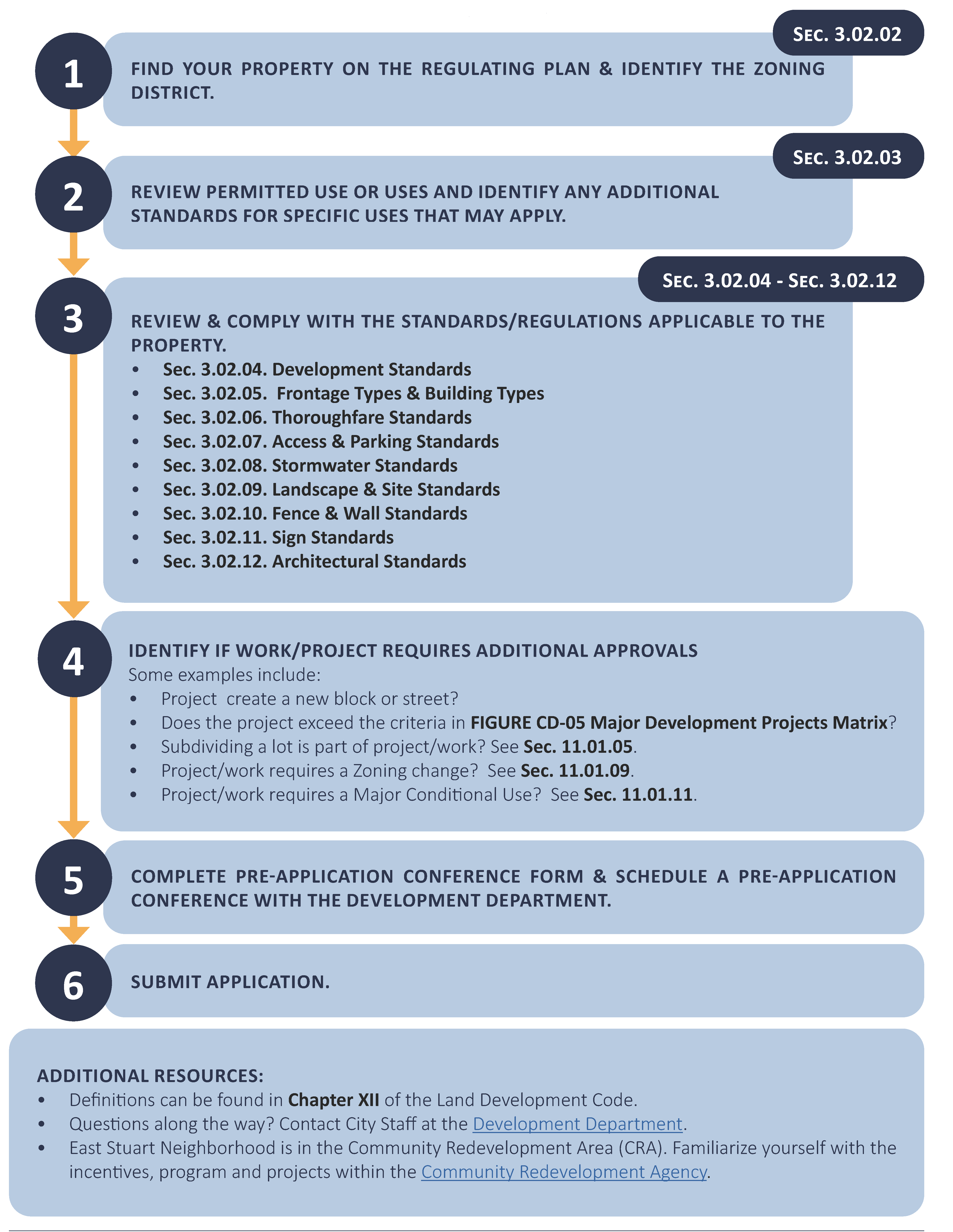
H.
Application permits. No building or other land development permit shall be issued by the development director unless all provisions of this Code have been met, including approved exceptions, based on the development review and approval process.
1.
Pre-application conference. Before beginning any new development, substantial renovation development, renovation, or demolition on private or public land, applicants are required to schedule a pre-application conference with the development department. A pre-application conference is not required for interior renovations, and may be administratively waved by the development director.
a.
Preliminary development review. After the pre-application conference, a preliminary design review shall be requested by the development director to include a conceptual site plan, floor plans, and elevations.
b.
At a pre-application conference, the applicant and development department will discuss relevant procedures from chapter XI and required board presentation(s) as outlined in Figure ESN-03, Required board presentations.
c.
The development director may request an applicant host a community workshop including any active neighborhood association or business associations before submitting an application. A community workshop will be required of all major development projects. Applicant shall notify city staff in advance of the meeting and shall submit minutes and sign-in sheets from the community workshop as part of the application.
FIGURE ESN-03 - REQUIRED BOARD PRESENTATIONS
2.
Application. After the pre-application conference and preliminary design review, an application for development shall be submitted to the city development department in accordance with this Code. Except as modified herein, applications for development permits, excluding interior tenant finishes, within the East Stuart Neighborhood shall meet the submittal requirements of plan document as defined in chapter XI. Completed applications shall include Figure ESN-05, Major development projects matrix, and a completed pre-application form from the development department.
(Ord. No. 2539-2025, § 2, 4-16-25)
FIGURE ESN-04 - APPLICATION REQUIREMENTS
I.
Major development projects. Major development projects shall be subject to the major development plan approval process described in section 11.01.02. Major development projects shall be as defined in Figure ESN-05, Major development projects matrix. In addition to the requirements of section 11.01.02, a presentation to the CRB shall be required.
FIGURE ESN-05 - MAJOR DEVELOPMENT PROJECTS MATRIX
J.
Conditional use. The review of a conditional use shall follow the procedures set forth in section 11.01.11 for a major conditional use review. A conditional use shall be granted if the applicant can demonstrate that the request:
• Is consistent with this Code and the city's comprehensive plan;
• Will further the implementation of the CRA redevelopment plan;
• Will measurably improve the form and function of traditional neighborhood characteristics; and
• Has satisfied site qualitative design development standards set forth in section 6.00.04.
The city commission may impose development conditions and operational requirements including, but not limited to:
1.
Pedestrian amenities. Pedestrian amenities in the form of benches, courtyards, shared use-paths, pedestrian lighting, or other acceptable forms of amenities located adjacent to a public sidewalk and/or right-of-way.
2.
Green development. On-site renewable energy generation, indoor and outdoor water use reduction or green development as outlined in section 6.06.00.
3.
Improvements to the surrounding neighborhood. The applicant proposes to make improvements such as: replacing existing sidewalks with integral color concrete or pavers in the surrounding neighborhood.
4.
Require existing overhead utilities to be placed underground.
5.
Neighborhood open space. Neighborhood open space as provided by as described in section 3.04.04F.2.
6.
Historic preservation. Preservation, relocation or a monetary contribution is made to the relocation of historic buildings fund for historic structures as defined within section 5.09.00.
(Ord. No. 2539-2025, § 2, 4-16-25)
K.
Planned unit development project. Applications or amendments to a planned unit development project shall outline any deviations from the East Stuart Neighborhood Code. A planned unit development project shall only be granted if the applicant can demonstrate the same standards set forth for conditional uses, section 3.04.1 J.
(Ord. No. 2507-2023, § 1(Exh. A), 2-13-23)
Sec. 3.02.02. - Regulating plan.
A.
Zoning districts in East Stuart Neighborhood. The following zoning districts are intended to regulate building placement, building height, parking, architectural character, outbuildings, signage, and curb cuts, etc. within each respective zoning district. The requirements vary according to the desired type and intensity of development. All zoning districts promote a compact walkable neighborhood with a variety of housing choices. Three zoning districts are described below:
1.
Business and mixed-use zoning district (BMU). The BMU zoning district encompasses East Stuart's traditional business area, abutting the south side of Martin Luther King Jr. Boulevard adjacent to Central and East Avenues. The area is currently characterized by several vacant parcels, a few scattered single-family and multi-family residences and a small number of businesses. The desired development pattern of business and office uses with proximity to residential uses promotes a vibrant mixed use neighborhood.
2.
General residential and office zoning district (GRO). The GRO zoning district is generally characterized by a mix of single-family, duplexes and multi-family dwellings. The area allows for limited non-residential uses, and permits professional offices.
3.
Single-family and duplex zoning district (SFD). The SFD zoning district, at the center of the East Stuart community, is characterized mainly by single-family and duplex dwellings. A portion of the zoning district is restricted to detached dwelling units and does not permit duplexes or townhouses. The area is identified on the regulating plan with a crosshatch.
B.
Regulating plan. Figure ESN-06, Regulating plan, and Figure ESN-07, Thoroughfare plan, are the regulating plans that apply to the East Stuart Neighborhood.
1.
Recommended connections. Potential future street and alley connections are illustrated on the thoroughfare regulating plan. Future connections are desired new vehicular or pedestrian connections to existing streets or alleys that will improve the overall transportation network. Future connections are not precise alignments or specific locations. The final street designations, exact alignment, location, maintenance responsibility and dedication of these intended links of the transportation network will be determined during the development review and approval process.
2.
Improved alley candidates. An improved alley candidate is an existing alley right-of-way which has not yet been improved to the standards in Figure ESN-34, Improved alley. New development adjacent to alley candidates shall dedicate for improvement of alley. The dedication of land for an improved alley allows development to use rear setback with alley setback and may still be included for the purpose of calculating density.
FIGURE ESN-07 - THOROUGHFARE PLAN
(Ord. No. 2507-2023, § 1(Exh. A), 2-13-23)
Sec. 3.02.03. - Permitted uses.
A.
Figure ESN-08 identifies permitted uses in East Stuart Neighborhood.
1.
Consideration of uses not specifically listed. If a use is not listed within a zoning district, then the use is not allowed. A proposed use that is not listed within a zoning district, but which is determined by the development director to have a similar character, nature, and impact to a permitted use in that district may be approved through, a determination of comparability by the development director. Conditions may be placed on the decision. A determination by the development director that a proposed use is not similar to a permitted use may be appealed according to procedures in section 8.07.01.
2.
Conditional use. Uses which require a conditional use (CU) approval are marked with "CU."
3.
Non-conforming uses. Non-conforming uses created by virtue of the adoption of this Code shall be deemed legal non-conforming uses subject to the provisions of section 8.03.00.
FIGURE ESN-08 - PERMITTED USES IN THE EAST STUART NEIGHBORHOOD
Key:
✓ : Use permitted by right; subject to all other applicable requirements of the Code.
CU : Use permitted as a conditional use by approval of a major conditional use approval through public hearing process.
- : Prohibited
(Ord. No. 2539-2025, § 2, 4-16-25)
B.
Standards for specific uses. Certain uses have unique characteristics that require the imposition of development standards in addition to those minimum standards which may pertain to the general group of uses encompassing the use. These standards shall be met in addition to all other standards of this Code, unless specifically exempted.
1.
Duplex. A portion of the SFD zoning district is restricted to detached dwelling units and does not permit duplexes or townhouses. The area is identified on Figure ESN-07 Thoroughfare Plan with a crosshatch.
2.
Child care centers. Child care centers shall comply with the following standards:
a.
Required square footage of outdoor play area per child shall meet Florida Department of Children and Family Services standards and provide proof of issuance of a state license for such facility;
b.
The outdoor play area is enclosed by a fence having a height of at least five feet in order to prevent passage;
c.
One non-illuminated sign may be permitted to identify the principal structure, but such sign cannot exceed the size and height requirements of the respective zoning district, and cannot contain any advertising other than the name of the business;
d.
The location of outdoor play equipment shall be determined in the site plan review;
e.
Proof of application of a state license for such facility before approval of the conditional use shall be shown and such license must be issued before, or at the same time, any certificate of occupancy or business tax receipt may be issued for such facility.
3.
Home occupations. Home occupations shall comply with the following standards:
a.
The use of the dwelling unit for the home occupation shall be clearly incidental and secondary to the residential use and shall under no circumstances change the residential character of the dwelling, outbuilding or accessory structures.
b.
The home occupation shall not generate pedestrian or vehicular traffic in greater volume than would normally be expected to the home.
c.
One non-illuminated sign may be permitted to identify the home occupation. The sign shall be mounted flat against a wall within one foot of the entrance to the dwelling or outbuilding in which the home occupation is located, and shall not exceed one square foot.
d.
There shall be no use of utilities or community facilities beyond that normal to the use of the property for residential purposes.
e.
The home occupation shall not employ equipment which creates fire hazards, electrical interference, noise, vibration, glare, fumes, odors detectable to the normal senses outside the dwelling unit. No equipment or process shall be used which creates visual or audible interference in any radio or television receivers off the premises, or causes fluctuations in line voltage off the premises.
f.
A home occupation that involves retail sales or services that require patrons to visit the residence shall be limited to detached single-family dwellings, townhouses or outbuildings and shall require approval of a conditional use process, as provided in section 3.02.01. The permitted hours of operation shall be specified in such approval.
g.
Storage or parking of one commercial vehicle is allowed, provided:
i.
That such vehicle or trailer is owned or operated by the resident of the property; and
ii.
That such vehicle is garaged or otherwise screened from view of adjoining properties and any adjoining street. Public service agency vehicles such as law enforcement and those providing emergency response services are exempt.
h.
The use can qualify for all local, state and federal licenses, certificates and permits.
i.
Any violation of these regulations may result in the revocation of any home occupation business tax receipt, in addition to any other remedy for such violation provided in the city's Code. The issuance of a business tax receipt to engage in a home occupation in accordance with this ordinance shall not be deemed to be a change in zoning nor an official expression of opinion as to the proper zoning for the particular property.
(Ord. No. 2507-2023, § 1(Exh. A), 2-13-23)
Sec. 3.02.04. - Development standards.
A.
All new development, substantial improvement, and substantial renovation shall comply with the development standards in Figure ESN-09 Development Standards in the East Stuart Neighborhood. Development standards which require a conditional use (CU) approval are marked with "CU."
FIGURE ESN-09 DEVELOPMENT STANDARDS IN THE EAST STUART NEIGHBORHOOD
(Ord. No. 2539-2025, § 2, 4-16-25)
B.
Building placement.
1.
Build-to-zone (BTZ). Setbacks are measured from the property line and are defined in chapter XII.
2.
Setbacks. Setbacks are measured from the property line and are defined in chapter XII. [See also] section 2.04.04, Supplemental building setback requirements.
3.
Primary facade. Main entries shall be prominent and orientated to the street.
a.
The primary facade shall be generally parallel to the right-of-way, located in accordance with the build-to-zone of the zoning district.
b.
The primary facade shall face existing roadway(s).
c.
The location of the primary facade is not changed by the projection of architectural elements such as cornices, bay windows, awnings, balconies, or stoops.
d.
On corner lots, the primary facade shall extend to the corner, respective of all required setbacks and visibility triangles, or a neighborhood open space shall be provided.
C.
Building height. Building height is measured in accordance with section 2.04.07, Supplemental building height. See Figure ESN-10 for illustration.
FIGURE ESN-10 - ILLUSTRATION OF MEASURING HEIGHT
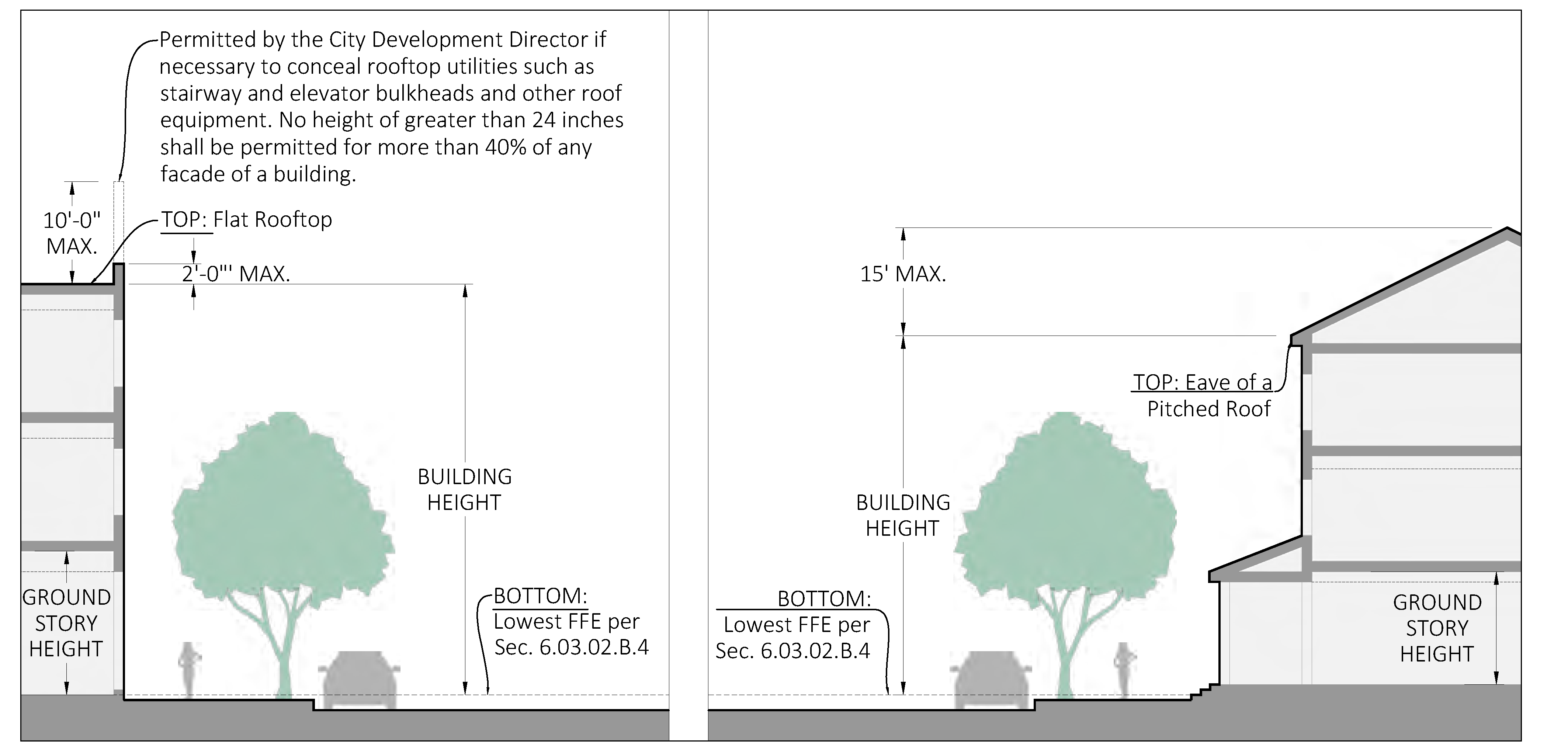
1.
Ground story height. Minimum ground story heights are provided for zoning districts. Ground story height is measured as the clear height from finished floor elevation to the underside of structure above.
2.
Finished floor elevations. For the purpose of minimizing stormwater impacts, the finished floor elevations of surrounding properties shall be taken into consideration in establishing the finished floor elevation of the new structure. If new construction has a floor level higher than natural grade, the foundation shall provide for the rise in floor level, rather than mounding fill to the building perimeter. Minor grading not to exceed two percent directing water away from building to established drainage is allowed. Sections 6.03.01 G.2 and 6.03.02 B.4 apply for all habitable spaces. They do not apply for non-habitable spaces such as garages and storage. See illustrated examples in Figure ESN-11, Alternatives to foundations on fill.
FIGURE ESN-11 - ALTERNATIVES TO FOUNDATIONS ON FILL
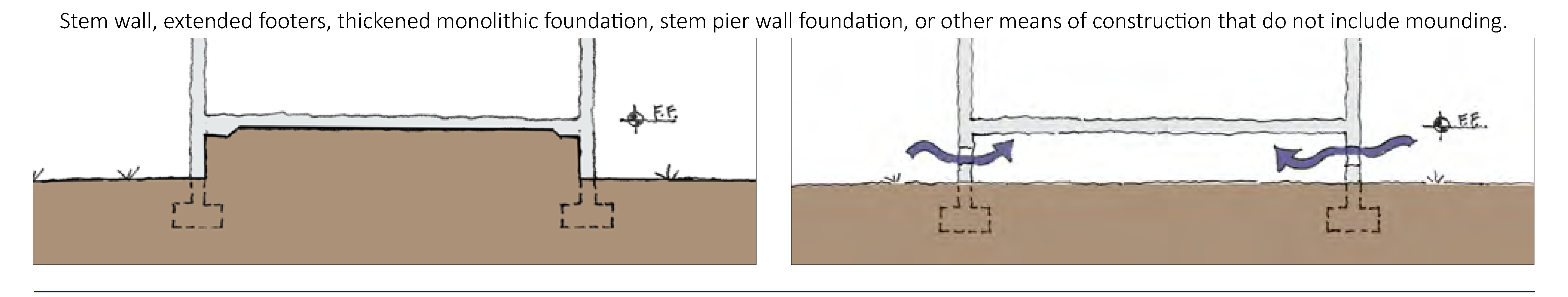
D.
Building massing. Buildings shall not have a horizontal length or width of 150 feet or greater. No horizontal length or uninterrupted curve of a primary facade shall exceed 100 linear feet.
E.
Coverage.
1.
Impervious surface. See section 2.04.03, Supplemental impervious surface coverage requirements.
2.
Neighborhood open space. Neighborhood open space is an outdoor space accessible by the general public, improves the pedestrian environment, and serves as an amenity for the neighborhood. Neighborhood open space shall provide low impact development strategies to promote improved stormwater treatment. Examples of neighborhood open space which can be implemented are shown in Figure ESN-12, Neighborhood open space types.
FIGURE ESN-12 - NEIGHBORHOOD OPEN SPACE TYPES
| SIZE | DESCRIPTION | ILLUSTRATION | |
|---|---|---|---|
GREEN | ≤1,500 sf | A green is at least 1,500 square feet in size and adjoins streets on at least two sides or a street and a pedestrian passageway or main building entry. Greens are designed primarily for passive uses, consisting primarily of lawn with either formally or informally arranged landscaping and shade trees. |  |
PLAYGROUND | ≤ 2,500 sf | Playgrounds provide children's play equipment and are shaded with shade trees or shade structures. Playgrounds adjoin a street on at least one side and the configuration shall ensure easy surveillance of the area from adjacent buildings and streets. |  |
SQUARE | ≤ 10,000 sf | A square adjoins streets on at least three sides. Squares may be up to 50% hardscaped, with formal landscaping and shade trees. Squares accommodate both passive uses and community gatherings. |  |
ATTACHED
GREEN | 2,000 to 6,000 sf | An attached green spans the entire length of a block. Attached greens shall be at least 30 feet wide and are appropriate on the short end of a block. Attached greens are primarily lawns with formally arranged landscaping and shade trees. |  |
COMMUNITY
GARDEN | ≤ 15' wide | Community Garden. A community garden is 2,500 to approximately 5,000 square feet and adjoins a street on at least one side. Community gardens are land that is cultivated collectively by members of a community. | 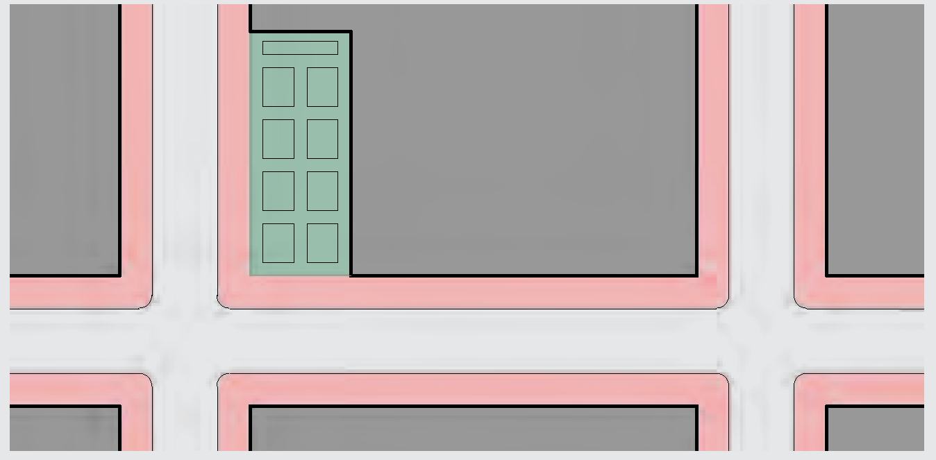 |
FORE-COURT | 250 to 1,500 sf | Buildings shall utilize standards from Forecourt frontage type, see Figure ESN-18 Forecourt. | |
F.
Accessory structures. Accessory structures shall comply with the development standards applicable in the zoning district except where modified herein.
1.
Accessory structures shall not be established on a parcel prior to the issuance of all permits required for the development of the principal structure to which it is accessory.
2.
Shielding from street. Sheds, exposed pumps, electrical meters, heat pumps, generators, pool equipment, air conditioning compressors, clothes lines, antennas, satellite dishes, outdoor storage, and similar structures and uses shall not be located between the front of a building and a street. Listed items and similar structures shall be shielded from view from public rights-of-way. All rooftop utilities and facilities, such as air conditioning units, shall be screened so as to not be visible from public view, including from balconies and windows of adjacent buildings.
3.
Outbuildings. Outbuildings may include detached garages and carports, greenhouses, slat houses, cabanas, detached garage, and accessory dwelling units (ADU). Outbuildings shall conform to the standards in Figure ESN-30.
4.
Accessory dwelling units (ADU).
a.
One ADU may be permitted on a parcel on which a detached single-family dwelling is located.
b.
Either the primary dwelling unit or ADU shall be owner occupied. The ADU shall not be sold or titled thereto transferred separate and apart from the rest of the property.
c.
An ADU shall not count as a separate unit for purposes of calculating density.
d.
An ADU shall not exceed a footprint of 700 square feet or the footprint of the principal structure, whichever is less. If a unit exceeds the 700 square feet, it shall be used in density calculations.
e.
An ADU must be on the same water and electrical meter as the primary residence.
(Ord. No. 2539-2025, § 2, 4-16-25)
G.
Frontage types. Each new development, substantial improvement, and substantial renovation, constructed must meet the standards for one of the frontage types permitted in the zoning district where it is located. See section 3.02.05.
H.
Historic preservation. Structures identified as historically and architecturally contributing shall be candidates for historic preservation as set forth in section 5.09.00.
1.
The requirements of this Code may be adjusted by variance for the purposes of preserving a historic building.
2.
Replication of historic buildings. Historic buildings including historic buildings that have been demolished, may be rebuilt within the same footprint of the original structure provided the rebuilt structure meets the standards for replication. Reconstructions shall be supported by drawings, images, and review by the Stuart Historic Preservation Board. The following historic buildings are eligible for reconstruction, as identified in the 2002 Charrette Report:
a.
Former McHardy Drugstore (Live-Work), East Avenue.
b.
Former Taylor's Grocery Store & Cottages, 610 East 10th Street.
I.
Conflicts with utilities. In instances where the required location of a building, including architectural requirements, conflicts with existing utilities or other public infrastructure, the developer shall be required to install utilities underground, such utilities if the cost of relocation is less than five percent of the cost of the proposed building or improvements
(Ord. No. 2507-2023. § 1(Exh. A), 2-13-23)
Sec. 3.02.05. - Frontage types and building types.
A.
Frontage types are required by zoning district. Using one or more of the permitted frontage types indicated in Figure ESN-14, Permitted frontage types matrix, is required. Standards for frontage types are found in Figure ESN-15 through Figure ESN-20.
1.
Frontage types shall be located on the primary facade.
2.
Frontage type diagrams do not prescribe use or architectural style and are illustrative. Dimensions provided in tables control for regulatory requirements.
B.
Facade transparency.
1.
Windows and doors at the ground level shall have clear, transparent glass that has a minimum visible light transmission (VLT) of 50 percent. Mirrored glass is prohibited.
2.
Building facades facing street and neighborhood open spaces shall meet or exceed the minimum percentage of transparent glazing. The required percentage is determined by the frontage type.
3.
Above the ground level, building facades shall meet or exceed the minimum percentage of transparent glazing at each story as measured between finished floors. The required percentage is determined by the frontage type.
FIGURE ESN-14 - PERMITTED FRONTAGE TYPES MATRIX
FIGURE ESN-15 - PORCH
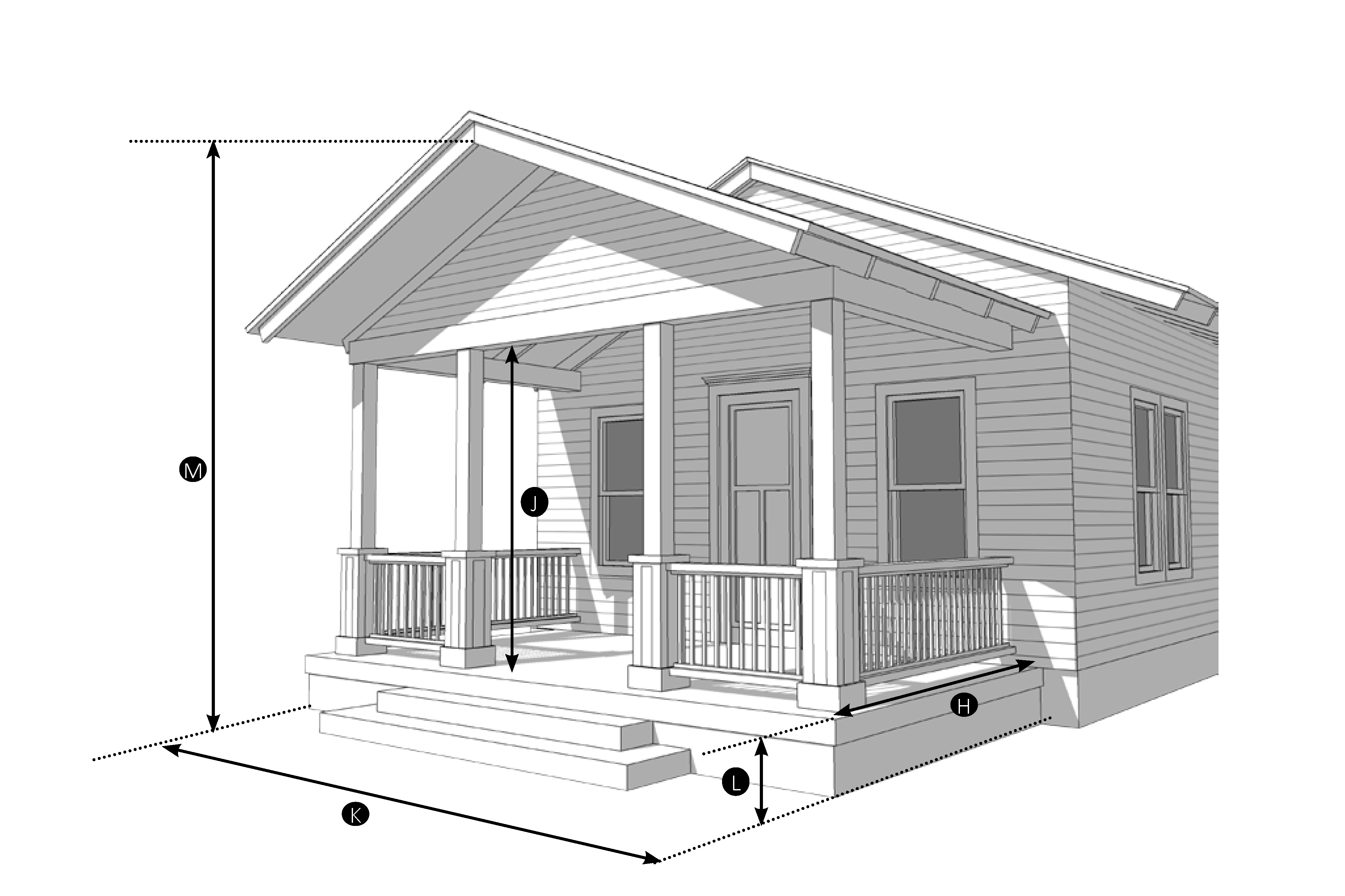
| Permitted Zoning District | ||
| SFD | GRO | BMU |
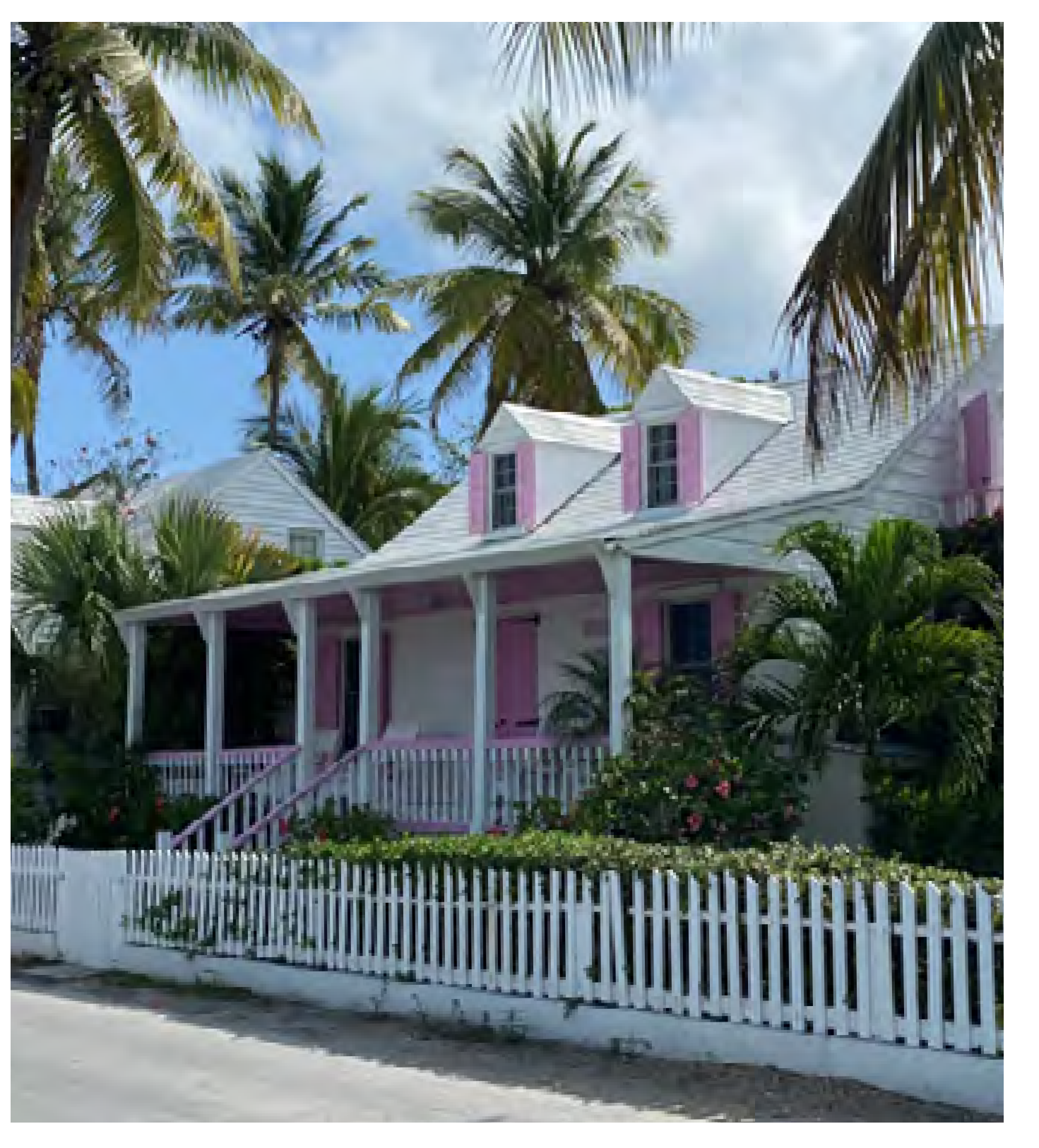 | ||
FIGURE ESN-16 - STOOP
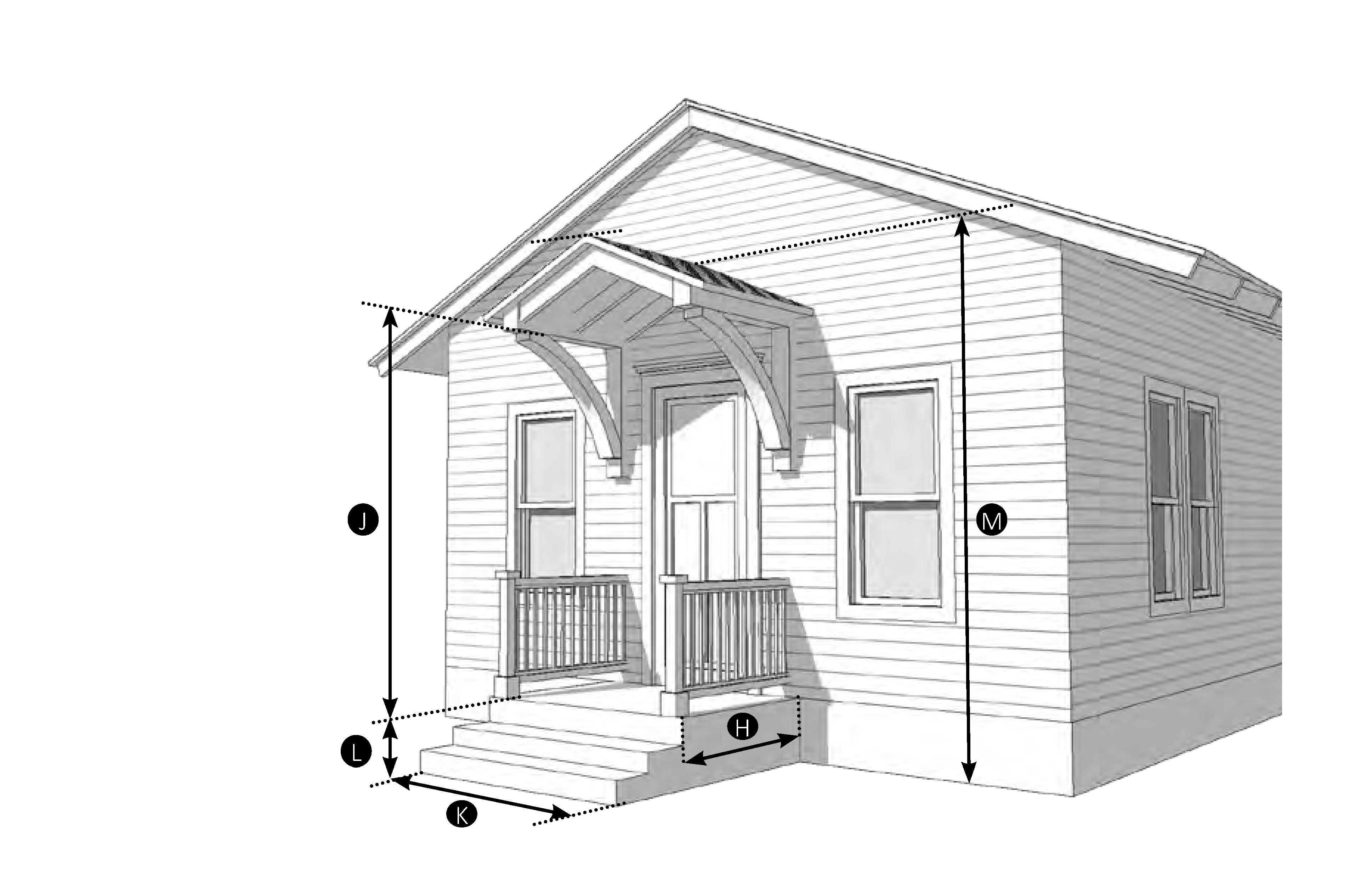
| Permitted Zoning District | ||
| SFD | GRO | BMU |
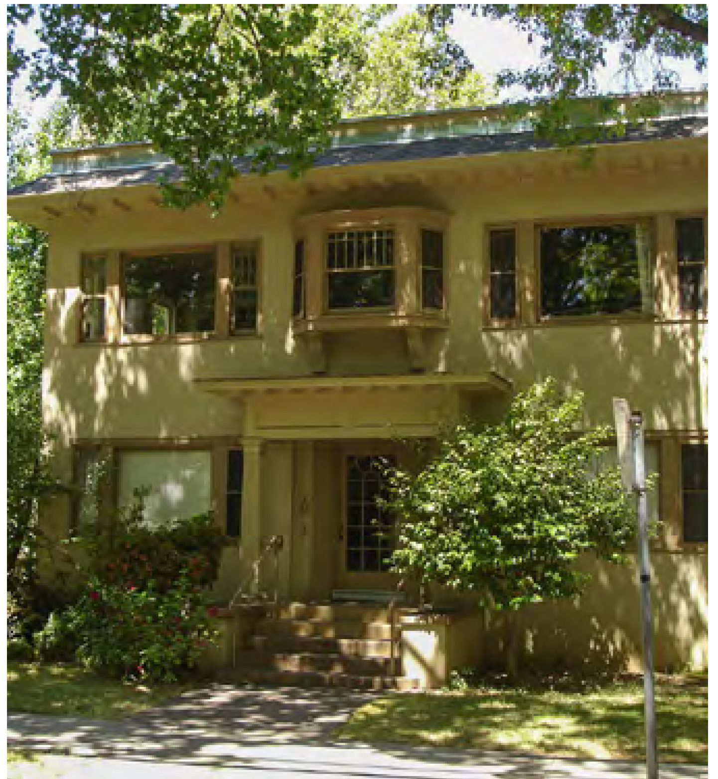 | ||
FIGURE ESN-17 - BRACKETED BALCONY
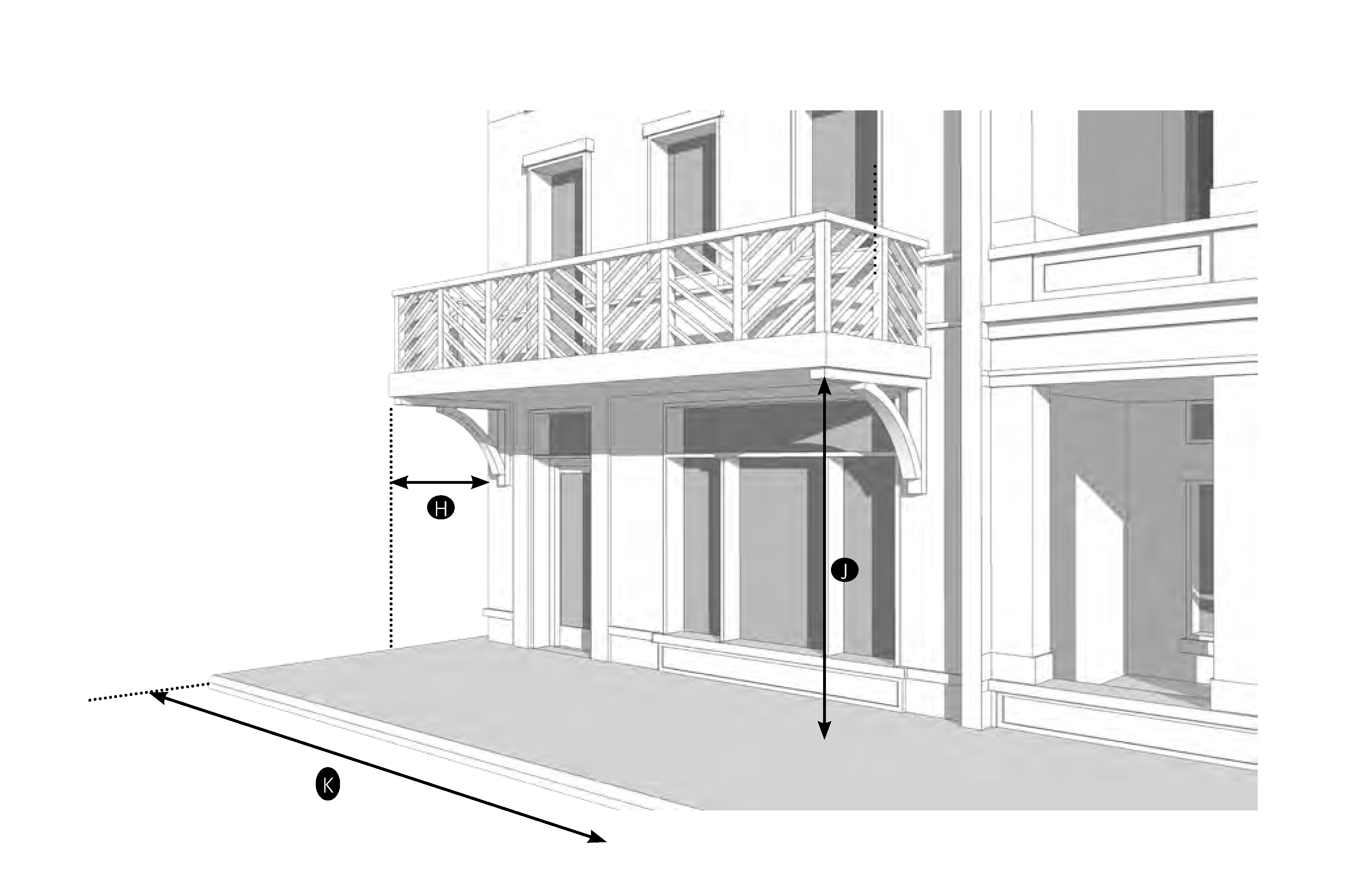
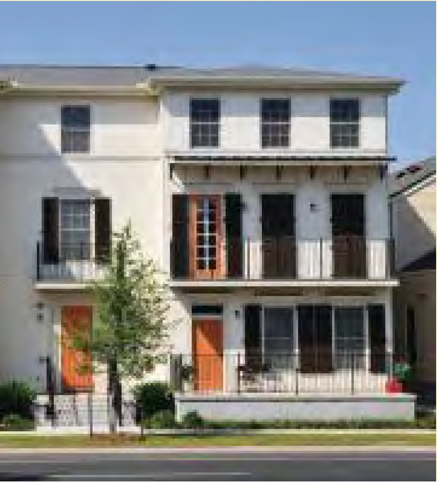
FIGURE ESN-18 - FORECOURT
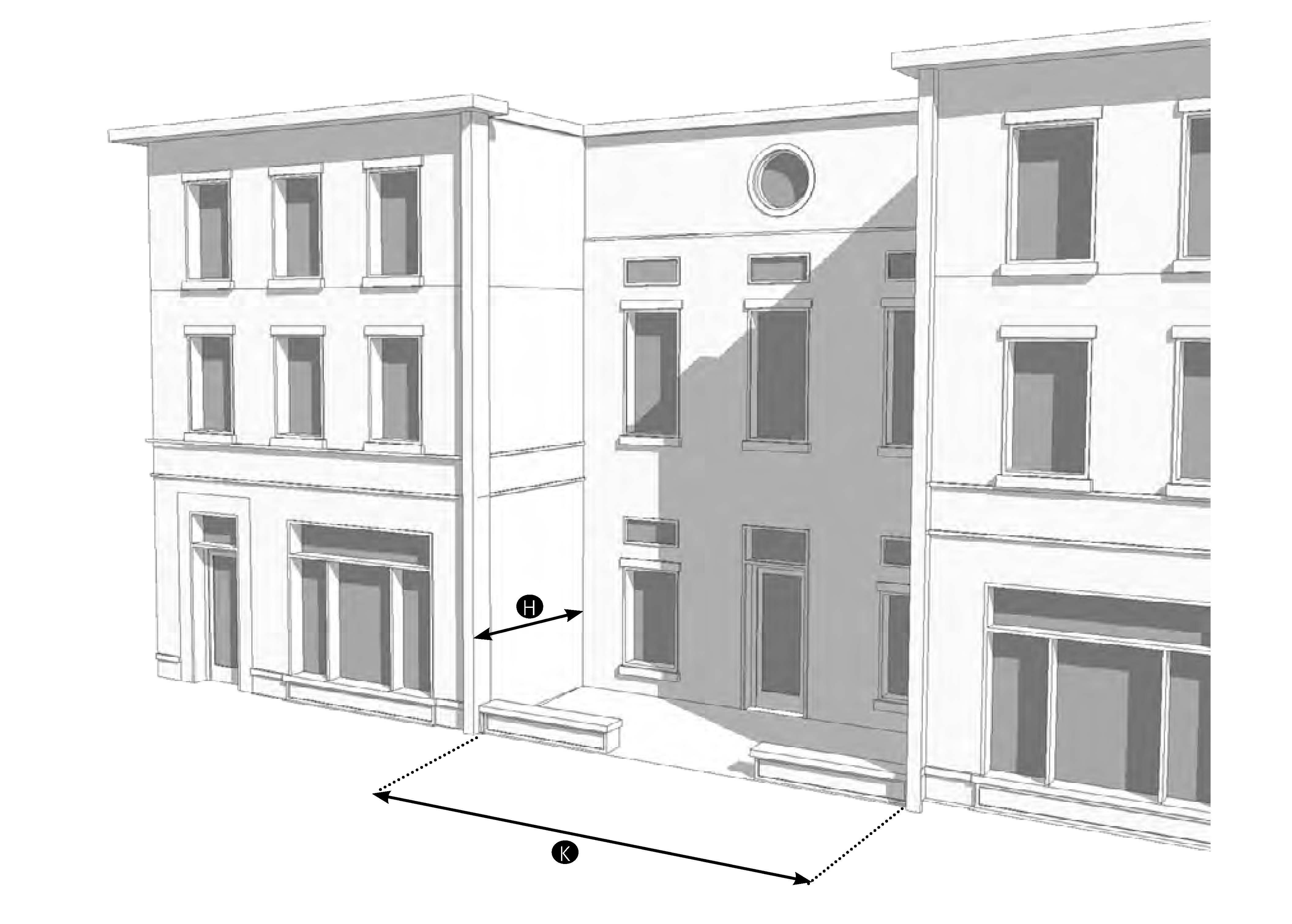
| Permitted Zoning | ||
| GRO | BMU | |
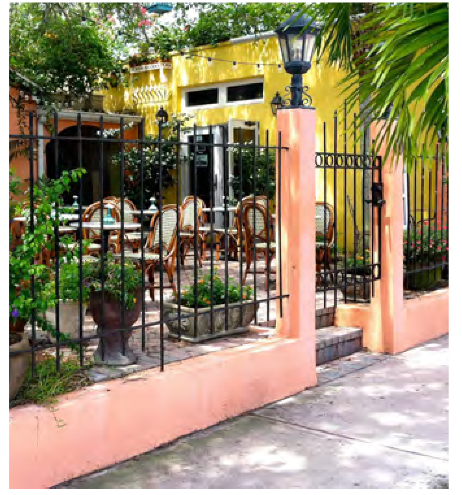 | ||
FIGURE ESN-19 - ARCADE
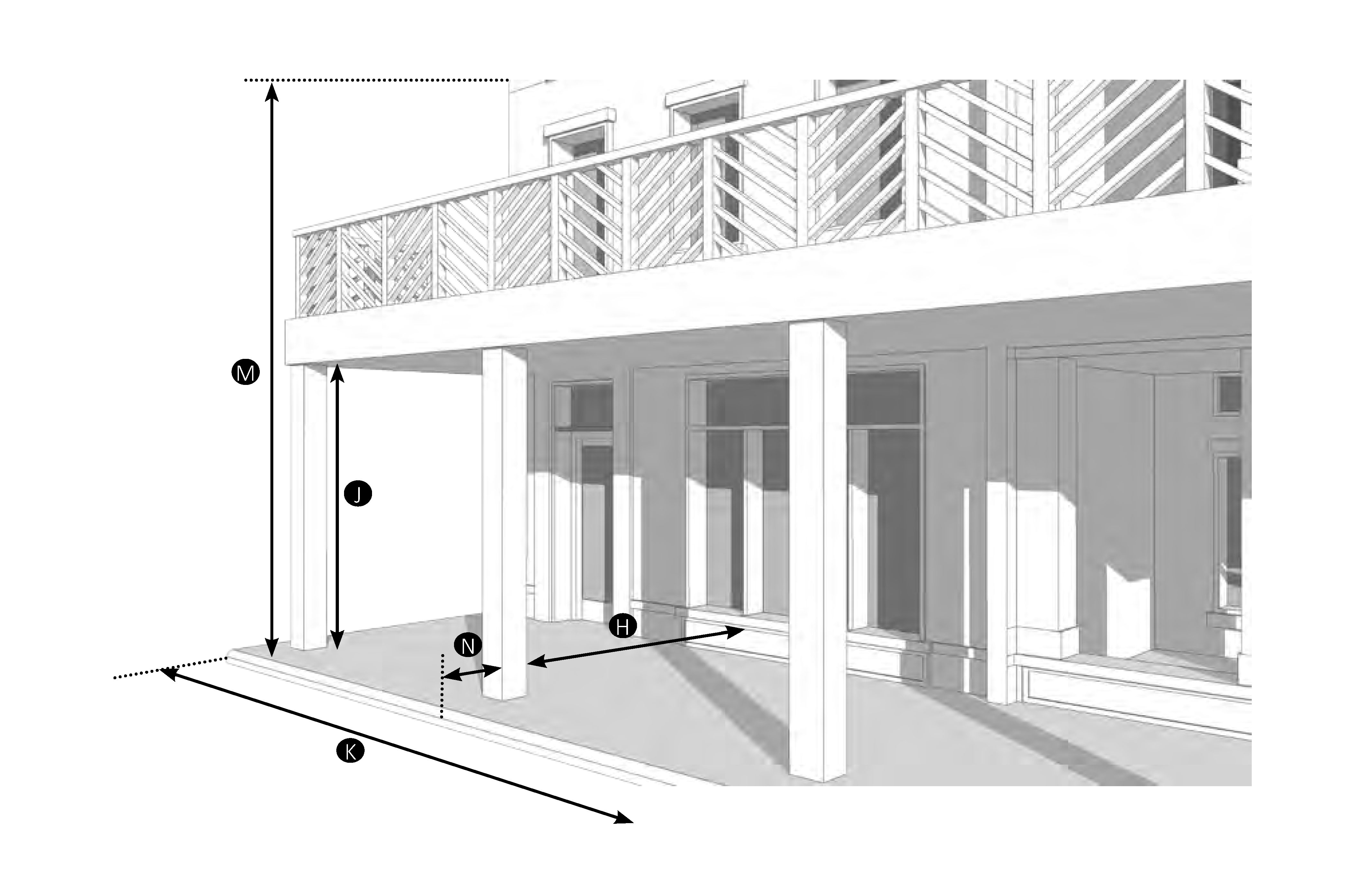
| Permitted Zoning District | ||
| BMU | ||
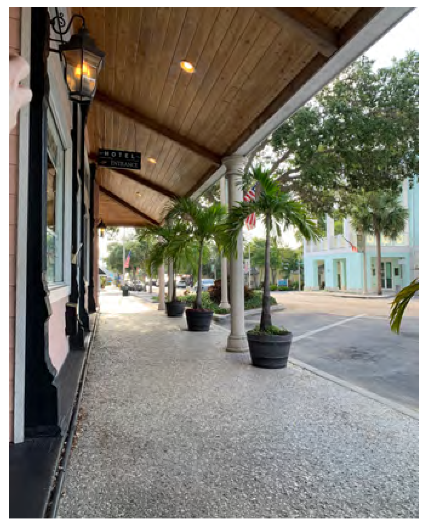 | ||
FIGURE ESN-20 - SHOPFRONT
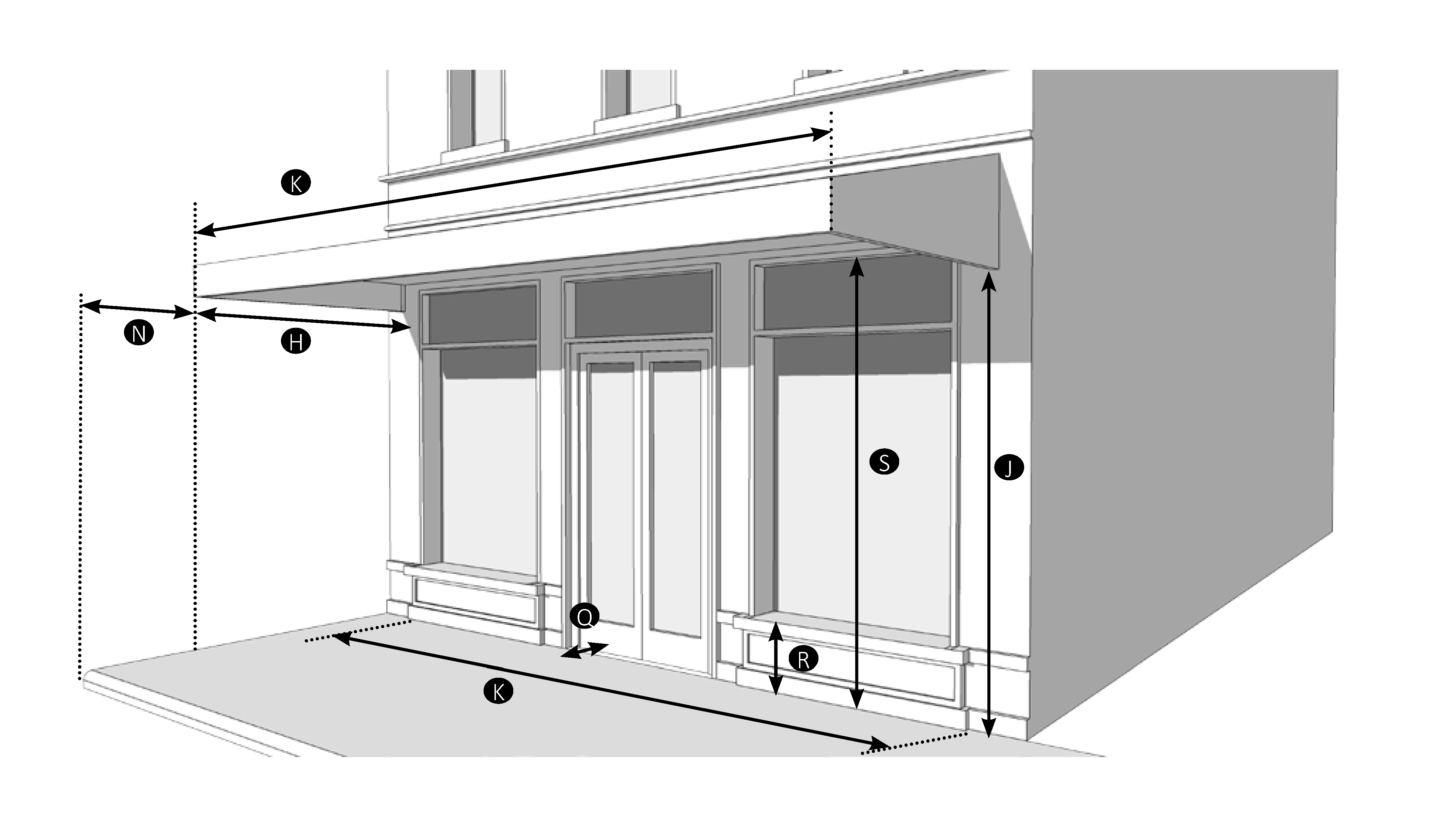
| Permitted Zoning District | ||
| BMU | ||
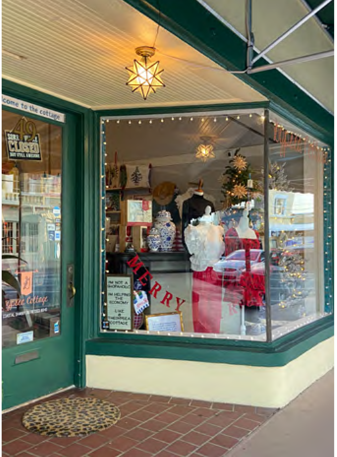 | ||
C.
Accessibility. An applicant may request reasonable accommodation from this Code though section 08.07.07. See Figure ESN-21 for examples of front and side ramp entries. Strategies for accommodating ramps accessibility may include:
1.
Combined access for multiple buildings within site plan.
2.
Utilizing two percent slope at alleys and rear access.
3.
Combining ramps and stair entrances.
FIGURE ESN-21 - ACCESSIBLE ROUTES
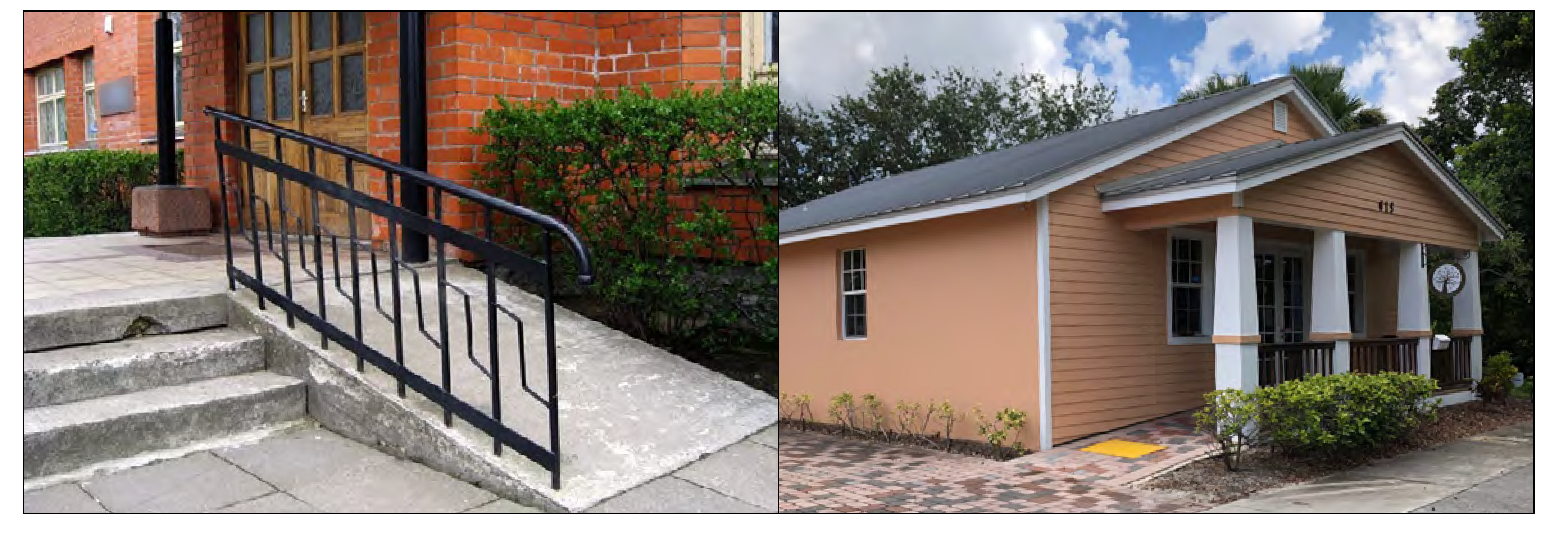
D.
Building types. The building types listed in Figure ESN-22, Building types matrix, are illustrative examples of appropriate building types. Building types do not prescribe use or architectural style. New development shall identify and comply with one of the building types provided. Standards for building types are found in Figure ESN-23 through Figure ESN-30.
FIGURE ESN-23 - COTTAGE
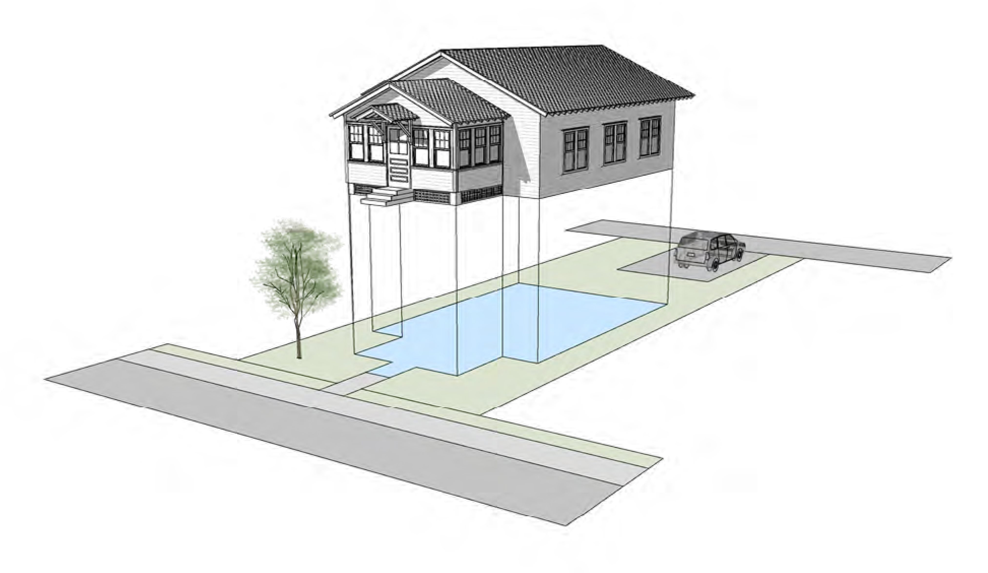
FIGURE ESN-24 - DUPLEX
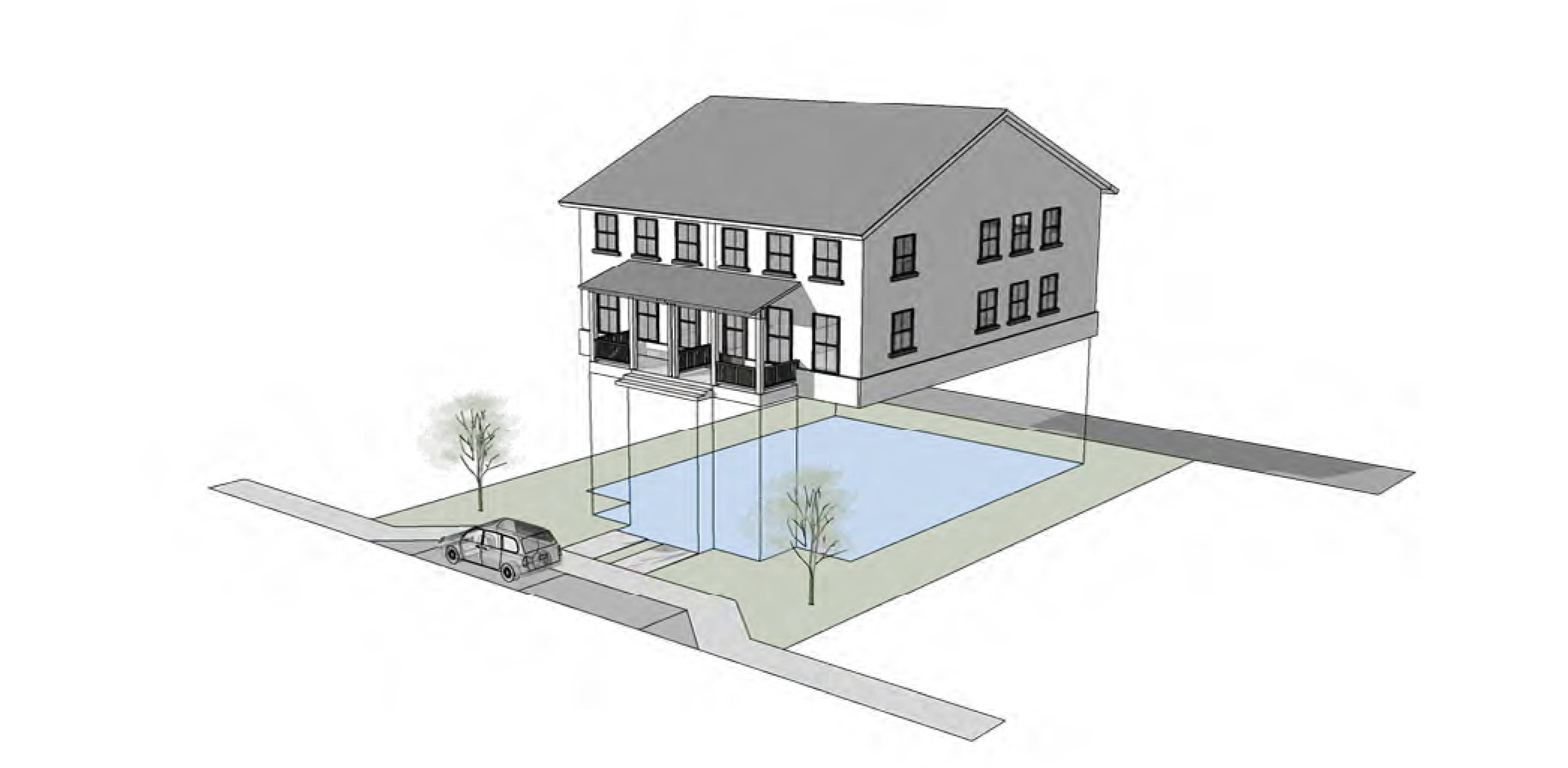
FIGURE ESN-25 - TOWNHOUSE
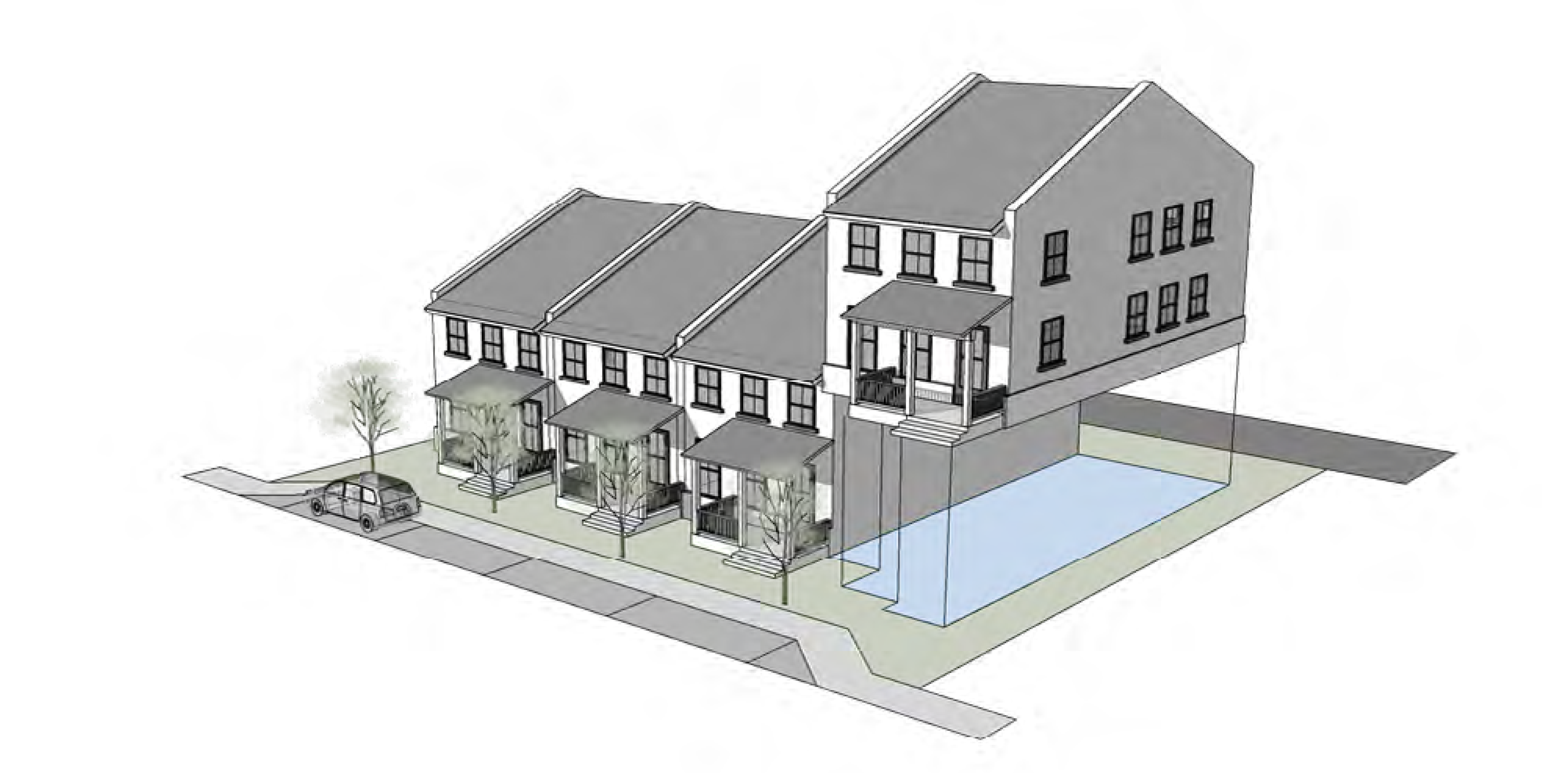
FIGURE ESN-26 - COTTAGE COURT
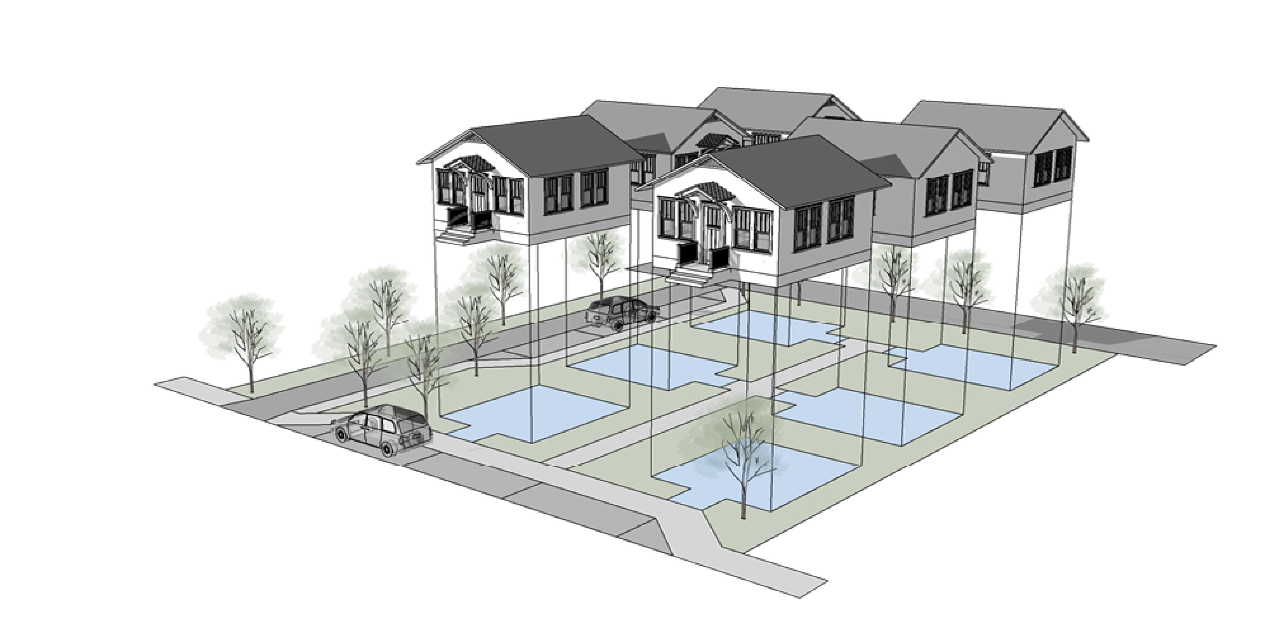
FIGURE ESN-27 - APARTMENT HOUSE
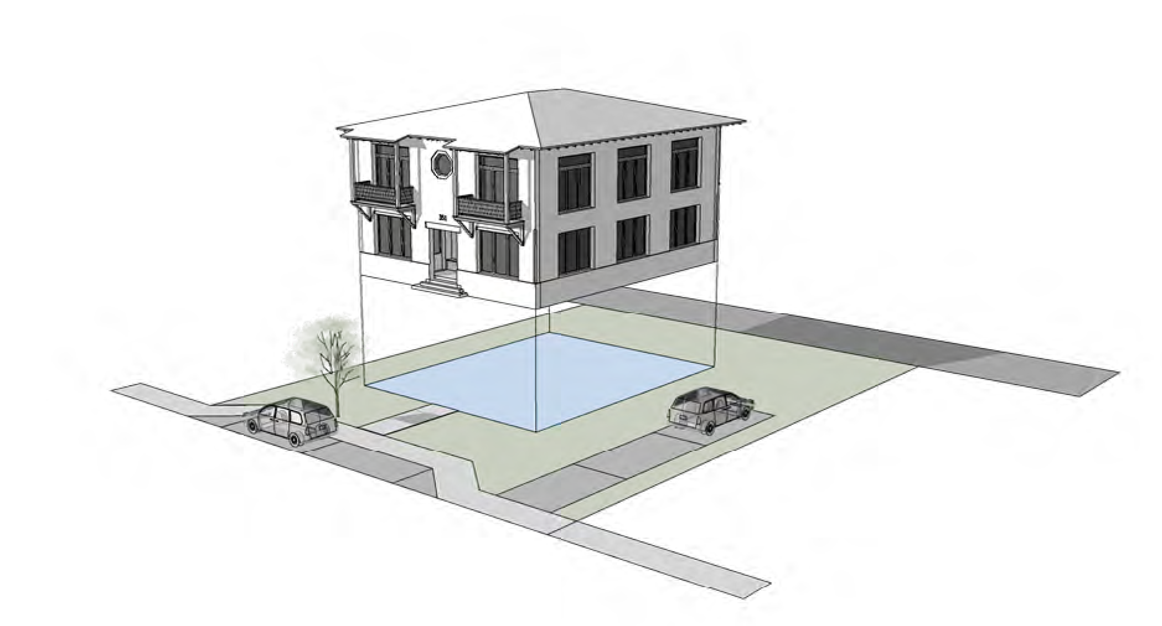
FIGURE ESN-28 - COURTYARD BUILDING
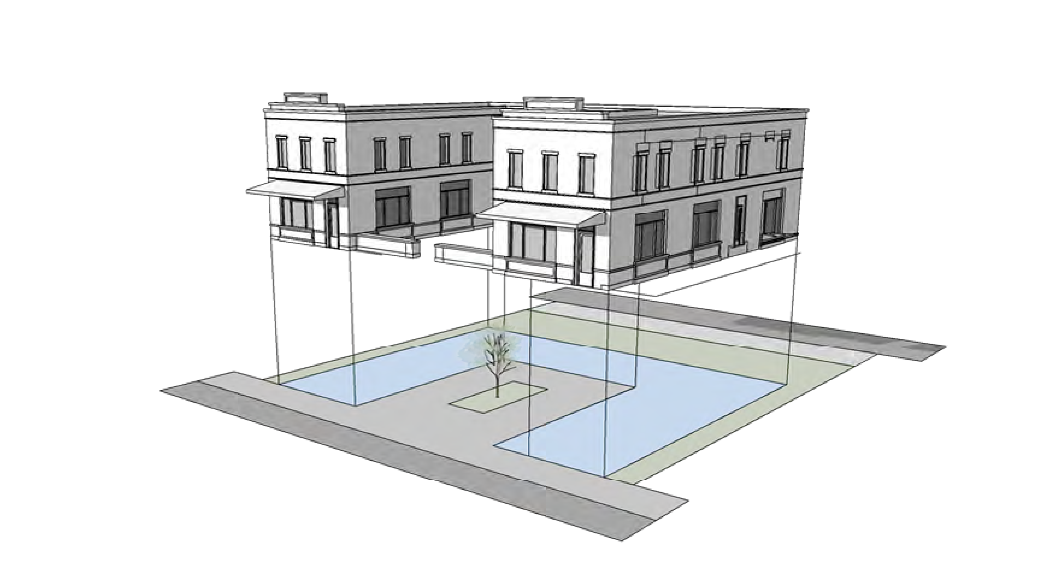
FIGURE ESN-29 - LIVE/WORK BUILDING
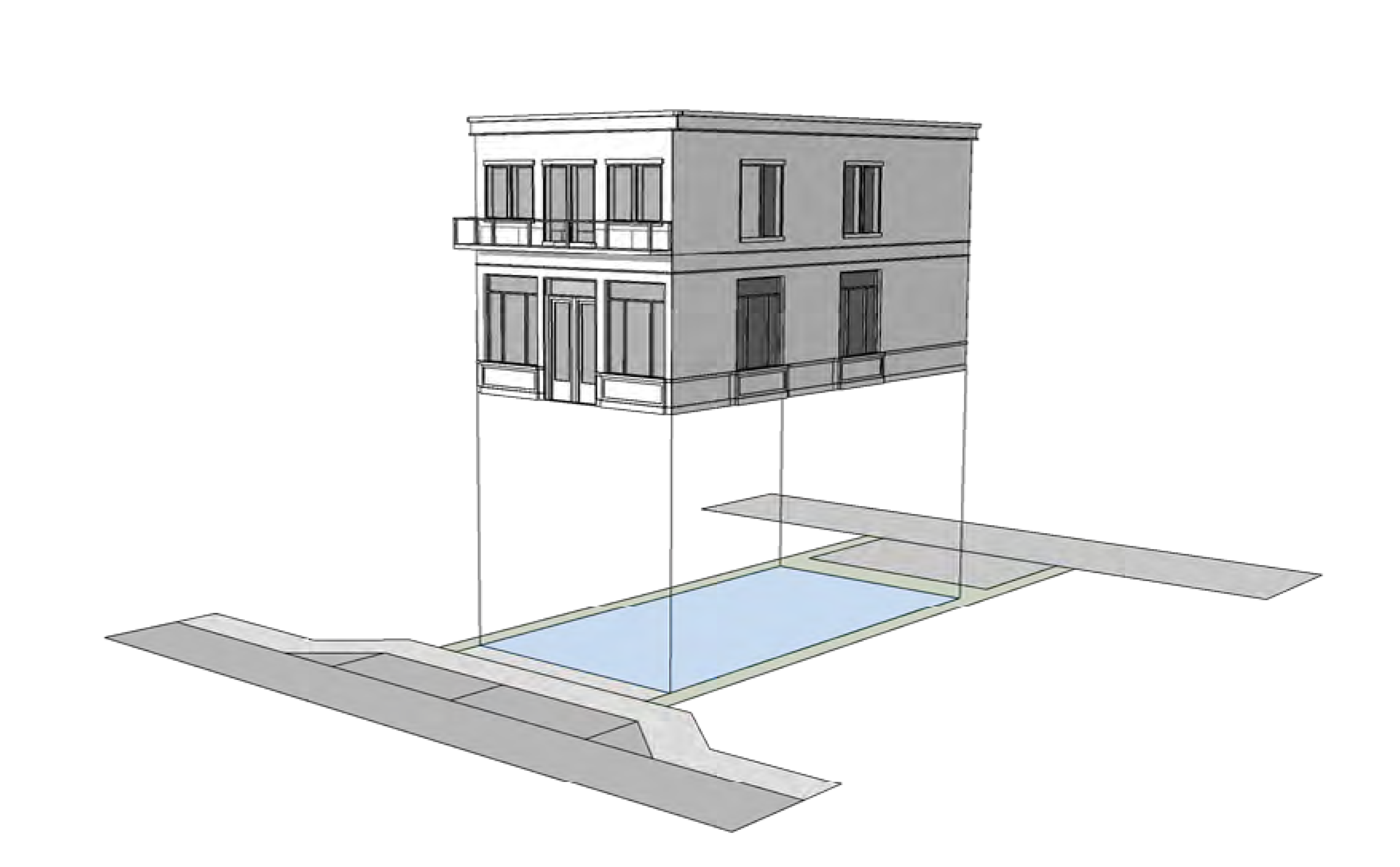
FIGURE ESN-30 - OUTBUILDING
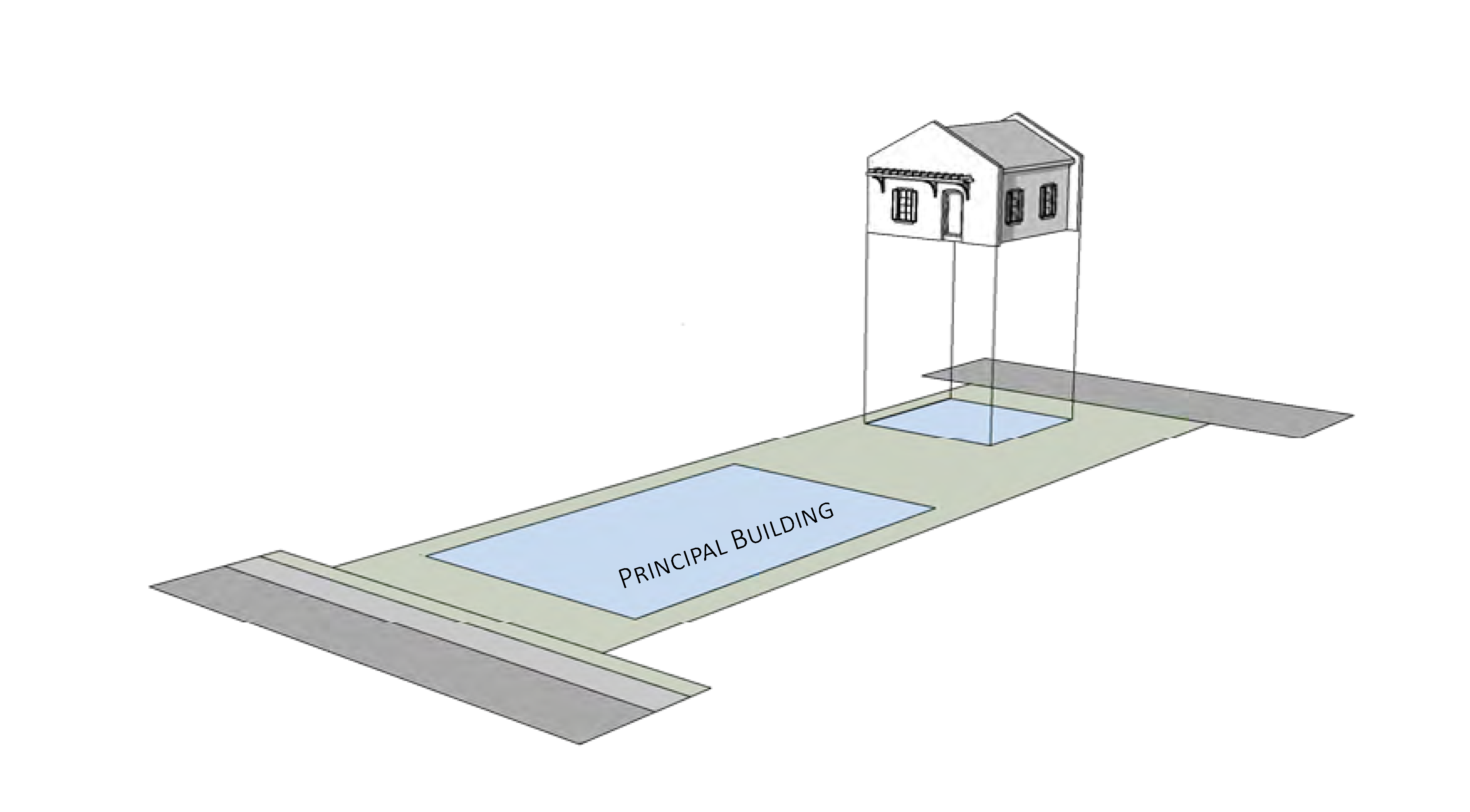
Sec. 3.02.06. - Thoroughfare standards.
A.
Applicability. Section 6.01.00 shall apply except where modified in Figure ESN-31, Thoroughfare, access and parking standards.
FIGURE ESN-31 - THOROUGHFARE, ACCESS AND PARKING STANDARDS
(Ord. No. 2539-2025, § 2, 4-16-25)
B.
Thoroughfare principles. All development including public improvements shall incorporate the following thoroughfare principles:
1.
Street layout shall exhibit a high degree of overall connectivity. Cul-de-sacs are strongly discouraged.
2.
Oversized blocks shall be avoided so that neighborhoods can be traversed easily. Blocks created by new streets shall not exceed 550 feet on any side of the block. New block perimeters shall not exceed 1,600 feet.
3.
Shade trees shall be planted between the pedestrian clear zone and vehicles where right-of-way exceed 40 feet.
4.
The abandonment of existing streets, improved alleys or alley candidates is strongly discouraged.
5.
Private gated communities are not permitted. This prohibition does not preclude gates that control access to a single parking lot.
C.
Thoroughfare plan. A thoroughfare plan is provided for East Stuart Neighborhood in Figure ESN-07, Thoroughfare plan, in section 3.02.02, Regulating plan.
D.
Description of thoroughfare types. Figure ESN-32, Description of thoroughfare types, describes street types that are appropriate for the East Stuart Neighborhood.
1.
New thoroughfare. When new streets and alleys are developed or an existing street or alley is extended, the street types in Figure ESN-32, Description of thoroughfare types, and illustrated in Figure ESN-34 through Figure ESN-41 shall be used. The selection of the particular street type shall be determined through consultation with the development director.
2.
Existing thoroughfare. Excluding a single-family dwelling unit, all new development, substantial improvement, and substantial renovation to commercial and major development projects shall incorporate into the reconstruction of streets to the greatest extent possible, taking into account existing conditions including right-of-way constraints that may require adjustments to these standards.
FIGURE ESN-32 - DESCRIPTION OF THOROUGHFARE TYPES
E.
Thoroughfare elements. See elements illustrated in Figure ESN-33, Streetscapes diagrams. The illustrative street designs address the street elements:
1.
Vehicular travel lanes are primarily for vehicular circulation and shall be no greater than 11 feet, and may include a marked sharrow for posted speed of 25 miles per hour or less.
2.
Parking lanes may include on-street parking, may be parallel or reverse angled parking.
3.
A bike facility may be a marked sharrow, a separate bicycle lane, or shared used path.
4.
Pavement width is the width of pavement from edge of pavement or curb which is dedicated for vehicular travel, but could include separate bike lane or marked sharrow. Where appropriate, pavement may include pervious areas to manage stormwater.
5.
A sidewalk shall be at least six feet wide and be provided on both sides of the streetscapes. Sidewalks may be part of a shared use path.
6.
A pedestrian zone is free of any street furnishings or above ground utilities and allows the clear passage of pedestrians. A pedestrian zone shall be no less than five feet wide. Any portion of the pedestrian zone within the front setback area shall be improved as an extension of the public sidewalk and shall match the public sidewalk in design and material, providing a seamless physical transition.
7.
The furnishing zone is a paved area adjacent to the sidewalk for street furniture, tree wells, and extra sidewalk width. Pedestrian scale lighting is often included. New thoroughfare lighting shall be dark sky approved lighting.
8.
Median is a vegetated area between travel lanes of opposing direction. Medians, when present, should be used to integrate stormwater management.
9.
Edge of pavement may be a curb and gutter or a valley gutter. Enhanced crosswalks with design features like bulb-outs or pinch-points are encouraged to address visibility when crossing vehicular travel lanes.
10.
Planting strip or planting area is a vegetated area between a sidewalk and vehicles. Planting strips are encouraged to integrate low impact development.
11.
Street trees are often required. Street designs shall prioritize maintaining existing shade trees.
12.
Low impact development is a decentralized stormwater management strategy that provides on-site water quantity and water quality treatment. Examples include pervious paving, pervious pavers, pervious concrete, bio-retention systems, rain gardens, bioswales, and stormwater planters. These techniques are encouraged to slow and treat stormwater runoff while providing additional community benefits.
FIGURE ESN-33 - STREETSCAPES DIAGRAMS
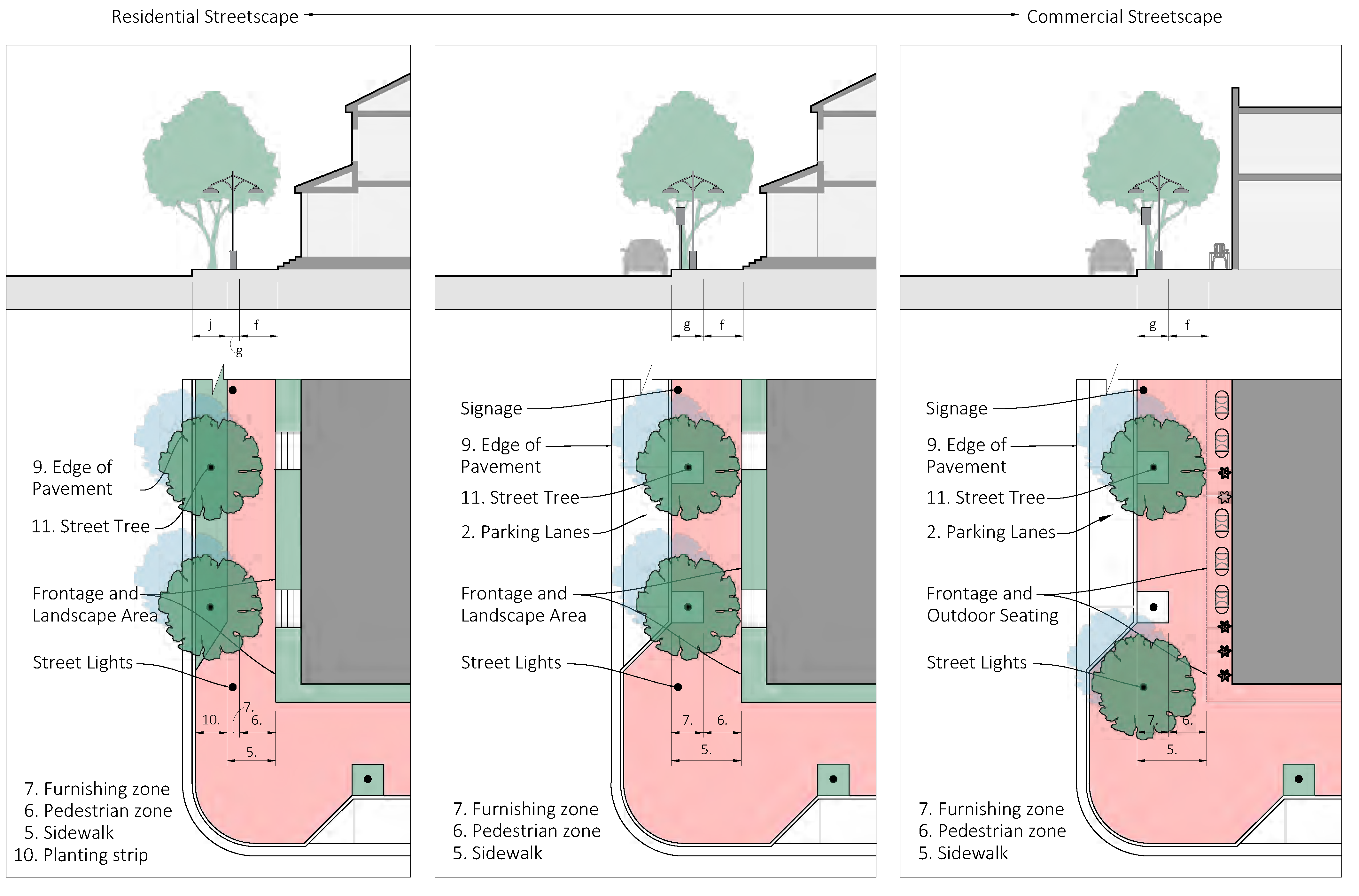
F.
Visibility triangles. In visibility triangles, no building, structure, or improvement, including landscape, shall be erected, placed, planted, or maintained so as to interfere with a clear sight area located between the heights of three feet and nine feet above the crown of a street, driveway, or alley. A clear sight area shall be established for all streets, whether public or private.
1.
The clear sight area is the triangular area formed by the street right-of-way line; another street right-of-way line, alley right-of-way line, or driveway surface edge; and a line connecting points ten feet from the intersection of said lines. In the case of a round or corner-cut right-of-way, the measurement shall be taken from the intersection of the right-of-way lines extended.
2.
The engineering director and public works director may require a larger clear sight area, as provided by Florida Department of Transportation Design Manual standards, when necessary to provide for the safe movement of pedestrians and vehicles.
G.
Deviation from street design standards. The development director may allow deviations from the standards contained in Figure ESN-34 through Figure ESN-41 when necessary due to the location of existing buildings, constrained right-of-way, or to meet other community needs or goals for the particular street segment.
FIGURE ESN-34 - IMPROVED ALLEY
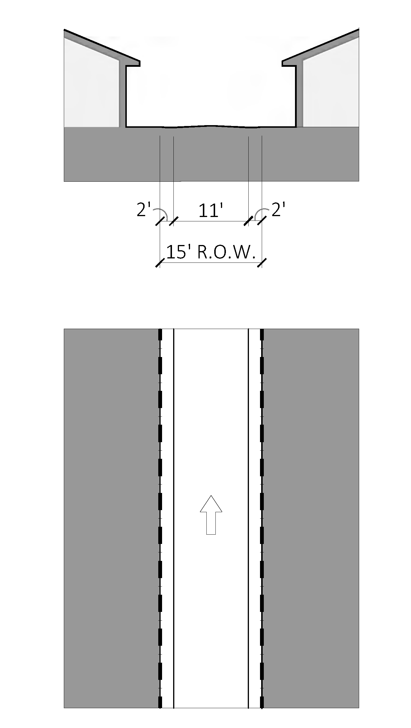
FIGURE ESN-35 - NEIGHBORHOOD STREET 1
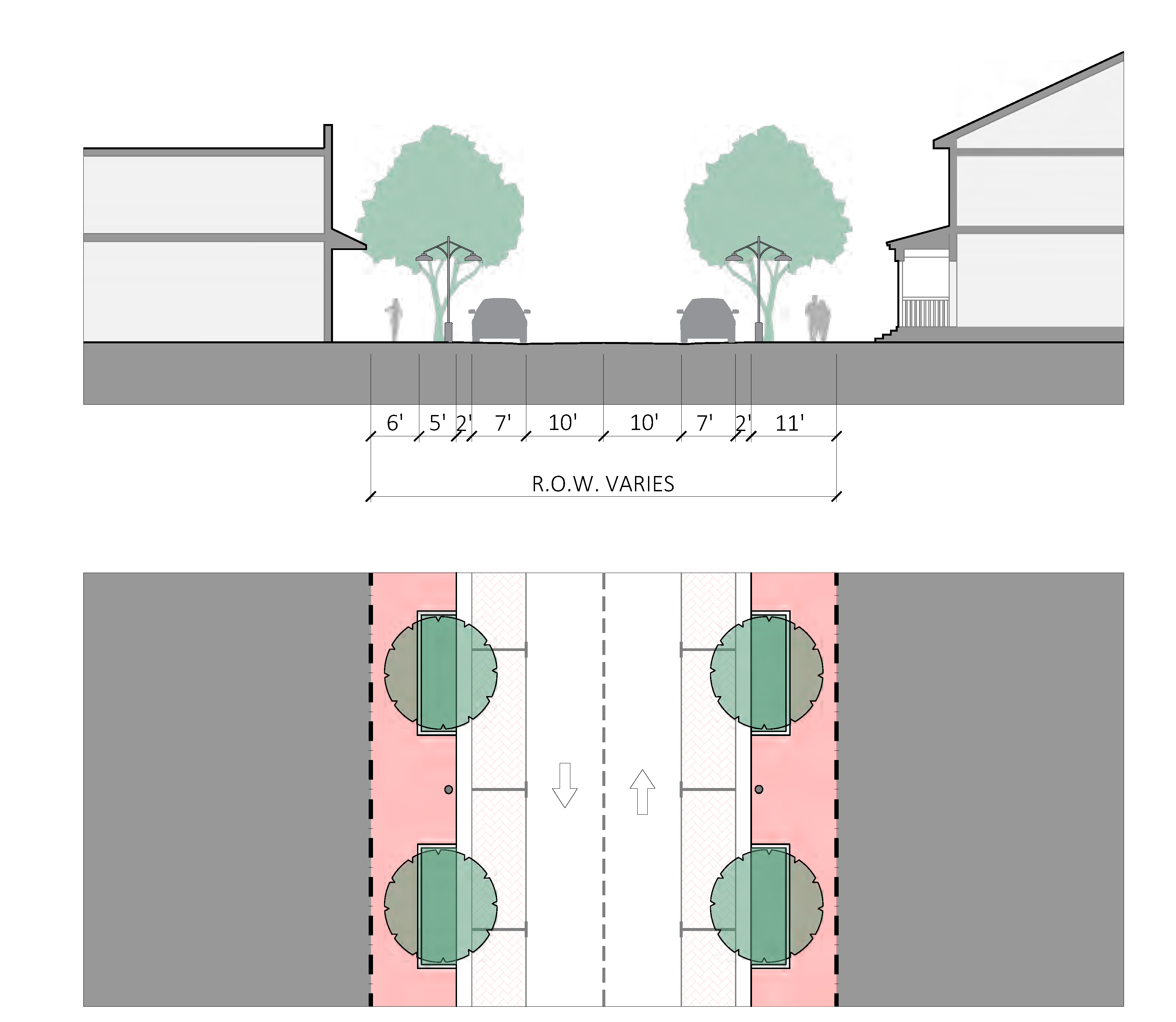
FIGURE ESN-36 - NEIGHBORHOOD STREET 2
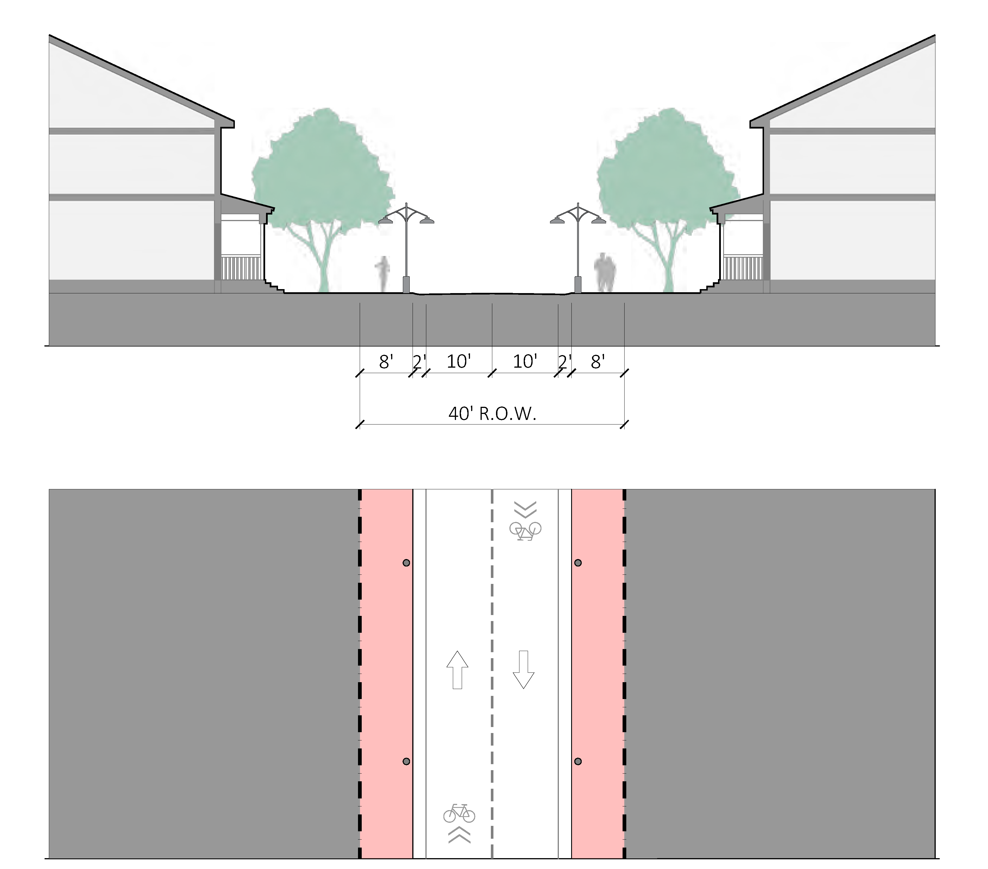
FIGURE ESN-37 - NEIGHBORHOOD YIELD STREET
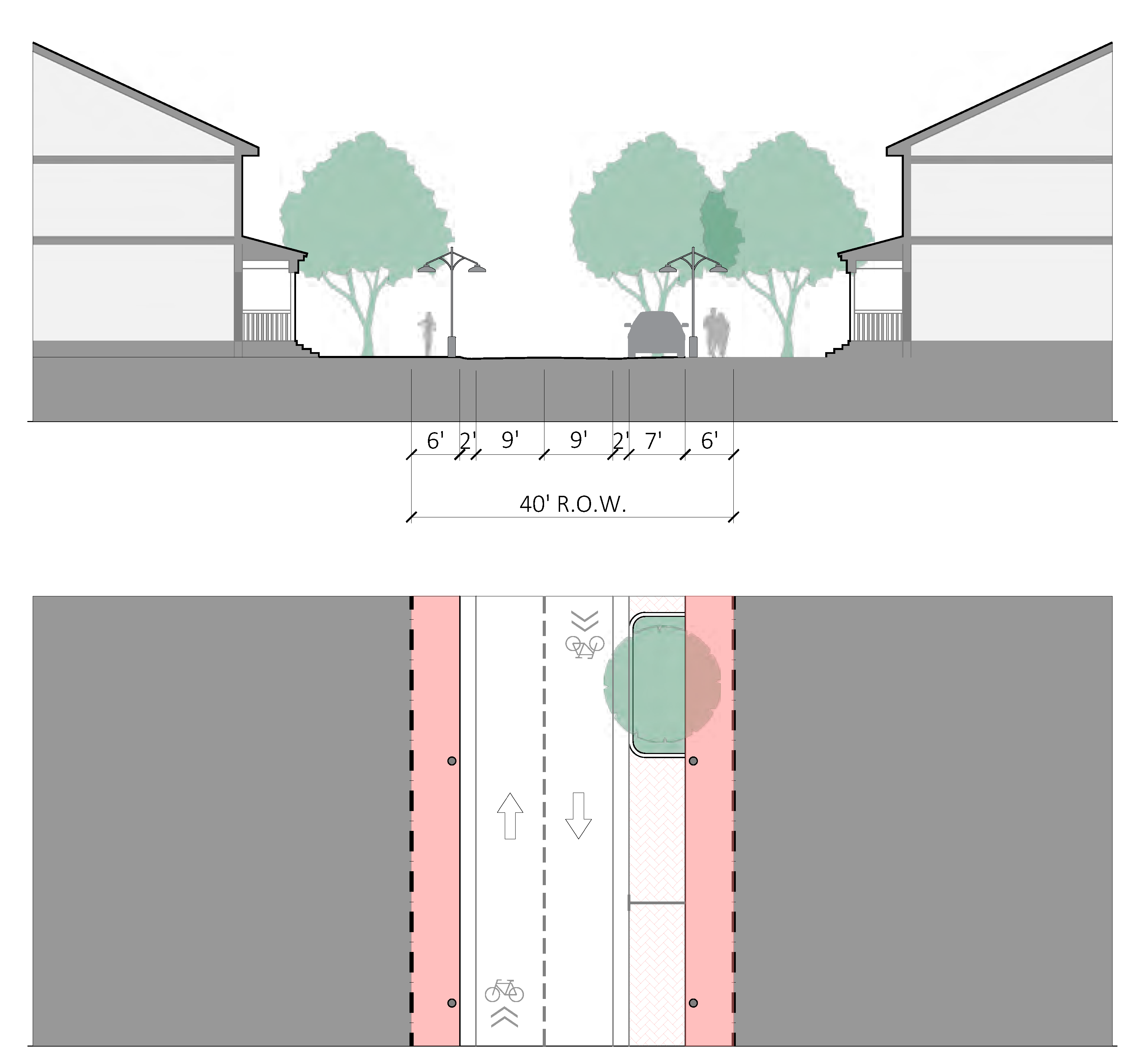
FIGURE ESN-38 - NEIGHBORHOOD STREET AT PUBLIC PARK
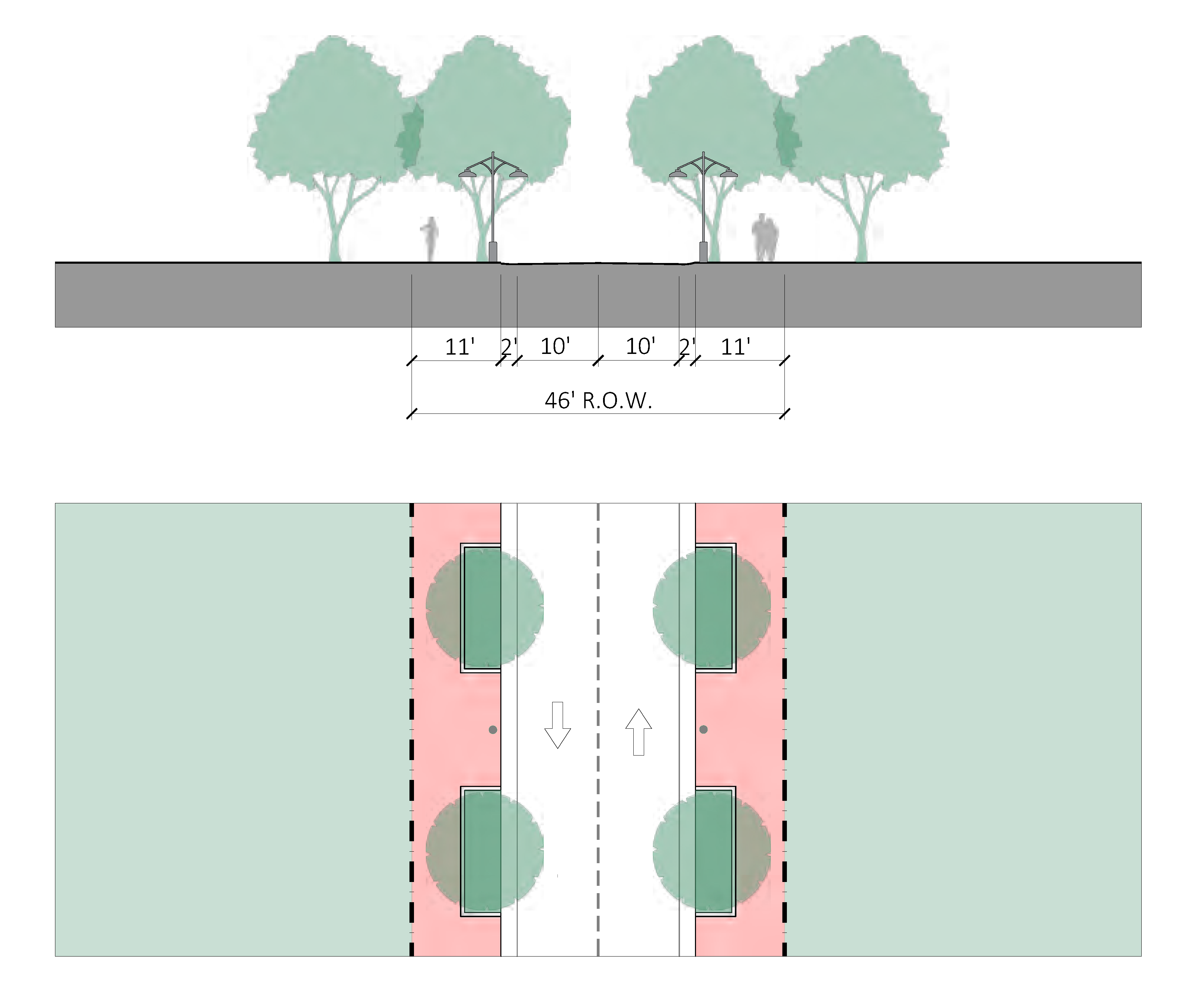
FIGURE ESN-39 - NEIGHBORHOOD STREET AT PUBLIC USE
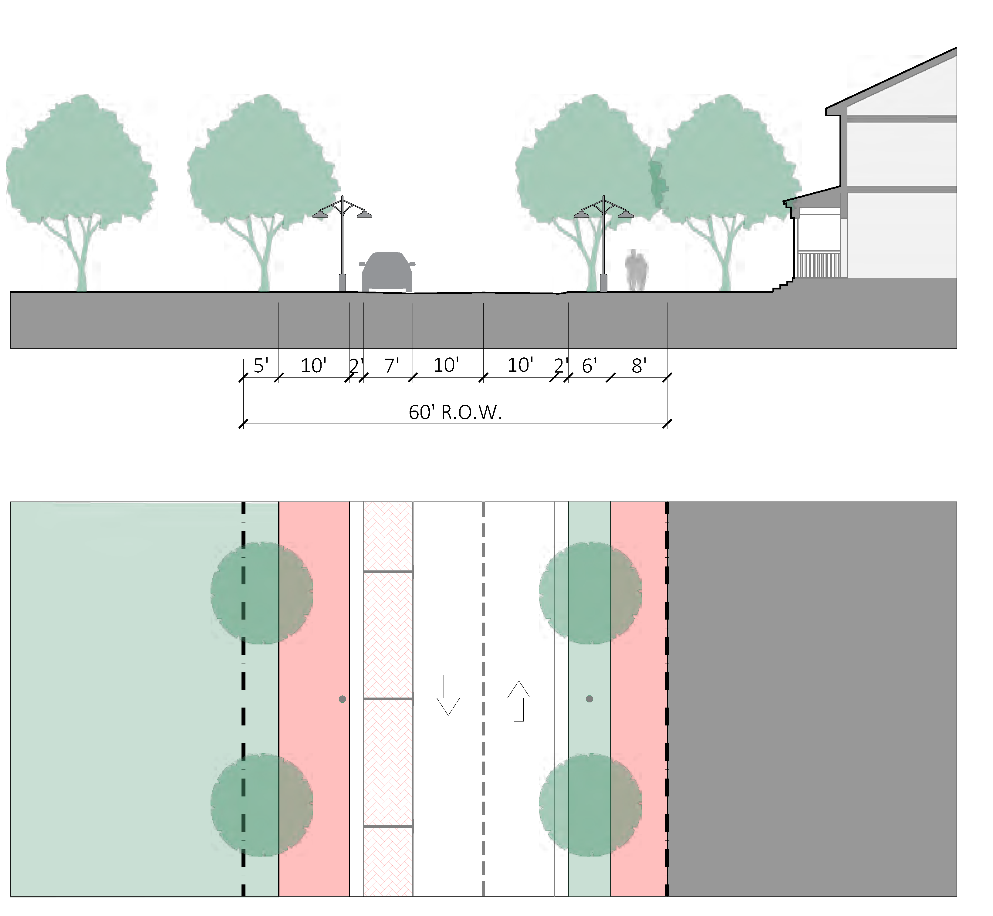
FIGURE ESN-40 - SHARED USE PATH
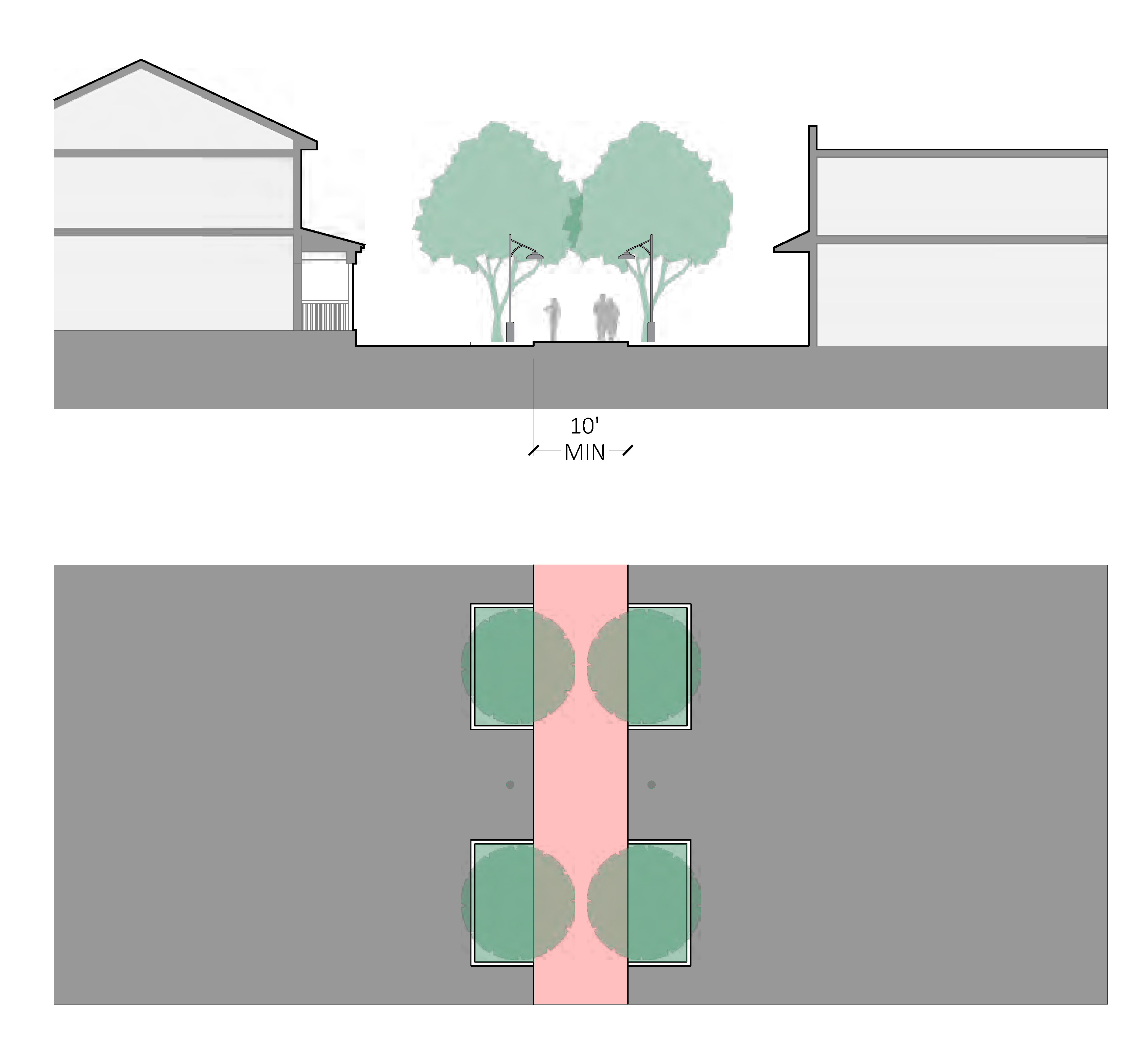
FIGURE ESN-41 - SHARED-USE BRIDGE
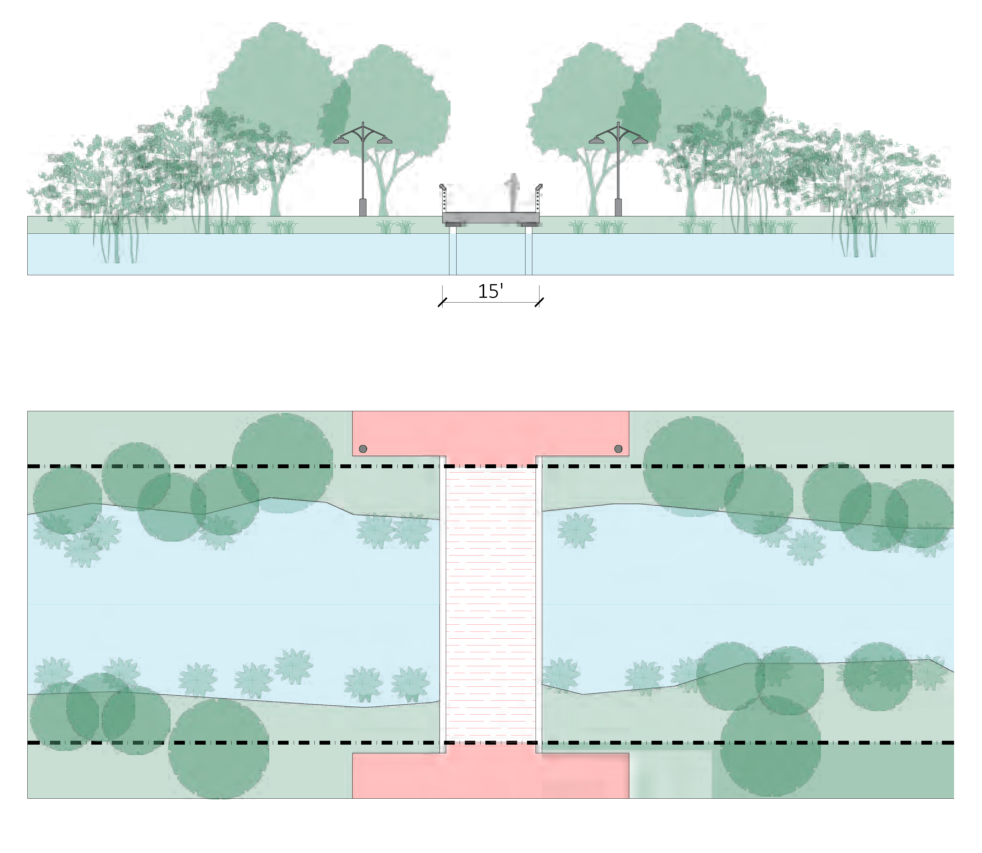
Sec. 3.02.07. - Access and parking standards.
A.
Applicability. Section 6.01.00 shall apply except where modified in Figure ESN-31, Thoroughfare, access and parking standards.
B.
Pedestrian access. The owner shall be responsible for the installation of a continuous sidewalk along the entire length of the parcel frontage(s) that abuts a public street.
1.
Minimum width. All sidewalks within the East Stuart Neighborhood shall be not less than six feet minimum on a right-of-way of 50 feet or less. All others shall be eight feet minimum. See section 3.02.06, Thoroughfare standards.
2.
All development shall include direct pedestrian access from development to existing and future sidewalks within the public right-of-way. Pedestrian access shall be separated from the vehicular travel path.
3.
Sidewalks shall be provided for internal circulation and linkage to other projects when such facilities are possible given the particular physical characteristics of the site, type of project, and adjacent land uses. Determination shall be made by the development director.
4.
Materials. Pedestrian access shall consist of concrete, brick or concrete pavers, asphalt, stamped pattern concrete systems, rock salt textured concrete with integral color, grass block, or other similar material approved by the development director which clearly distinguish them from vehicular use areas and promote traffic calming.
C.
Bicycle access and parking.
1.
Section 6.01.20, Bicycle parking, applies within East Stuart Neighborhood. A minimum five-foot pedestrian zone shall not be reduced by the placement of bicycle parking.
D.
Vehicle access and parking.
1.
The required minimum on-site parking is listed in Figure ESN-42, Minimum provided parking schedule.
FIGURE ESN-42 - MINIMUM PROVIDED PARKING SCHEDULE
2.
On-street parking. On-street parking, constructed to city code, within a public right-of-way along the parcel frontage can be counted towards on-site parking requirements. An approved revocable permit from the city commission is required for on-street parking constructed by the new development.
3.
Payment in lieu of parking (PILOP). Up to three required parking spaces may be accommodated via payments to the PILOP program as described in section 6.01.19.
4.
Parking alternatives. The following may be substituted for required on-site parking spaces. Alternative parking spaces shall count toward no more than 25 percent of the overall on-site parking requirement.
a.
Two motorcycle or scooter spaces shall count as one parking space.
b.
Two golf cart spaces shall count as one parking space.
5.
Historic preservation credit. Historic buildings as designated by the Stuart Historic Preservation Board and recorded and preserved in compliance with section 5.09.00 A, Historic preservation program, are exempt from new parking requirements due to a change of use when existing on-site parking remains. If existing on-site parking is removed, up to 50 percent of the required parking for any use may be accommodated via payments to the PILOP as described in section 6.01.19.
6.
Reserved.
7.
Parking placement. See Figure ESN-43, Parking placement.
a.
All parking areas shall be located as shown in Figure ESN-44, Parking placement diagram, behind the rear facade of the principal building and screened from public rights-of-way by a street-wall, other screening approved by the development director, or landscape buffer as described in section 3.02.09, Landscaping and site design standards, of this Code.
b.
Boats, campers, and recreational trailers may only be parked in rear yard and side yard setbacks.
FIGURE ESN-43 - PARKING PLACEMENT
(Ord. No. 2539-2025, § 2, 4-16-25)
FIGURE ESN-44 - PARKING PLACEMENT DIAGRAM
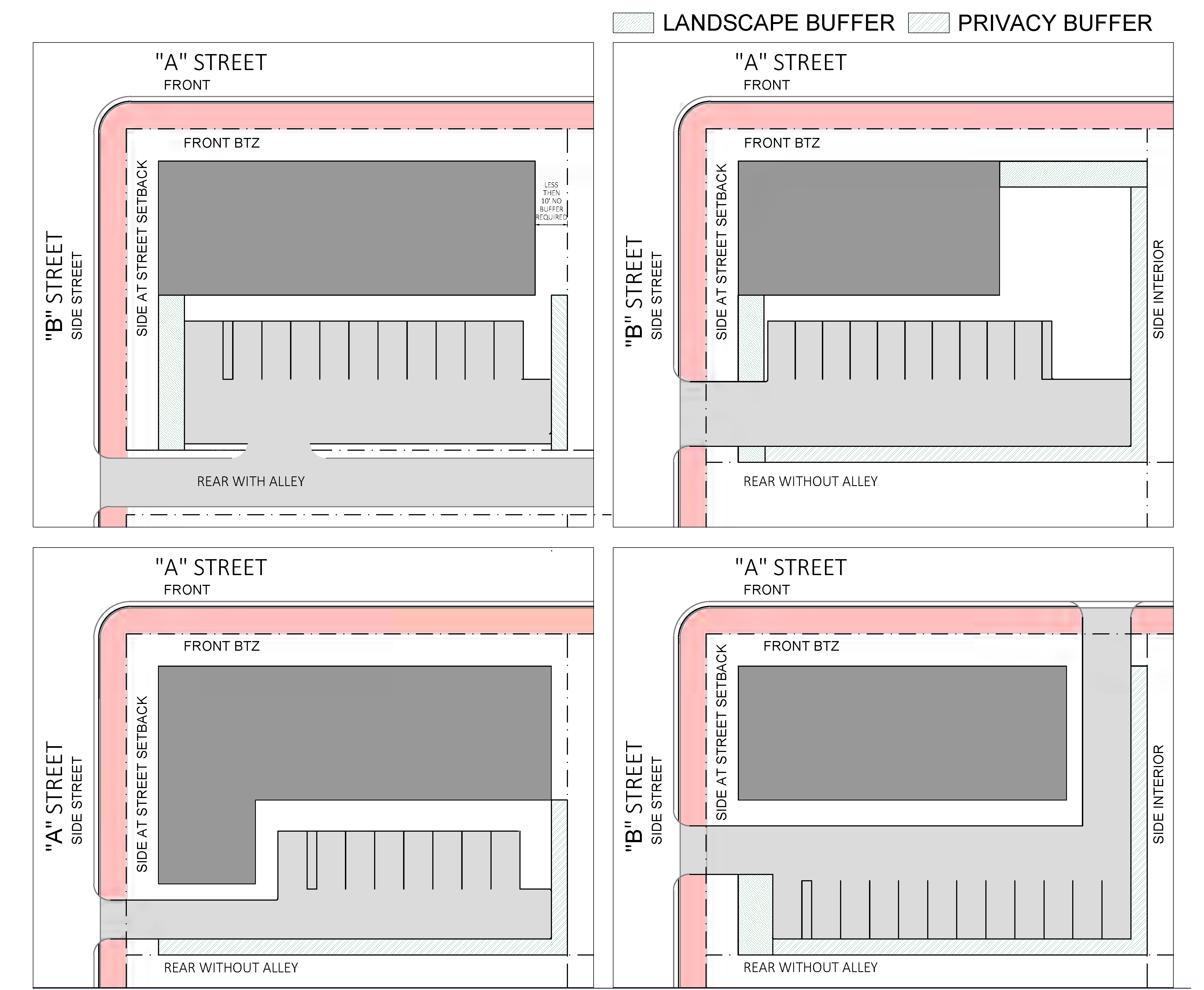
8.
Parking design standards.
a.
See Figure ESN-45, Parking lot design dimensions.
b.
Where an improved alley is located along the side or rear property lines, improved alleyway may be used as part of the required back-up/drive aisle dimension for parking spaces.
c.
Materials.
i.
Vehicular access shall consist of concrete, brick or concrete pavers, asphalt, stamped pattern concrete systems, rock salt textured concrete with integral color, grass block, or other similar material approved by the development director.
ii.
For developments requiring ten or fewer parking spaces, parking areas may be constructed with shell-rock, gravel, turf blocks, paver blocks, or other alternative materials approved by the development director. Additional maintenance requirements may be required of a developer utilizing alternative materials such as daily sweeping of shell-rock or gravel.
FIGURE ESN-45 - PARKING LOT DESIGN DIMENSIONS
9.
Garages, structured parking and parking located within a building envelope.
a.
Garages shall not be the principal element of the front facade.
b.
Structured parking. Structured parking may be permitted through a conditional use approval, and shall:
i.
Be screened by a liner building with active commercial or residential use provided for a depth of no less than 20 feet measured from the building facade.
ii.
Provide shade on at least 30 percent of any exposed parking on the roof with an aged solar reflectance index (SRI) of at least 32, be a vegetated roof, or be covered by energy generation systems.
c.
For detached single-family dwelling unit and duplexes the following shall apply:
i.
Attached garages shall be set back from the front facade as described in Figure ESN-46, Front loaded attached garage, or configured with a side entry, shown in Figure ESN-47, Front loaded-side entry attached garage.
ii.
Detached garages are permitted provided they comply with the outbuilding building type and building coverage requirements.
iii.
Carports and porte cocheres shall be regulated the same as attached garages.
FIGURE ESN-46 - FRONT LOADED ATTACHED GARAGE
| Description | |||
| Setting the garage back from the primary facade emphasizes the building entrance and living spaces. | |||
| Dimensions | |||
| Garage Door | 40% max. of front elevation, and 2 car garage max. | Ⓐ | 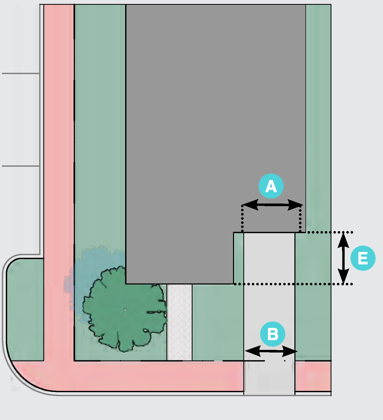 |
| Width of Driveway | 20' max. total width at property line | Ⓑ | |
| or 20' max. total width (C+D) at property line | Ⓒ | ||
| Ⓓ | |||
| Setback from Front Facade |
5' min. for a 1 car garage (garage door less then 16')
10' min. for 2 or more car garage (garage door greater than 16') | Ⓔ | |
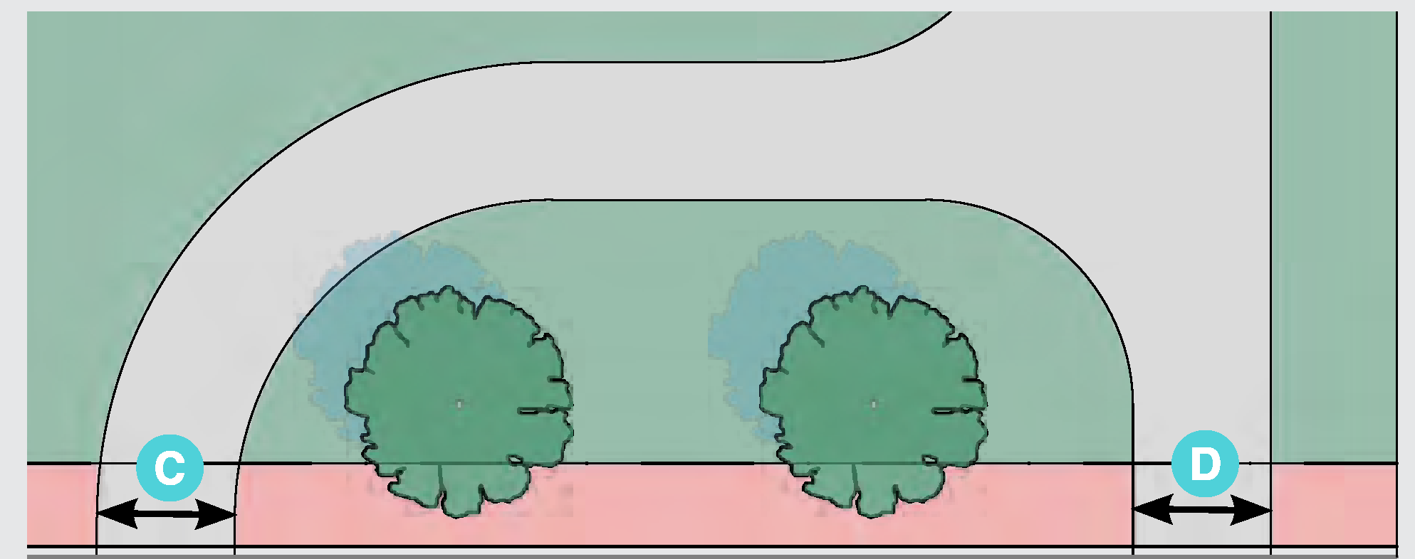 | |||
FIGURE ESN-47 - FRONT LOADED-SIDE ENTRY ATTACHED GARAGE
| Description | |||
| Side entry garage continues the character of the home and diminishes the appearance of non-livable space to the street. | |||
| Dimensions | |||
| Garage | 2 car garage max. (garage door greater than 16') | Ⓐ | 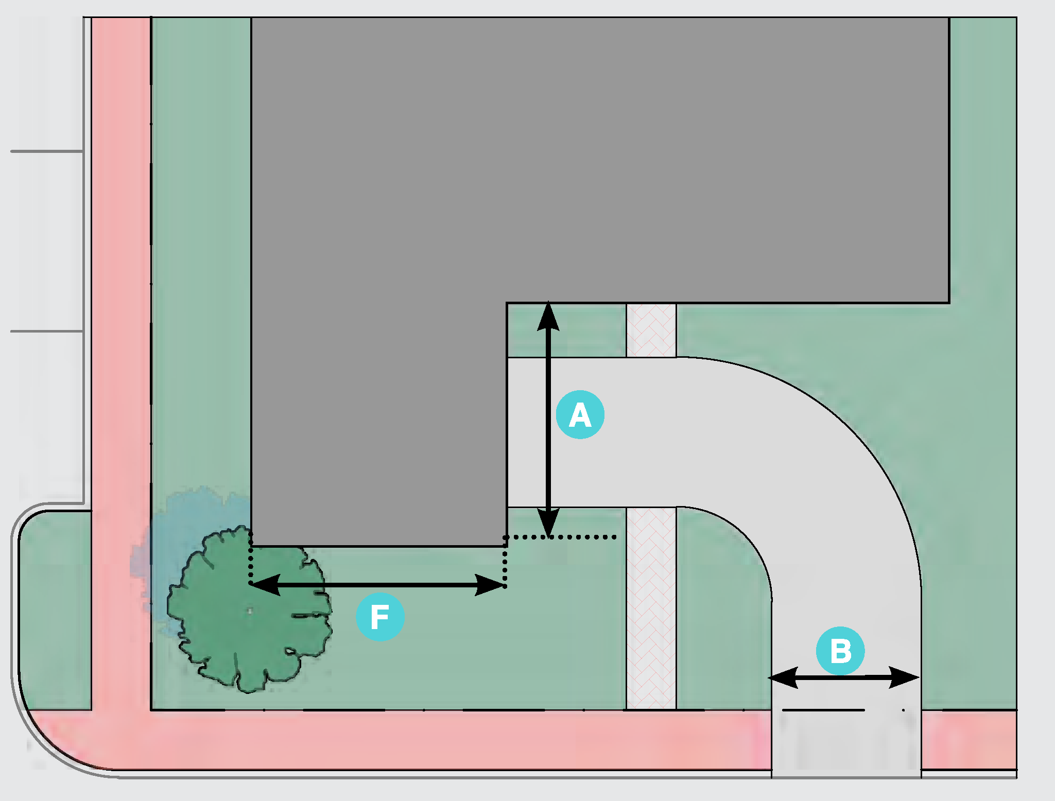 |
| Width of Driveway | 20 feet max. | Ⓑ | |
| Garage Facade Width | 40% max. of front elevation; must be in character of main house and have operable windows. | Ⓕ | |
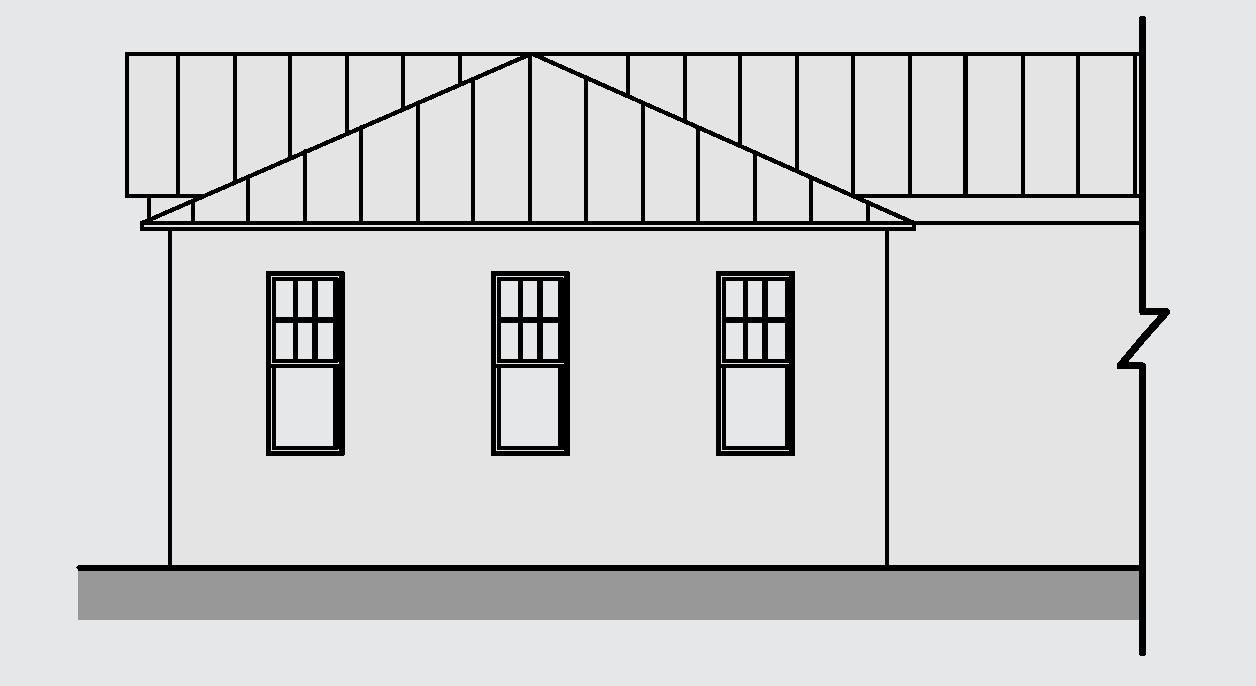 | |||
E.
Heat island effect. In order to reduce urban heat islands the following recommendations are provided for site design:
1.
Provide shade on at least 30 percent of non roof impervious surface on the site, including parking lots, walkways, plazas, etc.
2.
Use light-colored/high-albedo materials (reflectance of at least .3) for 30 percent of the site's non-roofed impervious surfaces
(Ord. No. 2507-2023, § 1(Exh. A), 2-13-23)
Sec. 3.02.08. - Stormwater standards.
Sec. 3.02.09. - Landscape and site standards.
A.
Figure ESN-48 identifies which of the landscaping, buffering, tree protection standards in section 6.04.00 apply in the East Stuart Neighborhood and which standards are modified, replaced, or do not apply.
FIGURE ESN-48 - LANDSCAPE AND SITE STANDARDS
B.
Landscape design. For all development a landscape plan shall be submitted and approved as part of the development approval process and prior to the issuance of a development permit. Landscape plans for a major development shall be prepared by a registered landscape architect. All landscape plans must show the location of existing or proposed utility lines that could be impacted by the vegetation being planted.
1.
Required landscape area and tree planting. Figure ESN-49, Required landscape area and tree planting, indicates the minimum number of trees and landscape area that must be planted.
FIGURE ESN-49 - REQUIRED LANDSCAPE AREA AND TREE PLANTING
(Ord. No. 2539-2025, § 2, 4-16-25)
2.
The landscaped areas shall be located on the site as to maximize preservation of existing trees with priority given to specimen and/or historic trees as described in chapter V, Resource protection related development standards. The development director may grant a reduction in required trees to be planted for existing trees to remain.
3.
All required shade trees, as defined by chapter VI shall be 14 feet in height at installation, and have a DBH of not less than two and one-half inches.
4.
Where the location of required landscaping is precluded by existing buildings or permanent site improvements, the placement of landscaping may occur off-site in right-of-way or other nearby public space, in openings within paved areas, or in other locations as determined by the development director.
5.
Yards shall be sodded or otherwise landscaped in accordance with section 3.02.09.
6.
Impervious surfaces shall not be placed within five feet of the base of an existing tree to be preserved.
7.
Mulch shall be designed and installed in all planting areas to a depth of three inches. The type of mulch shall be Florida Friendly mulch and be specified on the landscape plan.
8.
Visibility triangles. All landscaping within a visibility triangle shall provide unobstructed cross-visibility at a level between three feet and six feet and shall comply with section 3.02.06 F.
C.
Landscape and privacy buffers. See Figure ESN-50, Minimum buffer types, for descriptions of required buffers.
FIGURE ESN-50 - MINIMUM BUFFER TYPES
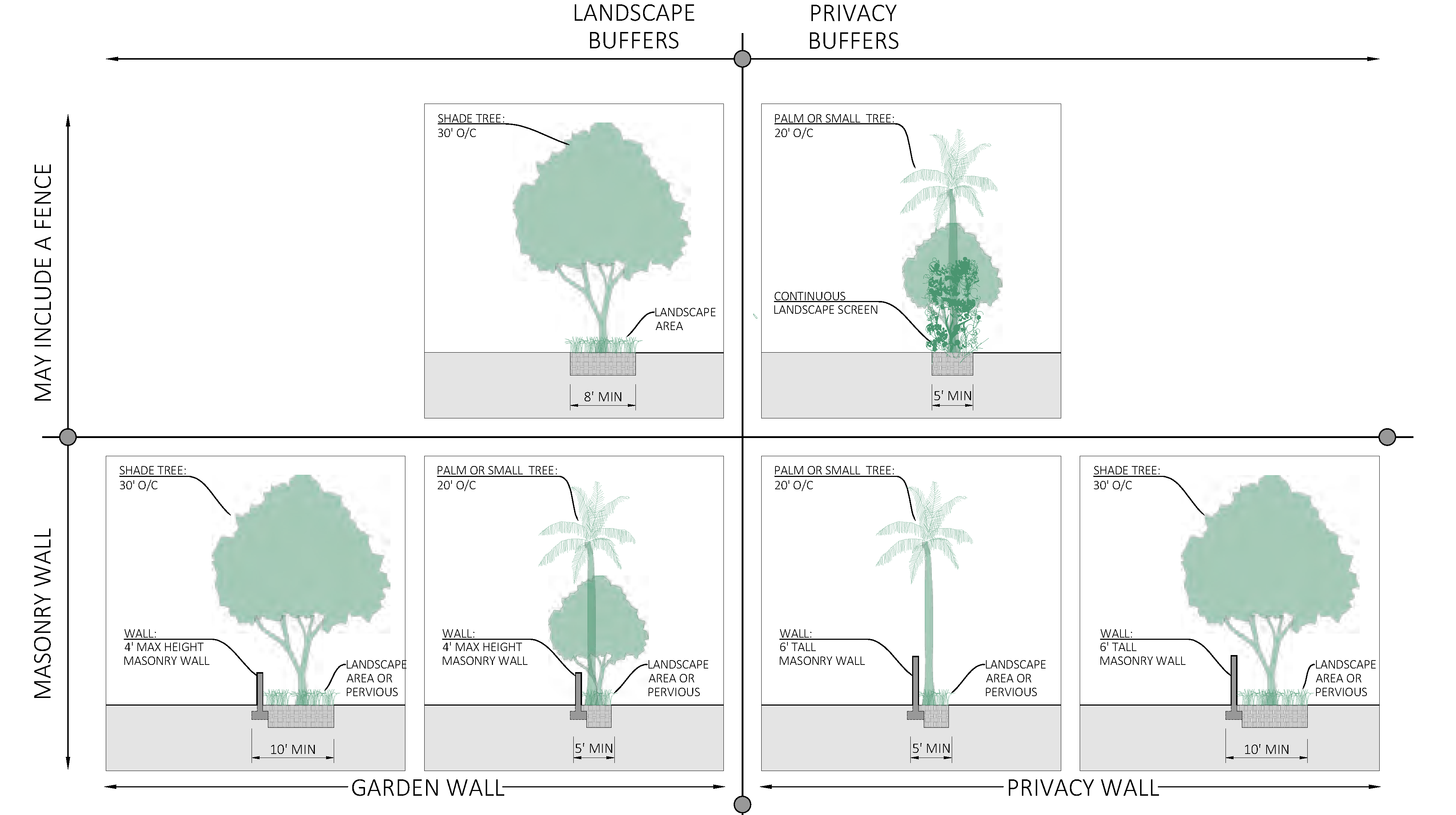
D.
Parking lot standards.
1.
Parking lot perimeter landscaping. A parking lot not entirely screened visually by an intervening building from abutting rights-of-way or private property, and with six or more parking spaces shall include landscape and privacy buffers. See Figure ESN-43, Parking placement, and Figure ESN-44, Parking placement diagram, in section 3.02.07.
2.
Parking lot interior landscaping.
a.
Interior landscaping shall include not less than one shade tree for every 500 square feet or fraction thereof of interior landscaped area.
b.
Any hedge materials located within an interior landscaped island shall be maintained at a height of not more than two feet.
c.
Not less than 80 percent of trees used in parking area interior landscaping shall be shade trees.
d.
Interior landscaped islands shall be provided between every ten parking spaces. Each interior island shall be not less than six feet in width. Each interior island shall contain not less than one shade tree and a combination of shrubs, ground cover, grass, and mulch.
e.
Terminal landscaped islands shall be provided at the end of each parking row. Terminal landscaped islands shall not be less than eight feet in width and the length of the parking space. Each terminal island shall contain not less than one shade tree and a combination of shrubs, ground cover, grass and mulch.
f.
Interior landscaped medians shall be provided between every interior row of parking spaces and not less than six feet in width. Interior medians shall be landscaped with not less than one shade tree every 30 linear feet and a combination of shrubs, ground cover, grass and mulch.
g.
Parking lot interior landscaping shall utilize low-impact development strategies.
i.
If curbs are to be used, their number, placement and design should be carefully considered to allow percolation of stormwater. An opening shall be no less than 18 inches wide is to reduce the potential for clogging.
ii.
A minimum two-inch drop is required between the pavement and the vegetated area. A gravel area may be required to dissipate energy and prevent erosion at entry points to rain gardens or parking lot islands.
iii.
The street profile shall match the intended drainage; i.e., a crowned street will drain to both sides, or a side shed profile will drain to only one side.
3.
Excess parking lot spaces. Where the number of parking spaces installed in a surface lot exceeds the minimum number of on-site parking spaces required by this Code:
a.
Landscape buffers shall not be less than eight feet and shall include shade trees.
b.
For every additional five spaces, one shade tree shall be provided on site.
c.
All excess parking spaces shall be made of pervious hardscape such as pavement, concrete and/or pavers.
E.
Lighting. All development shall be designed to provide safe, convenient and efficient lighting for pedestrians and vehicles. Lighting shall be designed in a consistent and coordinated manner for the entire site. Light fixtures shall be designed as an integral design element that complements the design of the project through style, material or color.
1.
The use of exposed neon or LED rope lighting on any property is prohibited.
2.
Fixture height. Except for in the public zoning district, lighting fixtures shall be a maximum of 15 feet in height.
3.
Light pollution and spillage. Lighting shall be designed so as to prevent direct glare, light spillage and hazardous interference with automotive and pedestrian traffic on adjacent streets and all adjacent properties. Lighting shall be designed and installed so the light source does not shine directly onto adjacent residential uses or a residential zoning district.
a.
The applicant is encouraged to minimize light spillage from building and site and to reduce urban-glow. Dark sky approved lighting is encouraged.
b.
For perimeter exterior lighting, only full cutoff luminaries shall be approved.
c.
For institutional, commercial and major development projects the maximum allowable illumination at the property line of any adjoining parcel or public right-of-way is 0.2 horizontal and vertical foot-candles measured at six feet above grade level.
F.
Solid waste and recycling.
1.
Solid waste and recycling generation rates. Generation rates in section 6.08.01 are weekly and apply except where modified below in Figure ESN-51, Solid waste and recycling weekly generation rates. Generation rates shall be calculated or reassessed with new development, substantial renovation, substantial improvement, or change of use.
FIGURE - ESN-51 SOLID WASTE AND RECYCLING WEEKLY GENERATION RATES
2.
Location of solid waste and recycling storage and/or enclosures. All new development, substantial renovation, or change of use must provide sufficient on-site space and maintenance for the placement and collection of solid waste and recycling storage and/or enclosures. Excluding improved alleys, all solid waste and recycling storage shall be screened from view from public rights-of-way.
a.
Screening may be achieved by with a buffer as described in Figure ESN-50, Minimum buffer types, a freestanding enclosure, or an enclosure within the building footprint. Where more than six roll-out carts are required an enclosure shall be provided.
b.
The location of solid waste & recycling storage and/or enclosures:
i.
Shall be accessed from the alley if an improved alley is present.
ii.
Prohibited on Neighborhood Main Street as shown in Figure ESN-07, Thoroughfare plan.
iii.
Where an alley is not present, solid waste & recycling storage and/or enclosures shall be located to prevent conflict with pedestrians, minimize the quantity and length of curb cuts, and promote a high quality, livable public realm.
c.
The utilities and engineering director encourages businesses under the same ownership or within the same block to share enclosures to meet required enclosure standards.
d.
Design of freestanding solid waste & recycling storage enclosures shall have:
i.
A six-feet tall finished concrete wall on three sides. Use of chain link or wooden fencing to meet this requirement is prohibited.
ii.
Closable, lockable opaque gates. Gates may be opaque inserts within a chain link gate.
iii.
Landscaping around the enclosure is not required.
iv.
Bollards are required to be located at the rear of enclosure only.
v.
Enclosure size shall be a minimum ten feet by ten feet (interior dimensions). Larger enclosures shall be provided as necessary to house larger proposed or required containers.
(Ord. No. 2507-2023, § 1(Exh. A), 2-13-23)
Sec. 3.02.10. - Fence and wall standards.
A.
Fence and wall principles. All development including public improvements shall incorporate the following fence and wall principles:
1.
Fences or walls shall be in harmony and compatible with their surroundings.
2.
All fences and walls shall be maintained in good repair on both sides, so as to be structurally sound.
3.
No fences, walls, or hedges may be located within the intersection sight-triangle as set forth. See section 3.02.06 F, Visibility triangles.
4.
Obstruction of water drainage. In no case shall a fence or wall restrict the natural sheet flow of water or impede movement of drainage water from swales, drainage ditches, etc.
B.
Construction fences. All development projects greater than a half acre shall install with a temporary six-foot chain link fence with obscure green or black fabric of uniform color or other visual barrier material approved by the development director around the site prior to the initiation of the construction phase.
C.
Materials.
1.
Fences and walls shall be constructed with one or more of the materials listed in Figure ESN-52, Fence and wall materials.
FIGURE ESN-52 - FENCE AND WALL MATERIALS
(Ord. No. 2539-2025, § 2, 4-16-25)
2.
Metal fences shall be of non-corrodible metal or galvanized wire fabric, having a minimum of 11 gauge. Chain link fences shall be vinyl coated. Colors of the vinyl material shall be limited to green or black.
3.
Fences and walls shall be finished on the exterior side where all framing is facing the interior.
4.
Dangerous materials prohibited.
a.
No fence, wall, or other enclosures shall include materials or devices, such as broken glass, spikes, razors, nails or similar materials intended or designed to maim, mutilate or cause other bodily injury to any person or animal.
b.
Electrically charged fences are prohibited.
c.
Barbed wire fences are hereby prohibited, unless approved as necessary to protect the public from hazardous conditions.
D.
Height.
1.
Fences located in the front yard shall have a maximum height of four feet along the front and side property lines to the front facade of the principal building. Along the side property lines behind the front facade and along the rear property line a fence may be no more than 6 feet in height. See Figure ESN-53, Wall and fence locations, for an illustration of front, rear, and side yards.
2.
The height of fences and walls shall be measured from existing natural elevation of a parcel, prior to any construction or alteration.
(Ord. No. 2539-2025, § 2, 4-16-25)
3.
An entryway bower, arbor, or trellis, constructed in conjunction with a fence or wall, shall not exceed a maximum height of nine feet, measured from existing grade.
FIGURE ESN-53 - WALL AND FENCE LOCATIONS
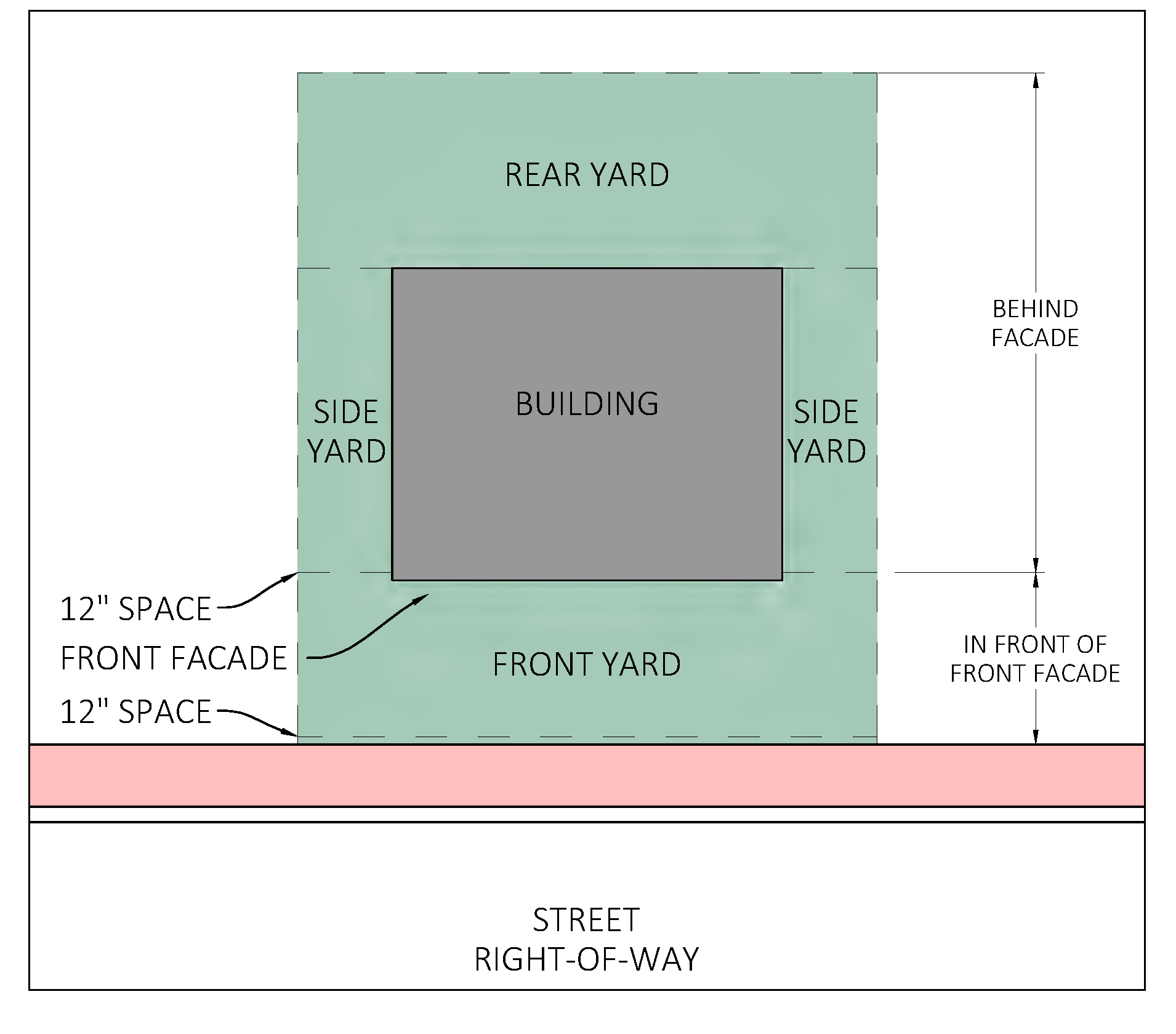
(Ord. No. 2507-2023, § 1(Exh. A), 2-13-23)
Sec. 3.02.11. - Sign standards.
A.
Figure ESN-54, Sign standards, identifies which of the sign standards in section 6.11.00 apply in The East Stuart Neighborhood and which standards are modified, replaced, or do not apply. Permanent signs are only permitted in the BMU Zoning District. For GRO and SFD refer to section 3.02.03 B, Standards for specific uses, for exceptions.
FIGURE ESN-54 - SIGN STANDARDS
B.
Illumination. In addition to section 6.11.07 applies except where modified in Figure ESN-55, Sign lighting standards.
FIGURE ESN-55 - SIGN LIGHTING STANDARDS
| PERMITTED | PERMITTED
| PROHIBITED | ||
|---|---|---|---|---|
POWER SOURCE
AND ILLUMINATION |
Sign lighting should be
integrated into the architectural features of the building. Power sources, raceways and conduits shall not be visible. |  |  |  |
| Gooseneck lighting |
Front-lit LED channel
letters with translucent acrylic faces, or Reverse channel LED halo-lit letters |
Face illuminated channel
letters mounted on exposed raceway. Fluorescent lighting, exposed neon, LED rope or similar perimeter lighting, electronic changeable copy sign |
C.
Prohibited signs.Section 6.11.16 applies except where modified in Figure ESN-56, Types of signs prohibited.
FIGURE ESN-56 - TYPES OF SIGNS PROHIBITED
| PROHIBITED | |||
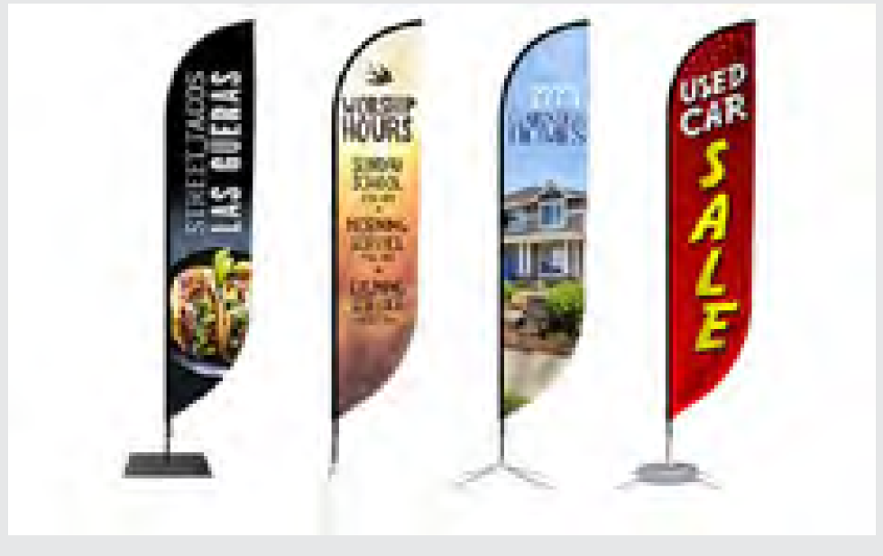 |  |  | 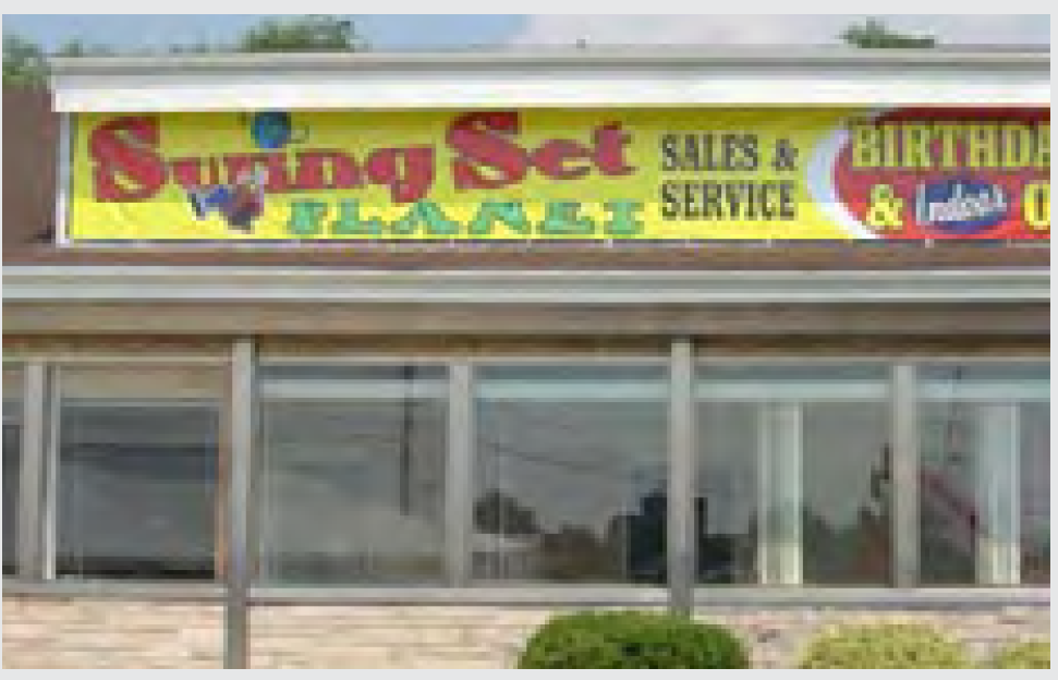 |
| Adverting flags including feather flags and tear drop flags | Murals which are advertising or painted wall signage which exceed permitted dimensions | Face illuminated cabinet sign, back-lit sign panels |
Vinyl banners hung from
awnings, roof fascia or arcade |
 | 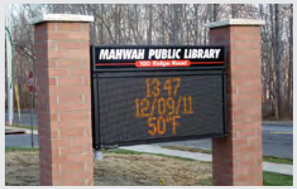 |  | |
| Billboards, single pole and pylon signs | Electronic changeable copy signs |
Window signs exceeding 40% of glazing area. It can be
perceived as visual clutter. | |
| PROHIBITED SIGNAGE ILLUSTRATED | |||
|
Activity inside is obscured by banners and window coverings. The materials such as
plastic face-lit cabinets and banners are not durable and long lasting. The pole sign
is too high,
contributes to signage clutter, and does not address the pedestrian. | 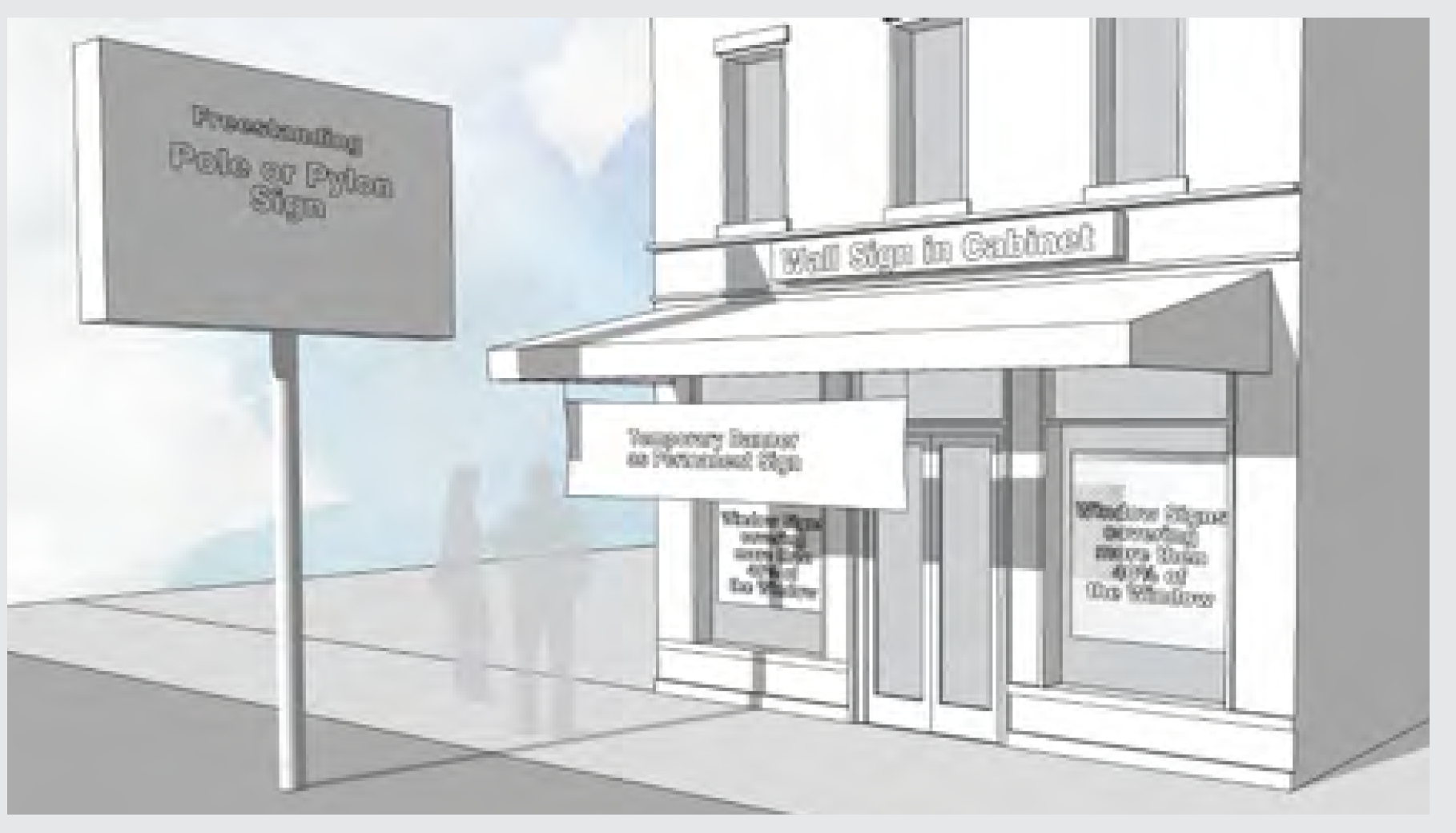 | ||
(Ord. No. 2507-2023, § 1(Exh. A), 2-13-23)
Sec. 3.02.12. - Architectural standards.
A.
Historic preservation. Structures or sites identified as historically and architecturally contributing shall be candidates for historic protection as set forth in section 5.09.00.
B.
Building additions. The exterior appearance of additions to an existing building should be compatible with the existing building. For example, exterior walls should be of the same or compatible materials and finished in the same manner as the existing structure. Windows should also be of the same type or be complementary with the existing windows.
C.
Architectural character. New development, substantial renovations and major facade improvements within the East Stuart Neighborhood Code shall be harmonious with the community's traditional architecture, including, but not limited to, early Florida vernacular cottages, Bahamian cottage, railroad homes, conch house, Mediterranean revival, mission revival, bungalow, classic revival—folk Victorian, ranch or other architectural types common to Stuart. The development director shall determine compliance in this regard.
1.
Roofs and gutters.
a.
For buildings which are located not more than five feet from the front property line, gutters must be shielded and shall not drain onto hardscape. Downspouts may be enclosed within a column or other architectural feature. Rain-barrels, cisterns, and other low impact development strategies are encouraged.
b.
Heat island effect. In order to reduce urban heat islands Use Energy Star roof-compliant, high-reflectance and high emissivity roofing or install a "green" (vegetated) roof for at least 50 percent of the roof area.
2.
Building colors and finishes. Exterior building wall colors for all new development and substantial renovation within the East Stuart Neighborhood shall be neutral shades, white, or Bahamian pastel-color exteriors including, but not limited to, pinks, blues, yellows, and greens to reflect the historic neighborhood. The use of black or florescent colors is prohibited as exterior wall or accent colors. Building trim color shall complement the predominant exterior building color.
(Ord. No. 2507-2023, § 1(Exh. A), 2-13-23)
Sec. 3.03.01.- Generally.
A.
Intent. The S.E. Ocean Boulevard Overlay Zone Design Standards are designed to encourage redevelopment along S.E. Ocean Boulevard as described below by offering development incentives that are not otherwise available by this Code. These shall include the promotion of pedestrian friendly streets, the development of a coordinated and aesthetic streetscape, and the promotion of traditional building types with arcades, porches and balconies situated to screen the street from parking lots. The S.E. Ocean Boulevard Overlay Zone Design Standards do not change the future land use designation or zoning in effect on any property.
B.
Applicability. The provisions of the S.E. Ocean Boulevard design standards shall apply to development with the designated sections defined above. Except as amended by these standards, the applicable development standards otherwise set forth in this Code shall remain in full force and effect.
The development standards set forth below which relate to building placement and parking shall apply to new development and to substantial renovation.
The development standards set forth below which relate to landscaping, signage, lot coverage and exterior building wall colors shall apply to new development, renovation development and vacant development as defined in section 6.04.00, Landscaping, of this Code.
The development standards set forth below which relate to architectural requirements shall apply to new development, substantial renovation, and to renovation which affects more than 50 percent of the facade of a building and to building exterior refinishing.
Sec. 3.03.02. - Development standards.
A.
Professional office section.
1.
Building placement.
a.
The front building facade shall be constructed adjacent to the street along the S.E. Ocean Boulevard property line with a setback of not less than ten feet and not more than 15 feet. This requirement shall not apply to a property that abuts a residential use or a residential zoning district. In cases of conflict with the Americans with Disabilities Act, a greater conflict may be permitted.
b.
The side setbacks may be a minimum of five feet on both sides.
c.
If the property is abutting a right-of-way or a non-residential use or district, the rear setback may be zero feet. Otherwise, the rear setback shall be 20 feet.
d.
The width of the principal building shall be not less than 50 percent of the parcel width.
2.
Parking.
a.
All parking areas shall be located either behind the rear building facade or at the side property lines. This requirement shall not apply to a property that abuts a residential use or a residential zoning district. The parking areas shall be screened by a landscape buffer as described in section 6.04.00, Landscaping, of this Code.
b.
A continuous concrete sidewalk shall be installed at locations where driveways intersect sidewalks.
c.
A pedestrian connection consisting of decorative paving materials shall be installed to connect the S.E. Ocean Boulevard entrance of the principal building with the sidewalk along S.E. Ocean Boulevard.
d.
For corner parcels with access from side streets other than S.E. Ocean Boulevard, no new curb cuts shall be permitted along S.E. Ocean Boulevard. All parking egress shall be required from the side street.
3.
Architectural requirements.
a.
Architectural features consisting of arcades, balconies or porches are required along the S.E. Ocean Boulevard street facade.
b.
Roofs and gutters shall comply with section 3.01.04 B., Architectural standards and regulations of the Urban Code.
c.
Building walls shall comply with section 3.01.04 A., Architectural standards and regulations of the Urban Code. Simulated materials may be permitted provided the manufacturer's specifications indicate a ten-year successful application in a similar climate.
d.
All exterior building wall colors shall comply with section 3.01.04 G., Architectural standards and regulations of the Urban Code.
e.
All utility devices and trash receptacles must be visually screened from public right-of-way.
4.
Landscaping.
a.
The strip of land between the front building facade and the front property line shall be landscaped with a combination of trees, hedges, shrubs, vines, grass and ground cover as described in section 6.04.07, Landscaping, of this Code.
b.
Tree materials planted along all street facades shall consist of the following tree types as identified in section 6.04.02, Landscaping: 50 percent flowering trees and 50 percent palms.
5.
Signage.
a.
Only signs as provided in chapter VI of this Code shall be permitted.
6.
Parcel coverage.
a.
Not more than 50 percent of a building site may be covered by impervious surface coverage.
B.
Commercial and multi-family section.
1.
Building placement.
a.
The front building facade shall be constructed adjacent to the street along the S.E. Ocean Boulevard property line with a setback of not less than ten feet. In cases of conflict with the Americans with Disabilities Act, a greater conflict may be permitted.
b.
The side setbacks may be a minimum of five feet on both sides.
c.
If the property is abutting a right-of-way or a non-residential use or district, the rear setback may be zero feet. Otherwise, the rear setback shall be 20 feet.
d.
The width of the principal building shall be not less than 50 percent of the parcel width.
2.
Parking.
a.
The lesser of 25 percent of parking area or one row of parking area may be located between the front building facade and the front property line. All other parking shall be located behind the rear building facade or at the side property lines. This requirement shall not apply to a property that abuts a residential use or a residential zoning district. The parking areas shall be screened by a landscape buffer as described in section 6.04.06, Landscaping, of this Code.
b.
A continuous concrete sidewalk shall be installed at locations where driveways intersect sidewalks.
c.
A pedestrian connection consisting of decorative paving materials shall be installed to connect the S.E. Ocean Boulevard entrance of the principal building with the sidewalk along S.E. Ocean Boulevard.
d.
For corner parcels with access from side streets other than S.E. Ocean Boulevard, no new curb cuts shall be permitted along S.E. Ocean Boulevard. All parking egress shall be required from the side street.
3.
Architectural requirements.
a.
Roofs and gutters shall comply with section 3.01.04 B., Architectural standards and regulations of the Urban Code.
b.
Building walls shall comply with section 3.01.04 A., Architectural standards and regulations of the Urban Code. Simulated materials may be permitted provided the manufacturer's specifications indicate a ten-year successful application in a similar climate.
c.
All exterior building wall colors shall comply with section 3.01.04 G., Architectural standards and regulations of the Urban Code.
d.
All utility devices and trash receptacles must be visually screened from public right-of-way.
4.
Landscaping.
a.
As described in section 6.04.07, Landscaping, of this Code, tree materials planted along all street facades shall consist of the following:
i.
For buildings with front setbacks of ten to 15 feet: 50 percent flowering trees and 50 percent palms.
ii.
For buildings with front setbacks of 15 feet or greater: 25 percent flowering trees, 25 percent palms and 50 percent shade trees.
5.
Signage.
a.
Only signs as provided in chapter VIII of this Code shall be permitted.
6.
Parcel coverage.
a.
Not more than 65 percent of a building site may be covered by impervious surface coverage.
(Ord. No. 2539-2025, § 2, 4-16-25)
Sec. 3.03.03. - Exempt uses.
Except for the landscaping provisions herein, single-family and two-family residential structures shall be exempt from the provisions of the S.E. Ocean Boulevard Overlay Zone.
(Ord. No. 1719-00, 4-10-00)
Sec. 3.03.04. - S.E. Ocean Boulevard Overlay Zone conditional use.
The city commission may grant a S.E. Ocean Boulevard Overlay Zone code conditional use. The review of a S.E. Ocean Boulevard Overlay Zone code conditional use application shall follow the procedures set forth in section 11.01.11 relating to Major Conditional Use Approval review, including, but not limited to, required findings of fact, conditions, notice, public hearing, standards, burden of proof, revocation and expiration. Approval of a S.E. Ocean Boulevard Overlay Zone code conditional use shall only be granted if the applicant can demonstrate that the request is consistent with and will further the implementation of this Code and the city comprehensive plan, and will measurably improve the form, function and traditional neighborhood characteristics of the east ocean overlay district.
(Ord. No. 2009-04, § 1, 12-20-04; Ord. No. 2539-2025, § 2, 4-16-25)
Sec. 3.04.01.- Procedure and process.
A.
Intent. The purpose of The Creek District Code is to encourage infill redevelopment, historic preservation, and promote the rich arts and entertainment community with appropriate standards. These regulations reflect traditional building with arcades, balconies, porches, and the enabling of social interaction on downtown streets. This Creek District Code defines coherent streetscapes, the visual protection of the streetscape, and the historically relevant architectural heritage of downtown Stuart.
B.
Boundary. The boundaries of the neighborhood are set forth in section 3.04.02, Regulating plan.
C.
Applicability. The provisions of this Code shall only apply to development within The Creek District and only properties within The Creek District may utilize the Creek North (CN), Creek South (CS), and Creek Industrial (CI) designations.
1.
The standards and regulations set forth in section 3.04.00 shall apply to new development, amendments to planned unit developments, substantial improvement, and substantial renovation.
2.
An application which includes increased impervious area, new signage, or which would constitute a change of use shall include compliance with section 3.04.09, Landscape and site standards, section 3.04.10, Fence and wall standards, and section 3.04.11, Sign standards.
D.
Consistency with comprehensive plan. Zoning categories in The Creek District shall be interpreted as urban subdistricts. Applicable future land use designations are listed in Figure CD-01, Future land use and zoning consistency.
FIGURE CD-01 - FUTURE LAND USE AND ZONING CONSISTENCY
E.
Effective date. This Code shall be effective at adoption and as amended from time to time.
F.
Form-based code. The Creek District Code is a form-based code that fosters predictable built results and a high-quality public realm by using physical form rather than full separation of uses, as the code's primary organizing principle.
G.
How to use this Code. See Figure CD-02, How to use this Code.
FIGURE CD-02 - HOW TO USE THIS CODE
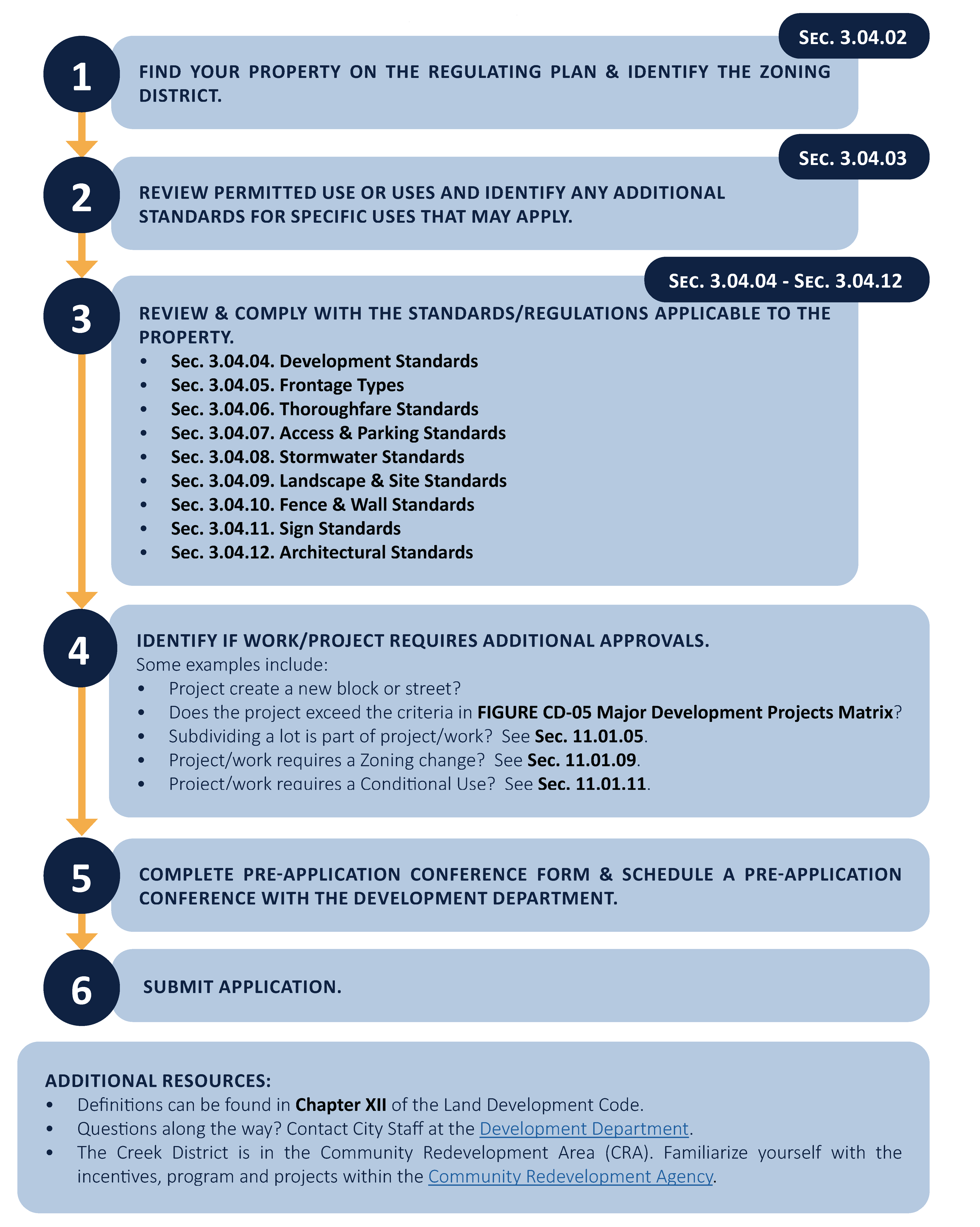
H.
Application permits. No building or other land development permit shall be issued by the development director unless all provisions of this Code have been met, including approved exceptions, based on the development review and approval process.
1.
Pre-application conference. Before beginning any new development, renovation, or demolition on private or public land, applicants are required to schedule a pre-application conference with the development department. A pre-application conference is not required for interior renovations, and may be administratively waved by the development director.
a.
Preliminary development review. After the pre-application conference, a preliminary design review may be requested by the development director to include a conceptual site plan, floor plans, and elevations.
b.
At a pre-application conference, the applicant and development department will discuss relevant procedures from chapter XI and required board presentation(s) as outlined in Figure CD-03, Required board presentations.
c.
The development director may request an applicant host a community workshop including any active neighborhood associations or business associations before submitting an application. A community workshop will be required of all major development projects. Applicant shall notify city staff in advance of the meeting and shall submit minutes and sign-in sheets from the community workshop as part of the application.
FIGURE CD-03 - REQUIRED BOARD PRESENTATIONS
2.
Application. After the pre-application conference and preliminary design review, an application for development shall be submitted to the development department in accordance with this Code. Except as modified herein, applications for development permits, excluding interior tenant finishes, within The Creek District shall meet the submittal requirements of plan document as defined in chapter XI. Completed applications shall include Figure CD-04, Application requirements.
FIGURE CD-04 - APPLICATION REQUIREMENTS
I.
Major development projects. Major development projects shall be subject to the major development plan approval process described in section 11.01.02. Major development projects shall be as defined in Figure CD-05, Major development projects matrix. In addition to the requirements of section 11.01.02, a presentation to the CRB shall be required.
FIGURE CD-05 - MAJOR DEVELOPMENT PROJECTS MATRIX
J.
Conditional use. The review of conditional use shall follow the procedures set forth in section 11.01.11 for a major conditional use and minor conditional use review. A conditional use shall be granted if the applicant can demonstrate that the request:
• Is consistent with this Code and the city's comprehensive plan;
• Will further the implementation of the CRA redevelopment plan;
• Will measurably improve the form and function of traditional neighborhood characteristics; and
• Has satisfied site qualitative design development standards set forth in section 6.00.04.
A minor conditional use or major conditional use shall be distinguished by the following:
1.
Minor conditional use. A minor conditional use process shall be required for: public art and public murals. A minor conditional use shall be granted by the community redevelopment board (CRB).
2.
Major conditional use. A major conditional use process shall be required where a conditional use is requested for: permitted uses, density, structured parking, and location of a formula business.
a.
Review. Unless a longer timetable is granted by city commission, a building permit shall be obtained no later than 12 months from the approval date of a major conditional use. A certificate of occupancy shall be obtained no later than 30 months from the issuance of a building permit.
b.
Design objectives. The city commission may impose development conditions and operational requirements in order to satisfy the design objectives. Design objectives may include:
i.
Additional building setbacks.
ii.
Pedestrian amenities. Pedestrian amenities in the form of benches, courtyards, shared use-paths, pedestrian lighting, or other acceptable forms of amenities located adjacent to a public sidewalk and/or right-of-way.
iii.
Green development. On-site renewable energy generation, indoor and outdoor water use reduction or green development as outlined in section 6.06.00.
iv.
Enhanced landscaping. Planting over and above code requirements with respect to size, quantity, and quality.
v.
Improvements to the surrounding neighborhood. The applicant proposes to make improvements such as: replacing existing sidewalks with integral color concrete or pavers in the surrounding neighborhood.
vi.
Require existing overhead utilities to be placed underground.
vii.
Neighborhood open space. Neighborhood open space as provided by as described in section 3.04.04 F.2.
viii.
Historic preservation. Preservation, relocation or a monetary contribution is made to the relocation of historic buildings fund for historic structures as defined within section 5.09.00.
(Ord. No. 2539-2025, § 2, 4-16-25)
K.
Planned unit development project. Applications or amendments to planned unit development projects shall outline any deviations from The Creek District Code. A planned unit development project shall only be granted if the applicant can demonstrate the same standards set forth for in conditional uses, section 3.04.1 J.
(Ord. No. 2498-2023, § 1(Exh. A), 2-13-23)
Sec. 3.04.02. - Regulating plan.
A.
Zoning districts in the Creek District. The following zoning districts regulate new development, thoroughfares and public spaces. The requirements vary according to the desired type and intensity of development. All zoning districts promote a compact walkable neighborhood with a variety of housing choices. Three zoning districts are described below:
1.
Creek North (CN) is a pedestrian-orientated center with dining, shopping, housing, and entertainment. Buildings are richly detailed, promote public art and public civic spaces. The Creek North was originally platted as Woodland Park. Therefore, it is home to historic structures and is characterized by smaller platted lots. A significant community playground is located to the north of the area.
2.
Creek South (CS) lies south of Frazier Creek and extends the pedestrian-oriented buildings and thoroughfares to US-1/Federal Highway at the southern edge. The Creek South affords opportunities for a variety of housing and business types on wide shaded sidewalks.
3.
Creek Industrial (CI) lies where the Hillcrest plat from 1913 was located. The area was historically platted as a segregated area for Black residents. Today the Creek Industrial is home to small scale industrial and maker spaces. The Creek Industrial allows for a broad range of uses including live-work units, restaurants, retail, and trade industries.
B.
Regulating plan. Figure CD-06, Regulating plan, and Figure CD-07, Thoroughfare plan, are the regulating plans that apply to the Creek District.
1.
"A" streets and "B" streets.
a.
"A" streets are intended to develop over time as pedestrian friendly environments and, as such, are held to higher standards regarding building placement, building frontage, and the location of parking and service uses.
b.
"B" streets while still an important piece of the pedestrian environment, "B" streets are not held to the same strict standards as the "A" streets.
2.
Required commercial frontage. A portion of the street network held to stricter standards regarding allowable frontage types and uses located at the sidewalk level. Areas where required commercial frontage applies are indicated on the regulating plan. Required commercial frontage shall be at the ground level, non-residential, and open to the public for business. Frontage types shall include a shopfront, arcade, forecourt, or a porch. Required commercial frontage shall be provided for a depth of no less than 20 feet measured from the front of the building. The required commercial frontage can also be met with neighborhood open space as defined in Figure CD-12, Neighborhood open space types.
3.
Recommended connections. Potential future street or alley connections are illustrated on the thoroughfare regulating plan. Future connections are desired new vehicular or pedestrian connections to existing streets or alleys that will improve the overall transportation network. Future connections are not precise alignments or specific locations. The final street designations, exact alignment, location, maintenance responsibility and dedication of these intended links of the transportation network will be determined during the development review and approval process.
4.
Improved alley candidates. An improved alley candidate is an existing alley right-of-way which has not yet been improved to the standards in Figure CD-26, Alley. New development adjacent to alley candidates shall dedicate for improvement of alley. The dedication of land for an improved alley allows development to use rear setback with alley setback and may still be included for the purpose of calculating density.
FIGURE CD-07 - THOROUGHFARE PLAN
(Ord. No. 2498-2023, § 1(Exh. A), 2-13-23)
Sec. 3.04.03. - Permitted uses.
A.
Figure CD-08 identifies permitted uses in the Creek District.
1.
Consideration of uses not specifically listed. If a use is not listed within a zoning district, then the use is not allowed. A proposed use that is not listed within a zoning district, but which is determined by the development director to have a similar character, nature, and impact to a permitted use in that district may be approved through, a determination of comparability by the development director. Conditions may be placed on the decision. A determination by the development director that a proposed use is not similar to a permitted use may be appealed according to procedures in chapter VIII.
2.
Conditional use. Uses which require a conditional use (CU) approval are marked with "CU."
3.
Non-conforming uses. Non-conforming uses created by virtue of the adoption of this Code shall be deemed legal non-conforming uses subject to the provisions of section 8.03.00.
FIGURE CD-08 - PERMITTED USES IN THE CREEK DISTRICT
B.
Standards for specific uses. Certain uses have unique characteristics that require the imposition of development standards in addition to those minimum standards which may pertain to the general group of uses encompassing the use. These standards shall be met in addition to all other standards of this Code, unless specifically exempted.
1.
Home occupations. Home occupations shall comply with the following standards:
a.
The use of the dwelling unit for the home occupation shall be clearly incidental and secondary to the residential use and shall under no circumstances change the residential character of the dwelling, outbuilding or accessory structures except with a conditional use permit.
(Ord. No. 2539-2025, § 2, 4-16-25)
b.
The home occupation shall not generate pedestrian or vehicular traffic in greater volume than would normally be expected to the home.
c.
One non-illuminated sign may be permitted to identify the home occupation. The sign shall be mounted flat against a wall within one foot of the entrance to the dwelling or outbuilding in which the home occupation is located and shall not exceed one square foot.
d.
There shall be no use of utilities or community facilities beyond that normal to the use of the property for residential purposes.
e.
The home occupation shall not employ equipment which creates fire hazards, electrical interference, noise, vibration, glare, fumes, odors detectable to the normal senses outside the dwelling unit. No equipment or process shall be used which creates visual or audible interference in any radio or television receivers off the premises, or causes fluctuations in line voltage off the premises.
f.
A home occupation that involves retail sales or services that require patrons to visit the residence shall be limited to detached single-family dwellings, townhouses or outbuildings. The permitted hours of operation shall be specified in such approval.
g.
Storage or parking of one commercial vehicle is allowed, provided:
i.
That such vehicle or trailer is owned or operated by the resident of the property; and
ii.
That such vehicle is garaged or otherwise screened from view of adjoining properties and any adjoining street. Public service agency vehicles such as law enforcement and those providing emergency response services are exempt.
h.
The use can qualify for all local, state and federal licenses, certificates and permits.
i.
Any violation of these regulations may result in the revocation of any home occupation business tax receipt, in addition to any other remedy for such violation provided in the city's Code. The issuance of a business tax receipt to engage in a home occupation in accordance with this ordinance shall not be deemed to be a change in zoning nor an official expression of opinion as to the proper zoning for the particular property.
(Ord. No. 2498-2023, § 1(Exh. A), 2-13-23)
Sec. 3.04.04. - Development standards.
A.
All new development, substantial improvement, and substantial renovation shall comply with the development standards in Figure CD-09, Development standards in the Creek District. Development Standards which require a conditional use (CU) approval are marked with "CU."
FIGURE CD-09 - DEVELOPMENT STANDARDS IN THE CREEK DISTRICT
B.
Building placement.
1.
Build-to-zone (BTZ). Setbacks are measured from the property line and are defined in chapter XII.
2.
Setbacks. Setbacks are measured from the property line and are defined in chapter XII. [See also] section 2.04.04, Supplemental building setback requirements.
3.
Primary facade. Main entries shall be prominent, well lit, and orientated to the street.
a.
The primary facade shall be parallel to the right-of-way, located in accordance with the build-to-zone of the zoning district.
b.
Main entries shall be articulated with pediments, pilasters, columns, porticoes, porches, overhangs, railings, or other architecturally compatible elements.
c.
The primary facade shall face "A" street or existing roadway.
d.
The location of the primary facade is not changed by the projection of architectural elements such as cornices, bay windows, awnings, balconies, or stoops.
e.
On corner parcels, the primary facade shall extend to the corner, respective of all required setbacks and visibility triangles, or a neighborhood open space shall be provided.
(Ord. No. 2539-2025, § 2, 4-16-25)
4.
Shoreline protection zone for Frazier Creek.Section 5.06.02, Shoreline protection zone delineations, applies in the Creek District except where modified herein. Any development shall protect wetlands, seagrass, oyster beds, shoreline mangroves, and ensure no shoreline erosion. The following types of development shall be permitted, when implemented with low impact development practices:
a.
Living shorelines.
b.
Rain gardens.
c.
Riprap.
d.
Pervious walkways, docks, kayak launches shall be allowed within the shoreline protection zone where they provide public access to the water or connection between adjoining properties where the square footage of impervious surfaces does not exceed 50 percent of the shoreline protection zone area and are permitted by the State of Florida.
e.
New bulkheads, seawalls, and parking shall not be permitted. Bulkheads may be permitted if established prior to the effective date of this Code. In the case of a natural hazard event, measures to preserve a structure may be used. A permanent structure shall be permitted through South Florida Water Management District.
C.
Building height. Building height is measured in accordance with section 2.04.07, Supplemental building height. See Figure CD-10, Illustration of measuring height, for reference.
1.
Ground story height. Minimum ground story heights are provided by zoning districts. Ground story height is measured as the clear height from finished floor elevation to the underside of structure above.
2.
Finished floor elevations. For the purpose of minimizing stormwater impacts, the finished floor elevations of surrounding properties shall be taken into consideration in establishing the finished floor elevation of a new structure. If new construction has a floor level higher than natural grade, the foundation shall provide for the rise in floor level, rather than mounding fill to the building perimeter. Minor grading not to exceed two percent directing water away from building to established drainage is allowed. Section 6.03.01 G.2 and section 6.03.02 B.4 apply for all habitable spaces. They do not apply for non-habitable spaces such as garages and storage. See illustrated examples in Figure ESN-11, Alternatives to foundations on fill.
3.
Residential rooftop use occupancy. Occupancy of a flat rooftop ancillary to residential occupancies shall be limited to uses which are ancillary to the residential occupancies only and shall be enclosed by a code-compliant safety railing or other approved barrier. Except as otherwise permitted by this Code, no permanently affixed structures, including gazebos, trellises, or other similar structures shall be allowed on the roof of a four-story building. Maintenance and repairs shall not be deemed occupancy as that term is used in this paragraph.
4.
Architectural features. Tower features shall not be more than 300 square feet in area and shall not be more than 15 feet above the maximum building height. Architectural features may encroach into a setback the lesser of five feet or 60 percent of the width of a setback. For front facade built with a zero setback, cornices, parapets, and bay windows at upper stories may project a maximum of three feet.
FIGURE CD-11 - ALTERNATIVES TO FOUNDATIONS ON FILL
D.
Building massing. Buildings shall not have a horizontal length or width of 200 feet without a street, alley, or via providing through access to another street, alley or via. A via shall be a minimum of ten feet wide, not less than ten feet in height, open to the public, and illuminated at night. Except in residential building vias, the building face shall have transparent windows covering at least 50 percent of the wall area, and incorporation of storefront standards is encouraged. No horizontal length or uninterrupted curve of a primary facade shall exceed 100 linear feet.
E.
Coverage.
1.
Impervious surface. See section 2.04.03, Supplemental impervious surface coverage requirements.
2.
Neighborhood open space. Neighborhood open space is an outdoor space accessible by the general public, improves the pedestrian environment, and serves as an amenity for the city as a whole. Neighborhood open space shall provide low impact development strategies to promote improved stormwater treatment. Examples of neighborhood open space which can be implemented are shown in Figure CD-12, Neighborhood open space types.
FIGURE CD-12 - NEIGHBORHOOD OPEN SPACE TYPES
| SIZE | DESCRIPTION | ILLUSTRATION | |
|---|---|---|---|
GREEN | ≤1,500 sf | A green is at least 1,500 square feet in size and adjoins streets on at least two sides or a street and a pedestrian passageway or main building entry. Greens are designed primarily for passive uses, consisting primarily of lawn with either formally or informally arranged landscaping and shade trees. |  |
PLAZA | ≥ 1,500 sf | A plaza adjoins streets on at least two sides, or a street and a pedestrian passageway, or main building entry. Plazas are mostly hardscaped with formally arranged landscaping and a water feature and shade trees. | 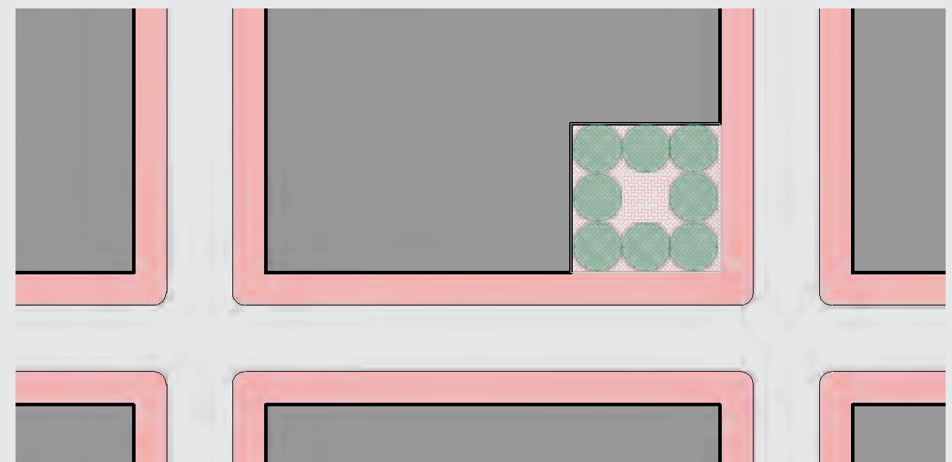 |
PLAYGROUND | ≤ 2,500 sf | Playgrounds provide children's play equipment and are shaded with shade trees or shade structures. Playgrounds adjoin a street on at least one side and the configuration shall ensure easy surveillance of the area from adjacent buildings and streets. | 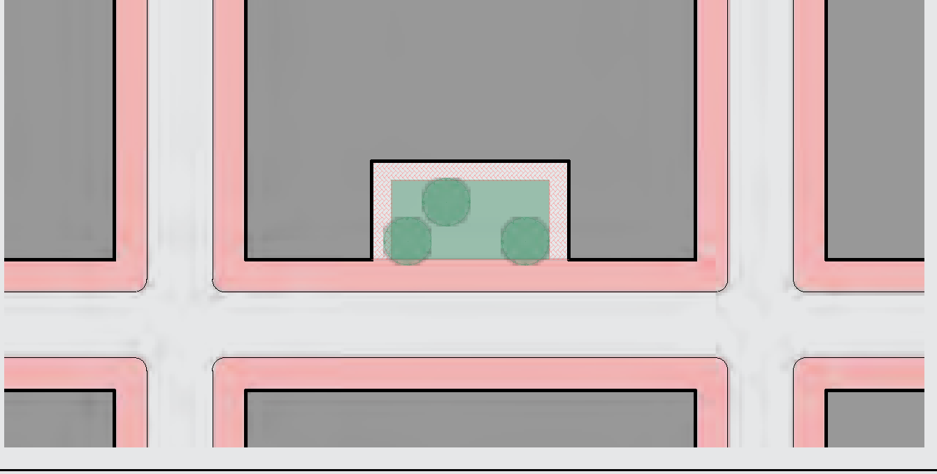 |
SQUARE | ≤ 10,000 sf | A square adjoins streets on at least three sides. Squares may be up to 50% hardscaped, with formal landscaping and shade trees. Squares accommodate both passive uses and community gatherings. |  |
ATTACHED
GREEN | 2,000 to 6,000 sf | An attached green spans the entire length of a block. Attached greens shall be at least 30 feet wide and are appropriate on the short end of a block. Attached greens are primarily lawns with formally arranged landscaping and shade trees. |  |
WATERWAY
PROMENADE | ≥ 15' wide | A waterway promenade or public access along the water's edge is a continuous greenway along the length of a waterway. To be effective buildings and sidewalks shall provide direct and clear access. Buildings shall treat the promenade as an additional primary facade. Waterway Promenades shall utilize standards from thoroughfare types, see Figure CD-32 Waterway Promenade at Frazier Creek. | 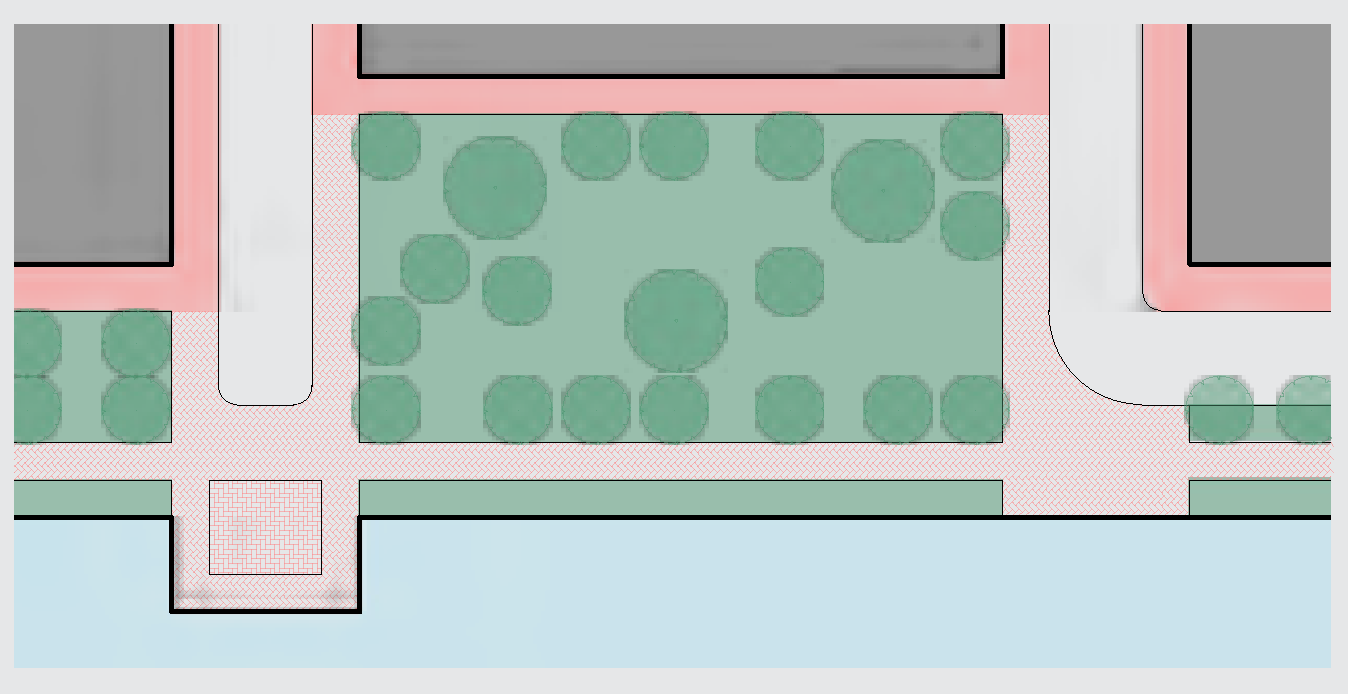 |
FORE-COURT | 250 to 1,500 sf | Buildings shall utilize standards from Forecourt frontage type, see Figure CD-10, Illustration of Measuring Height. | |
F.
Accessory structures. Accessory structures shall comply with the development standards applicable in the zoning district except where modified herein.
1.
Accessory structures shall not be established on a parcel of record prior to the issuance of all permits required for the development of the principal structure to which it is an accessory.
2.
Shielding from street. Sheds, exposed pumps, electrical meters, heat pumps, generators, pool equipment, air conditioning compressors, clothes lines, antennas, satellite dishes, outdoor storage, and similar structures and uses shall not be located between the front of a building and a street. Listed items and similar structures shall be shielded from view from public rights-of-way. All rooftop utilities and facilities, such as air conditioning units, shall be screened so as to not be visible from public view, including from balconies and windows of adjacent buildings.
3.
Outbuildings. Outbuildings shall conform to the following requirements:
a.
Outbuildings may include detached garages and carports, greenhouses, slat houses, cabanas, detached garage, and accessory dwelling units (ADU).
b.
Outbuildings shall be located behind the rear facade of the principal building or in the rear one-half of the property subject to minimum five-foot side and rear yard setbacks from the property line. On corner parcels, the side corner setback shall be ten feet. There shall not be less than five feet separation between an outbuilding and a principal building.
c.
Outbuildings shall be constructed of the same materials used in the principal building. Canvas outbuildings are not permitted.
d.
Outbuildings shall not exceed a maximum building footprint of 1,000 square feet, each.
e.
Outbuildings may not exceed the height of the principal building.
f.
Outbuildings may be constructed as elevated buildings that include the location of open parking below an enclosed structure; however, open parking shall be shielded from public right-of-way by privacy buffer as defined in Figure CD-41.
g.
Outbuildings may be detached or connected to the principal building by a covered walkway element, trellis, or other structural link.
4.
Accessory dwelling units (ADU).
a.
One ADU may be permitted on a parcel on which a detached single-family dwelling is located.
b.
Either the primary dwelling unit or ADU shall be owner occupied. The ADU shall not be sold or titled thereto transferred separately and apart from the rest of the property.
c.
An ADU shall not count as a separate unit for purposes of calculating density.
d.
An ADU shall not exceed a footprint of 700 square feet or the footprint of the principal structure, whichever is less. If a unit exceeds the 700 square feet, it shall be used in density calculations.
e.
An ADU must be on the same water and electric meter as the primary residence.
G.
Frontage types. Each new building, or substantial improvement, constructed must meet the standards for one of the frontage types permitted in the zoning district where it is located. See section 3.04.05.
H.
Historic preservation. Structures identified as historically and architecturally contributing shall be candidates for historic preservation as set forth in section 5.09.00. The requirements of this Code may be adjusted by variance for the purposes of preserving a historic building.
I.
Public art. All zoning districts shall comply with standards in section 3.01.07, Public art. Wall murals shall be permitted on any structures. When visible from a right-of-way, public via, or public land, murals shall require approval by minor conditional use.
J.
Conflicts with utilities. The applicant may be required to install existing overhead utilities to underground when located on property subject to new construction or substantial renovation.
(Ord. No. 2498-2023, § 1(Exh. A), 2-13-23; Ord. No. 2539-2025, § 2, 4-16-25)
Sec. 3.04.05. - Frontage types.
A.
Frontage types are required by zoning district. Using one or more of the permitted frontage types indicated in Figure CD-14, Permitted frontage types matrix, is required. Standards for frontage types are found in Figure CD-15 through Figure CD-21.
1.
Frontage types shall be located on the primary facade. Primary facades shall be located on an "A" street when identified in the Figure CD-07, Thoroughfare plan.
2.
Frontage type diagrams do not prescribe use or architectural style and are illustrative. Dimensions provided in tables control for regulatory requirements.
B.
Facade transparency.
1.
Windows and doors at the ground level shall have clear, transparent glass that has a minimum visible light transmission (VLT) of 50 percent. Mirrored glass is prohibited.
2.
Building facades facing "A" streets and neighborhood open spaces shall meet or exceed the minimum percentage of transparent glazing. The required percentage is determined by the frontage type.
3.
Above the ground level, building facades shall meet or exceed the minimum percentage of transparent glazing at each story as measured between finished floors. The required percentage is determined by the frontage type.
FIGURE CD-13 - FRONTAGE TYPES MATRIX
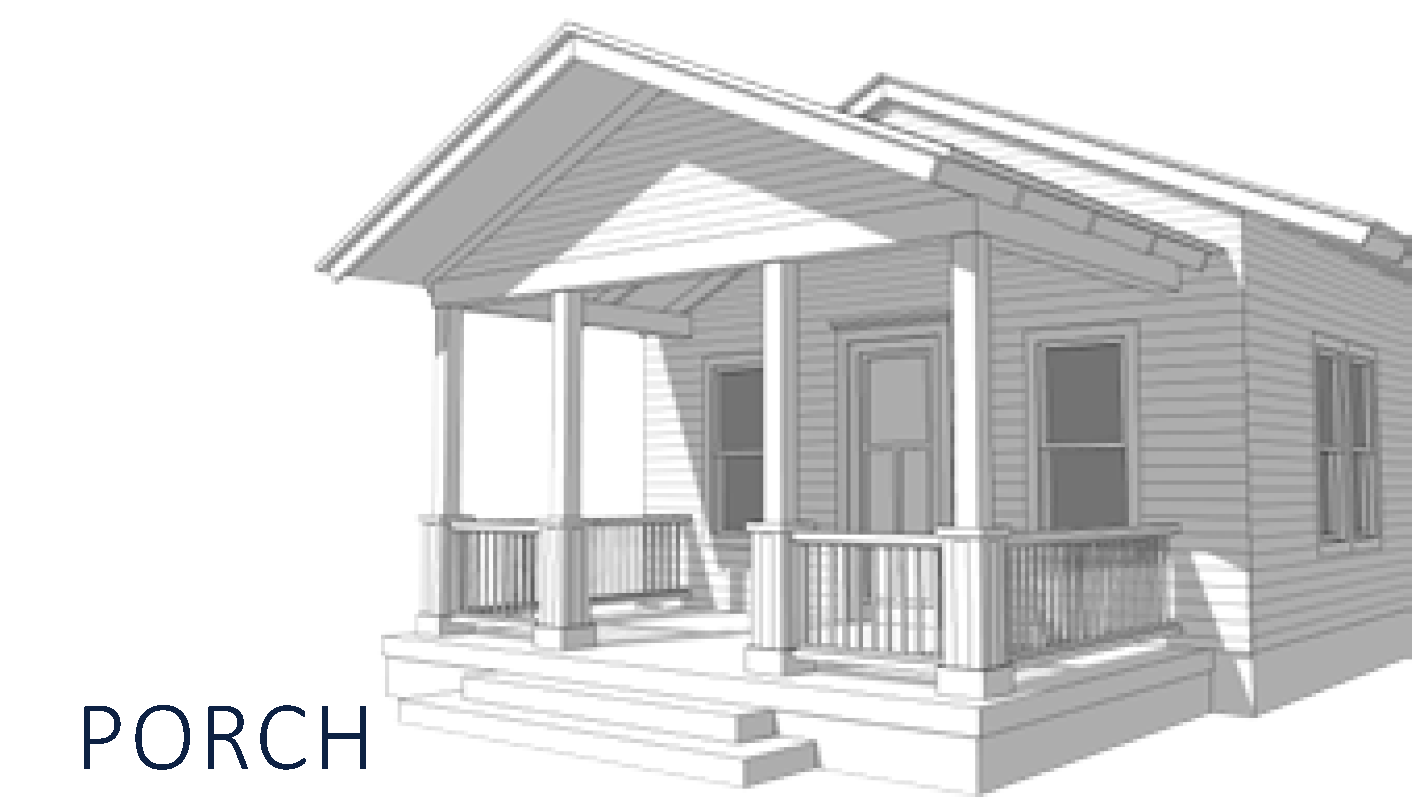 | 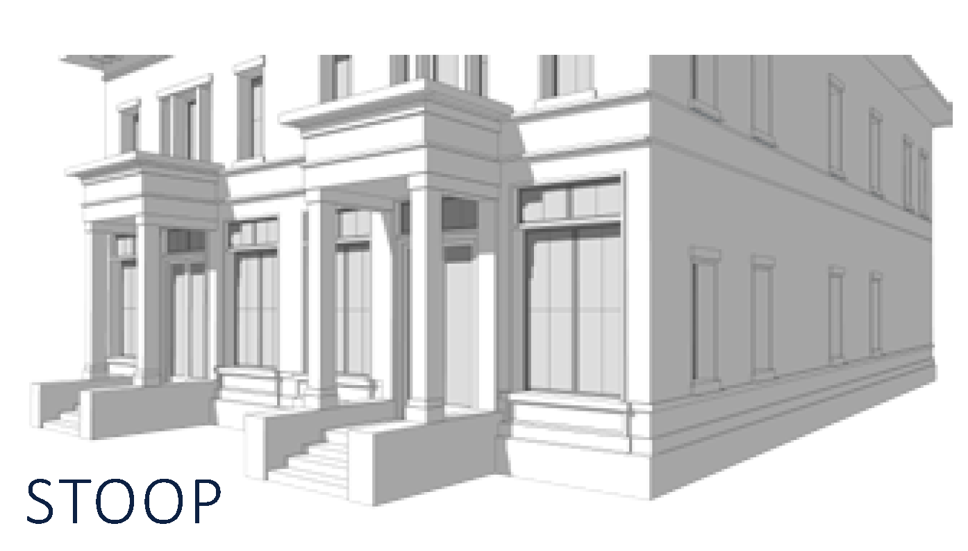 | 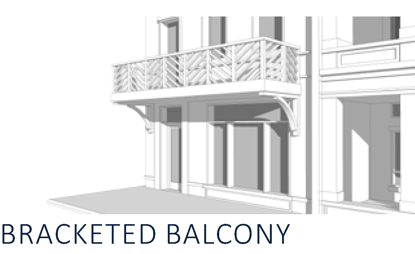 |
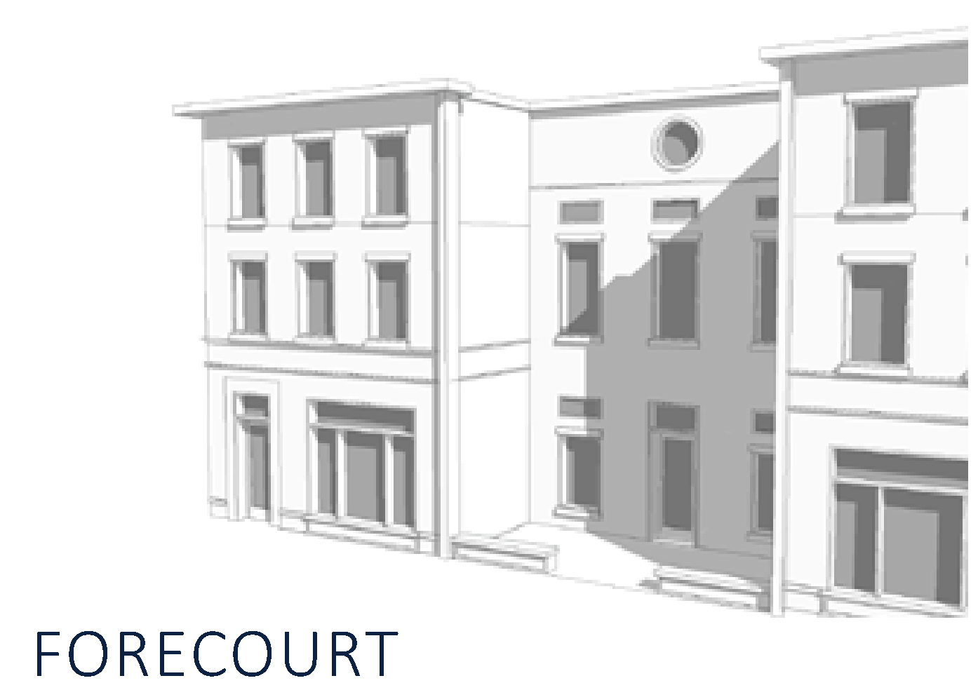 | 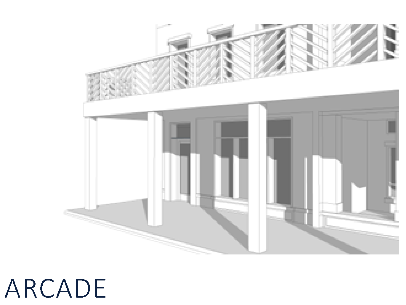 | 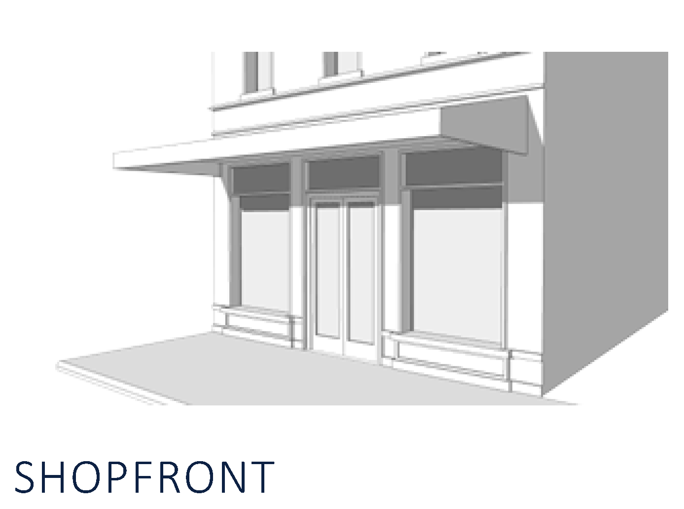 |
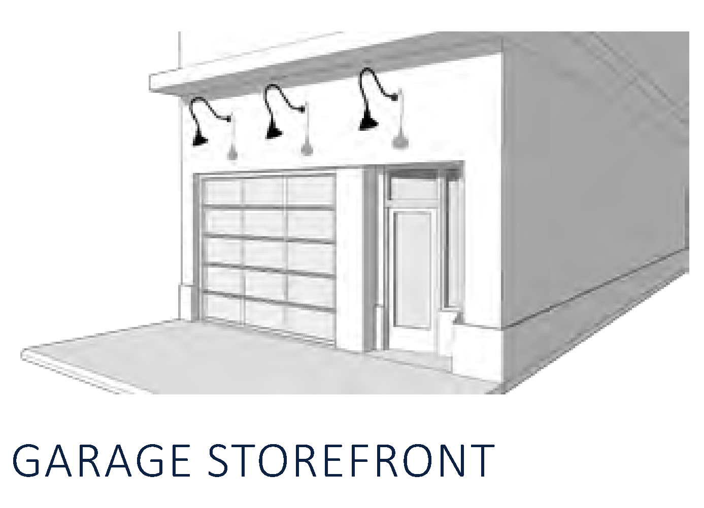 | ||
FIGURE CD-14 - PERMITTED FRONTAGE TYPES MATRIX
FIGURE CD-15 - Porch
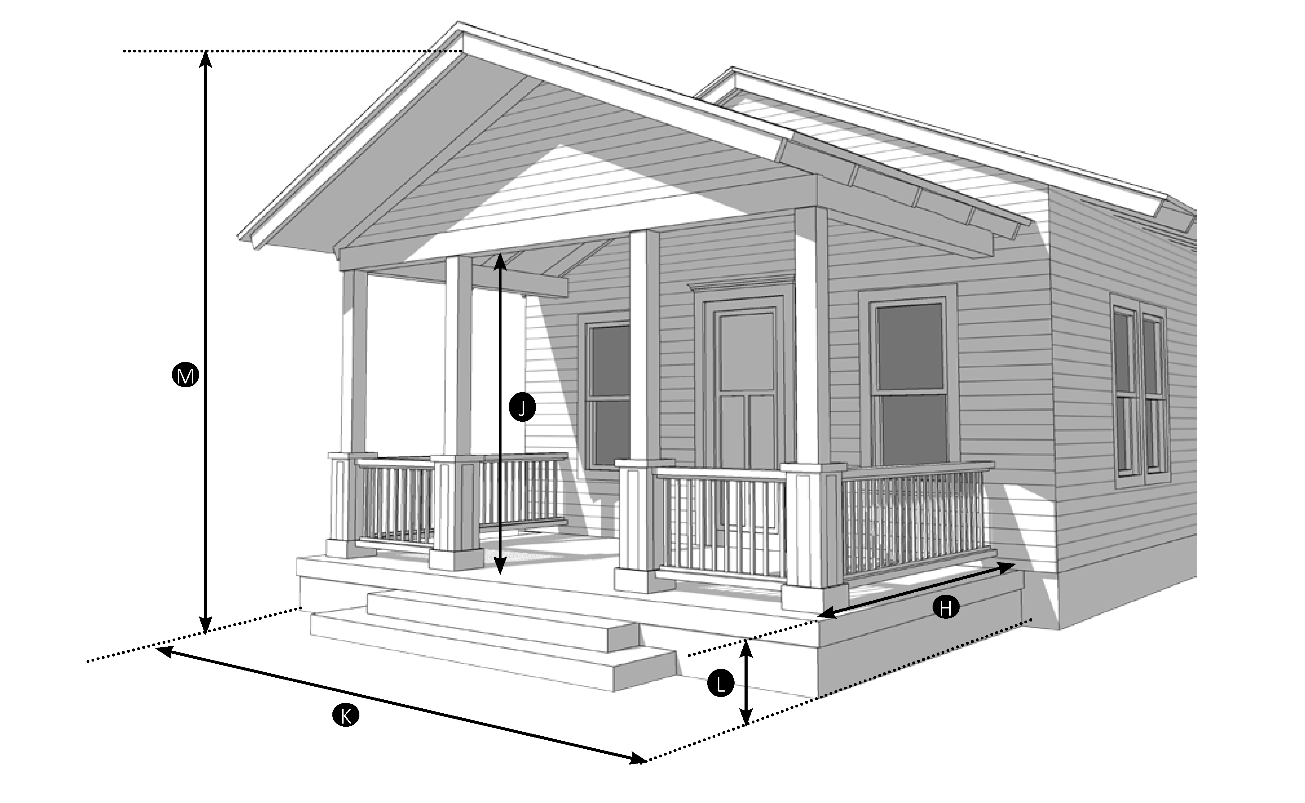
| Permitted Zoning District | ||
| CN | CS | CI |
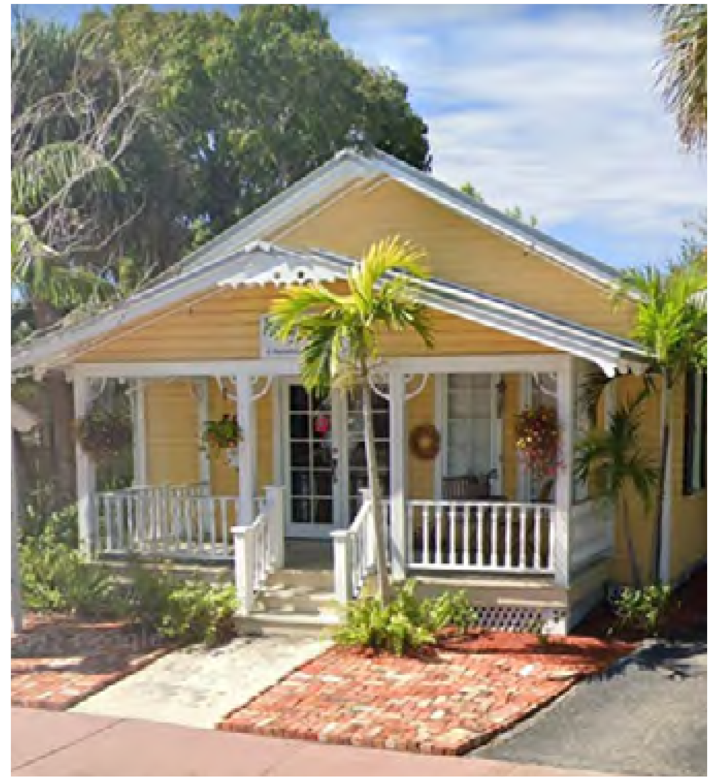 | ||
FIGURE CD-16 - STOOP
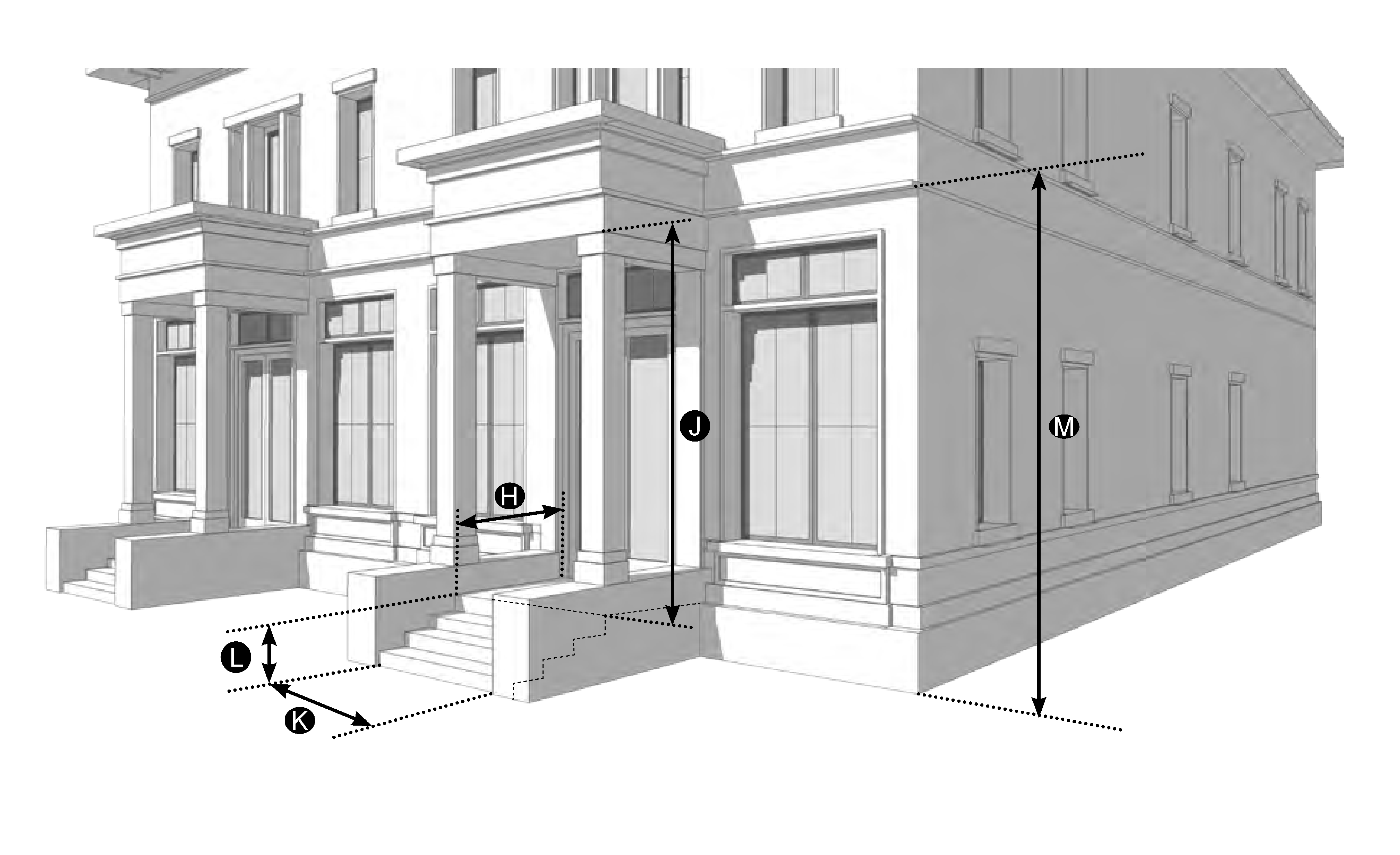
| Permitted Zoning District | ||
| CN | CS | CI |
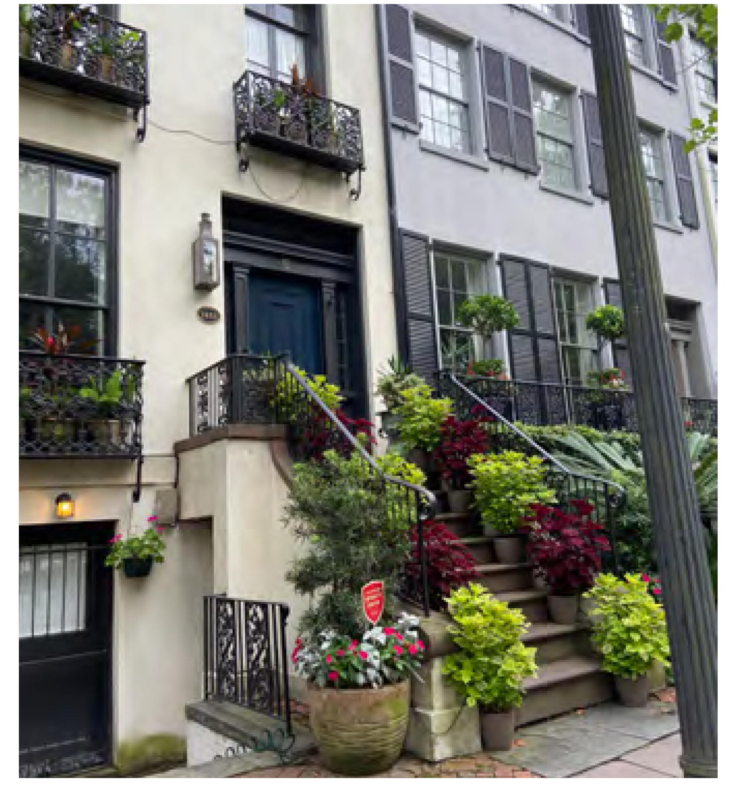 | ||
FIGURE CD-17 - BRACKETED BALCONY
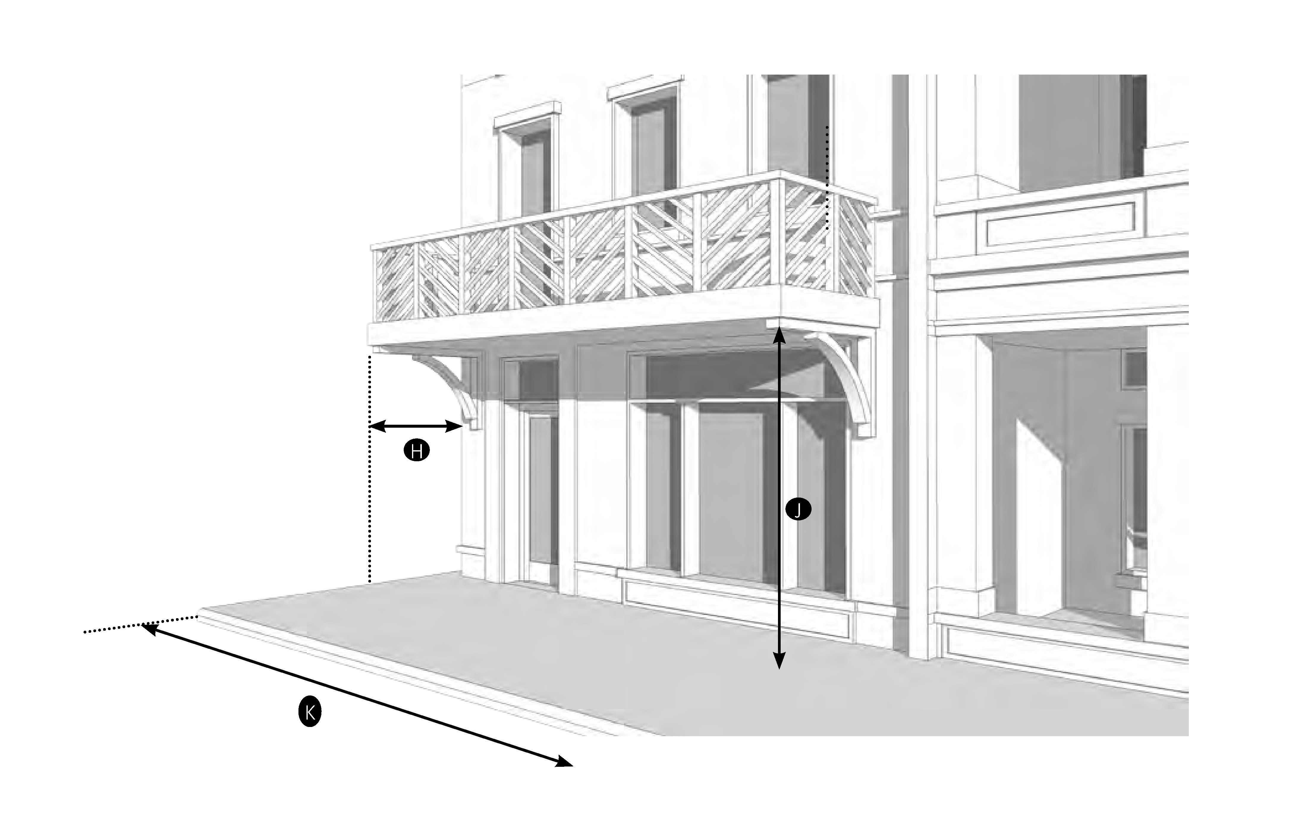
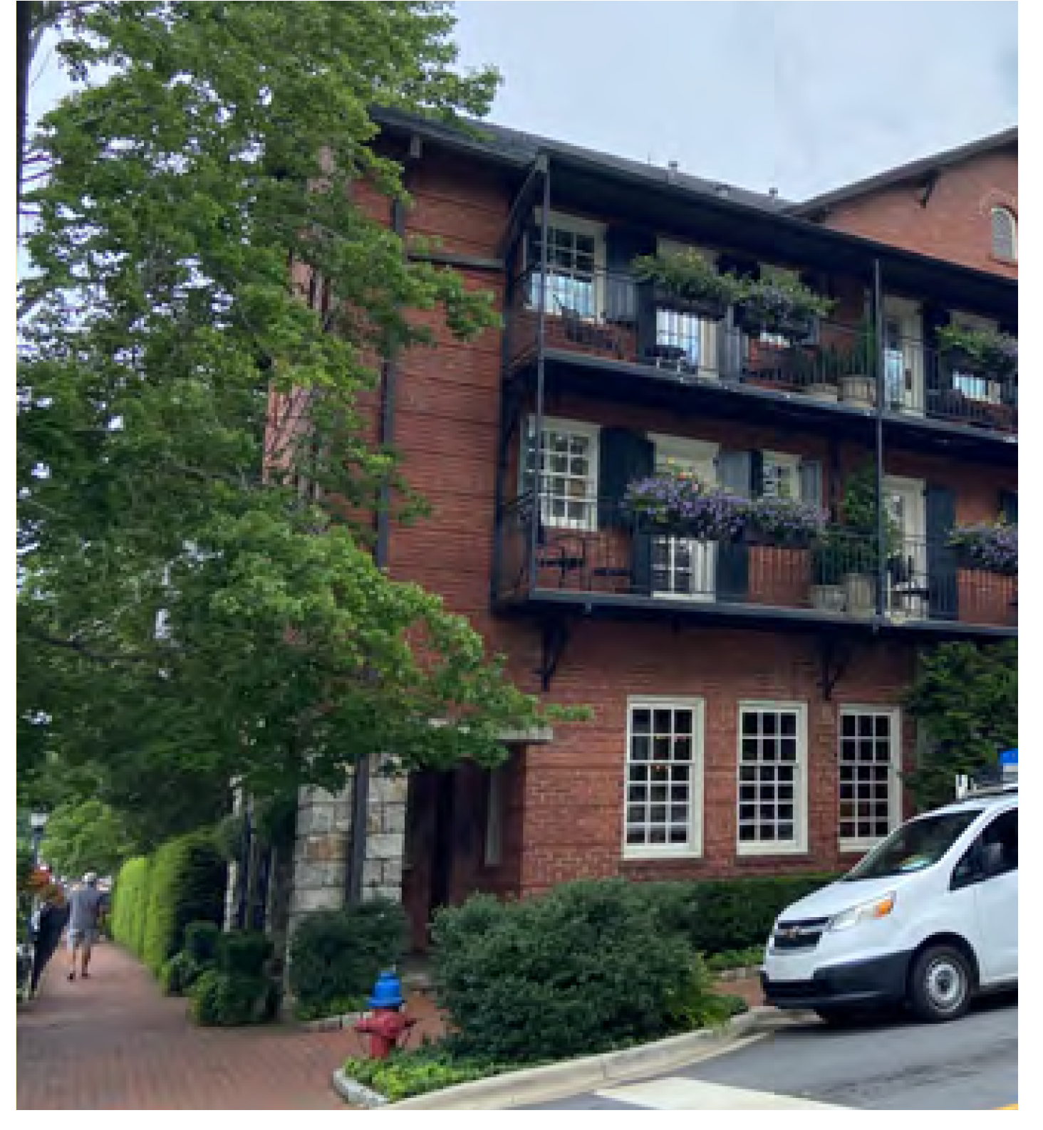
FIGURE CD-18 - FORECOURT
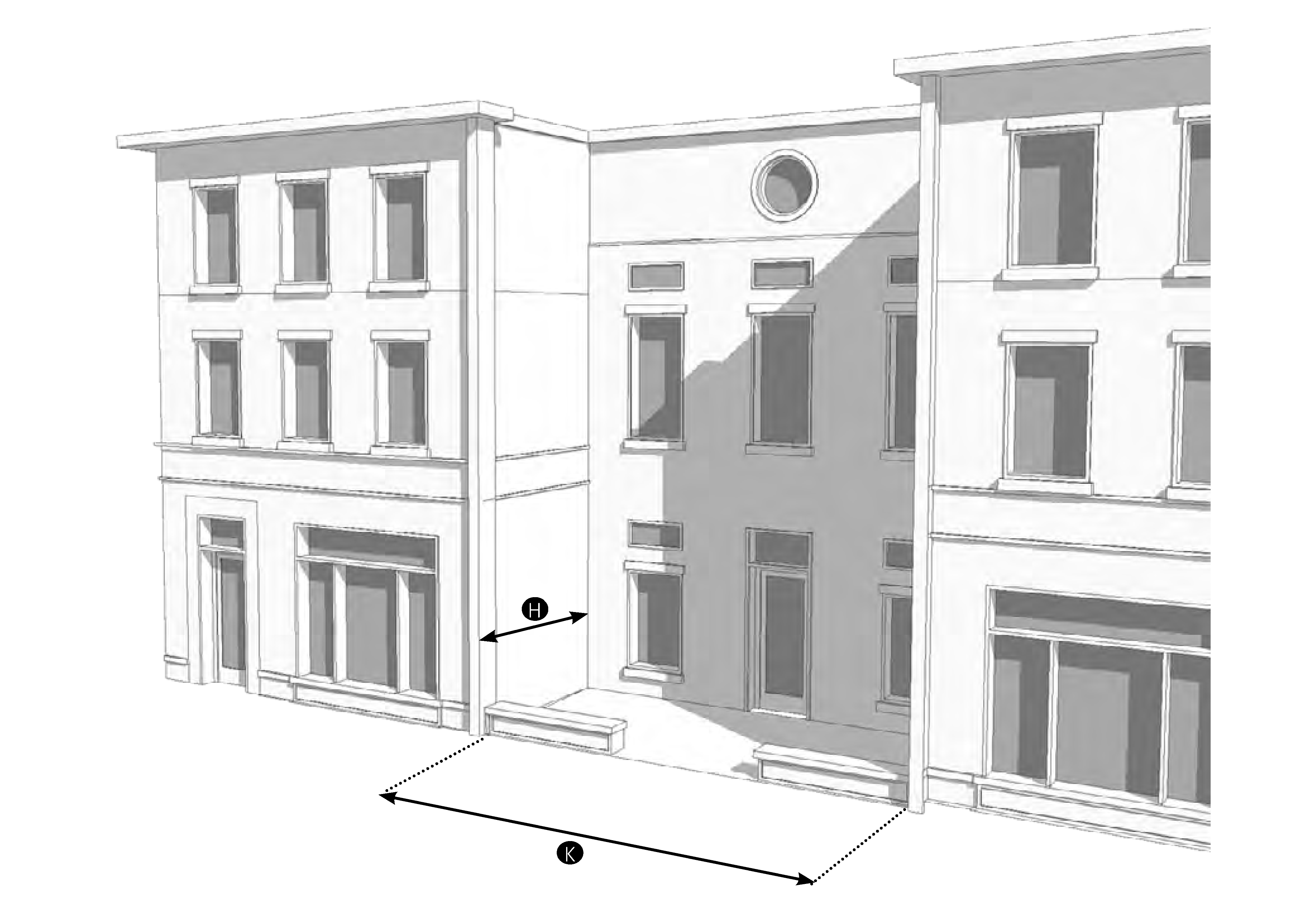
| Permitted Zoning | ||
| CN | CS | CI |
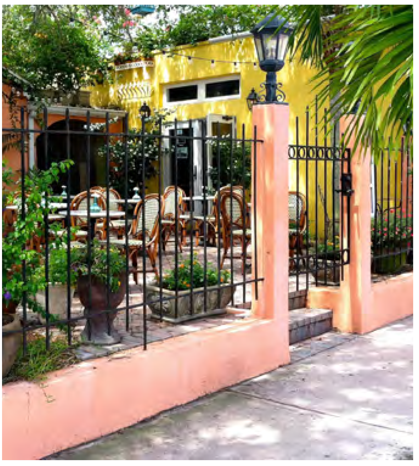 | ||
FIGURE CD-19 - ARCADE
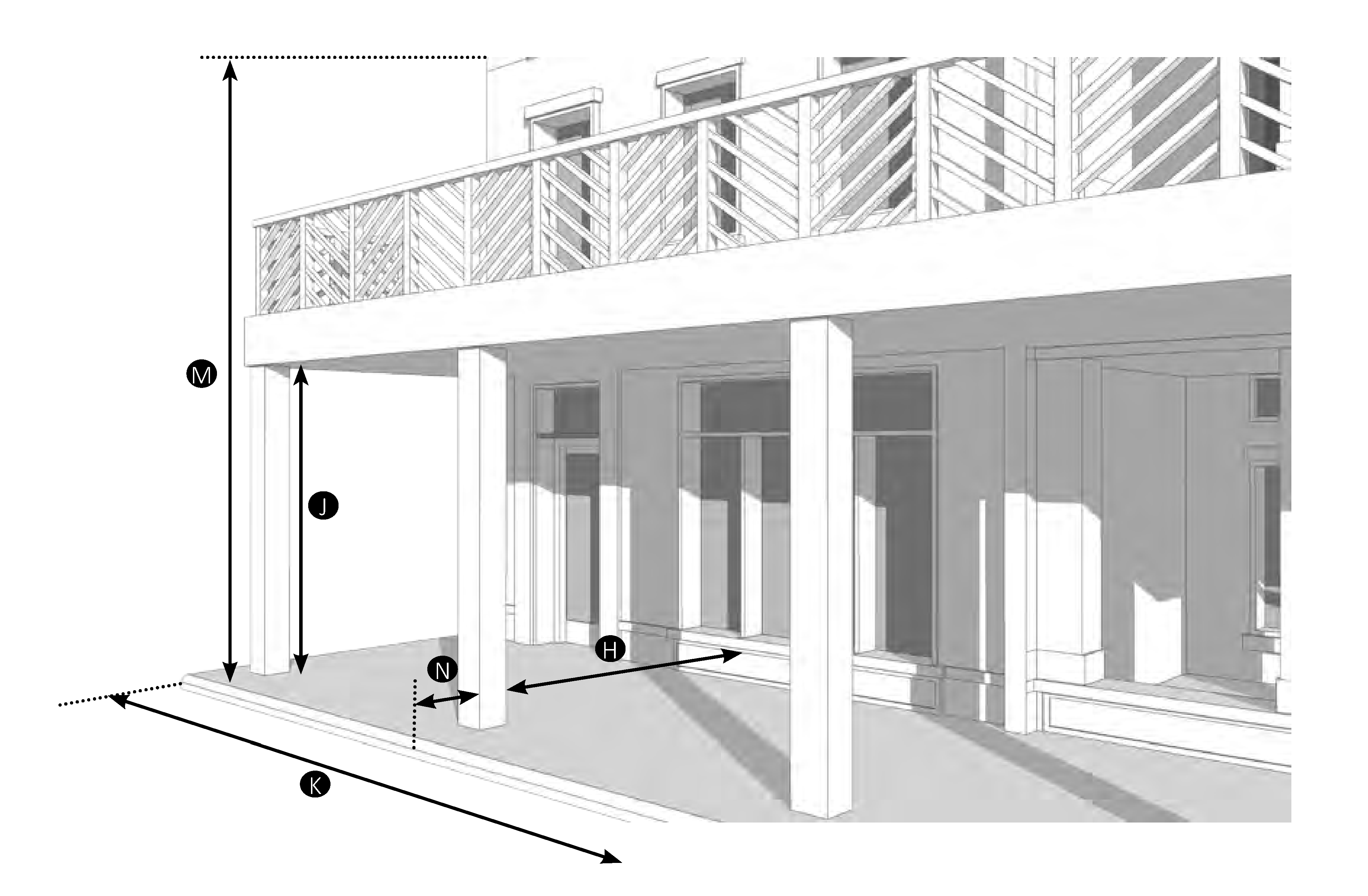
| Permitted Zoning District | ||
| CN | CS | |
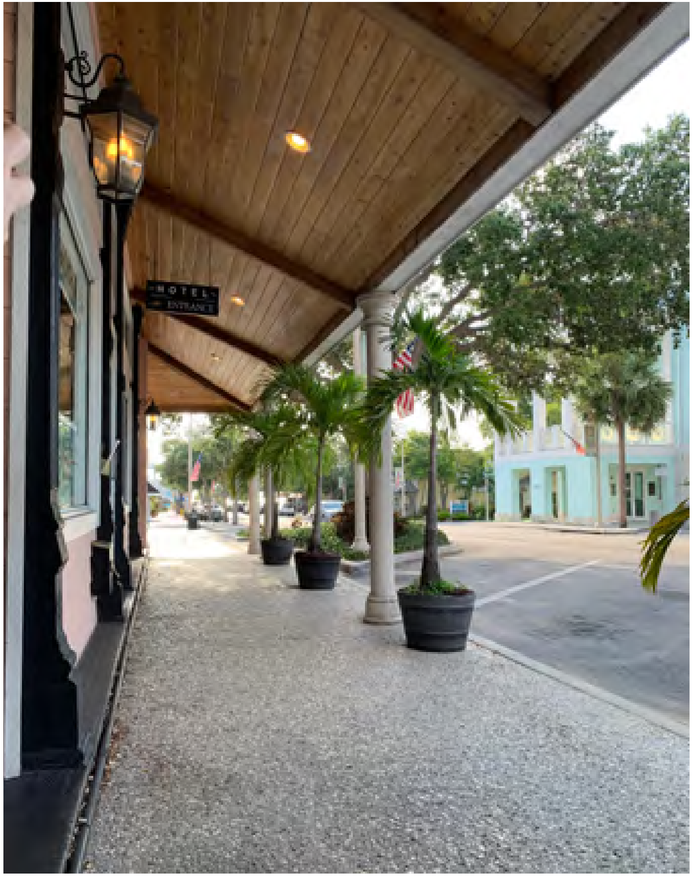 | ||
FIGURE CD-20 - SHOPFRONT
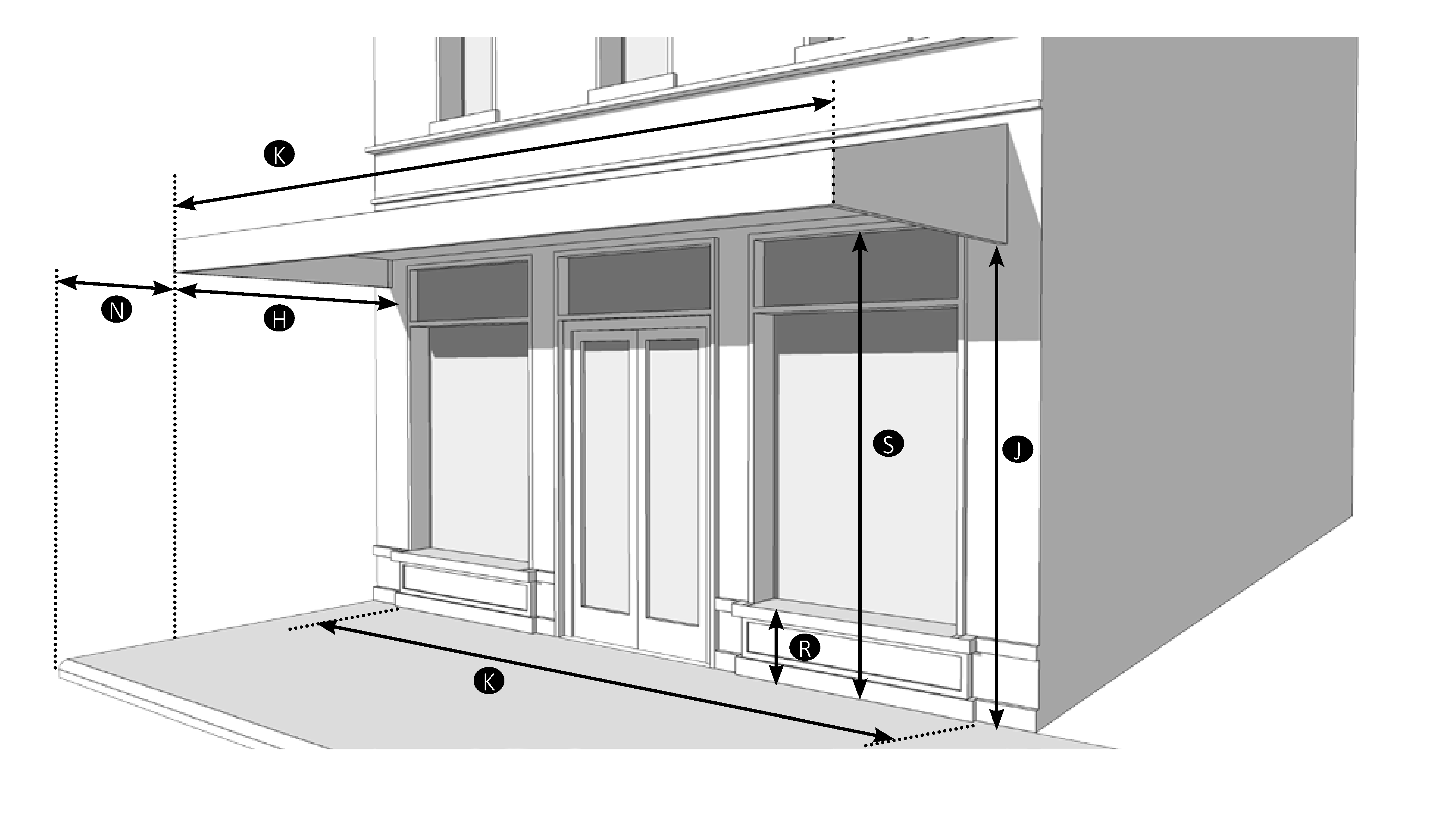
| Permitted Zoning | ||
| CN | CS | CI |
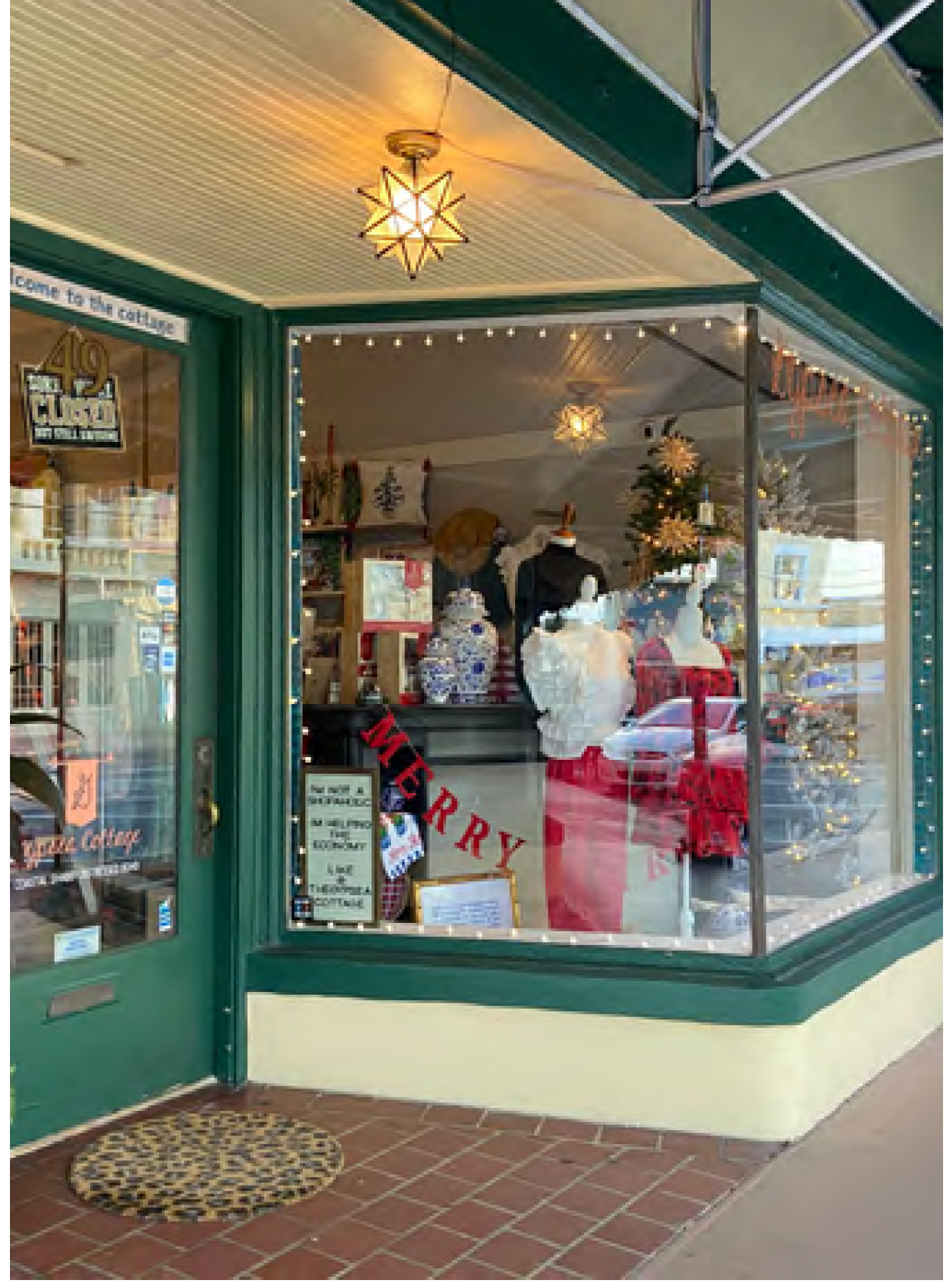 | ||
FIGURE CD-21 - GARAGE STOREFRONT
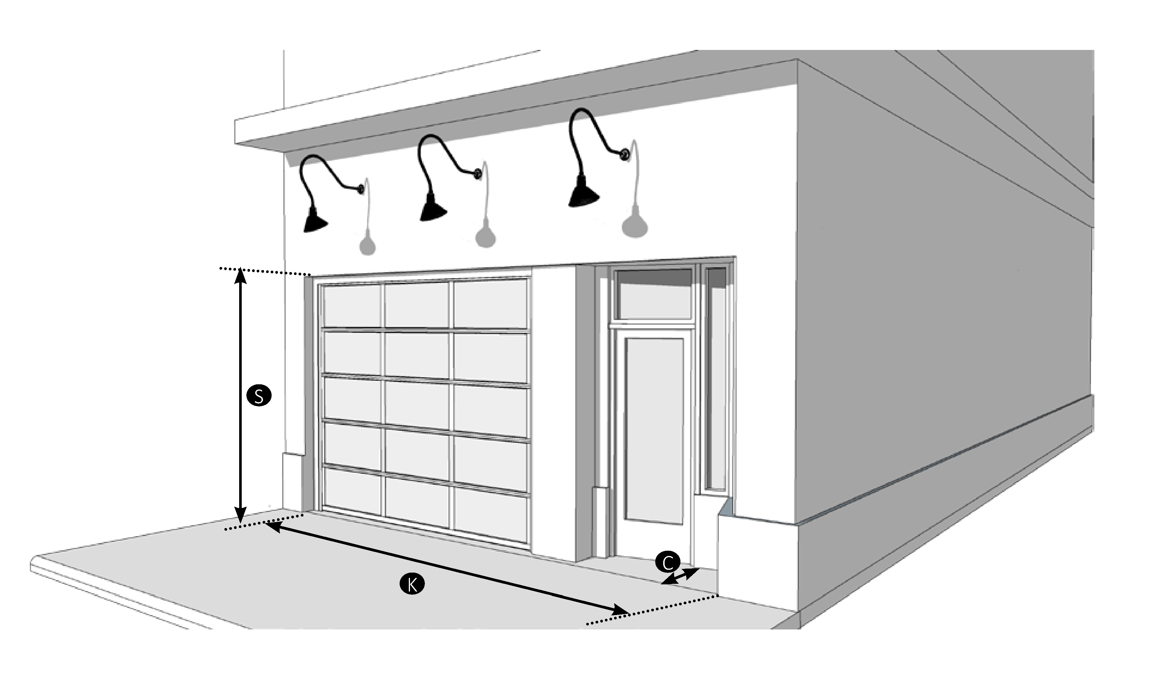
| Permitted Zoning | ||
| CI | ||
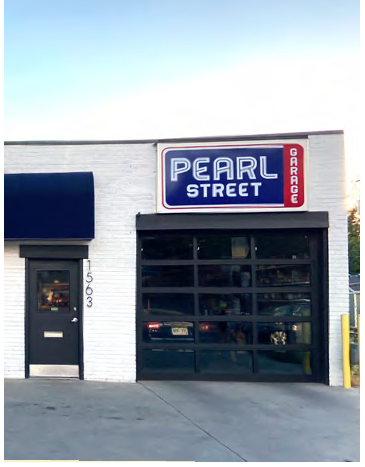 | ||
C.
Accessibility. An applicant may request reasonable accommodation from this Code through section 8.07.07. See Figure CD-22 for examples of front and side ramp entries. Strategies for accommodating ramps accessibility may include:
1.
Combined access for multiple buildings within site plan.
2.
Utilizing two percent slope at alleys and rear access.
3.
Combining ramps and stair entrances.
FIGURE CD-22 - ACCESSIBLE ROUTES
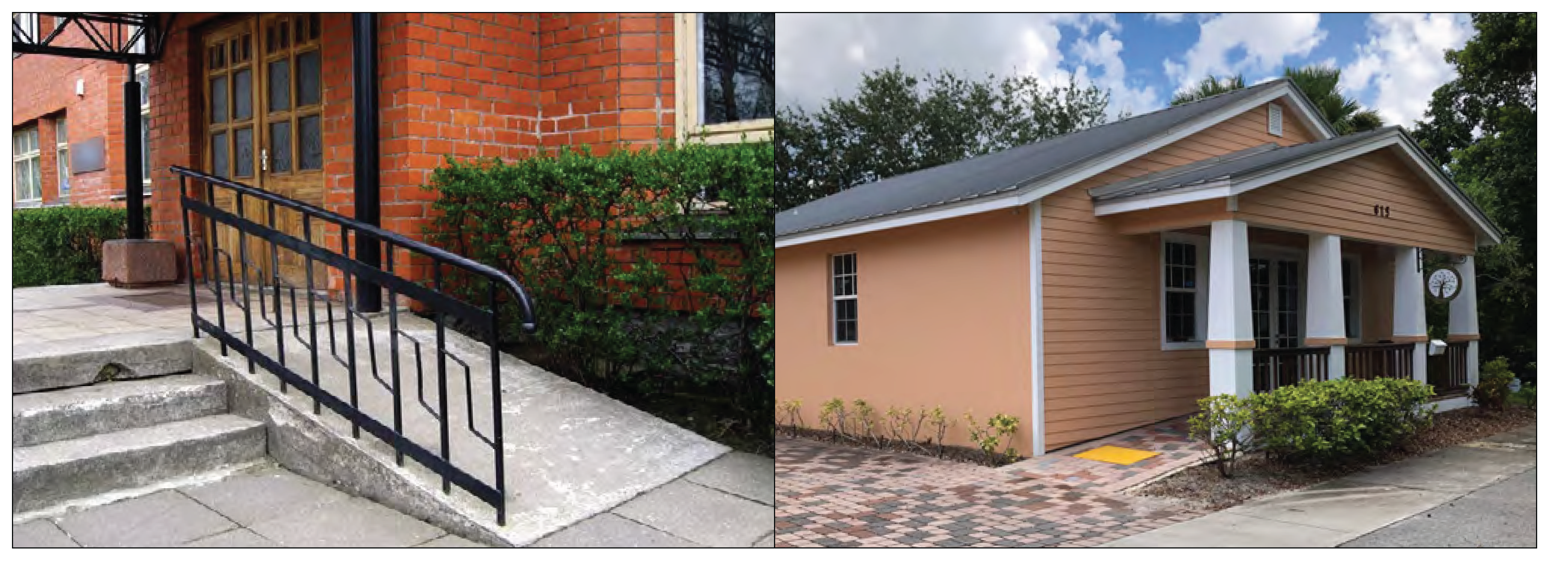
(Ord. No. 2498-2023, § 1(Exh. A), 2-13-23)
Sec. 3.04.06. - Thoroughfare standards.
A.
Applicability. Section 6.01.00 shall apply except where modified in Figure CD-23, Thoroughfare, access and parking standards.
FIGURE CD-23 - THOROUGHFARE, ACCESS AND PARKING STANDARDS
(Ord. No. 2539-2025, § 2, 4-16-25)
B.
Thoroughfare principles. All development including public improvements shall incorporate the following thoroughfare principles:
1.
Street layout shall exhibit a high degree of overall connectivity. Cul-de-sacs are prohibited.
2.
Oversized blocks shall be avoided so that neighborhoods can be traversed easily. Blocks created by new streets shall not exceed 550 feet on any side of the block. New block perimeters shall not exceed 1,600 feet.
3.
Shade trees shall be planted between the sidewalk and vehicles.
4.
The abandonment of existing streets, improved alleys or alley candidates is prohibited.
5.
Private gated communities are not permitted. This prohibition does not preclude gates that control access to a single parking lot.
C.
Thoroughfare plan. A thoroughfare plan is provided for the Creek District in Figure CD-07, Thoroughfare plan, in section 3.04.02, Regulating plan.
D.
Description of thoroughfare types. Figure CD-24 Description of thoroughfare types describes street types that are appropriate for the Creek District.
1.
New thoroughfare. When new streets and alleys are developed or an existing street or alley is extended, the street types in Figure CD-24, Description of thoroughfare types, and illustrated in Figure CD-26 through Figure CD-33 shall be used. The selection of the particular street type shall be determined through consultation with the development director.
2.
Existing thoroughfare. All new development, substantial improvement, and substantial renovation and major development projects shall incorporate into the reconstruction of streets to the greatest extent possible, taking into account existing conditions including right-of-way constraints that may require adjustments to these standards.
Figure CD-24 - DESCRIPTION OF THOROUGHFARE TYPES
E.
Thoroughfare elements. See elements illustrated in Figure CD-25, Streetscapes diagrams. The illustrative street designs address the street elements:
1.
Vehicular travel lanes are primarily for vehicular circulation and shall be no greater than 11 feet, and may include a marked sharrow for posted speed of 25 miles per hour or less.
2.
Parking lanes may include on-street parking, may be parallel or reverse angled parking.
3.
A bike facility may be a marked sharrow, a separate bicycle lane, or shared used path.
4.
Pavement width is the width of pavement from edge of pavement or curb which is dedicated for vehicular travel, but could include separate bike lane or marked sharrow. Where appropriate, pavement include pervious areas to manage stormwater.
5.
A sidewalk shall be provided on both sides of a streetscape. Sidewalks may be part of a shared use path. Minimum width is determined by zoning district. See section 3.04.04, Development standards, for minimum width of a sidewalk.
6.
A pedestrian zone is free of any street furnishings or above ground utilities and allows the clear passage of pedestrians. A pedestrian zone shall be no less than six feet wide. Any portion of the pedestrian zone within the front setback area shall be improved as an extension of the public sidewalk and shall match the public sidewalk in design and material, providing a seamless physical transition.
7.
The furnishing zone is a paved area adjacent to the sidewalk for street furniture, tree wells, and extra sidewalk width. Pedestrian scale lighting is often included. New thoroughfare lighting shall be dark sky approved lighting.
8.
Median is a vegetated area between travel lanes of opposing direction. Medians, when present, should be used to integrate stormwater management.
9.
Edge of pavement may be curb and gutter or a valley gutter. Enhanced crosswalks with design features like bulb-outs or pinch-points are encouraged to address visibility when crossing vehicular travel lanes.
10.
Planting strip or planting area—vegetated area between a sidewalk and vehicles. Planting strips are encouraged to integrate low impact development.
11.
Street trees are often required. Street designs shall prioritize maintaining existing shade trees.
12.
Low impact development is a decentralized stormwater management strategy that provides on-site water quantity and water quality treatment. Examples include pervious paving, pervious pavers, pervious concrete, bio-retention systems, rain gardens, bioswales, and stormwater planters. These techniques are encouraged to slow and treat stormwater runoff while providing additional community benefits.
FIGURE CD-25 - STREETSCAPES DIAGRAMS
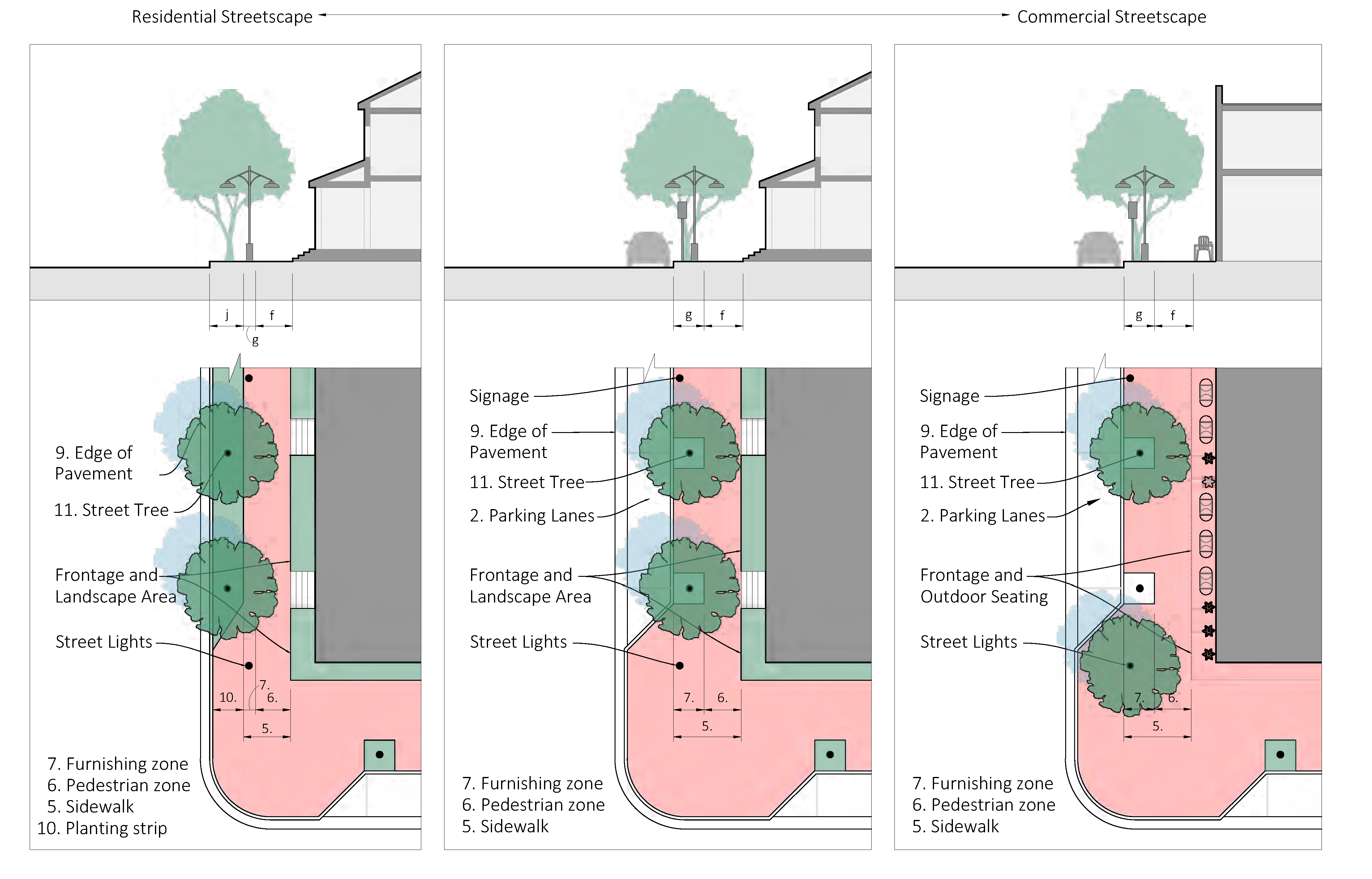
F.
Visibility triangles. In visibility triangles, no building, structure, or improvement, including landscape, shall be erected, placed, planted, or maintained so as to interfere with a clear sight area located between the heights of three feet and nine feet above the crown of a street, driveway, or alley. A clear sight area shall be established for all streets, whether public or private.
1.
The clear sight area is the triangular area formed by the street right-of-way line; another street right-of-way line, alley right-of-way line, or driveway surface edge; and a line connecting points ten feet from the intersection of said lines. In the case of a round or corner-cut right-of-way, the measurement shall be taken from the intersection of the right-of-way lines extended.
2.
The engineering director and public works director may require a larger clear sight area, as provided by Florida Department of Transportation Design Manual standards, when necessary to provide for the safe movement of pedestrians and vehicles.
G.
Deviation from street design standards. The development director may allow deviations from the standards contained in Figure CD-24 when necessary due to the location of existing buildings, constrained right-of-way, or to meet other community needs or goals for the particular street segment.
FIGURE CD-26 - ALLEY
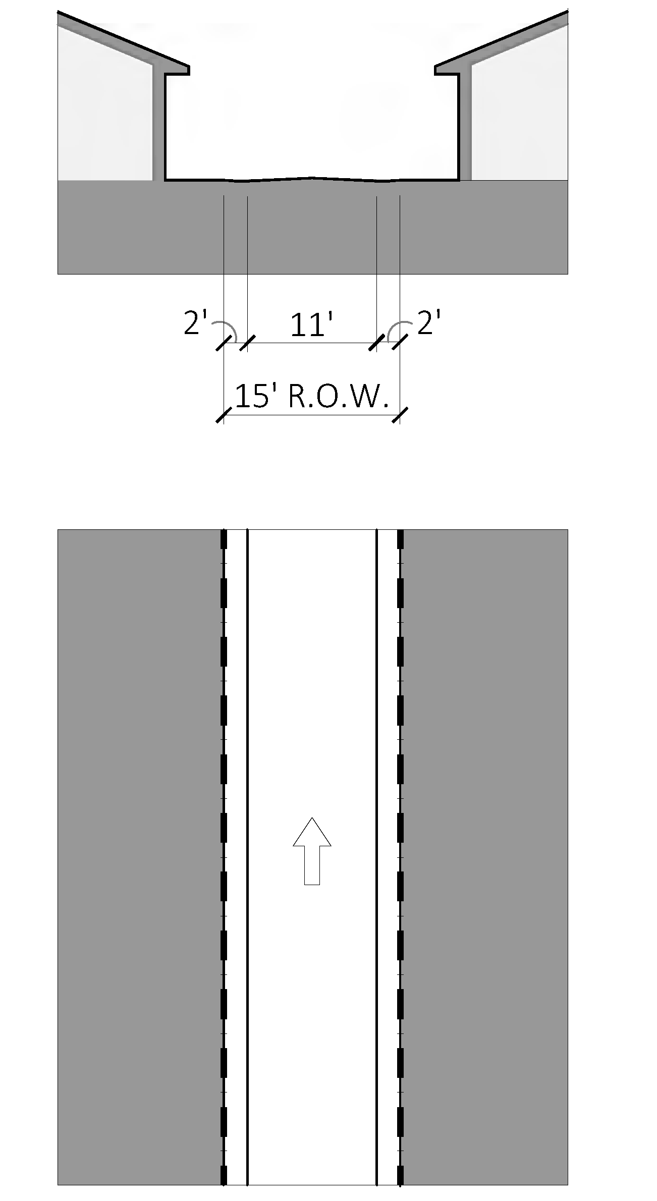
FIGURE CD-27 - INDUSTRIAL STREET
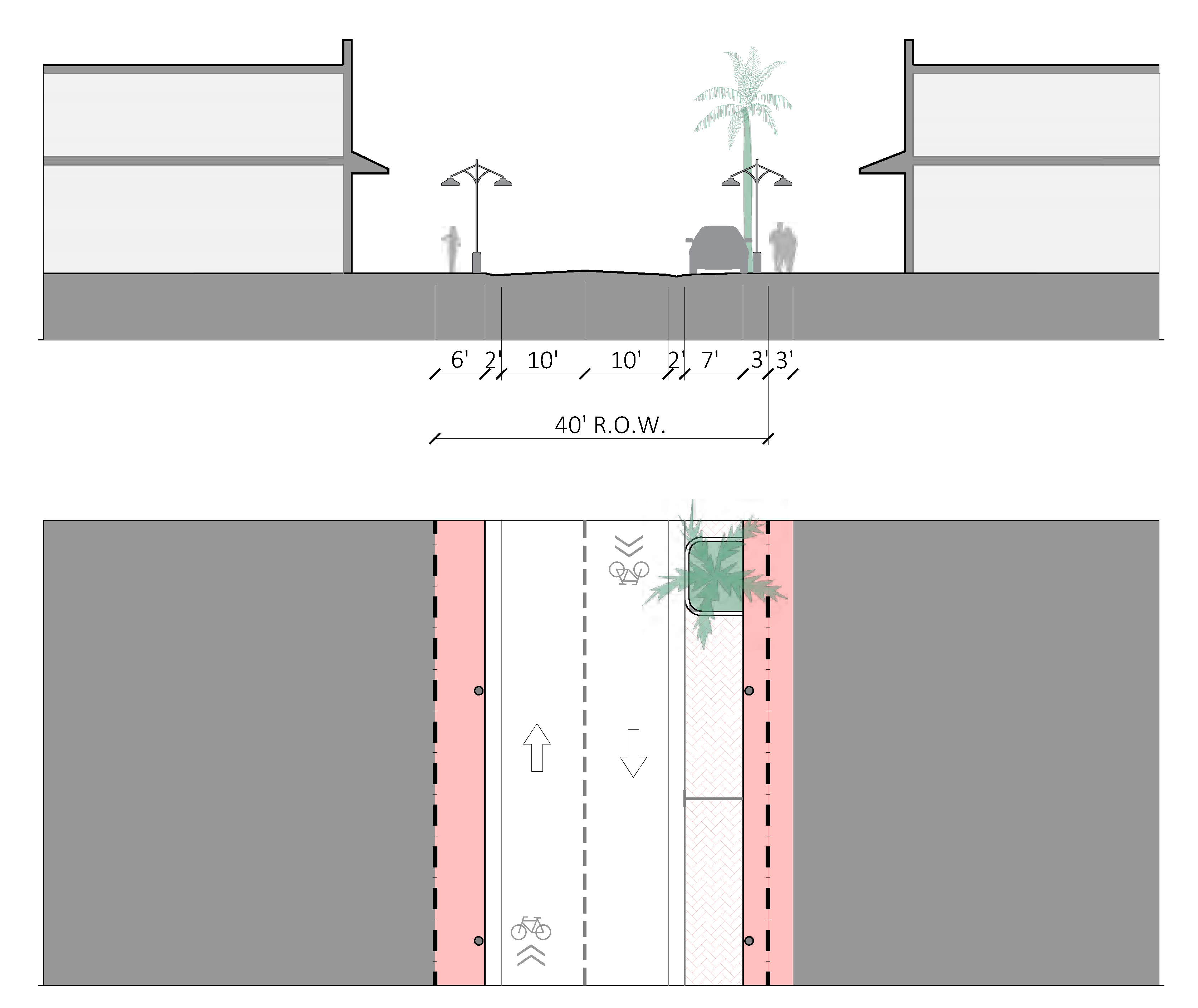
FIGURE CD-28 - URBAN STREET
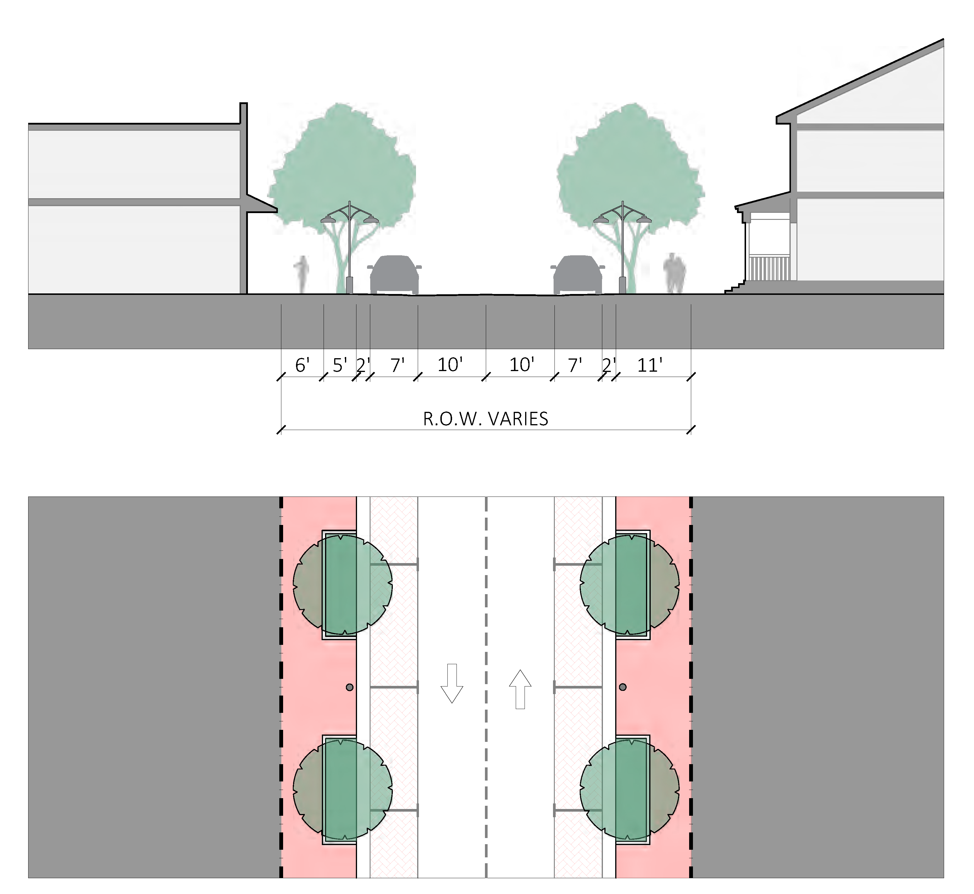
FIGURE CD-29 - URBAN STREET WITH BIKE LANE
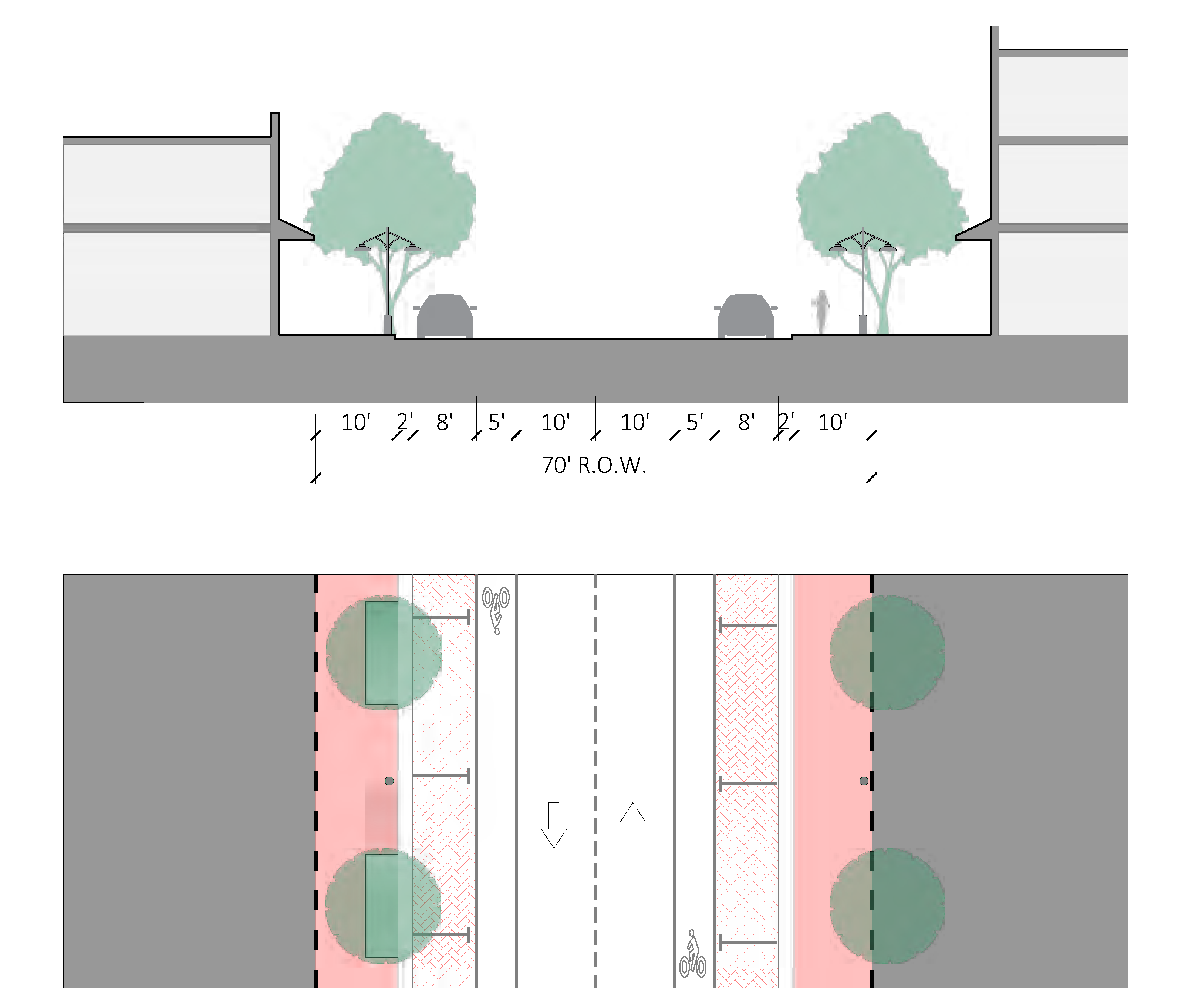
FIGURE CD-30 - MAIN STREET WITH BIKE LANE
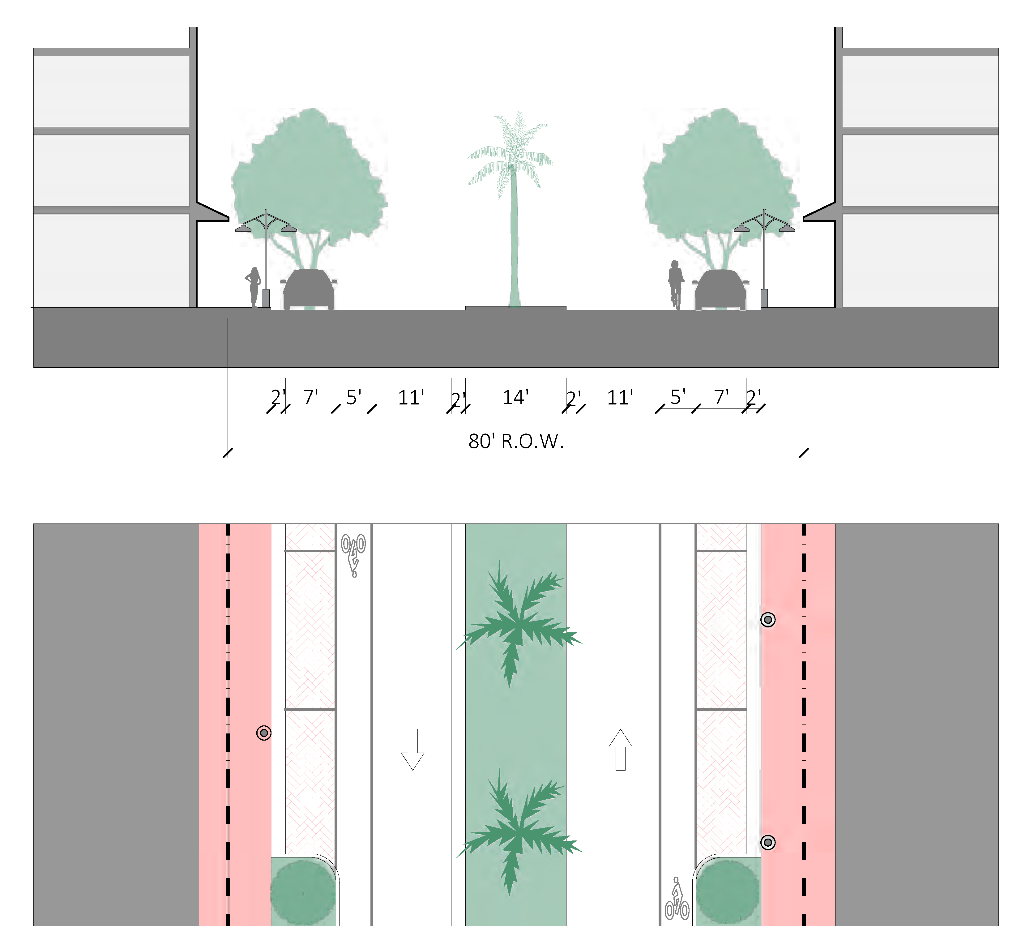
FIGURE CD-31 - BOULEVARD SETBACK FOR US-1 FEDERAL HIGHWAY ILLUSTRATED EXAMPLES
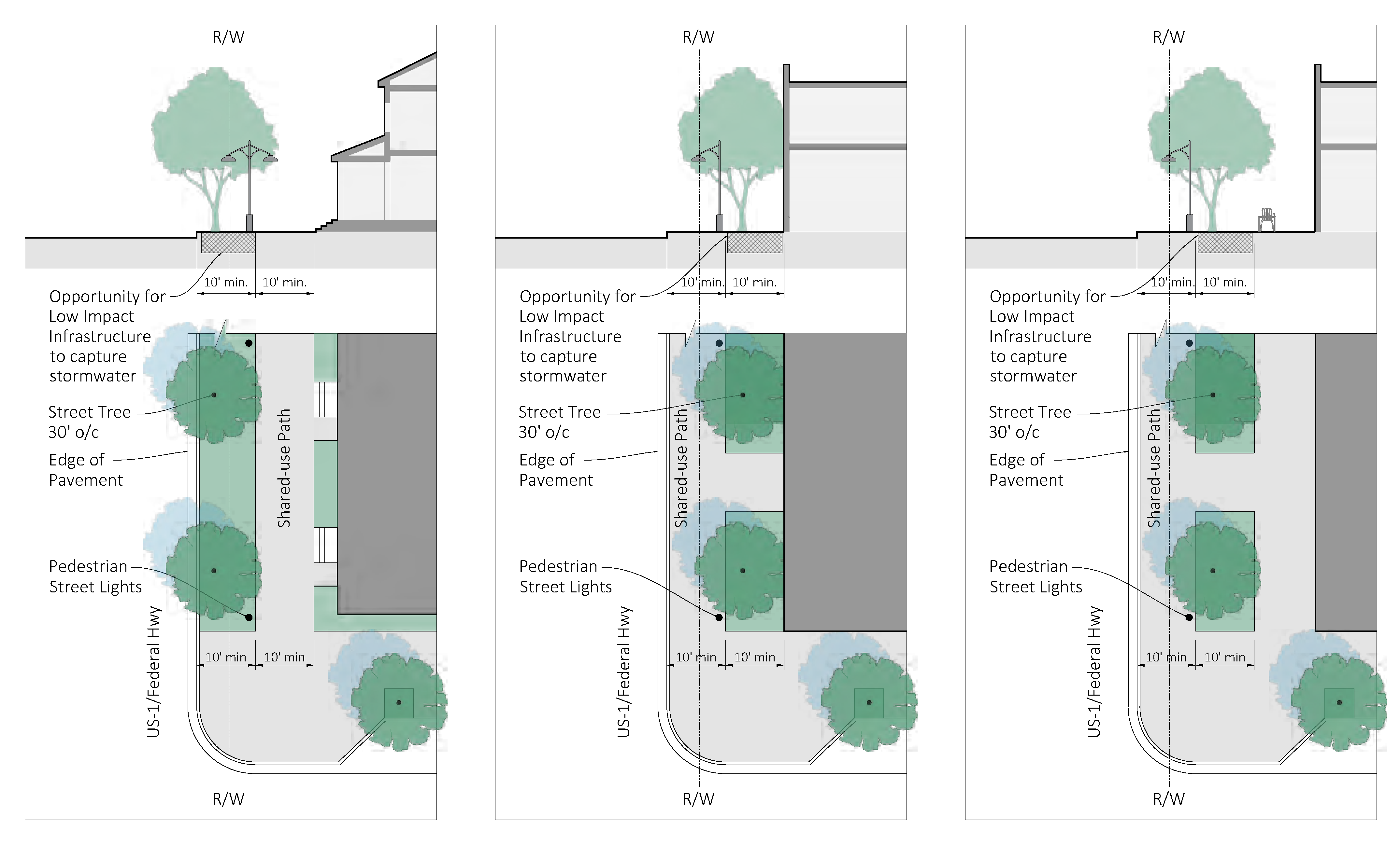
FIGURE CD-32 - WATERWAY PROMENADE AT FRAZIER CREEK
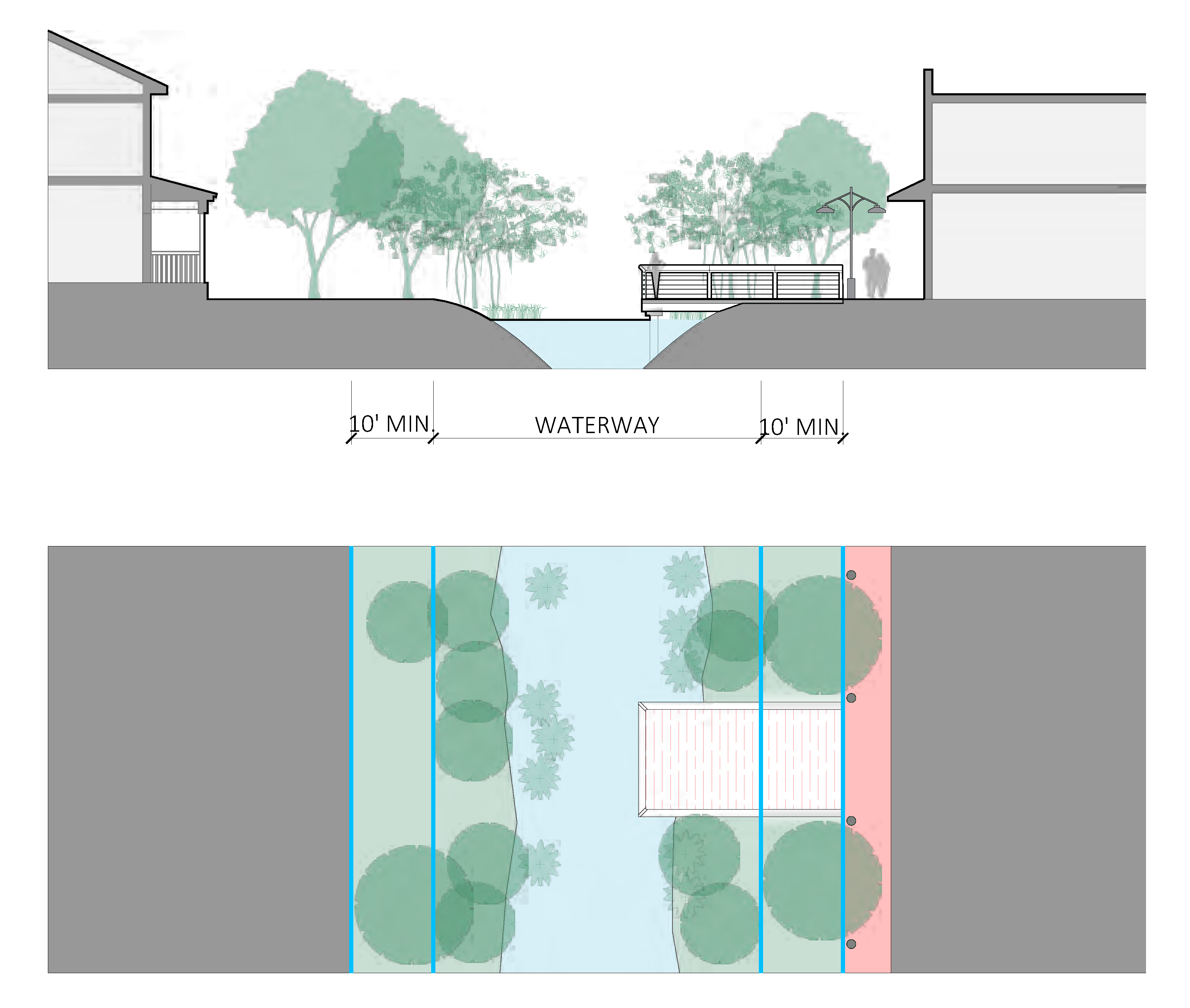
FIGURE CD-33 - SHARED-USE BRIDGE AT FRAZIER CREEK
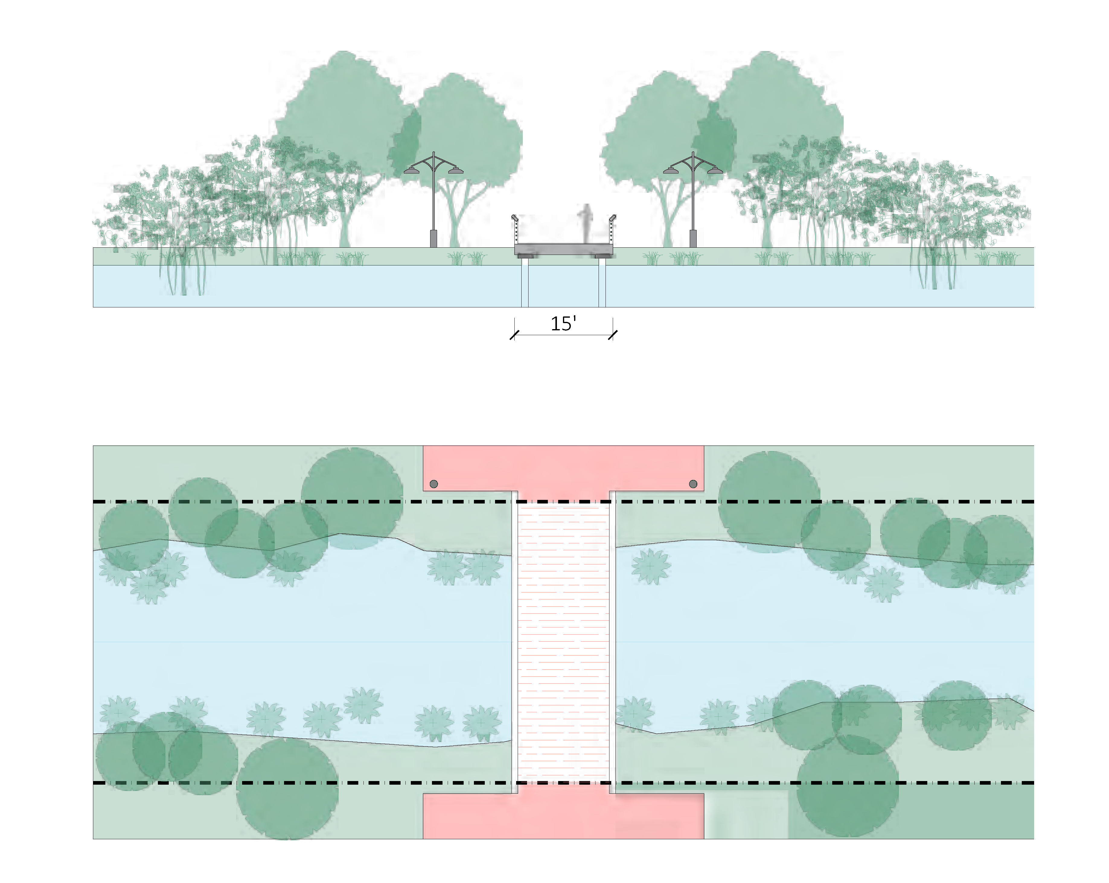
Sec. 3.04.07. - Access and parking standards.
A.
Applicability. Section 6.01.00 shall apply except where modified in Figure CD-23, Thoroughfare, access and parking standards.
B.
Pedestrian access. The owner shall be responsible for the installation of a continuous sidewalk along the entire length of the parcel frontage(s) that abuts a public street.
1.
Minimum width. Minimum width of sidewalk is determined by the zoning district, see section 3.02.06, Thoroughfare standards.
2.
All development shall include direct pedestrian access from development to existing and planned sidewalks within the public right-of-way. Pedestrian access shall be separated from the vehicular travel path.
3.
Sidewalks shall be provided for internal circulation and linkage to other projects when such facilities are possible given the particular physical characteristics of the site, type of project, and adjacent land uses. Determination shall be made by the development director.
4.
Materials. Pedestrian access shall consist of concrete, brick or concrete pavers, asphalt, stamped pattern concrete systems, rock salt textured concrete with integral color, or other similar material approved by the development director which clearly distinguish them from vehicular use areas and promote traffic calming. Where identified by the development director, sidewalks shall be constructed of paver block, brick or integral color concrete.
C.
Bicycle access and parking.
1.
Section 6.01.20, Bicycle parking, applies within the Creek District, and the minimum six-feet pedestrian zone shall not be reduced due to the placement of bicycle parking.
D.
Vehicle access and parking.
1.
The required minimum on-site parking is listed in Figure CD-34, minimum on-site parking schedule.
FIGURE CD-34 - MINIMUM ON-SITE PARKING SCHEDULE
2.
On-street parking. On-street parking, constructed to city Code, within a public right-of-way along the parcel frontage can be counted towards on-site parking requirements. An approved revocable permit from the city commission is required for on-street parking constructed by new development.
3.
Payment in lieu of parking (PILOP). Up to three required on-site parking spaces may be accommodated via payments to the PILOP program as described in section 6.01.19.
4.
Parking alternatives. The following may be substituted for required on-site parking spaces. Alternative parking spaces shall count toward no more than 25 percent of the overall on-site parking requirement.
a.
Two motorcycle and/or scooter spaces shall count as one parking space.
b.
Two golf cart spaces shall count as one parking space.
c.
One transit vehicle pull-off shall count as four parking spaces, eligible only by approval development director and coordination with City of Stuart Tram or Martin County Public Transit, MARTY.
5.
Historic preservation credit. Historic buildings as designated by the Stuart Historic Preservation Board and recorded and preserved in compliance with section 5.09.00 A, Historic preservation program, are exempt from new parking requirements due to a change of use when existing on-site parking remains. If existing on-site parking is removed, up to 50 percent of the required parking for any new may be accommodated via payments to the PILOP as described in section 6.01.19.
6.
Parking placement. See Figure CD-35, Parking placement dimensions.
a.
All parking areas shall be located as shown in Figure CD-36, Parking placement diagram, behind the rear facade of the principal building and screened from rights-of-way by a privacy buffer or landscape buffer described in Figure CD-41, Minimum buffer types, or other screening approved by the development director.
b.
Up to two required parking spaces may be provided as "stacked" spaces, where one parking space is located behind the other.
c.
Boats, campers, and recreational trailers may only be parked in the rear yard.
FIGURE CD-35 - PARKING PLACEMENT
(Ord. No. 2539-2025, § 2, 4-16-25)
FIGURE CD-36 - PARKING PLACEMENT DIAGRAM
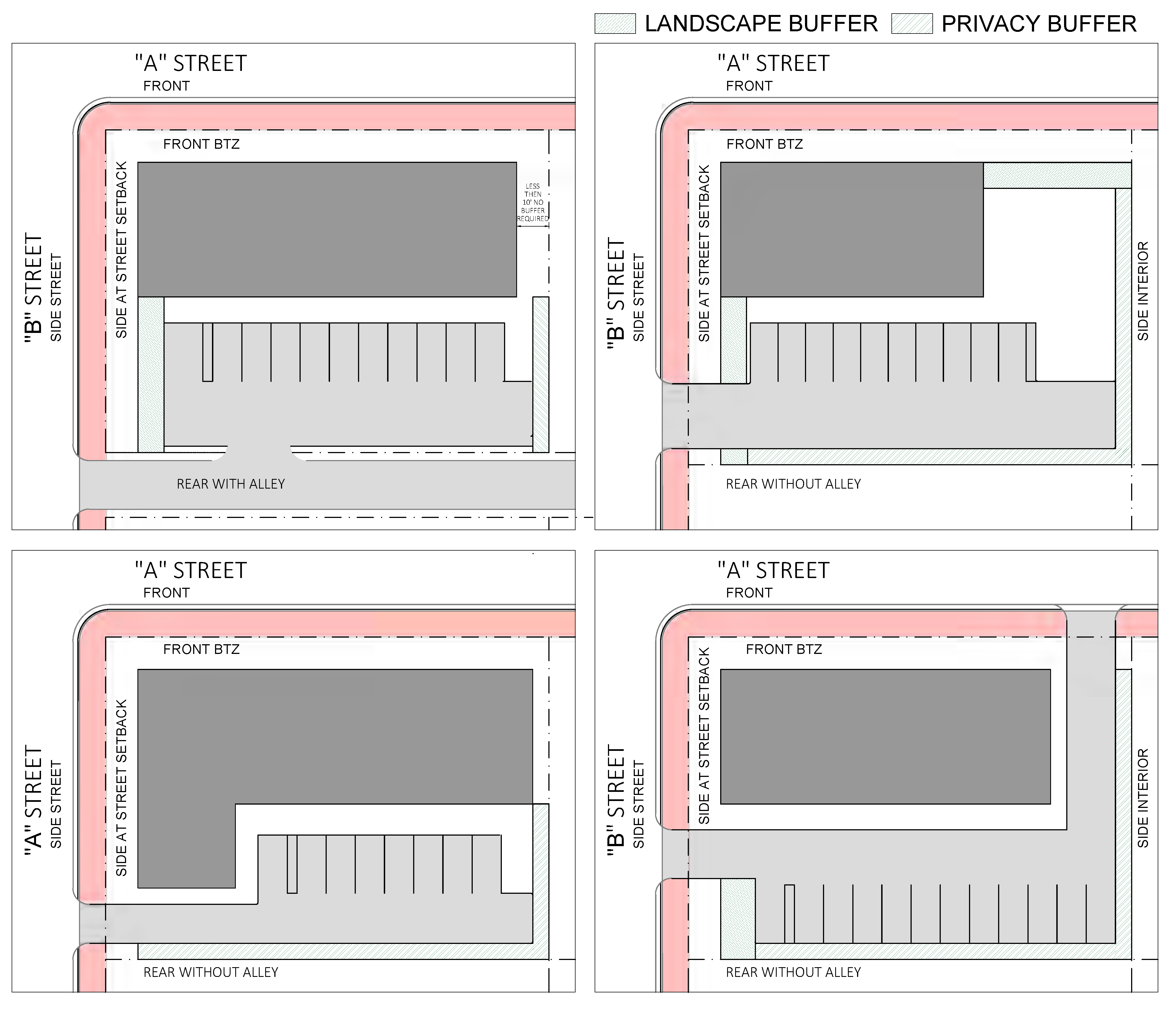
8.
Parking design standards.
a.
See Figure CD-37, Parking design dimensions.
b.
Where an improved alley is located along the side or rear property lines, improved alleyways may be used as part of the required back-up/drive aisle dimension for parking spaces.
c.
Materials. Vehicular access shall consist of concrete, brick or concrete pavers, asphalt, stamped pattern concrete systems, rock salt textured concrete with integral color, or other similar material approved by the development director.
FIGURE CD-37 - PARKING DESIGN DIMENSIONS
9.
Garages, structured parking and parking located within a building envelope.
a.
Garages shall not be the principal element of the front facade.
b.
Structured parking may be permitted through conditional use approval and shall provide shade on at least 30 percent of any exposed parking on the roof with an aged solar reflectance index (SRI) of at least 32, be a vegetated roof, or be covered by energy generation systems.
c.
All structured parking shall minimize the appearance of expansive blank walls along the ground floor through exterior design, architectural features, and landscaping. The intent is to provide an appealing facade from the sidewalk pedestrian perspective. Buildings which have parking located within the envelope shall be consistent with the design of the facades and be entirely screened. On "A" streets structured parking shall be screened by a liner building with active commercial or residential use provided for a depth of no less than 20 feet measured from the building facade. Landscaping shall be installed along the ground floor facade, within the public sidewalk or within on-street landscape islands. The visual impact of structured parking garage doors shall be minimized through architectural design and are not permitted on "A" streets.
d.
Access drives into the parking area on the ground floor shall be limited to one drive aisle at a maximum of 24 feet in width for buildings less than 100 linear feet in width and two drive aisles at a maximum of 24 feet in width each for buildings 100 linear feet in width and greater. If the property is adjacent to an alley, two drive aisles at a maximum of 24 feet in width each shall be permitted for buildings less than 100 linear feet in width. The development director may permit two 12-foot drive aisles for buildings less than 100 linear feet in width.
e.
Where maximum building heights are established in stories, all levels devoted to parking are considered as individual stories except when screened by a liner building with active use provided for a depth of no less than 20 feet measured from the front of the building. See Figure CD-38, Structured parking and active uses, for illustration. Under all circumstances the four-story height limit shall not be exceeded.
FIGURE CD-38 - STRUCTURED PARKING AND ACTIVE USES
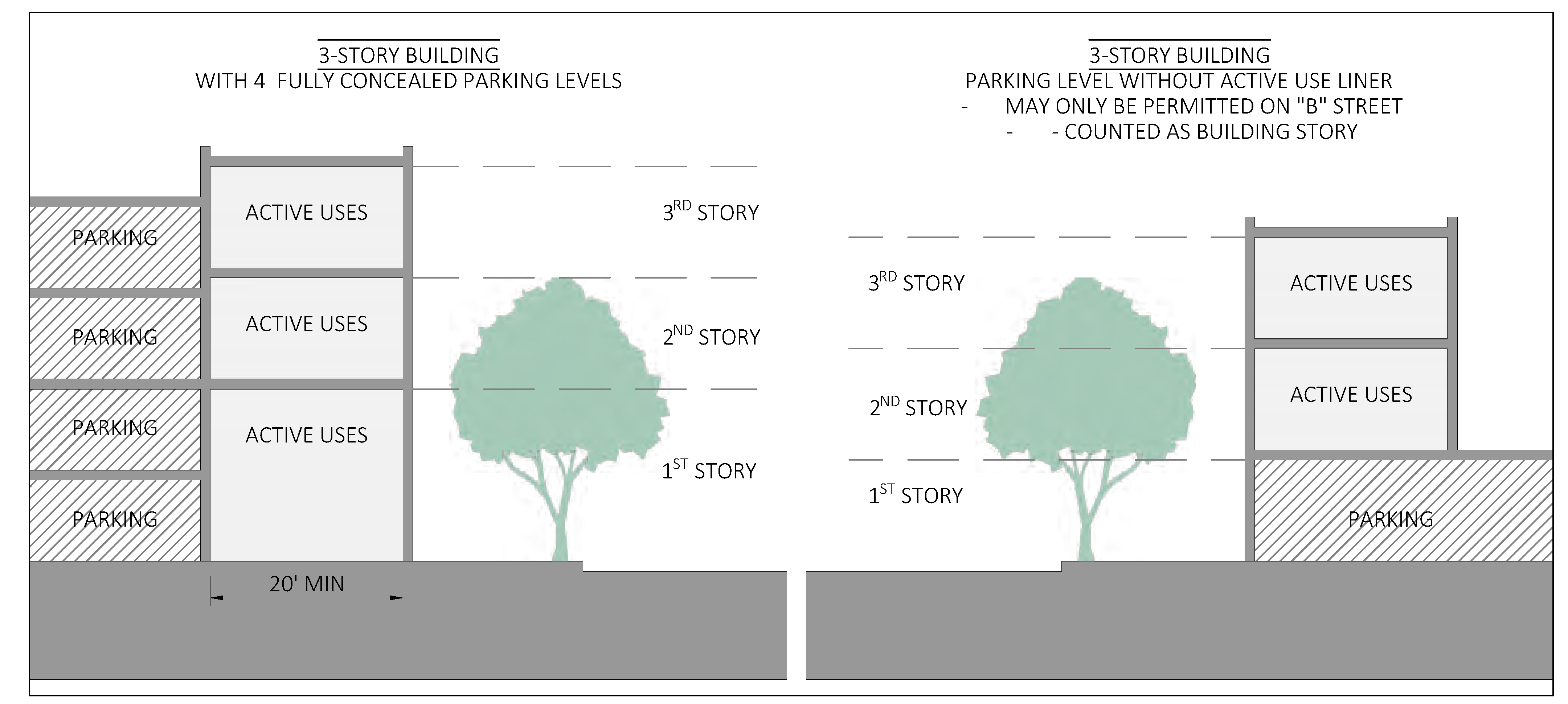
E.
Heat island effect. In order to reduce urban heat islands the following recommendations are provided for site design:
1.
Provide shade on at least 30 percent of non roof impervious surface on the site, including parking lots, walkways, plazas, etc.
2.
Use light-colored/high-albedo materials (reflectance of at least 0.3) for 30 percent of the site's non-roofed impervious surface
(Ord. No. 2498-2023, § 1(Exh. A), 2-13-23)
Sec. 3.04.08. - Stormwater standards.
Sec. 3.04.09. - Landscape and site standards.
A.
Figure CD-39 identifies which of the landscaping, buffering, tree protection, and site standards in section 6.04.00 apply in the Creek District and which standards are replaced, or do not apply.
FIGURE - CD-39 LANDSCAPE and SITE STANDARDS
B.
Landscape design. For all development a landscape plan shall be submitted and approved as part of the development approval process and prior to the issuance of a development permit. Landscape plans for a major development shall be prepared by a registered landscape architect. All landscape plans must show the location of existing or proposed utility lines that could be impacted by the vegetation being planted.
1.
Required landscape area and tree planting. Figure CD-40, Required Landscape area and tree planting, indicates the minimum number of trees and landscape area that must be planted.
FIGURE CD-40 - REQUIRED LANDSCAPE AREA AND TREE PLANTING
2.
The landscaped areas shall be located on the site as to maximize preservation of existing trees with priority given to specimen and/or historic trees as described in chapter V, Resource protection related development standards. The development director may grant a reduction in required trees to be planted for existing trees to remain.
3.
All required shade trees, as defined by chapter VI shall be 14 feet in height at installation, and have a DBH of not less than two and one-half inches.
4.
Where the location of required landscaping is precluded by existing buildings or permanent site improvements, the placement of landscaping may occur off-site in a right-of-way or other nearby public space, in openings within paved areas, or in other locations as determined by the development director or designee.
5.
Yards shall be sodded or otherwise landscaped in accordance with section 3.04.09.
6.
Impervious surfaces shall not be placed within five feet of the base of an existing tree to be preserved.
7.
Mulch shall be designed and installed in all planting areas to a depth of three inches. The type of mulch shall be Florida Friendly mulch and be specified on the landscape plan.
8.
Visibility triangles. All landscaping within a visibility triangle shall provide unobstructed cross-visibility at a level between three feet and six feet and shall comply with section 3.04.06 F
C.
Landscape and privacy buffers. See Figure CD-41, Minimum buffer types, for descriptions of required buffers.
FIGURE CD-41 - MINIMUM BUFFER TYPES
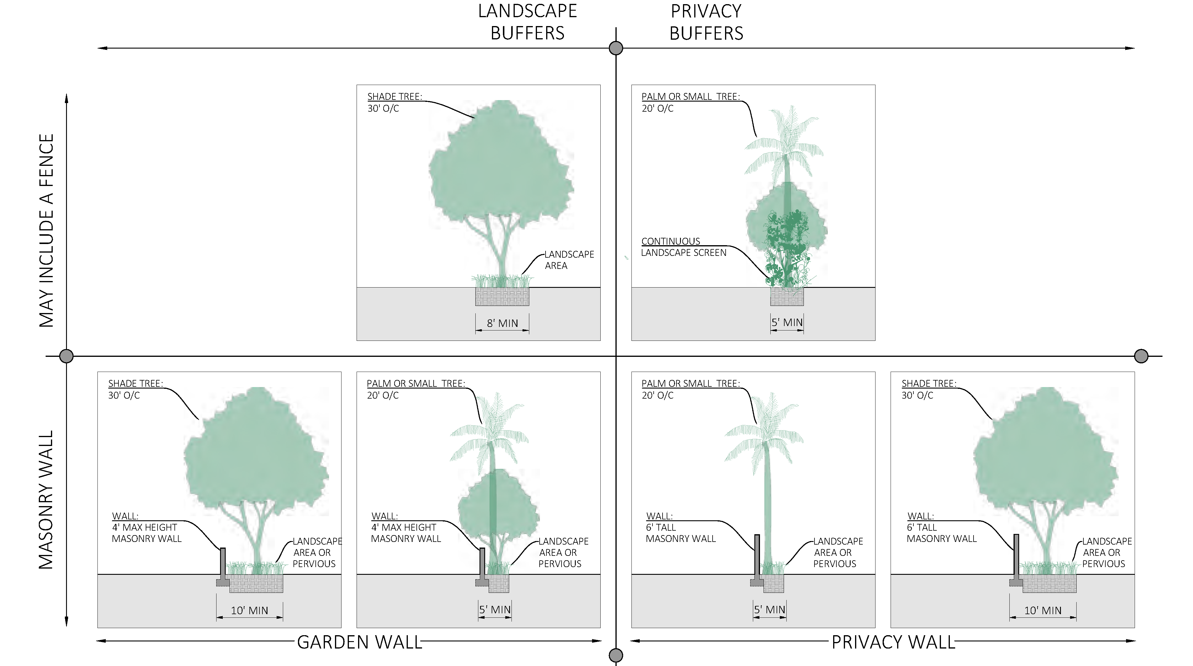
D.
Parking lot standards.
1.
Parking lot perimeter landscaping. Landscaping and privacy buffer requirements shall apply for any parking lot not entirely screened visually by an intervening building from abutting rights-of-way or private property. See Figure CD-35, Parking placement, and Figure CD-36, Parking placement diagram, in section 3.04.07, Access and parking standards.
2.
Parking lot interior landscaping.
a.
Interior landscaping shall include not less than one shade tree for every 500 square feet or fraction thereof of interior landscaped area.
b.
Any hedge materials located within an interior landscaped island shall be maintained at a height of not more than two feet.
c.
Not less than 80 percent of trees used in parking area interior landscaping shall be shade trees.
d.
Interior landscaped islands shall be provided between every ten parking spaces. Each interior island shall be not less than eight feet in width. Each interior island shall contain not less than one shade tree and a combination of shrubs, ground cover, grass, and mulch.
e.
Terminal landscaped islands shall be provided at the end of each parking row. Terminal landscaped islands shall not be less than eight feet in width and the length of the parking space. Each terminal island shall contain not less than one shade tree and a combination of shrubs, ground cover, grass and mulch.
f.
Interior landscaped medians shall be provided between every interior row of parking spaces and not less than six feet in width. Interior medians shall be landscaped with not less than one shade tree every 30 linear feet and a combination of shrubs, ground cover, grass and mulch.
g.
Parking lot interior landscaping shall utilize low-impact development strategies.
i.
If curbs are to be used, their number, placement and design should be carefully considered to allow percolation of stormwater. An openings shall be no less than 18 inches wide is to reduce the potential for clogging.
ii.
A minimum two-inch drop is required between the pavement and the vegetated area. A gravel area may be required to dissipate energy and prevent erosion at entry points to rain gardens or parking lot islands.
iii.
The street profile shall match the intended drainage; i.e., a crowned street will drain to both sides, or a side shed profile will drain to only one side.
3.
Excess parking lot spaces. Where the number of parking spaces installed in a surface lot exceeds the minimum number of on-site parking spaces required by this Code:
a.
Landscape buffers shall not be less than eight feet and shall include shade trees.
b.
For every additional five spaces, one shade tree shall be provided on site.
c.
All excess parking spaces shall be made of pervious hardscape such as pavement, concrete and/or pavers.
E.
Lighting. All development shall be designed to provide safe, convenient and efficient lighting for pedestrians and vehicles. Lighting shall be designed in a consistent and coordinated manner for the entire site. Light fixtures shall be designed as an integral design element that complements the design of the project through style, material or color.
1.
The use of exposed neon or LED rope lighting on any property is prohibited.
2.
Fixture height. Lighting fixtures shall be a maximum of 15 feet in height.
3.
Light pollution and spillage. Lighting shall be designed so as to prevent direct glare, light spillage and hazardous interference with automotive and pedestrian traffic on adjacent streets and all adjacent properties. Lighting shall be designed and installed so the light source does not shine directly onto adjacent residential uses or a residential zoning district.
a.
The applicant is encouraged to minimize light spillage from building and site and to reduce urban-glow. Dark sky approved lighting is encouraged.
b.
For perimeter exterior lighting, only full cutoff luminaries shall be approved.
c.
For commercial and major development projects the maximum allowable illumination at the property line of any adjoining parcel or public right-of-way is 0.2 horizontal and vertical foot-candles measured at six feet above grade level.
F.
Solid waste and recycling.
1.
Solid waste and recycling generation rates. Generation rates in section 6.08.01 are weekly and apply except where modified below in Figure CD-42, Solid waste and recycling weekly generation rates. Generation rates shall be calculated or reassessed with new development, substantial renovation, substantial improvement, or change of use.
FIGURE CD-42 - SOLID WASTE AND RECYCLING WEEKLY GENERATION RATES
2.
Location of solid waste and recycling storage and/or enclosures. All new development, substantial renovation, or change of use must provide sufficient on-site space and maintenance for the placement and collection of solid waste and recycling storage and/or enclosures. Excluding improved alleys, all solid waste and recycling storage shall be screened from view from public rights-of-way.
a.
Screening may be achieved by with a buffer as described in Figure CD-41, Minimum buffer types, a freestanding enclosure, or an enclosure within the building footprint. Where more than six roll-out carts are required an enclosure shall be provided.
b.
The location of solid waste and recycling storage and/or enclosures:
i.
Shall be accessed from the alley if an improved alley is present.
ii.
Prohibited on "A" streets as shown in Figure CD-07, Thoroughfare plan.
iii.
Where an alley is not present, solid waste and recycling storage and/or enclosures shall be located to prevent conflict with pedestrians, minimize the quantity and length of curb cuts, and promote a high quality, livable public realm.
c.
The utilities and engineering director encourages businesses under the same ownership or within the same block to share enclosures to meet required enclosure standards.
d.
Design of freestanding solid waste and recycling storage enclosures shall have:
i.
A six-feet tall finished concrete wall on three sides. Use of chain link or wooden fencing to meet this requirement is prohibited.
ii.
Closable, lockable opaque gates. Gates may be opaque inserts within a chain link gate.
iii.
Landscaping around the enclosure is not required.
iv.
Bollards are required to be located at the rear of enclosure only.
v.
Enclosure size shall be a minimum ten feet by ten feet (interior dimensions). Larger enclosures shall be provided as necessary to house larger proposed or required containers.
(Ord. No. 2498-2023, § 1(Exh. A), 2-13-23)
Sec. 3.04.10. - Fence and wall standards.
A.
Fence and wall principles. All development including public improvements shall incorporate the following fence and wall principles:
1.
Fences or walls shall be in harmony and compatible with their surroundings.
2.
All fences and walls shall be maintained in good repair on both sides, so as to be structurally sound.
3.
No fences, walls, or hedges may be located within the intersection sight-triangle as set forth. See section 3.04.06 F.
4.
Obstruction of water drainage. In no case shall a fence or wall restrict the natural sheet flow of water or impede movement of drainage water from swales, drainage ditches, etc.
B.
Construction fences. All development projects greater than a half acre shall install with a temporary six feet chain link fence with obscure green or black fabric of uniform color or other visual barrier material approved by the development director around the site prior to the initiation of the construction phase.
C.
Materials.
1.
Fences and walls shall be constructed with one or more of the materials listed in Figure CD-43, Fence and wall materials.
FIGURE CD-43 - FENCE AND WALL MATERIALS
2.
Metal fences shall be minimum of 11 gauge non-corrodible metal or galvanized wire fabric. Chain link fences shall be vinyl coated in green or black. Chain link fences shall not be visible from public rights-of-way. Chain link fences may be concealed by landscaping and shall only be located on the side and rear yard.
3.
Fences and walls shall be finished on the exterior side where all framing is facing the interior.
4.
Dangerous materials prohibited.
a.
No fence, wall, or other enclosures shall include materials or devices, such as broken glass, spikes, razors, nails or similar materials intended or designed to maim, mutilate or cause other bodily injury to any person or animal.
b.
Electrically charged fences are prohibited.
c.
Barbed wire fences are hereby prohibited, unless approved as necessary to protect the public from hazardous conditions.
D.
Height.
1.
Fences located in the front yard shall have a maximum height of four feet along the front and side property lines to the front facade of the principal building. Along the side property lines behind the front facade and along the rear property line a fence may be no more than six feet in height. See Figure CD-44, Wall and fence locations, for an illustration of front, rear, and side yards.
2.
The height of fences and walls shall be measured from existing natural elevation of a lot, prior to any construction or alteration.
3.
An entryway bower, arbor, or trellis, constructed in conjunction with a fence or wall, shall not exceed a maximum height of nine feet, measured from existing grade.
FIGURE CD-44 - WALL AND FENCE LOCATIONS
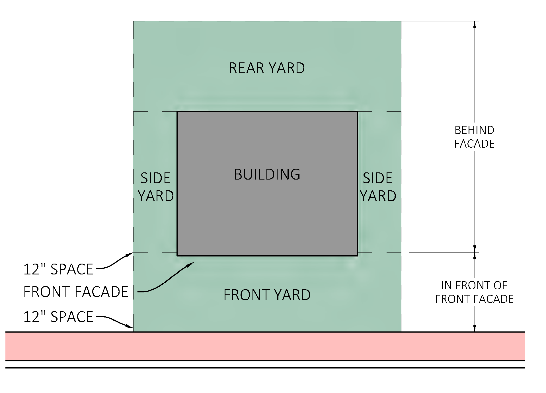
(Ord. No. 2498-2023, § 1(Exh. A), 2-13-23)
Sec. 3.04.11. - Sign standards.
A.
Figure CD-45, Sign standards, identifies which of the sign standards in section 6.11.00 apply in the Creek District and which standards are modified, replaced, or do not apply.
FIGURE CD-45 - SIGN STANDARDS
B.
Aesthetic attributes. In addition to section 6.11.05, signage within The Creek District shall follow the material standards set forth in Figure CD-46, Sign material standards.
FIGURE CD-46 - SIGN MATERIAL STANDARDS
| PERMITTED | PERMITTED | PROHIBITED | ||
|---|---|---|---|---|
MATERIALS | Sign materials shall be high quality, durable and easy to maintain. |  |  |  |
|
Metals, wood, and wood-like materials like high-
density-urethane | Well maintained painted signs | Vinyl banners, acrylic and Plexiglas |
C.
Illumination. In addition to section 6.11.07, signage within the Creek District shall follow the material standards set forth in Figure CD-47, Sign lighting standards.
FIGURE CD-47 - SIGN LIGHTING STANDARDS
| PERMITTED | PERMITTED | PROHIBITED | ||
|---|---|---|---|---|
POWER SOURCE |
Sign lighting should be
integrated into the architectural features of the building. Power sources, raceways and conduits shall not be visible. |  |  |  |
| Gooseneck lighting |
Face illuminated channel
letters mounted on wireway |
Face illuminated channel
letters mounted on exposed raceway | ||
ILLUMINATION |
Signs shall be lit to
encourage continuous activity and advertise the business at night. Halo- lit or reverse channel lit consist of aluminum faces and sides mounted away from the wall. |  |  |  |
|
Reverse channel LED
halo-lit letters |
Front-lit LED channel
letters with translucent acrylic faces | Fluorescent lighting, exposed neon, LED rope or similar perimeter lighting, electronic changeable copy sign |
D.
Building outline.Section 6.11.08 applies except building outline perimeter lighting of neon, LED rope lighting, or similar is prohibited.
E.
Permitted signs.Section 6.11.12 applies except where modified in Figure CD-48, Types of signs permitted.
FIGURE CD-48 - TYPES OF SIGNS PERMITTED
| EXAMPLE | ||||
|---|---|---|---|---|
A-FRAME |
Sandwich or A-frame sign provided the signs do not exceed 6 square feet per face,
are located on private
property, do not obstruct pedestrian or vehicular movement, and are removed by 9:00 p.m. daily. |  | ||
AWNING | Signs consisting of one line of letters not exceeding nine inches in height may be painted, placed or installed upon the hanging border. A graphic or other similar feature not exceeding an area of eight square feet, may be painted, placed, or installed elsewhere on any awning provided that any such graphic shall comply with all other sign standards. |  | ||
| Winter Park, Florida by Boogich on Getty Images | ||||
GROUND SIGNS:
FREESTANDING | Freestanding signs shall be wood or composite material supported by 2 wood or composite posts, with the top edge of the sign no higher than 6 feet above the finished grade, and shall not exceed six feet in width. Each post shall have ornamental post caps or covers. A freestanding sign shall not be used as a frame for a cabinet sign. Freestanding signs shall be lit with integrated lighting, externally lit by concealed lighting or gooseneck lighting. |  | ||
GROUND SIGNS:
MONUMENT |
Monument signs shall be composed of metal frame, textured brick,
concrete block, or other masonry, and finished with stucco or other textured material, and having a solid base. The top edge of the sign shall be no higher than elsewhere permitted in Sec. 6.11.17, and the skirt and base shall be no smaller than 80 percent of the sign width nor greater than 120 percent of the sign width. A monument sign shall not be used as a frame for a cabinet sign. | 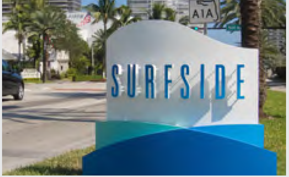 |  | |
|
Metal monument sign with
individual letters | Metal monument sign with push through or routed copy | |||
PROJECTING | Projecting signs. A projecting sign is affixed to a structure and extends at a right angle from the structure. | 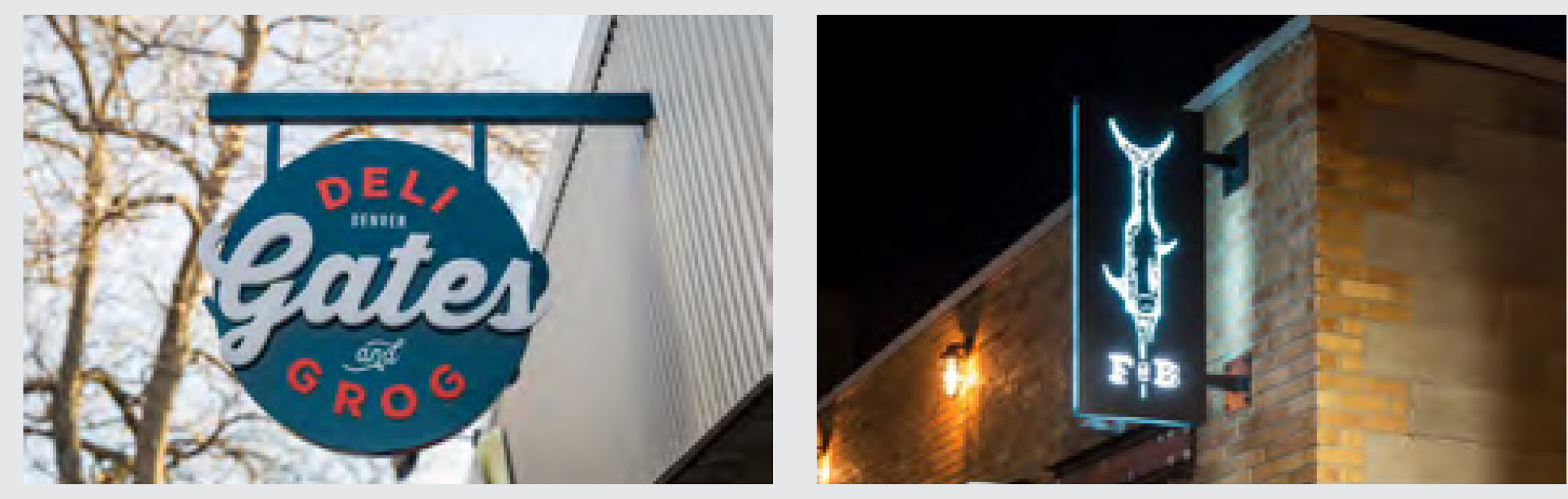 | ||
|
1. A projecting sign shall not have more than two sign faces.
Projecting signs may project into the public right-of-way. Projecting signs shall have clear height of no less than 9 feet and be no closer than 2 feet from the curb. | ||||
| 2. Signs must not project more than six feet from the wall face of a building. | ||||
|
3. The permitted size of a fixed
projecting sign shall not exceed 16 square feet. | Supported by metal brackets. These signs can come in all shapes and sizes and are sometimes made in the likeness of objects and symbols associated with an actual type of business. | |||
UNDER CANOPY |
A sign hung from the underside of an awning, canopy, ceiling of an arcade, covered
walkway, or portico. It may be rigid or it may swing. Any
swinging sign shall be removed during a major storm event. Sign shall not have more than two sign faces. No portion of any sign projecting over a public sidewalk shall be less than nine feet above the grade of the sidewalk. Any sign projecting over private property and located where motor trucks may be required to pass beneath it shall be erected and maintained at a height of not less than 14 feet. | 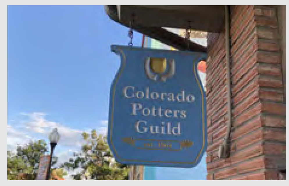 |  | |
| Under canopy | Under arcade or roof | |||
WINDOW |
Window sign shall not cover more then 40% of the window. Window signs are very helpful
at a pedestrian scale and often tell patrons the
business name, operating hours, or additional details about the business or promotions. |  | ||
WALL SIGN | A wall sign shall be flush mounted, raised channel, or individual letters and may be applied to the building face. Plastic face box or cabinet signs shall not be allowed. |  |  | |
| Cabinet side with push through or routed copy | Individual letters | |||
WALL SIGN:
PAINTED |
Mural signs shall be counted as wall signs for the portion which includes any message,
logo or which depicts a product or service, and shall be of such a design as to complement
the architectural style of the subject
building and shall be in keeping with the general character of the district. There shall be a maximum of only one mural sign per building. The sign portion of a mural sign, if any, shall comply with the dimensional requirements of a wall sign. |  | ||
| A wall sign shall be professionally hand-painted on building face. | ||||
PERMITTED SIGNAGE
ILLUSTRATION | 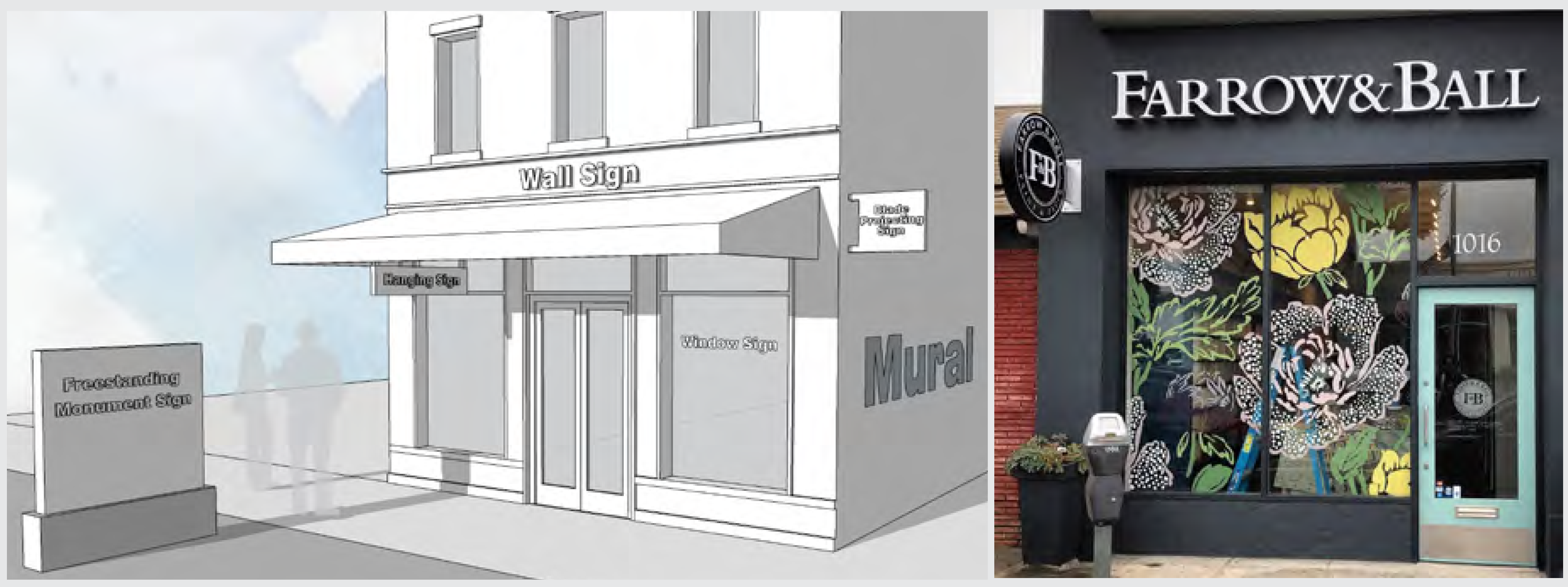 | |||
| Activity inside can be seen by those outside the building. The signs are of high quality durable materials. The scale of signage should address both the pedestrian and those traveling by vehicle. | ||||
F.
Mural.Section 6.11.14 D, Mural, applies except when a mural is interior to development and not visible to public right-of-way, parks, public land or vista, the approval of CRA is not required.
G.
Non-residential and multi-family residential real estate signs.Section 6.11.15 G applies except when the duration of sign posting exceeds that of a temporary sign, six months per year or less, the sign shall require a permit and conform to permitted sign standards.
H.
Prohibited signs.Section 6.11.16 applies except where modified in Figure CD-49, Types of signs prohibited.
FIGURE CD-49 - TYPES OF SIGNS PROHIBITED
| PROHIBITED | |||
 |  |  |  |
| Adverting flags including feather flags and tear drop flags | Murals which are advertising or painted wall signage which exceed permitted dimensions | Face illuminated cabinet sign, back-lit sign panels | Vinyl banners hung from awnings, roof fascia or arcade |
 |  |  | |
| Billboards, single pole and pylon signs | Electronic changeable copy signs | Window signs exceeding 40% of glazing area. It can be perceived as visual clutter. | |
(Ord. No. 2498-2023, § 1(Exh. A), 2-13-23)
Sec. 3.04.12. - Architectural standards.
A.
Historic preservation. Structures identified as historically and architecturally contributing shall be candidates for historic protection as set forth in section 5.09.00.
B.
Building additions. The exterior appearance of additions to an existing building shall be compatible with the overall building type. For example, exterior walls should be of the same or compatible materials and finished in the same manner as the existing structure. Windows should also be of the same type or be complementary with the existing windows.
C.
Architectural character.
1.
Building colors and finishes. All exterior building wall colors used within the Creek District shall be restricted to muted pastel, whites, neutrals tones, or earth-toned shades. The use of black or florescence colors is prohibited as a predominant exterior building color. Exterior colors shall be approved by the development director.
2.
Architectural features. The ground floor shall be differentiated from upper floors through the use of strong cornice lines, awnings, distinct but compatible exterior colors or materials, exterior lighting, colonnades or overhangs that cover the sidewalk, increased setback for upper floors, or similar treatments. Architectural treatments on the principal facade shall extend to all faces of the building adjacent to a public right-of-way, with the exclusion of alleys.
3.
Blank walls. Long, windowless, uninterrupted walls are not permitted. Blank wall areas shall not exceed 20 feet in horizontal direction of any facade adjacent to a public right-of-way, with the exclusion of alleys.
4.
Roofs and gutters.
a.
Exposed gutters shall be half-round metal gutters.
b.
For buildings which are located not more than five feet from the front property line, gutters must be shielded and shall not drain onto hardscape. Downspouts may be enclosed within a column or other architectural feature. Rain-barrels, cisterns, and other low impact development strategies are encouraged.
c.
Clay or cement barrel, s-shaped, flat cement, or mission tiles shall be a shade of "red," "ochre," "cream" and "white" color shades provided that such coloring is integral to the clay or cement. No glazed or painted clay or cement tiles shall be allowed. No other shape of clay or cement tiles shall be permitted.
d.
Flat roofs shall have a parapet.
e.
Pitch roofs shall not have a ratio less than 3-12.
f.
Aluminum fascia and soffits are not permitted.
g.
Heat island effect. In order to reduce urban heat islands for roofed areas, it is recommended to use Energy Star roof-compliant, high-reflectance and high emissivity roofing or install a "green" (vegetated) roof for at least 50 percent of the roof area.
5.
Windows and doors. The following window and door types are encouraged:
a.
Operable windows.
b.
Operable shutters which are sized to match openings.
c.
Bahama shutters.
d.
Operable Paris balconies.
e.
Bird friendly glazing for structures three stories and greater.
(Ord. No. 2498-2023, § 1(Exh. A), 2-13-23)