


Beaumont City Zoning Code
17.19.030
Zoning map.
The location and boundaries of the various zones within Downtown are delineated on the zoning map of the City of Beaumont. Figure 17.19-1 illustrates the zone districts for Downtown. All property within the Downtown, public and private, is assigned a specific Zone designation and its location and extent is noted on the official zoning map. The use of all property must be in accordance with the Zoning designations delineated on the zoning map and pursuant to the provisions of this Zoning Code.
A.
Use of Zoning Map and Classifications. The requirements that are applicable to each Zone classification is specifically set forth in subsequent articles of this ordinance.
B.
Uncertainty in Cartography. Where uncertainty exists as to the boundaries of any zone, the following rules shall apply:
1.
Cartography. Where boundaries are indicated as approximately following street lines, alley lines, or lot lines, such lines shall be construed to be such boundaries.
2.
Easements and Rights-of-Way. Dedicated streets, alleys, freeways, or railroad rights-of-way shall be deemed to be unclassified.
3.
Vacated or Abandoned Property. If any public street, alley or other right-of-way is vacated or abandoned, the land formerly in such street, alley or right-of-way shall be included within the Zoning of the adjoining property on each side.
4.
Amendments to the Official Zoning Map. Changes in boundaries of Zones shall be made by ordinance (as described in Section 17.02). All amendments to the zoning map shall be noted on the Map with the date of the amendment and references to the amending ordinance.
Figure 17.19-1. Downtown Zones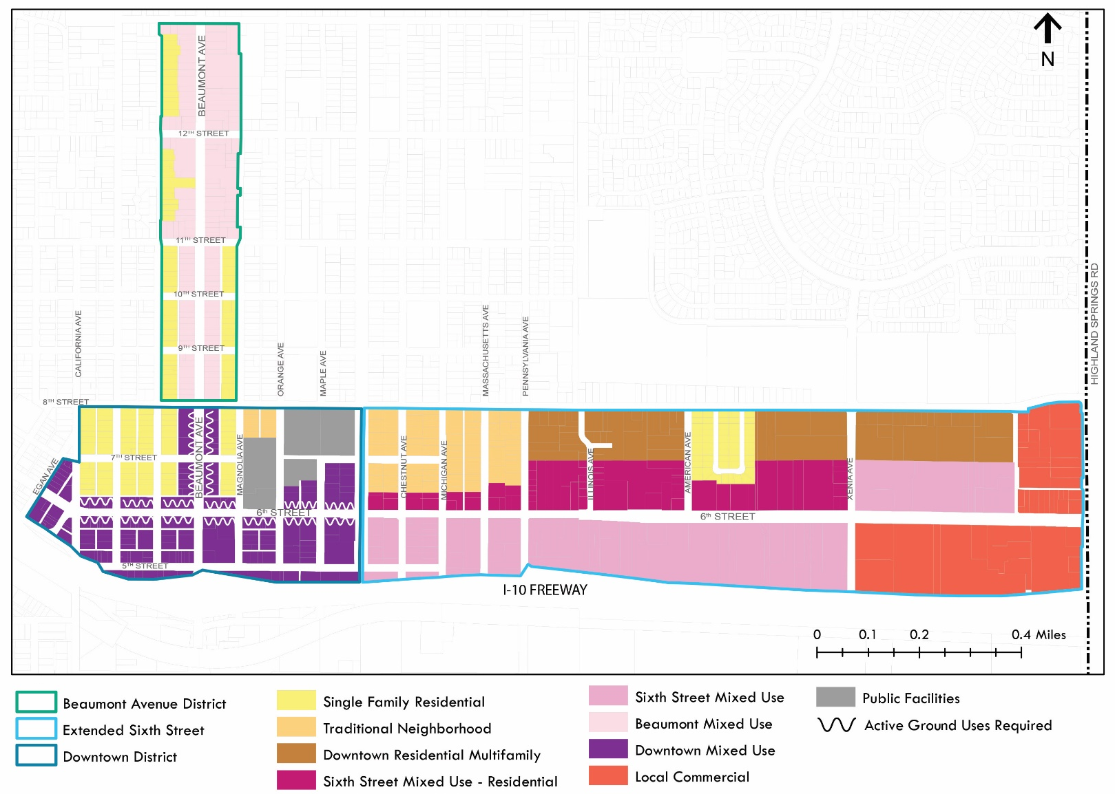
(Ord. No. 1128, § 2(Exh. B), 12-1-2020)