
Bluffdale City Zoning Code
11.110 SPECIAL
PURPOSE AND OVERLAY ZONES
2015-14
2018-24
10-24-00-1
2005-17
2009-04
2014-18
2015-04
2007-09
2019-21
2013-20
2022-08
2019-05
2016-07
2021-05
2016-05
2019-19
2022-01
2023-03
2017-07
2018-21
2019-01
2025-07
2021-18
2019-10
2023-25
2018-20
2021-14
2022-16
2025-16
2024-19
11.110.010.010 Purpose And Zone Characteristics
The GW-R Gateway Redwood Zone is established to provide an attractive entry corridor into City of Bluffdale. The purpose of the GW-R Zone is to encourage and allow development of a wide range of commercial and mixed use developments to establish a community shopping center and to create and enhance the aesthetics and ambiance, architecture, and character of the district as further identified in that certain conceptual master plan and design guidelines ("Concept Plan and Design Guidelines") which has been approved by the City in connection with this zoning ordinance.
This area is highly visible and will have a significant impact on the image of the community. The GW-R Zone is located at a major entrance to the City. The Redwood Road-Bangerter Highway intersection is an intersection of two (2) arterial roads within City of Bluffdale. (Ord. 2015-14, 12-9-2015)
11.110.010.020 Permitted, Conditional And Accessory Uses
- Permitted Uses: The following land use types are permitted uses in the GW-R Zone. Unless specifically listed, any other use is not a permitted use in the zone. Uses listed as conditional or accessory uses are allowed in the zone only in accordance with the criteria established in this title:
Agricultural products.
Automotive service (except in transition area described in section 11-11A-11 of this article).
Bank or financial institution (excluding loan center).
Business services.
Car wash.
Convenience store/gas station.
Daycare center.
Farmers' market.
Funeral home.
Hotel.
Kennel (inside boarding only).
Laundry services.
Liquor store.
Loan center.
Medical service (excluding blood or plasma donation facilities).
Movie theater.
Municipal offices.
Museum.
Nursery.
Nursing home.
Office, general.
Personal instruction service.
Personal service establishment.
Preschool/daycare center.
Public uses.
Reception center.
Recreation and entertainment (indoor).
Recreation and entertainment (outdoor).
Repair service.
Rest home.
Restaurant.
Retail, general.
School.
Tattoo establishment.
Tobacco specialty business.
Veterinary service. (Ord. 2015-14, 12-9-2015; amd. Ord. 2018-24, 9-26-2018) - Conditional Uses: The following land use types are allowed as conditional uses in the GW-R Zone. Unless specifically listed, any other use is not a permitted use in the zone. Each conditional use must be reviewed and approved in accordance with chapter 20 of this title.
None. - Accessory Uses: The following land use types are allowed as accessory uses in the GW-R Zone. Unless specifically listed, any other use is not allowed as an accessory use in the zone. Any accessory use must be clearly incidental to a permitted or conditional use of the property. Accessory uses are not allowed without the approval of a permitted or conditional use of the parcel unless otherwise noted in this section. Off street parking lots or structures. Storage facilities for machinery and equipment as an accessory use to a permitted or conditional use (enclosed). Trails, paths, and other pedestrian facilities. (Ord. 2015-14, 12-9-2015)
11.110.010.030 Lot Access
All lots and parcels in the GW-R Zone shall have access to a public street, public right-of-way, or an approved private right-of-way. All lots and parcels shall have reciprocal cross access easements with every other lot and parcel in the GW-R Zone. (Ord. 2015-14, 12-9-2015)
11.110.010.040 Setback And Build-To Requirements
Unless a lot or parcel is adjoining a public road or residential zone, no setbacks shall be required. Setbacks adjacent to a public road or residential zone shall conform to the "Concept Plan and Design Guidelines". (Ord. 2015-14, 12-9-2015)
11.110.010.050 Projections Into Setbacks
- The following structures may be erected on or projected into any required setback:
- Fences and walls in conformance with all applicable City ordinances and resolutions.
- Parking stalls.
- Necessary underground appurtenances for utility service.
- The following structures may be erected on or projected into any required front or rear setback not more than four feet (4'), and into a side setback not more than two feet (2'):
- Cornices, eaves, sills, buttresses, or other similar architectural features.
- Awnings, decks and planter boxes.
- Necessary aboveground appurtenances for utility services.
- Signs (including monument and pylon signs). (Ord. 2015-14, 12-9-2015)
11.110.010.060 Building Height Requirements
Retail buildings or structures, including those located in the retail core identified in the "Concept Plan and Design Guidelines" may not exceed forty feet (40') in height, nor be lower than ten feet (10') in height. Buildings or structures located in the office area identified in the "Concept Plan and Design Guidelines" may not exceed one hundred feet (100') in height, nor be lower than ten feet (10') in height. (Ord. 2015-14, 12-9-2015)
11.110.010.070 Distance Between Buildings
All buildings shall conform to the "Concept Plan and Design Guidelines" and shall meet all then applicable Construction Codes. (Ord. 2015-14, 12-9-2015)
11.110.010.080 Minimum Landscaping Requirement
The entire project within the GW-R Zone shall contain a minimum of fifteen percent (15%) landscaping in accordance with the adopted "Concept Plan and Design Guidelines". Individual lots will be averaged within the project, including setback areas to satisfy this requirement, pursuant to City phased development requirements. (Ord. 2015-14, 12-9-2015)
11.110.010.090 Parking, Loading And Access
- Each project in the GW-R Zone shall satisfy the off street parking requirements found in chapter 12 of this title. Notwithstanding the foregoing, parking requirements may be adjusted by the City based on a professionally prepared shared parking analysis. The spaces shall be hard surfaced with asphalt or concrete and shall be accessed from a public road by a hard surfaced, composed of asphalt or concrete, drive approach. There will be no maximum limit to the amount of parking that may be provided.
- Loading and unloading shall not occur on a public street. (Ord. 2015-14, 12-9-2015)
11.110.010.100 Massing Of Buildings
Buildings shall conform to the "Concept Plan and Design Guidelines". (Ord. 2015-14, 12-9-2015)
11.110.010.110 Transition Into Residential Areas
- Notwithstanding subsection 11-15-6E of this title or any other ordinance to the contrary, the transition into residential areas, defined as south of 13970 South from Redwood Road to the proposed roundabout, shall include a minimum ten foot (10') wall with appropriate landscaping on the property line as depicted in the "Concept Plan and Design Guidelines".
- In order to promote the compatibility between the GW-R Zone and any residential zone, the Land Use Authority may require special conditions, including, but not limited to, the following:
- Businesses located in the transition area shall not transact business between nine o'clock (9:00) P.M. and seven o'clock (7:00) A.M., including garbage collection and deliveries.
- No automotive businesses are allowed in the transition area.
- That a twenty foot (20') landscaping buffer as shown on page 15 of the "Concept Plan and Design Guidelines" is required to be installed.
- Any business located within the transition area shall only be allowed to have exterior speakers on the north side of any building, pointed away from the adjacent residential properties to the south.
- Restrictions on lighting, emissions, noise, and other potential impacts.
- Appropriate screening.
- Parking lot lighting south of 13970 shall be:
- Illuminated adequately for security and safety, but such illumination shall be controlled to prevent glare and avoid decreasing the visibility of neighboring properties;
- Installed at a maximum height of twenty five feet (25');
- Designed so the minimum illumination at grade level, immediately adjacent to southernmost boundary is between twotenths (0.2) and three-tenths (0.3) foot-candle in residential zones. (Ord. 2015-14, 12-9-2015)
11.110.010.120 Design Guidelines And Motif
Buildings constructed within the GW-R zone shall conform to the "Concept Plan And Design Guidelines". (Ord. 2015-14, 12-9-2015)
11.110.010.130 Landscaping Of Roadway Frontage
Parcels located adjacent to any roadway shall be required to provide attractive and appropriate landscaping of the frontage area that conforms with the "Concept Plan And Design Guidelines". All landscaping shall be maintained by the owners of the project. (Ord. 2015-14, 12-9-2015)
11.110.010.140 Other Requirements
The following requirements are in addition to the requirements found in this article, the general provisions or supplementary provisions of this title, or any other applicable resolution or ordinance.
- Signs: Signs shall conform to the "Concept Plan And Design Guidelines" and shall be located within a forty foot (40') radius of the location depicted in the "Concept Plan And Design Guidelines". Due to the size and nature of the GW-R zone, the purposes and objectives pertaining to signage in the GW-R zone are significantly different from those of any other area in the city. Therefore, the regulations applicable to signage in the GW-R zone shall also differ significantly from the regulations applicable to signage in other areas of the city. Signage in the GW-R zone shall be subject to more exacting/stringent requirements as to architectural style and aesthetics and shall also have more liberal treatment as to off premises signage than other areas in the city. The more stringent requirements (as to aesthetics) and the more liberal treatment (as to off premises signage) are justified by the following:
- Future development in the GW-R zone will be the most intensive area of commercial activity in the city both in terms of size (acreage) and commercial activity (based on retail sales) as compared to any other development in the city. The area of the GW-R zone is effectively the commercial hub of the city. It is anticipated that with the adoption of the GW-R zone, commercial activity will become even more intense with the addition of new retail buildings, office buildings and parking structures. Signs which allow off premises advertising are consistent and compatible with a development of this size, scale and intensity of use while they are not appropriate in most other commercial areas of the city. Off premises signage is allowed in other large commercial and mixed use developments throughout the country that are similar to the anticipated development in the GW-R zone and the city has determined that limited off premises signage will also be compatible in the GW-R zone.
- The signage allowed in the GW-R zone, including off premises signage, will enhance the aesthetic quality of the GW-R zone. Unlike any other zone or area in the city, signage in the GW-R zone will be required to conform to strict standards of architectural style and aesthetic quality. Signage in the GW-R zone is considered a critical component of development in the zone, not just for the messages they contain, but also for the aesthetic appeal of the signs themselves. In addition to their architectural quality, different types of signs, including allowable off premises signs, are intended to enhance the aesthetic quality of the development in several ways, including, but not limited to, the following:
- Identifying the area as a hub of commercial commerce.
- Drawing attention to the site, its branding, and its tenants.
- Enhancing the appearance of the development from major roadways.
- The overall signage scheme in the GW-R zone, with its variety in types of signs combined with the unique architecture, style, light, color and electronic display is designed to create a visual experience and a sense of excitement, energy and vibrancy that cannot be achieved or replicated on smaller, individual parcels. This will enhance the quality of the GW-R zone as a "destination" and gathering place for consumers in the city, county and state.
- Signage in the GW-R zone, including off premises signage, will be part of a controlled and coordinated whole that is designed to enhance and be harmonious with its surroundings as opposed to an uncontrolled and uncoordinated scheme of individual sign approvals.
- Signs allowed in the GW-R zone may include:
- Marquee: Large entry signs are signs that are located at an entrance to the GW-R zone. Large entry signs shall not exceed a height of one hundred feet (100') and shall have a maximum of three hundred (300) square feet of electronic signage and two hundred (200) square feet of static signage per sign panel. Marquee signs may have up to four (4) sign panels and may include an electronic screen on all or part of the sign panels. A total of two (2) marquee signs are permitted in the GW-R zone.
- Entry Monument: The entry monument sign shall not exceed a height of sixty feet (60') and shall have a maximum of fifty (50) square feet per sign face. The entry monument sign may include an electronic screen as all or part of the sign panels. There may be one entry monument sign in the GW-R zone.
- Monument: Monument signs shall not exceed a height of twenty feet (20') and shall have a maximum of ten (10) sign panels with twenty (20) square feet per sign face. Monument signs may include an electronic screen as all or part of the sign panels. A total of twelve (12) monument signs are permitted in the GW-R zone.
- District Area Sign: A single "district area sign" may be located within GW-R zone along Bangerter Highway and may operate as a nonappurtenant advertising sign advertising off premises uses, notwithstanding any other provision in this code to the contrary, provided that the sign meets the following requirements:
- May not exceed a height of forty feet (40') measured from the grade underneath the sign;
- May be no larger than a maximum of seven hundred (700) square feet per sign face and no more than fifty (50) square feet of additional static advertising space per sign face;
- May have up to two (2) sign faces and each face shall contain an electronic display face which meets the requirements set forth in subsection 11-22-14G7 of this title; and
- Shall be veneered with materials such as brick or stone, or shall be covered with other materials that are consistent with other signs within the GW-R zone.
- Wall: Wall signs will also be allowed on the perimeter of all commercial structures. Wall signs shall not exceed ten percent (10%) of the sum total of the square footage of the wall on which the sign is located. Additionally, accessory signage such as wayfinding, menu boards, and informational signs are allowed provided such signs shall conform to the "Concept Plan And Design Guidelines".
- Each sign must use materials and colors consistent with the "Concept Plan And Design Guidelines" and all signs shall comply with subsection 11-22-14G7 of this title.
- Landscaping: Each developed lot or parcel shall be completely landscaped except those areas used for buildings or parking. Landscaping shall be consistent with the "Concept Plan And Design Guidelines". Undeveloped lots or parcels shall have gravel caps or natural grasses and/or ground covers which shall be mowed and maintained in a commercially reasonable fashion. All landscaping, including frontage park strip landscaping, shall be maintained by the property owner or other acceptable association.
- Trash, Junk And Other Debris: No trash, used materials, unsightly storage of any kind, or nonlicensed or abandoned vehicles shall be stored in an open area. All such materials shall be enclosed in a building. Notwithstanding the foregoing, recycling facilities and seasonal sales areas shall be permitted provided such areas are maintained in a commercially reasonable manner.
- Design Guidelines: In addition to satisfying this article and the "Concept Plan And Design Guidelines", except for the anchor tenant prototype elevations which have been approved in connection with the "Concept Plan And Design Guidelines", no building permit may be issued until approvals have been obtained by an architectural control committee which shall be established pursuant to one or more declarations to be recorded against the property comprising the GW-R gateway redwood zone.
- Architectural Features: Any approved architectural theme or motif shall be extended to all sides of each building in the development.
- Pedestrian And Bicycle Facilities: The project shall provide trails, walkways, sidewalks, bike racks, or other pedestrian and cycling facilities. These facilities shall link to other existing or planned pedestrian facilities in the community and be similar in size and contain compatible materials in relation to other existing or planned facilities.
- Solid Waste: The project shall contain solid waste receptacle areas enclosed with a solid masonry wall using materials and colors found within the development, with the exception that a solid, sight obscuring fence or gate for access will be allowed on one side.
- Lighting: The lighting in each development shall be ample to provide safety and convenience to patrons of the development, including streetlights where required. Directional lighting shall be focused on the intended area and be designed to reduce, to the extent possible, overspill to adjacent property. Photometric plans shall meet the city's outdoor lighting ordinance requirements except that north of 13970 South:
- Parking lot lighting may be installed up to a maximum height of thirty five feet (35'). Height shall be measured from the ground surface being illuminated to the bottom of the lighting fixture.
- Parking lot lighting shall be designed so the minimum illumination at grade level is between three-tenths (0.3) and fivetenths (0.5) foot-candle and the ratio of average parking lot illumination to minimum parking lot illumination shall not exceed four to one (4:1).
- Utilities: All utilities in the GW-R zone shall be located underground unless the utility provider has written policies which preclude underground utilities.
- Continuous Operation: Nothing in this article shall prevent a gas station or convenience store from operating twenty four (24) hours per day. (Ord. 2015-14, 12-9-2015)
11.110.010.150 Approvals
- Site Plan Approval: Any request for site plan approval in the GW-R zone is subject to any and all applicable city ordinances.
- Administrative Approvals: After the city council approves the initial "Concept Plan And Design Guidelines" for the project, approval of site plans for individual pad sites identified on the approved "Concept Plan And Design Guidelines" may be approved administratively by the zoning administrator if they are found to be in accordance with the "Concept Plan And Design Guidelines" and other application and approval standards of this article. Site plan and building permit submittals must include written approval from the architectural control committee prior to being accepted by the city. (Ord. 2015-14, 12-9-2015)
11.110.020.010 Purpose And Objectives
The purpose and objectives of the AGP-O Agriculture Protection Overlay Zone include, but are not limited to, the following:
- To preserve agricultural areas and uses.
- To provide protection for agriculture from encroaching development.
- To maintain a rural atmosphere in the community. (Ord. 10-24-00-1, 10-24-2000)
11.110.020.020 Issuance Of Licenses And Permits
Licenses and permits shall not be issued for the construction or alteration of any building or structure, or the relocation of a building onto a lot, or for the change of the use in any land, building or structure if the construction, alteration, moving or change in use would encroach upon, or inhibit agricultural pursuits. (Ord. 10-24-00-1, 10-24-2000)
11.110.020.030 Review Of Rezonings For Compatibility
- Any proposed rezone to the AGP-O Zone shall be reviewed by the Planning Commission and City Council for compatibility with the purposes and objectives of the zone.
- Rezoning to the AGP-O Zone shall be completed in accordance with section 11-3-7 of this title. Likewise, repeal of the AGPO Zone shall be completed in accordance with section 11-3-7 of this title. (Ord. 10-24-00-1, 10-24-2000)
11.110.020.040 Right To Farm Provisions
Properties located in the AGP-O Zone are entitled to certain right to farm provisions. These provisions include the following:
- Any property located within five hundred feet (500') of an AGP-O Zone proposed to be developed shall provide information about how the proposed development will affect existing agriculture.
- It is hereby a policy of the City that complaints of normal smells, dust, hours of operation, and similar ordinary agricultural uses shall be discarded unless it can be shown that the agriculture in the area has become unusual since approval of the development.
- Residential developments along the borders of the AGP-O Zone shall be discouraged. (Ord. 10-24-00-1, 10-24-2000)
11.110.020.050 Zone Area Requirements
Each AGP-O Zone shall contain no less than twenty (20) acres. (Ord. 10-24-00-1, 10-24-2000)
11.110.020.060 Permitted, Conditional And Accessory Uses
- Permitted Uses: The following uses, and no others, are permitted uses in the AGP-O Zones:
- Agriculture and forestry.
- Reserved.
- Single-family dwellings, detached.
- Utility rights-of-way and maintenance facilities.
- Public or private maintenance facilities.
- Parks and recreational facilities.
- Conditional Uses: The following land types are allowed as conditional uses in the AGP-O zone. Unless specifically listed, any other use is not allowed as a conditional use in the zone. Each conditional use must be reviewed and approved in accordance with chapter 20 of this title:
- Agricultural support facilities.
- Ranch or farm employee dwellings (limited to 1 unit per 20 acres of land area which must be reviewed and renewed every 3 years).
- Water storage facilities, culinary or irrigation.
- Mining and quarrying facilities and activities.
- Accessory Uses: The following land types are allowed as accessory uses in the AGP-O zone. Unless specifically listed, any other use is not allowed as an accessory use in the zone. Any accessory use must be clearly incidental to a permitted or conditional use of the property. Accessory uses are not allowed without the approval of a permitted or conditional use of the parcel unless otherwise noted in this section:
- Garages, detached.
- Storage facilities for products, machinery and equipment as an accessory use to a permitted or conditional use in the zone.
- Buildings used for the confinement or protection of animals used as a permitted or conditional use in the zone.
- Stands for selling goods and products produced on the premises as a permitted or conditional use in the zone. (Ord. 10-24-00-1, 10-24-2000; amd. Ord. 2002-13, 10-8-2002)
11.110.020.070 Parcel Requirements
The parcel requirements are the same as those listed in the underlying zone, unless the parcel qualifies as an existing and legal nonconforming use. (Ord. 10-24-00-1, 10-24-2000)
11.110.030.010 Purpose And Objectives
- The City encourages infill development that is compatible and consistent with existing uses; provided, that adequate infrastructure is in place to service any proposed development. The I-O Infill Overlay Zone may only be employed in the R-1-10 Zone of the City. The purpose and objectives of the I-O Infill Overlay Zone include, but are not limited to, the following:
- To allow the orderly development of the older parts of the community.
- To encourage reinvestment and maintenance of existing neighborhoods.
- To stabilize and enhance property values.
- To foster community pride.
- To promote new development that will enhance and protect the existing structures.
- To strengthen the economy and improve the quality of life.
- Use of the I-O Overlay Zone is a request for increased intensity in the permitted uses of the underlying zone. Therefore, any applicant for use of the I-O Overlay Zone understands and acknowledges that the development rights on the subject property are those found in the underlying zone until, and unless, approved to use the I-O Overlay Zone, at which time the regulations found in this article may be applied. The applicant further understands and acknowledges that denial for the use of the I-O Overlay Zone shall not constitute a takings claim in that the applicant shall not be denied the ability to use the property in accordance with the underlying zone.
- Approval for the use of the I-O Overlay Zone shall be processed in the same manner as a zone change in accordance with section 11-3-7 of this title, with the exception that approval for the use of the I-O Overlay Zone need not be shown on the zoning map. (Ord. 10-24-00-1, 10-24-2000)
11.110.030.020 Review Of Rezonings For Compatibility
Any application for use of the I-O Zone shall be reviewed by the Planning Commission and City Council for compatibility with the purposes and objectives of the overlay zone. Applications for the purpose of using the overlay zone to simply avoid compliance with this title, or any Building Code or any Federal, State, County or local law, shall not be approved. (Ord. 10-24-00-1, 10-24-2000)
11.110.030.030 Guidelines For Neighborhood Preservation
- The guidelines found in this article are in addition to, and do not necessarily take the place of any other adopted ordinance or resolution of the City, Salt Lake County, the State and the United States government.
- Each request for the use of the I-O Overlay Zone shall be reviewed separately and judged on its own merits. The intention of the zone is to allow for infill development that is compatible with existing uses. (Ord. 10-24-00-1, 10-24-2000)
11.110.030.040 Zone Area Requirements
Each I-O Overlay Zone will differ in size from a single lot or parcel, to several lots or parcels. (Ord. 10-24-00-1, 10-24-2000)
11.110.030.050 Permitted, Conditional And Accessory Uses
- Scope: Each I-O overlay zone may be different in nature, focus and scope, and thus the permitted, conditional and accessory uses shall be determined on a case by case basis by the city council. However, the residential development is limited to single-family homes in the I-O overlay zone.
- Application Information: Each application for an I-O infill overlay zone shall include, at a minimum, the following information:
- The lots or parcels proposed to be included in the zone.
- The reason for the zone change request in accordance with one or more of the criteria found in section 11-11C-1 of this article.
- Proposals for special requirements of the zone, including architectural controls, materials, uses, massing, or other similar ideas.
- A detailed explanation of how the proposed use will be compatible and consistent with the existing neighborhood.
- Any other information that will assist the planning commission and city council to determine appropriate characteristics and controls leading to the success of the proposal.
- Proposed setback, width, frontage, parcel size and other requirements of the zone. (Ord. 10-24-00-1, 10-24-2000)
11.110.030.060 Duration
Unless otherwise specified by the city council, approval of the overlay zone shall be valid for one year. If substantial construction of the proposed structure has not been completed, the approval for use of the overlay zone shall be null and void. (Ord. 10-24-00-1, 10-24-2000)
11.110.040.010 Purpose And Intent
- The specific development plan (SDP) zone is created as a regulatory tool to implement specific development plans adopted as part of the city's general plan. This article creates a broad policy framework for enacting unique zone regulations for each geographic area where a specific development plan is adopted.
- The purpose of the specific development plan (SDP) zone is to allow diversification in the relationship of land uses and structures to their sites and to permit a more flexible development of such sites through large scale site planning. The application of specific development plans is intended to encourage good architectural and site design, to use public facilities efficiently, to avoid development of environmentally sensitive areas, and to ensure substantial compliance with the intent of the traditional land use regulations and other provisions of this title related to public health, safety and general welfare.
- Any SDP zone proposed and approved under this article must show an overall benefit to the community through the consolidation of public open spaces and preservation of environmentally sensitive lands, as defined in section 11-11F-7 of this chapter, the efficient use of public facilities, and may include consideration of any other measures which may make the most efficient use of the site in ways which will enhance the quality of the development which may include the clustering of dwelling units.
- The specific development plan (SDP) zone relies on the submission of a specific plan and a development agreement approved by the city council, and may include the creation of unique zone descriptions, and a development agreement to promote inventive and efficient land use patterns that would otherwise be very difficult or impossible to accomplish under one or more existing zones, and, where the interrelationship and specific locations of the proposed zones is essential to the enhanced community development outcome anticipated by the use of a specific plan and development agreement under the SDP zone.
- Specific plans are conceptual in nature but more precise than the city's general plan. Specific plans will generally include text and maps sufficient to clarify all proposed land use issues concerning the site. Specific plans shall provide clear goals for the area which can be translated into a more formal zoning designation.
- As specific plan districts are adopted, they will be listed in section 11-11D-14 of this article. Each adopted plan shall have a unique designation pertaining to the area to be rezoned. It shall be designated by the prefix "SDP" and given a descriptive title for the area it is intended to cover. Specific regulations for each specific development plan zone shall be numbered sequentially within section 11-11D-14 of this article, etc., when particular specific development plan overlay zones are created.
- It is the city's intent to use specific development plan zones to encourage imaginative and efficient utilization of land and to ensure compatibility with the surrounding neighborhoods and environment. It is also the city's intent to provide quality land use and design standards that are tailored to a specific geographic area so that development outcomes are more predictable; provide greater compatibility with surrounding lands uses than what may occur with conventional zoning; protect significant natural resources and avoid development on lands subject to natural hazards; and coordinate the development and design of properties, including large scale facilities.
- Prior to the approval of any SDP zone, the city staff and the developer shall identify the undeveloped lands within the municipal boundary and identify what lands are already protected by state or federal statute. (Ord. 2005-17, 8-23-2005)
11.110.040.020 SDPs Considered Separate Zones
- Any areas approved as an SDP zone may generally follow the requirements of any existing conventional zones but shall be considered a new zoning district. If an existing zone is to be followed, variations from that zone are anticipated and encouraged to meet the goals of the approved specific plan.
- Property to which the SDP zone has been applied shall be developed only in conformance with an approved specific plan and development agreement. Land uses and areas for those uses appropriate to the property shall be defined in the process and in the new zone.
- Use of the SDP zone does not in any way amend or eliminate the need and requirements for and concerning preliminary and final plat approvals as sections within the zone are developed. (Ord. 2005-17, 8-23-2005)
11.110.040.030 Eligibility
To be considered for an SDP zone, all applications shall meet the following criteria:
- Encompass a minimum of five hundred (500) acres to assure reasonable internal and external land use compatibility.
- Demonstrate in textual, visual and oral form to the planning commission and city council that the proposed development provides advantages over the use of traditional zoning, including identification of natural features, sensitive lands, natural hazards, current and adjacent land uses as identified in subsection 11-11D-1C of this article, or that difficult hardship related conditions exist and what creative and enhanced community or development attributes will be provided; and that a specific plan will better provide for the overall development of the property.
- Other unique advantages over traditional forms of development.
- All areas of the proposed SDP zone shall be included in the specific plan. (Ord. 2005-17, 8-23-2005)
11.110.040.040 Specific Development Plan Zone Maps
A specific development plan zone shall include the following plan maps:
- A boundary map shall be prepared for every SDP zone. The boundary map, based on parcel boundaries or other surveyed boundaries, shall be used to delineate area of the zoning district that lies within the city boundaries on the official zoning map. The zoning map shall identify such areas as "SDP" and shall include the name of the specific development area plan area.
- A conceptual development plan based on an adopted or proposed specific development plan and development agreement approved by the city council shall accompany each application for rezoning to an SDP zone.
- A topographical map and aerial or satellite photos or equivalent, identifying all lands protected under state and federal statutes from development and any additional features or elements protected under city ordinance. (Ord. 2005-17, 8-23-2005)
11.110.040.050 Specific Development Plan Zone Text
Each specific development plan zone ordinance shall include the following provisions and standards:
- Name, Purpose: The name and purpose of the zone. This section shall describe the zone in sufficient detail as to clarify the purpose and intent of the SDP zone regulations.
- Review, Approval: A review and approval process consistent with the provisions of this title and title 12 of this code (subdivisions) consisting of three (3) elements as follows:
- Approval of a specific development plan, including maps, text and conceptual development plan for the site in question.
- Approval of an SDP zone text and map amendments to implement the plan and rezone the property.
- Approval of a detailed development plan, subdivision, performance development or condominium plat, if applicable.
- Approval Process: An approval process which refers to each section of the general plan, this title (land use) and title 12 of this code (subdivisions) which contains the approval process for each element in the specific development plan.
- An application for a specific development plan (SDP) shall be processed as an amendment to the general plan and as a zone change for the proposed property.
- Applications for SDP zone text and map amendments shall be processed following the procedures set forth in this title (land use ordinance) for amending the text and map.
- An application for the project development plan, subdivision or condominium shall be processed following the procedures set forth in title 12 of this code (subdivisions).
- Specific Requirements: Specific zoning and land use requirements which shall include, but not be limited to:
- Permitted Land Uses: This section shall identify permitted, conditional and accessory land uses.
- Land Use Standards: This section shall specify any required land use conditions (i.e., land use mix, density, buffering, etc.) and the review procedure required to review and approve each land use (design review, project plan review, conditional use, etc.).
- Lot Standards: This section shall specify requirements for new lots such as minimum lot area, dimensions and density, as applicable.
- Building Setbacks: This section shall provide setback standards for front, side and rear yards, as applicable.
- Design Standards: The design standards shall be detailed and shall apply to all specific development plan zones. In addition, each such zone shall include design standards to address building heights, building orientation, common and private open space, natural resource protection, architectural design, and any other provisions unique to the district.
- Building Height: Distance between buildings and lot coverage. This section shall establish building height standards, the minimum allowed distance between buildings, and the maximum area allowed to be covered by buildings and other nonpermeable materials.
- Streetscapes, Parking And Circulation: This section shall provide for the design standard of the streetscapes of each level of street along with minimum requirements for parking, access and circulation. Any proposed deviation from existing minimum arterial, collector or subdivision road designs and minimum off street parking requirements as required by chapter 12 of this title shall be stated in a manner that clearly delineates the differences between the proposed and the standard requirements and the impact on public safety, access for emergency vehicles in case of localized or large scale emergencies, snow removal and similar concerns.
- Fencing: This section shall provide for the design standard for all fencing in the development, including residential, commercial, institutional and parks, open space and recreational uses.
- Signs: This section shall provide for the design and location standards for all signage in the development.
- Architectural Standards: Architectural standards for all land uses in the development plan.
- Development Agreement: A development agreement approved by the city council that runs with the land unless it is reversed as provided in section 11-11D-11 of this article or otherwise annulled. (Ord. 2005-17, 8-23-2005)
11.110.040.060 Specific Development Plan Zone Application Submittal
Minimum requirements for submittal to the planning commission are as follows:
- Payment of the appropriate application fee.
- Application form completed in detail and notarized and submitted to the planning department.
- An accurate legal description of the entire SDP zone to be designated. A map shall be included showing the area and vicinity.
- A specific plan, including the location, arrangement and configuration of the various land uses proposed, the general alignment of arterial, collector and other streets, the system of open spaces and pedestrian, bicycle and equestrian trails, streetscapes, existing vegetation, general lotting patterns, density and development amenities.
- Contour information at a minimum five foot (5') contour shall be provided in areas with slopes over ten percent (10%). Anticipated final grading should also be identified.
- A source of secondary water as per city requirements and the ability to provide such water to the development.
- Architectural concepts for each land use proposed.
- Proposed locations for stormwater detention and the system for collection and distribution.
- Proposed locations for culinary and sewer water systems.
- A list of permitted and conditional uses.
- Standards for height, place, separation and size of buildings, including setbacks and lot coverages. (Ord. 2005-17, 8-23-2005)
11.110.040.070 Phasing
Projects may be phased over a defined number of years. Phases shall be for development purposes only. Site preparation shall be considered as part of a development phase and shall not be allowed or defined as a separate phase. Phasing shall be defined as part of the specific development plan. (Ord. 2005-17, 8-23-2005)
11.110.040.080 Amendments Or Exceptions To Development And Design Standards After Adoption Of Plan And Zone
- When a specific development plan is adopted and the subject property has been placed in an SDP zone, the development plan and development standards associated with the zone shall be strictly construed. No variations shall be made from the development plan and standards adopted in the zone unless expressly approved by the city council for the purpose of achieving better design. In taking such action, the city council shall:
- Receive a recommendation from the planning commission regarding said amendment;
- Make a finding that the amendment will result in better design; and
- Be bound by the standards set forth in the text of the applicable SDP zone which governs the development plan.
- In addition, if the amendment constitutes a major change in the applicable development agreement, then a public hearing shall be conducted, noticed to all property owners within one thousand feet (1,000') of the area affected by the amendments or exclusion, prior to any vote by the planning commission or city council on that amendment. If passed, the amendment or change will also cause that the development agreement shall also be amended. (Ord. 2005-17, 8-23-2005)
11.110.040.090 Criteria For Establishing Specific Development Plan Zones
Adoption of an SDP zone shall conform to the following standards and procedures:
- A specific development plan zone shall be adopted by ordinance after approval of an amendment to the general plan, except that only a zone change shall be required when the specific area plan is consistent with the general plan. A general plan amendment may be processed concurrently with a rezone application.
- In order to approve an SDP zone, the following findings shall be made:
- The zone is necessary to provide land use or design standards tailored to a specific geographic area and development program that cannot otherwise be provided or would be difficult to provide through conventional zoning.
- The zone provides for an enhanced community development through the coordination of various elements that normally would be required to exist in different zones, therefore benefitting the city by the use of a single, large scale plan and accompanying zone.
- The zone provides equal or greater protection to sensitive lands than what would likely occur with conventional zoning.
- The zone avoids incompatible development on lands subject to natural hazards.
- The zone promotes efficient land use by allowing housing and commercial development at densities that are appropriate for the area, and more or less equal to densities that would be allowed with conventional zoning.
- The zone provides more or less equal or greater opportunities for automobile and alternative modes of transportation, such as buses, walking, bicycling or transit, than what would be likely to occur with conventional zoning by:
- Encouraging or requiring significant mixed use development where appropriate;
- Providing a Master Plan with direct and convenient pedestrian, bicycle and equestrian connections between all land uses where appropriate; and
- Providing for future transportation and transit improvements where applicable.
- Providing for the safe and efficient movement of standard vehicular traffic (including snowplows, buses and emergency vehicles) in, through and around the development.
- The SDP Zone shall provide development design standards that are more or less equal to or greater than the standards that would be required with conventional zoning. The design guidelines, as approved, shall apply to all land uses in the development plan. (Ord. 2005-17, 8-23-2005)
11.110.040.100 Amendments To An SDP Zone
Following the rezoning of any property to an SDP Zone, no subsequent petition to rezone the property shall be approved by the City unless the request is consistent with the adopted specific area plan, or the General Plan is amended to remove the SDP Zone. (Ord. 2005-17, 8-23-2005)
11.110.040.110 Reversion Of Zoning
- Unless otherwise approved as part of a development agreement adopted by the City Council, the Planning Commission may initiate a rezoning action to revert property from an SDP Zone to the zone existing thereon prior to the establishment of the SDP Zone, if one of the following occurs:
- An approved project plan or preliminary project plan shall be in effect for all SDP Zones within two (2) years after the approval of an SDP Zone.
- Substantial construction or the initial defined phase is not begun within three (3) years after the approval of an approved project plan.
- Failure of the development to continue with the planned development phases as approved in the development plan.
- Extensions of the SDP Zone designation may be granted by the City Council if legitimate reasons are offered by the applicant or property owner, or the City Council finds that it is in the best interest of the City to continue the zone designation. (Ord. 2005-17, 8-23-2005)
11.110.040.120 Ratification Of Certain Existing Development
- Certain land use applications and submissions have been received by the City for the development known as "South Farm" or "Rosecrest". Public hearings have been held by the Planning Commission and City Council on the applications and submissions. If the City Council, after a public hearing, approves a development agreement for the South Farm Development, the development shall be deemed to have complied with this article.
- City representatives have also been negotiating submissions with the developer for a development known as "South Hills", a development that generally lies adjacent to and southeast of South Farm. If the City Council, after a public hearing, approves a development agreement for the South Hills Development, the development shall be deemed to have complied with this article. (Ord. 2005-17, 8-23-2005)
11.110.040.130 Modifications By Adoption Of Development Agreements
The provisions of this article may be modified for any particular development by the adoption of a development agreement by the City Council. (Ord. 2005-17, 8-23-2005)
11.110.040.140 Specific Development Plan Zones Adopted
The following specific development plan zones have been adopted: (to be included as each 1 is adopted). (Ord. 2005-17, 8-23-2005)
11.110.050.010 Purpose
The civic institutional (CI) zone is established to provide an area in which the primary use of the land is for municipal buildings, schools, parks, libraries, cemeteries, cultural and recreation centers, civic and institutional buildings, and so forth. (Ord. 2009-04, 3-24-2009)
11.110.050.020 Permitted, Conditional And Accessory Uses
- Permitted And Conditional Uses: Permitted and conditional uses allowed within the CI zone are set forth in section 11-35-2 of this title.
- Accessory Uses: Accessory uses allowed within the CI zone are set forth in section 11-35-2 of this title. Any accessory use must be clearly incidental to a permitted or conditional use of the property. Accessory uses shall not be allowed on a lot or parcel without the establishment of an approved permitted or conditional use. (Ord. 2014-18, 12-17-2014)
11.110.050.030 Lot Area
There is no minimum lot area requirement in the CI zone. However, the lot must be of sufficient size to assure compliance with the off street parking standards in chapter 12 of this title. (Ord. 2009-04, 3-24-2009)
11.110.050.040 Lot Width
There shall be no minimum width requirement in the CI zone. (Ord. 2009-04, 3-24-2009)
11.110.050.050 Lot Frontage
There shall be no frontage requirement in the CI zone. (Ord. 2009-04, 3-24-2009)
11.110.050.060 Setback Requirements
The following minimum setback and build-to requirements shall apply in the CI zone. Each setback is measured from the property line of the lot or parcel.
- Front Setback: Each lot or parcel in the CI zone shall have a minimum front setback of twenty feet (20').
- Side Setback; Corner Lots; Driveways; Accessory Buildings:
- When located adjacent to compatible commercial zones, there shall be no side setback; provided, that each building satisfies the building code in effect at the time of approval and issuance of a certificate of occupancy, except those structures constructed adjacent to residentially zoned areas. The side setback for structures constructed adjacent to residentially zoned areas shall be a minimum of twenty feet (20').
- Each corner lot or parcel in the CI zone shall have a minimum setback on all areas of road frontage of twenty feet (20').
- Each side setback, when used for access to a garage, carport or parking area, shall have a minimum setback of twenty feet (20') and shall be hard surfaced.
- The side setback for any permitted accessory building shall have a minimum side setback of ten feet (10').
- Rear Setback: Each lot or parcel in the CI zone shall have a minimum rear setback of twenty feet (20') unless it can be clearly demonstrated that a structure could be placed nearer the property line without causing a negative impact on adjacent property owners. An accessory building may be located within ten feet (10') of the rear property line. (Ord. 2009-04, 3-24-2009)
11.110.050.070 Projections Into Setbacks
- Permitted: The following structures may be erected on or projected into any required setback:
- Fences and walls in conformance with all applicable City ordinances and resolutions.
- Appropriate landscaping.
- Necessary appurtenances for utility service.
- Setback Area: The following structures may be erected on or projected into any required front or rear setback not more than four feet (4'), and into a side setback not more than two feet (2'):
- Cornices, eaves, sills, buttresses or other similar architectural features.
- Awnings, decks and planter boxes. (Ord. 2009-04, 3-24-2009)
11.110.050.080 Building Height Requirements
A primary building or structure may not exceed thirty five feet (35') in height, nor be lower than ten feet (10') in height, unless reviewed and approved by the Fire Chief and the City Council. (Ord. 2009-04, 3-24-2009)
11.110.050.090 Permissible Lot Coverage
The sum total of all buildings and structures on any parcel in the CI Zone shall not be greater than fifty percent (50%) of the total area of the parcel. (Ord. 2009-04, 3-24-2009)
11.110.050.100 Parking, Loading And Access
- Each project in the CI Zone shall satisfy the off street parking requirements found in chapter 12 of this title. The spaces shall be hard surfaced with asphalt or concrete and be accessed from a public road by a hard surfaced, composed of asphalt or concrete, drive approach.
- Loading and unloading areas shall be located in an area that can be secured from public access. Further, loading and unloading shall not occur on a public street. (Ord. 2009-04, 3-24-2009)
11.110.050.110 Other Requirements
The following requirements are in addition to the requirements found in this chapter, the general provisions or supplementary provisions of this title, or any other applicable resolution or ordinance:
- Signs: Signs are allowed in the CI Zone in accordance with chapter 22 of this title. (Ord. 2009-04, 3-24-2009)
- Landscaping: Each lot or parcel shall be completely landscaped except those areas used for buildings or parking, but at a minimum, fifteen percent (15%) of the lot or parcel shall be landscaped. All landscaping shall comply with the landscaping requirements in section 11-15-5 of this title. (Ord. 2015-04, 4-22-2015)
- Trash, Junk And Other Debris: No trash, used materials, unsightly storage of any kind or unlicensed or abandoned vehicles may be stored in an open area. All such materials shall be enclosed in a building or, if deemed appropriate by the City, by a sight obscuring fence. Dumpsters shall be located within a solid wall enclosure with a sight obscuring fence, and dumpsters shall have closed and lockable lids.
- Pollution: No dust, noxious odor, smoke, vibration, intermittent light, glare or noise shall be emitted which is discernible beyond the premises, except for normal traffic movements. (Ord. 2009-04, 3-24-2009)
11.110.060.010 Purpose And Zone Characteristics
The cluster residential overlay (CRO) zone is established to provide for cluster residential development within limited areas of the city. It is expressly provided that the CRO zone is not intended to be utilized for all residential development within the city, but should be limited to such areas and for development of property containing unique or sensitive lands and/or property which is located adjacent to compatible development within neighboring jurisdictions. The CRO zone shall only be permitted for property with the underlying zone designation of A-5 and R-1-43. (Ord. 2007-09, 2-27-2007)
11.110.060.020 Intent
The CRO zone is intended to provide subdivision development and layout techniques which encourage flexible, imaginative and efficient subdivision patterns, active and passive open space areas and trails, creative lot configurations, desirable subdivision design features, efficiencies in the delivery of required services, and reduced initial development and ongoing maintenance costs. The CRO zone is provided to encourage flexible, efficient and imaginative subdivision design and development within the city in a manner that:
- Protects scenic, historic and sensitive lands, including those areas containing features such as steep slopes, wildlife habitat, floodplains and wetlands, by setting them aside from development;
- Preserves and conserves open space land, including those areas containing unique or natural features;
- Provides greater design flexibility and efficiency in the siting and delivery of services and infrastructure, including the opportunity to reduce length of roads, utility runs and the amount of paving required for residential development;
- Reduces erosion and sedimentation by the retention of existing vegetation and the minimization of development on steep slopes and other sensitive lands;
- Provides for the creation of greenway systems, open space, and usable recreation areas and trails within the city for the benefit of present and future residents;
- Encourages imaginative approaches to land development in harmony with natural features of the land;
- Protects areas of the city with productive agricultural soils for continued agricultural use by conserving blocks of land large enough to allow for viable farm operations;
- Creates neighborhoods with direct visual and/or recreational access to sensitive and open space land;
- Provides for the conservation and maintenance of sensitive and open space land within the city to achieve the above mentioned goals;
- Provides design alternatives for landowners to minimize impacts on environmental resources, such as wetlands, floodplains and steep slopes, and to minimize disturbance of natural or cultural features. (Ord. 2007-09, 2-27-2007)
11.110.060.030 Application And Procedure
All requests to establish a CRO zone shall be submitted to the city consistent with chapter 3 of this title and other applicable city policies and procedures. In addition to the application requirements set forth in chapter 3 of this title, all applications for the rezone of property to CRO zone shall include the following:
- A sensitive areas designation plan prepared in accordance with the provisions of section 11-11F-13 of this article regarding sensitive area designation plans required for cluster subdivision applications;
- A compatibility plan identifying all uses, zoning and density of development and property adjacent to the subject property proposed for rezoning; and
- A schematic plan showing how the property could be developed as a cluster subdivision. The schematic plan shall be used for illustrative purposes only for determining whether the proposed rezone is appropriate for the particular property and shall not be considered to constitute a concept plan or an approval of any given layout or development of the property. (Ord. 2007-09, 2-27-2007)
11.110.060.040 Considerations For CRO Zoning
In considering a request to rezone property to the CRO zone, the city shall consider the following:
- The harmony and compliance of the proposed location of the CRO zone with the objectives and requirements of the city general plan and land use ordinances;
- The harmony and compatibility of the proposed location of the CRO zone with adjacent properties and uses;
- Whether or not the proposed location of the CRO zone may be injurious to potential or existing development within the vicinity;
- The compatibility of the proposed location of the CRO zone with the underlying zone and neighboring development;
- The economic impact of the proposed development and uses on the surrounding area; and
- The harmony and compliance of the proposed location of the CRO zone with the purpose, intent and objectives of the CRO zone. (Ord. 2007-09, 2-27-2007)
11.110.060.050 Underlying Zone
The CRO zone classification is intended to act as an overlay zone, the sole purpose of which is to permit property to be developed utilizing the cluster residential subdivision process and provisions. Except as otherwise provided herein, all provisions of the underlying base zone of any property with the CRO zone designation shall apply. (Ord. 2007-09, 2-27-2007)
11.110.060.060 Permitted, Conditional And Accessory Uses
Permitted, conditional and accessory uses within the CRO zone shall be based upon the permitted, conditional and accessory uses within the underlying base zone of the property. In addition to such permitted, conditional and accessory uses as determined by the base zone of the property, cluster residential subdivisions developed in accordance with the terms and conditions set forth herein shall be a permitted use in the CRO zone. (Ord. 2007-09, 2-27-2007)
11.110.060.070 Definitions
For purposes of this article, the following terms shall have the meanings described:
CLUSTER SUBDIVISION: The partitioning of land to provide lots with some or all of the lots reduced below the minimum lot size required by the underlying zoning district in which the cluster subdivision is located and providing for a minimum of fifteen percent (15%) of the total subdivision property as open space in accordance with the terms and conditions of this article.
OPEN SPACE: Land located within the area of the cluster subdivision which is not individually owned by residents of the subdivision and which is provided in perpetuity for the protection, preservation or conservation of environmentally sensitive areas or for the use and enjoyment of owners within the subdivision or residents of the city as a whole, and provided as required in this article and which is not already protected from development.
SENSITIVE AREAS: Sensitive areas or lands shall mean:
- Wetlands, as identified by the U.S. army corps of engineers, or a wetlands delineation, as provided by a certified wetlands delineator;
- Floodplains and floodways, as identified by the latest FIRM maps, as provided by the federal emergency management agency;
- Steep slopes, areas of slope at or exceeding a thirty percent (30%) grade or three to one (3:1) run to rise ratio; and
- Fault lines, stream corridors and other areas encumbered by geological hazards. (Ord. 2007-09, 2-27-2007)
11.110.060.080 Voluntary Alternative
The election to develop property with the CRO zone as a cluster subdivision is voluntary and provided to developers and property owners as an alternative to development of property as a conventional subdivision pursuant to other applicable provisions of this title. Cluster subdivisions may be developed within the A-5 and R-1-43 zones of the city. As allowed by this article, cluster subdivisions shall be developed in accordance with and subject to the development standards, conditions, procedures and regulations of this article and with all other applicable subdivision ordinances and land use regulations of the city which are not otherwise in conflict with the provisions of this article. (Ord. 2007-09, 2-27-2007)
11.110.060.090 Minimum, Disallowed Acreage
- Minimum Acreage: A cluster subdivision may be developed on property consisting of a minimum of twenty (20) acres of contiguous land.
- Disallowed Acreage: A cluster subdivision may not include areas, features, acreage or other lands which:
- Are either not owned or not controlled by the developer;
- The developer or landowner do not have right to develop;
- Were previously or are concurrently included within another CRO zone; or
- Are already protected from development by law, deed, easement or other means. (Ord. 2007-09, 2-27-2007)
11.110.060.100 Approval Process
Applications for a cluster subdivision shall be submitted and processed in accordance with the requirements and procedures set forth in the city subdivision ordinance, including, but not limited to, submission and approval of concept, preliminary and final plats, and any additional procedural requirements set forth in this article. Any amendments to approved plans, specifications and plats shall be obtained by following the procedure required for original approval. (Ord. 2007-09, 2-27-2007)
11.110.060.110 Approval Criteria
A cluster subdivision may be approved only if the city council finds that a proposed subdivision plan:
- Will better preserve and enhance the subject property by integrated planning and design as a whole, pursuant to the provisions of this article, than would be possible under conventional subdivision regulations;
- Does not conflict with any applicable policy of the general plan;
- Meets the intent and purpose of this article; and
- Will provide better site design and increased amenities than would be likely if the property were developed as a conventional subdivision. (Ord. 2007-09, 2-27-2007)
11.110.060.120 Base Density
The base density for a cluster subdivision shall be determined by dividing the total acreage of the subdivision site by the minimum lot size requirement of the underlying zoning district in which the proposed cluster subdivision is located and multiplying the result by 0.85. (Ord. 2007-09, 2-27-2007)
11.110.060.130 Sensitive Area Designation Plan
- Required: All applications for a cluster subdivision shall include a sensitive area designation plan prepared in accordance with the provisions set forth herein.
- Identification Of Sensitive Lots: The sensitive area designation plan shall identify all sensitive lands within the property boundaries, including, but not limited to, floodplains, wetlands, fault lines, geological hazards and steep slopes.
- Identification Of Resources: The sensitive area designation plan shall also clearly identify all natural or cultural resources present on the property and within four hundred feet (400') of the property, including, but not limited to, geographic features, including, but not limited to, meadows, grasslands, tree stands, streams, stream corridors, floodwalls, berms, watercourses, farmland, wildlife corridors and/or habitat, historic buildings and/or sites, archeological sites, cultural features and green space.
- Applicant Responsibility: Applicants are solely responsible for checking and ensuring the accuracy and designation of such areas on the sensitive area designation plan for their particular project and applicable property. (Ord. 2007-09, 2-27-2007)
11.110.060.140 Master Development Plan
When deemed necessary or desirable by the city, application and approval for a cluster subdivision may require the submission and approval by the city of a master development plan and/or development agreement. Such master development plan and/or development agreement may be required by the city at any stage of the subdivision approval process. (Ord. 2007-09, 2-27-2007)
11.110.060.150 Minimum Open Space
A cluster subdivision shall provide a minimum of fifteen percent (15%) of the total acreage of the property within the subdivision as dedicated open space in accordance with the open space standards, maintenance and dedication requirements set forth herein. Such required open space may include areas such as wetlands, floodplains, fault lines, geological hazards and steep slopes, but shall not include areas within any lot, road, street or right of way. For purposes of this section, open space shall not be considered lands used for schools, churches, public facilities or other similar encumbered uses. (Ord. 2007-09, 2-27-2007)
11.110.060.160 Subdivision Design Features
- Unified And Consistent Cluster Subdivision And Architectural Building Design Theme: Cluster subdivisions shall provide and incorporate a consistent design theme, including unified design of subdivision elements, such as street signage, lighting, fencing, entry treatments and features, landscaping and other elements, and provide unified architectural building styles, including consistency in building materials and colors of a type and quality not typically provided in a conventional subdivision.
- Improvements And Enhancements To Open Space Areas: A cluster subdivision shall provide for the stabilization of sensitive areas, including stabilization of drainageways, the protection of wetlands, enhancements to wildlife habitat areas, improvements to open space areas to facilitate public use, other open space area improvements and amenities, the provision of a publicly accessible and improved trail system and providing appropriate linkages and connections to existing or proposed trails. (Ord. 2007-09, 2-27-2007)
11.110.060.170 Lot Standards
- Lot Area: In order to provide for clustering of homes and additional density incentives, lots within a cluster subdivision may be smaller than the minimum size required in the underlying zone, as approved by the city, provided, no lot shall be smaller than one-half (1/2) acre.
- Lot Width And Frontage: The minimum lot width and lot frontage for lots within a cluster subdivision may be reduced from the minimum lot width and frontage requirements of the underlying zone, as approved by the city.
- Lot Coverage: The sum total of all buildings and structures on any parcel in the CRO Overlay shall not be greater than forty percent (40%) of the total area of the parcel unless otherwise set forth in a development agreement or master project plan. (Ord. 2007-09, 2-27-2007; amd. Ord. 2019-21, 11-13-2019)
11.110.060.180 Yard Regulations
The builder or developer of a cluster subdivision is encouraged to consider variations in the principal building position and orientation, but shall observe the following minimum standards for buildings within a cluster subdivision. Exceptions to these minimum setback regulations may be approved by the city, in its sole discretion, during the plat approval process when deemed appropriate and desirable under the circumstances.
- Front Setback: The minimum front yard setback for main buildings in a cluster subdivision shall be forty feet (40').
- Rear Setback: The minimum rear yard setback for main buildings within a cluster subdivision shall be thirty feet (30').
- Side Setback; Corner Lot:
- The minimum side yard setback for main buildings within a cluster subdivision shall be ten feet (10') with a required twenty foot (20') separation for principal buildings.
- The minimum side corner setback for main buildings within a cluster subdivision shall be twenty feet (20') from the property line. (Ord. 2007-09, 2-27-2007)
11.110.060.190 Open Space Use Regulations
- Permitted Uses: The following uses are permitted in open space areas if approved as part of a cluster subdivision:
- Conservation of open land in its natural state;
- Agricultural and horticultural uses and the keeping of large animals consistent with the permitted uses in the underlying zone;
- Neighborhood open space uses such as village greens, commons, picnic areas, community gardens, trails and similar low impact passive recreational uses specifically excluding motorized off road vehicles, rifle ranges and other similar uses;
- Active noncommercial recreation areas, such as playing fields, playgrounds, trails and swimming pools;
- Stormwater detention areas designed, landscaped and available for use as an integral part of open space land;
- Underground utility easements, facilities and rights of way for drainage, access, sewer or water lines or other public purposes;
- Aboveground utility and street rights of way may traverse open space land if permitted under city ordinances; provided, areas encumbered by such facilities and/or rights of way shall not be counted towards the minimum required open space land for the subdivision; and
- Fencing, when deemed necessary and appropriate for the particular use, condition, purpose and/or location of the open space land.
- Prohibited Uses: The following uses shall be considered prohibited in open space areas:
- Any residential, commercial or industrial activity;
- Any development, construction or location of any manmade modification or improvements such as buildings, structures, roads, parking lots or other improvements, except as approved by the city in conjunction with a permitted use;
- Any filling, dredging, excavating, mining, drilling or exploration for and extraction of oil, gas, minerals or other resources from the property;
- Any dumping or storing of trash, garbage or junk;
- Burning of any materials, except as necessary for agricultural, drainage and fire protection purposes;
- The use of motor vehicles, including snowmobiles, all-terrain vehicles, motorcycles and other recreational vehicles, except as may be necessary to maintain and operate the property and/or utility facilities within the property or to conduct permitted uses on the property such as agricultural uses;
- Hunting or trapping for any purpose other than predatory or problem animal control;
- Advertising of any kind or nature and any billboards or signs, provided, directory and information signs may be displayed describing the easement and prohibited or authorized use of the same, or trail information;
- Any cutting of trees or vegetation, except as necessary for fire protection, thinning, elimination of diseased growth, control of nonnative plant species, restoration of native species, maintenance of landscaped areas, and similar protective measures or those activities relating to permitted agricultural uses;
- The change, disturbance, alteration or impairment of significant natural ecological features and values of the property or destruction of other significant conservation interests on the property;
- The division, subdivision or de facto subdivision of the property;
- Changing the topography of the property by placing on it any soil, dredging spoils, land fill or other materials, except as necessary to conduct specific permitted purposes; and
- All other uses and practices inconsistent with and detrimental to the stated objectives and purpose of the easement. (Ord. 2007-09, 2-27-2007)
11.110.060.200 Open Space Design Standards
Designated open space land within a cluster subdivision shall meet the following standards:
- Significant Areas And Features: Open space land should include the most unique and sensitive resources and locally significant features of the property within the subdivision, such as meadows, grasslands, tree stands, streams, stream corridors, watercourses, wildlife corridors and/or habitat, historic buildings and/or sites, archeological sites, cultural features, green space, scenic views, etc.
- Contiguous Land: Open space lands within a development shall be contiguous to provide for large and integrated open space areas within the cluster subdivision. Noncontiguous parcels of open space land may be approved by the city during the plat approval process upon a finding that such exception is necessary and/or desirable based upon consideration of the size of the project, the size of the open space parcels, the types of features and resources included within the open space lands, and other relevant considerations. Long, thin strips of open space (less than 100 feet wide) are prohibited, unless approved by the city during the plat approval process upon a finding that such configuration of the open space is necessary and/or desirable to connect other significant areas, to protect linear resources such as streams or trails, or to provide a buffer.
- Open Space Network Connection: Open space within a cluster subdivision shall be designed and laid out as part of a larger continuous and integrated open space system to ensure that an interconnected network of open space will be provided throughout the city.
- Visibility: Open space land shall be located and designed within the cluster subdivision to add to the visual amenities of neighborhoods and to the surrounding area by maximizing the visibility of internal open space.
- Pedestrian Access: Developer shall provide adequate pedestrian access to open space land which is open to public or resident use.
- Maintenance Access: Developer shall provide sufficient maintenance access to all open space land within the cluster subdivision.
- Landscaping: All open space land that is not wooded, farmed or maintained as open space meadows, grassland or other approved open space, shall be landscaped at developer's sole cost and expense in accordance with landscaping requirements for subdivisions. (Ord. 2007-09, 2-27-2007)
11.110.060.210 Permanent Protection Of Open Space
- Conservation Easement: All open space land shall be permanently restricted from future development by a conservation easement or other method of protection and preservation acceptable to the city. Under no circumstances shall any development be permitted in the open space land at any time, except for those permitted uses listed herein and approved in conjunction with the cluster subdivision. All conservation easements, or other acceptable method of protection and preservation of the open space land within a cluster subdivision, shall be approved by the city and recorded prior to or concurrent with the recording of the final plat for the cluster subdivision.
- Terms And Conditions: All conservation easements, or other acceptable method of protection and preservation of the open space land within a cluster subdivision, shall comply with the Land Conservation Easement Act as set forth in Utah Code 57-18, and shall be in substantially the same form as the standard conservation easement form provided by the city, including, at a minimum, the following terms and/or conditions:
- Legal description of the easement;
- Description of the current use and condition of the property;
- Permanent duration of the easement;
- Permitted uses;
- Prohibited development and/or uses;
- Maintenance responsibilities and duties; and
- Enforcement rights and procedures.
- Grantee: Unless otherwise approved by the city, the grantee of a conservation easement shall consist of one of the following acceptable entities, which entity shall be qualified to maintain and enforce such conservation easement: land trust, conservation organization or governmental entity. The city may, but shall not be required to, accept, as grantee, a conservation easement encumbering open space lands within a cluster subdivision, provided there is no cost of acquisition to the city for the easement and sufficient access to and maintenance responsibilities regarding the open space land are provided. (Ord. 2007-09, 2-27-2007)
11.110.060.220 Ownership Of Open Space
Unless otherwise approved by the city and subject to the provisions set forth in this article, the underlying fee ownership of the open space land shall remain in single ownership and may be owned and maintained by one of the following entities: homeowners' association, land trust, conservation organization, governmental entity or private individual. Property subject to a conservation easement, or other acceptable method of protection and preservation, shall not be subdivided. (Ord. 2007-09, 2-27-2007)
11.110.060.230 Maintenance Of Open Space
- Costs: Unless otherwise agreed to by the city, the cost and responsibility of maintaining open space land shall be borne by the owner of the underlying fee of the open space land.
- Plan: The developer shall submit a maintenance plan providing for and addressing the means for permanent maintenance of the open space land within the proposed cluster subdivision with the preliminary plat application for the subdivision. The maintenance plan shall provide the following:
- The plan shall define ownership.
- The plan shall establish necessary regular and periodic operation and maintenance responsibilities for the various kinds of open space.
- The plan shall estimate staffing needs, insurance requirements and associated costs, and define the means for funding the maintenance of the open space land and operation of any common facilities on an ongoing basis. Such funding plan shall include the means for funding long term capital improvements as well as regular yearly operating and maintenance costs.
- At the city's discretion, the applicant may be required to escrow sufficient funds for the maintenance and operation costs of common facilities.
- Approval: The maintenance plan must be approved by the city prior to or concurrent with final plat approval for the subdivision. The maintenance plan shall be recorded against the property and shall include provisions for the city's corrective action rights as set forth herein. Any changes or amendments to the maintenance plan shall be approved by the city.
- Failure To Maintain: In the event that the organization established to maintain the open space land and the common facilities, or any successor organization thereto, fails to maintain all or any portion thereof in reasonable order and condition, the city may assume responsibility, as a right but not an obligation, for maintenance, in which case any escrow funds may be forfeited and any permits may be revoked or suspended.
- Corrective Action: The city may enter the premises and take corrective action, including extended maintenance. The costs of such corrective action may be charged to the property owner and may include administrative costs and penalties. Such costs shall become a lien on said properties. Notice of such lien shall be filed by the city in the county recorder's office. The maintenance plan and all other documents creating or establishing any association or conservation organization for the property shall reference the city's corrective action authority set forth herein and shall be recorded against the property.
- Special District: The city may establish a special district consisting of the residences within a cluster subdivision to provide for up to seventy five percent (75%) of the ongoing funding and administration of the maintenance plan if the open space and any improvements are dedicated or conveyed to and accepted by the city, including associated escrow funds. (Ord. 2007-09, 2-27-2007)
11.11.070.010 Intent
The intent of this article is to provide a land use pattern that provides for a complementary and compatible mix of uses and a diversity of dwelling unit types. This article allows for the establishment of necessary supporting commercial, light industrial, and other uses consistent with a convenient and pedestrian friendly development layout. It is the intent of this article to allow for flexibility and creativity in the arrangement of uses while promoting efficiencies in the delivery of services. (Ord. 2013-20, 12-17-2013)
11.11.070.020 Purpose
This article is provided to achieve the following purposes:
- Provide for the implementation of a city general plan, and the attainment of the goals as contained within the plan.
- Provide flexibility in the type and arrangement of uses to anticipate changes in the marketplace.
- Provide an opportunity for a variety and diversity of land uses that may be mixed vertically or horizontally in a unified and complementary manner.
- Achieve convenience for residents of the area and promote neighborhood vitality in a compact development pattern.
- Encourage a variety of residential uses in conjunction with commercial, light industrial, and other activities in order to create an active neighborhood.
- Provide opportunities for a variety of businesses including those that will provide jobs, and reduce the need for vehicular traffic in the neighborhood.
- Encourage efficiencies in land utilization.
- Strengthen the city economic base, and provide employment opportunities in both commercial and light industrial businesses, especially the long term and higher paying career employment opportunities provided by light industrial employers.
- Ensure that the appearance and effects of buildings and uses are harmonious with each other, with natural site qualities, and with the character of the area.
- Encourage an attractive and pedestrian friendly streetscape. (Ord. 2013-20, 12-17-2013)
11.11.070.030 Definitions
For the purposes of this article, the following terms shall have the meanings described:
BUILDING HEIGHT OR HEIGHT: The vertical distance as measured continuously along a line at existing grade bisecting the width of the lot to the highest point of a building or structure.
BUSINESS SERVICES: An establishment completely operating within a building, providing other businesses with various services including maintenance, repair and service, testing, rental, etc.; also includes business equipment repair services (except vehicle repair) computer related services (rental, repair), equipment rental businesses within buildings, film processing and photofinishing, janitorial and window cleaning services, mailbox services and similar uses.
COMMERCIAL RECREATION, INDOOR: A commercial recreational land use conducted entirely within a building, including arcade, arena, athletic and health clubs, bowling alley, community center, gymnasium, pool or billiard hall, skating rink, swimming pool, tennis court or similar indoor facility. Related indoor uses may include a retail area for the sale or rental of equipment and a snack bar.
DIGITAL PRINTING AND PUBLISHING: A printing establishment providing convenience photocopying and accessory retail oriented services.
FLOOR AREA RATIO OR FAR: The numerical value obtained through dividing the gross floor area of a building, or buildings, located on a lot by the total area of such lot. Any area used exclusively for vehicle parking and loading, enclosed vertical shafts or elevators shall not be included in determining floor area ratio.
FURNITURE AND HOME FURNISHING SERVICES: Retailers of new furniture and home furnishings from fixed point of sale locations using showrooms and similar areas for the presentation of their products. Many offer interior decorating services in addition to the sale of products.
HARDWARE AND VARIETY STORES: A retail store that sells or rents tools, fasteners, and similar objects known collectively as hardware, not including lumber, as well as related sundries used in construction and repair.
HOME HEALTHCARE EQUIPMENT AND SERVICES: A business that sells or rents home healthcare equipment that provides therapeutic benefits or enables the beneficiary to perform tasks that he or she is unable to undertake including, but not limited to, equipment such as wheelchairs, hospital beds, traction equipment, walkers, kidney machines, oxygen, canes, crutches and other medically needed items.
INDUSTRIAL PARK: A master planned industrial complex typically in a suburban area and set in parklike surroundings.
LIVE/WORK UNIT: A dwelling unit that includes ground floor space for a business that is operated by the individuals living in the upstairs residential unit.
LOT: As defined by the city of Bluffdale subdivision ordinance.
MIXED USE LOT: A combination of both residential and nonresidential uses located on a lot of record, as recorded at the office of the county recorder.
MIXED USE STRUCTURE: A combination of both residential and nonresidential uses located within the same building.
MIXED USES: See definition of Mixed Use Lot or Mixed Use Structure.
OPEN SPACE: Land located within the area of the project plan and which is not individually owned by residents, or some other form of individual ownership, and which is provided in perpetuity for the protection, preservation or conservation of environmentally sensitive areas or for the use and enjoyment of owners within the project plan area or residents of the city as a whole, and provided as required in this article.
PERMITTED DENSITY: The allowed residential density, as identified in section 11-11G-12, table 2 of this article plus any applicable open space incentive density benefits (section 11-11G-18, table 3 of this article) and/or any discretionary residential project design and amenity benefits (section 11-11G-15 of this article).
PERSONAL IMPROVEMENT ESTABLISHMENT: A business that provides instructional services or facilities, including health or physical fitness clubs, modeling agencies, rehearsal halls, and weight control clinics.
PERSONAL SERVICE ESTABLISHMENT: An establishment providing nonmedical services to individuals as a primary use. Examples of these uses include barbershops, beauty salons, day/health spa, hair salons, nail salons, shoe repair shops, tanning salons, tailors and similar businesses not including tattoo establishments.
PROFESSIONAL SERVICES: Services defined as infrequent, technical, and/or unique functions performed by independent contractors/consultants who may or may not require licensing. Such professional services include, but are not limited to, accounting and billing services, appraisal services, artists, graphic design, consulting services, data processing assessments, environmental studies, financial and operational audits, legal services, management information systems studies, property management services including
SENSITIVE AREAS OR LANDS:
- Wetlands, as identified by the U.S. army corps of engineers, or a wetlands delineation, as provided by a certified wetlands delineator;
- Floodplains and floodways, as identified by the latest FIRM maps, as provided by the federal emergency management agency;
- Steep slopes, areas of slope at or exceeding a thirty percent (30%) grade or three to one (3:1) run to rise ratio; and
- Fault lines, stream corridors and other areas encumbered by geological hazards.
SMALL ANIMAL VETERINARY CLINIC: A business operated by licensed animal health professionals that are qualified to diagnose and treat a variety of companion species such as dogs, cats, other small mammals, birds, and reptiles.
STORY: As defined in the currently adopted building code of the city. (Ord. 2013-20, 12-17-2013)
11.11.070.040 Zone District Designation
The mixed use (MU) zone is a separate zone district classification and provides for a "stand alone" zone designation, with its accompanying standards and requirements. (Ord. 2013-20, 12-17-2013)
11.11.070.050 Minimum Acreage
A mixed use zoning district shall only be applied to property consisting of a minimum of ten (10) acres of contiguous land. (Ord. 2013-20, 12-17-2013)
11.11.070.060 Approval Process
The mixed use (MU) zone district and its related provisions shall only be applied to lands by following the procedures for a zoning map amendment, as provided at section 11-3-2 of this title. Light industrial uses are only allowed to be presented as a development option for approval in a project plan which covers land within the original independence mixed use zoning are as originally designated by ordinance 2004-21. (Ord. 2013-20, 12-17-2013)
11.11.070.070 Approval Criteria
The establishment of a mixed use (MU) zone may be approved only if the city council, following the receipt of a Planning Commission recommendation, finds that an MU Zone will:
- Better enhance the subject property by integrated planning and design as a whole, pursuant to the provisions of this article.
- Does not conflict with any applicable policy of the general plan.
- Meet the intent and purpose of this article.
- Provide a better land use pattern, site design and increased amenities than would be likely if the property were developed under the existing zone district.
- Meet all other requirements as provided by chapter 3 of this title. (Ord. 2013-20, 12-17-2013)
11.11.070.080 Mixed Use Project Plan Required
- A mixed use project plan ("project plan") shall be presented to the City for acceptance and approval as part of the application for a zoning map amendment to establish a Mixed Use (MU) Zoning District. The project plan must achieve, and must identify techniques to provide, a mixed use development with uniform and compatible site and building standards when the project area is completely built out. The project plan must demonstrate compliance with the requirements of this article, as applicable.
- Regardless of the size and ownership of lands proposed to be included within a Mixed Use (MU) Zone, the required mixed use project plan shall include amenities and elements to create or complement a "walkable" mixed use area. The project plan shall include all property proposed for a Mixed Use (MU) Zone classification and shall show all phases of the development (including any phasing plans). Once approved by the City, the project plan shall be controlling for all future development approvals that may be required, including, but not limited to, submission and approval of concept, preliminary and final plats, site plans, and any additional procedural requirements set forth in this article and the Land Use Ordinance. (Ord. 2013-20, 12-17-2013)
11.11.070.090 Mixed Use Land Use Requirements
The table of uses (table 1 of this section) identifies the uses allowed in the Mixed Use (MU) Zone.
TABLE 1
MIXED USE ZONE ALLOWED USES
P = Permitted use
C = Conditional use
A = Accessory Use
| Use | Approval |
Residential uses: | |
Multi-family unit, including: Apartment unit Condominium unit Live/work unit based upon the development requirements and standard requirements found in section 11-11G-13 of this article Townhome unit Two-family dwelling | P |
Property management sales/leasing office (Detached building not to exceed 500 square feet in size) | A |
| Residential facilities for elderly persons, subject to Utah Code
§ 10-9a-516 | P |
| Residential facilities for persons with a disability, subject to Utah
Code § 10-9a-520 | P |
| Retirement center | C |
| Single-family dwelling unit | P |
| Accessory dwelling units in accordance with chapter 34 of
this title | P |
| Nonresidential uses: | |
| Civic and institutional uses: | |
| Hospital | C |
| Open space | P |
| Parks | P |
| Public use | P |
| Recreational facility | P |
| Religious buildings and structures | P |
| School | P |
| Trade and technical school | P |
| Trails | P |
| Commercial uses: | |
| Business services | C |
| Cafe | P |
| Convalescent center | C |
| Convenience store | C |
| Daycare | C |
| Financial, insurance and real estate services | P |
| General retail stores and shops | P |
| Mortuary | P |
| Motion picture theater, but not including sexually oriented business | C |
| Nursing home | C |
| Personal service establishments | P |
| Preschool | C |
| Professional office | P |
| Professional services | P |
| Public or private utilities and maintenance facilities | C |
| Reception center | C |
| Restaurant | P |
| Light industrial uses: | |
| All of the businesses permitted or conditionally permitted
under the heading "commercial uses" except as amended
in the following: | P/C |
| Auto detailing provided no vehicles are detailed or stored
outside of an enclosed building | P |
| Auto glass repair or replacement or window tinting
provided all work is done within an enclosed building and
there is no outside storage | P |
| Auto parts sales or distribution | P |
| Auto sales, dealership or rental provided no vehicles are
stored outside of an enclosed building | P |
| Bicycle sales and repair | P |
| Business services | P |
| Call centers | C |
| Cleaning and laundry services | P |
| Clothing manufacture or repair | P |
| Clothing storage or distribution | P |
| Commercial recreation, indoor | P |
| Conference or convention facility | C |
| Construction sales and service, no outside storage | P |
| Digital printing and publishing | P |
| Equipment sales and service, no outside storage | P |
| Furniture and home furnishing stores | P |
| Hardware and variety stores | P |
| Home healthcare equipment | P |
| Industrial parks | P |
| Large scale office buildings | P |
| Manufacturing, processing, and warehousing building not
to exceed fifty thousand (50,000) square feet | P |
| Personal improvement establishments | P |
| Personal service establishments | P |
| Pet sales, training, and grooming | P |
| Professional or vocational schools | P |
| Professional services | P |
| Research and development establishments | P |
| Retail aquarium services | P |
| Secondhand clothing or merchandise sales, not including
a pawnshop | P |
| Sign fabrication and painting | P |
| Small animal veterinary clinics and services (no outdoor
facilities) | P |
| Wholesale food sales and distribution | P |
| Other uses: | |
| Accessory use | P |
| Drive-through facilities located on arterial roads | C |
| Home occupation | P |
| Stand alone parking lots | C |
(Ord. 2013-20, 12-17-2013; amd. Ord. 2019-05, 3-27-2019)
11.11.070.100 Prohibited Uses
The following uses and activities are hereby prohibited in the Mixed Use (MU)
Zone: Open, outside storage in commercial, light industrial, or live/work business uses or areas.
Uses not specifically identified in the table of allowed uses (section 11-11G-9, table 1 of this article). (Ord. 2013-20, 12-17-2013)
11.11.070.110 Development Approval Procedures
Applications for development approvals for property located in a Mixed Use (MU) Zone shall be submitted, processed and considered in accordance with the requirements and procedures set forth in the Land Use Ordinance and/or Subdivision Ordinance, as applicable, including, but not limited to, submission and approval of concept, preliminary and final plats, site plans, and any additional procedural requirements set forth in this article, and consistent with an approved mixed use project plan and any associated development agreements. Any amendments to approved plans, specifications and plats shall be obtained by following the procedure required for original approval. (Ord. 2013-20, 12-17-2013)
11.11.070.120 Development Requirements And Standards
- The project plan, as required herein, and all site, plat and building approvals shall comply with the site and building development standards for the Mixed Use (MU) Zone as provided in the table of development requirements and standards (Table 2 of this section).
- The purpose of this section is to promote the achievement of the purposes of this article and to ensure all allowed uses are located and conducted so as to not adversely impact adjacent uses, including, but not limited to, traffic, noise and safety impacts. All proposed uses and activities shall only be approved if such uses and activities comply fully with the following standards, in addition to all other applicable requirements of this article:
TABLE 2
MIXED USE ZONE
DEVELOPMENT REQUIREMENTS AND STANDARDSDevelopment Requirement Proposed Use Commercial/Light Industrial Uses Residential Uses Mixed Uses Minimum project plan area 5 acres 10 acres 10 acres
Floor area ratio For project plans including only commercial and light industrial uses, as identified in the table of uses, the minimum floor area ratio (FAR) of all buildings in the project plan area shall not be less than 0.6. For project plans including commercial, light industrial, and residential uses, as identified in the table of uses, in a structure or on a separate lot, the maximum floor area ratio (FAR) of all buildings shall not exceed 1.5, subject to the following: 1. The maximum floor area ratio (FAR) for commercial and light industrial uses shall not exceed 0.7.
2. The minimum floor area ratio (FAR) for commercial and light industrial uses shall not be less than 0.3.
Required residential diversity Total multi-family units shall not exceed 20 percent of the total residential units within any mixed use project plan area, except that residential units provided on a mixed use lot or in a mixed use structure shall not be included, for the purposes of determining the total number of multi-family residential units allowed in the project plan area. Pursuant to an approved project plan and development agreement for property located within the original independence mixed use zone area as designated in ordinance 2004-21, the city council may approve multifamily units in excess of 20 percent of the total residential units as townhomes where neighborhood layout concerns, topography, or access management principles warrant this approach and no overall density increase is proposed. Residential units provided on a mixed use lot or in a structure shall not be included, for the purposes of determining the total number of multi-family units allowed in a project plan area. Required open space A minimum open space area of 15 percent of the commercial/light industrial project plan area shall be provided. A minimum open space area of 10 percent of the residential project plan area shall be provided pursuant to requirements in any adopted plan and/or development agreement. Maximum allowed density The maximum allowed density for residential uses shall be 1 unit per acre. Incentive for open space provision Project plans proposing the preservation of open space areas, in addition to the minimum (10 percent) open space areas required by this article, and such areas determined by the city to further meet the purposes of this article, shall be entitled to a density incentive benefit as provided by section 11-11G-18, table 3 of this article. Building height No building containing only commercial uses or light industrial uses shall exceed a maximum height of 45 feet or 3 stories, whichever is greater. No building containing only residential uses shall exceed a maximum height of 35 feet. Institutional buildings or buildings containing a mix of commercial or light industrial and residential uses shall not exceed a maximum height of 45 feet. Required front setback A minimum front setback of 10 feet the full width of the lot shall be provided, except as follows:
1. Display windows may project 3 feet into the required front setback.
2. Unenclosed pedestrian arcades, outdoor dining areas and similar unenclosed features contributing to a pedestrian oriented environment may project 7 feet into the required setback.
3. Where a lot is contiguous to a residentially zoned lot fronting on the same street, the required front setback shall be the same as required for the contiguous residential lot.
A minimum front setback of 10 feet for homes with rear alley access garages or 20 feet for garages that access from a public or private street. A minimum front setback of 10 feet and a maximum front yard setback of 20 feet the full width of the lot shall be provided, except:
1. Display windows may project 3 feet into the required front setback.
2. Unenclosed pedestrian arcades, outdoor dining areas, and similar unenclosed features contributing to a pedestrian oriented environment may project 7 feet into the required setback.
3. Where a lot is contiguous to a residentially zoned lot fronting on the same street, the required front setback shall be the same as required for the contiguous residential lot.Required side setback Except as may be required by the city building codes, there shall be a minimum side yard setback of 10 feet and a maximum side yard setback of 20 feet the full length of the lot on the street side of a corner lot.
No side setback shall be required along the interior lot lines, except as may be required by the city building codes and where the side lot line is contiguous to a residential zone, in which case side yard setback requirements of the contiguous residential zone shall apply.Except as may be required by the city building codes, there shall be a minimum side yard setback of 10 feet and a maximum side yard setback of 20 feet the full length of the lot on the street side of a corner lot.
No side setback shall be required along the interior lot lines, except as may be required by the city building codes and where the side lot line is contiguous to a residential zone, in which case side yard setback requirements of the contiguous residential zone shall apply.Except as may be required by the city building codes, there shall be a minimum side yard setback of 10 feet and a maximum side yard setback of 20 feet the full length of the lot on the street side of a corner lot.
No side setback shall be required along the interior lot lines, except as may be required by the city building codes and where the side lot line is contiguous to a residential zone, in which case side yard setback requirements of the contiguous residential zone shall apply.Required rear yard setback No rear yard setback shall be required, except as may be required by the city building codes or where the rear lot line is contiguous to a residential zone, in which case the rear yard setback requirements of the contiguous residential zone shall apply. No rear yard setback shall be required, except as may be required by the city building codes or where the rear lot line is contiguous to a residential zone, in which case the rear yard setback requirements of the contiguous residential zone shall apply. No rear yard setback shall be required, except as may be required by the city building codes or where the rear lot line is contiguous to a residential zone, in which case the rear yard setback requirements of the contiguous residential zone shall apply. Off street parking requirements Total required off street parking spaces shall be determined by the review and acceptance by the city of a shared parking analysis, conducted using accepted information and analysis methods and which references city parking regulations. All residential uses shall provide off street parking as required by section 11-12-3, table A of this title. Total required off street parking spaces shall be determined by the review and acceptance by the city of a shared parking analysis, conducted using accepted information and analysis methods. Nuisance No commercial or light industrial use shall be designed or operated so as to expose adjoining properties and uses to offensive odors, dust, electrical interference and/or vibration. Minimum lot size All individual lots and parcels shall be of sufficient size to provide compliance with the building setbacks, landscaping, access, parking and walkability standards. General design principles All project plans should be required to include measures of design, layout and other design elements that are generally characterized as traditional neighborhood design (TND) principles, which may include residential designs that deemphasize garages which may be set back from the front line of the home or provided with side entry, pitched roofs, dwelling and garage gables facing streets, street side covered front porches, balconies and decks, wrap around porches, streets designed for low vehicle speeds and which emphasize pedestrian facilities, off street parking areas hidden from public streets, extensive use of street facing windows, pedestrian facilities and connections. Parking area location See section 11-11G-17 of this article. Signs All mixed use project plans shall propose a consistent and unified signage scheme. All allowed signage shall be as approved as part of the project plan. Ground mounted monument signs, utilizing the same materials and colors as used on the principal buildings and approved as part of a sign theme, are preferred. Pole signs, window signs and freestanding and off premises signs or billboards are prohibited. Required landscaping and landscaping plan A landscaping plan shall be presented accompanying the proposed mixed use project plan, such landscaping plan shall comply with the requirements of subsection 11-11A-14B of this chapter, and any applicable project plan and development agreement documents. Building and site lighting 1. All outdoor lighting shall be designed so as not to adversely impact or trespass to adjoining properties while providing a sufficient level of illumination for access and security purposes. Such lighting shall not blink, flash, oscillate, or be of unusually high intensity of brightness. Exterior wall mounted floodlights are prohibited. Indirect lighting, bollard lighting and landscape lighting is encouraged.
2. The design specifications and location of all lighting fixtures shall be identified on the site development drawings. Intensities shall be controlled so that "safety" lighting is provided while neighboring areas are protected from glare or excessive direct light. All lighting shall comply with the city's lighting ordinance.
Security 1. All residential units shall be designed to ensure the security of residents, including, but not limited to, the provision of separate entrances and exits.
2. Commercial or light industrial and residential uses located on the same floor shall not have common entrances or exits.
Solid waste facilities 1. All residential units shall maintain a separate solid waste storage container from that used by any commercial or light industrial uses. It shall be clearly marked for residential use only and use by commercial or light industrial uses shall be prohibited.
2. All solid waste storage areas and containers shall be located within a 4 sided screening structure, and which shall include a roof, using the same materials and colors as used on the principal buildings.
Noise All commercial, light industrial, and other nonresidential uses shall be designed and operated, and hours of operation limited where appropriate, so that neighboring residents are not exposed to noise levels so as to create a nuisance. No amplified music shall be audible to neighboring residents. Screening of mechanical equipment 1. All mechanical equipment and other appurtenances, including electrical boxes, gas meters and other utility facilities shall be located or screened so as not to be visible from streets, pedestrian areas and adjacent developments. Screens shall be aesthetically incorporated into the design of the building whether located on the ground or on the roof.
2. Rooftop mechanical equipment and other appurtenances shall be installed so as not to be visible from any point at or below the roof level of the subject buildings. All mechanical equipments and utilities shall in all cases be either enclosed by outer building walls or parapets, or grouped and screened in a manner architecturally compatible with the buildings.
(Ord. 2013-20, 12-17-2013; amd. Ord. 2016-07, 5-25-2016)
11.11.070.130 Live/Work Units Location Standards, Permitted Uses, And Development Standards
Live/work units are permitted uses in single-family attached (townhomes) or multi-family residential designated areas shown in the approved project plan and based upon the approval of a site plan and compliance with the following standards:
- Location Standards: Live/work units shall be located based upon compliance with the following standards:
- The units shall be located facing a public street.
- If not located directly on, the units shall be located within three hundred feet (300') of a major arterial or collector road.
- The units shall be located on property designated for live/work units as shown in the approved project plan.
- The units shall be within a multiple-family or single-family attached dwelling unit as shown in an approved project plan.
- Permitted Uses:
Professional, administrative and business services such as:
Architects and other design professionals.
Attorneys.
Billing services.
Consulting or business services.
Electronic and computer repair.
Estate planners.
Income tax services and accountants.
Interior decorators.
Internet or web oriented businesses.
Music teachers.
Photography studios.
Professional Services.
Personal Service Establishments.
Real estate professionals.
Uses substantially similar to the listed permitted.
Professional art studios such as:
Ceramic and pottery studios.
Fine art studios.
Jewelry studios.
Photographic studios.
Video production studios.
Uses substantially similar to the listed permitted. - Prohibited Uses:
Businesses open for sales and customers between nine o'clock (9:00) P.M. and nine o'clock (9:00) A.M.
Food preparation and sales. - Maximum Size Of Work Area: The work area of the unit shall be a maximum of five hundred (500) square feet.
- Location Of Work Area: The work area shall be located on the ground floor and shall open onto a public street.
- Employees: A maximum of one employee, in addition to the residents of the dwelling, may work on the premises at any given time. This shall not be construed to limit the total number of outside employees involved with the business.
At least one of the full time employees of the business shall reside full time in the dwelling unit portion of the live/work unit. - Signage: Signage shall be limited to a maximum four (4) square foot, nonlighted sign affixed to the building and adjacent to the entry door and shall be required to obtain approval of a city sign permit. A complete city sign permit application shall be accompanied by written approval from the applicable design review or architectural control committee which oversees portions of approved project plans where live/work units are located.
- Customer Parking: Customer parking is permitted on street as permitted by the approved project plan and city ordinances and in parking spaces located behind the live/work units along the rear alley in addition to the minimum required spaces for the residential unit. (Ord. 2013-20, 12-17-2013)
11.11.070.140 Building And Siting Requirements
- Building Setbacks: All building facades shall comply with the yard setback requirements for the proposed use, as required and provided by section 11-11G-12, table 2 of this article, mixed use development requirements and standards.
- Architectural Design And Materials Requirements:
- The city encourages the appropriate use of materials, colors and other features indicative of the agricultural history of the city and the rural nature of the area. All buildings shall possess a similar architectural theme and have common architectural elements creating a unifying development and neighborhood design theme.
- All sides of buildings shall receive equal design consideration, particularly where exposed to pedestrian and/or vehicular traffic and adjacent properties.
- Building Orientation:
- All buildings shall address the street and provide architectural and other design elements to create a presence and attractive and inviting building-street relationship.
- The entrances of all retail, civic, residential and office buildings shall front onto streets, with the exception of any center block residences which must front onto a connected pedestrian facilities system. All buildings must meet the requirements of the city building codes for access.
- To promote land use compatibility and avoid the creation of nuisances, similar land uses should face one another across streets or public use areas.
- Loading docks and service areas must be screened from streets and adjacent properties by the use of architectural elements, screening treatments and landscaping.
- The entrances to commercial and light industrial buildings shall face the adjoining street or be directly connected to the street by a publicly accessible walkway.
- All buildings shall provide windows, balconies, terraces or other design features which are oriented to the street. Window shape and size shall be compatible from building to building. Tinted windows or windows with reflective film or glass are not permitted at street level.
- Unless otherwise approved by the city with project plan approval, rear yards and the rear of buildings shall not directly abut streets. If the rear of building is approved adjacent to a street, pedestrian access and street oriented building treatment must be addressed. (Ord. 2013-20, 12-17-2013)
11.11.070.150 Discretionary Residential Project Design And Amenity Benefits
Residential use areas, proposing design and amenities found by the city council, acting in their legislative authority, and following the receipt of a planning commission recommendation, to further advance the purposes of this article, and not in conflict in any way with its purposes, may be eligible for a density benefit of up to a maximum of twenty five percent (25%) of the permitted density (allowed density plus any density incentive benefits as identified in section 11-11G-18, table 3 of this article). (Ord. 2013-20, 12-17-2013)
11.11.070.160 Street And Pedestrian Facilities Design
- Streets: All accesses within a mixed use (MU) zone or mixed use project plan area shall provide appropriate linkages and connections necessary to provide convenient vehicular and pedestrian access and amenities.
- Street Layout: Building on the advantages for street connections and with a strong historical basis in the state, a grid street pattern or modified grid pattern is required to create a "block system", which shall be the basic street layout in all mixed use areas. To provide for a pedestrian friendly circulation system within mixed use areas, gated communities are prohibited.
- Block Size: The block layout created by a grid pattern of connected streets may create blocks of a variety of sizes, but block faces should generally not exceed six hundred feet (600').
- Street Width: Appropriate street widths shall be determined during project plan review and approval by the city council, following the receipt of a planning commission recommendation. All streets shall be designed and constructed to provide for traffic calming and pedestrian compatibility and connections.
- Pedestrian Access And Facilities Plan: A pedestrian access and facilities plan shall be provided as part of the project plan identifying pedestrian facilities, including sidewalks and connections to trail systems. The design and location of all pedestrian facilities shall recognize the type and scale of surrounding land uses, as well as desired pedestrian connections. All streets within a mixed use area shall provide sidewalks and streetscape treatments that include street trees and coordinated and consistent street lighting and street furniture. The pedestrian access and facilities plan shall incorporate traffic calming and pedestrian features to create a pedestrian friendly mixed use area. (Ord. 2013-20, 12-17-2013)
11.11.070.170 Off Street Parking Areas
- In commercial, light industrial, and multi-family areas, where parking areas are located adjacent to a street, landscaping, berms, low walls, open fencing, or a combination thereof shall be used to partially hide the parking area from the street. Parking areas adjacent to a public street shall be set back a minimum of twenty feet (20') from the right of way and the setback area shall be landscaped.
- In considering project plan approval, the location of all parking areas will be considered understanding the visual and pedestrian amenity impacts of surface off street parking areas unless otherwise approved in a project plan. The relationships and placement of buildings, open spaces, vehicle and pedestrian facilities and off street parking areas are a critical design element in mixed use areas and shall be considered by the city prior to project plan approval. A project plan shall be accompanied by an analysis of the influence off street parking areas may have on the attractiveness and amenities of the mixed use area. Shared parking arrangements may be required in order to reduce unnecessary parking areas and to encourage pedestrian activity. (Ord. 2016-07, 5-25-2016)
11.11.070.180 Open Space Areas
- Usable open space areas shall be provided for residential areas located within a mixed use project plan area, depending upon size, scale and nature of the proposed mixed use development as determined by the planning commission and city council in considering the project plan. Open space may include, but is not limited to, parks, natural preserves, greenbelts and trail connections. The design of any improvements and facilities within the open space area shall encourage safe pedestrian use, including landscaping, seating areas and lighting as appropriate.
- Areas of environmental sensitivity or interest may be required to be preserved, such as drainages, steep slopes, connections to trail systems and water features.
- As required by the table of development standards and requirements (section 11-11G-12, table 2 of this article), a minimum open space area of fifteen percent (15%) shall be provided for commercial or light industrial use areas and ten percent (10%) shall be provided for residential use areas located within a mixed use project plan, except an open space incentive density benefit may be provided as identified in table 3 of this section, open space incentive density benefit. Project landscaping shall comply with city site plan regulations. The minimum fifteen percent (15%) landscaping shall not be included as part of the open space required as part of project plan and development agreement approval.
TABLE 3
MIXED USE ZONE
OPEN SPACE INCENTIVE DENSITY BENEFITSOpen Space Provided (As Percentage Of Total Residential Area) Incentive Density Benefit (Allowed Units Per Acre) 10 1.0 11 1.5 12 2.0 13 2.5 14 3.0 15 3.5 16 4.0 17 4.5 18 5.0 19 5.5 20 6.0 21 6.5 22 7.0 23 7.5 24 8.0 25 8.5 26 9.0 27 9.5 28 and greater 10.0
(Ord. 2013-20, 12-17-2013)
11.11.070.190 Open Space Use Regulations
- Permitted Uses: The following uses are permitted in open space areas if approved as part of a mixed use project plan approval, subdivision approval or site plan approval, as applicable:
Aboveground utility and street rights of way may traverse open space land if permitted under city ordinances; provided, areas encumbered by such facilities and/or rights of way shall not be counted toward the minimum required open space land for the mixed use project plan.
Active noncommercial recreation areas, such as playing fields, playgrounds and trails.
Conservation of open land in its natural state.
Fencing, when deemed necessary and appropriate for the particular use, condition, purpose and/or location of the open space land.
Neighborhood open space uses, such as village greens, commons, picnic areas, community gardens, trails and similar low impact passive recreational uses specifically excluding motorized off road vehicles, rifle ranges and other similar uses.
Stormwater detention areas designed, landscaped and available for use as an integral part of open space land.
Underground utility easements, facilities and rights of way for drainage, access, sewer or water lines, or other public purposes. - Prohibited Uses: The following uses shall be considered prohibited in open space areas:
Advertising of any kind or nature and any billboards or signs; provided, directory and information signs may be displayed describing the easement and prohibited or authorized use of the same or trail information.
Any cutting of trees or vegetation, except as necessary for fire protection, thinning, elimination of diseased growth, control of nonnative plant species, restoration of native species, maintenance of landscaped areas, and similar protective measures or those activities relating to permitted agricultural uses.
Any development, construction or location of any manmade modification or improvements such as buildings, structures, roads, parking lots or other improvements, except as approved by the city in conjunction with a permitted use.
Any dumping or storing of trash, garbage or junk.
Any filling, dredging, excavating, mining, drilling or exploration for and extraction of oil, gas, minerals or other resources from the property.
Any residential or nonresidential activity.
Burning of any materials, except as necessary for drainage and fire protection purposes.
Changing the topography of the property by placing on it any soil, dredging spoils, land fill or other materials, except as necessary to conduct specific permitted purposes.
Hunting or trapping for any purpose other than predatory or problem animal control.
The change, disturbance, alteration or impairment of significant natural ecological features and values of the property or destruction of other significant conservation interests on the property.
The division, subdivision or de facto subdivision of the property.
The use of motor vehicles, including snowmobiles, all-terrain vehicles, motorcycles and other recreational vehicles, except as may be necessary to maintain and operate the property and/or utility facilities within the property or to conduct permitted uses on the property.
All other uses and practices inconsistent with and detrimental to the stated objectives and purpose of the easement. (Ord. 2013-20, 12-17-2013)
11.11.070.200 Open Space Design Standards
Open space lands within a mixed use project plan area shall meet the following standards:
- Significant Areas And Features: Open space land should include the most unique and sensitive resources and locally significant features of the property within the project plan area, such as meadows, grasslands, tree stands, streams, stream corridors, watercourses, wildlife corridors and/or habitat, historic buildings and/or sites, archeological sites, cultural features, green space, scenic views, etc.
- Contiguous Land: Open space lands within a mixed use area shall be contiguous to provide for large and integrated open space areas. Noncontiguous parcels of open space lands may be approved by the city during project plan approval process upon a finding that such exception is necessary and/or desirable based upon consideration of the size of the project, the size of the open space parcels, the types of features and resources included within the open space lands, and other relevant considerations. Long thin strips of open space (less than 100 feet wide) are prohibited, unless approved by the city during project plan approval upon a finding that such configuration of the open space is necessary and/or desirable to connect other significant areas, to protect linear resources such as streams or trails, or to provide a buffer.
- Open Space Network Connection: Open space within a mixed use area shall be designed and laid out as part of a larger continuous and integrated open space system to ensure that an interconnected network of open space will be provided throughout the city.
- Visibility: Open space land shall be located and designed within a mixed use project plan area to add to the visual amenities of neighborhoods and to the surrounding area by maximizing the visibility of internal open space.
- Pedestrian Access: The developer of a mixed use project plan area shall provide adequate pedestrian access to open space land which is open to public or resident use.
- Maintenance Access: The developer shall provide sufficient maintenance access to all open space land within the mixed use project plan area.
- Landscaping: All open space land that is not wooded, farmed or maintained as open space meadows, grassland, or other approved open space, shall be landscaped at developer's sole cost and expense in accordance with landscaping requirements for project plan approval. (Ord. 2013-20, 12-17-2013)
11.11.070.210 Permanent Protection Of Open Space
- Conservation Easement: All open space land shall be permanently restricted from future development by a conservation easement or other method of protection and preservation acceptable to the city. Under no circumstances shall any development be permitted in the open space land at any time, except for those permitted uses listed herein and approved in conjunction with the project plan. All conservation easements, or other acceptable method of protection and preservation of the open space land within a mixed use project plan area, shall be approved by the city and recorded prior to or concurrent with the recording of any final plats or approval of any site plans within the mixed use area.
- Terms And Conditions: All conservation easements, or other acceptable method of protection and preservation of the open space land within a mixed use project plan shall comply with the Land Conservation Easement Act as set forth in Utah Code 57-18, and shall be in substantially the same form as the standard conservation easement form provided by the city, including, at a minimum, the following terms and/or conditions:
- Legal description of the easement;
- Description of the current use and condition of the property;
- Permanent duration of easement;
- Permitted uses;
- Prohibited development and/or uses;
- Maintenance responsibilities and duties; and
- Enforcement rights and procedures.
- Grantee: Unless otherwise approved by the city, the grantee of a conservation easement shall consist of one of the following acceptable entities, which entity shall be qualified to maintain and enforce such conservation easement: land trust, conservation organization or governmental entity. The city may, but shall not be required to, accept, as grantee, a conservation easement encumbering open space lands within a mixed use area, provided there is no cost of acquisition to the city for the easement and sufficient access to and maintenance responsibilities regarding the open space land are provided. (Ord. 2013-20, 12-17-2013)
11.11.070.220 Ownership Of Open Space
Unless otherwise approved by the city and subject to the provisions set forth in this article, the underlying fee ownership of the open space land shall remain in single ownership and may be owned and maintained by one of the following entities: homeowners' association, land trust, conservation organization, governmental entity or private individual. Property subject to a conservation easement, or other acceptable method of protection and preservation, shall not be subdivided. (Ord. 2013-20, 12-17-2013)
11.11.070.230 Maintenance Of Open Space
- Costs: Unless otherwise agreed to by the city, the cost and responsibility of maintaining open space land shall be borne by the owner of the underlying fee of the open space land.
- Plan: The developer shall submit a maintenance plan providing for and addressing the means for permanent maintenance of the open space land within the proposed mixed use project plan area with any necessary preliminary plat or site plan applications. The maintenance plan shall provide the following:
- The plan shall define ownership.
- The plan shall establish necessary regular and periodic operation and maintenance responsibilities for the various kinds of open space.
- The plan shall estimate staffing needs, insurance requirements and associated costs, and define the means for funding the maintenance of the open space land and operation of any common facilities on an ongoing basis. Such funding plan shall include the means for funding long term capital improvements as well as regular yearly operating and maintenance costs.
- At the city discretion, the applicant may be required to escrow sufficient funds for the maintenance and operation costs of common facilities.
- Approval: The maintenance plan must be approved by the city prior to or concurrent with any final plat approval or site plan approval. The maintenance plan shall be recorded against the property and shall include provisions for the city corrective action rights as set forth herein. Any changes or amendments to the maintenance plan shall be approved by the city.
- Failure To Maintain: In the event that the organization established to maintain the open space land and the common facilities, or any successor organization thereto, fails to maintain all or any portion thereof in reasonable order and condition, the city may assume responsibility, as a right but not an obligation, for maintenance, in which case any escrow funds may be forfeited and any permits may be revoked or suspended.
- Corrective Action: The city may enter the premises and take corrective action, including extended maintenance. The costs of such corrective action may be charged to the property owner and may include administrative costs and penalties. Such costs shall become a lien on said properties. Notice of such lien shall be filed by the city in the county recorder's office. The maintenance plan and all other documents creating or establishing any association or conservation organization for the property shall reference the city corrective action authority set forth herein and shall be recorded against the property. (Ord. 2013-20, 12-17-2013)
11.11.070.240 Appendix
Include:
- Necessary graphics and illustrative materials.
- Drawings and site design renderings.
- Typical street design and block layout drawing(s).
- Architectural design elements.
- Building materials list.
- Landscape materials list.
- Lighting specifications and standards. (Ord. 2013-20, 12-17-2013)
11.110.080.010 Purpose
The special development district (SD) zone designation is provided in order to allow the most efficient and creative development of lands that have unique or unusual characteristics. The SD zone is intended to be used for development when it can be shown that no other zone classification would be adequate for reasonable development that otherwise conforms to or furthers the goals and objectives of the city's general plan, economic development strategic plan, and/or the city's parks, trails, recreation, and open space plan. (Ord. 2016-05, 5-11-2016)
11.110.080.020 Qualification
- For property to qualify for SD zone classification the following conditions shall be met:
- The property to be classified shall be at least twenty (20) acres for residential and mixed use projects. The property shall be at least five (5) acres for commercial, industrial, or projects manufacturing, or mixed use projects which are directly adjacent to the I-15 corridor and which contains a hotel, or projects which front on one arterial road.
- The proposal conforms to the goals, objectives, and density recommendations of the city's general plan.
- The applicant shall demonstrate to the planning commission and city council that development on the property would be constrained by topographic or other natural features, by platting or ownership configuration, by impact from public utility structures or other public structures or facilities, or that no other zone classifications exist that more appropriately suit the proposed development of the property.
- The development of the property shall prepare a comprehensive project plan that addresses development issues specific to the site including, but not limited to, architectural design standards, landscaping, street trees, open space and parks, trail connections to the city's existing or proposed system, phasing and processing of development or similar characteristics.
- The entire site proposed for SD district classification shall be included in a development plan for review and recommendation by the planning commission and approval by the city council as an amendment to the city's land use ordinance and official zoning map. (Ord. 2016-05, 5-11-2016; amd. Ord. 2019-19, 10-9-19)
11.110.080.030 Land Uses Allowed
Land uses allowed within an SD zone shall be established by the review process as described in section 11-11H-8, "Specific Development Standards And Regulations", of this article. (Ord. 2016-05, 5-11-2016)
11.110.080.040 District Designation
- When the land uses to be allowed in a specific SD zone are determined, a permanent suffix for the district shall be established that shall be adopted and shown on the official city of Bluffdale zoning map. Establishment of an SD designation shall conform to the hearing and approval requirements for zoning map and land use ordinance text amendments. The suffix shall describe the dominant land use characteristic of the district, as illustrated and shall also include the name for the particular district:
- SD-R (residential uses) - name.
- SD-I (industrial or manufacturing uses) - name.
- SD-C (commercial uses) - name.
- SD-X (mixed residential and commercial uses) - name. (Ord. 2016-05, 5-11-2016)
11.110.080.050 City Council Review Prior To Submittal Of An Application For Special Development District (SD) Zone
The application for the SD zone combines applications for a zone map amendment, zone text amendment and a concept plan. Prior to the city accepting a rezoning application to the SD zone, an applicant shall participate in a city council planning session during a regularly scheduled and agendized public meeting, where the city council shall discuss the proposed SD zone rezoning application and whether it qualifies for SD zone consideration as indicated by the criteria outlined in section 11-11H-2 of this article. The determination of the planning commission and city council are advisory and are performed to provide the applicant with additional information prior to submitting the formal, complete application. (Ord. 2016-05, 5-11-2016)
11.110.080.060 Development Agreement
The applicant may choose to submit a development agreement proposal as a part of the SD zone application. If so, a draft development agreement shall be submitted as part of the formal, complete application. After review by city staff, the draft development agreement shall be reviewed and approved by the city council prior to or concurrent with adopting the ordinance approving the SD zone rezoning. (Ord. 2016-05, 5-11-2016)
11.110.080.070 Project Plan
- Due to the site specific nature of the SD zone, all requests for rezoning shall be accompanied by a draft project plan for review and approval by the planning commission and city council. The project plan shall be incorporated into the zoning text amendment proposal and formatted as necessary for codification.
- The project plan must achieve and identify techniques to provide a development with uniform and compatible site and building standards when the project area is completely built out. The project plan must demonstrate compliance with the requirements of this article, as applicable. Any deviations from the city's land use ordinance and city standards requirements shall be specifically listed and approved by the city. The minimum submittal requirements included in the project plan shall be the following:
- Existing conditions map that is a topographical map, aerial, satellite photos or equivalent, identifying all lands protected under state and federal statutes from development and any additional features or elements protected under city ordinance.
- Conceptual site plan showing streets, lots and building placement where applicable.
- Preliminary street cross sections which conform to the city construction standards.
- The proposed pedestrian, bicycle and active transportation network.
- Conceptual parks, trails and open space plan, which demonstrate connectivity with the city's existing and planned trail system.
- Preliminary plans for parking including off street parking and snow removal where necessary.
- Architectural requirements and design theme.
- Street tree plan.
- Other elements necessary to demonstrate or clarify the unique aspects of the proposal.
- Based upon the specific circumstances of each proposed project, the city may require additional studies to be incorporated as part of the project plan. These studies may include, but not necessarily limited to, the following:
- Preliminary culinary and irrigation water.
- Preliminary storm drainage plans.
- Preliminary utility plans.
- Traffic analysis.
- Geotechnical analysis. (Ord. 2016-05, 5-11-2016)
11.110.080.080 Specific Development Standards And Regulations
- As part of the project plan, the applicant shall prepare and submit to the city for planning commission review and city council approval specific development standards and regulations for the proposed site. The specific development standards and regulations included shall be site specific provided such standards and regulations are in general conformity with adopted city policies, programs, and plans and all applicable chapters of this code. Such standards and regulations may include, but are not limited to:
- Permitted, conditional and accessory uses.
- Minimum lot areas, widths and depths.
- Minimum setbacks.
- Minimum building separations.
- Minimum and maximum building height requirements.
- Maximum lot coverage.
- Minimum standards for access, parking and loading.
- Minimum amount of open space including active and passive parks, trails, recreation facilities and active and passive open spaces including the long term plans for ownership and maintenance.
- Minimum standards for architectural design, streetscape, fencing, signage and landscaping, including a process for design approval and administration.
- The special development (SD) zone allows a property owner to develop using standards that are specific to the property thus permitting land use types, densities, lot sizes, setbacks and similar features that may differ from other city zones. There is an expectation that the buildings constructed in the SD zone will be based upon architectural design guidelines that exceed requirements in other city zones. There is also an expectation that the architecture in the SD zone will be more thematic and include more architectural elements and features. Where visible from an adjacent street or gathering place like a park or trail, there is an expectation that the visible side and rear facades of buildings will include additional architectural treatments that are usually placed on front facades, such as masonry, fiber cement siding or similar coverings and windows or doors will include additional treatments like pop outs or wider wood or woodlike trims. The actual type of architectural feature and element enhancements for each building will vary depending upon the type of development and the perceived need but will be enumerated in the approved project plan.
- Street tree plan.
- Such other regulations and standards as may be necessary to accomplish the purposes and intent of the SD district. (Ord. 2016-05, 5-11-2016)
11.110.080.090 Amendments Or Exceptions To Development Plans And Design Standards After Adoption Of Zone And Project Plan
- When an SD zone project plan is adopted and the subject property has been placed in an SD zone, the conceptual development plan and development standards associated with the zone shall be strictly construed. Only minor variations shall be made from the conceptual development plan based upon civil engineering and surveying considerations. Variations of the development standards adopted in the zone may be approved by the city council as a land use ordinance text amendment with required hearings for the purpose of achieving better design. In taking such action, the city council shall:
- Receive a recommendation from the planning commission regarding said amendment;
- Make a finding that the amendment will result in better design;
- Be bound by the standards set forth in the text of the applicable SD zone which governs the development plan; and
- Meet all statutory requirements for land use ordinance text amendments. (Ord. 2016-05, 5-11-2016)
11.110.080.100 Effect Of Approval
Approval of an SD zone and accompanying land use ordinance text and project plan shall constitute zoning map, zoning text and concept subdivision plan approval and shall run with the land. Unless otherwise approved by the SD zone approval, all other required city fees, approvals and requirements shall apply. (Ord. 2016-05, 5-11-2016)
11.11.090.010 Purpose
The purpose is to develop Independence Village, a residential neighborhood consisting of one hundred eighty one (181) singlefamily detached lots on public streets, an HOA owned and maintained park and trail and the dedication of a city fire station all on approximately 34.6 acres located east of Noell Nelson Drive (1000 West) at approximately 14900 South. (Ord. 2017-07, 3-22-2017)
11.11.090.020 Existing Conditions
Figure 1 of this section shows the existing conditions on the property and immediate surroundings: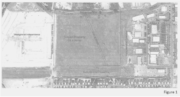
(Ord. 2017-07, 3-22-2017)
11.11.090.030 Conceptual Site Plan
- Conceptual Site Plan: Figure 2 of this section is the Independence Village conceptual site plan:
FIGURE 2
CONCEPTUAL SITE PLAN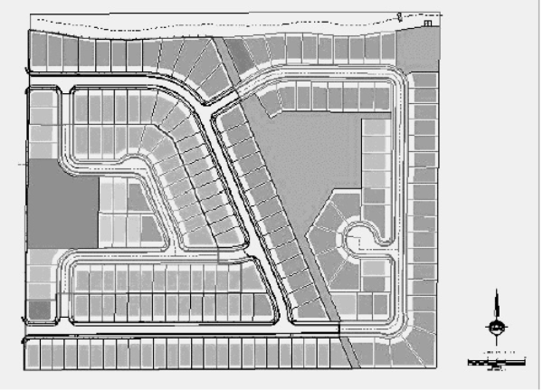
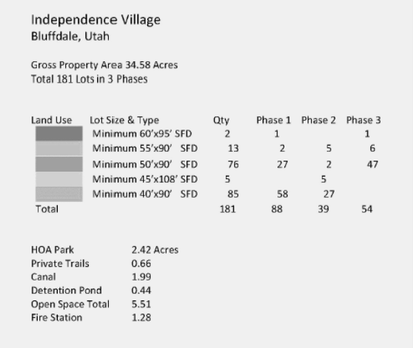
- Fire Station Dedication: The property owner has deeded 1.28 acres along the east side of Noell Nelson Drive (1000 West) to the city of Bluffdale to construct and operate a fire station. The fire station parcel, "parcel A", shall be exempted from IVARC review and the Independence Village CC&Rs shall not be recorded against it.
- Parks, Open Space And Trails Plan: Within a small lot, single-family detached neighborhood like Independence Village, active open space needs to be provided to compensate for the smaller, private rear yard areas. Each lot contains sufficient private rear yard open space for small family gatherings, outdoor entertaining and small children play areas. Active park and trail areas will provide the opportunity for larger, family and neighborhood gatherings, picnicking and informal play areas for sports and similar recreation.
Independence Village's active open space includes a 0.66 acre private trail and a 2.42 acre private park. The property owner intends to dedicate the 0.44 acre detention pond to the city of Bluffdale along with an easement along the storm drain with phase 3 of the project. The detention pond shall also be exempted from IVARC review and the Independence Village CC&Rs shall not be recorded against it.
The trail will connect with the city owned and maintained trail along the north side of Independence At The Point. Independence Village has obtained a permit from Rocky Mountain Power to permit the trail extension and connection across the power line easement. The trail connection will allow Independence Village residents to access both park and school facilities within all of Independence Village. As a private HOA owned and maintained trail, the developer will not request city reimbursement for the value of the trail land and the improvements.
Independence Village proposes a privately owned and maintained HOA park of approximately 2.42 acres. It is anticipated that the park will be an informal play area that includes turf, trees and an automatic irrigation system supplied by a secondary water system. As a privately owned and maintained park, the developer will not request reimbursement for the value of the park land and the improvements. The private park and trail shall be installed per adopted city standards prior to the city council's acceptance of the subdivision phase in which those improvements are included.
1.99 acres of the site is within an easement for the East Jordan Canal and will be dedicated to the canal company who will maintain the canal and its immediate surroundings. The developer shall build an IVARC approved thematic fence along the rear lot line of the lots adjacent to the canal and along the east property line of the detention pond prior to the City Council's acceptance of the subdivision phase in which the fencing is located.
The total active and passive parks, trails and open space areas are approximately 5.51 acres. This is 15.9 percent of the gross site area and 16.3 percent of the net site area, not including the Noell Nelson Drive 0.80 acre dedication. - Street Cross Sections: All of the streets in Independence Village are designed to be public streets constructed to the City's "standard residential A" street standard, generally described as a fifty five foot (55') right-of-way, twenty five feet (25') of asphalt, 2.5 foot concrete curb and gutters, a 7.5 foot landscaped park strip and a five foot (5') concrete sidewalk. (Ord. 2017-07, 3-22-2017)
11.11.090.040 Development Standards And Design Guidelines
The SD Zone requires specific development standards and regulations that apply to Independence Village. The purpose is to develop standards that will enhance the overall appearance of the neighborhood.
- Permitted, Conditional And Accessory Uses:
- Permitted Uses: Unless specifically listed, any other use is not a permitted use. Uses listed as conditional or accessory uses are allowed in the zone only in accordance with the criteria established in this title:
Accessory dwelling units as provided in chapter 34 of this title.
Childcare facilities (less than 6 children).
Parks and recreational facilities.
Public or private rights-of-way.
Public or private utilities and maintenance facilities.
Public schools.
Public uses.
Residential facilities for elderly persons or persons with a disability in accordance with chapter 27 of this title.
Single-family dwellings, detached.
Subdivisions pursuant to the subdivision ordinance and the densities approved in this SD-R Zone. (Ord. 2018-25, 10-24-2018) - Conditional Uses: The following land use types are allowed as conditional uses. Unless specifically listed, any other use is not allowed as a conditional use in the zone. Each conditional use must be reviewed and approved in accordance with chapter 20 of this title:
Religious buildings and structures. - Accessory Uses And Structures: The following land use types are allowed as accessory uses. Unless specifically listed, any other use is not allowed as an accessory use. Any accessory use must be clearly incidental to a permitted or conditional use of the property. Accessory uses are not allowed without the approval of a permitted or conditional use of the parcel unless otherwise noted in this section.
All accessory structures including garages, carports, sheds or similar structures shall be located in the rear one-half (1/2) of the lot.
Accessory structures for the housing of animals or poultry is not permitted, other than incidental shelter for pets as allowed by City ordinance.
Home occupations pursuant to chapter 23 of this title.
Small wind power facilities as provided in chapter 33 of this title.
- Permitted Uses: Unless specifically listed, any other use is not a permitted use. Uses listed as conditional or accessory uses are allowed in the zone only in accordance with the criteria established in this title:
- Lot Areas, Widths And Depths:
- Lots designated in section 11-11I-3, figure 2 of this article, Independence Village conceptual site plan as "40'x90' SFD":
Minimum lot area 3,600 square feet Minimum lot width 40 feet for all of the area within the required front setback. If the lot or parcel is located on an approved curve radius or cul-de-sac, the width requirement may be reduced to the width of the building, plus side yard setbacks; provided, that the requirement is satisfied at the building setback line Minimum lot depth There is no minimum lot depth - Lots designated in section 11-11I-3, figure 2 of this article, Independence Village conceptual site plan as "45'x108' SFD":
Minimum lot area 4,860 square feet Minimum lot width 45 feet for all of the area within the required front setback. If the lot or parcel is located on an approved curve radius or cul-desac, the width requirement may be reduced to the width of the building, plus side yard setbacks; provided, that the requirement is satisfied at the building setback line Minimum lot depth There is no minimum lot depth - Lots designated in section 11-11I-3, figure 2 of this article, Independence Village conceptual site plan as "50'x90' SFD":
Minimum lot area 4,500 square feet Minimum lot width 50 feet for all of the area within the required front setback. If the lot or parcel is located on an approved curve radius or cul-desac, the width requirement may be reduced to the width of the building, plus side yard setbacks; provided, that the requirement is satisfied at the building setback line Minimum lot depth There is no minimum lot depth - Lots designated in section 11-11I-3, figure 2 of this article, Independence Village conceptual site plan as "55'x90' SFD":
Minimum lot area 4,950 square feet Minimum lot width 55 feet for all of the area within the required front setback. If the lot or parcel is located on an approved curve radius or cul-desac, the width requirement may be reduced to the width of the building, plus side yard setbacks; provided, that the requirement is satisfied at the building setback line Minimum lot depth There is no minimum lot depth - Lots designated in section 11-11I-3, figure 2 of this article, Independence Village conceptual site plan as "60'x95' SFD":
Minimum lot area 5,700 square feet Minimum lot width 60 feet for all of the area within the required front setback. If the lot or parcel is located on an approved curve radius or cul-desac, the width requirement may be reduced to the width of the building, plus side yard setbacks; provided, that the requirement is satisfied at the building setback line Minimum lot depth There is no minimum lot depth
- Lots designated in section 11-11I-3, figure 2 of this article, Independence Village conceptual site plan as "40'x90' SFD":
- Setbacks:
- Main Building:
- Front yard setbacks shall be a minimum of ten feet (10'). Front yard accessed garages facing a street shall be set back a minimum of twenty feet (20').
- Interior side yard setbacks shall be a minimum of five feet (5'). Side yards adjacent to a street shall be set back a minimum of ten feet (10'), except that garages facing a side street shall be set back twenty feet (20').
- Rear yards shall be set back a minimum of ten feet (10').
- Accessory Buildings: The side and rear yard setbacks for any permitted accessory building shall be a minimum of five feet (5').
- Projections Into Setbacks:
- Permitted: The following structures may be erected on or projected into any required setback:
- Fences and walls in conformance with all applicable city ordinances and resolutions.
- Appropriate landscaping.
- Utility service boxes or similar structures.
- Setback Areas: The following structures may be erected on or projected into any required front or rear setback not more than four feet (4'), and into a side setback not more than two feet (2'):
- Cornices, eaves, sills, buttresses, bay windows or other similar architectural features.
- Awnings, decks and planter boxes.
- Permitted: The following structures may be erected on or projected into any required setback:
- Main Building:
- Minimum Building Separations: The minimum building separation between a main and accessory building on the same lot shall be ten feet (10').
- Minimum And Maximum Building Heights: A main building or structure shall not exceed thirty five feet (35') in height, nor be lower than ten feet (10') in height, rear detached garages shall not exceed fifteen feet (15') and other accessory buildings such as sheds or carports shall not exceed ten feet (10') in height.
- Minimum Standards For Parking: Each dwelling unit shall have a minimum of two (2) spaces located within a fully enclosed garage.
- Public Utility Easements: Public utility easements need to be a minimum of five feet (5') in width.
- Minimum Standards For Architectural Design, Streetscape, Fencing And Landscaping:
- Independence Village Architectural Review Committee (IVARC): The CC&Rs shall be recorded with any plat, except the detention pond and fire station site, and shall form the Independence Village architectural review committee (IVARC) and give it the power and responsibility to review all building construction within the development. The IVARC shall be comprised of a minimum of two (2) individuals who have experience in either design or construction. The minimum responsibilities of the IVARC shall be the following:
Prior to submittal to the city of Bluffdale for building permit review, the IVARC shall approve all dwelling unit types including the variety of elevations, materials, color schemes, landscaping and accessory buildings.
The IVARC shall provide the city of Bluffdale with an approved set of plans and a letter of approval that shall be included with the submittal package for building permit review.
The IVARC shall approve all conceptual and final landscape plans for the design and construction of the HOA park and the trail.
Prior to submittal to the city of Bluffdale for building permit review, the IVARC shall approve all requests for fencing construction to ensure that the Independence Village thematic fencing is to be constructed. - Architectural Design Guidelines: Consistent with the requirements of the SD zone, Independence Village requires enhanced architectural elements and features that will result in homes that are thematic and include enhancements to visible side and rear facades from either public streets or the private park or trail. The following architectural design guidelines shall dictate the design and construction of homes within Independence Village:
- Stucco, masonry, fiber cement siding and/or similar construction products shall be used on all exterior walls. No vinyl siding shall be permitted.
- A minimum of two (2) elevations shall be drawn for each dwelling unit type. Differences between elevations may include rooflines, use of exterior materials, color schemes, use or size of porches, window location, size, shape or treatments and similar features that vary the appearance of the elevation.
- Where the same dwelling unit type is to be constructed adjacent to or directly across the street, a different elevation shall be used including a different roofline, exterior materials and color schemes.
- A front facade shall include either masonry or fiber cement siding that covers a minimum of thirty percent (30%) of the facade not including the area of the garage door.
- Windows and doors on the front facade shall be trimmed with wood or a woodlike product that is a minimum six inches (6") in width.
- Covered porches shall be supported by a minimum six inch (6") wood or woodlike post that extends from a minimum thirty six inch (36") and twelve inch (12") width base covered by the same masonry or fiber cement siding used on the front facade.
- Where masonry is used on the front exterior at corners, it shall be wrapped around to the side exterior a minimum of twenty four inches (24").
- Rooflines shall not be flat or at a low angle, generally described as less than a six to twelve (6:12) pitch. Prairie style homes may have a roof pitch no less than four to twelve (4:12).
- Front facing garages shall be placed in line with the front elevation, be extended no more than five feet (5') in front of the front elevation or be recessed behind the front elevation. It is encouraged that some of the homes extend the living space or a covered porch to the ten foot (10') front yard setback line or within five feet (5') of the front setback line.
- Rear or side end facades that are visible to a street, the private park or trail shall include additional treatments such as, but not limited to, the addition of the front facade wainscoting down the visible side facade, additional fiber cement siding, additional windows, pop outs and window or door wood or woodlike trims a minimum of six inches (6") in width.
- Streetscape Design, Street Trees And Front Yard Landscaping: Independence Village streets will be public streets designed to the city's "standard residential A" street standard. The standard provides a 7.5 foot park strip and a five foot (5') concrete sidewalk between the back of curb and the right of way/property line. To create a more cohesive neighborhood appearance, similar landscaping of the parkways shall be performed by the homebuilder. The following standards shall be followed in the landscaping of the front yards and street side yards:
Turf shall be planted in the parkways. Where possible, drought tolerant turf species may be used to reduce water usage.
Street trees shall be planted and maintained in compliance with title 7, chapter 4 of this code. A licensed landscape architect shall select three (3) trees from the city approved street tree list and submit these choices with the landscape plan in each plat application. These trees shall be installed by the homebuilder according to city guidelines prior to the issuance of a certificate of occupancy and shall be maintained by the adjacent property owner. The city of Bluffdale shall be responsible for maintaining the park strip and removing snow from the sidewalk along the eastern side of Noell Nelson Drive from Rutledge Road to McKenna Road (the rears of lots 152, 187, 188, 201, 202, 230, 231, 232, and the front of "parcel A").
The homebuilder shall landscape the front yards, side yards, and park strips of all lots based upon a conceptual landscape plan approved by the IVARC. The landscaping shall include an automatic irrigation system supplied by the culinary water system. The landscaping shall include turf, shrubs and ground covers.
The front yard, side yard, and park strip landscaping shall be installed prior to issuance of a certificate of occupancy except that between the months of October and April, the homebuilder may delay the installation until the end of the following month of June if a bond is posted pursuant to the city's adopted fee schedule.
The homebuilder shall construct the IVARC approved thematic fencing along the length of the street side lot line from a distance no more than five feet (5') from the building corner and the lot rear corner. - Fencing: The consistent and uniform installation of thematic fencing will contribute to the Independence Village sense of neighborhood. The thematic fence shall be a vinyl privacy fence in one color throughout the entire development. With the exception of the fence installed on the fire station site, all fencing shall be approved by the IVARC and it shall be the responsibility of the Independence Village HOA to ensure all fencing continues to meet the requirements of the IVARC. All fencing shall comply with standards adopted in section 11-16-14 of this title.
Figure 3 of this section shows the location of required fencing that will be installed by the homebuilder, except that the developer will install the fencing along the rear lot line of the lots adjacent to the canal and along the east property line of the detention pond. The developer shall install the required thematic fencing prior to the city council's acceptance of the subdivision phase in which the fencing is located. The homeowner may choose to install additional thematic fencing along other lot lines not noted on figure 3 of this section.
FIGURE 3 FENCING PLAN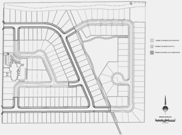
- Independence Village Architectural Review Committee (IVARC): The CC&Rs shall be recorded with any plat, except the detention pond and fire station site, and shall form the Independence Village architectural review committee (IVARC) and give it the power and responsibility to review all building construction within the development. The IVARC shall be comprised of a minimum of two (2) individuals who have experience in either design or construction. The minimum responsibilities of the IVARC shall be the following:
(Ord. 2017-07, 3-22-2017)
11.110.100.010 Intent And Purpose
The intent of this special development zone is to provide a land use pattern that provides for a complementary and compatible mix of uses and a diversity of dwelling unit types. This article allows for the establishment of necessary supporting commercial, light industrial, and other uses consistent with a convenient and pedestrian friendly development layout. It is the intent of this article to allow for flexibility and creativity in the arrangement of uses while promoting efficiencies in the delivery of services. (Ord. 2018-21, 8-22-2018)
The purpose is to develop Bringhurst Station, a mixed-use community consisting of up to three hundred fifty thousand (350,000) square feet of commercial buildings and up to four hundred forty (440) units on public and private streets, an HOA owned and maintained swimming pool and amenities, and park and trail amenities accessible to the public. (Ord. 2019-01, 1-9-2019)
The Bringhurst Station Project Plan (BSPP) is also adopted as an accompanying document to the adopted ordinance. Design guidelines, standards, and specifications in this SD-X Zone are created with this article and shall supersede any conflicting design guidelines, standards, and specifications in any and all applicable City ordinances. Design standards not included in the SD-X Bringhurst Station shall be governed by this Code. Parks, recreation and open space requirements within the Bringhurst Station Project Plan and within this Zone shall be superseded by the Development Agreement approved by Ordinance 2025-04. (Ord. 2018-21, 8-22-2018)
11.110.100.020 Land Use Authority For Site Plans And Subdivisions
A site plan approval is required for all commercial and non-residential buildings, with the exception of townhome projects, within the SD-X Bringhurst Station Zone. All applications are subject to chapter 15 of this title and are required to be approved by the Bringhurst Station Architectural Review Committee (BSARC) prior to review by the Land Use Authority. City of Bluffdale staff shall be the Land Use Authority to review and approve all commercial, non-residential (i.e., schools, churches, parks, etc.) site plans. The Planning Commission shall be the Land Use Authority to review and approve all townhome site plans for the zone.
The adoption of the SD-X Bringhurst Station Special Development Zone and BSPP does not constitute a subdivision of the Bringhurst Station property. All future subdivisions of land within the SD-X Bringhurst Station Zone is subject to all requirements of title 12 of this Code and the BSPP and shall be reviewed and approved by the designated Land Use Authority as stated. (Ord. 2018-21, 8-22-2018)
11.110.100.030 Conceptual Site Plan
- Conceptual Site Plan: The SD-Bringhurst Station Project Plan consists of 24.7 acres of commercial, 67.297 acres of residential, and approximately 31.23 acres of open space (total open space includes amenities within the residential and commercial parcels) for a total of 111.187 acres.
CONCEPT PLAN FOR THE GROVE PROJECT%20Grove%20Concept%20Plan.png) FIGURE 5 CONCEPTUAL SITE PLAN
FIGURE 5 CONCEPTUAL SITE PLAN 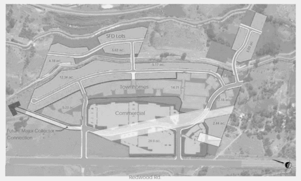
- SD-X Commercial: The commercial areas of the SD-X Bringhurst Station consist of 24.7 acres. It is anticipated that up to three hundred fifty thousand (350,000) square feet of commercial buildings can be accommodated within Bringhurst Station, depending upon use and market demand. Potential commercial uses may include retail, auto dealerships, office, flex/incubator space, light industrial, and warehousing. Commercial uses will have direct pedestrian connections to community and regional trail networks, as well as good automobile access and visibility along Redwood Road. (Ord. 2019-01, 1-9-2019)
- SD-X Residential Amenities: The residential portions of Bringhurst Station will include HOA owned and maintained swimming pool and amenities, and park and trail amenities accessible to the public. The pool and clubhouse will fill the need for larger gatherings than might be accommodated by the homes in the community.
- SD-X Parks, Open Space, And Trails Plan: Within a mixed-use community such as Bringhurst Station, active open space needs to be provided to benefit the overall community, provide connectivity to existing trail systems, and in the residential areas, to compensate for the smaller, private rear yard areas.
Parks, recreation and open space requirements within the Bringhurst Station Project Plan and within this Zone shall be superseded by the Development Agreement approved by Ordinance 2025-04.
The private parks and public trails shall be included in construction drawings for all subdivision applications and installed per adopted City standards prior to the City Council's acceptance of the subdivision phase in which those improvements and amenities are included.
FIGURE 6 OPEN SPACE PLAN (Ord. 2019-01, 1-9-2019)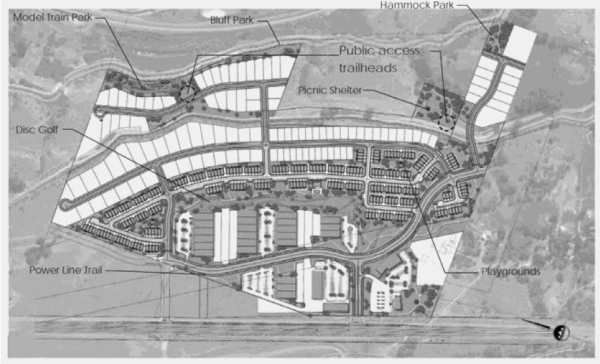 (Ord. 2019-01, 1-9-2019)
OPEN SPACE PLAN FOR THE GROVE PROJECT(4)Open Space Plan.png)
- SD-X Bringhurst Station Implements The City Of Bluffdale Transportation Master Plan: The Master Plan identifies a major collector entering the property boundary from the south that turns westward and intersects with Redwood Road. A second major collector is proposed to intersect with the first and extend northward toward Porter Rockwell. The road structure proposed in Bringhurst Station closely resembles the City's Master Plan. (Ord. 2018-21, 8-22-2018)
FIGURE 8 TRANSPORTATION MASTER PLAN COMPLIANCE (Ord. 2019-01, 1-9-2019)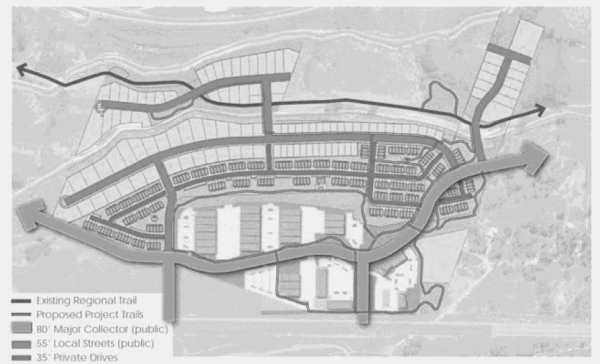 (Ord. 2019-01, 1-9-2019)
 - Street Cross Sections And Private Drive: All local streets in Bringhurst Station are designed to be public streets constructed to the City's "standard residential A" street standard, generally described as a fifty five foot (55') right-of-way, twenty five feet (25') of asphalt, 2.5 feet concrete curb and gutters, a 7.5 foot landscaped park strip with street trees and a five foot (5') concrete sidewalk.
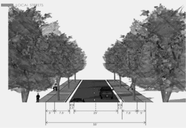
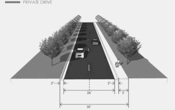
- Street Tree Plan: All street trees to be installed before receiving certificate of occupancy for units on that street. (Ord. 2018-21, 8-22-2018)
FIGURE 9 STREET TREE PLAN (Ord. 2019-01, 1-9-2019)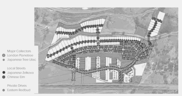 (Ord. 2019-01, 1-9-2019)
STREET TREE PLAN FOR THE GROVE PROJECT Street Tree Plan.png)
- Parking: Residential and commercial parking shall comply with the requirement specified in this Code. (Ord. 2018-21, 8-22-2018)
11.110.100.040 Residential Development Standards And Design Guidelines
- Conflicts: Design guidelines, standards, and specifications in this SD-X Zone shall supersede any conflicting design guidelines, standards, and specifications in any and all applicable City ordinances, including the Subdivision Ordinance, design guidelines and standard specifications, and the City's General Plan. Design elements not included in this SD-X Zone shall be governed by this Code.
- Neighborhood Appearance: The SD-X Zone requires specific development standards and regulations that apply to Bringhurst Station. The purpose is to develop standards that will enhance the overall appearance of the neighborhood. (Ord. 2018-21, 8-22-2018)
- Permitted, Conditional And Accessory Uses (Residential Areas):
- Permitted Uses: Permitted uses are indicated by a "P" in the appropriate row and column.
- Uses Not Permitted: Any use specifically indicated by an "N" shall not be allowed in this zone.
- Subdivisions: Subdivisions pursuant to the City's Subdivision Ordinances and the densities approved in this SD-X Zone.
PERMITTED, CONDITIONAL AND ACCESSORY USES (RESIDENTIAL AREAS)(Ord. 2018-21, 8-22-2018; amd. Ord. 2019-05, 3-27-2019)Dwelling, single-family: A dwelling containing only 1 dwelling unit P Accessory dwelling units in accordance with chapter 34 of this title P Dwelling, multi-family: A dwelling containing 3 or more dwelling units P Parks: A playground or other amenities in an area or open space providing opportunities for active or passive recreational or leisure activities either publicly or privately owned and maintained P Public uses: A facility or use, exclusive of public utility facilities, owned or operated exclusively by a public entity, having the purpose of serving the public health, safety or general welfare. Public uses include such uses and facilities as libraries, community buildings, schools, fire stations, police stations, etc. P Home occupations in accordance with BCC 3.80 A
- Residential Lot Areas, Widths And Depths:
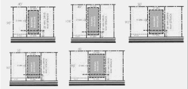
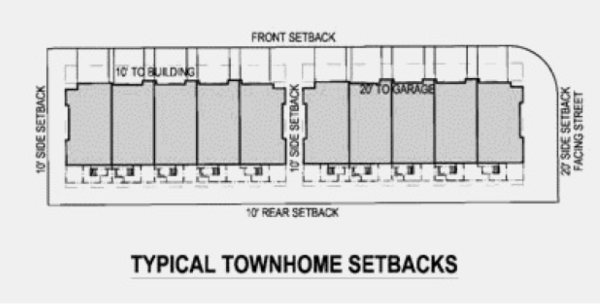
- Residential Setbacks:
- Main Building:
- Front yard setbacks shall be a minimum of ten feet (10'). Front yard accessed garages facing a street shall be set back a minimum of twenty feet (20').
- Interior side yard setbacks shall be a minimum of five feet (5'). Side yards adjacent to a street shall be set back a minimum of ten feet (10'), except that garages facing a side street shall be set back twenty feet (20').
- Rear yards shall be set back a minimum of ten feet (10').
- Accessory Buildings: The side and rear yard setbacks for any permitted accessory building shall be a minimum of five feet (5').
- Projections Into Setbacks:
- Permitted: The following structures may be erected on or projected into any required setback:
- Fences and walls in conformance with all applicable City ordinances and resolutions.
- Appropriate landscaping.
- Utility service boxes or similar structures.
- Setback Areas: The following structures may be erected on or projected into any required front or rear setback not more than four feet (4'), and into a side setback not more than two feet (2'):
- Cornices, eaves, sills, buttresses, bay windows or other similar architectural features.
- Awnings, decks and planter boxes.
- Permitted: The following structures may be erected on or projected into any required setback:
- Main Building:
- Minimum Residential Building Separations: The minimum building separation between a main and accessory building on the same lot shall be ten feet (10').
- Minimum And Maximum Residential Building Heights: A main building or structure shall not exceed thirty five feet (35') in height, nor be lower than ten feet (10') in height, rear detached garages shall not exceed fifteen feet (15') and other accessory buildings such as sheds or carports shall not exceed ten feet (10') in height.
- Minimum Standards For Residential Parking: Each dwelling unit shall have a minimum of two (2) spaces located within a fully enclosed garage.
- Public Utility Easements In Residential Developments: Public utility easements need to be a minimum of five feet (5') in width along the street frontage of the lot. PUEs will not be required in the sideyard or rear of lots.
- Minimum Standards For Residential Architectural Design, Streetscape, Fencing And Landscaping:
- Bringhurst Station Architectural Review Committee (BSARC): The CC&Rs shall be recorded with any plat and shall form the Bringhurst Station Architectural Review Committee (BSARC) and give it the power and responsibility to review all building construction within the residential portions of the development. The BSARC shall be comprised of a minimum of two (2) individuals who have experience in either design or construction. The minimum responsibilities of the BSARC shall be the following:
- Prior to submittal to the City of Bluffdale for building permit review, the BSARC shall approve all dwelling unit types including the variety of elevations, materials, color schemes, landscaping and accessory buildings.
- The BSARC shall provide the City of Bluffdale with an approved set of plans and a letter of approval that shall be included with the submittal package for building permit review.
- The BSARC shall approve all conceptual and final landscape plans for the design and construction of the HOA park and the trail.
- Prior to submittal to the City of Bluffdale for building permit review, the BSARC shall approve all requests for fencing construction to ensure that the Bringhurst Station thematic fencing is to be constructed.
- Residential Architectural Design Guidelines: Consistent with the requirements of the SD-X Zone, Bringhurst Station requires enhanced architectural elements and features that will result in homes that are thematic and include enhancements to visible side and rear facades from either public streets or the private park or trail. The following architectural design guidelines shall dictate the design and construction of homes within Bringhurst Station:
- Stucco, masonry, composite siding and/or similar construction products shall be used on all exterior walls. No vinyl siding shall be permitted.
- A minimum of two (2) elevations shall be drawn for each dwelling unit type. Differences between elevations may include rooflines, use of exterior materials, color schemes, use or size of porches, window location, size, shape or treatments and similar features that vary the appearance of the elevation.
- Where the same dwelling unit type is to be constructed adjacent to or directly across the street, a different elevation shall be used including a different roofline, exterior materials and color schemes.
- A front facade shall include either masonry or composite siding that covers a minimum of thirty percent (30%) of the facade not including the area of the garage door.
- Windows and doors on the front facade shall be trimmed with composite, wood or a wood-like product, or a stucco trim that is a minimum four inches (4") in width.
- Covered porches shall be supported by a minimum six inch (6") wood or wood-like, or stucco post that extends from a minimum thirty six inches (36") and twelve inches (12") width base covered by the same masonry or composite siding used on the front facade.
- Where masonry is used on the front exterior at corners, it shall be wrapped around to the side exterior a minimum of twelve inches (12").
- Rooflines shall not be flat or at a low angle, generally described as less than a six to twelve (6:12) pitch. Modern style homes may have a roof pitch less than four to twelve (4:12).
- Front facing garages shall be placed in line with the front elevation, be extended no more than five feet (5') in front of the front elevation or be recessed behind the front elevation. It is encouraged that some of the homes extend the living space or a covered porch to the ten foot (10') front yard setback line or within five feet (5') of the front setback line. Front Elevation is defined by front extent of foundation (including porch column foundation).
- Rear or side end facades that are visible to a street, the private park or trail shall include additional treatments such as, but not limited to, the addition of the front facade wainscoting down the visible side facade, additional fiber cement siding, additional windows, pop outs and window or door wood or wood-like trims a minimum of four inches (4") in width.
- Streetscape Design, Street Trees And Front Yard Landscaping: Bringhurst Station streets will be public streets designed to the City's "standard residential A" street standard. The standard provides a 7.5-foot park strip and a five foot (5') concrete sidewalk between the back of curb and the right-of-way/property line. To create a more cohesive neighborhood appearance, similar landscaping of the parkways shall be performed by the homebuilder. Turf shall be planted in the parkways. Where possible, drought tolerant turf species may be used to reduce water usage.
Street trees shall be planted and maintained in compliance with City standards. Trees shall be installed in accordance with Chapter 7.40 Trees, Section 11.150.050 of this Title, and figure 9 of this article with each subdivision plat or site plan application. These trees shall be installed by the homebuilder according to City guidelines prior to the issuance of a certificate of occupancy and shall be maintained by the adjacent property owner. The adjacent home owner or HOA shall be responsible for maintaining the park strip and removing snow from the sidewalk along the public streets.
The homebuilder shall landscape the front yards, side yards, and park strips of all lots, as well as the rear yards of the townhome lots based upon a conceptual landscape plan approved by the BSARC. The landscaping shall include an automatic irrigation system supplied by the culinary water system. The landscaping shall include turf, shrubs and ground covers.
The front yard, side yard, and park strip landscaping shall be installed prior to issuance of a certificate of occupancy except that between the months of October and April, the homebuilder may delay the installation until the end of the following month of June if a bond is posted pursuant to the City's adopted fee schedule. - Fencing: The consistent and uniform installation of thematic fencing will contribute to the Bringhurst Station sense of neighborhood. The homebuilder shall install the BSARC approved thematic fencing along the length of the street side lot line from a distance no more than five feet (5') from the building corner and the lot rear corner. The thematic fence shall be a vinyl privacy fence throughout the entire development. It shall be the responsibility of the Bringhurst Station HOA to ensure all fencing continues to meet the requirements of the BSARC.
Figure 10 of this subsection shows the location of required fencing that will be installed by the homebuilder, except that the developer will install the fencing along the rear lot line of the lots adjacent to the canal prior to certificate of occupancy issued for those lots. The developer shall install the required thematic fencing prior to the City Council's acceptance of the subdivision phase in which the fencing is located. The homeowner may choose to install additional thematic fencing along other lot lines not noted on figure 10 of this subsection.
FIGURE 10 FENCING PLAN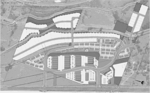 (Ord. 2018-21, 8-22-2018)
- Bringhurst Station Architectural Review Committee (BSARC): The CC&Rs shall be recorded with any plat and shall form the Bringhurst Station Architectural Review Committee (BSARC) and give it the power and responsibility to review all building construction within the residential portions of the development. The BSARC shall be comprised of a minimum of two (2) individuals who have experience in either design or construction. The minimum responsibilities of the BSARC shall be the following:
11.110.100.050 Commercial Development Standards And Design Guidelines
- Permitted Uses: Permitted uses are indicated by a "P" in the appropriate row and column.
- Uses Not Permitted: Any use specifically indicated by an "N" shall not be allowed in this zone.
- Subdivisions: Subdivisions pursuant to the City's subdivision ordinances and approved in this SD-X Zone.
- Use Table:
PERMITTED, CONDITIONAL AND ACCESSORY USES
(COMMERCIAL AREAS A AND B)A B Automobile and recreational vehicle sales: An establishment engaged in the retail sale or wholesale from the premises of motorized vehicles, along with incidental service or maintenance. Typical uses include new and used automobile and truck sales, boat sales, recreational vehicle sales, and motorcycle sales. P P Automotive service: An establishment providing motor vehicle repair or maintenance services within completely enclosed buildings, including paint and body shops or other general vehicle repair services which have associated storage, overnight or otherwise, of vehicles, equipment, supplies, parts, or inventory in an enclosed and screened area outside of the building. N P Bank or financial institution: An organization involved in deposit banking, finance, investment, mortgages, trusts, and the like, but excluding uses specifically classified in another use herein. Typical uses include commercial banks, credit unions, finance or mortgage companies, and savings institutions. P P Business services: An establishment completely operating within a building, providing other businesses with various services including maintenance, repair and service, testing, rental, etc.; also includes business equipment repair services (except vehicle repair), computer related services (rental, repair), equipment rental businesses within buildings, film processing and photo finishing, janitorial and window cleaning services, mailbox services and similar uses. P P Car wash: An establishment primarily engaged in cleaning or detailing motor vehicles, including cars, passenger trucks, recreational vehicles, whether self-service, automatic or by hand. This use applies only to car washes that are the primary use of land. A car wash associated with a gas station is not included in this use. P P Commercial vehicle and equipment rental or sale: An establishment engaged in the retail sale, wholesale, or rental from the premises of motorized commercial vehicles, trailers, and equipment, along with incidental service or maintenance. Typical uses include new or used commercial vehicle and truck sales, moving trailer and truck rental, construction equipment rental yards and farm equipment and machinery sales and rental. P P Construction sales and service: An establishment engaged in the retail or wholesale sale of materials and services used in the construction of buildings or other structures. Typical uses include lumberyards, lawn and garden supply stores, construction equipment sales and rental, electrical, plumbing, air conditioning and heating supply stores, swimming pool sales, and other home improvement products. Areas for the display of goods may be outside a building as an accessory use to the primary business with acceptable screening and fencing in Area B only. If the uses listed herein include a retail component, they shall be permitted in both Area A and Area B. N P Convenience store: An establishment, not exceeding 5,000 square feet of gross floor area, serving a limited market area and engaged in the retail sale or rental, from the premises, of food, beverages and other frequently or recurrently needed items for household use, excluding gasoline sales. P P Data center: A facility used to house computer systems and associated components, such as telecommunications and storage systems. N P Gas station: An establishment engaged in the retail sales of gasoline and petroleum products. This use includes gasoline sales conducted as part of a convenience store. A gas station may also include automatic and self-serve car washes which are accessory to the primary use. P P Hotel: An establishment with or without fixed cooking facilities in individual rooms offering transient lodging accommodations to the general public, and which may provide additional services such as restaurants and meeting rooms. P P Laundry services: An establishment providing household laundry and dry-cleaning services with customer drop off and pick up where laundering or cleaning is done on the site. This use also includes an establishment providing home type washing, drying, and/or ironing machines for hire or rent to be used by customers on the premises, such as a laundromat. P P Liquor store: A retail outlet for the sale of packaged liquor located on premises owned or leased by the State of Utah. P P Manufacturing, general: An establishment engaged in the manufacture of finished products or parts, predominantly from previously prepared materials, including processing, fabrication, assembly, treatment and packaging, and incidental storage, sales and/or distribution of such products, but excluding basic industrial processing and manufacturing activities. These uses shall not have noise, odor, vibration or other discernible nuisances outside a building. N P Medical service: An establishment providing therapeutic, preventive, or corrective personal treatment services on an outpatient basis by physicians, dentists, and other practitioners of the medical or healing arts, as well as the provision of medical testing and analysis services. P P Movie theater: A facility which includes one or more theaters for the presentation of motion pictures. May also include accessory retail uses and concession P P Museum: A building or room in which objects of historical, scientific, artistic, or cultural interest are stored and exhibited. P P Office, general: A building, room or department where executive, management, administrative or professional services are provided, except medical services, and excluding the sale of merchandise, except as incidental to a principal use. Typical uses include real estate brokers, insurance agencies, credit reporting agencies, property management firms, investment firms, employment agencies, travel agencies, advertising agencies, secretarial services, data processing, call centers; Post Offices and express mail offices as an accessory or complementary use to a professional and business office development, but excluding major mail processing and distribution; offices for utility bill collection; professional or consulting services in the fields of law, architecture, design, engineering, accounting and similar professions; interior decorating consulting services; and business offices of private companies, utility companies, public agencies, trade associations, unions and nonprofit organizations. P P Parks: A playground or other amenities in an area or open space providing opportunities for active or passive recreational or leisure activities either publicly or privately owned and maintained. P P Personal instruction service: An establishment primarily engaged in the provision of informational, instructional, personal improvement and similar services of a nonprofessional nature. Typical uses include art and music schools, driving and computer instruction, gymnastic and dance studios, handicraft or hobby instruction, health and fitness studios, massage therapist instruction, martial arts training, and swimming clubs. P P Personal service establishment: An establishment providing nonmedical services to individuals as a primary use. Examples of these uses include barbershops, beauty salons, day/health spa, hair salons, nail salons, shoe repair shops, tanning salons, tailors and similar businesses not including tattoo establishments. P P Preschool/daycare center: An establishment, other than an occupied dwelling, operated by a person or organization qualified by the State, which provides daycare, protection or supervision and/or preschool instruction. P N Printing shops: The production of books, magazines, newspapers and other printed matter, as well as publishing, or graphic arts design, engraving or photoengraving. N P Public uses: A facility or use, exclusive of public utility facilities, owned or operated exclusively by a public entity, having the purpose of serving the public health, safety or general welfare. Public uses include such uses and facilities as parks, libraries, community buildings, schools, fire stations, police stations, etc. P P Recreation and entertainment (indoor): A commercial recreational land use conducted entirely within a building, including arcade, arena, athletic and health clubs, bowling alley, community center, gymnasium, pool or billiard hall, skating rink, swimming pool, tennis court or similar indoor facility. Related indoor uses may include a retail area for the sale or rental of equipment and a snack bar. P P Recreation and entertainment (outdoor): An area or facility that offers entertainment or recreation outside. This use may include, but not be limited to, a golf driving range, baseball batting cages, riding arenas, tennis facilities, water sports facilities, cycling facilities, and miniature golf, and may include, as accessory uses, associated eating and drinking areas, retail sales areas and staff offices. P P Repair service: An establishment primarily engaged in providing repair services to individuals and households rather than firms, but excluding automotive, vehicular and equipment services uses. Typical uses include appliance repair shops, computer and other electronic equipment repair, furniture repair and upholstery shops, watch or jewelry repair shops, and musical instrument repair shops. P P Research and development laboratories: An establishment engaged in the development of new products or services using technical, medical, or scientific innovations. P P Restaurant: A facility where food and drinks are prepared and served to the public for on-site consumption (dine in), takeout, or delivery service. A restaurant may include a drive-through. P P Retail, general: An establishment that rents or sells goods to the public, but excluding uses specifically classified in another use herein. Typical uses include apparel stores, antique shops, art and hobby supply stores, bicycle shops, bookstores, clothing rental stores, department stores, discount stores, drugstores, electronic appliance stores, florists, food stores, furniture and appliance stores, gift and novelty shops, glass and mirror shops, hardware stores, home improvement centers, jewelry stores, medical supply stores, music stores, optical retail sales, paint stores, pet stores, photocopying and blueprinting shops, photography supply stores, etc. If the uses listed under the Construction Sales and Service category have a retail component, they shall be permitted uses in both Area A and Area B P P Trade or technical schools: An establishment, for profit or not, conducting a course of instruction, training, or retraining to prepare individuals to follow an occupation or trade offering regularly scheduled instruction in technical, commercial or trade skills, such as, but not limited to, business, real estate, building and construction trades, electronics, computer programming and technology, automotive and aircraft mechanics and technology, and similar types of instruction. P P Veterinary service: An establishment providing medical care and treatment for animals, which may include accessory grooming or boarding services. P P Wholesale and warehousing: An establishment that is primarily engaged in the buying and selling of goods in large quantities and includes the storage and sale of goods to customers or other businesses for resale, as well as activities involving significant movement and storage of products or equipment. N P - Figure:
UPDATED COMMERCIAL SUB-DISTRICT GRAPHIC Commercial Designations.png)
- Commercial Lot Area:
- The minimum commercial lot area requirement is one-half (1/2) acre (condominiumized commercial buildings exempt from 1/2 acre minimum).
- Commercial Lot Width:
- The minimum commercial lot width requirement shall be one hundred fifty feet (150') for all of the area located in any required front setback area (condominiumized commercial buildings exempt from 150 foot lot width minimum).
- Commercial Lot Frontage:
- All commercial parcels shall abut a public street or approved private street or right-of-way for at least one hundred fifty feet (150') or have acceptable access to a public street through cross access or private right-of-way provided through an adjacent lot or parcel.
- Commercial Setback Requirements:
- The following minimum setback requirements shall apply in the zone. Each setback is measured from the property line of the lot or parcel.
- Setbacks For Lots Or Parcels Abutting A Public Street:
- Front Setback: Each lot or parcel abutting a public street shall have a minimum front setback of ten feet (10').
- Side And Rear Setback: Each lot or parcel abutting a public street shall have a minimum side and rear setback for buildings of ten feet (10'). A total reduction of the rear and side setbacks of up to ten feet (10') may be approved if doing so does not violate the adopted Building and Fire Codes.
- Interior Side Setback: No side setback shall be required along the interior lot lines, except as may be required by the City Building Codes and where the side lot line is contiguous to a residential area as shown on the BSPP, in which case side yard setback requirements of the contiguous residential zone shall apply.
- Rear Yard Setback: No rear yard setback shall be required, except as may be required by the City Building Codes or where the rear lot line is contiguous to a residential area, in which case the rear yard setback requirements of the contiguous residential area shall apply.
- Setbacks For Lots Or Parcels Abutting A Public Street:
- Setbacks for lots or parcels abutting a private street or right-of-way shall be five feet (5').
- Setbacks for parking lots abutting a street right-of-way shall be ten feet (10').
- The following minimum setback requirements shall apply in the zone. Each setback is measured from the property line of the lot or parcel.
- Projections Into Setbacks:
- Permitted: The following structures may be erected on or projected into any required setback:
- Fences and walls in conformance with all applicable City ordinances and resolutions.
- Appropriate landscaping.
- Necessary appurtenances for utility service.
- Setback Areas: The following structures may be erected on or projected into any required front or rear setback not more than four feet (4'), and into a side setback not more than two feet (2'):
- Cornices, eaves, sills, buttresses or other similar architectural features.
- Awnings, decks and planter boxes.
- Permitted: The following structures may be erected on or projected into any required setback:
- Commercial Building Height Requirements: A primary building or structure may not exceed sixty five feet (65') in height, nor be lower than ten feet (10') in height. A hotel may not exceed one hundred ten feet (110') in height. All buildings and structures must adhere to adopted Building and Fire Codes.
- Distance Between Commercial Buildings: The distance between any building or structure and any other building or structure shall satisfy the Building and Fire Codes in place at the time of site plan approval.
- Commercial Lot Coverage: The sum total of all buildings, structures and parking on any parcel or project in the zone shall not exceed eighty five percent (85%) of the total area of the parcel or project.
- Commercial Parking, Loading And Access:
- Parking: Total required off street parking spaces shall be four (4) stalls per one thousand (1,000) useable square feet for office and retail uses, and one stall per ten thousand (10,000) square feet of warehouse. The spaces shall be hard surfaced with asphalt or concrete and be accessed from a public road by a hard surfaced, composed of asphalt or concrete, drive approach.
- Loading And Unloading Area: Loading and unloading shall not occur on a public street. Loading docks and service areas, including non-retail gas pumps, shall be eighty percent (80%) screened from traffic with mounding and/or 4-season vegetative screening. Acceptable screening may also include decorative concrete walls.
- Commercial Project Plan Approval:
- Design guidelines, standards, and specifications in this SD-X Bringhurst Station Zone shall supersede any conflicting design guidelines, standards, and specifications in any and all applicable City ordinances, design guidelines and standard specifications, and the City General Plan. Design elements not included in this SD-X Mixed Use Zone shall be governed by this Code.
- Projects in the SD-X Zone will be reviewed and approved by BSARC prior to submitting a Site Plan Application for review and approval by the City staff.
- Minimum Standards For Commercial Architectural Design:
- Commercial Architectural Design Guidelines: Consistent with the requirements of the SD-X Bringhurst Station Zone requires enhanced architectural elements and features that will result in commercial buildings that are thematic and include enhancements to visible side and rear facades from either public streets or the private park or trail. The following architectural design guidelines shall dictate the design and construction of all non-residential buildings within Bringhurst Station.
- Building Material:
- At least eighty percent (80%) of a building's facade along all streets shall be finished in one of the following materials:
- Masonry (brick, stone, stucco utilizing a 3-step process, cast stone, glass, or glass block).
- Split face concrete block or pre-cast or poured in place concrete.
- Wood or architectural metal panel, batt and board siding (no vinyl), or lap siding (no vinyl).
- No more than twenty percent (20%) of a building's facade along all streets shall use other accent materials: split-face concrete block, tile, EIFS or pre-cast concrete panels.
- At least eighty percent (80%) of a building's facade along all streets shall be finished in one of the following materials:
- Building Massing:
- Building masses shall avoid long flat-plane expanses and incorporate horizontal relief no less than two feet (2') in depth. The maximum length of a single facade expanse is one hundred feet (100').
- Building masses shall be greater at areas with more pedestrian activity, such as street corners and building entrances.
- Single story building masses that exceed twenty feet (20') in height shall incorporate an overhead structure element above building entrances to provide pedestrian scale interest.
- Load-bearing materials should touch the ground.
- Arcades And Storefront Structural Bays:
- Storefront structural bays shall be orchestrated to appear as phased construction over a long period of time.
- Substantial structural bays shall be composed of vertically oriented piers and horizontal spandrels with intervening storefront windows.
- Arcades are encouraged as semi-public spaces between the street and storefront, sheltering pedestrians from the elements.
- Multiple storefronts with separate storefront windows can be massed together within a single facade expanse with the same architectural style.
- Roof Form:
- Predominant roof shapes should be flat or slightly pitched, with limited use of gable or canted roof elements to provide breaks in facade type and/or add visual interest.
- Roof pitches should be typically low (1:12 - 4:12).
- Moderate overhangs up to three feet (3') should be supported by substantial dimensional steel braces that define the top of the building.
- Building Material:
- Commercial Architectural Design Guidelines: Consistent with the requirements of the SD-X Bringhurst Station Zone requires enhanced architectural elements and features that will result in commercial buildings that are thematic and include enhancements to visible side and rear facades from either public streets or the private park or trail. The following architectural design guidelines shall dictate the design and construction of all non-residential buildings within Bringhurst Station.
- Other Commercial Requirements: The following requirements are in addition to the requirements found in this title or any other applicable resolution or ordinance:
- Landscaping: Individual lots or parcels located in this SD-X development are not subject to a minimum landscaping requirement so long as fifteen percent (15%) of the total developed project area is preserved as open space.
- Screening Of Outdoor Storage Or Display Areas And Mechanical Equipment: All outdoor storage or display areas and mechanical equipment and other appurtenances, including electrical boxes, gas meters and other utility facilities shall be located or screened so as not to be visible from streets, pedestrian areas and adjacent developments. Screens shall be aesthetically incorporated into the design of the building whether located on the ground or on the roof. Acceptable screening includes six foot (6') decorative privacy fences, mounding and/or 4-season vegetative screening. Screened areas must provide a minimum of eighty percent (80%) visual concealment year-round. Rooftop mechanical equipment and other appurtenances shall be installed so as not to be visible from any point at or below the roof level of the subject buildings. All mechanical equipment and utilities shall in all cases be either enclosed by outer building walls or parapets or grouped and screened in a manner architecturally compatible with the buildings.
- Trash, Junk, Storage And Other Debris: No trash, used materials, unsightly storage of any kind, or non-licensed or abandoned vehicles shall be stored in an open area. All such materials shall be enclosed in a building or, if deemed appropriate by the City, by a sight obscuring fence.
- Signage:
- Signs: All special district project plans shall propose a consistent and unified signage scheme.
- Design And Location: Signage design and location shall be an important component of SD-X Bringhurst Station. All signs shall be reviewed and approved by the Bringhurst Station Architectural Review Committee. Signage shall comply with the following standards:
- Monument Signs: One monument sign shall be allowed per building. Each monument sign shall have a uniform, architecturally compatible design consistent with the Bringhurst Station commercial special district design theme with a sign area not larger than ninety eight (98) square feet. Locations shall be approved by the City to ensure clearance of sight distance requirements at entries and adequate separation for readability. One sign per building is allowed along each main access road on the north and south of the buildings. Monument signs shall not exceed ten feet (10') in height and fourteen feet (14') in width.
- Tower Signs: In addition to monument signs allowed per building, one tower sign shall be allowed at the entrance to the office park. Signs shall not exceed nine feet (9') in width and thirteen feet (13') in height and shall not exceed one hundred and seventeen (117) square feet in sign area. Tower signs shall be at least fifteen feet (15') from the public right-of-way and shall meet the sight distance requirements.
- Wall Signage: Wall signage may be installed by individual businesses/buildings on freestanding and in-line single-/multitenant buildings.
- Wall Signage Types: Types of wall signage shall be limited to the following:
- Individually cut letters or signs from plastic or aluminum;
- Painted directly on the exterior of the building;
- Individual pan channel letters mounted on a raceway;
- Pan channel letters may be illuminated;
- Decorative sign cabinets. Where sign cabinets are utilized they shall be built into the architectural fascia.
- Location: Signage shall be allowed on all sides of the building that are visible from a street or drive aisle.
- More Than One Entry: Where a tenant or building occupant has more than one entry, multiple signs will be allowed to define different divisions of the company.
- Size: For every one linear foot of building length per tenant, two (2) square feet of wall signage shall be allowed.
- Wayfinding Signs: Wayfinding signs shall be allowed in the project. Height shall not exceed eight feet (8'). The area of the sign shall not exceed one hundred (100) square feet.
- Suspended, Blade Type Projecting Signs: Suspended or blade type projecting signs may be provided along pedestrian walkways and shall maintain a minimum clearance of seven feet (7') above the pavement.
- Flags, Banners: If flags or banners are placed on light poles, they shall be at least seven feet (7') above the pavement. (Ord. 2018-21, 8-22-2018; amd. Ord. 2019-10, 8-28-2019)
11.11.110.010 Purpose And Zone Characteristics
The SD-X Gateway Zone is established to recognize the unique placement of hospitality, multi-family dwellings, and retail facilities at the eastern gateway to City of Bluffdale and accommodate development and construction requirements of these facilities on a prominent but challenging site due to slopes, property configuration, and easements and rights-of-way of large distribution utilities. The zone allows for hospitality, multi-family dwellings, and associated retail focused commercial uses.
- Permitted uses:
Bar, or other hotel alcohol sub-license as set forth in Utah Code § 32B-8b-102.
Hotel.
Personal service establishment.
Recreation and entertainment, indoor.
Restaurant, general.
Multi-family dwellings, up to five hundred (500) total units.
Retail, general. (Ord. 2018-20, 7-25-2018; amd. Ord. 2019-19, 10-9-2019)
11.11.110.020 Project Area And Concept Plan
- The project area includes the entire 6.78 acre parcel as described in Figure 1.
- Conceptual Site Plan: Figure 1 of this section is the SD-X Gateway conceptual site plan:
FIGURE 1: Project Area And Conceptual Site Plan For Scope Of Development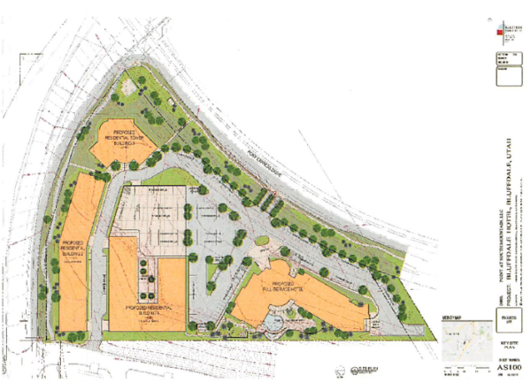
(Ord. 2018-20, 7-25-2018; amd. Ord. 2019-19, 10-9-2019)
11.11.110.030 Setback Requirements
The following minimum setback requirements shall apply in the SD-X Gateway Zone. Each setback is measured from the property line of the lot or parcel.
- Building setbacks abutting a public street:
- Front Setback: Each lot or parcel abutting a public street shall have a minimum front setback of twenty feet (20').
- Side And Rear Setback: Each lot or parcel abutting a public street shall have a minimum side and rear setback of twenty feet (20'). A total reduction of the rear and side setbacks of up to twenty feet (20') may be approved if doing so does not violate the adopted Building and Fire Codes.
- Parking setbacks for lots or parcels abutting a public street:
- Along 14600 South: Parking abutting 14600 South Street shall have a landscaped setback of ten feet (10') from the edge of the public right-of-way.
- Along Pony Express Drive: Parking abutting Pony Express Drive shall have a setback of zero feet (0') from the public right-of-way. Owner shall install tire stoppers to ensure parked vehicles do not project over property lines, and provide landscaping, in accordance with the city's adopted landscaping requirements, in the area between edge of parking and the current street improvements.
- Side And Rear Setback: Along parcel lines not abutting a public street a landscaped setback of not less than five feet (5') and averaging not less than ten feet (10') shall be maintained. (Ord. 2018-20, 7-25-2018; amd. Ord. 2019-19, 10-9-2019)
11.11.110.040 Projections Into Setbacks
- Permitted: The following structures may be erected on or projected into any required setback:
- Fences and walls in conformance with applicable city ordinances and resolutions.
- Appropriate landscaping.
- Necessary appurtenances for utility service.
- Retaining walls, whether cast-in-place concrete, pre-cast concrete, or rock when required to accommodate grading of existing slopes for improvements.
- Setback Areas: The following structures may be erected on or projected into any required front or rear setback not more than four feet (4'), and into a side setback not more than two feet (2'):
- Cornices, eaves, sills, buttresses or other similar architectural features.
- Awnings, decks and planter boxes. (Ord. 2018-20, 7-25-2018)
11.11.110.050 Building Height Requirements
Buildings shall have a minimum height of one (1) story with no limit on maximum stories. The residential tower (as shown on Figure 1) shall have a minimum height of ten (10) stories. Modifications to the minimum height of the residential tower will be allowed, within reason, to accommodate site, design, or market conditions which prohibit feasibility of the tower. Any modification to the minimum height of the residential tower will be reviewed and approved in accordance with the SD-X Gateway Zone provisions set forth for site plan reviews and approvals. Minimum height for the residential tower shall not apply to buildings which are not classified as residential tower. All buildings and structures must adhere to adopted building and fire codes. (Ord. 2018-20, 7-25-2018; amd. Ord. 2019-19, 10-9-2019)
11.11.110.060 Distance Between Buildings
The distance between any building or structure and any other building or structure shall satisfy the Building and Fire Codes in place at the time of site plan approval. (Ord. 2018-20, 7-25-2018)
11.11.110.070 Lot Coverage
The sum total of all buildings, structures and parking in the SD-X Gateway Zone shall not exceed eighty five percent (85%) for the total area of the parcel or project. (Ord. 2018-20, 7-25-2018; amd. Ord. 2019-19, 10-9-2019)
11.11.110.080 Architectural Standards
- Architecture: The architecture shall be the primary tool to create a strong sense of identity and place throughout the special development zone. All buildings will be articulated with use of appropriate scale, form, materials, and colors carefully considered and incorporated throughout the development phases. However, different architectural styles will be considered and allowed in order to provide variety and identity to this area. Images of sample acceptable architectural styles are included in section 11-11K-14.
- Materials: More than one material shall be required on all building facades.
- Primary Material: More than one primary material shall be required on all building facades. Building primary materials shall consist of metal, composite metal panel, stone, EFIS, concrete, GFRC, tile or other similar material as approved by Architectural Control Committee. Images of sample acceptable materials are included in section 11-11K-14.
- Mechanical Equipment: All mechanical equipment shall be screened from view, either by enclosure, parapet wall or line of sight.
- Entry Features: Buildings shall have notable entry features which could include:
- An arch or canopy over entry doors.
- Colors or materials that highlight the entry.
- Entry doors and lobby that extend beyond or are recessed behind the main footprint of the building. (Ord. 2018-20, 7-25 2018; amd. Ord. 2019-19, 10-9-2019)
11.11.110.090 Parking, Loading And Access
- Requirements: Due to the nature of the several uses in a hospitality, retail, and multi-family mixed use development, such as residents, guests, restaurants, spas, retail, and convention meeting facilities, a shared parking and access plan will be developed and provided to the city for review as part of a complete site plan. The applicant shall submit a professionally prepared tabulation of shared parking calculations which demonstrates to the Land Use Authority that the parking demand of the assorted land uses will be met, based on the city’s adopted parking requirements in place at the time of site plan approval or based on site plan parking analysis recommendations approved by the Land Use Authority. The spaces shall be hard surfaced with asphalt or concrete and be accessed from a public road by a hard surfaced, composed of asphalt or concrete, drive approach which meets the requirements set forth in chapter 12 of this title.
- Supply Loading And Unloading Areas: Loading and unloading areas shall be located in an area that can be secured and visually obstructed from public access. Further, loading and unloading shall not occur on a public street. (Ord. 2018-20, 7-25-2018; amd. Ord. 2019-19, 10-9-2019)
11.11.110.100 Project Plan Approval
- Any request for project plan approval in the SD-X Gateway Zone is subject to any and all applicable city resolutions, standards, specifications, and ordinances, including, but not limited to, the subdivision ordinance, design guidelines, and standard specifications.
- Site plans for projects in the SD-X Gateway Zone may be reviewed and approved administratively by staff in accordance with the provisions set forth in chapter 15 of this title. (Ord. 2018-20, 7-25-2018; amd. Ord. 2019-19, 10-9-2019)
11.11.110.110 Signage
- Signs: Signs are allowed in the SD-X Gateway Zone in accordance with the provisions in subsection B of this section. As this development is located in a highly visible area of the eastern gateway to the city, signage is a critical component to the success of a gateway development. The use of LED materials and electronic displays is permitted on all approved signs in accordance with the standards set forth in subsections 11-22-14G7 through 11-22-14G10 of this title.
- Types Of Signage Allowed:
- Highway Appurtenant Freestanding Sign: One (1) sign, not to exceed sixty feet (60') in height and a total signage area of six hundred (600) square feet, which shall have an architectural base consistent with the approved architectural requirements and shall have a design approval from the architectural review committee. Co-location of uses is encouraged on this sign.
- On-Site Appurtenant Freestanding Signs: One (1) appurtenant freestanding sign on Pony Express Drive will be allowed, each not exceeding thirty feet (30') in height and one hundred fifty (150) square feet in area, which shall have an architectural base consistent with the approved architectural requirements and shall have a design approval from the architectural review committee.
- Monument Signs: One (1) monument sign on-site near the shared entrance on 14600 South and one (1) each monument sign at each project site entrance on Pony Express Drive, each of which shall have an architectural base consistent with the approved architectural requirements and shall have a design approval from the architectural review committee. Monument signs shall be no taller than nine feet (9') and have an area no greater than one hundred fifty (150) square feet.
- Building Signage: Branding of hotels may be accomplished with signage complying with standards of branded hotels. Signage shall be equal to pan channel construction with backlighting which may have translucent faces. Multi-family and commercial facilities may also have building mounted signage, such as backlight pan channel signs which may have translucent faces. Size of building mounted signs shall be limited in area to two (2) square feet per linear foot of the face of the building on which it is installed. Two (2) signs per apartment building are allowed and one (1) sign per face of the hotel is allowed. The tower may have up to two (2) signs for the residential use and one (1) sign for each retail tenant. The allowable area for any face not used may be applied to the faces on which signs are installed.
- LED Building Array: In addition to branding signs, the primary hotel may include an LED building array on the eastern side of full service hotel which may wrap to the northern exposure of I-15 up to five thousand (5,000) square feet in size and shall comply with city ordinances as they may change from time to time. The array shall be equipped with light sensors and adjustable brightness. (Ord. 2018-20, 7-25-2018; amd. Ord. 2019-19, 10-9-2019)
11.11.110.120 Other Requirements
The following requirements are in addition to the requirements found in this title or any other applicable resolution or ordinance:
- Landscaping: Each lot or parcel shall be completely landscaped except those areas used for buildings or parking. A minimum of fifteen percent (15%) of the total area of the lot or parcel shall be landscaped. Individual project phases located in the SD-X Gateway Zone may contain less than fifteen percent (15%) landscaping so long as at least fifteen percent (15%) of the total developed project area is landscaped.
- Landscaping for each building (or bonding to complete) shall be required prior to the issuance of a certificate of occupancy. In order to avoid damage or destruction to new landscaping, the required landscaping for each building will be defined within the phasing plan for construction.
- For the purpose of calculating the requirement of fifteen percent (15%) landscaping, outdoor activities spaces and improvements such as plazas, walks, pool decks, and other outdoor hard-surface improvements shall be considered part of the landscaping in minimal amounts if it is being used to beautify and ease transition into landscaping zones. Sidewalks and parking spaces shall not count toward minimum landscaping requirements.
- In accordance with section 11-15-6 of this title, all landscaping shall comply with the landscaping requirements in sections 11-12-7 and 11-15-5. All required landscaping must be installed, or a landscaping bond must be posted (only if between the months of October and May), prior to the issuance of a certificate of occupancy.
- Design Guidelines: Projects in the SD-X Gateway Zone will adhere to the design guidelines for commercial buildings as set forth in section 11-15-6 of this title.
- Continuous Development: Improvements for the SD-X Gateway Zone shall be constructed as a continuous project from start to finish. Phasing for construction of buildings, facilities and other project elements will be allowed. For continuous development, construction of each building of an approved project site plan shall begin no more than twelve (12) months after occupancy permit is issued for a previously completed building of the approved site plan. The city shall not issue a certificate of occupancy for the residential tower prior to the issuance of a certificate of occupancy for the hotel. One (1) level of structured parking for the hotel shall be constructed at the same time as two (2) levels of structured parking for the apartment buildings. Modifications to construction phasing will be allowed, within reason, to accommodate site, design, or market conditions which prohibit these time parameters. Any modifications to the construction phasing will be reviewed and approved in accordance with the SD-X Gateway Zone provisions set forth for site plan reviews and approvals. (Ord. 2018-20, 7-25-2018; amd. Ord. 2019-19, 10-9-2019)
11.11.110.130 Architectural Review Committee
The construction of any building, sign, or other structure within the project, including the design, architecture, exterior elevations, exterior finishes and other architectural attributes will first be approved by the architectural review committee. Confirmation of the architectural review committee's approval must be submitted along with all site and building permit applications. The architectural review committee will have the right to establish standardized construction guidelines for the project which are binding on the owners. No building or structure within the project will be reconstructed, altered, added to or maintained in such a fashion as to alter, in any material respect, the architectural appearance, character, motif or functional purpose of such item, unless such alteration is first approved in writing by the architectural review committee. The architectural review committee is not responsible for determining compliance with structural and Building Codes, solar ordinances, Zoning Codes or other governmental restrictions, all of which are the responsibility of the applicable owner. The architectural review committee shall consist of as many persons, but not less than three (3), as the declarant, during the declarant control period, or the owners, following the expiration of the declarant control period, may from time to time appoint. At least one (1) member shall be a professional in the field of architecture. (Ord. 2018-20, 7-25-2018; amd. Ord. 2019-19, 10-9-2019)
11.11.110.140 Appendix
Conceptual Images And Guidelines For Use Of Materials:
- Conceptual Hotel Rendering:
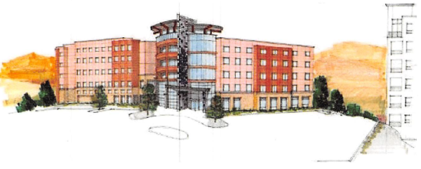
- Conceptual Residential Tower Rendering:
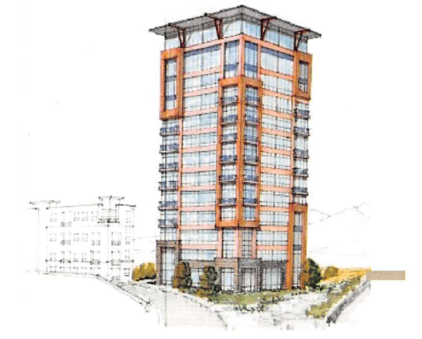
- Apartment Concepts:
- Conceptual Apartment 1:
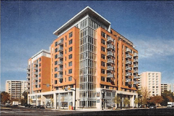
- Conceptual Apartment 2:
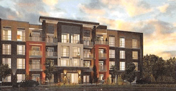
- Conceptual Apartment 1:
- Conceptual Materials:
- Wood, Stone, Tile:
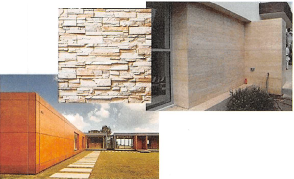
- Combination:
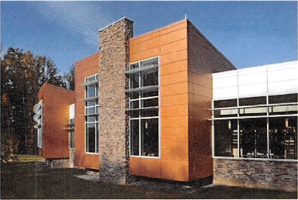
- Wood, Stone, Tile:
- Apartment Balcony Glass Railing Concept:
(Ord. 2019-19, 10-9-2019)
11.110.120.010 Intent, Purpose And Uses
- The SD-C Holiday Park Zone recognizes the unique placement of retail, commercial, flex space, restaurant, and other appropriate commercial facilities at the southeast intersection of Porter Rockwell Boulevard and Freedom Point Way. The development of these facilities are enhanced with a major intersection along a future state highway and on a site that has compelling geographic features which facilitate a variety of commercial uses as outlined below.
- This zone allows for various commercial uses shown in the Table of Uses listed below. The conceptual layout for the project is divided into three (3) areas of development as follows:
- Area A: Gas Station, Convenience Store, Car Wash
- Area B: Commercial Flex Space, Warehouse, Retail, Office and other uses as identified in the Table of Uses.
- Area C: Restaurant, Retail, Office and other uses as identified in the Table of Uses.
- The developable acres of each area shall not be increased or decreased
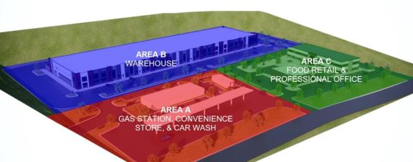
- Permitted Use Table for Area A, B, and C (P= Permitted; N= Not Permitted)
11.110.120.020 Land Use Authority For Site Plans And Subdivisions
A site plan approval is required for all projects in the SD-C Holiday Park Zone. All site plan applications are subject to 11.150 of this title and other land use ordinances unless specified herein. The City of Bluffdale staff shall be the Land Use Authority to review and approve all commercial site plans within the SD-C Holiday Park zone following a review and approval by the Holiday Park Architectural Review Committee (HPARC). If the owner desires to separate parcels of land, all future subdivisions of land within the SD-C Holiday Park zone are subject to all requirements of Title 12 of this code and reviewed and approved by the designated Land Use Authority as stated.
11.110.120.030 Holiday Park Architectural Review Committee
- The construction of any building, sign, or other structure within the project, including the design, architecture, exterior elevations, exterior finishes, and other architectural attributes will first be approved by the Holiday Park Architectural Review Committee (“HPARC”). Confirmation of the HPARC’s approval must be submitted along with all site plan and building permit applications.
- The HPARC shall be comprised of not less than three (3) persons. At least one (1) member shall be a professional in the field of architecture, at least one (1) member shall be employed in the Planning or Community Development department at the City of Bluffdale, and at least one (1) member shall be the applicant, owner or the owner’s representative of the property. Other professionals with experience in construction may be consulted during the review process of the HPARC.
- Decisions of the HPARC must be made by a majority vote of the then existing members.
11.110.120.040 Conceptual Site Plan
Project Area and Concept Plan: The Holiday Park project includes the entire 18.11 acre parcel and the overall conceptual layout and design is shown in Figure 1.
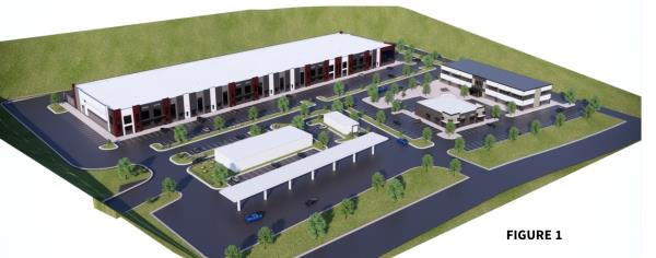
11.110.120.050 Commercial Development Standards And Design Requirements
- 11.110.120.050 Commercial Development Standards and Design Requirements:
- Setback Requirements:
- Each setback is measured from the property line of the lot or parcel.
- Building setbacks abutting a public street:
- Front Setback: Each lot or parcel abutting a public street shall have a minimum setback of twenty feet (20’).
- Side and Rear Setback: Each lot or parcel abutting a public street shall have a minimum side and rear setback of twenty feet (20’). A total reduction of the rear and side setbacks of up to twenty feet (20’) may be approved if doing so does not violate the adopted Building and Fire Codes.
- Parking setbacks for lots or parcels abutting a public street:
- Along Porter Rockwell Boulevard: No Parking.
- Along Freedom Point Way: No Parking.
- Side and Rear Setback: Along parcel lines not abutting a public street a landscaped setback of not less than five feet (5’) and averaging not less than ten feet (10’) shall be maintained.
- Projections into Setbacks:
- Permitted: the following structures may be erected on or projected into any required setback:
- Fences and walls in conformance with applicable city ordinances and resolutions.
- Appropriate landscaping.
- Necessary appurtenances for utility service.
- Retaining walls, whether cast-in-place concrete, pre-cast concrete, or rock when required to accommodate grading of existing slopes of improvements.
- Setback Areas: The following structures may be erected on or projected into any required front or rear setback not more than four feet (4’), and into a side setback not more than two feet (2’):
- Cornices, eaves, sills, buttresses or other similar architectural features.
- Awnings, decks, planter boxes.
- Patio’s, pergola’s, hard and soft landscaping.
- Distance Between Buildings: The distance between any building or structure and any other building or structure shall satisfy the Building and Fire Codes in place at the time of site plan approval.
- Lot Coverage: The sum total of all buildings, structures and parking in the Holiday Park Zone shall not exceed eighty-five percent (85%) for the total area of the parcel.
- Building Height Requirements: Buildings shall have a minimum height of one (1) story with a four (4) story maximum limit. The buildings in Area A, B and C shall not exceed eighty feet (80’) in height. Height of buildings may be reduced but shall not exceed the maximum height for any building within the SD-C Holiday Park Zone to accommodate site, design, or market conditions in any designated area.
- Architectural Standards. No building or structure within the project will be constructed, reconstructed, altered, added to or maintained in such a fashion as to alter, in any material respect, the architectural appearance, character, motif or functional purpose of such item, unless such alteration is first approved in writing by the HPARC. The HPARC is not responsible for determining compliance with structural and building codes or City codes all of which are the responsibility of the applicable owner.
- A Site Plan approval is required for all projects in the Holiday Park Zone. All site plan applications are subject to 11.150 of this title including building materials, windows, façade articulation, entrances and access, screening, landscaping, buffers, and all other site requirements.
- Parking, Circulation, Loading, and Access. All site plan applications are subject to 11.120 of this title.
- Signage. Signs are allowed in the SD-C Holiday Park Zone in accordance with the provisions of 11.220 of this title unless otherwise exempted as stated herein. As this development is located in a highly visible area adjacent to Porter Rockwell Boulevard and a future minor collector from Pony Express and proximity to I-15, signage is a critical component to success of the development.
- Types of Signage Allowed:
- Tower Sign: One (1) multiple tenant sign along Porter Rockwell Boulevard inclusive of all pads within the development, subject to the following.
- Such signs shall identify the project, building, business or businesses within the development, or development.
- The maximum area of such sign shall be seventy-five (75) square feet.
- The maximum height of such sign shall be twenty feet (20').
- Such sign shall be placed within a landscaped area of four (4) square feet for each one square foot of sign area.
- The entire allowed sign area may be used for a change panel sign.
- The sign shall have an architectural base consistent with the approved architectural requirements and shall have a design approval from the HPARC.
- Monument Signs:
- The maximum number of signs per street frontage shall be one, except as follows:
- A Commercial Center having a minimum of six hundred fifty feet (650') of linear frontage along a single public street may have additional monument signs in accordance with the following:
- No more than four (4) monument signs; and
- A minimum of two hundred (200) linear feet between signs.
- The maximum sign area shall be twenty-four (24) square feet.
- The maximum height shall be six feet (6').
- The maximum vertical dimension of the cabinet or panel shall be four feet (4').
- The maximum horizontal dimension of the cabinet or panel shall be ten feet (10').
- Such signs shall be placed within a landscaped setting of not less than two hundred forty (240) square feet.
- The entire allowed sign area may be used for a change panel sign.
- The sign shall have an architectural base consistent with the approved architectural requirements and shall have a design approval from the HPARC.
- Area A as shown on the concept plan shall allow electronic message displays (EMD) on monument signs to provide advertising that displays electronic images, graphics or pictures, with or without textual information which has the capability of being changed or altered by electronic means on a fixed display screen composed of a series of lights, including light emitting diodes (LEDs), fiber optics, plasma displays, light bulbs, or other illumination devices within the display area where the message is displayed.
- All electronic message centers are subject to the following standards:
- Such signs shall display full color messages or images only and the use of single colored text and images is prohibited.
- Each message/advertisement displayed on an EMD shall remain static for a minimum of eight (8) seconds. Animation, flashing, starburst or other similar frame effects are prohibited.
- Pixel pitch shall be as follows:
- shall have a true pixel pitch between one millimeter (1 mm) and ten millimeters (10 mm) due to closer proximity of travelers to signs.
- No EMD shall utilize a white or solid colored background for greater than or equal to fifty percent (50%) of the sign area.
- All EMDs are required to comply with the following LED sign illumination requirements:
- All permitted EMCs shall be equipped with a sensor or other device that automatically determines the ambient illumination and is programmed to automatically dim according to ambient light conditions, or that can be adjusted to comply with the 0.3 foot- candle measurements. In addition, EMDs must have a default mechanism to turn off the sign within twenty-four (24) hours of a reported malfunction.
- Sign illumination levels for EMCs shall never, at maximum display intensity, exceed 0.3 foot-candle over ambient lighting conditions when measured at the distance based on the formula of square root of area of sign times one hundred (100) (area of sign x 100). Light cutoff devices shall minimize light above the sign.
- The illuminance of an EMC shall be measured with an illuminance meter set to measure foot-candles accurate to at least two (2) decimals. Illuminance shall be measured with the EMC off, and again with the EMC displaying a white image. All measurements shall be taken perpendicular to the face of the EMC at the distance determined by the total square footage of the EMC as set forth in subsection D1f(2) of this section.
- The applicant shall submit a photometric matrix (showing the dispersal in foot-candles) showing that the sign meets all the requirements of this code.
- The owner shall be required to submit written certification from the sign manufacturer that the light intensity shall not exceed the maximum levels specified in the above table and photocell dimming prior to the issuance of a sign permit.
- EMD monument signs must have a minimum ten-foot (10') setback from any right of way.
- All electronic message centers are subject to the following standards:
- A Commercial Center having a minimum of six hundred fifty feet (650') of linear frontage along a single public street may have additional monument signs in accordance with the following:
- The maximum number of signs per street frontage shall be one, except as follows:
- Tower Sign: One (1) multiple tenant sign along Porter Rockwell Boulevard inclusive of all pads within the development, subject to the following.
- Types of Signage Allowed:
- Porter Rockwell Boulevard. Any development or construction along the right of way for Porter Rockwell Boulevard will be coordinated and in compliance with Utah Department of Transportation UDOT requirements.
- Setback Requirements:
11.110.130.010 INTENT AND PURPOSE
The intent of this special district zone is to provide a land use pattern that provides for a complementary and compatible mix of commercial and residential uses. This zone allows for the establishment of commercial, residential, and other uses consistent with a convenient and pedestrian friendly mixed use development layout. It is the intent of this zone to allow for flexibility and creativity in the arrangement of uses. The purpose is to develop The Centrum at Bluffdale, a mixed-use community consisting of up to 20,450 square feet of commercial buildings and up to 318 residential units, including only studio, one bedroom and two-bedroom units. The Centrum at Bluffdale is located adjacent to Porter Rockwell Boulevard, Rising Star Way, and Bluffdale Boulevard. Additional internal access will occur through private driveways. The project includes a privately owned and maintained swimming pool and other amenities. Adjacent park and trail amenities near the East Jordan Canal will be accessible to the public. Design guidelines, standards, and specifications in this SD-X Zone are created with this chapter and shall supersede any conflicting design guidelines, standards, and specifications in any and all applicable City ordinances. Design standards not included in the SD-X The Centrum at Bluffdale, shall be governed by applicable provisions of the Bluffdale City Code (BCC).
11.110.130.020 SITE PLAN
The SD-X-The Centrum at Bluffdale Conceptual Site Plan consists of approximately 3.2 acres of commercial, 3.4 acres of residential, and 1.1 acres of landscaping, open space and amenity area (total proposed open space includes amenities and paved spaces within the residential and commercial parcels and is not solely landscaped area) for a total of 6.6 acres, as shown in Figure 1. Total acreages may vary as final site plans are developed and approved.
Figure 1. Conceptual Site Plan
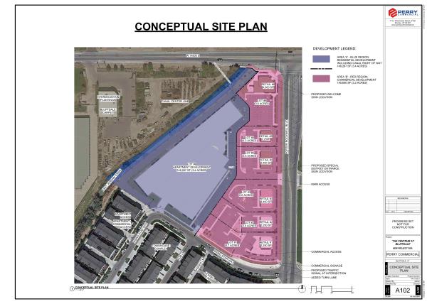
- SD-X Commercial: The commercial areas of the The Centrum at Bluffdale consist of approximately 3.4 acres. It is anticipated that up to 20,450 square feet of commercial buildings can be accommodated within The Centrum at Bluffdale, depending upon specific uses, market demand, right of way requirements, and sufficient parking being provided. Potential commercial uses may include retail and office, among other approved uses as shown in Table 11.110.130.030. Commercial uses will have direct pedestrian connections to community an regional trail networks through integrated site design, as well as good automobile access and visibility along Porter Rockwell Blvd., Rising Star Way, and 14600 South.
- SD-X Residential Amenities: The residential portions of The Centrum at Bluffdale will include privately owned and maintained swimming pool and amenities, and exterior linear park and trail amenities which are accessible to the public, as shown in the (open space) Figure 2.
- SD-X Parks, Open Space, and Trails Plan: Within The Centrum at Bluffdale, open space has been provided to benefit the residential community, create a trail section which is available to be connected in the future to existing and proposed community trail systems; and in the residential areas, to provide pedestrian connectivity to the retail amenities on site. This plan is shown in Figure 3. An onsite pool deck, verandas, dog park and trail areas will provide the opportunity for gatherings, picnics and informal play areas for general recreation. The Centrum at Bluffdale's active open space includes 1.1 acres in private trails, hardscaped amenity areas, and landscaped areas. The trails are available to connect with City trail systems adjacent to and within the project area and shall be accessible to the public. However, due to current private ownership to the southwest, The Centrum can only connect to the City sidewalk system on Rising Star Way in the southwest area of the project.
A public trailhead area shall be designated for public access and indicated on the conceptual site plan providing access to the East Jordan Canal trail system and connectivity to the overall trail system throughout the development, as shown on Figure 3. The private parks and trails will be informal play areas that include at a minimum turf, trees and an automatic irrigation system, which complies with the City's water efficiency standards. As a privately owned and maintained park, the developer will not request reimbursement for the value of the park land and the improvements and all parks impact fees will be paid by all residential units. The total active and passive parks, trails and open space areas are approximately 1.1 acres and will contain a variety of recreational amenities, such as those outlined in the Amenity Plan in Figure 2 below.
Figure 2. Amenity PlanFigure 3. Open Space and Landscape Plan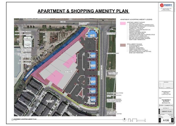
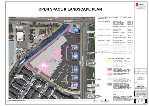
Transportation Network: The Centrum at Bluffdale's transportation takes advantage of the arterial road, Porter Rockwell Blvd., along with Rising Star Way, as primary access to the property. Right in right out access is required on Porter Rockwell Boulevard. A signalized intersection and lane improvements are proposed to be located at the intersection of Rising Star Way and Porter Rockwell Blvd. as warranted. The transportation network plan is depicted in Figure 4. Detailed traffic studies are required during site plan review to verify specific design and right of way requirements.Figure 4. Transportation Network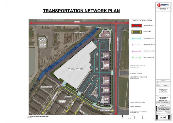
- Parking. As a unique mixed used project with a variety of future commercial tenants, and limitations on the number of bedrooms in the apartment units, parking requirements at The Centrum are specific to this special district. A conceptual parking plan is depicted in Figure 5.
- Commercial areas shall be parked at a minimum of five (5) stalls per every 1,000 square feet of commercial building; approval of this ratio shall be verified during site plan review, based on specific proposed uses and a submitted professional analysis. The conceptual parking plan shows 138 surface parking stalls devoted to the commercial part of the project.
- A minimum of 504 parking stalls shall be provided for the 252 apartment units. These stalls shall not be utilized to meet any commercial parking requirements.
- Buildings and uses designated with drive-through lanes shall verify adequate stacking and queuing in their traffic analysis during site plan review.
- Cross access easement agreements shall be recorded with any proposed subdivision plat or before the first building occupancy - as the case may be - between the residential lot and the commercial lots to accommodate free movement of vehicular and pedestrian traffic and to allow shared parking between throughout the project.
Figure 5. Parking Plan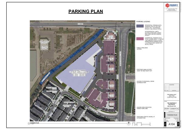

11.110.130.030 ALLOWED USES
Only those land uses that are specifically listed in Table 11.110.130.030.010 are permitted or accessory uses in the Centrum at Bluffdale Special District are allowed in the zone. There are no allowed conditional uses in this zone
11.110.130.030.010 Table of Permitted and Accessory Uses for The Centrum at Bluffdale Special District
| Use | Use Classification |
| Bank or financial institution | P |
| Home Occupation | A1 |
| Laundry Services | P |
| State Liquor Store | P |
| Medical Service | P |
| Museum | P |
| Office, General | P |
| Parks | P |
| Personal Instruction Service | P |
| Personal Service Establishment | P |
| Preschool/Daycare Center | P |
| Printing Shop | P |
| Recreation and entertainment (indoor) | P |
| Repair Service | P |
| Research and development laboratories | P |
| Restaurant | P |
| Retail, general | P |
| Trade or technical schools | P |
| Trails | P |
| Veterinary Service | P |
1In residental units, per Bluffdale City Code 3.060
11.110.130.040 DEVELOPMENT STANDARDS
- Appearance: The SD-X Zone requires specific development standards and regulations that apply to The Centrum at Bluffdale. The purpose is to develop standards that will enhance the overall appearance of the neighborhood.
- Conflicts: Design guidelines, standards, and specifications adopted in this SD-X Zone that differ from existing adopted codes and standards shall supersede unless there is a compelling, countervailing public interest or they do not comply with adopted fire and building codes. Standards and adopted codes not specifically modified by this SD-X zone shall be governed by applicable provisions of the Bluffdale City Code and adopted standards.
- Conceptual in Nature: The Centrum at Bluffdale Special District presents a conceptual layout and does not constitute site plan approval. Formal site plan approval is required for all phases of development within the Centrum at Bluffdale Special District.
- General Standards.
- Public utility easements shall meet Bluffdale City Standards.
- No trash, used materials, unsightly storage of any kind, or non-licensed or abandoned vehicles shall be stored in this SD zone.
- Dumpster enclosures shall be architecturally designed and screened per adopted standards in BCC, and approved during site plan review.
- Residential Standards:
- The apartment building is allowed to be seven stories (five stories of housing above two stories of structured parking) and up to ninety (90) feet in height.
- Residential building location is allowed as depicted on the conceptual site plan, with no specific setback requirement, and shall be approved during the site plan review process. Location shall comply with all adopted building and fire codes and accommodate required utility easements, right of way requirements, and emergency access, and all other applicable provisions of the Bluffdale City Code and adopted standards.
- One point six (1.6) parking spaces are required for each dwelling unit which may be located within a fully enclosed garage or designated in a parking lot adjacent to the residential structure.
- No apartment unit shall exceed two bedrooms.
- Architectural Design Guidelines: Consistent with the requirements of the SD-X Zone, The Centrum at Bluffdale requires enhanced architectural elements and features that will result in a residential building that is thematic and include enhancements to visible side and rear facades from either public streets and trails or the private park or trail. The following architectural design guidelines are the minimum standards for residential building which shall also adhere to the design requirements in 11.150 BCC, unless otherwise specifically noted:
- Masonry, brick, fiber cement siding, architectural metal panels, patterned concrete and/or EIFS/stucco systems shall be used on all exterior walls. No vinyl siding shall be permitted. Maximum amount of EIFs/stucco is 25% on any one facade.
- Patterned or formed architectural concrete may be utilized as a primary exterior material on the parking lot levels of the residential structure, pursuant to the conceptual exterior elevations presented in Exhibits 6-10. Brick and other allowed accent materials are still required to be utilized in these levels.
- Examples of types of acceptable concrete patterns or forms:
- Examples of types of acceptable concrete patterns or forms:
- Where masonry is used on the front exterior at corners, it shall be wrapped around to the side exterior a minimum of twenty-four inches (24").
- The Centrum at Bluffdale shall be landscaped in accordance with the City’s standards for water efficiency, percentage of parking lot landscaping, tree, shrub, and ground cover requirements, irrigation design, and the overall site percentages approved in this SD-X zone.
- Street trees, which are shade providing species, not ornamental varietals, shall be planted and maintained in compliance with City standards in all park strips and adjacent to the trail area. Where a parkstrip doesn’t exist or allow for street trees due to utility or other engineering conflicts, street trees shall be placed as close to the sidewalk as possible . These trees shall be installed pursuant to the approved site plan prior the issuance of a certificate of occupancy and shall be maintained by the Owner. In times of inclement weather and lack of availability, landscaping installation may be temporarily suspended pursuant to BCC 11.150.050(A)(16). The Owner shall be responsible for maintaining the park strips and removing snow from the sidewalk and trail areas within and adjacent to the project.
- Fencing: The consistent and uniform installation of thematic fencing will contribute to the The Centrum at Bluffdale sense of neighborhood. The Owner shall install the approved fencing along the length of the trail system on the west of the residential building from the building corner and the lot rear corner as shown in the conceptual plans. The fence shall be a decorative fence no less than six (6) feet in height which is not chain link. The material and color shall be determined during the site plan review process. Fencing shall be installed as depicted in Figure 3 Open Space and Landscape Plan. It shall be the responsibility of the The Centrum at Bluffdale Owner to ensure all fencing is maintained and continues to meet the requirements of the City.
- Commercial Location Standards:
- Setback Requirements. Commercial buildings and necessary appurtenances for utility service may be located as depicted on the concept plan with no specific setback requirements. Drive-through lanes shall be screened and buffered from adjacent sidewalks and trails by at least five feet (5') of perimeter landscaping. Building locations shall be approved during the commercial site plan review process and shall comply with all adopted building and fire codes, accommodate utility easements, right of way requirements, transportation, and access ways, and all other applicable provisions of the Bluffdale City Code and adopted standards.
- Commercial Maximum Height: A primary building or structure may not exceed forty five feet (450') in height, nor be lower than ten feet (10') in height. All buildings and structures must adhere to adopted Building and Fire Codes.
- Screening of utilities and equipment: shall adhere to all BCC adopted requirements
- Distance Between Commercial Buildings: The distance between any building or structure and any other building or structure shall satisfy the Building and Fire Codes in place at the time of site plan approval.
- Commercial Parking, Loading And Access:
- Parking: Total required off street parking spaces shall be a minimum of five (5) stalls per one thousand (1,000) useable square feet for office and retail uses. Sufficiency of parking shall be verified during site plan review, based on a professional analysis and the specific proposed uses. The spaces shall be hard surfaced with asphalt or concrete and be accessed from a public road by a hard surfaced, composed of asphalt or concrete, drive approach which meets adopted standards.
- Loading And Unloading Area: Loading and unloading and service entrances shall not occur on or adjacent to a public street. Loading docks are not allowed and service areas shall be screened from traffic with berming, decorative masonry walls, and/or landscaping, pursuant to adopted design requirements in the BCC.
- Commercial Design Guidelines: The Centrum at Bluffdale special district is located at an important and visible gateway to Bluffdale and thus requires enhanced architectural elements and features that will result in commercial buildings that are thematic and include enhancements to all facades. The conceptual architectural elevations and renderings are depicted in Figures 6-10, which are to be used as a guide and expectation for site plan review. The following architectural design guidelines are the minimum standards for the design and construction of all non-residential buildings within The Centrum at Bluffdale. Building design shall adhere to the design requirements in 11.150 of the BCC unless otherwise specifically noted.
- Building Materials:
- Brick shall be utilized as a primary visible exterior material in building construction in the Centrum Special District. Brick or thin brick veneers applied may qualify, and shall be constructed with a minimum of fifty percent (50%) brick on each street facing façade in these areas.. Windows shall be excluded from the calculation of exterior building material requirements. Manufactured (not kiln-fired), Nichiha patterned brick composite material, or imprinted dry-vit, eifs, or similar stucco type, patterned or stenciled as brick do not meet the definition of brick.
- Facades which do not front on Porter Rockwell, Rising Star Way, and 14600 South, brick materials shall make up a minimum of 25% of each facade. Brick shall be utilized as wainscot, window lintels and sills, quoins, columns, decorative features, and/or emphasizing building entrances.
- When utilized as an exterior material, concrete masonry units (CMU) must be colored and feature decorative or architectural finishes such as honed, scored, offset, split faced, or exposed aggregate. Gray CMU block is not an acceptable finished material and shall not be permitted on any finished building elevation with the exception of minimal foundation exposure. CMU shall not be painted.
- Additional secondary building materials may include: brick, stone, fiber/cement composite siding, architectural metal panels with reveals, CMU, exposed and patterned concrete, wood or similar material in composition and of a complementary hue and shade to the brick. A maximum of two (2) accent colors may be allowed for secondary materials. Stucco/EIFS/Dry-Vit type systems may be used to accent building design and for wall signage areas in a percentage not to exceed 25% of any one building façade.
- Primary color tones shall be complimentary in hue and shade to the brick or CMU included in the primary or secondary façade material and shall generally be subtle, subdued, low reflectance, neutral, or earth tones. White is not allowed as a primary building color.
- Brick, rock, CMU, and stone elements of a building shall not be painted to create compliance with the color palette of the site.
- Four-sided architectural design is required. The design of a building shall be considered on all sides of the building with each facade being required to meet the terms of this section and Title.
- In addition to City design requirements for windows, transparency and glazing found in Chapter 11.150 of the BCC, primary building elevations along Porter Rockwell Boulevard, 14600 South, and Rising Star Way shall have a minimum of forty percent (40%) transparency or window glazing within the first nine (9) feet of the structure; above that, the remaining facade area shall have a minimum of 15% windows or glazing. Other facades shall have a minimum fifteen percent (15%) window requirement, which can include the use of clerestory windows where high ceilings exist. Mirrored glass shall not be allowed on the ground floor. Spandrel glass or faux windows may be utilized to meet this requirement where not feasible due to building structural design limitations to be transparent. Where spandrel glass or faux windows are not feasible due to architectural or structural limitations, an applicant may apply for a deviation from strict compliance pursuant to BCC 11.150.060(E).
- Glass garage doors, including opaque glass, may be used to calculate and qualify for this requirement.
- Figure 6 Exterior Elevations
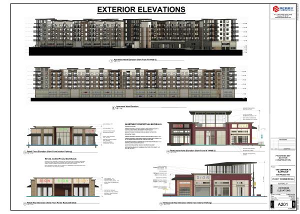
Figures 7-10. Conceptual Exterior Elevation Images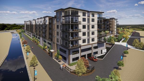
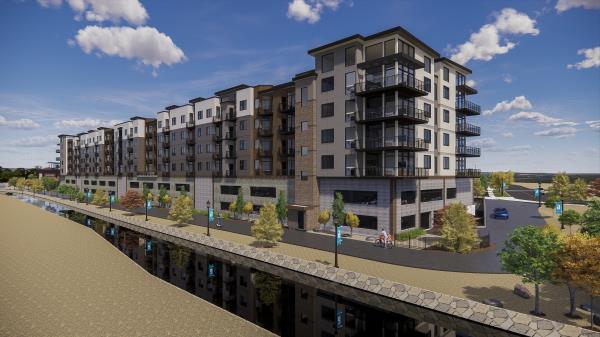
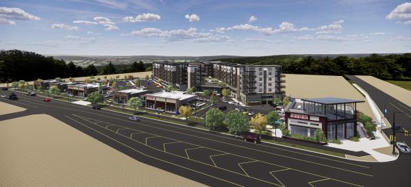
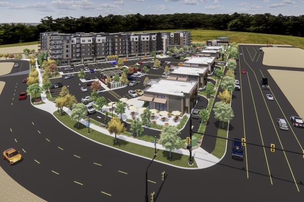
- Figure 6 Exterior Elevations
- Landscaping: Individual site plans, lots or parcels located in this SD-X shall demonstrate that the overall developed area of the project contains a minimum of fifteen percent (15%) of the total developed project area is landscaped, including required parking lot landscaping, as verified during each site plan review and approval. Non-irrigated or non-landscaped area, such as canal banks and canal roads, do not qualify as required landscaping which meets this requirement.
- Building Materials:
- Signage:
- Signs: All monument, tower, and informational wayfinding signs shall adhere to a consistent and unified signage scheme which is consistent with the architectural theme shown in Figures 6-10, such as architectural bases of brick. Unless otherwise noted, all signs shall comply with signage requirements in BCC 11.220.
- Signage which differs from or exceeds the City's standards requirements is allowed as follows:
- Tower Sign: One tower sign shall be allowed at the entrance to The Centrum at Bluffdale from Porter Rockwell Blvd., which meets the dimensional, design, and locational standards found in BCC 11.22.070 and all other applicable requirements of BCC 11.220, ans shall include an architectural base which conforms to the overall architectural theme.
- Welcome sign. Developer shall install an entry/welcome sign which includes the official Bluffdale logo or Bluffdale as part of the project, as depicted in Figure 10. Said sign shall be allowed to be up to six feet high, shall have an architectural brick base, and conform with the City logo style guide. The welcome sign shall be included in the site plan of and constructed with the building located closest to the intersection of 14600 South and Porter Rockwell Boulevard.
- Informational Wayfinding Signs: Informational wayfinding signs shall be allowed in the project and shall follow the size and location guidelines outlined in city code section 11.220.070 for Informational signs.
- Suspended, Blade Type Projecting Signs: Suspended or blade type projecting signs may be provided along pedestrian walkways and shall maintain a minimum clearance of seven feet (7') above the pavement, and shall be a maximum of four (4) square feet.
- Electronic message centers not allowed.
11.110.140.010 INTENT AND PURPOSE
The intent of this special development zone is to provide a land use pattern for a complementary and compatible pedestrian friendly mix of commercial and residential uses. It is the intent of this zone to allow for flexibility and creativity in the arrangement of uses and unique design standards. The purpose is to develop The Bluff at Point Crossing (“SD-X BPC Zone”), a mixed-use community consisting of approximately 40,000 square feet of commercial uses and up to 40 residential townhome units. The SD-X BPC Zone is located adjacent to Porter Rockwell Boulevard and Heritagecrest Way which provides vehicular and pedestrian access for the development. Design standards and site specifications in this project are created with this chapter and shall supersede any conflicting design standards and site specifications in any and all applicable City ordinances. Design standards not specifically included in the SD-X BPC Zone, shall be governed by applicable provisions of the Bluffdale City Code (BCC).
11.110.140.020 LAND USE AUTHORITY FOR SITE PLAN AND SUBDIVISION APPROVAL
Site plan approval is required for all commercial and residential buildings within the SD-X BPC Zone. All applications are subject to the development standards and design requirements of this chapter and the Bluffdale City Codes in title 11.150 and other applicable BCC sections and are required to be approved by the Bluff at Point Crossing Architectural Review Committee (BPCARC) prior to review and approval by the Land Use Authority. City of Bluffdale staff shall be the Land Use Authority to review and approve all site plans.
The adoption of the SD-X BPC does not constitute a subdivision of the proposed property. All future subdivisions of land within the SD-X BPC Zone are subject to all requirements of Title 12 and other applicable sections of the Bluffdale City Code and all adopted specifications and all applications shall be reviewed and approved by the designated Land Use Authority as stated.
11.110.140.030 CONCEPTUAL SITE PLAN
SD-X The Bluff at Point Crossing consists of approximately 20 gross acres and 10.66 developable acres. The Conceptual Site Plan includes approximately 8.37 acres of commercial uses, approximately 2.12 acres of residential uses, and includes approximately 11 acres of landscaping, open space and other amenities as shown in Figure 1. Total acreage may vary as final site plans are developed and approved. The Bluff at Point Crossing conceptual site plan provides an anticipated layout of commercial and residential uses and does not constitute final site plan approval. Site plan approval is required for all phases of development consistent with the Bluffdale City Code and as outlined in this title by the authorized Land Use Authority.
FIGURE 1. CONCEPTUAL SITE PLAN
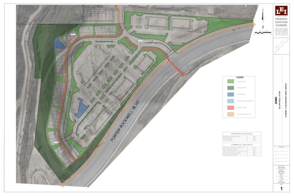
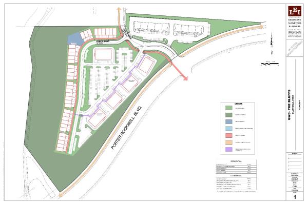
11.110.140.040 COMMERCIAL AND RESIDENTIAL PHASING PLAN
The owners of the property within the SD-X BPC Zone shall submit application for site plan approval and subdivision approval, if applicable, for the areas designated for commercial and residential uses within two (2) years of zoning approval by the Land Use Authority. Commercial pads and residential units shall be simultaneously constructed following the completion of the overall site reclamation process and other City approval processes.
11.110.140.050 COMMERCIAL DEVELOPMENT AND DESIGN STANDARDS
The commercial areas of the SD-X BPC Zone consist of approximately 8.37 acres. It is anticipated a minimum of 40,000 square feet of commercial and retail uses will be provided depending upon market demand and economic opportunities. Proposed commercial uses are shown in Table 11.110.140.060. The overall project shall provide pedestrian connections and access to community and regional trail networks through integrated site design. The site shall also provide vehicular access and circulation for mobility within the site and visibility along Porter Rockwell Boulevard and Heritagecrest Way.
- Public Open Space and Landscaping Requirements: Open space shall be included as a component of all site plans, and shall include the following minimum standards:
- Consist of a minimum of fifteen percent (15%) of the developable acreage. Site specific landscaping plans will be approved with the individual site plan applications and shall maintain landscaping percentages in each phase of development.
- Additional features including art, clocks, water features, or other amenities are highly encouraged within the SD-X BPC commercial area. These areas may include a central prominent gathering space with a focal feature such as a statue, water feature, canopy, gazebo, clock tower, or other feature as approved with the site plan. The central features shall be proportionate to the size and scale of the gathering space and may include other features such as raised planters, benches, trees, pedestrian scale lighting, and brick pavers or stamped concrete.
- Any hardscaped area featuring any of the amenities listed above used for a public open space shall be included in the overall tabulation for the minimum open space or landscaping requirement and may receive credit as a replacement for irrigated landscape areas.
- A trail network shall be provided within the project to connect the commercial and residential areas and create connections to other public trails within the area, pursuant to or as shown on concept plan Figure 2. Trail locations and specifications are subject to the City’s standards and shall be reviewed and approved with specific site plan applications.
- Areas of the project, including hillsides, that have been disturbed during the grading and/or construction processes shall be revegetated in accordance with adopted standards and section 8.60.060 of the Bluffdale City Code. A landscaping plan, including a hillside revegetation plan, shall be submitted with the site plan application for each adjoining or abutting phase of the project.
- All landscaped areas shall be installed in accordance with the City’s standards for water efficiency, parking lot landscaping, trees, shrubs, ground cover requirements, and irrigation design.
- Street trees shall be planted and maintained in compliance with City standards in all park strips and adjacent to the trail areas. Where a park strip does not exist or allow for street trees due to utility or other engineering conflicts, street trees shall be placed as close to the sidewalk as possible. Trees shall be installed pursuant to the approved site plan prior the issuance of a certificate of occupancy in each identified phase and shall be maintained by the owner. The owner shall be responsible for maintaining the park strips and removing snow from the sidewalk and trail areas within and adjacent to the project.
- Commercial Development Standards: The SD-XBPC Zone provides specific development standards for the overall project. The purpose is to provide a sense of place and unifying theme for the project by elevating the quality of materials, colors, and additional amenities not typically required for commercial development.
- General Standards:
- Public utility easements shall meet Bluffdale City Standards.
- No trash, used materials, unsightly or outside storage of any kind, or non-licensed or abandoned vehicles shall be stored in this SD-X zone.
- Dumpster enclosures shall be architecturally designed and screened per adopted standards in BCC. Locations and materials shall be approved during site plan review.
- Commercial Location Standards:
- Setback Requirements: Commercial buildings and necessary appurtenances for utility service may be located as depicted on the concept plan with no specific setback requirements. Drive-through lanes shall be screened and buffered from adjacent sidewalks and trails by at least five feet (5’) of perimeter landscaping which includes vertical elements. Building locations shall be approved during the commercial site plan review process and shall comply with all adopted building and fire codes, accommodate utility easements, right of way requirements, transportation, and access ways, and all other applicable provisions of the Bluffdale City Code and adopted standards.
- Commercial Maximum Height: A primary building or structure may not exceed fifty feet (50’) in height, nor be lower than ten feet (10’) in height. All buildings and structures must adhere to adopted Building and Fire Codes.
- Screening of utilities and equipment: Shall adhere to all BCC adopted requirements.
- Distance Between Commercial Buildings: The distance between any building or structure and any other building or structure shall satisfy the Building and Fire Codes in place at the time of site plan approval.
- Commercial Parking, Loading, and Access:
- Parking: Total required off street parking spaces shall be a minimum of five (5) stalls per one thousand (1,000) useable square feet for office and retail uses. Sufficiency of parking stall be verified during site plan review, based on a professional analysis and the specific proposed uses. The spaces shall be hard surfaced with asphalt or concrete and be accessed from a public road by a hard surfaced, composed of asphalt or concrete, drive approach which meets adopted standards. A conceptual parking plan is presented in Figure 1.
- Loading and Unloading Area: Loading and unloading and service entrances shall not occur on or adjacent to a public street. Loading docks are not allowed and service areas shall be screened from traffic with berming, decorative masonry walls, and/or landscaping, pursuant to adopted design requirements in the BCC.
- Buildings and uses designated with drive-through lanes shall verify adequate stacking and queuing in their traffic analysis during site plan review.
- Cross-access easement agreements shall be recorded with any proposed subdivision to accommodate free movement of vehicular and pedestrian traffic and to allow shared parking throughout the project.
- All internal roads throughout the development are planned to be private roads and will be owned and maintained by the owners or users as part of the SD-XBPC Zone.
- Design Standards: The Bluff at Point Crossing project shall include enhanced architectural elements and thematic features to all sides and facades of a building. The following architectural design standards are provided to create a specific project design, conceptual architectural elevations and renderings are depicted in Figure 3 and Figure 4 which are to be used as an expectation for site plan review. The following architectural design guidelines are the minimum standards for the design and construction of all non-residential buildings within The Bluff at Point Crossing. Building design shall adhere to the design requirements in 11.150 of the BCC unless otherwise specifically noted.
- Building Materials:
- Lap siding and beadboard may be utilized as the primary visible exterior material. Use of this material shall not exceed 50%. It shall be neutral and light in color and shall be fiber/cement composite siding. No vinyl siding shall be permitted.
- Wood can be used mainly around entrances or on the building as an accent material. The use of this material may not exceed 25%.
- Stone, brick and other masonry may be used as a primary material which may not exceed 60%.
- Primary color tones shall be complimentary in hue and shade to the facade material and shall generally be subtle, subdued, low reflectance, neutral, or earth tones. White and black are also acceptable.
- Architectural metal panels, patterned concrete and/or EIFS/stucco systems may be used on all exterior walls. Maximum amount of EIFs/stucco is 25% on any one facade.
- Windows: Primary building elevations along Porter Rockwell Boulevard and Heritagecrest Way shall have a minimum of forty percent (40%) transparency or window glazing within the first nine (9) feet of the structure; above that, the remaining facade areas shall have a minimum of fifteen percent (15%) window requirement, which can include the use of clerestory windows where high ceilings exist. Mirrored glass shall not be allowed on the ground floor. Spandrel glass or faux windows may be utilized to meet this requirement where not feasible due to building structural design limitations. Glass garage doors, including opaque glass, may be used to calculate and qualify for this requirement.
- Architecture:
- Architectural orientation. Four-sided architectural design is required. The design of a building shall be considered on all sides of the building, with a “frontage” design on Porter Rockwell Boulevard and Heritagecrest Way, as well as an additional frontage with entry access near the parking areas. The front facade of all commercial buildings shall face the street, and an additional and look alike front facade will face the parking or other area of main pedestrian access.
- Roof Design. Commercial buildings may utilize some flat roof designs. A design including pitched roof features for accent roofs are encouraged and should be used for 25% of a massing’s roof line.
- Entry Features. Porches, roof overhangs, awnings, hooded front doors, pop-outs, and/or other architectural facade elements shall define the front entrance to all commercial buildings.
- Vertical Separation. Buildings should have a visually distinct base that creates a welcoming environment for pedestrians. The lowest level of the building should have more mass and bulk in order to be clearly delineated and scaled. The ground floor ceiling height must be greater than the upper floors.
- Building Materials:
- General Standards:
FIGURES 3 AND 4. COMMERCIAL ARCHITECTURAL ELEVATIONS AND MATERIALS
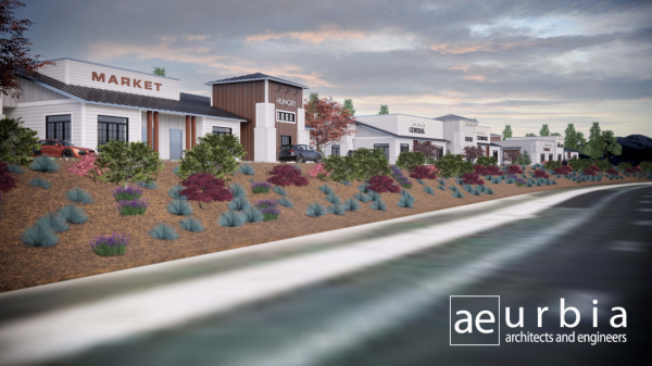
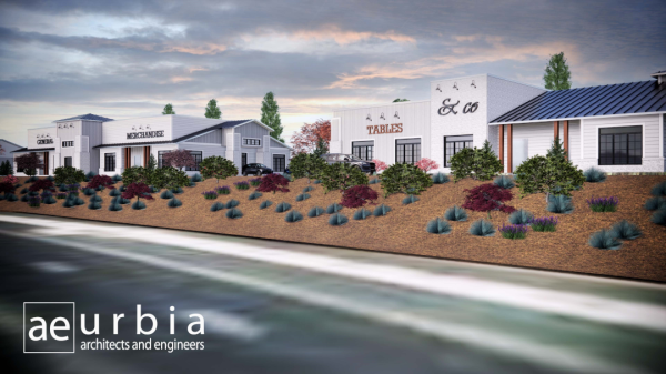
11.110.140.060 ALLOWED USES
Only those land uses specifically listed in the Table below are allowed as permitted or accessory uses in the commercial areas of the SD-X BPC Zone.
Table of Permitted Uses for SD-X The Bluff at Point Crossing Zone
| USES | |
| BANK OR FINANCIAL INSTITUTION: An organization involved in deposit banking, finance, investment, mortgages, trusts, and the like, but excluding uses specifically classified in another definition herein. Typical uses include commercial banks, credit unions, finance or mortgage companies, and savings institutions. | P |
| CARWASH: An establishment primarily engaged in cleaning or detailing motor vehicles, including cars, passenger trucks, recreational vehicles, whether self-service, automatic or by hand. This definition applies only to car washes that are the primary use of land. A car wash associated with a gas station is not included in this definition. | P |
| CONVENIENCE STORE/GAS STATION: An establishment, not exceeding five thousand (5,000) square feet of gross floor area, serving a limited market area and engaged in the retail sale or rental, from the premises, of food, beverages and other frequently or recurrently needed items for household use, which may include the sale of gasoline and petroleum products. Such establishment may also include automatic and self-serve car washes which are accessory to the primary use. | P |
| HOTEL: An establishment with or without fixed cooking facilities in individual rooms offering transient lodging accommodations to the public, and which may provide additional services such as restaurants and meeting rooms. | P |
| LAUNDRY SERVICES: An establishment providing household laundry and dry-cleaning services with customer drop off and pick up where laundering or cleaning is done on the site. This use also includes an establishment providing home type washing, drying, and/or ironing machines for hire or rent to be used by customers on the premises, such as a laundromat. | P |
| MEDICAL SERVICE/URGENT CARE CLINIC: An establishment providing therapeutic, preventive, urgent care, or corrective personal treatment services on an outpatient basis by physicians, dentists, and other practitioners of the medical or healing arts, as well as the provision of medical testing and analysis services. | P |
| OFFICE, GENERAL: A building, room or department where executive, management, administrative or professional services are provided, except medical services, and excluding the sale of merchandise, except as incidental to a principal use. Typical uses include real estate brokers, insurance agencies, credit reporting agencies, property management firms, investment firms, employment agencies, travel agencies, advertising agencies, secretarial services, data processing, call centers; Post Offices and express mail offices as an accessory or complementary use to a professional and business office development, but excluding major mail processing and distribution; offices for utility bill collection; professional or consulting services in the fields of law, architecture, design, engineering, accounting and similar professions; interior decorating consulting services; and business offices of private companies, utility companies, public agencies, trade associations, unions and nonprofit organizations. | P |
| PERSONAL INSTRUCTION SERVICE: An establishment primarily engaged in the provision of informational, instructional, personal improvement and similar services of a nonprofessional nature. Typical uses include art and music schools, driving and computer instruction, gymnastic and dance studios, handicraft or hobby instruction, health and fitness studios, massage therapist instruction, martial arts training, and swimming clubs. | P |
| PERSONAL SERVICE ESTABLISHMENT: An establishment providing nonmedical services to individuals as a primary use. Examples of these uses include barbershops, beauty salons, day/health spa, hair salons, nail salons, shoe repair shops, tanning salons, tailors and similar businesses not including tattoo establishments. | P |
| PRESCHOOL/DAYCARE CENTER: An establishment, other than an occupied dwelling, operated by a person or organization qualified by the State, which provides daycare, protection or supervision and/or preschool instruction. | P |
| RECREATION AND ENTERTAINMENT (INDOOR): A commercial recreational land use conducted entirely within a building, including arcade, arena, athletic and health clubs, bowling alley, community center, gymnasium, pool or billiard hall, skating rink, swimming pool, tennis court or similar indoor facility. Related indoor uses may include a retail area for the sale or rental of equipment and a snack bar. | P |
| REPAIR SERVICE: An establishment primarily engaged in providing repair services to individuals and households rather than firms, but excluding automotive, vehicular and equipment services uses. Typical uses include appliance repair shops, computer and other electronic equipment repair, furniture repair and upholstery shops, watch or jewelry repair shops, and musical instrument repair shops. | P |
| RESTAURANT: A facility where food and drink is prepared and served to the public for on-site consumption (dine in), takeout, or delivery service. A restaurant may include a drive-through. | P |
| RETAIL, GENERAL: An establishment that rents or sells goods to the public but excluding uses specifically classified in another definition herein. Typical uses include apparel stores, antique shops, art and hobby supply stores, bicycle shops, bookstores, clothing rental stores, department stores, discount stores, drugstores, electronic appliance stores, florists, food stores, furniture and appliance stores, gift and novelty shops, glass and mirror shops, hardware stores, home improvement centers, jewelry stores, medical supply stores, music stores, optical retail sales, paint stores, pet stores, photocopying and blueprinting shops, photography supply stores, record, tape and video stores, sporting goods stores, toy stores and variety stores. | P |
| VETERINARY SERVICE: An establishment providing medical care and treatment for animals, which may include accessory grooming or boarding services. | P |
11.110.140.070 RESIDENTIAL DEVELOPMENT AND DESIGN STANDARDS
The conceptual residential areas of the Bluff at Point Crossing consist of approximately 2.12 acres. It is anticipated that up to 40 townhome units can be accommodated within the project depending upon market demand, right of way requirements, and sufficient parking being provided. Townhomes shall have pedestrian connections to commercial areas and trail networks and to the Independence project to the north through integrated site design. Access will be provided from Porter Rockwell Boulevard and Heritagecrest Way.
- Open Space: Open space shall be included, and shall include the following:
- Consist of a minimum of fifteen percent (15%) of the developable acreage for the residential area of the project. Site specific landscaping plans will be approved with the individual site plan applications.
- Amenities: Open space shall be provided to benefit the residential community. The residential area may include a privately owned and maintained park. A trail network shall provide public access to trails and connections to other trail systems and create pedestrian connectivity to the commercial areas within the project along with surrounding neighborhoods as shown in the (open space exhibit) Figure 2. Trails within the residential area shall be constructed with the residential units. Final locations, connections and standards shall be determined at site plan approval.
- Landscaping:
- The residential areas shall be landscaped in accordance with the City’s standards for water efficiency, percentage of parking lot landscaping, tree, shrub, and ground cover requirements, and irrigation design.
- Street trees shall be planted and maintained in compliance with City standards in all park strips and adjacent to trail areas. Where a park strip does not exist or allow for street trees due to utility or other engineering conflicts, street trees shall be placed as close to the sidewalk as possible. These trees shall be installed pursuant to the approved site plan prior the issuance of a certificate of occupancy and shall be maintained by the owner. The owners shall be responsible for maintaining the park strips and removing snow from the sidewalk and trail areas within and adjacent to the project.
- The private park and trails will be informal play areas that include at a minimum turf, trees, and an automatic irrigation system, which complies with the City’s water efficiency standards.
- Areas of the project, including hillsides, that have been disturbed during the grading and/or construction processes shall be revegetated in accordance with the adopted standards and section 8.60.060 of the Bluffdale City Code. A landscaping plan, including a hillside revegetation plan, shall be submitted with the site plan application for each adjoining or abutting phase of the project.
- Residential Development Standards:
- Appearance: The SD-X BPC Zone requires specific development standards and regulations that apply to the project. The purpose is to develop standards that will enhance the overall appearance of the neighborhood.
- Conflicts: Standards and adopted codes not specifically modified by this SD-X BPC Zone shall be governed by applicable provisions of the Bluffdale City Code and adopted standards.
- The residential units are allowed to be three stories and up to 50 feet in height.
- Residential building location is allowed as depicted on the conceptual site plan, with no specific setback requirement, and shall be approved during the site plan review process. Location shall comply with all adopted building and fire codes and accommodate required utility easements, right of way requirements, and emergency access, and all other applicable provisions of the Bluffdale City Code and adopted standards.
- The architectural design standards are provided to create a specific project design, conceptual architectural elevations and renderings are depicted in Figure 5 and Figure 6 which are to be used as an expectation for site plan review.
- Residential Parking and Vehicular Access:
- Residential parking is provided as follows: two (2) parking spaces per dwelling unit enclosed in garage and 20-foot minimum driveway is required.
- There shall be one (1) guest parking stall for every four (4) units.
- Cross access easement agreements shall be recorded with any proposed subdivision plat between the residential lots and the commercial lots to accommodate free movement of vehicular and pedestrian traffic and to allow shared parking between throughout the project.
- Building Materials:
- Lap siding and beadboard may be utilized as the primary visible exterior material. Use of this material shall not exceed 50%. It shall be neutral and light in color and align with the style and renderings depicted in Figures 5-6. All lap siding and beadboard shall be fiber/cement composite siding. No vinyl siding shall be permitted.
- Wood may be used as an accent material. Wood can be used mainly around entrances and featured architectural elements and may not exceed 25%.
- Primary color tones shall be complimentary in hue and shade to the facade material and shall generally be subtle, subdued, low reflectance, neutral, or earth tones. White and black are also acceptable.
- Stone, masonry, brick, fiber cement siding, architectural metal panels, patterned concrete are allowed and may not exceed 25% on any one facade. Where masonry is used on the front exterior at corners, it shall be wrapped around to the side exterior a minimum of twenty-four inches (24”).
- Architecture:
- Architectural orientation. Four-sided architectural design is required. The design of a building shall be considered on all sides of the building, with a “frontage” design on the internal and private street.
- Roof Design. A design including pitched and flat roof features for accent roofs are encouraged and should be used for at least 25% of a massing’s roof line.
- Entry Features. Porches, roof overhangs, awnings, hooded front doors, pop-outs, and/or other architectural facade elements shall define the front entrance to all residential units.
- Garage Doors. All garage doors shall have architectural elements, windows and a varied color palette as shown in rendering.
- Table of Uses allowed in the residential area of the SD-X BPC Zone.
| DWELLING, MULTI-FAMILY: A dwelling containing three (3) or more dwelling units. | P |
| HOME OCCUPATION: Any occupation conducted within a dwelling and carried on by persons residing in the dwelling. | A |
FIGURES 5 AND 6. RESIDENTIAL ELEVATIONS AND MATERIALS
11.110.140.080 TRANSPORTATION
The Bluff at Point Crossing project provides access to Porter Rockwell Boulevard and Heritagecrest Way as primary access to the property. A signalized intersection and proposed to be located at the intersection of Heritagecrest Way and Porter Rockwell Boulevard as warranted by the Utah Department of Transportation. The transportation network plan is depicted in Figure 6.
- Detailed traffic studies shall be required during site plan review to verify specific design and right of way requirements for access and traffic flow to commercial and residential areas. Final widths and design of streets shall be determined by the City engineer based on traffic analysis during the site plan process.
- All roads within the project zone, apart from Heritagecrest Way, will be private streets, owned and maintained by the owners or user’s associations.
FIGURES 6. TRANSPORATION PLAN
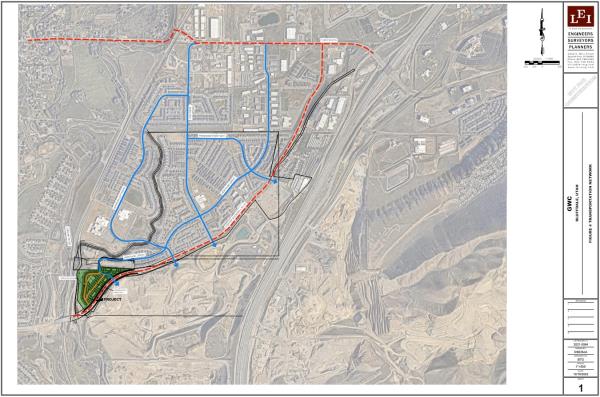
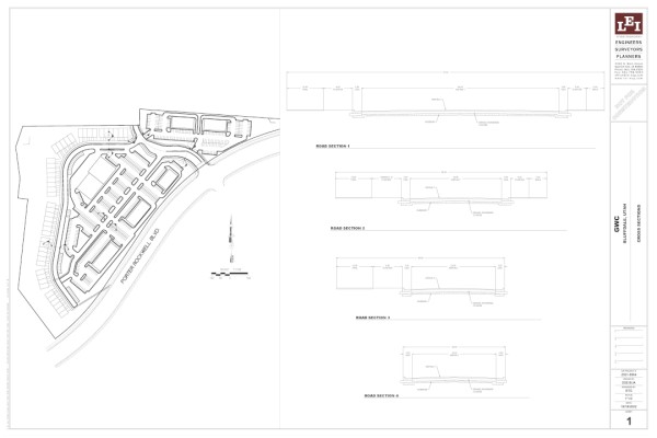
11.110.140.090 SIGNAGE
- Signs: All monument, tower, and informational wayfinding signs shall adhere to a consistent and unified signage scheme which is consistent with the architectural theme. Unless otherwise noted, all signs shall comply with signage requirements in BCC 11.220.
- Signage which differs from or exceeds the City’s standard’s requirements is allowed as follows:
- Tower Sign: One tower sign shall be allowed at the entrance to The Bluff at Point Crossing from Porter Rockwell Boulevard which meets the dimensional, design, and locational standards found in BCC 11.22.070.
- Welcome Sign. Developer shall install and entry/welcome sign which includes the official “The Bluff at Point Crossing” logo as part of the project. Said sign shall be allowed to be up to six feet high and shall have an architectural concrete base. The welcome sign shall be included in the site plan review and constructed with the building located closest to the intersection of Heritagecrest Way and Porter Rockwell Boulevard.
- Informational Wayfinding Signs. Informational wayfinding signs shall be allowed in the project and shall follow the size and location guidelines outlined in City code section 11.220.070 for informational signs.
- Suspended, Blade Type Projecting Signs. Suspended or blade type projecting signs may be provided along pedestrian walkways and shall maintain a minimum clearance of seven feet (7’) above the pavement and shall be a maximum of four (4) square feet.
- Electronic message centers are not allowed.

