
Crystal River City Zoning Code
SECTION 2
Thoroughfares
a.
Intent. This section aims to establish clear standards for the design of thoroughfares to ensure they are safe, functional, and accessible for all users. It will cover a range of elements including sidewalks, bike lanes, street lighting, crosswalks, and traffic calming measures. The goal is to promote walkability and bicycle friendliness, as well as to ensure that vehicles can move efficiently through the city.
b.
General Requirements.
(1)
All proposed thoroughfares, landscaping elements, and sidewalks shall be located in dedicated Rights-of-Way as a tract of land unless otherwise approved by the City.
(2)
All new vehicular facilities shall match one of the Thoroughfare Types, described in this section, whether publicly dedicated or privately held.
(3)
Where provided and permitted, parking shall be parallel. Angled parking on a thoroughfare type is permitted when adjacent or proximate (within 100') of non-residential uses. Angled parking shall be 45° or higher for safe visibility.
(4)
New development abutting a City road with no sidewalk, or a sidewalk less than 5' in width, shall provide 5' minimum sidewalk parallel to the substandard roadway for the length of their property. The sidewalk may be in the ROW or on private property.
(5)
Where new development abuts a City owned road that has no street trees, either canopy trees (45' on center) or understory/palm trees (20' on center) shall be planted on the side of the street abutting the new development.
c.
Thoroughfare Types.
(1)
Thoroughfares are intended to complement the intensity of development it abuts. In general, narrower rights-of-way are intended to serve less densely populated areas and wider ROWs accommodate higher volumes of pedestrians, cyclists and vehicles.
(2)
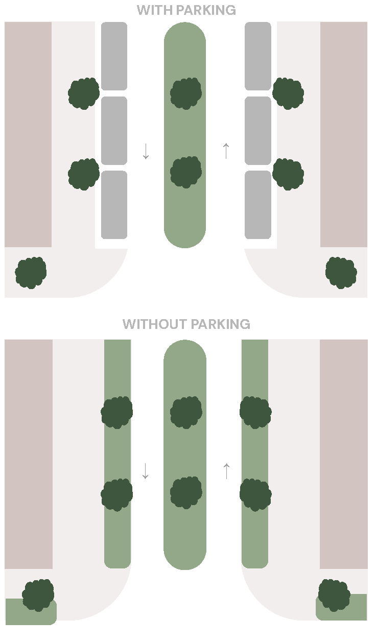
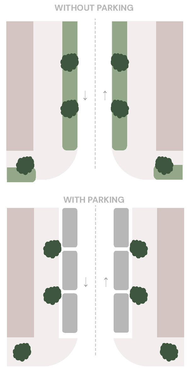
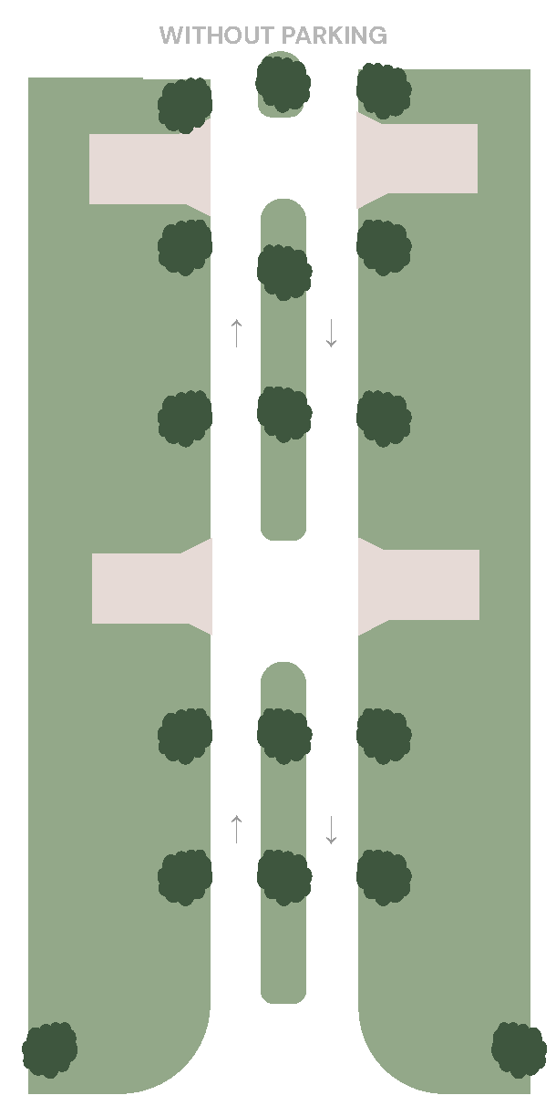
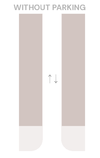
The following graphics and tables depict the requirements for each Thoroughfare Type.
Avenue
A short-distance connector that traverses an urban area. Its axis is terminated by a building, greenspace, natural feature or monument. Avenues typically begin and end within the City limits.
Street
A small-scale connector. A street is urban in character, with raised curbs, closed drainage, wide sidewalks, parallel parking, trees in individual planting areas, and buildings aligned on short setbacks.
Residential Avenue
A small neighborhood serving street that has very low traffic demand and is used in very low volume situations or where a dead end is required by natural conditions.
Alley
A narrow access route servicing the rear of buildings on a street. Alleys have no sidewalks, landscaping, or building setbacks. Alleys are used by garbage trucks and must accommodate dumpsters. Alleys are usually paved to their edges, with center drainage via an inverted crown.
d.
Design Considerations. The following images depict design details that are intended to guide the finer details of thoroughfares and their interaction with surrounding uses and open spaces. A mixture of materials and the proper organization of landscape, lighting and hardscape is important in achieving an attractive streetscape.
Landscape and hardscape design should reflect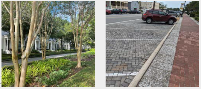
Native landscaping in a mews providing connectivity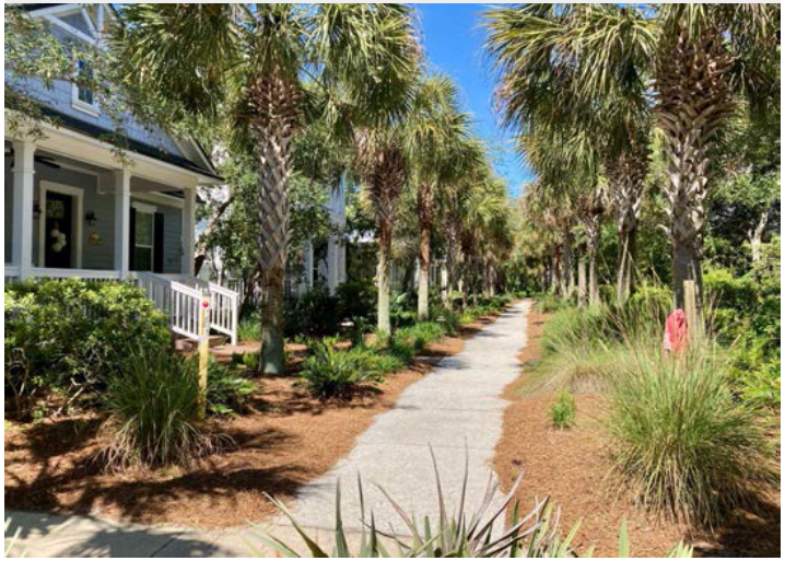
Pavers with concrete ribbon curb transition to asphalt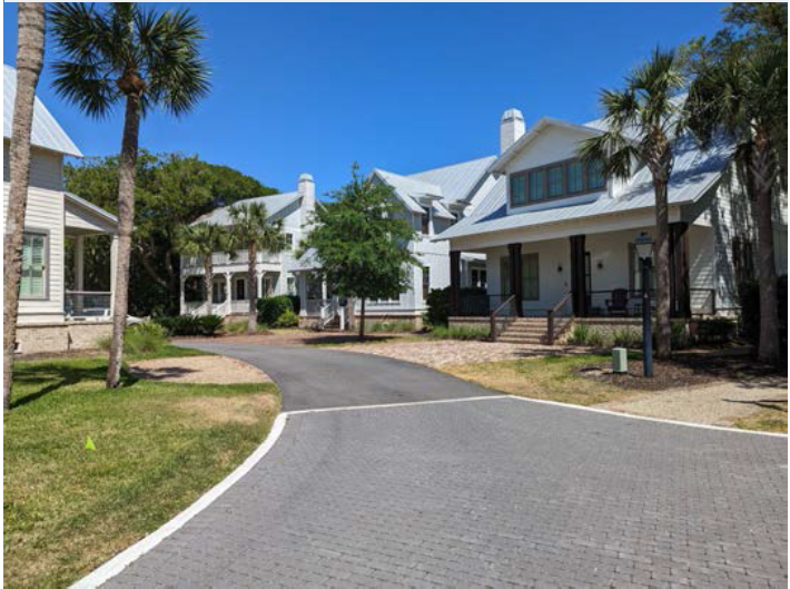
Diverse materials and plantings creating a memorable street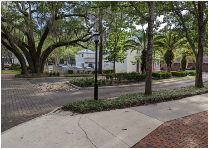
e.
Improvements to Existing Roads.
(1)
Traffic Reports. All developments, except for those considered "de minimis" in this Code.
(a)
Exemptions. The City of Crystal River defines "de minimis" development as any development for which the net average weekday peak hour two-way volume generated by the development is less than 100 trip ends or driveway volume on the adjacent roadway[s].
(b)
Methodology. The methodology of the report shall be reviewed and approved by the City.
(c)
At a minimum, the traffic study shall included:
(i)
Existing average daily traffic on adjacent streets and streets impacted by the proposed development.
(ii)
The total trips generated by the project and the distribution of the trips onto adjacent streets.
(iii)
Level of service calculations at each project access point for both the a.m. and p.m. peak hours, both existing and with the proposed development.
(iv)
Level of service calculations at impacted intersections for both the a.m. and p.m. peak hours, both existing and with the proposed development.
(v)
Analysis of the need for turning lanes or additional lanes on impacted roadways.
(vi)
Analysis of the need for intersection improvements.
(vii)
Analysis of the need for traffic signals or other traffic control devices.
(viii)
Other transportation factors based upon generally accepted traffic engineering practices.
(d)
The report shall include a statement of the assumptions used in conducting the analysis, including the following:
(i)
Type and intensity or density of development.
(ii)
Projected population of a residential development.
(iii)
Proposed timing and phases of development.
(iv)
Proposed design of streets, access points, driveways, alleys, sidewalks, and other components of the transportation system.
(2)
Turning Lanes. Acceleration, deceleration and turning auxiliary lanes should be provided at subdivision entrances and commercial site driveways as warranted on the city's designated collector roads. An approved traffic analysis signed and sealed by a licensed Florida professional engineer, shall be used to determine such need for developments which generate an a.m. or p.m. peak hour traffic exceeding more than twenty (20) left turning vehicles per hour or more than forty (40) right turning vehicles per hour on the collector road. Facilities having a high volume of buses, trucks, or recreational vehicles (2 or 3 per hour) shall also warrant the need for such analysis. The minimum length of auxiliary lanes shall be determined using FDOT design standards. Developments within the city's jurisdiction but that are located on a county-maintained collector road shall receive approval by Citrus County government. Requirements for US 19 and SR 44, which function as principal arterials and are part of the state's strategic intermodal system, shall be determined by the FDOT.
(3)
Reserved.

