Zoneomics Logo
search icon

Fate City Zoning Code

ARTICLE III

- ZONING DISTRICTS

Sec. 36-3.1 - General to all Zoning Districts and Zoning Map

3.1.1. Zoning Districts Established. This article establishes the zoning districts within the City of Fate, Texas. This Article (III) and Article IV, Use Standards, identify the dimensional standards established and uses allowed within the districts. Article V, Design and Development Standards, identifies any zoning district-specific standards applying to development in the districts.

The following table provides a summary of the zoning districts established.

Table 3.1: Zoning Districts Established
District TypeAbbreviationZoning District Name
Residential
(Sec. 36-3.2)
A Agricultural
RE Residential Estate
R-1 Residential Suburban Density 1
R-2 Residential Suburban Density 2
R-3 Residential Urban Density 3
R-4 Residential Urban Density 4
MH Manufactured Home
Commercial
(Sec. 36-3.3)
NC Neighborhood Commercial
GC General Commercial
INV Innovation & Light Industrial
IND Heavy Industrial
Public
(Sec. 36-3.4)
PP Public and Parks
INS Institutional and Civic
Special Districts
(Sec. 36-3.5)
PD Planned Development
MU Mixed Use
MUT Mixed Use Transition
NT Neighborhood Transition
OTC Old Town Core


3.1.2. Zoning District Map.

(1)

The zoning districts are shown on the "City of Fate Zoning Map" (Zoning Map). The boundaries of zoning districts established in this Ordinance are delineated upon the Zoning Map and adopted as part of this Ordinance as fully as if the same were set forth in this section in detail. Procedures for amending the Zoning Map are set forth in Article II, Procedures and Administration.

(2)

The Administrator shall keep a complete set of the Official Zoning Maps in any convenient format, either electronically or in hard copy. The Official Zoning Maps shall be kept up to date by posting any subsequent zoning changes as soon as practical after the change occurs. These maps shall be available for public inspection.

(3)

Administrative modifications to the Zoning Map shall be made by the Administrator.

3.1.3. Zoning District Boundaries.

(1)

When uncertainty exists as to the boundaries of districts as shown on the Official Zoning Map, the Administrator shall be responsible for interpretation of the zoning map in accordance with the following rules:

(a)

Boundaries indicated as approximately following the centerlines of streets, highways, alleys, or railroad rights-of-way are construed to follow those centerlines.

(b)

Boundaries indicated as approximately following platted lot boundaries or city limit boundaries are construed as following those boundaries.

(c)

Boundaries indicated as approximately following the centerlines of streams, creeks, rivers, canals, lakes, or other bodies of water are construed to follow those centerlines. The centerline is interpreted as being midway between the shorelines of the body of water or along the middle of designated floodways. If the centerlines or floodways change, the boundaries are construed as moving with the centerline or floodway.

(d)

Where a zoning district boundary line traverses a large parcel of land or acreage in a recorded subdivision, and such large parcel or acreage has been divided by metes and bounds without indication upon the recorded plat, or where it may hereafter be divided into blocks and lots, the district boundaries shall be construed to be the centerline of a street or alley or the property line resulting from such division nearest to the district line shown on the Official Zoning Map, so long as the zoning district boundary is not varied more than 100 feet from its location on the Official Zoning Map.

(2)

When the district boundary line is not otherwise determined, it shall be determined by the scale of the Official Zoning Map from a given line.

(3)

Whenever a street, alley, or other public way is vacated by official action of the City, the zoning district line adjoining each side of the vacated street, alley, or other public way automatically extends to the centerline of the vacated right-of-way.

(4)

When there is a question as to the boundary of a tract and that question cannot be resolved by the application of Subsections above, the Planning and Zoning Commission shall determine the boundary by interpreting the official zoning district map and ordinances amending the map.

(5)

If, because of error or omission on the Official Zoning Map, any property in the City is not shown to be included in a zoning district, such property shall be classified as the "A" Agricultural district until changed by a zoning map amendment.

3.1.4. Annexed Territory. When any territory is brought into the jurisdiction of the City of Fate, by annexation or otherwise, such territory shall be deemed to be in the "A" Agricultural district unless the City Council designates another zoning district at the time of annexation after review and recommendation by the Planning and Zoning Commission, giving due consideration to the surrounding existing uses, the Comprehensive Plan, and property owner request, and provides notice that complies with the notice requirements of Article II, Procedures and Administration. This provision shall not preclude subsequent rezoning of such property by amendment in the manner set forth in Article II, Procedures and Administration.

3.1.5. Fiscal Impact of Zoning Districts. Development standards within this article have been reviewed using a fiscal analysis of existing and proposed development patterns within the City of Fate. As directed by the Comprehensive Plan, the City will integrate a fiscal checklist as part of its development review and zoning changes as set forth in Article II, Procedures and Administration.

(Ord. No. O-2023-003, § 3(Exh. A), 1-3-2023)

Sec. 36-3.2 - Residential Zoning Districts

3.2.1. General Purposes of Residential Zoning Districts. The residential zoning districts are intended to:

(1)

Provide appropriate locations for residential development that are consistent with the Future Land Use Plan and Comprehensive Plan;

(2)

Appropriately address multi-modal transportation access and ensure adequate availability of public services and utilities;

(3)

Encourage development patterns that maintain and enhance the City's economic base;

(4)

Allow for a variety of housing types that meet the diverse needs of residents; and

(5)

Provide appropriate transitions between residential and non-residential development.

(6)

In all residential zoning districts, complementary uses such as parks, open space, public schools, public or private utilities, Accessory Buildings, and certain temporary uses are also allowed. Religious assemblies are allowed with approval of a Specific Use Permit.

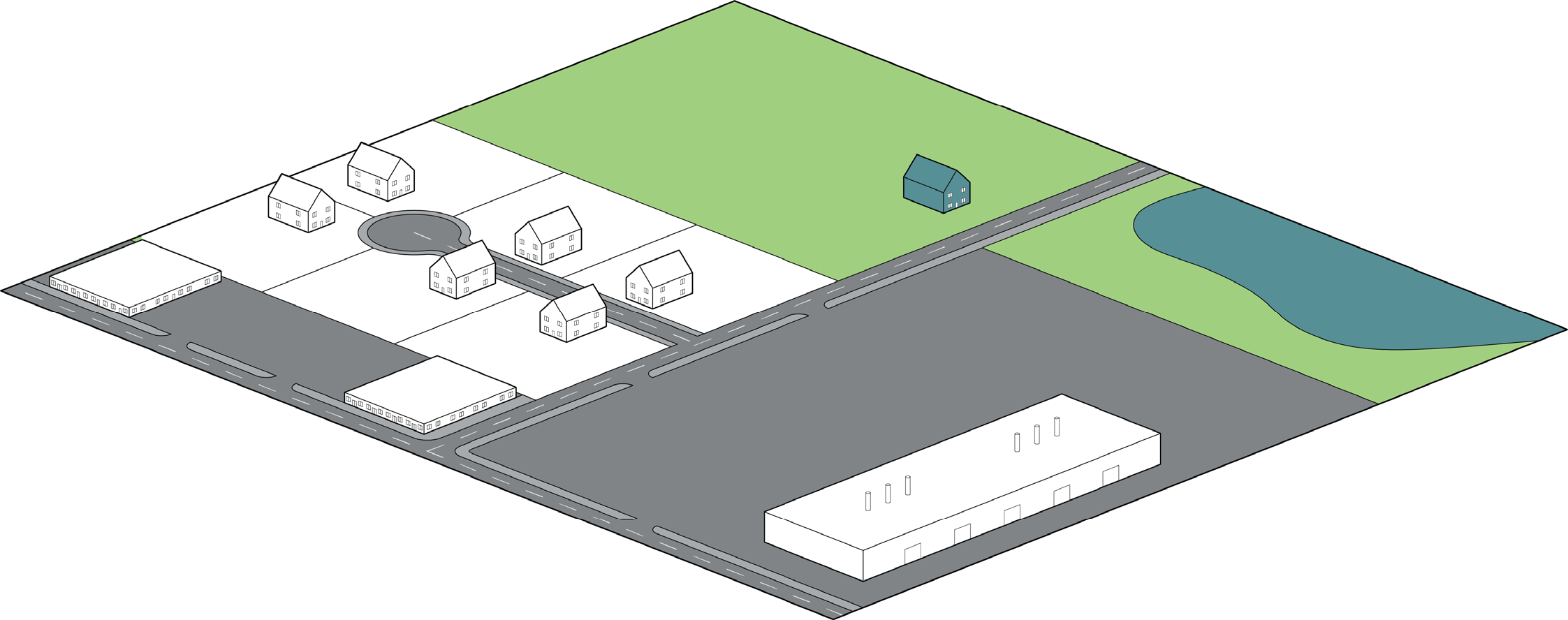
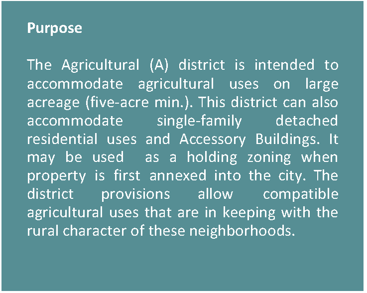
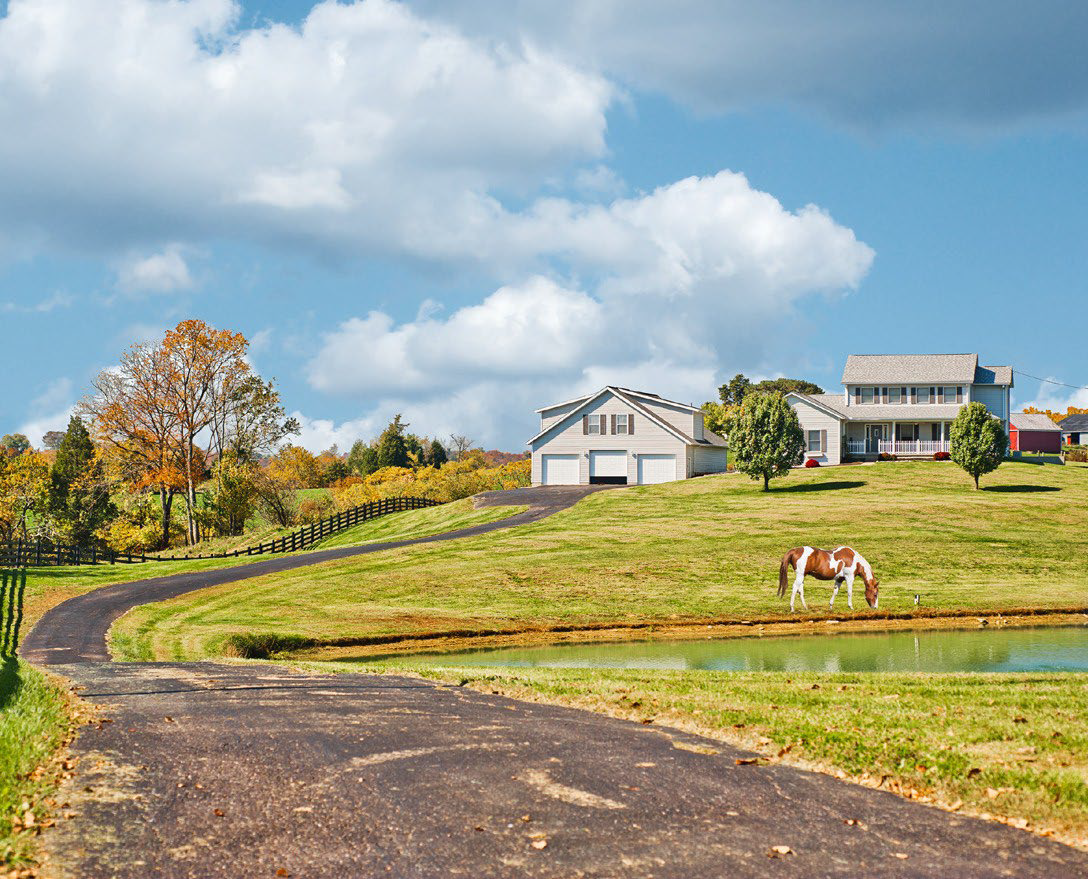
3.2.2. AGRICULTURAL (A)

Figure 3.2-1. Agricultural Character Context


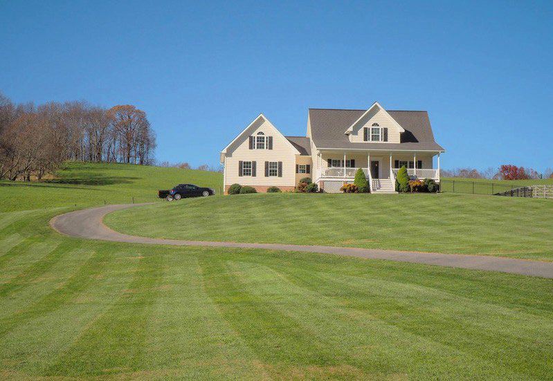
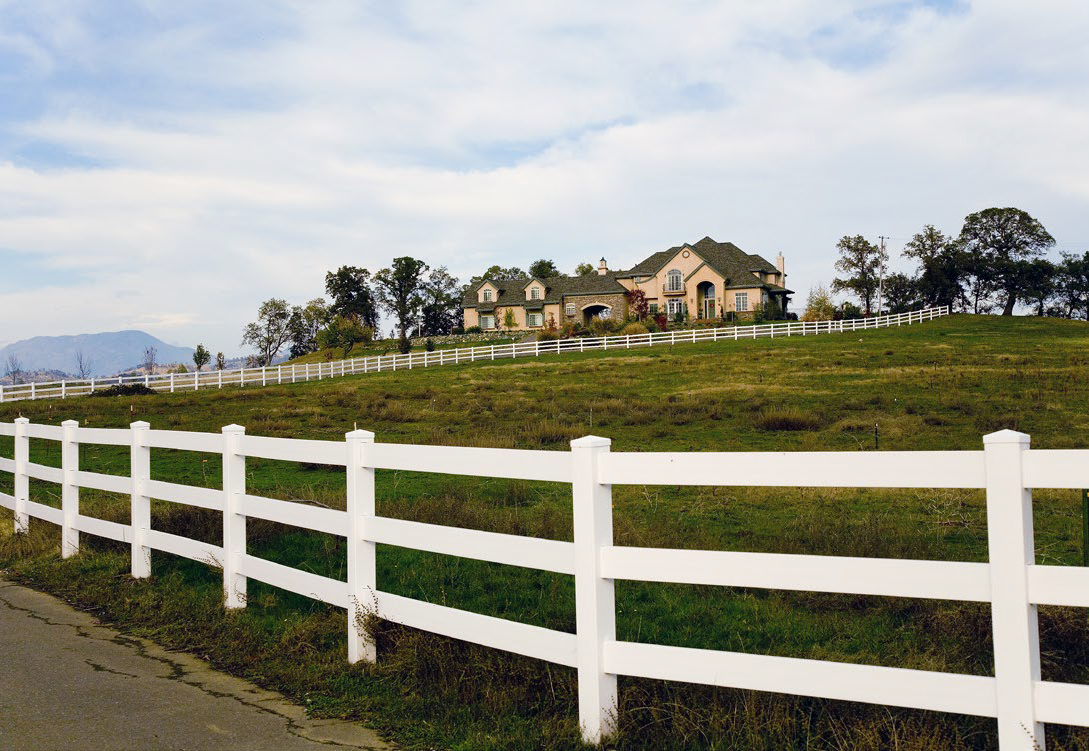
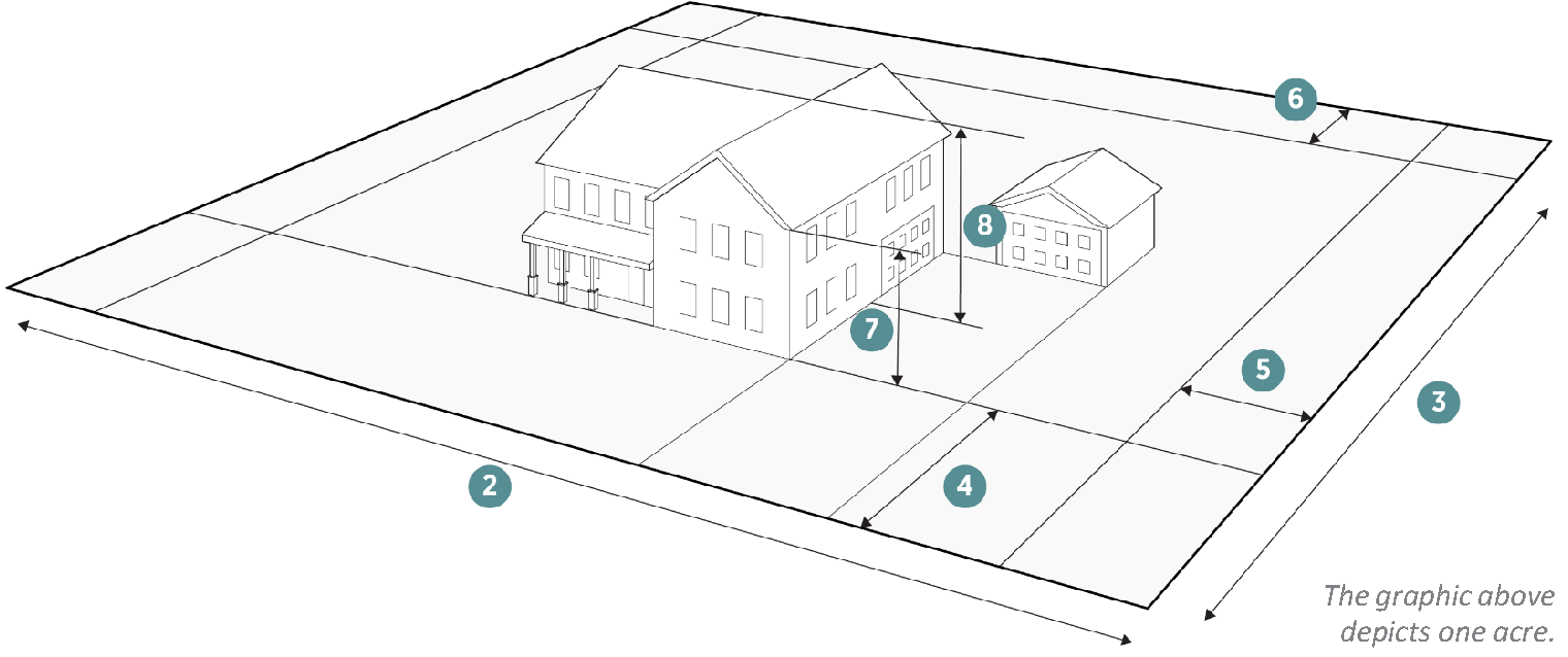
Figure 3.2-2. Agricultural Dimensional Standards

Density
Dwelling Units/Acre (max) 0.2
Lot Dimensions
1. Lot Area 5 Acres (min)
NA (max)
2. Lot Width Feet NA (min)
NA (max)
3. Lot Depth Feet NA (min)
Lot Coverage Percentage
All buildings on the lot (max) 20%


Setbacks (Feet)
4. Front: On Arterial or Collector (min) 30
 On Arterial or Collector (max) NA
 On Local Street (min) 20
 On Local Street (max) NA
5. Side: On All Roadways (min) 15
 On Alleys/Private Easements (min) 10
 Interior (min) 10
6. Rear: On Alley/Private Easement (min) 5
 On Any Residential Lot (min) 10
Height (Max Feet)
Number of stories 3
7. To highest level eave or parapet 30
8. To top of the roof structure 40


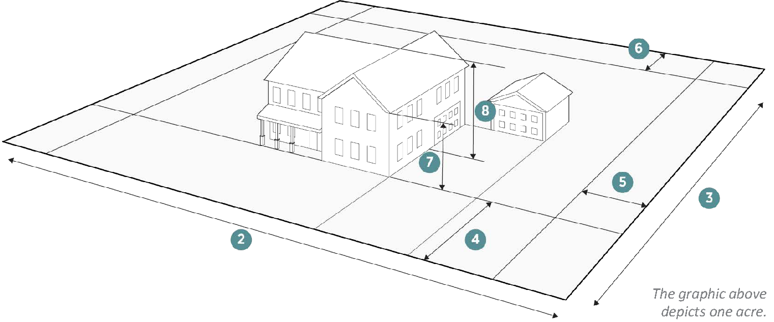
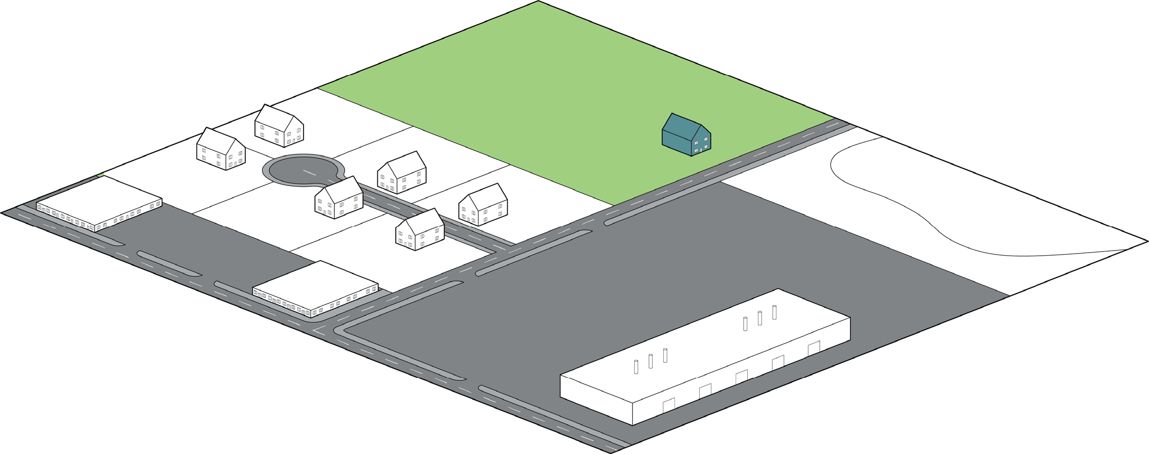
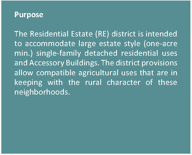
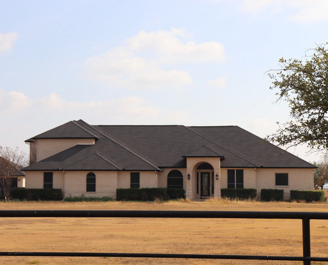
3.2.3. RESIDENTIAL ESTATE (RE)

Figure 3.2-3. Residential Estate Character Context


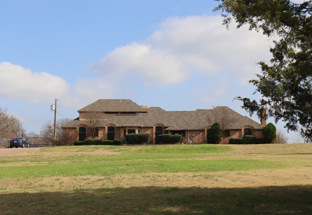
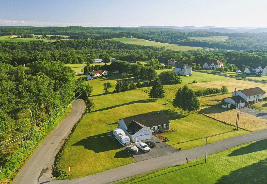
Figure 3.2-4. Residential Estate Dimensional Standards

Density
Dwelling Units/Acre (max) 1
Lot Dimensions
1. Lot Area 1 Acre (min)
NA (max)
2. Lot Width Feet 60 (min)
3. Lot Depth Feet 100 (min)
Lot Coverage Percentage
All buildings on the lot (max) 25%


Setbacks (Feet)
4. Front: On Arterial or Collector (min) 30
 On Arterial or Collector (max) NA
 On Local Street (min) 20
 On Local Street (max) NA
5. Side: On All Roadways (min) 15
 On Alleys/Private Easements (min) 10
 Interior (min) 10
6. Rear: On Alley/Private Easement (min) 5
 On Any Residential Lot (min) 10
Height (Max Feet)
Number of stories 3
7. To highest level eave or parapet 30
8. To top of the roof structure 40


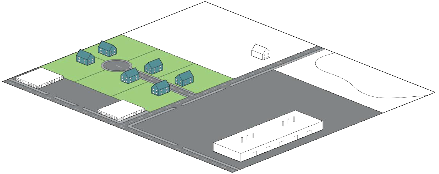
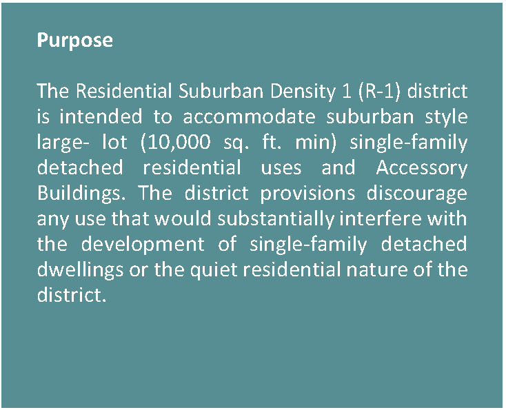
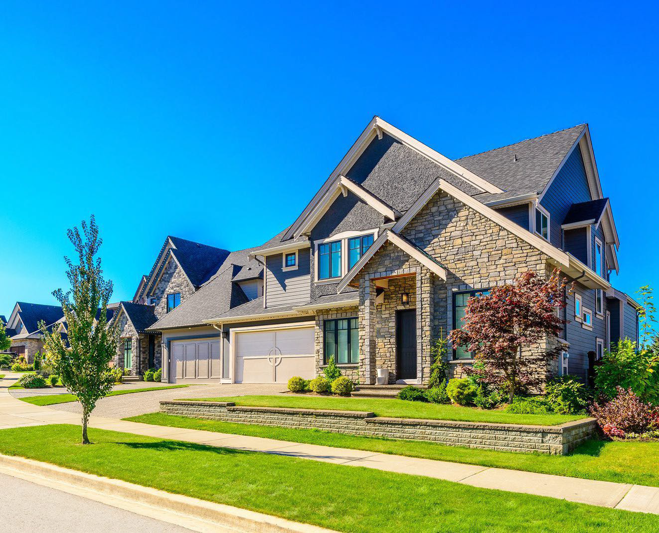
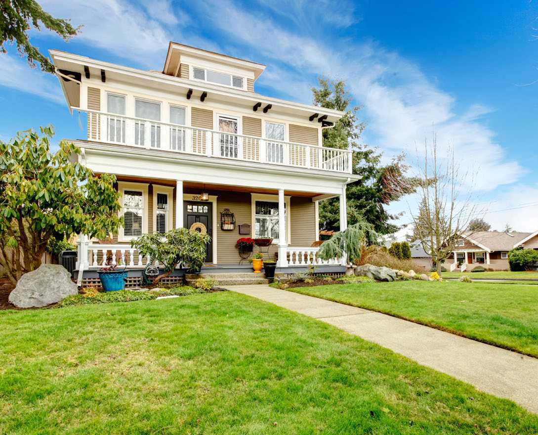
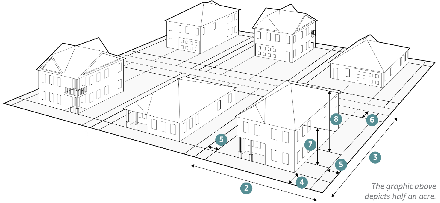
3.2.4. RESIDENTIAL SUBURBAN DENSITY 1 (R-1)

Figure 3.2-5. Residential Suburban Density 1 Character Context


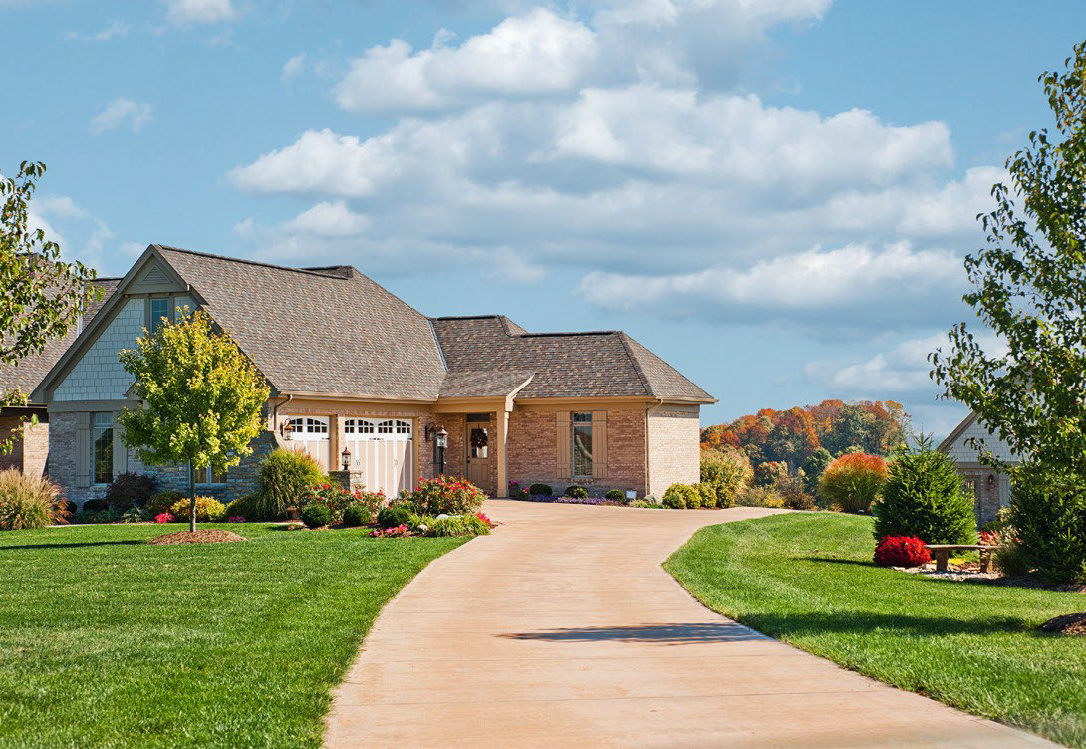
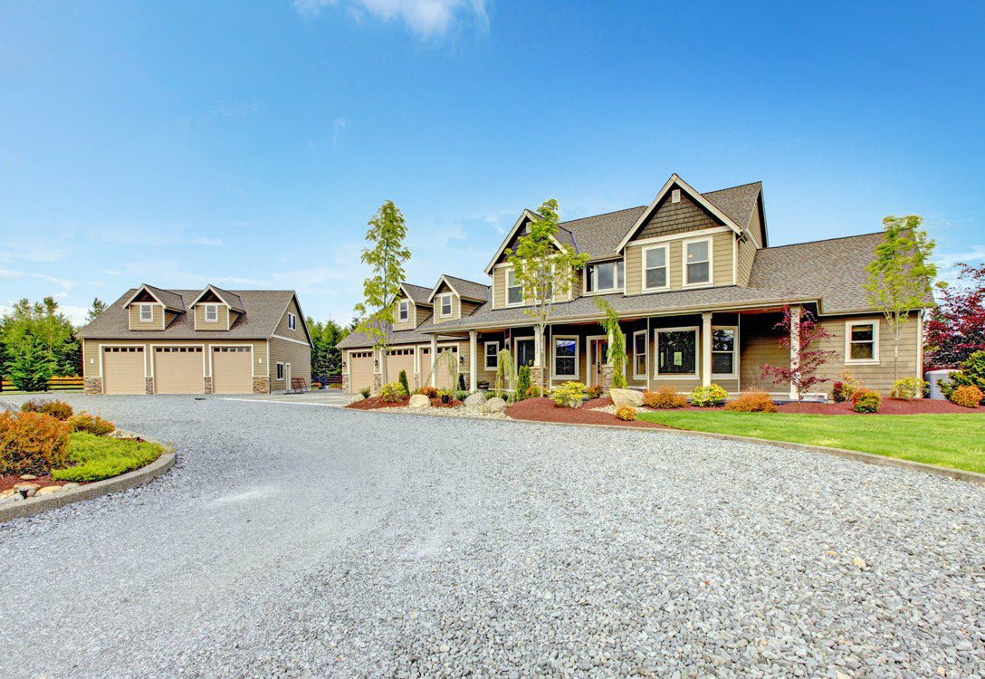
Figure 3.2-6. Residential Suburban Density 1 Dimensional Standards

Density
Dwelling Units/Acre (max) 4
Lot Dimensions
1. Lot Area 10,000 SF (min)
43,560 SF (max)
2. Lot Width Feet 60 (min)
100 (max)
3. Lot Depth Feet 100 (min)
Lot Coverage Percentage
All buildings on the lot (max) 30%


Setbacks (Feet)
4. Front: On Arterial or Collector (min) 20
 On Arterial or Collector (max) 40
 On Local Street (min) 15
 On Local Street (max) 25
5. Side: On All Roadways (min) 15
 On Alleys/Private Easements (min) 10
 Interior (min) 10
6. Rear: On Alley/Private Easement (min) 5
 On Any Residential Lot (min) 10
Height (Max Feet)
Number of stories 3
7. To highest level eave or parapet 30
8. To top of the roof structure 40


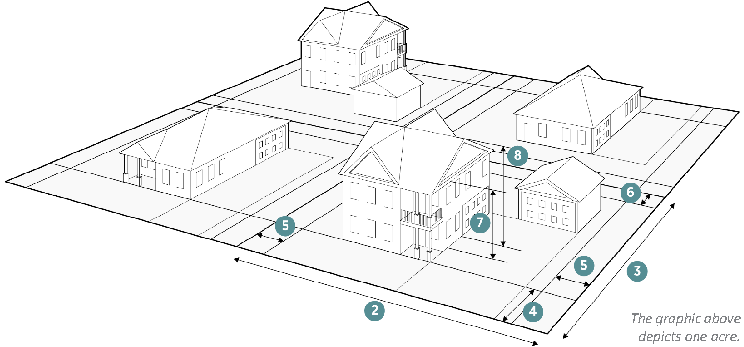
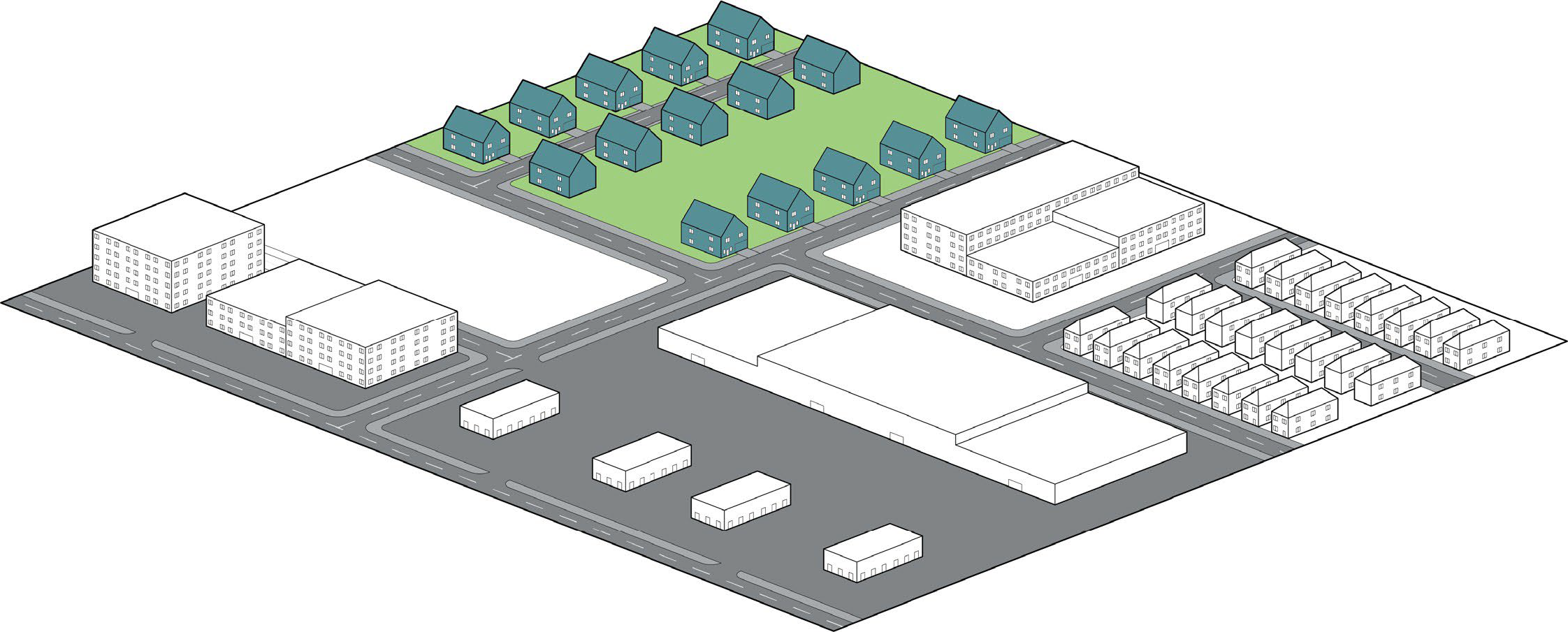
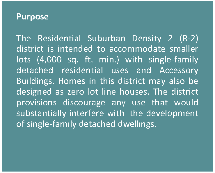
3.2.5. RESIDENTIAL SUBURBAN DENSITY 2 (R-2)

Figure 3.2-7. Residential Suburban Density 2 Character Context


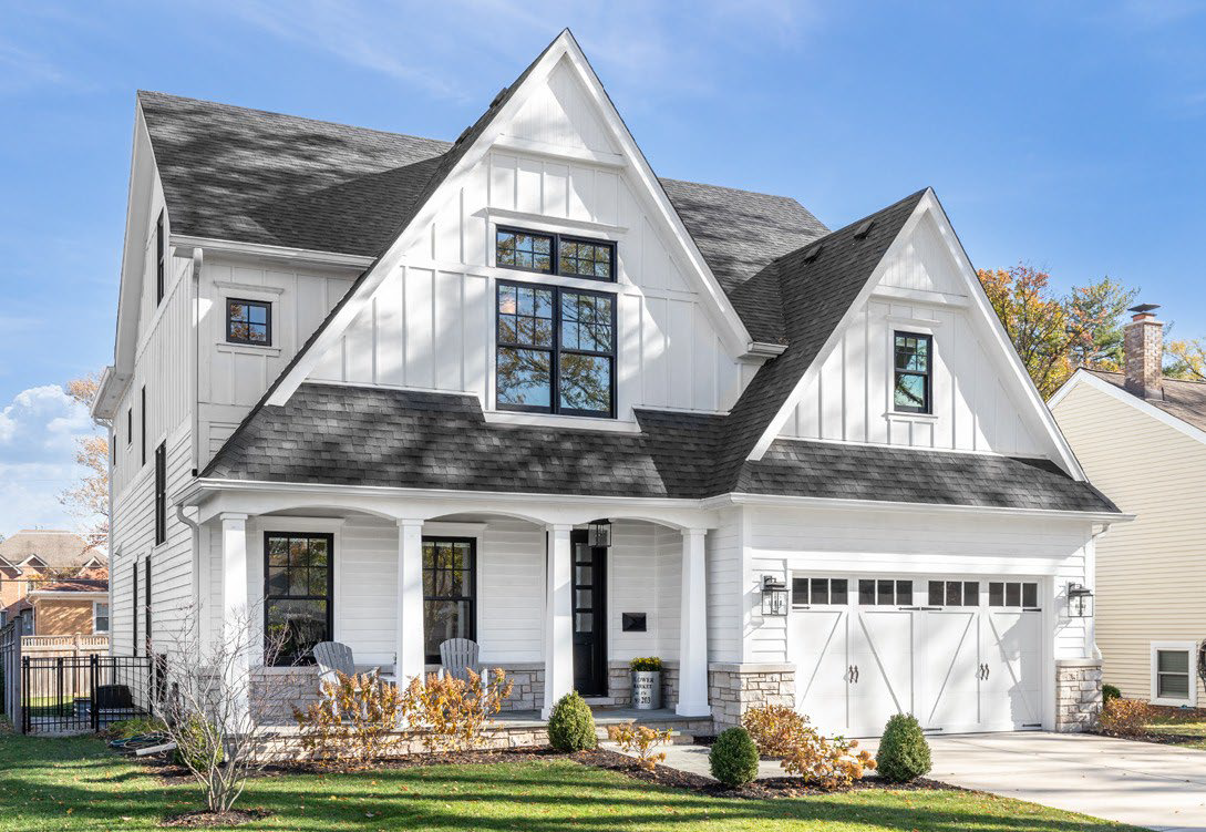
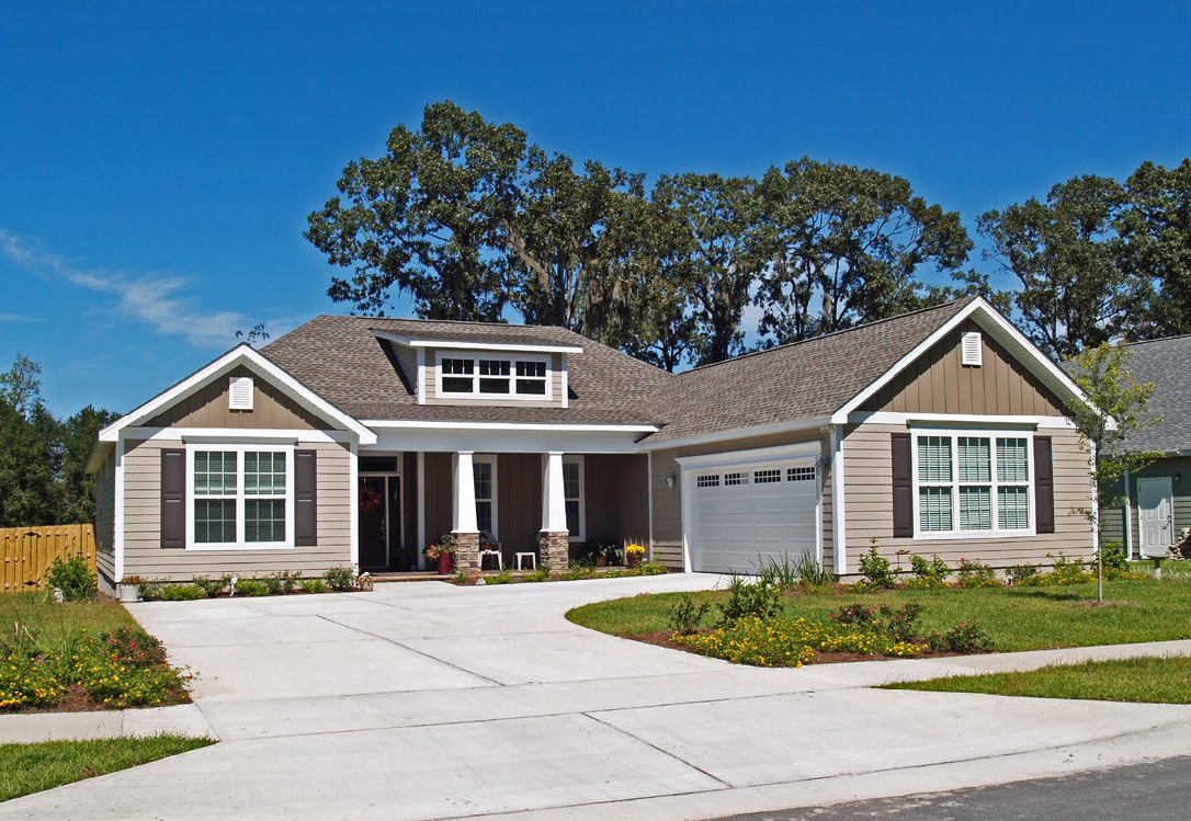
Figure 3.2-8. Residential Suburban Density 2 Dimensional Standards

Density
Dwelling Units/Acre (max) 11
Lot Dimensions
1. Lot Area 4,000 SF (min)
10,000 SF (max)
2. Lot Width Feet 40 (min)
80 (max)
3. Lot Depth Feet 100 (min)
Lot Coverage Percentage
All buildings on the lot (max) 50%


Setbacks (Feet)
4. Front: On Arterial or Collector (min) 15
 On Arterial or Collector (max) 30
 On Local Street (min) 15
 On Local Street (max) 25
5. Side: On All Roadways (min) 10
 On Alleys/Private Easements (min) 5
 Interior (min) 5
 Interior on Zero Lot Line (min) 0 one side
10 other
6. Rear: On Alley/Private Easement (min) 5
 On Any Residential Lot (min) 10
Height (Max Feet)
Number of stories 3
7. To highest level eave or parapet 30
8. To top of the roof structure 40


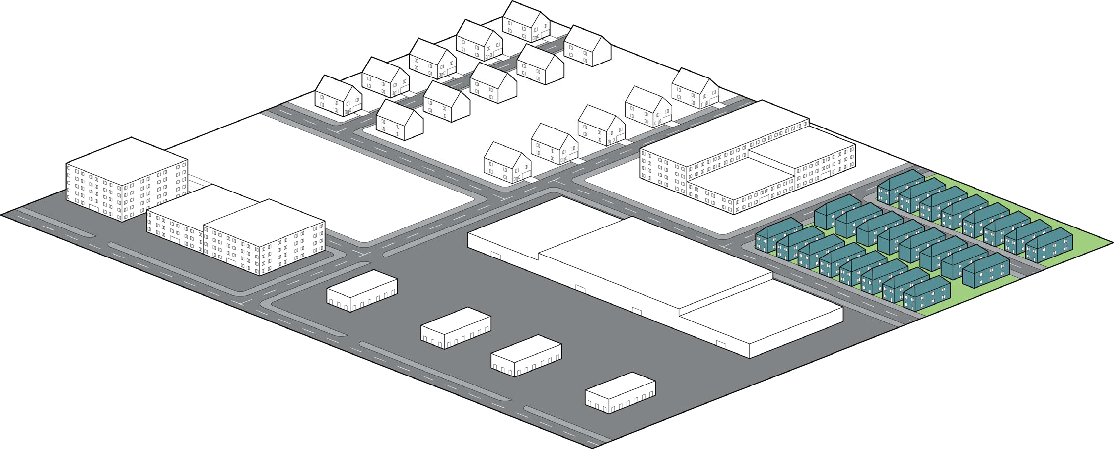
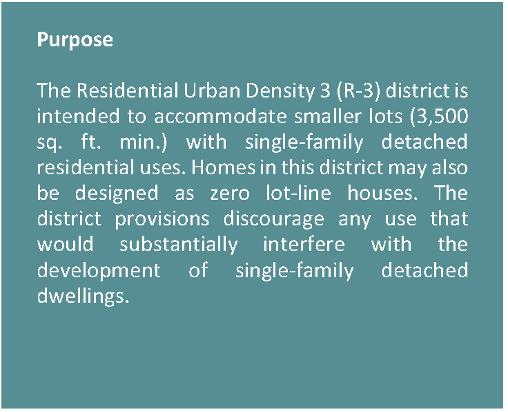
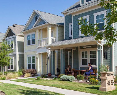
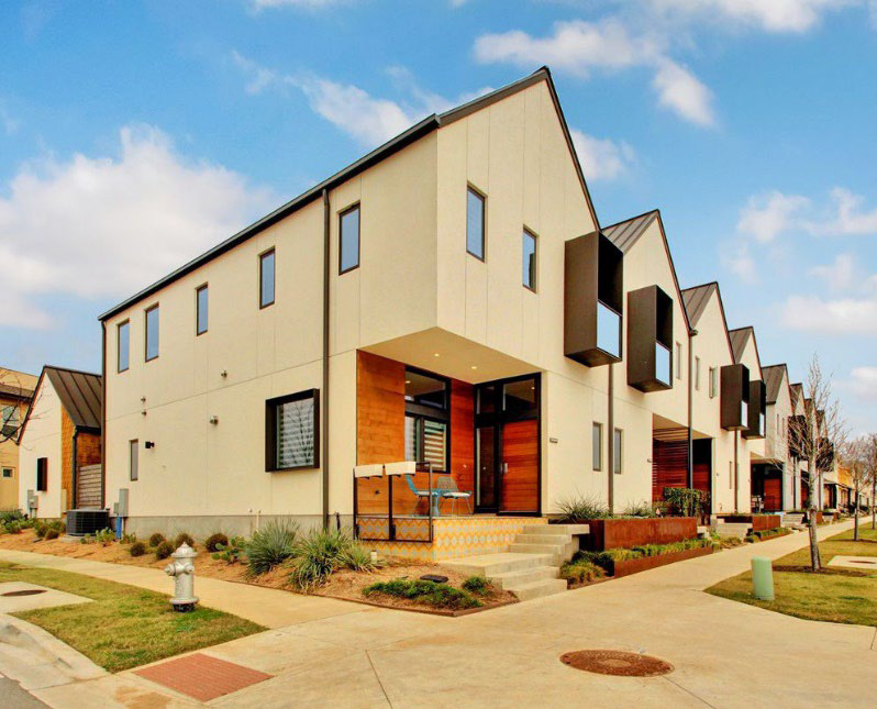
3.2.6. RESIDENTIAL URBAN DENSITY 3 (R-3)

Figure 3.2-9. Residential Urban Density 3 Character Context


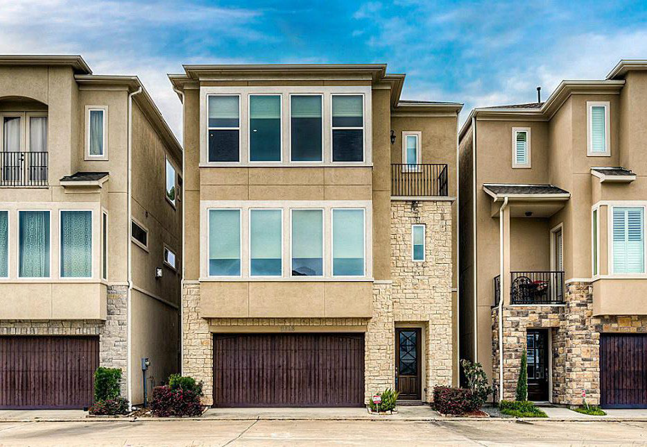
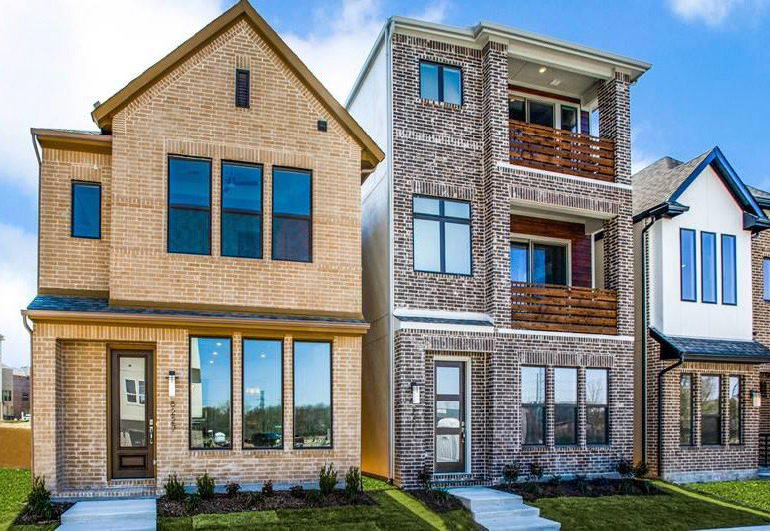
Figure 3.2-10. Residential Urban Density 3 Dimensional Standards

Density
Dwelling Units/Acre (max) 13
Lot Dimensions
1. Lot Area 3,500 SF (min)
7,500 SF (max)
2. Lot Width Feet 35 (min)
65 (max)
3. Lot Depth Feet 100 (min)
Lot Coverage Percentage
All buildings on the lot (max) 60%


Setbacks (Feet)
4. Front: On Arterial or Collector (min) 10
 On Arterial or Collector (max) 25
 On Local Street (min) 10
 On Local Street (max) 20
5. Side: On All Roadways (min) 10
 On Alleys/Private Easements (min) 5
 Interior (min) 5
 Interior on Zero Lot Line (min) 0 one side
10 other
6. Rear: On Alley/Private Easement (min) 5
 On Any Residential Lot (min) 10
Height (Max Feet)
Number of stories 3
7. To highest level eave or parapet 30
8. To top of the roof structure 40


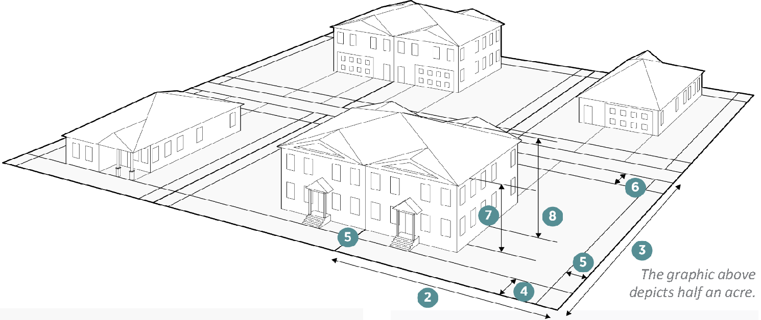
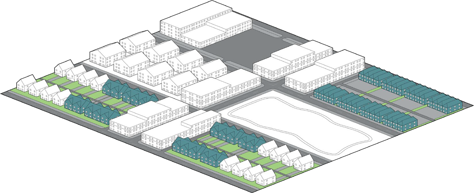
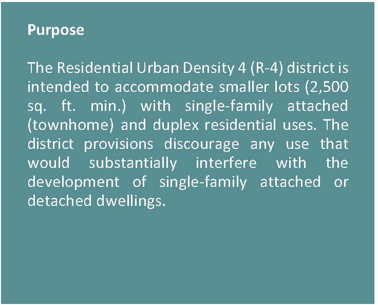
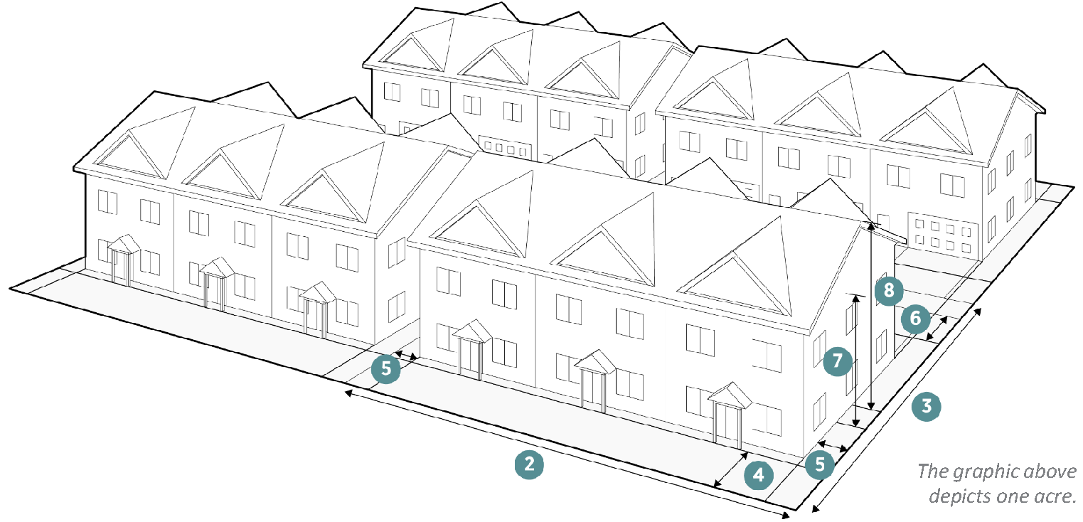
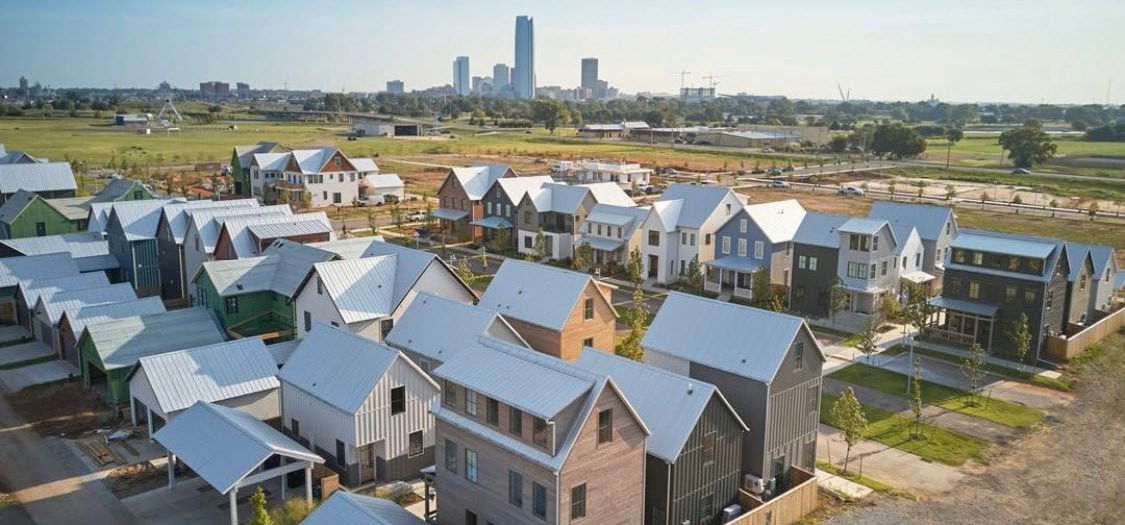
3.2.7. RESIDENTIAL URBAN DENSITY 4 (R-4)

Figure 3.2-11. Residential Urban Density 4 Character Context


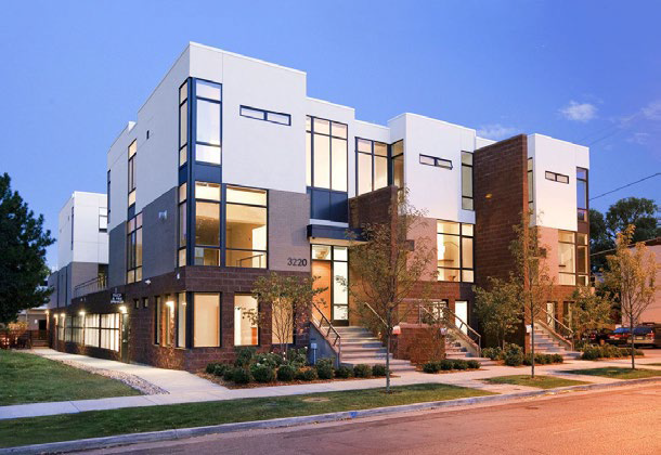
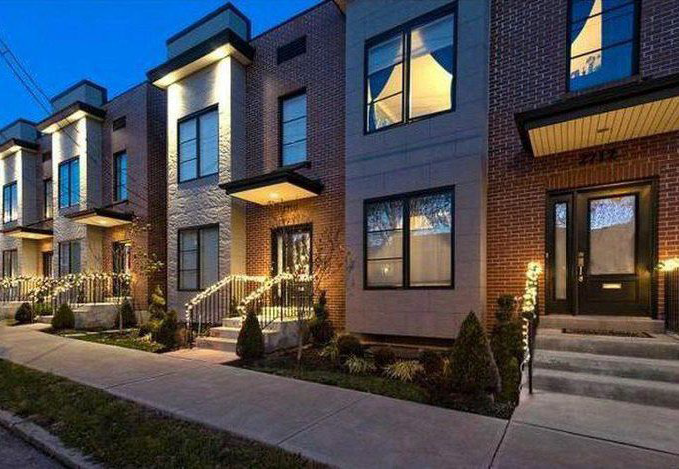
Figure 3.2-12. Residential Urban Density 4 Dimensional Standards

Density
Dwelling Units/Acre (max) 18
Lot Dimensions
1. Lot Area (SF) Duplex TH Triplex Quadplex
5,000 (min)
8,000 (max)
2,500 (min)
4,500 (max)
6,000 (min)
9,600 (max)
7,500 (min)
12,000 (max)
2. Lot Width Feet Duplex TH Triplex Quadplex
50 (min)
80 (max)
20 (min)
40 (max)
60 (min)
100 (max)
75 (min
120 (max)
3. Lot Depth Feet 100 (min)
Lot Coverage Percentage
All buildings on the lot (max) 60% Duplex. Triplex, Quadplex
75% Townhome


Setbacks (Feet)
4. Front: On Arterial or Collector (min) 10
 On Arterial or Collector (max) 20
 On Local Street (min) 5
 On Local Street (max) 15
5. Side: On All Roadways (min) 10
 On Alleys/Private Easements (min) 5
 Interior (min) Duplex 10
 Interior (min) Townhome 0
6. Rear: On Alley/Private Easement (min) 5
 On Any Residential Lot (min) 5
Height (Max Feet)
Number of stories 3
7. To highest level eave or parapet 30
8. To top of the roof structure 40


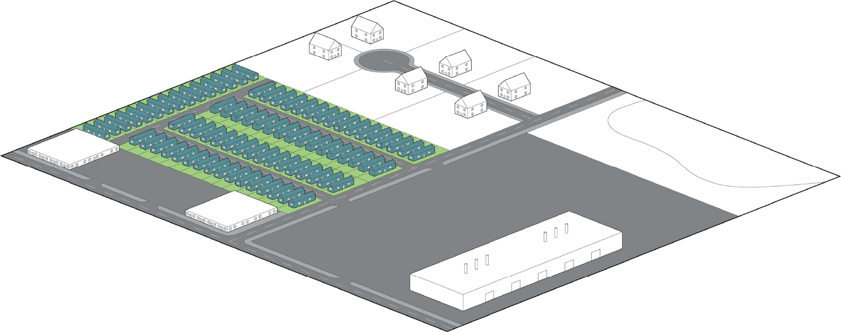
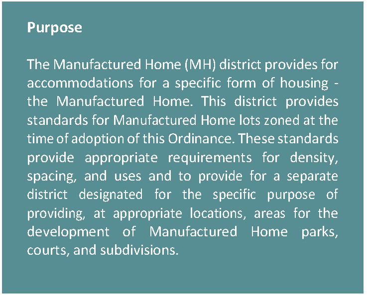
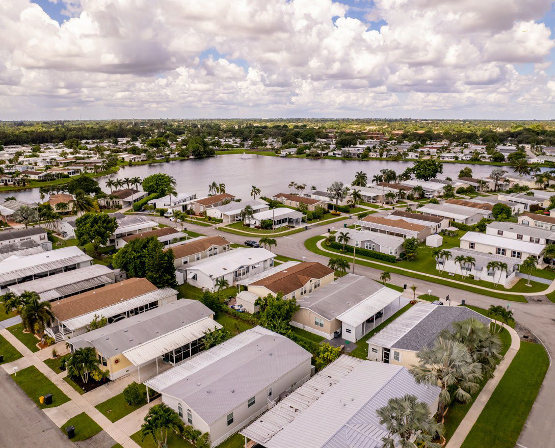
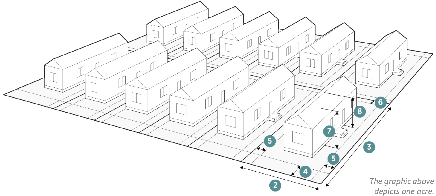
3.2.8. MANUFACTURED HOME (MH)

Figure 3.2-13. Manufactured Home Character Context


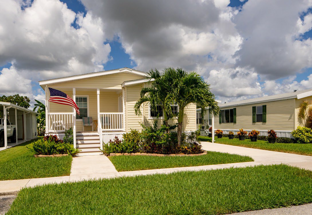
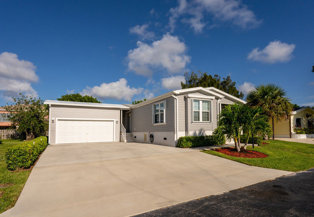
Figure 3.2-14. Manufactured Home Dimensional Standards

Density
Dwelling Units/Acre (max) 14
Lot Dimensions
1. Lot Area 3,000 SF (min)
5,000 SF (max)
2. Lot Width Feet 30 (min)
50 (max)
3. Lot Depth Feet 80 (min)
Lot Coverage Percentage
All buildings on the lot (max) 60%


Setbacks (Feet)
4. Front: On Arterial or Collector (min) 10
 On Arterial or Collector (max) 20
 On Local Street (min) 15
 On Local Street (max) NA
5. Side: On All Roadways (min) 10
 On Alleys/Private Easements (min) 5
 Interior (min) 10
6. Rear: On Alley/Private Easement (min) 5
 On Any Residential Lot (min) 5
Height (Max Feet)
Number of stories 3
7. To highest level eave or parapet 30
8. To top of the roof structure 40


(Ord. No. O-2023-003, § 3(Exh. A), 1-3-2023; Ord. No. O-2024-030, § 2, 7-1-2024)

Sec. 36-3.3 - Commercial Zoning Districts

3.3.1. General Purposes of Commercial Zoning Districts

The commercial zoning districts are intended to:

(1)

Accommodate a range of non-residential uses including office, retail, commercial, service, and industrial uses needed by Fate;

(2)

Encourage site planning, land use planning, and architectural design that create attractive environments;

(3)

Encourage development patterns that maintain and enhance the City's economic base and provide a range of shopping, entertainment and employment opportunities for the residents and visitors of Fate;

(4)

Minimize potential negative impacts of non-residential development on adjacent residential neighborhoods; and

(5)

Help ensure that the appearance and operational impacts of non-residential developments do not adversely affect the character of the areas in which they are located.

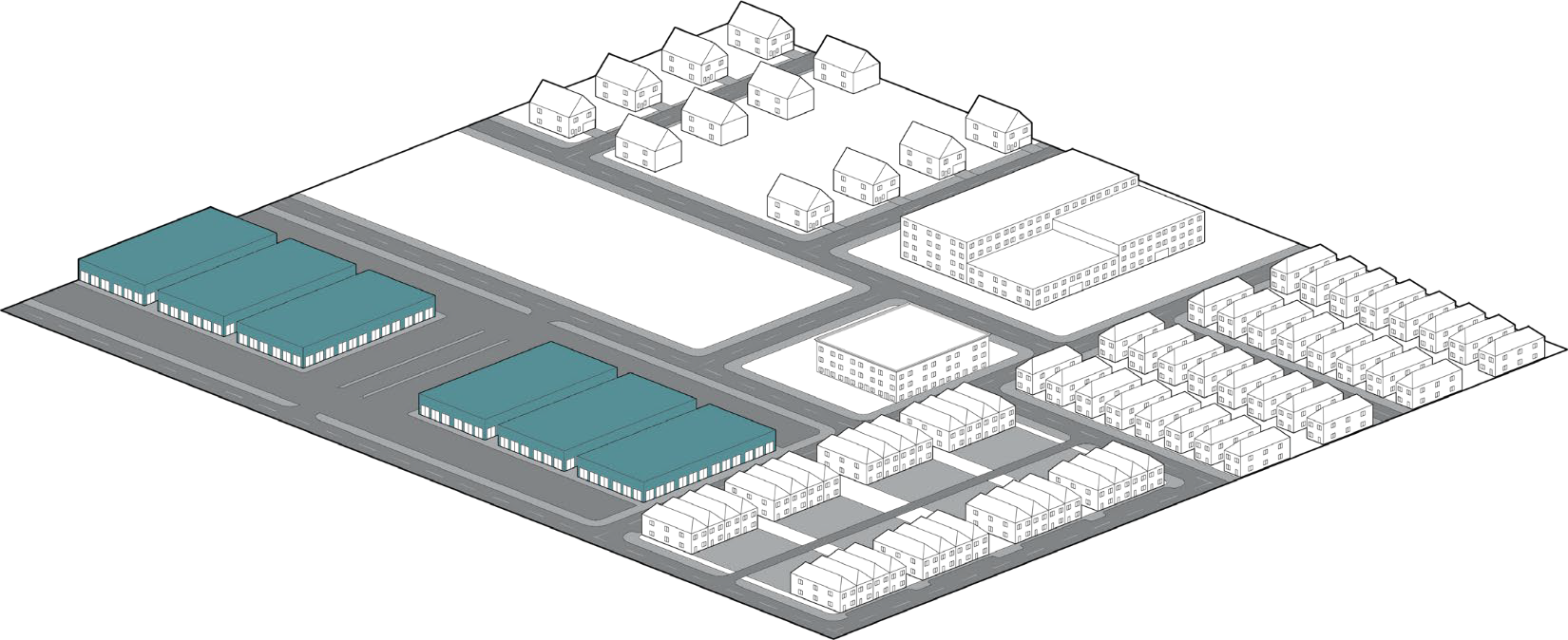
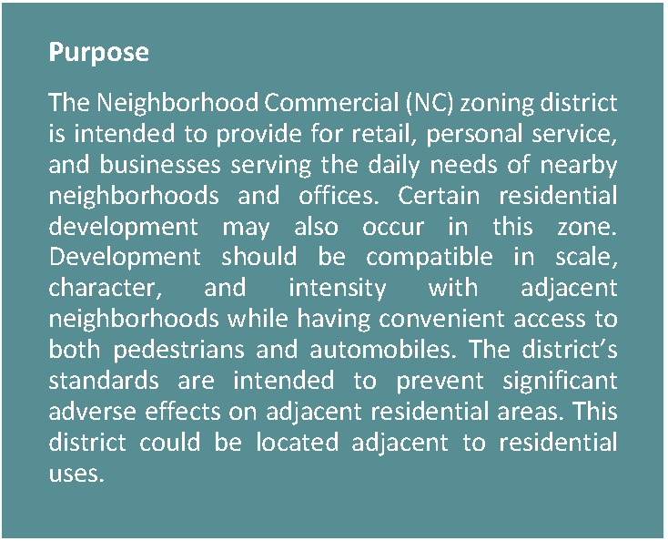
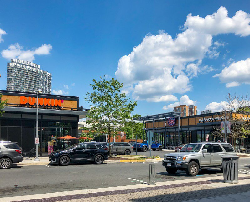
3.3.2. NEIGHBORHOOD COMMERCIAL (NC)

Figure 3.3-1. Neighborhood Commercial Character Context


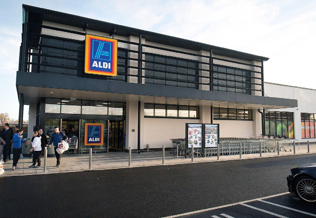
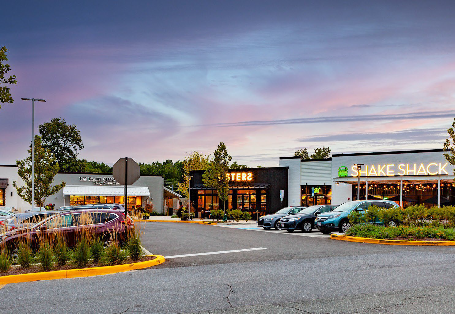
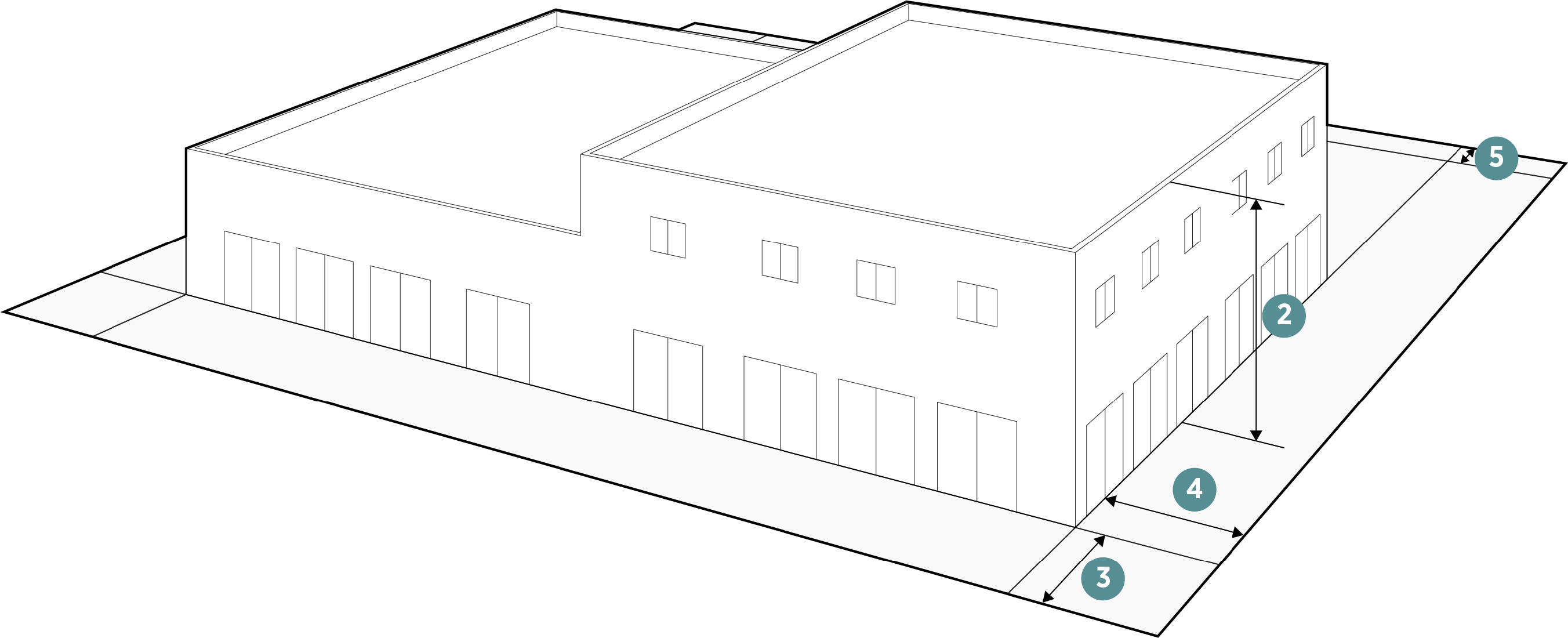
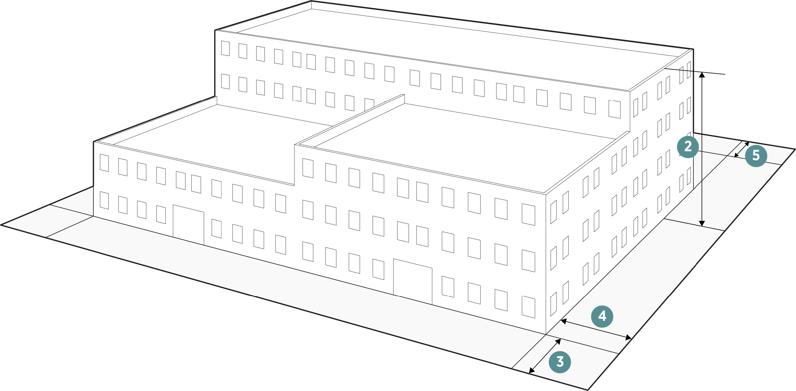
Figure 3.3-2. Neighborhood Commercial Dimensional Standards

Density
Dwelling Units/Acre (max) 18
Lot Dimensions
1. Lot Area 5,000 SF (min)
3 Acres (max)
Height (Max Feet)
2. To highest level eave or parapet 3 stories/45 ft to eave
Lot Coverage Percentage
All buildings on the lot (max) 80%


Setbacks (Feet)
3. Front: On Freeway, Freeway Frontage Road, or Arterial Roadway (min) 20
 On Freeway, Freeway Frontage Road, or Arterial Roadway (max) 75
 On All Other Streets (min) 10
 On All Other Streets (max) 55
4. Side: Next to single-family residential (min) 20
 All other side (min) 20
5. Rear: Next to single-family residential (min) 20
 All other rear (min) 10


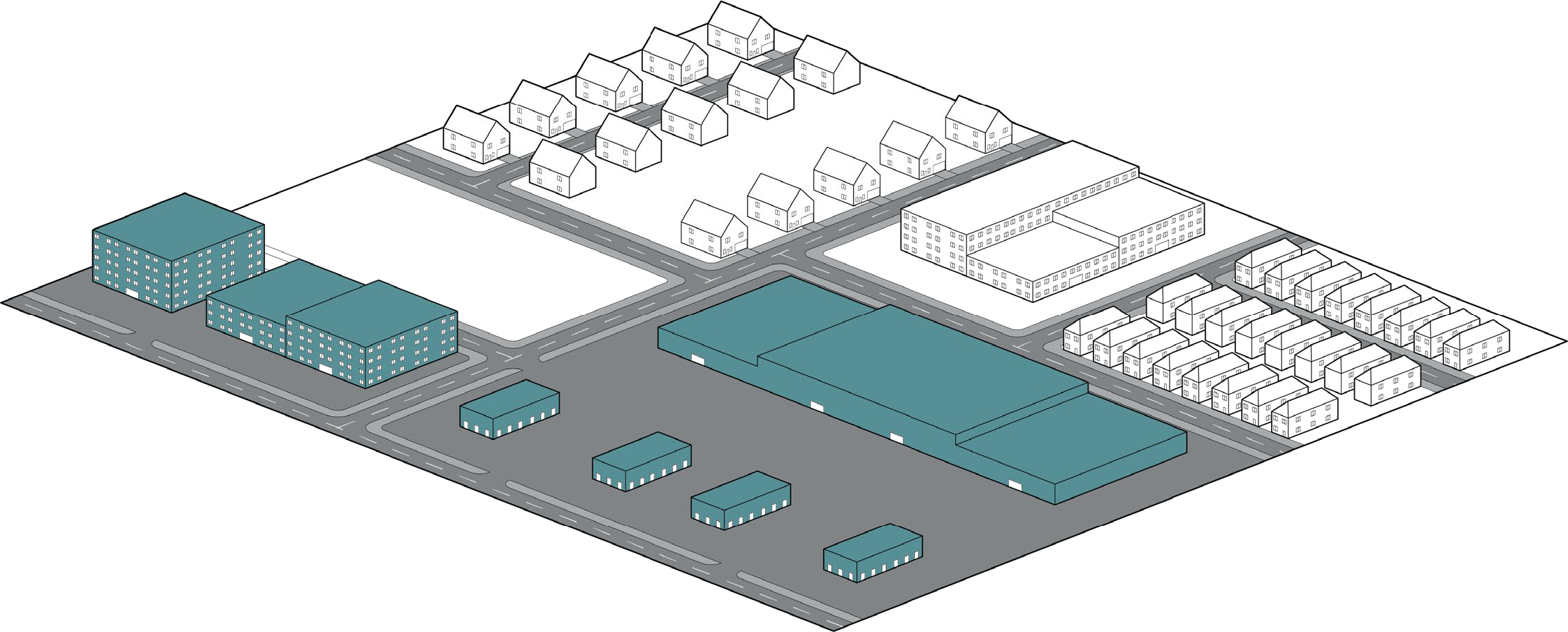
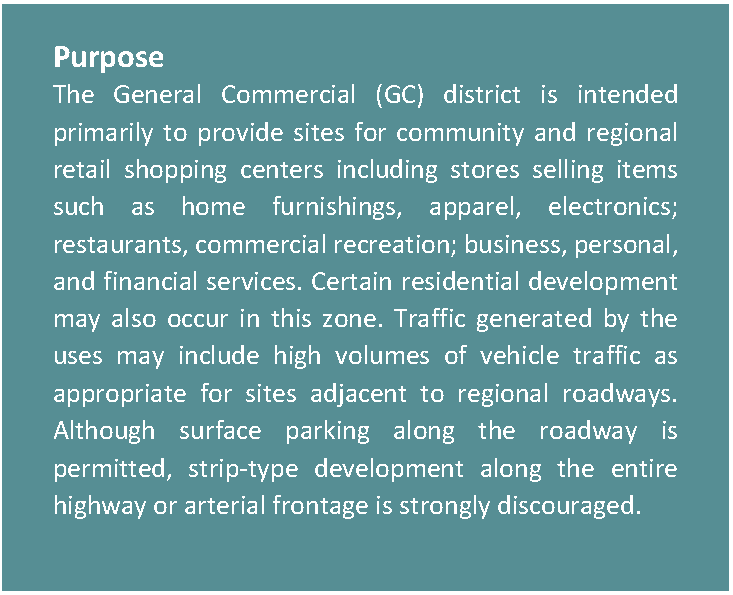
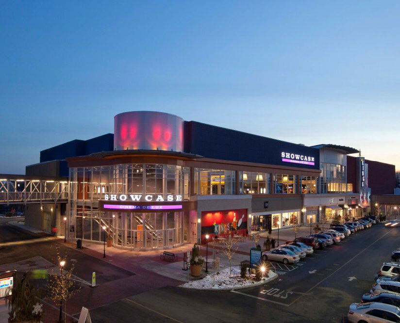
3.3.3. GENERAL COMMERCIAL (GC)

Figure 3.3-3. General Commercial Character Context


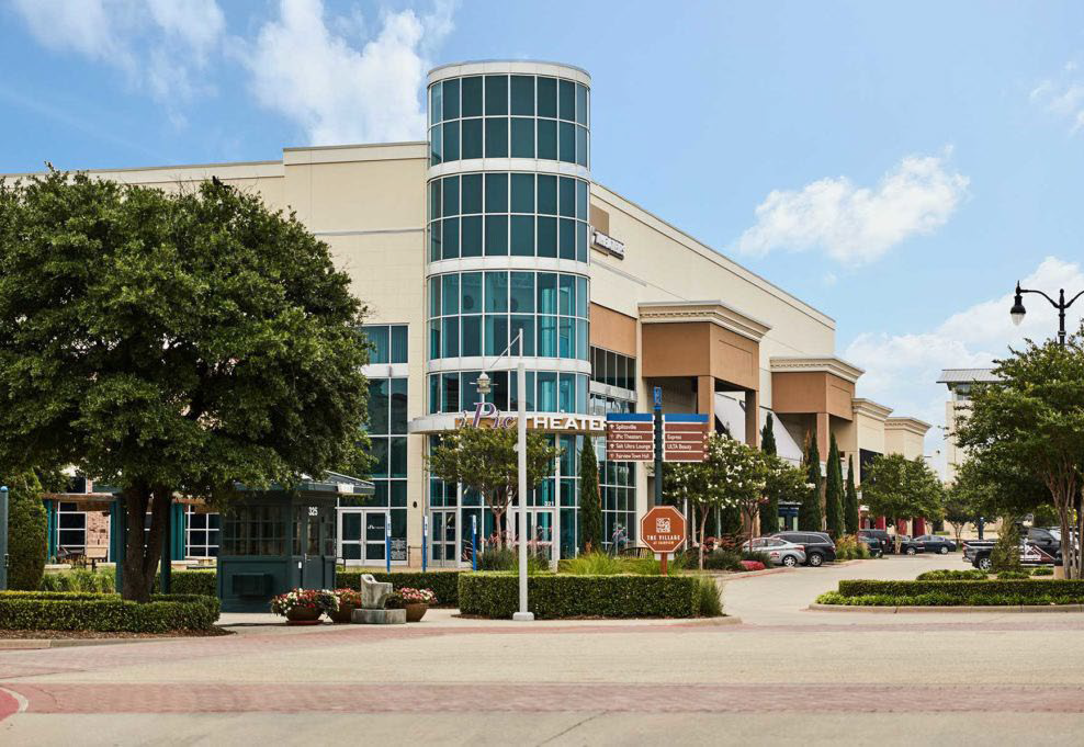
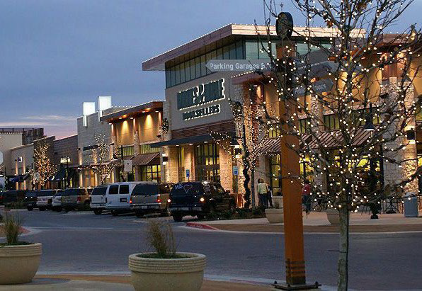
Figure 3.3-4. General Commercial Dimensional Standards

Density
Dwelling Units/Acre (max) 40
Lot Dimensions
1. Lot Area 10,000 SF (min)
Height (Max Feet)
2. Within 50 ft of Single-Family Residential 3 stories/45 ft to eave
 All Other 5 stories/75 ft to eave
Lot Coverage Percentage
All buildings on the lot (max) 80%


Setbacks (Feet)
3. Front: On Freeway, Freeway Frontage Road, or Arterial Roadway (min) 20
 On Freeway, Freeway Frontage Road, or Arterial Roadway (max) 85
 On All Other Streets (min) 20
 On All Other Streets (max) 75
4. Side: Next to single-family residential (min) 30
 All other side (min) 20
5. Rear: Next to single-family residential (min) 30
 All other rear (min) 20


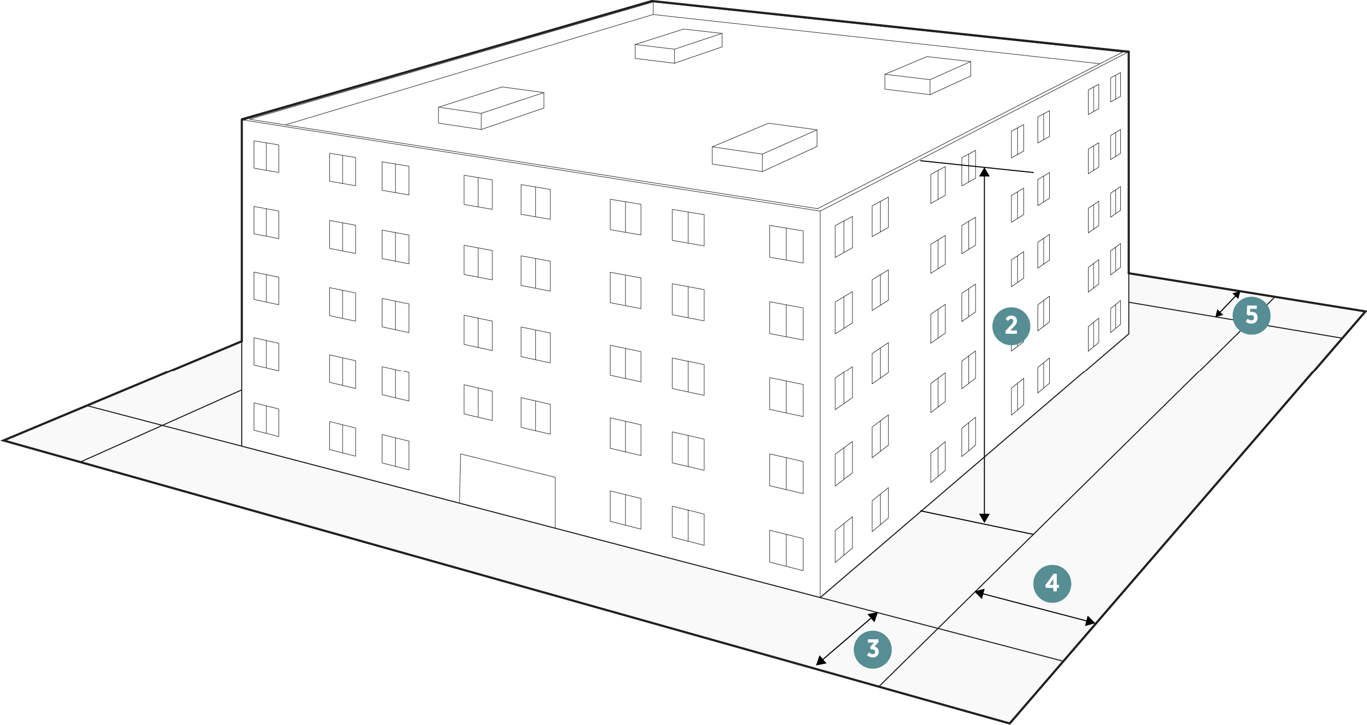
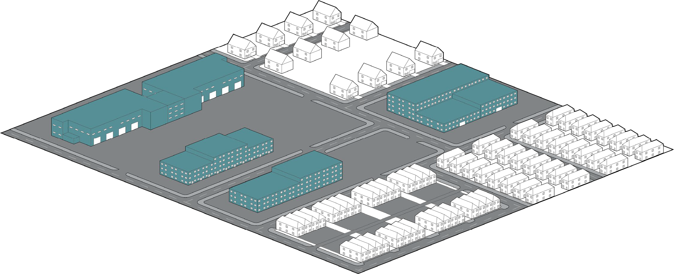
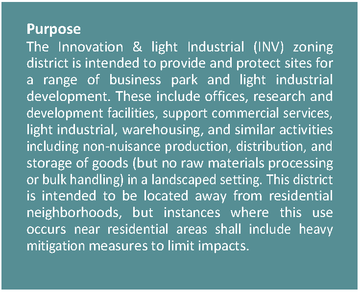
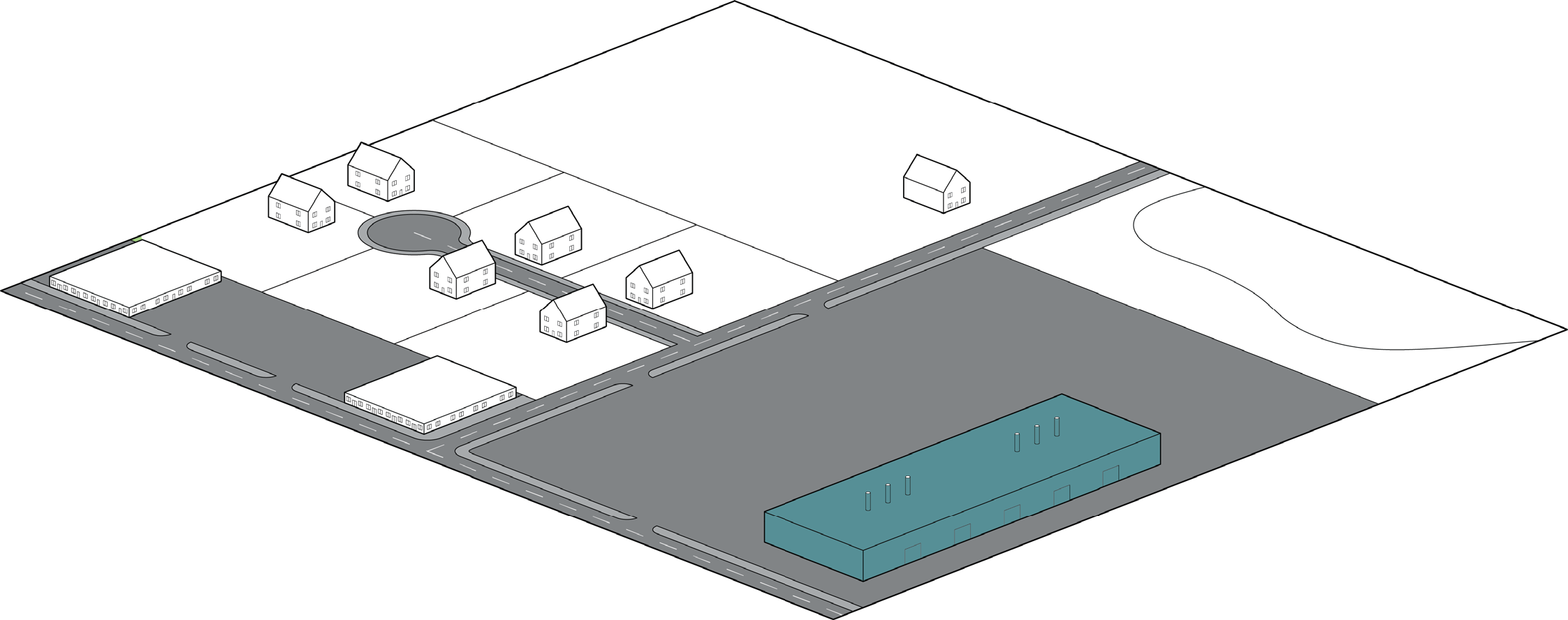
3.3.4. INNOVATION & LIGHT INDUSTRIAL (INV)

Figure 3.3-5. Innovation & Light Industrial Character Context


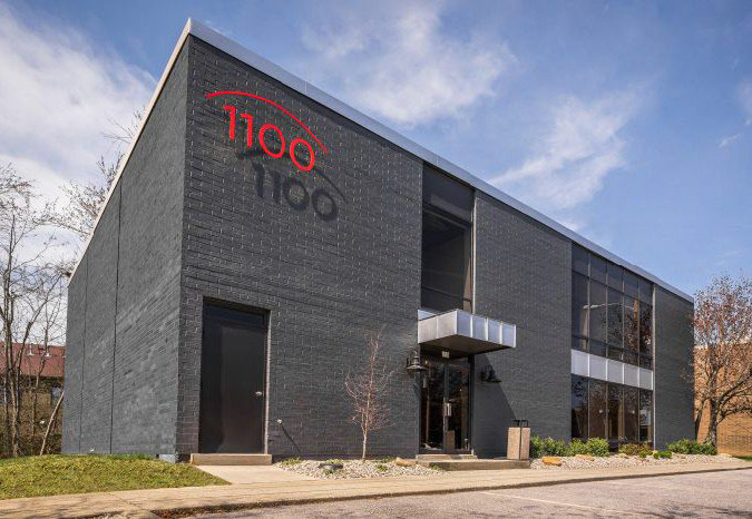
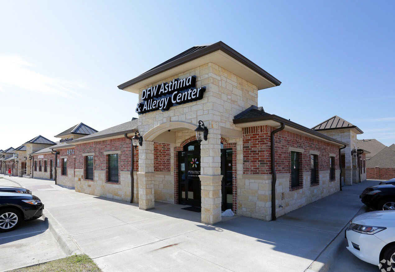
Figure 3.3-6. Innovation & Light Industrial Dimensional Standards

Lot Dimensions
1. Lot Area 10,000 SF (min)
15 Acres (max)
Height (Max Feet)
2. Within 50 ft of Single-Family Residential 3 stories/45 ft to eave
 All Other 5 stories/75 ft to eave
Lot Coverage Percentage
All buildings on the lot (max) 80%


Setbacks (Feet)
3. Front: On Freeway, Freeway Frontage Road, or Arterial Roadway (min) 20
 On Freeway, Freeway Frontage Road, or Arterial Roadway (max) NA
 On All Other Streets (min) 20
 On All Other Streets (max) NA
4. Side: (min) 30
5. Rear: (min) 30


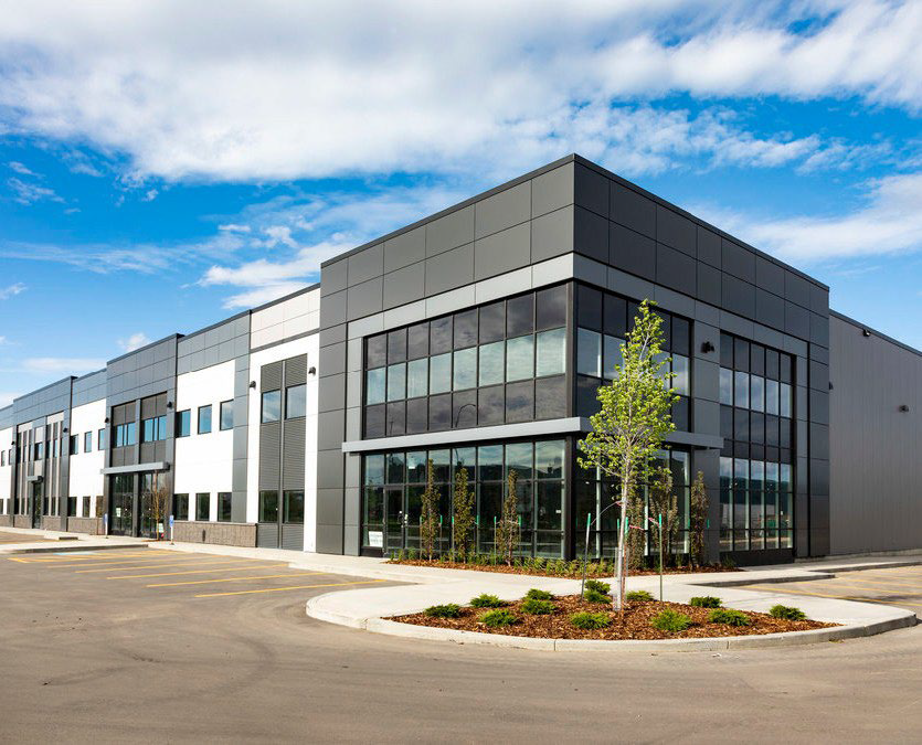
3.3.5. HEAVY INDUSTRIAL (IND)

Figure 3.3-7. Heavy Industrial Character Context


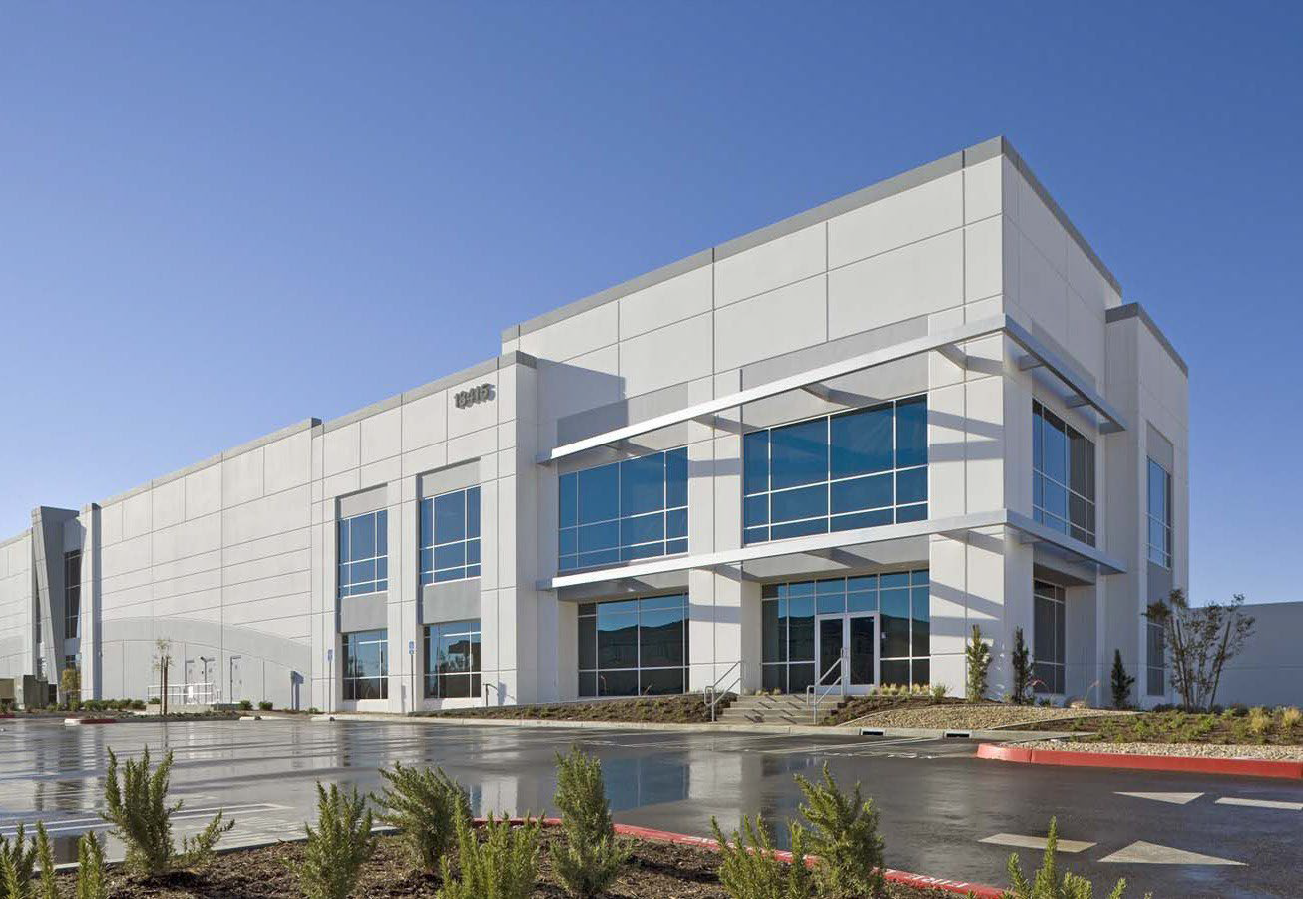
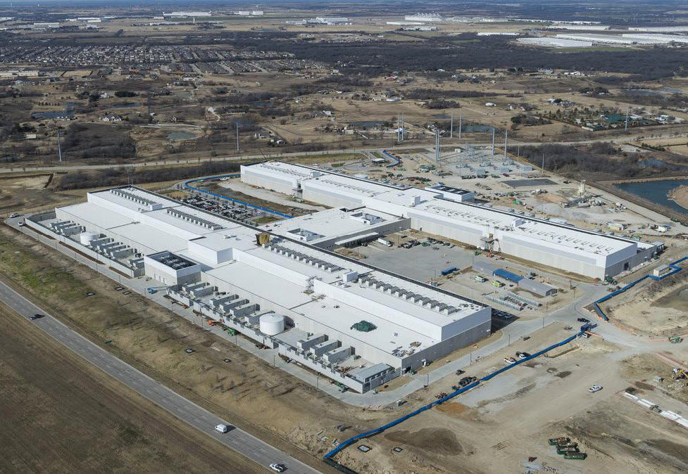
Figure 3.3-8. Heavy Industrial Dimensional Standards

Lot Dimensions
1. Lot Area 10,000 SF (min)
NA (max)
Height (Max Feet)
2. Within 50 ft of Single-Family Residential 3 stories/45 ft to eave
 All Other 5 stories/75 ft to eave
Lot Coverage Percentage
All buildings on the lot (max) 80%


Setbacks (Feet)
3. Front: On Freeway, Freeway Frontage Road, or Arterial Roadway (min) 20
 On Freeway, Freeway Frontage Road, or Arterial Roadway (max) NA
 On All Other Streets (min) 20
 On All Other Streets (max) NA
4. Side: (min) 40
5. Rear: (min) 40


(Ord. No. O-2023-003, § 3(Exh. A), 1-3-2023; Ord. No. O-2024-030, §§ 3, 4, 7-1-2024)

Sec. 36-3.4 - Public Zoning Districts

3.4.1. General Purposes of Public Zoning Districts

The public zoning districts are intended to:

(1)

Accommodate a range of public and civic uses with the city's residential and commercial districts;

(2)

Encourage site planning, land use planning, and architectural design that allow public and civic uses to effectively serve and complement aesthetics of adjacent development;

(3)

Encourage the preservation of environmentally sensitive areas as parks and open space where appropriate;

(4)

Promote consistency with the values and goals of the Future Land Use Map and Comprehensive Plan;

(5)

Ensure that any adverse impacts associated with public uses such as parking and traffic are considered with the context of the neighborhood and adjoining uses; and

(6)

Help ensure that the appearance and operational impacts of public and civic uses do not adversely affect the character of the areas in which they are located.

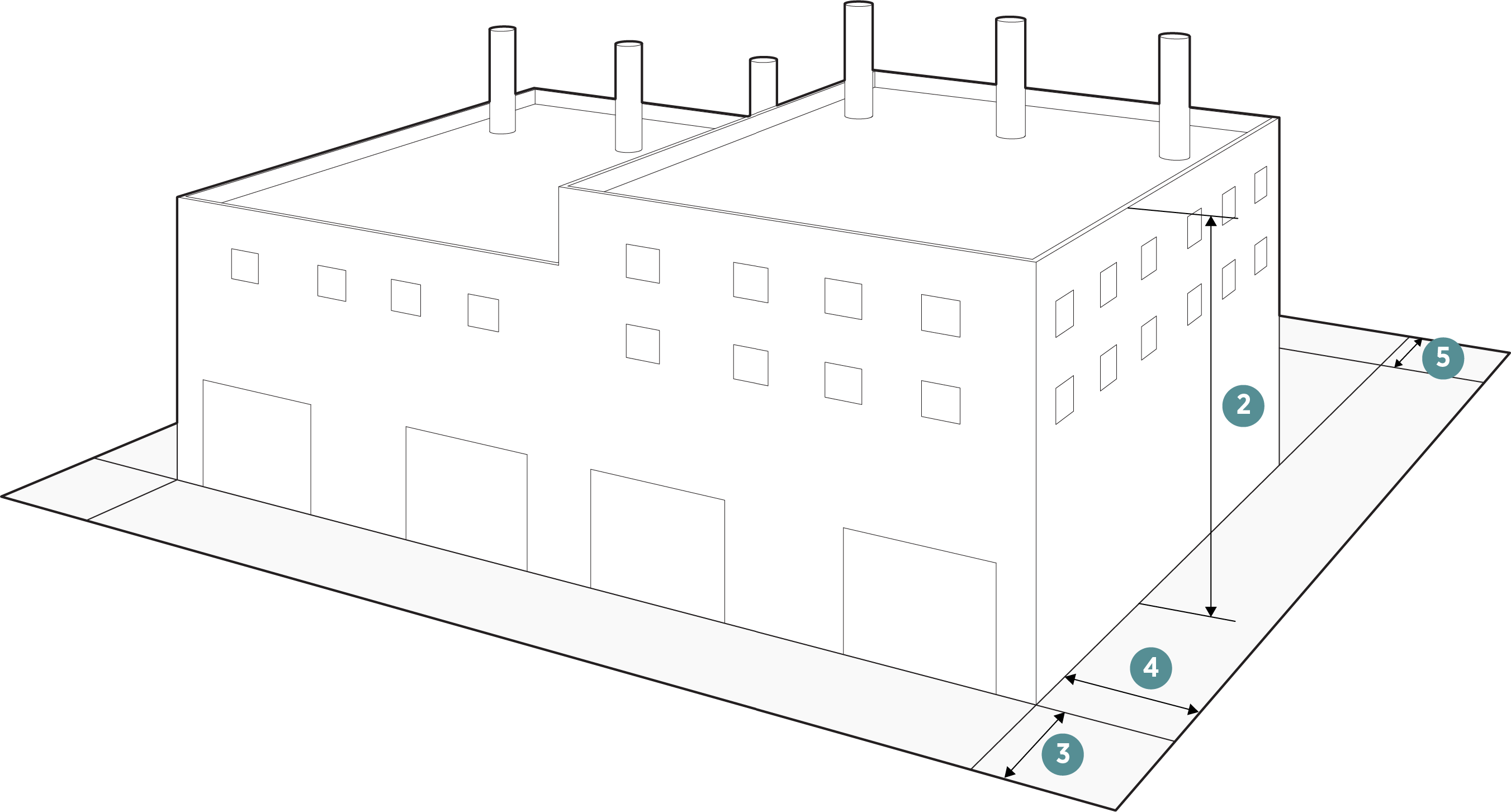
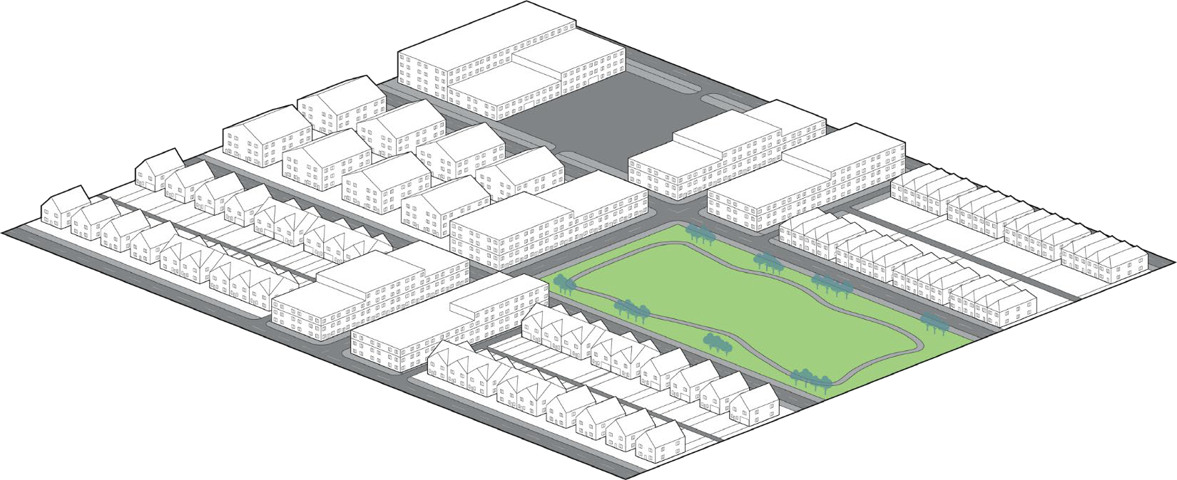
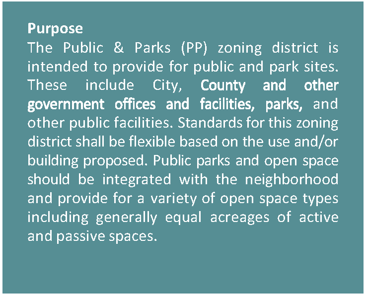
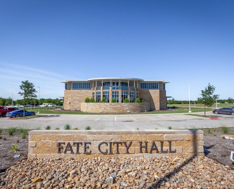
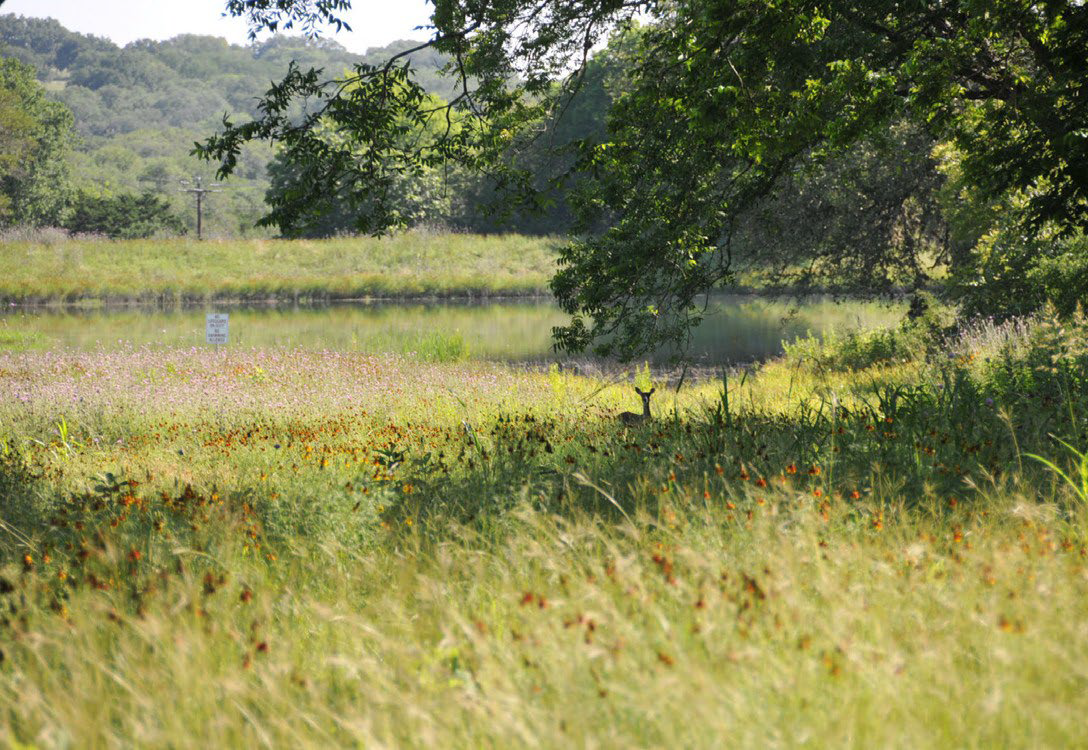
3.4.2. PUBLIC & PARKS (PP)

Figure 3.4-1. Public & Parks Character Context


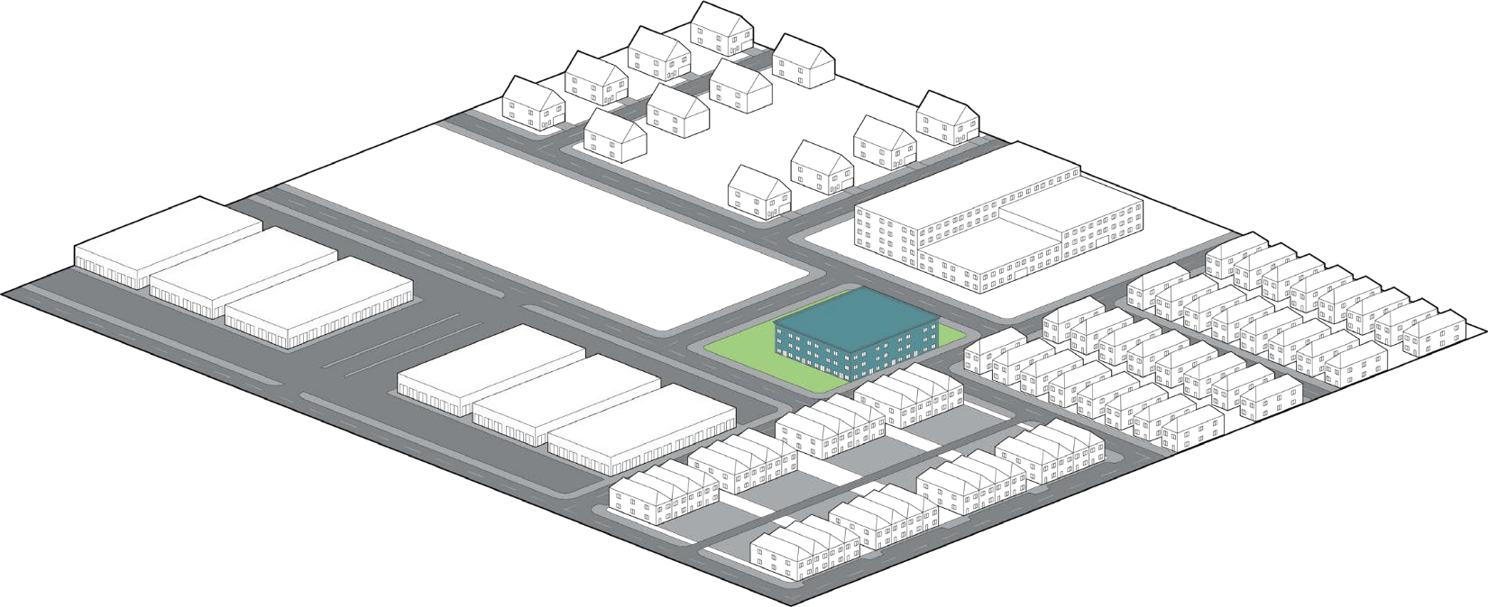
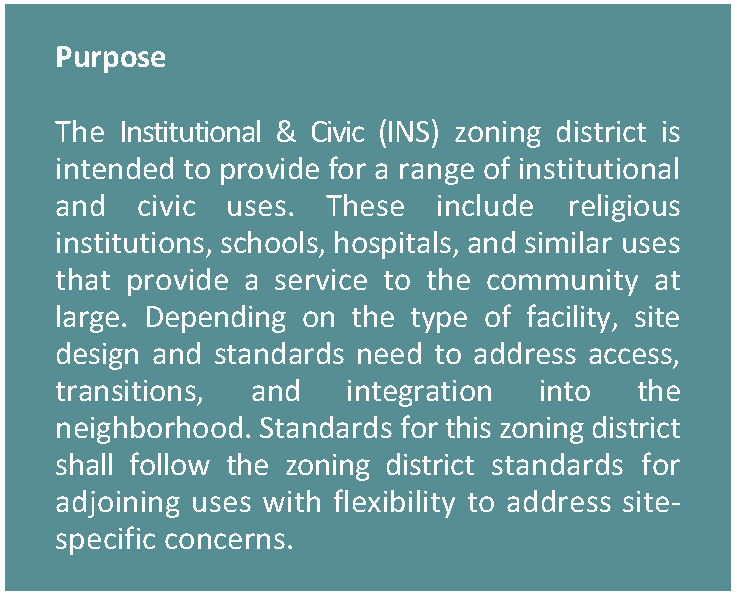
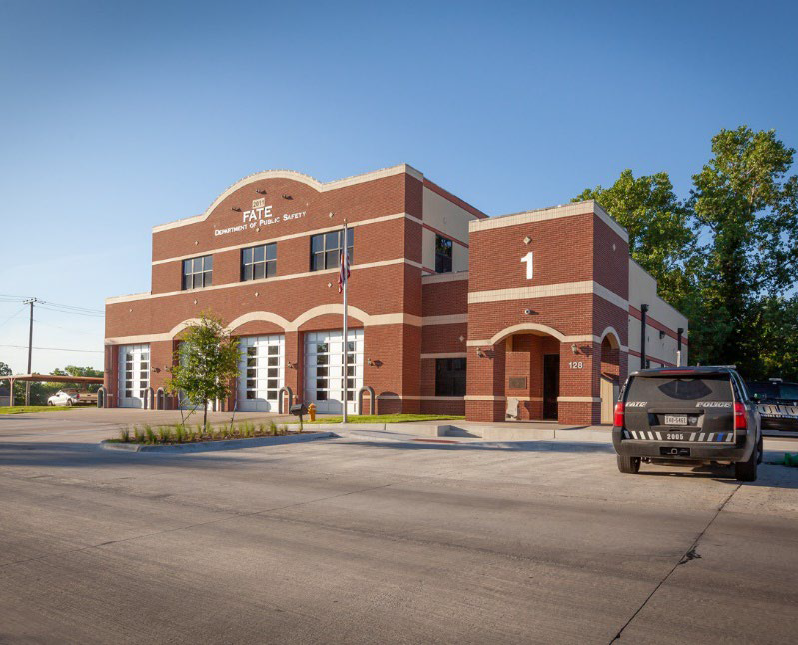
3.4.3. INSTITUTIONAL & CIVIC (INS)

Figure 3.4-2. Institutional & Civic Character Context


(Ord. No. O-2023-003, § 3(Exh. A), 1-3-2023)

Sec. 36-3.5 - Special Zoning Districts

3.5.1. General Purposes of Special Zoning Districts

The special zoning districts are intended to:

(1)

Implement the vision for key areas within the City such as Downtown and the mixed-use district along I-30; and

(2)

Provide for a flexible zoning tool in the form of planned development standards intended to implement different development projects that can better respond to changing market demand; and

(3)

Encourage site planning, land use planning, and architectural design that create attractive, pedestrian-friendly, and walkable environments; and

(4)

Maintain and enhance the City's economic base and provide shopping, entertainment and employment opportunities close to where people live and work; and

(5)

Provide for a range of housing types within the context of mixed use, walkable developments to maximize long-term sustainability.

3.5.2. Special District Standards

(1)

A Concept plan is required for any Special District zoning request.

(2)

If a revised Concept Plan or request for new property zoning is submitted, then application of special zoning districts within the Concept Plan shall adhere to the following requirements:

a.

Generally, where the mixed use special districts are adjacent to existing or planned single-family zoning or land use designations, Mixed Use shall be placed at least 200 feet from the single-family use property line, with Mixed Use Transition and/or Neighborhood Transition being used within that area to serve as a buffer.

3.5.3. Street Types

(1)

Pedestrian Oriented Streets are used within the Concept Plan to achieve a higher level of pedestrian activity and connectivity. The amount of the required Pedestrian Oriented Streets in any one Concept Plan is determined by the sub-district. Pedestrian Oriented Streets include design considerations as follows:

a.

Low-speed design to keep vehicle speeds at or below 25 mph;

b.

Include the use of traffic calming designs (narrowing of pavement section, elevated crosswalks, brick pavers, etc.);

c.

Limiting use of curb cuts along the Pedestrian Oriented Street;

d.

Planting street trees between the curb and the sidewalk, or within tree wells in the sidewalk area;

e.

Adhering to the setback range according to the Development Standards Table; and

f.

Utilizing shading devices along both the non-residential or mixed use building frontage, such as porches, awnings, pergolas and other similar shade devices.

(2)

Design Corridors are intended to:

a.

Create safe, comfortable, and attractive environments for users and pedestrians by introducing distinct corridors.

b.

Control streetscape standards including building setbacks, building height, on and off-street parking and sidewalk requirements.

c.

Establish minimum guidelines for landscaping that will promote, protect, and enhance both new and existing developments as well as the city's overall image.

(3)

All design corridors:

a.

Must provide clear, continuous paved sidewalks along all existing and future streets.

b.

Require a landscape buffer to separate sidewalks and trails from street parking and automobile travel lanes.

c.

Must provide pedestrian-scaled street lighting.

d.

Shall minimize curb cuts for vehicular access.

(4)

The following table provides a summary of design corridor standards:

Table 3.5-1 Design Corridor Standards
Mixed Use Corridor
Priority Mixed Use Corridor Unnamed Street (Yu Tract) - W E Crawford to roundabout at Woodcreek Blvd.
Building Height (min/max) 2 stories/5 stories or 65'
Parking Width (min) 8'. On street parallel parking preferred.
Sidewalks (min) 8'
Lighting Height (max) 16' and shall be spaced out every 50'
Landscape Buffer Width (min) 6'
Street Trees One street tree from approved tree list every 30'. If under overhead utility lines one small or medium tree from the approved tree list must be planted every 25'.
Downtown Corridor
Priority Downtown Corridor W E Crawford Avenue - I-30 to TX 66
Building Height (min/max) 2 stories/4 stories
Parking Width (min) 8'. On street parallel parking preferred.
Sidewalks (min) 6'
Lighting Height (max) 16' and shall be spaced out every 50'
Landscape Buffer Width (min) 5', or tree wells
Street Trees One street tree from approved tree list every 30'. If under overhead utility lines one small or medium tree from the approved tree list must be planted every 25'.


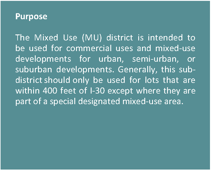
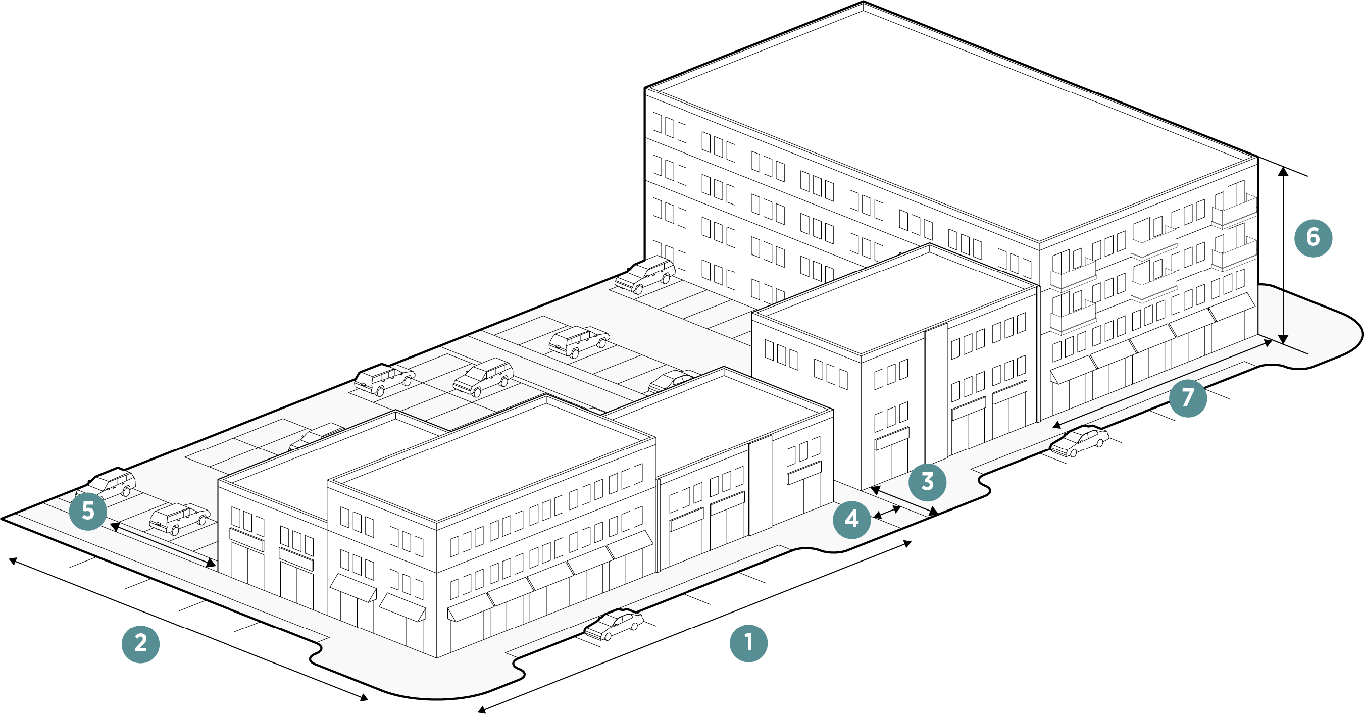
3.5.4. MIXED USE (MU)

Figure 3.5-1. Mixed Use Character Context


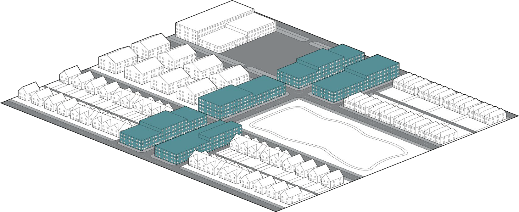
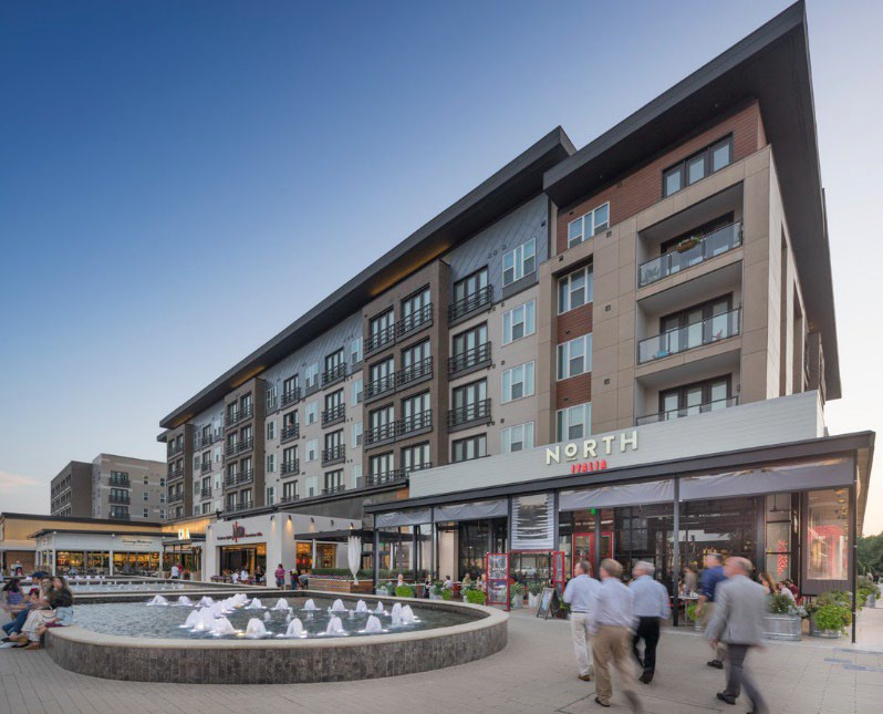
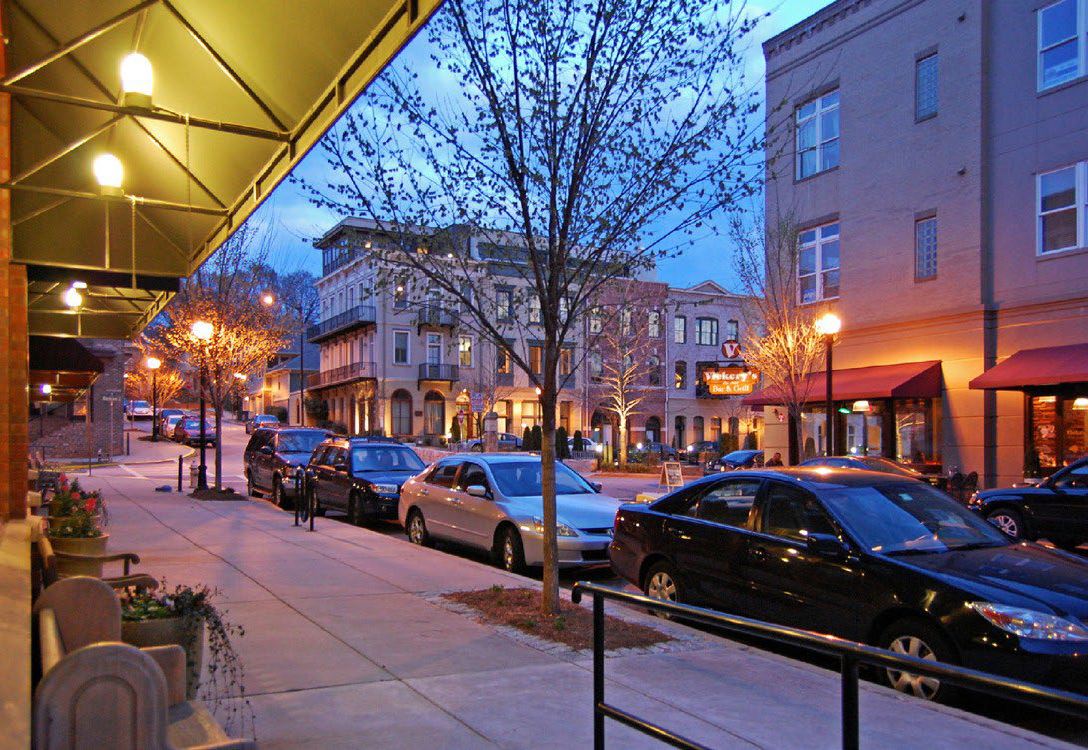
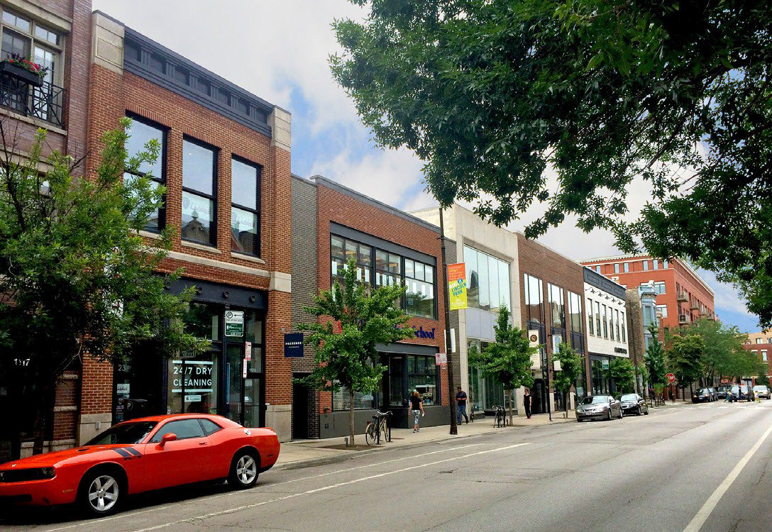
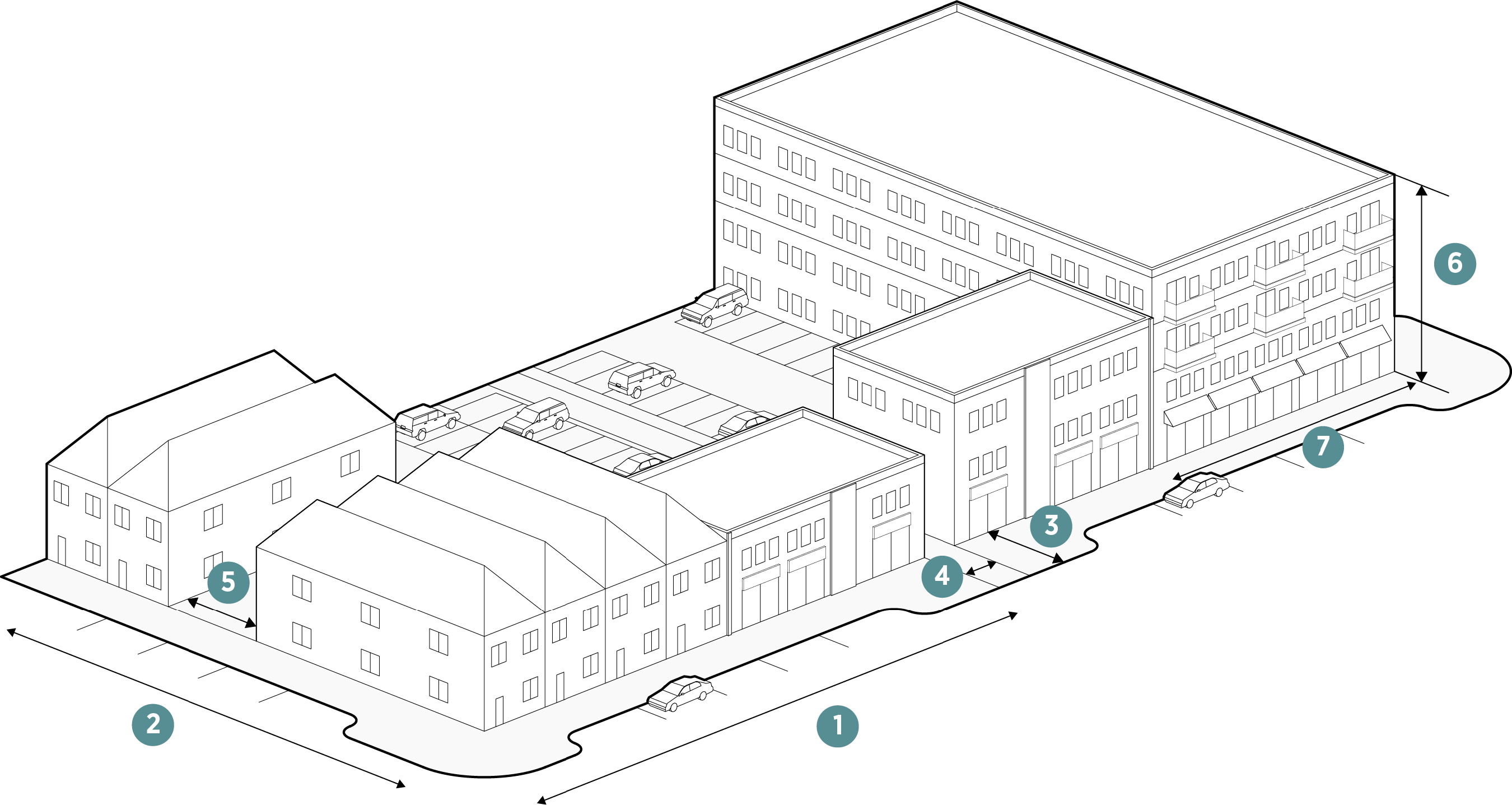
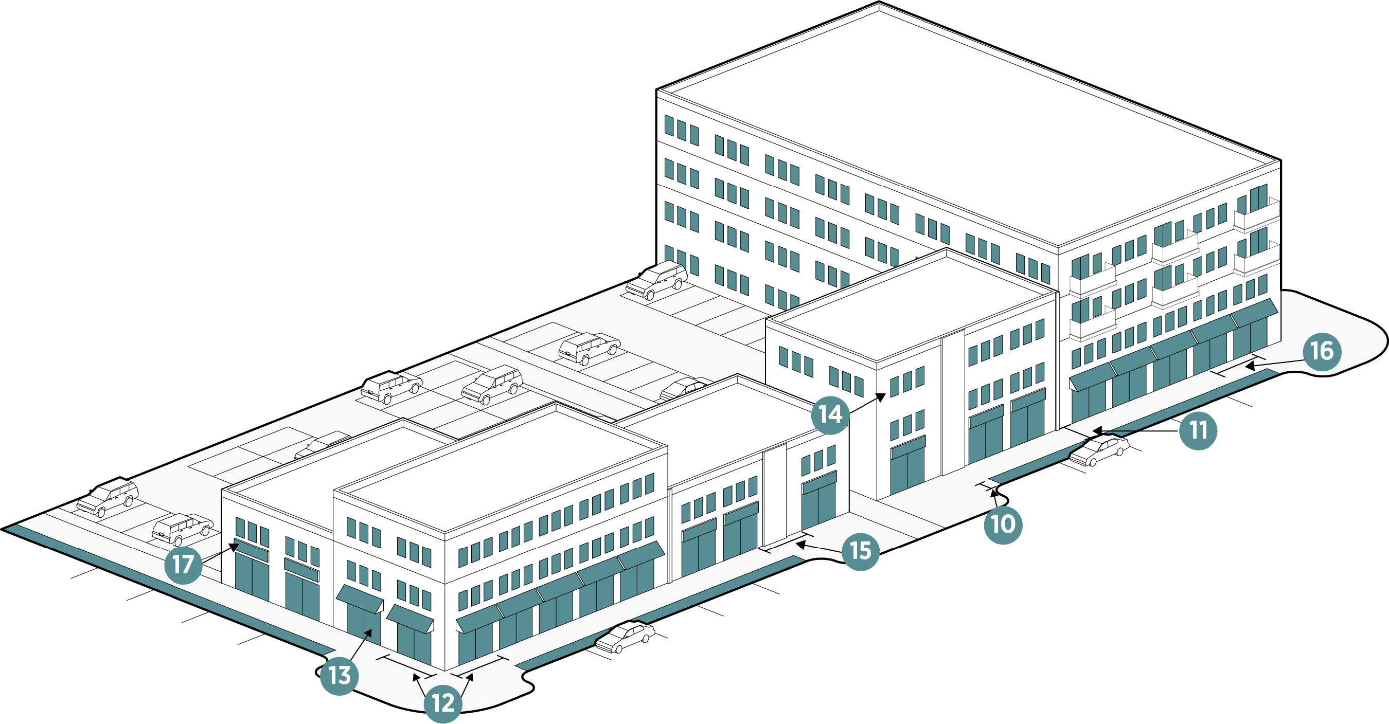
Figure 3.5-2. Mixed Use Dimensional Standards

Lot Dimensions
Lot Area (min) No min or max
1. Lot Width (min) feet No min or max
2. Lot Depth (min) feet No min or max
Setbacks (Feet)
3. Front (min) on Pedestrian Oriented Streets or Improved Public Space 5
 Front (max) on Pedestrian Oriented Streets or Improved Public Space 20
 On Freeway (min) 20
 On All Other Streets (min) 5
4. Side (min) Flexible
5. Rear (min) Flexible


* Irregular blocks may be permitted only if natural topography, existing roadways and railroads, and/or vegetation prevents a rectilinear grid.

Site
Lot Coverage % (max) 90
Open Space % (min) 10
Building
6. Stories (max) 5 or 65 feet
6+ with SUP
7. Width (max) 250'
Block
Block Type* Regular (Square or Rectangular)
Block Perimeter (max)** 3,500
Lot Size/Lot Type Mix Required None


** Block perimeter maximum can be exceeded with either public or private roads that create interconnected access within parking areas and/or safe pedestrian connections accessing through the larger block.

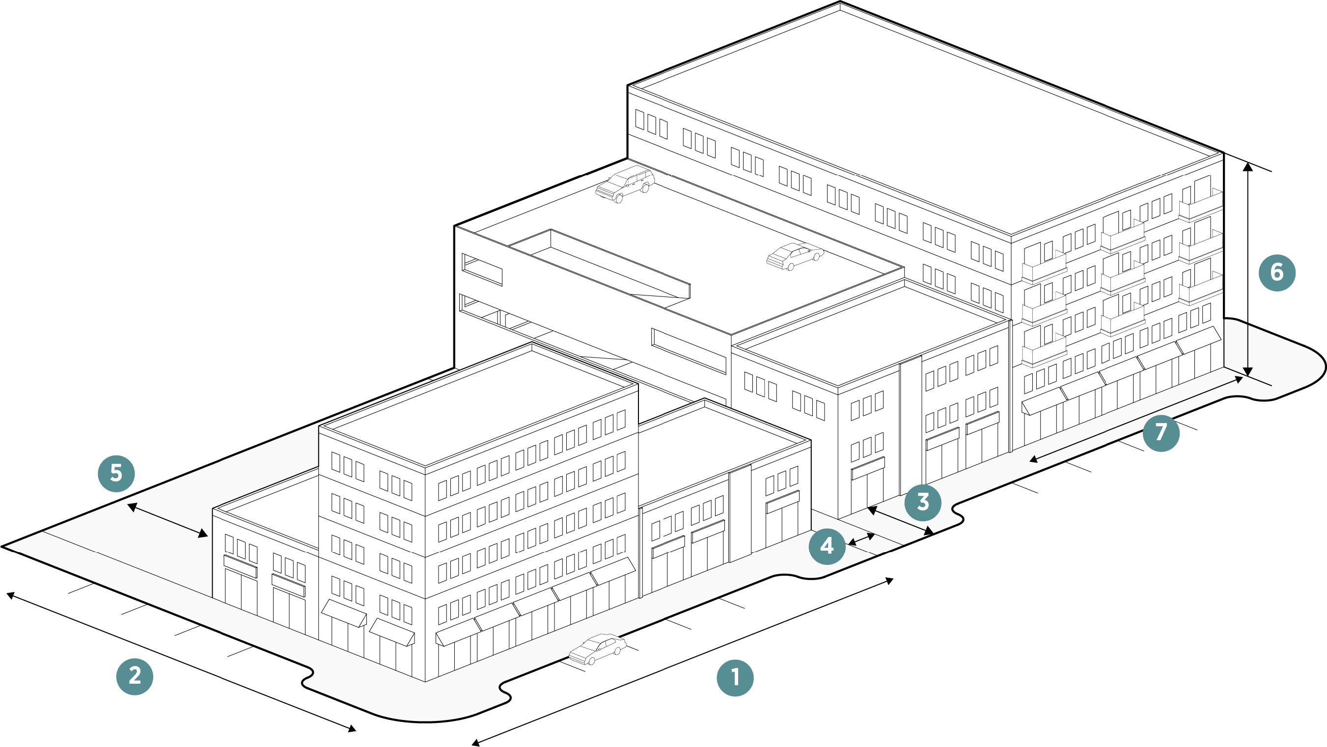
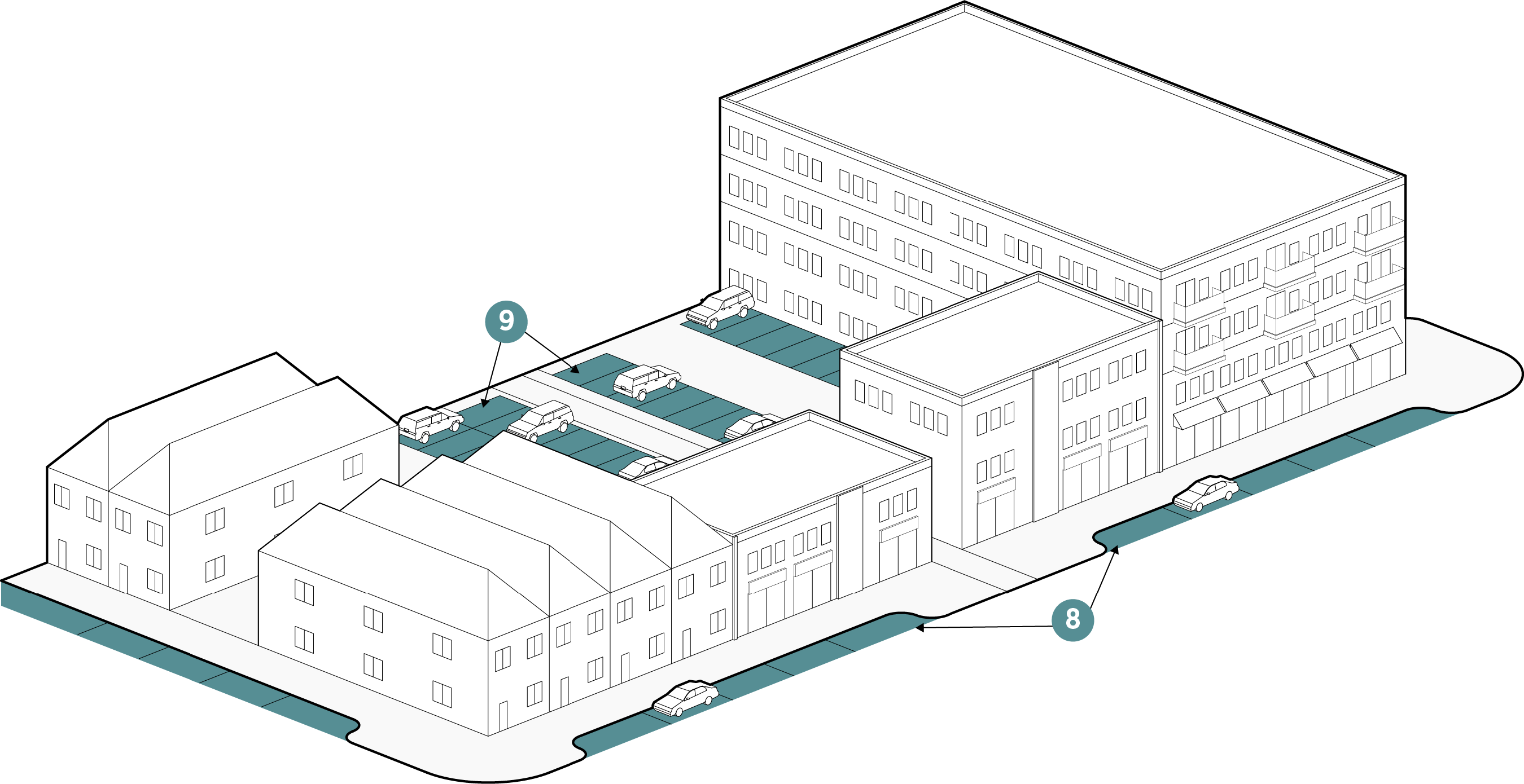
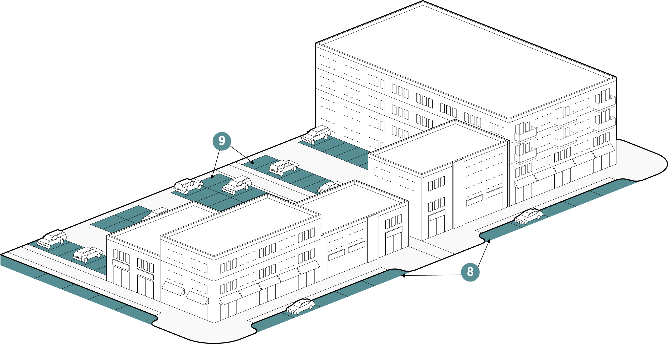
Figure 3.5-3. Mixed Use Parking Standards

Parking
8. On-street parallel parking Permitted
 On-street Angled parking Permitted
 On-street Head in Perpendicular parking Permitted only on local streets when it is no more than half a block and shall not be placed on a pedestrian oriented street
 Parallel Parking Lane Width (min) 8
 Angled Parking Lane Width (min) 9x18-20
 Head In Perpendicular Parking Lane Width (min) 9'
9. Off-Street Parking (min) Article V
shall Apply


* Screening required if along a street.

** Flexible for residential uses but shall not be visible from a public right-of-way (other than an alley); trash collection shall be along alleys if alleys are provided.

Loading
Alleys Permitted
Off-Street Loading Encouraged along an alley or parking area.*
Screening
Trash/Recycling Receptacles Screening Required**
Other Utility Equipment Screening See Article IX
Loading Spaces Screening Screening required for non-residential loading spaces per Article IX.
Surface Parking Areas Screening Required/Flexible***


*** Shall be per Article IX standards or applicant may propose alternative screening standards at the time of Concept Plan.

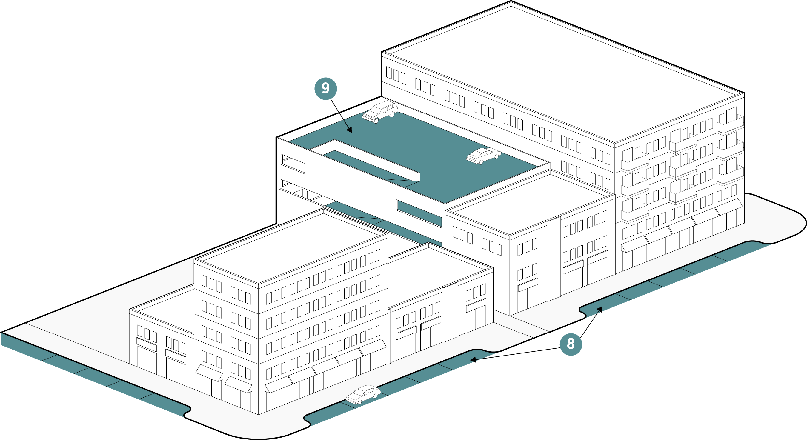
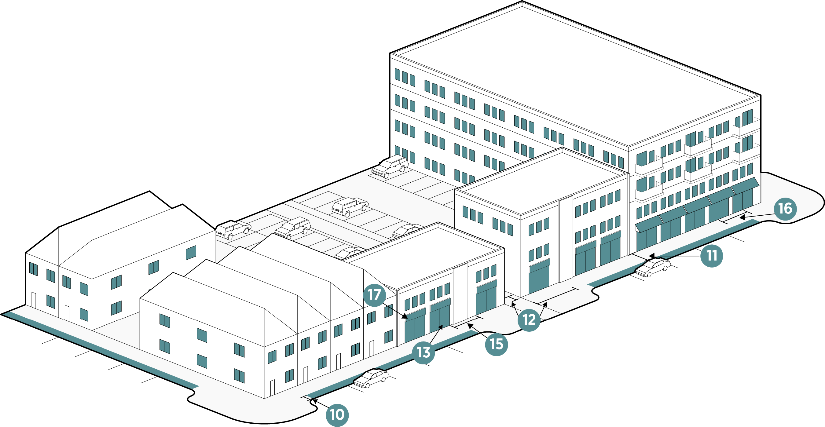
Figure 3.5-4. Mixed Use Public Realm Standards

Landscape and Streetscape
10. Landscape/Fencing buffer between surface parking and sidewalks/trails and streets (except alleys) Required only for non-residential uses.
Landscaping shall be permitted to use fountains, outdoor speakers, and special lighting in gathering spaces, plazas and other public spaces.
 Parking lot minimum interior landscaping Article IX shall apply
 Street Lighting *
 Building Entrance Lighting Building/Unit Entrances: Shall have a minimum of one sconce or lighting device placed adjacent to the doorway
 Parking Areas Lighting Parking Areas shall be lit according to Article V
11. Trails and Sidewalks (min) Trails 8',
Sidewalks 6"


Active Depth
12. Active Depth 15'
Windows
13. Ground Story Coverage (min) 45%
14. Upper Story Coverage (min) 20%
15. Blank wall width (max) 20'
Entries
16. Entry Spacing (max) 50'
Signage
17. Number and Size Article VIII shall apply
Pedestrian Oriented Street
 Percentage Required 50%


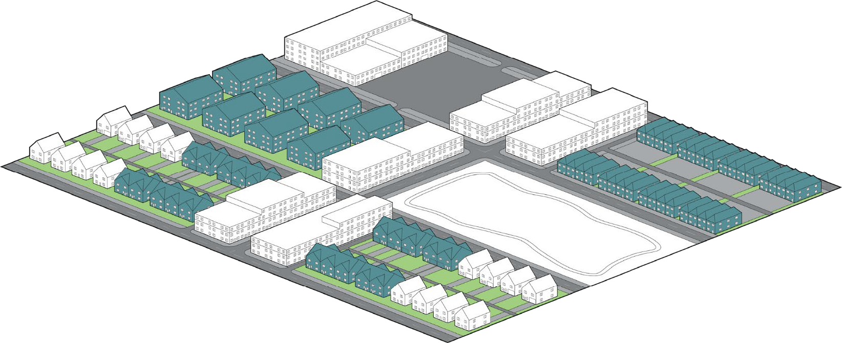
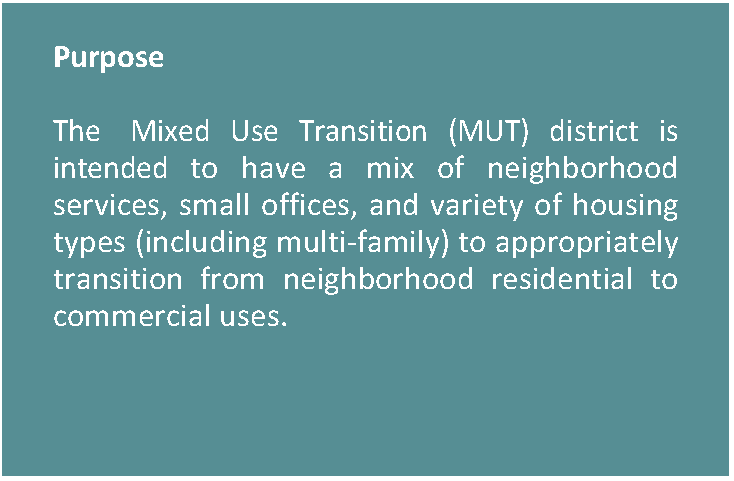
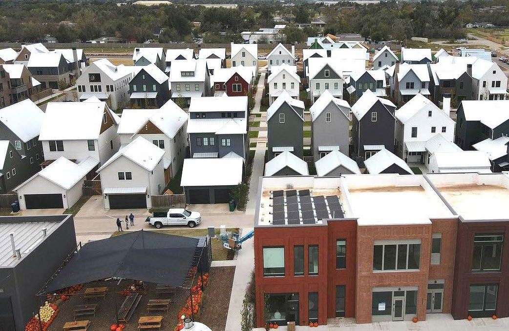
3.5.5. MIXED USE TRANSITION (MUT)

Figure 3.5-5. Mixed Use Transition Character Context


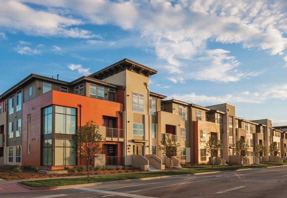
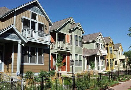
Figure 3.5-6. Mixed Use Transition Dimensional Standards

Lot Dimensions
Lot Area (min) No min or max
1. Lot Width (min) feet 20
2. Lot Depth (min) feet No min or max
Setbacks (Feet)
3. Front (min) on Pedestrian Oriented Streets or Improved Public Space 5
 Front (max) on Pedestrian Oriented Streets or Improved Public Space 20
 On Freeway (min) 20
 On All Other Streets (min) 5
4. Side (min) Flexible
5. Rear (min) Flexible


* Irregular blocks may be permitted only if natural topography, existing roadways and railroads, and/or vegetation prevents a rectilinear grid.

Site
Lot Coverage % (max) 80
Open Space % (min) 10
Building
6. Stories (min) 2
 Stories (max) 5 or 65 feet
6+ with SUP
7. Width (max) 175'
Block
Block Type* Regular (Square or Rectangular)
Block Perimeter (max) 3,000
Lot Size/Lot Type Mix Required **


** A minimum of three (3) different lot sizes shall be mixed and they shall be spread throughout the entire planned development. Concentrating lots of a single lot size or housing style in separate areas of a development shall be prohibited.

Figure 3.5-7. Mixed Use Transition Parking Standards

Parking
8. On-street parallel parking Permitted
 On-street Angled parking Permitted
 On-street Head in Perpendicular parking Permitted only on local streets when it is no more than half a block and shall not be placed on a pedestrian oriented street
 Parallel Parking Lane Width (min) 8
 Angled Parking Lane Width (min) 9x18-20
 Head In Perpendicular Parking Lane Width (min) 9'
9. Off-Street Parking (min) Article V
shall Apply


* Screening required if along a street.

** Flexible for residential uses but shall not be visible from a public right-of-way (other than an alley); trash collection shall be along alleys if alleys are provided.

Loading
Alleys Article V shall apply
Off-Street Loading Encouraged along an alley or parking area.*
Screening
Trash/Recycling Receptacles Screening Required**
Other Utility Equipment Screening See Article IX
Loading Spaces Screening Screening required for non-residential loading spaces per Article IX.
Surface Parking Areas Screening Required/Flexible***


*** Shall be per Article IX standards or applicant may propose alternative screening standards at the time of Concept Plan.

Figure 3.5-8. Mixed Use Transition Public Realm Standards

Landscape and Streetscape
10. Landscape/Fencing buffer between surface parking and sidewalks/trails and streets (except alleys) Required only for non-residential uses.
Landscaping shall be permitted to use fountains, outdoor speakers, and special lighting in gathering spaces, plazas and other public spaces.
 Parking lot minimum interior landscaping Article IX shall apply
 Street Lighting *
 Building Entrance Lighting Building/Unit Entrances: Shall have a minimum of one sconce or lighting device placed adjacent to the doorway
 Parking Areas Lighting Parking Areas shall be lit according to Article V
11. Trails and Sidewalks (min) Trails 8',
Sidewalks 6'


Active Depth
12. Active Depth 5'
Windows
13. Ground Story Coverage (min) 20%
14. Upper Story Coverage (min) 20%
15. Blank wall width (max) Coverage 20'
Entries
16. Entry Spacing (max) 100'
Signage
17. Number and Size Article VIII shall apply
Pedestrian Oriented Street
Percentage Required 50%


*Pedestrian oriented lighting shall be no taller than 16 feet high and shall be spaced an average of 50 feet on center, coordinated with street trees. Other street lighting shall be in accordance with Article V and the Design Criteria and Construction Standards.

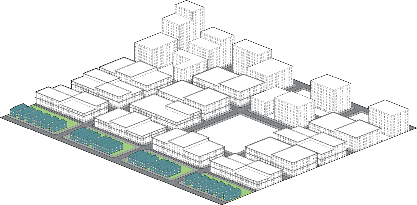
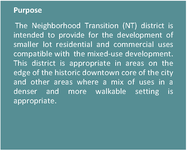
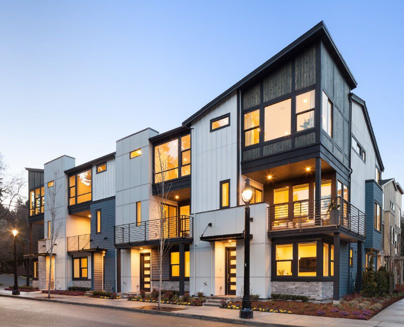
3.5.6. NEIGHBORHOOD TRANSITION (NT)

Figure 3.5-9. Neighborhood Transition Character Context


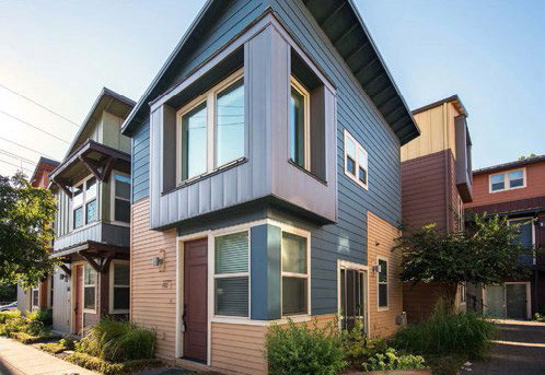
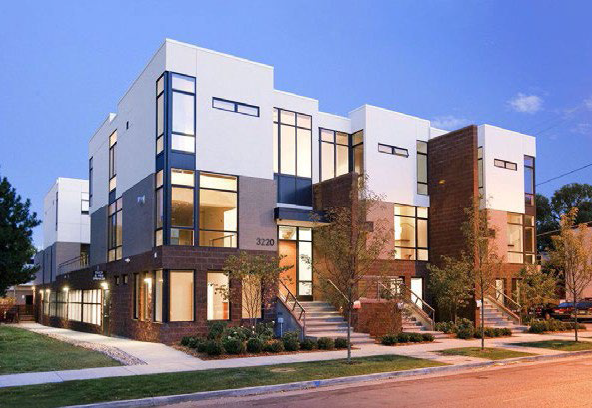
Figure 3.5-10. Neighborhood Transition Dimensional Standards

Lot Dimensions
Lot Area (min) 3,000
1. Lot Width (min) feet 30
2. Lot Depth (min) feet No min or max
Setbacks (Feet)
3. Front (min) on Pedestrian Oriented Streets or Improved Public Space 5
 Front (max) on Pedestrian Oriented Streets or Improved Public Space 20
 On Freeway (min) 20
 On All Other Streets (min) 5
4. Side (min) 5
 For attached residential or commercial 0'
5. Rear (min) 10'


* Irregular blocks may be permitted only if natural topography, existing roadways and railroads, and/or vegetation prevents a rectilinear grid.

Site
Lot Coverage % (max) 70
Open Space % (min) 10
Building
6. Stories (min) 2**
 Stories (max) 3 or 45 feet
7. Width (max) 175'
Block
Block Type* Regular (Square or Rectangular)
Block Perimeter (max) 2,000
Lot Size/Lot Type Mix Required ***


** Single-family detached homes and duplexes are exempt from this minimum height requirement.

*** A minimum of three (3) different lot sizes shall be mixed and they shall be spread throughout the entire development. Concentrating lots of a single lot size or housing style in separate areas of a development shall be prohibited.

Figure 3.5-11. Neighborhood Transition Parking Standards

Parking
8. On-street parallel parking Permitted
 On-street Angled parking Permitted on local street only
 On-street Head in Perpendicular parking Not permitted
 Parallel Parking Lane Width (min) 8
 Angled Parking Lane Width (min) 9x18-20
9. Off-Street Parking (min) Article V
shall Apply


* Screening required if along a street.

** Flexible for residential uses but shall not be visible from a public right-of-way (other than an alley); trash collection shall be along alleys if alleys are provided.

Loading
Alleys Article V shall apply
Off-Street Loading Encouraged along an alley or parking area.*
Screening
Trash/Recycling Receptacles Screening Required**
Other Utility Equipment Screening See Article IX
Loading Spaces Screening Screening required for non-residential loading spaces per Article IX.
Surface Parking Areas Screening Required/Flexible***


*** Shall be per Article IX standards or applicant may propose alternative screening standards at the time of Concept Plan.

Figure 3.5-12. Neighborhood Transition Public Realm Standards

Landscape and Streetscape
10. Landscape/Fencing buffer between surface parking and sidewalks/trails and streets (except alleys) Required only for non-residential uses.
Landscaping shall be permitted to use fountains, outdoor speakers, and special lighting in gathering spaces, plazas and other public spaces.
 Parking lot minimum interior landscaping Article IX shall apply
 Street Lighting *
 Building Entrance Lighting Building/Unit Entrances: Shall have a minimum of one sconce or lighting device placed adjacent to the doorway
 Parking Areas Lighting Parking Areas shall be lit according to Article V
11. Trails and Sidewalks (min) Trails 8',
Sidewalks 6'


Active Depth
12. Active Depth 5'
Windows
13. Ground Story Coverage (min) 20%
14. Upper Story Coverage (min) 20%
15. Blank wall width (max) Coverage 15'
Entries
16. Entry Spacing (max) 100'
Signage
17. Number and Size Article VIII shall apply
Pedestrian Oriented Street
Percentage Required 50%


*Pedestrian oriented lighting shall be no taller than 16 feet high and shall be spaced an average of 50 feet on center, coordinated with street trees. Other street lighting shall be in accordance with Article V and the Design Criteria and Construction Standards.

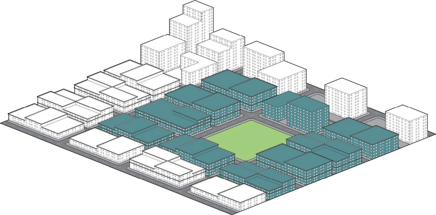
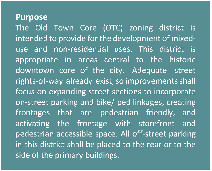
3.5.7. OLD TOWN CORE (OTC)

Figure 3.5-13. Old Town Core Character Context


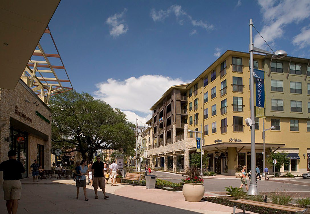
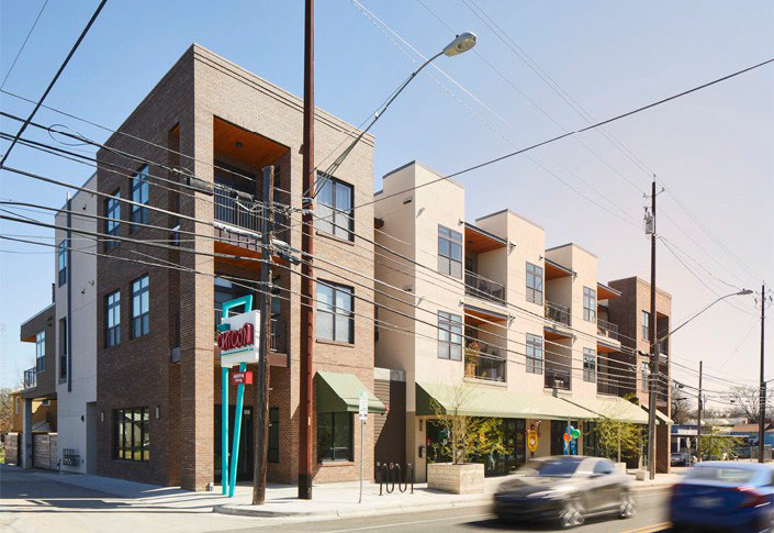
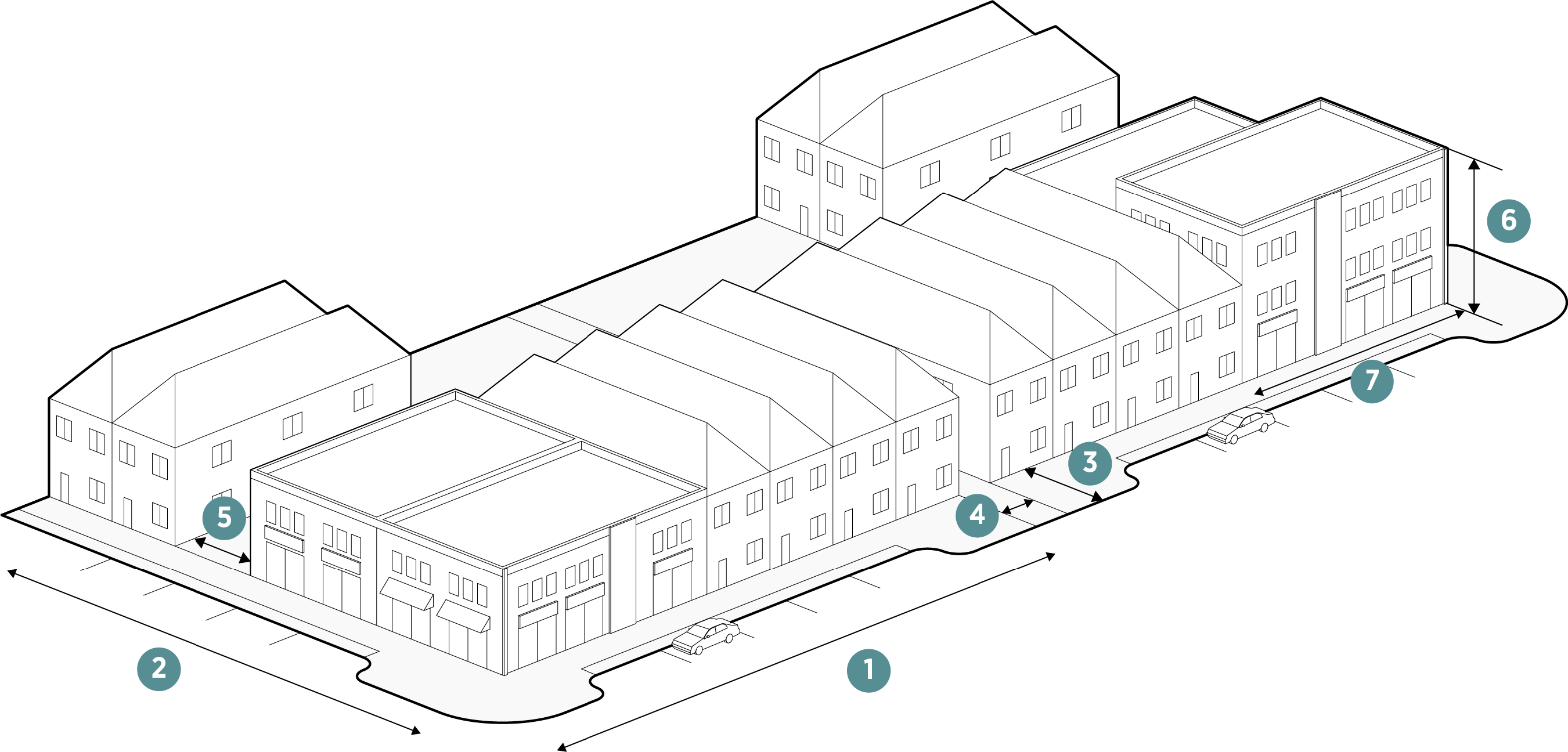
Figure 3.5-14. Old Town Core Dimensional Standards

Lot Dimensions
Lot Area (min) No min or max
1. Lot Width (min) feet 20
2. Lot Depth (min) feet No min or max
Setbacks (Feet)
3. Front (min) on Pedestrian Oriented Streets or Improved Public Space N/A
 Front (max) on Pedestrian Oriented Streets or Improved Public Space 10'
 On Freeway (min) N/A
 On All Streets (min) 0'
4. Side (min) when adjacent to single-family 10'
5. Rear (min) when adjacent to single-family 10'


* Irregular blocks may be permitted only if natural topography, existing roadways and railroads, and/or vegetation prevents a rectilinear grid.

Site
Lot Coverage % (max) 90
Open Space % (min) 10
Building
6. Stories (min) 2, except for single-family detached residential
 Stories (max) 4 or 55'
5+ with SUP
7. Width (max) 275'
Block
Block Type* Regular (Square or Rectangular)
Block Perimeter (max)** 2,000
Lot Size/Lot Type Mix Required None


** Block perimeter maximum can be exceeded with either public or private roads that create interconnected access within parking areas and/or safe pedestrian connections accessing through the larger block.

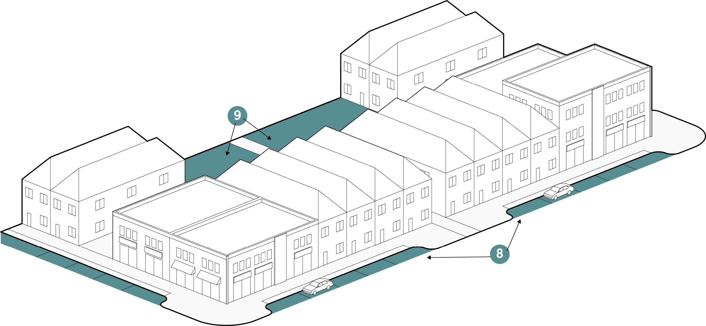
Figure 3.5-15. Old Town Core Parking Standards

Parking
8. On-street parallel parking Permitted
 On-street Angled parking Permitted
 On-street Head in Perpendicular parking Permitted only when it is no more than half a block
 Parallel Parking Lane Width (min) 8
 Angled Parking Lane Width (min) 9x18-20
 Head In Perpendicular Parking Lane Width (min) 9'
9. Off-Street Parking (min) Article V
shall apply


* Screening required if along a street.

** Flexible for residential uses but shall not be visible from a public right-of-way (other than an alley); trash collection shall be along alleys if alleys are provided.

Loading
Alleys Article V shall apply
Off-Street Loading Encouraged along an alley or parking area.*
Screening
Trash/Recycling Receptacles Screening Required**
Other Utility Equipment Screening See Article IX
Loading Spaces Screening Screening required for non-residential loading spaces per Article IX.
Surface Parking Areas Screening Required/Flexible***


*** Shall be per Article IX standards or applicant may propose alternative screening standards at the time of Concept Plan.

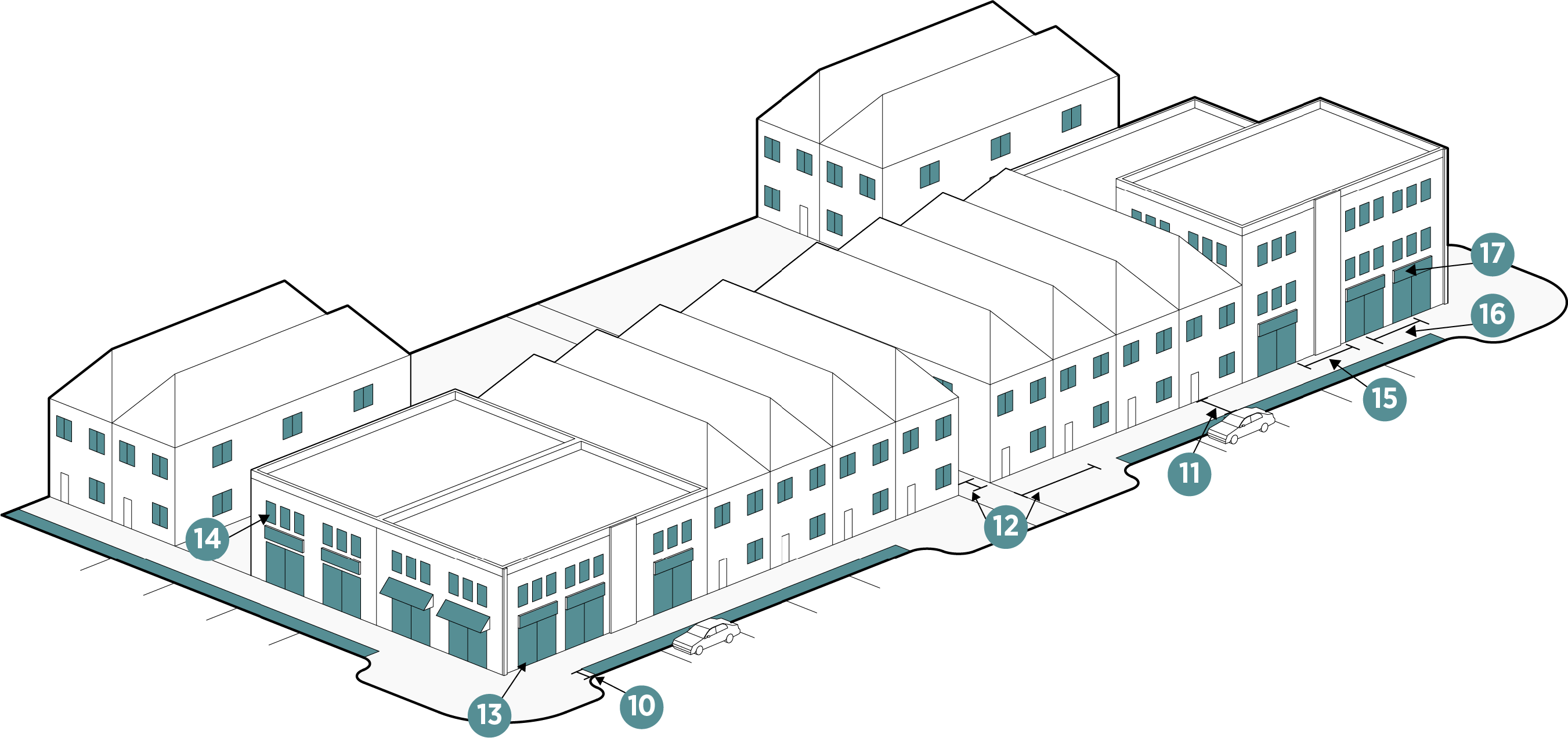
Figure 3.5-16. Old Town Core Public Realm Standards

Landscape and Streetscape
10. Landscape/Fencing buffer between surface parking and sidewalks/trails and streets (except alleys) Required only for non-residential uses.
Landscaping shall be permitted to use fountains, outdoor speakers, and special lighting in gathering spaces, plazas and other public spaces.
 Parking lot minimum interior landscaping Article IX shall apply
 Street Lighting *
 Building Entrance Lighting Building/Unit Entrances: Shall have a minimum of one sconce or lighting device placed adjacent to the doorway
 Parking Areas Lighting Parking Areas shall be lit according to Article V
11. Trails and Sidewalks (min) Trails 8',
Sidewalks 6'


Active Depth
12. Active Depth 10'
Windows
13. Ground Story Coverage (min) 30%
14. Upper Story Coverage (min) 20%
15. Blank wall width (max) 15'
Entries
16. Entry Spacing (max) 75'
Signage
17. Number and Size Article VIII shall apply


*Pedestrian oriented lighting shall be no taller than 16 feet high and shall be spaced an average of 50 feet on center, coordinated with street trees. Other street lighting shall be in accordance with Article V and the Design Criteria and Construction Standards.

3.5.8. PLANNED DEVELOPMENT (PD)


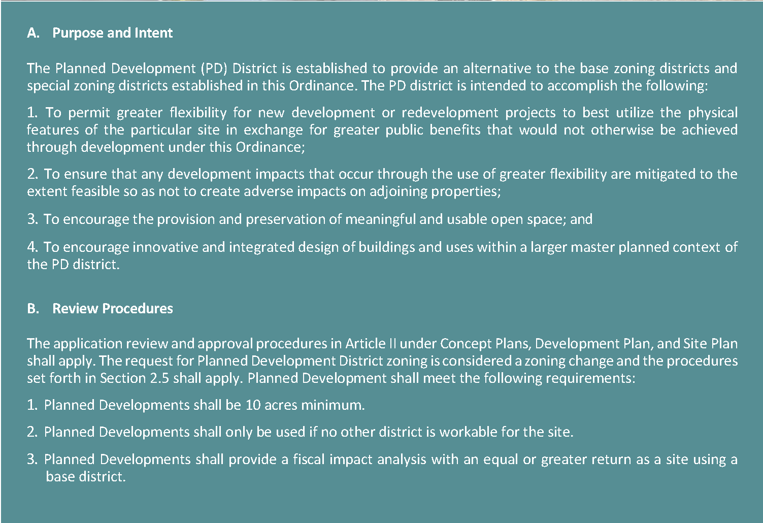
(Ord. No. O-2023-003, § 3(Exh. A), 1-3-2023; Ord. No. O-2024-030, §§ 5, 6, 7-1-2024)