
Hampton City Zoning Code
ARTICLE 7
- MIXED USE DISTRICTS
Sec. 7-1.- Mixed Use Districts.
A.
This article shall be collectively known, cited, and referred to as the Mixed Use Districts of the City of Hampton, Georgia (hereinafter "Mixed Use Districts").
B.
The following zoning districts are established as Mixed Use Districts:
1.
Downtown Mixed Use (DT-MU).
2.
Downtown Residential Character (DT-RC).
3.
Mixed Use (MU).
C.
Applicability. The standards contained in this section apply to all Mixed Use Districts. MU Districts Comprehensive Land Use Categories include Downtown Core, Urban Mixed-Use, and Village Mixed-Use.
D.
Purpose. These districts are intended to promote a vibrant downtown; implement the vision of Hampton's 2011 Livable Centers Initiative and 2022 plan update (King, George, and Daniel Streets Revitalization Strategy); encourage walking and bicycling; support small businesses; create a sustainable mixed-use area with downtown at its core; combine a wide variety of compatible commercial and residential uses in close proximity; and foster a safe and livable core for the City of Hampton. DT-MU is intended to create a vibrant downtown core. DT-RC is intended to extend the fabric and character of downtown development to surrounding areas. MU is intended to promote a walkable mix of uses on larger sites.
E.
Administrative variances.
1.
The Zoning Administrator is authorized to grant administrative variances to the requirements of Mixed Use Districts.
2.
Administrative variances may provide relief from any of the requirements of the Mixed Use Districts, but may not be used to increase permitted density, increase maximum height, or permit a use that is not allowed.
3.
Administrative variances may only be granted to permit a practice that is not consistent with a specific provision of these regulations, but is justified by their purpose.
4.
In addition to the general criteria for administrative variances provided in Section 12-4, administrative variances relating to a physical element or numeric measurement must be based upon credible submitted evidence demonstrating that:
i.
Approval, if granted, would not offend the purposes indicated in subsection 7-1(D);
ii.
There are such extraordinary and exceptional situations or conditions pertaining to the particular piece of property such that the literal or strict application of the regulations would create an unnecessary hardship due to size, shape, or topography or other extraordinary and exceptional situations or conditions not caused by the applicant;
iii.
Relief, if granted, would not cause a substantial detriment to the public good and surrounding properties; and
iv.
That the public safety, health and welfare are secured, and that substantial justice is done.
F.
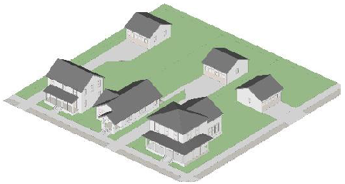
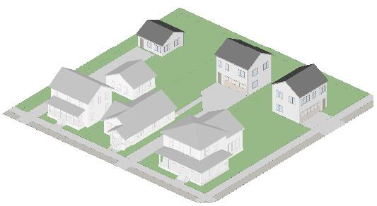
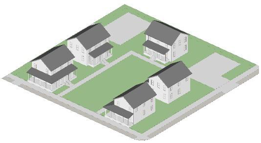
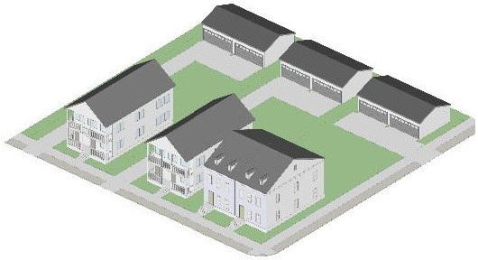
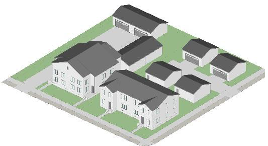
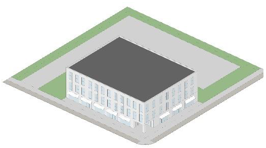
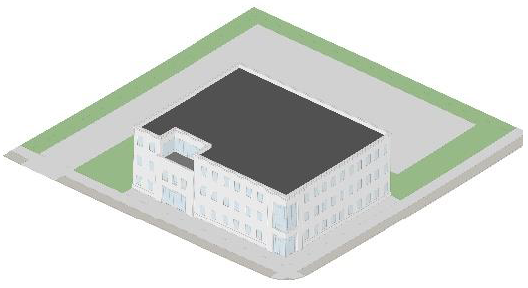
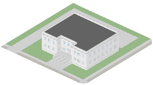
Building types. Within Mixed Use Districts, building types are used to regulate the design of buildings. Each building type is described below and is determined by the Zoning Administrator. Graphic depictions of building types are for illustrative purposes only. These building types are for zoning purposes only, and not linked to the Building Code. Freestanding parking structures are not considered to be a building type.
1.
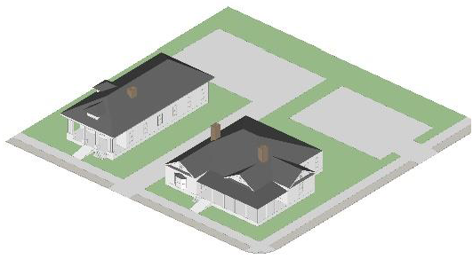
Detached house. A building type that accommodates one dwelling unit on an individual lot with yards on all sides. Not intended for nonresidential uses.
2.
Carriage house. A small, self-contained accessory dwelling unit with no more than 800 gross square feet and no more than one bedroom, located on the same lot as a detached house, duplex, or townhouse but physically separated, for use as a complete, independent living facility, with provisions for cooking, sanitation, and sleeping.
3.
Cottage court. A building type designed to accommodate 5 to 10 detached dwelling units organized around a shared internal courtyard. Units cannot be vertically mixed. All units must front a public street or a landscaped courtyard of at least 40 feet in width and 3,000 square feet in total area. Courtyard may not be parked or driven upon, except for emergency access and permitted temporary events.
4.
Duplex. A building type that accommodates two dwelling units arranged either horizontally or vertically. Not intended for nonresidential uses.
5.
Ranch Villas. A building type that accommodates single-story dwelling units organized on a single parcel tract maximum thirty-five (35) acres in size. Developments shall include both single-family detached and attached duplex units. All units are required to feature front porches to enhance architectural character and promote community interaction. Parking facilities shall include a combination of surface parking, canopy covered parking, and detached garages. Neighborhood greens and community gathering spaces shall connect to unobstructed pedestrian walkway networks reaching each individual unit.
6.
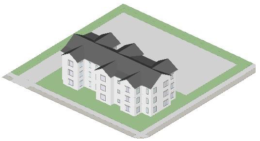
Walk-up flat. A building type that accommodates 3 to 8 dwelling units vertically and horizontally integrated.
7.
Stacked dwellings. A building type that accommodates 9 or more dwelling units vertically and horizontally integrated, with a maximum street facing facade length of 200 feet.
8.
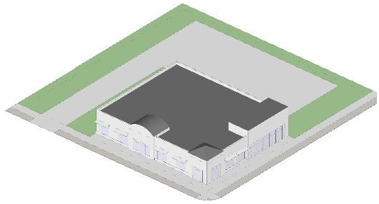
Commercial house. Accommodates nonresidential uses in a building type that resembles a detached house, with a maximum street facing facade length of 100 feet. Not intended for residential uses.
9.
Storefront. A single-story building type that typically accommodates single-use retail or commercial activity. The maximum street facing facade length is 200 feet. Not intended for residential uses.
10.
Mixed use building. A multi-story building type that typically accommodates ground floor retail, office, or commercial uses with upper-story residential or office uses. The maximum street facing facade length is 200 feet. Not intended for ground floor dwelling units.
11.
General building. A multi-story building type that typically accommodates nonresidential uses such as industrial, hotel, or office uses on all stories. The maximum street facing facade length is 200 feet for developments 75 acres or less. The maximum street facing façade length for developments greater than 75 acres may exceed 200 feet with approval from Hampton City Council.
12.
Civic building. A building type that accommodates civic uses. Not intended for commercial, retail, office, or residential uses.
G.
Window requirements. The following shall apply to the storefront and mixed use building types.
1.
No exterior wall facing a public street shall exceed 20 feet in length without intervening windows or entryway.
2.
Windows shall be provided on all exterior walls facing a public street for a minimum of 65 percent of the length of the wall as follows.
i.
Beginning at least 3 feet above the sidewalk to a height at least 10 feet above the sidewalk.
ii.
Or, when the interior finished floor elevation is 3 feet or more above the sidewalk, beginning at the finished floor elevation to a height at least 10 feet above the finished floor elevation.
iii.
Or, when the interior finished floor elevation is below the sidewalk, beginning at sidewalk level, to a height no less than 10 feet above the finished floor elevation.
3.
The glass portion of entrances may count toward window requirements.
4.
Windows shall use clear or tinted glass. Tinted glass shall have a transmittance factor of 50 percent or more and a visible light reflectance factor of 10 or less. Painted glass, reflective glass, or other similarly treated or opaque windows are prohibited.
5.
Buildings located on corner lots shall have windows on each street frontage facade that are substantially similar in size to the front facade windows.
H.
Relationship of building to street. The following regulations shall apply to principal buildings in all lot types and subareas.
1.
The primary pedestrian entrance for pedestrians to access all street level uses and business establishments with street frontage:
i.
Shall face and be visible from the street.
ii.
Shall be directly visible and accessible from the sidewalk.
iii.
Shall remain unlocked during business hours for non-residential uses.
2.
All multifamily, commercial or civic uses shall have paved walkways with a minimum width of 5 feet connecting all building entrances to ground level parking and the public sidewalk.
3.
No walls or fences, except those surrounding authorized outdoor dining, outdoor sales, or screening required by Section 3-15, are allowed between a building and the closest public street, unless an administrative variance is granted for topographic hardship. Fences within a maximum height of 30 inches are allowed surrounding outdoor dining, but may not encroach into the required sidewalk zone.
4.
No ground story interior finished floor elevation shall be more than 5 feet above or below the grade of the adjacent sidewalk.
5.
All buildings with more than four ground-floor dwelling units facing the sidewalk shall have individual entrances directly accessible from the sidewalk.
6.
No driveway or off-street parking lot, deck, or garage shall be located between a building and the closest public street without an intervening building.
7.
All parking for newly created single-family, duplex, townhouse, or cottage court lots must be accessed from alleys.
8.
All utilities must be buried or placed to the rear of structures.
I.
Curb cuts, driveways, and parking decks.
1.
All residential developments adjacent to arterial roadways must provide primary vehicular access from an interior local road. Secondary vehicular access from an arterial road may be considered if no other point of access is plausible and only as a right in, right out movement or required emergency access.
2.
Driveways serving all commercial uses shall be limited to one-way entrances with a maximum width of 12 feet or two-way entrances with a maximum width of 24 feet.
3.
Driveways serving residential uses shall have a minimum width of 10 feet and a maximum width of 20 feet.
4.
Curb cuts for an individual lot containing exclusively non-residential uses shall be a minimum of 300 feet apart, except that properties with more than one frontage may have one curb cut per frontage.
5.
Adjacent lots may share driveways, provided they do not exceed the maximum widths established above.
6.
No circular drives shall be located between any building and any street with the exception of hotels, daycare centers, hospital, medical office, dentist, or clinic patron drop-off drives.
7.
Parking deck facades shall conceal automobiles from visibility from any public right-of-way or private driveway or street that is open to the public. Parking deck facades shall have the appearance of a horizontal storied building.
8.
Parking facilities shall be screened from any public right-of-way or private driveway or street that is open to the public. Screening may include hardscape or landscaping, earthen berms, etc. such that visibility of a parked automobile is minimized.
J.
Block standards.
1.
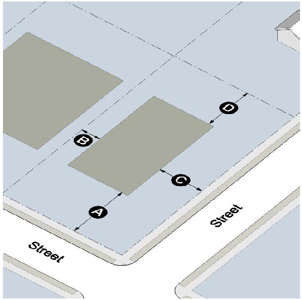
Sites greater than 4 acres in size must incorporate existing or new streets that terminate at other existing or new streets to form an interconnected network with a maximum block perimeter of 2,000 feet, as measured from intersecting centerlines.
2.
The Zoning Administrator may modify the block perimeter requirements by administrative variance when steep slopes in excess of 25 percent, preexisting development, tree protection areas, stream buffers, cemeteries, open space, or easements would make the provision of a complete block infeasible.
3.
There is no maximum block perimeter length when a block contains a park of at least one acre in size and when no other use is located in that block.
4.
Cul-de-sacs are prohibited except on local streets where topography, environmental protection, preservation of cultural resources, or similar considerations prohibit the creation of street connections. In no case shall any dead-end street be greater than 600 feet in length.
K.
Stub out streets.
1.
Where a development abuts a parcel greater than 4 acres in size, stub-out streets within the development must be installed to the meet the block standards in subsection (J).
2.
The stub-out street right-of-way, pavement, and curbing must extend to the boundary of the abutting parcel to the point where the connection to the anticipated street is expected.
3.
Stub-out streets must be located so that the portion of the block perimeter located on the development does not exceed 50 percent of the applicable block perimeter maximum.
4.
If a stub-out street exists on an abutting parcel, the street system of any new development must connect to the stub-out street to form a through street.
5.
The Zoning Administrator may grant an administrative variance to eliminate the requirement for a stub-out street or require pedestrian and bicycle only access when steep slopes in excess of 25 percent, highways, waterways, tree conservation areas, stream buffers, cemeteries, open space, civic space, or easements would make the provision of a stub-out street infeasible.
L.
Lot requirements. Every lot (except cottage court lots) and every cottage court site must have frontage on an existing public street or a new public street. Alleys may not be used to satisfy this requirement.
M.
Street tree standards. Street trees are required and shall be spaced a maximum of 50 feet on center within the landscape zone and spaced equal distance between street lights. All newly planted trees shall be shade trees as defined in subsection 3-16(I), a minimum of 3 inches dbh (diameter-at-breast-height) in caliper, and shall be limbed up to a height of 7 feet. Trees shall have a minimum planting area of 36 square feet. Where tree grates are installed, they shall be a minimum of 6 feet by 6 feet, shall be a type approved by the Zoning Administrator. Where tree grates are not installed, tree-planting areas shall be planted with grass or evergreen ground cover with a maximum mature height of 18 inches.
N.
Decorative pedestrian lights of a type approved by the City must be installed in the landscape zone, a maximum of 40 feet on center. Street lighting and signage for common developments over fifty acres must be designed and submitted as a unified package that aligns with the character of the area.
O.
Fencing within the front setback is permitted only when:
1.
The front setback is located adjacent to ground floor dwelling units;
2.
Said fencing is used to separate authorized outdoor dining from the required sidewalk; or
3.
Said fencing surrounds public or private utility structures.
P.
Public art. Placement or installation of outdoor sculpture and other art forms on private property intended to be viewed from a public right-of-way or other public property shall not be subject to any setback standards and shall not require a permit, provided that the following apply:
1.
The art is not offered for sale.
2.
The art does not constitute an advertisement.
3.
The placement does not impede the flow of pedestrian, bicycle or vehicle traffic or block motorist visibility at intersections, alleys or driveways.
Q.
Miscellaneous provisions.
1.
No multifamily residential development shall have more than 330 units.
2.
Maximum residential density: 8 dwelling units per net useable acre (density bonus available) for MU District, 12 dwelling units per net acre for DT-MU and DT-RC Districts, except that there shall be no maximum residential density on lots that are lots of record as of the effective date of this Ordinance and that are 2 acres or less in size.
3.
Pedestrian multi-use trails ten (10) feet in width are required along both sides of US 19/41 and Highway 20 W.
4.
Residential development adjacent to US 19/41 and Highway 20 W shall provide one hundred (100) feet of undisturbed buffer or an enhanced fifty (50) wide buffer with landscaping and masonry fencing.
5.
Non-residential development adjacent to US 19/41 and Highway 20 W shall provide thirty (30) feet of landscape enhancement. This requirement may be reduced to twenty (20) feet provided accent masonry walls and/or fencing with masonry columns are incorporated in the landscape area.
6.
Development incentives are offered through the Hampton Development Authority, and Hampton Downtown Development Authority for the city's downtown core, urban village and village mixed use land use categories in accordance with the City of Hampton 2023 Comprehensive Plan.
(Ord. No. 457, § 1, 8-14-18; Ord. No. 531, § 2, 12-8-20; Ord. No. 2023-13, § 1(Att. A), 9-12-23; Ord. No. 2025-003, § 1(Exh. A), 3-25-25)
Sec. 7-2. - DT-MU Downtown Mixed Use District.
A.
The following building types are the only building types allowed along East Main Street between McDonough Street and Elm Street:
1.
Storefront;
2.
Mixed-use building;
3.
Civic building.
B.
The following building types are allowed in all other locations:
1.
Detached house;
2.
Carriage house;
3.
Duplex;
4.
Townhouse;
5.
Cottage court;
6.
Walk-up flat;
7.
Stacked dwellings;
8.
Commercial house;
9.
Storefront;
10.
Mixed-use building;
11.
General building;
12.
Civic building.
C.
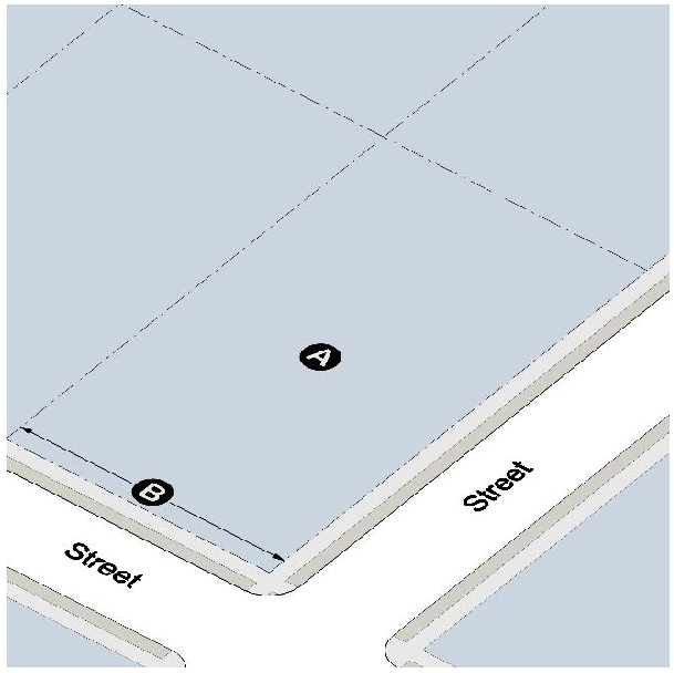
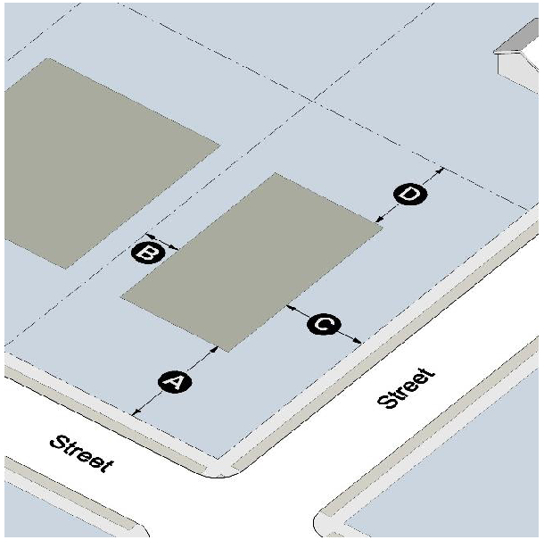
Lot standards.

D.
Building placement.
E.
Downtown Core (DC) land use category is compatible with DT-MU District. Appropriate uses in the Downtown Core include:
• High-density residential development of up to twelve (12) dwelling units per net acre, such as apartments, flats, and condominiums.
• Small-scale retail, restaurants, cafes, coffee shops, offices, and personal services (e.g., salons, day spas, dry cleaners) to create an active street-level experience.
• Ground floors of buildings should be reserved for retail, office, and service uses, with upper floors dedicated to office and residential units.
To support economic growth and tourism, the city will provide incentives through the Hampton Downtown Development Authority and/or Hampton Development Authority for the construction of boutique hotels, inns, and bed-and-breakfast lodging. The district will also include urban green spaces to enhance the quality of life and create a sense of place for residents and visitors
F.
Other requirements.
1.
Maximum height: 40 feet.
2.
Maximum lot coverage: 80 percent.
3.
Minimum heated floor area: none.
4.
Maximum residential density: 12 dwelling units per net useable acre, except that there shall be no maximum residential density on lots that are lots of record as of the effective date of this Ordinance and that are 2 acres or less in size.
5.
Maximum building footprint: No building footprint may exceed 15,000 square feet, except for grocery stores, which may not exceed 30,000 square feet.
(Ord. No. 457, § 1, 8-14-18; Ord. No. 531, § 2, 12-8-20; Ord. No. 2025-003, § 1(Exh. A), 3-25-25)
Sec. 7-3. - DT-RC Downtown Residential Character District.
A.
The following building types are allowed:
1.
Detached house;
2.
Carriage house;
3.
Duplex;
4.
Cottage court;
5.
Commercial house;
6.
Civic building.
B.
Lot standards.
C.
Building placement.
D.
Downtown Core (DC) land use category is compatible with DT-RC District. Appropriate uses in the Downtown Core include:
• High-density residential development of up to twelve (12) dwelling units per net acre, such as apartments, flats, and condominiums.
• Small-scale retail, restaurants, cafes, coffee shops, offices, and personal services (e.g., salons, day spas, dry cleaners) to create an active street-level experience.
• Ground floors of buildings should be reserved for retail, office, and service uses, with upper floors dedicated to office and residential units.
To support economic growth and tourism, the city will provide incentives through the Hampton Downtown Development Authority and/or Hampton Development Authority for the construction of boutique hotels, inns, and bed-and-breakfast lodging. The district will also include urban green spaces to enhance the quality of life and create a sense of place for residents and visitors
E.
Other requirements.
1.
Maximum height: 36 feet.
2.
Maximum lot coverage: 60 percent.
3.
Minimum separation between buildings: 20 feet.
4.
Minimum heated floor area: none.
5.
Maximum building footprint: No building footprint may exceed 5,000 square feet.
6.
Maximum residential density: 12 dwelling units per net useable acre, except that there shall be no maximum residential density on lots that are lots of record as of the effective date of this Ordinance and that are 2 acres or less in size.
(Ord. No. 457, § 1, 8-14-18; Ord. No. 531, § 2, 12-8-20; Ord. No. 2025-003, § 1(Exh. A), 3-25-25)
Sec. 7-4. - MU Mixed-Use District.
A.
The following building types are allowed:
1.
Detached house;
2.
Carriage house;
3.
Duplex;
4.
Ranch villas;
5.
Cottage court;
6.
Walk-up flat;
7.
Stacked dwellings;
8.
Commercial house;
9.
Storefront;
10.
Mixed-use building;
11.
General building;
12.
Civic building.
B.
Lot standards.

C.
For developments of 75 acres or more, City Council may approve alternative standards to all requirements of this district as a condition of rezoning, except for the permitted number of dwelling units per acre.
D.
Building placement.
*(N/A Ranch Villas)
E.
Urban Mixed-Use (UMU) and Village Mixed-Use land use categories are compatible with MU District.
1.
Urban Mixed-Use category includes large-scale industrial, institutional, neighborhood, regional retail and commercial development.
i.
The city will provide incentives through the Hampton Downtown Development Authority and/or Hampton Development Authority to encourage the construction of hotels, and tourism venues within areas designated UMU in the city's Comprehensive Plan.
2.
Village Mixed-Use category includes vertical and horizontal mixed-use projects, public uses, commercial uses, single-family residential and multi-family residential uses up to eight (8) dwelling units per net acre.
i.
Up to twenty (20) percent net density increase available for horizontal fee simple residential construction for seniors, veterans, or a combination thereof or provides a minimum two (2) percent interest rate buydown for homeowners to extend the entire time length of their mortgage.
ii.
Up to thirty (30) percent net density increase for vertical mixed-use construction that is four (4) stories or greater providing a minimum of five (5) percent commercial development on the first level and ten (10) percent of the residential units reserved for seniors and/or veterans.
iii.
The city will provide incentives through the Hampton Downtown Development Authority and/or Hampton Development Authority to encourage fresh food retail, and grocery store development.
Developments are required to include Green Infrastructure (GI) and Low Impact Development (LID) strategies.
Streetscape features, and other architectural design elements must be cohesive and contribute to a unified theme in accordance with the city's VMU Architectural Stylings Guide for non-residential buildings, signage, and public art.
F.
Public space requirement. All single-family and multifamily residential developments shall provide the amenities required in Section 3-4. All non-residential developments shall provide public open space subject to the following requirements:
1.
A minimum of five percent of the total land area not devoted to exclusively residential use shall be devoted to public open space. The required public open space may be counted toward the required landscaping area.
2.
The following types of public open spaces may be provided: pocket parks, playgrounds, picnic grounds, playing fields or courts, plazas, courtyards, atriums, pavilions, and trails for jogging or biking.
3.
Public spaces shall be within view of a street or public area and accessible by pedestrians and/or bicyclists.
4.
The type and design of public spaces shall be consistent with the type of development within the mixed-use area. Passive spaces are appropriate as a means of protecting views and natural features. Playgrounds, fields and courts are appropriate in or near residential developments.
G.
Off-site parking standards. Instead of providing the required on-site parking, a development may lease up to the entire required parking in perpetuity from the City, provided the City has adequate parking capacity under its authority in a convenient location. Such parking shall be located no further than 300 feet from the property line of the subject development. Under this provision, the required parking spaces to be leased would be recalculated whenever the use within the building should change. Under this provision, shared parking credit shall not exceed 20 percent of the total parking required.
H.
Concurrency requirement.
1.
At least 25 percent of the total gross floor area of every development shall be exclusively devoted to residential uses and at least 25 percent of the total gross floor area of every development shall be exclusively devoted to non-residential uses.
2.
No more than 100 residential units shall be issued a certificate of occupancy until such time as at least 25,000 gross square feet of non-residential floor area has been issued a certificate of occupancy.
3.
No certificate(s) of occupancy shall be issued for more than 25,000 gross square feet of non-residential floor area until such time as a certificate of occupancy has been issued for 100 residential units.
(Ord. No. 457, § 1, 8-14-18; Ord. No. 486, § 1, 10-8-19; Ord. No. 531, § 2, 12-8-20; Ord. No. 2025-003, § 1(Exh. A), 3-25-25)
Sec. 7-5. - Allowed Uses.
A.
In order to regulate a variety of similar uses, use categorizes have been established for principal uses. Principal and accessory uses allowed by district are shown in the table below. All uses are subject to all applicable requirements of this Ordinance.
1.
Permitted Use (P). Indicates a use is permitted in the respective district.
2.
Conditional Use (CU). Indicates a use may be permitted in the respective district only where approved by the City Council.
3.
Use Not Permitted. A "-" in a cell indicates that a use is not permitted in the respective district.
B.
A use not specifically listed is prohibited unless the Zoning Administrator determines the use to be part of a use category as described below. If a proposed use is not listed in a use category, but is similar to a listed use, the Zoning Administrator may consider the proposed use part of that use category. When determining whether a proposed use is similar to a listed use, the Zoning Administrator must consider the following criteria:
1.
Actual or projected characteristics of the proposed use.
2.
Amount of site area or floor area and equipment devoted to the proposed use.
3.
Sales volume.
4.
Type of customer.
5.
Number of employees.
6.
Hours of operation.
7.
Building and site arrangement.
8.
Types of vehicles used and their parking requirements.
9.
Number of vehicle trips generated.
10.
How the proposed use is advertised.
11.
Likely impact on surrounding properties.
12.
Whether the activity is likely to be found independent of the other activities on the site.
C.
Where a use not listed is found by the Zoning Administrator not to be similar to any other permitted use, the use is only permitted following a text amendment per Section 12-7.
(Ord. No. 457, § 1, 8-14-18; Ord. No. 531, § 2, 12-8-20; Ord. No. 584, § 3, 10-11-22; Ord. No. 589, § 2, 1-10-23; Ord. No. 2023-13, § 1(Att. A), 9-12-23)