
Kennesaw City Zoning Code
CHAPTER 4
SITE DESIGN STANDARDS
4.07.00 - STANDARDS FOR LEADERSHIP IN ENERGY AND ENVIRONMENTAL DESIGN (LEED)
A.
Intent. The City of Kennesaw is committed to minimizing the short term and long term negative impacts construction has on the environment. The intent of this section is to provide owners and occupants of commercial buildings, offices, industrial buildings, multiple residences and senior citizen multiple residences with an opportunity for energy and water savings; good indoor air quality and healthy, pleasant and productive surroundings. The purpose of this section is to provide benefits to the community by having buildings constructed that are resource-efficient and conserve energy.
This section provides incentives for voluntary participation in sustainability efforts for new construction as a development option.
B.
Leadership in Energy and Environmental Design (LEED). The City of Kennesaw hereby promotes the utilization of the Green Building Council's (USGBC) Leadership in Energy and Environmental Design (LEEDNC) Rating System, Version 2.2 and any amendments thereto or subsequent versions. The LEED-NC system (for new construction) establishes several levels of environmental achievement from the certified rating to a platinum rating. The ratings are attained by earning LEED points in the categories of sustainable sites, water efficiency, energy and atmosphere, materials and resources, indoor environmental quality and innovation and design process. Alternatively, compliance with the requirements of this section may be achieved for new construction.
C.
Applicability. This section shall be applicable to all new construction of a commercial building, office building, industrial building, schools, multiple residence or senior citizen multiple residence equal to or greater than 20,000 square feet of gross floor area space where the owner or builder wish to pursue sustainability goals and certification through the LEED program.
TECHNICAL DOCUMENTS
4.09.00 - SITE DESIGN STANDARDS FOR OVERLAY DISTRICTS[4]
Editor's note— Ord. No. 2016-03, Att., adopted March 7, 2016, set out provisions intended for use as App. A, § 4.02.00. For clarity, and at the editor's discretion, these provisions have been included as App. A, § 4.09.00.
4.00.01 - Purpose
The purpose of this chapter is to provide design standards applicable to all development activity within the City of Kennesaw. This chapter also provides design standards applicable in specific situations, such as development within overlay districts or development of specific uses that require additional standards to address potential impacts.
4.00.02 - Principles of Site Design and Development
Development design shall first take into account the protection of environmental and natural resources as set forth in Chapter 3. All development shall be designed to avoid unnecessary impervious surface cover; to provide adequate access to lots and sites; and to avoid adverse effects of shadow, glare, noise, odor, traffic, drainage, and utilities on surrounding properties.
4.00.03 - Applicability
The design standards set forth in this chapter apply to all development in the City of Kennesaw.
4.01.01 - Application of Regulations
A.
Use. No building, structure, or land shall hereafter be used or occupied, and no building or structure or part hereof shall be erected, constructed, reconstructed, moved or structurally altered in nonconformity with the regulations of this ordinance or amendments thereto, for the district in which it is located.
B.
Height and density. Unless a proper variance is granted, no building shall hereafter be erected or altered so as:
1.
To exceed the height limits;
2.
To accommodate or house a greater number of families;
3.
To occupy a greater percentage of lot area; or
4.
To have narrower or smaller rear yards, front yards, side yards, courtyards or other open spaces, than herein required; or in any other manner contrary to the provisions of this ordinance.
C.
Lot size. Unless a proper variance is granted, no lot, even though consisting of one or more adjacent lots of record, shall be reduced in size so that the lot width or depth, front, side or rear yards, lot area per family or other criteria of this ordinance are not maintained. This section shall not apply when a portion of a lot is acquired for a public purpose.
D.
Yard use limitations. Unless a proper variance is granted, no part of a yard, other open space, off-street parking or loading space required about any building for the purpose of complying with the provisions of this ordinance shall be included as a part of the yard, off-street parking or loading space required for another building.
E.
Annexed land. Any parcel or parcels of land annexed to the City of Kennesaw in the future shall follow rezoning procedures and be rezoned to a City of Kennesaw zoning category. If the zoning designation is the same as Cobb County's the fee for application shall be waived.
F.
Use prohibited when not specified. If not otherwise stated, any use not specifically permitted in a use district as provided under this UDC Chapter, shall be prohibited in that district.
G.
Double frontage lot. Where an existing double frontage lot faces a residential district on one side and nonresidential district on the opposite side, such a lot when zoned UVC, CRC, GC, HI, or LI shall have vehicular access only from the major thoroughfare; and all signs and advertising, if permitted in the UVC, CRC, GC, HI, and LI district, shall face the major thoroughfare.
H.
Buffer required.
1.
A buffer shall be required for the following:
a.
All property zoned for commercial, office-professional, and industrial uses shall have a buffer along any rear and side property lines abutting a residential district or a front property line abutting a public street across from a residential district.
b.
All property zoned for multifamily and mixed uses shall have a buffer along any rear and side property lines abutting a single-family residential district or a front property line abutting a public street across from a single-family residential district.
c.
All commercial, office-professional and industrial property in the mixed use district shall have a buffer along any rear and side property line abutting a multifamily use or district or a front property line abutting a public street across from a multifamily use or district.
2.
All buffers shall consist of a landscaped open space area and, if required by this section, screening. All landscaped open space areas and screening shall be established in accordance with the following requirements:
a.
Landscaped open space areas shall be established and maintained along required property lot lines in accordance with general landscaping policies, standards and specifications established and approved by the City Council.
b.
Landscaped open space areas shall meet the following minimum width requirements for each district where abutting residential district; single-family:
i
LI, HI, - Fifty (50) feet.
ii
PVC, PSC, HGB, GC, and Mixed Use (except for multifamily uses) - Forty (40) feet.
iii
CRC, NRC - thirty-five (35) feet.
iv
RM-8, RM-12, RM-16, MHP, and multifamily uses in the mixed district - twenty-five (25) feet.
v
OI, NS, - twenty (20) feet.
vi
PUD-R, RA-4, FST, HPV, and UVC - ten (10) feet.
vii
HIS — See historic district regulations.
c.
Landscape buffers are subject to review and approval by Plan Review Committee and applicable city staff in accordance with the following standards:
i.
Plantings are to be a mix of evergreen trees and shrubs;
ii.
Species are to be ecologically compatible to site and appropriate for design situation;
iii.
Unless public safety concerns dictate otherwise, buffer should maximize visual barrier to height of six (6) feet within two (2) years of planting;
iv.
Minimum height of plant materials at installation is to be five (5) feet for trees and two (2) feet for shrubs:
v.
Fencing or walls are to be minimum six (6) feet in height;
vi.
Trees included in buffer plantings may be counted toward site density calculations as required by the tree preservation ordinance;
vii.
Buffers shall be regularly maintained by the property owner(s) to ensure that the above objectives and standards are met; and
viii.
When topography and existing conditions allow, the required buffer should be an undisturbed buffer.
d.
Berms are subject to review and approval by city staff in accordance with the following standards:
i
Berms shall be utilized when consistent with surrounding property features;
ii
Berms shall be stabilized;
iii
Berms shall be constructed to be consistent with natural or proposed drainage patterns; and
iv
Berms shall be regularly maintained by the property owner.
3.
The City of Kennesaw Plan Review Committee and staff may require additional screening outside required landscaped area for purposes of obscuring features, such as parking lots, rear entrances, utility and maintenance structures, loading facilities, swimming pools and recreation areas within any multifamily, commercial, office-professional, light industrial and multiuse district.
4.
The screening requirements of this section may be waived or varied by the Mayor and City Council, if and only if:
a.
It can be clearly demonstrated that existing topography and/or vegetation achieve the purpose and intent of this section.
b.
It can be clearly demonstrated in a specific instance, that for topographic reasons, a fence, wall and/or other screening device required herein could not possibly screen activities conducted on ground level from view from the normal level of a first story window on any lot in a residential district abutting the use.
5.
All buffers shall be designated on the property plat and recorded as a permanent buffer.
(Ord. No. 2021-07, § 7(Exh. D1), 6-21-21)
4.01.02 - Dimensional Standards for Development
Dimensional standards for each zoning district are provided in Table 4.01.02 below:
Table 4.01.02: District Dimensional Regulations
(Ord. No. 2021-07, § 8(Exh. D2), 6-21-21)
4.02.01 - General Regulations and Design Standards for Historic Districts
A.
Purpose and Intent. The historical and architectural heritage of Kennesaw is among its most valued and important assets. The purpose of the Kennesaw Historic District (KHD) is to promote the cultural, economic and general welfare of the city, and the preservation and protection of the old, historic or architecturally worthy structures in quaint areas or neighborhoods which impact a distinct aspect of the city and which serve as visible reminders of the cultural, social, economic and architectural heritage of the city, the state, and the nation.
B.
Creation of Historic Preservation Commission. See Section 8.03.02 of this UDC for creation of the Kennesaw Historic Preservation Commission.
C.
Boundaries.
1.
The boundary of the historic properties shall be those specific properties as specified by the Kennesaw Historic Preservation Commission and so designated by ordinances adopted by the Mayor and City Council, or designated on state or national registers, pursuant to the provisions of O.C.G.A. § 44-10-26 (the Georgia Historic Preservation Act—Acts 1980, pages 1723—1729). All historic properties shall be designated on a map entitled "Official Historic District Map of the City of Kennesaw," which shall be as adopted by the Mayor and City Council, and the same required boundaries to be shown on the "Official Zoning Map of the City of Kennesaw."
2.
Any amendment to the boundary of historic properties or the "Official Historic Properties Map of the City of Kennesaw" shall be recommended by the Historic Preservation Commission and adopted by the Mayor and City Council. The Historic Preservation Commission and the Mayor and Council will each hold public hearings before taking action of any proposed district changes in accordance with appropriate State Historic Preservation Office approval.
3.
Notice of the public hearing held by the Mayor and City Council and the public hearing held by the commission shall be advertised in accordance with Chapter 10 of this UDC, and the following:
a.
An advertisement providing notice of the hearing shall be published at least two times in the principal newspaper of general circulation within the municipality.
b.
The commission shall cause written notice of the hearing to be mailed to all owners and occupants of the property(ies) proposed to be designated.
c.
All written notices to property owners or occupants of property(ies) shall be mailed not less than ten (10) nor more than twenty (20) days prior to the date set for the public hearing before the commission and again for the public hearing before the Mayor and City Council.
d.
At least one (1) published notice shall appear in the principal newspaper of general circulation within the municipality not less than fifteen (15) days nor more than twenty (20) days prior to the date set for the public hearing before the Historic Preservation Commission and Mayor and City Council.
4.
The commission shall make or cause to be made an investigation and shall report on the historic, cultural, architectural, or aesthetic significance of each place, district, site, building, structure, or work of art proposed for designation or acquisition. This report shall be submitted to the historic preservation section of the Department of Natural Resources or its successor at least thirty (30) days prior to any public hearing held to designate any property or any amendment thereto as a historic property.
D.
Relationship to zoning district.
1.
All that tract and parcel of land delineated on the historical district map of historic properties for the City of Kennesaw, dated May 19, 1978, presented on August 20, 1979, by Phil Secrist (Chairman of the Kennesaw Historical Society), and approved by Georgia Department of Natural Resources in October, 1979, and approved for the National Historic Register in April, 1980, which map is hereby incorporated by reference, shall be classified for zoning purposes as KHD (Kennesaw Historical District) and shall be designated as being a part of zoning district KHD (Kennesaw Historical District). Such zoning classification and designation shall be in addition to and not in lieu of the zoning classification and zoning designation applicable to such property at the time such property is designated as being a part of the historic district or is designated as historic property.
2.
If a conflict exists with regard to a use which is available to property having more than one zoning classification or zoning district designation, then the more liberal or less restrictive use shall apply to such property; however, the minimum dimensional requirements applicable to such property shall be those requirements applicable to zoning district KHD (Kennesaw Historic District).
E.
Classification of historic properties and development standards.
1.
The commission shall evaluate all properties as designated on the Official Historic Properties Map of the City of Kennesaw, and the Official Zoning Map of the City of Kennesaw.
2.
All properties so designated shall be classified as one of the following categories:
a.
Historic. More than fifty (50) years old and contributing to the community's historic character;
b.
Historic-obscured. More than fifty (50) years old but not contributing to the historical character of the community due to unsympathetic but not irreparable alterations;
c.
Non-historic. Less than fifty (50) years old and contributing to the historic character of the community by possessing architectural character;
d.
Intrusion. Structures of any age which detract from the historic character of the district; and
e.
Vacant
3.
All historic, historic-obscured, non-historic, and intrusion property classifications in the Kennesaw Historic District shall be shown on the Official Historic Properties Map of the City of Kennesaw, and the Official Zoning Map of the City of Kennesaw. In the event a question arises over the classification of the property, the property owner may file an appeal stating the reason(s) for the appeal with the Zoning Administrator. On such appeal, the commission shall reconsider their original finding and classify the property based on their current evaluation. If such appeal has not been remedied, the commission shall submit a report to the Mayor and City Council indicating the reason(s) for their classification of the individual property. After considering the appeal as requested by the individual property owner on the classification of the property, the Mayor and City Council may reclassify the property or any portion thereof as they determine.
F.
Development standards and general regulations of historic properties. Design Review Guidelines as adopted by the Mayor and City Council and incorporated hereto.
1.
A building or structure classified as historic, historic-obscured, or non-historic, or any part thereof, or any appurtenance element related thereto shall only be moved, reconstructed, altered or maintained in a manner that will preserve the historical and/or architectural character of the building, structure or appurtenance element thereto.
2.
Any change materially affecting the external architectural appearance of any historic property will be compatible with other buildings and structures within the historic district and particularly buildings classified as historic and with historic squares and places to which it is visually related.
3.
On any building classified as historic, historic-obscured, or non-historic where the commission fails to approve the issuance of a Certificate of Appropriateness, such building or structure shall not be demolished or in any way altered unless specific approval is granted by the Mayor and City Council upon an appeal of the commission's decision.
4.
A historic building shall not be relocated onto another site unless it is shown that the preservation on its existing site is not consistent with the purpose(s) of this section.
5.
In the review of the application for a Certificate of Appropriateness for any structure, the commission shall not consider interior arrangement or interior use having no effect on exterior architectural features.
6.
On any historic property where a Certificate of Appropriateness has been issued, any change to the property shall be completed in accordance with the approved application material.
7.
All historic property shall be maintained in such manner to ensure no destruction, deterioration or other harmful effect by virtue of neglect occurs. Any such structure or property determined by the commission to be affected by neglect of maintenance shall be restored by the property owner to such condition as specified by the building official within the time period prescribed by him.
8.
Any historic property wherein destruction, deterioration, or other harmful effect has been determined by the commission to exist due to neglect, accident or intentional damage, the commission at its discretion may require the property to be restored to its original condition prior to such change resulting from the neglect, accident or intentional damage or impose other conditions as appropriate. If restoration is required, such action taken by the commission shall be recorded as a matter of record with the office of the clerk of the Superior Court of Cobb County or other appropriate agency.
G.
General landscaping requirements. An application for Certificate of Appropriateness shall be required to submit a landscaping plan which is designed to be consistent with the structures proposed and designed in accordance with the Kennesaw Historic District Design Standards, the adopted Landscaping Ordinance as part of the UDC amended from time to time.
H.
Duties, responsibilities, and powers of the Historic Preservation Commission. The duties responsibilities and powers of the Kennesaw Historic Preservation Commission are provided in Chapter 8 of this UDC.
I.
Certificate of Appropriateness required.
1.
A Certificate of Appropriateness issued by the Zoning Administrator after approval by the commission shall be required before any of the following conditions occur within the boundary of a designated historic property:
a.
Any new construction of a principal building or accessory building or structure;
b.
Any change in the exterior architectural appearance of existing buildings by additions, reconstruction, alteration or maintenance, including exterior color changes;
c.
Demolition of a historic building or structure classified by the commission as historic, historic-obscured, or non-historic under Section 4.02.01(E).
d.
Moving of a historic building or structure classified by the Commission as historic, historic-obscured, or non-historic under Section 4.02.01(E), and
e.
Any change in external environmental features.
2.
After the designation by ordinance of a historic property or of a historic district, no material change in the appearance of the historic property or of a structure, site or work of art within the historic district shall be made or permitted to be made by the owner or occupant thereof unless and until all requirements of this ordinance are met.
J.
Application for Certificate of Appropriateness. An application for a Certificate of Appropriateness shall be made in the office of the Zoning Administrator. See Chapter 10 of the UDC (10.3.13) for procedural requirements.
K.
Exclusions. Nothing in this section shall be construed to prevent the ordinary maintenance and/or repair of any exterior elements of any building, structure or property nor shall anything in this section be construed to prevent the construction, reconstruction, alteration or demolition of any such element which any authorized public official shall certify as required by public health or safety. Nothing in this section shall be construed to void any plan(s) or permit(s) having received approval from any appropriate officer, board or commission of the city for a project prior to the enactment of this section. The Zoning Administrator shall determine the validity of any prior approval of any plan(s) or permit(s) as applied in this section.
L.
Undue hardship. Where, by reason of unusual circumstances, the strict application of any provision of this section would result in an exceptional and practical difficulty or undue hardship upon any owner of a specific property, the Mayor and City Council, in passing upon any application, shall have the power to vary or modify strict adherence to said provisions, or to interpret the meaning of said provisions, so as to relieve such difficulty or hardship; provided such variances, modifications or interpretations shall remain in harmony with the general purpose and intent of said provisions, so that the architectural or historical integrity, or character of the property shall be conserved and substantial justice done. In granting variances to this section, the Mayor and City Council may impose such reasonable and additional stipulations and conditions as will, in their judgment, best fulfill the purpose of this ordinance. A situation of the person's own making shall not be considered an undue hardship.
M.
Administrative Approvals for Certificate of Appropriateness
1.
Authority. The Director for Museum and Preservation Services or a designated City of Kennesaw staff member qualified in Historic Preservation may issue certificates of appropriateness for minor works projects that otherwise meets all requirements. Minor works projects are limited to the following:
a.
Alteration or removal of existing accessory structures or buildings.
b.
Additions to existing accessory structures or buildings with a total additional floor area not exceeding 300 square feet
c.
New accessory structures or buildings less than 300 square feet
d.
Alterations, additions or removal of existing awnings, canopies or shutters
e.
Installation of new awnings, canopies or shutters
f.
Alteration, addition or removal of existing decks with a maximum height of 42 inches that do not require the removal or alteration of the existing building or structure and provided that the proposed deck is not visible from the street
g.
Construction of new decks with a maximum height of 42 inches that do not require removal or alteration of the existing building or structure and provided that the proposed deck is not visible from the street
h.
Alteration, addition or removal of exterior doors
i.
Installation of new exterior doors
j.
Installation, alteration or removal of storm doors
k.
Construction of new fences, walls, hedges or other screen plantings with a maximum height of 42 inches
l.
Removal of existing fences, walls, hedges or other screen plantings with a maximum height of 42 inches
m.
Alteration of exposed foundations
n.
Installation addition or removal of gutters and downspouts
o.
Installation of house numbers and mail boxes
p.
Pruning of shrubbery, limbs of trees eight inches in diameter and greater measured 4.5 feet from the ground level
q.
Removal of dead, diseased or dangerous trees
r.
Installation, alteration or removal of exterior lighting fixtures
s.
Installation of mechanical equipment such as heating and air conditioning units provided that all units are provided with appropriate screening
t.
Installation of window mounted air conditioning units
u.
Alteration, addition or removal of existing patios provided the patio is not visible from the right-of-way
v.
Construction of new patios provided the patio is not visible from City right-of-way
w.
Installation, removal or alteration of signs
x.
Replacement of roof coverings when proposed materials are similar to existing materials and the roof pitch or slope is not being altered
y.
Installation of satellite dishes or television antennae
z.
Alteration, addition or removal of exterior stairs and steps that do not require the removal or alteration of the existing building or structure and provided that the proposed stairs and steps are not visible from the street
aa.
Construction of new exterior stairs and steps that do not require the removal or alteration of the existing building or structure and provided that the proposed stairs and steps are not visible from the street
bb.
Renewal of expired certificates of appropriateness provided there are no changes to the original approved certificate
cc.
Emergency installation of temporary features or repair measures to protect a historic resource or structure that do not permanently alter the structure or resource. Temporary features are limited to a maximum of twelve months.
N.
Removal or destruction of documented historic structures in violation of Section 4.02.00.
1.
The City of Kennesaw after confirming that a historic structure was removed from historic property or demolished destroyed or partially dismantled without following the approval process specified in this chapter and UDC will be determined to be in violation of this code.
2.
The City of Kennesaw will issue citations through the Municipal Court of the City of Kennesaw and assess the replacement value of the structure removed, damaged, partially dismantled or demolished.
3.
The Building Official of the City Kennesaw will be required to provide to the Municipal Court of Kennesaw and all parties an estimate of the replacement value of subject structure.
4.
The City of Kennesaw shall impose a fine equal to the replacement value assessed for the replacement of the structure removed, demolished, destroyed or partially dismantled without approval by the City of Kennesaw. The assessments shall be determined by estimates submitted by the Building Official of Kennesaw and official values on record of the Cobb County Tax Assessors office whichever is higher. The City of Kennesaw shall submit these estimates for determination of replacement value to the municipal court and all appropriate court jurisdictions for resolution of the violation.
4.02.02 - Design Standards for the Historic Preservation Village Overlay (HPV) District
A.
Purpose and Intent.
1.
The HPV district is established to set aside certain properties for the purpose of providing an area that will be designed and used as a historic village. It is encouraged that resourcefulness and ingenuity will be used to assure that the property will meet the goals of the master plan of the City of Kennesaw as adopted by the Mayor and City Council in June, 1995.
2.
The classification is primarily intended for properties located within Land Lot 138, 20th District, 2nd Section, and is bounded on the north by Cherokee Street and Big Shanty Road, on the east by Sardis Street, on the south by Old Highway 41, and on the west by CSX Railroad, and more particularly, Parcels 69, 70, 71, 72, 73, 74, 76, 77, 78, 79, 80, 173 and 201.
Within any HPV district, the following uses shall be permitted:
a.
Buildings of historical significance either on the historic register or eligible for placement on the historic register.
b.
Museums by their nature that would lend themselves to the historic character of the area.
c.
Outbuildings and structures that by their nature would lend to the historic character of the area.
d.
Associated low intensity office and limited retail uses.
e.
Hotels consistent with the historic and cultural era of the surrounding site.
f.
Religious Assemblies.
B.
Special exception uses. Within any HPV district, the following uses shall be permitted by special exception:
1.
Cemeteries.
2.
Mausoleums.
3.
Other facilities for disposal of the deceased.
4.
Private community centers.
5.
Private schools of general and special education.
6.
Religious Assemblies' accessory cemeteries and schools.
C.
Use limitations. Within any HPV district, the following use limitations apply:
1.
Must meet design review guidelines, and as may be amended from time to time.
2.
No adult entertainment.
D.
Lighting requirements. Any project permitted within the HPV district which proposes a lighted facility must have an approved lighting plan consistent with lighting styles from the Civil War (1860-65) era.
E.
Conditions.
1.
Minimum lot size: Two acres or more;
2.
Minimum public road frontage of 100 feet;
3.
Overall parking and landscape plan for entire site to be approved by the Kennesaw Historic Preservation Commission; and
4.
One paved parking space shall be provided for every person lawfully permitted within the structure at one time, plus one per employee. In the absence of designated assembly areas, one paved space per 300 square feet of gross floor area.
F.
Landscape buffer/screening requirements.
1.
Unless otherwise noted within this district's requirements, any property within an HPV district which abuts a residentially zoned property shall have a minimum thirty (30) feet landscaped, screening buffer adjacent to all residentially zoned property will be subject to review and approval by the Kennesaw Historic Preservation Commission.
2.
Required buffers may be included within required setbacks, however, in such case that the required buffer is greater than the required setback, the required buffer shall be adhered to.
3.
Additionally, necessary private utilities and/or access drives may be allowed through, over or across a landscaped buffer. Any such uses which are proposed through, over, or across a designated, undisturbed buffer must be approved pursuant to an original site plan or site plan modification.
4.
Objectives. Undisturbed, planted landscape buffers and berms shall be implemented in connection with a permitted project and shall address the following objectives:
a.
Screening to enhance aesthetic appeal;
b.
Control or direct vehicular and pedestrian movement;
c.
Reduce glare;
d.
Buffer noise; and
e.
Establish privacy.
5.
Standard. Buffers and/or berms shall be required when a HPV district is located adjacent to a more restrictive residential district; minimum ten (10) feet buffer.
a.
Landscaped buffers are subject to review and approval by the Kennesaw Historic Preservation Commission in accordance with the following standards:
i.
Plantings are to be a mix of evergreen trees and shrubs;
ii.
Species are to be ecologically compatible to site and appropriate for design situation;
iii.
Unless public safety concerns dictate otherwise, buffer should maximize visual barrier to height of six (6) feet within two (2) years of planting;
iv.
Minimum height of plant materials at installation is to be five (5) feet for trees and two (2) feet for shrubs;
v.
Fencing or walls are to be minimum six (6) feet in height as approved by city staff;
vi.
Trees included in buffer plantings may be counted toward site density calculations as required by the Kennesaw Tree Preservation and Replacement Ordinance, subject to review and approval by staff;
vii.
Buffers shall be regularly maintained by the property owner(s) to ensure that the above objectives and standards are met;
viii.
When topography and existing conditions allow, the required thirty (30) feet buffer should be an undisturbed buffer; and
ix.
Any appeals from a determination by Kennesaw Historic Preservation Commission shall be to the Mayor and City Council.
b.
Berms are subject to review and approval by city staff in accordance with the following standards:
i.
Berms shall be utilized when consistent with surrounding property features;
ii.
Berms shall be stabilized;
iii.
Where possible, berms shall be constructed to be consistent with natural or proposed drainage patterns; and
iv.
Berms shall be regularly maintained by the property owner.
G.
Parking requirements.
1.
Individual buildings located within the HPV district will not be required to provide on-site parking. The building and its site must, however, provide for a clearly identified easement/walkway to the common areas as recommended by the master plan. Total square footage of the building and its estimated parking needs will be deducted from the total number of spaces as shown on the master plan.
2.
See section 6.02.05 for off-street parking requirements.
(Ord. No. 2015-05, § 4, 4-20-15)
4.02.03 - Site Design Standards for the Central Business District
A.
Purpose and intent.
1.
The Central Business District (CBD) is established in order to preserve and protect the cultural and historic aspects of downtown Kennesaw and simultaneously provide for the stimulation and enhancement of the vitality and economic growth of this special area.
2.
The classification is primarily intended for a focal point for upscale retail trade, tourism, and financial and public uses. The intent of the Central Business District (CBD) is to develop a compact core to encourage and facilitate pedestrian movement and provide convenient access to the amenities of Historic Downtown Kennesaw.
3.
The CBD is designed to achieve the following:
a.
Create an environment where residents and visitors can live, work, meet, and play.
b.
Promote a balanced mix of retail, office-professional, entertainment, residential, civil, and cultural uses in the core downtown area.
c.
Allow for growth of a healthy economic business district.
d.
Incorporate aesthetically compatible design from gateway points to the core of the city to improve the aesthetics of street and built environments.
e.
Ensure compatibility with the historic district to achieve architectural and design integrity and consistency.
f.
Provide accessible and sufficient parking that is unobtrusive by encouraging shared, underground, and deck parking and alternative modes of transportation including pedestrian and bicycles.
g.
Promote a pedestrian environment though sidewalk-oriented buildings and attractive street-facing façades that encourage pedestrian activity.
h.
Provide safe and accessible parks and public and private open space.
B.
Lot size, setback and building height requirements. Within the CBD the following lot size and setback requirements shall apply.
1.
Minimum lot size, widths and depths: None. It is the intent that each enterprise or use be located on a site commensurate with its use and sufficient to meet the requirements of off-street parking, loading and unloading, and setback requirements, where applicable.
2.
Maximum lot coverage: Not more than eighty-seven (87) percent of the area of any lot may be covered by buildings structures or storm water facilities.
3.
Minimum setbacks:
a.
Front - Established to "build-to-line" which equals the averaged distance from the property lines measured from existing structures along right-of-way adjoining properties as measured from existing structures.
b.
Side - None, except when abutting a residential zoning district where there is no intervening right-of-way, the setbacks requirement is ten feet. Where alleys exist between districts, the setbacks shall be five feet from the property line/alley right-of-way.
c.
Rear - None, except when abutting a residential district where there is no intervening right-of-way the setback requirement is 25 feet.
d.
Where an alley exists between districts, the setback shall be five feet from the property line/alley right-of-way.
4.
Maximum building height: Subject to the Historic District Design Guidelines
5.
Maximum floor area ratio (FAR) - 1.10
Calculations for FAR: Floor Area/Lot Area = FAR
C.
Permitted uses. Within the CBD, the following uses shall be permitted:
1.
General retail uses:
a.
Antiques
b.
Animal hospitals
c.
Appliance store
d.
Arts and crafts
e.
Bakery
f.
Bicycles shop
g.
Book store
h.
Butcher
i.
Carpet and floor covering
j.
Cosmetics
k.
Draperies and slipcovers
l.
Fabric store
m.
Farmers market (fully enclosed and open-air)
n.
Flower shop
o.
Food
p.
Fraternity and sorority houses/residence halls (must be university authorized dwellings)
q.
Fruit/vegetable stand
r.
Garden supplies
s.
Gift shop/glassware
t.
Growler establishments
u.
Hardware store
v.
Home/office furnishings
w.
Ice cream shop
x.
Jewelry store
y.
Leather goods/luggage
z.
Massage therapy establishments
aa.
Massage therapy associated with the following uses:
•
As part of a salon service establishment
•
As part of a medical, chiropractic or sports medicine establishment
bb.
Medical and surgical equipment
cc.
Music shop
dd.
Nautical supplies
ee.
Office supplies
ff.
Pets and pet supplies
gg.
Pharmacy
hh.
Photographic equipment/supplies
ii.
Spa and salon establishments
jj.
Sporting goods
kk.
Toy store
2.
Services and professional uses:
a.
Banks/financial institutions limited to one drive-through and/or automated transaction machines
b.
Interior decorating establishments
c.
Medical and dental clinics
d.
Medical and dental laboratories
e.
Photographic studios
f.
Printing and publishing
g.
Professional offices
h.
Sports medical physical therapy
3.
Services and facilities:
a.
Auction
b.
Barber/beauty shops and salons
c.
Bed and breakfast inn and residential-type inns
d.
Broadcast studios
e.
Butcher shops
f.
Caterers
g.
Dry cleaning and laundry pick-up stations limited to off-site processing for customer pick-up.
h.
Exercise facilities e.g. gyms and clubs
i.
Galleries
j.
Alternative wireless communications facilities (Special land use approval required)
k.
Government facilities including but not limited to the following:
i.
Government offices
ii.
Public works facilities
iii.
Community centers
iv.
Public parks, clubhouses
v.
Amphitheaters
l.
Hotels
m.
Laundromats limited to self-service facilities
n.
Libraries
o.
Motels
p.
Museums
q.
Newsstands
r.
Outdoor cafes
s.
Parking lot and garages (commercial or public)
t.
Pet grooming
u.
Religious assemblies
v.
Restaurant excluding drive-in and drive through
w.
Rest/personal care/convalescent homes
x.
Small item repair
y.
Tailoring
z.
Tobacconist
aa.
Taverns/cocktail lounges
bb.
Vocational schools some examples being: arts and crafts, business, beauty, dancing, driving, gymnastics, photography, modeling and karate-judo.
4.
Residential uses:
a.
Condominiums
b.
Mixed use residential/commercial
c.
Single family detached
d.
Townhomes
5.
The permitted uses under this section shall be allowed in such a way as to promote a diverse mixture of the uses so as to avoid concentrations of such uses within close proximity of which may cumulatively create a nuisance, safety or health hazard or parking problem that may negatively affect the overall financial stability of surrounding uses.
All retail and professional uses varied in nature that meet the CBD vision and adopted comprehensive plan and all other adopted planning studies for the City of Kennesaw that is not listed as a prohibited use under Section 4.02.03E.
D.
Special exception uses. Within the CBD the following uses shall be permitted by special exception as per Section 4.04.01.
1.
Cemeteries
2.
Private community centers
3.
Private schools of general and special education
4.
Religious assemblies' accessory cemeteries and schools.
E.
Use limitations. Within the CBD the following use limitations apply:
1.
All projects located within the historic district shall meet the City of Kennesaw design review guidelines as may be amended from time to time.
2.
No (new or used) car lots
3.
No car repair shops to be established
4.
No sexually oriented businesses as defined in the Kennesaw Code of Ordinances Business Licenses shall be allowed.
5.
No overnight outside storage shall be allowed.
6.
No more than five percent of total store inventory may be displayed outside.
7.
All items stored outside shall be moveable to indoor without compromising accessibility to the building.
8.
No items shall be displayed on paved areas or parking lots, except for temporary permits for special sales events not to exceed seven days more than four times per calendar year.
9.
Items may be displayed on porches or adjacent to primary structures only in non-paved areas.
10.
Sidewalk/yard sales shall only be conducted after issuance of the proper permit.
11.
All abandoned or disposed items including recycling and trash shall be removed within three days.
12.
No chemical manufacturing, storage or distribution shall be allowed.
13.
No enameling, plating or paint (except for artist studios) shall be allowed.
14.
No detention centers or halfway houses shall be allowed.
15.
No tire shredding or recycling centers shall be allowed.
16.
No manufacture or disposal of hazardous or radioactive waste materials shall be allowed.
17.
No scrap yards shall be allowed.
18.
No manufactured/mobile homes shall be allowed.
19.
No commercial sand, gravel or other mineral extraction shall be allowed.
20.
No indoor or outdoor shooting ranges shall be allowed.
21.
No tattoo parlors shall be allowed.
22.
No body piercing facilities, as a primary use shall be allowed.
23.
No extended stay hotels/motels shall be allowed.
24.
No chain link fences shall be permitted.
25.
No overnight parking of commercial vehicles (except for mini-vans or cars) shall be allowed.
26.
No uses that emit noxious odors, fumes or sounds shall be allowed.
27.
No outside animal runs with any veterinary office or kennel shall be allowed.
28.
No detention or retention or wet weather ponds allowed.
29.
No gas stations to be established. The wholesale and retail sale of all fuel sources are governed by this restriction.
30.
No automobile, truck, motorcycle or recreational vehicle rental facilities to be established
31.
No drive-through amenity to be established in association with any eating and drinking establishments located within the Central Business District.
32.
No funeral homes allowed.
F.
Gateway corridors:
1.
Cherokee Street
2.
Watts Drive
3.
North Main Street (Old Hwy 41)
4.
South Main Street (Old Hwy 41)
5.
Summer Street
G.
Residential development standards:
1.
Condominiums: Minimum floor area for all units - 1,000 square feet
2.
Mixed use retail/residential with residential on second floor
a.
The non-residential portion of the development shall obtain a certificate of completion before the issuance of the certificates of occupancy for the last 20 percent of residential units for the residential portion.
b.
The gross floor area occupied by residential uses shall not exceed seventy-five (75) percent of the total gross floor area of the buildings or individual structures.
c.
Minimum floor area for all residential units—1,000 square feet
3.
Single family, detached: The minimum floor area of residential dwellings shall be 1,100 square feet.
4.
Townhouses: The minimum floor area of all residential units—1,000 square feet
5.
For-Rent Residential Apartment units:
a.
To be allowed only in mixed use residential/commercial projects
b.
Rental apartment units will be allowed subject to specific development agreement conditions as part of the Central Business District project approval process as per UDC Section 4.02.03(H).
c.
Minimum floor area for all residential units in mixed use residential project to average 1,000 sq feet.
d.
Units with a floor plan totaling the minimum of 850 square feet can be utilized for no more than 30 percent of the total apartment units for the project.
H.
Approval process for projects. Projects to be processed in the following order:
1.
City of Kennesaw staff shall conduct a minimum of one consultation with applicant to review project concept and factors to consider in the planning and design phase prior to initial site plan and architectural review.
2.
Conceptual site plan and architectural review by City of Kennesaw staff
3.
Submittal to the Kennesaw Downtown Development Authority (KDDA) for review and comment only.
4.
Submittal to the Historic Preservation Commission (HPC) for certificate of appropriateness approval if within a historic district. If subject property is not in the historic district then concept approval will be required.
5.
Site Plan review and approval by City of Kennesaw staff required.
6.
Final plan approval by Mayor and Council
I.
The site plan of the project shall be consistent with the City of Kennesaw adopted Comprehensive Plan, Depot Master Plan and LCI study.
J.
The project shall be designed as to provide a proper transition, land use and design so as not to negatively affect surrounding properties.
K.
The site plan of the project shall incorporate public space architectural and urban features consistent with the City wide Architectural Design Standards and the City of Kennesaw Historic District Design Standards including fountains, gardens, squares, courtyards, lighting, signage, and paving that blend the mixed uses.
L.
Each applicant shall submit a business plan which contains at a minimum the following information:
1.
Type of business
2.
Projected market targeted
3.
Projected customer generation
4.
Plan on traffic control for ingress/egress of property
5.
Study on similar uses in area
6.
Projected economic impact to City of Kennesaw
M.
General requirements:
1.
Compliance to downtown redevelopment plan vision
2.
A balanced mixture of uses to meet downtown redevelopment plan vision
3.
Positive economic development impact
4.
Architectural design and quality shall be consistent with City of Kennesaw Design Guidelines and compatible with the city's architectural heritage.
5.
Pedestrian and vehicular connectivity shall be incorporated into site design.
6.
The height of fences and walls located between the building façade and a street shall not exceed forty (40) inches and in other areas shall not exceed six (6) feet.
7.
No barbed wire, razor wire, chain link or similar elements shall be visible from any street, public park, sidewalk, public or private open space or outdoor dining area.
8.
Loading docks and dumpsters shall be entirely screened from view with vertically enclosed opaque walls.
9.
Utilities shall be placed underground.
10.
Building mechanical and accessory features:
a.
Shall be located to the side or rear of the principal structure or on rooftops and shall not be visible from any public open space or sidewalk area.
b.
When located on rooftops shall be incorporated in the design of the building and screened with materials similar to the building.
11.
Any project permitted within the CBD which proposes a lighted facility including signs, parking lots, and entrance ways shall have an approved lighting plan consistent with lighting styles utilized in the downtown streetscape design and approved under the City of Kennesaw Historic Design Standards and Citywide Design Guidelines.
12.
All sign locations located within historic district will be subject to review and approval by the HPC.
a.
City staff will review and process the sign permit application as per design standards as set forth in Chapter 5.03.00 of the sign ordinance after review and approval from HPC.
b.
All temporary signs will be regulated as per Chapter 5.03.00.
N.
Parking, road and access requirements. Overall parking plans for the entire project site shall be approved by city staff through the plan review process. All parking requirements can be provided off-site. No alley parking is permitted.
1.
Angled on-street parking on both sides shall be permitted dependent upon site plan review and approval.
2.
Rear access shall be provided to townhouse and multifamily garages, single-family dwelling garages, and commercial loading and service areas, where such access is feasible.
3.
Bicycle or moped parking spaces are required as follows: All new non-residential uses shall provide one (1) such space for every twenty (20) automobile spaces but not less than one (1) space and new residential uses shall provide one (1) such space for every five (5) units. Such spaces shall be located a maximum distance of 100 feet from the primary pedestrian entrance.
O.
Incentive/zoning bonuses.
1.
Common access drives and access curb cuts: All projects incorporating common access drives for multiple parcels along the identified gateway corridors in this section will be granted an increase of floor area ratio by .10, subject to all other limitations.
2.
Pedestrian linkage: All projects that promote pedestrian/bicycle pathways and inter-parcel access will be granted an increase of floor area ratio by .10
P.
Landscaping design guidelines. All CBD project applications will include a landscape plan that has location and type for benches, waste receptacles, lighting, paving material, bicycle racks, newspaper stands, plant material, fencing, private open space, internal sidewalks and trails. The following components will be incorporated into the plan:
1.
Use of sod on yard areas facing public right-of-way
2.
Compliance to tree ordinance in UDC chapter three
(Ord. No. 2012-15, § 1, 12-17-12; Ord. No. 2015-05, § 5, 4-20-15; Ord. No. 2016-06, 3-7-16; Ord. No. 2016-07, 3-7-16; Ord. No. 2016-21, 9-6-16)
4.02.04 - Design Standards for the Senior Living Overlay District (SLO)
A.
Purpose and intent. The Senior Living Overlay (SLO) District is established to promote development of senior citizen housing products and/or services pursuant to the identified market demand for senior housing products. Any zoning district plot developed or used pursuant to SLO regulations shall not thereafter be used for any purpose other than the provisions of Senior Living unless and until the Zoning Administrator, or his or her designee, has certified in writing that the alternate use satisfies all applicable land use regulations pertaining to the underlying zoning district classification. It is the purpose of the Senior Living Overlay District to provide a process by which housing policies identified in the Comprehensive Plan may be executed.
B.
Lands Subject to SLO District Classification. The SLO District classification is available as an overlay in the following zoning districts: CBD, R-40, R-30, R-20, R-15, R-12, R-10, PUD-R, RD, RA-4, RA-5, RA-6, RM-8, RM-12, RM-16 and FST. Applications shall comply with all other provisions of this UDC and all other applicable laws. In the event of a conflict between the requirements of the SLO District and this UDC, the stricter standard shall apply.
C.
Permitted Uses. The following uses are permitted in the Senior Living Overlay District:
1.
Non-Supportive Senior Living Facilities
2.
Supportive Senior Living Facilities
D.
Senior Living Development Criteria.
1.
Non-Supportive Uses. Non-supportive Senior Living development projects may be introduced under the SLO District, when the proposed use meets all of the following criteria:
a.
Residential occupancy shall promote senior citizens 55 years of age or older as defined by the Fair Housing Act as amended from time to time.
b.
The impact of the use will be equivalent to those impacts produced by uses otherwise allowed for land development within the underlying zoning classification, with considerations being given to the type of living units, number of living units, the probable number of residents and the generated demand on public facilities and services.
c.
The location, size, design, and operating characteristics of the use will be compatible with, and will not adversely affect, the livability or appropriate development of adjacent properties and surrounding neighborhoods, with consideration to scale, size, coverage, and density; to the availability of civic facilities and utilities; to the generation of traffic and the capacity of surrounding streets; and to any other relevant impacts of the use.
d.
The location, design, and site planning of the use will provide a convenient, safe, attractive, walkable, and functional live, work and play community.
e.
The use will be so located as to provide residents easy pedestrian and vehicular access to community amenities such as transit, shopping, services (including medical), parks, recreational facilities, and social and educational activities or facilities.
f.
Housing shall be specifically designed for senior citizens and include facilities generally associated with the needs and interests of this age group. Such facilities shall include common meeting rooms, recreation facilities and outdoor open space, secure parking areas, safety bars and rails in units, emergency signal systems, adequate exterior lighting for security, ramps and other provisions required for elderly persons by state law or federal regulation.
g.
Portions of projects should incorporate applicable accessibility and "easy living" standards (as administered and copyrighted by a coalition of Georgia citizens including AARP of Georgia, Atlanta Regional Commission, Concrete Change, Georgia Department of Community Affairs, Governor's Council on Developmental Disabilities, Home Builders Association of Georgia, Shepherd Center and the Statewide Independent Living Council of Georgia).
h.
A minimum of 1.25 parking spaces per unit shall be provided. Overall parking plans for the entire project site shall be in accordance with Chapter 6 of this UDC.
i.
If property is located within a locally designated historic district, a Certificate of Appropriateness will be required by the Historic Preservation Commission.
2.
Supportive Uses. Supportive Senior Living development projects may be introduced under the SLO District, when the proposed use meets all of the following criteria:
a.
All Supportive Uses will follow the criteria set forth in this section of the UDC.
b.
Each facility may include a centralized kitchen with dining facilities sufficient to serve all occupants. However, this shall not preclude kitchenette facilities within each unit.
c.
A minimum of 0.75 spaces per residential unit shall be provided. Parking plans must include provisions for adequate shuttle services or other public transportation services to serve each facility. Overall parking plans for the project site shall be in accordance with Chapter 6 of this UDC. If property is located within a locally designated historic district, a Certificate of Appropriateness will be required by the Historic Preservation Commission.
E.
Use Limitations. Subject to underlying base zoning district standards.
F.
Lot size and setback requirements.
1.
For all underlying Residential zoning classifications:
a.
Minimum lot size: 3 acres
b.
For minimum lot widths, road frontage, and setback distances refer to standards for base zoning district
2.
For the underlying CBD zoning classification:
a.
Minimum lot size: 3 acres
3.
For minimum lot widths, road frontage, and setback distances refer to Sections 4.01.01. The referenced minimums may be decreased by the city staff upon proper showing that such is necessary to provide compatibility with adjacent land uses.
4.
Density bonuses may be allowed where necessary to incorporate a unique design feature such as rear parking, gardens and courtyards or architectural features.
G.
For underlying, residential zoning classifications, refer to table 4.01.02 that specifies the site standards for underlying base zoning districts.
H.
Landscape Buffers and Screening Requirements.
1.
Landscape Buffers. Refer to Sections 3.07.00, for guidelines by Base Zoning District.
2.
Screening Requirements
a.
Unless otherwise noted within this overlay district's requirements, any property within the SLO district which abuts a more restrictive residentially zoned property shall have a minimum 20-foot (for Non-Supportive uses) or 40-foot (for Supportive uses) landscaped screening or maintained natural buffer adjacent to all residential property. Minimum buffers may be increased by city staff based on existing conditions such as tract size or topographic conditions in order to provide compatibility with adjacent residential uses. When abutting a non-residentially zoned property, a minimum 10-foot landscaped screening or maintained natural buffer is required subject to approval by city staff.
b.
Refer to UDC Chapter 4 for guidelines by Base Zoning District.
I.
Environmental Requirements. Any development must meet all federal, state and local requirements relating to flood plains, wetlands, river corridor protection and stream buffers subject to the provisions in Chapter 3. No flood plain and/or wetlands may be used in calculating the overall density of the development.
J.
Building and Structure Requirements. Building and Structure Requirements shall meet the requirements of this UDC unless otherwise addressed in this section.
K.
Accessory Buildings, Structures, Uses and Decks. Building and Structure Requirements shall meet the requirements of this UDC unless otherwise addressed in this section.
(Ord. No. 2021-07, § 9(Exh. D3), 6-21-21)
4.03.01 - Purposes
A.
To provide for the preservation of greenspace as a nonstructural stormwater runoff and watershed protection measure.
B.
To provide a residential zoning district that permits flexibility of design in order to promote environmentally sensitive and efficient uses of the land.
C.
To preserve in perpetuity unique or sensitive natural resources such as groundwater, floodplains, wetlands, streams, steep slopes, woodlands and wildlife habitat.
D.
To permit clustering of houses and structures on less environmentally sensitive soils, which will reduce the amount of infrastructure, including paved surfaces and utility easements, necessary for residential development.
E.
To reduce erosion and sedimentation by minimizing land disturbance and removal of vegetation in residential development.
F.
To promote interconnected greenways and corridors throughout the community.
G.
To promote contiguous greenspace with adjacent jurisdictions.
H.
To encourage interaction in the community by clustering houses and orienting them closer to the street, providing public gathering places and encouraging use of parks and community facilities as focal points in the neighborhood.
I.
To encourage street designs that reduces traffic speeds and reliance on main arteries.
J.
To promote construction of convenient landscaped walking trails and bike paths both within the subdivision and connected to neighboring communities, businesses, and facilities to reduce reliance on automobiles.
K.
To conserve scenic views and reduce perceived density by maximizing the number of houses with direct access to and views of open space.
L.
To preserve important historic and archaeological sites.
M.
To encourage the development of residential communities designed to preserve and protect environmental resources, scenic vistas, and natural and cultivated landscapes.
N.
To reduce infrastructure impact as a result of efficient community design.
4.03.02 - General Regulations
A.
Applicability of Regulations.
1.
Compliance with this conservation subdivision ordinance is available as an overlay in the following zoning districts: R-40, R-30, R-20, R-15, R-12, R-10, PUD-R, RA-4, RA-5, RA-6, RM-8, RM-12, RM-16 and FST.
2.
The overlay district shall be a use by right as of the effective date of the adoption of this article.
3.
Applicant shall comply with all other provisions of the zoning code and all other applicable laws, except those that are incompatible with the provisions outlined in herein.
4.
Any conflict between these standards and the code of ordinance, the more stringent will apply.
B.
Ownership of development site. The tract of land to be subdivided may be held in single and separate ownership or in multiple ownership. If held in multiple ownership, however, the site shall be developed according to a single plan with common authority and common responsibility.
C.
Lot density determination.
1.
The maximum number of lots in the conservation subdivision is based on the net highest yield of developable lots as allowed under the underlying zoning district. Density is defined under Chapter 1.
2.
The design must be capable of being constructed given site features and all applicable regulations.
D.
Procedure for approval. Site plan shall be submitted by the owner or developer for review and approval in accordance with the requirement and procedures of the development regulations.
E.
Variance.
1.
The Planning and Zoning Administrator shall have authority to grant an administrative variance under Section 9.04.01 of the UDC.
2.
Any other variance outside the scope of Section 9.04.01 shall require a variance before the Mayor and City Council.
(Ord. No. 2021-07, § 9(Exh. D3), 6-21-21)
4.03.03 - Application Requirements
A.
Site Plan Required. The applicant must submit a site plan that is sealed by a registered engineer, landscape architect, or land surveyor which contains, at a minimum, the following features:
1.
Property boundaries;
2.
All streams, rivers, lakes, wetlands, 100-year floodplains and other hydrologic features;
3.
Topographic contours of no less than five-foot intervals;
4.
All primary and secondary conservation areas labeled by type, as described in this ordinance;
5.
General vegetation characteristics including tree lines, woodlands, open fields, and meadows;
6.
General soil types;
7.
The planned location of protected open space;
8.
Existing roads, easements and structures;
9.
Potential connections with existing greenspace and trails or proposed trails or greenways identified on the Kennesaw Trail Network Plan, when adopted;
10.
A complete tree survey and inventory as described in the UDC, Chapter 3 tree preservation standards;
11.
Identify steep slope areas greater than twenty-five (25) percent;
12.
Provide distance/directional chart to open spaces in adjacent developments;
13.
Provide certification statement of any existing archaeological sites and cemeteries.
B.
Open space management plan required. An open space management plan, as described in Section 4.03.05, shall be prepared and submitted prior to the issuance of a land disturbance permit.
C.
Instrument of permanent protection required. An instrument of permanent protection, as described in Section 4.03.05, shall be prepared and submitted prior to the issuance of a land disturbance permit.
4.03.04 - Development Requirements
Development in this overlay district shall meet the requirements of the underlying zoning district, development standards, and this ordinance. The city reserves the right to require an archaeological survey prior to plan approval. Plan approval by the Plan Review Committee will be required.
4.03.05 - Open Space
A.
Definition. Open space is the portion of the conservation subdivision that has been set aside for permanent protection. Activities within the Open Space are restricted in perpetuity through the use of an approved legal instrument.
B.
Standards to determine open space.
1.
The minimum restricted Open Space shall comprise at least forty (40) percent of the gross tract area.
2.
The following are considered primary conservation areas and are required to be included within the open space.
a.
The regulatory 100-year floodplain;
b.
Buffer zones of at least seventy-five (75) feet width along all perennial and intermittent streams;
c.
Slopes above twenty-five (25) percent of at least 5,000 square feet contiguous area;
d.
Wetlands that meet the definition used by the Army Corps of Engineers pursuant to the Clean Water Act regardless of whether such wetlands are jurisdictional under said Act;
e.
Populations of endangered or threatened species, or habitat for such species;
f.
Archaeological sites, civil war entrenchments, cemeteries and burial grounds; and,
g.
Perennial and intermittent streams.
3.
The following are considered secondary conservation areas and should be included within the open space to the maximum extent feasible.
a.
Historic sites, a site is the location of a significant event, a prehistoric or historic occupation or activity, or building or structure, whether standing, ruined, or vanished, where the location itself possesses historic, cultural, or archeological value regardless of the value of any existing structure (habitation sites, funerary sites, rock shelters, village sites, hunting and fishing sites, ceremonial sites, petroglyphs, rock carvings, gardens grounds, battlefields, ruins of historic buildings and structures, campsites, trails, areas of land, cemeteries, designed landscapes, and natural features, such as springs and rock formations, and land areas having cultural significance);
b.
Existing healthy, native forests of at least one acre contiguous area;
c.
Individual existing healthy trees greater than eight inches caliper, as measured from their outermost drip line;
d.
Other significant natural features and scenic view sheds such as ridge lines, peaks and rock outcroppings, particularly those that can be seen from public roads;
e.
Prime agricultural lands of at least five acres contiguous area;
f.
Greenspace that connects to neighboring greenspace areas that may be candidates for future open space or proposed trails for greenways identified on the Kennesaw Trail Network Plan, when adopted; and
g.
Recognized wildlife habitats and scenic vistas as identified by the Georgia Department of Natural Resources.
4.
Above-ground utility rights-of-way and limited small areas (less than 400 square feet) of impervious surface not related to active recreation may be included within the protected open space but cannot be counted towards the forty (40) percent minimum area requirement (exception: historic structures and existing trails may be counted). Large areas (400 square feet or greater) of impervious surface not related to active recreation shall be excluded from the open space.
5.
At least seventy-five (75) percent of the open space shall be in a contiguous tract, the common open area. The common open space should adjoin any neighboring areas of open space, other protected areas, and non-protected natural areas that would be candidates for inclusion as part of a future area of protected open space.
6.
The common open space shall be directly accessible to the largest practicable number of lots within the subdivision. Non-adjoining lots shall be provided with safe, convenient access to the open space.
C.
Permitted uses of open space. Uses of open space may include the following:
1.
Conservation of natural, archeological or historical resources;
2.
Meadows, woodlands, wetlands, wildlife corridors, game preserves, or similar conservation-oriented areas;
3.
Walking or bicycle trails, provided they are constructed of porous paving materials;
4.
Passive recreation areas;
5.
Active recreation areas, provided that they are limited to no more than 10 percent of the total open space and are not located within primary conservation areas. Active recreation areas in excess of this limit must be located outside of the protected open space;
6.
Agriculture, horticulture, silviculture or pasture uses, provided that all applicable best management practices are used to minimize environmental impacts, and such activities are not conducted within primary conservation areas;
7.
Nonstructural stormwater management practices;
8.
Easements for drainage, access, and underground utility lines, as described in "The Georgia Stormwater Management Manual", 2004 Edition; or
9.
Other conservation-oriented uses compatible with the purposes of this ordinance.
D.
Prohibited uses of open space. In addition to other uses of open space not included herein, uses of open space may never include:
1.
Golf courses;
2.
Roads, parking lots and impervious surfaces, except as specifically authorized in the previous sections;
3.
Agricultural and forestry activities not conducted according to accepted best management practices; and,
4.
Other prohibited activities as determined by the applicant and recorded on the legal instrument providing for permanent protection.
E.
Ownership and management of open space.
1.
Ownership of open space.
a.
The applicant must identify the owner of the open space who is responsible for maintaining the open space and facilities located thereon.
b.
If a Homeowners Association is the owner, membership in the association shall be mandatory and automatic for all homeowners of the subdivision and their successors.
c.
If a Homeowners Association is the owner, the Homeowners' Association shall have lien authority to ensure the collection of dues from all members.
d.
The responsibility for maintaining the Open Space and any facilities located thereon shall be borne by the owner.
2.
Management plan. Applicant shall submit a plan for management of open space and common facilities ("plan") that:
a.
Allocates responsibility and guidelines for the maintenance and operation of the open space and any facilities located thereon, including provisions for ongoing maintenance and for long-term capital improvements;
b.
Estimates the costs and staffing requirements needed for maintenance and operation of, and insurance for, the open space and outlines the means by which such funding will be obtained or provided;
c.
Provides that any changes to the plan be approved by the appropriate party of the City of Kennesaw; and,
d.
Provides for enforcement of the plan.
3.
In the event the party responsible for maintenance of the open space fails to maintain all or any portion in reasonable order and condition, the City of Kennesaw may assume responsibility for its maintenance and may enter the premises and take corrective action, including the provision of extended maintenance. The costs of such maintenance may be charged to the owner, Homeowner's Association, or to the individual property owners that make up the Homeowner's Association, and may include administrative costs and penalties. Such costs shall become a lien on all subdivision properties.
F.
Legal instrument for permanent protection.
1.
The open space shall be protected in perpetuity by a binding legal instrument that is recorded with the deed. The instrument shall be one that is consistent with the methods of permanent protection provided under the State of Georgia's Greenspace Program or, if such program is no longer functioning in the state, then one of the following:
a.
A permanent conservation easement in favor of either:
i
A land trust or similar conservation-oriented non-profit organization with legal authority to accept such easements. The organization shall be bona fide and in perpetual existence and the conveyance instruments shall contain an appropriate provision for retransfer in the event the organization becomes unable to carry out its functions; or
ii
A governmental entity with an interest in pursuing goals compatible with the purposes of this ordinance.
iii
If the entity accepting the easement is not the City of Kennesaw, then a third right of enforcement favoring the City of Kennesaw shall be included in the easement;
b.
A permanent restrictive covenant for conservation purposes in favor of a governmental entity; or,
c.
An equivalent legal tool that provides permanent protection, if approved by the City of Kennesaw.
2.
The instrument for permanent protection shall include clear restrictions on the use of the open space. These restrictions shall include all restrictions contained in this ordinance, as well as any further restrictions the applicant chooses to place on the use of the open space.
4.04.01 - Special Exception Uses
A.
Those uses which, with the proper scrutiny and conditions, may be appropriately located within certain specified zoning districts.
B.
Authorization. The Zoning Administrator or his or her designee shall issue a certificate of special exception to an applicant when the conditions related to the special exception uses listed herein are met.
C.
Standards.
1.
Any other facility for the disposal of the dead provided all requirements by the cemetery have been satisfied.
2.
Cemeteries for human or animal interment with the following minimum requirements:
a.
Minimum lot size of ten (10) acres;
b.
Minimum public road frontage of 100 feet;
c.
When abutting any residential property line, a fifty (50) feet natural/landscaped buffer shall be approved by city staff (see Landscaping Standards);
d.
Permanent public ingress/egress shall be provided;
e.
Compliance with all State of Georgia requirements; and
f.
Overall parking and landscaping plan to be approved by city staff.
3.
Religious Assemblies' accessory cemeteries and schools with the following minimum requirements:
a.
A religious assembly may have an accessory cemetery with the following minimum requirements:
i.
Minimum lot size of two (2) acres for cemetery;
ii.
When abutting any residential property line a fifty (50) feet natural landscaped buffer shall be approved by city staff (see Landscape Standards);
iii.
Permanent public ingress/egress shall be provided;
iv.
Compliance with all State of Georgia requirements; and
v.
Overall parking and landscaping plan to be approved by city staff.
b.
A religious assembly may have an accessory school with the following minimum requirements:
i.
Minimum lot size of five (5) acres;
ii.
Minimum public road frontage of 100 feet;
iii.
Overall parking and landscape plan for entire site to be approved by city staff; and
iv.
One (1) paved parking space per every one (1) full-time employee of the accessory school in addition to required parking for the principal religious assembly use.
4.
Mausoleums: when used in conjunction with a cemetery provided that all requirements for the cemetery have been satisfied.
5.
Private community center: A place, structure, area, or other private or non-publicly owned facility used for and providing religious, fraternal, social, and/or recreational programs generally open to the public and designed to accommodate and serve significant segments of the community.
a.
Minimum of three (3) acres;
b.
Structures associated with said use to be located a minimum of thirty-five (35) feet from any property line;
c.
Structures associated with said use to be limited to forty-five (45) feet in height;
d.
When abutting any residential property line a twenty-five (25) feet landscaped, screening buffer shall be approved by city staff (see landscaping requirements);
e.
Overall parking and landscape plan for entire site to be approved by planning and zoning staff and city staff (see Landscaping Standards);
f.
One paved parking space shall be provided for every person lawfully permitted within the assembly areas at one time, plus one per employee. In the absence of designated assembly areas, one paved space per 300 square feet of gross floor area; and
g.
Lighting plan to be approved by the Zoning Administrator.
6.
Private schools of general and special education with the following minimum requirements:
a.
Minimum lot size of five (5) acres;
b.
Minimum public road frontage of 100 feet;
c.
Overall parking and landscape plan for entire site to be approved by city staff; and
d.
One paved parking space shall be provided for every person lawfully permitted within the assembly areas at one time, plus one per employee. In the absence of designated assembly areas, one paved space per 300 square feet of gross floor area.
7.
Bed and breakfast establishment: A private owner-occupied single-family residence, with a maximum of five guestrooms rented for a daily fee, which is subordinate to the primary residence.
a.
Allowable districts: HPV, NS, NRC, PVC, CBD, and UVC
b.
A minimum of 2,000 square feet of heated living area in the structure to be used as the bed and breakfast is required.
c.
The bed and breakfast shall be owner occupied.
d.
Parking requirements shall be one (1) space per guest room in addition to a required one (1) space per employee plus one (1) space per three (3) seats in assembly areas for functions.
i.
Parking spaces shall be screened from all adjoining residential properties with a solid fence, of a minimum of six (6) feet in height, or evergreen trees and shrubs densely planted which will provide a visual screen height of six (6) feet within two (2) years of planting.
e.
One identification sign shall be allowed on each street frontage. All signs must adhere to the City of Kennesaw Sign Ordinance.
f.
Per state regulations, food service is limited to registered guests and must be included in the price of the overnight accommodations. Food service may be provided to outside guests only in the event of a special function. In this case, an outside vendor may be permitted to provide food service. Appropriate licensing will be required for food and beverage service.
g.
Special events such as parties, weddings and meetings shall be permitted.
h.
Individual rooms that are rented shall not contain cooking facilities, nor shall any food preparation or cooking for guests be conducted within any bedroom made available for rent.
i.
The bed and breakfast establishment must comply with the required minimum lot area for existing uses and underlying zoning district, conform to all codes and regulations of the City of Kennesaw, Cobb County where applicable, and the State of Georgia laws.
j.
The resident owner shall keep a current guest register including names, addresses and dates of occupancy of all guests.
k.
Maximum length of stay for any guests shall not exceed fourteen (14) days.
l.
The resident owner shall comply with all business license and Hotel-Motel excise tax and revenue collection laws of the City of Kennesaw, Cobb County and the State of Georgia.
8.
Extended stay facilities.
a.
Extended stay hotel or motels shall be defined as any hotel or motel in which fifty percent or greater of all guest rooms have facilities for both the storage and preparation of food and which are designed or utilized for weekly or monthly occupancy.
b.
Extended stay hotel and motels are permitted within the Highway General Business District (HGB) zoning districts, subject to a special land use permit, and shall comply with the following restrictions:
i.
All guest rooms that have facilities for both the storage and preparation of food and have less than 300 square feet of floor area are limited to a maximum of two persons per such room; however, for all such guest rooms greater than 300 square feet, one additional person shall be allowable per each additional seventy-five (75) square feet of floor area up to and including a maximum of four (4) persons.
ii.
No more than ten percent of individual guests shall register, reside in, or occupy any room or rooms within the same licensed facility for more than a ninety (90) day period.
iii.
An indoor or fenced outdoor active recreation area shall be provided. The size of each recreation area shall be calculated at a ratio of five (5) square feet per room with a minimum provision of 750 square feet. All recreation areas must be approved by the Planning and Zoning Director prior to development to ensure that all applicable safety specifications and standards are met.
iv.
No permanent business license shall be issued for the conduct of any business from any guest room of the facility.
v.
No hotel or motel under this section is to be converted to or used as an apartment or condominium without zoning approval of the City Council. Any hotel or motel converted to such use must meet all applicable state and local codes, including zoning standards.
vi.
Each guest room must be protected with a sprinkler system approved by the fire marshal or the fire marshal's designee.
vii.
Each guest room having a stove-top unit or other type burner unit shall be required to also include a maximum sixty (60) minute automatic power off timer for each such unit.
viii.
A hard-wired smoke detector shall be provided, installed, and operation at all times in each guest room.
ix.
No outside storage or permanent parking or equipment or vehicles shall be allowed.
x.
All such facilities shall provide a fifty (50) feet undisturbed buffer from any property zoned for multi-family residential purposes and/or a 100 feet undisturbed buffer from any property zoned for single-family residential purposes.
xi.
No building may be placed within 300 feet of any residentially zoned property, inclusive of the required buffer.
xii.
These restrictions shall apply to all facilities permitted or expanded after the date of enactment of this ordinance.
xiii.
All extended stay facilities shall have a maximum density of seventy-five (75) guest units per gross acre of development.
9.
Automobile, truck and trailer lease and rental facilities (principal and accessory uses) with the following minimum requirements:
a.
Minimum lot size of two acres
b.
Utilization of permanent structures as defined in UDC and building codes for construction
c.
Compliance of city wide architectural standards.
10.
Automobile and truck sales and service facilities with the following minimum requirements:
a.
Minimum lot size of two acres
b.
Utilization of permanent structures as defined in UDC and adopted building codes for construction
c.
Compliance of city wide architectural standards
11.
Automotive storage yards and wrecker service establishments with the following minimum requirements:
a.
Minimum lot size of four acres
b.
Screening of storage and parking areas with a consistent landscaping buffer with a width of twenty feet around perimeter of storage areas
c.
Secured entry to storage areas with utilization of fencing and automated devices
d.
Compliance with all other standards that apply to this use under the UDC
e.
Utilization of permanent structures as defined in the UDC and adopted building codes for construction
12.
Billiards and pool halls meeting the following requirements:
a.
Compliance with all State and local codes for business license and fire safety codes
b.
Use not to cause a nuisance as defined by the City of Kennesaw Code of Ordinances
13.
Motorcycle, ATV and three wheel vehicle sales and service facilities must meet the following requirements:
a.
Minimum lot size two acres
b.
Permanent structures to be utilized as defined by the UDC and building code standards
c.
Compliance with city wide architectural standards
d.
Compliance with all other applicable chapters in the UDC
14.
Asphalt/concrete plants subject to the following minimum standards:
a.
Special land use approval
b.
Compliance with all applicable state and federal laws
c.
All necessary state and federal permits
d.
Spill containment plan to be approved by the City of Kennesaw
e.
Minimum lot size five acres
f.
No use or activity shall be closer than 1,000 feet from any property line of residentially zoned property.
g.
Hours of operation will be limited to daylight hours as defined in the City of Kennesaw Code of Ordinances
h.
Compliance with State and Federal guidelines for pollution and noise abatement
15.
Bio-medical waste disposal facility and hazardous waste facility subject to the following minimum requirements:
a.
Special land use permit approval
b.
All use and activity shall not be located closer than 1,000 feet from any property line of residentially zoned property
c.
Spill containment plan to be approved by the City of Kennesaw
d.
No outside storage of materials. All activity to be conducted within an enclosed building
e.
Compliance with all State and Federal laws
f.
Minimum of five acres required
g.
Must meet all State and Federal environmental laws
16.
Heavy Manufacturing establishments subject to the following minimum requirements:
a.
All uses and activity will not be located closer than 500 feet from any property line of any residentially zoned property
b.
All activity to be conducted inside an enclosed building with no outside storage except for vehicles used in conjunction with operation
c.
Compliance with State and Federal laws
d.
Subject to City of Kennesaw noise abatement laws
17.
Petroleum/bulk storage and chemical plan facilities subject to the following minimum standards:
a.
Special land use permit
b.
Minimum acreage to be five acres
c.
No use or activity to be located closer than 1,000 feet from any property line of residentially zoned property or from any property line where a school is located
d.
Hours of operation shall be limited to daylight hours
e.
Spill containment plan to be approved by the City of Kennesaw
18.
Private Landfills/composting facilities subject to the following minimum requirements:
a.
Minimum ten acres required
b.
Special land use permit approval
c.
No hazardous waste defined by State and Federal law to be disposed or discharged into the landfill
d.
Site to be accessible without travel on residential streets near residential neighborhoods
e.
All operations to meet the State and Federal laws regarding the use and containment of materials
f.
All uses and activity will not be located closer than 2,000 yards of a public highway, residence, school, public or private parks or any gathering place
19.
Recycling Centers subject to the following minimum requirements:
a.
Minimum lot size of two acres required
b.
All activity to be conducted within an enclosed building
c.
There will be no exterior storage of material
d.
Special land use permit approval
20.
Waste Transfer Station subject to the following minimum requirements:
a.
Minimum lots size of five acres required
b.
All operations and uses to be located no closer than 1,000 feet from any property line of residentially zoned property, schools and parks
c.
Special land use permit approval
d.
Noise and odor abatement plan to be approved by the City of Kennesaw
e.
Compliance with all State and Federal laws
21.
Coliseums, stadiums and convention centers subject to the following requirements:
a.
Minimum lot size of ten acres required
b.
Traffic and parking plan to be approved by the City of Kennesaw
c.
Special land use permit approval
22.
Quarries or mining operations subject to the following requirements:
a.
A lot size requirement of ten acres minimum
b.
All activity and uses are to be located no closer than 1,000 feet from a property line of residentially zoned property
c.
Noise and pollution abatement plan to be approved by the City of Kennesaw.
d.
Special land use permit approval
e.
Compliance with all State and Federal Laws
23.
Flea Market establishment subject to the following requirements:
a.
Indoor flea markets subject to Plan Review Committee review and approval for safety compliance
b.
Outdoor flea market establishment requires three acre minimum lot size
c.
All structures utilized for this use must meet City standards for permanent structures and meet city wide architectural standards
24.
Automobile Storage and wrecker service
a.
Should be enclosed by a fence or wall not less than 8 feet, which provides visual screening
b.
No dismantling, repair, or other such activity shall be conducted
c.
Such use shall be located at least 40 feet from any residential district or use
d.
Such automobiles shall not be held longer than provided by State and City law
25.
Amusement Centers:
a.
Minimum acreage is five acres;
b.
Such use shall not be located closer than 500 feet to any school property line;
c.
Such use shall not be located closer than 200 feet to any residential property line;
d.
An overall parking and landscape plan shall be approved by City staff. The plan will provide for safe and efficient vehicle and pedestrian circulation taking into consideration aesthetics and public safety.
26.
Crematories:
a.
Minimum lot size is two acres;
b.
When abutting any residential property line, a 50-foot natural or landscaped buffer shall be approved by City staff pursuant to the buffer requirements of the district.
27.
Drive-in Theaters:
a.
Minimum acreage is two acres.
b.
Driving and parking areas shall be paved.
c.
The theater screen, projection, booth or other buildings shall be set back not less than 50 feet from any property line (unless the front setback is greater).
d.
The theater screen shall not be visible from an expressway, arterial or major collector roadway.
e.
No damaged, confiscated or unlicensed vehicles shall be stored on site.
28.
Outdoor commercial racing (motorcycle, automobile, truck tractor, and motorized vehicles).
a.
A special land use permit is required as provided in Section 4.04.06.
b.
All necessary state and federal permits, if any, shall be obtained.
c.
A traffic impact study must be submitted with the application.
d.
No damaged vehicles shall be stored on site for more than seven days.
e.
A noise abatement plan and air pollution abatement plan shall be approved by City staff.
29.
Fast Food Restaurant situated on at least 1½ acres:
a.
Must have separated parking and internal traffic flow which provides adequate stacking for at least 10 vehicles at one time;
b.
Bypass lanes for drive-through is not required;
c.
Detached (freestanding) or attached metal canopy structure allowed to serve drive-through lane;
d.
Safety plan for managing drive through traffic lanes, delivery vehicles and delivery personnel, dine-in pedestrian traffic in parking lot and outside employee stations (to include signage, cross walks, spacing etc.).
(Ord. No. 2015-05, § 6, 4-20-15; Ord. No. 2021-07, § 9(Exh. D3), 6-21-21)
4.04.03 - Standards for Self Service Storage Facilities and Climate Controlled Storage Facilities
A.
Establish minimum standards for use, site development, construction and placement of self service storage facilities and allow service conveniences that satisfy the needs of the citizens of the City of Kennesaw.
B.
Self-Service Storage Facilities (SSSF) shall be permitted within the following districts with a minimum of 1 acre required.
1.
Heavy Industrial
2.
Light Industrial
3.
General Commercial
4.
CRC-Community Retail Commercial
C.
General regulations.
1.
The only commercial activities permitted exclusively on the site of SSSF shall be rental of storage bays, pick-up and delivery of goods or property in dead storage. Storage bays shall not be used to manufacture, fabricate, or process goods, service or repair vehicles, boats, small engines or electrical equipment or to conduct similar repair activities, conduct garage sales or retail sales of any kind; rehearsing or practice utilizing band instruments or conversion to an apartment or dwelling unit; or conduct any other commercial or industrial activities on the site.
2.
The SSSF shall be enclosed by a six (6) foot high minimum fence or wall. Said fence or wall shall be constructed of either brick, stone, masonry units, wood, chain link, cyclone or other similar materials to be approved by the Zoning Administrator or his designee. Said fence or wall shall be set back a minimum of twenty (20) feet from the side and rear property lines, fences and walls shall adhere to the required front yard setback.
3.
Individual storage bays within a SSSF shall not be considered a premise for the purpose of assigning a legal address in order to obtain an occupational license or any other governmental permit or licenses to do business.
4.
Except as provided all property stored on site shall be entirely within enclosed buildings. Storage of flammable liquids, highly combustible or explosive materials, or hazardous chemicals are prohibited.
5.
Minimum lot size. Not withstanding any other provisions of this code, the minimum lot size of a SSSF shall be one acre.
6.
Outside storage. Open storage of recreational vehicles and dry storage of pleasure boats of the type customarily maintained by private individuals for their personal use shall be permitted within a SSSF provided the following conditions are met:
a.
Such storage shall take place only within a designated area. The area so designated shall be clearly delineated upon the site plan submitted for approval by the City Council when applying for a special land use permit.
b.
The storage area shall not exceed thirty (30) percent of the total buildable area of the site.
c.
The storage area shall be entirely screened from view from adjacent residential and office areas and public streets by a building or by the installation of a six (6) or eight (8) foot high wall or fence. If existing vegetation or topography provides the required screening, then this wall or fence requirement may be eliminated upon approval by the Zoning Administrator or his/her designee.
d.
Vehicles shall not be stored within the area set aside for minimum building setbacks.
e.
No vehicles maintenance, washing or repair shall be permitted on site. Pleasure boats stored on site shall be stored upon wheeled trailers. No dry stacking of boats shall be permitted on site.
D.
Development regulations.
1.
Separation between storage buildings. If separate buildings are constructed, there shall be a minimum of ten (10) foot separations between individual buildings. Buildings shall be situated or screened so that overhead access doors are not visible from public roads residentially or office and institutionally zoned property.
2.
Maximum bay size. The maximum size of a storage bay shall be 450 square feet.
E.
Exterior architectural elements to comply with the City Wide Architectural Standards.
F.
Parking requirements.
1.
Designated customer parking is not required, however a minimum of five (5) parking spaces shall be provided adjacent to the facilities leasing office, if a leasing office is located on site.
G.
Signage.
1.
Maximum number. One (1) free-standing sign shall be allowed for each lot frontage on which a SSSF has access to a public dedicated street. In addition, one (1) flat wall mounted sign may be utilized.
2.
Maximum height. The maximum height of a free-standing sign shall not exceed twenty (20) feet in height.
3.
Maximum sign area. The maximum total sign structure area for a freestanding or wall mounted sign shall not exceed one hundred (100) square feet. If a ground base sign is utilized, the maximum total sign area may be increased to 120 square feet.
4.
Prohibited signs. The following types of signs are prohibited on the site:
a.
Off-premise signs;
b.
General outdoor advertising signs;
c.
Signs placed on the doors of individual storage bays;
d.
Roof mounted signs;
e.
Signs attached to a required wall or fence are also prohibited, but may be approved by the Zoning Administrator or his/her designee and a sign ordinance enforcement officer.
H.
Outdoor lighting. All outdoor lights shall be shielded to ensue that light and glare are limited to the premises and are directed away from adjacent properties. Lights shall be low-intensity. If a SSSF abuts a residentially zoned property, outdoor lighting shall be limited to a maximum height of fifteen (15) feet.
I.
No exterior loud speakers or paging equipment shall be permitted on the site.
(Ord. No. 2021-07, § 9(Exh. D3), 6-21-21)
4.04.04 - Standards for Manufactured Homes and Factory Built Buildings
A.
Manufactured homes, Class I.
1.
Zoning. No manufactured home, Class I, shall be installed, used, parked or occupied on any site in Kennesaw except one zoned MHP or on a site for which a land-use permit for such has been issued by the city, except that such units may be located for sale upon a site properly zoned to a commercial classification which allows such activity.
2.
Notification of purchaser. It shall be the duty and responsibility of any seller of a unit of this class to notify any potential purchaser, prior to completion of any sale, of the zoning requirements of paragraph (a) above, and this notification shall be evidenced by a statement signed by each purchaser at the time of any sale that such notification was made prior to completion of the sale. Such signed statement shall be retained by the seller for a minimum of three years from the date of sale and shall be produced for inspection by Kennesaw at any time during the hours of 10:00 a.m. and 4:00 p.m., Monday through Friday, except holidays established by the city, through any authorized agent appointed by the city manager for the city, upon request by the city of inspection.
B.
Manufactured homes, Class II.
1.
Zoning and permits. No manufactured home of this class shall be installed, used, parked or occupied on any site in Kennesaw except one zoned MHP or on a site for which a land-use permit for such use has been obtained from the city, (except that such units may be located for sale upon property properly zoned to a commercial classification which allows such activity), unless the following requirements are met:
a.
An application shall be filed with the city, through the zoning department, for a permit from the City Council to allow such installation, use and occupancy for single-family purposes on any site zoned for single-family use and permit must be obtained prior to transportation to such site. Such application shall be on forms specified by the city and shall include such information as is reasonably necessary for evaluation of the application.
b.
The following, as a minimum, shall be filed with the application:
i.
Complete set of design plans as approved by ICC which should also include a drawing depicting each elevation of the exterior appearance of the unit.
ii.
Plat of the proposed site prepared by a registered surveyor showing at a minimum the exterior boundaries of the site, proposed location of the unit upon the site, and side, front and rear setbacks of the unit as proposed to be located, as measured from the exterior boundaries of the lot.
iii.
A fee in an amount determined by the City Council and on file in the office of the zoning department and with the clerk of the city.
iv.
A certificate from an inspector selected or approved by the city certifying that the unit was manufactured in accordance with the ICC approved plans and the building codes in effect for the city at the time of filing the application for a permit (for example, building, heating and air conditioning, plumbing, electrical or other codes)
c.
The permit herein required shall be in addition to all other permits or requirements of the ordinances, rules and regulations of the city.
d.
No action on a request for permit shall be considered by the City Council until (1) a sign is posted on the proposed site for a period of not less than ten (10) days stating the requested action and the date, time and place for hearing and (2) a hearing is conducted by the City Council.
e.
No such permit shall be granted unless the unit, when completely installed as a single family dwelling unit, will be compatible with the adjacent and surrounding area, especially in size, exterior appearance, front, rear and side setbacks, and will have no adverse effect upon the value of adjacent property and the surrounding area and will not otherwise be detrimental to the health, safety or welfare of the citizens of the city.
f.
No unit shall be installed upon any site unless and until any permit herein required is granted and unless and until all permits for any on-site work to be performed (site preparation, utility and service connections, foundation or any other on-site work) have been obtained from the city. The applicant for any such permits shall pay to the city, at the time of application, its fee for those inspections required for on-site work. Such fees shall not exceed the amount charged for similar inspections and/or permits on conventionally-built structures.
g.
In addition to obtaining the above permit, and prior to occupancy, every such unit which is installed shall be installed on a permanent foundation, which is permanently enclosed, and shall have all wheels, axles and hitches removed.
h.
No unit shall be installed upon any lot or parcel of land which forms a part of a platted subdivision for which a plat has been approved by the City of Kennesaw and recorded in the office of the Clerk of Cobb Superior Court.
2.
Notification to purchaser. It shall be the duty and responsibility of any seller of a unit of this class to notify any potential purchaser, prior to completion of any sale, of the requirements of zoning or the necessity to obtain a permit as set forth in the preceding paragraph 1. This notification shall be evidenced by a statement signed by each purchaser at the time of closing that such notification was made prior to completion of the sale. Such signed statement shall be retained by the seller and subject to inspection in the same manner as such statements are required to be retained for Class I units.
C.
Industrialized buildings.
1.
Permits required. No industrialized building shall be installed upon any site unless and until all permits for any on-site work to be performed (site preparation, utility and service connections, foundation, or any other on-site work) have been obtained from the city.
2.
Permit fees. The applicant for any such permits shall pay to the city, at the time of application, its fee for those inspections and/or permits on conventionally-built structures.
3.
Insignia requirements. No industrialized building shall be installed or occupied in the City of Kennesaw unless it bears an insignia of the Department of Community Affairs of the State of Georgia indicating Georgia state approval pursuant to the Acts of the General Assembly.
4.
Zoning. No industrialized building shall be erected upon any site in the city, nor used for any purpose, unless the site is properly zoned for the intended use or a land-use permit has been obtained for the intended use and unless all other requirements of zoning (setback requirement, building size, etc.,) and other ordinances of the city are met which are applicable to the zoning classification for the site or for the installation.
5.
Other ordinances. This ordinance does not eliminate the necessity of complying with any ordinance, rule or regulation of the city which relate to matter addressed, investigated and approved by the State of Georgia through its Department of Community Affairs resulting in the issuance of its insignia.
6.
It shall be the duty and responsibility of any seller of any industrialized building to notify any potential purchaser, prior to completion of any sale, of these requirements. This notification shall be evidenced by a statement signed by each at the time of completion of a sale that such notification was made prior to completion of the sale. Such signed statement shall be retained and open for inspection the same as for a Manufactured Home, Class I, above.
D.
Violations. Any violation of the provisions of this ordinance shall be punishable by a fine not to exceed $500.00 or imprisonment for a term not to exceed six months, or loss of business license of any seller. In addition, any manufactured home or industrialized building erected, constructed, parked, occupied or used in violation of the terms of this ordinance shall be termed a nuisance and a continuing nuisance so long as such violation may be continued, and such violation may be subject to abatement as a nuisance as provided by the laws of this state and the industrialized building or manufactured home shall be instantly removed from the site. In addition, the terms of this ordinance may be enforced by the city, or proper city authority authorized by the City of Kennesaw, by injunction or otherwise. This right to injunctive relief is cumulative and is not to be construed as curtailing the right of any person, firm or corporation, resident, property owner or other enforcement of this ordinance or of such rules and regulations as may be promulgated by the city in pursuance of this ordinance.
4.04.05 - Standards for Home Occupations
A.
Intent and Purpose. Certain occupational uses termed "home occupations" are allowed in dwelling units on the basis that such uses are incidental to the use of the premises as a residence. They have special regulations that apply to ensure that home occupations will not be a detriment to the character and livability of the surrounding neighborhood. The regulations ensure that the accessory home occupation remains subordinate to the residential use and the residential viability of the dwelling is maintained. The regulations recognize that many types of jobs can be done in a home with little or no effect on the surrounding neighborhood and, as such, may be permitted provided such uses:
1.
Are incidental to the use of the premises as a residence;
2.
Are conducted within the bona fide residence of the principal practitioner;
3.
Are compatible with residential uses;
4.
Are limited in extent and do not detract from the residential character of the neighborhood.
B.
Definition of Accessory Home Occupations. There are 2 types of home occupations, Type A and Type B. Permit requirements and uses allowed in each type vary and are allowed only if they comply with all of the requirements of this ordinance. Deviation from any standard requires approval of a land use permit from the City Council. For purposes of the section, Virtual Home Office means a single computer and related accessories dedicated to business use.
1.
In Type A home occupations, resident(s) use their home as a Virtual Home Office only. Employees, clients, or customers are prohibited from coming to the residence.
2.
In Type B home occupations resident(s) use their home for work, home office, sales, deliveries, or business mailing address which requires or results in an employee, consultant, agent, subcontractor, customer, or delivery personnel coming to the residence. Examples are counseling, tutoring, and certain office uses. Type B home occupations must obtain a special land use permit from the City Council due to their greater possible impact on the surrounding neighborhood as a result of individuals and visitors from outside the neighborhood coming to the property.
C.
General Provisions and Prohibited Uses. All home occupations shall meet the following:
1.
A home occupation shall be incidental and accessory to the use of a dwelling as a residence. No more than 750 square feet or 25% of the floor space of the dwelling unit, whichever is less (including attached garages), may be used for the occupation.
2.
There shall be no exterior evidence of the home occupation or alteration of the residence and/or accessory buildings to accommodate the home occupation. Internal or external changes which will make the dwelling appear less residential in nature or function are prohibited. Examples of such prohibited alterations include construction of parking lots, paving of required setbacks, or adding commercial-like exterior lighting. Any alteration or addition which expands the floor area of the principal structure dedicated to the home occupation use shall void the existing business license and require a new business license be obtained, subject to property compliance verification by the Planning and Zoning Department. For Type B home occupations, a new public hearing must be held for the rights associated with the special land use permit to be reestablished.
3.
There shall be no outside operations or exterior storage of inventory or materials to be used in conjunction with a home occupation.
4.
Off-site employees of the resident shall not congregate on the premises for any purpose concerning the home occupation nor park their personal vehicles at the location.
5.
No article, product, or service used or sold in connection with such activity shall be other than those normally found on the premises.
6.
No more than 1 vehicle associated with the home occupation may be parked at the site. Such vehicle is limited to 1½-ton carrying capacity and must be used exclusively by the resident and parked on a valid improved surface.
7.
No use or activity may create a nuisance, including but not limited to, noise, dust, glare, vibration, smoke, smell, electrical interference or any fire hazard.
8.
All home occupations shall be subject to periodic inspections by the Business License Department or Code Enforcement.
9.
Any type of repair or assembly of vehicles or equipment with internal combustion engines (such as autos, motorcycles, marine engines, lawn mowers, chain saws and other small engines) or of large appliances (such as washing machines, dryers, and refrigerators) or any other work related to automobiles and their parts is prohibited.
10.
Group instruction, assembly, or activity shall be prohibited.
11.
Accessory home occupations may not serve as headquarters or dispatch centers where employees come to the site and are dispatched to other locations.
12.
Such use shall be conducted entirely within the dwelling unit, and only persons living in the dwelling unit shall be employed in such occupation.
13.
The Business License Department must approve all business licenses which shall be recertified annually.
D.
Specific Criteria for Type A Home Occupations. In addition to the general criteria established in Subsection C., Type A home occupations are subject to the following restrictions:
1.
No clients, nonresident employees, or customers are allowed on the premises.
2.
No signage regarding the home occupation is permitted on the property.
3.
No advertisement shall be placed in any media (including flyers soliciting business) containing the address of the property.
4.
No more than one Type A home occupation per dwelling is permitted.
5.
Type A home occupation applications shall be submitted to the Business License Manager for approval. The denial of an application by the Business License Manager may be appealed to the City Council.
E.
Specific Criteria for Type B Home Occupations. In addition to the general criteria established in Subsection C., Type B home occupations are subject to the following restrictions:
1.
A Land Use Permit must be obtained from City Council following a public hearing, which shall follow the same procedures and fees set forth in Chapter 10 of the UDC and be advertised in the same manner as applications for rezoning and that public hearing will be held thereon in the same manner as application for rezoning are so conducted. City Council shall consider the desires of the immediate neighborhood, the nature of the proposed business, the availability of parking, traffic generation and any other issue that may detract from the residential character of the area and property values.
2.
No more than one Type B home occupation per dwelling is permitted.
3.
Uses that may be permitted as Type B home occupations include those in which only the occupants of the dwelling and 1 additional employee or consultant or agent or subcontractor shall be authorized to work on the premises. Visitation by clients in conjunction with a home occupation shall be limited to 2 per week; provided however, that the following exception is made for purposes of meeting overriding public goals of education:
Tutoring or the instruction of music, dance, arts and crafts and similar subjects, limited to 2 students in home at 1 time.
4.
The following uses are specifically prohibited as Type B home occupations (list not all-inclusive): auto sales or auto repair; restaurants or any preparation of food or drink; animal hospitals; veterinary clinics; kennels or the keeping of animals; funeral homes; retail or wholesale shops; personal service establishments; special events facilities; lodging services; or day care.
5.
Customers may visit the site only between the hours of 8:00 a.m. and 8:00 p.m.
6.
In no event shall the Mayor and City Council grant a land use permit for a period in excess of 24 months except on re-application, re-advertisement, and public hearing.
F.
Standards for decision. The Mayor and City Council shall consider, at a minimum, the following in its determination of whether or not to grant a land use permit:
1.
Safety, health, welfare, and moral concerns involving the surrounding neighborhood;
2.
Parking and traffic considerations;
3.
Number of nonrelated employees;
4.
Number of commercial and business deliveries;
5.
The city's general presumption that residential neighborhoods should not allow non-compatible business uses;
6.
Compatibility of the business use to the neighborhood;
7.
Hours of operation;
8.
Existing business uses in the vicinity;
9.
Effect on property values of surrounding property;
10.
Circumstances surrounding neighborhood complaints;
11.
Intensity of the proposed business use; and
12.
Location of use within the neighborhood.
G.
A land use permit is a privilege permit and may be revoked by the Mayor and City Council following notice and hearing should the use be deemed to be a nuisance or create a safety hazard.
H.
A land use permit does not guarantee that the proposed use by the applicant complies with homeowners associations' declarations and covenants or lease agreements. Said covenants or lease agreements may contain additional provisions that limit the applicant's ability to operate a home occupation. It shall be the sole duty of the applicant to determine whether said declaration or agreements allow a home occupation. This section is not intended to interfere with any contractual provision contained in said covenants or agreements.
(Ord. No. 2023-17, 10-16-23)
4.04.06 - Standards for Special Land Use Permits
A.
A special land use permit shall be required for the following types of uses of property regardless of the zoning classification of district:
1.
Asphalt Plants;
2.
Automotive salvage and wrecking yards;
3.
Biomedical Waste transfer and disposal facilities;
4.
Chemical Plants and Storage facilities;
5.
Cigar, smoke shops, tobacco stores;
6.
Coliseums, stadiums and convention centers (privately owned);
7.
Composting plants;
8.
Concrete plants;
9.
Extended Stay Hotel and Motel;
10.
Hazardous Waste Site;
11.
Landfills (private);
12.
Outdoor commercial racing (motorcycle, automobile, tuck, tractor and motorized vehicles);
13.
Petroleum or bulk storage stations;
14.
Quarry or mining operation;
15.
Radio, television and other communication or cell towers and antennas;
16.
Recycling centers;
17.
Waste Transfer Station;
18.
Wireless Telecommunication Facilities.
B.
The Mayor and City Council may grant special land use permits for the enumerated uses in areas and districts where zoning regulations would otherwise prohibit such operations or uses.
C.
All applications for special land use permits shall require all applicable information for processing as per Chapter 10 and be advised in the same manner as applications for rezoning and that public hearings will be held thereon in the same manner as application for rezoning are so conducted.
D.
The Mayor and City Council may grant a special land use permit for any period of time in the discretion of the governing authority.
E.
Standards for decision. In addition to general district, the Mayor and City Council shall consider, at a minimum, the following in its determination of whether or not to grant a special land use permit:
1.
Whether or not there will be a significant adverse effect on the neighborhood or area in which the proposed use will be located;
2.
Whether or not the use is otherwise compatible with the neighborhood; safety, health, welfare, and moral concerns involving the surrounding neighborhood;
3.
Whether or not the use proposed will result in a nuisance as defined under Georgia law;
4.
Whether or not quiet enjoyment of surrounding property will be adversely affected;
5.
Whether or not property values of surrounding property will be adversely affected;
6.
Whether or not adequate provisions are made for parking and traffic considerations;
7.
Whether or not the site or intensity of use is appropriate;
8.
Whether or not special or unique conditions overcome the governing authority's general presumption that residential neighborhoods should not allow non-compatible business uses;
9.
Whether or not adequate provisions are made regarding hours of operation;
10.
Whether or not adequate controls and limits are placed on commercial and business deliveries;
11.
Whether or not adequate landscape plans are incorporated to ensure appropriate transition; and
12.
Whether or not the public health, safety, welfare, or moral concerns of the surrounding neighborhood will be adversely affected.
(Ord. No. 2021-07, § 9(Exh. D3), 6-21-21)
4.04.07 - Standards for Temporary Mobile Home Occupancy Permit
A.
In all classifications there may be established a use for the temporary location of a mobile home or a temporary land use only upon [issuance of] a temporary land use permit which may be issued by the governing authority upon the following conditions:
1.
Application for a use permit shall be filed and shall meet all the requirements of an application for zoning as provided by the Zoning Ordinance of the City of Kennesaw. Such application shall have attached thereto a separate statement of the applicant that he recognizes that the use permit, if granted, is for a temporary time only and that [the] applicant shall cause the removal of said mobile home or the removal of all property on the termination of the use permit; or upon applicant's failure to do so irrevocably grants the governing authority the right to remove the mobile home or property from the premises at the expense of the applicant for which the applicant agrees to pay.
2.
Use permits may be issued for a period of not more than twenty-four (24) calendar months other than medical hardships and construction hardship permits which shall be not more than twelve (12) months and shall terminate automatically unless reissued. Any such use for a period of more than twelve (12) months shall necessitate applying for a new permit or renewal.
B.
The governing authority may permit [the following]:
1.
A mobile home may be parked and occupied in all residential or commercial districts where a building permit has been applied for and obtained from the proper department of the City of Kennesaw for the construction of either a home or a place of business.
2.
A mobile home to be parked and occupied in any residential area where a medical hardship exists. "Medical hardship" is hereby defined as a person whose health or mental condition necessitates attention and supervision from the occupants of the dwelling located on the lot on which it is desired to have the mobile home parked and occupied and in no case shall such a use be allowed unless it is shown by the Cobb County Health Department or other appropriate medical evidence that the person to occupy the mobile home falls within the provisions herein provided for and, provided further that it is satisfactorily shown that the dwelling on the premises does not contain sufficient facilities to accommodate the proposed occupant of the mobile home. (In addition, the application shall contain an affidavit or certified statement of a physician showing that present facilities are inadequate and [stating that] a hardship condition requiring the use of a mobile home for the health care of a member of the immediate family or the occupant of the premises [exists].)
3.
A mobile home to be parked and occupied in any commercial or industrial district where a building permit or permits have been applied for and where its primary function is that of an office or for storage or related purposes.
4.
A mobile home to be parked and occupied in any district on property owned or leased by a religious assembly or a school for a period not to exceed 12 months where its primary function is that of an office or classroom or for storage or related proposes; provided that not more than one mobile home for each two acres of vacant land may be located thereon.
5.
In all residential classifications, the Zoning Administrator may grant a use permit for the temporary use of one of the homes or for the parking of a mobile home to be used as a real estate sales office for sale of the lots for new homes built and developed within the boundaries of the development provided that final plans have been approved therefore by all required authorities. The specific location of said mobile home shall be subject to the approval of the building official.
6.
In all classifications, the Mayor and Council may grant a temporary use permit for the use of the land itself under the same ordinance governing mobile home use.
7.
Be it further provided that in all instances where an application for a mobile home permit has been applied for, that the governing authority shall take into consideration the need for such permit, the aesthetic effect that it may have on the neighborhood, the location on the property of the mobile home and may in its discretion grant or refuse a permit, and the grant or refusal shall not be mandatory, but in all instances, shall be permissible depending on the finding of the Mayor and Council as to the conditions stated herein and any other lawful criteria.
C.
Any person, firm or corporation violating the terms of this ordinance either without obtaining a permit or for causing said mobile home to be parked or occupied for a period in excess of that granted by the governing authority of the City of Kennesaw, shall be deemed to have violated this ordinance and be subject to all remedies provided under the ordinances of the City of Kennesaw.
D.
For purposes of this ordinance only, "mobile home" is defined to include both mobile structures designed to function as residences and mobile structures designed to function as classrooms, offices, and storage buildings.
E.
Any violation of this ordinance or the cessation of the need for a use permit shall be grounds for revocation of such permit by the Mayor and Council in addition to all other remedies provided by law.
(Ord. No. 2015-05, § 7, 4-20-15)
4.04.08 - Standards for Pawnshops, Title Loan, Check Cashing and Payday Loan Establishments
All check cashing establishments will be subject to the following standards:
•
1,000 feet minimum distance from another check cashing establishment measured from property line to property line.
•
500 feet minimum distance from residentially zoned property measured from building to building.
All pawnshops will be subject to the following standards:
•
1,000 feet minimum distance from another pawnshop measured from property line to property line.
•
500 feet minimum distance from residentially zoned property measured from building to building.
All payday loan establishments will be subject to the following standards:
•
1,000 feet minimum distance from another payday loan establishment measured from property line to property line.
•
500 feet minimum distance from residentially zoned property measured from building to building.
All title loan establishments will be subject to the following standards:
•
1,000 feet minimum distance from another title loan establishment measured from property line to property line.
•
500 feet minimum distance from residentially zoned property measured from building to building.
(Ord. No. 2015-07, § 2, 8-17-15)
4.05.01 - Generally
A.
Jurisdiction of chapter. This chapter shall govern the use of all land and developments thereof within the corporate limits of the city.
B.
Purpose of chapter. The purpose of this chapter shall be to promote the public health, safety, morals and general welfare and to require the harmonious, orderly and progressive development of land within the jurisdiction of the city. Further, the purposes of the regulation of the subdivision of land are to, among others:
1.
Encourage the development of economically sound and stable communities;
2.
Assure the provision of required streets, utilities and other facilities and services to new land developments;
3.
Assure the adequate provision of safe and convenient traffic access and circulation, both vehicular and pedestrian, in new land developments;
4.
Assure the provision of needed open spaces and building sites in new land developments through the dedication or reservation of public land for recreational, educational and other public purposes; and
5.
Assure, in general, the wise development of new areas in harmony with the comprehensive plan of the city.
C.
Conformance with zoning regulations. No subdivision shall be accepted for review which does not conform with the zoning regulations applicable to the land for which it is proposed.
D.
Conformance with chapter. Any sub-divider of land within the corporate limits of the city shall submit to the Planning Commission plats of the subdivision which shall conform to all requirements set forth in this chapter.
E.
Approval required prior to construction. No sub-divider shall proceed with any construction work on the proposed subdivision, including grading, before obtaining preliminary plat approval from the Planning Commission, as certified thereon, and approval of plans and profiles by the city engineer.
F.
Installation of improvements. Improvements may be made in a subdivision as are depicted on the preliminary plat previously approved by the Planning Commission, with final plat approval to be obtained in accordance with the requirements of Chapter 10 of the UDC.
G.
Final approval prior to subdividing. No land dedicated as a public street or other public purpose shall be opened, extended or accepted as a public street or for any other purpose, and no subdivision of land shall be made, or subdivision plat, or part thereof, shall be recorded before obtaining final approval from the Mayor and Council; and such approval shall be entered on the final plat.
H.
Issuance of building permits.
1.
No building permit shall be issued for and no building or other structure shall be erected on any lot within the incorporated area of the city unless the street giving access to the lot upon which such building is proposed to be placed shall be accepted or opened as, or shall have otherwise received the legal status of, a public street prior to that time. Provided, however, the Mayor and Council, meeting in regular session, may, in their discretion, issue building permits for the purpose of model homes, up to five (5) percent of the total number of lots in the phase unit of the subdivision approved by the Mayor and Council in the preliminary plat, after the bonds specified in this chapter have been posted by the owner or sub-divider and after all final engineering plans have been completed and before the actual installation of curbs, gutters and base and binder of the streets therein, where such street corresponds in its location and lines with a street shown on the preliminary subdivision plat as approved by the Mayor and Council or on a street located and accepted by the city. However, if the percentage is equal to less than two (2) building permits, then two (2) permits may be issued. Provided, however, that private streets and other private access ways may be approved under the terms of those rules and regulations in group development plans, condominium projects, apartment projects, townhouses, commercial developments, shopping centers or other development.
2.
If permits are issued prior to street acceptance, it shall be the sole responsibility of the sub-divider/developer to ensure that all setback requirements as well as all other requirements as specified in this Code are upheld.
I.
Approval by individual agencies. No subdivision plat shall be recorded with the clerk of superior court of the county without the plat having first been submitted to and approved by the Mayor and Council. The Mayor and Council shall not approve any subdivision plat without such plat having first been reviewed and approved by the city engineer and the health department to the extent that each has jurisdiction.
J.
Fees.
1.
Fees are hereby established to cover the cost of administration expenses. All required fees and charges are specified by other ordinances and resolutions by the Mayor and Council. The schedule of fees shall be posted in the office of the city clerk and may be altered or amended only by the Mayor and Council.
2.
Upon the submission of any preliminary plat, final plat or other regulatory plan or plat required to be reviewed or approved under this chapter, any person who submits such plan shall deposit and pay to the city the required fees as noted in the City Wide Master Fee Schedule. After the approval of any plat or plan required to be approved under this chapter, the actual cost of engineering and approval of the plan shall be determined, and any person submitting such plat or plan shall pay the fee under the City Wide Master Fee Schedule or 120 percent of the actual cost of the engineering services for the approval of such plat or plan. The initial deposit shall be credited against the total cost determined in this subsection. This section shall also apply to plans for all commercial and industrial developments and shall be in addition to all other charges required by this Code.
K.
Administration of Chapter. This chapter shall be administered by the Planning and Zoning Administrator. The Planning Commission may from time to time issue instructions and operating procedures to be followed in the administration of this chapter to inform the public and expedite plat approvals.
L.
Amendments; hearings; variances.
1.
The Mayor and Council shall have the authority to amend this chapter after a public hearing thereon.
2.
Notice of the time and place of such public hearing shall be published in a newspaper of general circulation at least three days prior to such meeting.
3.
In cases of undue hardship under this chapter, any property owner may petition the Planning Commission for relief. The Planning Commission shall prepare and forward to the Mayor and Council any recommended amendments for the Mayor and Council's consideration. In cases where the Planning Commission fails to recommend amendments due to individual hardships, the property owner may then appeal to the Mayor and Council for relief.
M.
Violation of chapter; penalty.
1.
Any person violating any of the provisions of this chapter shall be deemed guilty of an offense and upon conviction thereof shall be punished as provided in section 1-11 of the Code of Ordinances. Each day's continuance of a violation shall be considered a separate offense. The owner of any lands or parts thereof, where anything in violation of this chapter shall be placed or shall exist, and any person who may have assisted in the commission of any such violation, shall be guilty of a separate offense.
2.
In any case in which any land is or is proposed to be used in violation of this chapter or amendment thereto adopted by the Mayor and Council, the legal counsel of the city or any owner of real estate within the district in which such land is situated, may, in addition to other remedies provided by law, institute injunction, abatement, or any appropriate action or proceeding to prevent, enjoin or abate the unlawful use.
4.05.02 - General Principles of Design
A.
Access.
1.
Every subdivision and every lot within shall be served by a publicly-dedicated street.
2.
When land is subdivided into larger parcels than ordinary building lots, such parcels shall be arranged and designed so as to allow for the opening of future streets and to provide access to those areas not presently served by streets.
3.
No subdivision shall be designed so as to completely eliminate street access to adjoining parcels of land.
B.
Conformance to the master plan.
1.
All proposed subdivisions shall conform to the master plan and development policies in effect at the time of submission to the Planning Commission.
2.
All highways, streets and other features of the master plan shall be platted by the sub-divider in the location and to the dimension indicated on the master plan. In subdivisions related to or affecting any state or federally numbered highway, the approval of the State Department of Transportation may be required by the Planning Commission.
3.
Where features of the master plan (other than minor streets and collector streets) such as school sites, parks, arterial streets, major thoroughfares and other public spaces are located in whole or in part in a proposed subdivision, or when these features have not been anticipated by the master plan and planning policy, but are considered essential by the Planning Commission, such features shall be dedicated. The Planning Commission shall require the dedication of recreational areas, school sites and/or open space as deemed appropriate for the size and type of development.
4.
The Planning Commission may waive the platting and reservation requirements mentioned in this section whenever the public body responsible for land acquisition executes a written release stating that such a planned feature is not required.
5.
The Planning Commission shall disapprove plats when such planned features, as specified by the master plan, are not incorporated into the plat.
6.
Whenever the plat proposes the dedication of land to public use and the Planning Commission or the appropriate agency finds that such land is not required or suitable for public use, the Planning Commission may either refuse to approve the plat or it may require the prearrangement of lots to include such land.
C.
Discrepancy between chapter and zoning and other regulations. Whenever there is a discrepancy between minimum standards of dimensions noted in this article and those contained in the zoning ordinance, building code or other official regulations or ordinances, the most restrictive shall apply.
D.
Group development projects. The standards and requirements of this chapter may be modified in the case of a plan and program for group development projects or neighborhood unit or planned unit development which is not divided into customary lots, blocks and streets, which in the judgment of the Planning Commission provides adequate public spaces and improvements for the circulation, recreation, light, air and service needs of the tract when fully developed and populated, provided zoning density standards for the entire tract are not exceeded, and which also provides such covenants or other legal procedures as will assure conformity to and achievement of the plan. Plans for such developments shall be submitted to and approved by the Planning Commission whether or not such plat is to be recorded and no building permits shall be issued until such approval has been given. Prior to processing such a planned unit development, the sub-divider shall indicate his willingness to increase processing time specified in Chapter 10 of the UDC.
1.
Modifications of the provisions set forth in this chapter may be authorized by the Planning Commission in specific cases when, in its opinion, undue hardships may result from strict compliance; provided any such determination shall be based fundamentally on the fact that unusual topographical and other exceptional conditions require such modifications, and that the granting of the modifications will not adversely affect the general public or nullify the intent of this chapter; provided further that any such modification granted by the Planning Commission shall be made in writing to the sub-divider and also made a part of the Planning Commission's records and the plat.
2.
Application for any modifications must be filed in writing with necessary supporting documents with the Planning Commission by the sub-divider and shall explain, in detail, the reasons and facts supporting the application.
4.05.03 - Required Minimum Improvements
A.
Applicability of article. The sub-divider shall provide improvements as required by this article and by applicable city specifications and requirements.
B.
Street grading.
1.
All street rights-of-way shall be cleared and graded to the standards of the city.
2.
When property adjacent to the street is not owned by the sub-divider, the sub-divider shall obtain the necessary easements for sloping banks before submitting the preliminary plat, as required in Chapter 10.
C.
Street paving.
1.
Street paving widths shall be in conformance with standards set forth in Chapter 6 of the UDC.
2.
Street pavements shall be installed according to standards adopted by the City under Chapter 6 of the UDC.
D.
Curbs and gutters.
1.
Curbs and gutters shall be installed on all streets, except where noted in this chapter. Installation shall be in accordance with the standards adopted by the city.
2.
Curbs and gutters shall be of a straight or standard construction on one or both sides of streets, as applicable, where sidewalks are required.
E.
Sidewalks.
1.
The sub-divider shall furnish all required sidewalks.
2.
Sidewalks shall have a minimum width of four feet and shall be provided under the following conditions:
a.
Sidewalks shall be required in subdivisions located within one mile from an existing or proposed school on one side of any subdivision street terminating at or adjacent to such school, when the Planning Commission determines sidewalks are necessary to provide for pedestrian movement.
b.
The Planning Commission may require additional sidewalks and wider sidewalks within a distance of up to one mile on streets leading to or going through commercial areas, street sites, places of public assembly and other congested areas.
c.
Sidewalks in residential areas shall not be adjacent to street curbs.
F.
Water supply.
1.
Where a public water supply is within a reasonable distance, the sub-divider shall install or have installed a system of water mains and connect to such supply. The mains and connections to each lot shall be installed prior to the paving of the street.
2.
Where a public water supply is not available, each lot in a subdivision shall be furnished with a water supply system approved by the health department.
G.
Sanitary sewage disposal.
1.
When in the written opinion of the health department, public sanitary sewers are within reasonable access of the subdivision, the sub-divider shall provide sanitary sewer services to each lot within the bounds of the subdivision. All street sewers serving lots in the subdivision shall be installed by the sub-divider.
2.
When in the written opinion of the health department, a public sanitary sewer is not accessible, an alternate method of sewage disposal for each lot or a community sewage disposal system may be used when in compliance with the standards of the health department.
3.
When the operation of a temporary sanitary sewer system requires land to be set aside for a disposal plant, the property owner shall give the city title to the property for as long as the plant is in operation. Such title may carry a reversionary clause returning the property to the owner when the site is no longer necessary for the operation of the plant.
4.
In a drainage basin which at the time of plat application is scheduled for a public sewage system, all subdivisions shall be provided with a temporary community sewage disposal system, as approved by the health department. Such system shall include permanent sewerage outfall lines plus a temporary treatment plant to be installed by the sub-divider.
5.
Whenever the installation of a sanitary sewer is required as provided by this chapter, no new street shall be paved without such sewer being first installed in accordance with the requirements of the health department sewer specifications.
H.
Storm drainage.
1.
Every subdivision shall be served by storm drainage facilities, including drains, sewers, catch basins, culverts and other facilities.
2.
All drainage facilities shall be so designed as to serve the entire drainage area in which these facilities are located. All street drains serving lots in the subdivision shall be installed by the sub-divider.
3.
All surface water drainage shall be transported to existing storm sewers or to drainage facilities approved by the city engineer.
4.
Whenever drainage ditches are used, such ditches shall retain natural design characteristics and be so designed that they do not present a hazard to life and safety.
5.
All drainage features shall be in accordance with standards and specifications of the city, and no extension shall be made from the street drainage through the abutting property without approval of the city engineer.
6.
When the construction of a proposed public road makes it necessary to cross a storm drain, the developer shall provide and install the required size and length of pipe acceptable to the city engineer.
i.
In cases where the developer or owner chooses not to develop the land through which the drain runs, the trench may be left open; however, in such cases the plat must be so marked and an easement shown thereon, indicating that no building or driveway shall be built over or within forty (40) feet of the open drain.
ii.
Where the developer chooses to leave the drain open and the drain is crossed by a driveway, the size of pipe shall be determined by the city engineer, and no building permit will be approved unless the installation meets the requirements of the city engineer.
iii.
Notwithstanding the controls set forth in this subsection, the building inspector may refuse to issue a building permit on any lot or lots where the land is subject to floods or where, in the opinion of the building inspector, the topographic features of the property are such that a building could not be properly maintained on the lot.
7.
Improvements, such as widening, deepening, relocating, clearing, protecting or otherwise improving existing lakes and shorelines, streambeds and other watercourses, for the control of mosquitoes and public health nuisance, shall be provided by the developer in accordance with standards are requirements of the health department.
8.
Any water impoundment structure shall be constructed so as to minimize mosquito breeding and other nuisance hazards. The outside toe of any dam shall be at least fifty (50) feet away from the toe of the street right-of-way slope. Any dam to be constructed within the city shall require the approval of the city engineer and the health department, and shall be constructed in accordance with standards and specifications as determined by them.
9.
No land subject to flooding as determined by the city engineer shall be platted or improved for residential or other use which may be endangered by floods, unless such land shall be raised four feet above the existing or forecast flood level with fill dirt taken from within that part of the subdivision within the floodplain, unless a greater height is specified by the city engineer; such fill areas shall include all land twenty (20) feet beyond the sites proposed for structures, and no such structure shall have any part below such four-foot level. Provided, however, that cutting and filling operations shall not deepen the floodplain below its lowest level or reduce the cross section of the floodplain. Provided further that all existing natural cover shall be replaced in kind after cutting and filling operations are complete.
I.
Monuments and iron pipes.
1.
Permanent monuments shall be accurately set and established where plat boundary lines intersect with land lot lines.
2.
Monuments shall consist of two (2) inch iron pipe, sixteen (16) inches in length. Monuments shall be set so the top of the pipe shall be six inches above the ground level, unless otherwise approved by the city engineer.
3.
The accurate location, material and size of all existing monuments shall be shown on the final plat, as well as the future location of monuments to be placed after street improvements have been completed.
4.
Iron pipes at least three-fourths (3/4) inch by sixteen (16) inches shall be placed at all corners of each lot and shall be set flush to the ground.
J.
Fire hydrants. Fire hydrants shall be located and set in accordance with city specifications.
K.
Street trees. Street trees and other shrubbery that may be retained or planted shall be placed or retained so as not to obstruct sight distances at street intersections.
L.
Completion. At such time as any or all improvements are completed, the sub-divider shall notify the city in writing, accurately identifying the improvements covered.
M.
Acceptance. Upon notification of completion of minimum improvements, the city shall within forty-five (45) days after such notice accept or reject, in writing, the completed improvements, stating the deficiencies, if any. Improvements shall not be accepted unless they conform to these regulations and applicable city specifications. All work performed under this chapter shall conform to this Code and all technical specifications and regulations adopted by the Mayor and Council. Work found to be deficient by city inspectors shall be corrected by the sub-divider at his expense and within the time frames required by the city.
N.
Guarantee. The sub-divider shall guarantee to the city, for a period of two years after completion and acceptance of the improvements, all material and workmanship. The sub-divider shall post bond with the city, conditioned upon the faithful performance of such guaranty. In lieu of furnishing the sub-divider's bond, the sub-divider may assign to the city an approved contractor's guaranty and bond. Such guaranty and bond shall be posted prior to approval by the city of the subdivision plat.
4.07.01 - City of Kennesaw Incentives Review
The City of Kennesaw's commitment to becoming a green community is reinforced by the support to promote sustainable construction projects. The incentives for each project will be assessed by the City of Kennesaw collective review by the following Departments and Committees:
A.
Environmental Committee
B.
Planning and Zoning Department
C.
Public Works Department
D.
Economic Development Department
Possible incentives include but not limited to the following:
A.
Reduced construction permit fees
B.
Expedited plan review timetable
C.
Zoning bonuses including density, site design and setback reductions will be considered
D.
Other Economic Incentives identified by the Economic Development Department.
Each project will be analyzed on its own merit and will require analysis by the City Departments as per Section 4.08.01
4.07.02 - Process for Analysis of LEED compliance and City of Kennesaw consideration of development incentives
A.
All new projects will be reviewed by the City of Kennesaw Plan Review Committee as part of the adopted project review process for new construction.
B.
The property owner will submit a written request for sustainability review to the Plan Review Committee. The request will itemize the following information:
1.
Total square footage of project
2.
Proposed certification level pursued (gold, silver platinum) as regulated by the US Green Building Council (USGBC)
3.
Other sustainability efforts to be listed such as Earthcraft and Energy star initiatives
4.
Estimates of cost to implement LEED rated installation
5.
List of other similar projects completed that achieved LEED certification by same builder or owner
6.
Any additional information required by the Plan Review Committee deemed relevant to the request.
C.
["Reserved."]
D.
Written request and itemized information will be forwarded to the reviewing departments as listed in Section 4.07.01 for a collective review and assessment.
E.
If Economic Incentives are identified by the collective department review, the Economic Development Department will submit the assessment and recommendations/findings to the owner for review.
F.
If all parties agree on the assessment and finding by the City of Kennesaw and if Economic Incentives are being pursued, then the prepared Incentive package will be submitted for approval by Mayor and Council for ratification as an Economic Development Incentive Resolution specific to the project.
4.08.01 - City-Wide Architectural Design Standards
This chapter, providing for the administration and enforcement of the Architectural Design, shall be known and may be cited and referred to as the "Architectural Design Standards Ordinance of the City of Kennesaw, Georgia."
A.
Purpose and scope
1.
The purpose of this chapter is to establish minimum standards for the design and construction of buildings and related structures in all districts excluding Single family dwelling units (detached) and Two-family dwelling units.
a.
In, PUD-R, RA-4, RM-8, RM-12, FST, RA-5, RA-6, and RM-16 districts, primarily residential construction materials such as, brick, stone, wood, lap siding, and architectural shingles, shall be utilized in the design.
2.
The Mayor and City Council find that the interests served through the adoption of these design standards includes the quality of architecture and building construction and protection of property values, prevention of the physical deterioration of buildings and the promotion of the image of the community and the general welfare of the city.
B.
General regulations
1.
As part of the submittal for site plan approval within any zoning district, architectural plans shall be submitted for review by the community development department and meet the minimum submittal requirements as specified in Chapter 10 of this UDC.
2.
Architectural elevations showing the building's design and a description of structural and exterior material proposed shall be provided in accordance with this chapter as required for site plan review.
C.
Design standards
1.
Building orientation. The orientation of any proposed building shall be carefully scrutinized so as to mitigate the visual and audible impact of service areas, loading areas, or similar operations on the adjoining properties and general public.
a.
Buildings shall not be designed or oriented to expose loading docks, service areas, or non-residential overhead doors to the public rights-of-way.
b.
Buildings proposed in commercial districts that are adjacent to residential developments shall not be designed or oriented to expose loading docks, service areas, or similar operations towards the adjacent residential developments.
c.
If it is not feasible to design or orient the loading docks, service areas, or similar operations away from the residential developments of public rights-of-way, additional landscape buffering, screening walls, and fences may be approved by the Zoning Administrator.
2.
Architectural elements. In order to reduce the negative aesthetic impacts of large buildings, additional architectural elements shall be incorporated into the overall building design.
a.
Non single-family buildings proposed in residential districts shall incorporate residential design elements such as, pitched roofs, dormers, cupolas, or other similar roof elements into the building design in order to minimize the aesthetic impact of the differing uses.
b.
Buildings proposed in commercial districts that are adjacent to residential developments are recommended to include an articulated roofline, giving emphasis to architectural elements that will divide the mass of a large building into smaller, identifiable pieces. Flat roof buildings shall not be encouraged, and only be approved by the Mayor or City Council.
c.
Commercial buildings shall incorporate architectural design elements, materials, and colors into the side and rear building elevations, similar to those used in the front building elevation.
d.
Commercial buildings shall incorporate façade modulation in all building elevations in order to preserve building scale and reduce the aesthetic impact of long, large expansive wall surfaces. The variation in wall surfaces can be accomplished either by physical offsets or by the use of color, pattern, or texture.
e.
Roof mounted mechanical units, satellite dishes, or other similar equipment shall be screened from the public view by the extension of a parapet wall or other roof structure.
f.
In the case where the parapet wall cannot feasibly screen the roof-mounted equipment, point-in-place or other appropriate screening shall be required. Such screening shall have similar design features as the building including material, shape, and color considerations. Wooden fences shall not be considered appropriate.
3.
Exterior material selection. The building's exterior material selection shall be compatible with other building and structures in adjoining developments. The minimum requirements shall be as follows:
a.
In, PUD-R, RA-4, RM-8, RM-12, FST, RA-5, RA-6, and RM-16 districts, primarily residential construction materials such as, brick, stone, wood, lap siding, and architectural shingles, shall be utilized in the design.
i.
Attached dwelling structures shall incorporate at a minimum, forty-five (45) percent brick, stone, or similar substantial material in the overall building design. The percentage requirement shall be calculated on the total exterior surface area exclusive of glazed surfaces.
ii.
Multiple family structures shall incorporate at a minimum, fifty (50) percent brick, stone, or similar substantial material into the overall building design. The percentage requirement shall be calculated on the total exterior surface area exclusive of glazed surfaces.
iii.
CBD, HPV and properties in the historic districts are subject to historical design standards contained herein.
b.
In LI and HI districts, architectural pre-cast tilt-up concrete panels are an acceptable exterior material provided that additional architectural detailing is provided along the public faces of the building.
c.
In OI, NS, NRC, CRC, GC, HBG, UVC, PVC, PSC, LI, HI districts, all proposed architectural material shall be dominated with permanency and strength of materials in proportion to the aesthetic characteristics of the buildings bulk and shape. Structures in these districts shall incorporate at a minimum, 50 percent brick, stone, stucco, or other similar substantial material into the overall building design. The percentage requirement shall be calculated on the total exterior surface area exclusive of glazed surfaces.
d.
The use of metal panels or sheet metal will not be considered an acceptable exterior building or accessory building material in any residential or commercial district. (Contrary to above, standing seam material may be utilized for roofing in any zoning district.)
D.
Waiver of requirements. The Zoning Administrator, or his/her designee, may grant administrative relief to the requirements of this ordinance. The Zoning Administrator's, or his/her designee, authority is limited to the following circumstances:
1.
Property located within an existing commercial development or park built prior to the adoption date of ordinance. This applies to office and industrial parks and retail developments for extension of said buildings.
2.
Property located an interior street of development and does not contain frontage along a major or minor collector or arterial street as defined under Chapter 6 of the UDC.
3.
Existing principal structure constructed prior to the adoption of this section.
E.
The Zoning Administrator, or his/her designee, upon review and determination that a subject property meets the criteria for administrative relief will issue a letter of approval to the property owner. A copy of this approval will be submitted to the official building files located in the building services department.
F.
If subject properties do not meet the above mentioned criteria there shall be no deviation from the terms of this section unless a waiver has been granted by the Mayor and Council of the City of Kennesaw through the variance application process as set forth in Chapter 9 of the UDC.
G.
The Mayor and City Council reserves the right to waive or modify to a lesser restriction any provision or requirement of architectural design elements contained in this chapter in any redevelopment of property within the city.
1.
The Mayor and City Council may consider modifications that do not adversely affect the intent of these regulations and adequately safeguard the general public and surrounding property.
2.
Exceptions will only be considered for those areas where special circumstances warrant a change and where the modification or waiver is determined to be in the best interest of the general public.
(Ord. No. 2021-07, § 9(Exh. D3), 6-21-21)
[ARTICLE 5. - STANDARDS AND TABLES]
Table 1: Transect Zone Descriptions. This tables provides descriptions of the character of each Transect Zone.
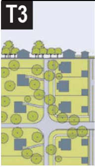 | T-3 SUB-URBAN | ||
| T-3 Sub-Urban Zone consists of low density residential areas, adjacent to higher zones that have some mixed use. Home occupations and outbuildings are allowed. Planting is naturalistic and setbacks are relatively deep. Blocks may be large and the roads irregular to accommodate natural conditions. | General Character: | Lawns and landscaped yards surrounding detached single-family houses; pedestrians occasionally | |
| Building Placement: | Large and variable front and side yard Setbacks | ||
| Frontage Types: | Porches and fences, Common Yard | ||
| Typical Building Height: | 1- to 2-Story | ||
| Type of Civic Space: | Parks, Greenways | ||
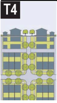 | T-4 GENERAL URBAN | ||
| T-4 General Urban Zone consists of a mixed use but primarily residential urban fabric. It may have a wide range of building types: single, Sideyard, and Rowhouses. Setbacks and landscaping are variable. Streets with curbs and sidewalks define medium-sized Blocks. | General Character: | Mix of Houses and Townhouses with scattered Commercial activity; balance between landscape and buildings; presence of pedestrians | |
| Building Placement: | Shallow to medium front and side yard Setbacks | ||
| Frontage Types: | Porches and fences, Shopfronts, Galleries | ||
| Typical Building Height: | 1- to 3-Story | ||
| Type of Civic Space: | Squares, Greens | ||
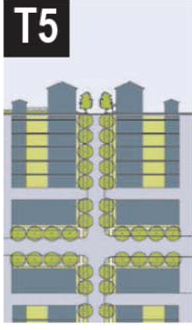 | T-5 URBAN CENTER | ||
| T-5 Urban Center Zone consists of higher density mixed use building that accommodate Retail, Offices, Townhouses and Apartments. It has a tight network of streets, with wide sidewalks, steady street tree planting and buildings set close to the sidewalks. | General Character: | Shops mixed with Townhouses, larger Apartment houses, Offices, work place and Civic buildings; predominantly attached buildings; trees within the public right-of-way; substantial pedestrian activity | |
| Building Placement: | Shallow Setbacks or none; buildings oriented to street defining a street wall | ||
| Frontage Types: | Shopfronts, Galleries | ||
| Typical Building Height: | 1- to 4-Story | ||
| Type of Civic Space: | Parks, Plazas, and Squares, median landscaping | ||
(Ord. No. 2016-03, Att., 3-7-16)
TABLE 2: Modification to Non-Conforming Properties. This table provides descriptions of changes to non-conforming properties that result in conformance with the specifications of this code. Other changes to decrease the degree of non-conformity are also possible.
| NON-CONFORMING PROPERTY | POSSIBLE TECHNIQUES | CONFORMING MODIFICATION | ||
|---|---|---|---|---|
DRIVE-THRU | 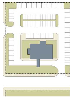 |
• Keep existing building and drive-thru and add Liner Buildings in front of building
to engage the Thoroughfare, or
• Replace building | 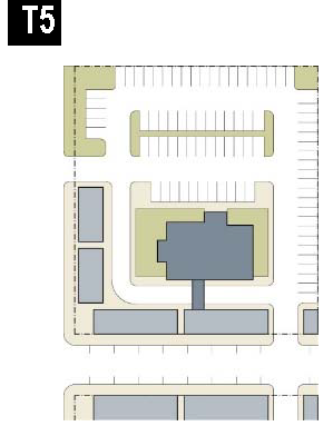 | 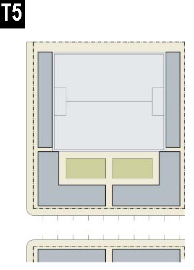 |
FUEL STATION | 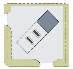 |
• Keep fuel station building and pumps and build a new building at the intersection,
or
• Eliminate the fuel station building, but keep the pumps and increase them, while building a new building at the intersection | 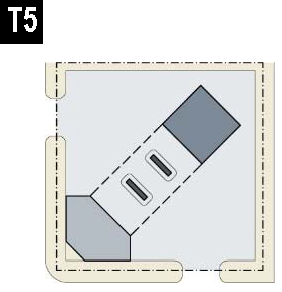 | 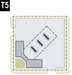 |
STRIP CENTER | 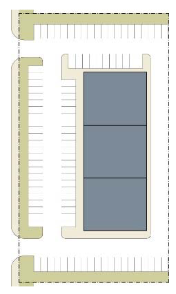 |
• Keep existing building and add Liner Buildings in front of it to engage the Thoroughfare
• Convert frontal parking into Forecourt and add on-street parking to existing the Thoroughfare | 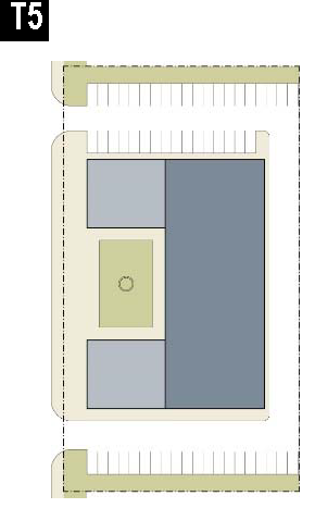 | 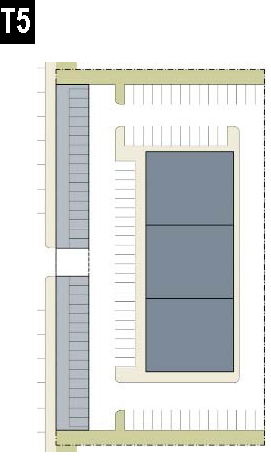 |
BIG BOX OR OFFICE BUILDING |  |
• Infill the frontal parking with new Liner Buildings and streets terminating on the
existing building; retain current building use or convert to new use
• Infill the frontal parking with new Liner Buildings and streets terminating on the existing building; reconfigure existing buildings for new use |  |  |
RELIGIOUS BUILDING |  |
• Infill the frontal parking lot with senior housing; add on-street parking to existing
Thoroughfare
• Create a street and Civic Space with Liner Buildings terminating on the existing religious building; add on-street parking to the existing Thoroughfare | 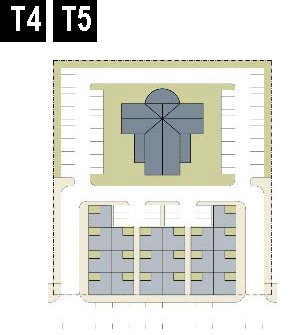 | 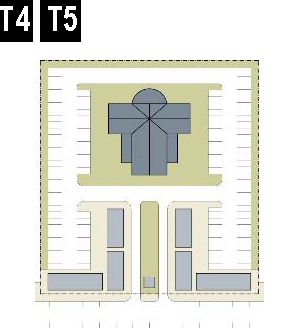 |
(Ord. No. 2016-03, Att., 3-7-16)
TABLE 3A: Vehicular Lane Dimensions. This table assigns lane widths to Transect Zones. The Design ADT (Average Daily Traffic) is the determinant for each of these sections. The most typical assemblies are shown in Table 3B: Vehicular Lane/Parking Assemblies. Specific requirements for truck and transit bus routes and truck loading shall be decided by the City of Kennesaw Public Works Director or other official as designated by the City Manager.
(Ord. No. 2016-03, Att., 3-7-16)
TABLE 3B: Vehicular Lane/Parking Assemblies. The projected design speeds determine the dimensions of the vehicular lanes and Turning Radii assembled for Thoroughfares. Use of standards in this table are subject to approval by the City of Kennesaw Public Works Director or other official as designated by the City Manager. Where on-street Bicycle Lanes or similar bicycle facilities are provided, the paved width shall be increased a corresponding amount.
| ONE WAY MOVEMENT → | TWO WAY MOVEMENT → | ||||
| a. NO PARKING | 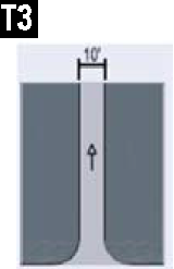 | 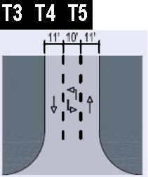 | 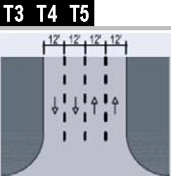 | ||
| Design ADT | 300 VPD | 22,000 VPD | 36,000 VPD | ||
|
Pedestrian
Crossing | 3 Seconds | 9 Seconds | 13 Seconds | ||
| Design Speed | 25—30 MPH | 25 MPH | 35 MPH or above | ||
| b. YIELD PARKING | 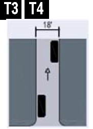 | 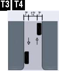 | |||
| Design ADT | 1,000 VPD | 1,000 VPD | |||
|
Pedestrian
Crossing | 5 Seconds | 7 Seconds | |||
| Design Speed | |||||
| c. PARKING ONE SIDE PARALLEL | 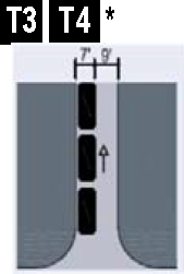 | 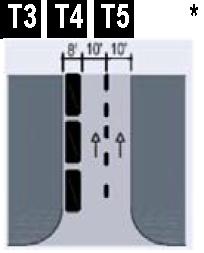 | 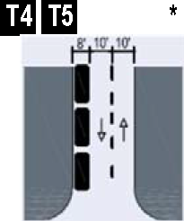 | 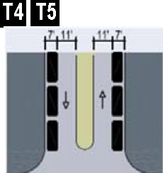 | 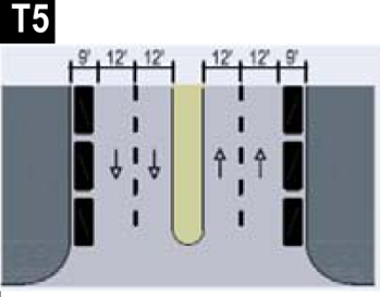 |
| Design ADT | 5,000 VPD | 18,000 VPD | 16,000 VPD | 15,000 VPD | 32,000 VPD |
|
Pedestrian
Crossing | 5 Seconds | 8 Seconds | 8 Seconds | 11 Seconds | 13 Seconds |
| Design Speed | 25—30 MPH | 25—30 MPH | 25—30 MPH | 25—30 MPH | 35 MPH or above |
| d. PARKING BOTH SIDES PARALLEL | 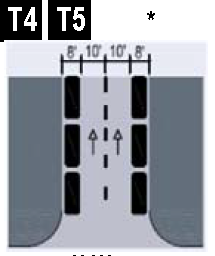 | 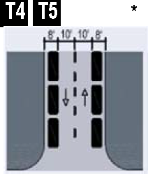 | 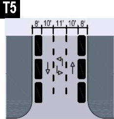 | 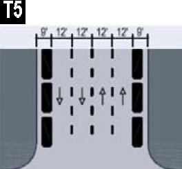 | |
| Design ADT | 20,000 VPD | 15,000 VPD | 22,000 VPD | 32,000 VPD | |
|
Pedestrian
Crossing | 10 Seconds | 10 Seconds | 13 Seconds | 15 Seconds | |
| Design Speed | 25—30 MPH | 25—30 MPH | 25—30 MPH | 35 MPH and above | |
| e. PARKING BOTH SIDES DIAGONAL (Drive-in or back-in parking permitted. Parking may be limited to one side in assemblies suitable for a Slip Road) | 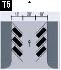 | 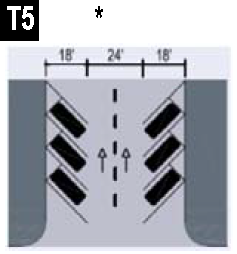 | 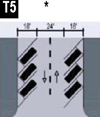 | 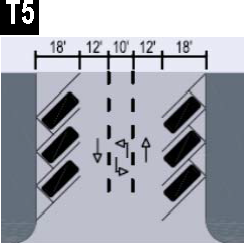 | 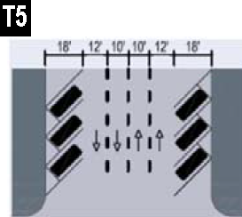 |
| Design ADT | 18,000 VPD | 20,000 VPD | 15,000 VPD | 22,000 VPD | 31,000 VPD |
|
Pedestrian
Crossing | 15 Seconds | 17 Second | 17 Seconds | 20 Seconds | 23 Seconds |
| Design Speed | Below 20 MPH | 25 MPH | 25 MPH | 25—30 MPH | 25—30 MPH |
| f. PARKING ACCESS | 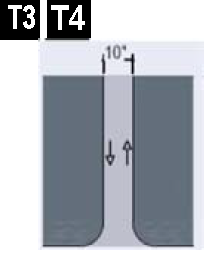 | 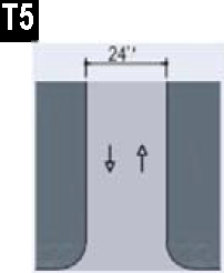 | *Indicates assembly suitable for a Slip Road in any Transect Zone | ||
| Design ADT | |||||
|
Pedestrian
Crossing | 3 Seconds | 6 Seconds | |||
| Design Speed | |||||
(Ord. No. 2016-03, Att., 3-7-16)
TABLE 4A: Public Frontages - General: The Public Frontage is the area between the private Lot Line and the edge of the vehicular lanes. Dimensions are given in Table 4B: Public Frontages - Specific.
| a. (HW) For Highway: This Frontage has open Swales drained by percolation, Multi-Use Trails and no parking. The landscaping consists of the natural condition or multiple species arrayed in naturalistic clusters. Buildings are buffered by distance or berms. | 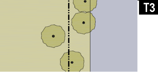 |
| b. (RD) For Road: This Frontage has open Swales drained by percolation and a walking Path or Multi-Use Trail, Yield parking along one or both sides. The landscaping consists of multiple species arrayed in naturalistic clusters. | 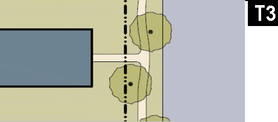 |
| c. (ST) For Street: This Frontage has raised Curbs drained by inlets and Sidewalks separated from the vehicular lanes by individual or continuous Planters, with parking on one or both sides. The landscaping consists of street trees of a single or alternating species aligned in a regularly spaced Allee. | 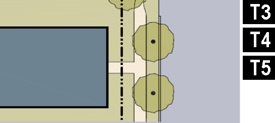 |
| d. (DR) For Drive: This Frontage has raised Curbs drained by inlets and a wide Sidewalk or paved path along one side, related to a Greenway or waterfront. It is separated from the vehicular lanes by individual or continuous Planters. The landscaping consists of street trees of a single species or alternating species aligned in a regularly spaced Allee. |  |
| e. (AV) For Avenue: This Frontage has raised Curbs drained by inlets and wide Sidewalks separated from the vehicular lanes by a narrow continuous Planter with parking on both sides. The landscaping consists of a single tree species aligned in a regularly spaced Allee. |  |
| f. (CS) For Commercial Street: This Frontage has raised Curbs drained by inlets and very wide Sidewalks along both sides separated from the vehicular lanes by separate tree wells with grates and parking on both sides. The landscaping consists of a single tree species aligned with regular spacing where possible but clears the storefront entrances. |  |
| g. (BV) For Boulevard: This Frontage has slip Roads on both sides. It consists of raised Curbs drained by inlets and Sidewalks along both sides, separated from the vehicular lanes by Planters. The landscaping consists of double rows of a single tree species aligned in a regularly spaced Allee. |  |
(Ord. No. 2016-03, Att., 3-7-16)
TABLE 4B: Public Frontages - Specific. This table assembles prescriptions and dimensions for the Public Frontage elements - Curbs, walkways and Planters - relative to specific Thoroughfare types within Transect Zones.
| TRANSECT ZONE Public Frontage Type | ||||||
| a. Assembly: The principal variables are the type and dimension of Curbs, walkways, Planters and landscape. | 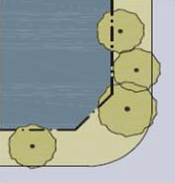 | 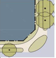 | 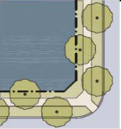 | 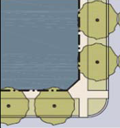 | 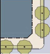 | 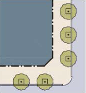 |
| Total Width | 16—24 feet | 12—24 feet | 12—18 feet | 12—18 feet | 18—24 feet | 18—30 feet |
| b. Curb. The detailing of the edge of the vehicular pavement incorporating drainage. |  |  |  |  |  |  |
| Type | Open Swale | Open Swale | Raised Curb | Raised Curb | Raised Curb | Raised Curb |
| Radius | 10—30 feet | 10—30 feet | 5—20 feet | 5—20 feet | 5—20 feet | 5—20 feet |
| c. Walkway. The hard surface dedicated exclusively to pedestrian activity and maintained clear and unobstructed to a minimum height of 8 feet. |  |  |  |  |  |  |
| Type | Path Optional | Path | Sidewalk | Sidewalk | Sidewalk | Sidewalk |
| Width | n/a | 4—8 feet | 5—8 feet | 5—8 feet | 12—20 feet | 12—30 feet |
| d. Planter: The layer which accommodates street trees and other landscape materials. |  |  |  |  | 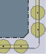 | 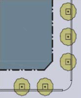 |
| Arrangement | Clustered | Clustered | Regular | Regular | Regular | Opportunistic |
| Species | Clustered | Clustered | Alternating | Single | Single | Single |
| Planter Type | Continuous Swale | Continuous Swale | Continuous Planter | Continuous Planter | Continuous Planter | Tree Well |
| Planter Width | 8 feet—16 feet | 8 feet—16 feet | 6 feet—12 feet | 5 feet—12 feet | 4 feet—6 feet | 4 feet—6 feet |
(Ord. No. 2016-03, Att., 3-7-16)
TABLE 4C: Thoroughfare Assemblies: These Thoroughfares are assembled from the elements that appear in Tables 3A: Vehicular Lane Dimensions and 3B: Vehicular Lane/Parking Assemblies and incorporate the Public Frontages of table 4A: Public Frontages - General. The key gives the Thoroughfare type followed by the right-of-way width, followed by the pavement width, and in some instances followed by specialized transportation capability.
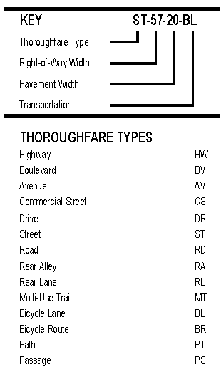 | 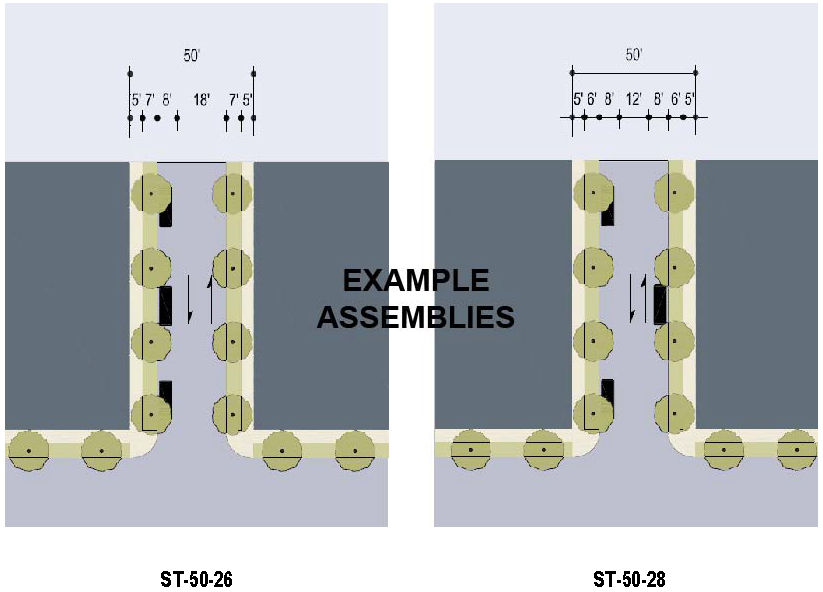 | |
| Thoroughfare Type | Street | Street |
| Transect Zone Assignment | T4, T5 | T4, T5 |
| Right-of-Way Width | 50 feet | 50 feet |
| Pavement Width | 26 feet | 28 feet |
| Movement | Slow Movement | Yield Movement |
| Design Speed | 25 MPH | 25 MPH |
| Pedestrian Crossing Time | 7.4 seconds | 7.6 seconds |
| Traffic Lanes | 2 lanes | 2 lanes |
| Parking Lanes | One side @ 8 feet marked | Both sides @ 8 feet unmarked |
| Curb Radius | 10 feet | 10 feet |
| Walkway Type | 5 foot Sidewalk | 5 foot Sidewalk |
| Planer Type | 7 foot continuous Planter | 6 foot continuous Planter |
| Curb type | Curb | Curb |
| Landscape Type | Trees @ 30' o.c. Avg. | Trees @ 30' o.c. Avg. |
| Transportation Provision | BR | BR |
(Ord. No. 2016-03, Att., 3-7-16)
TABLE 5: Civic Space
| a. Park: A natural preserve available for structured or unstructured recreation. A park may be independent of surrounding building Frontages. Its landscape shall consist of Paths and trails, meadows, water bodies, woodland and open shelters, all naturalistically disposed. Parks may also include dog parks within them. Sports and recreation courts and fields are also permitted, but sports stadiums are prohibited. Parks may be linear, following the trajectories of natural corridors. The minimum size shall be 5 acres. | 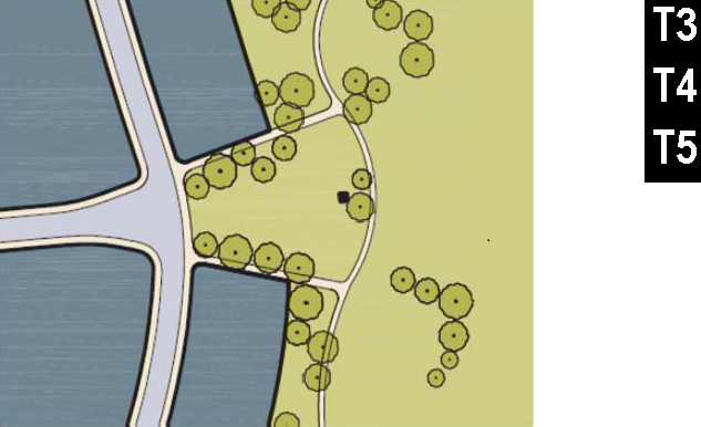 |
| b. Green: An Open Space, available for structured or unstructured recreation. A Green may be spatially defined by landscaping rather than building Frontages. Its landscape shall consist of lawn and trees, naturalistically disposed. Greens may also include dog parks within them. Sports courts are also permitted, but sports and recreation fields and stadiums are prohibited. The minimum size shall be ½ acre and the maximum shall be 5 acres. | 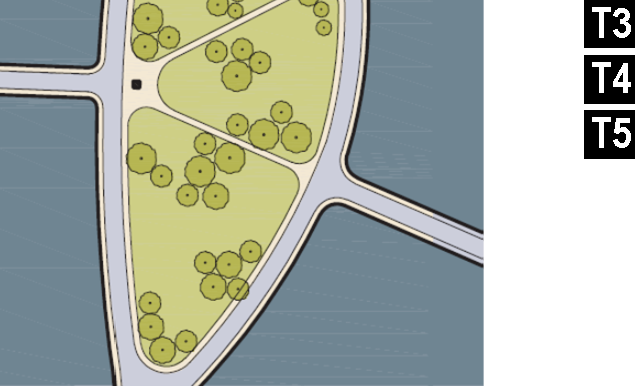 |
| c. Square: An Open Space available for unstructured recreation and Civic purposes. A Square is spatially defined by building Frontages. Its landscape shall consist of paths, lawns and trees, formally disposed. Squares shall be located at the intersection of important Thoroughfares. The minimum size shall be ½ acre and the maximum shall be 5 acres. | 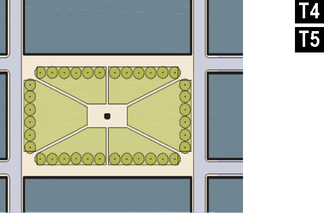 |
| d. Plaza: An Open Space available for Civic purposes and Commercial activities. A Plaza shall be spatially defined by building Frontages. Its landscape shall consist primarily of pavement. Trees are optional. Plazas should be located at the intersection of important streets. The minimum size shall be ½ acre and the maximum shall be 2 acres. | 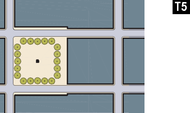 |
| e. Playground: An Open Space designed and equipped for the recreation of children. A Playground should be fenced and may include an open shelter. Playgrounds shall be interspersed within Residential areas and may be placed within a Block. Playgrounds may be included within parks and greens. The maximum size of playground shall be 2 acres, provided that playgrounds may also be located within another approved Civic Space identified above. | 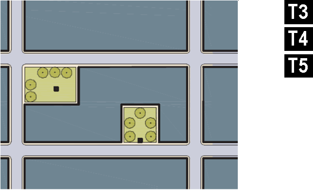 |
(Ord. No. 2016-03, Att., 3-7-16)
TABLE 6: Building Form - Height. This table shows the configurations for different building heights for each Transect Zone. N = maximum height in stories as specified in Table 11: Code Summary.
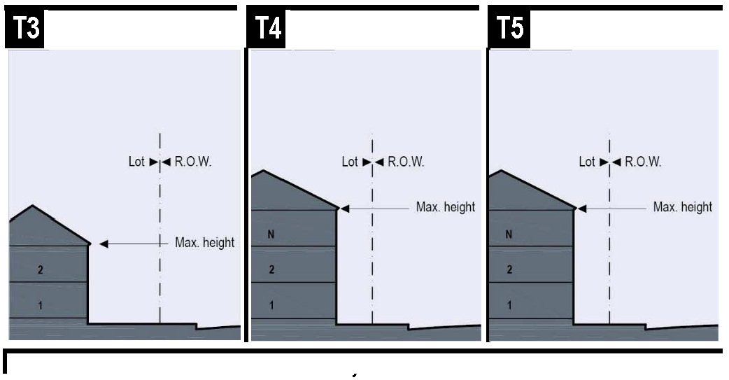
TABLE 7: Building Placement. This table approximates the location of the structure relative to the boundaries of each individual Lot, establishing suitable basic building types for each Transect Zone.
| a. Edgeyard: A building that occupies the center of its lot with Setbacks on all sides. This is the least urban of types as the front yard sets it back from the Frontage, while the side yards weaken the spatial definition of the public Thoroughfare space. The front yard is intended to be visually continuous with the yards of adjacent buildings. The rear yard can be secured for privacy by fences and a Backbuilding and/or Outbuilding. |  |
| b. Sideyard: A building that occupies one side of the lot with the Setback to the other side. A shallow Frontage Setback defines a more urban condition. If the adjacent building is similar with a blank side wall, the yard can be quite private. This type permits systematic climatic orientation in response to the sun or the breeze. If a Sideyard House abuts a neighboring Sideyard House, the type is known as a Twin or double house. Energy costs, and sometimes noise, are reduced by sharing a party wall in this disposition. | 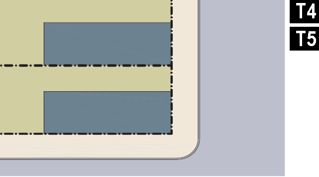 |
| c. Rearyard: A building that occupies the full Frontage, leaving the rear of the lot as the sole yard. This is a very urban type as the continuous Facade steadily defines the public Thoroughfare. The rear Elevations may be articulated for functional purposes. In its Residential form, this type is the Rowhouse. For its Commercial form, the rear yard can accommodate substantial parking. | 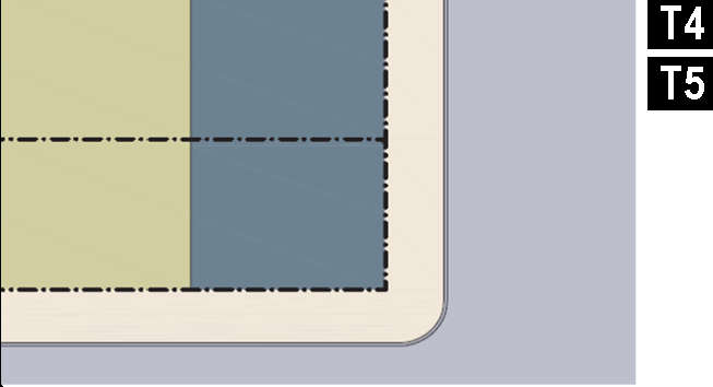 |
| d. Courtyard: A building that occupies the boundaries of its lot while internally defining one or more private patios. This is the most urban of types, as it is able to shield the private realm from all sides while strongly defining the public Thoroughfare. Because of its ability to accommodate incompatible activities, masking them from all sides, it is recommended for workshops, Lodging and schools. The high security provided by the continuous enclosure is useful for crime-prone areas. | 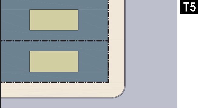 |
(Ord. No. 2016-03, Att., 3-7-16)
TABLE 8: Private Frontages. The Private Frontage is the areas between the building Facades and the lot lines.
 | ||
|---|---|---|
| a. Common Yard: a planted Frontage wherein the Façade is set back substantially from the Frontage Line. The front yard created remains unfenced and is visually continuous with adjacent yards, supporting a common landscape. The deep Setback provides a buffer from the higher speed Thoroughfares. | 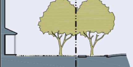 | 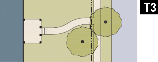 |
| b. Porch & Fence: a planted Frontage where the Façade is set back from the Frontage Line with an attached porch permitted to Encroach. A fence, wall, or hedge at the Frontage Line maintains street spatial definition. Porches shall be no less than 8 feet deep. | 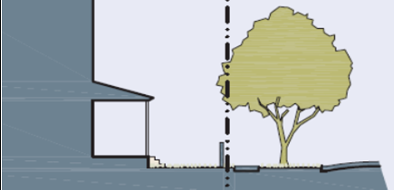 | 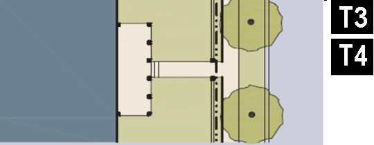 |
| c. Terrace or Lightwell: a frontage wherein the Façade is setback back from the Frontage Line by an elevated terrace or sunken Lightwell. This type buffers Residential use from urban Sidewalks and removes the private yard from public encroachment. Terraces are suitable for conversion to outdoor cafes. Syn: Dooryard. | 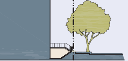 |  |
| d. Forecourt: a Frontage wherein the Façade is close to the Frontage Line and the central portion is set back. The forecourt created is suitable for vehicular drop-offs. This type should be allocated in conjunction with other Frontage types. Large trees within the Forecourts may overhang the Sidewalks. | 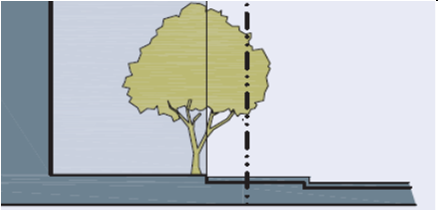 |  |
| e. Stoop: a Frontage wherein the Façade is aligned close to the Frontage Line with the first Story elevated from the Sidewalk sufficiently to ensure privacy for the windows. The entrance is usually an exterior stair and landing. This type is recommended for ground-floor Residential use. Stoops shall be no less than 30 inches deep. | 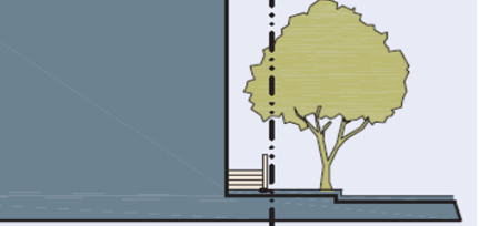 |  |
| f. Shopfront: a Frontage wherein the Façade is aligned close to the Frontage Line with the building entrance at Sidewalk grade. This type is conventional for Retail use. It has glazing on the Sidewalk level and an awning that may overlap the sidewalk. Syn: Retail Frontage. |  |  |
| g. Gallery: a Frontage wherein the Façade is aligned with the Frontage Line with an attached cantilevered shed or lightweight colonnade overlapping the Sidewalk. This type is conventional for Retail use. The Gallery should be no less than 10 feet wide and should overlap the sidewalk to within 2 feet of the Curb. |  |  |
| h. Arcade: a collonade supporting habitable space that overlaps the Sidewalk, while the Façade at Sidewalk level remains at or behind the Frontage Line. This type is conventional for Retail use. The Arcade shall be no less than 12 feet wide and should overlap the Sidewalk to within 2 feet of the Curb. |  |  |
(Ord. No. 2016-03, Att., 3-7-16)
TABLE 9: Building Function. This table categorizes Building functions within Transect Zones. For Specific Function and Use permitted By Right or by Conditional Use Permit, see Table 10: Specific Function and Use.
(Ord. No. 2016-03, Att., 3-7-16)
TABLE 10: Specific Function and Use. Specific Function and Use. This table expands the categories of Table 9: Building Function to delegate specific principle uses within Function categories by Transect Zone. Uses that are not included or left blank are prohibited.
P: PERMITTED BY RIGHT
SE: ALLOWED BY SPECIAL EXCEPTION PERMIT
SL: ALLOWED BY SPECIAL LAND USE PERMIT
(Ord. No. 2016-03, Att., 3-7-16)
TABLE 11: Code Summary
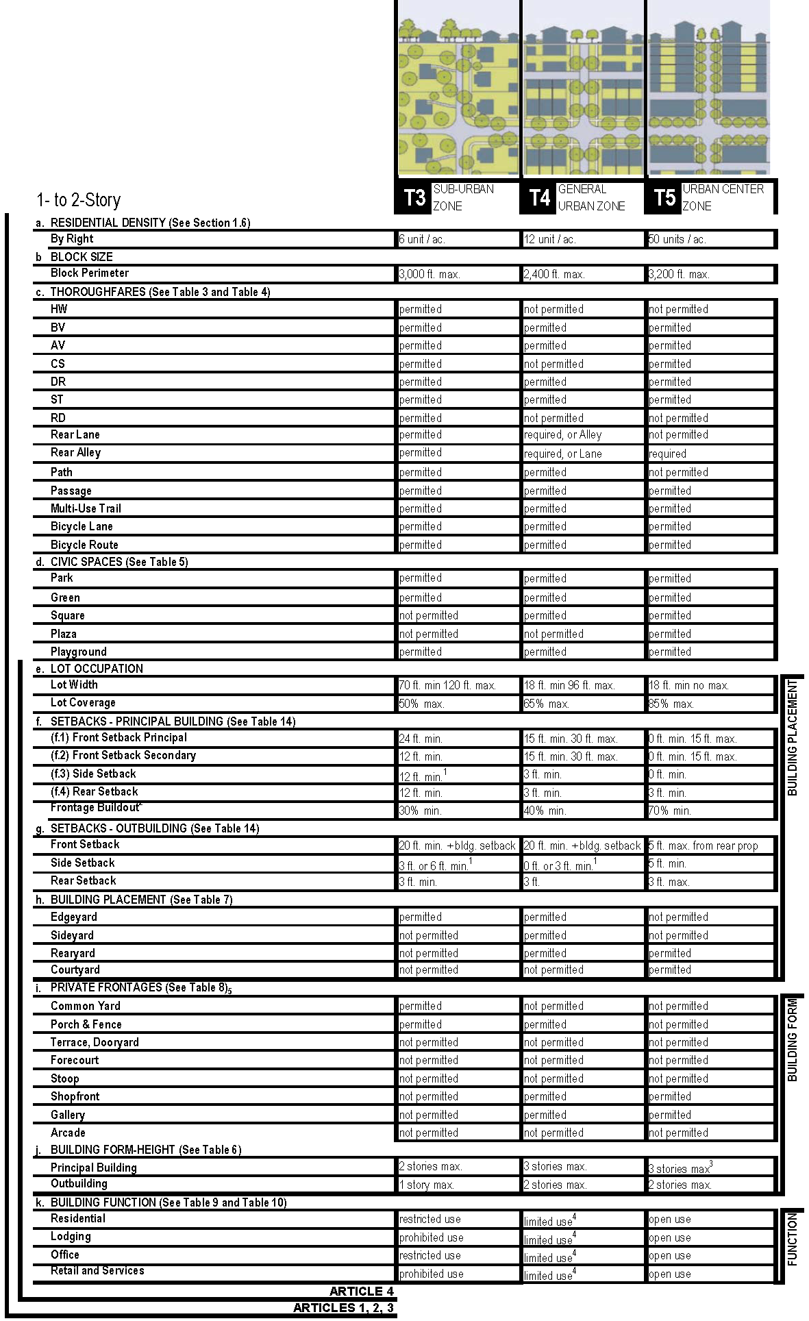
1. Minimum setbacks and building separations shall be subject to fire and building code restrictions.
2. Transect Zone notwithstanding, along State Routes the mininum required frontage buildout shall be 50%.
3. Additional stories allowed by approved variance in T5 zone. HPC review required, as applicable.
3.[4.] In T4-Limited and T4-Open different Building Function requirements apply.
(Ord. No. 2016-03, Att., 3-7-16)
TABLE 11A: Code Graphics - T3
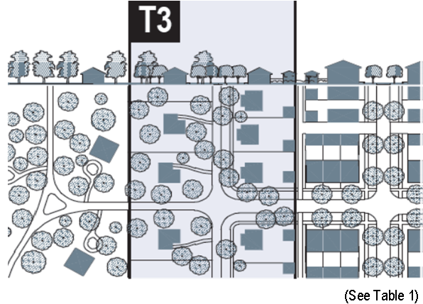 |
BUILDING CONFIGURATION
1. Building height shall be measured in number of Stories, excluding Attics and above ground portions of basements. 2. Stories may not exceed 14 feet in height from finished floor to finished ceiling. | 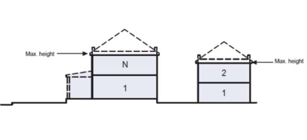 | |
| l. BUILDING FUNCTION (See Table 9 & Table 10) |
SETBACKS - PRINCIPAL BLDG.
1. The Facades and Elevations of Principal Buildings shall be distanced from the Lot lines as shown. 2. Facades shall be built along the Principal Frontage to the minimum specified width in the table. | 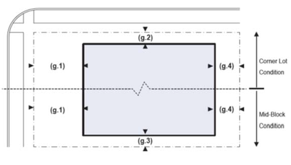 | |
| Residential | restricted use | ||
| Lodging | prohibited use | ||
| Office | restricted use | ||
| Retail | prohibited use | ||
| k. BUILDING FORM (See Table 6) | |||
| Principal Building | 2 stories max. | ||
| Outbuilding | 1 story max. | ||
| f. LOT OCCUPATION (See Table 11 section e) | |||
| Lot Width | 70 ft. min. | ||
| Lot Coverage | 50% max. | ||
| i. BUILDING PLACEMENT (See Table 6) |
SETBACKS - OUTBUILDING
1. The Elevations of the Outbuilding shall be distanced from the Lot lines as shown. | 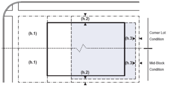 | |
| Edgeyard | permitted | ||
| Sideyard | not permitted | ||
| Rearyard | not permitted | ||
| Courtyard | not permitted | ||
| g. SETBACKS - PRINCIPAL BUILDING (See Table 11 section f) | |||
| (g.1) Front Setback Principal | 24 ft. min. | ||
| (g.2) Front Setback Secondary | 12 ft. min. | ||
| (g.3) Side Setback | 12 ft. min. | ||
| (g.4) Rear Setback | 12 ft. min. [6] | ||
| Frontage Buildout | 30% min. at setback | ||
| h. SETBACKS - OUTBUILDING (See Table 11 section g) | |||
| (h.1) Front Setback Principal | 20 ft. min. + bldg. setback | ||
| (h.2) Front Setback Secondary | 3 ft. min. or 6 ft. min. at corner | ||
| (h.3) Side Setback | 3 ft. min. | ||
| j. PRIVATE FRONTAGES (See Table 8) |
PARKING PLACEMENT
1. Uncovered parking spaces may be provided within the second and third Layer as shown in the diagram (see Table 12 section d). 2. Covered parking shall be provided within the third Layer as shown in the diagram (see Table 12 section d). Side- or rear-entry garages may be allowed in the first or second Layer by Warrant. 3. Trash containers shall be stored within the third Layer. | 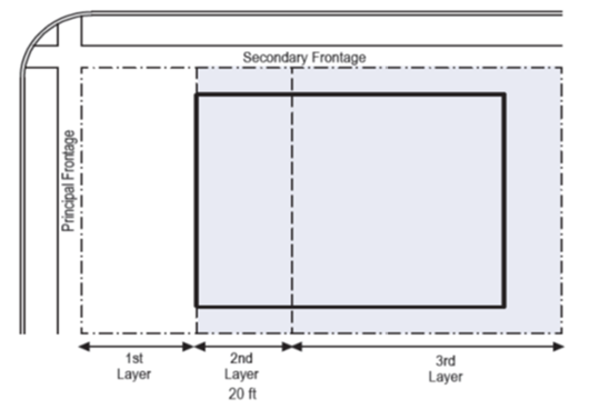 | |
| Common Lawn | permitted | ||
| Porch & Fence | permitted | ||
| Terrace or Lightwell | not permitted | ||
| Forecourt | not permitted | ||
| Stoop | not permitted | ||
| Shopfront & Awning | not permitted | ||
| Gallery | not permitted | ||
| Arcade | not permitted | ||
| Refer to Summary Table 11 | |||
| "N" stands for any Stories above those shown, up to the maximum. Refer to metrics for exact minimums and maximums. | |||
(Ord. No. 2016-03, Att., 3-7-16)
TABLE 11B: Code Graphics - T4
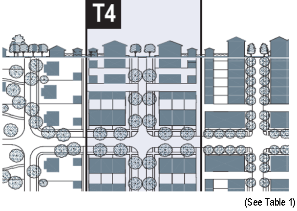 |
BUILDING CONFIGURATION
1. Building height shall be measured in number of Stories, excluding Attics and above ground portions of basements. 2. Stories may not exceed 14 feet in height from finished floor to finished ceiling, except for a first floor Commercial function which must be a minimum of 11 ft with a maximum of 25 feet. 3. Height shall be measured to the eave or roof deck as specified on Table 5. | 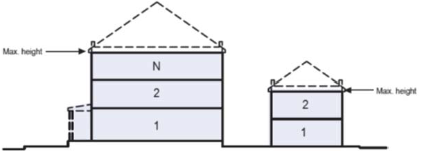 | |
| l. BUILDING FUNCTION (See Table 9 & Table 10) |
SETBACKS - PRINCIPAL BLDG.
1. The Facades and Elevations of Principal Buildings shall be distanced from the Lot lines as shown. 2. Facades shall be built along the Principal Frontage to the minimum specified width in the table. | 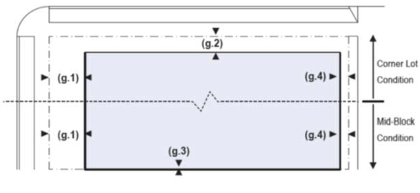 | |
| Residential | limited use* | ||
| Lodging | limited use* | ||
| Office | limited use* | ||
| Retail | limited use [7]* | ||
| k. BUILDING FORM (See Table 6) | |||
| Principal Building | 3 stories max. | ||
| Outbuilding | 2 stories max. | ||
| f. LOT OCCUPATION (See Table 11 section e) | |||
| Lot Width | 18 ft. min. | ||
| Lot Coverage | 65% max. | ||
| Building Footprint | 20,000 sf max. | ||
| i. BUILDING PLACEMENT (See Table 6) |
SETBACKS - OUTBUILDING
1. The Elevations of the Outbuilding shall be distanced from the Lot lines as shown. | 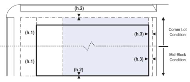 | |
| Edgeyard | permitted | ||
| Sideyard | permitted | ||
| Rearyard | permitted | ||
| Courtyard | not permitted | ||
| g. SETBACKS - PRINCIPAL BUILDING (See Table 11 section f) | |||
| (g.1) Front Setback Principal | 15 ft. min., 30 ft. max. | ||
| (g.2) Front Setback Secondary | 15 ft. min., 30 ft. max. | ||
| (g.3) Side Setback | 3 ft. min. | ||
| (g.4) Rear Setback | 3 ft. min. [8]** | ||
| Frontage Buildout | 40% min. at setback | ||
| h. SETBACKS - OUTBUILDING (See Table 11 section g) | |||
| (h.1) Front Setback Principal | 20 ft. min. + bldg. setback | ||
| (h.2) Front Setback Secondary | 0 ft. min. or 3 ft. min. at corner | ||
| (h.3) Side Setback | 3 ft. min. | ||
| j. PRIVATE FRONTAGES (See Table 8) |
PARKING PLACEMENT
1. Uncovered parking spaces may be provided within the third Layer as shown in the diagram (see Table 12 section d). 2. Covered parking shall be provided within the third Layer as shown in the diagram (see Table 12 section d). 3. Trash containers shall be stored within the third Layer. | 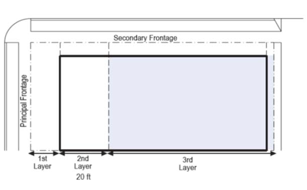 | |
| Common Lawn | not permitted | ||
| Porch & Fence | permitted | ||
| Terrace or Lightwell | not permitted | ||
| Forecourt | not permitted | ||
| Stoop | not permitted | ||
| Shopfront & Awning | permitted | ||
| Gallery | permitted | ||
| Arcade | not permitted | ||
| Refer to Summary Table 11 | |||
| "N" stands for any Stories above those shown, up to the maximum. Refer to metrics for exact minimums and maximums. | |||
(Ord. No. 2016-03, Att., 3-7-16)
TABLE 11C: Code Graphics - T5
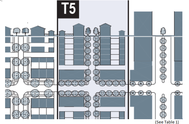 |
BUILDING CONFIGURATION
1. Building height shall be measured in number of Stories, excluding Attics and above ground portions of basements. 2. Stories may not exceed 14 feet in height from finished floor to finished ceiling, except for a first floor Commercial function which must be a minimum of 11 ft with a maximum of 25 feet. 3. Height shall be measured to the eave or roof deck as specified on Table 8. | 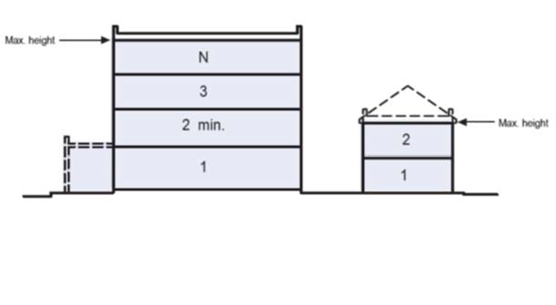 | |
| l. BUILDING FUNCTION (See Table 9 & Table 10) |
SETBACKS - PRINCIPAL BLDG.
1. The Facades and Elevations of Principal Buildings shall be distanced from the Lot lines as shown. 2. Facades shall be built along the Principal Frontage to the minimum specified width in the table. | 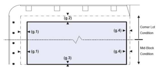 | |
| Residential | open use | ||
| Lodging | open use | ||
| Office | open use | ||
| Retail | open use | ||
| k. BUILDING FORM (See Table 6) | |||
| Principal Building | 3 stories max. [9]* | ||
| Outbuilding | 2 stories max. | ||
| f. LOT OCCUPATION (See Table 11 section e) | |||
| Lot Width | 18 ft. min. | ||
| Lot Coverage | 85% max. | ||
| Building Footprint | 20,000 sf max. | ||
| i. BUILDING PLACEMENT (See Table 6) |
SETBACKS - OUTBUILDING
1. The Elevations of the Outbuilding shall be distanced from the Lot lines as shown. | 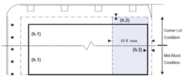 | |
| Edgeyard | not permitted | ||
| Sideyard | permitted | ||
| Rearyard | permitted | ||
| Courtyard | not permitted | ||
| g. SETBACKS - PRINCIPAL BUILDING (See Table 11 section f) | |||
| (g.1) Front Setback Principal | 0 ft. min., 15 ft. max. | ||
| (g.2) Front Setback Secondary | 0 ft. min., 15 ft. max. | ||
| (g.3) Side Setback | 0 ft. min. | ||
| (g.4) Rear Setback | 3 ft. min. [10]** | ||
| Frontage Buildout | 70% min. at setback | ||
| h. SETBACKS - OUTBUILDING (See Table 11g) | |||
| (h.1) Front Setback Principal | 5 ft. min. | ||
| (h.2) Front Setback Secondary | 5 ft. min. | ||
| (h.3) Side Setback | 3 ft. max. | ||
| j. PRIVATE FRONTAGES (See Table 8) |
PARKING PLACEMENT
1. Uncovered parking spaces may be provided within the third Layer as shown in the diagram (see Table 12 section d). 2. Covered parking shall be provided within the third Layer as shown in the diagram (see Table 12 section d). 3. Trash containers shall be stored within the third Layer. | 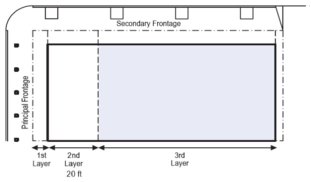 | |
| Common Lawn | not permitted | ||
| Porch & Fence | permitted | ||
| Terrace or Lightwell | not permitted | ||
| Forecourt | not permitted | ||
| Stoop | not permitted | ||
| Shopfront & Awning | permitted | ||
| Gallery | permitted | ||
| Arcade | not permitted | ||
| Refer to Summary Table 11 | |||
| "N" stands for any Stories above those shown, up to the maximum. Refer to metrics for exact minimums and maximums. | |||
(Ord. No. 2016-03, Att., 3-7-16)
TABLE 12: Special Districts. The metrics for each column of this table (SD1, SD2, etc.) are to be filled in for each Special district as they are permitted pursuant to a Regulating Plan or Special Area Plan. Functions may be specifically listed or may reference an existing City of Kennesaw zoning district. More pages can be added. Special Districts that do not have provisions noted herein shall be governed by the standards of any other City of Kennesaw zoning district as set forth in Sections 1.4.4 (c) or (d), as applicable.
(Ord. No. 2016-03, Att., 3-7-16)
TABLE 13: Definitions Illustrated
| a. THOROUGHFARE & FRONTAGES | |
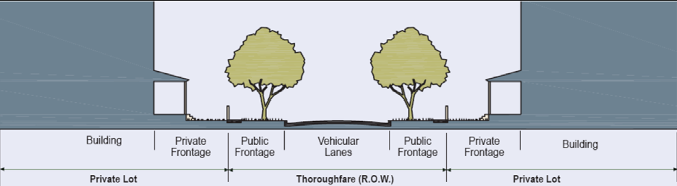 | |
| b. TURNING RADIUS | c. BUILDING DISPOSITION |
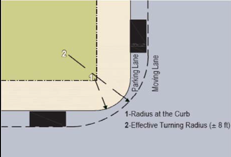 | 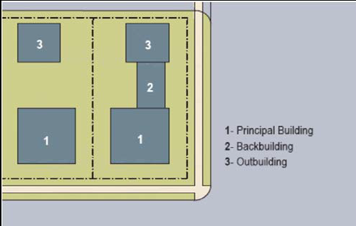 |
| d. LOT LAYERS | e. FRONTAGE & LOT LINES |
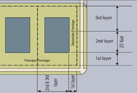 | 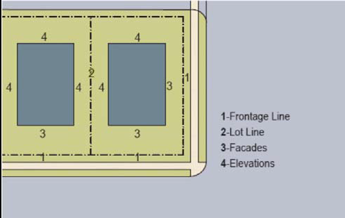 |
| f. SETBACK DESIGNATIONS | |
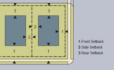 | |
(Ord. No. 2016-03, Att., 3-7-16)
Drive-through facilities are considered accessory to a Retail or Automotive Function.
--- (6) ---
or 15 feet from center line of alley
--- (7) ---
* In T4-Limited and T4-Open different Building Function requirements apply.
--- (8) ---
** or 15 feet from center line of alley.
--- (9) ---
*HPC review required, as applicable.
--- (10) ---
** or 15 feet from center line of alley.
ARTICLE 6. - DEFINITION OF TERMS
DEFINITIONS
This Article provides definitions for terms in this code that are technical in nature or that otherwise may not reflect a common usage of the term. If a term is not defined in this Article or in Section 1.09.02 Definitions of the Unified Development Code, then the Planning and Zoning Administrator shall determine the correct definition. Items in italics refer to Articles, Sections, or Tables in the code.
A-Grid: cumulatively, those Thoroughfares that by virtue of their pre-existing pedestrian-supportive qualities, or their future importance to pedestrian connectivity, are held to the highest standards prescribed by this code. See B-Grid.
Accessory Building: an Outbuilding with an Accessory Unit.
Accessory Unit: a small apartment sharing ownership and utility connections with a Principal Building; it may or may not be within an Outbuilding. (Syn: ancillary unit)
Allee: a regularly spaced and aligned row of trees usually planted along both sides of a Thoroughfare or Path.
Arcade: a Private Frontage conventional for Retail use wherein the Facade is a colonnade supporting habitable space that overlaps the Sidewalk, while the Facade at Sidewalk level remains at the Frontage Line.
Auto and Vehicle sales: a business selling motorized vehicles including but not limited to automobile and truck sales and service facilities; boat sales and service establishments; Motorcycle, ATV, and three-wheel vehicle sales and service facilities; Trailer salesrooms and sales lots. Auto and Vehicle sales does not include any other uses specifically set forth in Table 10: Specific Function and Use.
Avenue (AV): a Thoroughfare of high vehicular capacity and low to moderate speed, acting as a short distance connector between urban centers, and usually equipped with a landscaped median.
B-Grid: cumulatively, those Thoroughfares that by virtue of their use, location, or absence of pre-existing pedestrian-supportive qualities, may meet a standard lower than that of the A-Grid. B-Grid Thoroughfares are often privately-owned. See A-Grid.
Backbuilding: a single-Story structure connecting a Principal Building to an Outbuilding. See Table 14: Definitions Illustrated.
Banks/financial institutions: a business dedicated to banking and lending of money including but not limited to Banks/financial institutions and/or automated transfer machines. Banks/financial institutions does include drive-in establishments, check cashing, title loan or any other uses specifically set forth in Table 10: Specific Function and Use.
Bicycle Lane (BL): a dedicated lane for cycling within a moderate-speed vehicular Thoroughfare, demarcated by striping and having a minimum width of 5 feet.
Bicycle Route (BR): a Thoroughfare suitable for the shared use of bicycles and automobiles moving at low speeds.
Block: the aggregate of private Lots, Passages, Rear Alleys and Rear Lanes, circumscribed by Thoroughfares.
Block Face: the aggregate of all the building Facades on one side of a Block.
Boulevard (BV): a Thoroughfare designed for high vehicular capacity and moderate speed, traversing an Urbanized area. Boulevards are usually equipped with Slip Roads buffering Sidewalks and buildings.
Building Form: the shape of a building, based on its massing, Private Frontage, and height.
Building Placement: the arrangement of a building on its lot.
By Right: characterizing a proposal or component of a proposal for a Building Scale Plan (Article 4) that complies with the code and is permitted and processed administratively, without public hearing. See Variance.
Civic: the term defining not-for-profit organizations dedicated to arts, culture, education, recreation, government, transit, and municipal parking.
Civic Building: a building operated by a city, county, state, or federal government.
Civic Building Sites: a parcel containing a Civic Building.
Civic Space: an outdoor area dedicated for public use, but which may be under public or private ownership. Civic Space types are defined by the combination of certain physical constants including the relationships among their intended use, their size, their landscaping and their Enfronting buildings. See Table 5: Civic Space.
Civic Zone: designation for sites dedicated for Civic Building Sites and Civic Spaces.
Commercial: the term collectively defining workplace, Office, Retail, and Lodging Functions.
Commercial Recreation Facility: a facility that provides opportunities for indoor recreation including but not limited to amusement centers, arcades, billiards and pool halls, commercial indoor recreation uses, and nightclubs. Outdoor recreation facilities are considered part of Commercial Recreation Facility, Outdoors. Commercial Recreation Facility does not include Sexually Oriented Business or any other uses specifically set forth in Table 10: Specific Function and Use.
Commercial Recreation Facility Outdoor: a facility that provides opportunities for outdoor recreation including but not limited to commercial outdoor recreation uses, executive golf courses, golf courses (18-hole regulation; private and public), golf courses (par 3), nonprofit (seasonal use) fishing lakes, nonprofit riding stables, outdoor golf driving ranges, private parks, recreation grounds other than tennis courts and golf courses, and zoos. Commercial Recreation Facility does not include any uses specifically set forth inTable 10: Specific Function and Use.
Common Yard: a planted Private Frontage wherein the Facade is set back from the Frontage line. It is visually continuous with adjacent yards. See Table 8: Private Frontages.
Community Meeting Facility: a facility that can host public meetings including but not limited to assembly halls; clubs or lodges (noncommercial); and private community centers. Community Meeting Facility does not include any uses specifically set forth inTable 10: Specific Function and Use.
Cottage: an Edgeyard Building type containing a single-family dwelling, on its own Lot, often shared with an Accessory Building in the back yard.
Courtyard Building: a building that occupies the boundaries of its Lot while internally defining one or more private patios. See Table 8: Private Frontages.
Curb: the edge of the vehicular pavement that may be raised or flush to a swale. It usually incorporates the drainage system. See Table 4A: Public Frontages - General and Table 4B: Public Frontages - Specific.
Design Speed: is the velocity at which a Thoroughfare tends to be driven without the constraints of signage or enforcement. There are three ranges of speed: Low: (25 MPH); Moderate: (25-35 MPH); High: (above 35 MPH). Lane width is determined by desired Design Speed. See Table 3A: Vehicular Lane Dimensions.
Dooryard: a Private Frontage type with a shallow Setback and front garden or patio, usually with a low wall at the Frontage Line. See Table 8: Private Frontages. (Variant: Lightwell)
Downtown Activity Center: land use designation for the downtown Kennesaw area as identified in the adopted comprehensive plan.
Drive: a Thoroughfare along the boundary between an Urbanized and a natural condition, usually along a waterfront, Park, or promontory. One side has the urban character of a Thoroughfare, with Sidewalk and building, while the other has the qualities of a Road or parkway, with naturalistic planting and rural details.
Drive-Through Facilities: any structure which permits a vehicle to drive to and conduct a transaction while remaining in the vehicle including but not limited to drive-in theaters, drive-thru ATMs or tellers, and drive-thru restaurants. Drive-Through Facilities does not include any uses specifically set forth in Table 10: Specific Function and Use.
Edgeyard Building: a building that occupies the center of its Lot with Setbacks on all sides. See Table 7: Building Placement.
Effective Turning Radius: the measurement of the inside Turning Radius taking parked cars into account. See Table 14: Definitions Illustrated.
Elevation: an exterior wall of a building not along a Frontage Line. See Table 14: Definitions Illustrated.See:Facade.
Encroach: to break the plane of a vertical or horizontal regulatory limit with a structural element, so that it extends into a Setback, into the Public Frontage, or above a height limit.
Encroachment: any structural element that breaks the plane of a vertical or horizontal regulatory limit, extending into a Setback, into the Public Frontage, or above a height limit.
Enfront: to place an element along a Frontage, as in "porches Enfront the street."
Facade: the exterior wall of a building that is set along a Frontage Line. See Elevation.
First Layer: the privately held Layer between the Frontage Line and the Principal Building front Setback shown in Table 11: Code Summary. Where both a minimum and maximum Setback exists, the First Layer shall extend to the maximum. See Table 14: Definitions Illustrated.
Fitness/Health Facility: Any facility that promotes healthy living through exercise including athletic and health clubs and gyms. Fitness/Health Facility does not include any Medical uses or other uses specifically set forth in Table 10: Specific Function and Use.
Forecourt: a Private Frontage wherein a portion of the Facade is close to the Frontage Line and the central portion is set back. See Table 8: Private Frontages.
Frontage: the area between a building Facade and the vehicular lanes, inclusive of its built and planted components. Frontage is divided into Private Frontage and Public Frontage. See Table 4A: Public Frontages - General and Table 8: Private Frontages.
Frontage Line: a line bordering a Public Frontage that may or not be congruent with the Lot Line. Facades facing Frontage Lines define the public realm and are therefore more regulated than the Elevations facing other Lot Lines. See Table 14: Definitions Illustrated.
Function: the use or uses accommodated by a building and its Lot, categorized as Restricted, Limited, orOpen, according to the intensity of the use. See Table 9: Building Function and Table 10: Specific Function and Use.
Gallery: a Private Frontage conventional for Retail use wherein the Facade is aligned close to the Frontage Line with an attached cantilevered shed or lightweight colonnade overlapping the Sidewalk. See Table 8: Private Frontages.
Gardening: any use which allows for the non-commercial growing of plants including but not limited to home gardens; community gardens; and the growing of fruit trees, nuts, and vegetables. Gardening does not include commercial operations or other uses specifically set forth in Table 10: Specific Function and use.
Gas station: any use which sells gasoline or diesel fuel from pumps including Convenience food stores with self-service fuel sales; Full service gasoline stations. Gas station does not include convenience stores without gasoline or diesel pumps or other uses specifically set forth in Table 10: Specific Function and use.
General Retail: a business whose primary use is the sale of merchandise to consumers, specifically including, but not limited to agricultural produce stands; community retail uses; farm and garden supply stores; farmers markets (fully enclosed); fruit stores, markets; neighborhood retail uses; office service and supply establishments; and millinery or similar trade whenever products are sold retail, exclusively on the site where produced. General Retail does not include cigar, smoke shops, tobacco stores; flea markets; growler sales; pawn shops, regional shopping centers; restaurants and cafes; sexually oriented businesses; or other uses specifically set forth in Table 10: Specific Function and use.
General Service: a business whose primary use is to provide a service, specifically including, but not limited to, film developing and printing facilities; laundry and dry cleaning pick-up establishments; linen and diaper services; massage therapy; nonautomotive repair service establishments; self-service laundry facilities, spas and salons. General Service does not include financial establishments, banks, check cashing establishments, tattoo businesses, or other uses specifically set forth in Table 10: Specific Function and use.
Green: a Civic Space type for structured or unstructured recreation, spatially defined by landscaping rather than building Frontages. See Table 5.
Greenway: an open space corridor which includes a continuous Multi-Use Trail.
Gross Site Area: all land within a site's boundaries.
Highway: a rural and suburban Thoroughfare of high vehicular speed and capacity. This type is allocated to the more rural Transect Zones (T-2, and T-3).
Home Occupation: Non-Retail Commercial enterprises. The work quarters should be invisible from the Frontage, located either within the house or in an Outbuilding. Permitted activities are defined by the Restricted Office category. See Table 9: Building Function.
House: an Edgeyard Building type containing a single-family dwelling on a large Lot, often shared with an Accessory Building in the back yard. (Syn: single.)
Industrial: for the purpose of uses, Industrial means any use which can generate a significant amount of noise, vibration, smells, or other emissions this includes but is not limited to major appliance repair; dry cleaning plants; fuel and ice dealers; mining or other extractive industries; newspaper publishing facilities; railroad car classification yards; temporary sawmills; self-service storage facilities; shooting ranges; and vending machine sales, service, rental, or repair establishments. Industrial does not include truck or freight terminals or scrap and dismantling yards or other uses specifically set forth in Table 10: Specific Function and use.
Layer: a range of depth of a Lot within which certain elements are permitted. See Table 14: Definitions Illustrated.
Lightwell: A Private Frontage type that is a below-grade entrance or recess designed to allow light into basements. See Table 8: Private Frontages.
Liner Building: a building specifically designed to mask a parking lot or a Parking Structure from a Frontage.
Live-Work: Nonresidential activity conducted wholly within a residential dwelling that allows employees, customers, clients or patrons to visit.
Lodging: premises available for daily renting of guest rooms. See Table 9: Building Function and Table 10: Specific Function and Use.
Lot Line: the boundary that legally and geometrically demarcates a lot.
Lot Width: the length of the Principal Frontage Line of a lot.
Manufacturing: premises available for the creation, assemblage and/or repair of objects, using table-mounted electrical machinery or artisanal equipment, and including their Retail sale.
Medical: for the purposes of uses, medical is any organization that provides medical care or support including but not limited to ambulance services; clinics; massage therapy; medical and dental laboratories (provided that no chemicals are manufactured on site); medical research centers; pain management clinic; research testing laboratories; and sports/medical physical therapy. Medical does not include hospitals or other uses specifically set forth in Table 10: Specific Function and use.
Mixed Use: multiple Functions within the same building through superimposition or adjacency, or in multiple buildings by adjacency.
Multi-Family Housing: a residential facility that provides long-term housing including but not limited to condominiums; and multifamily dwelling units. Multi-Family Housing does not include Lodging or uses specifically set forth in Table 10: Specific Function and use.
Multi-Use Trail (MT): a shared paved pedestrian and bicycle way running independent of a vehicular Thoroughfare and having a minimum width of 12 feet and a maximum width of 20 feet.
Net Site Area: all land within a site's boundaries except any part or parts of rivers, streams, floodplains, and natural lakes.
Office: premises available for the transaction of general business but excluding Retail, Service, and Industrial Functions. For the purposes of uses office includes but is not limited to corporate or administrative offices for any permitted uses; photography studios; professional offices; wholesale sales offices; and wholesale trade offices in conjunction with office showrooms. Office does not include Live/Work Units or other uses specifically set forth in Table 10: Specific Function and use.
Open Parking: an uncovered parking area not within a Parking Structure. (Syn: parking lot)
Outbuilding: an Accessory Building, usually located toward the rear of the same Lot as a Principal Building, and sometimes connected to the Principal Building by a Backbuilding. See Table 14: Definitions Illustrated.
Park: a Civic Space type that is a natural preserve available for structured or unstructured recreation. See Table 5.
Parking Structure: a building containing either two or more levels of above ground parking or one or more level of basement parking.
Passage (PS): a pedestrian connector, open or roofed, that passes between buildings to provide shortcuts through long Blocks and connect rear parking areas to Frontages.
Path (PT): a pedestrian way traversing a Park or rural area, with landscape matching the contiguous open space, ideally connecting directly with the urban Sidewalk network.
Planter: the element of the Public Frontage which usually accommodates street trees, whether continuous or individual. The Planter shall be located between the Sidewalk and the Curb.
Plaza: a Civic Space type designed for Civic purposes and Commercial activities in the more urban Transect Zones, generally paved and spatially defined by building Frontages.
Principal Building: the main building on a Lot, usually located toward the Frontage. A Lot may contain more than one Principal Building. See Table 14: Definitions Illustrated.
Principal Entrance: the main point of access for pedestrians into a building.
Principal Frontage: On corner Lots, the Private Frontage designated to bear the address and Principal Entrance to the building, and the measure of minimum Lot width. Prescriptions for the parking Layers pertain only to the Principal Frontage. Prescriptions for the First Layer pertain to both Frontages of a corner Lot. See Frontage.
Private Frontage: the privately held Layer between the Frontage Line and the Principal Building Facade that bears the Principal Entrance to the building. See Table 8: Private Frontages and Table 14: Definitions Illustrated.
Public Frontage: the area between the Curb of the vehicular lanes and the Frontage Line. See Table 4A: Public Frontages - General and Table 4B: Public Frontages - Specific.
Rear Alley (RA): a privately owned and maintained vehicular way located to the rear of Lots providing access to service areas, parking, and Outbuildings and containing utility easements. Rear Alleys should be paved from building face to building face, with drainage by inverted crown at the center or with roll Curbs at the edges.
Rear Lane (RL): a privately owned and maintained vehicular way located to the rear of Lots providing access to service areas, parking, and Outbuildings and containing utility easements. Rear Lanes may be paved lightly to Driveway standards. The streetscape consists of gravel or landscaped edges, has no raised Curb, and is drained by percolation.
Rearyard Building: a building that occupies the full Frontage Line, leaving the rear of the Lot as the sole yard. See Table 7: Building Placement. (Var: Rowhouse, Townhouse line prescribed for the full width of a Facade, above which there is a Stepback of a minimum distance, such that the height to this line (not the overall building height) effectively defines the enclosure of the enfronting public space.) See Table 6: Building Form - Height.
Regulating Plan: a Zoning Map or set of maps that shows the Transect Zones, Civic Zones, Special Districts if any, Thoroughfares, and Special Requirements if any, of areas subject to regulation by this code.
Residential: characterizing premises available for long-term human dwelling.
Restaurants and Cafes: Any public place kept, used, maintained, advertised and held out to the public as a place where meals are served, and where meals are actually and regularly prepared and served, without sleeping accommodations, such place seating a minimum of 40 or more people, and holding a certificate of approval from the county health department. At least one meal per day shall be served at least six days per week, with the exception of holidays, vacations and periods of redecorating; and the serving of such meals shall be the principal business conducted, with the serving of distilled spirits to be consumed on the premises as only incidental thereto. Restaurants and Cafes includes but is not limited to commercial recreation restaurants, eating and drinking establishments, hookah bars, mobile food vending units, and sit down dining restaurants. Restaurants and Cafes does not include drive-in restaurants or other uses specifically set forth in Table 10: Specific Function and Use.
Retail: characterizing premises available for the sale of merchandise and food service. See Table 10: Specific Function and Use and Table 11: Code Summary.
Retail Frontage: Frontage designated on a Regulating Plan that requires or recommends the provision of a Shopfront, encouraging the ground level to be available for Retail use. See Special Requirements.
Road (RD): a local, rural and suburban Thoroughfare of low-to-moderate vehicular speed and capacity. This type is allocated to the more rural Transect Zones (T2-T3).
Rowhouse: a single-family dwelling that shares a party wall with another of the same type, is located in a row of at least three and not more than eight dwellings of the same type, and occupies the full Frontage Line. See Rearyard Building. (Syn: Townhouse)
Scrap and Dismantling Yards: for the purpose of uses, a facility that stores and dismantles large pieces of equipment including but not limited to automotive storage yards and wrecker service. Scrap and Dismantling Yards does not include uses specifically set forth in Table 10: Specific Function and Use.
Secondary Frontage: on corner Lots, the Private Frontage that is not the Principal Frontage. As it affects the public realm, its First Layer is regulated. See Table 14: Definitions Illustrated.
Setback: the area of a Lot measured from the Frontage Line or, in the absence of Frontage Line, the Lot line, to a building Facade or Elevation that is maintained clear of permanent structures, with the exception of Encroachments listed in Section 4.5. See Table 11: Code Summary, item f.
Shopfront: a Private Frontage conventional for Retail use, with substantial glazing and an awning, wherein the Facade is aligned close to the Frontage Line with the building entrance at Sidewalk grade. See Table 8: Private Frontages.
Sidewalk: the paved section of the Public Frontage dedicated exclusively to pedestrian activity.
Sideyard Building: a building that occupies one side of the Lot with a Setback on the other side. This type can be a Single or Twin depending on whether it abuts the neighboring house. See Table 7: Building Placement.
Simulated Divided Lights: a method of constructing windows in which muntins are affixed to the inside and outside of a panel of insulating glass to simulate the look of true divided light.
Slip Road: an outer vehicular lane or lanes of a Thoroughfare, designed for slow speeds while inner lanes carry higher speed traffic, and separated from them by a planted median. (Syn: access lane, service lane)
Special Area Plan: an area of 15 acres or more of contiguous lots within an area subject to a Regulating Plan which, because of its size, may establish unique requirements upon approval of the Mayor and City Council.
Special District (SD): an area that, by its intrinsic Function, Building Placement, or Building Form, cannot or should not conform to one or more of the Transect Zones specified by this code.
Specialized Building: a building that is not subject to Residential, Commercial, or Lodging classification. See Table 6: Building Form - Height.
Special Requirements: provisions of Section 4.3 of this code and/or the associated designations on a Regulating Plan.
Sports and Entertainment Assembly Facility: any venue which hosts large assemblies for the purposes of entertainment including but not limited to amphitheaters, coliseums, stadiums, and convention centers (privately owned). Sports and Entertainment Assembly Facility does not include uses specifically set forth in Table 10: Specific Function and Use.
Square: a Civic Space type designed for structured or unstructured recreation and Civic purposes, spatially defined by building Frontages and consisting of Paths, lawns and trees, formally disposed. See Table 5.
State Route: a Thoroughfare under the jurisdiction of the Georgia Department of Transportation.
Stepback: a building Setback of at least 10 feet that occurs at a prescribed number of Stories above the ground. See Table 6: Building Form - Height.
Stoop: a Private Frontage wherein the Facade is aligned close to the Frontage Line with the first Story elevated from the Sidewalk for privacy, with an exterior stair and landing at the entrance. See Table 7: Building Placement.
Story: a habitable level within a building, excluding an attic. A basement shall be considered as a story if subdivided or used for dwelling or business purposes. See Table 6: Building Form - Height.
Street (ST): a local urban Thoroughfare of low speed and capacity.
Substantial Modification: alteration to an existing building that is valued at more than 60% of the replacement cost of the entire building, if built new according to current standards.
Swale: a low or slightly depressed natural area for drainage.
T-zone: Transect Zone.
Temporary Use: any use that is expect to last for less than 30 days including but not limited to community fairs and other temporary uses. Temporary use does not include uses specifically set forth in Table 10: Specific Function and Use.
Thoroughfare: a public or private way for use by vehicular, bicycle, and pedestrian traffic and to provide access to Lots and Open Spaces, consisting of Vehicular Lanes and the Public Frontage. See Table 3A: Vehicular Lane Dimensions, Table 3B: Vehicular Lane/Parking Assemblies, and Table 14: Definitions Illustrated, item a.
Townhouse: See Rearyard Building. (Syn: Rowhouse)
Transect: a cross-section of the environment showing a range of different habitats. The rural-urban Transect of the human environment is divided into six Transect Zones. These zones describe the physical form and character of a place, according to the Density and intensity of its land use and Urbanism.
Transect Zone (T-zone): one of several geographic areas regulated by this code. Transect Zones are administratively similar to the land use zones in conventional codes, except that in addition to the usual building use, Density, height, and Setback requirements, other elements of the intended habitat are integrated, including those of the private Lot and building and Public Frontage. See Table 1.
Transit Station or Terminal: a facility that can accommodate two or more transit vehicles for the purposes of loading and unloading passengers including but not limited to bus stations, commuter rail stations, taxi stands and dispatching agencies. Transit Station or Terminal does not include Truck or Freight Terminals or other uses specifically set forth in Table 10: Specific Function and Use.
Truck or Freight Terminal: a facility that can accommodate two or more transit vehicles or trucks for the purpose of loading and unloading freight including but not limited to bus stations for freight, railroad stations for freight, transportation equipment storage and maintenance facilities, and truck terminals. Truck or Freight terminals does not include loading docks associated with a retail facility or other uses specifically set forth in Table 10: Specific Function and Use.
True Divided Lights: A term that refers to windows in which multiple individual panes of glass or lights are assembled in the sash using muntins.
Turning Radius: the curved edge of a Thoroughfare at an intersection, measured at the inside edge of the vehicular tracking. The smaller the Turning Radius, the smaller the pedestrian crossing distance, and the more slowly the vehicle is forced to make the turn. See Table 3B: Vehicular Lane/Parking Assemblies and Table 14: Definitions Illustrated.
Urbanism: collective term for the condition of a compact, Mixed Use settlement, including the physical form of its development and its environmental, functional, economic, and sociocultural aspects.
Urbanized: generally, developed. Specific to this code, developed at T3 (Sub-Urban) Density or higher.
Vehicular Service: the repair, servicing, alteration, restoration, painting, cleaning, or finishing of automobiles, trucks, recreational vehicles, boats and other vehicles as a primary use, including the incidental wholesale and retail sale of vehicle parts as an accessory use. Vehicular services includes but is not limited to automotive paint and body repair shops, automotive repair and maintenance facilities, automotive upholstery shops, car washes, emissions/inspection stations, and heavy automotive repair. Vehicular Service does not include automobile service and repair that is part of an automotive sales dealership on the same site, automobile wrecking, automobile junkyards, or salvage yards or other uses specifically set forth in Table 10: Specific Function and Use.
Wholesale and Distribution: any use that sells merchandise primarily to retailers or specific trades or which transports retail or wholesale goods including but not limited to wholesale building materials stores; contractors including general, heavy, and special office/warehouse space; plumbing and/or heating equipment dealers; and electrical supply stores. Wholesale and Distribution does not include Truck or Freight terminals or other uses specifically set forth in Table 10: Specific Function and Use.
Yield: characterizing a Thoroughfare that has two-way traffic but only one effective travel lane because of parked cars, necessitating slow movement and driver negotiation. Also, characterizing parking on such a Thoroughfare.
(Ord. No. 2016-03, Att., 3-7-16)
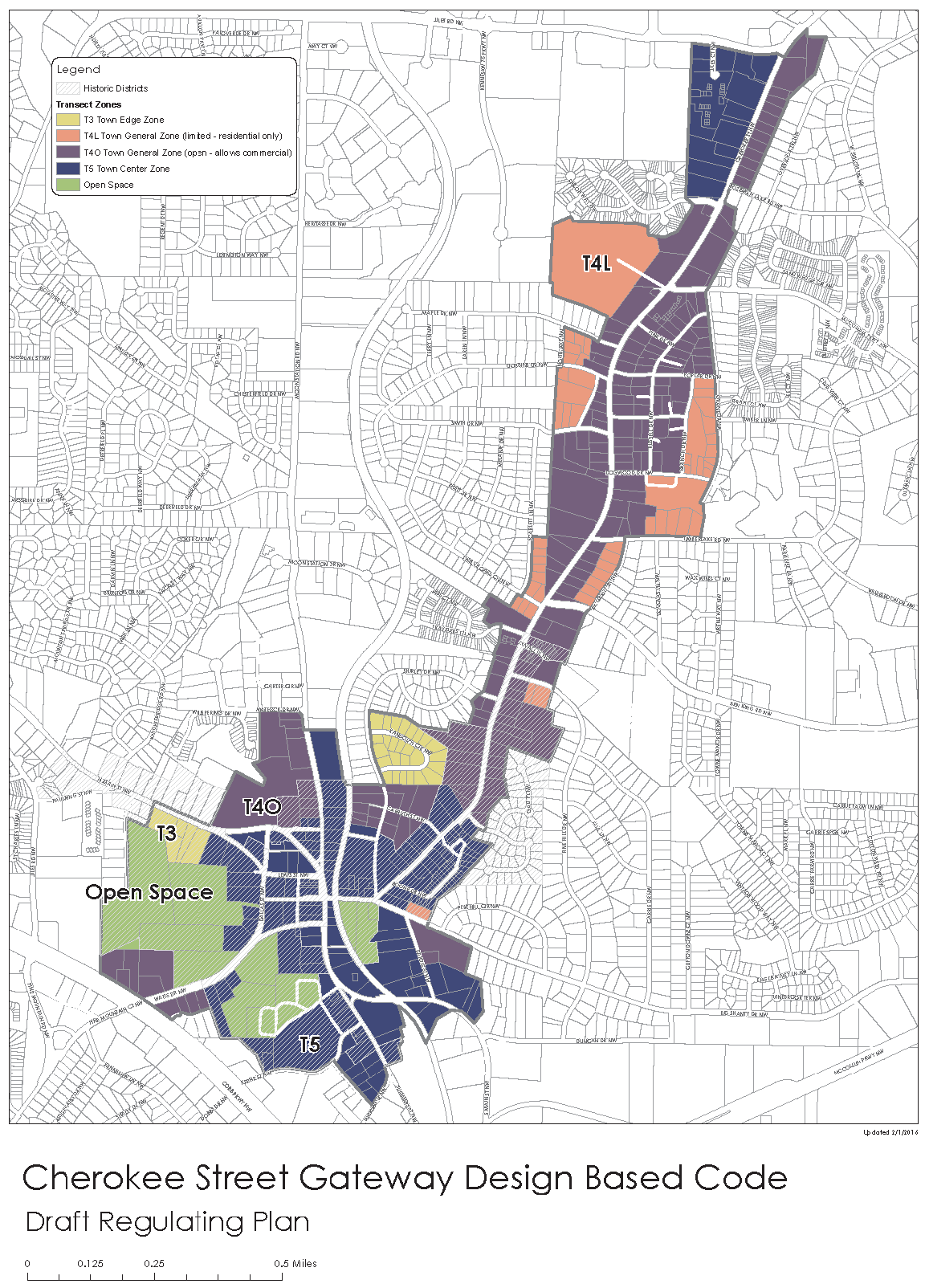
(Ord. No. 2016-03, Att., 3-7-16)