
Los Altos City Zoning Code
CHAPTER 14
88 - ZONING MAP AMENDMENTS
Sections:
14.88.010 - Zoning map amended.
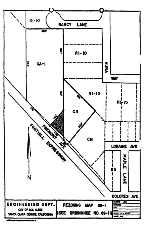
A.
That portion of OA-1 District, hereinafter described, is hereby changed to CN district and zoned in accordance therewith.
B.
All properties as delineated on Rezoning Map No. 69-1 incorporated hereby by reference.
C.
The zoning map is amended in accordance with the provisions of this section, and the district boundaries are so designated.
(Prior code § 10-2.3401)
14.88.020 - Zoning map amended.
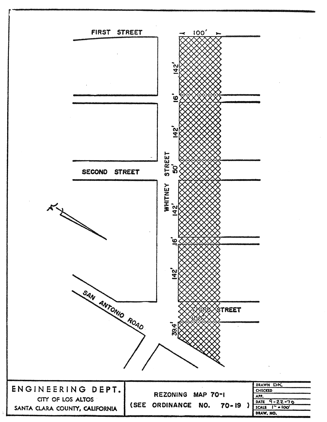
A.
That portion of CRS District, hereinafter described, is hereby changed to CD District and zoned in accordance therewith.
B.
All properties as delineated on Rezoning Map No. 70-1 incorporated herein by reference.
C.
The zoning map is amended in accordance with the provisions of this section, and the district boundaries are so designated.
(Prior code § 10-2.3402)
14.88.030 - Zoning map amended.
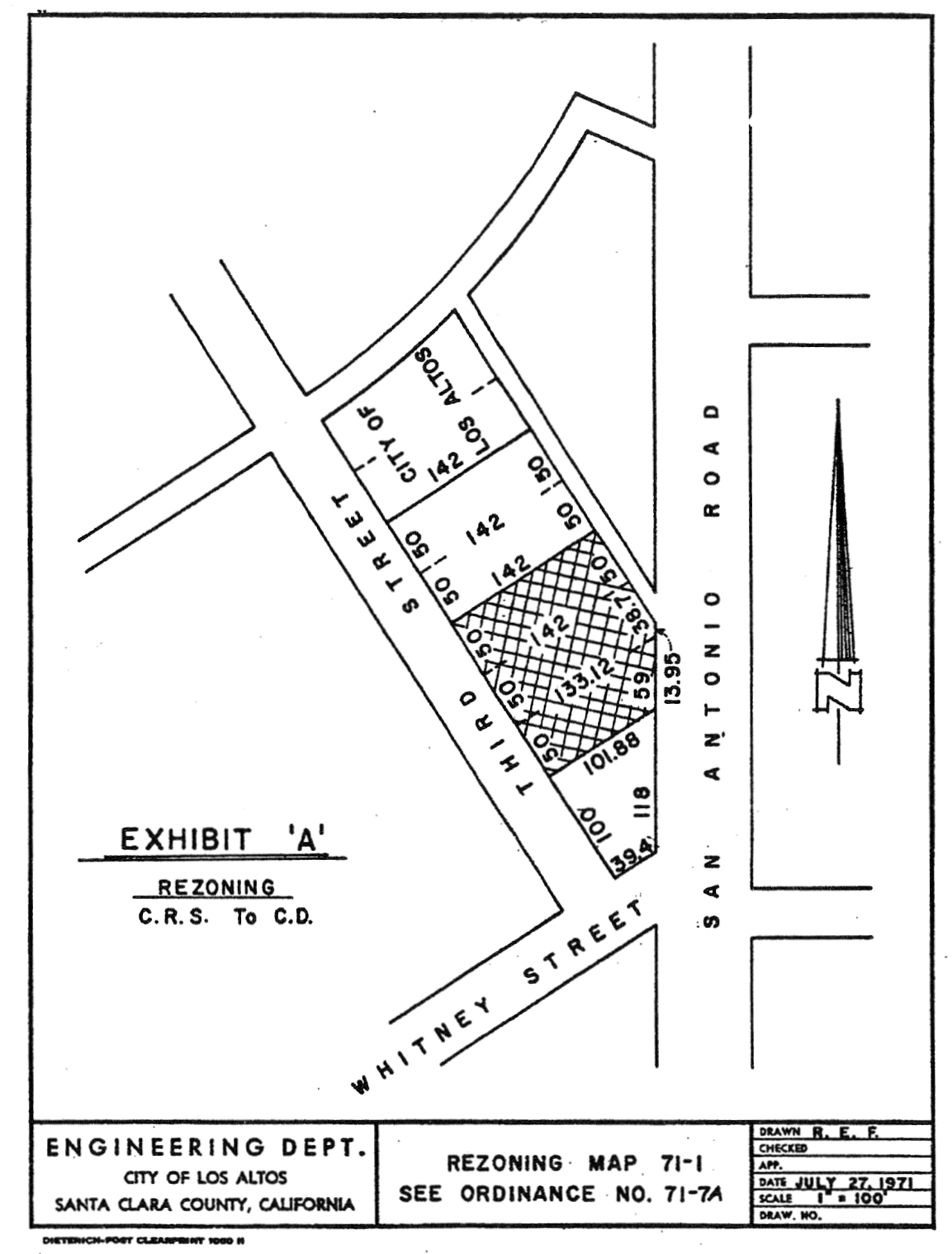
A.
That portion of CRS District, hereinafter described, is hereby changed to CD District and zoned in accordance therewith.
B.
All properties as delineated on Rezoning Map No. 71-1, attached hereto and incorporated herein by reference.
C.
The zoning map is amended in accordance with the provisions of this section, and the district boundaries are so designated.
(Prior code § 10-2.3403)
14.88.040 - Zoning map amended.
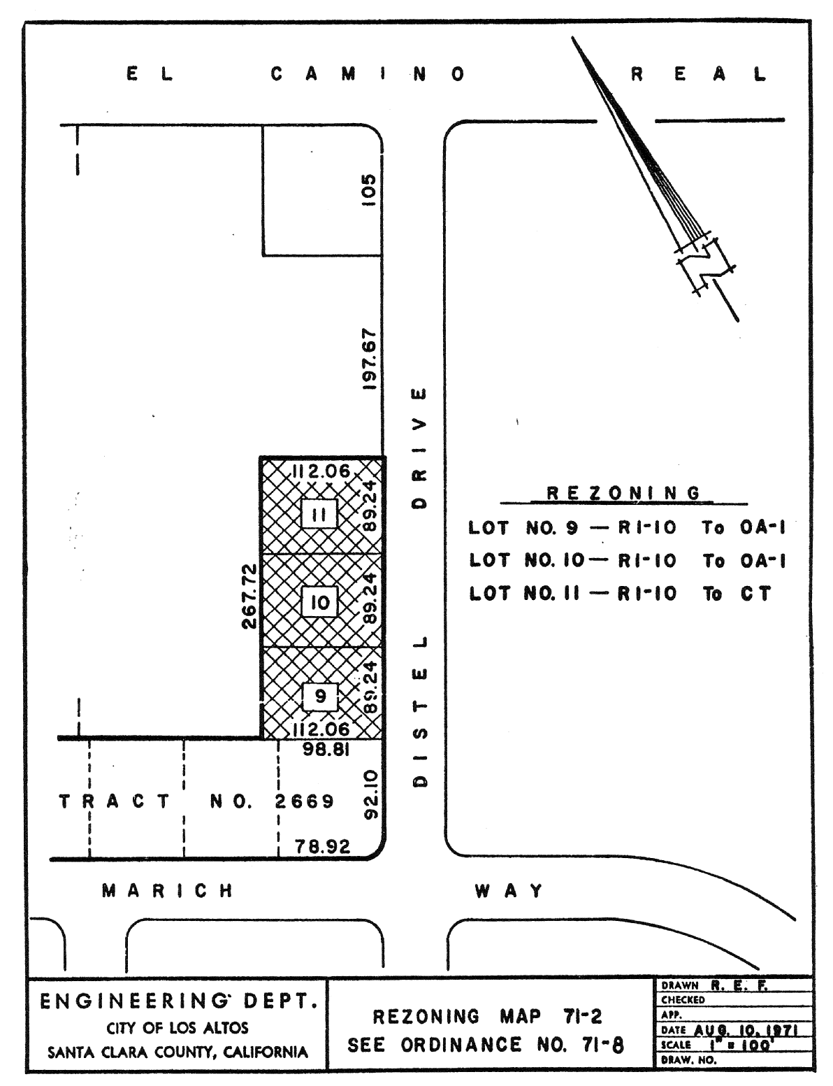
A.
That portion of R1-10 District, hereinafter described, is hereby changed to OA-1 District and zoned in accordance therewith.
B.
All of Lots 9 and 10, Tract 2669, Solomon Tract, as shown upon the map of said Tract 2669, Solomon Tract, filed for record in Book 141 of Maps, at Page 7, in the office of the county recorder of Santa Clara County.
C.
That portion of R1-10 District, hereinafter described, is hereby changed to CT District and zoned in accordance therewith.
D.
All of Lot 11, Tract 2669, Solomon Tract, as shown upon the map of said Tract 2669, Solomon Tract, filed for record in Book 141 of Maps, at Page 7, in the Office of the County Recorder of Santa Clara County.
E.
The zoning map is amended in accordance with the provisions of this section, and the district boundaries are so designated. An insert copy of Rezoning Map No. 71-2, showing the described areas, is attached hereto and incorporated herein by reference.
(Prior code § 10-2.3404)
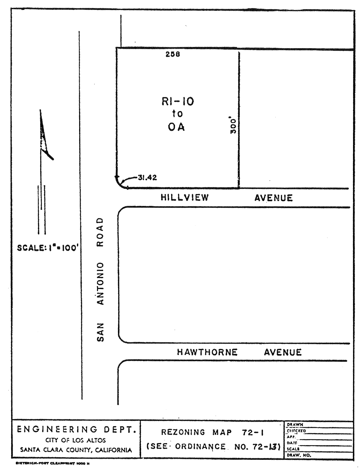
14.88.050 - Zoning map amended.
A.
That portion of R1-10 District, hereinafter described, is hereby changed to QA District and zoned in accordance therewith.
B.
All properties as delineated on Rezoning Map No. 72-1, attached hereto and incorporated herein by reference.
C.
The zoning map is amended in accordance with the provisions of this section, and the district boundaries are so designated.
(Prior code § 10-2.3405)
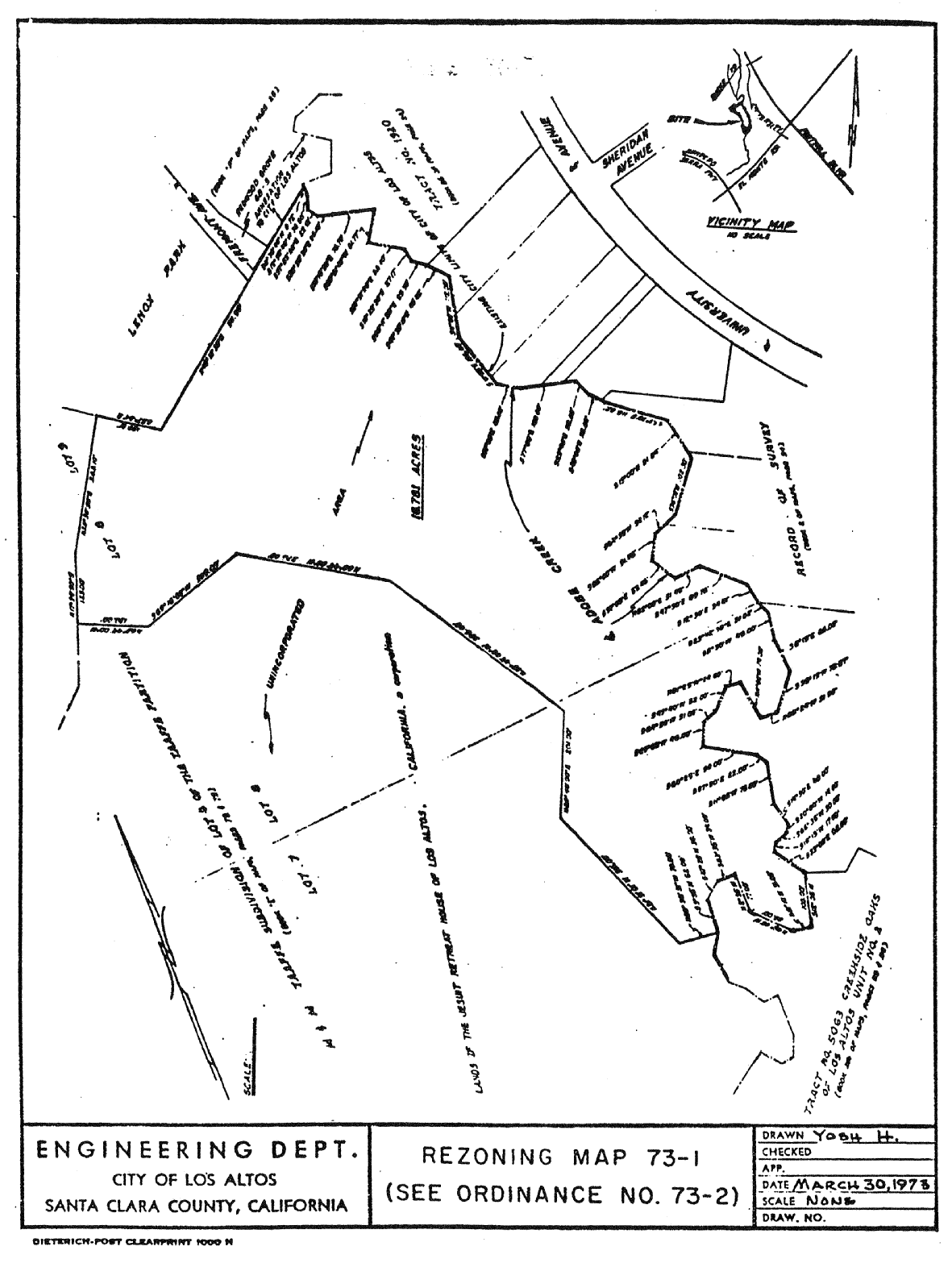
14.88.060 - Zoning map amended.
A.
That property hereinafter described, designated as "University 72-1," is hereby zoned R1-40 District.
B.
All properties as delineated on Rezoning Map No. 73-1, attached hereto and incorporated herein by reference.
C.
The zoning map is amended in accordance with the provisions of this section, and the district boundaries are so designated.
(Prior code § 10-2.3406)
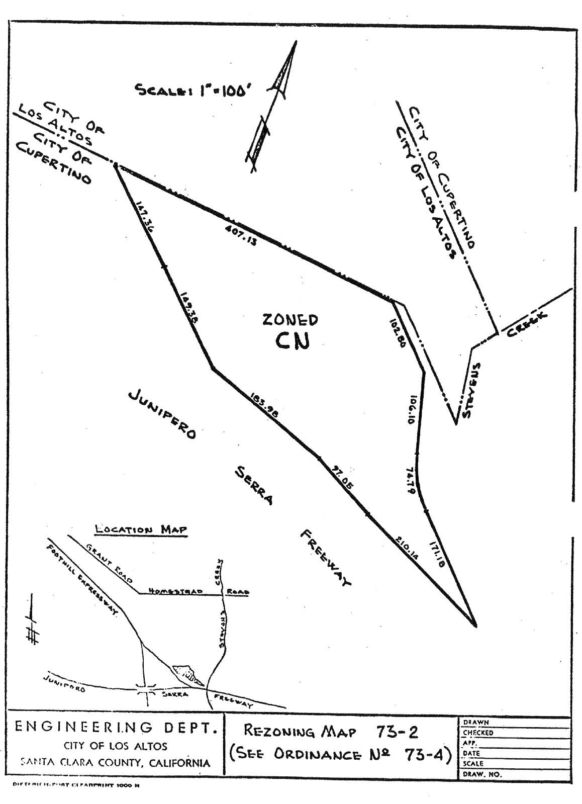
14.88.070 - Zoning map amended.
A.
That property hereinafter described is hereby zoned CN District.
B.
All properties as delineated on Rezoning Map No. 73-2, attached hereto and incorporated herein by reference.
C.
The zoning map is amended in accordance with the provisions of this section, and the district boundaries are so designated.
(Prior code § 10-2.3407)
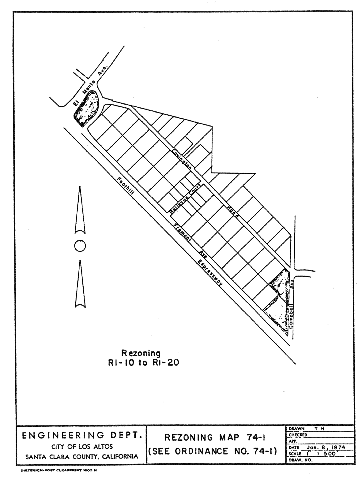
14.88.080 - Zoning map amended.
A.
That property hereinafter described is hereby zoned R1-20 District.
B.
All properties as delineated on Rezoning Map No. 74-1, attached hereto and incorporated herein by reference.
C.
The zoning map is amended in accordance with the provisions of this section, and the district boundaries are so designated.
(Prior code § 10-2.3408)
14.88.090 - Zoning map amended.
A.
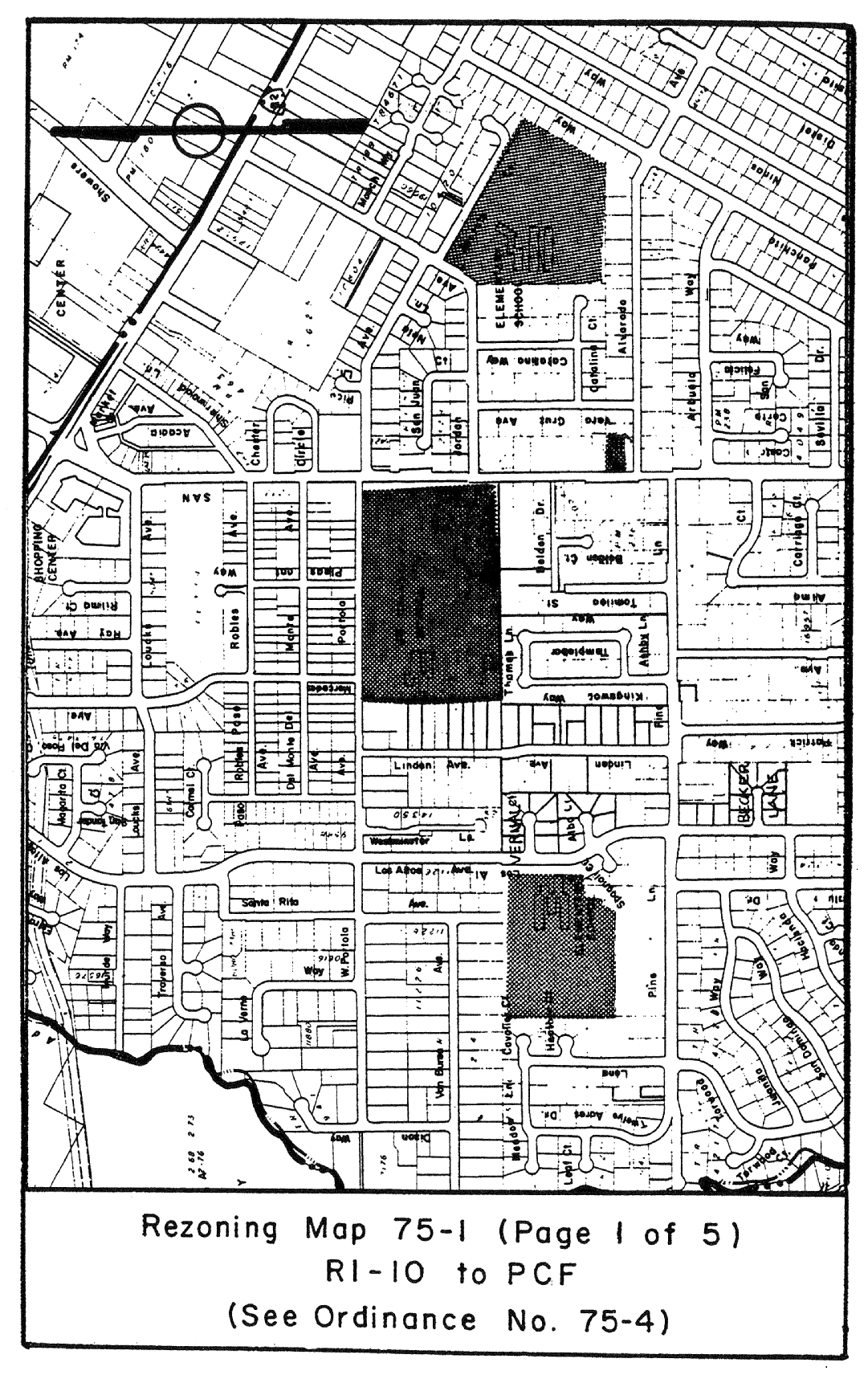
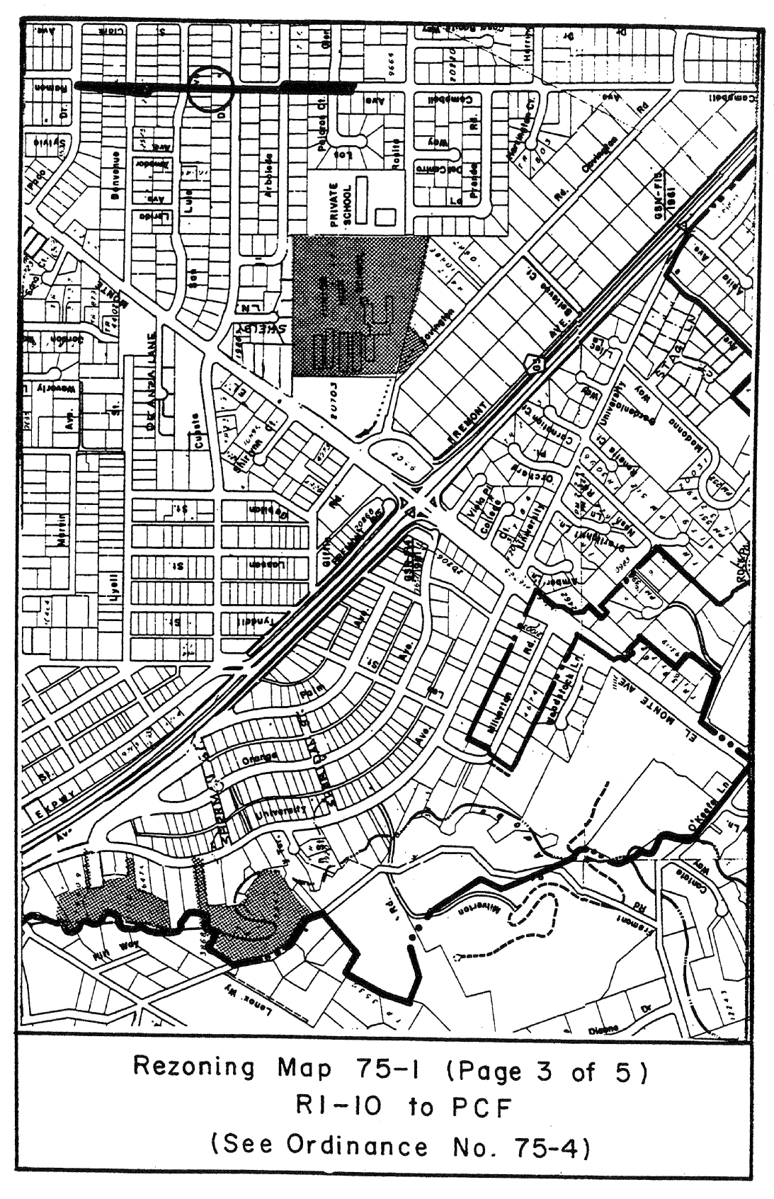
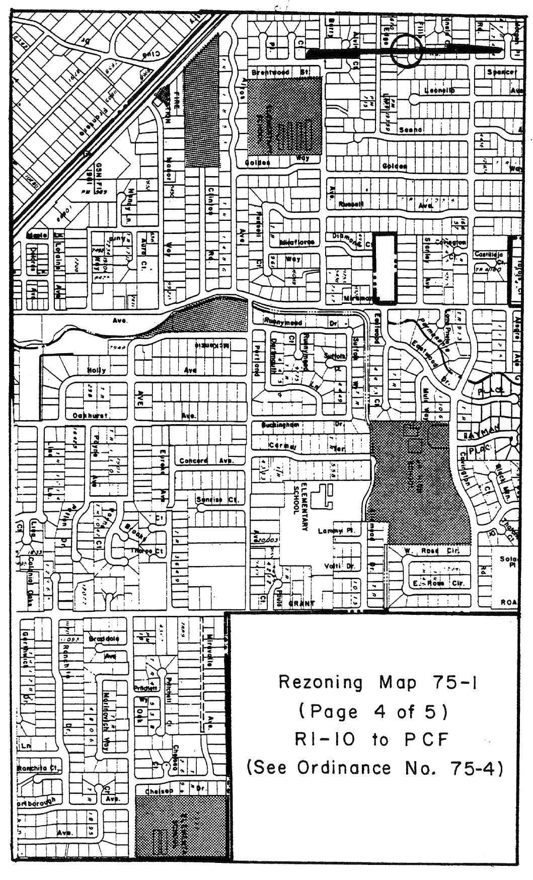
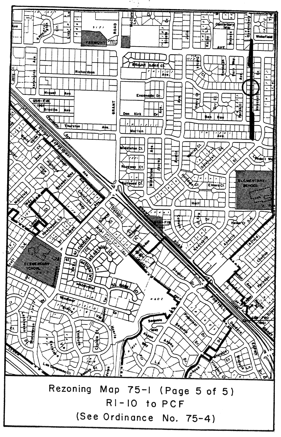
That portion of R1-10 District hereinafter described is hereby changed to PCF District and zoned in accordance therewith.
B.
All properties as delineated on Rezoning Map No. 75-1, attached hereto and incorporated herein by reference.
C.
The zoning map is amended in accordance with the provisions of this section, and the district boundaries are so designated.
(Prior code § 10-2.3410)

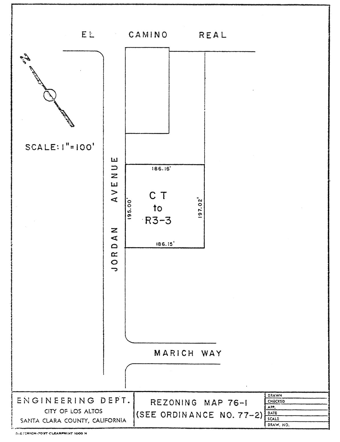
14.88.100 - Zoning map amended.
A.
That portion of CT District hereinafter described is hereby changed to R3-3 District and zoned in accordance therewith.
B.
All properties as delineated on Rezoning Map No. 76-1, attached hereto and incorporated herein by reference.
C.
The zoning map is amended in accordance with the provisions of this section, and the district boundaries are so designated.
(Prior code § 10-2.3411)
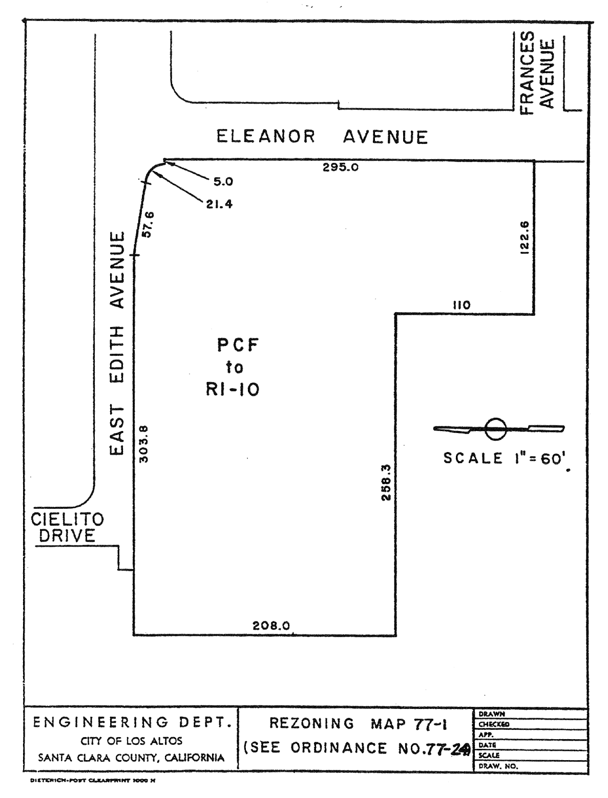
14.88.110 - Zoning map amended.
A.
That portion of PCF District hereinafter described is hereby changed to R1-10 District and zoned in accordance therewith.
B.
All properties as delineated on Rezoning Map No. 77-1, attached hereto and incorporated herein by reference.
C.
The zoning map is amended in accordance with the provisions of this section, and the district boundaries are so designated.
(Prior code § 10-2.3412)
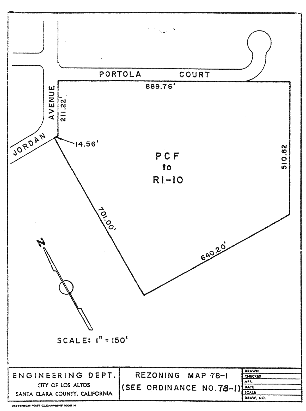
14.88.120 - Zoning map amended.
A.
That portion of PCF District hereinafter described is hereby changed to R1-10 District and zoned in accordance therewith.
B.
All properties as delineated on Rezoning Map No. 78-1, attached hereto and incorporated herein by reference.
C.
The zoning map is amended in accordance with the provisions of this section, and the district boundaries are so designated.
(Prior code § 10-2.3413)
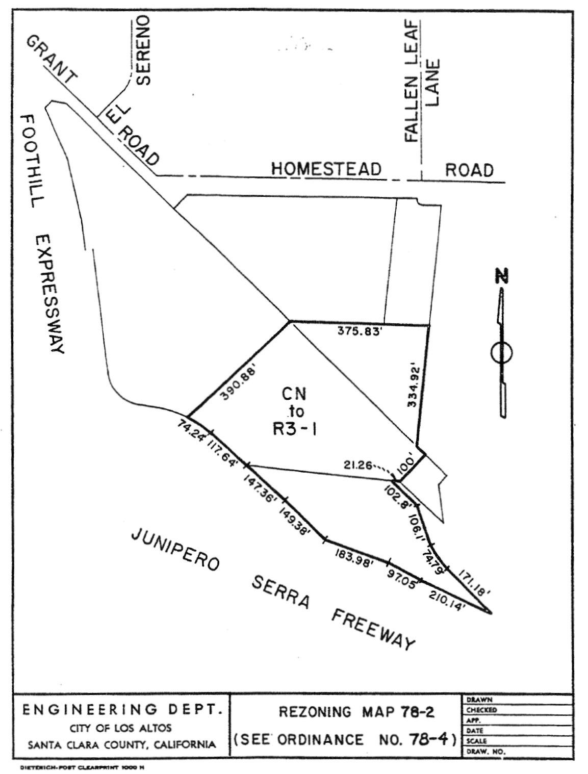
14.88.130 - Zoning map amended.
A.
That portion of CN District hereinafter described is hereby changed to R3-1 District and zoned in accordance therewith.
B.
All properties as delineated on Rezoning Map No. 78-2, attached hereto and incorporated herein by reference.
C.
The zoning map is amended in accordance with the provisions of this section, and the district boundaries are so designated.
(Prior code § 10-3414)
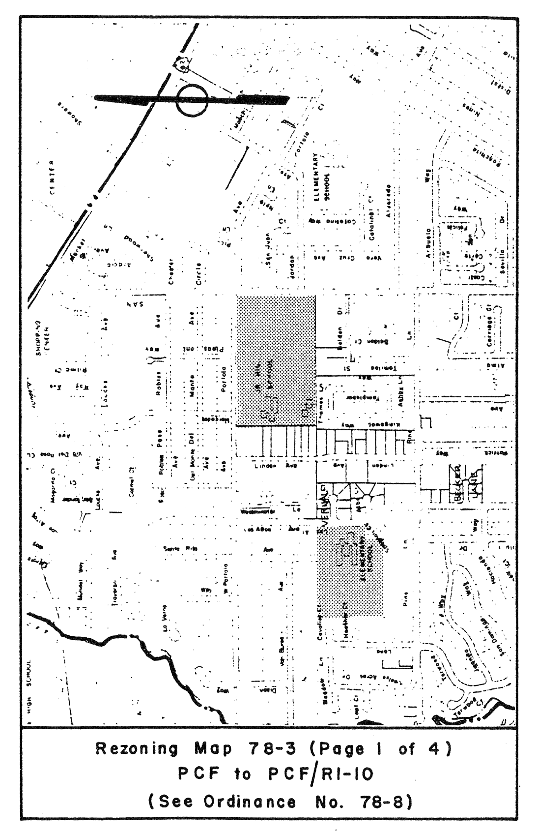
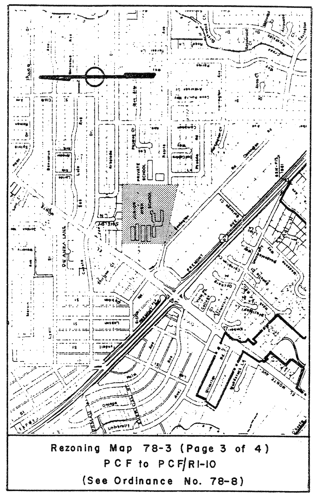
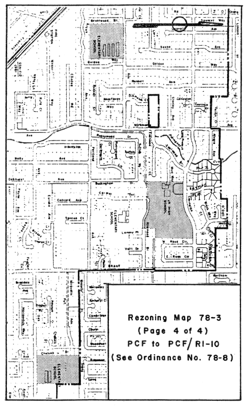
14.88.140 - Zoning map amended.
A.
That portion of PCF District hereinafter described is hereby changed to PCF/R1-10 District and zoned in accordance therewith.
B.
All properties as delineated on Rezoning Map No. 78-3, attached hereto and incorporated herein by reference.
C.
The zoning map is amended in accordance with the provisions of this section, and the district boundaries are so designated.
(Prior code § 10-2.3415)

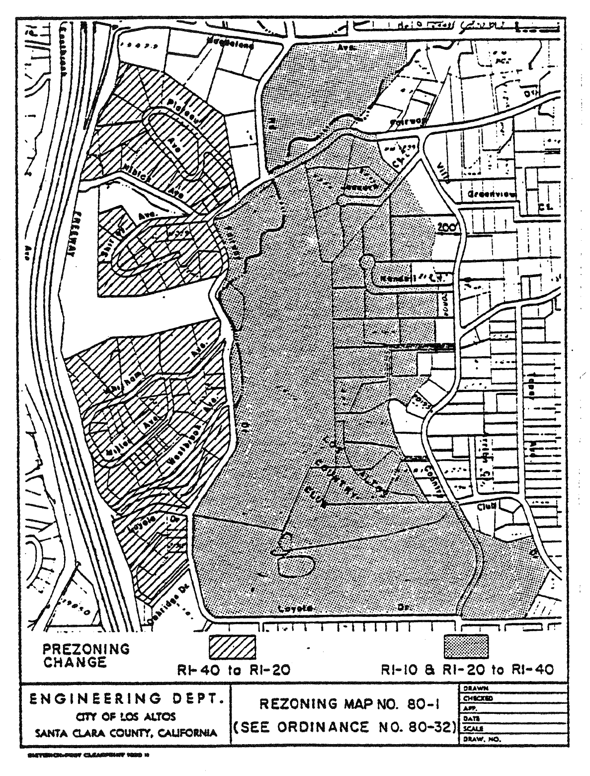
14.88.150 - Zoning map amended.
A.
That portion of R1-20 District as delineated on Rezoning Map No. 80-1, attached hereto and incorporated herein by reference, is hereby changed to R1-40 District and prezoned in accordance therewith.
B.
That portion of R1-40 District as delineated on Rezoning Map No. 80-1, attached hereto and incorporated herein by reference, is hereby changed to R1-20 District and prezoned in accordance therewith.
C.
The zoning map is amended in accordance with the provisions of this section, and the district boundaries are so designated.
(Prior code § 10-2.3416)
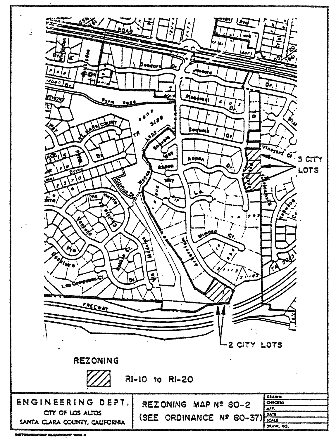
14.88.160 - Zoning map amended.
A.
That portion of R1-10 District as delineated on Rezoning Map No. 80-2, attached hereto and incorporated herein by reference, is hereby changed to R1-20 District and zoned in accordance therewith.
B.
The zoning map is amended in accordance with the provisions of this section, and the district boundaries are so designated.
(Prior code § 10-2.3417)
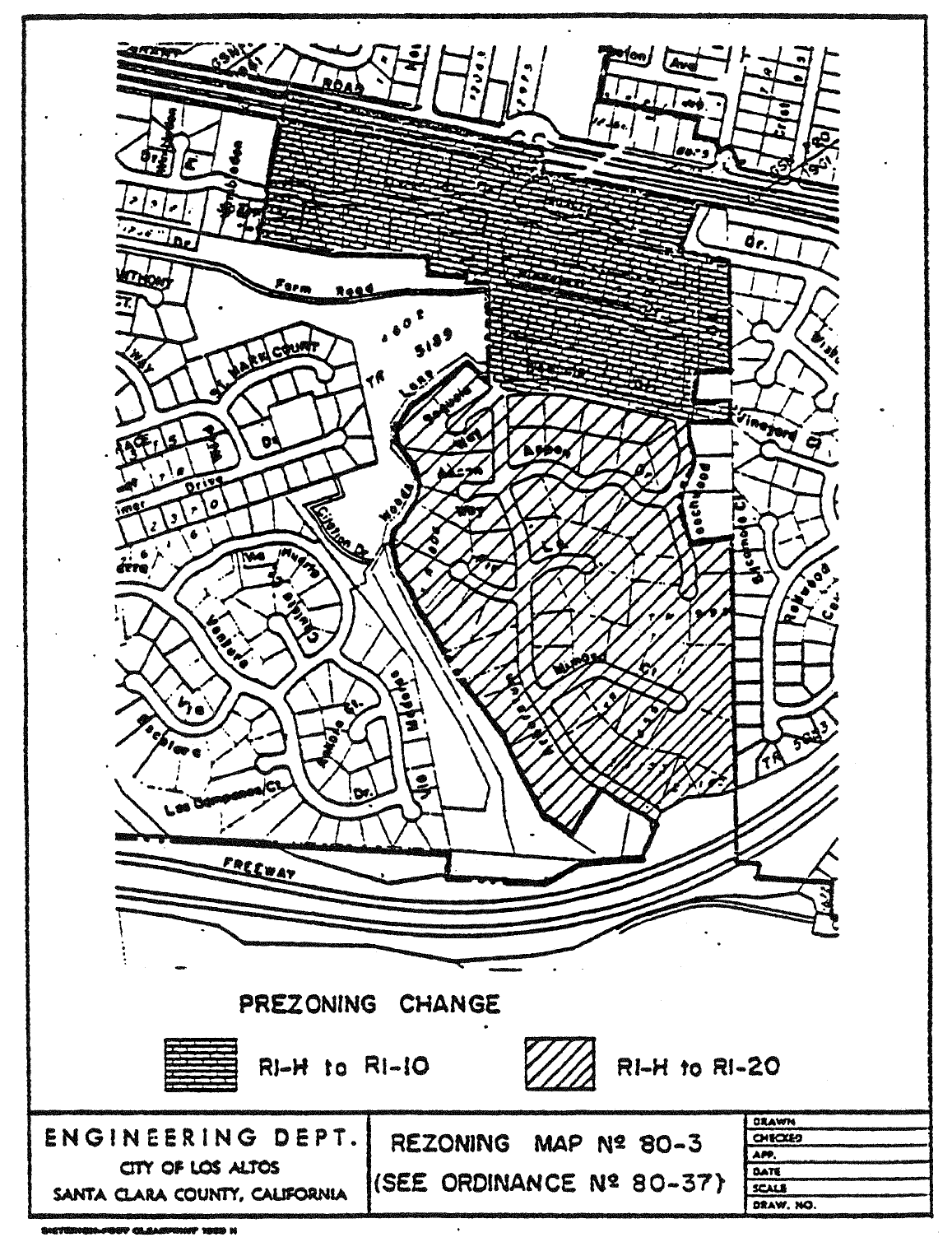
14.88.170 - Zoning map amended
A.
That portion of R1-H District as delineated on Rezoning Map No. 80-3, attached hereto and incorporated herein by reference, is hereby changed to R1-20 District and prezoned in accordance therewith.
B.
That portion of R1-H District as delineated on Rezoning Map No. 80-3, attached hereto and incorporated herein by reference, is hereby changed to R1-10 District and prezoned in accordance therewith.
C.
The zoning map is amended in accordance with the provisions of this section, and the district boundaries are so designated.
(Prior code § 10-2.3418)
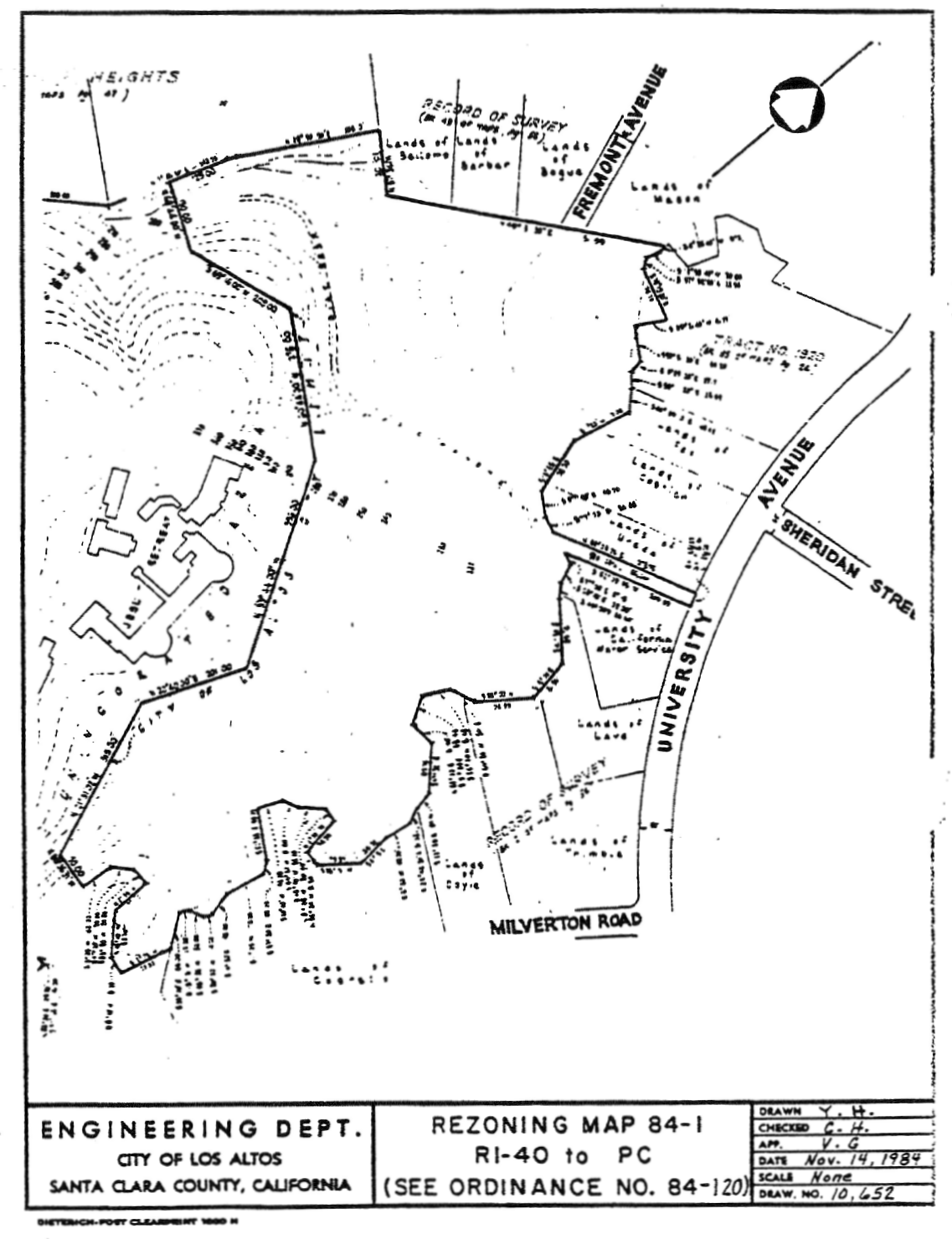
14.88.180 - Zoning map amended.
A.
That portion of the R140 District, as delineated on Rezoning Map No. 84-1, attached hereto and incorporated herein by reference, is hereby changed to the PC District and zoned in accordance therewith.
B.
The zoning map is amended in accordance with the provisions of this section, and the district boundaries are so designated.
(Prior code § 10-2.3419)
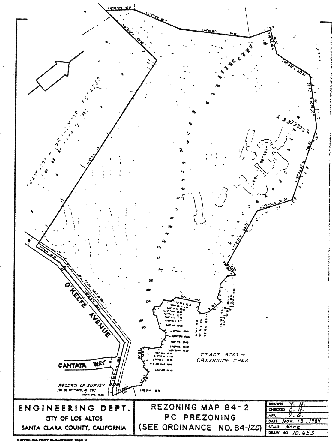
14.88.190 - Zoning map amended.
A.
All properties as delineated on Rezoning Map No. 84-2, attached hereto and incorporated herein by reference, are hereby prezoned to the PC District.
B.
The Zoning Map is amended in accordance with the provisions of this section, and the district boundaries are so designated.
(Prior code § 10-2.3420)
14.88.200 - Zoning map amended.
A.
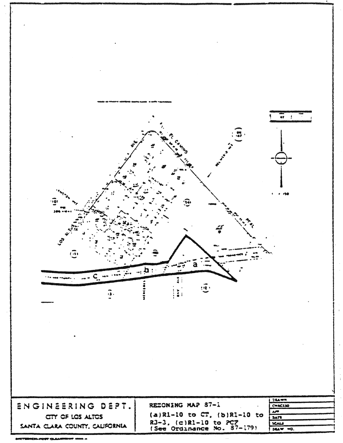
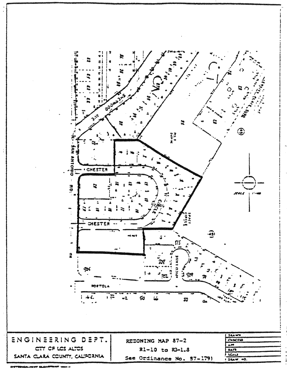
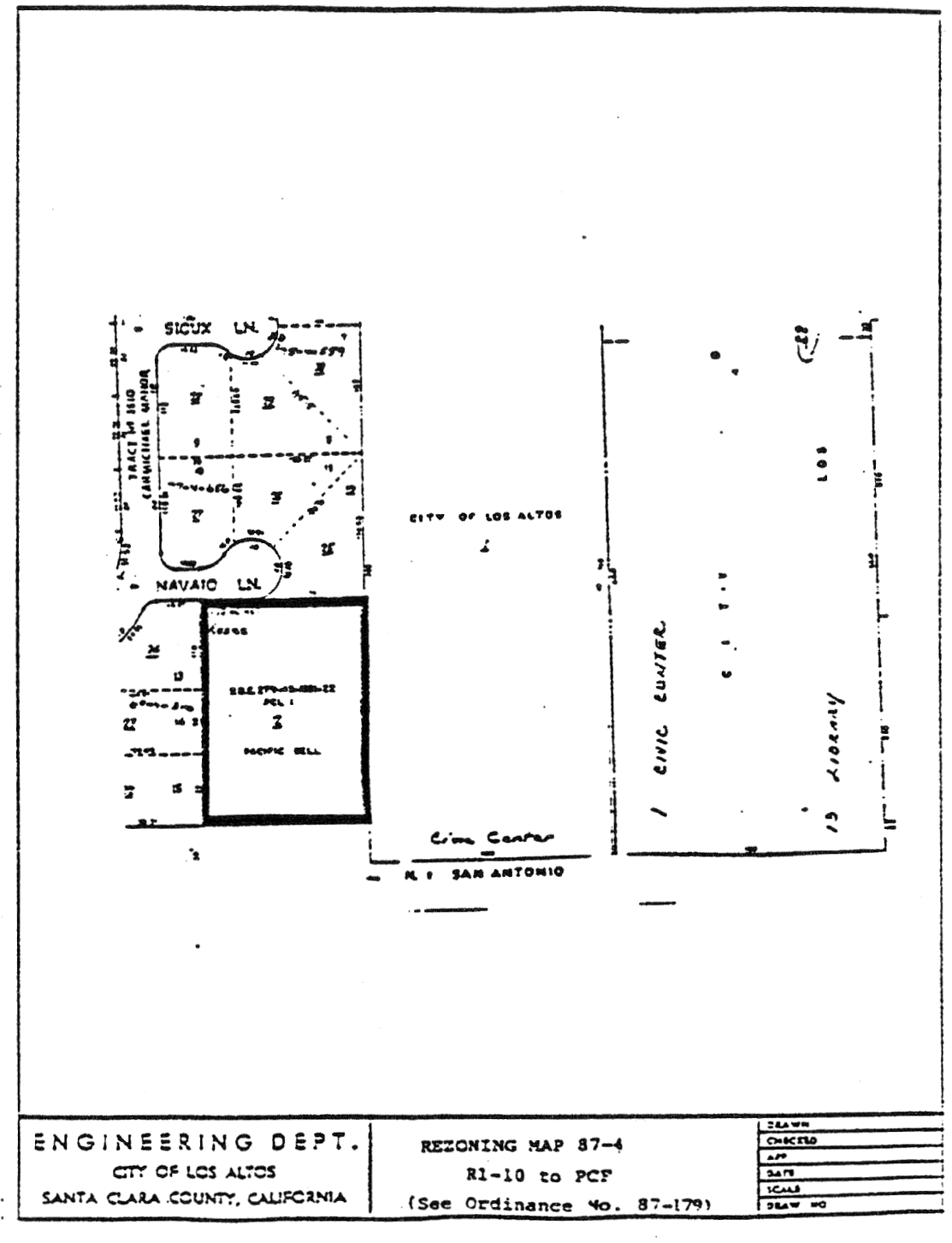
That property hereinafter described and delineated on Rezoning Map Nos. 87-1 through 87-12, attached hereto and incorporated herein by reference, is hereby zoned and prezoned in accordance therewith.
1.
All properties as delineated on Rezoning Map No. 87-1 (Site a) attached hereto and incorporated herein by reference are hereby zoned CT District.
2.
All properties as delineated on Rezoning Map No. 87-1 (Site b) attached hereto and incorporated herein by reference are hereby zoned R3-3 District.
3.
All properties as delineated on Rezoning Map No. 87-2 attached hereto and incorporated herein by reference are hereby zoned R3-1.8 District.
4.
All properties as delineated on Rezoning Map No. 87-3 attached hereto and incorporated herein by reference are hereby zoned PCF/R1-l0 District.
5.
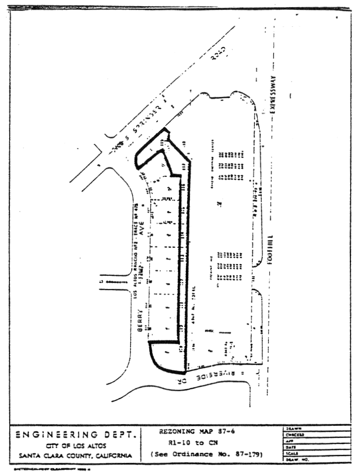
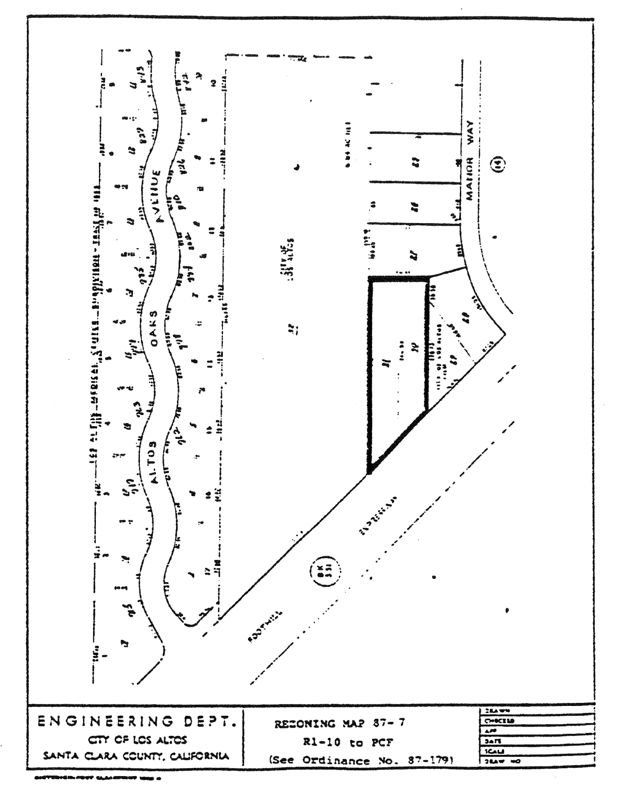
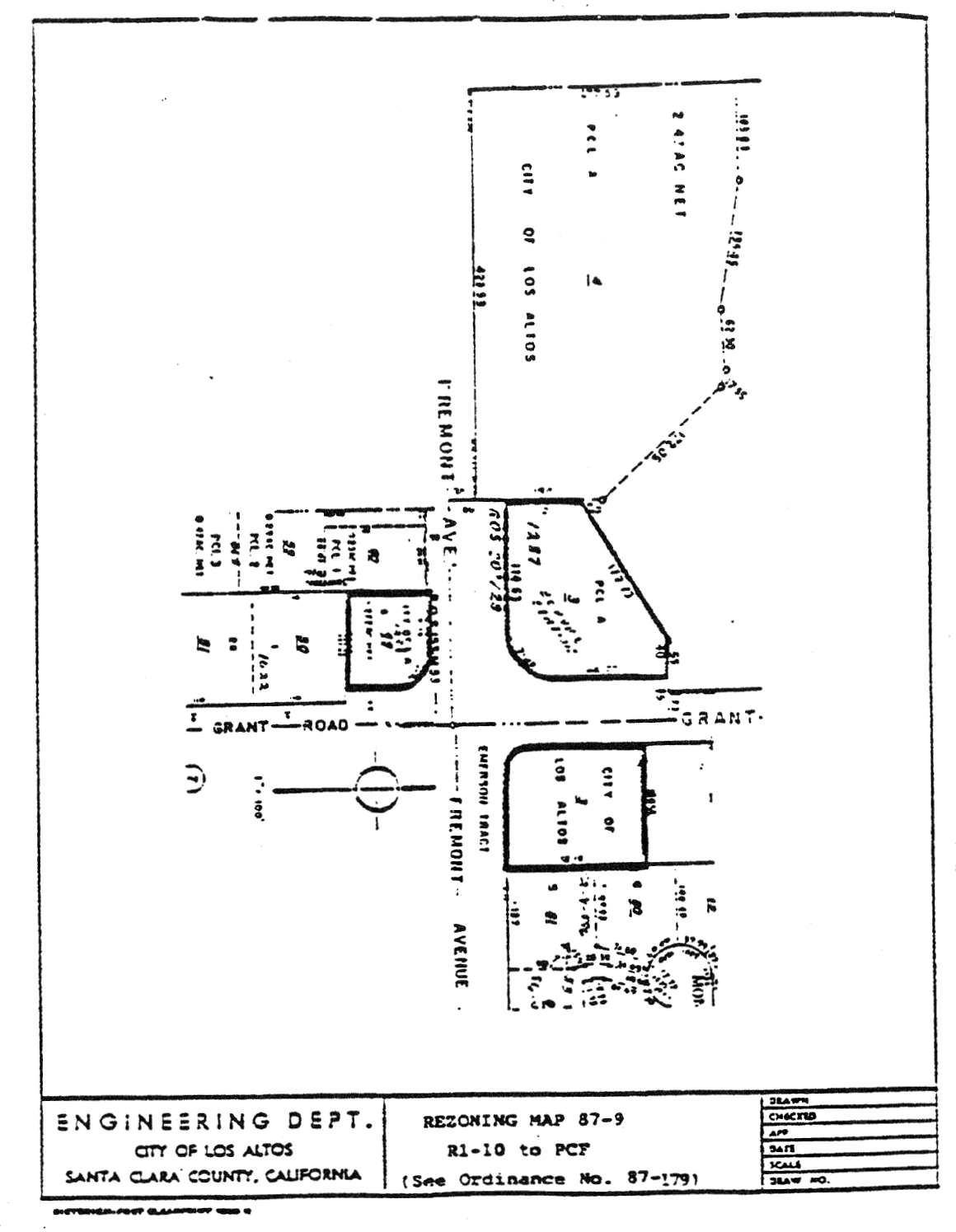
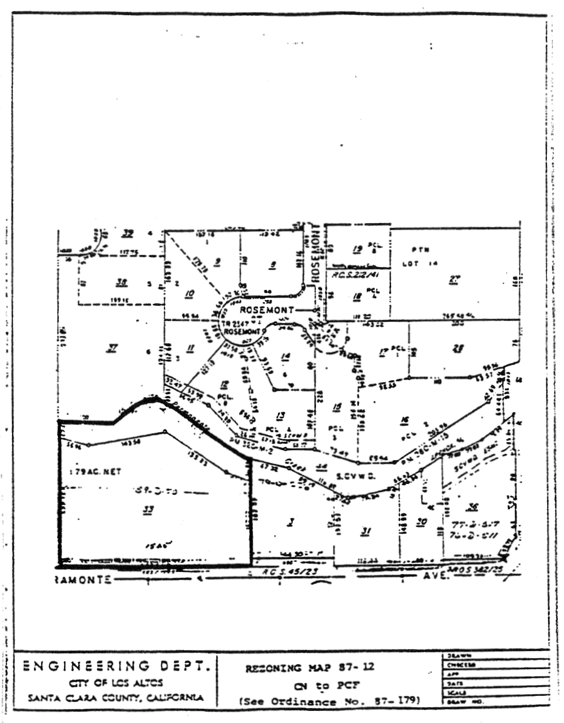
All properties as delineated on Rezoning Map Nos. 87-I (Site c), 87-4, 87-5, 87-7, 87-9, and 87-12 attached hereto and incorporated herein by reference are hereby zoned PCF District.
6.
All properties as delineated on Rezoning Map No. 87-6 attached hereto and incorporated herein by reference are hereby zoned CN District.
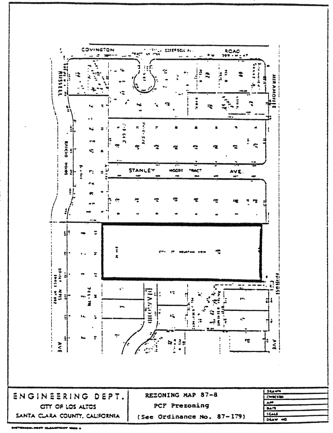
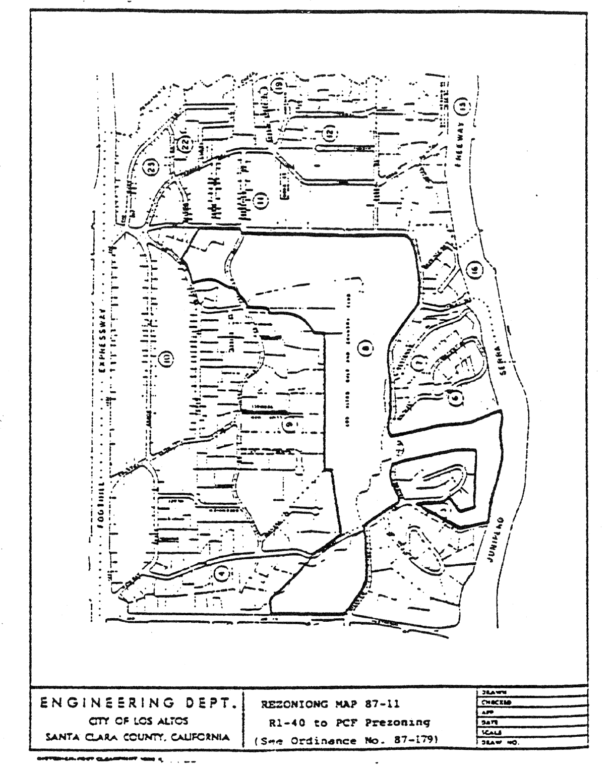
7.
All properties as delineated on Rezoning Map Nos. 87-8 and 87-11 attached hereto and incorporated herein by reference are hereby prezoned PCF District.
8.
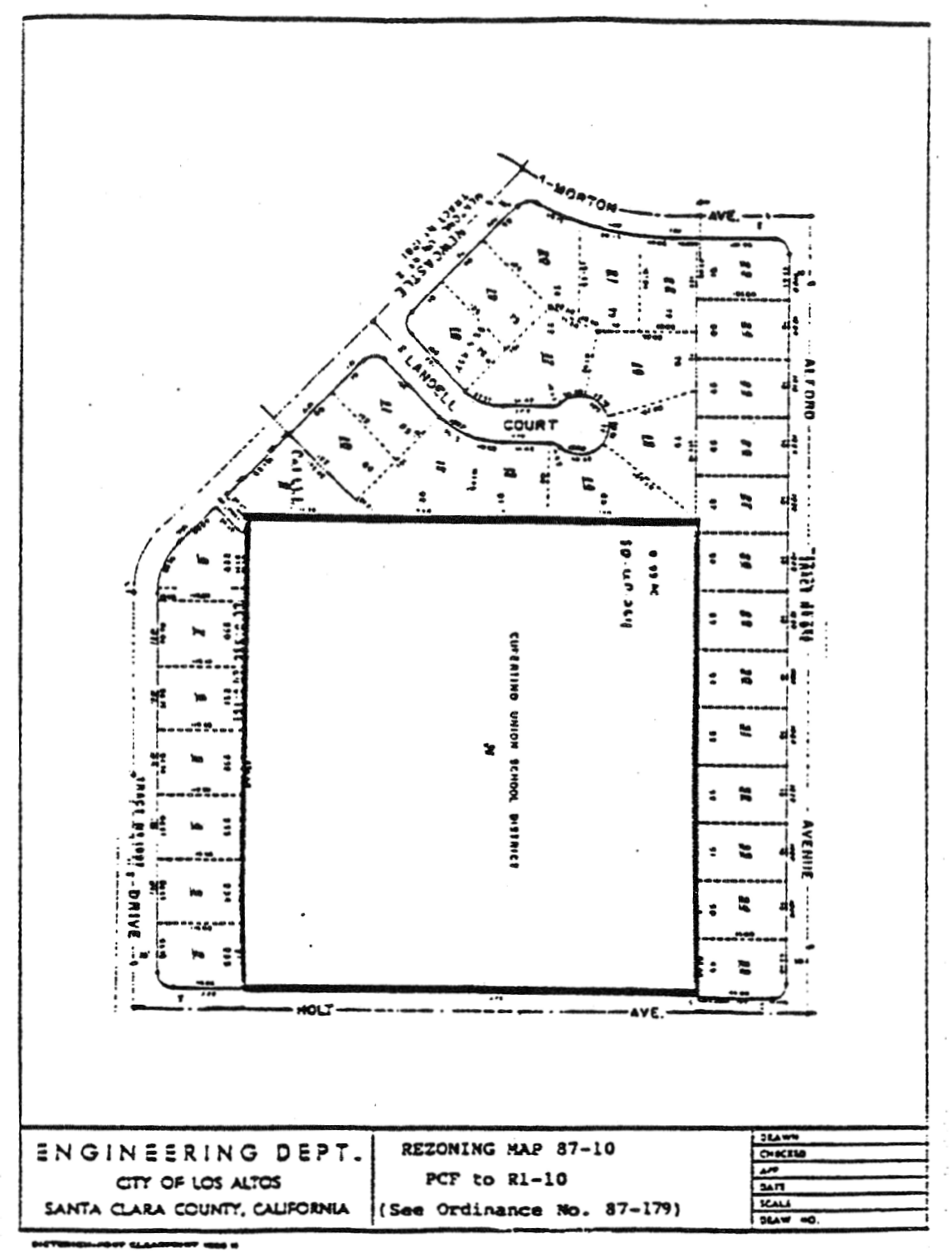
All properties as delineated on Rezoning Map No. 87-10 attached hereto and incorporated herein by reference are hereby zoned R1-10 District.
B.
The Zoning Map is amended in accordance with the provisions of this section, and the district boundaries are so designated.
(Prior code § 10-2.3421)

14.88.210 - Zoning map amended.
A.
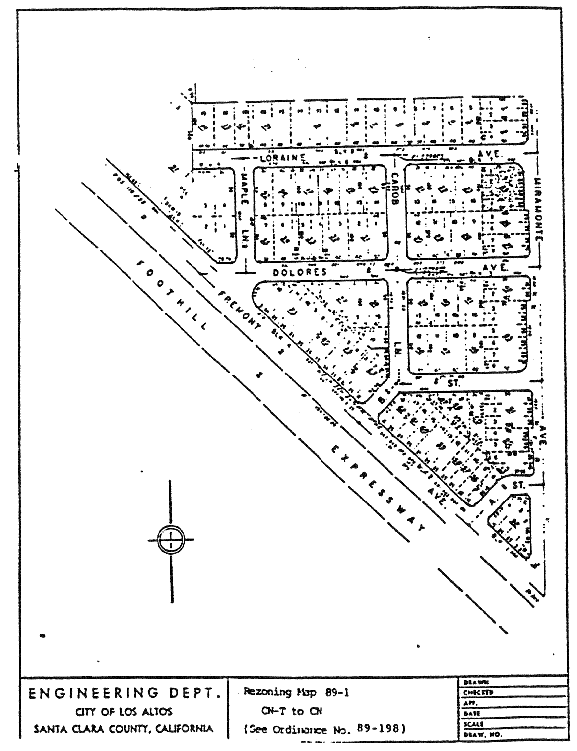
That property hereinafter described and delineated on Rezoning Map No. 89-1, attached hereto and incorporated herein by reference, is hereby zoned CN District.
B.
The Zoning Map is amended in accordance with the provisions of this Section and the district boundaries are so designated.
(Prior code § 10-2.3422)
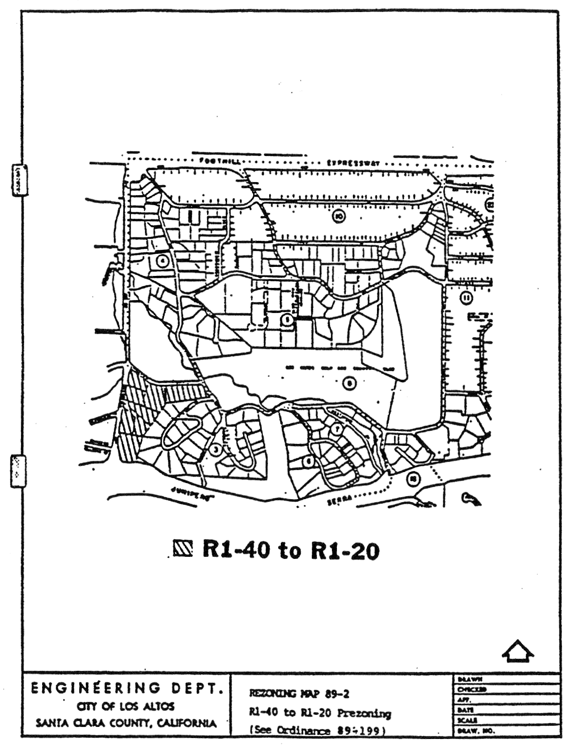
14.88.220 - Zoning map amended.
A.
Property hereinafter described and delineated on Rezoning Map No. 89-2, attached hereto and incorporated herein by reference, is hereby prezoned R1-20 District
B.
The Zoning Map is amended in accordance with the provisions of this section and the district boundaries are so designated.
(Prior code § 10-2.3423)
14.88.230 - Zoning map amended.
A.
Portion of R1-10 District, as delineated on Rezoning Map No. 89-3, attached hereto and incorporated herein by reference, is hereby changed to PCF District
B.
The Zoning Map is amended in accordance with the provisions of this section and the district boundaries are so designated.
(Prior code § 10-2.3424)

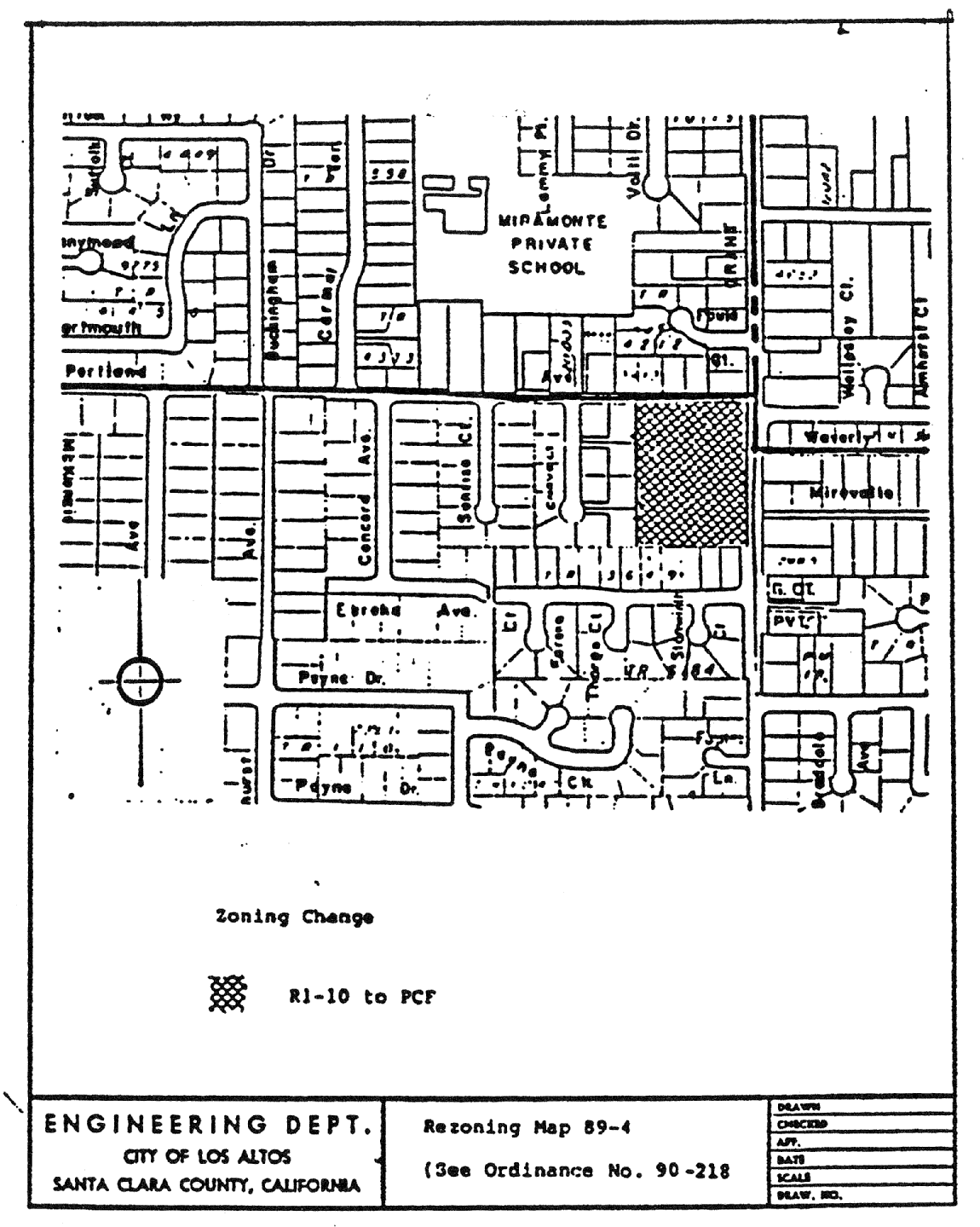
14.88.240 - Zoning map amended.
A.
That portion of R1-10 District, as delineated on Rezoning Map No. 89-4, attached hereto and incorporated herein by reference, is hereby changed to PCF District.
B.
The Zoning Map is amended in accordance with provisions of this section and the district boundaries are so designated.
(Prior code § 10-2.3425)
14.88.250 - Zoning map amended.
That property hereinafter described and delineated on Rezoning Map No. 90-1, attached hereto and incorporated herein by reference, is hereby zoned CS District.
(Prior code § 10-2.3426)
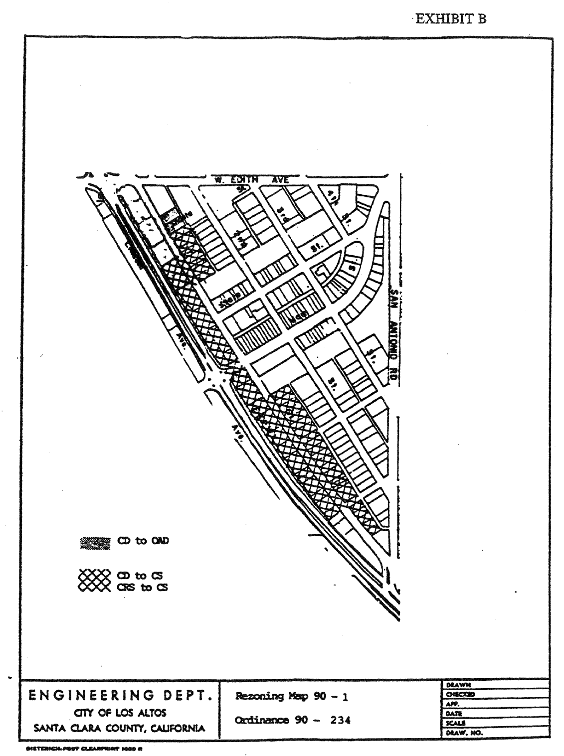
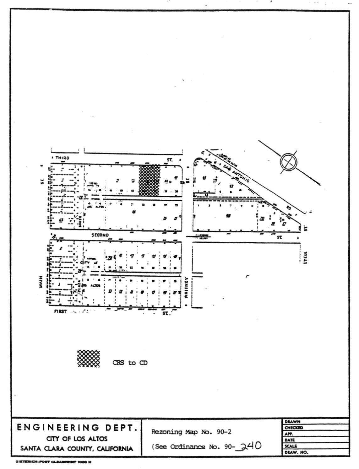
14.88.260 - Zoning map amended.
That portion of CRS District, as delineated on Rezoning Map No. 90-2, attached hereto and incorporated herein by reference, is hereby changed to CD District
(Prior code § 10-2.3427)
14.88.270 - Zoning map amended.
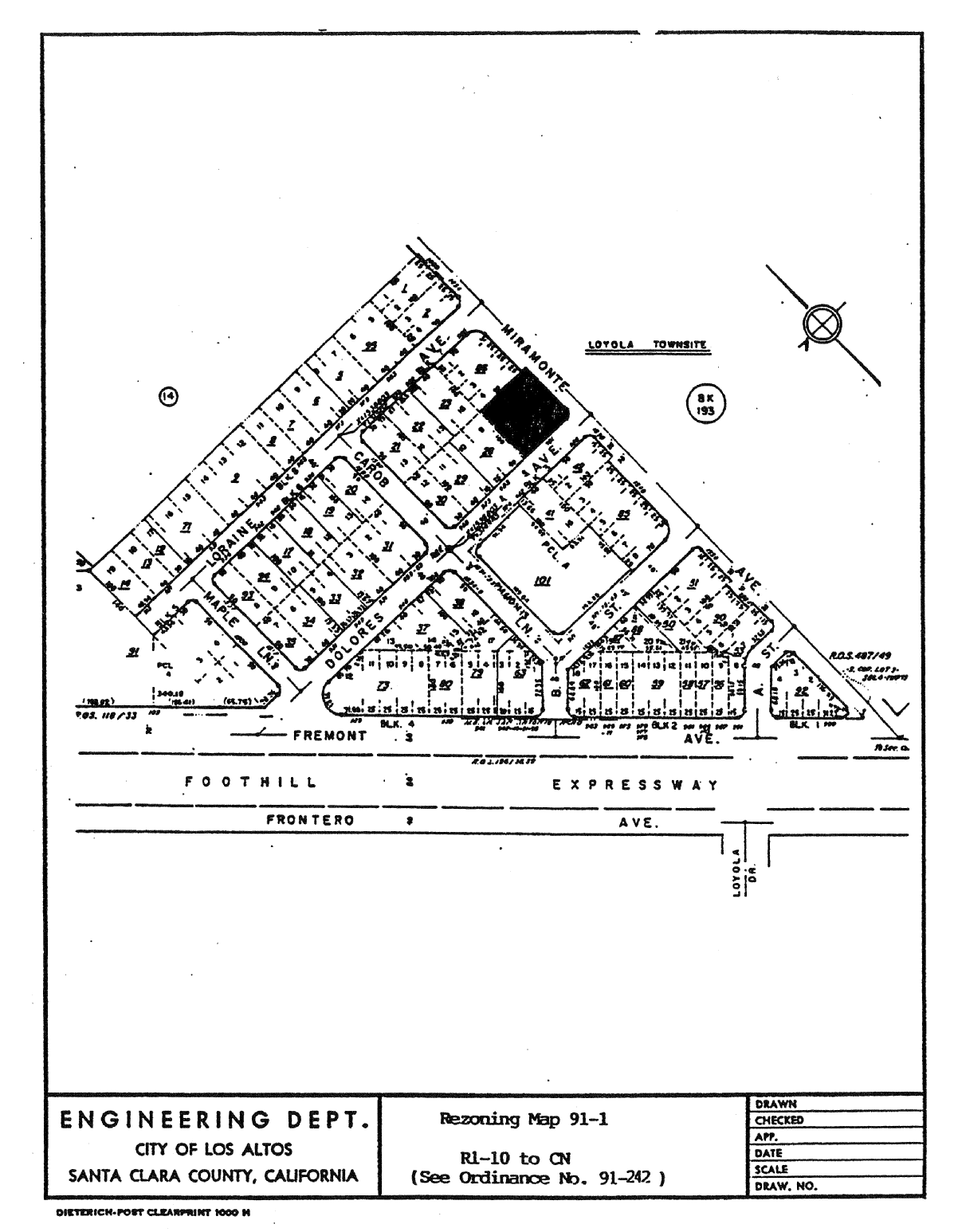
That property hereinafter described and delineated on Rezoning Map No. 91-1, attached hereto and incorporated herein by reference, is hereby zoned CN District.
(Prior code § 10-2.3428)
14.88.280 - Zoning map amended.
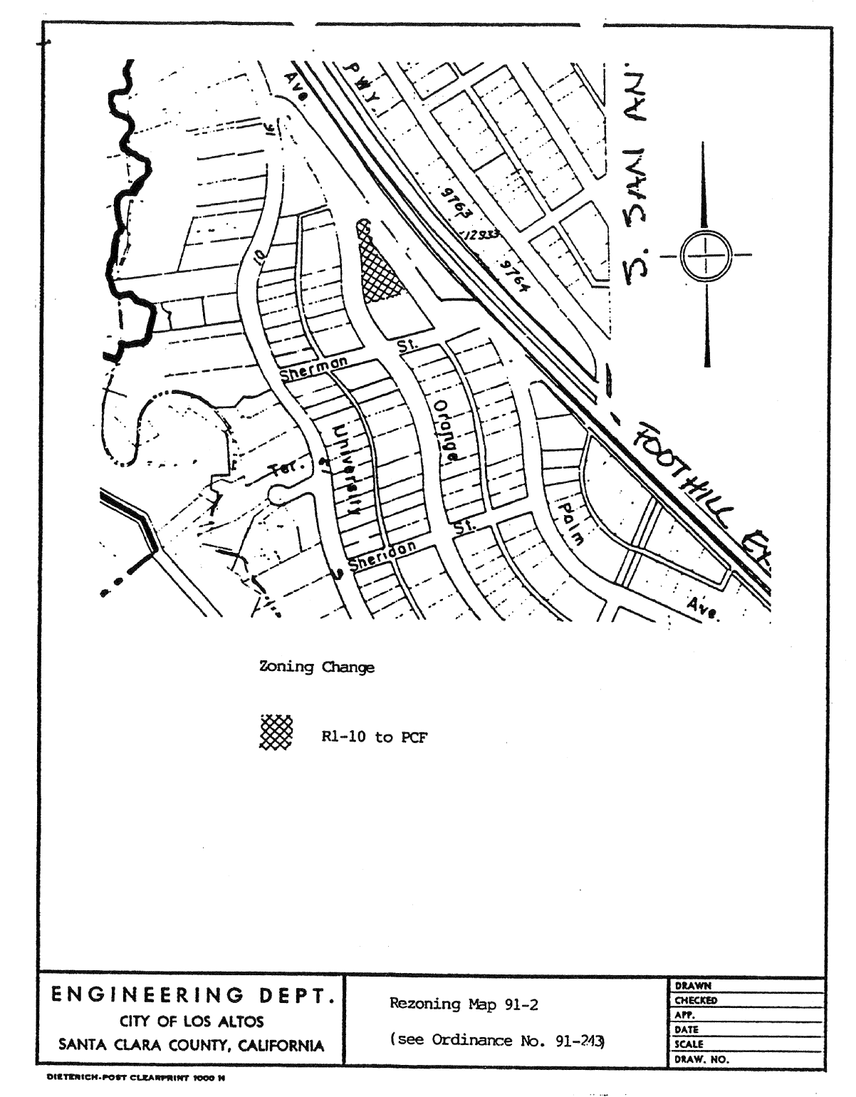
That portion of R1-10 District, as delineated on Rezoning Map No. 91-2, attached hereto and incorporated herein by reference, is hereby changed to PCF District.
(Prior code § 10-2.3429)
14.88.290 - Zoning map amended.
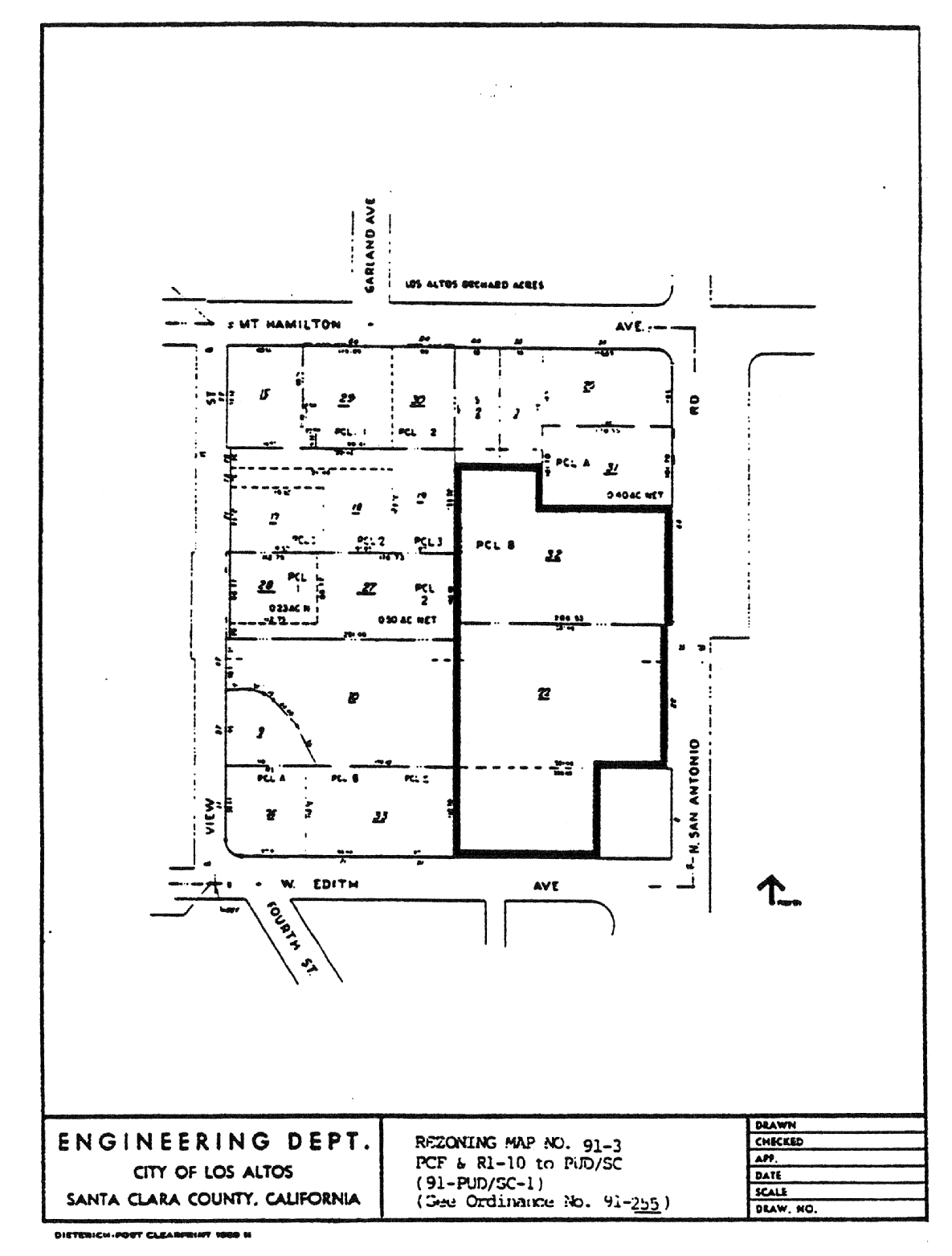
That portion of PCF and R1-10 Districts, as delineated on Rezoning Map No. 91-3, attached hereto and incorporated herein by reference, is hereby changed to PUD/SC District and the application number 91-PUD/SC-1 shall be placed on the zoning map.
(Prior code § 10-2.3430)
14.88.300 - Zoning map amended.
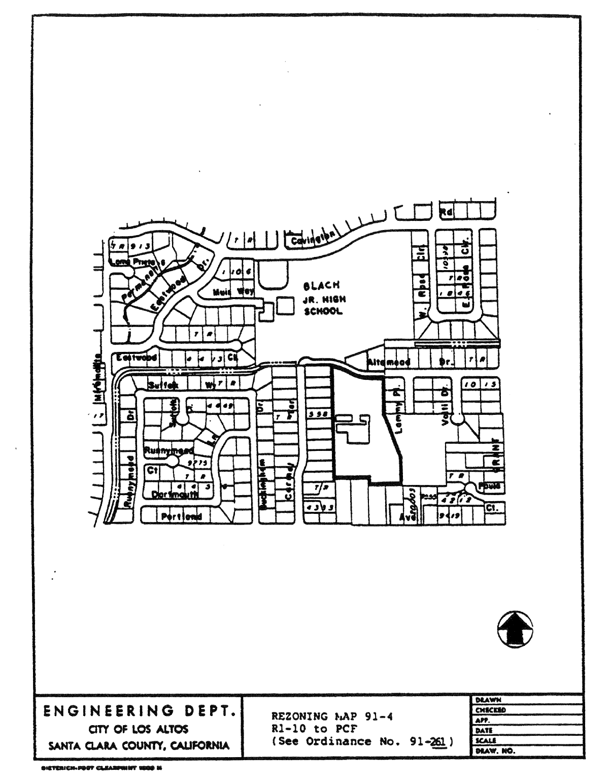
That portion of R1-10 District, as delineated on Rezoning Map No. 91-4, attached hereto and incorporated herein by reference, is hereby changed to PCF District.
(Prior code § 10-2.3431)
14.88.310 - Zoning map amended.
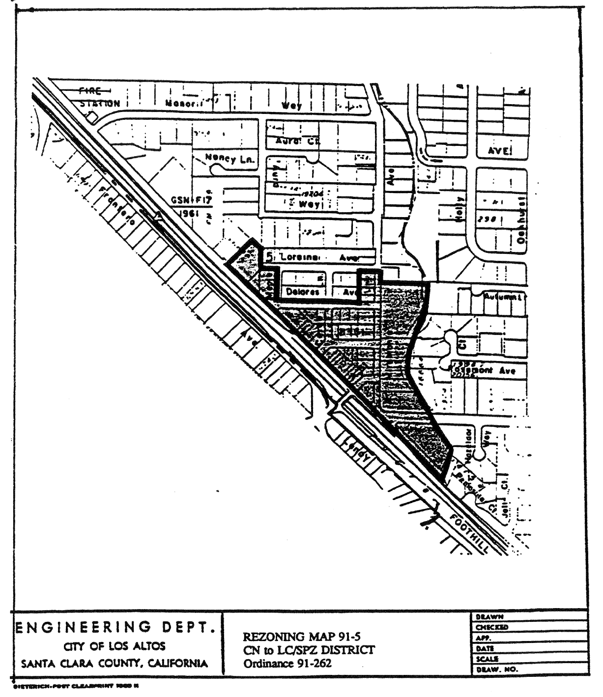
That property hereinafter described and delineated on Rezoning Map No. 91-5, attached hereto and incorporated herein by reference (Exhibit 1), is hereby zoned LC/SPZ District.
(Prior code § 10-2.3432)
14.88.320 - Zoning map amended.
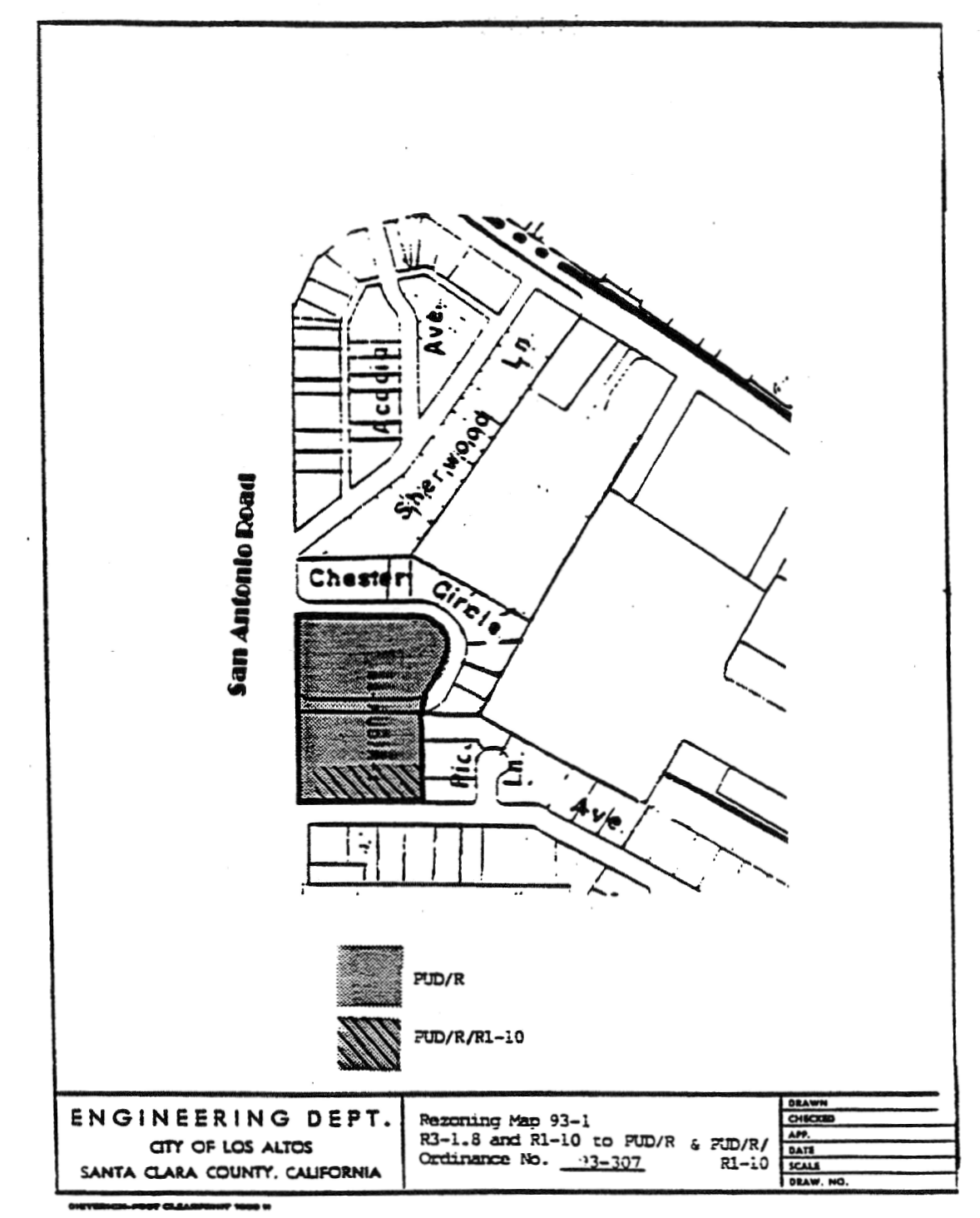
That portion of R3-1.8 District and R1-10 District, as delineated on Rezoning Map No. 93-1, attached hereto and incorporated herein by reference, is hereby changed to PUD/R District and PUD/R/R1-10 District, and the application number 93-PUD/R-1 shall be placed on the zoning map. Application 93/PUD/R-1 consists of the development plans and development standards and regulations which are made a part of this chapter as if fully set forth in this chapter. Application 93-PUD/R-1 is on file in the planning department.
(Prior code § 10-2.3433)
14.88.330 - Zoning map amended.
A.
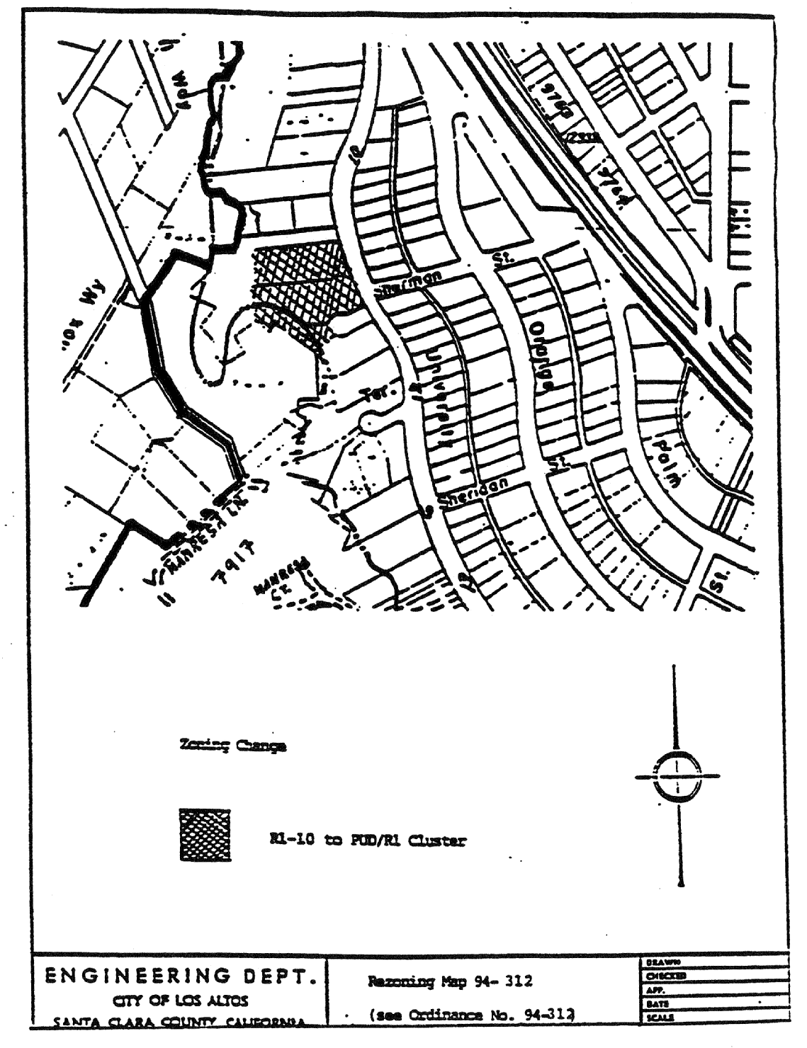
That portion of R1-10 District, as delineated on Rezoning Map No. 94-1, attached hereto and incorporated herein by reference, as hereby changed to PUD/R1 Cluster.
B.
The Zoning Map is amended in accordance with provisions of this Section and the district boundaries are so designated.
(Prior code § 10-2.3434)
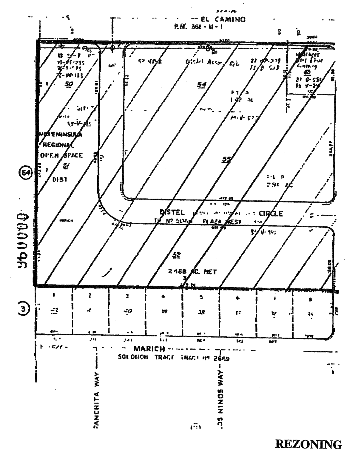
14.88.340 - Zoning map amended.
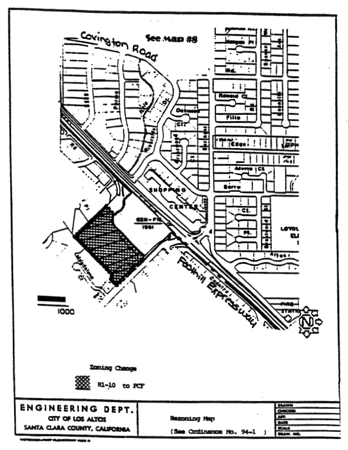
A.
That portion of R1-10 District, as delineated on Rezoning Map No. 94-1, attached hereto and incorporated herein by reference, is hereby changed to the Public and Community Facilities (PCF) District.
B.
The Zoning Map is amended in accordance with provisions of this section and the district boundaries are so designated.
(Prior code § 10-2.3435)
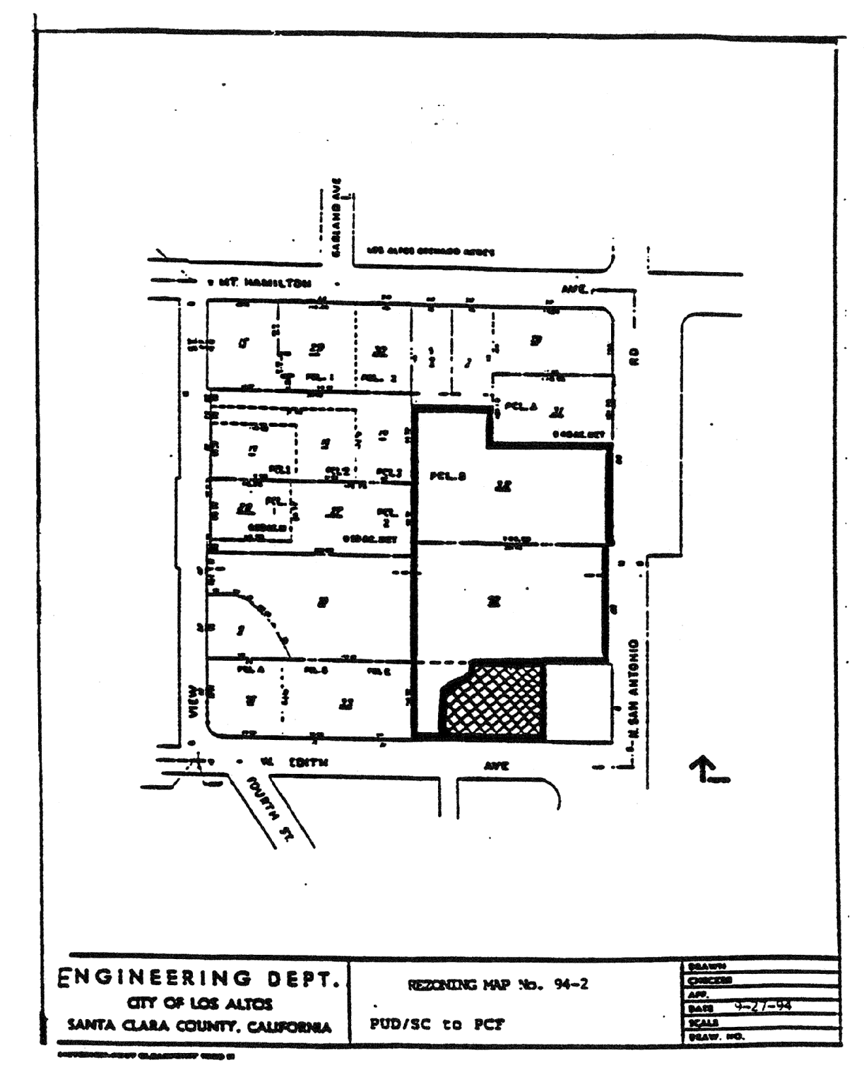
14.88.350 - Zoning map amended.
A.
That portion of the PUD/SC District, as delineated on Rezoning Map No. 94-2, attached hereto and incorporated herein by reference, is hereby changed to the PCF District.
B.
The Zoning Map is amended in accordance with the provisions of this section and the district boundaries are as designated.
(Prior code § 10-2.3436)
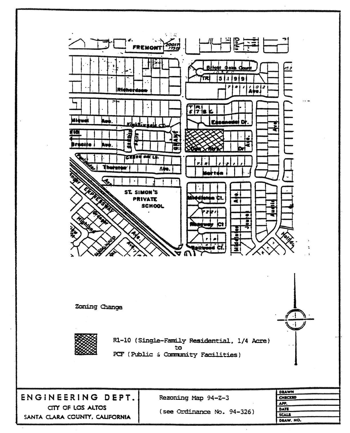
14.88.360 - Zoning map amended.
A.
That portion of the R1-10 (Single-Family Residential, Quarter Acre) District, as delineated on Rezoning Map No. 94-A-3, attached hereto and incorporated herein by reference, is hereby changed to the PCF (Public and Community Facilities) District.
B.
The Zoning Map is amended in accordance with provisions of this section and the district boundaries are so designated.
(Prior code § 10-2.3437)
14.88.370 - Zoning map amended.
A.
That portion of the CRS (Retail Sales Commercial) District, as delineated on Rezoning Map. No. 95-1, attached hereto and incorporated herein by reference, is hereby changed to CD (Downtown Commercial) District.
B.
The Zoning Map is amended with provisions of this section and the district boundaries are so designated.
(Prior code § 10-2.3438)
14.88.380 - Zoning map amended.
A.
That portion of the CT District, as delineated on Rezoning Map No. 95-1, attached hereto and incorporated herein by reference, is hereby changed to the R3-1 District.
B.
The Zoning Map is amended in accordance with provisions of this section and the district boundaries are as designated.
(Prior code § 10-2.3439)
14.88.390 - Zoning map amended.
A.
That portion of the CT District, as delineated on Rezoning Map No. 95-2, attached hereto and incorporated herein by reference, is hereby changed to the R3-A District.
B.
The Zoning Map is amended in accordance with the provisions of this section and the district boundaries are as designated.
(Prior code § 10-2.3440)
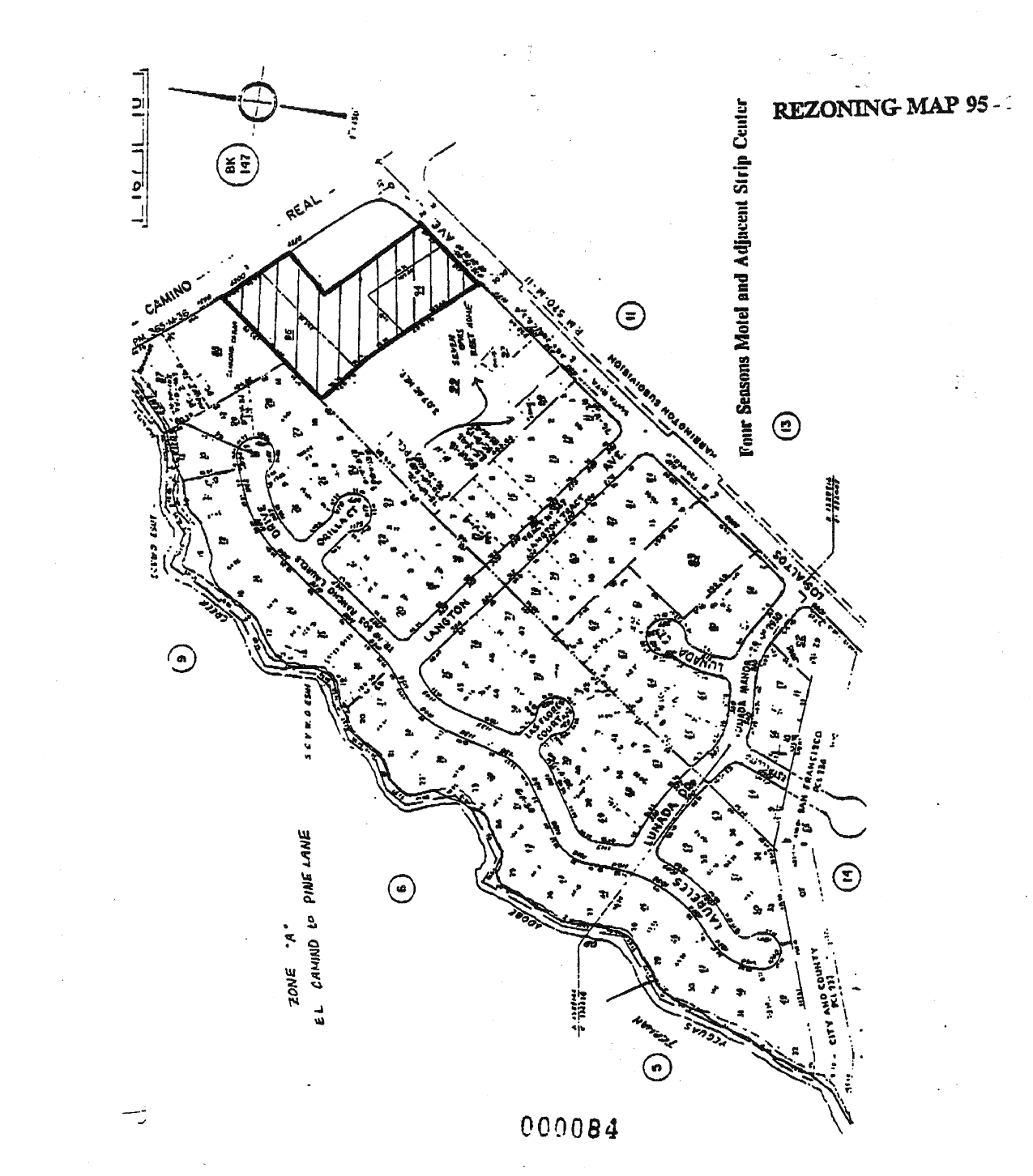
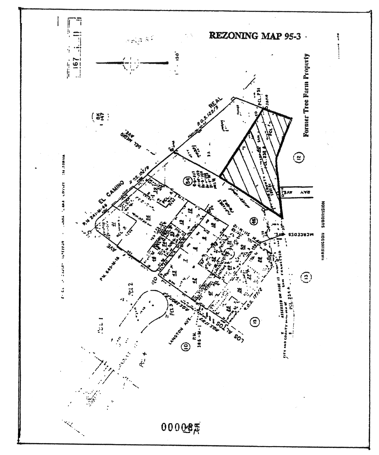
14.88.400 - Zoning map amended.
A.
That portion of the CT District, as delineated on Rezoning Map No. 95-3, attached hereto and incorporated herein by reference, is hereby changed to the R3-1 District.
B.
The Zoning Map is amended in accordance with the provisions of this section and the district boundaries are as designated.
(Prior code § 10-2.3441)
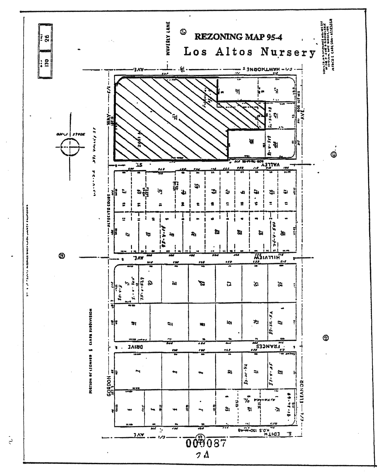
14.88.410 - Zoning map amended.
A.
That portion of the R1-10 District, as delineated on Rezoning Map No. 95-4, attached hereto and incorporated herein by reference, is hereby changed to the PUD/SC/R1-10 District.
B.
The Zoning Map is amended in accordance with the provisions of this section and the district boundaries are as designated.
(Prior code § 10-2.3442)
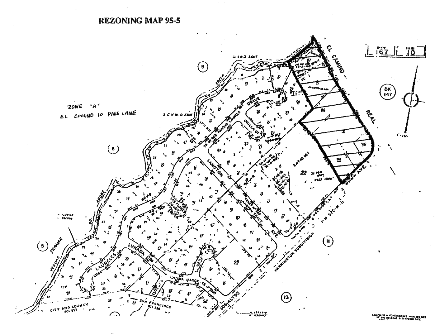
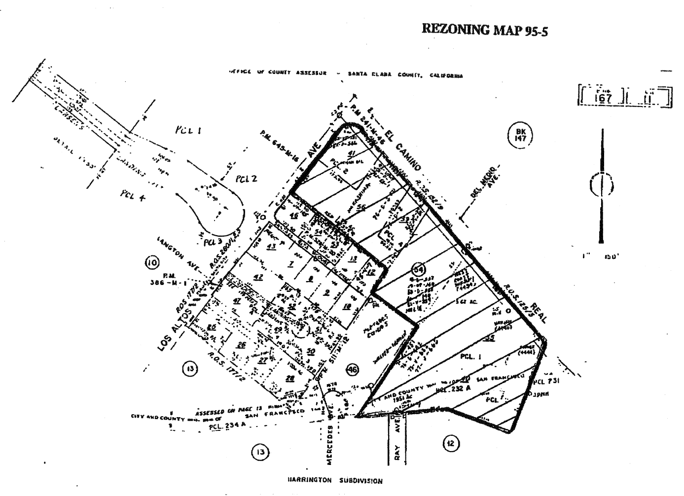
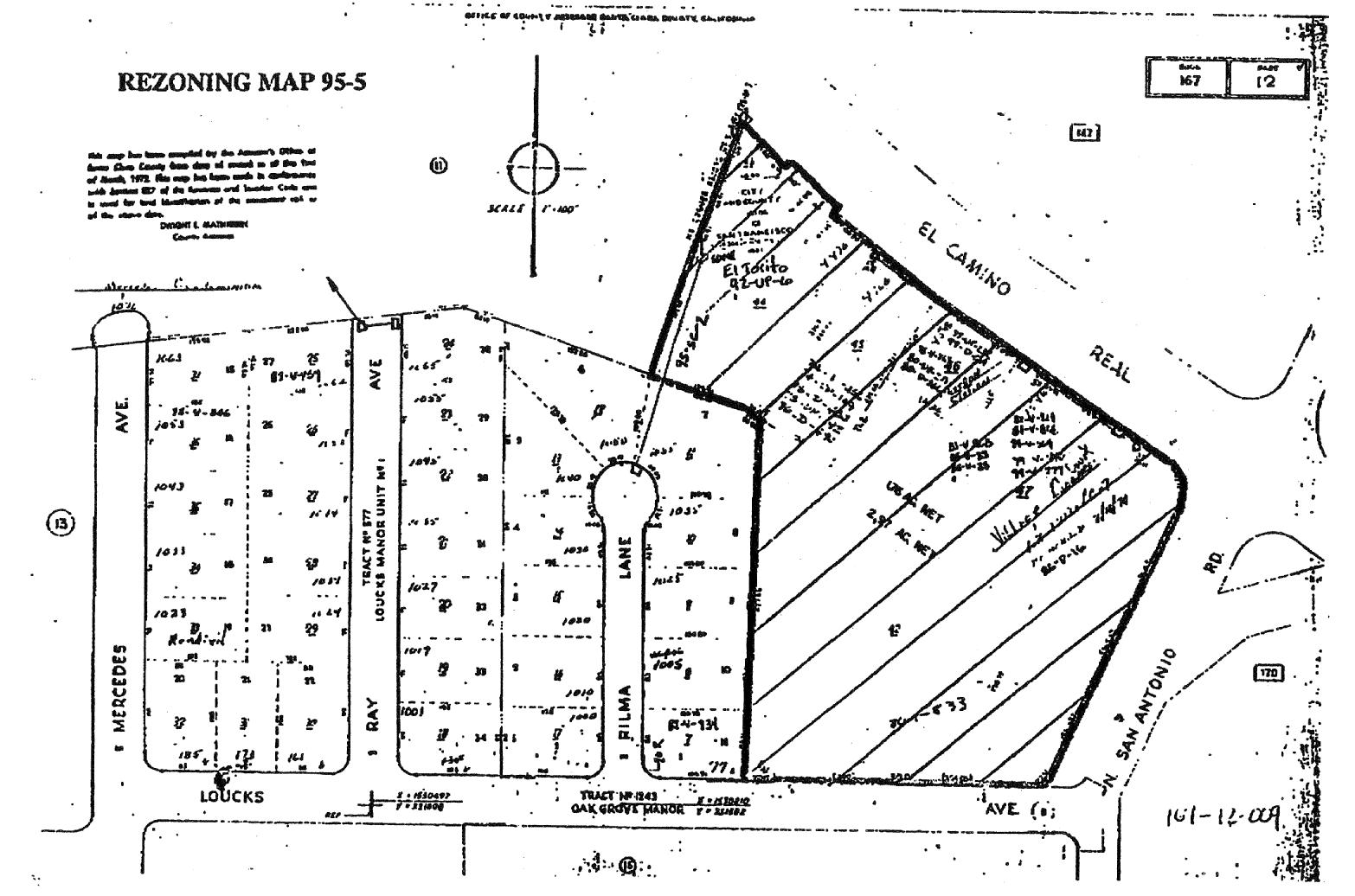
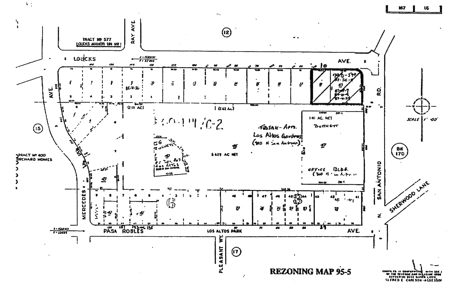
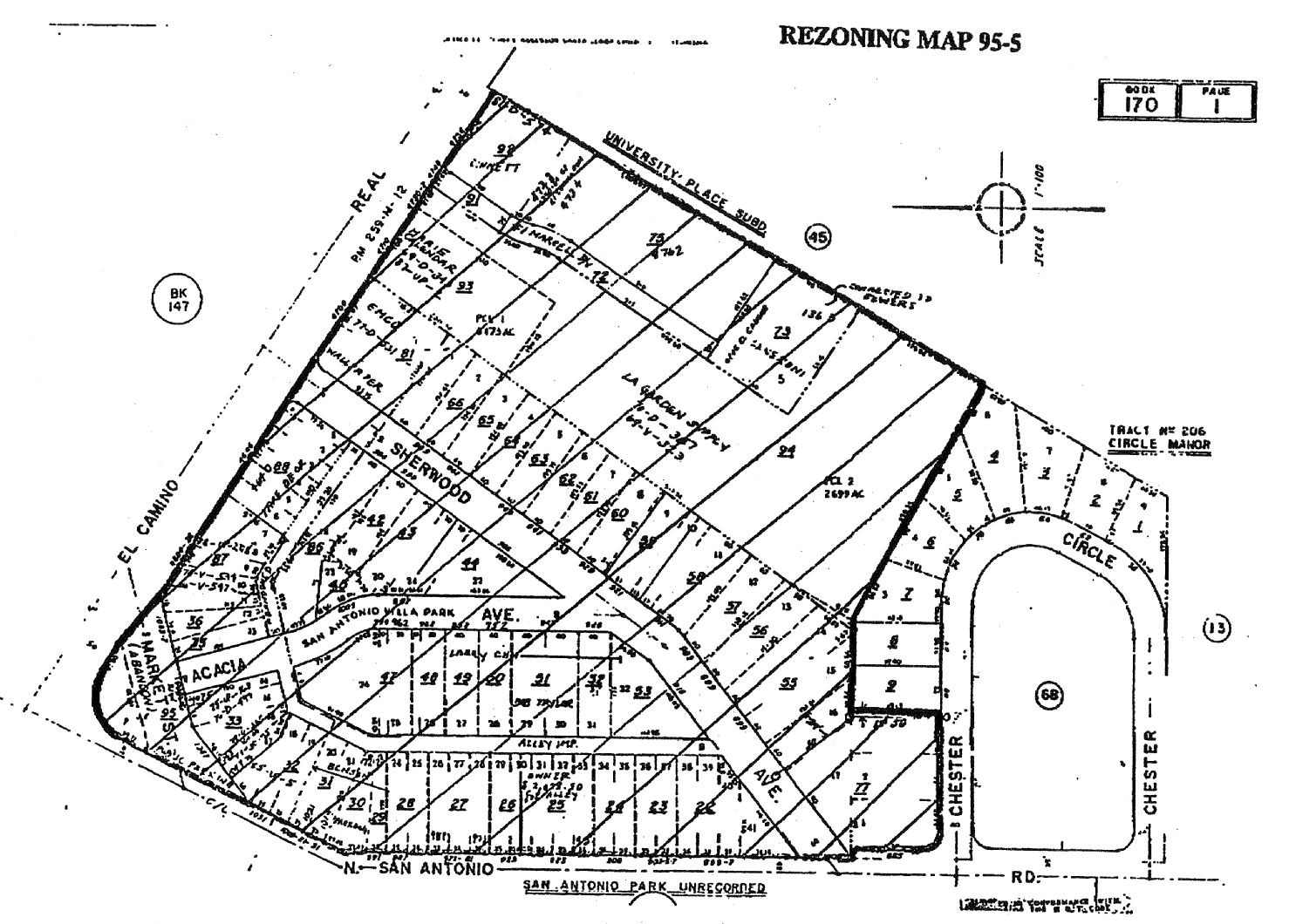
14.88.420 - Zoning map amended.
A.
Those portions of the CT, CN, OA-1, R3-1, R3-1.8, R3-3 and R3-5 Districts, as delineated on Rezoning Maps No. 95-5, attached hereto and incorporated herein by reference, is hereby overlaid with the AH/MU Overlay District.
B.
The Zoning Map is amended in accordance with the provisions of this section and the district boundaries are as designated.
(Prior code § 10-2.3443)
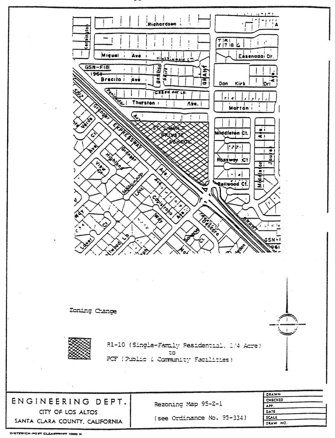
14.88.430 - Zoning map amended.
A.
That portion of the R1-10 (Single-Family Residential, Quarter Acre) District, as delineated on Rezoning Map No. 95-Z-1, attached hereto and incorporated herein by reference, is hereby changed to PCF (Public and Community Facilities) District.
B.
The Zoning Map is amended in accordance with provisions of this section and the district boundaries are so designated.
(Prior code § 10-2.3444)
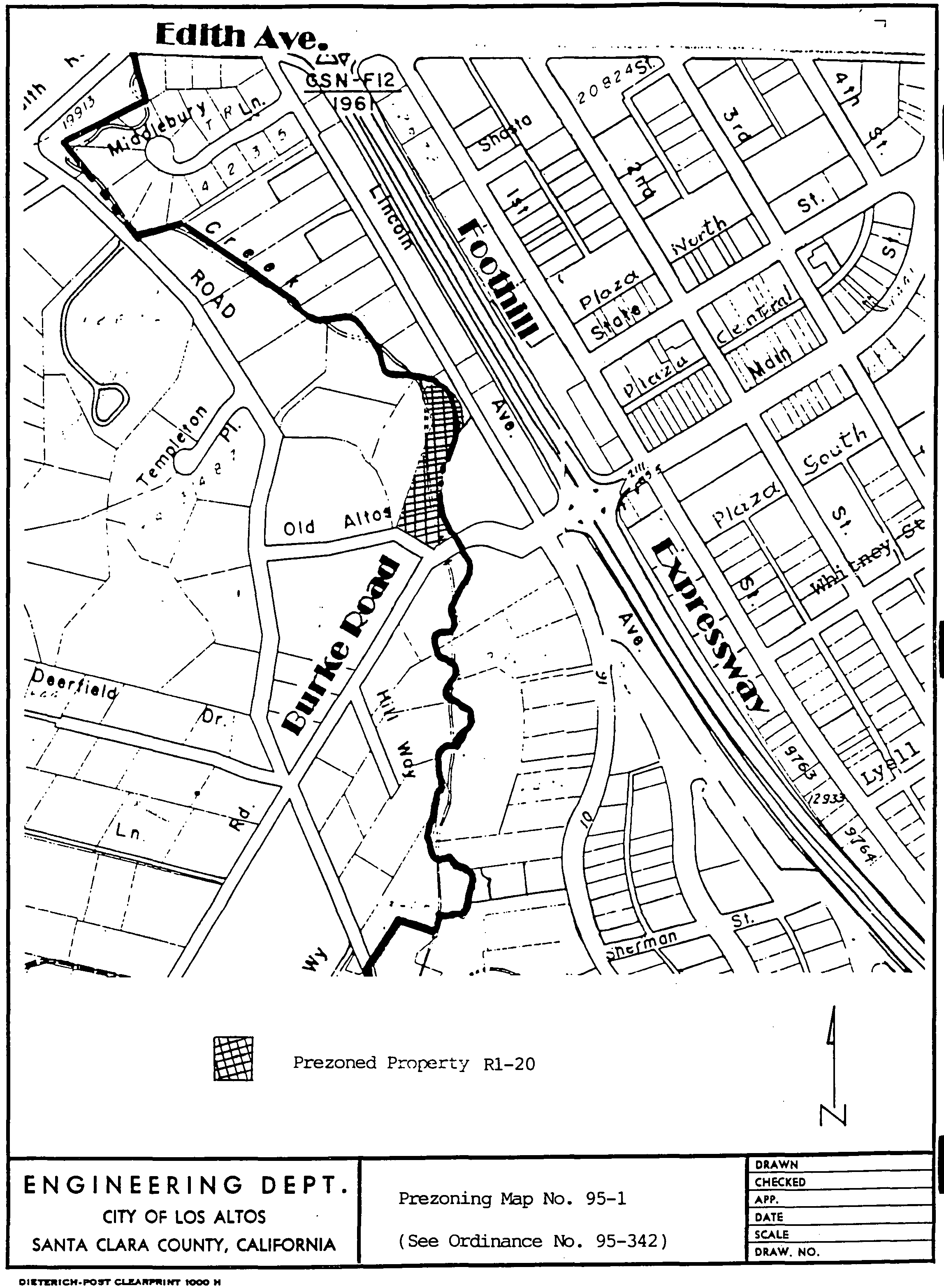
14.88.435 - Zoning map amended.
A.
That property at 13711 Old Altos Road, as delineated on Prezoning Map No. 95-1, attached hereto and incorporated herein by reference, is hereby prezoned to the R1-20 (Single-Family Residential) District.
B.
The Zoning Map is amended in accordance with the provisions of this section and the district boundaries are as designated.
(Ord. No. 95-342, § 2, 9-5-1995)
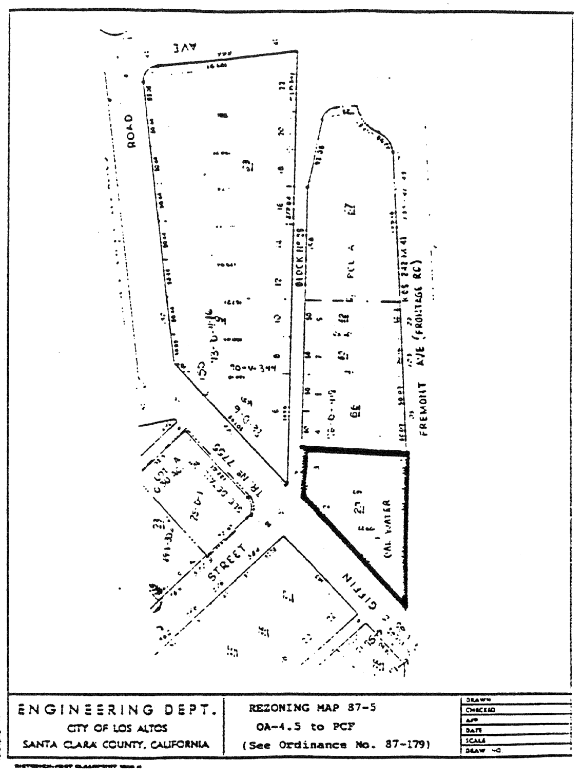
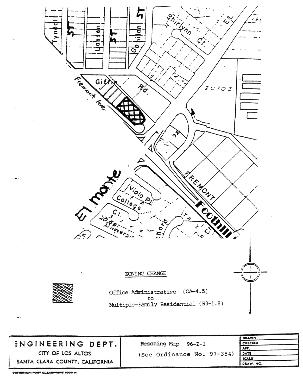
14.88.440 - Zoning map amended.
A.
That portion of the Office Administrative (OA-4.5) District, as delineated on Rezoning Map No. 96-Z-1, attached hereto and incorporated herein by reference, is hereby changed to the Multiple-Family Residential (R3-1.8) District.
B.
The Zoning Map is amended in accordance with provisions of this section and the district boundaries are so designated.
(Prior code § 10-2.3445)
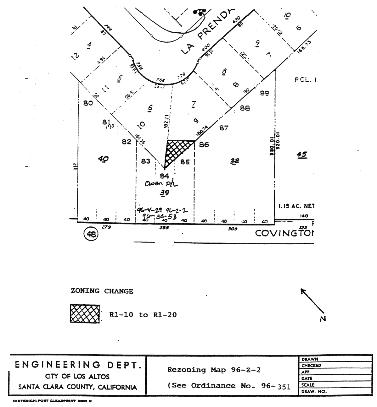
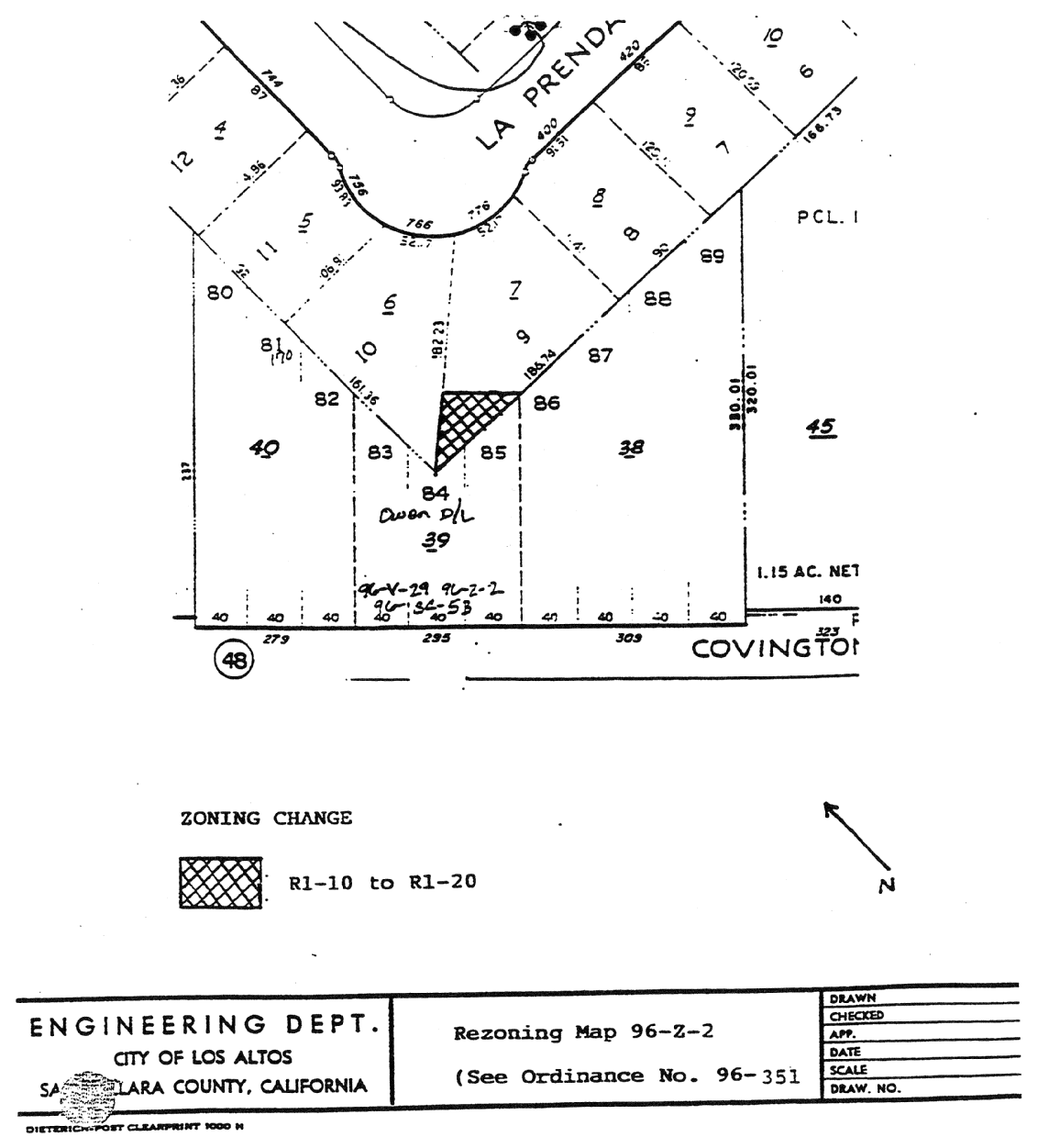
14.88.450 - Zoning map amended.
A.
That portion of the R1-10 (Single-Family, Residential Quarter acre) zoning district, as delineated on Rezoning Map No. 96-Z-2, attached hereto and incorporated herein by reference, is hereby changed to the R1-20 (Single-Family, Residential one-half acre) zoning district.
B.
The Zoning Map is amended in accordance with provisions of this section and the district boundaries are so designated.
(Prior code § 10-2.3446)
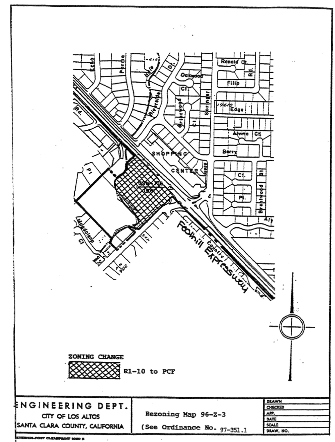
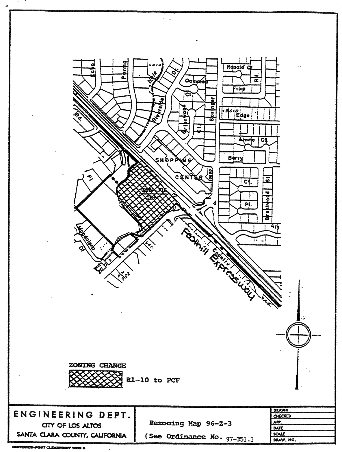
14.88.460 - Zoning map amended.
A.
That portion of the R1-10 (Single-Family, Residential) zoning district, as delineated on Rezoning Map No. 96-Z-3, attached hereto and incorporated herein by reference, is hereby changed to the PCF (Public Community Facilities) zoning district.
B.
The Zoning Map is amended in accordance with provisions of this section and the district boundaries are so designated.
(Prior code § 10-2.3447)
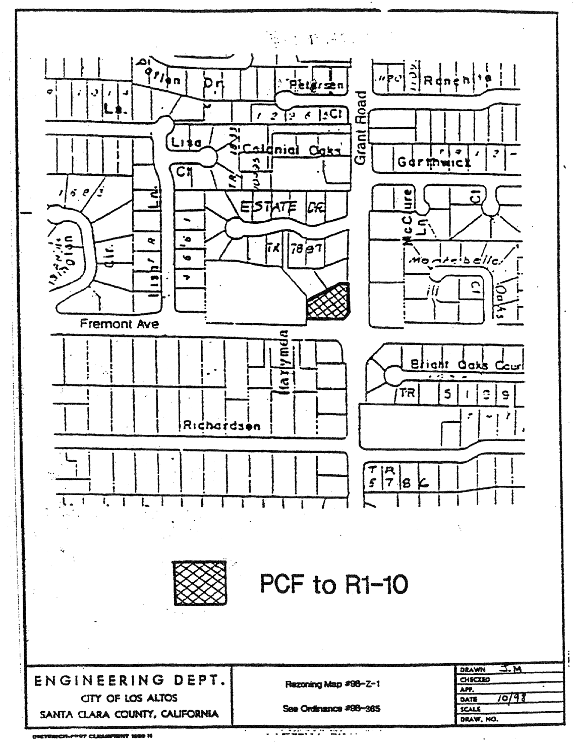
14.88.470 - Zoning map amended.
A.
That portion of the Public and Community Facilities (PCF) District, as delineated on Rezoning Map No. 98-Z-1, is hereby changed to the Single-Family Residential (R1-10) District.
B.
The zoning map is amended in accordance with provisions of this section and the district boundaries are so designated.
(Prior code § 10-2.3448)
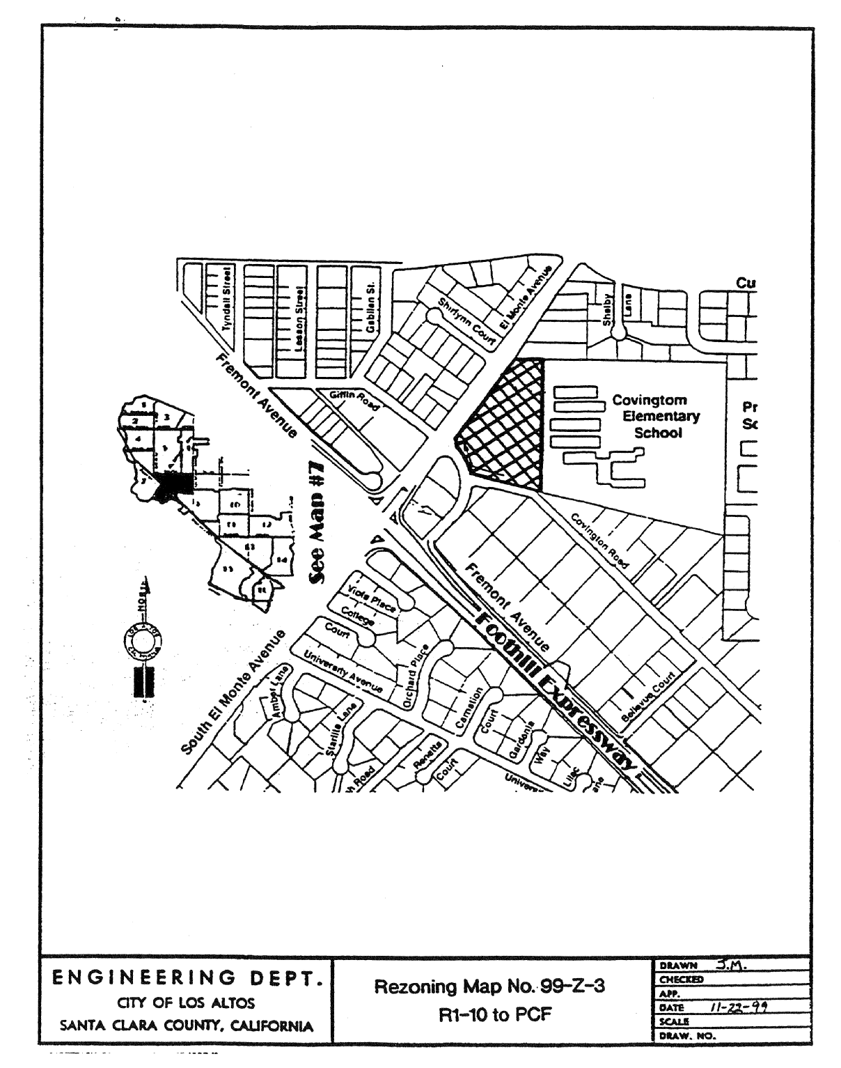
14.88.475 - Zoning map amended.
A.
That portion of the R1-10 (Single-Family, Residential) zoning district, as delineated on Rezoning Map No. 99-Z-3, is hereby changed to the PCF (Public Community Facilities) zoning district.
B.
The zoning map is amended in accordance with provisions of this section and the district boundaries are so designated.
(Ord. 99-378-A § 2: prior code § 10-2.3449)
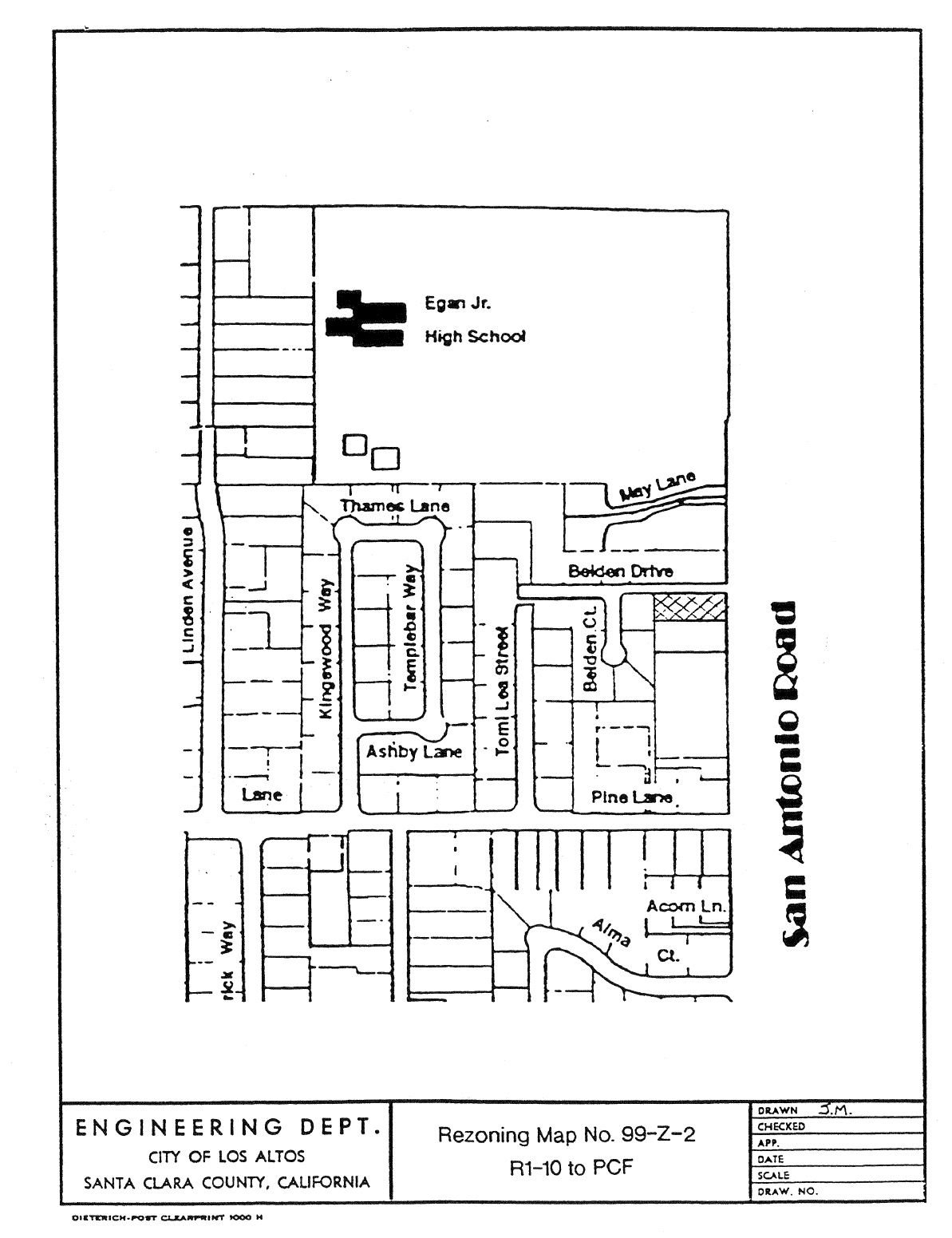
14.88.480 - Zoning map amended.
A.
That portion of the R1-10 (single-family, residential) zoning district, as delineated on Rezoning Map No. 99-Z-2, is changed to the PCF (public community facilities) zoning district.
B.
The zoning map is amended in accordance with provisions of this section and the district boundaries are so designated.
(Ord. 00-380 § 2: prior code § 10-2.3450)
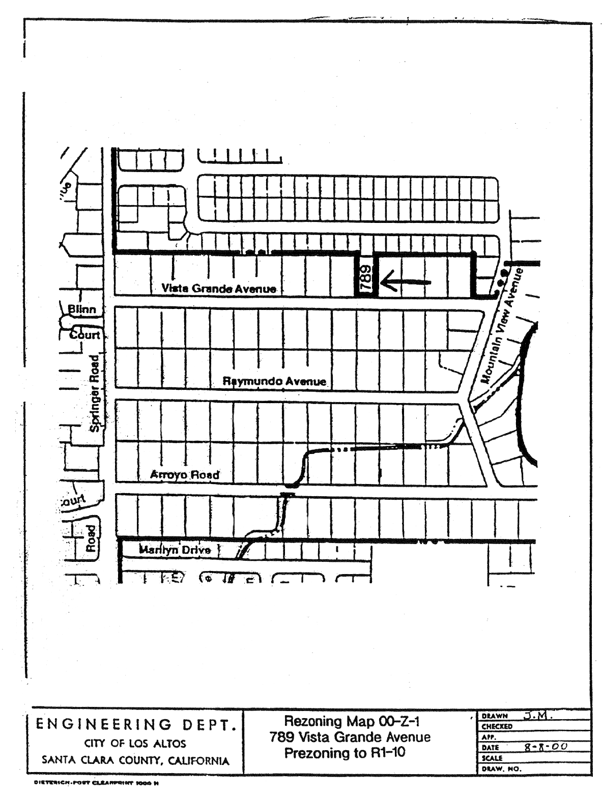
14.88.490 - Zoning map amended.
A.
That property located at 789 Vista Grande Avenue, as delineated on Rezoning Map No. 00-Z-1, is pre-zoned to the R1-10 (single-family, residential) zoning district.
B.
The zoning map is amended in accordance with provisions of this section and the district boundaries are so designated.
(Ord. 00-386 § 2: prior code § 10-2.3451)
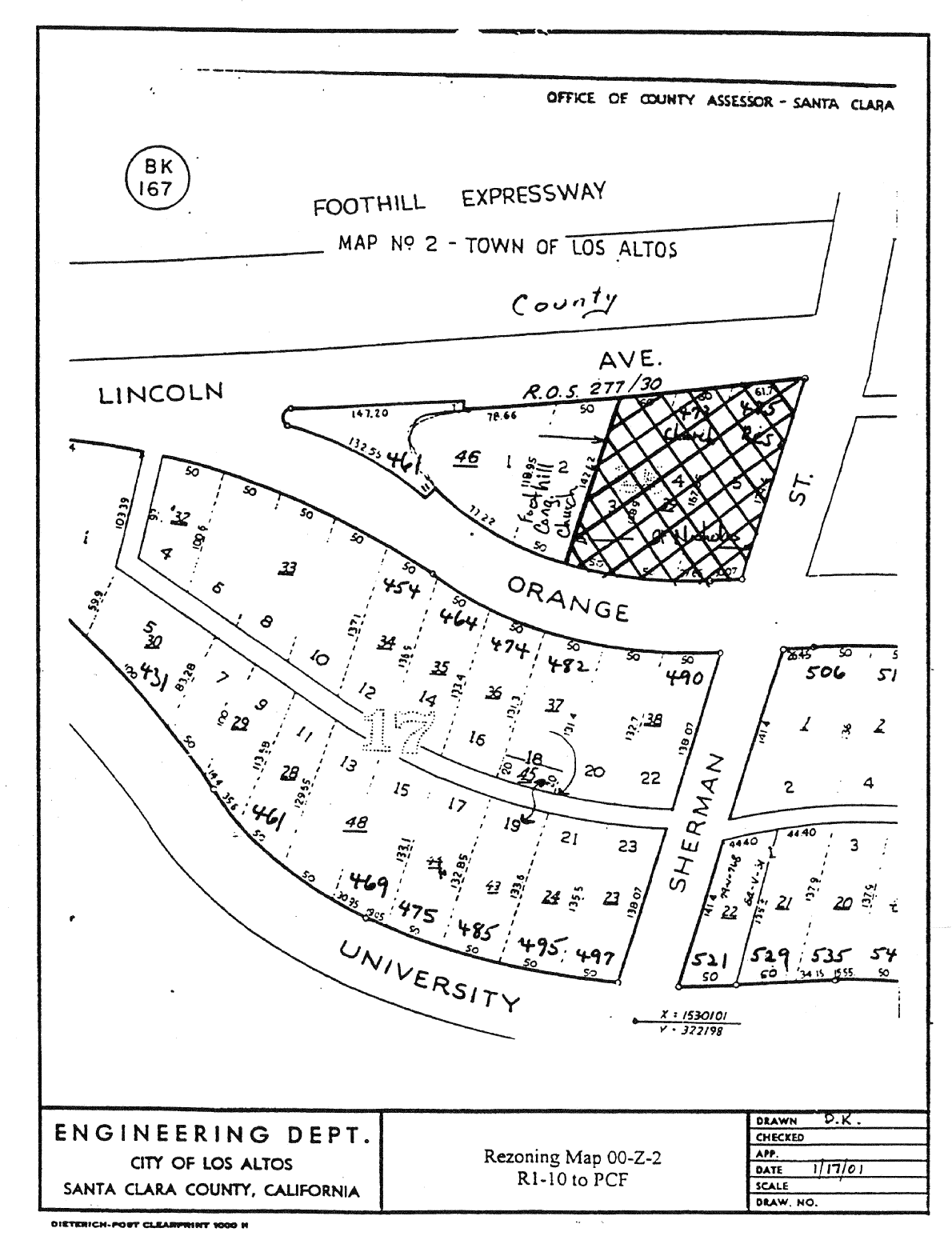
14.88.520 - Zoning map amended.
A.
That portion of R1-10 District, as delineated on Rezoning Map No. 00-Z-2, is hereby changed to the Public and Community Facilities (PCF) District.
B.
The zoning map is amended in accordance with the provisions of this section and the district boundaries are so designated.
(Ord. 01-395 § 2)
14.88.530 - Zoning map amended.
Those properties located in the Angela-Galli-Merritt neighborhood, as delineated on Rezoning Map No. 00-Z-3, attached hereto and incorporated herein by reference, are hereby included within the Single-Story Single-Family Overlay (R1-S) zoning district.
The Zoning Map is amended in accordance with provisions of this section and the district boundaries are so designated.
(Ord. 01-400 § 2)

14.88.540 - Zoning map amended.
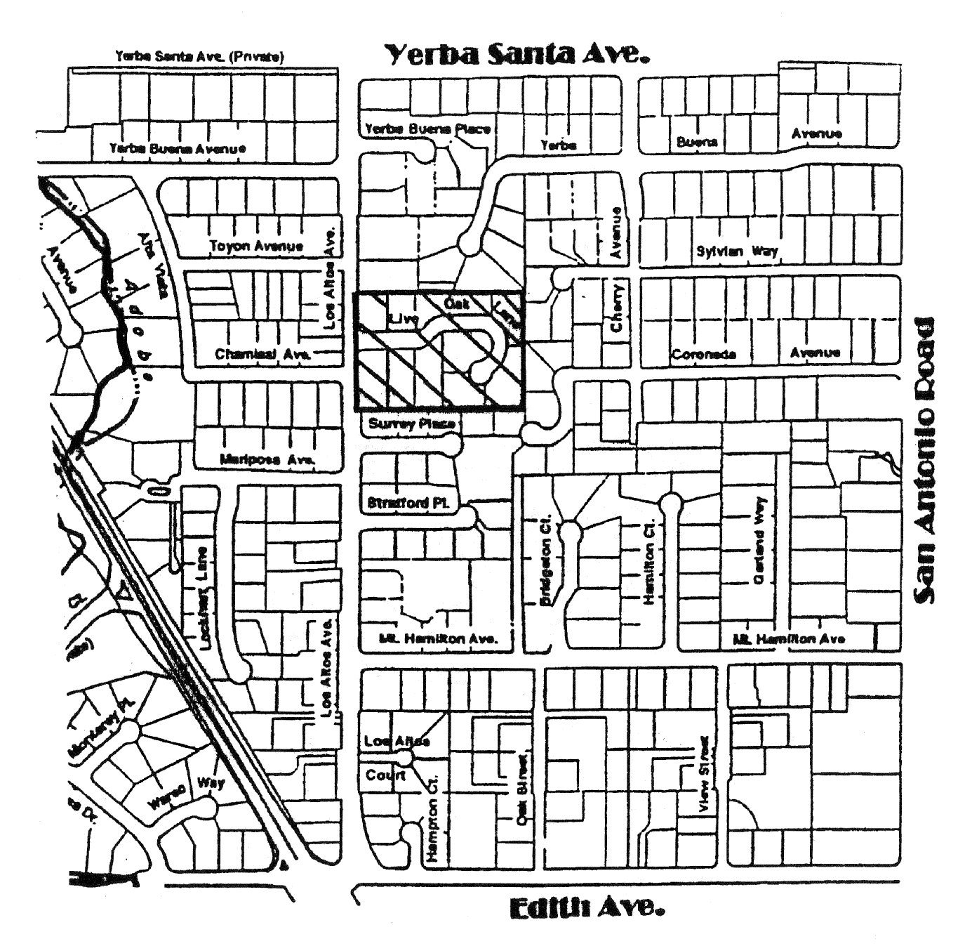
Those properties located in the Live Oak Lane neighborhood, as delineated on Rezoning Map No. 01-Z-02, attached hereto and incorporated herein by reference, are hereby included within the Single-Story Single-Family Overlay (R1-S) zoning district.
The Zoning Map is amended in accordance with provisions of this section and the district boundaries are so designated.
(Ord 01-406 § 2)
14.88.550 - Zoning map amended.
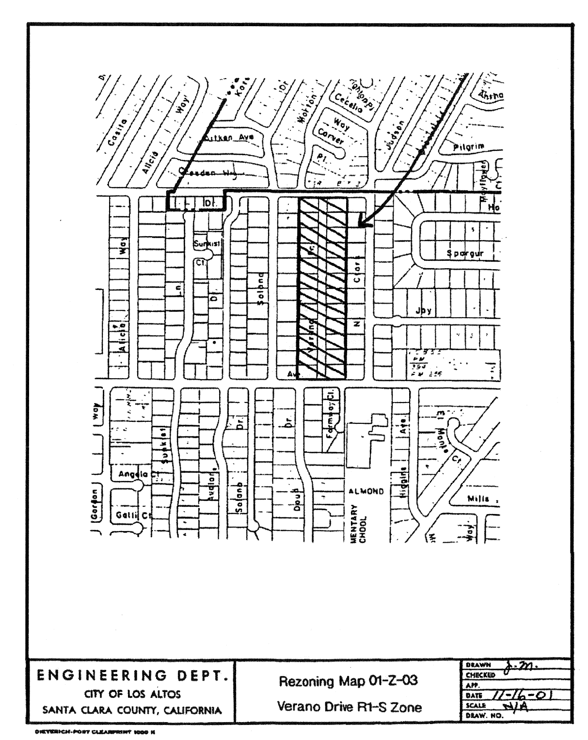
Those properties located in the Verano Drive neighborhood, as delineated on Rezoning Map No. 01-Z-03, attached hereto and incorporated herein by reference, are hereby included within the Single-Story Single-Family Overlay (R1-S) zoning district.
The zoning map is amended in accordance with provisions of this section and the district boundaries are so designated.
(Ord. 01-407 § 2)
14.88.560 - Zoning map amended.
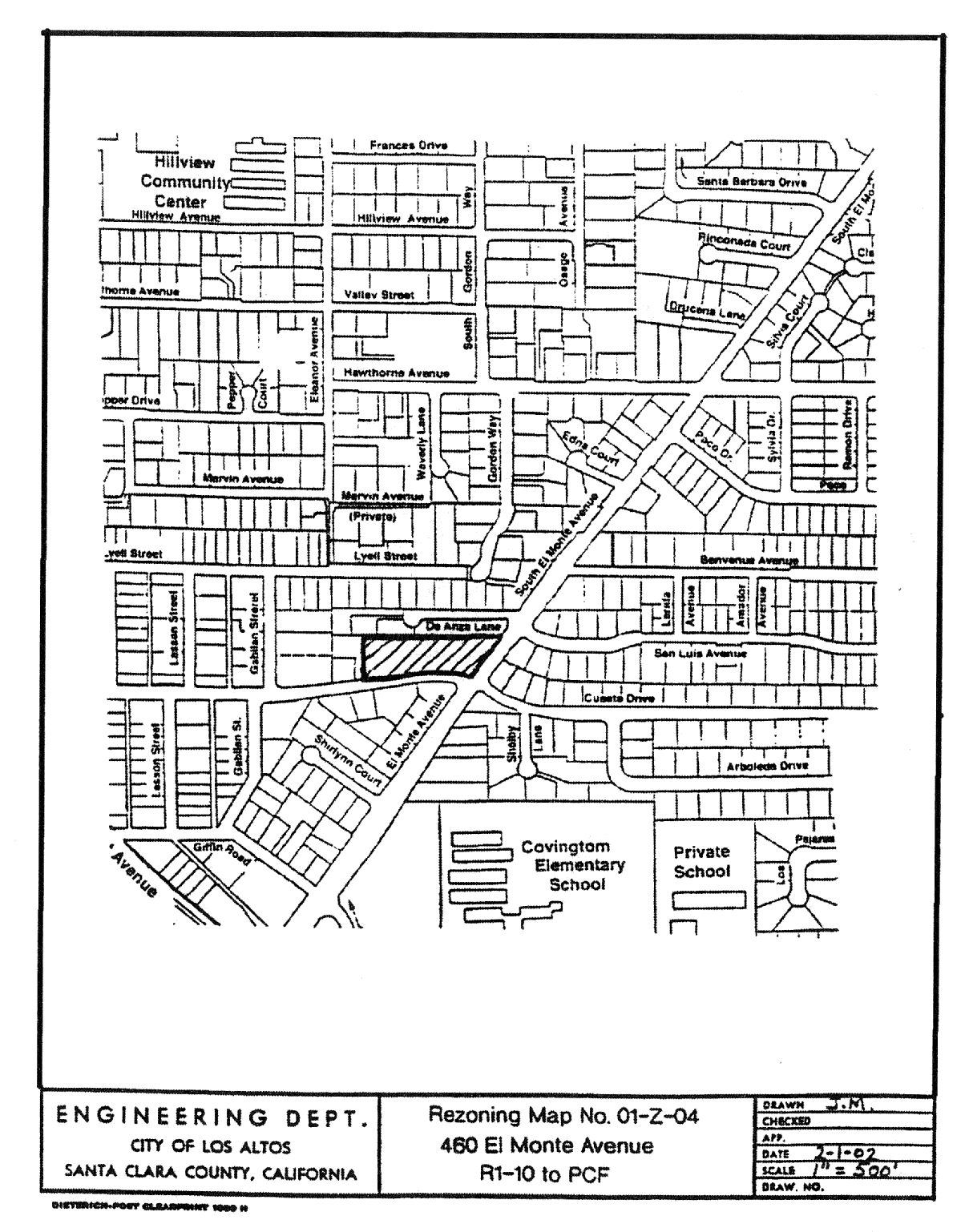
The property generally located at 460 S. El Monte Avenue, as delineated on Rezoning Map No. 01-Z-04, attached hereto and incorporated herein by reference, is hereby included within the Public and Community Facilities (PCF) zoning district.
The zoning map is amended in accordance with provisions of this section and the district boundaries are so designated.
(Ord. 02-409 § 2)
14.88.570 - Zoning map amended.
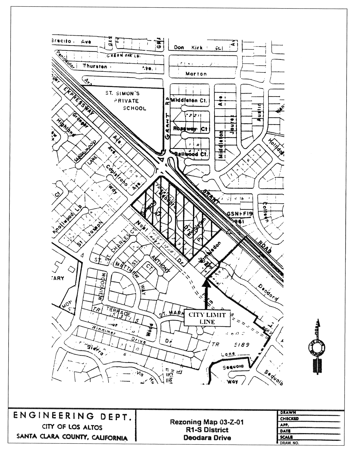
Those properties located in the Deodara Drive neighborhood, as delineated on Rezoning Map No. 03-Z-01, attached hereto and incorporated herein by reference, are hereby included within the R1-S District.
The zoning map is amended in accordance with provisions of this section and the district boundaries are so designated.
(Ord. 03-246 § 2: Ord. 02-418 § 2)
14.88.580 - Zoning map amended.
Those properties located in the Rosewood Court neighborhood, as delineated on Rezoning Map No. 02-Z-01, attached hereto and incorporated herein by reference, are hereby included within the R1-S District.
The zoning map is amended in accordance with provisions of this section and the district boundaries are so designated.
(Ord. 02-419 § 2)
14.88.600 - Zoning map amended.
Those properties located in the Azalea Way neighborhood, as delineated on Rezoning Map No. 02-Z-04, attached hereto and incorporated herein by reference, are hereby included within the R1-S District.
The zoning map is amended in accordance with provisions of this section and the district boundaries are so designated.
(Ord. 02-421 § 2)
14.88.610 - Zoning map amended.
Those properties located in the Sunkist-Avalon neighborhood, as delineated on Rezoning Map No. 05-Z-05, attached hereto and incorporated herein by reference, are hereby included within the R1-S Overlay District.
The zoning map is amended in accordance with provisions of this section and the district boundaries are so designated.
(Ord. 06-300 § 2)
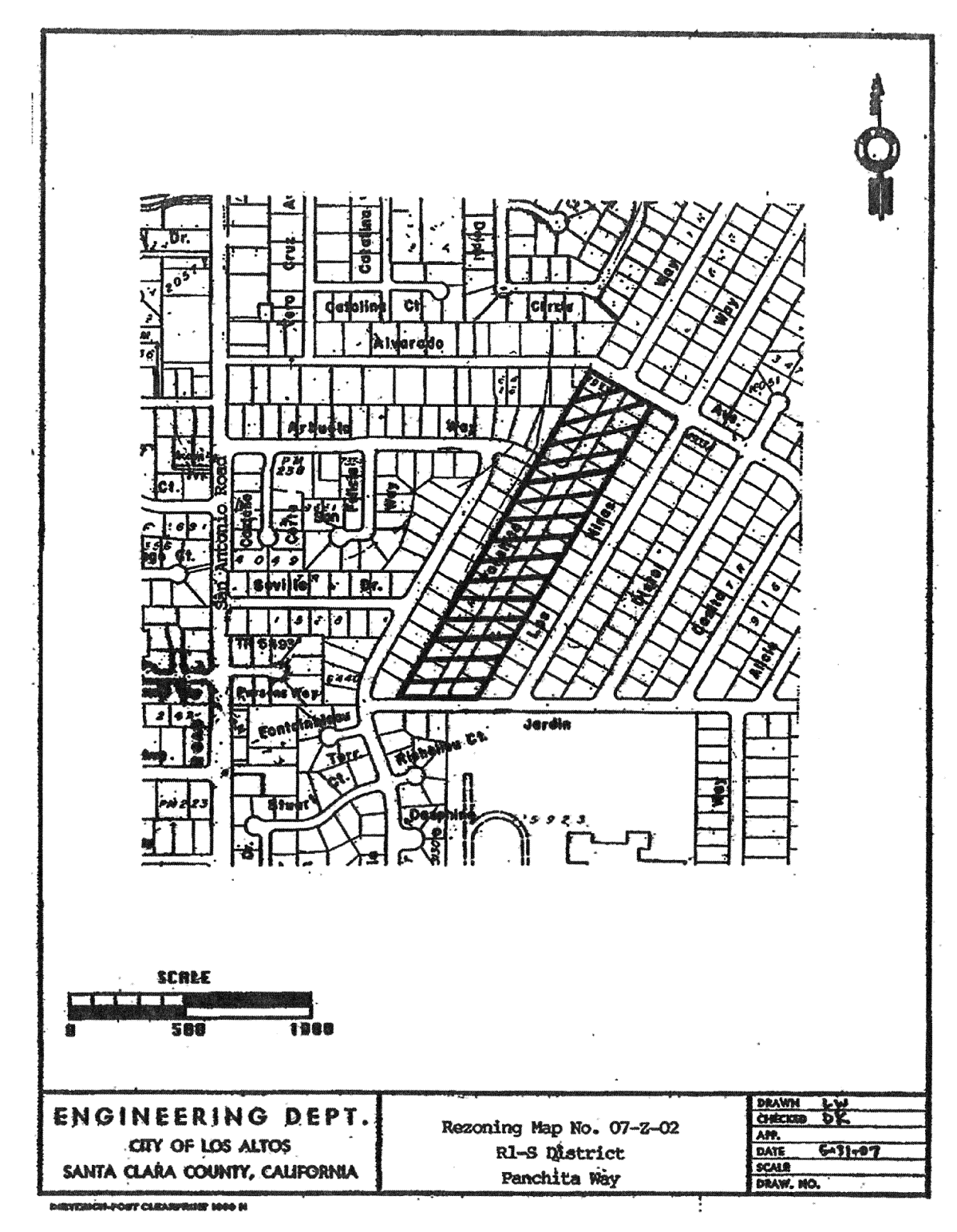
14.88.620 - Zoning map amended.
Those properties located in the Panchita Way neighborhood, as delineated on Rezoning Map No. 07-Z-02, attached hereto and incorporated herein by reference, are hereby included within the Rl-S Overlay District.
The zoning map is amended in accordance with provisions of this section and the district boundaries are so designated.
(Ord. 07-316 § 2)
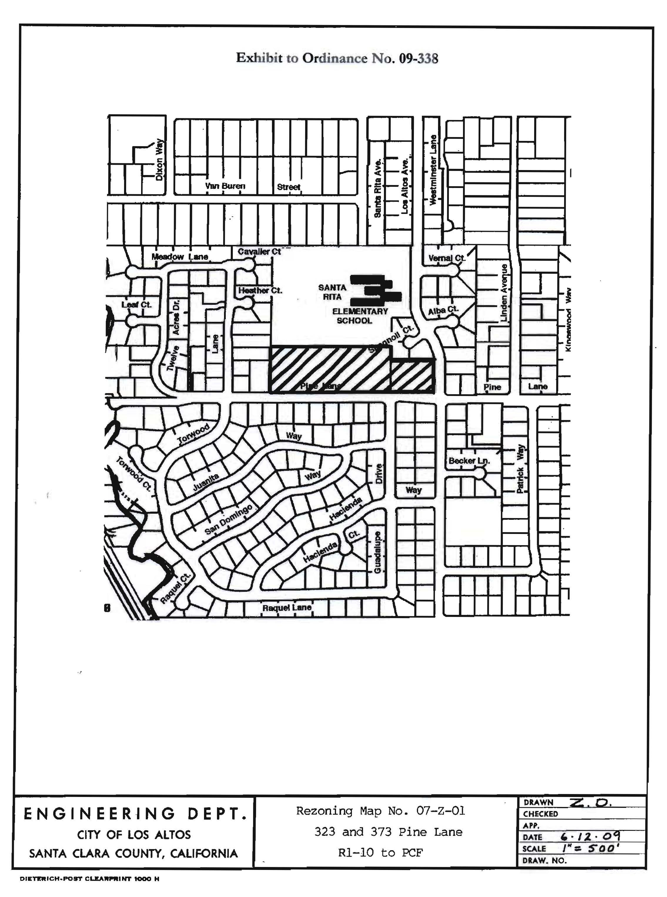
14.88.630 - Zoning map amended.
The properties generally located at 323 and 373 Pine Lane, as delineated on Rezoning Map No. 07-Z-01, attached hereto and incorporated herein by reference, are hereby included within the Public and Community Facilities (PCF) zoning district.
The zoning map is amended in accordance with the provisions of this section and the district boundaries are so designated.
(Ord. No. 09-338, § 2, 8-27-2009)
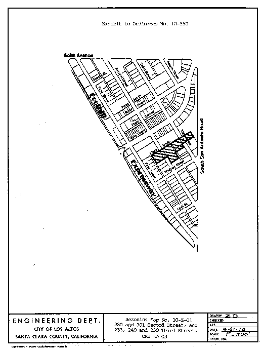
14.88.640 - Zoning map amended.
The properties generally located at 280 Second Street, 301 Second Street, 233 Third Street, 240 Third Street and 250 Third Street as delineated on Rezoning Map No. 10-Z-01, attached hereto and incorporated herein by reference, are hereby included within the Commercial Downtown (CD) zoning district.
The zoning map is amended in accordance with the provisions of this section and the district boundaries are so designated.
(Ord. No. 10-350, § 1, 5-11-2010)
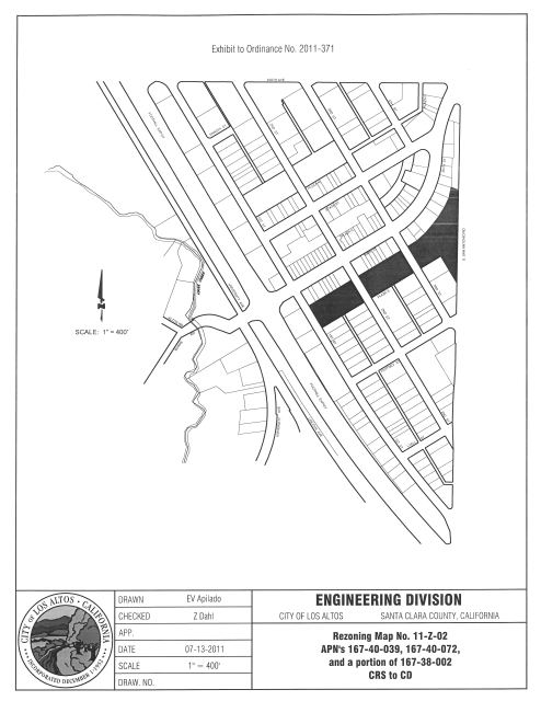
14.88.650 - Zoning map amended.
The properties generally referred to as the South Parking Plazas (APNs 167-40-039, 167-40-072 and a portion of 167-38-002) as delineated on Rezoning Map No. 11-Z-02, attached hereto and incorporated herein by reference, are hereby included within the Commercial Downtown (CD) zoning district.
(Ord. No. 2011-371, § 1, 8-23-2011)
14.88.660 - Zoning map amended.
The properties generally referred to as Lincoln Park (APNs 175-12-012, 167-41-049 and 167-41-063) as delineated on Rezoning Map No. 11-Z-03, attached hereto and incorporated herein by reference, are hereby included within the Public and Community Facilities (PCF) zoning district.
The Zoning Map is amended in accordance with the provisions of this Section and the district boundaries are so designated.
(Ord. No. 2011-373, § 1, 11-8-2011)

14.88.670 - Zoning map amended.
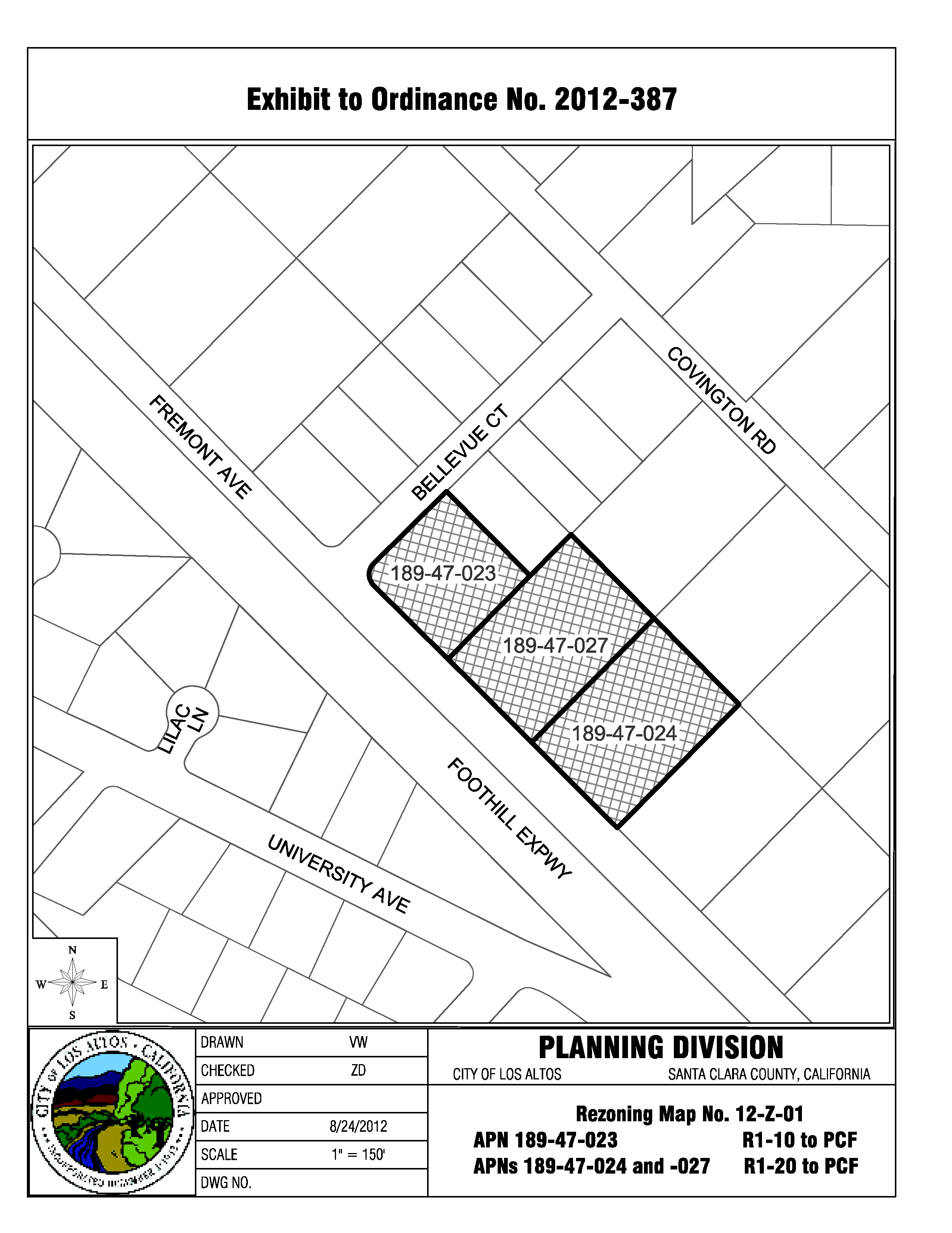
The properties generally referred to as Pinewood School (APNs 189-47-023, 189-47-024 and 189-47-027) as delineated on Rezoning Map No. 12-Z-01, attached hereto and incorporated herein by reference, are hereby included within the Public and Community Facilities (PCF) zoning district.
(Ord. No. 2012-387, § 1, 9-25-2012)
14.88.680 - Zoning map amended.
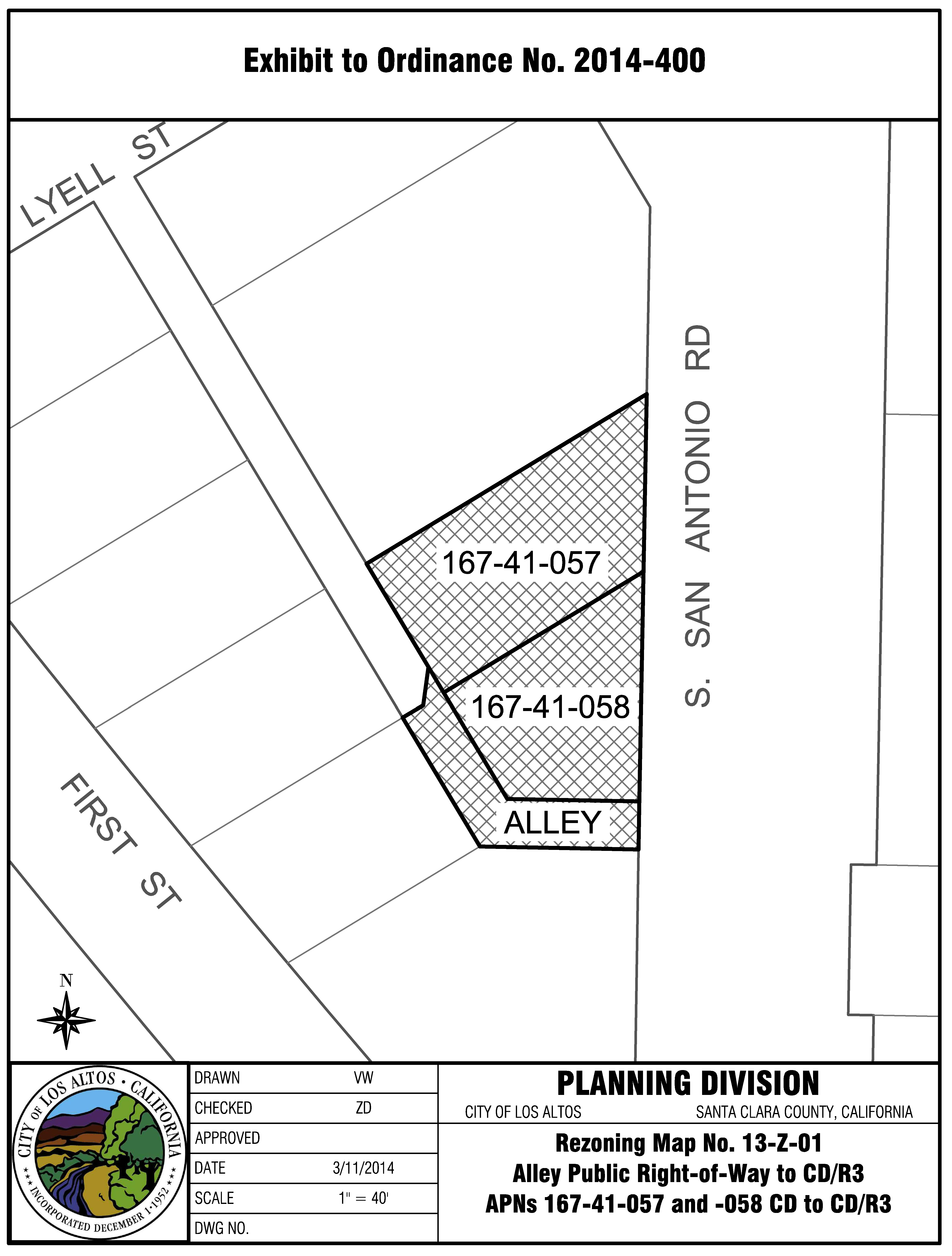
The properties generally referred to as 448 South San Antonio Road (APNs 167-41-057 and 167-41-058) and a portion of adjacent public alley right-of-way as delineated on Rezoning Map No. 13-Z-01, attached hereto and incorporated herein by reference, are hereby included within the commercial downtown/multiple-family (CD/R3) zoning district.
(Ord. No. 2014-400, § 1, 3-25-2014)
14.88.690 - Zoning map amended.
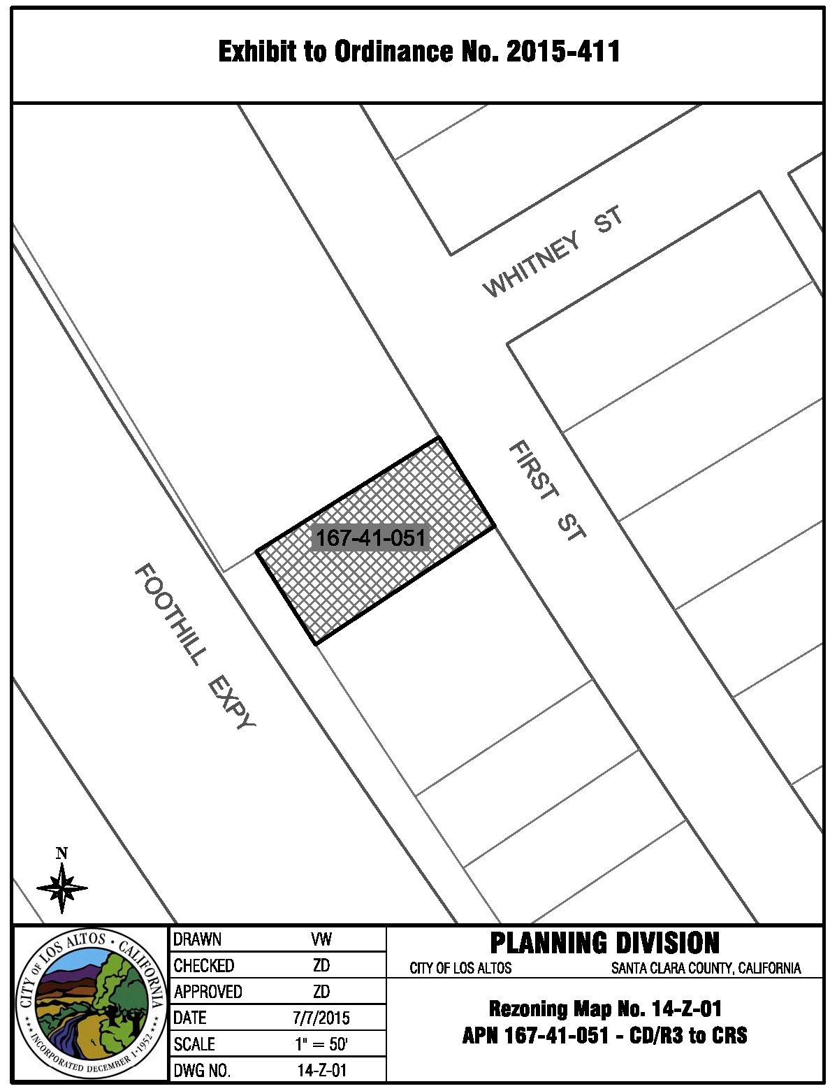
The property generally referred to as 366 First Street (APN 167-41-051) as delineated on Rezoning Map No. 14-Z-01, attached hereto and incorporated herein by reference, are hereby included within the Commercial Retail Sales (CRS) zoning district.
(Ord. No. 2015-411, § 1, 8-25-2015)
14.88.700 - Zoning map amended.
A.
Those properties delineated on Pre-Zoning Map 16-Z-01, attached hereto and incorporated by reference, are hereby included in the R1-10 District.
B.
The zoning map is amended in accordance with the provisions of this section and the district boundaries are so designated.
(Ord. No. 2016-422, § 1, 9-13-2016)
JARDIN DRIVE ANNEXATION—ZONING MAP 16-Z-01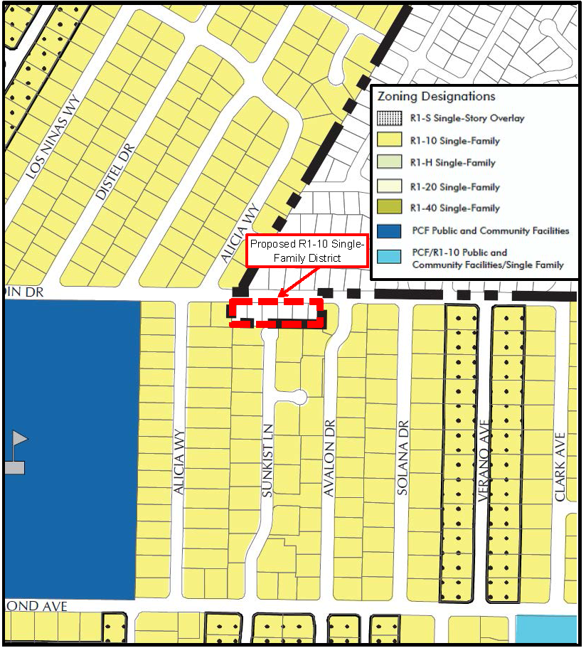
14.88.710 - Zoning map amended.
A.
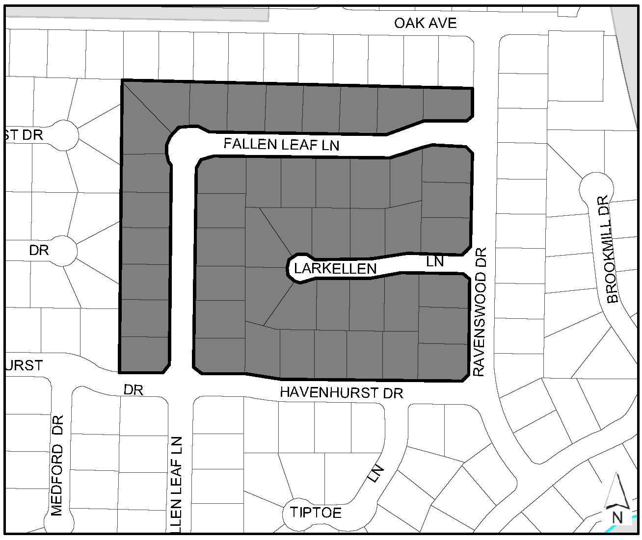
Those properties located in the Larkellen Lane Neighborhood, as delineated on Rezoning Map No. 16-Z-02, attached hereto and incorporated herein by reference, are hereby included within the R1-S Overlay District.
B.
The zoning map is amended in accordance with provisions of the section and the district boundaries are so designated.
(Ord. No. 2017-433, § 1, 9-12-2017)
Rezoning Map No. 16-Z-02
Single-Story Overlay District (R1-S) — Larkellen Lane Neighborhood
14.88.720 - Zoning map amended.
A.
That property hereinafter described and delineated on Rezoning Map Nos. Z-19-01 through Z-19-05, attached hereto and incorporated herein by reference, is hereby zoned in accordance therewith.
1.
The properties generally referred to as Grant Park (APNs 318-17-052, 318-17-053, and 318-17-054) as delineated on Rezoning Map No. 19-Z-01, attached hereto and incorporated herein by reference, are hereby included within the Public and Community Facilities (PCF) zoning district.
2.
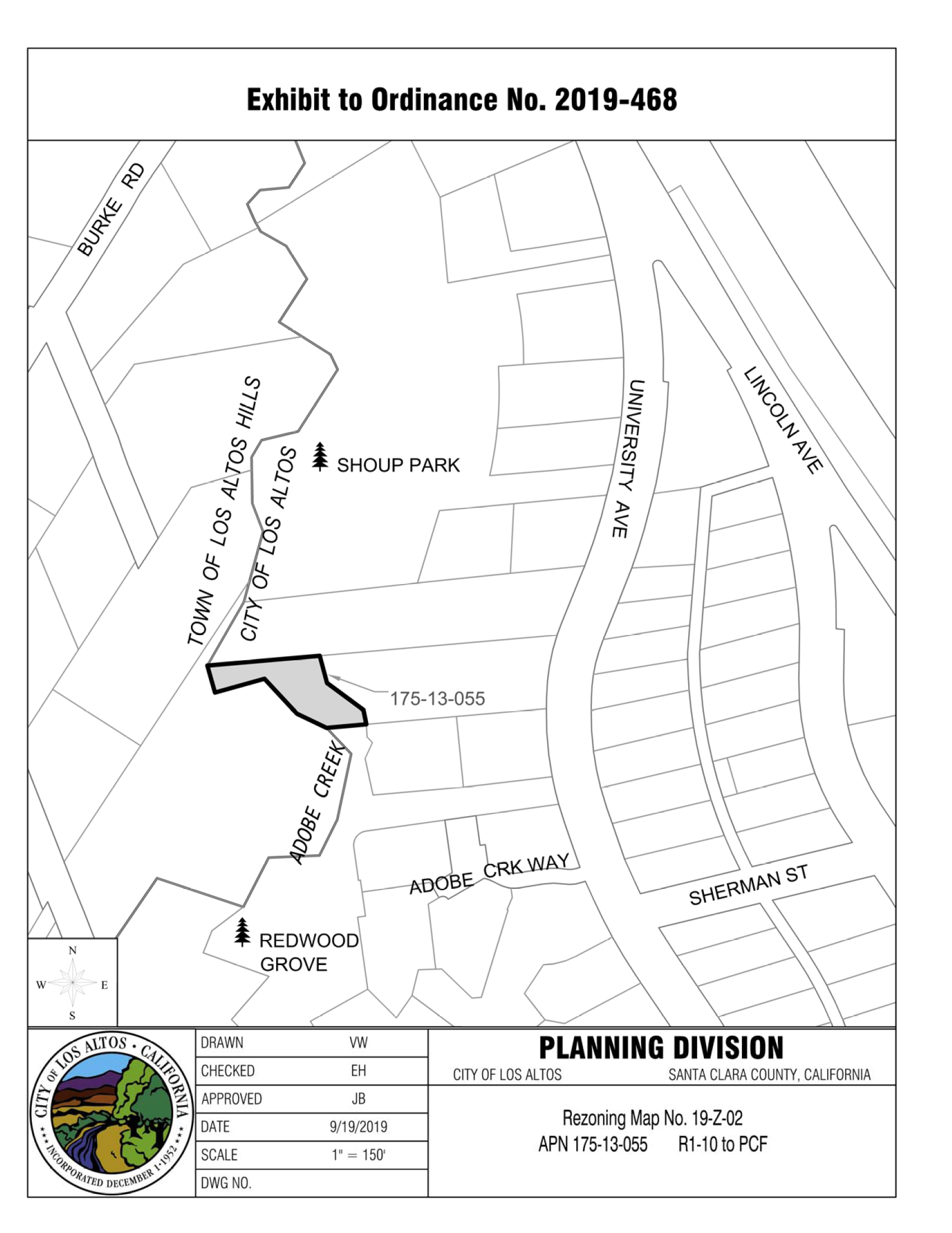
The property generally referred to as the Redwood Grove Connection to Shoup Park (APN 175-13-055) as delineated on Rezoning Map No. 19-Z-02, attached hereto and incorporated herein by reference, are hereby included within the Public and Community Facilities (PCF) zoning district.
3.
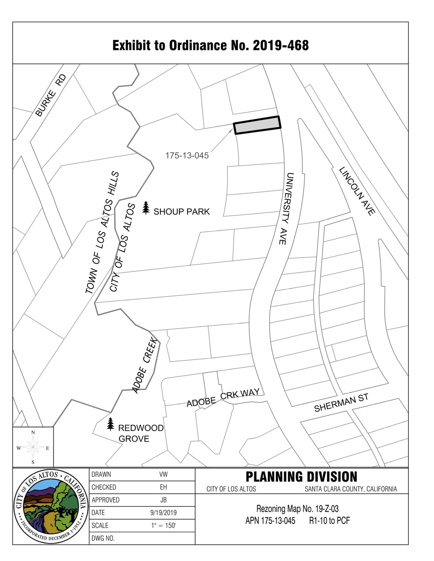
The portion of the property generally referred to as Shoup Park (APN 175-13-045) as delineated on Rezoning Map No. 19-Z-03, attached hereto and incorporated herein by reference, are hereby included within the Public and Community Facilities (PCF) zoning district.
4.
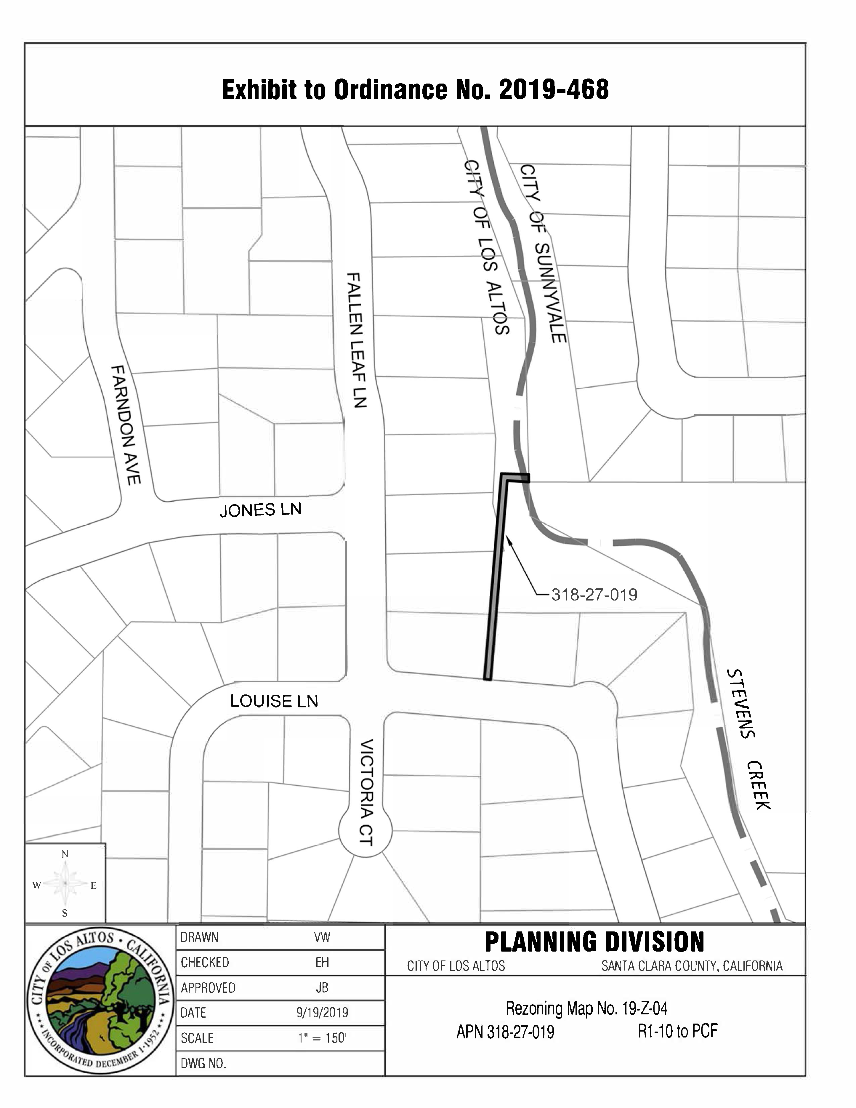
The property generally referred to as the Fallen Leaf Lane bicycle path (APN 318-27-019) as delineated on Rezoning Map No. 19-Z-04, attached hereto and incorporated herein by reference, are hereby included within the Public and Community Facilities (PCF) zoning district.
B.
The Zoning Maps are amended in accordance with the provisions of this Section and the district boundaries are so designated.
(Ord. No. 2019-468, § 1, 12-10-2019)

14.88.730 - Zoning map amended.
A.
The property located at 4546 El Camino Real, APN: 16712042 also known as "Village Court," as delineated on Rezoning Map No. 23-Z-01, attached hereto and incorporated herein by reference, are hereby included within the Commercial Thoroughfare (CT) Zoning District.
B.
The zoning map is amended in accordance with the provisions of the section and the district boundaries are so designated.
(Ord. No. 2023-505, § 1(Exh. A), 11-28-2023)
14.88.740 - Zoning map amended.
A.
The following properties as delineated in the Exhibit A by Assessor Parcel Number (APN), attached hereto and incorporated herein by reference, are hereby included within the Commercial Thoroughfare (CT) Zoning District.
(Ord. No. 2025-533, § 1(App. A), 5-27-2025)