
Los Angeles County Unincorporated
City Zoning Code
City Zoning Code
Division 10
PLANNING AREA AND COMMUNITY STANDARDS DISTRICTS
22.300.010 - Purpose.
Planning Area Standards Districts (PASDs) and Community Standards Districts (CSDs) are established to provide, where useful and appropriate, special development standards to:
A.
Assist in implementing special development requirements or land use limitations previously adopted by the County in neighborhood, community, area, specific, and local coastal plans for particular unincorporated areas of Los Angeles County, to address special problems that are unique to those geographic areas; and
B.
Facilitate development and new land uses that are more responsive to community objectives for the preservation, guided evolution and enhancement, and/or transformation of existing physical character and/or economic conditions than would otherwise be possible through the application of Countywide standards alone.
(Ord. 2024-0032 § 22, 2024; Ord. 2024-0029 § 8, 2024; Ord. 2019-0004 § 1, 2019.)
22.300.020 - Application of Planning Area Standards Districts, Community Standards Districts, and Supplemental Districts to Property.
A.
Hierarchy of Regulations. Standards within Division 10 are organized hierarchically within a category according to their applicable area or zone. Except as specified otherwise in this Title 22, where there is a conflict between two standards regulating the same matter:
1.
The standard in a category listed in Subsection A.2, below, supersedes the contrary standard that would apply to the base zone; and
2.
The standard within a category that is lower on the following list supersedes the contrary standard that is contained in any category above it.
a.
PASD Area-Wide Development Standards.
b.
PASD Zone Specific Development Standards.
c.
CSD Area-Wide Development Standards.
d.
CSD Zone Specific Development Standards.
e.
Sub-Area-Wide Specific Development Standards.
f.
Sub-Area Zone Specific Development Standards.
B.
Relationship to Other Title 22 Provisions.
1.
Specific Plans. Except as specified otherwise, regulations in a Specific Plan shall supersede any contrary provisions in this Division 10.
2.
Supplemental Districts. Except as specified otherwise, regulations in a Supplemental District listed in Table 22.06.040-A shall supersede any contrary provisions in this Division 10.
3.
Accessory Dwelling Units and Junior Accessory Dwelling Units. Accessory Dwelling units and junior accessory dwelling units in a Planning Area Standards District, Community Standards District, or Supplemental District shall be subject to Section 22.140.640 (Accessory Dwelling Units and Junior Accessory Dwelling Units).
4.
Affordable Housing and Senior Citizen Housing. Property within the boundary of a PASD or a CSD may be subject to Chapter 22.119 (Affordable Housing Replacement), Chapter 22.120 (Density Bonus), Chapter 22.121 (Inclusionary Housing), Chapter 22.128 (Supportive Housing), and Chapter 22.166 (Housing Permits), where applicable.
5.
Compact Lot Subdivisions. Any Division 10 provisions pertaining to a required yard shall apply to the equivalent perimeter yard of a compact lot subdivision, pursuant to Section 22.140.585.F.18 (Yard Provisions in Specific Plans, Planning Area Standards Districts, and Community Standards Districts).
6.
Green Zone. Where the regulations in Chapter 22.84 (Green Zone) are contrary to the provisions in this Division 10, the more restrictive provisions shall prevail, except that any required perimeter identification signs or informational signs shall contain information required by both Section 22.84.040.C.1.j (Perimeter Identification Sign) and this Division 10.
7.
Nonconforming Uses and Structures. Except as specified otherwise in a PASD or a CSD, the nonconforming use and structure provisions in Chapter 22.172 (Nonconforming Uses, Buildings and Structures) shall apply to all uses and structures in the area governed by the PASD or the CSD that were legally established or built prior to the effective date of the PASD or the CSD.
C.
Modifications Authorized. Development Standards specified in this Division 10 may be modified, subject to Chapter 22.160 (Conditional Use Permits, Minor), except where the project is subject to:
1.
Chapter 22.158 (Conditional Use Permits);
2.
Chapter 22.166 (Housing Permits);
3.
Chapter 22.176 (Minor Parking Deviation);
4.
Chapter 22.178 (Parking Permit); or
5.
Other modification procedures specified in this Division 10.
(Ord. 2025-0029 § 10, 2025; Ord. 2025-0008 § 3, 2025; Ord. 2024-0032 § 23, 2024; Ord. 2024-0029 § 9, 2024; Ord. 2024-0028 § 26, 2024; Ord. 2022-0023 § 42, 2022; Ord. 2020-0064 § 16, 2020; Ord. 2020-0059 § 14, 2020; Ord. 2020-0032 § 33, 2020; Ord. 2019-0053 § 35, 2019; Ord. 2019-0020 § 22, 2019; Ord. 2019-0004 § 1, 2019.)
22.300.030 - Planning Area and Community Standards Districts Established.
Purpose. The purpose of this Chapter is to ensure the inclusion of affordable housing units in housing developments that meet certain criteria, including those in section 65583.2(c) and (h) of the California Government Code, and encourage mixed - income communities.
(Ord. 2025-0011 § 2, 2025; Ord. 2025-0010 § 5, 2025; Ord. 2025-0008 § 4, 2025; Ord. 2024-0032 § 24, 2024; Ord. 2024-0029 § 10, 2024; Ord. 2024-0004 § 1, 2024; Ord. 2023-0062 § 1, 2023; Ord. 2023-0013 § 1, 2023; Ord. 2022-0008 § 146, 2022; Ord. 2022-0004 § 2, 2022; Ord. 2019-0004 § 1, 2019.)
22.302.010 - Purpose.
The Acton Community Standards District ("CSD") is established to protect and enhance the rural, equestrian, and agricultural character of the community and its sensitive features including significant ecological areas, floodplains, hillsides, National Forest, archaeological resources, multipurpose trail system, and Western heritage architectural theme. The standards are intended to ensure reasonable access to public riding and hiking trails, and to minimize the need for installation of infrastructure such as sewers, streetlights, concrete sidewalks, and concrete flood control systems that would alter the community's character, while providing for adequate drainage and other community safety features.
(Ord. 2019-0004 § 1, 2019.)
22.302.020 - Definitions.
(Reserved)
22.302.030 - District Map.
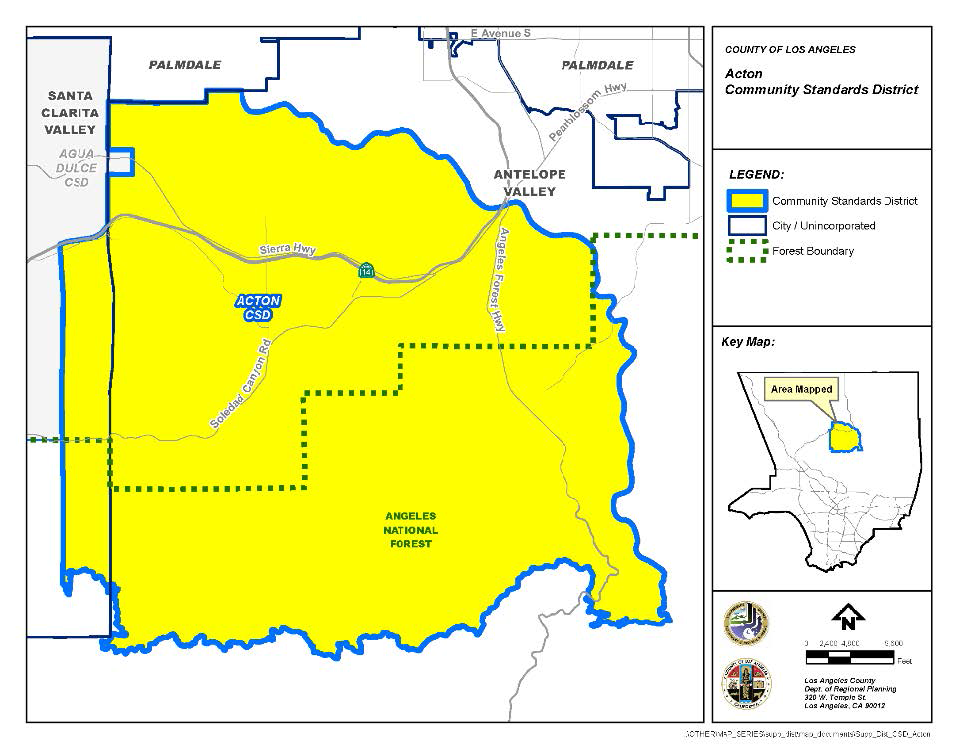
The boundaries of this CSD are shown on Figure 22.302-A: Acton CSD Boundary, at the end of this Chapter.
(Ord. 2019-0004 § 1, 2019.)
22.302.040 - Applicability.
This Chapter shall apply, as appropriate, to any land division, building permit for either a new structure or a specified addition to an existing structure, or grading permit.
(Ord. 2019-0004 § 1, 2019.)
22.302.050 - Application and Review Procedures.
A Ministerial Site Plan Review (Chapter 22.186) application shall be required for the determination of whether or not a proposed development complies with the provisions and development standards prescribed in this Chapter.
(Ord. 2019-0004 § 1, 2019.)
22.302.060 - Community Wide Development Standards.
Except where a more specific application is prescribed or prior to the approval of a new structure or addition to an existing structure where the cumulative area of all additions made after the adoption of this CSD adds at least 400 square feet to the footprint of either primary or accessory structures, an application in compliance with Section 22.302.050 (Application and Review Procedures) shall be submitted to assure compliance with the following development standards:
A.
Hillside Design Considerations. Hillside resources are among the most important features of the Acton community. Hillside regulations shall be enforced by a specific written analysis in each case, demonstrating conformance with the following objectives. Development plans shall comply with the following objectives:
1.
Preserve to the greatest extent possible existing natural contours and natural rock outcropping features. Structures and required provisions for access and public safety should be designed to minimize encroachment on such features by the use of such techniques as curvilinear street designs and landform grading designs which blend any manufactured slopes or required drainage benches into the natural topography;
2.
Preserve to the greatest extent possible the natural silhouette in significant ridgeline areas. Significant ridgelines are the ridgelines that surround or visually dominate the Acton landscape either through their size in relation to the hillside or mountain terrain of which they are a part, or through their visual dominance as characterized by a silhouetting appearance against the sky, or through their visual dominance due to proximity and view from existing development, freeways and highways designated as Major, Secondary, or Limited Secondary on the Highway Plan;
3.
While observing minimum lot area standards contained in this Chapter, cluster development where such technique can be demonstrated to substantially reduce grading alterations and contribute to the preservation of native vegetation and prominent landmark features;
4.
Blend buildings and structures into the terrain by sensitive use of building setbacks, structure heights, and architectural designs; and
5.
Minimize disruption of view corridors, scenic vistas, and adjacent property by the use of sensitive site design and grading techniques.
B.
Preservation of Native Vegetation. Development plans shall emphasize the protection of, and revegetation with, native vegetation, including the native plants, grasses, shrubs, and trees which intercept, hold, and more slowly release rainfall than bare earth surfaces. It is intended that equestrian uses such as stables and arenas which will result in vegetation removal be accommodated, provided the design of these uses does not create erosion or flooding potential that would create a safety hazard to structures or off-site property, as determined by Public Works. On any lot consisting of one acre or greater, the removal or destruction of native vegetation exceeding 10 percent of the lot area within any 12-month period shall require a Minor Conditional Use Permit (Chapter 22.160) application.
1.
Application Required. A Minor Conditional Use Permit (Chapter 22.160) application is required for any application involving grading (including brushing or vegetation removal to accommodate equestrian uses). A site plan for review must be included as part of the application. This information may be submitted in conjunction with other site plan information that may be required for the project. Within hillside areas, such application must comply with Chapter 22.104 (Hillside Management Area), which requires a Conditional Use Permit (Chapter 22.158) application for projects in hillside management areas. Such application shall not substitute for Oak Tree Permit (Chapter 22.174) application requirements. Material submitted shall include:
a.
A description of the property, accompanied by a map showing the topography of the land and the location of any drainage courses; the location and extent of the proposed work and details of the precautionary measures or devices to be used to prevent erosion and flood hazards, including, if necessary, a drainage plan by a civil engineer showing routing of runoff, estimate of quantity and frequency of runoff, character of soils, and channel sections and gradients;
b.
A landscaping plan supportive of this Subsection B showing existing and proposed landscaping, acceptable to the Department. Such plan shall specifically identify California junipers, manzanita, Great Basin sage, and Joshua trees and generally describe the type and condition of native vegetation. Soil types shall be specified to assess the feasibility of revegetation. Relandscaping of disturbed areas should emphasize the use of existing native, drought tolerant vegetation;
c.
A long-term maintenance program for all landscaping in the proposed plan, both undisturbed and revegetated; the program shall focus on revegetated areas and shall cover a two-year period; funding provisions for the maintenance program shall be specified; and
d.
Such other vegetation information as the Director may deem necessary to fulfill the purpose of protecting property and public safety and preserving the character of the Acton community.
2.
Issuance Conditions. The Review Authority shall approve the application, with appropriate conditions, relating to this Subsection B only, for all or a portion of the proposed work when satisfied:
a.
That the performance of such work is consistent with the intent of this Subsection to preserve native vegetation;
b.
That such work will not result in a flood or erosion hazard to this or other properties; and
c.
That the proposed work conforms with the requirements of other laws or ordinances.
3.
For commercial agricultural uses, relief from the standards of this Subsection B pertaining to replacement with native vegetation may normally be granted through the provisions of Section 22.302.090 (Modification of Development Standards).
4.
Exceptions. The provisions of this Subsection B shall not apply to, and a Minor Conditional Use Permit is not required for:
a.
The removal or reduction of vegetation for the purpose of complying with County regulations relating to brush clearance for fire safety. This exception includes not only required vegetation control around structures but also the creation and maintenance by a public agency of firebreaks used to control the spread of fire;
b.
The removal or destruction of vegetation on publicly owned rights-of-way for roads, highways, flood control projects, or other similar or related uses;
c.
The removal or destruction of vegetation by public utilities on rights-of-way or property owned by such utility, or on land providing access to such rights-of-way or property;
d.
Work performed under a permit issued for precautionary measures to control erosion and flood hazards; and
e.
The selective removal or destruction of noxious weeds or plants which pose a hazard to animals.
C.
Architectural Style and Project Design Considerations.
1.
All uses in commercial land classifications in the Antelope Valley Area Plan and all nonresidential uses within Residential and Rural Land classifications which are not accessory to residential structures shall:
a.
Not exceed a height of 35 feet except for chimneys and pole antennas, which may not exceed a height of 45 feet;
b.
Be designed in a "Western frontier village, circa 1890s style" in substantial conformance with the architectural style guidelines in Appendix I at the end of this Chapter and as maintained by the Department; and
c.
Be designed to conceal from public view all external utilities, such as roof-mounted air conditioning or heating units, or other improvements not contributing to the Western architectural design, such as satellite dish antennas. Solar panels that are designed as part of a roof line and blend with the overall roof appearance need not be concealed. An exterior architectural rendering, with materials and colors indicated, shall be submitted with any application request for structural improvements.
2.
Restricted access subdivisions are prohibited.
D.
Drainage. The following provisions are intended to slow or reduce runoff from new development and protect and enhance the rural character of Acton. In addition to existing County standards for the control of runoff, the following standards shall be observed:
1.
The maximum impervious finished surface area for residential and associated accessory uses shall not exceed 10 percent for lots three net acres or larger; not exceed 21 percent or 13,000 square feet, whichever is smaller, for lots between one and one-quarter net acres and three net acres; and not exceed 42 percent or 11,000 square feet, whichever is smaller, for lots smaller than one and one-quarter net acres;
2.
Maximum impervious finished surface areas for nonresidential uses shall not exceed:
a.
65 percent for open storage and homes for the aged;
b.
74 percent for hospitals, cemeteries, mausoleums, and mortuaries;
c.
82 percent for churches and schools; or
d.
90 percent for stores, office buildings, warehousing, manufacturing, storage, shopping centers, restaurants, service stations, parking lots, motels/hotels, kennels, lumber yards, professional buildings, banks, and supermarkets;
3.
Partially impervious surfaces, such as perforated concrete blocks that allow vegetation growth, may be used where public safety is not a consideration, such as private patios and driveways; credit shall be given for the portion of such surfaces that are not impervious. This provision shall not be used to modify standards for parking surfaces required by Section 22.112.080 (Parking Design).
4.
All residential buildings with rain gutters shall collect and direct all roof runoff towards permeable surfaces, rather than towards impervious surfaces such as paved driveways;
5.
This CSD discourages the use of concrete facilities to mitigate flood hazards; and
6.
Flood hazard mitigation shall be consistent with floodplain management practices and existing drainage policies.
E.
Billboards. This CSD shall be designated a Billboard Exclusion Zone (Chapter 22.50).
F.
Signs.
1.
Notwithstanding any other provision of this Title 22, all signs permitted by this Subsection F shall conform to the following:
a.
Signage shall be unobtrusive and shall promote the style of the Western frontier architectural guidelines; and
b.
Lighting shall be external, using fixtures designed to focus all light directly on the sign, and internal illumination shall be prohibited.
2.
Except as specifically exempted by Section 22.114.030 (Exemptions), no sign, including those prohibited by Section 22.114.040 (Prohibited Signs Designated), shall be erected within this CSD except as provided for by this Subsection F.2:
a.
Wall business signs, as provided by Section 22.114.110 (Wall Business Signs), except that no wall business sign attached to a building, including the roof, shall be higher than the highest point of the building, excluding chimneys and antennas. The maximum area permitted of a wall sign is one and one-half square feet for each one linear foot of building frontage, not to exceed 100 square feet per tenant;
b.
Freestanding business signs, typically monument style, as provided for in Section 22.114.120 (Roof and Freestanding Business Signs), except that roof business signs shall be prohibited, the height of such signs shall be limited to five feet measured from the natural grade at street level, and the maximum area of combined faces on such signs shall be limited to 100 square feet;
c.
Residential ranch entrance signs, provided that only one span per lot shall be permitted for such signs, the top of each sign shall not exceed 20 feet from natural grade, and the surface areas of such signs shall not exceed 12 square feet; and
d.
Temporary, directional, informational and special purpose signs, as provided for by Sections 22.114.170 (Temporary Real Estate Signs), 22.114.180 (Temporary Construction Signs), 22.114.190 (Directional and/or Informational Signs), 22.114.200 (Special—Purpose Signs), and 22.114.210 (Temporary Subdivisions and Real Estate Signs).
G.
Fence Design. In addition to standards provided in Section 22.110.070 (Fences and Walls) concerning the height of fences, the following fence design features shall apply to the construction of perimeter fencing:
1.
Only split rail, open wood, wire, or wrought iron style or similar open-type perimeter fences shall be permitted, except on residential lots of less than 10,000 square feet, or unless view-obscuring fences are required for visual shielding by other provisions of this Title 22; and
2.
Except where otherwise required by this CSD, at least 70 percent of the entire fence area shall be non-view-obscuring; no slats or other view-obscuring materials may be inserted into or affixed to such fences. Any solid lineal sections must be primarily for structural purposes or provide minor architectural design features.
H.
Outdoor Lighting. Outdoor lighting shall be provided in accordance with the applicable provisions of Chapter 22.80 (Rural Outdoor Lighting District). Where outdoor lights are required, light fixtures in keeping with the Western frontier architectural style will be required.
I.
Street Improvements. Street improvements shall complement the rural character of the Acton community and street lights shall be provided in accordance with the applicable provisions of Chapter 22.80 (Rural Outdoor Lighting District):
1.
All required local and highway streetlights shall utilize cut-off "Mission Bell" design fixtures, as specified by the local electric utility.
2.
Concrete sidewalks, curbs, and gutters will generally not be required on local streets. In all new land divisions, inverted shoulder cross-sections will be specified for local streets, unless an alternate design is necessary for public safety, as determined by Public Works. Curbs and gutters, or fencing with inverted shoulders, may be required where trail use is within the roadway easement.
J.
Trail Easements. In reviewing and establishing design conditions for any land division, the Review Authority shall consider community trails objectives and whether or not they may be promoted or benefited by such division. Alternative proposals for trail easements consistent with community goals shall be developed and considered in conjunction with each land division.
1.
Unobstructed multipurpose pathways for both pedestrian and equestrian uses should be developed in each new land division to the satisfaction of both Parks and Recreation and Public Works. Although alignments that are not adjacent to roadways will generally be preferred, road easements may be used when the Review Authority determines that other locations are inappropriate.
2.
Any trail incorporated into a land division must contain a provision for participation in a community-wide trail maintenance financing district or other appropriate financing mechanism; the district or other financing mechanism must be established prior to the construction of the trail.
3.
Parks and Recreation will work with the community to establish an appropriate mechanism for financing trail maintenance.
K.
Home Occupations.
1.
Application. Home occupations are permitted, subject to a Ministerial Site Plan Review (Chapter 22.186) application, to enable a resident to carry on an income-producing activity, which is incidental and subordinate to the principal use of residential property, when such activity will not be disruptive to the character of the Acton community.
2.
Additional Standards. Home occupation shall comply with the following standards:
a.
The home occupation shall occur on a lot used primarily as the permanent residence of the person or persons operating the home occupation, and be secondary and incidental to the principal use of the lot, and not change the residential character and appearance of the dwelling unit;
b.
Not more than two persons, other than resident occupants, shall be employed or volunteer their services on site;
c.
The number of off-street vehicle parking spaces shall comply with Chapter 22.112 (Parking), as well as provide one additional on-site vehicle parking space, either covered or uncovered, for each employee or volunteer;
d.
The combined floor area of the home occupation shall not occupy more than 20 percent of the total floor area of the residence (excluding accessory buildings) or 350 square feet, whichever is lesser;
e.
No noise or sound shall be created which exceeds the levels contained in Chapter 12.08 (Noise Control) of Title 12 (Environmental Protection) of the County Code;
f.
On-site signage or display in any form which advertises or indicates the home occupation is prohibited;
g.
No sale of goods shall occur at the premises where the home occupation is located;
h.
Business traffic shall occur only between the hours of 8:00 a.m. and 6:00 p.m. Home occupation related vehicle trips to the residence shall not exceed six per day; and
i.
Approval of a home occupation shall require a covenant and agreement, in compliance with Section 22.222.260 (Performance Guarantee and Covenant).
3.
This Subsection K shall not modify the provisions for on-site display, signage, and sale in any Agricultural Zone of products lawfully produced on such lot.
L.
Drive-Through Establishments. No new drive-through facility or service shall be permitted. For purposes of this Subsection L, the term "new drive-through facility or service" does not include those facilities or services which, prior to the effective date of this Subsection L, July 6, 2018, were: (1) lawfully established, in compliance with all applicable ordinances and laws; or (2) approved by the final decision maker, as set forth in Chapter 22.222 (Administrative Procedures).
(Ord. 2019-0073 § 1, 2019; Ord. 2019-0004 § 1, 2019.)
22.302.070 - Zone Specific Development Standards.
(Reserved)
22.302.080 - Area Specific Development Standards.
Except as provided in this Chapter, all residential lots shall comply with the area requirements and standards of the applicable zone. If any portion of a new lot, or an existing lot, as noted, is located within a Rural Land 1 (RL1), Rural Land 2 (RL2), Rural Land 10 (RL10), or Rural Land 20 (RL20) area, the following requirements apply:
A.
RL2, RL10, or RL20 Area, Antelope Valley Area Plan Land Use Policy Map:
1.
Minimum Lot Area. New residential lots shall contain a gross area of not less than two acres and a net area of not less than 40,000 square feet. Lot sizes may be clustered in accordance with the Antelope Valley Area Plan, provided that no lot contains less than one acre of gross area and 40,000 square feet of net area, and provided the average gross area of all lots in a project is not less than two acres.
2.
Lot Width and Length for Regular Lots. Except as otherwise specified in Subsection A.3, below, new residential lots shall contain an area which is at least 165 feet in width and at least 165 feet in length (depth). This area shall begin no farther than 50 feet from the street right-of-way line and shall include the entire building pad.
3.
Lot Width and Length for Irregular Lots. New flag and other irregularly shaped residential lots shall contain an area which has an average width of not less than 165 feet, including a minimum width of at least 165 feet through the area containing the building pad of the primary residential structure, and a minimum length (depth) of not less than 165 feet.
4.
Lot Setbacks. New and existing residential lots of sufficient size shall have required front and rear yards of not less than 50 feet from the property line. Side yards shall be a minimum of 35 feet from the property line.
B.
RL1 Area, Antelope Valley Area Plan Land Use Policy Map:
1.
Minimum Lot Area. New residential lots shall contain a gross area of not less than one acre and a net area of not less than 40,000 square feet. No clustering of lot sizes is permitted which creates lots smaller than the minimum lot area.
2.
Lot Width and Length for Regular Lots. Except as otherwise specified in Subsection B.3, below, new residential lots shall contain an area which is at least 130 feet in width and at least 130 feet in length (depth). This area shall begin no farther than 35 feet from the street right-of-way line and shall include the entire building pad.
3.
Lot Width and Length for Irregular Lots. New flag and other irregularly shaped residential lots shall contain an area which has an average width of not less than 130 feet, including a minimum width of at least 130 feet through the area containing the building pad of the primary residential structure, and a minimum length (depth) of not less than 130 feet.
4.
Lot Setbacks. New and existing residential lots of sufficient size shall have required front and rear yards of not less than 35 feet from the property line. Side yards shall be a minimum of 25 feet from the property line.
(Ord. 2019-0004 § 1, 2019.)
22.302.090 - Modification of Development Standards.
Modifications to any standards in this Chapter are only available pursuant to the terms and conditions of a Conditional Use Permit (Chapter 22.158) application.
FIGURE 22.302-A: ACTON CSD BOUNDARY
(Ord. 2019-0004 § 1, 2019.)
APPENDIX I. - ACTON COMMUNITY STANDARDS DISTRICT ARCHITECTURAL STYLE GUIDELINES
I.
Background
Acton is a rural community that began to develop in the 1800's as a center of gold and copper mining activity. By 1872, with the coming of the railroad and the development of large scale mining operations, Acton was a thriving community. In 1886 the Southern Pacific depot was established, bearing the name of Acton. For a short period of time, Acton with all its mines was an important town in the State of California. Several structures from this era remain. The 1878 school house now serves as a community church, and the 49er Saloon-remodeled and expanded, but retaining its "Western" look-remains a community fixture. Bricks from the 1890 Acton Hotel have been incorporated into a community monument.
As the mining activity decreased at the turn of the century, the area changed to predominantly ranching activities. It is in keeping with this rich frontier mining town heritage that these Architectural Style Guidelines for commercial areas have been established.
II.
Objectives
Section 22.302.060.C (Architectural Style and Project Design Considerations) of the Acton Community Standards District ("CSD") provides for the application of Architectural Style Guidelines in Acton, primarily in commercial areas, as defined by the Land Use Policy Map for the Antelope Valley Area Plan. There are two distinct commercial areas: 1) "Old Town" south of the Freeway along Crown Valley Road and 2) the newly developing uses adjacent to the Freeway, particularly to the north. The objectives of the guidelines include:
— Identification and description of the qualities which give a "Western frontier village, circa 1890s style" character to much of the existing commercial area—particularly the older development in the vicinity of Crown Valley Road and Soledad Canyon Road.
— Assistance in guiding and promoting architectural rehabilitation throughout Acton that is consistent with its Western Heritage.
— Development of new commercial structures that promote and enhance the community's Western Heritage architectural character.
III.
Guidelines
This entire CSD is intended to help preserve a Western desert community character. Vegetation, street improvements, trails, lighting, fencing, signage, building heights, setbacks, and other features of this CSD all complement the Western appearance. The Architectural Style Guidelines are intended to put the finishing touches on the exterior appearance of the commercial community. The following guidelines provisions are to be used in designing all exterior improvements:
A.
Facades
B.
Roof forms
C.
Sidewalk coverings
D.
Signs
E.
Colors
F.
Materials
G.
Landscaping
H.
Exterior features: lights, railings, street furniture, etc.
A.
Facades
Building exteriors, particularly storefronts, are the most visible elements of a commercial community. The surfaces, materials and colors that complement the overall architectural design create a visual statement as well as provide a framework for signage, landscaping, and street furnishings that can complete a desired appearance.
Lineal Design:
"Western" town commercial structures have strong horizontal lines; parapets, signs, railings, balconies, sidewalk coverings, transom windows, and kickplates are typical lineal features. Projecting or recessed horizontal architectural or decorative features help create dimension and interest on a plain facade. While diversity-e.g. Victorian design-among individual stores is encouraged, horizontal lines can help create a cohesive community and encourage one's eyes to scan the entire area.
Encourage
• A predominating horizontal line along the top of the building facade.
• Alignment of tops of windows and door openings.
• The clear division of two story structures between the first and second floors.
• Second floor balconies and railings; their strong horizontal structure adds depth and visual interest.
• Horizontal lines that carry from one store or structure to the next.
Discourage
• Horizontal elements that do not involve structural features; a painted horizontal stripe, for example, should not be used where wood trim would create dimension and texture.
Entries:
Stores along a "Western" street typically have recessed entries. This feature draws a shopper toward the sheltered door area, which is generally flanked with display windows. This architectural characteristic is in contrast to modern commercial designs which generally align all storefronts and entrances along a straight walkway.
Encourage
• Recessed storefront entries. Side and rear entries may be in line with exterior walls.
• Wood-appearing frame doors with glass panes-particularly in the upper half of the door-and suitable hardware (typically brass hinges and handles or push plates). Wood-frame screen doors can be used.
• Double entry doors, while not necessary, are particularly inviting.
Discourage
• Use of bright aluminum, tinted glass and other modern doorway materials.
• Frameless glass doors.
• Security doors and grates.
Windows:
Windows link the outside pedestrian with the inside business. They provide a showcase for the merchant and can do much to invite sidewalk shoppers to enter an establishment. Western Village-type windows would authentically be multi-pane, with wood frames. While this look is preferred, larger single-pane showcase windows may provide a better display format; as long as the window frame has an appearance that blends with the overall facade, window pane size will not be a judged factor.
Encourage
• Window designs that harmonize with those in adjacent structures.
• Kickplates that line the lower part of the storefront below the glass. Transom windows are a typical feature over the display windows.
• Use of clear glass or lightly tinted glass only; glass may contain suitable decorative etching.
• Use of shutters, louvers or interior blinds where privacy or restricted views are needed.
Discourage
• Design or alteration of window openings that are inconsistent with the architectural character of the building.
• Use of darkly tinted or reflective glass.
• Full length plate glass windows.
• Finished appearance that does not reflect intended architectural design. Aluminum used for window and door frames, for example, is a modern-appearing material that is inappropriate.
Side and Rear Facade Features:
Structures in the commercial areas of Acton are often visible on all sides. Some establishments may permit access from other than the front entry. It is important that these facades be attractively maintained in character with the Western architecture theme. Utilities, trash bins, and other such features of rear and side areas should be covered or disguised in the same architectural theme wherever possible.
B.
ROOF FORMS
Unlike residences of the by-gone Western era with their pitched roofs, commercial buildings are known for their predominantly flat-roofed appearance. Where pitched roofs exist, they are generally hidden from street view by either a parapet-an upward extension of part of the front wall-or a false front (with the exception of Victorian-style structures). While top roof lines can carry a horizontal theme around the commercial area, individuality should be encouraged; multi-height parapets and false fronts add variety. Special roof lines, raised heights, or other distinctive treatments are appropriate over major building entry points or corner structures.
Encourage
• Predominantly flat roofs.
• Sloping roofs hidden from front view by parapets or false fronts with horizontal lines.
• "Accent" roof lines or other architectural features-higher than the surrounding roof lines-at corners and major entrances.
• Screening of roof mounted equipment (see Section 22.302.060.C (Architectural Style and Project Design Considerations) of this CSD).
Discourage
• Sloped or pitched roofs-particularly those visible from street view, unless of Victorian design.
• Decorative roof elements that do not focus on corner or entry areas.
C.
SIDEWALK COVERINGS
Motion picture-created images of Western towns often portray hot, dusty main streets; a respite from the sun was found in the shade provided by coverings along the boardwalks. In Acton today, paved streets minimize the dust, and air conditioning provides ideal climate control. Sidewalk coverings, however, are still functional: in addition to reinforcing the Western architectural style, they provide an invitation to window shoppers, protect window displays and shield windows from the heat of the day, thereby conserving energy.
Sidewalk coverings are typically constructed of rough wood, supported by wooden posts. They may serve as second story balconies. Awnings can also be used, but should be of plain canvas-type material; rounded or scalloped edges, stripes or patterns are not appropriate. Where posts are used, wooden railings would complete the boardwalk area.
D.
SIGNS
Signage controls can "make or break" the visual image of a commercial community. This feature of the Acton community is so important that Section 22.302.060.F (Signs) of this CSD contains specific regulations designed to prevent the use of modern signs.
The primary function of signs in Acton is to effectively identify business locations. Signs should not be used for advertising, unless based on verifiable authentic Western designs. Even then they must either conform to Section 22.302.060.F (Signs) or undergo appropriate variance approvals. The following signage features supplement the requirements of Section 22.302.060.F:
Encourage
• Flush-mounted signs, often within a recessed area on a parapet.
• Hanging signboards, either parallel or perpendicular to the building facade.
• Signs related in size, character, and placement to other building elements.
• Graphics and lettering styles that are appropriate to the western motif. Signs for most franchises and chain stores will require redesign.
• Icon signs that illustrate the type of merchandise or service.
Discourage
• Signs that obscure all or part of a significant architectural feature.
• Garish colors that may attract attention, but which detract from a harmonious community appearance.
E.
COLORS
If there is a single "Western town" color, it would be earthtone. This color-or range of colors from beige to gray-is natural appearing in many of the materials used in constructing the old West. Brick, made from adobe clay, was often used in early Acton and is also an appropriate color. Brighter primary paint colors were available and were often used for signs and on metal surfaces to prevent rust. "Pastels" and "neons" are inappropriate colors in the Western palette.
Encourage
• Natural wood-look and brick tones as the predominant materials/colors of the commercial area. (Simulated wood appearing products may be used in place of real wood.)
• Colors that are coordinated with neighboring building colors and materials.
• Subtle colors on plain surfaces of large structures.
Discourage
• Changing colors along the main surface of a single building facade. A single color-generally natural wood-creates unity; individual stores can be differentiated by accent colors, parapets, signage, and other distinguishing features.
F.
MATERIALS
Finished appearance is more important than the use of "genuine, authentic" materials. Available materials of the day (late 1800's) consisted primarily of wood, adobe, brick and stone. Modern materials are available that simulate these textures, and are generally acceptable in new or rehabilitation construction. Even concrete blocks can be used if faced with adobe-resembling stucco, for example, or covered entirely with vegetation. "Assembly" of these materials should reflect the building techniques and tools employed in the early West.
The chosen materials should be consistent with the structure; sidewalks, for example, would originally have been either boardwalk or stonewalk. Today, those materials would be welcome, although modern materials such as concrete may be used to replicate such appearances through special colorings and installation techniques.
Encourage
• Use of materials available in the old West, such as pine lumber, river rock, and adobe.
• The adaptation of modern materials such as plastic, concrete, and aluminum to resemble old West materials.
Discourage
• Modern materials that retain a contemporary appearance; painted metal "pipe" railings should be avoided in favor of wooden hand rails, for example.
G.
LANDSCAPING
Vegetation can provide an attractive, inviting and unifying element to a commercial district. Trees provide welcome shade in a desert community such as Acton. Trees and shrubbery can cover vacant areas or unattractive features such as utility installations and rubbish disposal areas, and can soften the hard appearance of parking lots. Planter boxes along storefronts can be a very decorative feature.
Section 22.302.060.B (Preservation of Native Vegetation) of this CSD emphasizes the preservation and use of high desert native vegetation. A commercial landscape palette must conform to these requirements, which will ensure compatibility of the vegetation with the architectural theme.
H.
EXTERIOR FEATURES
"Finishing touches" to the Western village architectural theme must consider all the exterior features, both functional and decorative. Lights and lamp posts, railings, trash receptacles, benches, and hitching posts would all be common to Acton commercial areas and in plain view. Sections 22.302.060.H (Exterior Lighting) and 22.302.060.I (Street Improvements) of this CSD establish general requirements for outdoor lighting. Modern lighting techniques which do not interfere with the Western motif may be used.
Utilities should be hidden from view wherever possible. Air conditioning units, for example, should ideally be roof-mounted. Room air conditioning units should never be installed in the front facade; the rear wall is generally preferable, with side walls acceptable.
Encourage
• Western style accessories such as sidewalk railings and hitching posts (which should be located to protect horses from motor vehicles). Cast iron-type benches and wood or woodenlooking trash "barrels" are appropriate and functional. Wagon wheels are a popular decorative item.
• Gas or gas-look lamps, where high visibility for safety is not a factor.
• The use of wood, wrought iron, ceramic, or other materials from the old West era.
Discourage
• Modern decorative materials such as neon and plastics.
(Ord. 2019-0004 § 1, 2019.)
22.304.010 - Purpose.
The Agua Dulce Community Standards District ("CSD") is established to:
A.
Maintain a dispersed, low-density development pattern to preserve the secluded rural nature of the community;
B.
Protect the equestrian, agricultural, historical, cultural, archaeological, and geological characteristics of the community;
C.
Protect sensitive resources and areas, including the Vasquez Rocks Natural Area Park, the Santa Clara River, the Angeles National Forest, and the various floodplains, hillsides, ridgelines, rock outcroppings, and significant ecological areas located within this CSD;
D.
Maintain and enhance the pedestrian and equestrian trail system within this CSD; including the Pacific Crest National Scenic Trail; and
E.
Minimize the development of urban infrastructure that would alter the rural character of the community, including the development of sewer and water systems, paved local streets, street lights, concrete sidewalks, and concrete flood control systems.
(Ord. 2019-0004 § 1, 2019.)
22.304.020 - Definitions.
The following terms are defined solely for this CSD:
Monument sign. A sign placed on a solid base extending at least 75 percent of the width of the sign, and shall include fuel pricing signs.
(Ord. 2019-0004 § 1, 2019.)
22.304.030 - District Map.
The boundaries of this CSD are shown on Figure 22.304-A: Agua Dulce CSD Boundary, at the end of this Chapter.
(Ord. 2019-0004 § 1, 2019.)
22.304.040 - Applicability.
A.
General Applicability. The revised regulations for this CSD contained in this Chapter shall apply to all new development projects for which a complete application has been filed on or after the effective date of the ordinance containing these revised CSD regulations. Complete applications that were filed before the effective date of said ordinance shall comply with the regulations for this CSD and all applicable Title 22 provisions that were in effect at the time that the respective complete applications were filed. For any revised CSD regulation in this Chapter that does not relate to a new development project, said regulation shall apply upon the effective date of the ordinance containing these revised CSD regulations.
B.
Additions and Repairs or Reconstruction to Existing Structures.
1.
Generally. Except as otherwise provided for in this Subsection B, Chapter 22.172 (Non-Conforming Uses, Buildings and Structures) shall apply to all uses and structures in this CSD that were legally established or built prior to the effective date of the ordinance containing the revised CSD regulations in this Chapter.
2.
Additions to Existing Structures. The revised CSD regulations contained in this Chapter shall not apply to any addition to a structure that is legal as of the effective date of the ordinance containing these revised CSD regulations unless the addition:
a.
Changes the structure's use from commercial to residential or from residential to commercial;
b.
Cumulatively increases the structure's existing floor area by more than 25 percent;
c.
Cumulatively increases the structure's existing occupancy load by more than 25 percent; or
d.
Increases the required number of parking spaces for the structure by more than 25 percent.
3.
Repair or Reconstruction of Existing Structures. The revised CSD regulations contained in this Chapter shall not apply to the repair or reconstruction of a structure that is legal as of the effective date of the ordinance containing these revised CSD regulations, where the structure has been damaged or destroyed, unless the repair or reconstruction also includes a change in use or an addition that results in any of the changes to the structure described in Subsections B.2.a through B.2.d, above. If based on the foregoing, the repair or reconstruction of the structure is exempt from the revised CSD regulations contained in this Chapter:
a.
The nonconforming use provisions in Section 22.172.020.G. related to the structure's repair or reconstruction shall not apply; and
b.
If the reconstruction is for a residential structure, the reconstruction may take place anywhere on the lot on which the structure is located, provided the yard requirements of Section 22.18.040.B (Required Yards) and other applicable development standards in this Title 22 are met.
(Ord. 2019-0004 § 1, 2019.)
22.304.050 - Application and Review Procedures.
(Reserved)
22.304.060 - Community-wide Development Standards.
A.
Highway and Local Streets.
1.
Highway Standards.
a.
Routes shown on the County Highway Plan within the boundaries of this CSD shall use alternate rural highway standards, except for locations where existing infrastructure or commercial and pedestrian traffic patterns are such that Public Works determines that curbs, gutters, and sidewalks are necessary for safety reasons or to provide pedestrian access compliant with the Federal Americans with Disabilities Act;
b.
Encroachments into the highway right-of-way are prohibited unless an encroachment permit is granted by Public Works, where Public Works will:
i.
Consider the potential impact that the encroachment will have on safe use of the highway right-of-way for temporary vehicle parking and pedestrian and equestrian movement; and
ii.
Ensure, to the maximum extent feasible, that the highway right-of-way shall be clear of all obstructions including landscaping, trees, and other structures, which block safe pedestrian and equestrian movement on the highway right-of-way; and
c.
If the vehicular right-of-way is not coterminous with the boundaries of the highway right-of-way, driveways may be permitted with an encroachment permit granted by Public Works into the highway right-of-way from a property line to provide access from that property to the vehicular right-of-way or paved highway. Such driveways shall be constructed with a non-slip surface, such as rough-broomed concrete.
2.
Local Street Standards. The following standards shall apply to all local streets maintained by Public Works within this CSD:
a.
Local streets shall use the inverted shoulder cross-section and shall have a paved width of 28 feet, except for locations where additional pavement is required for geometric improvements by Public Works or where commercial, industrial, or institutional uses necessitate alternate designs, as determined by Public Works. This 28-foot width excludes any inverted shoulder or concrete flowline;
b.
New curbs, gutters, and sidewalks are prohibited unless deemed necessary for the safety of pedestrian and vehicular traffic by Public Works after consultation with the Department; and
c.
The encroachment and driveway provisions in Subsections A.1.b and A.1.c (Highway Standards), above, for highway right-of-ways, shall also apply to local streets.
B.
Lighting.
1.
Street Lights. Street lights shall be provided in accordance with the applicable provisions of Chapter 22.80 (Rural Outdoor Lighting District). Where installed, street lights shall be compatible in style and material with the poles on which they are mounted; and
2.
Outdoor Lighting. Outdoor lighting shall be provided in accordance with the applicable provisions of Chapter 22.80 (Rural Outdoor Lighting District).
C.
Utilities (Reserved).
D.
Signs. All sign requirements of Chapter 22.114 (Signs), and all applicable provisions of Chapter 22.80 (Rural Outdoor Lighting District), shall apply to the signage within this CSD, except as otherwise provided for or modified by this Subsection D:
1.
All signs shall comply with the setback requirement of the underlying zone, except as otherwise provided for or modified by this Subsection D;
2.
Notwithstanding the provisions of Section 22.114.050.C, signs within this CSD shall not display more than two sign faces;
3.
Notwithstanding the provisions of Section 22.114.050.K, the height of signs within this CSD shall be measured from the average finished grade at the base of the sign; and
4.
Sections 22.114.090 (Business Signs-In Agricultural and Special Purpose Zones) through 22.114.210 (Temporary Subdivision Sales, Entry, and Special-Feature Signs) shall not apply within this CSD, and instead the following sign types, subject to the following standards, shall be permitted:
a.
Wall Business Signs.
i.
Wall business signs shall not extend above the highest point of the building wall. Sloping roofs shall not be considered an extension of the building wall;
ii.
Roof-mounted wall business signs shall be prohibited;
iii.
The maximum sign area for a wall business sign for a ground floor business establishment shall be one square foot for each linear foot of building frontage, or 60 square feet per establishment, whichever is less. Where a ground floor business establishment fronts only a parking lot, alley, open mall, landscaped open space, or other public way, the exterior building wall facing such parking lot, alley, open mall, landscaped open space, or other public way shall be considered a building frontage for purposes of computing the sign's permitted sign area; and
iv.
The maximum sign area for a wall business sign for a business establishment above the ground floor shall be 10 square feet per establishment;
b.
Freestanding Business Signs. Freestanding business signs shall be monument signs.
i.
Pole-mounted freestanding business signs shall be prohibited;
ii.
Only one freestanding business sign shall be permitted on a lot;
iii.
The maximum sign area for a freestanding business sign shall be 20 square feet per sign face;
iv.
The maximum height for a freestanding business sign shall be four feet; and
v.
The required setback for a free standing business sign shall be determined by Section 22.114.120.D (Location of Signs);
c.
Residential Entrance Signs. For purposes of this Subsection D.4.c, a residential entrance sign is defined as a freestanding or wall-mounted sign that marks the entrance to a residential use.
i.
Only one residential entrance sign shall be permitted on a lot in a Residential or Agricultural Zone;
ii.
The maximum sign area for a residential entrance sign shall be 20 square feet per sign face;
iii.
The maximum height for a residential entrance sign shall be 20 feet;
iv.
Residential entrance signs shall be prohibited over a driveway if that driveway serves as a fire apparatus access road under Section 503.2.1 in Title 32 (Fire Code) of the County Code, unless another unobstructed fire apparatus access road is also provided to the residential use; and
v.
The required setback of a freestanding business sign as determined by Section 22.114.120.D (Location of Signs) shall apply to residential entrance signs;
d.
Directional and/or Informational Signs.
i.
The maximum sign area for a directional and/or informational sign shall be 32 square feet per sign face;
ii.
The maximum height for a directional and/or informational sign shall be 15 feet; and
iii.
The required setback for a directional and/or informational sign shall be determined by Section 22.114.190 (Directional and/or Informational Signs);
e.
Community Identification Signs.
i.
The maximum sign area for a community identification sign shall be 24 square feet per sign face;
ii.
The maximum height for a community identification sign shall be 15 feet; and
iii.
A setback shall only be required for a community identification sign if deemed necessary by Public Works to ensure line of sight and public safety;
f.
Civic Organization Signs.
i.
The maximum sign area for a civic organization sign shall be six square feet per sign face;
ii.
The maximum height for a civic organization sign shall be eight feet; and
iii.
A setback shall only be required for a civic organization sign if deemed necessary by Public Works to ensure line of sight and public safety;
g.
Bulletin or Special Event Signs. Bulletin or special event signs are permanent signs whose information may be changed from time to time, such as advertising upcoming community events.
i.
The maximum sign area for a bulletin or special event sign shall be 24 square feet per sign face;
ii.
The maximum height for a bulletin or special event sign shall be 15 feet; and
iii.
A setback shall only be required for a bulletin or special event sign if deemed necessary by Public Works to ensure line of sight and public safety;
h.
Temporary Signs.
i.
General Requirements.
(1)
Only one temporary sign shall be permitted per street or highway frontage;
(2)
Temporary signs shall not be affixed to any tree, shrub, or other type of vegetation;
(3)
Temporary signs shall be placed at least 10 feet from any property line. Structures installed to support temporary freestanding signs shall be removed when the signs are removed;
(4)
Temporary signs shall display the date of the sign's posting;
(5)
Temporary signs which pertain to a time, event, or purpose which has passed or no longer exists shall be removed within 14 days of the conclusion of the time, event, or purpose, unless otherwise provided for herein; and
(6)
Unless otherwise provided for in this Subsection D.4.h:
(a)
The maximum sign area for a temporary sign shall be 16 square feet per sign face; and
(b)
The maximum height for a temporary sign shall be eight feet;
ii.
Temporary Real Estate Signs. Temporary real estate signs shall contain the name and contact number of the person or company responsible for placing such sign.
(1)
In Residential and Agricultural Zones:
(a)
The maximum sign area for a temporary real estate sign shall be six square feet per sign face; and
(b)
The maximum height for a temporary real estate sign shall be six feet;
(2)
In all other zones:
(a)
The maximum sign area for a temporary real estate sign shall be 48 square feet per sign face; and
(b)
The maximum height for a temporary real estate sign shall be 12 feet;
(3)
Temporary real estate signs shall be removed within 14 days after the involved property has been rented, leased, or sold.
iii.
Temporary Construction Signs. Temporary construction signs shall contain the name and contact number of the person or company responsible for placing such sign.
(1)
The maximum sign area for a temporary construction sign shall be six square feet per sign face;
(2)
The maximum height for a temporary construction sign shall be six feet; and
(3)
Temporary construction signs shall be removed within 14 days after the completion of construction, alteration, or removal of the involved structure.
iv.
Temporary Subdivision Sales Signs. Temporary subdivision sales signs shall contain the name and contact number of the person or company responsible for placing such sign.
(1)
The maximum sign area for a temporary subdivision sales sign shall be 12 square feet per sign face;
(2)
The maximum height for a temporary subdivision sales sign shall be eight feet; and
(3)
Temporary subdivision sales signs shall be removed within one year after the construction of the last unit of the last phase of the involved subdivision.
v.
Temporary Subdivision Entry and Special-Feature Signs. Temporary subdivision entry and special-feature signs shall be monument signs and shall contain the name and contact number of the person or company responsible for placing such sign.
(1)
Temporary subdivision entry signs shall be permitted as are necessary to facilitate entry into and movement within the subdivision;
(2)
Temporary subdivision special-feature signs shall be permitted in the immediate vicinity of an approved model home and temporary subdivision real estate office;
(3)
The maximum sign area for a temporary subdivision entry and special-feature sign shall be 20 square feet per sign face;
(4)
The maximum height for a temporary subdivision entry and special-feature sign shall be six feet;
(5)
Temporary subdivision entry and special-feature signs shall be located within the involved subdivision; and
(6)
Temporary subdivision entry and special-event signs shall be removed within one year after construction is complete for the last unit of the last phase of the involved subdivision.
5.
In addition to the requirements of Section 22.80.080 (Additional Standards for Signage) related to lighting standards for signage, internal sign illumination, such as a "can" light or an individually illuminated lettered sign, shall be prohibited within this CSD. Also, sign lighting within this CSD shall not pulsate, rotate, blink, flash, or simulate motion.
E.
Vegetation Conservation. (Reserved)
F.
Trails. Trails within this CSD shall be regulated by the provisions of this Subsection F and the adopted Trails Plan of the Santa Clarita Valley Area Plan ("Trails Plan") and the County Trails Manual. If a conflict exists between the trails standards in this Subsection F and in the County Trails Manual, the trails standards in this Subsection F shall control.
1.
Trail Dedication.
a.
All subdivisions creating more than four lots shall include publicly-dedicated trail easements in accordance with the Trails Plan. Subdivisions that are 20 net acres in size or greater shall also include publicly-dedicated connector or feeder trail easements within the subdivision;
b.
Parks and Recreation may request, but shall not require, for any subdivision creating four or fewer lots, a publicly-dedicated trail easement in accordance with the Trails Plan, and for subdivisions that are less than 20 net acres in size, a publicly-dedicated connector or feeder trail easement;
c.
Trail easements not dedicated to the County and maintained by Parks and Recreation shall be dedicated to a homeowner's association, non-profit organization that provides trail maintenance, or a special district, and maintained by such entity. If a special district is used for this purpose, such district shall be established pursuant to the Landscaping and Lighting Act of 1972 in Section 22500 et seq. of the California Streets and Highways Code, or shall be formed as some other entity capable of assessing and collecting trail maintenance fees, as determined by Parks and Recreation; and
d.
If a subdivision project proposes to modify an existing trail easement, the subdivider shall seek Parks and Recreation approval of such modification prior to the public hearing on the subdivision;
2.
Trail Use. Publicly-dedicated trail easements provided under this Subsection F shall allow for multi-uses, including hiking, mountain bicycling, and equestrian uses. Notwithstanding the foregoing, publicly-dedicated trail easements provided for the Pacific Crest Trail shall allow for hiking and equestrian uses only, in accordance with United States Forest Service regulations;
3.
Trail Design and Location.
a.
A publicly-dedicated trail shall be designed to connect to an existing or planned trail alignment(s), pursuant to the Trails Plan, and to provide connectivity to recreational uses, such as open space areas, parks, trail heads, bike paths, historical trails or sites, equestrian and multi-use staging areas, campgrounds, and conservation areas;
b.
Publicly-dedicated trails shall not be located contiguous to any local street or highway, unless Parks and Recreation determines that no other location would be suitable. In the event that Parks and Recreation makes such a determination and the publicly-dedicated trail will be located contiguous to a local street or highway, the trail shall be located completely outside of the local street or highway's vehicular right-of-way;
c.
If a development application proposes to develop a driveway that encroaches into a trail easement within that development, the Department shall refer the application to Parks and Recreation for review and approval to ensure that the driveway is constructed with a non-slip, non-smooth surface, such as a textured or stamped finish, or permeable paving. In no event shall any obstruction, such as a mailbox or utility box, be allowed within any portion of the driveway that encroaches into the publicly-dedicated trail easement;
d.
Trail design, construction, and maintenance shall be carried out in conformance with the following standards and any other applicable, non-conflicting, provision of the County Trails Manual:
i.
Publicly-dedicated trails shall remain free of all obstructions, vegetation, and structures, including but not limited to utility boxes, gates, and non-trail fences or retaining walls;
ii.
The minimum publicly-dedicated trail width shall be 10 feet;
iii.
The minimum trail tread width shall be a variable width of six to eight feet;
iv.
The maximum trail cross-slope gradient shall be three percent;
v.
The maximum trail running slope gradient shall be 10 percent, though for short trail distances of up to 300 feet in length, a maximum trail running slope gradient of 15 percent may be permitted, subject to the approval of Parks and Recreation; and
vi.
Trail surfaces shall consist of native soil, native stabilized soil, or decomposed granite; and
e.
Deviations from the standards set forth in this Subsection F or any applicable provision in the County Trails Manual may be allowed based on unique site conditions, including steep topography, existing structures, trees, vegetation, or utility infrastructure, subject to review and approval of Parks and Recreation prior to the public hearing on the subdivision; and
4.
Notification of Subdivision Application. The applicant of any subdivision application within the CSD boundary shall notify the Agua Dulce Town Council, and any local trail advisory entity that requests notification, of the application when the application is filed; and
5.
Information Required and Final Map. All applications for a subdivision creating more than four lots shall include the information necessary to show compliance with the trail requirements of this CSD, and such information shall be shown on the final map prior to recordation.
G.
Hillside Management. In addition to any other applicable requirement of Chapter 22.104 (Hillside Management Areas), where a subdivision project proposes to create more than four lots in a hillside management area, grading for the subdivision shall not be conducted uniformly across the entire area of the subdivision and shall be limited to the pads required for development of the individual structures in the subdivision. Grading plans demonstrating compliance with this requirement shall be submitted with the subdivision application; and
H.
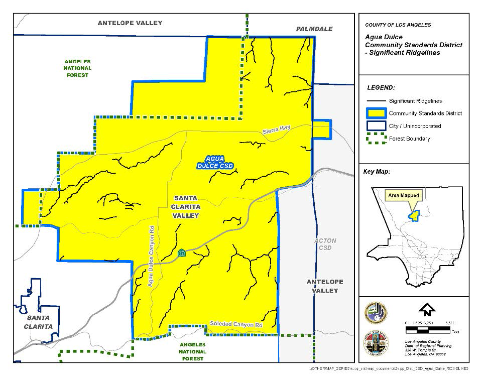
Significant Ridgeline Protection. The locations of the significant ridgelines within this CSD are shown on Figure 22.304-B: Significant Ridgelines, at the end of this Chapter and the criteria used for their designation are provided in Appendix I at the end of this Chapter.
1.
The highest point of any structure, excluding chimneys, rooftop antennas, amateur radio antennas, small-scale solar energy systems, and small-scale wind energy systems, shall be located at least 50 vertical feet and 50 horizontal feet from a significant ridgeline; and
2.
Any modification to Subsection H.1, above, shall require a Conditional Use Permit (Chapter 22.158), in compliance with Section 22.304.090 (Modification of Development Standards).
(Ord. 2022-0008 § 147, 2022; Ord. 2019-0004 § 1, 2019.)
22.304.070 - Zone Specific Development Standards.
A.
Residential and Agricultural Zones.
1.
Lot Design. Each new lot created by a land division shall contain a minimum net area of two acres, a minimum width of 165 feet, and a minimum depth of 165 feet;
2.
Yard Requirements.
a.
For each lot that is smaller than one net acre in size, the yard requirements of Section 22.18.040.B (Required Yards) for Zone R-1 shall apply;
b.
For each lot that is between one net acre and less than two net acres in size, the respective yard sizes shall be a minimum of:
i.
25 feet for the front yard;
ii.
15 feet for the rear yard; and
iii.
10 feet for the side yard;
c.
For each lot that is two net acres in size or greater, the respective yard sizes shall be a minimum of:
i.
50 feet for the front yard;
ii.
25 feet for the rear yard; and
iii.
25 feet for the side yard;
d.
Accessory structures shall not be permitted in any required yard; and
e.
A required yard shall be measured from the property line unless the property line is located within a private street or public right-of-way, in which case the required yard shall be measured from the edge of the private street or public right-of-way closest to the interior of the lot;
3.
Density-Controlled Development. Density-controlled development shall be permitted in Residential and Agricultural Zones, including in hillside management and significant ecological areas, subject to the provisions of Section 22.140.170 (Density-Controlled Developments), but only if the requirements of Subsections A.1 and A.2, above are also met;
4.
Home-Based Occupations. Home-based occupations shall be permitted in Residential and Agricultural Zones, subject to the applicable provisions of Section 22.140.290 (Home-Based Occupations), except that:
a.
Notwithstanding the prohibitions in Section 22.140.290.C (Prohibitions), the following uses shall be permitted:
i.
Animal training, provided the involved animals are domestic animals, as defined in Division 2; and
ii.
Recording/motion picture/video production studio;
b.
A home-based occupation may be housed in a permitted accessory structure. If the accessory structure is a garage, any automobile parking spaces required by Section 22.112.060.A (Required Parking Spaces) shall not be displaced by such use and shall be permanently maintained in accordance with Section 22.112.040.B (Permanent Maintenance Required);
c.
No more than two full-time equivalent employees, either for pay or as a volunteer, not including resident occupants, guests, and/or domestic staff, may be present at any one time, and the maximum number of employee hours per week for the home-based occupation shall be 80 hours;
d.
In addition to any required parking set forth in this Title 22, the home-based occupation shall provide a minimum of one covered or uncovered vehicle parking space for customers of the home-based occupation, and one additional covered or uncovered parking space for each full-time equivalent employee on-site, not to exceed a total of three additional parking spaces for the home-based occupation; and
e.
Business hours for the home-based occupation shall be limited to the hours between 8:00 a.m. and 6:00 p.m., seven days a week; and
5.
Dogs. Table 22.304.070-A, below identifies the maximum number of dogs allowed on a lot.
6.
Cargo Shipping Containers.
a.
Table 22.304.070-B, below, identifies the maximum number of cargo shipping containers allowed on a lot.
b.
The placement of cargo shipping containers on lots or less than one net acre in size, and the placement of containers exceeding the numbers authorized in the above chart, may be allowed, provided that a Minor Conditional Use Permit (Chapter 22.160) is first obtained; and
c.
All cargo shipping containers shall:
i.
Be prohibited in any required yard or in any area where the parking of vehicles is prohibited under Section 22.112.040.C (Residential and Agricultural Zones), where applicable;
ii.
Be placed at least six feet from any structure or other cargo shipping container and not be stacked upon each other;
iii.
Not exceed 10 feet in height, 10 feet in width, and 40 feet in length; and
iv.
Be painted one uniform color, per cargo shipping container, and shall not display any images or lettering on their sides, except for images or lettering providing safety information related to the contents stored within, if such safety information is required by the County Code or other applicable federal, State, or local regulation.
B.
Commercial and Industrial Zones.
1.
Design of Structures. New structures, or additions and/or renovations to existing structures, shall be designed such that:
a.
They are of an Old Western, Southwestern, Spanish Mission, Victorian, or Native American architecture;
b.
Their facades, materials, rooflines, and exterior finishes conform to the chosen architectural style; and
c.
Their entrances are set back at least one foot from the front of the structure;
2.
Compliance with the design requirements of this Subsection B.1, above, shall be substantiated by a written statement from an engineer or architect made under penalty of perjury pursuant to Section 2015.5 of the California Code of Civil Procedure;
3.
Utilities and Equipment. Utility structures and equipment on lots that are visible from a public or private street, including trash receptacles, pumps, water pipes, propane tanks, natural gas pipes, circuit breakers, transformers, and other electrical equipment, shall be screened from view by landscaping, walls, or fences. If, pursuant to this Subsection B.3, electrical equipment is screened from view, the property owner shall obtain consent of the relevant electrical utility for such screening. The Director may waive this screening requirement if the property owner provides satisfactory evidence to the Director that the relevant electrical utility will not provide such consent. Notwithstanding the foregoing, the provisions in this Subsection B.3 shall not apply to any property owned or operated by a public utility where any portion of that property is otherwise exempt from local zoning ordinances pursuant to Section 53091 of the California Government Code; and
4.
Pedestrian and Equestrian Accommodation. Access shall be provided to every lot from the nearest trail or public right-of-way by a minimum 10-foot wide access route to accommodate pedestrian and equestrian traffic. In addition, at least one equestrian hitching post shall be provided per lot.
(Ord. 2022-0008 § 148, 2022; Ord. 2019-0004 § 1, 2019.)
22.304.080 - Area Specific Development Standards.
(Reserved)
22.304.090 - Modification of Development Standards.
A.
Modifications Authorized.
1.
Modification of the development standards specified in Sections 22.304.070.A.1 (Lot Design) and 22.304.070.A.3 (Density-Controlled Development) shall be subject to a Variance (Chapter 22.194) application;
2.
Modification of the development standards specified in Section 22.304.070.A.2 (Yard Requirements) shall be subject to the provisions of Subsection C, below;
3.
Modification of the development standards specified in Section 22.304.070.H (Significant Ridgeline Protection) shall be subject to the provisions of Subsection D, below; and
4.
Modification of all other development standards in this Chapter shall be subject to a Conditional Use Permit (Chapter 22.158) application.
B.
Notification to the Agua Dulce Town Council. In addition to any other notice required by Subsection C.2, below, applicants for any modification described in Subsection A, above, shall provide notice of the application to the Agua Dulce Town Council when the application is filed.
C.
Modification of Yard Requirements.
1.
Applicability. Modification to Section 22.304.070.A.2 (Yard Requirements) shall be subject to a Yard Modification (Chapter 22.196) application and this Subsection C.
2.
Notification. The application shall comply with all noticing requirements as required by a Yard Modification (Chapter 22.196) application, except that the notification radius shall be 1,000 feet of the exterior boundaries of the subject property, as shown on the County's last equalized assessment roll.
3.
Additional Findings.
a.
There are exceptional circumstances or conditions applicable to the subject property or to the intended development of the property that do not apply to other properties within this CSD that warrant the requested yard modification; and
b.
Granting the request for the yard modification will not be materially detrimental to properties or improvements in the area or contrary to the purposes of this CSD, as provided in Section 22.304.010 (Purpose).
D.
Modification of Significant Ridgelines.
1.
Applicability. Modification to Section 22.304.070.H (Significant Ridgeline Protection) shall be subject to a Conditional Use Permit (Chapter 22.158) application and this Subsection D.
2.
Additional Findings.
a.
Alternative sites within the project site have been considered and rejected due to documented hazards for potentially greater damage to biota on the alternative sites than on the subject site, as determined by a biologist; and
b.
The overall development is designed so that grading will not occur uniformly across the project area and will be limited to the pads required for individual structures.
FIGURE 22.304-A: AGUA DULCE CSD BOUNDARY
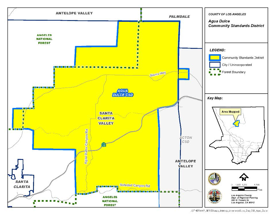
FIGURE 22.304-B: SIGNIFICANT RIDGELINES
(Ord. 2019-0004 § 1, 2019.)
APPENDIX I. - CRITERIA FOR SIGNIFICANT RIDGELINES
The designation of the significant ridgelines within the Agua Dulce Community Standards District is based on the following criteria:
• Topographic complexity. Ridges that have a significant difference in elevation from the valley or canyon floor. Generally, these ridges are observable from any location on the valley floor, from a community, or from a public road.
• Near/far contrast. Ridges that are a part of a scene that includes a prominent landform in the foreground and a major backdrop ridge with an unbroken skyline. This includes a view into a valley rim or a pass. Often, layers of ridges are visible into the distance. This contrast can be experienced viewing an entire panorama or a portion of a panorama from an elevated point.
• Cultural landmarks. Ridges from views of well-known locations, structures, or other places which are considered points of interest in Agua Dulce.
• Existing community boundaries and gateways. Ridges and surrounding terrain that provides the first view of predominantly natural, undeveloped land as a traveler emerges from the urban landscape. These lands introduce visitors to the visual experiences they will encounter in Agua Dulce.
(Ord. 2019-0004 § 1, 2019.)
22.310.010 - Purpose.
The Baldwin Hills Community Standards District ("CSD") is established to provide a means of implementing regulations, safeguards, and controls for activities related to drilling for and production of oil and gas within the oil field located in the Baldwin Hills area of the County. The purpose of these supplemental regulations is to ensure that oil field operations are conducted in harmony with adjacent land uses, to minimize the potential adverse impacts of such operations, to regulate such operations so they are compatible with surrounding land uses, and to enhance the appearance of the site with landscaping and other property maintenance requirements. These standards are implemented to protect the comfort, health, safety, and general welfare of people living, working, and recreating in the surrounding areas.
(Ord. 2019-0004 § 1, 2019.)
22.310.020 - Definitions.
For the purpose of this Chapter, the following terms shall have the meanings set forth herein, unless the context indicates otherwise. Unless a word or phrase is specifically defined in this Section, the definitions set forth in Division 2 (Definitions) shall apply to this Chapter.
Bioremediation Farm. The area of land within the oil field that is used for soil remediation through petroleum hydrocarbon impacted soil removal efforts.
Breakdown. Any event that results in a violation of applicable SCAQMD rules as specified in SCAQMD Rule 430.
CalARP Program. The California Accidental Release Prevention Program.
CAP. The Community Advisory Panel as described in Section 22.310.100.A (Community Advisory Panel).
Chief Executive Officer. The Chief Executive Officer for the County of Los Angeles.
Derrick. Any portable framework, tower, mast, or structure which is required or used in connection with drilling, redrilling, reworking, operating, or maintaining a well for the production of oil, gas, or other hydrocarbons from the earth.
Developed Area.
A.
Any lot containing any residential, commercial, industrial, or office structure, or used for residential, commercial, industrial, or office purposes (provided that no lot on the oil field shall be considered to be developed area solely because of the presence thereon of the Cone Trust House or of a structure used by any operator for administrative functions associated with the oil field); or
B.
Any lot containing any public park, house of worship, cemetery, school, parking lot, or any recreation area which has been developed and opened for public use.
Director. The Director of the Department of Regional Planning of the County of Los Angeles or their designee.
Director of Public Health. The Director of the Department of Public Health of the County of Los Angeles or their designee.
Director of Public Works. The Director of Public Works of the County of Los Angeles or their designee.
District. This CSD, the boundaries of which are shown on Figure 22.310-A: Baldwin Hills CSD Boundary, at the end of this Chapter.
DOGGR. The Division of Oil, Gas, and Geothermal Resources of the Department of Conservation of the State of California.
Drilling. Digging or boring into the earth for the purpose of exploring for, developing, extracting, or producing oil, gas, or other hydrocarbons, or for the purpose of injecting water, steam, or any other fluid or substance into the earth, but does not include remediation efforts to clean-up or remove contamination.
Drilling Equipment. The derrick, together with all parts of and appurtenances to such structure and, every piece of apparatus, machinery, or equipment used or erected or maintained for use in connection with drilling or redrilling.
Drill Site. That portion of any land on which drilling equipment is placed, stored, or utilized during the drilling, redrilling, or reworking of a well.
Enhanced Oil Recovery. Any production method which involves the injection of water, gas, steam, or any other substance into the earth for the purpose of extracting oil.
Environmental Compliance Coordinator. An independent third party approved by the Director and funded by the operator with expertise in oil operations who shall monitor oil operations at the oil field to ensure compliance with all provisions of this Chapter.
Emergency Response Plan or ERP. The emergency response plan, which is a plan to handle anticipated emergencies as required by Section 5192 of Title 8 of the California Code of Regulations and the United States Environmental Protection Agency requirements set forth at 40 Code of Federal Regulations 112, or with any emergency response regulations enacted or modified by the State of California or United States Environmental Protection Agency which are applicable to the oil field.
EQAP. The environmental quality assurance program as described in Section 22.310.060.A.
Fire Chief. The Fire Chief of the Fire Department of the County of Los Angeles or their designee.
Fire Department. The Fire Department for the County of Los Angeles.
Fluids. Any liquid.
Gas. Any substance, either combustible or noncombustible, which is produced in a natural state from the earth and which maintains a gaseous or rarefied state at standard temperature and pressure conditions. It shall also mean the gaseous components or vapors occurring in, or derived from, petroleum or natural gas.
Gas Plant. The centralized facility that is used for the separation of gas constituents and removal of impurities. This includes facilities for the removal of hydrogen sulfide, carbon dioxide, depropanizers, debutanizers, and other types of fractionation.
Idle Well. Any well that has not produced oil or gas or has not been used for injection for six consecutive months of continuous operation during the last five or more years. An idle well does not include an active observation well.
Injection Well. Any well used for the purpose of injecting water, waste water, brine, hydrocarbons, steam, or any other substance as a means of enhanced oil recovery.
Landowner or Landowners. A person, trust, firm, corporation, partnership, association, or other business entity that owns a legal or equitable title in and to any of the real property located within the oil field portion of the district.
Lessor. The owner of the land and mineral resources therein subject to a lease.
MACC. The Multiple Agency Coordination Committee described in Section 22.310.070.H.
Maintenance. The diagnosis, repair or replacement of machinery, equipment, apparatus, structures, facilities, and parts thereof, used in connection with oil operations as well as any other work necessary to reduce public health or safety hazards, other than drilling, redrilling, or reworking.
NFPA. The National Fire Protection Association.
Odor Suppressant. An organic emulsifier, or other compound, that is used to eliminate hydrocarbon odors by reducing the organic composition of hydrocarbon materials.
Oil. Crude oil.
Oil Cleaning Plant. All components of a future facility to be used for the storage and separation of oil, gas, and water.
Oil Field or Oil Field Portion of the District. The entire district except for the Southern California Edison facility, the Holy Cross Cemetery, and the small non-contiguous lot located east of La Brea Avenue, all of which excluded areas are shaded on Figure 22-310-A: Baldwin Hills CSD Boundary, at the end of this Chapter.
Oil Operations. Any activity undertaken in connection with the extraction, production, storage, or shipping of oil, gas, or other hydrocarbon substances including, but not limited to, drilling, redrilling, reworking, maintenance, repair, installation, construction operations, processing, enhanced oil recovery, bioremediation, well abandonment, remediation, clean-up, demolition, restoration, and revegetation. The term shall not include purely administrative operations (e.g., work carried on in the administrative office buildings).
Oil Field Web Site. The web site described in Section 22.310.100.B.3.
Operator. A person, firm, corporation, partnership, association, or other business entity that owns or holds the right to use the surface of the land to extract oil and gas. In the event there are two or more persons or entities who qualify as operators at any given time, then the term shall apply to all of them with regard to their respective operations.
Outer Boundary Line. The exterior limits of the oil field portion of the District.
Permanent Structure. Any building, facility, or equipment that is intended to, or does, remain in place on the oil field for more than one year, and shall include all tanks and all components of any steam drive plant, oil cleaning plant, or water processing facility. Wells and pipelines shall not be considered permanent structures.
Processing. The use of operations for gauging, recycling, compressor repressuring, injection, dehydration, stimulation, separation (including, but not limited to, separation of liquids from gas), shipping and transportation, and the gathering of oil, gas, other hydrocarbon substances, water, or any combination thereof.
Public Health Department. The Department of Public Health for the County of Los Angeles.
Pure Tones. Any sound for which the one-third octave band sound-pressure level in the band with the tone exceeds the arithmetic average of the sound-pressure levels of the two contiguous one-third octave bands by five dB for center frequencies of 500 Hertz and above, or by eight dB for center frequencies between 160 and 400 Hertz, or by 15 dB for center frequencies less than or equal to 125 Hertz.
Redrilling. Any drilling operation conducted to recomplete an existing well in the same or different oil producing zone where the well is deeper than the initial well depth.
Regional Water Quality Control Board or RWQCB. The Los Angeles Regional Water Quality Control Board that regulates and monitors water quality within the Los Angeles Region.
Reworking. Recompletion of an existing well and includes operations such as liner replacements, perforating, or fracing. Reworking also includes redrilling a well that is not deepened or sidetracked beyond the existing well bore.
SIMQAP. The safety inspection, maintenance, and quality assurance program described in Section 22.310.060.C.
SCAQMD. The South Coast Air Quality Management District, which is the regional body that regulates and monitors air quality within the four counties of Los Angeles, Orange, San Bernardino, and Riverside.
SPCC. The spill prevention, control, and countermeasure plan that meets the regulatory requirements of 40 CFR Part 112, or of any subsequently enacted or modified United States Environmental Protection Agency provisions on spill prevention, control, and countermeasure plans.
Steam Drive Plant. All components of a potential future centralized facility that would allow for the production of steam to be injected into portions of the oil field, including a water treatment plant, water softening facility, and all related tanks and equipment.
Subsidence. The settling or sinking of the ground surface.
SWPPP. The stormwater pollution prevention plan that meets the requirements specified by the Regional Water Quality Control Board.
Tank. A container, covered or uncovered, used in conjunction with the drilling or production of oil, gas, or other hydrocarbons for holding or storing fluids.
Uplift. The rising or rebound of the ground surface.
Well. Any oil or gas well or any well drilled for the production of oil or gas, or any well reasonably presumed to contain oil or gas, and shall include injection wells used for the purpose of enhanced oil recovery or to dispose of fluids associated with the production of oil and gas, or an observation well.
Well Abandonment. The permanent plugging of a well, in accordance with State law as set forth in Division 3, Chapter 1 of the California Public Resources Code and pursuant to requirements of DOGGR, found in Title 14 of the California Code of Regulations, Sections 1723-1723.9, or in accordance with subsequently enacted applicable State laws or regulations regarding well abandonment.
Well Servicing. Any maintenance work performed within any existing well bore which does not involve drilling, redrilling, or reworking.
Water Processing Facility. All components of a future centralized facility that would be used to treat and store water that is used for injection.
(Ord. 2019-0004 § 1, 2019.)
22.310.030 - District Map.
The boundaries of this CSD are as shown on Figure 22.310-A: Baldwin Hills CSD Boundary, at the end of this Chapter.
(Ord. 2019-0004 § 1, 2019.)
22.310.040 - Area Specific Development Standards.
A.
Operational Limits. No surface drilling or other surface oil operations shall be allowed within the portions of this CSD consisting of the Southern California Edison facility, the Holy Cross Cemetery, and the small non-contiguous lot located east of La Brea Avenue. These areas are shaded on Figures 22.310-B and C at the end of this Chapter.
(Ord. 2019-0004 § 1, 2019.)
22.310.050 - Oil Field Development Standards.
The following provisions shall apply throughout the oil field portion of this CSD:
A.
Fire Protection and Emergency Response. The operator shall comply with the following provisions:
1.
Community Alert Notification System ("CAN"). The operator shall maintain and test on an annual basis a CAN for automatic notification of area residences and businesses in the event of an emergency arising at the oil field that could require residents or inhabitants to take shelter, evacuate, or take other protective actions.
2.
Spill Containment Response Training. The operator shall conduct annual spill containment response training and shall at all times have available, on-site, sufficient and properly maintained equipment and/or facilities so that a spill of the entire contents from the largest oil tank on the oil field can be responded to and contained in a timely manner to reduce the likelihood that the spill reaches a catch basin.
3.
Emergency Response Plan ("ERP"). The operator shall at all times maintain and fully implement and comply with all provisions of an emergency response plan and shall further ensure that the then current ERP satisfies all rules and regulations of the United States Environmental Protection Agency and California Code of Regulations relating to emergency action plans and spill prevention control and countermeasure plans, as well as the rules, regulations, and requirements of the California Office of Spill Prevention and Response. The ERP shall also satisfy the rules and regulations of the United States Department of Transportation relating to onshore pipeline spills.
B.
Air Quality and Public Health. The operator shall at all times conduct oil operations to prevent the unauthorized release, escape, or emission of dangerous, hazardous, harmful and/or noxious gases, vapors, odors, or substances, and shall comply with the following provisions:
1.
Emission Offsets. The operator shall obtain emission offsets or RECLAIM credits as defined and required by SCAQMD Regulations for all new or modified emission sources that require a new or modified SCAQMD permit.
2.
New Gas Plant. No new gas plant or flare shall be installed at any steam drive plant that may be constructed on the oil field. The operator shall connect any such steam drive plant to the existing gas plant to eliminate the need for a new gas plant or flare at the steam drive plant.
3.
Odor Minimization. At all times the operator shall comply with the provisions of an odor minimization plan that has been approved by the Director. The odor minimization plan shall include any measures requested by the Director. The plan shall provide detailed information about the facility and shall address all issues relating to odors from oil operations. Matters addressed within the plan shall include setbacks, signs with contact information, logs of odor complaints, method of controlling odors such as flaring and odor suppressants, and the protocol for handling odor complaints. The odor minimization plan shall be reviewed by the operator on an annual basis to determine if modifications to the plan are required. Any modifications to the odor minimization plan shall be submitted to the Director for review and approval.
4.
Air Monitoring Plan. At all times the operator shall comply with the provisions of an air monitoring plan that has been approved by the Director. The air monitoring plan shall include any measure requested by the Director. During drilling, redrilling, and reworking operations, the operator shall monitor for hydrogen sulfide and total hydrocarbon vapors as specified in the approved plan. Total hydrocarbon vapors shall be monitored at the gas plant as specified in the approved plan. Such monitors shall provide automatic alarms that are triggered by the detection of hydrogen sulfide or total hydrocarbon vapors. For drilling, redrilling, or reworking monitors, the alarms shall be audible and/or visible to the person operating the drilling, redrilling, or reworking equipment. For the gas plant monitors, the alarms shall be audible or visible to the gas plant operator. Actions to be taken shall be as follows when specified alarm levels are reached:
a.
At a hydrogen sulfide concentration of equal to or greater than five parts per million but less than 10 parts per million, the operator shall immediately investigate the source of the hydrogen sulfide emissions and take prompt corrective action to eliminate the source. The corrective action taken shall be documented in the drilling, redrilling, or reworking log. If the concentration is not reduced to less than five parts per million within four hours of the first occurrence of such concentration, the operator shall shut down the drilling, redrilling, or reworking operations in a safe and controlled manner, until the source of the hydrogen sulfide emissions has been eliminated, unless shutdown creates a health and safety hazard.
b.
At a hydrogen sulfide concentration equal to or greater than 10 parts per million, the operator shall promptly shut down the drilling, redrilling, or reworking operations in a safe and controlled manner until the source of the hydrogen sulfide emissions has been eliminated, unless shutdown creates a health and safety hazard. The corrective action taken shall be documented in the drilling, redrilling, or reworking log. When an alarm is received, the operator shall promptly notify the County Fire Department-Health Hazardous Materials Division, the Culver City Fire Department, the Office of Emergency Services, and the SCAQMD.
c.
At a total hydrocarbon concentration equal to or greater than 500 parts per million but less than 1,000 parts per million, the operator shall immediately investigate the source of the hydrocarbon emissions and take prompt corrective action to eliminate the source. The corrective action taken shall be documented in the drilling log for drilling, redrilling, or reworking and in the gas plant log for the gas plant. If the concentration is not reduced to less than 500 parts per million within four hours of the first occurrence of such concentration, the operator shall shut down the drilling, redrilling, reworking, or gas plant operations in a safe and controlled manner, until the source of the hydrocarbon emissions has been eliminated, unless shutdown creates a health and safety hazard.
d.
At a total hydrocarbon concentration equal to or greater than 1,000 parts per million, the operator shall promptly shut down the drilling, redrilling, or reworking or gas plant operations in a safe and controlled manner, until the source of the hydrocarbon emissions has been eliminated, unless shutdown creates a health and safety hazard. The corrective action taken shall be documented in the drilling log for drilling, redrilling, or reworking and in the gas plant log for the gas plant. When an alarm is received, the operator shall promptly notify the County Fire Department-Health Hazardous Materials Division, the Culver City Fire Department, and the SCAQMD.
e.
All the monitoring equipment shall keep a record of the levels of total hydrocarbons and hydrogen sulfide detected at each of the monitors, which shall be retained for at least five years. The operator shall, on a quarterly basis, provide a summary of all monitoring events where the hydrogen sulfide concentration was at five parts per million or higher and the total hydrocarbon concentration was at 500 parts per million or higher to the Fire Chief. At the request of the Fire Chief, the operator shall make available the retained records from the monitoring equipment.
5.
Portable Flare for Drilling. The operator shall have a gas buster and a portable flare, approved by the SCAQMD, at the oil field and available for immediate use to remove any gas encountered during drilling operations from drilling muds prior to the muds being sent to the shaker table, and to direct such gas to the portable flare for combustion. The portable flare shall record the volume of gas that is burned in the flare. The volume of gas burned in the flare shall be documented in the drilling log. The operator shall notify the Fire Chief and the SCAQMD within 48 hours in the event a measurable amount of gas is burned by the flare, and shall specify the volume of gas that was burned in the flare. No drilling or redrilling shall be conducted in areas that are known to penetrate the Nodular Shale zone unless a fully operational and properly maintained gas buster and portable flare are installed on the rig. All other drilling and redrilling operations shall be conducted so that any measurable gas that is encountered can, and will, be retained in the wellbore until the gas buster and portable flare are installed on the rig, after which the gas will be run through the system. The operator shall immediately notify the Fire Chief and the SCAQMD in the event any gas from drilling or redrilling operations is released into the atmosphere without being directed to and burned in the flare.
6.
Oil Tank Pressure Monitoring and Venting. All oil tanks that contain or could contain oil shall have a fully operational pressure monitoring system that continuously measures and digitally records the pressure in the vapor space of each tank. The detection system shall notify the operator via an alarm when the pressure in the tank gets within 10 percent of the tank relief pressure. In the event of an alarm, the operator shall immediately take corrective action to reduce the tank pressure. The corrective action shall be documented in the operator's log. The operator shall notify the Fire Chief and the SCAQMD within 24 hours if the pressure in any tank covered by this Subsection ever exceeds such tank's relief pressure. Within seven calendar days after any tank vapor release, the operator shall report the incident to the SCAQMD as a breakdown event pursuant to Rule 430, and shall provide the Fire Chief with a written report of the event and the corrective measures undertaken and to be undertaken to avoid future oil tank vapor releases. The operator shall make any changes to such report that may be required to obtain approval from the Fire Chief and the SCAQMD, and shall promptly institute all corrective measures called for by the report.
7.
Odor Suppressant for Bioremediation Farms. When loading material or tilling material at the bioremediation farms, the operator shall use an odor suppressant such that no odor from the bioremediation farms can be detected at the outer boundary line.
8.
Odor Suppressant for Drilling and Redrilling Operations. The operator shall use an odor suppressant spray system on the mud shaker tables for all drilling and redrilling operations to ensure that no odors from said operations can be detected at the outer boundary line.
9.
Closed Systems. The operator shall ensure all produced water and oil associated with production, processing, and storage, except those used for sampling only, are contained within closed systems at all times.
10.
Meteorological Station. The operator shall maintain and operate a meteorological station at the oil field in good operating condition and in compliance with all applicable Environmental Protection Agency ("EPA") and SCAQMD rules, regulations, and guidelines, and to the satisfaction of the Director. The operator shall conduct an audit of the meteorological station on an annual basis and submit the results of the audit to the SCAQMD and the Director. The operator shall maintain the data files for the meteorological station for a period of not less than 10 years. All such data shall be available upon request to the SCAQMD and the Director.
11.
Updated Health Risk Assessment. After every five years of operation of the meteorological station, the operator shall provide the previous five years of meteorological data to the SCAQMD and the Director. If the SCAQMD or the Director determines that the previous five years of meteorological data from the oil field could result in significant changes to the health risk assessment that was conducted as part of the Baldwin Hills Community Standards District Environmental Impact Report, then the County may elect to re-run the health risk assessment using the previous five years of meteorological data from the meteorological station.
12.
Off-Road Diesel Construction Equipment Engines. All off-road diesel construction equipment shall comply with the following provisions:
a.
Utilize California Air Resources Board ("CARB") EPA Certification Tier III or better certified engines or other methods approved by the CARB as meeting or exceeding the Tier III standard or Tier II certified engines as long as no drilling or redrilling occurs during construction.
b.
Utilize a CARB Verified Level 3 diesel catalyst. The catalyst shall be capable of achieving an 85 percent reduction for diesel particulate matter. Copies of the CARB verification shall be provided to the Director. Said catalysts shall be properly maintained and operational at all times when the off-road diesel construction equipment is in use.
13.
Drill Rig Engines. All drilling, redrilling, and reworking rig diesel engines shall comply with the following provisions:
a.
Utilize CARB/EPA Certification Tier II or better certified engines, or other methods approved by CARB as meeting or exceeding the Tier II standard.
b.
Utilize second generation heavy duty diesel catalysts capable of achieving 90 percent reductions for hydrocarbons and for particulate matter smaller than 10 microns. Said catalysts shall be properly maintained and operational at all times when the diesel engines are running.
14.
Drilling and Redrilling Setbacks. The following setbacks shall apply within the oil field for drilling or redrilling:
a.
At least 400 feet from developed areas.
b.
At least 20 feet from any public roadway.
15.
Construction Schedule. To reduce construction air emissions, no overlap shall be permitted in major facility construction and installation activities such as the steam drive plant, the water processing facility, or the oil cleaning plant.
16.
Fugitive Dust Control Plan. The operator shall comply with the provisions of a fugitive dust control plan that has been approved by the Director. The plan shall be based upon the requirements of SCAQMD Rule 403 and the SCAQMD CEQA Guideline Fugitive Dust Control Measures. The fugitive dust control plan shall be reviewed by the operator every five years to determine if modifications to the plan are required. Any modifications to the fugitive dust control plan shall be submitted to the Director for review and approval. The fugitive dust control plan shall include any measure requested by the Director.
C.
Safety and Risk of Upset. The operator shall at all times conduct oil operations in a manner that minimizes risk of accidents and the release of hazardous materials, and shall comply with the following provisions:
1.
Natural Gas Liquid Blending. Natural gas liquids at the gas plant shall be blended with the oil to the maximum allowable pipeline system vapor pressure. Natural gas liquids storage shall be limited to the volume allowed in the risk management plan approved by the Fire Department.
2.
Propane and Natural Gas Liquids Bullet Fire-Proofing. The operator shall install and maintain fire-proofing insulation on all propane and natural gas liquids bullets within the oil field. The fire-proofing insulation shall have a minimum two-hour fire rating and otherwise be acceptable to the Fire Chief. All propane and natural gas liquid bullets shall be equipped with an automatic deluge system.
3.
Steam Drive Plant Setback. The steam drive plant, if constructed, shall be located at least 1,000 feet from a developed area and shall use urea or equivalent, low toxicity material for any nitrogen oxide emission reduction that is required by the SCAQMD.
4.
Secondary Containment for Oil. The operator shall comply with the following provisions:
a.
The operator shall ensure that all existing oil tank areas in the oil field, unless determined by the Director to be infeasible, and all the new oil tank areas shall have secondary containment (berms and/or walls) that can contain at least 110 percent of the largest oil tank volume to reduce the likelihood of oil spills entering the retention basins. In the event the Director determines that it would be infeasible to provide 110 percent containment for a particular existing oil tank, the operator shall provide such containment as the Director determines is feasible.
b.
All retention basins in the oil field shall be adequately sized, and maintained to handle a 100-year storm event plus a potential spill of the volume of the largest tank that would drain into each basin.
c.
All above ground piping in the oil field that contains or could contain oil shall be protected by basins or secondary containment measures (berms and/or walls).
D.
Geotechnical. The operator shall comply with the following provisions:
1.
Grading. The operator shall comply with all of the following provisions:
a.
All proposed grading shall be subject to prior review and approval by the Director of Public Works.
b.
Grading involving up to 5,000 cubic yards and grading associated with the bioremediation farms may be undertaken pursuant to a County master grading plan stamped by a registered professional engineer and a California-certified engineering geologist and approved by the Director of Public Works.
c.
No slope of cut or fill shall have a gradient steeper than two to one (2:1) unless specifically approved by a site specific geotechnical report.
d.
Cuts and fills shall be minimized to avoid erosion and visual impacts.
2.
Geotechnical Investigations. The operator shall comply with the following provisions:
a.
A site-specific geotechnical investigation shall be completed for grading in excess of 5,000 cubic yards, unless associated with the on-site Bioremediation Farms and approved pursuant to a master grading plan approved by the Director of Public Works, and for any grading that supports or impacts a critical facility as determined by the Director. The investigation shall be completed by a California-certified engineering geologist and submitted to the Director and the Director of Public Works for review and approval, in conjunction with an application for a revised grading permit.
b.
A site-specific geotechnical investigation shall be completed for all proposed permanent structures. The investigation shall include analysis and recommendations associated with potential seismically induced ground failure, such as differential settlement and lateral spreading. The geotechnical investigation shall be completed by a California-certified engineering geologist and submitted to the Director of Public Works for review and approval.
3.
Erosion Control. The operator shall comply with the following provisions:
a.
The operator shall comply with all provisions of an erosion control plan that has been approved by the Director. The erosion control plan shall be reviewed by the operator every two years to determine if modifications to the plan are required. Any modifications to the erosion control plan shall be submitted to the Director for review and approval. The erosion control plan shall include any measures requested by the Director.
b.
Erosion shall be controlled on all slopes and banks so that no mud or other substances are washed onto public streets or surrounding property. Such control measures may consist of planting and irrigation, dams, cribbing, riprap, sand bagging, netting, berms, or other devices.
4.
Restoration of Slopes. Slopes shall be restored to their original grade once the use that required the grading of the slope has been discontinued. However, if restoration of a slope would negatively affect existing drainage patterns or slope stability, then the slope shall be restored to a grade that avoids these negative effects.
5.
Ground Movement Surveys. The operator shall conduct ground movement surveys once every 12 months, or more frequently if determined necessary by the Director of Public Works, following all provisions of a ground movement monitoring plan that is acceptable to DOGGR and the Director of Public Works, that calls for both vertical and horizontal ground movement surveys, at specified survey locations within, and in the vicinity of, the oil field, utilizing high precision Global Positioning System technology, in combination with a network of ground stations (or any alternative technology specified in the ground movement monitoring plan approved by the Director of Public Works), and following other survey methods outlined in the plan. The surveys shall be conducted by a California-licensed surveyor. The survey results shall be analyzed in relation to oil field activities, such as production, steam injection, and waterflooding, taking into consideration individual oil producing zones, injection schedules, rates, volume, and pressure. The analysis shall be completed in collaboration by a California-registered professional petroleum engineer, registered geotechnical engineer, and certified engineering geologist. The results of the annual monitoring survey and analysis shall be forwarded to DOGGR and the Director of Public Works. If requested by DOGGR or the Director of Public Works, the operator shall make modifications to the ground movement monitoring plan. In the event that survey indicates that on-going ground movement, equal to or greater than 0.6 inches at any given location, or a lesser value determined by the Director of Public Works is occurring in an upward or downward direction in the vicinity of or in the oil field, the operator shall review and analyze all claims or complaints of subsidence damage that have been submitted to the operator or the County by the public or a public entity in the 12 months since the last ground movement survey. Based thereon, the operator shall prepare a report that assesses whether any of the alleged subsidence damage was caused by oil operations and submit said report to DOGGR and Public Works. Public Works shall review the report to determine if it concurs with its conclusions. If the report concludes that damage has not been caused by oil operations, and Public Works does not concur in that conclusion, it shall forward its conclusions to DOGGR for its review and possible action. If the report concludes that damage was caused by oil operations and Public Works concurs with any such conclusion, Public Works shall forward Public Works' conclusions to DOGGR and ask DOGGR to evaluate the operator's fluid injection and withdrawal rates to determine whether adjustments to these rates may alleviate the ground movement, and if so, where in the oil field such adjustments should be made. The operator shall implement whatever adjustments in the rates of fluid injection and/or withdrawal that DOGGR determines are necessary and appropriate to alleviate any ground movement damage. The County shall promptly notify the CAP of any such action that is taken pursuant to this Subsection. Injection pressures associated with secondary recovery operations (i.e., water flooding) or disposal of produced fluids shall not exceed reservoir fracture pressures as specified in Title 14 of the California Code of Regulations, Section 1724.10, and as approved by the DOGGR.
6.
Construction of Permanent Structures. No permanent structures shall be constructed in an Alquist-Priolo Fault Zone without preparation of a fault study by a California-certified engineering geologist. Following the fault study, no permanent structures shall be placed within 50 feet of a known active fault. The fault investigation report shall be submitted to the Director of Public Works for review and approval.
7.
Oil Field Accelerometer. The operator shall operate and maintain an accelerometer at the oil field to determine site-specific ground accelerations as a result of any seismic event in the region (Los Angeles/Orange County and offshore waters of the Santa Monica Bay and San Pedro Channel). Readings from the accelerometer shall be recorded at the oil field and transmitted in real-time to the Caltech Seismological Laboratory. The operator shall cease operations and inspect all oil field pipelines, storage tanks, and other infrastructure following any seismic event that exceeds a ground acceleration at the oil field of 13 percent of gravity (0.13 g) and promptly notify the Director. The operator shall not reinstitute operations at the oil field and associated pipelines until it can reasonably be determined that all oil field infrastructure is structurally sound.
8.
Pipeline Management Plan. The operator shall maintain and implement a pipeline management plan that meets the requirements of DOGGR regulations.
9.
Paleontological Monitor. The operator shall have a qualified paleontologist, approved by the Director, monitor all rough grading and other significant ground disturbing activities in paleontological sensitive sediments. The sensitive sediments that have been identified within the oil field include the Lower to Middle Pleistocene San Pedro Formation and the Middle to Upper Pleistocene Lakewood Formation. A paleontologist will not be required on site if excavation is only occurring in artificial fill or Holocene alluvium.
E.
Noise Attenuation. All oil operations on the oil field shall be conducted in a manner that minimizes noise and shall comply with the following provisions:
1.
Noise Limits. The operator shall comply with the following provisions:
a.
All oil operations on the oil field shall comply with the noise provisions of Chapter 12.08 of Title 12 (Environmental Protection) of the County Code, with the exception of drilling, redrilling, and reworking, which are exempt from the provisions of said Chapter.
b.
Hourly, A-weighted equivalent noise levels associated with drilling, redrilling, and reworking shall not elevate existing baseline levels by more than five dBA at any developed area. For daytime activities (7:00 a.m. to 7:00 p.m.) existing baseline noise levels shall be defined as the maximum daytime equivalent noise level (Leq) at the closest monitoring site as shown in Table 4.9.3 of the 2008 Baldwin Hills Community Standards District Environmental Impact Report. For nighttime activities (7:00 p.m. to 7:00 a.m.), existing baseline noise levels shall be defined as the minimum nighttime equivalent noise level (Leq) at the closest monitoring site as shown in Table 4.9.3 of the 2008 Baldwin Hills Community Standards District Environmental Impact Report. Updated baseline noise levels may be set and additional monitoring sites may be established, from time to time by the Director. In no case shall baseline noise levels include any drilling, redrilling, or reworking operations.
c.
Noise produced by oil operations shall include no pure tones when measured at a developed area.
2.
Backup Alarms. Backup alarms on all vehicles operating within the oil field shall be disabled between the hours of 8:00 p.m. and 8:00 a.m. During periods when the backup alarms are disabled, the operator shall employ alternate, low-noise methods for ensuring worker safety during vehicle backup, such as the use of spotters.
3.
Quiet Mode Drilling Plan. All drilling and redrilling on the oil field between the hours of 6:00 p.m. and 8:00 a.m. shall be conducted in conformity with a quiet mode drilling plan that has been approved by the Director and the Director of Public Health. The quiet mode drilling plan shall be reviewed by the operator every year to determine if modifications to the plan are required. The operator shall make changes to the plan if requested by the Director or the Director of Public Health. Any modifications to the quiet mode drilling plan shall be submitted to the Director and the Director of Public Health for review and approval. The quiet mode drilling plan shall include any measures requested by the Director or the Director of Public Health.
4.
Equipment Servicing. All noise producing oil field equipment shall be regularly serviced and repaired to minimize increases in pure tones and other noise output over time. The operator shall maintain an equipment service log for all noise-producing equipment.
5.
Deliveries to the Oil Field. Deliveries to the oil field shall not be permitted after 8:00 p.m. and before 7:00 a.m. except in cases of emergency. Deliveries on Sundays or legal holidays shall not be permitted after 8:00 p.m. or before 9:00 a.m., except in cases of emergency.
6.
Deliveries within the Oil Field. Deliveries to areas of the oil field located within 500 feet of any residential property shall not be permitted after 5:00 p.m. or before 7:00 a.m. except in cases of emergency. Deliveries to such areas on Sundays or legal holidays shall not be permitted after 5:00 p.m. and before 9:00 a.m., except in cases of emergency.
7.
Time Limits for Construction. Construction of permanent structures shall not be permitted after 7:00 p.m. and before 7:00 a.m., or during Saturdays, Sundays, or legal holidays.
8.
Construction Equipment. All construction equipment shall be selected for low-noise output. All construction equipment powered by internal combustion engines shall be properly muffled and maintained.
9.
Construction Equipment Idling. Unnecessary idling of construction equipment internal combustion engines is prohibited.
10.
Worker Notification. The operator shall instruct employees and subcontractors about the noise provisions of this Subsection E prior to commencement of each and every drilling, redrilling, reworking, and construction operation, and shall annually certify to the Director that such employees and subcontractors have been properly trained to comply with such noise provisions. The operator shall prominently post quiet mode policies at every drilling and redrilling site.
F.
Vibration Reduction. All oil operations on the oil field shall be conducted in a manner that minimizes vibration. Additionally, vibration levels from oil operations at the oil field shall not exceed a velocity of 0.25 mm/s over the frequency range 1 to 100 Hz at any developed area.
G.
Biological Resources. All oil operations on the oil field shall be conducted in a manner that minimizes impacts to biological resources and shall comply with the following provisions:
1.
Oil Spill Response. The operator shall comply with all provisions of an Emergency Response Plan ("ERP") that has been approved by the Director, to protect biological species and to revegetate any areas disturbed during an oil spill or clean-up activities. The operator shall make changes to the ERP if requested by the Director. Any modifications to the ERP shall be submitted to the Director for review and approval. The ERP shall include any measures to protect biological species that may be requested by the Director.
2.
Special Status Species and Habitat Protection. The operator shall comply with all provisions of a special status species and habitat protection plan that has been approved by the Director. The operator shall make changes to the plan if requested by the Director. Any modifications to the plan shall be submitted to the Director for review and approval. The special status species and habitat protection plan shall include any measures requested by the Director.
3.
Habitat Restoration and Revegetation Plan. Prior to any disturbance of sensitive natural habitat areas, as identified in the special status species and habitat protection plan, the operator shall hire a biologist, approved by the County, to conduct a survey of the area to determine if significant impact to sensitive natural habitat, including coastal sagebrush, coyote bush scrub, riparian scrub, and oak woodland will occur. If the biologist determines that significant impact to sensitive natural habitat will occur, then the operator shall have a County-approved restoration specialist, with expertise in southern California ecosystems and revegetation techniques, prepare a habitat restoration and revegetation plan. The plan shall be submitted to the Director for review and approval. The Director shall make best efforts to complete the review of the plan as expeditiously as possible and shall then either approve the plan or provide the operator with a list of specific items that must be included in the plan prior to approval. No removal of sensitive natural habitat shall occur until the plan has been approved by the Director. The habitat restoration and revegetation plan shall include any measures requested by the Director.
4.
Pre-Construction Surveys. The following surveys shall be conducted prior to any significant vegetation removal in sensitive natural habitat as identified in the special status species and habitat protection plan.
a.
The operator shall hire a County-approved ecologist/botanist to conduct sensitive plant surveys.
b.
The operator shall hire a County-approved biologist to conduct sensitive wildlife surveys in habitat areas that could support sensitive wildlife species.
c.
The operator shall hire a County-approved biologist to conduct breeding and nesting bird surveys if the construction activities would occur during the breeding season (February 1 to August 31 for raptors, and March 15 to September 15 for sensitive/common birds).
d.
The operator shall hire a County-approved wetland delineator to delineate any wetlands that would be affected by construction.
5.
Listed Plant or Wildlife Species. If federal- or State-listed plant or wildlife species are found, then the operator shall comply with all applicable United States Fish and Wildlife and California Department of Fish and Wildlife rules and regulations.
6.
Construction Monitoring. If the pre-construction surveys find sensitive plant, wildlife species, or nesting birds, a biological monitor hired by the operator, and approved by the County, shall be on site during construction to monitor the construction activities. The biological monitor shall be responsible for the following:
a.
Establishing a 300-foot buffer around any active breeding bird nests.
b.
Assuring that vegetation removal does not harm sensitive wildlife species.
c.
Monitoring the construction area for sensitive wildlife species and relocating them to suitable habitat outside of the construction area.
d.
Ensuring that exclusionary fencing is installed around the construction area to prevent sensitive wildlife species from entering the construction area.
7.
Tree and Riparian Scrub Removal. Removal of native or non-native trees and riparian scrub vegetation shall be scheduled, as possible, for removal outside the nesting season to avoid impacts to nesting birds. If avoidance of removal of trees or riparian scrub during the recommended periods is not possible, a County-approved biologist shall perform a survey to ensure that no nesting birds are present prior to removal. If for any reason a nest must be removed during the nesting season, the operator shall provide written documentation to the Director demonstrating concurrence from the United States Fish and Wildlife Service and California Department of Fish and Wildlife authorizing the nest relocation and a written report documenting the relocation efforts.
8.
Habitat Restoration. Within 60 days of completion of construction activities that have significantly impacted sensitive natural habitat, the operator shall begin habitat restoration consistent with the approved native habitat restoration and revegetation plan discussed in Subsection G.3, above. Restoration priority shall be given to areas of degraded habitat connecting areas of higher quality habitat and where restoration would produce larger corridors to support the migration and movement of wildlife. The operator shall replace any significant loss of sensitive natural habitat at the following ratios:
a.
1:1 for each acre of coastal sagebrush or coyote bush scrub.
b.
2:1 for each acre of riparian scrub or oak woodland.
H.
Cultural/Historic Resources. The operator shall comply with all of the following provisions:
1.
Cone Trust House. Oil operations shall not result in impacts to the Cone Trust House.
2.
Archeological Training. The operator shall provide archeological training for all construction personnel who will be involved with ground disturbance activities at the oil field. All such construction personnel shall be required to participate in the training and will receive training material prepared by a qualified archaeologist prior to working on ground disturbance activities.
3.
Construction Treatment Plan. The operator shall comply with all provisions of a construction treatment plan, approved by the Director, to ensure that any new archeological discoveries are adequately recorded, evaluated, and, if significant, mitigated. In the event that unknown archaeological artifacts are encountered during grading, clearing, grubbing, and/or other construction activities, work shall be stopped immediately in the vicinity of the find and the resource shall be evaluated by a qualified archaeologist, approved by the Director. The construction treatment plan shall include any measures requested by the Director.
I.
Lighting. Outdoor lighting shall be restricted to only those lights which are required by code for the lighting of building exteriors, drilling, and redrilling rigs and for safety and security needs. In addition, the operator shall comply with the following provisions:
1.
Screening. All new point lighting sources within the oil field shall be screened and directed to confine direct rays to the oil field and to prevent off-site spillover lighting effects to the extent feasible.
2.
Lighting Plan. A detailed lighting plan shall be prepared for each new permanent structure and submitted to the Director for review and approval. No work may be commenced on such permanent structure until the lighting plan therefore has been approved by the Director. The lighting plan shall include any measures requested by the Director.
J.
Landscaping, Visual Screening, Irrigation and Maintenance. The operator shall comply with the conceptual landscaping plan for the oil field prepared by Mia Lehrer & Associates, dated October 2008, on file with the Department, which is intended to beautify and screen the oil field from adjoining residential, recreational, and institutional areas or adjacent public streets or highways. Landscaping required by this plan shall be completed in phases over a two-to five-year period as approved by the Director. All landscaping on the oil field shall be routinely inspected (on at least a monthly basis) and maintained in a neat, clean, and healthful condition, including proper watering, pruning, weeding, fertilizing, and replacement of plants as needed. Litter shall also be removed on a regular basis.
K.
Oil Field Waste Removal. The operator shall comply with the following provisions:
1.
Waste Collection. All drilling, redrilling, and reworking waste shall be collected in portable steel bins compliant with United States Department of Transportation standards. Any drilling, redrilling, and reworking wastes that are not intended to be injected into a Class II Well, as permitted by DOGGR, shall be removed from the oil field no later than 30 days following completion of the drilling, redrilling, and reworking. This provision does not apply to active sumps and mud pits.
2.
Waste Discharge. No oil field waste shall be discharged into any sewer, storm drain, irrigation systems, stream or creek, street, highway, or drainage canal. Nor shall any such wastes be discharged on the ground provided that the foregoing shall not prohibit the proper use of active drilling sumps and mud pits.
3.
Recycling Plan. The operator shall comply with all provisions of a recycling plan that has been approved by the Director. The recycling plan shall include any elements requested by the Director.
L.
Construction of Private Roads. Roads and other excavations shall be designed, constructed, and maintained to provide stability of fill, minimize disfigurement of the landscape, prevent deterioration of vegetation, maintain natural drainage, and minimize erosion. Prior to construction of any new road, the operator shall prepare and submit to the Director of Public Works for review and approval a private road construction plan. The operator shall thereafter comply with all provisions of the approved private road construction plan. All new private access roads leading off any surfaced public street or highway shall be paved with asphalt or concrete not less than three inches thick for the first 50 feet of said access road from the public street or highway.
M.
Signs. All signage shall comply with Chapter 22.114 (Signs). In addition, the operator shall comply with the following provisions:
1.
Perimeter Identification Signs. Identification signs, at intervals acceptable to the Director, shall be posted and maintained in good condition along the outer boundary line fence and along the fences adjoining the public roads that pass through the oil field. Each sign shall prominently display current and reliable emergency contact information that will enable a person to promptly reach, at all times, a representative of the operator who will have the expertise to assess any potential problem and recommend a corrective course of action. Each sign shall also have the telephone number of the Department Zoning Enforcement Section and the number of SCAQMD that can be called if odors are detected.
2.
Main Entrance Sign. A sign shall be posted and maintained in good condition at the main entrance of the oil field prominently displaying a telephone number by which persons may contact a representative of the operator at all times to register complaints regarding oil field operations.
3.
Other Required Signs. All identification signs, warning signs, no trespassing signs, and other signs required by County, State and federal regulations shall be properly posted and maintained in all required locations and in good condition.
4.
Well Identification Signs. Well identification signs including the well name and well number shall be posted and maintained in good condition at each well location.
5.
No Littering Signs. "No littering" signs shall be prominently posted and maintained in good condition on all oil field entrance gates.
N.
Painting. All oil operation-related structures visible from public roadways and surrounding properties within the oil field shall be painted or otherwise surfaced or textured with a color that is compatible with the surrounding areas and has been approved by the Director. The painting or other surfacing of all structures covered by this Subsection shall thereafter be maintained in good condition.
O.
Sumps. The operator shall comply with all of the following provisions:
1.
Sump Clean Out. All sumps that are used, installed, or maintained for use in connection with any well, and which have not been used for 90 days for the operation of or the drilling, redrilling, or reworking of such well or any other well in the vicinity, shall be cleaned out, and all oil, rotary mud, and rubbish removed.
2.
Sump Fencing. Around each sump of any depth, there shall be erected and continuously maintained a fence that encloses the sump and complies with the requirements of Sections 11.48.010 through 11.48.050, Title 11 (Health and Safety) of the County Code. This provision shall not apply to sumps that are constantly and immediately attended while drilling, redrilling, and reworking operations are proceeding as specified in Section 11.48.020 in Title 11 (Health and Safety) of the County Code.
P.
Well Cellars. All well cellars shall be constructed in accordance with the most current American Petroleum Institute standards. In addition, the operator shall comply with the following provisions:
1.
Cellar Fluids. Well cellars shall be kept free of all oil, water, or debris at all times. During drilling, redrilling, and reworking, the cellar shall be kept free of excess fluids by a pump which discharges into a waste tank, mud pit, vacuum truck, or other approved disposal system.
2.
Access to Multi-Well Cellars. All multi-well cellars exceeding three feet in depth and 25 feet in length shall have two means of entrance and exit and an additional exit for every 50 feet in length thereafter. At least one means of entrance or exit for all multi-well cellars of 25 feet in length shall be a stairway constructed to California Division of Industrial Safety standards.
3.
Single-Cellar Covers. All single-cellars shall be covered with open grating and have no openings larger than three inches at any point. Covers shall be capable of supporting vehicle weight or guardrails shall be erected to prevent vehicle access.
4.
Cellar Ladder Openings. All openings for ladders through grating shall be designed to allow exit from underside without obstruction and shall be kept free of storage of any type. Said openings shall not be less than 24 inches on either side.
Q.
Stormwater and Drainage Management. The operator shall comply with the following provisions:
1.
Storm Water Pollution Prevention Plan. The operator shall maintain and implement all provisions of a SWPPP that has been inspected by the Regional Water Quality Control Board and Public Works. The operator shall provide the Director and the Director of Public Works with a copy of the SWPPP, and any future modifications, revisions, or alterations thereof, or replacements therefore. The SWPPP shall be updated prior to new construction activities as required by the Regional Water Quality Control Board.
2.
Spill Prevention, Control, and Countermeasure Plan. The Operator shall maintain and implement all provisions of a SPCCP which meets the requirements of the Local California Unified Program Agency and the United States Environmental Protection Agency. The operator shall provide the Director and the Fire Chief with a copy of the SPCCP and any future modifications, revisions, or alterations thereof, or replacements therefore.
3.
Hydrological Analysis. A site-specific hydrologic analysis shall be completed to evaluate anticipated changes in drainage patterns and associated increased runoff at the site for any new grading that results in the loss of vegetated, sandy, permeable ground areas, which could alter surface runoff at the site. The analysis shall be completed consistent with Standard Urban Stormwater Mitigation Plan regulations, as specified in Public Works Hydrology Manual as amended. The hydrological analysis shall be submitted to the Director of Public Works for review and approval. The new grading that required the hydrologic analysis shall not occur until approval of the analysis by the Director of Public Works.
R.
Water Management Plan. The operator shall comply with all provisions of a water management plan that has been approved by the Director and the Director of Public Works. The plan shall include best management practices, water conservation measures, the use of a drip irrigation system, and shall include provisions for the use of surface water runoff in the retention basins for dust suppression and landscaping. The plan shall also address the availability of reclaimed water for use at the oil field. The water management plan shall be reviewed by the operator every three years to determine if modifications to the plan are required. The operator shall make changes to the plan if requested by the Director or the Director of Public Works. Any modifications to the water management plan shall be submitted to the Director and the Director of Public Works for review and approval. The water management plan shall include any elements requested by the Director or the Director of Public Works. In addition, the operator shall comply with the water conservation measures and reporting requirements specified in Sections 20.09.020 through 20.09.080 in Title 20 (Utilities) of the County Code.
S.
Groundwater Monitoring. The operator shall develop, implement, and carry out a groundwater quality monitoring program for the oil field that is acceptable to the Director and consistent with all requirements of the Regional Water Quality Control Board. Pursuant to the approved program, the operator shall install and maintain groundwater monitoring wells in the vicinity of each surface water retention basin, which is permitted by the Regional Water Quality Control Board. Such monitoring wells shall be completed to the base of the permeable, potentially water-bearing, alluvium, Lakewood Formation, and San Pedro Formation, and to the top of the underlying, non-water bearing Pico Formation, as determined by a California-certified professional geologist. The Regional Water Quality Control Board and the Director shall be regularly advised of the results of such monitoring and shall be immediately advised if such monitoring indicates a potential problem.
T.
Fencing. All portions of the oil field on which oil operations are conducted shall be enclosed with a fence compliant with DOGGR regulations codified at California Code of Regulations Title 14, Article 3, Sections 1778 and 1779, or as may be subsequently amended by the State.
U.
Oil Field Cleanup and Maintenance. The operator shall maintain the site in a clean and orderly condition and shall comply with the following provisions:
1.
Equipment Removal. All facilities that have reached the end of their useful economic life shall be properly decommissioned and removed from the oil field within one year. Areas not slated for future use shall be restored and revegetated within 90 days of termination of use, unless such restoration and revegetation would interfere with fire safety or access to oil operations.
2.
Equipment Maintenance. All equipment, improvements, facilities, and other personal property or fixtures located on the oil field shall be maintained in good condition to the satisfaction of the Director and the Director of Public Works.
3.
Site Debris and Vegetation. The operator shall keep the property free of debris and vegetation overgrowth to the satisfaction of the Director. All outside storage of parts or equipment shall comply with Chapter 22.140.430 (Outdoor Storage).
V.
Security. All unmanned entrances to the oil field shall be equipped with sliding gates which shall be kept closed at all times except when authorized vehicles are entering or leaving the oil field. The operator shall have a security guard on duty 24 hours per day.
W.
Vehicle Parking. Vehicular parking shall comply with Chapter 22.112 (Parking).
X.
Sanitation. The operator shall comply with the following provisions:
1.
Garbage and Refuse. The oil field shall be maintained in a clean, sanitary condition, free from accumulations of garbage, refuse, and other wastes.
2.
Toilets and Wash Facilities. Sanitary toilet and washing facilities shall be installed at any site where personnel are permanently stationed. Portable facilities shall be provided wherever crews are temporarily employed. Such facilities shall be maintained in a clean and sanitary condition at all times.
Y.
Storage of Hazardous Materials. The operator shall comply with all provisions of a hazardous materials business plan that has been submitted to the Fire Chief. The operator shall deliver to the Fire Chief for review and approval an updated hazardous material business plan on an annual basis. This plan shall provide the location of where hazardous materials are stored at the oil field. Hazardous materials shall be stored in an organized and orderly manner and identified as may be necessary to aid in preventing accidents, and shall be reasonably protected from sources of external corrosion or damage to the satisfaction of the Fire Chief.
Z.
Drilling, Redrilling, and Reworking Operations. The operator shall comply with all of the following provisions:
1.
DOGGR Regulations. All DOGGR regulations related to drilling, redrilling, and reworking operations.
2.
Number of Drilling and Redrilling Rigs. No more than three drilling or redrilling rigs shall be present within the oil field at any one time.
3.
Annual Drilling, Redrilling, Well Abandonment, and Well Pad Restoration Plan. Before the end of each calendar year, the operator shall develop and deliver to the Director an annual drilling, redrilling, well abandonment, and well pad restoration plan, which shall describe all drilling, redrilling, well abandonment, and well pad restoration activities that may be conducted during the upcoming calendar year. Drilling and redrilling shall be scheduled to avoid over concentration of such activities in that year in any one area if located near a developed area. The operator may at any time submit to the Director proposed amendments to the then current annual plan. No drilling, redrilling, or abandonment activity may be commenced unless it is described in a current annual plan (or an amendment thereto) which has been approved by the Director. The annual plan (and any amendments) shall be provided to the CAP for review and comment. All comments on the annual plan from the CAP shall be submitted to the Director in writing, and, if timely submitted, will be considered as part of the review and approval by the Director. The Director shall complete the review of the annual plan (and any amendments) within 45 days of receipt, and shall either approve the annual plan or provide the operator with a list of deficiencies. The annual plan shall comply with the provisions of this Subsection, and shall include the following:
a.
The maximum number of wells proposed to be drilled or redrilled;
b.
Approximate location of all wells proposed to be drilled or redrilled;
c.
Approximate location of all proposed new well pads, including their size and dimensions;
d.
Estimated target depth of all proposed wells and their estimated bottom hole locations;
e.
A discussion of the steps that have been taken to maximize use of existing well pads, maximize use of redrilled wells, and maximize the consolidation of wells;
f.
Location of all proposed well abandonments, if known, in accordance with DOGGR integrity testing program of idle wells;
g.
Location of all well pads proposed to be abandoned and restored;
h.
A proposed schedule and phasing of the drilling, redrilling, well abandonment, well pad abandonment, and restoration activities;
i.
A discussion of the latest equipment and techniques that are proposed for use as part of the drilling and redrilling program to reduce environmental impacts; and
j.
A topographic vertical profile showing proposed location of new wells that reflects local terrain conditions and that addresses the potential visibility of existing and proposed wells and other production facilities from residential and recreation areas.
4.
Drill Rig Engines. All engines used for drilling and redrilling operations shall be operated by muffled internal-combustion engines or by electric motors.
5.
Fire Safety Regulations. All drilling, redrilling, and reworking shall be in conformance with applicable fire and safety regulations.
6.
New Technology. Proven reasonable and feasible technological improvements which are capable of reducing the environmental impacts of drilling and redrilling shall be considered as they become, from time to time, available.
7.
Derricks and Portable Masts. All derricks and portable masts used for drilling, redrilling, and reworking shall meet the standards and specifications of the American Petroleum Institute as they presently exist or as may be amended.
8.
Equipment Removal. All drilling and redrilling equipment shall be removed from the site within 90 days following the completion of drilling or redrilling activities unless the equipment is to be used at the oil field within five days for drilling or redrilling operations.
9.
Drill Site Conditions. All drilling sites shall be maintained in a neat and orderly fashion.
10.
Belt Guards. Belt guards shall be required over all drive belts on drilling, redrilling, and reworking equipment. Guarding shall be as required by Title 8 of the California Code of Regulations, Section 6622, or as may be subsequently amended.
AA.
Processing Operations. The operator shall comply with the following provisions:
1.
Limits on Processing Operations. Unless otherwise expressly required by DOGGR, the only processing operations permitted at the well site shall be the dehydration of oil and gas produced from the well; the storage, handling, recycling, and transportation of such materials; and those processing operations required for water injection purposes.
2.
Refining. No refining shall be conducted within the oil field.
3.
Well Pump Motors. All well pumping units shall be operated by electric motors.
4.
Well Pumps. Downhole submersible pumps and low-profile pumping units for production wells must be used wherever feasible.
5.
Removal by Pipeline Only. All oil, gas, and other hydrocarbons produced from any well in the oil field shall be shipped and transported through pipelines, except in case of an emergency or when access to a pipeline becomes unavailable. Excluded from this requirement are propane and other related natural gas liquids that are in amounts in excess of what can be blended into the pipeline. Should any pipeline through which oil or gas is currently transported become unavailable for the safe transportation of said products due to maintenance problems with the pipeline, or lack of sufficient capacity within the pipeline to handle the volume of oil and gas needing transportation, or because the owner or operator of such pipeline elects to discontinue transporting oil or gas through such pipeline, then the operator shall within 180 days of the date the existing pipeline becomes unavailable, seek to acquire a private right of way or easement, or shall file an application for a right of way, easement, encroachment permit, or franchise for the construction of a replacement pipeline and shall diligently prosecute such application until such pipeline is completed. During any emergency situation, or during such time as any existing pipeline becomes unsafe or unavailable, oil and gas may be transported by truck until the emergency situation is resolved or until a replacement pipeline shall be permitted and constructed in compliance with all applicable laws and regulations.
6.
Pipelines. The operator shall comply with the following provisions:
a.
New pipelines that remove oil or gas from the oil field shall be buried below the surface of the ground;
b.
All pipelines which are not enclosed within a fence shall be placed underground or covered with materials approved by the Fire Chief. Said covers shall be maintained in a neat, orderly, and secure manner;
c.
Any and all water or brine produced during pipeline construction shall either be injected in accordance with DOGGR requirements, or disposed of in accordance with other local, State or federal regulations;
d.
New pipeline corridors shall be consolidated with existing pipelines or electrical transmission corridors where feasible; and
e.
Upon completion of pipeline construction, the site shall be restored to the approximate previous grade and condition.
7.
Active Pipeline Site Plan. The operator shall submit to the Fire Chief a site plan depicting the approximate location of all active pipelines regulated by the United States Department of Transportation or California State Fire Marshall owned by the operator that are located outside the outer boundary line, including waste water, and trunk and gathering lines to transport oil or petroleum products. The site plan shall be submitted within 30 days of the installation of any new pipelines or the relocation of an existing pipeline.
8.
Machinery Enclosures. The operator shall maintain enclosures around machinery with moving parts consisting of a fence, screening, or housing. Said enclosures shall be installed in compliance with Section 11.16.020 in Title 11 (Health and Safety) of the County Code.
9.
Opening Protections. The operator shall cap, close, or protect the openings in all oil wells, test holes, and similar excavation in compliance with Section 11.54.010 in Title 11 (Health and Safety) of the County Code.
BB.
Well Reworking Operations. The operator shall comply with the following provisions:
1.
DOGGR Regulations. The operator shall comply with all DOGGR regulations related to well reworking operations.
2.
Number of Reworking Rigs. No more than eight reworking rigs shall be present within the oil field at any one time, unless an emergency condition requires additional Reworking rigs. This does not include equipment used for well maintenance or well abandonment.
3.
Hours of Operation. With exception of emergencies, well reworking operations shall not be allowed after 7:00 p.m. or before 7:00 a.m., nor on Sundays or legal holidays.
4.
Specifications. Reworking rigs shall meet the standards and specifications of the American Petroleum Institute.
5.
Equipment Removal. Reworking rigs shall be removed from the oil field within seven days following the completion of reworking operations unless such rig will be used on another well at the oil field within five days.
CC.
Tanks. The operator shall comply with the following provisions:
1.
New Tank Specifications. All new tanks and appurtenances shall be designed, constructed, installed, and maintained in accordance with current Title 32 (Fire Code) of the County Code, American Petroleum Institute, DOGGR, California Division of Industrial Safety, Environmental Protection Agency Standards, applicable provisions of Title 14 of the California Code of Regulations Section 1774, and applicable CalARP Program requirements.
2.
Setbacks. No new storage tank, excluding a replacement tank, shall be constructed closer than 500 feet from any developed area, or closer than 200 feet from a public road. No building shall be constructed within 50 feet of any oil storage tank.
3.
Vapor Recovery. Oil, wash, and produced water tanks shall be vapor tight and shall be equipped with a vapor recovery system.
4.
Specifications for New Tank Piping, Valves, Fittings, and Connections. All new tank piping, valves, fittings, and connections including normal and emergency relief venting, shall be installed and maintained in accordance with current American Petroleum Institute standards to the satisfaction of SCAQMD and DOGGR.
5.
Detection of Tank Bottom Leaks. The operator shall design, implement, and comply with a program, approved by the Fire Chief, for controlling and detecting tank bottom leaks on all tanks at the oil field. The operator may use a combination of methods including but not limited to diversion walls, dikes, tank foundations of concrete or gravel, and a tank bottom leak detection system in compliance with Title 14 of the California Code and Regulations, Section 1773, or subsequently enacted State regulations regarding tank bottom leaks.
DD.
Well and Production Reporting. The operator shall deliver annual production reports to the Director and the Fire Chief. The reports shall provide the following information:
1.
A copy of all DOGGR Forms 110 and 110B submitted during the previous 12 months.
2.
Number and mapped location of wells drilled or redrilled, including well identification numbers.
3.
Number and mapped location of water injection wells, including well identification numbers.
4.
Number and mapped location of idled wells, including well identification numbers and the date each well was idled.
5.
Number and mapped location of abandoned wells, including date each well was abandoned and/or re-abandoned.
6.
Any additional information requested by the Director or the Fire Chief.
EE.
Idle Well Testing and Maintenance. The operator shall comply with Title 14 of the California Code of Regulations, Section 1723.9, regarding testing and maintenance of idle wells, or subsequently enacted state regulations regarding testing and maintenance of idle wells. The operator shall carry out all additional tests, remedial operations, and mitigation measures required by DOGGR if any idle wells do not meet the test standards.
FF.
Abandoned Well Testing. The operator shall conduct annual hydrocarbon vapor testing of areas within the oil field that contain abandoned wells. The testing shall be done using a soil gas vapor probe, or another method approved by the Director. The results of the testing shall be submitted to the Director and DOGGR on an annual basis. Abandoned wells that are found to be leaking hydrocarbons that could affect health and safety shall be reported to the Director and DOGGR within 24 hours of the abandoned well test. If directed by DOGGR, the operator shall re-abandon the well in accordance with DOGGR rules and regulations. If the test results for an abandoned well area are at or below the background levels for two consecutive years that area shall thereafter be tested every five years.
GG.
Well and Well Pad Abandonment. If DOGGR orders the operator to plug and abandon any wells on the oil field, the operator shall deliver to the Fire Department, on a timely basis, all notices of intent to plug and abandon a well that the operator files with DOGGR and shall commence promptly and proceed diligently with the plugging and abandonment operations in accordance with DOGGR rules and regulations and the terms of the DOGGR permit to plug and abandon the well. Well abandonment may commence once all necessary permits and approvals are obtained. If the well pad associated with the abandoned well does not contain other production, injection, or idle wells, and will not be used for future drilling, then the operator shall promptly abandon the well pad consistent with the following provisions:
1.
Closure of Sumps. The operator shall clean out all sumps, cellars, and ditches, and level and fill all sumps and depressions pursuant to DOGGR requirements. If sumps are lined with concrete, bottoms and walls shall be broken up and removed. Sumps shall be closed in accordance with Regional Water Quality Control Board and California Department of Toxic Substances Control requirements.
2.
Well Pad Site Cleanup. The operator shall leave the site entirely free of oil, rotary mud, oil-soaked earth, asphalt, tar, concrete, litter, debris, and other substances to the satisfaction of DOGGR and in compliance with federal requirements.
3.
Contaminated Materials. All contaminated soils and materials within the well pad boundaries shall be removed and treated or disposed of in accordance with all local, County, State, and federal regulations.
4.
Well Pad Revegetation. The well pad shall be revegetated following the requirement of the native habitat restoration plan.
HH.
County Request for Review of Well Status. The Director may periodically review the status of the operator's wells and submit to DOGGR a list of wells the Director believes should be plugged and abandoned as specified in Section 3206.5 of the California Public Resources Code or any subsequently enacted State law related to a local jurisdiction's right to request state-agency review of idle wells.
II.
Reduced Throughput Triggering Review. When oil or gas throughput is less than 630 barrels per day, the Director shall conduct a public hearing to determine if shut down of the oil field or other actions are appropriate.
JJ.
Abandonment Procedures. Within 180 days of permanent facility shut down, the operator shall submit an abandonment plan to DOGGR and submit to the Director for review and approval a time line for facility removal, site assessment, and remediation as necessary. The operator shall begin abandonment of the site no later than 20 days after the Director's approval of the timeline, and shall provide to the Director quarterly updates on the abandonment process until such time as the oil field is abandoned and remediated. The operator shall post a performance bond to insure compliance with all provisions of this Subsection and the operators and landowners shall continue to pay property taxes at the rates assessed during oil field operation until all site restoration work has been fully completed, as determined by the Director.
(Ord. 2019-0004 § 1, 2019.)
22.310.060 - Monitoring and Compliance.
A.
Environmental Quality Assurance Program. The operator shall comply with all provisions of an environmental quality assurance program that has been approved by the Director. The following provisions relate to the EQAP:
1.
EQAP Requirements. The EQAP shall provide a detailed description of the steps the operator shall take to assure compliance with all provisions of this Chapter, including but not limited to, all of the monitoring programs called for by this Chapter.
2.
Annual EQAP Reports. Within 60 days following the end of each calendar year, the operator shall submit to the Director an annual EQAP report that reviews the operator's compliance with the provisions of the EQAP over the previous year and addresses such other matters as may be requested by the Director. The annual EQAP report shall include the following:
a.
A complete list and description of any and all instances where the provisions of the EQAP, or any of the monitoring programs referred to therein or in this Chapter, were not fully and timely complied with, and an analysis how compliance with such provisions can be improved over the coming year.
b.
Results and analyses of all data collection efforts conducted by the operator over the previous year pursuant to the provisions of this Chapter.
3.
EQAP Updates. The EQAP shall be updated as necessary and submitted to the Director for approval along with the annual EQAP report. The EQAP updates shall be provided to the CAP and MACC for review and comment. Comments from the CAP and MACC, if timely received, shall be considered by the Director before making a decision to approve the same. The Director shall complete the review of EQAP updates as soon as practicable, and shall either approve the updated EQAP or provide the operator with a list of specific items that must be included in the EQAP prior to approval. The operator shall respond to any request for additional information within 30 days of receiving such request from the Director, unless extended by the Director.
B.
Environmental Compliance Coordinator. The operator shall recommend and fund the environmental compliance coordinators. The number of environmental compliance coordinators shall be determined by the County and shall take into account the level of oil operations at the oil field. The environmental compliance coordinator(s) shall be approved by, and shall report to, the Director. The responsibilities of the environmental compliance coordinator(s) shall be set forth in implementation guidelines that may be developed by the County for the oil field and shall generally include:
1.
On-site, day-to-day monitoring of construction or drilling and redrilling activities as determined by the Director.
2.
Taking steps to ensure that the operator, and all employees, contractors, and other persons working in the oil field, have knowledge of, and are in compliance with all applicable provisions of this Chapter.
3.
Evaluating the adequacy of drilling, redrilling, and construction impact mitigations, and proposing improvements to the operator or contractors and the County.
4.
Reporting responsibilities to the various County agencies with oversight responsibility at the oil field, as well as other agencies such as DOGGR, and SCAQMD.
C.
Safety Inspection, Maintenance, and Quality Assurance Program. The operator shall comply with all provisions of a SIMQAP that has been approved by the Director and the Fire Chief.
1.
SIMQAP Requirements. The SIMQAP shall, at a minimum provide for:
a.
Inspection of construction techniques;
b.
Regular maintenance and safety inspections;
c.
Periodic safety audits;
d.
Corrosion monitoring and leak detection; and
e.
Inspections of all trucks carrying hazardous and/or flammable material prior to loading.
2.
SIMQAP Updates. The operator shall periodically review and revise the SIMAQP to incorporate changes in procedures, and new safety and maintenance technologies and procedures. The operator shall make such revisions at least every five years, or more frequently, if the operator determines changes are necessary or if requested by the Director or the Fire Chief. The operator shall submit SIMQAP updates to the Director and the Fire Chief for their review and approval. The Director shall complete the review of SIMQAP updates as soon as practicable, and shall either approve the updated SIMQAP or provide the operator with a list of specific items that must be included in the SIMQAP prior to approval. The operator shall respond to any request for additional information within 30 days of receiving such request from the Director, unless extended by the Director.
3.
Worker Notification. The operator shall ensure that all persons working on the oil field comply with all provisions of the currently approved SIMQAP.
4.
Inspections. The SIMQAP shall provide for involvement of County staff or the environmental compliance coordinator in all inspections required by this Chapter.
D.
Annual Emergency Response Drills of the County and Culver City Fire Departments. The operator shall demonstrate the effectiveness of the emergency response plan by responding to one planned emergency response drill per year which shall be conducted in conjunction with the County and Culver City Fire Departments. Emergency response drills required by other agencies that involve the County and Culver City Fire Departments can be used to satisfy this provision. In addition, the operator shall demonstrate the effectiveness of the emergency response plan by responding to not more than two unannounced drills each year which may be called by the County Fire Department at the oil field. If critical operations are then underway at the oil field, the operator need not respond to a unannounced drill to the extent such a response would, as a result of such critical operations, create an undue risk of personal injury or property damage, but in such case the operator must promptly explain the nature of the critical operations, why response is not possible, and when the critical operations will be completed.
E.
Noise Monitoring. The Public Health Department shall retain an independent qualified acoustical engineer to monitor ambient noise levels in the areas surrounding the oil field as determined necessary by the Director or the Director of Public Health. The monitoring shall be conducted unannounced and within a time frame specified by the Director or the Director of Public Health. Should noise from the oil operations exceed the noise thresholds specified in this Chapter, no new drilling or redrilling permits shall be issued by the County until the operator in consultation with the Director and Director of Public Health identifies the source of the noise and the operator takes the steps necessary to assure compliance with thresholds specified in this Chapter. The results of all such monitoring shall be promptly posted on the oil field web site and provided to the CAP.
F.
Vibration Monitoring. The Public Health Department shall retain an independent qualified acoustical engineer to monitor vibration in the areas surrounding the oil field as determined necessary by the Director or the Director of Public Health. The monitoring shall be conducted unannounced and within a time frame specified by the Director or the Director of Public Health. Should vibration from the oil operations exceed the vibration thresholds specified in this Chapter, no new drilling or redrilling permits shall be issued by the County until the operator in consultation with the Director and Director of Public Health identifies the source of the vibration and the operator takes the steps necessary to assure compliance with thresholds specified in this Chapter. The results of all such monitoring shall be promptly posted on the oil field web site and provided to the CAP. A telephone number by which persons may contact the operator at all times to register complaints regarding oil operations shall be posted in the main entrance sign to the facility and included in the annual newsletter required by Section 22.310.100.B.2 (Newsletter) and on the oil field web site required by Section 22.310.100.B.3 (Oil Field Web Site).
G.
Complaints. All complaints related to oil operations received by the operator shall be reported on the same business day to the environmental compliance coordinator and to the Director. In addition, the operator shall maintain a written log of all complaints and provide that log to the Director, the MACC, and CAP on a quarterly basis. Depending upon the nature of the complaint, the operator shall report the complaint to the SCAQMD, DOGGR, and any other appropriate agencies with oversight authority regarding the complaint at issue. If the complaint is received after normal business hours, it shall be reported to the environmental compliance coordinator and the agencies at the opening of the next business day.
(Ord. 2019-0004 § 1, 2019.)
22.310.070 - Administrative Items.
A.
Costs of Implementing Monitoring and Enforcing Conditions. The operator shall be fully responsible for all reasonable costs and expenses incurred by the County or any County contractors, consultants, or employees, in implementing, monitoring, or enforcing this Chapter, including but not limited to, costs for permitting, permit condition implementation, mitigation monitoring, reviewing and verifying information contained in reports, undertaking studies, research and inspections, administrative support, and including the fully burdened cost of time spent by County employees on such matters.
B.
Draw-Down Account. The operator shall maintain a draw-down account with the Department from which actual costs will be billed and deducted for the purpose of defraying the expenses involved in the County's review and verification of the information contained in any required reports and any other activities of the County, including but not limited to, enforcement, permitting, inspection, coordination of compliance monitoring, administrative support, technical studies, and the hiring of independent consultants. The initial amount to be deposited by the operator shall be $500,000. In the first year, if withdrawals from the account have reduced its balance to less than 50 percent of the amount of the initial deposit ($250,000), the operator shall deposit $50,000 in supplemental funds within 30 business days of notification. After the first year, if the balance in the draw-down account is reduced at any time to $50,000, the operator shall deposit $50,000 in supplemental funds on each occasion that the account is reduced to $50,000 or less within 30 business days of notification. There is no limit to the number of supplemental deposits that may be required. At the discretion of the operator, the amount of an initial or supplemental deposit may exceed the minimum amounts specified in this Subsection. The Director may, from time to time, increase the minimum $50,000 figure to account for inflation or the County's experience in obtaining funds from the account.
C.
Indemnification. The operator shall enter into an agreement with the County to indemnify and hold harmless the County, its elected and appointed officials, agents, officers, and employees from any claim, action, or proceeding for damages arising from its oil operations, including water, air or soil contamination, health impacts, or loss of property value during the oil operations, well abandonment, and post-abandonment activities with terms approved by, and in a form acceptable to, the CEO.
D.
Insurance Requirements. Within 90 days following the effective date of the ordinance establishing this CSD or such later time as may be approved by the Director for good cause shown, and without limiting the operator's indemnification of the County as required in Subsection C, above, the operator shall provide evidence of insurance coverage that meets County requirements as required and approved by the CEO including identifying the County and its elected and appointed officers and employees as additional insureds. Such coverage shall be maintained so long as oil operations are conducted within the district and until such time as all abandonment requirements are met and certified by the appropriate local, State, and federal agencies. Such insurance coverage shall include but is not necessarily limited to the following: general liability, auto liability, professional liability, and environmental impairment liability coverage insuring clean-up costs and endorsing for 'Sudden and Accidental' contamination or pollution. Such coverage shall be in an amount sufficient to meet all applicable State and federal requirements, with no special limitations. At the operator's request and only with County approval by the CEO, the operator may self-insure all or any part of the above coverage obligations in lieu of purchasing commercial coverage. These insurance requirements shall be in addition to all other indemnification, insurance and performance security required by federal, State, and local regulations and permits.
E.
Performance Security. The operator shall be subject to the following provisions:
1.
Performance Bond. Prior to issuance of the first drilling or redrilling permit pursuant to this Chapter, the operator shall provide to the Department a faithful performance bond or financial instrument in the sum to be determined by the CEO, payable to the County and executed by a corporate surety acceptable to the County and licensed to transact business as a surety in the State of California. Such bond shall be conditioned upon the faithful performance by the operator of duties related to well abandonment, site restoration, and environmental cleanup and shall be in a format and include terms approved by the CEO.
2.
Change of Operator. The performance bond shall continue in force for one year following any sale, transfer, assignment, or other change of operator of the oil field, or of the current operator's termination of activities at the oil field. The County may release said bond prior to the end of the one-year period upon satisfaction by the operator of all its obligations. Notwithstanding the foregoing, the performance bond shall not be terminated or released upon the sale, transfer, assignment, or other change of operator until the new operator has delivered a replacement bond complying with the provisions of this Section 22.310.070.
3.
Funding Options. At its sole option, the County may accept certificates of deposit, cash deposits, or U.S. government securities in lieu of commercial bonds to meet the above bonding requirements on terms approved by the CEO.
F.
Other Obligations. The insurance, indemnification, and performance security requirements in Subsections C, D and E, above, shall be in addition to all other indemnification, insurance, and performance security required by federal, State and local regulations, and permits.
G.
Periodic Review. The County shall conduct a comprehensive review of the provisions of this Chapter at least every five years to determine if the provisions of this Chapter are adequately protecting the health, safety, and general welfare. Such reviews shall, among other things, consider whether additional provisions should be added, appended, or removed. One of the main goals of the periodic review shall be to evaluate if proven technological advances that would further reduce impacts of oil operations on neighboring land uses should be incorporated into the provisions of this Chapter.
1.
Review Requirements. Each review shall include a report by a Hearing Officer designated by the Director, which shall be prepared after public notice and an opportunity for public comment. The report shall include a comprehensive analysis of the effectiveness of this Chapter, and shall review and consider enforcement activity, operational records, and any other issues relating to oil operations. The report, at the option of the County, may include a survey of residents near the oil field regarding noise, odors, vibrations, and other issues requested by the Director of Public Health. A draft of the report shall be provided to the CAP and the operator for review and comment. All comments on the draft report from the CAP and the operator shall be submitted to the Hearing Officer in writing, and will be considered, if timely received, before the report is finalized. The final report by the Hearing Officer shall include a recommendation as to whether the Director should prepare proposed amendment to this Chapter for submission to the Board.
2.
Early Reviews. At the discretion of the Director, reviews of this Chapter may be conducted more frequently than every five years. Without limiting such discretion, the Director shall consider whether an early review should be undertaken if more than three material violations occur within any 12-month period.
3.
Initial Review. The initial review shall occur no sooner than three years and no later than five years after the effective date of the ordinance establishing this CSD unless the Director determines that such initial annual review shall occur at an earlier time pursuant to Subsection G.2, above.
H.
Multiple Agency Coordination Committee. A MACC shall be established to coordinate activities and communications between the various agencies with regulatory authority over the oil operations within the district. While each agency will continue to make its own decisions with regard to their respective areas of authority, the MACC will allow for collection and analysis of data and for discussion of both strategic evaluations and enforcement actions taken by the various agencies at the oil field.
1.
MACC Members. The Director shall establish a MACC that includes representatives from the following agencies: the Department, the Fire Department, Public Works, and the Department of Public Health. The SCAQMD, the Regional Water Quality Control Board, DOGGR, and Culver City Fire Department shall be invited to appoint a representative from their agency as a member of the MACC.
2.
MACC Chair. The Director or his designee shall chair the MACC meetings and shall coordinate all MACC activities including scheduling and keeping minutes of MACC meetings.
3.
MACC Meetings. The MACC shall determine its meeting schedule.
4.
Documents Provided to the MACC. Copies of all monitoring and compliance reports, plans, and other documents that are requirements of this Chapter shall be submitted to the MACC.
I.
Related County Code Provisions. The County Code contains a number of provisions related to oil wells and oil field operations. Where the regulations of this Chapter differ from any other provisions in the County Code, these regulations shall supersede unless the contrary provisions are mandated by State law.
(Ord. 2019-0004 § 1, 2019.)
22.310.080 - Permitting.
A.
Ministerial Site Plan Review Required. The operator shall apply for and receive approval of a Ministerial Site Plan Review (Chapter 22.186) prior to any new drilling and redrilling. New drilling and redrilling approved through a Ministerial Site Plan Review procedure shall be limited to no more than 53 wells per year, with the maximum number of newly drilled wells of that total, limited to 45 per year, except that during the first year following the effective date of the ordinance establishing this CSD, new drilling and redrilling shall be limited to no more than 24 wells. Approval through Ministerial Site Plan Review for drilling new wells shall be limited to 600 wells over 20 years, beginning on the effective date of this ordinance establishing this Chapter. Drilling and redrilling shall be planned to avoid over concentration of such activities in one area in any one year, if near developed areas. The Ministerial Site Plan Review procedures shall also apply to emergency actions determined by the Director as necessary to prevent an imminent hazard, or to other immediate measures required for the purposes of protecting health and safety. No new permits for drilling or redrilling shall be approved by the Director unless the subject wells have been approved as part of an annual drilling plan as described in Section 22.310.050.Z.3 (Annual Drilling, Redrilling, Well Abandonment, and Well Pad Restoration Plan). Approval shall not be granted until copies of all related permits have been submitted to the Director; other permits include, but are not limited to, the permits required by DOGGR, the Fire Department, Public Works, the Sanitation District, RWQCB, SCAQMD, and other pertinent agencies identified by the Director.
B.
Conditional Use Permit Required. Provided an approved Conditional Use Permit (Chapter 22.158) has first been obtained, and while such permit is in full force and effect in conformity with the conditions of such permit, the following uses may be established:
1.
Drilling or redrilling that exceeds the maximum number allowed pursuant to a Ministerial Site Plan Review (Chapter 22.186);
2.
Steam drive plant; and
3.
New tanks with a capacity of greater than 5,000 barrels.
C.
Conditional Use Permit Requirements. For those uses requiring a Conditional Use Permit, in addition to the requirements of Chapter 22.158, the applicant shall substantiate to the satisfaction of the Hearing Officer that:
1.
The requested use is in compliance with the provisions of this Chapter; and
2.
All reasonable measures were taken to reduce and minimize potential impacts from the proposed operation.
D.
Application Where Violation Exists. No application required pursuant to this Chapter shall be accepted for processing or approved where any existing use in this CSD is being maintained or operated by the operator or its agents in violation of any material provision of this Title 22.
(Ord. 2019-0004 § 1, 2019.)
22.310.090 - Enforcement.
In addition to the provisions in Chapter 22.242 (Enforcement Procedures), the operator shall be subject to the following enforcement provisions:
A.
Civil Penalties and Performance Security. The operator shall be subject to a penalty for violation of any requirement of this Chapter as determined by, and at the discretion of, the Director in an amount not less than $1,000 or more than $10,000 per day per violation, but in no event, in an amount beyond that authorized by State law. For this purpose, the operator shall deposit the sum of $100,000 in an interest-bearing trust fund with the Department within 30 days following the effective date of the ordinance establishing this CSD, to establish a draw-down account. A written notice of violation and the associated penalty will be sent to the operator in the event of a violation. If the noted violation is not corrected to the satisfaction of the Director within the time period set forth in the notice of violation, the penalty amount cited in the notice of violation will be deducted from the account. If the violation is corrected within the time period set forth in the notice of violation, but recurs any time within a six-month period, the penalty will be deducted from the account upon each recurrence and the operator will be notified of such deduction. Once the deposit has been depleted by 50 percent of the initial amount ($50,000), the operator shall deposit additional funds sufficient to bring the balance up to the amount of the initial deposit ($100,000) within 10 business days of notification. There is no limit to the number of supplemental deposits that may be required while the operator conducts oil operations within this CSD. If the operator is dissatisfied with the action of the Director, the operator may file an appeal with the Hearing Officer within 15 days after the date which notice is mailed. Upon receiving a notice of appeal, the Hearing Officer shall take one of the following actions.
1.
Affirm the action of the Director;
2.
Refer the matter back to the Director for further review with or without instructions; or
3.
Set the matter for public hearing and after hearing, affirm, modify, or reverse the action of the Director.
The decision of the Hearing Officer shall be final.
B.
Access to Records and Facilities. As to any condition which requires for its effective enforcement the inspection of records or facilities by the County or its agents, the operator shall make such records available or provide access to such facilities upon reasonable notice from the County. The County agrees to keep such information confidential where required or permitted by law and requested by the operator in writing.
C.
Right of Entry. Any officer or employee of the County, or his or her duly appointed representative, whose duties require the inspection of the oil field premises shall have the right and privilege at all reasonable times, to enter upon any premises upon or from which any oil operations are being conducted for which any permit is required under this Chapter, for the purpose of making any of the inspections pursuant to this Chapter, or in any other ordinance of the County, or for any other lawful purpose, but for safety reasons, shall be accompanied by the operator or a designee of the operator and shall wear all appropriate personal protection equipment in accordance with the operator's established health and safety policies.
(Ord. 2019-0004 § 1, 2019.)
22.310.100 - Public Outreach.
A.
Community Advisory Panel. A CAP shall be established by the Director to foster communication about ongoing operations at the oil field and to allow the community representatives to provide input to the County and the operator.
1.
CAP Members. The CAP may include representatives of the County, the City of Los Angeles, the City of Culver City, West Los Angeles College, the operator, the landowners, and each of the major neighborhoods surrounding the oil field (including Ladera Heights, Windsor Hills, Oak Park, View Park, Culver Crest, Blair Hills, and Raintree). The operator and each of the governmental entities previously referred to may each designate a representative to the CAP. Each landowner and neighborhood organization of the surrounding communities may submit a nomination to the Director for appointment to the CAP. Where there is no neighborhood organization, a community resident may make a request to the Director to be appointed to the CAP. School districts with schools in the vicinity of the oil field and the lessors may make a request to the Director to have a representative appointed to the CAP.
2.
CAP Meetings. The CAP shall determine its meeting schedule.
3.
Documents Provided to the CAP. A notice of availability of all monitoring and compliance reports and results, all plans, audits and studies, and any other available documents that are required by this Chapter shall be submitted to the CAP promptly after they are prepared or otherwise available. Copies of these reports, documents, and other items shall be provided to CAP members upon request except to the extent information therein may not be legally disclosed. Prior to each CAP meeting, the County shall provide to the CAP a list of all violations of the provisions of this Chapter that have occurred since the last CAP meeting.
B.
Community Relations.
1.
Community Meetings. The operator shall hold community meetings on an annual basis to provide updates on oil operations.
2.
Newsletter. The operator shall publish an informational newsletter annually, which shall contain updated information on oil operations including drilling, redrilling, maintenance, repair, and reworking activities and all recently granted Conditional Use Permits or applications filed for Conditional Use Permits for the oil field. The newsletter shall be mailed by the operator to all owners of property located within 1,000 feet of the outer boundary line; all owners of property within 1,000 feet of the perimeter of the district as shown in the records of the Assessor's Office; to any person or entity who has filed a written request therefore with the Director; and to neighboring cities. The operator shall also make these newsletters available on the oil field web site. The oil field web site address shall be publicized in each newsletter.
3.
Oil Field Web Site. The operator shall maintain and update on a regular basis an oil field web site that shall include information on oil operations at the oil field, including drilling and production activities. All monitoring and compliance reports and results, plans, audits and studies, and any other available documents that are required by this Chapter (except to the extent they contain information that may not legally be disclosed) shall be promptly posted on the oil field web site in .pdf format.
C.
Ombudsperson. The operator shall designate employees or authorized agents to serve as ombudspersons to respond to questions and concerns concerning the oil operations. Each ombudsperson shall be familiar with all the provisions of this Chapter and all conditions of approval related to permits and approvals issued by the County or the State of California. It shall be the further responsibility of the ombudsperson to facilitate, to the extent feasible, the prompt resolution of any issues that may arise relating to the above-stated matters or the impacts of the oil operations. The name, title, email address, and telephone number of the ombudsperson shall be posted on the oil field web site, prominently displayed in the newsletter, distributed twice per year to the CAP and MACC, and provided to any other persons requesting such information. An ombudsperson shall be available at all times, and shall respond within one hour after an initial call. An ombudsperson shall also meet at reasonable times with interested parties in an attempt to resolve issues related to oil operations. An ombudsperson shall have authority to initiate a response on behalf of the operator in all foreseeable matters. The operator shall be required to maintain a written log of all calls to the ombudspersons registering complaints or concerns regarding oil operations or other matters. The log shall include the complainant's name, date, time, phone number, nature of complaint, and the response or resolution offered. A copy of the log shall be provided to the Director, the MACC, and the CAP on a quarterly basis.
(Ord. 2019-0004 § 1, 2019.)
22.310.110 - Modification of Development Standards.
A.
Application. A CSD Modification application, as specified by this Section, may permit modifications from the development standards specified in Section 22.310.050 (Oil Field Development Standards).
B.
Application and Review Procedures.
1.
Application Checklist. The application submittal shall contain all of the materials required by the CSD Modification checklist.
2.
Type II Review. The application shall be filed and processed in compliance with Chapter 22.228 (Type II Review—Discretionary) and this Section.
C.
Notification. The application shall comply with all noticing requirements as required by a Type II Review (Chapter 22.228), except that the notification radius shall be 1,000 feet of the exterior boundaries of the oil field, as shown on the County's last equalized assessment roll. A copy of the notice shall also be sent to the CAP.
D.
Findings and Decision.
1.
Common Procedures. Findings and decision shall be made in compliance with Section 22.228.050 (Findings and Decision) and include the findings in Subsection D.2, below.
2.
Findings.
a.
The use, development of land, and application of development standards is in compliance with all applicable provisions of this Title 22.
b.
The use, development of land, and application of development standards, when considered on the basis of the suitability of the site for the particular use or development intended, is so arranged as to avoid traffic congestion, provide for the safety and convenience of bicyclists and pedestrians, including children, senior citizens, and persons with disabilities, insure the protection of public health, safety and general welfare, prevent adverse effects on neighboring property and is in conformity with good zoning practice.
c.
The use, development of land, and application of development standards is suitable from the standpoint of functional developmental design.
d.
That the modification is necessary for the preservation of a substantial property right of the operator.
e.
That the modification will not create an adverse safety impact in the surrounding community nor result in a significant impact on the environment.
f.
That the modification will not be materially detrimental to the property or improvements in the vicinity of the premises nor contrary to the purposes of the district.
g.
That the modification will not adversely affect or be in conflict with the General Plan.
(Ord. 2019-0004 § 1, 2019.)
22.310.120 - Implementation Provisions.
This Section identifies the various implementation plans and other requirements for initial compliance with this CSD and the time frames therefor. Except as identified below, the provisions of this Chapter shall be complied with on the effective date of the ordinance establishing this CSD. As used in this Section, "effective date" shall mean 30 days after the Board adopts the ordinance establishing this CSD. As soon as possible after the effective date, the Department shall develop an overall implementation plan specifying the required contents or measures for each of the plans set forth below, including the inclusion of those appropriate mitigation measures indicated as necessary by the Final Environmental Impact Report for the Baldwin Hills Community Standards District to reduce environmental impacts to less than significant levels in cases where impacts can be so reduced.
A.
Fire Protection and Emergency Response.
1.
Fire Protection Audit. Within 120 days following the effective date, or at such later date as may be approved by the Fire Chief for good cause shown, the operator shall complete a third-party audit of the oil field's fire protection capabilities to evaluate compliance with NFPA requirements, Title 26 (Fire Code) of the County Code, the Fire Department regulations, California Code of Regulations, and API requirements. The third-party auditor shall be selected and funded by the operator, subject to the approval of the Fire Chief and the audit shall be conducted in cooperation with the Fire Department. The Fire Department may request that the Culver City Fire Department participate in the audit. Issues addressed in the audit shall include, but not be limited to, fire monitor placement, fire water capabilities, fire detection capabilities, and fire foam requirements. The audit results and any corrective action plan shall be submitted to the Fire Chief for approval. The corrective action plan shall identify any non-compliance item, describe the corrective action to be taken, and provide a deadline for the completion of each such corrective action, which may be extended by the Director after consultation with the Fire Chief for good cause shown. The operator shall submit to the Fire Chief monthly updates on the corrective action plan until such time as all corrective actions have been completed.
2.
Community Alert Notification System ("CAN"). Within 120 days following the effective date, or at such later date as may be approved by the Fire Chief for good cause shown, the operator shall submit to the Fire Chief for review and approval a design for the CAN System referred to in Section 22.310.050.A.1 (Community Alert Notification System ("CAN")). The operator shall take such actions as may be necessary for the CAN system design to be approved by the Fire Chief. The CAN system shall be operational within one year following approval of the CAN system design by the Fire Chief, or at such later date as may be approved by the Fire Chief for good cause shown.
3.
Spill Containment Response Training. The spill containment response training and equipment required by Section 22.310.050.A.2 (Spill Containment Response Training) shall be in place no later than 90 days following the effective date, or at such later date as may be approved by the Director in consultation with the Fire Chief, for good cause shown.
4.
Emergency Response Plan. Within 30 days following the effective date, or at such later date as may be approved by the Fire Chief for good cause shown, the operator shall submit to the Fire Chief an emergency response plan satisfying the requirements of Section 22.310.050.A.3 (Emergency Response Plan ("ERP")).
B.
Air Quality and Public Health.
1.
Odor Minimization Plan. Within 90 days following the effective date, or at such later date as may be approved by the Director for good cause shown, the operator shall develop and deliver to the Director an odor minimization plan for review and approval satisfying the requirements of Section 22.310.050.B.3 (Odor Minimization). The plan shall be reviewed and approved by the Director in consultation with the SCAQMD. The operator shall take such actions as may be necessary for the plan to be approved by the Director.
2.
Air Monitoring Plan. Within 90 days following the effective date, or at such later date as may be approved by the Director for good cause shown, the operator shall develop and deliver to the Director an air monitoring plan for review and approval satisfying the requirements of Section 22.310.050.B.4 (Air Monitoring Plan). The plan shall be reviewed and approved by the Director in consultation with the SCAQMD. The Director shall complete the review of the air monitoring plan within 45 days of receipt and shall either approve the plan or provide the operator with a list of deficiencies. The operator shall take such actions as may be necessary for the plan to be approved by the Director. The plan shall also provide for the monitoring of total hydrocarbon vapors and hydrogen sulfide during drilling, redrilling and reworking operations, and total hydrocarbon vapors at the gas plant, as required by Section 22.310.050.B.4. The plan shall specify the number, type, and location of monitors that will be used, and shall provide detailed information concerning the reliability of the instrumentation, frequency of calibration, and additional information that may be requested by the Director. No permits or other approvals for drilling or redrilling shall be issued by the County until the plan has been approved by the Director.
3.
Oil Tank Pressure Monitoring and Venting. Within 180 days following the effective date, or at such later date as may be approved by the Director for good cause shown, the operator shall install and have fully operational the tank pressure monitoring system required by Section 22.310.050.B.6 (Oil Tank Pressure Monitoring and Venting).
4.
Meteorological Station. Within 120 days following the effective date, or at such later date as may be approved by the Director for good cause shown, the operator shall submit to the SCAQMD a design for the installation of a meteorological station at the oil field that shall meet all the requirements of the United States Environmental Protection Agency ("EPA") guidelines on meteorological data as outlined in EPA Publication "Meteorological Monitoring Guidance for Regulatory Modeling Applications" (EPA-454/R-99-005) as published in February 2000. The operator shall take such actions as may be necessary to promptly secure SCAQMD approval of such design. The meteorological station shall be installed and fully operational within 180 days of receipt of approval of the design from the SCAQMD, or at such later date as may be approved by the Director for good cause shown.
5.
Fugitive Dust Control Plan. Within 120 days following the effective date, or at such later date as may be approved by the Director for good cause shown, the operator shall develop and deliver to the Director for review and approval a fugitive dust control plan as specified in Section 22.310.050.B.16 (Fugitive Dust Control Plan). The operator shall take such actions as may be necessary for the plan to be approved by the Director.
6.
Well Amortization Report. Within 120 days following the effective date, or at such later date as may be approved by the Director for good cause shown, the operator shall develop and submit to the Director a well amortization report that inventories the existing wells that are located within, partially, or wholly, the setback areas specified in Section 22.310.050.B.14 (Drilling and Redrilling Setbacks). The report shall also include an amortization and abandonment schedule for the wells located within the setback areas, based upon useful economic life.
C.
Safety and Risk of Upset.
1.
Propane and Natural Gas Liquids Bullet Fireproofing. Within 90 days following the effective date, or at such later date as may be approved by the Director after consultation with the Fire Chief for good cause shown, the operator shall install fire-proofing insulation on all propane and natural gas liquids bullets within the oil field, as required by Section 22.310.050.C.2 (Propane and Natural Gas Liquids Bullet Fire-Proofing).
2.
Gas Plant Audit. Within 120 days following the effective date, or at such later date as may be approved by the Director after consultation with the Fire Chief for good cause shown, the operator shall conduct a third-party audit of the gas plant, including the gas liquids storage and loading area, to evaluate compliance with Title 26 (Fire Code) of the County Code, API standards, the CalARP Program, and all applicable SPCC and emergency response plan requirements. The third-party auditor shall be selected and funded by the operator and approved by the Fire Chief. The review shall include a seismic assessment, which shall be undertaken by a seismic engineer in compliance with local emergency planning committee region 1 CalARP Program Seismic Assessments Guidance. The audit results and any corrective action plan shall be submitted to the Fire Chief for approval. The corrective action plan shall identify the non-compliance item(s), if any, describe the corrective action to be taken, and provide a deadline for the completion of each such corrective action. Items requiring corrective action as a result of the audit shall be categorized as follows: Category 1—Significant potential for serious personal injury, negative environmental impact, property damage, or hazardous material release; Category 2—Moderate potential for serious personal injury, negative environmental impact, property damage, or hazardous material release; Category 3—Low potential for serious personal injury, negative environmental impact, property damage, or hazardous material release; and Category 4—Housekeeping and other maintenance items. Category 1 items shall be resolved to the satisfaction of the Fire Chief as soon as possible. The operator shall submit to the Fire Chief monthly updates on the corrective action plan until such time as all corrective actions have been completed.
3.
Oil Tank Secondary Containment. Within one year following the effective date, or at such later date as may be approved by the Director after consultation with the Fire Chief for good cause shown, the operator shall demonstrate to the satisfaction of the Fire Chief that secondary containment satisfying the requirements of Section 22.310.050.C.4.a (Secondary Containment for Oil) is in place for all existing tank areas covered by said Subsection C.4.a.
4.
Retention Basins. Within 120 days following the effective date, or at such later date as may be approved by the Director after consultation with the Director of Public Works for good cause shown, the operator shall demonstrate to the satisfaction of the Director of Public Works that all retention basins in the oil field satisfy the 100-year storm-event requirements of Section 22.310.050.C.4.b (Secondary Containment for Oil).
5.
Above Ground Piping Containment. Within one year following the effective date, or at such later date as may be approved by the Director after consultation with the Director of Public Works for good cause shown, the operator shall demonstrate to the satisfaction of the Director of Public Works that secondary containment satisfying the requirements of Section 22.310.050.C.4.c (Secondary Containment for Oil) is in place.
D.
Geotechnical.
1.
Accelerometer. Within 180 days following the effective date, or as may be approved by the Director for good cause shown, the operator, in coordination with the Caltech Seismological Laboratory, shall install at the oil field and have fully operational an accelerometer as required by Section 22.310.050.D.7 (Oil Field Accelerometer).
2.
Tank Seismic Assessment. Within 180 days following the effective date, or at such later date as may be approved by the Director after consultation with the Director of Public Works for good cause shown, the operator shall complete a seismic assessment of all tanks with a capacity greater than 5,000 barrels that contain or could contain oil. The seismic assessment shall be prepared by a California licensed civil and/or structural engineer approved by the Director of Public Works, and shall comply with Title 26 (Building Code) of the County Code. The seismic assessment results and any corrective action plan shall be submitted to the Director of Public Works for review. The corrective action plan shall indicate any necessary work requiring a building permit under Title 26, and provide a deadline for obtaining permits and completing construction of each corrective action, which deadline may be extended by the Director of Public Works for good cause shown. The operator shall submit to the Director of Public Works all required plans, reports, and calculations, and shall pay all necessary fees to the County and other regulatory agencies involved in the permit process. The operator shall submit to the Director of Public Works monthly updates on the corrective action plan until such time as all corrective actions have been completed.
3.
Erosion Control Plan. Within 180 days following the effective date, or at such later date as may be approved by the Director after consultation with the Director of Public Works for good cause shown, the operator shall develop and submit to the Director of Public Works for review and approval an erosion control plan that satisfies the requirements of Section 22.310.050.D.3.a (Erosion Control). The operator shall take such actions as may be necessary for the plan to be approved by the Director.
4.
Accumulated Ground Movement Study. Within 90 days following the effective date, or at such later date as may be approved by the Director after consultation with the Director of Public Works for good cause shown, the operator shall submit to DOGGR and the Director of Public Works an implementation plan for determining the accumulated ground movement (Subsidence and/or Uplift/rebound) (since post-Baldwin Hills Reservoir failure studies) that is acceptable to DOGGR and the Director of Public Works. The plan shall identify the survey measurement parameters, including fixed reflector locations (as appropriate), that shall be used in the survey. The plan shall include points within the vicinity of and in the oil field. Measurements shall be made using repeat pass differentially interferometric synthetic aperture radar technology. Within 90 days following acceptance of the plan, or such later date as may be approved by the Director after consultation with the Director of Public Works for good cause shown, the operator shall conduct the accumulated ground movement study. The study results shall be forwarded to DOGGR and the Director of Public Works. The results of this study shall establish the initial baseline for future ground movement studies.
5.
Ground Movement Monitoring Plan. Within 180 days following the effective date, or at such later date as may be approved by the Director after consultation with the Director of Public Works for good cause shown, the operator shall submit to DOGGR and the Director of Public Works an acceptable annual ground movement (Subsidence and/or Uplift/rebound) monitoring plan, as called for by Section 22.310.050.D.5 (Ground Movement Surveys).
E.
Noise Attenuation.
1.
Drilling Quiet Mode Plan. Within 90 days following the effective date, or at such later date as may be approved by the Director after consultation with the Director of Public Health for good cause shown, the operator shall develop and submit to the Director and the Director of Public Health for review and approval a drilling quiet mode plan, as required by Section 22.310.050.E.3 (Quiet Mode Drilling Plan). The operator shall take such actions as may be necessary for the plan to be approved by the Director. The drilling quiet mode plan shall identify specific steps the operator shall take to minimize evening and nighttime noise from drilling and redrilling operations. No permits or other approvals for drilling or redrilling shall be issued by the County until the plan has been approved by the Director.
2.
New Gas Plant Flare. Within 120 days following the effective date, or at such later date as may be approved by the Director after consultation with the SCAQMD for good cause shown, the operator shall deliver to the SCAQMD an application for the installation of a new flare that will be capable of handling the full volume of gas from the gas plant without elevating vibration levels or low-frequency ambient noise levels at the outer boundary line. The operator shall thereafter take all reasonable steps necessary to have such permit issued as promptly as possible. The new flare shall be installed and operational within 180 days of receiving a permit to construct/permit to operate from the SCAQMD, or at such later date as may be approved by the Director for good cause shown. Once the new flare is in operation, the existing flare at the gas plant may remain on-site as back-up equipment if SCAQMD determines that the flare may remain on-site. Until such time as the new flare is operational, the operator shall implement operating procedures that limit the amount of gas going to the existing flare so that the flare does not causes vibration or low level airborne noise at or beyond the outer boundary line.
F.
Biological Resources.
1.
Special Status Species and Habitat Protection Plan. Within 180 days following the effective date, or at such later date as may be approved by the Director for good cause shown, the operator shall develop and submit to the Director, for review and approval, a special status species and habitat protection plan prepared by a qualified biologist as required by Section 22.310.050.G.2 (Special Status Species and Habitat Protection).
2.
Emergency Response Plan. Within 180 days following the effective date, or at such later date as may be approved by the Director for good cause shown, the operator shall revise and submit to the Director, for review and approval, an updated emergency response plan as referenced in Section 22.310.050.A.1 (Community Alert Notification System ("CAN")) and G.1 (Oil Spill Response) to address protection of sensitive biological resources and the procedures that would be used to revegetate any areas disturbed during an oil spill or cleanup activities. The operator shall take such actions as may be necessary for the updated plan to be approved by the Director.
G.
Cultural/Historic Resources.
1.
Worker Training. Within 120 days following the effective date, or at such later date as may be approved by the Director for good cause shown, the operator shall have a qualified archaeologist prepare the training material referred to in Section 22.310.050.H.2 (Archeological Training). The training material shall include any elements requested by the Director.
2.
Construction Treatment Plan. Within 180 days following the effective date, or at such later date as may be approved by the Director for good cause shown, the operator shall have a qualified archaeologist prepare a construction treatment plan as required by Section 22.310.050.H.3 (Construction Treatment Plan).
H.
Landscaping, Visual Screening, and Irrigation. Within 180 days following the effective date, or at such later date as may be approved by the Director for good cause shown, the operator shall develop and submit to the Director, for review and approval, a landscaping plan consistent with the conceptual landscaping plan prepared for the oil field by Mia Lehrer & Associates, dated October 2008, on file with the Department that addresses screening, irrigation, and planting protocols for areas near the outer boundary line and along public streets that run through the oil field. Upon receipt thereof, the Director shall forward a copy of the landscaping plan to the CAP, and shall thereafter consider, if timely submitted, any comments from the CAP as part of the Director's review of the plan. The operator shall take such actions as may be necessary for the plan to be approved by the Director. Installation of all landscaping called for by the approved landscaping plan shall be completed in phases over a two- to five-year period after approval by the Director. The Director may withhold County drilling and redrilling approvals if the landscaping is not in place at the end of said period, unless the period is extended by the Director for good cause shown. The landscaping plan shall be prepared and its implementation and compliance monitored by a licensed landscape architect approved by the Director. Required elements of the landscaping plan shall be identified by the Director.
I.
Oil Field Waste Removal. Within 180 days following the effective date, or at such later date as may be approved by the Director after consultation with the Director of Public Works for good cause shown, the operator shall develop and submit to the Director of Public Works for review and approval a recycling plan, as required by Section 22.310.050.K.3 (Recycling Plan). The operator shall take such actions as may be necessary for the plan to be approved by the Director.
J.
Signs.
1.
Perimeter Identification Signs. Within 60 days following the effective date, or at such later date as may be approved by the Director for good cause shown, the operator shall post the identification signs required by Section 22.310.050.M.1 (Perimeter Identification Signs).
2.
Oil Field Entrance Sign. Within 30 days following the effective date, or at such later date as may be approved by the Director for good cause shown, the operator shall post a sign at the main entrance of the oil field as required by Section 22.310.050.M.2 (Main Entrance Sign).
3.
Other Required Signs. Within 60 days following the effective date, or at such later date as may be approved by the Director for good cause shown, the operator shall post all identification signs, warning signs, no trespassing signs, and other signs required by Section 22.310.050.M.3 (Other Required Signs).
4.
Well Identification Signs. Within 180 days following the effective date, or at such later date as may be approved by the Director for good cause shown, the operator shall post well identification signs at each well location, as required by Section 22.310.050.M.4 (Wall Identification Signs).
5.
No Littering Signs. Within 120 days following the effective date, or at such later date as may be approved by the Director for good cause shown, the operator shall post "No Littering" signs as required by Section 22.310.050.M.5 (No Littering Signs).
K.
Painting. Within two years following the effective date, or at such later date as may be approved by the Director for good cause shown, all visible structures within the oil field shall be painted or otherwise surfaced as required by Section 22.310.050.N (Painting). The operator shall on a semi-annual basis, deliver to the Director a report on the progress of the painting.
L.
Water Management Plan. Within 180 days following the effective date, or at such later date as may be approved by the Director after consultation with the Director of Public Works for good cause shown, the operator shall develop and submit to the Director and the Director of Public Works for review and approval a water management plan as required by Section 22.310.050.R (Water Management Plan). The operator shall take such actions as may be necessary for the water management plan to be approved by the Director and the Director of Public Works.
M.
Ground Water Monitoring. Within one year following the effective date, or at such later date as may be approved by the Director for good cause shown, the operator shall design a groundwater quality monitoring program and install monitoring wells, as required by Section 22.310.050.S (Groundwater Monitoring).
N.
Oil Field Cleanup and Maintenance. Within 180 days following the effective date, or at such later date as may be approved by the Director for good cause shown, the operator shall develop and submit to the Director, for review and approval, an unused or abandoned equipment removal plan identifying all equipment at the oil field that is no longer in service and can be removed. This plan shall provide an inventory of all unused equipment and procedures for testing and handling the equipment pursuant to the operator's health and safety protocol. The plan shall identify a schedule for removal of the out of service equipment. The operator shall take such actions as may be necessary for the plan to be approved by the Director. The plan shall be implemented in accordance with the schedule for removal contained therein, and in all events shall be fully implemented within one year of the Director's approval, unless extended by the Director for good cause shown. A compliance report shall be filed with the Director semi-annually until all the unused or abandoned equipment identified in the plan has been removed.
O.
Storage of Hazardous Materials. Within 30 days following the effective date, or at such later date as may be approved by the Fire Chief for good cause shown, the operator shall submit a copy of the operator's most recent hazardous material business plan as required by Section 22.310.050.Y (Storage of Hazardous Materials).
P.
Drilling, Redrilling, Well Abandonment, and Well Pad Restoration Plan. Within 60 days following the effective date, or at such later date as may be approved by the Director for good cause shown, the operator shall submit to the Director the first of the annual drilling, redrilling, well abandonment, and well pad restoration plans required by Section 22.310.050.Z.3 (Annual Drilling, Redrilling, Well Abandonment, and Well Pad Restoration Plan), and shall comply with the provisions of said Subsection Z.3 with respect to such plan. No permits or other approvals for drilling or redrilling shall be issued by the County until such plan has been approved by the Director.
Q.
Processing Operations.
1.
Pipelines. Within 180 days following the effective date, or at such later date as may be approved by the Director for good cause shown, the operator shall comply with the pipeline requirements identified in Section 22.310.050.AA.6.b (Pipelines).
2.
Active Pipeline Site Plan. Within one year following the effective date, or at such later date as may be approved by the Fire Chief for good cause shown, the operator shall submit to the Fire Chief the site plan required by Section 22.310.050.AA.7 (Active Pipeline Site Plan).
R.
Tanks. Within 180 days following the effective date, or at such later date as may be approved by the Fire Chief for good cause shown, the operator shall develop and submit to the Fire Chief, for review and approval, a program for detecting and dealing with tank bottom leaks, as required by Subsection Section 22.310.050.CC.5 (Detection of Tank Bottom Leaks). The operator shall take such actions as may be necessary for the program to be approved by the Fire Chief.
S.
Monitoring and Compliance.
1.
Preperation of EQAP. Within 90 days following the effective date, or at such later date as may be approved by the Director for good cause shown, the operator shall develop and submit to the Director, for review and approval, an EQAP as required by Section 22.310.060.A (EQAP). The operator shall take such actions as may be necessary for the EQAP to be approved by the Director. No permits or other approvals for drilling or redrilling shall be issued by the County until the EQAP has been approved by the Director.
2.
Preperation of SIMQAP. Within 180 days following the effective date, or at such later date as may be approved by the Director after consultation with the Fire Chief for good cause shown, the operator shall develop and submit to the Director and Fire Chief, for review and approval, the SIMQAP referred to in Section 22.310.060.C (SIMQAP). The operator will take such actions as may be necessary for the SIMQAP to be approved by the Director and Fire Chief.
T.
Administrative Items. The MACC called for by Section 22.310.070.H (MACC) shall be established within 60 days following the effective date.
U.
Public Outreach.
1.
Creation of CAP. The CAP referred to in Section 22.310.100.A (CAP) shall be established within 60 days following the effective date.
2.
Launch of Oil Field Web Site. Within 90 days following the effective date, or at such later date as may be approved by the Director for good cause shown, the operator shall launch the oil field web site required by Section 22.310.100.B.3 (Oil Field Web Site).
3.
First Community Meeting. The operator shall hold the first community meeting called for by Section 22.310.100.B.1 (Community Meetings) within 180 days following the effective date.
FIGURE 22.310-A: BALDWIN HILLS CSD BOUNDARY
FIGURE 22.310-B: AREA SPECIFIC DEVELOPMENT STANDARDS (1)
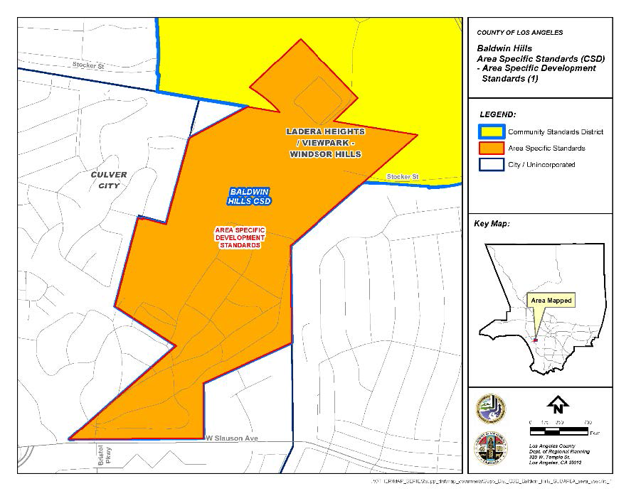
FIGURE 22.310-C: AREA SPECIFIC DEVELOPMENT STANDARDS (2)
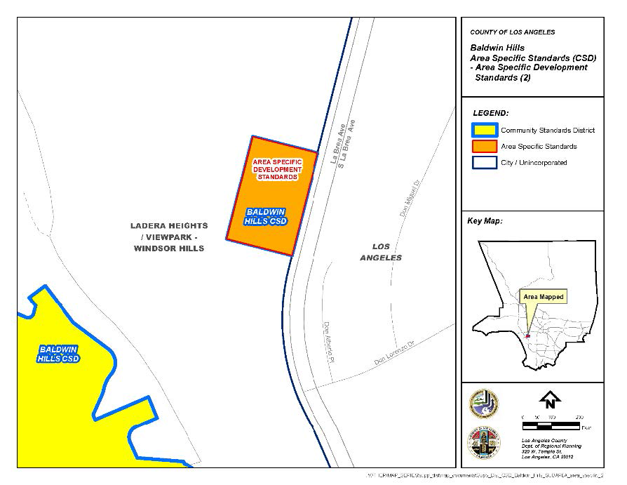
(Ord. 2019-0004 § 1, 2019.)
22.312.010 - Purpose.
The Castaic Area Community Standards District ("CSD") is established to protect the rural character, unique appearance, and natural resources of the Castaic Area communities. This CSD also ensures that new development will be compatible with the Castaic area's existing rural neighborhoods and with the goals of the Santa Clarita Valley Area Plan. Finally, this CSD promotes the establishment of trucking-related businesses in locations where trucking activities presently occur, while ensuring that trucking businesses do not interfere with the community's residential character, circulation, and traffic patterns.
(Ord. 2019-0004 § 1, 2019.)
22.312.020 - Definitions.
(Reserved)
22.312.030 - District Map.
This CSD generally includes the existing communities of Castaic, Castaic Junction, Val Verde, Hasley Canyon, Hillcrest, and Paradise Ranch: the canyons of Charlie, Tapia, Romero, Sloan and Violin; the Valencia Commerce Center; the Peter Pitchess Detention Center; and the Northlake development and part of the Newhall Ranch development, both of which are governed by specific plans. The actual boundaries of this CSD are shown on Figure 22.312-A: Castaic CSD Boundary, at the end of this Chapter.
(Ord. 2019-0004 § 1, 2019.)
22.312.040 - Applicability.
A.
Exemptions. This CSD shall not apply to:
1.
Areas within this CSD governed by a specific plan or development agreement that was approved prior to the effective date of the ordinance establishing this CSD, as long as such specific plan or development agreement is legally valid and has not terminated;
2.
Development proposals which are the subject of applications for the following types of permits or approvals that were submitted and deemed complete prior to the effective date of the ordinance establishing this CSD:
a.
Building permits;
b.
Tentative tracts and parcel maps;
c.
General Plan and/or Area Plan amendments; and
d.
Zone Changes, Conditional Use Permits, Variances, Ministerial and Discretionary Site Plan Reviews, or any other zoning permit applications.
3.
Existing buildings or structures, or any additions thereto, provided that:
a.
Any change to such building or structure after the effective date of the ordinance establishing this CSD does not result in an increase in the occupancy load or parking requirement for the existing use; and/or
b.
Any addition to such building or structure after the effective date of the ordinance establishing this CSD shall not cumulatively increase its existing floor area by more than 25 percent.
(Ord. 2019-0004 § 1, 2019.)
22.312.050 - Application and Review Procedures.
A.
Town Council Notification. The Department shall provide notice by first-class mail twice a month to the secretary of the Castaic Area Town Council identifying all applications filed during the previous 15-day period for projects within this CSD that involve consideration of a:
1.
Zone Change;
2.
Land division;
3.
Conditional Use Permit;
4.
General Plan Amendment;
5.
Variance; or
6.
A freeway-oriented sign exceeding 25 feet in height.
B.
Ministerial Site Plan Review.
1.
Except as provided in Subsection C, below, applications for development within this CSD shall require a Ministerial Site Plan Review (Chapter 22.186) application, to determine if the proposed development complies with the provisions of this CSD.
2.
In addition to the requirements of Section 22.186.020 (Application and Review Procedures), the application must contain the following information:
a.
A description of the property, with a map showing the topography of the land and the location of any drainage courses;
b.
The location and extent of the proposed development, and plans for the methods or devices intended to be used to prevent any erosion or flood hazard, including any necessary drainage plans, prepared by a civil engineer, showing an estimate of the quantity and frequency of runoff, runoff routing, and the character of soils, channel sections, and gradients; and
c.
Where landscaping is required by this CSD or by any other provision of this Title 22, a landscaping plan that is approved by the Department. The landscaping plan shall include:
i.
A layout and list of existing plants, including their current condition, and any plants intended to be removed or added;
ii.
A description of the property's existing soil types so that the feasibility of re-vegetation can be assessed;
iii.
A re-vegetation plan, which primarily shall require use of locally indigenous vegetation, as defined in Section 22.312.060.H (Locally Indigenous Vegetation);
iv.
A covenant to be recorded against the property that all landscaping shall be irrigated by a permanent watering system and shall be maintained with regular pruning, weeding, fertilizing, litter removal, and replacement of plants when necessary; and
v.
A description of a long-term maintenance program for all landscaping in the plan, with an emphasis on re-vegetated areas.
C.
Exceptions. An application pursuant to Subsection B, above, may not be required if:
1.
A different approval would be required by another provision of this CSD or this Title 22, provided the application in such other process contains sufficient information to determine compliance with this CSD;
2.
The project is a single-family residence, provided that Section 22.312.060.N (Creek Preservation and Maintenance) is inapplicable; or
3.
The review would otherwise be necessary only to determine compliance with the exterior lighting standard described in Section 22.312.060.J (Lighting).
(Ord. 2019-0004 § 1, 2019.)
22.312.060 - Community Wide Development Standards.
A.
Signs. In addition to the signs prohibited by Section 22.114.040 (Prohibited Signs Designated), the following signs shall be prohibited:
1.
Projecting business signs; and
2.
Roof signs.
B.
Street Improvements. In residential land divisions where at least 75 percent of the lots exceed a net area of 15,000 square feet, local streets shall comply with the following standards, as approved by Public Works and the Fire Department:
1.
Local streets shall have a maximum paved width area of 28 feet, excluding any inverted shoulder or concrete flow line;
2.
Curbs, gutters, and sidewalks are prohibited unless otherwise deemed necessary for public safety purposes;
3.
Inverted shoulder cross-sections shall be required unless an alternate design is deemed necessary for public safety; and
4.
Regardless of lot size, street lights shall:
a.
Have a mission bell shape or similar design consistent with the character of the community and shall be compatible in style and material with the poles on which they are mounted. Proposals from the Castaic Area Town Council will be considered for determining the appropriate style of street lights, provided these proposals are approved by Public Works and the local electric utility serving the area under consideration; and
b.
Be provided in accordance with the applicable provisions of Chapter 22.80 (Rural Outdoor Lighting District).
C.
Trails.
1.
In General. Except as provided in Subsection C.4, below, all new land divisions, including minor land divisions, shall contain trails in accordance with the Master Plan of Trails ("Master Trail Plan") maintained by Parks and Recreation and consistent with the Santa Clarita Valley Area Plan. Input by the Santa Clarita Valley Trails Advisory Committee regarding trail development shall be considered by the Commission or Hearing Officer in reviewing land divisions. Trail construction shall be completed and approved by Parks and Recreation prior to the recordation of the final map for the land division.
2.
Trail Standards. Trails built pursuant to this Subsection C shall satisfy the following minimum standards:
a.
Access Routes. To the greatest extent possible, and without requiring off-site land acquisitions by the subdivider, access routes shall be provided from every new land division to a main trails network shown on the Master Trail Plan;
b.
Multipurpose Use. The trails shall accommodate both pedestrian and equestrian uses; and
c.
Equestrian Trails. In addition to the trails otherwise required by this Subsection C, new land divisions with at least 75 percent of the residential lots equal or greater to 20,000 square feet in net area shall reserve an equestrian trail, approved by Parks and Recreation, that is eight feet in width and adjacent to a public right-of-way. The equestrian trail shall connect to a network of equestrian trails.
3.
Trail Maintenance. All trails and access routes that are not required to be maintained by Parks and Recreation shall be maintained, subject to approval by Parks and Recreation, by a homeowner's association, to which the trail or access route has been irrevocably deeded, or by a special district. If a special district is used, such district shall be an entity established as an assessment district pursuant to the Landscaping and Lighting Act of 1972, Sections 22500 et seq. of the California Streets and Highways Code ("Landscaping and Lighting Act District"), or it shall be some other entity capable of assessing and collecting trail maintenance fees from the owners of the lots in the new land division. For purposes of this Subsection C.3, the trails and access routes that must be constructed so as to be suitable for acceptance and maintenance by Parks and Recreation are those trails and access routes identified in the Master Trail Plan and the Santa Clarita Valley Area Plan, and those trails and access routes located on private property for which a trail easement has been dedicated to the County;
4.
Alternative Trail Proposal. If it is infeasible for a subdivider to provide trails in accordance with the Master Plan or Santa Clarita Valley Area Plan, alternative trail proposals may be developed subject to the minor variation provisions in Subsection 22.312.090 (Modifications of Development Standards), below. The alternative trail proposal shall, to the greatest extent possible, and without requiring off-site land acquisitions by the subdivider, be connected to a network of trails shown on the Master Plan and be approved by Parks and Recreation.
D.
Neighborhood Parks.
1.
Subject to Sections 21.24.340, 21.24.350, 21.28.120, 21.28.130, and 21.28.140 in Title 21 (Subdivisions) of the County Code, the Commission or Hearing Officer shall, to the greatest extent possible, require the subdivider of a residential land division to provide sufficient park space such that 90 percent of all residential lots within the land division are within one-half mile of a neighborhood park that has a minimum size of two acres.
2.
In complying with Subsection 21.24.350.B in Title 21 for land divisions that contain more than 50 lots, the Commission or Hearing Officer shall, to the greatest extent possible, require the subdivider to provide park space rather than in-lieu park fees.
3.
Neighborhood park space provided pursuant to this Subsection D, shall be maintained either by Parks and Recreation, or by a Landscaping and Lighting Act District, as determined by Parks and Recreation.
E.
Hillsides. In addition to the applicable requirements of Chapter 22.104 (Hillside Management Areas), the following standards shall apply to development within a "hillside management area," as defined in Section 22.14.080 of Division 2 (Definitions):
1.
Contour grading shall be used to present a rounded appearance that blends with the natural terrain;
2.
Curvilinear street design and other improvements shall be used to minimize grading alterations and emulate the natural contours of the hillsides;
3.
Terraced drains required in cut-and-fill slopes shall be paved with colored concrete to blend with the natural soil or shall be concealed with berms;
4.
Terraced slopes resulting from grading shall be landscaped with locally indigenous vegetation, as described in Subsection H, below;
5.
In addition to the requirements of Subsection F, below, residential projects located at or near the crest of a ridgeline and on or near a hillside with a down slope greater than 15 percent and facing a public right-of-way, shall provide 15 gallon non-invasive trees within 10 feet of the top of the slope, spaced a maximum of 15 feet apart; and
6.
Grading and brushing on slopes with a 50 percent or greater steepness shall be prohibited, except for:
a.
Clearance brushing for fire safety or for controlling soil erosion or flood hazards;
b.
Grading or brushing for vegetation clearance by a public utility from its right-of-way;
c.
Grading or brushing to remove invasive or noxious weeds that pose health and safety hazard to humans or animals; or
d.
Grading or brushing approved under a Hillside Management Conditional Use Permit pursuant to Chapter 22.104 (Hillside Management Areas),
F.
Significant Ridgeline Protection.
1.
Significant Ridgelines Categories. For purposes of this CSD, significant ridgelines shall consist of primary and secondary ridgelines. The location of these primary and secondary ridgelines, and the standards for their designation, are shown on the official Significant Ridgeline Map prepared and maintained by the Department and on Figure 22.312-B, not drawn to scale, at the end of this Chapter.
2.
Development Restrictions on Significant Ridgelines. Except as provided in Subsection F.3, below, no development, grading, construction, or improvements shall be allowed on:
a.
A significant ridgeline;
b.
Within a 50-foot radius from every point on the crest of a primary ridgeline; or
c.
Within a 25-foot radius from every point on the crest of a secondary ridgeline.
3.
Significant Ridgeline Exemptions. Provided an approval is obtained pursuant to Subsection F.4, below, the following structures or uses may be permitted on significant ridgelines, or within the respective 50-foot and 25-foot restricted areas surrounding such significant ridgelines:
a.
Accessory buildings or structures;
b.
Additions and/or modifications to an existing single-family residence;
c.
New single-family residences where not more than one such residence is proposed to be built by the same person on contiguous lots;
d.
Open spaces, conservation areas, parks, recreation areas, and/or trails;
e.
Water tanks or transmission facilities;
f.
Architecturally superior structures, other than new single-family residences, which maximize the aesthetic appeal of the hillsides and significant ridgelines, and minimize the disturbance of the natural setting; and
g.
Roads providing access to any of the structures or uses described in Subsections F.3.d through F.3.f, above.
4.
Significant Ridgeline Exemption Approval.
a.
No exemption under Subsection F.3, above, shall be allowed unless the applicant obtains approval of:
i.
A Minor Conditional Use Permit (Chapter 22.160) application, for structures or uses described in Subsection F.3.a through F.3.c, above; or
ii.
A Conditional Use Permit (Chapter 22.158) application, for structures or uses described in Subsections F.3.d through F.3.f, above. The application must contain the information either required by, where applicable, Section 22.104.040 (Additional Contents of Application).
b.
In addition to any information required by Subsection F.4.a, above, an application for a significant ridgeline exemption request shall also demonstrate that the proposed use:
i.
Is compatible with adjacent uses, the character of the neighboring community, and the goals and policies of the General Plan;
ii.
Will leave the crest of the significant ridgeline in its natural state;
iii.
Is designed to minimize the amount of grading necessary and will use landscaping to minimize the visual impact of the project;
iv.
Will not be materially detrimental to the visual character of the neighborhood or the Castaic communities;
v.
Will not impede the normal and orderly development of surrounding properties and will not promote encroachments on significant ridgelines; and
vi.
Will not degrade the visual integrity of the significant ridgeline, as verified through submission of a precise illustration and depiction.
G.
Clustering.
1.
Except in the Hasley Canyon Area and Violin Canyon Area, as described in Section 22.312.080.B (Area 2—Hasley Canyon Area) and Section 22.312.080.C (Area 3—Violin Canyon Area), respectively, clustering may be allowed in this CSD under the conditions described in Subsection G.2, below, provided the applicant obtains a Conditional Use Permit (Chapter 22.158), and in accordance with Section 22.140.170 (Density-Controlled Developments).
2.
Clustering is allowed within this CSD only if findings are made that clustering can:
a.
Reduce grading alterations;
b.
Preserve native vegetation;
c.
Preserve unique land features;
d.
Preserve open space;
e.
Enhance recreational areas; or
f.
Protect view corridors and view sheds.
3.
If clustering is permitted pursuant to this Subsection G, the provisions of Section 22.312.070.A.1 (Lot Size) shall not apply.
H.
Locally Indigenous Vegetation. The removal or destruction of locally indigenous vegetation is prohibited on a lot one acre or greater in size, where the area of removal or destruction is greater than ten percent of the lot. For purposes of this Subsection H, locally indigenous vegetation is defined as the vegetation listed on the Castaic Area List of Indigenous Plants, prepared and maintained by the Department. This Subsection H shall not apply to the removal or destruction of locally indigenous vegetation:
1.
That is necessary to comply with County regulations relating to brush clearance for fire safety or is otherwise required by the Fire Department;
2.
On a publicly owned right-of-way;
3.
By a public utility on its own property or right-of-way or on land providing access to such property or right-of-way;
4.
For work performed under a permit issued to control erosion or flood hazards; or
5.
That poses a hazard to persons or property, as determined by the Fire Department.
I.
Fences. Fences along any public or private road shall comply with the applicable provisions of Section 22.110.070 (Fences and Walls) and shall be made of split rail, open wood, rock, block, or iron. Chain link may be substituted for these materials but must be landscaped along the entire length of the fence to a height determined appropriate by the Director. Such landscaping shall be maintained in the manner described in Section 22.312.050.B.3.d.
J.
Lighting. Outdoor lighting shall be provided in accordance with the applicable provisions of Chapter 22.80 (Rural Outdoor Lighting District).
K.
Water Tanks. Water tanks shall be screened from public view by fast-growing, drought tolerant native tree species or by an earth berm landscaped with locally indigenous vegetation as described in Subsection H, above. The selection of appropriate native vegetation and fast growing tree species shall be subject to approval by the Director. Water tanks shall also be painted to match, as near as possible, the color of the surrounding landscaping or trees used to screen them.
L.
Wireless Telecommunication Facilities. Wireless telecommunication facilities shall be subject to the following standards:
1.
Ground-mounted facilities shall be required to co-locate and shall be designed to resemble trees; and
2.
Building-mounted facilities shall be required to co-locate and match, as near as possible, the color of the building and its architecture.
M.
Trucking. Uses which principally serve or sell supplies to or for tractor-trucks or their drivers shall be prohibited, except within the Trucking District described in Section 22.312.080.A (Area 1—Trucking District), and subject to the standards contained therein.
N.
Creek Preservation and Maintenance. Channelization of the Castaic, Hasley Canyon, Violin Canyon, Tapia Canyon, Charlie Canyon, San Martinez Grande Canyon, and San Martinez/Chiquito Canyon creeks shall be permitted provided:
1.
Appropriate mitigation measures are implemented, as approved by the Department and Public Works, to preserve the indigenous habitats of the creeks and to protect the aesthetics of the creek settings. In formulating such mitigation measures, input from the Castaic Area Town Council and state and federal agencies with expertise in this field shall be considered;
2.
The channels are maintained with soft bottoms;
3.
The channel sides slope downward such that, at each cross-section along the length of the channel, the channel has a trapezoidal configuration;
4.
Channel bank materials are matched with local soils and stone for color and texture compatibility;
5.
Adequate setbacks are incorporated to allow for the preservation or replanting of locally indigenous vegetation, as defined in Subsection H, above; and
6.
To the greatest extent possible, watercourses shall flow naturally within the full width of the improved natural flood plain.
O.
Oak Tree Protection. Notwithstanding Section 22.174.040.D (Application Without a Public Hearing), an application for an Oak Tree Permit for the removal or relocation of one oak tree in conjunction with a single-family residence use, which use is permitted in the applicable zone, shall require publishing and a public hearing as otherwise required in Section 22.174.040.E (Application with a Public Hearing).
(Ord. 2019-0004 § 1, 2019.)
22.312.070 - Zone Specific Development Standards.
A.
Residential and Agricultural Zones.
1.
Lot Size. Except in the Hasley Canyon Area and Violin Canyon Area, as described, respectively, in Section 22.312.080.B (Area 2—Hasley Canyon Area) and Section 22.312.080.C (Area 3—Violin Canyon Area), single-family residential lots created by a new land division shall:
a.
Contain a minimum area of 7,000 square feet;
b.
Have an average lot size of at least 10,000 square feet for the subdivision, except as provided in Subsection A.1.d, below. In calculating the average lot size, an open space lot, which for the purposes of this Subsection A.1 includes dedicated open and park space, shall be counted in inverse proportion to its slope, according to the following formula and using the values provided in Table 22.312.070-A below.
AL = (RA + (OA × OSC)) / L
Where,
AL = Average single-family residential lot size (acreage);
L = Number of single-family residential and open space lots in the subdivision;
RA = Total number of single-family residential acres in the project;
OSC = The percentage amount of open space acreage in the project to be counted; and
OA = The total amount of open space acreage.
c.
Have no more than 43 percent of the lots with the minimum size of 7,000 square feet.
d.
Subsection A.1.b, above, shall not apply to new land divisions that are in an urban land use plan classification and adjacent to the Interstate 5 transportation corridor, as shown in the Santa Clarita Valley Area Plan.
2.
Buffer Areas.
a.
Buffer areas shall exist between:
i.
Single-family residential uses and multi-family residential uses;
ii.
Single-family residential uses and condominium uses; and
iii.
Single-family residential uses where the lot size is less than 10,000 square feet, and single-family residential uses where the lot size is greater than or equal to 15,000 square feet.
b.
For purposes of this Subsection A.2, buffer areas can consist of natural features, such as hills, creeks, or rivers, or they can consist of berms, parks, green belts, or trees.
B.
Commercial and Industrial Zones.
1.
Business Signs. Except as herein modified, all business signs shall conform to Chapter 22.114 (Signs).
a.
Applicability. The sign regulations herein shall apply to new signs only and shall not apply to existing signs that were legally established prior to the effective date of the ordinance establishing this CSD.
b.
Prohibited Signs. Pole signs shall be prohibited.
c.
Wall Business Signs. All businesses shall be permitted one wall business sign for each street, highway, or parkway on which the business fronts. One additional wall business sign shall be allowed for each secondary public entrance. Wall business signs shall have the following attributes:
i.
A wall sign area no larger than one and one-half square foot for every linear foot of the building frontage for that business. For secondary public entrance signs, the wall sign area shall not exceed half of the area of the smallest primary wall business sign; and
ii.
A height that does not extend above the highest point of the business' roof or parapet for the portion of the building in which the business is located.
d.
Freestanding Business Signs. All businesses shall be allowed one freestanding business sign if it is located on a lot that has at least 100 feet of cumulative street frontage. If the business has at least 500 feet of cumulative street frontage, it shall be allowed one additional freestanding business sign. The sign shall be located in a manner that does not impede traffic or line of sight visibility. Freestanding business signs shall have the following additional attributes:
i.
A maximum sign area of 40 square feet per freestanding business sign. Notwithstanding the foregoing, the Director may approve a maximum sign area of 96 square feet per freestanding business sign for commercial developments with at least five acres in size or provided the Director makes a finding that visibility of the freestanding business sign is restricted due to location;
ii.
A maximum height of six feet measured vertically from the ground level at the base of the sign. Notwithstanding the foregoing, the Director may approve a maximum of eight feet measured in the manner just described for commercial developments at least five acres in size or provided the Director makes a finding that the visibility of the freestanding business sign to potential patrons is restricted due to location; and
iii.
A minimum setback of three feet from any street or public right-of-way.
e.
Incidental Business Signs. Incidental business signs as described in Section 22.114.140 (Incidental Business Signs) shall be allowed but shall be subject to the following limitations:
i.
Every business shall be allowed only one incidental business sign;
ii.
Incidental business sign shall be wall-mounted below the roofline; and
iii.
Incidental business signs shall have a maximum face area of two square feet.
f.
Freeway-Oriented Signs. Freeway-oriented signs shall be allowed only on lots along Interstate 5 Freeway, west of Castaic Road and east of Old Road. In addition, a business shall be allowed only one freeway-oriented sign for every lot. Freeway-oriented signs shall have:
i.
A maximum of two sides;
ii.
A maximum face area of 200 square feet per side; and
iii.
A maximum height of 15 feet measured vertically from the ground level at the base of the sign. Notwithstanding the foregoing, the Director may approve a maximum height of 35 feet measured in the manner just described, provided that the sign complies with Section 22.114.120.H.4.b.
g.
Shopping Center Signs.
i.
New shopping centers with at least five tenants shall prepare a master sign plan for the purpose of establishing a common design theme for the shopping center before any business sign is erected in such shopping center. The master sign plan shall allow only one monument sign, as described in Subsection B.1.g.ii, below. All signs depicted in and established pursuant to the master sign plan shall comply with sign requirements of this CSD. Upon approval of the master sign plan by the Director, all signs in the shopping center shall conform to the master sign plan.
ii.
For purposes of this Subsection B.1.g, a monument sign shall be defined as a two-sided freestanding sign where the base of the sign structure is on the ground or a maximum of 12 inches above the adjacent grade. No part of the sign face or sign structure can be more than 12 feet in height measured vertically from the ground level at the base of the sign. The width of the sign shall not exceed four feet, and the top of the sign structure can be no more than 120 percent of the width of the base.
2.
Architectural Standards.
a.
All commercial buildings, except those in an industrial park, shall have Spanish, Southwestern, or Mediterranean architecture, with a tile roof.
b.
Mirrored glass shall be prohibited on outside building surfaces.
3.
Circulation Areas.
a.
Paving. Pedestrian circulation areas and driveway entrances on private property shall be paved with brick or paver tiles.
b.
Pedestrian Amenities. For commercial and mixed-use developments, at least two pedestrian amenities shall be provided. Examples of these pedestrian amenities include, but are not limited to:
•
Benches;
•
Bicycle racks;
•
Outdoor lights;
•
Drinking fountains;
•
Landscaped buffers;
•
Newsstands;
•
Planter boxes;
•
Trash receptacles; or
•
Landscaped trellises or breezeways between businesses.
4.
Setbacks. Except as provided in Section 22.312.080.B.3.b (Commercial and Industrial Zones) for the Val Verde Area, the following setback standards shall apply in Commercial and Industrial Zones:
a.
All buildings, structures, and circulation areas, including parking lot aisles, shall have a minimum setback from the front property line of 10 feet in Industrial Zones and 20 feet in Commercial Zones. The setback shall be landscaped and shall include a minimum of one 15-gallon tree for every 150 square feet of setback landscaped area;
b.
In Commercial Zones, vehicle driveways, pedestrian pathways, and outdoor dining and street furniture, such as chairs, tables, benches, and bicycle racks, shall be permitted in setback areas, provided that a minimum of ten percent of the entire site's net area is landscaped; and
c.
Structures that adjoin or face any non-industrially or non-commercially zoned lot, or adjoin or face a parcel containing a non-industrial or non-commercial use, shall:
i.
Have a minimum setback of 25 feet from any property line(s) adjoining or facing such lot. The setback shall be landscaped and shall include a minimum of one 15-gallon tree for every 15 feet along the property line that is adjacent to or closest to the non-industrially or non-commercially zoned or used parcel. If a 25-foot setback is infeasible due to the size of the lot, as determined by the Director, a solid masonry wall shall be built half-way between the building and the property line. The wall shall be a minimum of six feet in height in Commercial Zones and eight feet in height in Industrial Zones and shall be landscaped with drought-resistant vines along the entire length of the wall to a height determined appropriate by the Director. Such landscaping shall be maintained in the manner described in Section 22.312.050.B.3.d.
ii.
Locate vehicle access, circulation, parking, and loading areas as far as possible from adjoining residential uses.
5.
Lot Coverage. Except in Zones CPD and MPD, all new structures shall have a maximum lot coverage of 70 percent of the lot's gross area.
6.
Height. Excluding chimneys and rooftop antennas, all new structures shall have a maximum height of 35 feet above grade if located within 500 feet of a residentially or agriculturally zoned property.
7.
Outdoor Commercial and Storage Uses.
a.
Any principal commercial or industrial use conducted outside an enclosed structure, or that involves outdoor storage, shall require a Conditional Use Permit (Chapter 22.158) if located within 500 feet of a Residential Zone, residential use, or Agricultural Zone, as measured from the lot line of the subject property.
b.
A Conditional Use Permit shall not be required where the subject property conducts accessory outdoor parking or storage of vehicles, including the accessory outdoor parking or storage of commercial vehicles with registered net weights of 5,600 pounds or less, unladen.
(Ord. 2023-0038 § 21, 2023; Ord. 2019-0004 § 1, 2019.)
22.312.080 - Area Specific Development Standards.
A.
Area 1—Trucking District.
1.
Purpose. This area is established to encourage and protect truck-related activities and services, while at the same time insuring that such activities and services do not interfere with the circulation and traffic patterns in the Castaic area communities.
2.
Area Description. The boundaries of this area are shown on Figure 22.312-C: Area 1—Trucking District, at the end of this Chapter.
3.
Prohibited Uses. Residential uses shall be prohibited in the Trucking District.
4.
Parking. In addition to the applicable requirements of Chapter 22.112 (Parking), any business that principally serves or sells supplies for tractor-trucks or their drivers shall provide at least two off-street tractor-truck parking spaces. The tractor-truck parking spaces shall comply with the following standards:
a.
Location. Tractor-truck parking shall be located either on the same lot as the principal business or on an adjacent, separate lot. If the parking is provided on a separate lot, a covenant shall be recorded, restricting the applicable portion of the property's use to parking for the benefit of the principal business. The separate lot shall be within 1,000 feet from the principal business, measured from the business to the main entrance on the separate lot for the parking. Wherever practical and subject to the requirements of this Chapter, businesses shall share a common area to meet their off-street tractor-truck parking requirements;
b.
Size. Each tractor-truck parking space shall have a minimum size of 10 feet by 75 feet;
c.
Paving. All tractor-truck parking areas shall be paved with a hard, durable surface material, as required by Section 22.112.080.E (Paving);
d.
Access. Off-street tractor-truck parking spaces shall be accessible to and offer ingress and egress from Castaic Road, Parker Road, Ridge Route Road, and/or Lake Hughes Road. Parking entrances for tractor-truck parking shall be located at least 500 feet away from any school, church, park, or recreation or residential area. Maneuvering and turn-around areas shall be provided on the lot where the parking space is located, and signs shall be posted requiring tractor-trucks to enter and exit the lot front-forward without backing or maneuvering on the public right-of-way;
e.
Barriers Along Castaic Road. Where tractor-truck parking or loading areas are on lots adjoining Castaic Road, a barrier shall be built along the entire adjoining property line of that lot. The barrier shall not block any driveway, walkway, or other necessary opening, and shall consist of a minimum 30-inch high masonry or concrete block wall or a minimum four-foot landscaped buffer area measured from the property line. Where the barrier adjoins a driveway, a 10-inch in diameter, 30-inch high, concrete-filled steel pipe or equivalent protective device(s) shall be installed vertically at each point that the barrier meets the driveway;
f.
Buffers. Any lot that is used partially or entirely for tractor-truck parking that does not adjoin Castaic Road but adjoins a lot that is used for some other purpose shall have a buffer along the entire length of that adjoining property line. The buffer shall consist of a minimum 10-foot high solid masonry wall set back 10 feet from the adjoining property line. The setback area shall be landscaped with locally indigenous vegetation as defined in Section 22.312.060.H (Locally Indigenous Vegetation), and the wall shall be landscaped with drought-resistant vines along the entire length of the wall to a height determined appropriate by the Director. Such landscaping shall be maintained in the manner described in Section 22.312.050.B.3.d; and
g.
Nonconforming Uses. All legally existing nonconforming parking spaces shall be brought into compliance with this Subsection A.4 upon a change in ownership or control of the principal business using such parking spaces, or within three years from the effective date of the ordinance establishing this CSD, whichever occurs first.
B.
Area 2—Hasley Canyon Area.
1.
Purpose. This area is established to protect and preserve the serene, rural environment of Hasley Canyon. Hasley Canyon is characterized by large lots, equestrian trails, rolling hills, and a number of significant ridgelines. The area also contains the Hasley Canyon Creek.
2.
Area Description. The boundaries of this area are shown on Figure 22.312-D: Area 2—Hasley Canyon Area, at the end of this Chapter.
3.
Clustering. Density transfer or clustering shall be prohibited in this area.
4.
Lot Size. Single-family residential lots created by a land division shall contain a minimum gross area of two acres and a minimum net area of 40,000 square feet.
5.
Setbacks. New residential lots and existing legal lots as of the effective date of the ordinance establishing this CSD that have a minimum gross area of two acres where no residence has yet been built, shall have a minimum front and rear yard setback of 25 feet, and a minimum side yard setback of 10 feet.
C.
Area 3—Violin Canyon Area.
1.
Purpose. This area is established to protect one of the least developed and most rugged parts of the Castaic area. It contains the Palomas Canyon and Violin Canyon creeks and serves as a unique habitat for many species of fauna and flora.
2.
Area Description. The boundaries of this area are shown on Figure 22.312-E: Area 3—Violin Canyon Area, at the end of this Chapter.
3.
Development Standards. The standards prescribed for the Hasley Canyon Area in Subsection B, above, shall also apply to the Violin Canyon Area.
D.
Area 4—Val Verde Area.
1.
Purpose. This area is established to ensure that new development is consistent with Val Verde's existing unique character. The area's unique features include small rural lots, rolling hills covered by chaparral vegetation and scattered canyon oaks, and relative isolation.
2.
Area Description. The boundaries of this area are shown on Figure 22.312-F: Area 4—Val Verde Area, at the end of this Chapter.
3.
Zone Specific Development Standards.
a.
Residential and Agricultural Zones. New residential land divisions shall comply with the following standards:
i.
Street improvements. Regardless of lot size, local streets shall be allowed to use inverted shoulders with concrete flow line design where possible; and
ii.
Street lights. In addition to the requirements in Section 22.312.050.B.4 (Street Improvements), street lights in this area shall conform, to the greatest extent possible, to the rural character of the Val Verde community. Proposals from the Castaic Area Town Council and the Val Verde Civic Association will be considered by the Director in determining the appropriate style of street lights, provided these proposals are approved by Public Works and the local electric utility serving the area under consideration.
b.
Commercial and Industrial Zones. For lot sizes less than 5,000 square feet, where such size prevents a commercial structure from satisfying one or more of the standards set forth in Section 22.312.070.B.4 (Setbacks), the following standards shall be substituted for the standards described therein:
i.
The structure shall have a minimum front setback of five feet from the property line. The setback shall be landscaped and shall include a minimum of one 15-gallon tree for every 150 square feet of landscaped area, or one 15-gallon tree every 15 feet, whichever results in more trees; and
ii.
Structures on lots that adjoin or face a non-industrially or non-commercially zoned property or use shall have:
(1)
A minimum setback of five feet from each property line that adjoins or faces the non-industrially or non-commercially zoned property or use. The setback shall be landscaped in the same manner as provided in Subsection D.3.b.i, above; and
(2)
If the landscaped setback described in Subsection D.3.b.ii.(1), above, is not feasible along the front property line, a minimum six-foot high solid masonry wall shall be placed in the landscaped setback, parallel to and at half the distance between the front property line and the building. This wall shall be landscaped with drought-resistant vines along the entire length of the wall to a height determined appropriate by the Director. Such landscaping shall be maintained in the manner described in Section 22.312.050.B.3.d.
E.
Area 5—Castaic Creek Area.
1.
Purpose. This area is established to protect one of the few examples of a braided channel creek system, which was once a fairly common feature of the Southern California landscape.
2.
Area Description. The boundaries of this area are shown on Figure 22.312-G: Area 5—Castaic Creek Area, at the end of this Chapter.
3.
Creek Protection. In addition to complying with Section 22.312.060.N (Creek Preservation and Maintenance), all development in this area shall require a Conditional Use Permit (Chapter 22.158) in the same manner, and under the same terms and conditions, as development in a significant ecological area would require under Chapter 22.102 (Significant Ecological Areas).
F.
Area 6 and Area 7—Newhall Ranch and Northlake Areas.
1.
Area Description. The boundaries of these areas are shown on Figures 22.312-H: Area 6—Newhall Ranch Specific Plan Area and 22.312-I: Area 7—Northlake Specific Plan Area, at the end of this Chapter.
2.
Exemption. Development in these areas shall be governed by the Newhall Ranch Specific Plan and the Northlake Specific Plan, respectively, including any amendments thereto. Lots in these areas shall be exempt from the provisions of this CSD as long as the respective specific plan or any of its amendments are in effect as to those lots.
(Ord. 2019-0004 § 1, 2019.)
22.312.090 - Modification of Development Standards.
A.
Modifications Authorized.
1.
Minor variations to the standards specified in Section 22.312.060.C.4 (Alternate Trail Proposal), Sections 22.312.060.E through M, and the zone specific development standards specified in Sections 22.312.070.B.2 (Architectural Standards) and B.3 (Circulation Areas) shall be subject to the provisions of Subsection B, below; and
2.
Other variations to the standards specified in this Chapter for a proposed project located in a Residential Planned Development or a Specific Plan Zone shall be subject to the provisions of Subsection C, below.
B.
Minor Variations.
1.
Applicability. A minor variation may be permitted to the standards specified in Subsection A.1, above, subject to a CSD Modification application, in compliance with this Subsection B.
2.
Application and Review Procedures.
a.
Application Checklist. The application submittal shall contain all of the materials required by the CSD Modification checklist.
b.
Type II Review. The application shall be filed and processed in compliance with Chapter 22.228 (Type II Review—Discretionary) and this Subsection B.
3.
Notification. The application shall comply with all noticing requirements as required by the Type II Review (Chapter 22.228), except that the notification radius shall be 1,000 feet of the exterior boundaries of the subject property, as shown on the County's last equalized assessment roll and notice shall be sent to:
a.
All "occupant(s)" of properties within the notification radius, where the mailing address of a property owner on the above list is different from the address of the neighboring property;
b.
All community organizations that request notification of pending applications including, but not limited to, the Castaic Area Town Council and the homeowners associations within the boundaries of this CSD; and
c.
Such other persons as the Director deems appropriate whose property could be affected by the application request.
4.
Findings and Decision.
a.
Common Procedures. Findings and decision shall be made in compliance with Section 22.228.050 (Findings and Decision) and include the findings in Subsection B.4.b, below.
b.
Findings.
i.
The use, development of land, and application of development standards comply with all applicable provisions of this Title 22.
ii.
The use, development of land, and application of development standards, when considered on the basis of the suitability of the site for the particular use or development intended, are arranged to avoid traffic congestion, to provide for the safety and convenience of bicyclists and pedestrians, including children, senior citizens, and persons with disabilities, to protect public health, safety and general welfare, to prevent adverse effects on neighboring property and conform with good zoning practice.
iii.
The use, development of land, and application of development standards are suitable from the standpoint of functional developmental design.
iv.
The application of these standards would result in practical difficulties or unnecessary hardships.
v.
There are exceptional circumstances or conditions applicable to the subject property or to the intended development of the property that do not apply to other properties within the Castaic Area.
vi.
Granting the requested minor variation will not be materially detrimental to properties or improvements in the area or contrary to the goals and policies of the Santa Clarita Valley Area Plan or this CSD.
C.
Other Variations. If a proposed project is located in a Residential Planned Development or a Specific Plan Zone and can be found consistent with the goals of this CSD, the development standards herein may be modified, if the applicant obtains a Conditional Use Permit (Chapter 22.158), and substantiates the findings provided in Section 22.158.050 (Findings and Decision), and further demonstrates that the project satisfies the following:
1.
Compatibility. The project must be compatible with existing adjoining land uses;
2.
Significant Public Benefit. The project must provide significant public benefit beyond that already required by some other provision of this Title 22. Examples of projects that comply with this requirement include, but are not limited to, projects that offer additional open space, natural habitat areas, recreation facilities, trails, and/or cultural or educational facilities;
3.
Substantial Community Support. The project must have substantial community support. For purposes of this requirement, substantial community support requires at least two-thirds of all written comment letters received from residents, property owners, and businesses within 1,000 feet from the project boundary to support the project. In reaching this threshold, every person signing a written comment letter shall be counted separately, provided that such signature has been verified. The position of elected community organizations such as the Castaic Area Town Council will be considered and counted as one comment letter in determining substantial community support, provided it is the formal position of the governing board of such organization; and
4.
Significant Ridgeline. The project must not disturb any significant ridgeline, as described in Section 22.312.060.F (Significant Ridgeline Protection).
FIGURE 22.312-A: CASTAIC CSD BOUNDARY
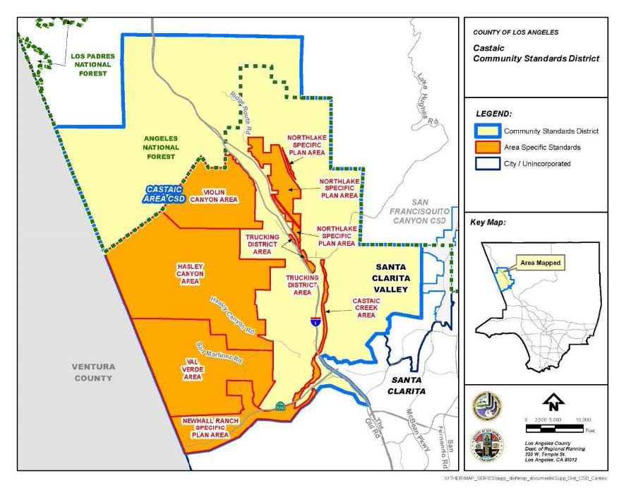
FIGURE 22.312-B: SIGNIFICANT RIDGELINES
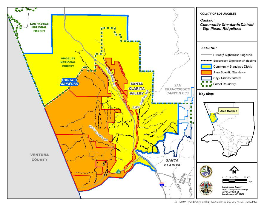
FIGURE 22.312-C: AREA 1—TRUCKING DISTRICT AREA
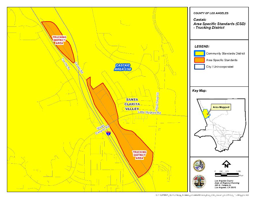
FIGURE 22.312-D: AREA 2—HASLEY CANYON AREA
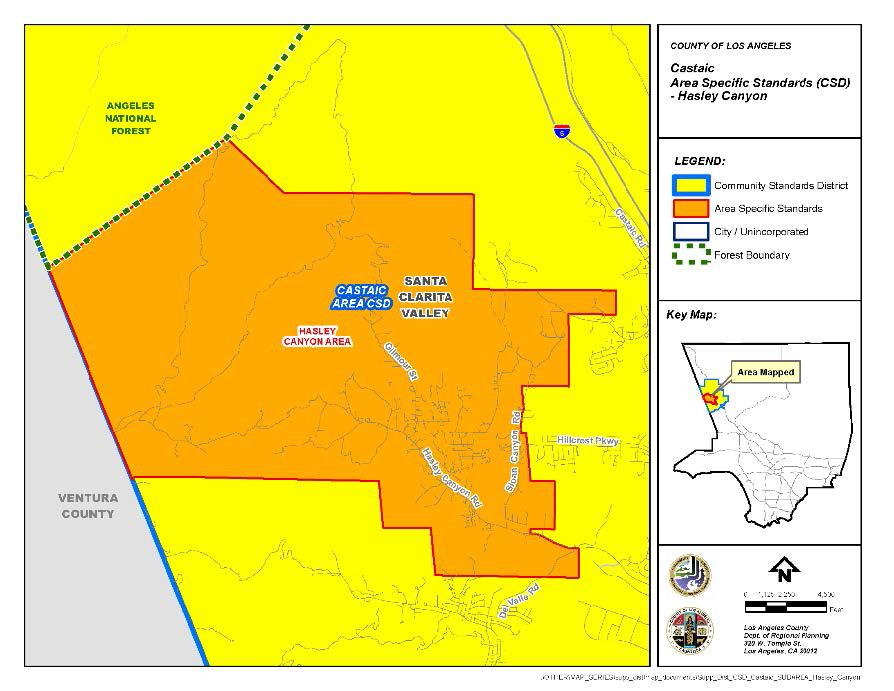
FIGURE 22.312-E: AREA 3—VIOLIN CANYON AREA
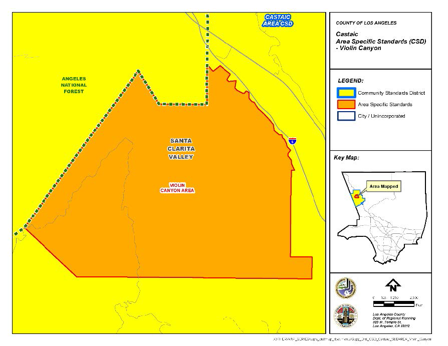
FIGURE 22.312-F: AREA 4—VAL VERDE AREA
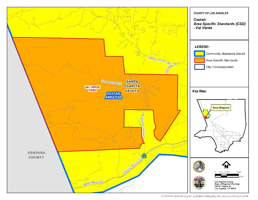
FIGURE 22.312-G: AREA 5—CASTAIC CREEK AREA
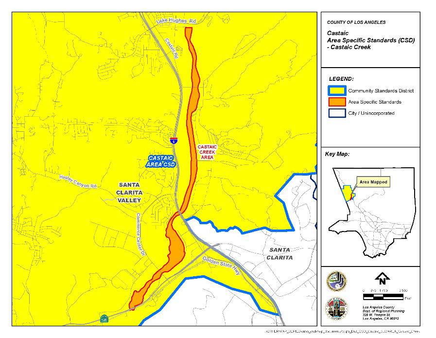
FIGURE 22.312-H: AREA 6—NEWHALL RANCH SPECIFIC PLAN AREA
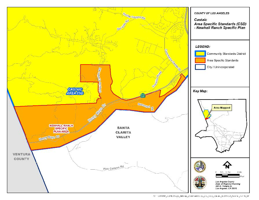
FIGURE 22.312-I: AREA 7—NORTHLAKE SPECIFIC PLAN AREA
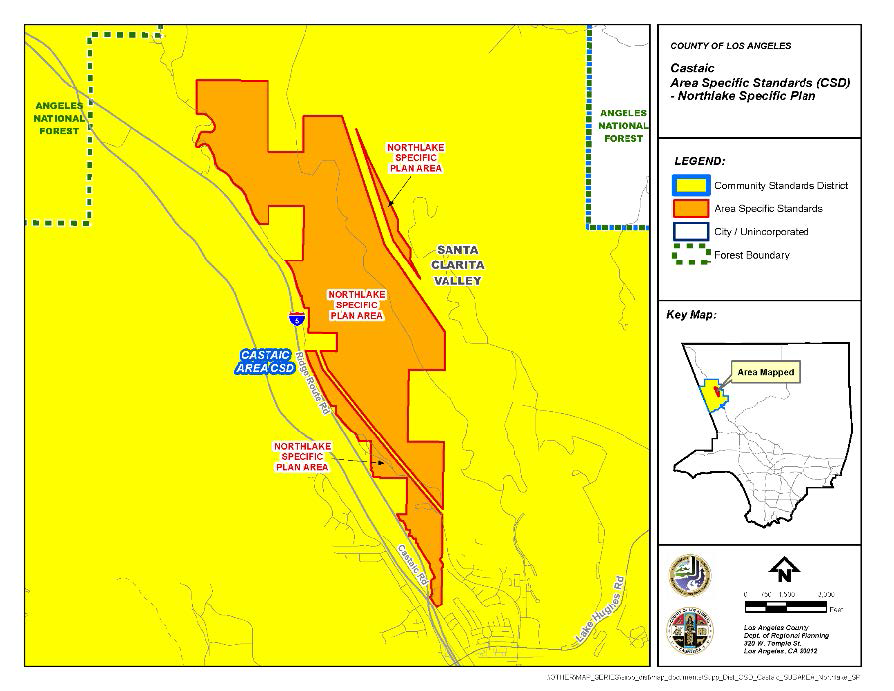
(Ord. 2019-0004 § 1, 2019.)
22.314.010 - Purpose.
The Cerritos Island Community Standards District ("CSD") is established to help mitigate impacts that are caused by, or may be caused by, cumulative residential development on existing undersized lots with limited street access. This CSD is also established to ensure that new residential structures are compatible in size and scale with the characteristics of the existing residential neighborhood and to establish a more rigorous review procedure for modification of standards.
(Ord. 2019-0004 § 1, 2019.)
22.314.020 - Definitions.
(Reserved)
22.314.030 - District Map.
The boundaries of this CSD are shown on Figure 22.314-A: Cerritos Island CSD Boundary, at the end of this Chapter.
(Ord. 2019-0004 § 1, 2019.)
22.314.040 - Applicability.
The provisions of this Chapter shall not apply to a new development project where, as of June 9, 2010, a complete application has been submitted for a Conditional Use Permit, variance, or site plan review. An application shall be considered complete if within 30 days of the application submittal date, the Director has not issued an incomplete letter.
(Ord. 2019-0004 § 1, 2019.)
22.314.050 - Application and Review Procedures.
(Reserved)
22.314.060 - Community Wide Development Standards.
A.
Referral to the Fire Department. Any development requiring a building permit shall be referred to the Fire Department to ensure the proposed development complies with all fire safety regulations.
B.
Fire Sprinklers.
1.
An interior automatic fire-sprinkler system shall be installed in and throughout all newly constructed residences and in and throughout residences rebuilt (wholly or in part) if the portion rebuilt consists of more than 200 square feet.
2.
When additions to the floor area of existing residential development exceed 200 square feet, an interior automatic fire-sprinkler system shall be installed throughout the existing residence and the addition, except for projects where the addition is to an existing residence that complies with all Fire Department requirements for access and water supply as determined by the Fire Department.
C.
No Parking—Fire Lanes. No Parking—Fire Lane designations shall be determined by the Fire Department during its review for building permit clearance. Any such designation shall be properly posted with Fire Department approved signage and located on approved poles to meet all applicable standards for installation. These postings shall be completed and accepted prior to issuance of a certificate of occupancy.
(Ord. 2019-0004 § 1, 2019.)
22.314.070 - Zone Specific Development Standards.
A.
Lot Area. The minimum net lot area for one single-family dwelling unit shall be 3,000 square feet.
B.
Height. The maximum height for any structure shall be 26 feet above grade, except for chimneys and rooftop antennas.
C.
Maximum Stories. The maximum number of stories above grade shall be two.
D.
Yard Requirements. Except as modified herein, yard requirements for any lot shall be as set forth in Section 22.18.040.B (Required Yards).
E.
Second-Story Windows. Second-story windows shall be designed and installed to incorporate one or more of the following techniques to maximize privacy:
1.
Offset or stagger windows facing a neighbor's window;
2.
Use clerestory windows;
3.
Use obscure glass; or
4.
Use landscaping to partially or wholly obscure views into adjacent properties.
F.
Balconies.
1.
Second-story balconies shall not be located in or encroach into the required yard setbacks.
2.
Second-story balconies shall be designed and constructed to incorporate one or more of the following techniques to maximize privacy:
a.
Screen second-story balconies from neighboring property by incorporating an enclosing balcony wall;
b.
Locate second-story balconies so there are no direct sight lines from the balcony to the neighbor's main windows or patio areas;
c.
Incorporate screening devices such as trellises or awnings to increase privacy;
d.
Use landscaping to partially or wholly obscure views into adjacent properties;
e.
Use solid railings to reduce privacy impacts; or
f.
Use planters along the periphery of the balcony to provide additional screening.
G.
Parking.
1.
Each single-family residence shall have, at a minimum, two covered compact automobile parking spaces.
2.
Encroachment into the front yard setback of up to six feet horizontally and twelve feet vertically shall be allowed for parking structures that provide parking in tandem.
H.
Paved Access. All private roads or access easements leading directly to a public street shall be paved from said public street up through the last lot abutting the private road or access easement on which any residence or building is located. The private road or access easement shall be designed and maintained to support imposed loads of fire apparatus at a minimum width of 20 feet and increased to 26 feet adjacent to fire hydrants as determined by the Fire Department. This paved access requirement shall be imposed on the construction of new residences and shall be completed prior to issuance of a certificate of occupancy. The owner of each lot upon which such new construction occurs shall be responsible for paving the portion of the private road or access easement starting from the property line on his lot most distant from the involved public street and ending at said involved public street. Each lot owner shall be responsible for maintaining the road that abuts their lot.
I.
Vacant Lots. Vacant lots shall be maintained free of debris, overgrown weeds, junk, and garbage.
(Ord. 2019-0004 § 1, 2019.)
22.314.080 - Area Specific Development Standards.
(Reserved)
22.314.090 - Modification of Development Standards.
A.
Modifications Authorized.
1.
Modification of the development standards specified in Section 22.314.070 (Zone Specific Development Standards) shall be subject to the provisions of Subsection B, below.
B.
Modification of Specific CSD Standards.
1.
Applicability. Modification of the development standards specified in in Subsection A.1, above, subject to a CSD Modification application, in compliance with this Subsection B.
2.
Application and Review Procedures.
a.
Application Checklist. The application submittal shall contain all of the materials required by the CSD Modification checklist.
b.
Type II Review. The application shall be filed and processed in compliance with Chapter 22.228 (Type II Review—Discretionary) and this Subsection B.
3.
Notification. The application shall comply with all noticing requirements as required by a Type II Review (Chapter 22.228), except that the notification radius shall be 500 feet of the exterior boundaries of the subject property, as shown on the County's last equalized assessment roll.
4.
Findings and Decision.
a.
Common Procedures. Findings and decision shall be made in compliance with Section 22.228.050 (Findings and Decision) and include the findings in Subsection B.4.b, below.
b.
Findings.
i.
The use, development of land, and application of development standards comply with all applicable provisions of this Title 22.
ii.
The use, development of land, and application of development standards, when considered on the basis of the suitability of the site for the particular use or development intended, are arranged to avoid traffic congestion, to provide for the safety and convenience of bicyclists and pedestrians, including children, senior citizens, and persons with disabilities, to protect public health, safety and general welfare, to prevent adverse effects on neighboring property and is in conform with good zoning practice.
iii.
The use, development of land, and application of development standards are suitable from the standpoint of functional developmental design.
iv.
There are exceptional circumstances or conditions applicable to the subject property or to the intended development of the property that do not apply generally to other properties within the CSD area.
v.
Granting the request will not be materially detrimental to properties or improvements in the area or contrary to the purpose of this CSD, as set forth in Section 22.314.010 (Purpose).
vi.
The size and scale of the proposed development complement existing structures in the surrounding neighborhood.
FIGURE 22.314-A: CERRITOS ISLAND CSD BOUNDARY
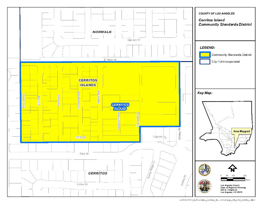
(Ord. 2019-0004 § 1, 2019.)
22.318.010 - Purpose.
The South Bay Planning Area Standards District ("PASD") is established to implement specific development standards for the unincorporated communities of the South Bay Planning Area: Alondra Park/El Camino Village, Del Aire, Hawthorne Island, La Rambla, Lennox, West Carson, Westfield/Academy Hills, and Wiseburn. The PASD is necessary to ensure the goals and policies of the South Bay Area Plan ("Area Plan") and the community-specific regulations for each community are accomplished in a manner that protects the health, safety, and general welfare of the community.
(Ord. 2025-0008 § 6, 2025.)
22.318.020 - Definitions.
(Reserved)
(Ord. 2025-0008 § 6, 2025.)
22.318.030 - Planning Area Standards District Map.
The boundaries of this PASD are shown on Figure 22.318.030-A: South Bay PASD Boundary, below.
FIGURE 22.318.030-A: SOUTH BAY PASD BOUNDARY
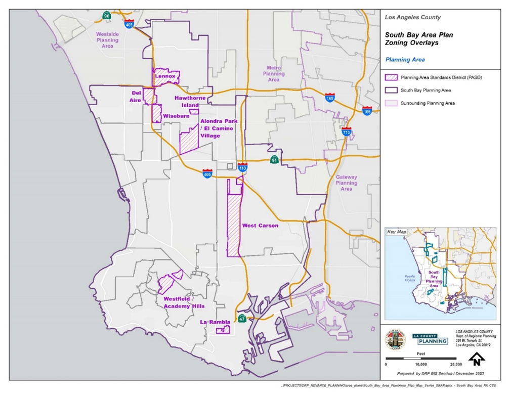
(Ord. 2025-0008 § 6, 2025.)
22.318.040 - Applicability.
A.
General. Except as specified otherwise, this Chapter, in conjunction with Section 22.300.020 (Application of Planning Area Standards Districts and Community Standards Districts to Property), shall apply to any application for development, expansion, or change of use on lots within the boundaries of the South Bay PASD, pursuant to Section 22.246.020 (Applicability of Zone Changes and Ordinance Amendments).
B.
Relationship to Other Title 22 Provisions.
1.
Where the standards of this PASD are silent, the provisions of Title 22 shall govern.
2.
Specific Plans. Regulations in a specific plan shall supersede any contrary provisions in this Division 10.
3.
Properties within the boundary of a specific plan may be subject to all of the standards and requirements of the basic zone and other provisions of this Title 22, unless otherwise provided in a specific plan. When provisions conflict, the more restrictive of the standards shall prevail.
C.
Exception. Notwithstanding Section 22.172.020.H (Maintenance of Buildings or Structures Nonconforming Due to Use), a building or structure nonconforming due to use, or a building or structure nonconforming due to standards which is subject to termination by operation of law, as specified in Section 22.172.050.B (Termination by Operation of Law), shall not be made to conform to the requirements for new buildings or structures, as specified by this Chapter, if alterations to the building or structure are proposed due to seismic retrofitting, as required by Chapters 95 and 96 of Title 26 (Building Code) of the County Code.
(Ord. 2025-0008 § 6, 2025.)
22.318.050 - Application and Review Procedures.
Notification. All permits requiring notification by mail shall be consistent with Section 22.222.160 (Notification Radius).
(Ord. 2025-0008 § 6, 2025.)
22.318.060 - PASD Area-Wide Development Standards.
A.
Graffiti.
1.
General Requirements. All structures, walls, and fences that are publicly visible shall be maintained free of graffiti. Any property owner, lessee, or other person responsible for the maintenance of a property shall remove graffiti within 72 hours of receiving written notice from a Zoning Enforcement Officer that graffiti exists on the property. This timeframe shall be superseded by any other section of the County Code that requires shorter timeframes for graffiti removal. Paint used to cover graffiti shall match, as near as possible, the underlying color of the structure or of the surrounding surfaces.
B.
Service Areas and Mechanical Equipment. Service areas and mechanical equipment for all uses in all zones shall be visually unobtrusive and integrated with the design of the site and building, and shall meet the following development standards:
1.
Service entrances, utility boxes, waste disposal areas, and similar uses shall be located adjacent to alleys where the subject lot is abutting said alley and away from the streets to the greatest extent feasible;
2.
Utility access and services, such as back-flow preventers, transformer boxes, gas electric meters, and other utilities, shall be located adjacent to alleys where the subject lot abuts said alley, subject to the requirements and approval of the associated utility company. When transformer boxes and other ground-mounted utilities shall be located along street frontages, they shall be screened to a height of 12 inches above the equipment, unless such screening interferes with utility access. Screening devices shall consist of trees, shrubs, or masonry walls;
3.
Rooftop equipment shall be screened by a parapet or other architectural features that integrate with the design of the building; and
4.
Air intake and exhaust systems or other mechanical equipment that generate noise, smoke, or odors shall not be located on or within 10 feet from the frontage of buildings and shall be located as far as possible from adjacent or adjoining uses.
C.
Building Height Limit—Exceptions. In addition to Section 22.110.060.C (Exceptions from Height Limit), rooftop equipment, elevator shafts, and stairwells shall be excluded from the maximum permitted height limits stated by this Title 22.
D.
Site Maintenance. Except as specified otherwise in this Title 22, all exterior areas within the premises shall remain free of garbage, trash, debris, or junk and salvage at all times.
E.
Landscaped Buffer and Screening. Where a new nonresidential primary use, or an expansion in floor area of an existing nonresidential primary use, abuts a residential use or residentially zoned lot, the following shall be required:
1.
A landscaped buffer strip at least five feet wide shall be maintained along the entire length of that adjoining property line;
2.
One 15-gallon tree for every 50 square feet of the landscaped buffer strip, which shall be equally spaced within said buffer strip and maintained according to the provisions in Section 22.126.030.E (Maintenance); and
3.
A solid masonry wall not less than six feet and not more than eight feet in height shall be provided along the entire common lot line, including along the front setback area of the residential use, provided that Section 22.110.180 (Sight Distance) is satisfied.
F.
Standards for Specific Uses.
1.
All Residential Uses.
a.
Landscaping.
i.
The front yard shall be maintained with drought tolerant or low water use, native, or non-invasive plants, grasses, shrubbery, or trees listed in the tree planting list referenced in Section 22.126.030.B (Species) and when necessary, shall include an on-site irrigation system, such as a drip system.
ii.
All required landscaping shall comply with Chapter 12.84 (Low-Impact Development) of Title 12 (Environmental Protection) of the County Code. Other hardscaping shall not be counted toward the required landscaping.
b.
Fences and Walls. Fences and walls shall be subject to Section 22.110.070 (Fences and Walls), except that fences and walls located 10 feet or less from the property line within a required front yard shall have a maximum height of five and one-half feet, provided that no more than 42 inches of the fence or wall consist of solid view-obscuring materials. Fifty percent of the wall above 42 inches shall be open and unobstructed. When located more than 10 feet from said property line, fences and walls shall not exceed six feet in height.
FIGURE 22.318.060-A: FENCES AND WALLS
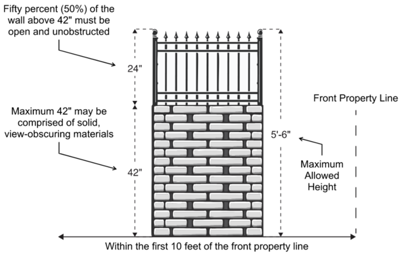
2.
Schools, Grades K to 12. A Conditional Use Permit (Chapter 22.158) application shall be required to establish and maintain schools, grades K to 12, in Zones R-A, R-1, R-2, and R-3. A Ministerial Site Plan Review application (Chapter 22.186) shall be required to establish schools, grades K to 12, in Zone R-4.
a.
Applicability. All development standards in this Subsection F.2 apply to schools, grades K to 12, accredited by the State of California, excluding trade or commercial schools, in Zones R-A, R-1, R-2, R-3, and R-4.
b.
Traffic Impact and Improvement.
i.
Applications for schools, grades K to 12 shall be referred to Public Works for review. In addition to the requirements of Section 22.116.030.B (Improvements), applications may be required to include, at the discretion of the Director of Public Works, a traffic impact analysis in accordance with current County guidelines.
ii.
Where the Director of Public Works finds that, based on the traffic impact analysis, the existing infrastructure is inadequate to serve a school project, the Director of Public Works may require the applicant to construct, install, or provide additional funds to construct or install the necessary infrastructure to protect public health, safety, and welfare. Sightlines shall be maintained, pursuant to Section 22.110.180 (Sight Distance).
c.
Student Loading and Unloading. Student loading and unloading shall be restricted to designated areas to the satisfaction of the Director of Public Works.
d.
Signage. A sign prohibiting student loading and unloading outside of designated areas shall be placed on-site along the property line adjacent to or adjoining any school frontages along a public right-of-way. Signage shall be displayed on-site designating the student loading and unloading areas.
e.
Parking. Except as specified otherwise by State law, one parking space per staff member shall be provided in addition to the on-site parking spaces required by Section 22.112.070 (Required Parking Spaces).
(Ord. 2025-0008 § 6, 2025.)
22.318.070 - PASD Zone-Specific Development Standards.
A.
Mixed Use Development Zone.
1.
Height Limit. A building or structure shall not exceed 45 feet above grade in Zone MXD in the communities of Alondra Park/El Camino Village, Del Aire, Lennox, and Wiseburn.
2.
Setback. Buildings or structures located on a lot abutting Zones R-1 or R-2 shall provide a minimum 15-foot setback along all common property line boundaries.
3.
Step-back. For buildings that exceed 17 feet in height and are located on a lot abutting Zones R-1 or R-2, the maximum height of the structure at 15 feet from the property line abutting the Residential Zone shall be 15 feet. Any portion of the structure that exceeds 15 feet in height shall be set back an additional foot for every additional foot in height.
B.
Industrial Zones. The following development standards shall apply to lots in all industrial zones:
1.
Buffers. Properties abutting a residential use or a sensitive use shall have a minimum 10-foot-wide landscaped strip with a minimum eight-foot solid masonry wall along the common property line. The solid masonry wall shall have a minimum thickness of six inches. One 15-gallon tree for every 100 square feet of landscaped area shall be planted, equally spaced in the buffer strip. The landscaping shall be maintained with regular watering, pruning, weeding, fertilizing, litter removal, and replacement of plants when necessary.
2.
Loading Spaces. In addition to the standards of Section 22.112.120 (Loading Spaces), the following development standards shall apply:
a.
No loading space shall be permitted along a property line that adjoins a residential zone;
b.
Loading spaces shall be located in the rear of the structure(s), as far as possible from adjacent or adjoining residentially zoned lots;
c.
Loading spaces shall be located away from pedestrian ingress and egress areas by a minimum of 20 feet;
d.
Loading spaces shall be completely screened from the street and any adjacent or adjoining residentially zoned lot; screening materials shall include continuous walls and continuous landscaping; and
e.
Loading and unloading operations shall not be conducted between the hours of 10:00 p.m. and 6:00 a.m. in such a manner as to cause noise disturbance to any adjacent or adjoining residentially zoned lots.
3.
Truck Access. Industrial properties with multiple street frontages shall permit truck access only from the street that is furthest from any adjacent or adjoining residential zone or residential use when feasible.
C.
Residential Zones.
1.
Development Standards. The following development standards shall apply to lots in all residential zones and lots with residential uses within the PASD boundaries:
a.
Lighting. Lighting used on-site shall be fully shielded to avoid light trespass.
i.
Outdoor Lighting. All exterior light fixtures shall be energy efficient, avoid light pollution, avoid spill-over to neighboring properties, and (with the exception of architectural or landscape lighting) be pedestrian scaled, fully shielded, and directed toward the ground.
ii.
The type and location of outdoor site and building lighting shall preclude direct glare onto adjoining or adjacent properties, streets, or skyward.
iii.
All exterior lighting fixtures shall be fully shielded to confine light spread to on-site as much as possible.
iv.
Blinking, flashing, or oscillating lights of any type visible on the exterior are prohibited.
b.
Mechanical Equipment. Mechanical equipment shall be completely screened from street view with walls, landscaping, or camouflage screens.
2.
Standards for Specific Uses.
a.
Accessory Commercial Units.
i.
Applicability. This Subsection C.2.a applies to accessory commercial units in all permitted residential zones.
ii.
Permitted Uses. An accessory commercial unit shall only include one of the following commercial uses listed in Table 22.318.070-A: Permitted Uses in Accessory Commercial Units, below. Outdoor donation boxes, arcade games, vending machines, and fortune tellers shall not be permitted in accessory commercial units.
iii.
Development Standards.
(1)
Required Yards.
(a)
Where an existing legally-built structure, or portion thereof, is converted to an accessory commercial unit, the depth of the yard between an existing, legally-built structure and the existing lot line shall be deemed the required yard depth.
(b)
Any new accessory commercial unit or expanded portion of an existing, legally-built structure that is part of a proposed accessory commercial unit shall comply with all applicable setback requirements in this Title 22, with the following exceptions:
(i)
Front Yard: 10 feet, unless a greater setback is otherwise required by other provisions in this Title 22; and
(ii)
Reversed Corner Side Yard: Seven and one-half feet, unless a greater setback is otherwise required by other provisions in this Title 22.
(2)
Orientation. An accessory commercial unit shall front upon and be oriented to a public right-of-way.
(3)
Pedestrian Access. An accessory commercial unit shall have at least one pedestrian accessible entrance fronting and directly accessible to pedestrians on a public right-of-way.
(4)
Separate Entrance. An accessory commercial unit shall have a separate entrance from the main entrances to the primary residential building on-site.
(5)
Floor Area. An accessory commercial unit shall be limited to 1,000 square feet of 40 percent of the gross floor area of the residential buildings, whichever is less.
(6)
Height. An accessory commercial unit shall be limited to one story in height.
(7)
Ground Floors. An accessory commercial unit shall be located on the ground floor only.
(8)
Maximum Number of Accessory Commercial Unit. A maximum of one accessory commercial unit is permitted per lot.
(9)
Parking. No parking shall be required for an accessory commercial unit.
(10)
Signage.
(a)
One wall or projecting business sign, not to exceed six square feet in sign area, shall be permitted, provided that no illumination is used.
(b)
Roof and freestanding business signs are prohibited.
(c)
Temporary signs or banners shall not be displayed on the exterior walls, windows, or fascia of the building, or on any fence or wall.
(d)
The placement of portable signs on the lot or in the public right-of-way is prohibited.
(e)
Where provisions of this Section are silent, the other applicable provisions of Title 22 shall govern.
iv.
Performance Standards.
(1)
Hours of Operation. Hours of operations shall be limited to 7:00 a.m. to 9:00 p.m. daily. Loading, unloading, and all maintenance activities shall be conducted within the hours of operation.
(2)
Designated Trash Collection Enclosures. Garbage and trash shall be stored in designated trash collection containers and enclosures which are not visible from the street.
(3)
Music. No outdoor music or amplified sound shall be permitted at any time.
(4)
Outdoor Activity. No outdoor activity shall be permitted.
b.
Existing Nonconforming Neighborhood-Serving Commercial Uses in Residential Zones.
i.
Notwithstanding Section 22.172.060 (Review of Amortization Schedule or Substitution of Use), an existing neighborhood-serving commercial use in a Residential Zone may request extension of the time within which said use must be discontinued and continue operation, subject to a Ministerial Site Plan Review (Chapter 22.186) application, if the use meets all of the following:
(1)
The existing commercial use is one of the uses listed in Table 22.318.070-A: Permitted Uses in Accessory Commercial Units, above;
(2)
The building in which the existing commercial use is located was legally built;
(3)
None of the following is proposed:
(i)
Extension, expansion, or enlargement of the area of the lot or the area within the building devoted to existing commercial use;
(ii)
Enlargement of or addition to the building devoted to the existing commercial use, unless the building is under 1,000 square feet or less than 40 percent the gross floor area of the residential building;
(iii)
Addition of land, buildings, or structures used in conjunction with the existing commercial use; and
(iv)
Sale of alcohol for on-site or off-site consumption.
(4)
Except as specified otherwise by State law, existing on-site parking, if any, shall continue to be maintained;
(5)
Existing wall or projecting business signs legally erected for the existing commercial use may be maintained, repaired, or replaced, provided that the existing number, sign areas, and locations of such signs shall remain unchanged;
(6)
The existing commercial use shall be subject to Subsection C.2.a.iii.10 (Signage), above;
(7)
The existing commercial use shall be subject to Subsection C.2.a.iv (Performance Standards), above; and
(8)
Termination by Discontinuance. The right to operate the existing nonconforming neighborhood-serving commercial use, pursuant to this Subsection C.2.b, shall be terminated subject to the same regulations set forth in Section 22.172.050.A (Termination by Discontinuance).
D.
Commercial Zones. The following development standards shall apply to lots in all commercial zones.
1.
Building Setback. Buildings or structures on a lot abutting a Zone R-1 or R-2 shall provide a minimum 15-foot setback along all common property line boundaries.
2.
Building Step-Back. For buildings or structures that exceed 17 feet in height and are located on a lot which abuts Zones R-1 or R-2, the maximum height of the structure at 15 feet from the property line abutting the Residential Zone shall be 15 feet. Any portion of the structure that exceeds 15 feet in height shall be set back an additional foot for every additional foot in height.
3.
Building Height. New vertical mixed use developments in Commercial Zones in the communities of Alondra Park/El Camino Village, Del Aire, Lennox, West Carson, and Wiseburn shall be subject to all applicable regulations in Section 22.140.350 (Mixed Use Developments in Commercial Zones), except that the maximum height of a mixed use development shall be 45 feet.
4.
Commercial Development Standards. The following development standards shall apply to lots with commercial uses:
a.
Building and Site Design.
i.
All new buildings shall be placed closest to the street and oriented parallel to the public right-of-way. All parking areas must be placed behind the building. Access to the parking areas driveway shall not be more than 20 percent of the frontage.
ii.
Primary building entrances shall be well defined, visually distinct, and pedestrian-oriented to face the public right-of-way. This may be achieved by, but not limited to:
(1)
Provision of seating areas, by providing landscaping in combination with enhanced hardscape materials;
(2)
Creating an arcade using architectural features, such as bollards and accent materials; and/or
(3)
The primary entrance has a taller mass to highlight or add signage.
b.
Loading.
i.
Loading areas shall be located away from Residential Zones or residential uses and primary pedestrian ingress and egress areas to the greatest extent possible.
ii.
Wherever feasible, loading areas shall be located at the rear of the building.
c.
Parking for Existing Structures. Except as specified otherwise by State law, the following requirements shall apply to existing structures:
i.
If a new commercial use is one of the uses listed in Table 22.318.070-A: Permitted Uses in Accessory Commercial Units, above, and it is proposed in an existing building that was legally constructed prior to September 22, 1970, existing on-site parking, if any, shall be deemed in compliance with this Title 22 for said use;
ii.
For other uses not subject to Subsection D.4.c.i, above, so long as the gross floor area of the existing legally-built building is not increased, no additional parking or loading spaces shall be required for intensification of use on the ground floor of said existing building, unless accessible parking spaces for persons with disabilities are required by Section 22.112.090 (Accessible Parking for Persons with Disabilities); and
iii.
In the event the gross floor area of the existing legally-built building is increased, additional parking spaces and landscaping shall be developed for the increased gross floor area, as required by Chapter 22.112 (Parking).
d.
Mechanical Equipment.
i.
Individual air conditioning units for a building or structure shall be located to avoid interference with architectural detail and the overall building design.
ii.
If air conditioning units must be located in the storefront, window units shall be neutral in appearance and shall not project outward from the façade. If possible, air-conditioning units shall be screened or enclosed by using an awning, landscaping, or artwork.
iii.
Mechanical equipment located on roofs shall be screened by parapet walls or other architecturally complimentary materials so that the equipment will not be visible by pedestrians at street level or by adjacent residential uses of the same height or less.
e.
Security.
i.
Chain link, barbed, concertina wire, and electrified fences are prohibited. In place of such fencing, tubular steel or wrought iron fences and solid walls are permitted.
ii.
All security bars and grilles, including folding accordion grilles, shall be installed on the inside of a building.
iii.
Roll-up shutters shall be open, decorative grilles and concealed within the architectural elements of the building when not in use. Solid shutters are prohibited.
f.
Lighting. Lighting used on-site shall be fully shielded to avoid light trespass, including security lighting.
i.
Outdoor Lighting. All exterior light fixtures shall be energy efficient, avoid light pollution, and avoid spill-over to neighboring properties and, with the exception of architectural or landscape lighting, be pedestrian scaled, fully shielded, and directed toward the ground.
ii.
The type and location of outdoor site and building lighting shall preclude direct glare onto adjoining or adjacent properties, streets, or skyward.
iii.
All exterior lighting fixtures shall be fully shielded to confine light spread to on-site as much as possible.
iv.
Blinking, flashing, or oscillating lights of any type visible on the exterior are prohibited.
g.
Signage. All new business signs shall be subject to all applicable regulations in Chapter 22.144 (Signs), except as modified by this Subsection D.4.g.
i.
Monument Signs. Monument signs shall comply with the standards in Table 22.318.070-B: Monument Sign Standards, below.
ii.
Awning Signs. Awning signs shall be permitted on the ground floor of any nonresidential use, provided such signs have no internal illumination and comply with the standards in Table 22.318.070-C: Awning Sign Standards, below.
iii.
Projecting Signs. Projecting signs shall be permitted on the ground floor or over a pedestrian walkway, provided such signs comply with the standards in Table 22.318.070-D: Projecting Sign Standards, below.
iv.
Wall Signs. Wall signs shall comply with the standards in Table 22.318.070-E: Wall Sign Standards, below.
v.
Prohibited Signage or Sign Elements.
(1)
Roof signs.
(2)
Digital or electronic signs or signs including any internal or external illumination that is capable of changing the message or copy on the sign.
(3)
Free-standing signs, not including monument signs, subject to the standards in Table 22.318.070-B: Monument Sign Standards, above.
(4)
Outdoor advertising signs.
(5)
Signs using any continuous or sequential flashing operation, including electronic reader boards and signage that include crawling displays or flashing illuminations.
(6)
Signs using video components.
vi.
Sign Program. A sign program is intended to integrate the design of multiple signs proposed for a development project and provide a means for applying common sign regulations for multi-tenant projects.
(1)
Applicability. A sign program shall be established whenever any of the following circumstances exist:
(a)
The property owner or applicant requests a master sign program; and/or
(b)
Any new multi-tenant development project that includes four or more businesses on the same lot in the same structure.
(2)
Time Limit. Any sign located on a vacant or unoccupied lot, and which was erected for an occupant or business unrelated to the present occupant or business, or any sign which pertains to a time, event, or purpose which no longer exists, shall be removed within 90 days after the purpose for or use utilizing such sign has been removed from such premises. Signs established as a historic resource or landmark shall be exempt from these time limit requirements.
vii.
Requirements. The sign program shall establish standards for sign location, style, size, color, font, materials, and any other applicable sign feature, so that all new business signs in the commercial center will be compatible with each other. The sign program shall be subject to a Ministerial Site Plan Review (Chapter 22.186).
viii.
Maintenance. Signs permitted pursuant to this Subsection D.2.g shall be kept clean, neatly painted, and free from rust or corrosion. Any cracks, broken surfaces, malfunctioning lights, missing parts, or other unmaintained or damaged portion of such signs shall be repaired, replaced, or removed within 30 days of notification from the Department that a state of disrepair exists.
h.
Vehicular Access. The following shall apply to new construction of any principal building on a lot with no other principal buildings, including lots where the existing principal building(s) is proposed to be demolished:
i.
Where the lot is adjacent to an alley, parking shall be accessed through the alley, unless alley access is determined to be inadequate due to the alley width, limited sight distance, or otherwise as determined by the Director in consultation with Public Works and the Fire Department; and
ii.
For corner lots without alley access, parking shall be accessed from the corner or reverse corner side of the property.
(Ord. 2025-0008 § 6, 2025.)
22.318.080 - Alondra Park/El Camino Village Community Standards District.
(Reserved)
(Ord. 2025-0008 § 6, 2025.)
22.318.090 - Del Aire Community Standards District.
Residential Zones. Accessory commercial units shall be prohibited.
(Ord. 2025-0008 § 6, 2025.)
22.318.100 - Hawthorne Island Community Standards District.
(Reserved)
(Ord. 2025-0008 § 6, 2025.)
22.318.110 - La Rambla Community Standards District.
(Reserved)
(Ord. 2025-0008 § 6, 2025.)
22.318.120 - Lennox Community Standards District.
(Reserved)
(Ord. 2025-0008 § 6, 2025.)
22.318.130 - West Carson Community Standards District.
(Reserved)
(Ord. 2025-0008 § 6, 2025.)
22.318.140 - Westfield/Academy Hills Community Standards District.
(Reserved)
(Ord. 2025-0008 § 6, 2025.)
22.318.150 - Wiseburn Community Standards District.
Residential Zones. Accessory commercial units shall be prohibited.
(Ord. 2025-0008 § 6, 2025.)
22.320.010 - Purpose.
The West San Gabriel Valley Planning Area Standards District ("PASD") is established to enhance the character of the nine unincorporated communities within the West San Gabriel Valley Planning Area. The PASD implements the goals and policies of the West San Gabriel Valley Area Plan ("Area Plan") to achieve growth and development consistent with the communities' vision for a sustainable natural environment, thriving commercial corridors, attractive built environment, vibrant community character, and pleasant, walkable neighborhoods.
(Ord. 2025-0010 § 8, 2025.)
22.320.020 - Definitions.
(Reserved)
(Ord. 2025-0010 § 8, 2025.)
22.320.030 - Planning Area Standards District Map.
The boundaries of this PASD are shown on Figure 22.320.030-A: West San Gabriel Valley PASD Boundary.
FIGURE 22.320.030-A: WEST SAN GABRIEL VALLEY PASD BOUNDARY
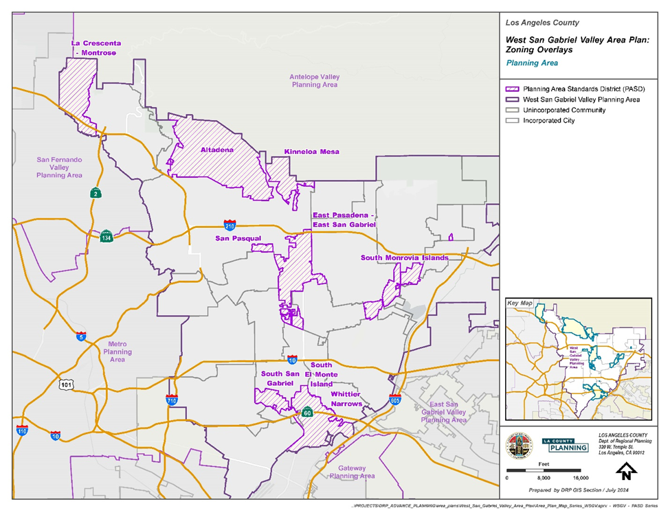
(Ord. 2025-0010 § 8, 2025.)
22.320.040 - Applicability.
A.
General. Except as specified otherwise, this Chapter shall apply to any application for development, expansion, or change of use on lots within the boundaries of the West San Gabriel Valley PASD (Figure 22.320.030-A: West San Gabriel Valley PASD Boundary) filed after April 10, 2025, the effective date of this ordinance.
B.
Exemptions—Nonconforming Structures, Additions, Repairs, or Renovations. The Director has the authority to review any proposed exemption deemed necessary for the customary maintenance and upkeep of nonconforming buildings. Notwithstanding the provisions of Section 22.172.020.B (Additions to a Nonconforming Use or a Building or Structure Nonconforming Due to Use and/or Standards), such additions, repairs, or renovations for the customary maintenance and upkeep of such buildings and structures are exempt from the PASD standards if such requests meet the following criteria:
1.
The addition does not increase the square footage of nonresidential structures;
2.
The addition does not result in the decrease in the number of existing windows;
3.
The addition does not result in the cumulative increase in the floor area of any building or structure by more than 50 percent. If it does, the entire building or structure is subject to the provisions of this PASD;
4
Changes to existing roofs or roof structures do not result in changes to the existing rooflines, roof pitches, or underlying roof structure, such as converting a gabled roof to a flat roof;
5.
Remodels do not exceed or change more than 50 square feet of surface area on primary or secondary façades; and
6.
Any structure which is nonconforming to standards as a result of damage or partial destruction of the structure may be restored to the condition of the structure as it existed immediately prior to the occurrence of such damage or destruction, provided that the cost of reconstruction does not exceed 100 percent of the total market value of the structure, as determined by the methods set forth in Subsections 22.172.020.G.1.a and 22.172.020.G.1.b and provided the reconstruction complies with the provisions of Section 22.172.020.G.2.
(Ord. 2025-0010 § 8, 2025.)
22.320.050 - Application and Review Procedures.
A.
Notification. Notwithstanding Section 22.222.160 (Notification Radius), for any application that requires a public hearing, notice shall be mailed to all owners of property located within a 1,000-foot radius of the exterior boundaries of the subject property.
(Ord. 2025-0010 § 8, 2025.)
22.320.060 - West San Gabriel Valley PASD Areawide Development Standards.
A.
Significant Ridgelines. Significant Ridgelines in West San Gabriel Valley are designated by the Director as those which, in general, are highly visible and dominate the landscape. New development is prohibited on Significant Ridgelines as depicted on Figure 22.320.060-A: West San Gabriel Valley Area Plan Significant Ridgelines, below. Structures shall be located below Significant Ridgelines as follows:
1.
The highest point of a structure shall be located at least 50 vertical feet and 50 horizontal feet from a Significant Ridgeline;
2.
No part of a proposed structure shall block the view of a Significant Ridgeline from a designated Scenic Route; and
3.
Where structures on a lot cannot meet the standards prescribed by Subsections A.2 and A.3, above, a Variance (Chapter 22.194) shall be required. In addition to the Variance requirements of Section 22.194.050 (Findings and Decision), these additional findings shall be made:
a.
Alternative sites within the project area have been considered and eliminated from consideration based on physical infeasibility or the potential for substantial habitat damage and destruction;
b.
The proposed development is limited to 18 feet in height above existing or finished grade (whichever is lower) and maintains the maximum view of the related Significant Ridgeline through site selection and use of design features that include, but are not limited to, reduced building footprint area, clustered structures, shape, materials, and color which allow the structure to blend in with the natural setting, minimized grading, and locally-indigenous vegetation to soften the view of development from the identified public viewing areas;
c.
Landscaping shall consist of native species present on a site as identified in the project's biological documentation. If the site does not have appreciable native vegetation as outlined in the project's biological documentation, use of the Director maintained list of appropriate landscaping materials shall satisfy this provision; and
d.
Landscape or building material screening shall not substitute for project alternatives, such as re-siting or reducing the height or bulk of structures.
FIGURE 22.320.060-A: WEST SAN GABRIEL VALLEY SIGNIFICANT RIDGELINES
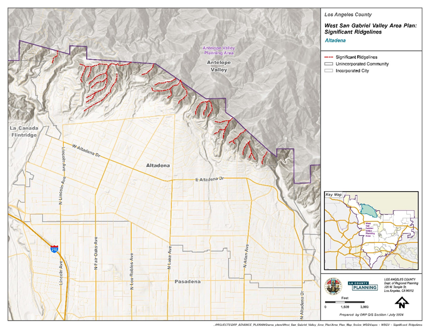
B.
Biological Resources. If a property containing native vegetation is subject to a Conditional Use Permit (Chapter 22.158), a biological inventory containing the following information shall be submitted with the application:
1.
Biological survey and map (drawn to scale) of biological resources and physical site features on the project site;
2.
The plants, animals, and habitats found on the project site;
3.
The plants, animals, and habitats likely to occur on the project site based on a California Natural Diversity Database ("CNDDB") query as well as local knowledge;
4.
The plants, animals, and habitats likely to have occurred on the site based on historical records and habitat found in surrounding undisturbed areas on sites that have been subject to wildfire or unpermitted development, including, but not limited to, vegetation removal or grading;
5.
Assessment of need for additional surveys due to timing/season of initial survey (potential for missing sensitive species) and assessment for need of protocol level species surveys (based on CNDDB query results and local knowledge);
6.
Proximity of the project site to locations of known sensitive resources within 200 feet;
7.
Photo documentation of the site that includes photos of all the respective habitats on site; and
8.
Native tree survey and map (drawn to scale) if oak, sycamore, walnut, bay, or toyon trees are present on the project site. Sites containing native oak trees shall provide the information required in Chapter 22.174 (Oak Tree Permits).
C.
Native Oaks Planting. To protect the genetic diversity of populations of locally native oaks in the West San Gabriel Valley and prevent potential hybridization with nonnative oak species, the planting of an oak tree proposed with the submittal of an application or as required by section 22.174 (Oak Tree Permits) must use a selection of oak species limited to those native to the West San Gabriel Valley. Locally native oak species consist of the following: scrub oak (Quercus berberidifolia), San Gabriel leather oak (Q. durata var. gabrielensis), Engelmann oak (Q. engelmannii), valley oak (Q. lobata), canyon oak (Q. chrysolepis), coast live oak (Q. agrifolia), and interior live oak (Q. wislizenii). The planting of oak species other than those listed here is prohibited.
D.
Landscaping. Where landscaping is required by this PASD, it shall be maintained in a healthy condition through appropriate watering, regular pruning, weeding, fertilizing, litter removal, and replacement of plants as necessary.
(Ord. 2025-0010 § 8, 2025.)
22.320.070 - West San Gabriel Valley PASD Zone-Specific Development Standards.
A.
Commercial and Mixed Use Zones: C-H, C-1, C-2, C-3, C-M, C-MJ, C-R, and CPD and MXD.
1.
Form and massing. To break up the building shape and volume, the design of a building shall vary in depth and/or relief at a minimum of every 30 feet in the horizontal dimension.
2.
Façade Composition. To add visual interest to building form, the façade of a building shall be differentiated into building top, building middle, and building base through architectural elements and design, such as windows, column, balconies, moldings, cupolas, cornices, dormers, pediments, and frieze. (See Figure 22.320.070-A: Example of Façade Height Composition).
a.
Building Top. The uppermost portion of the building, inclusive of the roof, shall be differentiated through variations in color, material, ornamentation or shape. Notwithstanding Subsection A.3 (Roof), below, the roof shall consist of a molding or crown, such as an eave, cornice, parapet, or other such projection.
b.
Building Middle. The building middle may consist of one or more stories, which shall be articulated through consistent elements, such as windows, lintels, columns, horizontal differentiation, recesses, step-backs, materials, and color to differentiate it from the building top and building base.
c.
Building Base. The building base is the ground floor of a building where most of the pedestrian interaction and activity take place.
FIGURE 22.320.070-A: EXAMPLE OF FAÇADE HEIGHT COMPOSITION
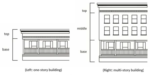
3.
Roofs.
a.
A roof shall have a gable, arc raised center, or, if a flat roof, consist of molding or crown, such as an eave, cornice, parapet, or other such projection or visual interest.
b.
Roof-mounted equipment shall be screened from view on all sides through design or architectural elements.
4.
Entrances. At least one entrance shall be located so as to provide direct pedestrian access from at least one public sidewalk.
a.
Shop Front Entrances. Shop front entrances located on the ground floor shall be recessed and consist of a door, transom lights, and sidelights. See Figure 22.320.070-C, below.
FIGURE 22.320.070-B: SHOP FRONT ENTRANCE DESIGN
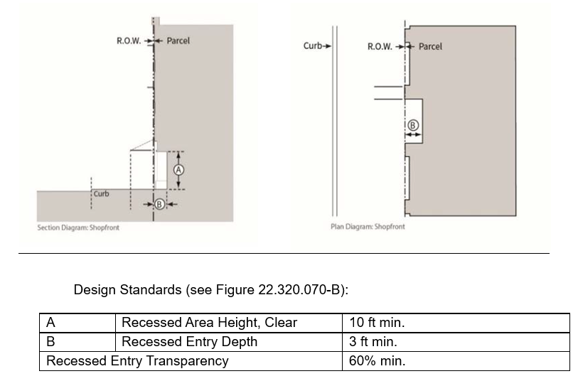
FIGURE 22.320.070-C: EXAMPLES OF SHOP FRONT ENTRANCE (LEFT) AND CORNER ENTRANCE (RIGHT)
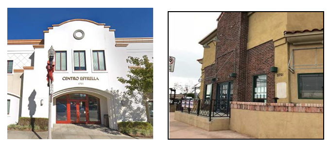
b.
Main Entrances. A multi-tenant building shall provide a main entrance at the street level for pedestrian use. The main entrance shall open onto a lobby and, in conjunction with Subsection A.4.a (Shop Front Entrances), above, the main entrances shall be easily identifiable and distinguishable from other ground floor entrances through the use of one of the following:
i.
Marked by a taller mass above, such as a tower, or within a volume that projects from the rest of the building surface;
ii.
Accented by columns or ornamental light fixtures; and/or
iii.
Marked or accented by a change in the roofline or change in the roof type.
c.
Corner Entrances. Buildings located on a corner lot shall provide a corner entrance that complies with Subsection A.4.a (Shop Front Entrances) or A.4.b (Main Entrances), above, as applicable.
5.
Articulation. In conjunction with Subsection A.2 (Façade Composition), above, a building shall be articulated through design elements.
a.
Horizontal and vertical articulations shall be produced by variations in rooflines, window groupings, applied façade elements, such as piers or pilasters, bay windows, rough textured wood beams, headers, siding, pre-cast headers, casements, cornices, balconies, entrance stoops, porches, and/or changes in materials and horizontal and vertical planes that create shadow lines and textural differences.
b.
Roof Drainage. The location, spacing, materials, and colors of exposed downspouts, gutters, scuppers, and other visible roof drainage components shall be incorporated into the architectural composition of the façade and roof.
6.
Windows.
a.
The ground floor of a building shall consist of windows that cover at least 60 percent of the total width and 40 percent of the total area of the building façade fronting the street in order to provide views of the interior or window display to pedestrians. The bottom of any such window shall be no more than three feet above the sidewalk or grade.
b.
To allow maximum visual interaction between pedestrians and the interior of the building, transparent or lightly tinted material, such as glass, shall be used at the street level or ground floor.
c.
Flashing lights or similar flashing devices shall not be visible from the outside.
d.
Not more than 10 percent of the building façade at ground level shall consist of mirrored materials, densely tinted glass, or other translucent or reflective materials that offer no views of the interior.
7.
Mechanical Equipment. All mechanical equipment shall be located in a manner that avoids obstructing the architectural design of a building.
a.
Air Conditioning Units.
i.
Ground-mounted air conditioning units shall be screened or enclosed with landscaping or screening so as not to be visible from public areas at ground level and shall use appropriate sound and vibration isolating mounts and barriers.
ii.
Roof-mounted air conditioning units shall be screened by architectural features so that the equipment will not be visible from public areas at ground level.
iii.
Window-mounted or wall-mounted air conditioning units shall be placed to minimize overhang and impacts to the design of the building. Casements shall match the design of the façade.
b.
Other mechanical equipment shall be screened from view using architectural features or screening materials so as not to be visible from public areas at ground level.
8.
Exterior Lighting.
a.
Light trespass. Exterior lighting shall be designed to be fully shielded to cast the light downward and be located as to prevent light trespass to adjacent residential zones, sensitive uses, and wildlife. Street lighting shall be consistent with the neighborhood pattern except where Public Works determines that a different street lighting configuration is required for the protection of public health and safety.
b.
Lighting provided at building access points or along pedestrian walkways shall be no more than two feet above ground.
c.
Prohibited Outdoor Lighting. The following types of outdoor lighting shall be prohibited, unless otherwise required by a government agency for safety:
i.
Drop-down lenses, defined as a lens or diffuser that extends below a horizontal plane passing through the lowest point of the opaque portion of a light fixture;
ii.
Mercury vapor lights;
iii.
Ultraviolet lights; and
iv.
Searchlights, laser lights, or other outdoor lighting that flashes, blinks, alternates, or moves. This applies to lighting behind display windows visible from the public right-of-way.
9.
Signs. Signs shall be provided in accordance with Chapter 22.114 (Signs), except as specified in this PASD below. The sign regulations contained herein shall not affect existing signs, which were legally established according to this Title 22.
a.
With the exception of company logos, sign colors, shape, size, location, and lettering shall be coordinated with other business signs within the commercial center.
b.
All signs in a state of disrepair shall be repaired or removed within 30 days from receipt of notification that a state of disrepair exists.
10.
Parking. In addition to the requirements of Chapter 22.112 (Parking), the following requirements shall apply:
a.
Parking Location.
i.
Except for fully subterranean structures or roof parking, and parking structures as a primary use, all parking shall be provided in the rear of the commercial structure and fully screened from view from the street and any adjacent residentially zoned property. Screening materials shall include decorative walls, decorative wrought-iron fencing, and/or landscaping. Unadorned concrete masonry walls and chain-link fencing shall be prohibited.
ii.
Where a parking structure is designated as the primary use of a site, the parking structure shall be fully screened from view from the street and any adjacent residentially zoned property. Screening materials shall include decorative walls, decorative wrought-iron fencing, and/or landscaping. Unadorned concrete masonry walls and chain-link fencing shall be prohibited.
b.
Vehicle Access. For every 100 feet of lot frontage, no more than 20 feet of a property frontage shall be devoted to parking access, such as driveways, unless otherwise required by the County.
c.
Oversize Vehicles. Parking for vehicles that exceed 20 feet in length or nine feet in width shall be located away from any abutting residentially zoned lots.
d.
Loading Spaces. In addition to the standards of Section 22.112.120 (Loading Spaces), the following standards shall apply:
i.
Loading spaces shall be located away from adjoining residentially zoned lots, and shall be screened with decorative walls, decorative fencing, and/or landscaping. Unadorned concrete masonry walls and chain-link fencing shall be prohibited.
ii.
Loading and unloading operations shall not be conducted between the hours of 10:00 p.m. and 6:00 a.m. in such a manner as to cause noise disturbance specified by the County's Noise Control Ordinance (Chapter 12.08 of Title 12) for adjacent residentially zoned properties.
e.
Off-site and Shared Parking. Shared parking arrangements may be provided to meet required parking for commercial uses, provided that the following requirements are met:
i.
Off-site or shared parking facility is located within 1,320 feet (1/4 mile) from any entrance of the use to which they are provided;
ii.
Such area is clearly marked as being made available for parking for the subject use(s); and
iii.
The applicant:
(1)
Is the owner of the lot where such off-site or shared parking facility is located; or
(2)
Has control and/or authority for required parking for as long as the use permit is valid.
11.
Height Limit. Notwithstanding the base zone standards in Title 22, a building or structure in Zone C-3 or MXD shall not exceed a height of 50 feet above grade, excluding elevator shafts, stairwells, chimneys, rooftop antennas, rooftop mechanical equipment, structure-mounted renewable energy systems, and rooftop recreational spaces, except that the portion of any building sharing a common side or rear lot line with property located within a residential zone shall have a step-back from the common side or rear lot line so that the height of the building in Zone MXD is no greater than 25 feet at the edge of the building wall facing that common lot line, and shall be recessed back one foot for every one foot increase in building height, up to a maximum height of 50 feet.
(Ord. 2025-0010 § 8, 2025.)
22.320.080 - Modification of PASD Development Standards.
A.
Applicability. The modification of PASD standards in this Chapter, including the PASD area wide and CSD standards, unless otherwise specified by the CSD, are subject to a minor conditional use permit (Chapter 22.160, Conditional Use Permits, Minor).
B.
Exception. Notwithstanding Subsection A, above:
1.
The following modification of PASD areawide standards are subject to a Variance.
a.
Significant Ridgelines as provided in Subsection 22.320.060.A;
b.
Biological Resources as provided in Subsection 22.320.060.B;
c.
Native Oaks Planting as provided in Subsection 22.320.060.C; and
d.
Zone C-3 and MXD Height, as provided in Subsection 22.320.070.A.11.
2.
The CSD provisions on standards allowed to be modified and the required permit type shall take precedence over any modification provisions in this PASD.
(Ord. 2025-0010 § 8, 2025.)
22.320.090 - Altadena Community Standards District.
A.
Purpose. The Altadena Community Standards District ("CSD") is established to ensure that new and expanded structures are compatible in size and scale with the characteristics of surrounding residential neighborhoods, protecting the light, air, and privacy of existing single-family residences from negative impacts while providing certain flexibility within residential areas. The CSD is also established to revitalize commercial centers, improve the pedestrian nature of commercial streets, and minimize the visual and environmental impacts of development in Hillside Management Areas.
B.
District Map. The boundaries of this CSD are shown on Figure 22.320.090-A, at the end of this Chapter.
C.
Community-Wide Development Standards.
1.
Hillside Management.
a.
This Subsection C.1 shall apply in Hillside Management Areas, as defined in Division 2 (Definitions), except for:
i.
Applications submitted to the Department and deemed complete prior to January 11, 2018, the effective date of the ordinance establishing this Subsection C.1, provided that plans submitted with the application depict all proposed grading and structures;
ii.
Changes to applications approved by the Department prior to the effective date of the ordinance establishing this Subsection C.1, provided that such changes:
(1)
Do not cumulatively increase the previously approved floor area or height of any structure by more than 10 percent; and
(2)
Do not cumulatively increase the previously approved amount of grading to more than 2,500 total cubic yards of cut plus fill material.
iii.
Applications to repair or reconstruct damaged or destroyed structures that were legally established prior to the effective date of the ordinance establishing this Subsection C.1.
b.
Permits Required.
i.
Minor Conditional Use Permit. A Minor Conditional Use Permit (Chapter 22.160) shall be required for any development within a Hillside Management Area that is not otherwise subject to a Conditional Use Permit (Chapter 22.158), pursuant to Chapter 22.104 (Hillside Management Areas), or Subsection C.1.b.ii, below, except for:
(1)
Additions to a structure that were legally established prior to the effective date of the ordinance establishing this Subsection C.1;
(2)
New accessory structures; and
(3)
Development designed so that all areas with a natural slope of 25 percent or greater remain in a natural state.
ii.
Conditional Use Permit. A Conditional Use Permit (Chapter 22.158) shall be required for any grading on a lot that cumulatively exceeds 2,500 total cubic yards of cut plus fill material, excluding any grading approved prior to the effective date of the ordinance establishing this Subsection C.1.
c.
Development Standards.
i.
Any application for grading involving the off-site transport of 1,000 or more cubic yards of material, shall include a haul route, subject to Section 22.140.240 (Grading Projects).
ii.
Any grading occurring during the rainy season, defined as October 15 of any year through April 15 of the subsequent year, shall be subject to the requirements deemed necessary by Public Works to prevent runoff and erosion.
iii.
Additional Development Standards for Conditional Use Permits. In addition to the development standards in this Subsection C.1.c and Chapter 22.104 (Hillside Management Areas), the development shall comply with Table 22.320.090-A, below, where applicable:
iv.
Additional Findings for Conditional Use Permits.
(1)
In addition to the findings required under Chapter 22.158 (Conditional Use Permits) and Chapter 22.104 (Hillside Management Areas), the Commission or Hearing Officer shall approve the application where the information submitted by the applicant or presented at public hearing substantiates that the project complies with the additional development standards in this Subsection C.1.c.
(2)
The Commission or Hearing Officer may require that the applicant incorporate additional design standards which would further the intent and purpose of this CSD in minimizing the visual and environmental impacts of development in hillside management areas. Such standards may include, but are not limited to, requiring visible topsoil used as grading fill match the color and texture of rocks and soils naturally occurring on-site, requiring that project structures use matte or rough surfacing to diminish reflectances, requiring that stands of native vegetation are preserved or expanded, and requiring that mature trees are preserved.
2.
Historical Preservation.
a.
Significant Properties. Any application for the expansion, addition, alteration, or demolition of significant properties is subject to the provisions of this Altadena CSD. Notice of such an application shall be sent to Altadena Heritage 30 days prior to the issuance of a permit by the applicable department that approves, with or without conditions, or denies the application. The following structures may be of historic or architectural significance:
i.
1849-1879 Lake Avenue: Saint Elizabeth's Catholic Church. Map Book 5848, page 1, Parcels 8, 10, 11, and 15. Map 1 Altadena, all of Lot 30;
ii.
2184 Lake Avenue: Eliot School. Map 5845, page 9, Lots 1-14 of Lake Avenue Heights, and Lot 900, a portion of Grogan Tract;
iii.
2245 Lake Avenue: Pacific Electric Railway Substation No. 8. Map Book 5845, page 21, Parcel 35. Map 1 Altadena, portions of Lot 8 and Lot 9;
iv.
2366 Lake Avenue: Altadena Library. Map Book 5845, page 5, Parcel 32. Tract No. 7832, Lots 66, 67, 68, and 69; and
v.
2455 Lake Avenue, 835-875 Mariposa Street and 2520 and 2526 El Molino Avenue: Woodbury Building. Map Book 5845, page 17, Parcels 10 and 14. Map 1 Altadena, portions of Lots 3 and 4.
b.
Designated Landmarks and Historic Districts. Notwithstanding the provisions herein, any building or structure designated as a landmark or within a historic district shall be regulated under Chapter 22.124 (Historic Preservation).
3.
Setback Districts. Setbacks as established in this CSD shall take precedence over any other standards established by this CSD. The required front yard specified in a Setback District shall apply to the yard that is parallel to the front lot line of the perimeter of a compact lot subdivision.
D.
Zone Specific Development Standards.
1.
Zone R-1.
a.
Yard Requirements.
i.
Except as established in Subsection E.2 (Altadena Front Yard Setback Districts), below, this Subsection D.1.a shall supersede Section 22.18.040.C (Required Yards), as depicted in Table 22.320.090-B, below:
ii.
The front yard shall not be less than the smallest front yard of a legally-established residence on the same side of the street on the same block, but in no case less than 20 feet. For example, see Figure 22.320.090-B, below:
FIGURE 22.320.090-B: EXAMPLE OF MINIMUM
FRONT YARD SETBACKS
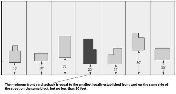
iii.
Except as provided in Section 22.110.090 (Projections into Yards), no portion of any structure shall exceed 23 feet in height where located within 15 feet of any property line.
iv.
On irregularly shaped lots with lot frontage less than that required by Section 21.24.300 (Minimum Frontage) of Title 21 (Subdivisions) of the County Code, the front yard shall be measured from street frontage.
b.
Height Limits.
i.
Except as provided below, Section 22.18.040.D (Maximum Height) shall remain applicable. This Subsection D.1.b shall supersede Section 22.18.040.D, as depicted in Table 22.320.090-C, below:
ii.
Where fill material has been placed on a lot after such lot was legally created, height of a structure built on the lot shall be measured from the previously existing grade on which the structure is located. Where material has been cut on a lot after such lot was legally created, height shall be measured from the grade that results from such cut.
iii.
The maximum number of stories above grade shall be two. A "basement" as defined in Section 22.14.020 of Division 2 (Definitions) shall be considered a story above grade; while a "cellar" as defined in Section 22.14.030 of Division 2 (Definitions) shall not be considered a story above grade.
c.
Fences, Walls, and Landscaping.
i.
For the purposes of this Subsection D.1.c, a Driveway Zone shall be defined as the triangular areas created on both sides of a driveway delineated by the following three points, notwithstanding the location of the property line:
(1)
Point "A" is the point at which the existing edge of the driveway meets the edge of roadway or top of curb, if present;
(2)
Point "B" is the point along the edge of the driveway located 10 feet back from the highway line towards the property; and
(3)
Point "C" is the point at which a line that is extended away from the driveway from Point "B" at a 45-degree angle meets the edge of the roadway or top of curb, if present, as illustrated by Figure 22.320.090-B, below.
FIGURE 22.320.090-C: DRIVEWAY ZONE
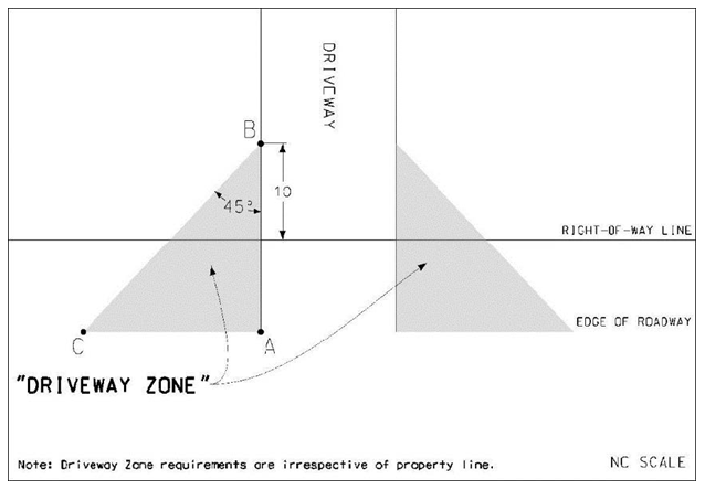
ii.
Maximum Height. Except as provided herein, Section 22.110.070 (Fences and Walls) relating to fences and walls shall remain applicable. In addition to Section 22.110.070.A (Measuring Height of Fences and Walls), the height of a fence or wall shall be measured inclusive of any architectural feature, fixture, or support element attached to, or part of, said fence or wall.
iii.
Front Yards. This Subsection D.1.c shall supersede Section 22.110.070 (Fences and Walls) as follows, as depicted in Tables 22.320.090-D and 22.320.090-E, below:
(1)
Corner or Reversed-Corner Lots. Table 22.320.090-D, below, identifies the maximum height for fences, walls, and landscaping for corner or reversed-corner lots. Where such fence or wall exceeds 42 inches in height, such front yard shall maintain live plants in the portion of the yard between the fence or wall, and the street. Such plants shall comply with this Subsection D.1.c.
(2)
All Other Lots. Table 22.320.090-E, below, identifies the maximum height for fences, walls, and landscaping for all other lots.
(a)
When located within an area outside a driveway zone between the right-of-way line and 10 feet from the right-of-way line towards the property, fences and walls shall be open and non-view obscuring for any portion of the fence or wall greater than 42 inches in height. A fence or wall, or portion thereof, shall be considered open and non-view obscuring when:
(i)
A minimum of 80 percent of that fence or wall or portion thereof, evenly distributed horizontally along the entire length of said fence or wall or portion thereof, is transparent or permits views. Chain-link fencing with live plant material shall not be considered open and non-view obscuring; and
(ii)
Vertical support elements maintain a minimum distance of five feet apart.
(b)
Where such fence or wall exceeds 42 inches in height, such front yard shall maintain live plants in the portion of the yard between the fence or wall, and the street. Such plants shall comply with this Subsection D.1.c.
iv.
Corner Side Yards. Fences, walls, and hedges and landscaping within a required corner side yard shall comply with Section 22.110.070.B.3 (Corner Side Yards).
v.
Location.
(1)
Notwithstanding the provisions of this CSD, any fence, wall, hedge, or landscaping shall comply with Section 22.110.080.E (Limited Secondary Highways) and Section 22.110.040 (Accessory Structures and Equipment).
(2)
Notwithstanding the provisions of this CSD, any encroachment within the public right-of-way shall comply with Title 16 (Highways) of the County Code.
vi.
Prohibited Materials. All portions of new or replacement fences and walls in required front yards shall not be composed of barbed wire, concertina wire, razor wire, or broken glass. Chain-link fencing taller than 42 inches in height shall not be permitted, unless covered and visually obscured with live plant material, and shall comply with all other provisions of this Subsection D.1.c.
vii.
Compliance Implementation Program. An existing fence, wall, or hedge not in compliance with the provisions of this CSD upon January 11, 2018, the effective date of the ordinance establishing this Subsection D.1.c, may apply to register in the voluntary compliance implementation program until January 1, 2019. Notwithstanding the provisions of this CSD, participants in the compliance implementation program shall secure compliance with the County Code prior to January 1, 2034, by modifying the existing fence, wall, or hedge, or obtaining approval for a Variance (Chapter 22.194).
d.
Gross Structural Area and Lot Coverage.
i.
The gross structural area ("GSA") of a property includes the total floor area of all enclosed areas, including storage, but excluding cellars and garages or carports designed and used for the storage of automobiles. Lot coverage shall include all structures erected on the property.
ii.
The maximum GSA or lot coverage shall be determined by the following formula: GSA or Lot Coverage = (.25 × net lot area) + 1,000 square feet.
iii.
The maximum GSA or maximum lot coverage shall not exceed 9,000 square feet.
e.
Parking.
i.
Except as provided in this Subsection D.1.e, Chapter 22.112 (Parking), including required on-site parking together with a maneuvering area (maneuvering aisle) and driveway, shall remain applicable. This Subsection D.1.e shall supersede Section 22.112.060 (Required Parking Spaces), as depicted in Table 22.320.090-F, below:
ii.
For the purposes of this Subsection D.1.e, a bedroom shall be defined as any habitable room or space with a closet, which is designed to be capable of being used for sleeping purposes, excluding rooms commonly used for living, cooking, or dining purposes.
iii.
Where three or more parking spaces are required per Subsection D.1.e.i, above, such spaces may be uncovered and developed in tandem.
f.
Home-Based Occupations. Except as provided below, Section 22.140.290 (Home-Based Occupations) shall remain applicable:
i.
Number of Home-Based Occupations. A maximum of two home-based occupations is permitted per property, where no more than one client visit or one client vehicle per hour per property shall be permitted.
ii.
Number of Employees. No more than two persons not residing on the property may be employed, either for pay or as a volunteer, to work on the property as part of a home-based occupation, for a maximum total of two non-resident employees per property.
iii.
Notwithstanding Section 22.140.290.D (Prohibitions), the following home-based occupations may be permitted:
(1)
Photography laboratories, digital, where:
(a)
Any non-digital photography or film laboratory activities or materials, other than for occupant's own use, shall be prohibited; and
(b)
All processing operations of the home-based occupation activity shall be conducted in an approved indoor space.
(2)
Picture framing, where:
(a)
Only assembly of finished wood or other finished products shall be permitted;
(b)
All paints, stains, and varnishes shall be used in a properly ventilated area, and shall cause no odors or toxic chemicals to be detected beyond the property; and
(c)
All home-based occupation activity must be conducted in an approved indoor space.
(3)
Seamstress or tailor, where:
(a)
A maximum of four sewing machines shall be permitted for the home-based occupation;
(b)
Such sewing machine shall be non-commercial, non-industrial, and domestic only; and
(c)
All home-based occupation activity shall be conducted in an approved indoor space.
g.
Bed and Breakfast Establishments. Bed and breakfast establishment means a residence containing guest rooms used for short-term rental accommodations, which provides breakfast for guests of the facility. If a Conditional Use Permit (Chapter 22.158) application has first been approved, property in Zone R-1 may be used for a bed and breakfast establishment with three or more rooms made available for guests, if the Commission or Hearing Officer additionally finds that the facility will not have a disruptive effect on the neighborhood. In addition to Section 22.158.060 (Conditions of Approval), the following development standards shall be conditions of each grant, unless otherwise modified by the Commission or Hearing Officer:
i.
The property shall have an area of not less than 10,000 square feet;
ii.
The facility shall be operated and maintained by the owner or lessee of the property, and it shall constitute the primary residence of the owner or lessee;
iii.
All guest rooms shall be located within the primary residence;
iv.
Stays for any paying guests shall not exceed 14 consecutive days, and shall be not more than 30 days for such guest in any calendar year;
v.
Kitchens and other cooking facilities shall be prohibited in any guest room within the establishment;
vi.
There shall be one onsite parking space, which may be uncovered, served by all-weather access, for each guest room available for paying guests;
vii.
The serving or consumption of food or beverages, including any alcoholic beverages, shall be restricted to residents and guests of the facility. No restaurant or similar activity that is open to the general public shall be permitted;
viii.
Any use of the establishment for commercial special events shall be specifically authorized by a Conditional Use Permit; and
ix.
One wall-mounted or freestanding sign shall be permitted, provided that such sign does not exceed four square feet in sign area or eight square feet in total sign area and does not exceed a height of 42 inches measured vertically from ground level at the base of the sign.
2.
Zone R-2.
a.
Height Limits.
i.
Where fill material will be placed beneath a proposed structure, the height of the structure shall be measured from the previously existing grade.
ii.
On lots with a size of 20,000 square feet or less, the maximum height of any structure shall be 30 feet.
b.
Front Yards. At least 50 percent of any required front yard shall be landscaped.
c.
Building Design.
i.
Rooflines on any side of a structure exceeding 30 feet in length shall be broken into smaller sections by use of decorative elements such as dormers, gables, eyebrows, parapets, mansards, or other design features.
ii.
The floor area of any story above the first story shall be at least 20 percent less than the floor area of the first story and the reduced footprint of such story shall be set back from the side and/or rear of the first story's structure, but not from the front of the first story's structure. Attached garages and other attached non-living areas shall be included in computing the floor area of the first story.
d.
Bed and Breakfast Establishments. If a Conditional Use Permit (Chapter 22.158) application has first been approved, property in Zone R-2 may be used for a bed and breakfast establishment, pursuant to Subsection A.8, above.
3.
Zone R-3.
a.
Height Limits. Where fill material will be placed beneath a proposed structure, the height of the structure shall be measured from the previously existing grade.
b.
Interior Side Yards.
i.
Any required interior side yard that adjoins a single-family or two-family residentially zoned lot shall be landscaped, which landscaping shall include shrubbery and/or trees to shield the adjoining property.
ii.
No driveway, walkway, patio slab, or other area constructed of concrete, asphalt, or similar material shall be permitted in any required interior side yard that adjoins a single-family or two-family residentially zoned lot.
iii.
No uncovered porch, platform, landing, deck, or balcony may project into a required interior side yard that adjoins a single-family or two- family residentially zoned lot.
c.
Rear Yards. Rear yards that adjoin a single-family or two-family residentially zoned lot, shall include a landscaped area with a minimum depth of 10 feet measured from the rear property line. Such landscaped area shall include shrubbery and/or trees to shield the adjoining property. At least one tree, with a minimum size of 15 gallons, shall be provided for every 250 square feet of landscaped area.
d.
Building Design. Rooflines on any side of a structure exceeding 30 feet in length shall be broken into smaller sections by use of decorative elements such as dormers, gables, eyebrows, parapets, mansards, or other design features.
e.
Structure Height and Setback. For structures exceeding 25 feet in height that are located on a lot adjoining a single-family or two-family residentially zoned lot:
i.
The maximum height of the structure at the inside boundary of the interior side yard adjoining the single-family or two-family residentially zoned lot shall be 25 feet, and any portion of the structure exceeding 25 feet in height shall be set back an additional foot from the inside boundary of said interior side yard for every two feet in height; and
ii.
The maximum height of the structure at the inside boundary of the rear yard adjoining the single-family or two-family residentially zoned lot shall be 25 feet, and any portion of the structure exceeding 25 feet in height shall be set back an additional foot from the inside boundary of said rear yard for every foot in height.
f.
Residentially Zoned Property Outside Unincorporated Area. For purposes of Subsections D.3.b through D.3.e, all requirements related to a structure and/or property adjoining a single-family or two-family residentially zoned lot shall apply to such structure and/or property regardless of whether or not the single-family or two-family residentially zoned lot is located within an incorporated or unincorporated area.
4.
All Commercial and Mixed Use Zones.
a.
Permitted Uses.
i.
Restaurants and Other Eating Establishments, Including Food Take-Out and Outdoor Dining. In addition to Section 22.140.410 (Outdoor Dining), restaurants and other eating establishments, including food take-out, may have outdoor dining where:
(1)
Outdoor dining is established as accessory to the restaurant or other eating establishment; and
(2)
Automobile parking is provided in accordance with Chapter 22.112 (Parking) except as modified in Subsection D.4.c.i, below, for outdoor dining.
ii.
Auto Repair Uses. Where auto repair uses are permitted as a primary or incidental use, the following development standards shall apply:
(1)
Any auto repair use shall comply with Section 22.140.110 (Automobile Body and Fender Repair, Painting, and Upholstering as an Accessory Use);
(2)
There shall be no more than three service bays; and
(3)
Any required customer parking area shall not be used to store vehicles for repair.
b.
Uses Subject to Permit.
i.
Drive-through Facilities. Drive-through facilities shall be permitted, provided a Conditional Use Permit has first been obtained. In addition to Section 22.158.060 (Conditions of Approval), the Commission or Hearing Officer may modify any of the prescribed development standards, below:
(1)
The drive-through facility shall comply with the maintenance plan submitted as part of the application;
(2)
The location of the drive-through area, including cashier microphone, speakers and drive-through lane, shall be a minimum 20 feet from the property line of any adjacent residentially zoned lot, and speakers and lighted menus shall be oriented away from such lots;
(3)
Hours of operation for the drive-through area shall be no earlier than 6:00 a.m. and no later than 12:00 a.m.; and
(4)
A buffer, which may include a six-foot solid wall, as depicted on the site plan, shall be provided to reduce noise trespass from the drive-through to any adjacent residentially zoned lot.
c.
Development Standards.
i.
Parking. Automobile parking shall be provided in accordance with Chapter 22.112 (Parking) and comply with current requirements for accessible parking for people with disabilities, except that the following requirements shall apply:
(1)
Retail, or Restaurants and Other Eating Establishments, Including Food Take-Out and Outdoor Dining. Automobile parking shall comply with Table 22.320.090-G, below, where applicable. Where such retail or restaurant and other eating establishment incudes a drive-through facility or banquet facility, Chapter 22.112 (Parking) shall supersede this Subsection D.4.c.i:
ii.
Height. Except in the Lake Avenue Mixed Use 'Center' Area, referenced in Figure 22.320.090-A at the end of this Chapter, the maximum height for any commercial structure shall be 35 feet, except that a portion or portions of the building, not to exceed a total 20 percent of the building footprint, may be up to three stories or 45 feet in height to provide design flexibility for architectural accent(s) or to accommodate mechanical equipment, elevator shafts, and stairwells.
iii.
Floor Area Ratio. Except in Zone C-M, Zone M-1, and the Lake Avenue Mixed Use 'Center' Area referenced in Figure 22.320.090-A, at the end of this Chapter, the total gross floor area of a lot shall not exceed 1.8 times the total area of such lot.
iv.
Signage. New signage shall be provided in accordance with Chapter 22.114 (Signs), except as specified below. The sign regulations contained herein shall not affect existing signs, which were legally established according to this Title 22.
(1)
Size. Maximum height of letters shall be restricted to 18 inches.
(2)
Wall Business Signs. Wall Business Signs shall comply with Section 22.114.110 (Wall Business Signs), except where modified below:
(a)
The wall business sign shall be mounted flush and affixed securely to a building wall and may project a maximum of 12 inches from the building wall or permanent roofed structure to which they are mounted;
(b)
In addition to the standards in Section 22.114.110.C (Height Permitted), the wall business sign may not extend above the roofline and may not extend into the right-of-way beyond the building face or the soffit line of the building;
(c)
Each business in a building may be permitted a maximum of one wall-mounted sign. Businesses with more than one frontage or entry may have one sign for each frontage or entry;
(d)
Each ground-floor business establishment fronting on or oriented toward one or more public street, highway, or parkway shall be permitted as follows:
(i)
Where the public right-of-way has a minimum width of 80 feet, a maximum of one square foot of wall sign area for each linear foot of building frontage; and
(ii)
Where the public right-of-way has a width of less than 80 feet, a maximum of one-half square foot of wall sign area for each linear foot of building frontage.
(e)
Where a ground floor business establishment fronts a parking lot hidden from the street, alley, open mall, landscaped open space, or other public way, the exterior building wall facing such parking lot, alley, open mall, landscaped open space, or other public way shall be considered a building frontage for purposes of computing the sign's permitted sign area.
(3)
Freestanding Signs. Except as provided below, Section 22.114.120 (Roof and Freestanding Business Signs), relating to freestanding signs, remain applicable. On lots with 100 feet or more of street frontage, freestanding business signs with a solid base that rests directly on the ground may be permitted, provided:
(a)
Said sign shall not exceed five feet in height as measured vertically from ground level to the top of the sign; and
(b)
Said sign shall not exceed 40 square feet of sign area.
(4)
Projecting Signs. One projecting business sign shall be permitted per building frontage for the same business. The area of the projecting sign faces shall be subtracted from the total allowable signage area.
(5)
Window Signs.
(a)
Window signs shall be displayed only on the interior of windows or door windows of ground-floor or second-floor businesses; and
(b)
Maximum area shall not exceed 25 percent per transparent glass area of the window (total window area visible from the exterior of the building).
(6)
Awning Signs. Awning signs, which are considered the same as a projecting sign for purposes of regulation, shall comply with the following:
(a)
The maximum area of awning signs, which are allowed in addition to business wall signage, shall not exceed 20 percent of the exterior surface of each awning for the ground floor and the second-floor level;
(b)
Awning signs shall not be permitted above the second-floor level; and
(c)
Maximum letter height for awning signs shall not exceed ten inches.
(7)
Building Tenant Information/Identification Signs.
(a)
Multi-tenant buildings and businesses with entrances located within building pass-through may list the names of tenants on a building directory located near each major building or pass-through entrance;
(b)
Each tenant is allowed a maximum of two square feet of signage per directory, in addition to wall signage;
(c)
New building identification signage applied to new construction or existing buildings shall be limited to one sign per principal entrance per frontage, not exceeding a maximum of 15 square feet each;
(d)
All existing built-in signs (permanent signs that are constructed as an integral part of the building fabric which they identify) in good repair are exempt from these sign provisions. Marquees and canopies shall not be considered to be built-in signs;
(e)
Metal plaques listing the building name and/or historical information permanently affixed in a flush manner to the building and in good repair are exempt from these sign provisions; and
(f)
The height and placement of signs shall be similar for each business or storefront.
(8)
Prohibited Signs:
(a)
Flashing, animated or audible signs, except marquee signs which display time and temperature;
(b)
Signs which rotate, move, or simulate motion;
(c)
Signs with exposed bracing, guy wires, conduits, or similar devices;
(d)
Roof signs (any sign erected and maintained upon or over the roof of any building);
(e)
Outdoor advertising signs (billboards); and
(f)
Box signs.
v.
Design Standards. Proposed improvements, renovations of existing buildings, and changes to buildings shall conform to the following design standards:
(1)
Materials, Colors, and Equipment.
(a)
Any building elevation shall be architecturally treated in a consistent manner, including the incorporation within the side and rear building elevations of some or all of the design elements used for the primary façades;
(b)
Neon Colors. The use of neon colors shall be limited to architectural accent features and not exceed 20 percent of a building frontage surface; and
(c)
Concrete Masonry Unit ("CMU") walls shall be constructed in such a manner as to not permit the CMU blocks to be visible to pedestrians.
(2)
Awnings. Awnings shall be architecturally compatible with the related buildings in regard to color and style.
(3)
Mechanical Equipment.
(a)
Individual air conditioning units for a building or storefront shall be located to avoid interference with architectural detail and the overall design;
(b)
Storefront air conditioning units shall be neutral in appearance and not project outward from the façade. The housing color of the air conditioning unit shall be compatible with the colors of the storefront; and
(c)
Mechanical equipment located on roofs shall be screened by parapet walls or architectural features so that the equipment will not be visible from normal public view up to 300 feet away.
(4)
Security.
(a)
Chain-link, barbed, and concertina wire fences are prohibited;
(b)
All security bars or grilles shall be installed on the inside of the building;
(c)
Vertically or horizontally folding accordion grilles installed in front of a storefront are prohibited; and
(d)
Building security grilles shall be side-storing, concealed interior grilles, which are not visible from the exterior of the building when not in use (during business hours), or grilles which can be concealed in the architectural elements of the building.
vi.
Buffers. When a parking lot or commercial structure is adjacent to a side yard or rear yard of a residentially zoned lot, the following development standards shall apply:
(1)
Landscaping. A five-foot landscaped buffer shall be provided. Incidental walkways are prohibited from the landscaped area.
(2)
Encroachment Plane. An encroachment plane shall be defined as an inclined plane, beginning at a stated height above average grade parallel to the property line, and extending into the interior of the site at a stated upward angle to the horizontal average grade perpendicular to the property line. A 45-degree encroachment plane shall be required for new construction. The encroachment plane shall extend from a six-foot height at the edge of the required landscaped buffer pursuant to Subsection D.4.c.vi.(1), above, adjacent to the side yard or rear yard of a residentially zoned lot. Excluding landscaping, no portion of a structure shall extend beyond the encroachment plane.
vii.
Pedestrian Character.
(1)
Commercial Corridor. A commercial corridor shall mean a street which has a commercial focus, and which is identified below as having a special pedestrian potential near commercial zones. Designated Commercial Corridors for the purposes of this Section are Lake Avenue, Fair Oaks Avenue, Lincoln Avenue, North Allen Drive, and New York Drive near the intersection of North Allen Drive and New York Drive, Mariposa Street between El Molino Avenue and Lake Avenue, and East Washington Boulevard.
(2)
Pedestrian Entrance. Where a lot abuts a Commercial Corridor, as identified in Subsection D.4.c.vii.(1), above, a pedestrian accessible entrance to the commercial structure shall be provided at or within ten feet of the property line along, at sidewalk level, facing, and directly accessible to the Commercial Corridor. The entrance shall be oriented towards the Commercial Corridor, directly accessible to pedestrians off the street, and angled no more than 45-degrees askew of the property line delineating the edge of the Commercial Corridor, as measured along the base of the entrance.
(3)
Visual Interaction. To encourage pedestrian activity and improve the quality of visual interaction offered to pedestrians, the following standards apply:
(a)
At least 55 percent of the total length and 40 percent of the total area of the façade of the building on the ground floor shall be devoted to windows, interior views, or interior displays, visible to pedestrians. Entrances, mirrored or highly reflective materials, densely tinted glass, displays or materials offering no view of the interior, or false windows shall not meet the requirements of this Subsection D.4.c.vii.(3);
(b)
Transparent or lightly tinted material, such as glass, shall be used at or near the street level to allow maximum visual interaction between sidewalk areas and the interior of buildings. Mirrored, highly reflective glass or densely tinted glass shall not be used except as an architectural or decorative accent totaling a maximum of 20 percent of the building façade; and
(c)
All entrances or windows provided for the purposes of meeting the requirements of this Subsection D.4.c.vii.(3) shall be located at sidewalk level, defined here as being no more than three feet above or below the sidewalk, as measured vertically from the midpoint of the base of the entrance or window. Where a window exceeds 20 feet in length, the measurement shall be taken at increments of 20 feet. Where a window base is located lower than three feet from the sidewalk, only the width or area of that portion within three feet of the sidewalk shall be counted towards the requirements of this Subsection D.4.c.vii.(3).
(4)
Pedestrian Flow. Walk-up facilities shall be recessed and provide adequate queuing space to avoid interruption of the pedestrian flow.
(5)
Building Façade. A minimum of 50 percent of the building frontage above the first story shall be differentiated by recessed windows, balconies, offset planes, or other architectural details which provide dimensional relief. Long, unbroken building façades are to be avoided.
(6)
Roof Design. New buildings or additions resulting in 100 feet or more of frontage shall incorporate varying roof designs and types.
(7)
Paving Materials. Pedestrian exclusive circulation areas within the boundaries of the private property shall be improved with permeable paving materials, such as brick, paver tile, or pervious concrete.
(8)
Architectural Elements. Buildings shall incorporate at least three of the following architectural elements or desirable uses, as listed in Table 22.320.080.070-H, below. Where a building frontage exceeds 50 feet in length, an additional instance of the following architectural elements shall be used for each segment of 20 feet of frontage and distributed throughout the width of the building façade.
(9)
Building Setback. Buildings shall be set back a minimum of two feet from the property line adjoining a commercial corridor. The two-foot setback area shall be designed as an extension to any abutting sidewalk, if existing, and hardscaped or landscaped with plants, seating, or other architectural features.
(10)
Parking Access. Not more than 20 feet of the commercial frontage shall be devoted to parking access, such as driveways. Where additional driveway width is required for fire access or other legal requirements, no more than the minimum specified shall be provided.
(11)
Parking Areas. Except fully subterranean structures or roof parking, completely screened from view from the street, all parking shall be provided in the rear of the commercial structure and completely screened from view from the street. Screening materials may include walls and/or landscaping.
(12)
Landscape Plan. New commercial structures or additions to commercial structures exceeding 500 square feet in gross floor area shall provide a landscape/irrigation plan. Said plan shall depict required landscaping, including one 15-gallon tree for every 50 square feet of planter area.
(13)
Trash Enclosure. The required trash bin shall be enclosed by a minimum five-foot to a maximum six-foot-high decorative wall, have solid doors, and be located in the rear of the lot.
viii.
Vacant lots. Vacant lots shall be maintained free of debris, overgrown weeds, or junk or garbage.
5.
Zone C-2. In addition to the uses and requirements under Subsection D.4, above, and for Zone C-2 in Chapter 22.20 (Commercial Zones), the following uses are permitted as follows:
a.
Permitted Uses.
i.
Sales. Multi-tenant commercial, when more than five tenants conduct business in a building which does not separate the businesses by permanent floor-to-ceiling walls.
b.
Conditional Use Permit. A Conditional Use Permit (Chapter 22.158) application is required to establish, operate, and maintain the following:
i.
Services.
(1)
Air pollution sampling stations;
(2)
Automobile service stations, including incidental repair, washing, and rental of utility trailers;
(3)
Electric distributing substations; and
(4)
Microwave stations.
6.
Zone C-3. In addition to the uses and requirements under Subsection D.4, above, and for Zone C-3 in Chapter 22.20 (Commercial Zones), a Conditional Use Permit (Chapter 22.158) application is required to establish, operate, and maintain the following:
a.
Sales.
i.
Auction houses;
ii.
Automobile sales, new or used;
iii.
Boat and other marine sales;
iv.
Ice sales;
v.
Mobile home sales;
vi.
Model home display centers and sales offices;
vii.
Pawnshops;
viii.
Recreational vehicle sales;
ix.
Secondhand stores;
x.
Stamp redemption centers; and
xi.
Trailer sales, box and utility.
b.
Services.
i.
Air pollution sampling stations;
ii.
Automobile battery services, provided all repair activities are conducted within an enclosed building only;
iii.
Automobile brake repair shops, provided all repair activities are conducted within an enclosed building only;
iv.
Automobile muffler shops, provided all repair activities are conducted within an enclosed building only;
v.
Automobile radiator shops, provided all repair activities are conducted within an enclosed building only;
vi.
Automobile repair garages within an enclosed building only, and excluding body and fender work, painting, and upholstering;
vii.
Automobile service stations;
viii.
Bakery goods distributors;
ix.
Boat rentals;
x.
Carwashes, automatic, coin-operated, and hand wash;
xi.
Comfort stations;
xii.
Electric distribution substations, including microwave facilities;
xiii.
Furniture transfer and storage;
xiv.
Gas metering and control stations, public utility;
xv.
Homes for children, foster family;
xvi.
Lodge halls;
xvii.
Microwave stations;
xviii.
Mortuaries;
xix.
Motion picture studios;
xx.
Motorcycle, motor scooter, and trail bike rentals;
xxi.
Parcel delivery terminals;
xxii.
Radio and television broadcasting studios;
xxiii.
Recording studios;
xxiv.
Recreational vehicle rentals;
xxv.
Revival meetings, tent, temporary;
xxvi.
Taxidermists;
xxvii.
Trailer rentals, box and utility;
xxviii.
Truck rentals, excluding trucks exceeding two tons capacity; and
xxix.
Wedding chapels.
c.
Recreation and Amusements.
i.
Amusement rides and devices;
ii.
Athletic fields;
iii.
Carnivals;
iv.
Commercial recreation clubs;
v.
Golf courses; and
vi.
Swimming pools.
d.
Accessory Uses.
i.
Auto body and fender repair, painting, and upholstering;
ii.
Storage of building materials, except during on-site construction; and
iii.
Manufacturing.
7.
Zone C-M.
a.
Conditional Use Permit. In addition to the uses and requirements under Subsection D.4, and for Zone C-M in Chapter 22.20 (Commercial Zones), a Conditional Use Permit (Chapter 22.158) application is required to establish, operate, and maintain the following:
i.
Sales.
(1)
Automobile sales, sale of new and used motor vehicles;
(2)
Boat and other marine sales;
(3)
Mobile home sales;
(4)
Recreational vehicle sales; and
(5)
Trailer sales, box and utility.
ii.
Services.
(1)
Car washes, automatic, coin-operated, and hand wash;
(2)
Revival meetings, tent, temporary; and
(3)
Tire retreading or recapping.
iii.
Accessory Uses. Storage of building materials, except during on-site construction.
b.
Floor Area Ratio. The total gross floor area ratio of a lot shall not exceed 1.0 times the total net of such lot.
8.
Zone M-1.
a.
Floor Area Ratio. The total gross floor area ratio of a lot shall not exceed 1.0 times the total area of such lot.
E.
Area Specific Development Standards.
1.
Lake Avenue Mixed Use 'Center' Area.
a.
Purpose. The Lake Avenue Mixed Use 'Center' Area specific development standards are established to provide a means of implementing the Altadena Community Plan. The standards are necessary to ensure that the goals and policies of the Community Plan are accomplished in a manner which protects the health, safety, and welfare of the community, thereby strengthening the physical and economic character of the Lake Avenue Commercial District of Altadena.
b.
Description of Area. The boundaries of the Lake Avenue Mixed Use 'Center' Area are shown on Figure 22.320.090-A, at the end of this Chapter.
c.
Area-Specific Development Standards.
i.
Height Limits. The maximum height permitted in the area for a commercially zoned lot is 35 feet, excluding elevator shafts, stairwells, chimneys, rooftop antennas, rooftop mechanical equipment; and
ii.
Floor Area Ratio. The total gross floor area ratio of a commercially zoned lot shall not exceed 2.7 times the total area of such lot.
2.
Altadena Front Yard Setback Districts. Every lot withing the Setback Districts (Figures 22.320.090-D, 22.320.090-E, and 22.320.090-F) shall conform to the front yard building setbacks as established below, except as provided by 22.72.040 (Modification of Setback Requirements).
FIGURE 22.320.090-D: ALTADENA SETBACK DISTRICT UNIT NO. 1
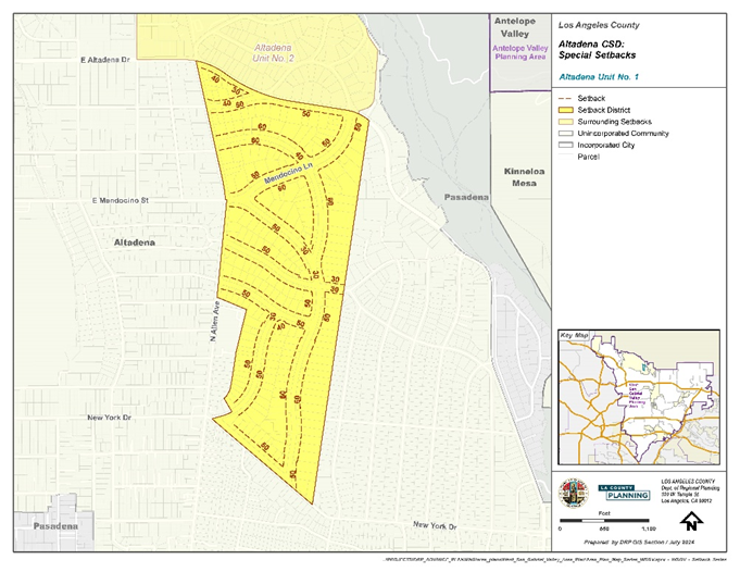
FIGURE 22.320.090-E: ALTADENA SETBACK DISTRICT NO. 2
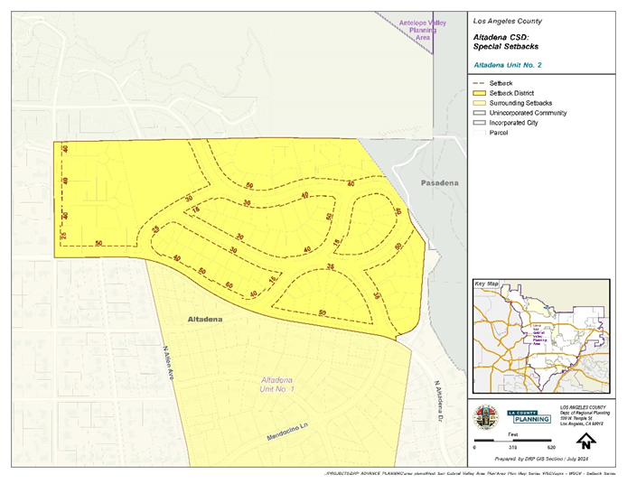
FIGURE 22.320.090-F: ALTADENA SETBACK DISTRICT NO. 3
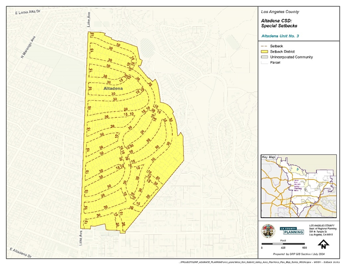
F.
Modification of Development Standards.
1.
Applicability. The development standards set forth as listed below, may be modified through a Minor Conditional Use Permit Section 22.300.020.C (Modifications Authorized), subject to the provisions herein:
a.
Residential Zones.
i.
Section 22.320.090.D.1.a (Yard Requirements);
ii.
Sections 22.320.090.D.1.b.i and 22.320.090.D.1.b.ii;
iii.
Section 22.320.090.D.1.c (Fences, Walls, and Landscaping);
iv.
Section 22.320.090.D.1.d (Gross Structural Area and Lot Coverage);
v.
Section 22.320.090.D.2.b (Front Yards);
vi.
Section 22.320.090.D.2.c (Building Design);
vii.
Section 22.320.090.D.3.b (Interior Side Yards);
viii.
Section 22.320.090.D.3.c (Rear Yards);
ix.
Section 22.320.090.D.3.d (Building Design); and
x.
Section 22.320.090.D.3.e (Structure Height and Setback).
b.
Commercial and Industrial Zones.
i.
Section 22.320.090.D.4.c.ii (Height);
ii.
Sections 22.320.090.D.4.c.iii (Floor Area Ratio), 22.320.090.D.7.b (Floor Area Ratio), and 22.320.090.D.8.a (Floor Area Ratio);
iii.
Section 22.320.090.D.4.c.iv (Signage) related to area and number of signs;
iv.
Section 22.320.090.D.4.c.v (Design);
v.
Section 22.320.090.D.4.c.vi (Buffers); and
vi.
Section 22.320.090.D.4.c.vii (Pedestrian Character).
c.
Lake Avenue Mixed Use 'Center'.
i.
Section 22.320.090.E.1.c.i (Height Limits); and
ii.
Section 22.320.090.E.1.c.i (Floor Area Ratio).
d.
Modification of all other standards in the Altadena CSD shall be subject to a Variance (Chapter 22.194).
2.
Application.
a.
Additional Application Materials. In addition to the application materials required for a Minor Conditional Use Permit (Chapter 22.160) application, the application shall contain the following information:
i.
An applicant's statement setting forth that:
(1)
The application of the standards for which modification is sought would result in practical difficulties or unnecessary hardships if not granted;
(2)
There are topographic features, subdivision plans, or other exceptional circumstances or conditions applicable to the subject property or to the intended development of the subject property that do not apply to other properties within the area governed by this CSD; and
(3)
That the requested modification will not be materially detrimental to properties or improvements in the area or contrary to the purpose of this CSD or the West San Gabriel Valley Area Plan.
ii.
Materials for modifying Fences, Walls, and Landscaping in Residential Zones. For a request to modify Section 22.320.090.D.1.c (Fences, Walls, and Landscaping), the applicant shall submit the following additional information:
(1)
A site plan depicting:
(a)
Location and height of the modified fence, wall, hedge, or landscaping;
(b)
Location and width of driveway(s) on the subject property and adjacent property on the same side of the street; and
(c)
Driveway zone(s) on the subject property and if applicable, where located on adjacent property on the same side of the street.
(2)
An elevation of the subject property and adjacent properties on the same side of the street, including the modified fence, wall, hedge, or landscaping; and
(3)
Supporting information such as a line-of-sight study, demonstrating line of sight for vehicular traffic, including such factors as topographical conditions, and curvature and posted speed of the road.
iii.
Materials for modifying Pedestrian Entrance. For a request to modify the requirements of Section 22.320.090.D.4.c.vii.(2) (Pedestrian Entrance), in addition to the required materials in Subsection F.2.i.(1), above:
(1)
A site plan of the proposed alternative design, detailing the required elements of Subsection F.3, below, including the proposed location of required public space identification signage;
(2)
A lighting plan;
(3)
A landscaping plan;
(4)
A maintenance plan; and
(5)
An applicant's statement describing the proposed alternative design and setting forth how the proposed privately owned public space would benefit or enhance the pedestrian.
b.
Fee. The applicant shall submit a filing fee equal to that required for:
i.
A Minor Conditional Use Permit (Chapter 22.160) Application; and
ii.
A fee in the amount specified in Section 12.04.020.A.3.a.(3) of Title 12 (Environmental Protection) of the County Code to be applied to Public Works, when the Department determines that a CSD Modification is to be referred to Public Works for review.
3.
Additional Development Standards For Modification.
a.
Residential Zones.
i.
For any request related to height, the maximum height shall not exceed 35 feet; and
ii.
For any request related to fences, walls, and landscaping, any modified fence, wall, hedges, or landscaping shall maintain adequate line of sight for vehicular traffic, including such factors as topographical conditions, and curvature and posted speed of the road.
b.
Commercial and Mixed Use Zones.
i.
Additional Development Standards for Modification. Where a CSD Modification is requested to modify Section 22.320.090.D.4.c.vii.(2) (Pedestrian Entrance), the following standards shall apply:
(1)
At least 75 percent of the total length and 60 percent of the total area of the façade of the building at ground floor fronting the Commercial Corridor, shall be devoted to windows, interior views, or interior displays, visible to pedestrians. Entrances, mirrored or highly reflective materials, densely tinted glass, displays or materials offering no view of the interior, or false windows shall not meet the requirements of this Subsection F.3.b.i.
(2)
A minimum of ten square feet of privately owned public space shall be provided for every foot of building frontage facing a Commercial Corridor. The public space shall be provided on site, along and directly accessible to the Commercial Corridor. No portion of the public space may be less than ten feet in depth, or 25 percent of the length of the building façade as measured along the Commercial Corridor. The proposed public space shall contain at least one of the following, in addition to those required by Section 22.320.090.D.4.c.vii.(8) (Architectural Elements):
(a)
Any type of courtyard, plaza, or public circulating area which incorporates benches and pedestrian seating, landscaping, or hardscaping, including water features, and shade trees;
(b)
A privately maintained garden, accessible to the public, which incorporates benches or pedestrian seating and landscaping, or hardscaping, including water features, and shade trees;
(c)
Covered walkways, separate or as an extension of the sidewalk, covered by vegetation over trellis or other design, that would provide shade for pedestrians and include benches and public seating, landscaping, or hardscaping and shade trees;
(d)
Any type of privately maintained, landscaped open space, including a micro-park, green space, or other urban open area that includes shade trees, and benches or public seating; or
(e)
Any type of privately maintained, landscaped animal-friendly space, including a micro-park, dog run, green space, or other urban open area that includes on-site pet waste stations, shade trees, and benches or public seating.
(3)
Signage shall be provided on-site to identify the privately owned public space as available for public use. Signage shall be at least three square feet in size, and include the following language at a minimum, subject to approval: "Open to the Public". Signage provided to meet the requirements of this Subsection F.3.b.i.(3) shall not be subtracted from the allowed signage area for the lot.
4.
Procedure. A CSD Modification shall be processed the same as for a Minor Conditional Use Permit (Chapter 22.160) application, except as follows:
a.
Findings for Approval. In addition to the findings in Section 22.160.050.B, the Hearing Officer shall approve or deny the request based on the following findings:
i.
The application of the standards for which modification is sought would result in practical difficulties or unnecessary hardships if not granted;
ii.
There are exceptional circumstances or conditions applicable to the subject property or to the intended development of the subject property that do not apply to other properties within the area governed by this CSD;
iii.
That the requested modification will not be contrary to the purpose of this CSD or the West San Gabriel Valley Area Plan; and
iv.
For any request to modify the requirements of Section 22.320.090.D.4.c.vii.(2) (Pedestrian Entrance), that the proposed alternative meets the additional development standards in Subsection F.3.b.i.(3), above, and is designed in such a manner as to enhance the pedestrian character or the use of the site by pedestrians.
b.
Additional Conditions. In approving a request, the Hearing Officer may direct changes to be made or condition the project in order to meet the required findings.
(Ord. 2025-0010 § 8, 2025.)
FIGURE 22.320.090-A. ALTADENA CSD BOUNDARY AND SUB-AREAS
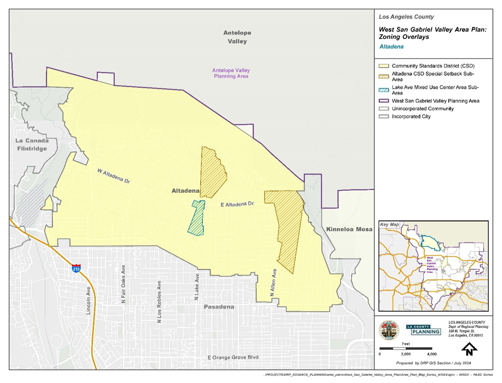
(Ord. 2025-0010 § 8, 2025.)
22.320.100 - Chapman Woods Community Standards District.
(Reserved.)
(Ord. 2025-0010 § 8, 2025.)
22.320.110 - East Pasadena-East San Gabriel Community Standards District.
A.
Purpose. The East Pasadena-East San Gabriel Community Standards District ("CSD") is established to protect the light, air, and privacy of existing residences, enhance aesthetics and community character, and ensure that new and expanded development is compatible with the unique identity of each neighborhood throughout the CSD.
B.
District Map. The boundaries of this CSD are shown on Figure 22.320.110-A: East Pasadena-East San Gabriel CSD Boundary, at the end of this Chapter.
C.
Community-wide Development Standards.
1.
Flag Lots. The provisions in Section 22.110.170.B.1.b allowing the substitution of a uniform distance of ten feet from all lot lines for front, side, and rear yards on flag lots shall not be applicable.
2.
Signs. Prohibited signs are as follows:
a.
Outdoor advertising signs;
b.
Freestanding signs that exceed 30 feet in height, or are located within 100 feet of a residential use or Residential Zone, or extend into the public right-of-way;
c.
Roof signs;
d.
Flashing, animated, audible, rotating, and/or moving signs; and
e.
Business signs that project or extend more than 18 inches from the building façade.
3.
Setback Districts. Setbacks as established in this CSD shall take precedence over any other standards established by this CSD. The required front yard specified in a Setback District shall apply to the yard that is parallel to the front lot line of the perimeter of a compact lot subdivision.
D.
Zone Specific Development Standards.
1.
Zones R-1, R-2, R-A, A-1 (Single-Family Residential).
2.
Zone R-3.
3.
Zones C-1, C-2, C-3, C-H, M-1, and M-1.5.
a.
Maximum Height. The maximum height of all structures, except chimneys, rooftop antennas, elevator shafts, stairwells, and rooftop mechanical equipment, shall be 35 feet.
b.
Maximum Floor Area. The maximum floor area shall be 100 percent of the net lot area. Floor area shall include all enclosed buildings.
c.
Maximum Lot Coverage. The maximum lot coverage shall be 75 percent of the net lot area. Lot coverage shall include all enclosed buildings.
d.
Setback. For structures that exceed 17 feet in height and are located on a lot adjacent to a Residential Zone, the maximum height of the structure at five feet from the property line adjacent to the Residential Zone shall be ten feet and any portion of the structure that exceeds ten feet in height shall be set back an additional foot for every additional foot in height.
E.
Area Specific Development Standards.
1.
East Pasadena-East San Gabriel Setback District. Every lot within the Setback Districts (see Figure 22.320.110-B) shall conform to the front yard building setbacks as established below, except as provided by 22.72.040 (Modification of Setback Requirements).
FIGURE 22.320.110-B: EAST PASADENA-EAST SAN GABRIEL SETBACK DISTRICT UNIT NO. 1
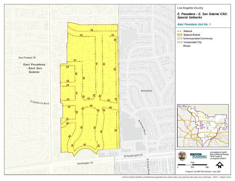
F.
Modification of Development Standards. In addition to the findings required by a Minor Conditional Use Permit as provided by Section 22.320.080 (Modification of PASD Development Standards), the following findings are required:
1.
Approval or denial of a modification to the development standards of this Chapter shall not establish precedent for approval or denial of other modifications within the East Pasadena-East San Gabriel CSD.
2.
The modification of the development standards will not affect the unique characteristics of the neighborhood in which the site is located.
a.
The use, development of land, and application of development standards comply with all applicable provisions of this Title 22.
b.
The use, development of land, and application of development standards, when considered on the basis of the suitability of the site for the particular use or development intended, are arranged to avoid traffic congestion, provide for the safety and convenience of bicyclists and pedestrians, including children, senior citizens, and persons with disabilities, to protect public health, safety and general welfare, prevent adverse effects on neighboring property, and conform with good zoning practice.
c.
The use, development of land, and application of development standards are suitable from the standpoint of functional developmental design.
d.
That the requested modification will not be materially detrimental to properties or improvements in the area or contrary to the purpose of this CSD or the West San Gabriel Valley Area Plan.
(Ord. 2025-0010 § 8, 2025.)
FIGURE 22.320.110-A: EAST PASADENA-EAST SAN GABRIEL CSD BOUNDARY
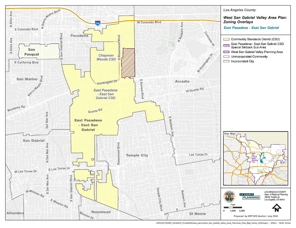
(Ord. 2025-0010 § 8, 2025.)
22.320.120 - La Crescenta-Montrose Community Standards District.
A.
Purpose. The La Crescenta-Montrose Community Standards District ("CSD") is established to enhance the character and vitality of the La Crescenta-Montrose community. The CSD promotes thoughtful design of commercial and residential buildings and enhances the area's identity as a foothill community. The CSD contains development standards and design requirements to improve the appearance of the Foothill Boulevard commercial corridor, create a pedestrian-friendly environment, and buffer single-family residences from more intensive adjacent uses.
B.
Definitions. The following definitions are defined solely for this CSD:
1.
Façade. Any face of a building oriented towards a shared public space, such as a street, alley, parking lot, sidewalk, courtyard, plaza, or park.
2.
Landscaping. An area planted with vegetative materials, such as lawn, shrubs, flowers, trees, drought tolerant groundcover, or plants.
C.
District Map. The boundaries of this CSD are shown on Figure 22.320.12-A: La Crescenta-Montrose CSD Boundary, at the end of this Chapter.
D.
R-1 Zone Specific Development Standards.
1.
Gross Structural Area. For R-1 zoned lots 7,500 square feet in size or larger, the Gross Structural Area ("GSA") calculation shall apply. The maximum GSA shall be determined by the following formula: GSA = (.25 × net lot area) + 1,000 square feet. The GSA of a property shall include the total floor area of all enclosed buildings and structures, including storage, but excluding cellars and the first 400 square feet of garages designed for the storage of automobiles.
2.
Exterior Lighting. Fully shielded fixtures shall be used for permanent exterior lighting in order to prevent light trespass beyond said property boundaries. A fully shielded fixture emits no light in the area above a horizontal plane passing through the lowest point of the light fixture and no more than ten percent of its light in the area between zero and ten degrees below the horizontal plane.
E.
R-3 Zone Specific Development Standards.
1.
The provisions of this Section shall not apply to single-family and two-family residences.
2.
Front Yards.
a.
At least 50 percent of the required front yard shall be landscaped, and such landscaping shall include at least one minimum 15-gallon tree.
b.
Front yards that adjoin any single-family or two-family residential property shall include a landscaped area of at least five feet in width, as measured from the side lot line adjoining said residential property. Driveways, walkways, patio slabs, and other areas constructed of concrete, asphalt, or similar materials shall not be permitted in said landscaped area.
3.
Interior Side Yards.
a.
Where a lot is 50 feet or less in average width, such lot shall have interior side yards each of at least five feet.
b.
Where a lot is more than 50 feet in average width but not more than 100 feet in average width, such lot shall have interior side yards equal to ten percent of the average width of such lot.
c.
Where a lot is greater than 100 feet in average width, such lot shall have interior side yards of at least ten feet.
d.
Interior side yards that adjoin single-family or two-family residential property shall be landscaped and such landscaping shall include shrubbery and/or trees to provide shielding to maintain privacy from the adjoining property.
e.
Driveways, walkways, patio slabs, and other areas constructed of concrete, asphalt, or similar materials shall not be permitted in interior side yards that adjoin single-family or two-family residential property, except that, to meet Fire Department access requirements, a permeable paver walkway may be used on the inside edge of landscaping to the satisfaction of the Fire Department.
f.
Porches, platforms, landings, and decks that are uncovered shall not project into interior side yards that adjoin single-family or two-family residential property.
4.
Rear Yards. Rear yards that adjoin a single-family or two-family residential property shall include a landscaped area with a depth of at least ten feet, as measured from the rear lot line. Such landscaped area shall include shrubbery and/or trees to provide shielding from the adjoining single-family or two-family property. At least one minimum 15-gallon tree shall be provided for every 250 square feet of the required landscaped area, or as otherwise required by Chapter 22.126, whichever is greater.
5.
Structure Height. For structures located on a lot adjoining a single-family or two-family residential property, the height of any structure at the inside boundary of the required side and rear yards shall be 25 feet. Any portion of the structure that exceeds 25 feet in height shall be stepped back an additional foot for every two feet in height up to a maximum height of 35 feet.
6.
Open Space.
a.
At least 50 percent of the required open space shall be clustered in one common area with dimensions of at least 15 feet by 25 feet. Such common area shall include recreational amenities accessible to and useable by all building occupants and may include a required yard or any portion thereof, provided that such yard or portion thereof is landscaped.
7.
Building Design.
a.
Where a lot is 100 feet or less in average width, only one driveway shall be permitted in the required front yard, and one garage entrance may be placed in front of a building. Such driveway and garage entrance shall not exceed 26 feet in width, unless a greater width is required by another State or County requirement.
b.
Where a lot is greater than 100 feet in average width, one driveway shall be permitted in the required front yard for every 100 feet of lot width, and one garage entrance may be placed on the front of a building for every 100 feet in lot width or portion thereof. Each such driveway and garage entrance shall not exceed 26 feet in width, unless otherwise required by State or County requirements.
c.
For each building that fronts a public street, at least one window shall be located on the building wall that faces that street.
d.
Front entrances shall consist of a portico, hereby defined as a roof structure consisting of columns or enclosed walls.
e.
Building walls exceeding 30 feet in length shall be articulated by use of patios, balconies, bay windows, or other such articulations which shall extend more than three feet from the building wall.
f.
The entire roof structure shall be pitched with a slope of at least 1:3.
g.
Rooflines shall be broken into smaller sections by use of decorative elements, such as pitched dormers, gables, and eyebrows.
h.
Roof-mounted equipment shall be screened from view from any adjacent residential property at ground-level and any adjoining public right-of-way, except that solar panels that match the slope and direction of the roof and are less than 18 inches tall above the roof need not be screened.
F.
Foothill Boulevard Area Specific Development Standards.
1.
Purpose. The following standards apply to all commercial and mixed use zoned property within the Foothill Boulevard Area and are intended to improve walkability and aesthetics along the commercial corridor.
2.
Area Description. The specific boundaries of the Foothill Boulevard subarea are shown on Figure 22.320.120 A: Foothill Boulevard, at the end of this Chapter.
3.
Zone Specific Use Standard All MXD Zones.
a.
Conditional Use Permit. Notwithstanding the use requirements provided in Section 22.26.030.B (Land Use Regulations for Zone MXD), the following uses shall require a conditional use permit.
i.
Schools through grade 12, accredited, including appurtenant facilities, which offer instruction required to be taught in the public schools by the State of California;
ii.
Schools, business and professional, including art, barber, beauty, dance, drama, and music, including trade schools specializing in manual training, shop work, or in the repair and maintenance of machinery or mechanical equipment; and tutoring instruction schools where more than 20 students are in attendance at any one time;
iii.
Smoke Shops, which is a business establishment that is dedicated, in whole or in part, to the smoking or sale of tobacco products, electronic cigarettes, or other substances, including, but not limited to, establishments, such as cigar lounges, hookah lounges, tobacco clubs, shops, or bars;
iv.
Athletic fields, excluding stadiums;
v.
Recreation clubs, commercial, including tennis, polo, swimming, and similar outdoor/indoor recreational activities together with appurtenant clubhouse;
vi.
Swimming pools, as a primary use; and/or
vii.
Tennis, volleyball, badminton, lawn bowling or bowling alleys, and similar courts.
4.
General Development Standards.
a.
Lot Coverage. Buildings and structures shall not cumulatively occupy more than 85 percent of the net area of a lot. A minimum of 15 percent of the net area shall be landscaped.
b.
Yard Setbacks. Outdoor dining, exterior furniture, or pedestrian circulation areas may be provided for up to one-third of the required 15 percent net area landscaping in the front and side yard setbacks if such setbacks are provided to meet the landscaping requirement.
c.
Corner cutoffs. Corner cutoffs shall be provided, as specified in Section 22.116.040 (Intersections and Corner Cutoff Requirements). If the existing corner cutoff is less than 20 feet, any new development shall provide a corner cutoff of at least 20 feet, unless otherwise determined by Public Works.
d.
Rear Yards.
i.
If a lot adjoins a Residential Zone at its rear lot line, such lot shall have a rear yard of at least five feet in depth and such rear yard shall be landscaped.
(1)
If a lot is 60 feet or less in width at its rear lot line, at least two minimum 24-inch box trees shall be planted, and such trees shall be planted at least 27 feet apart.
(2)
If a lot is more than 60 feet in width at its rear lot line, a 24-inch box tree shall be planted in both directions at intervals of 27 feet, as measured from the midpoint of the width of such lot at its rear lot line.
ii.
If a lot is located between Ramsdell Avenue and Raymond Avenue, this rear yard standard shall not apply.
e.
Building or Structure Height.
i.
If a lot does not adjoin a Residential Zone at its rear lot line, the maximum building or structure height shall be 35 feet above grade, excluding chimneys, rooftop antennas, elevator shafts, stairwells, and rooftop mechanical equipment.
ii.
If a lot adjoins a Residential Zone at its rear lot line, the maximum building or structure height shall be 35 feet, excluding chimneys, rooftop antennas, elevator shafts, stairwells, and rooftop mechanical equipment, except that at the rear lot line, height shall be stepped back as follows:
(1)
If an adjoining lot has a lower elevation, the maximum height of 35 feet shall be established as a 45-degree projection measured from six feet above the grade of the rear lot line (see Figure 22.320.120-B).
(2)
If an adjoining lot has a higher elevation, the maximum height shall be established as a 45-degree projection measured from the grade of the rear lot line (see Figure 22.320.120-B).
iii.
Exceptions.
(1)
If the lot is located between Ramsdell Avenue and Raymond Avenue, Subsection b, above, shall not apply.
(2)
If the average lot depth is 150 feet or less, Subsection F.4.e.ii, above, shall not apply, and the maximum height shall be 35 feet, excluding chimneys, rooftop antennas, elevator shafts, stairwells, and rooftop mechanical equipment.
FIGURE 22.320.120-B: BUILDING OR STRUCTURE HEIGHT
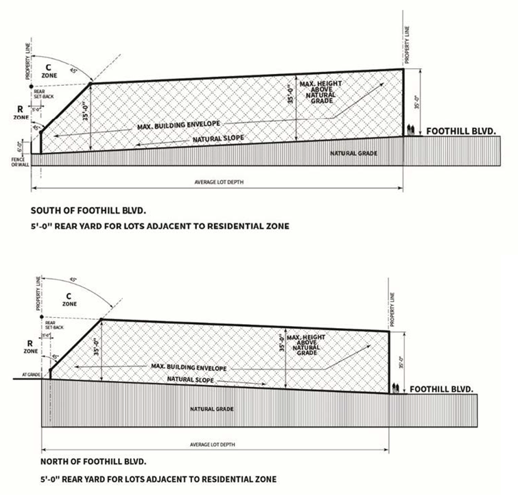
f.
Building Base Design. New development and renovations subject to Section 22.320.040.C (Nonconforming Structures-Additions, Repairs, or Modifications) shall include at least two of the following design elements on at least one façade fronting Foothill Boulevard:
i.
Trellis or Pergola. Consisting of posts and beams with cross members and open to the sky or complemented with the use of canvas shades or vines, as shown on Figure 22.320.120-C, below.
FIGURE 22.320.120-C: EXAMPLES OF TRELLIS AND
PERGOLA STRUCTURES

ii.
Natural Stone, which shall be provided at the base of structures, including (see Figure 22.320.120-D):
(1)
As fascia for landscape wall;
(2)
On the base of façade walls at least three feet in height for the length of all walls at ground floor; and
(3)
On the base of all columns on the exterior of the buildings at least three feet in height.
FIGURE 22.320.120-D: EXAMPLES OF NATURAL STONE
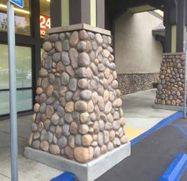
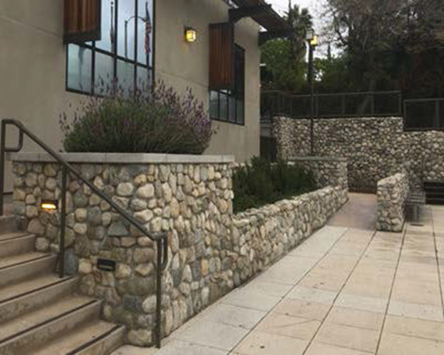
iii.
Exterior Furniture. At least one of the following exterior furniture, which shall be constructed of steel with powder coat or other comparable material of equal durability and shall be well maintained at all times.
(1)
Benches with a seating length of at least 48 inches (see Figure 22.320.120-E, below);
FIGURE 22.320.120-E: EXAMPLES OF BENCH SEATING
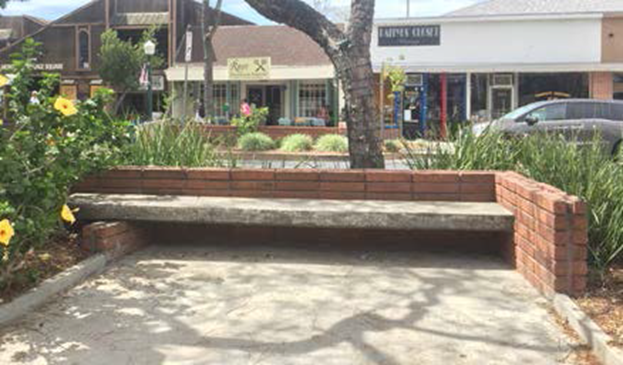
(2)
Bicycle racks at least one rack to accommodate three or more bicycles. If a bicycle rack has already been provided pursuant to Section 22.112.100 (Bicycle Parking and Bicycle Facilities), it may be used to satisfy this requirement, and no additional bicycle rack is required (see Figure 22.320.120-F); and
FIGURE 22.320.120-F: EXAMPLE OF BICYCLE RACK

(3)
Tables with chairs may include at least three tables with at least two chairs each (see Figure 22.320.120-G, below).
FIGURE 22.320.120-G: EXAMPLES OF TABLES WITH CHAIRS FOR OUTDOOR SEATING
g.
Awnings.
i.
Use of awnings. As part of the building articulation, awnings with or without a sign may be used at entrances, windows, bays, or along building frontages or façades, subject to the requirements of Subsection F.6.g.vii.(2) (Awning Sign).
ii.
Multiple awnings belonging to a single commercial business shall be the same color and style.
iii.
Awnings shall not utilize glossy material or be internally illuminated.
iv.
Awnings shall be maintained in good repair. For the purposes of this Subsection, good repair shall be defined as not torn or ripped.
h.
Exterior Lighting. Perimeter luminaries shall be located at least five feet from any adjacent residential lot line.
i.
Landscaping. These landscaping provisions shall apply to installation or replacement of landscaping.
i.
Native trees with a trunk diameter of at least eight inches, as measured four-and-one-half feet above grade, shall be preserved and integrated into required landscaping, either in their current location or another location on the same lot, provided that such trees are good candidates for relocation, as established by a certified arborist. Such trees shall be moved in accordance with currently accepted arboricultural standards and practices and shall be supervised by a certified arborist. This provision shall not apply to oak trees, which are subject to the requirements of Chapter 22.174 (Oak Tree Permits); and
ii.
Trees, shrubs, flowers, and plants placed in any required yard, including hedges planted within yards and forming a barrier serving the same purpose as a fence or wall, shall comply with all height restrictions applying to fences and walls, as provided in Section 22.110.070 (Fences and Walls) in addition to Subsections F.4.j and F.4.k, below.
j.
Retaining Walls.
i.
Retaining walls that employ crib wall construction are not required to meet the requirements of this Subsection, provided that such retaining walls are landscaped.
ii.
Retaining walls shall be finished with one or more of the following materials: brick, stucco, natural stone, or split-faced concrete block with a cap.
iii.
Retaining walls greater than 3.5 feet in height that are adjacent to a road right-of-way, shall be set back at least three feet from the road right-of-way. This setback area shall be landscaped, but such landscaping shall be no higher than the height of the retaining wall and shall not obstruct line of sight, as determined by Public Works.
iv.
Retaining walls that adjoin or are adjacent to the rear lot line shall comply with the following standards (see Figure 22.320.120-H):
(1)
Retaining walls shall be limited to eight feet in height, as measured from finished grade from the bottom of the retaining wall. If eight feet is insufficient, additional retaining walls may be constructed, in a terraced manner, in increments of four or fewer feet in height, similarly measured, unless Public Works determines such a terraced construction is unsafe. In such case, a retaining wall greater than eight feet may be allowed, if approved by Public Works.
(2)
Each vertical increment of terraced retaining walls shall be set back from adjoining increments by at least two feet, and the area between each increment shall be landscaped in compliance with the requirements of 22.320.060.E (Landscaping).
FIGURE 22.320.120-H: REAR LOT RETAINING WALL DESIGN
k.
Other Walls and Fences.
i.
Walls shall be constructed of similar materials as in Subsection F.4.j.ii. Fences shall be constructed of the following materials, and shall be maintained in good condition:
(1)
Wood or simulated wood;
(2)
Brick or stone; or
(3)
Wrought iron.
ii.
Prohibited Fences. Chain-link, barbed and concertina wire fences, electric fences, fences or walls with protruding sharp edges, or other fences and walls designed for or likely to cause harm to persons, are prohibited, except as otherwise provided below.
iii.
Special Purpose Fences. Chain-link fences are permitted only when used to secure undeveloped lots, construction sites, or for special events authorized by a special event permit pursuant to Chapter 22.188 (Special Events Permit).
l.
Parking. The requirements of Chapter 22.112 (Parking) shall apply except where modified herein:
i.
Fence or Wall. If a parking lot adjoins a public street, a solid fence, or wall 3.5 feet in height, setback at least seven feet from the road right-of-way shall be required. Substitution of a landscaped berm in place of a solid fence or wall may be permitted.
ii.
Parking Ratio. Eating establishments and other similar uses located on a lot between Ramsdell Avenue and Raymond Avenue shall provide at least one parking space for each six persons, based on the occupant load, which is determined by Public Works.
5.
Building Design Standards.
a.
Architectural Elements. New primary structures shall include at least one of the following elements listed below on at least one façade fronting Foothill Boulevard. If the lot is located between Ramsdell Avenue and Raymond Avenue, this requirement shall not apply.
i.
Terrace. A terrace separates the building façade from the sidewalk and street. A terrace may provide a space for public uses, such as public seating or dining. It creates a buffer from public rights-of-way (see Figure 22.320.120-J, below, for examples of terraces).
FIGURE 22.320.120-I: TERRACE DESIGN
(1)
Design Standards (see Figure 22.320.120-I):
(2)
Low walls used as seating may count towards satisfying the requirements of Subsection F.4.f.iii.(1) (Benches), above.
(3)
Any required guardrails shall be at least 75 percent open above the perimeter wall.
FIGURE 22.320.120-J: EXAMPLES OF COVERED TERRACE
AND TERRACE AREAS
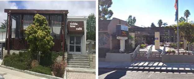
ii.
Forecourt. A forecourt is a semi-public space formed by a recess in the façade of a building and is generally appropriate for commercial or public use (see Figure 22.320.120-L, below).
FIGURE 22.320.120-K: FORECOURT DESIGN
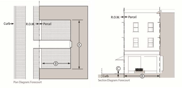
(1)
Design Standards (see Figure 22.320.120-K):
(2)
Encroachments, such as balconies, awnings, and signage, are allowed within the forecourt and shall be located at least eight feet above finish level.
(3)
Forecourts shall dedicate at least 50 percent of their area to landscape or design elements, such as seating areas, fountains, or other similar fixtures, or combination thereof.
FIGURE 22.320.120-L: EXAMPLES OF FORECOURT AREA

iii.
Backcourt (Rear Court). A backcourt is a semi-public courtyard oriented to the rear of a building that can be accessed by pedestrians from the sidewalk. A backcourt may be partially enclosed on one, two, or three sides by buildings or structures and is generally appropriate for commercial or public uses (see Figure 22.320.120-N, below).
FIGURE 22.320.120-M: BACKCOURT (REAR COURT) DESIGN
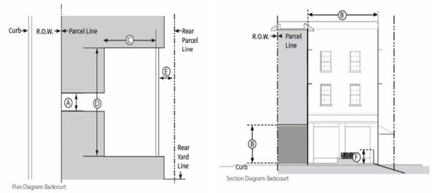
(1)
Design Standards (see Figure 22.320.120-M):
(2)
When provided, a backcourt shall satisfy the requirements of Section 22.320.070.A.5 (Articulation), only if there is direct access from Foothill Boulevard providing exterior access for pedestrians to the backcourt.
(3)
Encroachments, such as balconies, awnings, and signage are allowed within the backcourt and shall be located at least eight feet above finish floor level.
(4)
Backcourts shall dedicate at least 50 percent of their area to landscape or design elements, such as seating areas, fountains, or other similar fixtures.
FIGURE 22.320.120-N: EXAMPLES OF BACKCOURT AREA
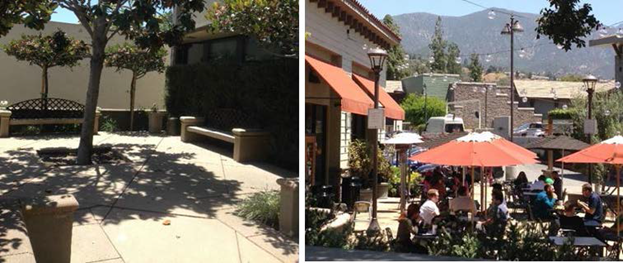
iv.
Arcade. An arcade is a façade with an attached colonnade that is covered by upper stories. Colonnades shall not screen from public view more than 25 percent of the ground floor façade (see Figure 22.320.120-P, below).
FIGURE 22.320.120-O: ARCADE DESIGN
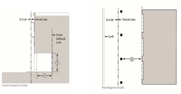
(1)
Design Standards (see Figure 22.320.120-O):
FIGURE 22.320.120-P: EXAMPLES OF ARCADE FRONTAGE
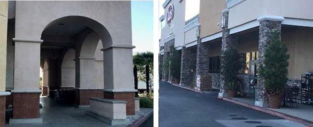
v.
Gallery. A gallery is a roof or deck projecting from the façade of a building with vertical supports. For multi-story buildings, galleries may provide covered or uncovered porches at the second and third floors. Galleries may encroach within the required front yard setbacks. Colonnades shall not screen from public view more than 25 percent of the ground floor façade (see Figure 22.320.120-R, below).
FIGURE 22.320.120-Q: GALLERY DESIGN
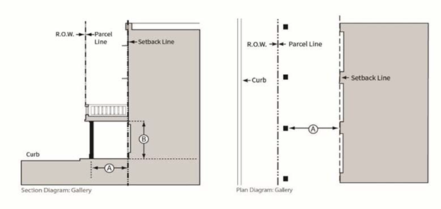
(1)
Design Standards (see Figure 22.320.120-Q):
FIGURE 22.320.120-R: EXAMPLE OF GALLERY FRONTAGE
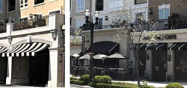
b.
Entrances. Notwithstanding Section 22.320.070.A.4 (Entrances), the following standards shall apply.
i.
Entrances shall be treated with special paving materials, such as ceramic or mosaic tile; ornamental ceilings, such as coffering; or decorative light fixtures.
ii.
Awnings may be used at shop fronts and are subject to Subsections F.4.g (Awnings) and F.6.g.vii.(2) (Awning Signs), above.
iii.
Walk-up facilities, which is a facility attached to a building designed to serve pedestrians outside without need for entering a building, such as an Automated Teller Machine or food service window, lacking pedestrian entrances, shall be set back at least six feet from the edge of the right-of-way.
c.
Wall Surface. The following standards shall apply to the building walls.
i.
A wall of a building located 30 feet or more from the side or rear lot line shall have the same trim and finish as the front building façade.
ii.
A wall facing an internal courtyard or a side façade without windows and doors is only allowed, if the wall is located less than 30 feet from the side or rear lot line and enhancements, such as surface reliefs, wall articulations, architectural murals, or vines are incorporated.
iii.
Building finishes shall be of durable materials, such as brick, natural stone, decorative concrete, glass, wood, stucco, or other similar materials except cinder block (concrete masonry unit).
iv.
Building walls shall have contrasting colors to give emphasis to design features, such as door/window trim, pilasters, cornices, capitals, wainscot, and/or similar treatments.
v.
On at least two feet of the wall surface above the street level, durable materials shall be used, as provided in Subsection F.5.c.iii, above, except that stucco or other similar troweled finishes may not be used.
d.
Wall Openings.
i.
For frontages, upper stories shall have a window to wall area proportion that is less than that of the ground floor frontage. Glass curtain walls or portions of glass curtain walls are exempt from this standard.
ii.
Storage areas within a structure, other than product displays, shall not be visible through windows.
iii.
Railings and grilles may be installed on the exterior or interior of a window on the ground floor of a structure, provided that such railings and grilles do not interfere with the required 60 percent transparency.
iv.
Roll-up security gates that are solid shall not be installed on the exterior of any window.
6.
Signs. Signage shall be provided in accordance with Chapter 22.114 (Signs), except as specified below. The sign regulations contained herein shall not affect existing signs, which were legally established according to this Title 22.
a.
Encroachment. Signage that extends into the public right-of-way shall require an encroachment permit from Public Works.
b.
Exempt Signs. The following types of signs are exempt from the provisions of this Section.
i.
Temporary Future Tenant Signs. One temporary future tenant identification sign per street frontage of the building with a maximum of 32 square feet of sign area. Such a sign may only be displayed after tenant improvements for the site have begun and may not be displayed after the first occupancy of the tenant space.
ii.
Grand Opening Sign. A temporary promotional sign with a maximum sign area of 32 square feet used by newly established businesses to inform the public of their location and services only up to 90 days after the initial occupancy of the new business. Such sign shall be removed no later than the 91st day after such initial occupancy. A "Grand Opening" sign shall not include annual or occasional promotion by a business.
iii.
Window Sign. Two window signs per tenant consisting of permanently fixed individual lettering and/or logos not exceeding six inches in height and no more than three square feet in total maximum sign area. If illuminated, a window sign shall only be externally illuminated.
iv.
Temporary Window Sign. In addition to the signage allowed in Subsection F.6.b.iii, above, one additional temporary window sign, provided the sign does not exceed 25 percent of the area of any single window or adjoining windows on the same street frontage. Display of such temporary window sign shall not exceed 30 days, and there shall be a minimum of 30 days between each use of temporary window signs. Temporary window signs are permitted a maximum of four times per calendar year, and, if illuminated, shall only be externally illuminated.
v.
Directory Sign. A directory sign for a building providing a list of the names of business establishments within a building, provided the sign area for the directory sign is no larger than six square feet. Such directory sign may be wall mounted, provided it is no higher than eight feet from the finished grade. The directory sign may also be freestanding, provided it is no higher than eight feet and no lower than three feet from the finished grade and does not cause entrances and walkways to violate the Americans with Disabilities Act.
vi.
Affiliation Sign. Affiliation signs that provide notice of services within an establishment (for example, credit cards accepted, trade affiliations, etc.) are allowed, provided such signs shall not exceed one square foot in area for each sign, and no more than three such signs shall be allowed for each business. If illuminated, affiliation signs shall only be externally illuminated.
c.
Nonconforming Signs. An existing sign that was legally established and does not conform to the provisions of these Area Specific standards shall not be enlarged or altered and must be amortized in compliance with Subsection F.6.f.
d.
Exposed Neon Signs.
i.
A sign that is internally illuminated or employs exposed neon shall be placed at least seven feet above finished grade.
ii.
The use of exposed neon shall be limited to script and pictorial graphics, and animation, provided that such animation is limited to intervals of five or more seconds.
e.
Prohibited Signs. The following signs shall be prohibited in addition to those listed in Section 22.114.040 (Prohibited Signs Designated):
i.
Signs employing any continuous or sequential flashing operation, including electronic reader boards and LED signage that employs crawling displays or flashing illuminations;
ii.
Signs employing video components;
iii.
Signs emitting odors;
iv.
Roof business signs, including signs painted on the surface of roofs; or
v.
Digital and Electronic Signs. Existing signs shall not be converted to a digital or electronic billboard sign. Digital and electronic signs include any internally or externally illuminated sign that utilizes digital message technology capable of instantaneously changing the static message or copy on the sign electronically.
f.
Removal and Amortization Schedule. A sign which is nonconforming, due to the requirements of this CSD, shall be removed or made to comply with this CSD within 20 years from the effective date of this CSD in compliance with Section 22.172.050 B.1.f (Termination By Operation of Law).
g.
Permitted Signs. Signs shall comply with Chapter 22.114, except as modified herein as follows:
i.
To facilitate the identification or location of the premises in cases of emergency and for other public health, safety, and welfare purposes, business signs readable from a public right-of-way or parking area open to the general public shall include the following information on the sign: street address and name of the business in digits which are readable from the right-of-way or parking area.
ii.
Incidental Business Signs. An incidental business sign shall not be attached to a freestanding sign and shall not be internally illuminated.
iii.
Building Identification Signs. A building identification sign shall not exceed four square feet in area, shall not be placed more than four feet above finished grade, and shall not be internally illuminated.
iv.
Temporary Construction Signs. A temporary construction sign shall not exceed 40 square feet in area and shall not exceed six feet in height, if free-standing. The top of such sign shall not be placed more than six feet above finished grade, if wall-mounted, shall not be internally illuminated, and shall be removed from the premises within five days after completion of the construction.
v.
Directional or Informational Signs. A directional or informational sign shall not exceed four square feet in area, shall not exceed three feet in height, if free-standing, and the top of the sign shall not be placed more than three feet above finished grade, if wall mounted.
vi.
Special-Purpose Signs.
(1)
A bulletin or special-event sign shall not exceed 12 square feet in area.
(2)
Fuel pricing signs shall comply with the standards of Subsection F.6.g.vii.(4) (Monument Sign) or F.6.g.viii (Master Sign Program).
vii.
Permitted Sign Types.
(1)
Projecting Sign. The projecting sign type is mounted perpendicular to a building's façade from decorative metal brackets or mounted on the building wall. Projecting signs are easily read from both sides. This Subsection specifies standards for Projecting Sign per Figure 22.320.120-S.
FIGURE 22.320.120-S: PROJECTING SIGN DESIGN
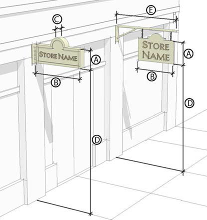
(2)
Awning Sign. The awning sign may be used in the shop front to protect merchandise and keep interiors and sidewalk passages shaded and cool in hot weather. Tenant signs may be painted, screen printed, or appliquéd on the awnings. Projecting signage shall not be attached to awning signage. This Subsection specifies standards for Awning Sign per Figure 22.320.120-T.
FIGURE 22.320.120-T: AWNING SIGN DESIGN
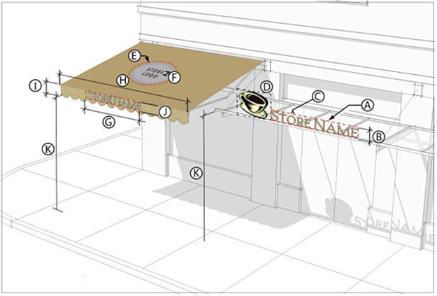
(3)
Wall Business Sign. The wall business sign type is flat against the façade consisting of individual cut letters applied directly to the building, raised letters on a panel, or painted directly on the surface of the building. Wall signs are placed above shop fronts and often run horizontally along the entablature of traditional buildings, or decorative cornice or sign band at the top of the building. This Subsection specifies standards for Wall Business Sign per Figure 22.320.120-U.
FIGURE 22.320.120-U: PROJECTING SIGN DESIGN

(4)
Monument Sign. The monument sign type is not attached to a building and has an integral support structure. A monument sign stands directly on the ground or ground level foundation and is often used to mark a place of significance or the entrance to a location. This Subsection specifies standards for Monument Sign per Figure 22.320.120-V.
(a)
Changeable copy signs are only allowed for fuel pricing signs, directory signs listing more than one tenant, signs advertising restaurant food specials, or films and live entertainment which change on a regular basis.
(b)
Shall be surrounded by landscaping that is at least twice as large as the area of one of its signs faces.
(c)
Shall not rotate, move, or simulate motion.
(d)
Shall not identify more than eight establishments.
FIGURE 22.320.120-V: MONUMENT SIGN DESIGN
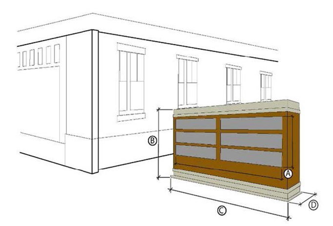
viii.
Master Sign Program.
(1)
Purpose. A master sign program provides a means for a property owner or operator of a multi-tenant commercial center or building to coordinate business signage so that all business signs in the commercial center or building will be compatible with each other and there is harmony in the design and display of signs within the commercial center or building.
(2)
Applicability. A master sign program permit shall be required as follows:
(a)
A master sign program is required for a new commercial center or building with four or more businesses.
(b)
For an existing commercial center or building with four or more businesses, the owner or operator must establish a master sign program with the first new sign requested from the effective date of this ordinance (as of April 10, 2025). Each subsequent change in signs shall conform to the established master sign program to ensure all business signs in the commercial center comply with the master sign program.
(3)
Application Requirements. A master sign program application shall be the same as that for a Ministerial Site Plan Review and shall require new business signs to comply as required by the CSD or with Chapter 22.114 (Signs) as applicable. A master sign program shall at minimum establish standards for sign location, style, size, color, font, and materials.
G.
Modification of Development Standards.
1.
Only the following development standards shall be modified through a minor conditional use permit. All other modifications of development standards in this CSD are subject to a Conditional Use Permit.
a.
Section 22.320.120.E (R-3 Zone Specific Development Standards).
b.
Section 22.320.120.F.4 (General Development Standards), except for Sections 22.320.120.F.4.a (Lot Coverage) and 22.320.120.F.4.e (Building or Structure Height).
c.
Section 22.320.120.F.5 (Building Design Standards).
d.
Section 22.320.120.F.6 (Signs).
2.
Additional Findings and Decision. Notwithstanding the findings required by a Minor Conditional Use Permit as provided by Section 22.320.080 (Modification of PASD Development Standards), these additional findings are required:
a.
The use, development of land, and application of development standards are in compliance with all applicable provisions of this Title 22.
b.
The use, development of land, and application of development standards, when considered on the basis of the suitability of the site for the particular use or development intended, are so arranged as to avoid traffic congestion; provide for the safety and convenience of bicyclists and pedestrians, including children, senior citizens, and persons with disabilities; ensure the protection of public health, safety, and general welfare; prevent adverse effects on neighboring property; and are in conformity with good zoning practice.
c.
The use, development of land, and application of development standards are suitable from the standpoint of functional developmental design.
d.
There are exceptional circumstances or conditions applicable to the subject property, or to the intended development of the property, that do not apply to other properties within the CSD area.
e.
That granting the request for modification will not be materially detrimental to properties or improvements in the area or contrary to the purpose of this CSD or West San Gabriel Valley Area Plan.
(Ord. 2025-0010 § 8, 2025.)
FIGURE 22.320.120-A: LA CRESCENTA-MONTROSE CSD BOUNDARY AND FOOTHILL BOULEVARD SUB-AREA
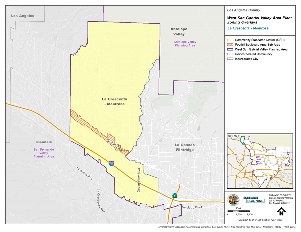
(Ord. 2025-0010 § 8, 2025.)
22.320.130 - South San Gabriel Community Standards District.
A.
Purpose. The South San Gabriel Community Standards District ("CSD") is established to provide a means of implementing special development standards for commercial and residential uses in the unincorporated community of South San Gabriel. The primary objective of this CSD is to protect and enhance the existing low-density scale and character of the community and to ensure that new development is compatible with and complimentary to the unique characteristics of this residential and commercial neighborhood. In addition, this CSD is established to provide a means of reasonably protecting the light, air, and privacy of existing single-family residences from the negative impacts on these resources caused by the construction on adjacent properties of uncharacteristically large and overwhelming residences.
B.
District Map. The boundaries of this CSD are shown on Figure 22.320.130-A: South San Gabriel CSD Boundary, at the end of this Chapter.
C.
Development Standards for Zones A-1, R-A, and R-1.
1.
The required front yard shall contain a minimum of 50 percent landscaping.
2.
The front yard shall not be less than the average depth of all of the front yards on the same side of the street on the same block, but in no case less than required in Section 22.18.040 (Development Standards). A vacant lot shall not be included in the computation for this purpose.
3.
Each side yard shall not be less than 10 percent of the average width of the lot or parcel, but in no case less than five feet for interior and corner side yards and 10 feet for reverse corner side yards.
4.
Each required side yard shall not be less than ten feet where any portion of a residence or other structure exceeds 20 feet in height.
5.
Each required rear yard shall not be less than 20 feet where any portion of a residence or other structure exceeds 20 feet in height.
6.
Where fill material has been placed on a lot or parcel after such lot or parcel was legally created, height shall be measured from the previously existing grade.
7.
The maximum number of stories above grade shall be two. As provided in Division 2 (Definitions), "story" includes a basement but not a cellar.
8.
Gross Structural Area and Lot Coverage. For the purposes of this Subsection C.8, Gross Structural Area ("GSA") shall be defined as the total floor area of all enclosed buildings and structures of a property, including storage, but excluding cellars and garages or carports designed and used for the storage of automobiles. Lot Coverage shall be defined as the total area of that portion of a lot covered by all structures erected on the property.
a.
Neither the maximum GSA nor the maximum lot coverage shall exceed the following: (0.25 × net area of a lot) + 1,000 square feet.
b.
In no event shall the maximum GSA or the maximum lot coverage exceed 7,000 square feet.
c.
If there are multiple main residential buildings on the same lot, the total maximum floor area and total maximum lot coverage shall be 50 percent of the net lot area.
D.
Zone R-2 Development Standards.
1.
The required front yard shall contain a minimum of 50 percent landscaping.
2.
The front yard shall not be less than the average depth of all of the front yards on the same side of the street on the same block, but no less than required in Section 22.18.040 (Development Standards). A vacant lot shall not be included in the computation for this purpose.
E.
Zone R-3 Development Standards. The required front yard shall contain a minimum of 50 percent landscaping.
F.
Zones C-2 and Mixed Use Development Standards.
1.
Permitted Uses. All uses described in Zone C-2 are allowed, except that the following uses require a Conditional Use Permit (Chapter 22.158):
a.
Sales.
i.
Automobile sales, sale of new motor vehicles, including incidental repair and washing;
ii.
Automobile supply stores, including incidental installation of parts;
iii.
Boat and other marine sales;
iv.
Department stores of more than 5,000 square feet;
v.
Grocery stores of more than 5,000 square feet; and/or
vi.
Hardware stores of more than 5,000 square feet.
b.
Services.
i.
Air-pollution sampling stations;
ii.
Automobile rental and leasing agencies;
iii.
Automobile service stations, including incidental repair, washing, and rental of utility trailers;
iv.
Comfort stations;
v.
Communications equipment buildings;
vi.
Electric distribution substations, including microwave facilities;
vii.
Parking buildings;
viii.
Rental services of heavy machinery or trucks;
ix.
Stations ? bus, railroad, and taxi;
x.
Telephone repeater stations; and/or
xi.
Wholesale dry cleaning plants.
c.
Recreation and Amusement.
i.
Golf courses, including the customary clubhouse and accessory facilities.
2.
Landscape Buffering. Where a Commercial or Mixed Use Zone is adjacent to a residence or Residential Zone, a landscaped buffer strip at least five feet wide shall be provided. Landscaping shall be provided and maintained in a neat and orderly manner. A 15-gallon tree shall be provided for every 100 square feet of landscaped area, to be equally spaced along the buffer strip.
(Ord. 2025-0010 § 8, 2025.)
FIGURE 22.320.130-A: SOUTH SAN GABRIEL CSD BOUNDARY
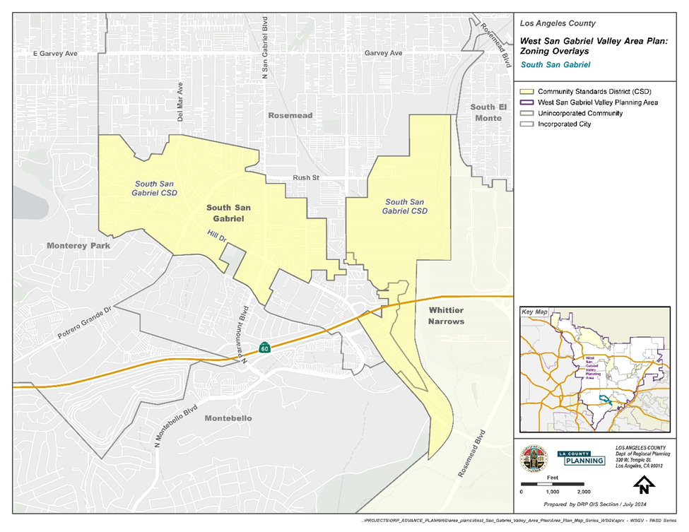
(Ord. 2025-0010 § 8, 2025.)
PASD Appendix
A.
Criteria for Significant Ridgelines in Altadena. The designation of the significant ridgelines within the Altadena Community is based on the following criteria:
1.
Topographic complexity. Ridges that have a significant difference in elevation from the valley or canyon floor. Generally, these ridges are observable from any location on the valley floor, from a community, or from a public road. Geologic conditions in Altadena make this a common condition.
2.
Near/far contrast. Ridges that are a part of a scene that includes a prominent landform in the foreground and a major backdrop ridge with an unbroken skyline. This includes a view into a valley rim or a pass. Often, layers of ridges are visible into the distance, such as on or adjacent to Chaney Trail. This contrast can be experienced by viewing an entire panorama or a portion of a panorama from an elevated point.
3.
Cultural landmarks. Ridges from views of well-known locations, structures, or other places which are considered points of interest in Altadena. These landmarks include the Owen Brown cabin and gravesite, Zorthian Ranch, Echo Mountain, Rubio and Millard Canyons, and the Nightingale Estate.
4.
Existing community boundaries and gateways. Ridges and surrounding terrain that provides the first view of predominantly natural, undeveloped land as a traveler emerges from the urban landscape. These lands introduce visitors to the visual experiences they will encounter in Altadena. Community boundaries and gateways include the Foothill Freeway (Interstate 210) and all of the surrounding ridges that provide a skyline and boundary to the entire San Gabriel Valley and a vast, integrated, visually coherent view space delineating the end of the Los Angeles urban area.
(Ord. 2025-0010 § 8, 2025.)
22.322.010 - Purpose.
The Westside Planning Area Standards District ("PASD") is established to implement specific development standards for the unincorporated communities of the Westside Planning Area: West Los Angeles (LA)/Sawtelle Veterans Affairs (VA), Ladera Heights-View Park-Windsor Hills, Unincorporated Del Rey, Marina del Rey, Ballona Wetlands, Franklin Canyon, and Gilmore Island. The PASD is necessary to ensure the goals and policies of the Westside Area Plan are accomplished in a manner that protects the health, safety, and general welfare of the community.
(Ord. 2025-0011 § 4, 2025.)
22.322.020 - Definitions.
(Reserved)
(Ord. 2025-0011 § 4, 2025.)
22.322.030 - Planning Area Standards District Map.
The boundaries of this PASD are shown in Figure 22.322.030-A: Westside PASD Boundary below.
FIGURE 22.322.030-A: WESTSIDE PASD BOUNDARY
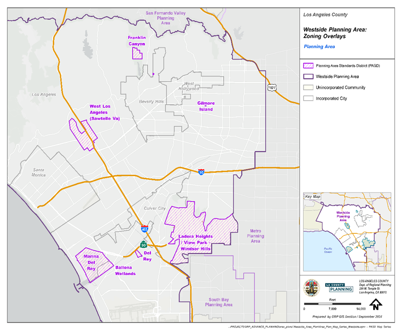
(Ord. 2025-0011 § 4, 2025.)
22.322.040 - Applicability.
A.
General. Except as specified otherwise, this Chapter, in conjunction with Section 22.300.020 (Application of Planning Area Standards Districts and Community Standards Districts to Property), shall apply to any applicable application for development, expansion, or change of use on lots within the boundaries of the Westside PASD.
B.
Relationship to Other Title 22 Provisions.
1.
Specific Plans. Regulations in a specific plan shall supersede any contrary provisions in this Division 10.
2.
Except as otherwise expressively provided in a specific plan, a lot within the boundary of a specific plan may be subject to all the standards and requirements of the basic zone and other provisions of this Title 22.
C.
Exception. Notwithstanding Section 22.172.020.H (Maintenance of Buildings or Structures Nonconforming Due to Use), a building or structure nonconforming due to use, or a building or structure nonconforming due to standards, which is subject to termination by operation of law as specified in Section 22.172.050.B (Termination by Operation of Law), shall not be made to conform to the requirements for new buildings or structures as specified by this Chapter, if alterations to the building or structure are proposed due to seismic retrofitting, as required by Chapters 95 and 96 of Title 26 (Building Code) of the County Code.
(Ord. 2025-0011 § 4, 2025.)
22.322.050 - Application and Review Procedures.
(Reserved)
(Ord. 2025-0011 § 4, 2025.)
22.322.060 - PASD Area-Wide Development Standards.
A.
Building Height Limit—Exceptions. In addition to Section 22.110.060.C (Exceptions from Height Limit), elevator shafts and stairwells shall be excluded from the maximum permitted height limits stated by this Title 22.
B.
Service Areas and Mechanical Equipment. Service areas and mechanical equipment for uses in all zones shall be visually unobtrusive and integrated with the design of the site and building.
C.
Landscaped Buffer and Screening. Where a new nonresidential primary use or an expansion in floor area of an existing nonresidential primary use abuts a residence or residentially zoned lot, the following shall be required:
1.
A landscaped buffer strip at least five feet wide;
2.
One 15-gallon tree for every 50 square feet of the landscaped buffer strip, which shall be equally spaced within said buffer strip; and
3.
A solid masonry wall not less than six feet or more than eight feet in height shall be provided along the common lot line, provided that Section 22.110.180 (Sight Distance) is satisfied.
D.
Standards for Specific Uses—All Residential Uses—Landscaping. The required front yard, excluding driveways and walkways to residence entrances, shall be maintained with drought tolerant or low water use, native, or non-invasive plants, grasses, shrubbery, or trees, and include an on-site irrigation system, such as a drip system.
(Ord. 2025-0011 § 4, 2025.)
22.322.070 - PASD Zone-Specific Development Standards.
A.
All Mixed Use Zones.
1.
Development Standards. The following development standards shall apply to mixed use developments in the Westside PASD.
a.
Loading Spaces. In addition to the standards of Section 22.112.120 (Loading Spaces), the following standards shall apply:
i.
Loading spaces shall be located at the rear of the structure, away from adjoining residentially zoned lots, and shall be screened with walls adorned with decorative masonry patterns and designs using natural stone, manufactured stone, pavers of travertine, sandstone, flagstone, bluestone, or similar stones.
ii.
Decorative fencing and/or landscaping is required when visible from the street, alley, or residentially zoned properties. Unadorned concrete masonry walls and chain-link fencing shall be prohibited.
iii.
Loading and unloading operations shall not be conducted between 10:00 p.m. and 6:00 a.m.
(Ord. 2025-0011 § 4, 2025.)
22.322.080 - Baldwin Hills Community Standards District.
A.
Purpose. The Baldwin Hills Community Standards District ("CSD") is established to provide a means of implementing regulations, safeguards, and controls for activities related to drilling for and production of oil and gas within the oil field located in the Baldwin Hills area of the County. The purpose of these supplemental regulations is to ensure oil field operations are conducted in harmony with adjacent land uses, to minimize the potential adverse impacts of such operations, to regulate such operations so they are compatible with surrounding land uses, and to enhance the appearance of the site with landscaping and other property maintenance requirements. These standards are implemented to protect the comfort, health, safety, and general welfare of people living, working, and recreating in the surrounding areas.
B.
Definitions. For the purpose of this Chapter, the following terms shall have the meanings set forth herein, unless the context indicates otherwise. Unless a word or phrase is specifically defined in this Section, the definitions set forth in Division 2 (Definitions) shall apply to this Chapter.
Bioremediation farm. The area of land within the oil field that is used for soil remediation through petroleum hydrocarbon impacted soil removal efforts.
Breakdown. Any event that results in a violation of applicable South Coast Air Quality Management District ("SCAQMD") rules as specified in SCAQMD Rule 430.
CalARP Program. The California Accidental Release Prevention Program.
CalGEM. The Geologic Energy Management Division of the Department of Conservation of the State of California.
CAP. The Community Advisory Panel as described in Section 22.310.100.A (Community Advisory Panel).
Chief Executive Officer. The Chief Executive Officer for the County of Los Angeles.
Derrick. Any portable framework, tower, mast, or structure which is required or used in connection with drilling, redrilling, reworking, operating, or maintaining a well for the production of oil, gas, or other hydrocarbons from the earth.
Developed area.
1.
Any lot containing any residential, commercial, industrial, or office structure, or used for residential, commercial, industrial, or office purposes, provided that no lot on the oil field shall be considered to be developed area solely because of the presence thereon of the Cone Trust House or of a structure used by any operator for administrative functions associated with the oil field; or
2.
Any lot containing any public park, house of worship, cemetery, school, parking lot, or any recreation area which has been developed and opened for public use.
Director. The Director of the Department of Regional Planning of the County of Los Angeles or their designee.
Director of Public Health. The Director of the Department of Public Health of the County of Los Angeles or their designee.
Director of Public Works. The Director of Public Works of the County of Los Angeles or their designee.
District. This CSD, the boundaries of which are shown on Figure 22.310.080-A: Baldwin Hills CSD Boundary, at the end of this Section.
Drilling. Digging or boring into the earth for the purpose of exploring for, developing, extracting, or producing oil, gas, or other hydrocarbons, or for the purpose of injecting water, steam, or any other fluid or substance into the earth, but does not include remediation efforts to clean up or remove contamination.
Drilling equipment. The derrick, together with all parts of and appurtenances to such structure, and every piece of apparatus, machinery, or equipment used or erected or maintained for use in connection with drilling or redrilling.
Drill site. That portion of any land on which drilling equipment is placed, stored, or utilized during the drilling, redrilling, or reworking of a well.
Enhanced oil recovery. Any production method which involves the injection of water, gas, steam, or any other substance into the earth for the purpose of extracting oil.
Environmental compliance coordinator. An independent third-party approved by the Director and funded by the operator with expertise in oil operations who shall monitor oil operations at the oil field to ensure compliance with all provisions of this Chapter.
Emergency response plan or ERP. The emergency response plan, which is a plan to handle anticipated emergencies as required by section 5192 of title 8 of the California Code of Regulations and the United States Environmental Protection Agency ("U.S. EPA") requirements set forth at 40 Code of Federal Regulations Part 112, or with any emergency response regulations enacted or modified by the State of California or U.S. EPA which are applicable to the oil field.
EQAP. The environmental quality assurance program, as described in Section 22.310.060.A (Environmental Quality Assurance Program).
Fire Chief. The Fire Chief of the Fire Department of the County of Los Angeles or their designee.
Fire Department. The Fire Department for the County of Los Angeles.
Fluids. Any liquid.
Gas. Any substance, either combustible or noncombustible, which is produced in a natural state from the earth, and which maintains a gaseous or rarefied state at standard temperature and pressure conditions. It shall also mean the gaseous components or vapors occurring in, or derived from, petroleum or natural gas.
Gas plant. The centralized facility that is used for the separation of gas constituents and removal of impurities. This includes facilities for the removal of hydrogen sulfide, carbon dioxide, depropanizers, debutanizers, and other types of fractionation.
Idle well. Any well that has not produced oil or gas or has not been used for injection for six consecutive months of continuous operation during the last five or more years. An idle well does not include active observation well.
Injection well. Any well used for the purpose of injecting water, wastewater, brine, hydrocarbons, steam, or any other substance as a means of enhanced oil recovery.
Landowner or landowners. A person, trust, firm, corporation, partnership, association, or other business entity that owns a legal or equitable title in and to any of the real property located within the oil field portion of the District.
Lessor. The owner of the land and mineral resources therein subject to a lease.
MACC. The Multiple Agency Coordination Committee described in Section 22.310.070.H (Multiple Agency Coordination Committee).
Maintenance. The diagnosis, repair, or replacement of machinery, equipment, apparatus, structures, facilities, and parts thereof, used in connection with oil operations as well as any other work necessary to reduce public health or safety hazards, other than drilling, redrilling, or reworking.
NFPA. The National Fire Protection Association.
Odor suppressant. An organic emulsifier or other compound that is used to eliminate hydrocarbon odors by reducing the organic composition of hydrocarbon materials.
Oil. Crude oil.
Oil cleaning plant. All components of a future facility to be used for the storage and separation of oil, gas, and water.
Oil field or oil field portion of the District. The entire District, except for the Southern California Edison facility, the Holy Cross Cemetery, and the small noncontiguous lot located east of La Brea Avenue, all of which excluded areas are shaded on Figure 22.322.080-A: Baldwin Hills CSD Boundary, at the end of this Section.
Oil operations. Any activity undertaken in connection with the extraction, production, storage, or shipping of oil, gas, or other hydrocarbon substances, including, but not limited to, drilling, redrilling, reworking, maintenance, repair, installation, construction operations, processing, enhanced oil recovery, bioremediation, well abandonment, remediation, cleanup, demolition, restoration, and revegetation. The term shall not include purely administrative operations, such as work carried out in the administrative office buildings.
Oil field web site. The web site as described in Section 22.310.100.B.3 (Oil Field Web Site).
Operator. A person, firm, corporation, partnership, association, or other business entity that owns or holds the right to use the surface of the land to extract oil and gas. In the event there are two or more persons or entities who qualify as operators at any given time, then the term shall apply to all of them with regard to their respective operations.
Outer boundary line. The exterior limits of the oil field portion of the District.
Permanent structure. Any building, facility, or equipment that is intended to, or does, remain in place on the oil field for more than one year and shall include all tanks and all components of any steam drive plant, oil cleaning plant, or water processing facility. Wells and pipelines shall not be considered permanent structures.
Processing. The use of operations for gauging, recycling, compressor repressuring, injection, dehydration, stimulation, separation, including, but not limited to, separation of liquids from gas, shipping and transportation, and the gathering of oil, gas, other hydrocarbon substances, water, or any combination thereof.
Public Health Department. The Department of Public Health for the County of Los Angeles.
Pure tones. Any sound for which the one-third octave band sound-pressure level in the band with the tone exceeds the arithmetic average of the sound-pressure levels of the two contiguous one-third octave bands by five dB for center frequencies of 500 Hertz and above, or by eight dB for center frequencies between 160 and 400 Hertz, or by 15 dB for center frequencies less than or equal to 125 Hertz.
Redrilling. Any drilling operation conducted to recomplete an existing well in the same or different oil producing zone where the well is deeper than the initial well depth.
Regional Water Quality Control Board or RWQCB. The Los Angeles Regional Water Quality Control Board that regulates and monitors water quality within the Los Angeles Region.
Reworking. Recompletion of an existing well and includes operations, such as liner replacements, perforating, or fracing. Reworking also includes redrilling a well that is not deepened or sidetracked beyond the existing well bore.
SIMQAP. The safety inspection, maintenance, and quality assurance program described in Section 22.310.060.C (Safety, Inspection, Maintenance, and Quality Assurance Program).
SCAQMD. The South Coast Air Quality Management District, which is the regional body that regulates and monitors air quality within the four counties of Los Angeles, Orange, San Bernardino, and Riverside.
SPCC. The spill prevention, control, and countermeasure plan that meets the regulatory requirements of 40 Code of Federal Regulations Part 112 or of any subsequently enacted or modified U.S. EPA provisions on spill prevention, control, and countermeasure plans.
Steam drive plant. All components of a potential future centralized facility that would allow for the production of steam to be injected into portions of the oil field, including a water treatment plant, water softening facility, and all related tanks and equipment.
Subsidence. The settling or sinking of the ground surface.
SWPPP. The stormwater pollution prevention plan that meets the requirements specified by the Regional Water Quality Control Board.
Tank. A container, covered or uncovered, used in conjunction with the drilling or production of oil, gas, or other hydrocarbons for holding or storing fluids.
Uplift. The rising or rebound of the ground surface.
Well. Any oil or gas well or any well drilled for the production of oil or gas, or any well reasonably presumed to contain oil or gas and shall include injection wells used for the purpose of enhanced oil recovery or to dispose of fluids associated with the production of oil and gas, or an observation well.
Well abandonment. The permanent plugging of a well, in accordance with State law as set forth in Division 3, Chapter 1 of the California Public Resources Code and pursuant to requirements of CalGEM, found in title 14 of the California Code of Regulations, sections 1723 to 1723.9, or in accordance with subsequently enacted applicable State laws or regulations regarding well abandonment.
Wells servicing. Any maintenance work performed within any existing well bore which does not involve drilling, redrilling, or reworking.
Water processing facility. All components of a future centralized facility that would be used to treat and store water that is used for injection.
C.
District Map. The boundaries of this CSD are as shown on Figure 22.310.080-A: Baldwin Hills CSD Boundary, at the end of this Section.
D.
Area-Specific Development Standards. Operational Limits. No surface drilling or other surface oil operations shall be allowed within the portions of this CSD consisting of the Southern California Edison facility, the Holy Cross Cemetery, and the small noncontiguous lot located east of La Brea Avenue. These areas are shaded on Figures 22.322.080-B and C at the end of this Section.
E.
Oil Field Development Standards. The following provisions shall apply throughout the oil field portion of this CSD:
1.
Fire Protection and Emergency Response. The operator shall comply with the following provisions:
a.
Community Alert Notification ("CAN") System. The operator shall maintain and test on an annual basis a CAN for automatic notification of area residences and businesses in the event of an emergency arising at the oil field that could require residents or inhabitants to take shelter, evacuate, or take other protective actions.
b.
Spill Containment Response Training. The operator shall conduct annual spill containment response training and shall, at all times, have available on-site sufficient and properly maintained equipment and/or facilities so that a spill of the entire contents from the largest oil tank on the oil field can be responded to and contained in a timely manner to reduce the likelihood that the spill reaches a catch basin.
c.
Emergency Response Plan ("ERP"). The operator shall at all times maintain and fully implement and comply with all provisions of an ERP and shall further ensure that the then current ERP satisfies all rules and regulations of the U.S. EPA and California Code of Regulations relating to emergency action plans and spill prevention control and countermeasure plans, as well as the rules, regulations, and requirements of the California Office of Spill Prevention and Response. The ERP shall also satisfy the rules and regulations of the United States Department of Transportation relating to onshore pipeline spills.
2.
Air Quality and Public Health. The operator shall at all times conduct oil operations to prevent the unauthorized release, escape, or emission of dangerous, hazardous, harmful and/or noxious gases, vapors, odors, or substances, and shall comply with the following provisions:
a.
Emission Offsets. The operator shall obtain emission offsets or RECLAIM credits, as defined and required by SCAQMD Regulations, for all new or modified emission sources that require a new or modified SCAQMD permit.
b.
New Gas Plant. No new gas plant or flare shall be installed at any steam drive plant that may be constructed on the oil field. The operator shall connect any such steam drive plant to the existing gas plant to eliminate the need for a new gas plant or flare at the steam drive plant.
c.
Odor Minimization. At all times, the operator shall comply with the provisions of an odor minimization plan that has been approved by the Director. The odor minimization plan shall include any measures requested by the Director. The plan shall provide detailed information about the facility and shall address all issues relating to odors from oil operations. Matters addressed within the plan shall include setbacks, signs with contact information, logs of odor complaints, method of controlling odors, such as flaring and odor suppressants, and the protocol for handling odor complaints. The odor minimization plan shall be reviewed by the operator on an annual basis to determine if modifications to the plan are required. Any modifications to the odor minimization plan shall be submitted to the Director for review and approval.
d.
Air Monitoring Plan. At all times the operator shall comply with the provisions of an air monitoring plan that has been approved by the Director. The air monitoring plan shall include any measure requested by the Director. During drilling, redrilling, and reworking operations, the operator shall monitor hydrogen sulfide and total hydrocarbon vapors, as specified in the approved plan. Total hydrocarbon vapors shall be monitored at the gas plant as specified in the approved plan. Such monitors shall provide automatic alarms that are triggered by the detection of hydrogen sulfide or total hydrocarbon vapors. For drilling, redrilling, or reworking monitors, the alarms shall be audible and/or visible to the person operating the drilling, redrilling, or reworking equipment. For the gas plant monitors, the alarms shall be audible or visible to the gas plant operator. Actions to be taken shall be as follows when specified alarm levels are reached:
i.
At a hydrogen sulfide concentration equal to or greater than five parts per million, but less than 10 parts per million, the operator shall immediately investigate the source of the hydrogen sulfide emissions and take prompt corrective action to eliminate the source. The corrective action taken shall be documented in the drilling, redrilling, or reworking log. If the concentration is not reduced to less than five parts per million within four hours of the first occurrence of such concentration, the operator shall shut down the drilling, redrilling, or reworking operations in a safe and controlled manner, until the source of the hydrogen sulfide emissions has been eliminated, unless shutdown creates a health and safety hazard.
ii.
At a hydrogen sulfide concentration equal to or greater than 10 parts per million, the operator shall promptly shut down the drilling, redrilling, or reworking operations in a safe and controlled manner until the source of the hydrogen sulfide emissions has been eliminated, unless shutdown creates a health and safety hazard. The corrective action taken shall be documented in the drilling, redrilling, or reworking log. When an alarm is received, the operator shall promptly notify the County Fire Department Health Hazardous Materials Division, the Culver City Fire Department, the California Office of Emergency Services, and the SCAQMD.
iii.
At a total hydrocarbon concentration equal to or greater than 500 parts per million but less than 1,000 parts per million, the operator shall immediately investigate the source of the hydrocarbon emissions and take prompt corrective action to eliminate the source. The corrective action taken shall be documented in the drilling log for drilling, redrilling, or reworking and in the gas plant log for the gas plant. If the concentration is not reduced to less than 500 parts per million within four hours of the first occurrence of such concentration, the operator shall shut down the drilling, redrilling, reworking, or gas plant operations in a safe and controlled manner, until the source of the hydrocarbon emissions has been eliminated, unless shutdown creates a health and safety hazard.
iv.
At a total hydrocarbon concentration equal to or greater than 1,000 parts per million, the operator shall promptly shut down the drilling, redrilling, reworking, or gas plant operations in a safe and controlled manner, until the source of the hydrocarbon emissions has been eliminated, unless shutdown creates a health and safety hazard. The corrective action taken shall be documented in the drilling log for drilling, redrilling, or reworking and in the gas plant log for the gas plant. When an alarm is received, the operator shall promptly notify the County Fire Department-Health Hazardous Materials Division, the Culver City Fire Department, and the SCAQMD.
v.
All the monitoring equipment shall keep a record of the levels of total hydrocarbons and hydrogen sulfide detected at each of the monitors, which shall be retained for at least five years. The operator shall, on a quarterly basis, provide a summary of all monitoring events where the hydrogen sulfide concentration was at five parts per million or higher and the total hydrocarbon concentration was at 500 parts per million or higher to the Fire Chief. At the request of the Fire Chief, the operator shall make available the retained records from the monitoring equipment.
e.
Portable Flare for Drilling. The operator shall have a gas buster and a portable flare, approved by the SCAQMD, at the oil field and available for immediate use to remove any gas encountered during drilling operations from drilling muds prior to the muds being sent to the shaker table, and to direct such gas to the portable flare for combustion. The portable flare shall record the volume of gas that is burned in the flare. The volume of gas burned in the flare shall be documented in the drilling log. The operator shall notify the Fire Chief and the SCAQMD within 48 hours in the event a measurable amount of gas is burned by the flare and shall specify the volume of gas that was burned in the flare. No drilling or redrilling shall be conducted in areas that are known to penetrate the Nodular Shale zone, unless a fully operational and properly maintained gas buster and portable flare are installed on the rig. All other drilling and redrilling operations shall be conducted so that any measurable gas that is encountered can, and will, be retained in the wellbore until the gas buster and portable flare are installed on the rig, after which the gas will be run through the system. The operator shall immediately notify the Fire Chief and the SCAQMD in the event any gas from drilling or redrilling operations is released into the atmosphere without being directed to and burned in the flare.
f.
Oil Tank Pressure Monitoring and Venting. All oil tanks that contain or could contain oil shall have a fully operational pressure monitoring system that continuously measures and digitally records the pressure in the vapor space of each tank. The detection system shall notify the operator via an alarm when the pressure in the tank gets within 10 percent of the tank relief pressure. In the event of an alarm, the operator shall immediately take corrective action to reduce the tank pressure. The corrective action shall be documented in the operator's log. The operator shall notify the Fire Chief and the SCAQMD within 24 hours if the pressure in any tank covered by this Subsection ever exceeds such tank's relief pressure. Within seven calendar days after any tank vapor release, the operator shall report the incident to the SCAQMD as a breakdown event, pursuant to Rule 430, and shall provide the Fire Chief with a written report of the event and the corrective measures undertaken and to be undertaken to avoid future oil tank vapor releases. The operator shall make any changes to such report that may be required to obtain approval from the Fire Chief and the SCAQMD and shall promptly institute all corrective measures called for by the report.
g.
Odor Suppressant for Bioremediation Farms. When loading material or tilling material at the bioremediation farms, the operator shall use an odor suppressant, such that no odor from the bioremediation farms can be detected at the outer boundary line.
h.
Odor Suppressant for Drilling and Redrilling Operations. The operator shall use an odor suppressant spray system on the mud-shaker tables for all drilling and redrilling operations to ensure that no odors from said operations can be detected at the outer boundary line.
i.
Closed Systems. The operator shall ensure all produced water and oil associated with production, processing, and storage, except those used for sampling only, are contained within closed systems at all times.
j.
Meteorological Station. The operator shall maintain and operate a meteorological station at the oil field in good operating condition and in compliance with all applicable U.S. EPA and SCAQMD rules, regulations, and guidelines, and to the satisfaction of the Director. The operator shall conduct an audit of the meteorological station on an annual basis and submit the results of the audit to the SCAQMD and the Director. The operator shall maintain the data files for the meteorological station for a period of not less than 10 years. All such data shall be available on request to the SCAQMD and the Director.
k.
Updated Health Risk Assessment. After every five years of operation of the meteorological station, the operator shall provide the previous five years of meteorological data to the SCAQMD and the Director. If the SCAQMD or the Director determines that the previous five years of meteorological data from the oil field could result in significant changes to the health risk assessment that was conducted as part of the Baldwin Hills CSD Environmental Impact Report, then the County may elect to re-run the health risk assessment using the previous five years of meteorological data from the meteorological station.
l.
Off-Road Diesel Construction Equipment Engines. All off - road diesel construction equipment shall comply with the following provisions:
i.
Utilize California Air Resources Board ("CARB")/U.S. EPA Certification Tier III or better certified engines or other methods approved by the CARB as meeting or exceeding the Tier III standard or Tier II certified engines as long as no drilling or redrilling occurs during construction.
ii.
Utilize a CARB Verified Level 3 Diesel Catalyst. The catalyst shall be capable of achieving an 85 percent reduction for diesel particulate matter. Copies of the CARB verification shall be provided to the Director. Said catalysts shall be properly maintained and operational at all times when the off-road diesel construction equipment is in use.
m.
Drill Rig Engines. All drilling, redrilling, and reworking rig diesel engines shall comply with the following provisions:
i.
Utilize CARB/U.S. EPA Certification Tier II or better certified engines or other methods approved by CARB as meeting or exceeding the Tier II standard.
ii.
Utilize second-generation heavy-duty diesel catalysts capable of achieving 90 percent reductions for hydrocarbons and for particulate matter smaller than 10 microns. Said catalysts shall be properly maintained and operational at all times when the diesel engines are running.
n.
Drilling and Redrilling Setbacks. The following setbacks shall apply within the oil field for drilling or redrilling:
i.
At least 400 feet from developed areas; and
ii.
At least 20 feet from any public roadway.
o.
Construction Schedule. To reduce construction air emissions, no overlap shall be permitted in major facility construction and installation activities, such as the steam drive plant, the water processing facility, or the oil cleaning plant.
p.
Fugitive Dust Control Plan. The operator shall comply with the provisions of a fugitive dust control plan that has been approved by the Director. The plan shall be based upon the requirements of SCAQMD Rule 403 and the SCAQMD CEQA Guideline Fugitive Dust Control Measures. The fugitive dust control plan shall be reviewed by the operator every five years to determine if modifications to the plan are required. Any modifications to the fugitive dust control plan shall be submitted to the Director for review and approval. The fugitive dust control plan shall include any measure requested by the Director.
3.
Safety and Risk of Upset. The operator shall at all times conduct oil operations in a manner that minimizes risk of accidents and the release of hazardous materials and shall comply with the following provisions:
a.
Natural Gas Liquid Blending. Natural gas liquids at the gas plant shall be blended with the oil to the maximum allowable pipeline system vapor pressure. Natural gas liquids storage shall be limited to the volume allowed in the risk management plan approved by the Fire Department.
b.
Propane and Natural Gas Liquids Fire-Proofing. The operator shall install and maintain fire-proofing insulation on all propane and natural gas liquids bullets within the oil field. The fire-proofing insulation shall have a minimum two-hour fire rating and otherwise be acceptable to the Fire Chief. All propane and natural gas liquid bullets shall be equipped with an automatic deluge system.
c.
Steam Drive Plant Setback. The steam drive plant, if constructed, shall be located at least 1,000 feet from a developed area and shall use urea or equivalent, low toxicity material for any nitrogen oxide emission reduction that is required by the SCAQMD.
d.
Secondary Containment for Oil. The operator shall comply with the following provisions:
i.
The operator shall ensure that all existing oil tank areas in the oil field, unless determined by the Director to be infeasible, and all the new oil tank areas shall have secondary containment (berms and/or walls) that can contain at least 110 percent of the largest oil tank volume to reduce the likelihood of oil spills entering the retention basins. In the event the Director determines that it would be infeasible to provide 110 percent containment for a particular existing oil tank, the operator shall provide such containment as the Director determines is feasible;
ii.
All retention basins in the oil field shall be adequately sized and maintained to handle a 100-year storm event plus a potential spill of the volume of the largest tank that would drain into each basin; and
iii.
All above-ground piping in the oil field that contains or could contain oil shall be protected by basins or secondary containment measures (berms and/or walls).
4.
Geotechnical. The operator shall comply with the following provisions:
a.
Grading. The operator shall comply with all of the following provisions:
i.
All proposed grading shall be subject to prior review and approval by the Director of Public Works;
ii.
Grading involving up to 5,000 cubic yards and grading associated with the bioremediation farms may be undertaken pursuant to a County master grading plan stamped by a registered professional engineer and a California-certified engineering geologist and approved by the Director of Public Works;
iii.
No slope of cut or fill shall have a gradient steeper than two to one (2:1), unless specifically approved by a site-specific geotechnical report; and
iv.
Cuts and fills shall be minimized to avoid erosion and visual impacts.
b.
Geotechnical Investigations. The operator shall comply with the following provisions:
i.
A site-specific geotechnical investigation shall be completed for grading in excess of 5,000 cubic yards, unless associated with the on-site bioremediation farms and approved, pursuant to a master grading plan approved by the Director of Public Works, and for any grading that supports or impacts a critical facility, as determined by the Director. The investigation shall be completed by a California-certified engineering geologist and submitted to the Director and the Director of Public Works for review and approval, in conjunction with an application for a revised grading permit; and
ii.
A site-specific geotechnical investigation shall be completed for all proposed permanent structures. The investigation shall include analysis and recommendations associated with potential seismically-induced ground failure, such as differential settlement and lateral spreading. The geotechnical investigation shall be completed by a California-certified engineering geologist and submitted to the Director of Public Works for review and approval.
c.
Erosion Control. The operator shall comply with the following provisions:
i.
The operator shall comply with all provisions of an erosion control plan that has been approved by the Director. The erosion control plan shall be reviewed by the operator every two years to determine if modifications to the plan are required. Any modifications to the erosion control plan shall be submitted to the Director for review and approval. The erosion control plan shall include any measures requested by the Director; and
ii.
Erosion shall be controlled on all slopes and banks so that no mud or other substances are washed onto public streets or surrounding property. Such control measures may consist of planting and irrigation, dams, cribbing, riprap, sand bagging, netting, berms, or other devices.
d.
Restoration of Slopes. Slopes shall be restored to their original grade once the use that required the grading of the slope has been discontinued. However, if restoration of a slope would negatively affect existing drainage patterns or slope stability, then the slope shall be restored to a grade that avoids these negative effects.
e.
Ground Movement Surveys. The operator shall conduct ground movement surveys once every 12 months, or more frequently, if determined necessary by the Director of Public Works, following all provisions of a ground movement monitoring plan acceptable to CalGEM and the Director of Public Works that calls for both vertical and horizontal ground movement surveys at specified survey locations within, and in the vicinity of, the oil field utilizing high precision Global Positioning System technology, in combination with a network of ground stations or any alternative technology specified in the ground movement monitoring plan approved by the Director of Public Works; and following other survey methods outlined in the plan. The surveys shall be conducted by a California-licensed surveyor. The survey results shall be analyzed in relation to oil field activities, such as production, steam injection, and waterflooding, taking into consideration individual oil producing zones, injection schedules, rates, volume, and pressure. The analysis shall be completed in collaboration with a California-registered professional petroleum engineer, registered geotechnical engineer, and certified engineering geologist. The results of the annual monitoring survey and analysis shall be forwarded to CalGEM and the Director of Public Works. If requested by CalGEM or the Director of Public Works, the operator shall make modifications to the ground movement monitoring plan. In the event that survey indicates on-going ground movement equal to or greater than 0.6 inches at any given location, or a lesser value determined by the Director of Public Works is occurring in an upward or downward direction in the vicinity of or in the oil field, the operator shall review and analyze all claims or complaints of subsidence damage that have been submitted to the operator or the County by the public or a public entity in the 12 months since the last ground movement survey. Based thereon, the operator shall prepare a report that assesses whether any of the alleged subsidence damage was caused by oil operations and submit said report to CalGEM and Public Works. Public Works shall review the report to determine if it concurs with its conclusions. If the report concludes that damage has not been caused by oil operations, and Public Works does not concur with that conclusion, it shall forward its conclusions to CalGEM for its review and possible action. If the report concludes that damage was caused by oil operations and Public Works concurs with any such conclusion, Public Works shall forward Public Works' conclusions to CalGEM and ask CalGEM to evaluate the operator's fluid injection and withdrawal rates to determine whether adjustments to these rates may alleviate the ground movement, and if so, where in the oil field such adjustments should be made. The operator shall implement whatever adjustments in the rates of fluid injection and/or withdrawal that CalGEM determines are necessary and appropriate to alleviate any ground movement damage. The County shall promptly notify the CAP of any such action that is taken, pursuant to this Subsection. Injection pressures associated with secondary recovery operations, such as water flooding, or disposal of produced fluids shall not exceed reservoir fracture pressures, as specified in title 14 of the California Code of Regulations, section 1724.10, and as approved by CalGEM.
f.
Construction of Permanent Structures. No permanent structures shall be constructed in an Alquist-Priolo Fault Zone without preparation of a fault study by a California-certified engineering geologist. Following the fault study, no permanent structures shall be placed within 50 feet of a known active fault. The fault investigation report shall be submitted to the Director of Public Works for review and approval.
g.
Oil Field Accelerometer. The operator shall operate and maintain an accelerometer at the oil field to determine site-specific ground accelerations as a result of any seismic event in the region (Los Angeles/Orange Counties and offshore waters of the Santa Monica Bay and San Pedro Channel). Readings from the accelerometer shall be recorded at the oil field and transmitted in real-time to the Caltech Seismological Laboratory. The operator shall cease operations and inspect all oil field pipelines, storage tanks, and other infrastructure following any seismic event that exceeds a ground acceleration at the oil field of 13 percent of gravity (0.13 g) and promptly notify the Director. The operator shall not reinstitute operations at the oil field and associated pipelines until it can reasonably be determined that all oil field infrastructure is structurally sound.
h.
Pipeline Management Plan. The operator shall maintain and implement a pipeline management plan that meets the requirements of CalGEM regulations.
i.
Paleontological Monitor. The operator shall have a qualified paleontologist, approved by the Director, monitor all rough grading and other significant ground disturbing activities in paleontologically sensitive sediments. The sensitive sediments that have been identified within the oil field include the Lower to Middle Pleistocene San Pedro Formation and the Middle to Upper Pleistocene Lakewood Formation. A paleontologist will not be required on-site, if excavation is only occurring in artificial fill or Holocene alluvium.
5.
Noise Attenuation. All oil operations on the oil field shall be conducted in a manner that minimizes noise and shall comply with the following provisions:
a.
Noise Limits. The operator shall comply with the following provisions:
i.
All oil operations on the oil field shall comply with the noise provisions of Chapter 12.08 of Title 12 (Environmental Protection) of the County Code, with the exception of drilling, redrilling, and reworking, which are exempt from the provisions of said Chapter;
ii.
Hourly, A-weighted equivalent noise levels associated with drilling, redrilling, and reworking shall not elevate existing baseline levels by more than five dBA at any developed area. For daytime activities (7:00 a.m. to 7:00 p.m.), existing baseline noise levels shall be defined as the maximum daytime equivalent noise level (Leq) at the closest monitoring site, as shown in Table 4.9.3 of the 2008 Baldwin Hills Community Standards District Environmental Impact Report. For nighttime activities (7:00 p.m. to 7:00 a.m.), existing baseline noise levels shall be defined as the minimum nighttime equivalent noise level (Leq) at the closest monitoring site, as shown in Table 4.9.3 of the 2008 Baldwin Hills Community Standards District Environmental Impact Report. Updated baseline noise levels may be set, and additional monitoring sites may be established from time to time by the Director. In no case shall baseline noise levels include any drilling, redrilling, or reworking operations; and
iii.
Noise produced by oil operations shall include no pure tones when measured at a developed area.
b.
Backup Alarms. Backup alarms on all vehicles operating within the oil field shall be disabled between the hours of 8:00 p.m. and 8:00 a.m. During periods when the backup alarms are disabled, the operator shall employ alternate, low-noise methods for ensuring worker safety during vehicle backup, such as the use of spotters.
c.
Quiet Mode Drilling Plan. All drilling and redrilling on the oil field between the hours of 6:00 p.m. and 8:00 a.m. shall be conducted in conformity with a quiet mode drilling plan that has been approved by the Director and the Director of Public Health. The quiet mode drilling plan shall be reviewed by the operator every year to determine if modifications to the plan are required. The operator shall make changes to the plan if requested by the Director or the Director of Public Health. Any modifications to the quiet mode drilling plan shall be submitted to the Director and the Director of Public Health for review and approval. The quiet mode drilling plan shall include any measures requested by the Director or the Director of Public Health.
d.
Equipment Servicing. All noise-producing oil field equipment shall be regularly serviced and repaired to minimize increases in pure tones and other noise output over time. The operator shall maintain an equipment service log for all noise-producing equipment.
e.
Deliveries to the Oil Field. Deliveries to the oil field shall not be permitted after 8:00 p.m. and before 7:00 a.m., except in cases of emergency. Deliveries on Sundays or legal holidays shall not be permitted after 8:00 p.m. or before 9:00 a.m., except in cases of emergency.
f.
Deliveries Within the Oil Field. Deliveries to areas of the oil field located within 500 feet of any residential property shall not be permitted after 5:00 p.m. or before 7:00 a.m., except in cases of emergency. Deliveries to such areas on Sundays or legal holidays shall not be permitted after 5:00 p.m. and before 9:00 a.m., except in cases of emergency.
g.
Time Limits for Construction. Construction of permanent structures shall not be permitted after 7:00 p.m. and before 7:00 a.m., or during Saturdays, Sundays, or legal holidays.
h.
Construction Equipment. All construction equipment shall be selected for low-noise output. All construction equipment powered by internal combustion engines shall be properly muffled and maintained.
i.
Construction Equipment Idling. Unnecessary idling of construction equipment internal combustion engines is prohibited.
j.
Worker Notification. The operator shall instruct employees and subcontractors about the noise provisions of this Subsection E prior to commencement of each and every drilling, redrilling, reworking, and construction operation, and shall annually certify to the Director that such employees and subcontractors have been properly trained to comply with such noise provisions. The operator shall prominently post quiet-mode policies at every drilling and redrilling sites.
6.
Vibration Reduction. All oil operations on the oil field shall be conducted in a manner that minimizes vibration. Additionally, vibration levels from oil operations at the oil field shall not exceed a velocity of 0.25 mm/s over the frequency range 1 to 100 Hz at any developed area.
7.
Biological Resources. All oil operations on the oil field shall be conducted in a manner that minimizes impacts to biological resources and shall comply with the following provisions:
a.
Oil Spill Response. The operator shall comply with all provisions of an ERP that has been approved by the Director to protect biological species and to revegetate any areas disturbed during an oil spill or cleanup activities. The operator shall make changes to the ERP, if requested by the Director. Any modifications to the ERP shall be submitted to the Director for review and approval. The ERP shall include any measures to protect biological species that may be requested by the Director.
b.
Special Status Species and Habitat Protection. The operator shall comply with all provisions of a special status species and habitat protection plan that has been approved by the Director. The operator shall make changes to the plan, if requested by the Director. Any modifications to the plan shall be submitted to the Director for review and approval. The special status species and habitat protection plan shall include any measures requested by the Director.
c.
Habitat Restoration and Revegetation Plan. Prior to any disturbance of sensitive natural habitat areas, as identified in the special status species and habitat protection plan, the operator shall hire a biologist, approved by the County, to conduct a survey of the area to determine if significant impact to sensitive natural habitat, including coastal sagebrush, coyote bush scrub, riparian scrub, and oak woodland, will occur. If the biologist determines that significant impact to sensitive natural habitat will occur, then the operator shall have a County-approved restoration specialist, with expertise in southern California ecosystems and revegetation techniques, prepare a habitat restoration and revegetation plan. The plan shall be submitted to the Director for review and approval. The Director shall make best efforts to complete the review of the plan as expeditiously as possible and shall then either approve the plan or provide the operator with a list of specific items that must be included in the plan prior to approval. No removal of sensitive natural habitat shall occur until the plan has been approved by the Director. The habitat restoration and revegetation plan shall include any measures requested by the Director.
d.
Pre-Construction Surveys. The following surveys shall be conducted prior to any significant vegetation removal in sensitive natural habitat as identified in the special status species and habitat protection plan.
i.
The operator shall hire a County-approved ecologist/botanist to conduct sensitive plant surveys;
ii.
The operator shall hire a County-approved biologist to conduct sensitive wildlife surveys in habitat areas that could support sensitive wildlife species;
iii.
The operator shall hire a County-approved biologist to conduct breeding and nesting bird surveys, if the construction activities would occur during the breeding season from February 1 to August 31 for raptors and March 15 to September 15 for sensitive/common birds; and
iv.
The operator shall hire a County-approved wetland delineator to delineate any wetlands that would be affected by construction.
e.
Listed Plant or Wildlife Species. If federal- or State-listed plant or wildlife species are found, then the operator shall comply with all applicable United States Fish and Wildlife and California Department of Fish and Wildlife rules and regulations.
f.
Construction Monitoring. If the pre-construction surveys find sensitive plant, wildlife species, or nesting birds, a biological monitor hired by the operator, and approved by the County, shall be on-site during construction to monitor the construction activities. The biological monitor shall be responsible for the following:
i.
Establishing a 300-foot buffer around any active breeding bird nests;
ii.
Assuring that vegetation removal does not harm sensitive wildlife species;
iii.
Monitoring the construction area for sensitive wildlife species and relocating them to suitable habitat outside of the construction area; and
iv.
Ensuring that exclusionary fencing is installed around the construction area to prevent sensitive wildlife species from entering the construction area.
g.
Tree and Riparian Scrub Removal. Removal of native or non-native trees and riparian scrub vegetation shall be scheduled, as possible, for removal outside the nesting season to avoid impacts to nesting birds. If avoidance of removal of trees or riparian scrub during the recommended periods is not possible, a County-approved biologist shall perform a survey to ensure that no nesting birds are present prior to removal. If for any reason a nest must be removed during the nesting season, the operator shall provide written documentation to the Director demonstrating concurrence from the United States Fish and Wildlife Service and California Department of Fish and Wildlife authorizing the nest relocation and a written report documenting the relocation efforts.
h.
Habitat Restoration. Within 60 days of completion of construction activities that have significantly impacted sensitive natural habitat, the operator shall begin habitat restoration consistent with the approved native habitat restoration and revegetation plan discussed in Subsection 7.c, above. Restoration priority shall be given to areas of degraded habitat connecting areas of higher quality habitat and where restoration would produce larger corridors to support the migration and movement of wildlife. The operator shall replace any significant loss of sensitive natural habitat at the following ratios:
i.
1:1 for each acre of coastal sagebrush or coyote bush scrub; and
ii.
2:1 for each acre of riparian scrub or oak woodland.
8.
Cultural/Historic Resources. The operator shall comply with all of the following provisions:
a.
Cone Trust House. Oil operations shall not result in impacts to the Cone Trust House.
b.
Archeological Training. The operator shall provide archeological training for all construction personnel who will be involved with ground disturbance activities at the oil field. All such construction personnel shall be required to participate in the training and will receive training materials prepared by a qualified archaeologist prior to working on ground disturbance activities.
c.
Construction Treatment Plan. The operator shall comply with all provisions of a construction treatment plan, approved by the Director, to ensure that any new archeological discoveries are adequately recorded, evaluated, and, if significant, mitigated. In the event that unknown archaeological artifacts are encountered during grading, clearing, grubbing, and/or other construction activities, work shall be stopped immediately in the vicinity of the find; and the resource shall be evaluated by a qualified archaeologist and approved by the Director. The construction treatment plan shall include any measures requested by the Director.
9.
Lighting. Outdoor lighting shall be restricted to only those lights which are required by code for the lighting of building exteriors, drilling, and redrilling rigs and for safety and security needs. In addition, the operator shall comply with the following provisions:
a.
Screening. All new point lighting sources within the oil field shall be screened and directed to confine direct rays to the oil field and to prevent off-site spillover lighting effects to the extent feasible.
b.
Lighting Plan. A detailed lighting plan shall be prepared for each new permanent structure and submitted to the Director for review and approval. No work may be commenced on such permanent structure until the lighting plan therefor has been approved by the Director. The lighting plan shall include any measures requested by the Director.
10.
Landscaping, Visual Screening, Irrigation, and Maintenance. The operator shall comply with the conceptual landscaping plan for the oil field prepared by Mia Lehrer & Associates, dated October 2008, on file with the Department, which is intended to beautify and screen the oil field from adjoining residential, recreational, and institutional areas or adjacent public streets or highways. Landscaping required by this plan shall be completed in phases over a two- to five-year period as approved by the Director. All landscaping on the oil field shall be routinely inspected on at least a monthly basis and maintained in a neat, clean, and healthful condition, including proper watering, pruning, weeding, fertilizing, and replacement of plants as needed. Litter shall also be removed on a regular basis.
11.
Oil Field Waste Removal. The operator shall comply with the following provisions:
a.
Waste Collection. All drilling, redrilling, and reworking waste shall be collected in portable steel bins compliant with United States Department of Transportation standards. Any drilling, redrilling, and reworking wastes that are not intended to be injected into a Class II Well, as permitted by CalGEM, shall be removed from the oil field no later than 30 days following completion of the drilling, redrilling, and reworking. This provision does not apply to active sumps and mud pits.
b.
Waste Discharge. No oil field waste shall be discharged into any sewer, storm drain, irrigation systems, stream or creek, street, highway, or drainage canal. Nor shall any such waste be discharged on the ground, provided that the foregoing shall not prohibit the proper use of active drilling sumps and mud pits.
c.
Recycling Plan. The operator shall comply with all provisions of a recycling plan that has been approved by the Director. The recycling plan shall include any elements requested by the Director.
12.
Construction of Private Roads. Roads and other excavations shall be designed, constructed, and maintained to provide stability of fill, minimize disfigurement of the landscape, prevent deterioration of vegetation, maintain natural drainage, and minimize erosion. Prior to construction of any new road, the operator shall prepare and submit to the Director of Public Works for review and approval of a private road construction plan. The operator shall thereafter comply with all provisions of the approved private road construction plan. All new private access roads leading off any surfaced public street or highway shall be paved with asphalt or concrete not less than three inches thick for the first 50 feet of said access road from the public street or highway.
13.
Signs. All signage shall comply with Chapter 22.114 (Signs). In addition, the operator shall comply with the following provisions:
a.
Perimeter Identification Signs. Identification signs, at intervals acceptable to the Director, shall be posted and maintained in good condition along the outer boundary line fence and along the fences adjoining the public roads that pass through the oil field. Each sign shall prominently display current and reliable emergency contact information that will enable a person to promptly reach, at all times, a representative of the operator who will have the expertise to assess any potential problem and recommend a corrective course of action. Each sign shall also have the telephone number of the Department of Zoning Enforcement Section and the number of SCAQMD that can be called if odors are detected.
b.
Main Entrance Sign. A sign shall be posted and maintained in good condition at the main entrance of the oil field prominently displaying a telephone number by which persons may contact a representative of the operator at all times to register complaints regarding oil field operations.
c.
Other Required Signs. All identification signs, warning signs, no trespassing signs, and other signs required by the County, State, and federal regulations shall be properly posted and maintained in all required locations and in good condition.
d.
Well Identification Signs. Well identification signs, including the well name and well number, shall be posted and maintained in good condition at each well location.
e.
No Littering Signs. "No littering" signs shall be prominently posted and maintained in good condition on all oil field entrance gates.
14.
Painting. All oil operation-related structures visible from public roadways and surrounding properties within the oil field shall be painted or otherwise surfaced or textured with a color that is compatible with the surrounding areas and has been approved by the Director. The painting or other surfacing of all structures covered by this Subsection shall thereafter be maintained in good condition.
15.
Sumps. The operator shall comply with all of the following provisions:
a.
Sump Clean Out. All sumps that are used, installed, or maintained for use in connection with any well, and which have not been used for 90 days for the operation of or the drilling, redrilling, or reworking of such well or any other well in the vicinity, shall be cleaned out, and all oil, rotary mud, and rubbish removed.
b.
Sump Fencing. Around each sump of any depth, there shall be erected and continuously maintained a fence that encloses the sump and complies with the requirements of Sections 11.48.010 through 11.48.050, Title 11 (Health and Safety) of the County Code. This provision shall not apply to sumps that are constantly and immediately attended while drilling, redrilling, and reworking operations are proceeding, as specified in Section 11.48.020, Title 11 (Health and Safety) of the County Code.
16.
Well Cellars. All well cellars shall be constructed in accordance with the most current American Petroleum Institute standards. In addition, the operator shall comply with the following provisions:
a.
Cellar Fluids. Well cellars shall be kept free of all oil, water, or debris at all times. During drilling, redrilling, and reworking, the cellar shall be kept free of excess fluids by a pump which discharges into a waste tank, mud pit, vacuum truck, or other approved disposal system.
b.
Access to Multi-Well Cellars. All multi-well cellars exceeding three feet in depth and 25 feet in length shall have two means of entrance and exit and an additional exit for every 50 feet in length thereafter. At least one means of entrance or exit for all multi-well cellars of 25 feet in length shall be a stairway constructed to California Division of Industrial Safety standards.
c.
Single-Cellar Covers. All single cellars shall be covered with open grating and have no openings larger than three inches at any point. Covers shall be capable of supporting vehicle weight, or guardrails shall be erected to prevent vehicle access.
d.
Cellar Ladder Openings. All openings for ladders through grating shall be designed to allow exit from underside without obstruction and shall be kept free of storage of any type. Said openings shall not be less than 24 inches on either side.
17.
Stormwater and Drainage Management. The operator shall comply with the following provisions:
a.
Storm Water Pollution Prevention Plan ("SWPPP"). The operator shall maintain and implement all provisions of a SWPPP that has been inspected by the RWQCB and Public Works. The operator shall provide the Director and the Director of Public Works with a copy of the SWPPP and any future modifications, revisions, or alterations thereof, or replacements therefor. The SWPPP shall be updated prior to new construction activities, as required by the RWQCB.
b.
Spill Prevention, Control, and Countermeasure Plan ("SPCCP"). The operator shall maintain and implement all provisions of a SPCCP which meets the requirements of the Local California Unified Program Agency and the U.S. EPA. The operator shall provide the Director and the Fire Chief with a copy of the SPCCP and any future modifications, revisions or alterations thereof, or replacements therefor.
c.
Hydrological Analysis. A site-specific hydrologic analysis shall be completed to evaluate anticipated changes in drainage patterns and associated increased runoff at the site for any new grading that results in the loss of vegetated, sandy, permeable ground areas, which could alter surface runoff at the site. The analysis shall be completed consistent with Standard Urban Stormwater Mitigation Plan regulations, as specified in Public Works Hydrology Manual, as amended. The hydrological analysis shall be submitted to the Director of Public Works for review and approval. The new grading that required the hydrologic analysis shall not occur until approval of the analysis by the Director of Public Works.
18.
Water Management Plan. The operator shall comply with all provisions of a water management plan that has been approved by the Director and the Director of Public Works. The plan shall include best management practices, water conservation measures, and the use of a drip irrigation system; and shall include provisions for the use of surface water runoff in the retention basins for dust suppression and landscaping. The plan shall also address the availability of reclaimed water for use at the oil field. The water management plan shall be reviewed by the operator every three years to determine if modifications to the plan are required. The operator shall make changes to the plan, if requested by the Director or the Director of Public Works. Any modifications to the water management plan shall be submitted to the Director and the Director of Public Works for review and approval. The water management plan shall include any elements requested by the Director or the Director of Public Works. In addition, the operator shall comply with the water conservation measures and reporting requirements specified in Sections 20.09.020 through 20.09.080, Title 20 (Utilities) of the County Code.
19.
Groundwater Monitoring. The operator shall develop, implement, and carry out a groundwater quality monitoring program for the oil field that is acceptable to the Director and consistent with all requirements of the RWQCB. Pursuant to the approved program, the operator shall install and maintain groundwater monitoring wells in the vicinity of each surface water retention basin, which is permitted by the RWQCB. Such monitoring wells shall be completed to the base of the permeable, potentially water-bearing, alluvium, Lakewood Formation, and San Pedro Formation, and to the top of the underlying, non-water bearing Pico Formation, as determined by a California-certified professional geologist. The RWQCB and the Director shall be regularly advised of the results of such monitoring and shall be immediately advised if such monitoring indicates a potential problem.
20.
Fencing. All portions of the oil field on which oil operations are conducted shall be enclosed with a fence compliant with CalGEM regulations codified at California Code of Regulations, title 14, article 3, sections 1778 and 1779, or as may be subsequently amended by the State.
21.
Oil Field Cleanup and Maintenance. The operator shall maintain the site in a clean and orderly condition and shall comply with the following provisions:
a.
Equipment Removal. All facilities that have reached the end of their useful economic life shall be properly decommissioned and removed from the oil field within one year. Areas not slated for future use shall be restored and revegetated within 90 days of termination of use, unless such restoration and revegetation would interfere with fire safety or access to oil operations.
b.
Equipment Maintenance. All equipment, improvements, facilities, and other personal property or fixtures located on the oil field shall be maintained in good condition to the satisfaction of the Director and the Director of Public Works.
c.
Site Debris and Vegetation. The operator shall keep the property free of debris and vegetation overgrowth to the satisfaction of the Director. All outside storage of parts or equipment shall comply with Section 22.140.430 (Outdoor Storage).
22.
Security. All unmanned entrances to the oil field shall be equipped with sliding gates which shall be kept closed at all times, except when authorized vehicles are entering or leaving the oil field. The operator shall have a security guard on duty 24 hours per day.
23.
Vehicle Parking. Vehicular parking shall comply with Chapter 22.112 (Parking).
24.
Sanitation. The operator shall comply with the following provisions:
a.
Garbage and Refuse. The oil field shall be maintained in a clean, sanitary condition, free from accumulations of garbage, refuse, and other wastes.
b.
Toilets and Wash Facilities. Sanitary toilet and washing facilities shall be installed at any site where personnel are permanently stationed. Portable facilities shall be provided wherever crews are temporarily employed. Such facilities shall be maintained in a clean and sanitary condition at all times.
25.
Storage of Hazardous Materials. The operator shall comply with all provisions of a hazardous materials business plan that has been submitted to the Fire Chief. The operator shall deliver to the Fire Chief for review and approval an updated hazardous material business plan on an annual basis. This plan shall provide the location of where hazardous materials are stored at the oil field. Hazardous materials shall be stored in an organized and orderly manner and identified as may be necessary to aid in preventing accidents and shall be reasonably protected from sources of external corrosion or damage to the satisfaction of the Fire Chief.
26.
Drilling, Redrilling, and Reworking Operations. The operator shall comply with all of the following provisions:
a.
CalGEM Regulations. All CalGEM regulations related to drilling, redrilling, and reworking operations.
b.
Number of Drilling and Redrilling Rigs. No more than three drilling or redrilling rigs shall be present within the oil field at any one time.
c.
Annual Drilling, Redrilling, Well Abandonment, and Well Pad Restoration Plan. Before the end of each calendar year, the operator shall develop and deliver to the Director an annual drilling, redrilling, well abandonment, and well pad restoration plan, which shall describe all drilling, redrilling, well abandonment, and well pad restoration activities that may be conducted during the upcoming calendar year. Drilling and redrilling shall be scheduled to avoid overconcentration of such activities in that year in any one area if located near a developed area. The operator may, at any time, submit to proposed amendments to the Director the then-current annual plan. No drilling, redrilling, or abandonment activity may commence, unless it is described in a current annual plan, or an amendment thereto, which has been approved by the Director. The annual plan and any amendments shall be provided to the CAP for review and comment. All comments on the annual plan from the CAP shall be submitted to the Director in writing and, if timely submitted, will be considered as part of the review and approval by the Director. The Director shall complete the review of the annual plan and any amendments within 45 days of receipt and shall either approve the annual plan or provide the operator with a list of deficiencies. The annual plan shall comply with the provisions of this Subsection, and shall include the following:
i.
The maximum number of wells proposed to be drilled or redrilled;
ii.
Approximate location of all wells proposed to be drilled or redrilled;
iii.
Approximate location of all proposed new well pads, including their size and dimensions;
iv.
Estimated target depth of all proposed wells and their estimated bottom hole locations;
v.
A discussion of the steps that have been taken to maximize use of existing well pads, maximize use of redrilled wells, and maximize the consolidation of wells;
vi.
Location of all proposed well abandonments, if known, in accordance with CalGEM integrity testing program of idle wells;
vii.
Location of all well pads proposed to be abandoned and restored;
viii.
A proposed schedule and phasing of the drilling, redrilling, well abandonment, well pad abandonment, and restoration activities;
ix.
A discussion of the latest equipment and techniques proposed for use as part of the drilling and redrilling program to reduce environmental impacts; and
x.
A topographic vertical profile showing proposed location of new wells that reflects local terrain conditions and that addresses the potential visibility of existing and proposed wells and other production facilities from residential and recreation areas.
d.
Drill Rig Engines. All engines used for drilling and redrilling operations shall be operated by muffled internal-combustion engines or by electric motors.
e.
Fire Safety Regulations. All drilling, redrilling, and reworking shall be in conformance with applicable fire and safety regulations.
f.
New Technology. Proven reasonable and feasible technological improvements which are capable of reducing the environmental impacts of drilling and redrilling shall be considered as they become, from time to time, available.
g.
Derricks and Portable Masts. All derricks and portable masts used for drilling, redrilling, and reworking shall meet the standards and specifications of the American Petroleum Institute, as they presently exist or as may be amended.
h.
Equipment Removal. All drilling and redrilling equipment shall be removed from the site within 90 days following the completion of drilling or redrilling activities, unless the equipment is to be used at the oil field within five days for drilling or redrilling operations.
i.
Drill Site Conditions. All drilling sites shall be maintained in a neat and orderly fashion.
j.
Belt Guards. Belt guards shall be required over all drive belts on drilling, redrilling, and reworking equipment. Guarding shall be as required by title 8 of the California Code of Regulations, section 6622, or as may be subsequently amended.
27.
Processing Operations. The operator shall comply with the following provisions:
a.
Limits on Processing Operations. Unless otherwise expressly required by CalGEM, the only processing operations permitted at the well site shall be the dehydration of oil and gas produced from the well; the storage, handling, recycling, and transportation of such materials; and those processing operations required for water injection purposes.
b.
Refining. No refining shall be conducted within the oil field.
c.
Well Pump Motors. All well pumping units shall be operated by electric motors.
d.
Well Pumps. Downhole submersible pumps and low-profile pumping units for production wells must be used wherever feasible.
e.
Removal by Pipeline Only. All oil, gas, and other hydrocarbons produced from any well in the oil field shall be shipped and transported through pipelines, except in case of an emergency or when access to a pipeline becomes unavailable. Excluded from this requirement are propane and other related natural gas liquids that are in amounts in excess of what can be blended into the pipeline. Should any pipeline through which oil or gas is currently transported become unavailable for the safe transportation of said products due to maintenance problems with the pipeline, or lack of sufficient capacity within the pipeline to handle the volume of oil and gas needing transportation, or because the owner or operator of such pipeline elects to discontinue transporting oil or gas through such pipeline, then the operator shall within 180 days of the date the existing pipeline becomes unavailable, seek to acquire a private right-of-way or easement, or shall file an application for a right-of-way, easement, encroachment permit, or franchise for the construction of a replacement pipeline and shall diligently prosecute such application until such pipeline is completed. During any emergency situation, or during such time as any existing pipeline becomes unsafe or unavailable, oil and gas may be transported by truck until the emergency situation is resolved or until a replacement pipeline shall be permitted and constructed in compliance with all applicable laws and regulations.
f.
Pipelines. The operator shall comply with the following provisions:
i.
New pipelines that remove oil or gas from the oil field shall be buried below the surface of the ground;
ii.
All pipelines which are not enclosed within a fence shall be placed underground or covered with materials approved by the Fire Chief. Said covers shall be maintained in a neat, orderly, and secure manner;
iii.
Any and all water or brine produced during pipeline construction shall either be injected in accordance with CalGEM requirements, or disposed of, in accordance with other local, State, or federal regulations;
iv.
New pipeline corridors shall be consolidated with existing pipelines or electrical transmission corridors where feasible; and
v.
Upon completion of pipeline construction, the site shall be restored to the approximate previous grade and condition.
g.
Active Pipeline Site Plan. The operator shall submit to the Fire Chief a site plan depicting the approximate location of all active pipelines regulated by the United States Department of Transportation or California State Fire Marshall owned by the operator that are located outside the outer boundary line, including wastewater and trunk, and gathering lines to transport oil or petroleum products. The site plan shall be submitted within 30 days of the installation of any new pipelines or the relocation of an existing pipeline.
h.
Machinery Enclosures. The operator shall maintain enclosures around machinery with moving parts consisting of a fence, screening, or housing. Said enclosures shall be installed in compliance with Section 11.16.020, Title 11 (Health and Safety) of the County Code.
i.
Opening Protections. The operator shall cap, close, or protect the openings in all oil wells, test holes, and similar excavation, in compliance with Section 11.54.010, Title 11 (Health and Safety) of the County Code.
28.
Well Reworking Operations. The operator shall comply with the following provisions:
a.
CalGEM Regulations. The operator shall comply with all CalGEM regulations related to well reworking operations.
b.
Number of Reworking Rigs. No more than eight reworking rigs shall be present within the oil field at any one time, unless an emergency condition requires additional reworking rigs. This does not include equipment used for well maintenance or well abandonment.
c.
Hours of Operation. With the exception of emergencies, well reworking operations shall not be allowed after 7:00 p.m. or before 7:00 a.m., or on Sundays or legal holidays.
d.
Specifications. Reworking rigs shall meet the standards and specifications of the American Petroleum Institute.
e.
Equipment Removal. Reworking rigs shall be removed from the oil field within seven days following the completion of reworking operations, unless such rig will be used on another well at the oil field within five days.
29.
Tanks. The operator shall comply with the following provisions:
a.
New Tank Specifications. All new tanks and appurtenances shall be designed, constructed, installed, and maintained in accordance with current Title 32 (Fire Code) of the County Code, American Petroleum Institute, CalGEM, California Division of Industrial Safety, U.S. EPA standards, applicable provisions of title 14 of the California Code of Regulations, section 1774, and applicable CalARP Program requirements.
b.
Setbacks. No new storage tank, excluding a replacement tank, shall be constructed closer than 500 feet from any developed area or closer than 200 feet from a public road. No building shall be constructed within 50 feet of any oil storage tank.
c.
Vapor Recovery. Oil, wash, and produced water tanks shall be vapor tight and shall be equipped with a vapor recovery system.
d.
Specifications for New Tank Piping, Valves, Fittings, and Connections. All new tank piping, valves, fittings, and connections, including normal and emergency relief venting, shall be installed and maintained, in accordance with current American Petroleum Institute standards to the satisfaction of SCAQMD and CalGEM.
e.
Detection of Tank Bottom Leaks. The operator shall design, implement, and comply with a program approved by the Fire Chief for controlling and detecting tank bottom leaks on all tanks at the oil field. The operator may use a combination of methods, including, but not limited to, diversion walls, dikes, tank foundations of concrete or gravel, and a tank bottom leak detection system in compliance with title 14 of the California Code and Regulations, section 1773, or subsequently enacted State regulations regarding tank bottom leaks.
30.
Well and Production Reporting. The operator shall deliver annual production reports to the Director and the Fire Chief. The reports shall provide the following information:
a.
A copy of all CalGEM Forms 110 and 110B submitted during the previous 12 months;
b.
Number and mapped location of wells drilled or redrilled, including well identification numbers;
c.
Number and mapped location of water injection wells, including well identification numbers;
d.
Number and mapped location of idled wells, including well identification numbers and the date each well was idled;
e.
Number and mapped location of abandoned wells, including date each well was abandoned and/or re-abandoned; and
f.
Any additional information requested by the Director or the Fire Chief.
31.
Idle Well Testing and Maintenance. The operator shall comply with title 14 of the California Code of Regulations, section 1723.9, regarding testing and maintenance of idle wells or subsequently enacted State regulations regarding testing and maintenance of idle wells. The operator shall carry out all additional tests, remedial operations, and mitigation measures required by CalGEM, if any idle wells do not meet the test standards.
32.
Abandoned Well Testing. The operator shall conduct annual hydrocarbon vapor testing of areas within the oil field that contain abandoned wells. The testing shall be done using a soil gas vapor probe or another method approved by the Director. The results of the testing shall be submitted to the Director and CalGEM on an annual basis. Abandoned wells to be leaking hydrocarbons that could affect health and safety shall be reported to the Director and CalGEM within 24 hours of the abandoned well test. If directed by CalGEM, the operator shall re-abandon the well, in accordance with CalGEM rules and regulations. If the test results for an abandoned well area are at or below the background levels for two consecutive years, that area shall thereafter be tested every five years.
33.
Well and Well Pad Abandonment. If CalGEM orders the operator to plug and abandon any wells on the oil field, the operator shall deliver to the Fire Department, on a timely basis, all notices of intent to plug and abandon a well that the operator files with CalGEM and shall commence promptly and proceed diligently with the plugging and abandonment operations, in accordance with CalGEM rules and regulations and the terms of the CalGEM permit to plug and abandon the well. Well abandonment may commence once all necessary permits and approvals are obtained. If the well pad associated with the abandoned well does not contain other production, injection, or idle wells, and will not be used for future drilling, then the operator shall promptly abandon the well pad consistent with the following provisions:
a.
Closure of Sumps. The operator shall clean out all sumps, cellars, and ditches, and level and fill all sumps and depressions, pursuant to CalGEM requirements. If sumps are lined with concrete, bottoms and walls shall be broken up and removed. Sumps shall be closed in accordance with RWQCB and California Department of Toxic Substances Control requirements.
b.
Well Pad Site Cleanup. The operator shall leave the site entirely free of oil, rotary mud, oil-soaked earth, asphalt, tar, concrete, litter, debris, and other substances to the satisfaction of CalGEM and in compliance with federal requirements.
c.
Contaminated Materials. All contaminated soils and materials within the well pad boundaries shall be removed and treated or disposed of in accordance with all local, County, State, and federal regulations.
d.
Well Pad Revegetation. The well pad shall be revegetated following the requirement of the native habitat restoration plan.
34.
County Request for Review of Well Status. The Director may periodically review the status of the operator's wells and submit to CalGEM a list of wells the Director believes should be plugged and abandoned as specified in section 3206.5 of the California Public Resources Code or any subsequently enacted State law related to a local jurisdiction's right to request State-agency review of idle wells.
35.
Reduced Throughput Triggering Review. When oil or gas throughput is less than 630 barrels per day, the Director shall conduct a public hearing to determine if shut down of the oil field or other actions are appropriate.
36.
Abandonment Procedures. Within 180 days of permanent facility shutdown, the operator shall submit an abandonment plan to CalGEM and submit to the Director for review and approval a timeline for facility removal, site assessment, and remediation as necessary. The operator shall begin abandonment of the site no later than 20 days after the Director's approval of the timeline and shall provide the Director quarterly updates on the abandonment process until such time as the oil field is abandoned and remediated. The operator shall post a performance bond to ensure compliance with all provisions of this Subsection. The operators and landowners shall continue to pay property taxes at the rates assessed during oil field operation until all site restoration work has been fully completed as determined by the Director.
F.
Monitoring and Compliance.
1.
Environmental Quality Assurance Program. The operator shall comply with all provisions of an EQAP that has been approved by the Director. The following provisions relate to the EQAP:
a.
EQAP Requirements. The EQAP shall provide a detailed description of the steps the operator shall take to assure compliance with all provisions of this Subsection, including, but not limited to, all of the monitoring programs called for by this Subsection.
b.
Annual EQAP Reports. Within 60 days following the end of each calendar year, the operator shall submit to the Director an annual EQAP report that reviews the operator's compliance with the provisions of the EQAP over the previous year and addresses such other matters as may be requested by the Director. The annual EQAP report shall include the following:
i.
A complete list and description of any and all instances where the provisions of the EQAP, or any of the monitoring programs referred to therein or in this Subsection, were not fully and timely complied with, and an analysis of how compliance with such provisions can be improved over the coming year; and
ii.
Results and analyses of all data collection efforts conducted by the operator over the previous year, pursuant to the provisions of this Subsection.
c.
EQAP Updates. The EQAP shall be updated as necessary and submitted to the Director for approval along with the annual EQAP report. The EQAP updates shall be provided to the CAP and MACC for review and comment. Comments from the CAP and MACC, if timely received, shall be considered by the Director before making a decision to approve the same. The Director shall complete the review of EQAP updates as soon as practicable and shall either approve the updated EQAP or provide the operator with a list of specific items that must be included in the EQAP prior to approval. The operator shall respond to any request for additional information within 30 days of receiving such request from the Director, unless extended by the Director.
2.
Environmental Compliance Coordinator. The operator shall recommend and fund the environmental compliance coordinator. The number of environmental compliance coordinators shall be determined by the County and shall take into account the level of oil operations at the oil field. The environmental compliance coordinator shall be approved by and shall report to the Director. The responsibilities of the environmental compliance coordinator shall be set forth in implementation guidelines that may be developed by the County for the oil field and shall generally include:
a.
On-site, day-to-day monitoring of construction or drilling and redrilling activities as determined by the Director;
b.
Taking steps to ensure the operator and all employees, contractors, and other persons working in the oil field have knowledge of, and are in compliance with, all applicable provisions of this Subsection;
c.
Evaluating the adequacy of drilling, redrilling, and construction impact mitigations and proposing improvements to the operator or contractors and the County; and
d.
Reporting responsibilities to the various County agencies with oversight responsibility at the oil field, as well as other agencies, such as CalGEM, and SCAQMD.
3.
Safety Inspection, Maintenance, and Quality Assurance Program. The operator shall comply with all provisions of a SIMQAP that has been approved by the Director and the Fire Chief.
a.
SIMQAP Requirements. The SIMQAP shall, at a minimum provide for:
i.
Inspection of construction techniques;
ii.
Regular maintenance and safety inspections;
iii.
Periodic safety audits;
iv.
Corrosion monitoring and leak detection; and
v.
Inspections of all trucks carrying hazardous and/or flammable material prior to loading.
b.
SIMQAP Updates. The operator shall periodically review and revise the SIMAQP to incorporate changes in procedures and new safety and maintenance technologies and procedures. The operator shall make such revisions at least every five years or more frequently, if the operator determines whether changes are necessary or if requested by the Director or the Fire Chief. The operator shall submit SIMQAP updates to the Director and the Fire Chief for their review and approval. The Director shall complete the review of SIMQAP updates as soon as practicable and shall either approve the updated SIMQAP or provide the operator with a list of specific items that must be included in the SIMQAP prior to approval. The operator shall respond to any request for additional information within 30 days of receiving such request from the Director, unless extended by the Director.
c.
Worker Notification. The operator shall ensure that all persons working on the oil field comply with all provisions of the currently approved SIMQAP.
d.
Inspections. The SIMQAP shall provide for involvement of County staff or the environmental compliance coordinator in all inspections required by this Subsection.
4.
Annual Emergency Response Drills of the County and Culver City Fire Departments. The operator shall demonstrate the effectiveness of the ERP by responding to one planned emergency response drill per year which shall be conducted in conjunction with the County and Culver City Fire Departments. Emergency response drills required by other agencies involving the County and Culver City Fire Departments can be used to satisfy this Subsection. In addition, the operator shall demonstrate the effectiveness of the ERP by responding to not more than two unannounced drills each year which may be called for by the County Fire Department at the oil field. If critical operations are then underway at the oil field, the operator need not respond to an unannounced drill to the extent such a response would, as a result of such critical operations, create an undue risk of personal injury or property damage. In such case, the operator must promptly explain the nature of the critical operations, why response is not possible, and when the critical operations will be completed.
5.
Noise Monitoring. The Public Health Department shall retain an independent qualified acoustic engineer to monitor ambient noise levels in the areas surrounding the oil field, as determined necessary by the Director or the Director of Public Health. The monitoring shall be conducted unannounced and within a time frame specified by the Director or the Director of Public Health. Should noise from the oil operations exceed the noise thresholds specified in this Subsection, no new drilling or redrilling permits shall be issued by the County until the operator, in consultation with the Director and Director of Public Health, identifies the source of the noise and the operator takes the steps necessary to assure compliance with thresholds specified in this Subsection. The results of all such monitoring shall be promptly posted on the oil field web site and provided to the CAP.
6.
Vibration Monitoring. The Public Health Department shall retain an independent qualified acoustic engineer to monitor vibration in the areas surrounding the oil field, as determined necessary by the Director or the Director of Public Health. The monitoring shall be conducted unannounced and within a time frame specified by the Director or the Director of Public Health. Should vibration from the oil operations exceed the vibration thresholds specified in this Subsection, no new drilling or redrilling permits shall be issued by the County until the operator, in consultation with the Director and Director of Public Health, identifies the source of the vibration and the operator takes the steps necessary to assure compliance with thresholds specified in this Subsection. The results of all such monitoring shall be promptly posted on the oil field web site and provided to the CAP. A telephone number by which persons may contact the operator at all times to register complaints regarding oil operations shall be posted on the main entrance sign to the facility and included in the annual newsletter required by Section 22.310.100.B.2 (Newsletter) and on the oil field web site required by Section 22.310.100.B.3 (Oil Field Web Site).
7.
Complaints. All complaints related to oil operations received by the operator shall be reported on the same business day to the environmental compliance coordinator and to the Director. In addition, the operator shall maintain a written log for all complaints and provide the log to the Director, the MACC, and CAP on a quarterly basis. Depending upon the nature of the complaint, the operator shall report the complaint to the SCAQMD, CalGEM, and any other appropriate agencies with oversight authority regarding the complaint at issue. If the complaint is received after normal business hours, it shall be reported to the environmental compliance coordinator and the agencies at the opening of the next business day.
G.
Administrative Items.
1.
Costs of Implementing Monitoring and Enforcing Conditions. The operator shall be fully responsible for all reasonable costs and expenses incurred by the County or any County contractors, consultants, or employees, in implementing, monitoring, or enforcing this Subsection, including, but not limited to, costs for permitting, permit condition implementation, mitigation monitoring, reviewing and verifying information contained in reports, undertaking studies, research and inspections, administrative support, and including the fully burdened cost of time spent by County employees on such matters.
2.
Draw-Down Account. The operator shall maintain a draw-down account with the department from which actual costs will be billed and deducted for the purpose of defraying the expenses involved in the County's review and verification of the information contained in any required reports and any other activities of the County, including, but not limited to, enforcement, permitting, inspection, coordination of compliance monitoring, administrative support, technical studies, and the hiring of independent consultants. The initial amount to be deposited by the operator shall be $500,000. In the first year, if withdrawals from the account have reduced its balance to less than 50 percent of the initial deposit ($250,000), the operator shall deposit $50,000 in supplemental funds within 30 business days of notification. After the first year, if the balance in the draw-down account is reduced at any time to $50,000, the operator shall deposit $50,000 in supplemental funds on each occasion so that the account is reduced to $50,000 or less within 30 business days of notification. There is no limit to the number of supplemental deposits that may be required. At the discretion of the operator, the amount of an initial or supplemental deposit may exceed the minimum amounts specified in this Subsection. The Director may, from time to time, increase the minimum $50,000 figure to account for inflation or the County's experience in obtaining funds from the account.
3.
Indemnification. The operator shall enter into an agreement with the County to indemnify and hold harmless the County, its elected and appointed officials, agents, officers, and employees from any claim, action, or proceeding for damages arising from its oil operations, including water, air or soil contamination, health impacts, or loss of property value during the oil operations, well abandonment, and post-abandonment activities with terms approved by, and in a form acceptable to, the CEO.
4.
Insurance Requirements. Within 90 days following the effective date of the ordinance establishing this CSD or such later time as may be approved by the Director for good cause shown, and without limiting the operator's indemnification of the County as required in Subsection 3, above, the operator shall provide evidence of insurance coverage that meets County requirements as required and approved by the CEO including identifying the County and its elected and appointed officers and employees as additional insureds. Such coverage shall be maintained so long as oil operations are conducted within the District and until such time as all abandonment requirements are met and certified by the appropriate local, State, and federal agencies. Such insurance coverage shall include, but is not limited to, the following: general liability, auto liability, professional liability, and environmental impairment liability coverage insuring cleanup costs and endorsing for "Sudden and Accidental" contamination or pollution. Such coverage shall be in an amount sufficient to meet all applicable State and federal requirements with no special limitations. At the operator's request and only with County approval by the CEO, the operator may self-insure all or any part of the above coverage obligations in lieu of purchasing commercial coverage. These insurance requirements shall be in addition to all other indemnification, insurance, and performance security required by federal, State, and local regulations and permits.
5.
Performance Security. The operator shall be subject to the following provisions:
a.
Performance Bond. Prior to issuance of the first drilling or redrilling permit pursuant to this Chapter, the operator shall provide the Department a faithful performance bond or financial instrument in the sum to be determined by the CEO, payable to the County and executed by a corporate surety acceptable to the County and licensed to transact business as a surety in the State of California. Such bond shall be conditioned upon the faithful performance by the operator of duties related to well abandonment, site restoration, and environmental cleanup and shall be in a format and include terms approved by the CEO.
b.
Change of Operator. The performance bond shall continue in force for one year following any sale, transfer, assignment, or other change of operator of the oil field or of the current operator's termination of activities at the oil field. The County may release said bond prior to the end of the one-year period upon satisfaction by the operator of all its obligations. Notwithstanding the foregoing, the performance bond shall not be terminated or released upon the sale, transfer, assignment, or other change of operator until the new operator has delivered a replacement bond complying with the provisions of this Section 22.322.080.
c.
Funding Options. At its sole option, the County may accept certificates of deposit, cash deposits, or U.S. government securities in lieu of commercial bonds to meet the above bonding requirements on terms approved by the CEO.
6.
Other Obligations. The insurance, indemnification, and performance security requirements in Subsections 3, 4, and 5, above, shall be in addition to all other indemnification, insurance, and performance security required by federal, State, and local regulations, and permits.
7.
Periodic Review. The County shall conduct a comprehensive review of the provisions of this Subsection at least every five years to determine if the provisions of this Subsection are adequately protecting the health, safety, and general welfare. Such reviews shall, among other things, consider whether additional provisions should be added, appended, or removed. One of the main goals of the periodic review shall be to evaluate if proven technological advances that would further reduce impacts of oil operations on neighboring land uses should be incorporated into the provisions of this Subsection.
a.
Review Requirements. Each review shall include a report by a Hearing Officer designated by the Director, which shall be prepared after public notice and an opportunity for public comment. The report shall include a comprehensive analysis of the effectiveness of this Subsection and shall review and consider enforcement activity, operational records, and any other issues relating to oil operations. The report, at the option of the County, may include a survey of residents near the oil field regarding noise, odors, vibrations, and other issues requested by the Director of Public Health. A draft of the report shall be provided to the CAP and the operator for review and comment. All comments on the draft report from the CAP and the operator shall be submitted to the Hearing Officer in writing, and will be considered, if timely received, before the report is finalized. The final report by the Hearing Officer shall include a recommendation as to whether the Director should prepare proposed amendment to this Subsection for submission to the Board.
b.
Early Reviews. At the discretion of the Director, reviews of this Subsection may be conducted more frequently than every five years. Without limiting such discretion, the Director shall consider whether an early review should be undertaken, if more than three material violations occur within any 12-month period.
c.
Initial Review. The initial review shall occur no sooner than three years and no later than five years after the effective date of the ordinance establishing this CSD, unless the Director determines that such initial annual review shall occur at an earlier time, pursuant to Subsection 7.b, above.
8.
Multiple Agency Coordination Committee. A MACC shall be established to coordinate activities and communications between the various agencies with regulatory authority over the oil operations within the District. While each agency will continue to make its own decisions with regard to their respective areas of authority, the MACC will allow for collection and analysis of data and for discussion of both strategic evaluations and enforcement actions taken by the various agencies at the oil field.
a.
MACC Members. The Director shall establish a MACC that includes representatives from the following agencies: the Department, the Fire Department, Public Works, and the Department of Public Health. The SCAQMD, the RWQCB, CalGEM, and Culver City Fire Department shall be invited to appoint a representative from their agency as a member of the MACC.
b.
MACC Chair. The Director or his designee shall chair the MACC meetings and shall coordinate all MACC activities, including scheduling and keeping minutes of MACC meetings.
c.
MACC Meetings. The MACC shall determine its meeting schedule.
d.
Documents Provided to the MACC. Copies of all monitoring and compliance reports, plans, and other documents that are requirements of this Subsection shall be submitted to the MACC.
9.
Related County Code Provisions. The County Code contains a number of provisions related to oil wells and oil field operations. Where the regulations of this Subsection differ from any other provisions in the County Code, these regulations shall supersede, unless the contrary provisions are mandated by State law.
H.
Permitting.
1.
Ministerial Site Plan Review Required. The operator shall apply for and receive approval of a Ministerial Site Plan Review (Chapter 22.186) prior to any new drilling and redrilling. New drilling and redrilling approved through a Ministerial Site Plan Review procedure shall be limited to no more than 53 wells per year, with the maximum number of newly drilled wells of that total, limited to 45 per year, except that during the first year following the effective date of the ordinance establishing this CSD, new drilling and redrilling shall be limited to no more than 24 wells. Approval through Ministerial Site Plan Review for drilling new wells shall be limited to 600 wells over 20 years, beginning on the effective date of this ordinance establishing this Section. Drilling and redrilling shall be planned to avoid overconcentration of such activities in one area in any one year, if near developed areas. The Ministerial Site Plan Review procedures shall also apply to emergency actions determined by the Director as necessary to prevent an imminent hazard or to other immediate measures required for the purposes of protecting health and safety. No new permits for drilling or redrilling shall be approved by the Director, unless the subject wells have been approved as part of an annual drilling plan, as described in Section 22.310.050.Z.3 (Annual Drilling, Redrilling, Well Abandonment, and Well Pad Restoration Plan). Approval shall not be granted until copies of all related permits have been submitted to the Director. Other permits include, but not limited to, the permits required by CalGEM, the Fire Department, Public Works, the Sanitation District, RWQCB, SCAQMD, and other pertinent agencies identified by the Director.
2.
Conditional Use Permit Required. Provided an approved Conditional Use Permit (Chapter 22.158) has first been obtained and while such permit is in full force and effect in conformity with the conditions of such permit, the following uses may be established:
a.
Drilling or redrilling that exceeds the maximum number allowed, pursuant to a Ministerial Site Plan Review (Chapter 22.186);
b.
Steam drive plant; and
c.
New tanks with a capacity of greater than 5,000 barrels.
3.
Conditional Use Permit Requirements. For those uses requiring a Conditional Use Permit, in addition to the requirements of Chapter 22.158, the applicant shall substantiate to the satisfaction of the Hearing Officer that:
a.
The requested use is in compliance with the provisions of this Section; and
b.
All reasonable measures were taken to reduce and minimize potential impacts from the proposed operation.
4.
Application Where Violation Exists. No application required pursuant to this Section shall be accepted for processing or approved where any existing use in this CSD is being maintained or operated by the operator or its agents in violation of any material provision of this Title 22.
I.
Enforcement. In addition to the provisions in Chapter 22.242 (Enforcement Procedures), the operator shall be subject to the following enforcement provisions:
1.
Civil Penalties and Performance Security. The operator shall be subject to a penalty for violation of any requirement of this Section as determined by, and at the discretion of, the Director in an amount not less than $1,000 or more than $10,000 per day per violation, but in no event, in an amount beyond that authorized by State law. For this purpose, the operator shall deposit the sum of $100,000 in an interest-bearing trust fund with the Department within 30 days following the effective date of the ordinance establishing this CSD, to establish a draw-down account. A written notice of violation and the associated penalty will be sent to the operator in the event of a violation. If the noted violation is not corrected to the satisfaction of the Director within the time period set forth in the notice of violation, the penalty amount cited in the notice of violation will be deducted from the account. If the violation is corrected within the time period set forth in the notice of violation, but recurs any time within a six-month period, the penalty will be deducted from the account upon each recurrence, and the operator will be notified of such deduction. Once the deposit has been depleted by 50 percent of the initial amount ($50,000), the operator shall deposit additional funds sufficient to bring the balance up to the amount of the initial deposit ($100,000) within 10 business days of notification. There is no limit to the number of supplemental deposits that may be required while the operator conducts oil operations within this CSD. If the operator is dissatisfied with the action of the Director, the operator may file an appeal with the Hearing Officer within 15 days after the date which notice is mailed. Upon receiving a notice of appeal, the Hearing Officer shall take one of the following actions.
a.
Affirm the action of the Director;
b.
Refer the matter back to the Director for further review with or without instructions; or
c.
Set the matter for public hearing and after hearing, affirm, modify, or reverse the action of the Director.
2.
The decision of the Hearing Officer shall be final.
3.
Access to Records and Facilities. As to any condition which requires for its effective enforcement the inspection of records or facilities by the County or its agents, the operator shall make such records available or provide access to such facilities upon reasonable notice from the County. The County agrees to keep such information confidential where required or permitted by law and requested by the operator in writing.
4.
Right of Entry. Any officer or employee of the County, or his or her duly appointed representative, whose duties require the inspection of the oil field premises shall have the right and privilege at all reasonable times, to enter upon any premises upon or from which any oil operations are being conducted for which any permit is required under this Section, for the purpose of making any of the inspections pursuant to this Section, or in any other ordinance of the County, or for any other lawful purpose, but for safety reasons, shall be accompanied by the operator or a designee of the operator and shall wear all appropriate personal protection equipment, in accordance with the operator's established health and safety policies.
J.
Public Outreach.
1.
Community Advisory Panel. A CAP shall be established by the Director to foster communication about ongoing operations at the oil field and to allow the community representatives to provide input to the County and the operator.
a.
CAP Members. The CAP may include representatives of the County, the City of Los Angeles, the City of Culver City, West Los Angeles College, the operator, the landowners, and each of the major neighborhoods surrounding the oil field, including Ladera Heights, Windsor Hills, Oak Park, View Park, Culver Crest, Blair Hills, and Raintree. The operator and each of the governmental entities previously referred to may each designate a representative to the CAP. Each landowner and neighborhood organization of the surrounding communities may submit a nomination to the Director for appointment to the CAP. Where there is no neighborhood organization, a community resident may make a request to the Director to be appointed to the CAP. School districts with schools in the vicinity of the oil field and the lessors may make a request to the Director to have a representative appointed to the CAP.
b.
CAP Meetings. The CAP shall determine its meeting schedule.
c.
Documents Provided to the CAP. A notice of availability of all monitoring and compliance reports and results, all plans, audits and studies, and any other available documents required by this Section shall be submitted to the CAP promptly after they are prepared or otherwise available. Copies of these reports, documents, and other items shall be provided to CAP members upon request, except to the extent information therein may not be legally disclosed. Prior to each CAP meeting, the County shall provide to the CAP a list of all violations of the provisions of this Section that have occurred since the last CAP meeting.
2.
Community Relations.
a.
Community Meetings. The operator shall hold community meetings on an annual basis to provide updates on oil operations.
b.
Newsletter. The operator shall publish an informational newsletter annually, which shall contain updated information on oil operations, including drilling, redrilling, maintenance, repair, and reworking activities and all recently granted Conditional Use Permits or applications filed for Conditional Use Permits for the oil field. The newsletter shall be mailed by the operator to all owners of property located within 1,000 feet of the outer boundary line; all owners of property within 1,000 feet of the perimeter of the district as shown in the records of the Assessor's Office; to any person or entity who has filed a written request therefor with the Director; and to neighboring cities. The operator shall also make these newsletters available on the oil field web site. The oil field web site address shall be publicized in each newsletter.
c.
Oil Field Web Site. The operator shall maintain and update on a regular basis an oil field web site that shall include information on oil operations at the oil field, including drilling and production activities. All monitoring and compliance reports and results, plans, audits and studies, and any other available documents that are required by this Section, except to the extent they contain information that may not legally be disclosed, shall be promptly posted on the oil field web site in .pdf format.
3.
Ombudsperson. The operator shall designate employees or authorized agents to serve as ombudspersons to respond to questions and concerns concerning the oil operations. Each ombudsperson shall be familiar with all the provisions of this Section and all conditions of approval related to permits and approvals issued by the County or the State of California. It shall be the further responsibility of the ombudsperson to facilitate, to the extent feasible, the prompt resolution of any issues that may arise relating to the above-stated matters or the impacts of the oil operations. The name, title, email address, and telephone number of the ombudsperson shall be posted on the oil field web site, prominently displayed in the newsletter, distributed twice per year to the CAP and MACC, and provided to any other persons requesting such information. An ombudsperson shall be available at all times and shall respond within one hour after an initial call. An ombudsperson shall also meet at reasonable times with interested parties in an attempt to resolve issues related to oil operations. An ombudsperson shall have authority to initiate a response on behalf of the operator in all foreseeable matters. The operator shall be required to maintain a written log of all calls to the ombudspersons registering complaints or concerns regarding oil operations or other matters. The log shall include the complainant's name, date, time, phone number, nature of complaint, and the response or resolution offered. A copy of the log shall be provided to the Director, the MACC, and the CAP on a quarterly basis.
K.
Modification of Development Standards.
1.
Application. A CSD Modification application, as specified by this Section, may permit modifications from the development standards specified in Section 22.310.050 (Oil Field Development Standards).
2.
Application and Review Procedures.
a.
Application Checklist. The application submittal shall contain all of the materials required by the CSD Modification checklist.
b.
Type II Review. The application shall be filed and processed in compliance with Chapter 22.228 (Type II Review—Discretionary) and this Section.
3.
Notification. The application shall comply with all noticing requirements as required by a Type II Review (Chapter 22.228), except that the notification radius shall be 1,000 feet of the exterior boundaries of the oil field, as shown on the County's last equalized assessment roll. A copy of the notice shall also be sent to the CAP.
4.
Findings and Decision.
a.
Common Procedures. Findings and decision shall be made in compliance with Section 22.228.050 (Findings and Decision) and include the findings in Subsection 4.b, below.
b.
Findings.
i.
The use, development of land, and application of development standards is in compliance with all applicable provisions of this Title 22.
ii.
The use, development of land, and application of development standards, when considered on the basis of the suitability of the site for the particular use or development intended, are so arranged as to avoid traffic congestion; provide for the safety and convenience of bicyclists and pedestrians, including children, senior citizens, and persons with disabilities; ensure the protection of public health, safety, and general welfare; prevent adverse effects on neighboring property; and are in conformity with good zoning practice.
iii.
The use, development of land, and application of development standards are suitable from the standpoint of functional developmental design.
iv.
The modification is necessary for the preservation of a substantial property right of the operator.
v.
The modification will not create an adverse safety impact in the surrounding community or result in a significant impact on the environment.
vi.
The modification will not be materially detrimental to the property or improvements in the vicinity of the premises or contrary to the purposes of the district.
vii.
The modification will not adversely affect or be in conflict with the General Plan.
L.
Implementation Provisions. This Subsection identifies the various implementation plans and other requirements for initial compliance with this CSD and the time frames therefor. Except as identified below, the provisions of this Subsection shall be complied with on the effective date of the ordinance establishing this CSD. As used in this Subsection, "effective date" shall mean 30 days after the Board adopts the ordinance establishing this CSD. As soon as possible after the effective date, the Department shall develop an overall implementation plan specifying the required contents or measures for each of the plans set forth below, including the inclusion of those appropriate mitigation measures indicated as necessary by the Final Environmental Impact Report for the Baldwin Hills CSD to reduce environmental impacts to less than significant levels in cases where impacts can be so reduced.
1.
Fire Protection and Emergency Response.
a.
Fire Protection Audit. Within 120 days following the effective date, or at such later date as may be approved by the Fire Chief for good cause shown, the operator shall complete a third-party audit of the oil field's fire protection capabilities to evaluate compliance with NFPA requirements, Title 26 (Fire Code) of the County Code, the Fire Department regulations, California Code of Regulations, and American Petroleum Institute requirements. The third-party auditor shall be selected and funded by the operator, subject to the approval of the Fire Chief, and the audit shall be conducted in cooperation with the Fire Department. The Fire Department may request the Culver City Fire Department participate in the audit. Issues addressed in the audit shall include, but not limited to, fire monitor placement, fire water capabilities, fire detection capabilities, and fire foam requirements. The audit results and any corrective action plan shall be submitted to the Fire Chief for approval. The corrective action plan shall identify any noncompliance item, describe the corrective action to be taken, and provide a deadline for the completion of each such corrective action which may be extended by the Director after consultation with the Fire Chief for good cause shown. The operator shall submit to the Fire Chief monthly updates on the corrective action plan until such time as all corrective actions have been completed.
b.
Community Alert Notification System. Within 120 days following the effective date, or at such later date as may be approved by the Fire Chief for good cause shown, the operator shall submit to the Fire Chief for review and approval a design for the CAN System referred to in Section 22.310.050.A.1 (Community Alert Notification System ("CAN")). The operator shall take such actions as may be necessary for the CAN system design to be approved by the Fire Chief. The CAN system shall be operational within one year following approval of the CAN system design by the Fire Chief, or at such later date as may be approved by the Fire Chief for good cause shown.
c.
Spill Containment Response Training. The spill containment response training and equipment required by Section 22.310.050.A.2 (Spill Containment Response Training) shall be in place no later than 90 days following the effective date, or at such later date as may be approved by the Director in consultation with the Fire Chief, for good cause shown.
d.
Emergency Response Plan. Within 30 days following the effective date, or at such later date as may be approved by the Fire Chief for good cause shown, the operator shall submit to the Fire Chief an ERP satisfying the requirements of Section 22.310.050.A.3 (Emergency Response Plan ("ERP")).
2.
Air Quality and Public Health.
a.
Odor Minimization Plan. Within 90 days following the effective date, or at such later date as may be approved by the Director for good cause shown, the operator shall develop and deliver to the Director an odor minimization plan for review and approval satisfying the requirements of Section 22.310.050.B.3 (Odor Minimization). The plan shall be reviewed and approved by the Director in consultation with SCAQMD. The operator shall take such actions as may be necessary for the plan to be approved by the Director.
b.
Air Monitoring Plan. Within 90 days following the effective date, or at such later date as may be approved by the Director for good cause shown, the operator shall develop and deliver to the Director an air monitoring plan for review and approval satisfying the requirements of Section 22.310.050.B.4 (Air Monitoring Plan). The plan shall be reviewed and approved by the Director in consultation with SCAQMD. The Director shall complete the review of the air monitoring plan within 45 days of receipt and shall either approve the plan or provide the operator with a list of deficiencies. The operator shall take such actions as may be necessary for the plan to be approved by the Director. The plan shall also provide for the monitoring of total hydrocarbon vapors and hydrogen sulfide during drilling, redrilling, and reworking operations, and total hydrocarbon vapors at the gas plant, as required by Section 22.310.050.B.4 (Air Monitoring Plan). The plan shall specify the number, type, and location of monitors that will be used and shall provide detailed information concerning the reliability of the instrumentation, frequency of calibration, and additional information that may be requested by the Director. No permits or other approvals for drilling or redrilling shall be issued by the County until the plan has been approved by the Director.
c.
Oil Tank Pressure Monitoring and Venting. Within 180 days following the effective date, or at such later date as may be approved by the Director for good cause shown, the operator shall install and have fully operational the tank pressure monitoring system, as required by Section 22.310.050.B.6 (Oil Tank Pressure Monitoring and Venting).
d.
Meteorological Station. Within 120 days following the effective date, or at such later date as may be approved by the Director for good cause shown, the operator shall submit to the SCAQMD a design for the installation of a meteorological station at the oil field that shall meet all the requirements of the U.S. EPA guidelines on meteorological data, as outlined in U.S. EPA Publication "Meteorological Monitoring Guidance for Regulatory Modeling Applications" (EPA-454/R-99-005) published in February 2000. The operator shall take such actions as may be necessary to promptly secure SCAQMD approval of such design. The meteorological station shall be installed and fully operational within 180 days of receipt of approval of the design from the SCAQMD, or at such later date as may be approved by the Director for good cause shown.
e.
Fugitive Dust Control Plan. Within 120 days following the effective date, or at such later date as may be approved by the Director for good cause shown, the operator shall develop and deliver to the Director for review and approval a fugitive dust control plan, as specified in Section 22.310.050.B.16 (Fugitive Dust Control Plan). The operator shall take such actions as may be necessary for the plan to be approved by the Director.
f.
Well Amortization Report. Within 120 days following the effective date, or at such later date as may be approved by the Director for good cause shown, the operator shall develop and submit to the Director a well amortization report that inventories the existing wells located within, partially, or wholly, the setback areas specified in Section 22.310.050.B.14 (Drilling and Redrilling Setbacks). The report shall also include an amortization and abandonment schedule for the wells located within the setback areas based upon useful economic life.
3.
Safety and Risk of Upset.
a.
Propane and Natural Gas Liquids Bullet Fire-Proofing. Within 90 days following the effective date, or at such later date as may be approved by the Director after consultation with the Fire Chief for good cause shown, the operator shall install fire-proofing insulation on all propane and natural gas liquids bullets within the oil field, as required by Section 22.310.050.C.2 (Propane and Natural Gas Liquids Bullet Fire-Proofing).
b.
Gas Plant Audit. Within 120 days following the effective date, or at such later date as may be approved by the Director after consultation with the Fire Chief for good cause shown, the operator shall conduct a third-party audit of the gas plant, including the gas liquids storage and loading area, to evaluate compliance with Title 26 (Fire Code) of the County Code, American Petroleum Institute standards, the CalARP Program, and all applicable SPCC and emergency response plan requirements. The third-party auditor shall be selected and funded by the operator and approved by the Fire Chief. The review shall include a seismic assessment, which shall be undertaken by a seismic engineer in compliance with local emergency planning committee region 1 CalARP Program Seismic Assessments Guidance. The audit results and any corrective action plan shall be submitted to the Fire Chief for approval. The corrective action plan shall identify the noncompliance items, if any, describe the corrective action to be taken, and provide a deadline for the completion of each such corrective action. Items requiring corrective action as a result of the audit shall be categorized as follows: Category 1 - Significant potential for serious personal injury, negative environmental impact, property damage, or hazardous material release; Category 2 - Moderate potential for serious personal injury, negative environmental impact, property damage, or hazardous material release; Category 3 - Low potential for serious personal injury, negative environmental impact, property damage, or hazardous material release; and Category 4 - Housekeeping and other maintenance items. Category 1 items shall be resolved to the satisfaction of the Fire Chief as soon as possible. The operator shall submit to the Fire Chief monthly updates on the corrective action plan until such time as all corrective actions have been completed.
c.
Oil Tank Secondary Containment. Within one year following the effective date, or at such later date as may be approved by the Director after consultation with the Fire Chief for good cause shown, the operator shall demonstrate to the satisfaction of the Fire Chief that secondary containment satisfying the requirements of Section 22.310.050.C.4.a (Secondary Containment for Oil) is in place for all existing tank areas covered by said Subsection C.4.a.
d.
Retention Basins. Within 120 days following the effective date, or at such later date as may be approved by the Director after consultation with the Director of Public Works for good cause shown, the operator shall demonstrate to the satisfaction of the Director of Public Works that all retention basins in the oil field satisfy the 100-year storm-event requirements of Section 22.310.050.C.4.b (Secondary Containment for Oil).
e.
Above Ground Piping Containment. Within one year following the effective date, or at such later date as may be approved by the Director after consultation with the Director of Public Works for good cause shown, the operator shall demonstrate to the satisfaction of the Director of Public Works that secondary containment satisfying the requirements of Section 22.310.050.C.4.c (Secondary Containment for Oil) is in place.
4.
Geotechnical.
a.
Accelerometer. Within 180 days following the effective date, or as may be approved by the Director for good cause shown, the operator, in coordination with the Caltech Seismological Laboratory, shall install at the oil field and have fully operational an accelerometer, as required by Section 22.310.050.D.7 (Oil Field Accelerometer).
b.
Tank Seismic Assessment. Within 180 days following the effective date, or at such later date as may be approved by the Director after consultation with the Director of Public Works for good cause shown, the operator shall complete a seismic assessment of all tanks with a capacity greater than 5,000 barrels that contain or could contain oil. The seismic assessment shall be prepared by a California-licensed civil and/or structural engineer approved by the Director of Public Works and shall comply with Title 26 (Building Code) of the County Code. The seismic assessment results and any corrective action plan shall be submitted to the Director of Public Works for review. The corrective action plan shall indicate any necessary work requiring a building permit under Title 26 and provide a deadline for obtaining permits and completing construction of each corrective action, which deadline may be extended by the Director of Public Works for good cause shown. The operator shall submit to the Director of Public Works all required plans, reports, and calculations, and shall pay all necessary fees to the County and other regulatory agencies involved in the permit process. The operator shall submit to the Director of Public Works monthly updates on the corrective action plan until such time as all corrective actions have been completed.
c.
Erosion Control Plan. Within 180 days following the effective date, or at such later date as may be approved by the Director after consultation with the Director of Public Works for good cause shown, the operator shall develop and submit to the Director of Public Works for review and approval an erosion control plan that satisfies the requirements of Section 22.310.050.D.3.a (Erosion Control). The operator shall take such actions as may be necessary for the plan to be approved by the Director.
d.
Accumulated Ground Movement Study. Within 90 days following the effective date, or at such later date as may be approved by the Director after consultation with the Director of Public Works for good cause shown, the operator shall submit to CalGEM and the Director of Public Works an implementation plan for determining the accumulated ground movement (Subsidence and/or Uplift/Rebound) (since post-Baldwin Hills Reservoir failure studies) that is acceptable to CalGEM and the Director of Public Works. The plan shall identify the survey measurement parameters, including fixed reflector locations, as appropriate, that shall be used in the survey. The plan shall include points within the vicinity of and in the oil field. Measurements shall be made using repeat pass differentially interferometric synthetic aperture radar technology. Within 90 days following acceptance of the plan, or such later date as may be approved by the Director after consultation with the Director of Public Works for good cause shown, the operator shall conduct the accumulated ground movement study. The study results shall be forwarded to CalGEM and the Director of Public Works. The results of this study shall establish the initial baseline for future ground movement studies.
e.
Ground Movement Monitoring Plan. Within 180 days following the effective date, or at such later date as may be approved by the Director after consultation with the Director of Public Works for good cause shown, the operator shall submit to CalGEM and the Director of Public Works an acceptable annual ground movement (Subsidence and/or Uplift/Rebound) monitoring plan, as called for by Section 22.310.050.D.5 (Ground Movement Surveys).
5.
Noise Attenuation.
a.
Drilling Quiet Mode Plan. Within 90 days following the effective date, or at such later date as may be approved by the Director after consultation with the Director of Public Health for good cause shown, the operator shall develop and submit to the Director and the Director of Public Health for review and approval a drilling quiet mode plan, as required by Section 22.310.050.E.3 (Quiet Mode Drilling Plan). The operator shall take such actions as may be necessary for the plan to be approved by the Director. The drilling quiet mode plan shall identify specific steps the operator shall take to minimize evening and nighttime noise from drilling and redrilling operations. No permits or other approvals for drilling or redrilling shall be issued by the County until the plan has been approved by the Director.
b.
New Gas Plant Flare. Within 120 days following the effective date, or at such later date as may be approved by the Director after consultation with the SCAQMD for good cause shown, the operator shall deliver to the SCAQMD an application for the installation of a new flare that will be capable of handling the full volume of gas from the gas plant without elevating vibration levels or low-frequency ambient noise levels at the outer boundary line. Thereafter, the operator shall take all reasonable steps necessary to have such permit issued as promptly as possible. The new flare shall be installed and operational within 180 days of receiving a permit to construct/permit to operate from the SCAQMD, or at such later date as may be approved by the Director for good cause shown. Once the new flare is in operation, the existing flare at the gas plant may remain on-site as back-up equipment, if SCAQMD determines that the flare may remain on-site. Until the new flare is operational, the operator shall implement operating procedures limiting the amount of gas going to the existing flare so that the flare does not cause vibration or low-level airborne noise at or beyond the outer boundary line.
6.
Biological Resources.
a.
Special Status Species and Habitat Protection Plan. Within 180 days following the effective date, or at such later date as may be approved by the Director for good cause shown, the operator shall develop and submit to the Director, for review and approval, a special status species and habitat protection plan prepared by a qualified biologist, as required by Section 22.310.050.G.2 (Special Status Species and Habitat Protection).
b.
Emergency Response Plan. Within 180 days following the effective date, or at such later date as may be approved by the Director for good cause shown, the operator shall revise and submit to the Director for review and approval an updated ERP, as referenced in Sections 22.310.050.A.1 (Community Alert Notification System ("CAN")) and G.1 (Oil Spill Response) to address protection of sensitive biological resources and the procedures that would be used to revegetate any areas disturbed during an oil spill or cleanup activities. The operator shall take such actions as may be necessary for the updated plan to be approved by the Director.
7.
Cultural/Historic Resources.
a.
Worker Training. Within 120 days following the effective date, or at such later date as may be approved by the Director for good cause shown, the operator shall have a qualified archaeologist prepare the training material referred to in Section 22.310.050.H.2 (Archeological Training). The training material shall include any elements requested by the Director.
b.
Construction Treatment Plan. Within 180 days following the effective date, or at such later date as may be approved by the Director for good cause shown, the operator shall have a qualified archaeologist prepare a construction treatment plan, as required by Section 22.310.050.H.3 (Construction Treatment Plan).
8.
Landscaping, Visual Screening, and Irrigation. Within 180 days following the effective date, or at such later date as may be approved by the Director for good cause shown, the operator shall develop and submit to the Director for review and approval, a landscaping plan consistent with the conceptual landscaping plan prepared for the oil field by Mia Lehrer & Associates, dated October 2008, on file with the Department that addresses screening, irrigation, and planting protocols for areas near the outer boundary line and along public streets that run through the oil field. Upon receipt thereof, the Director shall forward a copy of the landscaping plan to the CAP, and shall thereafter consider, if timely submitted, any comments from the CAP as part of the Director's review of the plan. The operator shall take such actions as may be necessary for the plan to be approved by the Director. Installation of all landscaping called for by the approved landscaping plan shall be completed in phases over a two- to five-year period after approval by the Director. The Director may withhold County drilling and redrilling approvals if the landscaping is not in place at the end of said period, unless the period is extended by the Director for good cause shown. The landscaping plan shall be prepared and its implementation and compliance monitored by a licensed landscape architect approved by the Director. Required elements of the landscaping plan shall be identified by the Director.
9.
Oil Field Waste Removal. Within 180 days following the effective date, or at such later date as may be approved by the Director after consultation with the Director of Public Works for good cause shown, the operator shall develop and submit to the Director of Public Works for review and approval, a recycling plan, as required by Section 22.310.050.K.3 (Recycling Plan). The operator shall take such actions as may be necessary for the plan to be approved by the Director.
10.
Signs.
a.
Perimeter Identification Signs. Within 60 days following the effective date, or at such later date as may be approved by the Director for good cause shown, the operator shall post the identification signs required by Section 22.310.050.M.1 (Perimeter Identification Signs).
b.
Oil Field Entrance Sign. Within 30 days following the effective date, or at such later date as may be approved by the Director for good cause shown, the operator shall post a sign at the main entrance of the oil field, as required by Section 22.310.050.M.2 (Main Entrance Sign).
c.
Other Required Signs. Within 60 days following the effective date, or at such later date as may be approved by the Director for good cause shown, the operator shall post all identification signs, warning signs, no trespassing signs, and other signs, as required by Section 22.310.050.M.3 (Other Required Signs).
d.
Well Identification Signs. Within 180 days following the effective date, or at such later date as may be approved by the Director for good cause shown, the operator shall post well identification signs at each well location, as required by Section 22.310.050.M.4 (Wall Identification Signs).
e.
No Littering Signs. Within 120 days following the effective date, or at such later date as may be approved by the Director for good cause shown, the operator shall post "No Littering" signs, as required by Section 22.310.050.M.5 (No Littering Signs).
11.
Painting. Within two years following the effective date, or at such later date as may be approved by the Director for good cause shown, all visible structures within the oil field shall be painted or otherwise surfaced, as required by Section 22.310.050.N (Painting). The operator shall, on a semi-annual basis, deliver to the Director a report on the progress of the painting.
12.
Water Management Plan. Within 180 days following the effective date, or at such later date as may be approved by the Director after consultation with the Director of Public Works for good cause shown, the operator shall develop and submit to the Director and the Director of Public Works for review and approval a water management plan, as required by Section 22.310.050.R (Water Management Plan). The operator shall take such actions as may be necessary for the water management plan to be approved by the Director and the Director of Public Works.
13.
Ground Water Monitoring. Within one year following the effective date, or at such later date as may be approved by the Director for good cause shown, the operator shall design a groundwater quality monitoring program and install monitoring wells, as required by Section 22.310.050.S (Groundwater Monitoring).
14.
Oil Field Cleanup and Maintenance. Within 180 days following the effective date, or at such later date as may be approved by the Director for good cause shown, the operator shall develop and submit to the Director for review and approval, an unused or abandoned equipment removal plan identifying all equipment at the oil field that is no longer in service and can be removed. This plan shall provide an inventory of all unused equipment and procedures for testing and handling the equipment, pursuant to the operator's health and safety protocol. The plan shall identify a schedule for removal of the out-of-service equipment. The operator shall take such actions as may be necessary for the plan to be approved by the Director. The plan shall be implemented in accordance with the schedule for removal contained therein and in all event shall be fully implemented within one year of the Director's approval, unless extended by the Director for good cause shown. A compliance report shall be filed with the Director semi-annually until all the unused or abandoned equipment identified in the plan has been removed.
15.
Storage of Hazardous Materials. Within 30 days following the effective date, or at such later date as may be approved by the Fire Chief for good cause shown, the operator shall submit a copy of the operator's most recent hazardous material business plan, as required by Section 22.310.050.Y (Storage of Hazardous Materials).
16.
Drilling, Redrilling, Well Abandonment, and Well Pad Restoration Plan. Within 60 days following the effective date, or at such later date as may be approved by the Director for good cause shown, the operator shall submit to the Director the first of the annual drilling, redrilling, well abandonment, and well pad restoration plan required by Section 22.310.050.Z.3 (Annual Drilling, Redrilling, Well Abandonment, and Well Pad Restoration Plan) and shall comply with the provisions of said Subsection Z.3 with respect to such plan. No permits or other approvals for drilling or redrilling shall be issued by the County until such plan has been approved by the Director.
17.
Processing Operations.
a.
Pipelines. Within 180 days following the effective date, or at such later date as may be approved by the Director for good cause shown, the operator shall comply with the pipeline requirements identified in Section 22.310.050.AA.6.b (Pipelines).
b.
Active Pipeline Site Plan. Within one year following the effective date, or at such later date as may be approved by the Fire Chief for good cause shown, the operator shall submit to the Fire Chief the site plan required by Section 22.310.050.AA.7 (Active Pipeline Site Plan).
18.
Tanks. Within 180 days following the effective date, or at such later date as may be approved by the Fire Chief for good cause shown, the operator shall develop and submit to the Fire Chief for review and approval, a program for detecting and dealing with tank bottom leaks, as required by Section 22.310.050.CC.5 (Detection of Tank Bottom Leaks). The operator shall take such actions as may be necessary for the program to be approved by the Fire Chief.
19.
Monitoring and Compliance.
a.
Preparation of Equipment Quality Assurance Program. Within 90 days following the effective date, or at such later date as may be approved by the Director for good cause shown, the operator shall develop and submit to the Director for review and approval, an EQAP, as required by Section 22.310.060.A (Equipment Quality Assurance Program). The operator shall take such actions as may be necessary for the EQAP to be approved by the Director. No permits or other approvals for drilling or redrilling shall be issued by the County until the EQAP has been approved by the Director.
b.
Preparation of SIMQAP. Within 180 days following the effective date, or at such later date as may be approved by the Director after consultation with the Fire Chief for good cause shown, the operator shall develop and submit to the Director and Fire Chief for review and approval, the SIMQAP referred to in Section 22.310.060.C (Safety Inspection, Maintenance, and Quality Assurance Program). The operator will take such actions as may be necessary for the SIMQAP to be approved by the Director and Fire Chief.
20.
Administrative Items. The MACC called for by Section 22.310.070.H (MACC) shall be established within 60 days following the effective date.
21.
Public Outreach.
a.
Creation of CAP. The CAP referred to in Section 22.310.100.A (Community Advisory Panel) shall be established within 60 days following the effective date.
b.
Launch of Oil Field Web Site. Within 90 days following the effective date, or at such later date as may be approved by the Director for good cause shown, the operator shall launch the oil field web site required by Section 22.310.100.B.3 (Oil Field Web Site).
c.
First Community Meeting. The operator shall hold the first community meeting called for by Section 22.310.100.B.1 (Community Meetings) within 180 days following the effective date.
FIGURE 22.322.080-A: BALDWIN HILLS CSD BOUNDARY
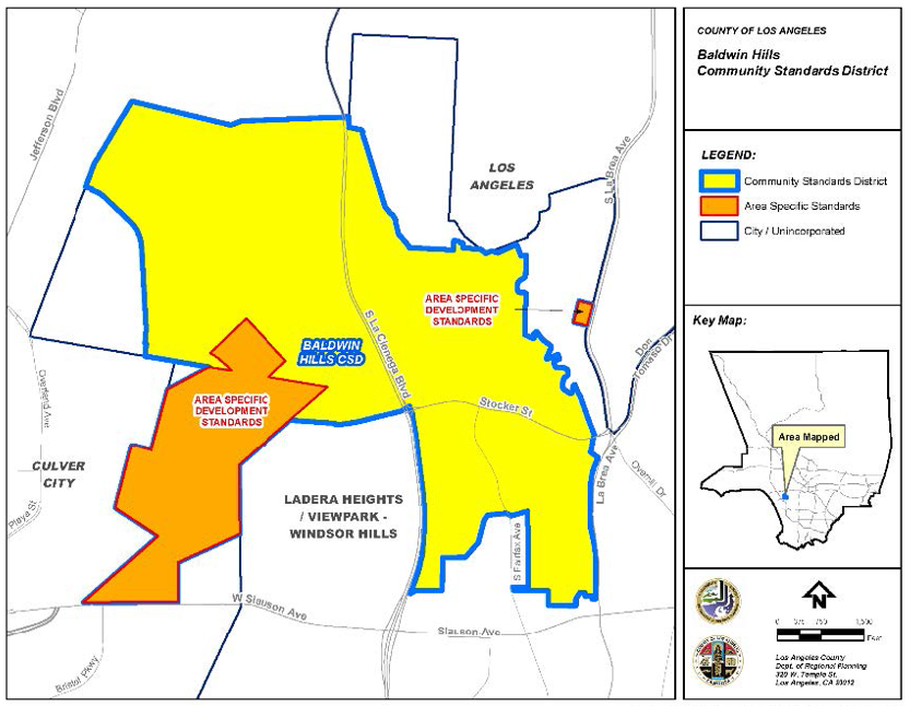
FIGURE 22.322.080-B: AREA-SPECIFIC DEVELOPMENT STANDARDS (1)
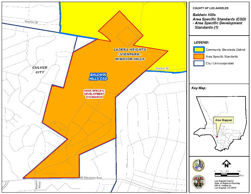
FIGURE 22.322.080-C: AREA-SPECIFIC DEVELOPMENT STANDARDS (2)
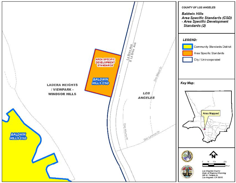
(Ord. 2025-0011 § 4, 2025.)
22.322.090 - Ladera Heights Community Standards District.
Mixed Use Development Zone — Height Limit. A building or structure shall not exceed 45 feet above grade in Zone MXD in the community of Ladera Heights.
(Ord. 2025-0011 § 4, 2025.)
22.322.100 - View Park-Windsor Hills Community Standards District.
Mixed Use Development Zone—Height Limit. A building or structure shall not exceed 45 feet above grade in Zone MXD in the community of View Park-Windsor Hills.
(Ord. 2025-0011 § 4, 2025.)
22.322.110 - Unincorporated Del Rey Community Standards District.
(Reserved)
(Ord. 2025-0011 § 4, 2025.)
22.326.010 - Purpose.
The Juniper Hills Community Standards District ("CSD") is established to ensure that future public and private improvements are consistent with the community's existing development pattern and the goals, objectives, and policies of the Antelope Valley Area Plan. Juniper Hills is a rural community in which dispersal of land uses is preferred over concentrated density. Juniper Hills is not an appropriate location for urban infrastructure such as expensive public sewage and water systems. The standards contained in this CSD are intended to maintain the low densities, secluded rural character, unique desert foothill appearance, and significant natural resources of the community.
(Ord. 2019-0004 § 1, 2019.)
22.326.020 - Definitions.
The following terms are defined solely for this CSD:
Perimeter fences. Fences or walls that mark the boundaries of a lot and agricultural fences are defined as those fences or walls used to contain livestock or other animals.
(Ord. 2019-0004 § 1, 2019.)
22.326.030 - District Map.
The boundaries of this CSD are shown on Figure 22.326-A: Juniper Hills CSD Boundary, at the end of this Chapter.
(Ord. 2019-0004 § 1, 2019.)
22.326.040 - Applicability.
This CSD shall not apply to:
A.
Development proposals which are the subject of applications for the following types of permits or approvals that were submitted and deemed complete filings prior to the effective date of the ordinance establishing this CSD:
1.
Building permits;
2.
Site Plan Reviews;
3.
General Plan Amendments and Area Plan Amendments;
4.
Tentative tract maps and parcel maps;
5.
Zone Changes;
6.
Zoning Conformance Reviews; and
7.
Other zoning permit applications listed in Division 8 (Permits and Reviews).
B.
Additions to existing structures, provided that such additions do not cumulatively increase the existing floor area of any structure by more than 25 percent.
(Ord. 2019-0004 § 1, 2019.)
22.326.050 - Application and Review Procedures.
In addition to other applicable provisions of Title 21 (Subdivisions) and this Title 22 of the County Code, notice of application for Conditional Use Permits, General Plan and Area Plan Amendments, tentative tract maps and parcel maps, variances, Zone Changes, applications filed pursuant to Section 22.326.090 (Modification of Development Standards), and other zoning permit applications shall be mailed to all owners of property located within a 1,000-foot radius of the exterior boundaries of the subject property. If, in using this 1,000-foot radius, the list does not include at least 25 property owners, excluding the applicant, the radius shall be expanded equally in all directions until the list includes at least 25 property owners, excluding the applicant.
(Ord. 2019-0004 § 1, 2019.)
22.326.060 - Community Wide Development Standards.
A.
Public Street Improvements.
1.
Public streets shall be limited to a paved width of 28 feet, excluding any inverted shoulder, concrete flow line, or slope easement.
2.
Where shoulders are deemed necessary for the safety of pedestrian and vehicular traffic by Public Works, inverted shoulder cross-sections shall be utilized.
3.
Curbs, gutters, and sidewalks are prohibited on new streets constructed in conjunction with a land division unless deemed necessary for the safety of pedestrians and vehicular traffic by Public Works after consultation with adjacent property owners.
4.
The addition of curbs, gutters, and sidewalks are prohibited on existing streets unless deemed necessary for the safety of pedestrian and vehicular traffic by Public Works after consultation with adjacent property owners.
B.
Private Street and Right-of-Way Improvements. The following standards shall apply to private streets and right-of-ways that provide access to one or more lots:
1.
Paving shall only be required if necessary to comply with Fire Department regulations and the requirements of Title 32 (Fire Code) of the County Code; and
2.
Width shall be limited to 28 feet unless a greater width is necessary to comply with Fire Department regulations and the requirements of Title 32 (Fire Code).
C.
Street Lights.
1.
Street lights shall be provided in accordance with the applicable provisions of Chapter 22.80 (Rural Outdoor Lighting District). Where installed, street lights shall be compatible in style and material with the poles on which they are mounted.
D.
Drainage. Drainage structures shall utilize natural materials and colors and shall not alter natural drainage courses to the maximum extent feasible.
E.
Trails. In reviewing and establishing design conditions for any land division, the Commission or the Hearing Officer shall determine that the land division promotes the community trails objectives stated in the Trails Plan of the Antelope Valley Area Plan.
F.
Lot Design.
1.
Each new lot created by a land division shall contain a gross area of not less than five acres.
2.
Each new lot created by a land division shall have a required width of not less than 330 feet and a required depth of not less than 330 feet.
G.
Hillside Development. Density-controlled development shall be prohibited in this CSD.
H.
Grading. A Conditional Use Permit (Chapter 22.158) shall be required for any grading on a lot, or in connection with any project, that exceeds 5,000 cubic yards of total cut plus total fill material within any 24-month period. For purposes of computing the 5,000 cubic yard threshold amount, grading necessary to establish a turnaround required by the Fire Department shall be excluded, but not grading for any private street, right-of-way, or driveway leading to such turnaround.
I.
Vegetation Conservation.
1.
The removal or destruction of vegetation of any kind on a lot two and one-half acres or greater in size shall require a Conditional Use Permit (Chapter 22.158) where the area of removal or destruction is greater than 30 percent of the gross area of the lot.
2.
This Subsection I shall not apply to the removal or destruction of vegetation:
a.
On a publicly owned right-of-way;
b.
That is necessary to allow for the construction of additions to single-family residences permitted by this Title 22;
c.
That is necessary to allow for the construction of accessory structures or additions to accessory structures permitted by this Title 22;
d.
That is necessary to implement the State of California's vegetation management program, is necessary to implement fire hazard reduction projects approved by the local and State Fire Safe Council, is necessary to comply with County regulations relating to brush clearance or fire safety, or that is otherwise required by the Fire Department;
e.
For work performed under a permit issued to control erosion or flood hazards; or
f.
For accessory agricultural uses permitted by this Title 22.
3.
Where any land division is proposed:
a.
Plans depicting existing vegetation shall be submitted with the application.
b.
When the land division proposes new development, a fuel modification plan(s) shall also be submitted with the application that demonstrates that the proposed removal or destruction of vegetation shall not occur on more than 30 percent of the gross area of each lot to be created unless such removal or destruction meets the exclusions contained in Subsection I.2, above, absent issuance of an approved Conditional Use Permit under Subsection I.1, above. Such land division shall be conditioned upon the recording of a vegetation conservation covenant with the Recorder-Registrar/County Clerk to ensure the permanent maintenance of the vegetation on each lot as depicted in the approved fuel modification plan, barring a fire or other natural disaster, subject to the exclusions contained in Subsection I.2, above, and subject to the right to obtain an approved Conditional Use Permit under Subsection I.1, above.
c.
When the land division does not propose new development, it shall be conditioned upon recording of a covenant with the Registrar-Recorder/County Clerk to ensure permanent maintenance of existing vegetation on lots created by the land division until such time that development is proposed, barring a fire or other natural disaster and subject to the exclusions listed in Subsection I.2, above, and further subject to the right to obtain an approved Conditional Use Permit under Subsection I.1, above.
4.
Where a new single-family residence is proposed on an existing unimproved lot that is two and one-half acres or greater in size:
a.
Site plans shall be submitted to the Director pursuant to Chapter 22.186 (Site Plan Review, Ministerial) that depict existing vegetation.
b.
A fuel modification plan shall also be submitted to the Director that demonstrates that the proposed removal or destruction of vegetation shall not occur on more than 30 percent of the gross area of the lot unless such removal or destruction meets the exclusions contained in Subsection I.2, above, absent issuance of an approved Conditional Use Permit under Subsection I.1, above. A vegetation conservation covenant shall be recorded with the Registrar-Recorder/County Clerk for each such lot to ensure the permanent maintenance of the vegetation on each lot as depicted in the approved fuel modification plan, barring a fire or other natural disaster, subject to the exclusions contained in Subsection I.2, above, and subject to the right to obtain an approved Conditional Use Permit under Subsection I.1, above.
5.
Transplantation of vegetation is encouraged as an alternative to removal.
J.
Vegetation Conservation Buffer. Notwithstanding the provisions of Subsection I, above:
1.
A vegetation conservation buffer with a depth of not less than 30 feet shall be established and maintained along the boundary of a lot bordering upon a public street or a private street or right-of-way. If more than one boundary of a lot borders upon a public street or private street or right-of-way, the vegetation conservation buffer shall be established and maintained along the boundary of the lot bordering upon the widest public street or private street or right-of-way;
2.
In cases where a vegetation conservation buffer is established pursuant to Subsection J.1, above, the 30-foot depth shall be measured from the property boundary unless such boundary is located within a public street or private street or right-of-way, in which case, it shall be measured from the edge of the street or right-of-way closest to the interior of the lot;
3.
No vegetation of any kind within the vegetation conservation buffer shall be removed or destroyed, with the following exceptions:
a.
Vegetation may be removed for the purpose of establishing wells, well pump houses, pumps, tanks, and other well-related fixtures;
b.
Vegetation may be removed for one driveway path for each 165 feet of lot width, provided that such driveway path is limited to a width of 28 feet; and
c.
Vegetation may be removed for compliance with County regulations relating to brush clearance safety, fuel modification, or other Fire Department requirements.
K.
Required Yards.
1.
Required front, side, and rear yards shall have a minimum depth of not less than 30 feet.
2.
Required front, side, and rear yards shall be measured from the property boundary unless such boundary is located within a public street or a private street or right-of-way providing access to one or more lots, in which case required yard areas shall be measured from the edge of the street or right-of-way closest to the interior of the lot.
3.
Wells, well pump houses, pumps, tanks, and other well-related fixtures shall be permitted within required front, side, and rear yards.
4.
Accessory structures shall be prohibited within required rear yards.
5.
Fences. Fences and walls within required yard areas shall comply with Section 22.110.070 (Fences and Walls) as well as the following provisions/restrictions:
a.
Perimeter fences within any required yard area shall not exceed a height of six feet;
b.
At least 90 percent of the top three feet of the vertical surface of all perimeter fences shall be open and non-view obscuring;
c.
Agricultural fences are prohibited within any required yard area; and
d.
Barbed or concertina wire shall not be used in any fence within any required yard area.
L.
Lighting. Outdoor lighting shall be provided in accordance with the applicable provisions of Chapter 22.80 (Rural Outdoor Lighting District).
(Ord. 2019-0004 § 1, 2019.)
22.326.070 - Zone Specific Development Standards.
(Reserved)
22.326.080 - Area Specific Development Standards.
(Reserved)
22.326.090 - Modification of Development Standards.
A.
Modification Authorized.
1.
Modification of the development standards specified in Section 22.326.060.K.1 shall be subject to a Yard Modification (Chapter 22.196) application; and
2.
Modification of the development standards specified in Sections 22.326.060.K.4 and K.5 and shall be subject to the provisions of Subsection B, below.
B.
Modification of Specific CSD Standards.
1.
Applicability. Modification of the development standards specified in Sections 22.326.060.K.4 and K.5 shall be subject to a CSD Modification application, in compliance with this Subsection B.
2.
Application and Review Procedures.
a.
Application Checklist. The application submittal shall contain all of the materials required by the CSD Modification checklist.
b.
Type II Review. The application shall be filed and processed in compliance with Chapter 22.228 (Type II Review—Discretionary) and this Subsection B.
3.
Findings and Decision.
a.
Common Procedures. Findings and decision shall be made in compliance with Section 22.228.050 (Findings and Decision) and include the findings in Subsection B.3.b, below.
b.
Findings.
i.
The use, development of land, and application of development standards comply with all applicable provisions of this Title 22.
ii.
The use, development of land, and application of development standards, when considered on the basis of the suitability of the site for the particular use or development intended, are arranged to avoid traffic congestion, to provide for the safety and convenience of bicyclists and pedestrians, including children, senior citizens, and persons with disabilities, to protect public health, safety and general welfare, to prevent adverse effects on neighboring property and conform with good zoning practice.
iii.
The use, development of land, and application of development standards are suitable from the standpoint of functional developmental design.
(Ord. 2019-0004 § 1, 2019.)
FIGURE 22.326-A: JUNIPER HILLS CSD BOUNDARY
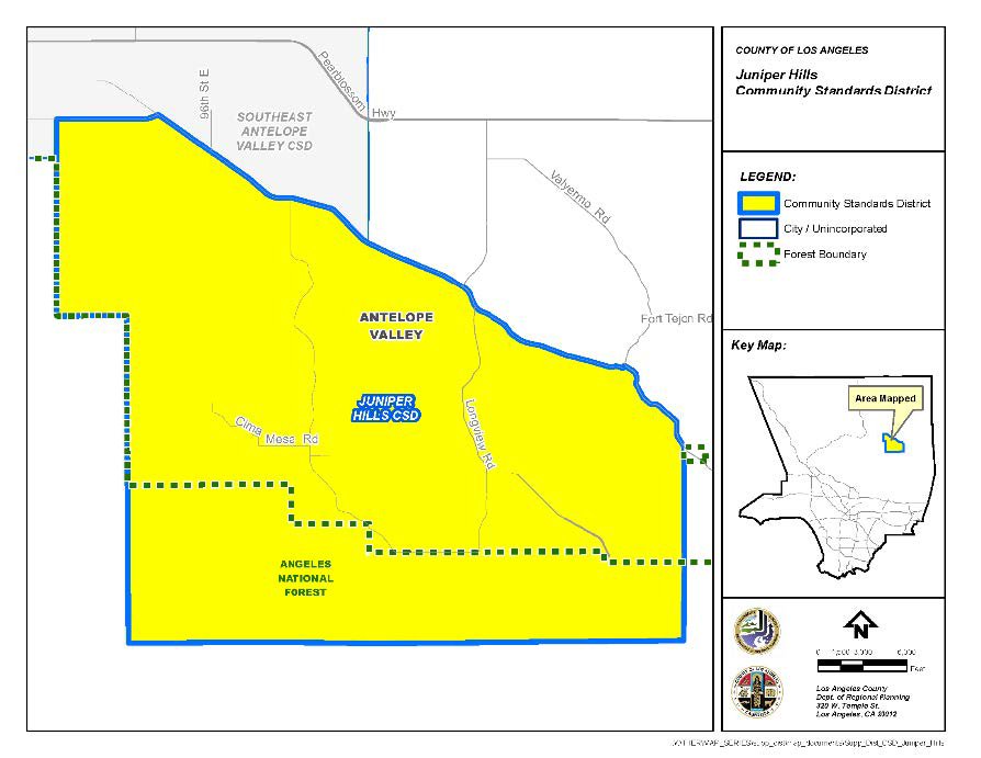
(Ord. 2019-0004 § 1, 2019.)
22.330.010 - Purpose.
The Leona Valley Community Standards District ("CSD") is established to protect, preserve, and enhance the rural, equestrian, and agricultural character of the community. Development standards and design guidelines are provided to maintain sensitive features, including significant ridgelines defined by the Antelope Valley Area Plan, Hillside Management Areas, and Significant Ecological Areas ("SEAs").
(Ord. 2021-0044 § 1, 2021; Ord. 2019-0004 § 1, 2019.)
22.330.020 - Definitions.
The following terms are defined solely for this CSD:
Department. References to the Department are to the Department of Regional Planning, unless otherwise specified.
Gated or walled subdivision. A subdivision that includes proposed fencing or walls along its perimeter and restricted access. This definition excludes perimeter fencing for individual lots. A wall or fence along one side of the subdivision would not constitute a gated or walled subdivision.
Perimeter fencing. Fencing placed along a property line or following the general boundary of a property and within a required setback on a parcel intended for privacy or security.
Residential ranch entrance sign. A freestanding sign that marks the entrance to a single-family residential use.
(Ord. 2021-0044 § 2, 2021.)
22.330.030 - District Map.
The boundaries of this CSD are shown on Figure 22.330-A: Leona Valley CSD Boundary, at the end of this Chapter.
(Ord. 2019-0004 § 1, 2019.)
22.330.040 - Applicability.
In conjunction with Section 22.300.020 (Application of Community Standards Districts to Property), this Chapter shall apply to any application for development, expansion, or change of use requiring Department approval that is filed after September 10, 2021. For expansion of an existing, legally-established use, as of September 10, 2021, this Chapter shall only apply to the new expansion portion and not to existing development.
(Ord. 2021-0044 § 3, 2021.)
22.330.050 - Application and Review Procedures.
Notification. For all permits requiring notification by mail, the noticing radius shall be consistent with Section 22.222.160 (Notification Radius). In addition, if the notification radius does not include a minimum of 15 parcels of real property, the radius shall be expanded until the owners of at least 15 parcels are included.
(Ord. 2021-0044 § 4, 2021; Ord. 2019-0004 § 1, 2019.)
22.330.060 - Communitywide Development Standards.
A.
Drive-Through Services. All new drive-through services shall be prohibited.
B.
Fencing. Where perimeter fencing is installed, including where installed to protect horses and livestock, it shall be of an open, non-view-obscuring, permeable-type design, such as wood rail, steel pipe, vinyl rail, PVC pipe, recycled plastic rail, or coated wire. Except for retaining walls, solid, view-obscuring perimeter fences or walls shall be prohibited.
C.
Hillside Management. Pursuant to Section 22.104.030.A, a Conditional Use Permit (Chapter 22.158) in accordance with Chapter 22.104 shall be required, if a development on a single lot within this CSD boundary includes grading that exceeds 5,000 cubic yards of total cut plus total fill material.
D.
Lighting.
1.
This Subsection shall employ the definitions listed within the Rural Outdoor Lighting District (Chapter 22.80).
2.
All exterior lighting shall have the light source fully shielded.
3.
Any lighting within a temporary structure, such as a tent or canopy, is exempt, provided that the structure fully shields all lamps.
4.
Flood lights are prohibited.
E.
Preservation of Vegetation.
1.
Removal or destruction of vegetation of any kind on a lot that is located outside of the SEA, and is two and one-half gross acres or greater in size, shall require an approved Conditional Use Permit (Chapter 22.158) where the area of removal or destruction is greater than 30 percent of the gross area of the lot or 30,000 square feet, whichever is more restrictive. The following removals are exempt from this requirement:
a.
The removal or reduction of vegetation for the purpose of complying with County regulations relating to brush clearance for fire safety. This exception includes not only required vegetation control around structures, but also the creation and maintenance by a public agency of firebreaks used to control the spread of fire;
b.
The removal or destruction of vegetation on publicly-owned rights-of-way for roads, highways, flood control projects, or other similar or related uses;
c.
The removal or destruction of vegetation by public utilities on rights-of-way or property owned by such utility, or on land providing access to such rights-of-way or property;
d.
Work performed under a permit issued to control erosion or flood hazards; and
e.
Agricultural uses, including animal keeping, animal raising, or growing crops, as permitted by this Title 22.
2.
Conditional Use Permit Application Materials. In addition to the requirements listed in Chapter 22.158, the following materials shall also be submitted to the Department for review of a request for vegetation removal with a Conditional Use Permit:
a.
A detailed project description, outlining the reason for the proposed vegetation removal and the planned use of the property, within 12 months of application submittal;
b.
A landscaping plan, identifying all vegetation on the property including, and separately specifying, native vegetation listed in the San Andreas SEA Plant List maintained by the Department. The landscaping plan shall indicate the vegetation proposed to be removed as part of the project and how those removals will be mitigated with replanting, to the satisfaction of the Department, in consultation with the County Biologist;
c.
Fuel modification plans or grading plans shall also be submitted, upon request by the Department; and
d.
In addition to filing fees specified in Chapter 22.250 (Applications, Petitions, and Fees), the applicant shall submit a fee for review by the County Biologist.
3.
Additional Findings for Conditional Use Permits. In addition to substantiating the findings listed in Section 22.158.050 (Findings and Decision), the applicant shall also substantiate the following:
a.
Development plans emphasize the protection of, and revegetation with, native vegetation, including the native plants, grasses, shrubs, and trees that intercept, hold, and more slowly release rainfall than bare earth surfaces. Stands of native vegetation and mature trees are preserved or expanded to the greatest extent possible; and
b.
The design of the project, including structures used to house animals, such as stables and arenas, does not create erosion or flooding potential that would cause a safety hazard to structures or off-site property, as determined by the Department of Public Works ("Public Works").
F.
Signs.
1.
All sign requirements of Chapter 22.114 (Signs), and all applicable provisions of Chapter 22.80 (Rural Outdoor Lighting District), shall also apply to the signage within this CSD, except as otherwise provided for or modified by this Subsection:
a.
Prohibited Signs. In addition to those prohibited by Section 22.114.040 (Prohibited Signs Designated), the following signs shall also be prohibited within this CSD:
i.
Outdoor Advertising Signs (Billboards). New outdoor advertising signs (billboards) shall be prohibited within this CSD;
ii.
Roof signs;
iii.
Pole signs; and
iv.
Internally illuminated signs.
b.
Wall Business Signs. Each business establishment fronting on and/or oriented toward one or more public street, highway, or parkway shall be permitted a maximum of one square foot of wall sign area for each one linear foot of building frontage. No wall business sign attached to a building shall extend above the building wall.
c.
Monument Signs. As provided for in Section 22.114.120 (Roof and Freestanding Business Signs), the height of such signs shall be limited to six feet measured from the natural grade at the base of the sign, and shall not display more than two sign faces with a maximum area of 50 square feet for each sign face.
d.
Residential Ranch Entrance Signs.
i.
A maximum of one residential ranch entrance sign is permitted;
ii.
Residential ranch entrance signs shall only be permitted on lots of at least one gross acre in size and located in the Residential or Agricultural Zones;
iii.
The maximum sign area for a residential ranch entrance sign shall be 20 square feet per sign face, with a maximum of two sign faces permitted;
iv.
The maximum height for a residential ranch entrance sign shall be 20 feet measured from natural grade at the base of the sign; and
v.
Residential ranch entrance signs shall comply with all requirements of the Fire Code (Title 32) including requirements pertaining to fire apparatus access roads.
e.
Temporary Real Estate Signs. The following provisions shall supersede the requirements of Section 22.114.170.A (Area Permitted):
i.
Only one temporary real estate sign shall be permitted on a property at a time;
ii.
Prior to posting such sign, the approval of the property owner must be obtained in writing and be available for review upon request by the Department;
iii.
Such signs shall contain the name and contact number of the person or company responsible for placing such sign, in addition to the address, or Assessor Parcel Number, of the property being sold; and
iv.
Maximum Sign Area. In the Residential, Agricultural, Open Space, and Watershed Zones, the maximum sign area for a temporary real estate sign shall be six square feet per sign face. In all other zones, the maximum sign area for a temporary real estate sign shall be 48 square feet per sign face.
G.
Significant Ridgeline Protection. The highest point of a structure shall be located no closer than 50 vertical feet away from and 50 horizontal feet away from a significant ridgeline, excluding chimneys, rooftop antennas, amateur radio antennas, rooftop solar, and small-scale wind energy systems.
H.
Trails. Trails within this CSD boundary shall be regulated by the provisions of this Subsection and the Los Angeles County General Plan, Antelope Valley Area Plan, and the Los Angeles County Trails Manual ("Trails Manual") maintained by the County Department of Parks and Recreation ("Parks and Recreation"). All projects consisting of new development or subdivision and requiring a discretionary land-use permit subject to Type II (Chapter 22.228), Type III (Chapter 22.230), or Type IV (Chapter 22.232) review shall require consideration for trail dedication and development in accordance with the County's Board-adopted regional trail network.
1.
Trail Dedication.
a.
Required trail dedications and development standards shall be determined by Parks and Recreation, in accordance with the County's Board-adopted regional trail network and Trails Manual.
i.
Trails required by Parks and Recreation may include publicly-dedicated connector or feeder trail easements within or connected to the proposed development or subdivision, where feasible; and
ii.
If a development or subdivision project proposes to modify an existing trail easement, the applicant shall obtain Parks and Recreation approval of such modification.
b.
Trail Design and Location.
i.
A publicly-dedicated trail shall be designed to connect to an existing or planned trail alignment(s), pursuant to the County's Board-adopted regional trail network, and to provide connectivity to recreational uses, such as open space areas, parks, trailheads, bike paths, historical trails or sites, equestrian and multi-use staging areas, campgrounds, or conservation areas, as determined by Parks and Recreation;
ii.
Trail design, construction, and maintenance shall be carried out, in conformance with the Trails Manual; and
iii.
Deviations from the standards, set forth in this Subsection, or any applicable provision in the Trails Manual, may be permitted, based on unique site conditions, including steep topography, existing structures, trees, vegetation, or utility infrastructure, subject to review and approval of Parks and Recreation.
I.
Highway and Local Streets.
1.
Highway Standards.
a.
Routes shown on the County Highway Plan within the boundaries of this CSD shall use the alternate rural highway standards, except for locations where existing infrastructure or commercial and pedestrian traffic patterns are such that Public Works determines that curbs, gutters, and sidewalks are necessary for safety reasons, or to provide pedestrian access compliant with the Federal Americans with Disabilities Act;
b.
Encroachments into the highway right-of-way are prohibited, unless an encroachment permit is granted by Public Works, where Public Works will consider the potential impact that the encroachment will have on safe use of the highway right-of-way for temporary vehicle parking and pedestrian and equestrian movement. To the maximum extent feasible, the highway right-of-way shall be clear of all obstructions, including landscaping, trees, and other structures, which block safe pedestrian and equestrian movement on the highway right-of-way; and
c.
If the vehicular right-of-way is not coterminous with the boundaries of the highway right-of-way, driveways may be permitted to connect the property and the vehicular right of way. An encroachment permit from Public Works will be required. Such driveways shall be constructed with a non-slip surface, such as rough-broomed concrete.
2.
Local Street Standards. The following standards shall apply to all local streets maintained by Public Works within this CSD:
a.
Local streets shall use the inverted shoulder cross-section and shall have a paved width of 28 feet, except for locations where additional pavement is required for geometric improvements by Public Works or where commercial, industrial, or institutional uses necessitate alternate designs, as determined by Public Works. This 28-foot width excludes any inverted shoulder or concrete flowline;
b.
New curbs, gutters, and sidewalks are prohibited unless deemed necessary by Public Works, after consultation with the Department, for the safety of pedestrian and vehicular traffic; and
c.
The encroachment and driveway provisions in Subsections 1.b and 1.c, above, for highway rights-of-way, shall also apply to local streets.
J.
Subdivisions.
1.
Gated or walled subdivisions are prohibited.
2.
Utilities. All wires and cables that provide utility services, including telephone, television, electricity less than 10 kilovolts, and similar services shall be placed underground.
3.
Required Area. New lots shall have a minimum lot area of 2.5 gross acres. Density-controlled development shall be prohibited.
(Ord. 2021-0044 § 5, 2021; Ord. 2019-0004 § 1, 2019.)
22.330.070 - Zone Specific Development Standards.
A.
Residential and Agricultural Zones.
1.
Height. All structures are limited to a maximum of two stories, excluding attics, and 35 feet in height.
2.
Use-Specific Standards.
a.
Accessory Cargo Shipping Containers. Cargo shipping containers are permitted as an accessory use in the A-1 and A-2 Zones with the approval of a Ministerial Site Plan Review (Chapter 22.186) application, in the quantities identified in Table 22.330.070-A, provided the following development standards are met:
i.
Size and Specifications. Cargo shipping containers shall not exceed 10 feet in height, 10 feet in width, and 40 feet in length;
ii.
Location. Cargo shipping containers are prohibited in any required yard or area where the parking of vehicles is prohibited under Section 22.112.040.C (Residential and Agricultural Zones);
iii.
Placement and Separation. Cargo shipping containers shall be placed at least six feet from any structure or other cargo shipping container and not be stacked upon each other;
iv.
Design. Cargo shipping containers shall be painted in earth tones and one uniform color, and shall not display any images or lettering on their sides, except for images or lettering providing safety information related to the contents stored within, or as otherwise required by the County Code, or any other applicable federal, State, or local regulation;
v.
Screening. All Cargo shipping containers shall be screened to obscure view of the cargo shipping container from outside of the subject lot on all sides by landscaping, earthwork, or existing structures. Landscaping shall be used as screening material, and shall include trees, shrubs, and other plant material that can screen the height of the cargo shipping container. Trees shall be placed a maximum of 10 feet apart from each other, or in such a manner as to obscure view of the cargo shipping container from outside of the subject lot; and
vi.
Safety and Maintenance. All cargo shipping containers shall be kept in a state of good repair, and any landscaping used as screening shall be kept properly maintained or in good repair.
B.
Commercial and Rural Zones.
1.
Height. New structures, or expansions of existing structures, on lots adjacent to a Residential or Agricultural-zoned property shall be subject to the following:
a.
Within five feet from any property line abutting a Residential or Agricultural-zoned property, the maximum height of the building shall be 17 feet; and
b.
Any portion of a proposed structure exceeding 17 feet in height shall be stepped back an additional foot for every foot in height over 17 feet from any common property line with the abutting Residential or Agricultural-zoned property.
2.
Yards. In addition to Section 22.24.040 (Development Standards for Rural Zones), commercial lots shall have a minimum front yard of 10 feet.
(Ord. 2021-0044 § 6, 2021.)
22.330.080 - Area-Specific Development Standards.
(Reserved).
22.330.090 - Modification of Development Standards.
Modifications to any standards in this Chapter are subject to a Conditional Use Permit (Chapter 22.158) application, and shall be subject to additional findings:
A.
The application of these standards would result in practical difficulties or unnecessary hardship inconsistent with the purpose of this CSD;
B.
There are exceptional circumstances or conditions that are uniquely applicable to the subject property, or to the intended development of the subject property, that do not apply to other properties within the area governed by this CSD;
C.
Approval or denial of a modification to the development standards of this Chapter shall not establish precedent for approval or denial of other modifications within the Chapter; and
D.
In acting upon any application for a modification from the development standards of this Chapter, the Review Authority shall consider, in addition to the purpose statement in this Chapter, the unique characteristics of the neighborhood in which the site is located.
FIGURE 22.330-A: LEONA VALLEY CSD BOUNDARY
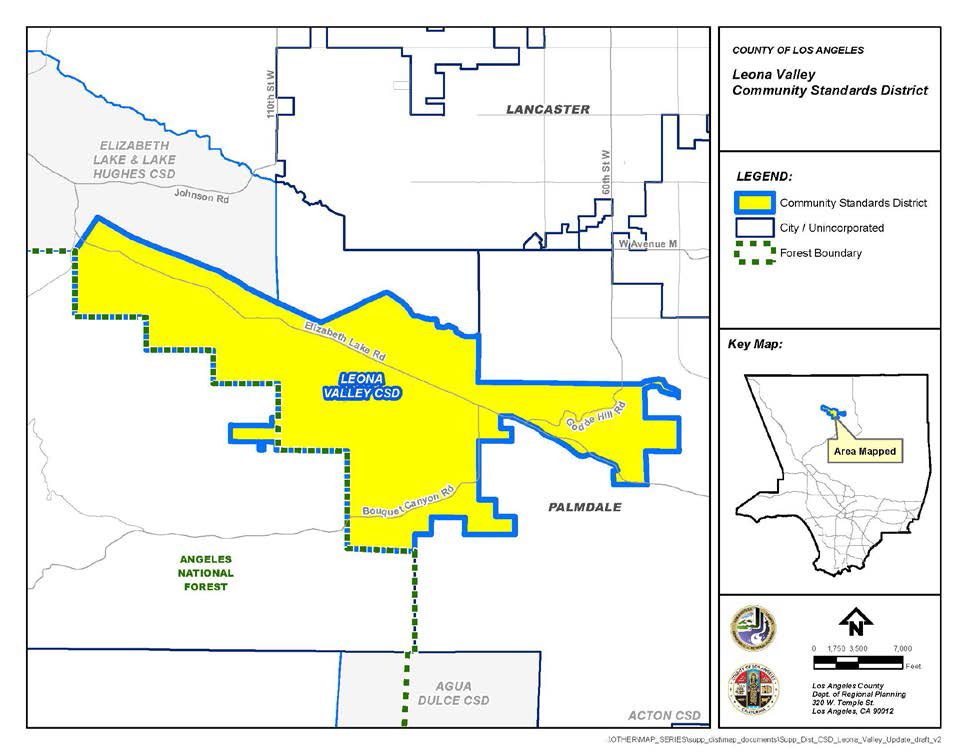
(Ord. 2021-0044 § 8, 2021; Ord. 2019-0004 § 1, 2019.)
22.334.010 - Purpose.
The San Francisquito Canyon Community Standards District ("CSD") is established to protect and enhance the community's secluded rural, equestrian, and agricultural character as well as its natural features, including ridgelines, significant ecological areas, and flood plains. The standards contained in this CSD are intended to ensure reasonable access to public riding and hiking trails, encourage the keeping of animals, minimize the need for urban infrastructure, and preserve the beauty of this natural gateway into the Angeles National Forest.
(Ord. 2019-0004 § 1, 2019.)
22.334.030 - District Map.
The boundaries of this CSD are shown on Figure 22.334-A: San Francisquito Canyon CSD Boundary, at the end of this Chapter.
(Ord. 2019-0004 § 1, 2019.)
22.334.040 - Applicability.
This CSD shall apply to all new development except for development depicted in Site Plan Reviews and Zoning Conformance Reviews that were submitted prior to the effective date of the ordinance establishing this CSD.
(Ord. 2019-0004 § 1, 2019.)
22.334.050 - Application and Review Procedures.
(Reserved)
22.334.060 - Community Wide Development Standards.
A.
Highway and Local Street Standards.
1.
Highway Standards. Alternate rural highway standards shall be utilized for routes shown on the Highway Plan, except for locations where existing infrastructure or commercial and pedestrian traffic are such that Public Works determines that curbs, gutters, and sidewalks are necessary for safety or to provide pedestrian access compliant with the federal Americans with Disabilities Act.
2.
Local Street Standards.
a.
Local streets shall be limited to the use of the inverted shoulder cross-section with a paved width of 28 feet, except for locations where additional pavement is required for geometric improvements by Public Works or where commercial, industrial, or institutional uses necessitate alternate designs, as determined by Public Works. This limit excludes the width of any inverted shoulder or concrete flow line.
b.
New curbs, gutters, and sidewalks are prohibited unless deemed necessary for the safety of pedestrian and vehicular traffic by Public Works after consultation with the Department.
B.
Street Lights. Street lights shall be provided in accordance with the applicable provisions of Chapter 22.80 (Rural Outdoor Lighting District). Where installed, street lights shall be compatible in style and material with the poles on which they are mounted.
C.
Outdoor Lighting. Outdoor lighting shall be provided in accordance with the applicable provisions of Chapter 22.80 (Rural Outdoor Lighting District).
D.
Utilities. (Reserved)
E.
Signs.
1.
Freestanding ranch entrance signs are permitted, provided that at least one driveway unobstructed by a sign is provided on a lot, as required by the Fire Department. Such signs are subject to the following standards:
a.
On a lot, not more than one sign shall be placed at each entrance;
b.
The height of each sign shall not exceed 20 feet as measured from mean natural grade; and
c.
The surface area of each sign shall not exceed 20 square feet.
2.
Signs that do not conform to the provisions of this Subsection E, but were existing and legally established as of the effective date of the ordinance establishing this CSD, may remain subject to the provisions of Section 22.174.050.A.2 (Termination by Discontinuance).
F.
Vegetation Conservation. (Reserved)
G.
Trails.
1.
When required by Parks and Recreation in accordance with the Trails Map in the Santa Clarita Valley Area Plan, all new land divisions, including minor land divisions, shall contain accessible multi-use trails for pedestrian hiking and walking, mountain bicycling, and equestrian uses. Where feasible, access to these trails must be in the vicinity of the subject land division. These trails shall provide connections, where feasible, to significant recreational uses, including but not limited to, open space areas, parks, trail heads, bike paths, historical trails or sites, equestrian centers, equestrian staging areas, camp grounds, and conservation or nature preserve areas.
2.
Trail construction shall be completed in accordance with the conditions set forth by Parks and Recreation. All information pertaining to trail requirements shall be shown on tentative parcel or tract maps and the final parcel or tract map prior to final map recordation.
3.
In reviewing land divisions, the Commission or Hearing Officer shall consider input by the Santa Clarita Valley Trails Advisory Committee, if provided, regarding trail development.
H.
Density-Controlled Development. Density-controlled development shall be permitted only if each lot contains a net area of at least two acres.
I.
Hillside Management. (Reserved)
J.
Significant Ridgeline Protection.
1.
The locations of the significant ridgelines within this CSD are shown on Figure 22.334-B: Significant Ridgelines at the end of this Chapter and the criteria used for their designation are provided in Appendix I at the end of this Chapter.
2.
The highest point of a structure shall be located at 50 vertical feet and 50 horizontal feet from a significant ridgeline, excluding chimneys, rooftop antennas, amateur radio antennas, and small-scale wind energy systems.
3.
Modification of Subsection J.2, above, shall comply with Section 22.334.090 (Modification of Development Standards).
4.
The provisions of this Subsection J shall not apply to:
a.
Additions to a single-family residence or accessory structure that were legally established as of the effective date of the ordinance establishing this CSD, provided that such single-family residence or accessory structure does not exceed 5,000 square feet in floor area after such additions are constructed; and
b.
The repair or replacement of a damaged or destroyed single-family residence or accessory structure that was legally established as of the effective date of the ordinance establishing this CSD, provided that such single-family residence or accessory structure is built in the same location as the one that was damaged or destroyed and does not exceed 5,000 square feet in floor area.
K.
Grading.
1.
An approved Conditional Use Permit (Chapter 22.158) shall be required for any grading on a lot or parcel of land, or in connection with any project, that exceeds 5,000 cubic yards of total cut plus total fill material within any 24-month period. For purposes of computing the 5,000-cubic-yard threshold amount, grading necessary to establish a turnaround required by the Fire Department shall be excluded, but not grading for any private street, right-of-way, or driveway leading to such turnaround.
2.
In approving such Conditional Use Permit application for grading, the Commission or Hearing Officer shall make the following findings in addition to those required by Section 22.158.050.B (Findings):
a.
The grading will be performed in a manner that minimizes disturbance to the natural landscape and terrain through design features, including but not limited to, the location of building pads in the area of the project site with the least slope and/or near a paved street traveled by the public; and
b.
The grading will be accompanied by other design features that maximize preservation of visual quality and community character, including but not limited to, reduced structural height, the use of shapes, materials, and colors that blend with the surrounding environment, and the use of native vegetation for concealment.
L.
Manure Storage. Manure shall be stored at least 50 feet away from any well, water source, or drainage channel, unless placed in a covered trash receptacle.
(Ord. 2019-0004 § 1, 2019.)
22.334.070 - Zone Specific Development Standards.
A.
Residential and Agricultural Zones.
1.
Lot Design. Each new lot created by a land division shall contain a net area of at least two acres.
2.
Required Yards.
a.
Each lot shall have a required front yard of at least 25 feet in depth;
b.
Each lot shall have a required rear yard of at least 25 feet in depth; and
c.
Each lot shall have required interior side yards of at least 10 feet in depth.
3.
Fences. Fences or walls within required front yards may exceed three and one-half feet in height, provided that:
a.
Fences or walls shall not exceed six feet in height; and
b.
At least 75 percent of the fence or wall area above three and one-half feet in height shall be open and non-view obscuring. Any non-view obscuring area shall be evenly distributed horizontally along the entire length of the fence or wall.
4.
Structure Separation. Structures used in connection with the agricultural uses permitted by Section 22.16.030.C (Use Regulations) for Zone A-2 shall be located at least 35 feet from any street or highway or any building used or designed for human habitation.
5.
Temporary Animal Keeping. Fences for the temporary keeping of animals, including but not limited to pipe corrals, shall be exempt from the provisions of Subsections A.2 and A.4, above, provided that:
a.
Such fences are located at least five feet from any lot line; and
b.
Such fences do not exceed six feet in height.
B.
Other Zones. (Reserved)
(Ord. 2019-0004 § 1, 2019.)
22.334.080 - Area Specific Development Standards.
A.
San Francisquito Canyon Creek Area.
1.
Purpose. This Area is established to protect the San Francisquito Canyon Creek.
2.
Area Boundary. The boundaries of this Area are shown on Figure 22.334-C: San Francisquito Canyon Creek Area, at the end of this Chapter.
3.
Fences and Walls. Fences and walls are prohibited.
4.
Outdoor Storage. Outdoor storage is prohibited.
B.
(Reserved)
(Ord. 2019-0004 § 1, 2019.)
22.334.090 - Modification of Development Standards.
A.
Modifications Authorized
1.
Modification of the development standards specified in Section 22.334.070.A.2 (Required Yards) shall be subject to a Yard Modification (Chapter 22.196) application. The application shall comply with all noticing requirements as required the Yard Modification (Chapter 22.196) application, except that the notification radius shall be 1,000 feet of the exterior boundaries of the subject property, as shown on the County's last equalized assessment roll;
2.
Modification of the development standards specified in Sections 22.334.070.A.3 (Fences) and 22.334.070.A.4 (Structure Separation) shall be subject to the procedures specified in Subsection B, below;
3.
Modification of the development standards specified in Section 22.334.060.J.2 (Significant Ridgeline Protection) shall be subject to the procedures specified in Subsection C, below; and
4.
Modification of other development standards in this CSD shall be subject to a Variance (Chapter 22.194).
B.
Modification of Specific CSD Standards.
1.
Applicability. Any modification to Sections 22.334.070.A.3 (Fences) and 22.334.070.A.4 (Structure Separation) shall be subject to a CSD Modification application, in compliance with this Subsection B.
2.
Application and Review Procedures.
a.
Application Checklist. The application submittal shall contain all of the materials required by the CSD Modification checklist.
b.
Type II Review. The application shall be filed and processed in compliance with Chapter 22.228 (Type II Review—Discretionary) and this Subsection B.
3.
Notification. The application shall comply with all noticing requirements as required by the Type II Review (Chapter 22.228), except that the notification radius shall be 1,000 feet of the exterior boundaries of the subject property, as shown on the County's last equalized assessment roll.
4.
Findings and Decision.
a.
Common Procedures. Findings and decision shall be made in compliance with Section 22.228.050 (Findings and Decision) and include the findings in Subsection B.4.b, below.
b.
Findings.
i.
The use, development of land, and application of development standards comply with all applicable provisions of this Title 22.
ii.
The use, development of land, and application of development standards, when considered on the basis of the suitability of the site for the particular use or development intended, are arranged to avoid traffic congestion, to provide for the safety and convenience of bicyclists and pedestrians, including children, senior citizens, and persons with disabilities, to protect public health, safety and general welfare, to prevent adverse effects on neighboring property and conform with good zoning practice.
iii.
The use, development of land, and application of development standards are suitable from the standpoint of functional developmental design.
iv.
There are exceptional circumstances or conditions applicable to the subject property or to the intended development of the property that do not apply to other properties within the CSD area; and
v.
That granting the request for modification will not be materially detrimental to properties or improvements in the area or contrary to the purpose of this CSD, as provided in Section 22.334.010 (Purpose).
C.
Modification of Significant Ridgeline Protection.
1.
Applicability. Any modification to Section 22.334.060.J.2 shall require a Minor Conditional Use Permit (Chapter 22.160) application.
2.
Additional Findings.
a.
Alternative sites within the project have been considered and eliminated from consideration due to their physical infeasibility or their potential for substantial habitat damage or destruction; and
i.
The project maintains the maximum view of the applicable significant ridgeline through design features, including but not limited to, one or more of the following:
ii.
Minimized grading.
iii.
Reduced structural height.
iv.
Use of shapes, materials, and colors that blend with the surrounding environment.
v.
Use of native drought-tolerant landscaping for concealment.
FIGURE 22.334-A: SAN FRANCISQUITO CANYON CSD BOUNDARY
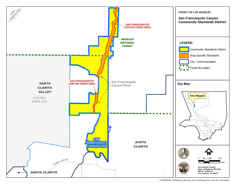
FIGURE 22.334-B: SIGNIFICANT RIDGELINES
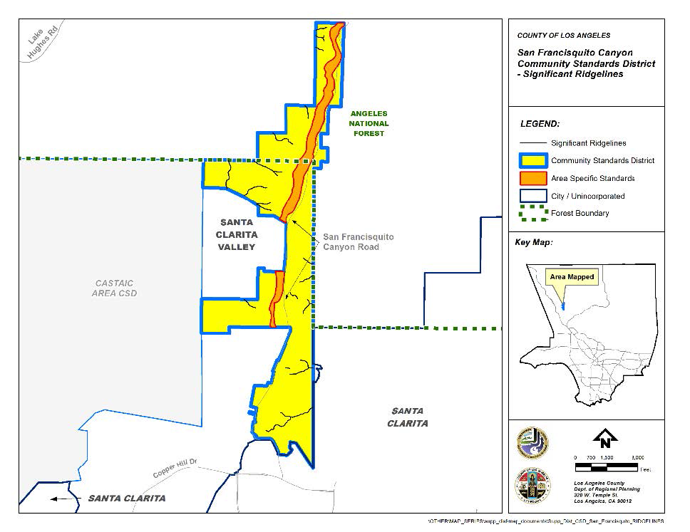
FIGURE 22.334-C: SAN FRANCISQUITO CANYON CREEK AREA
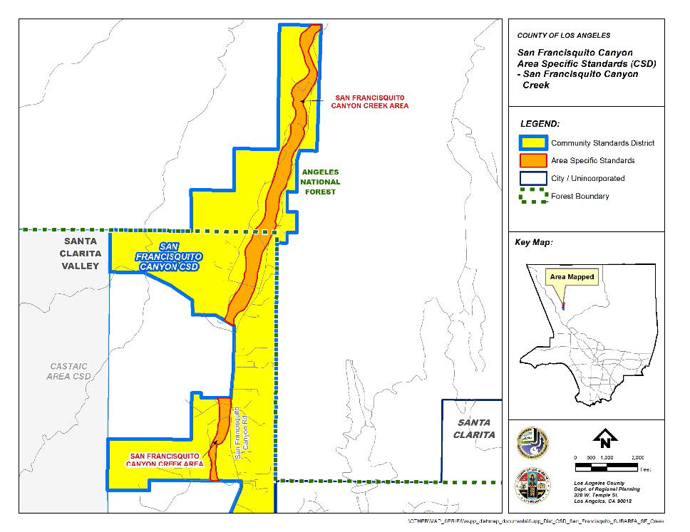
(Ord. 2019-0004 § 1, 2019.)
APPENDIX I. - CRITERIA FOR SIGNIFICANT RIDGELINES
The designation of the significant ridgelines within the San Francisquito Canyon Community Standards District is based on the following criteria:
• Topographic complexity: Ridges that have a significant difference in elevation from the valley or canyon floor. Generally, these ridges can be seen from any location on the valley floor, from a community or neighborhood, or from a public road.
• Near/far contrast: Ridges that are part of a scene that includes a prominent landform in the foreground and a major backdrop ridge with an unbroken skyline. This includes a view into a valley from a public road or viewpoint located at a higher altitude, such as along the valley rim or a pass. This contrast can be experienced viewing an entire panoramic view or a portion of a panoramic view from an elevated point.
• Cultural landmarks: Ridges that frame views of well-known locations, structures, or other places which are considered points of interest within the community or region.
• Uniqueness and character of a specific location: Peaks and their buttressing ridges. This is represented by ridges that frame rocky outcroppings, other unique geological features, and areas of extraordinary natural beauty.
• Existing community boundaries and gateways: Ridges and surrounding terrain that provide the first view of predominantly natural, undeveloped land as a traveler emerges in the community. These lands introduce visitors to the visual experiences they will encounter in the community and gateways include the surrounding ridges that provide a skyline and boundary to the community.
(Ord. 2019-0004 § 1, 2019.)
22.336.010 - Purpose.
The Santa Monica Mountains North Area Community Standards District ("CSD") is established to implement the goals and policies of the Santa Monica Mountains North Area Plan ("Area Plan") in a manner that protects the health, safety, and welfare of the community, as well as the surrounding natural environment. Together, the two planning documents direct what development may occur, where development may occur, and how development must be designed in the Santa Monica Mountains North Area.
(Ord. 2021-0021 § 2, 2021.)
22.336.020 - Definitions.
The following terms are defined solely for this CSD:
Animal Containment Facilities. Designated or fenced areas used to contain equines or livestock to a particular area such as corrals, paddocks, pastures, turnouts, and grazing areas that are usually used for riding, exercise, rehabilitation, or grazing.
Animal Living Quarters. Structures and confined areas that provide shelter through use of a roof, walls, and fencing, in which animals regularly sleep overnight including, but not limited to, barns, stables, and stalls.
Bed and Breakfast Establishment. A single-family residence containing guest rooms used for temporary overnight visitor accommodations with a maximum rental period of 30 consecutive days per stay, which provides meals for guests of the facility.
Building Site Area ("BSA"). The approved area of a project site that is or will be developed, including building pad and all graded slopes, all structures, decks, patios, impervious surfaces, and parking areas.
Commission. The Regional Planning Commission of the County of Los Angeles.
Correlated Color Temperature ("CCT"). The specification of the color appearance of a light source, measured in Kelvin ("K"). CCT measures the "warmth" of a light source.
Department. References to the Department are to the Department of Regional Planning, unless otherwise specified.
Director. The Director of the Department of Regional Planning of the County of Los Angeles, unless otherwise specified.
Disaster. An occurrence or event, either human-caused or by natural phenomena, that requires action by emergency response personnel to prevent or minimize loss of life or damage to property and/or natural resources. To qualify as a disaster, the destruction must be a result of a force or forces that were beyond the control of the subject property owners.
Exploratory Testing. Any activities such as drilling or excavation for the purpose of evaluating soil and/or hydrologic conditions, or geologic hazards to evaluate a site for allowable, potential development. This includes exploratory test holes for water wells, percolation testing for on-site wastewater treatment systems, the access road to the test site, and any other activity associated with evaluating a site for development.
Event Facility. A place of private or public assembly, either indoor or outdoor, that hosts functions which include, but are not limited to, weddings, receptions, wine clubs, banquets, anniversaries, meetings, or conferences.
Gross Structural Area ("GSA"). The allowable residential floor area of the permitted development in square feet. The GSA includes the total floor area of all enclosed residential and storage areas (including internal stairs), but does not include vent shafts, external stairs, or the first 400 square feet of floor area in garages or carports designed for the storage of automobiles. Cellars that are entirely below grade are excluded from GSA, as are crawl spaces or attics that do not qualify as habitable space.
Horse Boarding, Large. The maintenance and/or keeping of equines boarded with or without compensation as a primary use. Commercial boarding may include commercial training or riding of horses or other equines, or courses in horsemanship.
Horse Boarding, Small. The maintenance and/or keeping of equines owned by persons who are not owners or lessees of the lot or parcel upon which such actions are undertaken, boarded with or without compensation, as an accessory use to a primary residential use.
Like-for-like Replacement. Replacement of structures that are in the same location, size, height, and bulk, and are covering the same building footprint as the previously existing legally-established structures.
Livestock. Any pig, pygmy pig, hog, cow, bull steer, sheep, goat, llama, alpaca, domestic fowl, rabbit, or similar animal(s).
Riding Academies. Any establishment where horses are kept or maintained for the purpose of providing lessons or instruction in equestrianism, including, but not limited, to dressage and horse jumping.
Rural Inn. A facility containing guest rooms or cabins used for short-term rental accommodations, all of which have a separate entrance leading directly from the outside of the building, and which do not contain kitchen facilities.
S/P Ratio. The ratio of scotopic vision over photopic vision, each measured in lumens.
Stream. A topographic feature that at least periodically conveys water through a bed or channel having banks; this includes ephemeral streams, drainage courses, and watercourses having a surface or subsurface flow that supports or has supported riparian vegetation.
Vineyard. A plantation of grapevines that typically produces table grapes or grapes used in winemaking, except as otherwise delineated in this CSD.
Wetlands. An area of land that is inundated or saturated by surface or groundwater at a frequency and duration sufficient to support, and that under normal circumstances does support, a prevalence of vegetation typically adapted for life in saturated soil conditions, with delineations following guidelines defined in the United States Fish & Wildlife Service Classification of Wetlands and Deepwater Habitats of the United States.
Wildlife-Permeable Fencing. Fencing that can be easily bypassed by all species of wildlife found within the Santa Monica Mountains, including, but not limited to, deer, coyotes, bobcats, mountain lions, ground rodents, amphibians, reptiles, and birds.
(Ord. 2024-0054 § 11, 2024; Ord. 2021-0021 § 2, 2021.)
22.336.030 - District Map.
The boundaries of this CSD are shown on Figure 22.336-A: Santa Monica Mountains North Area CSD Boundary, at the end of this Chapter.
(Ord. 2021-0021 § 2, 2021.)
22.336.040 - Applicability.
A.
General Applicability. Except as otherwise provided for in Subsections B and C, below, the provisions of this ordinance shall apply to all projects that do not have an application deemed complete by the effective date of this ordinance.
B.
Prior Legal Grading. Any legal grading that has occurred on a lot or in connection with a project prior to January 6, 2005, (the effective date of the ordinance adding Subsections I.1 and I.5 of Section 22.336.070) shall not be counted toward the grading thresholds set forth in Subsections I.1 and I.5 of Section 22.336.070. Proof that such grading was legal shall be demonstrated to the Director at time of application for any applicable construction activity. Any grading on a lot, or in connection with a project or any subsequent project, which is undertaken at any time after January 6, 2005, other than grading completed for a project described in Subsection A, shall be counted cumulatively toward the grading thresholds set forth in Subsections I.1 and I.5 of Section 22.336.070.
C.
Coastal Zone Boundary. When lots are divided by the Coastal Zone boundary, the use of that portion of a lot within the Coastal Zone shall be consistent with the Santa Monica Mountains Local Coastal Program and Local Implementation Plan, and the use of that portion within the Santa Monica Mountains North Area shall be consistent with the Area Plan and this CSD.
D.
Relation to Significant Ecological Areas. The Santa Monica Mountains North Area will remain within a designated Significant Ecological Area ("SEA"), as defined by the General Plan, and shall be regulated by the standards contained within this CSD.
(Ord. 2021-0021 § 2, 2021.)
22.336.050 - Application and Review Procedures.
A.
Additional Application Requirements. In addition to the procedures required by the Minor Conditional Use Permit (Chapter 22.160), Conditional Use Permit (Chapter 22.158), or Variance (Chapter 22.194), any discretionary application must include:
1.
One land use map that indicates the uses established on every lot and parcel of land shown within a 700-foot radius, in lieu of the 500-foot radius requested in the Application Checklist;
2.
For all permits requiring notification by mail, the noticing radius shall be all parcels within a 700-foot radius from the subject parcel. In addition, if the 700-foot radius does not include a minimum of 15 parcels of real property, the radius shall be expanded until the owners of at least 15 parcels are included;
3.
Proof of water availability for new or expanded residential development or other new development that requires water use;
4.
Proof of legal access for any new development that is not accessed directly from a public roadway; and
5.
Biological review, as deemed applicable by Section 22.336.050.B.
B.
Biological Review. Applications that require biological review must be filed and processed in compliance with the following requirements:
1.
Biological Inventory.
a.
Required for all ministerial review projects within habitat categories S2 and S3, unless a biological assessment per Subsection B.2 is otherwise required.
b.
Application Materials Required.
i.
A Biological Constraints Map ("BCM") that identifies all sensitive biological resources on a parcel as defined by the most recent Department Santa Monica Mountains North Area Biological Resources Assessment.
ii.
A site plan that clearly displays each of the following:
(a)
All of the proposed development, including on-site and off-site ground-disturbing activity or vegetation removal;
(b)
Grading activity location, description, and quantities identified by cut, fill, import, export, and when remedial and over-excavation is required;
(c)
Areas to be re-vegetated or restored, including a plant identification list with the botanical and common names of all planting materials;
(d)
Location and square footage of decorative landscaping and crops, including proposed groundcover areas, shrub mass, and existing and proposed tree locations, for all common or open space areas not left in a natural state. Plant identification lists shall include botanical and common names of all planting materials;
(e)
On-site open space preservation, as applicable; and
(f)
Any trees on-site as protected in Section 22.336.060.B (Trees).
c.
Biological Inventory Consultation with the County Biologist.
i.
All BCMs and other applicable application materials are to be reviewed by the Director, in consultation with the County Biologist.
ii.
A site visit may be performed by the County Biologist to confirm the accuracy of the BCM.
iii.
If the biological inventory indicates the presence of potential for sensitive species or habitats, after consultation with the County Biologist, a biological assessment may be required.
2.
Biological Assessment.
a.
Required for all projects in Habitat Category S1, any projects in S2 and S3 habitat categories which require discretionary review, or ministerial review projects that the Director has determined to require further review of biological resources.
b.
Application Materials Required.
i.
A Biological Constraints Analysis ("BCA"), prepared by a qualified biologist listed in the Significant Ecological Areas Technical Advisory Committee ("SEATAC") Certified Biologist List maintained by the Department, which assesses the biological resources on a project site and in the surrounding area. A comprehensive list of what should be included in the BCA is found in the BCA checklist to be maintained by the Department.
ii.
A Biota Report, that assesses the impacts to biological resources and potential mitigation measures, in consultation with the County Biologist.
c.
Site Visit.
i.
A site visit from the County Biologist is required to confirm the validity of the biological resources depicted on the BCM.
ii.
The site visit must be completed in the spring, unless a different time of year is recommended by the County Biologist, based on the likelihood of finding particular sensitive species.
d.
Biological Assessment Review by SEATAC. SEATAC serves as an expert advisory committee that assists the Department in assessing a project's impact on biological resources within SEAs.
i.
Rules and Procedure. The Director shall adopt rules and procedures necessary or convenient for the conduct of SEATAC's business as it relates to the Area Plan and CSD.
ii.
All biological assessments shall be reviewed by SEATAC and a recommendation forwarded to the appropriate decision-making body.
iii.
SEATAC Review. SEATAC shall evaluate projects requiring a biological assessment as follows:
(a)
Rule on the adequacy of the materials submitted for biological inventory, biological assessment, and biota report, if applicable;
(b)
Recommend redesign and/or mitigation measures to avoid, minimize, or mitigate impacts to biological resources; and
(c)
Recommend a determination of the compatibility of the development project and Section 22.336.060 (Biological Resource Standards), including consideration of the following:
(1)
The project's ability to comply with Section 22.336.060 (Biological Resource Standards);
(2)
The project's ability to mitigate impacts to biological resources through open space preservation;
(3)
The project's ability to meet the findings of Section 22.102.080.D (Findings); and
(4)
The project's avoidance of disturbance to regional habitat linkages.
(Ord. 2021-0021 § 2, 2021.)
22.336.060 - Biological Resource Standards.
A.
Biological Resources.
1.
Habitat Categories. The Biological Resources Map of the Santa Monica Mountains North Area Plan prioritizes habitat into four categories that are applicable community-wide: S1, S2, S3, and S4. The Biological Resources Map depicts the general distribution of habitat categories; however, the precise boundaries of the various habitat categories on properties shall be determined by substantial evidence and a site-specific biological inventory and/or assessment required by Section 22.336.050.B. At no point shall the Biological Resources Map be considered a complete representation of the habitat category for a parcel.
2.
Status of Habitat Categories.
a.
Effect of Fire. Areas burned by fire, where there is evidence that the areas consisted of habitat meeting the definition of S1, S2, S3, or S4 habitat before the fire, shall be given the protections of the applicable habitat category.
b.
Effect of Natural Disaster or Illegal Development. Any area mapped as S1, S2, or S3 Habitat shall not be deprived of protection as that habitat category on the basis that habitat has been damaged or eliminated by natural disaster (e.g., wildfire, flooding, etc.), or impacted by illegal development or other illegal means, including removal, degradation, or elimination of species that are rare or especially valuable because of their nature or role in an ecosystem.
c.
Physical Extent. Where the County finds that the physical extent of habitats on a project site is different than those indicated on the Biological Resources Map, the County shall make findings as part of its review process regarding the physical extent of the habitat categories and detailed justification for any classification or reclassification of habitat categories on the project site.
d.
Habitat Recategorization. If an applicant believes that their property is categorized incorrectly, they may request that the habitat status of the property be reviewed by the Department. Materials that may be submitted include, but are not limited to, historical photographs, current photographs, and previous and current biological reports for the subject property. All materials will be reviewed by the County Biologist, and the property may be subject to a site visit by the County Biologist before approval. If approved, the Biological Resources Map maintained by the Department shall be revised and the property shall be given the applicable habitat protections.
e.
Habitat Non-Designation. Any area not designated as a habitat category on the Biological Resources Map (Figure 2 of the Area Plan) that meets the criteria of a habitat category shall be given the protections for that habitat category in the Area Plan.
f.
Legally-Established Exclusions. Areas occupied by existing, legally established structures, agricultural uses, and animal containment facilities are excluded from S1 and S2 habitat categories. Additionally, maintained fuel modification and brush clearance areas for existing, lawfully established structures are also excluded from S1 and S2 habitat categories, with the exception of the areas subject to the minimal brush clearance measures that are required in riparian or woodland habitats (e.g., removal of dead wood), in such areas, the habitat maintains its biological significance, rarity, and sensitivity and shall be given the protections provided for the S1 and S2 habitat categories.
3.
Permitting Requirement.
a.
All projects located entirely in S1 habitat shall require a SEA Conditional Use Permit.
b.
All projects located within S2 habitat shall require, at minimum, a Conditional Use Permit, except for accessory use improvements to legally established developments, subject to all applicable development standards in this ordinance.
c.
Projects in S3 habitat which require a Biological Assessment shall require, at minimum, a Conditional Use Permit.
4.
Development Standards for Habitat Categories.
a.
New development shall be sited in a manner that avoids the most biologically-sensitive habitat on-site in the following order of priority - S1, S2, S3, S4 - while not conflicting with other Area Plan or CSD policies. Priority shall be given to siting development in S4 habitat, and outside of all areas that contain undisturbed native vegetation. If it is infeasible to site development in S4 habitat areas, development should be sited in S3 habitat.
b.
If there is no feasible alternative that can eliminate all impacts to S1 habitat, then the alternative that would result in the fewest or least-significant impacts shall be selected. Any development that would result in impacts to S1 habitat that cannot be avoided through the implementation of siting and design alternatives shall require a SEA Conditional Use Permit, pursuant to Section 22.336.050 (Application and Review Procedures) and subject to payment of Habitat Impact Fees.
c.
The development standards for habitat categories described herein are in addition to the development standards required in the underlying zone, unless superseded by provisions in this CSD.
d.
All development approved shall be designed to avoid protected trees in accordance with Subsection B, below.
e.
Wetlands. The diking, filling, or dredging of open waters and wetlands shall be prohibited, except where it has been demonstrated that there is no feasible less-environmentally-damaging alternative and mitigation measures have been provided to minimize adverse environmental effects, and shall be limited to the following uses:
i.
Wetlands-related scientific research, wetlands-related educational uses, nature study, or other similar resource-dependent activities;
ii.
Incidental public service purposes, including, but not limited to, burying cables and pipes; and
iii.
Wetland restoration projects when the primary purpose is restoration of the habitat.
f.
Streams. Development shall be prohibited in streams, except where it has been demonstrated that there is no feasible less-environmentally-damaging alternative and where feasible mitigation measures have been provided to minimize adverse environmental effects. Such development shall be subject to Habitat Impact Fees, pursuant to Subsection A.10 of this Section 22.336.060, be consistent with this Section 22.336.060, and be limited to the following uses:
i.
Necessary water supply projects;
ii.
Flood protection where no other method for protecting existing structures in the floodplain is feasible and where such protection is necessary for public safety or to protect existing development. Flood control measures shall not diminish or change any of the following: stream channel morphology, flow or infiltration capacity, or habitat values, including, but not limited to, fish passage. Channel redirection or hardening may be permitted only if all less-intrusive flood control efforts have been considered and have been found to be infeasible. Such less-intrusive measures shall include, but not be limited to, biostructures, vegetation, and soil bioengineering;
iii.
Access roads, consistent with Section 22.336.070.B (Access Roads and Driveways), to a lawfully permitted use, only where all the following apply:
(a)
There is no other feasible alternative to provide access to public recreation areas or approved development on a legal parcel;
(b)
The stream crossing is accomplished by bridging;
(c)
Bridge piers, columns, footings, abutments, and wing walls are located outside streambeds and banks, i.e., above the floodway and away from any flows;
(d)
A shared bridge is used for providing access to multiple development sites;
(e)
The bridge is the minimum size required to comply with Los Angeles County Fire Department ("Fire Department") access development standards, and is designed to blend with the natural environment through the use of wood, stone, rocks, colored concrete, or similar materials for its construction;
(f)
Removal of or other impacts to riparian vegetation are minimized to the greatest extent feasible;
(g)
All feasible mitigation measures have been incorporated to minimize adverse environmental effects to the stream, riparian habitat, and water quality. Mitigation for the removal of, or permanent impacts to, riparian habitat shall include, but not be limited to, restoration/enhancement of like habitat; and
(h)
Culverts may be utilized for the crossing of minor drainages lacking all of the following: streambed, streambanks, and riparian vegetation; and where the culvert is sized and designed to accommodate flow during a 100-year storm, maintain the geomorphic function of the natural channel, protect habitat, provide passage for wildlife, protect water quality, and convey flood flows.
g.
New development shall be clustered on-site to the maximum extent feasible and the building site shall be limited, as required by Subsection j, below, to minimize impacts to natural habitat areas. All structures must be clustered within the approved BSA, except for animal containment facilities consistent with Section 22.336.070.E. The Director may determine that fewer structures are appropriate for a given site.
h.
New development shall be located as close as possible to existing roadways, services and other developments to minimize impacts to habitat areas.
i.
Where new development is approved in habitat categories S2, S3, S4, or partially within S1 habitat, the maximum allowable BSA shall be up to 15,000 square feet based on parcel size, or 25 percent of the parcel size, whichever is less. For parcels one acre and larger, the allowable BSA shall be calculated as 10,000 square feet of BSA plus an additional 250 square feet of BSA per acre of parcel area, with a maximum total BSA of 15,000 square feet. The restriction of the BSA to less than the maximum may be required if the Director determines that a smaller BSA would serve to avoid impacts to native vegetation, substantially minimize grading associated with the project, reduce the need for manufactured slopes, or reduce the need for retaining features (e.g., walls) visible from scenic areas, public trails, and public right-of-way and lands. The BSA cannot contain any portion of the parcel with slopes of 25 percent or greater. Other provisions of this CSD, including, but not limited to, the tree protection requirements may also require a smaller BSA.
i.
For parcels located fully within S1 habitat, the maximum allowable building site area shall be 7,500 square feet, or 25 percent of the parcel size, whichever is less. The restriction of the BSA to less than the maximum may be required if the Director determines that a smaller BSA would serve to avoid impacts to the S1 habitat.
ii.
The following development may be excluded from the total BSA:
(a)
The area of one access driveway or roadway that does not exceed 20 feet in width and 300 feet in length, and is the minimum design necessary, as required by the Fire Department;
(b)
The area of one approved Fire Department turnaround that is the minimum design necessary to ensure safety and complies with Fire Department requirements, has the least impact to biological resources, and is not located within the approved building pad;
(c)
Graded slopes exclusively associated with the access driveway or roadway and hammerhead safety turnaround indicated above;
(d)
Grading necessary to correct hazardous geological conditions; and
(e)
Fuel modification and off-site brush clearance area required by the Fire Department.
iii.
Any project that proposes a BSA exceeding the development guidelines in Section 22.336.070.J shall require a Variance pursuant to Section 22.336.050.
j.
The allowable BSA may be increased for projects that qualify for participation in the incentive program set forth in Section 22.336.070.J.
k.
The allowable BSA may be increased for projects that comprise two adjoining legal lots, if the existing lots are merged into one lot and one consolidated building site is provided with one access road or driveway, but in no event shall the total BSA exceed 15,000 square feet. These projects cannot also make use of the incentive program set forth in Section 22.336.070.J.
l.
Development proposed in S1 habitat on a parcel with existing, legally established development shall be limited to the existing developed footprint of the parcel, including fuel modification areas as set forth herein, and shall not increase fuel modification or brush clearance areas required by the Fire Department for the existing legal development.
m.
New development in S1 and S2 habitat shall be sited and designed to minimize removal of native vegetation, required fuel modification, brush clearance, habitat disturbance or destruction, removal or modification of natural vegetation, and irrigation of natural areas, while providing for fire safety.
5.
Nesting Birds. Where vegetation removal and/or construction is proposed in potentially suitable habitat areas for nesting birds during bird nesting season, a series of nesting bird surveys shall be conducted by a qualified biologist. The surveys shall start no more than 30 days prior to construction, and the final survey shall be conducted within three days prior to the initiation of the clearance/construction. Surveys shall detect any active bird nests in the nesting habitat to be removed and any other habitat within 500 feet of the construction area to avoid the take of a nesting bird, as required under State (Fish & Game Code section 3503) and federal law (Migratory Bird Treaty Act). Bird nesting most commonly occurs in Southern California from February through August; however, some species may breed outside this time, and prolonged unusual weather patterns may also influence the commencement and cessation of the breeding season. Therefore, depending on the avian species present and on recent prevailing climatic conditions, a qualified biologist may determine that a change in the survey dates is warranted.
a.
If an active songbird nest is located, clearing/construction within 300 feet shall be postponed until the nest(s) is vacated and juveniles have fledged and there is no evidence of a second attempt at nesting.
b.
If an active raptor, rare, threatened, endangered, or species of concern nest is found, clearing/construction within 500 feet shall be postponed until the nest(s) is vacated and juveniles have fledged and there is no evidence of a second attempt at nesting.
c.
Limits of construction, to avoid a nest, shall be established in the field with flagging and stakes or construction fencing. Project personnel, including all contractors working on-site, shall be instructed on the sensitivity of the area.
d.
The project proponent shall provide the Department with the survey findings, as well as documentation that all measures have been taken, in compliance with applicable State and federal laws pertaining to the protection of native birds.
e.
If a nest is found as a result of surveys, and avoidance of activities is not feasible during the nesting season, a qualified biological monitor is required to be present on-site during all grubbing and clearing of vegetation. The biological monitor shall ensure that these activities remain within the project footprint (i.e., outside the demarcated buffer) and that the flagging/stakes/fencing is being maintained, to minimize the likelihood that active nests are abandoned or fail due to project activities. The biological monitor shall send weekly monitoring reports to the Department during the grubbing and clearing of vegetation, and shall notify the Department immediately if project activities damage active bird nests.
6.
Fencing and Walls.
a.
Wildlife-permeable fencing may be permitted to section off development features such as streets, trails, driveways, recreation areas, or animal keeping structures, and where necessary for public safety or habitat protection or restoration. Such fencing shall be developed as follows:
i.
Fences shall be of an open design and made out of materials that are visible to wildlife, such as wood rail, steel pipe, vinyl rail, PVC pipe, recycled plastic, or coated wire;
ii.
Horizontal and vertical elements of the fencing shall allow for at least one opening of at least 18 inches in both axes at regular intervals. The bottom edge of the lowest horizontal element shall be either flush with the ground or else no closer than 18 inches from the ground;
iii.
Except where a different height is stated, the top edge of the topmost rail (either horizontal or vertical) or board shall be no higher than 42 inches from the ground;
iv.
Fencing shall provide sufficient sight distance at driveways and intersections to the satisfaction of the Department of Public Works ("Public Works"); and
v.
Fencing materials shall not be designed with materials harmful to wildlife. Prohibited materials include, but are not limited to, spikes, glass, or razor/barbed wire. All hollow fence sign posts or posts with top holes, such as metal pipes or posts with open bolt holes, shall be capped and the bolt holes filled to prevent the entrapment of bird species.
b.
Non-wildlife-permeable fencing, walls, or enclosures shall be permitted only within the approved BSA and outside of habitat categories S1 and S2, except as otherwise permitted in this Chapter.
c.
The height and length of retaining walls shall be minimized. Retaining walls shall not exceed six feet in height and shall be constructed of materials, textures, veneers, and colors that are compatible with the surrounding landscape. Where feasible, long contiguous walls shall be broken into sections or shall include undulations to provide visual relief. Where more than one retaining wall is necessary, they shall be separated by a minimum three-foot horizontal distance; the area in front of and separating retaining walls shall be landscaped to screen them, unless otherwise screened by buildings. Terraced walls shall have a maximum cumulative height of 30 feet; no single wall may be over six feet in height.
d.
As of the adoption date of this ordinance, all existing pipe corrals shall be deemed legally established.
7.
Wireless Communication Facilities. Facilities shall not be sited in S1 unless they will be located on an existing or proposed utility pole in the public right-of-way. Facilities shall avoid or minimize impacts to S2 habitat and protected trees, consistent with all provisions of this CSD. If there is no feasible alternative that can eliminate all impacts, then the alternative that would result in the fewest or least-significant impacts shall be selected. Existing native vegetation shall be preserved, where feasible, and disturbance of the existing topography of the site shall be minimized.
8.
Mitigation Ratios. Mitigation is required for all impacts associated with development in S1 and S2 habitats, including encroachment of fuel modification zones and off-site brush clearance.
a.
Impacts to S1 Habitat. Mitigation for unavoidable permanent impacts to S1 habitat shall be provided, at a minimum, through the restoration and/or enhancement of like habitat type, at the ratio of 3:1 square feet of habitat to impacted area.
b.
Impacts to S2 Habitat. Mitigation for unavoidable impacts to S2 habitat shall be provided, at a minimum, through the enhancement of like habitat type, at the ratio of 2:1 square feet of habitat to impacted area.
c.
On-Site Mitigation. Priority shall be given to on-site restoration or enhancement, unless there is not sufficient area of disturbed habitat on the project site, in which case off-site mitigation may be allowed.
d.
Off-Site Mitigation. The County shall coordinate with other public agencies to establish priorities for off-site restoration and enhancement efforts, where appropriate, in the Santa Monica Mountains, for proposed development projects lacking adequate on-site mitigation opportunities.
e.
Open Space Deed Restriction. The area of habitat to be restored shall be permanently preserved through the recordation of an open space deed restriction that applies to the entire restored area. The open space deed restriction shall be recorded free of prior encumbrances, other than tax liens at the time the project is approved.
f.
Mitigation Completion. The habitat restoration and/or enhancement shall be carried out prior to or concurrently with construction of the approved development project. In any case, installation of vegetation and irrigation for the restoration and/or enhancement mitigation shall be complete prior to the issuance of certificate(s) of occupancy for any structure(s) approved in the required permit.
9.
Habitat Restoration.
a.
Voluntary Restoration. Where a project consists solely of habitat restoration, with the primary purpose to improve or enhance biological resources and habitat function that is not required as direct mitigation for an approved permit, a Restoration Plan shall be required.
b.
Project-Related Restoration. Restoration shall comply with the requirements of the permit authorizing the project.
c.
Unpermitted Habitat Removal. Any vegetation removal or development which occurs in any habitat category, prior to receiving an approved permit, is prohibited. Where habitat has been removed or damaged without an approved required permit, a Restoration Permit, as well as mitigation as outlined in Subsection 8, above, shall be required.
d.
Habitat Restoration Plan. A plan that delineates the process of habitat restoration to return the habitat to a close resemblance of its condition prior to disturbance. A restoration plan shall be prepared by a biologist or restoration ecologist, and includes the following:
i.
Description and map of the area proposed to be restored or enhanced;
ii.
Description of restoration or enhancement activities, including incidental activities, and their timeline;
iii.
An inventory of biological resources on-site, including an evaluation of existing and pre-disturbance habitat quality;
iv.
Statement of restoration goals and performance standards;
v.
Revegetation and restoration methodologies to be implemented; and
vi.
Maintenance and monitoring provisions, including a monitoring period of no less than five years for individual restoration projects.
10.
Habitat Impact Fees. Unavoidable impacts to S1 Habitat and/or to S2 Habitat from direct removal or modification shall be compensated by the provision of a required Habitat Impact Fee as a condition of approval of individual projects. The Habitat Impact Fee shall be calculated using the In-lieu Fee amount set forth in Subsection a, below, which amount shall be updated and adjusted for inflation annually, pursuant to Subsection b, below.
a.
In-lieu Fee, Baseline.
i.
$83,478 per acre for the approved building site area, driveway/access roads and turnaround areas, any required irrigated fuel modification zones, and required off-site brush clearance areas (assuming a 200-foot radius from all structures).
ii.
$20,870 per acre for non-irrigated fuel modification areas (on-site).
b.
Updated In-lieu Fee: The In-lieu Fee amount shall be adjusted for inflation annually. Annual adjustments for inflation to the In-lieu Fee shall not require an amendment to the SMMNA CSD.
c.
A determination of the total area of S1 Habitat and/or S2 Habitat impacted by a project and the total fee amount required (based on the fee per acre multiplied by the total area of habitat impacted) shall be included in the findings of every permit approved for development that is subject to the provisions of this policy. A condition of approval on each permit for development subject to the provisions of this Subsection shall require the payment of the Habitat Impact Fee into the "Habitat Impact Fund - Santa Monica Mountains North Area" administered by the County for use in the Santa Monica Mountains North Area. The proceeds of the "Habitat Impact Fund - Santa Monica Mountains North Area" shall be used by the County to purchase and permanently preserve properties that contain substantial areas of S1 Habitat and/or S2 Habitat in the Santa Monica Mountains North Area.
B.
Trees. Except as otherwise permitted in Subsection 3, below, a person shall not cut, destroy, remove, relocate, inflict damage, or encroach into the protected zone of any tree species specified in a protected native tree list titled, "Protected Trees in the Santa Monica Mountains,'' which is to be maintained by the Department.
1.
Definitions.
a.
"Encroachment," as used in this Subsection, shall mean an intrusion, disturbance, or construction activity within the protected zone of a tree.
b.
"Protected zone," as used in this Subsection, shall mean that area within the dripline of a tree and extending therefrom to a point at least five feet outside the dripline, or 15 feet from the trunk, whichever is greater.
c.
"Trim" or "Prune," as used in this Subsection shall mean the cutting of or removal of any limbs, branches or roots of trees.
2.
Protected Trees.
a.
Native Trees. Trees native to the Santa Monica Mountains North Area, as specified in a list held by the Department, shall be protected under the provisions of this Chapter, if their trunk meets or exceeds the diameter listed in the "Protected Trees in the Santa Monica Mountains" document, measured at 54 inches above natural grade, except as otherwise outlined in this Subsection.
b.
Oak Trees. Any tree or shrub of the oak genus (Quercus sp.), with a diameter of at least six inches, as measured 54 inches above natural grade; any tree or shrub of oak genus having two or more trunks that measure a total of at least eight inches in diameter at 54 inches above natural grade. Oak trees shall be subject to the protections, requirements and mitigation ratios of Chapter 22.174 (Oak Tree Permits).
c.
Mitigation or Replacement Trees. Any tree that has been provided as a replacement tree, required in accordance with a County-approved permit, shall be protected under the provisions of this Chapter.
d.
Heritage Trees. Any species of tree, whether native or non-native, is considered a heritage tree when it has a single trunk that measures 36 inches or more in diameter, or two trunks that collectively measure 54 inches or more in diameter; or for trees with naturally occurring thin trunks when full grown, and trees with unnaturally enlarged trunks due to injury or disease (e.g., burls and galls), the tree must be at least 60 feet tall or 50 years old. Age shall be determined from historical accounts, photographs, or associations with historic structures; age shall not be determined by growth ring counts in cores taken from the edge to the center of the tree.
i.
A Conditional Use Permit shall be required to remove any heritage tree.
ii.
Any application for development shall be accompanied by a signed statement by the property owner or authorized agent, which discloses whether any trees of heritage size exist on the property, and describes on the plans associated with the application the location of each such tree, its species, trunk size, and drip line area.
e.
Historic Trees. A non-native tree(s) may receive protected status through designation as a historic tree. A non-native tree can be nominated to become a designated historic resource via discretionary review, subject to approval and the following requirements:
i.
The tree has been identified as a historic resource by the County; or
ii.
The tree is listed or determined eligible for listing in the California Register of Historic Resources and/or National Register of Historic Places; and
iii.
The tree must be associated with events or person that made a significant contribution to the history of the County, California, or the nation, or the location of the tree is associated with a historically significant view or setting.
3.
Tree Maintenance. Tree maintenance that is limited to removal of dead wood, trimming, or pruning of branches not to exceed two inches in diameter and 25 percent of live foliage within a two-year period, and which does not adversely affect the health of the tree, shall not require permitting, pursuant to Subsection 6, below. All tree maintenance shall be performed in a manner that ensures the continued health of a protected tree, in accordance with guidelines published by the National Arborists Association. Should excessive maintenance, trimming, or pruning adversely affect the health of the tree, a Protected Tree Permit or Conditional Use Permit shall be required, as prescribed in this Chapter.
4.
Tree Relocation(s). Tree relocations pose a potential danger to the health or survival rate of a tree. Any tree relocation in this CSD shall, therefore, be processed as a removal, and shall not be counted toward the required mitigation ratio for trees located in Subsection 11, below.
5.
Bird Nesting. Any tree maintenance, encroachment or removal activities, or construction activities, near a tree suitable for nesting bird habitat shall follow all regulations located in Subsection A.5, above.
6.
Mitigation Ratios. The mitigation ratios for various impacts to protected trees are provided in Table 22.336-A (Protected Trees Mitigation Ratios). Mitigation ratios may be increased depending on the review type and any associated hearings. All mitigation trees shall be monitored for a period of seven years. If at any time during that period mitigation trees are destroyed as a result of natural disaster, any destroyed mitigation trees must be replaced, and the mitigation period shall continue from the date of the original approval.
7.
Exemptions.
a.
Emergency Tree Removals.
i.
An "emergency" tree removal shall be defined as a situation that requires an immediate response, and which there is no time to apply for and obtain a Protected Tree Permit or Conditional Use Permit to remove.
ii.
"Emergencies" include situations in which a protected tree within 200 feet of an existing structure, or adjacent to an existing access way, is an immediate threat to public safety, public property, or utilities. It also includes a tree that has been irretrievably damaged or destroyed due to catastrophic events such as flood, fire, wind, lightning, earthquake, landslide, drought, pests, or disease, as determined after visual inspection by a licensed forester with the Fire Department - Forestry Division, where the continuing presence of the tree is an immediate danger to public safety. The Director may consider cases of emergency due to infestation or disease that threaten surrounding trees, in consultation with the County Biologist and the Fire Department - Forestry Division.
iii.
Emergency situations shall be determined, verified and granted by the Fire Department - Forestry Division in consultation with the County Biologist.
iv.
All emergency removals shall require a mitigation ratio of a 1:1 replacement of a replacement tree of the same species to that which was removed. A Zoning Conformance Review to verify the location of the replacement tree and documentation from the Fire Department - Forestry Division of the emergency tree removal shall be submitted.
b.
Public Utility Projects. A Zoning Conformance Review is required before the removal of any protected tree for emergency actions, as defined in Subsection a.i, above, by a public utility necessary to protect or maintain essential components of an existing utility or transmission system.
8.
Application Procedures for Protected Trees. The following types of review are required for specific impacts to protected trees:
a.
Oak trees (Quercus sp.) shall be subject to the application and permitting requirements of Chapter 22.174 (Oak Tree Permits) at the protected diameters described in Subsection 2.b, above.
b.
A Ministerial Site Plan Review shall be required for the following impacts, and pursuant to all requirements of Chapter 22.226:
i.
Encroachments of no more than 10 percent into each tree's protected zone, up to four trees, in conjunction with the use of a single-family residence listed as a permitted use in the zone; and
ii.
Removal of up to one protected tree listed in the "Protected Trees in the Santa Monica Mountains" list, excluding oak trees.
c.
A Protected Tree Permit shall be required for any of the following impacts, and pursuant to all requirements of Chapter 22.228:
i.
Pruning or trimming of protected trees in excess of 25 percent of live foliage for one or more trees;
ii.
Encroachments of up to 30 percent into a tree's protected zone. Any encroachment of more than 30 percent into the protected zone of a tree shall be processed as a tree removal; and
iii.
Removal of up to two protected trees. A removal of any native tree in the "Protected Trees in the Santa Monica Mountains" list with a trunk diameter of 36 inches at 54 inches above natural grade, shall require a Conditional Use Permit.
d.
A Conditional Use Permit shall be required for any of the following impacts, and pursuant to all requirements of Chapter 22.230:
i.
More than two removals of any combination of native trees listed in the "Protected Trees in the Santa Monica Mountains" document;
ii.
A removal of any native tree with a trunk diameter of 36 inches at 54 inches above natural grade; and
iii.
Removal of any tree designated as a heritage tree or historic tree.
e.
Tree Standards as Part of Another Permit. Any encroachment or removal of a protected tree that is part of a larger project that requires a discretionary review permit (Protected Tree Permit or Conditional Use Permit) shall not require an additional permit for encroachment or removal. Instead, the encroachment or removal of a protected tree shall be considered as part of the discretionary review permit, pursuant to all requirements of Section 22.336.050 (Application and Review Procedures).
9.
Application Materials. In addition to the specific review type listed above, these additional application materials must be included for encroachments or removals of protected trees:
a.
Proposed areas to be landscaped and/or irrigated, proposed construction, excavation, and/or grading. Where a change in grade is proposed, the change in grade within the protected zone of each plotted tree shall be specified;
b.
Proposed and existing land uses, location of all surface drainage systems;
c.
The location of all protected trees proposed to be removed and/or encroached within 200 feet of proposed construction, grading, landfill, or other activity. Each tree shall be assigned an identification number on the plan, and a corresponding permanent identifying tag shall be affixed to the north side of each tree. These identifications shall be utilized in the tree report and for physical identification on the property, where required. The protected zone shall be shown for each plotted tree;
d.
Location and size of all proposed replacement trees;
e.
Other development features which the Director deems necessary to process the application;
f.
A protected tree report prepared by a certified arborist, acceptable to the Director and County Forester, and certified to be true and correct, which describes each tree shown on the site plan, and shall contain the following information:
i.
The name, address, and telephone number during business hours of the preparer;
ii.
Evaluation of the physical structure of each tree as follows:
(a)
The circumference and diameter of the trunk, measured four and one-half feet (54 inches) above natural grade;
(b)
The diameter of the tree's canopy, plus five feet, establishing the protected zone;
(c)
Aesthetic assessment of the tree, considering factors such as, but not limited to, symmetry, broken branches, unbalanced crown, excessive horizontal branching; and
(d)
Recommendations to remedy structural problems, where required;
iii.
Evaluation of the health of each tree as follows: identification of insect, pest, and diseases, evaluation of vigor with health rating and recommendations to improve tree health;
iv.
Prior to approval of a permit, the Director shall refer a copy of the applicant's tree report to the County Forester. In consultation with the County Biologist, the County Forester shall review said report for the accuracy of statements contained therein, and shall make inspections on the project site. Such inspections shall determine the health of all such trees on the project site and other factors, as may be necessary and proper to complete the review; and
v.
The County Forester and/or County Biologist may, at their option, also suggest additional conditions for use by the Director, Hearing Officer, or Commission;
g.
Identification of those trees shown on the site plan which may be classified as heritage or historic trees; and
10.
Findings. In addition to the materials required for Type II and Type III reviews, as listed in Division 9 of this Title, an application may be approved only if the following findings are made:
a.
That any proposed construction will be accomplished without endangering the health of the remaining trees within the potential impact area of the development, or in the vicinity;
b.
That the removal of the tree(s) proposed will not be contrary to or be in conflict with the intent and purpose of the protected tree permit procedure;
c.
That the removal of the tree(s) proposed will not result in soil erosion through the diversion or increased flow of surface waters, or subsurface waters, which cannot be satisfactorily mitigated;
d.
The required action is necessary: (1) to allow reasonable economic or other enjoyment of the property; and (2) there is no other feasible design alternative that would avoid impact to the tree(s); and
e.
That in addition to the above facts, at least one of the following findings apply:
i.
That the removal of the tree(s) is necessary, as the continued existence of the tree(s) at present location(s) impedes the planned improvement or proposed use of the subject property to such an extent that alternative development plans cannot achieve the same permitted density, or the existing location of such tree(s) precludes the reasonable and efficient use of such property for a use otherwise authorized;
ii.
That the condition of the tree(s) proposed for removal with reference to disease, pest, or danger of falling is such that it cannot be remedied through preservation practices;
iii.
That the removal of the tree(s) proposed will not be contrary to or be in conflict with the intent and purpose of the protected tree permit procedure; or
iv.
That the tree(s) proposed for removal or relocation interferes with utility services or streets and highways, either within or outside of the subject property, and no reasonable alternative to such interference exists, other than removal of the tree(s).
11.
Additional Conditions Imposed. The Director, Hearing Officer, or Commission, in approving an application for a Protected Tree Permit, shall impose such conditions as are deemed necessary to ensure that the permit will be in accord with the findings required by Subsection 10, above. These conditions may involve, but are not limited to, the following:
a.
The replacement of protected trees shall be required for all removals or relocation of protected trees. Replacement shall be with trees of a suitable type, size, number, location, and date of planting. In determining whether replacement should be required, the Director, Hearing Officer, or Commission shall consider, but is not limited to, the following factors:
i.
The vegetative character in the surrounding area;
ii.
The number of protected trees which are proposed to be removed in relation to the number of such trees currently existing on the subject property;
iii.
The anticipated effectiveness of the replacement of protected trees, as determined by the tree report submitted by the applicant and evaluated by the County Forester and County Biologist;
iv.
The development plans submitted by the applicant for the proposed construction or the proposed use of the subject property;
v.
The relocation of trees approved for removal shall not be classified as a mitigation for replacement trees;
vi.
Unless a more biologically appropriate species is identified by the County Biologist, required replacement protected trees shall be the same genus and species as their corresponding removed/encroached trees in the protected tree permit or Conditional Use Permit and follow mitigation ratios detailed in Subsection 6, above. Each replacement tree shall be the smallest size likely to survive or larger, as determined by the County Biologist;
vii.
Replacement trees shall be properly cared for and maintained for a period of seven years and replaced by the applicant or permittee if mortality occurs within that period;
viii.
Where feasible, replacement trees should consist exclusively of native trees and certified as being grown from a seed source collected in Los Angeles or Ventura Counties; and
ix.
Replacement trees shall be planted and maintained on the subject property and, if feasible, in the same general area where the trees were removed. The process of replacement of trees shall be supervised in the field by a certified arborist.
b.
A plan for preserving Protected Trees on the subject property during and after development, such as, but not limited to, the following requirements:
i.
The installation of chain-link fencing not less than four feet in height around the protected zone of trees shown on the site plan. Said fencing shall remain in place throughout the entire period of development, and shall not be removed without written authorization from the Director or the County Forester;
ii.
Where grading or any other similar activity is specifically approved within the protected zone, the applicant shall provide an individual with special expertise acceptable to the Director to supervise all excavation or grading proposed within the protected zones and to further supervise, monitor, and certify to the County Forester the implementation of all conditions imposed in connection with the applicant's permit;
iii.
That any excavation or grading allowed within the protected zone or within 15 feet of the trunk of a tree, whichever distance is greater, be limited to hand tools or small hand-power equipment;
iv.
That the trees on the site plan be physically identified by number on a tag affixed to the north side of the tree in a manner preserving the health and viability of the tree. The tag shall be composed of a non-corrosive all-weather material and shall be permanently affixed to the tree. All tree locations shall be accurately depicted on the site plan;
v.
That corrective measures for trees noted on the tree report as requiring remedial action be taken, including pruning, fertilizing, and similar actions;
vi.
That, to the extent feasible as determined by the Director, utility trenching shall avoid encroaching into the protected zone on its path to and from any structure; and
vii.
At the start of grading operations and throughout the entire period of development, no person shall perform any work for which a protected tree permit is required, unless a copy of the tree report, location map, fencing plans, and approved protected tree permit and conditions are in the possession of a responsible person and also available at the site.
12.
Noticing. Noticing for the removal of any protected tree shall be required for all review types. Noticing shall be required for all parcels within a 700-foot radius of the project site. If the 700-foot radius does not include a minimum of 15 parcels of real property, the radius shall be expanded until the owners of at least 15 parcels are included. Oak trees will be subject to the noticing requirements of Chapter 22.174 (Oak Tree Permits).
13.
Enforcement. In interpreting the provisions as they apply to this Chapter, each individual tree cut, destroyed, removed, relocated, or damaged in violation of these provisions shall be deemed a separate offense.
(Ord. 2024-0014 § 2, 2024; Ord. 2021-0021 § 2, 2021.)
22.336.070 - Community-Wide Development Standards.
A.
Prohibited Uses. The following uses are prohibited in all zones throughout the Santa Monica Mountains North Area CSD:
1.
Cemetery, as defined in Title 22;
2.
Guest ranch, as defined in Title 22;
3.
Hotel, as defined in Title 22;
4.
Waste disposal facilities, as defined in Title 22;
5.
Menageries:
a.
Menageries, zoos, animal exhibitions, or other similar facilities for the keeping or maintaining of wild animals shall be prohibited;
6.
Wild animals:
a.
The keeping of wild animals, either individually or collectively for private or commercial purposes shall be prohibited;
7.
Outdoor dance pavilions:
a.
The establishment or expansion of any structure, portion of a structure, or designated outdoor area that is used as a primary or accessory use to host or accommodate special events not otherwise permitted by a license or conditional use permit, and the use of which often involves amplified music or other noise-generating uses, including weddings, parties, or other gatherings, shall be prohibited;
8.
Heliports, helistops, as defined in Title 22, and any site or facility that is used for the takeoff and landing of aircraft (commonly known as helipads and landing strips):
a.
All heliports, helistops, helipads, and landing strips shall be prohibited, with the exception of publicly-owned or operated helipads and helistops, which may be allowed on public or private land, where needed, for emergency services, and consistent with all applicable policies of the Santa Monica Mountains North Area Plan and Title 22. Any new public helipads needed for emergency services shall be located in a manner that limits noise impacts on residential areas and public parklands, minimizes alteration of the existing topography, and minimizes vegetation removal.
B.
Access Roads and Driveways. These provisions apply to access roads that are new, incorporate any portion of an existing access road, or require the widening, improvement, or modification of an existing, lawfully constructed road to comply with Fire Department access development standards.
1.
No more than one access road or driveway with one hammerhead-type turnaround area providing access to the one approved development area may be permitted as part of a development permitted in Habitat Categories S2-S4, unless the Fire Department determines that a secondary means of access is necessary to protect public safety.
2.
An access road or driveway shall only be permitted concurrently with the use it is intended to serve, except for the approval of geologic testing roads, pursuant to Subsection G (Exploratory Testing), below.
3.
Grading, landform alteration, and vegetation removal for access roads and driveways shall be minimized to the greatest extent feasible. The length of the one access road or driveway shall be the minimum necessary to provide access to the one approved BSA on a legal parcel. The alignment and design of the access road or driveway shall avoid impacts to S1 and S2 habitat, or if avoidance is not feasible, shall minimize such impacts. In no case shall new on-site or off-site access roads or driveways exceed a maximum of 300 feet or one-third the parcel depth, whichever is less, unless the County finds, based on substantial evidence, that a variance of this standard is warranted in accordance with the requirements of Chapter 22.194 (Variance). In addition to the required findings set forth in Chapter 22.194 (Variance), findings shall be made that alternative building sites, access road, or driveway locations within the property or project have been considered and eliminated from consideration because each alternative was found to be physically infeasible, less protective of scenic resources or S1 and/or S2 habitat, or has the potential for substantial habitat destruction, if any such alternative site or driveway location is used;
4.
The width and grade of an access road or driveway and the size of the hammerhead turnaround approved shall be the minimum required by the Fire Department for that development project; and
C.
Bed and Breakfast Establishments. Bed and breakfast establishments shall have a minimum lot size of one acre and maintain a residential character. In addition to the conditions imposed, pursuant to Section 22.158.060 (Conditions of Approval), the following development standards shall be conditions of each grant, unless otherwise modified by the Hearing Officer:
1.
The facility shall be operated and maintained by the owner or lessee of the property, and it shall constitute the primary residence of the owner or lessee;
2.
The facility shall contain no more than five guest rooms available for paying guests, which rooms shall be located within the primary residence and not in any accessory structures;
3.
Stays for any paying guest shall not exceed 14 consecutive days and shall be not more than 30 days for such guest in any calendar year;
4.
Kitchens and other cooking facilities shall be prohibited in any guest room within the facility;
5.
There shall be one on-site parking space, which may be uncovered, served by an all-weather driveway, for each guest room available for paying guests;
6.
Serving or consumption of food or beverages, including alcoholic beverages, shall be restricted to residents and guests of the facility. No restaurant or similar activity that is open to the general public shall be permitted; and
7.
One wall-mounted or freestanding sign shall be permitted, provided that such sign does not exceed six square feet in sign area or 12 square feet in total sign area, respectively, and does not exceed a height of 42 inches measured vertically from ground level at the base of the sign.
D.
Development Moratorium for Non-Compliant Properties. When a cease-and-desist order, notice of violation, or Conditional Use Permit revocation has been issued or recorded for a property by any County agency, the Director may set the matter for a public hearing before the Commission to consider a five-year ban on filing any new application or acting upon any application for the subject property. In such case, all procedures relative to notification, public hearing, and appeal shall be the same as for a Conditional Use Permit. Following a public hearing, the Commission may place up to a five-year ban on filing any applications, but may exempt emergency permits and/or permits deemed by the Director as necessary for the subject property to address a violation, cease-and-desist order, or permit revocation on the property. If approved, the ban period shall commence from the date of the hearing. The Director shall record the terms of such ban in the office of the County Recorder.
E.
Equestrian Facilities.
1.
Area requirements for equestrian facilities, which includes large and small horse boarding facilities and riding academies:
a.
The minimum parcel size for equestrian facilities shall be one acre.
b.
Parcels under one acre shall refer to Section 22.140.070 (Animal Keeping, Noncommercial or Personal Use).
c.
The number of equines permitted per lot shall be limited to one per 5,000 square feet of lot area.
2.
Small horse boarding shall meet the following requirements:
a.
Up to a maximum of 20 equines, including any equines owned by the owner or lessor of the property, may be permitted as small horse boarding.
b.
Training of horses shall be limited to horses owned by the property owner or boarder. No commercial or business uses, including, but not limited to, training, riding of horses, or other equines, trail riding, or courses in horsemanship are allowed, except as otherwise permitted by this Chapter.
3.
All existing, legally established equestrian facilities may continue operation under the development standards in place at the time of establishment, subject to compliance with the Best Management Practices ("BMPs") outlined in Subsection 5.g, below. Equestrian facilities not in compliance with Subsection 5.g shall be deemed a legal non-conforming use.
a.
All equestrian facilities must come into compliance with Subsection 5.g, below, within five years of the effective date of this CSD. To prove conformance, the applicant shall show under a Ministerial Site Plan Review, compliance with the requirements set forth in Subsection 5.g.
4.
For any portion of a legal non-conforming equestrian facility undergoing an addition or expansion, the entirety of the existing and proposed structure and site shall require review and approval, pursuant to Subsection 3, above, as well as code and permitting requirements.
5.
All equestrian facilities must comply with the following requirements, except as otherwise described in Subsection 3, above:
a.
All animal living quarters shall be located not less than 35 feet from any street or highway or from any building used for human habitation;
b.
Animal containment facilities, animal living quarters, and accessory structures are not permitted in S1 habitat;
c.
All animal containment facilities and animal living quarters shall be a minimum of 100 feet away from all S1 habitat. The facilities shall be a minimum of 100 feet from the outer edge of any riparian habitat or natural drainage course. If the minimum setback is not feasible for new or a proposed expansion of animal containment facilities for equines, the facility may apply for a Minor Conditional Use Permit, subject to Section 22.336.050.B, and must meet the buffering standards of Subsection 6, below;
d.
The siting and design of animal containment facilities and animal living quarters shall be consistent with the slope and habitat protection requirements of this CSD;
e.
Fencing for all animal containment facilities shall be no more than six feet in height, unless required to be greater in height by Los Angeles County Animal Control or California Department of Fish and Wildlife, and shall be consistent with Section 22.336.060.A.6. However, fencing for the direct control and safety of animals, such as exercise pens, that do not exceed a 60-foot diameter, may be non-wildlife permeable only where it is demonstrated, pursuant to a site-specific evaluation, that the layout and extent of the fencing will not significantly impede wildlife movement through a property or through the surrounding area;
f.
Submittal of and compliance with an animal waste management plan, including:
i.
A scaled site plan depicting all animal containment facilities and animal living quarters, manure storage facilities, and vehicular access. The plan should also delineate all site drainage, adjacent or on-site watercourses, and/or areas which hold or circulate water (i.e., lakes, ponds, pools, etc.);
ii.
Volume of waste material generated per day. This includes manure, spilled feed, and used bedding; and
iii.
The waste management plan must be in substantial compliance with Best Management Practices listed in Subsection g, below.
g.
Best Management Practices.
i.
Equestrian raising, training, breeding, and boarding operations shall use BMPs in a manner that avoids harm to other organisms, and protects air, soil, and water quality.
ii.
The following BMPs shall be depicted on a site plan, as well as implemented for all equestrian facilities:
(a)
Runoff shall be diverted, with a berm or other such measure, around holding pens, waste storage, or disposal areas, or areas containing compost, fertilizer, amended soil products, and any other byproducts of livestock activities;
(b)
The roots and trunks of protected trees situated within existing animal containment facilities shall be protected from equine damage with loosely-fitted chain-link or plastic mesh fencing, pipe corral fencing, treated wood boxes, or other material deemed suitable by the County Biologist. New or expanded animal containment facilities shall be sited outside of the protected zone of individual oak trees or other protected trees, consistent with the provisions of Section 22.336.060.B (Trees);
(c)
Manure, waste, oils, chemicals, fertilizers, and other noxious materials shall be stored inside a structure or in a covered container with an impervious bottom surface, and shall be stored away from any underground water source used for human consumption to the maximum extent possible. Stockpiling on the ground is not permitted. Waste shall be stored at least 100 feet from all S1 habitat, streams, and natural drainage courses;
(d)
Filter strips, natural vegetation, gravel, sand, or other similar materials shall be used along the periphery of corrals, pens, animal showers, and waste containment areas to absorb and treat runoff from animal facilities; and
(e)
Sediment-holding ponds may incorporate phytoremediation techniques to assist in filtering runoff, such as bioswales or rain gardens.
iii.
The following operational BMPs must be implemented by all equestrian facilities:
(a)
Runoff, waste, and waste byproducts from animal containment facilities shall be regularly collected, contained on the parcel, and disposed of in an approved manner;
(b)
Equestrian facilities shall not discharge sediment, animal waste, or polluted runoff onto any public road, adjoining property, or into any S1 habitat, S2 habitat or stream/drainage course;
(c)
Stockpiled dirt shall be protected from wind and water erosion by using tarps and/or jute netting to cover the pile;
(d)
No burning of waste or other materials shall be allowed;
(e)
All manure, soiled bedding, and spilled feed shall be collected a minimum of once per week. Wet spots shall be dried, as much as possible, by raking and/or adding absorbent material. Manure deposited in wet areas should be collected immediately. Shady areas shall be cleaned daily;
(f)
Maintain good air circulation and exposure to sunlight in animal containment areas. This will include weed abatement and removal of all refuse and waste materials, as described above;
(g)
Any additional measures that may be necessary to further control fly and other insect populations; and
(h)
All operations shall have a contingency plan for equipment breakdown, adverse weather conditions, staffing absences, and other unforeseen circumstances.
6.
Buffering standards for new and expanded animal containment facilities less than 100 feet from S1 habitat.
a.
A buffer zone between S1 habitat, drainage courses, streams, rivers, and an equestrian facility shall be established to mitigate any potential impact. The buffer zone shall include native vegetation, bioswales, or other appropriate features, as determined by the County Biologist.
b.
Site design must demonstrate that all runoff and drainage will be directed away from S1 habitat, drainage courses, streams, rivers, and other sensitive receptors.
c.
Non-wildlife-permeable fencing shall not be allowed within 100 feet of S1 habitat.
d.
If the above standards cannot be met, a variance may be requested and a biological resources assessment must be completed and be reviewed by SEATAC prior to any decision by a decision-making body.
F.
Event Facilities.
1.
Permit Required. A Conditional Use Permit is required to establish, maintain, or operate an event facility. Permitted zoning for event facilities is listed in Section 22.336.080.
2.
Event facilities shall be prohibited along Lobo Canyon Road.
3.
A property that is currently maintained as a single-family residence shall not be eligible to establish an event facility.
4.
Amortization for Existing Outdoor Dance Pavilions and Event Venues. All properties that currently operate as outdoor dance pavilions, or other event venues that have not received a discretionary permit for an event facility, shall be considered non-conforming, as of the effective date of this ordinance, and must obtain a Conditional Use Permit to operate as an event facility. All outdoor dance pavilions are subject to the standards described in this Chapter, and must reach compliance and obtain a Conditional Use Permit within three years of the effective date of this ordinance or else all event operations must be discontinued or removed by that date.
5.
Development and Operational Standards.
a.
Lot Size. The minimum lot size required shall be regulated by zone, as defined in Section 22.336.080.
b.
Maximum Occupancy.
i.
The maximum number of attendees for any given event is 200 persons including, but not limited to, any event staff, caterers, photographers, and vendors.
ii.
The maximum number of persons permitted at an event venue may be increased or decreased at the discretion of the Hearing Officer or Commission.
c.
Setbacks.
i.
An event facility shall be located no closer than 2,000 feet to another event facility, as measured between nearest respective parcel boundaries.
ii.
Event facilities on Triunfo Canyon Road shall be located no closer than 3,000 feet to another event facility.
iii.
All development and activity areas related to the event facility shall be set back not less than 150 feet from the edge of the right-of-way, when located on scenic highways or on roads designated by the Area Plan as scenic routes.
iv.
Any activity area that will include the use of outdoor amplified sound or music shall be setback not less than 100 feet from any property line.
v.
Existing trees, bushes, shrubs, and other vegetation within such set back areas shall be protected and preserved in compliance with Section 22.336.060.
vi.
For those areas where the event facility would be visible from a property line or right-of-way, the setbacks specified above shall contain landscaping on all disturbed land.
d.
Parking Options and Transportation.
i.
Unless adequately screened, parking must be designed so that headlights of parked cars are facing inward toward the property and are not directed onto adjacent properties or sensitive habitat.
ii.
Parking areas should be selected to maximize the distance from adjacent residences.
iii.
The applicant must submit a parking and transportation plan that demonstrates adequate parking or transportation is provided for all staff and guests so that traffic flow will not adversely impact the neighborhood. The parking and transportation plan may include any combination of the following:
(a)
On-site parking in accordance with the requirements of Table 22.112.060-A for entertainment, assembly, and dining uses;
(b)
Shuttle service that transports guests directly to and from nearby parking or accommodations within the area; and
(c)
Valet parking, which may include tandem parking spaces.
iv.
If on-site parking is provided for the event, management of vehicle ingress/egress shall use traffic controllers on the property and at nearest intersections to prevent on-street queuing.
e.
Access. The public and private roads providing access to the subject property meet necessary standards to provide safe and adequate access, or said standards have been amended by conditions of project approval to satisfy the access requirements. Consideration shall be given to the event facility's access to two means of access to a highway.
f.
Noise.
i.
Event facilities shall abide by the ambient noise standards set forth in Subsection L, below.
ii.
All outdoor amplified sound must cease at 8:00 p.m. nightly, unless otherwise modified by Conditional Use Permit.
iii.
Layout for sound amplification systems shall ensure that all speakers are directed toward the middle of the property and away from any adjacent S1 habitat. The backside of all speakers shall be wrapped in sound attenuation blankets.
iv.
Location of foot traffic corridors between event location, food and beverage services areas, restrooms, and parking areas should be selected to maximize the distance from adjacent residences.
v.
Contact information for the on-site event supervisor(s) shall be available to residences within 2,000 feet of the event facility for questions or concerns during event operations. Calls should be returned within 30 minutes during the event, and within 24 hours before and after the event, to answer questions and handle complaints. Documentation of the complaint and resolution shall be maintained and provided to the Department when requested.
vi.
Temporary sound abatement structures along site perimeters may be required if the Director determines that noise issues are persistent and avoidable. Sound abatement walls shall be a minimum of 10 feet in height and reduce noise to a minimum of 10 A-weighted decibels (dBA).
vii.
Increased setbacks and site and building design shall be first implemented to reduce noise levels at the property line before construction of noise barriers is considered.
g.
Lighting.
i.
This Subsection shall employ the definitions listed within the Rural Outdoor Lighting District (Chapter 22.80).
ii.
All exterior lighting shall have the light source fully shielded.
iii.
No glare shall be visible when viewed from adjoining parcels and public rights-of-way.
iv.
Holiday lights are permitted, as long as they are not flashing or otherwise sequenced.
v.
Any lighting within a temporary structure, such as a tent or canopy, is exempt, provided that the structure fully shields all lamps.
vi.
Flood lights are prohibited.
h.
Alcohol. Alcohol service shall comply with all Alcoholic Beverage Control ("ABC") regulations.
i.
Security.
i.
A licensed private security company shall be contracted for all events with more than 50 attendees to ensure that staff are able to respond to security needs of the event and surrounding environment.
ii.
Security duties may include ensuring compliance with noise standards, that no fire or flame exist on-site, and compliance with the event parking and transportation plan to prevent intoxicated drivers.
j.
Sanitation. All event facilities must be equipped with permanent sanitation facilities to the satisfaction of the Department of Public Health.
k.
Evacuation Plan. An evacuation plan approved by the Fire Department and Los Angeles County Sheriff's Department ("Sheriff") shall be in place to safely evacuate all guests and staff members in the event of an emergency without inhibiting neighboring residents' ability to safely and quickly evacuate.
6.
Additional Findings for Event Facility Conditional Use Permit. In addition to the conditions imposed, pursuant to Section 22.158.060 (Conditions of Approval), the following shall be conditions of each grant, unless otherwise modified by the decision-making body:
a.
Parking and transportation plan must determine that adequate transportation is provided for all guests and that roadways are not unduly burdened, if alternative transportation (e.g., shuttle service) is not provided; and
b.
The facility shall be sufficiently designed or isolated so that noise from any event does not exceed ambient noise levels from the property line nearest to adjacent residences or S1 habitat.
G.
Exploratory Testing.
1.
Property in any zone may be used for exploratory testing, provided that a Minor Conditional Use Permit has first been obtained, and while such permit is in full force and effect in conformity with the conditions of such permit.
a.
Access for exploratory testing shall use existing roads, or track-mounted drill rigs, where feasible. Where there is no feasible access, a temporary access road may be permitted when it is designed to minimize length, width, and total grading to that necessary to accommodate required equipment. All temporary roads shall avoid S1 habitat. All such temporary roads shall be restored to the maximum extent feasible, through grading to original contours, re-vegetating with locally-indigenous vegetation to the project site, and monitoring to ensure successful restoration.
b.
Grading for temporary roads necessary for geologic, hydrologic, or similar testing purposes shall be conditioned to restore and replant all graded areas to a natural condition, if the site is not developed within one year of the issuance of the permit for the grading.
c.
Any disturbances incurred to soil or locally-indigenous vegetation (including S1-S3 habitat), as a result of exploratory testing, shall be mitigated and restored according to requirements herein and according to any requirements of Public Works.
d.
Within 30 days from completion of exploratory testing, or immediately if heavy rain is forecasted, all disturbed areas shall be stabilized with temporary erosion control measures and seeded with locally-indigenous grass species to prevent erosion and instability. Full remediation of disturbed soil or locally-indigenous vegetation shall commence one year from the date of the issuance of the Minor Conditional Use Permit, if further development of the disturbed site in conjunction with an approved project has not occurred.
e.
Vegetation removal activities shall be conducted in a manner that protects existing vegetative root stock to facilitate revegetation of the disturbed areas.
2.
All required restoration shall be completed to the satisfaction of the Director.
H.
Farmers' Markets. No farmers' market or any portion thereof shall be located in or within 100 feet of S1 habitat.
I.
Grading.
1.
An approved Conditional Use Permit (Chapter 22.158) shall be required for any grading on a lot, or in connection with any project, that exceeds 500 cubic yards of total cut plus total fill material. For purposes of computing the 500-cubic-yard threshold amount, grading necessary to establish a turnaround required by the Fire Department, but not the grading for any access road or driveway leading to such turnaround, shall be excluded.
2.
All grading shall be performed in a manner that minimizes disturbance to the natural landscape and terrain through design features for the project such as, but not limited to;
a.
Conforming to the natural topography;
b.
Avoid placing development on slopes greater than 25 percent, unless the outcome is biologically superior to all other siting locations;
c.
Utilizing split-level or stepped pad designs on slopes;
d.
Clustering structures;
e.
Locating the project close to a legal and established street traveled by the public;
f.
Reducing building footprints; and
g.
Minimizing hardscape, and the height and length of cut and fill slopes and retaining walls.
3.
Grading shall also be accompanied by other project features that maximize preservation of visual quality and rural community character through design features such as, but not limited to:
a.
Use of landform grading techniques so that graded slopes blend with the existing natural terrain of the site and surrounding area; and
b.
Use of locally-indigenous vegetation for concealment of the project. A list of locally-indigenous vegetation appropriate for the North Area shall be maintained by the Director.
4.
A grading permit, when required, shall be obtained from Public Works before the commencement of any grading project.
5.
Cut material may only be exported to an appropriate landfill or a site permitted to accept the material. An approved haul route shall be required for the off-site transport of 500 cubic yards or more of cut or fill material, or any combination thereof, subject to the following requirements:
a.
The application shall contain statements setting forth the following information in addition to any requirements of Section 22.336.050:
i.
The names and addresses of all persons owning all or any part of the property from which such material is proposed to be removed from and transported to;
ii.
The names and addresses of the person or persons who will be conducting the operations proposed;
iii.
The ultimate proposed use of the lot or parcel of land;
iv.
A map, showing in sufficient detail the location of the site from which such material is proposed to be removed, the proposed route over streets and highways, and the location to which such material is to be imported; and
v.
Such other information that the County finds necessary to determine whether the application should be granted.
b.
All hauling, as approved under this Section, shall be restricted to a route approved by the Director of Public Works; and
c.
Compliance with all applicable requirements of other County departments and other governmental agencies.
6.
Physical grading (earth-moving activities) shall be prohibited during the rainy season, defined as October 15 of any year through April 15 of the subsequent year, unless permitted pursuant to provisions of Subsections 7 or 8, below.
7.
Approved grading shall not be initiated unless there is sufficient time to complete grading operations before the rainy season. If grading operations are not completed before the rainy season begins, due to unforeseen circumstances/delays, grading shall be halted and temporary erosion control measures shall be put into place to minimize erosion until grading resumes after April 15. However, the Director may permit grading to continue, if it is determined that: (1) completion of grading would be more protective of sensitive environmental resources and would minimize erosion and sedimentation; and (2) BMPs designed to minimize or prevent erosion, sedimentation and polluted runoff are being implemented to a degree that would prevent significant water quality impacts, or any significant disruption of habitat values within all habitat categories.
8.
Grading during the rainy season may be permitted to remediate hazardous geologic conditions that endanger public health and safety, at the discretion of Public Works.
9.
Grading projects must be in accordance with all applicable regulations of Subsection G (Exploratory Testing), above.
10.
Grading in areas that have a slope of 50 percent or greater shall be prohibited, unless required for safety reasons, or if it would be more protective of sensitive biological resources in all habitat categories. The remediation or stabilization of landslides or other slope instability that affects existing structures or that threaten public health or safety shall be allowed. Alternative remediation or stabilization techniques shall be analyzed to determine the least-environmentally-damaging alternative. Mitigation shall be incorporated into the project to minimize adverse impacts to natural resources.
11.
Any amount of legal grading that has occurred on a lot or parcel of land, or in conjunction with a project, prior to the adoption date of this CSD, shall not be counted toward the grading thresholds set forth in Subsection 1, above. Proof that such grading was legal (received all necessary permits that were required at the time grading took place) shall be demonstrated as part of a Conditional Use Permit application that includes grading. Any grading that has occurred on a property where it cannot be demonstrated that the grading received all of the necessary permits that were required at the time the grading took place, shall be considered unpermitted, counted cumulatively in the proposed grading amount and grading thresholds set forth in Subsection 1, above, and analyzed for consistency with all policies and provisions of this CSD as part of the proposed project.
12.
Grading shall utilize landform grading techniques to minimize alteration to natural landforms, minimize the visual transition from natural landforms to manufactured slopes, and present the appearance of a natural hillside. Cut and fill slopes shall be minimized by the use of retaining walls, where consistent with all other provisions of this CSD.
13.
The temporary storage of construction materials for public projects or landslide material on road shoulders shall be managed using the most current BMPs to eliminate erosion into adjacent drainage courses, to protect air and water quality, and to minimize the spread of invasive plant species. Landslide material shall be deposited in permitted landfills or sites with valid permits to accept fill.
14.
The County will monitor grading projects to ensure that grading conforms to approved plans. County inspectors may only modify approved grading plans at project sites to the extent necessary to address unanticipated conditions and to protect public health and safety. In-field grading modifications shall obtain an amendment to the permit and/or site plan that authorized the grading to ensure that modifications will not create adverse impacts that were not considered during a project's environmental review.
J.
Incentive Program for Certain Development Actions.
1.
Purpose and Intent. The purpose of offering incentives for certain actions associated with development in the Santa Monica Mountains North Area is to encourage voluntary actions that further the goals of the Area Plan.
2.
Voluntary Action. The action taken by the applicant must be voluntary, and not required as part of a project alternative or mitigation measure, or other obligation imposed or enforced pursuant to law, and must be formalized as a condition of approval.
3.
Action by Applicant. Subject to the approval of the Director, actions that qualify for participation in the incentive program are:
a.
Retirement of all development rights on one or more lawfully-created, buildable parcel(s) that total at least five acres in size, and contain habitat designated as S1 habitat (may also contain S2 habitat, but shall primarily contain S1 habitat), and located in the Santa Monica Mountains North Area.
b.
Dedication of a permanent, irrevocable, nonexclusive ingress and egress easement for the purpose of providing access to publicly-owned open space, accepted by a receiving land conservation agency.
c.
Dedication of a trail or trail easement across a segment of a public riding and hiking trail identified by the National Park Service trail map, and accepted by the County Department of Parks and Recreation, or by a State or federal park and/or recreation agency, that submits a plan that indicates that the organization will open, operate, and maintain the easement in accordance with terms of the recorded trail easement. Recordation of the trail easement shall be required as a condition of approval of the Conditional Use Permit.
4.
Incentives. Any one incentive listed below may be chosen for any one qualifying action, as specified below. Only one incentive may be taken.
a.
An increase in the threshold for requiring a Conditional Use Permit from 500 cubic yards to 5,000 cubic yards of grading.
b.
For the conservation of land, the project will be granted an increase in BSA up to the total maximum approvable area of 15,000 square feet in S3 or S4 habitat. This incentive is only available when an applicant voluntarily proposes and implements the retirement of all development rights on one or more lawfully-created, buildable parcel(s) located in the unincorporated Santa Monica Mountains (Coastal Zone or North Area) that is at least five acres in size and is comprised of at least 50 percent habitat designated as S1 or S2.
5.
Recordation. Any action taken by an applicant, as provided in Subsection 3, above, must be recorded by the County Recorder and reported to the Assessor's office. Copies of the recorded documents, including any documents verifying that a dedication or easement has been received by a land conservation agency, shall be provided to the Director subsequent to planning approval as a requirement for issuance of a Conditional Use Permit.
6.
Not all actions may be commensurate with each incentive. Therefore, the Director may reduce the incentive(s) chosen by the applicant to ensure that the public benefit obtained from a proposed action is commensurate with the incentive(s) conveyed to the applicant. However, in no case shall the incentive(s) exceed the maximums allowed in Subsection 4, above. Criteria to be used in the Director's evaluation of the benefit obtained from a proposed action shall include, but not be limited to:
a.
For Subsection 3.a, above, greater benefit given to the retirement of lots containing at least 50 percent S1 or S2 habitat and that are contiguous with publicly-owned open space or already-protected S1 and/or S2 habitat, and not isolated from other S1 and/or S2 habitat;
b.
For Subsection 3.b, above, greater benefit given to an easement that provides access to an existing public trail or an existing public campground; and
c.
For Subsection 3.c, above, greater benefit given to a trail dedication or trail easement that helps to complete the publicly-owned or accessible alignment of an already-existing public trail.
K.
Local-Serving Commercial Uses.
1.
Applicability.
a.
Local-serving commercial uses and associated buildings and structures that were lawfully established and in compliance with all applicable ordinances and laws prior to September 19, 2002, and which became non-conforming as a result of the adoption of Ordinance No. 2002-0062Z, are not subject to the provisions of Chapter 22.172 (Nonconforming Uses, Buildings and Structures). Such uses, buildings, and structures may continue indefinitely, as long as the use does not change or as long as the use meets the criteria contained in Subsection 1.b, below.
b.
A different local-serving commercial use may be allowed if the Director finds that the use has the same or a lesser parking requirement, occupant load, and occupancy classification, as described in Title 26 (Building Code) of the Los Angeles County Code ("County Code"), as the existing commercial use, and if no zoning permit would have been required for said different use, pursuant to the provisions of this Title 22 in effect immediately prior to September 19, 2002.
c.
If a non-conforming local-serving commercial use described in Subsection 1.a, above, is discontinued for a consecutive period of two years or longer, the right to operate such non-conforming use shall immediately terminate and any subsequent use of the lot shall be subject to the other provisions of this CSD, the other applicable provisions of this Title 22, and the Area Plan.
2.
Changes Requiring Conditional Use Permit. An approved Conditional Use Permit (Chapter 22.158) shall be required for uses, buildings, and structures otherwise described in Subsection 1.a, above, for:
a.
Any extension, expansion, or enlargement of the area of land, or the area within a building or structure requiring a building permit in or on which the use is conducted;
b.
Any alteration, enlargement of, or addition to a building or structure requiring a building permit in which the use is conducted; or
c.
Any addition of land, buildings, or structures used in conjunction with the use, building, or structure in or on which the use is conducted.
3.
Proof of Existing Use. In addition to the information required by Section 22.158.030 (Application and Review Procedures), the applicant for a Conditional Use Permit must provide proof that the use, building, or structure was lawfully established prior to September 19, 2002.
4.
Substantiation of Consistency and Compatibility. In addition to the information required by Section 22.158.050 (Findings and Decision), the applicant for a Conditional Use Permit shall substantiate that the proposed expansion:
a.
Except as relating to its status as a non-conforming use, business or structure, is consistent with the goals and policies of the Area Plan; and
b.
Is a local-serving business use that is compatible with surrounding land uses.
L.
Noise.
1.
The daytime exterior noise level shall not exceed 43 dBA at a L90 measurement in any hour from 8:00 a.m. until 8:00 p.m. The nighttime exterior noise level shall not exceed 38 dBA at a L90 measurement in any hour from 8:00 p.m. until 8:00 a.m. Noise levels are considered a nuisance when they exceed these ambient noise levels when measured from the property line closest to the nearest residential receptor.
2.
Outdoor amplified sound shall be prohibited between the hours of 8:00 p.m. and 8:00 a.m. within the North Area.
3.
Where a new land use is proposed to be located within 2,000 feet of a land use with a lower ambient noise standard, the new use shall not exceed the ambient noise limits of the more sensitive use.
4.
Due to the existing above-average ambient noise conditions in the Topanga Canyon area, the daytime exterior noise level shall not exceed 48 dBA at a L90 measurement in any hour from 8:00 a.m. until 8:00 p.m. for the Topanga Canyon subarea. Noise levels are considered a nuisance when they exceed this ambient noise level when measured from the property line closest to the nearest residential receptor.
5.
Building construction noise is exempt from the ambient noise limit set forth in this Section, but remains subject to Chapter 12.12 of County Code.
M.
Outdoor Lighting. Permanent outdoor lighting, including street lights, shall be provided in accordance with the applicable provisions of Chapter 22.80 (Rural Outdoor Lighting District). In addition, properties in the CSD are subject to the following standards:
1.
Prohibited outdoor lighting. The following types of lighting are prohibited within this CSD:
a.
Lighting around the perimeter of a parcel;
b.
Lighting for aesthetic purposes;
c.
Lighting of access roads;
d.
Lighting of equestrian pasture areas; and
e.
Lighting of driveways, with the exception of:
i.
Driveways that also operate as pedestrian walkways; and
ii.
Drive aisles within approved commercial parking areas.
2.
Lighting allowance.
a.
All lighting must be fully shielded and directed downward.
b.
Outdoor lighting shall be minimized and directed away from S1 and S2 habitat and adjacent residences.
c.
Security lighting attached to the principally permitted structure and other permitted accessory structures shall be controlled by motion detectors and shall have a manufacturer's maximum output rating of no greater than 60 watts (600 lumens), or the equivalent.
d.
Walkways used for entry and exit to permitted structures, including parking areas, on the site shall use the minimum lighting necessary. This lighting shall be limited to fixtures that do not exceed two feet in height, that are fully shielded, and have a manufacturer's maximum output rating of no greater than 60 watts (600 lumens), or the equivalent.
e.
Lighting of equestrian arenas or round pens may only be allowed where it is demonstrated, pursuant to a site-specific evaluation and photometric analysis, that the lighting will cause no light trespass into any adjacent S1 and S2 habitat, including within 100 feet of S1 habitat.
3.
Hours of Operation. Permanent and temporary outdoor lighting shall be turned off between the hours of 10:00 p.m. and sunrise every day, unless the use on the involved property operates past 10:00 p.m. in accordance with approved permits or entitlements, and then the outdoor lighting shall be turned off within one hour after the use's operation ends for the day. Notwithstanding the foregoing, if the use on the involved property requires outdoor lighting between 10:00 p.m. and sunrise every day for safety or security reasons, outdoor lighting shall be allowed during these hours, but only if:
a.
Fully-shielded motion sensors are used to turn the outdoor lighting on after 10:00 p.m., and these sensors turn the outdoor lighting off automatically no more than 10 minutes after the involved area has been vacated; or
b.
Where the use is commercial or industrial, at least 50 percent of the total lumen levels for the outdoor lighting are reduced, or 50 percent of the total number of outdoor light fixtures are turned off, between 10:00 p.m. and sunrise.
4.
Exemption from Hours of Operation.
a.
Outdoor lighting shall be exempt from the hours of operation requirements of Subsection 3, above, if such lighting:
i.
Is required by Title 26 (Building Code) for steps, stairs, walkways, or points of ingress and egress to buildings; or
ii.
Is governed by an approved discretionary permit which specifically provides for different hours of operation.
5.
Maximum Height.
a.
As contained in Chapter 22.80 (Rural Outdoor Lighting District), the maximum height for outdoor light fixtures is 20 feet and any lighting over 15 feet high is limited to a maximum output of 40 watts (400 lumens).
b.
The maximum height for lighting of walkways used for entry and exit to permitted structures, including parking areas, is two feet.
c.
The height of any new outdoor light fixture used for an outdoor recreational activity area, regardless of the zone, shall be the minimum height necessary to illuminate the activity area, but in no event shall exceed 40 feet.
6.
LED Lighting. All LED lighting, with the exception of LED lighting associated with institutional uses, must meet the following requirements:
a.
Correlated Color Temperature ("CCT") of less than 3000 K.
b.
An S/P ratio of less than 1.2.
7.
Temporary Lighting:
a.
Any lighting within a temporary structure, such as a tent or canopy, may be exempt from this Subsection with approved permits or entitlements, provided that the structure fully shields all lamps.
b.
Holiday lights are permitted, as long as they are not flashing or otherwise sequenced.
c.
No glare shall be visible when viewed from adjoining parcels and public rights-of-way.
N.
Protective Enclosures for Outdoor Animals.
1.
Animal living quarters are required for all outdoor animals, such as animals kept as pets and livestock, except adult equines, that cannot adequately protect themselves against predators native to the Santa Monica Mountains. Structures and confined areas shall be fully enclosed on all sides and on the top of the structure, and constructed in a manner which prevents predatory animals from preying on privately raised animals.
2.
If obtaining a permit for rehabilitation, renovations, or expansion of use for any structure on a property, owner(s) shall fully enclose all existing animal living quarters on the parcel, except where State and federal laws preclude local development review, such as the installation of solar panels and electric vehicle charging stations.
O.
Rebuilding after Disaster. Where the Director has implemented Chapter 22.256 (Disaster Recovery), the following shall also apply:
1.
Modifications to any like-for-like replacement shall comply with Section 22.256.070 (Waiver of Certain Permit Requirements) and shall also cause no new impacts to S1 or S2 habitat.
2.
Vineyard Standards. Applications requesting to re-establish vineyards destroyed by the 2018 Woolsey Fire or destroyed by any future disaster shall comply with all applicable standards for new vineyards in Subsection Y, below.
P.
Residential Uses within 500 Feet of Freeways. Multi-family residential uses are prohibited within 500 feet of a freeway.
Q.
Rural Inns. Rural Inns must comply with the following:
1.
The lot or parcel of land containing the facility has, as a condition of use, an area of at least five net acres;
2.
The facility maintains a rural appearance consistent with the outdoor character of the Santa Monica Mountains;
3.
The facility does not exceed one guest room or cabin per acre, with a maximum limit of 40 guest rooms or cabins available for paying guests. Cabins may not contain more than one guest room;
4.
Stays for any paying guest do not exceed 14 consecutive days and do not exceed 30 days for such guest in any calendar year;
5.
Guest rooms or cabins within the facility do not contain kitchens and other cooking facilities;
6.
Each guest room or cabin available for paying guests has one on-site parking space, which may be uncovered, that is served by an all-weather driveway;
7.
Serving or consumption of food or beverages, including alcoholic beverages, is restricted to guests of the facility. No restaurant or similar activity that is open to the general public is permitted;
8.
The building site for the facility is no more than 20 percent of the net area of the lot or parcel of land containing the facility, unless the BSA is otherwise restricted, pursuant to other applicable provisions of the CSD;
9.
The facility does not contain conference facilities;
10.
The facility has only one wall-mounted or freestanding sign, provided that such sign does not exceed six square feet in sign area or 12 square feet in total sign area, respectively, and when installed does not exceed a height of 42 inches measured vertically from ground level at the base of the sign; and
11.
In addition to the information required in the application by Section 22.336.050, the applicant shall submit an evacuation/emergency plan for approval by the Fire and Sheriff Departments. No development permit for a rural inn shall be issued without an evacuation/emergency plan approved by the Sheriff and Fire Department.
R.
Scenic Resource Areas. Scenic resource areas include the scenic features identified in the Conservation and Natural Resources Element of the North Area Plan, and consist of the following:
•
Significant ridgelines;
•
Scenic elements;
•
Scenic routes and all property within 200 feet of the edge of the right-of-way for scenic routes; and
•
All places on, along, within, or visible from scenic routes, public parklands, trails, beaches, or State waters that offer scenic vistas of the mountains, canyons, coastline, beaches, or other unique natural features.
1.
Significant Ridgeline Protection.
a.
The location of the significant ridgelines within this CSD, and the criteria used for their designation, are set forth on the official Santa Monica Mountains North Area Plan Significant Ridgeline Map, prepared and maintained by the Department, which is adopted by reference as part of the ordinance establishing this CSD, and on Figure 22.336-B: Significant Ridgelines, at the end of this Chapter.
b.
The highest point of a structure that requires any permit shall be located at least 50 vertical feet and 50 horizontal feet from a significant ridgeline, excluding chimneys, rooftop antennas, and amateur radio antennas. Where there are no feasible alternative building sites below the ridgeline or where the only alternative building site would result in unavoidable adverse impacts to sensitive habitat areas, structures shall be limited to 18 feet in height to minimize visual impact and preserve the quality of the scenic area.
c.
Structures located within the significant ridgeline protection area shall not be expanded and shall not encroach further into the protected zone of the significant ridgeline.
d.
No part of a proposed structure shall block the view of a significant ridgeline from a scenic route or scenic resources.
2.
Development Standards. Property in scenic resource areas shall be subject to the following development standards:
a.
New development shall be sited and designed to protect public views and to minimize adverse impacts on scenic resources to the maximum extent feasible.
b.
If there is no feasible building site location on the proposed project site, where development would not be visible from a scenic resource area, then the development shall be sited and designed to minimize impacts on scenic areas through measures that may include, but not be limited to:
i.
siting development in the least visible portion of the site;
ii.
breaking up the mass of new structures;
iii.
designing structures to blend into the natural hillside setting;
iv.
restricting the building maximum size;
v.
reducing maximum height;
vi.
clustering development;
vii.
minimizing grading;
viii.
incorporating landscape and building material screening elements; and
ix.
berming, where appropriate.
c.
Landscape or building material screening shall only be used when there is no feasible site selection or design alternative, including re-siting or reducing the height or bulk of structures, subject to Director's approval.
i.
Landscape screening shall be required for structures that will be unavoidably visible from a scenic route, to help diffuse the visual impact of the structure.
ii.
Trees, shrubs, flowers, and other landscaping that form a hedge or similar barrier serving the purpose of a wall shall not be placed so that they obscure views from scenic routes, and shall comply with the height restrictions applying to fences and walls in Section 22.336.060.A.6.
d.
New development shall incorporate colors and exterior materials that are compatible with the surrounding landscape. The use of highly reflective materials shall be prohibited, with the exception of solar panels. Solar energy devices/panels shall be sited on the rooftops of permitted structures, where feasible. If roof-mounted systems are infeasible, ground-mounted systems may be allowed only if sited within the BSA of permitted development. Wind energy systems are prohibited.
e.
All buildings and structures within scenic resource areas shall not exceed a height of 18 feet above natural or finished grade, whichever is lower, excluding chimneys, rooftop solar panels, and rooftop antennas. Chimneys, rooftop solar, and rooftop antennas may extend a maximum of six feet above the permitted height of the structure.
f.
Utilities shall be located underground, where feasible.
g.
All new access roads shall be paved with colored concrete to blend with the natural soil. The length of roads or driveways shall be minimized, except where a longer road or driveway would allow for an alternative building site location that would be more protective of scenic resources. Driveway slopes shall be designed to follow the natural topography, unless otherwise required by the Fire Department. Driveways that are within or visible from a scenic resource shall be a neutral color that blends with the surrounding landforms and vegetation.
h.
Fences, gates, walls, and landscaping shall minimize impacts to public views of scenic areas, and shall be compatible with the character of the area. Fences, gates, and walls shall be designed to incorporate veneers, texturing, and/or colors that blend in with the surrounding natural landscape, and shall not present the appearance of a bare wall.
i.
Only wood, wire, or wrought-iron style or similar open-type fences shall be permitted. Solid fences and walls, except for retaining walls, shall be prohibited along the frontage of a scenic route.
ii.
Fences and walls located along the frontage of a scenic route shall comply with the provisions of Section 22.336.060.A.6.
i.
Signs shall be sited and designed to minimize impacts to scenic resources. The placement of signs (except traffic control signs), utilities, and accessory equipment that would adversely impact public views to the ocean, parks, and scenic resources are prohibited. No pole sign along a scenic route may be replaced if it is removed, damaged, or destroyed for any reason.
j.
Alteration of natural landforms shall be minimized by conforming to natural topography and using contour grading, and shall comply with the following standards:
i.
The height and length of manufactured cut and fill slopes shall be minimized. A graded slope shall not exceed a height of 15 feet;
ii.
Graded pads on hillsides having a natural slope of 15 percent or more shall be split-level or stepped pad designs. Cantilevers and understories shall be minimized and covered with materials that blend with the surrounding landscape; and
iii.
Structures on the downslopes along scenic routes shall be set below road grade, whenever feasible.
k.
Preserve and, where feasible, restore and enhance individual native trees and native tree communities in areas containing suitable native tree habitat—especially oak, walnut, and sycamore woodlands—as important elements of the area's scenic character.
l.
Large areas of natural open space of high scenic value shall be preserved by clustering development and siting development in and near existing developed areas.
m.
Structures shall not occupy more than 50 percent of the linear frontage of a parcel fronting on a scenic route.
n.
Roof-mounted equipment shall not be visible from a scenic route, excluding solar energy devices. If there is no alternative location possible for the location of such equipment, such equipment shall be screened with materials that blend with the roof or background landscape.
3.
Visual Resource Protection
a.
The length of roads or driveways shall be minimized, except where a longer road or driveway would allow for an alternative building site location that would be more protective of scenic resources. Driveway slopes shall be designed to follow the natural topography, unless otherwise required by the Fire Department. Driveways that are within or visible from a scenic resource shall be a neutral color that blends with the surrounding landforms and vegetation.
b.
Cut and fill slopes and other areas disturbed by construction activities shall be landscaped or revegetated prior to the beginning of the rainy season, unless the County Biologist determines that another time would be more advantageous for the long-term success of the vegetation included in the landscaping/revegetation project. All such landscaping/vegetation shall include only native, drought-tolerant plant species that blend with the existing natural vegetation.
c.
New development shall incorporate colors and exterior materials that are compatible with the surrounding landscape. The use of highly-reflective materials shall be prohibited, with the exception of solar panels.
d.
Solar energy devices/panels shall be sited on the rooftops of permitted structures, where feasible, to minimize site disturbance and the removal of native vegetation. If roof-mounted systems are infeasible, ground-mounted systems may be allowed only if sited within the BSA of permitted development. Wind energy systems are prohibited.
e.
Limit the height of structures above existing grade to minimize impacts to visual resources. Within scenic areas, the maximum allowable height shall be 18 feet above existing or finished grade, whichever is lower. Chimneys, rooftop solar equipment, and non-visually-obstructing rooftop antennas may be permitted to extend above the allowable height of the structure, but shall not extend more than six feet above the maximum allowable height.
f.
Land divisions, including lot line adjustments, shall be designed to minimize impacts to visual resources by:
i.
Clustering the building sites to minimize site disturbance and maximize open space;
ii.
Prohibiting building sites on ridgelines;
iii.
Minimizing the length of access roads and driveways;
iv.
Using shared driveways to access development on adjacent lots, where feasible;
v.
Reducing the maximum allowable density in steeply sloping and visually sensitive areas; and
vi.
Minimizing grading and alteration of natural landforms.
g.
All applications which require a discretionary permit review in the North Area shall be reviewed through site-specific investigation by County staff prior to any public hearing to determine whether the proposed project has the potential to cause adverse impacts upon scenic resources, as defined in the North Area Plan. Development shall be sited and designed to minimize impacts on scenic resources to the maximum extent feasible through measures that may include, but not be limited to: siting development in the portion of the site least visible from public viewing areas; breaking up the mass of new structures; restricting building size and height; designing the structure to blend into its setting; clustering development; minimizing grading; incorporating landscape screening elements; and, berming where such berming would be appropriate.
h.
In addition to the application materials required in Section 22.336.050, a visual analysis is required as part of this CSD and shall include the following:
i.
Proposed structures shall be accurately indicated as to footprint, height, and rooflines by story poles, as described in Subsection i, below;
ii.
All proposed grading and the proposed location of access roads or driveways, including the centerline top of cut and toe of fill, shall be accurately indicated by stakes;
iii.
The applicant may be required to provide other visual aids such as photographs with superimposed structures;
iv.
The above requirements may be waived by the Director, if it is determined through on-site investigation, evaluation of topographic maps or photographic evidence, or by other means, that there is no possibility that the proposed development will create or contribute to adverse impacts upon scenic resources.
i.
The installation of story poles shall comply with the following requirements:
i.
If not already in place, story poles shall be erected at least 30 calendar days prior to the public hearing date. The applicant shall submit photographic evidence of the story poles erected on the property;
ii.
Story poles shall remain in place until the project has been reviewed and the appeal period(s) has ended. If the project is appealed, the poles shall remain until the appeal(s) has been acted upon;
iii.
Story poles associated with an application that has been inactive for three months shall be removed until the application review returns to an active status;
iv.
Story poles shall be removed within seven calendar days after a final decision on a Conditional Use Permit has been made and the appeal process has been exhausted;
v.
Story poles shall be constructed of two-inch by four-inch lumber or other sturdy material. The poles must be able to withstand weather, and to this purpose, guy wires, support beams, or other support measures may be used. Guy wires shall be strung with bright red or orange tape, one foot in length, spaced every six feet along the length of the wire to the ground to improve visibility of the wires;
vi.
Story poles shall be erected to delineate the most distant corners of a structure, roof ridgelines, chimneys, balconies, and accessory buildings;
vii.
The height of story poles shall indicate the final height of the building. Grading shall be accounted for in the height of the poles. The top two feet of poles shall be painted red or orange to better identify the height of the proposed structure. Bright red or orange tape shall be strung between poles at the top of the painted area to aid visibility;
viii.
An applicant shall submit a signed written statement by a licensed architect, engineer, or surveyor that the locations and heights of the story poles are true and correct representations of the proposed structure; and
ix.
All story poles shall be erected safely and without putting the public at risk. If the story poles become unsafe at any time, they shall be repaired or removed immediately. The poles shall be removed immediately if determined by the County to be a public safety risk. The applicant shall notify the Department when the story poles are in place.
j.
In addition to the information required by Section 22.336.050, maps showing the existing topography of the subject property and project area, including all off-site improvement areas associated with the project, shall be provided with an application for a discretionary review, to determine whether the development site is within a scenic resource area and to analyze potential adverse impacts to scenic resources. The following materials shall be submitted:
i.
One copy of such map shall identify the locations of all drainage patterns, drainage courses, and any other physical features which are customarily found on topographical maps prepared by the United States Geological Survey;
ii.
A separate copy shall delineate all property having a natural slope of 0 to 14.99 percent, 15 to 24.99 percent, 25 to 32.99 percent, 33 to 49.99 percent, and a natural slope of 50 percent or more. All slope values should be rounded to the nearest one-hundredth percent;
iii.
A grading plan to a scale satisfactory to the Director indicating all proposed grading, including the natural and finished elevations of all slopes to be graded; and
iv.
Such other information as the Director determines to be necessary for adequate evaluation. The Director may waive the filing of one or more of the above items, if any item is deemed unnecessary for processing the application.
S.
Schools. A Conditional Use Permit (Chapter 22.158) shall be required for all schools, including trade or commercial schools.
T.
Signs. The following signs shall be prohibited:
1.
Signs employing any continuous or sequential flashing operation, including electronic reader boards and LED signage that employs crawling displays or flashing illuminations;
2.
Signs employing video components;
3.
New billboards.
U.
Street and Road Cross-Sections. Streets and roads shall be developed consistent with Figure 22.336-E: Standards for Street Width, except that depicted widths may be reduced by the Director of Public Works to minimize grading and alteration of the natural topography.
V.
Temporary Events.
1.
Notwithstanding Chapter 22.188 (Special Events Permits), temporary special events shall be limited to a maximum of six event days. Events days may take place individually for single events or in-tandem for multiple day events, subject to the following limitations:
2.
Temporary Filming. Temporary filming locations may not exceed a total of 60 days in a calendar year, not including days for set up or break down. If filming occurs at a location for more than 60 days in a calendar year, a Conditional Use Permit must be obtained to be established as a permanent film set.
W.
Transfer of Development Credit Program.
1.
Establishment and Purpose. For each new lot created or legalized, an existing qualifying lot(s) sufficient to provide one transfer of development credit must be retired. Lots proposed for retirement in satisfaction of the transfer of development credit requirement must meet the criteria detailed below, and all development potential must be retired by one of the processes described below, as determined by the Director, for the credit to be secured.
2.
Lot Retirement Required.
a.
Land divisions.
i.
All land divisions, as defined in Title 21, shall participate in the transfer of development credit program;
ii.
One transfer of development credit shall be retired for each new parcel to be created or legalized (e.g., to divide one parcel into three parcels, two transfer of development credits must be retired; to divide a combination of three parcels into four parcels, one transfer of development credit must be retired), ensuring that there is no net increase in the number of buildable lots in the Santa Monica Mountains North Area. The size of the new parcels is not a factor for purposes of the calculation;
iii.
One transfer of development credit shall be retired for each new residential unit created for a community apartment project or lease project.
b.
All projects subject to this Subsection shall be conditioned upon the applicant submitting evidence that the required number of transfer of development credits have been obtained prior to the issuance of the permit. The condition of approval shall specify the total number of credits required to mitigate the impacts of the approved development.
3.
Qualifying Criteria.
a.
Qualifying criteria for lots to be retired in donor areas as a condition of a tentative parcel/tract map that includes the approval of a new lot(s) created in S3 or S4 habitat. Lots in the donor areas may be retired subject to the following criteria:
i.
One transfer of development credit shall be given for the retirement of the development potential on each lawfully-created buildable lot that is served by an existing road and water main, and is not located in an area of landslide or other geologic hazard, with a sum total credit area of at least 1,500 square feet, as determined by the credit area formula.
(a)
Credit Area Formula:
Credit Area = (A/5) × (50-S)/35 Where:
A = the area of the lot in square feet.
S = the average slope of the lot in percent. All slope calculations are based on natural (not graded) conditions, as calculated by the formula:
S = I × L/A × 100
Where:
S = average natural slope in percent.
I = contour interval in feet, at not greater than 25-foot intervals, resulting in at least five contour lines.
L = total accumulated length of all contour lines of interval "I" feet.
A = the area of the lot in square feet.
(b)
Where there is any question of geologic stability, the applicant must submit a geologic assessment that determines that the lot is buildable prior to credit area calculation.
(c)
A credit area of 1,500 square feet qualifies for one transfer of development credit. The applicant can receive fractional credit. For instance, a credit area of 750 square feet would qualify for one-half transfer of development credit. A lot smaller than one acre cannot qualify for greater than one transfer of development credit.
(d)
As an alternative to calculating the credit area formula, the required 1,500-square-foot credit area may be calculated on the basis of 500 square feet of credit area per rural village lot, provided that each lot exceeds 4,000 square feet in area, and is served by an existing road or water main within 300 feet of the property, and is not located in an area of landslide or other geologic hazard.
ii.
One transfer of development credit shall be given for the retirement of the development potential on any combination of legal lots totaling at least one acre, regardless of current availability of road and water service to such lots.
b.
Qualifying criteria for lots to be retired in donor areas as a condition of a tentative parcel/tract map that includes the approval of a new lot(s) in S2 habitat. Existing, lawfully-created lots that meet the following criteria may be retired: one transfer of development credit shall be given to any parcel, exceeding seven acres in size, where 100 percent of the parcel contains S2 habitat.
4.
Procedure.
a.
All projects subject to the transfer of development credit program shall submit the following information as part of the application:
i.
A calculation of the number of transfer of development credit that need to be retired to accommodate the proposed project, pursuant to Subsection 2, above;
ii.
A list by assessor's identification number of the donor lots proposed to be retired;
iii.
A map showing the locations of the proposed donor lots;
iv.
A discussion of how the donor lots meet the qualifying criteria for retiring lots in donor areas; and
v.
Maps of a scale generally not less than one inch equals 10 feet (1"=10') showing the parcel and building site, existing topographic contours, and both slope and area calculations, prepared by a Licensed Surveyor or Registered Professional Civil Engineer.
b.
As part of processing an application subject to the transfer of development credit program, the Director shall:
i.
Verify the applicant's calculations for the number of lots to be retired;
ii.
Verify that the proposed donor lots meet the lot retirement criteria; and
iii.
Include, as a condition identified in the tentative parcel/tract map staff report, the precise number of lots to be retired should the permit be approved.
c.
Lot retirement process.
i.
The applicant must submit evidence of the purchase of the number of legal lots or parcels within the prescribed donor areas necessary to meet the transfer of development credits for the project. The applicant need not purchase the lots or parcels outright, but may instead acquire only the right to extinguish the development potential, as described below. The applicant shall provide evidence that the property owner of the donor lots authorizes participation in the transfer of development credit program;
ii.
To generate a transfer of development credit, the potential for development must be permanently and irrevocably extinguished on all lots or parcels used for each credit. The right to a transfer of development credit shall be granted by the Director's determination that the applicant has submitted sufficient evidence that all of the following steps have been completed for either one of the following two methods:
(a)
Open Space Easement Dedication and the Merging of the Retired Lot(s) with One or More Adjacent Developed or Buildable Parcel(s);
(1)
The applicant shall provide evidence of the purchase of fee title or of development rights on one or more donor sites that have not been previously retired and recordation (free of prior liens, including tax liens, and encumbrances) of a valid dedication to a public entity of a permanent, irrevocable open space easement in favor of the People of the State of California over the entirety of the retired lot(s) that conveys an interest in the lot(s) and insures that future development on the lot(s) is prohibited and that restrictions can be enforced, the text of which has been approved by the Director. Recordation of said easement on the donor site shall be permanent and irrevocable; and
(2)
The combination of the donor lot(s) (used to generate the credit) with 1) an adjacent lot that is already developed, or has not been previously retired under the transfer of development credits program or for any other purpose, or 2) with multiple contiguous parcels, at least one of which is developed or has not been previously retired; and in either case, all parcels to be combined must be in the same tax rate area, in common ownership, and free of all tax liens. The retired lot(s) and adjacent parcel(s) shall be recombined and unified, and shall henceforth be considered and treated as a single parcel of land for all purposes with respect to the lands included therein, including, but not limited to, sale, conveyance, lease, development, taxation, or encumbrance. The permittee shall provide evidence that the combined parcels appear on a preliminary report issued by a licensed title insurance company as a single parcel (which may require the property owner re-conveying the combined property to him/her/itself, presumably via a quitclaim deed). The extinguishment of development potential and lot combination(s) shall be accurately reflected in the records of the County Tax Assessor.
(b)
Open Space Deed Restriction and Transfer in Fee Title to a Public Entity.
(1)
The applicant shall provide evidence of the purchase of fee title or development rights on one or more donor sites that have not been previously retired or otherwise restricted, and the recordation of an open space deed restriction, recorded free of prior liens including tax liens and encumbrances which the Director determines may affect the interest being conveyed, that applies to the entirety of the donor site(s), that insures that the future development on the lot(s) is prohibited and that restrictions are enforceable; and
(2)
Evidence that fee title to the donor site(s) has been successfully transferred to a public entity acceptable to the Director after the recordation of the deed restriction listed above, and that the document effectuating the conveyance has been recorded with the County Recorder. The permittee shall provide evidence that the ownership transfer and the open space deed restriction appear on a preliminary report issued by a licensed title insurance company for the donor site(s);
d.
Upon receiving notification from the applicant that the lot retirement procedures have been completed, the Director shall verify that the development potential on the lots has been retired, that any additional conditions have been satisfied, and that the transfer of development credit condition on the applicant's tentative parcel/tract map has been satisfied.
X.
Vegetation Clearance. At no time shall clearing to bare earth, or practices that disturb the soil, such as discing or tilling, be acceptable methods of vegetation removal and/or maintenance within fuel modification or brush clearance areas.
Y.
Vineyards.
1.
Applicability.
a.
All new vineyards, regardless of size, shall be prohibited in this CSD.
b.
Any existing and lawfully-established vineyard as of January 7, 2016, the effective date of the ordinance that added these vineyard requirements to this CSD, that meets the requirements set forth in Subsection 2.a, below, shall be deemed a conforming vineyard.
c.
Notwithstanding the legal nonconforming use provisions in Chapter 22.172 (Nonconforming Uses, Buildings and Structures), this Subsection 1.c shall regulate all legal nonconforming vineyards within this CSD. Any existing and lawfully-established vineyard as of January 7, 2016, that does not meet the requirements set forth in Subsection 2.a, below, shall be deemed a legal nonconforming use. Any vineyard which is a legal, nonconforming use, due to the requirements set forth in Subsection 2.a, below, must be removed or made to conform by January 7, 2022. To prove conformance, the applicant shall show under a site plan review, and subject to the approval of the Director, compliance with the requirements set forth in Subsection 2.a, below.
d.
All new vineyards and vineyard expansion applications as of January 7, 2016, shall require a Conditional Use Permit (Chapter 22.158) application. Notwithstanding Section 22.158.070 (All Zone Regulations Apply Unless Permit is Granted), any modification of development standards specified in Subsection 2, below, shall be subject to Section 22.336.100.A.2 (Modification of Vineyard Standards).
2.
Vineyard Requirements.
a.
All vineyards, regardless of size, including vineyards that are less than 4,356 square feet in size, must comply with the following requirements:
i.
To the extent feasible, the vineyard shall use Integrated Pest Management ("IPM") techniques to prevent and control pests in a manner that avoids harm to other organisms, air, soil, and water quality. Such techniques may include, but are not limited to, the following biological, cultural, and mechanical/physical controls used to prevent crop pests, weeds, and diseases:
(a)
Soil and crop nutrient management practices;
(b)
Sanitation measures to remove disease vectors, weed seeds, and habitat for pest organisms;
(c)
Cultural practices that enhance crop health, including selecting plant species and varieties with regard to site-specific conditions and their resistance to prevalent pests, weeds, and diseases;
(d)
The application of biological, botanical, or mineral inputs;
(e)
The augmentation or introduction of predators or parasites of the pest species, the importation of which shall be approved by the United States Department of Agriculture and be completed in compliance with all other applicable federal, State, and local laws and requirements;
(f)
The development of habitat for natural enemies of pests;
(g)
Mulching with fully biodegradable materials;
(h)
Mowing or mechanical cultivation of weeds or hand weeding; and
(i)
The implementation of measures to minimize sharpshooter populations, including the removal of diseased vines as soon as detected, and the use of yellow sticky traps to monitor sharpshooter populations in the vineyard, and extending up to areas within 200 feet of riparian habitat.
ii.
The vineyard shall: conserve water; reduce water loss to evaporation, deep percolation, and runoff; remove leachate efficiently; and minimize erosion from applied water by implementing a managed drip-irrigation micro-sprinkler or similar type of non-aeration watering system that includes all of the following:
(a)
Irrigation scheduling;
(b)
The efficient application of irrigation water;
(c)
The efficient transport of irrigation water;
(d)
Management of drainage water; and
(e)
The use of rain barrels and reclaimed water or "gray water," where feasible.
iii.
At the end of each calendar year, a comprehensive water report shall be prepared and submitted to the Director that includes total water used at the vineyard throughout the year.
iv.
An erosion control/water quality plan that complies with the conditions in this Subsection shall be submitted. Such plan shall be approved by Public Works, and a covenant evidencing the approved plan shall be recorded with the County Recorder. The conditions required for the erosion control/water quality plan are that:
(a)
Planting areas shall be designed utilizing the water quality design elements of low-impact development, pursuant to Chapter 12.84 (Low Impact Development Standards) in Title 12 (Environmental Protection) of the County Code, so that runoff from the planting areas, from both irrigation and stormwater, is treated or retained on-site. Site-specific water quality measures may include, but are not limited to, the installation or implementation of:
(1)
Biofiltration areas such as bioswales;
(2)
Bioretention facilities;
(3)
Constructed wetlands;
(4)
Dry wells;
(5)
Extended detention basins;
(6)
Infiltration basins;
(7)
Infiltration trenches;
(8)
Sand filters;
(9)
Stormwater planters;
(10)
Tree-well filters;
(11)
Vegetated swales or filter strips;
(12)
Wet ponds; or
(13)
Any combination of the above.
(b)
Planting areas shall implement temporary and/or permanent measures, as appropriate, to minimize the transport of sediment to or from the site and to control erosion to prevent water quality degradation from sediment discharge. Site-specific erosion control measures may include, but are not limited to, the installation or implementation of:
(1)
Active treatment systems;
(2)
Biofilter bags;
(3)
Check dams;
(4)
Compost blankets;
(5)
Compost socks and berms;
(6)
Earth dikes and drainage swales;
(7)
Fiber roles;
(8)
Geotextiles and mats;
(9)
Gravel bag berms;
(10)
Hydraulic mulch;
(11)
Hydroseeding;
(12)
Sandbag barriers;
(13)
Sediment basins;
(14)
Sediment traps;
(15)
Silt dikes;
(16)
Silt fences;
(17)
Slope drains;
(18)
Soil binders;
(19)
Storm drain inlet protection;
(20)
Straw mulch;
(21)
Strawbale barriers;
(22)
Streambank stabilization;
(23)
Velocity dissipation devices;
(24)
Wood mulching; or
(25)
Any combination of the above.
v.
Permanent vegetation shall be planted or resident vegetation shall be maintained between vineyard crop rows for ground cover. The species of vineyard ground cover shall foster cycling of resources. Common barley (Hordeum vulgare) and certified disease-free and weed-free woodchips are acceptable ground cover. The species of vineyard ground cover shall be non-invasive and appropriate to the site, as determined by the Director. The grower shall seek advice from an appropriate cover crop specialist for site-specific recommendations.
vi.
Hedgerows, shrubs, and grasses with native and, if appropriate, non-native flowering plants shall be maintained throughout the property to preserve habitat for wildlife and pest predators. Natural nesting sites and perches shall be maintained.
vii.
No clearing to bare earth or use of practices that disturb the soil, such as discing or tilling, shall be allowed.
viii.
Runoff from the vineyard shall be diverted, with a berm or other such measure, around the vineyard's storage or disposal area for waste, crop residues, waste by-products, fertilizers, oils, soil amendments, and any other agricultural products or materials utilized in the planting and growing of crops, to prevent contamination of surface waters.
ix.
Waste and waste by-products from the vineyard must be contained, and if feasible, reused on the area on which crops are grown until disposed of in a manner that does not negatively impact natural resources.
x.
Waste, compost, oils, chemicals, manure, fertilizers, and other similar materials for the vineyard shall be stored: (1) in a sealed area, either inside a structure or in a covered container with an impervious bottom surface; and (2) at least 200 feet away from any stream/natural drainage course, or any underground water source used for human consumption.
xi.
For access roads and driveways to the vineyard, anti-dust strategies that do not rely on water applications or increase the amount of impervious surface shall be implemented. These strategies shall include, but are not limited to, the application of appropriate non-toxic materials along roadways, such as gravel, sand, porous paving materials, and mulches.
xii.
No burning shall be allowed in the vineyard.
xiii.
The vineyard's total amount of hazardous materials used, stored, and/or generated shall be monitored, tracked, and recorded.
b.
All new vineyards, pending vineyards, and vineyard expansions, regardless of size, including vineyards that are less than 4,356 square feet, shall not be planted on a slope with a slope ratio greater than 3:1 (33 percent slope).
c.
Additional Conditional Use Permit Requirements. In addition to the requirements in Subsections 2.a and 2.b, above, vineyards requiring a Conditional Use Permit (Chapter 22.158) shall also comply with the following:
i.
The vineyard shall be prohibited on significant ridgelines, as defined in Subsection R.1, above, and shall comply with the siting requirements for structures requiring a permit under Subsection R.2, above. Any modification sought from this Subsection must comply Section 22.336.100.A.2 (Vineyard Modifications);
ii.
The vineyard shall not exceed a maximum of two acres in size per lot;
iii.
Any vineyard located in a SEA, as shown in Figure 9.3 of the General Plan, shall comply with the requirements of Chapter 22.102 (Significant Ecological Areas);
iv.
To the extent feasible, the vineyard shall be sited within the approved BSA and/or the associated irrigated fuel modification zone, which is typically 100 feet from such structure;
v.
To the extent feasible, the vineyard shall not be visible from a scenic highway (as depicted in Figure 9.7, Scenic Highways Map, of the General Plan) or the Backbone Trail (as depicted in Figure 10.1, Regional Trail System Map, of the General Plan). If no feasible location on the proposed project site exists where the vineyard would not be visible from a scenic highway or the Backbone Trail, the vineyard shall be sited and designed to minimize its impacts on the scenic highway and/or the Backbone Trail. These mitigation measures may include, but are not limited to, siting the vineyard in the least visible portion of the site, designing the vineyard plantings to blend into the natural hillside setting, restricting the vineyard size, minimizing grading for the vineyard, incorporating landscape and screening elements into the vineyard design, and where appropriate, berming at the vineyard. The preferred mitigation measures in this Subsection are site selection and design alternatives, rather than landscape screening or berming;
vi.
The vineyard shall not be located in or within 200 feet of S1 habitat:
(a)
Where a stream exists on or adjacent to the property containing the vineyard, a buffer shall be maintained at least 200 feet in width from the outer edge of the bank of the stream, unless a canopy of riparian vegetation associated with the stream is present, and then the buffer shall be measured from the outer edge of the canopy. Vegetation removal, vegetation thinning, or the planting of non-native or invasive vegetation shall not be permitted within any such buffer, unless required for fire suppression. Banks of streams shall maintain native vegetation adjacent to the water way;
vii.
All vineyards shall comply with the wildlife-permeable vineyard fencing requirements outlined below:
(a)
The fencing material shall be of wood or an alternative material that gives the appearance of wood, such as wood composite or recycled material.
(b)
The fencing shall not contain barbed material, such as spikes, barbs, or razor blades.
(c)
The maximum height of the fence shall be 48 inches, measured from the ground.
(d)
The fencing material shall not incorporate wire mesh netting or chicken wire that prevents ingress by wildlife.
(e)
The bottom edge of the fencing shall be no higher than 18 inches from the ground.
viii.
Notwithstanding any other fencing requirement in this CSD, non-wildlife-permeable fencing may only be used to surround the immediate area of buildings on the site, and may extend no further than the outer edge of the fuel modification setback zone for such buildings, typically 20 feet, as required by the Fire Department. Such non-wildlife-permeable fencing shall be installed solely for safety purposes and shall be no more than six feet in height. Vineyard plantings may be permitted within these non-wildlife-permeable fenced areas, provided that all other applicable requirements set forth in Subsection 2 (Vineyard Requirements) are met.
ix.
The vineyard development shall not result in the damage, removal, and/or encroachment into the protected zone of a protected tree.
x.
All grading, landform alteration, and vegetation removal for access roads and driveways for the vineyard shall be minimized to the greatest extent feasible. The length of the one access road or driveway shall be the minimum necessary to provide access to the vineyard. The alignment and design of the access road or driveway shall avoid any impact to sensitive habitats, and if such avoidance is not feasible, shall minimize and mitigate any such impact. In no case shall a new on-site or off-site access road or driveway exceed a maximum of 300 feet or one-third the lot depth, whichever is less, unless the review authority finds, based on substantial evidence, that a modification of this standard is warranted, in accordance with Chapter 22.194 (Variance). In addition to the required findings set forth in Chapter 22.194, if the review authority finds that a modification of this requirement is warranted, the review authority shall make findings that alternative access roads or driveways have been considered and eliminated from consideration because the alternatives were found to be: physically infeasible; less protective of scenic resources, sensitive habitat areas, or other natural resources; and/or have the potential for substantial habitat destruction, if any such alternatives were used.
xi.
The vineyard Conditional Use Permit (Chapter 22.158) application shall, in addition to the requirements in Chapter 22.158:
(a)
Provide expected annual water usage for irrigation of the vineyard, as well as for on-site operations related to vineyard production;
(b)
Indicate the water source proposed for the vineyard and whether a new or deeper well will be needed. If a new or deeper well is needed, the applicant shall provide the depth of the well, its projected flow rate, and any anticipated impacts from the well to the surrounding region;
(c)
Provide a visual simulation of the vineyards as seen from the nearby public roads, parks, and trails;
(d)
Include a site-specific survey, conducted by a qualified biologist, to identify, characterize, and delineate habitat types present at the site, as well as any special status plant or animal species at the site. The survey shall include an assessment of how the proposed vineyard development may impact habitat function and/or connectivity. Vineyards shall be sited and designed to avoid or minimize any impact to, or removal of, sensitive and rare species and habitat areas, as determined by the site survey; and
(e)
Provide proof of legal access for any new development associated with the vineyard that is not accessed directly from a public right-of-way.
Z.
Trash Enclosures. Commercial and industrial uses must provide locking trash bin lids or secure all bins within a locked enclosure.
AA.
Residential Uses Serving Seven or More Persons.
1.
Where a lot or any portion thereof is located within a Very High Fire Hazard Severity Zone, as defined in Title 32 (Fire Code) of the County Code, and a Hillside Management Area, residential uses serving seven or more persons shall have two distinct means of vehicular access to a highway that meet the following requirements:
a.
The two distinct means of vehicular access, as measured from the lot frontage to the point of intersection with a highway, shall not overlap with each other;
b.
Each distinct means of vehicular access shall contain pavement of at least 24 feet in width, exclusive of sidewalks; and
c.
Each distinct means of access shall be built to public street standards approved by Public Works.
2.
Where a lot or any portion thereof is located within a Very High Fire Hazard Severity Zone and is not located within a Hillside Management Area, residential uses serving seven or more persons shall have two distinct means of vehicular access from the lot to a highway that meet the requirements in Subsection 1, above, except that the means of vehicular access may include an unpaved road of at least 24 feet in width maintained by Public Works.
3.
Notwithstanding Subsections 1 and 2, above, residential uses serving seven or more persons shall be permitted on lots with a single means of vehicular access, if such lots front a highway and vehicles enter directly from the highway.
(Ord. 2023-0025 § 9, 2023; Ord. 2022-0008 § 157, 2022; Ord. 2021-0021 § 2, 2021.)
22.336.080 - Zone Specific Development Standards.
A.
Zone A-1.
1.
Permitted Uses. In addition to the uses specified in Chapter 22.16 (Agricultural, Open Space, Resort and Recreation, and Watershed Zones), property in Zone A-1 may be used for the following uses with a Ministerial Site Plan Review (Chapter 22.186):
• Horse-boarding, small, subject to the standards for equestrian facilities contained in Section 22.336.070.E.
2.
Uses Subject to Permits. In addition to the uses specified in Chapter 22.16 (Agricultural, Open Space, Resort and Recreation, and Watershed Zones), property in Zone A-1 may be used for the following uses, subject to a Conditional Use Permit (Chapter 22.158):
• Bed and breakfast establishments, subject to the standards contained in Section 22.336.070.C.
• Event facilities, limited to no more than 24 events per year, minimum lot size 10 acres and must have two means of access to a highway, subject to the standards contained in Section 22.336.070.F.
• Horse-boarding, large, subject to the standards for equestrian facilities outlined in Section 22.336.070.E.
• Rural inns, subject to the standards outlined in Section 22.336.070.Q.
B.
Zone A-2.
1.
Permitted Uses. In addition to the uses specified in Chapter 22.16 (Agricultural, Open Space, Resort and Recreation, and Watershed Zones), Property in Zone A-2 may be used for the following uses with a Ministerial Site Plan Review (Chapter 22.186), subject to the standards for equestrian facilities outlined in Section 22.336.070.E.
• Horse-boarding, large.
• Horse-boarding, small.
• Riding academies.
2.
Uses Subject to Permits. In addition to the uses specified in Chapter 22.16 (Agricultural, Open Space, Resort and Recreation, and Watershed Zones), property in Zone A-2 may be used for the following uses, subject to a Conditional Use Permit (Chapter 22.158):
• Bed and breakfast establishments, subject to the standards and conditions outlined in Section 22.336.070.C.
• Event facilities, number of events determined by Conditional Use Permit, subject to the requirements listed in Section 22.336.070.F.
• Rural inns, subject to the standards outlined in Section 22.336.070.Q.
C.
Commercial and Industrial Zones.
1.
Commercial Uses Subject to Permits. Where property in a commercial zone is not located in the commercial land use category of the Area Plan, an approved Conditional Use Permit (Chapter 22.158) shall be required for any commercial use otherwise permitted in the base zone. Notwithstanding the above, no Conditional Use Permit shall be required for a change of an existing commercial use to a new commercial use having the same or lesser parking requirement and occupant load, and having the same occupancy classification, as described in Title 26 (Building Code) of the County Code, unless such new use is subject to permit in the basic zone.
Additionally, properties in the commercial zones may be used for the following use, in addition to the uses specified in Chapter 22.20 (Commercial Zones), subject to a Conditional Use Permit (Chapter 22.158):
• Event facilities, number of events determined by Conditional Use Permit, subject to the requirements listed in Section 22.336.070.F.
2.
Industrial Uses Subject to Permits. In addition to the uses specified in Chapter 22.22 (Industrial Zones), as requiring a Conditional Use Permit (Chapter 22.158), any industrial use listed as permitted, accessory or as requiring a Ministerial Site Plan Review (Chapter 22.186) application, shall be subject to a Conditional Use Permit.
3.
Additional Findings.
a.
In addition to the findings required by Section 22.158.050 (Findings and Decision), the Hearing Officer shall find that any commercial use subject to a Conditional Use Permit (Chapter 22.158) is local serving and is compatible with surrounding land uses located within 1,000 feet.
b.
In addition to the findings required by Section 22.158.050 (Findings and Conditions), the Hearing Officer shall find that any proposed industrial use in an industrial zone is a quiet, non-polluting light industrial use and is compatible with surrounding land uses located within 1,000 feet.
4.
A building or structure in a commercial zone shall not exceed a height of 35 feet above grade, excluding signs that are permitted by Chapter 22.114 (Signs), chimneys, and rooftop antennas.
D.
Zone O-S.
1.
Uses Subject to Minor Conditional Use Permit. In addition to the uses specified in Chapter 22.16 (Agricultural, Open Space, Resort and Recreation, and Watershed Zones), property in Zone O-S may be used for the following uses, subject to a Minor Conditional Use Permit (Chapter 22.160) and in compliance with Section 22.16.060.C.1 and C.3 (Additional Regulations for Zone O-S):
• Marinas, small boat harbors, docks, piers, boat launches, and similar recreational facilities.
• Horse-boarding, large, subject to the standards for equestrian facilities outlined in Section 22.336.070.E.
• Riding academies, subject to the standards for equestrian facilities outlined in Section 22.336.070.E.
E.
Zone R-R.
1.
Permitted Uses. In addition to the uses specified in Chapter 22.16 (Agricultural, Open Space, Resort and Recreation, and Watershed Zones), property in Zone R-R may be used for the following uses with a Ministerial Site Plan Review, subject to the standards for equestrian facilities outlined in Section 22.336.070.E.
• Horse boarding, large.
• Horse boarding, small.
• Riding academies.
2.
Uses Subject to Minor Conditional Use Permit. In addition to the uses specified in Chapter 22.16 (Agricultural, Open Space, Resort and Recreation, and Watershed Zones), property in Zone R-R may be used for the following uses, subject to a Minor Conditional Use Permit (Chapter 22.160):
• Adult residential facilities, serving six or fewer persons.
• Group homes for children, serving six or fewer persons.
• Residences, single-family.
3.
Uses Subject to Permits.
a.
In addition to the uses specified in Chapter 22.16 (Agricultural, Open Space, Resort and Recreation, and Watershed Zones), property in Zone R-R may be used for the following uses, subject to a Conditional Use Permit (Chapter 22.158):
• Bed and breakfast establishments, subject to the standards and conditions outlined in Section 22.336.070.C.
• Rural inns, subject to the standards outlined in Section 22.336.070.Q.
• Event facilities, number of events determined by Conditional Use Permit, minimum lot size 10 acres, subject to the requirements listed in Section 22.336.070.F.
• Rodeos, one acre minimum lot size.
b.
In addition to the findings required by Section 22.158.050 (Findings and Decision), the Hearing Officer shall find that such proposed bed and breakfast establishment or single-family residence is compatible with surrounding resort and recreation land uses located within 1,000 feet.
4.
A building or structure in Zone R-R shall not exceed a height of 35 feet above grade, excluding signs that are permitted by Chapter 22.114 (Signs), chimneys, and rooftop antennas.
5.
Properties in Zone R-R located within the Rural Commercial land use category shall have a maximum lot coverage of 30 percent and be limited to one story, with the exception of properties with a lot coverage of up to 15 percent, which shall be permitted a maximum of two stories.
6.
Setbacks.
a.
Front Yard: 20 feet from property line.
b.
Side Yard: 5 feet from property line.
c.
Rear Yard: 15 feet from property line.
(Ord. 2021-0021 § 2, 2021.)
22.336.090 - Area Specific Development Standards.
A.
Topanga Canyon Area.
1.
Purpose. The Topanga Canyon Area is established to implement policies related to antiquated subdivision development contained in the Area Plan to address development on small lots in hillside and other areas that lack adequate infrastructure or are subject to the potential hazards of fire, flood, or geologic instability, and to preserve important ecological resources and scenic features found in this area.
2.
Area Boundary. The boundaries of the Area are as shown on Figure 22. 336-C: Topanga Canyon Area.
3.
Definition. For the purposes of this Subsection A, "small lot subdivision" includes all land within TR. 3944, TR. 8545, TR. 8674, TR. 9287, and TR. 9346. "Small lot subdivision" also includes those portions of TR. 6131, TR. 9385, and all Records of Survey and Licensed Surveyor's Maps in Section 5, Township 1 South, Range 16 West, San Bernardino Base and Meridian, located north of the Coastal Zone boundary. Lots created by a parcel map are exempt from these provisions.
4.
Development Standards.
a.
Fences and Walls. The construction and/or replacement of fences and walls exceeding three and one-half feet in height which are located either within required front yards, or within required corner side or required rear yards where closer than five feet to any highway line is authorized, subject to obtaining approval of a CSD Modification, according to Section 22.336.100.B and subject to the following standards:
i.
Height. No fence or wall shall exceed six feet in height, inclusive of any architectural feature, fixture, and/or support element attached to or part of the fence or wall.
ii.
Transparency.
(a)
At least 70 percent of the fence or wall area above three and one-half feet in height shall be open and non-view obscuring. The open and non-view-obscuring area above said three and one-half feet must be evenly distributed horizontally along the entire length of the fence or wall and comply with all of the following provisions:
(1)
No slats or other view-obscuring materials may be inserted into, placed in front of or behind, or affixed to such fences and walls;
(2)
Vertical support elements shall be a minimum of five feet apart; and
(3)
Non-support vertical or horizontal fence elements shall have a maximum diameter of two inches.
iii.
Materials. All portions of new or replacement yard fences and walls shall be constructed of stone, brick, rock, block, concrete, wood, stucco, tubular steel, wrought iron, or a combination of these materials. Either recycled or composite materials, each with the appearance and texture of wood, may also be used. Chain link, wire, and highly reflective materials are prohibited. Fence and wall materials shall have at least one of the following features:
(a)
Non-combustible construction;
(b)
Ignition resistant construction meeting the requirements of the California Office of the State Fire Marshall's SFM Standard 12-7A-4 parts A and B;
(c)
Heavy timber construction; or
(d)
Exterior fire-retardant treated wood construction.
iv.
Colors. Only earth tone or neutral colors that are similar to the surrounding landscape shall be used.
b.
Fences and walls located between five feet from the highway line and the interior boundary of the required corner side yard or required rear yard, and retaining walls, wherever located, are subject to the provisions of Sections 22.110.070 (Fences and Walls), 22.110.190 (Modifications Authorized), and this Subsection A (Topanga Canyon Area).
c.
Landscaping.
i.
Trees, shrubs, vines, flowers, and other landscaping forming a barrier or obstructing views in the same manner as a fence or wall, shall not exceed three and one-half feet in height, if located within 10 feet of a highway line.
ii.
Invasive non-native species are prohibited from use in all landscaping areas.
d.
Additional Standards. The construction of residential units on a lot of less than one acre within a small lot subdivision shall be subject to the following development standards:
i.
For the construction of residential units on a lot of 5,000 square feet or more, the maximum gross structural area shall be equal to 20 percent of the area of the lot. Construction of residential units on a lot of less than 5,000 square feet shall be subject to the following slope intensity formula:
(a)
The maximum allowable gross structural area of a residential unit to be constructed on a building site shall be determined by the following formula:
GSA = (A/5) × [(50-S)/35] + 500
Where:
A = the area of the building site in square feet. The building site is defined by the applicant and may consist of all, or a designated portion of, the one or more lots comprising the project location. All permitted structures must be located within the designated building site.
S = the average slope of the building site in percent, as calculated by the formula:
S = I × L/A × 100
Where:
S = average natural slope in percent.
I = contour interval in feet, at not greater than 25-foot intervals, resulting in at least five contour lines.
L = total accumulated length of all contour lines of interval "I" in feet.
A = the area of the building site in square feet.
(b)
All slope calculations shall be based on natural, not graded conditions. Maps of a scale generally not less than one inch equals 10 feet (1" = 10'), showing the building site and existing slopes, prepared by a licensed surveyor or registered professional civil engineer, shall be submitted with the application. If slope is greater than 50 percent, enter 50 for S in the GSA formula.
(c)
The maximum allowable GSA, as calculated above, may be increased as follows:
(1)
Add 500 square feet or 12.5 percent of the total lot area, whichever is less, for each lot which is contiguous to the designated building site, provided that such lot is combined with the building site, and all potential for residential development on such lot is permanently extinguished.
(2)
Add 300 square feet or seven and one-half percent of the total lot area, whichever is less, for each lot in the vicinity of (e.g., in the same small lot subdivision) but not contiguous with the designated building site, provided that such lot is combined with other developed or developable building sites and all potential for residential development on such lot is permanently extinguished.
(d)
The floor area requirement for single-family residences contained in Section 22.140.580.C (Minimum Floor Area) shall not apply.
(e)
All residences approved in small lot subdivisions by the slope intensity formula shall be subject to an improvement condition requiring that any future additions or improvements to the property shall be subject to an additional review by the Director.
ii.
The provisions of Sections 22.110.030 (Accessory Buildings), 22.110.080.B.1 (On Partially Developed Blocks), and 22.110.080.B.3 (On Sloping Terrain) shall not apply.
iii.
Procedural Requirements. Notwithstanding Section 22.160.070 (All Zone Regulations Apply Unless Permit is Granted), any modifications of development standards, except for fences, walls, and landscaping, pursuant to Subsections 4.b and 4.d above, shall be considered only through Chapter 22.194 (Variance).
B.
Malibou Lake Area.
1.
Purpose. The Malibou Lake Area establishes development standards to help mitigate the impacts of cumulative residential development on existing historical lots with limited street access in a high fire hazard area.
2.
Area Boundary. The boundaries of the Area are as shown on Figure 22.336-D: Malibou Lake Area.
3.
Development Standards.
a.
Off-Street Parking. Each single-family residence shall have automobile parking spaces, conveniently accessible to the street and to the residence served, as follows:
i.
At least two covered, standard-size automobile parking spaces; or
ii.
At least two uncovered, standard-size automobile parking spaces. These spaces may be located in required front, side, and rear yards, only if they constitute a driveway to the covered parking.
b.
Street Access.
i.
A minimum 20 feet of paved roadway width to Crags Drive shall be provided to the property and constructed to the satisfaction of Public Works, or to a lesser width, as determined by the Fire Department.
ii.
All access easements through or abutting the property shall be paved a minimum of 10 feet from the centerline and constructed to the satisfaction of Public Works.
c.
Lot Coverage. Buildings and structures shall cover no more than 25 percent of the area of a lot, except to the extent necessary to allow a residence of up to 800 square feet of floor area, in which case such residence shall be permitted to cover more than 25 percent of the area of a lot, only to the extent that it otherwise complies with the provisions of this Title 22.
d.
Yards and Setbacks. The provisions of Sections 22.110.030 (Accessory Buildings), 22.110.040 (Accessory Structures and Equipment), 22.110.050 (Distance Between Buildings), 22.110.080.B through D (Required Yards), 22.110.090 (Projections into Yards), and 22.110.180 (Modifications Authorized) shall not apply to new construction.
4.
Application of Development Standards. The development standards contained in Subsection 3, above, concerning off-street parking, street access, and lot coverage, are applicable to the construction of residential units, as well as to additions made to existing residential units where the cumulative area of all additions made to the units after February 28, 1993, adds at least 200 square feet to the GSA, as defined in Section 22.336.020.B (Definitions). "GSA" means the floor area of the permitted development expressed in square feet, as existing on February 28, 1993.
5.
Accessory Uses. The establishment of the following new accessory uses is prohibited, notwithstanding the general authority of Section 22.18.030 (Land Use Regulations for Zones R-A, R-1, R-2, R-3, R-4, and R-5) or superseding Title 22 regulation:
a.
Detached guest houses on the same lot as the primary residence; and
b.
Attached guest houses.
(Ord. 2022-0008 § 158, 2022; Ord. 2021-0021 § 2, 2021.)
22.336.100 - Modification of Development Standards.
A.
Modifications Authorized.
1.
Modification of Significant Ridgeline Standards. Where structures on a lot cannot meet the standards prescribed by Section 22.336.070.R.1.b, above, a Variance (Chapter 22.194) shall be required. In addition to the required findings set forth in Section 22.194.050 (Findings and Decision), findings shall be made that:
a.
Alternative sites within the property or project have been considered and eliminated from consideration, based on physical infeasibility or the potential for substantial habitat damage or destruction if any such alternative site is used; and
b.
The proposed project maintains the maximum view of the applicable significant ridgeline through the use of design features for the project such as, but not limited to, minimized grading, reduced structural height, clustered structures, shape, materials, and color that allow the structures to blend with the natural setting, and use of locally indigenous vegetation for concealment of the project, as described on the list referenced in Section 22.336.070.I.3.b. The Director shall maintain a list of appropriate landscaping materials required to satisfy this provision. Avoidance of impacts to scenic resources through site selection and design alternatives is the preferred method over landscape or building material screening. Landscape or building material screening shall not substitute for project alternatives including re-siting or reducing the height or bulk of structures.
2.
Modification of Vineyard Standards. Except for access road and driveway modifications, as provided for in Section 22.336.070.Y.2.a.xi, all other modifications of the requirements set forth in Section 22.336.070.Y.2 (Vineyard Requirements) shall be considered through a Variance (Chapter 22.194) application. In addition to the Variance application, any modification to Section 22.336.070.Y.2.c.i, shall be subject to the additional findings set forth in Subsection 1, above.
3.
Modification of Equestrian Facilities Standards. Modification of any development standards contained in Section 22.336.070.E, shall be considered through a Variance (Chapter 22.194) application. A Biological Resources Assessment must be completed and be reviewed by SEATAC prior to any decision by a decision-making body.
4.
Modification of Topanga Canyon Area Specific Development Standards.
a.
Modification of the development standards specified in Subsections A.4.a and A.4.c of Section 22.336.090 shall be subject to a CSD Modification application in compliance with Subsection B, below. The CSD Modification application shall also include findings that the proposed modifications will not create a safety hazard and will not impair views of scenic resources and the application shall contain the following information:
i.
A scaled site plan showing the proposed landscaping, fence or wall location, setbacks, and fence or wall height measurements; and
ii.
A scaled elevation drawing of the proposed landscaping, fence or wall showing measurements of all fence or wall elements, including fence or wall height, and all proposed materials and colors.
5.
Modification of Malibou Lake Area Specific Development Standards.
a.
Any modification of the development standards contained in Section 22.336.090.B.3, concerning parking, street access, and lot coverage, shall be considered for residences through the Conditional Use Permit procedure (Chapter 22.158). In making a determination upon the application, the Hearing Officer or Commission shall find, in addition to the requirements of Section 22.158.050 (Findings and Decision), that:
i.
The modification is necessary for the preservation and enjoyment of a substantial property right possessed by owners of other property in the community;
ii.
The modification will not create an adverse safety impact in the surrounding community;
iii.
The modification will not be materially detrimental or injurious to the property or improvements in the vicinity of the property; and
iv.
The modification will not adversely affect or be in conflict with the General Plan, including the Area Plan.
b.
Modification to yard or setback regulations required by this Title 22 may be granted, pursuant to a Yard Modification (Chapter 22.196) application and this Subsection b.
i.
The application shall comply with all noticing requirements, as required by Chapter 22.196 (Yard Modifications). Such noticing shall also be sent to:
(a)
All "occupant(s)" of properties within the notification radius, where the mailing address of a property owner on the above list is different from the address of the neighboring property; and
(b)
Such other persons as the Director deems appropriate whose property could be affected by the application request.
ii.
Findings and decision shall be made in compliance with Section 22.196.030 (Findings and Decision) and Subsection a, above.
iii.
Notwithstanding Section 22.222.270.A, a Yard Modification which is not used within the time specified in the conditions, or, if no time is specified, within one year after the granting of the yard modification, becomes null and void and of no effect, except that the Hearing Officer may extend such time for a period of not to exceed one year, provided an application requesting such extension is filed prior to such expiration date.
B.
Modification of Specific CSD Standards.
1.
Applicability. Modification of the development standards specified in Subsection A.4, above, shall be subject to a CSD Modification application, in compliance with this Subsection B.
2.
Application and Review Procedures.
a.
Application Checklist. The application submittal shall contain all of the materials required by the CSD Modification checklist.
b.
Type II Review. The application shall be filed and processed in compliance with Chapter 22.228 (Type II Review - Discretionary) and this Subsection B.
3.
Findings and Decision.
a.
Common Procedures. Findings and decision shall be made in compliance with Section 22.228.050 (Findings and Decision), and include the findings in Subsection b, below.
b.
Findings.
i.
The use, development of land, and application of development standards are in compliance with all applicable provisions of this Title 22.
ii.
The use, development of land, and application of development standards, when considered on the basis of the suitability of the site for the particular use or development intended, is so arranged as to avoid traffic congestion, provide for the safety and convenience of bicyclists and pedestrians, including children, senior citizens, and persons with disabilities, insure the protection of public health, safety, and general welfare, prevent adverse effects on neighboring property and is in conformity with good zoning practice.
iii.
The use, development of land, and application of development standards is suitable from the standpoint of functional developmental design.
FIGURE 22.336-A: SANTA MONICA MOUNTAINS NORTH AREA CSD BOUNDARY
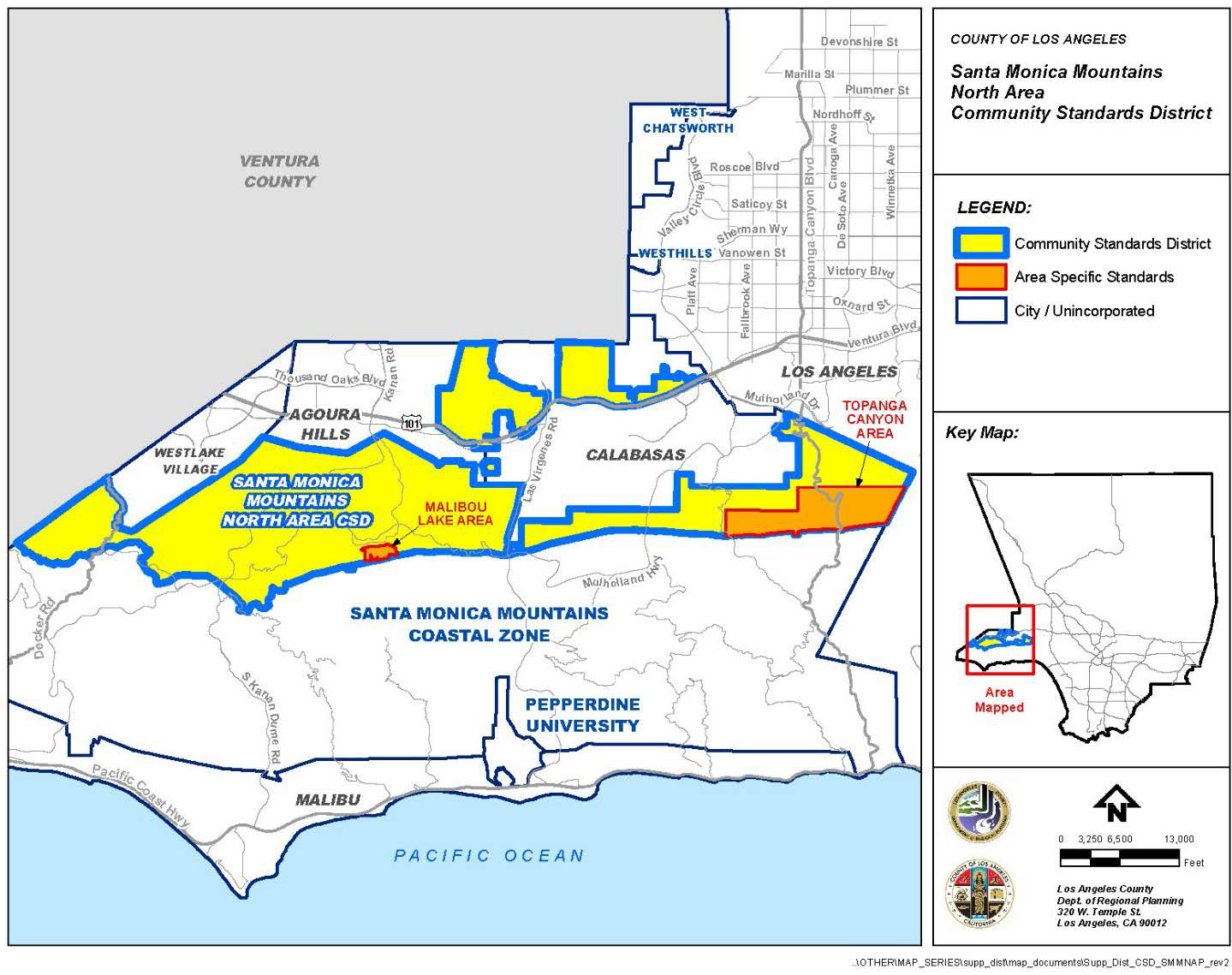
FIGURE 22.336-B: SIGNIFICANT RIDGELINES
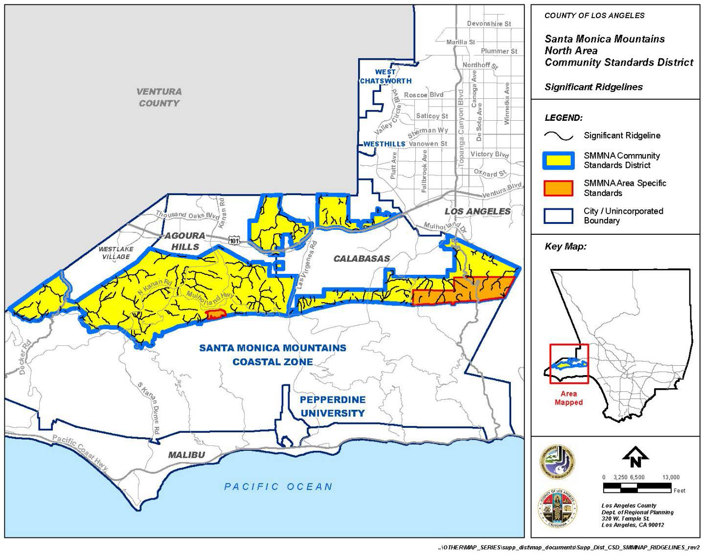
FIGURE 22.336-C: TOPANGA CANYON AREA
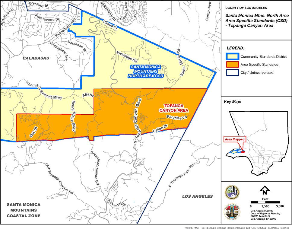
FIGURE 22.336-D: MALIBOU LAKE AREA
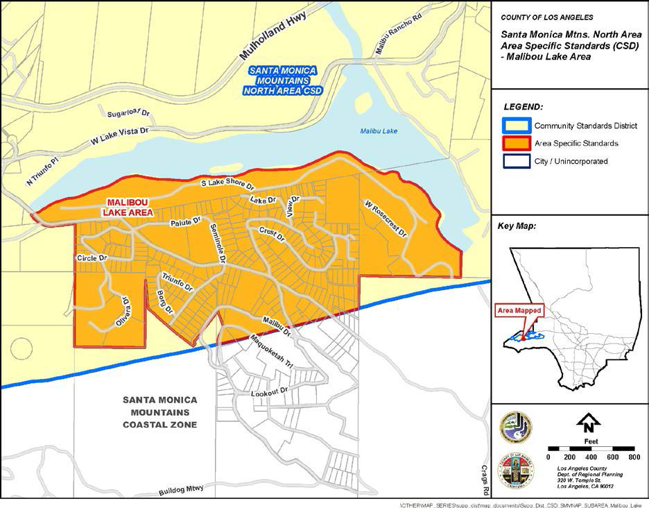
FIGURE 22.336-E: STANDARDS FOR STREET WIDTH

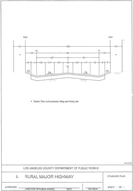
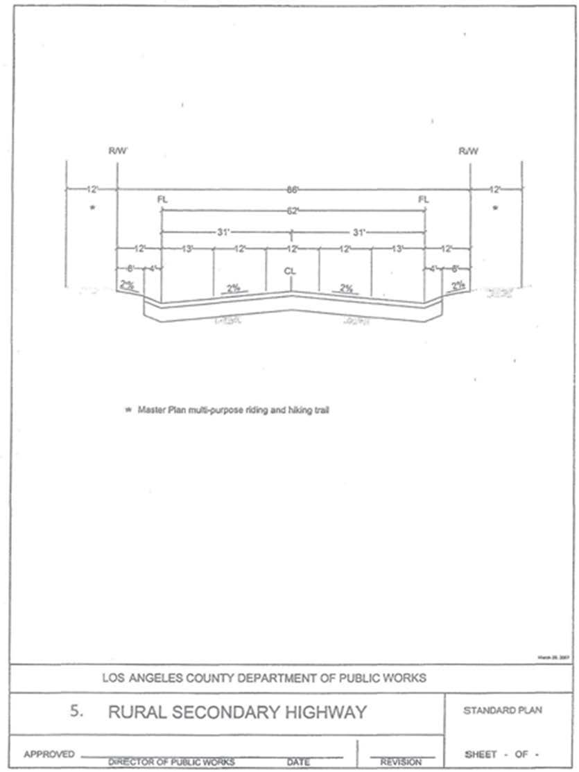
(Ord. 2021-0021 § 2, 2021.)
APPENDIX I. - CRITERIA FOR SIGNIFICANT RIDGELINES
The designation of the significant ridgelines within the Santa Monica Mountains North Area Community Standards District is based on the following criteria:
• Topographic complexity: Ridges that have a significant difference in elevation from the valley or canyon floor. Generally, these ridges are observable from any location on the valley floor, from a community, or from a public road. Geologic conditions in the Santa Monica Mountains North Area make this a common condition.
• Near/far contrast: Ridges that are a part of a scene that includes a prominent landform in the foreground and a major backdrop ridge with an unbroken skyline. This includes a view into a valley from a public road or viewpoint located at a higher altitude, such as along the valley rim or a pass. Often, layers of ridges are visible into the distance, such as when looking west from Topanga Canyon Boulevard over Henry Ridge to Saddle Peak, and from Mulholland Highway looking east toward Cornell and Malibu Lake. This contrast can be experienced viewing an entire panorama or a portion of a panorama from an elevated point.
• Cultural landmarks: Ridges that frame views of well-known locations, structures, or other places, which are considered points of interest in the Santa Monica Mountains North Area. These landmarks include Paramount Ranch, Peter Strauss Ranch, and Malibu Lake.
• Uniqueness and character of a specific location: Peaks and their buttressing ridges. This is represented by ridges that frame rocky outcroppings, other unique geological features, and areas of extraordinary natural beauty, such as Ladyface Mountain and Saddle Rock. Ridges that frame Malibu Canyon-Las Virgenes Road—a State-designated, County scenic highway—Mulholland Highway, Kanan Road, Topanga Canyon Boulevard, and other scenic routes are also included.
• Existing community boundaries and gateways: Ridges and surrounding terrain that provide the first view of predominantly natural, undeveloped land as a traveler emerges from the urban landscape. These lands introduce visitors to the visual experiences they will encounter in the Santa Monica Mountains North Area. Community boundaries and gateways include the surrounding ridges that provide a skyline and boundary to the rural communities found in the North Area. Examples include the ridges viewed from the Ventura Freeway traveling west from Calabasas, and the ridges along Triunfo and Lobo Canyons.
(Ord. 2019-0004 § 1, 2019.)
22.340.010 - Purpose.
The Southeast Antelope Valley Community Standards District ("CSD") is established to protect and enhance the community's rural, equestrian, and agricultural character as well as its natural features, including significant ecological areas, flood plains, and desert terrain. The standards contained in this CSD are also intended to ensure reasonable access to public riding and hiking trails, and to minimize the impacts of urbanization.
(Ord. 2019-0004 § 1, 2019.)
22.340.020 - Definitions.
Rural artifacts. Outdoor items that may include, but are not limited to, farm, mining, or railroad equipment or old wagons that are displayed in a manner that adds to the intentional, framed, and organized decoration of a property.
(Ord. 2023-0062 § 2, 2023)
22.340.030 - District Map.
The boundaries of this CSD are shown on Figure 22.340-A: Southeast Antelope Valley CSD Boundary, at the end of this Chapter.
(Ord. 2023-0062 § 3, 2023; Ord. 2019-0004 § 1, 2019.)
22.340.040 - Applicability.
In conjunction with Section 22.300.020 (Application of Community Standards Districts to Property), this Chapter shall apply to any application for development, expansion, or change of use requiring Department approval that is filed after January 18, 2024. For expansion of an existing, legally established use as of January 18, 2024, this Chapter shall only apply to the new expansion portion and not to existing development.
(Ord. 2023-0062 § 4, 2023; Ord. 2019-0004 § 1, 2019.)
22.340.050 - Application Review and Procedures.
(Reserved)
22.340.060 - Communitywide Development Standards.
A.
Design. Where a discretionary land-use permit subject to Type II (Chapter 22.228), Type III (Chapter 22.230), or Type IV (Chapter 22.232) Review is required, development shall preserve existing natural contours, native vegetation, and natural rock outcropping features to the greatest extent feasible.
B.
Property Maintenance.
1.
All portions of any lot that are visible from a public or private street shall be kept free of debris, trash, lumber, overgrown or dead vegetation, broken or discarded furniture, and household appliances, including, but not limited to, refrigerators, stoves, and freezers.
2.
Rural artifacts are exempt from the minimum required yard setback requirements provided they are at least five feet from all property lines, a maximum height of up to six feet, and maintained in an orderly manner. They should not occupy more than 400 square feet of the property, nor shall they create a public nuisance or pose a safety hazard.
C.
Outdoor Lighting. Outdoor lighting shall comply with the applicable provisions of Chapter 22.80 (Rural Outdoor Lighting District).
D.
Street Improvements. In new residential subdivisions, local streets shall comply with the following standards in addition to the applicable provisions of Part 3 (Local Streets and Ways) of Chapter 21.24 in Title 21 (Subdivisions) of the County Code:
1.
The maximum paved width of local streets shall not exceed 28 feet with unpaved shoulders, excluding any inverted shoulders, or concrete flow lines;
2.
Curbs, gutters, and sidewalks shall be required only where necessary for the safety of pedestrian and vehicular traffic, and management of storm flows, as determined by Public Works; and
3.
Inverted shoulder cross-sections shall be required unless an alternate design is deemed necessary for the safety of pedestrian and vehicular traffic, as determined by Public Works.
E.
Street Lights. Where required, street lights shall be provided in accordance with the applicable provisions of Chapter 22.80 (Rural Outdoor Lighting District).
F.
Alcoholic Beverage Sales. No business newly engaged in the sale of alcoholic beverages for off-site consumption shall be located within 1,000 feet of any public or private school.
G.
Fences. No garage doors of any kind, regardless of color or uniformity of design, shall be used for fencing. Fences within a required yard adjoining any public or private road shall comply with the applicable provisions of Section 22.110.070 (Fences and Walls) and shall be made of chain link, split rail, open wood, rock, block, split-faced or whole brick, wooden pickets, iron, any combination of the above.
H.
Multiuse (Equestrian, Hiking, and Mountain Biking) Trails. All new subdivisions shall contain trails in accordance with the Trails Plan of the Antelope Valley Area Plan ("Trails Plan"). Conditions of approval for new subdivisions shall require that multiuse trail easements be dedicated to the County and that trail construction be completed by the subdivider and approved by Parks and Recreation, prior to the recordation of the final map for the subdivision.
1.
Trail Standards. Trails built pursuant to this Subsection H shall satisfy the following minimum standards:
a.
Feeder routes. To the greatest extent possible, and without requiring off-site land acquisitions by the subdivider, feeder routes shall be provided from every new subdivision to a main trails network shown on the Trails Plan; and
b.
Multi-purpose use. The trails shall be designed to accommodate equestrian, hiking, and mountain bike uses with clear line-of-sight.
2.
Trail Maintenance. When trails and feeder routes are not required to be maintained by Parks and Recreation, the conditions of approval for new subdivisions shall require that said trails be maintained, subject to approval by Parks and Recreation, either by a homeowner's association, as stipulated within the Declaration of Covenants, Conditions, and Restrictions (CC&Rs), or by a special district. If a special district is used, such district shall be an entity established as an assessment district pursuant to the Landscaping and Lighting Act of 1972, section 22500 et seq. of the California Streets and Highways Code (Landscaping and Lighting Act District), or it shall be some other entity capable of assessing and collecting trail maintenance fees from the owners of the lots in the new subdivision.
3.
Alternative Trail Proposal. If it is infeasible for a subdivider to provide trails in accordance with the Trails Plan, alternative trail alignment proposals may be substituted. The alternative trail proposal shall be approved by Parks and Recreation, and be connected, to the greatest extent possible, to a network of proposed, existing, or feeder trails.
(Ord. 2023-0062 § 5, 2023; Ord. 2019-0004 § 1, 2019.)
22.340.070 - Zone Specific Development Standards.
A.
Residential and Agricultural Zones.
1.
Accessory Truck Tractor-Trailer Parking. One truck tractor, with or without one trailer or semi-trailer, may be parked in an agriculturally zoned property if a Ministerial Site Plan Review (Chapter 22.186) application is approved and all of the following requirements are met.
a.
The property is the primary residence of the tractor-trailer owner or operator, and proof of residency is made available to the Department or law enforcement upon request.
b.
The property is at least one gross acre in size and fronts a paved and public road.
c.
The property is not located on a parcel containing a mapped Significant Ecological Area or Special Flood Hazard Areas (100-year [one percent annual chance] flood areas), as mapped by the Federal Emergency Management Agency.
d.
When parked on the property, the tractor-trailer shall be a minimum of 10 feet from all property lines and maintain all required setbacks. It shall not be parked within 35 feet of any building used for human habitation, other than the subject residence and any accessory dwelling unit to the subject residence.
e.
The tractor-trailer shall not exceed an overall length of 75 feet and the trailer shall not exceed 53 feet in length.
f.
The tractor-trailer shall not be parked on the driveway.
g.
The site plan shall depict the tractor-trailer parking area, the overall dimensions of the tractor-trailer, and the on-site circulation path, including a back-up turning radius of at least 60 feet and a minimum 120-foot diameter for a full turnaround. No backing onto or from the public right-of-way shall be permitted.
h.
In compliance with Title 12 (Environmental Protection) of the County Code, the tractor-trailer shall not be operated between the hours of 10:00 p.m. and 7:00 a.m. unless the noise level of the operation is reduced to 45 dB(A) or less as measured at the property line.
i.
The tractor-trailer parking area and driveway shall consist of or be improved with materials that may include slag, gravel, or other similar materials, such as decomposed granite, or fully paved.
j.
Drip pans, or similar ground covering and retention material, shall be used when tractor-trailer is parked.
k.
Storage of equipment, materials, or supplies is prohibited.
l.
Mechanical or routine maintenance shall be permitted subject to the limits and restrictions set forth in Chapter 12.08 (Noise Control) of Title 12 (Environmental Protection). Regardless of noise level, the following maintenance work shall not be permitted on-site:
i.
Steam-cleaning or degreasing the vehicle.
ii.
Welding.
iii.
Use of pneumatic equipment, other than to repair a disabled vehicle.
iv.
Tractor-trailer painting.
v.
Tractor-trailer body and fender repairs, including engine or transmission work.
2.
Cargo Shipping Containers. Notwithstanding Section 22.140.150 (Cargo Shipping Containers), non-habitable cargo shipping containers for the purpose of storage are permitted as an accessory use in the R-A, A-1 and A-2 Zones in the quantities identified in Table 22.340.070-A, provided the following development standards are met and necessary permits are issued by Public Works:
a.
Size and Specifications. Cargo shipping containers shall not exceed 10 feet in height, 10 feet in width, and 40 feet in length.
b.
Location. Cargo shipping containers are prohibited in any required yard.
c.
Placement. Cargo shipping containers shall not be stacked upon each other or placed between the primary structure and the right-of-way.
d.
Design. Cargo shipping containers shall be painted in earth tones and one uniform color, and shall not display any images or lettering on their sides, except for images or lettering providing safety information related to the contents stored within, or otherwise required by the County Code, or any other applicable federal, State, or local regulation. The property's address numbering may be painted on or near the top of the container.
e.
Safety and Maintenance. All cargo shipping containers shall be kept in a state of good repair, and any landscaping used as screening shall be properly maintained.
3.
Fences and Walls. Notwithstanding the provisions listed in Section 22.110.070 (Fences and Walls), and subject to the requirements of Public Works, the following standards shall apply:
a.
Front Yards. As shown in Figure 22.340.070-A, fences, walls, and landscaping used as fences or walls within a required front yard setback may be permitted up to a maximum height of six feet, when located 10 feet or more from the driveway, and shall provide at least 20 feet of vehicle clearance measured from the right-of-way line toward the property. When located less than 10 feet from the driveway, fences and walls shall be a maximum of three and one-half feet in height.
FIGURE 22.340.070-A: VIEW-OBSCURING FENCE OR WALL
IN FRONT YARD
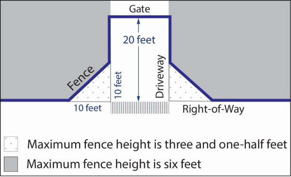
b.
Interior Side and Rear Yards, fences and walls within a required interior side yard or rear yard shall not exceed eight feet in height, provided that on the street or highway side of a corner lot such fence or wall shall be subject to the same requirements as for a corner side yard.
c.
Corner Side Yards. Fences and walls within a required corner side yard shall be limited to eight feet in height when located five feet or more from the right-of-way line toward the property, and three and one-half feet in height when located less than five feet from the right-of-way.
d.
Reversed Corner Side Yards. Fences and walls within a required reversed corner side yard shall be limited to eight feet in height when located 10 feet or more from the right-of-way line toward the property, and three and one-half feet in height when located less than 10 feet from the right-of way.
4.
Lot Area. Each new lot created by a subdivision shall contain a gross acre of not less than one acre.
5.
Personal Vehicles. Pickup trucks and vehicles under 10,000 pounds Gross Vehicle Weight, including those with dual rear tires used as personal vehicles by the on-site resident, shall be considered personal vehicles and shall be allowed to park in the same areas as passenger vehicles.
B.
Rural, Commercial, and Industrial Zones.
1.
Amenities. For commercial developments and mixed-use developments that include commercial uses, at least two of the following amenities shall be provided within the subject property for public use:
a.
Benches;
b.
Bicycle racks;
c.
Decorative outdoor lighting along pedestrian paths;
d.
Drinking fountains;
e.
Landscaped buffers;
f.
Newsstands;
g.
Planter boxes;
h.
Special paving materials, such as treated brick, for pedestrian circulation areas;
i.
Solid waste and recycling receptacles;
j.
Landscaped trellises or breezeways between buildings;
k.
Hitching posts; or
l.
Other amenities approved by the Director.
2.
Yards. All buildings, walls, vehicle parking, access, and circulation areas adjoining or adjacent to a residentially or agriculturally zoned lot shall:
a.
Have a landscaped area with a width of not less than 25 feet along the property line adjoining or adjacent to the residentially or agriculturally zoned lot. Landscaping within this area shall consist of plants from the Southeast Antelope Valley Native Plant List on file with the Department, and shall include, but not be limited to, a minimum of one 15-gallon tree, planted and maintained within each 15-foot portion of lot width or depth adjoining or adjacent to the residentially or agriculturally zoned lot. Other drought-tolerant, noninvasive plant species may be used when native trees from the Southeast Antelope Valley Native Plant List are not available. Along the property line not adjoining a public or private street, a solid masonry wall at the property line with a five-foot yard may be substituted for the landscaped area with a width of not less than 25 feet.
i.
In Commercial and Rural Zones, such solid masonry wall shall be at least six feet in height and shall not be more than 12 feet in height.
ii.
In Industrial Zones, such solid masonry wall shall be at least eight feet in height and shall not be more than 15 feet in height.
b.
Have side yards for reversed corner lots as required in the adjoining residentially or agriculturally zoned lot.
3.
Vehicle access, circulation, parking, and loading areas shall be located as far as possible from adjoining or adjacent residentially or agriculturally zoned lots. Truck on-site circulation plans shall be submitted for review by Public Works.
4.
Truck Access. Other than during the hours of 8:00 a.m. to 5:00 p.m., Monday through Friday, and health, environmental, and safety considerations permitting, lots with multiple street frontages shall permit access to trucks only from the street that is farthest from adjoining or adjacent residentially or agriculturally zoned lots.
5.
Outside Storage. Outside storage shall be maintained in accordance with the standards and requirements of Section 22.140.430 (Outdoor Storage) and so that the items in storage are not visible from adjoining or adjacent public or private streets and adjoining or adjacent residentially or agriculturally zoned lots at ground level.
6.
Business Signs. Except as modified herein, all business signs shall conform to Chapter 22.114 (Signs):
a.
Applicability. The sign regulations herein shall apply to new signs only, and shall not apply to existing signs which were legally established prior to the effective date of the ordinance establishing this CSD.
b.
Wall Business Signs. Wall business signs shall be mounted flush and affixed securely to a building wall, and may extend from the wall a maximum of 12 inches.
c.
Prohibited Signs.
i.
Roof business signs.
ii.
Internally illuminated signs.
(Ord. 2023-0062 § 6, 2023; Ord. 2019-0004 § 1, 2019.)
22.340.080 - Area Specific Development Standards.
This CSD contains two distinct commercial areas:
A.
Area 1—Palmdale Boulevard Commercial Area.
1.
Purpose. This Area is established to implement development standards for enhanced future commercial growth along Palmdale Boulevard and 90th Street East.
2.
Applicability. The standards contained in this Subsection A shall apply to commercial developments and mixed-use developments that include commercial uses within the boundaries of the Area shown on Figure 22.340-B: Palmdale Boulevard Commercial Area, at the end of this Chapter.
3.
Architectural Standards. All buildings, building additions, and building renovations shall incorporate:
a.
Southwestern (except Adobe), Art Deco, or Mediterranean influenced architecture, painted with earth tones or shades of taupe, beige, olive, burgundy, or other neutral colors approved by the Director.
b.
At least two of the following architectural elements:
i.
Arcades;
ii.
Arches;
iii.
Awnings;
iv.
Courtyards;
v.
Colonnades; or
vi.
Plazas.
c.
Variation in roofline and façade detailing such as recessed windows, balconies, offset planes, added textures (e.g., brick or stone), or similar architectural accents approved by the Director. Long, unbroken building façades shall be prohibited.
d.
A "village" look by clustering buildings or creating variation in multi-tenant façades.
4.
Yards.
a.
Each lot adjoining Palmdale Boulevard or 90th Street East shall have a front yard of not less than 10 feet.
b.
Parking lots are prohibited in the required front yard area.
c.
The required front yard area shall be landscaped using drought-tolerant plants from the Southeast Antelope Valley Native Plant List on file with the Department, or other drought-tolerant noninvasive plant species when native plants are not available, and the landscape are shall include no less than one 24-inch box tree for every 20 linear feet of street frontage.
d.
Vehicle and pedestrian access, outdoor dining, and street furniture such as benches, chairs, or similar items approved by the Director are permitted within the required front yard area.
B.
Area 2—Pearblossom Highway Commercial Area.
1.
Purpose. This Area is established to preserve and enhance the small-town, rural frontier style of commercial development existing along Pearblossom Highway, and to promote future development that is consistent with the existing community character.
2.
Applicability. The standards contained in this Subsection B shall apply to commercial developments and mixed-use developments that include commercial uses within the boundaries of the Area shown on Figure 22.232-C: Pearblossom Highway Commercial Area, at the end of this Chapter.
3.
Building Height. All buildings shall be limited to two stories and a maximum height of 35 feet above grade, excluding chimneys and rooftop antennas.
4.
Architectural Standards. All buildings, building additions, and building renovations shall incorporate one of the following architectural styles and its associated development standards. Examples of these features are provided in the Southeast Antelope Valley CSD Implementation Guide.
a.
Old West or Western Frontier (California Gold Rush Era - Circa 1890s) architecture shall include the following elements:
i.
Form and Massing. When parcels abut Pearblossom Highway, the primary building façade shall face Pearblossom Highway and shall include a recessed entryway and/or a covered porch with vertical support posts made of wood or materials made to look like wood. If the building has a second story, include a balcony.
ii.
Roof Design. Each individual building shall contain a rectangular false front or ornamental parapet with either a flat roof or a hidden sloped roof behind.
iii.
Wall and Window Designs. Exterior building walls shall have vertical or horizontal building siding, such as the Board and Batten design. Windows along the primary façade shall cover no more than 40 percent of the total area. Muntins shall be used to divide larger windows. To get more natural light into the building, skylights, or additional windows may be added to secondary façades.
iv.
Materials and Colors. The building siding, window framing, and any accompanying signage shall be constructed of wood; or engineered wood, fiber cement, or other materials made to look like wood, and shall either be unadorned or be painted with earth tones, such as shades of taupe, beige, olive, burgundy, or other neutral colors approved by the Director.
v.
Decorative accents. At least two of the following architectural elements shall be incorporated into the design of the site: cast iron-type benches, Mission bell-shaped lighting fixtures, hitching posts, wood or wooden-looking trash barrels, wagon wheels, shutters, metal lamppost style outdoor floor clock, or a transom window over the main entrance.
vi.
Site elements shall maintain the Old West or Western Frontier design, such as the placement of trash receptacles in enclosures that match the architectural style of the primary building and are located to the rear of the property.
b.
Spanish Colonial Revival architecture shall include the following elements:
i.
Form and Massing. First floor archways shall be incorporated into the building's design. Where there is a second story, balconies shall be required and shall be made of wrought iron, decorative metal, or wood with painted or stained finishes.
ii.
Roof Design. Roofs shall have a low pitch of between 1:12 and 4:12 and shall be made of red clay tiles or materials made to look like them, with either the Spanish S-shape or Barrel Type Mission design.
iii.
Wall and Window Designs. At least 50 percent of windows along the primary façade shall be arched (flat arch or semi-circle arch) or shall be framed by an archway architectural element (e.g., colonnade in front of the window). Windows shall be consistently applied along the same story on the same façade.
iv.
Materials and Colors. Exterior building walls shall be white or tan in color and made of stucco with smooth or lightly textured finishes (i.e., hand troweled or smaller particles). Window frames shall be a dark color such as black, dark brown, forest green, or navy blue.
v.
Decorative Accents. At least two of the following architectural elements shall be incorporated into the design of the building: decorative tiles, clay tile vents, wood brackets, wrought iron railing, a courtyard, recessed niches, window grilles, dark metal or wrought iron light fixtures with curving brackets, or stucco finish chimney with round or rectangular openings.
c.
Victorian (Folk) architecture shall include the following elements:
i.
Roof Design. Roofs shall have a medium to high pitch of between 6:12 and 18:12 and shall be composed of asphalt, metal, or synthetic shingles with simple gable brackets, vents, and trim.
ii.
Wall and Window Designs. Exterior building walls shall have vertical or horizontal building siding, such as the Board and Batten design. Windows along the primary façade shall cover no more than 40 percent of the total area. Muntins shall be used to divide larger windows. To get more natural light into the building, skylights, or additional windows may be added to secondary façades.
iii.
Materials and Colors. Bright and expressive paint colors may be used on the building façade. Window and door trims, as well as other decorative elements, such as gable pediments and trim, may be painted in a contrasting color, such as white, to distinguish the architectural elements from the building's siding.
iv.
Decorative Accents. At least two of the following architectural elements shall be incorporated into the design of the building: pedimented windows, a transom window over the main entrance, a gable pediment, a square tower or cupola above the roofline, stone or rough brick veneer at the base of the building, or accented window shutters.
5.
Yards.
a.
Each lot adjoining Pearblossom Highway or 82nd Street East shall have a front yard of not less than 10 feet.
b.
Parking lots are prohibited in the required front yard area and shall be located to the rear or side of the primary building where feasible.
c.
The required front yard area shall be landscaped using drought-tolerant plants from the Southeast Antelope Valley Native Plant List on file with the Department, or other drought-tolerant noninvasive plant species when native plants are not available, and the landscaped area shall include no less than one 24-inch box tree, for every 20 linear feet of street frontage.
d.
Vehicle and pedestrian access, outdoor dining, and street furniture such as benches, chairs, or similar items approved by the Director are permitted within the required front yard area.
6.
Lighting and Signage. Lighting and signage shall comply with all applicable provisions of Chapter 22.80 (Rural Outdoor Lighting District) and shall be consistent in design with the building's architectural style by incorporating similar colors and materials as described above. Notwithstanding the provisions of Section 22.144.120 (Roof and Freestanding Business Signs), freestanding signs shall be permitted as follows:
a.
Regardless of lot width, at least one freestanding sign shall be permitted on each property. However, more than one freestanding sign may be allowed for wider lots, as provided in Section 22.144.120.
b.
Freestanding signs shall not exceed 32 square feet per sign face with a maximum of two faces permitted.
c.
The maximum height of freestanding signs shall be 30 feet.
d.
No movement or lighting shall be permitted as part of the freestanding sign.
7.
Drive-Through Facilities. New drive-through facilities established as part of a restaurant or other eating establishment that are located on parcels adjoining Pearblossom Highway shall require an approved Conditional Use Permit (Chapter 22.158) and the submittal of an on-site stacking plan to be reviewed by Public Works.
(Ord. 2023-0062 § 8, 2023; Ord. 2019-0004 § 1, 2019.)
22.340.090 - Modification of Development Standards.
A.
Modifications to any standards in this Chapter are subject to a Conditional Use Permit (Chapter 22.158) application, and shall be subject to additional findings:
1.
The use, development of land, and application of development standards comply with all applicable provisions of this Title 22;
2.
The use, development of land, and application of development standards, when considered on the basis of the suitability of the site for the particular use or development intended, are arranged to avoid traffic congestion, to provide for the safety and convenience of bicyclists and pedestrians, including children, senior citizens, and persons with disabilities, to protect of public health, safety and general welfare, prevent adverse effects on neighboring property and conforms with good zoning practice;
3.
The use, development of land, and application of development standards is suitable from the standpoint of functional developmental design;
4.
The application of the standards for which modification is sought would result in practical difficulties or unnecessary hardships;
5.
There are exceptional circumstances or conditions uniquely applicable to the subject property, or to the intended development of the property, that do not apply to other properties within the area governed by this CSD; and
6.
That granting the requested modification will not be materially detrimental to properties or improvements in the area or contrary to the purpose of this CSD.
(Ord. 2023-0062 § 9, 2023; Ord. 2019-0004 § 1, 2019.)
FIGURE 22.340-A: SOUTHEAST ANTELOPE VALLEY CSD BOUNDARY
FIGURE 22.340-B: PALMDALE BOULEVARD COMMERCIAL AREA
FIGURE 22.340-C: PEARBLOSSOM HIGHWAY COMMERCIAL AREA
(Ord. 2023-0062 § 9, 2023; Ord. 2019-0004 § 1, 2019.)
22.342.010 - Purpose.
The Stonyvale Community Standards District ("CSD") is established to facilitate the construction of single-family residences, accessory structures, fences, and walls in the Stonyvale area affected by the 2009 Station Fire, without endangering the health and safety of residents. This CSD does not modify or waive any other provisions of the County Code or any local, State, and federal laws or regulations.
(Ord. 2019-0004 § 1, 2019.)
22.342.020 - Definitions.
(Reserved)
22.342.030 - District Map.
The boundaries of this CSD are shown on Figure 22.342-A: Stonyvale CSD Boundary, at the end of this Chapter.
(Ord. 2019-0004 § 1, 2019.)
22.342.040 - Applicability.
(Reserved)
22.342.050 - Application and Review Procedures.
(Reserved)
22.342.060 - Community Wide Development Standards.
A.
Front Yards. The minimum required front yard shall be three feet as measured from the nearest edge of the pavement or the nearest edge of the right-of-way of Stonyvale Road, whichever would provide the greater front yard. Section 22.110.080.B (Front Yards) are not applicable;
B.
Fences and Walls. The maximum height of any fence or wall, including a retaining wall, in any required yard is eight feet.
(Ord. 2019-0004 § 1, 2019.)
22.342.070 - Zone Specific Development Standards.
(Reserved)
22.342.080 - Area Specific Development Standards.
(Reserved)
22.342.090 - Modification of Development Standards.
(Reserved)
FIGURE 22.342-A: STONYVALE CSD BOUNDARY
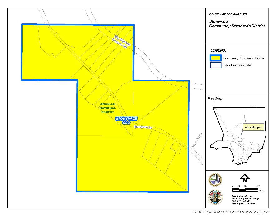
(Ord. 2019-0004 § 1, 2019.)
22.344.010 - Purpose.
The Twin Lakes Community Standards District ("CSD") is established to preserve the character of the Twin Lakes community and to encourage the provision of essential improvements appropriate for its unique rural character, as defined in the Community Plan. This CSD is one means of implementing the goals and objectives of the Twin Lakes Community Plan. The Twin Lakes Community Plan was developed primarily to address severe problems involving sewage disposal and circulation in a small-lot subdivision.
(Ord. 2019-0004 § 1, 2019.)
22.344.020 - Definitions.
(Reserved)
22.344.030 - District Map.
The boundaries of this CSD are shown on Figure 22.344-A: Twin Lakes CSD Boundary, at the end of this Chapter.
(Ord. 2019-0004 § 1, 2019.)
22.344.040 - Applicability.
A.
The provisions of Section 22.110.080.B.1 (On Partially Developed Blocks) shall not apply.
B.
The provisions of Section 22.110.080.B.3 (On Sloping Terrain) shall not apply.
C.
The provision of Section 22.110.030 (Accessory Buildings) shall not apply.
D.
The provisions of Section 22.110.190 (Modifications Authorized) shall not apply.
(Ord. 2022-0008 § 159, 2022; Ord. 2019-0004 § 1, 2019.)
22.344.050 - Application and Review Procedures.
(Reserved)
22.344.060 - Community Wide Development Standards.
A.
Parking and Driveway Requirements.
1.
On-street parking shall observe posted signage.
2.
A minimum driveway length of 20 feet, as measured from a line parallel to and a minimum of 10 feet from the centerline of the driven roadway, is required in order to ensure adequate off-street parking. If two standard size vehicle parking spaces are provided on site and not within the required yard setbacks, this provision may be waived.
B.
On-site and Off-site Improvements. All new homes or improvements to existing homes which exceed 25 percent of the current market value of the existing home must satisfy the following:
1.
All roads or access easements on site, as well as segments of all roads abutting the parcel must be improved with a minimum of 20 foot width of paving, to be approved by Public Works.
2.
Fire hydrants must be accessible to the site, and comply with current standards of the Fire Department.
3.
Sewage disposal facilities must be sized to serve the requested use, based on current Department of Public Health's standards.
4.
The construction of improvements needed to comply with Subsection B.1 through B.3, above, shall be the full responsibility of the project applicant.
5.
The County shall impose as a condition of its approval of any affected development a requirement for construction of the necessary improvements.
(Ord. 2019-0004 § 1, 2019.)
22.344.070 - Zone Specific Development Standards.
(Reserved)
22.344.080 - Area Specific Development Standards.
A.
Area 1 (Small Lot Subdivisions)—All Property Located Within the Following Records of Survey: 24-25, 25-44, 25-46, 26-42, 28-23.
1.
Slope Intensity Formula. Construction of residential units or any improvements to residential units on a lot of less than 6,000 square feet shall be subject to the following:
a.
The maximum allowable gross structural area of a residential unit to be constructed on a building site shall be determined by the following formula:
GSA = (A/5) × [(50-S/35] + 800
Where: GSA = The allowable gross structural area of the permitted development in square feet. The GSA includes the total floor area of all enclosed residential and storage areas but does not include vent shafts, garages or carports designed for the storage of autos.
A = The area of the building site in square feet. The building site is defined by the applicant and may consist of all or a designated portion of the one or more lots comprising the project location. All permitted structures must be located within the designated building site; and
S = The average slope of the building site in percent as calculated by the formula: S = I × L/A × 100;
Where: S = Average natural slope in percent;
I = Contour interval in feet, at not greater than 25-foot intervals, resulting in at least five contour lines;
L = Total accumulated length in feet of all contour intervals (I); and
A = The area of the building site in square feet.
b.
All slope calculations shall be based on natural, ungraded conditions. Maps of a scale generally not less than one inch equals 10 feet (1" = 10'), showing the building site and natural slopes, prepared by a licensed surveyor or registered professional civil engineer, shall be submitted with the application. If slope is greater than 50 percent, enter 50 for S in the GSA formula.
c.
The maximum allowable GSA as calculated above may be increased as follows:
i.
Add 500 square feet or 12.5 percent of the total lot area, whichever is less, for each lot which is contiguous to the designated building site, provided that such lot is combined with the building site and all potential for residential development on such lot is extinguished or removed.
2.
Procedural Requirements.
a.
Any development requiring a building permit on a lot having a net area less than 6,000 square feet shall be subject to a Ministerial Site Plan Review (Chapter 22.186) application.
b.
Any modification of development standards shall be considered only through a Variance (Chapter 22.194) application. The maximum gross structural area as determined by the slope intensity formula shall not be subject to modification.
(Ord. 2019-0004 § 1, 2019.)
22.344.090 - Modification of Development Standards.
(Reserved)
FIGURE 22.344-A: TWIN LAKES CSD BOUNDARY
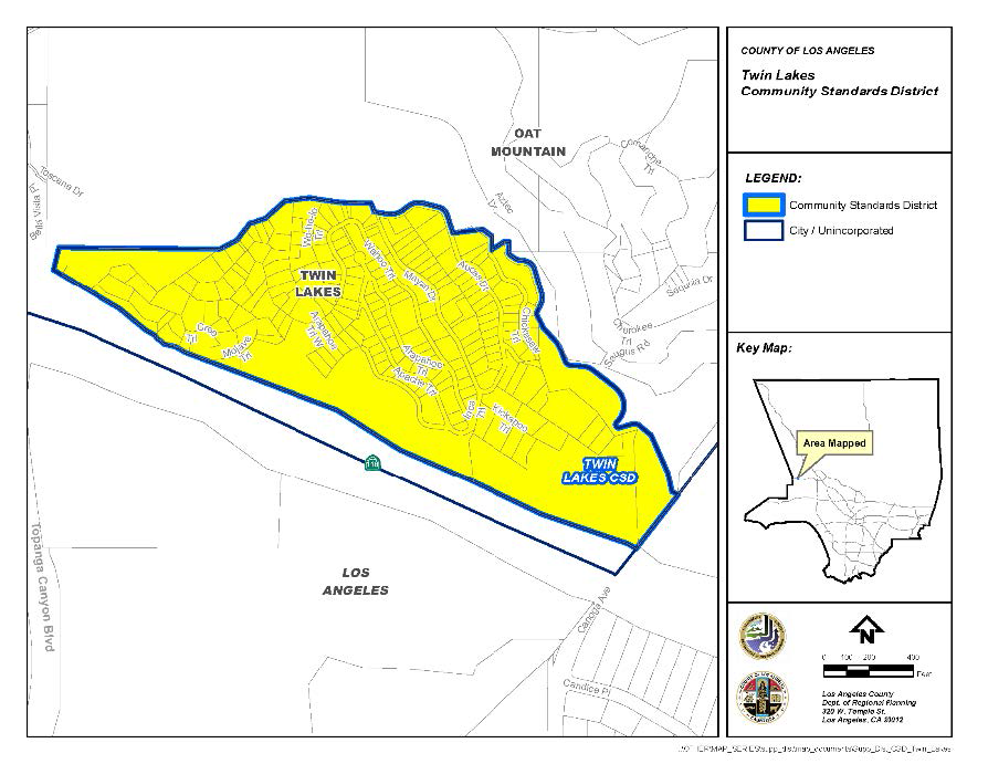
(Ord. 2019-0004 § 1, 2019.)
22.354.010 - Purpose.
The Green Valley Community Standards District ("CSD") is established to implement the goals and policies of the Antelope Valley Area Plan. This CSD contains development standards and guidelines that protect the rural character and features of Green Valley's environmental setting.
(Ord. 2021-0043 § 1, 2021.)
22.354.020 - Definitions.
The following terms are defined solely for this CSD:
Department. References to the Department are to the Department of Regional Planning, unless otherwise specified.
Gated or walled subdivision. A subdivision that includes proposed fencing or walls along its perimeter and restricted access. This definition excludes perimeter fencing for individual lots. A wall or fence along one side of the subdivision would not constitute a gated or walled subdivision.
Residential ranch entrance signs. A freestanding sign that marks the entrance to a single-family residential use.
(Ord. 2021-0043 § 1, 2021.)
22.354.030 - District Map.
The boundaries of this CSD are shown on Figure 22.354-A: Green Valley CSD Boundary, at the end of this Chapter.
(Ord. 2021-0043 § 1, 2021.)
22.354.040 - Applicability.
In conjunction with Section 22.300.020 (Application of Community Standard Districts to Property), this Chapter shall apply to any application for development, expansion, or change of use requiring Department approval that is filed after September 10, 2021. For expansion of an existing, legally-established use, as of September 10, 2021, this Chapter shall only apply to the new expansion portion and not to existing development. Section 22.354.070.A.3 (Hours of Operation), below, shall apply to new nonresidential uses.
(Ord. 2021-0043 § 1, 2021.)
22.354.050 - Application and Review Procedures.
(Reserved).
22.354.060 - Community-Wide Development Standards.
A.
Signs.
1.
All sign requirements of Chapter 22.114 (Signs), and all applicable provisions of Chapter 22.80 (Rural Outdoor Lighting District), shall also apply to the signage within this CSD, except as otherwise provided for or modified by this Subsection.
2.
Prohibited Signs. In addition to those prohibited by Section 22.114.040 (Prohibited Signs Designated), the following signs shall also be prohibited within this CSD:
a.
Outdoor Advertising Signs (Billboards).
b.
Roof Signs.
c.
Pole Signs.
d.
Internally Illuminated Signs.
3.
Wall Business Signs. Each business establishment fronting on and/or oriented toward one or more public street, highway, or parkway shall be permitted a maximum of one square foot of wall sign area for each one linear foot of building frontage. No wall business sign attached to a building shall extend above the building wall.
4.
Monument Signs. As provided for in Section 22.114.120 (Roof and Freestanding Business Signs), the height of such signs shall be limited to six feet measured from the natural grade at the base of the sign, and shall not display more than two sign faces with a maximum area of 50 square feet for each sign face.
5.
Residential Ranch Entrance Signs.
a.
A maximum of one residential ranch entrance sign is permitted;
b.
Residential ranch entrance signs shall only be permitted on lots of at least one gross acre in size and located in the Residential or Agricultural Zones;
c.
The maximum sign area for a residential ranch entrance sign shall be 20 square feet per sign face with a maximum of two sign faces permitted;
d.
The maximum height for a residential ranch entrance sign shall be 20 feet measured from the natural grade at the base of the sign; and
e.
Residential ranch entrance signs shall comply with all requirements of the Fire Code (Title 32) including requirements pertaining to fire apparatus access roads.
6.
Temporary Real Estate Signs. The following provisions shall supersede the requirements of Section 22.114.170.A (Area Permitted):
a.
Only one temporary real estate sign shall be permitted on a property at a time;
b.
Prior to posting such sign, the approval of the property owner shall be obtained in writing and be available for review upon request by the Department;
c.
Such sign shall contain the name and contact number of the person or company responsible for placing such sign, in addition to the address, or Assessor Parcel Number, of the property being sold; and
d.
Maximum Sign Area. In the Residential, Agricultural, Open Space, and Watershed Zones, the maximum sign area for a temporary real estate sign shall be six square feet per sign face. In all other zones, the maximum sign area for a temporary real estate sign shall be 48 square feet per sign face.
B.
Vegetation and Landscaping. The requirements in this Subsection only apply to discretionary land-use permits, subject to Type II (Chapter 22.228), Type III (Chapter 22.230), or Type IV (Chapter 22.232) reviews that include ground disturbance of over 400 square feet:
1.
In addition to the required application materials specified in Section 22.222.070 (Application Filing and Withdrawal), each application shall include:
a.
A detailed project description, outlining the reason for the proposed vegetation removal and the planned use of the property, within 12 months of application submittal;
b.
A landscaping plan, identifying all vegetation on the property including, and separately specifying, native vegetation listed in the Santa Clara River and San Andreas Significant Ecological Area Plant Lists maintained by the Department. The landscaping plan shall indicate the vegetation proposed to be removed as part of the project and how those removals shall be replaced with replanting, to the satisfaction of the Department, in consultation with the County Biologist; and
c.
Fuel modification plans or grading plans, upon request by the Department.
2.
In addition to the application filing fees listed in Chapter 22.250 (Applications, Petitions, and Fees), the applicant shall submit a fee for review by the County Biologist.
C.
Highway and Local Streets.
1.
Highway Standards.
a.
Routes shown on the County Highway Plan within the boundaries of this CSD shall use the alternate rural highway standards, except for locations where existing infrastructure or commercial and pedestrian traffic patterns are such that the Department of Public Works ("Public Works"), determines that curbs, gutters, and sidewalks are necessary for safety reasons, or to provide pedestrian access compliant with the Federal Americans with Disabilities Act;
b.
Encroachments into the highway right-of-way are prohibited, unless an encroachment permit is granted by Public Works, where Public Works will consider the potential impact that the encroachment will have on safe use of the highway right-of-way for temporary vehicle parking and pedestrian and equestrian movement. To the maximum extent feasible, the highway right-of-way shall be clear of all obstructions, including landscaping, trees, and other structures, which block safe pedestrian and equestrian movement on the highway right-of-way; and
c.
If the vehicular right-of-way is not coterminous with the boundaries of the highway right-of-way, driveways may be permitted to connect the property and the vehicular right of way. An encroachment permit from Public Works will be required. Such driveways shall be constructed with a non-slip surface, such as rough-broomed concrete.
2.
Local Street Standards. The following standards shall apply to all local streets maintained by Public Works within this CSD:
a.
Local streets shall use the inverted shoulder cross-section and shall have a paved width of 28 feet, except for locations where additional pavement is required for geometric improvements by Public Works or where commercial, industrial, or institutional uses necessitate alternate designs, as determined by Public Works. This 28-foot width excludes any inverted shoulder or concrete flowline;
b.
New curbs, gutters, and sidewalks are prohibited, unless deemed necessary by Public Works, after consultation with the Department, for the safety of pedestrian and vehicular traffic; and
c.
The encroachment and driveway provisions in Subsections 1.b and 1.c (Highway Standards), above, for highway rights-of-way, shall also apply to local streets.
D.
Subdivisions.
1.
Gated or walled subdivisions are prohibited.
2.
Required Area. New lots shall have a minimum of 2.5 gross acres.
3.
Utilities. All wires and cables that provide utility services, including telephone, television, electricity of less than 10 kilovolts, and similar services, shall be placed underground.
(Ord. 2021-0043 § 1, 2021.)
22.354.070 - Zone-Specific Development Standards.
A.
Commercial and Rural Zones.
1.
Design of Structures. New structures, additions, or renovations to existing structures, shall be designed to fit in with the community's rural setting by:
a.
Using earth-toned paint such as shades of taupe, beige, olive, burgundy, or other neutral, muted colors that blend with the surrounding setting;
b.
Ensuring that building façades do not have more than 50 percent of their street-facing surface area covered in any one of the following materials: glass, stucco, or metal; and
c.
Inclusion of one or more of the following features:
i.
A hitching post,
ii.
A recessed storefront entryway,
iii.
Cast-iron type benches,
iv.
Wood or wooden-looking barrels,
v.
Shuttered windows,
vi.
A wagon wheel, or
vii.
A water tower.
2.
Height. New structures, or expansions to existing structures, on lots adjacent to a Residential or Agricultural-zoned property, shall be subject to the following:
a.
Within five feet from any property line abutting a Residential or Agricultural-zoned property, the maximum height of the building shall be 17 feet; and
b.
Any portion of a proposed structure exceeding 17 feet in height shall be stepped back an additional foot for every foot in height over 17 feet from any common property line with the abutting Residential or Agriculturally-zoned property.
3.
Hours of Operation. The hours of operation for a nonresidential use shall be limited to the hours of 7:00 a.m. to 11:00 p.m., seven days a week.
4.
Yards. In addition to Section 22.24.040 (Development Standards for Rural Zones), commercial lots shall have a minimum front yard of 10 feet.
(Ord. 2021-0043 § 1, 2021.)
22.354.080 - Area-Specific Development Standards.
(Reserved).
22.354.090 - Modification of Development Standards.
Modifications to any standards in this Chapter are subject to a Minor Conditional Use Permit (Chapter 22.160) application with a notification radius consistent with Section 22.222.160 (Notification Radius), and shall be subject to additional findings:
A.
The application of these standards would result in practical difficulties or unnecessary hardships inconsistent with the purpose of this CSD; or
B.
There are exceptional circumstances or conditions that are uniquely applicable to the subject property, or to the intended development of the subject property, that do not apply to other properties within the area governed by this CSD.
(Ord. 2021-0043 § 1, 2021.)
FIGURE 22.354-A: GREEN VALLEY CSD BOUNDARY
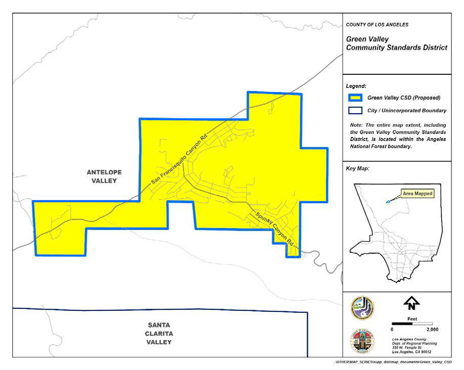
(Ord. 2021-0043 § 1, 2021.)
22.356.010 - Purpose.
The Pearblossom Community Standards District ("CSD") is established to implement the goals and policies of the Antelope Valley Area Plan. The Pearblossom CSD improves the quality of life in this community by preserving, protecting, and enhancing its rural character and maintains its unique small-town identity with a Modern Rustic aesthetic, which values the natural environment and supports the artistic, creative, and resourceful spirit of the community.
(Ord. 2024-0004 § 2, 2024.)
22.358.020 - Definitions.
The following terms are defined solely for this CSD:
Department. References to the Department are to the Department of Regional Planning, unless otherwise specified.
Drive-through service points. Location where the first point of service occurs. The following activities are considered points of service: menu boards, service windows, and gas pumps.
Drive-through stacking lanes. Spaces reserved for vehicles queuing on private property for a drive-through facility.
Gated or walled subdivision. A subdivision that includes proposed fencing or walls along its perimeter and restricted access. This definition excludes perimeter fencing for individual lots. A wall or fence along one side of the subdivision does not constitute a gated or walled subdivision.
Hand-painted wall sign. A sign advertising a business or product that is painted directly on a building wall. A mural is not considered a hand-painted wall sign.
Perimeter fencing. Fencing placed along a property line or following the general boundary of a property and within a required setback on a parcel intended for privacy or security.
Residential ranch entrance signs. A freestanding sign that marks the entrance to a single-family residential or agricultural use.
Rural artifacts. Outdoor items that may include, but are not limited to, farm, mining, or railroad equipment or old wagons that are displayed in a manner that adds to the intentional, framed, and organized decoration of a property.
(Ord. 2024-0004 § 2, 2024.)
22.356.030 - District Map.
The boundaries of this CSD are shown on Figure 22.356-A: Pearblossom CSD Boundary, at the end of this Chapter.
(Ord. 2024-0004 § 2, 2024.)
22.356.040 - Applicability.
In conjunction with Section 22.300.020 (Application of Community Standards Districts to Property), this Chapter shall apply to any application for development, expansion, or change of use requiring Department approval after February 22, 2024. For expansion of an existing legally-established use, as of February 22, 2024, this Chapter shall only apply to the new expansion portion and not to existing development.
(Ord. 2024-0004 § 2, 2024.)
22.356.050 - Application and Review Procedures.
In addition to other applicable provisions of Title 21 (Subdivisions) and this Title 22 of the County Code, notices of applications where a discretionary land-use permit subject to Type II (Chapter 22.228), Type III (Chapter 22.230), or Type IV (Chapter 22.232) review is required shall be mailed to all owners of property located within a 1,500-foot radius of the exterior boundaries of the subject property.
(Ord. 2024-0004 § 2, 2024.)
22.356.060 - Communitywide Development Standards.
A.
Alcoholic Beverage Sales. No business newly engaged in the sale of alcoholic beverages for off-site consumption shall be located within 1,000 feet of any parcel containing an existing legally-established public school or place used exclusively for religious worship.
B.
Highway and Local Streets.
1.
Highway Standards.
a.
Routes shown on the County Highway Plan within the boundaries of this CSD shall use the alternate rural highway standards, except for locations where existing infrastructure or commercial and pedestrian traffic patterns are such that the Department of Public Works ("Public Works") or Caltrans determines that curbs, gutters, and sidewalks are necessary for safety reasons or to provide pedestrian access compliant with the federal Americans with Disabilities Act;
b.
Encroachments into the highway right-of-way are prohibited unless an encroachment permit is granted by Public Works. Public Works will consider the potential impact that the encroachment will have on safe use of the highway right-of-way for temporary vehicle parking, pedestrian and equestrian movement to the maximum extent feasible, so that the highway right-of-way shall be clear of all obstructions, including landscape, trees, and other structures, which block safe pedestrian and equestrian movement on the highway right-of-way; and
c.
If the vehicular right-of-way is not coterminous with the boundaries of the highway right-of-way, driveways may be permitted with an encroachment permit, granted by Public Works, into the highway right-of-way from a property line to provide access from that property to the vehicular right-of-way or paved highway. Such driveways shall be constructed with a non-slip surface, such as rough-broomed concrete.
2.
Local Street Standards. The following standards shall apply to all local streets maintained by Public Works within this CSD:
a.
Local streets shall use the inverted shoulder cross-section and shall have a paved width of 28 feet, except for locations where additional pavement is required by Public Works for geometric improvements, or where commercial, industrial, or institutional uses necessitate alternate designs, as determined by Public Works. This 28-foot width excludes any inverted shoulders or concrete flowlines;
b.
New curbs, gutters, and sidewalks are prohibited unless deemed necessary by Public Works, after consultation with the Department, for the safety of pedestrian and vehicular traffic;
c.
The encroachment and driveway provisions in Subsections 1.b and 1.c, above, for highway rights-of-way, shall also apply to local streets; and
d.
Culs-de-sac shall be prohibited.
C.
Multiuse Trails (Equestrian, Hiking, and Mountain Biking). All new subdivisions shall contain trails in accordance with the Trails Plan of the Antelope Valley Area Plan ("Trails Plan"). Conditions of approval for new subdivisions shall require that multiuse trail easements be dedicated to the County, and that trail construction be completed by the subdivider and approved by the County Department of Parks and Recreation ("Parks and Recreation") prior to the recordation of the final map for the subdivision.
1.
Trail Standards. Trails built pursuant to this Subsection shall satisfy the following minimum standards:
a.
Feeder Routes. To the greatest extent possible, and without requiring off-site land acquisitions by the subdivider, feeder routes shall be provided from every new subdivision to a main trails network shown on the Trails Plan; and
b.
Multi-purpose Use. The trails shall be designed to accommodate equestrian, hiking, and mountain bike uses with clear line-of-sight.
2.
Trail Maintenance. When trails and feeder routes are not required to be maintained by Parks and Recreation, the conditions of approval for new subdivisions shall require that said trails be maintained, subject to approval by Parks and Recreation, either by a homeowner's association, as stipulated within the Declaration of Covenants, Conditions, and Restrictions (CC&Rs) or by a special district. If a special district is used, such district shall be an entity established as an assessment district pursuant to the Landscaping and Lighting Act of 1972, section 22500 et seq. of the California Streets and Highways Code, or it shall be some other entity capable of assessing and collecting trail maintenance fees from the owners of the lots in the new subdivision.
3.
Alternative Trail Proposal. If it is infeasible for a subdivider to provide trails in accordance with the Trails Plan, alternative trail alignment proposals may be substituted. The alternative trail proposal shall be connected, to the greatest extent possible, to a network of proposed, existing or feeder trails, and approved by Parks and Recreation.
D.
Preservation of Vegetation.
1.
Applicability. The standard described in this Subsection is applicable to lots that are two gross acres or greater in size.
2.
Disturbance of areas with vegetation shall require a Minor Conditional Use Permit (Chapter 22.160) where the cumulative area of ground disturbed, including, but not limited, to grading, blading, discing, excavating, or scraping, is greater than 25,000 square feet; or a Conditional Use Permit (Chapter 22.158) where the area of ground disturbed is greater than 40,000 square feet, up to 70 percent of the gross acreage of the lot, as shown below in Table 22.356.060-A.
3.
Cumulative ground disturbance of areas with vegetation shall not exceed 70 percent of the total gross acreage of any property.
4.
The following materials are required for both Minor Conditional Use Permit (Chapter 22.160) and Conditional Use Permit (Chapter 22.158) applications:
a.
A detailed project description, outlining the reason for the proposed ground disturbance of areas with vegetation and the planned use of the property;
b.
A plan identifying the location and approximate acreage of all existing and proposed areas with vegetation that will be disturbed or restored on the property. The plan shall also generally describe the type and condition of all vegetation on the property. The landscape plan shall indicate the type and approximate acreage of all existing areas with vegetation proposed to be removed as part of the project and how those removals will be mitigated with revegetation, to the satisfaction of the Department, and in consultation with the County Biologist;
c.
Fuel modification plans or grading plans shall also be submitted, upon request by the Department; and
d.
In addition to filing fees specified in Chapter 22.250 (Applications, Petitions, and Fees), the applicant shall submit a fee for review by the County Biologist.
5.
Additional Findings for Minor Conditional Use and Conditional Use Permits. In addition to substantiating the findings listed in Sections 22.160.050 and 22.158.050 (Findings and Decision), the applicant shall also substantiate the following:
a.
Development plans shall emphasize minimal ground disturbance and the protection of native plants, grasses, shrubs, and trees that intercept, hold, and more slowly release rainfall than bare earth surfaces. Where feasible, development plans shall emphasize the revegetation of previously disturbed areas with native vegetation. Stands of native vegetation and mature trees are preserved or expanded to the greatest extent possible; and
b.
The design of the project, including structures used to house animals, such as stables and arenas, shall not create erosion or flooding potential that would cause a safety hazard to structures or off-site properties, as determined by Public Works.
6.
Exemptions. The following cases of ground disturbance of areas with vegetation, are exempt from this Subsection:
a.
Ground disturbance, including the removal or reduction of areas with vegetation, for the purpose of complying with County regulations relating to brush clearance for fire safety. This exception includes not only required vegetation control around structures, but also the creation and maintenance by a public agency of firebreaks used to control the spread of fire;
b.
Ground disturbance, on publicly owned rights-of-way for roads, highways, flood control projects, or other similar or related uses; and
c.
Work performed under a permit issued to control erosion or flood hazards.
E.
Property Maintenance.
1.
Graffiti. All structures, walls, and fences open to public view shall remain free of graffiti. In the event graffiti occurs, the property owner shall remove or cover the graffiti within 14 calendar days of such occurrence, weather permitting.
2.
Rural Artifacts. Rural artifacts are exempt from the minimum required yard setback requirements, provided they are at least five feet from all property lines, have a maximum height of up to six feet, and are maintained in good condition. The exemption is not applicable to rural artifacts that occupy more than 400 square feet of the property or create a public nuisance or pose a safety hazard.
F.
Signs.
1.
All sign requirements of Chapter 22.114 (Signs), and all applicable provisions of Chapter 22.80 (Rural Outdoor Lighting District), shall also apply to the signage within this CSD, except as otherwise provided for or modified by this Subsection.
2.
External Lighting. Lighting for signage shall utilize externally mounted light fixtures designed to focus all light downward directly onto the sign, illuminating only the intended area with no light trespass beyond the sign area, in accordance with Section 22.80.080 (Additional Standards for Signs). Lighting shall be compatible with the Modern Rustic aesthetic described in Subsection 22.356.070.B.1, below.
3.
Prohibited Signs. In addition to those prohibited by Section 22.114.040 (Prohibited Signs Designated), also prohibited within this CSD are:
a.
Internally Illuminated Signs;
b.
Outdoor Advertising Signs (Billboards); and
c.
Digital and Electronic Signs. Existing signs shall not be converted to digital or electronic billboard signs. Digital and electronic signs include any internally or externally illuminated sign that utilizes digital message technology capable of instantaneously changing the static message on the sign electronically.
4.
Wall murals do not constitute a sign and shall be allowed.
G.
Streetlights. Streetlights shall be provided in accordance with the applicable provisions of Chapter 22.80 (Rural Outdoor Lighting District).
1.
Where installed, streetlights shall utilize the cut-off "Mission Bell" design or equivalent fixture, which prevents light trespass into adjacent Open Space-, Residential-, and Agricultural-zoned properties.
2.
Streetlights shall be compatible with the Modern Rustic aesthetic described in Subsection 22.356.070.B.1, below.
H.
Subdivisions.
1.
Gated or walled subdivisions are prohibited.
2.
Utilities. All wires and cables that provide utility services, including telephone, television, electricity, and similar services shall be placed underground.
3.
All new streets shall be accessible to the public, and connect internally and externally to the existing street, alley, and path network.
I.
Wireless Communications Facilities. Ground-mounted antennas and monopoles shall enhance the community's rural character. Wireless communication facilities that are decorated with the town name or other design elements shall not be considered a Community Identification Sign (Subsection 22.114.200.A).
(Ord. 2024-0004 § 2, 2024.)
22.356.070 - Zone-Specific Development Standards.
A.
Residential and Agricultural Zones.
1.
Distance Between Buildings.
a.
Distance Between Main Buildings. Notwithstanding Subsection 22.110.050.A.1, a minimum distance of 20 feet shall be required in development projects that have five or more dwelling units, including mixed-use developments, between all main residential buildings on the same lot.
b.
Distance Between Accessory and Main Buildings. Notwithstanding Subsection 22.110.050.A.2, and except where a greater distance is required, a minimum distance of 10 feet shall be required in development projects that have five or more dwelling units, including mixed-use developments, between any main residential building and any accessory building on the same lot.
2.
Fences and Walls. Notwithstanding the provisions listed in Section 22.110.070 (Fences and Walls), fences and walls may be erected and maintained in required yards subject to the following requirements and in accordance with Public Works:
a.
Front Yards. As shown in Figure 22.356.070-A, fences, walls, and landscape used as fences or walls, within a required front yard setback, may be permitted up to a maximum height of six feet when located 10 feet or more from the driveway. When located less than 10 feet from the driveway, fences and walls shall be a maximum of three and one-half feet in height;
FIGURE 22.356.070-A: LOCATION OF FENCES, WALLS, AND GATES IN THE FRONT YARD
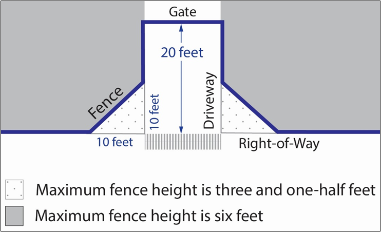
b.
Interior Side and Rear Yards. Fences and walls within a required interior side yard or rear yard shall not exceed eight feet in height, provided that on the street or highway side of a corner lot, such fence or wall shall be subject to the same requirements as for a corner side yard;
c.
Corner Side Yards. Fences and walls within a required corner side yard shall be limited to eight feet in height when located five feet or more from the right-of-way line toward the property, and three and one-half feet in height when located less than five feet from the right-of-way; and
d.
Reversed Corner Side Yards. Fences and walls within a required reversed corner side yard shall be limited to eight feet in height when located 10 feet or more from the right-of-way line toward the property, and three and one-half feet in height when located less than ten feet from the right-of way.
3.
Personal Vehicles. Pickup trucks and vehicles under 10,000 pounds Gross Vehicle Weight, including those with dual rear tires, which are used as personal vehicles by on-site residents, shall be considered personal vehicles and shall be allowed to park in the same areas as passenger vehicles.
4.
Property Maintenance.
a.
Cargo Shipping Containers as Accessory Storage. Notwithstanding Section 22.140.150 (Cargo Shipping Containers), non-habitable cargo shipping containers for the purpose of storage shall be permitted as an accessory residential use in the R-A, A-1, and A-2 Zones in the quantities identified in Table 22.356.070-A, below, provided the following development standards are met:
i.
Location. Cargo shipping containers are prohibited in any required yard.
ii.
Placement and Separation. Cargo shipping containers shall not be stacked upon each other and may be placed next to another cargo shipping container with no separation in between them.
iii.
Design. Cargo shipping containers shall be painted and shall not display any commercial images or lettering on their sides, except for images or lettering providing safety information related to the contents stored within, or otherwise required by the County Code, or any other applicable federal, State, or local regulation.
iv.
Screening. All cargo shipping containers shall be screened to obscure the view of the cargo shipping container from outside of the subject lot on all sides by landscape, existing structures, or painting. Where landscape is used as screening, it shall include trees, shrubs, and other plant materials that can screen the cargo shipping container. The required landscape shall consist of drought-tolerant trees from the Southeast Antelope Valley Native Plant List on file with the Department, or other drought-tolerant, noninvasive tree species when native trees are not available. Existing trees and native vegetation originally on site that are preserved may be included in this landscape screening requirement.
v.
Safety and Maintenance. All cargo shipping containers shall be kept in a state of good repair, and any landscape used as screening shall be kept properly maintained.
b.
On-site Materials Storage Area. The storage of materials in outdoor areas incidental to the primary use of the property, including salvage materials that are used for art projects, hobbies, or other uses on the property, shall be allowed in R-A, A-1, and A-2 Zones subject to the following conditions:
i.
Location. The on-site materials storage area is prohibited in any required yard.
ii.
Size and Separation. The on-site materials storage area shall be contiguous and not exceed 400 square feet.
iii.
Height. The on-site materials storage area shall not exceed six feet in height.
iv.
Screening. Screening shall obscure view of the on-site materials storage area from adjacent public and private streets, walkways, and residences at the same elevation. Screening may include the following:
(1)
Existing structures;
(2)
Existing trees and vegetation;
(3)
Landscape;
(4)
Walls; and
(5)
Fences, such as chain-link fences with embedded plastic or PVC strips, or with privacy netting.
v.
Maintenance of screening. All screening shall be maintained in good condition.
vi.
Landscape. Where landscape is used as screening, it shall include trees, shrubs, and other plant materials from the Southeast Antelope Valley Native Plant List on file with the Department, or other drought-tolerant, noninvasive plant species when native plants are not available. Existing vegetation originally on-site that is preserved may be included in this landscape screening requirement.
vii.
The on-site materials storage area shall not be covered by a roof.
viii.
The on-site materials storage area shall comply with all regulations, laws, and ordinances of the County, including, but not limited to, requirements of the Departments of Public Works, Fire, and Public Health.
5.
Residential Ranch Entrance Signs.
a.
One residential ranch entrance sign is permitted per parcel in Residential and Agricultural Zones, with an additional sign for lots with frontages greater than 200 feet;
b.
The maximum sign area for each residential ranch entrance sign shall be 50 square feet per sign face, with a maximum of two sign faces permitted;
c.
The maximum height for a residential ranch entrance sign shall be 20 feet measured from natural grade at the base of the sign; and
d.
Residential ranch entrance signs shall comply with all requirements of Title 32 (Fire Code) of the County Code, including requirements pertaining to fire apparatus access roads.
6.
Subdivisions.
a.
Required Area. New lots shall have a minimum lot area of two gross acres. Density-controlled development shall be prohibited.
b.
Where a subdivision is developed with five or more dwelling units, open space shall be provided at a ratio of not less than 300 square feet per dwelling unit.
c.
At least 50 percent of the required open space shall be clustered in one common area with dimensions of at least 15 feet by 25 feet. Such common area shall include recreational amenities accessible to and useable by all building occupants and may include a required yard or any portion thereof, provided that such yard or portion thereof is landscaped or designed as a trail.
B.
Rural, Commercial, and Industrial Zones.
1.
Aesthetic: Modern Rustic.
a.
Building Materials. Except where prohibited by federal and State laws and Title 26 (Building Code) of the County Code, commercial developments and mixed-use developments that include commercial uses, street-facing building frontage shall have at least 65 percent of the surface area covered by any three building materials listed below to achieve the Modern Rustic aesthetic:
i.
Real wood: unpainted, stained, reclaimed, burnt, and oiled;
ii.
Steel: weathered; Corten natural finishes; or coated with rusty primer, flat black or grey paint;
iii.
Natural stone;
iv.
Brick: clay or compressed earth (excludes concrete masonry units); and
v.
Glass: textured or frosted.
b.
Lighting shall be provided in accordance with the applicable provisions of Chapter 22.80 (Rural Outdoor Lighting District) and Subsection 22.356.060.E.2 (Signs, External Lighting).
c.
Signs shall be hand-painted or shall be made of at least one material from the Modern Rustic building materials list in Subsection 1.a, above. Plastic signs shall be prohibited.
d.
Trash enclosures shall be compatible with the Modern Rustic aesthetic and shall be constructed from two materials from the Modern Rustic building materials list in Subsection 1.a, above.
2.
Amenities. For commercial developments and mixed-use or industrial developments that include commercial uses, trash receptacles are required. The required trash receptacles shall be compatible with the Modern Rustic aesthetic and shall be constructed from one material from the Modern Rustic building materials list in Subsection 1.a, above. In addition, at least two of the following pedestrian amenities shall be provided within the subject property:
a.
Benches;
b.
Breezeways;
c.
Community Bulletin Boards;
d.
Drinking Fountains;
e.
Landscaped Trellises;
f.
Plazas; and
g.
Trails.
3.
Building Maximum Floor Area.
a.
In Rural and Commercial Zones, building maximum floor area shall be 15,000 square feet per structure.
b.
In Industrial Zones, building maximum floor area shall be 25,000 square feet per structure.
4.
Distance Between Buildings.
a.
Distance Between Main Buildings. Notwithstanding Subsection 22.110.050.A.1, a minimum distance of 20 feet shall be required in commercial and industrial developments, including mixed-use developments, between all main buildings on the same lot.
b.
Distance Between Accessory and Main Buildings. Notwithstanding Subsection 22.110.050.A.2, except where a greater distance is required, a minimum distance of 15 feet shall be required in commercial and industrial developments, including mixed-use developments, between any main building and any accessory building on the same lot.
5.
Drive-through Facilities.
a.
New drive-through facilities are prohibited on a parcel that is within 300 feet of the highway right-of-way of Pearblossom Highway (CA-138).
b.
New drive-through facilities established as part of a restaurant or other eating establishment shall require a Conditional Use Permit (Chapter 22.158).
c.
The location of the drive-through area, including cashier microphone, speakers, and drive-through lane, shall be located at least 25 feet from the property line of any adjoining Residential- and Agricultural-zoned lots, and speakers and lighted menus shall be oriented away from such lots.
d.
Hours of operation for the drive-through area shall open no earlier than 5:00 a.m. and close no later than 11:00 p.m.
e.
Conditional Use Permit Materials. In addition to the development standards listed in Section 22.158.040 (Development Standards), applications for Conditional Use Permits to allow drive-through facilities shall include, but not be limited to, the following:
i.
A site plan showing the location and dimensions of the following:
(1)
Driveways;
(2)
Drive-through stacking lane, including lane markings;
(3)
Service points (including menu boards and service windows); and
(4)
Communications systems, access aisles, and other associated facilities.
ii.
An on-site stacking plan to be reviewed by Public Works.
iii.
Development standards.
(1)
Buffer. Any lot that adjoins a Residential- and Agricultural-zoned lot shall have a buffer along the entire length of that adjoining property line. The buffer shall consist of a minimum six-foot-high solid cement masonry block wall placed along the adjoining property line to reduce noise trespass from the drive-through area.
(2)
Screening. The setback area shall be screened with 15-gallon, drought-tolerant trees spaced 15 feet apart, from the Southeast Antelope Valley Native Plant List on file with the Department, or other drought-tolerant, noninvasive tree species when native trees are not available. The landscape screening shall be maintained with regular pruning, weeding, fertilizing, litter removal, and replacement of plants as necessary. Existing trees preserved on-site may be included to fulfill the landscape screening requirement for this Subsection.
(3)
Trash Enclosure. The solid waste and recycling bins shall be enclosed by a wall measuring at least five feet tall, but not more than six feet tall; shall have solid doors; shall be compatible with the Modern Rustic aesthetic of the primary building; and shall be constructed from two materials from the Modern Rustic building materials list in Subsection 1.a, above.
6.
Height.
a.
Excluded from height restrictions of this Section are chimneys, rooftop antennas, rooftop mechanical equipment, structure-mounted renewable energy systems, non-habitable structures used in surface mining operations, and wireless facilities.
b.
In Rural and Commercial Zones, structures shall not exceed a maximum height of 30 feet.
c.
In Industrial Zones, structures shall not exceed a maximum height of 25 feet.
d.
Structures that exceed height restrictions shall require a Conditional Use Permit (Chapter 22.158) application.
7.
Landscape. The required landscape shall consist of drought-tolerant trees, shrubs, and groundcovers from the Southeast Antelope Valley Native Plant List on file with the Department, or other drought-tolerant, noninvasive plant species when native plants are not available. Existing trees and native vegetation originally on-site that are preserved may be included in this landscape requirement.
a.
General Requirements.
i.
All lots less than one acre shall have a minimum of 10 percent landscape.
ii.
All lots one acre and greater shall have a minimum of 20 percent landscape.
b.
Buffer.
i.
Rural-, Commercial-, and Industrial-zoned lots that adjoin any Residential- or Agricultural-zoned lots shall include a landscaped area of at least 25 feet in width, as measured from the side lot line adjoining said Residential- or Agricultural-zoned property.
ii.
This landscape buffer requirement shall not be counted toward the general landscape requirement set forth in this Subsection.
c.
Parking Lots.
i.
Except for carport, rooftop, and interior parking, proposed parking lots with 15 or more parking spaces, shall have a minimum of five percent of the gross area of the parking lot landscaped.
ii.
The landscape shall be distributed throughout the parking lot to maximize its aesthetic effect and the parking lot's compatibility with adjoining uses.
iii.
Where appropriate, all areas of the parking lot not used for vehicle parking, vehicle maneuvering, or pedestrian movement or activity, shall be landscaped.
iv.
This landscape may be part of the shade plan required by Section 22.126.030 (Tree Requirements), but shall not be counted toward the general landscape requirement set forth in this Subsection.
8.
Paving.
a.
Notwithstanding Section 22.112.080 (Parking Design), access to parking spaces is from a highway, street, or alley which is paved with asphaltic or concrete surfacing, such parking areas, as well as the maneuvering areas and driveways used for access thereby, shall be paved with pervious materials, unless other materials are deemed necessary for the safety of pedestrian and vehicular traffic by Public Works.
b.
Pedestrian pathways shall be marked with pervious pavers, or stone set in pervious gravel.
c.
Striping. Where paint striping is not possible, each parking space shall be marked with a wheel stop made of composite lumber or an alternative material.
9.
Signs.
a.
Roof and Freestanding Business Signs.
i.
Frontage. Notwithstanding Section 22.114.120 (Roof and Freestanding Business Signs), roof and freestanding business signs shall be permitted on any developed lot along any street or highway frontage.
ii.
Freestanding signs shall be limited to 20 feet in height and measured from the natural grade at the base of the sign and shall not display more than two sign faces.
iii.
Both roof and freestanding signs shall have a maximum area of 50 square feet for each sign face where permitted.
b.
Wall Business Signs. Each business establishment in a Rural, Commercial, or Industrial Zone fronting on and/or oriented toward one or more public street, highway, or parkway shall have a maximum sign area of 50 square feet, provided it is not a hand-painted wall sign subject to the standard described in Subsection 9.c, below. No wall business sign attached to a building shall extend above the building wall.
c.
Hand-painted Wall Signs.
i.
Businesses are permitted to have hand-painted wall signs with a maximum sign area of 100 square feet per each wall face, in addition to one wall business sign.
ii.
Notwithstanding Section 22.114.110 (Wall Business Signs), hand-painted wall signs may be painted on a maximum of three walls of a building regardless of whether the wall has an entrance or not.
iii.
A hand-painted wall sign is not a mural.
10.
Subdivisions.
a.
Required Area. New lots shall have a minimum lot area of one gross acre.
b.
Culs-de-sac shall be prohibited in new developments.
11.
Wall and Screening Requirements. Automobile dismantling; junk and salvage; metal plating; outdoor storage as primary use; recycling processing facilities; scrap metal yards; and truck and recreational vehicle service, storage, rental, and sales, shall provide a solid wall or view-obscuring fence of at least eight feet in height in compliance with Subsection 22.140.430.C.2 (Outdoor Storage, Fences and Walls) along all street frontages to obscure view of operations.
a.
The setback area shall be screened with 15-gallon, drought-tolerant trees, spaced 15 feet apart, from the Southeast Antelope Valley Native Plant List on file with the Department, or other drought-tolerant, noninvasive tree species when native trees are not available.
b.
The landscape screening shall be maintained with regular pruning, weeding, fertilizing, litter removal, and replacement of plants as necessary.
c.
Existing trees preserved on site may be included to fulfill the landscape screening requirement for this Subsection.
(Ord. 2024-0004 § 2, 2024.)
22.356.080 - Area-Specific Development Standards.
A.
The Blossom Community Corridor
1.
Purpose. This Corridor is established to preserve, protect, and enhance the small-town, Modern Rustic aesthetic of commercial development along Pearblossom Highway, and to promote future development that is consistent with the community's artistic, creative, and rural character.
2.
Applicability. The standards contained in this Subsection shall apply within the boundaries of the Area shown on Figure 22.356-B, The Blossom Community Corridor at the end of this Chapter, and include the following:
a.
Any application for a new Commercial or Industrial development;
b.
Renovations in cases where more than 50 percent of the existing exterior walls are cumulatively removed, demolished, or rebuilt;
c.
The new expansion portion of an existing development; and
d.
Change of use.
3.
This Subsection shall not apply to existing developments.
4.
Metal plating; recreational vehicle sales and rentals; truck sales, rentals, and storage, including incidental repair; and truck storage shall be prohibited on parcels that are located within 500 feet of the highway right-of-way of Pearblossom Highway (CA-138).
5.
Landscape. The setback area shall be landscaped with no less than one 5-gallon tree for every 20 linear feet of street frontage. The remaining area shall additionally be landscaped with drought-tolerant shrubs and groundcovers from the Southeast Antelope Valley Native Plant List on file with the Department, or other drought-tolerant, noninvasive plant species when native plants are not available. Existing trees and native vegetation originally on site that are preserved may be included in this landscape requirement.
a.
The landscape shall be maintained in a healthy condition with appropriate watering, pruning, weeding, fertilizing, and litter removal. This landscaped area shall be verified on a landscape plan submitted to the Department.
b.
Trees shall be planted in locations that maintain the required lines of sight for safe pedestrian and vehicular movement to the satisfaction of Public Works.
c.
Trees planted near buildings or fire lanes shall be placed in locations that do not adversely impact the Fire Department operations or response times, to the satisfaction of the Fire Department.
(Ord. 2024-0004 § 2, 2024.)
22.356.090 - Modification of Development Standards.
A.
Modifications to any standards in this Chapter are subject to a Conditional Use Permit (Chapter 22.158) application, unless otherwise specified, and shall be subject to additional findings:
1.
The application of these standards would result in practical difficulties or unnecessary hardships inconsistent with the purpose of this CSD; or
2.
There are exceptional circumstances or conditions that are uniquely applicable to the subject property or to the intended development of the subject property that do not apply to other properties within the area governed by this CSD.
(Ord. 2024-0004 § 2, 2024.)
FIGURE 22.356-A: PEARBLOSSOM CSD BOUNDARY
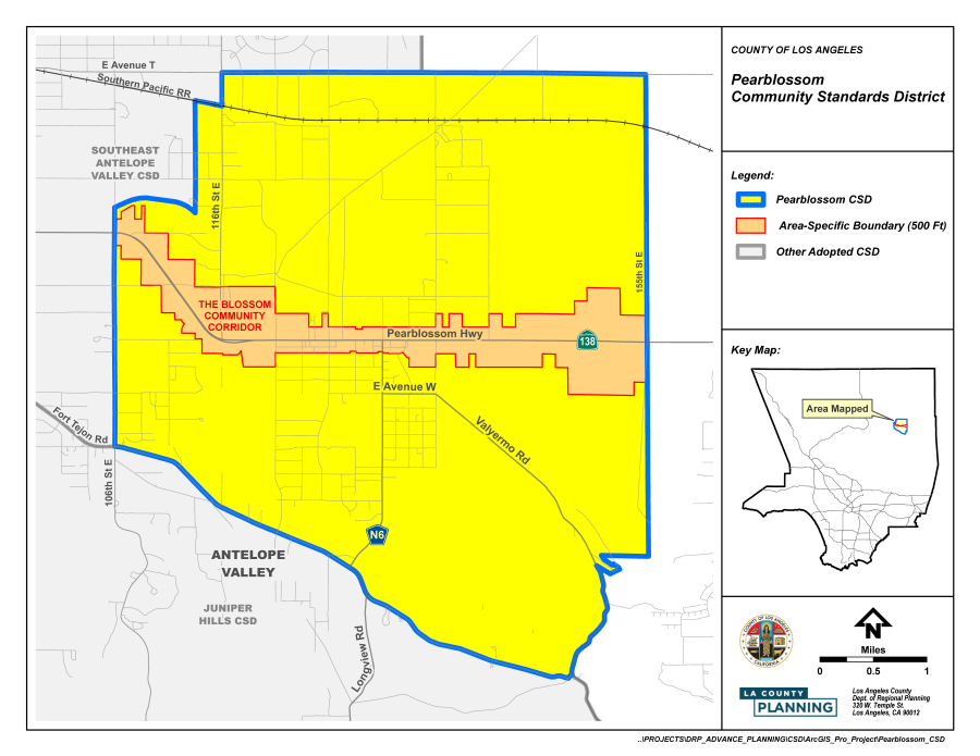
(Ord. 2024-0004 § 2, 2024.)
FIGURE 22.356-B: THE BLOSSOM COMMUNITY CORRIDOR
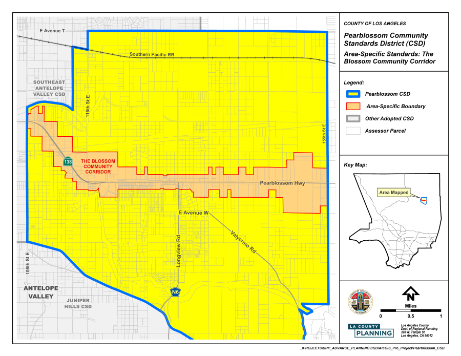
(Ord. 2024-0004 § 2, 2024.)
22.358.010 - Purpose.
The Three Points — Liebre Mountain Community Standards District ("CSD") is established to implement the goals and policies of the Antelope Valley Area Plan. The CSD has design and development standards to enhance the quality of life of the community by preserving and protecting the rural character of the scenic, natural setting, including the Hillside Management Areas and Significant Ecological Areas ("SEAs").
(Ord. 2022-0004 § 3, 2022.)
22.358.020 - Definitions.
The following terms are defined solely for this CSD:
Department. References to the Department are to the Department of Regional Planning, unless otherwise specified.
Gated or walled subdivision. A subdivision that includes proposed fencing or walls along its perimeter and restricted access. This definition excludes perimeter fencing for individual lots. A fence along one side of the subdivision does not constitute a gated or walled subdivision.
Perimeter fencing. Fencing placed along a property line or following the general boundary of a property and within a required setback on a parcel intended for privacy or security.
Residential ranch entrance signs. A freestanding sign that marks the entrance to a single-family residential use.
Wildlife-Permeable fencing. Fencing that can be easily bypassed by all species of wildlife found within the community, including, but not limited to, deer, coyotes, bobcats, mountain lions, rodents, amphibians, reptiles, and birds.
(Ord. 2022-0004 § 3, 2022.)
22.358.030 - District Map.
The boundaries of this CSD are shown on Figure 22.358-A: Three Points — Liebre Mountain CSD Boundary, at the end of this Chapter.
(Ord. 2022-0004 § 3, 2022.)
22.358.040 - Applicability.
In conjunction with Section 22.300.020 (Application of Community Standards Districts to Property), this Chapter shall apply to any application for development, expansion, or change of use requiring Department approval that is filed after February 24, 2022. For expansion of an existing, legally-established use as of February 24, 2022, this Chapter shall only apply to the new expansion portion and not to existing development. All cargo shipping containers shall comply with the requirements in this CSD by two years from February 24, 2022.
(Ord. 2022-0004 § 3, 2022.)
22.358.050 - Application and Review Procedures.
Notification. All permits requiring notification by mail shall be consistent with Section 22.222.160 (Notification Radius). In addition, if the notification radius does not include a minimum of 15 parcels of real property, the radius shall be expanded until the owners of at least 15 parcels are included.
(Ord. 2022-0004 § 3, 2022.)
22.358.060 - Communitywide Development Standards.
A.
Drive-Through Services. All new drive-through services shall be prohibited.
B.
Fences and Walls.
1.
Fences and walls shall not include spikes, glass, razor wire, electrified fencing, nets, or clear plastic material. Barbed or concertina wire fences shall be prohibited.
2.
Retaining walls shall be constructed of materials, textures, veneers, and with colors that are compatible with the surrounding landscape.
3.
All hollow fence sign posts or posts with top holes, such as metal pipes or posts with open bolt holes, shall be capped and the bolt holes filled to prevent the entrapment of birds.
4.
For lots of one net acre in size or greater, the following standards shall apply:
a.
Fences in front yards. A minimum of 75 percent of the surface area of a fence or wall within required front yard areas shall be open and non-view obscuring, with the open area evenly distributed horizontally along the entire length of the fence or wall. Retaining walls shall be exempt from this requirement.
b.
Perimeter fences. All perimeter fences and walls shall be wildlife-permeable, of open design, not harmful to wildlife, and comply with the following standards:
i.
Fences shall be made out of materials that are visible to wildlife, such as wood rail, steel pipe, vinyl rail, or recycled plastic;
ii.
No horizontal member shall be placed less than 18 inches or more than 42 inches above finished grade; and
iii.
For wire fences, the second highest horizontal wire shall be placed at least 12 inches below the topmost wire.
C.
Highway and Local Streets.
1.
Highway Standards.
a.
Routes shown on the County Highway Plan within the boundaries of this CSD shall use the alternate rural highway standards, except for locations where existing infrastructure or commercial and pedestrian traffic patterns are such that the Department of Public Works ("Public Works") determines that curbs, gutters, and sidewalks are necessary for safety reasons or to provide pedestrian access compliant with the federal Americans with Disabilities Act;
b.
Encroachments into the highway right-of-way are prohibited unless an encroachment permit is granted by Public Works, where Public Works will consider the potential impact that the encroachment will have on safe use of the highway right-of-way for temporary vehicle parking and pedestrian and equestrian movement. To the maximum extent feasible, the highway right-of-way shall be clear of all obstructions, including landscaping, trees, and other structures, which block safe pedestrian and equestrian movement on the highway right-of-way; and
c.
If the vehicular right-of-way is not coterminous with the boundaries of the highway right-of-way, driveways may be permitted to connect the property and the vehicular right-of-way. An encroachment permit from Public Works will be required. Such driveways shall be constructed with a non-slip surface, such as rough-broomed concrete.
2.
Local Street Standards. The following standards shall apply to all local streets maintained by Public Works within this CSD:
a.
Local streets shall use the inverted shoulder cross-section and shall have a paved width of 28 feet, except for locations where additional pavement is required for geometric improvements by Public Works or where commercial, industrial, or institutional uses necessitate alternate designs, as determined by Public Works. This 28-foot width excludes any inverted shoulder or concrete flowline;
b.
New curbs, gutters, and sidewalks are prohibited unless deemed necessary by Public Works, after consultation with the Department, for the safety of pedestrian and vehicular traffic; and
c.
The encroachment and driveway provisions in Subsections 1.b and 1.c (Highway Standards), above, for highway rights-of-way, shall also apply to local streets.
D.
Hillside Management.
1.
Grading. An approved Conditional Use Permit (Chapter 22.158) shall be required for any grading on a lot, or in connection with any project, that exceeds 2,500 cubic yards of total cut plus total fill material within any 24-month period. For purposes of computing the 2,500-cubic yard threshold amount, grading required by the Los Angeles County Fire Department ("Fire Department") to establish a turnaround or for brush clearance shall be excluded, but not grading for any private street, right-of-way, or driveway leading to such turnaround.
2.
In approving an application for a Conditional Use Permit, the Commission or Hearing Officer shall make the following findings in addition to those required by Section 22.158.050 (Findings and Decision):
a.
The grading will be performed in a manner that minimizes disturbance to the natural landscape and terrain through design features, including, but not limited to, locating the building pads in the area of the project site that have the least slope or near a street traveled by the public;
b.
The grading will be accompanied by other design features that maximize preservation of visual quality and community character, including, but not limited to, reduced structural height, the use of shapes, materials, and colors that blend with the surrounding environment, and the use of native vegetation for concealment; and
c.
The proposed development minimizes impacts to existing viewsheds through all reasonable design measures.
E.
Significant Ecological Areas. Exemptions listed in Section 22.102.040.A, specific to the communities within the boundaries of the Antelope Valley Area Plan, shall not apply to this CSD. Instead, the exemptions listed in Section 22.102.040.B shall be applicable.
F.
Signs.
1.
All sign requirements of Chapter 22.114 (Signs), and all applicable provisions of Chapter 22.80 (Rural Outdoor Lighting District), shall also apply to signs within this CSD, except as otherwise provided for or modified by this Subsection.
2.
Prohibited Signs. In addition to those prohibited by Section 22.114.040 (Prohibited Signs Designated), the following signs shall also be prohibited within this CSD:
a.
Outdoor Advertising Signs (Billboards);
b.
Roof Signs;
c.
Pole Signs; and
d.
Internally illuminated signs.
3.
Wall Business Signs. Each business establishment fronting on and/or oriented toward one or more public street, highway, or parkway shall be permitted a maximum of one square foot of wall sign area for each one linear foot of building frontage. No wall business sign attached to a building shall extend above the building wall.
4.
Monument Signs. As provided for in Section 22.114.120 (Roof and Freestanding Business Signs), the height of such signs shall be limited to six feet measured from the natural grade at the base of the sign and shall not display more than two sign faces with a maximum area of 50 square feet for each sign face.
5.
Residential Ranch Entrance Signs.
a.
Residential ranch entrance signs shall only be permitted on lots of at least one acre in size and located in the Residential or Agricultural Zone;
b.
A maximum of one residential ranch entrance sign is permitted;
c.
The maximum sign area for a residential ranch entrance sign shall be 20 square feet per sign face, with a maximum of two sign faces permitted;
d.
The maximum height for a residential ranch entrance sign shall be 20 feet measured from the natural grade at the base of the sign; and
e.
Residential ranch entrance signs shall comply with all requirements of the Fire Code (Title 32) including requirements pertaining to fire apparatus access roads.
6.
Temporary Real Estate Signs. The following provisions shall supersede the requirements of Section 22.114.170.A (Area Permitted):
a.
Only one temporary real estate sign shall be permitted on a property at a time.
b.
Prior to posting such sign, the approval of the property owner must be obtained in writing and be available for review upon request by the Department.
c.
Such sign shall contain the name and contact number of the person or company responsible for placing such sign, in addition to the address, or Assessor Parcel Number, of the property being sold.
d.
Maximum Sign Area. In the Residential, Agricultural, Open Space, and Watershed Zones, the maximum sign area for a temporary real estate sign shall be six square feet per sign face. In all other zones, the maximum sign area for a temporary real estate sign shall be 12 square feet per sign face.
7.
Special Purpose Signs are permitted as provided for in Section 22.114.200 (Special-Purpose Signs), except that Community Identification Signs shall not be permitted for new subdivisions or planned developments.
G.
Small-Scale Solar Energy Systems. Ground-mounted small-scale solar energy systems shall be placed at least five feet from the nearest property line. If the lot is five or more gross acres in size, the ground-mounted small-scale solar energy system shall not be placed in any required yard.
H.
Subdivisions.
1.
Gated or walled subdivisions are prohibited.
2.
Required Area. New lots shall have a minimum area of 20 gross acres. For density-controlled developments (Section 22.140.170), lots shall be a minimum of 10 gross acres in size.
3.
Utilities. All wires and cables that provide utility services, including telephone, television, electricity less than 10 kilovolts, and similar services shall be placed underground.
I.
Trails. Trails within this CSD boundary shall be regulated by the provisions of this Subsection and the Los Angeles General Plan, Antelope Valley Area Plan, and the Los Angeles County Trails Manual ("Trails Manual") maintained by the County Department Parks and Recreation ("Parks and Recreation"). All projects consisting of new development or subdivision and requiring a discretionary land-use permit subject to Type II (Chapter 22.228), Type III (Chapter 22.230), or Type IV (Chapter 22.232) review shall require consideration for trail dedication and development in accordance with the County's Board-adopted regional trail network.
1.
Trail Dedication.
a.
Required trail dedications and development standards shall be determined by Parks and Recreation, in accordance with the County's Board-adopted regional trail network and Trails Manual.
i.
Trails required by Parks and Recreation may include publicly-dedicated connector or feeder trail easements within or connected to the proposed development or subdivision, where feasible; and
ii.
If a development or subdivision project proposes to modify an existing trail easement, the applicant shall obtain Parks and Recreation approval of such modification.
2.
Trail Design and Location.
a.
A publicly-dedicated trail shall be designed to connect to an existing or planned trail alignment(s), pursuant to the County's Board-adopted regional trail network, and to provide connectivity to recreational uses, such as open space areas, parks, trail heads, bike paths, historical trails or sites, equestrian and multi-use staging areas, campgrounds, or conservation areas, as determined by Parks and Recreation;
b.
Trail design, construction, and maintenance shall be carried out in conformance with the Trails Manual; and
c.
Deviations from the standards, set forth in this Subsection, or any applicable provision in the Trails Manual, may be allowed based on unique site conditions, including steep topography, existing structures, trees, vegetation, or utility infrastructure, subject to review and approval of Parks and Recreation.
J.
Vegetation and Landscaping.
1.
This Subsection is applicable to lots that are located entirely outside of an SEA and are at least two and one-half gross acres or greater in size.
2.
Vegetation Conservation Buffer. Notwithstanding the provisions of Subsection 3, below, a vegetation conservation buffer with a depth of not less than 30 feet shall be established and maintained along the boundary of a lot bordering upon a public street or a private street or right-of-way. If more than one boundary of a lot borders a public street or private street or right-of-way, the vegetation conservation buffer shall be established and maintained along the boundary of the lot bordering upon the widest public street or private street or right-of-way.
a.
In cases where a vegetation conservation buffer is established pursuant to Subsection 2, above, the 30-foot depth shall be measured from the property boundary unless such boundary is located within a public street or private street or right-of-way, in which case, it shall be measured from the edge of the street or right-of-way closest to the interior of the lot.
b.
No vegetation of any kind within the vegetation conservation buffer shall be removed or destroyed, with the following exceptions:
i.
Vegetation may be removed for the purpose of establishing wells, well pump houses, pumps, tanks, and other well-related fixtures;
ii.
Vegetation may be removed for one driveway path for each 165 feet of lot width, provided that such driveway path is limited to a width of 28 feet; and
iii.
Vegetation may be removed for compliance with County regulations relating to brush clearance safety, fuel modification, or other Fire Department requirements.
3.
Removal or destruction of vegetation of any kind shall require an approved Conditional Use Permit (Chapter 22.158) where the area of removal or destruction is greater than 30 percent of the gross area of the lot or 30,000 square feet, whichever is more restrictive. The following removals are exempt from this requirement:
a.
The removal or reduction of vegetation for the purpose of complying with County regulations relating to brush clearance for fire safety. This exception includes not only required vegetation control around structures, but also the creation and maintenance by a public agency of firebreaks used to control the spread of fire;
b.
The removal or destruction of vegetation on public rights-of-way for roads, highways, flood control projects, or other similar or related uses;
c.
The removal or destruction of vegetation by public utilities on rights-of-way or property owned by such utility, or on land providing access to such rights-of-way or property;
d.
Work performed under a permit issued to control erosion or flood hazards; and
e.
Agricultural uses, including animal keeping, animal raising, or growing crops, permitted by this Title 22.
4.
Conditional Use Permit Application Materials. In addition to the requirements listed in Chapter 22.158 (Conditional Use Permits), the following materials shall also be submitted to the Department for review of a request for vegetation removal with a Conditional Use Permit:
a.
A detailed project description outlining the reason for the proposed vegetation removal and the use of the property, within the next 12 months.
b.
A landscaping plan, identifying all vegetation on the property including, and separately specifying, native vegetation listed in the San Andreas SEA Plant List maintained by the Department. The landscaping plan shall indicate the vegetation proposed to be removed as part of the project and how those removals will be mitigated with replanting, to the satisfaction of the Department, in consultation with the County Biologist.
c.
Fuel modification plans or grading plans shall also be submitted, upon request by the Department.
d.
In addition to filing fees specified in Chapter 22.250 (Applications, Petitions, and Fees), the applicant shall submit a fee for review by the County Biologist.
5.
Additional Findings for Conditional Use Permits. In addition to substantiating the findings listed in Section 22.158.050 (Findings and Decision), the applicant shall also substantiate the following:
a.
Development plans emphasize the protection of, and revegetation with, native vegetation, including the native plants, grasses, shrubs, and trees that intercept, hold, and more slowly release rainfall than bare earth surfaces. Stands of native vegetation and mature trees are preserved or expanded to the greatest extent possible; and
b.
The design of the project, including structures used to house animals such as stables and arenas, does not create erosion or flooding potential that would cause a safety hazard to structures or off-site property, as determined by Public Works.
(Ord. 2022-0004 § 3, 2022.)
22.358.070 - Zone-Specific Development Standards.
A.
Residential and Agricultural Zones.
1.
Housing Standards. All single-family residences shall meet the following standards, in addition to those in Section 22.140.580 (Single-Family Residences):
a.
Structures shall provide eaves of not less than 12 inches in depth on all sides, as measured from the finished exterior wall surface; and
b.
At least 50 percent of the surface area of the street-facing building façades shall be covered by brick, stone, wood, or an alternative siding material designed to mimic the look of wood, brick, or stone.
2.
Required Yards.
a.
Front, side, and rear yards shall have a minimum depth of 30 feet each.
b.
Required front, side, and rear yards shall be measured from the property boundary, unless such boundary is located within a private street providing access to one or more lots, in which case required yard areas shall be measured from the edge of the street or right-of-way closest to the interior of the lot.
3.
Use-specific Standards. Cargo shipping containers are permitted as an accessory use in the A-1 and A-2 Zones with the approval of a Ministerial Site Plan Review (Chapter 22.186) application, in the quantities identified in Table 22.358.070-A, provided the following development standards are met:
a.
Size and Specifications. Cargo shipping containers shall not exceed 10 feet in height, 10 feet in width, and 40 feet in length;
b.
Location. Cargo shipping containers are prohibited in any required yard or area where the parking of vehicles is prohibited under Section 22.112.040.C (Residential and Agricultural Zones);
c.
Placement and Separation. Cargo shipping containers shall be placed at least six feet from any structure or cargo shipping container and shall not be stacked upon each other;
d.
Design. Cargo shipping containers shall be painted one uniform earth-tone color such as a shade of taupe, beige, olive, or other neutral, muted colors that blend with the surrounding setting, and not display any images or lettering on their sides, except for images or lettering providing safety information related to the contents stored within, or otherwise required by any applicable federal, State, or local regulation; and
e.
Screening. All cargo shipping containers shall be screened to obscure view of the cargo shipping container from outside of the subject lot.
i.
Where the cargo shipping container is not screened from view by fencing, walls, hedges, existing structures or earthworks, landscaping shall include trees, shrubs, and other plant materials that will screen the height of the cargo shipping container. All landscaping shall comply with all other applicable standards in this Title 22.
ii.
Landscaping intended for screening shall include:
(1)
Two rows of trees and other shrubs and plant materials on any side of the cargo shipping container located less than 1,000 feet from a property line.
(2)
At least one row of trees with other shrubs and plant materials on any side of the cargo shipping container located at least 1,000 feet from a property line.
iii.
Trees used for screening shall be placed the maximum distance apart based on the diameter of the crown of the proposed type of tree at 20 years of age, or not greater than 20 feet apart, whichever is less.
iv.
Trees used for screening shall be of an evergreen variety or from the San Andreas SEA Plant List maintained by the Department.
f.
Safety and Maintenance. All cargo shipping containers shall be kept in a state of good repair, and any landscaping used as screening shall be properly maintained.
B.
Commercial and Rural Zones.
1.
Alcoholic Beverage Sales. No business engaged in the sale of alcoholic beverages for off-site consumption, with the exception of renewals for existing permits, shall be located within 1,000 feet of any property containing an existing legally-established public or private school, or child care center.
2.
Height. Buildings or structures shall be limited to two stories.
3.
Required Yards. In addition to Section 22.24.040 (Development Standards for Rural Zones), commercial lots shall have a minimum front yard of 10 feet.
4.
Structure Design. Street-facing building façades shall have not more than 50 percent of their surface area covered in any one of the following materials: glass, stucco, or metal.
5.
Hours of Operation. Hours of operation for commercial uses shall be limited to the hours of 7:00 a.m. to 10:00 p.m., Sundays through Thursdays, and 7:00 a.m. to 11:00 p.m. on Fridays and Saturdays.
(Ord. 2022-0004 § 3, 2022.)
22.358.080 - Area-Specific Development Standards.
A.
Scenic Drive Areas. New development proposed within 500 feet of the edge of a right-of-way on a Scenic Drive, as designated on Map 4.2: Antelope Valley Scenic Drives of the Antelope Valley Area Plan, shall be subject to the following:
1.
The maximum allowable height shall be 18 feet above existing or finished grade, whichever is lower. Chimneys, rooftop solar equipment and non-visually-obstructing rooftop antennas may be permitted to extend above the allowable height of the structure, but shall not extend more than six feet above the maximum allowable height.
2.
Structures shall not occupy more than 50 percent of the linear frontage of the lot.
3.
Small-scale wind energy facilities shall be prohibited.
4.
New buildings or structures shall use earth-tones, such as shades of taupe, beige, olive, or other neutral, muted colors that blend with the surrounding setting.
(Ord. 2022-0004 § 3, 2022.)
22.358.090 - Modification of Development Standards.
A.
Modifications to any standards in this Chapter are subject to a Minor Conditional Use Permit (Chapter 22.160) application, and shall be subject to additional findings:
1.
The application of these standards would result in practical difficulties or unnecessary hardships inconsistent with the purpose of this CSD; or
2.
There are exceptional circumstances or conditions that are uniquely applicable to the subject property, or to the intended development of the subject property, that do not apply to other properties within the area governed by this CSD.
(Ord. 2022-0004 § 3, 2022.)
FIGURE 22.358-A: THREE POINTS — LIEBRE MOUNTAIN CSD BOUNDARY
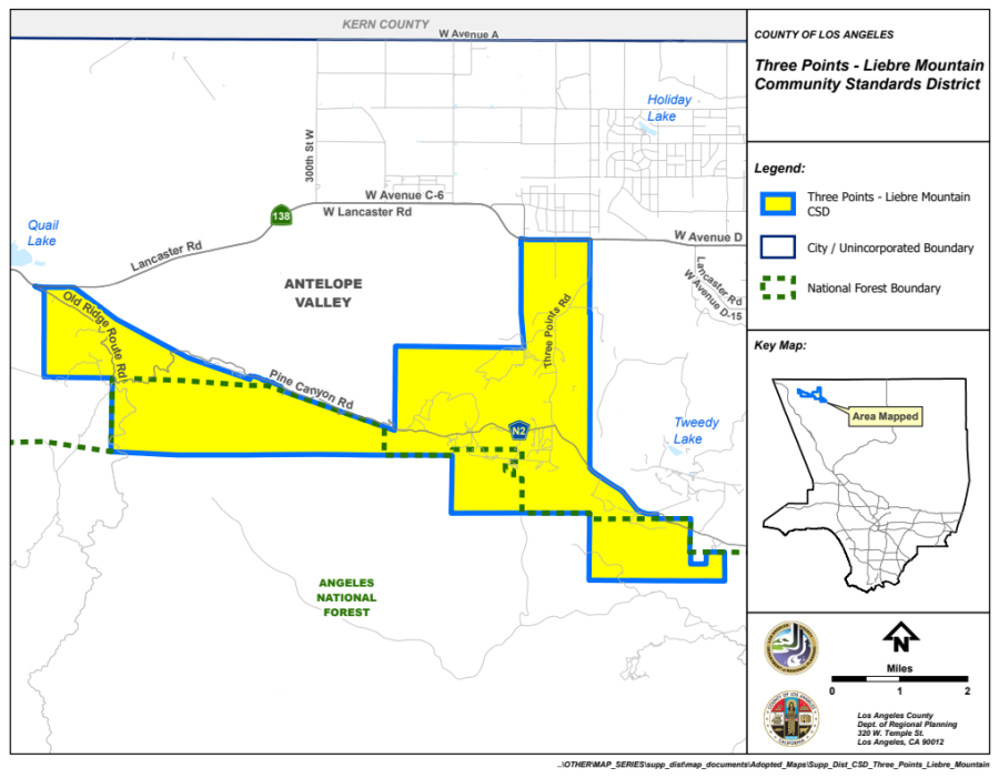
(Ord. 2022-0004 § 3, 2022.)
22.360.010 - Purpose.
The Lake Los Angeles Community Standards District ("CSD") is established to implement the goals and policies of the Antelope Valley Area Plan. The CSD has design and development standards to protect, preserve, and enhance the rural, equestrian, and agricultural character of the community. The standards contained in this CSD are intended to improve the quality of life of the community and to minimize the impacts of urbanization that would alter the community's landscape.
(Ord. 2023-0061 § 1, 2023.)
22.360.020 - Definitions.
The following terms are defined solely for this CSD:
Department. References to the Department are to the Department of Regional Planning, unless otherwise specified.
Residential Ranch Entrance Signs. A freestanding sign that marks the entrance to a single-family residential use.
(Ord. 2023-0061 § 1, 2023.)
22.360.030 - District Map.
The boundaries of this CSD are shown on Figure 22.360-A: Lake Los Angeles CSD Boundary.
(Ord. 2023-0061 § 1, 2023.)
22.360.040 - Applicability.
In conjunction with Section 22.300.020 (Application of Community Standards Districts to Property), this Chapter shall apply to any application for development, expansion, or change of use requiring Department approval that is filed after January 18, 2024. For expansion of an existing, legally-established use, as of January 18, 2024, this Chapter shall only apply to the new expansion portion and not to existing development. All accessory cargo shipping containers shall comply with the requirements in this CSD within two years from January 18, 2024.
22.360.050 - Application and Review Procedures.
(Reserved)
(Ord. 2023-0061 § 1, 2023.)
22.360.060 - Communitywide Development Standards.
A.
Highway and Local Streets.
1.
Highway Standards.
a.
Routes shown on the County Highway Plan within the boundaries of this CSD shall use the alternate rural highway standards, except for locations where existing infrastructure or commercial and pedestrian traffic patterns are such that the Department of Public Works ("Public Works") determines that curbs, gutters, and sidewalks are necessary for safety reasons, or to provide pedestrian access compliant with the federal Americans with Disabilities Act;
b.
Encroachments into the highway right-of-way are prohibited, unless an encroachment permit is granted by Public Works, where Public Works will consider the potential impact that the encroachment will have on safe use of the highway right-of-way for temporary vehicle parking and pedestrian and equestrian movement. To the maximum extent feasible, the highway right-of-way shall be clear of all obstructions, including landscaping, trees, and other structures, which block safe pedestrian and equestrian movement on the highway right-of-way; and
c.
If the vehicular right-of-way is not coterminous with the boundaries of the highway right-of-way, driveways may be permitted to connect the property and the vehicular right-of-way. An encroachment permit from Public Works will be required. Such driveways shall be constructed with a non-slip surface, such as rough-broomed concrete.
2.
Local Street Standards. The following standards shall apply to all local streets maintained by Public Works within this CSD:
a.
Local streets shall use the inverted shoulder cross-section and shall have a paved width of 28 feet, except for locations where additional pavement is required for geometric improvements by Public Works or where commercial, industrial, or institutional uses necessitate alternate designs, as determined by Public Works. This 28-foot width excludes any inverted shoulder or concrete flowline;
b.
New curbs, gutters, and sidewalks are prohibited, unless deemed necessary by Public Works; after the consultation with the Department, for the safety of pedestrian and vehicular traffic, and management of storm flows; and
c.
The encroachment and driveway provisions in Subsections 1.b and 1.c (Highway Standards), above, for highway rights-of-way, shall also apply to local streets.
3.
Streetlights.
a.
Streetlights shall be provided in accordance with the applicable provisions of Chapter 22.80 (Rural Outdoor Lighting District);
b
When possible, all required and recommended local and highway streetlights shall utilize cut-off "Mission Bell" design fixtures, as specified by the local electric utility; and
c.
Notwithstanding the provisions of Public Works, all main non-residential intersections shall be marked by a single streetlight where possible.
B.
Hillside Management.
1.
Grading. An approved Conditional Use Permit (Chapter 22.158) shall be required for any grading on any lot, or in connection with any project located within a hillside management area, that exceeds 2,500 cubic yards of total cut plus fill material within any 24-month period. For purposes of computing the 2,500 cubic yard threshold amount, grading required by the County Fire Department to establish a turnaround or for brush clearance shall be excluded, but not grading for any private street, right-of-way, or driveway leading to such turnaround.
2.
In approving an application for a Conditional Use Permit, the Commission or Hearing Officer shall make the following findings in addition to those required by Section 22.158.050 (Findings and Decision):
a.
The grading will be performed in a manner that minimizes disturbance to the natural landscape and terrain through design features, including, but not limited to, locating the building pads in the area of the project site that have the least slope or near a street traveled by the public;
b.
The grading will be accompanied by other design features that maximize preservation of visual quality and community character, including, but not limited to, reduced structural height, the use of shapes, materials, and colors that blend with the surrounding environment, and the use of native vegetation for concealment; and
c.
The proposed development minimizes impacts to existing viewsheds through all reasonable design measures.
C.
Signs.
1.
All sign requirements of Chapter 22.114 (Signs) and all applicable provisions of Chapter 22.80 (Rural Outdoor Lighting District) shall apply to signs within this CSD, except as otherwise provided for or modified by this Subsection.
2.
Prohibited Signs. In addition to those prohibited by Section 22.114.040 (Prohibited Signs Designated), outdoor advertising signs (Billboards) shall also be prohibited within this CSD.
3.
Wall Business Signs. Each business establishment fronting on and/or oriented toward one or more public street, highway, or parkway shall be permitted a maximum of one square foot of wall sign area for each one linear foot of building frontage. No wall business sign attached to a building shall extend above the building wall.
4.
Freestanding Business Signs. As provided for in Section 22.114.120 (Roof and Freestanding Business Signs), the height of such signs shall be limited to 12 feet measured from the natural grade at the base of the sign, and shall not display more than two sign faces with a maximum area of 100 square feet for each sign face.
5.
Residential Ranch Entrance Signs.
a.
Residential ranch entrance signs shall only be permitted on lots at least one-half acre in size and located in a Residential or Agricultural Zone;
b.
A maximum of one residential ranch entrance sign is permitted;
c.
The maximum sign area for a residential ranch entrance sign shall be 20 square feet per sign face with a maximum of two sign faces permitted;
d.
The maximum height for a residential ranch entrance sign shall be 20 feet measured from the natural grade at the base of the sign; and
e.
Residential ranch entrance signs shall comply with all requirements of the Title 32 (Fire Code) of the County Code, including requirements pertaining to fire apparatus access roads.
6.
External Lighting. Lighting for signs that utilize externally mounted light fixtures shall be designed to focus all light downward directly onto the sign, with no trespass beyond the sign area in accordance with Section 22.80.080 (Additional Standards for Signs).
D.
Subdivisions.
1.
Required Area. New lots shall have a minimum area of two gross acres. For density-controlled developments (Section 22.140.170), lots shall be a minimum of two gross acres in size.
2.
Utilities. All wires and cables that provide utility services, including telephone, television, electricity less than 10 kilovolts, and similar services, shall be placed underground.
E.
Trails. Trails within this CSD boundary shall be regulated by the provisions of this Subsection and the General Plan, Antelope Valley Area Plan, and the Los Angeles County Trails Manual ("Trails Manual") maintained by the Department of Parks and Recreation ("Parks and Recreation"). All projects consisting of a new development or subdivision and requiring a discretionary land-use permit subject to Type II (Chapter 22.228), Type III (Chapter 22.230), or Type IV (Chapter 22.232) review shall require consideration for trail dedication and development in accordance with the County's adopted regional trail network.
1.
Trail Dedication.
a.
Required trail dedications and development standards shall be determined by Parks and Recreation in accordance with the County's adopted regional trail network and Trails Manual.
i.
Trails required by Parks and Recreation may include publicly-dedicated connector or feeder trail easements within or connected to the proposed development or subdivision, where feasible; and
ii.
If a development or subdivision project proposes to modify an existing trail easement, the applicant shall obtain approval of such modification from Parks and Recreation.
2.
Trail Design and Location.
a.
A publicly-dedicated trail shall be designed to connect to an existing or planned trail alignment(s), pursuant to the County's adopted regional trail network, and to provide connectivity to recreational uses such as open space areas, parks, trailheads, bike paths, historical trails or sites, equestrian and multi-use staging areas, campgrounds, or conservation areas, as determined by Parks and Recreation;
b.
Trail design, construction, and maintenance shall be carried out in conformance with the Trails Manual; and
c.
Deviations from the standards set forth in this Subsection E.2 or any applicable provision in the Trails Manual may be permitted based on unique site conditions, including steep topography, existing structures, trees, vegetation, or utility infrastructure, subject to review and approval of Parks and Recreation.
F.
Vegetation and Landscaping. This Subsection is applicable to lots that are located entirely outside of a Significant Ecological Area.
1.
Removal or destruction of vegetation of any kind shall require an approved Conditional Use Permit (Chapter 22.158) when the subject lot is at least two and one-half gross acres in size and the area of removal or destruction is greater than 30 percent of the gross area, or where the subject lot is less than two and one-half gross acres in size and the removal or destruction is greater than 60 percent of the gross area. The following removals are exempt from this requirement:
a.
The removal or reduction of vegetation for the purpose of complying with County regulations relating to brush clearance for fire safety. This exception includes not only required vegetation control around structures, but also the creation and maintenance by a public agency of firebreaks used to control the spread of fire;
b.
The removal or reduction of vegetation on public rights-of-way for roads, highways, flood control projects, or similar or related uses;
c.
The removal or destruction of vegetation by public utilities on rights-of-way or property owned by such utility, or on land providing access to such rights-of-way property;
d.
Work performed under a permit issued to control erosion or flood hazards;
e.
Agricultural uses, including animal keeping, animal raising, or growing crops, permitted by this Title 22; and
f.
The removal or reduction of vegetation for the purpose of constructing one or more residential units for which a building permit has been issued.
2.
The removal or destruction of vegetation of any kind without an approved use, notwithstanding the listed exemptions in Subsection F.1, shall be prohibited.
3.
Conditional Use Permit Application Materials. In addition to the requirements listed in Chapter 22.158 (Conditional Use Permits), the following materials shall also be submitted to the Department for review of a request for vegetation removal with a Conditional Use Permit application:
a.
A detailed project description outlining the reason for the proposed vegetation removal and the use of the property;
b.
A plan identifying all vegetation on the property including, and separately specifying native vegetation. The landscape plan shall indicate the vegetation proposed to be removed as part of the project and how those removals might be mitigated with replanting, to the satisfaction of the Department, in consultation with the County Biologist;
c.
Fuel modification plans or grading plans shall also be submitted, upon request by the Department; and
d.
In addition to the application filing fees listed in Chapter 22.250 (Applications, Petitions, and Fees), the applicant shall submit a fee for review by the County Biologist.
4.
Additional findings for Conditional Use Permits. In addition to substantiating the findings listed in Section 22.158.050 (Findings and Decision), the application shall also substantiate the following:
a.
Development plans emphasizing the protection of, and revegetation with, native vegetation, including native plants, grasses, shrubs, and trees that intercept, hold, and more slowly release rainfall than bare earth surfaces. Stands of native vegetation and mature trees are preserved or expanded to the greatest extent possible; and
b.
The design of the project, including structures used to house animals such as stables and arenas, does not create erosion or flooding potential that would cause a safety hazard to structures or off-site property, as determined by Public Works.
(Ord. 2023-0061 § 1, 2023.)
22.360.070 - Zone-Specific Development Standards.
A.
Residential and Agricultural Zones.
1.
Accessory Cargo Shipping Containers. Notwithstanding Section 22.140.150 (Cargo Shipping Containers), non-habitable cargo shipping containers for the purpose of storage are permitted as an accessory use in the R-A, A-1, and A-2, in the quantities identified in Table 22.360.070-A, in accordance with the requirements of Public Works, provided the following development standards are met:
a.
Size and Specifications. Cargo shipping containers shall not exceed 10 feet in height, 10 feet in width, and 40 feet in length.
b.
Location. Cargo shipping containers are prohibited in any required yard setback.
i.
Cargo shipping containers shall be located within the rear half of the property and not block any property exits or access.
c.
Placement and Separation. Cargo shipping containers shall be placed at least six feet from any structure or other cargo shipping container and shall not be stacked upon each other.
d.
Design. Cargo shipping containers shall be painted in one uniform color, and not display any images or lettering on their sides, except for images or lettering providing safety information related to the contents stored within, or otherwise required by the County Code, or any other applicable federal, State, or local regulation.
e.
Safety and Maintenance. All cargo shipping containers shall be kept in a state of good repair and free of graffiti; and
2.
Fences and Walls. Notwithstanding the provisions listed in Section 22.110.070 (Fences and Walls), and subject to the requirements of Public Works, the following standards shall apply:
FIGURE 22.360.070-A: VIEW-OBSCURING FENCE OR WALL
IN FRONT YARD
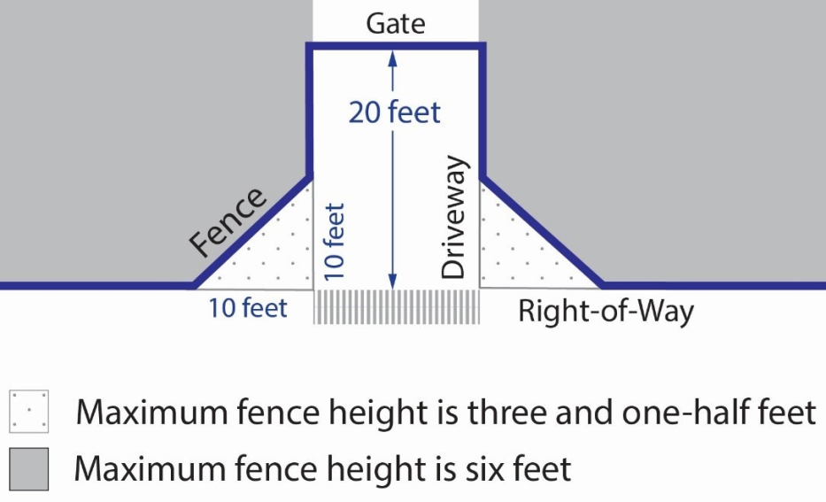
a.
Front Yards. As shown in Figure 22.360.070-A, fences, walls, and landscaping used as fences or walls, within a required front yard setback may be permitted up to a maximum height of six feet when located 10 feet or more from the driveway and shall provide at least 20 feet of vehicle clearance measured from the right-of-way line toward the property. When located less than 10 feet from the driveway, fences and walls shall be a maximum of three and one-half feet in height.
b.
Interior Side and Rear Yards. Fences and walls within a required interior side yard or rear yard shall not exceed eight feet in height, provided that on the street or highway side of a corner lot such fence or wall shall be subject to the same requirements as for a corner side yard.
c.
Corner Side Yards. Fences and walls within a required corner side yard shall be limited to eight feet in height when located five feet or more from the right-of-way line toward the property, and three and one-half feet in height when located less than five feet from the right-of-way.
d.
Reversed Corner Side Yards. Fences and walls within a required reversed corner side yard shall be limited to eight feet in height when located 10 feet or more from the right-of-way line toward the property, and three and one-half feet in height when located less than ten feet from the right-of way.
3.
Dogs. Notwithstanding Section 22.140.070 (Animal Keeping, Noncommercial or Personal Use) Table 22.360.070-C, below, identifies the maximum number of dogs allowed on a lot without an Animal Permit:
4.
Home-Based Occupations. In addition to the standards for home-based occupations identified in Section 22.44.1490 (Home-Based Occupations), the following standards shall apply:
a.
There shall be no more than two home-based occupations per primary dwelling unit, and no more than one for an accessory dwelling unit, with a maximum of three per property.
b.
A home-based occupation may be conducted in a permitted accessory structure. Any automobile parking spaces required in Section 22.112.060.A (On-site Parking) shall not be displaced by such use and shall be permanently maintained in accordance with Section 22.112.040.B (Permanent Maintenance Required).
c.
Notwithstanding the prohibitions in Section 22.140.290 (Home-Based Occupations) the following uses shall be permitted:
i.
Animal training, provided the involved animals are domestic animals, as defined in Division 2 (Definitions);
ii.
Seamstress or tailor in an area not to exceed 1,000 square feet;
iii.
Beautician or barber services, provided all State licensing requirements are met; and
iv.
Upholstery, provided:
(1)
All work is done indoors;
(2)
No upholstery of automotive seating or equipment is done; and
(3)
No metalworking is done in conjunction with upholstery activity.
B.
Commercial and Rural Zones.
1.
Architectural and Design Standards. New structures, additions, or renovations to existing structures, shall be designed to fit in with the community's rural setting by incorporating one of the following architectural styles and its associated development standards.
a.
Old West or Western Frontier style architecture which includes the following elements:
i.
Form and Massing. The primary building façade shall include a recessed entryway and/or a covered porch with vertical support posts made of wood, materials made to look like wood, adobe brick, or stone. Overhangs may serve as second story balconies.
ii.
Building Materials. Exterior building walls shall have vertical or horizontal siding, shingles, wood, wood veneer, materials made to look like wood, adobe brick, stone, or a combination of any of these materials;
iii.
Window Design. Windows should be wood or painted aluminum. Windows along the primary façade shall cover no more than 50 percent of the total area. Window type, material, shape, and proportions shall complement the architectural style of the building;
iv.
Roof Design. Each individual building shall contain a rectangular false front or ornamental parapet with either a flat roof or a hidden sloped roof behind. Roof materials and colors shall be consistent with the building materials;
v.
Colors. The building materials shall either be unadorned or be painted with earth-toned colors such as shades of taupe, beige, brown, olive, burgundy, or other neutral colors approved by the Director;
vi.
Decorative accents. At least two of the following architectural elements shall be incorporated into the design of the site: hitching posts or rails, cast-iron or wood type benches, wood or wooden-looking trash barrels, shuttered windows, weathervanes, windmills, a water tower, or wagon wheels; and
vii.
Site elements shall maintain the Old West or Western Frontier design, such as the placement of solid waste and recycling receptacles in enclosures that match the architectural style of the primary building and are located to the rear of the property.
b.
Southwestern style architecture which includes the following elements:
i.
Form and Massing. The primary building façade shall include a recessed entryway and/or a covered porch with vertical support posts made of wood, materials to look like wood, adobe, or stucco. multistory buildings should utilize stepped massing;
ii.
Building Materials. Exterior building walls shall be primarily made of adobe, or stucco, with minimal trim accents made of wood, materials made to look like wood, or stone;
iii.
Window Design. Windows should be wood, painted aluminum, and recessed within the façade. Windows along the primary façade shall cover no more than 50 percent of the total area. Window type, material, shape, and proportions shall complement the architectural style of the building;
iv.
Roof Design. Each individual building shall contain a parapet wall with either a flat roof or a hidden sloped roof behind. Roof materials and colors shall be consistent with the building materials or utilize clay or concrete tiles;
v.
Colors. The building materials shall either be unadorned or be painted with earth-toned colors such as shades of taupe, beige, brown, olive, or other neutral colors approved by the Director;
vi.
Decorative accents. At least two of the following architectural elements shall be incorporated into the design of the site: irregular parapets, projecting wood or wooden looking beams, projecting scuppers or drains, stucco or wood type benches, wood or wooden-looking trash barrels, carved niches, irregular finishes, or an enclosed courtyard; and
vii.
Site elements shall maintain the Southwestern design, such as the placement of solid waste and recycling receptacles in enclosures that match the architectural style of the primary building and are located to the rear of the property.
c.
Be designed to conceal from public view all external utilities, such as roof mounted air conditioning or heating units. Solar panels that are designed as part of a roofline and blend with the overall roof appearance need not be concealed.
d.
Exterior lighting shall be prohibited except where necessary for public safety, vehicular traffic, and/or security. Where lighting is installed, it should be consistent with the desired architectural style, be appropriately shielded so as not to spill onto adjacent properties, and in compliance with the applicable provisions of Chapter 22.80 (Rural Outdoor Lighting District).
e.
Loading and service areas, solid waste and recycling enclosures, and utility meters should be located as far as possible from the street and adjacent residential or agricultural properties.
(Ord. 2023-0061 § 1, 2023.)
22.360.080 - Area-Specific Development Standards.
(Reserved)
(Ord. 2023-0061 § 1, 2023.)
22.360.090 - Modification of Development Standards.
A.
Modifications to any standards in this Chapter are subject to a Conditional Use Permit (Chapter 22.160) application, and shall be subject to additional findings:
1.
The application of these standards would result in practical difficulties or unnecessary hardships inconsistent with the purpose of this CSD; or
2.
There are exceptional circumstances or conditions that are uniquely applicable to the subject property or to the intended development of the subject property that do not apply to other properties within the area governed by this CSD.
(Ord. 2023-0061 § 1, 2023.)
FIGURE 22.360-A: LAKE LOS ANGELES CSD BOUNDARY
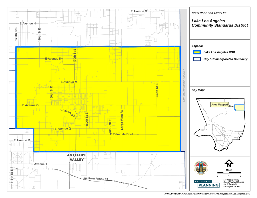
(Ord. 2023-0061 § 1, 2023.)
22.362.010 - Purpose.
The Chapman Woods Community Standards District ("CSD") is established to:
A.
Provide communitywide development and design standards and guidelines that promote the preservation, maintenance, and new construction of development that is compatible with the established residential scales and architectural styles.
B.
Prevent the loss of established residential structures and architectural forms that define Chapman Woods with the replacement of large-scale and out-of-context building forms (commonly referred to as "mansionization").
C.
Regulate the placement of buildings on residential properties to support transitions and buffers between properties and the public right-of-way that protect the light, air, and privacy of existing residences.
(Ord. 2023-0050 § 7, 2023.)
22.362.020 - Definitions.
Average lot width. Unless otherwise described in a CSD or other overlay zone, the average lot width shall be calculated by dividing the combined sum of the front and rear property lines by two. The Director shall have the authority to determine average lot width, if it is unclear from Figure 22.362.020-A, below.
FIGURE 22.362.020-A: AVERAGE LOT WIDTH CALCULATIONS
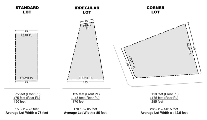
Façade, primary. The primary building façade is the dominant exterior wall plane that directly faces a property's front yard and/or public right-of-way and establishes a structure's massing and scale.
Façade, secondary. The secondary building façade is the dominant exterior wall plane that directly faces a property's side yard and/or right-of-way.
Façade, interior or rear. Façade of a building that is not directly facing a public right-of-way and is often facing an abutting private property's side or rear property line.
FIGURE 22.362.020-B: BUILDING FAÇADES
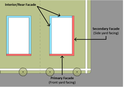
Fully shielded downward directed light fixture. A light fixture that emits no light in the area above a horizontal plane passing through the lowest point of the light fixture and no more than 10 percent of its light in the area between zero and 10 degrees below the horizontal plane. A fully shielded downward directed light fixture has a solid barrier shielding the area where the lamp (bulb) is located. The fixture is angled so the lamp is not visible with no direct line of site below the barrier.
Maximum grade. The average grade of the adjoining lots on either side of a given property. Maximum grade may be determined by the Director or Director of the Department of Public Works ("Public Works") where it is impractical due to topographic conditions.
Primary residential structure or unit. The building having the largest habitable floor area located on any one lot within a residentially zoned property supporting one or more dwelling units, including duplexes.
Primary street frontage. The portion of a property that abuts the public right-of-way or street and provides the property with a primary entrance, addressing, and pedestrian access.
Secondary street frontage. The portion of a property that abuts a second public right-of-way or street, not including alleyways, in addition to the primary street frontage (i.e., corner lot). A secondary street frontage may, but is not required to, provide entrance and access.
(Ord. 2023-0050 § 7, 2023.)
22.362.030 - District Map.
The boundaries of this CSD are shown on Figure 22.362.030-A: Chapman Woods CSD Boundary, at the end of this Chapter.
(Ord. 2023-0050 § 7, 2023.)
22.362.040 - Applicability.
A.
General Applicability. The regulations, requirements, and provisions of the Chapman Woods CSD shall apply to all development and construction projects for which a building permit or an application with the Department is required and filed on or after December 21, 2023.
B.
Exemptions. The following projects and types of development are exempt from the CSD as of December 21, 2023.
1.
Normal Maintenance, Repair, and Replacement. Projects involving the normal maintenance or repair to an existing building or structure that is necessary to ensure its safe and habitable condition for ordinary and intended use, and do not result in any of the following:
a.
Increase or decrease of gross floor area;
b.
Changes to existing roofs or roof structures beyond normal maintenance, repair, and replacement that result in changes to the existing rooflines, roof pitches, or underlying roof structure, such as converting a gabled roof to a flat roof;
c.
Remodels that exceed or change more than 50 square feet of surface area on primary or secondary façades; and
d.
The Director has the authority to review any proposed maintenance or repair exemption deemed necessary.
2.
Nonconforming Buildings or Structures. The provisions of Chapter 22.172 (Nonconforming Uses, Buildings and Structures) shall apply to all uses and structures in this CSD that were legally entitled, approved, or permitted prior to December 21, 2023.
3.
Repair of Nonconforming Structures. Any structure which is nonconforming to standards as a result of damage or partial destruction of the structure may be restored to the condition of the structure as it existed immediately prior to the occurrence of such damage or destruction, provided that the cost of reconstruction does not exceed 100 percent of the total market value of the structure, as determined by the methods set forth in Sections 22.172.020.G.1.a and 22.172.020.G.1.b and provided the reconstruction complies with the provisions of Section 22.172.020.G.2.
4.
Existing fences, walls, outdoor lighting, landscape, and planted areas as of December 21, 2023.
(Ord. 2023-0050 § 7, 2023.)
22.362.050 - Application and Review Procedures.
All applications as of December 21, 2023, shall be subject to the review procedures provided in Chapters 22.222 and 22.224. In addition to the checklist for the applicable review or permit, the following types of plans are required for all proposed construction and development applications, pursuant to Section 22.362.040. Plans must be submitted and completely illustrate the intent and scope of the project. The Department has the authority to request alternative plans or clarifications, based on the proposed application.
A.
Site Plan. A site plan shall include easements and public rights-of-way, on-site parking locations, all structures, including residential and accessory buildings with use and square footages labeled, proposed grading and drainage, exterior light fixtures, trash area, fences, and walls.
B.
Window Alignment and Privacy Study. When two properties have a shared property line and the space between residential structures on each property is less than 15 feet, a window alignment and privacy study shall be required, pursuant to Section 22.362.060.G.5, below. The window alignments and screening shall be depicted on a site plan.
C.
Landscape Plan. Where new planting areas, trees, ground cover, and landscape areas are proposed, the site plan, or a separate sheet, shall depict the locations and species of plant(s).
D.
Floor Plans. All proposed projects, such as new construction, additions, expansions, and renovations, shall provide a floor plan showing the arrangement of rooms, room uses, and the internal connectivity of the project.
E.
Elevation Plans.
1.
Color elevation plans shall be submitted for sides of the building where construction is proposed.
2.
Elevation plans shall identify building materials, prominent horizontal and vertical elements, window dimensions, and color palette.
3.
Elevation plans shall also identify the percentage of the façade covered by windows and stucco siding, where applicable.
F.
Roof Plan. All applications proposing a new roof or changes to an existing roof shall provide a roof plan showing all existing or proposed areas to remain, be demolished, or be newly constructed. Applicants shall label and include the dimensions of all roof styles, pitches, eaves and overhangs, material finishes, roof colors, and all rooftop equipment present or proposed, with a written explanation of how the roof plan is consistent with the development standards in Section 22.362.060.F, below.
(Ord. 2023-0050 § 7, 2023.)
22.362.055 - Implementation of CSD Standards.
The Chapman Woods CSD is organized into standards and guidelines, as described below. For all projects subject to the CSD, applicants must review the following CSD regulations and guidelines in the order listed in Subsections A through C, below.
A.
Review Development Standards Tables.
1.
Applicants shall review and comply with the Development Standards Tables in Section 22.362.070, below. Based on a property's land use, zoning designation, and lot size, the Development Standards Tables identify the placement and orientation of buildings with specific site calculations, such as lot coverage, setbacks, building height, etc.
2.
To the extent State laws supersede the regulations set forth in this Chapter, such as, with respect to, floor area, setbacks, building height, or number of building stories, applicants shall comply with applicable State law.
B.
Review the Communitywide Development Standards. Applicants shall review and comply with the Communitywide Development Standards in Section 22.362.060, below. This Section regulates general building forms, scale, massing, façade treatments, landscape and planting areas, and lighting elements that promote compatibility with the existing residential properties and built forms of the Chapman Woods community.
C.
Optional Architectural Standards for Additional Incentives. If an applicant elects to follow one of the "Community Identified Architectural Styles" listed in Section 22.362.060.L, below, then the incentives specified in Section 22.362.070, below, shall be granted if all of the objective standards listed for that architectural style are met.
(Ord. 2023-0050 § 7, 2023.)
22.362.060 - Communitywide Development Standards.
A.
Limit Flat and Blank Façades. All stories of primary or secondary façades shall be articulated and designed to limit flat and blank walls.
1.
Wall Breaks on Primary and Secondary Façades. Unless otherwise specified in Section 22.362.060.L, below, for a particular architectural style, walls that exceed 30 feet in length along primary or secondary façades shall be articulated by use of a wall break, including architectural recesses or protrusions, such as patios, balconies, or other form of articulation. Wall breaks shall extend or be recessed at least three feet from the primary or secondary façade.
FIGURE 22.362.060-A: WALL BREAKS DIAGRAM
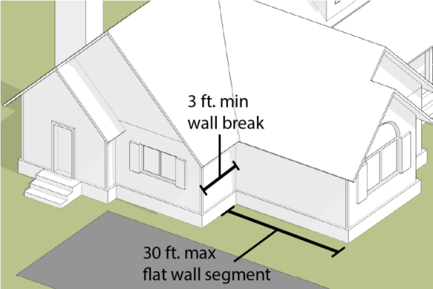
2.
Limit Blank Walls on Interior and Rear Façades. Internal and rear façades are not required to provide wall breaks; however, windows and openings shall be located to allow daylight into all sides of a building.
FIGURE 22.362.060-B: LIMIT BLANK WALLS
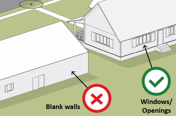
B.
Prohibited Materials. The following materials are prohibited in the Chapman Woods CSD community, to encourage compatibility with existing residential structures and forms that define Chapman Woods:
1.
The use of highly reflective materials, with the exception of solar panels;
2.
Rust-finished metal siding, such as "Corten steel";
3.
Corrugated metal on exterior façades and roofs;
4.
Exposed or protruding steel beams;
5.
Exposed, unpainted, untreated "cinder block," or concrete masonry units (CMUs);
6.
Board-formed concrete on building façades, not including foundations;
7.
Heavy or glossy stone slabs or corner caps used on wall façades, except on foundations, such as marble, travertine, limestone, or similar;
8.
Cargo shipping containers or portions thereof;
9.
Glass walls and railing, such as glass balcony railing;
10.
Asphalt paving;
11.
Vinyl siding;
12.
Reflective, glossy, or polished metallic roofing, except for solar energy devices and skylights; and
13.
Tar and gravel roofs.
C.
Alternative Materials and Construction Techniques. The Director has the authority to consider and determine alternative or sustainable materials and construction techniques, developed, or introduced after December 21, 2023, to be consistent with the existing character of the Chapman Woods community.
D.
Entrances—General Regulations.
1.
Primary Entrance. A primary entrance or porch shall be located on the primary façade of the primary residential structure providing pedestrian access from the public right-of-way.
2.
Front Door. Front doors located on a primary entrance or porch shall be oriented parallel to the right-of-way or be turned up to 90 degrees perpendicular to the public right-of-way.
FIGURE 22.362.060-C: PERMITTED FRONT DOOR ORIENTATION
(TYPICAL)
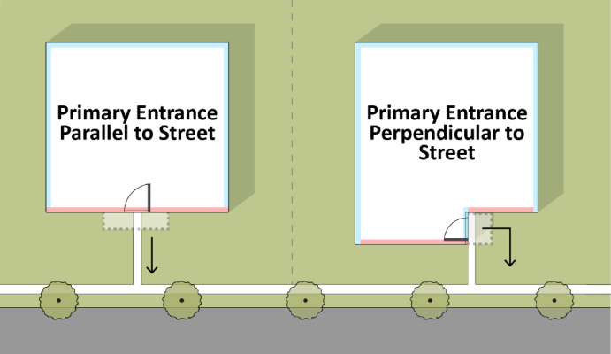
3.
Secondary Entrance. A residential building may have a secondary entrance or porch facing the side yard or rear property lines, as long as all development standards and setbacks are satisfied.
4.
Entrance Height. Entrances and porches shall have an exterior maximum height of 15 feet, as measured to the highest point or roof ridge that comprises the porch roof, in order to frame a human-scaled front entrance.
5.
Permitted Entrance Projections into Setbacks.
a.
Stairs and ramps (including stoops) may encroach up to three feet into a required setback area where no sidewalk is present, provided a minimum three feet by three feet at-grade landing can be provided at the base of the stairs or ramp.
b.
If there is a sidewalk present, stairs and ramps may project up to the sidewalk, provided they are necessary due to changes in grade between the sidewalk and the first-floor level but may not encroach upon the sidewalk.
E.
Permitted Porch Types. The following provisions are provided for all projects providing a porch.
1.
Projecting Porch.
a.
A projecting porch shall be open on at least three sides and have a roof;
b.
A projecting porch shall not encroach into required setback areas; however, stairs or ramps are permitted to encroach in accordance with Section 22.362.060.D.5, above;
c.
The depth of the projecting porch shall be a minimum of five feet and a maximum of 10 feet;
d.
The open area on the projecting porch shall provide a minimum size of 48 square feet;
e.
The minimum width of a projecting porch shall be eight feet;
f.
The maximum width of a projecting porch shall not exceed the width of the primary façade or half the width on other façades; and
g.
The minimum clear height of the interior porch ceiling shall be eight feet.
FIGURE 22.362.060-D: PROJECTING PORCH (TYPICAL)
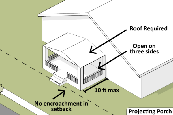
2.
Engaged Porch.
a.
An engaged porch shall be open on at least two sides and have a roof;
b.
The depth of the engaged porch shall be a minimum of five feet and a maximum of 10 feet;
c.
The open area on the engaged porch shall provide a minimum size of 48 square feet;
d.
The minimum width of an engaged porch shall be eight feet; and
e.
The minimum clear height of the interior porch ceiling shall be eight feet.
FIGURE 22.362.060-E: ENGAGED PORCH (TYPICAL)
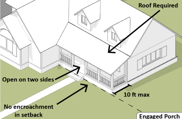
3.
Wrap-around Porch.
a.
A wrap-around porch shall be open on three sides and have a roof;
b.
A wrap-around porch shall not encroach into the required setback areas;
c.
The depth of the wrap-around porch shall be a minimum of five feet and a maximum of 10 feet; and
d.
The clear height of the interior porch ceiling shall be between eight and 10 feet.
FIGURE 22.362.060-F: WRAP-AROUND PORCH (TYPICAL)
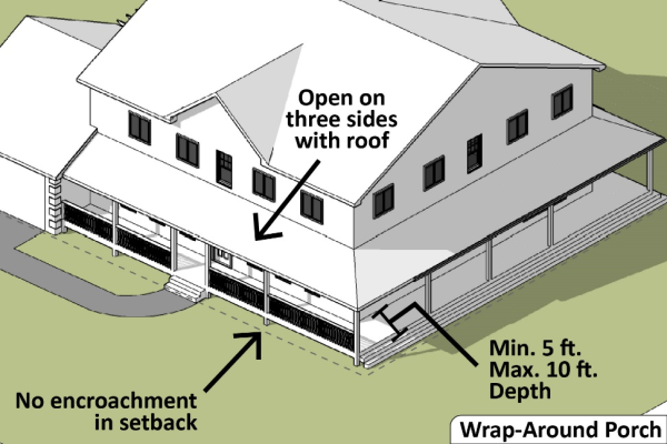
4.
Forecourt.
a.
A forecourt shall be framed on at least two sides, including one framed by the primary residential structure;
b.
All forecourts shall incorporate a minimum of one opening to allow for a pedestrian entrance;
c.
The pedestrian entrance may include a door, not to exceed 42 inches in height in the front yard setback area, and up to six feet outside of the front yard setback area;
d.
Forecourt walls up to 42 inches in height may project into the required front setback area;
e.
Forecourt walls outside of the front setback area may be up to six feet in height;
f.
Forecourt walls above 42 inches in height shall incorporate architectural breaks, such as pillars, pilasters, or wrought-iron openings, in consistent intervals of eight to 15 feet along the façade of the wall; and
g.
All forecourt wall materials shall incorporate architectural material and colors existing in the primary residential structure.
FIGURE 22.362.060-G: FORECOURT (TYPICAL)
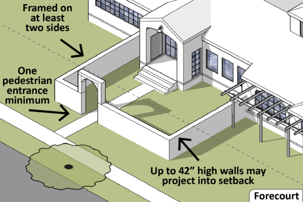
5.
Stoop.
a.
Stoop entrances shall be permitted on all façades;
b.
Stoops may encroach into a required yard setback area, but are required to have an at-grade or bottom landing that is at least three feet by three feet;
c.
The minimum width of a stoop shall be four feet, and the maximum shall be six feet;
d.
The minimum depth of the stoop shall be three feet; and
e.
The stoop's at-grade or bottom landing is permitted to overlap with an existing driveway.
FIGURE 22.362.060-H: STOOP (TYPICAL)
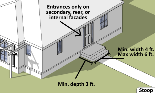
6.
Breezeways and Porte-cocheres.
a.
Construction of new breezeways or porte-cocheres in the CSD is not permitted;
b.
Existing breezeways and porte-cocheres on residential structures are allowed to remain and be maintained in their existing form; and
c.
Existing breezeways and porte-cocheres are not permitted to be expanded in floor area, exterior size, or massing, but façade materials and finishes may be improved or updated with permitted materials.
7.
Portico Porch.
a.
Construction of new portico porches in the CSD is not permitted;
b.
Existing portico porches on residential structures are allowed to remain and be maintained in their existing form; and
c.
Existing portico porches are not permitted to be expanded in floor area, exterior size, or massing, but façade materials and finishes may be improved or updated with permitted materials.
F.
Roofs. All new roofing shall comply with the following roofing standards. Refer to the Chapman Woods Architectural Guidelines for additional guidance on roof types, elements, and pitches.
1.
Roof Pitch.
a.
Roofs on primary residential structures shall be pitched between 2:12 and 18:12;
b.
Shed roofs, attached to the primary residential structures, shall be pitched between 2:12 and 8:12;
c.
Accessory structure roofs may be pitched between 1:12 and 18:12, but shall not have steeper pitch than the primary residential structure; and
d.
No portion of a roof or a low guarding wall or parapet shall have a minimum slope of less than two percent to allow for water runoff.
2.
Eaves and Overhangs. Roof eaves and overhangs, such as gabled or hipped roofs, are permitted to project into the required yard setbacks up to 36 inches from the edge of a façade, provided they are consistent with the required Distance Between Buildings in Section 22.110.050.
3.
Additions, Expansions, Renovations, and Accessory Structures. Additions, expansions, renovations, and accessory structures that result in new or expanded roof areas or planes shall demonstrate consistency with the following standards through a roof plan and elevation plan.
a.
Roofs visible from a primary or secondary façade shall match the roof style and pitch on the existing structure;
b.
Ridge heights shall be equal to or less than the existing roof structure where the roof is proposed;
c.
Pitches shall be equal to or less than the existing roof structure where the roof is proposed; and
d.
Additions, expansions, renovations, and accessory structures not visible from a primary or secondary façade may deviate from the existing roof style and propose a hip roof, gable roof, shed roof, flat roof, or Skillion-Lean-To roof.
4.
Roof-mounted Equipment. Skylights, roof vents, and other roof-mounted features and equipment should be located on the rear or interior-facing portion of the roof to be obstructed from public view, whenever possible. This provision does not apply to solar equipment.
G.
Windows and Doors.
1.
Proportion of Façade Coverage. Windows and doors located on primary and secondary façades shall cover the façade area within the ranges listed below, as measured to outside edge of the window or door frame, as shown in Figure 22.362.060-I: Windows and Doors Proportion, below.
FIGURE 22.362.060-I: WINDOWS AND DOORS PROPORTION
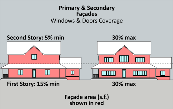
2.
Fenestration. Windows and doors shall be proportionately located on primary and secondary façades to provide a balanced rhythm and spacing along a given façade. Generally, if a façade is bisected, 50 percent of the window and door area should be on either side of the bisecting line.
FIGURE 22.362.060-J: FENESTRATION AND BALANCE
(SAMPLE DIAGRAMS)
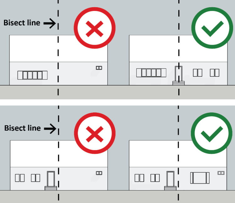
3.
Permitted Window and Door Materials.
a.
All windows shall be comprised of non-glare/non-reflective glass or utilize methods to achieve non-reflectivity;
b.
All doors located on a primary façade shall be stained or painted wood or faux wood in appearance with decorative paneling, carving, or inset windows; and
c.
Frosted or translucent windows are permitted only for bathroom windows to increase privacy.
4.
Prohibited Window and Door Materials.
a.
Dark tinted and mirrored glass, except for stained-glass windows;
b.
Glass block, except for stained-glass windows;
c.
Plane and flat doors without decorative paneling, carving, or inset glass shall not be located on a primary façade; and
d.
Industrial steel or metal doors.
5.
Window Alignment and Privacy Study. When two properties have a shared property line and there is less than 15 feet between residential structures, a site plan with a window alignment and privacy study, shown in Figure 22.362.060-K: Window Alignment and Privacy Study Diagram, below, shall be required to demonstrate privacy screening and buffering between the properties. The site plan shall identify and address all windows, balconies, terraces, or other openings that may reduce privacy for the adjacent property. Privacy screening strategies shall include any one or a combination of the following strategies:
a.
Distance. Locating proposed windows, balconies, terraces, and other forms that align with existing windows on an adjacent residential structure more than 15 feet from the existing windows on an adjacent residential structure;
b.
Indirect Alignment. Locating proposed windows, balconies, terraces, or other forms in indirect (or obscured) alignment with existing windows on an adjacent residential structure; and
c.
Fencing and Planted Areas. Utilizing fencing, walls, or planting areas and landscape features to create privacy screening between adjacent properties.
FIGURE 22.362.060-K: WINDOW ALIGNMENT AND PRIVACY STUDY DIAGRAM
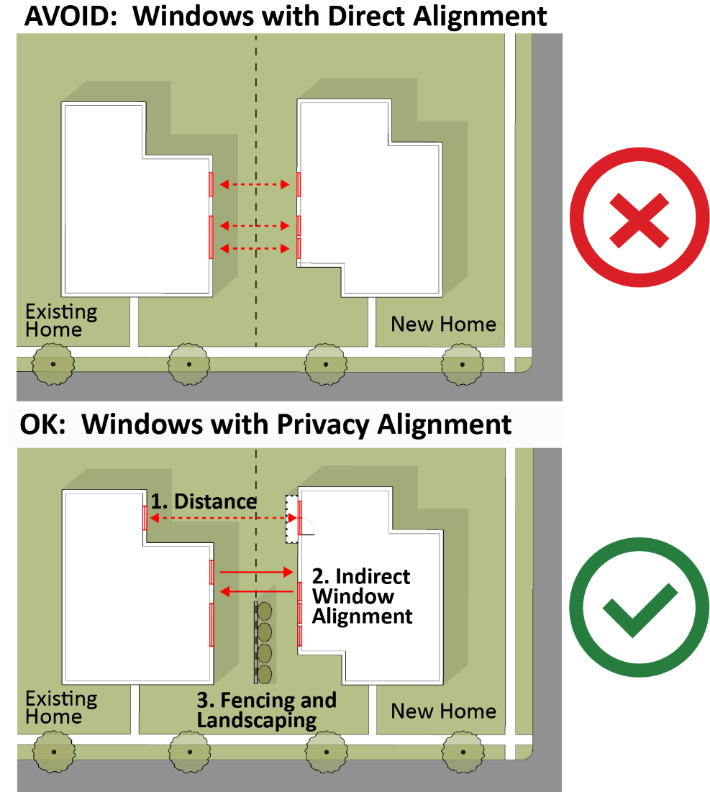
H.
Fences and Walls. All fences and walls shall be consistent with Section 22.110.070 (Fences and Walls), with the exception of Subsections H.1 and H.2, below.
1.
Quality Materials and Finishes. Fence and wall materials may include brick, wrought iron, picket wood, stucco, or similar material.
2.
Prohibited Fence and Wall Materials.
a.
Chain-link fence located in the front yard setback area and the side setback area when abutting public right-of-way;
b.
Exposed, unpainted, untreated board-formed concrete on building (CMUs) or "cinder block" located in a front yard setback or located in a side yard setback when abutting a public right-of-way;
c.
Fences and walls constructed of or topped with spikes, wire, barbs, razors, or any other similar material;
d.
Fences or walls constructed of glass, including glass balconies;
e.
Tubular metal railings;
f.
Opaque driveways and pedestrian gates over 42 inches tall; and
g.
Fencing shall be designed with materials not harmful to wildlife. All hollow fence and signposts or posts with top holes, such as metal pipes or signposts with open bolt holes, shall be capped and the bolt holes filled to prevent the entrapment of bird species.
I.
Vegetation and Planted Areas. The requirements in this Subsection only apply to discretionary land use permits, subject to Type II (Chapter 22.228), Type III (Chapter 22.230), or Type IV (Chapter 22.232) review. Reviews that include ground disturbance of over 400 square feet:
1.
In addition to the required application materials specified in Section 22.222.070 (Application Filing and Withdrawal), each application shall include:
a.
A detailed project description outlining the reason for the proposed vegetation removal and the planned use of the property; and
b.
A landscape plan identifying all proposed vegetation, landscape features, and planting areas on the property including, and separately specifying, all oak trees protected by Chapter 22.174 (Oak Tree Permits). The landscape plan shall indicate the vegetation and planting areas to be removed as part of the project and how those removals shall be replaced with replanting, to the satisfaction of the Department.
2.
In addition to the application filing fees listed in Chapter 22.250 (Applications, Petitions, and Fees), the applicant shall submit a fee for review by the County Biologist.
J.
Outdoor Lighting on Private Property.
1.
All outdoor light fixtures shall be fully shielded downward directed light fixtures or frosted.
2.
No glare shall be visible when viewed from adjoining lots and public rights-of-way.
3.
All exterior lights on private property shall be directed downward to prevent spillover lighting into adjacent properties.
4.
Lighting Height.
a.
The maximum height for light fixtures attached to the exterior façade of a residential structure, such as wall sconces, downlights, shall be 24 feet;
b.
The maximum height for a freestanding or pole-mounted light fixture or lamp post shall be nine feet in all yards;
c.
The maximum height for lighting of walkways used for entry and exit to permitted structures, including parking areas, is two feet; and
d.
Security lighting attached to the primary residential structure and other permitted structures shall be controlled by motion detectors and shall have a manufacturer's maximum output rating of no greater than 60 watts (600 lumens) or the equivalent.
5.
Prohibited Lighting. Industrial lighting and electrical features with exposed conduit and those with galvanized steel or unfinished metals.
K.
Signs. In addition to the development standards in Chapter 22.114 (Signs), the following signs are prohibited in the C-2 and MXD zones of the CSD:
1.
Outdoor advertising signs (Billboards);
2.
Freestanding signs that exceed 30 feet in height, extend into the public right-of-way, or are located within 100 feet of a residential zone, measured from the closest edge of the sign to residential zone property line; and
3.
Roof signs.
L.
Optional Community Identified Architectural Styles. If an applicant elects to incorporate all of the objective standards of one of the following prominent existing architectural styles in Chapman Woods listed below, then the project may also apply the incentives listed in Tables 22.362.070-A and 22.362.070-B, below:
1.
Ranch.
a.
Required Elements.
i.
Building Massing. The primary residential structure shall be one story in height. Incentives for this architectural style will be limited to setbacks and increased gross floor area. No incentives shall be granted to add additional height or a second story to the residence for this architectural style.
ii.
Front Porch. The primary façade of the primary residential structure must have an engaged or wrap-around porch.
iii.
Roofing. Roofing shall be made of traditional or composite shingles or material made to look like shingles. The required roof pitch must be between 2:12 and 6:12.
b.
Optional Elements. The primary residential structure may have any of the following architectural elements:
i.
A wide front door of at least 42 inches;
ii.
Wood clapboard or ship-lap siding; or
iii.
Brick or river rock wrapping the corners of joining façades.
2.
French Country.
a.
Required Elements.
i.
Façade Materials and Colors. Façades shall be rough hand-troweled stucco, concrete, brick, stone, or materials made to look like one of these options and where painted, shall use light, neutral colors, such as tans, grays, or cream.
ii.
Front Porch. Porches and entrances shall be symmetrically located. No porch is required for this architectural style. A recessed entry is permitted.
iii.
Roofing. Roofs shall have a shingle or slate finish with a minimum pitch of at least 6:12. When included, chimneys shall extend above the roofline.
iv.
Windows. Windows shall be symmetrically spaced on primary and secondary façades.
b.
Optional Elements. Incorporate at least one of the following architectural elements into the design of the primary residential structure:
i.
A prominent wood front door with iron hardware;
ii.
A recessed primary entrance with an archway;
iii.
Window shutters on the windows of the primary façade; or
iv.
A decorative cap or pot on the chimney.
3.
Colonial.
a.
Required Elements.
i.
Building Massing. When the building is two stories, the first and second stories of the primary façade shall be flush with one another and shall not feature any architectural breaks.
ii.
Façade Materials and Colors. Façades shall be made of one of the following materials or materials made to look like one of them: natural red or brown brick or clapboard siding painted white, light yellow, light blue, or gray.
iii.
Front Porch. The building entrance shall be centralized and framed by a dormer, pediment, or second story balcony.
iv.
Roofing. Roofs shall be hipped or gabled and may feature dormers on the second story.
b.
Optional Elements. Incorporate at least two of the following architectural elements into the design of the primary residential structure:
i.
Columns along the primary façade;
ii.
Second story dormers;
iii.
A projecting porch; and/or
iv.
Dark colored window shutters on the windows of the primary façade.
4.
Craftsman.
a.
Required Elements.
i.
Façade Materials. Exterior walls on all façades shall utilize lap or batt and board siding with at least 20 percent of the façade covered by stone or brick near the bottom half of the façade. Stucco may be used in place of the lap or batt and board siding, but it cannot exceed 20 percent of the façade area.
ii.
Exterior Colors. The buildings shall be painted in dark, neutral, or earth-toned colors, such as shades of taupe, beige, olive, or burgundy. Three or four paint colors may be applied to the exterior of the building for the purposes of cladding, trimming, and window or door. Trim and accents may be painted in a lighter paint palette, such as a light gray, blue, or green.
iii.
Front Porch. The primary façade must have a covered projecting porch with the minimum dimensions of 10 feet in width and five feet in depth. The porch shall include square columns that are either straight or tapered, with plinths measuring eight to 14 inches in width and depth.
iv.
Roofing. Roofing shall be made of shingles or material made to look like shingles. Required roof pitch must be between 6:12 and 8:12. Roof eaves and overhangs shall project between 18 and 36 inches.
v.
Windows. Apply decorative trim of five to six inches in width around the windows with emphasis on the top and bottom.
b.
Optional Elements. Incorporate at least two of the following architectural elements into the design of the primary residential structure:
i.
Decorative lighting fixtures featuring an opalescent stained glass or mica covering;
ii.
A wide front door of at least 42 inches;
iii.
Second story dormers;
iv.
A decorative beam under the gable of the primary façade;
v.
Decorative garage doors with window panes; and/or
vi.
River rock wrapping along the base of the residence extending up to 36 inches above the plinth base.
5.
Tudor Revival.
a.
Required Elements.
i.
Building Massing. The building elevations for the primary façade shall depict an asymmetrical building, including varying forms and heights, such as towers, archways, and wings.
ii
Façade Materials and Colors. Façades shall be unpainted stone, red brick, tan stucco, or dark natural brown wood shingle siding with decorative, dark brown half-timbering.
iii
Doors. Wood-paneled or battened front doors with exposed iron hardware.
iv.
Roofing. Roofing shall have a minimum pitch of 6:12, and chimneys shall extend above the roofline on the primary or secondary façade.
v.
Windows. Windows shall be divided by rectangular or diagonal muntin patterns.
b.
Optional Elements. Incorporate at least three of the following architectural elements into the design of the primary residential structure:
i.
A decorative cap or pot on the chimney;
ii.
Heavy wood garage doors;
iii.
Decorative exterior accents, such as railings, made from exposed wrought iron, cast, or hammered iron;
iv.
Application of decorative accents using brick, such as clinker woven brick or carved stone;
v.
Flower boxes; and/or
vi.
Lantern-design lighting fixtures with hammered or cast-iron hardware and dark painted metal finishes.
6.
Spanish Revival.
a.
Required Elements.
i.
Building Massing. The building elevations for the primary façade shall depict an asymmetrical building, including varying forms and heights, such as towers, archways, and wings.
ii.
Façade Materials. Exterior building walls shall be white or tan in color and made of stucco with smooth or lightly textured finishes (i.e., hand troweled or smaller particles).
iii.
Roofing. Roofs shall have a low pitch of between 2:12 and 6:12 and shall be made of red clay tiles or materials made to look like them, with either the Spanish S-shape or Barrel Type Mission design.
iv.
Windows. Windows shall have wide trim (i.e., surrounds).
b.
Optional Elements. Incorporate at least one of the following architectural elements:
i.
A forecourt or courtyard;
ii.
Recessed cutouts (niches) paired with arched openings and iron grilles;
iii.
Mosaic tiles and ceramic accents to highlight edges, such as stairs, or architectural features, such as arches;
iv.
Canvas awnings with spearhead poles or ornate metal awning may be used for shade and accents;
v.
Clay tile vents; or
vi.
Wrought iron shall be used for accents on window grilles, balconies, railings, door hardware, and light fixtures.
7.
Minimal Traditional.
a.
Required Elements.
i.
Building Massing. The primary residential structure shall be one story in height. Incentives for this architectural style will be limited to setbacks and increased gross floor area. No incentives shall be granted to add additional height or a second story to the residence for this architectural style.
ii.
Façade Materials. Façades shall have stucco or clapboard siding painted with lighter neutral colors with contrasting colors applied to trim, shutters, and doors. Brick may also be used as a building façade material.
iii.
Front Porch. Primary entrances shall be flush with the primary façade and shall be integrated with a small projecting or engaged porch.
iv.
Roofing. Roofing shall be made of traditional or composite shingles or material made to look like shingles. The required roof pitch must be between 2:12 and 6:12.
b.
Optional Elements. The primary residential structure may have any of the following architectural elements:
i.
Windows. Primary façades may have a large picture or bay window facing the street; or
ii.
Contrasting colors may be applied to trim, shutters, and doors.
(Ord. 2023-0050 § 7, 2023.)
22.362.070 - Zone-Specific Development Standards.
A.
Zones R-1, R-2, R-A, A-1 (Single-Family Residential).
| TABLE 22.362.070-A: ZONE R-1, R-2, R-A, A-1 DEVELOPMENT STANDARDS | ||||
|---|---|---|---|---|
| Development Standard | Lot Size (sf): Less than 13,000 | Lot Size (sf): 13,000—19,999 | Lot Size (sf): 20,000—39,999 | Lot Size (sf): 40,000+ |
| LOT AND BUILDING CONFIGURATION | ||||
|
Lot Width (minimum)*
*Measured along curb at Primary Street Frontage | 50 feet | 60 feet | 80 feet | 100 feet |
| Gross Floor Area (base) | 40% of lot area, not to exceed 3,500 sf | 35% of lot area, not to exceed, 5,000 sf | 25% of lot area, not to exceed 6,500 sf | 20% of lot area, not to exceed 8,000 sf |
|
Gross Floor Area (maximum)*
*Incentive for Community Identified Architectural Style (see Section 22.362.060.L) | 4,500 sf | 6,000 sf | 7,500 sf | 9,000 sf |
|
HEIGHT*
*Measured from "Maximum Grade" — The average grade of adjoining lots on either side of a given property. Maximum grade may be determined by the Director or Director of Public Works where it is impractical due to topographic conditions. | ||||
| Maximum Stories | The maximum number of stories above grade shall be two, as defined in Division 2, Chapter 22.14 (Definitions). | |||
| Base Maximum Height — Principal Building | 25 feet | 25 feet | 30 feet | 30 feet |
| Maximum Height — Principal Building (for Community Identified Architectural Styles listed in Section 22.362.060.L) | 30 feet | 30 feet | 35 feet | 35 feet |
| Maximum Height — Accessory Structures | 20 feet | 20 feet | 25 feet | 25 feet |
| Second Story Stepbacks on Side and Rear Yard |
Any portion of a primary or accessory structure above 14 feet in height shall be set
back an additional four feet minimum from the side yard setback lines.
Balconies and rooftop decks are eligible to extend into the four-foot second story stepback area as long as there is compliance with the window alignment and privacy study requirements in Section 22.362.060.G.5. | |||
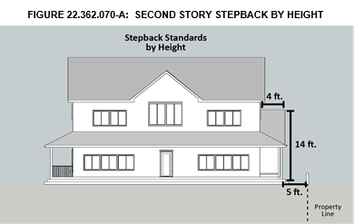 | ||||
| Distance Between Buildings on Same Lot | See Chapter 22.110.050 — Distance Between Buildings. | |||
| SETBACKS AND YARD AREAS — PRIMARY RESIDENTIAL STRUCTURE | ||||
| Front Yard Setback (Minimum / Maximum) | 30 feet / 35 feet | 35 / 50 feet | 40 / 60 feet | 45 / 100 feet |
| Interior Side Yard Setback | 10% of the average lot width, but no less than five feet. | 10% of the average lot width, but no less than 10 feet. | ||
| Corner and Reverse Corner Side Yard Setback |
10 feet when the average lot width is less than or equal to 100 feet.
15 feet when the average lot width is more than 100 feet. | |||
| Rear Yard Setback | 25 feet | 30 feet | 35 feet | 40 feet |
| LANDSCAPE AND PLANTED AREAS | ||||
| Front Yard Setback Landscape and Planted Area | A minimum of 50% of the required front yard setback area shall be landscaped with trees, plant material, natural groundcover, or drought-tolerant xeriscaping. | |||
| Tree Planting | When the requirements of Chapter 22.126 (Tree Planting Requirements) are applicable to a project, a third tree meeting the standards in that Chapter shall be required. | |||
| SETBACKS - ACCESSORY STRUCTURES | ||||
| Front Yard Setback | 20 feet minimum in addition to the principal residential building setback. | |||
| Side and Rear Yard Setbacks | Five feet, except for corner and reverse corner side yards where the setback is 10 feet. | |||
| PERMITTED PROJECTIONS INTO SETBACK AREAS | ||||
| Permitted Projections into Setback Areas |
Notwithstanding Section 22.110.090, the only projections permitted include:
• Trellises are permitted to extend over the second floor stepback area but shall not extend into the side or rear setback on ground level; • Bay windows on the first floor are permitted to encroach up to two feet into required yards, provided that they are not wider than eight feet along the general direction of the wall of which it is a part; • Fireplace structures are permitted to encroach up to two feet into required yards, provided that they are not wider than eight feet along the general direction of the wall of which it is a part; • Stoops may encroach into a required yard setback area, but are required to have an at-grade or bottom landing that is at least three feet by three feet in area; and • Planting boxes or masonry planters not exceeding 42 inches in height and 12 inches in depth. | |||
| PARKING AND ACCESS | ||||
| Parking | Number of Bedrooms | Required Enclosed Parking Spaces | ||
| 1 to 4 | 2 | |||
| 5 to 6 | 3 | |||
| 7 or more | 4 | |||
| Maximum Permitted Number of Driveway Curb Cuts per Lot |
One driveway curb cut for lots (except corner lots) with less than 100 feet of lot
frontage; and,
Two driveway curb cuts for corner lots and for lots with 100 feet or more of street frontage. For all properties, at least one driveway must lead to a garage. | |||
| Distance Between Driveways on Abutting Lots | Driveways located on separate lots must have a minimum of five feet between the driveways, as measured to outside edge of the driveway apron. | |||
| Driveways Widths |
Minimum 10 feet
Maximum 20 feet Circular driveways may range in width from 12 to 20 feet wide. | |||
| Garage Door Locations |
The face of a garage door shall be located a minimum of three feet behind the primary
façade of a residential building.
Parking shall not be located below grade. | |||
| Maximum Garage Door Widths |
16 feet — for lots with less than 60 feet of street frontage.
24 feet — for lots with 60 feet or more of street frontage. | |||
B.
Zone R-3.
| TABLE 22.362.070-B: ZONE R-3 DEVELOPMENT STANDARDS | |
|---|---|
| LOT AND BUILDING CONFIGURATION | |
| Maximum Floor Area* | The maximum floor area shall be 100% of the net lot area. Floor area shall include all enclosed buildings except cellars or garages. |
|
*Incentive Floor Area Maximum
*Incentive for Community Identified Architectural Style (see Section 22.362.060.L) | If a multi-family residential building is designed in accordance with one of the prominent Optional Community Identified Architectural Styles listed in Section 22.362.060.L, above, the Maximum Floor Area may be in increased by 1,200 square feet per lot. |
| Maximum Lot Coverage | The maximum lot coverage shall be 75% of the net lot area. Lot coverage shall include all enclosed buildings. |
| Residential Density | Maximum residential density shall be subject to State law, General Plan, and Chapter 22.18 (Residential Zones) of the Los Angeles County Code. |
| SETBACKS AND YARD AREAS | |
| Front Yard Depth | 15 feet (minimum) / 20 feet (maximum) |
| Front Yard Planting Area | A minimum of 20% of the required front yard shall contain pervious or softscape landscaping. |
| Minimum Side Yard Width | 5 feet |
| Minimum Reverse Corner Side Yard Width | 10 feet |
| Minimum Rear Yard Depth | 15 feet |
| Second Story Stepbacks on Side and Rear Yard |
Any portion of a primary or accessory structure above 14 feet in height shall be set
back an additional four feet minimum from the side yard setback lines.
Balconies and rooftop decks are eligible to extend into the four-foot second setback area, as long as there is compliance with the window alignment and privacy study requirements in Section 22.362.060.G.5. |
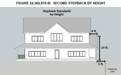 | |
|
HEIGHT*
*Measured from "Maximum Grade" — The average grade of adjoining lots on either side of a given property. Maximum grade may be determined by the Director or Director of Public Works where it is impractical due to topographic conditions. | |
| Maximum Height |
35 feet
The maximum height applies to all structures except chimneys and rooftop antennas. |
| PERMITTED PROJECTIONS INTO SETBACK AREAS | |
| Permitted Projections Into Setback Areas |
• Trellises are permitted to extend over the second floor stepback area but shall
not extend into the side or rear setback on ground level.
• Bay windows on the first floor are permitted to encroach up to two feet into required yards, provided they are not wider than eight feet along the general direction of the wall of which it is a part. • Fireplace structures are permitted to encroach up to two feet into required yards, provided they are not wider than eight feet along the general direction of the wall of which it is a part. • Stoops may encroach into a required yard setback area, but are required to have an at-grade or bottom landing that is at least three feet by three feet in area; and • Planting boxes or masonry planters not exceeding 42 inches in height and 12 inches in depth. |
| PARKING AND ACCESS | |
| Parking | As required by Chapter 22.112 (Parking). |
C.
Zone C-2 and MXD.
1.
Maximum Height. The maximum height of all structures, except chimneys and rooftop antennas, shall be 35 feet.
2.
Maximum Floor Area. The maximum floor area shall be 100 percent of the net lot area. The floor area shall include all enclosed buildings.
3.
Maximum Lot Coverage. The maximum lot coverage shall be 75 percent of the net lot area. Lot coverage shall include all enclosed buildings.
4.
Setback. For structures that exceed 17 feet in height and are located on a lot adjacent to a Residential Zone, the maximum height of the structure at five feet from the property line adjacent to the Residential Zone shall be 10 feet. Any portion of the structure that exceeds 10 feet in height shall be set back an additional foot for every additional foot in height.
5.
Lighting. Exterior lighting shall be of top-shielded or hooded design intended to direct light away from adjacent lots and prevent off-site illumination. Street lighting shall be consistent with the neighborhood pattern, except where Public Works determines that a different street lighting configuration is required for the protection of public health and safety.
(Ord. 2023-0050 § 7, 2023.)
22.362.080 - Area-Specific Development Standards.
(Reserved).
(Ord. 2023-0050 § 7, 2023.)
22.362.090 - Modification of Development Standards.
Modifications to any standards in this Chapter are subject to a Minor Conditional Use Permit (Chapter 22.160) application and shall be subject to the additional findings below:
A.
The application of these standards would result in practical difficulties or unnecessary hardships inconsistent with the purpose of this CSD; or
B.
There are exceptional circumstances or conditions that are uniquely applicable to the subject property or to the intended development of the subject property that do not apply to other properties within the area governed by this CSD.
(Ord. 2023-0050 § 7, 2023.)
FIGURE 22.362-A: CHAPMAN WOODS CSD BOUNDARY
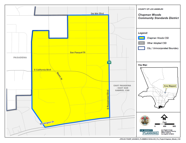
(Ord. 2023-0050 § 7, 2023.)
22.364.010 - Purpose.
The Metro Planning Area Standards District (PASD) is established to implement specific development standards for the unincorporated communities of the Metro Planning Area: East Los Angeles, East Rancho Dominguez, Florence-Firestone, Walnut Park, West Athens-Westmont, West Rancho Dominguez-Victoria, and Willowbrook. The PASD is necessary to ensure the goals and policies of the adopted Metro Area Plan (Area Plan) and the community-specific regulations for each community are accomplished in a manner which protects the health, safety, and general welfare of the community.
(Ord. 2024-0032 § 31, 2024.)
22.364.020 - Definitions.
Reserved.
(Ord. 2024-0032 § 31, 2024.)
22.364.030 - Planning Area Standards District Map.
The boundaries of this PASD are shown on Figure 22.364-A: Metro PASD Boundary, below.
FIGURE 22.364-A: METRO PASD BOUNDARY
(Ord. 2024-0032 § 31, 2024.)
22.364.040 - Applicability.
A.
General. Except as specified otherwise, this Chapter, in conjunction with Section 22.300.020 (Application of Planning Area Standards Districts and Community Standards Districts to Property), shall apply to any application for development, expansion, or change of use on lots within the boundaries of the Metro PASD, pursuant to Section 22.246.020 (Applicability of Zone Changes and Ordinance Amendments).
B.
Exception. Notwithstanding Section 22.172.020.H (Maintenance of Buildings or Structures Nonconforming Due to Use), a building or structure nonconforming due to use, or a building or structure nonconforming due to standards which is subject to termination by operation of law as specified in Section 22.172.050.B (Termination by Operation of Law), shall not be made to conform to the requirements for new buildings or structures, as specified by this Chapter, if alterations to the building or structure are proposed due to seismic retrofitting, as required by Chapters 95 and 96 of Title 26 (Building Code) of the County Code.
(Ord. 2024-0032 § 31, 2024.)
22.364.050 - Application and Review Procedures.
Notification. All permits requiring notification by mail shall be consistent with Section 22.222.160 (Notification Radius).
(Ord. 2024-0032 § 31, 2024.)
22.364.060 - PASD Area-Wide Development Standards.
A.
Graffiti.
1.
General Requirements. All structures, walls, and fences that are publicly visible shall be maintained free of graffiti. Any property owner, lessee, or other person responsible for the maintenance of a property shall remove graffiti within 72 hours of receiving written notice from a Zoning Enforcement officer that graffiti exists in the property. Paint used to cover graffiti shall match, as nearly as possible, the underlying color of the structure or of the surrounding surfaces.
2.
Other Requirements. Where other sections of the County Code require shorter timeframes for graffiti removal, those requirements shall control.
B.
Service Areas and Mechanical Equipment. Service areas and mechanical equipment for all uses in all zones shall be visually unobtrusive and integrated with the design of the site and building and shall meet the following development standards:
1.
Service entrances, utility boxes, waste disposal areas, and similar uses shall be located adjacent to alleys where the subject lot is abutting one and away from the streets to the greatest extent feasible;
2.
Utility access and services, such as back-flow preventers, transformer boxes, gas electric meters, and other utilities, shall be located adjacent to alleys where the subject lot abuts one, subject to the requirements and approval of the associated utility company;
3.
Rooftop equipment shall be screened by a parapet or other architectural features that integrate with the design of the building;
4.
Air intake and exhaust systems or other mechanical equipment that generate noise, smoke, or odors shall not be located on or within 10 feet from the frontage of buildings; and
5.
Service entrances which are visible from a street or open space shall be designed to be architecturally compatible with the building it serves.
C.
Building Height Limit - Exceptions. In addition to Section 22.110.060.C (Exceptions from Height Limit), elevator shafts and stairwells shall be excluded from the maximum permitted height limits stated by this Title 22.
D.
Site Maintenance. Except as specified otherwise in this Title 22, all exterior areas of the premises, adjoining sidewalks, incidental walkways, and rear alleys, shall remain free of garbage, trash, debris, or junk and salvage.
E.
Landscaped Buffer and Screening. Where a new non-residential primary use or an expansion in floor area of an existing non-residential primary use abuts a residence or residentially-zoned lot, the following shall be required:
1.
A landscaped buffer strip at least five feet wide;
2.
One 15-gallon tree for every 50 square feet of the landscaped buffer strip, which shall be equally spaced within said buffer strip; and
3.
A solid masonry wall not less than six feet nor more than eight feet in height shall be provided along the common lot line, provided that Section 22.110.180 (Sight Distance) is satisfied.
F.
Standards for Specific Uses.
1.
All Residential Uses.
a.
Landscaping.
i.
The required front yard, excluding driveways and walkways to residence entrances, shall be landscaped subject to the applicable provisions of Chapter 22.126 (Tree Planting Requirements) and shall be maintained with drought tolerant or low water use, native, or non-invasive plants, grasses, shrubbery, or trees and include an on-site irrigation system, such as a drip system.
ii.
All required landscaping shall comply with Chapter 12.84 (Low-Impact Development) of Title 12 of the County Code. Other hardscaping shall not be counted toward the required landscaping.
b.
Fences and Walls. Fences and walls shall be subject to Section 22.110.070 (Fences and Walls), except that fences and walls within a required front yard shall not exceed three and one-half feet in height where located 10 feet or less from the highway line, nor exceed six feet in height where located more than 10 feet from said highway line.
2.
Schools, Grades K-12.
a.
Applicability. This Subsection F.2 applies to schools, grades K-12, accredited by the State of California, excluding trade or commercial schools, in all zones where conditionally permitted.
b.
Traffic Impact and Improvement.
i.
Applications for schools, grades K-12 shall be referred to Public Works for review. In addition to the requirements of Section 22.116.030.B (Improvements), applications may be required to include, at the discretion of the Director of Public Works, a traffic impact analysis in accordance with current County guidelines.
ii.
Where the Director of Public Works finds that, based on the traffic impact analysis, the existing infrastructure is inadequate to serve a project, the Director may require the applicant to construct, install, or provide additional funds to construct or install the necessary infrastructure to protect public health, safety, and welfare. Furthermore, the Director, in consultation with the Director of Public Works, may require the applicant demonstrate on a site plan that adequate sightlines are maintained from the vehicular access points of the project site to the public right-of-way and the proposed layout of the site does not impede vehicular movement in the public right-of-way.
c.
Student Loading and Unloading. Student loading and unloading shall be restricted to designated areas to the satisfaction of the Director of Public Works.
d.
Signage. A sign prohibiting student loading and unloading outside of designated areas shall be placed on-site along the property line adjacent to any school frontages along a major highway or secondary highway. Signage shall be displayed on-site designating the student loading and unloading areas, as well as any parking designated for student loading and unloading.
e.
Parking. Except as specified otherwise by State law, one parking space per staff member shall be provided in addition to the on-site parking spaces required by Section 22.112.070 (Required Parking Spaces).
(Ord. 2024-0032 § 31, 2024.)
22.364.070 - PASD Zone Specific Development Standards.
A.
All Residential Zones.
1.
Development Standards. The following development standards shall apply to lots in all residential zones in the Metro PASD:
a.
Lighting. Lighting used on-site shall not impact surrounding or neighboring properties, with the exception of sidewalks or pedestrian accessible walkways within a right-of-way. The type and location of site and building lighting shall preclude direct glare into adjoining property, or skyward.
b.
Mechanical Equipment.
i.
Ground-mounted air conditioners are not permitted in any portion of the front yard setback or between the front of the structure and the public right-of-way.
ii.
Mechanical equipment shall be completely screened from view with walls or landscaping.
c.
Outdoor Storage. Outdoor storage is prohibited.
d.
Clotheslines. Clotheslines or clothesline structures used for drying or airing clothing items shall be located at the rear of the property and not visible from an adjoining street when viewed at ground level.
2.
Standards for Specific Uses.
a.
Accessory Commercial Units.
i.
Applicability. This Subsection A.2.a applies to accessory commercial units (ACU) in all zones where permitted.
ii.
Permitted Uses. An ACU shall only include one of the following commercial uses listed in Table 22.364.070-A, below.
iii.
Development Standards.
(1)
Required Yards.
(a)
Where an existing legally built structure, or portion thereof, is converted to an ACU, the depth of a yard between an existing/legally built structure and the existing lot line shall be deemed the required yard depth.
(b)
Any new ACU, or expanded portion of an existing, legally built structure that is part of a proposed ACU, shall comply with all applicable setback requirements in this Title 22, with the following exceptions:
(i)
Front Yard: 10 feet, if a greater setback is otherwise required by other provisions in this Title 22; and
(ii)
Reversed Corner Side Yard: seven and one-half feet if a greater setback is otherwise required by other provisions in this Title 22.
(2)
Orientation. An ACU shall front upon and be oriented to a street.
(3)
Pedestrian Access. An ACU shall have at least one pedestrian accessible entrance fronting and directly accessible to pedestrians on the street.
(4)
Separate Entrance. An ACU shall have a separate entrance from the main entrances to the residential buildings.
(5)
Floor Area. An ACU shall be limited to 1,000 square feet or 40 percent of the gross floor area of the residential buildings, whichever is less.
(6)
Height. An ACU shall be limited to one story in height.
(7)
Ground Floor. An ACU shall be located on the ground floor only.
(8)
Maximum Number of ACU. A maximum of one ACU is permitted per lot.
(9)
Outdoor Lighting. Lighting provided for the ACU shall be full cutoff. Lighting used on-site shall not impact surrounding or neighboring properties. The type and location of site and building lighting shall preclude direct glare onto adjoining property, streets, or skyward. All lighting fixtures must be fully shielded to confine light spread on-site as much as possible.
(10)
Parking. No parking shall be required for an ACU.
(11)
Signage.
(a)
One wall or projecting business sign, not to exceed six square feet in sign area, shall be permitted, provided no illumination is used.
(b)
Roof and freestanding business signs are prohibited.
(c)
Temporary signs or banners shall not be displayed on the exterior walls, windows, fascia of the building, or on any fence or wall.
(d)
The placement of portable signs on the lot or in the public right-of-way is prohibited.
iv.
Performance Standards.
(1)
Hours of Operation. Hours of operations shall be limited to 7 a.m. to 9 p.m., daily. Loading, unloading, and all maintenance activities shall be conducted within the hours of operation.
(2)
Designated Trash Collection Enclosures. Garbage and trash shall be stored in designated trash collection containers and enclosures which are not visible from the street.
(3)
Music. No outdoor music shall be permitted at any time.
(4)
Outdoor Activity. No outdoor activity shall be permitted.
b.
Existing Nonconforming Neighborhood-Serving Commercial Uses in Residential Zones.
i.
Notwithstanding Section 22.172.060 (Review of Amortization Schedule or Substitution of Use), an existing neighborhood-serving commercial use in a residential zone may request extension of the time within which said use must be discontinued, and continue operation, subject to a Ministerial Site Plan Review (Chapter 22.186), if the use meets all of the following:
(1)
The existing commercial use is one of the uses listed in Table 22.364.070-A, above;
(2)
The building in which the existing commercial use is located was legally built;
(3)
None of the following is proposed:
(a)
Extension, expansion, or enlargement of the area of the lot or the area within the building devoted to the existing commercial use;
(b)
Enlargement of or addition to the building devoted to the existing commercial use; or
(c)
Addition of land, buildings, or structures used in conjunction with the existing commercial use;
(4)
Except as exempted by State law, existing on-site parking, if any, shall continue to be maintained;
(5)
Existing wall or projecting business signs legally erected for the existing commercial use may be maintained, repaired, or replaced, provided the existing number, sign areas, and locations of such signs shall remain unchanged;
(6)
Roof and freestanding business signs are prohibited;
(7)
Temporary signs or banners shall not be displayed on the exterior walls, windows, fascia of the building, or on any fence or wall;
(8)
The placement of portable signs on the lot or in the public right-of-way is prohibited; and
(9)
The existing commercial use shall be subject to Subsection A.2.a.iv (Performance Standards), above.
ii.
Termination by Discontinuance. The right to operate the existing nonconforming neighborhood-serving commercial use, pursuant to this Subsection A.2.b, shall be terminated, subject to the same regulations set forth in Section 22.172.050.A (Termination by Discontinuance).
B.
All Commercial Zones.
1.
Development Standards. The following development standards shall apply to lots in all commercial zones in the Metro PASD:
a.
Loading.
i.
Loading spaces shall be located away from residential zones and primary pedestrian ingress and egress areas to the greatest extent possible.
ii.
Wherever feasible, loading areas shall be located at the rear of the building.
b.
Parking and Loading for Existing Structures. Except as specified otherwise by State law, the following requirements shall apply to existing structures:
i.
If a new commercial use is one of the uses listed in Table 22.364.070-A, above, and is proposed in an existing building legally constructed prior to September 22, 1970, existing on-site parking, if any, shall be deemed in compliance with this Title 22 for said use;
ii.
For other uses not subject to Subsection B.1.b.i, above, so long as the gross floor area of the existing legally built building is not increased, no additional parking or loading spaces shall be required for intensification of use on the ground floor of said existing building, unless accessible parking spaces for persons with disabilities are required by Section 22.112.090 (Accessible Parking for Persons with Disabilities); and
iii.
In the event the gross floor area of the existing legally built building is increased, additional parking spaces and landscaping shall be developed for the increased gross floor area, as required by Chapter 22.112 (Parking).
c.
Mechanical Equipment.
i.
Individual air conditioning units for a structure shall be located to avoid interference with architectural detail and the overall building design.
ii.
If air conditioning units must be located in the storefront, window units shall be neutral in appearance and shall not project outward from the façade. If possible, air-conditioning units shall be screened or enclosed by using an awning or landscaping.
iii.
Mechanical equipment located on roofs shall be screened by parapet walls or other materials so that the equipment will not be visible by pedestrians at street level or by adjacent residential property.
d.
Security.
i.
Chain link, barbed, and concertina wire fences are prohibited. In place of such fencing, tubular steel or wrought iron fences are permitted.
ii.
All security bars and grilles, including folding accordion grilles, shall be installed on the inside of a building.
iii.
Roll-up shutters should be open, decorative grilles and concealed within the architectural elements of the building. Solid shutters are prohibited.
e.
Lighting. Lighting used on-site shall not impact surrounding or neighboring properties.
i.
Outdoor Lighting. All exterior light fixtures shall be energy efficient, produce warm-white light, avoid light pollution, and spill-over to neighboring properties, and, except for architectural or landscape lighting, be pedestrian scaled, fully shielded, and directed toward the ground.
(1)
The type and location of site and building lighting shall preclude direct glare onto adjoining property, streets, or skyward.
(2)
All exterior lighting fixtures shall be fully shielded to confine light spread on-site as much as possible.
ii.
Blinking, flashing, or oscillating lights of any type visible on the exterior are prohibited.
f.
Signage. All new business signs shall be subject to all applicable regulations in Section 22.144 (Signs), except as modified by this Subsection B.1.f.
i.
Development Standards.
(1)
Monument Signs. Monument signs shall comply with the standards in Table 22.364.070-B, below.
(2)
Awning Signs. Awning signs shall be permitted on the ground floor of any nonresidential use, provided such signs have no internal illumination and comply with the standards in Table 22.364.070-C, below.
(3)
Projecting Signs. Projecting signs shall be permitted on the ground floor or over a pedestrian walkway, provided such signs comply with the standards in Table 22.364.070-D, below.
(4)
Wall Signs. Wall signs shall comply with the standards in Table 22.364.070-E, below.
ii.
Prohibited Signage or Sign Elements.
(1)
Roof signs.
(2)
Digital, electronic, or signs including any internal or external illumination capable of changing the message or copy on the sign.
(3)
Freestanding signs, not including monument signs subject to the standards in Table 22.364.070-B, above.
(4)
Outdoor advertising signs (billboards).
(5)
Signs using any continuous or sequential flashing operation, including electronic reader boards and signage that includes crawling displays or flashing illuminations.
(6)
Signs using video components.
iii.
Sign Program. A sign program is intended to integrate the design of multiple signs proposed for a development project and provide a means for applying common sign regulations for multi-tenant projects.
(1)
Applicability. A sign program shall be established whenever any of the following circumstances exist:
(a)
The property owner or applicant requests a master sign program; and/or
(b)
Any new multi-tenant development project that includes four or more businesses on the same lot or in the same structure.
(2)
Requirements. The sign program shall establish standards for sign location, style, size, color, font, materials, and any other applicable sign feature, so that all new business signs in the commercial center will be compatible with each other.
iv.
Maintenance. The display surface of all signs permitted, pursuant to this Subsection B.1.f, shall be kept clean, neatly painted, and free from rust or corrosion. Any cracks, broken surfaces, malfunctioning lights, missing parts, or other unmaintained or damaged portion of such signs shall be repaired, replaced, or removed within 30 days of notification from the Department that a state of disrepair exists.
v.
Additional Findings for Modifications. Deviation from the sign area standards or required dimensions specified in Subsection B.1.f.i, above, may be permitted with a Minor Conditional Use Permit (Chapter 22.160) application, subject to the following additional findings:
(a)
The requested modification does not result in additional glare, light trespass, or nuisance to neighboring properties or surrounding uses; and
(b)
With the exception of the requested modification, the proposed sign complies with all other applicable standards in this Title 22.
g.
Vehicular Access. The following shall apply to new construction of any principal building on a lot with no other principal buildings:
i.
Where the lot is adjacent to an alley, parking shall be accessed through the alley, unless alley access is determined to be inadequate due to alley width, limited sight distance, or otherwise as determined by the Director in consultation with Public Works and the Fire Department; and
ii.
For corner lots without alley access, parking shall be accessed from the corner or reverse corner side of the property.
2.
Standards for Specific Uses—Mixed Use Developments. Mixed use developments in commercial zones shall be subject to all applicable regulations in Section 22.140.350 (Mixed Use Developments in Commercial Zones), except as modified by this Subsection B.2.
a.
Maximum Height. The maximum height of a mixed use development shall be 65 feet.
b.
Step Back. The portion of any building in a mixed use development sharing a common side or rear lot line with a residentially zoned lot shall have a step back from the common side or rear lot line so that the height of the building in the mixed use development is no greater than 45 feet at the edge of the building wall facing that common lot line, and shall be recessed back one foot for every one-foot increase in building height, up to a maximum height of 65 feet.
(Ord. 2024-0032 § 31, 2024.)
22.364.080 - East Los Angeles Community Standards District.
A.
CSD Boundaries. The boundaries of this CSD, including those of the CSD Sub-Areas, are shown in Figure 22.364-B: East Los Angeles CSD Boundary, below.
FIGURE 22.364-B: EAST LOS ANGELES CSD BOUNDARY
B.
CSD Area-Wide Development Standards.
1.
Prohibited Outdoor Structures for Commercial Buildings. The following outdoor structures on the site of a commercial building are prohibited when these structures are clearly visible from the street.
a.
Donation boxes or bins, such as those for, but not limited to, the collection of clothing or items for donation or recycling.
b.
Structures or machines internally illuminated or have moving parts, flashing lights, or make noise, such as photo booths, fortune-telling machines, penny-crunching machines, video games, or the like.
c.
Inanimate figures, such as statues or sculptures of animals or mannequins, cartoon figures, or human figures.
2.
Nonconforming Residential Dwelling Units.
a.
The termination period or periods set forth in Section 22.172.050 (Termination Conditions and Time Limits) that would otherwise apply to residential dwelling units shall not apply to any nonconforming residential dwelling units in the East Los Angeles CSD.
b.
Any single-, two-, or multi-family residential building or structure nonconforming due to use which is damaged or destroyed may be restored to the condition in which it was immediately prior to the occurrence of such damage or destruction, provided the cost of reconstruction does not exceed 100 percent of the total market value of the building or structure, as determined by the methods set forth in Section 22.172.020.G.1.a and b and provided the reconstruction complies with the provisions of Section 22.172.020.G.2.
3.
Multiple Tenant Commercial in Commercial Zones. Six or more tenants may conduct businesses in a building which does not have permanent floor-to-ceiling walls, as defined in Title 26 (Building Code) of the County Code, to separate the business on a commercially zoned lot, subject to a Conditional Use Permit (Chapter 22.158) and the following development standards:
a.
Parking. Except as specified otherwise by State law, parking shall be provided at a ratio of one space per 200 square feet of gross floor area of the building; and
b.
Each leasable space in the building shall consist of at least 500 square feet of gross floor area.
C.
CSD Zone Specific Development Standards.
1.
Zones R-1 and R-2.
a.
Design Requirements.
i.
Wall Finish. At least 50 percent of a structure's walls fronting any street shall incorporate at least two of the following surface materials:
(1)
Brick;
(2)
Natural stone;
(3)
Panel Siding;
(4)
Terra-cotta; and/or
(5)
Stucco or other similar troweled finishes.
ii.
Architectural Elements. Structures shall incorporate at least three of the following elements along the side of any wall fronting a street:
(1)
Arcading;
(2)
Arches;
(3)
Awnings;
(4)
Balconies;
(5)
Bay windows;
(6)
Colonnades;
(7)
Courtyards;
(8)
Decorative exterior stairs;
(9)
Decorative iron fences;
(10)
Plazas; and/or
(11)
Porches, covered and open on at least three sides.
iii.
Building Access. For residential structures, the main pedestrian entrance of at least one dwelling unit shall face the street.
2.
All Commercial Zones and Zone MXD.
a.
Required Building Frontages.
i.
The frontage of each building shall consist of at least one of the frontage types listed in this Subsection C.2.a.i.
(1)
Terrace. The main façade is at or near the frontage line with an elevated terrace providing public circulation along the façade. This frontage type can be used to provide at-grade access while accommodating a grade change. Frequent steps up to the terrace are necessary to avoid dead walls and maximize access. Table 22.364.080-A, below, shows the allowable configuration of a terrace frontage.
| TABLE 22.364.080-A: TERRACE FRONTAGE 1 | |
|---|---|
| Depth | Min. 7 ft |
| Finish Level Above Sidewalk | Min. 3 ft |
| Perimeter Wall Height 2 | Max. 4 ft |
| Street Frontage Distance Between Stairs | Min. 50 ft |
| Length of Terrace | Max. 150 ft |
|
Notes:
1. Standards shall be used in conjunction with those of the Shop Front type frontage. In case of conflict between the two, the Terrace Frontage standards shall prevail. 2. Low walls as seating are encouraged. | |
 | |
(2)
Forecourt. The main façade of the building is at or near the frontage line and a small percentage of the frontage is set back, creating a small court space. This space can be used as an entry court or shared garden space for apartment buildings, or as an additional shopping or restaurant seating area within retail and service areas. Table 22.364.080-B, below, shows the allowable configuration of a forecourt frontage.
| TABLE 22.364.080-B: FORECOURT FRONTAGE | |
|---|---|
| Width, Clear |
Min. 10 ft
Max. 60 ft |
| Depth, Clear |
Min. 20 ft
Max. 60 ft |
| Depth of Recessed Entries | Max. 10 ft |
| Ground Floor Transparency | Min. 65% |
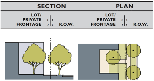 | |
(3)
Shopfront. The main façade of the building is at or near the frontage line with an at-grade entrance along the public right-of-way. This type is intended for retail use on the ground floor. This frontage has substantial glazing at the sidewalk level and may include an awning. It may be used in conjunction with other frontage types. Table 22.364.080-C, below, shows the allowable configuration of a forecourt frontage.
| TABLE 22.364.080-C: SHOPFRONT FRONTAGE | |
|---|---|
| Height | Min. 11 ft |
| Depth of Recessed Entries | Max. 10 ft |
| Ground Floor Transparency | Min. 65% |
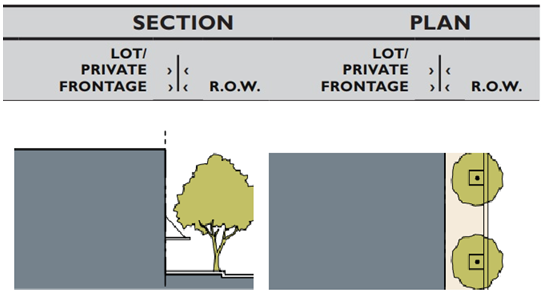 | |
ii.
All design features including, but not limited to, canopies, awnings, overhanging roofs, ornamental light fixtures, columns, or other architectural elements encroaching within the public right-of-way must meet the applicable requirements of Title 16 (Highways) and Title 26 (Building Code) of the County Code. If an encroachment permit is not granted for a specific design feature requested, the requirement to include that design feature as part of the project shall not apply, unless the Director, in their sole discretion, requires the applicant to redesign the project so that the design feature can be installed entirely outside of the public right-of-way.
b.
Façade Height Articulation Requirements. Each building or portions of a building, with more than one story, shall have, at a minimum, a distinctive building base, building middle, and building top (eave, cornice, and/or parapet line) which complement and balance one another.
c.
Main Building Entrance.
i.
General. Main building entrances shall be easily identifiable and distinguishable from first floor storefronts. For purposes of this Subsection C.2.c., a main building entrance is the widest entrance to a building and the one that most pedestrians are expected to use.
(1)
In multi-tenant buildings, main entrances open directly into the building's lobby or principal interior ground level circulation space. Where a multi-tenant building does not have a lobby or ground level interior circulation space, there shall be no main entrance for purposes of this Subsection C.2.c.
(2)
In single-tenant buildings, main entrances typically open directly into lobby, reception, or sales areas.
ii.
Main building entrances shall be at least one of the following:
(1)
Marked by a taller mass above the entrance, such as a tower, or within a volume that protrudes from the rest of the building surface;
(2)
Located in the center of the façade, as part of a symmetrical overall composition;
(3)
Accented by architectural elements, such as columns, overhanging roofs, awnings, and ornamental light fixtures; or
(4)
Marked or accented by a change in the roofline or change in the roof type.
iii.
Corner buildings shall provide prominent corner main building entrances for shops and other activity-generating uses.
d.
Roof Requirements.
i.
A horizontal articulation shall be applied at the top of a building by projecting cornices, parapets, lintels, caps, or other architectural expression to cap the buildings, to differentiate the roofline from the building, and to add visual interest to the building.
ii.
Flat roofs are acceptable, if a cornice and/or parapet wall is provided.
iii.
Parapet walls shall have cornice detailing or a distinct shape or profile, such as a gable, arc, or raised center.
iv.
Metal seam roofing, if used, shall be anodized, fluorocoated, or painted. Copper and lead roofs shall be natural or oxidized.
e.
Wall Surface Material Requirements. Building walls shall be constructed of durable materials, such as brick, natural stone, terra-cotta, decorative concrete, metal, glass, or other similar materials.
i.
Standards for using decorative concrete block, stucco, or other similar troweled finished in nonresidential, mixed use, and multi-family residential buildings shall be as follows:
(1)
Decorative Concrete Block. Decorative concrete blocks shall be limited to a maximum of 50 percent of the street façade. When decorative concrete blocks are used for the street façade, the building shall incorporate a combination of textures and/or colors to add visual interest. For example, combining split or rock-façade units with smooth stone can create distinctive patterns. Cinder block (concrete masonry unit) shall be prohibited as an exterior finish.
(2)
Stucco or other similar troweled finishes shall:
(a)
Be smooth to prevent the collection of dirt and surface pollutants;
(b)
Be trimmed or combined with wood, masonry, or other durable material and be limited to a maximum of 50 percent of the street façade; and
(c)
Not extend below two feet above grade of the street façade.
(3)
Concrete, masonry, natural stone, or other durable material shall be used for wall surfaces within two feet above grade of the street façade.
ii.
Changes in materials shall be used to articulate building elements, such as base, body, parapets caps, bays, arcades, and structural elements. Not all building elements shall require a change in material. Change in materials shall be integral with building façade and structure.
iii.
If clearly visible from streets, side and rear building façades shall have a level of trim and finish compatible with the front façade.
iv.
Blank wall areas without windows or doors are only allowed on internal-block, side-property line walls. Any blank exterior wall shall also be treated with a graffiti-resistant coating.
v.
Building walls shall have contrasting trim colors. For example, dark colors and saturated hues for accent and ornamental colors may be used with neutral or light walls; white or light window and door trim may be used on a medium or dark building wall; and medium or dark window and door trim may be used on a white or light building wall. Other contrasting wall and trim combinations may also be used.
f.
Wall Openings.
i.
For shopfront frontages, upper stories shall have a window to wall area proportion that is less than that of ground floor shop fronts. Glass curtain walls or portions of glass curtain walls are exempt from this standard.
ii.
Window Inset. Glass shall be recessed or projected at least three inches from the exterior wall surface to add relief to the wall surface. Glass curtain walls or portions of glass curtain walls are exempt from this standard.
iii.
Glazing. Reflective glazing shall not be used on windows.
iv.
Clear or lightly tinted glass for windows shall be used at and near the street level to allow maximum visual interaction between sidewalk areas and the interior of buildings. Mirrored, highly reflective glass or densely tinted glass shall not be used, except as an architectural or decorative accent totaling a maximum of 20 percent of the building façade.
v.
Percentage of Openings.
(1)
Commercial and Mixed Use Buildings. At least 65 percent of the total width of the building's ground floor parallel to and facing the street shall be devoted to entrances, shop windows, or other displays which are of interest to pedestrians.
(2)
Residential Buildings. At least 30 percent of the total width of the building's ground floor parallel to and facing the street shall be devoted to entrances and windows.
g.
Awnings and Canopies.
i.
Awnings and canopies shall be mounted to highlight architectural features, such as molding above the storefront.
ii.
Awnings and canopies shall match the shape or width of the window, door, or other opening.
iii.
Awnings and canopies may be constructed of metal, wood, or fabric.
iv.
Incorporating lighting into an awning or canopy shall be allowed, except that an internally illuminated awning that glows is prohibited.
v.
Awnings shall be operable and open ended, and subject to the following:
(1)
Depth: Minimum four feet; and
(2)
Clearance: Minimum eight feet in height from the base of the awning.
vi.
Awnings shall be the same color and style for each opening on a single storefront or business.
vii.
Awnings in disrepair shall be repaired or removed within 30 days after receipt of notification by the Director that a state of disrepair exists.
h.
Maximum Building Height in Zones C-3, C-M and MXD. A building or structure shall not exceed the following height limit above grade:
i.
Zones C-3 and C-M: 40 feet; and
ii.
Zone MXD: 45 feet.
3.
All Industrial Zones.
a.
All newly created industrially zoned lots shall contain a net area of at least 7,500 square feet.
b.
Subsection C.2, above, shall apply to all new retail/commercial uses on industrially zoned lots.
D.
Sub-Area Development Standards.
1.
Special Setback Sub-Area. Lots within the boundaries of a Special Setback Sub-Area shall be subject to the required front yard setback as shown in Figures 22.364-C through 22.364-I, below.
FIGURE 22.364-C: CSD SPECIAL SETBACK SUB-AREA - CITY TERRACE
(1 of 2)
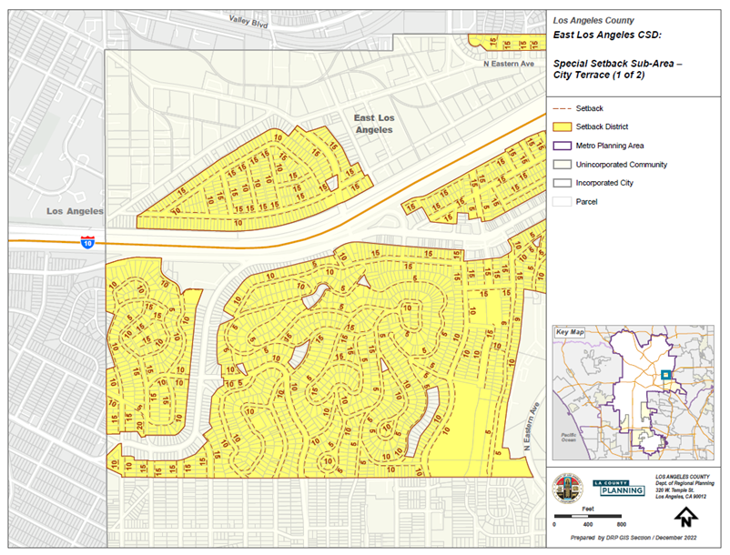
FIGURE 22.364-D: CSD SPECIAL SETBACK SUB-AREA - CITY TERRACE
(2 of 2)
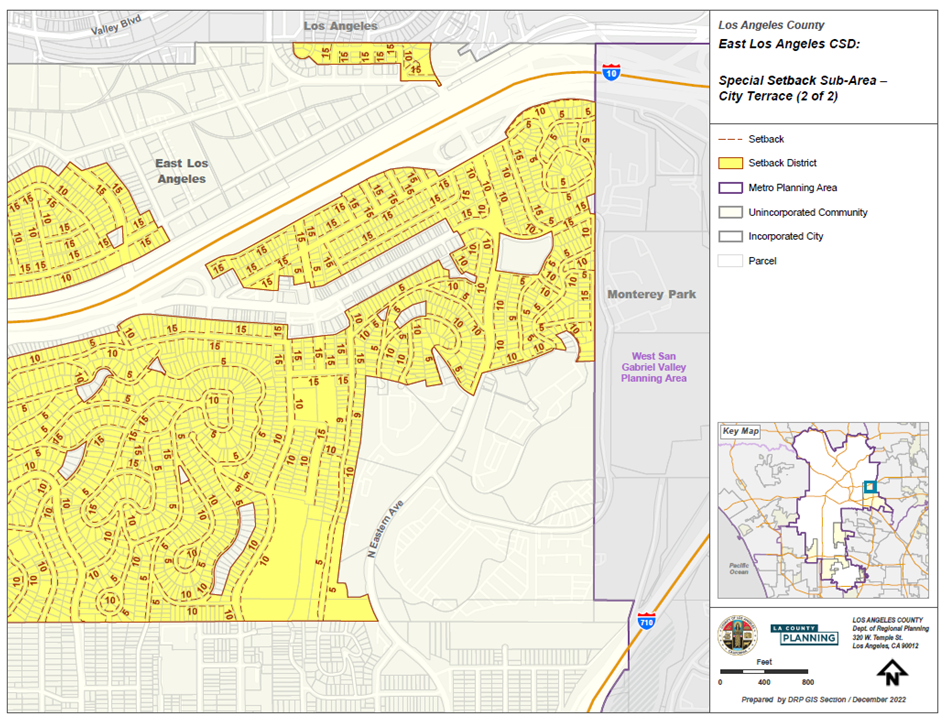
FIGURE 22.364-E: CSD SPECIAL SETBACK SUB-AREA - FIRST UNIT EASTSIDE (1 of 3)
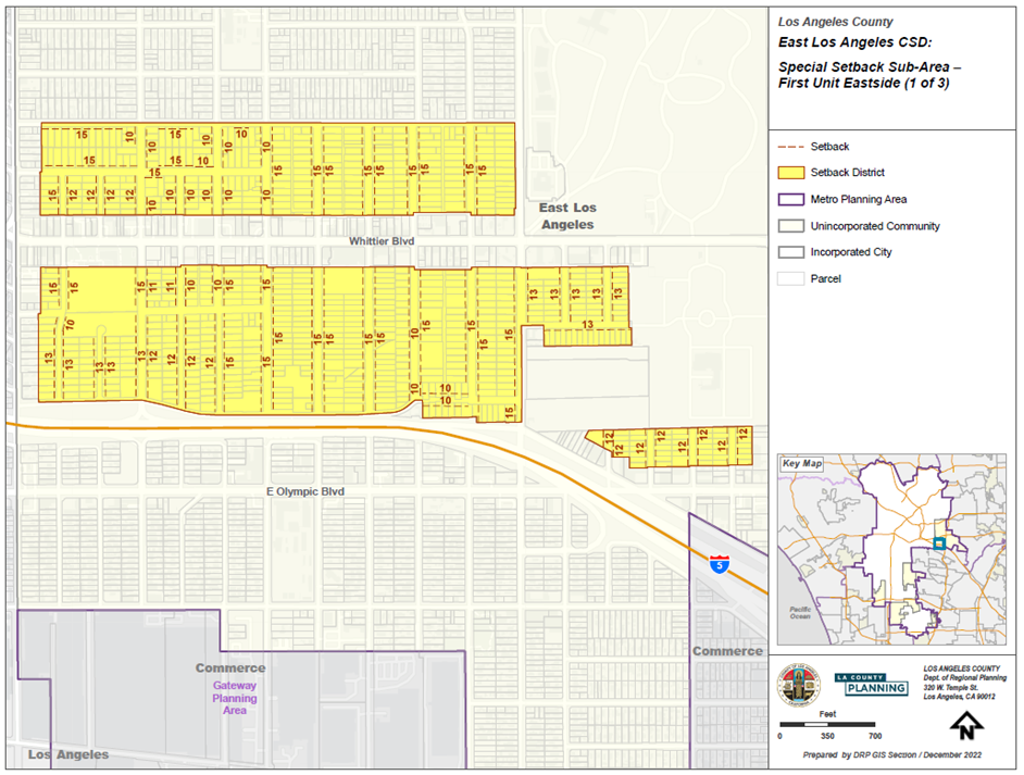
FIGURE 22.364-F: CSD SPECIAL SETBACK SUB-AREA - FIRST UNIT EASTSIDE (2 of 3)
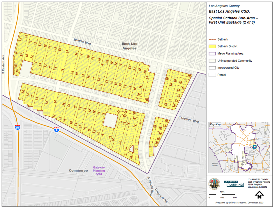
FIGURE 22.364-G: CSD SPECIAL SETBACK SUB-AREA - FIRST UNIT EASTSIDE (3 of 3)
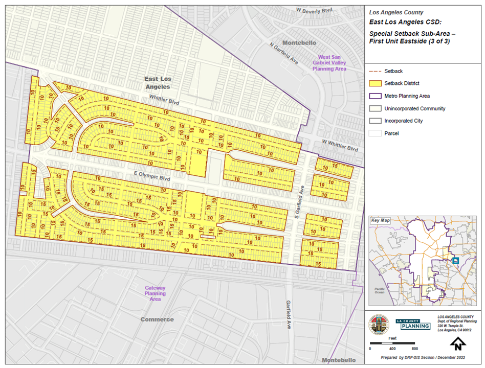
FIGURE 22.364-H: CSD SPECIAL SETBACK SUB-AREA - SECOND UNIT EASTSIDE (1 of 2)
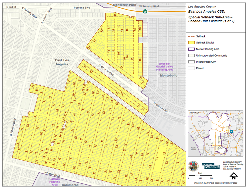
FIGURE 22.364-I: CSD SPECIAL SETBACK SUB-AREA - SECOND UNIT EASTSIDE (2 of 2)
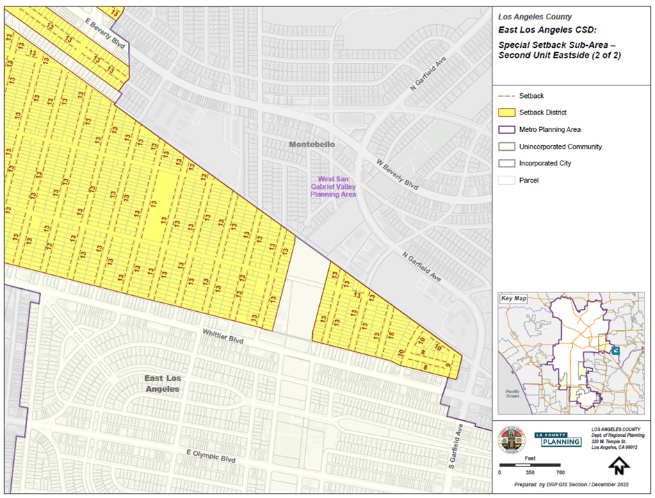
2.
Whittier Boulevard Sub-Area. Lots within the boundary of the Whittier Boulevard Sub-Area, as shown in Figure 22.364-B: East Los Angeles CSD Boundary, above, shall be subject to this Subsection D.2.
a.
Uses. Lots in Zone C-3 may be used for any use listed as a permitted use in Section 22.20.030 (Land Use Regulations for Zones C-H, C-1, C-2, C-3, C-M, C-MJ, and C-R) for Zone C-3, with the following exceptions:
i.
Uses Subject to Permits. Uses listed in Table 22.364.080-D, below, shall require a Conditional Use Permit (Chapter 22.158) application, provided such uses are established in commercial-only development projects; and
ii.
Prohibited Uses. Uses listed in Table 22.364.080-E, below, shall be prohibited.
b.
Development Standards. Lots in the Whittier Boulevard Sub-Area shall be subject to the following development standards:
i.
Parking Areas. All parking areas shall be located to the rear of the buildings and out of view of Whittier Boulevard.
ii.
Landscaping. Landscaping shall be provided with the objective of creating an inviting and interesting pedestrian environment along the Whittier Boulevard area and rear alleys. At least five percent of the net lot area shall be landscaped in accordance with the following:
(1)
Landscaping shall consist of drought tolerant or low water use native or non-invasive plants, grasses, shrubbery, and trees;
(2)
Landscaping shall be maintained in a neat, clean, and healthful condition, including proper watering, pruning, weeding, removal of litter, fertilizing, and replacement of plants, as necessary;
(3)
A landscaped planter or planter box with a minimum depth of one foot shall be located along the building frontage; and
(4)
Existing blank walls at the pedestrian level shall either be constructed with a planter at the base or at the top or be landscaped with climbing vines or other similar plant material that can be trained on the wall and can be easily pruned and maintained.
iii.
Trash Enclosure. Trash bins shall be required for commercial operations and shall be enclosed by a six-foot high decorative wall and solid doors. The location of the trash bin and enclosure shall be as distant as possible from adjacent residences and out of view of Whittier Boulevard.
iv.
Outside Display on Private Property. Outside display or sale of goods, equipment, merchandise, or exhibits shall be permitted on private property not to exceed 50 percent of the total frontage area, provided such display or sale does not interfere with the movement of pedestrians or occupy required parking or landscaping. The type of goods on display shall be items sold strictly by the primary business located on the subject property. The outside display or sale of goods, equipment, merchandise, or exhibits shall be subject to a Ministerial Site Plan Review (Chapter 22.186) application.
v.
Pedestrian Character.
(1)
To enhance the pedestrian experience and encourage the continuity of retail sales and services, at least 50 percent of the total width of a commercial or vertical mixed use building's ground floor parallel to and facing the street shall be devoted to entrances, show windows, or other displays which are of interest to pedestrians.
(2)
Clear or lightly tinted glass shall be used at and near the street level to allow maximum visual interaction between sidewalk areas and the interior of buildings. Mirrored, highly reflective glass, or densely tinted glass shall not be used except as an architectural or decorative accent totaling a maximum 20 percent of the building façade.
(3)
A minimum of 30 percent of the building frontage above the first story shall be differentiated by recessed windows, balconies, offset planes, or other architectural details which provide dimensional relief. Long, unbroken building façades are to be avoided.
(4)
Roof Design. New buildings or additions having 100 feet or more of frontage shall incorporate varying roof designs and types.
3.
Union Pacific Sub-Area. Lots within the boundary of the Union Pacific Sub-Area, as shown in Figure 22.364-B: East Los Angeles CSD Boundary, above, shall be subject to this Subsection D.3.
a.
Uses.
i.
Zone C-M. In addition to the uses specified in Section 22.20.030 (Land Use Regulations for Zones C-H, C-1, C-2, C-3, C-M, C-MJ, and C-R), as subject to a Conditional Use Permit for Zone C-M, uses listed in Table 22.364.080-F, below, shall require a Conditional Use Permit (Chapter 22.158) application in Zone C-M.
ii.
Zone M-1. Premises in Zone M-1 may be used for any use specified in Section 22.22.030 (Land Use Regulations for Zones M-1, M-1.5, M-2, and M-2.5) for Zone M-1, subject to the same permit types, limitations, and conditions set forth therein, with the following exceptions:
(1)
Permitted Use. Premises in Zone M-1 may also be used for childcare centers, subject to a Ministerial Site Plan Review (Chapter 22.186);
(2)
Uses Subject to Permits. In addition to the uses specified in Section 22.22.030 (Land Use Regulations for Zones M-1, M-1.5, M-2, and M-2.5) as subject to approval of a Conditional Use Permit for Zone M-1, uses listed in Table 22.364.080-G, below, shall require a Conditional Use Permit (Chapter 22.158) application in Zone M-1; and
(3)
Prohibited Uses. Uses listed in Table 22.364.080-H, below, shall be prohibited.
b.
Development Standards. Premises in Zones C-M, M-1, and M-2 shall be subject to the following development standards:
i.
Walls, view-obscuring fences, and buildings shall be set back at least one foot from the property line and the development shall provide at least one square foot of landscaping for each linear foot of frontage on the front lot line or on a side lot line fronting a street, in accordance with the following requirements:
(1)
Landscaping shall consist of drought tolerant or low water use native or non-invasive plants, grasses, shrubbery, and trees.
(2)
Landscaping shall be maintained in a neat, clean, and healthful condition, including proper watering, pruning, weeding, removal of litter, fertilizing, and replacement of plants as necessary.
ii.
Walls, view-obscuring fences, and buildings shall be landscaped with climbing vines or other similar plant material that can be trained on the fence, wall, or building and can be easily pruned and maintained to discourage graffiti and vandalism.
(Ord. 2024-0032 § 31, 2024.)
22.364.090 - Walnut Park Community Standards District.
A.
CSD Boundaries. The boundaries of this CSD are shown in Figure 22.364-J: Walnut Park CSD Boundary, below.
FIGURE 22.364-J: WALNUT PARK CSD BOUNDARY
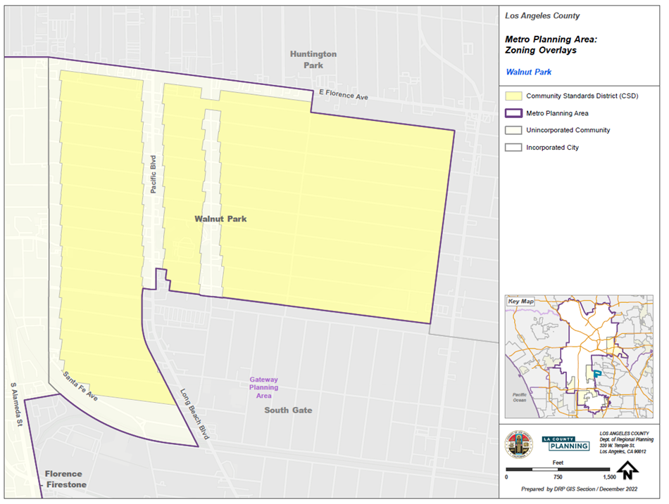
B.
CSD Area-Wide Development Standards - Special Setbacks. Lots within the boundaries of this CSD shall be subject to the required front yard setback, as shown in Figure 22.364-K, below.
FIGURE 22.364-K: WALNUT PARK CSD SPECIAL SETBACKS
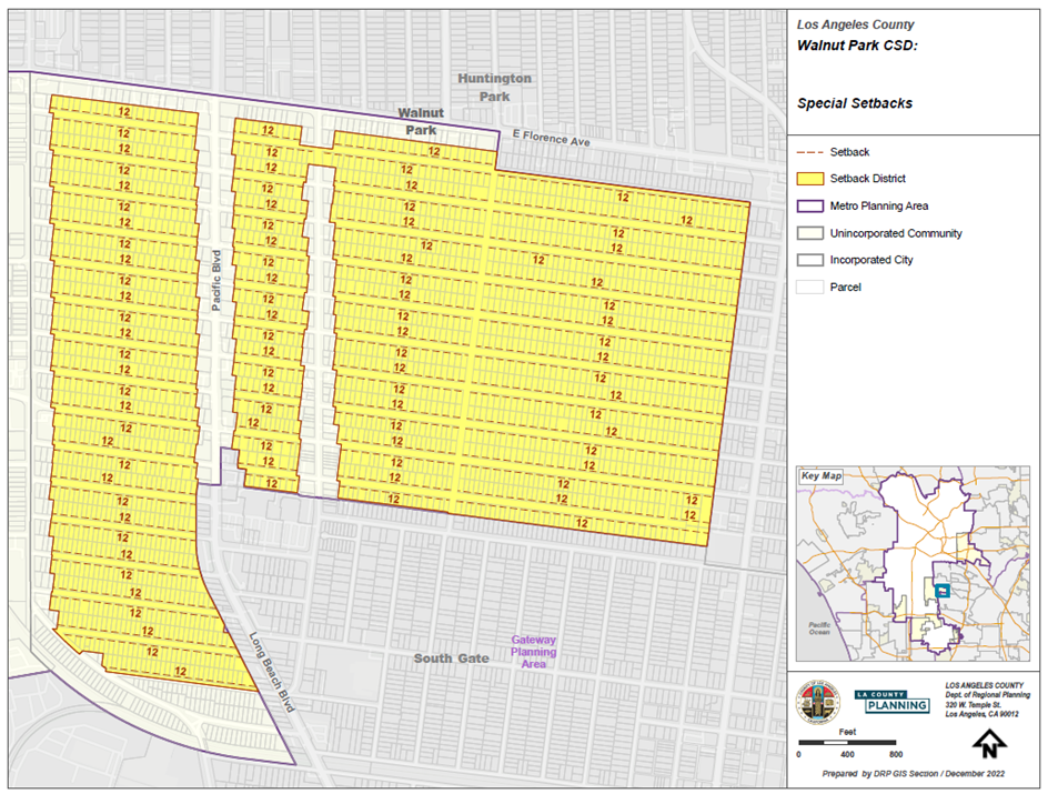
(Ord. 2024-0032 § 31, 2024.)
22.364.100 - West Athens-Westmont Community Standards District.
A.
CSD Boundaries. The boundaries of this CSD, including those of the CSD Sub-Area, are shown in Figure 22.364-L: West Athens-Westmont CSD Boundary, below.
FIGURE 22.364-L: WEST ATHENS-WESTMONT CSD BOUNDARY
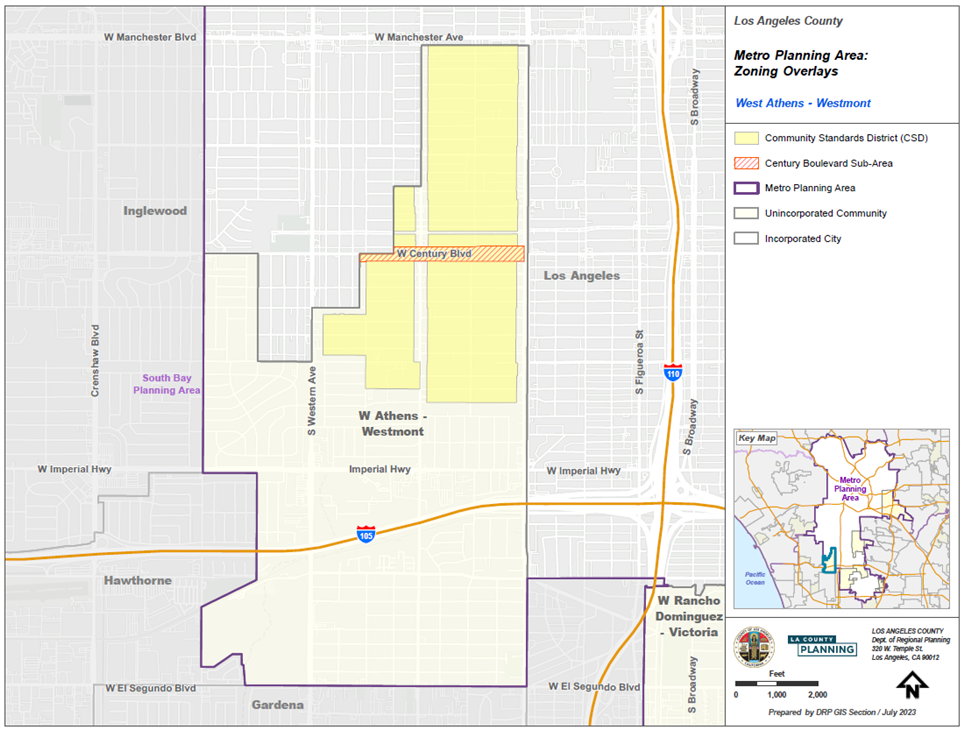
B.
CSD Area-Wide Development Standards - Special Setbacks. Residentially zoned lots within the boundaries of this CSD shall be subject to the required setbacks, as shown in Figures 22.364-M and 22.364-N, below.
FIGURE 22.364-M: WEST ATHENS-WESTMONT CSD
SPECIAL SETBACKS (1 of 2)
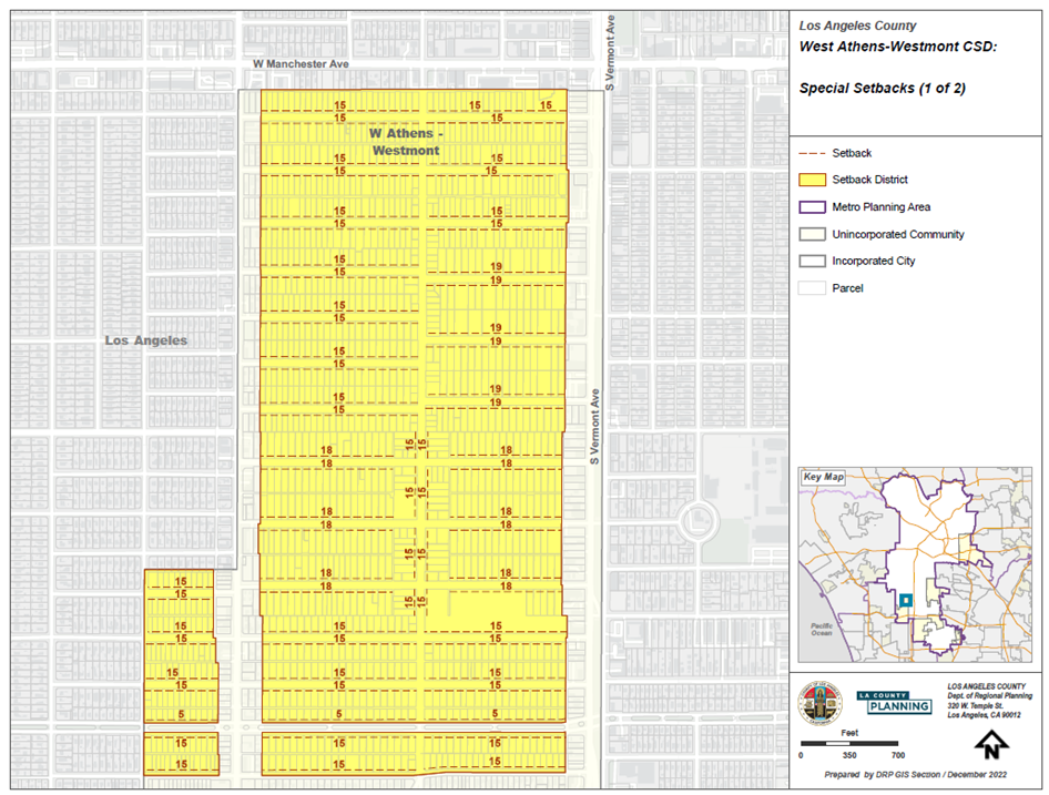
FIGURE 22.364-N: WEST ATHENS-WESTMONT CSD SPECIAL SETBACKS
(2 of 2)
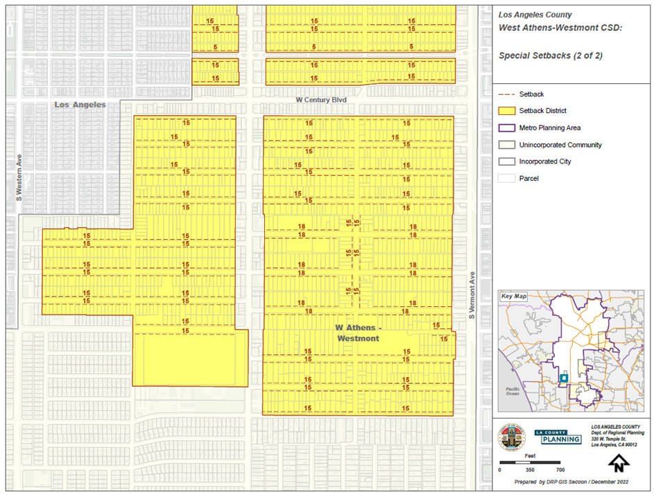
C.
Century Boulevard Sub-Area Development Standards. Lots within the boundary of the Century Boulevard Sub-Area, as shown in Figure 22.364-L: West Athens-Westmont CSD Boundary, above, shall be subject to this Subsection C.
1.
Residential-only developments shall be subject to the following:
a.
Setback from 99th or 101st Streets: Minimum 10 feet;
b.
Setback from Century Boulevard: Minimum 10 feet; and
c.
Vehicular access to property: via 99th or 101st Street.
2.
Commercial and mixed use developments shall be subject to the following:
a.
Setback from 99th or 101st Streets: Minimum 10 feet; and
b.
Vehicular access to property: via Century Boulevard.
(Ord. 2024-0032 § 31, 2024.)
22.364.110 - West Rancho Dominguez-Victoria Community Standards District.
A.
CSD Boundaries. The boundaries of this CSD are shown in Figure 22.364-O: West Rancho Dominguez-Victoria CSD Boundary, below.
FIGURE 22.364-O: WEST RANCHO DOMINGUES-VICTORIA CSD BOUNDARY
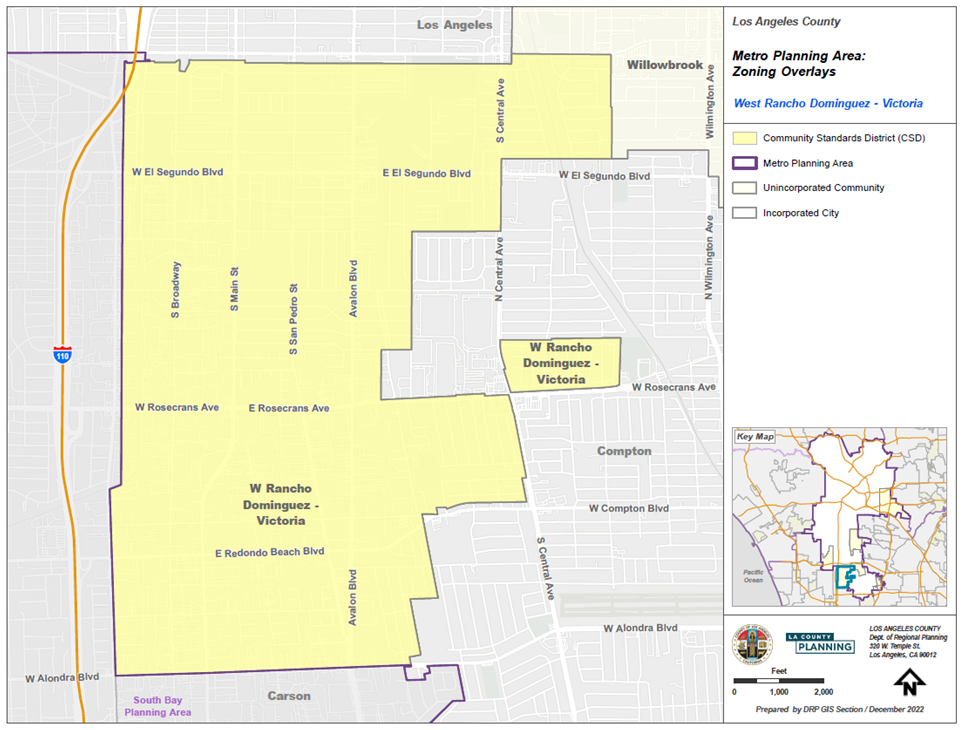
B.
CSD Area-Wide Development Standards.
1.
Oil Wells. Properties containing oil wells where active extraction is taking place shall be fenced and landscaped, in accordance with the following requirements:
a.
For properties adjoining a residence, a residentially zoned lot or a street, a solid masonry wall or solid fence, in compliance with Section 22.140.430.C.2 (Fences and Walls) or a fence in compliance with Section 11.48.030 (Fencing Specifications) in Title 11 (Health and Safety) of the County Code shall be erected around each oil well. The wall or fence shall not be less than six feet in height and shall be provided with landscaping in accordance with Section 22.140.430.C.4 (Landscaping Requirements). The required landscaping for any fence erected in compliance with Section 11.48.030 shall be planted so as to completely screen the fence within five years from the date of erection of the fence.
b.
All oil well equipment, structures, facilities, and sites shall be maintained in good condition, and accumulations of trash and debris shall be removed regularly.
2.
Commercial Horse Stables.
a.
Commercial horse stables and other commercial uses that use horse stables are permitted in Zone M-1.5 and higher, subject to a Ministerial Site Plan Review (Chapter 22.186) and this Subsection B.2. For purposes of this Subsection B.2, "commercial horse stable" means a facility used for the business of stabling horses and for services related to the maintenance and care of the horses stabled at the facility.
i.
Feed Storage Area. The facility shall have a feed storage area sufficient in size to accommodate the feed necessary for all horses kept at the facility and an unblocked, clear path for access to and from such feed storage area.
ii.
Manure Management Area. The facility shall have a manure management area with manure containers stored in a place or direction sufficiently away from the feed storage area and horse stalls to avoid unhealthful conditions for the horses.
iii.
Tack Storage Area. The facility shall have a tack storage area with sufficient space for the storage and maintenance of riding tack for the horses kept at the facility.
iv.
Water Storage Area. Each horse stall in the facility shall have a water storage area with an adequate delivery method of water of sufficient size for the horse kept in that stall.
v.
Wash Rack Area. The facility shall have a wash rack area sufficient in size to accommodate the number of horses kept at the facility.
vi.
Horse Stall Size and Construction. Each horse stall within the facility shall have a minimum length, height, and width of 12 feet and shall be constructed in a workmanlike manner. The horse stalls shall be constructed of fire-resistant material appropriate for equine containment facilities. No more than one horse shall be permitted to be stabled in any horse stall.
vii.
Horse Stall Access Area. Each horse stall within the facility shall have a minimum access area of 12 feet in width for the ingress and egress, and the access area shall be clear and accessible at all times. If the horse stall access area is covered, the cover shall have a minimum height of 12 feet.
viii.
Horse Recreation Area.
(1)
For any facility that is not adjacent to a publicly designated riding area or equestrian trail, the facility shall have a horse recreation area containing the following:
(a)
A minimum of a 50-foot diameter round pen for a facility that has a maximum of 25 horse stalls and an additional pen of these dimensions for every additional increment of one to 25 horse stalls at the facility; and
(b)
A minimum of a 60-foot by 100-foot riding arena for any facility that has a maximum of 50 horse stalls and an additional riding arena of these dimensions for every additional increment of one to 50 horse stalls at the facility.
(2)
The horse recreation areas shall be for use only by the horses stabled at the facility.
(3)
Temporary uses within the horse recreation area may be permitted with an approved Special Event Permit (Chapter 22.188).
ix.
Fences or Walls. The facility shall have a perimeter fence or wall with a minimum height of six feet and a maximum height of 10 feet. All fences or walls shall be of uniform height, built in a workmanlike manner, and constructed solely of new materials. No chain link fencing shall be permitted for this purpose.
x.
Parking. Except as specified otherwise by State law, the facility shall have a minimum of one vehicle parking space, eight and one-half feet in width by 18 feet in depth, plus one vehicle parking space, nine feet in width by 44 feet in depth, for every increment of one to four horse stalls at the facility.
xi.
Maintenance. The facility shall be neatly maintained and free of junk and salvage, and all structures, including, but not limited to, the horse stalls, horse recreation areas, and fences or walls, shall be maintained in good condition at all times.
C.
CSD Zone Specific Development Standards.
1.
All Commercial Zones. Mixed use developments in commercial zones shall be subject to all applicable regulations in Section 22.140.350 (Mixed Use Developments in Commercial Zones), except that the maximum height of a mixed use development shall be 45 feet.
2.
Zone C-2. Except as specified otherwise by State law, parking for certain commercial uses in Zone C-2 shall be provided, in accordance with Table 22.364.110-A, below:
3.
Zone MXD. A building or structure shall not exceed 45 feet above grade.
4.
All Industrial Zones.
a.
Development Standards.
i.
Front Yard Setbacks. Buildings and structures shall be set back a minimum of ten feet from the front property line.
ii.
Landscaping.
(1)
The required front yard, excluding access, parking, and circulation areas, shall be landscaped, subject to the applicable provisions of Chapter 22.126 (Tree Planting Requirements) and shall be maintained with drought tolerant or low water use, native, or non-invasive plants, grasses, shrubbery, or trees and include an on-site irrigation system such as a drip system.
(2)
All required landscaping shall comply with Chapter 12.84 (Low-Impact Development) of Title 12 of the County Code. Other hardscaping shall not be counted toward the required landscaping.
iii.
Landscaped Buffer and Screening. Where an industrially zoned lot abuts a residence or residentially zoned lot, landscaped buffer and screening shall be provided, pursuant to Section 22.364.060.E (Landscaped Buffer and Screening), except that the solid masonry wall along the common lot line shall be at least eight feet in height, provided Section 22.110.180 (Sight Distance) is satisfied.
iv.
Loading Docks. All loading docks shall be located as far distant as feasible from adjoining residentially zoned lots.
v.
Building Height.
(1)
A building or structure located within 250 feet of a residentially zoned lot shall not exceed a height of 45 feet above grade.
(2)
A building or structure located more than 250 feet from a residentially zoned lot shall not exceed a height of 90 feet above grade.
vi.
Lot Coverage. The maximum lot coverage shall not exceed 70 percent of the lot area.
vii.
Enclosure. Except as specified otherwise, all uses, except for parking, vending machines, shopping carts, and accessory uses, shall be conducted entirely within a building.
b.
Uses.
i.
Uses Subject to Permits.
(1)
Unless otherwise prohibited by this Title 22, all activities conducted outside an enclosed structure and located within 500 feet of a residentially zoned lot, except for parking, vending machines, shopping carts, and accessory uses, shall require a Conditional Use Permit (Chapter 22.158).
(2)
For properties abutting a residentially zoned lot, uses listed in Table 22.364.110-B, below, shall require a Conditional Use Permit (Chapter 22.158):
ii.
Accessory Uses. Accessory uses listed in Table 22.364.110-C, below, shall be permitted on industrially zoned lots that are not subject to Chapter 22.84 (Green Zone).
5.
Zones M-1 and M-1.5. Newly created lots shall contain a minimum area of 10,000 square feet with a minimum lot width of 75 feet.
6.
Zone M-2.
a.
Lot Area and Width. Newly created lots shall contain a minimum area of 20,000 square feet with a minimum lot width of 100 feet.
b.
Recycling processing facilities, including auto dismantling, and scrap metal yards shall be prohibited within 500 feet of a residentially zoned lot.
c.
Recycling processing facilities, including auto dismantling, and scrap metal yards on lots not subject to Chapter 22.84 (Green Zone), shall be subject to the following:
i.
A wall or fence of at least eight feet in height, in compliance with Section 22.140.430.C.2 (Fences and Walls), shall be provided along all street frontages;
ii.
The wall or fence shall be set back at least three feet from property lines having street frontage; and
iii.
The setback area required in this Subsection C.4.c shall be landscaped with shrubs, and a 15-gallon tree for every 50 square feet of landscaped area shall be planted equally spaced within the setback.
7.
Zone B-1. Premises in Zone B-1 shall not be used for outside storage or for the parking of vehicles for over 72 continuous hours.
(Ord. 2024-0032 § 31, 2024.)
22.366.010 - Purpose.
The East San Gabriel Valley Planning Area Standards District ("PASD") is established to enhance the character of the 24 unincorporated communities within the East San Gabriel Valley Planning Area. The PASD implements the goals and policies of the East San Gabriel Valley Area Plan ("Area Plan") to achieve growth and development consistent with the communities' vision for sustainable natural environment, attractive built environment and community character, thriving commercial areas, and walkable, pleasant neighborhoods.
(Ord. 2024-0029 § 13, 2024.)
22.366.020 - Definitions.
Reserved.
(Ord. 2024-0029 § 13, 2024.)
22.366.030 - Planning Area Standards District Map.
The boundaries of this PASD are shown on Figure 22.366.030-A: East San Gabriel Valley PASD Boundary, below.
FIGURE 22.366.030-A: EAST SAN GABRIEL VALLEY PASD BOUNDARY
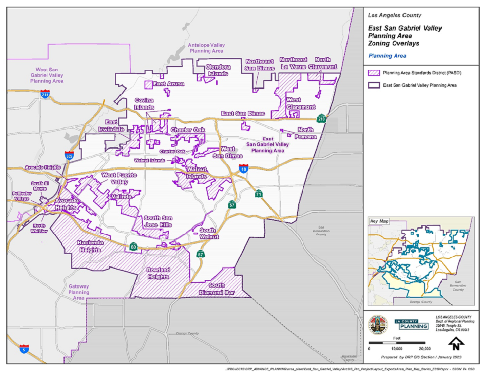
(Ord. 2024-0029 § 13, 2024.)
22.366.040 - Applicability.
A.
Applicability. Except as otherwise specifically provided herein, the provisions of this Title 22 shall apply.
B.
General Applicability. The regulations for the PASD contained in this Chapter shall apply to all new development projects for which a complete application has been filed on or after June 20, 2024.
C.
Additions, Repairs, or Modifications to Existing Development.
1.
The PASD regulations shall apply to any new addition, repair, or renovation of an existing structure, except:
a.
Maintenance or repair of an existing building or structure necessary to ensure the safe and habitable condition for ordinary and intended use; and
b.
The remodeling of interior space of a structure that does not cause any of the structure's windows to be eliminated and does not increase the gross square footage of the structure's nonresidential floor area, the number of rooms available for lodging uses, or the number of dwelling units in the structure.
2.
In any case where the addition cumulatively increases the existing floor area of any building or structure by more than 50 percent, then the entire development shall be subject to this PASD.
(Ord. 2024-0029 § 13, 2024.)
22.366.050 - Application and Review Procedures.
Reserved.
(Ord. 2024-0029 § 13, 2024.)
22.366.060 - PASD Area Wide Development Standards.
A.
Significant Ridgelines.
1.
Significant Ridgelines in the East San Gabriel Valley are designated by the Director as those which, in general, are highly visible and dominate the landscape. (See the figure maps for the East San Gabriel Valley Area Plan Significant Ridgelines.)
2.
The highest point of a structure shall be located at least 50 vertical feet and 50 horizontal feet from a Significant Ridgeline.
3.
No part of a proposed structure shall block the view of a Significant Ridgeline from a designated Scenic Route.
4.
Where structures on a lot cannot meet the standards prescribed by Subsections A.2 and A.3, above, a Variance (Chapter 22.194) shall be required. In addition to the requirements of Section 22.194.050 (Findings and Decision), the following additional findings shall be made:
a.
Alternative sites within the project area have been considered and eliminated from consideration based on physical infeasibility or the potential for substantial habitat damage and destruction;
b.
The proposed development is limited to 18 feet in height above existing or finished grade (whichever is lower) and maintains the maximum view of the related Significant Ridgeline through the use of design features that include, but not limited to, reduced building footprint area, clustered structures, shape, materials, and color which allow the structure to blend in with the natural setting, minimized grading, and locally-indigenous vegetation to soften the view of development from the identified public viewing areas;
c.
The proposed development shall utilize native species present on-site for landscaping, as identified in the project's biological documentation. The Director shall maintain a list of appropriate landscaping materials required to satisfy this provision, to be used if the site does not have appreciable native vegetation, as outlined in the project's biological documentation; and
d.
Avoidance of impacts to scenic resources through site selection and design alternatives is the preferred method over landscape or building material screening. Landscape or building material screening shall not substitute for project alternatives, including re-siting or reducing the height or bulk of structures.
B.
Biological Resources. Projects subject to a conditional use permit (Chapter 22.158) on a property containing native vegetation shall prepare a biological inventory containing the following information:
1.
Biological survey and map (drawn to scale) of biological resources and physical site features on the project site;
2.
The plants, animals, and habitats found on the project site;
3.
The plants, animals, and habitats likely to occur on the project site based on a California Natural Diversity Database (CNDDB) query as well as local knowledge;
4.
On-sites that have been subject to wildfire or unpermitted development, including, but not limited to, vegetation removal or grading, the plants, animals, and habitats likely to have occurred on the site based on historical records, and habitat found in surrounding undisturbed areas;
5.
Assessment of need for additional surveys due to timing/season of initial survey (potential for missing sensitive species) and assessment for need of protocol level species surveys (based on CNDDB query results and local knowledge);
6.
Proximity of the project site to locations of known sensitive resources within 200 feet;
7.
Photo documentation of the site, including photos of all the respective habitats on-site; and
8.
Native tree survey and map (drawn to scale) if oak, sycamore, walnut, bay, or toyon trees are present on the project site. Sites containing native oak trees shall provide the information required in Chapter 22.174 (Oak Tree Permits).
C.
Parking. In addition to the requirements of Chapter 22.112 (Parking), the following requirements shall apply:
1.
Parking Location.
a.
Except for fully subterranean structures or roof parking and parking structures as a primary use, all parking shall be provided in the rear of the commercial structure and fully screened from view from the street and any adjacent residentially zoned property. Screening materials shall include decorative walls, decorative wrought-iron fencing, and/or landscaping. Unadorned concrete masonry walls and chain-link fencing shall be prohibited.
b.
Where a parking structure is designated as the primary use of a site, the parking structure shall be fully screened from the view from the street and any adjacent residentially zoned property. Screening materials shall include decorative walls, decorative wrought-iron fencing, and/or landscaping. Unadorned concrete masonry walls and chain-link fencing shall be prohibited.
2.
Vehicle Access. For every 100 feet of lot frontage, no more than 20 feet of a property frontage shall be devoted to parking access, such as driveways, unless otherwise required by the County.
3.
Oversize Vehicles. Parking for vehicles that exceed 20 feet in length or nine feet in width shall be located away from any abutting residentially-zoned lots.
4.
Loading Spaces. In addition to the standards of Section 22.112.120 (Loading Spaces), the following standards shall apply:
a.
Loading spaces shall be located in the rear of the structure away from adjoining residentially-zoned lots and shall be screened with decorative walls, decorative fencing, and/or landscaping. Unadorned concrete masonry walls and chain-link fencing shall be prohibited.
b.
Loading and unloading operations shall not be conducted between the hours of 10:00 p.m. and 6:00 a.m. in such a manner as to exceed exterior sound levels specified by the County's Noise Control Ordinance (Chapter 12.08 of Title 12) for adjacent residentially-zoned properties.
(Ord. 2024-0029 § 13, 2024.)
22.366.070 - PASD Zone Specific Development Standards.
A.
Commercial and Mixed Use Zones.
1.
Applicability. All new buildings and structures in commercial (C-H, C-1, C-2, C-3, C-M, C-MJ, C-R, and CPD) and mixed use (MXD) zones shall conform to the design standards in this Section.
2.
Lot Coverage and Landscaping. Buildings and structures shall not cumulatively occupy more than 85 percent of the net area of a lot. A minimum of 15 percent of the net area shall be landscaped.
3.
Ground Floor Design. Any exterior building modification, except for signage, shall include at least one of the following design elements on at least one façade fronting an adjacent roadway:
a.
Trellis or Pergola. Consisting of posts and beams with cross members and open to the sky or complemented with the use of canvas shades or vines, as shown on Figure 22.366.070-A, below.
FIGURE 22.366.070-A: EXAMPLES OF TRELLIS AND PERGOLA STRUCTURES
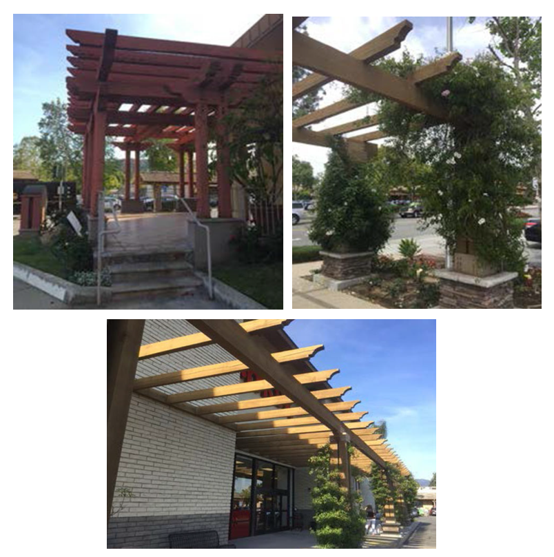
b.
Exterior Furniture. At least one of the following exterior furniture, which shall be constructed of steel with powder coat or other comparable material of equal durability and shall be well maintained at all times.
i.
Benches with a seating length of at least 48 inches. See Figure 22.366.070-B, below.
FIGURE 22.366.070-B: EXAMPLES OF BENCH SEATING
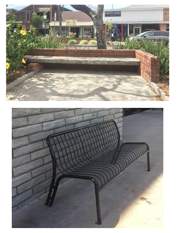
ii.
Bicycle Racks. At least one rack to accommodate three or more bicycles. If a bicycle rack has already been provided pursuant to Section 22.112.100 (Bicycle Parking and Bicycle Facilities), it may be used to satisfy this requirement, and no additional bicycle rack is required. See Figure 22.366.070-C, below.
FIGURE 22.366.070-C: EXAMPLE OF BICYCLE RACK
iii.
Tables with chairs may include at least three tables with at least two chairs each. See Figure 22.366.070-D, below.
FIGURE 22.366.070-D: EXAMPLES OF TABLES WITH CHAIRS FOR OUTDOOR SEATING
4.
Façade Composition. Building façades shall be differentiated as follows: one-story buildings shall consist of a building top and building base; multi-story buildings shall consist of a building top, building middle, and building base. See Figure 22.366.070-E: Example of Façade Height Composition, below.
a.
Variation of form and massing shall be used in building designs to provide visual interest. Long, unbroken façades are prohibited.
b.
Building Top. The building top, which includes the upper-most portion of the building including a roof, shall be differentiated from the rest of the building through variations in color, materials, ornamentation, or shape. The roof is subject to the requirements of Subsection A.5 (Roof), below, and shall consist of a molding that crowns the building, such as an eave, cornice, parapet, or other such projection.
c.
Building Middle. The building middle may be one or more stories. The building middle shall be articulated through elements, such as windows, lintels, columns, horizontal differentiation, recesses, step backs, materials, and color. These treatments shall be consistent.
d.
Building Base. A building base consists of the floor at ground level where most of the pedestrian interactions and commerce take place.
FIGURE 22.366.070-E: EXAMPLE OF FAÇADE HEIGHT COMPOSITION
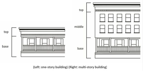
5.
Roof.
a.
A roof shall have a gable, arc raised center, or, if a flat roof, consist of molding that crowns the building, such as an eave, cornice, parapet, or other such projection.
b.
Roof-mounted equipment shall be screened from view on all sides by roof forms, roof projections, or architectural screening.
6.
Architectural Elements. New primary structures shall include at least one of the elements listed below on at least one façade fronting a major or secondary highway. Where a building frontage exceeds 40 feet in length, an additional architectural element shall be used for each segment, or portion, of 40 feet of frontage and distributed throughout the width of the building façade. The architectural elements may be provided within any required front and side yard setbacks and may contribute to the minimum landscaping requirement when landscaping has been incorporated into terrace, forecourt, or backcourt, as described below.
a.
Terrace. A terrace separates the building façade from the sidewalk and street. A terrace may provide a space for public uses, such as public seating or dining. It creates a buffer from public rights-of-way. See Figure 22.366.070-G, below, for examples of terraces.
FIGURE 22.366.070-F: TERRACE DESIGN
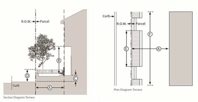
i.
Design Standards. See Figure 22.366.070-F, above:
ii.
Any required guardrails shall be at least 75 percent open above the perimeter wall.
iii.
Terraces shall dedicate at least 50 percent of their area to landscape and design elements, such as shaded seating areas with the inclusion of durable and movable outdoor furniture, fountains with adjacent seating, or other similar fixtures, or combination thereof.
FIGURE 22.366.070-G: EXAMPLES OF COVERED TERRACE
AND TERRACE AREAS
b.
Forecourt. A forecourt is a semi-public space formed by a recess in the façade of a building and is generally appropriate for commercial or public use and may provide a space for public seating or dining. See Figure 22.366.070-I, below, for examples of forecourt area.
FIGURE 22.366.070-H: FORECOURT DESIGN
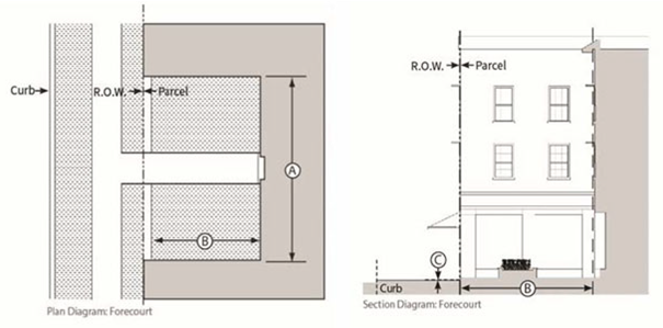
i.
Design Standards. See Figure 22.366.070-H, above:
ii.
Encroachments, such as balconies, awnings, and signage, are allowed within the forecourt and shall be located at least eight feet above finish level.
iii.
Forecourts shall dedicate at least 50 percent of their area to landscape and design elements, such as shaded seating areas, with the inclusion of durable and movable outdoor furniture, fountains with adjacent seating, or other similar fixtures or combination thereof.
FIGURE 22.366.070-I: EXAMPLES OF FORECOURT AREA
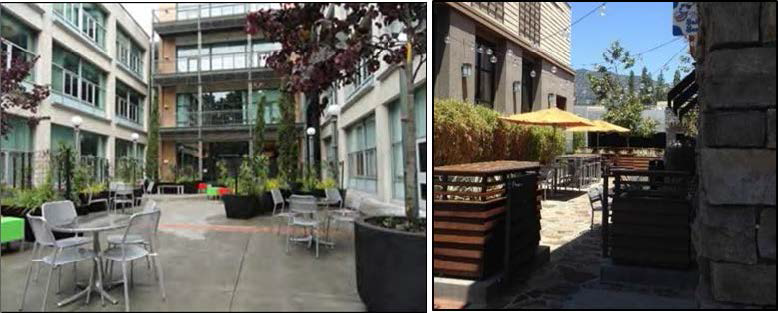
c.
Backcourt (Rear Court). A backcourt is a semi-public courtyard oriented to the rear of a building that can be accessed by pedestrians from the sidewalk. A backcourt may be partially enclosed on one, two, or three sides by buildings or structures and is generally appropriate for commercial or public uses and may provide a space for public seating or dining. See Figure 22.366.070-K, below, for examples of backcourt area.
FIGURE 22.366.070-J: BACKCOURT (REAR COURT) DESIGN
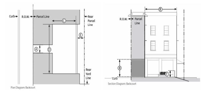
i.
Design Standards. See Figure 22.366.070-J, above:
ii.
When provided, a backcourt shall satisfy the requirements of Subsection A.8 (Articulation), below, only if there is direct access for pedestrians to the backcourt from the major or secondary highway fronting the development.
iii.
Encroachments, such as balconies, awnings, and signage, are allowed within the backcourt and shall be located at least eight feet above the finish floor level.
iv.
Backcourts shall dedicate at least 50 percent of their area to landscape and design elements, such as shaded seating areas, with the inclusion of durable and movable outdoor furniture, fountains with adjacent seating, or other similar fixtures or combination thereof.
FIGURE 22.366.070-K: EXAMPLES OF BACKCOURT AREA
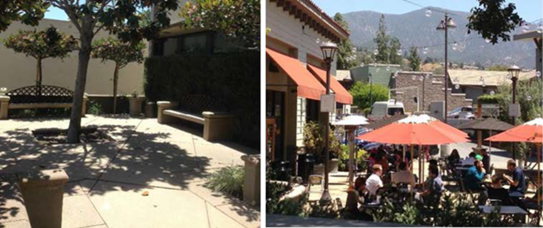
d.
Arcade. An arcade is a façade with an attached colonnade that is covered by upper stories. Colonnades shall not screen from public view more than 25 percent of the ground floor façade. See Figure 22.366.070-M, below, for examples of arcade frontage.
FIGURE 22.366.070-L: ARCADE DESIGN
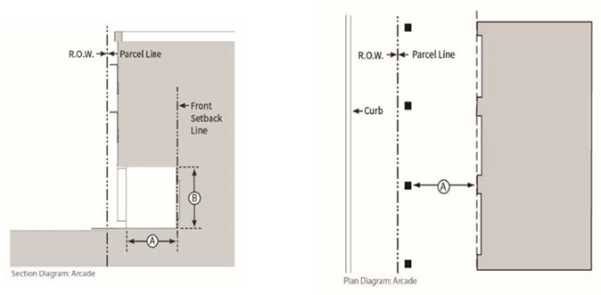
i.
Design Standards. See Figure 22.366.070-L, above:
FIGURE 22.366.070-M: EXAMPLES OF ARCADE FRONTAGE

e.
Gallery. A gallery is a roof or deck projecting from the façade of a building with vertical supports. For multi-story buildings, galleries may provide covered or uncovered porches on the second and third floors. Galleries may encroach within the required front yard setbacks. Colonnades shall not screen from public view more than 25 percent of the ground floor façade. See Figure 22.366.070-O, below, for an example of gallery frontage.
FIGURE 22.366.070-N: GALLERY DESIGN
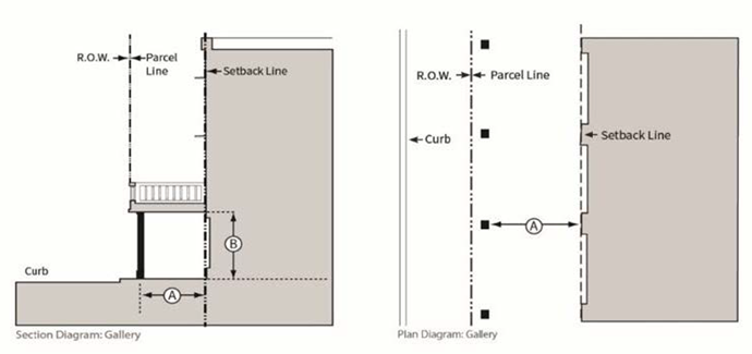
i.
Design Standards. See Figure 22.366.070-N, above:
FIGURE 22.366.070-O: EXAMPLE OF GALLERY FRONTAGE
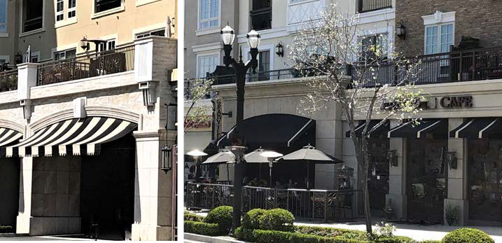
7.
Entrances. A pedestrian-accessible entrance shall be required facing, and directly accessible to pedestrians from, at least one public sidewalk abutting the property.
a.
Shop Front Entrances. The following standards apply to public entrances to shop fronts located on the ground floor. Shop front entrances shall be recessed façades consisting of a door, transom lights, and sidelights. See Figure 22.366.070-Q, below.
FIGURE 22.366.070-P: SHOP FRONT ENTRANCE DESIGN
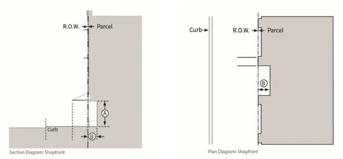
i.
Design Standards. See Figure 22.366.070-P, above:
FIGURE 22.366.070-Q: EXAMPLES OF SHOP FRONT ENTRANCE (LEFT) AND CORNER ENTRANCE (RIGHT)
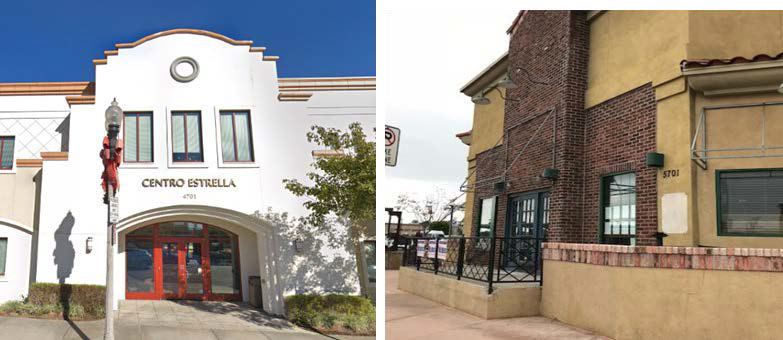
b.
Main Entrances. A multi-tenant building with a lobby on the ground floor shall provide a main entrance at the street level for pedestrian use. The main entrance is the widest entrance that opens into a lobby or primary circulation space of a building. In addition to the standards provided in Subsection A.7.a (Shop Front Entrances), above, a main entrance shall be easily identifiable and distinguishable from other ground floor entrances through the use of one of the following:
i.
Marked by a taller mass above, such as a tower, or within a volume that projects from the rest of the building surface;
ii.
Accented by columns or ornamental light fixtures; or
iii.
Marked or accented by a change in the roofline or change in the roof type.
c.
Corner Entrances. Buildings located on a corner lot shall provide a corner entrance that complies with Subsection A.7.a (Shop Front Entrances) or 7.b (Main Entrances), above, as applicable.
8.
Articulation. In addition to complying with the following requirements, a building façade shall be differentiated, as provided in Subsection A.4 (Façade Composition), above.
a.
Types of Articulation. Horizontal and vertical articulations shall be produced by variations in rooflines, window groupings, and applied façade elements, such as piers or pilasters, bay windows, rough textured wood beams, headers, siding, pre-cast headers, casements, cornices, balconies, entrance stoops, porches, and/or changes in materials and horizontal and vertical planes that create shadow lines and textural differences. The articulation shall be such that there is consistency and uniformity in the overall design.
b.
Roof Drainage. The location, spacing, materials, and colors of exposed downspouts, gutters, scuppers, and other visible roof drainage components should be incorporated into the architectural composition of the façade and roof.
9.
Wall Surface. The following standards shall apply to the building walls:
a.
A wall of a building located 30 feet or more from the side or rear lot line shall have the same trim and finish as the front building façade.
b.
A wall facing an internal courtyard or a side façade without windows and doors is only allowed if the wall is located less than 30 feet from the side or rear lot line and enhancements, such as surface reliefs, wall articulations, architectural murals, or vines, are incorporated.
c.
Building finishes shall be of durable materials, such as brick, decorative concrete, glass, wood, stucco, or other similar materials, except cinder block (concrete masonry unit).
d.
On at least two feet of the wall surface, durable materials shall be used, as provided in Subsection A.9.c, above, except that stucco or other similar troweled finishes may not be used.
e.
Building walls shall have contrasting colors to give emphasis to design features, such as door/window trim, pilasters, cornices, capitals, wainscot, and/or similar treatments.
10.
Wall Openings.
a.
For frontages, upper stories shall have a window to wall area proportion that is less than that of the ground floor frontage. Glass curtain walls or portions of glass curtain walls are exempt from this standard.
b.
Storage areas within a structure, other than product displays, shall not be visible through windows.
c.
Railings and grilles may be installed on the exterior or interior of a window on the ground floor of a structure, provided such railings and grilles do not interfere with the required 60 percent transparency under Subsection A.11 (Windows), below.
d.
Roll-up security gates that are solid shall not be installed on the exterior of any window.
11.
Windows.
a.
At least 60 percent of the total width and 40 percent of the total area of the building façade at ground level shall be devoted to windows, interior views, or interior displays visible to pedestrians. The bottom of any such window shall be no more than three feet above the sidewalk or grade.
b.
Flashing lights or similar flashing devices shall not be visible from the outside.
c.
Entrances, mirrored or highly reflective materials, false windows, densely tinted glass, or displays of materials offering no views of the interior shall not be deemed to be in compliance with the requirements of this Section.
d.
Transparent or lightly tinted material, such as glass, shall be used at or near the street level to allow maximum visual interaction between pedestrian areas and the interior of the building.
e.
Not more than 10 percent of the building façade at ground level shall consist of mirrored or densely tinted glass.
12.
Mechanical Equipment. All mechanical equipment shall be located in a manner that avoids obstructing the architectural design of a building.
a.
Air Conditioning Units.
i.
Ground-mounted air conditioning units shall be screened or enclosed with landscaping or screening so as not to be visible from public areas at ground level and shall be screened with appropriate sound and vibration isolating mounts and barriers.
ii.
Roof-mounted air conditioning units shall be screened by architectural features so that the equipment will not be visible from public areas at ground level.
iii.
Window-mounted or wall-mounted air conditioning units shall be placed to minimize overhang and impacts on the design of the building. Casements shall match the design of the façade.
b.
Other mechanical equipment shall be screened from view using architectural features or screening materials so as not to be visible from public areas at ground level.
13.
Exterior Lighting.
a.
Light Trespass. Fully shielded fixtures shall be used for exterior and directional lighting to prevent light trespass to adjacent uses. Perimeter luminaries shall be located at least five feet from any adjacent residential lot line.
b.
Lighting shall be provided at building access points or along pedestrian accessible walkways to enhance pedestrian safety.
c.
Lighting shall be designed to minimize or prevent shadows or glare, such that visibility is not impaired. Examples include illumination of recessed entryways and lighting evenly distributed along the store frontage or walkways such that near uniform foot-candles are registered along any pedestrian accessible area.
d.
Prohibited outdoor lighting. The following types of outdoor lighting shall be prohibited, unless otherwise required by a government agency for safety:
i.
Drop-down lenses, defined as a lens or diffuser that extends below a horizontal plane passing through the lowest point of the opaque portion of a light fixture;
ii.
Mercury vapor lights;
iii.
Ultraviolet lights; and
iv.
Searchlights, laser lights, or other outdoor lighting that flashes, blinks, alternates, or moves. This applies to lighting behind display windows visible from the public right-of-way.
14.
Landscaping. These landscaping provisions shall apply to installation or replacement of landscaping.
a.
Native trees with a trunk diameter of at least eight inches, as measured four-and-one-half feet above grade, shall be preserved and integrated into required landscaping, either in their current location or another location on the same lot, provided such trees are good candidates for preservation or relocation, as established by a certified arborist. Such trees shall be moved in accordance with currently accepted arboricultural standards and practices and shall be supervised by a certified arborist. This provision shall not apply to oak trees, which are subject to the requirements of Chapter 22.174 (Oak Tree Permits).
b.
Landscaped areas shall be maintained with regular pruning, weeding, fertilizing, litter removal, and replacement of plants, as necessary. Landscaped areas shall be maintained with a permanent automatic irrigation system.
15.
Height Limit. Notwithstanding the base zone standards in this Title 22, a building or structure in Zone C-3 or MXD shall not exceed a height of 50 feet above grade, excluding chimneys, rooftop antennas, rooftop mechanical equipment, structure-mounted renewable energy systems, and rooftop recreational spaces. Except as herein provided, the portion of any building sharing a common side, or rear lot line, with property located within a residential zone shall have a step back from the common side, or rear lot line, so that the height of the building in Zone MXD is no greater than 25 feet, at the edge of the building wall facing that common lot line, and shall be recessed back one foot for every one foot increase in building height, up to a maximum height of 50 feet.
(Ord. 2024-0029 § 13, 2024.)
22.366.080 - Avocado Heights Community Standards District.
A.
Purpose. The Avocado Heights CSD is established to preserve the open character of the Avocado Heights community and to improve its appearance with property maintenance standards. This CSD also establishes standards to improve the compatibility between residential uses and neighboring industrial and assembly uses.
B.
Definitions. The following term is defined solely for this CSD:
Assembly building. A nonresidential building used for public assembly accommodating an occupant load of 50 or more persons.
C.
District Map. The boundaries of this CSD are shown on Figure 22.366.080-A: Avocado Heights CSD Boundary, at the end of this Chapter.
D.
Applicability.
1.
General Applicability. The regulations of this CSD shall apply to any new use or structure for which a complete application has been filed on or after June 20, 2024, except as otherwise required in this Section.
2.
Where the application is for a lot that is subject to the requirements in Chapter 22.84 (Green Zone) and the provisions in Chapter 22.84 are contrary to the provisions in this Chapter, the more restrictive provisions shall prevail.
E.
Application and Review Procedure - Notification. Except as otherwise provided in this Chapter, for any application requiring a public hearing, the application shall comply with all noticing requirements, pursuant to Section 22.222.160.B (Additional Radius).
F.
Community Wide Development Standards.
1.
Graffiti. All structures, walls, and fences that are publicly visible shall remain free of graffiti. Any property owner, lessee, or other person responsible for the maintenance of a property shall remove graffiti within 72 hours of receiving written notice from the County that graffiti exists on the property. Paint used to cover graffiti shall match, as nearly as possible, the color of the surrounding surfaces.
2.
Maintenance. Any areas of a property that are publicly visible, including front yards, front sidewalks, and rear alleys, shall remain free of trash and other debris. Storage of household appliances, such as refrigerators, stoves, freezers, and similar products, is prohibited in all yard areas.
G.
Zone Specific Development Standards.
1.
Zones R-1, R-A, and A-1.
a.
Front Yard Landscaping. For lots less than 40 feet in width, front yards shall have a minimum of 25 percent landscaping. For all other lots, front yards shall have a minimum of 50 percent landscaping.
b.
Front Yard Fences. Notwithstanding Section 22.110.070.B.1 (Front Yards), a front yard fence may exceed three and one-half feet in height, provided:
i.
The portions of the fence above three and one-half feet are built so as not to completely obstruct the public's view; and
ii.
If the fence is chain link or wrought iron, the fence may not exceed six feet in height.
c.
Lot Coverage. The maximum lot coverage for structures of any type, including structures for housing animals, shall be determined by the following formula: (0.25 × net lot area) + 1,000 square feet.
d.
Yard Depth.
i.
For developed street blocks, the minimum front yard depth shall be equal to the average depth of all front yards on the same block and same side of the street. A vacant lot shall not be included in this calculation. For undeveloped street blocks, the minimum front yard depth shall be 20 feet; and
ii.
The minimum rear yard depth shall be as depicted on Table 22.366.080-A, below:
e.
Assembly Buildings. All new assembly buildings shall be subject to the following:
i.
The lot on which the assembly building is located shall be a minimum of one acre in size and shall have frontage on at least two intersecting public streets;
ii.
The assembly building shall be located at least 50 feet from the property line of any residential property;
iii.
Vehicle parking for an assembly building shall consist of one parking space for each three occupants, based on the occupant load for the assembly building. All parking spaces shall be provided within 500 feet of the assembly building;
iv.
The common property line between an assembly building and an adjoining residential use shall have a six-foot-high concrete block wall, unless the wall height standards in Section 22.110.070.B (Maximum Height of Fences and Walls) otherwise provide; and
v.
In addition to the events listed in Section 22.188.020 (Applicability), all festivals not included therein and all fundraising events at an assembly building shall require an approved Special Event Permit, unless the event is otherwise allowed in the zone without a permit or allowed under another approval.
2.
Zones C-H and C-1.
a.
Parking Lot Landscaping. Except for rooftop or interior parking, parking lots with 20 or more vehicle parking spaces shall have a minimum of five percent landscaping. The landscaping shall be maintained and irrigated by a permanent watering system and shall include one 15-gallon tree for every 100 square feet of landscaped area. The landscaping shall provide separation between the parking lot and adjoining uses to the maximum extent possible.
b.
Business Signs. Except as herein modified, all business signs shall conform to Chapter 22.114 (Signs).
i.
Roof business signs shall be prohibited.
ii.
Damaged business signs shall be repaired or removed within 30 days of receipt of written notice from a Zoning Enforcement Officer.
iii.
Wall Business Signs. All businesses shall be permitted to have a wall business sign, unless the business has more than 40 feet of building frontage or multiple street frontages. For businesses with more than 40 feet of building frontage, the business shall be permitted to have an additional business sign for each additional 30 feet or increment thereof of street frontage. For businesses with multiple street frontages, the business shall be permitted to have one business sign for each street frontage. Wall business signs shall have the following maximum attributes:
(1)
Face area of two square feet for every linear foot of the applicable building frontage;
(2)
Letter sizes of 24 inches in height; and
(3)
A vertical dimension of 36 inches for the frame box.
iv.
Freestanding Business Signs. Freestanding business signs shall be allowed only if the business is located on a lot with a minimum of 100 feet of street frontage and shall not be located on, or extend above, any public right-of-way or public sidewalk. Freestanding business signs shall have the following attributes:
(1)
A solid base resting directly on the ground;
(2)
A maximum face area of 60 square feet; and
(3)
A maximum height of 15 feet measured vertically from the ground level at the base of the sign.
v.
Nonconforming Business Signs. All existing lawful nonconforming business signs shall be brought into compliance with this Subsection G.2.b or be removed from the site, within the period set forth in Table 22.366.080-B, below:
c.
Awnings.
i.
Awning signs shall have the same face area restriction as that for wall business signs in Subsection G.2.b.iii(1), above.
ii.
Every awning for the same business shall be the same color and style.
iii.
Every awning in a building with multiple storefronts shall be complimentary in color and style.
3.
Zone C-2. The standards prescribed for Zones C-H and C-1 shall apply to Zone C-2. In addition, all new buildings in Zone C-2 shall have a minimum setback of 20 feet from the front property line. This setback shall be completely landscaped, except where there is required parking and driveways. The landscaping shall be maintained with regular pruning, weeding, fertilizing, litter removal, and replacement of plants when necessary.
4.
Zones C-3 and MXD. The standards prescribed for Zones C-H, C-1, and C-2 shall apply to Zones C-3 and MXD. In addition, a building or structure in Zones C-3 or MXD shall not exceed a height of 45 feet above grade, excluding chimneys and rooftop antennas.
5.
Zones M-1 and M-1.5.
a.
Buffers. Properties adjoining a residential zone, school, or park shall have a minimum 10-foot landscaped buffer along the common property line. One 15-gallon tree for every 100 square feet of landscaped area shall be planted equally spaced in the buffer strip. The landscaping shall be irrigated by a permanent watering system and shall be maintained in the manner provided in Subsection G.3, above.
b.
Minimum Lot Size. Except for lots legally created prior to June 20, 2024, the minimum lot size shall be 20,000 square feet.
c.
Setbacks. All new buildings that adjoin or face a Residential Zone, school, or park shall have a minimum setback of 20 feet from the front or side property line. The front setback shall be completely landscaped, except where there is required parking and driveways. The landscaping shall be maintained in the manner provided in Subsection G.3, above.
d.
Fences or Walls. Properties that adjoin a Residential Zone, school, or park shall have a minimum of eight-foot-high solid wall or solid fence along the common property line in compliance with Section 22.140.430.C.2 (Fences and Walls).
e.
Lot Coverage. All new structures shall have a maximum of 70 percent lot coverage. At least 10 percent of the net lot area shall be landscaped with lawns, shrubbery, flowers, or trees. The landscaping shall be maintained in the manner provided in Subsection G.3, above.
f.
Height. Excluding chimneys and rooftop antennas, all new structures shall have a maximum height of 45 feet above grade, if located within 250 feet of a Residential Zone, and 90 feet above grade otherwise.
g.
Loading Docks. No loading dock shall be permitted along a property line that adjoins a Residential Zone.
h.
Outdoor Storage. Notwithstanding Section 22.140.430 (Outdoor Storage), outside storage shall not be publicly visible to anyone in an adjoining Residential Zone.
i.
Outdoor Businesses. All principal business uses conducted outside an enclosed structure within 500 feet of a Residential Zone, school, or park shall require an approved conditional use permit (Chapter 22.158).
H.
Area Specific Development Standards.
1.
Area 1 — Equestrian Area.
a.
Purpose. This area is established to preserve equestrian uses in the urban areas of the Avocado Heights Community while alleviating certain environmental impacts associated with keeping horses and livestock. The development standards herein are intended to supplement the requirements of Chapter 22.70 (Equestrian Districts) and are adopted, pursuant to Section 22.70.030 (Establishment, Expansion, or Repeal of Equestrian Districts).
b.
Area Description. This area is coextensive with the Avocado Heights Equestrian District established, pursuant to Chapter 22.70 (Equestrian Districts). The boundaries of the area are shown on Figure 22.366-B: Equestrian Area, at the end of this Chapter.
c.
Development Standards.
i.
Distances. Structures, such as stables, barns, sheds, pens, and corrals, and any areas of property where horses or livestock are pastured, shall be located a minimum of 35 feet from any residence and 10 feet from any street or highway.
ii.
Setbacks. Structures used to temporarily keep horses or livestock shall be located a minimum of five feet from any rear or side property line, unless the property owner obtains the notarized written consent from the current adjacent property owners from the respective side and near property lines allowing a lesser setback.
iii.
Dust Control. Measures to limit dust, such as installing a sprinkler system or regular ground watering, shall be implemented.
iv.
Manure Disposal and Storage. Unless manure is used for spreading, manure shall be disposed of weekly. Until its disposal, manure shall be stored a minimum of 50 feet from any water source or natural drainage channel. Manure storage areas shall be covered.
2.
Area 2 — Valley Boulevard Area.
a.
Purpose. This area is established to improve the compatibility between residential and industrial uses in the Valley Boulevard area.
b.
Area Description. The boundaries of the area are shown on Figure 22.366-C: Valley Boulevard Area, at the end of this Chapter.
c.
Area Specific Conditional Uses. Commercial and industrial uses otherwise permitted shall require a conditional use permit (Chapter 22.158) application for properties without street frontage on, or direct vehicular driveway access to, Valley Boulevard.
d.
Zone Specific Use Standards.
i.
Zone M-1. In addition to the uses specified in Section 22.22.030 (Land Use Regulations for Zones M-1, M-1.5, M-2, and M-2.5), the following uses shall also require a conditional use permit (Chapter 22.158) application in Zone M-1:
-
Acetylene; the storage of oxygen and acetylene in tanks, if oxygen is stored in a room separate from acetylene, and such rooms are separated by a not less than a one-hour fire-resistant wall.
-
Animal experimentation research institute.
-
Automobile body and fender repair shops.
-
Automobile painting and upholstering.
-
Batteries; the manufacture and rebuilding of batteries.
-
Breweries.
-
Cannery, except meat or fish.
-
Casein; the manufacture of casein products, except glue.
-
Cellophane; the manufacture of cellophane products.
-
Cesspool pumping, cleaning, and draining.
-
Cold storage plants.
-
Concrete batching, provided the mixer is limited to one cubic yard.
-
Dextrine, manufacture of.
-
Distributing plants.
-
Electrical transformer substations.
-
Fabricating, other than snap riveting or any process used in bending or shaping which produces any annoying or disagreeable noise.
-
Fox farms.
-
Fuel yards.
-
Generators; the manufacture of electrical generators.
-
Incinerators, the manufacture of.
-
Ink, the manufacture of.
-
Lubricating oil; the canning and packaging of lubricating oil, if not more than 100 barrels are stored above ground at any one time.
-
Paint mixing, except the mixing of lacquers and synthetic enamels.
-
Poultry and rabbits; the wholesale and retail sale of poultry and rabbits, including slaughtering and dressing within a building.
-
Sand; the washing of sand to be used in sandblasting.
-
Sodium glutamate, the manufacture of.
-
Stove polish, the manufacture of.
-
Tire retreading.
ii.
Zone M-1.5.
(1)
All uses requiring a conditional use permit (Chapter 22.158) application, pursuant to Subsection H.2.d.i, above, in Zone M-1 shall require a conditional use permit (Chapter 22.158) application in Zone M-1.5.
(2)
Any use otherwise permitted in Zone M-1.5, but not Zone M-1, shall require a conditional use permit (Chapter 22.158) application in Zone M-1.5.
(3)
Materials Recovery Facilities. A materials recovery facility shall require a conditional use permit (Chapter 22.158) application in Zone M-1.5.
FIGURE 22.366.080-A: AVOCADO HEIGHTS CSD BOUNDARY
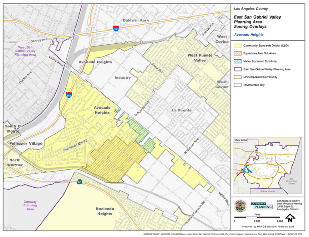
(Ord. 2024-0029 § 13, 2024.)
22.366.090 - Rowland Heights Community Standards District.
A.
Purpose. The Rowland Heights CSD is established to:
1.
Ensure new development retains the residential character of the area;
2.
Impose development standards and review processes to ensure commercial development, signs in commercial areas, landscaping, and setbacks are appropriate for the community and are implemented to protect the community's health, safety, and welfare;
3.
Improve walkability, accessibility, and vibrancy in commercial areas; and
4.
Allow for the keeping and parking of recreational vehicles on residentially and agriculturally zoned lots in a manner that protects the health, safety, and general welfare of the entire community.
B.
Definitions.
1.
Recreational Vehicle. A camper, camp trailer, travel trailer, house car, motor home, trailer bus, trailer coach, or similar vehicle, with or without motive power, designed for human habitation for recreational or emergency occupancy. A recreational vehicle includes a boat, other watercraft, snowmobile, off-road vehicle that cannot legally be driven on public streets, and other similar types of vehicles. A trailer, whether open or enclosed, used to carry or tow property, such as animals, boats, or other watercraft, snowmobiles, off-road vehicles, racecars, or other similar vehicles, is also a recreational vehicle. Where a recreational vehicle is on, or attached to, such a trailer, they shall together be considered one recreational vehicle. A recreational vehicle shall not include a pickup truck used for transportation to which a camper shell has been attached.
2.
Reserved.
C.
District Map. The boundaries of this CSD are shown on Figure 22.366.090-A: Rowland Heights CSD Boundary, at the end of this Chapter.
D.
Application and Review Procedures.
1.
Reports. A monthly report or reports shall be made available to the public by the Department by request, listing all permit and site plan applications received by the Department for this CSD. The report shall include the type of application received, a brief description of the project, and the address of the proposed project.
2.
Notification. Any application requiring a public hearing shall comply with all noticing requirements, as required by Section 22.222.160.B (Additional Radius).
E.
Community Wide Development Standards.
1.
Properties shall be neatly maintained, and yard areas shall be free of debris, trash, lumber, overgrown or dead vegetation, broken or discarded furniture, and household equipment, such as refrigerators, stoves, and freezers.
2.
Screening. Trash containers and dumpsters stored in the front or side yard areas shall be screened from view from streets, walkways, and adjacent residences.
F.
Zone Specific Development Standards.
1.
Zones A-1, A-2, R-1, and R-A.
a.
Front Yard Landscaping. A minimum of 50 percent of the required front yard area shall contain landscaping, consisting of drought-tolerant vegetation, grass, shrubs, trees, and other similar plant materials. Paved or all-gravel surfaces may not be included as part of the required landscaped area.
b.
Grading. A conditional use permit (Chapter 22.158) shall be required for any grading on a lot that cumulatively exceeds 50,000 total cubic yards of cut plus fill material, excluding any grading approved prior to June 20, 2024, the date establishing this Subsection F.1.b (Grading).
2.
All Agricultural and Residential Zones - Recreational Vehicle Parking. Except as specified otherwise in this Title 22, a recreational vehicle may be kept, stored, parked, maintained, or otherwise permitted on a lot in Zones A-1, A-2, R-1, R-2, R-3, R-4, R-A, and RPD, subject to the following restrictions:
a.
A recreational vehicle shall not be kept, stored, parked, maintained, or otherwise permitted within five feet of the front lot line or corner side lot line;
b.
No portion of a recreational vehicle exceeding 36 inches in height shall be kept, stored, parked, maintained, or otherwise permitted within 10 feet of the front lot line or corner side lot line;
c.
No more than one recreational vehicle may be kept, stored, parked, maintained, or otherwise permitted in the front yard, corner side yard, or any additional area situated between the corner side yard and the rear lot line;
d.
No recreational vehicle shall be kept, stored, parked, maintained, or otherwise permitted in a manner that prevents access to any required covered parking on the same lot;
e.
A recreational vehicle may be kept, stored, parked, maintained, or otherwise permitted only on premises owned or occupied by the owner of the vehicle;
f.
No disabled or otherwise nonfunctional recreational vehicle shall be kept, stored, parked, maintained, or otherwise permitted in the front yard or corner side yard;
g.
A recreational vehicle shall be kept, stored, parked, maintained, or otherwise permitted so as to maintain unobstructed line of sight for pedestrians and motorists using the public right-of-way; and
h.
A recreational vehicle shall be kept, stored, parked, maintained, or otherwise permitted so as not to constitute a health or safety hazard.
3.
Zones C-1, C-2, C-3, and MXD.
a.
Yard Setbacks. Outdoor dining, exterior furniture, or pedestrian circulation areas may be provided in the front and side yard setbacks, if such setbacks are provided to meet the landscaping requirement, for up to 25 percent of the required 15 percent net area landscaping.
b.
Awnings.
i.
Use of Awnings. As part of the building articulation, awnings with or without a sign may be used at entrances, windows, bays, or along building frontages or façades, subject to the requirements of Subsection G.6.g.ii (Awning Sign).
ii.
Multiple awnings belonging to a single commercial business shall be the same color and style.
iii.
Awnings shall not utilize glossy material or be internally illuminated.
iv.
Awnings shall be maintained in good repair. For the purposes of this Subsection, good repair shall be defined as not torn or ripped.
c.
Walls and Fences.
i.
Materials. Walls shall be constructed of brick, stucco, or split-faced concrete block with a cap. Fences shall be constructed of wood, simulated wood, brick, stone, and/or wrought iron.
ii.
Prohibited Fences. Chain-link, barbed and concertina wire fences, electric fences, fences or walls with protruding sharp edges, or other fences and walls designed for or likely to cause harm to persons, are prohibited, except as otherwise provided below.
iii.
Special Purpose Fences. Chain-ink fences are permitted only when used to secure undeveloped lots, construction sites, or for special events authorized by a special event permit, pursuant to Chapter 22.188 (Special Events Permit).
d.
Setbacks.
i.
The minimum setbacks from highways or streets for new structures and additions to structures shall be as follows:
(1)
For lots located along Fullerton Road, Colima Road, Nogales Street, Fairway Drive, and Brea Canyon Cut-Off Road, 20 feet from the property line adjoining that respective highway or street; and
(2)
For lots located along any other highway or street, 15 feet from the property line adjoining that respective highway or street.
ii.
The first 10 feet of the setback area measured from the highway or street shall be landscaped in the manner described in Subsection F.3.f, below.
e.
Lot Coverage and Landscaping. Buildings and structures shall not cumulatively occupy more than 80 percent of the net area of a lot. A minimum of 20 percent of the net area shall be landscaped, as described in Subsection F.3.f, below.
f.
General Landscaping. New development shall provide landscaping consisting of 24- and 36-inch box trees, 5- and 15-gallon-size shrubs, and ground cover. All landscaping shall be maintained with regular pruning, weeding, fertilizing, litter removal, and replacement of plants when necessary. Incidental walkways, if needed, may be developed in the landscaped area. Where applicable, landscaping shall be:
i.
Placed around the base of a structure in the area between the structure and the parking area;
ii.
Used to screen trash enclosures, parking areas, storage areas, loading areas, and public utilities from public view to the extent the landscaping does not prevent access thereto; and
iii.
Used to create a buffer with a minimum width and height of three feet between parking areas and public rights-of-way.
g.
Parking Lot Landscaping. Except for rooftop or interior parking, an existing or proposed parking lot with 20 or more parking spaces shall have a minimum of five percent of the gross area of the parking lot landscaped. This landscaping shall be counted toward the general landscaping requirement set forth in Subsection F.3.f, above. The landscaping shall be spread throughout the parking lot to maximize its aesthetic effect and the parking lot's compatibility with adjoining uses. Where appropriate, all areas of the parking lot not used for vehicle parking, vehicle maneuvering, or pedestrian movement or activity shall be landscaped.
h.
Buffers. New structures and additions to structures less than or equal to a total of 15 feet in height on lots adjoining a Residential Zone shall have a minimum setback of three feet from the property line adjoining the Residential Zone. Any such structures or additions to structures over 15 feet in height shall add a minimum setback of one foot for each additional foot of the structure's height over 15 feet, applicable to those portions of the structure exceeding 15 feet.
i.
Corner Properties.
i.
Corner Cut-Off. For purposes of maintaining safe visibility, the front corner area of any corner or reverse corner lot shall be kept free of any tree, fence, shrub, or other physical obstruction higher than 42 inches above grade. The restricted front corner area shall be triangular in shape and shall be measured as follows: two sides of the triangle shall each be 30 feet in length, measured from the point formed by the intersection of the front and exterior side property lines; the third side shall be formed by a straight line connecting the two above-mentioned points.
ii.
Zero Lot Line. All new structures and additions to structures shall, whenever practical, have a zero setback from the rear and interior side property lines, when such property lines adjoin a commercially zoned property.
j.
Minor Conditional Use Permit for New Restaurants. New restaurants or additions to an existing restaurant, where the new floor area of the restaurant use is greater than 2,500 square feet, shall be subject to a minor conditional use permit (Chapter 22.160) application. For the purposes of the preceding sentence, a change of use from a non-restaurant to a restaurant shall be considered a new restaurant. In addition to the provisions described in Chapter 22.160, the following shall also apply to these uses:
i.
Filing Fee. A filing fee equal to that required for a minor conditional use permit.
ii.
Notification. The application shall comply with all noticing requirements, as required by a minor conditional use permit (Chapter 22.160), except the notification radius shall comply with all noticing requirements, as required by Section 22.222.160.B (Additional Radius). A copy of the notice shall also be sent to all other persons or organizations requesting notification.
iii.
Notification of Decision. Notwithstanding Section 22.222.220 (Notice of Action), notice of the decision shall be sent not only to the applicant, but also to those persons who submitted written comments concerning the application and to all other persons or organizations requesting notification.
k.
Compact Parking. Notwithstanding Section 22.112.070.E (Compact Spaces), the provision of compact parking to meet minimum parking requirements shall comply with Section 22.112.070.E (Compact Spaces), except that a maximum of 20 percent of the number of required parking spaces may be compact automobile parking spaces.
4.
Zones M-1 and M-1.5. In Zones M-1 and M-1.5, any use otherwise authorized in Zone C-3, as described in Chapter 22.20 (Commercial Zones), shall be subject to the standards and review provisions prescribed for all Commercial and Mixed Use Zones, as contained in Subsection F.3, above.
G.
Signs. Except as herein modified, all new signs in all zones shall conform to Chapter 22.114 (Signs). Signs regulated by this Section shall not be erected or displayed, unless a building permit is first obtained, and/or unless the sign is exempt, as set forth in Subsection G.1 (Exempt Signs), below. Signage extending into the public right-of-way requires a road encroachment permit from Public Works.
1.
Exempt Signs. In addition to the exception for signs described in Subsection G.6.b (Incidental Business Signs), below, the following types of signs are exempt from these standards, provided the signs conform to the following:
a.
Future Tenant Signs. Temporary signs identifying the name of future businesses. Only one such sign is allowed per street frontage of the building with a maximum of 32 square feet of sign area. Such a sign may only be displayed after tenant improvements for the site have begun and may not be displayed after the first occupancy of the tenant space.
b.
Grand Opening Sign. A temporary promotional sign used by newly established businesses to inform the public of their location and services. Such signs are permitted only until 90 days after the initial occupancy of the new business and shall be removed no later than the 91st day after such initial occupancy. One such sign is allowed per street frontage with a maximum of 32 square feet of sign area. A "Grand Opening" sign shall not include annual or occasional promotion by a business.
c.
Window Sign. Two window signs per tenant are allowed consisting of permanently fixed individual lettering and/or logos not exceeding six inches in height and a total maximum sign area of three square feet. If illuminated, a window sign shall only be externally illuminated.
d.
Temporary Window Sign. In addition to the signage allowed in Subsection G.1.c, above, a tenant may display one additional temporary window sign, provided the sign does not exceed 25 percent of the area of any single window or adjoining windows on the same street frontage. Display of such temporary window sign shall not exceed 30 days, and there shall be a minimum of 30 days between each use of temporary window signs. Temporary window signs are permitted a maximum of four times per calendar year and, if illuminated, shall only be externally illuminated.
e.
Directory Sign. A directory sign for a building providing a list of the names of business establishments within a building is allowed, provided the sign area for the directory sign is no larger than six square feet. Such directory sign may be wall mounted, provided it is no higher than eight feet from the finished grade. The directory sign may also be freestanding, provided it is no higher than eight feet and no lower than three feet from the finished grade.
f.
Affiliation Sign. Affiliation signs providing notice of services within an establishment (for example, credit cards accepted, trade affiliations, etc.) are allowed, provided such signs shall not exceed one square foot in area for each sign, and no more than three such signs shall be allowed for each business. If illuminated, affiliation signs shall only be externally illuminated.
2.
Nonconforming Signs. An existing sign that was legally established and does not conform to the provisions of these Area Specific Standards shall not be enlarged or altered and must be amortized in compliance with Subsection G.5 (Removal and Amortization Schedule), below.
3.
Exposed Neon Signs. A sign internally illuminated or employs exposed neon shall be placed at least seven feet above finished grade. The use of exposed neon shall be limited to script, pictorial graphics, and animation, provided such animation is limited to intervals of five or more seconds.
4.
Prohibited Signs. The following signs shall be prohibited in addition to those listed in Section 22.114.040 (Prohibited Signs Designated):
a.
Signs employing any continuous or sequential flashing operation, including electronic reader boards and LED signage employing crawling displays or flashing illuminations;
b.
Signs employing video components;
c.
Signs emitting odors;
d.
Roof business signs, including signs painted on the surface of roofs; and
e.
Digital and Electronic Signs. Existing signs shall not be converted to a digital or electronic billboard sign. Digital and electronic signs include any internally or externally illuminated sign utilizing digital message technology capable of instantaneously changing the static message or copy on the sign electronically.
5.
Removal and Amortization Schedule. A sign which is nonconforming due to the requirements of this CSD shall be removed or made to comply with this CSD within 20 years from June 20, 2024, in compliance with Section 22.172.050.B.1.f (Termination By Operation of Law).
6.
Permitted Signs. Signs shall comply with Chapter 22.114 (Signs), except as modified herein as follows:
a.
To facilitate the identification or location of the premises in cases of emergency and for other public health, safety, and welfare purposes, business signs readable from a public right-of-way or parking area open to the general public shall include the following information on the sign: Street address and name of the business in digits which are readable from the right-of-way or parking area.
b.
Incidental Business Signs. An incidental business sign shall not be attached to a freestanding sign and shall not be internally illuminated.
c.
Building Identification Signs. A building identification sign shall not exceed four square feet in area, shall not be placed more than four feet above finished grade, and shall not be internally illuminated.
d.
Temporary Construction Signs. A temporary construction sign shall not exceed 40 square feet in area and shall not exceed six feet in height if free-standing. The top of such sign shall not be placed more than six feet above finished grade, if wall mounted; shall not be internally illuminated; and shall be removed from the premises within five days after completion of the construction.
e.
Directional or Informational Signs. A directional or informational sign shall not exceed four square feet in area; shall not exceed three feet in height, if free-standing; and the top of the sign shall not be placed more than three feet above finished grade if wall mounted.
f.
Special Purpose Signs.
i.
A bulletin or special-event sign shall not exceed 12 square feet in area.
ii.
Fuel pricing signs shall comply with the standards of Subsection G.6.g.iv (Monument Sign), below, or G.6.h (Master Sign Program), below.
g.
Permitted Sign Types.
i.
Projecting Sign. The projecting sign type is mounted perpendicular to a building's façade from decorative metal brackets or mounted on the building wall. Projecting signs are easily read from both sides. This Subsection specifies standards for Projecting Sign. See Figure 22.366.090.F, below.
FIGURE 22.366.090-F: PROJECTING SIGN DESIGN
ii.
Awning Sign. The awning sign may be used in the shop front to protect merchandise and keep interiors and sidewalk passages shaded and cool in hot weather. Tenant signs may be painted, screen printed, or appliquéd on the awnings. Projecting signage shall not be attached to awning signage. This Subsection specifies standards for Awning Sign. See Figure 22.366.090-G, below.
FIGURE 22.366.090-G: AWNING SIGN DESIGN

iii.
Wall Business Sign. The wall business sign type is flat against the façade, consisting of individual cut letters applied directly to the building, raised letters on a panel, or painted directly on the surface of the building. Wall signs are placed above shop fronts and often run horizontally along the entablature of traditional buildings, decorative cornice, or sign band at the top of the building. This Subsection specifies standards for wall business sign. See Figure 22.366.090-H, below.
FIGURE 22.366.090-H: PROJECTING SIGN DESIGN
iv.
Monument Sign. The monument sign type is not attached to a building and has an integral support structure. A monument sign stands directly on the ground or ground level foundation and is often used to mark a place of significance or the entrance to a location. This Subsection specifies standards for Monument Sign. See Figure 22.366.090-I, below:
(1)
Changeable copy signs are only allowed for fuel pricing signs, directory signs listing more than one tenant, signs advertising restaurant food specials, or films and live entertainment which change on a regular basis.
(2)
Shall be surrounded by landscaping that is at least twice as large as the area of one of its signs faces.
(3)
Shall not rotate, move, or simulate motion.
(4)
Shall not identify more than eight establishments.
FIGURE 22.366.090-I: MONUMENT SIGN DESIGN

h.
Master Sign Program.
i.
Purpose. A master sign program is intended to:
(1)
Integrate the design of single or multiple signs proposed for a development project with the design of the project's structures to promote design consistency; and/or
(2)
Provide a means for applying common sign regulations for multi-tenant projects and to allow harmony in the design and display of single or multiple signs for development projects. A master sign program is intended to achieve, not circumvent, the purpose of this CSD.
ii.
Applicability. A master sign program permit shall be required whenever any of the following circumstances exist:
(1)
The property owner or applicant requests a master sign program;
(2)
A project is proposed to include four or more business signs on the same lot or building; and/or
(3)
A business sign is proposed at a location where a legally nonconforming sign exists on the property, and the property has four or more tenants or tenant spaces.
iii.
Application Requirements. A master sign program application shall be the same as that for a ministerial site plan review and shall require new business signs to comply, where applicable, with Subsection G (Signs), above, and shall establish standards for sign location, style, size, color, font, materials, and any other applicable sign features, so that all new business signs in a commercial center meet this threshold until the required sign program has been approved by the Department.
(1)
The master sign program shall enhance the overall development and relate visually to other signs included in the master sign program, to the structures or developments they identify, and to surrounding development; and
(2)
The master sign program must be able to accommodate future revisions to signage that may be required because of changes in use or tenants in the development, but without requiring other changes to the master sign program.
H.
Area Specific Development Standards. Reserved.
FIGURE 22.366.090-A: ROWLAND HEIGHTS CSD BOUNDARY
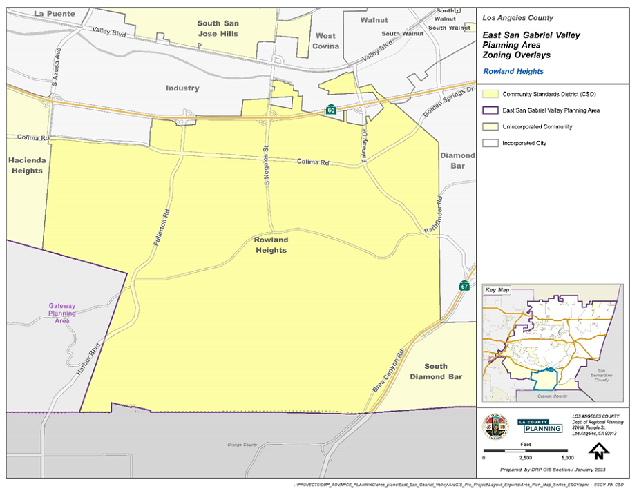
(Ord. 2024-0029 § 13, 2024.)
22.366.100 - Southwest Puente Setback District.
A.
Applicability. In addition to the standards provided in Section 22.72 (Setback Districts), the following standards shall apply:
B.
Southwest Puente Setback District. Established Front Yard Setback Districts are listed in Table 22.366.100-A, below. Front Yard Setback Districts are shown on the Zoning Map and are incorporated with all provisions specified in each respective ordinance of adoption.
C.
Front Yard Setback. The front yard setback for properties in this District shall be 35 feet from the property line.
D.
District Maps. The boundaries of the Setback Districts are shown on Figure 22.366.100-A, at the end of this Chapter.
FIGURE 22.366.100-A: SOUTHWEST PUENTE SETBACK DISTRICT
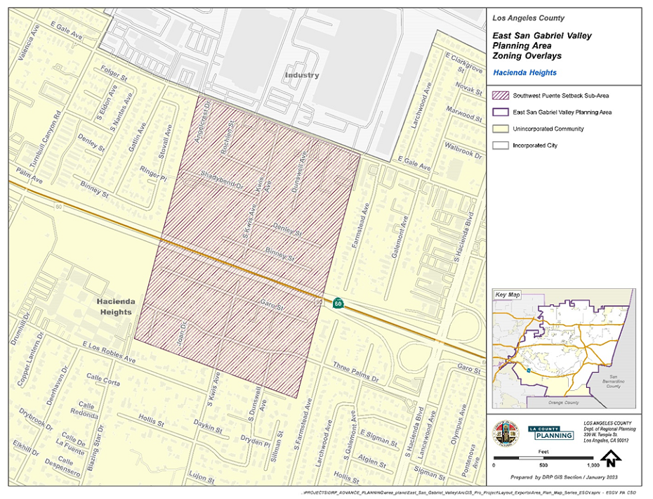
(Ord. 2024-0029 § 13, 2024.)
22.366.110 - Modification of Development Standards.
Notwithstanding the provisions of Section 22.300.020 (Modification Authorized), the modification of certain PASD and CSD standards are subject to the following provisions:
A.
Modification of PASD standards subject to a Variance (Chapter 22.194).
1.
Significant Ridgelines, as provided in Section 22.366.060.A.4, above.
2.
Zone C-3 and MXD Height, as provided in Section 22.366.070.B, above.
B.
Modification of Avocado Heights CSD Development Standards.
1.
Modification of standards specified below shall be subject a minor conditional use permit, pursuant to Section 22.300.020.C (Modifications Authorized):
a.
Section 22.366.080.G.1.b through G.1.d (Zones R-1, R-A, and A-1);
b.
Section 22.366.080.G.2.b.iii and iv (Zones C-H and C-1);
c.
Section 22.366.080.G.4 (regarding setbacks in Zone C-2); and
d.
Section 22.366.080.G.5.a, G.5.b, G.5.c, G.5.e, G.5.f, and G.5.h (Zones M-1 and M-1.5).
2.
Modification of Green Zone (Chapter 22.84) requirements shall be subject to the provisions of Subsection 22.84.040.D (Modification).
3.
Modification of all other standards in the Avocado Heights CSD shall be subject to a variance (Chapter 22.194).
C.
Modification of Rowland Heights Development Standards.
1.
Modification of the development standards for the parking or storing of a recreational vehicle within 10 feet of the front lot line or corner side lot line shall be subject to the provisions of Subsection C.4 (Yard Modification), below.
2.
Minor deviations of up to 25 percent from the following development standards are subject to a minor conditional use permit, pursuant to Subsection 22.300.020.C (Modifications Authorized).
a.
Signs (Section 22.366.090.G).
b.
The parking lot landscaping requirements set forth in Section 22.366.090.F.3.g (Parking Lot Landscaping) as they apply to existing parking lots as of June 20, 2024.
3.
Modification of all other standards in the Rowland Heights CSD shall be subject to a variance (Chapter 22.194).
4.
Yard Modifications. A yard modification (Chapter 22.196) application may be filed to authorize the parking or storing of a recreational vehicle within 10 feet of the front lot line or corner side lot line; provided, however, that under no circumstances shall a recreational vehicle be parked closer than five feet from the front or corner side lot lines. An application under this Subsection C.4 shall be supported by evidence substantiating the requested modification is necessary due to topographic features or other conditions in that compliance with the 10-foot setback line would create an unnecessary hardship or unreasonable regulation or where it is obviously impractical to require compliance with the setback line. The Review Authority may approve the application if the Review Authority finds parking or storing a recreational vehicle at the proposed location will not compromise pedestrian or motorist line of sight or other applicable safety standards, as determined by the Review Authority, and the applicant has substantiated to the satisfaction of the Review Authority that, due to topographic features or other conditions, compliance with the 10-foot setback line would create an unnecessary hardship or unreasonable regulation or where it is obviously impractical to require compliance with the setback line.
D.
Modifications, Notification Radius, and Additional Findings.
1.
Notification Radius. Notwithstanding Section 22.300.020.C (Modifications Authorized), the notification radius for modifications in Subsection C, above, shall be 1,000 feet of the exterior boundaries of the subject property, as shown on the County's last equalized assessment roll.
2.
Additional Findings. In addition to Section 22.160.050 (Findings and Decisions) for a minor conditional use permit, modifications, pursuant to Subsection B.1 and C.2, above, are subject to these additional findings:
a.
The use, development of land, and application of development standards comply with all applicable provisions of this Title 22.
b.
The use, development of land, and application of development standards, when considered on the basis of the suitability of the site for the particular use or development intended, are arranged as to avoid traffic congestion, to provide for the safety and convenience of bicyclists and pedestrians, including children, senior citizens, and persons with disabilities, to protect public health, safety and general welfare, to prevent adverse effects on neighboring property and conform with good zoning practice.
c.
The use, development of land, and application of development standards are suitable from the standpoint of functional developmental design.
d.
The application of these standards will result in practical difficulties or unnecessary hardships inconsistent with the community-specific goals and policies of the East San Gabriel Valley Area Plan and the purpose of the CSD.
e.
There are exceptional circumstances or conditions applicable to the subject property or to the intended development of the property that do not generally apply to other properties within this CSD.
f.
Granting the requested modification will not be materially detrimental to properties or improvements in the area or contrary to the community-specific goals and policies of the East San Gabriel Valley Area Plan and the purpose of the CSD.
(Ord. 2024-0029 § 13, 2024.)