
Paxton City Zoning Code
CHAPTER II
ZONING DISTRICTS3
Editor's note— Ord. No. 2018-29, § II(Att. A), adopted December 11, 2018, repealed the former Ch. 2, §§ 2.00.01, 2.01.01—2.01.04, 2.03.01—2.03.08, 2.04.01—2.04.04, 2.05.01, 2.05.02, 2.06.01—2.06.05, and enacted a new Ch. 2 as set out herein. The former Ch. 2 pertained to land use districts. See Code Comparative Table for complete derivation.
2.00.00.- GENERALLY
In order to ensure that all development is consistent with the goals and objectives of the Comprehensive Plan, it is necessary and proper to establish a series of zoning districts that establish use and form regulations controlling the use of land in each district. All development within each zoning district shall be consistent with the purposes stated for that district. Additional regulations pertaining to special planning areas or overlay districts, including Neighborhood Plans, may be found in other Chapters of this Code.
(Ord. No. 2018-29, § II(Att. A), 12-11-18; Ord. No. 2019-19, § II(Att. A), 9-10-19)
2.02.00. - ZONING DISTRICTS ESTABLISHED
This section describes specific uses which are allowed or prohibited in each district and provides special conditions or restrictions which may apply to all development activity within each district. Note: There may be other limitations beyond those described in this Chapter. These additional factors are described in Chapters 3, 4, 5, 6 and 8 of this Code. Generally, the following apply:
A.
Primary Land Uses Allowed: Each zoning district description includes the specific categories of uses allowed within each zoning district described in the Comprehensive Plan and this Code. The specific types of uses allowed in each district are listed in Section 2.03.00 of this Chapter.
B.
Accessory Uses and Structures Allowed. Accessory structures and uses, consistent with the definition of accessory uses as set forth in Chapter 9 of this Code and as defined herein, are allowed in any zoning district in connection with any lawfully existing primary use, subject to the requirements of this Code. All accessory structures or uses shall meet the requirements for the zoning district in which the structure or use is located.
B.
Accessory Uses and Structures Allowed: Accessory structures and uses, consistent with the definition of accessory uses as set forth in Chapter 9 of this Code and as defined herein, are allowed in any zoning district in connection with any lawfully existing primary use, subject to the requirements of this Code. All accessory structures or uses shall meet the requirements for the zoning district in which the structure or use is located.
1.
General Standards and Requirements for Accessory Structures. Any number of different accessory structures may be located on a parcel, provided that the following requirements are met:
a.
There shall be a permitted principal development on the parcel, located in full compliance with all standards and requirements of this Code.
b.
All accessory structures shall comply with standards pertaining to the principal use, unless exempted or superseded elsewhere in this Code as well as all applicable building codes enforced by the County.
c.
Accessory structures shall not be located in a required buffer or landscaped area unless a variance has been granted by the County pursuant to Chapter 1 of this Code.
d.
Accessory structures shall be included in all calculations of impervious surface and stormwater runoff.
e.
Accessory structures shall be shown on any development plan with full supporting documentation as required in Chapter 1 of this Code.
2.
Storage Buildings, Utility Buildings, Greenhouses.
a.
No accessory buildings used for industrial storage of hazardous, incendiary or noxious materials shall be located nearer than 100 feet from any property line.
b.
Storage buildings, greenhouses, and the like shall be approved only in compliance with standards for distance between buildings, and setbacks, if any, from property lines.
c.
Storage and other buildings regulated by this Section shall not encroach into any required building setback from an abutting right-of-way.
d.
Storage and other buildings regulated by this Section shall be included in calculations for impervious surface, floor area ratio, or any other site design requirements applying to the principal use of the lot.
e.
Vehicles, including manufactured housing, travel trailers and mobile homes, shall not be used as storage buildings, utility buildings, or other such uses.
3.
Accessory Dwelling Unit (ADU). The purpose of this section is to provide for inexpensive housing units to meet the needs of Walton County residents. This section is also intended to protect the property values and residential character of neighborhoods where accessory dwelling units are located. Accessory dwellings may be allowed in single-family residential areas provided that all of the following requirements shall be met:
a.
No more than one accessory dwelling unit shall be permitted on any residential lot.
b.
The accessory dwelling unit shall be located and designed not to interfere with the appearance of the principal structure as a one-family dwelling unit and shall be clearly subordinate to the primary dwelling in keeping with the following:
i.
An accessory dwelling unit shall not exceed 800 square feet of heated and cooled area.
ii.
Accessory dwelling units shall be limited to a maximum of 75% of the primary dwelling units' livable area.
iii.
Detached accessory dwelling units shall not exceed the primary dwelling units' height.
a.
Exemption: A one-story-single family dwelling unit with a detached garage may have an accessory dwelling unit above the garage as a second story only.
c.
Reserved.
d.
No variations, adjustments, or waivers to the requirements of this Code shall be allowed in order to accommodate an accessory dwelling unit.
e.
Recreational Vehicle(s) shall not be utilized as an accessory dwelling unit.
C.
Temporary Uses. A temporary use is one established for a fixed period of time with the intent to discontinue such use upon the expiration of such time. Such uses do not involve the construction or alteration of any permanent structure. A temporary structure is any structure which is designed, constructed and intended to be used on a short-term basis.
1.
Temporary uses are permitted only as expressly provided in this Section.
2.
No temporary use shall be established unless a development order evidencing the compliance of such use with the provisions of this Section and other applicable provisions of this Land Development Code shall have first been issued.
3.
No signage in connection with a temporary use shall be permitted except in accordance with Chapter 6 of this Land Development Code, related to on-premises signage. One on-premises sign may be allowed for each temporary use permit. No off-premises signage will be allowed for temporary uses.
4.
All temporary uses must be located on private property and are subject to the setback requirements for commercial development, parking area requirements for commercial development, as well as applicable Scenic Corridor guidelines.
5.
Roadside Vending and Mobile Food Dispensing Vehicle (MFDV) Operations.
a.
A roadside vending and/or MFDV operation is permitted in any zoning district. However, such temporary uses are not permitted within any designated scenic corridor overlay district as described in Chapter 6 of this Code.
b.
The maximum length of any Roadside Vending permit shall be for six months of each calendar year.
c.
MFDVs shall be required to maintain all required state licenses and permits.
6.
Sales Trailers. A real estate sales office is permitted in any district for any new development project, new project to mean a development which has been approved within the year. A model home may be used as a temporary sales office. The maximum length of permit shall be one year or upon completion of the development project, whichever is lesser.
7.
Constructions Trailers. A contractor's office and construction equipment sheds are permitted in any district where use is incidental to a new development project, new project to mean a development which has been approved within the year. The maximum length of a permit for a construction office shall be one year or upon completion of the construction project, whichever is lesser.
8.
The temporary use of a Recreational Vehicle (RV) as a dwelling. A property owner may be permitted to use one Recreational Vehicle temporarily as a dwelling, in keeping with the following:
a.
The temporary use of an RV as a dwelling shall be prohibited within platted and un-platted subdivisions.
b.
A Temporary RV Living Permit shall be required.
c.
The Temporary RV Living Permit may be issued on legal lots of record that are between one-half acre and five acres in size that are located within the Large Scale Agriculture, General Agriculture, Estate Residential, Rural Low Density, and Rural Residential zoning districts.
d.
A Temporary RV Living Permit shall be issued for a period of time not to exceed 90 days. The property owner may re-apply at the end of the 90-day period.
e.
A Temporary RV Living Permit shall only be issued twice per calendar year.
f.
The property owner shall provide for the lawful disposal of all solid waste and wastewater, including both grey and black water. The disposal method shall be identified in the permit application.
g.
The commercial use of the RV is prohibited. RVs and RV spaces shall not be rented or leased outside of a dully approved Recreational Vehicle Park.
h.
Recreational Vehicles shall not be utilized as short-term vacation rentals.
i.
Recreational Vehicles shall not be tied down or otherwise permanently affixed to any land.
j.
Recreational Vehicles shall satisfy the residential structure setback requirements of Section 5.00.03 of this Land Development Code. This shall be demonstrated on a site plan and submitted with the permit application.
k.
The property owner shall be required to maintain the Temporary RV Living Permit with the Recreational Vehicle and shall make it available for inspection upon request by any County Official.
l.
The Planning and Development Services Director may approve the Temporary RV Living Permit with any specific conditions deemed necessary to ensure compatibility with surrounding development character, including, but not limited to, increased setbacks, landscaping buffers, and privacy/screening fences.
m.
There are areas of unincorporated Walton County that have historically been utilized as fish camps, hunting camps, and other similar natural resource-based recreational camps. Regardless of platting status and/or lot size, the Director of Planning and Development Services may exempt Temporary RV Living Permitting requirements within these historically recognized areas.
D.
Conditional Uses Allowed: Conditional uses may be allowable within a zoning district subject to the conditions established in each zoning district allowing conditional uses. Each conditional use listed will reference the additional development conditions or standards which may be required, during the development approval process and as determined by the Board of Adjustment.
Any specific conditions or process provided for conditional uses will be in addition to all other permitting application requirements and development conditions required in other sections of this Code.
E.
Special Exception Uses: Special Exception uses describe uses that meet the intent and purpose of the zoning district but which require review and approval by the Board of Adjustments and the Board of County Commissioners in order to ensure that any adverse impacts on adjacent uses, structures, or public services and facilities that may be generated by the use can be and are mitigated.
F.
Interpretation of Use Regulations: Whenever a use is not specifically mentioned as allowable, accessory, special or conditional, either the Commission or its delegate, the Director of Planning and Development Services, shall make a determination as to whether the proposed use is of the same general type as the uses specifically allowed in the zoning district. In making such a determination, the Planning and Zoning Director shall be guided by the goals, objectives and policies of the Walton County Comprehensive Plan and this Code.
G.
Non-residential Intensity (Floor Area Ratio). Intensity of development is the relationship between the total land area being developed with non-residential use and the total floor area of the commercial or non-residential use building (FAR). For mixed use projects, excluding projects within the Traditional Neighborhood Development (TND) Zoning District, the FAR shall be determined on the basis of the specific nonresidential use proposed for each lot or sub-area of the mixed-use project. Intensity may not be transferred from a lot or sub-area of the parcel proposed for residential use to a portion of the site designated for commercial or non-residential uses. In a mixed use building, the residential and non-residential uses shall be included in the density and intensity calculation proportionate to their respective uses and shall not exceed 100% total of the combined uses.
H.
Residential Impervious Surface Area Ratio (ISR): The required impervious surface ratio of a residential development or building shall be determined by the impervious surface area ratio established within the approved stormwater management plan.
I.
Residential Density: Residential density is the relationship between the total number of dwelling units on an area being developed as residential and the gross land area in the residential development, excluding water bodies, unless privately owned. For projects proposed on parcels designated for mixed use development, excluding Traditional Neighborhood Developments, the density shall be determined on the basis of the specific residential use proposed for each lot or sub-area of the mixed use parcel. Density may not be transferred from the lot or sub-area of the parcel proposed for a commercial or other nonresidential use to the area proposed for residential use. In a mixed use building, the residential and non-residential uses shall be included in the density and intensity calculation proportionate to their respective uses and shall not exceed 100% total of the combined uses.
J.
Local Utility Infrastructure: Utility services infrastructure such as potable water distribution lines, sanitary sewer collection systems, drainage facilities, electrical and natural gas distribution systems and road facilities which are necessary to provide essential public and utility services to a local commercial area or residential area may be sited in any zoning district.
K.
Home-Based Business. Home-based businesses operating in accordance with F.S. § 559.955, shall be allowed in any zoning district which allows residential development as a primary use.
1.
Any external modifications made to a residential dwelling to accommodate a home-based business must conform to the residential character and architectural aesthetics of the neighborhood.
2.
There shall be no change in the outside appearance of the building or premises, or other visible evidence of the conduct of such home occupation, other than one sign not exceeding two square feet in area.
3.
The activities of the home-based business shall be secondary to the property's use as a residential dwelling. No home occupation shall occupy more than 25 percent of the total floor area of the residence.
4.
A maximum of two non-resident employees and/or independent contractors are allowed to work at the site of a home-based business, in accordance with F.S. § 559.955.
5.
Parking and Vehicle Storage.
a.
Home-based businesses shall provide additional employee parking as needed to ensure the required residential parking is not reduced to an amount in violation of the residential parking requirements for the home.
b.
Storage of vehicles and trailers used for the home-based business shall be allowed in approved off-street parking areas only and shall not detract from the minimum required number of parking stalls necessitated by the residential use.
c.
The parking or storage of heavy equipment used for the home-based business shall be within approved off-street parking areas only and shall not be visible from any right-of-way or neighboring property. Heavy equipment in this instance is referring to commercial, industrial, or agricultural machinery, equipment, and larger vehicles.
6.
No home occupation shall create interference to neighboring properties due to noise, vibration, heat, smoke, dust, glare, fumes, odors, or electrical interference in a manner inconsistent with a residential use. In the case of electrical interference, no equipment or process shall be used which creates visual or audible interference in any radio, telephone, or television receivers off the premises or causes fluctuations in line voltage off the premises.
7.
Home based businesses shall comply with any relevant local, state, and federal regulations with respect to the use, storage, or disposal of any corrosive, combustible, or other hazardous or flammable materials or liquids.
L.
Manufactured Housing: Manufactured homes built in compliance with the HUD code or built under the Florida Manufactured Building Act and certified by the Florida Department of Business and Professional Regulation as complying with the structural requirements of the Standard Building Code shall be allowed to locate in all residential land use districts.
M.
Existing Lots of Record Provisions: None of the provisions of this section preclude the development of a single family dwelling unit on an individual lot of record existing as of the November 7, 1996, or as provided for in sections 2.02.01.E and 2.02.02.E, on a private well and/or septic tank which comply with the other regulatory requirements of this Code and applicable state law, if central sewer or water service is unavailable. The boundaries of qualifying lots of record may be adjusted to provide for more efficient and/or workable development plans where two or more of these lots are contiguous only if established density does not increase and established type of development does not change.
N.
Family Homestead: This provision allows the use of a parcel of property solely as a homestead by an individual who is the grandparent, parent, stepparent, adopted parent, sibling, child, stepchild, adopted child, or grandchild of the person who conveyed the parcel to said individual, notwithstanding the density assigned to the parcel in the plan. Such a provision shall apply only once to any individual and shall be governed by the provisions of F.S. § 163.3179, Section 5.00.06.D of this Code, and Policy L-1.11.4 of the Comprehensive Plan.
O.
Group Homes: Group homes shall be located consistent with the requirements of F.S. Ch. 419, as follows:
1.
Group homes (community residential facilities) which house six or fewer residents shall be allowed in any zoning district with single family residential attached and single family residential detached uses listed as primary uses;
2.
Group homes (community residential facilities) housing seven or more residents shall only be allowed in any zoning district where multi-family residential uses are permitted as primary or conditional uses including the mixed use districts;
3.
Foster care facilities for children under the age of 18 may be located in any zoning district allowing for residential uses of any type as a primary use.
P.
Recreational Vehicles (RVs). The use of a recreational vehicle as a permanent residence is not permitted, except for in duly licensed and permitted recreational vehicle campgrounds/parks or as provided for in Sections 2.02.01 (Large Scale Agriculture District), 2.02.02 (General Agriculture District), 2.02.03 (Estate Residential District), 2.02.04 (Rural Low Density District), and 2.02.05 (Rural Residential District). No more than two unoccupied recreational vehicles may be stored on the same lot as a principal residential structure.
The temporary use of a Recreational Vehicle as a dwelling is allowed in accordance with Subsection 2.02.00(C)(8), above.
In addition, recreational vehicles may be used as temporary residences in accordance with the following items:
1.
For parcels of land located within any zoning district allowing residential uses as a primary use, a recreational vehicle may be used as a temporary residence by the property owner during the construction of a primary residence on the same parcel.
2.
For parcels of land located in any zoning district allowing general commercial or industrial uses as primary uses, a recreational vehicle may be allowed for security purposes during a construction project, provided that the maximum occupancy of the recreational vehicle is limited to two persons.
3.
Only one recreational vehicle shall be located and used as a temporary residence per development site.
4.
An active building permit must be in place for the primary use.
5.
The recreational vehicle must be located on the parcel in such a manner as not to interfere with the use of any adjacent public or private property.
6.
All solid waste and waste water including both grey and black water must be disposed of in a lawful manner.
7.
Recreational vehicles located within flood zones must remain within an operating condition that is ready for immediate highway use.
8.
Permits are required. The duration of a permit for use of a recreational vehicle as a temporary residence during construction shall be one year from the date of permit issuance.
9.
The permitted use of a recreational vehicle as a temporary residence must cease within 14 days of the issuance of the first certificate of occupancy for a primary structure, regardless of the permit expiration date.
Q.
Short-Term Vacation Rental Units: All short-term vacation rental unit hosts must complete the registration process annually as defined in Section 1.13.16 of this Code and receive a Walton County Short-Term Rental Certificate as a condition of approval to construct a new short-term vacation rental unit, convert, or operate an existing unit. This section shall apply to short-term vacation rental as defined Article 9 of the Land Development Code which is rented to guests more than three times in a calendar year for periods of less than 30 days or one calendar month, whichever is less, or which is advertised or held out to the public as a place regularly rented to guests.
1.
Restriction and Limitation. No person shall rent or lease all or any portion of a dwelling unit as a short-term vacation rental without initially and then on a continuing basis:
a.
Obtaining a short-term vacation rental certificate from the Walton County pursuant to Section 1.13.16. The requirements for obtaining such certificate shall be provided in an easily accessible guidebook and are as follows:
i.
Obtaining a Florida Department of Revenue certificate of registration for purposes of collecting and remitting sales surtaxes and transient rental taxes, if required by law;
ii.
Proof of registration for collecting and remitting tourist development tax ("TDT") through Walton County Clerk of Courts and Comptroller;
iii.
Obtaining a Florida Department of Business and Professional Regulation license as a transient public lodging establishment, if required by state law; and
iv.
As demonstrated through an affidavit, maintaining initial and ongoing compliance with the short-term vacation rental standards contained herein, plus any other applicable local, state, and federal laws, regulations, and standards to include, but not be limited to, F.S. ch. 509, and Rule Chapters 61C and 69A, Florida Administrative Code or such successor statutes or rules as may be applicable.
The zoning district related review requirements for new construction or proposals to increase the size of an existing short-term vacation rental unit are as follows:
2.
New construction and converted neighborhood scale short-term vacation rental unit uses are permissible in every zoning district allowing single family residential detached, single family residential attached, and multi-family residential land uses including residential preservation provided that such units are compatible with the neighborhood and surrounding residential land use. Compatibility in this case is defined as:
a.
Parking for new construction single family attached and detached short-term vacation rental units shall be required at a rate of one parking space per six occupants and utilizing the above 150 square feet gross floor area per person maximum occupancy requirement (one parking space per 900 square feet).
b.
Residential character may be determined utilizing adjacent or other structures within the neighborhood vicinity of the new structure, including the use of similar fenestration, building orientation, and site design features such as fences, walls, driveways and parking areas.
c.
New single family attached and detached short-term vacation rental units must include architectural articulation in wall design, step backs, or the fragmentation of form and surface in order to break large uninteresting or oppressive mass into smaller components.
d.
New short-term vacation rental uses shall be designed internally to include common gathering areas, common kitchen areas, and at least one shared or common bathroom, so as not to facilitate the rental of individual rooms.
(Ord. No. 2018-29, § II(Att. A), 12-11-18; Ord. No. 2019-19, § II(Att. A), 9-10-19; Ord. No. 2021-14, § 1, 4-27-21; Ord. No. 2022-13, § II, 8-25-22; Ord. No. 2023-03, § II(Att. A), 1-24-23; Ord. No. 2025-11, 6-23-25)
2.04.00. - SUMMARY OF DENSITY, INTENSITY AND IMPERVIOUS SURFACE RATIO BY ZONING DISTRICT
(Ord. No. 2018-29, § II(Att. A), 12-11-18; Ord. No. 2019-19, § II(Att. A), 9-10-19)
2.07.00. - SPECIAL EXCEPTION USES
A.
Approval Process.
1.
Any development on parcels of land, for which the use is by special exception will be processed as a Major Development and must include a recommendation from the Board of Adjustments.
2.
The Board of Adjustment shall consider the application at a public hearing. In reviewing the application, the Board of Adjustment shall consider the recommendations of the TRC and shall determine whether the proposed development meets the requirements and special conditions of below in its recommendation. Based upon such determination, the Board of Adjustment shall make a recommendation on the project prior to its being heard by the Planning Commission.
3.
When a use is requested on a parcel or parcels with more than one land use designation and one of those designations requires a special exception for that use, the development application in its entirety will be treated as a special exception.
B.
Generally. Applications for a special exception shall be available at the Planning and Development Services Office. Plans submitted as a special exception shall be subject to the same review procedures as a Major Development, in addition to a review by the Board of Adjustment. A completed application shall be signed by all owners, or their agent(s), of the project subject to the proposal, and notarized. Signatures by other parties will be accepted only with notarized proof of authorization by owners. In case of corporate ownership, the authorized signature shall be accompanied by a notation of the signer's office in the corporation, and embossed with the corporate seal.
C.
Special Conditions Required for Special Exceptions. To promote the compatibility of special exceptions with existing development the developer must:
1.
Hold a community meeting that will take place following a pre-application conference with the County and before submitting a special exception application. Topics covered in community meetings shall include, but are not limited to: scale, intensity and overall impacts from proposed special exception use. The applicant must address any potential traffic impacts, including traffic circulation and existing road conditions and improvements to be made to support the proposed special exception use;
2.
Provide a compatibility analysis and mitigation plan that addressed: scale, intensity, traffic impacts, including traffic circulation and existing road conditions. Each analysis shall also demonstrate:
(a)
That the proposed use will not unreasonably increase traffic on local residential streets in the impacted area;
(b)
That the scale, intensity, and operation of the use shall not create adverse impacts from noise, smoke, exhaust, emissions, dust, lighting, vibration, or odors that are detrimental to the reasonable use or quiet enjoyment of existing development in the surrounding neighborhood;
(c)
That the proposed development is consistent with the extent, design, and location of parking, parking access drives, service areas, outside storage, landscaping, and other site features of the surrounding neighborhood, including but not limited to setbacks, buffers, fences, walls, and open space; and
(d)
An operational plan that includes operating hours, number of employees, number of work related vehicles and equipment considered as part of the proposed development.
For the purposes of this compatibility analysis, "surrounding neighborhood" shall be construed as the surrounding residential uses within a minimum of a one-quarter mile radius and any additional area as determined by the Planning and Development Director, of the special exception parcel, with the strongest consideration given to those residential uses that are adjacent to the special exception parcels.
(Ord. No. 2018-29, § II(Att. A), 12-11-18)
2.08.00. - PROCEDURE FOR DETAILED SPECIFIC AREA PLAN (DSAP) APPROVAL WITHIN THE BAY-WALTON SECTOR PLAN (BWSP)
A.
Concept Plan Approval. An applicant seeking DSAP approval shall submit a conceptual plan to the County for review and approval. The conceptual plan shall include the following information:
1.
Each DSAP application shall conform to the BWSP Long Term Master Plan and demonstrate all of the following:
a.
The application contains development or conservation areas of at least 1,000 acres consistent with the Long-Term Master Plan. The County may approve detailed specific area plans of less than 1,000 acres based on local circumstances if it is determined that the DSAP furthers the purposes of the Comprehensive Plan, the Long-Term Master Plan, F.S. § 163.3245, and F.S. ch. 380 pt. I.
b.
That the development is consistent with the Bay-Walton Sector Plan Element of the Comprehensive Plan and F.S. § 163.3245.
c.
That the proposed development meets the adopted level of service standards for the BWSP as identified in Policy BW-1.1.14. Some of the services may be located in an adjacent project or DSAP.
d.
That the required on-site and off-site public facilities, services, and infrastructure will be available to serve each development phase as it is constructed. Some of these public facilities, services, and infrastructure may be located in an adjacent project or DSAP.
e.
That the location and configuration of the proposed Long-Term Conservation Areas and Agriculture/Timberland provides wildlife connectivity needed for these areas.
2.
A boundary map clearly identifying the area to be covered and its relationship to the Long-Term Master Plan.
3.
The names, addresses and phone numbers of the owner, applicant and representatives of the applicant.
4.
A legal description including total acreage.
5.
A graphic illustration of the topography of the site and the locations of the flood zones.
6.
Each DSAP application will include a conceptual master plan and identify the proposed uses that will be permitted in the DSAP boundary.
7.
The location and description of buffers along the perimeter of the project.
8.
A natural resources map for the DSAP boundary and data and analysis demonstrating the suitability of the land for the proposed land uses or a copy of an approved Regional General Permit/Ecosystem Management Agreement (RGP/EMA) approved by the applicable federal and state agencies. Identify the lands within the DSAP designated as Long-Term Conservation Areas and include these in a conservation easement at the time of DSAP approval.
9.
A detailed analysis with identification of specific measures to protect the regional and sub-regional significant natural resources and jurisdictional wetland areas both within and adjacent to the proposed DSAP. Natural resources located within the DSAP boundary as identified on the required natural resources map will be protected consistent with the Bay-Walton Sector Plan Element of the Comprehensive Plan including Objectives BW 1.8—1.12 and their supporting policies.
10.
The DSAP effective date will coincide with the recordation of conservation easements for the long-term preservation of lands designated as Long-Term Conservation Area within the boundary of the DSAP.
11.
Proposed phasing map and schedule of the DSAP which is to be used for the public facilities analysis, transportation analysis, and infrastructure analysis of this section and for the submittal of subsequent development orders.
12.
An updated transportation analysis that incorporates the best available data and analysis, including traffic data, land use data, updated travel demand models, current committed and planned roadway improvements, and improvement cost estimates. Prior to the preparation of such analyses, the traffic methodology will be coordinated with both Walton County and the FDOT to ensure that each agency's review needs are adequately addressed. A subsequent analysis will occur during the individual project stage (Minor DO) and such analysis shall recognize the County's mobility fee requirements when adopted as the required methodology. The approval of a DSAP including traffic analysis and methodology does not provide vesting against any traffic mitigation requirements adopted in the future.
13.
The need for an accommodation of various multimodal travel opportunities that accommodates modal choice opportunities within and between DSAPs within the BWSP including bicycle and pedestrian facilities and public transportation services if available.
14.
Identification of regional and non-regional public facilities, services, and infrastructure and anticipated impacts on the facilities caused by the DSAP.
15.
A public facilities analysis based upon the proposed land use densities and intensities proposed in the DSAP and the adopted Level of Service standards within the Bay-Walton Sector Plan Element of the Comprehensive Plan. Each DSAP must ensure that long-term impacts to public facilities within the BWSP and regionally significant facilities within Walton County meet the adopted Level of Service standards for the BWSP using the strategies provided for in Chapter 163 and the Comprehensive Plan.
16.
Identification and analysis of the proposed urban forms (e.g. BWSP Town Center, BWSP Village Center, and BWSP Low-Impact Residential), and land uses including their proposed location in the DSAP. Each land use shall be specifically identified as to the location, allowable uses, maximum amounts, densities, intensities, a comparison of the development amounts within the land use categories in Table BW-1 of the Comprehensive Plan, and the cumulative development amounts.
17.
An Infrastructure Analysis which demonstrates that the costs of any additional local government services and infrastructure required for the BWSP are adequately funded. The analysis will also demonstrate that the impacts to schools based on the level of service standards in Policy BW-1.1.14 and consistent with Objective BW-1.14 and supporting policies in the Bay-Walton Sector Plan Element of the Comprehensive Plan, are properly mitigated by the development under such policy.
18.
General design guidelines including physical design and lot development standards for each land use (BWSP Town Center, BWSP Village Center and BWSP Low-Impact Residential), street design, landscaping, access and circulation, parking, parks and internal and recreational and open space requirements that will meet current county standards, and may address golf course design and maintenance, where appropriate. Measures will also be included to address water conservation and non-potable water usage and other resource conservation measures.
19.
Principles and guidelines that address the urban form proposed by the DSAP and its inter-relationship with other components/future DSAPs needed to implement the full Long-Term Master Plan.
20.
A description of any additional development standards that will vary from the standards contained in the Land Development code.
21.
Statements of unified control of the DSAP property with assurances that the site will be developed in accordance with the DSAP plan, as it may be amended from time to time, along with a statement that the DSAP will be binding upon successors, heirs and assigns.
B.
Public Hearings: Once staff has reviewed the conceptual plan and deemed that it is complete, dates shall be set for public hearings before the Planning Commission and the Board of County Commissioners.
County staff shall review the conceptual plan for compliance with the goals, objectives and policies of the comprehensive plan and compatibility with the character of the surrounding area, appropriateness of the mixture of uses and similar matters and shall submit a report to the Planning Commission and the Board of County Commissioners. Said report shall be available at least one week in advance of the Planning Commission public hearing.
Subsequent to the Planning Commission hearing, the Board of County Commissioners shall conduct a duly noticed public hearing in order to approve, deny or approve with conditions the conceptual plan. The Board shall have the discretion to place conditions that ensure compatibility of the project with surrounding areas, ensure compliance with the comprehensive plan or enhance the public health, safety and welfare. When making its decision, the Planning Commission and Board of County Commissioners shall make findings in consideration of the following standards:
a.
The proposed DSAP is consistent with the Walton County Comprehensive Plan
b.
The proposed DSAP is consistency with the Bay-Walton Sector Plan Long-Term Master Plan
c.
Infrastructure facilities and services are available, or will be available, to serve the DSAP
d.
The proposed DSAP is not a potential threat to the health, safety, and welfare of the general public
C.
Substantial Deviations to DSAP. A substantial deviation to a DSAP Conceptual Plan shall be deemed to occur if any of the following criteria are triggered:
1.
An increase to the total acreage in the approved DSAP.
2.
A change to the gross area of proposed public parks and preservation areas which causes the DSAP to become inconsistent with the comprehensive plan or decreases the gross area of proposed public parks and preservation areas in the DSAP by more than ten percent of the previously approved levels.
3.
If there is an approved equivalency matrix, use of the matrix will not constitute a substantial deviation.
4.
Modifications which are determined by the Planning Director not to meet the criteria above are subject to the review and approval of a Minor Development Plan pursuant to Section 1.13.10.B. or a Less Than Minor Development Plan in the discretion of the Planning Director.
(Ord. No. 2019-19, § II(Att. A), 9-10-19)
2.01.02. - Generally.
The unincorporated portion of Walton County shall be divided by this Code into Zoning Districts, the boundaries and designations of which shall be shown on a map, covering the entire unincorporated area of Walton County, and identified as the Official Zoning Map of Walton County, hereafter referred to as the Official Zoning Map (OZM). No structure or land in the county shall hereafter be developed, used or occupied unless expressly authorized in a zoning district herein. The Official Zoning Map shall identify Planning Areas within Walton County:
• North Walton County;
• North Central Walton County;
• South Central Walton County; and
• South Walton County.
(Ord. No. 2018-29, § II(Att. A), 12-11-18; Ord. No. 2019-19, § II(Att. A), 9-10-19)
2.01.03. - List of Zoning Districts and their applicability to Walton County Planning Areas.
The following table establishes the location criteria for the various zoning districts within Walton County:
2.01.04. - Table of Zoning Districts Allowable in Each Future Land Use Map Category.
(Ord. No. 2018-29, § II(Att. A), 12-11-18)
2.01.05. - Official Zoning Map.
A.
The Official Zoning Map, together with all lawfully adopted explanatory material shown thereon or therewith, is hereby adopted by reference and declared to be part of this Code.
B.
Other supplements, in the form of maps, indices, guides, illustrations, records, reports, interpretive material and standards, may be officially adopted, directly or by reference, to facilitate administration and public understanding of the Official Zoning Map or of regulations adopted for the zoning districts or other division established thereby.
(Ord. No. 2018-29, § II(Att. A), 12-11-18)
2.01.06. - Zoning District Boundaries.
A.
For the special purposes, where boundaries and designations are not shown directly on the basic map, they shall be indicated by overlays to such map or as separate maps. Overlays or separate maps shall have the same force and effect as the Official Zoning Map.
B.
A district symbol or name shown within district boundaries in the Official Zoning Map indicates that district regulations pertaining to the district extend throughout the whole area surrounded by the boundary line, except as otherwise specifically provided.
C.
Where uncertainty exists as to boundaries of districts, or other areas delineated for regulatory purposes in the Official Zoning Map, the following rules shall apply:
1.
Boundaries indicated as approximately following the centerlines of streets, alleys, rights-of-way, or easements shall be construed as following such centerlines as they exist on the ground (except where variation of actual location from mapped location would change the zoning status of a lot or parcel, in which case the boundary shall be so interpreted as to avoid such change). In the event of vacation, the boundary shall be construed as remaining in its location except where ownership of the vacated property is divided other than at the center, in which case the boundary shall be construed as moving with the ownership. However, existing right-of-way is not subject to zoning regulations unless vacated.
2.
Boundaries indicated as approximately following boundaries of streets, alleys, other public or private property lines, rights-of-way, or easements shall be construed as following such boundaries, except where variation of actual location from mapped location would change the district status of a lot or parcel, in which case the boundary shall be so interpreted as to void such change.
3.
Boundaries indicated as approximately following mean high waterlines or centerlines of river, canals, lakes, bays, or other bodies of water shall be construed as following such mean high waterlines, or centerlines. If said mean high waterline or centerlines changes, the boundary shall be construed as moving with the change, except where moving would change the district status of a lot or parcel, in which case the boundary shall be interpreted in such manner as to avoid such change.
4.
Boundaries indicated as approximately parallel to or extensions of features described in Paragraphs 1, 2 and 3 above, shall be construed as being parallel to or extensions of such features.
5.
Where distances are not specifically indicated on any map in the Official Zoning Map, they shall be determined by reference to the scale of the map.
6.
Boundaries indicated as entering any body of water, but not continuing to intersect with other zoning boundaries or with the limits of the jurisdiction of the County, shall be construed as extending, in the direction in which they enter the body of water, to intersect with other zoning boundaries or with the limits of County jurisdiction.
(Ord. No. 2018-29, § II(Att. A), 12-11-18)
2.02.01. - Large-Scale Agriculture (LSA).
This district includes areas currently used and appropriate for continued use primarily as large-scale agricultural and silvicultural activities, including timber production.
A.
Location Criteria: Located predominantly in North, North Central, and South Central planning areas or rural areas not served by central water or sewer facilities and generally outside utility service boundaries including the South Walton Planning Area.
B.
Primary Uses Allowed:
1.
Single family residential, detached;
2.
Short term vacation rental unit, detached;
3.
Agricultural uses;
4.
Silvicultural uses;
5.
Agritourism and agribusiness uses;
6.
Functionally agricultural related uses;
7.
Bed and breakfast subject to Section G;
8.
Civic uses;
9.
Public Uses;
10.
Parks and passive recreation uses;
11.
Active recreation uses;
12.
Conservation uses;
13.
Artisanal uses;
14.
Renewable energy uses;
15.
Communication towers subject to the limitations and approval process provided in Sections 5.07.10 and 5.00.04.
C.
Accessory Uses and Structures Allowed:
1.
Borrow pits and extraction of soil for fish ponds or other uses are an allowed use within this zoning district ancillary to onsite agricultural, aquacultural, or silvicultural activities.
2.
Temporary use of one recreational vehicle (RV) is permitted in this district on parcels that are five acres or greater in size, with or without a primary residential structure, subject to the following:
a.
The property owner shall provide for lawful disposal of all solid waste and waste water including both grey and black water.
b.
Commercial use of recreational vehicles in this district is prohibited, recreational vehicles or recreational vehicle parking spaces may not be rented or leased.
c.
Recreational Vehicles shall not be tied down or otherwise permanently affixed to any land outside of a designated and duly approved Recreational Vehicle Park.
d.
Recreational Vehicles shall not be utilized as a short-term vacation rental unit.
e.
Recreational Vehicles shall satisfy the primary structure setback requirements of Section 5.00.03 of this Land Development Code.
D.
Conditional Uses Allowed:
1.
Temporary or permanent farm worker housing, subject to the following conditions:
a.
The structures shall be compatible with surrounding land uses, and where necessary, shall include increased setbacks from property lines, buffering and design provisions as determined necessary by the Board of Adjustments.
b.
The maximum number of dwelling units shall not exceed the density of the district but units may be clustered.
c.
The dwelling units are only to be used to house agricultural workers and their families who are employed in agricultural operations on the premises or a site adjacent to the agricultural operation.
2.
Commercial Outdoor Amusements subject to the following:
a.
Such uses are not permitted on any parcel located within any designated Scenic Corridor overlay district as described in Chapter 6 of this Code.
b.
Such uses must provide for enhanced landscaping and buffering beyond what is required elsewhere in this Code.
c.
c. Such uses must prepare an overall signage master plan consistent with the U.S. 98 Scenic Corridor Overlay District signage requirements of Section 6.11.08 regardless of location. Multi-dimensional or character based advertisements are not permitted visible from any roadway.
3.
Aviation Uses—new landing fields or airports must demonstrate the following:
a.
Obstruction marking and lighting for obstructions;
b.
Documentation showing compliance with the federal requirement for notification of proposed construction or alteration of structures and a valid aeronautical study submitted by each person applying for a permit;
c.
Consideration of the criteria in F.S. § 333.025(6), when determining whether to issue or deny a permit;
d.
Compliance with the Tri-County Small Area Study and any Eglin Air Force Base operations; and
e.
Compatibility with adjacent land uses.
E.
Residential Density Allowed:
1.
The maximum residential density allowed within this district is one dwelling unit per 40 acres.
2.
For lots of record, as of November 7, 1996, of 20 acres or less, the maximum gross density for residential use shall be one dwelling unit per 2.5 acres.
3.
For parcels of land configured and recorded on or before January 1, 2021, one single family detached residential use shall be allowed per existing recorded parcel regardless of size or the maximum density of one dwelling unit per 40 acres.
F.
Nonresidential Intensity Allowed:
1.
The maximum intensity for any nonresidential development within this district is a floor to area ratio of 0.25 (25%) and an impervious surface area ratio of 0.30 (30%) of the total land area of the parcel or lot proposed for development.
G.
Special Development Standards:
1.
Open Space: For both residential and nonresidential uses within this district, 70 percent of the development site must be retained in open space. Within this district, open space is the amount of the site that is devoted to passive recreation, agriculture, silviculture, resource protection, amenity and/or landscaped buffers. Open space shall include pervious areas only, including: lawns, passive recreation areas and parks, wooded areas, and water courses. Open space does not include impervious surfaces such as driveways, parking lots, or other surfaces designed or intended for vehicular travel.
2.
All land uses in Large Scale Agriculture (LSA) shall be developed and operated to ensure compatibility with surrounding land uses in accordance with Chapter 5 of this Code and related policies or requirements.
3.
Residential units may be clustered to lots as small as one-half (0.5) acre, as long as the gross density is not exceeded and provided that a conservation easement, plat, deed restriction, or other similar legal instrument is recorded that shows the remainder of the property from which densities are transferred for clustering, as a permanent open space tract reserved exclusively for agricultural, silvicultural, passive recreation, or conservation.
4.
Bed and breakfast establishments shall be limited to a maximum of six rental units; eco and agritourism related uses with retreats shall be limited to a maximum of ten rental units and not exceeding an overnight occupancy of twenty persons.
(Ord. No. 2018-29, § II(Att. A), 12-11-18; Ord. No. 2019-19, § II(Att. A), 9-10-19; Ord. No. 2021-14, § 1, 4-27-21; Ord. No. 2022-13, § II, 8-25-22)
2.02.02. - General Agriculture (GA).
The General Agriculture district includes rural areas suitable for small scale agricultural activities, including timber production and limited supporting commercial activities.
A.
Location Criteria: Located predominantly in North, North Central, and South Central Walton Planning Areas or rural areas not served by central water or sewer facilities and generally outside utility service boundaries including the South Walton Planning Area.
B.
Primary Uses Allowed:
1.
Single family residential, detached;
2.
Short term vacation rental unit, detached;
3.
Agricultural uses;
4.
Silvicultural uses;
5.
Agritourism and agribusiness uses;
6.
Functionally agricultural related uses;
7.
Bed and breakfast subject to Section G;
8.
Civic uses;
9.
Public Uses;
10.
Parks and passive recreation uses;
11.
Active recreation uses;
12.
Conservation uses;
13.
Artisanal uses;
14.
Renewable energy uses;
15.
Communication towers subject to the limitations and approval process provided in Sections 5.07.10 and 5.00.04.
C.
Accessory Uses and Structures Allowed:
1.
Borrow pits and extraction of soil for fish ponds or other uses are an allowed use within this zoning district ancillary to onsite agricultural, aquacultural, or silvicultural activities.
2.
Temporary use of one recreational vehicle (RV) is permitted in this district on parcels that are five acres or greater in size, with or without a primary residential structure, subject to the following:
a.
The property owner shall provide for lawful disposal of all solid waste and waste water including both grey and black water.
b.
Commercial use of recreational vehicles in this district is prohibited, recreational vehicles or recreational vehicle parking spaces may not be rented or leased.
c.
Recreational Vehicles shall not be tied down or otherwise permanently affixed to any land outside of a designated and duly approved Recreational Vehicle Park.
d.
Recreational Vehicles cannot be utilized as a short-term vacation rental unit.
e.
Recreational Vehicles shall satisfy the primary structure setback requirements of Section 5.00.03 of this Land Development Code.
D.
Conditional Uses Allowed:
1.
Temporary or permanent farm worker housing, subject to the following conditions:
a.
The structures shall be compatible with surrounding land uses, and where necessary, shall include increased setbacks from property lines, buffering and design provisions as determined necessary by the Board of Adjustments.
b.
The maximum number of dwelling units shall not exceed the density of the district but units may be clustered.
c.
The dwelling units are only to be used to house agricultural workers and their families who are employed in agricultural operations on the premises or a site adjacent to the agricultural operation.
2.
Commercial Outdoor Amusements subject to the following:
a.
Such uses are not permitted on any parcel located within any designated Scenic Corridor overlay district as described in Chapter 6 of this Code.
b.
Such uses must provide for enhanced landscaping and buffering beyond what is required elsewhere in this Code.
c.
Such uses must prepare an overall signage master plan consistent with the US 98 Scenic Corridor Overlay District signage requirements of Section 6.11.08 regardless of location. Multi-dimensional or character based advertisements are not permitted visible from any roadway.
3.
Aviation Uses—new landing fields or airports must demonstrate the following:
a.
Obstruction marking and lighting for obstructions;
b.
Documentation showing compliance with the federal requirement for notification of proposed construction or alteration of structures and a valid aeronautical study submitted by each person applying for a permit;
c.
Consideration of the criteria in F.S. § 333.025(6), when determining whether to issue or deny a permit;
d.
Compliance with the Tri-County Small Area Study and any Eglin Air Force Base operations; and
e.
Compatibility with adjacent land uses.
E.
Residential Density Allowed:
1.
The maximum allowable density for residential development as a primary use in this district shall be one dwelling unit per ten acres.
2.
For lots of record as of November 7, 1996, of 20 acres or less, the maximum gross density for residential use shall be one unit per 2.5 acres. Within these lot of record areas residential units may be clustered so long as the base density for the site is not exceeded.
3.
For parcels of land configured and recorded on or before January 1, 2021, one single family detached residential use shall be allowed per existing recorded parcel regardless of size or the maximum density of one dwelling unit per ten acres.
F.
Nonresidential Intensity Allowed: The maximum intensity of development of any commercial use allowed as a secondary or supporting use in this district is a floor to area ratio of 0.25 (25%) and a maximum impervious surface area ratio (ISR) of 0.30 (30%).
G.
Special Development Standards:
1.
Open Space: For both residential and nonresidential uses within this district, 70 percent of the development site must be retained in open space. Within this district, open space is the amount of the site that is devoted to passive recreation, agriculture, silviculture, resource protection, amenity and/or landscaped buffers. Open space shall include pervious areas only, including: lawns, passive recreation areas and parks, wooded areas, and water courses. Open space does not include impervious surfaces such as driveways, parking lots, or other surfaces designed or intended for vehicular travel.
2.
Dwelling units may be clustered on lots as small as one-half acre, provided that a conservation easement, plat, deed restriction or other similar legal instrument is recorded to establish the remainder of the property, from which density is transferred, as a permanent open space, agriculture, silviculture or conservation.
3.
Bed and breakfast establishments shall be limited to a maximum of six rental units; eco and agritourism related uses with retreats shall be limited to a maximum of ten rental units and not exceeding an overnight occupancy of 20 persons.
(Ord. No. 2018-29, § II(Att. A), 12-11-18; Ord. No. 2019-19, § II(Att. A), 9-10-19; Ord. No. 2021-14, § 1, 4-27-21; Ord. No. 2022-13, § II, 8-25-22)
2.02.03. - Estate Residential (ER).
This district allows limited nonresidential uses unrelated to agricultural uses and traditional types of subdivisions with less substantial open space requirements than is required in the General Agriculture and Large Scale Agriculture districts.
A.
Location Criteria: This zoning district is applicable to the North Central, South Central and North Walton Planning Areas.
B.
Primary Uses Allowed:
1.
Single-family residential, detached;
2.
Short term vacation rental units, detached;
3.
Agricultural uses subject to Subsection G below including supporting accessory structures;
4.
Silvicultural uses;
5.
Civic uses;
6.
Public uses;
7.
Parks and passive recreation uses;
8.
Conservation uses;
9.
Artisanal uses.
C.
Accessory Uses and Structures Allowed:
1.
Accessory structures and uses in connection with any lawfully existing primary use.
2.
Temporary of one recreational vehicle (RV) is permitted in this district on parcels that are five acres or greater in size, with or without a primary residential structure, subject to the following:
a.
The property owner shall provide for lawful disposal of all solid waste and waste water including both grey and black water.
b.
Commercial use of recreational vehicles in this district is prohibited, recreational vehicles or recreational vehicle parking spaces may not be rented or leased.
c.
Recreational Vehicles shall not be tied down or otherwise permanently affixed to any land outside of a designated and duly approved Recreational Vehicle Park.
d.
Recreational Vehicles cannot be utilized as a short-term vacation rental unit.
e.
Recreational Vehicles shall satisfy the primary structure setback requirements of Section 5.00.03 of this Land Development Code.
D.
Conditional Uses Allowed:
1.
Neighborhood commercial uses subject to the additional conditions below:
a.
Each cluster of Neighborhood Commercial development may be located no closer than 1 linear mile from other areas or clusters that are designated as Neighborhood Commercial or General Commercial on the Official Zoning Map as measured from the closest boundary of the applicable commercial zoning district and shall be adjacent to improved (paved) collector or arterial roadways.
b.
Neighborhood Commercial development is prohibited on interior subdivision lots.
c.
Non-residential developments shall be minor scale (less than 12,000 square feet of gross floor area) and consistent with the character of existing neighborhoods and businesses.
2.
Communication towers subject to the limitations and approval process provided in Subsections 5.07.10 and 5.00.04 of this Code.
E.
Residential Density Allowed:
1.
The maximum density for residential development within this district is one unit per five acres.
F.
Nonresidential Intensity Allowed:
1.
Maximum FAR of 0.25 (25%) and a maximum ISR of 0.30 (30%).
G.
Special Development Standards:
1.
Dwelling units may be clustered on lots as small as one-half acre when central water and sewer are not available or smaller than one-half acre in cases where central water and sewer are available, provided that a conservation easement, plat, deed restriction or other similar legal instrument is recorded that establishes the remainder of the property, from which density is transferred, as a permanent open space tract reserved exclusively for agriculture, silviculture, or conservation uses.
2.
Agriculture or functionally related agricultural use related commercial or neighborhood commercial uses are limited to those parcels five acres in size or larger and shall only include the following: kennels and veterinary services, rural neighborhood general or grocery store, feed sales, outdoor recreational activities such as hunting or fishing camps, bait and tackle shops, shooting ranges, golf courses, recreational vehicle parks or campgrounds connected to outdoor recreational uses, and riding or boarding stables.
(Ord. No. 2018-29, § II(Att. A), 12-11-18; Ord. No. 2019-19, § II(Att. A), 9-10-19; Ord. No. 2022-13, § II, 8-25-22)
2.02.04. - Rural Low Density Residential (RLD).
The Rural Low Density district is intended to provide for residential uses where the predominant lot size is approximately one acre. The intent is to prevent further subdivision into smaller lots that would further degrade water quality from septic tanks or change the character of existing residential areas.
A.
Location Criteria: This zoning district is applicable to the North, North Central and South Central Walton Planning Areas. New Rural Low Density zoning districts shall be located only in areas suitable for this type of development in a reasonably compact configuration.
B.
Primary Uses Allowed:
1.
Single-family residential, detached;
2.
Short term vacation rental units, detached;
3.
Agricultural uses subject to Section G;
4.
Functional agriculture related uses subject to Section G;
5.
Silviculture uses;
6.
Civic uses;
7.
Public uses;
8.
Parks and passive recreation uses;
9.
Conservation uses;
10.
Neighborhood commercial uses subject to Section G;
11.
Artisanal uses.
C.
Accessory Uses and Structures Allowed:
1.
Accessory structures and uses in connection with any lawfully existing primary use.
2.
Temporary use of one recreational vehicle (RV) is permitted in this district on parcels that are five acres or greater in size, with or without a primary residential structure, subject to the following:
a.
The property owner shall provide for lawful disposal of all solid waste and waste water including both grey and black water.
b.
Commercial use of recreational vehicles in this district is prohibited, recreational vehicles or recreational vehicle parking spaces may not be rented or leased.
c.
Recreational Vehicles shall not be tied down or otherwise permanently affixed to any land outside of a designated and duly approved Recreational Vehicle Park.
d.
Recreational Vehicles cannot be utilized as a short-term vacation rental unit.
e.
Recreational Vehicles shall satisfy the primary structure setback requirements of Section 5.00.03 of this Land Development Code.
D.
Conditional Uses Allowed:
1.
Communication towers subject to the limitations and approval process provided in Subsections 5.07.10 and 5.00.04 of this Code.
E.
Residential Density Allowed:
1.
The maximum allowable density for residential development is one unit per one acre when connected to central potable water service. The maximum allowable density is one unit per five acres where central potable water is not available.
F.
Nonresidential Intensity Allowed:
1.
A maximum FAR of 0.25 (25%) and a maximum ISR of 0.30 (30%).
G.
Special Development Standards:
1.
The location of neighborhood commercial uses shall be limited to collector and arterial road intersections, intersections of subdivision collectors and arterial or collector roads, except that, neighborhood commercial uses may be permitted in areas that are specifically designated and platted for neighborhood commercial uses.
2.
Non-residential developments shall be minor scale (less than 5,000 square feet of gross floor area) and consistent with the character and scale of existing neighborhoods and businesses.
3.
Functionally related agriculture uses are limited to those parcels five acres in size or larger and shall only include the following: kennels and veterinary services, rural general store, feed sales, outdoor recreational activities such as hunting or fishing camps, bait and tackle shops, shooting ranges, recreational vehicle parks or campgrounds connected to outdoor recreational uses, and riding or boarding stables.
(Ord. No. 2018-29, § II(Att. A), 12-11-18; Ord. No. 2019-19, § II(Att. A), 9-10-19; Ord. No. 2022-13, § II, 8-25-22)
2.02.05. - Rural Residential (RR).
This Rural Residential district includes lands that are in proximity to unincorporated municipalities and other urbanized areas. The purpose for this district is essentially the same as Estate Residential. However, it allows for higher overall residential density. This district allows limited neighborhood commercial uses and traditional types of subdivisions.
A.
Location Criteria: This zoning district is applicable to the North, North Central and South Central Walton Planning Areas.
B.
Primary Uses Allowed:
1.
Single family residential, detached;
2.
Short term vacation rental units, detached;
3.
Agricultural uses subject to section G;
4.
Silvicultural uses;
5.
Civic use;
6.
Public uses;
7.
Parks and passive recreation uses;
8.
Conservation uses;
9.
Neighborhood commercial uses subject to Section G;
10.
Artisanal uses.
C.
Accessory Uses and Structures Allowed:
1.
Accessory structures and uses in connection with any lawfully existing primary use.
2.
Temporary use of one recreational vehicle (RV) is permitted in this district on parcels that are five acres or greater in size, with or without a primary residential structure, subject to the following:
a.
The property owner shall provide for lawful disposal of all solid waste and waste water including both grey and black water.
b.
Commercial use of recreational vehicles in this district is prohibited, recreational vehicles or recreational vehicle parking spaces may not be rented or leased.
c.
Recreational Vehicles shall not be tied down or otherwise permanently affixed to any land outside of a designated and duly approved Recreational Vehicle Park.
d.
Recreational Vehicles cannot be utilized as a short-term vacation rental unit.
e.
Recreational Vehicles shall satisfy the primary structure setback requirements of Section 5.00.03 of this Land Development Code.
D.
Conditional Uses Allowed:
1.
Communication towers subject to the limitations and approval process provided in Subsections 5.07.10 and 5.00.04 of this Code.
E.
Density and Intensity Allowed:
1.
Residential Density Allowed: The maximum residential density allowed will be one unit per two and one-half acres.
F.
Nonresidential Intensity Allowed:
1.
Non-residential Intensity Allowed: A maximum FAR of 0.25 (25%) but shall not exceed 5,000 square feet for any non-residential development and a maximum ISR of 0.30 (30%).
G.
Special Development Standards:
1.
Agriculture or functionally agricultural related uses related to commercial uses shall be minor scale (less than 5,000 square feet of gross floor area) and consistent with the character of existing neighborhoods and businesses.
2.
Neighborhood commercial uses are prohibited on local or interior subdivision streets.
(Ord. No. 2018-29, § II(Att. A), 12-11-18; Ord. No. 2019-19, § II(Att. A), 9-10-19; Ord. No. 2022-13, § II, 8-25-22)
2.02.06. - Rural Village (RV).
The Rural Village Future Zoning District is intended to support and encourage a mixture of residential and non-residential uses typical of small rural villages.
A.
Location Criteria: This zoning district is applicable to the North, North Central, and South Central Walton Planning Areas.
Areas of reasonably compact configurations that already support small clusters of rural development that are either served by central public water or sewer systems or where such systems are scheduled to be extended within five (5) years.
B.
Primary Uses Allowed:
1.
Single family residential, attached;
2.
Single family residential, detached;
3.
Short term vacation rental units, attached;
4.
Short term vacation rental units, detached;
5.
Agricultural uses subject to Section G;
6.
Silvicultural uses;
7.
Functional agriculture related uses subject to Section G;
8.
Civic uses;
9.
Parks and passive recreation use;
10.
Conservation use;
11.
Neighborhood commercial uses subject to Section G;
12.
Artisanal uses.
C.
Accessory Uses and Structures Allowed:
1.
Accessory structures and uses in connection with any lawfully existing primary use.
D.
Conditional Uses Allowed:
1.
Communication towers subject to the limitations and approval process provided in Subsection 5.07.10 and 5.00.04 of this Code.
E.
Residential Density Allowed:
1.
Residential Density Allowed: The maximum allowable residential density is two (2) units per one (1) acre.
F.
Non-Residential Intensity Allowed:
1.
A maximum FAR of 0.50 (50%) and a maximum ISR of 0.60 (60%).
G.
Special Development Standards:
1.
For Rural Village developments less than ten (10) acres, neighborhood commercial land uses are limited to collector and arterial road intersections, intersections of subdivision collectors and arterial or collector roads, and parcels that are specifically designated and platted for neighborhood commercial use.
2.
Neighborhood commercial uses may not exceed 12,000 square feet per commercial building.
3.
Functionally related agriculture uses are limited to those parcels five acres in size or larger and shall only include the following: kennels and veterinary services, rural general store, feed sales, outdoor recreational activities such as hunting or fishing camps, bait and tackle shops, shooting ranges, recreational vehicle parks or campgrounds connected to outdoor recreational uses, and riding or boarding stables.
(Ord. No. 2018-29, § II(Att. A), 12-11-18; Ord. No. 2019-19, § II(Att. A), 9-10-19)
2.02.07. - Conservation Residential 1 unit/10 acres (CR 1/10).
This district includes private, larger tract ownership intended for very low density use and enhancement of natural resource conservation or farmland preservation. This classification responds to a variety of circumstances such as limited development potential due to environmental sensitivity, including development constraints caused by the presence of salt marsh, wetlands, or floodplains and in these cases, land use is limited to clustered low impact residential usage and recreational activities compatible with natural resource and wildlife conservation.
A.
Location Criteria: This zoning district is applicable within all Planning Areas.
B.
Primary Uses Allowed:
1.
Single family residential, attached;
2.
Single Family residential, detached;
3.
Short term vacation rental units, attached;
4.
Short term vacation rental units, detached;
5.
Agricultural uses subject to Section G below;
6.
Silvicultural uses;
7.
Parks and passive recreation;
8.
Conservation uses.
C.
Accessory Uses and Structures Allowed:
1.
Accessory structures and uses in connection with any lawfully existing primary use.
D.
Conditional Uses Allowed:
1.
Communication towers subject to the limitations and approval process provided in Subsection 5.07.10 and 5.00.04 of this Code.
E.
Residential Density Allowed:
1.
The maximum density for residential development within this district is one (1) unit per ten (10) acres.
F.
Nonresidential Intensity Allowed:
1.
This district does not allow for commercial and industrial commercial uses.
G.
Special Development Standards:
1.
A minimum open space percentage of 90% must be provided that is consistent with the conservation of natural areas, environmentally sensitive lands, habitat, or farmland.
2.
Buildings shall be located on the least environmentally sensitive part of any development parcel site as determined by County staff and shall be subject to the density transfer provisions of this Code;
3.
Septic tank drain fields shall not be permitted within wetlands and within wetlands buffer areas or within 100 feet of the shoreline of the Bay, rivers and creeks. As an alternative, aerobic systems may be permitted within the buffer areas if a conventional septic tank cannot be sited on the property in accordance with the provisions of this section, where placement of an aerobic or other alternative treatment system is consistent with Chapter 10 D-6, F.A.C.
4.
Agricultural uses are limited to small scale or hobby farm operations only and shall only be permitted within the North Walton, North Central Walton, and South Central Walton Planning Areas. Farm related buildings shall be limited to 5,000 square feet. Functionally agriculture related uses are expressly prohibited.
(Ord. No. 2018-29, § II(Att. A), 12-11-18; Ord. No. 2019-19, § II(Att. A), 9-10-19)
2.02.08. - Conservation Residential 1 unit/2.5 acres (CR 1/2.5).
This district includes private, larger tract ownership intended for very low density use and enhancement of natural resource conservation or farmland preservation. This classification responds to a variety of circumstances such as limited development potential due to environmental sensitivity, including development constraints caused by the presence of salt marsh, wetlands, or floodplains and in these cases, land use is limited to clustered low impact residential usage and recreational activities compatible with natural resource and wildlife conservation.
A.
Location Criteria: This zoning district is applicable within all Planning Areas.
B.
Primary Uses Allowed:
1.
Single family residential, attached;
2.
Single Family residential, detached;
3.
Short term vacation rental units, attached;
4.
Short term vacation rental units, detached;
5.
Agricultural uses subject to Section G below;
6.
Silvicultural uses;
7.
Parks and passive recreation;
8.
Conservation uses.
C.
Accessory Uses and Structures Allowed:
1.
Accessory structures and uses in connection with any lawfully existing primary use.
D.
Conditional Uses Allowed:
1.
Communication towers subject to the limitations and approval process provided in Subsection 5.07.10 and 5.00.04 of this Code.
E.
Residential Density Allowed:
1.
The maximum density for residential development within this district is one (1) unit per 2.5 acre.
F.
Nonresidential Intensity Allowed:
1.
This district does not allow for commercial and industrial commercial uses.
G.
Special Development Standards:
1.
A minimum open space percentage of 80% must be provided that is consistent with the conservation of natural areas, environmentally sensitive lands, habitat, or farmland.
2.
Buildings shall be located on the least environmentally sensitive part of any development parcel site as determined by County staff and shall be subject to the density transfer provisions of this Code;
3.
Septic tank drain fields shall not be permitted within wetlands and within wetlands buffer areas or within 100 feet of the shoreline of the Bay, rivers and creeks. As an alternative, aerobic systems may be permitted within the buffer areas if a conventional septic tank cannot be sited on the property in accordance with the provisions of this section, where placement of an aerobic or other alternative treatment system is consistent with Chapter 10 D-6, F.A.C.
4.
Agricultural uses are limited to small scale or hobby farm operations only and shall only be permitted within the North Walton, North Central Walton, and South Central Walton Planning Areas. Farm related buildings shall be limited to 5,000 square feet. Functionally agriculture related uses are expressly prohibited.
(Ord. No. 2018-29, § II(Att. A), 12-11-18; Ord. No. 2019-19, § II(Att. A), 9-10-19)
2.02.09. - Conservation Residential 2 units/1 acre (CR 2/1).
This district includes private, larger tract ownership intended for very low density use and enhancement of natural resource conservation or farmland preservation. This classification responds to a variety of circumstances such as limited development potential due to environmental sensitivity, including development constraints caused by the presence of salt marsh, wetlands, or floodplains and in these cases, land use is limited to clustered low impact residential usage and recreational activities compatible with natural resource and wildlife conservation.
A.
Location Criteria: This zoning district is applicable within all Planning Areas.
B.
Primary Uses Allowed:
1.
Single family residential, attached;
2.
Single family residential, detached;
3.
Short term vacation rental units, attached;
4.
Short term vacation rental units, detached;
5.
Agricultural uses subject to Section G below;
6.
Silvicultural uses;
7.
Parks and passive recreation;
8.
Conservation uses.
C.
Accessory Uses and Structures Allowed:
1.
Accessory structures and uses in connection with any lawfully existing primary use.
D.
Conditional Uses Allowed:
1.
Communication towers subject to the limitations and approval process provided in Subsection 5.07.10 and 5.00.04 of this Code.
E.
Residential Density Allowed:
1.
The maximum density for residential development within this district is two (2) units per one (1) acre.
F.
Nonresidential Intensity Allowed:
1.
This district does not allow for commercial and industrial commercial uses.
G.
Special Development Standards:
1.
A minimum open space percentage of 60% must be provided that is consistent with the conservation of natural areas, environmentally sensitive lands, habitat, or farmland.
2.
Buildings shall be located on the least environmentally sensitive part of any development parcel site as determined by County staff and shall be subject to the density transfer provisions of this Code;
3.
Septic tank drain fields shall not be permitted within wetlands and within wetlands buffer areas or within 100 feet of the shoreline of the Bay, rivers and creeks. As an alternative, aerobic systems may be permitted within the buffer areas if a conventional septic tank cannot be sited on the property in accordance with the provisions of this section, where placement of an aerobic or other alternative treatment system is consistent with Chapter 10 D-6, F.A.C.
4.
Agricultural uses are limited to small scale or hobby farm operations only and shall only be permitted within the North Walton, North Central Walton, and South Central Walton Planning Areas. Farm related buildings shall be limited to 5,000 square feet. Functionally agriculture related uses are expressly prohibited.
(Ord. No. 2018-29, § II(Att. A), 12-11-18; Ord. No. 2019-19, § II(Att. A), 9-10-19)
2.02.10. - Urban Residential (UR).
This district includes areas that constitute reasonably compact additions to urbanized areas surrounding municipalities, which do not constitute significant habitat, wetland, or flood hazard areas, and which are either served by public water or sewer systems, or where such systems are scheduled to be extended within five years. This district allows higher density residential development in more traditional residential subdivisions and provides for a more intensive commercial component in mixed use areas.
A.
Location Criteria: Areas transitioning from medium rural density toward a more suburban density, where central water and sewer are available or where they are planned to be available within five (5) years.
B.
Primary Uses Allowed:
1.
Single family residential, attached;
2.
Single family residential, detached;
3.
Short term vacation rental units, attached;
4.
Short term vacation rental units, detached;
5.
Civic uses;
6.
Parks and passive recreation uses;
7.
Neighborhood commercial uses subject to Section G1 and G2.
C.
Accessory Uses and Structures Allowed:
1.
Accessory structures and uses in connection with any lawfully existing primary use.
D.
Conditional Uses Allowed:
1.
Multi-family residential containing affordable housing units may be permitted at densities up to ten dwellings/acre within the UR district subject to the following conditions:
a.
At least 20 percent of the dwellings are designated for extremely low income, very-low, low-income, workforce, and moderate income housing.
b.
The development is connected to a public water and sewer system; and
c.
Additional buffering and setbacks for incompatible uses may be required if adjacent to single family residential.
2.
Communication towers subject to the limitations and approval process provided in subsection 5.07.10 and 5.00.04 of this Code.
E.
Residential Density Allowed:
1.
Residential Density allowed: The maximum residential density allowed within this district is four units per one acre with central water and sewer. The maximum residential density shall be two units per one acre where central sewer is not available per F.S. § 381.0065.
F.
Nonresidential Intensity Allowed:
1.
Non-Residential Intensity Allowed: A maximum FAR of 0.50 (50%) and a maximum ISR of 0.60 (60%).
G.
Special Development Standards:
1.
Neighborhood commercial uses shall be limited to collector and arterial road intersections and the intersections of local collectors and arterial or major collector roads. These uses are also allowed on parcels that were specifically designated and platted for neighborhood commercial uses prior to November 7, 1996.
2.
Neighborhood commercial uses shall be minor in scale, less than 12,000 square feet of gross floor area, and shall be consistent with the character and scale of existing residential and non-residential uses.
3.
Required Utility Services Connections: Connection to central water and sewer systems shall be required for any residential development with a density over 2 dwelling per acre, and for any commercial development, if such service is available within one-quarter (¼) mile; furthermore, dry lines (water and sewer) shall be installed extending to the closest point on the boundary of the closest existing utility line corridor for such development, if the extension of water or sewer lines to within one-quarter (¼) mile of the site is included for completion within five (5) years in the Capital Improvements Plan of the appropriate utility provider.
4.
Development on properties having the Urban Residential Zoning designation within the area formerly known as the Black Creek Special Planning Area, as designated in the subsequent map, shall adhere to the following as well as to the above special development standards. Where there is conflict, the following shall control:
a.
Residential Density allowed: Maximum of one (1) units per acre, served by septic, consistent with Infrastructure Policy I-2.1.5. Higher densities shall not be authorized within this subcategory unless and until the property is connected to central water and sewer in accordance with the requirements of Infrastructure Policies I-2.1.4, I-2.1.5, and I-2.1.8. Upon connection to central water and sewer, density within this subcategory may be authorized up to a maximum of four (4) dwelling units per acre.
b.
Nonresidential Intensity allowed: Non-residential uses within this category shall be limited to neighborhood-serving and neighborhood-scale retail uses and services as part of a Planned Unit Development. Such non-residential uses may not exceed 5% of the gross acreage of the development site. Intensity of development shall not exceed the maximum FAR of 0.30 (30%), and the maximum ISR of 0.40 (40%).
c.
A minimum one hundred-foot buffer shall be required for any development proposed on any properties within this subcategory that abuts conservation lands under the ownership and management of the Northwest Florida Water Management District. Such buffer shall remain natural and as such, the required plantings found in Section 5.01.07 of this Code are not required. All other landscape requirements, maintenance, allowances, etc., provided in Section 5.01 shall apply.
d.
A minimum of 25% of any development in this subcategory shall be retained in open space.
e.
Multifamily residential uses shall be allowed as a primary use in addition to those uses listed in Section B above. Categories of primary uses are found in Section 2.03.00.
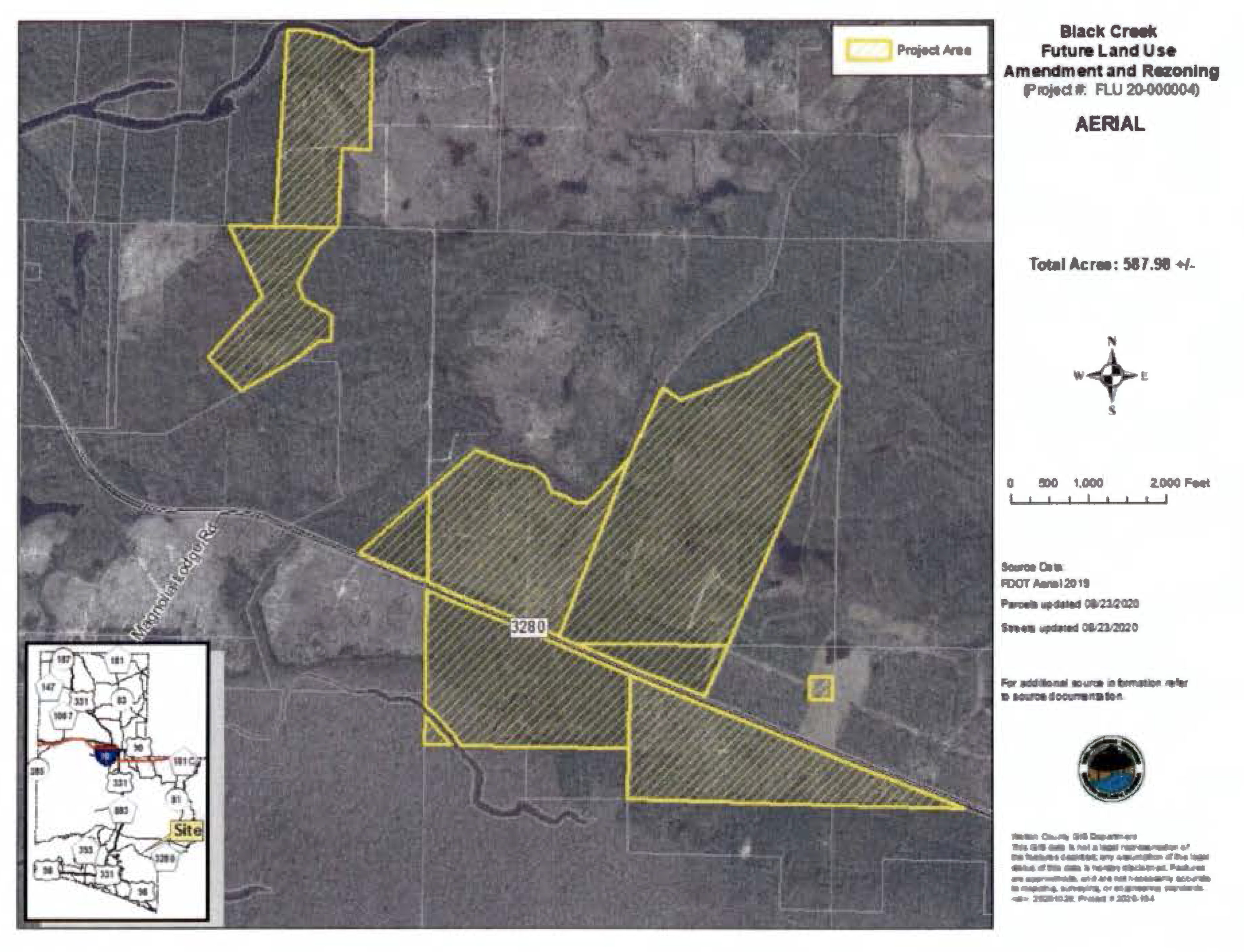
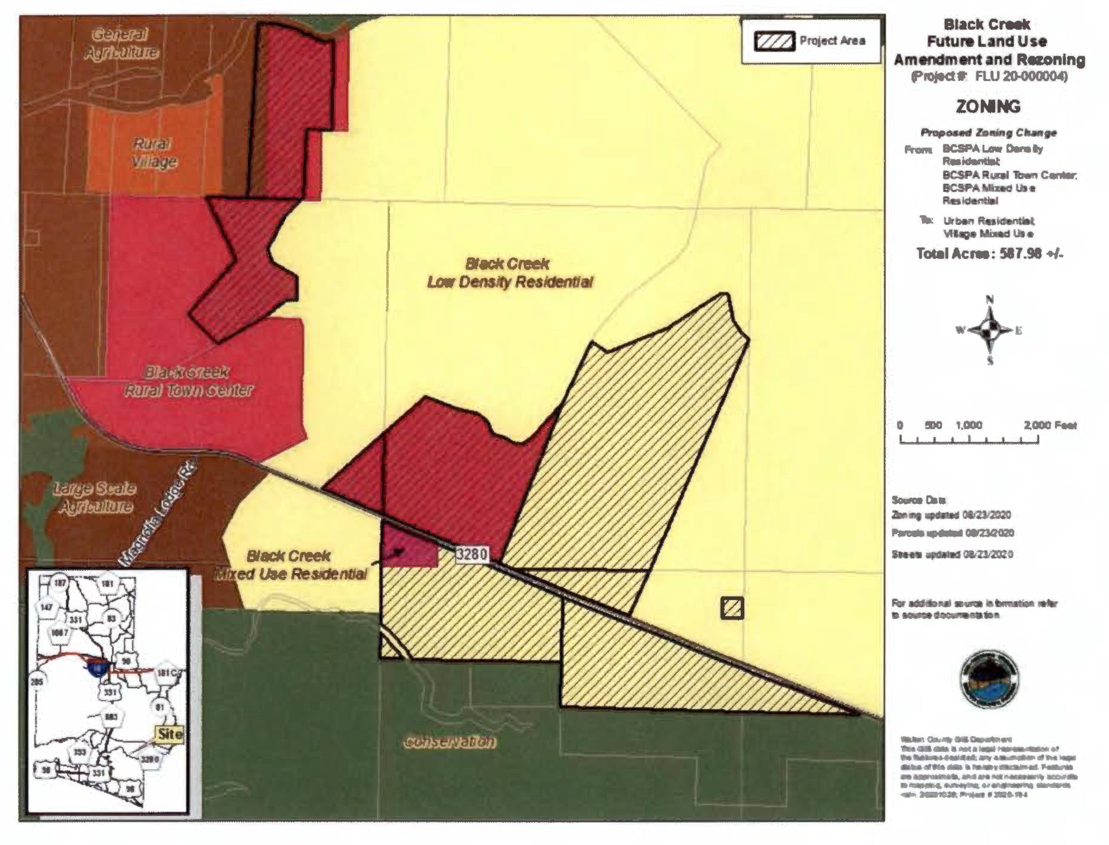
(Ord. No. 2018-29, § II(Att. A), 12-11-18; Ord. No. 2019-19, § II(Att. A), 9-10-19; Ord. No. 2021-21, § I, 7-13-21; Ord. No. 2021-33, § II, 11-9-21)
2.02.11. - Residential Preservation (RP).
This district consists primarily of subdivisions existing as of November 7, 1996, approved development projects which are vested or built out, or recorded platted subdivisions that have infrastructure in place and are substantially built out.
A.
Location Criteria: The intent of this district is to protect the integrity of existing residential subdivisions, therefore it is located predominately where existing residential subdivisions are present.
B.
Primary Uses Allowed:
1.
Development within RP areas is limited to the uses shown in the approved plat or development order for the proposed area.
C.
Accessory Uses and Structures Allowed:
1.
Accessory structures and uses in connection with any lawfully existing primary use.
D.
Conditional Uses Allowed: Reserved.
E.
Residential Density Allowed: Unless specified otherwise on a previously approved development order, the maximum allowable residential density within an area designated RP shall be one (1) dwelling unit per platted lot. The reconfiguration of existing platted lots for sale which does not require a minor re-subdivision as defined in this Code, shall be allowed only to the extent that this stated maximum density is not increased for the subject area.
F.
Non-Residential Intensity Allowed:
1.
A maximum FAR of 0.50 (50%) and a maximum ISR of 0.60 (60%).
G.
Special Development Standards:
1.
Non-residential uses are not allowed in this district, unless part of a previously approved plat or development order.
2.
Development within the Residential Preservation District is limited to the type (residential, commercial, etc.), density, and intensity of development that is shown in the approved recorded plat, unexpired development order, or unexpired covenants and restrictions that were duly recorded before November 7, 1996.
3.
Neighborhood-commercial projects that were constructed prior to June 1975 may rebuild to their original footprint and height configurations and uses if they are destroyed by fire, hurricane, or other catastrophe.
4.
Neighborhood commercial projects are subject to public hearings and review by the Planning Commission and by the Board of County Commission (reviewed as a Major Development).
5.
Neighborhood-commercial development shall be required to submit a building design that ensures harmony of scale and character with surrounding development, including but not limited to façade articulation, consideration of building and parking orientation, and neighborhood compatible windows, building materials, and other architectural features.
6.
Neighborhood-commercial projects must abut paved roadways and are prohibited on interior streets in residential subdivisions.
(Ord. No. 2018-29, § II(Att. A), 12-11-18)
2.02.12. - Low Density Residential 1 Unit/0.5 acres (LDR 1/0.5).
This district is intended to provide for single-family residential at low density.
A.
Location Criteria: This zoning district is applicable to all Planning Areas.
B.
Primary Uses Allowed:
1.
Single-family residential, detached.
2.
Short term vacation rental units, detached.
C.
Accessory Uses and Structures Allowed:
1.
Accessory structures and uses in connection with any lawfully existing primary use.
D.
Conditional Uses Allowed: None.
E.
Residential Density Allowed:
1.
Gross density shall not exceed one (1) unit per half-acre (0.5) acres.
F.
Non-Residential Intensity Allowed: None.
G.
Special Development Standards: Clustering is encouraged, and may be required by the County, to protect significant habitat and wetlands and to avoid other areas of environmental concern.
(Ord. No. 2018-29, § II(Att. A), 12-11-18)
2.02.13. - Low Density Residential 4 Units/1 acre (LDR 4/1).
This district is intended to provide for single-family residential at low density.
A.
Location Criteria: This zoning district is applicable to all Planning Areas.
B.
Primary Uses Allowed:
1.
Single-family residential, attached;
2.
Single-family residential, detached;
3.
Short-term vacation rental units, attached;
4.
Short-term vacation rental units, detached.
C.
Accessory Uses and Structures Allowed:
1.
Accessory structures and uses in connection with any lawfully existing primary use.
D.
Conditional Uses Allowed: None.
E.
Residential Density Allowed:
1.
Gross density shall not exceed four (4) units per one (1) acre with central water and sewer. Clustering is encouraged, and may be required by the County, to protect significant habitat and wetlands and to avoid other areas of environmental concern.
F.
Non-Residential Intensity Allowed: None.
G.
Special Development Standards: None.
(Ord. No. 2018-29, § II(Att. A), 12-11-18; Ord. No. 2019-19, § II(Att. A), 9-10-19)
2.02.14. - Neighborhood Infill (NI).
This district is designed to facilitate compatible development of unplatted or vacant parcels that total ten (10) contiguous acres or less within areas where the majority of the adjacent or surrounding land has been developed.
A.
Location criteria: Assigned to areas of undeveloped, un-platted or vacant parcels surrounded by existing development on two or more sides.
B.
Primary Uses Allowed:
1.
Single family residential, attached shall be governed by Section G;
2.
Single family residential, detached shall be governed by Section G;
3.
Short term vacation rental units, attached shall be governed by Section G;
4.
Short term vacation rental units, detached shall be governed by Section G;
5.
Multi-family residential uses shall be governed by Section G;
6.
Parks and passive recreation uses governed by Section G;
7.
Neighborhood commercial uses shall be governed by Section G;
8.
Professional Service/Office uses shall be governed by Section G;
9.
Live/work uses shall be governed by Section G;
10.
Artisanal uses shall be governed by Section G.
C.
Accessory Uses and Structures Allowed:
1.
Accessory structures and uses in connection with any lawfully existing primary use.
D.
Conditional Uses Allowed:
1.
Civic uses subject to the special development standards found within subsection G below.
E.
Residential Density Allowed:
1.
Densities ranging from two (2) dwelling units per one (1) acre up to eight (8) dwelling units per one (1) acre, subject to Section G.
F.
Nonresidential Intensity Allowed:
1.
Non-residential Intensity allowed: A maximum FAR of 0.50 (50%) and a maximum ISR of 0.60 (60%).
G.
Special Development Standards:
1.
New development must show its compatibility with the neighborhood it infills, including the neighborhood's ultimate size, boundary, and center, and shall be functionally related to the existing pattern of development for that neighborhood and be compatible with any existing development plan. The density and intensity of the proposed development must be compatible with the surrounding densities and intensities through comparable density or intensity or design. In order to determine the compatibility of the proposed development with the adjacent land uses, buildings, structures, developments, and the surrounding neighborhood, the following shall be considered:
a.
That proposed structures for residential and non-residential development complement the predominant features of the surrounding neighborhood as defined by building orientation, building setbacks, building heights, and general building type, materials, architectural features, and style;
b.
That the proposed development complements the fundamental development pattern of the surrounding neighborhood, considering lot area, lot dimensions, and lot configuration, as well as the pattern and spacing of lots and orientation of buildings;
c.
That the proposed development is consistent with the extent, design, and location of parking, parking access drives, service areas, outside storage, landscaping, and other site features of the surrounding neighborhood, including but not limited to setbacks, buffers, fences, wall, and open space;
d.
That the hours of operation of proposed non-residential development will be compatible with the hours of operation of the surrounding non-residential uses, if applicable;
e.
That the proposed development will not create adverse impacts from noise, smoke, exhaust, emissions, dust, lighting, vibration, or odors that are detrimental to the reasonable use or quiet enjoyment of existing development in the surrounding neighborhood; and
2.
The County may require that any or all of the following techniques be used in a proposed development to wholly or partially mitigate incompatible impacts:
a.
Variable buffers, combining land and landscaping to achieve adequate separation of uses, appropriate open space, reduction of potential noise, light, glare, and/or pollution, and screening of physical features of a proposed development;
b.
Variable setbacks, based upon degree of difference in proposed density, intensity, scale, mass, or height;
c.
Placement and effective screening or shielding of site features such as lights, signs, dumpsters, loading areas, parking areas, outdoor storage, or other features with potential negative impacts;
d.
Effective transitions of on-site densities, intensities, scale, mass, or height;
e.
Other innovative site design features that effectively achieve compatibility and effectively mitigate potential negative impacts.
3.
New Commercial projects permitted after November 11, 1999, shall be limited to neighborhood commercial uses as defined in Section 2.03.00.A. Any proposal for expansion of an existing commercial use shall be subject to a detailed plan, including buffers between incompatible uses, interconnections between adjacent parking and access facilities, submission and approvals of a description of all uses including scale and character adjacent to the proposed expansion.
4.
Infill projects must conform with the following, as applicable:
a.
Native vegetation must be re-established in the buffer areas of the US 98/331 Scenic Corridor.
b.
Residential projects within the US 98/331 Scenic Corridor must meet landscaping requirements of the US 98/331 Scenic Corridor Standards.
c.
Residential projects within 300 feet of CR 30A must have bike path connectors.
d.
Drought-tolerant plant species must be used for landscaping within the Scenic 30A Corridor buffer.
e.
New residential developments in the US 331/98 Corridor and the Scenic 30A Corridor must have sidewalks on both sides of new residential streets.
f.
To promote a traffic grid pattern, streets in new residential subdivisions must be coordinated with and interconnected to the street system of the surrounding area.
g.
New infill development south of CR-30A that is adjacent to [a] single-family residence must set back an additional 10 feet for each story greater than that of the existing single-family residence.
h.
To promote the compatibility of new infill projects with existing development, the developer must hold a community meeting that will take place following a pre-application conference with the County and before submitting a development order application. Planning Department staff shall be invited to attend this meeting. Topics covered in community meetings may include — but not be limited to — building heights, building setbacks, and architectural compatibility.
5.
Development transitioning from lower intensities to higher intensities may require additional buffering from adjacent developments to meet compatibility as prescribed in Chapter 5.
(Ord. No. 2018-29, § II(Att. A), 12-11-18; Ord. No. 2019-19, § II(Att. A), 9-10-19)
2.02.15. - General Commercial (GC).
The General Commercial District is intended to provide for general commercial uses that serve the larger community and the traveling public. This category permits a broad range of commercial operations and services.
A.
Location criteria:
1.
North, North Central, South Central Walton, and South Walton — The GC Zoning District shall be located on parcels or lots fronting arterials and major collectors or at intersections of major/minor collectors and arterials unless part of an overall master plan of development. For new GC zoning districts, the proposed location, uses, and development must be compatible with the character and size of the site and the surrounding areas.
B.
Primary Uses Allowed:
1.
Lodging and accommodations;
2.
Civic uses;
3.
Public uses;
4.
General commercial uses;
5.
Neighborhood commercial uses;
6.
Professional service/office uses;
7.
Artisanal uses;
8.
Live/work uses;
9.
Workplace uses;
10.
Mobile home parks that are licensed by the Florida Department of Health and Rehabilitative Services are considered commercial developments and are to be reviewed as such. A maximum of 12 mobile home units per acre are allowed within any mobile home park;
11.
Vertical mixed use: Up to 17 multi-family residential dwelling units per one acre are permitted provided that such units are a located above a ground floor commercial use. Residential uses are subject to the requirements of Section D below;
12.
Communication towers subject to the limitations and approval process provided in Subsection 5.07.10 and 5.00.04 of this Code.
C.
Accessory Uses and Structures Allowed:
1.
Accessory structures and uses in connection with any lawfully existing primary use.
D.
Conditional Uses Allowed:
1.
Multi-family residential: In order to facilitate the development of workforce and affordable long-term rental housing multi-family apartment complexes may be authorized within a GC district, subject to the following restrictions:
a.
Multi-family residential uses are a high density conditional use that require, at a minimum, a showing of need, compatibility with adjacent land uses, and the necessary supporting infrastructure;
b.
Multifamily residential uses may be developed at a density of up to 17 dwelling units per acre.
c.
At least 20 percent of the dwelling units shall be dedicated for extremely low income, very low income, low income, workforce, and/or moderate income housing
2.
Commercial outdoor amusements subject to the following:
a.
Such uses are not permitted on any parcel located within any designated Scenic Corridor overlay district as described in chapter 6 of this Code.
b.
Such uses must provide for enhanced landscaping and buffering beyond what is required elsewhere in this Code.
E.
Reserved.
F.
Nonresidential Intensity Allowed:
1.
A maximum FAR of 1.00 (100%) and a maximum ISR of 0.85 (85%).
G.
Special Development Standards:
1.
General Commercial developments must be served by central water and sewer facilities;
2.
All development within this zoning district shall provide for safe and efficient access and shall be required to meet State and County access management design standards for appropriate driveway spacing, interconnections with adjacent parcels, and shared access to collector and arterial roads.
3.
Standards and regulations for compatibility, landscaping, vehicular and pedestrian access, traffic circulation, signage, and building and parking lot orientation contained elsewhere in this Code may be applicable to developments within this district.
(Ord. No. 2018-29, § II(Att. A), 12-11-18; Ord. No. 2019-19, § II(Att. A), 9-10-19; Ord. No. 2021-33, § II, 11-9-21)
2.02.16. - Neighborhood Commercial (NC).
The purpose of this district is to designate small areas in proximity to residential areas that will allow for a limited group of commercial uses to serve the needs of those residential areas. All neighborhood commercial uses must be designed in use, scale, character, and intensity to be compatible with, and to protect, the abutting and surrounding residential areas.
A.
Location Criteria: This zoning district is applicable to all Planning Areas along arterials, major/minor collectors and at the intersection of arterial/collector, collector/collector, and collector/local paved streets unless part of an overall master plan of development.
B.
Primary Uses Allowed:
1.
Civic uses;
2.
Bed and breakfast uses;
3.
Neighborhood commercial uses;
4.
Professional service/office uses;
5.
Live/work uses;
6.
Artisanal uses.
C.
Accessory Uses Allowed:
1.
Accessory structures and uses in connection with any lawfully existing primary use.
D.
Conditional Uses Allowed: Reserved
E.
Residential Density Allowed:
1.
Maximum of one (1) dwelling unit per lot of record as of November 7, 1996, unless developed pursuant to Section G, below.
F.
Nonresidential Intensity Allowed:
1.
A maximum FAR of 0.65 (65%) and a maximum ISR of 0.60 (60%).
G.
Special Development Standards:
1.
Live/Work uses are encouraged, so long as the overall density for the development does not exceed four (4) dwelling units per one (1) acre and the development must be in scale and character of adjacent residential areas.
2.
Outdoor storage, outdoor broadcasting or music, and any outdoor display of goods is expressly prohibited.
3.
Size, mass, or scale of uses or structures shall be limited to ensure compatibility with adjacent and surrounding neighborhood. In addition, compatibility must be considered through building design specifically including articulation of the building façade, roof design, compatible building materials which exclude entirely metal facades and other materials not conducive to the preservation of surrounding residential uses, primary entrance design, and glazing.
a.
The following glazing and façade relief requirements shall be required for neighborhood commercial uses located along major pedestrian corridors on the façade facing the principal street:
i.
Minimum of 40% glazing is required on the first floor (below 10 feet).
ii.
Minimum of 25% glazing on the second floor (between 10 feet and 30 feet).
b.
For all other building frontages - minimum of 25% glazing of the area between two feet and ten feet
(Ord. No. 2018-29, § II(Att. A), 12-11-18; Ord. No. 2019-19, § II(Att. A), 9-10-19)
2.02.17. - Business Park (BP).
This district is intended to provide a wide range of business, office, commercial, professional services, and manufacturing, and supporting civic, institutional, recreational, infrastructure, and open space uses and activities arranged within a contiguous campus setting.
A.
Location Criteria: This zoning district is applicable to all Planning Areas.
Developments within this district are intended to be located with primary access to arterial highways or major collector roadways with limitations on access provided to minimize traffic congestion and to control traffic impacts within each development.
To limit linear strip development and to provide for access management along thoroughfares, commercial uses shall be located totally within business park campuses or in activity centers within a maximum of 1,320 feet on either side of the intersections of arterial and/ or collector roadways.
B.
Primary Uses Allowed (Commercial and Light Industrial):
1.
Lodging and accommodations;
2.
Civic uses;
3.
Public uses;
4.
General commercial uses;
5.
Parks and passive recreation uses;
6.
Active recreation uses;
7.
Neighborhood commercial uses;
8.
Professional service/office uses;
9.
Artisanal uses;
10.
Workplace uses;
11.
Light industrial uses;
12.
Communication towers subject to the limitations and approval process provided in Subsection 5.07.10 and 5.00.04 of this Code.
C.
Accessory Uses and Structures Allowed:
1.
Supporting infrastructure, recreation, open space and green space may be included within these parks.
D.
Conditional Uses Allowed: Reserved.
E.
Residential Density Allowed:
1.
No maximum or minimum residential density is assigned to this zoning district.
F.
Nonresidential Intensity Allowed:
1.
The intensity of use on any individual development site shall not exceed 2.0 FAR (200%) and an ISR of 0.85 (85%).
G.
Special Development Standards:
1.
Business Park areas shall have a minimum of 10 contiguous acres.
2.
Uses within the Business Park district will be required to provide buffers when adjacent to any residential use. To ensure a compatible mix of uses, landscaped buffers shall be required between the Business Park uses and any adjacent residential uses. The buffer shall be at least 20 feet in width and include an opaque fence or wall. Interior storage yards shall be fenced and screened to minimize visual and noise impacts.
3.
In order to foster a park-like environment, where vehicles and pedestrians can move freely within the project boundary, uses shall be connected by an internal network of roads and sidewalks.
(Ord. No. 2018-29, § II(Att. A), 12-11-18; Ord. No. 2019-19, § II(Att. A), 9-10-19)
2.02.18. - Small Neighborhood (SN).
This district is intended for areas transitioning from fragmented developments to an area with higher density and a mixed use core that will facilitate neighborhood continuity. Each Small Neighborhood shall provide for a mixture of uses to encourage economic diversity and sustainability within the area, promote the future viability of the neighborhood, and encourage a walking and bicycle-friendly design to conserve energy and reduce emissions.
A.
Location Criteria: This zoning district is applicable to the North Central, South Central and South Walton Planning Areas. Requires a minimum of ten (10) and a maximum of forty (40) contiguous acres. An area proposed for SN designation must have existing development on at least one side, be connected, or have direct access, to an arterial or collector, and include sufficient infrastructure and utilities to support a small community.
B.
Primary Uses Allowed within this Category:
1.
Single family residential, attached;
2.
Single family residential, detached;
3.
Short term vacation rental units, attached;
4.
Short term vacation rental units, detached;
5.
Multi-family residential;
6.
Civic uses;
7.
Parks and passive recreation uses;
8.
Neighborhood commercial uses subject to Section G;
9.
Professional service/office uses;
10.
Live/work uses;
11.
Artisanal uses.
C.
Accessory Uses Allowed:
1.
Accessory structures and uses in connection with any lawfully existing primary use.
D.
Conditional Uses Allowed: Reserved.
E.
Residential Density Allowed: The maximum residential density for this zoning district is four dwelling units per one acre or up to ten dwelling units per acre subject Section G below.
F.
Nonresidential Intensity Allowed:
1.
The intensity of non-residential uses within this category shall not exceed a floor to area ratio of 50 percent (0.5 FAR) and a maximum ISR of 60 percent (0.60 ISR).
G.
Special Development Standards:
1.
Mixed use Small Neighborhood projects shall submit a detailed plan to demonstrate effective alternatives to buffering and separation of land uses, such as street alignment, design and orientation, screening, pedestrian continuity, building articulation and building heights at the edge of the project.
2.
Small Neighborhood project shall be pedestrian in scale and shall facilitate and encourage pedestrian use. The placement of residential and commercial land uses shall be such that pedestrian rather than vehicular access to commercial uses is facilitated and encouraged.
3.
Residential units may be constructed over the commercial buildings.
4.
Commercial uses are limited to neighborhood commercial uses and shall comprise a minimum of five percent (5%) and a maximum of fifty percent (50%) of any Small Neighborhood development project.
5.
Civic, recreational or community facilities and services shall comprise a minimum of one percent (1%) of any Small Neighborhood development project.
6.
Small Neighborhood developments must be served by central water and sewer.
7.
For new development projects on existing SN parcels of less than five (5) acres as of June 13, 2014, the requirement for a mixture of uses may be waived for single use projects (residential, neighborhood commercial, recreational or community facilities and services) on these parcels. In the case of a single use residential development the maximum residential density shall be four (4) dwelling units per acre.
8.
An additional six (6) dwelling units per acre above the base density of four (4) dwelling units per acre may be achieved for projects achieving a mixture of land uses and that utilize a form based code or urban design code and the Planned Unit Development process. Such projects may include design features such as a grid street pattern, alleyways, bicycle and pedestrian facilities and connections, functional public space, civic uses, vertical or horizontal mixed uses, public beach access, and/or innovative green design or environmental preservation techniques beyond what is currently required. Such projects shall at a minimum ensure that buildings and landscaping contribute to the physical definition of streets as public places and that development adequately accommodates vehicles and/or transit while respecting the pedestrian and the spatial form of human scaled public areas.
(Ord. No. 2018-29, § II(Att. A), 12-11-18; Ord. No. 2019-19, § II(Att. A), 9-10-19)
2.02.19. - Traditional Neighborhood Development (TND).
This district provides for flexibility in design that will create vibrant walkable, accessible, and distinctive neighborhoods with densities and intensities that can support transit-oriented development and multimodal transportation alternatives. This district is intended to allow for traditional neighborhood design including a mix of residential types and non-residential uses relating to integrated public space such as town centers and public squares. The intent of the category is to allow compact, human scale development with varying residential types, lot sizes, and lot dimensions with supporting neighborhood and general commercial uses, civic uses, and public uses. New developments within this district shall create and utilize a form based code or urban design code and utilize the PUD process in order to achieve the necessary densities and intensities of development.
A.
Location Criteria: This zoning district is applicable to the South, North Central and South Central Planning Areas. Traditional Neighborhood development projects may consist of undeveloped, unplatted or redevelopment parcels.
B.
Primary Uses Allowed and Use Mix Required:
1.
Any Plan for a Traditional Neighborhood Development Project must be based upon a mix of the following primary uses and must comply with the related use criteria below:
a.
Active Recreation, parks and passive recreation and, open space:
i.
Each Plan must provide for a minimum of five (5) percent of the development area to be designated for recreation, open space and/or community facilities and services uses.
ii.
Each Plan must contain at least one (1) public square, close to the geographic center of the Plan.
b.
Civic Use:
i.
Each Plan must provide for a minimum of two (2) percent (2%) and a maximum of 15 percent (15%) of the project area to be designated for Civic uses. Ideally, these civic uses should be within or adjacent to squares and parks or on a lot terminating a street vista.
c.
Workplace and artisanal:
i.
These uses shall only be allowed if they are of a neighborhood scale and neighborhood character.
ii.
There shall be no outdoor storage, bulk storage, or storage of hazardous materials allowed.
iii.
Such uses shall create no off-site impacts with regard to noise, particulate matter, vibration, odor, fumes, glare and fire hazard.
iv.
Each Plan must provide for a minimum of one (1) percent (1%) and may allow up to a maximum of 25 percent (25%) of the project area to be designated in Workplace uses.
v.
Each Plan should provide for off-street parking which is to the side or rear of the buildings.
d.
Neighborhood and general commercial:
i.
Each Plan must provide for a minimum of two percent, and may provide up to a maximum of 40 percent of the project area in neighborhood or general commercial uses.
ii.
Each Plan must designate at least 25 percent of the building area for residential uses, unless the site is less than two acres.
iii.
Each Plan must include front streets with parallel parking and sidewalks.
iv.
Each Plan should provide for off-street parking to the side or rear of the buildings and may provide for parking to be shared with other uses.
v.
A Plan may provide for limited lodging facilities (125 rooms or less including full services, such as supporting restaurant use) as a part of this use category.
vi.
Heights may not exceed four stories above ground level.
vii.
Entertainment and recreational uses, without outdoor broadcasting or music, are allowed.
e.
Single family residential attached, multifamily residential (Also includes short term vacation rental units attached and multifamily):
i.
Each Plan may designate up to a maximum of 60 percent of the entire project area for multifamily residential uses.
ii.
Buildings in areas designated for these uses may have limited office and retail uses, cafes, limited lodging and artisanal uses on the ground floor. All building areas above the ground floor must be designated for residential use.
iii.
These uses require front streets with parallel parking and sidewalks.
iv.
These uses require all off-street parking to be located behind the buildings except for on-street parallel parking.
v.
Building heights are limited to three stories above ground level for townhouses and/or four stories above ground level for small apartments.
f.
Single Family residential, detached (Also includes short term vacation rental units, detached):
i.
Each Plan can designate up to 60 percent of the Neighborhood area as single family houses.
ii.
Home occupation uses which comply with the provisions of this Code are allowable if located on the ground floor.
iii.
Single family houses and lots must face streets with a sidewalks on both sides of the street unless designed with alleys. Parallel parking is optional.
iv.
All off-street parking related to single family houses shall be to the side or rear of the building. In cases where access is from the front, garages and/or carports shall be located a minimum of 20 feet behind the building facade.
v.
Outbuildings of no greater than 800 square feet in size are allowed. If a different size is specified in the applicable form based code that size will control.
g.
Live/work uses designed as such.
C.
Accessory Uses Allowed:
1.
Accessory structures and uses in connection with any lawfully existing primary use.
D.
Conditional Uses Allowed: Reserved.
E.
Residential Density Allowed: The maximum residential density for the Traditional Neighborhood Development district shall be thirty (30) dwelling units per acre.
F.
Nonresidential Intensity Allowed:
1.
The maximum nonresidential intensity shall be 2.00 FAR (200%) and maximum ISR of 0.85 (85%).
G.
Special Development Standards:
1.
Refer to Section B. Also for new development projects on existing parcels designated Traditional Neighborhood Development (TND) that are less than five (5) acres as of June 13, 2014, the requirements for a mixture of uses may be waived for single use projects except that in these cases residential density is limited to ten (10) dwelling units per acre and non-residential uses shall be limited to neighborhood commercial uses.
(Ord. No. 2018-29, § II(Att. A), 12-11-18; Ord. No. 2019-19, § II(Att. A), 9-10-19)
2.02.20. - Coastal Center (CC).
This district is primarily residential, allowing medium residential densities and supporting uses. All development is required to be connected to a public water and sewer system.
A.
Location Criteria: New Coastal Center zoning district designations are applicable within the South Walton Planning Area within the US Highway 98 and US Highway 331 Scenic Corridor Overlay District Areas.
B.
Primary Uses Allowed:
1.
Single-family residential, attached;
2.
Single-family residential, detached;
3.
Short-term vacation rental units, attached;
4.
Short-term vacation rental units, detached;
5.
Multi-family residential;
6.
Civic uses;
7.
Artisanal uses;
8.
Professional service/office uses;
9.
Artisanal uses;
10.
General and neighborhood commercial uses allowed limited to the specified (below) retail, indoor entertainment, restaurant, services and lodging. There shall be no outdoor entertainment or broadcasting. In order to prevent visual blight from all roadways and neighborhoods, no outdoor storage is permitted without an adequate screening plan being approved as a condition of a development plan within the coastal center category. Outdoor display of retail items is permitted during business hours. Commercial uses are specified as the following:
a.
Retail sales stores, such as shoe stores, clothing stores, home accessories and furnishings, pharmacies, florist, bookstores, and the like.
b.
Sports clubs.
c.
Fitness centers.
d.
Dance schools and other performing arts.
e.
Small indoor theaters.
f.
Dinner clubs/lounges.
g.
Restaurants (standard sit-down without drive-up facilities).
h.
Garden supply, vehicle parts and accessories (but specifically excluding vehicle sales/service/repair).
i.
Specialty food stores (such as meat markets, delicatessens and bakeries).
j.
Service businesses such as blueprint, printing, catering, tailoring, travel agencies, upholstery shops, local laundromat/dry cleaners, and light mechanical repair stores (such as camera, TV, or bicycle repair shops).
k.
Professional office uses such as accountants, attorneys, engineers, doctors, financial institutions, and the like.
l.
Limited lodging (125 rooms or less) including full services, such as supporting restaurant use).
C.
Accessory Uses Allowed:
1.
Accessory structures and uses in connection with any lawfully existing primary use.
D.
Conditional Uses Allowed:
1.
Communication towers subject to the limitations and approval process provided in Subsections 5.07.10 and 5.00.04 of this Code.
E.
Residential Density Allowed: The maximum allowable density for residential development in this district is eight (8) units per acre (8 units/1 acre), except for the 30 acres of property fronting on the Gulf between Deer Lake and Camp Creek Lake, and property located south of CR 30A, which shall have a maximum residential density of 12 dwelling units per one (1) acre pursuant to the Consent Amended Final Judgment, Topsail and Deer Lake, as stipulated in Court in Case No. 94-923-CA.
F.
Nonresidential Intensity Allowed: Commercial development within this district shall have a maximum floor area ratio of 1.5 (150%) and an impervious surface ratio of 0.85 (85%).
G.
Special Development Standards:
1.
Mixed Use Requirement:
a.
Development projects of 40 acres or more shall be required to include a minimum of three of the allowed uses described in part B, and shall include a minimum of ten percent and not more than 35 percent (35%) non-residential uses.
b.
New development projects that are less than forty (40) acres but greater than five (5) acres shall be required to have a minimum mix of two (2) of the uses described in part B, one of which shall be residential, with a maximum residential use of seventy percent (70%) of the proposed project land area.
c.
For new development projects on existing Coastal Center parcels of less than five (5) acres as of June 13, 2014, the requirement for a mixture of uses may be waived.
2.
Each parcel or lot, except single-family, with a public street frontage shall provide vehicular connections to abutting lots to limit access impacts on US 98 and US 331.
3.
Drive-through businesses in the Coastal Center land use district are restricted to financial institutions where the business is located on US 98 or US 331, and are subject to the following restrictions:
a.
Drive through facilities may only be permitted as an accessory use to an existing primary development;
b.
No drive-through facility shall be permitted within 100 feet of either an existing residential use or a vacant lot with a zoning district that limits the allowable use to single-family homes. This setback shall be measured from the outer limit of the drive-through facility to the nearest common property boundary between the financial institution and the residential use;
c.
All drive through facilities must provide a minimum 25-foot landscape buffer between the drive-through and any adjacent residential use;
d.
Drive-through facilities must provide a landscape buffer from the scenic corridor per the Walton County Scenic Corridor Guidelines, as provided in Chapter 6 of this Code, if this buffer has not already been provided;
e.
All drive-through facilities must be accessed from US 98 or US 331, and may not allow access from adjacent residential streets;
f.
All drive-through facilities shall be subject to a compatibility review that shall require the applicant to demonstrate the following:
i.
The proposed non-residential structure must complement the predominant features of the surrounding neighborhood as defined by building orientation, building setbacks, building heights, and general building type and style;
ii.
The proposed drive-through is consistent with the extent, design, and location of parking, parking access drives, drive through access drives, service areas, outside storage, landscaping and other site features of the surrounding neighborhood, including but not limited to setbacks, buffers, fences, walls, and open space;
iii.
The hours of operation will be compatible with the hours of operation of the surrounding non-residential uses and with adjacent residential development;
iv.
The proposed drive-through will not create adverse impacts from noise, smoke, exhaust, emissions, dust, lighting, vibration, or odors that are detrimental to the reasonable use or quiet enjoyment of existing development in the surrounding neighborhood.
g.
For purposes of the required compatibility review, "surrounding neighborhood" shall be construed as the subdivisions or other developments within ¼ mile of the development site, with the strongest consideration given to those subdivisions or other developments that are adjacent to the proposed drive-through.
h.
The County may require that any or all of the following techniques be used in conjunction with a proposed drive-through to wholly or partially mitigate adverse impacts:
i.
Variable buffers, combining land and landscaping to achieve adequate separation of uses, appropriate open space, reduction of potential noise, light, glare, and/or pollution, and screening of physical features of a proposed development;
ii.
Variable setbacks, based upon number of proposed drive-through lanes, intensity of expected drive-through traffic, intensity, scale, mass, or height;
iii.
Placement and effective screening or shielding of site features such as lights, signs, parking areas, stacking areas, or other features with potential negative impacts;
iv.
Other innovative site design features that effectively achieve compatibility and effectively mitigate potential negative impacts.
(Ord. No. 2018-29, § II(Att. A), 12-11-18; Ord. No. 2019-19, § II(Att. A), 9-10-19)
2.02.21. - Coastal Center Mixed Use (CCMU).
This district supports economic development by providing a specific, defined location where multiple opportunities for working, shopping, entertainment, lodging and living are provided.
A.
Location Criteria: This zoning district is applicable to the South Walton Planning Area.
B.
Primary Uses Allowed:
1.
Single family residential, attached;
2.
Short term vacation rental unit, attached;
3.
Single family residential, detached;
4.
Short term vacation rental, detached;
5.
Multi-family residential;
6.
Lodging and accommodations;
7.
Civic uses;
8.
Parks and passive recreation uses;
9.
General commercial uses;
10.
Neighborhood commercial uses;
11.
Professional service/office uses;
12.
Live/work uses;
13.
Artisanal uses.
C.
Accessory Uses Allowed:
1.
Accessory structures and uses in connection with any lawfully existing primary use.
D.
Conditional Uses Allowed:
1.
Communication towers subject to the limitations and approval process provided in Subsection 5.07.10 and 5.00.04 of this Code.
E.
Residential Density Allowed:
1.
The maximum base density for this zoning district is four (4) dwelling units per one (1) acre, or up to 12 units per one (1) acre through innovative community design.
F.
Nonresidential Density Allowed:
1.
The maximum intensities of site development for this district are a floor to area ratio of 2.00 (200%) and an impervious surface ratio of 0.85 (85%).
G.
Special Development Standards:
1.
Maximum height of four (4) stories above ground level.
2.
The scale and uses at the edge shall be compatible with the abutting land uses.
3.
Allowed limited Lodging (125 rooms or less) includes hotels, motels, inns and bed and breakfasts.
4.
Each parcel or lot, except for single-family, shall provide vehicular connections to abutting lots as a way of limiting traffic congestion.
5.
An additional eight (8) dwelling units per acre above the base density of four (4) dwelling units per acre may be achieved for projects achieving a mixture of land uses and that utilize a form based code or urban design code and the Planned Unit Development process. Such projects may include design features such as a grid street pattern, alleyways, bicycle and pedestrian facilities and connections, functional public space, civic uses, vertical or horizontal mixed uses, public beach access, and/or innovative green design or environmental preservation techniques beyond what is currently required. Such projects shall at a minimum ensure that buildings and landscaping contribute to the physical definition of streets as public places and that development adequately accommodates vehicles and/or transit while respecting the pedestrian and the spatial form of human scaled public areas.
6.
Commercial outdoor amusement uses are specifically prohibited in this district.
(Ord. No. 2018-29, § II(Att. A), 12-11-18; Ord. No. 2019-19, § II(Att. A), 9-10-19)
2.02.22. - Coastal Village (CV-1).
This district is intended to provide a location where opportunities may occur for working, shopping, lodging, recreation and entertainment, and living. Coastal Village activity centers are intended to create a sense of place and identity. The Coastal Village district may serve regional or local needs, providing shopping, professional services, offices, institutional services, or recreational facilities within village centers. A range of uses is anticipated within the district, including mixed-use buildings with commercial and office uses mixed with residential uses. Residential units may be mixed within each block with commercial and office uses. The district permits residential development at a variety of densities up to a maximum of one unit per gross acre.
A.
Location Criteria: This zoning district is applicable to the South Walton Planning Area.
B.
Primary Uses Allowed:
1.
Single family residential, attached;
2.
Short term vacation rental units, attached;
3.
Single family residential units, detached;
4.
Single family residential units, attached;
5.
Multifamily residential;
6.
Civic uses;
7.
Parks and passive recreation uses;
8.
Active recreation uses;
9.
General commercial uses;
10.
Neighborhood commercial uses;
11.
Professional service/office uses;
12.
Artisanal uses.
C.
Accessory Uses Allowed:
1.
Accessory structures and uses in connection with any lawfully existing primary use.
D.
Conditional Uses Allowed: Reserved.
E.
Residential Density Allowed:
1.
The maximum density for residential development is one (1) unit per one (1) acre.
F.
Non-Residential Density Allowed:
1.
The intensity of non-residential uses on an individual non-residential development sites shall not exceed a 0.50 FAR (50%) and a maximum ISR of 0.75 (75%).
G.
Special Development Standards:
1.
Mixture of Uses: Allowable residential and accessory uses as defined in Part B above shall account for 85 percent (85%) to 95 percent (95%) of the gross parcel area designated CV-1. Allowable non-residential uses shall account for five percent (5%) to 15 percent (15%) of the gross parcel designated CV-1. Internal landscaped buffers shall be required between residential uses and non-residential uses, if necessary to achieve compatibility. Neighborhoods shall be designed to be interconnected for vehicular, bicycle, and pedestrian access with minimum impacts to environmentally sensitive lands.
2.
Location Criteria for Commercial Uses: Commercial uses shall be limited to collector and arterial roadway intersections, intersections of subdivision collectors and arterial or collector roads, and areas specifically designated and platted for commercial uses as a part of PUD master plans.
3.
Uses Proximate to Water Bodies: Residential uses, recreational uses, water dependent uses, water-related uses, and ancillary commercial uses are allowed subject to all generally applicable plan policies as further limited by this policy. Recreational uses may include docks piers, footbridges, boardwalks, boat launching ramps, swimming pools, gazebos, picnic areas, playgrounds and ancillary uses. Development within the coastal dune lake protection zone on any coastal dune lake or tributary depicted on the map entitled Walton County Coastal Dune Lake System shall be subject to Section 4.02.03 and to all applicable Comprehensive Plan policies. In designated coastal dune lakes, docks shall not provide permanent mooring for watercraft with internal combustion engines, except for safety/rescue watercraft or water taxis. Fueling, re-fueling and boat repair activities shall be prohibited, except for routine service and maintenance on allowed watercraft.
(Ord. No. 2018-29, § II(Att. A), 12-11-18; Ord. No. 2019-19, § II(Att. A), 9-10-19)
2.02.23. - Village Mixed Use Center (VMU).
This district is intended for small scale mixed use development designed to serve a series of neighborhoods.
A.
Location Criteria: This zoning district is applicable to the South Walton and South Central Walton Planning Areas. The Village Mixed Use Center Future Land Use Category has primarily been located along County Road 30-A, US Highway 331, and US Highway 98. Upon adoption of this amendment, new Village Mixed Use Centers shall only be designated on parcels fronting US Highway 98, SR 20, US Highway 90, or US Highway 331. It is the County's intent to maintain the integrity of the detailed plan of development approved for each VMU center.
B.
Primary Uses Allowed:
1.
Single family residential, attached;
2.
Short term vacation rental units, attached;
3.
Single family residential, detached;
4.
Short term vacation rental units, detached;
5.
Multifamily residential;
6.
VMU Limited Lodging (125 rooms or less) including full services, such as supporting restaurant use);
7.
Civic uses;
8.
Parks and passive recreation uses;
9.
Active recreation uses;
10.
General commercial uses;
11.
Neighborhood commercial uses;
12.
Live/work uses;
13.
Professional service/office uses;
14.
Artisanal uses.
C.
Accessory Uses Allowed:
1.
Accessory structures and uses in connection with any lawfully existing primary use.
D.
Conditional Uses Allowed: Reserved.
E.
Residential Density Allowed: The maximum residential density is 12 units per one (1) acre.
F.
Nonresidential Intensity Allowed:
1.
The maximum intensities of site development for this district are:
a.
For Village Mixed Use projects not located on parcels that front US Highway 98 or US Highway 331 south of the Clyde B. Wells Bridge the maximum floor to area ratio shall be 0.50 (50%) and the maximum impervious surface ratio shall be 0.75 (75%).
b.
For Village Mixed Use projects located on parcels that front US Highway 98 or US Highway 331 south of the Clyde B. Wells Bridge, the maximum floor to area ratio shall be 2.0 (200%) and the maximum impervious surface ratio shall be 0.85 (85%).
G.
Development Standards:
1.
Maximum height of four (4) stories above ground level.
2.
Limited lodging means an inn of no more than one hundred twenty-five (125) rooms and can include full services, such as supporting restaurant use; except in the Route 30A Scenic Corridor, which includes all properties located contiguous to C.R. 30A, C.R. 393, or C.R. 395, or are contiguous to those portions of C.R. 83 and C.R. 283 that are south of U.S. Highway 98 (as described in Chapter 6) and excluding those parcels located within the U.S. Highway 98 Scenic Corridor, where limited lodging means an inn of no more than fifty (50) rooms and can include full services, such as supporting restaurant use.
3.
Village Mixed Use projects must contain urban design amenities such as pedestrian facilities, landscaping, public spaces, and human scale street and parking lot design.
4.
The scale and uses at the edge shall be compatible with abutting neighborhood uses.
5.
The center shall be interconnected whenever practicable and feasible with abutting uses for car and pedestrian linkage.
6.
A detailed plan, including a compatibility analysis, is required that demonstrates urban design and effective alternatives to separation of uses or buffering, such as street alignment, orientation and design, screening, pedestrian continuity, building articulation, building heights at the edge of the project, and controlled window views.
7.
Village Mixed Use projects over three acres in size must contain a mixture of uses including residential and active or passive recreation with the residential component not exceeding 75% of total project area, excluding vertical mixed use building areas. New development projects on existing parcels designated Village Mixed Use (VMU) that are less than three (3) acres as of June 13, 2014, the requirements for a mixture of uses may be waived for single use projects except that in these cases residential density is limited to eight (8) dwelling units per acre and non-residential uses shall be limited to neighborhood commercial uses.
8.
Commercial outdoor amusement uses are specifically prohibited in this district.
9.
Development on properties having the Village Mixed Use Zoning designation within the area formerly known as the Black Creek Special Planning Area, as designated in the subsequent map, shall be limited by the following, in addition to the above. Where there is a conflict, the following shall control:
a.
Residential Density allowed: Maximum of one (1) units per acre, served by septic, consistent with Infrastructure Policy I-2.1.5. Upon connection to central water and sewer, residential density shall not exceed eight (8) dwelling units per acre, for single family and multifamily housing. Multifamily housing, including condominiums, apartment buildings, and townhouses, shall comprise not less than 15% of the development site. Density bonuses for affordable and workforce housing to a maximum of ten (10) units per acre is authorized. Clustering of residential multifamily development is encouraged to facilitate the creation of open space, public squares, parks, and to protect natural resources;
b.
Nonresidential Intensity allowed: Non-residential uses within this category shall be limited to:
i.
Commercial uses, including retail, entertainment, resort, lodging, private marinas, restaurants, services, and other compatible non-residential uses. Intensity of development shall not exceed the maximum FAR of 0.50 (50%) and the maximum ISR of 0.75 (75%). Commercial uses shall comprise not less than 15% of the gross area of the development site;
ii.
Public uses, including squares, parks, golf courses, pools, playgrounds, equestrian centers, public water-dependent uses, and such other amenities, which shall comprise no less than 5% of the gross area of the development site;
iii.
Civic uses, including churches, libraries, meeting halls, schools, government buildings, post offices, and the like, shall comprise no less than 1% of the gross area of the development site;
10.
Additionally, development meeting the location criteria as described in subsection G.9 above, shall be limited by the following:
a.
Special Considerations: To ensure that development is designed to incorporate the constraints and advantages specific to the surrounding area and existing site conditions, including the vegetation, topography, drainage, wildlife, siting, and lighting considerations, every plan of development shall address the following:
i.
The specific uses proposed, lot sizes and location, and lot coverage;
ii.
The internal road network proposed, including road widths and block sizes—Roads shall be designed to retain their rural character and not be designed to the characteristics or standards for suburban commercial or subdivision streets;
iii.
Proposed road and pedestrian interconnections to the abutting neighborhoods
iv.
Proposed parking standards and criteria;
v.
Abutting uses, including scale and character;
vi.
Existing soils, topography and drainage;
vii.
Existing vegetation and wildlife;
viii.
Proposed landscape, buffering, and setback standards;
ix.
Proposed architectural standards and controls;
x.
Proposed lighting standards and controls that preserve the rural character of the area by prohibiting light pollution through sky glow, glare, light trespass, and light clutter;
xi.
Required connection to public water and sewer.
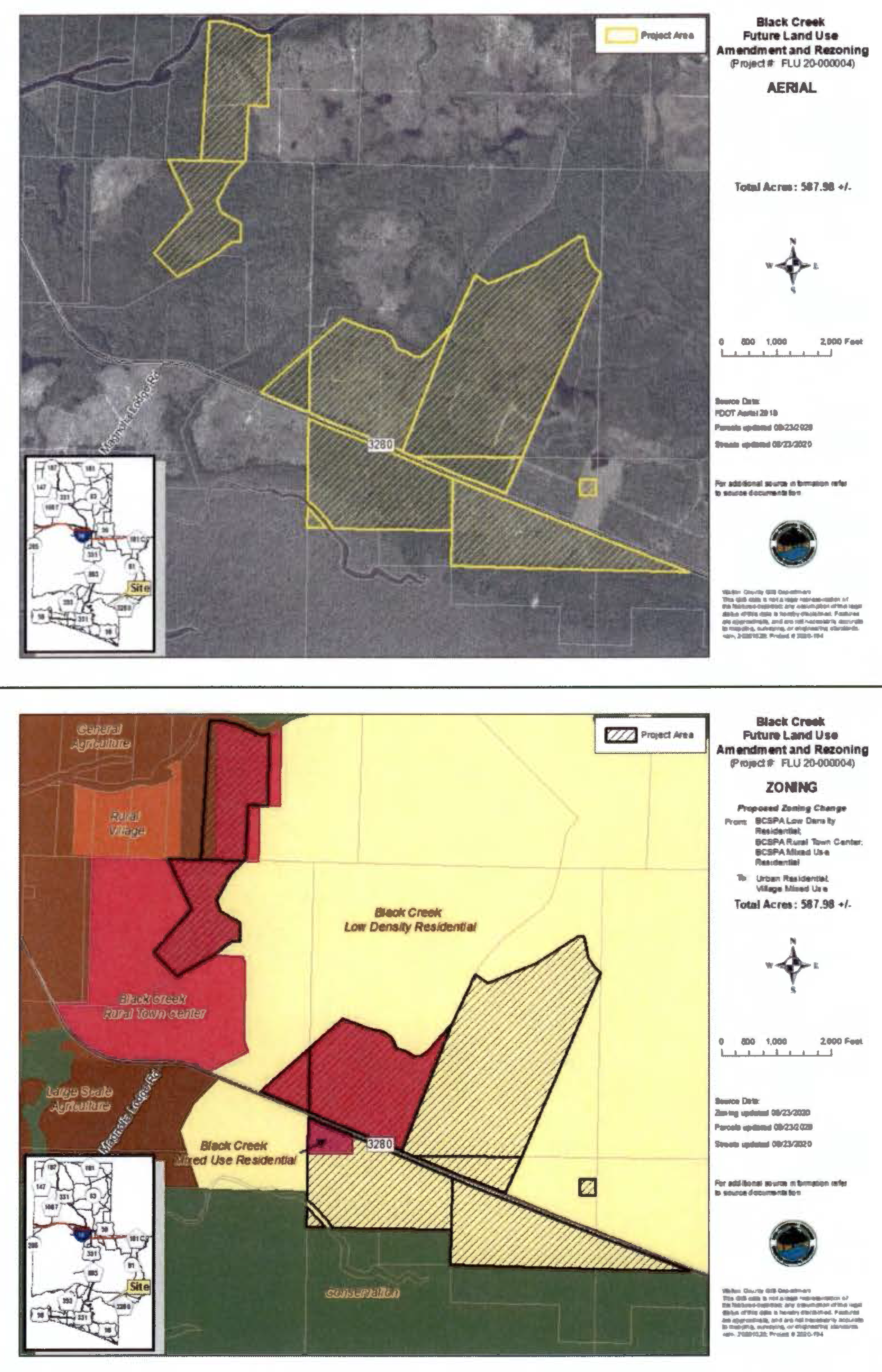
(Ord. No. 2018-29, § II(Att. A), 12-11-18; Ord. No. 2019-19, § II(Att. A), 9-10-19; Ord. No. 2021-21, § II, 7-13-21)
2.02.24. - Town Center One (TC-1).
This district is intended to be a planned mixed use community that is, in essence, a new planned traditional town to be developed in South Walton according to the master development plan adopted for the area by the County. The master development plan includes the following map series, included as an exhibit to this section:
Exhibit 1. Town Center One Exhibit Boundaries
Exhibit 2. Town Center One Land Use
Exhibit 3. Town Center One Features Overlay
Exhibit 4. Town Center One Trails
Exhibit 5. Town Center One Traffic Circulation
Exhibit 6. Town Center One Storm Water Features
Exhibit 7. Town Center One Soils
Exhibit 8. Town Center One Wetlands and Flood Zone
Exhibit 9. Town Center One Parcel Ownership
Exhibit 10. Town Center One GEC Area
A.
Location Criteria: This zoning district is applicable to the South Walton Planning Area and as shown on Exhibit 1.
B.
Primary Uses Allowed: The primary uses allowed within this district shall be in accordance with the uses specified in the adopted master plan, and defined below in Section G, as follows:
1.
Public uses;
2.
Civic and Community uses;
3.
Parks and Recreation;
4.
Professional Service/Office;
5.
Neighborhood Serving Commercial/Retail/Commercial Center uses;
6.
Single Family Residential, attached;
7.
Single family residential, detached;
8.
Short term vacation rental units, attached;
9.
Short term vacation rental units, detached;
10.
Small apartment buildings & townhouses;
11.
Live/Workplace;
12.
Institutional;
13.
Limited lodging.
C.
Accessory Uses Allowed:
1.
Accessory structures and uses in connection with any lawfully existing primary use.
D.
Conditional Uses Allowed:
1.
Communication towers subject to the limitations and approval process provided in Subsection 5.07.10 and 5.00.04 of this Code.
E.
Residential Density Allowed: This category will allow a base density of four (4) dwelling units per one (1) acre with a maximum of ten (10) dwelling units per one (1) acre with available density bonus points. In those cases where a residential unit is located in a mixed use development, bonus points may only be applied to either floor area ratio or density requirements. Bonus point allowances are detailed in the following chart and may not be applied for both floor area ratio and density, and the applicant may choose which bonus to apply.
F.
Nonresidential Intensity Allowed:
1.
The maximum allowable intensity for development in this district is a floor-to-area ratio of 2.0 and an impervious surface ratio of 0.85. Civic, public and institutional development is exempt from FAR requirements. In those cases where a residential unit is located in a mixed use development, bonus points may only be applied to either floor area ratio or density requirements. Bonus point allowances may not be applied for both floor area ratio and density, and the applicant may choose which bonus to apply.
G.
Special Development Standards:
1.
Development in this district requires a detailed site plan for each project.
2.
The scale and uses at the boundaries shall be compatible with the abutting land uses.
3.
The center shall be interconnected with abutting uses for car and pedestrian linkage. Each parcel or lot, except for single-family home, shall provide vehicular connections to abutting lots as a way of limiting traffic congestion as specified in Chapter 5 of this Code.
4.
All development within established corridor boundaries is subject to the additional development conditions provided in Chapter 6 of this Code.
5.
Shared parking will be allowed.
6.
No drive-through facilities will be allowed, except for financial institutions and pharmacies
7.
The following usage definitions will apply to development within Town Center One (1):
Arcade - A continuous walkway or passageway adjacent to a building and parallel to and open to a street or open space, or a passageway within a building, usually covered by a canopy or permanent roofing, and open to public use.
Affordable Housing - Those units targeted for lower income households shall be affordable at a rent that does not exceed 80 percent of area median income. Those units targeted for very low income households shall be affordable at a rent that does not exceed 50 percent of area median income.
Block - An increment of urban land, typically circumscribed by thoroughfares and/or streets.
Build-To-Line - A line established on a parcel to indicate the placement of the principal structure upon the parcel, parallel to the frontage and/or right-of-way, facing a street or open space. The intent of the build-to-line is to align structures on a street or open space.
Civic Building - A structure whose principal purpose is a public or civic use, such as government offices, school, post office, meeting house, private or public children's recreational or learning center, community center, etc. Entertainment and recreation uses include sports clubs, health clubs, and lounges, restaurants with limited outdoor entertainment, small indoor theaters and similar uses.
Civic/Community Use - Community uses such as meeting halls, libraries, post offices, schools, child care centers, clubhouses, private or public children's recreational or learning center, religious buildings, recreational facilities, higher education, museums, cultural societies, visual and performance arts buildings, municipal buildings, and substantially similar uses, specifically excluding the maintenance and servicing of vehicles and specifically excluding animal boarding facilities.
DBP - Density bonus points.
Expression Line - An architectural treatment extending or offset from the surface plane of the building wall, or change of material, color or other treatment. Expression lines typically delineate the transition between floor levels and base-middle-top of a building.
Entertainment and Recreation - Uses include sports clubs, health clubs, and lounges, restaurants with limited outdoor entertainment, small indoor theaters and similar uses.
Frontage - The linear dimension along the front and/or side of a lot, bordering a street, public right-of-way, or open space.
Frontage Coverage - The percentage of a block occupied by building facades. The frontage coverage is calculated as the sum of the length of the building facades divided by the block length.
Frontage Façade - The front facade of a built structure parallel to a street or public right-of-way and coinciding with the build-to-line.
Frontage Street - The street bordering on a property toward which the front facade and main entrance are oriented.
Green Building - Development consistent with maximum energy efficiency of buildings using environmentally sound building materials, energy/ water conservation systems, preservation or restoration of any on-site natural features i.e. wetlands, riparian corridors, watersheds, steep slopes, significant grasslands, etc., use of local vegetation on site to minimize impact on local habitats to minimize water consumption and an established recycling program with tenants.
Institutional - This district includes land designated for major public and semi-public uses not included as allowed uses within public facilities district.
Limited Lodging - An inn of no more than one hundred twenty-five (125) rooms and can include full services, such as supporting restaurant use.
Live/Workplace - Buildings with vertical mixed use, with neighborhood serving commercial/retail on the ground floor and residential above.
Master Plan - The South Walton New Town Master Plan of Development.
Mixed-Use Building - A structure consisting of multiple uses, whose ground floor use is typically, but not limited to, retail, restaurant or similar service business, with residential, office or other uses on upper floors.
Neighborhood Serving Commercial/Retail/Commercial Center - Buildings of neighborhood scale or character primarily for business uses. This group of uses includes, but is not limited to, retail and personal service uses which support residential areas as follows:
• Community centers and fraternal lodges.
• Commercial or trade schools such as dance and martial arts studios.
• Retail sales stores, such as: shoe stores, clothing stores, pharmacies, florists, and bookstores.
• Garden supply.
• Financial institutions.
• Food marts.
• Grocery stores, supermarkets, and specialty food stores (such as meat markets, delicatessens and bakeries).
• Restaurants.
• Temporary seasonal roadside produce stands.
• Service businesses such as blueprint, printing, catering, tailoring, travel agencies, upholstery shops, laundries/dry cleaners, and light mechanical repair stores (such as camera, TV, or bicycle repair shops).
• Child care center.
Open Space - May include, but is not limited to, lawns, decorative planting, walkways, active and passive recreation areas, playgrounds, fountains, swimming pools, wooded areas, nature trails and watercourses.
Parks and Recreation - These uses include facilities for recreational activities such as picnicking, jogging, cycling, hiking, ball fields, outdoor ball courts, outdoor swimming pools, private or public children's recreational or learning center, nature trails and similar recreational facilities.
Public Use - Includes streets, squares, parks, playgrounds, and substantially similar uses.
Professional Service/Office - This group of uses includes business and professional offices, medical offices or clinics, government offices, financial institutions, and personal service businesses where the service is performed on an individual-to-individual basis as opposed to services which are performed on objects or personal property. Examples of personal service businesses are beauty shops, barbershops, and photography studios. This group of uses may include: a dispatching, communications/office center for the distribution of goods, but specifically excludes the warehousing or actual distribution of goods.
Signature Building - A structure whose location in relationship to the public realm, such as a position on a street or open space, requires significant attention to its architectural design because of its prominent location.
Small Apartment Buildings and Townhouses - Buildings for residential uses including triplexes, townhouses and small apartment buildings. These buildings for residential use may have limited office and retail use, cafes, limited lodging and artisanal uses.
Storefront - The facade or portion of a building's front facade (typically the ground level only) with business or retail uses, typically aligned along the frontage line with the entrance to the business or retail use at sidewalk grade.
Town Center Design Committee - An organization composed of Walton County staff and voluntary Town Center property owners and other designated stakeholders appointed by the Board of County Commissioners who shall meet regularly, on an "on-call" basis to provide oversight of design, nature trails, wetland buffers and common areas for purposes of maintaining the overall intent of the TC-1 master plan.
Town Center - The area designated on the Walton County Future Land Use Map as TC-1 and the overlay district adopted as part of the Land Development Code.
Vista - A view framed by buildings, structures or the landscape.
Vista Terminus - A building, site structure, or significant element of a building that terminates or punctuates the framed view. Civic buildings, sculptural pieces and special building elements serve as the most appropriate view terminators.
H.
The following Town Center One (TC-1) maps are hereby incorporated in the Town Center One (TC-1) Zoning District:
EXHIBIT 1
EXHIBIT 2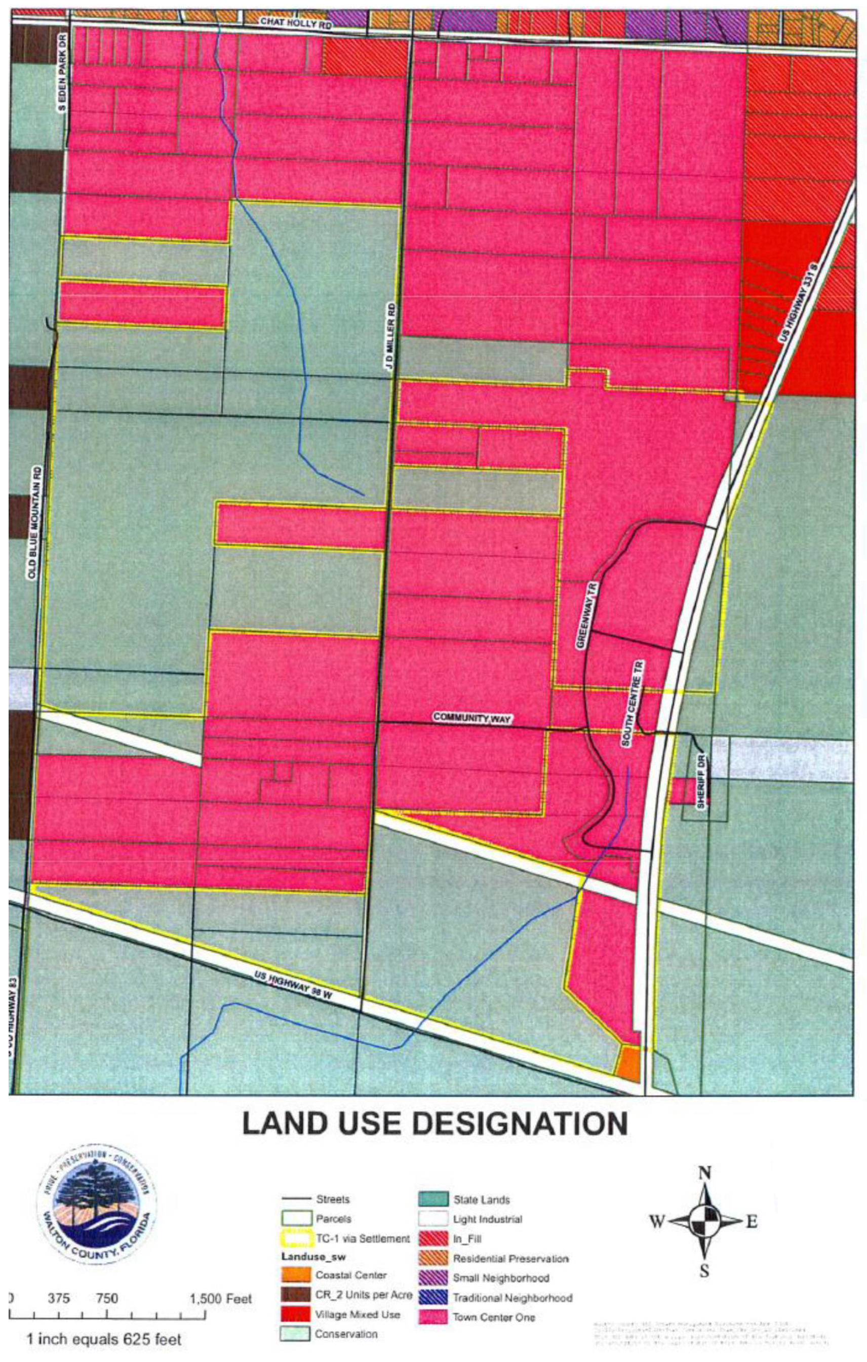
EXHIBIT 3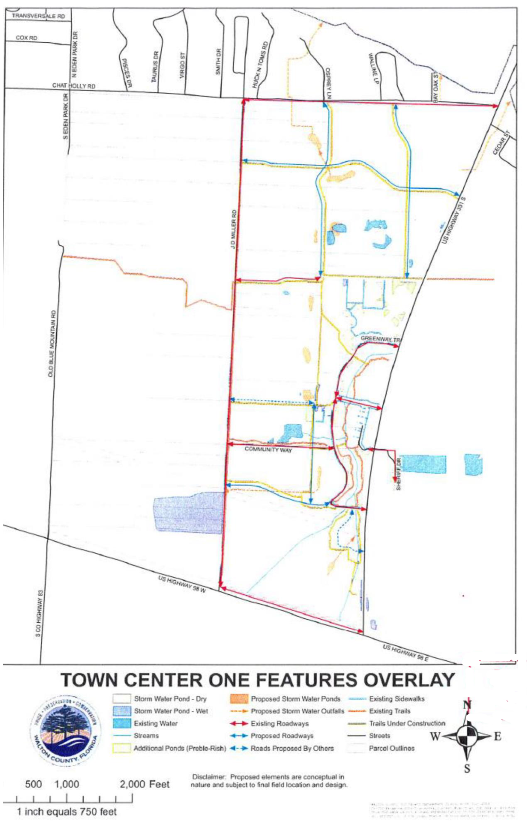
EXHIBIT 4
EXHIBIT 5
EXHIBIT 6
EXHIBIT 7
EXHIBIT 8
EXHIBIT 9
EXHIBIT 10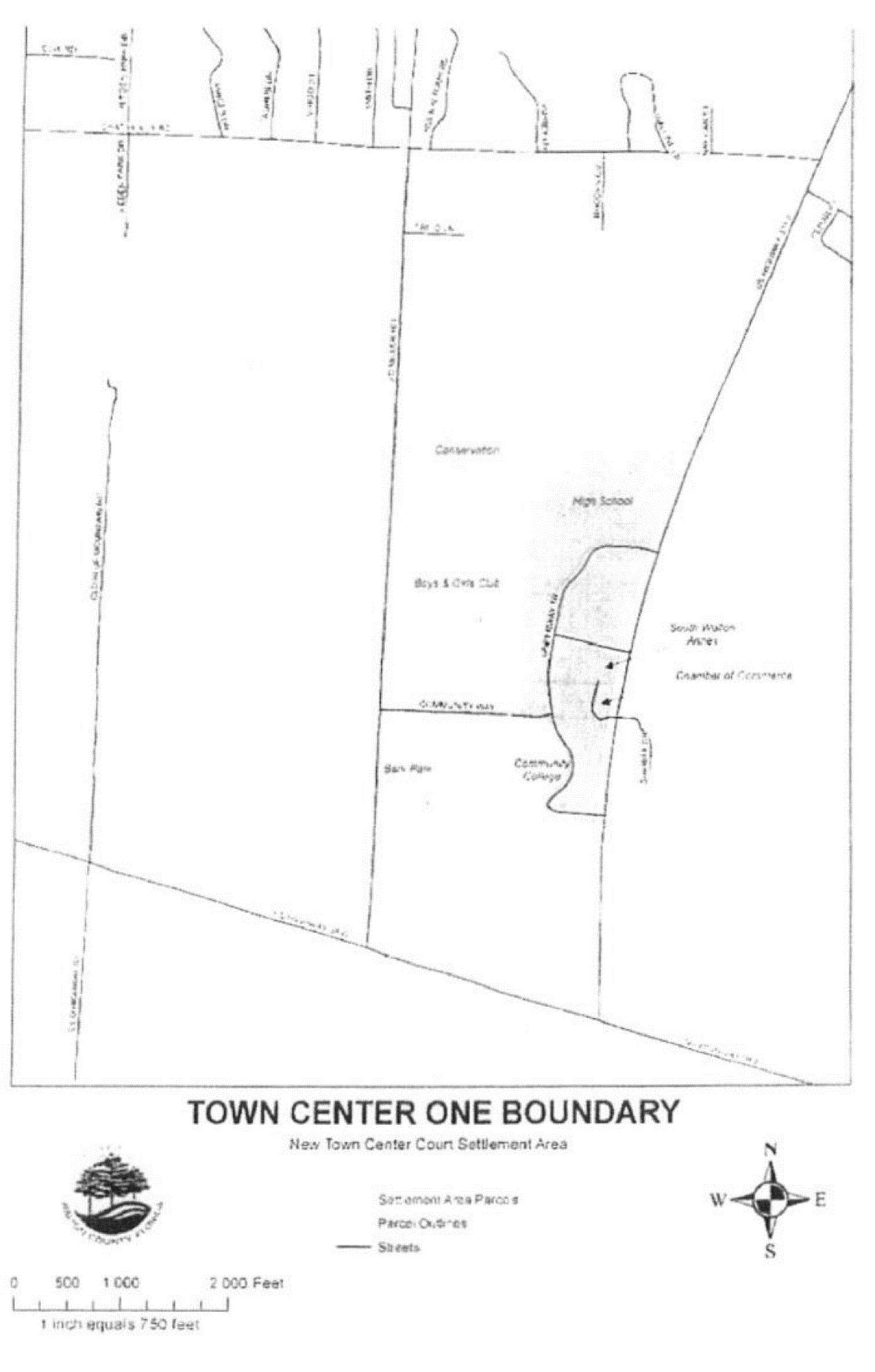
(Ord. No. 2018-29, § II(Att. A), 12-11-18; Ord. No. 2019-19, § II(Att. A), 9-10-19; Ord. No. 2021-33, § II, 11-9-21)
2.02.25. - Resort (R).
This district is established expressly for the purpose of accommodating the land uses and development that were agreed upon as a part of the acquisition of the Topsail Hill and Deer Lake sites by the State of Florida in the Consent Amended Final Judgment, Topsail and Deer Lake, which was entered by the Court in Case No. 94-923-CA.
A.
Location Criteria: These areas are located on the eastern border of Grayton Beach State Recreation Area and to the immediate east of the Deer Lake State Park site. The use and development of this area shall be in accordance with the provisions of the agreement and judgment. The provisions of this Code, including but not limited to the provisions of the Resort district, shall not apply to the area described above to the extent that such provisions would be inconsistent with the above-referenced agreement and judgment.
B.
Primary Uses Allowed:
1.
Single family residential, attached;
2.
Single family residential, detached;
3.
Short term vacation rental units, attached;
4.
Short term vacation rental units, detached;
5.
Multi-family residential;
6.
Lodging and accommodations;
7.
Civic uses;
8.
Golf Courses (upon site specific design and performance standards sufficient to protect the water quality of the Coastal Dune Lake or Lakes);
9.
Parks and passive recreation uses;
10.
Active recreation uses;
11.
Neighborhood commercial uses.
C.
Accessory Uses Allowed:
1.
Accessory structures and uses in connection with any lawfully existing primary use.
D.
Conditional Uses Allowed: Reserved.
E.
Residential Density Allowed:
1.
Maximum of 12 dwelling units per one (1) gross acre.
F.
Nonresidential Intensity Allowed: Reserved.
G.
Special Development Standards:
1.
Any development within the Resort district shall protect the water quality of the coastal dune lakes.
2.
No development over 4 stories or 50 feet.
3.
Hotel/Motel/Resort development architecture to be similar to and compatible with surrounding development in Grayton Beach, Seaside areas, as determined by Walton County Commission which will not be unreasonably withheld.
4.
All development shall be served by public or central water and sewer systems. No septic tanks or package plants are permitted. Private wells are permitted for landscape irrigation only.
(Ord. No. 2018-29, § II(Att. A), 12-11-18; Ord. No. 2019-19, § II(Att. A), 9-10-19)
2.02.26. - Extractive Uses (EU).
This district applies to the removal of resources from their location to make them suitable for commercial, industrial, or construction use, but does not include excavation solely in aid of on-site agricultural or silvicultural activities where the extracted materials are not transferred off-site or sold.
A.
Location Criteria: This zoning district is applicable to the North, North Central and South Central Walton Planning Areas.
B.
Primary Uses Allowed:
1.
Extractive uses;
2.
Communication towers subject to the limitations and approval process provided in Subsection 5.07.10 and 5.00.04 of this Code.
C.
Accessory Uses Allowed:
1.
Accessory structures and uses in connection with any lawfully existing primary use.
D.
Conditional Uses Allowed: Reserved.
E.
Residential Density Allowed:
1.
No residential density is associated with the Extractive Use Zoning District, with the exception of one (1) dwelling unit per development for security purposes only.
F.
Nonresidential Intensity Allowed:
1.
The maximum intensity of site development for this district is an impervious surface ratio of 0.10 (10%) in order to accommodate maintenance and equipment sheds, inclusive of a general office for development operations.
G.
Special Development Standards:
1.
Mining that will have an adverse impact on environmentally sensitive areas that cannot be restored is prohibited.
2.
The County may increase the minimum separation and buffering requirements based on the location of the proposed mine, whether the activity is temporary or long term, and the extent to which the following occur: vegetated stockpiles, non-vegetated stockpiles, or crushing, processing, or blasting activities.
3.
New mining operations shall prevent off-site erosion of soils and shall maintain a 50-foot buffer zone of existing vegetation around the perimeter of the site.
4.
Mine operators shall submit to the County a mine reclamation plan. This reclamation plan shall include provision of revegetation of disturbed areas using native species. Mining areas shall be reclaimed to be suitable for use in agriculture or silviculture, or to be suitable for uses compatible with the surrounding area consistent with the site's zoning district.
(Ord. No. 2018-29, § II(Att. A), 12-11-18; Ord. No. 2019-19, § II(Att. A), 9-10-19)
2.02.27. - Light Industrial (LI).
This district provides for areas containing a single use or combination of uses, such as offices, showroom/warehouse, and light assembly or storage uses that do not generate noise, particulate matter, vibrations, odors, fumes, glare, and other hazards incompatible with residential uses.
A.
Location Criteria: This zoning district is applicable to all Planning Areas.
Light industrial districts shall be located on a major collector or arterial roadways with immediate access to the regional roadway network.
B.
Primary Uses Allowed:
1.
Light industrial uses;
2.
General commercial uses;
3.
Pubic uses;
4.
Communication towers subject to the limitations and approval process provided in Subsection 5.07.10 and 5.00.04 of this Code;
5.
Professional services/office uses;
6.
Artisanal uses;
7.
Workplace uses;
8.
Renewable energy uses.
C.
Accessory Uses and Structures Allowed:
1.
Accessory uses allowed within a development include: personal services, business services, restaurants and cafes, newsstands, and similar support uses.
D.
Conditional Uses Allowed:
1.
Personal services, business services, restaurants and cafes, newsstands, other similar supporting uses on the condition that they are housed in a building which principally serves allowed primary uses.
E.
Residential Density Allowed:
1.
No maximum or minimum residential density is associated with this category, but, a maximum of one (1) dwelling unit may be approved for security purposes for a development.
F.
Nonresidential Intensity Allowed:
1.
A maximum FAR of 0.5 (50%) and a maximum ISR of 0.75 (75%).
G.
Special Development Standards:
1.
Twenty-five (25) feet buffer between Industrial uses and any other land use.
(Ord. No. 2018-29, § II(Att. A), 12-11-18; Ord. No. 2019-19, § II(Att. A), 9-10-19)
2.02.28. - Heavy Industrial (HI).
This district includes areas devoted exclusively to industrial development, allowing a mix of heavy and light industry, storage, distribution, and other industrial uses.
A.
Location Criteria: This zoning district is applicable to the North, North Central and South Central Walton Planning Areas.
B.
Primary Uses Allowed:
1.
Heavy Industrial uses;
2.
Light Industrial uses;
3.
Extractive uses;
4.
Communication towers subject to the limitations and approval process provided in Subsection 5.07.10 and 5.00.04 of this Code;
5.
Public uses;
6.
Renewable energy uses.
C.
Accessory Uses Allowed:
1.
Accessory structures and uses in connection with any lawfully existing primary use.
D.
Conditional Uses Allowed: Reserved.
E.
Residential Density Allowed:
1.
This district does not provide for residential uses.
F.
Nonresidential Intensity Allowed:
1.
The maximum intensity for non-residential uses in this district is a floor to area ratio of 0.70 and an impervious surface ratio of 0.85.
G.
Special Development Standards:
1.
Twenty-five (25) feet buffer between Industrial uses and any other land use.
(Ord. No. 2018-29, § II(Att. A), 12-11-18; Ord. No. 2019-19, § II(Att. A), 9-10-19)
2.02.29. - Conservation (CON).
This district is intended for those publicly-owned lands or privately-owned lands restricted by conservation easement held by the Florida Department of Environmental Protection, the County, or by a land trust or conservancy, containing important natural resources, such as wetlands, open space, habitat, significant aquifer recharge, or other ecological, historical or cultural features, suitable only for passive recreational and resource management uses.
A.
Location Criteria: This zoning district is applicable to all Planning Areas.
B.
Primary Uses Allowed:
Conservation uses as follows:
1.
State Forest: Publicly-owned land utilized for natural and wildlife resource management and conservation, and passive recreation uses. These lands are managed by the State of Florida and may include timber harvesting as a part of its management responsibilities.
a.
Non-residential uses are prohibited, except for conservation use necessary to provide public access, and to manage conservation lands, including ranger stations, towers, recreational uses, greenways and trails, educational facilities, and amenities.
b.
Conservation and recreation uses and necessary support uses and structures are allowed.
2.
State Park and Recreation: Publicly owned lands that fall into the following descriptions of State parks, State recreation areas, State preserves, property owned and managed by the Northwest Florida Water Management District (NWFWMD) and ornamental gardens.
a.
Non-residential uses are prohibited, except for recreation and conservation uses as identified in the approved State or NWFWMD management plans. Such uses include ranger stations, recreation facilities and amenities, recreational trails, greenways and camping facilities.
C.
Accessory Uses Allowed:
1.
Uses limited to public access and residential and nonresidential uses necessary to manage such conservation lands (e.g., ranger stations, research stations and park amenities).
D.
Conditional Uses Allowed: Reserved.
E.
Residential Density Allowed:
1.
No maximum residential density.
F.
Nonresidential Intensity Allowed:
1.
No maximum nonresidential intensity.
G.
Special Development Standards: None.
(Ord. No. 2018-29, § II(Att. A), 12-11-18; Ord. No. 2019-19, § II(Att. A), 9-10-19)
2.02.30. - Parks and Recreation (PR).
Land devoted to parks and recreation facilities that are owned, operated, or leased by the State, Federal or County government, an agency of the County, public/private joint ownership, and/or lands dedicated to the County by plat or deed for the purpose of recreational use for the purpose of active and passive recreational use. Beach access is included in this definition.
A.
Location Criteria: This zoning district is applicable to all Planning Areas.
B.
Primary Uses Allowed:
1.
Active recreation uses;
2.
Parks and passive recreation uses;
3.
Conservation uses.
C.
Accessory Uses and Structures Allowed:
1.
Accessory structures needed for recreation and park uses and maintenance are allowed.
D.
Conditional Uses Allowed:
1.
Ancillary commercial uses with the following conditions:
a.
Such commercial use must be ancillary or functionally related to the park or recreation area. Such uses include but are not limited to concessions, ice vending machines, outdoor boat storage, canoe paddled board, or kayak rental, and food vending.
b.
Commercially owned and operated recreational vehicle parks or campgrounds are specifically excluded.
c.
Ancillary commercial uses must not occupy more than 20% of the total park or recreational area.
d.
Ancillary commercial uses shall be operated consistent with the operating hours of the park or recreational area.
e.
Ancillary commercial uses shall not create noise or excessive traffic related impacts to the surrounding neighborhood area.
2.
Communication towers subject to the limitations and approval process provided in Subsections 5.07.03 and 5.00.04 of this Code.
E.
Residential Density Allowed:
1.
No maximum residential density is assigned to this zoning district.
F.
Nonresidential Intensity Allowed:
1.
A maximum FAR of 0.50 (50%) and a maximum ISR of 0.50 (50%).
G.
Special Development Standards: None
(Ord. No. 2018-29, § II(Att. A), 12-11-18; Ord. No. 2019-19, § II(Att. A), 9-10-19)
2.02.31. - Public Facilities (PF).
This district is intended to accommodate large scale public facilities and uses, civic uses and public or private utility uses.
A.
Location Criteria: This zoning district is applicable to all Planning Areas.
B.
Primary Uses Allowed:
1.
Public uses;
2.
Communication towers subject to the limitations and approval process provided in Subsection 5.07.10 and 5.00.04 of this Code.
C.
Accessory Uses and Structures Allowed:
1.
Accessory structures and uses in connection with any lawfully existing primary use.
D.
Conditional Uses Allowed: Reserved.
E.
Residential Density Allowed:
1.
No maximum density is assigned to this district.
F.
Nonresidential Intensity Allowed:
1.
A maximum FAR of 0.60 (60%) and a maximum ISR of 0.75 (75%), with a maximum building height of 36 feet, excluding towers.
G.
Special Development Standards:
1.
Tall structures are subject to the review process provided in Section 5.07.03 of this Code.
2.
The County will ensure adequate buffering per Chapter 5 between any proposed public facility and adjoining or abutting lower intensity or residential land use.
(Ord. No. 2018-29, § II(Att. A), 12-11-18; Ord. No. 2019-19, § II(Att. A), 9-10-19)
2.02.32 - Institutional (INST).
This district is intended for public or semi-public facilities and uses that may be developed on public or private land.
A.
Location Criteria: This zoning district is applicable to the South, North Central, South Central and North Walton Planning Areas. Particularly in areas served by central sewer and central water, where a diversion of community needs may be met or centralized. Areas already being used as institutional or with civic uses may continue to operate as such without a zoning map amendment.
B.
Primary Uses Allowed:
1.
Civic uses;
2.
Public uses;
3.
Parks and passive recreation uses;
4.
Active recreation uses;
5.
General and neighborhood commercial uses limited to large and small scale health care facilities;
6.
Communication towers subject to the limitations and approval process provided in Subsection 5.07.10 and 5.00.04 of this Code.
C.
Accessory Uses and Structures Allowed:
1.
Accessory structures and uses in connection with any lawfully existing primary use.
D.
Conditional Uses Allowed: None.
E.
Residential Density Allowed:
1.
No maximum residential density is assigned to this zoning district.
F.
Nonresidential Intensity Allowed:
1.
A maximum FAR of 2.00 (200%) and an ISR of 0.85 (85%).
G.
Special Development Standards:
1.
Community residential homes with greater than six (6) residents shall be treated as a non-residential uses subject to these policies.
(Ord. No. 2018-29, § II(Att. A), 12-11-18; Ord. No. 2019-19, § II(Att. A), 9-10-19)
2.02.33 - Bay Walton Sector Plan Districts.
The following zoning districts are applicable to the Bay Walton Sector Plan area only.
A.
BWSP Village Center (BWSP-VC):
1.
Intent: The BWSP Village Center zoning district is intended to provide for mixed-use development in the form of limited neighborhood-scale commercial development within walkable distance to surrounding neighborhoods with public spaces in the form of parks, town squares and community facilities.
2.
Primary Uses Allowed: The following uses are allowed in the BWSP-VC zoning district.
a.
Single Family Residential, Attached;
b.
Single Family Residential, Detached;
c.
Multi-family Residential;
d.
Short Term Vacation Rental Unit, Attached;
e.
Short Term Vacation Rental Unit, Detached;
f.
Accessory Uses and Structures, Residential;
g.
Home Occupation;
h.
Accessory Dwelling Unit (ADU);
i.
Agriculture Uses;
j.
Silviculture Uses;
k.
Lodging and Accommodations;
l.
Civic Uses;
m.
Public Uses;
n.
Community Facility and Service Uses;
o.
Active Recreation Uses;
p.
Parks and Passive Recreation Uses;
q.
Conservation Uses;
r.
General Commercial Uses;
s.
Neighborhood Commercial Uses;
t.
Professional Service/Office Uses;
u.
Live/Work Uses;
v.
Artisanal Uses;
w.
Workplace Uses;
x.
Light Industrial Uses;
3.
Residential Density Allowed:
The maximum residential density is 15 units per one acre.
4.
Nonresidential Intensity Allowed:
The maximum intensities of site development for this district are:
1.0 FAR for single use development;
2.0 FAR for mixed use development;
0.85 (85%) ISR.
5.
Development Standards:
Development standards for this district shall be contained within the applicable Detailed Special Area Plan (DSAP).
B.
BWSP Town Center (BWSP-TC):
1.
Intent: The BWSP Town Center zoning district is to provide for a wide-range of large-scale commercial and service related uses to serve the Bay-Walton Sector Plan and the surrounding region.
2.
Primary Uses Allowed: The following uses are allowed in BWSP-TC zoning districts.
a.
Single Family Residential, Attached;
b.
Single Family Residential, Detached;
c.
Multi-family Residential;
d.
Short Term Vacation Rental Unit, Attached;
e.
Short Term Vacation Rental Unit, Detached;
f.
Accessory Uses and Structures, Residential;
g.
Home Occupation;
h.
Accessory Dwelling Unit (ADU);
i.
Agriculture Uses;
j.
Silviculture Uses;
k.
Lodging and Accommodations;
l.
Hotel and Motel;
m.
Civic Uses;
n.
Public Uses;
o.
Community Facility and Service Uses;
p.
Active Recreation Uses;
q.
Parks and Passive Recreation Uses;
r.
Conservation Uses;
s.
General Commercial Uses;
t.
Neighborhood Commercial Uses;
u.
Professional Service/Office Uses;
v.
Live/Work Uses;
w.
Artisanal Uses;
x.
Workplace Uses;
3.
Residential Density Allowed:
The maximum residential density is 15 units per one acre.
4.
Nonresidential Intensity Allowed:
The maximum intensities of site development for this district are:
2.0 FAR for mixed-use development;
0.85 (85%) ISR.
5.
Development Standards:
Development standards for this district shall be contained within the applicable Detailed Special Area Plan (DSAP).
C.
BWSP Low Impact Residential (BWSP-LIR):
1.
Intent: The BWSP Low Impact Residential zone is intended to provide areas for low-density residential uses as areas for a functional mix of compatible seasonal and resort land uses.
2.
Primary Uses Allowed: The following uses are allowed in BWSP-LIR zoning district.
a.
Single Family Residential, Attached;
b.
Single Family Residential, Detached;
c.
Multi-family Residential;
d.
Short Term Vacation Rental Unit, Attached;
e.
Short Term Vacation Rental Unit, Detached;
f.
Accessory Uses and Structures, Residential;
g.
Home Occupation;
h.
Accessory Dwelling Unit (ADU);
i.
Bed and Breakfast;
j.
Civic Uses;
k.
Public Uses;
l.
Community Facility and Service Uses;
m.
Active Recreation Uses;
n.
Parks and Passive Recreation Uses;
o.
Conservation Uses;
p.
Agriculture and Silviculture;
3.
Residential Density Allowed:
The maximum residential density is one unit per three acres.
4.
Nonresidential Intensity Allowed:
The maximum intensities of site development for this district are:
0.30 FAR for mixed use development;
0.30 (30%) ISR;
5.
Development Standards:
Development standards for this district shall be contained within the applicable Detailed Special Area Plan (DSAP).
D.
BWSP Long-Term Conservation Area (BWSP-LTC):
1.
Intent: The BWSP Long-Term Conservation Area zone is to provide areas for the protection, restoration, and enhancement within the Bay-Walton Sector Plan.
2.
Primary Uses Allowed: The following uses are allowed in BWSP-LTC zoning districts.
a.
Parks and Passive Recreation Uses;
b.
Conservation Uses;
c.
Agriculture Uses;
d.
Silviculture Uses;
e.
Public Uses.
3.
Residential Density Allowed:
N/A
4.
Nonresidential Intensity Allowed:
N/A
5.
Development Standards:
Development standards for this district shall be contained within the applicable Detailed Special Area Plan (DSAP).
E.
BWSP Recreation/Open Space (BWSP-ROS):
1.
Intent: The BWSP Recreation/Open Space zone is to provide for areas for active and passive recreation to serve the needs of the Bay-Walton Sector Plan and the larger community.
2.
Primary Uses Allowed: The following uses are allowed in BWSP-ROS zoning districts.
a.
Active Recreation Uses;
b.
Parks and Passive Recreation Uses;
c.
Conservation Uses;
d.
Agriculture Uses;
e.
Silviculture Uses;
f.
Public Uses.
3.
Residential Density Allowed:
N/A
4.
Nonresidential Intensity Allowed:
N/A
5.
Development Standards:
Development standards for this district shall be contained within the applicable Detailed Special Area Plan (DSAP).
(Ord. No. 2019-19, § II(Att. A), 9-10-19)
2.03.00. - Categories of Primary Uses.
A.
Defined Primary Uses.
(Ord. No. 2018-29, § II(Att. A), 12-11-18; Ord. No. 2019-19, § II(Att. A), 9-10-19; Ord. No. 2022-13, § II, 8-25-22)
[2.04.01. - Table of uses by zoning district.]
(Ord. No. 2019-19, § II(Att. A), 9-10-19)
2.05.01. - Purpose.
A.
Expand housing opportunities for extremely low-, very-low-, low-, workforce, and moderate-, income persons/households throughout the county by providing increased residential densities to developers who guarantee that a portion of their housing development will be affordable to persons/households of extremely low-, very-low-, low-, workforce, and moderate-, income. The density bonus system is intended to create neighborhoods comprised of many different income levels and housing types.
B.
Expand housing opportunities throughout the county by incentivizing the preservation and creation of quality environmental areas by providing increased residential densities to developers who enhance or restore native vegetative communities and enhance, restore and create wetlands, for developments of 100 acres or greater as planned unit developments.
C.
Expand housing opportunities throughout the county by incentivizing the creation and dedication of a greenway system. It is the intent of the county to establish a linked system that provides environmental protection, open space, recreation space and special ambience and ensures that the natural environment is preserved, enhanced and made useable for the natural and man-made environment. These corridors shell be of sufficient dimension and design to facilitate one or more of the following purposes:
1.
The movement of affected wildlife species.
2.
The provision of enhanced natural regional scale stormwater treatment capacity.
3.
The enhancement of public access to passive recreational enjoyment of these natural resources, and
4.
The enhancement of available routes for alternative modes of transportation.
It is the county's intent to ultimately provide for interconnection of these private greenways with all available public conservation and recreation land in south Walton as part of the overall linked system.
(Ord. No. 2018-29, § II(Att. A), 12-11-18; Ord. No. 2021-33, § II, 11-9-21)
2.05.02. - Affordable Housing Density Bonus Program.
A.
Applicability. Affordable housing density bonuses may be utilized in accordance with this section in all zoning districts allowing residential development except Residential Preservation (RP), Estate Residential (ER), Rural Low Density (RLD), Rural Residential (RR), Conservation Residential 2:1, Conservation Residential 1:2.5, Conservation Residential 1:10, Large Scale Agriculture (LSA), and General Agriculture (GA). However, if in any case the administration of this section conflicts with Rule 10D-6, F.A.C., standards for on-site sewage disposal systems, the standards of Rule 10D-6 shall apply.
B.
Calculation of Bonuses. The bonus allows a 25 percent increase in the number of market rate housing units with the requirement that for the next ten years for ownership units and 20 years for lease/rental units, at least ten percent of total units be reserved for extremely low-, very-low-, low-, workforce, and moderate-, income persons or households.
C.
Submittals. All proposed development requesting additional density for the provision of workforce/affordable housing shall provide the following information on the application for development approval:
1.
The application for approval of a proposed development shall indicate that the development approval is requested through compliance with the bonus standards.
2.
The application shall clearly show the units affordable by persons and families of extremely low-, very-low-, low-, workforce, and moderate-, income, showing the basis for the requested density bonus.
3.
The application will be accompanied by a preliminary plan in writing, detailing the effort to provide affordable housing. This plan shall include the affordability agreement, detail the number of units, provide location of the units, outline the cost of housing, describe family income level targeted, provide the proposed homeowners documentation, and copies of contracts, deeds and restrictions, town home documentation/plats, and condominium documents/plats.
4.
All associated plats and documentation shall indicate the unit/dwelling/lot, which is dedicated and encumbered to be designated affordable, by number, location, and/or legal description. This encumbrance shall be at least ten years for ownership units and at least 20 years for lease/rental units. Properties or units designated affordable are to be dedicated to any approved affordable housing entity within Walton County approved by Walton County Board of County Commissioners and recommended by the Walton County State Housing Initiatives Partnership (SHIP) committee;
5.
A statement and acceptance letter of the subject property from the designated housing entity is required to be submitted with the development order application.
6.
Properties or units designated affordable that are or will be owner occupied must remain affordable for the duration of the encumbrance of the property. The deed of the project/development shall be restricted to reflect that ownership units can only be transferred to another affordable qualified owner, until the termination of the encumbrance. A statement of intent and acceptance is required with the application.
7.
Properties or units designated affordable that are or will be renter occupied must remain affordable for the duration of the encumbrance of the property. The deed and rental agreements must reflect the restriction that only affordable qualified tenants, lessee, renters, and occupants may reside in the unit, until the expiration of the encumbrance. A statement of intent and acceptance is required with the application.
8.
A statement from the developer that applies to owner occupied properties that are designated, dedicated, and/or established as affordable units are allowed to transfer ownership between affordable qualified persons. This is to be provided in the affordability agreement.
9.
A statement that gross rental rates including utilities of renter occupied properties that are designated, dedicated, and/or established as affordable units are allowed to increase based on total housing cost up to 30 percent of the median family income, adjusted for family size, established each year by the U.S. Department of Housing and Urban Development and as defined by F.S. § 420.602. This statement is to be included in the affordability agreement.
10.
An agreement to construct all units according to the same plans and specifications thus ensuring that affordable housing units will be substantially similar in amenities and features as non-affordable units within the same development is required.
11.
For residential rental developments, to help ensure the affordable units remain affordable throughout the encumbrance period, a statement from the developer that any proposed change of ownership or other transfer of physical assets of the rental development shall require Walton County approval during the term of the affordable housing encumbrance period.
12.
An agreement to submit to reporting requirements is required. In order to receive the benefits of these incentives the developer has taken advantage of, an agreement to report to the Walton County SHIP committee will be required. This agreement is to comply with periodic (not less than annual) reporting requirements established by Walton County regarding compliance with the Affordable Housing Program.
13.
The developer must also agree that during the term of the agreement the owner shall not: demolish any part of the project necessary for the operation thereof for its intended purposes or substantially subtract from any real or personal property of the project, or permit the use of the dwelling accommodations of the project for any purpose except residences.
14.
The developer and the approved affordable housing entity must agree to the following restriction concerning rents. The developer must be permitted to increase rents as area median income increases as determined by HUD. The agency and owner agree that rents may increase as median incomes increase as published by the U.S. HUD or in order to bring rents up to the limits set. Any other adjustments to rents will be made only if the board of county commissioners or their designee finds any adjustment is necessary to support the continued financial viability of the project and only by an amount that the agency determines is necessary to maintain continued financial viability of the project. The owner will provide documentation to justify the rate increase not attributable to the median income increase, within 30 days of receipt of documentation, the agency will approve or deny, as the case may be, all or a portion of the rental increase in excess of the median annual income. In the event any portion is denied, the board of county commissioners or the Walton County SHIP committee will state specifically the reasons therefore. In no event, however, will any increase directly proportional to an increase in the median family income be denied for any reason.
D.
Review of Density Bonus Application.
1.
After a duly noticed public hearing, the Walton County Board of County Commissioners may grant a density bonus for projects that include units affordable to extremely low-, very-low-, low-, workforce, and moderate-, income persons. A minimum of ten percent of the total project must meet the affordable housing criteria in each project in order to take advantage to the density bonus point system.
2.
If the density bonus is approved, the developer shall enter into an agreement with the county. The county attorney shall approve all such agreements prior to execution. The agreement shall contain, among other items, the terms and conditions of the deed restrictions to be placed on the units to ensure that the units remain affordable to extremely low-, very-low-, low-, workforce, and moderate-, income persons for a period of at least ten years for ownership and 20 years for rental/lease years. The restrictions shall run with the land and shall be enforceable by the county until such restrictions expire.
3.
The application will be accompanied by a preliminary plan and statement in writing detailing the effort to provide affordable housing. This plan shall include the number of units, location of the units, cost of housing, family income level targeted, proposed homeowners documentation, and copies of contracts, deeds and restrictions, town home documentation/plats, and condominium documents/plats.
4.
All associated plats and documentation shall indicate the unit/dwelling/lot, which is dedicated and encumbered to be designated affordable, by number, location, and/or legal description.
E.
Location of Affordable Units. In order to qualify for a density bonus, the affordable units may be located on-site and integrated into the development project or off site, provided that the applicant makes a satisfactory showing to the board of county commissioners that the units will be located in an area with a demonstrated need for affordable housing units. The intent is to incorporate different income levels and housing types into existing communities or create new communities that are compatible with the surrounding area. This is to be accomplished by the following:
1.
Affordable units within a project are to be randomly placed, mixed, and integrated within a project and be indistinguishable from any of the units within any given project.
2.
Affordable units to be located offsite are to be compatible with the surrounding area, utilizing Walton County's compatibility standards and subject to the final acceptance of the board of county commissioners.
F.
Criteria for Affordable Housing.
1.
A housing unit shall be considered an affordable housing unit if it meets, and continues to meet for ten years for ownership and 20 years for rental/lease years, one of the two following conditions:
a.
Has an annual rental rate that is less than or equal to 30 percent of 30 percent to 120 percent of the median family income of Walton County. Annual rental rate must be calculated according to F.S. § 420.602.
b.
Has an annual cost (including property taxes, insurance, utilities), after a ten percent down payment, that is less than or equal to 30 percent of 30 percent to 120 percent of the median family income of Walton County. Annual cost must be calculated according to F.S. § 420.602.
2.
The Walton County median family income shall be that figure published and periodically updated for Walton County as a whole by the U.S. Department of Housing and Urban Development (HUD).
G.
Definitions.
Affordability agreement: The applicant shall enter into a deed restriction affordability agreement with the county. The affordability agreement shall provide the number and designation level of affordable units, and period of time the units are committed to be affordable, consistent with the written policies and procedures established by the board of county commissioners and by the U.S. Department of Housing and Urban Development and as defined by F.S. § 420.602.
(Ord. No. 2018-29, § II(Att. A), 12-11-18; Ord. No. 2021-33, § II, 11-9-21)
2.05.03. - Environmental Improvement Density Bonus.
To incentivize the enhancement, restoration or creation of wetlands and native vegetative communities, the County shall encourage their enhancement, restoration and creation as part of the development process. Notwithstanding and in addition to any other bonus criteria contained in the Comprehensive Plan or Land Development Code, the following density bonus shall be awarded. Areas which have been used to obtain a density bonus subject to this program shall be preserved with a conservation easement to preclude the future alteration of these areas. Density shall only be applied to the development of non-environmentally sensitive uplands and areas not deemed a flood hazard concern. This bonus shall be applicable to the Conservation Residential (CR 1/10, CR 1/2.5, and 2/1), Urban Residential (UR), General Commercial (GC), Traditional Neighborhood Development (TND), Coastal Center (CC), Coastal Center Mixed Use (CCMU), Coastal Village (CV-1), and Town Center One (TC-1) Zoning Districts.
1.
Environmental Preservation and Creation Density Bonus Criteria and Density Bonus.
a.
Enhancement Category.
i.
Enhancement of one (1) acre of existing wetlands will result in the allotment of two (2) additional units per one (1) acre.
b.
Restoration Category.
i.
Restoration of one (1) acre of native vegetation will result in the allotment of two (2) additional units per one (1) acre.
ii.
Restoration of one (1) acre of wetlands will result in the allotment of four (4) additional units per one (1) acre.
c.
Creation Category.
i.
Creation of one (1) acre of native vegetation will result in the allotment of four (4) additional units per one (1) acre.
ii.
Creation of one (1) acre of wetlands will result in the allotment of eight (8) additional units per one (1) acre.
d.
The density bonus system pursuant to the enhancement, restoration and creation categories shall apply to planned unit developments of 100 acres or greater.
2.
Definitions and Conditions.
a.
General conditions applicable to all applications. Plans and specifications shall be recorded using County approved specification sheets or other documentation. The plans and specifications will include, at a minimum, a plan view, quantities, and sufficient profiles and cross-sections to define the location, line, and grade for stakeout and checkout. Plans and specifications shall be reviewed, field checked and approved by County staff.
b.
Enhancement. The augmentation of vegetative communities or wetland functioning beyond the original natural conditions on a degraded or naturally functioning site.
i.
The following conditions shall apply to applications for this density bonus:
1.
Enhancement measures to increase the functioning of native vegetative communities shall include: The removal of undesired and invasive species, and/or seeding or planting of desired species. Where planting and/or seeding, the minimum number of native species to be established shall be based on a reference vegetative community as identified by an authority such as the Florida Natural Areas Inventory (FNAI) and accepted by the County. Plantings shall include a mix of species adequate to establish the reference vegetative community.
2.
Enhancement measures to increase the functioning of wetlands shall include a combination or all of the following:
a.
Changing the soil hydrodynamic and bio-geochemical properties such as permeability, porosity, pH, or soil organic carbon levels as needed
b.
Hydrology enhancement including the timing and level setting of water control structures required for the establishment and maintenance of vegetation, soil, and wildlife and fish habitat functions. The work associated with the wetland shall not adversely affect adjacent properties or other water users unless agreed to by signed written letter, easement or permit.
c.
Macrotopograpahic features such as the installation of ditch plugs in lieu of refilling surface drainage ditches
d.
Removal of undesired and invasive species and installation of hydrophytic vegetation of species typical for the wetland appropriate to the hydrologic regimes and soil types within the wetland. Install native wetland plants with localized genetic material. Where natural colonization of acceptable species can realistically be expected to occur within 5 years, sites may be left to revegetate naturally. If not, the appropriate species shall be established by seeding or planting.
Where planting and/or seeding are conducted, the minimum number of native species to be established shall be based on a reference wetland as identified by an authority such as the Florida Natural Areas Inventory (FNAI) and accepted by the County. If the targeted hydrophytic vegetation is predominantly herbaceous, species diversity will be maximized as appropriate. Where the dominant vegetation will be forest or woodland community types, vegetation establishment will include a mix of trees and/or shrubs appropriate to the reference wetland community.
Invasive species, federal/state listed noxious plant species, and nuisance species shall be controlled on the site as necessary to enhance wetland functioning. The establishment and/or use of non-native plant species shall be prohibited.
c.
Restoration. The return of the natural environment and its functions to a close approximation of its original condition as it existed prior to disturbance on a former or degraded site.
1.
Restoration measures for vegetative communities shall apply to sites that where the natural conditions have been subject to degraded vegetation or soils.
The restoration shall be determined by an analysis of current and historic site functions and based on those functions which can reasonably be supported by current site constraints. Data from historic and recent aerial photography and/or other remotely sensed data, soil maps, topographic maps, intact vegetative communities, and historical records shall be gathered. The soils, hydrology and vegetative conditions existing on the site and the adjacent landscape shall also be documented.
a.
The removal of undesired and invasive species, and/or seeding or planting of desired species. Where planting and/or seeding, the minimum number of native species to be established shall be based on a reference vegetative community as identified by an authority such as the Florida Natural Areas Inventory (FNAI) and accepted by the County. Plantings shall include a mix of species adequate to establish the reference vegetative community.
b.
If the soil is covered by fill, sediment, spoil, or other depositional material, the material covering the soil shall be removed to the extent needed to restore the original soil functions.
2.
Restoration measures for wetlands shall apply to sites that where the natural conditions have been subject to degraded vegetation, hydrology or soils.
The restoration shall be determined by an analysis of current and historic site functions and based on those functions which can reasonably be supported by current site constraints. Data from historic and recent aerial photography and/or other remotely sensed data, soil maps, topographic maps, stream gauge data, intact reference wetlands, and historical records shall be gathered. The soils, hydrology and vegetative conditions existing on the site and the adjacent landscape shall also be documented.
a.
If the hydric soil (soil which is permanently or seasonally saturated by water resulting in anaerobic conditions) is covered by fill, sediment, spoil, or other depositional material, the material covering the hydric soil shall be removed to the extent needed to restore the original soil functions. Soil hydrodynamic and bio-geochemical properties such as permeability, porosity, pH, or soil organic carbon levels shall be restored to the extent needed to restore hydric soil functions.
b.
The hydroperiod (the seasonal pattern of the water level that results from the combination of the water budget and the storage capacity of the wetland), hydrodynamics, and dominant water source of the restored site shall approximate the conditions that existed before alteration. The restoration shall document the adequacy of available water sources based on groundwater investigation, stream gauge data, water budgeting, or other appropriate means. Timing and level setting of water control structures, if needed, shall be based on the actions needed to maintain a close approximation of the original, natural hydrologic conditions.
The site's hydrology shall be reestablished to approximate the hydrologic conditions of the wetland using the original natural water supply. If not possible, an alternate natural or artificial water supply can be used; however, these sources shall not be diverted from other wetland resources. If the alternate water source requires energy inputs, these shall be estimated and documented. The work associated with the wetland shall not adversely affect adjacent properties or other water users unless agreed to by signed written letter, easement or permit.
To the extent technically feasible reestablish macrotopography and/or microtopography. Use reference sites within the local area to determine appropriate topographic relief. The location, size, and geometry of earthen structures, if needed, shall match that of the original macrotopographic features to the extent practicable. Excavations from within the wetland shall remove sediment to approximate the original topography or establish a water level that will compensate for the sediment that remains.
Wetland restoration sites that exhibit soil oxidation and/or subsidence, resulting in a lower surface elevation compared to pre-disturbance, shall take into account the appropriate hydrologic regime needed to support the original wetland functions.
c.
Remove undesired and invasive species and install hydrophytic vegetation of species typical for the wetland and appropriate to the hydrologic regimes and soil types within the wetland. Install native wetland plants with localized genetic material where possible. Where natural colonization of acceptable species can realistically be expected to occur within 5 years, sites may be left to revegetate naturally. If not, the appropriate species shall be established by seeding or planting.
Where planting and/or seeding are conducted, the minimum number of native species to be established shall be based on a reference wetland as identified by an authority such as the Florida Natural Areas Inventory (FNAI) and accepted by the County. If the targeted hydrophytic vegetation is predominantly herbaceous, species diversity will be maximized as appropriate. Where the dominant vegetation will be forest or woodland community types, vegetation establishment shall include a mix of trees and/or shrubs appropriate to the reference wetland community.
Invasive species, federal/state listed noxious plant species, and nuisance species shall be controlled on the site as necessary to enhance wetland functioning. The establishment and/or use of non-native plant species shall be prohibited.
d.
Creation. The creation of a wetland on a site location that was historically not wetland. Measures to create the wetland shall be included such that the soil, hydrology and hydrophytic vegetation support the functioning of the created wetland.
1.
Changes to soil hydrodynamic and bio-geochemical properties such as permeability, porosity, pH, or soil organic carbon levels shall be made as needed to meet the planned objectives
2.
The adequacy of available water sources based on groundwater investigation, stream gauge data, water budgeting, or other appropriate means shall be documented. Timing and level setting of water control structures required for the establishment and maintenance of vegetation, soil, and wildlife and fish habitat functions shall be determined. Other structural practices, macrotopography and/or microtopography may be used such ditch plugs in lieu of re-filling surface drainage ditches. The work associated with the wetland shall not adversely affect adjacent properties or other water users unless agreed to by signed written letter, easement or permit.
3.
Hydrophytic vegetation planned to meet the wetland function shall be compatible with the planned soil and hydrologic conditions. Install native wetland plants with localized genetic material where possible. Where natural colonization of acceptable species can realistically be expected to occur within five years, sites may be left to revegetate naturally. If not, the appropriate species shall be established by seeding or planting. Where planting and/or seeding is necessary, the minimum number of native species to be established shall be based upon the types of vegetative communities present and the vegetation type planned. To achieve habitat diversity and minimize the adverse effects of climate, disease, and other limiting factors, several species adapted to the site shall be established.
(Ord. No. 2018-29, § II(Att. A), 12-11-18)
2.05.04. - Greenway Dedication Bonus.
A density bonus of up to five bonus units per each upland (exclusive of wetlands) acre added to the greenway subject to the following:
A.
All greenway systems shall link recreational or conservation areas within the development site with developed areas on that site when applicable.
B.
All private greenway systems which link up with public lands beyond the boundaries of the development site and provide for continuous bikeway and/or pedestrian facilities are eligible for additional density bonus of one bonus unit per each upland (exclusive of wetlands) acre of greenway area.
C.
In order to qualify for density bonus points, these pedestrian and/or bikeway facilities shall be dedicated to the County for public use at the time of final development approval. There is to be an exemption to this facility requirement in areas where the impacts of such use on a corridor area would significantly impact a "listed species" or its habitat.
D.
The Recreational Level of Service (LOS) standard of 6.25 acres per 1,000 people for a proposed development or redevelopment may be met in the following manner relating to the Greenway System:
1.
The entire amount of land area which must be dedicated to meet Recreational LOS concurrency requirements shall be satisfied by dedication of areas within the boundaries of the development which are to the greatest extent possible located in a linked corridor system which meets the requirements of this section; or
2.
At least 50 percent of the area which must be dedicated to meet Recreational LOS concurrency requirements shall be provided within the boundary of the specific development in a design which, to the greatest extent possible, locates these areas in a linked corridor system which meets the requirements of this section; and
3.
The remaining percentage of required dedication above the dedicated land area within the site shall be achieved by making a financial contribution for the acquisition and creation of community parks and linked open space systems to serve more than one neighborhood in the impact area surrounding the proposed development.
(Ord. No. 2018-29, § II(Att. A), 12-11-18)
2.06.01. - Purpose.
It is the purpose of the Planned Unit Development (PUD) to provide flexible land use and design regulations and to permit planned diversification and integration of uses and structures, while retaining to the County Commission the authority to establish limitations and regulations thereon for the benefit of the public health, welfare and safety. PUDs shall be established as overlay districts to the Official Zoning Map and shall not exceed the overall allowable densities or intensities associated with the underlying Zoning District.
(Ord. No. 2018-29, § II(Att. A), 12-11-18)
2.06.02. - Procedure for Planned Unit Development Approval.
A.
Concept Plan Approval. An applicant seeking PUD approval shall submit a conceptual plan to the County for review and approval. The conceptual plan shall include the following information:
1.
A legal description including total acreage.
2.
The general location of uses.
3.
A description of uses, including the total number of dwellings units, gross residential density, the total square footage of nonresidential uses, nonresidential floor areas ratios, a description of the nonresidential uses, a description of housing types, heights of buildings, and the total amount of open space.
4.
A general circulation plan including location of drives and access points.
5.
The location and description of buffers along the perimeter of the project.
6.
Appropriate location of all wetlands and habitat preservation areas with acreage.
7.
Number of parking spaces by land use, including parking ratios.
8.
A description of any additional development standards that will vary from the standards contained in the Land Development Code.
9.
A graphic illustration of the topography of the site and the locations of the flood zones.
10.
Identification of the Comprehensive Plan Future Land Use Map Category and Official Zoning Map District of the property.
11.
A general vicinity map.
12.
The names, addresses and phone numbers of the owner, applicant and representatives of the applicant.
13.
Preliminary transportation report including projected trips by phase and at buildout and identification of major roads that will be affected by the project.
14.
Identification of type of water and wastewater systems to be utilized by the project.
15.
Phasing schedule identifying the amount and location of residential and nonresidential development within each phase and projected timeframes for development of phases. Residential densities and nonresidential FARs should be identified for each phase.
16.
Identification of surrounding uses and densities and land use plan categories.
17.
Statements of unified control of the PUD property with assurances that the site will be developed in accordance with the PUD plan, as it may be amended from time to time, along with a statement that the PUD will be binding upon successors, heirs and assigns.
18.
Where applicable, identify the density bonus points being sought by from the PUD, along with a justification from the bonus points being sought. County staff shall review the conceptual plan for compliance with the goals, objectives and policies of the Comprehensive Plan and compatibility with the character of the surrounding area, appropriateness of the mixture of uses and similar matters and shall submit a report to the Planning Commission and the Board of County Commissioners. Said report shall be available at least one week in advance of the Planning Commission public hearing.
Subsequent to the Planning Commission hearing, the Board of County Commissioners shall conduct a duly noticed public hearing in order to approve, deny or approve with conditions the conceptual plan. The Board shall have the discretion to place conditions that insure compatibility of the project with surrounding areas, insure compliance with the Comprehensive Plan or enhance the public health, safety and welfare.
Approval of the conceptual plan does not vest the project from the requirements of concurrency, the building code, or other aspects of the Comprehensive Plan or Land Development Code not specifically addressed in the PUD conceptual plan.
B.
Detailed PUD Plan Approval. Once a PUD conceptual plan is approved by the Board of County Commissioners, an applicant has the option to submit a Detailed PUD Plan for all or part of the development approved in the conceptual plan approval. Detailed PUD Plan Submittals shall contain the following information:
1.
A plan that is a minimum of one (1) inch equals 50 inches that shows lot layouts and gross density, non-residential building footprints with a generalized parking and circulation plan, the number of dwelling units by type, the permitted non-residential uses with square footage and maximum floor area ratios, the location and type of buffers, street locations and widths, residential and non-residential setbacks, open space location and acreage, location of wetland and upland habitat preservation areas, maximum impervious surface areas, maximum heights and the type of location of the stormwater management and utilities system.
2.
A concurrency analysis that meets the requirements set forth in this Code.
3.
An environmental impact analysis that meets the requirements set forth in this Code.
4.
A schedule for development.
5.
A detailed description of how the Detailed PUD Plan meets the conditions imposed by the Board on the PUD Conceptual Plan.
The applicant shall submit copies of the Detailed PUD Plan. County staff shall review per the requirements contained in Chapter 10 for major developments.
The Detailed PUD Plan approval shall expire after one year of the date of approval unless the applicant has obtained a development order from the County. The Board of County Commissioners shall grant a one year extension, if the developer can successfully prove that the development was not obtained due to circumstances beyond his or her control.
Approved Detailed PUD Plans shall not expire once development has commenced and continues to proceed in good faith.
Once staff has reviewed the conceptual plan and deemed that it is complete, dates shall be set for public hearings before the Planning Commission and the Board of County Commissioners.
C.
Substantial Deviations to PUD Conceptual or Detailed Plans. A substantial deviation to a PUD Conceptual or Detailed Plan shall be deemed to occur if any of the following criteria are triggered:
a.
A change in the number of dwelling units by five (5) percent (5%) or more.
b.
Addition of land uses types not requested in the approved plan.
c.
An increase in offsite trip generation of more than 15 percent (15%).
d.
An increase of non-residential development of more than five (5) percent (5%).
e.
Any modification of the conditions of approval that results in a significant impact on surrounding properties.
f.
A decrease of open space by more than five (5) percent (5%).
g.
Failure to develop in accordance with the conditions of the PUD.
If a substantial deviation occurs, that part of the PUD Plan which has been deviated from shall be resubmitted for review and approval as outlined above. Plans shall be reviewed subject to the comprehensive plan land development code in place at the time of resubmittal.
D.
Proposed amendments to Developments of Regional Impact (DRIs). The criteria above in subsection C shall also be utilized in order to determine the development review process (major or minor) for any proposed change or amendment to a development of regional impact.
(Ord. No. 2018-29, § II(Att. A), 12-11-18; Ord. No. 2021-17, § 1, 5-11-21)
2.06.03. - Walton Apartments Conceptual PUD Overlay District.
The Walton Apartments Conceptual PUD Overlay District is an overlay district with specific standards that govern development within the boundary of the Walton Apartments Conceptual PUD Master Plan approved by the Board of County Commissioners on August 11, 2009.
The boundary of the overlay district includes current tax ID parcels 29-2S-19-24000-004-0000, 29-2S-19-24000-008-0100, and 29-2S-19-24070-003-0040 as described in the legal description included in Appendix PDO-1.
The Walton Apartments Conceptual PUD Overlay District is hereby incorporated into the Walton County Land Development Code as Appendix PDO-1.
(Ord. No. 2018-29, § II(Att. A), 12-11-18)
2.06.04. - Kaiya Conceptual PUD Overlay District.
A.
The Kaiya Conceptual PUD Overlay District is an overlay district with specific standards that govern development within the boundary of the Kaiya Conceptual PUD Master Plan approved by the Board of County Commissioners on May 10, 2016.
B.
The boundary of the overlay district includes current tax ID parcels - 27-3S-18-16000-002-0000, 27-3S-18-16000-002-0030, 27-3S-18-16000-027-0020, and 27-3S-18-16000-027-0000 as described in the legal description included in Appendix PDO-2.
(Ord. No. 2018-29, § II(Att. A), 12-11-18)
Editor's note— The Kaiya Conceptual PUD Overlay District, included in this ordinance, is hereby incorporated into the Walton County Land Development Code as Appendix PDO-2.
2.06.05. - Topsail West Mixed Use Conceptual PUD Overlay District.
A.
The Topsail West Mixed Use Conceptual PUD Overlay District is an overlay district with specific standards that govern development within the boundary of the Topsail West Mixed Use Conceptual PUD and Master Plan approved by the Board of County Commissioners on August 25, 2009 and October 27, 2016 along with the Addendum to Development Order No. 09-00100011 approved on June 26, 2012.
B.
The boundary of the overlay district includes current tax ID parcels 29-2S-20-33000-050-0000, 29-2S-20-33000-011-0010, and 30-2S-20-33230-000-001A, 30-2S-20-33230-000-001D, 30-2S-20-33230-000-001E, 30-2S-20-33230-000-001F, and 30-2S-20-33230-000-001G, as described in the legal description included in Appendix PDO-3.
The Topsail West Mixed Use Conceptual PUD Overlay District included in this Ordinance as Appendix PDO-3, is hereby incorporated into the Walton County Land Development Code as Appendix PDO-3.
(Ord. No. 2018-29, § II(Att. A), 12-11-18)
2.06.06. - Waterfalls by the Bay PUD Overlay District.
The Waterfalls by the Bay PUD Overlay District is an overlay district with specific standards that govern development within the boundary of the Waterfalls by the Bay PUD Conceptual Master Plan approved by the Board of County Commissioners on July 10, 2018.
The boundary of the Waterfalls by the Bay PUD Overlay District includes current tax ID parcels 20-2S-20-33300-000-0050 and 20-2S-20-33300-000-0052 as described below:
Parcel #: 20-2S-20-33300-000-0050
LOTS 5, 6 & 7 S/D OF GOV LOTS 4 & 5 OR 1185-219 OR 2590-704 OR 2680-3118
Parcel #: 20-2S-20-33300-000-0052
LOT 8 OF S/D OF GOVT LOTS 4 & 5 SEC 20. OR 2434-245 OR 2590-703 OR 2590-705 OR 2704-3393
The Waterfalls by the Bay PUD Overlay District included in this Ordinance as Appendix PDO-4, is hereby incorporated into the Walton County Land Development Code as Appendix PDO-4.
(Ord. No. 2018-29, § II(Att. A), 12-11-18)
2.06.07. - Greenway Station PUD Overlay District.
The Greenway Station PUD Overlay District is an overlay district with specific standards that govern development within the boundary of the Greenway Station PUD Conceptual Master Plan approved by the Board of County Commissioners on March 26, 2019.
The boundary of the Greenway Station PUD Overlay District includes current tax ID Parcel #: 24-3S-19-25000-004-0030 as described in the following legal description:
Begin at the Southwest Corner of the Northeast one-quarter of the Northeast one-quarter of Section 24, Township 3 South, Range 19 West, Walton County, Florida; Thence go North 01 002'00" East a distance of 528.00 feet; Thence go South 890 18'00" East, a distance of 660.00 feet; Thence go South 01 00200" West, a distance of 39.98 feet to a point on the curved right-of-way line of Walton County Road (C-30A, I R/W) being concave Southeasterly and having a radius of 1482.67 feet; Thence go Southwesterly along the aforesaid curved right-of-way line, an arc distance of 117.56' (CH.-117.53', CH.BRG.=S54041'36"W) to the point of tangency; Thence go South 53 04626" West a distance of 701.66 feet; Thence go North 89018'04" West, a distance of 5.73 feet to the point of beginning. The above described parcel being in Section 24, Township 3 South, Range 19 West, Walton County, Florida,
AND
Commence at the Southwest corner of the Northeast quarter of the Northeast quarter of Section 24, Township 3 South, Range 19 West, Walton County, Florida and run North 00048'00" East along West line of said Northeast quarter of the Northeast quarter, 528.0 feet to the Point of Beginning; thence continue North 00048'00" East, along said West line, 264.12 feet to an existing concrete monument; thence South 89020'26" East 75.0 feet; thence South 00048'00" West 264.11 feet; thence North 89021'05" West 75.0 feet to the Point of Beginning.
LESS AND EXCEPT:
Commence at the Southwest corner of the Northeast quarter of the Northeast quarter of Section 24, Township 3 South, Range 19 West, Walton County, Florida and run North 00048 100" East along the West line of said Northeast quarter of the Northeast quarter 528.00 feet; thence South 89021'05" East 610.91 feet to the Point of Beginning; thence continue South 89021'05" East 50.0 feet; thence South 00056'47" West 39.86 feet to a point on the Northerly right-of-way line of State Road 30A, said point being on a curve, concave Southeasterly and having a radius of 1482.69 feet; thence run southwesterly along said curve and right-of-way line, 60.22 feet; through a central angle of 20 19'38"; thence departing said curve and right-of-way line, run North 00056'47" East 73.16 feet to the Point of Beginning.
The Greenway Station PUD Overlay District included in this Ordinance as Appendix PDO-5, is hereby incorporated into the Walton County Land Development Code as Appendix PDO-5.
(Ord. No. 2018-29, § II(Att. A), 12-11-18; Ord. No. 2022-13, § II, 8-25-22)
2.06.08. - Mack Bayou Residences PUD Overlay District.
Mack Bayou Residences PUD Overlay District is an overlay district with specific standards that govern development within the boundary of the Mack Bayou Residences PUD Conceptual Master Plan approved by the Board of County Commissioners on February 27, 2020.
The boundary of the Mack Bayou Residences PUD Overlay District includes current tax ID parcels 25-2S-21-42000-027-0000; 25-2S-21-42350-000-0020 and 25-2S-21-42350-000-0090 as described in the legal description below:
A portion of Lots 27 through 31 inclusive Section 25, Township 2 South, Range 21 West, map of Santa Rosa Plantation Company as recorded in Plat Book 2, Page 4, Walton County, Florida and also Lots 2 through 9 inclusive in an unrecorded subdivision by W.E. Overstreet. R.L.S. #2032 said subdivision being known as Dobbins Unrecorded. Parcel being more particularly described as follows: Commence at the Northwest of Lot 32, Section 25, Township 2 South, Range 21 West, map of Santa Rosa Plantation Company as recorded in Plat Book 2 Page 4, Walton County, Florida, thence North 87 Degrees 15 Minutes 06 Seconds East a distance of 33.00 feet to a P.R.M #3420 at the Northwest corner of Bayou Villas as recorded in Plat Book 6, Page 43, Walton County, Florida and the Easterly right-of-way of Mack Bayou Road; Thence South 02 Degrees 26 Minutes 05 Seconds East along said right-of-way a distance of 477.63 feet; Thence North 87 Degrees 33 Minutes 55 Seconds East along said right-of-way a distance of 15.00 feet, thence South 02 Degrees 26 Minutes 05 Seconds East along said right-of-way a distance of 587.17 feet to the Northwest of Lot 9, Dobbins Unrecorded Subdivision (an unrecorded subdivision by W.E. Overstreet, R.L.S. #2032) and the point of beginning; Thence continue South 02 Degrees 26 Minutes 05 Seconds East along said right-of-way and the West line of Lots 8 and 9, Dobbins Unrecorded a distance of 187.83 feet to a point; Thence South 87 Degrees 33 Minutes 55 Seconds West along said right-of-way a distance of 15.00 feet to a point; Thence South 02 Degrees 26 Minutes 05 Seconds East along said right-of-way and West line of Lots 2 through 8, Dobbins Unrecorded a distance of 699.17 feet to the Southwest corner of said Lot 2, Dobbin Unrecorded; Thence North 87 Degrees 33 Minutes 55 Seconds East along the South line of said Lot 2 a distance of 220.00 feet to the Southeast corner of Lot 2; Thence South 02 Degrees 26 Minutes 05 seconds East along the Southerly extension of said Lot 2 a distance of 98.04 feet to the Southerly line of Lot 27, Section 25, Township 2 South, Range 21 West, map of Santa Rosa Plantation Company; Thence North 87 Degrees 18 Minutes 13 Seconds East along said South line of Lot 27 a distance of 1073.62 feet to the Southeast corner of said Lot 27; thence North 02 Degrees 24 Minutes 01 Seconds West along the East line of aforementioned Lots 27 through 31, Santa Rosa Plantation Company a distance of 1651.68 feet to the Northeast corner of said Lot 31; Thence South 87 Degrees 15 Minutes 36 Seconds West along the North line of said Lot 31 a distance of 885.90 feet, to the Easterly line of Lot 15 of Dobbins Unrecorded; Thence South 02 Degrees 26 Minutes 05 Seconds East along said East line of Lot 15, and the Southerly extension thereof a distance of 515.11 feet to a point on the North line of Lot 17, Dobbins Unrecorded; Thence South 87 Degrees 48 Minutes 37 Seconds East along said North line of Lot 17 a distance of 10.67 feet to the Northeast corner of said Lot 17; Thence South 02 Degrees 26 Minutes 05 Seconds East along the East line of said Lot 17 a distance of 218.00 feet to the Southeast corner of Lot 17; Thence North 87 Degrees 48 Minutes 37 Seconds West along the Southerly line of Lots 17 and 18, Dobbins Unrecorded distance of 200.00 feet to the Southwest corner of Lot 18; Thence North 02 Degrees 26 Minutes 05 Seconds West along the East line of aforementioned Lot 9, Dobbins Unrecorded a distance of 11.02 feet, to the Northeast corner of said Lot 9; Thence South 87 Degrees 33 Minutes 55 Seconds West along the Northerly line of said Lot 9 a distance of 205.00 feet, to the point of beginning, subject to a graded road in Lots 30 and 31 of map of Santa Rosa Plantation Company as shown on survey by Panhandle Assoc., Inc., Dated February 29, 1988. All lying in Section 25, Township 2 South, Range 21 West, Walton County, Florida, contains 41.22 acres, more or less. bearings based on centerline of Mack Bayou Road as shown on D.O.T. R/11 maps (South 02 Degrees 26 Minutes 05 Seconds East).
LESS AND EXCEPT:
The East 420 feet of Lot 27, Section 25, Township 2 South, Range 21 West, Santa Rosa Plantation, as recorded in Plat Book 2, Page 4, of the public records of Walton County, Florida, more particularly described as follows:
Begin at the Northeast corner of said Lot 27; Thence South 87 Degrees 06 Minutes 57 Seconds West along the North line of said Lot 27 a distance of 420.00 feet; Thence South 02 Degrees 21 Minutes 19 Seconds East a distance of 330.74 feet to the South line of said Lot 27; Thence North 87 Degrees 06 Minutes 57 Seconds East along said South line a distance of 420.00 feet to the Southeast corner of said Lot 27; Thence North 02 Degrees 21 Minutes 19 Seconds West along the East line of said Lot 27 a distance of 330.76 feet to the point of beginning. Along with a 20 foot ingress/egress easement described as the North 20.00 feet of Lot 27, Section 25, Township 2 South, Range 21 West, Santa Rosa Plantation, as recorded in Plat Book 2, Page 4 of the public records of Walton County, Florida.
(Ord. No. 2020-10, § 1(Att. A), 5-28-20)
2.06.09. - Saltaire PUD Overlay District.
A.
The Saltaire PUD Overlay District is an overlay district with specific standards that govern development within the boundary of the Saltaire PUD Conceptual Master Plan approved by the Board of County Commissioners on January 28, 2021.
B.
The boundary of the Saltaire PUD Overlay District includes current tax ID parcels 34-2S-20-33270-033-0000, 34-2S-20-33270-034-0000 and 34-2S-20-33270-035-0000 as described in the legal description included as Appendix PDO-7 of this Code.
(Ord. No. 2021-19, § I, 5-11-21)
Editor's note— Ord. No. 2021-19, § I, adopted May 11, 2021, set out provisions intended for use as 2.06.08. Because 2.06.08 already exists in the Code, and at the editor's discretion, these provisions have been included as 2.06.09.
2.06.10. - Eden's Landing PUD Overlay District.
Eden's Landing PUD Overlay District is an overlay district with specific standards that govern development within the boundary of the Eden's Landing PUD Conceptual Master Plan approved by the Board of County Commissioners on May 27, 2021.
The boundary of the Eden's Landing PUD Overlay District includes current tax ID parcels as attached list of parcel ids and as described in the legal description included in Attachment "A," which has been included as Appendix PDO-8 of this Code.
(Ord. No. 2021-25, 1, 7-22-21)
Editor's note— Ord. No. 2021-25, § 1, adopted July 22, 2021, set out provisions intended for use as 2.06.08. Because 2.06.08 already exists in the Code, and at the editor's discretion, these provisions have been included as 2.06.10.
2.06.11. - Bishop Landing PUD Overlay District.
The Bishop Landing PUD Overlay District is an overlay district with specific standards that govern development within the boundary of the Bishop Landing PUD approved by the board of county commissioners on September 22. 2022.
The legal description and boundary survey for the Bishop Landing PUD Overlay District is included in Attachment "A," which is included as App. PDO-9 in this Code. The Bishop Landing PUD Overlay District Site plan is included as Attachment "B," which is included as App. PDO-9 in this Code. The Bishop Landing PUD Overlay District includes the current tax parcel identification numbers: 27-2S-20-33000-006-0000. 27-2S-20-33000-007-0000. 27-2S-20-33000-007-060, 27-2S-20-33000-007-006 l. 27-2S-20-33000-007-0062. 27-2S-20-332 l0-000-0390. 27-2S-20-332 l0-000-0402, 27-2S-20-332 l0-000-040 I, and 27-2S-20-332 l0-000-0400.
(Ord. No. 2022-15, § 1, 9-22-22)
2.06.12. - Bristol PUD Overlay District.
A.
The Bristol PUD Overlay District is an overlay district with specific standards that govern development within the boundary of the Bristol Conceptual PUD Master Plan approved by the Board of County Commissioners on December 22, 2022.
B.
Applicability. The boundary of the Bristol PUD Overlay District includes current tax ID parcels 01-3S-19-25000-002-0010, 36-2S-19-24000-009-0000, and 36-2S-19-24000-009-0010 as described in the legal description included in Exhibit "A," which has been included as Appendix PDO-10 of this Code.
C.
Specific Conditions. This section shall incorporate by reference the staff report for project number MAJ22-000023 including any conditions identified therein, the final order issued by the zoning board of adjustment approving conditional use application number CU22-000004, the Bristol Planned Unit Development Supporting Documentation, and any additional conditions applied by the board of county commissioners during the public hearing held on December 22, 2022 (Exhibit B, which has been included as Appendix PDO-10 of this Code.).
D.
PUD Overlay Development Standards.
1.
The board of county commissioners, having approved adoption of the Bristol PUD Overlay District, has allowed the following deviations within the boundaries of the overlay district as described herein:
a.
A deviation from section 5.00.03 to reduce the rear and side yard setbacks from 20 and 15 feet respectively, to zero feet. In this instance there is a ten-foot-wide vegetative buffer required against the property lines being shared with the state forest lands (the northern and eastern property lines).
2.
Permitted Uses: The property covered by this overlay district contains the General Commercial Zoning District designation. As allowed by Comprehensive Plan Policy L-1.19.1, the PUD overlay district may include all of the uses allowed in this district but may not exceed the total allowable densities and intensities for each of those uses.
3.
The board of county commissioners, having approved adoption of the Bristol PUD Overlay District, accepts the Bristol Conceptual PUD Master Plan, recognizing the public benefit provided in the following additional conditions of approval:
a.
Prior to development order issuance for the detailed planned unit development or for the final phase thereof, the owner shall submit an executed deed or access easement allowing for public access to the identified public park area within the conceptual master plan.
b.
Prior to development order issuance for the detailed planned unit development or for the initial phase thereof, the owner shall submit an executed land use restriction agreement consistent with Final Order CU22-000004, as well as Land Development Code sections 2.02.15, and 2.05.02.
4.
Any substantial changes to the approved Bristol Conceptual PUD Master Plan and/or PUD Narrative (supporting documentation), in keeping with section 2.06 of the Land Development Code, shall require a PUD amendment through ordinance.
5.
The Walton County Comprehensive Plan and Land Development Code standards shall control unless otherwise specifically deviated from as allowed by this section.
6.
The Bristol Planned Unit Development Conceptual Master Plan is hereby approved and incorporated herein as Exhibit "C," which has been included as Appendix PDO-10 of this Code.
(Ord. No. 2022-23, § I, 12-22-22)
Editor's note— Ord. No. 2022-23, § 1, adopted Dec. 22, 2022, set out provisions intended for use as 2.06.10. Because 2.06.10 already exists in the Code, and at the editor's discretion, these provisions have been included as 2.06.12.
2.06.13. - Black Creek PUD Overlay District.
A.
The Black Creek PUD Overlay District is an overlay district with specific standards that govern development within the boundary of the Black Creek Conceptual PUD Master Plan approved by the Board of County Commissioners on January 26, 2023.
B.
Applicability. The boundary of the Black Creek PUD Overlay District includes current tax ID parcel(s) 30-1S-18-14000-001-0000 as described in the legal description included in Exhibit "A."
C.
Specific Conditions. This section shall incorporate by reference the staff report for project number MAJ22-000025 including any conditions identified therein, the Black Creek Planned Unit Development Supporting Documentation, and any additional conditions applied by the board of county commissioners during the public hearing held on March 13, 2023 (Exhibit B.).
D.
PUD Overlay Development Standards.
1.
The board of county commissioners, having approved adoption of the Black Creek PUD Overlay District, has allowed the following deviations within the boundaries of the overlay district as described herein:
a.
Deviation 1. "Relief from LDC Section 5.00.03 which requires a 20-foot front, seven and one-half-foot side, and 15-foot rear setbacks for single family units to allow reduced setbacks." The request is to reduce the side and rear yard setbacks from seven and one-half feet to five feet and 15 feet to ten feet, respectively. The request also includes a rear yard setback of five feet for accessory structures.
b.
Deviation 2. "Relief from LDC Section 5.04.04 which requires a minimum of 175 feet of separation along major arterial roadways." The request is to allow a reduced distance between site access points, down from 175 feet to 123 feet.
2.
Permitted Uses: The property covered by this overlay district contains the Rural Village Zoning District designation. As allowed by Comprehensive Plan Policy L-1.19.1, the PUD overlay district may include all of the uses allowed in this district but may not exceed the total allowable densities and intensities for each of those uses.
3.
The board of county commissioners, having approved adoption of the Black Creek PUD Overlay District, accepts the Black Creek Conceptual PUD Master Plan, recognizing the public benefit provided in the following additional conditions of approval:
a.
Prior to platting of the residential portion of the planned unit development, the owner shall submit an executed conservation easement to the county, encompassing approximately 29+/-acres of wetlands identified within the conceptual master plan.
b.
The owner shall construct the proposed trail system and it shall be made available to the public. There shall be public parking for the trail head. The owner shall dedicate the parking and trail system to the county on the plat.
c.
That there may be some minor adjustments to the layout and location of the residential areas of the conceptual master plan in order to make room for the trail head parking and additional connections being made from internal sidewalks to the trail, parking lot, and external sidewalk.
d.
The board of county commissioners, having denied the sidewalk buyout but understanding that the additional wetland impacts that would come with placement of those portions of the sidewalk, has allowed for the owner to place the portion of sidewalk, that will not be placed internal to the site, external to the development. The owner shall work with the planning and public works departments to determine appropriate locations for the sidewalk that would have been bought out or where the funding could be reallocated.
4.
Any substantial changes to the approved Black Creek Conceptual PUD Master Plan and/or PUD Narrative (supporting documentation), in keeping with Section 2.06 of the Land Development Code, shall require a PUD amendment through ordinance.
5.
The Walton County Comprehensive Plan and Land Development Code standards shall control unless otherwise specifically deviated from as allowed by this section.
6.
The Black Creek Planned Unit Development Conceptual Master Plan is hereby approved and incorporated herein as Exhibit "C."
(Ord. No. 2023-07, § I, 3-13-23)
Editor's note— Ord. No. 2023-07, § I, adopted March 13, 2023, set out provisions intended for § 2.06.11. Inasmuch as there were already provisions so designated, said section has been codified herein as § 2.06.13 at the discretion of the editor.
2.06.14. - Peach Creek PUD Overlay District.
A.
The Peach Creek PUD Overlay District is an overlay district with specific standards that govern development within the boundary of the Peach Creek Conceptual PUD Master Plan approved by the board of county commissioners on September 28, 2023.
B.
Applicability. The boundary of the Peach Creek PUD Overlay District includes current tax ID parcel(s) 36-2S-19-24000-021-0000, 36-2S-19-24000-007-0000, 01-3S-19-25000-007-0000, and 01-3S-19-25000-007-0020 as described in the legal description included in Exhibit "A."
C.
Specific Conditions. This section shall incorporate by reference the staff report for project number MAJ23-000014 including any conditions identified therein, the Peach Creek Planned Unit Development Supporting Documentation, and any additional conditions applied by the board of county commissioners during the public hearing(s) held on September 11, 2023, and September 28, 2023 (Exhibit B.).
D.
PUD Overlay Development Standards.
1.
The board of county commissioners, having approved adoption of the Peach Creek PUD Overlay District, has not approved any deviations from the standards of the Land Development Code.
2.
Permitted Uses: The property covered by this overlay district contains the Village Mixed Use, Small Neighborhood, Conservation Residential 2:1 and Residential Preservation Zoning District designations. As allowed by Comprehensive Plan Policy L-1.19.1, the PUD overlay district may include all of the uses allowed in this district but may not exceed the total allowable densities and intensities for each of those uses.
3.
The board of county commissioners, having approved adoption of the Peach Creek PUD Overlay District, accepts the Peach Creek Conceptual PUD Master Plan, recognizing the public benefit provided in the following additional conditions of approval:
a.
Sidewalk reallocation of a portion of the required sidewalk, generally located on the side of the right-of-way adjacent to the memory care and assisted living facility portion of the development site.
4.
Any substantial changes to the approved Peach Creek Conceptual PUD Master Plan and/or PUD Narrative (supporting documentation), in keeping with section 2.06 of the Land Development Code, shall require a PUD amendment through ordinance.
5.
The Walton County Comprehensive Plan and Land Development Code standards shall control unless otherwise specifically deviated from as allowed by this section.
6.
The Peach Creek Planned Unit Development Conceptual Master Plan is hereby approved and incorporated herein as Exhibit "C."
(Ord. No. 2023-21, 9-26-23)
2.06.15. - 30 West PUD Overlay District.
A.
The 30 West PUD Overlay District is an overlay district with specific standards that govern development within the boundary of the 30 West Conceptual PUD Master Plan approved by the board of county commissioners on November 28, 2023.
B.
Applicability. The boundary of the 30 West PUD Overlay District includes current tax ID parcel(s) 29-2S-20-33000-045-0000, 29-2S-20-33000-046-0050, 29-2S-20-33000-046-0040, 29-2S-20-33000-050-0000, 29-2S-20-33000-011-0010, 30-2S-20-33230-000-0110, & 30-2S-20-33230-000-001A, as described in the legal description included in Exhibit "A."
C.
Specific Conditions. This section shall incorporate by reference the staff report for project number MAJ23-000012 including any conditions identified therein, the 30 West Planned Unit Development Supporting Documentation, and any additional conditions applied by the board of county commissioners during the public hearing(s) held on November 13, 2023, and November 28, 2023 (Exhibit B.).
D.
PUD Overlay Development Standards.
1.
The board of county commissioners, having approved adoption of the 30 West PUD Overlay District, has not approved any deviations from the standards of the Land Development Code.
2.
Permitted Uses: The property covered by this overlay district contains the Village Mixed Use, Coastal Center Mixed Use, and Conservation Residential 2:1 Zoning District designations. As allowed by Comprehensive Plan Policy L-1.19.1, the PUD overlay district may include all of the uses allowed in this district but may not exceed the total allowable densities and intensities for each of those uses.
3.
The board of county commissioners, having approved adoption of the 30 West PUD Overlay District, accepts the 30 West Conceptual PUD Master Plan, recognizing the public benefit provided.
4.
Any substantial changes to the approved 30 West Conceptual PUD Master Plan and/or PUD Narrative (supporting documentation), in keeping with Section 2.06 of the Land Development Code, shall require a PUD Amendment through Ordinance.
5.
The Walton County Comprehensive Plan and Land Development Code standards shall control unless otherwise specifically deviated from as allowed by this section.
6.
The 30 West Planned Unit Development Conceptual Master Plan is hereby approved and incorporated herein as Exhibit "C."
(Ord. No. 2023-26, § I, 11-28-23)
2.06.16. - Commerce Park PUD Overlay District.
A.
The Commerce Park PUD Overlay District is an overlay district with specific standards that govern development within the amended boundary of the Commerce Park Planned Unit Development with Amendment #3 approved by the Board of County Commissioners on March 27, 2025.
B.
Applicability. The boundary of the Commerce Park PUD Overlay District includes current tax ID parcel(s) 26-2S-20-33200-000-0460, 26-2S-20-33200-000-0470, 26-2S-20-33200-000-0480 and 26-2S-20-33200-000-0485, as described in the legal description included in Exhibit "A," which is attached to the ordinance from which this section is derived.
C.
Specific Conditions. This section shall incorporate by reference the staff report for project number MAJ24-000027 including any conditions identified therein, the Commerce Park Planned Unit Development Amendment #3 Supporting Documentation, and any additional conditions applied by the Board of County Commissioners during the public hearing(s) held on March 27, 2025, and April 24, 2025 (attached to the ordinance from which this section is derived as Exhibit B.).
D.
PUD Overlay Development Standards.
1.
The Board of County Commissioners, having approved adoption of the Commerce Park PUD Overlay District, has not approved any deviations from the standards of the Land Development Code.
2.
Permitted Uses: The property covered by this overlay district contains the Village Mixed Use and Neighborhood Infill Zoning District designations. As allowed by Comprehensive Plan Policy L-1.19.1, the PUD overlay district may include all of the uses allowed in this district but may not exceed the total allowable densities and intensities for each of those uses.
3.
The Board of County Commissioners, having approved adoption of the Commerce Park PUD Overlay District, accepts the Commerce Park Planned Unit Development Amendment #3, recognizing the public benefit provided.
4.
Any substantial changes to the approved Commerce Park Planned Unit Development and/or PUD Narrative (supporting documentation), in keeping with Section 2.06 of the Land Development Code, shall require a PUD Amendment through ordinance.
5.
The Walton County Comprehensive Plan and Land Development Code standards shall control unless otherwise specifically deviated from as allowed by this section.
6.
The Commerce Park Planned Unit Development Amendment #3 is hereby approved and incorporated herein as Exhibit "C," which is attached to the ordinance from which this section is derived.
(Ord. No. 2024-08, § I, 3-6-24; Ord. No. 2025-08, § I, 4-22-25)
Cross reference— App. C, PDO-14
2.06.17. - Sugar Dunes Estates PUD Overlay District.
A.
The Sugar Dunes Estates PUD Overlay District is an overlay district with specific standards that govern development within the boundary of the Sugar Dunes Estates Conceptual PUD Master Plan approved by the Board of County Commissioners on February 22, 2024.
B.
Applicability. The boundary of the Sugar Dunes Estates PUD Overlay District includes current tax ID parcel(s) 33-2S-20-33260-018-0000; 33-2S-20-33260-017-0000; and 04-3S-20-34140-000-0060 as described in the legal description included in Exhibit "A."
C.
Specific Conditions. This section shall incorporate by reference the staff report for project number MAJ22-000034 including any conditions identified therein, the Sugar Dunes Estates Planned Unit Development Supporting Documentation, and any additional conditions applied by the Board of County Commissioners during the public hearing(s) held on February 22, 2024, (Exhibit B.).
D.
PUD Overlay Development Standards.
1.
The Board of County Commissioners, having approved adoption of the Sugar Dunes Estates PUD Overlay District, has approved the following deviations from the standards of the Land Development Code, within the boundaries of the overlay district as described herein:
a.
Deviation 1. A deviation from Section 2.02.18 of the Land Development Code removing the requirement to provide a minimum five percent commercial use on the development site. Approval of this deviation and incorporation of the deviation into these development standards relieves the development from the requirement to provide a commercial use.
2.
Permitted Uses: The property covered by this overlay district contains the Village Mixed Use, Small Neighborhood, Conservation Residential 2:1 and Residential Preservation Zoning District designations. As allowed by Comprehensive Plan Policy L-1.19.1, the PUD overlay district may include all of the uses allowed in this district but may not exceed the total allowable densities and intensities for each of those uses.
3.
The Board of County Commissioners, having approved adoption of the Sugar Dunes Estates PUD Overlay District, accepts the Sugar Dunes Estates Conceptual PUD Master Plan, recognizing the public benefit provided in the following additional conditions of approval:
a.
That there be provided a dedication of right-of-way to the public, as proposed within the Conceptual PUD Master Plan. This dedication shall be memorialized on the plat for the subject.
4.
Any substantial changes to the approved Sugar Dunes Estates Conceptual PUD Master Plan and/or PUD Narrative (supporting documentation), in keeping with Section 2.06 of the Land Development Code, shall require a PUD Amendment through Ordinance.
5.
The Walton County Comprehensive Plan and Land Development Code standards shall control unless otherwise specifically deviated from as allowed by this section.
6.
The Sugar Dunes Estates Planned Unit Development Conceptual Master Plan is hereby approved and incorporated herein as Exhibit "C."
(Ord. No. 2024-24, § I, 2-22-24)
Editor's note— Ord. No. 2024-24, § I, adopted Feb. 22, 2024, set out provisions intended for use as § 2.06.14. Inasmuch as there were already provisions so designated, said section has been codified herein as § 2.06.17 at the discretion of the editor.
2.06.18. - Harvest Creek PUD Overlay District.
A.
The Harvest Creek PUD Overlay District is an overlay district with specific standards that govern development within the boundary of the Harvest Creek Conceptual PUD Master Plan approved by the board of county commissioners on April 27, 2023.
B.
Applicability. The boundary of the Harvest Creek PUD Overlay District includes current tax ID parcel(s) 19-1S-18-14000-004-0010 as described in the legal description included in Exhibit "A."
C.
Specific Conditions. This section shall incorporate by reference the staff report for project number MAJ22-000026 including any conditions identified therein, the Harvest Creek Planned Unit Development Supporting Documentation, and any additional conditions applied by the Board of County Commissioners during the public hearing held on April 27, 2023 (Exhibit B.).
D.
PUD Overlay Development Standards.
1.
The Board Of County Commissioners, having approved adoption of the Harvest Creek PUD Overlay District, has allowed the following deviations within the boundaries of the overlay district as described herein:
a.
A deviation from Section 5.00.03 to reduce the rear and side yard setbacks from 20 and 15 feet respectively, to ten feet rear and five-foot sides. Additionally, the deviation allows for a reduced rear yard setback to five feet for accessory structures only.
b.
A deviation from Section 5.04.04 allowing for a reduced separation along major arterial roadways for driveway/access. The deviation allows for a reduced distance from 175 feet to 138 feet.
2.
Permitted Uses: The property covered by this overlay district contains the Rural Village Zoning District designation. As allowed by Comprehensive Plan Policy L-1.19.1, the PUD overlay district may include all of the uses allowed in this district but may not exceed the total allowable densities and intensities for each of those uses.
3.
The Board of County Commissioners, having approved adoption of the Harvest Creek PUD Overlay District, accepts the Harvest Creek Conceptual PUD Master Plan, recognizing the public benefit provided in the following additional conditions of approval:
a.
Prior to development order issuance for the detailed planned unit development or for the final phase thereof, the owner shall submit an executed deed or conservation easement for the areas identified for that use within the Conceptual Master Plan (Approximately 70 percent or 64.5+/- acres.
b.
The owner shall construct the proposed trail system and it shall be made available to the public. There shall be public parking for the trail head. The owner shall dedicate the parking and trail system to the county on the plat.
c.
That there may be some minor adjustments to the layout and location of the residential areas of the Conceptual Master Plan in order to make room for the trail head parking and additional connections being made from internal sidewalks to the trail, parking lot, and external sidewalk.
d.
The Board of County Commissioners, having denied the sidewalk buyout but understanding that the additional wetland impacts that would come with placement of those portions of the sidewalk, has allowed for the owner to place the portion of sidewalk, that will not be placed internal to the site, external to the development. The owner shall work with the Planning and Public Works departments to determine appropriate locations for the sidewalk that would have been bought out or where the funding could be reallocated.
4.
Any substantial changes to the approved Harvest Creek Conceptual PUD Master Plan and/or PUD Narrative (supporting documentation), in keeping with Section 2.06 of the Land Development Code, shall require a PUD Amendment through ordinance.
5.
The Walton County Comprehensive Plan and Land Development Code standards shall control unless otherwise specifically deviated from, as allowed by this section.
6.
The Harvest Creek Planned Unit Development Conceptual Master Plan is hereby approved and incorporated herein as Exhibit "C."
(Ord. No. 2023-10, § I, 4-27-23)
Editor's note— Ord. No. 2023-10, § I, adopted April 27, 2023, set out provisions intended for use as § 2.06.13. Inasmuch as there were already provisions so designated, said section has been codified herein as § 2.06.18 at the discretion of the editor.
2.06.19. - Quail Run PUD Overlay District.
A.
The Quail Run PUD Overlay District is an overlay district with specific standards that govern development within the boundary of the Quail Run Conceptual PUD Master Plan approved by the Board of County Commissioners on June 22, 2023.
B.
Applicability. The boundary of the Quail Run PUD Overlay District includes current tax ID parcel(s) 23-1S-18-14000-001-0010 as described in the legal description included in Exhibit "A."
C.
Specific Conditions. This section shall incorporate by reference the staff report for project number MAJ21-000025 including any conditions identified therein, the Quail Run Planned Unit Development Supporting Documentation, and any additional conditions applied by the Board of County Commissioners during the public hearing held on June 22, 2023 (Exhibit B.).
D.
PUD Overlay Development Standards.
1.
The Board of County Commissioners, having approved adoption of the Quail Run PUD Overlay District, has allowed the following deviations within the boundaries of the overlay district as described herein:
a.
Deviation 1. "Relief from LDC Section 5.00.03 which requires a 20-foot Front, 7.5-foot Side, and 15-foot Rear Setbacks for single family units to allow reduced setbacks." The request is to reduce the side and rear yard setbacks from seven and one-half feet to five feet and 15 feet to ten feet, respectively. The request also includes a rear yard setback of five feet for accessory structures.
b.
Deviation 2. "Relief from LDC Section 2.02.06.G.2 which requires Neighborhood Commercial uses to not exceed 12,000 square feet per commercial building, to allow 40,000 square feet per commercial building." The request is to allow for two commercial buildings at a maximum of 40,000 square feet each.
c.
Deviation 3. "Relief from LDC 5.00.03 which requires 25ft Front, 10ft Side and 20ft Rear setbacks for commercial uses." The request reduces rear setbacks for Commercial Parcels 1 and 2, from 20 feet to 15 feet.
2.
Permitted Uses: The property covered by this overlay district contains the Rural Village Zoning District designation. As allowed by Comprehensive Plan Policy L-1.19.1, the PUD overlay district may include all of the uses allowed in this district but may not exceed the total allowable densities and intensities for each of those uses.
3.
The Board of County Commissioners, having approved adoption of the Quail Run PUD Overlay District, accepts the Quail Run Conceptual PUD Master Plan, recognizing the public benefit provided.
4.
Any substantial changes to the approved Quail Run Conceptual PUD Master Plan and/or PUD Narrative (supporting documentation), in keeping with Section 2.06 of the Land Development Code, shall require a PUD Amendment through ordinance.
5.
The Walton County Comprehensive Plan and Land Development Code standards shall control unless otherwise specifically deviated from as allowed by this section.
6.
The Quail Run Planned Unit Development Conceptual Master Plan is hereby approved and incorporated herein as Exhibit "C."
(Ord. No. 2023-13, § I, 6-22-23)
Editor's note— Ord. No. 2023-13, § I, adopted June 22, 2023, set out provisions intended for use as § 2.06.11. Inasmuch as there were already provisions so designated, said section has been codified herein as § 2.06.19 at the discretion of the editor.
2.06.20. - Tucker Bayou PUD Overlay District.
The Tucker Bayou PUD Overlay District is an overlay district with specific standards that govern development within the boundary of the Tucker Bayou PUD Conceptual Master Plan approved by the Board of County Commissioners on November 24, 2025.
The boundary of the Tucker Bayou PUD Overlay District includes current tax ID parcels as described in the legal description included in Attachment "A-1."
The Site Plan approved for the Conceptual PUD is attached here and thereby incorporated as Attachment A-2.
The specific standards which will control development within the boundaries of the Conceptual PUD are found within the terms and conditions of the adopted development order. The overall land use standards which are incorporated here as Attachment A-3 are hereby added to the Walton County Land Development Code to apply to this overlay district.
(Ord. No. 2025-23, § 1, 11-24-25)
Editor's note— Ord. No. 2025-23, § 1, adopted November 24, 2025, set out provisions intended for use as § 2.06.07. Inasmuch as there were already provisions so designated, said section has been codified herein as § 2.06.20 at the discretion of the editor.
2.07.01. - Special Exception Use—Mining and Borrow Pit Operations.
A.
Definitions.
Borrow Pit as used in this section is synonymous with the term "Mine."
County means Walton County, a political subdivision of the State of Florida.
Existing Mines for the purposes of this section means any mine in existence prior to the effective date of this ordinance, permitted or not permitted.
FDEP means the Florida Department of Environmental Protection.
Mine means an area of land that is related to the removal from its location of solid substances of commercial value found in natural deposits on or in the earth, so as to make the substances suitable for commercial, industrial, or construction use, but does not include excavation solely in aid of on-site farming or on-site construction, nor the process of prospecting.
Mining Activity/Operation means the excavation or removal of earth and all activities on the mining site which are related to and incidental to the mining operation including but not limited to stockpiling, equipment operation and storage.
Mining Area means the area in which an excavation does or is proposed to occur.
Mining Site means the parcel or parcels on which the mining operation does or is proposed to occur.
Non-Permitted Mines for the purposes of this section means any mines in existence but not permitted by means of a Walton County development order.
NWFWMD means the Northwest Florida Water Management District.
B.
Registration.
1.
All existing mines, that do not have a valid Walton County Development Order, shall register with the County within ninety (90) days of the date of adoption of this ordinance. Registration shall be accomplished by filing an application with the County which shall consist of the following:
a.
Name, address, telephone number of current Owner and/or Operator.
b.
Survey with a legal description of the entire mining site.
c.
Current aerial map of the entire mining site delineating areas previously mined and reclaimed, areas of active mining and areas being requested to allow future mining.
d.
Copies of all other permits for the mine, including site plans, operation plans and reclamation plans associated with permits issued, if applicable, by the FDEP, NWFWMD, U.S. Army Corps of Engineers, U.S. Environmental Protection Agency, and any other state or federal agency.
2.
Failure to Register: Any mine for which an application for registration has not been filed within the time period specified shall lose any vested rights for the operation of such mine. In order to operate such mine, the mine shall be required to comply with all provisions of the Walton County Code, including the provisions provided for in this section.
C.
Applicability and Categories of Mines.
1.
Mines in existence prior to November 7, 1996, (implementation of the Comprehensive Plan) are subject to the standards of subparagraph D.1. below.
2.
Mines in existence prior to August 14, 2007, (Special Exception provision) but not prior to November 7, 1996, (Implementation of the Comprehensive Plan) are subject to the standards of subparagraph D.2. below.
3.
Mines established after August 14, 2007, (Special Exception provision) are subject to the standards of subparagraph D.3. below.
D.
Development Procedures.
1.
Existing mines prior to November 7, 1996.
a.
Required Permits:
(i)
Existing mines in this category will be required to produce proof that they were in existence prior to November 7, 1996, and that they hold valid and current permits from the Department of Environmental Protection (DEP) and if required the Army Corps of Engineers (ACOE) and the NWFWMD. Failure to produce the necessary proof that the mine was active prior to November 7, 1996, and that they hold valid and current permits will make the application ineligible to be processed under this category.
(ii)
No Walton County Development Order will be required for this process as long as the applicant properly registered the mine as required in Subsection B.
b.
Reclamation Plan/Hazard Mitigation:
(i)
The reclamation plan required for this category will be the standards agreed upon with FDEP and/or the reclamation plan approved by and incorporated into the existing FDEP mining permit.
(ii)
County staff will review the existing FDEP permit and reclamation plan to ensure that there exist no hazard or threat to the public health, safety and general welfare of the residents of Walton County due to the continued operation of the mine under the existing applicable conditions.
(iii)
In the event that staff determines there is a hazard or threat to the public health, safety and general welfare of the residents of Walton County by operation of the mine, the staff shall request the owner or operator of the mine to make changes deemed necessary to eliminate any hazard or threat. In the event that staff and the owner or operator of the mine are not able to agree on the method of alleviating the perceived hazard or threat, or if the owner or operator is unable to comply with the new requirements, an Appeal may be brought to the Board of County Commissioners.
c.
Continued Operation: Mining activities in this category, if properly registered with the County, may continue to operate in accordance with its state and federal permits: however, the mining activity may not be expanded, extended or otherwise modified unless the mining operation complies with the provisions of sub-paragraph D.3.
2.
Existing Mines after November 7, 1996 but prior to August 14, 2007.
a.
Required Permits:
(i)
Existing mines in this category will be required to produce valid and current permits, as applicable, from the FDEP and if required the Army Corps of Engineers (ACOE) and NWFWMD. Failure to produce the necessary state and federal permits that show the mine active prior to August 14, 2007 will make the application ineligible to be processed under this category.
(ii)
Mines registered in this category will be required to obtain a Walton County Development Order.
b.
Proper Future Land Use Category:
(i)
Existing mines in this category that have a Future Land Use category that permits mining as an allowable use may apply for a development order, processed as a minor development, as long as they comply with the requirements of subparagraph D.1.a. above; in addition to the following.
(ii)
Meet all buffer and setback requirements of the Walton County Comprehensive Plan.
(iii)
Comply with provisions of the Walton County comprehensive plan, including provisions concerning wetland, wildlife habitat, archaeological, and historical protection.
(iv)
Existing mines in this category that allow mining as a "Special Exception" shall be required to go through the "Special Exception" process as outlined Chapter 1 this Code prior to receiving a development permit. Existing mines in this category that do not have a Future Land Use category that allows mining as either an allowable use or as a special exception, shall be required to first obtain a Future Land Use Change that allows the mining activity prior to proceeding to the procedures outlined in either Section 11.06.04 B, (2)(a) or (2)(b), as appropriate. As long as the applicant has met the registration requirements of Section 11.06.02, the registration will be held in abeyance until the request for Future Land Use Change has been finalized.
c.
Reclamation Plan/Hazard Mitigation:
(i)
The reclamation plan required for this category will at least meet the minimum standards agreed upon with FDEP and/or the reclamation plan approved by and incorporated into the existing FDEP mining permit. The County reserves the right to add supplemental requirements to the reclamation plan as deemed appropriate on a case by case basis.
(ii)
County staff will review the existing FDEP permit and reclamation plan to ensure that there exist no hazard or threat to the public health, safety and general welfare of the residents of Walton County due to the continued operation of the mine under the existing applicable conditions.
(iii)
In the event that staff determines there is a hazard or threat to the public health, safety and general welfare of the residents of Walton County by operation of the mine, the staff shall request the owner or operator of the mine to make changes deemed necessary to eliminate any hazard or threat. In the event that staff and the owner or operator of the mine are not able to agree on the method of alleviating the perceived hazard or threat, or if the owner or operator is unable to comply with the new requirements. an Appeal may be brought to the Board of County Commissioners.
d.
Operational Plan: Mines in this category must provide, for review during the development order review process, a plan that details haul routes, access, hours of operation, security/fencing, and safety.
e.
Surety:
(i)
The applicant must post and maintain a surety as defined in Chapter 1 to ensure that reclamation of the mining site will be completed including, but not limited to, general clean-up, grading, re-vegetation, and re-vegetation maintenance as required by the County to ensure successful re-vegetation. Failure to maintain an adequate surety shall be grounds for revocation or suspension of the development order in addition to other remedies provided by this Code.
(ii)
The amount of the surety shall be $1,500.00 per acre. The performance assurance for phased projects may be provided separately.
3.
Mines established after August 14, 2007.
a.
Required Permits:
(i)
As a condition of approval and prior to the development order being issued, mines in this category must obtain all required state and federal permits to conduct the mining operation.
(ii)
Applications for mining operations in this category will be required to obtain a Walton County Development Order, processed as a Major Development.
b.
Proper Future Land Use Category:
(i)
Request for mining operations in this category must first have the proper Future Land Use Category that will allow mining activity. A Future Land Use change, if required, must be accomplished prior to application for a development order.
(ii)
Request for mining operations in a Future Land Use Category that allow mining as a "special exception" must include the "Special Exception" process, as outlined in Section 11.05 of this Code, as part of the development order review.
c.
Development Standards and Reclamation Plan: The development standards and reclamation plan shall be in accordance with the Mining Operation Development Standards found within Chapter 5 of this Code.
d.
Surety:
(i)
The applicant must post and maintain a surety as defined in Section 11.01.07 B to ensure that reclamation of the mining site will be completed including, but not limited to, general clean-up, grading, re-vegetation, and re-vegetation maintenance as required by the County to ensure successful re-vegetation. Failure to maintain an adequate surety shall be grounds for revocation or suspension of the development order in addition to other remedies provided by this Code.
(ii)
The amount of the surety shall be $1,500.00 per acre. The performance assurance for phased projects may be provided separately.
4.
Nothing in this Section shall be deemed to supersede or replace any other state or federal laws governing any existing mines. All mines must abide by all other state or federal laws and the failure to do so will subject any owner in violation of those laws to suspension and/or revocation of the development order and any other remedies provided for in this Code.
5.
Exemptions: Existing mines that have a valid Walton County Development Order as of the date of the enactment of this Section are governed by the terms of their Development Order and are exempt from the requirements of this Section. The following activities are also exempt from the requirements of this Section, and shall not be considered mining operations. Exemption from the application of this Section does not relieve the applicant from compliance with all applicable County, state and federal regulations Including all permit requirements for such activities.
a.
The installation of utilities provided a valid underground utility permit or right-of-way utilization permit has been issued;
b.
The construction of foundations for any building or structure provided that a building permit has been issued;
c.
Excavations relating to the accessory use of land and designed to be filled upon completion (e.g., graves, septic tanks, etc.);
d.
The installation of swimming pools;
e.
Maintenance dredging of lakes or canals:
f.
Borrow Pits where extractable material is only used on-site as long as materials are not offered for sale and no processing is involved, except for the use of a scalping screen to remove large rocks, wood and other debris. For the purposes of this exemption, "on-site" means, within the contiguous limits of an area of land under one ownership or control, and upon which agricultural or construction activities are taking place. Areas of land that are divided by public or private roads are considered contiguous if such areas are under one ownership or control.
g.
Insignificant excavations directly related to agricultural uses (e.g., ditches, livestock water holes, fish and alligator ponds. etc.); provided that:
(i)
The land is zoned General Agricultural or Large Scale Agriculture.
(ii)
The property has received a qualified agricultural classification pursuant to F.S. Section 193/461.
(iii)
For all excavations other than ditches, but inclusive of all previous excavations on the site, the surface area of the excavation does not exceed five (5) acres and has an average depth of less than fifteen (15) feet.
(iv)
Such excavations are limited one (1) per each 40 acres or fractional increment of 40 acres within a parcel (i.e., a 100 acre parcel would qualify for three (3) five acre excavations).
(v)
Stormwater retention/detention ponds otherwise approved by the County in connection with a development.
(Ord. No. 2018-29, § II(Att. A), 12-11-18)