
Sarasota County Unincorporated
City Zoning Code
City Zoning Code
ARTICLE 7
- SPECIAL ZONING DISTRICTS STANDARDS
Sec. 124-100.- Districts Enumerated.
Sec. 124-101. - Special Zoning District Development Standards Planned & Overlay Districts.
(a)
Planned Districts. The following districts are considered Special Zoning Districts Planned Development Districts. See Section 124-303 for a list of all "planned" districts.
(b)
Planned Development District Development Standards.
(1)
All Planned Development District Development Standards.
a.
Open Space Requirements.
1.
There shall be minimum open space requirements based on the total gross acreage for each planned development as set forth below:
2.
Lands designated as open space shall be restricted by appropriate legal instrument satisfactory to an attorney designated by the Board as open space in perpetuity, or for a period of not less than 99 years. Such instrument shall be binding upon the developer, its successors, and assigns, and shall constitute a covenant running with the land, and shall be recorded.
3.
Planned Developments within the Urban Service Area may incorporate up to one-half of any required open space into hardscape areas such as plazas.
b.
Internal Planned Development Standards.
1.
Access. Every use permitted in a planned development shall have access to a public street either directly or via an approved private road, pedestrian way, court, or other area dedicated to public or private use, or via common element guaranteeing access. Permitted uses are not required to front on a dedicated public road.
2.
Underground Utilities. Within a planned development, all utilities including telephone, television, cable, and electrical systems shall be installed underground, except for major transmission or distribution lines, which are exempt from this requirement. Appurtenances to these systems which require aboveground installation shall be permitted where natural features or safety or technical considerations necessitate aboveground construction and routing. Aboveground installations shall be constructed and routed to minimize detrimental effects to the visual character of the district, and must be effectively screened by plantings, existing topography or by the placement of buildings or structures. Where plantings are used, such plantings shall achieve a minimum mature height equal to that of the structure, up to eight feet. Fire hydrants, public and emergency telephones, accessways to such utilities and primary facilities providing service to the site of the planned development may be excepted.
3.
Dedications. For projects in excess of 50 acres, dedication for public utilization of a maximum of eight percent of the gross project area may be required where such dedication is in conformity with the Comprehensive Plan for the area involved and a finding is made by the appropriate body (Board of County Commissioners, School Board of Sarasota County, State of Florida, and so forth) that a demonstrated need exists (for schools, parks, fire stations, conservation areas, etc.).
4.
Physical Character of the Site. The site shall be suitable for development in the manner proposed without hazards to persons or property, on or off the tract, from probability of flooding, erosion, or other dangers, annoyances, or inconveniences. Condition of soil, groundwater level, drainage, and topography shall be appropriate to both the kind and pattern of use intended.
5.
Structures. In cases where the provisions of Section 124-128, Architectural and Design Standards, do not apply, the exterior walls of any building or structure constructed in a OPI/PD or PCD District that directly faces a street, shall be constructed of one or a combination of the following materials: concrete aggregate, stucco, brick, stone, glass or wood. Other exterior walls may be constructed of other prefabricated materials such as metal. No exterior walls of exposed cinderblock are permitted.
6.
Signage. A master sign plan shall be required in all planned development districts in accordance with Section 124-49. All signs within a planned development district shall be consistent in terms of design, height, color and general materials. Prior to the issuance of the first sign permit in a planned development district, the developer or owner shall submit an overall signage plan for the district which provides information on how the size, type and materials of signs erected will be controlled.
c.
Mixed-Use Development. In addition to the commercial and industrial districts described in Section 124-76(c) and (d), commercial uses may be approved as provided in certain mixed-use zoning districts such as the following:
1.
Planned Development Districts, see Section 124-101(b)(2);
2.
Planned Economic Development (PED) District, see Section 124-270;
3.
Hamlet Planned Development (HPD) District, see Section 124-271;
4.
Village Planned Development (VPD) District, see Section 124-271; and
5.
Settlement Area Planned Development (SAPD) District, see Section 124-271.
(2)
Planned Unit Development (PUD) Overlay District.
a.
Purpose and Intent.
1.
The PUD Overlay District allows more flexibility in use and site design than is permitted in the base zoning district. This flexibility is intended to encourage creativity and allow innovative projects that do not fit the pattern of the other zoning districts. The PUD Overlay District allows for the effective utilization of land, addresses impacts on nearby uses, and protects the environment. Since this is an overlay district, the boundaries of all land approved for development as a PUD overlay shall be indicated as such on the Official Zoning Map along with the underlying zoning district designation (e.g., RSF-3/PUD).
2.
The PUD Overlay District will provide flexibility in placement and clustering of residential units, while providing amenities for residents and preservation of open space. The overlay will also encourage the preservation and best use of natural or historical site features; and provide for efficient use of public services and improved levels of amenities. The district may also include internal civic and commercial uses as well as other nonresidential uses that support and enhance the livability of the neighborhoods and promote mixed use opportunities.
3.
The PUD Overlay District is encouraged where tracts are suitable in size, location, and character of uses and structures proposed are to be planned and developed as unified and coordinated units. When rezoning to the PUD Overlay District, Development Concept Plans are binding. The PUD Overlay District is generally used to implement the Comprehensive Plan in the Urban Service Area Boundary, as well as areas designated as Rural and Semi-Rural on the Future Land Use Map.
b.
PUD Overlay District Dimensional Table.
1 Additional building height greater than the zoning district maximum building height shall not be permitted within 80 feet of the Intracoastal Waterway or the bay.
2 An adopted Critical Area Plan may establish a maximum density above that indicated in this table, for mixed-use developments as defined in that plan, up to 25 units per acre, consistent with Future Land Use Policy 1.2.15 of the Comprehensive Plan.
c.
Master Plan Development Order.
1.
Notwithstanding the provisions of the table above, where a tract of land under unified control has been approved for development pursuant to a "master plan development order" (as such term is described in F.S. § 380.06(21)(b)), which is to contain two or more increments required to be filed as PUD's and which is to contain major public thoroughfares as described in the Master Development Order and depicted on the Future Land Use Plan Map of the Comprehensive Plan, the maximum acreage/percentage commercial for all PUD's within such lands covered under the Master Development Order tract may be aggregated based upon the total gross acreage of the combined PUD's within the land covered under the Master Development Order tract.
d.
Uses Permitted. All uses proposed within the PUD shall be specified in the petition for rezoning to the PUD Overlay District and shown on the binding development concept plan. The PUD may contain any use allowed in the underlying zoning district and the following:
1.
Any housing type, subject to the standards in Section 124-130, and upper story attached residential unless expressly modified at the time of approval of the PUD;
2.
Private clubs, community centers, civic and social organization facilities;
3.
Parks, playgrounds, putting greens, golf courses, tennis clubs;
4.
Public utility buildings, structures, and facilities necessary to service the surrounding neighborhood;
5.
Houses of worship, schools, child care centers, hospitals;
6.
Transient accommodations provided the minimum land area for a PUD with transient accommodations shall be equal to the required area for a PUD which contains a commercial component.
7.
Other uses of a nature similar to those listed above, after determination and recommendation by the Planning Commission, and determination by the Board at the time of approval that such use or uses is appropriate to the PUD development.
e.
PUD Commercial Standards.
1.
Commercial uses located in a PUD are intended to serve the needs of the PUD and not the needs of a surrounding area. The maximum area within a PUD which may be devoted to commercial use, including any required off-street parking, shall be governed by the table above. Golf courses and country clubs shall not be considered commercial for the purposes of this calculation.
2.
Areas designated for commercial activities shall be oriented towards the interior of the project and shall not be located on exterior or perimeter streets or property boundaries, but shall be centrally located within the project to serve the residents of the PUD.
3.
Pursuant to subsection c.1, above, commercial uses proposed to be aggregated pursuant to an approved Master Plan Development Order (as such term is described in F.S. § 380.06(21)(b)) may be located along, or at the intersection of, public thoroughfares which are internal to the overall Master Development Order tract and depicted by the Future Land Use Plan Map of the Comprehensive Plan.
4.
Additional standards include the following:
i.
For the purpose of designating commercial development within the PUD, a commercial classification must be requested and shown on the binding development concept plan. Only the CN, OPI or CG District may be designated. Where a previously-adopted PUD has a commercial area shown without a commercial designation, the applicant may select either the OPI or the CN District as the commercial designation.
ii.
No individual internal commercial area may exceed five acres in size, except as where such sites meet the requirements of subsection e.3., above.
iii.
The commercial development area designated in the PUD shall comply with all of the use and development standards in the corresponding CN, OPI or CG District.
f.
PUD Internal Lots and Frontage.
1.
Within the boundaries of the PUD, no minimum lot size, lot coverage or minimum yards shall be required. However, lots abutting land zoned other than PUD shall maintain a minimum yard for the underlying zoning district.
2.
Buildings over 35 feet in height shall be located two times the height of the building from the boundary of the PUD.
3.
For any PUD no minimum side yards shall be required, except that:
i.
Adjacent structures shall be separated by at least 12 feet unless an alternative is approved pursuant to Section 124-133 (such as a sprinkler system or fire-resistant construction);
ii.
The separation for screen enclosures and pool cages may be reduced to five feet provided that;
iii.
There is no encroachment into any easements;
iv.
Perpetual maintenance of drainage and landscape care for all lots are provided by the homeowners association and provisions are made for the perpetual maintenance in the binding covenants and restrictions; and
v.
Construction materials used must be noncombustible.
4.
The maximum heights in the foregoing chart are inclusive of all in-structure parking unless a modification to height is requested in accordance with the modification provisions below.
g.
PUD Modification Provisions. The PUD process can be used as a way to propose innovative, creative, compatible site-sensitive designs. To achieve such design any of the standards and requirements set out in this UDC, with the exception of sign regulations may be modified by the Board upon explanation of the purpose of the modification by the applicant and upon demonstration by the applicant that measures for mitigating potential adverse impacts have been taken. Additional standards include the following:
1.
All modifications requested must be indicated at the time of filing the rezoning petition for the PUD Overlay District or filing of a rezoning to amend an adopted PUD Overlay District.
2.
All modifications must be labeled and identified on the development concept plan.
3.
All proposed modifications shall be accompanied by documentation demonstrating that the modification is necessary, meets the intent of this District, is compatible with surrounding development, and any potential adverse impacts will be mitigated.
(3)
Office, Professional and Institutional/Planned District (OPI/PD).
a.
Purpose and Intent.
1.
The OPI/PD District provides for offices, institutional, cultural, and allied uses. Upper-story residential uses are also allowed as an ancillary use to a professional or business office. The district is not retail commercial in character. OPI/PD development must be designed to minimize the impacts of the development on the adjacent residential area. When rezoning to the OPI/PD, Development Concept Plans are binding.
2.
The OPI/PD District is generally used to implement the Comprehensive Plan within those areas of the County shown as Light Office on the Future Land Use Map. The OPI/PD District may also be used to implement any other designated land use that includes OPI as an implementing district.
3.
Light Office developments are typically characterized by buildings of one or two stories that do not exceed 15,000 square feet per building. Site design is sensitive to adjacent residential areas with regard to such things as building location, building orientation, dumpster location, buffering, landscaping, and lighting.
(4)
Planned Commerce Development District (PCD).
a.
Purpose and Intent.
1.
The PCD District provides an area for coordinated mixed use developments which include industrial, commercial, office, educational, civic, institutional, residential and service uses within a planned development with appropriate perimeter buffering and open space. This district provides a mechanism to attract major employers to the County, in locations where the service needs of employees and customers are accommodated. This district allows for significant contribution to the economic base of the County and provides for housing opportunities near employment centers. The variety of land uses available in this district will allow flexibility to respond to market demands and the needs of tenants, which provides for a variety of physically and functionally integrated land uses.
2.
Generally, land uses include manufacturing, wholesaling and warehousing, construction services, transportation services, limited retail trade and service, office, educational, civic, institutional, and residential uses in support of employment activities in the district. This district allows residential use, including upper story residential dwelling units, in order to promote live-work and mixed-use opportunities. When rezoning to the PCD District, Development Concept Plans are binding.
3.
Developments at this scale are often also subject to a Development of Regional Impact or Critical Area Plan. The PCD District is generally used to implement the Comprehensive Plan within those areas of the County designated as Major Employment Center (MEC) or Major Employment Center/Interstate Regional Office Park (MEC/IROP) on the Future Land Use Map.
b.
Existing Planned Commercial Development.
1.
PCD Districts that existed prior to October 27, 2003, may be continued under existing development concept plans and approvals.
2.
If the developer of a PCD District chooses to add residential development in accordance with this section, then the standards and provisions of this section pertaining only to residential development shall apply and the provisions of subsection f.2., below, shall not be imposed.
3.
If the developer chooses to apply any other standards or use provisions of this section other than residential, the project shall be subject to all of the provisions of this section for all remaining, undeveloped land.
c.
Permitted Principal and Limited Uses and Structures: Uses allowed by right in the district, or subject to certain use limitations. Such uses are subject to all other applicable requirements of this UDC. Additional dimensional standards may allow a more intense use through the Special Exception process as provided in Section 124-43.
1.
Townhouse (semi-attached, roof-deck, stacked).
2.
Multifamily (multiplex, apartment).
3.
Live-work unit, subject to the standards of Section 124-139.
4.
Upper story residential, subject to the following additional development standards:
i.
All ground level square footage shall contain only nonresidential uses. For each level of upper story residential use, the total square footage of each residential level shall not exceed the ground level square footage of nonresidential development nor shall it exceed allowable density and height. For the purposes of this section, the calculation of the ground level square footage shall not include any ground level in-structure parking areas.
5.
All group living (Defined in Section 124-305), including boarding house; rooming house; fraternity; sorority; orphanage (NAICS 623999); community residential homes (subject to the standards of Section 124-145); group home for the physically disabled, mentally disabled, or emotionally disturbed with 14 or more residents; hospice, nursing, or convalescent home (NAICS 623111); monastery; convent; residential facility without individual self-contained dwelling units. These uses shall be subject to the standards of Section 124-144.
6.
All community service, except Rural Retreat Center.
7.
Family day care home (Defined in Section 124-305).
8.
Large family child care home (Defined in Section 124-305).
9.
Day care facility (Defined in Section 124-305), including intermediate childcare, afterschool, and latch-key programs. A day care facility with 11 or more children shall be subject to the standards of Section 124-146.
10.
Adult day care home (up to 6) (Defined in Section 124-305).
11.
Adult day care facility (7 or more) (Defined in Section 124-305).
12.
College, seminary, or university (NAICS 6112 and 6113, not including vocational, trade, or business schools).
13.
Day facility (Defined in Section 124-305).
14.
Elementary, middle or high school (NAICS 611110).
15.
Vocational, trade or business school (NAICS 6112—6115).
16.
All medical, dental, and chiropractic offices, laboratories and facilities (NAICS 6211, 6213, 6214, 6215, 6216, 6219, 6221), except pain management clinics (Defined in Section 124-305).
17.
Patient family accommodations (Defined in Section 124-305), subject to Section 124-154.
18.
All parks and open areas, except cemetery, columbaria, mausoleum, memorial park, and wild animal sanctuary.
19.
All passenger terminals, including bus passenger terminal, taxi dispatch center, train passenger terminal (NAICS 485), scenic and sight-seeing tour.
20.
Airports and heliports (NAICS 481), subject to the following standards:
Adequate land area is available for take-off and landing to ensure public safety in accordance with Federal Aviation Administration standards. In addition, the helicopter landing facility and the aircraft runway shall be a minimum of 500 feet from all property lines. Exceptions to the 500-foot setback shall be allowed only where abutting properties allow the use and the use is not prohibited on abutting properties by private covenant or restriction.
21.
All places of worship (NAICS 813110).
22.
Neighborhood resource center (Defined in Section 124-305).
23.
Major utilities (Defined in Section 124-305), including aeration facility, artesian well, wastewater treatment facility, subject to the standards of Section 124-137, except those requiring Special Exception approval as specified in subsection e. below.
24.
Minor utilities (Defined in Section 124-305), including neighborhood-serving telephone exchange, gas, or electrical installation; water and wastewater pump station or lift station.
25.
Stormwater facility in a different zoning district than principal use.
26.
Indoor recreation including convention center, movie theater, and other theater (NAICS 512131, 7111); but excluding those requiring Special Exception approval as specified in subsection e. below.
27.
Bar (Defined in Section 124-305), subject to criteria outlined under "Restaurants". See additional criteria regarding "Indoor/Outdoor Entertainment" in this Section.
28.
Clubs and lodges (Defined in Section 124-305).
29.
Entertainment, indoor (Defined in Section 124-305), within a completely enclosed building shall be permitted between 8:00 a.m. and 10:00 p.m. After 10.p.m., such indoor entertainment shall require a Special Exception approval as specified in subsection e. below. All entertainment shall be governed by Air and Sound Pollution and Noise, Chapter 54, Article V and VI of the County Code.
30.
Indoor facility for extreme sports such as paintball, BMX, or skateboarding.
31.
Firing range or archery range, indoor (Defined in Section 124-305).
32.
Gymnastics facility, martial arts facility, fitness gym, dance and fine arts studio, indoor sports academy (NAICS 611620 and 611610).
33.
All offices, including government and non-government offices, urgent care facilities, emergency medical offices, counseling in an office setting, and TV and radio studios
34.
Community recreation center (Defined in Section 124-305).
35.
Entertainment, outdoor (Defined in Section 124-305). Outdoor entertainment is permitted between 8:00 a.m. and 10:00 p.m. After 10:00 p.m., such outdoor entertainment shall require a Special Exception approval as specified in subsection e. below. All entertainment shall be governed by Air and Sound Pollution and Noise, Chapter 54, Article V and VI of the County Code.
36.
All commercial parking (NAICS 812930) including park-and-ride facility.
37.
All restaurants (NAICS 722511, 722513, 722514) and small scale catering establishments (NAICS 722310 and 722320), except drive-thru (drive in) (Defined in Section 124-305). Restaurants shall be subject to the standards of Section 124-140.
38.
Drive-thru (drive in) (Defined in Section 124-305).
39.
All retail sales (NAICS 442—453); Personal services (NAICS 811490); Professional services (NAICS 54); and Household goods maintenance and repair services (NAICS 8112—8114). The following retail sales and services are excluded: Those uses requiring Special Exception approval as specified in subsection e. below; motor vehicle and mobile home dealers (NAICS 441 and 453930), Pawn shops (NAICS 522298), and retail sales (NAICS 442 453, except 453930), and Medical Marijuana Dispensary (Defined in Section 124-305).
40.
Animal hospital, veterinary clinic, with or without animal boarding; pet resort (use in conjunction with an animal hospital or veterinary clinic) (NACIS 812910). Pet resorts not in conjunction with an animal hospital or veterinary clinic shall require a Special Exception approval as specified in subsection e. below. Animal Hospital or veterinary clinic with outdoor boarding and any animal boarding facility with outdoor dog runs shall also comply with the requirements of Section 124-147.
41.
Convenience store (Defined in Section 124-305), with gas pumps, gas station minimart, subject to the standards in Section 124-148.
42.
Convenience store (Defined in Section 124-305), without gas pumps.
43.
Drive-thru retail sales or service.
44.
Package store (Defined in Section 124-305).
45.
Vehicle parts and accessories (NAICS 441310).
46.
Retail of lumber and building supplies (NAICS 444110 and 444190) up to 60,000 square feet gross floor area.
47.
All self-service storage (NAICS 531130).
48.
All transient accommodations including hotels, motels, inns, and extended stay facilities (NAICS 721110), not including bed and breakfast (Defined in Section 124-305), subject to the following standards:
i.
Establishments having more than 100 rooms may have a restaurant, and bar and, in addition, shops for the retail sale of flowers, sundries, books, jewelry, gifts, art and similar items, and barber or beauty shops. Such uses must be located inside the main building.
ii.
A transient accommodation located in the PCD District shall be considered a non-residential use for all purposes and thus shall not be subject to any density requirements.
49.
Car wash, full or self-service (Defined in Section 124-305). Automatic car wash buildings shall be subject to the standards of Section 124-152.
50.
Vehicle service (NAICS 8111), general, including quick lubrication facilities, battery sales and installation, auto detailing, minor scratch and dent repair, bed liner installation, provided such repair is within a completely enclosed building (no open service bays, doors, or windows); tire sales and mounting. If the establishment has more than two service bays it shall be subject to the following criteria:
i.
The service bay doors shall not be oriented toward the public right-of-way or residentially-zoned property, or
ii.
Shall be screened from view from the public right-of-way or residentially zoned property.
51.
All light industrial service.
The following light industrial services are excluded: crematorium; and medical marijuana research or processing (Defined in Section 124-305)
52.
Warehouse and freight movement (NAICS 481112, 481212, 482111, 482212, 483111, 483113, 483211, 484, 488310, 488320, 4931), excluding stockpiling of sand and gravel.
53.
Reserved.
54.
Brewpub subject to the standards of Section 124-155.
d.
Permitted Accessory Uses and Structures:
Uses and structures which are customarily accessory and clearly incidental to permitted or permissible uses and structures. These uses are subject to the standards of Section 124-73, Accessory Uses and Structures.
e.
Special Exceptions: Uses allowed only where approved as a Special Exception by the Board in accordance with the procedures of Section 124-43. Special Exception uses are subject to all other applicable requirements of this UDC, including any additional standards listed below, except where expressly modified by the Board as part of the Special Exception approval.
1.
All social service institutions (NAICS 622210, 623210, 623220, 623990, 6242), except Neighborhood resource center (Defined in Section 124-305), subject to the following standards:
i.
The facility shall be located on a parcel not less than two acres in size.
ii.
No structure shall be closer than 50 feet to any residentially-zoned property.
2.
Major utilities (Defined in Section 124-305), including electric substation, electric or gas generation plant, filter bed, railroad right-of-way (new), water pumping facility, water tower, or water tank; but excluding aeration facility, artesian well, wastewater treatment facility, subject to the standards in Section 124-137.
3.
Bar (Defined in Section 124-305), with outdoor entertainment after 10:00 p.m. or outdoor dining after 10:00 p.m. Sunday through Thursday, or after 11:00 p.m. Friday and Saturday.
4.
Entertainment, indoor (Defined in Section 124-305), with entertainment after 10:00 pm All entertainment shall be governed by Air and Sound Pollution and Noise, Chapter 54, Article V and VI of the County Code.
5.
All outdoor recreation, including circus ground (NAICS 711190), drive-in theater (NAICS 512312), batting cage, golf driving range, mini-amusement park, miniature golf facility, swimming pool, tennis court, water park, stadium or arena, motor vehicle racing track or facility, commercial amphitheater, ballfield, commercial tourist attraction, and winter quarters or training quarters.
The following outdoor recreation uses are excluded: community recreation facility (Defined in Section 124-305); outdoor Facility for extreme sports such as paintball, BMX, or skateboarding; firing range or archery range, outdoor (Defined in Section 124-305); flea market, outdoor; golf course, executive and par-three golf courses, clubhouse, yacht club, tennis club, country club; hunting/fishing camp or dude ranch (Defined in Section 124-305); recreational vehicle park/campground (Defined in Section 124-305); riding academy or public stable (Defined in Section 124-305); sports academy (Outdoors) (NAICS 611620); wilderness camping (Defined in Section 124-305); and commercial hunting and trapping (Defined in Section 124-305).
6.
Dog or horse track, jai-alai fronton.
7.
Entertainment, outdoor (Defined in Section 124-305), entertainment after 10:00 pm All entertainment shall be governed by Air and Sound Pollution and Noise, Chapter 54, Article V and VI of the County Code.
8.
Polo club.
9.
Special events in conjunction with an approved outdoor recreation use, subject to the standards of Section 124-142.
10.
Garden center (Defined in Section 124-305), completely enclosed.
11.
Garden center (Defined in Section 124-305), outside merchandise.
12.
Retail sales (NAICS 442-453, except 453930), over 60,000 square feet gross floor area in a single occupant building.
13.
Pet resorts (NAICS 812910), subject to the standards of Section 124-156.
f.
Additional Use Standards in PCD Districts.
1.
PCD with Only Office or Industrial Development.
i.
A PCD District may contain 100 percent office uses, 100 percent Industrial uses, or a mix of the two uses, with or without upper-story residential development.
ii.
Internal cafeterias, employee recreational facilities, retail sales, day care or other accessory uses customary to office or industrial use may be permitted provided that they are located entirely within a proposed office or industrial building and do not advertise through external signage.
iii.
Where residential development is proposed as a principal use within a PCD District, the provisions of subsection 3., below, shall apply.
2.
PCD with Residential or Commercial Development. Where a proposed PCD District contains residential or commercial uses, the following table illustrates the minimum and maximum percent of land area that shall be devoted to various land use categories. Any calculation of land area shall include, at minimum, the principal building and any accessory structures, along with any required parking areas.
3.
Residential Areas. Where upper story residential uses are permitted, the acreage of the site may be applied to both the lower story uses and the upper story residential use.
A 20-acre parcel would allow 260 upper-story residential units (at 13 units per acre). These units would be in addition to any nonresidential development on the parcel.
4.
Commercial Areas.
i.
The PCD development may exceed the five percent limitation for the gross land area devoted to restaurants and retail sales and service, and the ten percent limitation of the gross land area devoted for all commercial uses in a Major Employment Center (MEC) as identified through the adopted Critical Area Plan or Development of Regional Impact, provided a special exception in accordance with Section 124-43, is approved. The purpose of this special exception provision is to allow the consideration of large-scale ("big-box") retail uses, where appropriate, in a PCD development.
ii.
Where no Critical Area Plan or DRI has been adopted, retail sales and service uses plus restaurant uses, plus vehicle sales and service cumulatively shall not exceed five percent of the total land area of the individual PCD zoned parcel. All Site Development Plans shall identify any retail sales and service uses, restaurant uses, and vehicle sales and service uses and shall provide an individual and cumulative totals of the acreage of retail sales and service uses, restaurant uses, and vehicle sales and service uses on the PCD-zoned parcel.
g.
Development Standards.
1.
The following table summarizes the development standards in the Planned Commerce Development (PCD) District:
2.
Open Space Requirements.
i.
Minimum Required Open Space: 40%
ii.
The primary purpose of open space is to assist in maintaining a park-like setting, conserve or preserve native habitats and to assure adequate internal and external buffering among potentially incompatible land uses.
iii.
A minimum of 40 percent open space shall be required for the total land area as reflected by the PCD section of an adopted Critical Area Plan, or an approved Development Order for a Development of Regional Impact or for lands zoned PCD which are not subject to a Critical Area Plan or DRI. See also Section 124-72(b), Open Space.
3.
Land Required for Rezoning. Minimum land required for rezoning is ten acres, unless this requirement is waived by the Board prior to application for the rezoning.
4.
Perimeter Buffer Area.
i.
A minimum buffer width of 50 feet with a buffer opacity of 0.7 shall be required surrounding the entire PCD development and a master landscape plan incorporating this buffer shall be submitted prior to, or concurrent with, the initial Site Development Plan submittal. Such buffer areas shall be developed and maintained in accordance with Section 124-122, Landscaping and Buffering.
ii.
Modification of the perimeter buffer to less than 50 feet in width may be approved by the Board upon a demonstration by the applicant that one or more of the criteria below have been met and measures for mitigating potential adverse impacts associated with surface water quality, visual screening, land use compatibility, noise control, and site lighting have been taken.
iii.
The buffer area is adjacent to an existing utility or drainage easement of at least 150 feet in width; or a limited access highway with a right-of-way of at least 300 feet in width; or
iv.
The buffer area is not adjacent to existing residential development or a planned Urban Residential area designated in the Comprehensive Plan in effect at the time of the petition.
h.
PCD Modification Provision. Any of the standards and requirements set out in Article 8 of this UDC with the exception of sign regulations may be modified by the Board upon demonstration by the applicant that measures for mitigating potential adverse impacts have been taken. Additional standards include the following:
1.
All modifications requested must be indicated at the time of filing the rezoning petition for the PCD District or filing of a rezoning to amend an adopted PCD District.
2.
All modifications must be labeled and identified on the development concept plan.
3.
All proposed modifications shall be accompanied by documentation demonstrating that the modification is necessary, meets the intent of this District, is compatible with surrounding development, and any potential adverse impacts will be mitigated.
(5)
Commercial Marine/Planned Development District (CM/PD).
a.
Purpose and Intent.
1.
The purpose of the CM/PD District is to provide flexibility to the CM zoning district development standards to allow a smaller proportion of commercial use to residential use than is provided in Section 124-76(c)(6), in a manner that is determined by the Board to be mutually beneficial to the County and the development. The CM/PD District is intended to encourage creative and flexible approaches to site planning and use consistent with the objective that residential uses be allowed to facilitate retention and enhancement of commercial and especially public use of the property and the waters adjacent or appurtenant to the property.
2.
On lands zoned CM, the Board may allow upper-story/attached residential in the CM District with a smaller proportion of commercial to residential if the Board approves a rezone to a CM/PD District for the property.
b.
Standards.
1.
The Board may allow upper-story attached residential in the CM District with a smaller proportion of commercial to residential than would otherwise be allowed by the upper story/attached residential limited use provisions of Section 124-76(c)(6), if the Board approves a rezone to a CM/PD District for the property.
2.
CM/PD District flexibility includes, but is not limited to the following:
i.
Flexibility in the ratio of upper-story/attached residential use and space to commercial/public use and space;
ii.
Transfer of units from adjacent Marine Park (MP) District submerged bottoms as allowed in Section 124-77(b)(2)e, providing for transfer of residential units from MP zoned lands to adjacent residentially zoned uplands in common ownership;
iii.
Flexibility in density and intensity distribution;
iv.
Flexibility in structure type and project design; and
v.
A greater proportion of residential use than would be achievable under conventional zoning.
In exchange, the County may require preservation zones, buffers, density transition zones, recreation facilities, and public access to waterways in excess of the County's minimum standards as determined by the Board to be beneficial to the County.
c.
CM/PD Modification Process.
1.
The CM/PD process can be used as a way to propose innovative, creative, compatible site-sensitive designs. To achieve such design, any of the standards and requirements set out in this UDC may be modified by the Board upon explanation of the purpose of the modification by the applicant and upon demonstration by the applicant that measures for mitigating potential adverse impacts have been taken. Additional standards include the following:
i.
All modifications requested must be indicated at the time of filing the rezoning petition for the CM/PD District or filing of a rezoning to amend an adopted CM/PD District.
ii.
All modifications must be labeled and identified on the binding development concept plan.
iii.
All proposed modifications shall be accompanied by documentation demonstrating that the modification meets the intent of this district, is compatible with surrounding development, and any potential adverse impacts will be mitigated.
iv.
Specific CM/PD District regulations are negotiated voluntarily by both the developer and the County, and neither is guaranteed maximum benefits by right.
v.
The standards found in Section 124-101(b)(1) and (2), above are not requirements for the CM/PD District, but may be included as stipulations within the approval.
vi.
The uses in the CM/PD may only be upper-story/attached residential dwelling units and those uses and structures allowed in the CM Zoning District.
vii.
The CM/PD District shall be determined by the Board to be compatible with the surrounding areas. The Board has the discretionary authority to deny a request for a rezone to the CM/PD District when a determination is made that the planned district will not be beneficial to the County.
(6)
Boutique Resort Redevelopment/Planned Development District (BRR/PD).
a.
Purpose and Intent.
1.
This historically designated zoning district is intended to apply exclusively to historically significant properties containing existing transient accommodations and related tourism resort facilities developed prior to the establishment of current development standards. Historically significant properties means any building or structure which, in whole or in any structural part, has traditionally operated as a transient/tourism facility and was built utilizing architectural/development styles consistent with an important period in Sarasota County's history. The intent of allowing such properties to be rezoned to BRR/PD is to facilitate and encourage their being improved, redeveloped and expanded within such properties or expanded onto adjacent properties with "boutique" motel or hotel resort uses which have no more than 75 rooms total unique settings, and offer unique accommodations. This district is intended for properties on the mainland (not on the Barrier Islands) which possess the following characteristics:
i.
Contain nonconforming transient accommodation uses;
ii.
Are located on the mainland along an arterial or collector roadway;
iii.
Are proximate to tourist attractions, restaurants, and shopping facilities; and
iv.
Are able to be improved, redeveloped or expanded in a manner that is compatible with surrounding uses and in compliance with this district.
2.
The improvement, redevelopment and expansion of such transient accommodates and resort uses is a vital component to maintaining a thriving urban area and accommodating and enhancing tourism, which is of great importance to the economy of Sarasota County. The redevelopment of existing boutique transient accommodations and resort properties present greater challenges than the development of an undeveloped site. It is intended that this district will be utilized to facilitate the improvement, redevelopment and expansion of existing transient accommodations on the properties described in this section to implement the Comprehensive Plan within those areas shown as High Density Residential, Medium Density Residential, and Moderate Density Residential on the Future Land Use Map. This district shall not be utilized to implement the Comprehensive Plan within any other areas shown on the Future Land Use Map, including, but not limited to, Barrier Island, and Low Density Residential.
b.
Permitted Principal Uses and Structures.
1.
Transient accommodations.
c.
Permitted Accessory Uses and Structures.
1.
Uses and structures which:
i.
Are customarily accessory and clearly incidental and subordinate to permitted or permissible uses and structures.
ii.
Do not involve the conduct of business on the premises.
iii.
Are located on the same lot as the permitted or permissible principal use or structure, or on a contiguous lot in the same ownership.
2.
Notwithstanding paragraph 1.ii., above, the rental or leasing of rooms from an office located within such facility is permitted, provided the office is not used for the rental or leasing of offsite rooms or real estate or any appurtenances thereto.
3.
Transient accommodations may have accessory uses such as a restaurant, bar, or shops for the retail sale of gifts and convenience goods. Any restaurant or bar must be shown on the binding development concept plan at the time of Rezoning unless these accessory uses are oriented and located internally to the resort parcel.
d.
Prohibited Uses and Structures.
1.
Any use or structure not specifically, provisionally, or by reasonable implication permitted herein, or permissible by special exception.
2.
Transmission tower (see Chapter 118, Article II of the County Code).
3.
Residential uses, including Single-Family Dwellings, Two-Family Dwellings, Multifamily Dwellings and Multiple Dwelling Use Dwellings.
e.
Special Exceptions. None
f.
Maximum Density. In order to encourage preservation of existing transient accommodations within the BRR/PD District and facilitate their redevelopment, density of transient accommodations within this District shall be calculated as follows:
1.
Each transient accommodation not having a kitchen shall be equal to ¼ unit.
2.
Each existing transient accommodation having a kitchen shall be equal to ⅓ unit.
No new transient accommodation constructed within the BRR District shall have a kitchen. The maximum density allowed for a transient accommodation within the BRR/PD District as calculated pursuant to this Section 124-101(b)(6) shall not exceed the maximum density allowed under the Future Land Use Designation for the property. Furthermore, no more than 75 transient accommodations shall be permitted within any transient accommodation rezoned to BRR/PD.
For the purposes of this Section 124-101(b)(6), "existing transient accommodation" shall mean and include only (i) a transient accommodation unit existing on the property at the time it is rezoned to BRR/PD and (ii) a multifamily unit existing on the property at the time it is rezoned to BRR/PD that is being converted to a transient accommodation unit pursuant to the Rezoning. Only such improvements are eligible for use as a transient accommodation unit having a kitchen within the BRR/PD District.
g.
Minimum Lot Requirements. None
h.
Maximum Lot Coverage by All Buildings. 35 percent
i.
Minimum Open Space Requirements. None
j.
Minimum Yard Requirements.
1.
Street Yard: 20 feet
2.
Side Yard: 15 feet
3.
Rear Yard: 15 feet
4.
Waterfront Yard: 35 feet
k.
Maximum Height of Structures. 35 feet
l.
Landscape Buffer Requirements. Due to the unique and limited physical site constraints of existing transient accommodation sites implementing the BRR/PD district, landscape buffers shall be reviewed on a case by case basis at the time of rezone review and approval. Landscape buffers shall comply with Section 124-122 of this UDC.
However, the following buffer requirements shall apply:
1.
Project boundary buffers adjacent to residentially zoned property shall have a minimum opacity of .5.
2.
Fences and walls may be used in meeting the opacity requirements.
m.
Rezone to BRR/PD District.
1.
Development Concept Plans shall be binding.
2.
Rezonings to the BRR/PD District are permitted only on lands meeting the following characteristics:
i.
Contain existing nonconforming transient accommodation uses;
ii.
Are located on the mainland; and
iii.
Are located proximate to an arterial or collector roadway.
n.
BRR/PD modification provision: The BRR/PD process can be used as a way to preserve and enhance creative, compatible, site sensitive designs in the redevelopment and expansion of existing transient accommodations. To achieve such design, any of the standards and requirements set out in this UDC may be modified by the Board upon explanation of the purpose of the modification by the applicant and upon demonstration by the applicant that mitigating potential adverse impacts have been taken. Additional standards include the following:
1.
All modifications requested must be indicated at Rezoning Application to the BRR/PD District or filing of a Rezoning Application to amend an adopted BRR/PD District.
2.
All modifications must be labeled and identified on the Binding Development Concept Plan.
(Ord. No. 2019-006, § 6, 4-23-2019; Ord. No. 2019-016, § 3, 5-21-2019; Ord. No. 2020-010, § 2, 6-3-2020; Ord. No. 2020-012, § 3, 7-8-2020; Ord. No. 2020-025, § 2, 8-26-2020; Ord. No. 2021-047, § 10, 10-27-2021; Ord. No. 2021-114, § 5, 3-8-2022; Ord. No. 2023-022, § 2, 10-10-2023; Ord. No. 2023-067, § 10, 2-21-2024; Ord. No. 2024-048, § 2, 7-9-2024)
Sec. 124-102. - Special Zoning District Development Standards Special Purpose Overlay Districts.
(a)
Special Purpose Overlay Districts. The following districts are considered Special Zoning Districts Special Purpose Overlay Districts:
(b)
Special Purpose Overlay District Development Standards
(1)
Historic Preservation Incentive Overlay District (HPIOD)
a.
Purpose and Intent.
1.
The Historic Preservation Incentive Overlay District is intended to provide incentives and flexibility in order to encourage the preservation of Significant Historic Resources ("Resources") in the County. It provides optional provisions that allow additional uses of qualifying Historic Buildings and additional design flexibility around such buildings as an alternative to those of the underlying (mapped) zoning district.
b.
Applicability. Except where specified otherwise, the HPIOD provisions are available to properties that contain Historic Buildings. For these properties, the provisions of the underlying zoning district will continue to apply to the extent that the HPIOD does not provide an alternative standard. The HPIOD District operates as a floating zone and does not require a map amendment to the Official Zoning Map. It does not apply within the Siesta Key Overlay District (SKOD).
c.
Initiation and Review of Proposals. To take advantage of the HPIOD provisions, an Owner or authorized agent must first file an application with the Administrator, accompanied by all pertinent information necessary to demonstrate compliance with this UDC. The Administrator will refer the application to the Historic Preservation Officer for concurrent review. Either may request additional information. For Permitted Uses and for the alternative Minimum Yard, Parking, Access, and Buffering provisions, the Administrator will issue a final determination by letter as to whether the alternative use or standard meets the requirements of the Code, subject to appeal as provided herein. For uses that require a Special Exception, the Administrator will issue a determination by letter as to whether the proposed use may be approved by Special Exception. The Owner may then apply for a Special Exception.
d.
Standards for Approval. The Owner must demonstrate that the application meets all of the applicable requirements below:
1.
The Owner shall first demonstrate that the plan complies with the Minimum Yard, Parking, Access, and Buffering provisions of this UDC.
2.
In accordance with Chapter 66, Article IV, Sections 66-74(a) and (c) of the County Code, the Owner of the Resource shall demonstrate that the proposed undertaking is consistent with the Secretary of the Interior's Standards for Historical Rehabilitations and Guidelines for Rehabilitating Historic Buildings, and with the Sarasota County Design Guidelines incorporated herein by reference. For properties designated in the Local Register of Historic Places in accordance with Article IV of the County Code, the owner also shall obtain a Certificate of Appropriateness as outlined in Chapter 66, Article IV, Section 66-117 of the County Code.
3.
The Owner must demonstrate that the use and any proposed modifications to the overall Resource will incorporate safeguards to avoid adverse impacts to the Resource. If the Owner cannot reasonably avoid such adverse impacts, the Owner shall demonstrate that any adverse impacts are minimized, and provide a plan for mitigating the impacts, including measures to mitigate to the extent practicable. The Historic Preservation Officer shall specify the mitigation measures required to meet these standards, consistent with the standards provided in the Section.
e.
Administration and Appeal. The Historic Preservation Officer shall be responsible for determining whether a resource qualifies for the HPIOD designation and whether any modifications comply with any of the applicable standards for historic preservation, including those established in Chapter 66 of the County Code or any standards cited therein. Any aggrieved person may appeal any determination of the Historic Preservation Officer to the Historic Preservation Board. Otherwise, the Administrator is responsible for interpreting the provisions of the HPIOD as provided in Section 124-45.
f.
Permitted Uses and Structures.
1.
Permitted uses in the underlying base district.
2.
For properties in the Planned District, Commercial, and Industrial zoning districts as identified in Sections 124-101(a), 124-76(c), and 124-76(d), the following sales oriented uses also shall be permitted within Historic Buildings when the property is listed in the Local Register of Historic Places:
i.
Stores selling, leasing or renting consumer, home, or business goods, including, but not limited to, antiques, art, art supplies, baked goods, books, crafts, fabric, flowers, gifts or novelties, hardware and stationery.
ii.
Service oriented businesses including, but not limited to, personal care services such as hair, nail, tanning, massage therapy; or tailor, milliner, or upholsterer services.
g.
Special Exception Uses and Structures.
1.
In any underlying zoning district, any use that is consistent with the Comprehensive Plan and primarily contained within a Historic Building may be allowed by special exception, subject to the general standards for Special Exceptions, when the property is designated a historic resource in the Local Register of Historic Places and located on an arterial or collector roadway. (See also Section 124-43(d)(6))
h.
Minimum Yard Requirements. The minimum required front, side and rear yards shall be as specified in the underlying base district. The Administrator shall have the authority to authorize an Administrative Adjustment for the minimum yard requirements in accordance with Section 124-46.
i.
Minimum Off-Street Parking and Loading Requirements. The parking and loading requirements in Section 124-120 for all zoning districts shall apply in the HPIOD, except as follows:
1.
Uses defined as permitted or special exception uses shall provide one space for each 500 square feet of floor area.
2.
Provisions for off-street loading to the extent practicable, as determined by the Administrator in coordination with the Historic Preservation Officer.
3.
All driveways, access aisles and parking spaces (excluding handicapped) may be surfaced in shell, paver bricks, gravel or grass parking, provided that wheel stops are used.
j.
Access and Circulation. The access and circulation requirements in Section 124-121 for all zoning districts shall apply in the HPIOD except as follows:
Uses defined as permitted or special exception uses may construct or use parking facilities that back directly into a public street, provided that:
1.
The street is not an arterial or collector roadway;
2.
The parking cannot be accommodated in compliance with all of the provisions of Article 7, General Development Standards; and
3.
A Certificate of Appropriateness; where required, has been obtained from the Historic Preservation Board.
k.
Landscaping and Buffering.
1.
An alternative buffer calculation (Section 124-122(j)(4)) using the interactive buffer model and a reduced buffer width may be used only where the standard project boundary buffer width for the base zoning district shown on the table in Section 124-122(i)(2) cannot be physically met on the site. Six-foot high buffer hedges may be considered in lieu of walls as long as the required buffer opacity is met.
2.
For special exceptions considered under subsection c. above, perimeter boundary landscape buffers for the use shall be addressed through the special exception process.
(2)
Residential/Commercial Transition Overlay District (CTOD).
a.
Purpose and Intent.
1.
The Residential/Commercial Transition Overlay District (formerly the "Arts and Office Overlay District") is intended to further the goals, objectives and policies of the Comprehensive Plan relating to development and redevelopment of areas identified for the activities outlined below, and developed consistent with, and a part of, an adopted County-initiated planning study which establishes the boundaries for the overlay area.
2.
This district is intended to encourage activities such as home-based office, art gallery, artist studio, and bed and breakfast establishments, as well as low-intensity office, professional and institutional uses. The adopted standards are designed to permit and encourage the coordinated development of mixed land uses and activities in a concentrated area to attract both residents and visitors. Internal sidewalks and pathways are encouraged between separate activities or establishments. The mixed use component will allow office spaces in residences and residential dwellings above or behind shops.
3.
This district is intended to create a stable edge along the boundaries of an existing commercial area by encouraging the preservation and enhancement of existing housing, including historic structures, and by allowing the provision of new housing, office, galleries, studios, and bed and breakfasts. To achieve this intent, existing zoning standards are modified for the purpose of encouraging property owners to redevelop existing housing or develop new housing to create a unique mixed use district. Where a RCTOD provision differs or conflicts with other provisions of the UDC, the RCTOD provisions shall govern.
4.
Site design and compatibility controls are provided to ensure that the physical and operational characteristics of proposed development are compatible when considered within the context of the surrounding areas and uses.
b.
Permitted Principal Uses and Structures.
1.
Permitted uses in the underlying district and the additional uses listed below:
i.
Bed and Breakfast uses.
ii.
Office uses.
iii.
Stores selling art.
iv.
Stores selling antiques.
v.
Studios for artists, designers, photographers, musicians, dancers, sculptors, potters, wood and leather craftsmen, glass blowers, weavers, silversmiths, and designers of ornamental and precious jewelry, and similar uses, as a home based business.
vi.
Hair or nail personal care service.
2.
All uses are subject to the following additional limitations:
i.
Outdoor sale, display, preparation and storage of merchandise shall not be visible from any public right-of-way.
ii.
No more than 30 percent of gross floor space shall be devoted to storage.
iii.
Products shall be sold only at retail, no wholesale sales are permitted.
c.
Maximum Residential Density.
1.
Residential dwelling units: As permitted by underlying zoning district unless otherwise provided in an adopted County-initiated planning study.
2.
Bed and breakfast: As permitted by underlying zoning district unless otherwise provided in an adopted County-initiated planning study.
d.
Minimum Lot Requirements. There shall be no minimum lot requirements in the CTOD, except as needed to meet other requirements as set out in the CTOD regulations or other requirements in the UDC.
e.
Maximum Lot Coverage by All Buildings. Maximum lot coverage shall be unrestricted, except as necessary to meet other requirements herein set out.
f.
Minimum Yard Requirements. Structures constructed prior to October 27, 2003, shall have met the yard requirements for the underlying zoning district in effect at the time of construction. Structures constructed after October 27, 2003, shall comply with the following yard requirements.
1.
Front: 10 feet.
2.
Side: 10 feet.
3.
Rear: 10 feet.
4.
Waterfront: 30 feet for bays and the intracoastal waterway 20 feet for all other waterfront yards. (See Chapter 54, Article XXII, Section 54-721 through 54-724, of the County Code, Gulf Beach Setback Line.)
g.
Maximum Height of Structures. The maximum height of structures shall be regulated as specified in the underlying zoning district.
h.
Minimum Off-Street Parking Requirements.
1.
The parking requirements contained in Section 124-120, Off-Street Parking and Loading for all zoning districts shall apply in the CTOD, except as follows:
i.
New Parking. The total quantity of required parking, as set forth in Section 124-120, may be reduced up to 50 percent in the CTOD. This total number of required parking spaces per use shall be permitted within the buildable area of a lot or parcel. Parking spaces shall also be permitted in any required front, rear or side yard setback, except within five feet of a side or rear property line. On-street parking spaces located immediately abutting the subject parcel, entirely within the extension of the side lot lines into the roadway, and not within any required clear sight triangle may be counted toward meeting off-street parking requirements. Notwithstanding the provisions of 124-253(d)(2), Administrative Provisions, of the UDC, parking in a street yard may be designed to allow vehicles to back into a road designated as a local road, provided such parking area extends not more than 25 feet from the right-of-way line. Alternative parking surfaces in place of concrete or asphalt are encouraged, including shell, paver bricks, gravel or grass parking, provided that wheel stops are used.
ii.
Existing Parking. Notwithstanding the parking design requirements in Section 124-120(m), vehicular parking areas existing at the time that the CTOD or the previous AOOD is first applied to the property may be utilized by existing buildings in the zoning district.
iii.
Off-Street Loading. No loading or unloading operations shall be conducted between the hours of 10:00 p.m. and 7:00 a.m.
i.
Residential Character of Buildings.
1.
Building Design. Any new building in the CTOD used for nonresidential purposes shall be designed to be residential in character. The building design is encouraged to employ sloped roofs, gables, porches, windows and other elements normally associated with residential buildings in the immediate area. Exterior elevations shall be submitted at the time of Site Development Plan submittal demonstrating compliance with these building design standards.
2.
Reuse, Renovation, Alterations and Additions. Original materials and details, as well as distinctive form and scale features that contribute to the character of a building or neighborhood shall be preserved to the maximum extent feasible. Rehabilitation work shall not destroy the distinguishing quality or character of the property or its environment.
3.
Operating Hours. No nonresidential uses shall conduct hours of operation between 10:00 p.m. and 7:00 a.m.
4.
Site Development Plan Review. Site Development Plan review shall be required.
j.
Outdoor Refuse Collection and Storage Areas. No outdoor refuse collection or storage area shall be located in a street yard, and all such areas shall maintain a minimum setback of ten feet from any lot line and shall be screened in accordance with Section 124-123.
k.
Landscaping and Buffering. An alternative buffer calculation (Section 124-122(j)(4)) using the interactive buffer model and a reduced buffer width may be used where the standard project boundary buffer width shown for the base zoning district on the table in Section 124-122(i) cannot be physically met on the site. Six-foot high hedges may be considered in lieu of walls as long as the required buffer opacity is met.
(3)
Main Street Overlay District (MSOD).
a.
Purpose and Intent.
1.
The Main Street Overlay District (formerly the "Englewood Business District") is intended to further the goals, objectives and policies of the Comprehensive Plan relating to development and redevelopment of a town center identified as a part of, and developed consistent with, an adopted revitalization plan.
2.
This district is intended to be an active pedestrian area with an emphasis on activities and amenities at the street level. The importance of a pedestrian and image corridor shall be recognized and reinforced in creating a main street or downtown environment.
3.
The MSOD modifies some existing zoning standards for the purpose of encouraging property owners to create a traditional downtown environment. Where a MSOD provision differs or conflicts with other provisions of the UDC, the MSOD provisions shall govern.
4.
The MSOD shall permit and encourage the coordinated development of mixed land uses and activities in a concentrated area which will attract both residents and visitors. Mixed use developments incorporating residential dwellings above or behind shops are especially encouraged in order to increase the district's resident population. Automotive-oriented uses (i.e., gas stations or drive-through restaurants) are expressly prohibited in the MSOD. Special emphasis shall be placed on the street and sidewalk environment, which shall meet a high standard of quality.
b.
Permitted Principal Uses and Structures.
1.
See underlying district and the additional uses listed below:
i.
Bed and Breakfast. Existing buildings may be modified or expanded, to accommodate the Bed and Breakfast; however, the building shall maintain a residential character, style and appearance.
ii.
Outdoor Farmers Market with the written permission of the property owner, provided the activity is limited to two consecutive days in any given week between 7:00 a.m. and 7:00 p.m. Farmers markets are intended to provide a location where agricultural and organic items and related goods and services may be offered for sale. These markets are not intended to be flea markets. Furthermore, although no Site Development Plan shall be required for on-site parking, sanitary facilities meeting ADA requirements must be provided on-site. An outdoor farmers market must also meet any applicable requirements set forth by the U.S. Department of Agriculture.
Allowed products and services shall be limited to:
a)
Unprocessed agricultural products such as fruits, vegetables, grains, flowers, and plants;
b)
Processed agricultural products such as milk, cheese, oils, vinegars, meats, poultry, eggs, honey, spices, coffee, jams, nuts, sauces, pasta, soaps, ice cream, herbal preparations, jellies;
c)
Prepared foods such as ready-to-eat baked goods, breads, meats, cheeses, cakes, and pies;
d)
Food booths where preparation of food occurs on site;
e)
Items relating to water, soil, or energy conservation, such as rain barrels, organic fertilizer, compost boxes, and related educational materials;
f)
Miscellaneous vendors such as art works, health arts products, massage, fitness, holistic healing may be allowed provided that no more than 25 percent of the total vendors/booths are comprised of these types of vendors;
g)
Musical entertainment may occur only at one location within the market area, may consist of no more than three performers, and must comply with the County noise ordinance: and
h)
Other goods and services determined by the Administrator to be substantially similar to the above vendor types.
i)
All vendor signs shall be limited to their rental space. No off-site signs are allowed.
Prohibited Items and Vendors: Used goods and all other goods and services not expressly set forth above.
iii.
Indoor display and sales of vehicles is permitted. No repair or maintenance shall be permitted on site. Outdoor display is only permitted in conjunction with a special event. The vehicles may only be displayed outdoors during the hours of the event.
iv.
Outdoor displays - provided that a Temporary Use Permit (TUP) is obtained annually; the CG property is located in the MSOD, or within the boundaries of a Community Redevelopment Area; display items are limited to proprietor owned merchandise which meets the following criteria:
a)
All display area is located on property zoned commercial, not in the public right-of-way;
b)
ADA accessibility requirements are met;
c)
The length of the display shall not exceed 50 percent of the linear street footage of each front yard. Where multiple tenants occupy one parcel, the length of the display aggregate shall not exceed 50 percent of the linear Street footage of each front yard and shall be divided equally by the number of tenants;
d)
Display merchandise may hang from any exterior portion of the building (i.e., awnings, windows, doors, etc.) but have at least 84 inches of clearance from the sidewalk or ground;
e)
No signage larger than one square foot shall be permitted on any display racks;
f)
All merchandise for sale shall be displayed on retail displays in good repair - unless free standing items/objects such as chairs, wheel barrels, carts, etc. Table covers shall be used, as all tubs, boxes, crates, barrels and storage containers must be concealed from public view;
g)
One three-foot wide by four-foot tall sandwich board is permitted;
h)
Outdoor display hours shall correlate with normal business hours or in connection with a special event. All outdoor display merchandise shall be stored inside the building overnight;
i)
In the event of an Emergency alert, all outdoor displays must be removed or secured;
j)
The TUP shall be valid for a period of one year.
k)
The Board shall have the authority to modify or revoke the TUP upon a finding at a duly noticed public hearing of a violation of any condition of the TUP approval or violation of the UDC. Prior to revoking a permit, the permittee shall be given written notice of the violation and the action necessary to correct the same. The notice shall be delivered by U.S. certified mail, return receipt requested, or by hand delivery. The notice shall provide that failure to correct the violation shall result in the revocation of the TUP. Within five days of the receipt of the aforementioned notice, the permittee may request an opportunity to appear before the Administrator in order to show cause why the permit should not be revoked. However, such appearance shall not be required in the event that the permittee takes corrective action within the time designated. In the case of repeated violations, the Administrator may revoke the permit upon notice, subject to appeal to the Board or application for a new TUP.
v.
Outdoor entertainment shall be permitted Sunday through Thursday from 11:00 a.m. until 10:00 p.m. and Fridays and Saturdays from 11:00 a.m. until 11:00 p.m.
c.
Prohibited Uses and Structures.
1.
The following uses are prohibited in the MSOD. As of February 24, 1999, all new uses and structures which are not specifically allowed by the underlying district or the MSOD are prohibited. If a use is prohibited in the overlay district, that use is prohibited even if it is permitted in the underlying district. A prohibited structure or use existing as of February 24, 1999, shall be deemed a "nonconforming" use subject to the provisions of Article 15, Nonconformities.
2.
Prohibited uses include:
i.
Vehicle service.
ii.
Full- or self-service car wash
iii.
Store selling vehicle parts (including installation) and similar uses.
iv.
Fast-food restaurant with drive-through facilities
v.
Off-site signs.
vi.
Any industrial use including but not limited to, storage or disposal of hazardous waste materials.
vii.
Manufactured homes.
viii.
Self-service storage use.
d.
Maximum Residential Density. Residential dwelling units: Per the underlying zoning district. For Upper Story and Multifamily residential that is in Mixed Use development within the Central Business District as defined in the Englewood Town Center Revitalization Plan: 25 units per acre.
e.
Minimum Lot Requirements. There shall be no minimum lot requirement in the MSOD, except as needed to meet other requirements in this UDC as set out herein.
f.
Maximum Lot Coverage by all Buildings. Maximum lot coverage shall be unrestricted, except as necessary to meet other requirements herein set out.
g.
Yard Requirements.
1.
Front.
i.
New nonresidential structures (constructed after application of the district) shall be set back no further than:
a)
Five feet for a minimum of 50 percent of the building width facing the street, with the remaining portion of the structure set back as far as desired; or
b)
Up to 15 feet for up to 100 percent of the building if outdoor dining or pedestrian oriented uses such as seating or fountains are provided. Should the use change and outdoor dining or pedestrian oriented use no longer be provided, the area shall be enclosed prior to issuance of a certificate of occupancy for any new use. This provision shall not include any parking or outdoor sale or display of any kind.
ii.
New residential structures: None.
iii.
Awnings, canopies, roof overhangs, and marquees may extend beyond the front lot line to within four feet of the street curb with at least eight feet of vertical clearance.
2.
Side.
i.
If fire resistive construction: None.
ii.
If non-fire resistive construction: 8 feet.
3.
Rear. 10 feet.
4.
Waterfront. 30 feet for bays and the Intracoastal Waterway, 20 feet for all other waterfront yards (see Chapter 54, Article XXII, Section 54-721 through 54-724, of the County Code, Gulf Beach Setback Line).
h.
Maximum Height of Structure. As specified in the underlying zoning district.
i.
Minimum Off-Street Parking Requirements.
1.
The parking requirements contained in Section 124-120 shall apply in the MSOD, except as follows. In lieu of said requirements:
i.
Single-family, two-family, and multiple-family dwellings: One space for each dwelling unit. Tandem parking of two vehicles associated with an individual dwelling unit shall be permitted.
ii.
All other permitted or permissible uses:
a)
There shall be no off-street parking requirement for those uses which occupy a structure of less than 5,000 square feet in floor area.
b)
For all other uses, the total quantity of required parking, as set forth in Section 124-120, may be reduced up to 50 percent.
c)
Provisions for off-street loading shall be as required in Section 124-120, to the extent practical, as determined by the Administrator. Where off-street loading is determined not to be required, loading may be permitted, partially or wholly in the right-of-way between 8:00 a.m. and 6:00 p.m. in accordance with Section 124-120(o)(4).
2.
New Parking. All new off-street parking shall be set back a minimum of 10 feet from any adjacent street right-of-way. The ten-foot area adjacent to roadways shall provide a large tree every 50 feet or portion thereof. Where any new off-street parking faces the main street, it shall be screened with either a three-foot high continuous hedge, or a three-foot high wall made of concrete, brick or other decorative material along the entire lot frontage except for pedestrian and vehicle entrance ways.
3.
Existing Parking. Notwithstanding the parking design requirements in Section 124-120(m), vehicular parking areas existing at the time that the MSOD, or the previous EBD, is first applied to the property may be utilized by existing uses and buildings in the zoning district.
j.
Special Landscaping Requirements. The following landscaping requirements shall apply within the MSOD and shall modify other applicable requirements of Section 124-122, Landscaping and Buffering:
1.
No landscaping shall be required where a building is located within five feet or less of a sidewalk or right-of-way line, however, this area shall be filled in with a decorative hard surface as may be identified in an adopted County-initiated planning study. Any pavement materials used shall be consistent with the pedestrian accessibility provisions contained in the Florida Accessibility Code (FAC) and Americans with Disabilities Act (ADA) requirements. Consideration should be given to incorporating pavement materials the same or similar to those used in any streetscape improvements installed by the County.
2.
The nonstreet landscape buffers shall be as specified in the underlying zoning district. An alternative buffer calculation (Section 124-122(j)(4)) using the interactive buffer model and a reduced buffer width may be used where the standard project boundary buffer width shown for the base zoning district on the table in Section 124-122(i) cannot be physically met on the site. Six-foot high hedges may be considered in lieu of walls as long as the required buffer opacity is met.
k.
Outdoor Refuse Collection and Storage Areas. No outdoor refuse collection or storage area shall be located within 20 feet of the right-of-way and shall be screened in accordance with Section 124-123.
l.
Signs. Gateway signage, defined as a lighted decorative archway across a public right-of-way, identifying the entrance to the business district shall be allowed when approved as a part of a Capital Improvement Project.
(4)
Siesta Key Overlay District (SKOD).
a.
Purpose and Intent.
1.
The Siesta Key Overlay District (SKOD) is intended to further the goals, objectives and policies of the Comprehensive Plan relating to development and redevelopment within those areas of the County shown on the Siesta Key Community Plan.
2.
This district is intended to promote pedestrian life by encouraging new commercial buildings to build to the sidewalk instead of requiring a street yard setback. Pedestrian life will also be encouraged by the use of canopies and awnings for sun and rain protection and by requiring screening and setback of refuse containers.
3.
Other purposes of the SKOD include reducing the size and height of signs in keeping with the village character of the Key; establishing standards for shell parking lots as alternatives to asphalt parking; establishing standards for walls such as maximum height, setback from the street, painting and landscaping; establishing standards for nonconforming residential lots; and establishing standards.
b.
Permitted Principal Uses and Structures. As specified in the underlying zoning district, except as set forth in paragraphs d. and e. below. All uses and structures must comply with all other applicable regulations including, but not limited to, the Coastal Setback Code Chapter 54, Article XXII of the County Code.
c.
Permitted Accessory Uses and Structures. As specified in the underlying zoning district, except as set forth in paragraphs d. and e. below. All uses and structures must comply with all other application regulations including, but not limited to, the Coastal Setback Code Chapter 54, Article XXII of the County Code.
d.
Prohibited Uses and Structures.
1.
Any use or structure not specifically permitted by the underlying district or the SKOD is prohibited.
2.
The following uses allowed in the underlying RE or RSF Districts, shall be prohibited in SKOD:
i.
Bed and breakfast.
ii.
Boarding house, rooming house, fraternity house or sorority house.
iii.
Group home (15 or more residents).
3.
The following uses allowed in the underlying OPI, CG or CI Districts, shall be prohibited in SKOD:
i.
Live-work; and
ii.
Upper-story residential.
4.
Any use or structure not specifically, provisionally or by reasonable implication permitted herein is prohibited.
e.
Special Exceptions. As specified in the underlying zoning district, and as additionally listed below.
1.
The owner of certified short-term room rental units zoned RMF-1/SKOD that are reconstructed as a result of being involuntarily destroyed by catastrophe may seek a modification from the development standards provided in paragraphs l. and m. below by obtaining a special exception, except if the property abuts, or is across the street from, a RSF/SKOD, RE/SKOD or MP/SKOD District, in which case no modification to the standards shall be allowed. If the special exception is approved, the resultant modified standards shall be clearly shown on the special exception Development Concept Plan.
2.
Day care or adult day care are allowed by special exception in the RMF/SKOD District.
3.
Transient accommodations are allowed by special exception in the CG/SKOD District.
4.
Special exceptions in the Historic Preservation Incentive Overlay District (HPIOD) are prohibited in SKOD.
f.
Maximum Residential Density. As specified in the underlying zoning district. Nonconforming lots of record zoned RMF shall also comply with Section 124-283(d).
g.
Minimum Lot Requirements. As specified in the underlying zoning district.
h.
Maximum Buildings Coverage. As specified in the underlying zoning district. Nonconforming lots of record zoned RMF shall also comply with Section 124-283(d).
i.
Maximum Impervious Coverage on a Lot. The maximum impervious coverage in any residential district, including but not limited to RE/SKOD, RSF/SKOD, or RMF/SKOD, shall be 50 percent of the area of a lot or parcel. For the purpose of this section, impervious coverage shall include roof structures, swimming pools and pool decks, as well as concrete, asphalt, pavers and other surfaces that substantially prevent water from penetrating into the ground. This does not include grass, shell or other surfaces that allow water to substantially penetrate into the ground. Nonconforming lots of record zoned RMF shall also comply with Section 124-283(d).
j.
Minimum Yard Requirements. As specified in the underlying zoning district, except that:
1.
In the CG/SKOD, CI/SKOD and OPI/SKOD Districts, the minimum street yard setback shall be two feet.
2.
In the CG/SKOD and CI/SKOD Districts within the commercial enclave south of Stickney Point Road (identified as the "South Bridge Area" under the Siesta Key Community Plan) for buildings over 35 feet in height approved by special exception, the minimum street yard setback shall be twenty-five feet, except that the Board may, in approving such a Special Exception, authorize the minimum street yard setback to be reduced to no less than two feet if the building is demonstrated to be compatible with surrounding properties and designed for the pedestrian scale through its height and mass and the incorporation of creative design elements, which may include:
i.
Façade elements, such as a prominent building entrance, exterior walls that are visibly articulated when viewed from the street right-of-way, enhanced building surfaces, large or unique arrangement of windows on the front building facade, the use of awnings, canopies, porches, arcades or other structures to shade pedestrians);
ii.
Roof elements, such as an articulated roof line or attractive roofing materials that are visible from the street right-of-way; or
iii.
Creative site design elements, such as public art, accent landscaping in excess of that required by County regulations, offsite sidewalks along abutting street frontages in excess of that required by County regulations, covered walkways in parking lot, entry drive features and cross walk decoration utilizing pavers or stamped concrete, or other hardscape improvements such as outdoor furniture and seating areas.
3.
The two-foot wide street yard setback shall be used to widen an existing or required sidewalk. The property owner shall bear the full cost of the sidewalk widening.
4.
In the CG/SKOD, CI/SKOD and OPI/SKOD Districts, awnings, canopies, projecting signs, and newspaper stands shall be exempted from the above street yard setback. Awnings and canopies shall maintain an eight-foot vertical clearance and shall be allowed to extend over the sidewalk.
5.
In SKOD, new at-grade or elevated mechanical equipment (such as air conditioning units, pool equipment, generators) shall comply with minimum side yard setback for the underlying zoning district. Mechanical equipment on nonconforming lots in the RE-2/SKOD and any RSF/SKOD Districts shall comply with the minimum side yard setback required in subsection p., below. The replacement of existing mechanical equipment is exempt from the minimum side yard setback provided that existing encroachment is not increased by the new mechanical equipment. However, all mechanical equipment shall be screened with lattice fencing or a similar type of screening material that provides a partial screening of the view of the equipment from the neighboring property, the public right-of-way or private roadways.
6.
Nonconforming lots of record zoned RMF shall also comply with Section 124-283(d).
k.
Maximum Height of Structures.
1.
Accessory structures shall not exceed the height of the principal structure.
2.
Other structures shall be as specified in the underlying zoning district.
l.
Minimum Off-Street Parking Requirements.
1.
As specified in Section 124-120 and as follows. The following standards supersede all conflicting parking requirements for properties within the Siesta Key Overlay District (SKOD). Any of the alternative parking plans may be requested in accordance with Section 124-120(k).
2.
Pursuant to Section 124-76(b)(3)f. the reconstruction of involuntarily destroyed certified short-term room rental units in the RMF-1/SKOD District caused by a catastrophe, shall provide off-street parking in compliance with Section 124-120. No vehicle parking space shall be permitted that allows a vehicle to back directly onto a public street unless an alternative parking plan is approved by the Administrator in coordination with the County Engineer. Wheel stops shall be provided for each required parking space. Properties within an approved on-street parking district shall receive credit for approved on-street parking spaces in lieu of required off-street parking spaces.
3.
Alternative parking surfaces may be approved in accordance with Section 124-120(m)(11)b.3.
4.
The following parking requirements apply to bars and restaurants in the Siesta Key Overlay District:
i.
Bar and Restaurant parking requirement shall be 1 parking space per 50 sq. ft. of indoor and outdoor patron floor area.
ii.
Notwithstanding the foregoing, in the CG/SKOD District within the commercial enclave south of Stickney Point Road (identified as the "South Bridge Area" under the Siesta Key Community Plan), Bar and Restaurant parking requirement shall be 1 parking space per 75 sq. ft. of indoor and outdoor patron floor area.
iii.
For purposes of this section, patron floor area only includes indoor and outdoor square footage used for eating, drinking, and waiting areas. This includes all square footage on patios, decks, or other outdoor areas of the parcel that are used for eating or drinking or waiting.
5.
Bicycle Parking Facilities Credit. A credit of one parking space is permitted per individual commercial business that provides a bicycle parking facility in an accessible on-site location. The bicycle parking facility must comply with the specifications in Section 124-120(p).
6.
Motorcycle Credit. A credit of one parking space for every two motorcycle parking spaces is permitted for an individual commercial business, up to a maximum credit of four parking spaces or 25 percent of the required parking, whichever is greater. All motorcycle parking spaces must be located on-site and be clearly designated as motorcycle parking only. Motorcycle space parking dimensions must meet accepted engineering standards.
7.
Valet Parking. Valet parking is allowed in the Siesta Key Overlay District subject to the standards contained in Section 124-120(k)(7). Additionally, queuing of vehicles in the right-of-way for local streets only may be allowed for restaurants and bars on Siesta Key.
8.
Low Speed Vehicle (LSV) Credit. A credit of one parking space for every one LSV parking space is permitted for an individual commercial business or multi-business plaza, up to a maximum of four parking spaces or 25 percent (25%) of the required parking, whichever is greater. Each LSV parking space shall measure 6 feet (6') wide and 18 feet (18') deep.
For the purpose of this section, a Low Speed Vehicle (LSV) is defined as a street legal vehicle that has a minimum speed of 20 mph and a maximum speed of 25 mph, and may include golf carts, scooters, scoot coupes, etc.
m.
Landscape Buffer Requirements.
1.
As specified in the underlying zoning district.
2.
Pursuant to Section 124-76(b)(3)f. the reconstruction of involuntarily destroyed certified short-term room rental units in the RMF-1/SKOD District caused by a catastrophe, shall provide a collector street buffer as defined by Section 124-122(g) along all street rights-of-way.
3.
The appropriate street buffer in compliance with Section 124-122(g), including any required parking buffer, shall be required along all street rights-of-way when a dwelling unit is constructed on a nonconforming lot in the RE/SKOD and RSF/SKOD Districts. Any existing vegetation which meets the requirements of Section 124-122 shall be maintained.
n.
Design Standards. As specified in the underlying zoning district.
o.
Walls and Fences Located in Yards. As specified in the underlying zoning district, except that:
1.
Walls and fences located in the required minimum yard shall comply with the following standards:
i.
A wall or fence set back less than an average of four feet from the right-of-way/property line shall have a maximum height of four feet. For properties with street frontage on any collector or arterial road, as designated by the Sarasota County Comprehensive Plan, the maximum height of any wall or fence shall be eight feet with the wall or fence being set back an average of four or more feet from the right-of-way/property line. For properties with street frontage on any road not designated as a collector or arterial road by the County Comprehensive Plan (i.e. local streets), the maximum height of any wall or fence shall be six feet with the wall or fence being set back an average of four or more feet from the right-of-way/property line. On any corner lot in any zoning district, no fence, wall, hedge or other plantings that will obstruct vision over two and one-half feet shall be erected, placed or maintained within the clear sight triangle.
ii.
The height of any wall or fence shall be measured in accordance with Section 124-72(a)(6)g.
iii.
All wood fencing shall be constructed using new decay-resistant or pressure treated material and shall be maintained in sound condition and good repair.
iv.
Chain linked fencing is prohibited in the required minimum street yard. Existing chain linked fencing in the required minimum street yard shall be removed within five years.
v.
Ornamental decorations and light fixtures not exceeding 18 inches in height above the applicable maximum limit may be allowed on pillars or supports for any wall.
vi.
The finished side of all fences shall face the street and adjacent properties.
vii.
Masonry walls shall have a decorative finish on the side facing the street and adjacent properties. Paint only shall not be considered a decorative finish. The decorative finish on a wall shall be maintained in its original permitted condition.
viii.
For any wall or fence in excess of four feet in height, the property owner shall landscape the area between the street side of the wall or fence and the right-of-way line. The required landscaping is intended to be of sufficient quantities, types, height and densities of materials to reduce the visual impact of the fence or wall. The landscaping shall be a minimum of three shrubs per 15 linear feet of the wall or fence. Alternative plant material providing comparable plant material as required above may be used with approval of the Administrator. It shall be the responsibility of the property owner to maintain the required landscaping. Existing vegetation or plant material in the landscape area may be used to satisfy part of or the entire landscaping requirement.
ix.
A building permit shall be required for any wall in excess of four feet in height above natural or existing grade.
x.
The maximum height for walls and fences in the side or rear yard is eight feet. For tennis court fence regulations, see Section 124-125.
2.
See Section 124-72(e)(4)e. for requirements for fences in waterfront yards.
p.
Nonconforming Residential Single-family and Residential Estate Lots. As in the underlying zoning district, except that:
1.
For properties located in the RE/SKOD and RSF/SKOD Districts, the minimum side yard setback for nonconforming lots shall be as provided in paragraphs 2. and 3., below.
2.
Minimum side yard setbacks:
3.
Notwithstanding Article 8 of this UDC, any portion of a building in existence as of July 10, 2001, that is nonconforming with regard to minimum side yard setback in the RE/SKOD and RSF/SKOD Districts may be improved, including an increase in the building height, in compliance with the underlying Zoning District. However, as of July 10, 2001, all new building coverage shall comply with the minimum side yard setback for nonconforming lots in the RE/SKOD and RSF/SKOD Districts.
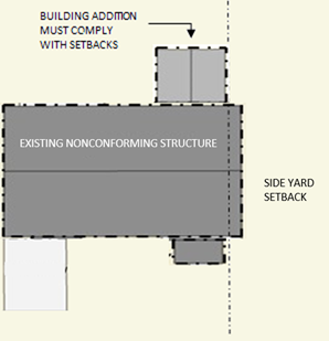
Side Yard Setbacks
Additional height is only permitted to extend inside the specified district side yard, even when a nonconformity encroaches into the side yard.
q.
Nonconforming Lots of Record on Barrier Islands Zoned RMF. Nonconforming lots of record zoned RMF shall also comply with Section 124-283(d).
r.
Signs. As specified in Section 124-218(a).
s.
Outdoor Refuse Collection and Storage Areas. As specified in the underlying zoning district, except that:
1.
Except for RE/SKOD and RSF/SKOD zoned properties or single-family properties in other districts, all outdoor refuse collection and storage areas shall be visually screened from the public or private right-of-way with an opaque material, which may include walls or fences. No portion of a refuse container shall be visible from a public or private right-of-way. Fences must be 100 percent opaque. Materials stored in said areas shall not protrude above the screen.
2.
No outdoor refuse storage area shall be located in the minimum required street yard with the exception of existing refuse storage areas in compliance with subsection 1., above. The Administrator may grant a waiver from this standard if the refuse storage area is set back from the right-of-way to the greatest extent possible without creating undue hardship on the owner. For the purposes of this section, only the following conditions shall be deemed a hardship:
i.
Loss of an off-street parking space when the property is deficient in the required minimum number of off-street parking spaces;
ii.
The demolition of a portion of an existing principal or accessory structure, excluding a wall or fence; or
iii.
The removal of a tree with a caliper in excess of 12 inches, measured four feet above grade.
t.
Newsracks. As specified in Section 98-10 of the County Code, except that:
1.
All Modular Newsracks shall be forest green in color. No other Newsrack on Public Land or within a required street yard shall be located within 500 feet of a Modular Newsrack, except as provided herein. Modular Newsracks may not be placed within 250 feet of each other, except that two Modular Newsracks may be placed side-by-side. Upon installation of a Modular Newsrack, operators of all other types of Newsracks within 500 feet shall remove them within 30 days, unless the Operator of the Newsrack can demonstrate to the Administrator that display space is not available in the Modular Newsrack. A requirement to pay a reasonable fee for use of the Modular Newsrack does not render the Modular space unavailable. Any Newsrack remaining or installed within 500 feet of a Modular Newsrack shall be forest green in color.
u.
Outdoor Display. Pursuant to Section 124-74(d)(1)m., Outdoor Display shall be an allowable Temporary Use within the Siesta Key Overlay District, subject to the provisions of Sections 124-49 and 124-52.
(5)
Myakka River Protection Zone (MRPZ).
a.
This is an overlay district that is in addition to the underlying or base zoning district (for example OUE-1/MRPZ). These base districts apply countywide. The base district use regulations can be found in Article 6 of the UDC. Other general development standards relating to parking, signs, etc. are found in Article 8. Three Myakka River setback standards are provided:
1.
A required minimum setback for properties that can accommodate the construction of principal and accessory structures located more than 150 feet from the Myakka River Area;
2.
A limited reduction in minimum setback for properties constrained by the depth and area of the Myakka River Area; and
3.
A performance standard allowing a reduction in minimum setback for properties constrained by private legal instruments filed prior to March 18, 2003.
b.
Purpose and Intent. The Myakka River Protection Zone and the standards as set forth in this section are consistent with and intended to implement the following:
1.
Part III, Chapter 258, Florida Statutes;
2.
The Myakka River Wild and Scenic River Rule, 62D-15, Florida Administrative Code;
3.
The Myakka River Wild and Scenic River Management Plan, and Chapter 54, Article XXI, of the County Code; and
4.
The Myakka River Protection Code, Chapter 54, Article XXXIII, of the County Code.
c.
Definition of Myakka River Area and Protection Zone.
1.
Myakka River Area. That corridor of land beneath and surrounding the Myakka River from river mile 7.5 to river mile 41.5, as per F.S. 258.501, together with a corridor of land including the maximum upland extent of wetland vegetation as determined by the Department of Environmental Protection pursuant to F.S. Ch. 403, and Chapter 62-340, Florida Administrative Code.
2.
Myakka River Protection Zone. An upland buffer that extends 220 feet on each side of the Myakka River (from river mile 7.5 to river mile 41.5) measured from the landward edge of the Myakka River Area.
d.
Applicability.
1.
The Myakka River Use Regulations contained in subsection e. below shall apply to the portions of all lots or parcels that are determined to be within the Myakka River Protection Zone.
2.
All activities conducted within the Myakka River Protection Zone shall be consistent with Chapter 54, Article XXXIII (the Myakka River Protection Code).
3.
The Myakka River Development standards contained in Chapter 54, Article XXXIII, Section 54-1048, of the County Code shall apply to the portions of all lots or parcels that are determined to be within the Myakka River Protection Zone that have a lot area of five or more acres.
e.
Use Regulations. Permitted, Special Exception, Limited and Accessory Uses are allowed in the Myakka River Protection Zone if and only if the uses in the underlying zoning district are allowed as Permitted, Special Exception, Limited, or Accessory Uses. In the event of a conflict between this UDC and the underlying zoning district use regulations, the most restrictive of the use regulations shall apply. For example, in the event that a use is a Special Exception in the Myakka River Protection Zone and Permitted in the underlying zoning district, a Special Exception is required.
1.
Permitted Uses. The following uses are permitted if and only if they are permitted in the underlying zoning districts:
i.
Single-family dwelling unit.
ii.
Family day care home.
iii.
Emergency services, fire, sheriff or medical station.
2.
Limited Uses. The following uses shall be permitted as limited uses if and only if they are permitted or limited uses in the underlying zoning districts.
i.
Commercial uses.
a)
Only those commercial uses legally existing prior to December 8, 2003, shall be allowed to continue.
b)
Expansion of such uses shall be done in accordance with subsections (f) through (j), below.
ii.
Game preserve, wildlife management area, refuge, wild animal sanctuary, water conservation area. (NAICS 71219).
a)
No exotic animals shall occupy or be kept in the Myakka River Protection Zone.
iii.
Campground (NAICS 721211).
a)
No structures shall be located in the Myakka River Protection Zone.
b)
Portions of campgrounds located in the Myakka River Protection Zone shall be limited to primitive camping.
c)
Campgrounds shall only be located on parcels with an existing river front buffer with a minimum opacity of 0.6.
d)
Campgrounds shall not be permitted in underlying RSF and RMF Zone Districts.
iv.
Day camp.
a)
No structures shall be located in the Myakka River Protection Zone.
v.
Hunting and fishing camps and dude ranch (Defined in Section 124-305).
a)
Only existing dude ranches on December 8, 2003, shall be permitted in the Myakka River Protection Zone.
b)
Hunting and fishing camps shall be limited to private, noncommercial operations. See special exception uses below for commercial hunting and fishing camps.
vi.
All agriculture.
a)
Only existing commercial agricultural operations classified as such by the Sarasota County Property Appraiser shall be permitted in the Myakka River Protection Zone.
vii.
Utilities (Defined in Section 124-305).
a)
Only regional linear utility infrastructure (e.g. road, bridge, water or sewer main, natural gas main, etc.) approved by the Board shall be permitted in the Myakka River Protection Zone, except in cases where jurisdiction lies with state, federal, or regional agencies.
viii.
Guest house.
ix.
Place of worship.
3.
Special Exception Uses. The following uses shall be special exception uses in the MRPZ regardless of whether they are permitted, limited or special exception uses in the underlying zoning districts.
i.
Membership club and lodge.
ii.
Commercial dock, pier in compliance with Chapter 54, Article XX, Water and Navigation Control Authority, of the County Code.
iii.
Commercial or public outdoor field archery range.
iv.
Riding academy.
v.
Public stable.
vi.
Rural retreat center, subject to the following standards:
a)
The center shall be located on a parcel of no less than 20 acres in size.
b)
The maximum density of a rural retreat center shall be determined at the time of the issuance of the special exception permit, however in no case shall the overnight accommodations associated with the center exceed 30 units.
c)
Each unit having kitchen facilities shall be equal to one dwelling unit. Each unit not having kitchen facilities shall be equal to one-half dwelling unit.
d)
No more than one group or event shall have use of a rural retreat center at a given time.
vii.
New hunting and fishing camps.
4.
Existing Structure Only.
i.
Townhouse (weak-link, roof-deck and stacked) and multifamily (multiplex and apartment).
ii.
Manufactured home/subdivision.
iii.
Cemetery, columbaria, mausoleum, memorial park (NAICS 71219).
iv.
Recreational vehicle park.
5.
Prohibited Uses.
i.
Any use or structure not specifically permitted by the underlying district or the MRPZ is prohibited.
ii.
The following uses shall be prohibited in the MRPZ:
a)
Monastery, convent.
b)
Landfill.
c)
Recycling center.
d)
Waste treatment plant and tank.
e)
Jails, detention facilities or work camps.
f)
All light industrial services.
g)
All heavy industrial uses.
h)
All sales oriented.
i)
Outdoor storage yard.
j)
Educational Facilities (NAICS 611).
k)
Circus ground (NAICS 71119).
l)
Winter quarters or training quarters.
m)
Library.
n)
City, county, state, or federal government office.
o)
Aircraft landing strip or helicopter landing facility.
p)
Excavation of sand, gravel or minerals, borrow pit (NAICS 21232).
q)
Livestock auction.
r)
Packing house for fruits and vegetables.
s)
Processing of food and related products.
t)
Retail or wholesale sales of agriculturally related supplies and equipment.
u)
Animal hospital or veterinarian (NAICS 54194).
v)
Animal boarding place.
w)
Wild animal sanctuary.
x)
Housing for farm or ranch labor, including mobile homes.
y)
Childcare center, nursery school, preschool (NAICS 62441).
z)
Hospitals, including temporary housing for relative of patients.
aa)
Hospice, nursing or convalescent home.
bb)
Residential assisted living facility without individual units.
cc)
Orphanage.
dd)
Alternative or post-incarceration facility, exclusive care and treatment for psychiatric, alcohol, or drug problems, where patients are residents.
ee)
Group home for the physically disabled, mentally retarded, or emotionally disturbed that with 14 or more residents.
ff)
Group home for drug and alcohol treatment, treatment center.
gg)
Golf course/country club.
hh)
Miniature golf facility.
ii)
Golf driving range.
jj)
Aquaculture.
6.
Accessory Uses. The following uses and structures shall be considered accessory uses and structures in the Myakka River Protection Zone:
i.
Recreational trails, gazebos up to 400 square feet in floor area, boardwalks and passive recreation areas and other uses in compliance with the vegetative removal standards contained in Chapter 54, Article XXXIII of the County Code and this UDC, in compliance with Section 124-73, Accessory Uses and Structures.
ii.
Private stable on residentially zoned properties.
f.
Myakka River Criteria for Standards Relief Eligibility.
1.
Parcels created before March 18, 2003, shall be eligible for the relief consideration as set forth in Sections 54-1048 and 54-1049 of Chapter 54, Article XXXIII, of the County Code. Only those parcels with easements or other legal restrictions filed prior to March 18, 2003, preventing development under the provisions of Section 54-1048 are eligible for the relief provided below.
2.
The requested modification does not result from any prior action by the applicant on the subject property after March 18, 2003.
3.
For existing structures erected riverward of the setbacks set forth in Section 54-1048, before March 18, 2003, or in accordance with paragraph 1. above, expansions shall be made in accordance with the provisions set forth below. A structure less than 150 feet from the river area built before March 18, 2003, can be expanded, but not encroach closer to the River Area, in exchange for buffering or design tradeoffs.
g.
Submittal of Applications for Relief. All requests for a deviation from the standards in Section 54-1048 shall be submitted in writing to the Administrator. The Applicant shall document how the deviation meets the following criteria:
1.
The modification requested by the Applicant is the minimum necessary to allow reasonable positioning of the principal structure on the property;
2.
The proposed deviation conforms to the applicable goals, objectives and policies of the Myakka River Protection Plan;
3.
All reasonable steps have been taken to minimize environmental impacts or use conflicts associated with the proposed deviation;
4.
The proposed deviation will not result in significant adverse environmental impacts or use conflicts;
5.
All other relief avenues available to the applicant have been exhausted;
6.
For expansions of existing structures or structures built in accordance with subsection f.1 or f.3 above, that the proposed expansion does not encroach closer to the River Area and cannot be accommodated landward of the structure; and
7.
The proposed deviation does not adversely impact the views from existing neighboring structures to the waters of the Myakka River.
h.
Conditions for Development Approval. The Administrator shall apply conditions and design guidelines necessary to meet the Goals, Objectives, and Policies of the Myakka River Protection Plan. Conditions for Development Approval and considerations of Administrative Adjustments providing relief from the Myakka River Standards may include, but are not limited to:
1.
Minimizing adverse impacts of the alteration upon other areas and activities by stipulating the type, intensity and performance of activities;
2.
Controlling the sequence of development, including when it must be commenced and completed;
3.
Controlling the duration of use and the time by which any temporary structure or device must be removed;
4.
Designating the exact location and nature of development;
5.
Establish a detailed record, pertinent to the request for relief by requiring of the Applicant the submission of elevations, site plans, maps or specifications.
6.
Considerations including:
i.
Adjacent land uses;
ii.
Site specific conditions;
iii.
Proximity to the River Area;
iv.
On-site and adjacent vegetation.
i.
Design Guidelines. A primary goal of the Myakka River Protection Plan is to preserve and protect the scenic value of the River Area by retaining the visual diversity and unique visual Character of the Myakka River as it is seen from the river and vantage points such as public and private recreational facilities and distant shores. In achieving this goal, the following guidelines should be considered in the design, construction and location of any proposed structure that deviates from the standards in Section 54-1048.
1.
Every effort should be made to safeguard natural views to the waters of the Myakka River in accordance with the standard set forth in this subsection;
2.
Structures along and adjacent to the Myakka River should be screened by native species typical to the area;
3.
Vegetation that forms the first line of visual definition, as one looks landward from the water area of the river, should be preserved whenever possible;
4.
Where applicable, trees should be planted in the drifts that generally follow land contours and parallel the water's edge rather than in lines that cut across landscape contours;
5.
Structures should be designed, set back and screened so as to maintain the visual integrity and character of the Myakka River, this shall include addressing the appearance of the structure from the river;
6.
Disruption of natural landform and vegetation should be minimized; and
7.
Accommodation of a proposed expansion towards the waterfront yard shall be considered only if the expansion cannot be reasonably constructed landward of the structure, through the Variance process in accordance with Section 124-44.
j.
Appeals. Decisions of the Administrator regarding the Myakka River standards may be appealed to the Board.
(6)
Conservation Subdivision (CS).
a.
Purpose and Intent.
1.
The purpose of the Conservation Subdivision Regulations are to implement the requirements of the Sarasota 2050 Resource Management Area (RMA) System by creating the following implementation tools:
i.
An alternative subdivision standard to the large lot subdivision form.
ii.
A Conservation Subdivision overlay zoning district to increase density. The only methods available to increase density on a property within the Rural Heritage/Estate RMA, Greenway RMA and the Agricultural Reserve RMA, as depicted and defined within the Sarasota County Comprehensive plan, is to rezone to: Village Planned Development District, Hamlet Planned Development District or Conservation Subdivision overlay district.
2.
The purpose of the Conservation Subdivision Design Standards is to preserve environmental systems, rural character and the viability of agricultural land by creating greater flexibility in the design of residential developments to achieve the following standards:
i.
Create or add to an interconnected network of off-site conservation lands and publicly protected open spaces which extend beyond the individual subdivision boundary and function as a part of a regional conservation strategy as expressed in the Principles for Evaluating Development Proposals in Native Habitats, contained in the Environment Chapter of the Comprehensive Plan;
ii.
Create a network of publicly protected open spaces within an individual subdivision and minimize the total amount of disturbance on a site;
iii.
Minimize disturbance to environmentally sensitive areas, protect biological diversity, and maintain environmental corridors; and
iv.
Minimize the disturbance to the rural landscape elements, preserve scenic views and existing open vistas and protect the integrity of the existing rural community character.
3.
The secondary purpose of a Conservation Subdivision is to provide alternative subdivision standards that will support the following objectives:
i.
Facilitate the construction and maintenance of housing, streets and other infrastructure in a more efficient manner; and
ii.
Protect the viability of agricultural land.
b.
Applicability.
1.
As an alternative form of development. A rezone petition is not necessary when Conservation Subdivision is an alternate form of development and there is not a density increase. Any of the following zoning districts may be developed as a Conservation Subdivision as an alternate subdivision form: OUR, OUE, RE-1, RE-2 and RE-3.
2.
To increase density. A rezoning petition request to increase density within the Rural Heritage/Estate RMA, Greenway RMA and the Agricultural Reserve RMA, as depicted and defined within the Sarasota County Comprehensive Plan, is required to be rezoned to Conservation Subdivision overlay district unless the rezone petition qualifies for and completes a one-time lot split, pursuant to Section 124-42(b)(2) of the UDC. The UDC allows a Conservation Subdivision overlay district on those properties that are zoned OUR, OUE, RE-1, RE-2 and RE-3.
c.
Permitted and Special Exception Uses and Structures.
1.
See Article 6 - General, Base, and Inactive District Development Standards for uses permitted in the appropriate underlying zoning district except for the following uses.
i.
Golf Courses are prohibited in Conservation Subdivision Open Space.
d.
Minimum Lot Requirements and House Types Permitted.
1.
The Conservation Subdivision Overlay permits residential densities, which may take the form of conservation estate housing types and Conservation Subdivision single-family detached homes as specified in subsection e., below. The minimum lot size for Conservation Subdivisions are:
i.
There is no minimum lot size for a Conservation Subdivision which are served by central utilities as long as the minimum lot width is met as specified in subsection e., below.
ii.
The minimum residential lot size for a Conservation Subdivision that does not have central utilities is one acre. The minimum lot size for a Conservation Subdivision that has central water and on-site septic is one-half acre.
e.
Yard and Bulk Standards. The following dimensional standards shall apply to all residential development in Conservation Subdivisions.
f.
Density.
1.
The gross density of a Conservation Subdivision shall not exceed the maximum density established by the property's underlying zoning district with the following exception:
i.
Where land is designated as "Hamlet" future land use designation under the Comprehensive Plan, Future Land Use Map Series. Figure RMA-3, any property assigned an OUE-1 District designation as of the effective date of Sarasota 2050, an owner may apply for a rezoning that would permit a maximum gross density of one dwelling unit per three and one-half acres (1 du/3.5 ac) when developed as a Conservation Subdivision in accordance with these standards; and
ii.
Where land is designated as "Rural Heritage/Estate RMA" under the Comprehensive Plan, Future Land Use Map Series, Figure RMA-3 an owner may apply for a rezoning that would permit a maximum gross density of two dwelling units per acre (2 du/1 ac) when developed as a Conservation Subdivision overlay district in accordance with subsection 2., and meets the following qualifications:
a)
Comprised of unplatted land platted west of the Countryside Line; and
b)
Entirely located within one mile of the Urban Service Boundary; and
c)
Served by Sarasota County water, wastewater, and reclaimed water facilities.
2.
For Conservation Subdivisions utilizing the density incentive pursuant to RHE Policy 1.2, the residential density shall be derived as follows:
i.
The base residential density of the Conservation Subdivision's gross acreage based upon the underlying zoning district; and
ii.
Additional residential density may be obtained by transfer to the Developed Area from on-site Open Space pursuant to the Transfer of Development Rights program contained in Section 124-271(m); and
iii.
Additional residential density may be obtained by transfer to the Developed Area from offsite Sending Zones pursuant to the Transfer of Development Rights program contained in Section 124-271(m).
g.
Open Space Requirements.
1.
Required Minimum Open Space. A minimum of 50 percent of the gross acreage of the parcel shall be designated as Conservation Subdivision Open Space, exclusive of individual lots.
2.
Restrictive Covenant. Conservation Subdivision Open Space shall be preserved in perpetuity through the use of a Restrictive Covenant. The covenant shall be in such form as is deemed acceptable by the county attorney and shall be recorded for the entire property which is subject to development including both the residential lots and the remaining open space. Such perpetually restricted open space may be in agricultural uses subject to the limitations within this section.
3.
External Connectedness. Except as otherwise prioritized by subsection 5. below and when off-site open space exists, Conservation Subdivision Open Space shall be configured to create or add to a larger contiguous off-site network of interconnected open space, particularly existing habitats, and opportunities for restoring native habitats. Whenever opportunities exist to create connections with existing or potential off-site open space, greenways or conservation systems on adjoining parcels or with existing or proposed local or regional recreational trails, such connections shall be provided. Opportunities for connections will be determined based upon the natural features of both the subject property and adjacent properties; the existence of connected natural systems, the existence of the Greenway RMA, the existence of a proposed local or regional trail, or the existence of other such features that would function and support the purpose and intent of a Conservation Subdivision. Where Conservation Subdivision Open Space would further support critical linkages of either an existing or proposed local or regional recreational trail, such connection shall be made accessible to the public for such purpose.
i.
The configuration of the open space shall be determined on a case-by-case basis to promote long term conservation of native habitats which are connected to other areas of compatible land use with assurance of appropriate management in perpetuity. Nothing herein shall be construed to require a property owner to purchase or otherwise secure connections on lands outside of the boundaries of the Conservation Subdivision.
4.
Internal Connectedness. Conservation Subdivision Open Space shall be configured to create connected and integrated Open Space within the subdivision parcel to the maximum extent practicable and shall be based upon the context sensitive site design standards and priorities that are provided in subsection 5. below. Conservation Subdivision Open Space shall still be considered connected if it is separated by a roadway or accessory amenity. The configuration of the open space shall be determined on a case-by-case basis to promote long-term conservation of native habitats which are connected to other areas of compatible land use with assurance of appropriate management in perpetuity. Nothing herein shall be construed to require a property owner to designate more than the minimum required open space in the fulfillment of this provision.
5.
Context Sensitive Site Design. The areas to be preserved shall be identified on a case-by-case basis to address the individual natural features of each site. The management guidelines shall be determined by applying the "Principles for Evaluating Development Proposals in Native Habitat," Chapter 1 of the Comprehensive Plan. These objectives, in order of priority, are to: 1) protect listed species, 2) create/enhance connectivity of open space, 3) protect native habitat, and 4) restore native habitat. The relative size and functional value of each feature shall be assessed as a part of the site design process to determine the protection measures required. Based on an assessment of the quality and quantity of on-site natural resources, departures from the above prioritization are allowed. In addition to the protection of natural features as described above, other types of allowable open space may be provided as a secondary priority including:
i.
Viewshed protection of existing and planned public roadways;
ii.
Continuation of agriculture uses; and
iii.
Recreation.
6.
Maintenance of Native Habitat Areas. Protected habitat areas as defined in subsection 5., above within the Conservation Subdivision Open Space, shall not be converted to other uses, and shall be maintained in their natural condition and managed to sustain or enhance their native function. These areas may be modified to restore the overall condition and natural functions of the features.
7.
Permitted Uses. Permitted uses within the Conservation Subdivision Open Space shall include:
i.
Active recreation areas, as defined by Section 124-72(b)(2)b, which do not exceed ten percent of the required minimum open space or five acres, whichever is less. Approved equestrian facilities utilizing best management practices shall be exempt from the above limitation.
ii.
Unpaved Bikepaths and trails.
iii.
Equestrian Trails.
iv.
Restoration and maintenance activities to sustain or enhance the functions of native habitats.
v.
Agricultural lands designated as required Conservation Subdivision Open Space shall, at the time of platting, have a current Agriculture classification for property tax purposes as determined by the Sarasota County Property Appraiser. Agricultural lands within Conservation Subdivision Open Space shall be required to use Best Management Practices. The use and continuation of Agricultural Best Management Practices shall be verified during the application process for a Conservation Subdivision. Future uses shall be limited to those agricultural uses that create or preserve areas intended primarily for the raising of animals and crops, conservation, and the secondary industries associated with agricultural production as defined by the agriculture characteristics in Section 124-305, excluding secondary industries associated with agricultural production.
vi.
Structures shall be limited in Conservation Subdivision Open Space to include only accessory agricultural structures where agricultural uses are permitted, those structures permitted by subsection i., above and one caretaker dwelling unit, not exceeding 2,000 square feet of floor area, on agricultural open space of 50 acres or more. The caretaker dwelling unit shall be excluded from the density calculation for the Conservation Subdivision.
vii.
Stormwater management systems serving the Conservation Subdivision may be located within the Conservation Subdivision Open Space, provided the stormwater systems are unfenced and are surrounded by or adjoin areas that are improved for use as a recreation area for use by the cluster subdivision residents provided the system does not remove native habitat, or compromise the long term management of natural areas within the open space for the conservation of native habitats.
viii.
Landscape buffers as required in subsection j., Residential Development Setback and Buffer Requirements, below.
8.
Prohibited Uses. The following uses are prohibited within the Conservation Subdivision Open Space:
i.
Golf Courses;
ii.
Internal Subdivision Streets within the residential development; and
iii.
Other actions that convert native habitats, or diminish their function or connectivity to adjacent off-site conservation areas.
9.
Land Management Plan. A plan for the use and maintenance of the Open Space shall be submitted, as a part of the Master Development Plan approval process and compliance with said plan shall become a condition of the development order for the rezoning, where applicable, a condition of the subdivision approval and a condition of the Restrictive Covenant. The Land Management Plan shall address the following:
i.
Ownership;
ii.
Baseline environmental assessment of the Open Space;
iii.
Detailed action plan for land management that addresses an initial ten-year timeframe. The Land Management Plan shall include a schedule and process for resubmitting a revised and updated Land Management Plan during the ninth year of the plan as an additional requirement for the biannual monitoring report for that year;
iv.
Compatibility with the County's Environmental Lands Master Land Management Plan when adopted;
v.
Specific Responsibilities for the regular and periodic operation and maintenance of Open Spaces by private entities including strategies for preservation, conservation or restoration of native habitats to assure the connectivity, function and quality of a network of native habitats in perpetuity;
vi.
Incorporation of standards outlined in the National Fire Protection Association (NFPA) 1144 as reviewed by the authority having jurisdiction;
vii.
Requirements for the submission of a bi-annual monitoring report to the county which includes conditions and methods of enforcement of obligations;
viii.
If applicable, plans for restoration of native habitats; and
ix.
A Fortuitous Finds Policy that clearly identifies the procedures if and when cultural resources are identified during the regular maintenance activities of the property. This policy shall be consistent with the Sarasota County Fortuitous Finds Policy contained within Article III, Chapter 66 (Section 66-81) of the County Code and the Historic Preservation Chapter of the Comprehensive Plan.
10.
Access. Safe and convenient pedestrian access and access for maintenance purposes shall be provided to the Open Space areas, except, however, that areas used for agricultural purposes or for stormwater systems may be restricted.
h.
Design Standards.
1.
Greater flexibility and creativity in the design of residential developments to preserve on-site environmental resources and preservation areas is permitted through the subdivision development approval process and as established through the design criteria provided herein. Conservation Subdivisions shall be organized into two components: 1) residential development and 2) Conservation Subdivision Open Space.
i.
Residential Development.
1.
The location of residential development lots shall be configured to meet the following standards in all material respects:
i.
Residential lots shall be arranged in a contiguous pattern except as necessary to preserve the function, purpose and integrity of the on-site natural resources and environmental systems to the maximum extent practicable.
ii.
Minimize disturbance to native habitats and other natural features.
iii.
Protect and preserve the rural character and appearance of land when viewed from public roads and from abutting properties.
j.
Residential Development Setback and Buffer Requirements.
1.
The landscape buffer shall be 20 feet wide. Landscape buffer areas are required as detailed below in order to protect and maintain the rural and agricultural character of the area. Landscape buffer areas are common facilities and shall be required as part of the open space around the residential development in a Conservation Subdivision. Existing vegetation within the buffer area shall generally be maintained in its natural condition, but may be modified to restore the overall condition and natural functions of the area. The minimum landscape buffer shall consist of four large trees and six medium/small trees per 100 lineal feet and a continuous hedge with a minimum height of three feet at planting.
2.
The residential development shall be setback a minimum of 100 feet from all Conservation Subdivision property boundary lines and road rights-of-way. The landscape buffer described above in paragraph 1., shall be located in the required 100-foot setback and abut the entire perimeter of the residential development. The County Commission shall have the authority to modify the minimum setback requirement. This modification may occur upon an applicant's satisfactory demonstration of the need for and purpose of the modification which shall include any mitigation of potential adverse impacts. No such modification shall conflict with the purpose and intent of Conservation Subdivisions as provided in Section 124-102(b)(6). The applicant shall indicate the modification sought within an application at the time of filing the rezone petition, identify the modification on the binding Development Concept Plan, provide documentation demonstrating that the modification does not conflict with the purpose and intent of Conservation Subdivisions, and provide documentation that the modification is compatible with surrounding development.
k.
Conservation Subdivision Street Standards.
1.
Support of Rural Character: The choice of minimum street design specifications shall provide safe and efficient access for vehicles, bicyclists, and pedestrians. First and foremost, street design shall support the rural character of the Conservation Subdivision. Given the projected average traffic volume for Conservation Subdivision uses and densities, the number of necessary travel lanes is limited to two.
2.
Minimum Street Design Specifications: All streets and multi-use trails shall be designed in accordance with the following minimum specifications, as depicted in the table below. These street standards are hereby called the Conservation Subdivision Street Standards and travel lane widths and required rights-of-way are established herein.
1 Under circumstances of extreme constraint, including constraints of environmentally sensitive areas, the minimum pavement width for a multi-use trail of 12 feet may be reduced to ten feet.
3.
Design and construction of the street network is limited by the following:
i.
Only Road-Open Drainage and Multi-Use Trail shall be permitted within the Open Space.
ii.
Only Lane Closed Drainage, Lane-Open Drainage, and Multi-Use Trail shall be permitted within the Residential Development.
iii.
Lane-Closed Drainage shall be used to serve lots that are 50 feet or less in width.
4.
Regarding street design elements not specified in the Conservation Subdivision Street Standards, final street design and location for all streets shall encourage open space conservation and pedestrian/bicycle safety and comfort through the application of minimum standards for vehicles (e.g. roadway widths will be kept to the minimum necessary for vehicular movement in order to achieve this goal).
5.
The Conservation Subdivision Street Standards are typical, and thus shall be modified to accommodate special circumstances. Such modifications shall be reviewed by all pertinent County departments and divisions (Engineering, Emergency Services, Sheriff's Office, and Solid Waste) and shall be approved by the Planning and Development Services Director and County Engineer.
6.
All multi-use paths within vehicular rights-of-way shall comply with the Americans with Disabilities Act and Florida Accessibility Code standards.
7.
Paving Materials: All roadways within Conservation Subdivisions shall be surfaced with asphalt bituminous, concrete, or dustless material approved by the County Engineer, and maintained in a smooth, well-graded condition.
8.
Continuation of Street Pattern between Phases: The street layout of subsequent phases shall be coordinated with the street system of previous phases.
9.
Traffic Calming:
i.
All streets within Conservation Subdivisions shall be constructed and designed to the vehicular design speed standards provided in the table above and shall promote the safety of pedestrians and bicyclists. Traffic calming measures that modify vehicle speeds and other driver behavior and that support the rural character may be used to promote the pedestrian orientation within Conservation Subdivisions.
ii.
Developers shall coordinate with the County Engineer on the design and placement of traffic claiming measures within Conservation Subdivisions.
iii.
Traffic calming on any collector or arterial road, as designated by the Comprehensive Plan, shall be balanced with its regional vehicle traffic-carrying role.
(7)
East Venice Avenue Overlay (EVA).
a.
Purpose and Intent.
1.
All development within the East Venice Avenue Overlay shall comply with this section. Subsection f., below is applicable to applicants who receive Comprehensive Plan land use changes subsequent to the date of this Ordinance, but may also be implemented by owners seeking Rezonings or Special Exceptions under current land use designations.
b.
Applicability. All new development or redevelopment within the Overlay shall comply with this section with regard to:
1.
Any Comprehensive Plan Amendment.
2.
Any Rezoning or Special Exception.
3.
Any Site Development Plan application.
c.
Boundaries of the Overlay. The boundaries of the East Venice Avenue Overlay are as follows:
That part of Sections 1, 2, 10, 11, 12, Township 39 South, Range 19 East and Sections 6, 7, Township 39 South, Range 20 East Sarasota County, Florida, being more particularly described as follows:
Begin at the intersection of the westerly Right-of-Way line of North River Road and the south line of said Section 7; thence run westerly along the said southerly line of Section 7 and the southerly line of said Sections 12, 11 and 10 for a distance of 15,200 feet, more or less to the intersection with the easterly Right-of-Way line of Jacaranda Boulevard; thence run northeasterly and thence northerly along said easterly Right-of-Way line of Jacaranda Boulevard for a distance of 6,000 feet more or less to the intersection with the southerly Right-of-Way line of Interstate 75 being Interstate Exit number 193; thence run easterly along said southerly Right-of-Way line of I-75 for a distance of 12,000 feet, more or less to the intersection with the westerly Right-of-Way line of North River Road and being Interstate Exit number 191; thence run southeasterly along said westerly Right-of-Way line of North River Road for a distance of 6,200 feet, more or less to the intersection with the south line of said Section 7 and also being the Point of Beginning.
d.
Definitions. The following words and phrases shall have the meanings respectively ascribed to them in this Section, except where the context otherwise requires:
1.
Platted Roads — Roads platted in a network grid pattern in the original Venice Farms and East Venice Farms plats. Platted Roads on the north side of East Venice Avenue shall include Greencove and Lee Roads and all Platted Roads between Greencove and Lee Roads located between East Venice Avenue and I-75. Platted Roads on the south side of East Venice Avenue shall include all Platted Roads in the Overlay Area south of East Venice Avenue.
2.
North/South Platted Roads — The north/south Platted Roads.
3.
East/West Platted Roads — The east/west Platted Roads, excluding East Venice Avenue.
4.
Blocks — A collection or assemblage of lots formed in a logical and contiguous pattern within the quadrangle formed by the adjacent Platted Roads or by the adjacent Platted Roads and East Venice Avenue. Blocks may be full or partial as defined below. Block planning standards are identified in subsection f., below.
i.
Full Block — a Block which incorporates all properties within the quadrangle formed by the adjacent Platted Roads or by the adjacent Platted Roads and East Venice Avenue.
ii.
Partial Block — a portion of a Block limited to either an assemblage of all lots facing East Venice Avenue between two North/South Platted Roads (approximately 20 acres) or the remainder of the Block (approximately 40 acres).
iii.
Blocks north of Bonita Road - exempted from Block planning unless they are incorporated into Blocks to the south of Bonita Road.
5.
North Blocks — Blocks located north of East Venice Avenue, located between two North/South Platted Roads and between two East/West Platted Roads or an East/West Platted Road and East Venice Avenue.
6.
South Blocks — Blocks located south of East Venice Avenue.
7.
Laneway — An informal, traveled improved surface between Platted Roads, providing access to the Platted Roads for one or more properties which may not be adjacent to the Platted Road. Laneways are of varying widths and locations.
8.
Context Sensitive Solutions (CSS) — A method of designing and developing roads promoted by the Institute of Transportation Engineers (ITE), American Association of State Highway Transportation Officials (AASHTO) the Federal Highway Administration (FHWA) and state departments of transportation. The design process features public workshops with consideration of location, character of the area to be served, and service and safety needs.
The intent of CSS is to meet the needs of the local citizens and avoid overbuilding roadways. Construction methods must continue to ensure safe and durable roadbeds and paved areas, but driving lanes may be narrower than current standards typically allow; traffic calming devices and lower speed limits may be incorporated; and alternative methods of striping and traffic controls that are consistent with the Manual on Uniform Traffic Control Devices (MUTCD) may be considered.
9.
Multiuse Trail — Separated public travel surface for pedestrians, bicycles, and other forms of individual, non-gas powered transportation.
10.
Exempted Areas — Parcels removed by the Board from certain requirements of the Overlay Area development conditions as noted. Exempted Areas are described in subsection g.2, below.
11.
Natural Systems Features Map — A preliminary delineation of significant floodplains and likely areas of protected habitats based on an aerial interpretation of the 100-year floodplain and soil/habitat maps. The Map details have not been field verified or surveyed for permitting purposes, but the Map may be used for conceptual planning purposes. The Map is contained within the East Venice Avenue Planning Study Report.
12.
Full Median Opening Intersection — A Full Median Opening Intersection is a location where a roadway crosses another roadway or driveway where the crossing allows for all possible turning movements.
13.
Restricted Median Opening Intersection — A Restricted Median Opening Intersection is a location where a roadway ("main street") crosses another roadway or driveway ("side street") where turning traffic is limited via the use of raised traffic separators and traffic control devices such as signage and pavement markings where appropriate. Left turns from the main street to the side street are permitted. Through traffic and left turns from the side street are prohibited.
14.
Median Access Plan — The Median Access Plan is a graphic depiction of the permissible Full Median Opening Intersection and Restricted Median Opening Intersection locations within the East Venice Avenue Overlay. The Median Access Plan may be modified by resolution of the Board after a public hearing noticed in accordance with Section 124-36(c)(5)a and b of this UDC.
e.
Conditions of Development. The following Conditions are applicable to all development and redevelopment in the Overlay Area:
1.
General Conditions.
i.
Applicants shall advise future residential owners that "homes or property may be located near rural or agricultural uses which may not meet urban standards, which may generate noise and farm-related odors, and where farm animals and activities may be present." Such notice shall be provided by the following means, as applicable:
a)
On residential Subdivision Plats.
b)
On condominium plats.
c)
On Site Development Plans for mixed use projects containing residential uses.
d)
Within the recorded declarations for property, homeowner or condominium associations.
ii.
The Natural Systems Features Map shall be used as a guide base map for natural systems protection in the Overlay Area. The exact boundaries of the natural systems featured may be modified based upon field analysis and surveying.
iii.
Developments fronting River Road shall comply with the conditions of Sarasota County's River Road Animal Crossing Plan.
iv.
The Context Sensitive Solutions (CSS) may be undertaken for the development of certain Laneways, Multiuse Trails, and paved Platted Roads, but shall be undertaken for unimproved Platted Roads and associated Multiuse Trails. Applicants for CSS approval shall:
a)
Prior to design of the road or trail, hold a community workshop with the residents and property owners of the Overlay Area.
b)
Notify all residents and property owners of the Overlay Area by mail.
c)
Follow notification periods and times and locations of meetings consistent with the neighborhood workshop requirements in accordance to the procedures established for that purpose by Resolution of the Board.
d)
Discuss with the residents the types and locations of the roads and trails under consideration, anticipated travel loads, environmental and scenic considerations, and potential design opportunities. If the applicant is seeking alternatives described in, subsection 3.iii(v), below, the developer shall describe the alternatives being sought.
e)
Solicit written and oral comments from the meeting attendees and provide a copy of any written comments and a summary of oral comments with the application for rezoning, special exception, variance or Comprehensive Plan Amendment.
f)
Obtain Boards approval.
2.
Parking.
i.
All parking areas for new nonresidential developments shall be located behind buildings away from East Venice Avenue and Platted Roads.
ii.
Parking areas for multifamily residential uses may be located between buildings and East Venice Avenue or Platted Roads as long as the parking area and parked cars are fully screened from the road.
iii.
Garages or accessory buildings in new residential developments shall not face East Venice Avenue. Side or rear yard garage entrances are encouraged throughout the Overlay Area. Garages or accessory buildings shall not be a prominent feature of the front of the residential unit. Garages or accessory buildings for residential units fronting the Platted Roads shall be set back at least 20 feet from the plane of the unit facing the Platted Road.
3.
Road Standards and Access Management.
i.
East Venice Avenue Access Management between Jacaranda Boulevard and North River Road for properties located south of East Venice Avenue and for properties located north of East Venice Avenue west of Greencove Road and east of Lee Road shall be subject to the following:
a)
Median Opening Intersections shall be limited to the types and locations specified in the Median Access Plan. The Restricted Median Opening Intersection locations on the Median Access Plan are approximate. Their locations relative to Full Median Opening Intersections have been rounded to the nearest 0.125 mile (660 feet) increment. The final locations of Restricted Median Opening Intersections may vary 50 feet on either side of the specified location.
b)
A Restricted Median Opening Intersection may operate as an unrestricted access location until such time as East Venice Avenue is widened to a four-lane divided facility or is otherwise constructed to include a raised median in the vicinity of the designated Restricted Median Opening Intersection.
c)
Permanent Right Turn In/Right Turn Out Intersections (Permanent Right Turn Intersections) may be permitted at locations no less than 245 feet from any existing access location or intersection and no less than 245 feet from any proposed Median Opening Intersection location. For any parcel, prior to or concurrent with construction authorization for development generating vehicular traffic greater than that generated by existing development, a vehicular cross-access shall be provided to adjoining properties and the public via easement(s) or existing rights-of-way. To accommodate significant increases in traffic, the construction of Permanent Right Turn Intersections shall include adequate deceleration lanes on East Venice Avenue.
d)
Temporary access requests on or after the effective date of this ordinance shall be limited to a single temporary Right Turn In/Right Turn Out Intersection (Temporary Right Turn Intersection) for any parcel. A Temporary Right Turn Intersection shall be allowed to be used unless or until such time traffic generated by development on the parcel exceeds 75 gross vehicle trips per day based on traffic counts or as estimated through application of the procedures contained in the latest edition of the Institute of Transportation Engineers' Trip Generation, Prior to or concurrent with construction plan approval for cumulative development generating more than 75 gross vehicle trips per day, a vehicular cross-access shall be provided to adjoining properties and the public via easement(s) or existing rights-of-way. All Temporary Right Turn Intersections shall be eliminated when access is available to a Median Opening Intersection or a Permanent Right Turn Intersection either directly or indirectly through a vehicular cross-access easement or right-of-way.
ii.
East Venice Avenue Access Management between Jacaranda Boulevard and North River Road for properties north of East Venice Avenue located between Greencove Road and Lee Road:
a)
Properties abutting East Venice Avenue shall access East Venice Avenue from the nearest North/South Platted Road. Access to the nearest North/South Platted Road shall be provided via a Laneway located at the rear of the property which shall be designed and constructed by the developer and aligned to provide access to the Platted Roads to the east and to the west.
b)
Properties abutting East Venice Avenue shall provide cross access from the adjacent properties to provide access to the North/South Platted Roads.
c)
Consistent with subsection 3.i.d), above, properties abutting East Venice Avenue but not abutting a North/South Platted Road, may be granted Temporary Right Turn Intersection access until such time as the Laneway is constructed on neighboring properties between the subject parcel and a North/South Platted Road.
iii.
Platted Roads.
a)
Applicants or developers shall construct or upgrade the Platted Roads adjacent to their parcels.
b)
Applicants or developers shall also construct or upgrade all of the Platted Roads necessary to provide access to East Venice Avenue from the property.
c)
All Platted Roads shall be improved or upgraded to County standards except as provided in paragraph d), below.
d)
A Context Sensitive Solutions (CSS) may be undertaken and approved by the Board for all Platted Roads except all of Jackson Road and the portion of Havana Road south of East Venice Avenue.
e)
Developers undertaking the CSS process may undertake exceptions to the UDC relative to reducing lane widths and speed limits.
f)
Driveways from residential units to the platted roads shall be prohibited, except multifamily developments of five or more units may share one ingress and egress to a Platted Road.
iv.
Laneways.
a)
Laneways shall be shown on development concept plans, and construction plans, and shall be constructed concurrently with the proposed development.
b)
Laneways at the rear of lots fronting the north side of East Venice Avenue shall be aligned to provide access for properties to the east and west. These Laneways shall be a minimum of 20 feet wide.
c)
Sidewalks adjacent to Laneways are not required if a Multiuse Trail within the development fulfills a similar function.
v.
Multiuse Trails.
a)
Construction or upgrading of the Platted Roads shall include the construction of Multiuse Trails. Multiuse Trails may meander through adjacent developments.
b)
Users must be able to reach the same destinations within approximately the same timeframe as they could if the Multiuse Trail were adjacent to the Platted Roads.
c)
The Multiuse Trail shall be a minimum of ten feet in width.
4.
Connectivity.
i.
New developments and redevelopment projects shall provide motor vehicle, Multiuse Trail, and other vehicle and pedestrian interconnections among all uses as well as connection to all adjacent properties and to the Platted Roads.
ii.
Connectivity shall be set forth on a development concept plan at the time of rezoning or special exception application.
iii.
If adjacent properties are not undertaking development concurrently, the developing property shall provide reasonable opportunities for future connections to all adjacent properties. Adjacent properties shall connect to the existing roads, Laneways, Multiuse trails and other vehicular and pedestrian connections if and when they develop.
iv.
Culs-de-sac and dead-end streets are prohibited unless connection is limited by geographic conditions or protected habitat preservation areas as determined by the County Environmental Protection Division.
v.
All streets, Laneways, and Multiuse Trails shall be public.
5.
Utilities.
i.
Water.
a)
Central Water service shall be provided by the County except as provided below. The developer shall be responsible for the costs of design and construction of all infrastructure required for connection to the County system, including distribution and transmission lines.
1)
Special exception uses approved by the Board as of September 9, 2008, unless otherwise required. However, when provided notice by the County that central water service is available, the development shall connect to central water service within 365 days of notice.
2)
Expansion of permitted uses existing as of September 9, 2008, currently using a well unless otherwise required. However, when provided notice by the County that central water service is available, the development shall connect to central water service within 365 days of notice.
b)
The Board may approve alternate systems, other than wells which are based on new technologies or environmentally friendly methods and comply with applicable federal, state and local regulations.
ii.
Wastewater.
a)
Central wastewater service shall be provided by the County except as provided below. The applicant shall be responsible for the costs of design and construction of all infrastructure required for connection to the County system, including collection and transmission lines.
1)
Special exception uses approved by the Board as of November 18, 2008, unless otherwise required. However, when provided notice by the County that central sewer service is available, the development shall connect to central sewer service in accordance with Section 126-58 of the County Code.
2)
Expansion of permitted uses existing as of November 18, 2008, currently using a septic tank unless otherwise required. However, when provided notice by the County that central sewer service is available, the development shall connect to central sewer service in accordance with Section 126-58 of the County Code.
b)
The Board may approve alternate systems, other than septic tanks, which are based on new technologies or environmentally friendly methods and comply with applicable federal, state and local regulations.
iii.
Communication and Energy Utilities.
a)
Utilities, including telephone, television and communications cable, and electrical lines shall be installed underground. Exceptions may be made for major transmission lines.
b)
Appurtenances which require above-ground installation, such as transformers and cable boxes, shall be placed behind buildings, or located where they are not visible from streets or shall be completely screened from streets with landscaping.
6.
Stormwater/Tree Preservation.
i.
Sites shall be designed to save trees and avoid fill from off-site. Applicants shall have a pre-application meeting with the Southwest Florida Water Management District (SWFWMD) and Sarasota County's Stormwater Division to demonstrate that the site has been designed to save trees and avoid or eliminate the need for fill.
7.
Landscaping.
i.
Landscaping along East Venice Avenue (Jacaranda Boulevard to River Road).
a)
All residential development shall be fully screened from East Venice Avenue through the use of berms or native habitat vegetation consistent with the natural habitat systems of the Overlay Area and not requiring irrigation.
b)
Except as provided in paragraph d) below, walls are prohibited along East Venice Avenue unless fully screened from East Venice Avenue by native vegetation or berms.
c)
A 25-foot vegetative buffer shall be provided along East Venice Avenue adjacent to new development. Nonresidential development, requiring rezones or special exceptions, may request a waiver from the Board. The Board will consider such waivers for parks, plazas, civic open space, or architectural alternatives as substitutes for the buffer.
d)
Parcels within the Exempted Areas may utilize walls if they are set back at least ten feet from East Venice Avenue and landscaped on the street side to a minimum opacity level of 0.50 as provided in Section 124-122(i)(3) of this UDC.
ii.
Landscaping along Platted Roads.
a)
Native habitat buffers are permitted.
b)
Solid walls and fences are prohibited.
c)
Open fences with vegetative screening are permitted for residential uses. The finished side of all fences shall face the street and adjacent properties.
d)
Fences must be set back from the Platted Road right-of-way and any Multiuse Trails by at least ten feet. Buffer landscape plantings shall be located on the street side of the fence. Existing trees and other native vegetation located within the ten-foot buffer shall be preserved.
e)
For any fence over four feet in height, the property owner shall landscape the area between the street side of the fence and the right-of-way. The required landscaping is intended to be of sufficient quantities, types, height and densities of materials to reduce the visual impact of the fence. It shall be the responsibility of the property owner to maintain the required landscaping. Existing vegetation or plant material in the landscape area may be used to satisfy the landscaping requirement.
f)
For properties with street frontage on any Platted Road which is re-designated in the future as a collector or arterial road, as designated by the Comprehensive Plan, the maximum height of any fence shall be eight feet. For other Platted Roads, the maximum height of any fence shall be six feet. The height of any wall or fence shall be measured as the highest point above the natural/existing grade on either side of the wall or fence.
g)
Residential side or back yards facing platted roads shall be fully screened from view. No additional screening is required for residential front yards facing the Platted Roads where access is provided from the interior of the development.
8.
Architectural Style and Signage.
i.
Ground signs along East Venice Avenue and the Platted Roads shall be monument signs.
ii.
Signage shall be compatible with the architectural style and materials of the buildings with which they are associated.
f.
Land Use Map Amendments. If the land use density or intensity of a parcel is changed by amendments to the Comprehensive Plan, then the property may only be rezoned to a Planned Development District or a district associated with the special mixed use standards found in this Code. The following additional requirements shall be incorporated into rezone and special exception applications for the properties:
1.
A master Development Concept Plan ("Master Plan") shall be developed for Blocks or Partial Blocks and must include all properties within the defined Block area. The Master Plan shall address roadway, drainage, central water, and central sewer infrastructure for the entire block and incorporate the requirements of this subsection 124-102(b)(7).
2.
Blocks shall meet the following standards:
i.
Partial Blocks fronting East Venice Avenue shall consist of a minimum of 19 acres.
ii.
North Blocks utilizing the Partial Block configuration for parcels adjacent to East Venice Avenue shall include all parcels between the adjacent North/South Platted Roads and may include portions of the remaining block, but in no case shall any North Blocks be configured to leave a remainder of fewer than 19 acres.
iii.
Blocks north of Hardee Road shall be planned as Full Blocks only.
iv.
North Blocks located on opposite sides of Platted Roads may be combined for planning and development purposes as long as the Blocks on either side of the Platted Road meet the minimum Block requirements, and the Platted Road network remains intact.
v.
South Blocks shall consist of a minimum of 19 acres. South Block configuration will be determined on a case-by-case basis.
3.
All property owners within the Block shall be invited to participate in the planning exercise, although they do not have to contribute to the planning process or develop their property.
4.
Planning shall involve—from the outset—both the Block residents and the community-wide residents within the Overlay Area. The applicant shall invite all residents and landowners in the Overlay Area to a workshop very early in the evaluation process, prior to the development of a development concept or engineering plan and shall continue to keep the residents and landowners involved and informed through workshops.
5.
The applicant shall follow the notification procedures outlined in the neighborhood workshop requirements in accordance to the procedures established for that purpose by Resolution of the Board.
6.
The Master Plan shall identify, protect and, where possible, enhance the environmental, recreational, aesthetic and historical assets of the project site.
7.
The Master Plan shall incorporate principles of sustainability and smart growth planning and provide for a compact and walkable neighborhood.
8.
Commercial and more intensive nonresidential uses and higher density uses—other than rural, farm-oriented or other uses allowed in residential zoning districts—shall be located on or near East Venice Avenue. Uses along East Venice Avenue shall be stepped down in land use intensity from the lots fronting East Venice Avenue. The Plan shall incorporate performance standards and sufficient design solutions for increasing compatibility and transitioning uses into existing neighborhoods.
9.
The Master Plan shall accommodate property owners who do not wish to develop their properties and shall include substantial efforts to identify strategies for integrating new development with existing conditions. This may involve, but is not limited to, additional notification for new residents, timing mechanisms for infrastructure, transitional zoning, access modification and the like. Buffers are discouraged in planning for integrated uses, but interim buffers may be allowed in these instances. To encourage local organic agriculture, Florida Friendly Yard and Least Toxic Pest Control standards should be incorporated to protect agricultural neighbors.
10.
All development proposals shall incorporate Low Impact Design (LID) standards and applicable provisions of the Florida Green Building Coalition (FGBC) standards, or better, for green buildings and FGBC development standards, or better, for green developments. Where possible, developers and builders should seek the Leadership in Energy and Environmental Design (LEED) certification for major buildings.
11.
Full or Partial Block properties fronting East Venice Avenue shall incorporate two or more different land use categories with one category consisting of residential. In addition, civic uses shall comprise at least five percent of the development. The mix of uses shall be determined on a case by case basis, based on existing County regulations regarding mixed use projects.
12.
The Master Plan for mixed-use or nonresidential uses may include creative ways of incorporating the project into the streetscapes of East Venice Avenue and the Platted Roads. For example, a public plaza or park, an architecturally significant building, or public art may not be consistent with the buffer requirements, but may produce a more desirable outcome than traditional buffering.
13.
Architectural design elements and style for each Block shall be governed by a master architectural design palette created by the developer as part of the community workshops.
14.
Applicants shall demonstrate that appropriate hurricane/disaster shelter is provided for the future residents of the property.
15.
A public meeting space or clubhouse shall be required for each residential development.
16.
Residential developments shall provide a public park, civic space, or playground, within 1,000 feet of every residential unit. The public park, civic space, or playground shall be accessible by sidewalk or foot path.
17.
Waivers or modifications to this subsection may be requested with written justification at the time of rezoning or special exception application.
18.
Integrated water management systems, such as on-site reuse and treatment and green roofs, are strongly encouraged.
g.
Exemptions. The following exemptions shall apply:
1.
Properties along Jacaranda Boulevard governed by the Gateway to Venice Urban Design District (Ordinance No. 094-074) shall be exempt from landscape and signage conditions herein as they apply to Jacaranda Boulevard frontage only.
2.
The following described properties exempted in this section shall be subject to subsection e.3.i. (Access Management) and 7 (Landscaping) only. However, in the event land use designations are changed through a Comprehensive Plan Amendment, the properties shall be subject to all conditions of the Overlay.
That part of Sections 2, 10 and 11, Township 39 South, Range 19 East, and Sections 6, 7, Township 39 South, Range 20 East, Sarasota County, Florida, being more particularly described as follows:
Begin at the intersection of the southwest corner of a parcel recorded in Official Record Instrument number 2001001544 of the Public Records of Sarasota, Florida and also being the easterly Right-of-Way line of Jacaranda Boulevard; thence run northeasterly and northerly along said easterly Right-of-Way line of Jacaranda Boulevard for a distance of 6,000 feet, more or less to the intersection with the southerly Right-of-Way line of Interstate 75 being Interstate Exit number 193; thence run easterly along said southerly Right-of-Way line of I-75 for a distance of 3,250 feet, more or less to the intersection with the northwesterly corner of a parcel recorded in Official Record Instrument number 200406339 of Public Records; thence leaving said southerly Right-of-Way line of Interstate 75, run southerly for a distance of 3,400 feet, more or less to the southwest corner of a parcel recorded in Official Record Instrument number 2003004816 and being the intersection with the northerly Right-of-Way line of East Venice Avenue; thence continue southerly for a distance of 125 feet, more or less to the northeast corner of a parcel recorded in Official Record Instrument number 2006016105; thence run southerly along the easterly boundary line of said parcel for a distance of 750 feet, more or less to the northwest corner of a parcel recorded in Official Record Instrument number 200603218; thence run southeasterly along the northerly boundary line of said parcel for a distance of 430 feet, more or less; thence run southerly along the easterly boundary of said parcel for a distance of 550 feet, more or less to the southwest corner of a parcel recorded in Official Record Book 1844, page 0301 of said Public Records; thence run southeasterly along the southerly boundary line of said parcel for a distance of 235 feet, more or less to the northeast corner of a parcel recorded in Official Record Instrument number 2004189742 of said Public Records; thence run southerly along the easterly boundary line of said parcel for a distance of 670 feet to the intersection with the southerly line of said Section 11; thence run westerly along the southerly line of said Sections 11 and 10 for a distance of 4,600 feet, more or less to the said intersection with the said easterly Right-of-Way line of Jacaranda Boulevard and being the Point of Beginning.
Together with:
That part of Sections 6 and 7, Township 39 South, Range 20 East, Sarasota County, Florida, and also being all of Tracts 500, 501, 503, 504, 506, 507, 508, 509 thru 514, inclusive, and a portion of Tracts 502, 505 and 515, all as according to the plat of "EAST VENICE FARMS" as recorded in Plat Book 3, at Page 7 of the Public Records of Sarasota County, Florida and being more particularly described as follows:
Commence at the Southwest corner of said Section 6 (also being the Northwest corner of said Section 7) for the Point of Beginning; thence along the West line of said Section 6, North 00°28'56" East (on the assumed bearing), 409.50 feet to the intersection with the Southerly Right-of-Way of I-75; thence along the Southerly Right-of-Way of I-75 for the next 2 calls, South 89°51'58" East, 190.41 feet; thence South 86°34'53" East, 823.23 feet to the diagonal Right-of-Way line between I-75 and State Road #777; thence along the said diagonal Right-of-Way line South 53°09'58" East, 224.14 feet to a point on the Southwesterly Right-of-Way line of State Road #777; thence along the Southwesterly Right-of-Way of State Road #777 for the next 3 calls, South 21°54'39" East, 748.72 feet; thence South 26°53'05" East, 300.53 feet; thence South 19°37'14" East, 2,559.69 feet to the intersection with the Northerly Right-of-Way line of Venice Avenue; thence South 89°58'32" West, 2,513.62 feet to the intersection with the West line of said Section 7; thence along the West line of said Section 7, North 00°47'48" East, 3,149.55 feet to the Point of Beginning,
Less and except there from the Right-of-Way for Lee Road as shown on the Plat of said "EAST VENICE FARMS".
Together with:
Tracts 129, 130, 134, 135, VENICE FARMS, as per the plat thereof, recorded in Plat Book 2, Page 179, Public Records of Sarasota County, Florida. LESS that portion of Tracts 129 and 134 more particularly described as follows:
Begin at the NW corner of said Tract 129; thence S 89°20'48" E, along the South right-of-way line of Venice Avenue East (100 foot right-of-way) a distance of 385.70 feet; thence S 05°54'00" W, 669.72 feet to a point on a curve to the right having a radius of 2,442.52 feet and a central angle of 08°58'52"; thence Northwesterly along the arc of said curve, 382.87 feet to the point of tangency; thence N 62°59'00" W, a distance of 105.13 feet; thence N 28°10'06" E, a distance of 276.48 feet; thence N 00°05'29" W, a distance of 232.54 feet to the Point of Beginning Being and lying in a portion of Section 11, Township 39 South, Range 19 East, Sarasota County, Florida.
(8)
Pinecraft Neighborhood Overlay District (PNOD).
a.
Purpose and Intent.
1.
The Pinecraft Neighborhood Overlay District is intended to further the goals, objectives, and policies of the Comprehensive Plan relating to the preservation and enhancement of neighborhoods and residents' quality of life.
2.
Pinecraft is a walking and biking community with a unique culture and history. It is a seasonal and vacation destination with many residents and visitors choosing transportation alternatives to the automobile.
3.
The PNOD modifies some existing zoning standards for the purpose of preserving neighborhood character, facilitating redevelopment of non-conforming residential lots, and recognizing the historic practices, and pedestrian and bicycle orientation of the community. Where a PNOD provision differs or conflicts with other provisions of the UDC, the PNOD provisions shall govern.
b.
Definitions. The following definition shall apply:
Bicycle - Every vehicle propelled solely by human power, and every motorized bicycle propelled by a combination of human power and an electric helper motor capable of propelling the vehicle at a speed of not more than 20 miles per hour on level ground upon which any person may ride, having two tandem wheels, and including any device generally recognized as a bicycle though equipped with two front or two rear wheels.
c.
Permitted Principal Uses and Structures.
1.
As permitted in the appropriate underlying district, and the additional uses listed below:
i.
The Rental of Bicycles as a Home-Based Business with the following standards in place of those in Section 124-73(c)(5):
a)
A bicycle rental business shall not require a Special Exception;
b)
A bicycle rental business may be established on a residential property with frontage on a local road. No bicycle rental business may be established on a residential property with frontage on an arterial or collector road;
c)
The owner of a bicycle rental business shall obtain a Business Use Permit. The application for Business Use Permit shall include a site and floor plan indicating where on the property, or in structures the business will take place. Any portion of a structure accessed by customers of the business shall be identified on the plan;
d)
The use of the dwelling unit for a bicycle rental business shall be clearly incidental and subordinate to its use for residential purposes by its occupants, and shall under no circumstances change the residential character thereof;
e)
There shall be no external alterations inconsistent with the residential use of the building with the exception of such alterations required by the Florida Accessibility Code (FAC) and Americans with Disabilities Act (ADA);
f)
There shall be no change in the outside appearance of the building or premises, or other visible evidence of the conduct of such home occupation or home-based business, except as expressly permitted in subsection j and k below;
g)
No equipment or process shall be used in a bicycle rental business which creates noise, vibration, glare, fumes, odors, or electrical interference detectable to the normal senses off the lot, if the occupation is conducted in a single-family residence. In the case of electrical interference, no equipment or process shall be used which creates visual or audible interference in any radio or television receivers off the premises;
h)
At least one resident of the premises shall be employed in the bicycle rental business. Not more than two persons who are not residents of the household shall be employed;
i)
Any activities involving outside visitors or clients, and any deliveries by commercial vehicle, shall be limited to the hours between 8:00 a.m. and 8:00 p.m.;
j)
A bicycle rental business may take place in an open porch area, garage or accessory structure;
k)
The storage of bicycles may take place in a dwelling's rear or front yard and may be visible from the street, however, no more than ½ of the area of a front yard shall be occupied by bicycles;
l)
The bicycle rental business shall not discharge or dispose of any materials, fluids, or gases in a manner which is in violation of any applicable government regulation;
m)
The bicycle rental business shall make available to customers, bicycle lights for operation between sunrise and sunset as required by state law;
n)
The bicycle rental business shall provide each customer general safety information that includes the State of Florida Bicycle Regulations;
o)
The business owner is responsible for all applicable County occupational license and other business taxes, and ensuring compliance with all state, and federal taxing requirements.
d.
Accessory Uses and Structures.
1.
As permitted in the appropriate underlying district, and the additional uses listed below:
i.
One Recreational Vehicle (other than a park trailer) that is licensed by a state may be occupied for living, sleeping or housekeeping purposes as a temporary accessory use to a primary single family residential use on the same lot, under the following conditions:
a)
It shall count as one of the two recreational vehicles allowed to be stored outside of a completely enclosed building as provided in Section 124-120.
b)
It shall only be occupied from December 1st through the following March 31st (a "Season") and shall not be occupied from April 1st through November 30th.
c)
It may be connected to utility services when such connections are legally permitted, meet the requirements of all applicable building codes, and the utility system has sufficient capacity to allow such a connection at, or above, adopted levels of service. If not connected to central sewer, a waste water holding tank shall be emptied at a properly permitted sanitary dump station.
d)
The owner of the recreational vehicle may be the property owner or tenant or their guests.
e)
It shall not be rented, or held out to the public for rental, separately from the principal residence.
f)
It shall not be located within a public right-of-way or within ten feet of a public right-of-way, and shall not be located within a required side yard setback.
e.
Prohibited Uses and Structures.
1.
Any use or structure not specifically permitted by the underlying district or the PNOD is prohibited.
2.
The following uses allowed in the underlying CN or CG Districts, shall be prohibited in PNOD:
i.
Package or Liquor Stores.
ii.
Bars or Taverns.
iii.
Drive-thru (drive in) restaurant.
iv.
Drive-thru retail sales or service.
v.
Convenience Store.
vi.
Gas pumps.
vii.
Vehicle sales or service.
f.
Yard, Building Cover and Building Height Requirements.
1.
The minimum yard, maximum building coverage and building height requirements of the underlying zoning district shall apply, except that for those parcels platted as "Pinecraft" in Plat Book 2, Page 133, and zoned residential, the following minimum yard, maximum building coverage and building height requirements shall be as provided in the table below.
1 Parcels must be within in the "Pinecraft" subdivision, Plat Book 2, Page 133. Fractional measurements shall be rounded to the nearest whole number.
g.
Minimum Off-Street Parking Requirements.
1.
The parking requirements contained in Section 124-120 shall apply in the PNOD, except as follows. In lieu of said requirements:
i.
Single-family, two-family, and multiple-family dwellings: One space for each dwelling unit.
ii.
All other permitted or permissible uses except for those located in OPI, CN or CG zoning districts:
a)
There shall be no off-street parking requirement for those uses which occupy a structure of less than 5,000 square feet in floor area.
b)
For all other uses, the total quantity of required parking, as set forth in Section 124-120, are reduced by 50 percent.
(Ord. No. 2019-006, § 6, 4-23-2019; Ord. No. 2019-016, § 3, 5-21-2019; Ord. No. 2019-055, § 2, 2-25-2020; Ord. No. 2020-013, § 2, 6-3-2020; Ord. No. 2020-009, § 2, 7-8-2020; Ord. No. 2021-069, § 2, 12-7-2021; Ord. No. 2021-115, § 2, 3-8-2022; Ord. No. 2022-031, § 2, 7-12-2022)
Sec. 124-103. - Special Zoning District Development Standards TDR Overlay Districts.
(a)
TDR Overlay Districts. The following districts are considered Special Zoning Districts TDR Overlay Districts. See Section 124-303 for a list of all "residential" districts.
(b)
TDR Overview.
(1)
Purpose and Intent. Transfer of development rights is intended as one method of implementing the Comprehensive Plan, by permitting the transfer of development rights from one location to another where the associated development can be more appropriately accommodated through a rezoning process, pursuant to Section 124-39. A transferring or sending location meeting the criteria under Section 124-103(c)(2) is designated as an RSZ Residential Sending Zone for a receiving location designated as an RRZ Residential Receiving Zone or a HDRRZ High Density Residential Receiving Zone. A transferring or sending location meeting the criteria under Section 124-103(c)(2) is designated as a CSZ Conservation Sending Zone for a receiving location designated as a FURRZ Future Urban Residential Receiving Zone or a FUD Future Urban Development. At the same time that the development rights are transferred from property, a development limitation is placed on the transferring property to control the nature and extent of its subsequent use and development, and the transferring property will be rezoned to reflect the absence of the rights transferred.
(2)
Establishment of Sending Zones. The RSZ and CSZ Districts are herewith concurrently established as overlay sending zones for the transfer of development rights. The RSZ and CSZ Districts when applied designate land from which development rights may be transferred and establish the total number of development rights to be transferred, subject to Sections 124-39(d)(3)5 and 124-39(d)(3)5.i. as provided herein. However, the RSZ and CSZ Districts shall not be applied unless such zoning is consistent with and serves to implement the Comprehensive Plan and the land complies with the following criteria:
a.
Land designated RSZ shall meet one or more of the following criteria:
1.
A platted subdivision, which due to the size of the lots, the lack of paved streets or drainage, or other deficiencies, fails substantially to conform to the requirements of the UDC, in force at the time such zoning is to be applied;
2.
Environmentally sensitive areas, including lands identified as having high ecological value, pursuant to FLU Policy 1.1.2, and Map 1-10. Sites of High Ecological Value, in the Environment Chapter of the Comprehensive Plan;
3.
An area which should be retained in agricultural, open space, or other conservation uses;
4.
A parcel which contains historical or archaeological significance; or
5.
A parcel which is located on a Barrier Island.
b.
Land designated CSZ combined with an associated FURRZ, Future Urban Residential Receiving Zone, or FUD, Future Urban Development Overlay District, shall comprise a minimum of 500 acres. The delineation of the CSZ shall take into consideration the potential for incorporation into a regional greenway system, shall not be located within a FURRZ or a FUD, and shall meet in its entirety one or more of the following criteria:
1.
Is designated on Map 1-10: Sites of High Ecological Value in the Environment Chapter of the Comprehensive Plan;
2.
Is in an Area of Special Flood Hazard, as determined from the Federal Emergency Management Agency's maps or the latest available County approved studies;
3.
Is located in a Category 1 or Category 2 storm surge area; or
4.
Is a watercourse or slough system, along with associated contiguous wetlands and mesic hammock areas, and may include up to a 200-foot wide buffer measured from the landward extent of the contiguous wetland or mesic hammock areas or measured from the top of the bank if there are no wetlands or mesic hammock areas.
(3)
Establishment of Receiving Zones. The RRZ, FURRZ, FUD, and HDRRZ Districts are herewith concurrently established as overlay receiving zones for the transfer of development rights. Where the RRZ, FURRZ, FUD, and HDRRZ Districts are applied, land may be used as permitted by the underlying zoning and in addition may be used for single-family, two-family, townhouse, cluster housing, or multiple-family dwelling at a density which combines that permitted by the underlying zoning and that allowed by any development rights transferable to the land in the RRZ, FURRZ, FUD, or HDRRZ District. The RRZ, FURRZ, FUD, and HDRRZ Districts shall not be applied where such zoning would be inconsistent with the Comprehensive Plan. Further, it is not intended that by designating land in the RRZ, FURRZ FUD, or HDRRZ District that rezoning to higher density is appropriate for the land generally or its immediate environs.
(c)
TDR Overlay District Standards.
(1)
Conservation Sending Zone (CSZ)
a.
Purpose and Intent.
1.
The CSZ Overlay District is intended to designate areas for the transfer of development rights to the Future Urban Residential Receiving Zone (FURRZ) and the Future Urban Development Overlay District (FUD). This district will operate as an overlay zone in conjunction with the underlying zoning on the land where the CSZ District is applied. This district shall only be used in locations which meet the established requirements for the application of this district.
b.
Applicability. The delineation of the CSZ District shall take into consideration the potential for incorporation into a regional greenway system, shall not be located within a FURRZ or a FUD, and shall meet in its entirety one or more of the following criteria:
1.
Is designated on Map 1-10: Sites of High Ecological Value, 1995 of the Comprehensive Plan;
2.
Is in an Area of Special Flood Hazard, as determined from the Federal Emergency Management Agency's maps or the latest available County approved studies;
3.
Is located in a Category 1 or Category 2 storm surge area; or
4.
Is a watercourse or slough system, along with associated contiguous wetlands and mesic hammock areas, and may include up to a 200-foot wide buffer measured from the landward extent of the contiguous wetland or mesic hammock areas or measured from the top of the bank if there are not wetlands or mesic hammock areas.
c.
Permitted Uses. The area may be used for recreation trails, wildlife corridors and existing agricultural uses consistent with a County-approved resource management plan.
(2)
Residential Sending Zone (RSZ).
a.
Purpose and Intent.
1.
The RSZ Overlay District is intended to designate areas for the transfer of development rights to other locations in the County not meeting the established requirements for a CSZ Overlay District. This district will operate as an overlay zone in conjunction with the underlying zoning on the land where the district is applied. This district shall only be used in locations which meet the established requirements for the application of this district.
b.
Applicability. Land designated RSZ shall meet one or more of the following criteria:
1.
A platted subdivision which due to the size of the lots, the lack of paved streets or drainage, or other deficiencies fails substantially to conform to the requirements of the UDC in force at the time such zoning is to be applied;
2.
Environmentally sensitive areas, including lands identified as having high ecological value, pursuant to ENV Policy 1.3.5 and Map 1-10: Sites of High Ecological Value, 1995 in the Comprehensive Plan;
3.
An area which should be retained in agricultural, open space or other conservation uses;
4.
A parcel which contains historical or archaeological significance; or
5.
A parcel which is located on a Barrier Island.
c.
Permitted Uses, Special Exceptions and Other Requirements. Uses permitted by right and other requirements in this district shall be as provided by the underlying zoning where the RSZ District is applied.
(3)
Residential Receiving Zone (RRZ).
a.
Purpose and Intent.
1.
The RRZ Overlay District is intended to designate areas for the receipt of development rights transferred from other locations in the County. This district will operate as an overlay zone in conjunction with the underlying zoning on the land where the district is applied. The RRZ District is intended to implement the Comprehensive Plan within the Urban Service Area Boundary as designated on the Future Land Use Map, as well as locations which can reasonably accommodate the increased density associated with this district. Under no circumstances shall the density exceed the applicable limitations set forth in the Comprehensive Plan.
b.
Permitted Uses.
1.
In addition to the permitted uses and special exception uses allowed by the underlying zoning district, where the RRZ District is applied all of the housing types contained in Section 124-130 as well as cluster subdivisions as provided in Section 124-76(b)(2) are permitted uses for the utilization of development rights transferred.
2.
The foregoing uses in addition to being permitted in the RRZ District shall also be deemed to be permitted uses in the underlying district where the RRZ District is applied provided that development rights are utilized as provided above.
3.
When applicable according to the UDC, site plan approval shall be required.
c.
Maximum Residential Density. The residential density of permitted uses shall not exceed 125 percent of the maximum residential density of the underlying zoning nor shall it exceed under any circumstances the applicable density limitations set forth in the Comprehensive Plan. A special exception shall be required to exceed the limit of 125 percent provided that in no case shall the residential density exceed 13 units per acre.
(4)
High Density Residential Receiving Zone (HDRRZ).
a.
Purpose and Intent.
1.
The HDRRZ Overlay District is intended to designate areas for the receipt of development rights transferred from other locations in the County. This district will operate as an overlay zone in conjunction with the underlying zoning on the land where the district is applied. The HDRRZ District is intended to implement the Comprehensive Plan within Town and Village Centers, provided that a plan has been approved by the Board which designates areas for High Density Residential development.
b.
Permitted Uses.
1.
In addition to the permitted uses and special exception uses allowed by the underlying zoning district, where the HDRRZ District is applied all of the housing types contained in Section 124-130 as well as cluster subdivisions as provided in Section 124-76(b)(2) are permitted uses for the utilization of development rights transferred.
2.
The foregoing uses in addition to being permitted in the HDRRZ District shall also be deemed to be permitted uses in the underlying district where the HDRRZ District is applied provided that development rights are utilized as provided above.
3.
When applicable according to the UDC, site plan approval shall be required.
c.
Maximum Residential Density.
1.
The residential density of permitted uses shall be determined by an adopted plan for the requested area, but in no case shall the density exceed 25 dwelling units per acre.
2.
The maximum height of structures shall be as in the underlying zoning. For RMF-3 zoned land a special exception shall be required to exceed the maximum structure height of 85 feet where the HDRRZ is applied.
(5)
Future Urban Development Overlay District (FUD).
a.
Purpose and Intent.
1.
The FUD Overlay District is intended to provide a development alternative to large lot development within the Future Urban Area by allowing the designation of a development area and a reserve area. The development area may be developed at densities consistent with the Moderate Density Residential designation. If the reserve area is subsequently included with the Urban Service Area, the reserve may be developed consistent with the applicable Future Land Use Map designation. Since this is an overlay district, the boundaries of all land approved for development as a FUD Overlay District shall be indicated as such on the Official Zoning Map along with the underlying zoning district designation (e.g., RSF-3/FUD).
b.
Land Use Delineations. The FUD is an overlay district, and the boundaries of all land approved as a FUD District shall, after such approval, be indicated on the Official Zoning Map along with the underlying zoning district designations. The development area and the reserve area shall be delineated on the binding development concept plan submitted for rezoning approval. The subject area may be rezoned to RSF-1, RSF-2, RSF-3, or RSF-4.
c.
Minimum Acreage and Parcel Location Criteria.
1.
The total acreage of a FUD and the CSZ, if any, shall be a minimum of 500 acres.
2.
The FUD parcel shall not include land which meets one or more of the following three criteria:
i.
Is designated on Map 1-10: Sites of High Ecological Value, 1995 of the Comprehensive Plan;
ii.
Is in an Area of Special Flood Hazard, as determined by the Federal Emergency Management Agency's maps or the latest County-approved studies; or
iii.
Is located in a Category 1 or Category 2 storm surge area.
3.
The FUD area should be chosen for its suitability for development. Logical connections shall be possible to government owned central water and sewer facilities and the existing road network. The planned road network that will serve the FUD shall be consistent with the County's Transportation Element and Thoroughfare Plan.
4.
The proposed development should not require a reallocation of public funds that have been designated for funding the infrastructure needs of the Urban Service Areas. The developer shall provide all necessary easements or rights-of-way, and shall fund all facilities and services needed by the development and having a rational nexus to impacts of the development including, but not limited to, a proportionate share of the cost for using plant capacity for water and sewer. Such funding may be in addition to the payment of impact fees based upon infrastructure costs within the Urban Service Area. The developer shall also provide lands, or fees in lieu of land, for future parks, schools, mass transit, and emergency service facilities consistent with the levels of such facilities provided for in the County's and School Board's Capital Improvements Programs.
d.
Minimum and Maximum Dwelling Units in the Development Area.
1.
The minimum density in the development area shall not be less than one and one-half dwelling units per acre. The maximum number of units shall not exceed the sum of one dwelling unit per two acres for land designated Semi-Rural and one dwelling unit per five acres for land designated Rural on the Future Land Use Map with the FUD, and the number of development rights transferred from a CSZ, if any.
2.
The collective number of units approved in FUD Overlay Zones and FURRZ Districts within the Future Urban Service Area within the intervals between the adoption of successive Evaluation and Appraisal Reports, prepared pursuant to Section 73C-49, Florida Administrative Code, shall not exceed 1,000 units.
e.
Permitted Principal Uses and Structures in the Development Area. All uses proposed in the development area shall be specified in the application for rezoning to the FUD Overlay District. Upon approval by the governing body, buildings or structures or land or water may be used only for the following purposes:
1.
All housing type contained in Section 124-130 and cluster subdivisions as provided in Section 124-76(b)(2);
2.
Private clubs, community centers, civic and social organizational facilities;
3.
Parks and playgrounds (See also the provisions of subsection f., below);
4.
Public utility buildings, structures, and facilities necessary to service the neighborhood; and
5.
Other uses of a nature similar to those listed above, after determination and recommendation by the Planning Commission, and determination by the Board at the time of approval that such use or uses is appropriate to the FUD development.
f.
Open Space Requirement. Thirty percent of the FUD shall be set aside as open space in perpetuity. The required open space shall be placed in a Restrictive Covenant. The delineation of the open space shall take into consideration the possibility of incorporation into a potential future regional greenways system which could include a mix of flow ways, areas subject to flooding, native habitat, recreational trails, and wildlife corridors. The required open space within the development area may be used for stormwater management. Any recreational uses of the required open space shall be permanently restricted to activities such as hiking, bicycling, and canoeing that have minimal ecological impact.
g.
Reserve Area. A resource management plan shall be provided for the entire reserve area, which shall identify the location, use, and management of native habitats. Existing agricultural activities may be continued.
h.
Modification Provision. The standards and requirements set out in this UDC may be modified by the Board upon demonstration by the applicant that measures for mitigating potential adverse impacts have been taken. Additional standards include the following:
1.
All modifications requested must be indicated at the time of filing the rezoning petition for the FUD Overlay District.
2.
All modifications must be labeled and identified on the Development Concept Plan.
(6)
Future Urban Residential Receiving Zone (FURRZ).
a.
Purpose and Intent.
1.
The FURRZ Overlay District is intended to designate areas for the receipt of development rights transferred from CSZ designated properties. The FURRZ District is to be applied only within the Future Urban Area as designated on the Comprehensive Plan.
b.
Minimum Acreage and Parcel Location Criteria.
1.
The combined acreage of the FURRZ the CSZ, and the FUD, if any, shall be a minimum of 500 acres.
2.
The FURRZ parcel shall not include land which meets one or more of the following three criteria:
i.
Is designated on Map 1-10: Sites of High Ecological Value, 1995 of the Comprehensive Plan;
ii.
Is in an Area of Special Flood Hazard, as determined by the Federal Emergency Management Agency's maps or the latest County-approved studies; or
iii.
Is located in a Category 1 or Category 2 storm surge area.
3.
The FURRZ should be chosen for its suitability for development. Logical connections should be possible to government owned central water and sewer facilities and the existing road network. The proposed development should not require a reallocation of public funds that have been designated for funding the infrastructure needs of the Urban Service Areas. The developer shall provide all necessary easements or rights-of-way, and shall fund all facilities and services needed by the development and having a rational nexus to impacts of the development including, but not limited to, a proportionate share of the cost for using plant capacity for water and sewer. Such funding may be in addition to the payment of impact fees based upon infrastructure costs within the Urban Service Area. The developer shall also provide lands, or fees in lieu of land, for future parks, schools, mass transit, and emergency service facilities consistent with the levels of such facilities provided for in the County's and School Board's Capital Improvements Programs.
c.
Minimum and Maximum Residential Density. The FURRZ may be rezoned to RSF-1, RSF-2, or RSF-3. The minimum density shall not be less than one and one-half dwelling units per acre. The total number of units shall not exceed the sum of one dwelling unit per two acres for land designated Semi-Rural and one dwelling unit per five acres for land designated Rural on the Future Land Use Map and the number of development rights transferred. (See also Section 124-39(d)(3), Transfer of Development Rights).
d.
Maximum Number of Dwelling Units. The collective number of units approved in the FURRZ and FUD overlay zones within the Future Urban Service Area within the intervals between the adoption of successive Evaluation and Appraisal Reports, prepared pursuant to Section 73C-49, Florida Administrative Code, shall not exceed 1,000 dwelling units.
e.
Required Open Space. Thirty percent shall be set aside as open space in perpetuity. The open space may be counted towards the open space requirement of the cluster provisions of the UDC provided that any recreational use of the open space shall be restricted to activities such as hiking, bicycling and canoeing, that have minimal ecological impact. Golf courses and putting greens shall not count toward the required open space.
Sec. 124-104. - 2050 Districts.
(a)
The following zoning districts were established under Sarasota County's 2050 Plan. The regulations regarding these districts are contained in Article 14 of this UDC. See Section 124-303 for a list of all "planned" districts.
(b)
Reserved.