
Teton County Unincorporated
City Zoning Code
City Zoning Code
ARTICLE 4
SPECIAL PURPOSE ZONES
Division 4.1.- All Special Purpose Zones
Special purpose zones are intended to provide for development and uses that are desired by the community, but not easily incorporated into the complete neighborhood and rural area zones. There are three types of special purpose zones:
1.
Civic zones, established in Division 4.2, accommodate public and semi-public uses that are necessary to the community and require flexibility from the standards of the complete neighborhood and rural area zones.
2.
Planned Resort zones, established in Division 4.3, provide for and guide the creation or continuation of planned development configured around a major recreational activity.
3.
Planned Unit Development (PUD) zones, established in Division 4.4, permit variation from the strict application of the zones in order to achieve specific community goals that enhance the community's implementation of the Jackson/Teton County Comprehensive Plan.
(1/1/15)
Division 4.2. - Civic Zones
Civic zones accommodate public and semi-public uses that are necessary to the community and require flexibility from the standards of the complete neighborhood and rural area zones.
Division 4.3. - Planned Resort Zones
The Planned Resort Zones provide for and guide the creation or continuation of planned development configured around a major recreational activity.
Division 4.5. - Northern South Park Incentive Overlay and Development Standards
The Jackson/Teton County Comprehensive Plan identifies Subarea 5.6: Northern South Park as a location suitable for future residential development due to its proximity to many Complete Neighborhood amenities. A neighborhood planning effort was completed in 2022 with the adoption of the Northern South Park Neighborhood Plan on July 5, 2022, which identifies a vision for future development of the subarea while respecting existing zoning.
The Northern South Park Incentive Overlay and three sets of Northern South Park Development Standards together provide a development option to allow additional development opportunities, beyond those allowed by base zoning, with subarea-specific regulations to achieve the vision of the Northern South Park Neighborhood Plan.
1.
Section 4.5.1, Northern South Park Incentive Overlay and Development Procedure
2.
Section 4.5.2, Standards Applicable to All Northern South Park Development
3.
Section 4.5.3, Northern South Park-1 Development Standards (NSP-1)
4.
Section 4.5.4, Northern South Park-2 Development Standards (NSP-2)
5.
Section 4.5.5, Northern South Park-3 Development Standards (NSP-3)
4.2.1. - Public/Semi-Public - County (P/SP-TC) Zone.
A.
Intent. The purpose of the Public/Semi-Public-County (P/SP-TC) zone is to provide locations for new and existing uses and facilities of a public or semi-public nature. Land in the P/SP-TC zone and/or facilities operated therein shall be under the control of federal, state, or local governments, or other governmental entities such as a school district or hospital district.
B.
Physical Development. Standards applicable to physical development in the P/SP-TC zone are provided or referenced below. Where a cross reference is provided, please see the referenced division or section for additional standards applicable in the P/SP-TC zone. This Subsection is intended to indicate all of the physical development standards applicable in the P/SP-TC zone, however, all standards in Article 5 are applicable in the P/SP-TC zone, unless stated otherwise.
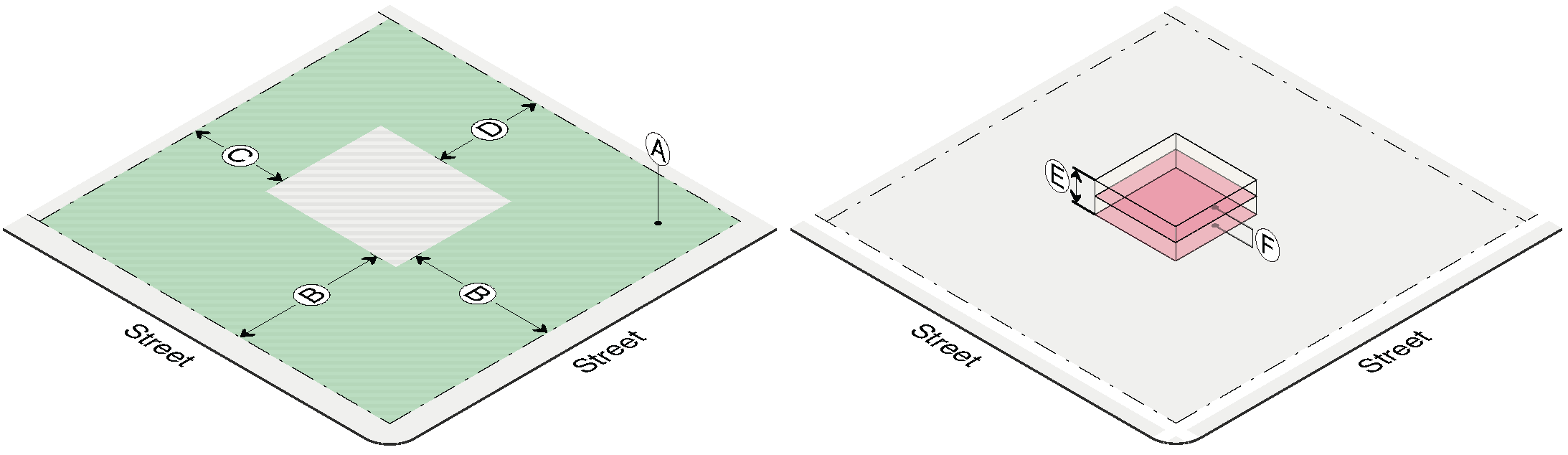
C.
Use Standards. Standards applicable to uses in the P/SP-TC zone are provided or referenced below. Allowed uses are listed in Subsection 1. Uses that are not listed are prohibited, unless a similar use determination is made pursuant to Section 6.1.2(D). Where a cross reference is provided, please see the referenced division or section for additional standards applicable in the P/SP-TC zone. This Subsection is intended to indicate all of the use standards applicable in the P/SP-TC zone, however, all standards in Article 6 are applicable in the P/SP-TC zone, unless stated otherwise.
D.
Development Options. Standards applicable to development options and subdivision in the P/SP-TC zone are provided or referenced below. Where a cross reference is provided, please see the referenced division or section for additional standards applicable in the P/SP-TC zone. This Subsection is intended to indicate all of the development option and subdivision standards applicable in the P/SP-TC zone, however, all standards in Article 7 are applicable in the P/SP-TC zone, unless stated otherwise.
E.
Additional Zone-Specific Standards.
Reserved for future standards.
(7/1/26)
(Amendment No. 2025-0002, 4-7-26)
4.2.2. - Park and Open Space - County (P-TC) Zone.
A.
Intent. The purpose of the Park and Open Space-County (P-TC) zone is to designate land which is owned by the County, State or Federal agencies, special districts, or private not-for-profit corporations (as recognized under Section 501(c)(3) of the Internal Revenue Code), and whose primary purpose is to provide public recreational opportunities for residents, tourists and visitors. The P-TC zone provides for active recreational facilities or open space opportunities in these areas.
B.
Physical Development. Standards applicable to physical development in the P-TC zone are provided or referenced below. Where a cross reference is provided, please see the referenced division or section for additional standards applicable in the P-TC zone. This Subsection is intended to indicate all of the physical development standards applicable in the P-TC zone, however, all standards in Article 5 are applicable in the P-TC zone, unless stated otherwise.
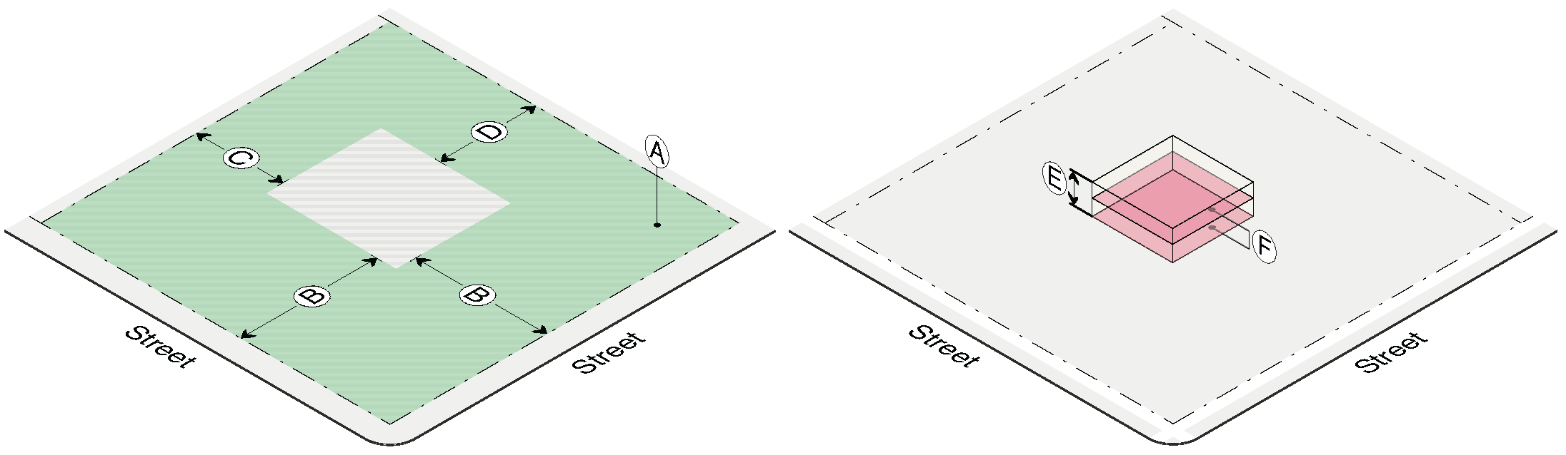
C.
Use Standards. Standards applicable to uses in the P-TC zone are provided or referenced below. Allowed uses are listed in Subsection 1. Uses that are not listed are prohibited, unless a similar use determination is made pursuant to Section 6.1.2(D). Where a cross reference is provided, please see the referenced division or section for additional standards applicable in the P-TC zone. This Subsection is intended to indicate all of the use standards applicable in the P-TC zone, however, all standards in Article 6 are applicable in the P-TC zone, unless stated otherwise.
D.
Development Options. Standards applicable to development options and subdivision in the P-TC zone are provided or referenced below. Where a cross reference is provided, please see the referenced division or section for additional standards applicable in the P-TC zone. This Subsection is intended to indicate all of the development option and subdivision standards applicable in the P-TC zone, however, all standards in Article 7 are applicable in the P -TC zone, unless stated otherwise.
E.
Additional Zone-Specific Standards. The following standards apply in addition to all other standards applicable in the P-TC zone.
1.
Accessory Residential Unit. An ARU is allowed only if a dwelling unit was allowed under the previous zone. Occupancy of the ARU shall be for the sole purpose of providing caretaker quarters.
(7/1/26)
(Amendment No. 2025-0002, 4-7-26)
4.3.1. - All Planned Resort Zones.
A.
Purpose and Intent. The purpose of the Planned Resort Zone is to provide for a mix of recreational, retail, and service-oriented activities which has a high degree of self-containment and provides economic and other benefits to the community. The Planned Resort Zone is intended to guide the creation or continuation of a planned development configured around a major recreational activity. The intent of this development type is to:
1.
Encourage recreational activities that rely on indigenous natural attributes of the area, contribute to the community's character and economy and have a long-standing, beneficial role in the community; and
2.
Provide flexibility for planning and developing recreational resort facilities in a creative, efficient and coordinated manner in order to provide quality visitor experiences; and
3.
Create a process in which Teton County and the Town of Jackson collaborate with landowners in planning and designing resort master plans that meet community goals and respond to the unique circumstances of the resort area; and
4.
Permit resort development that contributes to expanding the winter and shoulder economic seasons; and
5.
Ensure that resort plans incorporate a mix of land uses, promote alternative modes of transportation, and provide a pedestrian-oriented community in order to alleviate traffic-related impacts; and
6.
Ensure resort plans are consistent with the Comprehensive Plan, and therefore, are beneficial to the community; and
7.
Enable long-range planning for infrastructure, capital facilities, and community land use patterns by establishing a level of predictability in the maximum potential size and character of each resort area; and
8.
Ensure a balance is maintained between tourism and community that promotes social diversity but does not cause undesired shifts away from rural, western community character; and
9.
Produce resort plans that make significant contributions toward protecting attributes of the community that are considered critical to the community's long-term health, welfare, and well being.
B.
Applicability. The provisions of this Division shall only apply to lands zoned Planned Resort on March 26, 2010. Only those lands described below shall be eligible for Planned Resort zoning. The intent is that a limited number of PR Zones be created and only in locations that are consistent with the Jackson/Teton County Comprehensive Plan.
1.
Snow King Ski and Summer Resort. For the purposes of this Division, this area shall be known as "Snow King Resort" and shall encompass the property described in Section 4.3.2.
2.
Teton Village. The Teton Village Resort Zone is comprised of two Planned Unit Developments (PUDs) known as Teton Village I and Teton Village II. For the purposes of this Division, this area in its entirety shall be known as "Teton Village" and shall encompass the property described in Section 4.3.3 and Section 4.3.4.
3.
Jackson Hole Golf and Tennis Club. For the purposes of this Division, this area shall be known as "Golf and Tennis" and shall encompass the property described in Section 4.3.5.
4.
Snake River Canyon Ranch. For the purposes of this Division, this area, formerly known as Astoria Mineral Hot Springs, shall be known as "Snake River Canyon Ranch" and shall encompass the property described in Section 4.3.6.
5.
Grand Targhee. For the purposes of this Section, this area shall be known as "Grand Targhee" and shall encompass the property described in Section 4.3.7.
C.
Legislative Act. Each Planned Resort Zone is subject to the legislative authority of the Board of County Commissioners and to the findings and procedural standards outlined in Section 8.7.3. An approved Planned Resort master plan shall establish the development standards for that Planned Resort Zone.
D.
Findings for Approval. A Planned Resort master plan shall be approved only if all of the following findings are made.
1.
Consistency with Comprehensive Plan. The Planned Resort master plan is consistent with the goals and objectives of the Jackson/Teton County Comprehensive Plan.
2.
Consistency with Purpose and Intent. The Planned Resort master plan is substantially consistent with the purpose and intent of this Section, as set forth in Section 4.3.1(A).
3.
Affordable Workforce Housing. The Planned Resort master plan ensures a supply of affordable workforce housing that is in accordance with the requirements for housing created by development within the Planned Resort.
4.
Design Guidelines. The Planned Resort master plan contains design guidelines that:
a.
Establish standards for buildings, spaces, signs, and lighting within the Planned Resort;
b.
Promote the design concepts set forth in Subsec. F.7; and
c.
Establish a method for consistent implementation of the guidelines.
5.
Transportation Element. The Planned Resort master plan contains a traffic impact analysis and transportation demand management plan that:
a.
Promote multimodal forms of transportation that are consistent with the transportation goals of the Jackson/Teton County Comprehensive Plan;
b.
Manage the generation of resort related traffic to avoid undermining community character and endangering the public health, safety, and welfare; and
c.
Identify an equitable cost sharing plan for transportation facilities and services.
6.
Capital Improvements Plan. The Planned Resort master plan contains a capital improvements plan that ensures infrastructure and essential services will be provided in an efficient and timely manner to accommodate projected resort demands.
7.
Land Use Element. The Planned Resort master plan promotes land uses that support and maintain the character of the resort as specified in Sections 4.3.2—4.3.7.
8.
Phasing Plan. The Planned Resort master plan contains a phasing plan that ensures:
a.
Development of the resort, its amenities, and public facilities necessary to serve the resort, occur in logical sequence, and
b.
An adequate monitoring program is established for determining accomplishment of proposed remedies and mitigation measures for projected impacts on the community.
9.
Character Element. The Planned Resort master plan ensures the resort's development will be in keeping with the community's character and the planned character for the vicinity of the resort.
E.
Procedure. A Planned Resort master plan shall be reviewed pursuant to the standard procedures set forth for review of a Planned Unit Development in Section 8.7.3. In addition, all Planned Resort master plans shall comply with the following procedural standards.
1.
Collaboration. This procedure is intended to promote collaboration among landowners, Teton County, and the Town of Jackson in designing land development standards specific for each resort area. While one or more landowners may propose a Planned Resort master plan, and maintain the role of the applicant as identified herein, all landowners within a resort area are encouraged to participate in the design of the master plan. Participation of all landowners within a proposed Planned Resort Zone, however, is not required for the Board of County Commissioners to adopt a Planned Resort Zone.
2.
Purpose and Intent of Master Plan. The purpose of a Planned Resort master plan is to establish the development standards and serve as a guide to all future development within the Planned Resort. The Planned Resort master plan is intended to be of sufficient detail to describe the amount, type, size, location, and impact of the proposed resort, but technical specifications of the proposed development, such as fully engineered plans or fully detailed architectural drawings, are not required.
3.
Submittal Components. A Planned Resort master plan application shall include all lands in a given resort area, as listed in Section 4.3.1(B). The minimum requirements for a master plan application shall be established by the Planning Director and shall include, but not be limited to:
a.
Statement of Purpose
b.
Master Site Plan
c.
Dimensional Limitation Plan
d.
Design Guidelines
e.
Transportation Demand Management Plan
f.
Housing Mitigation Plan
g.
Capital Improvements Plan
h.
Land Use Plan
i.
Phasing Plan
j.
Community Services Element (optional)
4.
Joint Review by Town and County. The County Planning Commission and the Board of County Commissioners shall receive and consider recommendations from the Town Planning Commission and Town Council regarding any Planned Resort master plan application in the County. For the same purpose, The County Planning Commission and Board of County Commissioners shall make recommendations to the Town Planning Commission and Town Council regarding any Planned Resort master plan application within the Town of Jackson.
a.
Purpose. The purpose of the County's and Town's review of any Planned Resort in the other jurisdiction is to recognize the impact of resorts on neighboring jurisdictions and to provide an opportunity for cooperation in planning and mitigation of potential impacts.
b.
Intent. The intent of review is for the Town Planning Commission and Town Council to have an opportunity for review and comment of a Planned Resort. The Town's role is advisory only and does not include a voting participation in review of the Planned Resort master plan.
5.
Recordation. Upon approval, the Planned Resort Master Plan shall be prepared and recorded pursuant to the procedures outlined in the Section 8.7.3.
6.
Amendment to Official Zoning Map. Approval of a Planned Resort master plan also shall constitute an amendment to the Official Zoning Map to establish the Planned Resort Zone. The public hearing notice for the Planned Resort master plan shall be accomplished so as to comply with the requirements set forth in Section 8.7.2.
7.
Effect of Approval. After approval of a Planned Resort master plan, Physical Development and Use Permit approvals are required prior to commencement of any construction or operation of any new land use within the Planned Resort. Procedural standards for Physical Development and Use Permits are outlined in Division 8.3 and Division 8.4. No Physical Development or Use Permits shall be approved, unless the proposal is consistent with the Planned Resort master plan. Physical Development and Use Permits may encompass only an increment of the total resort development in accordance with an approved phasing plan.
8.
Standing of Planned Resort Master Plan. An approved Planned Resort master plan, as amended, shall specify the development standards for the Planned Resort Zone. Once approved, a Planned Resort master plan shall be subject to the following standards:
a.
Amendment of Master Plan. Any landowner within a Planned Resort Zone may apply for an amendment to the Planned Resort master plan. The amendment shall be reviewed and acted upon pursuant to the procedures set forth in Section 8.2.13. Minor deviations from a Planned Resort master plan may be approved by the Planning Director, pursuant to Section 8.2.13. In addition, the Planning Director may approve Minor Amendments to the Standards and Conditions for any Planned Resort in accordance with the standards of that document.
b.
Expiration.
i.
Time-frame. A Planned Resort master plan shall expire three years from the date of its approval, unless a sufficient application for Final Development Plan, in accordance with the approved phasing plan, is filed with the Planning Department. A Planned Resort master plan shall expire five years from the date of its approval, unless there is commencement of construction or operation of land uses or activities in accordance with the approved phasing plan. Notwithstanding, alternate time frames for expiration of a Planned Resort master plan may be established in an approved phasing plan.
ii.
Effect. Upon expiration, approval of a Planned Resort master plan and all rights that are established by the master plan shall lapse and the County shall amend the Official Zoning Map from the Planned Resort Zone to the appropriate zone based on the direction of the Comprehensive Plan.
c.
Extension. A Planned Resort master plan approval may be extended by the Board of County Commissioners provided a written request for extension is received at least 30 days prior to expiration of the Planned Resort master plan.
i.
Procedure. The request for extension shall be reviewed by the Board of County Commissioners at a regularly scheduled meeting, by which time a public hearing notice shall be advertised and any necessary information pertinent to the extension request can be made available. The Planned Resort master plan shall be deemed extended until the Board of County Commissioners acts upon the request for extension.
ii.
Grounds for Extension. The grounds for extending a Planned Resort master plan approval shall be specified by the Board and shall include, but not be limited to, the following:
a)
No Change in Conditions. Conditions in the community have not substantially changed since the original Planned Resort master plan approval. No extension shall be granted if the Board finds that changes in the community result in the resort plan being inconsistent with the community's land use patterns, these LDRs, or the community's ability to provide infrastructure and services to accommodate the resort.
b)
Good Faith Efforts. Activities and investments on the part of landowners within the Planned Resort demonstrate good faith efforts in pursuing the development permitted by the Planned Resort master plan.
d.
Reconsideration. If development within a Planned Resort fails to proceed in general accordance with the approved phasing plan, the Board of County Commissioners may require reconsideration of the Planned Resort master plan and either amend the phasing plan or revoke the master plan, as appropriate.
i.
Amendment. Amendment of the phasing plan shall be appropriate if either an acceptable alternative phasing plan that meets the standards of this Section or a development schedule acceptable to the County Commissioners for regaining compliance with the original phasing plan is presented.
ii.
Revocation. Revocation of the master plan shall have the effect of forfeiting all rights within the Planned Resort to any further development according to the Planned Resort master plan and shall be appropriate if:
a)
No material progress has been made in development of the resort for ten consecutive years, or
b)
There is substantial noncompliance with the performance objectives specified in the conditions of approval, or the monitoring program, and no agreement can be reached between representatives of the landowners within the Planned Resort or applicant of record and the Board of County Commissioners for bringing the resort development into compliance with the standards of this Section.
iii.
Procedure. The Board of County Commissioners shall hold a public hearing, in accordance with Section 8.2.10 for the purpose of examining the development that has occurred within the Planned Resort and its consistency with the Planned Resort master plan. The Board of County Commissioners shall issue a determination as to whether amendment or revocation of the master plan is appropriate, in accordance with the above specified standards. Revocation of the master plan shall be accomplished by amending the resort area on the Official Zoning Map from Planned Resort Zone to an appropriate zone based on the direction of the Comprehensive Plan.
F.
Standards Applying to All Planned Resorts.
1.
Consistency with Comprehensive Plan. Planned Resort master plans shall be consistent with the goals and objectives of the Jackson/Teton County Comprehensive Plan.
2.
Compliance with LDRs. A Planned Resort master plan shall comply with the standards of these LDRs. Notwithstanding, the applicant for a Planned Resort master plan may propose, and the Board of County Commissioners may approve, alternative standards for development that are consistent with the purpose and intent of this Section. It is fully consistent with this Section that Planned Resorts may have dimensional, design, and other development standards different from those described in other sections of these LDRs due to the unique circumstances of, and community objectives for, resort development. Where a Planned Resort master plan is silent, the standards of the current zone most similar to the Planned Resort shall apply.
3.
Statement of Purpose. The Planned Resort master plan shall have a Statement of Purpose which describes the applicant's rationale for resort expansion and the design theme of the resort development. The Statement also shall describe how the resort master plan fulfills the intents of this Section, as specified in Section 4.3.1(A).
4.
Master Site Plan. The Planned Resort master plan shall have a Master Site Plan that clearly illustrates the proposed development and the site to the satisfaction of the Planning Director.
5.
Dimensional Limitation Plan. The Planned Resort master plan shall have a Dimensional Limitation Plan, which specifies dimensional limitations necessary to achieve the design theme identified by the applicant. The plan shall include floor areas and floor area ratios, densities, landscape ratios, height, setbacks, building envelopes, etc., or other lines delineating areas on which restrictions of development are to be imposed and areas in square feet for each lot or building. Any dimensional limitations unspecified by the Planned Resort master plan shall be established by the standards applicable in the zone that existed on the property prior to the approval of the Planned Resort master plan.
6.
Housing Element. The Planned Resort master plan shall have a housing element to ensure a supply of affordable workforce housing that is commensurate to the demand for housing created by development within the Planned Resort. Affordable workforce housing shall be provided pursuant to Division 6.3.
a.
Housing Calculations. Since development of a Planned Resort may span time periods over which numbers of employees and their salaries may fluctuate, the calculations performed in developing a Housing Mitigation Plan shall use data current for the most recent full year prior to application for Planned Resort master plan.
b.
Master Plan Estimate. The amount of housing required and the locations where it will be provided, as presented in the Planned Resort master plan, shall be treated as an estimate/concept, and shall be finalized by the Planning Director as Development Plans within the Planned Resort are reviewed and acted upon. Each approved Development Plan shall establish the actual amount and location of required housing for that portion of the Planned Resort master plan.
7.
Design Element. The Planned Resort master plan shall include design guidelines, and a mechanism for their implementation, that establish design parameters for both buildings and spaces in the Planned Resort. The design theme of the resort shall be defined by the applicant and be consistent with the standards of this Section. This Subsection establishes concepts that the design guidelines shall address; the design guidelines shall be evaluated as to whether or not they address these concepts, as well as character objectives for specific resorts set forth in Sections 4.3.2—4.3.7. The design guidelines shall be prepared by an architect or landscape architect licensed in the State of Wyoming; preparation by a person or persons of similar expertise may be permitted by the Planning Director.
a.
General. There shall be visual continuity among the resort structures and design elements without unduly limiting variety in design. Development shall be compatible with the surrounding built and natural environment in both scale and character. The design theme of the Planned Resort shall have an emphasis on outdoor recreational activities and create a sense of place. A sense of place is created when site planning and architecture:
i.
Concentrate activities and human interaction into identifiable spaces, such as a plaza or mall;
ii.
Assemble a built environment that connects buildings, spaces, and structures through common scale, design and materials;
iii.
Incorporate into the built environment the natural features and cultural heritage of the area; and
iv.
Produce an identifiable image that is associated with the planned resort and with Jackson Hole.
b.
Architecture. Building design guidelines shall reflect:
i.
The community's architectural character and themes;
ii.
A human scale and pedestrian-orientation, which are created when:
a)
The height of buildings does not overwhelm people walking beside the buildings; and
b)
The ground level doors, windows and design features of buildings create an interesting diversity for people walking past the buildings;
iii.
A built environment in keeping with the cultural and aesthetic values of the community;
iv.
Natural attributes of the immediate vicinity;
v.
Building materials and colors compatible with the surrounding natural and built environment.
c.
Bulk and Scale. The design guidelines shall ensure the bulk and scale of individual buildings within the Planned Resort achieve compatibility with:
i.
Other structures within the Planned Resort when the resort development is completed;
ii.
Neighboring structures that are not a part of the resort; and
iii.
The natural environment.
d.
Signs. The design guidelines shall include a sign component that sets forth the sign theme for the Planned Resort and specifies criteria for determining permitted sign sizes, types, and locations. The guidelines shall contain prototypical examples of all types of signs, including wall, canopy, freestanding, directional, and informational signs. The flexibility extended to Planned Resorts via this Section, to propose standards for signs different from those specified in Division 5.6, Sign Standards, is encouraged with the purpose of having sign guidelines in keeping with the unique character and needs of the resort.
e.
Lighting. The design guidelines shall include an analysis of proposed project lighting. Areas to be illuminated (parking areas, walkways, entries, etc.) shall be identified, and general standards shall be set forth. Identification of models and types of standards and fixtures is encouraged, but specific illumination plans and photometric footprints are not required. Generally, lighting shall be low-intensity, low-profile, and shielded to avoid "light pollution" and glare to off-site areas. General illumination standards are set forth in Section 5.3.1.
f.
Site Planning.
i.
Orientation and Aspect. Structures and public spaces within the Planned Resort, generally, shall be arranged with views of, and access to, the principal resort recreational amenity.
ii.
Entrance Features. Entrances to the Planned Resort shall create a sense of arrival. A sense of arrival is created when the entrance into the Planned Resort is easily identifiable and is consistent with the design theme of the resort.
iii.
Natural Resources. The site design shall highlight the natural resources within the Planned Resort and integrate them into the layout of the resort in order to promote a connection to the natural environment. Consequently, natural features of the site, such as significant vegetation, rock outcroppings, water bodies, etc., shall be preserved and incorporated into the project design to the extent practicable.
iv.
Pathways and Pedestrian Facilities. Pathways and pedestrian facilities, including access for the disabled, shall be integral components of the site design. The site shall provide an attractive, outdoor atmosphere that encourages use and reliance upon pathways and walkways.
a)
Safe, Convenient, and Direct Access. Pathway and pedestrian systems shall provide safe, convenient, and direct access throughout the resort, to public lands, transit facilities, and the existing or planned community pathway system, when adjacent to the resort.
b)
Pathways. Pathways shall be provided for nonmotorized transportation, except motorized wheelchairs for the disabled shall be permitted. Bicycle racks, ski racks, etc., shall be provided at various destination points within the resort.
v.
Transportation Facilities. Site design shall integrate safe, convenient, and direct access to transportation services and facilities (i.e., bus shelters, information kiosks) and shall incorporate the facilities necessary for the proper functioning of the Transportation Demand Management Plan (see Subsection 8.b, below).
vi.
Circulation. The layout of local streets, alleyways, and parking lots shall be sensitive to the natural terrain and landscape. Cut and fill areas shall be minimized, and natural features of the site such as wooded areas, rock outcroppings, and waterbodies, shall be preserved to the maximum extent practicable.
vii.
Access. Safe vehicular access appropriate for refuse removal, recycling, emergency services, and delivery shall be provided. Service access shall not create unsafe conflicts with automobile and pedestrian access to primary destinations within the resort.
viii.
Landscaping. Project landscaping, including hardscape areas, shall be consistent with the overall design theme of the resort. Use of indigenous plant materials is encouraged. Existing vegetation shall be preserved and incorporated into the design of the project to the extent practical, especially wooded areas and other significant vegetation which provides shelter or habitat for wildlife.
g.
Character Objectives. Sections 4.3.2—4.3.7 outline character objectives specific to each resort area that shall be incorporated into the design guidelines.
8.
Transportation Element. The Planned Resort master plan shall have a transportation element to ensure that resort development does not produce an amount of vehicular traffic that undermines the community's character, and endangers the public health, safety and welfare (i.e., noise, air quality and traffic impacts.) The Planned Resort master plan shall provide an optimum mix of automobile, transit, and pathway facilities within the resort; encourage coordination of all resort transportation facilities with the County-wide transportation system; promote design and management, which encourages shifts from single-occupancy vehicle trips to multi-occupancy trips, or other transportation modes; and provide equitable cost sharing for facilities and services.
a.
Traffic Impact Analysis. A traffic impact and access analysis is required. At a minimum, this analysis shall contain:
i.
Projections of external vehicle trips generated by the Planned Resort;
ii.
Analysis of levels of service (LOS) impacts on roadway system segments and intersections serving the Planned Resort; and
iii.
Specification of any improvements needed to roadway system segments and intersections as a result of increased traffic from the Planned Resort.
b.
Transportation Demand Management Plan. The Planned Resort master plan shall include a Transportation Demand Management (TDM) Plan that demonstrates how the travel behavior of resort visitors and employees will be managed to minimize the number of vehicle trips on the roadway network resulting from the resort development. The TDM Plan will allocate a number of vehicle trips to various roadway segments, based upon the projected traffic demand and the planned character of the roadway segments. A goal of the applicant's TDM Plan shall be to manage the transportation demands of the resort so that it is consistent with the allocation of vehicle trips to the various roadway segments that serve the Planned Resort. Potential mechanisms for managing travel behavior may include, but are not limited to:
i.
Increasing average vehicle occupancy;
ii.
Shifting vehicular trips (resident and visitor) to public transit;
iii.
Shifting vehicular trips (resident and visitor) to walking, bicycling and other nonmotorized means; and
iv.
Reducing vehicular trips through internal capture associated with mixed land use patterns.
c.
Parking and Loading. The Planned Resort master plan shall provide parking and loading areas of sufficient amount and type to accommodate the resort's projected demand, including parking for visitors and lodging guests, waiting and loading areas for transit vehicles and their passengers, and loading areas for delivery vehicles. Parking shall be designed to encourage nonmotorized transportation, transit and high occupancy vehicle use, and discourage single-occupancy vehicle use.
9.
Capital Improvements Element. The Planned Resort master plan shall have a capital improvements element to ensure that infrastructure and essential services will be provided in an efficient and timely manner to accommodate projected resort demands. Planned Resort master plans shall include a capital improvements element that identifies service providers, analyzes impacts and proposes a capital improvements plan for facilities and services needed by the resort. Such facilities and services may include, but are not limited to: transportation (including transit, parking and pathways); potable water and wastewater treatment services; waste management (hazardous and solid); utilities; stormwater management and snow storage facilities.
a.
Identification and Acknowledgment of Service Providers. The applicant shall identify the provider of all infrastructure facilities and services included in the plan. Where services are to be provided by an entity other than the applicant, documents from the service provider shall demonstrate the commitment and ability to provide such service according to the Planned Resort master plan.
b.
Impact Analysis. An impact analysis shall be performed for all facilities and services, unless waived by the Planning Director. Each impact analysis shall identify the following:
i.
Maximum daily peak capacity of existing facilities;
ii.
Current daily peak demand on existing capacity;
iii.
Daily peak capacity available for new development;
iv.
Projected daily peak demand generated by new development in the Planned Resort. When development outside of a resort is reasonably anticipated to utilize the same infrastructure system as the resort, the County Planning Department shall provide the applicant with estimated peak demand;
v.
Any planned improvements by other entities, such as the Town of Jackson or the Teton Village Water and Sewer District, and the timing of such improvements;
vi.
Any deficits in daily peak capacity potentially resulting from development within the Planned Resort—either from a strict demand standpoint or from a timing standpoint—taking into account other potential new development outside the Planned Resort.
c.
Capital Improvements Program. The capital improvements plan shall be consistent with the impact analyses and specify how any deficiencies in infrastructure will be remedied or mitigated, including descriptions of the infrastructure improvements, the responsibility and sources of funding for the improvements, and the timing for completion of improvements. Concept plans for improvements shall be included in the capital improvements plan. Engineered plans shall be provided in the final development plan application for subsequent development.
10.
Land Use Element. The Planned Resort development shall have a land use element that identifies the land uses within a proposed Planned Resort. The land uses shall be consistent with both the applicant's design theme and the character objectives for the resort, as specified in Sections 4.3.2—4.3.7.
a.
Permitted Uses. The type of development permitted within a Planned Resort shall be set forth in the Planned Resort master plan and shall be consistent with the following:
i.
Residential uses shall be permitted;
ii.
Uses necessary for operation of the resort's primary recreational activity (ski area, hot springs) shall be permitted;
iii.
Nonresidential uses that provide for the basic needs of the resort's lodging guests, day visitors, employees and vicinity residents shall be permitted;
iv.
Regional-serving commercial uses which rely upon vehicle trips from a community-wide market area rather than the Planned Resort vicinity shall be prohibited, unless they are determined by the Board of County Commissioners to be resort-related amenities;
v.
Commercial amusement activities that are detrimental to the outdoor, natural resource character of Teton County shall be prohibited; and
vi.
Special events such as music and dance festivals, art and craft shows, concerts, live theater, and similar events which are compatible with the resort and its facilities shall be permitted.
b.
Amount and Type of Development. The amount and type of development in a Planned Resort master plan shall be consistent with:
i.
The applicant's rationale for resort expansion and the character objectives for the resort area pursuant to Sections 4.3.2—4.3.7;
ii.
The overall amount of development that can be permitted while preserving community character, as reflected in the Jackson/Teton County Comprehensive Plan and the Town and County's LDRs;
iii.
The amount of infrastructure capacity that can be provided while maintaining consistency with community character goals; and
iv.
Providing a level of self-sufficiency within the resort, such that vehicle trips ending outside the resort are minimized.
11.
Phasing Element. The Planned Resort development shall have a phasing element to ensure that development within a Planned Resort occurs in logical sequence within the Planned Resort, including amenities and necessary public service expansions. Planned Resort master plans shall contain a phasing plan that identifies the sequence of resort structures, uses and amenities, installation of infrastructure, implementation of the Transportation Demand Management Plan, Housing Mitigation Plan, and implementation of Planned Resort master plan conditions of approval.
a.
Description. All structures, land use activities, mitigation strategies, and infrastructure expansions proposed, including such activities and improvements on public lands, shall be included in the phasing plan.
b.
Functional Phases. Each phase shall be self-sufficient, in conjunction with existing elements of the Planned Resort, i.e., transportation and parking needs, as well as amenities for each phase, shall be satisfied within each phase and shall not be dependent upon a future phase. Each phase shall represent a logical and compact extension of infrastructure and public services. In order to develop certain improvements in logical increments that provide for economies of scale, the phasing plan may propose that improvements required for an earlier phase be provided in a later phase only if:
i.
The delayed construction of the improvement does not create a negative impact or exacerbate an existing problematic condition; and
ii.
Financial assurance, in a form acceptable to the Board of County Commissioners, is provided, i.e., letter of credit, that the improvement required for the earlier phase will be developed within a certain time-frame, even if later phases remain undeveloped.
c.
Coordinated with Public Services. Phasing shall be coordinated with the improvements schedule or capital improvements program of public or semipublic service providers, as identified in the Capital Improvements Element.
d.
Relationship of Phasing to Overall Resort Plan. Phasing shall implement the stated purpose of the Planned Resort master plan, i.e., if a destination ski area is the basis for the resort plan, the ski area facilities should not be the last increment of development. Similarly, open space dedications, amenities, and required performances that mitigate the impacts of the resort shall be developed or provided in proportion to the type and amount of development in each phase.
e.
Performance Objectives. The County shall establish performance objectives as part of the Planned Resort master plan approval that ensure that development within the Planned Resort achieves the required mitigation of projected impacts on the community. The resort developers shall be responsible for ensuring that proposed mitigation measures are effective.
EXAMPLE:The resort approval may require vehicle trip reduction techniques in order to avoid undesired vehicle trips. Performance objectives shall be identified and incorporated into a monitoring program, described below.
f.
Monitoring Program. A program for monitoring compliance with performance objectives for each phase of development shall be designed in a collaborative effort between the applicant(s) and the County, and shall be set forth in the Planned Resort master plan approval. The monitoring program shall be implemented by the applicant, or an entity that equitably represents all landowners within the Planned Resort, and will include monitoring of TDM components, affordable workforce housing developments, and other such elements as identified by the Board of County Commissioners.
i.
Program Contents. The monitoring program shall specify data collection needs, responsibility for data collection, techniques to be used in analyzing data, how the data shall be used to determine achievement of performance objectives, and the schedule for reporting to the County the results of the monitoring effort.
ii.
Program Results. Representatives of the landowners within the Planned Resort shall have three reporting opportunities to demonstrate achievement of performance objectives. If, by the third scheduled report, the resort has been unable to meet any specified performance objective, the Planned Resort master plan may be subject to reconsideration pursuant to Subsection E.8.d.
g.
Achievement of Performance Objectives. Approval of future final development plans may be delayed until the performance objectives of the previous phases are met or a strategy for achieving them has been approved by the Board of County Commissioners.
12.
Community Services Element (Optional). Resorts function as integral parts of the community by participating in civic initiatives and implementing the goals of the community. The optional community services element is intended to be a component of the Planned Resort master plan in which the benefits that the resort area provides to the community are acknowledged. Landowners within Planned Resorts are encouraged to continue with, and expand upon, programs designed to retain local access to the resort's main recreational activity and facilities. Community service programs help to maintain a balance at the resort between out-of-town visitors and the community, and contribute to the quality of life in the community. Examples of community services currently provided are:
a.
Hosting activities for local disabled persons;
b.
Hosting Parks & Recreation Department activities;
c.
Providing trail head access to public forest land;
d.
Hosting local nonprofit events, including free recreational activities and transportation;
e.
Offering reduced facility rates for community events and nonprofit organizations;
f.
Offering local appreciation and promotional reduction in activity fees; and
g.
Offering activity fees that are affordable to the permanent population.
13.
Character Element. Each Planned Resort master plan shall have a character element to ensure that resort development is in keeping with the community's character and the planned character for the vicinity in which the resort development is located.
a.
Establishment of Character. Character standards are unique to each resort area in order to recognize the differences between the individual resorts, the planned character of their neighborhoods, and the community's expectation of resort development in that vicinity. The character for each Planned Resort Zone is established in Sections 4.3.2—4.3.7.
b.
General. The standards specified for each Planned Resort Zone (Sections 4.3.2—4.3.7) are the minimum required, or maximum permitted, as indicated by a "no less than" or "no more than" statement. Minimum requirements may be increased in order to avoid or mitigate impacts of a specific Planned Resort master plan proposal, better achieve the character objectives for the resort, or better implement the goals and objectives of the Comprehensive Plan. Similarly, an applicant's ability to achieve the maximums permitted is dependent upon the Planned Resort master plan's avoidance or mitigation of negative impacts on the community, its achievement of the character objectives for the resort, or its contribution toward achievement of the goals and objectives of the Comprehensive Plan.
c.
Definitions. The following definitions shall be used when evaluating each Planned Resort Zone:
i.
Guest. A guest is a person who is accommodated in overnight lodging facilities within the Planned Resort. The number of guests is calculated by the "average peak occupancy" of the lodging accommodations.
ii.
Average Peak Occupancy. For the purposes of this Section, the following average peak occupancies (APOs) shall be used in calculating the capacity of guest accommodations:
a)
Hotel, Motel, or Similar Lodging Unit. A hotel, motel, or similar lodging unit that exists as sleeping quarters only, and does not contain other types of living spaces such as a living room or kitchen, shall be assigned an APO of two.
b)
Dwelling Unit. A dwelling unit, used for short term rental, shall be assigned an APO of four.
c)
Other. Other lodging facilities that do not meet the definitions above shall have an APO assigned that is the sum of the number of bedrooms the lodging facility contains multiplied by two.
G.
Increased Density Limited to Affordable Workforce Housing. An amendment to a Planned Resort master plan shall not increase residential density except to provide affordable workforce housing that meets the standards of Division 6.3.
1.
Rental affordable workforce housing shall be for the benefit of housing persons employed within the boundaries of the resort within which the housing is located. In the event there are no persons directly employed within the resort who qualify to rent the unit, the unit shall be first offered to other qualified households, a member of which is employed within five miles of the unit. If there are no such persons then the residential unit may be rented to any person employed within Teton County.
(1/4/21)
4.3.2. - Snow King.
Section number reserved, standards only applicable in Town.
(1/1/15)
4.3.3. - Teton Village I.
A.
Area Description. Teton Village I is one of two Planned Unit Developments that comprise the Teton Village Planned Resort Zone. The Teton Village Planned Resort Zone consists of those lands designated PR-TV on the Official Zoning Map. Area One is composed of that portion of the Village that received approval as a Planned Resort before January 1, 2001, excepting there from those areas removed from Area One by that Official Zoning Map Amendment approved by the Board of County Commissioners on July 7, 2009.
B.
Master Plan. Area One is governed by the Planned Unit Development-Planned Resort Master Plan titled "Teton Village Master Plan." Throughout this Section, the master plan will be referred to as the Area One Resort Master Plan.
C.
Character. The character objectives for Teton Village are that it resemble a small urban village with its own sense of place. Important characteristics are:
1.
A distinct center, defined both by buildings and activities;
2.
A mix of land uses, varying from the tourist-oriented to the resident-oriented;
3.
Clear edges, defined both by buildings and open spaces, that distinguish the village from the surrounding ranch lands;
4.
A continuity in building size, architecture and individual site design;
5.
A pedestrian streetscape and pedestrian connections throughout the village;
6.
Creation of a sense of arrival;
7.
A visual transition from the village to neighboring lands;
8.
A community; and
9.
A destination ski area.
D.
Size.
1.
Lodging. The total lodging capacity within Area One shall be for no more than 5,240 guests inclusive of the lodging capacity provided by the residential developments approved as of enaction of this Section (Granite Ridge, the Replat of the Second, Third, and Fourth Filings of the Jackson Hole Ski Corporation Addition, and the Sixth, Seventh, Eighth, Ninth-Second Amendment, Tenth and Eleventh Filings of the Jackson Hole Ski Corporation Addition). These guests shall be allocated to the commercial and residential properties at Teton Village in accordance with the approved Area One Resort Master Plan.
2.
Retail, Office, and Other Commercial Type Uses. Within Area One, there shall be no more than 208,000 sf of retail/office or other commercial-type uses not including lodging, ski area operations, institutional or public/semipublic type development. This commercial square footage shall be allocated to the commercial lots and tracts in accordance with the approved Teton Village Master Plan.
3.
Institutional, Public and Semipublic Uses. Twenty-seven thousand (27,000) square feet shall be constructed for development of institutional, public and semipublic uses such as religious institutions, public meeting/theatre space, and visitor's center used for non-retail purposes.
4.
Resort Support Uses. Resort support uses shall be allowed to the extent permitted in the approved Area One Resort Master Plan, and are defined as facilities that provide amenities or that are utilized to operate the overall resort, and shall not be considered commercial uses.
E.
Skier Visits. If daily skier visits exceed 9,200 skiers on more than 12 days within a season, for any three consecutive years, then evaluation of the Area One Resort Master Plan's remedies, mitigation measures and achievement of performance criteria as specified in the phasing plan shall be performed by the ski area operator and the Planning Director in order to ensure that the increased skier numbers are of no greater impact to the community than the number assumed when the master plan was approved. The results of the evaluation shall be presented to the Planning Commission and Board of County Commissioners. If any failure of the remedies, mitigation measures, or achievement of performance criteria as specified in the phasing plan is found, then the Area One Resort Master Plan shall be reconsidered, pursuant to Section 4.3.1(E.8.d).
F.
Intensity. No more than 2.5 floor area ratio shall be permitted on any platted lot within the Jackson Hole Ski Corporation Additions, First Filing-Amended, Fifth Filing, Twelfth Filing, Thirteenth Filing, Fourteenth Filing, or any subsequent replat thereof. The intensity on the remainder of the nonresidentially developable lands, known as Tracts G/H, X/Y, and the maintenance parcel, shall not exceed 1.0 FAR calculated overall, regardless of subsequent subdivision of these lands.
G.
Landscape Surface Area. The minimum landscape surface area provided within the Planned Resort shall be 25% of the total private land area described in Section 4.3.3(A), exclusive of the platted residential lands. Notwithstanding, the Board of County Commissioners may reduce the minimum landscape surface area to no less than 20% upon demonstration by the applicant that the following objectives are achieved with a reduced landscape surface area:
1.
The landscape surface area creates a quality urban village design and creates public spaces for interaction and public events; and
2.
The landscape surface area creates a clear boundary for the resort.
H.
Environmental or Visual Analysis. If land within Teton Village Area One is within the Scenic Resources Overlay, an EA with a visual component or a Visual Resources Analysis dealing with maintenance of the scenic corridor shall be required, pursuant to the standards in Section 5.3.2.
I.
Off-Site Parking. Parking may be proposed off-site provided the Transportation element demonstrates the off-site parking serves a significant role in the Transportation Demand Management Plan.
J.
Area One Platted Residential Lands. The platted residential lands included in Teton Village Area One, as described in Section 4.3.3(A), are included to ensure their continued relationship to the resort. The intent is that the type and intensity of development on these residential lands comply with the zone in which the residential lands are located upon enactment of this Section. Notwithstanding, Lots 171 and 172 of the Jackson Hole Ski Corporation 9th Filing owned by the Teton Village Water & Sewer District may be developed in accordance with Section 4.3.3(M) below.
K.
Relationship to Grand Teton National Park. Programs and facilities shall be established that encourage non-motorized access into GTNP, in conjunction with National Park Service planning efforts and goals.
L.
Administration. An entity or administrative organization that equitably represents Teton Village landowners, shall be created and charged with the task of administering the monitoring program portion of the Planned Resort phasing plan. Administration of the program shall include collecting and analyzing the data for evaluating achievement of the performance objectives established in the phasing plan, ensuring compliance with the performance objectives, and representing the Teton Village Planned Resort in reporting the results of the monitoring program to the County, pursuant to Section 4.3.1(F.11.f).
M.
Teton Village Water & Sewer District. Notwithstanding the restrictions on platted residential lands set forth elsewhere in this Section, the following standards shall apply to Lots 171 and 172, and the lands described in that deed recorded in the Teton County, Wyoming Clerk's Office, Document #0415272, Book 318, Pages 1190—1192, so long as the lands are used solely to operate the Teton Village Water & Sewer District or other similar public service entity.
1.
Floor Area Ratio. The floor area ratio shall be no more than 0.47.
2.
Landscape Surface Ratio. The landscape surface ratio shall be no less than 0.30.
3.
Employee Housing. Six employee housing units shall be permitted.
(1/1/15)
4.3.4. - Teton Village II.
A.
Area Description. Teton Village II is one of two Planned Unit Developments that comprise the Teton Village Planned Resort Zone. The Teton Village Planned Resort Zone consists of those lands designated PR-TV on the Official Zoning Map. Area 2 is composed of that portion of the Village that received approval as a Planned Resort on July 12, 2005, as amended by that Official Zoning Map Amendment approved by the Board of County Commissioners on July 7, 2009. Generally the "Character Elements" for Area 2 are identical to those for Area One, except as differentiated below.
B.
Master Plan. Area 2 is governed by the Planned Unit Development-Planned Resort Master Plan, titled "Teton Village Resort Expansion Master Plan (Teton Village Area 2)." Throughout this Section, the master plan will be referred to as the Area 2 Resort Master Plan.
C.
Character. The character objectives for Teton Village are that it resemble a small urban village with its own sense of place. Important characteristics are:
1.
A distinct center, defined both by buildings and activities;
2.
A mix of land uses, varying from the tourist-oriented to the resident-oriented;
3.
Clear edges, defined both by buildings and open spaces, that distinguish the village from the surrounding ranch lands;
4.
A continuity in building size, architecture and individual site design;
5.
A pedestrian streetscape and pedestrian connections throughout the village;
6.
Creation of a sense of arrival;
7.
A visual transition from the village to neighboring lands;
8.
A community; and
9.
A destination ski area.
D.
Size.
1.
Lodging Area 2. The total Average Peak Occupancy (APO) within the Area 2 shall be not more than 720, none of which shall be allowed on single family lots in the Teton Village South Residential Area, south of McCollister Drive.
2.
Area 2 Affordable and Employee Housing. Affordable and employee housing units shall be provided within Area 2 in accordance with the Area 2 Resort Master Plan and Housing Mitigation Plan for Area 2 approved on July 12, 2005.
3.
Retail, Office, and Other Commercial Type Uses. Within the Village Core area of Area 2, there shall be allowed 10,000 square feet of local commercial uses. In addition, within the Area 2 Village Core area there shall be allowed 25,000 square feet of commercial retail, restaurant or other "commercial-type uses" space and 35,000 square feet of office space provided that a like amount of commercial retail, restaurant or other "commercial-type uses" space, or office space, as the case may be, shall be removed from Area One for relocation to Area 2. Other "commercial-type uses" do not include lodging, ski area operations, institutional, resort support, or public/semipublic type development, which may be otherwise provided for in the approved Resort Master Plan.
4.
Institutional, Public and Semipublic Uses. 9,500 square feet shall be constructed for development of institutional, public and semi-public uses, such as a visitor center, sheriff's substation, post office, non-profit office space and other similar uses, utilized for non-retail purposes.
5.
Resort Support Uses. Resort support uses shall be allowed to the extent permitted in the approved Area 2 Resort Master Plan, are defined as facilities that provide amenities or that are utilized to operate the overall resort, and shall not be considered commercial uses.
E.
Skier Visits. If daily skier visits exceed 9,200 skiers on more than 12 days within a season, for any three consecutive years, then evaluation of the Planned Resort master plan's remedies, mitigation measures and achievement of performance criteria as specified in the phasing plan shall be performed by the ski area operator and the Planning Director in order to ensure that the increased skier numbers are of no greater impact to the community than the number assumed when the Planned Resort master plan was approved. The results of the evaluation shall be presented to the Planning Commission and Board of County Commissioners. If any failure of the remedies, mitigation measures, or achievement of performance criteria as specified in the phasing plan is found, then the Planned Resort master plan shall be reconsidered pursuant to Section 4.3.1(E.8.d).
F.
Intensity. The intensity of the development shall not exceed that specified in the adopted Area 2 Resort Master Plan.
G.
Landscape Surface Area. The minimum Landscape Surface Area provided on each lot of record within Area 2 shall be as specified in the Area 2 Resort Master Plan.
H.
Off-Site Parking. Parking may be proposed off-site provided the Transportation element demonstrates the off-site parking serves a significant role in the Transportation Demand Management Plan.
I.
Environmental or Visual Analysis. If land within Teton Village Area 2 is within the Scenic Resources Overlay, an EA with a visual component or a Visual Resources Analysis dealing with maintenance of the scenic corridor shall be required, pursuant to the standards in Section 5.3.2.
J.
Relationship to Grand Teton National Park. Programs and facilities shall be established that encourage non-motorized access into GTNP, in conjunction with National Park Service planning efforts and goals.
K.
Administration. The Owners Associations set up through the adoption and recordation of Covenants, Conditions and Restrictions shall administer the Planned Resort area. Services shall be administered by the Teton Village Improvement and Service District and other similar public service entities as designated by the approved Area 2 Resort Master Plan.
(1/5/15)
4.3.5. - Jackson Hole Golf and Tennis Club.
A.
Area Description. The Jackson Hole Golf and Tennis Club Planned Resort Zone consists of those lands designated PR-GT on the Official Zoning Map.
B.
Master Plan. Golf and Tennis is governed by the Planned Unit Development-Planned Resort Master Plan, titled "2002 Amendment to the 1998 Jackson Hole Golf and Tennis Club Planned Unit Development District for Planned Resort Master Plan." Throughout this Section, the master plan shall be referred to as Golf and Tennis Resort Master Plan.
C.
Character and Design. The vision of the Jackson Hole Golf and Tennis Club is for a suburban, residential character resort development. Important characteristics are:
1.
Residential buildings are low and relatively small in scale;
2.
Residential buildings have a similar scale and character to integrate with the surrounding residential development;
3.
Commercial buildings will be designed to integrate well with the surrounding neighborhood and will be modest in size relative to their proposed uses;
4.
Clustering techniques are utilized to further reduce the density and visibility of the cabin units from existing residences;
5.
Incorporate land planning and landscape techniques that help screen the public's view of the cabins;
6.
The layout and structure design enhances the quality of the visitor experience by emphasizing the extraordinary natural splendor of the Teton mountain and river valley landscape;
7.
The layout is pedestrian friendly, inviting people to walk or use golf carts within the resort vicinity, among open spaces, which will be shaped by buildings, but shall have a sense of openness;
8.
A resort design that accommodates a number of guests similar to the population density of the surrounding vicinity; and
9.
A golf course for which local access is available.
D.
Size.
1.
Lodging. The cabins shall be available for short-term rental. They shall have the capacity to house no more than 240 guests. No short-term rental involving single-family residential lots shall be allowed. No other lodging facilities will be part of the Planned Resort.
2.
Buildings.
a.
No more than 25,000 square feet of space shall be devoted to a golf club and events facility, exclusive of golf course maintenance and golf cart storage facilities.
b.
No more than 3,000 square feet of space shall be devoted to administration space housed separately from the golf club and events facility.
c.
A maximum of 12,000 square feet shall be allowed for maintenance buildings.
d.
No more than 11,000 square feet for apartment-style or dormitory style employee housing and up to six accommodations for recreational vehicles for employees shall be allowed in the maintenance area.
e.
No more than 80,000 square feet total shall be devoted to cabin structures, excluding garages; no individual cabin structure shall exceed 2,800 square feet, above-ground, inclusive of garage.
f.
If market conditions warrant, a local convenience node may be included within the development. The vision is for a maximum 1,200 foot structure; however, the Board of County Commissioners may determine a greater limit on any structures approved by the Board to serve local convenience commercial uses at the time of final development plan approval for the structures.
3.
Dimensional Limitation Plan. The dimensional limitation plan is intended to control the physical characteristics of the proposed development as follows:
E.
Landscape Surface Area. The minimum landscape surface area provided within the Planned Resort shall be 50%, exclusive of the platted residential lands that existed upon enactment of this Section (the Jackson Hole Golf and Tennis Club Estates 1st, 2nd and 3rd filings). Notwithstanding, the Board of County Commissioners may reduce the minimum landscape surface area to no less than 40% upon demonstration by the applicant that the following objectives are achieved with a reduced landscape surface area:
1.
The landscape surface area enhances a suburban character, residential scale and sense of spaciousness within the Planned Resort, such that the space is not shaped by buildings;
2.
The landscape surface area creates attractive garden-like pedestrian ways throughout the resort; and
3.
The landscape surface area integrates the Planned Resort with the adjoining residential neighborhoods.
F.
Environmental or Visual Analysis. An EA shall be performed that specifies any action necessary to mitigate impacts to wildlife, especially along the Gros Ventre River corridor, and wetlands. Notwithstanding the resort area being outside the SRO, a visual component shall be included in the EA or a Visual Resources Analysis prepared, which specifies necessary action to mitigate negative visual impacts of new development from Spring Gulch Road and surrounding residential developments. The visual component shall be prepared pursuant to the procedures and standards in Section 5.3.2.
G.
Golf Course. The Golf Course shall remain intact as a recreational facility open to the public.
(1/4/21)
4.3.6. - Snake River Canyon Ranch.
A.
Area Description. The Snake River Canyon Ranch Planned Resort Zone consists of those lands designated PR-SR on the Official Zoning Map.
B.
Master Plan. The Snake River Canyon Ranch Planned Resort Zone is governed by the Planned Unit Development-Planned Resort Master Plan titled, "Snake River Canyon Ranch Resort Master Plan." Throughout this Section, the master plan shall be referred to as Snake River Canyon Ranch Resort Master Plan.
C.
Character. The character objectives for the Snake River Canyon Ranch Resort are that it shall offer a unique hot springs recreation experience for the public while providing lodging in a rural atmosphere. Important characteristics of all areas of the Resort include:
1.
Identification of the Astoria Hot Springs and the surrounding park as the central recreational amenity available to the public;
2.
Lodging, with a residential character, located throughout the resort and not necessarily centered on the hot springs amenity;
3.
Presentation of a highway profile that is in scale with the mountain backdrop, has varied roof and horizontal planes that visually reduce the bulk and scale of the buildings, and a development pattern that favors minimizing building footprints to protect the natural resources of the site, thereby minimizing the overall visual impact of development;
4.
Highlight the natural features of site, retain the rural atmosphere, and protect habitat and environmentally sensitive areas; and
5.
Edges and boundaries that buffer natural resources.
D.
Resort Character Subareas. To better achieve the overall character objectives for the Snake River Canyon Ranch Resort, three resort subareas, have been identified.
1.
Area I—Astoria Hot Springs Park.
a.
Area Description. Area I—Astoria Hot Springs Park consists of 5.2 acres, as identified on the Master Site Plan included in the Snake River Canyon Ranch Resort Master Plan.
b.
Additional Character Objectives.
i.
A hot springs recreation experience designed to take advantage of the natural environmental setting and highlight the natural resources of the site; and
ii.
Ancillary park-oriented commercial uses reflective of desired rural community character of the Canyon Corridor Subarea, as identified in the Teton County Comprehensive Plan.
c.
Size.
i.
Lodging. There are no lodging facilities or uses in this Area of the Resort.
ii.
Buildings. No more than 9,000 square feet of structure space shall be developed within Area I.
2.
Area II—Snake River Canyon Ranch Lodging Area.
a.
Area Description. Area II—Snake River Canyon Ranch Lodging Area consists of six properties totaling 87 acres, as identified on the Master Site Plan included in the Snake River Canyon Ranch Resort Master Plan.
b.
Additional Character Objectives.
i.
Small-scale western character styled buildings in a rural setting; and
ii.
Identification of the Snake River Sporting Club golf course and recreational facilities as additional amenities for resort residents and guests.
c.
Size.
i.
Lodging. A maximum of six detached single-family residences are allocated to Area II, all of which shall be available for short-term rental.
ii.
Buildings. Each of the units in Area II shall be limited to a total of 10,000 square feet of floor area, 8,000 square feet of which may be habitable space.
d.
Transfer. A maximum of six units allocated to Area II may be relocated within Area III.
3.
Area III—Snake River Sporting Club Lodging Area.
a.
Area Description. Area III—Snake River Sporting Club Lodging Area consists of 20.04 acres, as identified on the Master Site Plan included in the Snake River Canyon Ranch Resort Master Plan.
b.
Additional Character Objectives.
i.
Clustered, small-scale, western-character styled buildings; and
ii.
Ancillary resort-supporting commercial lodging reflective of the desired rural community character of Subarea 8.3: Canyon Corridor identified in the Teton County Comprehensive Plan.
c.
Size.
i.
Lodging. A maximum of 64 attached or detached single-family units are permitted in Area III, all of which shall be available for short-term rental.
ii.
Buildings. No more than 228,500 square feet of floor area may be developed in Area III.
d.
Transfer. A maximum of six units allocated to Area II may be relocated within Area III. The maximum number of units within Area III, including any units transferred from Area II, shall not exceed 70 total units.
E.
Recreation and Preserved Area. The recreation and preserved area shall consist of at least 101.7-acres of land, zoned Park on the Official Zoning Map, located adjacent to but not within the Snake River Canyon Ranch Resort. An open space easement shall not be requited to preserve these lands, but a minimum of 101.7 acres of open space shall be available as passive recreation area for the Astoria Hot Springs Park.
(1/4/21)
4.3.7. - Grand Targhee.
A.
Area Description. The Grand Targhee Planned Resort Zone consists of those lands designated PR-GT on the Official Zoning Map. The following areas, as depicted on the "Land Use Districts" map within the Grand Targhee Resort Master Plan, comprise the Grand Targhee Planned Resort Zone:
1.
Resort Center Plan Area. The Resort Center Plan Area includes retail, food and beverage uses, resort services and amenities, support and services, and residential and accommodation units. There will be parking spaces for day guests and below grade parking garages associated with accommodation buildings. The Resort Center Plan Area is comprised of 35.7+/- acres.
2.
Residential and Accommodation Plan Area. The Residential and Accommodation Plan Area is primarily for residential and accommodation uses such as single-family residences, townhouses and cabins. This area shall include open space areas for trails. The Residential and Accommodation Plan Area is comprised of 84.3+/- acres.
B.
Master Plan. The Grand Targhee Planned Resort Zone is governed by the Planned Unit Development for Planned Resort master plan, titled "Grand Targhee Resort Planned Unit Development for Planned Resort." Throughout this Section, the master plan will be referred to as Grand Targhee Resort Master Plan.
C.
Character and Design. The character objectives for Grand Targhee are that it resembles a clustered resort center with its own sense of place. Important characteristics are:
1.
A transition in density, intensity and character from the center to adjacent Forest Service natural lands;
2.
A distinct center, defined both by buildings and activities;
3.
A mix of land uses, varying from a center of high intensity mixed commercial, skier amenities, accommodation and recreational uses, to lower density areas with predominantly residential/accommodation uses;
4.
Clear edges, defined both by buildings and open spaces, that distinguish the center from surrounding National Forest lands;
5.
A continuity in building size, architecture, and individual site design;
6.
A pedestrian streetscape and pedestrian connections throughout the village center;
7.
Creation of a sense of arrival;
8.
A visitor destination with a strong sense of place; and
9.
A destination ski area.
D.
Size.
1.
Residential. Twenty percent (20%) (90 Units) of the total permitted residential units and lodging units may be located within the RAPA. Detached single-family units, attached single-family units, cabins or mobile homes may be located within the RAPA and may contain residential or lodging uses. Alternate Dwelling Units may also be located within the RAPA but shall be restricted to lodging use.
2.
Lodging. Eighty percent (80%) (360 Units) of the permitted residential units and lodging units may be located in the RCPA. Detached single-family lots, attached single-family lots, cabin lots and mobile home lots may be located in the RCPA and may contain residential or lodging uses. Alternative Dwelling Units may also be located within the RCPA but shall be restricted to lodging units. All other unit types within the RCPA shall be restricted to lodging use. Notwithstanding the foregoing restrictions to lodging use, any type of unit in the RCPA that is owner occupied is exempt from this restriction.
3.
Affordable and Employee Housing. The required number of affordable and employee housing units shall be calculated pursuant to the LDRs and in accordance with the Grand Targhee Resort Master Plan. Employees not housed on-site shall be housed in Teton County, Idaho in accordance with the approved Grand Targhee Resort Master Plan.
4.
Retail, Office, and Other Commercial Type Uses. Within the Grand Targhee Resort, there shall be no more than 150,000 square feet of retail/office or other commercial-type uses including resort services, amenities, and support uses. This excludes employee housing units, underground parking areas, and basements, as defined by the LDRs. This commercial square footage shall be allocated to the commercial lots and tracts in accordance with the approved Grand Targhee Resort Master Plan.
E.
Skier Visits. The maximum daily skier visits measured in skiers at one time is based on existing Forest Service approvals for skier capacity on the Special Use Permit Area of the Grand Targhee Resort. The special use permit allows for 5,130 skiers at one time. It is anticipated that the skier visits will be controlled only by the Forest Service Special Use Permit.
F.
Intensity.
1.
Floor Area Ratio. No more than 2.5 Floor Area Ratio (FAR) shall be permitted on any platted lot within the Resort Center Plan Area with the total plan area not to exceed 1.5 (FAR). The intensity on the remainder of the Residential and Accommodation Plan areas shall be defined by building envelopes and specific site plans based on the maximum size standards by types of residential and/or accommodation use; see Section 2.2.
2.
Density. The total residential and lodging units located at the Resort shall not exceed 450, with average peak occupancies (APOs) consistent with the LDRs. The total APOs for Grand Targhee Resort shall not exceed 3,500.
G.
Landscape Surface Area. The minimum landscape surface area provided within the Planned Resort shall be 25%. The landscape surface area shall be calculated as per Table 2.1(B.1) & 2.2(B.1) of the Grand Targhee Resort Master Plan. Notwithstanding, the Board of County Commissioners may reduce the minimum landscape surface area to no less than 20% upon demonstration by the applicant that the following objectives are achieved with a reduced landscape surface area:
1.
The landscape surface area creates a quality resort center design and creates public spaces for interaction and public events; and
2.
The landscape surface area creates a clear boundary for the resort.
H.
Environmental Analysis. The environmental analysis in the Grand Targhee Resort Master Plan defines that no NRO or SRO are located within the Planned Resort Zone. Environmental mitigation shall include, but not be limited to:
1.
Upon recordation of an approved Master Plan for the Resort, the Resort will provide matching funding to the Teton Creek Collaborative of $100,000 for the Teton Creek Pathway Project. The goal of providing these funds at the earliest possible time under this Master Plan is to give more residents access to the Teton Creek Corridor, which in turn will provide further momentum to generate support for conservation easement and stream restoration fundraising for the overall Teton Creek Corridor Project.
2.
The Resort, its successors and assigns, will pay a 2% transfer fee on all initial sales of real estate in the Resort to a qualified land trust for the purpose of implementing the Teton Creek Corridor Project. Payment will be made to Teton County, Wyoming upon the closing of each qualified transfer, to be disbursed annually to the qualified land trust. This funding is intended to specifically support the acquisition of conservation easements or be used for the securing of options on conservation easements, identified within the Teton Creek Corridor Project by the Teton Creek Collaborative and the qualified land trust. This obligation ends after $200,000 has been transferred. If at any time, the qualified land trust is not able to accept funding or, is not engaged for the express purpose of implementing the Teton Corridor Project the transfer fee funding will revert to Teton County, Wyoming with the express purpose of providing funding for Alta area parks and services only. This 2% transfer fee applies to initial sales only and does not apply to resales.
3.
Through deed restriction and/or restrictive covenant, the Resort will require a dedicated 1% transfer fee on all resales of property in the Resort to be paid to Teton County for disbursement annually to a qualified land trust. This transfer fee is intended to support the purpose and goals of the Teton Creek Corridor Project. Specifically, this funding will support: A.) the acquisition of lands or conservation easements in Teton County Idaho or Teton County, Wyoming; B.) stream restoration, acquisition of water rights, long term water right leases, and programs that will increase in-stream water flows in the Teton Creek Corridor; C.) Pathways that provide access to the Teton Creek Corridor. If at any time, the qualified land trust is not able to accept funding or is not engaged for the express purpose of implementing the Teton Corridor Project for the purposes listed above, the transfer fee funding will revert to Teton County for the express purpose of providing funding for Alta area parks and services only.
I.
Parking. On-site parking shall be located in structures, on-street, or in surface lots in accordance with the Grand Targhee Resort Master Plan. Off-site parking serves a significant role in the Transportation Demand Management Plan. Off-site parking will be located at a Park and Ride lot or at lots where shuttle/bus service will be provided to and from the Resort.
J.
Relationship to National Forest Lands.
1.
Public access and public easements will be retained as stipulated to access National Forest Lands. Section Seventeen, MDP/FEIS Mitigation Measures of the Grand Targhee Resort Master Plan describes the mitigation measures that were established for the Special Use Permit Area and continue to apply to the private lands.
(1/4/21)
4.4.1. - All PUD Zones.
A.
Purpose. Planned Unit Development (PUD) zones permit variation from the strict application of the zones in order to achieve specific community goals that enhance the community's implementation of the Jackson/Teton County Comprehensive Plan. The intent of PUD zones is that large or complex developments under unified control be planned as a single, continuous project with greater design flexibility.
B.
Applicability. The standards of this Section apply to:
1.
Existing PUDs and other special projects listed in Section 1.8.2(C) of these LDRs.
2.
Applications for establishment of PUD zoning.
C.
Content of a PUD. A PUD is the equivalent of the zone-specific standards found in Article 2 and Article 3. A PUD is not intended to have the level of detail of a physical development plan. A PUD shall include:
1.
A surveyed map of the area to which the PUD applies; and
2.
A master plan that establishes the general configuration and relationship of the principal elements of the proposed development and specifies terms and conditions defining development parameters, including uses, general building types, density/intensity, resource protection, pedestrian and vehicular circulation, open space, public facilities, and phasing.
D.
Development of a PUD.
1.
The development standards for each PUD are established by the approved PUD master plan. All physical development, use, and subdivision under the PUD shall comply with the master plan and certificate of standards.
2.
Where development standards are not addressed or established in the approved PUD master plan, the development standards of the underlying zone shall apply.
3.
PUD approval does not permit actual physical development or use of a site. All appropriate permits and approvals shall be obtained under the administrative procedures of these LDRs prior to any physical development, use, or subdivision of land allowed by the PUD.
E.
Establishment of a New PUD. Establishment of PUD zoning shall be achieved through an application for approval of a PUD development option established in this Division. PUD applications shall be reviewed pursuant to Section 8.7.3.
F.
Amendment of an Existing PUD or Other Special Project. An amendment to an existing PUD or other special project listed in Section 1.8.2(C) shall be reviewed and approved pursuant to Section 8.2.13(D)
G.
PUD Option Schedule. The table below establishes the PUD options allowed in each zone and references the standards for each option. Any PUD option not specifically established in this Division is prohibited.
(4/19/22)
4.5.1. - Northern South Park Incentive Overlay and Development Procedure.
A.
Purpose. The purpose of the Northern South Park Incentive Overlay is to:
1.
Establish a development option for implementation of the Northern South Park Neighborhood Plan that enables additional development in Northern South Park in a manner consistent with the goals and objectives of the Northern South Park Neighborhood Plan using three sets of Northern South Park Development Standards and a Master Site Plan.
2.
Establish standards and incentives applicable to the Northern South Park Development Standards, Section 4.5.2 (Standards Applicable to All Northern South Park Development), that ensure that future development under the NSP Development Standards is consistent with the goals of the Northern South Park Neighborhood Plan.
3.
Recognize existing zoning in Northern South Park and the option for property owners to develop their land in a manner consistent with existing zoning.
4.
Nothing in this Division is intended to prevent or restrict the use of other zoning tools or development options that are legally available through these Land Development Regulations.
B.
Northern South Park Incentive Overlay Applicability.
1.
The Northern South Park Incentive Overlay includes the lands identified in the Jackson/Teton County Comprehensive Plan as Subarea 5.6 and shown below. The subarea is approximately 222 acres and is bounded by High School Road to the north, South Park Loop Road to the west and Flat Creek to the east. The southern boundary aligns with the South Section line of Section 6 T40N R116W.
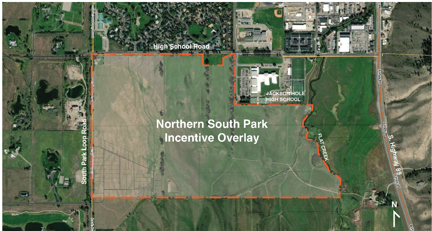
2.
The Overlay identifies two distinct areas: Northern South Park Area 1 (NSP Area 1) and Northern South Park Area 2 (NSP Area 2).
a.
Northern South Park Area 1. This area encompasses the western portion of Northern South Park, approximately 101 acres.
b.
Northern South Park Area 2. This area encompasses the eastern portion of Northern South Park, approximately 121 acres.
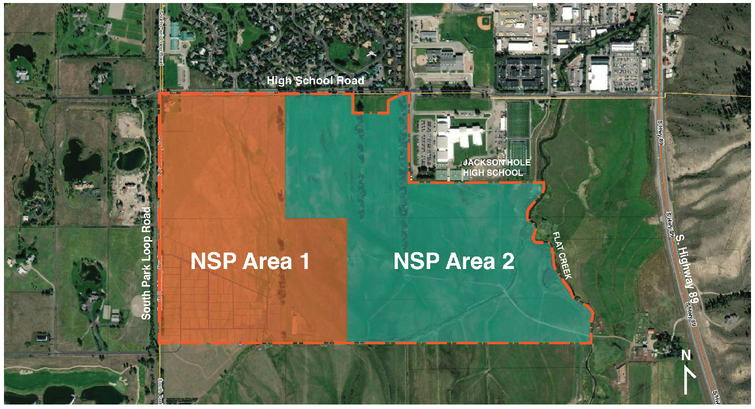
3.
The entitlement and development process in Section 4.5.1(C) shall only apply to lands located within the Northern South Park Incentive Overlay.
4.
In addition to the standards of this Division 4.5, all applicable standards of these Teton County Land Development Regulations shall apply where Division 4.5 is silent, unless specifically exempted.
5.
Where standards of this Division conflict with other provisions of these Land Development Regulations, the standards of this Division shall govern.
C.
Northern South Park Incentive Overlay, Entitlement, and Development Procedure. A landowner in NSP Area 1 or NSP Area 2 may elect to pursue a process to develop their lands within the Northern South Park Incentive Overlay, in a manner consistent with the goals and objectives of the Northern South Park Neighborhood Plan. Applications shall follow the development procedures of this Section 4.5.1(C) in addition to the relevant procedures established in Article 8 (Administrative Procedures of these Land Development Regulations), unless specifically exempted.
The process includes submittal of a Master Site Plan describing blocks with unrestricted and restricted housing allocations (Section 4.5.1(C.1)), optional submittal of one or more Initial Subdivision Plats (Section 4.5.1(C.2)), and submittal of Development Plans (Section 4.5.1(C.3)) and subsequent Subdivision Plats.
The Master Site Plan provides the method by which development will adhere to the Northern South Park Neighborhood Plan and grants entitlement to development potential as described in Section 4.5.2 (Standards Applicable to All Northern South Park Development). Master Site Plans will be reviewed according to the standards of Section 8.2.14 (All Public Hearings) and this Division 4.5. Initial Plat Subdivision allows for the creation of two and one-half- to five-acre blocks for the purpose of conveying land and allocating housing according to the Master Site Plan to achieve a final ratio of 70% restricted to 30% unrestricted new housing units. Initial Plat Subdivision is reviewed pursuant to Section 8.5.3 (Subdivision Plat) and the standards of this Division 4.5. Development Plans implement final subdivision and development and are reviewed pursuant to Section 8.3.2 (Development Plan) and standards of this Division 4.5.
Northern South Park Development Procedure
1.
Master Site Plan. The applicant shall submit a Master Site Plan pursuant to the procedures of the Miscellaneous Planning Request (MSC) application in Section 8.2.15(E) (Miscellaneous Planning Requests Review Process). The application shall present a Master Site Plan for the entirety of either NSP Area 1 or NSP Area 2 or the entirety of both NSP Area 1 and NSP Area 2. The application shall be reviewed pursuant to the procedures of Section 8.2.15(E) (Miscellaneous Planning Requests Review Process) and this Section.
a.
Purpose and Intent of Master Site Plan. The purpose of the Master Site Plan is to establish a guide for future development within each NSP Area. The Master Site Plan ensures that development achieves the workforce and affordable housing vision of the Northern South Park Neighborhood Plan. The Master Site Plan shall be of sufficient detail to describe and illustrate the future layout of collector roads and local streets, blocks, major infrastructure, provision of transit, pathway connectivity through the NSP Area and to existing routes, parks, densities within the NSP Area (including an estimate of unit allocation by block) and to demonstrate adequacy of infrastructure to serve the number of units in those blocks. However, technical specifications of the proposed development, such as fully engineered plans, exact unit allocations, or detailed architectural drawings are not required. Individual buildings and interior block design are not required for the Master Site Plan and will be described during future Development Plans.
b.
Applicant. The applicant shall be one or more landowners or other persons with a recognized property interest in the land of the proposal, or their authorized representative, within the Northern South Park Area for which the Master Site Plan is proposed. Participation of all landowners within the site of a proposed NSP Area 1 or Area 2 Master Site Plan is not required for the Board of County Commissioners to review and take action on the Master Site Plan or for a Master Site Plan application to be determined sufficient, despite the requirements of Section 8.2.4(A.2) (Authority to Submit). If a single Master Site Plan is proposed for both NSP Area 1 and Area 2, the applicant shall include at least one landowner or authorized representative from each NSP Area.
c.
Review. In addition to review by County staff and selected Plan Review Committee, a Master Site Plan shall be reviewed by the County Planning Commission and the Board of County Commissioners in public hearings per the procedures in Section 8.2.14 (All Public Hearings). The Planning Commission shall make a recommendation to the Board of County Commissioners on the design and approval of the Master Site Plan. The Board of County Commissioners shall approve, approve with conditions, or deny approval of the application based on the findings described in Section 4.5.1(C.1.e) (Findings for Approval for Master Site Plan).
d.
Submittal Components. The minimum submittal components for a Master Site Plan application include:
i.
Statement of Purpose. The application shall include a Statement of Purpose that describes how the Master Site Plan fulfills the Northern South Park Neighborhood Plan and the applicable standards of Section 4.5.2 (Standards Applicable to All Northern South Park Development).
ii.
Master Site Plan. Plan shall include the elements described in Section 4.5.1(C.1.a) (Purpose and Intent of Master Site Plan), illustrating the proposed site layout, street network, east-west street connectivity, blocks, parks, school exaction land, transit connectivity and provision, and anticipated development densities.
iii.
Northern South Park Development Standards. The plan shall indicate the location of Northern South Park Development Standards (NSP-1, NSP-2, and NSP-3) at the block level. The standards mapped to a specific block shall be used to evaluate future subdivision, use, and physical development applications within that block.
iv.
Capital Improvements Element.
a)
A Capital Improvements Element that ensures infrastructure and essential services will be provided in a timely manner to accommodate the development anticipated by the Master Site Plan.
b)
The Capital Improvements Element shall comply with the standards of the Northern South Park Incentive Overlay.
c)
The Capital Improvements Element shall describe and include concept plans for streets, sidewalks, pathways, parks, water supply, wastewater, transit facilities, stormwater, snow storage, and utilities.
d)
The Capital Improvements Element shall describe a Stormwater Management Plan and strategy for managing, collecting, and treating stormwater and snow melt throughout the entire site.
e)
The Capital Improvements Element shall include a geotechnical study of the site for analysis of development suitability by a professional engineer licensed to do such work in the State of Wyoming.
f)
The Capital Improvements Element shall include a Traffic Impact Study addressing the impacts of development proposed in the Master Site Plan, including identifying impacts on High School Road, South Park Loop Road and South Highway 89. The Traffic Impact Study shall identify transportation mitigation and infrastructure improvements necessary to address the identified traffic impacts and a schedule of triggering events for their provision.
g)
The Capital Improvements Element shall identify on-site infrastructure and specify how it will be provided for the future development of the site, including descriptions of the on-site infrastructure and the timing for completion of said infrastructure as it relates to development within the site area. Concept plans for the on-site infrastructure shall be included in the Capital Improvements Element. Engineered plans shall be provided in development plan applications for subsequent development and/or with initial plat applications.
h)
The Capital Improvements Element shall specify what entity is responsible for funding and installing on-site infrastructure. It shall also describe what entity is responsible for the long-term funding, ownership, and maintenance of the on-site infrastructure.
i)
Future development may necessitate additional off-site improvements or financial contributions toward additional off-site improvements, such as road capacity or safety improvements on High School Road, South Park Loop Road, South Highway 89, or increasing utility infrastructure capacity, which shall be reviewed and determined at the time of Development Plan review.
v.
Phasing Element. The applicant shall include a phasing element, describing the sequence of development throughout the site ensuring that development occurs in an orderly and logical sequence. The phasing element shall describe the relationship between the capital improvements and on-site infrastructure described in the Capital Improvements Element and the sequence, location, and amount of development.
vi.
Housing Element. The applicant shall include a housing element describing the location of blocks, the allocation of residential units by block, and how units will be integrated by housing type.
e.
Findings for Approval for Master Site Plan. A Northern South Park Master Site Plan shall be approved only if all the following findings are made.
i.
Consistent with Northern South Park Neighborhood Plan. The Master Site Plan shall be consistent with the plan's stated housing and connectivity objectives, as well as the plan's stated visions.
ii.
Compliance with Northern South Park Overlay Standards. The Master Site Plan complies with all applicable standards of the Northern South Park Overlay in Section 4.5.2 (Standards Applicable to All Northern South Park Development), as can be determined by the level of detail of a Master Site Plan.
iii.
Transportation. The Master Site Plan contains a traffic impact analysis and transportation demand management plan that:
a)
Promote multimodal forms of transportation that are consistent with the transportation goals of the Jackson/Teton County Comprehensive Plan; and
b)
Manage the generation of neighborhood-related traffic to avoid undermining community character and endangering the public health, safety, and welfare.
iv.
Land Use. The Master Site Plan promotes land uses that support and maintain the character of the neighborhood as specified in the Northern South Park Neighborhood Plan.
v.
Phasing Element. The Master Site Plan contains a phasing element that ensures development of the neighborhood, its amenities, and public facilities necessary to serve the neighborhood occur in a logical sequence.
vi.
Housing Element. The Master Site Plan ensures a supply of affordable and workforce housing that is accordance with Section 4.5.2(F) (Affordable and Workforce Housing Requirements).
f.
Recordation.
i.
Upon approval, the Master Site Plan and any conditions of approval and amendments, shall be reviewed and approved by the Planning Director, County Attorney, and the landowner(s) or their representatives and recorded with the County Clerk on all properties within the subject site (NSP Area 1 and/or NSP Area 2).
ii.
Along with the Master Site Plan, an instrument (such as an affidavit), reviewed and approved by the Planning Director and County Attorney, as well as the landowner(s) or their representatives, shall be recorded on all properties within the subject site describing the new development entitlements granted by the approval as well as the deed-restricted housing obligated by opting into the Northern South Park Incentive Overlay.
iii.
The new development entitlements shall not take effect until these documents are recorded with the County Clerk.
g.
Amendment. An approved Master Site Plan may be reviewed and amended pursuant to the procedures in Section 8.2.15 (Miscellaneous Planning Request) and the findings set forth in this Section.
i.
Any property owner or their authorized representative within the Master Site Plan area may apply for an amendment of the Master Site Plan.
ii.
An amendment shall be subject to all applicable standards of this Division that are in effect at the time of submittal of the amendment.
iii.
Major Amendments. The Board of County Commissioners shall approve, approve with conditions or deny an application for a major amendment. Prior to review by the Board of County Commissioners, the Planning Commission shall review the major amendment and provide a recommendation.
iv.
Minor Amendments. The Planning Director may review and approve, approve with conditions or deny an application for a minor amendment. To qualify as a minor amendment, a proposed amendment shall meet the following standards:
a)
The proposed amendment is consistent with the Purpose and Intent of the Master Site Plan.
b)
The proposed amendment does not modify the Phasing Element of the Master Site Plan.
c)
The proposed amendment does not modify the Capital Improvements Element of the Master Site Plan.
d)
The proposed amendment does not materially affect other property owners within the Northern South Park Incentive Overlay.
e)
The proposed amendment is consistent with the current standards of Division 4.5 (Northern South Park Incentive Overlay and Development Standards).
h.
Expiration. An approved Master Site Plan and its associated entitlements shall expire if no Development Plan(s) is/are submitted within ten years of Master Site Plan Approval.
i.
Extension. An expiration date of an approved Master Site Plan may be extended by the Board of County Commissioners provided a written request for extension is received by the Planning Department at least 60 calendar days prior to expiration of the Master Site Plan.
ii.
Procedure. The request for extension shall be reviewed by the Board of County Commissioners at a regularly scheduled meeting, by which time a public hearing notice shall be advertised and any necessary information pertinent to the extension request can be made available. The Master Site Plan shall be deemed extended until the Board of County Commissioners takes final action upon the request for extension.
i.
Standing of an Approved Master Site Plan. Upon approval of a Master Site Plan, any amendments to these Land Development Regulations shall not affect the approval of the Master Site Plan unless otherwise specified in this Section or the conditions of approval.
j.
Effect of Approval.
i.
Approval of a Master Site Plan does not permit actual physical development, subdivision, or use of the site.
ii.
Grading, Bridge and Floodplain Permits. Approval of a Master Site Plan shall allow for submittal and review of engineering-related permits consistent with the approved Capital Improvements Element and Phasing Element of the Master Site Plan.
iii.
Approval of a Master Site Plan shall grant the additional development entitlements allowed by the Northern South Park Incentive Overlay in the Northern South Park Area(s) for which the Master Site Plan was proposed and approved, subject to the standards and procedures of this Division 4.5 and all standards, expiration terms, and conditions of the approved Master Site Plan.
iv.
Approval of a Master Site Plan shall not prohibit any property owner within the Northern South Park Incentive Overlay from applying for a zoning map amendment, or for any development, subdivision, development option, or use allowed by the current or future zoning of their property located within the Northern South Park Incentive Overlay.
v.
Maximum number of dwelling units. Approval of a Master Site Plan shall enable densities, intensities, and uses allowed and developed under the Northern South Park Development Standards as described in Sections 4.5.3 (NSP-1), 4.5.4 (NSP-2), and 4.5.5 (NSP-3). However, the number of dwelling units shall be limited by the dwelling unit maximums specifically described in Section 4.5.2(E) (Maximum Number of Dwelling Units).
vi.
The allocation of new units within the Master Site Plan area shall comply with Section 4.5.2(F) (Affordable and Workforce Housing Requirements).
vii.
Exactions for new unit development shall comply with Section 4.5.2(G) (Exactions).
2.
Initial Plat Subdivision. Approval of a Master Site Plan shall allow for the submittal and review of one or more initial subdivision plats, pursuant to Section 8.5.3 (Subdivision Plat), of lands within the approved Master Site Plan area into blocks, consistent with the approved Master Site Plan and the Northern South Park Development Standards. Development, subdivision, and use of blocks, including development of unrestricted and restricted units, shall be subject to Section 4.5.2 (Standards Applicable to All Northern South Park Development). Resulting blocks may be conveyed to satisfy the affordable and workforce housing allocation of Section 4.5.2(F) (Affordable and Workforce Housing Requirements).
a.
Notwithstanding anything in these Land Development Regulations to the contrary, approval of an Initial Plat Subdivision shall not require prior approval of a Development Plan or Development Option Plan. Any Initial Plat Subdivision shall be reviewed for consistency with an approved Master Site Plan.
b.
Subsequent Subdivision. Further subdivision of resultant blocks shall require approval of a Development Plan and subsequent Subdivision Plat.
c.
Subdivision Improvements. Subdivision of land into blocks shall require subdivision improvements, pursuant to Section 7.2.2 (Standards Applicable to All Subdivision) and the approved Master Site Plan and its Capital Improvements Element. Financial assurances for the required subdivision improvements shall take the form of a Subdivision Improvements Agreement.
d.
Exactions. No exactions shall be required for an Initial Plat Subdivision, as a subsequent Development Plan identifying exactions shall be required prior to development of dwelling units and/or additional subdivision.
e.
Development Under Base Zoning. After an Initial Plat Subdivision, any subsequent physical development, subdivision, or use under the standards of the base zoning shall require conformance with the minimum lot size for the base zone, which may be achieved via vacation of the initial plat or a subsequent plat.
f.
NSP Incentive Overlay standards shall apply. Lands that have been subdivided subject to the Initial Plat Subdivision process allowed herein shall be subject to the standards of Section 4.5.2 (Standards Applicable to All Northern South Park Development), except that development, subdivision, and use proposed under base zoning shall be exempt from the standards of Section 4.5.2.
3.
Development Plan. Any Development Plan application submitted for lands approved for development under one or more of the Northern South Park Development Standards shall be subject to the Development Plan standards and procedures of Section 8.3.2 (Development Plan) and shall meet the following standards.
a.
Contents. A single Development Plan may be submitted for approval of both subdivision and physical development concurrently. At a minimum, all Development Plans, including those required for subdivision, shall describe the following:
i.
Dwelling Units. A Development Plan shall include a description of all proposed units by lot and whether they are existing or new units (see Section 4.5.2) and deed-restricted workforce or affordable or unrestricted units.
ii.
Affordable and Workforce Housing Plan. Any Development Plan for physical development or subdivision proposing unrestricted units shall include a plan demonstrating compliance with the affordable and workforce housing allocation in Section 4.5.2(F) (Affordable and Workforce Housing Requirements).
iii.
Water Supply and Wastewater. A Development Plan application shall describe how water supply and wastewater treatment will be provided to the development or subdivision. The application shall include a Will Serve Letter, indicating approval for connection of the development or subdivision to the public water supply and sewerage systems.
b.
Master Site Plan. A Development Plan shall be consistent with the approved Master Site Plan.
c.
Phasing Plan. A phasing plan may be submitted to ensure the development, improvements, infrastructure, and public facilities, occur in logical sequence and/or to establish an alternative expiration.
i.
Minor deviations to an approved phasing plan may be approved by the Planning Director, pursuant to Section 8.2.13(B.2) for Minor Deviations.
ii.
A development plan that includes both subdivision and physical development shall include a phasing plan, proposed by the applicant.
d.
Monitoring Report. The Planning Director may require the applicant to provide a monitoring report that describes project progress and accounts for the status of all approved units for tracking purposes as well as construction of infrastructure and public open spaces, parks, and facilities.
(4/9/24)
4.5.2. - Standards Applicable to All Northern South Park Development.
A.
Applicability. The standards of this Section 4.5.2 shall only apply to development, use, and subdivision occurring on sites developing under any of the Northern South Park Development Standards in Division 4.5: NSP-1, NSP-2, and NSP-3. Notwithstanding, all applicable standards of these Teton County Land Development Regulations shall apply where Section 4.5.2 is silent, unless specifically exempted. Where standards of this Section conflict with other provisions of these Land Development Regulations, the standards of this Section shall govern.
1.
Development, use, and subdivision under the standards of base zoning, not utilizing the NSP Development Standards, shall be exempt from the standards of this Section 4.5.2.
B.
Definitions.
1.
Block. An area of land defined by adjacent, publicly-accessible streets and/or pathways. Blocks may be platted without prior approval of a Development Plan, subject to the standards of Section 4.5.1(C) (Northern South Park Incentive Overlay, Entitlement, and Development Procedure), however, further subdivision of any block and/or development of any structures and operation of any uses shall require approval of a Development Plan and applicable physical development, subdivision, and use permits.
a.
Block faces are defined between publicly-accessible streets or pathways and measured between the nearest edges of publicly-accessible rights-of-way or easements.
b.
External Block Faces. External block faces are defined as blocks facing High School Road, South Park Loop Road or Jackson Hole High School. External block faces shall not exceed 600 feet.
c.
Internal Block Faces. Block faces internal to Northern South Park, not facing High School Road, South Park Loop Road or Jackson Hole High School, shall not exceed 450 feet.
2.
New Dwelling Unit. See Section 4.5.2(E.2) (New Development Potential).
3.
Deed-Restricted Housing Unit. A deed-restricted housing unit is either a workforce housing unit or affordable housing unit.
a.
Workforce Housing Unit. A dwelling unit subject to a Jackson/Teton County Housing Department or Jackson/Teton County Housing Authority special restriction, deed restriction, and/or ground lease, permanently restricting use and occupancy of the unit to households working in Teton County, Wyoming.
A dwelling unit subject to an alternative organization's or entity's special restriction, deed restriction, and/or ground lease permanently restricting the use and occupancy of the unit on the basis of employment in Teton County, Wyoming may qualify as a workforce housing unit for purposes of this Division 4.5, subject to the Housing Director's review and the Board of County Commissioners' approval of such restriction and/or lease.
b.
Affordable Housing Unit. A dwelling unit (i) subject to a Jackson/Teton County Housing Department or Jackson/Teton County Housing Authority special restriction, deed restriction, and/or ground lease, permanently restricting use and occupancy of the unit to households working in Teton County, Wyoming and earning up to 120% of Median Family Income or (ii) subject to a Jackson Hole Community Housing Trust or Habitat for Humanity of the Greater Teton Area special restriction, deed restriction, and/or ground lease permanently restricting use and occupancy of the unit.
A dwelling unit subject to an alternative organization's or entity's special restriction, deed restriction, and/or ground lease permanently restricting the use and occupancy of the unit on the basis of household income may qualify as an affordable housing unit for purposes of this Division 4.5, subject to the Housing Director's review and the Board of County Commissioners' approval of such restriction and/or lease.
4.
Unrestricted Housing Unit. A dwelling unit that is not subject to a restriction requiring specific affordability and/or occupancy of the unit.
C.
Rules of Measurement.
1.
Street Lot Line Designation. On sites with multiple frontages, the Planning Director will designate street lot lines based on the criteria below:
a.
The street or streets with the highest classification;
b.
The established orientation of the block;
c.
The street or pathway abutting the longest face of the block;
d.
The street or pathway parallel to an alley within the block;
e.
The street that the lot takes its access from; and
f.
The pedestrian orientation of adjacent or contiguous development, existing or proposed.
2.
A site with multiple frontages shall have at least one primary street lot line. Remaining frontages shall be designated as secondary street lot lines. Remaining lot lines shall be rear lot lines; a lot with multiple frontages shall not have a side lot line.
3.
Density/Intensity. Calculations of maximum density, floor area, and landscape surface area shall utilize gross site area.
D.
Exempt from Other Overlays. Subdivision, use, and development shall be exempt from the standards of the Scenic Resources Overlay (Section 5.3.2) and Natural Resources Overlay, Tiered Habitat Protection Standards, Tiered Habitat Protection Standards (Section 5.2.1).
1.
Notwithstanding, all development shall comply with protection and process requirements from the Endangered Species Act, Bald and Golden Eagle Protection Act (1940), most recent Wyoming Governor's Sage Grouse Executive Order, and other pertinent federal or state species protections. There shall be no development or use within 660 feet of a Bald Eagle nest or within 300 feet of a Trumpeter Swan natural nest.
E.
Maximum Number of Dwelling Units. The maximum number of dwelling units within the Northern South Park Overlay shall not exceed 1,319 new dwelling units in addition to the 118 dwelling units allowed under existing zoning.
1.
Existing Development Potential. Existing Rural-1 and Suburban zoning in Northern South Park on July 5, 2022 allows a maximum of 118 dwelling units. This 118-unit allowance is recognized as existing development potential, which may be realized using current zoning or the Northern South Park Development Standards.
2.
New Development Potential. New dwelling units that are in addition to the recognized 118 dwelling units under existing zoning may only be approved and developed under the Northern South Park Development Standards.
3.
Maximum Number of Dwelling Units by Area. The maximum number of dwelling units that may be approved within the Northern South Park Incentive Overlay is further defined between Northern South Park Area 1 and Northern South Park Area 2.
a.
Northern South Park Area 1.
i.
Existing Development Potential. There are 86 recognized dwelling units allowed in NSP Area 1.
ii.
New Development Potential. Up to 600 new dwelling units may be developed in NSP Area 1.
b.
Northern South Park Area 2.
i.
Existing Development Potential. There are 32 recognized dwelling units allowed in NSP Area 2.
ii.
New Development Potential. Up to 719 new dwelling units may be developed in NSP Area 2.
F.
Affordable and Workforce Housing Requirements.
1.
Applicability.
a.
Nonresidential Development. Nonresidential development shall be subject to the requirements of Division 6.3 (Affordable Workforce Housing Standards) and shall be exempt from the standards of this Section 4.5.2(F).
b.
Existing Development Potential. Development of the 118 dwelling units recognized under existing zoning within the Northern South Park Overlay shall be subject to the requirements of Division 6.3 (Affordable Workforce Housing Standards) and shall be exempt from the standards of this Section 4.5.2(F).
c.
New Unit Development Potential. Development of all new units under the Northern South Park Development Standards shall meet the Affordable and Workforce Housing standards of this Section 4.5.2(F) and shall be exempt from the standards and requirements of Division 6.3 (Affordable Workforce Housing Standards).
2.
Standards. Residential development of all new units shall meet the following standards.
a.
Required Allocation. Development of any new units shall be comprised of at least 70% deed-restricted housing units and at least 40% of the new housing units shall specifically be affordable housing units.
i.
Restrictions. Deed-restricted housing units shall use a Jackson/Teton County Housing Department, Jackson/Teton County Housing Authority, Jackson Hole Community Housing Trust, or Habitat for Humanity of the Greater Teton Area Special Restriction, Deed Restriction, and/or Ground Lease. Restrictions from alternative organizations may be allowed, subject to the review and recommendation of the Housing Director and approval of the Board of County Commissioners.
b.
Affordable and Workforce Housing Plan. An application for development of unrestricted units or subdivision of unrestricted lots of record shall demonstrate compliance with the standards of this Section through inclusion of an Affordable and Workforce Housing Plan.
i.
Part of Development Plan Application. The Affordable and Workforce Housing Plan shall be a required component of a sufficient Development Plan application for subdivision of unrestricted lots of record or development of unrestricted units.
ii.
Contents of Affordable and Workforce Housing Plan.
a)
Calculation of Allocation. A calculation of the amount of deed-restricted housing units and minimum affordable housing units to satisfy the allocation incentive.
1)
If the calculation determines that a fraction of a deed-restricted housing unit is needed, the fraction shall be rounded to the nearest whole number.
b)
Proposed method of provision. The method or combination of methods by which deed-restricted housing is to be provided.
c.
Method for Providing Affordable and Workforce Housing.
i.
Standards Applicable to All Methods.
a)
Location. Deed-restricted housing shall be developed within the same Area of the Northern South Park Incentive Overlay as the corresponding unrestricted development.
1)
Within practical limitations imposed by Section 4.5.2(F.2.c.ii) (Construction) and Section 4.5.2(F.2.c.iii) (Conveyance of Land), deed-restricted housing units shall be integrated with unrestricted units within the Northern South Park Overlay.
b)
Variety. Within practical limitations imposed by Section 4.5.2(F.2.c.ii) (Construction) and Section 4.5.2(F.2.c.iii) (Conveyance of Land), deed-restricted housing units shall be provided in a variety of building types and sizes to accommodate a variety of incomes and lifestyles.
ii.
Construction. Construction of deed-restricted housing shall comply with the following standards.
a)
Deed Restrictions. Prior to receiving Certificate of Occupancy, all affordable and workforce housing units shall have an allowed deed-restriction recorded with the Teton County Clerk.
b)
Timing. The Affordable and Workforce Housing Plan shall establish a phasing plan for the construction of the deed-restricted units. At a minimum, the phasing plan shall require that when 50% of the unrestricted new units in the Development Plan have been issued building permits, no additional building permits for unrestricted new units may be issued until certificates of occupancy are issued for affordable new units amounting to at least 20% of the number of unrestricted new units in the Development Plan that have been issued building permits.
The Board of County Commissioners may require financial assurances from the applicant to guarantee that the construction of the deed-restricted housing units will occur in a timely manner.
EXAMPLE:If 100 total new units are proposed in a single Development Plan, 30 may be unrestricted new units, and at least 40 are affordable new units. Once 15 (50% of 30) building permits have been issued for the unrestricted units, certificates of occupancy must be issued for at least three (20% of 15) affordable units before building permits are issued for the remaining 15 new unrestricted units.
iii.
Conveyance of Land. Conveyance of land to satisfy the allocation of deed-restricted housing shall comply with the following standards.
a)
Recipient. Land may only be conveyed to the County or to a bona fide affordable and/or workforce housing developer directly. The recipient of land conveyed pursuant to this Section shall be approved at the discretion of the Board of County Commissioners, except that no approval is required if the land will be conveyed to the Jackson Hole Community Housing Trust or to Habitat for Humanity of the Greater Teton Area.
b)
Timing.
1)
Land conveyance shall occur prior to issuance of a Development Permit for any physical development or subdivision of land for unrestricted new dwelling units.
2)
When 50% of the unrestricted new units for an NSP Area have received Development Plan approval, no Development Plans shall be approved within such NSP area for additional unrestricted new units utilizing the land conveyance method, pursuant to this Section, until building permits are issued for an amount of affordable new units in such NSP Area equal to 20% of the amount of such unrestricted new units. If a sufficient amount of new affordable housing units have not been issued building permits pursuant to this paragraph, the Board of County Commissioners may approve financial assurances proposed by the applicant for the unrestricted units to guarantee that construction of such affordable housing units will occur in a timely manner so additional Development Plans may be approved, and corresponding land conveyed, in accordance with this Section.
EXAMPLE:The number of unrestricted new units allowed in NSP Area 1 is 180. When 90 (50% of 180) unrestricted new units in NSP Area 1 have received Development Plan approval, no Development Plans for additional unrestricted new units may be approved until building permits have been issued for at least 18 (20% of 90) affordable new units in NSP Area 1.
c)
Amount. Land conveyed shall, at the minimum, be in an amount that allows for construction, under the NSP Development Standards applicable to the land at the time of conveyance, of the amount of deed-restricted housing units commensurate with the unrestricted dwelling units approved by a Development Plan for physical development or subdivision.
1)
The minimum amount of land conveyed shall be determined based on the number of deed-restricted units identified in the Affordable and Workforce Housing Plan. The applicant shall demonstrate that the land conveyed is of an amount sufficient to accommodate the deed-restricted housing units.
d)
Clear Title. Land conveyed shall have clear title, physical and legal access, and be free of any liens.
e)
Onsite Infrastructure. Land conveyed shall be fully ready for development and construction, with roads and pathways, water supply, sewage disposal, stormwater system, communication, electricity, and other basic services installed with direct and sufficient access to the conveyed land, corresponding with the approved Master Site Plan and its Capital Improvements Element.
f)
Site Suitability. All conveyed land shall be suitable to construct intended density and amount of affordable workforce housing, as identified in the geotechnical study and analysis of the approved Master Site Plan.
g)
Use of Conveyed Land. Land conveyed shall be used for the development of deed-restricted housing units of an amount and type consistent with or exceeding the requirements of this Section. Additional local neighborhood nonresidential uses, pathways, alleys, parks and other uses allowed in the Northern South Park Development Standards may also be developed on the land, subject to Development Plan approval, if such uses and improvements do not interfere with provision of the affordable and workforce housing allocation.
h)
Covenants and Deed Restrictions.
1)
At the time of conveyance, a covenant shall be recorded with the Teton County Clerk, restricting future use of the site to the development of deed-restricted units and other uses allowed subject to Subsection iii.g, above, that shall be approved as to form by the County Attorney and the Planning Director.
2)
The covenant in Subsection h.1, above, shall be vacated and released from a deed-restricted unit upon the recordation against such unit of a deed restriction administered by the Jackson Hole Community Housing Trust, Habitat for Humanity of the Greater Teton Area, Jackson/Teton County Housing Authority, the Jackson/Teton County Housing Department, or a deed restriction subject to the review and recommendation of the Housing Director and approval by the Board County Commissioners.
G.
Exactions.
1.
Amount and Responsibility. Provision of school and parks exactions for both unrestricted units and all deed-restricted housing units identified to meet the allocation in the Affordable and Workforce Housing Plan of a Development Plan shall be the responsibility of the developer of the unrestricted units at the time exactions are required for the unrestricted units, pursuant to the standards of Section 7.5.2 (Park Exactions) and Section 7.5.3 (School Exactions). However, the exactions due shall be provided per dwelling unit identified in the Affordable and Workforce Housing Plan, regardless of how many lots of record may be created.
2.
Timing and Credits. Exaction parcels may be conveyed ahead of time as one or more piece(s) prior to a development plan or subsequent subdivision plat and may be credited toward exactions due for future subdivision within the corresponding NSP Area.
3.
Location. The dedicated exaction land may be provided outside of the proposed subdivision or development but shall be located within the NSP Area of the approved Master Site Plan.
H.
Building Frontages.
1.
Building Frontages. To provide a high-quality, pedestrian-oriented public realm, all primary structures adjacent to a road right-of-way, pathway, or open space shall include a building frontage for each building entrance facing the road right-of-way, pathway, or open space.
a.
Institutional and transportation/infrastructure uses may be allowed to comply with the building frontages on an 'as practicable' basis with Planning Director approval.
| 2. Porch | ||
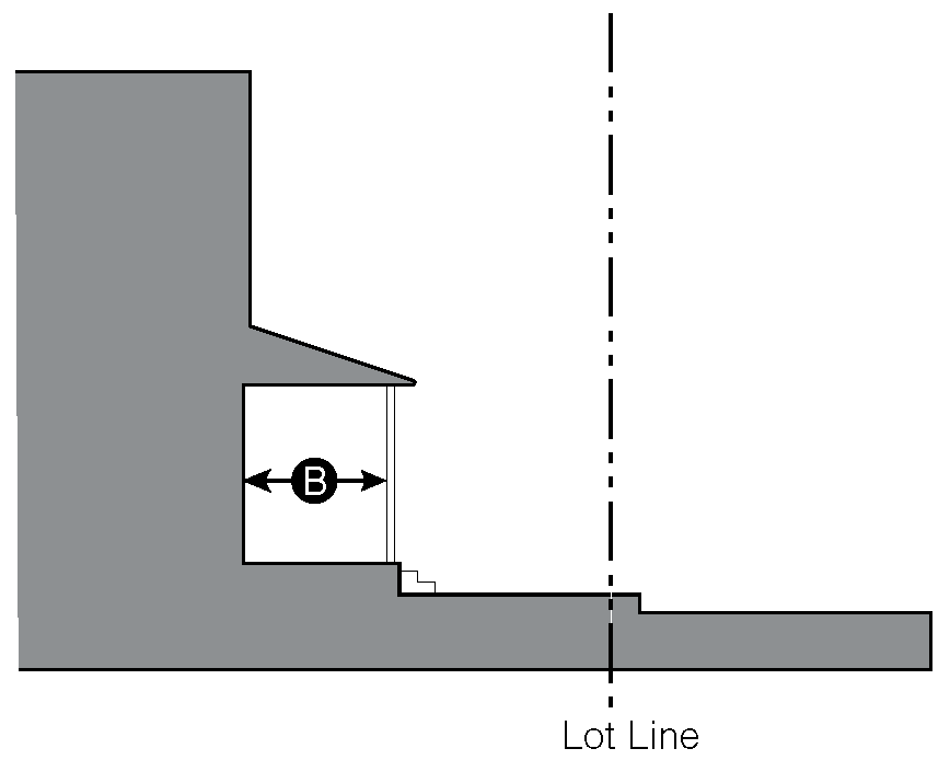 | ||
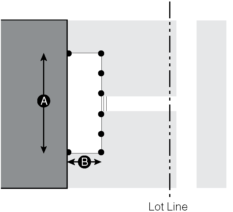 | ||
| Description | ||
| A porch frontage is a covered structure that provides access to the building entrance and may encroach into the setback. Porches shall be open on two or three sides, with any habitable space located behind the structure setback. | ||
| Standards | ||
| Allowed Uses | Residential | |
| Width (minimum) | 10' |  |
| Depth (minimum) | 6' |  |
| Height (maximum) | 2 stories | |
| Shall not exceed the height of the primary structure. | ||
| Additional Standards | ||
| Porches may encroach up to 6' into the street setback. | ||
| 3. Dooryard | ||
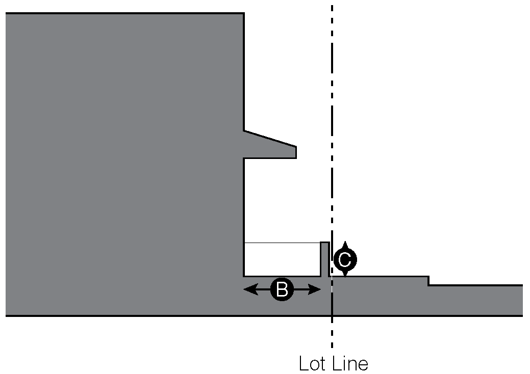 | ||
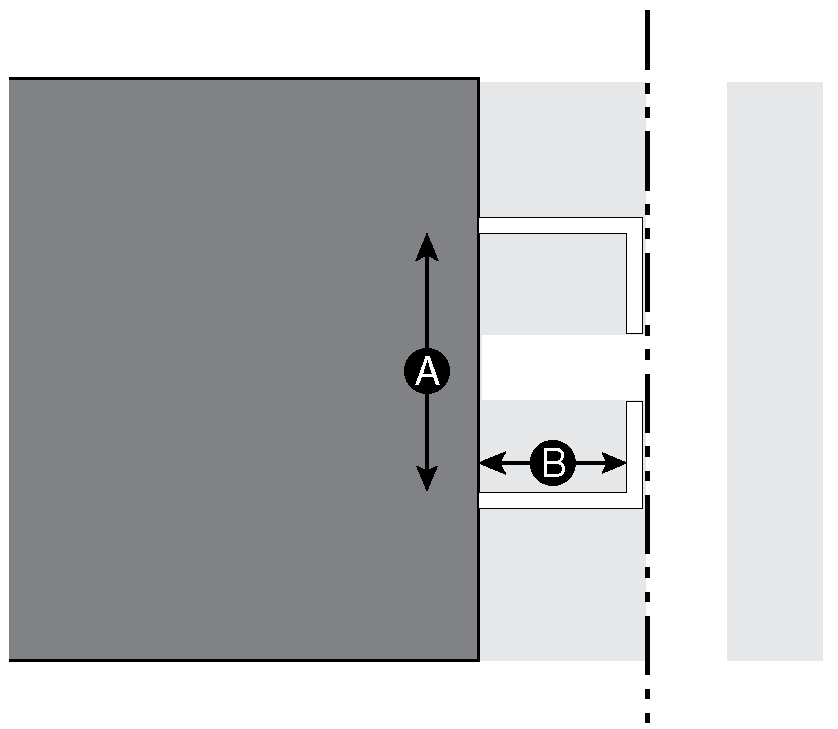 | ||
| Description | ||
| A dooryard is defined by a wall, fence, or hedge, creating a small private area between the lot line and the building façade. Each dooryard shall be separated from adjacent dooryards. Dooryards may be raised or at grade. | ||
| Standards | ||
| Allowed Uses | Residential | |
| Width (minimum) | 10' | |
| Depth (minimum) | 10' | |
| Height of dooryard fence/wall/hedge (maximum) | 3' |  |
| Additional Standards | ||
| Each dooryard shall provide access to only one ground floor entry. | ||
| 4. Stoop | ||
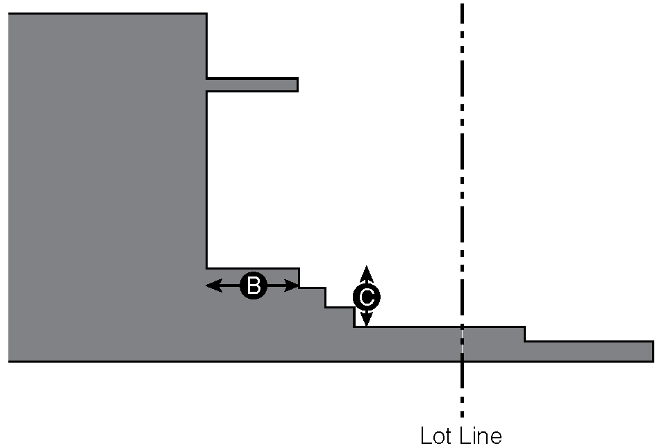 | ||
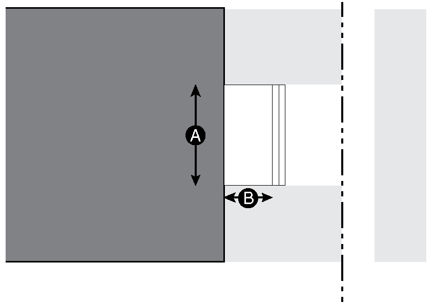 | ||
| Description | ||
| A stoop provides access to an elevated entry to the building to provide privacy along the pedestrian-facing rooms. Stairs or ramps from the stoop shall lead directly to or shall be parallel to the pedestrian facility or open space. | ||
| Standards | ||
| Allowed Uses | Residential | |
| Width (minimum) | 5' | |
| Depth (minimum) | 3' | |
| Height above finished grade (min.) | 1' | |
| Additional Standards | ||
| Gates shall not be allowed. | ||
| All doors shall face the right-of-way, pathway, or open space. | ||
| Entry doors shall be covered or recessed to provide shelter from the elements. | ||
| Stairs may be perpendicular or parallel to the building façade. | ||
| Ramps shall be parallel to the building façade. | ||
| The stoop may project up to 6' into the street setback. | ||
| 5. Forecourt | ||
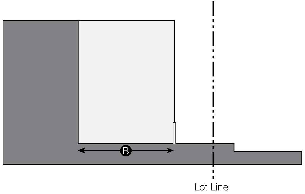 | ||
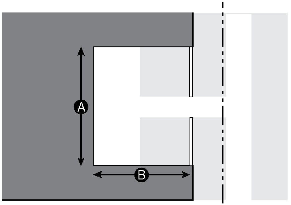 | ||
| Description | ||
| A forecourt is a space created between a portion of the façade of the building that is set back farther than the rest of the building's façade. The space may be used as an entry court or shared garden space for multi-unit buildings. | ||
| Standards | ||
| Allowed Uses | Attached single family, apartment | |
| Width (maximum) | ⅓ of façade width | |
| Width (minimum) | 15' | |
| Ground floor elevation (maximum) | 1' above finished grade | |
| Depth (minimum) | 15' | |
| Additional Standards | ||
| Multiple entries may be accessed from a single forecourt. | ||
| Other allowed frontage types may be applied within the forecourt. | ||
| 6. Gallery | ||
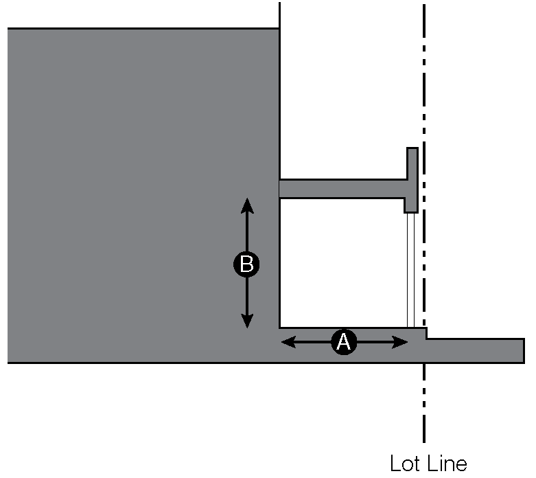 | ||
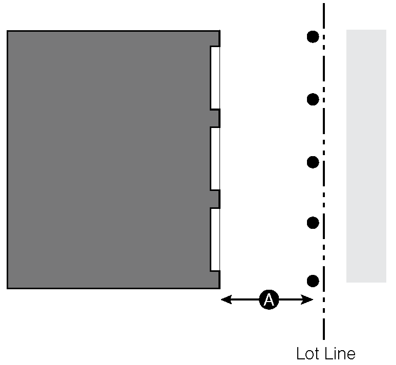 | ||
| Description | ||
| A gallery frontage has a covered walkway or arcade element that protrudes from the façade and may extend to the lot line. A publicly-accessible sidewalk shall be established under the gallery. | ||
| Standards | ||
| Allowed Uses | Attached single family, apartment | |
| Depth (minimum) | 8' | |
| Ground Floor Height (minimum) | 12' | |
| Additional Standards | ||
| Galleries shall have a consistent depth. | ||
| If a gallery has a second story, it may be used as a deck and may be covered by a roof but shall not be habitable space. | ||
| A gallery frontage shall only be allowed for buildings with a minimum of 9 dwelling units. | ||
| 7. Shopfront | ||
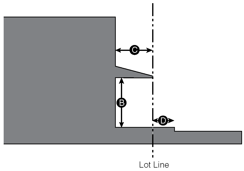 | ||
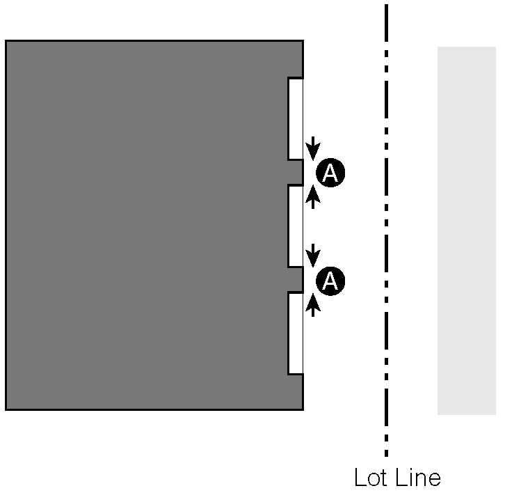 | ||
| Description | ||
| A shopfront frontage includes substantial glazing between the shopfront base and the ground floor ceiling. It may include an awning that overlaps the sidewalk. The shopfront frontage includes an at-grade entrance. | ||
| Standards | ||
| Allowed Uses | Commercial | |
| Ground Floor Glazing (minimum) | 60% | |
| Horizontal Distance Between Glazing (maximum) | 2' | |
| Awning (if present) | ||
| Clearance (minimum) |
7.5' from
average grade | |
| Setback (minimum) |
18" from
back of curb | |
| Depth (minimum) | 5' |  |
I.
Neighborhood Design Requirements.
1.
Primary structures adjacent to or across a street or pathway from an open space shall front on to the open space.
2.
Public-Facing Entrance. Each primary structure shall include at least one entrance that is oriented toward an adjacent road right-of-way, pathway, open space, or common area.
3.
Development Intensity. Highest intensity development and use shall be located along the northern edge of the Northern South Park Incentive Overlay, closest to High School Road and Jackson Hole High School. The least-intense development shall occur along the southern edge of the overlay, and a transition in intensity from north to south shall provide a step-down in intensity across the Overlay, as illustrated in the Northern South Park Neighborhood Plan.
a.
High intensity development and use shall be located closest to parks, transit, and other amenities.
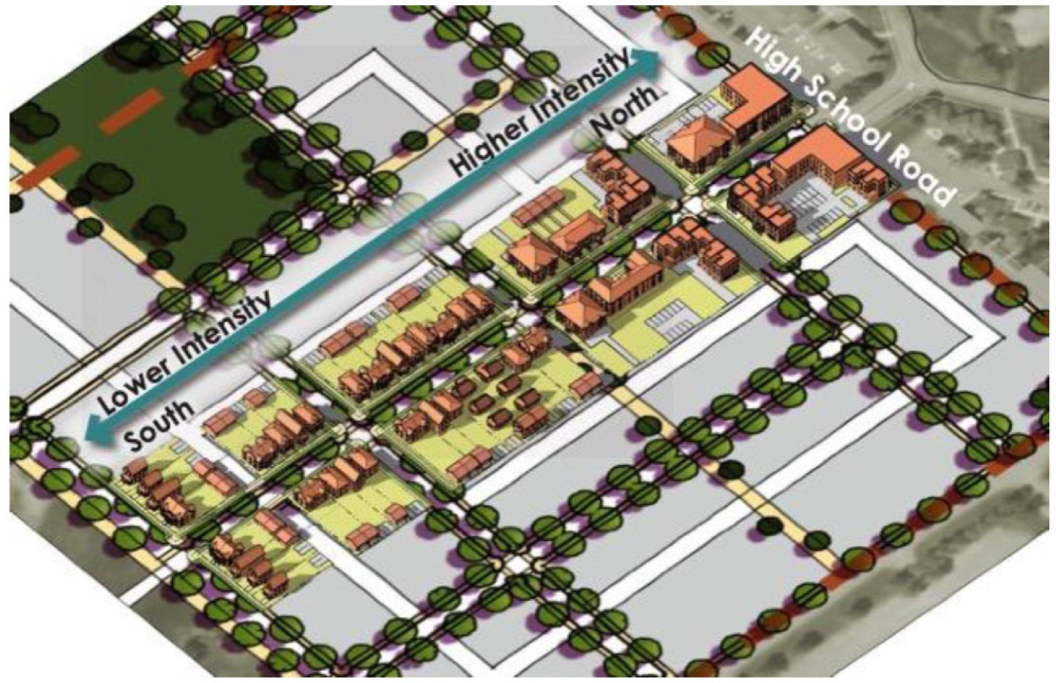
J.
Parking.
1.
Off-Street Vehicle Parking Facility Dimensions. In addition to the standards of Section 6.2.5 (Off-Street Parking and Loading Design Standards) the following standards shall apply.
a.
Alley Access. A maximum of four parking spaces per lot of record may be accessed directly from an alley. Parking for more than four vehicles shall require a drive aisle.
i.
Any parking space accessed perpendicularly, directly from an alley shall have a minimum length of 22 feet.
ii.
Any parking space accessed parallel to an alley shall have a minimum width of 11 feet.
b.
Parallel Parking Space. All parallel parking spaces shall have a minimum length of 22 feet.
c.
Tandem Parking. Tandem parking is permitted for residential uses, regardless of the number of residential units per lot, provided that the tandem parking spaces are assigned to the same residential unit.
d.
Underground Parking Facility Design Guidelines. All underground vehicle parking facilities shall be designed in consideration of the Town of Jackson's Underground Parking Facility Design Guidelines, adopted by the Town of Jackson pursuant to Resolution No. 09-25 and available at townofjackson.com.
2.
Location of Off-Street Vehicle Parking. Off-street surface parking lots shall be located at the rear of lots and shall not be located between buildings and the street nor between buildings that front on the street.
3.
Shared Parking and Loading. The owners of two or more uses, structures, or lots of record may develop a shared parking and loading plan. This shared parking and loading plan shall identify the amount and location of parking that will be shared, identify the hours of use and expected amount of use, provide pedestrian connections, and provide a statement explaining how the owners will ensure an adequate amount of parking is provided. The plan shall also include a shared maintenance agreement, and if applicable, a cross-lot grading and maintenance easement agreement to be recorded by the Teton County Clerk against the subject lots of record. The shared parking and loading plan and agreement shall be subject to approval by the Planning Director.
a.
Reduced Parking Requirement. Development of a shared parking and loading plan may allow for a reduction in parking requirements based on the analysis demonstrating that adequate parking is provided for all uses.
b.
Reduced Plant Unit Requirement. Development of a shared parking and loading plan may allow for a reduction in the standard plant unit requirements on a site at the discretion of the Planning Director.
4.
Required Vehicle Parking Administrative Adjustment. Per Section 6.2.2(A) (Required Parking), the Planning Director may establish a lesser parking requirement pursuant to the procedure of Section 8.8.1 (Administrative Adjustment).
5.
Snow Storage. A minimum site area representing 10% of the total required off-street parking and loading area, inclusive of aisles and access drives, shall be provided as the snow storage area.
6.
Required Bicycle Parking. All new and expanded uses that generate off street parking shall provide parking for nonmotorized vehicles as set forth below unless otherwise exempt by this subsection.
a.
Requirement. The table below establishes the minimum required bicycle parking spaces that shall be provided for each use. Calculations that reference floor area shall be based on the gross floor area.
b.
Standards and Installation Guides.
i.
Short-Term Bicycle Parking.
a)
Shall be designed for parking of two hours or less and is targeted to visitors, customers, and other short-term users.
b)
Shall be located in a visible, publicly accessible space within 50' of a pedestrian entrance to the uses served by the required bicycle parking.
c)
Shall be provided on-site or within the adjacent public right-of-way (e.g., furnishing zone) with County approval.
d)
Shall be designed to allow for two points of contact between the bicycle and the rack, one of which includes the frame, and must be designed so that the bicycle frame and one wheel can be locked to a secure portion of the rack with a U-lock, with both wheels left on the bicycle. Wave, ribbon, loop, and other serpentine-style racks are prohibited.
e)
A minimum of 25% of the required short-term bicycle parking must accommodate larger and alternative bicycles, including cargo bikes/bikes with trailers, tricycles, hand cycles, tandems, and electric motor assisted bicycles.
f)
See the Town of Jackson Utility Standards for standard dimensions and installation details.
ii.
Long-Term Bicycle Parking.
a)
Shall be designed for parking of two hours or more and is targeted towards those who will be leaving their bicycles unattended for long periods of time.
b)
Shall be provided on the same property as the building or use for which such spaces are required.
c)
Shall be secure, conveniently accessed from a pedestrian entrance, well-lit, and covered to protect bicycles from precipitation and theft.
d)
Acceptable forms of long-term parking include a secure, monitored location, a locked enclosure, or dedicated space within a building.
e)
Clustered inverted-U racks, wall racks, or individual bike lockers are acceptable.
f)
A minimum of 25% of the required long-term bicycle parking spaces must accommodate larger and alternative bicycles, including cargo bikes/bikes with trailers, tricycles, hand cycles, tandems, and electric motor assisted bicycles.
iii.
Alternative Compliance.
a)
The Planning Director may approve alternative compliance with the provisions of this article per Section 8.8.1 (Administrative Adjustment) to reduce or modify the number, type, or location of the required bicycle parking, based on unique requirements of a use. Considerations may include but are not limited to the following:
1)
Physical site planning constraints.
2)
Proximity to existing, legally accessible bicycle parking.
3)
Provision of enhanced bicycle facilities provided within the project.
4)
Inclusion of the site within a larger development for which adequate bicycle parking is already provided.
5)
Unforeseen circumstances or land use changes.
b)
The Planning Director may approve replacing up to 10% of required off-street vehicle parking spaces with at least the same number of additional off-street long-term bicycle parking spaces.
c)
The Planning Director may approve converting existing vehicle parking to required bicycle parking.
K.
Connectivity and Transportation Facility Requirements.
1.
Applicability. The standards of this Section shall apply in addition to the standards of Division 7.6 (Transportation Facility Standards). Where standards of this Section and Division 7.6 are in conflict, the standards of this Section shall apply.
2.
Standards. It is recognized that standards cannot be developed which will apply to all situations. In those instances where the standards of this Section and Division 7.6 are not applicable, the proposed design must demonstrate consistency with the intent of the Northern South Park Neighborhood Plan vision, the Town of Jackson Community Streets Plan, and be reviewed and approved by the County Engineer.
3.
Streets, Alleys, and Easements.
a.
Urban Road Design. In accordance with Section 7.6.4(N.1) (Urban Road Design) of these LDRs, due to Northern South Park's location and anticipated development intensity, design of streets, roads, and alleys shall conform with standards specified by the Town of Jackson.
b.
General Standards.
i.
Adequate Access. Adequate vehicular, bicycle, and pedestrian access shall be provided to all lots of record.
ii.
Design to Reduce Speed. Local streets shall be designed to encourage slow speed through traffic calming strategies such as, but not limited to, narrow travel lanes, raised crosswalks/intersections, curb extensions at intersections and crosswalks, roundabouts, mini-roundabouts, chicanes, on-street parking, and street trees.
iii.
Provision for Transit Service. Provisions for transit service, including bus stops, shall be established. Collector roads shall be designed to accommodate transit service through Northern South Park, consistent with the Master Site Plan.
iv.
Contextual. Development shall be contextual and, whenever practicable, connect to existing development in a manner consistent with the standards of this Section.
v.
Alleys. Paved alleys provide access to parking and minimize curb cuts on public streets. Paved alleys shall be required for access to lots under the NSP-2 and NSP-3 Development Standards.
vi.
Easements. Exclusive or restrictive easements shall be provided along lot lines as required for utilities and snow storage. Alleys may be used as a substitute for some utility easements, but shall not be used for water, sewer, or stormwater utilities, unless they are at least 30' in width. Utility easements, except those for water, sewer, and stormwater utilities, may be fenced but shall be easily accessible. Removal and replacement of fencing and associated costs shall be the responsibility of the owner. No permanent structures shall be erected on easements.
vii.
Community Streets Plan. Street design shall be consistent with the latest edition of the Town of Jackson Community Streets Plan and shall reflect the Neighborhood Context Considerations described for Character District D5.
c.
Complete Streets. All streets shall be designed consistent with complete streets best practices. Example complete street cross-section designs are found in the approved Northern South Park Neighborhood Plan. Additionally, all road rights-of-way shall:
i.
Support the intended character of adjacent existing or proposed development.
ii.
Provide facilities for multiple modes of transportation.
iii.
Provide sidewalks, pathways, or pedestrian facilities on both sides of all streets.
iv.
Provide on-street vehicle parking for a minimum of 30% of each block face in areas developed under NSP-2 and NSP-3, except that single-loaded streets shall be exempt.
v.
Prohibit on-street vehicle parking within 20 feet of any crosswalk or alley and within 30 feet of any stop sign or traffic control signal.
d.
Rights-of-Way. Any right-of-way providing access and circulation, whether privately or publicly owned, shall not be platted as an easement within private lots, but shall be platted as a separate entity.
e.
Local Roads. Local road rights-of-way shall be a minimum of 50 feet.
f.
Alleys. Alley rights-of-way shall be a minimum of 25 feet or 30 feet for dead end alleys. Alley pavement width shall be a minimum of 20 feet.
g.
Pathways. Pathways shall have a minimum pavement width of ten feet.
h.
Sidewalks. Sidewalks shall be a minimum of five feet wide.
4.
Minimum Transit Connectivity.
a.
Development shall be serviceable by transit directly via High School Road, South Park Loop Road and the East-West Connector.
b.
The street network layout shall be designed to accommodate transit routing through Northern South Park, utilizing complete street designs.
5.
Active Travel Connectivity.
a.
Every residential unit shall be connected to the following by a pedestrian route and bicycle route:
i.
Jackson Hole High School Campus and School Pathways
ii.
Russ Garaman Pathway
iii.
South Park Loop Trail
iv.
Paul Merritt Pathway
v.
Eagle Village Shopping Center
b.
A pathway shall be provided along the south side of High School Road.
c.
A pathway shall be provided along the east side of South Park Loop Road.
d.
A pathway shall be provided along the East-West connector road.
e.
At least one dedicated east-west internal pathway shall be provided across Northern South Park.
f.
At least one dedicated north-south internal pathway shall be provided across each of Northern South Park Area 1 and Area 2.
6.
Street Connectivity. The following street connectivity standards shall apply.
a.
Subdivision and development shall be designed for two street connections to High School Road west of Jackson Hole High School. Connection points shall be located at the existing High School Road intersections with Rangeview Drive and Corner Creek.
b.
Subdivision and development in Northern South Park Area 1 shall provide three direct connections, meeting minimum separation distances, to South Park Loop Road, unless an alternative configuration is proposed and is reviewed and approved by the County Engineer.
c.
East-West Connector Road. A minimum of a 90-foot right-of-way shall be provided for an East-West Connector roadway between South Park Loop Road and South Highway 89.
i.
Each of NSP Area 1 and Area 2 shall include two direct street connections to the East-West Connector.
ii.
Timing.
a)
An easement shall be provided to the County for the segment of the East-West connector that is within each of NSP Area 1 and NSP Area 2 at the time of approval of a Master Site Plan for that NSP Area.
d.
Cul-de-sacs. Cul-de-sacs and dead ends are prohibited on street segments longer than 150'.
L.
Open Space Requirements.
1.
Proximity. At least one access point for every dwelling unit shall be located within one-quarter mile, via pathway or sidewalk, of a park, playground, or open space of at least one-quarter acre.
2.
Access. Open spaces shall be bordered on at least two sides by publicly accessible streets or pathways.
3.
Wildlife Permeability. Open spaces (including pathway and trail networks) shall be designed and located to promote wildlife permeability across the site.
a.
Open spaces shall be configured contiguously to allow for and promote wildlife permeability in both north-south and east-west directions.
b.
Fences and Structures. Open spaces shall not include fences or amenities that obstruct wildlife permeability. However, athletic fields used for outdoor recreation with an approved Conditional Use Permit shall be exempt from this requirement, provided the fences, structures, and amenities, are contiguous with at least a 150-foot open space buffer surrounding the structures and fencing to allow for wildlife movement around the structures within the open space.
4.
Landscaping. Landscaping in public and common areas shall be native species, as defined by Teton County's Native Species List, compiled by Teton Conservation District. Additionally, no planted landscaping shall have a Palatable to Graze Animals (PGA) or Palatable to Browse Animals (PBA) rating of "High" according to the Native Species List. Alternatives to the plant list may be reviewed and approved by the Planning Director.
a.
Athletic fields for active outdoor recreation shall be exempt from this requirement with an approved Conditional Use Permit.
5.
Ponds. Manmade ponds are prohibited.
6.
Stormwater. Stormwater infrastructure shall utilize best available technologies for stormwater retention and filtration utilizing a distributed system that does not require ponds or large retention basins.
M.
Required Utilities.
1.
Public Water Supply Distribution System Required. A public water supply, storage, and distribution system or connection to an existing public water supply system shall be required in all developments. If connecting to an existing system, the connecting element shall include individual meters for commercial uses and one master meter for the residential uses. Individual water supply wells are prohibited.
2.
Public Wastewater Treatment System Required. A public wastewater treatment system or connection to an existing public wastewater treatment system shall be required. Individual septic systems are prohibited.
3.
Water District. Creation of a separate water district shall be allowed.
N.
Improvement and Service District.
1.
Development in Northern South Park shall form one or more homeowner's associations and/or improvement and service districts that shall be responsible for managing and maintaining infrastructure, including but not limited to roads, pathways, water, wastewater, and parks. This requirement shall not preclude the development from partnering with the Town or County on management and maintenance.
(5/1/25)
4.5.3. - NSP-1: Northern South Park-1 Development Standards.
A.
Intent.
1.
General Intent. The intent of the Northern South Park-1 (NSP-1) development standards is to provide for lower-intensity residential development of Northern South Park that accommodates a variety of unit types in a walkable environment. The NSP-1 standards provide flexibility in design and ownership for single-family detached and duplexes on smaller lots, as well as small multiplexes. The standards can provide a lower-intensity transition at the edge of Northern South Park where development abuts rural and agricultural land and larger-lot single-family residential development.
2.
Buildings. Buildings can be up to two stories in height. Multiple buildings on a site is common. Incentives are provided to encourage variety in roof pitch and design.
3.
Parking. Parking is provided on-site in garages or with surface spaces. On-site parking may be accessed from an alley.
4.
Land Use. Single-family detached and attached homes, small apartment buildings, and accessory structures, are the primary land uses. Lots may be as small as 2,500 square feet and allow additional density at 5,000 square feet.
5.
Northern South Park Neighborhood Plan. These standards are based primarily on the Walkable Neighborhood Low Character Area in the Northern South Park Neighborhood Plan.
B.
Physical Development. Standards applicable to physical development are provided in this Section. Where a cross-reference is listed, see the referenced division or section for additional standards. Standards in Article 5 apply unless stated otherwise.
| 1. Lot Standards | ||
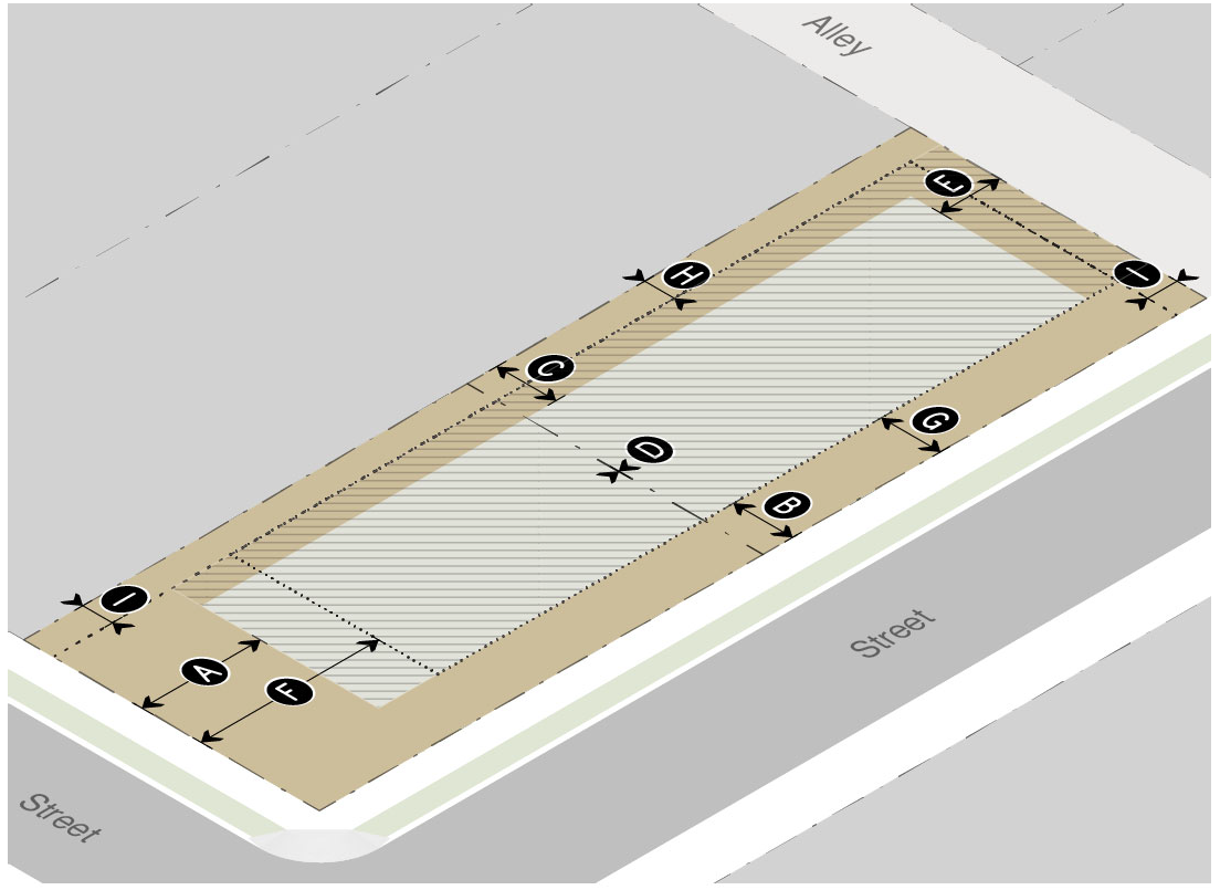 | ||
| Primary Building Setbacks | (Sec. 9.4.8) | |
| Primary street (min) | 10' | |
| Secondary street (min) | 10' | |
| Side interior (min) | 7' | |
| Duplex/Multiplex interior (min) | 0' | |
| Rear (min) | 5' |  |
| Accessory Structure Setbacks | (Sec. 9.4.8) | |
| Primary street (min) | 30' |  |
| Secondary street (min) | 10' |  |
| Side interior (min) |  | |
| > 14 feet in height | 7' | |
| ≤ 14 feet in height | 5' | |
| Second floor deck | 10' | |
| Rear (min) | 5' | |
| Site Development Setbacks | ||
| All site development, excluding driveways, sidewalks, or parking. | ||
| Primary/secondary street (min) | Same as primary building | |
| Side interior/rear (min) | 5' |  |
| Landscaping | (Div. 5.5 & Subsec. E.5) | |
| Landscape surface ratio (min) | ||
| 1 dwelling unit | .35 | |
| LSR decrease for each additional dwelling unit | .05 | |
| All other allowed uses | .35 | |
| Plant units (min) | 1 per lot | |
| 2. Vehicle Access Standards | |||
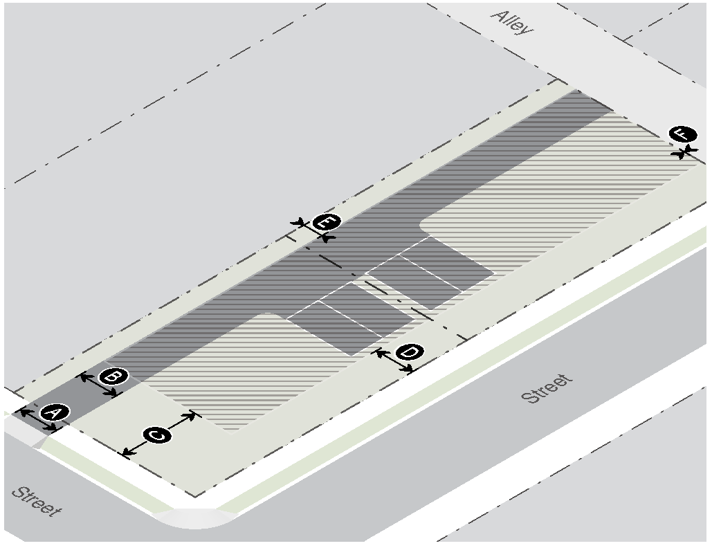 | |||
| Access | Lot width ≤25' | Lot width > 25' | |
| Primary street | Not allowed | Allowed | |
| Secondary street | Not allowed | Allowed | |
| Alley | Required | Allowed | |
| Curb-cut width (max) | Not allowed | 20' per 100' of lot frontage or 40% of lot frontage, whichever is less | |
| Driveway width in primary/secondary street setback (min-max) | Not allowed | 10'—20' | |
| Parking Setbacks | |||
| Primary street (min) | 20' | 0' | |
| Secondary street (min) | 10' | 0' | |
| Side interior (min) | 5' | 5' | |
| Rear (min) | 5' | 5' | |
| Rear alley (min) | 2' | 2' | |
| 3. Bulk & Mass Standards | |||
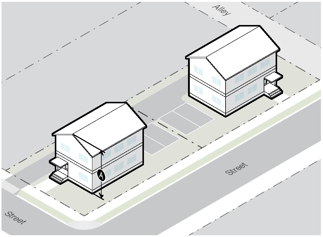 | |||
| Primary Building Height | (Sec. 9.4.9) | ||
| Height (max): roof pitch ≤ 3/12 | 2 stories, not to exceed 26' | | |
| Height (max): roof pitch 4/12, 5/12 | 2 stories, not to exceed 28' | | |
| Height (max): roof pitch ≥ 6/12 | 2 stories, not to exceed 30' | | |
| Accessory Structure Height | (Sec. 9.4.9) | ||
| All accessory structures (max) | 26' | ||
| Maximum Scale of Development | (Sec. 9.4.7) | ||
| Floor area ratio (FAR max) | Lot Size ≤5,000 sf | Lot Size >5,000 sf | |
| All uses | .50 | .40 | |
|
FAR increase for each
additional unit | .10 | .10 | |
| Allowed Frontage Types | (Sec. 4.5.2(H)) | ||
| Porch | |||
| Dooryard | |||
| Stoop | |||
| Forecourt | |||
C.
Allowed Uses and Use Standards. Standards applicable to uses in NSP-1 are provided or referenced below. Allowed uses are listed in Subsection 1. Uses that are not listed are prohibited, unless a similar use determination is made pursuant to Section 6.1.2(D). Where a cross reference is provided, please see the referenced division or section for additional standards applicable in NSP-1. This Subsection is intended to indicate all of the use standards applicable in the NSP-1, however, all standards in Article 6 are applicable in NSP-1, unless stated otherwise.
D.
Development Options and Subdivision. Standards applicable to development options and subdivision in NSP-1 are provided or referenced below. Where a cross reference is provided, please see the referenced division or section for additional standards applicable in the NSP-1 zone. This Subsection is intended to indicate all of the development option and subdivision standards applicable in NSP-1, however, all standards in Article 7 are applicable in NSP-1, unless stated otherwise.
E.
Additional Zone-Specific Standards. The following standards apply in addition to all other standards applicable in NSP-1.
1.
Maximum Allowed Density.
a.
The maximum allowed density on an individual lot of 5,000 sf or smaller in size is two units.
b.
The maximum allowed density on an individual lot greater than 5,000 sf is four units.
2.
Encroachment into Building Setbacks.
a.
Street Setback. Cornices, canopies, eaves, decks (covered and uncovered), porches, stoops, balconies, bay windows, chimneys and similar architectural features may encroach into a street yard by not more than six feet.
b.
Side and Rear Setback. Cornices, canopies, eaves, decks (covered and uncovered), porches, balconies, bay windows, chimneys and similar architectural features may encroach into a side/rear yard by not more than four feet. Patios which are at grade may extend to any portion of a side or rear yard but are subject to site development setbacks. These allowances apply only to primary structures and do not apply to accessory structures.
3.
Subdivision. Subdivision of land into blocks shall be allowed prior to an approved Development Plan, consistent with the approved Master Site Plan, as an Initial Plat. Further subdivision of blocks shall require approval of a Development Plan and subsequent Subdivision Plat.
4.
Fencing. Small area safety and exclusionary fencing meeting the Wildlife Friendly Fencing exemptions of Section 5.1.2(B.2.c) (Applicability) shall meet the fencing height and setback standards of this Section. Required wildlife friendly fencing shall follow the design standards and requirements of Section 5.1.2 (Wildlife Friendly Fencing) and the fencing setbacks of this Section.
5.
Landscaping.
a.
Berry and other fruit-bearing trees and landscaping are prohibited unless such landscaping is fenced with exclusionary wildlife fencing as allowed in Section 5.1.2(B.2.c) (Applicability).
b.
Turf landscaping shall not exceed 50% of the landscape surface area of any site.
(7/1/26)
(Amendment No. 2025-0002, 4-7-26)
4.5.4. - NSP-2: Northern South Park-2 Development Standards.
A.
Intent.
1.
General Intent. The intent of the Northern South Park-2 (NSP-2) development standards is to provide a range of medium to higher density residential development that enable a transition in scale and intensity between NSP-1 and NSP-3, using a broad range of detached and attached residential types in a walkable environment. The size of individual buildings will be limited to not exceed the scale of a large, single-family dwelling.
2.
Buildings. Buildings can be up to two stories in height. Multiple detached buildings or multiple attached units on a site is common. No more than eight units will be permitted within an individual building. Incentives are provided to encourage variety in roof pitch and design.
3.
Parking. Parking is provided primarily on-site in garages or with surface spaces. On-site parking is accessed from an alley.
4.
Land Use. The full spectrum from a single-family detached home to an eight-unit apartment/condo building is allowed.
5.
Northern South Park Neighborhood Plan. Based primarily on the Walkable Neighborhood Medium Character District in the Northern South Park Neighborhood Plan.
B.
Physical Development. Standards applicable to physical development are provided in this Section. Where a cross-reference is listed, see the referenced division or section for additional standards. Standards in Article 5 apply unless stated otherwise.
| 1. Lot Standards | ||
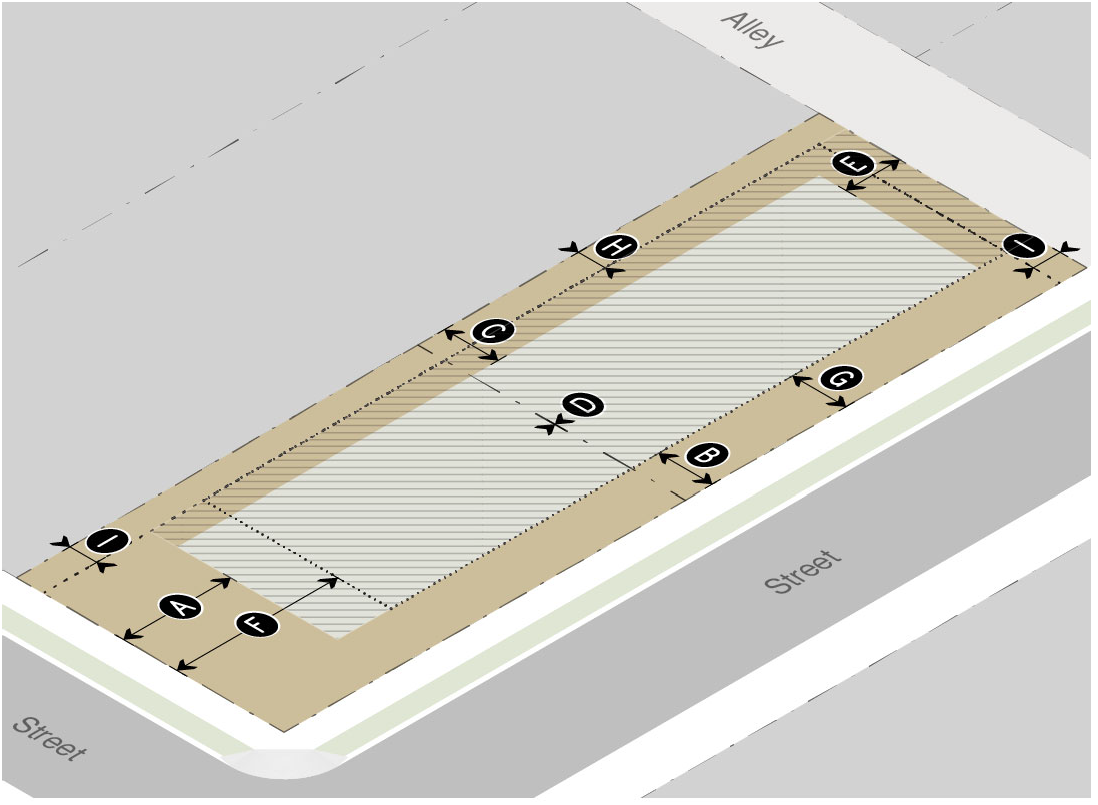 | ||
| Primary Building Setbacks | (Sec. 9.4.8) | |
| Primary street (min) | 10' | |
| Secondary street (min) | 10' | |
| Side interior (min) | 7' | |
| Duplex/Multiplex interior (min) | 0' | |
| Rear (min) | 5' | |
| Accessory Structure Setbacks | (Sec. 9.4.8) | |
| Primary street (min) | 30' | |
| Secondary street (min) | 10' | |
| Side interior (min) | 5' | |
| Rear (min) | 5' | |
| Site Development Setbacks | ||
| All site development, excluding driveways, sidewalks, or parking. | ||
| Primary/secondary street (min) | Same as primary building | |
| Side interior/rear (min) | 5' | |
| Landscaping | (Div. 5.5 & E.7) | |
| Landscape surface ratio (min) | (Sec. 9.4.6(D)) | |
| 1 dwelling unit | .45 | |
| 2 or 3 dwelling units | .30 | |
| 4 or more dwelling units | .20 | |
| All other allowed uses | .35 | |
| Plant units (min) | ||
| 1, 2, or 3 dwelling units | 1 per lot | |
| All other uses and densities | 1/1,000 sf of landscape area | |
| Parking Lot (all uses) | 1 per 12 parking spaces | |
| 2. Vehicle Access Standards | |||
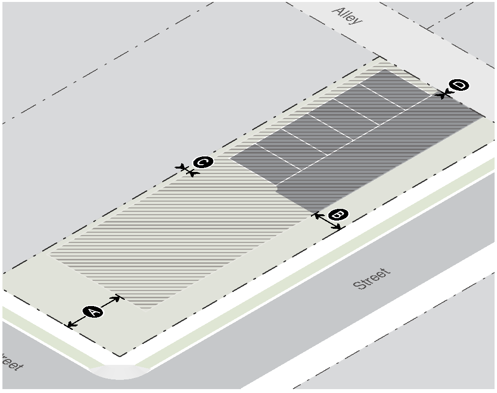 | |||
| Access | Lot width ≤25' | Lot width >25' | |
| Primary street | Not allowed | Allowed | |
| Secondary street | Not allowed | Allowed | |
| Alley | Required | Required | |
| Curb-cut width (max) | Not allowed | 20' per 100' of lot frontage or 40% of lot frontage, whichever is less | |
| Driveway width in primary/secondary street setback (min-max) | Not allowed | 10'—20' | |
| Parking Setbacks | |||
| Primary street* (min) | 20' | 20' | |
| Secondary street* (min) | 10' | 10' | |
| Side interior (min) | 1' | 1' | |
| Rear (min) | 5' | 5' | |
| Rear alley (min) | 0' | 0' | |
| *Excludes 10'—20' driveway allowed in primary/secondary street setback | |||
| 3. Bulk & Mass Standards | ||
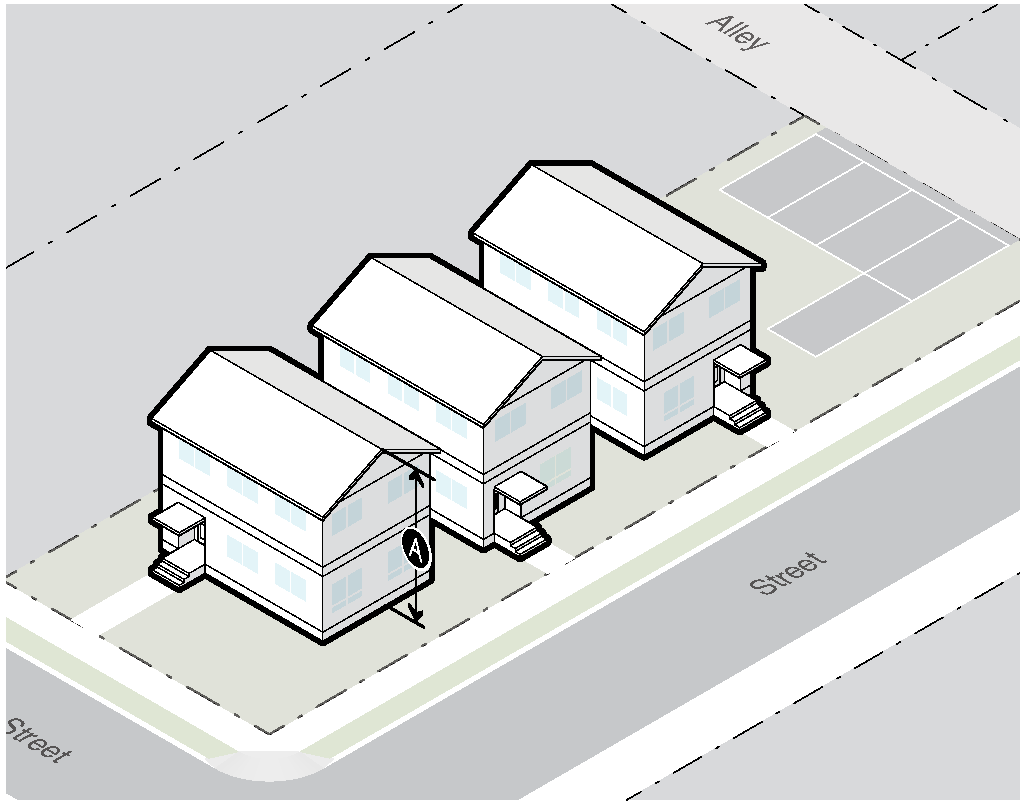 | ||
| Primary Building Height | (Sec. 9.4.9) | |
| Height (max): roof pitch ≤3/12 | 2 stories, not to exceed 26' | |
| Height (max): roof pitch 4/12, 5/12 | 2 stories, not to exceed 28' | |
| Height (max): roof pitch ≥6/12 | 2 stories, not to exceed 30' | |
| Accessory Structure Height | (Sec. 9.4.9) | |
| All accessory structures (max) | 26' | |
| Maximum Scale of Development | (Sec. 9.4.7) | |
| Floor area ratio (FAR max) | .7 | |
| Individual building (max gross floor area) | ||
| Single-Family Detached | 3,000 sf | |
| All other allowed uses | 10,000 sf | |
| Frontage Types | (Sec. 4.5.2(H)) | |
| Porch | ||
| Dooryard | ||
| Stoop | ||
| Forecourt | ||
| Shopfront | ||
C.
Use Standards. Standards applicable to uses in NSP-2 are provided or referenced below. Allowed uses are listed in Subsection 1. Uses that are not listed are prohibited, unless a similar use determination is made pursuant to Section 6.1.2(D). Where a cross reference is provided, please see the referenced division or section for additional standards applicable in NSP-2. This Subsection is intended to indicate all of the use standards applicable in NSP-2, however, all standards in Article 6 are applicable in NSP-2, unless stated otherwise.
D.
Development Options. Standards applicable to development options and subdivision in NSP-2 are provided or referenced below. Where a cross reference is provided, please see the referenced division or section for additional standards applicable in NSP-2. This subsection is intended to indicate all of the development option and subdivision standards applicable in NSP-2, however, all standards in Article 7 are applicable in NSP-2, unless stated otherwise.
E.
Additional Zone-Specific Standards. The following standards apply in addition to all other standards applicable in NSP-2.
1.
Attached Single-Family Unit/Apartment. No more than eight units are allowed per building.
2.
Parking. Parking and service areas shall be located to the rear of buildings and screened from view from any street, right-of-way, or pathway adjacent to the lot.
3.
Encroachment into Building Setbacks.
a.
Front Setback. Cornices, canopies, eaves, decks (covered and uncovered), porches, stoops, balconies, bay windows, chimneys and similar architectural features may encroach into a front yard by not more than six feet.
b.
Side and Rear Setback. Cornices, canopies, eaves, decks (covered and uncovered), porches, balconies, bay windows, chimneys and similar architectural features may encroach into a side/rear yard by not more than four feet. Patios which are at grade may extend to any portion of a side or rear yard but are subject to site development setbacks. These allowances apply only to primary structures and do not apply to accessory structures.
4.
Subdivision. Subdivision of land into blocks shall be allowed prior to an approved Development Plan, consistent with the approved Master Site Plan, as an Initial Plat. Further subdivision of blocks shall require approval of a Development Plan and subsequent Subdivision Plat.
5.
Minimum Density. The minimum required density for residential lots greater than 4,000 sf shall be two dwelling units.
6.
Fencing. Small area safety and exclusionary fencing meeting the Wildlife Friendly Fencing exemptions of Section 5.1.2(B.2.c) (Applicability) shall meet the fencing height and setback standards of this Section. Required wildlife friendly fencing shall follow the design standards and requirements of Section 5.1.2 (Wildlife Friendly Fencing) and the fencing setbacks of this Section.
7.
Landscaping.
a.
Berry and other fruit-bearing trees and landscaping are prohibited unless such landscaping is fenced with exclusionary wildlife fencing as allowed in Section 5.1.2(B.2.c) (Applicability).
b.
Turf landscaping shall not exceed 50% of the landscape surface area of any site.
F.
Configuration Options. Configuration options in NSP-2 include, but are not limited to, the following:
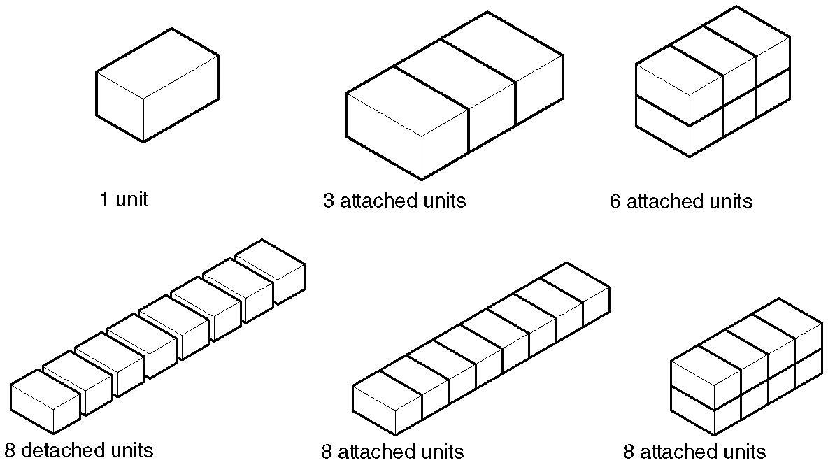
(7/1/26)
(Amendment No. 2025-0002, 4-7-26)
4.5.5. - NSP-3: Northern South Park-3 Development Standards.
A.
Intent.
1.
General Intent. The intent of the Northern South Park-3 (NSP-3) development standards is to provide for high density residential development and to promote a broad range of housing types in a pedestrian-oriented environment.
2.
Buildings. Buildings can be up to three stories in height. Single or multiple detached buildings, each with multiple units, on a site are allowed. Incentives are provided to encourage variety in roof pitch and design.
3.
Parking. Parking is provided primarily on-site in tuck-under or underground garages or with surface parking. On-site parking is accessed from an alley.
4.
Land Use. The full spectrum of residential uses from detached single-family to whatever building can fit the site based on the dimensional limitations, such as FAR, setbacks, and parking. Neighborhood-serving nonresidential uses, including daycare, assembly, and local-convenience commercial are also allowed.
5.
Northern South Park Neighborhood Plan. Based primarily on the Walkable Neighborhood High Character District in the Northern South Park Neighborhood Plan.
B.
Physical Development. Standards applicable to physical development are provided in this Section. Where a cross-reference is listed, see the referenced division or section for additional standards. Standards in Article 5 apply unless stated otherwise.
| 1. Lot Standards | ||
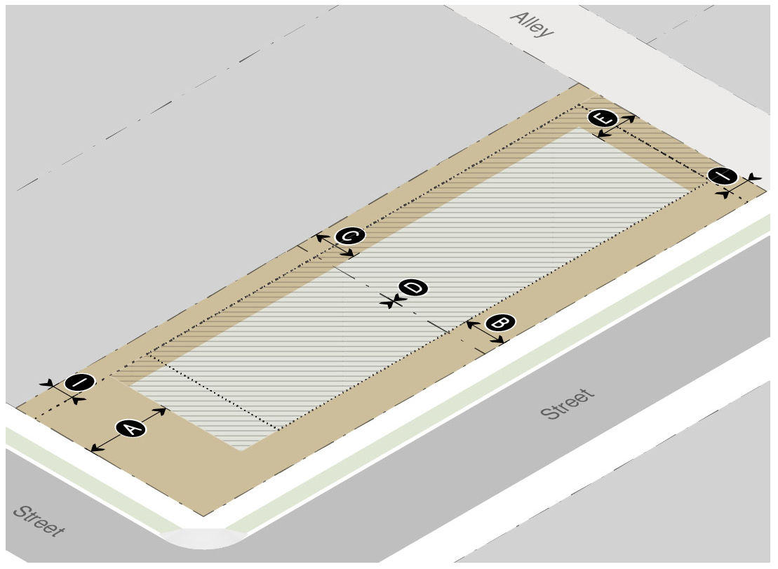 | ||
| Building Setbacks | (Sec. 9.4.8) | |
| Primary street (min) | 10' | |
| Secondary street (min) | 10' | |
| Side interior (min) | 7' | |
| Duplex/Multiplex interior (min) | 0' | |
| Rear (min) | 5' | |
| Site Development Setbacks | ||
| All site development, excluding driveways, sidewalks, or parking. | ||
| Primary/secondary street (min) | Same as building | |
| Side interior/rear (min) | 5' | |
| Landscaping | (Div. 5.5 & Subsec. E.8) | |
| Landscape surface ratio (min) | (Sec. 9.4.6(D)) | |
| All allowed uses | .20 | |
| Plant units (min) | ||
| All allowed uses | 1/1,000 sf of landscape area | |
| Parking Lot (all uses) | 1 per 12 parking spaces | |
| 2. Vehicle Access Standards | ||
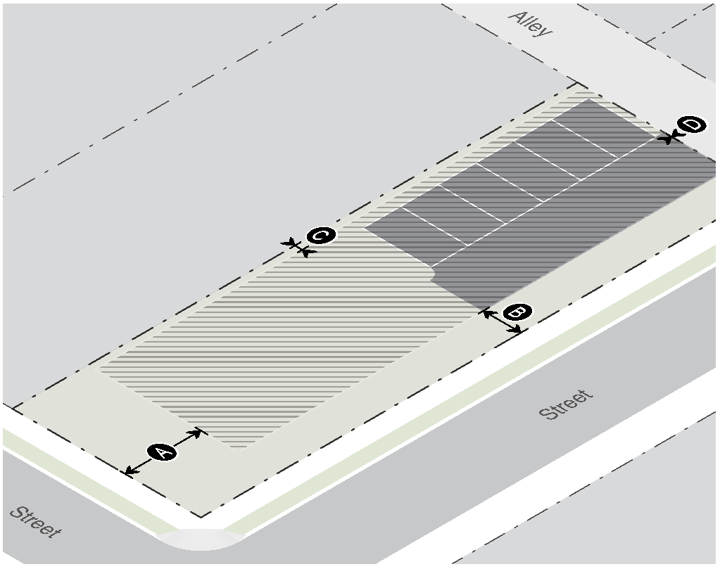 | ||
| Access | ||
| Primary street | Allowed | |
| Secondary street | Allowed | |
| Alley | Required | |
| Curb-cut width (max) | 20' per 100' of lot frontage or 40% of lot frontage, whichever is less | |
| Driveway width in primary/secondary street setback (min-max) | 10'—20' | |
| Parking Setbacks | ||
| Primary street* (min) | 20' | |
| Secondary street* (min) | 10' | |
| Side interior (min) | 1' | |
| Rear (min) | 5' | |
| Rear alley (min) | 0' | |
| * Excludes 20' max driveway allowed in primary/secondary street setback | ||
| 3. Bulk & Mass Standards | ||
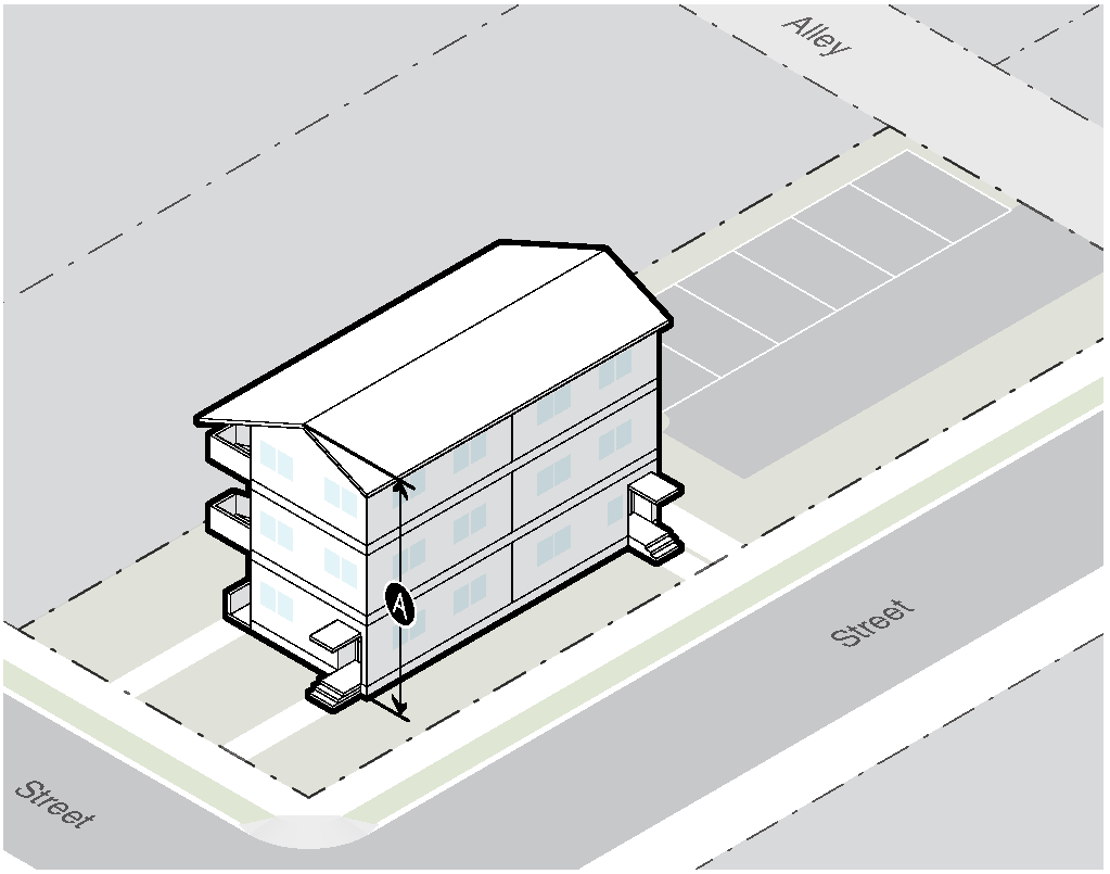 | ||
| Primary Building Height | (Sec. 9.4.9) | |
| Height (max): roof pitch ≤ 3/12 | 3 stories, not to exceed 35' | |
| Height (max): roof pitch 4/12, 5/12 | 3 stories, not to exceed 37' | |
| Height (max): roof pitch ≥ 6/12 | 3 stories, not to exceed 39' | |
| Accessory Structure Height | (Sec. 9.4.9) | |
| All accessory structures (max) | 26' | |
| Maximum Scale of Development | (Sec. 9.4.7) | |
| Floor area ratio (FAR max) | 1.0 | |
| Individual building (max gross floor area) | ||
| Hospital, Religious Institution, Daycare or School | Maximum determined by CUP | |
| Detached Single-Family | 2,000 sf | |
| All other uses | 10,000 sf | |
| Building Frontage | (E.5) | |
| Maximum Width | 100' | |
| Frontage Type | (Sec. 4.5.2) | |
| Porch | ||
| Dooryard | ||
| Stoop | ||
| Forecourt | ||
| Gallery | ||
| Shopfront | ||
C.
Use Standards. Standards applicable to uses in NSP-3 are provided or referenced below. Allowed uses are listed in Subsection 1. Uses that are not listed are prohibited, unless a similar use determination is made pursuant to Section 6.1.2(D). Where a cross reference is provided, please see the referenced division or section for additional standards applicable in NSP-3. This subsection is intended to indicate all of the use standards applicable in NSP-3, however, all standards in Article 6 are applicable in NSP-3, unless stated otherwise.
D.
Development Options. Standards applicable to development options and subdivision in NSP-3 are provided or referenced below. Where a cross reference is provided, please see the referenced division or section for additional standards applicable in NSP-3. This Subsection is intended to indicate all of the development option and subdivision standards applicable in NSP-3, however, all standards in Article 7 are applicable in NSP-3, unless stated otherwise.
E.
Additional Zone-Specific Standards. The following standards apply in addition to all other standards applicable in NSP-3.
1.
Parking.
a.
Location. Parking and service areas shall be located to the rear of buildings and screened from view from any street, right-of-way, or pathway adjacent to the lot.
b.
Guest Parking. For projects with 15 units or more, guest parking shall be provided at a rate of one space per 15 units. The Planning Director may establish a lesser standard pursuant to the procedure of Section 8.8.1 (Administrative Adjustment) based on information from reliable sources that demonstrates a lesser standard is workable due to anticipated parking demand, available alternative transportation services, or nearby on-street, public or semi-public parking.
2.
Encroachment into Building Setbacks.
a.
Street Setback. Cornices, canopies, eaves, decks (covered and uncovered), porches, stoops, balconies, bay windows, chimneys and similar architectural features may encroach into a street yard by not more than six feet.
b.
Side and Rear Setback. Cornices, canopies, eaves, decks (covered and uncovered), porches, balconies, bay windows, chimneys and similar architectural features may encroach into a side/rear yard by not more than four feet. Patios which are at grade may extend to any portion of a side or rear yard but are subject to site development setbacks. These allowances apply only to primary structures and do not apply to accessory structures.
3.
Subdivision. Subdivision of land into blocks shall be allowed prior to an approved Development Plan, consistent with the approved Master Site Plan, as an Initial Plat. Further subdivision of blocks shall require approval of a Development Plan and subsequent Subdivision Plat.
4.
Local Convenience Commercial. The intent of allowing retail and service uses in NSP-3 is that the goods sold and services provided are primarily of convenience nature to provide for the needs of residents and employees in the neighborhood and immediate surrounding area.
a.
Goods and services sold shall not be of a specialty nature that rely on and attract customer and vehicle traffic from the community or region as a whole.
b.
Retail and service uses shall only occupy the ground level, except that basements may be used for storage.
5.
Maximum Building Frontage. The maximum width of any building frontage on a right-of-way, pathway, or open space shall not exceed 100 feet.
6.
Minimum Density. The minimum required density on each residential lot shall be 17.424 dwelling units per acre, or three dwelling units per 7,500 square feet. This requirement is rounded down to the next whole number.
7.
Fencing. Small area safety and exclusionary fencing meeting the Wildlife Friendly Fencing exemptions of Section 5.1.2(B.2.c) (Applicability) shall meet the fencing height and setback standards of this Section. Required wildlife friendly fencing shall follow the design standards and requirements of Section 5.1.2 (Wildlife Friendly Fencing) and the fencing setbacks of this Section.
8.
Landscaping. Berry and other fruit-bearing trees and landscaping are prohibited unless such landscaping is fenced with exclusionary wildlife fencing as allowed in Section 5.1.2(B.2.c) (Applicability).
(7/1/26)
(Amendment No. 2025-0002, 4-7-26)

