
Beaufort County Unincorporated
City Zoning Code
City Zoning Code
ARTICLE 5
- Supplemental to Zones
5.1.10 - Purpose
This Division sets forth the standards applicable to the development of each building type. These standards supplement the standards for each zone that the building types are allowed within. They are intended to ensure development that reinforces the highly valued existing character and scale of Beaufort County's towns, hamlets, and neighborhoods.
5.1.20 - Applicability
A.
The requirements of this Division shall apply to all proposed development within the transect zones with the exception of T1 Natural Preserve, T2 Rural, T2 Rural-Low, and T2 Rural Neighborhood. These requirements shall be considered in combination with the standards for the applicable zone in Article 3 (Specific to Zones) and in the rest of this Article.
B.
Civic buildings located in larger parks and open spaces including, but not limited to, community centers, meeting rooms, public safety facilities, houses of worship, and schools, shall not be subject to the building type standards found in this Division but shall be subject to the physical requirements of the building form standards in Division 3.2 (Transect Zones).
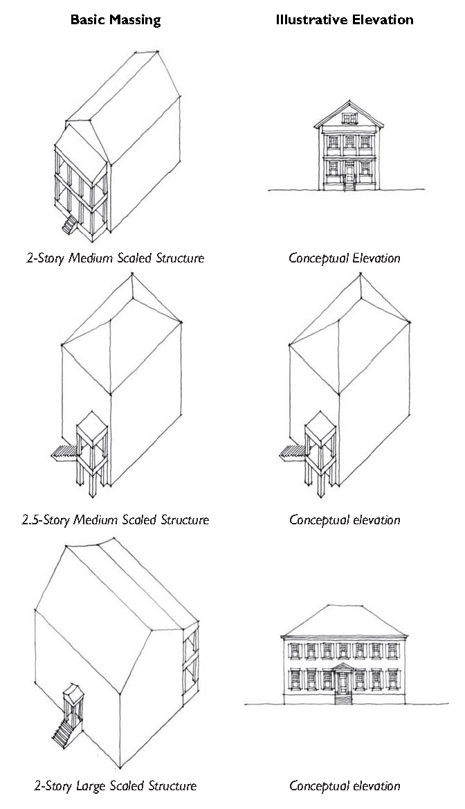
5.1.30 - Building Types Overview
This Section provides an overview of the allowed building types.
A.
Table 5.1.30.A (Building Types General) provides an overview of the allowed building types.
B.
The names of the building types are not intended to limit uses within a building type. For example, a single-family house may have non-residential uses such as home occupation uses or service uses when permitted within the zone.
C.
The lot size standards for each building type designate the range of lot sizes that the given building type is allowed to be built on. If the lot is smaller or larger than the allowed lot size, a different building type shall be selected.
D.
When minimum lot sizes are established in Article 3 (Specific to Zones), those minimum lot sizes shall govern.
| Table 5.1.30.A: Building Types General | ||
|---|---|---|
| Building Type | Allowed In | |
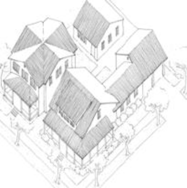
 | Carriage House: This Building Type is an accessory structure typically located at the rear of a lot. This structure typically provides either a small residential unit, home office space, or other small commercial or service use that may be above a garage or at ground level. This Building Type is important for providing affordable housing opportunities and incubating small businesses within walkable neighborhoods. Multiple Carriage Houses can be utilized to organize Family Compounds and Farmsteads. | 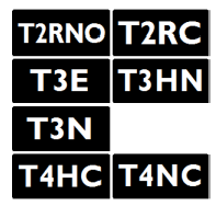 |
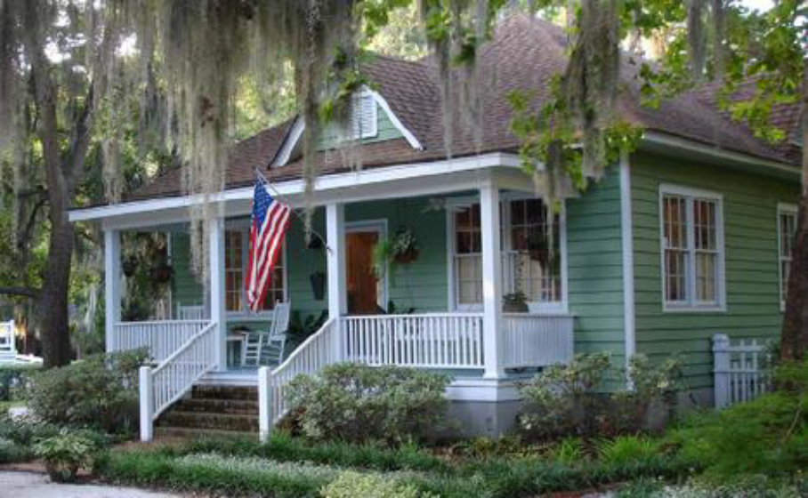
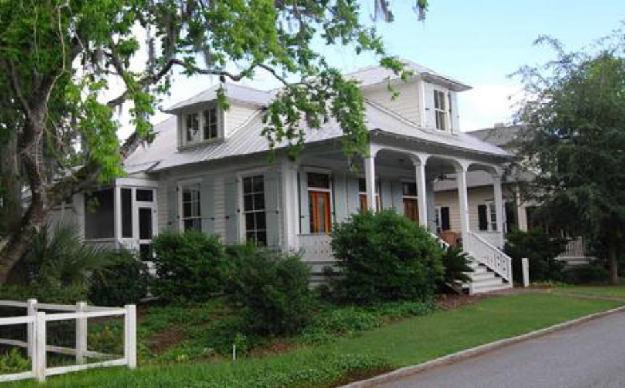
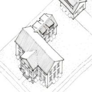 | Estate House. This Building Type is a large detached structure on a large lot that incorporates one unit. It is typically located within a primarily single-family residential neighborhood in a more rural setting. If located within a walkable neighborhood, this Building Type is typically located at the edge of the neighborhood, providing a transition to the more rural areas. | 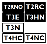 |
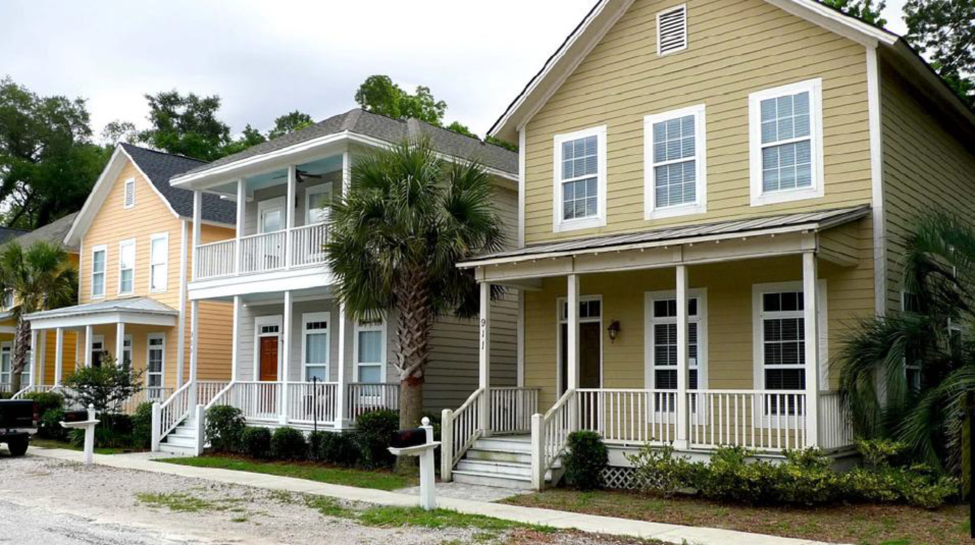
 | Village House. This Building Type is a medium-sized detached structure on a medium-sized lot that incorporates one unit. It is typically located within a primarily single-family residential neighborhood in a walkable urban setting, potentially near a neighborhood main street. | 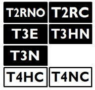 |
 | Small Lot House. This Building Type is a small, detached structure on a small lot that incorporates one unit. It is typically located within a primarily single-family neighborhood in a walkable urban setting, potentially near a neighborhood main street. This Type enables appropriately-scaled, well-designed higher densities and is important for providing a broad choice of housing types and promoting walkability. |  |
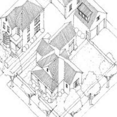
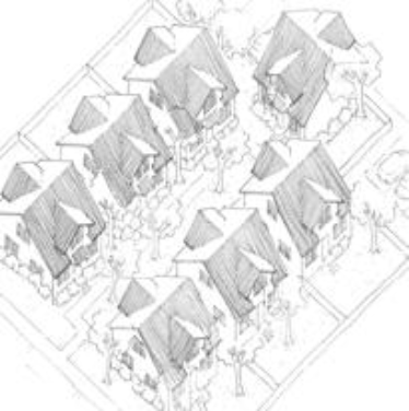 | Cottage Court. This Building Type consists of a series of small, detached structures on a single lot, providing multiple units arranged to define a shared court that is typically perpendicular to the street. The shared court takes the place of a private rear yard and becomes an important community-enhancing element for this Type. This Type is appropriately scaled to fit within primarily single-family neighborhoods or medium-density neighborhoods. |  |
| General Note: Images on this page are illustrative, not regulatory. | ||
 | Duplex. This Building Type is a small to medium-sized structure that consists of two side-by-side or two stacked dwelling units, both facing the street. This Type has the appearance of a medium to large single-family home and is appropriately scaled to fit within primarily single-family neighborhoods or medium-density neighborhoods. It enables appropriately scaled, well-designed higher densities and is important for providing a broad choice of housing types and promoting walkability. |  |
 | Townhouse. This Building Type is a small to medium-sized attached structure that consists of three or more dwelling units placed side-by-side. This Type is typically located within medium-density neighborhoods or in a location that transitions from a primarily single-family neighborhood into a neighborhood main street. This Type enables appropriately scaled, well-designed higher densities and is important for providing a broad choice of housing types and promoting walkability. Synonym: Rowhouse |  |
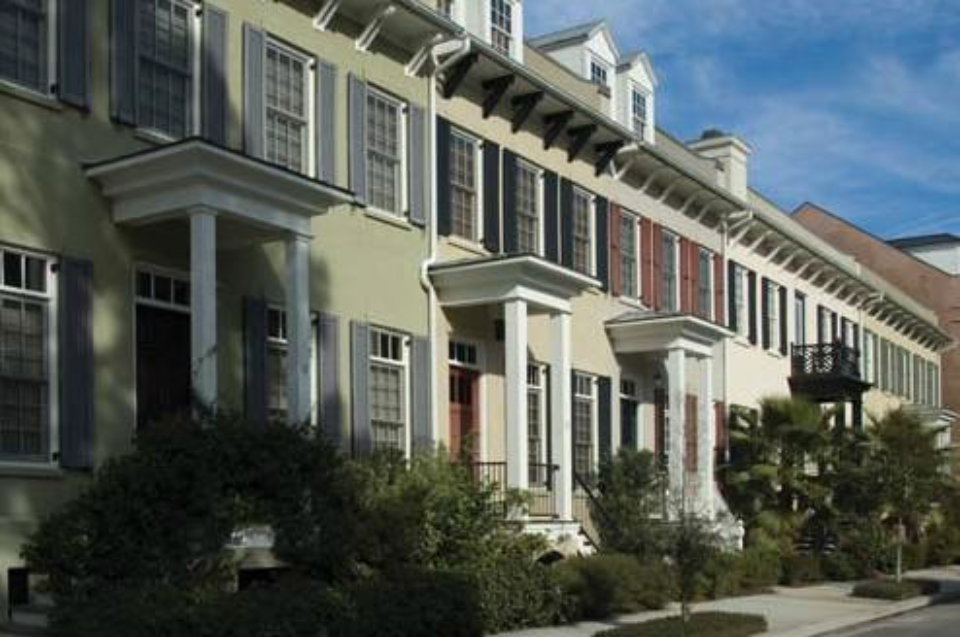
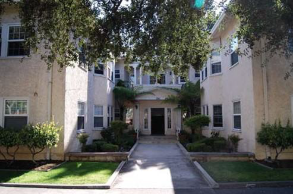
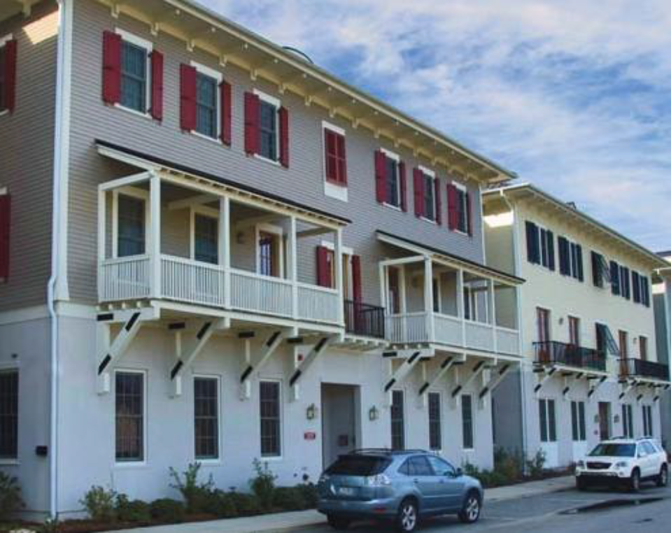
 | Mansion Apartment. This Building Type is a medium structure that consists of three to six side-by-side and/or stacked dwelling units, typically with one shared entry or individual entries along the front. This Type has the appearance of a medium-sized family home and is appropriately scaled to fit in sparingly within primarily single-family neighborhoods or into medium-density neighborhoods. This Type enables appropriately scaled, well-designed higher densities and is important for providing a broad choice of housing types and promoting walkability. |  |
 | Apartment House. This Building Type is a medium- to large-sized structure that consists of seven to 12 side-by-side and/or stacked dwelling units, typically with one shared entry. This Type is appropriately scaled to fit in medium-density neighborhoods or sparingly within large lot predominantly single-family neighborhoods. This Type enables appropriately-scaled, well-designed higher densities and is important for providing a broad choice of housing types and promoting walkability. |  |
 | Main Street Mixed-Use. This Building Type is a small- to medium-sized structure, typically attached, intended to provide a vertical mix of uses with ground-floor commercial, service, or retail uses and upper-floor commercial, service, or residential uses. Smaller versions of this Type include live/work units. This Type makes up the primary component of a neighborhood main street and portions of a downtown main street, therefore is a key component to providing walkability. |  |
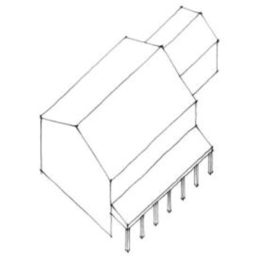 | Industrial/Agricultural. This Building Type is a medium to large structure that accommodates retail, light industrial, agricultural and mixed uses that are too large to be appropriately housed in a residential building type. This Building Type is typically located on the edge of the commercial core within a rural crossroads or hamlet place type. The design and massing of this Building Type find their precedent in the vernacular packing sheds, barns, and warehouses of the Lowcountry. |  |
| General Note: Images on this page are illustrative, not regulatory. | ||
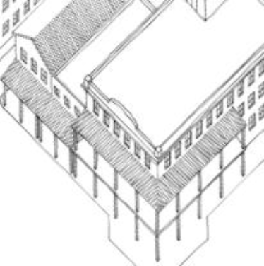
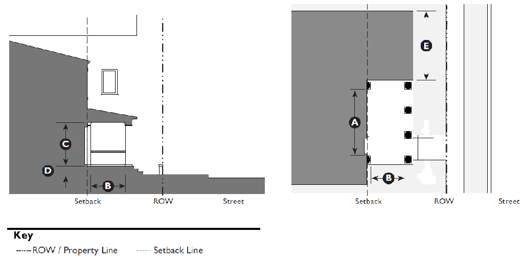
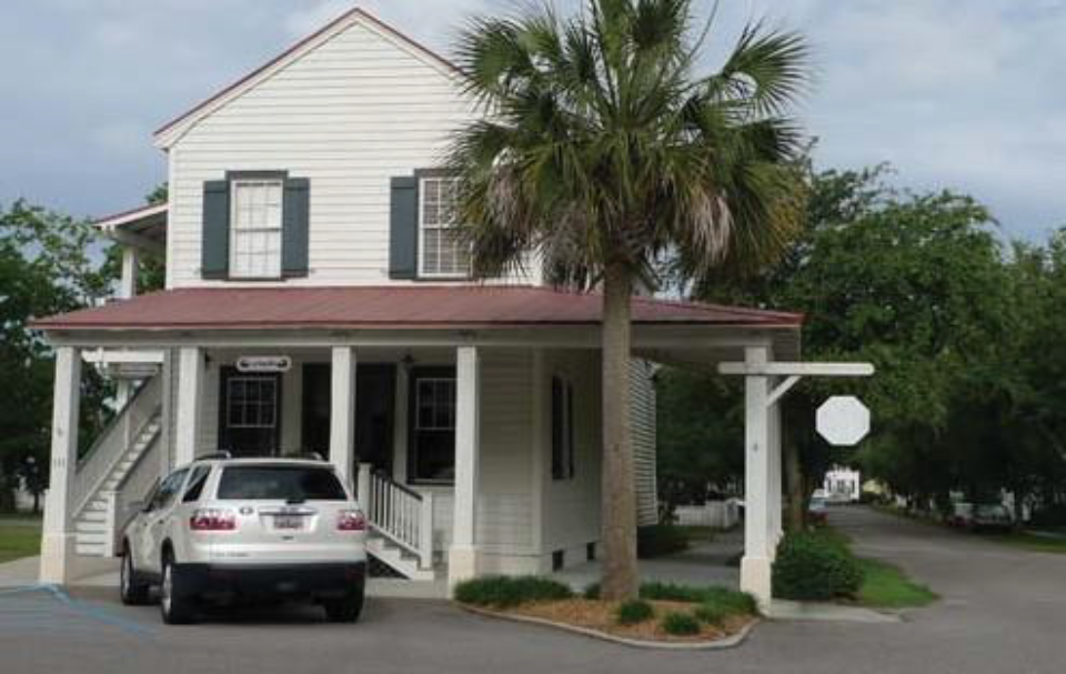
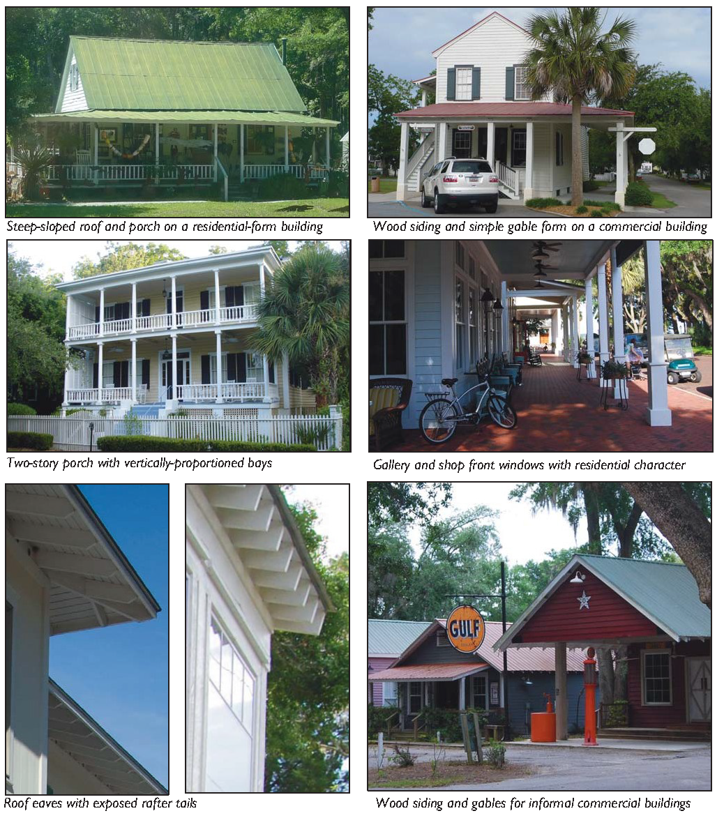
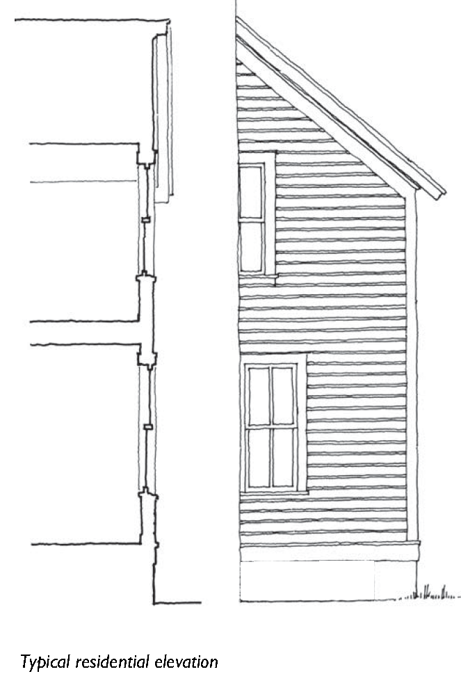
5.1.40 - Carriage House
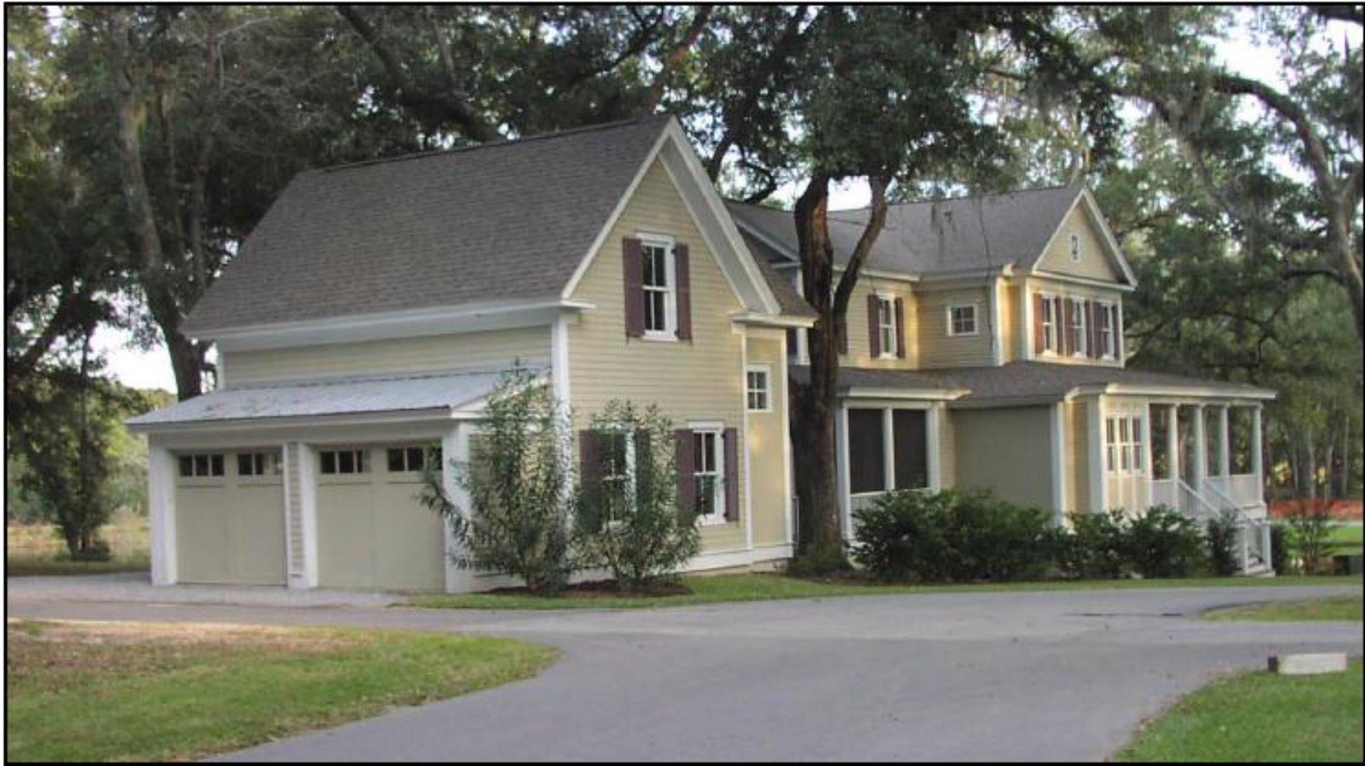
One-and-a-half story house connected to main house by a breezeway
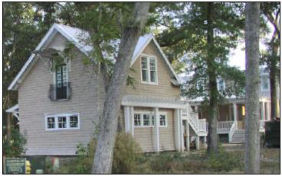
One-and-a-half-story carriage houses
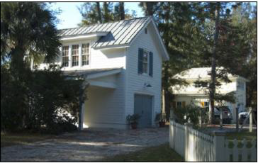
One-and-a-half-story carriage house with a carpet
| A. Description | ||
| Carriage House. This Building Type is an accessory structure typically located at the rear of a lot. This structure typically provides either a small residential unit, home office space, or other small commercial or service use that may be above a garage or at ground level. This Building Type is important for providing affordable housing opportunities and incubating small businesses within walkable neighborhoods. | ||
| Allowed in Transect Zones | ||
| ||
| Key | ||
| General Note: Photos on this page are illustrative, not regulatory. |
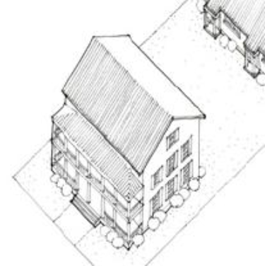
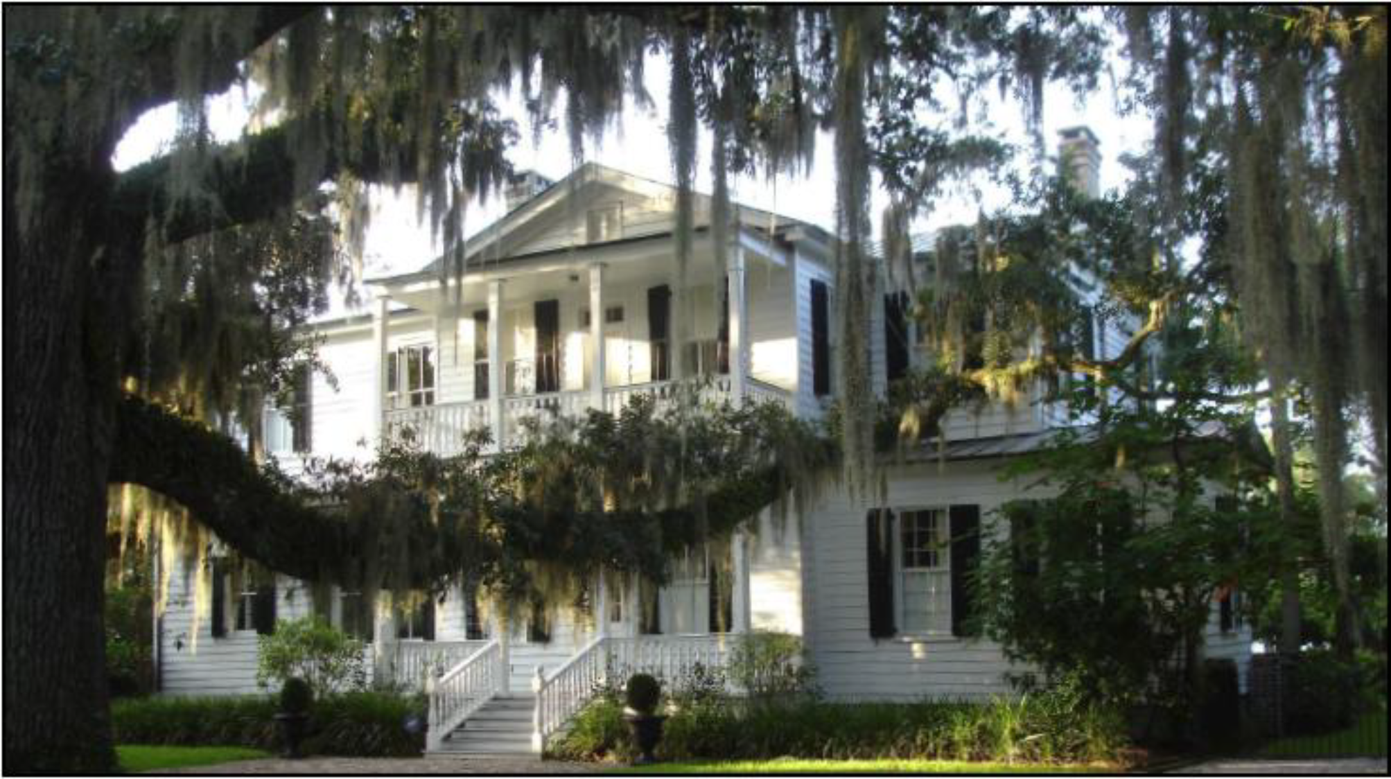
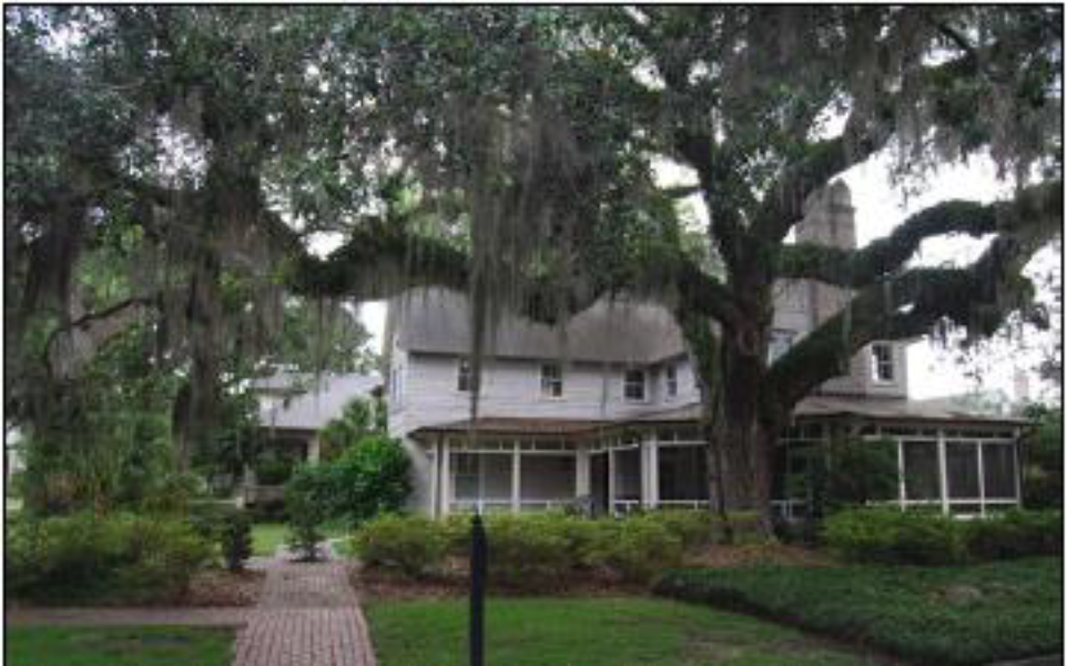
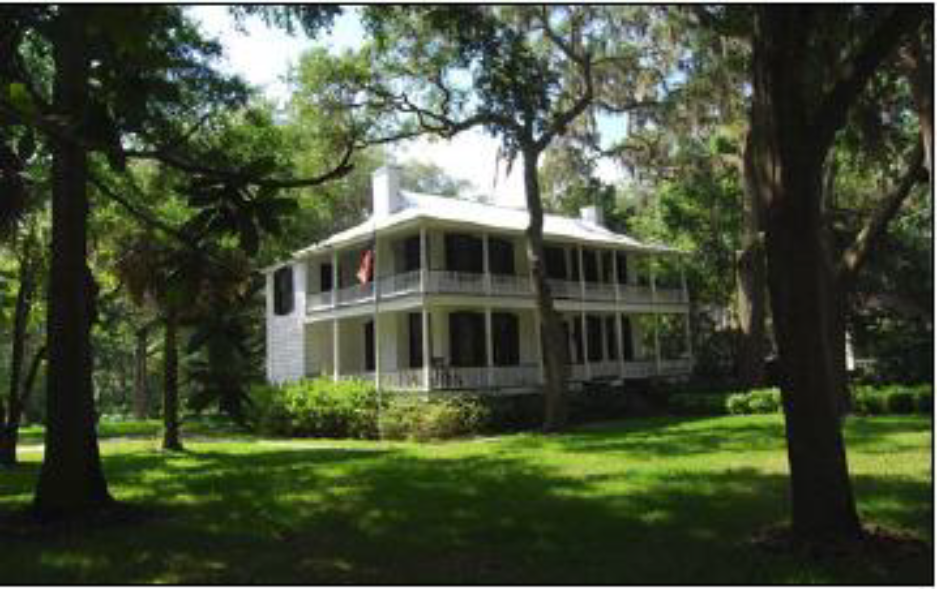
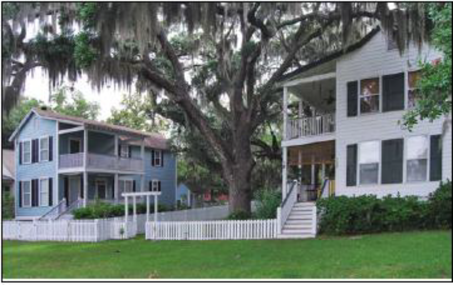
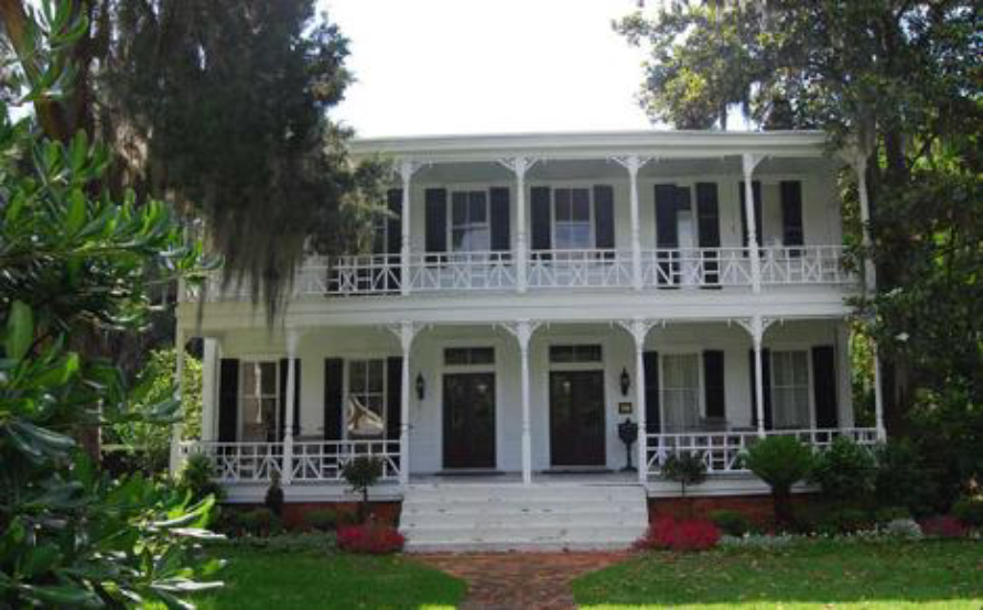
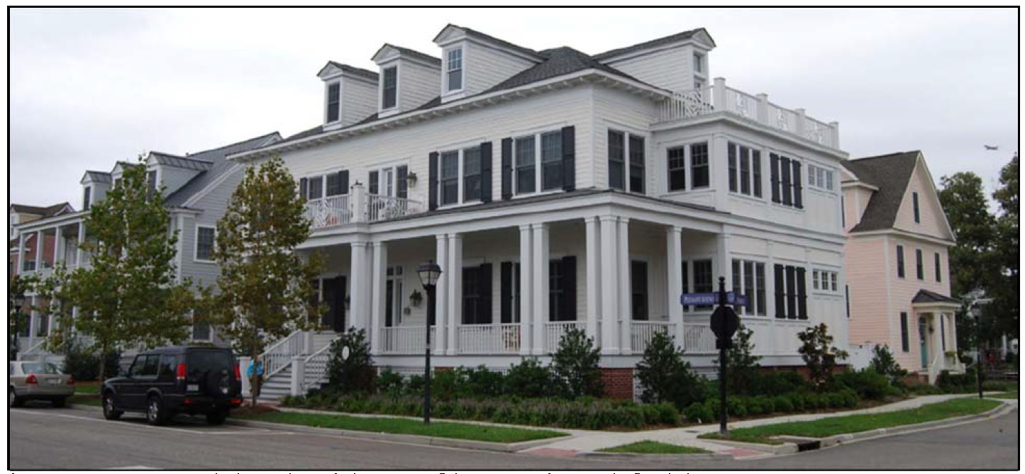
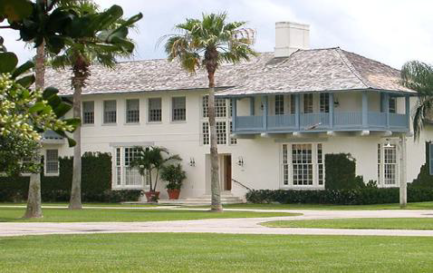
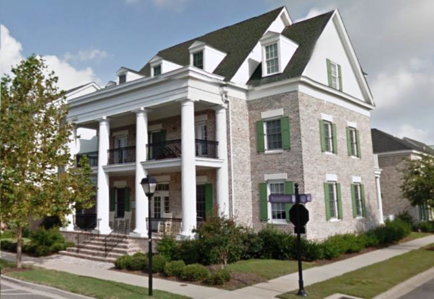
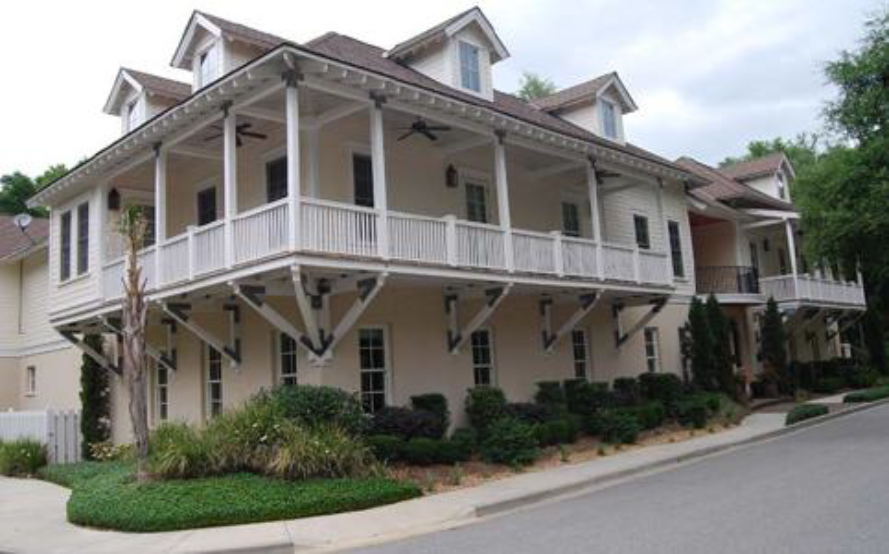
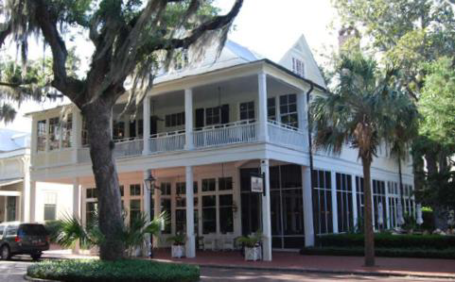
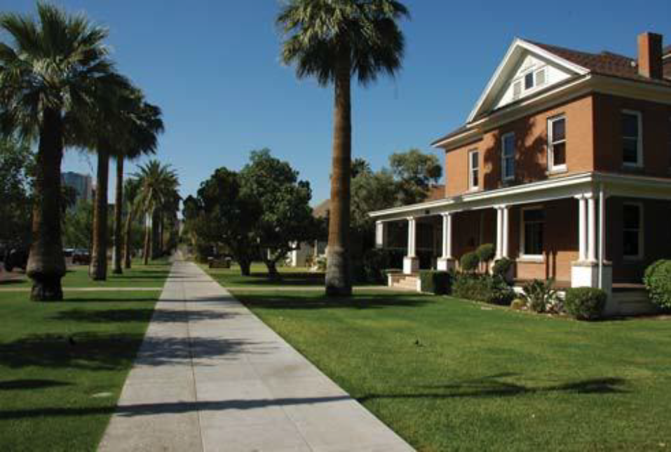
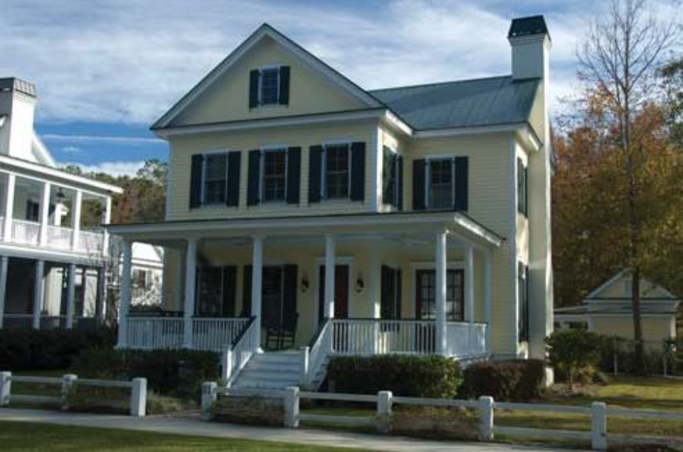
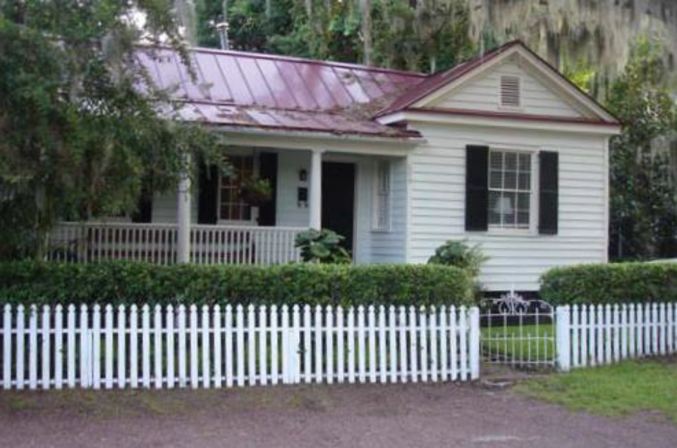
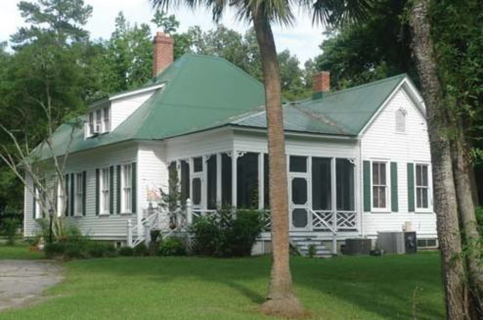
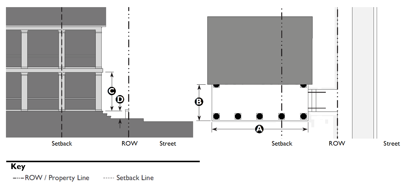
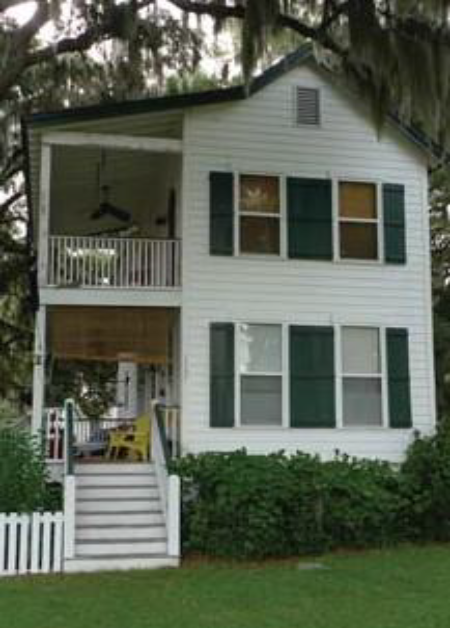
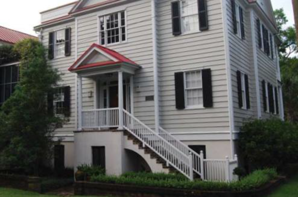
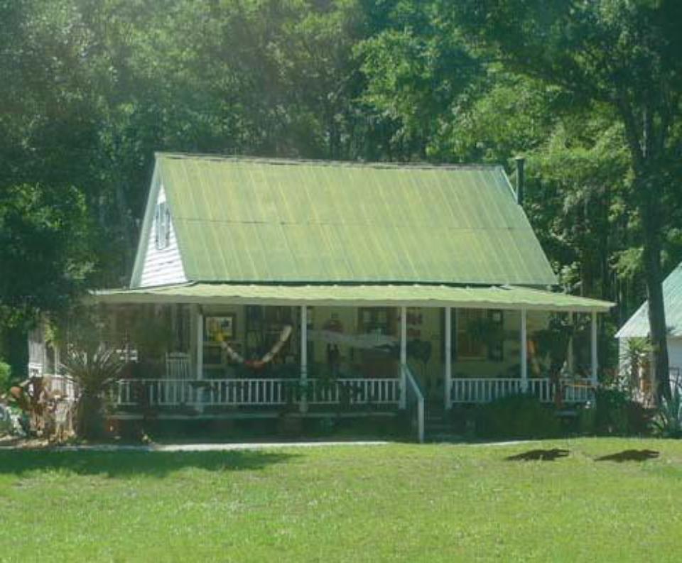
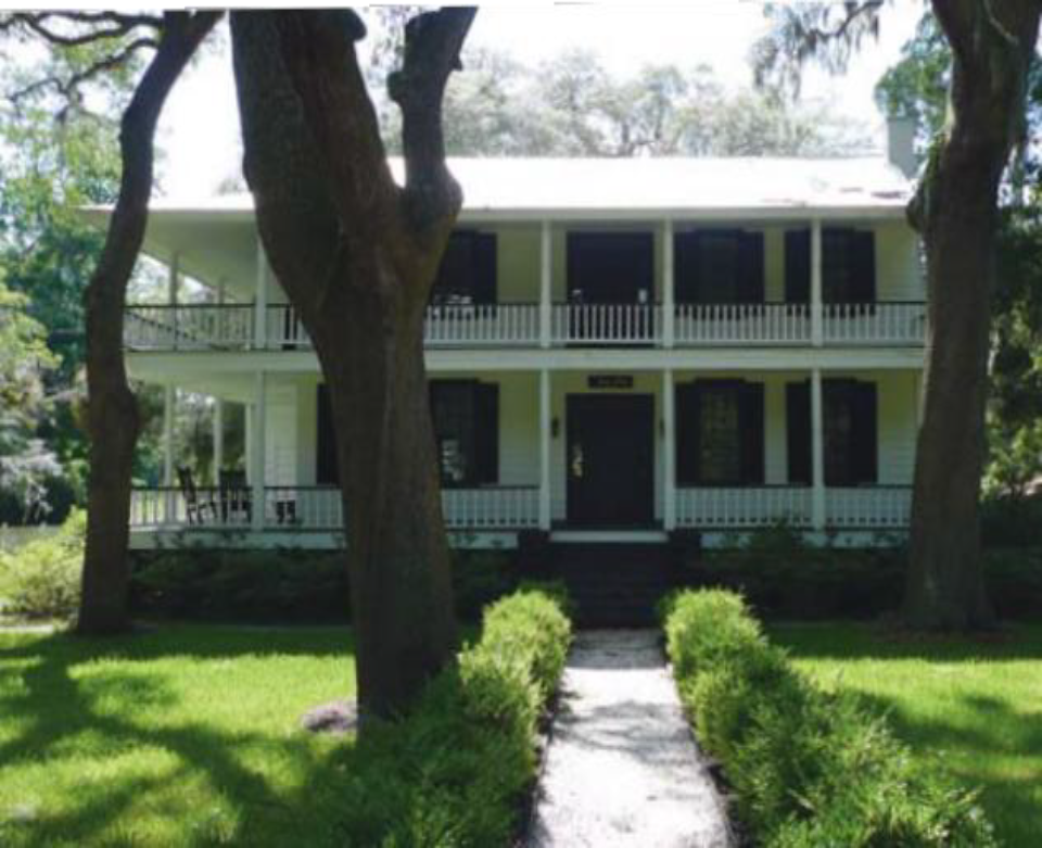
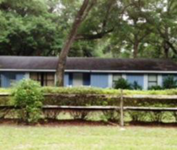
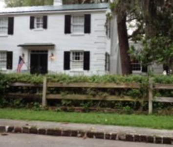
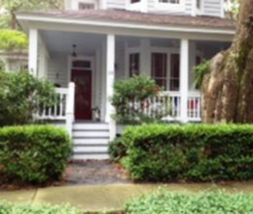
5.1.50 - Estate House
One-and-a-half story front-loaded estate
Two-story estate with wraparound porch
Two-and-a-half-story estate
| A. Description | ||
| Estate House. This Building Type is a large detached structure on a large lot that incorporates one unit. It is typically located within a primarily single-family residential neighborhood in a more rural setting. If located within a walkable neighborhood, this Building Type is typically located at the edge, providing a transition to the more rural areas. | ||
| Allowed in Transect Zones | ||
| ||
| Key | ||
| General Note: Photos on this page are illustrative, not regulatory. |
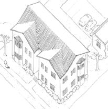
5.1.60 - Village House
One-and-a-half-story front-loaded village house
Two-story village house with a side yard porch
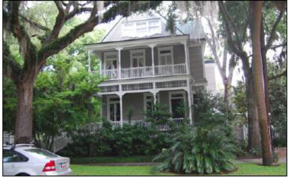
Two-and-a-half-story village house
| A. Description | ||
| Village House. This Building Type is a medium-sized detached structure on a medium-sized lot that incorporates one unit. It is typically located within a primarily single-family residential neighborhood in a walkable urban setting potentially near a neighborhood main street. | ||
| Allowed in Transect Zones | ||
| ||
| Key | ||
| General Note: Photos on this page are illustrative, not regulatory. |
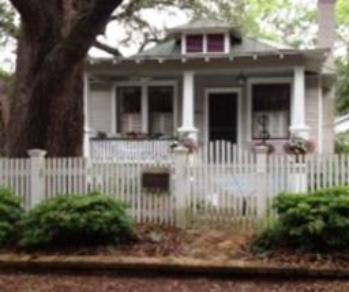
5.1.70 - Small Lot House
Newly constructed two-story small lot houses
Small one-story small lot house
One-and-a-half story small lot house with integral porch
| A. Description | ||
| Small Lot House. This Building Type is a small detached structure on a small lot that incorporates one unit. It is typically located within a primarily single-family neighborhood in a walkable urban setting, potentially near a neighborhood main street. This Type enables appropriately scaled, well-designed higher densities and is important for providing a broad choice of housing types and promoting walkability. | ||
| Allowed in Transect Zones | ||
| ||
| Key | ||
| General Note: Photos on this page are illustrative, not regulatory. |
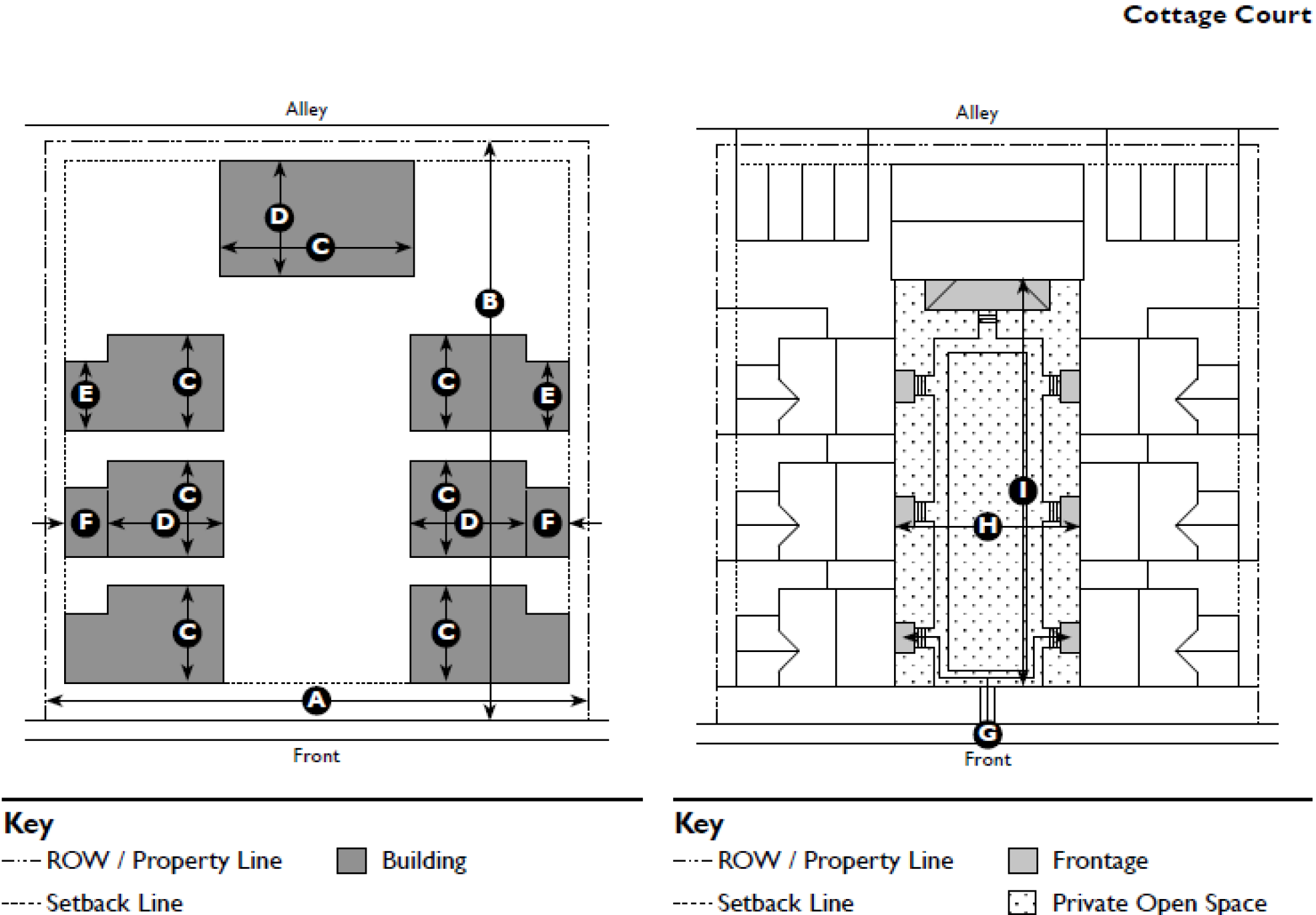
5.1.80 - Cottage Court
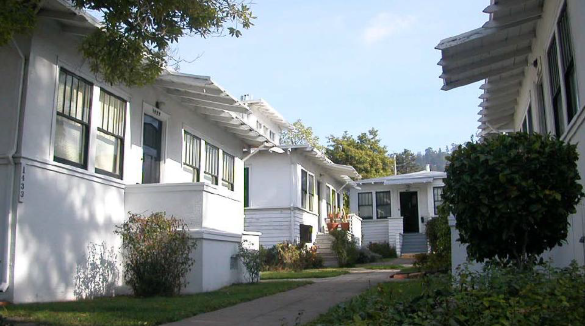
Prairie-style cottage court with raised stoop entries
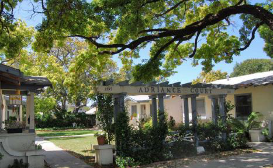
A cottage court with a center drive and small stoops
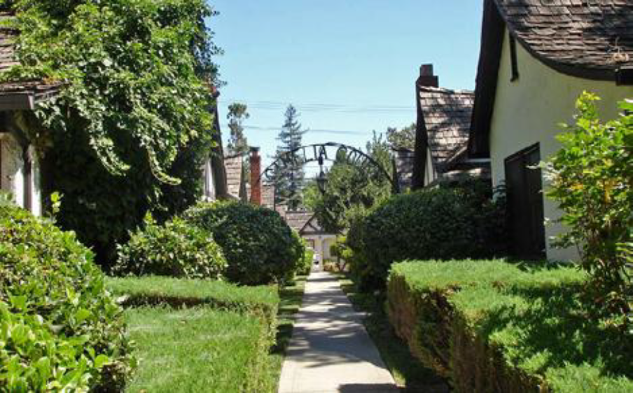
Cottage court with a heavily landscaped court
| A. Description | ||
| Cottage Court. This Building Type consists of a series of small, detached structures, providing multiple units arranged to define a shared court that is typically perpendicular to the street. The shared court takes the place of a private rear and becomes an important community-enhancing element of this Type. This Type is appropriately scaled to fit within primarily single-family or medium-density neighborhoods. It enables appropriately scaled, well-designed higher densities and is important for providing a broad choice of housing types and promoting walkability. | ||
| Allowed in Transect Zones | ||
| ||
| Key | ||
| General Note: The photos on this page are illustrative, not regulatory. |
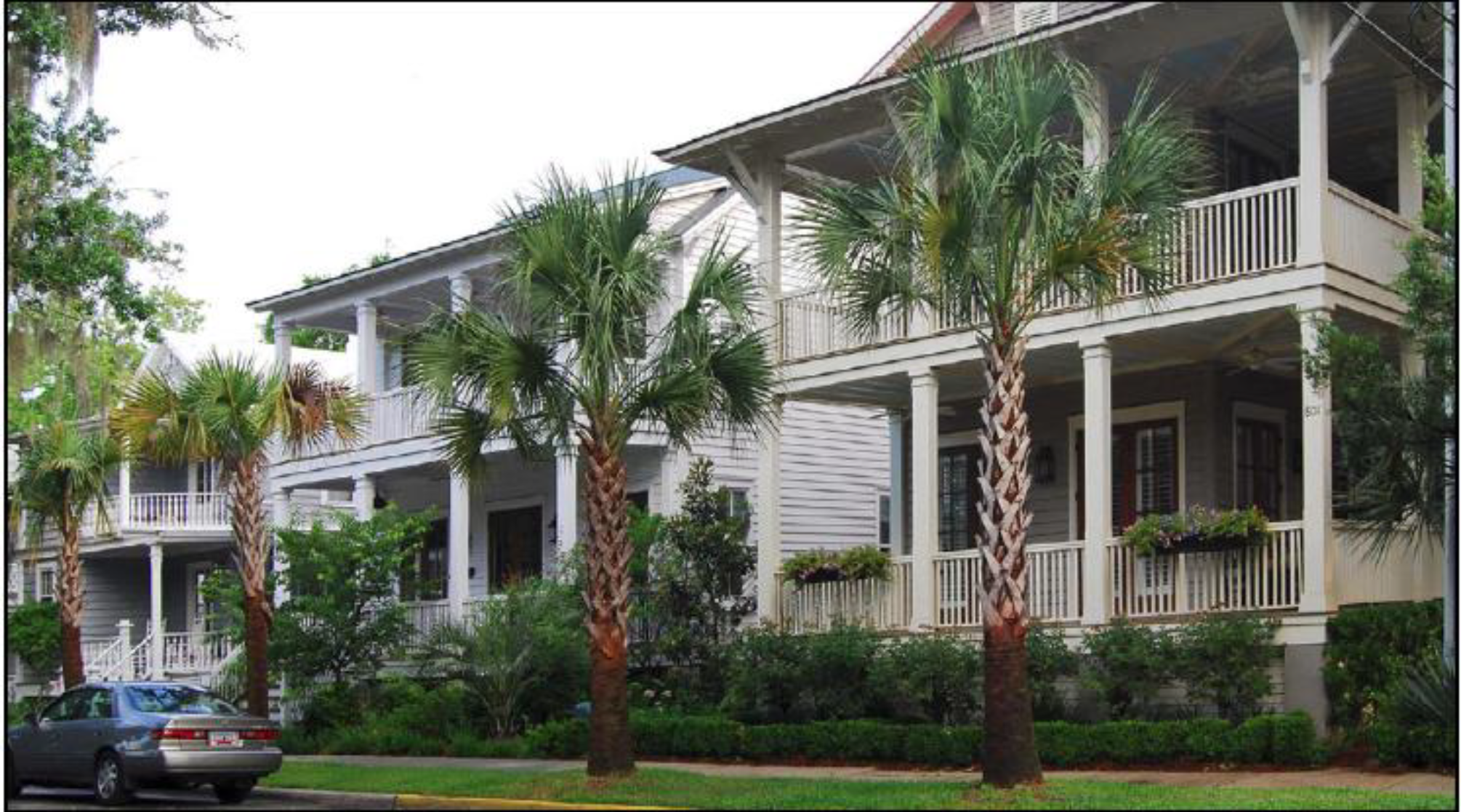
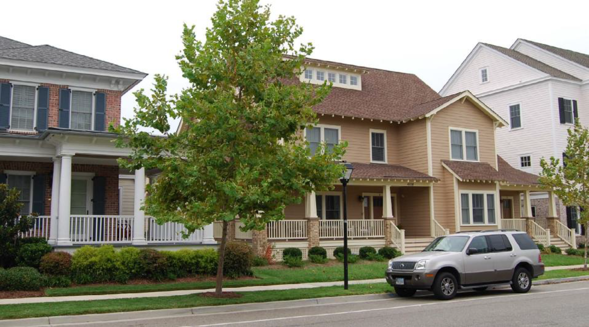
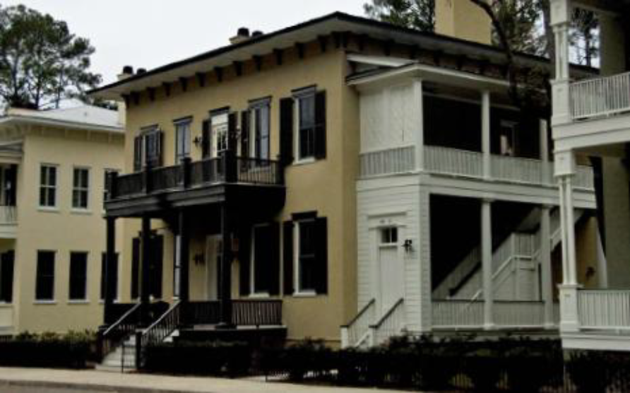
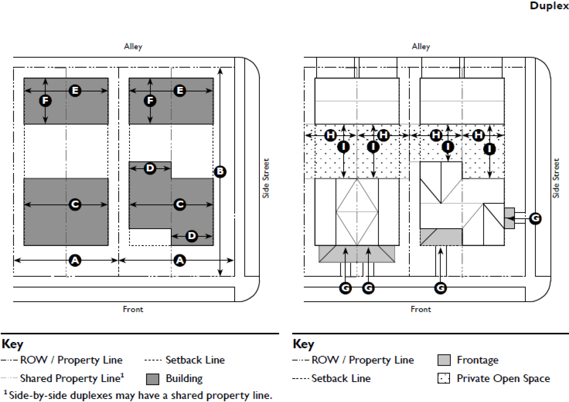
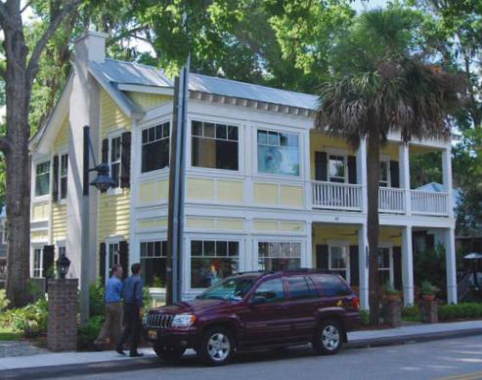
5.1.90 - Duplex
A side-by-side duplex with each unit having its own porch
A stacked duplex with each unit having its own entry
A side-by-side duplex with a balcony with a two-story porch
| A. Description | ||
| Duplex. This Building Type is a small to medium-sized structure that consists of two side-by-side or stacked dwelling units, both facing the street, and sharing one common party wall. This Type has the appearance of a medium to large single-family home and is appropriately scaled to fit within primarily single-family neighborhoods or medium-density neighborhoods. It enables appropriately scaled, well-designed higher densities and is important for providing a broad choice of housing types and promoting walkability. | ||
| Allowed in Transect Zones | ||
| ||
| Key | ||
| General Note: The photos on this page are illustrative, not regulatory. |
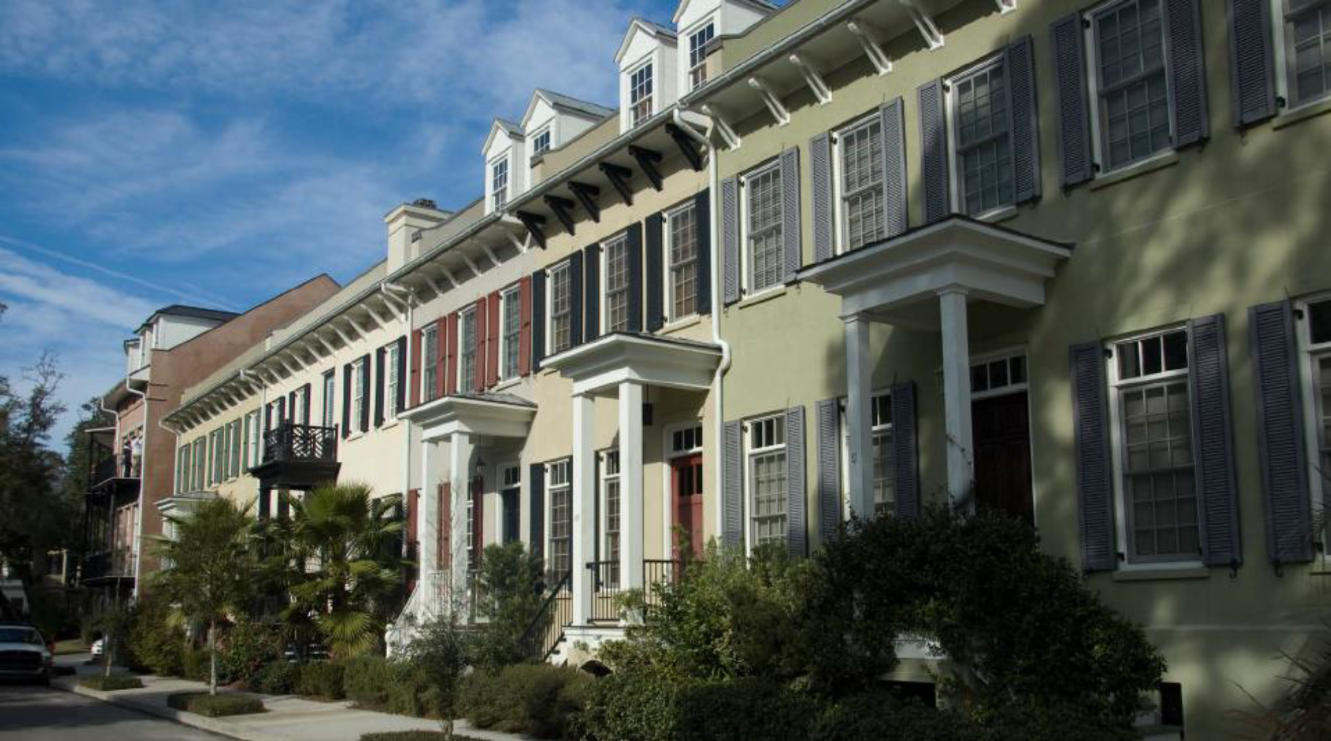
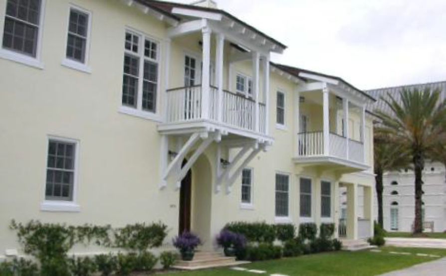
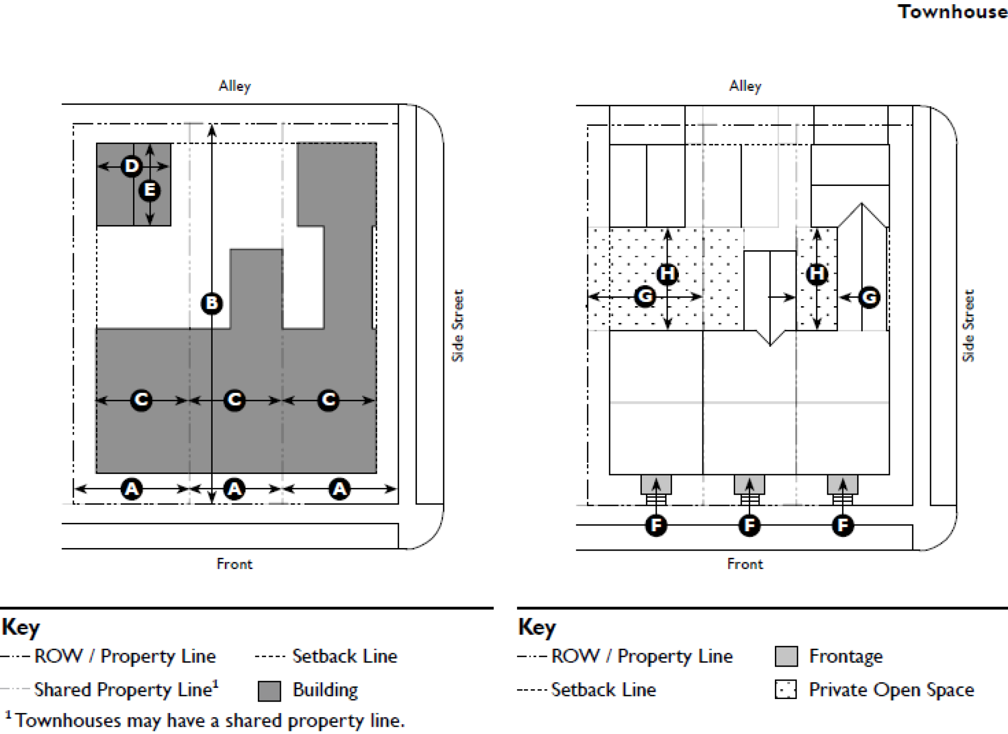
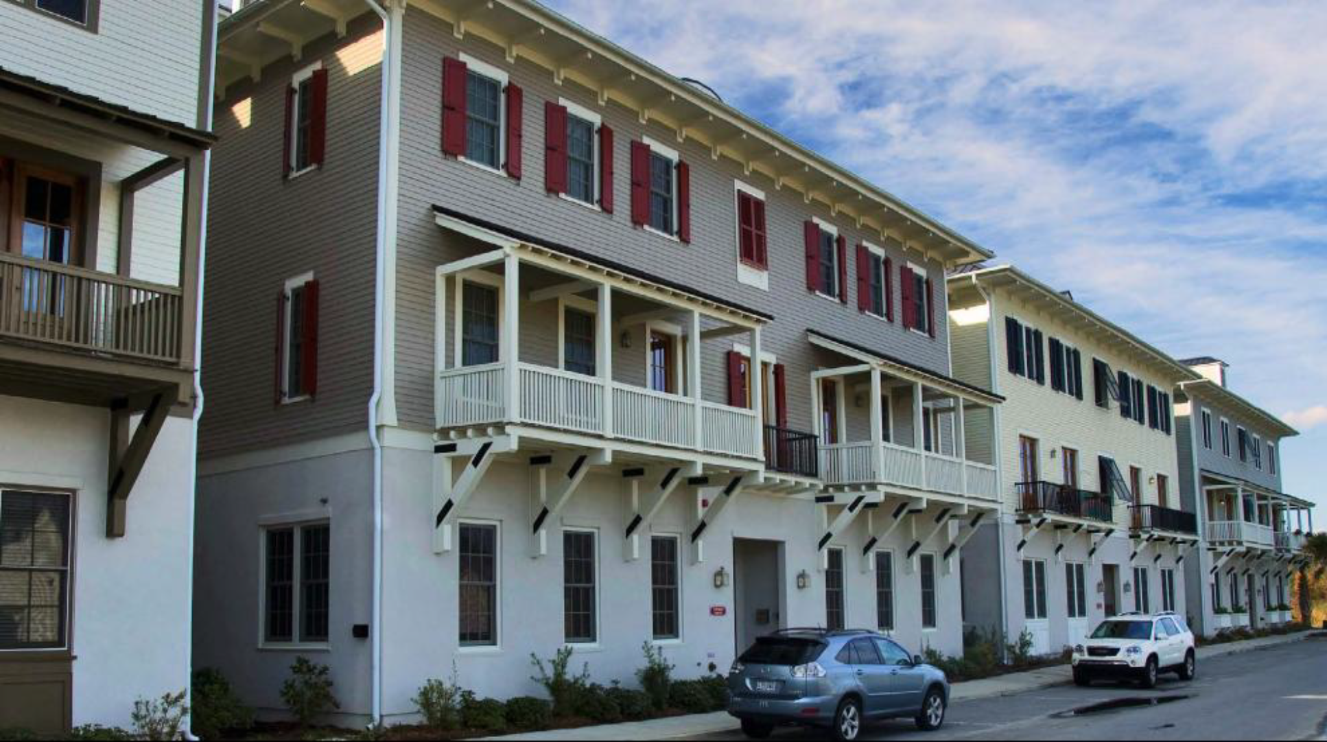
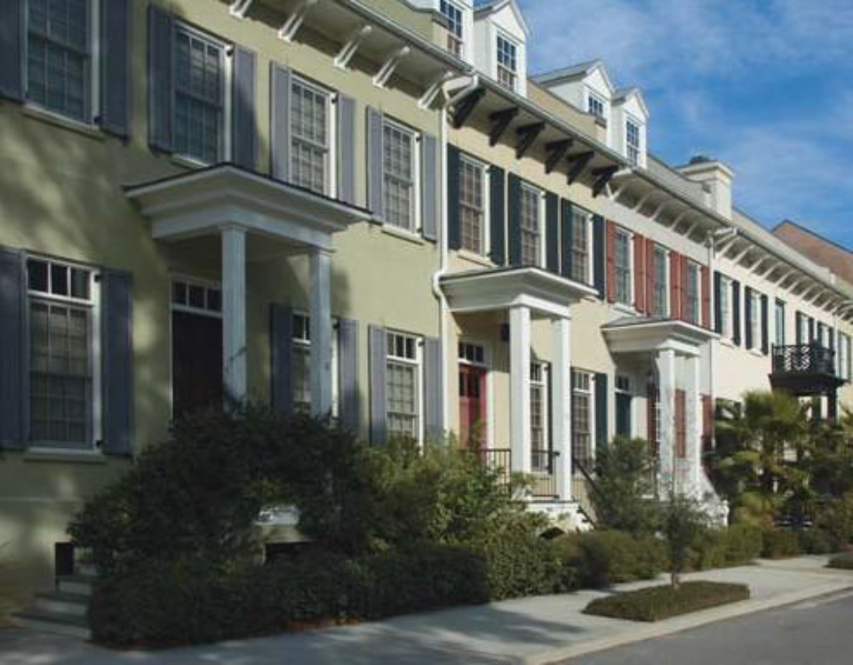
5.1.100 - Townhouse
Individual stoops and dormers help to breakdown the overall massing of this row of
townhouses

A series of townhouses which read as a single large building
Minor differences in detailing and fenestration articulate the units
| A. Description | ||
| Townhouse. This Building Type is a small to medium-sized attached structure that consists of
three or more dwelling units placed side-by-side. This Type is typically located within
medium-density neighborhoods or in a location that transitions from a primarily single-family
neighborhood into a neighborhood main street. This Type enables appropriately scaled,
well-designed higher densities and is important for providing a broad choice of housing
types and promoting walkability.
Syn: Rowhouse | ||
| Allowed in Transect Zones | ||
| ||
| Key | ||
| General Note: The photos on this page are illustrative, not regulatory. |
5.1.110 - Mansion Apartment
A mansion apartment with the scale and character of the surrounding single-family
houses.
A mansion apartment with a single entry accessing all units
A mansion apartment with a single entry accessing all units
| A. Description | ||
| Mansion Apartment. This Building Type is a medium structure that consists of three to six side-by-side and/or stacked dwelling units, typically with one shared entry or individual entries along the front. This Type has the appearance of a medium-sized family home and is appropriately scaled to fit in sparingly within primarily single-family neighborhoods or into medium-density neighborhoods. This Type enables appropriately scaled, well-designed higher densities and is important for providing a broad choice of housing types and promoting walkability. | ||
| Allowed in Transect Zones | ||
| ||
| Key | ||
| General Note: The photos on this page are illustrative, not regulatory. | ||
5.1.120 - Apartment House
An apartment house with a recessed stoop
An apartment house with individual entries for ground floor units

A newly constructed apartment house
| A. Description | ||
| Apartment House. This Building Type is a medium-to-large-sized structure that consists of 7 to 12 side-by-side and/or stacked dwelling units, typically with one shared entry. This type is appropriately scaled to fit in within medium-density neighborhoods or sparingly within large lot predominantly single-family neighborhoods. This Type enables appropriately scaled, well-designed higher densities and is important for providing a broad choice of housing types and promoting walkability. | ||
| Allowed in Transect Zones | ||
| ||
| Key | ||
| General Note: The photos on this page are illustrative, not regulatory. |
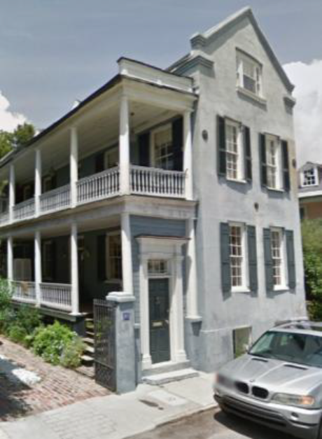
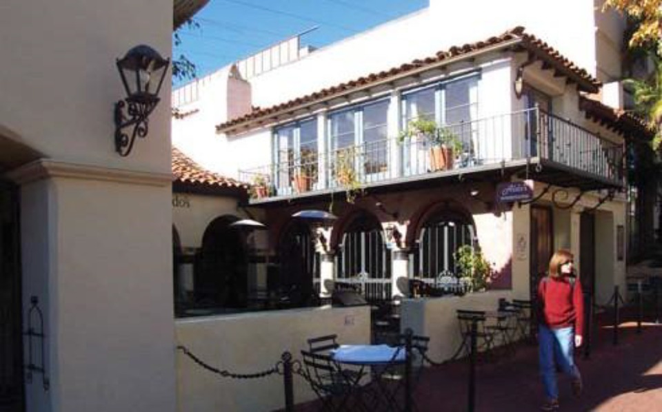
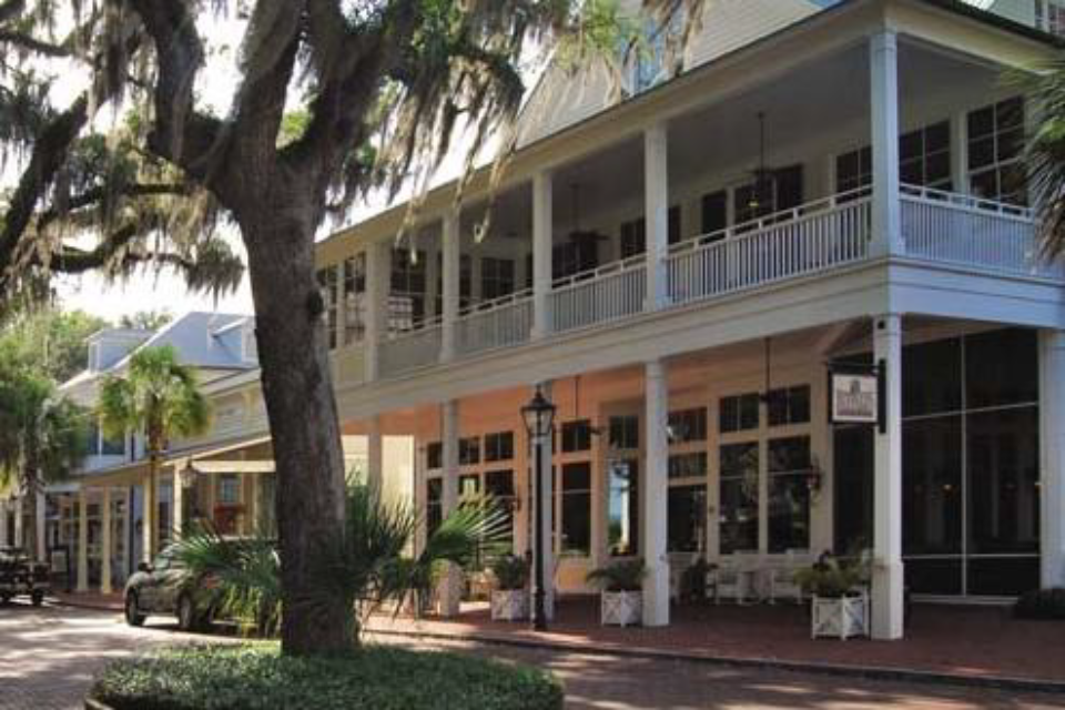
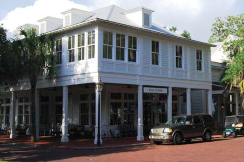
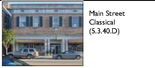
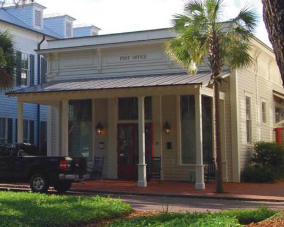
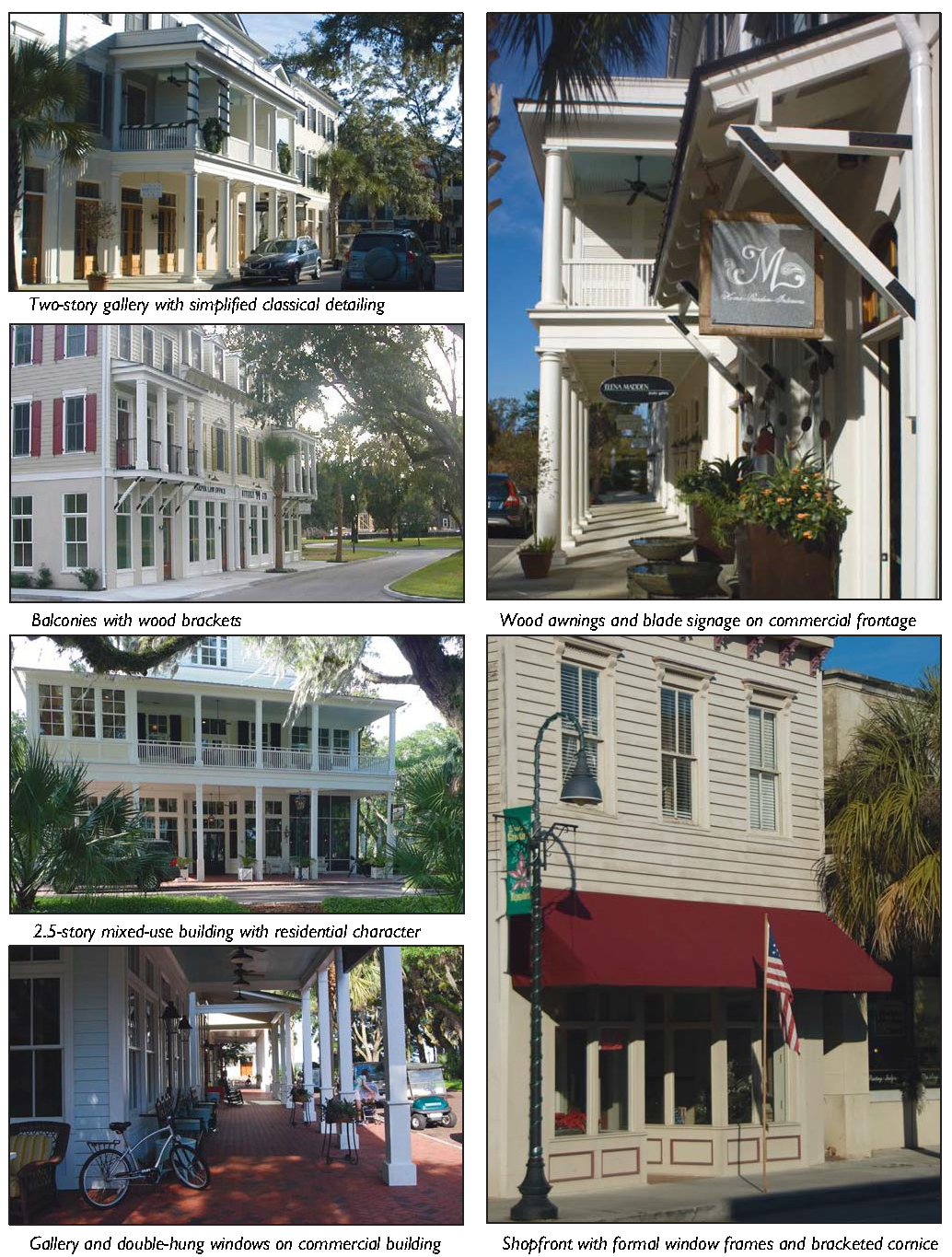
5.1.130 - Main Street Mixed-Use
Renovated historic main street mixed-use building
Newly constructed main street mixed-use building
Main street mixed-use building with a two-story gallery
| A. Description | ||
| Main Street Mixed-Use. This Building Type is a small to medium-sized structure, typically attached, intended to provide a vertical mix of uses with ground-floor commercial, service, or retail uses and upper-floor commercial, service, or residential uses. Smaller versions of this Type include live/work units. This Type makes up the primary component of a neighborhood main street and portions of a downtown main street, therefore being a key component to providing walkability. | ||
| Allowed Transect Zones | ||
| ||
| Key | ||
| General Note: The photos on this page are illustrative, not regulatory. |
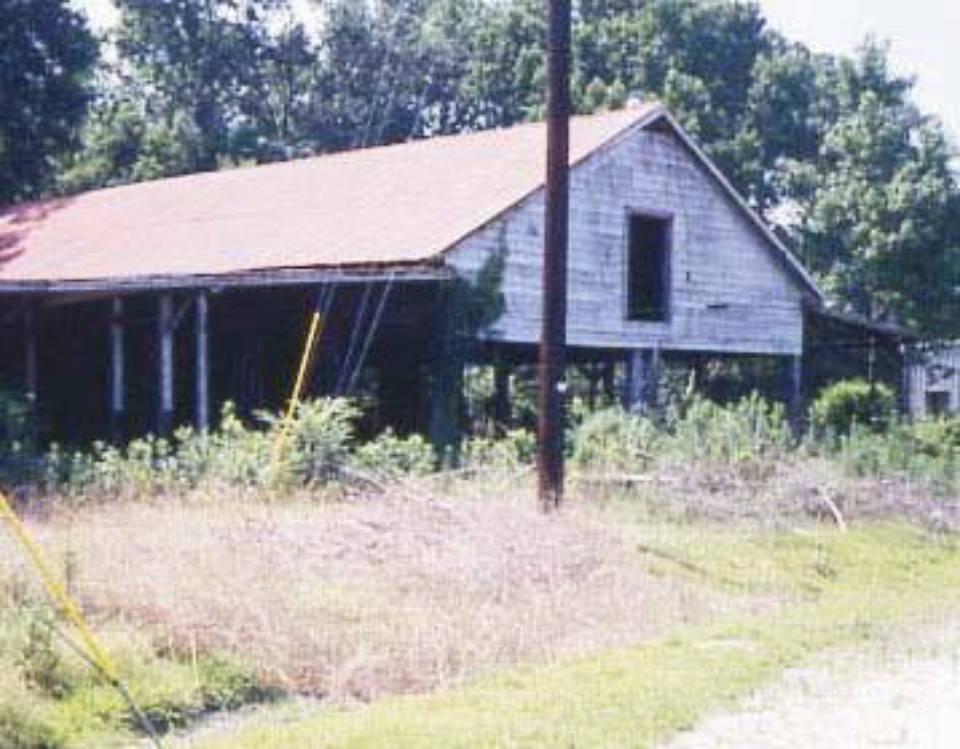
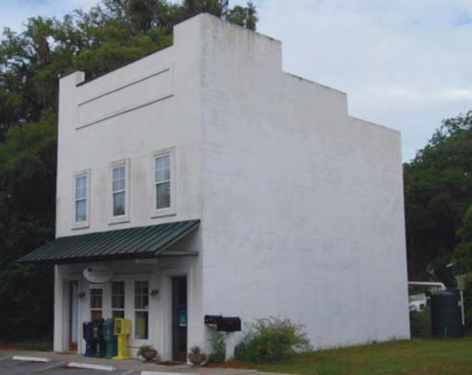
5.1.140 - Industrial/Agricultural
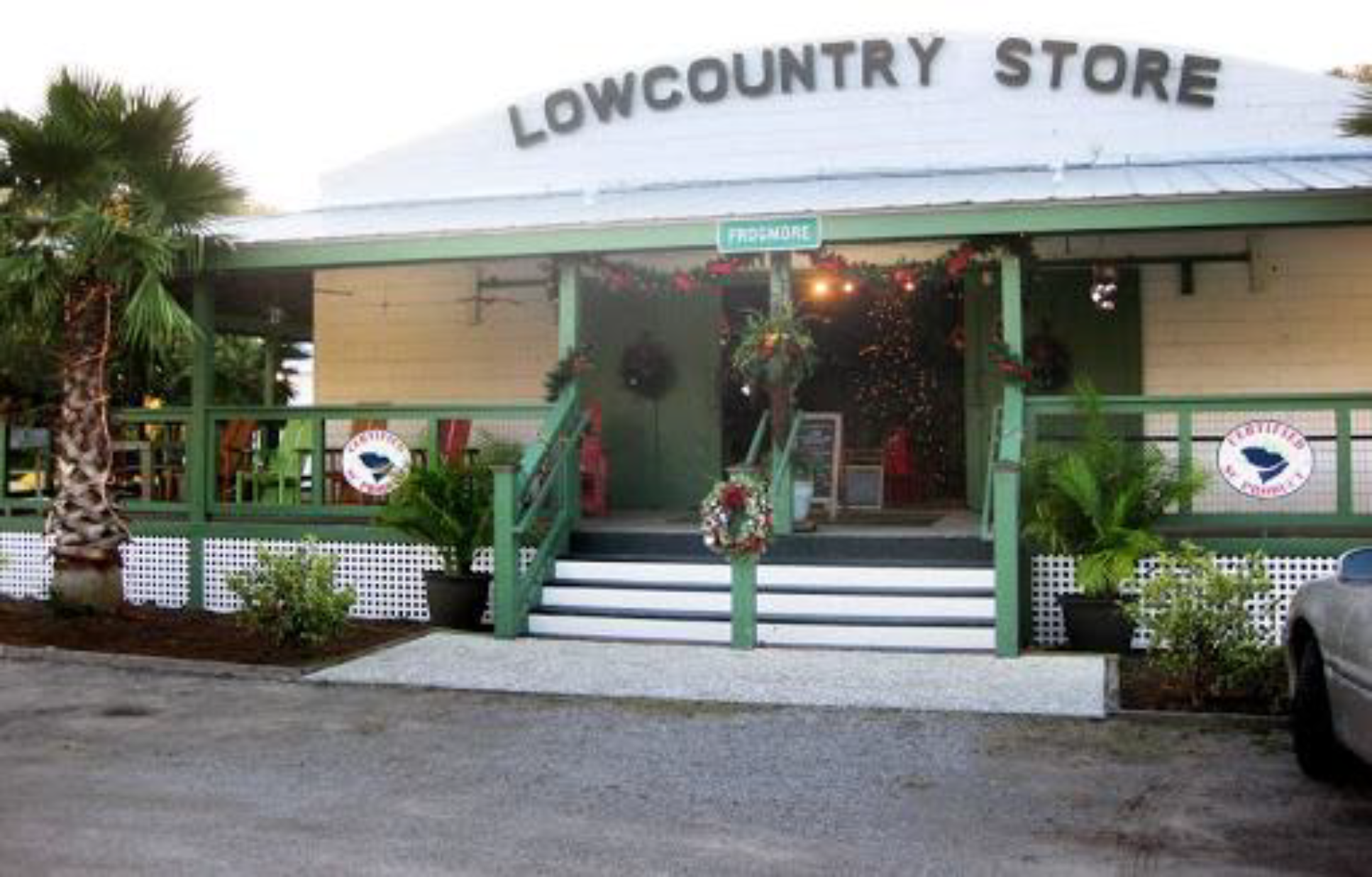
Renovated packing shed with wraparound porch
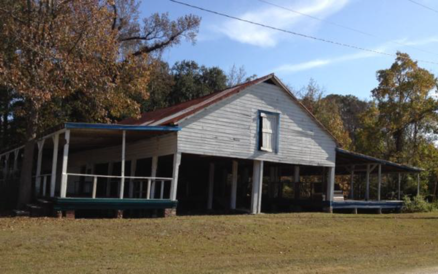
Typical packing shed
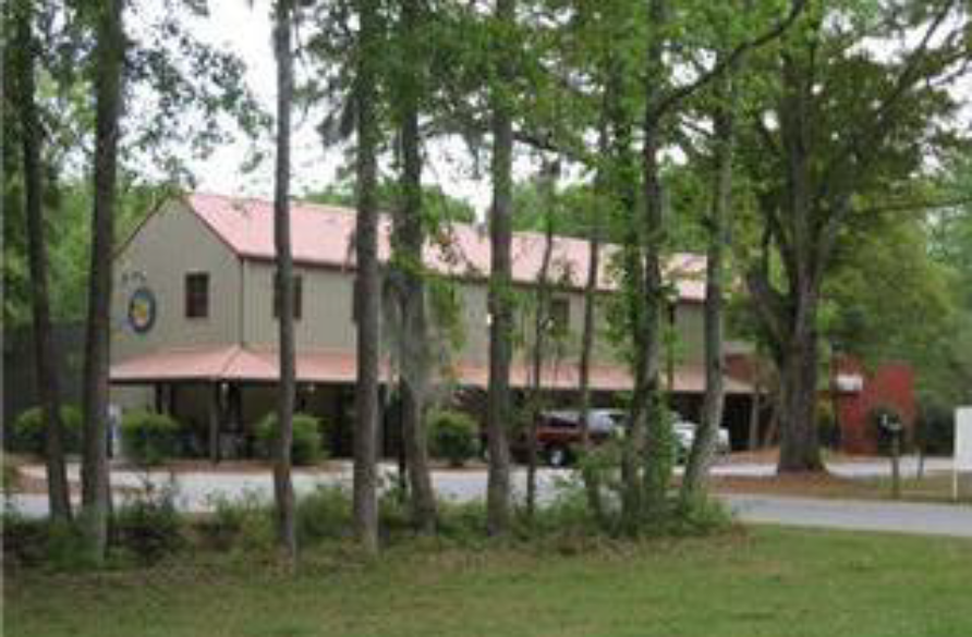
New retail structure with Lowcountry rural vernacular design features
| A. Description | ||
| Industrial/Agricultural. This Building Type is a medium to large structure that accommodates retail, light industrial, agricultural and mixed uses that are too large to be appropriately housed in a residential building type. This Building Type is typically located on the edge of the commercial core within a rural crossroads or hamlet place type. The design and massing of this Building Type find their precedent in the vernacular packing sheds, barns, and warehouses of the Lowcountry. | ||
| Allowed in Transect Zones | ||
| ||
| Key | ||
| General Note: The photos on this page are illustrative, not regulatory. |
5.2.10 - Purpose
This Division sets forth the standards applicable to the development of private frontages. Private frontages are the components of a building that provide an important transition and interface between the public realm (street and sidewalk) and the private realm (yard or building). These standards supplement the standards for each zone that the frontage types are allowed within. For each private frontage type, a description, a statement of the type's intent, and design standards are provided. These standards are intended to ensure development that reinforces the highly valued existing character and scale of the County's hamlets, villages and neighborhoods.
5.2.20 - Applicability
These standards work in combination with the standards found in Article 3 (Specific to Zones) and Division 5.1 (Building Type Standards) and are applicable to all private frontages within transect zones except residential uses in T1 Natural Preserve, T2 Rural, T2 Rural-Low, and T2 Rural Neighborhood.
5.2.40 - Common Yard
The front yards of these houses form a continuous common yard
An example of a common yard
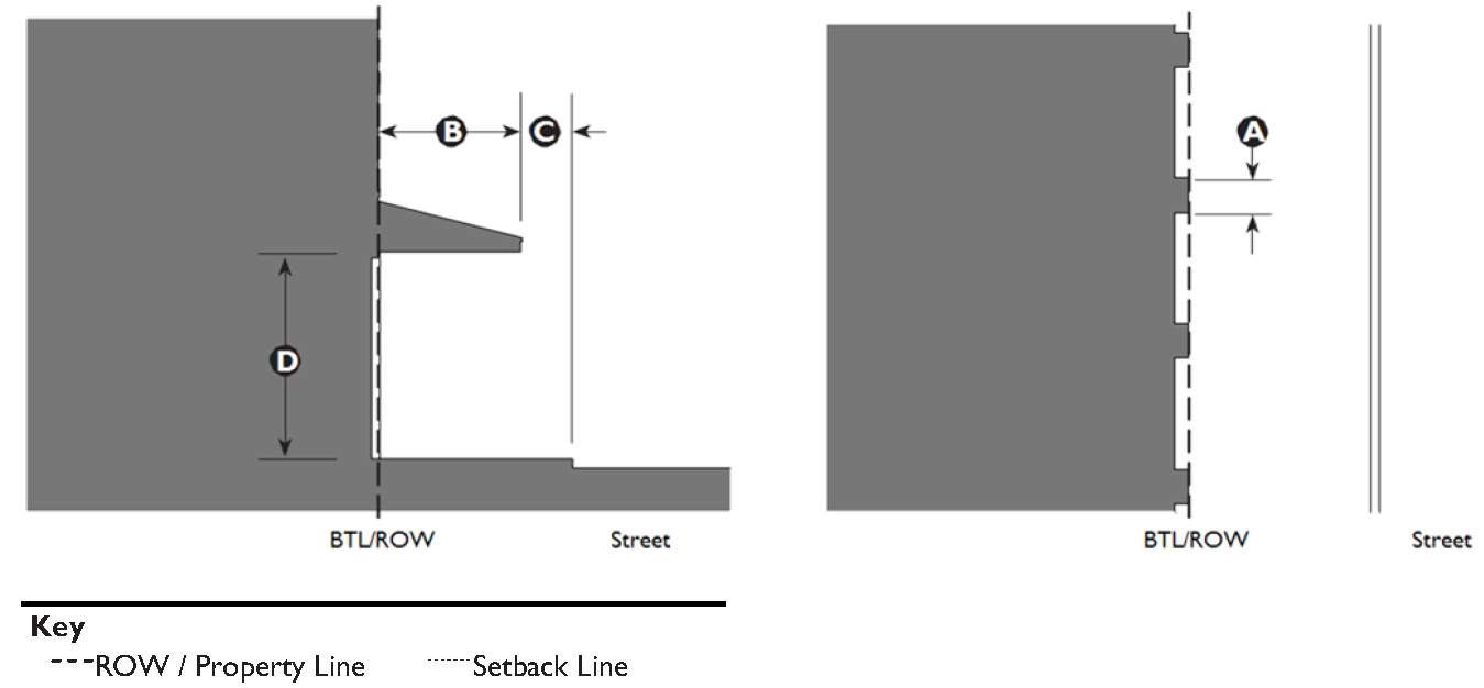
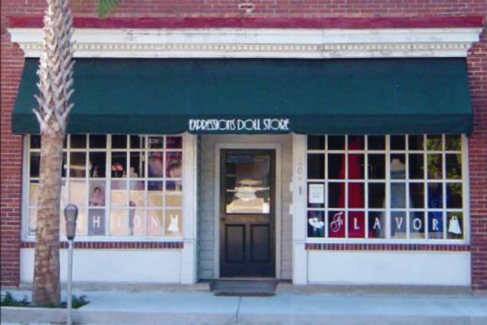
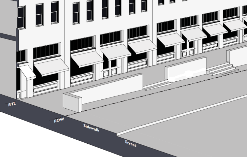
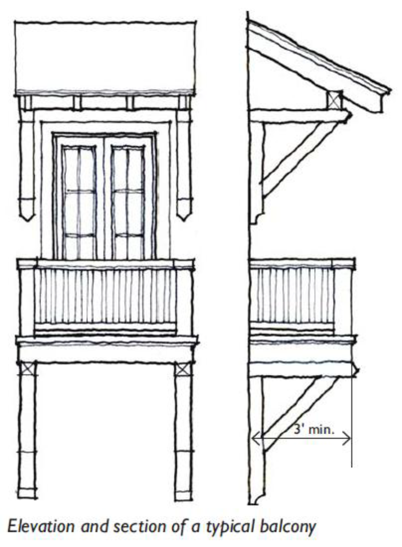
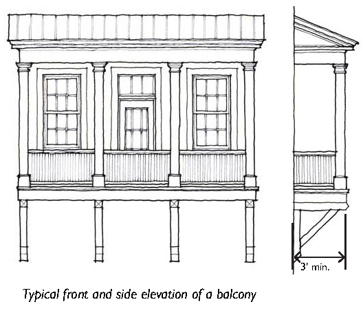
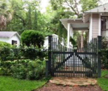
5.2.50 - Porch: Projecting
A wrap around projecting porch
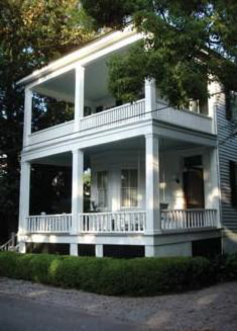
A two-story porch
5.2.60 - Porch: Engaged
An example of an engaged porch
An example of an engaged porch
5.2.70 - Porch: Side Yard
Examples of side yard porches
5.2.80 - Stoop
A raised stoop on a single-family dwelling
A series of stoops on townhouses with a minimum setback engage the street
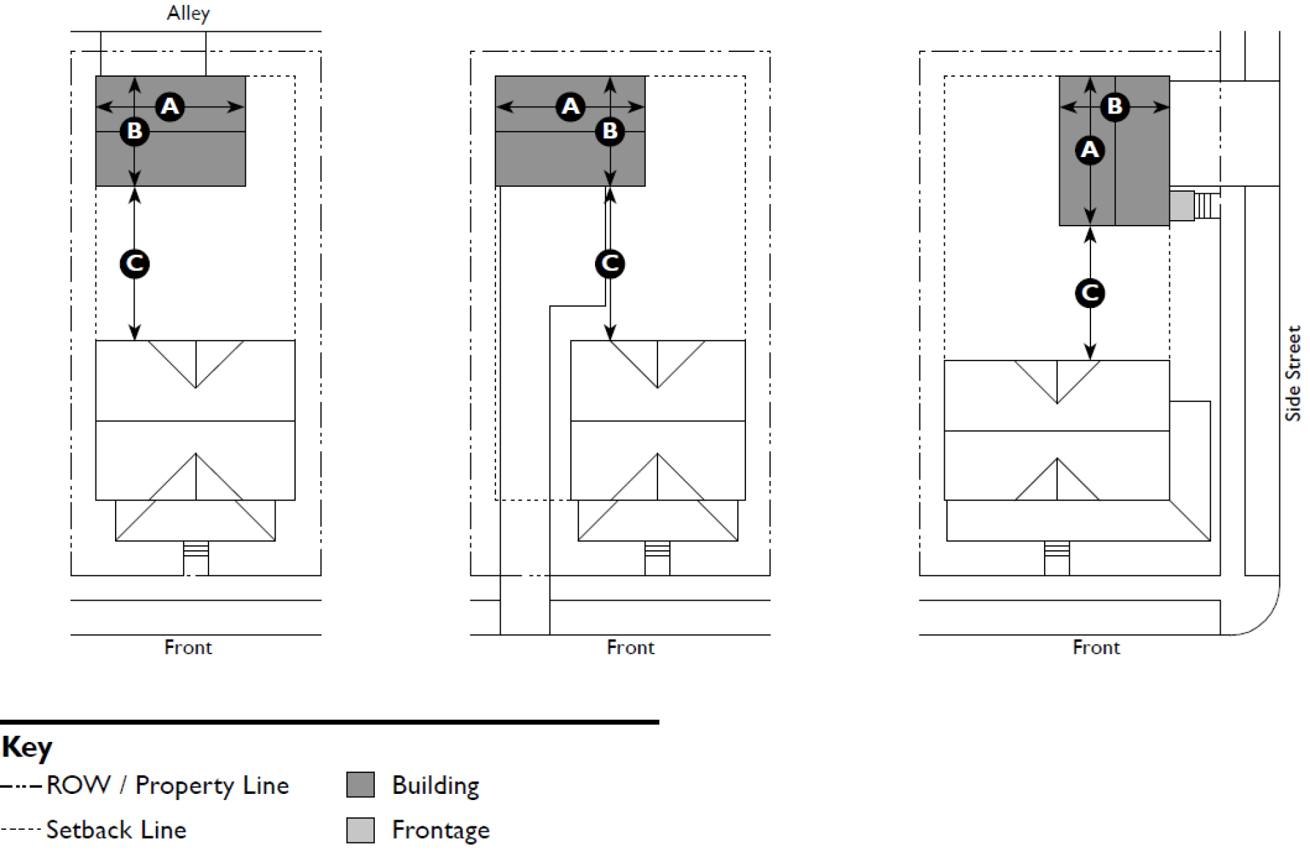
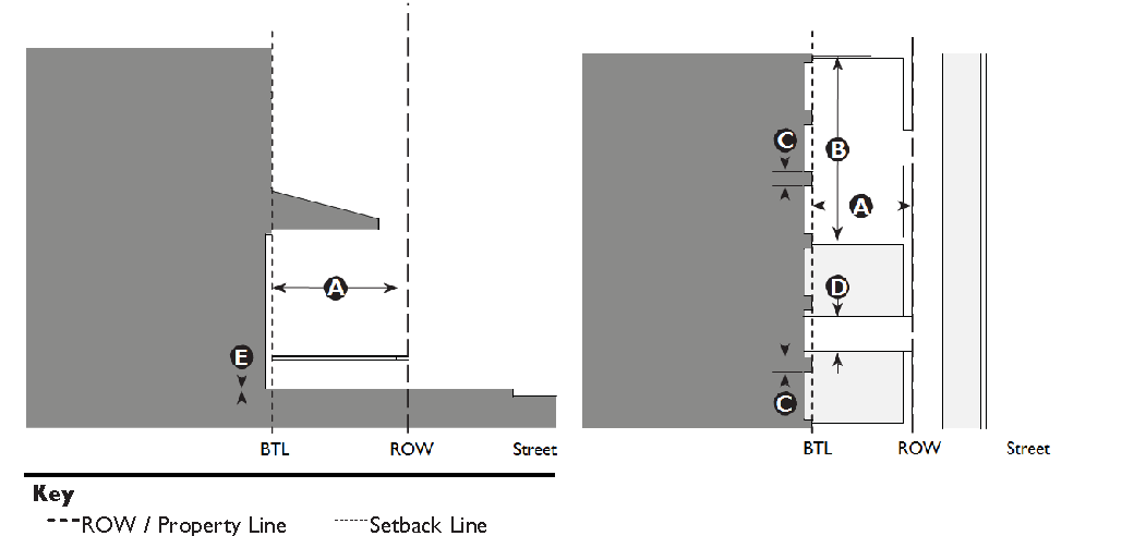
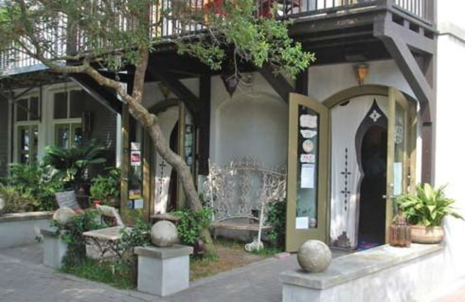
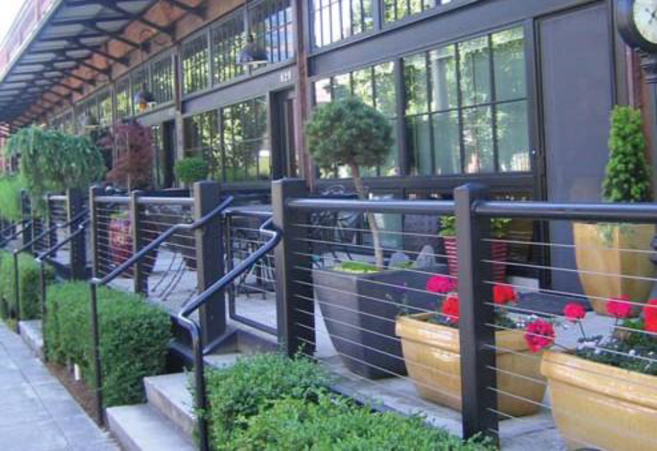
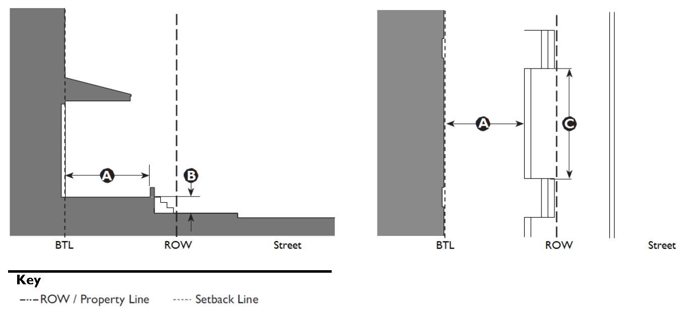
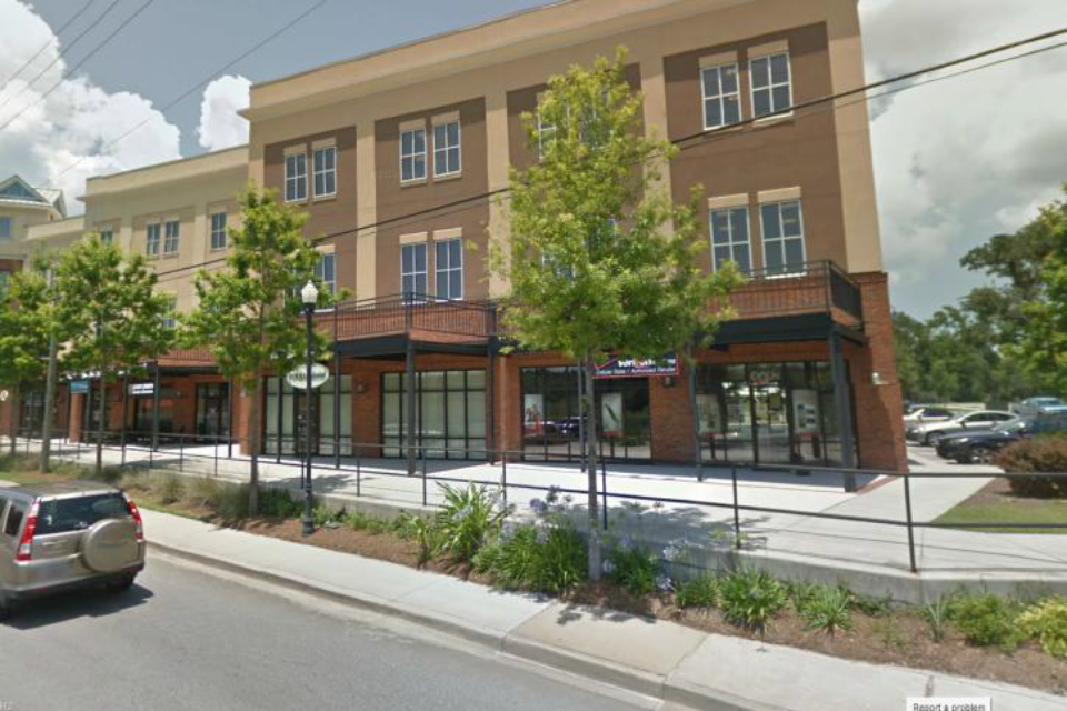
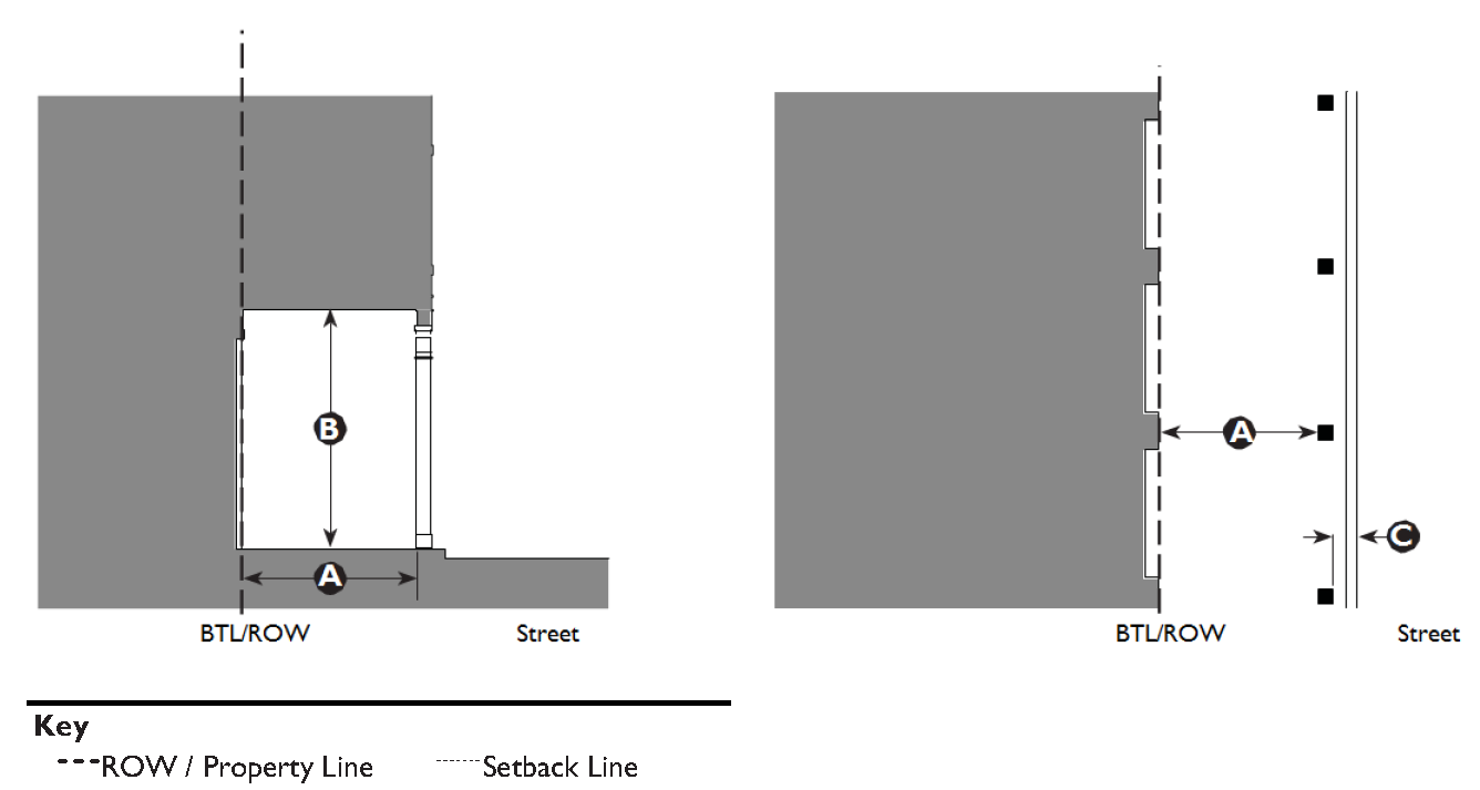
5.2.90 - Forecourt
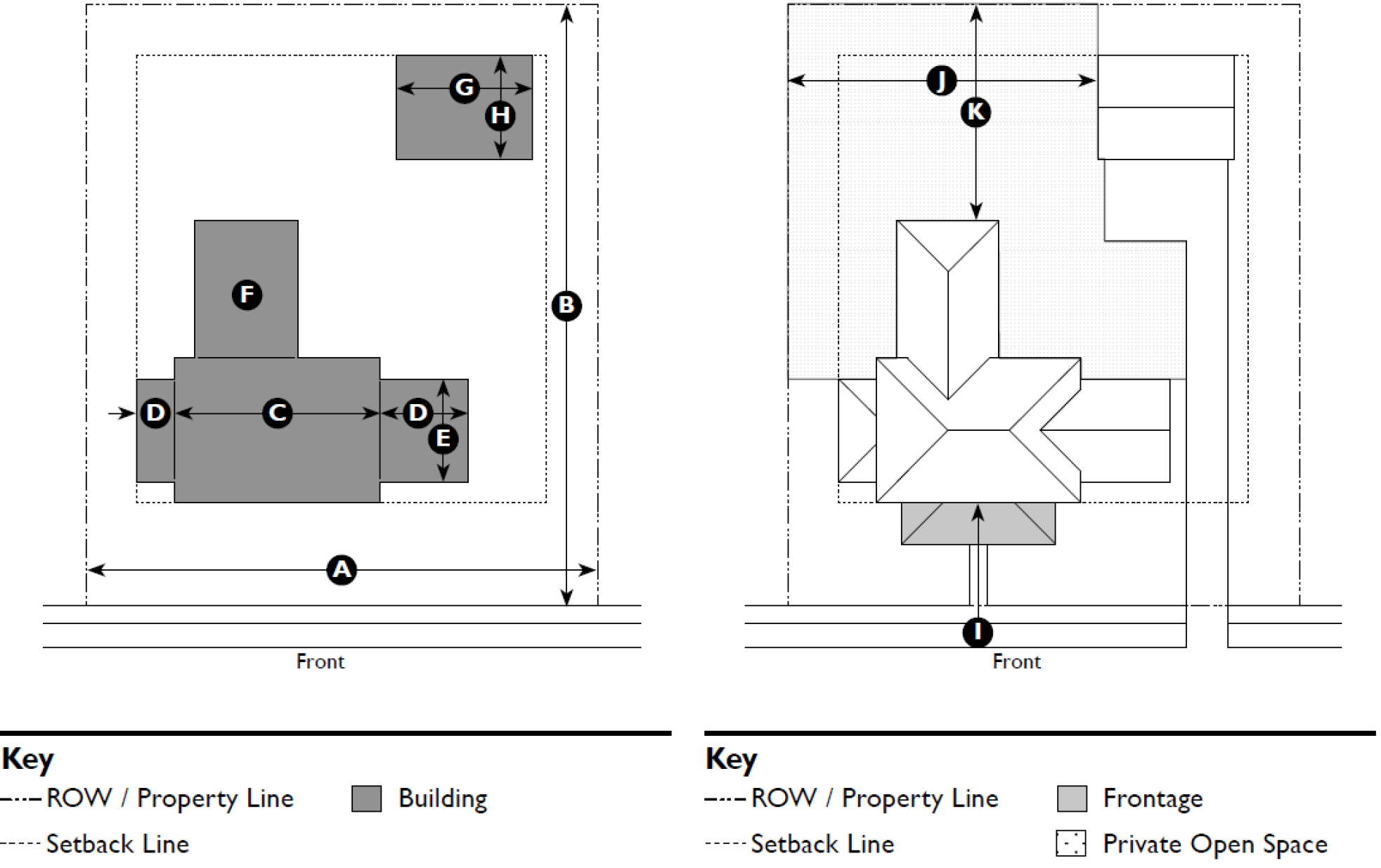
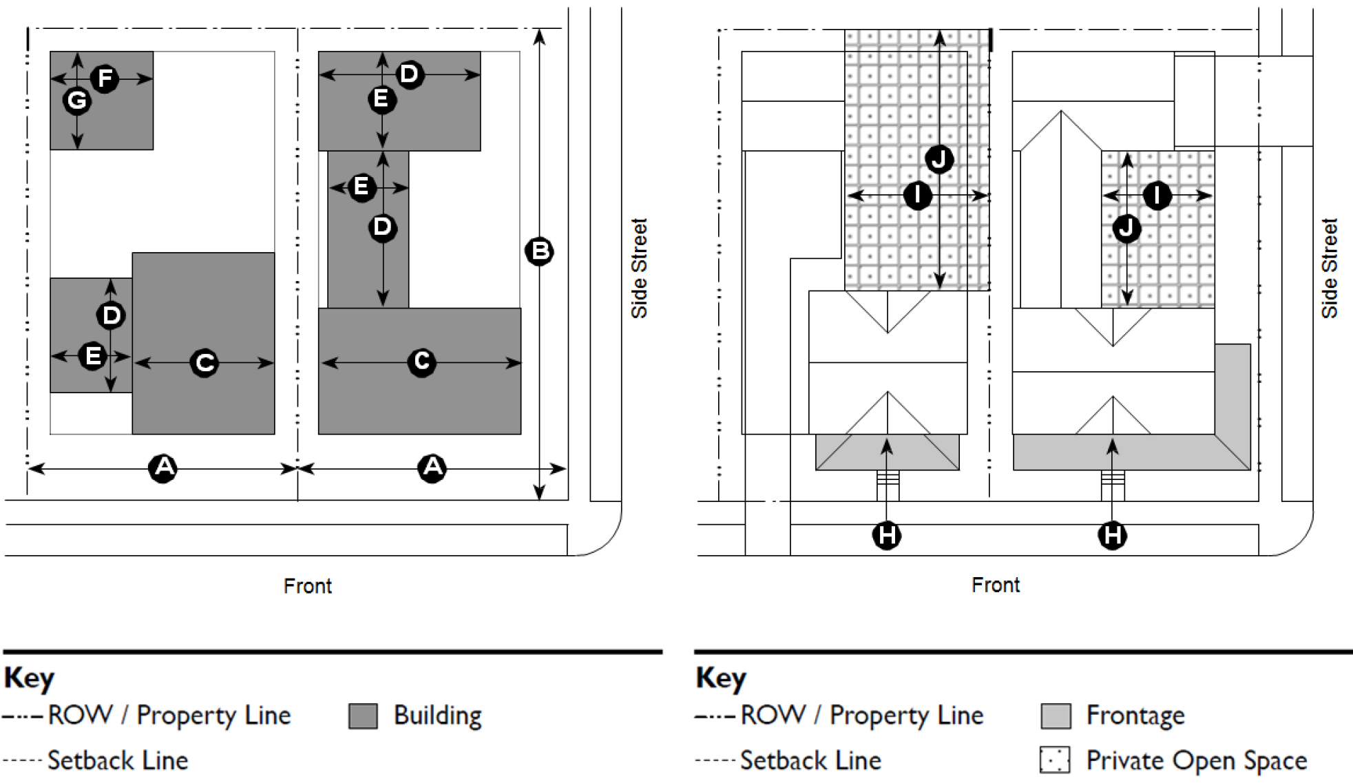
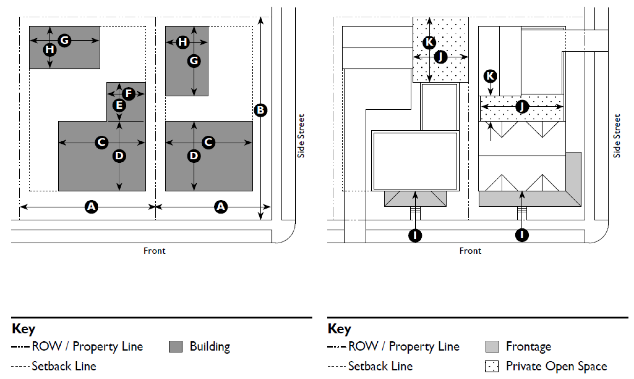
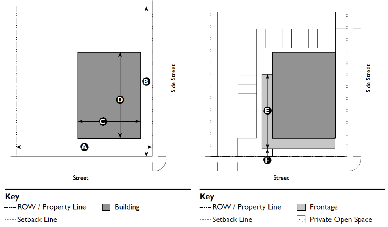
| A. Description | ||
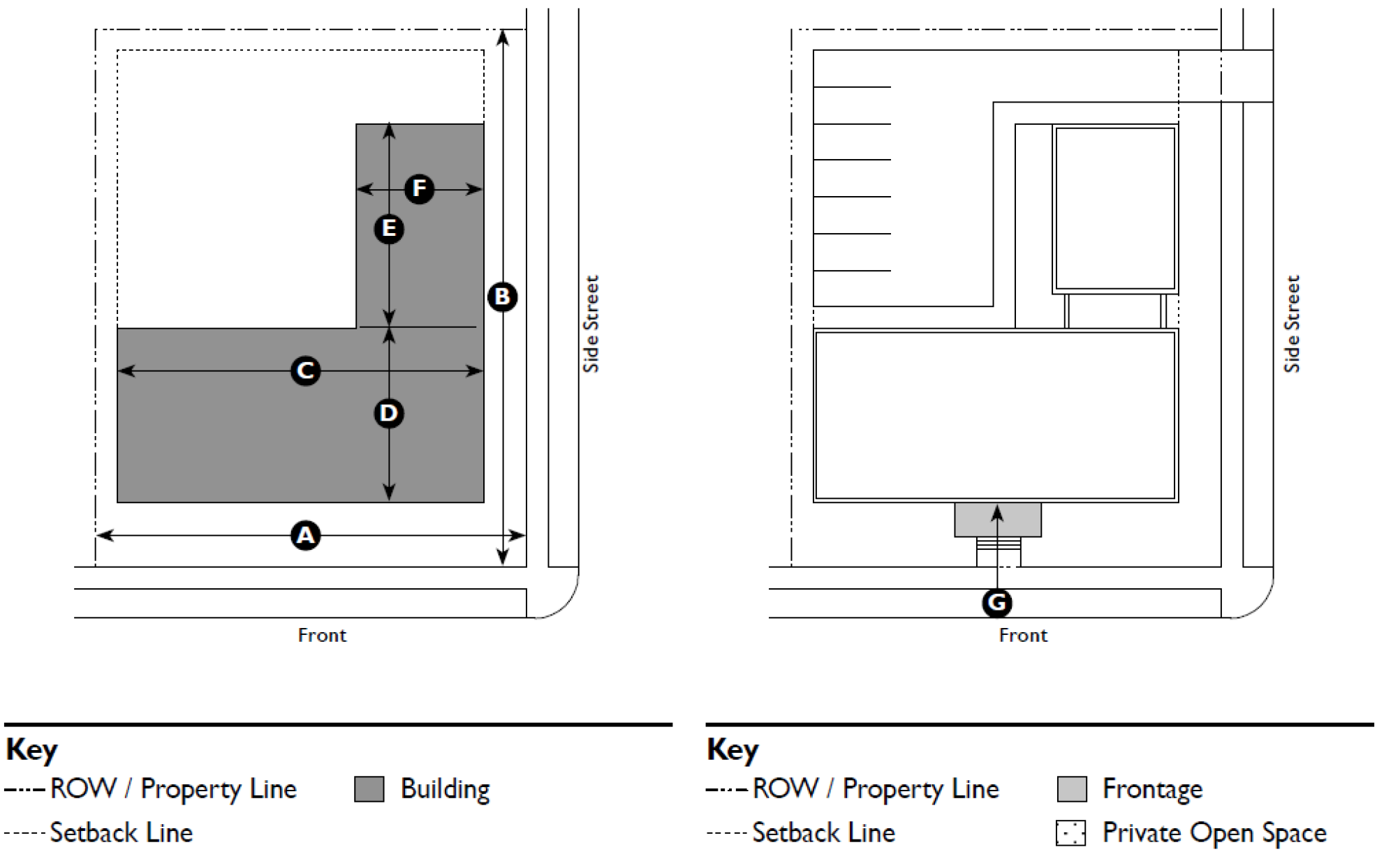
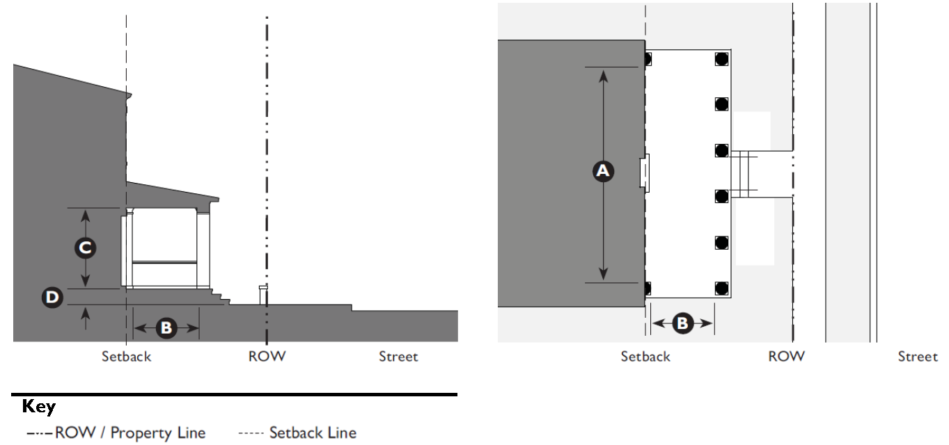
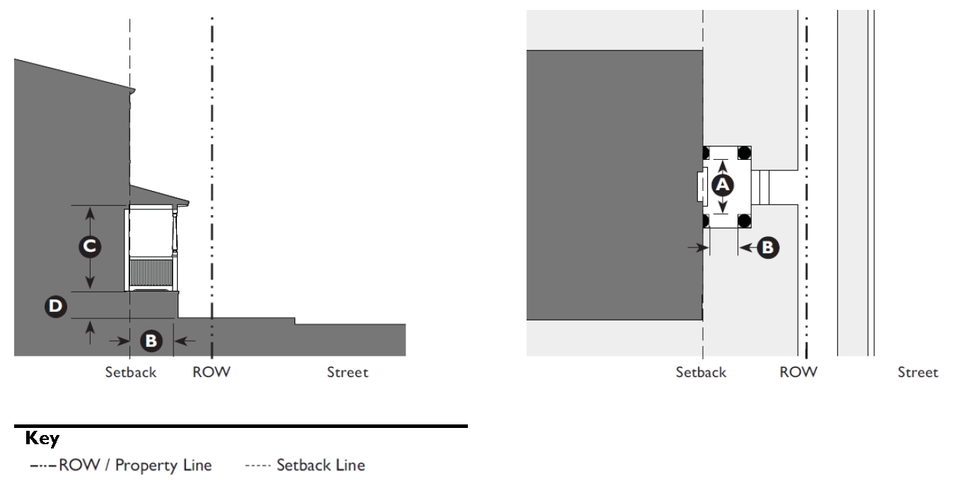
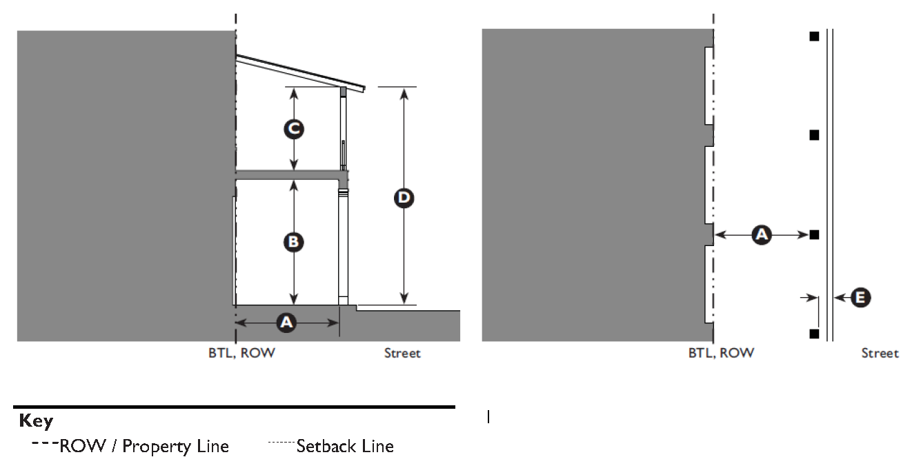
| Forecourt. The main facade of the building is at or near the frontage line and a small percentage is set back, creating a small court space. The space could be used as an entry court or shared garden space for apartment buildings, or as an additional shopping or restaurant seating area within commercial areas. | ||
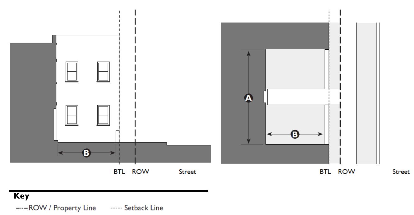
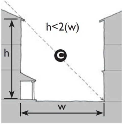
| B. Size | ||
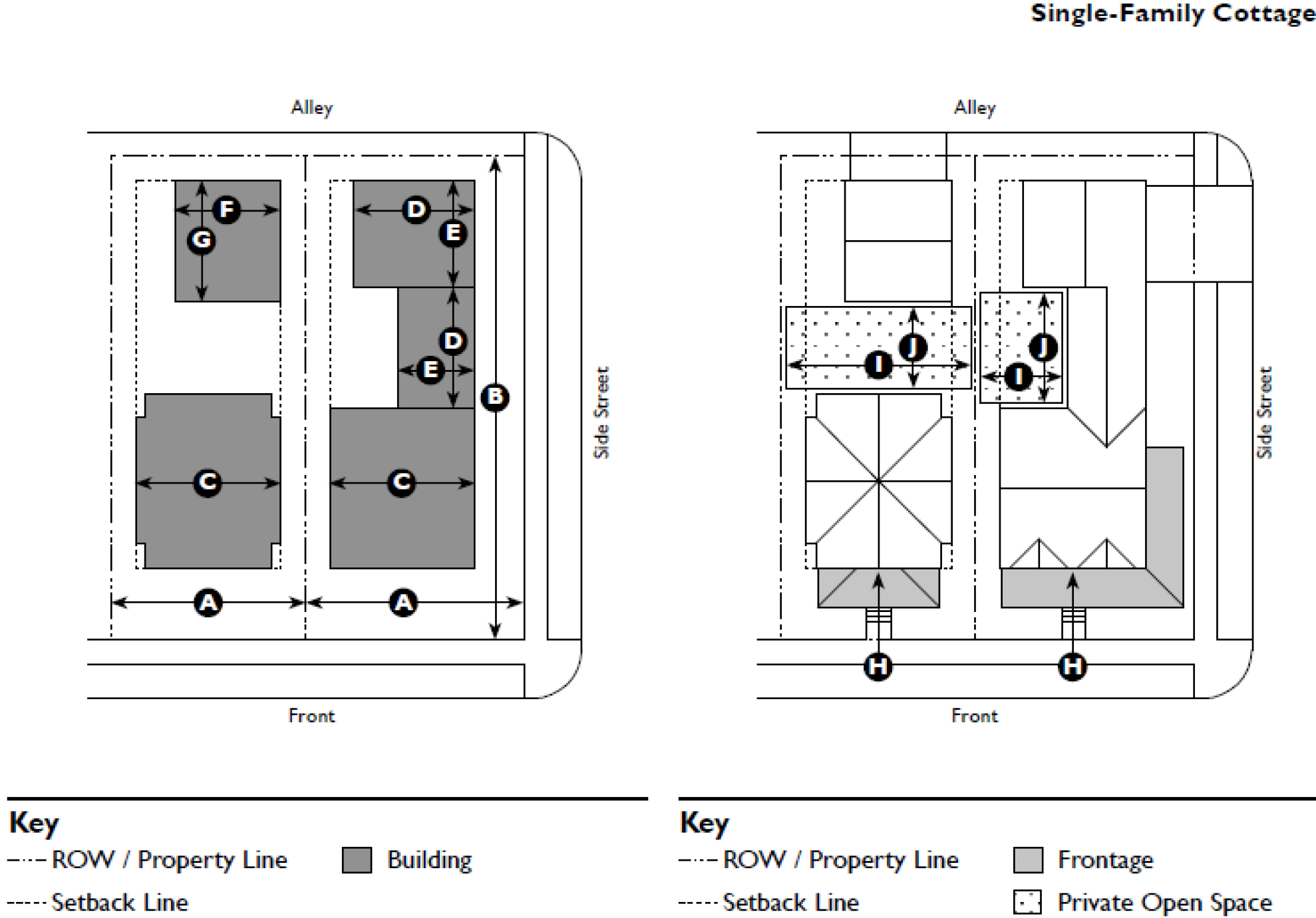
| Width, Clear | 12' min. | Ⓐ |
| Depth, Clear | 12' min. | Ⓑ |
| Ratio, Height to Width | 2:1 max. | Ⓒ |
| C. Miscellaneous | ||
| Forecourts should be used sparingly and should not be repeated along a block frontage. | ||
| The proportions and orientation of these spaces should be carefully considered for solar orientation and user comfort. | ||
 | ||
This residential forecourt provides a prominent entry yard and breaks down the overall
massing along the street
This commercial forecourt provides an outdoor dining area along a vibrant commercial
street. The ROW is defined by a low wall as required by this Development Code
5.2.100 - Dooryard
An example of a series of small commercial dooryards
AAn example of a series of residential dooryards. Each dooryard has its own steps
with railings providing separation between the dooryards of adjacent units.
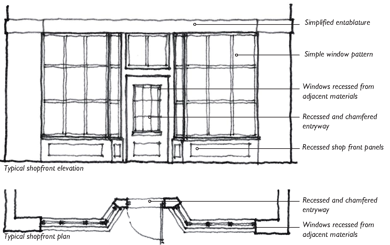
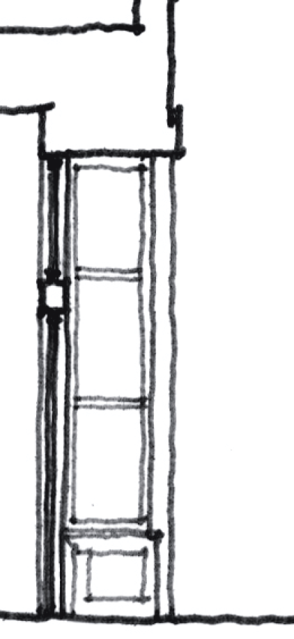
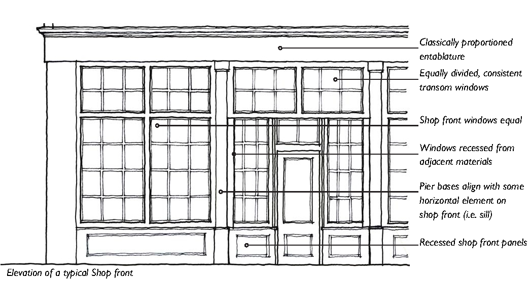
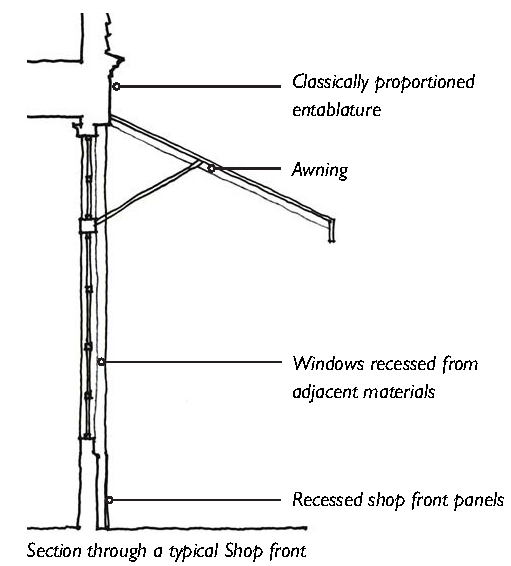
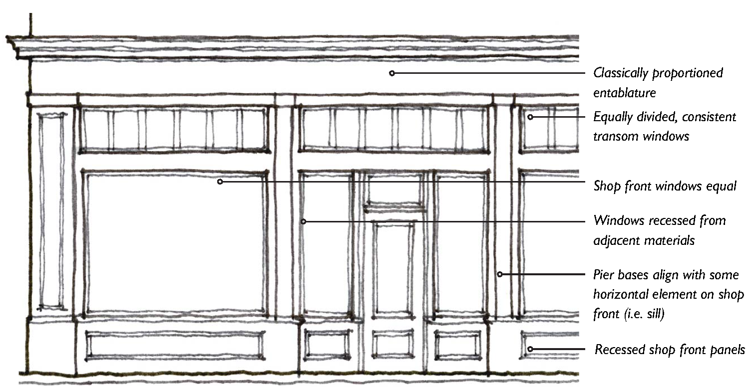
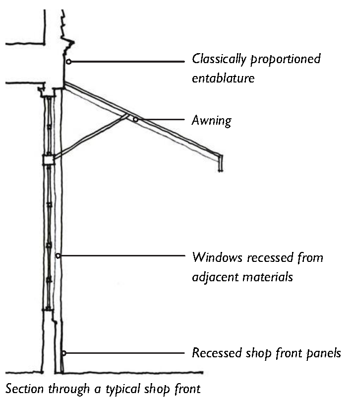
5.2.110 - Shop Front

An example of a shop front with a recessed entry
An example of a shop front
5.2.120 - Terrace
An example of a terrace providing a protected pedestrian environment on a busy thoroughfare
A terrace accommodating a change in grade along a series of shop fronts
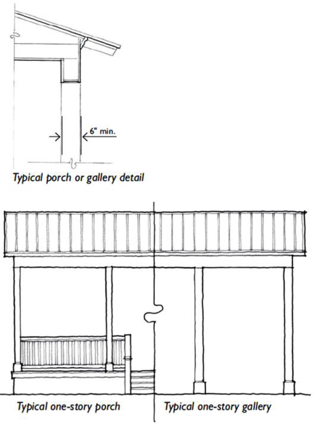
5.2.130 - Gallery
A one-story gallery
A two-story gallery
5.2.140 - Arcade
An example of an arcade encroaching the public ROW. The arcade provides the only means
of circulation along the ROW
5.3.10 - Purpose
The purpose of this Division is as follows:
A.
To provide standards and guidelines that achieve and promote a consistently high level of design for the County's most intense and most visible development; and
B.
To encourage new and renovated buildings to reflect the distinct characteristics of Beaufort County Places.
5.3.20 - Applicability
A.
Within Transect Zones. The standards and guidelines in Section 5.3.30 (General Architectural Standards) and Section 5.3.40 (Architectural Styles) are applicable to all proposed development within:
1.
The T4HC, T4HCO, T4VC and T4NC Zones.
2.
The T2 and T3 Zones with the exception of agricultural and single-family residential uses.
3.
A Traditional Community Plan, in locations where new development is intended to create walkable places of character, and for which a Transect-based Regulating Plan will be established.
B.
Within Conventional Zones, Existing PUDs, and Community Preservation Districts. Within Conventional Zones, Existing PUDs, and Community Preservation Districts, all development located within 500 feet of the right-of-way of an arterial or major collector, with the exception of single-family residential, shall meet the standards in Section 5.3.30 (General Architectural Standards and Guidelines) and utilize Section 5.3.40 (Architectural Styles) as a "best practices manual" to achieve the standards in Section 5.3.30 (General Architectural Standards).
C.
Within All Zones. The use of any shipping container or the like, travel trailer, or recreational vehicle (RV) as a primary or accessory structure shall be prohibited in all zoning districts.
D.
Standards and Guidelines. This Division includes both standards and guidelines.
Statements predicated by the words "shall" or "must" are to be interpreted as standards. Statements predicated by the words "should" or "may" are to be interpreted as guidelines.
(Ord. No. 2015/32, § 1, 11-9-15; Ord. No. 2017/23, 8-28-17; Ord. No. 2020/33, 9-28-20; Ord. No. 2022/48, Exh. A, 12-12-22)
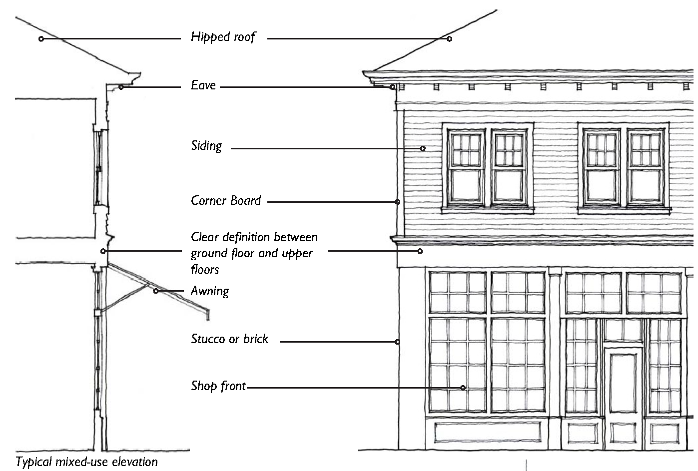
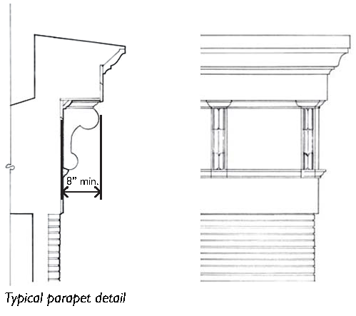
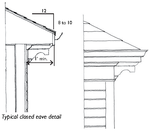
5.3.30 - General Architectural Standards and Guidelines
The purpose of the following general architectural standards and guidelines are to create a quality-built environment that reflects the County's unique Lowcountry character. This is achieved by adhering to good architectural design principles and incorporating traditional architectural features, while blending harmoniously with the natural surroundings.
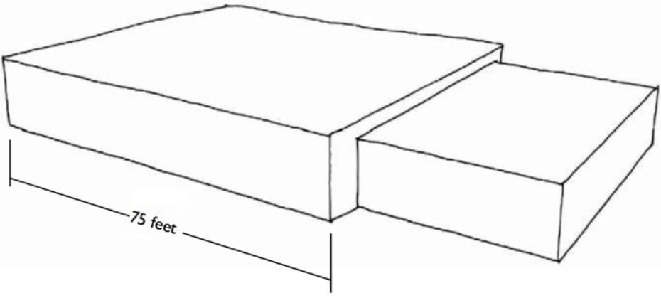
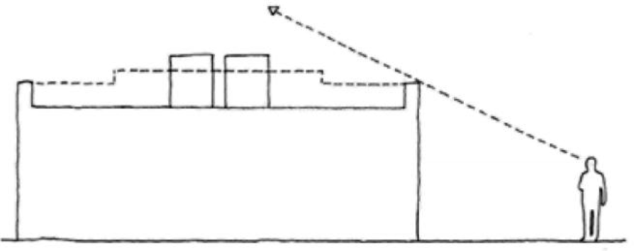
Building Massing: Wall planes shall not exceed 75 feet in length
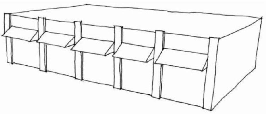
Wall Planes: Example of using pilasters and canopies to articulate a wall plane.
Vertical Articulation: Example of vertical articulation on a single-story building
Vertical Articulation: Example of vertical articulation on a multi-story building
Pitched Roofs: Where pitched roofs are utilized, the minimum pitch shall be 4:12
Flat Roofs with Parapets: Flat roofs and sloped roofs with a pitch less than 4:12
shall be concealed with a parapet that extends around all sides of a building
Concealing Rooftop Equipment: The roof structure or parapet shall conceal rooftop
equipment from view
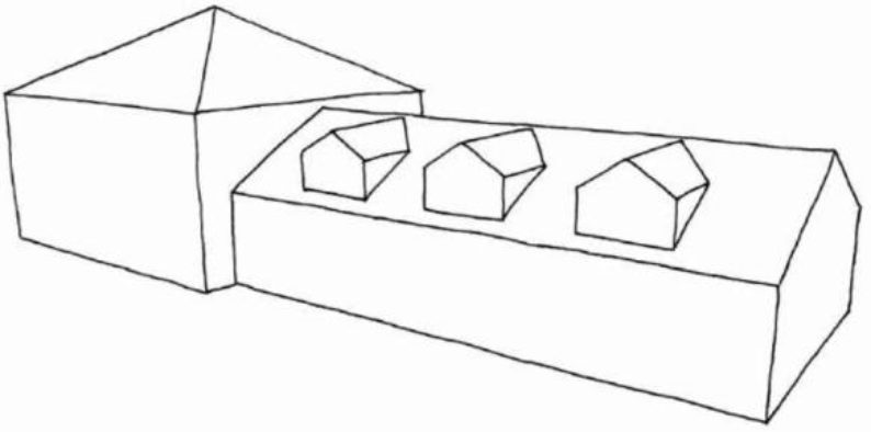
Roof Articulation: Varied roof pitches and planes shall be used to break up the massing
of larger buildings
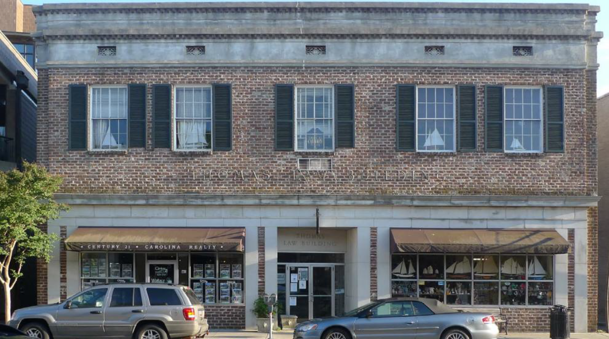
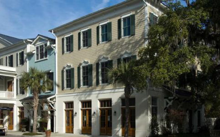
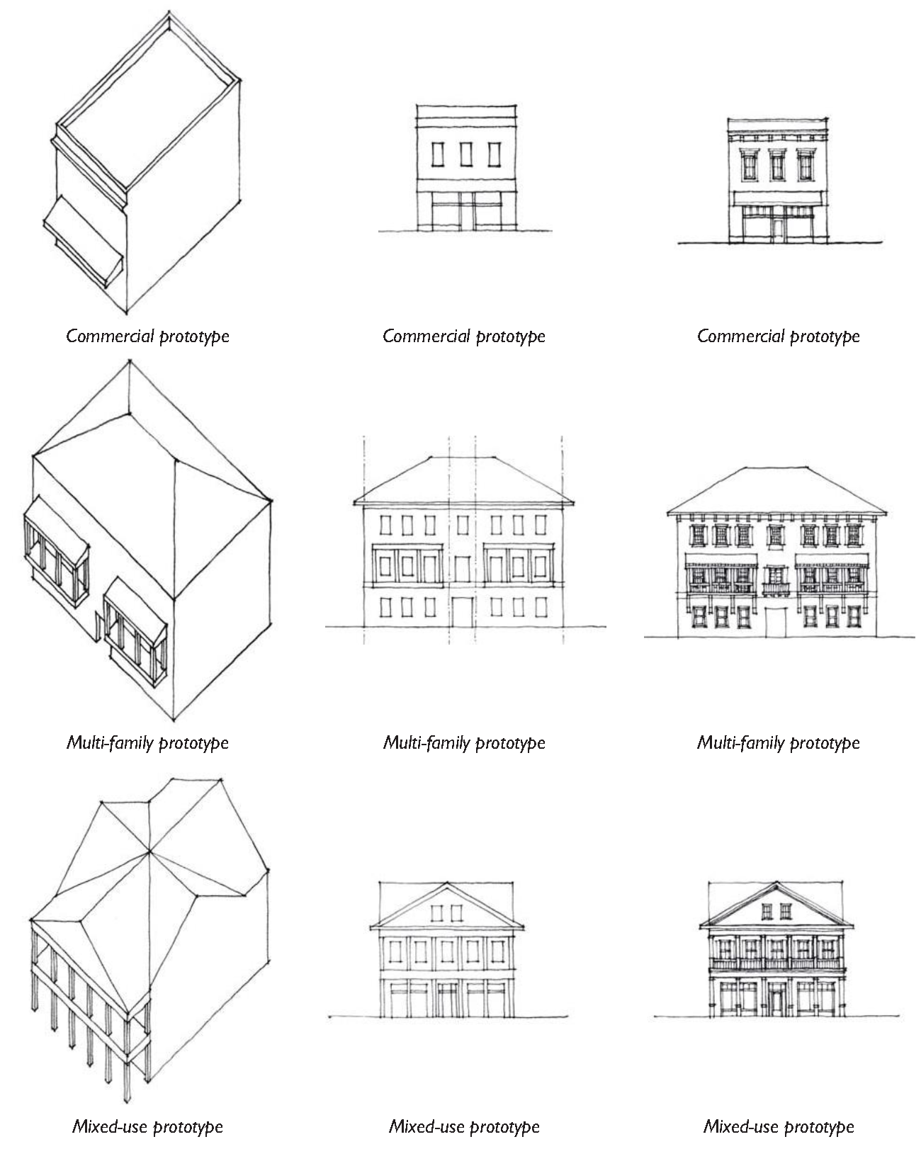
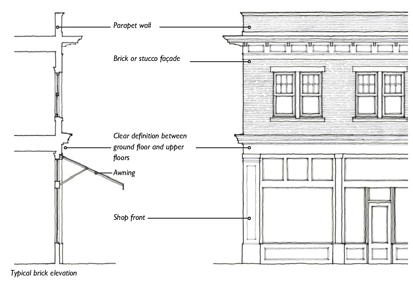
5.3.40 - Architectural Styles
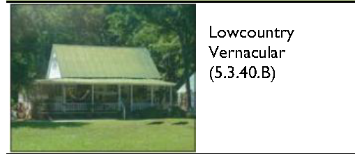
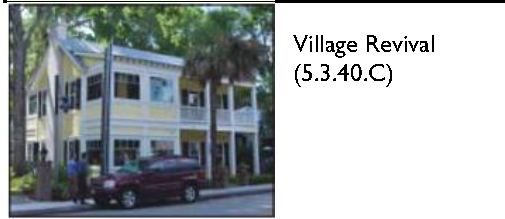
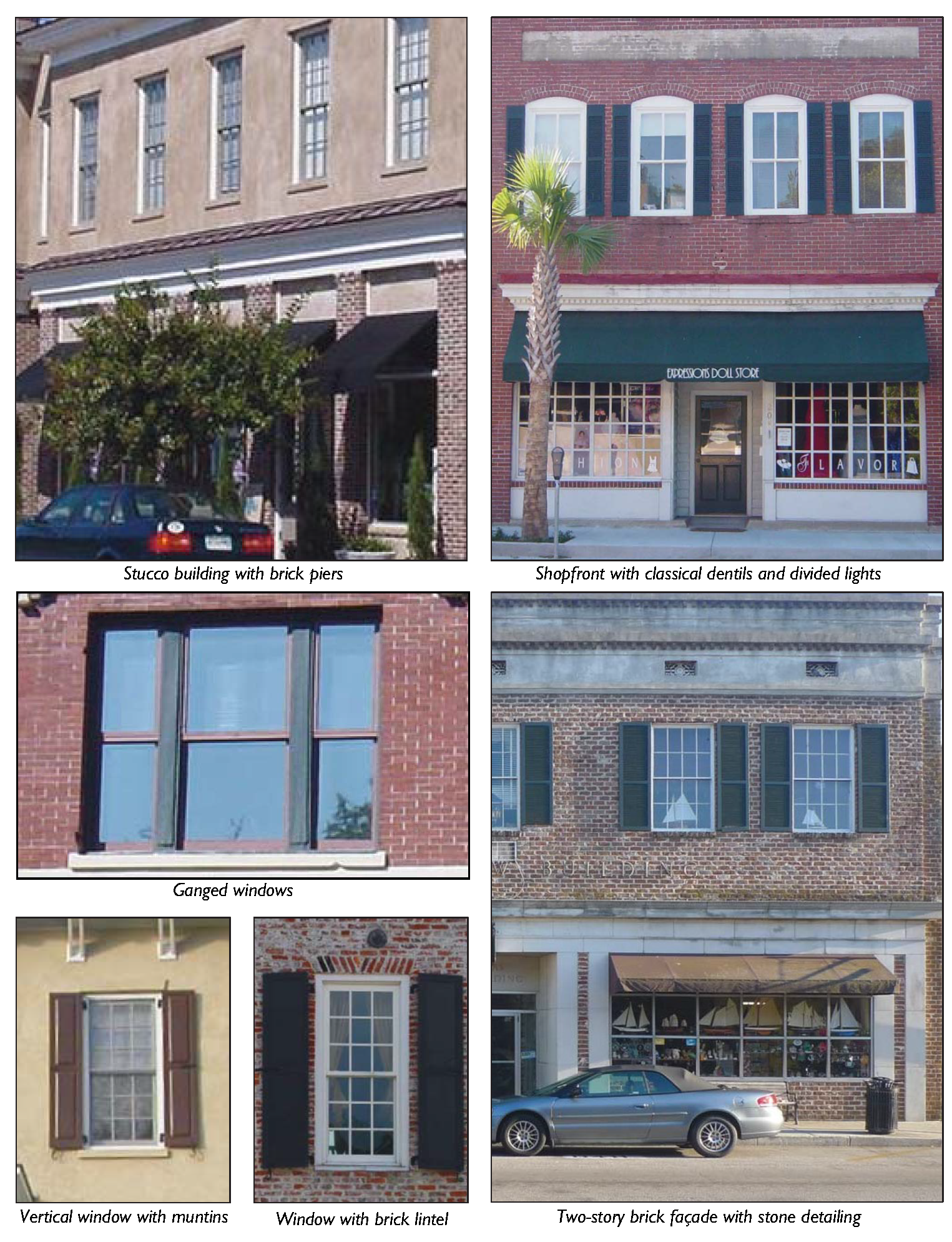
These styles reflect and summarize the range of traditional architectural expression that occurs within Beaufort County places. Historically, architecture in more rural places has generally been less formal, and characterized by vernacular treatments, including simple, low-slung massing, wood detailing, and a muted color palette. Architecture in more urban places has generally been more formal, characterized by more classical treatments, including vertically proportioned massing, detailing in masonry and stucco, and a broader range of colors.
A.
Overview of Architectural Styles: There are three broad categories of architectural styles in this section: Lowcountry Vernacular, Village Revival, and Mainstreet Classical. These architectural styles can be applied with a degree of flexibility as illustrated in Table 5.3.40.A, below. Architectural styles represent only a small portion of architectural vocabulary appropriate for development within the County. Additional architectural styles and/or individual building precedents beyond the scope of this Division may also be acceptable through a modulation permit, see Section 7.2.30 (Modulation Permit).
| Table 5.3.40.A: Beaufort County Architectural Styles | |||
|---|---|---|---|
| Style | Rural Crossroads | Hamlets and Villages | Towns and Cities |
 | |||
 | |||
 | |||
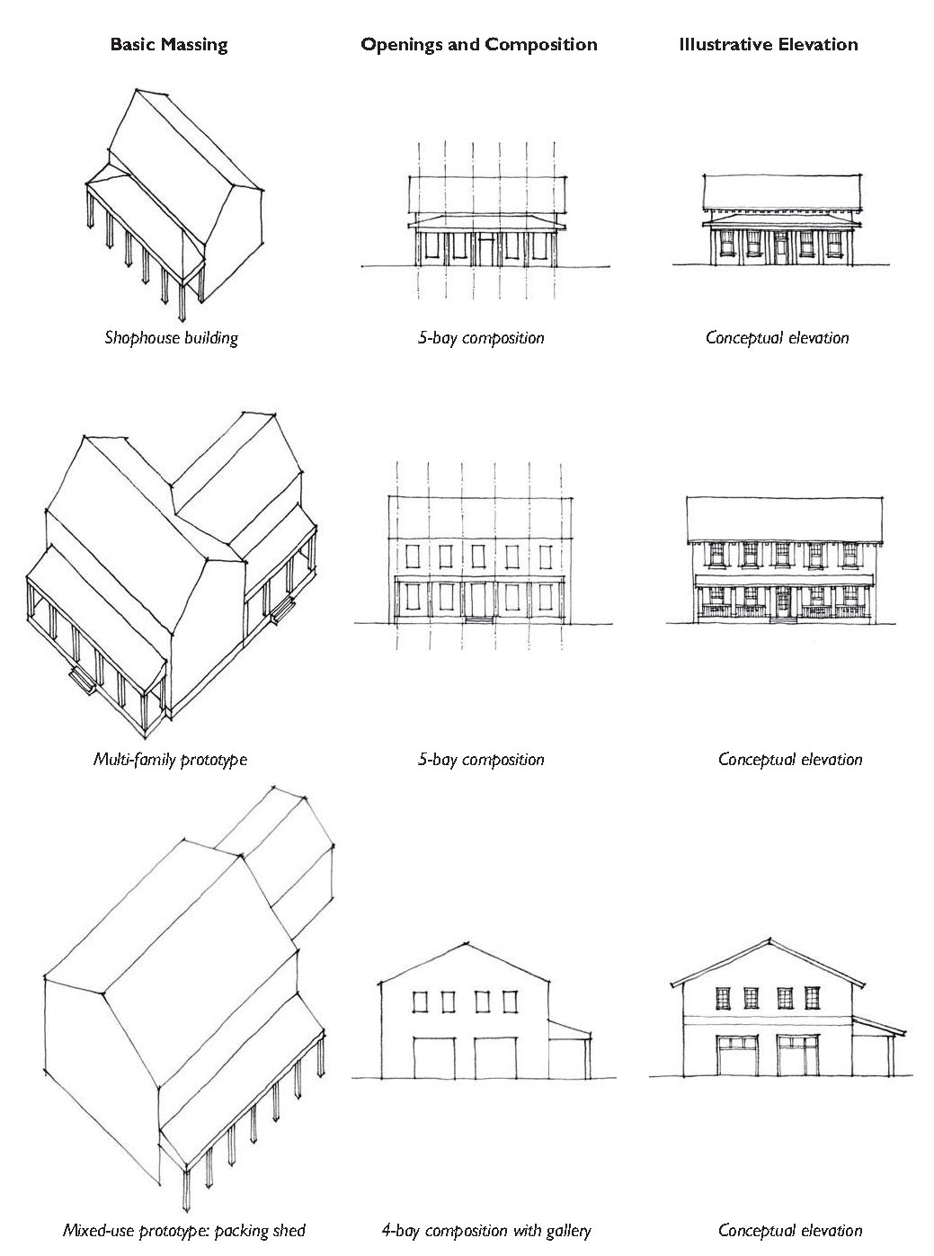
Shophouse prototype
Multi-family prototype
Mixed-use prototype: packing shed
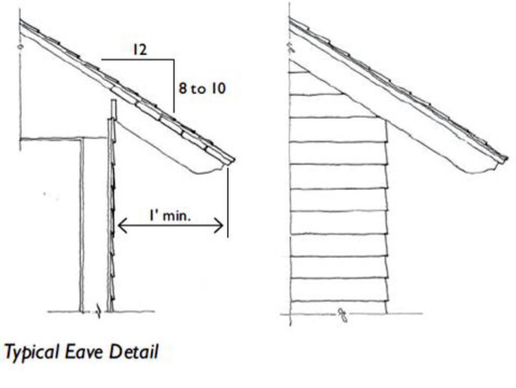
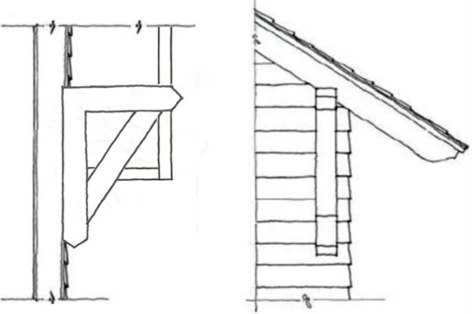
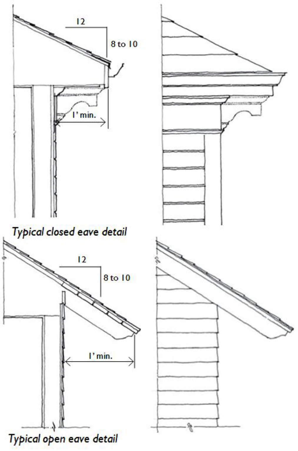
Typical Bracketed Eave Detail
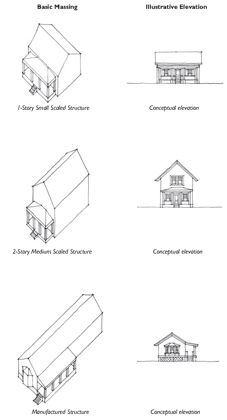
Simple Commercial Prototype
Multi-Family Prototype: Attached Rowhouses
Mixed-Use Prototype: Live/Work Shophouse
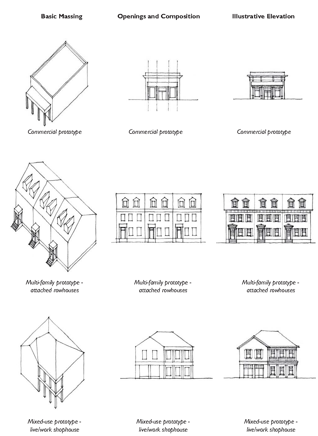
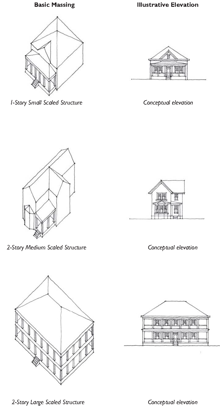
Commercial Prototype
Multi-family Prototype

Mixed-use Prototype
![]()
5.4.10 - Purpose
The purpose of this Section is to regulate the location, height, and appearance of fences and walls to maintain visual harmony within neighborhoods in the County, protect adjacent properties from the indiscriminate placement and unsightliness of fences and walls, and ensure the safety, security, and privacy of properties.
5.4.20 - Applicability
The provisions of this Section shall apply to all construction, substantial reconstruction, or replacement of fences or walls not required for support of a principal or accessory structure, or any other linear barrier intended to delineate different portions of a lot. If there is any inconsistency between the provisions of this Section and any screening standard in Division 3.2 (Transect Zones), the standards in Division 3.2 (Transect Zones), shall control.
5.4.30 - General Requirements for Fences and Walls
A.
Location. Fences are permitted on the property line between two or more parcels of land held in private ownership.
B.
Temporary Fences. Temporary fences for construction sites or a similar purpose shall comply with the requirements of the Building Code adopted by the County and all applicable standards of Division 4.3 (Temporary Uses and Structures).
C.
Fences and Walls near Fire Hydrants. Fences and walls shall not be located where they would prevent immediate view from the street of, use of, or access to, fire hydrants or other firefighting water supply devices, in accordance with the Fire Code.
D.
Fences in Easements. Fences should not be located within utility easements. The County shall not be responsible for damage to, or the repair or replacement of, fences that must be removed to access such easements. In no instance shall this provision be construed to prevent fencing around stormwater retention or detention facilities.
E.
Blocking Natural Drainage Flow. No fence shall be installed so as to block or divert a natural drainage flow on to or off of any other land.
F.
Fences on Retaining Walls or Berms. If a fence is constructed on top of a wall or berm, the combined height of the fence and wall or berm shall not exceed the maximum height that would apply to the fence or wall alone.
G.
Fences and Walls within Buffers. Fences and walls shall be installed so as not to disturb or damage existing vegetation or installed plant material within perimeter or riparian buffers.
H.
Integration with Other Required Landscaping. Required landscape screening for fences or walls may be integrated into the landscaping required for vehicular use area screening or perimeter buffers, provided the standards in Section 5.8 (Landscaping, Buffers, and Screening Standards), are maintained.
I.
Customary Materials. Fences and walls shall be constructed of any combination of treated wood posts and planks, rot-resistant wood (such as cypress or redwood), wrought iron, decorative metal materials, chain link, brick, stone, masonry materials, or products designed to resemble these materials. Where certain materials are specified for particular types of screening or buffering fences or walls, all other fence materials are prohibited.
5.4.40 - Height Requirements for Fences and Walls
All fences and walls shall conform to the following standards unless exempted by Subsection C below, and except as otherwise provided in Section 5.4.70 (Visibility Clearance). In all cases, heights are measured from natural grade.
A.
Transect Zones and C3 Zone. Fences or walls shall not exceed a height of four feet in front yards and corner side yards located between the side street right-of- way and the side of a structure, or a height of six feet in side and rear yards.
B.
C4, C5, and S Zones. Except for fences or walls providing required screening, fences and walls in the C4, C5, and S districts shall not be permitted in front and corner side setback areas, shall not exceed a height of eight feet in the remainder of front and corner side yards, and shall not exceed a height of eight feet in rear yards.
C.
Exemptions.
1.
Rural Single-Family Lots. Single-family lots in T1 Natural Preserve, T2 Rural, and T2 Rural Low shall be exempt from fence height standards.
2.
Required Screening. A fence or wall provided to screen an outdoor maintenance, storage, or salvage yard, is exempt from the height standards of this Section, but in no case shall the fence or wall exceed a height of ten feet.
3.
Recreational Fencing. Customary fencing provided as a part of a permitted tennis court, athletic field, or other recreational facility shall be exempt from the height restrictions of this Section.
4.
Public Safety Use Fences and Walls. Major utilities, wireless communication towers, government facilities, and other public safety uses shall be allowed to increase maximum fence or wall heights to 10 feet in front, side, and rear yards, unless further increased through an approved security plan, see Subsection 5, below.
5.
Security Plan Fences and Walls. An owner, tenant, or a representative of a public agency responsible for a public facility may submit to the Director a site security plan proposing fences or walls taller than those permitted by this Section, or the use of barbed or concertina wire atop a fence or wall. The Director shall approve, or approve with conditions, the site security plan and its proposed exemption of fences or walls from the standards of this Section, on finding that:
a.
The condition, location, or use of the land, or the history of activity in the area, indicates the land or any materials stored or used on it are in significantly greater danger of theft or damage than surrounding land; and
b.
The proposed taller fences or walls, or use of barbed or concertina wire, will not have a significant adverse effect on the security, functioning, appearance, or value of adjacent lands or the surrounding area as a whole.
5.4.50 - Perimeter Fences and Walls Abutting Public Rights-of-Way
Fences or walls located within 15 feet of a public right-of-way shall be:
A.
Located Outside ROW. Be located outside the public right-of-way;
B.
Uniform Style. Be of a uniform style; and
C.
Materials. Fences and walls abutting public rights-of-way should be constructed from the following materials:
1.
Piers and Walls: Brick, Cast Stone and/or Stucco over concrete.
2.
Rails and Posts.
a.
Wood or products designed to resemble wood;
b.
Fiber cement; and/or
c.
Aluminum or iron.
3.
PVC, fiberglass and chain link are not encouraged.
5.4.60 - Design and Appearance
A.
Consistency with Character and Intensity of Zone. The type, design and, materials of fences and walls should correspond to the character and intensity of the surrounding area. Table 5.4.60.A illustrates how fences and walls change in response to the character and intensity of their district.
B.
Finished Side to Outside. Wherever a fence or wall is installed, if one side of the fence or wall appears more "finished" than the other (e.g., one side has visible support framing and the other does not), then the more "finished" side of the fence shall face the perimeter of the lot rather than the interior of the lot. See figure below.
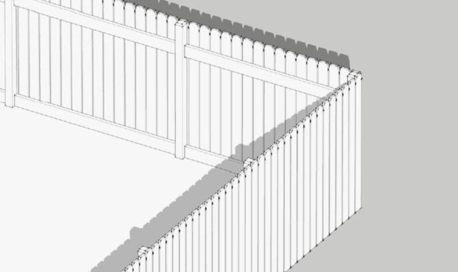
Figure 5.4.60.B: Privacy Fence with Finished Side to Outside
| Table 5.4.60.A: Fences and Walls: Consistency with Character and Intensity of Zone | ||||
|---|---|---|---|---|
| T1 | T2R, T2RL, T2RN | T2RNO, T2RC | T3, C3 | T4, C4, C5, I |
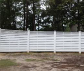 |  |  |  |  |
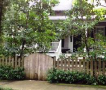
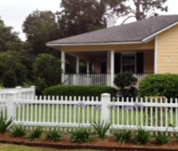
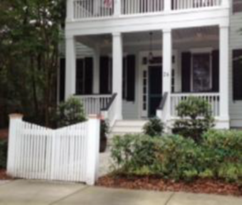
| Privacy Fence | Split Rail Fence | Living Fence | Split Rail Fence | Picket Fence |
 |  |  |  | 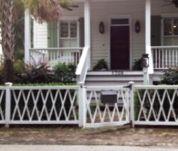 |
| Post and Rail Fence | Living Fence | Picket Fence | Living Fence | Lattice Fence |
 |  |  | ||
| Dog Ear Picket Fence | Picket Fence | Hedge Wall with Picket Gate | ||
 | 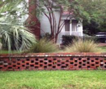 | |||
| Hedge Wall | Garden Wall | |||
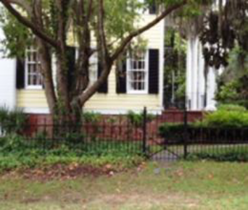 | 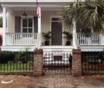 | |||
| Wrought Iron Fence | Wrought Iron Fence with Brick Posts | |||
| General Note: Photos on this page are illustrative, not regulatory. | ||||
C.
Compatibility of Materials along a Single Lot Side. All fencing or wall segments located along a single lot side shall be composed of a uniform style and colors compatible with other parts of the fence and with the associated buildings.
D.
Landscape Screening. All chain link fences and fences and walls exceeding four feet in height, if located within 15 feet of a public street right-of-way, shall be supplemented with landscape screening in accordance with the following standards, to soften the visual impact of the fence. These standards shall not apply to fences in the S Zone or single-family dwellings in the C3 Zone, unless they are located within 15 feet of the right-of-way of an arterial or collector street.
1.
Shrubs Required. One evergreen shrub shall be installed for every five linear feet of fence or wall, and on the side of the fence or wall facing the public street right-of-way.
2.
Substitution of Understory Trees. One understory or ornamental tree may be substituted for every three evergreen shrubs, provided that the tree meets the size standards.
5.4.70 - Visibility Clearance
Fences and walls shall be placed outside of required sight triangles or areas needed for visibility.
5.4.80 - Restricted and Prohibited Fences
A.
Restricted Fences.
1.
Chain Link fences in Residential Areas. Chain link fences in residential areas may be permitted in rear yards only. Single-family lots in all T1 and T2 districts shall be exempt from this restriction.
2.
Chain Link fences in Commercial Areas. Chain link fences used in commercial areas shall be screened from view from public rights-of-way.
B.
Prohibited Fences.
1.
Barbed Wire, Concertina Wire, and Aboveground Electrified Fences. In all zones, fences using barbed or concertina wire and aboveground electrified fences shall be prohibited unless used in association with agricultural activities or allowed through an approved security plan, see Section 5.4.40.C.5 (Security Plan Fences and Walls). Underground electric fences designed for control of domestic animals are allowed.
2.
Debris, Junk, Rolled Plastic, Sheet Metal, Plywood, or Other Waste Materials. Fences or walls made of debris, junk, rolled plastic, sheet metal, plywood, or waste materials are prohibited in all zones unless such materials have been recycled and reprocessed, for marketing to the general public, as building materials that resemble new building materials (e.g., picket fencing made from recycled plastic and fiber).
5.4.90 - Maintenance Required
All fences and walls and associated landscaping shall be maintained in good repair and in a safe and attractive condition—including, but not limited to, the repair or replacement of missing, decayed, or broken structural and decorative elements.
5.5.10 - Purpose
The purpose of this Division is to regulate and ensure the provision of adequate parking and access for motor vehicles and bicycles. The Division also provides options for adjusting parking requirements and providing parking alternatives. These standards ensure that the parking needs of new land uses and development are met, while being designed and located in a manner consistent with the desired character and development patterns of the community as outlined in the Comprehensive Plan.
5.5.20 - Applicability
A.
The parking standards of this Division shall apply to the following within the County:
1.
New development;
2.
Changes in land use; and
3.
Changes in intensity of buildings or structures of 15 percent or more of:
a.
Gross floor area;
b.
Seating capacity;
c.
Dwelling units;
d.
Parking spaces; and/or,
e.
Other units of measurement listed in Table 5.5.40.B (Number of Motor Vehicle Parking Spaces Required).
B.
Applicability to Transect Zones. The standards in this Division are intended to supplement those found in Article 3 (Specific to Zones). Should a conflict between the regulations found in this Division and Article 3 (Specific to Zones) arise, the standards found in Article 3 (Specific to Zones) shall prevail.
C.
Location, Design, Landscaping. All parking spaces provided shall meet the location, design, landscaping and improvement requirements in this Division, Division 3.2 (Transect Zones), and Division 5.8 (Landscaping, Buffers, and Screening Standards).
5.5.30 - General Parking Standards
A.
Storage and/or Parking of Heavy Trucks and Trailers. Parking or storage of heavy trucks (vehicles over 20,000 GVW) and trailers in any zone for residential or storage purposes shall be prohibited except as follows:
1.
Semi-trailer trucks, their cabs or trailers, and other heavy trucks may be parked or stored on any residential lot within the T2 Rural district;
2.
In all other districts, one commercial truck or one semi-trailer cab may be parked on any residential lot of one acre or larger provided it is not prohibited by private covenants and restrictions;
3.
Where storage and/or parking of heavy trucks and trailers is permitted, the following shall apply:
a.
The vehicle shall be stored in the rear or interior side setback behind the front of the building, garage, or carport;
b.
There is a principal use of the property, to which such storage would be an accessory use;
c.
No living quarters shall be maintained or any business conducted from within while such trailer or vehicle is so parked or stored; and
d.
The required number of parking spaces on the parcel is maintained in addition to the area used for the stored vehicle(s).
B.
Off-Site/Premises Parking. If a property owner is unable to provide the required parking on-site, the owner may at the discretion of the Director satisfy the parking requirement off-site provided the following standards are met.
1.
General to All Zones.
a.
Required parking may be provided in off-street parking facilities on another property within 600 feet of the site proposed for development, as measured:
(1)
Along the street right-of-way; or
(2)
Between the closest edge of such parking facilities to the closest edge of the site being served.
The Director may approve parking further than 600 feet if it is in conjunction with a plan to provide access to the lot (e.g., valet or shuttle service).
b.
Pedestrian access between the use or the site and the off-premises parking area shall be via paved sidewalk or walkway.
c.
The owner shall provide a written parking agreement reflecting the arrangement with the other site guaranteeing that the required parking will be maintained exclusively for the uses served and remain for the duration of the use.
d.
If the off-premises parking facility is shared, the Director may allow a reduction in the number of required parking spaces. The reduction shall be based on the Shared Parking practices procedures outlined in Section 5.5.40 (Number of Motor Vehicle Parking Spaces Required).
e.
All off-street parking facilities shall be located on property zoned for the use which the parking is intended to serve, or specifically permitted for parking facility uses in Table 3.1.60 (Consolidated Use Table).
2.
Specific to Conventional Zones. Off-site parking facilities for a non-residential use shall not be located in a C3 zone.
C.
Pervious parking. The use of pervious parking spaces is strongly encouraged to promote on-site stormwater infiltration, aquifer recharging, and improved water quality.
5.5.40 - Number of Motor Vehicle Parking Spaces Required
A.
General to All Zones.
1.
Motor Vehicle Parking Spaces Required. The number of parking spaces required shall be determined by the Table 5.5.40.B (Number of Motor Vehicle Parking Spaces Required) below. Uses not listed below shall use the parking requirement for the most similar use, as determined by the Director.
2.
Allowable Increases and Reductions in Number of Parking Spaces. The Director may allow up to a 20-percent increase or a 20-percent reduction in the required number of parking spaces if an applicant can show, through a parking demand study, that additional or fewer parking spaces are required. The parking demand study shall be approved by the County Traffic and Transportation Engineer. All approved additional parking spaces shall have a pervious surface.
2.
Parking Adjustments.
a.
Transit. A parking reduction of up to 10 percent in conventional zones, and 20% in transect zones, may be approved by the Director for any use within one-quarter mile of an active bus stop or other transit stop (i.e. ferry terminal).
b.
Shared Parking Simplified. For two use types, shared parking shall be calculated as follows. The sum of the required parking for the two use types from Table 5.5.40.B (Number of Motor Vehicle Parking Spaces Required), shall be divided by the factor listed in the table below. If the use is not listed below, or the uses have different peak hour parking demands, then the shared parking shall be based on Subsection 5.5.40.A.2.c. below.
c.
Shared Parking Study. The Director may grant a reduction in the parking requirements set forth in this Section based upon the findings of a parking study submitted by an applicant that provides an analysis of peak parking demand for the entire development and that justifies the shared use of parking spaces for separate uses. A Shared Parking Study may be submitted in the following cases:
(1)
When three or more use types share parking;
(2)
When a use type is not listed in Table 5.5.40.A (Shared Parking Factor for Two Uses); and
(3)
When uses in the same or adjoining development have different peak hour parking demand and seek to share parking.
d.
Special Housing Projects. The Director may grant a reduction in the parking requirements set for in this Section where the special nature of a certain housing development (e.g. housing projects inhabited by persons with low or no automobile ownership) does not require the amount of parking listed in Table 5.5.40.B (Number of Motor Vehicle Parking Spaces Required).
e.
Golf Cart Parking. Where it can be demonstrated that a sizable percentage of parking demand will be utilized by golf carts, the Director may permit a substation at a rate one golf cart vehicle parking space for one motor vehicle parking space. Golf cart parking spaces shall have a minimum length of 10 feet and a minimum width of 5 feet.
f.
Other Parking Reductions. The parking requirements set forth in this Section may be reduced by up to 20% with approval by the Director if a lower requirement is documented and certified by a transportation engineer.
g.
The Director shall consider the following in determining whether a reduction is warranted:
(1)
The likelihood that the reduced number of parking spaces can satisfy demand;
(2)
The amount of time during the year when the number of spaces provided may be insufficient and the amount of resulting parking overflow;
(3)
The impact of periodic overflows upon the public streets and other parking facilities; and
(4)
The nature of surrounding land uses, character of surrounding road system, and nearby circulation pattern.
g.
Unless requested by Director, the burden to demonstrate that a reduction in parking requirements is warranted shall rest with the applicant.
B.
Specific to Transect Zones.
1.
On-Street Parking Spaces. Spaces adjacent to the lot may count towards the required residential guest parking and non-residential use parking requirements.
2.
Bicycle Parking Substitution. Required vehicular parking spaces may be reduced at a rate of one vehicular parking space for every one bicycle parking space provided. Reduction in parking shall not exceed a maximum of 20 percent of the required motor vehicle parking spaces
5.5.50 - Parking Spaces, Lot Design and Layout
A.
Access. The following standards are applicable to off-street parking lot access design and include parking for single-family residences unless modified by Article 3 (Specific to Zones).
1.
Each required off-street parking space shall open directly onto an aisle or driveway as specified in Table 5.5.50.A (Minimal Dimensional Requirements for Parking Spaces and Aisles). All off-street parking facilities shall be designed with an appropriate means of vehicular access to a street or to an alley to cause the least interference with traffic movements.
2.
Parking spaces in any parking lot or parking structure for any use other than single-family dwellings shall not be designed or located so as to permit a vehicle to enter or exit a parking space directly from a public thoroughfare and shall meet the following standards:
a.
Ingress to and egress from parking spaces shall be from an on-site aisle or driveway.
b.
Exception, parking spaces within lots of up to eight spaces may be designed or located so as to permit a vehicle to enter or exit a parking space directly from a public alley or rear lane.
3.
Driveways to the public thoroughfares shall be by forward motion of the vehicle.
4.
Driveways from a public thoroughfare to off-street parking areas in all residential zones shall meet the following:
a.
Driveways shall be a minimum of 10 feet wide; and
b.
If a driveway serves more than two dwelling units or is longer than 150 feet, the driveway shall have a minimum width and turnaround that comply with Fire Department requirements and County Engineering Standards.
5.
The design and construction of all off-street parking access drives shall meet the requirements of the Engineering Standards.
B.
Identified as to Purpose and Location. Off-street parking areas of four or more spaces and off-street loading areas shall include painted lines, wheel stops, or other methods of identifying individual parking spaces and loading areas and distinguishing such spaces from aisle and other circulation features.
C.
Materials.
1.
All off-street parking areas and driveways shall be surfaced with materials as approved by the County Engineer and maintained in accordance with the Engineering Standards and the LID Manual.
2.
Driveway materials shall extend and include the area between the property line and the street.
4.
The use of pervious or semi-pervious parking area surfacing materials including, but not limited to "grasscrete," or recycled materials such as glass, rubber, used asphalt, brick, block and concrete-may be approved by the County Engineer for required vehicular surface area on a site, provided such areas are properly maintained. Where possible, such materials should be used in areas proximate to and in combination with on-site stormwater control devices.
D.
Accessible Parking. All parking facilities that require accessible parking spaces shall ensure that a portion of the total number of required parking spaces shall be specifically designated, located, and reserved for use by persons with physical disabilities, in accordance with the standards in the federal American with Disabilities Act (ADA).
E.
Dimensional Standards for Parking Spaces and Aisles.
1.
General. Standard car parking spaces and parking lot aisles shall comply with the minimum dimension standards established in Table 5.5.50.A above.
2.
Dimensional Adjustments. Parking structures may be subject to dimensional adjustments based on utilization, but in no case shall the standard parking space width be less than eight feet. Reduction in design standards shall be subject to approval by the County Engineer.
3.
Vertical Clearance. All parking spaces shall have a minimum overhead clearance of seven feet.
4.
Reduction for Sidewalk and Planter Overhangs. When a parking space abuts a sidewalk or planter; the front two feet of the required parking space length may overhang the planter or sidewalk provided that wheel stops or curbing are provided and the remaining area outside of the overhang meets the minimum width requirements of the sidewalk or planter.
5.
Spaces near Obstructions.
a.
When the side of a parking space abuts a wall or other structure that is taller than six inches, the width of the parking space shall be increased by two feet.
b.
This provision does not apply to parking spaces abutting support columns in a parking garage.
F.
Landscaping, Fencing, and Screening. Parking areas shall meet the standards established in Division 5.8 (Landscaping, Buffers, and Screening Standards) and Division 5.4 (Fences and Walls).
G.
Lighting. For requirements for lighting within parking areas see Division 5.7 (Exterior Lighting).
H.
Location.
1.
Applicable to All Zones.
a.
Location of required on-site parking in all zones is regulated by setbacks set forth in Article 3 (Specific to Zones), buffers established in Division 5.8 (Landscaping, Buffers, and Screening Standards), and the following:
(1)
Parking lots with 20 or fewer spaces: all off-street parking areas shall be separated at least five feet from buildings in order to provide a sidewalk between the building and parking area.
(2)
Parking lots with more than 20 spaces: all off-street parking areas shall be separated at least 10 feet from buildings in order to make room for a sidewalk, landscaping, and other planting between the building and the parking area.
(3)
This separation may be eliminated to the rear of buildings in areas designed for unloading and loading of materials.
b.
In all zones, required parking is not permitted in the required front and exterior side yard setbacks, except as follows:
(1)
Parking in the exterior side yard is allowed when the parking space is a minimum of 20 feet from the exterior side property line and the parking space is located behind the front of the building.
(2)
In residential zones within non-transect zones, parking is allowed within the front yard setback in front of garages and carports.
2.
Applicable to Retail and Service Uses in Non-Transect Zones.
a.
Off-street parking shall be established in one of the following locations (listed in priority order from most desirable to least desirable location):
(1)
Behind the building adjacent to commercial;
(2)
Behind the building adjacent to residential;
(3)
On the side of the building adjacent to another commercial structure;
(4)
Corner lot - on the side of the building adjacent to a commercial structure;
(5)
Corner lot - on the side of the building adjacent to a residential structure;
(6)
Corner lot - on the exposed street side;
(7)
In front of the building as set forth in Subsection b below.
b.
Development shall limit the amount of off-street parking between the primary or front façade and the street it faces in accordance with Table 5.5.50.H, Off-Street Parking Location.
5.5.60 - Bicycle Parking
A.
Applicability.
1.
The following regulations are applicable whenever the provisions of Section 5.5.20 (Applicability) have been met.
2.
Bicycle parking is not required for single-family residential developments and uses.
B.
Required Spaces.
1.
Developments shall provide the greater of:
a.
Two bicycle parking spaces; or
b.
Bicycle parking spaces equal to five percent of required off-street parking spaces.
2.
Bicycle spaces shall be provided in accordance with the following standards:
a.
Bicycle parking shall consist of either a lockable enclosure (locker) in which the bicycle is stored or a rack to which the bicycle can be locked;
b.
Lockers and racks shall be securely anchored to the pavement or a structure;
c.
Racks shall be designed and installed to permit the frame and one or both wheels to be secure;
d.
Areas containing bicycle spaces shall be surfaced with impervious surfaces such as concrete or pavers. Pervious pavements or gravel may be used where appropriate as determined by the ZDA;
e.
When located within a parking area: curbs, fences, planter areas, bumpers, or similar barriers shall be installed and maintained for the mutual protection of bikes, motor vehicles and pedestrians, unless determined by the ZDA to be unnecessary; and
f.
Bicycle parking shall be placed in a convenient, highly visible, active, and well-lit location not more than 100 feet walking distance of the main entrance, but shall not interfere with pedestrian movements.
C.
Bicycle Parking Space Dimensions. All bicycle parking shall meet the following minimum dimensions:
1.
Each bicycle parking space shall include a minimum area of 72 inches in length and 24 inches in width that is clear of obstructions;
2.
No part of the rack shall be located closer than 30 inches to a wall or other obstruction;
3.
The front or back of the rack shall be located no less than 48 inches from a sidewalk or pedestrian way; and
4.
A minimum of 30 inches shall be provided between adjoining racks.
5.5.70 - Loading and Service Areas
A.
Functional Separation. Site plans involving uses which require loading facilities must be designed to ensure the functional separation between loading spaces/truck turnaround areas, and between vehicular/pedestrian areas.
B.
Internal Site Circulation Lanes. Internal site circulation lanes are to be designed with adequate turning radii to accommodate the size and efficient maneuvering of delivery vehicles.
C.
Location.
1.
Outdoor storage, trash collection, and loading areas are required to be located on the same lot as the building or lot served by the loading area.
2.
Outdoor storage, trash collection, and loading areas shall not be located within 20 feet of the public or private rights-of-way and shall not be visible or shall be screened from public or private rights-of-way.
3.
Located to maintain the maximum possible distance from adjacent single-family development while also complying with the other applicable standards of this Development Code.
4.
Shopping cart containment areas shall not be located adjacent to internal public spaces, plazas, or commercial streets.
D.
Screening. Parking lots shall meet the screening standards found in Section 5.8.100 (Screening).
E.
Outdoor Loading Bay Area Standards.
1.
Dimensions. Each outdoor loading bay area's minimum dimensions shall be 12 feet wide and 60 feet long. At no time shall any part of a truck or van be allowed to extend into a public thoroughfare or right-of-way while the truck or van is being loaded or unloaded. If the outdoor loading area is covered, but not totally enclosed, the minimum height of the outdoor loading bay area shall be 14 feet.
2.
Maneuvering Space. Adequate off-street truck maneuvering space shall be provided on the lot and not within any public street right-of-way or other public lands.
3.
Obstructions. All loading spaces and maneuvering spaces shall be accessible at all times.
4.
Fire Exit or Emergency Access. Off-street loading facilities shall be designed to not interfere with any fire exits or emergency access facilities to either a building or site.
5.6.10 - Purpose, Scope, and Intent
A.
Purpose.
1.
Signs perform an important function in identifying and promoting properties, businesses, services, residences, events, and other matters of interest to the public. The intent of this Division is to regulate all signs within the County to ensure that they are appropriate for their respective uses, in keeping with the appearance of the affected property and surrounding environment, and protective of the public health, safety, and general welfare.
2.
The County Council specifically finds that these sign regulations are narrowly tailored to achieve the compelling and substantial governmental interests of traffic safety and aesthetics, and that there is no other way for the County to further these interests.
3.
Article XII, Section 1 of the South Carolina Constitution provides that "[t]he health, welfare, and safety of the lives and property of the people of this State and the conservation of its natural resources are matters of public concern." Implementing the South Carolina Constitution is a compelling governmental interest.
4.
The County finds that these sign regulations are necessary to achieve the overarching goal of the County's Comprehensive Plan of "promoting safe and healthy communities that preserve and build on the County's unique since of place."
5.
In accordance with the U.S. Supreme Court's cases on sign regulations, the regulations in this Division are not intended to regulate or censor speech based on its content or viewpoint, but rather to regulate the secondary effects of speech that may adversely affect the County's substantial and compelling governmental interests in preserving scenic beauty and community aesthetics, and in vehicular and pedestrian safety in conformance with the First Amendment. These cases and their holdings include, but are not limited to:
a.
Reed v. Town of Gilbert, U.S., 135 S. Ct. 2218, 192 L. Ed. 2d 236 (2015) on the topic on [of] noncommercial temporary signs;
b.
Metromedia, Inc. v. City of San Diego, 453 U.S. 490 (1981) on the topic of commercial signs and off-premises signs;
c.
City of Ladue b. Gilleo, 512 U.S. 43 (1994) on th etopic of political protest signs in residential areas;
d.
Linmark Assocs., Inc., v. Township of Willingboro, 431 U.S. 85 (1977) on the topic of real estate signs in residential areas;
e.
Burson v. Freeman, 504 U.S. 191 (1992) on the topic of election signs near polling places;
f.
Central Hudson Gas & Electric Corp. v. Public Service Commission, 447 U.S. 557 (1980) on the topic of regulation of commercial speech; and
g.
City Council v. Taxpayers for Vincent, 466 U.S. 789 (1984) on the topic of signs on public property.
6.
Specific legislative intent. More specifically, the sign regulations in this Division are intened to:
a.
Encourage the effective use of signs as a means of communication in the County;
b.
Ensure pedestrian and traffic safety;
c.
Minimize the possible adverse effects of signs on nearby public and private property;
d.
Lessen the visual clutter that may otherwise be caused by the proliferation, improper placement, illumination, animation, excessive height, and excessive area of signs which compete for the attention of pedestrian and vehicular traffic and are not necessary to aid in wayfinding; and
e.
Regulate signs in a manner so as not to interfere with, obstruct the vision of, or distract motorists, bicyclists, or pedestrians.
7.
The County Council relies on judicial decisions, studies, and reports relevant to these regulations.
B.
Scope.
1.
The provisions of this Division shall govern the number, size, location, and character of all signs allowed under the terms of this Division. No signs shall be allowed except in accordance with the provisions of this Division.
2.
The provisions of this Division do not regulate the message content (sign copy) of any sign.
3.
All signs, unless exempt from regulation under Section 5.6.10.B.4, or exempt from the permitting requirement under Section 5.6.10.B.5, shall obtain a Preliminary Approval of a Sign Permit in accordance with the requirements of Section 7.2.40 being erected, replaced, relocated or altered.
4.
Signs exempt from regulation. The following signs are exempt from regulation under this Division:
a.
A public notice or warning required by a federal, state, or local law, regulation, or ordinance, or issued pursuant to same.
b.
Public signage within the right-of-way including:
(1)
Public signs erected by or on behalf of a governmental agency to convey public information, identify public property, post legal notices, or direct or regulate pedestrian or vehicular traffic;
(2)
Bus stop signs installed by a public transit company;
(3)
Informational signs of a public utility regarding its lines, pipes, poles or other facilities; or
(4)
Emergency warning signs erected by a governmental agency, a public utility company, or a contractor doing authorized work within the public right-of-way.
c.
Wayfinding, directional, hazard, life safety, traffic control device, construction control, and similar signs authorized, required or installed by a government agency on private property.
5.
Signs and activities exempt from permitting requirements. The following signs and activities are exempt from permitting requirements under Section 7.2.40, but shall comply with the standards of this Division, as applicable:
a.
A non-electrical sign that is two square feet or less in area and is located within three feet of an entry door, or within fifteen feet of a driveway.
b.
Flags that meet the following conditions:
(1)
Location. Flags and flagpoles shall not be located within any right-of-way.
(2)
Height. No more than 30 feet.
(3)
Number. No more than two (2) flags per lot in residential districts, no more than three flags per lot in all other districts.
(4)
Size. No more than 24 square feet in residential districts; no more than 35 square feet in all other districts.
c.
A display behind a shop front window.
d.
One or more non-illuminated signs, not exceeding a combined total of six square feet in sign face area, located on private property.
e.
The activity of changing characters on any changeable copy sign.
C.
Intent.
1.
Substitution of noncommercial speech for commercial speech. Notwithstanding any provisions of this Division to the contrary, to the extent that this Division allows a sign containing commercial content, it shall allow a noncommercial sign to the same extent. The noncommercial message may occupy the entire sign area or any portion thereof, and may substitute for or be combined with the commercial message. The sign message may be changed from commercial to noncommercial, or from one noncommercial message to another, as frequently as desired by the sign's owner, provided that the sign is not prohibited, and the sign continues to comply with all requirements of this Division.
2.
Severability.
a.
Generally. If any part, section, subsection, paragraph, subparagraph, sentence, phrase, clause, term, or word of this Division, or any application thereof, is declared unconstitutional by any court of competent jurisdiction, this declaration of unconstitutionality or invalidity shall not affect any other part, section, subsection, paragraph, subparagraph, sentence, phrase, clause, term, or word of this Division, or any other application thereof.
b.
Severability where less speech results. This subsection shall not be interpreted to limit the effect of Subsection 5.6.10.C.2.a. above, or any other applicable severability provisions in the Code of Ordinances or any adopting ordinance. The County Council specifically intends that severability shall be applied to these sign regulations even if the result would be to allow less speech in the County, whether by subjecting currently exempt signs to permitting or by some other means.
c.
Severability or provisions pertaining to prohibited signs. This subsection shall not be interpreted to limit the effect of Subsection 5.6.10.C.2.a. above, or any other applicable severability provisions in the Code of Ordinances or any adopting ordinance. The County Council specifically intends that severability shall be applied to Section 5.6.20 "Prohibited Signs," so that each of the prohibited sign types listed in that section shall continue to be prohibited irrespective of whether another sign prohibition is declared unconstitutional or invalid.
d.
Severability of prohibited on off-premises signs. This subsection shall not be interpreted to limit the effects of Subsection 5.6.10.C.2.a. above, or any other severability provisions of the Code of Ordinances or any adopting ordinance. If any or all of Division 5.6 "Sign Standards" or any other provision of the Community Development Code is declared unconstitutional or invalid by any court of competent jurisdiction, the County Council specifically intends that the declaration shall not affect the prohibition of off=premises signs in Section 5.6.20 "Prohibited Signs."
5.6.20 - Prohibited Signs
The following signs are prohibited when visible from a publicly maintained street, road, or highway, whether county, state, or federal:
A.
Off-premises signs/Commercial billboard signs;
B.
Flashing, animated, or scrolling signs;
C.
Internally illuminated signs;
D.
Moving signs or signs having moving parts;
E.
Signs using the words "stop," "danger" or any other word, phrase, symbol or character in a manner that might mislead, confuse or distract a vehicle driver;
F.
Except, as otherwise provided, no sign, whether temporary or permanent, except by a public agency, is permitted within any street or highway right-of-way;
G.
Signs painted on or attached to trees, fence posts, rocks or other natural features, telephone or utility poles, or painted on or projected from the roofs of buildings visible from any public thoroughfares;
H.
No sign or any kind shall be erected or displayed in any salt marsh areas or any land subject to periodic inundation by tidal seawater;
I.
Portable commercial signs or vehicle movable commercial signs except business identification painted on or magnetically attached to business cars and trucks;
J.
Abandoned or dilapidated signs; and
K.
All signs and supporting structures in conjunction with a business or use which is no longer in business or operation unless a new permit for the sign has been obtained.
5.6.30 - General Sign Requirements
The following shall apply to all signs:
A.
Visibility. The area around the sign shall be properly maintained clear of brush, trees and other obstacles so as to make signs readily visible.
B.
Finish. Reverse sides of signs must be properly finished with no exposed electrical wires or protrusions and shall be of one color.
C.
Illumination and Glare.
1.
If a sign is to be illuminated, a stationary light directed solely at the sign shall be used. No more than two stationary lights may be used for any one sign face.
a.
Illuminated signs shall not have a light reflecting background, but may use reflective lettering.
b.
Monument signs may be illuminated with reverse channel/halo lighting or one up-light per side. The up-light must have a shield to direct light at sign.
c.
Wall signs may be illuminated with reverse channel/halo lighting or down lighting using a cut-off fixture. The brightness of the sign shall not exceed 30 foot-candles at any one point on the sign face.
d.
Colored lamps or lights are not permitted.
e.
Externally mounted neon signs are permitted in T4 Hamlet Center, T4 Hamlet Center Open, and T4 Neighborhood Center. Internally mounted neon signs are permitted in all zones.
f.
Digital displays are prohibited, except on a parcel containing a school, house of worship, gasoline station, or a theater. Digital displays shall be included in the overall maximum allowed square footage of the sign. The text and graphics on digital display may be changed no more frequently than every thirty (30) minutes. Lighting levels are limited to a maximum luminous intensity of 200 nits (candela per square meter), full white mode, from sunset to sunrise.
2.
Sign illumination shall be placed and shielded so as not to directly cast light rays into nearby residences, sleeping accommodations, or in the eyes of vehicle drivers. Light sources used to illuminate signs shall not:
a.
Be visible from a street right-of-way.
b.
Cause glare or reflection that is hazardous to pedestrians or vehicle drivers.
c.
Create a nuisance for adjacent properties.
3.
Electrical requirements pertaining to signs shall be as prescribed under the adopted National Electrical Code for the County.
D.
Location.
1.
All signs shall be erected so as not to obstruct or impair driver vision at ingress-egress points and intersections.
2.
Directional, landscape, pole/monument and yard signs shall not be located within or encroach into public rights-of-way.
3.
Signs shall not be attached to any public utility pole, structure or street light, tree, fence, fire hydrant, bridge, curb, sidewalk, park bench, statue, memorial, or other location on public property, except those signs approved as part of a temporary use permit on County property, or banner signs permitted by Beaufort County on light poles in certain zones within the County.
4.
Signs located in buffers shall be positioned so as to have the least impact on existing trees within the buffer. If trees must be removed, specimen trees must be replaced inch for inch. All other trees must be replaced tree for tree. The replacement trees shall be planted within the buffer(s) on site with the front buffer taking precedence for plant back. The sign shall be landscaped with shrubs and groundcovers with annuals and perennials used only as accents.
E.
Design. Sign design and materials shall be as follows:
1.
Signage, including overall design, materials, colors and illumination must be compatible with the overall design of the main building. Details of the sign, such as typeface and layout, shall be subject to minimal review only to prevent obtrusive designs.
2.
An integrated sign system shall be required for all new commercial and residential subdivisions, and land developments. These systems shall be reviewed for materials, colors, shapes, sizes, compatibility with architecture and establishment of unity of design for the proposed development.
3.
Signs used for Business Identification/Advertisement. The business name shall be the predominant feature of the sign. Graphic accents (items and info other than the business name) may not dominate the sign face.
4.
Sign Colors.
a.
Bright, primary, or neon colors are not permitted. This includes corporate logos using these colors. A sign color guide outlining approvable colors for accents and letters shall be maintained by the Director.
b.
Sign backgrounds are to be a neutral base color. Neutral base colors are those that do not provide a contrast to the remaining sign elements such as letters and accents. Neutral base colors typically would match or be a shade of the sign foundation and/or building materials and color. The use of a sign background color to provide contrast to accent color and letter color is not permitted.
5.
Sign Shapes. Signs shall be composed of standard geometric shapes and/or letters of the alphabet only and shall not be in the shape of a sponsor motif (bottles, hamburgers, human or animal figures, etc.). All elements of a sign structure shall be unified in such a way not to be construed as being more than one sign. Outcrops on signs are prohibited.
F.
Sign Measurement Criteria.
1.
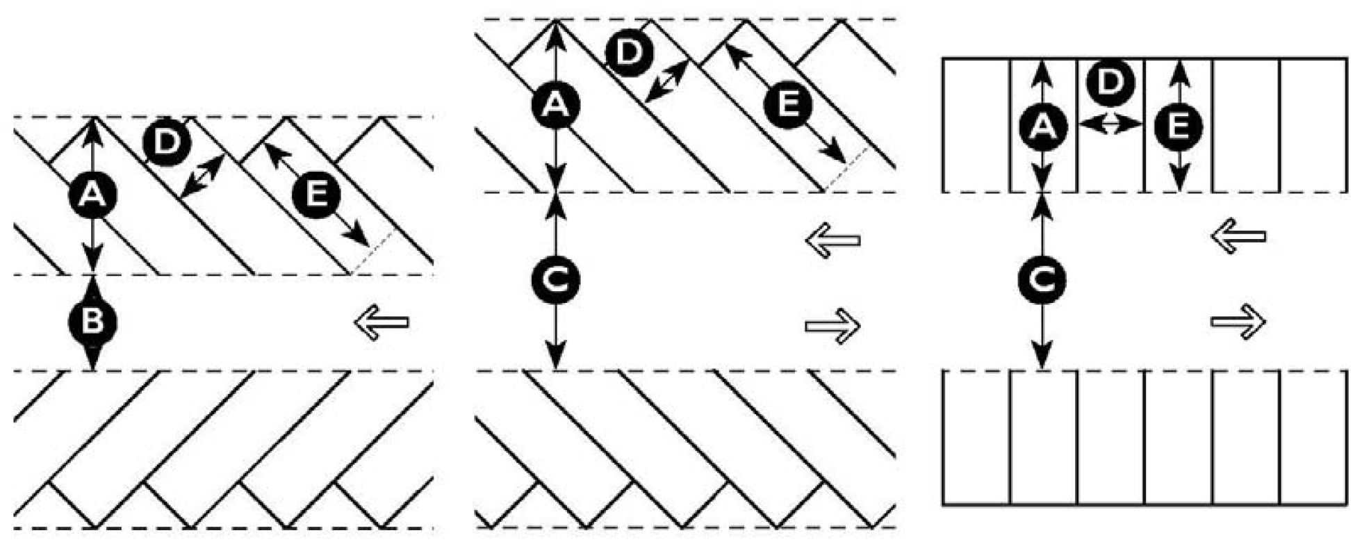
Sign Area Measurement. Sign area for all sign types is measured as follows:
a.
Sign copy mounted, affixed, or painted on a background panel or surface distinctively painted, textured, or constructed as a background for the sign copy, is measured as that area contained within the sum of the smallest rectangle(s) that will enclose both the sign copy and the background. See figure on the next page.
b.
Sign copy mounted as individual letters or graphics against a wall, fascia, mansard, or parapet of a building or surface of another structure, that has not been painted, textured, or otherwise altered to provide a distinctive background for the sign copy, is measured as a sum of the smallest rectangle(s) that will enclose each word and each graphic in the total sign. See figure on next page.
c.
Sign copy mounted, affixed, or painted on an illuminated surface or illuminated element of a building or structure, is measured as the entire illuminated surface or illuminated element, which contains sign copy. Such elements may include, but are not limited to, lit canopy fascia signs; spanner board signs; and/or interior lit awnings. See figure on next page.
d.
Multi-face signs are measured as follows:
(1)
Two face signs: if the interior angle between the two sign faces is 45 degrees or less, the sign area is of one sign face only. If the angle between the two sign faces is greater than 45 degrees, the sign area is the sum of the areas of the two sign faces. See figure on next page.
(2)
Three or four face signs: the sign area is 50 percent of the sum of the areas of all sign faces. Signs with greater than four faces are prohibited. See figure on next page.
2.
Sign Height Measurement. Sign height is measured as the vertical distance from the average elevation between the highest point and the lowest point of finished grade at the base of a sign to the top of the sign. Refer to sections 5.6.80 through 5.6.190 for height measurements by type of sign.
Figure 5.6.30.F: Sign Area for Signs on Background Panel and Signs with Individual
Letters
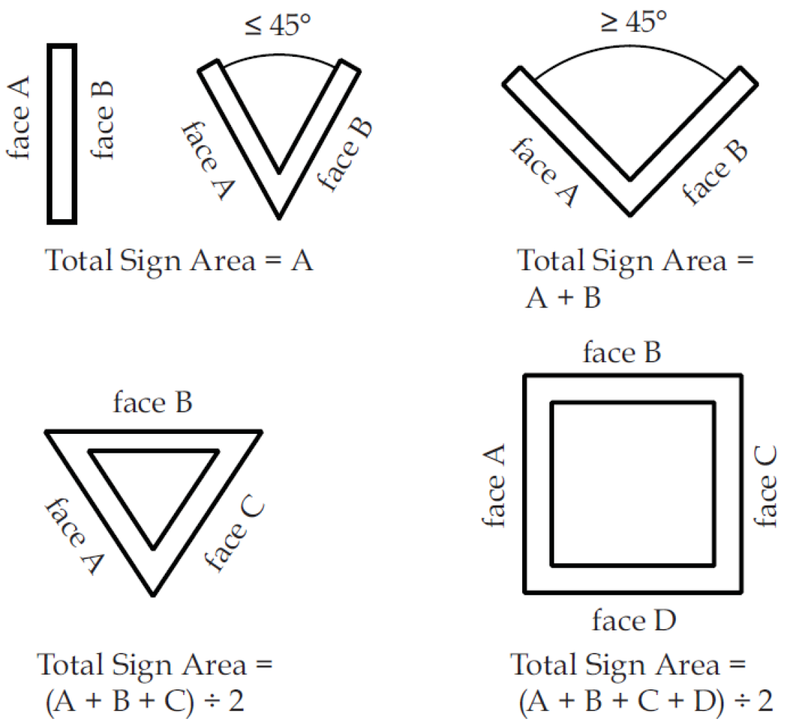
Figure 5.6.30.A: Sign Area for Multi-face Signs or Free Form Signs
G.
Materials.
1.
The finish materials to be used for signage throughout all districts shall be as follows:
a.
Wood: painted, stained, or natural;
b.
Metal: copper, brass, or galvanized steel;
c.
Stucco, tabby, or brick; or
d.
Any other material that is finished or painted and looks like wood.
2.
Monument signs shall be constructed of materials compatible with the overall design of a development and/or building. This includes the sign face materials as well as the sign foundation.
5.6.40 - Permanent Sign Types for Buildings, Businesses and Communities
A.
Table 5.6.40.A (Sign Types) establishes a variety of permanent sign types as well as the permitted zoning district for each type.
B.
All businesses and community types located in the County may choose to utilize a combination of the sign types permitted in Table 5.6.40.A (Sign Types) in accordance with the limitations prescribed in Table 5.6.40.B (Aggregate Sign Area).
| Table 5.6.40.A: Sign Types | |||
|---|---|---|---|
| Specific Sign Type | Illustration | Permit | Standards |
| Awning Signs: Awnings are a traditional storefront fitting and can be used to protect merchants' wares and keep storefront interiors shaded and cool in hot weather. | 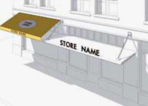 |  | 5.6.80 |
| Directional Signs: A wall-mounted or freestanding sign placed within 30 feet of an entrance to, or exit from, an establishment or parking location. | 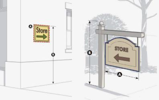 | 5.6.90 | |
| Landscape Wall Sign: A sign attached to a freestanding wall that forms a perimeter or buffer for a landscape feature. | 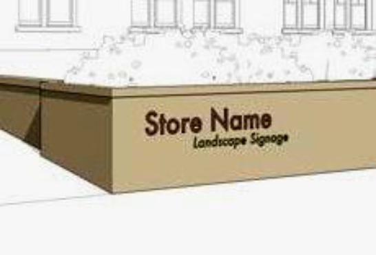 | 5.6.100 | |
| Marquee Signs: Marquee signs are vertical signs that are located either along the face where they project perpendicular to the facade; or at the corner of the building where they project at 45 degree angles. |  | 5.6.110 | |
| Freestanding Signs: Freestanding signs encompass a variety of signs that are not attached to a building and have an integral support structure. Three varieties include: Freestanding, Monument and Pole. | 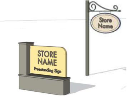 | 5.6.120 | |
| Projecting Signs: Projecting signs mount perpendicular to a building's facade. These signs are small, pedestrian scaled, and easily read from both sides. Syn. Blade Sign. |  |  | 5.6.130 |
| Key | |||
| Sidewalk Signs: Sidewalk signs provide secondary signage and may be used to announce daily specials, sales, or point to shops off the sidewalk (i.e., a shop located along a passageway). |  | 5.6.140 | |
| Suspended Signs: Suspended signs mount to the underside of beams or ceilings of a porch, gallery, arcade, breezeway or similar covered area. These signs are small, pedestrian scaled, and easily read from both sides. |  | 5.6.150 | |
| Wall Signs: Wall signs are signs flat against the facade consisting of individual cut letters applied directly to the building or painted directly on the surface of the building. |  |  | 5.6.160 |
| Wall Mural Signs: Wall mural signs are flat against the facade and are located on a secondary facade, typically along a side street, alley, or passageway. These signs are typically painted directly on the building and contain a combination of text and graphic elements. |  | 5.6.170 | |
| Window Signs: Window signs are professionally painted consisting of individual letters and designs, gold leaf individual letters and designs, applied directly on the inside of a window. |  | 5.6.180 | |
| Yard Signs: Yard signs are signs mounted on a porch or in a yard between the public ROW and the building facade. | 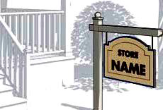 | 5.6.190 | |
| Key | |||
C.
Aggregate Sign Area. Table 5.6.40.B (Aggregate Sign Area) conveys standards regarding the maximum amount of signage permitted on a building, a lot, or as part of a community. In order to establish appropriate parameters, the sign types depicted in Table 5.6.40.A (Sign Types) are further classified as Building Attached or Building Detached signs. Depending upon the type and form utilized, Directional Signs and Yard Signs (indicated with an asterisk) may be characterized as either Building Attached or Building Detached signs.
1.
Building Attached sign types include:
a.
Awning Signs
b.
Canopy Signs
c.
Directional Signs*
d.
Marquee Signs
e.
Projecting Signs
f.
Sidewalk Signs
g.
Suspended Signs
h.
Wall Signs
i.
Wall Mural Signs
j.
Window Signs
k.
Yard Signs*
2.
Building Detached sign types include:
a.
Freestanding (Monument and Pole) Signs
b.
Directional Signs*
c.
Landscape Wall Signs
d.
Yard Signs*
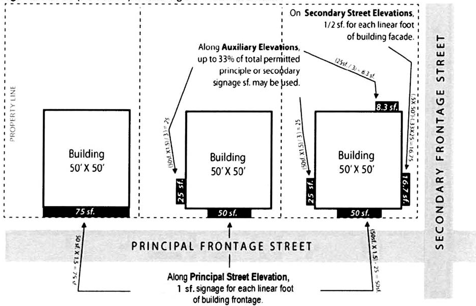
Figure 5.6.40.B: Aggregate Signage Standards for Building Attached Signs based on
a 50' x 50' Single-Tenant Building.
(Ord. No. 2015/20, 7-27-15; Ord. No. 2015/32, 11-9-15; Ord. No. 2016/18, 6-27-16; Ord. No. 2021/32, 7-26-21)
5.6.50 - Off-Premises Sign Standards
A.
Off-Premises Signs/Commercial Billboard Signs. New off-premises signs/commercial billboard signs are prohibited. Digital displays are prohibited on all off-premises signs/commercial billboard signs.
B.
Maintenance Standards For Off-Premises Signs. All off-premises signs must be structurally safe and maintained in a good state of repair, including, but not limited to, the following standards:
1.
The sign face must be maintained free of peeling, chipping, rusting, wearing and fading so as to be fully legible at all times.
2.
Commercial off-premises signs may be maintained only by painting or refinishing the surface of the sign face or sign structure so as to keep the appearance of the sign as it was when originally permitted. Minor modification to the sign face to improve hurricane safety, i.e. "hurricane frames" may be performed as long as the sign foundation is not included so as to improve the structural integrity of the billboard structure in the hurricane safety modification. Upon determination by the Code Enforcement Department and notice to the permittee that a sign has become dilapidated or structurally unsound, such sign shall be removed within 20 days, unless an appeal of such determination has been previously filed with the ZBOA. Such sign shall, thereafter, be removed within 20 days of disposition of such appeal in favor of the council, its agencies, departments, and/or officials. Any structural or other substantive maintenance to a sign shall be deemed an abandonment of the sign, shall render the prior permit void and shall result in removal of the sign without compensation. Costs and expenses of such removal shall be paid by the owner of such sign.
3.
Extension, enlargement, replacement, rebuilding, adding lights to an un-illuminated sign, changing the height of the sign above ground, or re-erection of the sign are prohibited.
4.
Any signs suffering damage in excess of normal wear cannot be repaired without:
a.
Notifying the Code Enforcement Department in writing of the extent of the damage, the reason the damage is in excess of normal wear, and providing a description of the repair work to be undertaken, including the estimated cost of repair; and
b.
Receiving written notice from the Code Enforcement Department authorizing the repair work. If the work authorization is granted, it shall be mailed to the applicant within 30 days of receipt of the information described in Subsection 5.6.50.E.4.a. of this section. Any such sign that is repaired without the department's authorization shall be removed by the County, and the costs and expenses of such removal shall be paid by that person or entity making the unauthorized repairs.
c.
If a sign is partially destroyed by wind or other natural forces, the Director must determine whether to allow the sign to be rebuilt. If the Director determines that the damage to the sign was greater than 50 percent of its replacement cost as of the time of the damage, the sign must be consistent with all current requirements of this chapter.
5.6.60 - Temporary Signs
A.
Allowed Sign Types. The following types of signs are classified as temporary signs:
1.
Special event signs which are in the nature of noncommercial advertising;
2.
Grand opening, going out of business and sale signs of businesses and services;
3.
Signs for work under construction;
4.
Land subdivision or development signs;
5.
Signs advertising the sale or lease of property upon which they are located; and
6.
Political signs.
a.
On private property along major corridors, freestanding political signs must be no closer than ten (10) feet from the highway right-of-way. Major corridors are US 21, US 17, US 278, SC 170, SC 802, SC 280, SC 46, SC 116, and SC 163. Sign placement on other roads may be placed on property lines.
b.
Political signs may be displayed or erected at any time within an election year. Political candidates are required to obtain a sign permit. All political signs must be removed within 48 hours after the election.
c.
If approval for placement within the state rights-of-way is granted to the political candidates, the candidates shall present the approval whenever they apply for the county permit.
d.
A single permit will allow each candidate to post an unlimited number of signs. Only the candidates whose name will appear on the ballot for an upcoming election may display signs.
e.
Impoundment of Political Signs. See Section 5.6.70.B.
B.
Area, Height, Location.
1.
Area. The total area of temporary signs shall not exceed 80 square feet.
2.
Height. The maximum height of temporary signs shall not exceed ten (10) feet measured from the highest part of any sign or supporting structure and existing ground level except special event promotional banners.
3.
Location. No off-premises temporary sign, except those identified in Subsections 5.6.50.A.5 shall be located nearer than 100 feet to any church, cemetery, public building, historic site or district and intersection of two or more public streets or highways.
C.
Time Limits on Erection.
1.
Special Event Signs. Special event signs may be erected no sooner than 30 days preceding a special event, and shall be removed within 48 hours following the special event. Temporary signs for special events shall be permitted for no more than 32 days at a time. The signs are limited to 4 times a calendar year per site for a total of 128 days.
2.
Grand Opening Signs. Grand opening signs shall be erected for a period not to exceed 30 days.
3.
Work Under Construction Signs. Work under construction signs pertaining to owners, architects, engineers, contractors, development agencies, financial institutions and the like may be erected on the construction site during construction and shall be removed within 30 days following completion of the project.
4.
Announcement of Subdivision of Land. Signs announcing the subdivision of land may be erected on the land being developed and shall be removed when 75 percent of the lots are conveyed or after two years, whichever comes first.
D.
Permits. Unless exempted in Subsection 5.6.10.B.4, temporary signs must be permitted in the same manner as permanent signs.
5.6.70 - Administration
A.
Display of Permit. All signs for which a permit has been issued shall be in compliance with the following:
1.
Display of Permit Tag. All permit tags issued for the erection of a sign shall be displayed on the sign and shall be readily visible.
2.
Relocation of Permit Tag. Under no circumstances may the permit tag be removed from one sign to another, nor may the sign to which it is attached be relocated to another location.
3.
Return of Permit Tag. If a sign is dismantled, removed or the ownership transferred, the permit tag shall be removed, returned to the Community Development Department and a new application made as appropriate.
4.
Lost or Illegible Permit Tag. If a permit tag is lost, defaced, destroyed or otherwise becomes illegible through normal wear or an act of vandalism, a new application shall be made to the Community Development Department.
B.
Impoundment of Signs.
1.
Signs Subject to Removal without Notice. The Code Enforcement Department shall have the authority to remove, without notice to the owners thereof, and impound for a period of ten days, signs placed within any street or highway right-of-way; signs attached to trees, fence posts, telephone and utility poles, or other natural features; and signs erected without a permit.
2.
Impoundment of Signs Erected without Permit, but Otherwise in Compliance. When a sign requiring a permit under the terms of this Division is erected without a Sign Permit, the Code Enforcement Department shall use the following procedure:
a.
Violation Sticker. The Code Enforcement Department shall issue a Notice of Warning to the owner of the sign that is in violation. The Notice of Warning shall include instructions to call the Code Enforcement Department immediately for permitting compliance.
b.
Failure to Obtain Permit. If the owner of the sign fails to contact the Code Enforcement Department, to bring the sign into conformance with this article and get a permit for the sign, the Code Enforcement Department shall have the sign removed and impounded without any further notice.
C.
Recovery and Disposal of Impounded Signs. The owner of a sign impounded may recover the sign upon the payment of $2.00 for each square foot of such impounded sign, prior to the expiration of the ten-day impoundment period. If it is not claimed within ten days, the Code Enforcement Department shall have authority to either discard or sell the sign.
5.6.80 - Awning/Canopy Sign Type
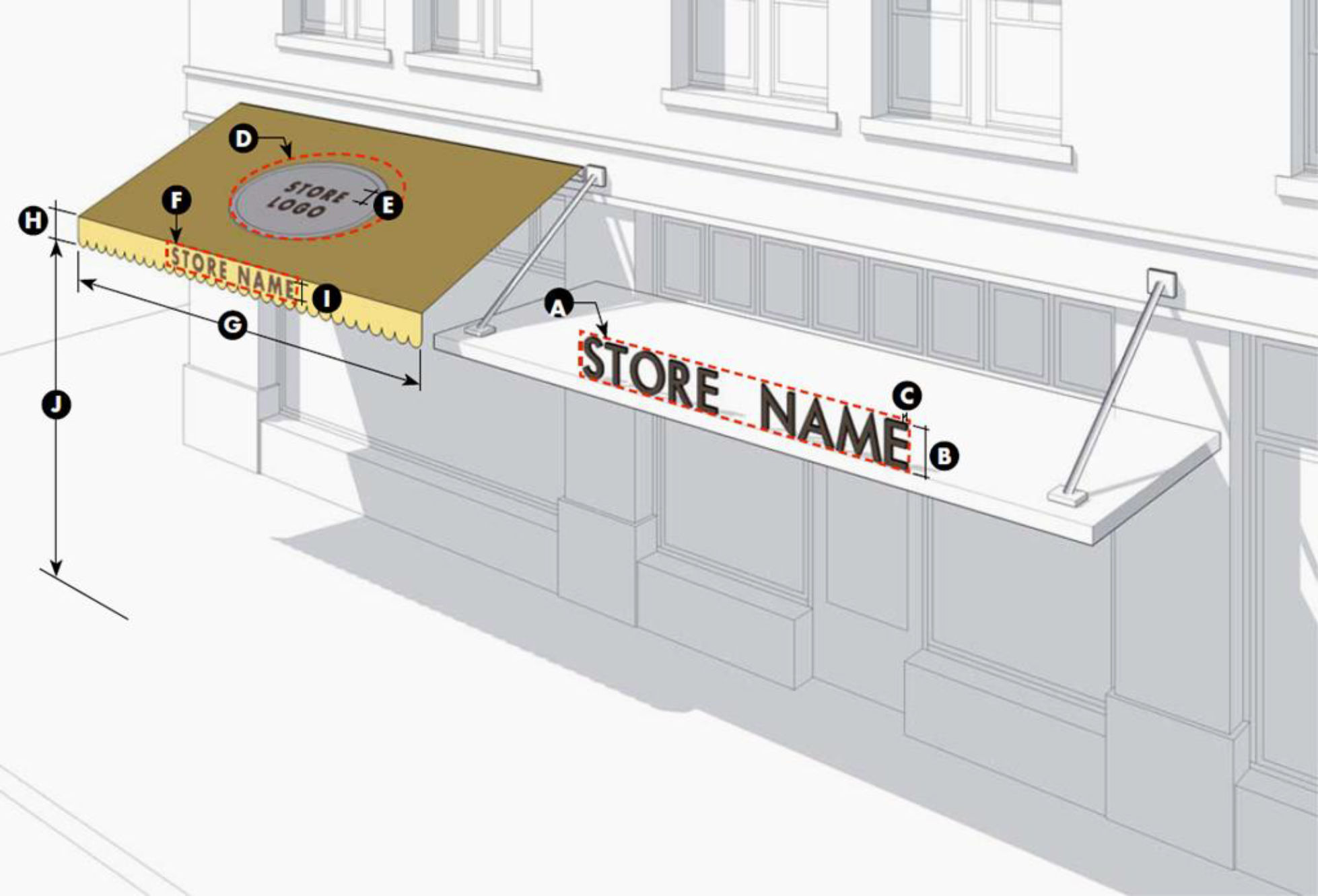
5.6.90 - Directional Sign Type
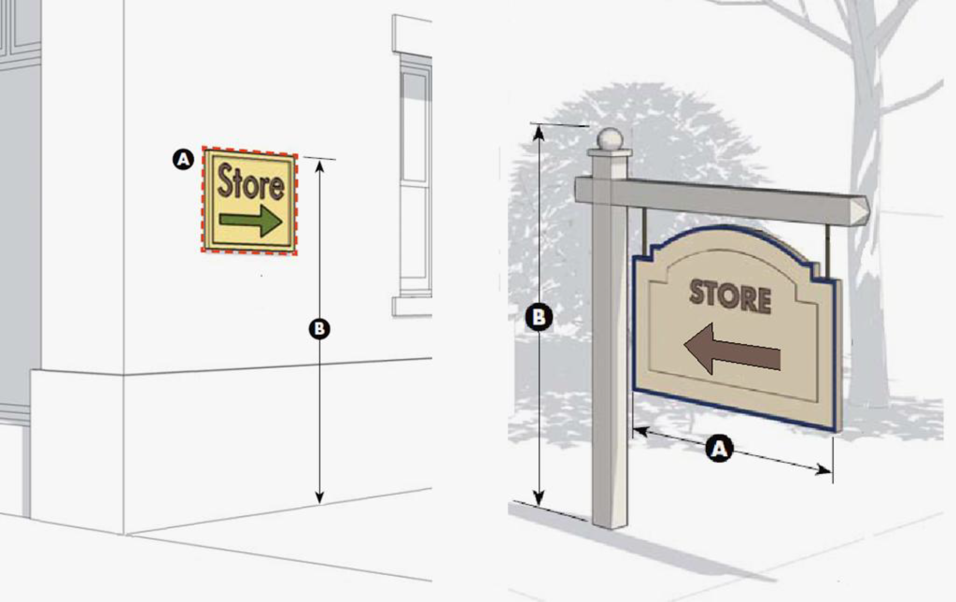
5.6.100 - Landscape Wall Sign Type
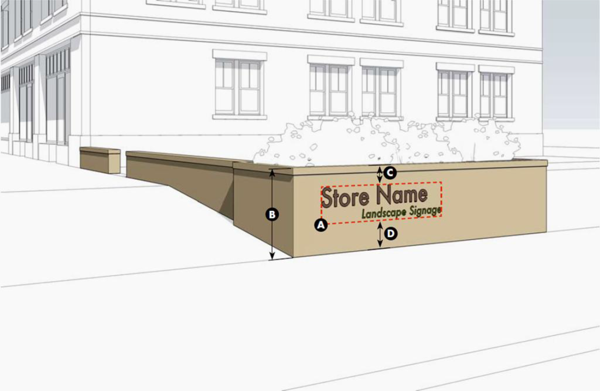
5.6.110 - Marquee Sign Type
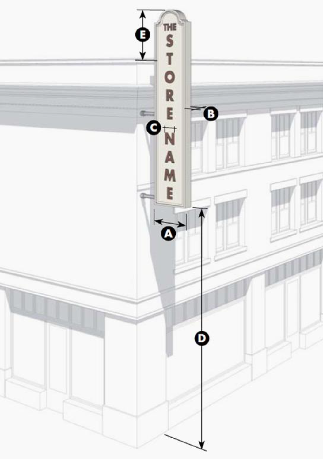
5.6.120 - Freestanding Sign Type

5.6.130 - Projecting Sign Type
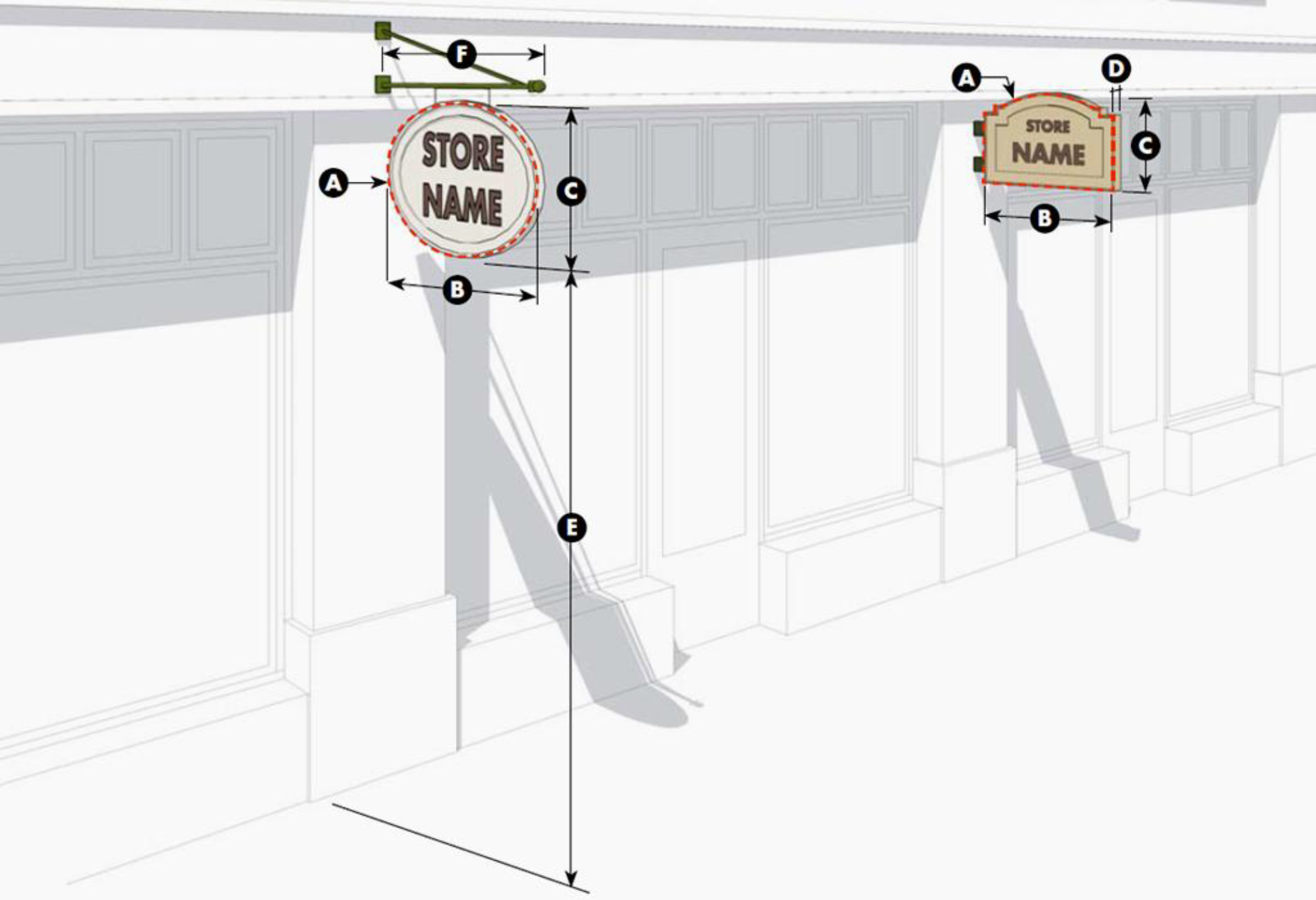
5.6.140 - Sidewalk Sign Type
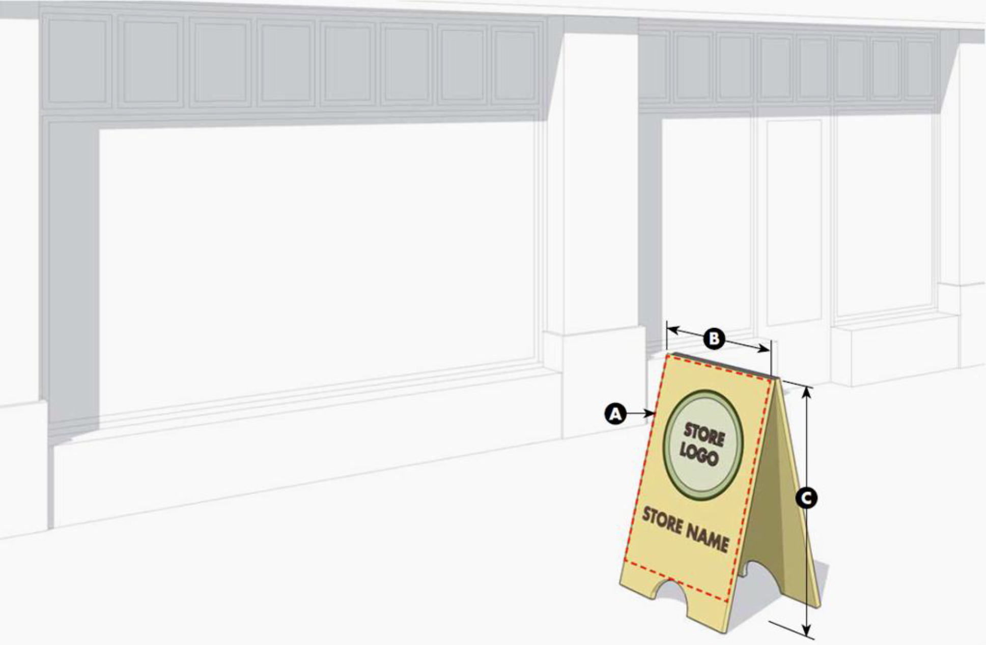
5.6.150 - Suspended Sign Type
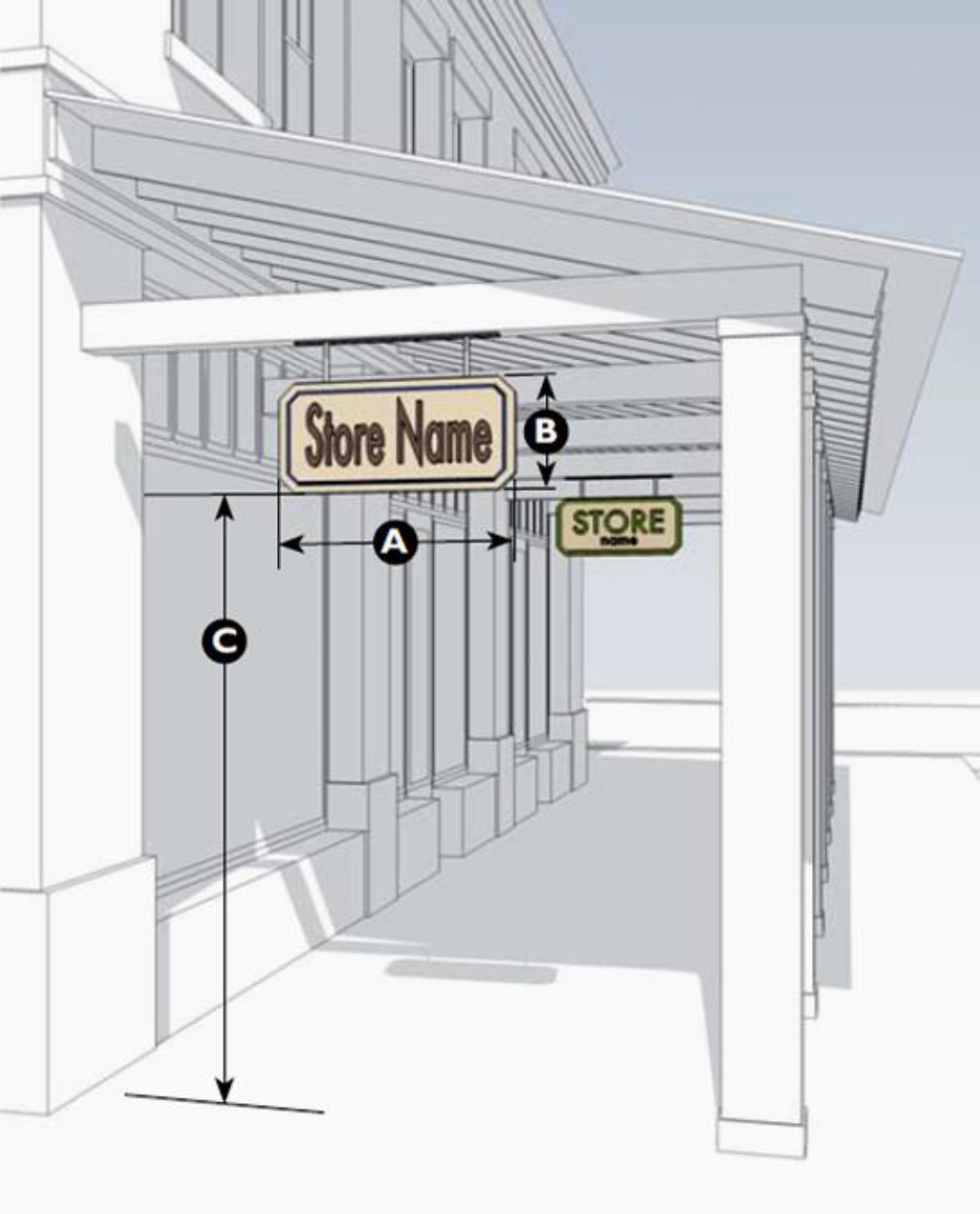
5.6.160 - Wall Sign Type
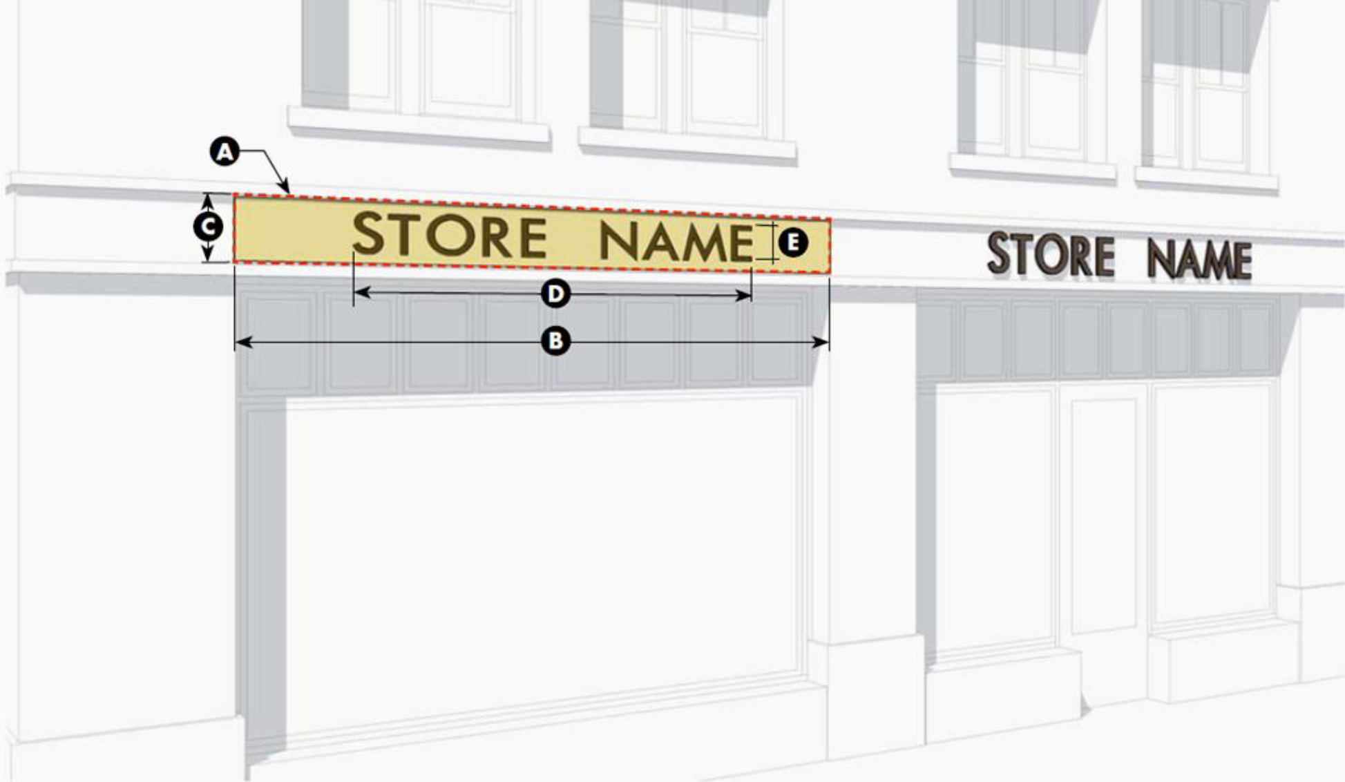
5.6.170 - Wall Mural Sign Type
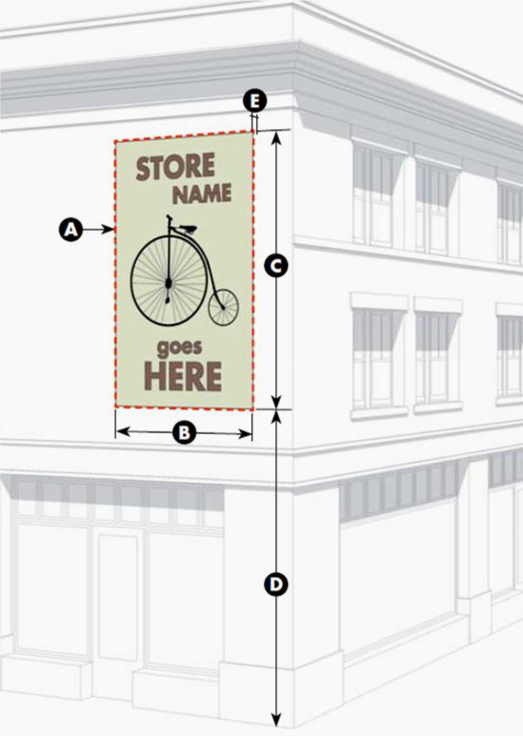
5.6.180 - Window Sign Type

5.6.190 - Yard Sign Type
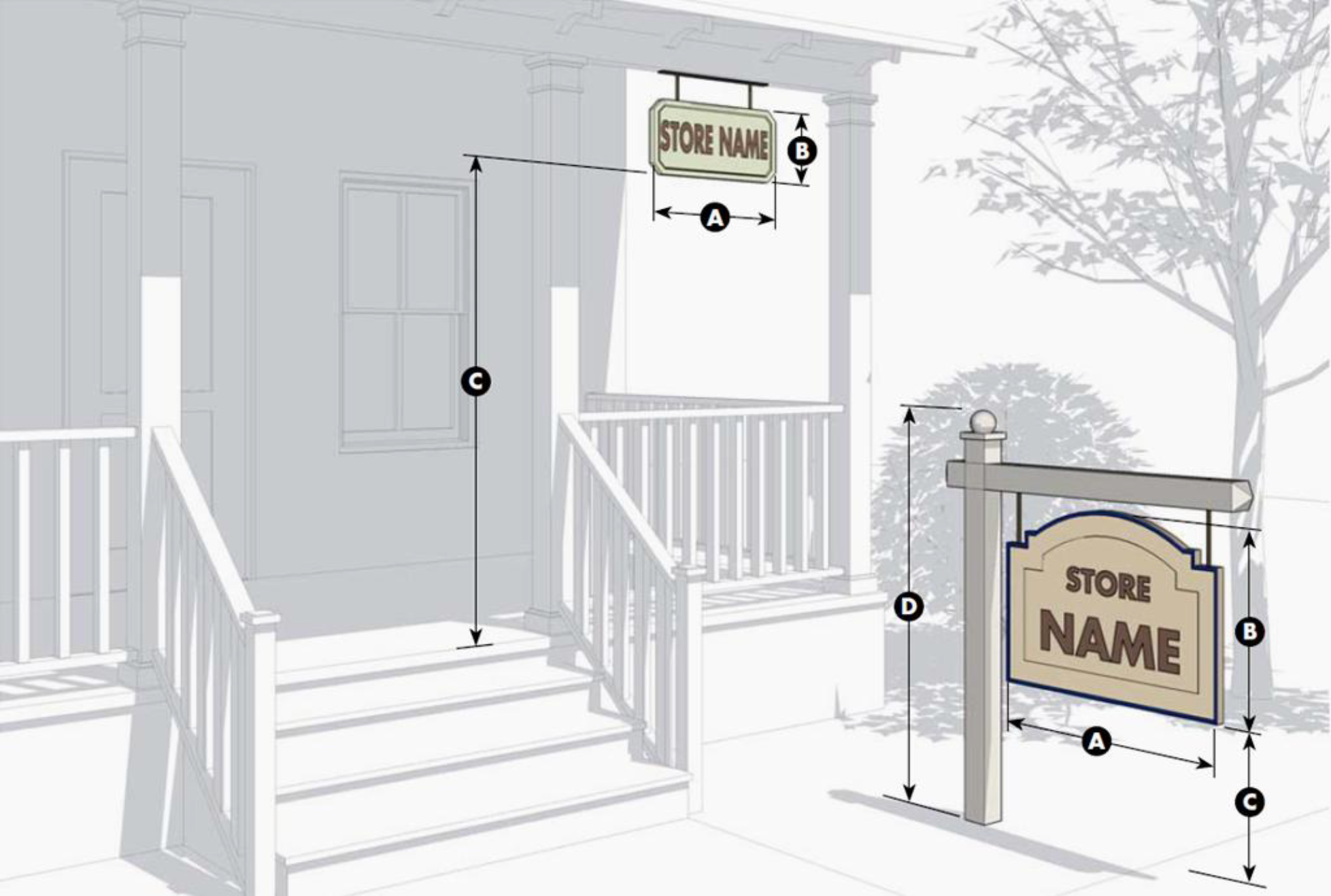
5.7.10 - Purpose
The purpose of this Section is to regulate exterior lighting to ensure the safety of motorists and pedestrians and minimize adverse impacts on adjacent properties. More specifically, this Section is intended to:
A.
Regulate Lighting. Regulate lighting to assure that excessive light spillage and glare are not directed at adjacent properties, neighboring areas, and motorists;
B.
Adequate On-Site Lighting. Ensure that all site lighting is designed and installed to maintain adequate lighting levels on-site while limiting negative lighting impacts on adjacent lands; and
C.
Provide Security. Provide security for persons and land.
5.7.20 - Applicability
A.
General. The provisions of this Section shall apply to all development in the unincorporated County unless exempted in accordance with Section 5.7.30 (Exemptions).
B.
Time of Compliance. A lighting plan may be submitted with an application for approval of a land development plan (minor or major), Special Use Permit, or Certificate of Design Compliance, whichever occurs first.
C.
Lighting on Public Thoroughfares. Standards for the placement, size, and type of lighting appropriate for public thoroughfares are set forth in Section 2.9 (Thoroughfare Standards).
5.7.30 - Exemptions
Single-family attached, single-family detached, and duplex homes are exempt from the exterior lighting standards of this Section with the exception of 5.7.40.A.6.
5.7.40 - Design Standards for Exterior Lighting
A.
General Standards.
1.
Exterior architectural, display and decorative lighting visible from the corridor shall be generated from a concealed light source with low-level fixtures.
2.
Any lighting fixture shall be of such design, so as to minimize the amount of ambient lighting perceptible from adjacent properties.
3.
In no case shall any lighting impair the vision of motorists.
4.
All interior lighting shall be so designed to prevent the light source or high levels of light from being visible from a public right-of-way.
5.
Entrances into developments from the street may be lighted for traffic safety reasons, provided such lighting is approved by the agency maintaining the roadway and does not exceed the applicable footcandle requirements specified in this Division or in conformance with the most current version of the American Association of State Highway and Transportation Officials (AASHTO) Roadway Lighting Guide.
6.
For all uses abutting barrier island beaches or dunes, the standards in Section 5.11.50.C apply.
7.
All exterior lighting shall maintain maximum illumination values of one-half (0.5) footcandles or less at lot lines adjacent to existing single-family dwellings;
8.
Strobe, flashing, blinking, pulsing, and revolving lights are prohibited.
B.
Light Fixtures.
1.
Any light fixture shall be a cutoff luminaire whose source is completely concealed with opaque housing and shall not be visible from any street. This provision includes lights on mounted poles, as well as architectural display and decorative lighting visible from the corridor.
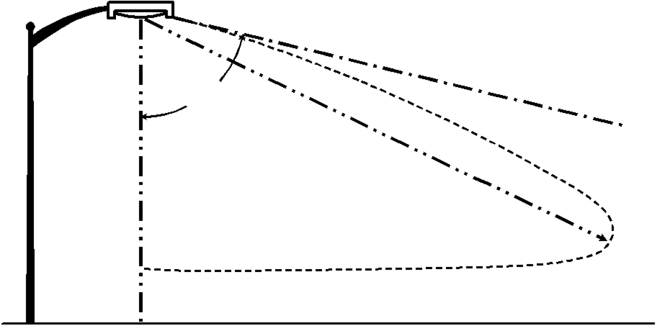
Figure 5.7.4.B: Luminaire with cutoff less than 90°
2.
Fixtures shall be mounted in such a manner that the cone of light is not directed at any property line of the site.
3.
Only incandescent, fluorescent, metal halide, LED, mercury vapor or color corrected high-pressure sodium light may be used. The same type of lighting must be utilized for all fixtures and light sources on the site.
4.
Only white or off-white (light yellow tones) may be used for any light source.
5.
Lighting poles may not exceed a height of 20 feet, except for outdoor sports fields or performance areas.
6.
Wall packs on buildings may be used at secondary entrances to a building to light unsafe areas. They are not intended to draw attention to the building or provide general building or site lighting. Wall packs on the exterior of the building shall be fully shielded (e.g., true cutoff type bulb or light source not visible from off-site) to direct the light vertically downward and have a light output of 1,000 lumens or less. Wall pack light sources visible from any location off the site are prohibited.
C.
Illumination Levels. All site lighting shall be designed so that the level of illumination measured in footcandles (FC) at any one point meets the standards below.
5.7.50 - Illumination of Outdoor Sports Fields and Performance Areas
Lighting of outdoor sports fields and performance areas shall comply with the following standards:
A.
Glare Control Package. All lighting fixtures shall be equipped with a glare control package (e.g., louvers, shields, or similar devices) and aimed so that their beams are directed and fall within the primary playing or performance area.
B.
Hours of Operation. The hours of operation for the lighting system for any game or event shall not continue more than one hour after the end of the game or event.
C.
Height of Fixtures. Light fixtures shall not exceed a height of 80 feet.
D.
Buffers Adjacent to Residential Properties. A landscaped buffer yard sufficient to prevent light and glare spillover to adjacent residential properties may be required by the Director.
5.7.60 - Sign Lighting
Lighting fixtures illuminating signs shall comply with the standards of Section 5.6.30.C, and such fixtures shall be aimed and shielded so that direct illumination is focused exclusively on the sign face and is not visible from off-site areas.
5.8.10 - Purpose and Intent
As Beaufort County's local population grows and development density increases in designated areas, it is the purpose of this Division to safeguard the County's natural sense of place and character through the preservation, protection and enhancement of the existing, natural and planted landscapes:
A.
Aesthetics and Walkability. These Landscaping Standards should enhance the aesthetic condition in our communities, along our thoroughfares, and in our public spaces by:
1.
Using landscape material to visually define the hierarchy of roadways, and to provide shade and a visual edge along roadways;
2.
Coordinating the public frontage with the private frontage;
3.
Preserving and protecting the aesthetic qualities that contribute to the County's unique character and the economy that such qualities attract;
4.
Providing visual screening, where appropriate; and
5.
Reducing visual pollution from the built environment and increasing privacy between incompatible uses.
B.
Health and Safety. These Standards should enhance the health, safety, and quality of life in our communities, along our thoroughfares, and in our public and private spaces by promoting the application of trees and landscaping to:
1.
Improve air quality;
2.
Mitigate audible noise from automobiles and land uses;
3.
Provide seasonal shade and temperature regulation;
4.
Limit glare created by exterior lighting;
5.
Provide a partial barrier between sidewalks and vehicular lanes; and
6.
Ensure the protection of residents and visitors from personal injury and property damage and protection of the County from property damage caused or threatened by the improper planting, maintenance, or removal of trees, shrubs, or other plants.
C.
Environment and Energy. These Landscaping Standards should provide ecological benefits at the regional, community, and lot level by:
1.
Conservation of energy used in buildings through strategic shading and wind breaks;
2.
Interception of precipitation by vegetative canopies;
3.
Preserving and protecting the water table and surface waters;
4.
Increasing the tree canopy to provide shade and moderate the effect of heat islands;
5.
Mitigating against erosion and sedimentation;
6.
Reducing stormwater runoff and the costs associated therewith; and
7.
Restoring soils and land disrupted as a result of construction or grading.
5.8.20 - Applicability
A.
Review for Compliance. Review for compliance with the standards of this Division shall occur during review of any of the following applications:
1.
Land Development Plan (Major and Minor). See Section 7.2.60 (Land Development Plan);
2.
Special Use Permit. See Section 7.2.130 (Special Use Permit);
3.
Subdivision (Major and Minor). See Section 7.2.70 (Subdivision); or
4.
Certificate of Design Compliance, if the development is located outside a transect zone district. See Section 7.2.110 (Certificate of Design Compliance).
B.
Requirements for Single-Family Residential and Duplex Lots. New single-family residential and duplex lots that are 10,800 square feet or less shall require the planting or preservation of at least two overstory trees in all districts except T4. In the T4 districts, at least one overstory tree is required.
C.
Landscape Plan Required. To ensure compliance with the standards of this Section, a landscape plan demonstrating how existing and proposed landscaping and tree protection complies with the requirements of this Section on a development site shall be included as a part of any application listed in Subsection A above.
D.
Landscape Plan Modulation.
1.
Criteria. Modulation of the Landscape Plan may be approved by the Director if it is determined that a deviation from the landscaping standards in this Section is justified because of site or development conditions that make compliance with such standards impossible or impractical. Such conditions include:
a.
Natural conditions, such as rivers, streams, wetlands, or other topography;
b.
The likelihood that landscaping material would be ineffective at maturity due to topography, placement, or other existing site conditions;
c.
Lot size or configuration;
d.
The presence of utilities, public easements or rights of way;
e.
The potential for interference with public safety; and
f.
Any other situation in which the Director determines that strict adherence to the standards of this Division is inconsistent with the Purpose and Intent of this Division, and/or inconsistent with the goals of the Comprehensive Plan.
2.
Permitted Modulation. Allowable modulation from the standards of this Division shall be determined by the Director. These include, but are not limited to:
a.
An adjustment to planting locations, and/or
b.
A reduction in the type or total number of required caliper inches, and/or
c.
A reduction in the count, spacing, or species diversity standards.
5.8.30 - General Landscape Design Applicable to All Zones
New plantings provided in accordance with this Division shall comply with the following standards:
A.
General.
1.
Plant Types. Plantings are grouped into six types: Overstory trees, understory trees, evergreens, shrubs, grasses, and ground cover.
2.
Document Existing Vegetation. Type, size, and limits of existing vegetation shall be identified on the landscape plan.
3.
Definitions. The following definitions shall apply when determining both the size and number of plantings necessary to fulfill the requirements of this Division:
a.
ACI or Aggregate Caliper Inches - A measure of the total combined number of inches of existing and proposed trees used to meet landscaping requirements.
b.
Caliper - Diameter of the trunk measured six inches above the ground for trees up to and including four-inch diameter, and measured 12 inches above the ground for larger trees. This measurement is used for proposed or nursery-grown trees.
c.
DBH or Diameter at Breast Height - The diameter (in inches) of the trunk of a tree (or, for multiple trunk trees, the aggregate diameters of the multiple trunks) measured 4 ½ feet from the existing grade at the base of the tree. This measurement is used for existing trees.
B.
Existing Landscape Preservation.
1.
Preservation of existing trees and vegetation is the preferred means of landscaping.
2.
No vegetation may be removed from required buffers without approval of a re-vegetation plan unless dead, diseased, or listed as an invasive species in Table 5.11.100.C of this ordinance.
3.
In order to provide appropriate screening, buffering, wildlife habitat, and/or linkages to wildlife habitat, priority shall be given to preserving and protecting:
a.
Healthy specimen trees.
b.
Masses of smaller, healthy trees.
c.
Understory vegetation and trees in open spaces and natural resources areas.
C.
Minimum Plant Size at Time of Planting.
1.
Overstory Trees. At the time of planting, overstory trees shall have a caliper of at least two and one half inches, as determined in the American Standard for Nursery Stock, ANSI Z60.1-2004, as amended.
2.
Understory Trees. At the time of planting, understory trees shall have a caliper of at least one and one-half inches as determined in the American Standard for Nursery Stock, ANSI Z60.1-2004, as amended.
3.
Large Shrubs. Large deciduous or evergreen shrubs shall meet the minimum standards of a seven (7) gallon nursery container as required by the American Standard for Nursery Stock standards.
4.
Small Shrubs. Small deciduous and evergreen shrubs shall meet the minimum standards of a three (3) gallon nursery container as required by the American Standard for Nursery Stock standards.
5.
Grasses. Grasses shall meet the minimum standards of a three (3)-gallon nursery container as required by the American Standard for Nursery Stock standards.
6.
Groundcovers. Groundcovers shall meet the minimum standards of a one (1) gallon nursery container as required by the American Standard for Nursery Stock standards.
7.
Where an Aggregate Caliper Inch (ACI) requirement is utilized to derive the required amount of landscaping or tree cover, and the ACI figure includes a fraction, the applicant may:
a.
Utilize a tree or trees with a caliper inch measurement exceeding the minimum size at planting standard to meet the required ACI.
b.
Round the ACI figure upwards until the figure corresponds with a whole number of trees meeting the minimum size at time of planting standard.
D.
Plant Materials.
1.
All landscape plant materials shall conform to the latest version of the American Standard of Nursery Stock (ANSI Z60.1, as amended).
2.
The use of indigenous, drought tolerant vegetation shall be encouraged and utilized whenever practicable.
E.
Plant Location.
1.
Utility and Easement Plantings. Without the consent of the utility provider, easement holder, or Beaufort County, nothing but groundcover may be planted or installed within any underground or overhead utility, drainage, or gas easement, or within three feet of a fire protection system. Should the necessary parties consent , an agreed upon Landscaping Plan may be enacted in which understory trees, shrubs, grasses and ground covers are installed in a manner that supports the Purpose and Intent of this Division.
a.
Power lines. No street or overstory trees shall be planted if, upon maturation, the height and spread of the tree will encroach within five feet of the utility line.
b.
Sewer, Gas, and Water Lines. Tree species whose roots are known to cause damage to sewer, gas, and water lines shall not be planted closer than 12 feet to such public utilities unless the tree root system is completely contained with a barrier or is otherwise approved by the utility provider or Director.
c.
Fire Hydrants. No planting except ground cover less than six inches in height shall be installed within three feet of any fire hydrant or fire protection system.
2.
Trees.
a.
All planted trees shall maintain a minimum distance of four feet from the curb, sidewalk, and impervious pavement; except for:
(1)
Street Trees planted in a tree well or continuous planter, which may be sited a minimum distance of three feet from walkways, curbing, and other impervious pavements.
(2)
Street trees planted in a continuous swale, which may be sited a minimum distance of four feet from walkways, curbing, and other impervious pavements.
b.
Permitted street-tree species can be found in Article 2.9 (Thoroughfare Standards), Table 2.9.80.G (Public Planting).
c.
Tree spacing and arrangement for the thoroughfare planter and center median can be found in Article 2.9 (Thoroughfare Standards), Table 2.9.80.E (Public Frontage Types), and Table 2.9.80.F (Public Frontage Standards).
(1)
Tree spacing and arrangement in the planter and center median shall be coordinated with the appropriate agency.
(2)
If a thoroughfare calls for a planter and median that consists of "naturalistic clusters" of trees (as opposed to a "regularly spaced allee" of trees), then groundcover and shrubs shall be installed in the center median as part of the clustered arrangement; ideally providing for a semi-continuous planting of at least 50 percent. The remaining 50% may be groundcover, shrubs and/or turf grass.
d.
All trees shall be planted such that, upon maturation, maximum height and spread shall not encroach within five feet of overhead power lines, street lights, or similar public infrastructure.
F.
Plant Diversity. In order to remain contextual with the natural and built environment, prevent tree monocultures, and curtail the spread of disease or insect infestation in a plant species, new tree plantings shall comply with the following standards in Table 5.8.30.F (Tree Diversity Standards) below.
G.
Ground Stabilization. Disturbed areas and required landscape planting areas shall be stabilized and maintained with lawn, ground covers, mulches, or other approved materials to prevent soil erosion and allow rainwater infiltration.
H.
Berms. Berms shall not serve as an alternative to landscape and are generally discouraged. However, there may be cases where berms are appropriate in order to screen adjacent areas of negative visual, auditory, or hazardous impact. In such cases, berms shall comply with the following:
1.
Berms shall have a slope not exceeding a horizontal to vertical ratio of two to one, a top width at least one-half the berm height, and a height at least eight feet above the toe of the berm.
2.
All berms, regardless of size, shall be stabilized with overstory trees, understory trees and shrubs. In additional to these plants, ground cover and grasses may be utilized.
3.
Berms proposed to be placed along street rights-of-way shall be designed and constructed to provide adequate sight distances at intersections and shall not impair safe operation of vehicles.
4.
In no case shall berms damage the roots or trunks of existing healthy vegetation designated to be preserved, as determined by an arborist.
I.
Stormwater Integration. These provisions are intended to encourage low impact stormwater tools used for the channeling, storage, and filtration of water (See Division 5.12 ( Stormwater Standards)) to be located and configured as landscaping amenities within a development site, while also contributing to required Civic and Open Space set-aside requirements (See Article 2.8 (Civic and Open Space Types)).
1.
Irrigation ponds, stormwater detention ponds, and stormwater retention ponds shall be integrated landscape features rather than single-purpose flood control and stormwater management ponds.
2.
Irrigation, stormwater detention, and stormwater retention ponds are considered to be a site amenity when they:
a.
Are integrated with the design and location of other site features, as opposed to being isolated in a peripheral location;
b.
Avoid the use of fencing;
c.
Include shrubs, native grasses, groundcovers and trees as a minimum coverage of 50% of the stormwater feature's slopes and a minimum ten (10) foot area from the top of slope to the landward side of the feature. Plants in basin areas prone to submersion shall be hydrophilic. Adjacent areas may be vegetated with turf grass;
d.
Provide pedestrian access such as pathways and seating to and around the facility, where practicable;
e.
Maintain gentle slopes of 3:1 or less in the area around the facility;
f.
Are configured to avoid sharp drop-offs within three feet of the average water line.
3.
Rain gardens and bioswales. Rain gardens and bioswales may be installed to infiltrate runoff from parking lots, streets, civic spaces and other impervious surfaces.
a.
In order for a rain garden or bioswale to count as an open space set-aside the site must comply with the requirements established in Section 2.8.60 (Ownership of Set-Asides) and Section 2.8.70 (Maintenance of Set-Asides).
b.
A rain garden or bioswale that is integrated into, or part of, a larger storm water system shall adhere to the standards of Division 5.12 (Stormwater Standards).
4.
Roof Garden/Green Roof. A roof garden/green roof is a specific type of community garden in which buildings are equipped with roofs of shallow four-inch soils and drought tolerant plants. Buildings approved for intensive roof gardens may hold soils deeper than four inches and larger plants and trees.
a.
In order for a roof garden to count as an open space set-aside the site must be accessible to all occupants of the building and comply with the requirements established in Article 2.8, including Section 2.8.60 (Ownership of Set-Asides) and Section 2.8.70 (Maintenance of Set-Asides).
b.
A roof garden/green roof that is integrated into, or part of, a larger stormwater system shall adhere to the standards of Division 5.12 (Stormwater Standards).
5.
Cisterns. Cisterns may be used to capture and re-circulate stormwater from buildings.
5.8.40 - Overview of On-Lot Landscaping and Buffer Requirements
A.
Overview. Table 5.8.40.A below provides an overview of landscaping requirements within transect zones and conventional zones.
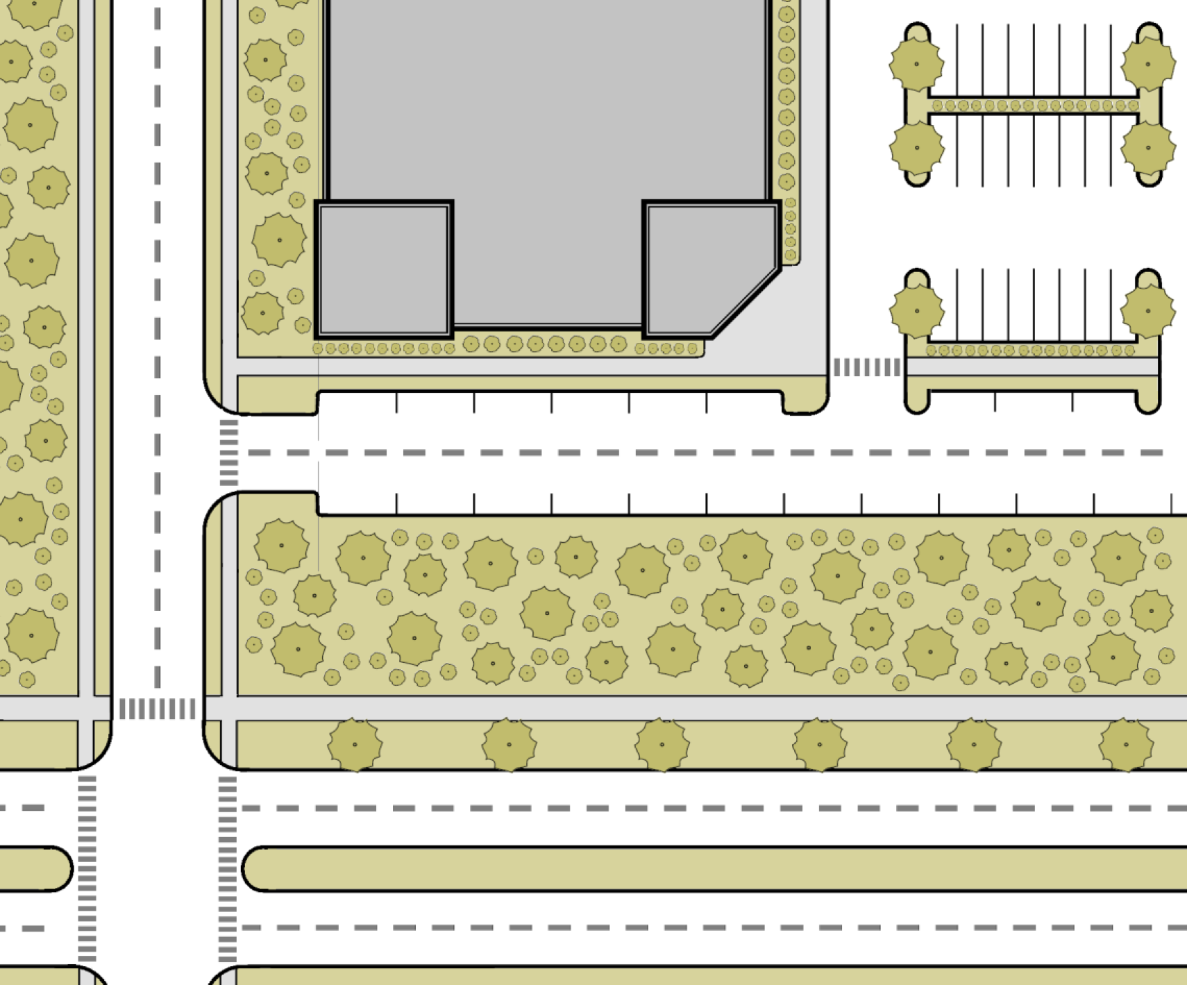
5.8.50 - Thoroughfare Buffer
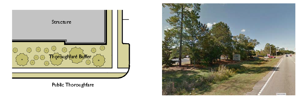
5.8.60 - Foundation Buffer
| Table 5.8.60 Foundation Buffer |
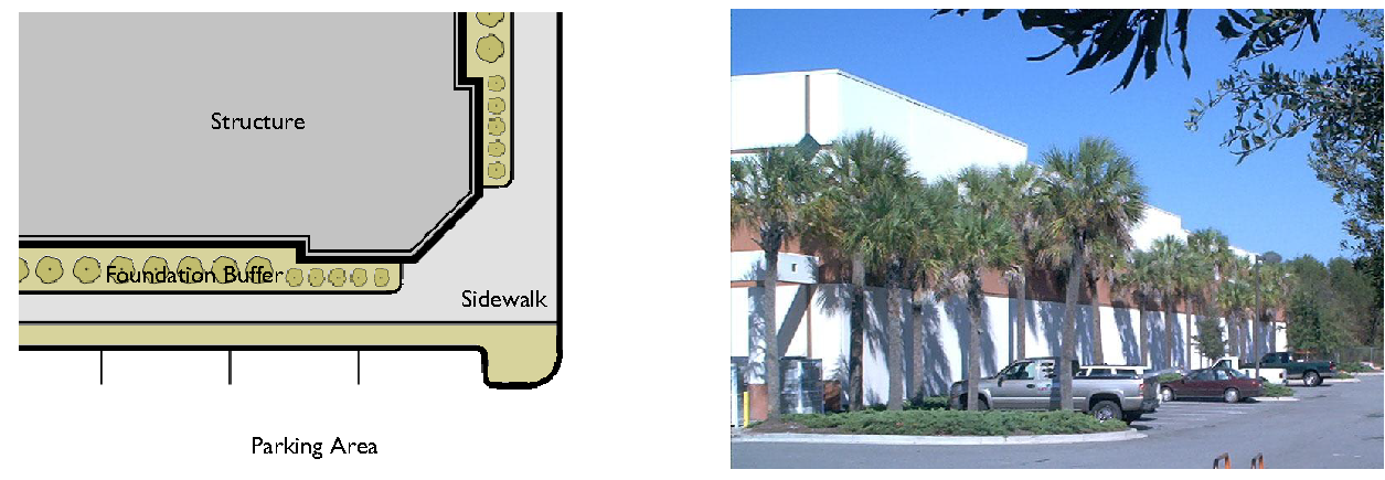 |
5.8.70 - Private Frontage Landscaping (Transect Zones)
| Table 5.8.70 Private Frontage Landscaping (Transect Zones) |
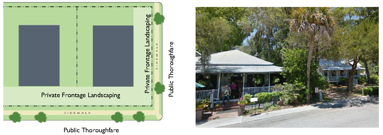 |
5.8.80 - Parking Area Landscaping
| Table 5.8.80.A Tree Islands |
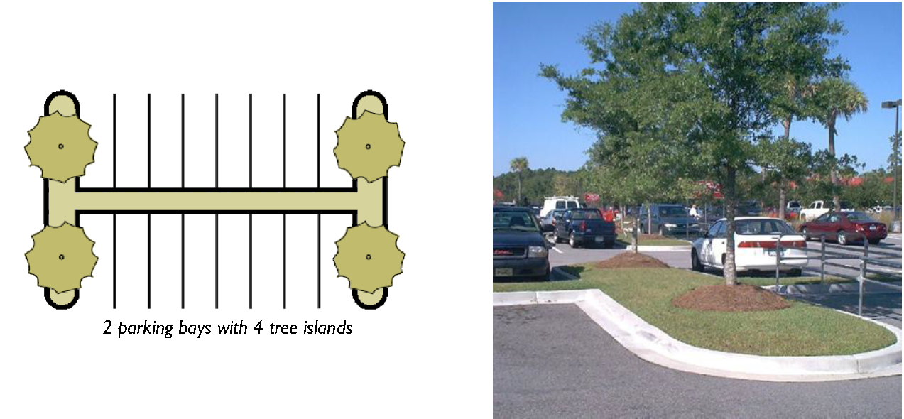 |
| Table 5.8.80.B Landscape Medians |
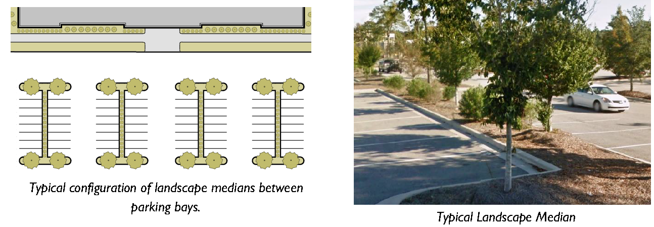 |
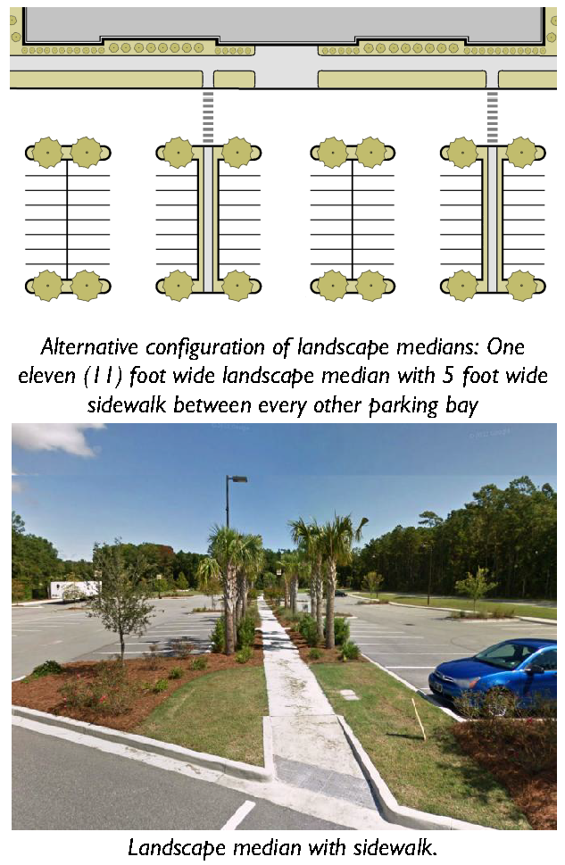
| Table 5.8.80.C Parking Lot Perimeter Landscape Strips |
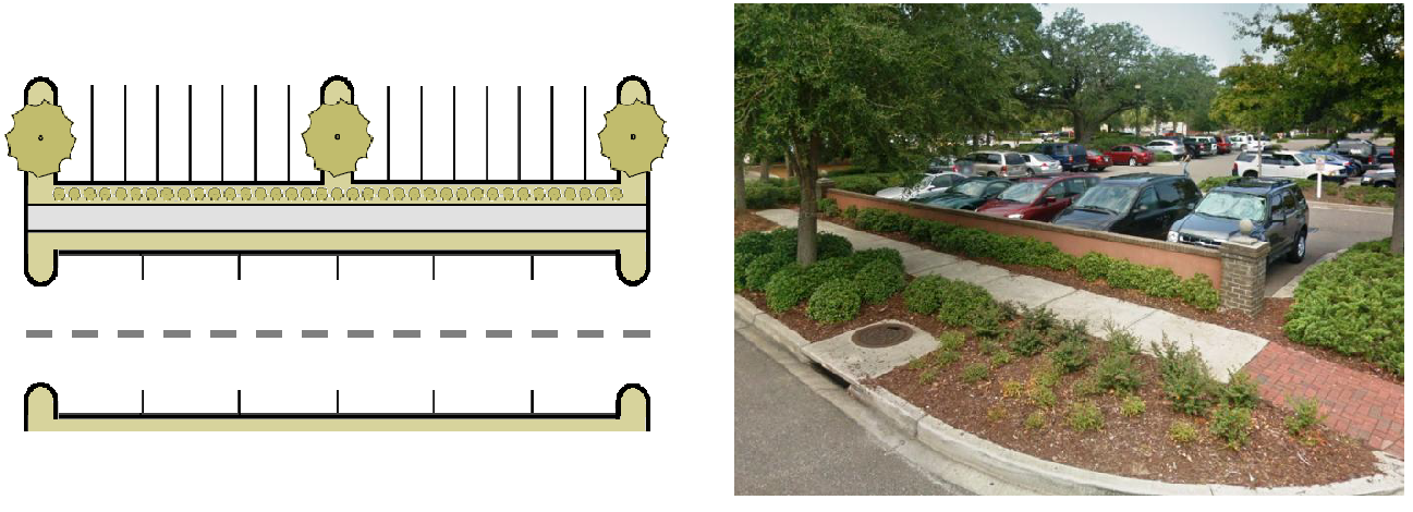 |
5.8.90 - Perimeter Buffers
A.
Purpose. Perimeter Buffer standards are primarily intended to mitigate potential negative effects of contiguous uses in different zones.
B.
Applicability. Development within Conventional Zones, Community Preservation Districts (Appendix A) and T2 Rural shall provide a perimeter buffer in accordance with Table 5.8.90.D (Perimeter Buffer Types), and Table 5.8.90.F (Perimeter Buffer Type Application).
C.
Plantings. Perimeter Buffers shall be comprised of native shrubs and trees only.
D.
Types of Perimeter Buffers. Table 5.8.90.D (Perimeter Buffer Types) describes five different types of buffers in terms of their function, opacity, width, and planting requirements. Where a particular perimeter buffer type is required in Table 5.8.90.F (Perimeter Buffer Type Application), the requirement may be met with the combination of minimum buffer width and minimum screening requirements specified under either Option 1 or Option 2. The option used shall be designated on the land development plan or subdivision for the development, as appropriate. Where an option utilizing a berm or fence is selected, the berm or fence shall comply with the standards of Subsection 5.8.30.H (Berms), or Division 5.4 (Fences and Walls), as appropriate.
E.
Integration of Conventional Communities. Single-Family Oriented Communities, Multi-family Oriented Communities, and Commercial Oriented Communities are encouraged to engage and integrate with surrounding development whenever practicable. Perimeter buffer requirements may be waived in cases where proposed lots and/or perimeter buildings will front outward onto (or toward) an existing public or private street.
| Type A: Basic | |
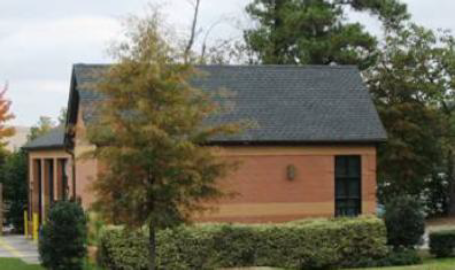 | |
| Description | |
| This perimeter buffer functions as a basic edge demarcating individual properties with a slight visual obstruction from the ground to a height of ten (10) feet. | |
| Width 1,2 | |
| Minimum Buffer Width | 10 feet |
| Plant Requirements (per 100 linear feet) | |
| Overstory Trees | 2 ACI minimum |
| Understory Trees 3 | 10 ACI minimum |
| Shrubs | 15 shrubs minimum |
 | |
| Type B: Aesthetic | |
| |
| Description | |
| This perimeter buffer functions as an intermittent visual obstruction from the ground to a height of at least twenty feet, and creates the impression of spatial separation without eliminating visual contact between uses. | |
| Option 1 | |
| Width 1,2 | |
| Minimum Buffer Width | 20 feet |
| Plant Requirements (per 100 linear feet) | |
| Overstory Trees | 8 ACI minimum |
| Understory Trees 3 | 10 ACI minimum |
| Shrubs | 15 shrubs minimum |
| Option 2 | |
| Width 1,2 | |
| Minimum Buffer Width | 10 Feet |
| Plant Requirements (per 100 linear feet) | |
| Overstory Trees | 2 ACI minimum |
| Understory Trees 3 | 14 ACI minimum |
| Shrubs | 35 shrubs minimum |
| Type C: Semi-Opaque | |
 | |
| Description | |
| This perimeter buffer functions as a semi-opaque screen from the ground to at least a height of six feet. | |
| Option 1 | |
| Width 1,2 | |
| Minimum Buffer Width | 20 Feet |
| Plant Requirements (per 100 linear feet) | |
| Overstory Trees | 12 ACI minimum |
| Understory Trees 3 | 14 ACI minimum |
| Shrubs | 25 shrubs minimum |
| Option 2 | |
| Width 1,2 | |
| Minimum Buffer Width | 10 Feet |
| Plant Requirements (per 100 linear feet) | |
| Overstory Trees | 2 ACI minimum |
| Understory Trees 3 | 16 ACI minimum |
| Shrubs | not required |
| Additional Requirements | |
| One 4-foot high berm or one 4-foot high solid fence. | |
| Berms shall comply with the standards in Subsection 5.8.30.H (Berms), and fences shall comply with the standards in Division 5.4 (Fences and Walls). | |
| Type D: Opaque | |
 | |
| Description | |
| This perimeter buffer functions as an opaque screen from the ground to a height of at least six feet. This type of buffer prevents visual contact between uses and creates a strong impression of total separation. | |
| Option 1 | |
| Width 1,2 | |
| Minimum Buffer Width | 20 feet |
| Plant Requirements (per 100 linear feet) | |
| Overstory Trees | 18 ACI minimum |
| Understory Trees 3 | 20 ACI minimum |
| Shrubs | 55 shrubs minimum |
| Option 2 | |
| Width | |
| Minimum Buffer Width | 10 feet |
| Plant Requirements (per 100 linear feet) | |
| Overstory Trees | 12 ACI minimum |
| Understory Trees 3 | not required |
| Shrubs | not required |
| Additional Requirements | |
| One 6-foot high solid fence. | |
| Fences shall comply with the standards in Division 5.4 (Fences and Walls). | |
| Type E: Significant | |||
 | |||
| Description | |||
| This perimeter buffer functions as a significant fully-opaque separation from the ground to a height of at least eight feet. This type of buffer prevents visual and auditory contact between incompatible uses and creates complete separation. | |||
| Width 1 | |||
| Buffer Width | 50 Feet | ||
| Plant Requirements (per 100 linear feet) | |||
| Overstory Trees | 24 ACI minimum | ||
| Understory Trees 3 | 30 ACI minimum | ||
| Shrubs | 55 shrubs minimum | ||
| Additional Requirements | |||
| Existing trees and vegetation may not be removed unless dead, diseased, or listed as an invasive species for the Beaufort County area by the South Carolina Department of Natural Resources or in Table 5.11.100.C of this ordinance. | |||
| Notes | |||
| 1 Any required perimeter buffer can be reduced to five feet with the provision of a solid masonry wall at least five feet in height, along with ten large shrubs per 100 linear feet. | |||
| 2 Perimeter buffer widths (but not vegetation amounts) for perimeter buffer types A, B, C, and D may be reduced in accordance with Section 7.2.30 (Modulation Permit). | |||
| 3 Where and adjacent use is designed for solar access, understory trees can be substituted for canopy trees. | |||
F.
Perimeter Buffer Type Application. Table 5.8.90.F (Perimeter Buffer Type Application) specifies the type of perimeter buffer that is required between a proposed development and adjacent property, based on the proposed use type on the development site and the existing use type on the abutting property or the zone district in which abutting vacant property is located. The perimeter buffer standards do not apply in the transect zones, except for T2 Rural. The buffer type is indicated by a letter corresponding to one of the four buffer types depicted in Table 5.8.90.D (Perimeter Buffer Types).
G.
Development Abutting Existing Perimeter Buffer. Where a developing parcel abuts an existing use and application of a perimeter buffer is required by Table 5.8.90.D (Perimeter Buffer Types), the developing parcel shall provide the entire minimum perimeter buffer width and screening required by Table 5.8.90.D (Perimeter Buffer Types), unless a portion or all of a perimeter buffer that complies with the standards of this Section already exists between the parcels. Where such an existing perimeter buffer does not fully comply with the width and screening standards for the required perimeter buffer type, the developing parcel shall be responsible for providing all the additional perimeter buffer width and planting material necessary to meet the standards of this Section.
H.
Location of Perimeter Buffer. Perimeter buffers required by this Section shall be located along the outer perimeter of the parcel and shall extend to the parcel boundary line or right-of-way line; however, the perimeter buffer may be located along shared access easements between parcels in nonresidential development.
I.
Development within Required Perimeter Buffers.
1.
The required perimeter buffer shall not contain any development, impervious surfaces, or site features (except fences or walls) that do not function to meet the standards of this Section unless otherwise permitted in this Development Code.
2.
No vegetation or tree removal, or other construction activities shall occur within perimeter buffers.
3.
Sidewalks, trails, and other elements associated with passive recreation may be placed in perimeter buffers with approval by the Director if all required landscaping is provided and damage to existing vegetation is minimized, to the maximum extent practicable.
4.
Overhead and underground utilities required or allowed by the County are not permitted in perimeter buffers except where they are perpendicular to the perimeter buffer.
J.
Natural Vegetation. Perimeter buffers shall be maintained in their naturally vegetated condition to the maximum extent practicable, while complying with the standards of this Section. Species identified as invasive shall be removed and the perimeter buffers maintained so as to prevent their reestablishment.
K.
Sight Triangles. No fencing, berms, walls, or other landscape features may exceed a height of three feet above grade within required sight triangles for streets, alleys, or driveways.
L.
Credit for Existing Vegetation. Existing vegetation located within the perimeter buffer area that meets the size standards of Section 5.8.30 (General Landscape Design Applicable to All Zones), may be preserved and credited toward the perimeter buffer standards.
M.
Protection of Perimeter Buffers During Construction. Prior to commencing underbrushing, clearing work or any site alterations, a conspicuous four-foot high barrier to prevent encroachment by people, materials, and vehicles shall be erected around all required perimeter buffers and shall remain in place until the Certificate of Compliance is issued, except where additional landscaping, walls or fences are installed in accordance with this Section.
5.8.100 - Screening
A.
General Requirements. In addition to the other forms of required landscaping, screening shall be required to conceal specific areas of high visual or auditory impact or hazardous areas from off-site views. Such areas shall be screened at all times, unless otherwise specified, regardless of adjacent uses, zones, or other proximate landscaping material.
B.
Items to be Screened. The following areas shall be screened in accordance with this Section:
1.
Large waste receptacles (e.g., dumpsters and cardboard recycling containers) and refuse collection areas;
2.
Loading and service areas to the extent practicable;
3.
Outdoor storage areas (including, but not limited to, inoperable vehicles, appliances, tires, manufactured homes, building materials, equipment, raw materials, and aboveground storage tanks) located within 200 feet of a public right-of-way;
4.
Exterior shopping cart storage areas located adjacent to single-family development; and
5.
Ground-level mechanical equipment and utility meters.
C.
Screening Methods.
1.
The following items are permitted for use as screening materials, and more than one method may be used on a development site.
a.
Vegetative materials that provide a fully opaque screen to the minimum height necessary to fully screen the facility from off-site views; or
b.
An opaque fence or wall consistent with the standards in Division 5.4 (Fences and Walls).
2.
Alternative screening materials that are not listed, or alternative configurations, may be proposed as part of a landscape plan modulation, see Section 5.8.20.D (Landscape Plan Modulation), if the alternative materials or configuration provide an equivalent or superior screening function.
D.
Configuration of Vegetative Materials. Where vegetative materials are used for screening a site feature in accordance with this Section, the vegetative materials shall:
1.
Be planted around the perimeter of the site feature in a manner that screens it from all off-site views;
2.
Be configured in two staggered rows or other arrangement that provides maximum screening;
3.
Consist of upright, large, evergreen shrubs capable of reaching at least six feet in height within three years of planting; and
4.
Be spaced no farther than three feet on-center.
E.
Large Waste Receptacles and Refuse Collection Areas. Except for facilities serving individual single-family detached dwellings, two-family dwellings, manufactured homes, and temporary waste receptacles that do not generate any waste, all large waste receptacles and refuse collection areas shall be subject to the following standards.
1.
Depicted on Land Development Plan and Plan Submitted with Building Permit. The location and configuration of screening for large waste receptacles and refuse collection areas shall be depicted on all land development plans and on a plan submitted with an application for a building permit.
2.
Screening Configuration. Where access to large waste receptacles and refuse collection areas faces a public right-of-way, the access way shall be screened with an opaque gate. Chain link shall not be used for such gates.
5.8.110 - Landscape Construction and Maintenance Standards (Applicable To All Zones)
A.
Time for Installation of Required Landscaping.
1.
Time Limit. All required landscaping shall be installed in accordance with the required planting standards set forth in this Section before issuance of a Certificate of Occupancy unless the Director grants an extension to this time limit in accordance with Subsection 2, below.
2.
Extension.
a.
The Director may, for good cause shown, grant an extension to the above time limit, allowing a developer/owner to delay the installation of required landscaping. Circumstances that may warrant an extension include, but are not limited to, the following:
(1)
Unusual environmental conditions, such as drought, cold weather, hurricanes, or over-saturated soil (deep mud);
(2)
The inappropriateness of the current season for planting the approved plant species;
(3)
Evidence that the approved plant species or required plant sizes are not commercially available and cannot be substituted within a reasonable time despite an applicant's diligent effort to secure the required materials; or
(4)
Completion of utility work occurring in a proposed landscaped area that is incomplete or delayed.
b.
No extension to the time limit shall be granted unless a performance guarantee in accordance with the requirements in Subsection 5.8.110.C.5 (Performance Guarantees) is in place to ensure that all landscaping standards will be met at a pre-determined later date.
B.
Maintenance of Landscaping Materials. The owner shall be responsible for the maintenance of all landscape areas not in the public right-of-way. Such areas shall be maintained in accordance with the approved landscape plan or alternative landscape plan and shall present a healthy and orderly appearance free from refuse and debris. All plant life shown on an approved landscape plan or alternative landscape plan shall be replaced if it dies, is seriously damaged, or is removed.
1.
Damage Due to Natural Occurrence. If any vegetation or physical element functioning to meet the standards of this Section is severely damaged due to an unusual weather occurrence, natural catastrophe, or other natural occurrence such as damage by wild or domestic animals, the owner or developer may be required to replant or replace the vegetation or element if the landscaping standards are not being met. The owner shall have one growing season to replace or replant. In determining the extent of replanting or replacement required, the Director shall consider the type and location of the landscape buffer or required vegetation area as well as the propensity for natural re-vegetation.
2.
Protection during Operations. The owner or developer shall take actions to protect trees and landscaping from unnecessary damage during all facility and site maintenance operations. Plants shall be maintained in a way that does not obstruct sight distances at roadway and driveway intersections, obstruct traffic signs or devices, or interfere with the use of bikeways, sidewalks, or pedestrian trails.
3.
Natural Death. The natural death of existing vegetation within any required landscape area does not necessarily constitute a violation and does not require re-vegetation to replace the plant material unless the required landscape area no longer complies with the required standards of this Section. In no instance shall this provision be construed to prevent re-planting if, in the opinion of the Director, the required performance standard of the landscaping is not being met.
4.
Performance Guarantee. All landscaping shall be subject to a two-year survival bond in the form of an irrevocable letter of credit, surety, or cash equal to 120% of the landscaping cost that ensures proper replacement and maintenance.
5.
Irrigation. Temporary spray irrigation systems may be used to establish seeded and/or planted areas.
C.
Monitoring of Compliance with Landscaping Standards.
1.
Inspections before Certificate of Occupancy. The Director shall inspect a development site before issuance of a Certificate of Occupancy for the development and such certificate shall not be issued if the landscaping required under this Section is not living or healthy or is not installed in accordance with the approved landscape plan or alternative landscape plan, or the provisions in Subsection 5.8.110.B.2 (Extension).
2.
Additional Inspections. The Director or designee may inspect a development site during the second growing season following the installation of required landscaping to ensure compliance with the approved landscape plan or alternative landscape plan, and to ensure that the landscaping is properly maintained. Failure to maintain required landscaping (trees and shrubs) in accordance with the standards of this Section shall constitute a violation of this Development Code.
5.9.10 - Purpose and Intent
These neighborhood compatibility standards are intended to:
A.
Provide Transition and Compatibility. Provide proper transition and compatibility between single-family detached development and other more intense development;
B.
Establish Pedestrian-Oriented Areas. Establish or maintain pedestrian oriented areas where differing uses can operate in close proximity to one another;
C.
Protect Character of Single-Family Development. Protect the character of single-family development from negative impacts resulting from adjacent more intense forms of development; and
D.
Encourage Transition to Transect Zones. Encourage development that makes for an easy transition to the transect zones.
5.9.20 - Applicability
Except where exempted in accordance with Section 5.9.30 (Exemptions), these neighborhood compatibility standards apply to all institutional, commercial, light industrial, mixed-use, townhouse, and multi-family development in the conventional, community preservation, T1 and T2 zones located on land abutting one side or across a street or alley with two or fewer lanes from existing single-family detached residential development.
5.9.30 - Exemptions
The following development is exempt from these standards:
A.
Development within T3 Neighborhood, T3 Neighborhood Open, T4 Hamlet Center, T4 Hamlet Center Open, T4 Village Center, and T4 Neighborhood Center.
B.
Single-family and two-family dwellings.
5.9.40 - Review for Compliance
Review for compliance with the standards of this Section shall occur during review of a land development plan (minor or major), see Section 7.2.60 (Land Development Plan), Special Use Permit, see Section 7.2.130 (Special Use Permit)], Conditional Use Permit, see Section 7.2.20 (Zoning Permit), or Certificate of Design Compliance, see Section 7.2.110 (Certificate of Design Compliance)], whichever occurs first.
5.9.50 - Neighborhood Compatibility Standards
A.
General. Significant changes to the intensity and character of neighborhood buildings that front a corridor shall occur mid-block.
B.
Specific. Development subject to the standards of this Section shall comply with the following:
1.
Building Setback. Building setbacks shall be consistent with other buildings on the block face and across the street to maintain a consistent plane or edge of buildings along public frontages.
2.
Building Exterior. Buildings facing single-family development shall:
a.
Similarly Sized and Patterned Architecture. Use similarly-sized and patterned architectural features such as porches, galleries, windows, doors, awnings, arcades, pilasters, cornices, wall offsets, building materials, and other building articulations found on adjacent single-family detached dwellings;
b.
Orientation of Outdoor Spaces. Outdoor public spaces (i.e. Pocket Plaza, Pocket Park, Green, etc.) and private spaces (courtyard, forecourt, etc.) may be integrated into the site so as to lessen the impact of the building and effectively transition disparate uses. Where such features are used as transitions, pedestrian connections to adjoining land uses shall be provided; and
c.
Exterior Appurtenances. Exterior appurtenances such as utility boxes, HVAC equipment, dumpsters, and vending machines should not be visible from adjacent single-family detached dwellings to the greatest extent practicable.
3.
Building Height.
a.
Buildings on Lots Adjacent to Single-Family Dwellings. Buildings on lots adjacent to single-family dwellings shall not exceed the height of the single-family dwellings, or be stepped-back from the lot line such that the lowest portion of the building is the portion closest to the single-family detached dwelling.
b.
Instances Where Buildings Exceed 35 Feet in Height. In instances when buildings or portions of buildings are allowed to exceed 35 feet in height, they shall be broken up into modules or wings with the smaller and shorter portions of the structure located adjacent to single-family detached dwellings.
4.
Exterior Lighting. Exterior lighting shall:
a.
Maintain maximum illumination values of one-half (0.5) footcandles or less at lot lines adjacent to existing single-family dwellings;
b.
Be configured so that the source of illumination is not visible from residential areas.
5.
Outdoor Activity Areas. Outdoor dining and other outdoor gathering areas that generate noise shall be located away from abutting single-family development.
6.
Use Intensities. For multi-building development including varying intensities in the different buildings, a gradual gradation of uses shall be provided with the least intense use next to abutting detached single-family dwellings.
5.10.10 - Purpose
The preservation and protection of buildings, structures, sites, objects, districts and landscape features of historic, architectural, cultural, archeological, educational and aesthetic merit are critical to the character of the County. The preservation of these historic resources promotes and enhances the County's distinctive architectural and cultural heritage. Preservation also provides educational, cultural, and economic enrichment for the people of the County.
The board responsible for the preservation of historic resources is the Beaufort County Historic Preservation Review Board (HPRB), see Section 7.5.40 (Historic Preservation Review Board (HPRB)).
5.10.20 - Identification of Historic Resources
The regulations of this Division provide the mechanism to identify resources and provide for their long-term maintenance and preservation in a form that is as close to their historic use and character as is consistent with the economic realities of the neighborhoods and County. This is done by reviewing development plans in a manner that encourages the purposes of this Division.
5.10.30 - Historic Property Inventory
The HPRB shall maintain a local inventory of buildings, structures, objects, cemeteries and sites that meet the historic survey eligibility standards of the State Historic Preservation Office (SHPO) guidelines. These records shall be available to the public.
5.10.40 - National Register of Historic Places Nominations
The HPRB may conduct first review and evaluation of all proposed nominations for the National Register of Historic Places for properties that are within its jurisdiction, prior to consideration by the state board of review. The HPRB may send its recommendations to the state historic preservation office for consideration at the meeting of the state board of review. The HPRB shall not nominate properties directly to the National Register; only the state board of review shall have this final review authority unless expressly authorized by federal statute.
5.10.50 - Certificate of Appropriateness
A Certificate of Appropriateness (see Section 7.2.120) is required before a Building Permit can be issued for the exterior alteration, modification or addition to, or demolition of, a designated historic resource or before a Development Permit can be issued for any property on which is located one or more designated historic resources. Any Building Permit not issued in conformity with this Division shall be considered void.
5.10.60 - Maintenance, Repair and Interior Projects
A.
Nothing in this Division shall be construed to prevent the ordinary maintenance or repair of any exterior architectural feature of structures designated as historic when that repair does not involve a change in design, material, color, or outer appearance of the structure.
B.
The HPRB shall not consider the interior arrangements or alterations to the interior of a building.
C.
The HPRB may authorize a staff member to approve minor projects involving repairs and ordinary maintenance that do not alter design, materials, color or the outer appearance of a structure or interior projects not subject to other reviews.
5.10.70 - Prohibited Acts
No person may excavate, remove, damage, or otherwise alter or deface or attempt to excavate, remove, damage, or otherwise alter or deface any archaeological or historic resource, including any tabby structure or remnant, located in the County unless such activity is pursuant to a permit issued by the Director. Any person violating this Division shall be subject to penalties prescribed in this Division and additional penalties prescribed by State laws.
5.10.80 - Adaptive Reuse of Historic Structures
For vacant structures listed in the Historic Property Inventory, or eligible to be listed in the Inventory as determined by the HPRB, a special use permit to adaptively reuse the property may be approved by the ZBOA; see Section 7.2.130 (Special Use Permit). The permitted use of the structure shall be the same or similar to its historic use, unless the ZBOA determines that another use is compatible with the surrounding community. In addition to a special use permit, any exterior alteration, modification or addition to the structure to adaptively reuse it shall require a Certificate of Appropriateness; see Section 7.2.120 (Certificate of Appropriateness).
5.10.90 - Access to Cemeteries on Private Properties
An owner of private property on which a cemetery, burial ground, or grave is located must allow public access to the cemetery, burial ground, or grave in accordance with Sec. 27-43-310 of the South Carolina Code of Laws and Section 6.2.30.C3 of this code.
5.10.100 - Archaeological and Historic Impact Assessment
A.
General Requirements.
1.
All proposed developments shall be required to have a written statement from the Director indicating whether or not the location of the proposed development contains any archaeological resources identified by the County through existing surveys, historic maps and papers and other information available, the state department of archives and history, and the South Carolina Institute of Archaeology and Anthropology as being listed in or having been determined eligible, or potentially eligible, for listing in the National Register of Historic Places, as well as those areas identified in the document entitled "Cartographic Survey of Historic Sites in Beaufort County, South Carolina," dated June 30, 1992, as having the potential to yield significant archaeological information.
2.
If the Director determines that the proposed development contains or is likely to contain archaeological resources, a professional archaeological survey shall be completed by qualified personnel to determine the existence of the resource and to evaluate the significance of the resource. The survey shall then be submitted to the Director for review.
3.
If the area of the proposed project has been previously surveyed for archaeological resources and the survey report is available and meets the standards, the applicant will not be required to perform another survey, but merely submit that report to the Director.
4.
If the Director determines that the location contains a potential archaeological or historic resource, qualified personnel shall complete and submit to the Director the documentation as outlined in this Division. Identified resources shall be preserved and/or the effects of the proposed project mitigated in accordance with the applicable federal and state laws and guidelines. Further, for any contemplated construction that would significantly affect the setting or vista of any archaeological or historic resource in a manner that would compromise the resource's eligibility to the National Register of Historic Places, the Director may require that the development plans be altered to mitigate or avoid such effects.
5.
All requests to the applicant by the Director for surveys, documentation, and mitigation shall include a letter outlining the justification for such requests. A letter of justification from the Director shall also be required when a survey is required by the County and not by the State Department of Archives and History and when no survey is required.
B.
Intensive Level Archaeological Survey.
1.
Under this Division, the Director will officially notify, in writing, the applicant of the need for an intensive archaeological level survey. The survey must meet the criteria set forth by the SHPO's Guidelines and Standards for Archaeological Investigation.
2.
The applicant will notify the Director as to who will be authorized to undertake the survey. The survey will be executed by qualified personnel, as required by the SHPO's standards.
3.
The findings of the intensive level survey will be submitted to the Director.
4.
Upon receipt of the intensive level survey final report and any necessary visual records, the Director will either issue a Permit of Approval for the proposed development project or deny approval of the project until the development plans can be altered to mitigate or avoid any negative impact.
C.
Historic Resource Documentation.
1.
If, at any time either prior to, during the execution of, or after the completion of the intensive level survey required under this Division, historic resources are identified on the property to be developed, the Director will notify the applicant in writing of the need to document the identified historic resources.
2.
The documentation will be executed by qualified personnel, as required by the SHPO's Guidelines and Standards for Archaeological Investigation. The applicant will notify the Director as to who will be authorized to complete the documentation.
3.
Documentation will be completed for each resource. Documentation required will be one or more of the following:
a.
A completed statewide survey site form.
b.
Measured drawings, flat plane photographs (four inches by five inches or eight inches by ten inches) or 35 mm documentation as prescribed by the American Institute of Architects (AIA) in their publication Recording Historic Structures.
4.
The completed documentation will be submitted to the Director for review, after which the Director will either issue a Permit of Approval for the proposed development project or deny approval of the project until the development plans can be altered to mitigate or avoid any adverse effect.
D.
Mitigation.
1.
Determination of adverse effects. Upon receipt of an intensive level archaeological survey final report, documenting archaeological resources and/or the statewide survey form documenting historic resources pursuant to this Division, the Director will determine whether the proposed project will have an adverse effect on archaeological or historic resources listed in, or eligible for listing in, the National Register of Historic Places. The actions of the Director on the determination are as follow:
a.
No adverse effect. If the Director determines that the project will not have an adverse effect on archaeological or historic resources listed in, or eligible for listing in, the National Register of Historic Places, the Director will issue a permit of approval for the proposed project.
b.
Adverse effect. If the Director determines that the project will have an adverse effect on archaeological or historic resources, listed in, or eligible for listing in, the National Register of Historic Places, the Director will deny a Permit of Approval for the proposed project until the development plans can be altered to mitigate or avoid adverse effects.
2.
Mitigation of Adverse Effects. The applicant shall detail mitigation measures that will be required prior to the issuance of a permit of approval. The Director shall stress to the applicant that preservation in place of a significant resource is the preferred mitigation method. Mitigation may include the following:
a.
Preservation in Place. Preservation in place of an archaeological or historic resource is the avoidance of the resource which protects it from damage, destruction, vandalism or deterioration and may include such measures as dedicated open space, protective barriers, deed restrictions, preservation covenants and easements, the rehabilitation/maintenance of historic buildings and structures, and others. Preservation in place shall not be used as a mitigation measure on individual single-family lots within a proposed residential subdivision. For new subdivisions, archaeological or historic resources must be preserved within dedicated open space or mitigated using the methods described below.
b.
Documentation. If is determined that an adverse effect to a historic resource cannot be avoided, the resource shall be documented in accordance with the Secretary of the Interior's Standards for Historical Documentation, the Secretary of the Interior's Standards for Architectural Documentation, and/or Recording Historic Structures by the American Institute of Architects.
c.
Data Recovery. Data recovery of an archaeological site shall be conducted if the site cannot be preserved. Provisions for the ownership and preservation of the Beaufort County Development Code excavated artifacts, field notes, records, maps, photographs, and materials shall be detailed in the archaeological data recovery mitigation plan. A final report on the archaeological data recovery shall be produced.
d.
Reporting. All identified archaeological sites shall be reported to the South Carolina Institute of Archaeology and Anthropology, and all historic sites shall be reported to the state historic preservation office for assignment of a site number.
E.
Open Space. If the property proposed for development contains any archaeological or historic sites, the Director, may allow for the potentially impacted sites and their appropriate buffers to be counted as part of the required open space for the development, or the open space requirements may be reduced by an amount that would equal the value of the land containing the archaeological or historic sites provided that the property owner agrees to preserve the resource.
5.11.10 - Purpose and Intent
A.
Background. Natural systems are self-balancing, provided enough of the system is left in a functioning condition. A natural system's health or function is measured by the quality of its wildlife habitat, species diversity, and water quality. Preserving the County's natural systems, wildlife habitat, species diversity, and water quality is important to the County's community character, and enhances property values and the quality of life for residents and businesses.
B.
Purpose. To protect and maintain the County's community character and natural resources, this Division establishes basic standards to protect natural systems, wildlife habitat, species diversity, and water quality.
5.11.20 - General
A.
Applicability. These resource protection standards apply to all property in the unincorporated County, unless expressly stated otherwise in this Division.
B.
Natural Resources Survey Required. Each property proposed for development shall, at the time of development plan or subdivision application submittal, submit a natural resources survey showing all of the following natural resources and flood hazard areas on the property. The boundaries of all protected resources shall be field surveyed and delineated on the protected resources survey certified by a registered land surveyor.
1.
Tidal Wetlands (see Sec. 5.11.30);
2.
Non-Tidal Wetlands (see Sec. 5.11.40);
3.
Beach-Dunes (see Sec. 5.11.50);
4.
River Buffers (see Sec. 5.11.60);
5.
Endangered Species and Bird Nesting Habitats (see Section 5.11.70);
6.
Flood Hazard Areas (see Section 5.11.80);
7.
Forests (see Section 5.11.90); and
8.
Tree Survey (see Section 5.11.100)
C.
Exemptions from Natural Resources Survey. The following are exempt from the requirement for a natural resources survey:
1.
Planned Unit Developments (PUDs) shall comply with Section 1.6.60 (Planned Unit Development (PUD) Approved Prior to <insert effective date of this Development Code>).
2.
Single-family and two-family (duplex) units on an individual lot shall be required to survey the river buffer and trees only.
3.
Minor subdivisions (four lots or less), provided no new street is proposed, shall be required to survey the river buffer only.
4.
Family compounds shall be required to survey the river buffer only.
D.
Plan for Development Required. Development subject to the standards of this Division shall provide a plan for development illustrating how the proposed development complies with these standards.
E.
Uses Permitted Within Natural Resource Areas. Uses permitted within natural resource areas are summarized in Section 5.11.110.
F.
Protection of Natural Resources During Construction. Unless expressly stated otherwise in this Division, resource protection zones shall be established prior to commencement of construction activities on a site in accordance with the following standards and shall remain in place until the Certificate of Compliance is issued.
1.
Resource Protection Barrier. Prior to commencing construction, clearing or any site alterations, a conspicuous four-foot-high barrier to prevent encroachment by people and vehicles shall be erected around the resource protection zone that shall require on-site approval by the Director or designee. No building materials, dirt, debris, oils, paints, or any other materials, equipment or vehicles shall be placed or deposited within the resource protection areas.
2.
Silt Fencing. Where wetlands and/or river buffers are involved, a silt fence shall be erected and the required barrier described in subsection F.1. above installed at least one foot into the buildable area of the site.
3.
Underground Utility Lines. No utilities shall be permitted in resource protection areas. Underground utility lines shall be routed around and away from resource protection zones. No trenching or paving shall be done within the resource protection zone.
5.11.30 - Tidal Wetlands
Development in tidal wetlands is prohibited, except for water-oriented facilities that comply with Section 4.2.190 (Water/Marine-Oriented Facilities), and other water-dependent uses (e.g. recreational boardwalks, bird blinds, and observation decks). All development in tidal wetlands shall comply with the following:
A.
Approved by USACE and OCRM. The plan for development of the water-dependent facilities shall be approved by the United States Army Corps of Engineers (USACE) and the S.C. Office of Resource Management (OCRM);
B.
Appropriate Design. It is demonstrated the design of the plan for development of the water-dependent facilities:
1.
Minimizes Impact. Minimizes the impact on tidal wetlands; and
2.
Maximizes Sharing of Facility. Maximizes the sharing of the facility to avoid having every property in the area seek a similar request. (This may mean shared facilities for the entire development or facilities that can serve several adjoining properties.)
C.
Tidal Wetlands not Included in Density Calculations. Tidal Wetlands shall not be included in gross density calculations (See Division 10.1 for definition of gross density).
5.11.40 - Non-Tidal Wetlands
Development in non-tidal wetlands is prohibited, except in the following instances:
A.
Structures. Where structures are necessary to a permitted use and cannot be located outside the wetland, as determined by the Director, the structure shall be located on piles. Where needed, access shall be provided on structures such as boardwalks. All structures located in wetlands shall be approved by USACE/OCRM.
B.
Mitigation for Filling Wetlands.
1.
T3N, T3NO, T4HC, T4HCO, T4VC, T4NC, C4, C5, and S1 Zoning Districts.
a.
Mitigation may be considered when the development intensity on the site is so high that retained non-tidal wetlands of less than one acre would:
1)
Have increased potential to become degraded habitat;
2)
Become isolated and difficult to provide adequate water levels to preserve existing vegetation, subjecting it to invasive and/or non-native species that would result in a greatly reduced habitat value; or
3)
Serve no significant stormwater or water quality benefit.
b.
On-Site Mitigation. If such non-tidal wetlands are filled, they shall be subject to a mitigation plan approved by the USACE/OCRM that:
1)
Designates the area where the site is located as a mitigation area; or
2)
Identifies if the mitigation will provide larger, more easily protected and managed on-site wetland areas. (This permits consolidating many small wetlands into a single wetland management unit.)
c.
Off Site Mitigation. If the County and/or OCRM develop a mitigation bank, or the USACE and other agencies establish a fee-based mitigation program, the County in consultation with OCRM will permit off-site mitigation on finding the mitigation meets all standards of this Development Code and:
1)
The site cannot be developed to permitted development intensities without mitigation, or would be an undesirable development without the off-site mitigation;
2)
The wetlands to be mitigated are not, and cannot, easily become part of an interconnected area that provides drainage and flood storage; and
3)
The wetland area to be filled is not more than one acre or 20 percent of the mitigation area, whichever is less.
2.
All Zoning Districts. Minor filling can be used to reshape a non-tidal wetland boundary and to provide a reasonable building site if it is necessary due to parcel shape and interaction with topography. Minor filling is permitted in such instances, provided that:
a.
Disturbance is limited to less than ten percent of the wetland area or less than two acres, whichever is less;
b.
Disturbance avoids high-quality wetland areas and wetlands containing rookeries (bird nesting areas); and
c.
A revegetation plan is submitted and approved for those areas of the wetland to be disturbed.
3.
Local and USACE/OCRM Permit Required. All fill and mitigation shall meet this Development Code's requirements and USACE/OCRM permit requirements.
4.
Drainage Pattern and Stormwater Management. The current drainage pattern shall be submitted for all subdivision plat or land development plans that contain a non-tidal wetland. The stormwater management system shall ensure an adequate flow of water to maintain the wetland. OCRM shall sign off on the adequacy of the drainage before a final subdivision plat is approved in accordance with this Development Code.
C.
Access. Public/private road crossings and access drives are allowed as a Special Use; see Section 7.2.130 (Special Use Permit), in non-tidal wetlands only where no reasonable alternative exists. Roads and access drives shall receive permits from USACE/OCRM prior to receiving a special use permit from the county.
D.
Sewer/Water. Crossings for sewer/potable water facilities are allowed as a Special Use; see Section 7.2.130 (Special Use Permit), in non-tidal wetlands only where no reasonable alternative exists. Such crossings shall receive permits from USACE/OCRM prior to receiving a special use permit from the county.
E.
Trails. Trails are allowed in non-tidal wetlands where it is demonstrated they are essential to establish a crossing between different areas, or where the trail has an historical or recreational purpose. Trails shall be of boardwalk construction. The height of the boardwalk shall be above normal high water to ensure the boardwalk minimally disrupts plant life.
F.
Setbacks.
1.
Vegetative strips shall be retained or created along the banks or edges of all freshwater wetlands as part of the required setback distance shown below. The following minimum setbacks shall be established (unless already established by OCRM, whichever is greater) for construction from the edge of all wetlands.
a.
Single-family residential: 20 feet.
b.
Multifamily residential: 50 feet.
c.
Commercial or industrial: 50 feet.
d.
Impervious parking areas/roads/driveways: 50 feet.
2.
Vegetative strips are areas completely pervious to the ground in nature and are intended to prevent polluted runoff from entering fragile wetland systems. For this purpose, they shall contain plant material including but not limited to trees, shrubs, vines, ferns, mosses, flowers, grasses, herbs and ground cover. Slatted lawn furniture, accessories and decks are permitted in the vegetative strips.
5.11.50 - Beach Dune System
Development in the beach-dune system shall comply with the following:
A.
Preservation of Primary Dunes.
1.
No Impact on Primary Dunes. No primary dunes shall be leveled, breached, altered, or undermined in any way.
2.
No Destruction of Vegetation. Vegetation on the primary dunes shall not be disturbed or destroyed.
3.
Boardwalks. Boardwalks or similar beach accesses may be developed if they are designed and oriented to have minimal effect on the natural features or vegetation of the primary dunes. Specific solutions to address handicap access may be approved on a case-by-case basis by the Director.
4.
Shared Accesses. The County may require shared access to the beachfront by elevated walkways that cross over beach dune systems.
B.
Structures, Septic Tanks, or Tile Fields within 100 Feet of OCRM Baseline. On the seaward side only of the barrier islands (i.e., Bay Point, Little Capers, Daufuskie, Fripp, Harbor, Hilton Head, Hunting, Pritchards and St. Phillips Islands), no structure shall be constructed within 50 feet landward of the OCRM baseline, and no septic tank, or tile field shall be constructed within 100 feet landward of the OCRM baseline, or as required by OCRM, whichever is greater, except:
1.
Beach Cabanas. Beach cabanas that are 144 square feet or less in size and do not have a permanent roof; and
2.
Beach Boardwalks. Beach boardwalks constructed perpendicular to the shoreline in accordance with this Section.
C.
Lighting.
1.
Findings.
a.
The federal Endangered Species Act prohibits all killing, harming and harassment of six species of sea turtles, including the loggerhead, that nest on the County's beaches.
b.
Lighting from development on the barrier island beaches and on and around the beach dune system can adversely impact endangered and threatened sea turtles by disorienting and repelling female turtles that seek safe nesting sites on the beach and misdirecting newly-hatched turtles away from the ocean towards inland danger and eventual death.
c.
To comply with federal law and protect the loggerhead and other species that nest on the beach, it is important that the County regulate lighting along the beachfront and beach dune system.
2.
Lighting Standards. All lighting visible from the beach shall comply with the following:
a.
Outdoor lighting shall be held to the minimum necessary and, where possible, shall be low pressure sodium for security.
b.
Pole lighting shall be bollard louver lighting that is no greater than five feet in height. It shall block the light source from view and contain illumination within an area of three to less than 73 degrees on the seaward side of the pole.
c.
Lighting in parking lots shall be bollard lighting. It shall be positioned so that no light is visible from the barrier island beaches or beach dune system.
d.
Lights mounted on walls, steps, and balconies shall be fitted with louvers or hoods at a height from the floor of less than three feet in order that the lights illuminate only the balcony and will not be visible from the barrier island beach or beach dune system.
e.
Tinted or filmed glass or solar screens or drapes shall be used in windows facing the barrier island beaches and beach dune system between May 1 and October 31 of every year.
f.
All other lighting shall be shielded so that it is not visible from any barrier island beach or beach dune system between May 1 and October 31 of every year.
D.
Trails. Where trails are allowed over the beach dune system, they shall be of boardwalk construction. The boardwalk shall be constructed to ensure minimal erosion and avoid well-established vegetation.
E.
Public Beach Access Required. If a plan for development of land submitted in accordance with Article 7 (Procedures), includes more than 1,000 feet of beach frontage, the County may request from the landowner the right to purchase reasonable access to the beach from the public ROW, as deemed necessary for the benefit of the public.
F.
Additional Studies/Reports. Except for single-family/two-family (duplex) development on an individual lot, a beach protection plan shall be submitted as part of the initial plan for development submitted in accordance with Article 7 (Procedures). The plan shall demonstrate how the applicant plans to protect threatened and endangered sea turtle nesting, and preserve the beach dune system and shore vegetation in accordance with the requirements of this Section.
G.
Covenants and Restrictions to Ensure Compliance. Subdivision plats and land development plans shall include covenants and restrictions that ensure compliance with the standards of this Section.
5.11.60 - River Buffer
A.
Purpose and Intent. A vegetated river buffer is established as shown in Table 5.11.60.A, landward of the OCRM Critical Line, in order to:
1.
Provide for removal or reduction of sediments, nutrients, and potentially harmful or toxic substances in runoff entering waterways;
2.
Minimize erosion and help stabilize stream banks;
3.
Provide a natural habitat for the flora and fauna that exist in this important transition area between tidal waters and wetlands and upland areas; and
4.
Encourage the retention of the visual character of the County's waterways.
B.
Setbacks: All development shall be set back from tidal waters and wetlands beginning at the OCRM critical line, as shown in Table 5.11.60.A.
Figure 5.1.60.A: Relationship between the river buffer width and building setback
from the OCRM Critical Line
C.
Uses Allowed Between Building Setback and River Buffer. The area located between the building setback and river buffer (see Table 5.11.60.A) is called the transitional buffer. The purpose of this buffer is to allow for a construction envelop between the building and river buffer in order for the river buffer to be protected from construction damage. The following uses are permitted within the transitional buffer once construction is completed:
1.
Residential - playgrounds, fire pits, outdoor furniture, pervious hardscapes, uncovered decks, pools, etc.
2.
Non-Residential - picnic shelters, pervious hardscapes such as sidewalks and patios, etc.
D.
Setback Waiver. Where existing lots (conforming or nonconforming) are so small that a single-family house cannot be developed on the lot and comply with the required setbacks from the OCRM critical line established in Table 5.11.60A, the Director may grant a waiver from these setbacks in accordance with the following standards:
1.
OCRM Critical Line Setback Significantly Limits House Size. The applicant shall demonstrate that the size of the home (GFA) would have to be less than the average size of homes (GFA) within five lots on either side of the lot for which the waiver is requested, due to the OCRM critical line. If there are no homes within five lots of either side of the lot for which the waiver is requested a floor area ratio of three-tenths or a maximum building footprint (heated area) of 15 percent of the total lot area, whichever is less, shall guide the need for a waiver.
2.
Reduction of Street or Front Yard Setback to Avoid Waiver. The Director may reduce the street or front yard setback by up to 30 percent in order to avoid the need for a waiver where such reduction is not in conflict with any applicable covenant or restriction.
3.
Limit on Reduction of OCRM Critical Line Setback. The OCRM critical line setback shall not be reduced to less than a 35-foot setback, except in areas where homes that already exist are located closer than 35 feet to the OCRM critical line setback. In those cases, the average critical line setback of adjoining lots shall be used, provided that in no case shall a setback of less than 20 feet be granted though an administrative waiver unless the setback is to preserve a specimen tree, historic resource, or to prevent a lot from becoming unbuildable with comparable houses as described in Subsection D.1 above. Where the setback is to preserve a specimen tree or historic resource, the building envelope allowed shall optimize the protection of the resources.
4.
Stormwater Management. If the house and lot do not drain into a stormwater management system that uses BMPs in accordance with the requirements of Subsection E below, the landowner shall provide the necessary stormwater management on the lot; See Section 5.12.30.A (On-Lot Volume Control).
E.
Drainage.
1.
Apply Stormwater Best Management Practices (BMPs). Development adjacent to and affecting the river buffer shall apply BMPs in accordance with the County Manual for Stormwater BMPs, as amended, in the design of drainage and detention basins. Additional special engineering may be required where the County Engineer determines it is necessary to protect nearby waters or wetlands.
2.
Divert Drainage Away from OCRM Critical Line. All drainage shall be diverted away from the OCRM critical line, through a County-approved stormwater system employing BMPs.
3.
Lots Adjoining River Buffer. Lots adjoining the river buffer shall be designed and engineered to prevent direct discharge from impervious surfaces across the river buffer. All discharges shall be diverted into the development's stormwater system and treated in accordance with the requirements of this Development Code.
4.
Stormwater Runoff. Stormwater runoff generated closer than 50 feet from the OCRM critical line shall be directed to County approved treatment before discharge.
F.
Buffer Disturbance. There shall be no disturbance of the river buffer established in Table 5.11.60.A, except as allowed for bulkheads, rip-rap and erosion control devices, view corridors, and other allowable disturbances authorized in this Section.
1.
Re-vegetation. Any disturbance of the shoreline within the river buffer landwards of the OCRM critical line shall require submission of a re-vegetation plan. A principle objective of the plan is to preserve and replace as much of the on-site pre-construction native vegetation to the extent possible. Other acceptable landscaping plants are found in the SCDHEC publication entitled "Backyard Buffers", publication CR-003206 (11/00). The re-vegetation plan shall be prepared by a landscape designer or landscape architect. The re-vegetation plan shall be designed so that upon plant maturity, the disturbed area is completely vegetated.
2.
Removal of Trees. Except for invasive species; see Section 5.11.100.G (Removal of Invasive Tree Species), removal of any tree within a river buffer shall require a tree removal permit; see Section 7.2.50 (Tree Removal Permit). Removal of trees shall require plant back inch for inch (DBH) of trees removed, except in those instances in which a tree is dead, hollow, or has another condition that poses a hazard to people or structures on the property or adjoining property as determined in writing by a certified arborist. In those cases, the tree shall be replaced with one 2.5-inch minimum caliper tree. If all tree inches cannot be planted back on site due to site constraints, the remaining tree inches shall be subject to a general county reforestation fee; see Section 5.11.100.D.3 (Reforestation Fee).
3.
Slope Stabilization of Re-Vegetated Areas. Re-vegetation of areas landward of the OCRM critical line with slope topography in excess of a 1:3 slope shall also include slope stabilization measures in compliance with SCDOT standards, as set forth in Section 205, Embankment Construction, of the SCDOT Standard Specifications for Highway Construction, Edition of 2000, as amended.
4.
Penalty for Removing Trees Prior to Permitting. If trees are cut down prior to receiving all necessary permits from the County, mitigation will be required to replace the removed trees. Mitigation shall involve the replanting of trees a minimum of 2.5 caliper inches with a total caliper equal to 2 times that of the DBH of the trees removed. If all tree inches cannot be planted back on site due to site constraints, the remaining tree inches shall be subject to a general county reforestation fee; see Section 5.11.100.D.7 (Reforestation Fee). Reforestation fees will only be considered after all possible mitigation trees are planted within the river buffer.
G.
Bulkheads, Rip-Rap, and Erosion Control Devices. All bulkheads, rip-rap, or other erosion control devices in the river buffer shall comply with the following:
1.
Approved by OCRM. A permit to construct the bulkhead, rip-rap or erosion control device shall be approved by OCRM.
2.
Bulkhead, Rip-Rap, or Other Erosion Control Device More Than 48 Inches High. A proposal to install a bulkhead, rip-rap, or other erosion control device more than 48 inches in total vertical height from the existing ground elevation shall be accompanied by design plans and certification from a South Carolina registered professional engineer stating the design is adequate to prevent collapse or other failure.
3.
Tree Protection. The bulkhead, rip-rap, or erosion control device shall be in compliance with Section 5.11.100 (Tree Protection).
4.
Re-vegetation. Any disturbance of shoreline within the river buffer landwards of the OCRM critical line shall require submission of a re-vegetation plan in compliance with Subsection F.1. above.
H.
View corridor. A view corridor across the river buffer may be established by a landowner in accordance with the following:
1.
Width. The width of the view corridor crossing the river buffer shall be no more than 75 feet or one-third of the lot width, whichever is less.
2.
Management. Management of vegetation within the view corridor shall be limited to only pruning needed to provide views, except that a landowner may submit a selective clearing and selective landscaping program for the view corridor, prepared by a landscape designer or landscape architect, which shall be approved if the net result provides both ample screening of the shoreline and filtering of runoff from lawns on the lots.
I.
Access. Public/private road crossings and access drives are allowed as a Special Use; see Section 7.2.130 (Special Use Permit), in the river buffer only where no reasonable alternative exists.
J.
Sewer/Water. Crossings for sewer/potable water facilities are allowed as a Special Use; see Section 7.2.130 (Special Use Permit), in the river buffer only where no reasonable alternative exists.
K.
Trails. Trails shall be permitted to cross the river buffer at reasonable intervals for access to the water. Horizontal trails through the river buffer, such as walking paths and bikeways, will be allowed with the following requirements:
1.
Such trails shall be designed and constructed in a manner that does not result in them becoming channels for stormwater, that does not result in erosion, or that does not damage surrounding vegetation.
2.
The County may require trails to be of boardwalk construction, pervious paving systems, or stepping stones if needed to ensure meeting the objectives of the buffer, and for long-term maintenance of the trail.
3.
The trails shall be no more than 5 feet wide.
4.
Such trails will be accessible to the public or residents of a private community.
(Ord. No. 2015/32, § 1, 11-9-15; Ord. No. 2022/50, Exh. A, 12-12-22)
5.11.70 - Endangered Species and Bird Nesting Habitat
A.
General. Applicants shall refer to South Carolina Department of Natural Resources (SCDNR) and United States Fish and Wildlife Service (USFWS) data to assist in determining whether there is endangered species habitat or an active rookery (bird nesting area) on a proposed development site.
B.
SCDNR AND USFWS Approval of Endangered Species Protection Plan Required. A proposed development that contains endangered species habitat or will potentially affect endangered species habitat of nearby property, or will potentially "take" (harass, harm, or kill) an endangered species as defined by the federal Endangered Species Act, shall have an endangered species protection plan approved by SCDNR and USFWS prior to the County's review of a subdivision plat or land development plan, see Article 7 (Procedures). The protection plan shall demonstrate that the proposed development will not "take" an endangered species in accordance with the federal Endangered Species Act, except in accordance with an "incidental take permit."
C.
Nesting Bird Habitat. No vegetation shall be removed from an active rookery (bird nesting area) even during the non-nesting season. An active rookery (bird nesting area) is defined as one that has been used by nesting birds within the past five years.
5.11.80 - Flood Hazard Area
All development in a flood hazard area shall comply with the following standards:
A.
Indication of Flood Hazard Areas. The 100-year flood elevation, as shown on the Federal Emergency Management Agency (FEMA) Flood Insurance Rate Map, shall be delineated on the conceptual and final plat, and the conceptual and final land development plan. The line shall be determined by field measurement of the elevation on the site.
B.
Engineering Plans and Specifications to Mitigate Flooding. Engineering plans and specifications shall demonstrate that adequate design is incorporated into the proposed development to ensure, to the maximum extent possible, that:
1.
Water supply systems will be constructed to preclude infiltration by floodwaters;
2.
Wastewater disposal systems, including septic tanks, will be constructed to preclude infiltration by floodwaters; and
3.
Types and construction of fill materials used for building foundations will minimize settlement, slope erosion, siltation and facilitates drainage of potential surrounding floodwaters.
C.
Disclosure Statement Required. All subdivision plats and land development plans for which lots, sites, or structures are to be sold or leased shall include the following statement, which shall be clearly affixed to the plat or plan and be readily visible:
The areas indicated on this plat/plan as flood hazard areas have been identified as having at least a one percent chance of being flooded in any given year by rising tidal waters associated with extreme wind and storm surge. Local regulations require that certain flood hazard protective measures be incorporated in the design and construction of structures in these designated areas.
Reference shall be made to the development covenants and restrictions of this development and requirements of the County Building Codes Department. In addition, some agencies may require mandatory purchase of flood insurance as a pre-requisite to mortgage financing in these designated flood hazard areas.
D.
Protective Deed Restrictions Required in Coastal High Hazard Areas and Velocity Zones. Covenant or deed restrictions shall be placed in the deeds to all lots of a development lying within a flood hazard area stipulating to the owner that within what is defined and designated as "Coastal High Hazard Areas and Velocity Zones":
1.
Construction shall be elevated and securely anchored to well-anchored piles or columns and shall have the level of the bottom of the lowest horizontal support member one foot or more above the level of the 100-year flood;
2.
Space below the level of the first floor level shall be free of obstruction or covered by breakaway facade material capable of producing free obstruction for the impact of abnormally high tides or wind-driven water;
3.
Residential structures on lots existing before _______ (insert effective date of this Development Code) shall have a maximum floor area of 2,200 square feet per lot. (A larger home may be built only by acquiring additional lots.);
4.
Residential structures built after _______ (insert effective date of this Development Code) shall not exceed a maximum floor area ratio of one-tenth; and
5.
Development shall comply with all other requirements of the County Building Code related to construction in a flood hazard area.
E.
County Building Code. All development shall comply with the requirements of the County Building Code and FEMA requirements related to construction in flood hazard areas.
5.11.90 - Forests
A.
Existing Forest Preservation. Existing forest types listed below shall be protected in accordance with Table 5.11.90.A:
B.
Mitigation. Existing forests may be cut over a greater area than permitted in Table 5.11.90.A only if mitigation is provided and the following standards are met:
1.
The mitigation is determined by the Director to be necessary due to unique conditions on the site that make it impossible to meet the protection standards due to site size, shape, utilities, or other elements that are unique to the property.
2.
The best forests, in terms of percentage of tree size, tree health, and habitat value, shall be preserved.
3.
The protection level given forests shall not be less than 80 percent of that required in Table 5.11.90.A. Thus, a forest with a protection level of 45 percent could be reduced to 36 percent (45% X .80 = 36%).
4.
The land on which the mitigation is to occur shall be on the project site, except that within the T4 district only, where existing lots may be too small to permit on site mitigation, the land on which mitigation is to occur may be off-site, if within an approved mitigation bank area. All land used for mitigation shall be preserved as permanent open space.
5.
Mitigation shall consist of planting 1.25 acres of new woodland of comparable species for every one acre of disturbed forest for which mitigation is required. Planting requirements are shown in Table 5.11.90.B.
C.
Penalty for Disturbing Protected Forest Areas. If a protected forest area is damaged or cut down during or after construction, the mitigation shall involve the creation of protected open space that is 1.25 times the area destroyed. This may result in a loss of buildable area and/or lots. The area shall be replanted at the rate specified in Table 5.11.90.B for the type of forest damaged or cut down.
D.
Penalty for Clear Cutting Prior to Development. Nothing in this section shall be construed as to prevent the practice of Silviculture for forestry as defined in Section 3.1.70 (Land Use Definitions). Forestry practiced in the County shall be accompanied by a Forestry Management Plan that has been approved by a registered South Carolina Forester. If the landowner and/or operator does not have a Forestry Management Plan, it shall be considered a willful violation of county ordinances. This section will apply to parcels greater than 5 acres. For tree removal on parcels less than 5 acres, see Section 5.11.100.D for penalties.
1.
One Year Deferral. If a property owner and/or operator clear cuts their property under the claim of forestry practice as described in Section 5.11.90.D, the submittal of an application for a development permit on any portion of the property will be deferred for one year. If the clear cutting operation violates the Forestry Management Plan in place, a five-year deferral may be applied.
2.
Fire Year Deferral. If a property owner and/or operator clear cuts their property and cannot meet the standards as defined in Section 5.11.90.D (does not have a Forestry Management Plan), an application for a development permit on any portion of the property will be deferred for five years. In addition, mitigation plantings for clear cutting activities will be required as outlined in Table 5.11.90.B (Forest Mitigation Planting Requirements). For the purpose of this section, clear cutting is defined as more than twenty-five (25) percent of the area of a parcel(s) acreage being cleared. If less than twenty-five (25) percent is cleared, staff may consider enforcement using Tree Removal Standards (Section 5.11.100.D).
E.
Uses Permitted Within Forest Preservation Area.
1.
To support wildlife habitats and corridors, these areas shall be preserved from the understory herbaceous layer to the overstory canopy layer. However, in some cases, the Director may allow selective underbrushing depending on the approved use of the area with the following qualifications:
a.
Underbrushing is not allowed in the River Buffer area as per Section 5.11.60 (River Buffer); and
b.
Underbrushing may be allowed in a community park.
2.
The following activities may be permitted within forest preservation areas with approval by the Director:
a.
Low impact improvements such as bike paths, walking paths, picnic areas, wildlife viewing areas, etc.
b.
Removal of invasive species and poisonous underbrush vegetation such as poison ivy, poison oak and poison sumac with hand-held equipment.
c.
Low impact designed structures such as benches, shelters, and fences, as long as no specimen or preserved trees are removed, no structures are fastened to trees and there is minimal impact (trenching, grading) on the forest floor.
F.
Forest Interconnectivity. Protected forest resources shall, to the maximum extent practicable, be located to adjoin, extend, and enlarge any protected forest or other open space areas that exist adjacent to the development. Preservation of small, fragmented remnants of forest shall be avoided where possible.
(Ord. No. 2017/20, 6-26-17; Ord. No. 2023/04, 2-27-23)
5.11.100 - Tree Protection
All trees that are not protected under Section 5.11.90 (Forests) or Section 5.8.90 (Perimeter Buffers) shall be protected in accordance with this section.
A.
General. Careful site planning for new development shall, to the greatest extent practicable, preserve existing trees and vegetation on the property to be developed. This is to include all specimen trees in good health as well as groups of smaller healthy trees and understory vegetation that provide wildlife habitat, corridors, and bird nesting areas.
B.
Specimen Trees. A specimen tree is defined as follows:
1.
Understory trees - Dogwood, Redbud, and Southern Magnolia that are equal to or greater than a diameter of 4 inches (DBH).
2.
Overstory trees - American Holly, Bald Cypress, Black Cherry, Beech, Black Oak, Black Tupelo, Cedar, Hickory, Live Oak, Longleaf Pine, Palmetto, Pecan, Red Maple, Southern Red Oak, Sycamore, or Walnut that are equal to or greater than a diameter of 16 inches (DBH).
3.
All other trees equal to or greater than a diameter of 24 inches (DBH) except those identified as invasive species in Table 5.11.100.C.
C.
Tree Survey Required. Prior to any development approval, except bona fide forestry, the applicant shall provide a tree survey of the areas in which building, clearing or construction activities are planned in accordance with the following:
1.
The tree survey shall include all trees 8 inches DBH and larger, and all dogwoods (Cornus spp.), redbuds (Cercis canadensis), and magnolias (Magnolia spp.) four inches DBH and larger.
2.
The tree survey shall indicate species type and size (DBH).
3.
The tree survey shall be conducted by a certified arborist, professional urban forester, registered landscape architect, or registered land surveyor. All tree surveys shall be certified by a registered land surveyor.
4.
A tree survey shall be less than five years old beginning from the application submission date for which the survey pertains. The Director may require that a new tree survey be undertaken at the applicant's expense when it has been determined that a tree survey is more than five years old.
D.
Tree Removal.
1.
Preservation of Existing Trees a Priority. Reasonable design alternatives shall be explored to preserve existing trees to the extent practicable. At the discretion of the Director, a Certified Arborist Report may be required as part of the tree retention/removal plan for all specimen tress on a development site. Such report shall detail the general health of each tree and the steps necessary to promote survival during and after construction.
2.
Tree Removal Criteria. Before approval to remove any tree over 8″ DBH, or any specimen tree, is granted by the Director, the following criteria shall be considered:
a.
It is difficult or impossible to reasonably use the property without the removal of the tree.
b.
Roads, parking areas, drive aisles, paths and other site features have been designed around the canopies of existing trees to the greatest extent possible.
c.
Removal will allow the preservation of other, healthier hardwood trees on the property.
d.
Adjustments to the site plan cannot be made to save the tree without losing lots of floor area.
3.
If the Director finds that the applicant has not met the criteria listed above, the removal shall require approval by the Planning Commission.
4.
Mitigation. Where individual specimen trees are to be cut (see subsection B above), the developer shall plant sufficient trees having a caliper of 2.5 inches or more each so as to meet the DBH of the tree or total trees cut. Such trees shall be of the same species as those cut unless the Director approves other species to enhance the diversity to that similar to the native forest areas. All mitigation trees shall be planted within the disturbed area of the site.
5.
Existing Trees Used for Mitigation. The saving of existing non-specimen trees is encouraged and may be utilized to meet the mitigation requirement above. Existing trees used for mitigation must be located within the disturbed area of the site.
6.
Penalty for Removing Trees Prior to Permitting. If trees are cut down prior to a development receiving all necessary permits from the County, the County shall not issue a permit to allow the development to occur within two years of the tree removal, unless the property owner provides mitigation for the trees removed. Mitigation shall involve the replanting of trees a minimum of 2.5 caliper inches with a total caliper equal to 1.25 times that of the DBH of the trees removed.
7.
Reforestation Fee. Where the director determines that the required replacement of trees is not feasible or not desirable due to the size and shape of property and/or structures, crowding of the trees to where thinning will be required, other design limitations, or other viable site constraints, such reduction shall be subject to a general reforestation fee. This fee shall be the actual and verified cost of the required tree replacement and shall be paid to the county before final approval is given for the development plan. The funds collected through this reforestation fee shall be used by the county to plant trees and other landscaping in highway medians, along roads, or on other public properties as deemed appropriate.
E.
Tree Protection During Construction.
1.
Tree Protection Zone. A tree protection zone shall be shown on the development plan for all trees to be preserved. This zone shall encompass the drip line for protected forest areas and other groupings of trees. For all other trees, the tree protection zone shall be a radius of one foot for every inch of trunk diameter (DBH).
2.
Alternate Tree Protection Zone. The Director may approve an alternate tree protection zone if it can be determined by a certified arborist or professional urban forester that one or more specific protection measures will result in no injury to any tree whose tree protection zone (see subsection D.1.) will be encroached upon during construction. In no case shall a protection zone be reduced to less than one-half of the area specified in subsection D.1. for any tree without approval of a variance; see Section 7.2.140 (Variance Permit). Approved special tree protection measures shall be made part of the conditions of the development permit, and compliance with these measures must be certified in writing by the developer prior to issuance of a Certificate of Compliance.
3.
Construction Requirements. Tree protection zones shall be established and maintained for each preserved tree on a development site as follows:
a.
Fencing Required Prior to Construction. Conspicuous, four-foot-high tree protection fences are required to be erected around all trees or groups of trees to be preserved prior to site work or construction commencing and remain in place until a Certificate of Compliance is issued. The Director or designee shall inspect and approve the tree protection fencing and location prior to the beginning of clearing and grading work on the site.
b.
No Encroachment Permitted. The protection fences shall prevent encroachment by people, equipment and vehicles. No building materials, dirt, debris, oils, paints, or any other materials shall be placed or stored within the tree protection zone.
c.
Paving. The area within the tree protection zone must be open and unpaved, except where approved perforated pavers may be utilized, or tree aeration systems and tree wells installed.
d.
Change in Grade. Change in grade shall not be permitted within the tree protection zone except for a two-inch cut or a two-inch fill of topsoil, sod or mulch.
e.
Underground Utility Lines. Underground utility lines shall be routed around and away from tree protection zones. Necessary installation through tree protection zones shall be accomplished through tunneling, rather than cutting open trenches.
4.
Penalty for Damaging or Cutting Protected Trees. If trees are damaged or cut down as a result of the construction process, the mitigation shall be individual plantings of trees a minimum of 2.5 caliper inches with a total caliper equal to two (2) times that of the DBH of the trees damaged or destroyed. Trees shall be planted within the disturbed area of the site. If all tree inches cannot be planted back on site due to site constraints, the remaining tree inches shall be subject to a general county reforestation fee; see Section 5.11.100.D.3 (Reforestation Fee).
F.
Tree Removal on Developed Properties.
1.
Single-Family Residential Lots.
a.
Permit Required to Remove a Tree. On any individual single-family residential lot with an existing dwelling unit where construction was completed less than five years ago, a tree removal permit is required to remove specimen, grand, and/or mitigation trees, see Section 7.2.50 (Tree Removal Permit). On any individual single-family residential lot with an existing dwelling unit where construction was completed five or more years ago, a tree removal permit is required to remove grand and/or mitigation trees, see Section 7.2.50 (Tree Removal Permit). A grand tree is an exceptionally large tree for its species that is healthy and worthy of protection. It represents an individual tree that contributes aesthetically to the region's visual "sense of place" and serves as a seed stock for future generations. An individual tree is considered a grand tree by the following size criteria:
1)
Live Oak (Quercus virginiana), Black Walnut (Juglans nigra), or Longleaf Pine (Pinus palustris) that are equal to or greater than a diameter of 24 inches DBH.
2)
Loblolly Pine (Pinus taeda), Slash Pine (Pinus ellitoi), and Shortleaf Pine (Pinus echinata) that are equal to or greater than a diameter of 36 inches DBH.
3)
All other species of trees, not defined above, that are equal to or greater than a diameter of 30 inches DBH except those identified as invasive species in Table 5.11.100.C.
b.
Tree Removal Permit Standards. A tree removal permit will be issued to remove a protected tree from a residential lot if the tree is dead, diseased, hollow, or has another condition that poses a hazard to people or structures on the lot or adjoining lot as determined by a certified arborist. Upon removal, the tree shall be replaced with one 2.5-inch minimum caliper tree of the same species, or a species recommended by a certified arborist and approved by staff.
c.
Removal of All Other Non-Protected Trees on Residential Lots. All other trees on a single-family residential lot with an existing dwelling may be removed without a permit, except for mitigation trees or trees within river buffers. Removal of trees within a river buffer and/or mitigation tree requires a tree removal permit; see Section 7.2.50 (Tree Removal Permit).
2.
Tree Removal on All Other Developed Lots. For all other developed lots (excluding single family residential lots with existing homes), a property owner may remove dead or severely diseased trees upon receipt of a tree removal permit; see Section 7.2.50 (Tree Removal Permit). The application must be accompanied by a certified arborist's report stating that the tree is dead, diseased, hollow, or has another condition that poses a hazard to people or structures on the lot or adjoining lot. Upon removal, the tree shall be replaced with one 2.5-inch minimum caliper tree of the same species.
3.
Golf Course Tree Removal. For new golf course developments, and for additions to, or renovations of, existing golf courses, the following tree standards apply:
a.
Those areas in which golf course clubhouses, cart barns, snack bars, rest facilities, maintenance buildings, storage areas, and parking lots are to be located and will adhere fully to all tree standards of this Section.
b.
Within active playing areas (to include, but not limited to fairways, adjoining mowed grass rough, water hazards, sand traps, and golf cart paths) and outdoor practice/training areas (including driving ranges, practice putting greens, etc.) removal of any specimen tree will require a tree removal permit; see Section 7.2.50 (Tree Removal Permit). Removal of specimen trees shall either meet the mitigation requirements of Section 5.11.100.D. (Tree Removal), or, where approved by the Director, off-site mitigation may take the form of highway landscaping in the public road right-of-way subject to County and/or SCDOT encroachment permits.
4.
Utilities. Removal of specimen trees during the construction or maintenance of easements or rights-of-way for water, sanitary sewer, electricity, telephone, natural gas, cable, storm drainage, or other service lines, shall be exempt from the requirements of this Section provided that the applicable company or agency has executed an agreement with the County that:
a.
Recognizes the need to minimize trimming of hardwood overstory trees that do not significantly interfere with the intended purpose of construction or maintenance;
b.
Establishes, to the extent practicable, design guidelines for construction and maintenance which identifies the saving of hardwood overstory trees as a factor to be considered in the design process;
c.
Establishes guidelines to avoid topping, or severe pruning of trees whenever reasonably practicable, and where it is unavoidable, to do so in the manner which is most aesthetically and ecologically acceptable to the County;
d.
Provides for a consultation process with the Department of Community Development, including, when necessary, review by a certified arborist approved by the County, prior to the commencement of major construction or maintenance or the removal of any hardwood tree over 16 inches DBH;
e.
Provides for submittal of annual line clearing plans to the Department of Community Development for review;
f.
Provides for submittal of annual herbicide spraying plans, including details of herbicides to be used as well as application methods, to the Department of Community Development for review. The public utility shall work with the Department of Community Development to identify procedures to contact citizens prior to spraying to advise of the date and approximate time that such activities will take place;
g.
Provides that a breach of such agreement constitutes a violation of this Section and thus a loss of exemption from the tree protection provisions of this Section; and
h.
Provides that appeals of administrative decisions made pursuant to such agreement shall be to the Zoning Board of Appeals.
G.
Invasive Tree Species. Native Lowcountry plant species should be protected from competition from invasive tree species. Invasive tree species are listed in Table 5.11.100.C.
1.
All invasive species less than 12 inches DBH may be removed without a tree removal permit.
2.
Removal of an invasive species 12 inches DBH or greater requires a tree removal permit, see Section 7.2.50 (Tree Removal Permit) except when located on a single-family developed lot outside of a required buffer.
(Ord. No. 2015/32, § 1, 11-9-15; Ord. No. 2016/18, 6-27-16; Ord. No. 2017/20, 6-26-17; Ord. No. 2017/23, 8-28-17; Ord. No. 2022/30, 6-13-22)
5.11.110 - Allowed Activities in Resource Protection Areas
Activities within resource protection areas shall be limited to those found within Table 5.11.110.A (Activities in Resource Protection Areas).
5.12.10 - Purpose
The purpose of these standards is to protect the County's water resources by ensuring that development and redevelopment, including highways, shall use site planning, design, construction, and maintenance strategies for the property to maintain or restore, to the maximum extent technically feasible, the pre-development hydrology of the property with regard to the temperature, rate, volume, quality and duration of the water flow. No development or redevelopment shall cause post-development stormwater rates, quality, or volume to increase above predevelopment levels or to cause an adverse increase in the surface runoff reaching adjacent or surrounding property or receiving waters.
5.12.20 - Applicability
A.
Exemptions. The standards established in this Division shall apply to all proposed development within the County, except for the following exemptions:
1.
Any maintenance, alteration, renewal use or improvement to an existing drainage structure as approved by the County Engineer which does not create adverse environmental or water quality impacts and does not increase the temperature, rate, quality, or volume or location of stormwater runoff discharge;
2.
Development where adequate drainage exists of fewer than four residential dwelling units that are not part of a phase of a larger development, not involving a main drainage canal;
3.
Site work on existing one-acre sites or less where impervious area is increased by less than two percent;
4.
Site work on existing one-acre sites or less where impervious area is increased by less than two percent, and any earthwork that does not increase runoff and/or eliminate detention/retention facilities and/or stormwater storage or alter stormwater flow rates or discharge location(s);
5.
Agricultural activity not involving relocation of drainage canals; or
6.
Work by agencies or property owners required to mitigate emergency flooding conditions. If possible, emergency work should be approved by the duly appointed officials in charge of emergency preparedness or emergency relief. Property owners performing emergency work will be responsible for any damage or injury to persons or property caused by their unauthorized actions. Property owners will restore the site of the emergency work to its approximate pre-emergency condition within a period of 60 days following the end of the emergency period.
7.
Golf courses are required to comply with the latest version of the County's Southern Lowcountry Design Manual (SoLoCo manual) and all site runoff volume and water quality control and drainage planning and design requirements. However, both golf courses and private lagoons shall be exempt from the flood control requirements of SoLoCo Manual Control Design, subject to clear demonstration by the design engineer that no damaging flooding will occur during the 100-year/24-hour storm and that all other safety concerns are addressed.
B.
Private Drainage Systems Not County Responsibility. Where private drainage systems and easements have been previously approved as private facilities, prior to 4/26/1999, as well as all new development and redevelopment, and have not been accepted by the County, such facilities shall not become County responsibility, and are to be so noted on any new subdivision plat or land development plan, as well as in the respective covenants and agreements which control or follow the property.
C.
On-Lot Volume Control. If single-family homes are not covered by an approved development volume control, the Building Permit will require controls as specified in the current edition of the County's Stormwater BMP manual.
5.12.30 - Stormwater Standards
A.
All development and redevelopment require both stormwater runoff volume control and runoff pollution load control as well as peak runoff rate controls. Standards for volume and runoff pollution load control are based on anti-degradation goals tied to "effective imperviousness" values. Current standards are as follows:
B.
Standards for peak runoff rate control are that peak post-development flows for the 25-year design storm is less than or equal to the peak pre-development flow for the same design storm. Currently the 24-hour/25-year design storm is 8.0 inches. All these standards are to be achieved in accordance with the latest version of the County's Manual for Stormwater Best Management and Design Practices (BMP), which is incorporated herein by reference.
C.
All development and redevelopment shall utilize and integrate Stormwater BMPs which are appropriate to their location and environment, sized to accommodate the expected runoff, and contribute to the overall character of a proposal. Stormwater facilities may not be utilized to circumvent other requirements in this Code. BMPs implemented at the development scale shall be integrated into civic and open space networks to the maximum extent technically feasible in accordance with the standards found in Division 2.8, Civic and Open Space Types. Stormwater BMPs should be selected in keeping with the applicable transect zone or conventional zone, as indicated in Table 5.12.30.C. BMPs may be designed as a singular practice or as part of various supplemental pre-treatment BMPs in series to achieve the runoff volume, runoff pollution load, and peak runoff rate control standards.
D.
Planning for stormwater should commence at project inception. As the requirements set forth above and elsewhere in SoLoCo manual will require stormwater management to become a vital aspect of all development and redevelopment projects within the County, planning for stormwater management, in accordance with this Section shall commence at the time of initial project inception and presentation to the Director. Review of stormwater management for development and redevelopment projects will be undertaken during all phases of the development review process.
| Table 5.12.30.C: Stormwater BMP Type Standards | ||
|---|---|---|
| Stormwater BMP Type | Allowed In | |
 | Vegetated Swales are shallow drainage ways that employ landscaping to provide water quality treatment via biofiltration. They are designed to remove silt and sediment associated pollutants before discharging to storm sewers and to reduce volume if soils allow for infiltration. The treatment area can be planted in a variety of grasses, sedges and rushes, while the side slopes can be planted with shrubs and groundcover. Check dams are added to aid infiltration. | |
 | Green Roofs are a way of managing stormwater in urban areas with limited space for more land intensive BMPs. Green roofs are able to store stormwater in the soil medium during rain events, helping to detain runoff. Some of the stormwater will be taken up by the roots of the plants and some will be evaporated from the soil medium, reducing the amount of runoff from the roof. | |
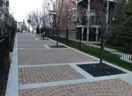 | Pervious Paving Systems allow water to pass freely through the interstitial space ingrained throughout the paving matrix, thereby transforming traditionally impervious surfaces. Several examples are pervious concrete and asphalt, interlocking pavers, and reinforced gravel and grass paving. | |
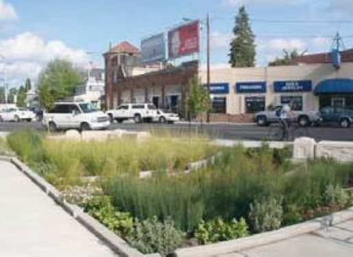 | Rain Gardens are flat-bottomed landscaped depressions that can be built to any size or shape. Also known as 'bioretention cells', they are designed to allow water to settle and infiltrate into the soil. They reduce the peak discharge rate from a site via detention. Water quality improvements are achieved through particle settling, nutrient uptake, and filtration as water soaks into the ground. | |
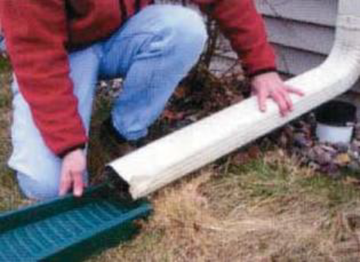 | Disconnected Downspouts. In lower density residential areas downspouts should be disconnected from storm drain systems and directed towards landscaped areas or other BMP devices. This reduces the burden on the storm drain network and allows runoff to slow and infiltrate before overflowing to storm drains. | |
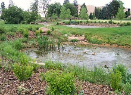 | Wet Detention Ponds. The pond consists of a permanent pool of water into which storm water runoff from each rain event is detained and treated in the pond until it is displaced by runoff from the next storm. Sedimentation processes remove particulates, organic matter, and metals, while dissolved metals and nutrients are removed through biological uptake. | |
| General Note: Images in this table are illustrative, not regulatory. | ||
 | Vegetated Flood Plains can be integrated with parks, playing fields, or unmanaged landscapes. Frequent storm events can be detained by smaller decentralized means, while larger storm events should be directed to non-priority vegetated landscapes for temporary detention. | |
 | Urban Flood Plain. Urban hardscapes can be used for temporary storage of large storm events. Smaller events should be mitigated by decentralized means, while the larger events can be directed toward non-priority spaces which are planned and designed for the temporary storage of stormwater flows. | |
 | Riffle Pools. Connected landscapes provide retention of runoff by integrating intermittent vertical drops and damming in a watercourse. The retained runoff is then allowed to infiltrate into the groundwater table or conveyed for further treatment. | |
 | Flow-through Planters are landscape features that also provide stormwater runoff control and treatment. Flow-through planters are sealed on all sides and fitted with an underdrain. They only absorb as much water as soil and plants in the planter can accommodate. Once the planter is at capacity, water is then discharged through the underdrain. They are ideal for receiving roof runoff from downspouts and can be incorporated into foundation walls. | |
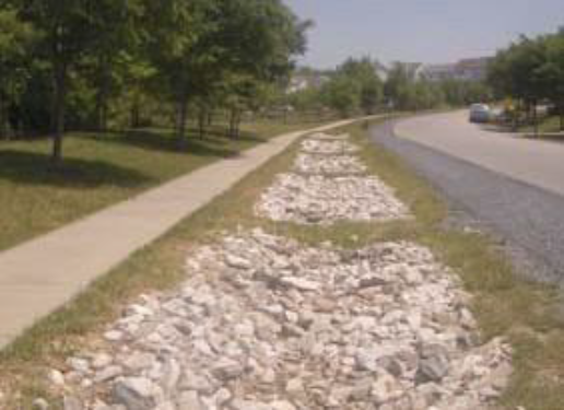 | Infiltration Trenches are subsurface facilities designed to provide on-site stormwater retention in areas of good infiltration by collecting and recharging stormwater runoff into the ground. Trenches filter pollutants to improve water quality and contribute towards groundwater recharge. They are relatively low maintenance and can be easily retrofitted into existing sidewalk areas and medians. | |
 | A Natural Channel is a meandering, vegetated watercourse with natural banks. It is buffered from development zones by large uncultivated landscape. | |
| General Note: Images in this table are illustrative, not regulatory. | ||
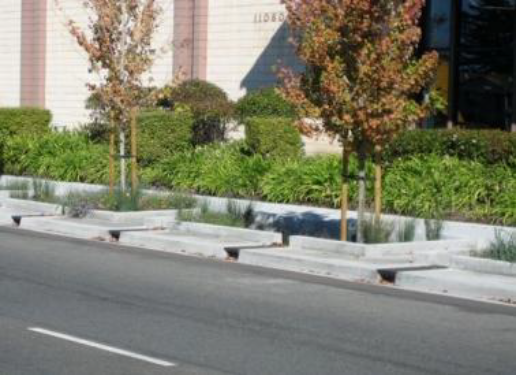 | Tree Box Filters are containers filled with a soil mixture, a mulch layer, under-drain system and a shrub or tree similar to flow through planters. The compact size of tree box filters allow volume and water quality control to be tailored to specific site characteristics and are well suited to urban areas. Tree box filters provide the added value of aesthetics while making efficient use of available land for stormwater management. | |
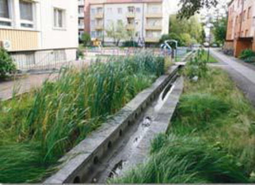 | Urban Channels are narrow vegetated or stone lined conveyances framed by vertical stone or concrete banks abutting cultivated landscapes or hardscapes. | |
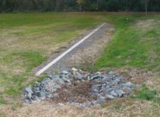 | Level Spreaders are structures that are designed to uniformly distribute concentrated flow over a large area to mimic natural sheet flow. Concentrated flow enters the spreader through a pipe, ditch or swale; the flow is retarded, energy is dissipated; the flow is distributed throughout a long linear shallow trench or behind a low berm; water then flows over the berm/ditch uniformly (in theory) along the entire length. | |
 | Rain Barrels are connected directly to downspouts to capture and store runoff for future use. Stormwater discharge is slowed down and water can be reused for irrigation. Fifty gallons of storage is suggested as a minimum. Barrels must also have a cover to prevent insect and debris collection. | |
 | Cisterns function similar to rain barrels by collected stormwater and storing it for reuse, but on a much larger scale. Cisterns can be stored above ground, buried below ground, or located inside of buildings. They typically store rainwater for reuse in irrigation, mechanical uses, toilet flushing, and fire prevention. | |
 | Dry detention ponds are basins whose outlets have been designed to detain stormwater runoff for some minimum time (e.g., 24 hours) to allow particles and associated pollutants to settle. Unlike wet ponds, these facilities do not have a large permanent pool of water. However, they are often designed with small pools at the inlet and outlet of the basin. They can also be used to provide flood control by including additional flood detention storage. | |
| General Note: Images in this table are illustrative, not regulatory. | ||
5.12.40 - Enforcement
The County has the right to enter, enforce maintenance and/or cause maintenance of any stormwater management facility, either privately or publicly owned.
5.13.10 - Purpose
To promote public health, safety, and general welfare by preserving Beaufort County's natural floodplain and drainage patterns to minimize the impacts of development within the flood plain on neighboring properties.
5.13.20 - Applicability
The requirements established in this Division shall apply to all proposed development within the unincorporated County located in the special flood hazard areas subject to inundation by the 1% annual chance flood as defined and delineated in the FEMA Flood Insurance Rate Maps (FIRM) for Beaufort County, except for the following exemptions:
A.
Single-family residential development on lots existing prior to the adoption of this Division (September 27, 2021).
B.
Fill utilized for agriculture and/or property maintenance. For purposes of this Division, the term "property maintenance purposes" means landscaping, gardening or farming activities, erosion control, and filling in of washed-out sections of land. Property maintenance purposes shall only include the placement of such quantities of fill not to exceed the limitations specified herein and that do not inhibit the free flow of water. Said limited amounts of fill for property maintenance purposes need not be compensated by an equivalent amount of excavation area as specified in 5.13.20.C. Exemptions from fill requirements for erosion control purposes must be accompanied by a stabilization plan and narrative approved by the Public Works Director providing reasoning why fill is necessary to solve an erosion issue.
C.
Public roads, pump stations, stormwater management improvements, levees, and other public facilities that are necessary to provide for health, safety, and public welfare needs. Filling on public property shall be app roved by the Director coordinating with the appropriate department head or governmental agency.
5.13.30 - Fill Restrictions
A.
The amount of allowable fill must not increase the existing natural grade of the property by more than three vertical feet.
B.
The only portion of the property that may be filled is the area underneath the elevated structure, together with driveway and walkway access to the structure; Fill shall taper at a maximum slope of 1:3 from a five-foot perimeter around the outer foundation to the existing site elevation. The minimum amount of fill necessary for grading is permitted for parking, stormwater, and roads.
C.
If the lot area is 20 acres or more, in no case shall the maximum lot area of the property filled exceed 33.33 percent of the total area of the lot.
D.
If a new or reconstructed structure is to be elevated utilizing fill material, any required building elevation standard exceeding the three-foot fill limitation as referenced in section 5.13.20.B must be achieved through the use of elevation foundations, piers or similar structural elevation techniques that are in compliance with then-applicable county building code requirements as certified by a structural engineer.
E.
Non-conforming structures may utilize fill to expand up to 15% of the gross floor area in accordance with Division 8.3 of the Community Development Code.
F.
Any fill project must be designed to limit negative impacts upon adjacent and affected upstream and downstream property owners during flood events to the maximum extent practicable.
G.
No fill project shall fill in or obstruct any local drainage channels without an alternative drainage plan design, and shall limit soil erosion and water runoff onto adjacent properties to the maximum practicable extent, and be in compliance with the NPDES standards and with the Beaufort County Manual for Stormwater Best Management and Design Practices.
H.
All fill material that is brought in from offsite and will be placed at elevations below the seasonal high water table or within 1 foot above the seasonal high water table will be required to meet the following clean fill requirements. Offsite soils brought in for use as fill shall be tested for Total Petroleum Hydrocarbons (TPH), Benzene, Toluene, Ethyl Benzene, and Xylene (BTEX) and full Toxicity Characteristic Leaching Procedure (TCLP) including ignitability, corrosivity and reactivity. Fill shall contain a maximum of 100 parts per million (ppm) of total petroleum hydrocarbons (TPH) and a maximum of 10 ppm of the sum of Benzene, Toluene, Ethyl Benzene, and Xylene and shall pass the TCPL test. Determine TPH concentrations by using EPA 600/4-79/020 method 1:18.1. Determine BTEX concentrations by using EPA SW-846.3-3 Method 5030/8020. Perform TCLP in accordance with TCLP from a composite sample of material from the borrow site, with at least one test from each borrow site. Within 24 hours of conclusion of physical tests, submit 3 copies of test results, including calibration curves and results of calibration tests. Fill material shall not be brought on site until tests have been approved by the Stormwater Department.
I.
Modulation from Fill Requirements: The Director may grant flexibility from the fill requirements in the following cases:
1.
Lots 3 acres or less and all single-family residential lots with sloping terrain may provide greater than 3 feet of fill to provide a level foundation as long as the average fill does not exceed 3 feet.
2.
Where no other suitable site configuration is practicable, depressions, sinkholes, and borrow pits that are not part of the natural drainage of the site that are not delineated as tidal or non-tidal wetlands may be filled to provide for a level foundation.
3.
Single-family residential structures utilizing raised slabs with a masonry or concrete curtain wall may contain more than 3 feet of fill if it is limited to the footprint of the building.
5.13.40 - Administration
Fill activities in accordance with this section may be permitted upon approval by the Director. All fill application permits shall be valid for a period of six months from the date of issuance, may be renewed only upon filing of an application for renewal with the Community Development Department, and then may only be renewed upon a showing of demonstrated progress towards completion of the fill activity. All fill application permits must be accompanied by a detailed plan describing the area to be filled, the estimated amount of fill to be used and the purpose of the fill project. A professional engineer registered in the state must also submit elevation and topographic data illustrating changes in the topography and estimating impacts upon local flood flows. Except as provided in sections 5.13.20.A, 5.13.20.B and 5.13.20.C, adjacent property owners shall be identified and notified of the fill project by the applicant with proof of notification provided to the Director.