
Clinton City Zoning Code
CHAPTER 28
19 Performance Standard Zone
Historic Changes to Chapter (see section 28-24-2 for details) 3, 28, 69, 88, 123, 134, 136, 149, 151, 153, 163, 164, 181, 182, 198, 199
28-19-1 Legislative Intent
In enacting this chapter of the zoning ordinance, special notice has been taken of the fact that the goals of citizens and landowners of Clinton often conflict or compete. The prior method of zoning regularly forced a "winner-take-all" solution to the resolution of conflicts between neighbors or adjoining property owners. Whenever a proposed commercial use encountered objections, the City Council had only two choices: either to permit the use, to the detriment of the objectors, or to prohibit it entirely, to the detriment of the landowner who proposed it. Whenever a use was permitted (usually by virtue of a rezoning), the preexisting adjacent users were largely unprotected from any of its negative impacts. This chapter has been designed to protect and accommodate both competing interests. This has inevitably, and properly, led to some form of compromise. In arriving at these compromises, every possible consideration has been given to the public interest, individual property rights, and externalities. While compromise implies mutual concessions or losses, it also implies - and this chapter has been designed to provide - mutual gains and benefits. It is the goal of this chapter that both the burdens and the benefits which it, like any scheme of public regulation, implies be rationally and fairly distributed among the citizens and property owners of Clinton.
28-19-2 Establishment Of Economic Development Zone
This zone is intended to accommodate most of the economic development expected in Clinton during the next twenty-year period. It consists of the areas where economic development should logically locate as a consequence of planned public facilities and associated capital expenditure. This zone provides for development of a generally suburban character. It provides for necessary commercial and institutional uses. 123
28-19-3 Introduction
The purpose of the regulations contained in this chapter is to allow maximum utilization of land in the zone while insuring against detrimental impacts on the environment, neighboring properties, and the public interest. This regulatory approach has been termed "performance zone" because it permits a use to be developed on a particular parcel only if that use on that parcel meets "performance" standards which have been enacted to insure against the use causing (or having the potential to cause) the negative impacts mentioned above.
The format of the regulations in this chapter differs somewhat from that of the rest of the ordinance because performance zoning requires that consideration be given to site (parcel) characteristics and the range of impacts which any use (such as "office" or "retail store") may have.
- Definitions.28, 123
“High Volume Traffic Generation.” Any business that generates in excess of 100 vehicle trips per hour. As part of any conditional use review or site plan review a traffic study may be required by staff or the Planning Commission.69, 88
“Low-Volume Traffic Generation.” Uses such as furniture stores, carpet stores, major appliance stores, etc. that are large and bulky, that need a relatively large amount of storage or display area for each unit offered for sale, and that therefore generate less customer traffic per square foot of floor than stores selling smaller items.69
“Site Area, Base.” The area of proposed development minus rights-of-way, existing roads, easements, etc. as outlined in 28-19-9.
“Site Area, Gross.” The entire acreage of a proposed development.
“Site Area, Net.” The area of a proposed development after subtracting required open spaces as outlined in 28-19-10.
28-19-4 Use Regulations
In the following list of uses, those designated as "P" will be permitted use. Uses designated "C" will be allowed only when authorized by a conditional use permit obtained as provided in Chapter 28-5 of this Zoning Ordinance.
| TABLE 19.4 61, 123, 199 PERFORMANCE ZONE USES | DESIGN REVIEW | PERMITTED/ CONDITIONAL | GENERAL USE CATEGORY (SEC. 15) | |||
| 1.000 | RESIDENTIAL | |||||
| 1.100 | Single-Family Residences (see section 19.29) | |||||
| 1.150 | Accessory Dwelling Unit (see section 19.29) | |||||
| 1.200 | Two-Family Residences (see section 19.29) | |||||
| 1.400 | Miscellaneous, rooms for rent situations | |||||
| 1.410 | Bed and Breakfast | DR | P | Commercial | ||
| 1.420 | Tourist homes and other temporary residences renting by the day or week | DR | P | Commercial | ||
| 1.430 | Hotels, motels, and similar business or institutions providing overnight accommodations | DR | P | Commercial | ||
| 1.500 | Temporary on site storage containers for emergency construction or repair of residences, with the following stipulations a. Must be placed on a hard surface b. Can only be present for 3 months out of a 12 month period | P | Footnote a | |||
| 1.600 | Home Business 179 | P | ||||
| 1.700 | Garage and Yard Sales 179 | P | ||||
| 1.800 | Garages, accessory buildings, sheds, and carports when associated with a residential use will be evaluated per Table 19.29.2 | |||||
| 2.000 | SALES AND RENTAL OF GOODS, MERCHANDISE AND EQUIPMENT | |||||
| 2.100 | No storage or display of goods outside fully enclosed building | |||||
| 2.110 | High-volume traffic generation | |||||
| 2.111 | Miscellaneous 88 | DR | P | Commercial | ||
| 2.112 | Convenience stores | DR | P | Commercial | ||
| 2.120 | Low-volume traffic generation | |||||
| 2.121 | Wholesale sales | DR | P | Commercial | ||
| 2.122 | Retail sales | DR | P | Commercial | ||
| 2.200 | Storage and display of goods outside fully enclosed building allowed | |||||
| 2.210 | High-volume traffic generation | DR | C | Commercial | ||
| 2.220 | Low-volume traffic generation | DR | C | Commercial | ||
| 2.230 | Wholesale sales | DR | C | Commercial | ||
| 3.000 | OFFICE, CLERICAL, RESEARCH AND SERVICES NOT PRIMARILY RELATED TO GOODS OR MERCHANDISE | |||||
| 3.100 | All operations conducted entirely within fully enclosed building | |||||
| 3.110 | Operations designed to attract and serve customers or clients on the premises, such as the offices of attorneys, physicians, other professions, insurance and stockbrokers, travel agents, government office buildings, etc. | DR | P | Office | ||
| 3.120 | Operations designed to attract little or no customer or client traffic other than employees of the entity operating the principal use | DR | P | Office | ||
| 3.130 | Office or clinics of physicians or dentists with not more than 10,000 square feet of gross floor area | DR | P | Office | ||
| 3.200 | Operations conducted within or outside fully enclosed building | |||||
| 3.210 | Operations designed to attract and serve customers or clients on the premises | DR | P | Office | ||
| 3.220 | Operations designed to attract little or no customer or client traffic other than the employees of the entity operating the principal use | DR | P | Office | ||
| 3.230 | Banks with drive-in windows | DR | P | Office | ||
| 3.240 | Check Cashing or Deferred Deposit Loan Business with or without a drive-up window. LIMITATIONS: No business shall be located within one thousand (1,000) feet of any other similar business. Distance shall be measured in a straight line. In addition only one business shall be allowed for every ten thousand (10,000) citizens living in Clinton City. 165 | DR | P | Commercial | ||
| 4.000 | EDUCATIONAL INSTITUTIONS, CULTURAL, RELIGIOUS, PHILANTHROPIC, SOCIAL, FRATERNAL USES | |||||
| 4.100 | Educational Institutions | |||||
| 4.110 | Elementary and secondary (including associated grounds and athletic and other facilities) | DR | P | Institutional | ||
| 4.120 | Trade or vocational schools | DR | P | Institutional | ||
| 4.130 | Colleges, universities, community colleges (including associated facilities such as dormitories, office buildings, athletic fields, etc.) | DR | P | Institutional | ||
| 4.200 | Churches, synagogues, and temples (including associated residential structures for religious personnel and associated buildings but not including elementary schools or secondary school buildings) | DR | P | Institutional | ||
| 4.300 | Libraries, museums, art galleries, art centers, and similar uses (including associated educational and instructional activities) | DR | P | Institutional | ||
| 4.400 | Social, fraternal clubs and lodges, union halls, and similar uses | DR | C | Institutional | ||
| 5.000 | RECREATION, AMUSEMENT, ENTERTAINMENT | |||||
| 5.100 | Activity conducted entirely within building or substantial structure | |||||
| 5.110 | Amusement enterprises, arcades, video game centers, and similar uses | DR | P | Entertainment | ||
| 5.120 | Bowling alleys, skating rinks, indoor tennis and squash courts, billiard and pool halls, indoor athletic and exercise facilities and similar uses | DR | P | Indoor Recreation | ||
| 5.130 | Movie Theaters | DR | P | Indoor Recreation | ||
| 5.140 | Coliseums, stadiums, and all other facilities listed in the 5.100 classification designed to seat or accommodate simultaneously more than 1,000 people | DR | P | Indoor Recreation | ||
| 5.200 | Activity conducted primarily outside enclosed buildings or structures | |||||
| 5.210 | Privately owned outdoor recreational facilities such as golf and country clubs, swimming or tennis clubs, etc., not constructed pursuant to a permit authorizing the construction of some | DR | C | Outdoor Recreation | ||
| 5.220 | Publicly owned and operated outdoor recreational facilities such as athletic fields, golf courses, tennis courts, swimming pools, parks, etc., not constructed pursuant to a permit authorizing the construction of another use such as a school | DR | C | Outdoor Recreation | ||
| 5.230 | Golf driving ranges not accessory to golf courses, par 3 golf courses, miniature golf courses, skateboard parks, water slides, and similar uses | DR | C | Outdoor Recreation | ||
| 6.000 | INSTITUTIONAL RESIDENCES OR CARE OR CONFINEMENT FACILITIES | |||||
| 6.100 | Hospitals, clinics, other medical( including mental health) treatment facilities in excess of 10,000 square feet of floor area | DR | P | Institutional | ||
| 6.200 | Nursing care institutions, intermediate care institutions, handicapped or infirm institutions, child care institutions | DR | P | Institutional | ||
| 6.300 | Institutions (other than halfway houses) where mentally ill persons are confined | DR | P | Institutional | ||
| 6.400 | Nursery schools; day care centers with no overnight facilities. | DR | P | Commercial | ||
| 6.500 | Homes emphasizing special services or supervision in an existing residential subdivision | |||||
| 6.510 | Homes for handicapped or infirm | P | Special Res. | |||
| 6.520 | Nursing care, intermediate care homes | P | Special Res. | |||
| 6.530 | Child care homes | P | Special Res. | |||
| 6.540 | Halfway houses | C | Special Res. | |||
| 7.000 | RESTAURANTS, TAVERN, PRIVATE CLUBS | |||||
| 7.100 | Restaurant | DR | P | Commercial | ||
| 7.110 | Restaurant (Fast Food) | DR | P | Commercial | ||
| 7.200 | Tavern | DR | P | Commercial | ||
| 7.300 | Private Club | DR | C | Commercial | ||
| 8.000 | MOTOR VEHICLE-RELATED SALES AND SERVICE OPERATIONS 126 | |||||
| 8.100 | Motor vehicle sales or rental, mobile home sales 88 | DR | P | Road Service | ||
| 8.200 | Sales with installation of motor vehicle parts or accessories (e.g. tires, mufflers, etc.) | DR | C | Road Service | ||
| 8.300 | Motor vehicle repair and maintenance, not including substantial body work | DR | C | Road Service | ||
| 8.400 | Convenience Store | DR | P | Road Service | ||
| 8.500 | Liquid Fuel Sales | DR | P | Road Service | ||
| 8.600 | Car Wash | DR | P | Road Service | ||
| 8.700 | Pressurized Fuel (LPG, Natural Gas) Sales | DR | P | Commercial | ||
| 9.000 | STORAGE AND PARKING | |||||
| 9.100 | Automobile parking garages or parking lots not located on a lot on which there is another principal use to which the parking is related | DR | P | Commercial | ||
| 9.200 | Parking of vehicles or storage of equipment outside enclosed structures where: (a) vehicles or equipment are owned and used by the person making use of lot, and (b) parking or storage is more than a minor and incidental part of the overall use made of the lot | DR | P | Commercial | ||
| 10.000 | SERVICES AND ENTERPRISES RELATED TO ANIMALS | |||||
| 10.100 | Veterinarian, inside fully enclosed structure | DR | P | Commercial | ||
| 10.110 | Crematorium, associated with a veterinarian | DR | C | Commercial | ||
| 10.200 | Kennel, inside fully enclosed structure | DR | C | Commercial | ||
| 11.000 | EMERGENCY SERVICES, MISCELLANEOUS PUBLIC AND SEMI-PUBLIC FACILITIES | |||||
| 11.100 | Municipal Offices | DR | P | Public Service | ||
| 11.200 | Municipal Police Stations | DR | P | Public Service | ||
| 11.300 | Municipal Fire Stations | DR | P | Public Service | ||
| 11.400 | Municipal Rescue squad, ambulance service | DR | P | Public Service | ||
| 11.500 | Other Municipal Structures or Uses | DR | C | Public Service | ||
| 11.600 | Post office | DR | P | Public Service | ||
| 11.700 | Bus station | DR | C | Public Service | ||
| 11.800 | Private Ambulance Service | DR | C | Public Service | ||
| 12.000 | DRY CLEANER, LAUNDROMAT | DR | P | Commercial | ||
| 13.000 | PUBLIC UTILITY SUBSTATIONS | DR | C | Public Service | ||
| 14.000 | COMMERCIAL GREENHOUSE OPERATIONS | |||||
| 14.100 | No on-premises sales | DR | P | Nursery | ||
| 14.200 | On-premises sales permitted | DR | P | Nursery | ||
| 15.000 | FUNERAL HOME | DR | P | Commercial | ||
| 16.000 | CEMETERY AND CREMATORIUM | |||||
| 16.100 | Cemetery | DR | P | Commercial | ||
| 16.200 | Crematorium, associated with a mortuary | DR | C | Commercial | ||
| 17.000 | TEMPORARY STRUCTURES USED IN CONNECTION WITH THE CONSTRUCTION OF A PERMANENT BUILDING OR FOR SOME NONRECURRING PURPOSE | P | Footnote b | |||
| 17.100 | Temporary storage containers, (location, screening from public view & duration will be reviewed) 165 | DR | C | Commercial | ||
| 18.000 | COMBINATION USES | DR | C | Footnote c | ||
| 19.000 | EXISTING RESIDENTIAL SUBDIVISIONS AND SINGLE FAMILY DWELLINGS | P | See Section 19.30 | |||
| 21.000 | EXISTING OR NON-CONFORMING USE RELATED TO MANUFACTURING, PROCESSING, CREATING REPAIRING, RENOVATING, PAINTING, CLEANING, ASSEMBLING OF GOODS, MERCHANDISE AND EQUIPMENT | DR | P | Light Industry | ||
| 22.000 | EXISTING AGRICULTURAL USE OR NONCONFORMING USE ASSOCIATED WITH AGRICULTURAL, SILVICULTURAL, OR HORTICULTURAL PRODUCTION OR FARMING NOT INCLUDED IN THE LISTED ITEMS ABOVE | P | Agricultural or
Agricultural
Support | |||
| 23.000 | Garages, accessory buildings, sheds, and carports when associated with a use that is not a residential use will be evaluated during the site plan review as established in §28-3-10. | |||||
| a Temporary structures are approved by the city staff with concurrence of the city council depending upon the urgency of the emergency and situation.
b Land use classifications are the same as the main use on the property.
c Uses falling under multiple Class categories as outlined in Table 19.15 will fall under the highest class category. | ||||||
28-19-5 Public Hearing Required
For all nonresidential uses proposed in this zone, a site plan review by the Planning Commission will be required as specified in 28-3-10. of the Zoning Ordinance. Conditional uses within this zone will require review as outlined in Chapter 28-5 and 28-1-4(3). Notice of public hearings for reviews other than Conditional Uses will be set forth in 28-1-4(4).
28-19-6 Zoning District Performance Standards
Sections 28-19-6 and 28-19-7 delineate the minimum standards for open space, density, impervious surface coverage, and lot area which apply in this zone. The purpose of these performance standards is to provide detailed regulations and restrictions by means of minimum criteria which must be met by uses in order to protect neighbors from adverse impacts of adjoining land uses and to protect the general health, safety, and welfare by limiting where uses may be established, insuring that traffic congestion is minimized, controlling the intensity of use, and prescribing other such performance criteria necessary to implement the Comprehensive Plan and to meet the goals and objectives of this chapter. All uses and activities shall comply fully with the provisions of the following standards as a precondition of being permitted pursuant to Table 19.4.
28-19-7 Performance Standards
This section contains the range of basic standards applicable to the uses allowed by this chapter. All standards must be met. Whenever the standard contained in 28-19-7 is different from another performance standard articulated in this chapter, the strictest standard shall always govern. The floor area factor is the amount of floor area of a building compared with the net buildable site area. The minimum site area specifies the minimum total number of acres for which development of a particular use may be proposed. Specific standards are dependent upon the intensity of development as outlined in 28-19-14.
Table of Performance Standards (Table 19.7)
| Table 19.7 | Open Space Ratio (OSR) Minimum Sect. 12 | Density Factor | Floor Area Factor (FAF) | Impervious Surface Ratio (ISR)a Maximum | Minimum Site Area Acres | Minimum Site Area Sq. Ft. | |||
| Use | - | Low | High | Low | High | Low | High | - | - |
| Conventional Subdivision | - | 3 | 5.5 | - | - | 0.3 | 40 | - | 6,000 |
| Performance Subdivision | 0.20 | 4.2 | 15 | - | - | 0.3 | 0.65 | 5 | - |
| Other Uses | - | - | - | 0.005 | 1.2 | 0.05 | 1.0 | - | - |
| a For conventional subdivision, ratio is applied to individual building lots. For performance subdivision and other uses, ratio is applied to total project area. | |||||||||
28-19-8 Sight Capacity Calculation: Purpose
Site capacity for any proposed development is equal to the net buildable area of the site multiplied by the floor area factor or impervious surface ratio, whichever is more restrictive. The site capacity calculation provides the mechanism for subtracting from the base site area all portions of a site inappropriate for development. Consequently, the purpose of this section is to determine the extent to which a site may be utilized given its unique physical characteristics.
28-19-9 Base Site Area (All Land Uses)
| A. Gross site area as determined by actual on-site survey | acres |
| B. Subtract land constituting roads and land within ultimate rights-of-way of
existing roads as shown in the Clinton City Major Street Plan, rights-of-way of
utilities, and easements of access. | -_______ acres |
| C. Subtract land which is not contiguous: | -_______ acres |
| 1. A separate parcel which does not abut, adjoin or share common boundaries
with the rest of the development. | -_______ acres |
| 2. Land which is cut off from the main parcel by a road, railroad, existing land
uses, or major stream, such that common use is hindered or that the land is
unavailable for building purposes. | -_______ acres |
| D. Subtract land which in a previously approved subdivision encompassing the
same land, as part or all of the subject parcel, was reserved for resource reasons
(e.g. flooding or for recreation). | -_______ acres |
| E. Subtract land required for bufferyard area by Sections 28-19-16 through 24. (A
preliminary decision of which buffer is to be used will need to be made at this time to arrive at this figure. Refer to Sections 28-19-16 and 28-19-18 for bufferyard
requirements and sizes.) | -_______ acres |
| F. Equals base site area. | =_______ acres |
28-19-10 Determination Of Site Capacity (All Nonresidential Uses)
Individual site capacity is calculated as follows. Both maximum impervious surface area and maximum floor area must be calculated.
| Table 19.10 | ||
| Take | BASE SITE AREA | ______ acres |
| Multiple by | Impervious Surface Ratio | * _______ acres |
| EQUALS | PERMITTED IMPERVIOUS AREA | = _______ acres |
| Take | Base Site Area | ______ acres |
| Subtract | FAR (from land use intensity class of proposed use or district maximum, whichever is less) | - _______ acres |
| EQUALS | Permitted floor area | = _______ acres |
28-19-11 Open Space
- Land which is required by this chapter to remain as open space may be used for the recreation, agriculture, resource protection, amenity and other purposes specified in this section. Open-space land shall be freely accessible to all intended users of a development with the exception that agricultural land uses shall be permitted to restrict access to that land to those solely engaged in agricultural pursuits. Open-space land shall not be occupied by non-recreational buildings, roads, road right-of-way or parking areas. 123
- All developments required by this chapter to provide open space shall meet the following requirements:
- Land designated as open space shall be maintained as open space and may not be separately sold, subdivided, or developed except as provided below.
- An open-space landscape plan shall be submitted as a part of the application for site plan approval. This landscape plan shall follow the standards outlined in Section 28-3-21 of this Title.
- The types of open space which may be provided to satisfy the requirements of this ordinance, together with the maintenance required for each type, are as follows:
- Agricultural uses. No specific maintenance is required.
- Greenways are linear green belts linking residential areas with other open-space areas. These greenways may contain bicycle paths, footpaths, and bridle paths. Connecting greenways between residences and recreational areas are encouraged. Maintenance is limited to a minimum removal and avoidance of hazards, nuisances, or unhealthy conditions.
- Lawns consist of grass with or without trees. Any lawn or turf areas shall be consistent with the water efficient landscape standards in Section 28-3-21 of this Title. Maintenance is limited to watering and mowing to ensure neatness.
- Interim open space. Land intended for future development may be designated as a holding zone and thus remains vacant until such time as this land is annexed or rezoned as a development district.
- All designated open space shall be large enough to be useable open space. The minimum dimension for usable open space shall be 10 feet and the minimum area shall be 100 square feet.
- Preservation of Open Space. Open-space areas shall be maintained so that their use and enjoyment as open space are not diminished or destroyed. Open space areas may be owned, preserved, and maintained as required by this section by any of the following mechanisms or combinations thereof:
- Dedication of open space to the City or an appropriate public agency, if there is a public agency willing to accept the dedication.
- Common ownership of the open space by a homeowner's association which assumes full responsibility for its maintenance.
- Dedication of development rights of open space may be made to an appropriate public agency with ownership remaining with the developer or homeowner's association. Maintenance responsibility shall remain with the property owner.
- Deed-restricted private ownership which shall prevent development and/or subsequent subdivision of the open-space land and provide the maintenance responsibility.
28-19-12 Land Use Intensity Classification And Bufferyards
- All land uses which are permitted by this chapter have been assigned a land use intensity class designation (see 28-19-14). This classification system separates uses on the basis of the type and degree of "nuisance" or negative impact they are likely to impose on land uses adjacent to them.
- In order to minimize any negative effects that a more obnoxious or intensive use will impose on its neighbors, this ordinance requires that bufferyards be provided between uses.
28-19-13 Land Use Intensity Class Standards
In keeping with the concept that performance should be the relevant measure of any land use regulations, the following section classifies uses according to their respective impact (all uses within a use class are considered to have an equal impact on neighboring uses). A developer may develop at an intensity which will minimize nuisances to neighbors or provide a denser bufferyard if the land is developed at greater intensities. The impacts of greater intensity may include greater impervious surface coverage, with associated increased runoff, heat generation, reduced percolation and open space, increased bulk and height of buildings, increased traffic with associated noise and congestion, signs and exterior lighting visible from neighboring property, late hours of operation, and other nuisances. Thus, for example, and office use on any lot may meet the standards at intensity class IV, V, VI, VII, or VIII. The range of intensity classes open to a use does not affect whether it can locate on its lot, but only how it can develop on that lot. Performance standards are specified for each intensity class; exceeding any single standard in an intensity class moves a use to the next-higher intensity class. In the event that a use does not appear in the next-higher intensity class, it may not exceed any single criteria in the highest intensity class in which it is listed.
28-19-14 Table Of Land Use Intensity Class Standards
| Land Use Intensity Class Number and General Use Category | Maximum Density (Gross) | Maximum Impervious Surface Ratio | Maximum Floor Area Ratio | Site Design Standards a | Maximum Building Height (feet)b | Hours of Operation |
| Class I | ||||||
| Agriculture | 1.00 | 0.07 | n/a | R | 35/80 | n/a |
| Class II | ||||||
| Outdoor Recreation | n/a | 0.05 | 0.003 | A | 20 | 7 am-9 pm |
| Class III | ||||||
| Performance Subdivision | 5.2 | 0.35 | n/a | R | 35 | n/a |
| Outdoor Recreation | n/a | 0.08 | 0.005 | A | 25 | 7 am-9 pm |
| Class IV | ||||||
| Performance Subdivision | 15 | 0.65 | n/a | R | 40 | n/a |
| Outdoor Recreation | n/a | 0.10 | 0.006 | A | 30 | 7 am- 9 pm |
| Class V | ||||||
| Outdoor Recreation | n/a | 0.15 | 0.009 | A | 30 | 7 am-9 pm |
| Indoor recreation, institutional, and special residential | n/a | 0.30 | 0.25 | A | 35 | 7 am-10 pm |
| Public Service | n/a | 0.20 | 0.12 | A | 20 | n/a |
| Office | n/a | 0.20 | 0.05 | A | 25 | 7 am-9 pm |
| Nursery | n/a | 0.03 | 0.05 | A | 25 | 7 am-9 pm |
| Class VI | ||||||
| Outdoor Recreation | n/a | 0.25 | 0.01 | B | 30 | 6 am-10 pm |
| Indoor recreation, institutional, and special residential | n/a | 0.60 | 0.49 | B | 40 | 6 am-10 pm |
| Public Service | n/a | 0.50 | 0.35 | B | 30 | n/a |
| Office | n/a | 0.50 | 0.24 | B | 60 | n/a |
| Nursery | n/a | 0.20 | 0.27 | B | 30 | 7 am-9 pm |
| Class VII | ||||||
| Outdoor Recreation | n/a | 0.40 | 0.02 | C | 35 | 6 am-11 pm |
| Indoor recreation, institutional, and special residential | n/a | 0.70 | 0.40 | C | 45 | n/a |
| Public Service | n/a | 0.70 | 0.40 | C | 40 | n/a |
| Office | n/a | 0.70 | 0.36 | C | 60 | n/a |
| Commercial | n/a | 0.65 | 0.77 | C | 30 | n/a |
| Entertainment | n/a | 0.65 | 0.77 | C | 30 | n/a |
| Road Service 126 | n/a | 0.50 | 0.19 | C | 25 | n/a |
| Class VIII 126 | ||||||
| Outdoor Recreation | n/a | 0.60 | 0.03 | D | 40 | 6 am-12 pm |
| Indoor recreation, institutional, and special residential | n/a | 0.70 | 0.65 | D | 50 | n/a |
| Public Service | n/a | 0.90 | 0.45 | D | 50 | n/a |
| Office | n/a | 0.85 | 0.50 | D | 60 | n/a |
| Commercial | n/a | 0.85 | 1.10 | D | 50 | n/a |
| Entertainment | n/a | 0.85 | 1.10 | D | 50 | n/a |
| Road Service | n/a | 0.80 | 0.31 | D | 40 | n/a |
| Class IX | ||||||
| Public Service | n/a | 0.90 | 0.59 | E | 50 | n/a |
| Office | n/a | 0.90 | 0.70 | E | 75 | n/a |
| Commercial | n/a | 0.90 | 1.20 | E | 60 | n/a |
| Entertainment | n/a | 0.90 | 1.20 | E | 60 | n/a |
| Road Service | n/a | 0.90 | 0.35 | E | 40 | n/a |
| Recreational | n/a | 0.80 | 0.30 | E | 25/80 | n/a |
| Class X | ||||||
| Recreational | n/a | 0.90 | 0.40 | E | 40/120 | n/a |
| a See Sections 28-19-24 through 28-19-26: Landscaping 28-19-25; Off Street Parking Area Landscaping 28-19-26; and Exterior Lighting 28-19-27.
b The figure specified in this column is the maximum permitted height of each permitted structure. When two figures are specified, the latter one is the maximum permitted height of permitted uninhabited accessory structures. The following structures are exempt from the maximum height regulations of this section, except as limited by any height restriction regulation of the Federal Aviation Agency or any height restriction imposed by any airport authority, or other municipal corporation operating an airport.
1. Agricultural buildings except residences. 2. Bulk storage silos and storage towers in all districts except agricultural, provided the maximum permitted height shall not exceed 100 feet. 3. Concrete batching and mixing towers, provided the maximum permitted height shall not exceed 100 feet. 4. Gravity feed apparatus in all districts except agricultural; the maximum permitted height shall not exceed 60 feet. 5. Public utility poles, towers, and wires. 6. Radio and television antenna and towers. 7. Towers for mechanical equipment or smoke, not exceed 16 feet above roof line of principal building. 8. Water tanks and standpipes. | ||||||
28-19-15 Bufferyards: Purpose
- The bufferyard is a unit of yard together with the planting required thereon. Both the amount of land and the type and amount of planting specified for each bufferyard requirement of this ordinance are designed to ameliorate nuisances between adjacent land uses or between a land use and a public road. The planting units required of bufferyards have been calculated to insure that they do, in fact function as "buffers".
- Bufferyards shall be required to separate different land uses form each other in order to eliminate or minimize potential nuisances such as dirt, litter, noise, glare of lights, signs, and unsightly buildings or parking areas, or to provide spacing to reduce adverse impacts of noise, odor, or danger from fires or explosions.
28-19-16 Location Of Bufferyards
- To determine the type of bufferyard required between two adjacent parcels or between a parcel and a street, the following procedure shall be followed.
- Identify the land use category of the proposed use by referring to Table 19.4.
- Identify the use category of the land use(s) adjacent to the proposed use by on-site survey.
- Identify the land use intensity class of all adjoining land uses by referring to Table 19.14. Clinton City will supply this information.
- Classify any street adjacent to the proposed use by referring to the Clinton City Transportation Master Plan.
- Determine the bufferyard required on each boundary (or segment thereof) of the subject parcel by referring to Table 19.17.
- 28-19-18 specifies the bufferyard required between adjacent land uses. The requirements are expressed in terms which are further described and detailed in 28-19-18 through 28-19-22.
- Bufferyard specifications are detailed and illustrated in Table 19.18.2. The bufferyards illustrated constitute the total bufferyard required between the two adjacent land uses. Any of the options contained in Table 19.18.2 for the required bufferyard shall satisfy the requirement of buffering between adjacent land uses.
- Responsibility for Bufferyards.
- When a use is the first to develop on two adjacent vacant parcels, this first use, if it is other than a commercial or office use shall provide the buffer which Section 28-19-18 requires next to a commercial use with a Class VIII land use intensity classification. 123
- When a commercial or office use is developed adjacent to a vacant parcel, no buffering is required.
- The second use to develop shall, at the time it develops, provide all additional plant material and/or land necessary to provide the total bufferyard required between those two uses by 28-19-18. 28
- Any development within the Performance Zone located against an adjacent vacant parcel in a residential zone, this first use, shall provide the buffer which Section 28-19-18 requires next to a residential use with a Class III land use intensity classification. 123
- Existing plant material and/or land located on the preexisting (first developed) land use which meets the requirements of this chapter.
- May be counted as contributing to the total bufferyard required between it and the second (adjacent) land use to develop.
- Streetscape Landscaping Requirements. The requirements mentioned in this section do not in any way supersede those found within Chapter 28-4 of this title with regards to parking lot screening, but are to help enhance the streetscape. The landscaping along the street can be included in the calculation for landscaping requirements.
- Specifications for bufferyards required against adjoining streets are stipulated in Table 19.16.1.
- During the Site Plan Review the Planning Commission will evaluate pedestrian access through required buffer areas to ease access between the development and the public way. As a minimum placement of this access will evaluate slope, construction, texture, snow removal, safety, and continued access from the area of the buffer to structures.
- If the planning commission determines that a fence is necessary to be part of a street buffer, due to public safety, fences will be of a decorative nature selected from the F-#W, wrought iron, type fences or F-2B berms. If a fence is required the buffer can be deleted in width by 5-feet, however at no time will the buffer be less than 10-feet deep.
- Buffers at Corners. In order to facilitate the sight triangle, where buffers meet at intersection corners the minimum depth of the corner buffer will be equal to the larger buffer for a distance of 40-feet from the corner.
- Where a development includes a public right-of-way to be developed as a street both sides of the street will be developed with a buffer. If there is property adjacent to the right-of-way that is not part of the development the buffer on that side of the street will be developed with either a street buffer or a bufferyard standard whichever is the greater.
- EXCEPTIONS to the streetscape landscaping requirements shall apply only to the location of the parking area and not that of the building. 165
- Reduction of the depth requirement on adjacent streets may be reduced from one (1) to, but not beyond, five (5) feet if it is determined that the evaluation of the Architecture of the building elevations has received at least a positive score.
- Reduction of the depth requirement on adjacent streets may be reduced from one (1) to, but not beyond, five (5) feet if it is determined that the evaluation of the landscaping features (water features, rock work, additional landscaping, and other significant features [refer to 28-20-6(3) for examples], etc.) to receive at least a positive evaluation by significantly exceeding the minimum requirements.
- Use table 19.16.2 when evaluating both the Architectural reductions and the Streetscape landscaping reductions.
Table 19.16.1 – Streetscape Landscaping Requirements Required Plant Units / 100 l.f. Plant Unit Multiplier Depth (feet) 100-feet in Length Type of Street 1 Canopy Trees 
1 20 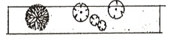
Residential 1 Understory Trees 
1.2 20 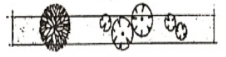
Collector 10 Shrubs 
1.5 20 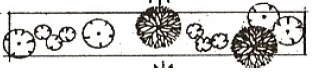
Sub-Arterial 1 Evergreen/Conifers 
2 20 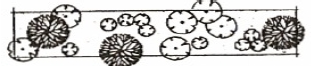
Arterial .5 Bench Table 19.16.2 -- Streetscape Landscaping Reduction Options A. -- Architecture B. -- Landscaping Architectural Reduction Options Landscaping Reduction Options Water Feature Reduction Options Reduction in Depth (feet) Average Architectural score Reduction in Depth (feet) * Plant unit multiplier Reduction in Depth (feet) Scope of Feature 0 0 3 0.3 3 8% 1 - 2.5 + 1 2 0.2 2 5% 2.6 - 5 + 2 1 0.1 % of total street frontage *Add this amount to the plant unit multiplier number within table 19.16.1 ** Rock Work Reduction Options Combination's of Reduction Options ** Rock work cannot be used as both the reduction option of the streetscape and the required screening of the parking lot Reduction in Depth (feet) Scope of Work Any combination of Landscaping, water features, rock work, or other significant features may be used to add up to the five (5) feet reduction If the maximum reduction of the streetscape landscaping requirement is given, only berm F-2B (see table 19.18.2) can be used for the screening of the parking area. 3 15% 2 10% 1 5% % of total street frontage
28-19-17 Table Of Bufferyard Requirements
The letter designations contained in this table refers to the bufferyard requirements and standards contained in table 19.18.2.
| Table 19.17 Proposed Land Use Intensity Class | ADJACENT EXISTING LAND USE INTENSITY CLASS | |||||||||
| Ia | II | III | IV | V | VI | VII | VIII | IX | X | |
| I | b | c | c | c | c | c | c | c | c | c |
| II | c | b | C | D | D | E | F | G | H | I |
| III | c | C | b | C | D | E | F | G | H | I |
| IV | c | D | C | b | D | E | F | G | H | I |
| V | A | D | D | D | b | b | C | D | E | E |
| VI | A | E | E | E | b | b | b | C | D | D |
| VII | A | F | F | F | C | b | b | b | C | C |
| VIII | B | G | G | G | D | C | b | b | b | B |
| IX | B | H | H | H | E | D | C | b | b | b |
| X | C | I | I | I | E | D | C | B | b | b |
| a ALSO APPLIES TO VACANT LAND b NO BUFFERYARD REQUIRED c FENCING ONLY REQUIRED | ||||||||||
28-19-18 Bufferyard Requirements
- The following illustrations graphically indicate the specifications of each bufferyard. Bufferyard requirements are stated in terms of width of the bufferyard and the number of plant units required per one hundred (100) linear feet of bufferyard. The requirements of a bufferyard may be satisfied by any of the options thereof illustrated. The "plant unit multiplier" is a factor by which the basic number of plant materials required for a given bufferyard is determined given a change in the width of that yard. The type and quantity of plant materials required by each bufferyard, and each bufferyard option, are specified in this section.
Table 19.18.1 – Available Bufferyards Development depth in feet Bufferyard Options Available Less than 500 feet All options are available 501 – 1000 feet Smallest option is not available 1001 – 1500 feet Smallest two (2) options are not available 1501 feet and greater Smallest three (3) options are not available, if however there are only three options within the required bufferyard, then the largest bufferyard must be used. - Each illustration depicts the total bufferyard located between two uses. However, where bufferyards are required against residential units or a residential zone the minimum bufferyard will have a minimum 6’ chain link fence, to meet city standards located on the property line between the bufferyard and residencies/residential zone. Where a fence is required the type of fence shall be upgraded one step to further protect the residential use, i.e. F2 will be installed as a F3, F4, as a F5.
- Whenever a wall, fence, or berm is required within a bufferyard, these are shown as "structure required" in the following illustrations, wherein their respective specifications are also shown.
- The following plant material substitutions shall satisfy the requirements of this section.
- In bufferyards F, G, H, and I, evergreen canopy or evergreen understory trees may be substituted for deciduous canopy forest trees without limitation.
- In bufferyards A, B, C, D, E, and G, evergreen canopy or evergreen understory trees may be substituted as follows:
- In the case of deciduous canopy forest trees, up to a maximum of 50 percent of the total number of the deciduous canopy trees otherwise required.
- In the case of deciduous understory, without limitation.
- In all bufferyards, evergreen or conifer shrubs may be substituted for deciduous shrubs without limitation.
- In all bufferyards required of public service uses, the public service use may substitute evergreen canopy or evergreen understory plant materials for canopy forest trees and understory plant materials, without limitation.
- If the development on the adjoining use is existing, planned, or deed-restricted for solar access, understory trees may be substituted for canopy trees where canopy trees would destroy solar access.
- Any existing plant material which otherwise satisfies the requirements of this section may be counted toward satisfying all such requirements.
- The exact placement of required plants and structures shall be the decision of each user except that the following requirements shall be satisfied:
- Evergreen (or conifer) class III and IV plant materials shall be planted in clusters rather than singly in order to maximize their chances of survival.
- Berms with masonry walls (BW1, BW2, and BW3) required of bufferyard I are intended to buffer more significant nuisances from adjacent uses and, additionally, to break up and absorb noise, which is achieved by the varied heights of plant materials between the masonry wall and the noise source.
- All bufferyard areas shall be landscaped according to the water efficient landscape standards in Chapter 3 of this Title.
- The bufferyards as established within table 19.18.2 represent all of the options available for every development. However, the minimum required bufferyard changes depending on the depth of the development. Use table 19.18.1 to determine the minimum bufferyard allowed per depth of development.
Table 19.18.2 Required Plant Units / 100 l.f. Plant Unit Multiplier Depth (feet) 100-feet in Length BUFFERYARD A .6 Canopy Trees 
.6 12.5 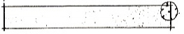
1 Understory Trees 
.8 10 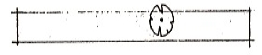
Shrubs 
1 7.5 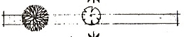
Evergreen/Conifers 
BUFFERYARD B 1 Canopy Trees 
.6 25 
2 Understory Trees 
.8 20 
Shrubs 
1 15 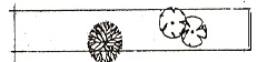
Evergreen/Conifers 
1 BUFFERYARD C 1 Canopy Trees 
.6 25 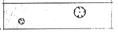
2 Understory Trees 
.8 20 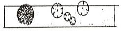
3 Shrubs 
1 15 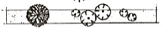
Evergreen/Conifers 
BUFFERYARD D 2 Canopy Trees 
.6 30 
4 Understory Trees 
.8 25 
6 Shrubs 
1 20 
Evergreen/Conifers 
BUFFERYARD E 3 Canopy Trees 
8 30 
6 Understory Trees 
1 25 
9 Shrubs 
.9 20 
Evergreen/Conifers 
BUFFERYARD F 5 Canopy Trees 
.8 30 
10 Understory Trees 
1 25 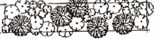
15 Shrubs 
.9 20 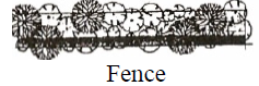
Evergreen/Conifers 
.8 15 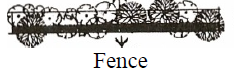
BUFFERYARD G 4 Canopy Trees 
.8 40 
6 Understory Trees 
1 30 
24 Shrubs 
.75 25 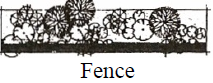
12 Evergreen/Conifers 
.7 20 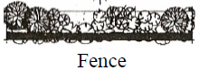
BUFFERYARD H 5 Canopy Trees 
.8 50 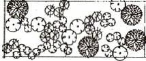
7.5 Understory Trees 
1 40 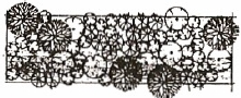
30 Shrubs 
.6 30 
15 Evergreen/Conifers 
BUFFERYARD I 6 Canopy Trees 
.8 75 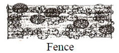
9 Understory Trees 
1 50 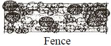
36 Shrubs 
.75 40 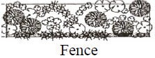
18 Evergreen/Conifers 
.6 30 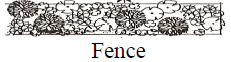
FENCES SYMBOL HEIGHT MATERIAL F-1V
F-2V4-feet
6-feet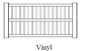
F-3V 6-feet 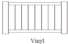
F-4V 7-feet 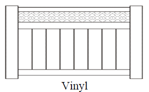
F-1W
F-2W4-feet
6-feet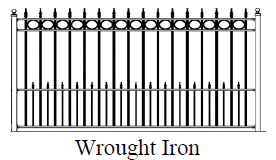
F-3W
F-4W4-feet
6-feet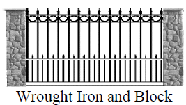
F-5W
F-6W6-feet (2’w/4’) 7-feet (4’w/3’) 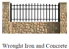
F-1C >3-feet 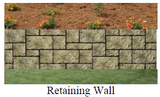
F-2C
F-3C6-feet
8-feet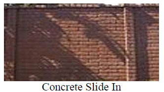
F-4C 8-feet 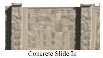
Concrete slide in fencing may be replaced with decorative block or rock fencing constructed on site when approved by the Planning Commission. BERMS SYMBOL HEIGHT MATERIAL F-1B >3-feet 
F-2B >3-feet wall 
28-19-19 Use Of Bufferyards
- A bufferyard may be used for passive recreation; it may contain pedestrian, bike, or equestrian trails, provided that:
- No plant material is eliminated,
- The total width of the bufferyard is maintained, and
- All other regulations of the ordinance are met.
- In no event, however the following uses be permitted in bufferyards: ice skating rinks, playfields, stables, swimming pools, and tennis courts.
28-19-20 Ownership Of Bufferyards
Bufferyards may remain in the ownership of the original developer (and assigns) of a land use, or they may be subject to deed restrictions and subsequently be freely conveyed, or they may be transferred to any consenting grantees, such as adjoining landowners, City, or an open-space or conservation group, provided that any such conveyance adequately guarantees the protection of the bufferyards for the purposes of this ordinance.
28-19-21 Excess Bufferyards
Where the bufferyard required between a land use and vacant land turns out to be greater than that bufferyard which is required between the first use and the subsequently developed use, the following options apply:
- The subsequent use may provide one half (.5) of the buffer required by 28-19-17 and 28-19-18. The existing use may expand its use into the original buffer area, provided that the resulting total bufferyard between the two uses meets the bufferyard requirements of 28-19-17 and 28-19-18.
- The existing use may enter into agreements with abutting landowners to use its existing buffer to provide some or all of the required bufferyard of both land uses. The total buffer shall equal the requirements of 28-19-17 and 28-19-18. Provided that such an agreement can be negotiated, the initial use may provide the second use some or all of its required bufferyard and/or extra land on which it might develop. The existing use may reduce its excess buffer by transferring part or all of the excess buffer to the adjoining landowner to serve as its buffer. Any remaining excess buffer area may be used by the existing use for expansion of that use or for transfer by it to the adjoining landowner to expand that adjoining use.
28-19-22 Contractual Reduction Of Bufferyard Abutting Vacant Land
When a land use is proposed adjacent to vacant land, and the owner of that vacant land enters into a contractual relationship with the owner of the land that is to be developed first, a reduced buffer may be provided by that first use, provided that:
- The contract contains a statement by the owner of the vacant land of an intent to develop at no greater than a specified land use intensity class; and
- The vacant landowner makes an agreement to assume all responsibility for additional buffer, if needed, by his development of a less intense use than had been agreed upon.
28-19-23 Site Development Standards
- The Clinton City Master Land Use Map outlines those portions of the city intended for development within the Performance Zone. In order to provide a natural buffer between residential developments adjacent to the Performance Zone and major roadways the Performance Zone shall not be reduced in depth from major roadways or intersections of major roadways below the following distances:
Table 19.23.1 134 Primary Arterial 500 foot Minor Arterial 500 Feet Intersection, Primary and Secondary Arterial 800 Feet Intersection, Primary and Collector 600 Feet Intersection, Secondary and Collector 500 foot - Street designations shall be as established in the Clinton City Transportation Master Plan. Distances shall be measured perpendicular from the centerline of the street right-of-way or as a radius from the intersection monument where applicable. 61, 123
28-19-24 Site Design Standards
The land use intensity classification standards (28-19-14.) regulate landscaping (both on-site and for parking areas), and exterior lighting. The following sections detail the regulations which apply to each of the six standards (R,A,B,C,D, and E) specified in Section 28-19-14.
28-19-25 General Landscaping Requirements
- This section details the general landscaping required of particular land uses by Section 28-19-14. The number and type of plant units required per three hundred (300) linear feet of building(s) perimeter comprising the subject land use are specified for standards A, B, C, D and E.
- The landscaping requirements specified for residential uses (R) is the requirement per ten (10) dwelling units.
- The requirements of this section shall be applied proportionately when the total linear feet of building(s) perimeter varies from three hundred (300) feet for nonresidential uses or ten (10) residential dwelling units. All required planting shall be located in areas which do not include any bufferyard or right-of-way. Existing plant materials which meet the requirements of this ordinance may be counted as contributing to the total landscaping required by this section.
- The following Table 19.25 specifies the type and number of plant units required by this section.
Table 19.25
Site Design Standard (Section 19- 14)Number of Landscaping Units Required (Per 300 feet or 10 dwelling units) Standard Canopy Understory Shrubs R 5 5 0 A 5 5 25 B 3 3 15 C 2 2 10 D 2 2 5 E 2 2 5
28-19-26 Off-Street Parking Landscaping Requirements
See 28-3-20 and 28-4-18 for details.
28-19-27 Exterior Lighting Standards
- Purpose. This section details the exterior lighting standards specified in 28-19-14. The purpose of this section is to regulate the spillover of light and glare on operators of motor vehicles in particular, safety considerations from the basis of the regulations contained herein. In other cases, both the nuisance and hazard aspects of glare are regulated. This section is not intended to apply to public street lighting.
- Definitions.
“Candlepower.” The amount of light that will illuminate a surface one (1) foot distant from a light source to intensity of one (1) foot-candle. Maximum (peak) candlepower is the largest amount of candlepower emitted by any lamp, light source, or luminaire.
“Cutoff.” The points at which all light rays emitted by a lamp, light source, or luminaire are completely eliminated (cutoff) at a specific angle above the ground.
“Cutoff Angle.” The angle formed by a line drawn from the direction of light rays at the light source and line perpendicular to the ground from the light source, above which no light is emitted.
“Cutoff-Type Luminaire.” A luminaire with elements such as shields, reflectors, or refractor panels which direct and cut off the light at a cutoff angle that is less than ninety (90) degrees.
“Foot-Candle.” A unit of illumination produced on a surface, all points of which are one (1) foot from a uniform point source of one (1) candle.
“Glare.” The brightness of a light source which causes eye discomfort.
“Luminaire.” A complete lighting unit consisting of a light source and all necessary mechanical, electrical, and decorative parts.
“Maximum Permitted Illumination.” The maximum illumination measured in foot-candles at the interior bufferyard line at ground level in accordance with the standards of Subsection (3) below. - The following standards are required of all exterior lighting except the outdoor recreational uses specifically exempted below. Many uses have the option of providing a lower light post with a noncutoff type luminaire or a higher pole, up to sixty (60) feet, with a luminaire that totally cuts off light spillover at a cutoff angle smaller than ninety (90) degrees. The maximum height light post permitted is dependent on amount of cutoff provided. This is designed as a protection against excessive glare and light spilling over to neighboring properties. The exceptions which are permitted provide adequate protection for neighboring residential property. Exterior lighting shall meet one (1) of the following standards:
1. When light source or luminaire has no cutoff: Standard Maximum Permitted Illumination Maximum Permitted Height of Luminaire R 0.20 10 feet A 0.20 15 feet B, C, D, E 0.30 20 feet An illustration of this type of luminaire is provided below. 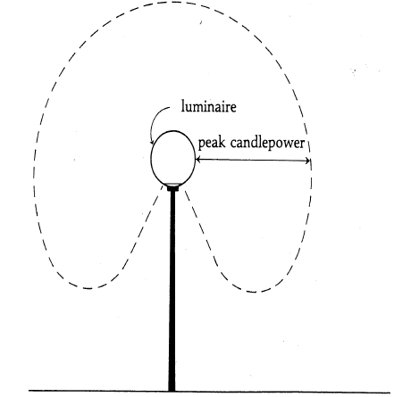
NO CUTOFF LUMINAIRE 2. When a luminaire has total cutoff of an angle greater than ninety (90) degree, the maximum illumination and the maximum permitted luminaire height shall be: Standard Maximum Permitted Illumination Maximum Permitted Height of Luminaire R 0.30 15 feet A 0.50 20 feet B 0.75 25 feet C 1.0 30 feet D 1.5 35 feet E 2.0 40 feet An illustration of this type of luminaire is provided below. 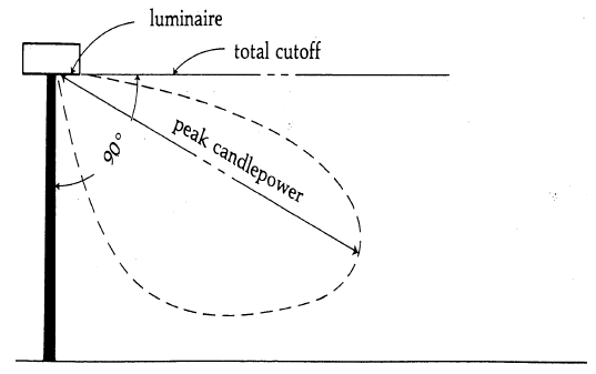
90° CUTOFF LUMINAIRE 3. When a luminaire has total cutoff of light at an angle less than ninety (90) degrees and is located so that the bare light bulb, lamp, or light source is completely shielded from the direct view of an observer five (5) feet above the ground at a point where the cutoff angle intersects the ground, then the maximum permitted illumination and the maximum permitted height of the luminaire shall be: Standard Maximum Permitted Illumination Maximum Permitted Height of Luminaire R 0.50 20 feet A 1.00 25 feet B 2.00 30 feet C 3.00 40 feet D 4.00 50 feet E 5.00 60 feet An illustration of this type of luminaire is provided below. 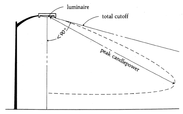
LUMINAIRE WITH LESS THAN 90° CUT-OFF 4. Exemption for specified outdoor recreational uses. 1. Because of their unique requirements for nighttime visibility and their limited hours of operation (specified in 28-19-14.), ball diamonds, playing fields, and tennis courts are exempted from the exterior lighting standards of 28-19-27 (3) above. These outdoor recreational uses must meet all other requirements of this section and of this ordinance. 2. The outdoor recreational uses specified above shall not exceed a maximum permitted post height of eighty (80) feet. 3. The outdoor recreational uses specified above shall not exceed a total cutoff angle of ninety (90) degrees, provided that the luminaire is shielded to prevent light and glare spillover to adjacent residential property. The maximum permitted illumination at the interior bufferyard line shall not exceed two (2) foot-candles. - Additional Regulations. Notwithstanding any other provisions of this section to the contrary:
- No flickering or flashing lights shall be permitted.
- Light sources or luminaries shall not be located within bufferyard areas except on pedestrian walkways.
- Measurement.
- Metering Equipment. Lighting levels shall be measured in foot-candles with a direct-reading, portable light meter. The meter shall have a color and cosine-corrected sensor with multiple scales and shall read within an accuracy of plus or minus five (5) percent. It shall have been tested, calibrated, and certified by an independent commercial photometric laboratory or the manufacturer within one (1) year of the date of its use.
- Method of Measurement. The meter sensor shall be mounted not more than (6) inches above ground level in a horizontal position. Readings shall be taken by qualified personnel only after the cell has been exposed long enough to provide a constant reading. Measurements shall be made after dark with the light sources in question on, then with the same sources off. The difference between the two readings shall be compared to the maximum permitted illumination at property line at ground level in Section 28-19-14. This procedure eliminates the effects of moonlight and other ambient light.
- Exterior Lighting Plan. At the time any exterior lighting is installed or substantially modified, and whenever a zoning certificate is sought, an exterior lighting plan shall be submitted to the City in order to determine whether the requirements of this section have been met.
28-19-28 Sign Standards
All signs located within this zone shall be in conformance with the Clinton City Sign Ordinance.
28-19-29 Existing Residential Uses
- Purpose. 126 The purpose of this section is to permit the continued use of single family residential development established within the Performance Zone prior to April 12, 2004. Additionally, the intent is not to allow any additional single-family residences to be developed except on lots that are part of residential plats, approved by the City and Recorded with the Davis County Recorder’s Office prior to April 12, 2004. This does not create non-conforming uses of the existing single-family dwellings rather it maintains all existing rights and privileges associated with single-family dwellings.
- Definitions.
“Subdivision Conventional.” Subdivisions designed around standard, public owned rights-of-way. Lots are owned by the homeowner, typical development in residential zones within the city.
“Subdivision, Performance (single-family).” Developments of single-family units on privately owned or association owned land with facilities for recreation and open spaces as part of the subdivision. Typically referred to as town houses and cluster homes. - Table of Performance Standards.
(Table19.29.1)TABLE 19-29.1 USE Conventional
SubdivisionPerformance
SubdivisionOpen Space ratio (OSR)
Minimum.20 Density Factor Low 3 4.2 High 5.5 15 Floor Area Factor (FAF)
MaximumLow High Impervious Surface Ratio (ISR)a
MaximumLow .3 3 High 40 .65 Minimum Site Area
Acres7 Minimum Lot area Sq.-ft 6,000 a For conventional subdivision, ratio is applied to individual building lot. For performance subdivision, ratio is applied to total project area - Site Development Standards. Theses standards were in place when the existing developments in the Performance Zone were established and shall remain applicable. Subdivisions and classifications existing at the time this change was implemented are:
SUBDIVISIONS CLASSIFICATION CONVENTIONAL OR PERFORMANCE SUBDIVISION Park David Estates, all phases. Class III Conventional Subdivision Taylor Estates Subdivision, all phases. Class III Conventional Subdivision Plumcreek Subdivision, all phases. Class IV Conventional Subdivision Snowberry Subdivision, all phases. Class IV Conventional Subdivision Tartan Ridge Subdivision, all phases. Class IV Conventional Subdivision Shady Grove Subdivision, all phases. Class IV Performance Subdivision Clinton Towne Center Subdivision, all phases. Class IV Performance Subdivision Clinton Towne Center Apartments Class IV Other Subdivision Table 19.29.2 Development Standards199 Conventional Subdivision Performance Subdivision 1. Minimum Lot Frontage Interior Width 65 None Corner Width 65 None 2. Minimum Yard Setbacks (feet) 1. Front Major Street 35 35 Local Side 20 20 2. Side Interior Lot 8/10 20 Facing Major Street 35 35 Facing Local street 20 20 Garages, accessory buildings, sheds, and carports 199 3 feet rated
5 feet non-rated3 feet rated
5 feet non-rated3. Rear Main Building 25 25 Garages, accessory buildings, sheds, and carports 3 feet rated
5 feet non-rated3 feet rated
5 feet non-rated3. Building Height Minimum stories 1 1 Maximum stories 2.5 3 Maximum feet 35 35 Garages, accessory buildings, sheds, and carports199 6’ minimum, 1 story max,< to main building on lot 6’ minimum, 1 story max,< to main building on lot 4. Building First Floor Area (sq. ft.) Dwelling unit minimum 850 800 Garages, accessory buildings, sheds, and carports199 850 Evaluated during a site plan review as established in § 28-3-10. 5. Impervious Surface Ratio 25% The impervious surface ratio is calculated based upon the impervious surface within any required side or rear yard minimum set back. a Applies to building rather than individual units
28-19-30 Plant Materials
This section provides for the plant materials and standards that must be met in order to satisfy the requirements established in this chapter. Included in this section are regulations relating to the size of plant materials. Although this section does not generally specify the location or spacing of plant material required, all plant materials shall be located so as to achieve the maximum level of protection to the less intense use.
- Minimum Plant Size. Unless otherwise specifically indicated elsewhere in this ordinance, all plant materials shall meet the following minimum size standards.
- Species of trees and shrubs shall be designated by a state licensed landscape architect and submitted to the city for approval as part of the site plan review.
Table 19.31
Plant MaterialMinimum Size
Planting in buffer yards abutting vacant lands
All other planting
Canopy Tree
Single Stem
2 inch caliper
2 1/2 inch caliper
Multi-Stem Clump
6 feet high
8 feet high
Understory Tree
1 1/2 inch caliper
2 inch caliper
Evergreen Tree
5 feet high
7 feet high
Shrubs
Deciduous
3 gallon
5 gallon
Evergreen
3 gallon
5 gallon
28-19-31 Clinton City Central Business District Design Standards And Guidelines
- Clinton City Central Business District Design Standards and Guidelines, referred to as the “CBD Design Standards” are adopted as a companion document to this chapter.
- Unless otherwise established by the Clinton City Council the Clinton City Planning Commission shall function as the Architectural Design Review Committee.