
Hillsboro City Zoning Code
SUB CHAPTER 12.67
WITCH HAZEL VILLAGE PLAN DISTRICT
12.67.010 - Purpose.
The Witch Hazel Village Plan District development and design standards reflect the City's goals and objectives for Witch Hazel Village and are intended to implement the vision, goals, policies and principles outlined in the City of Hillsboro Comprehensive Plan and Witch Hazel Village Community Plan (HCP Section 27).
(Ord. 6401 § 1, 2022)
12.67.020 - Applicability.
A.
Plan District Boundary. The standards of this section apply only within the Witch Hazel Village Plan District boundary as shown on the Witch Hazel Village Community Plan Map (Figure 27-1 of the HCP).
B.
Base Zones. The base zones used to implement the Community Plan designations include those listed in Table 12.67.020-1.
(Ord. 6401 § 1, 2022)
12.67.030 - Overview of Development and Design Standards.
Table 12.67.030-1 summarizes the applicability of Subchapter 12.50 Development and Design Standards within the Witch Hazel Village Plan District.
(Ord. 6401 § 1, 2022)
12.67.040 - Street Cross-Sections and Design Standards.
A.
In General. The street cross-sections and design standards listed below shall apply in the Witch Hazel Village Plan District as shown on Figure 12.67.040-A. These street cross-sections and design standards apply only to streets and street segments classified with the design types identified in Section 12.67.040.
1.
Variations to these street cross-sections and other requirements of Section 12.67.040 may be required by the City Engineer at the approach to an intersection or for fire apparatus access. Cross-sections may also be adjusted to be consistent with any approved Safe Routes to Schools plan applicable to that street segment.
2.
Street cross-sections and design standards not classified with the design types identified in Figure 12.67.040-A shall be designed and constructed to comply with the Public Works Design and Construction Standards.
Figure 12.67.040-A:
Street Design Types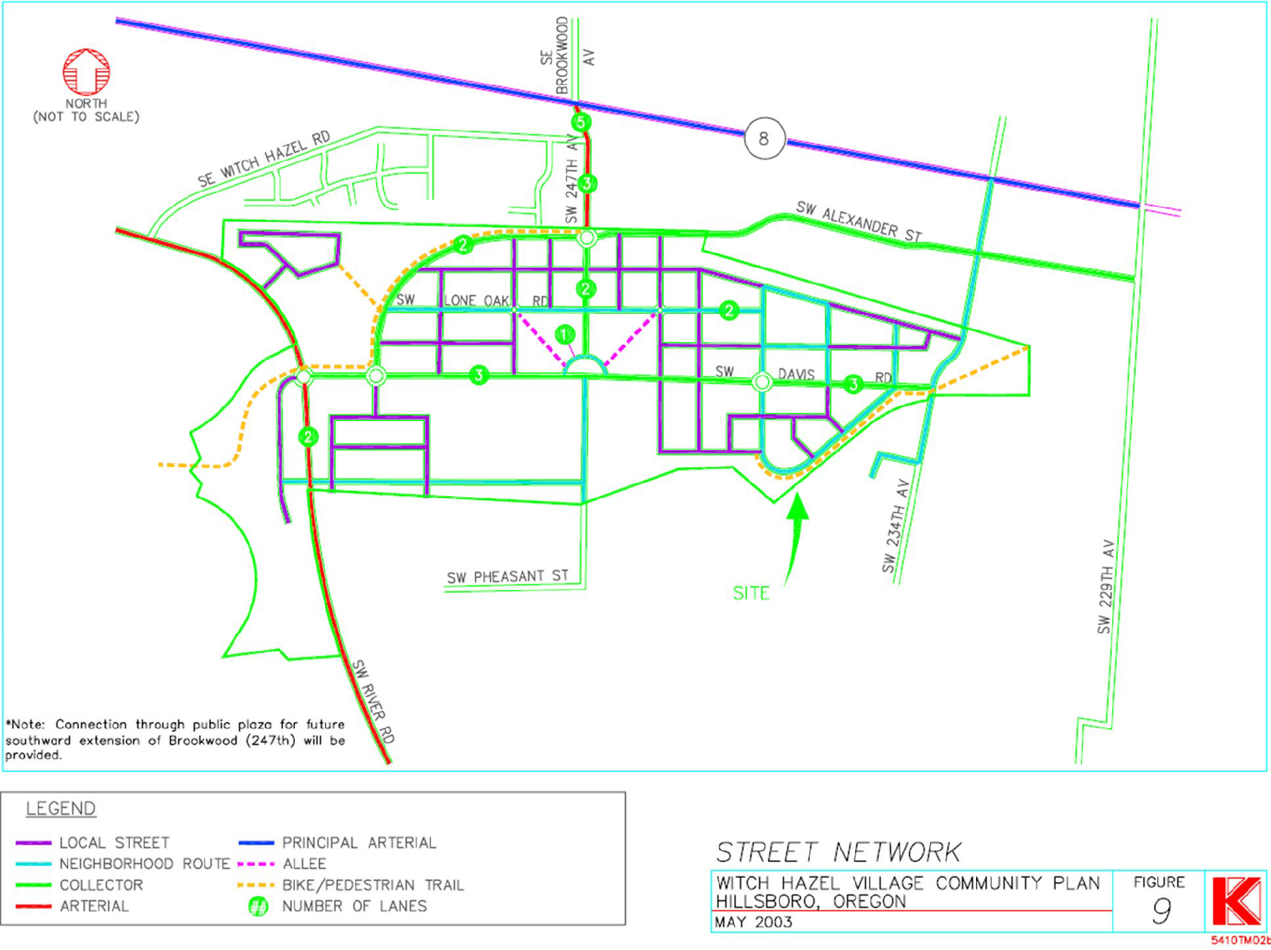
B.
Arterials. SW River Road and SW 247th/Brookwood Avenue, north of SE Alexander Street, shall be designed to move people through the area and connect the plan area to other parts of the region.
1.
Design. Design of arterials shall comply with Figure 12.67.040-B.
Figure 12.67.040-B: Arterial Street Cross-Sections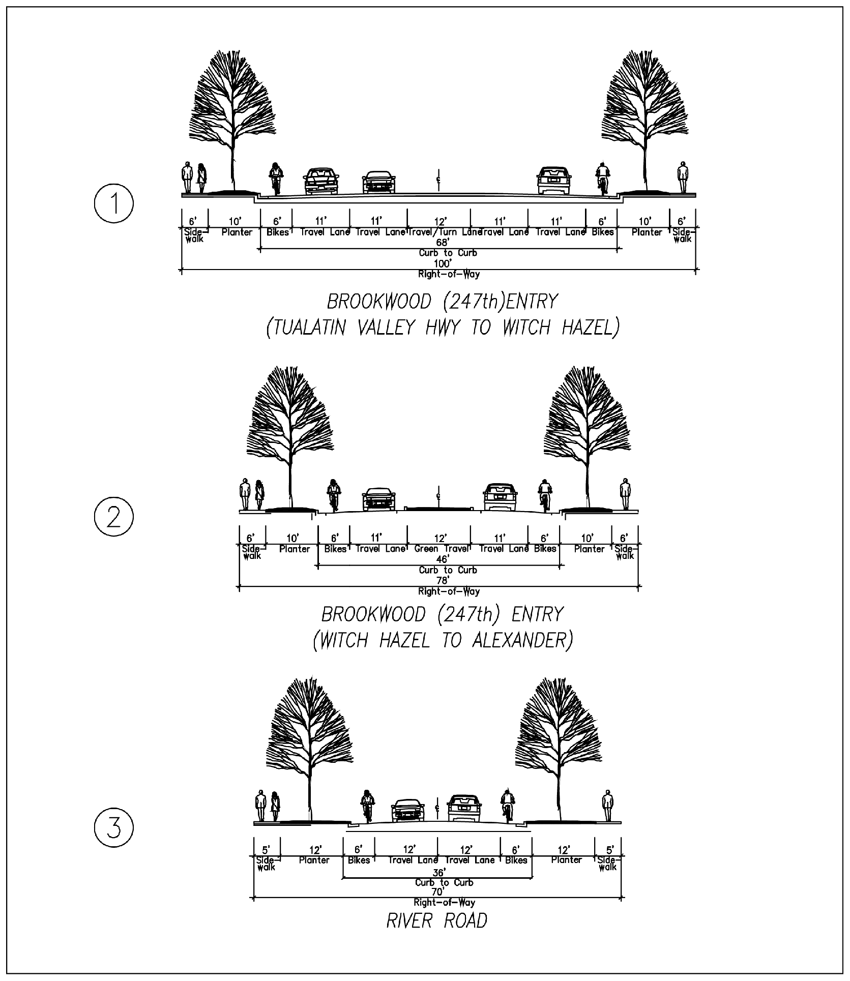
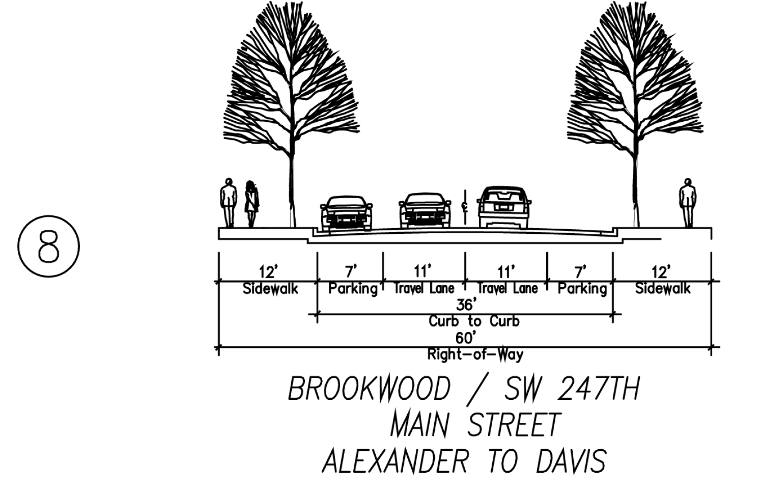
C.
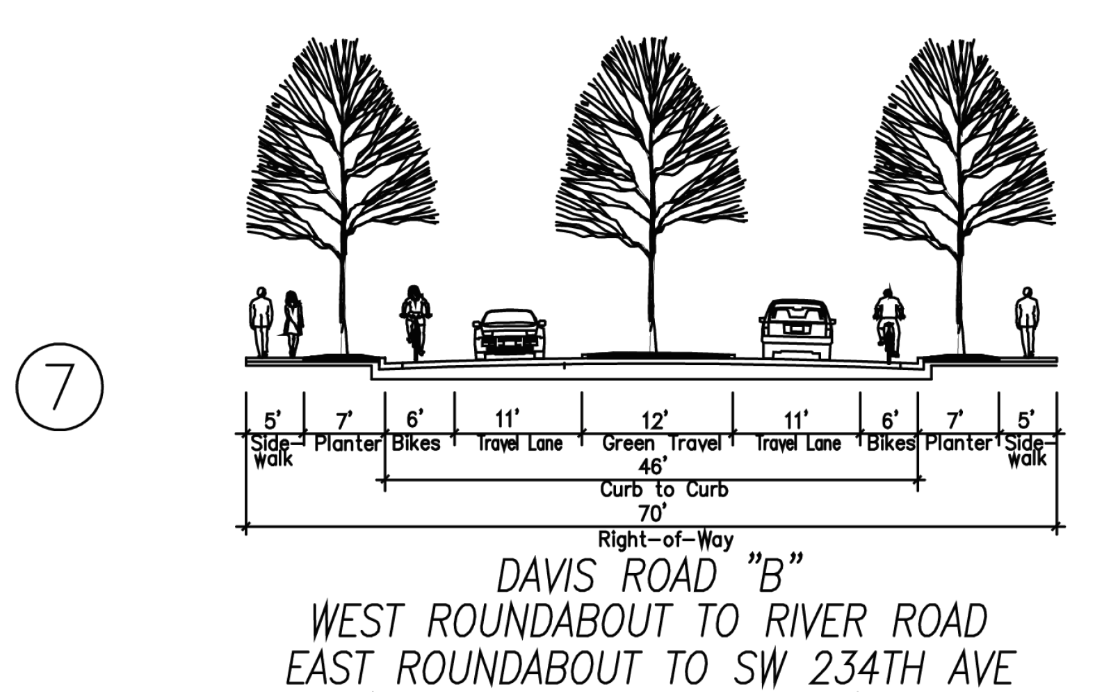
Collectors. SE Alexander Street, SW Davis Road and SW 247th/Brookwood Avenue, south of SE Alexander Street, are designed to move people through the site and to provide access to the interior of the plan area. Although designed to accommodate significant levels of traffic, the design of the collectors include traffic calming devices to slow traffic and opportunities for walking and biking. Features include sidewalks, on-street parking, planter strips and bike lanes. Roundabouts located along SE Alexander Street and SW Davis Road are designed to calm traffic, but not necessarily to increase capacity on these roadways.
1.
Design. Design of collectors shall comply with Figure 12.67.040-C.
Figure 12.67.040-C: Collector Street Cross-Sections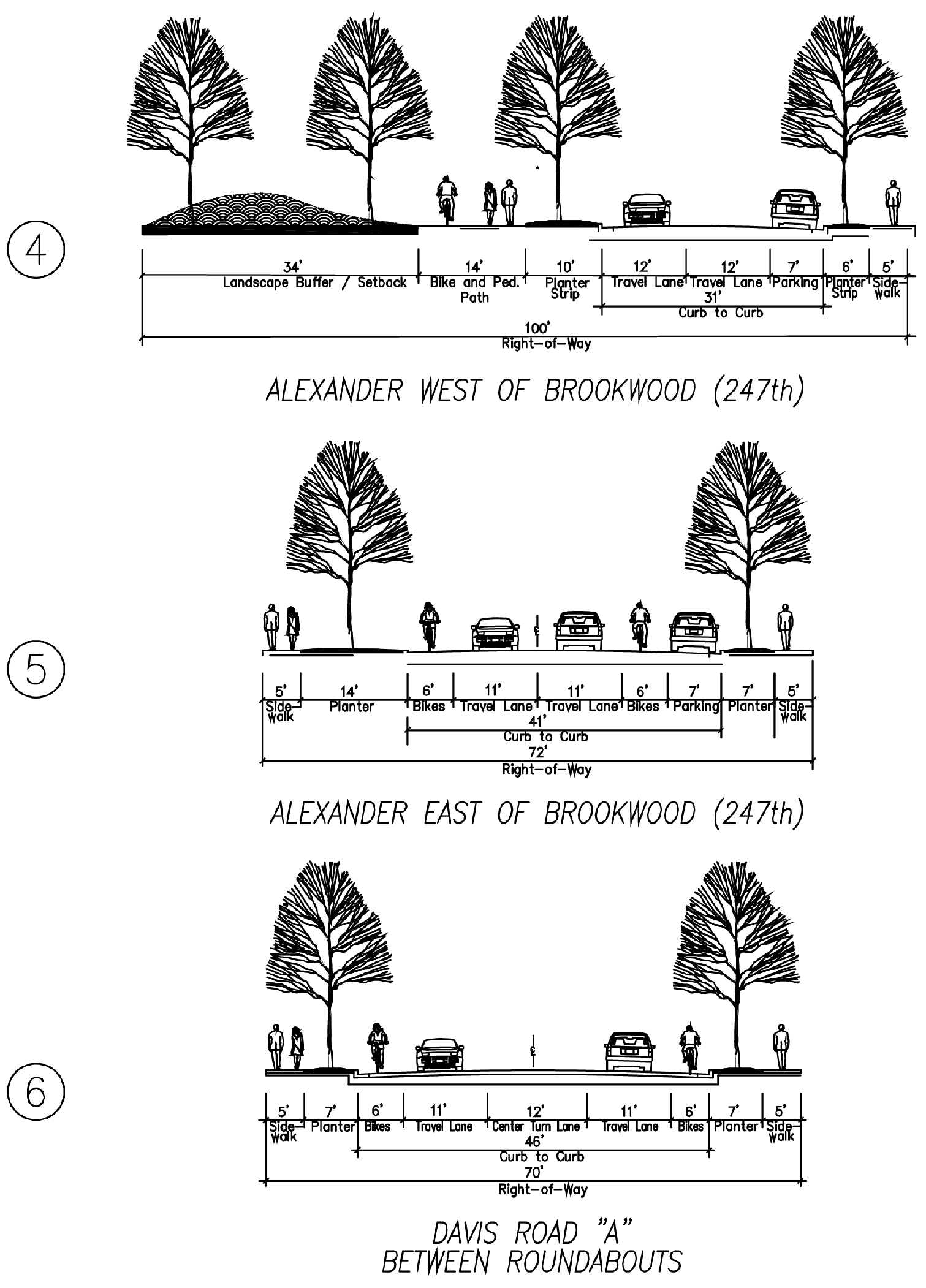
D.
Neighborhood Routes. As shown on Figure 12.67.040-A, a number of interior streets are designated as neighborhood routes, designed to provide access from the collectors to the interior neighborhoods in the Plan District. These streets are narrower than collectors, and include on-street parking, planter strips and sidewalks.
1.
Design. Design of neighborhood routes shall comply with Figure 12.67.040-D.
Figure 12.67.040-D:
Neighborhood Route Cross-Sections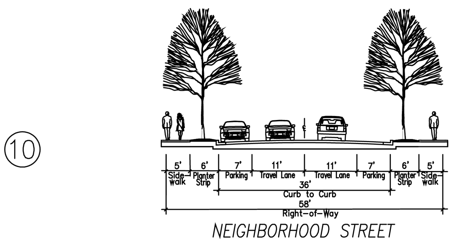
E.
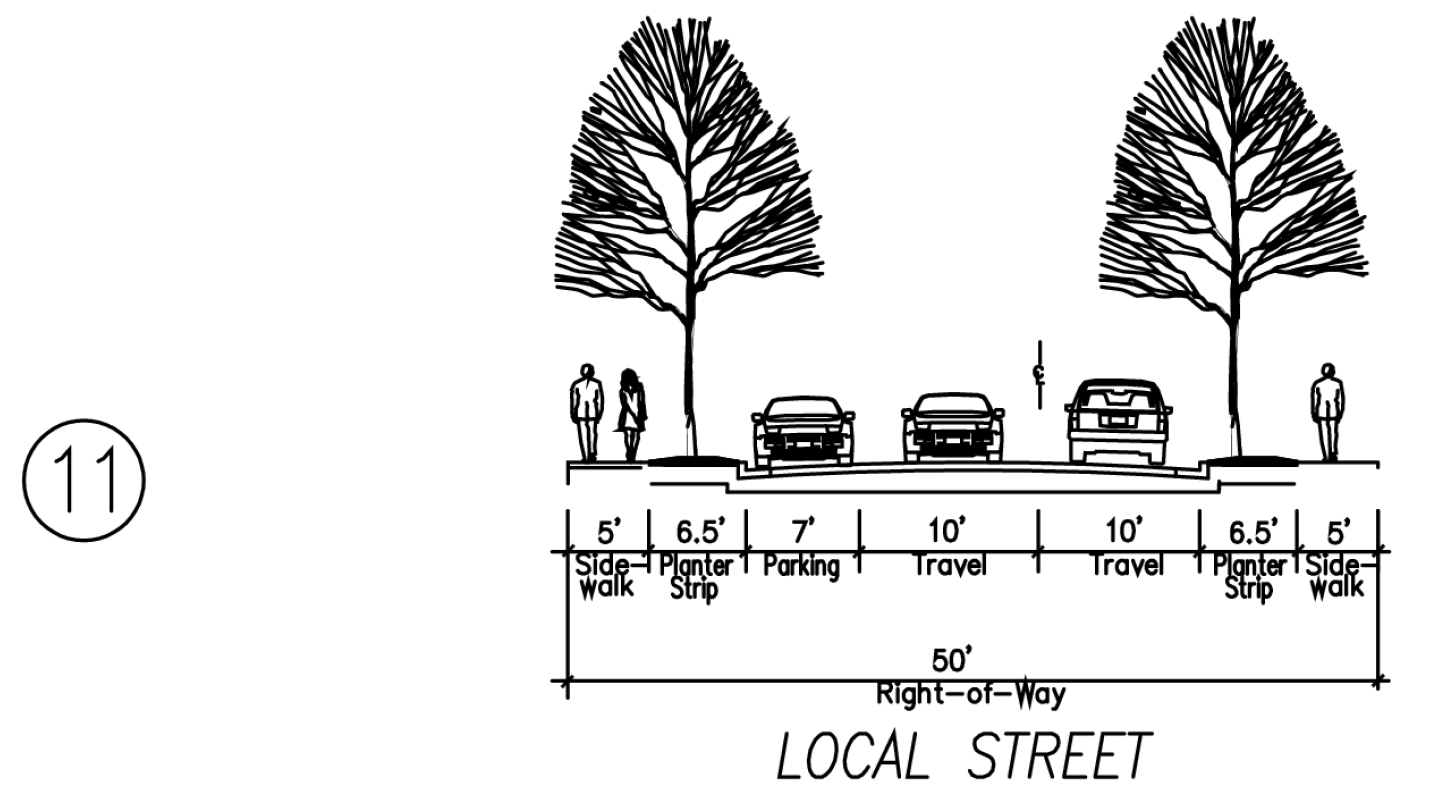
Local Streets. The local streets provide access to the residential neighborhoods. Streets are approximately 400 feet apart to create walkable blocks.
1.
Design. Design of local streets shall comply with Figure 12.67.040-E.
Figure 12.67.040-E:
Local Street Cross-Sections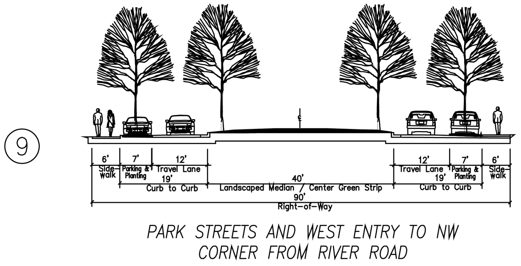
F.
Alleys. In order to reduce the number of curb cuts required to serve the neighborhoods, alleys are required throughout much of the Plan District. Alleys create a more cohesive pedestrian-oriented neighborhood by requiring only 1 driveway curb cut off the local street to serve multiple houses. Alleys are required in all neighborhoods north of SW Davis Road, and in some of the medium-density and low-density housing proposed south of SW Davis Road. The map in Figure 12.67.040-A identifies the specific alley locations.
1.
Design. Design of alleys shall comply with Figure 12.67.040-F.
Figure 12.67.040-F:
Alley Cross-Section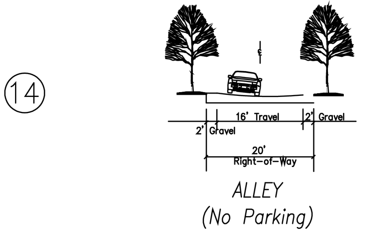
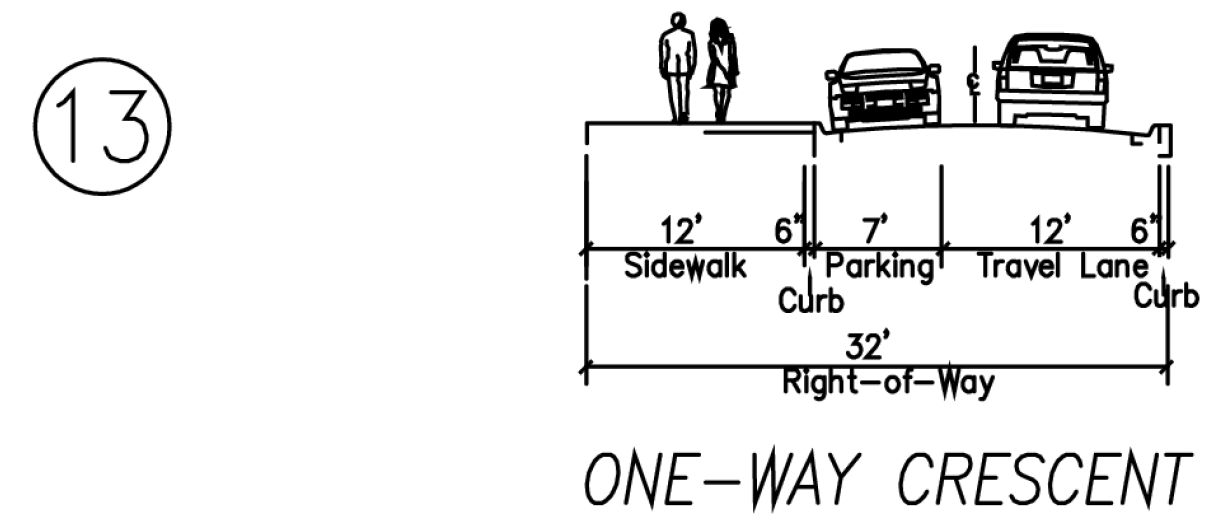
G.
Allees. Two urban streets intersect the high-density housing. The allees' double rows of canopy street trees and wide sidewalks are designed to provide a pleasant walking environment. The primary function of the allees is not connectivity for automobile traffic, but rather for pedestrian and bicycle traffic.
1.
Design. Design of allees shall comply with Figure 12.67.040-G.
Figure 12.67.040-G:
Allee Cross-Section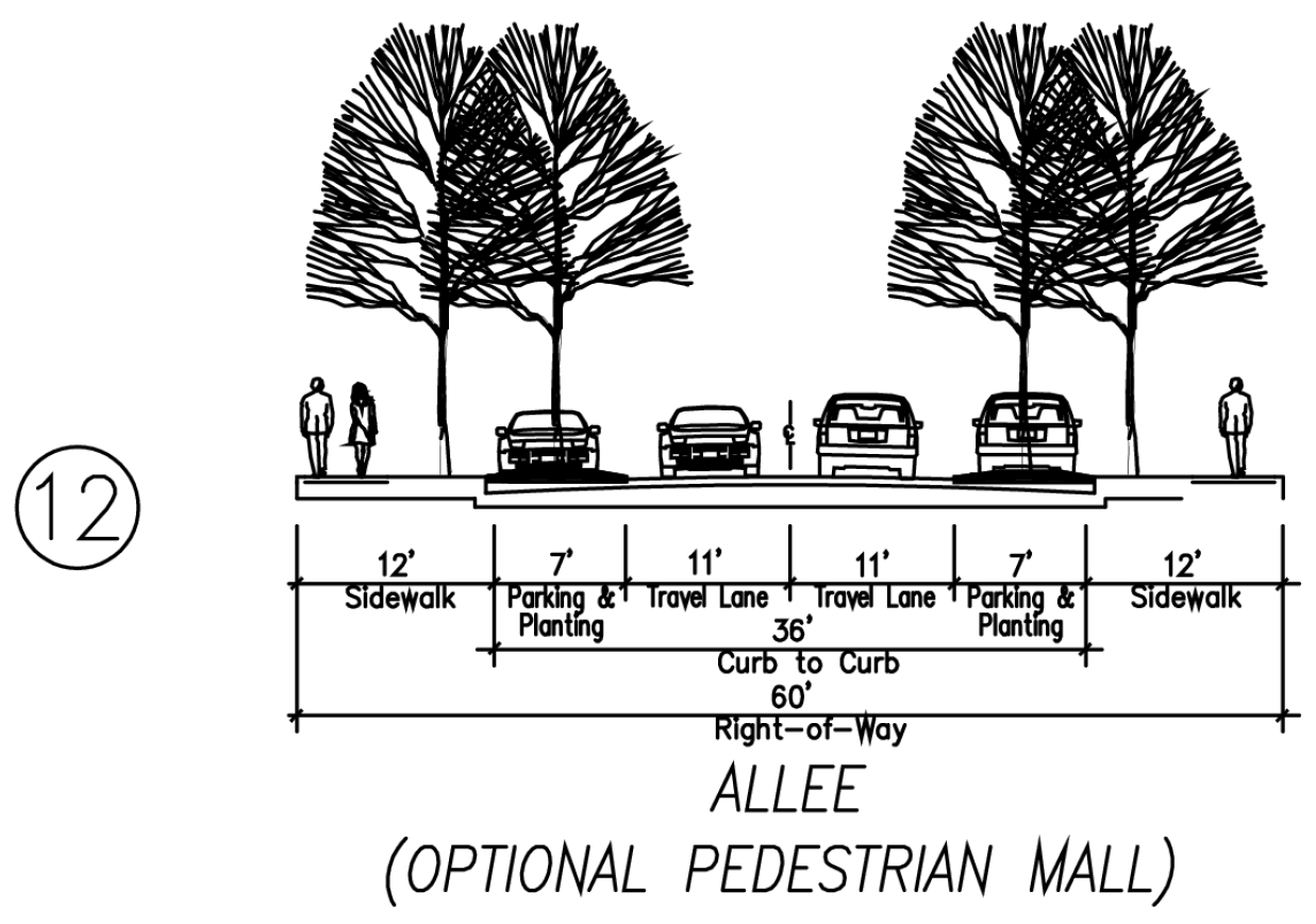
(Ord. 6401 § 1, 2022)