
Mount Juliet City Zoning Code
ARTICLE VIII
OVERLAY DISTRICTS
Sec. 8-101.- Operation and intent of overlay districts.
8-101.1 Purpose and intent. Overlay districts are hereby established as a means of addressing specific aspects of land use control or development that transcend conventional zoning district provisions. Included are overlay district provisions that permit greater design flexibility; an overlay to protect areas subject to flooding; and an overlay district designed to regulate the location of adult entertainment establishments.
8-101.2 Applicability. An overlay district shall represent a mapped geographic area depicted upon the official zoning map. Overlay districts may be applied to the base zone districts so indicated by this ordinance and may encompass one or more of those districts. Unless expressly stated to the contrary in this article, all lands encumbered by an overlay district shall conform to all other applicable provisions of this ordinance.
(Ord. of 10-23-2009, § 8-101)
Sec. 8-201. - Planned unit development districts.
8-201.1 General provisions.
1.
Intent and purpose. The PUD, Planned Unit Development District regulations are an alternative zoning process that allows for development of land in a well planned and coordinated manner. This procedure is intended to provide opportunities for more efficient utilization of land than would otherwise be the case under the conventional provisions of this ordinance. The planned unit development provisions permit a greater mixing of land uses not easily accomplished by the application of conventional zoning district boundaries, or a framework for coordinating the development of land with provision of adequate roadways and public services. In return, the PUD districts require a high standard for protection and preservation of environmentally sensitive lands, well planned living, working and shopping environments and timely provision of essential utilities and streets.
2.
Consistency with the general plan and area development plans. No planned unit development shall be approved unless all plans for development are found to be consistent with the then current issue of the General Plan for the City and any adopted special development plans for the area in which the planned unit development is proposed. The Planning Commission shall make a formal, written finding regarding consistency of any proposed planned unit development, said report to include findings that the development:
a.
Will be consistent with the currently effective General Plan as well as any special development plan for the area.
b.
Is likely to be compatible with development permitted under the general development provisions of the zoning ordinance.
c.
Will not significantly interfere with the use and enjoyment of other land in the vicinity.
3.
Application of the district.
a.
General[ly]. A Planned Unit Development Overlay District may be applied over any base zoning district established in article IV of this ordinance.
b.
Provisions may be made mandatory. In the event that the adopted development plan for an area where any development is proposed so recommends, the Board of Commissioners shall require that all petitions for reclassifications of land within the area shall be formulated and administered in accordance with this section, including any amendments thereto. As appropriate for their respective areas, adopted development plans shall also contain recommendations which may differ from or supplement provisions of this article respecting new or modified PUD, Planned Unit Development Districts; design standards for signage, setbacks, parking and other matters, to be made applicable either area-wide or within particular PUD, Planned Unit Development Districts, or both. The Board of Commissioners shall not entertain proposals for reclassification of land within such areas until it has formally acted upon these recommendations.
4.
Relation of planned unit development regulations to general zoning, subdivision, or other regulations; variations on equal satisfaction of public purposes. The planned unit development regulations that follow shall apply generally to the initiation and regulation of all PUD, Planned Unit Development Districts. Where there are conflicts between the special planned unit development regulations herein and general zoning, subdivision, or other regulations or requirements, these regulations shall apply in PUD, Planned Unit Development Districts.
Where actions, designs, or solutions proposed by the applicant are not literally in accord with applicable planned unit development or general regulations, but the Board of Commissioners makes a finding in the particular case that public purposes are satisfied to an equivalent or greater degree, the Board may make specific modification of the regulations in the particular case, provided that: 1) minimum gross acreage; 2) minimum lot size and 3) floor area and similar ratios (other than off-street parking); have been established by these regulations, the Board shall not act in any case to modify the minimum gross acreage requirements, the lot size requirements and/or floor area rations and other similar ratios.
Except as indicated above, notwithstanding procedures and requirements generally in effect, procedures and requirements set forth herein and in guides and standards officially adopted as part of regulations for particular classes of PUD, Planned Unit Development Districts shall apply in PUD, Planned Unit Development Districts, to any amendments creating such districts and to issuance of all required permits therein.
5.
Jurisdiction of Planning Commission and Board of Zoning Appeals. Those activities which require conditional use permits under various provisions of this ordinance may be permitted within planned unit developments provided that such activities are approved initially as part of the master development plan by the Planning Commission and the Board of Commissioners. Thereafter, the Board of Zoning Appeals may approve such uses.
6.
Ownership and division of land. No tract of land may receive preliminary approval as a planned unit development, unless such tract is under the unified control of a "landholder" as defined by this ordinance. Unless, otherwise, provided as a condition of approval of a planned unit development, the landholder of an approved planned unit development may divide and transfer parts of such development. The transferee shall complete each such unit, and shall use and maintain it in strict conformance with the adopted master development plan. A report identifying all property owners within the area of the proposed district and giving evidence of unified control of its entire area shall be submitted along with any application for approval of a master development plan. The report shall state agreement of all present property owners and/or their successors in title:
a.
To proceed with the proposed development according to the regulations in effect when the map amendment, including such modifications as are set by the Board of Commissioners in the course of such action creating the PUD, Planned Unit Development District, becomes effective.
b.
To provide bonds, dedications, guarantees, agreements, contracts and deed restrictions acceptable to the Board of Commissioners in the course of such action.
c.
To bind further successors in title to any commitments under subparts a and b, above.
7.
Staging of development. The Planning Commission may elect to permit staging of the development, in which case, the following provisions shall apply:
a.
Each stage shall be so planned and so related to existing surroundings and available facilities and services that failure to proceed with subsequent stages will not have an adverse impact on the planned unit development or its surroundings.
b.
Each stage of the development shall, at the time of approval of any final site development plan for any portion of that stage, be assured adequate public services to serve all development proposed for that stage.
8.
Status of previously approved PUD, Planned Unit Development Districts. Any Planned Unit Development District which was approved under the provisions of Ordinance No. 86-21, as amended, and is not completely developed at the time of approval of this ordinance may continue under the development plan as approved. In any instance, however, where a change in the approved development plan is proposed such change shall conform to the provisions of this ordinance.
(Ord. of 10-23-2009, § 8-201; Ord. No. 2021-17, 5-10-2021; Ord. No. 2021-50, 12-13-2021; Ord. No. 2023-22, 6-12-2023)
Sec. 8-202. - Definitions.
8-202.1 Application. In the construction of this article, the rules and definitions contained in this section shall be observed and applied, except when the context clearly indicates otherwise.
8-202.2 Terms defined.
Actual construction [means] the excavation of a site and/or the placement of building materials in conjunction with the construction of a building or other structure.
Common open space [means] a parcel or parcels of land and/or an area of water within the site designated, designed and intended for benefit, use or enjoyment of the occupants of said development. [The term] "common open space" may contain such complementary structures and improvements as necessary and appropriate for the benefit and enjoyment of the occupants of such development.
Dwelling, attached, [means] a building located upon one zone lot containing not more than two dwelling units, attached at the side or sides in a series of three or more principal buildings each containing not more than two dwelling units.
Dwelling, detached, [means] a building located upon one zone lot containing not more than two dwelling units, separated from structures on adjacent lots.
Dwelling, semi-detached, [means] a building located upon one zone lot containing not more than two dwelling units, attached at the side to not more than one other building containing not more than two dwelling units.
Environmental open space [means] a parcel or parcels of land and/or an area of water within the site designated, designed and intended for protection of the natural landscape or certain specified resources.
Landholder [means] the legal or beneficial owner or owners of all the land proposed to be included in a planned unit development. The holder of an option or contract to purchase, a lessee having a remaining term of not less than 50 years in duration, or other person having an enforceable proprietary interest may be considered a landholder for the purpose of this ordinance.
Private use open space [means] open areas located upon a lot and held for the exclusive use and enjoyment of owner(s) of such property.
Recreational open space [means] a parcel or parcels of land and/or an area of water within the site designated, designed and intended for benefit, active or passive recreational use or enjoyment of the occupants of said development.
Restricted use open space [means] open areas located within a planned unit development that are held in some form of common ownership and restricted to use only as vegetative buffers, or other forms of environmental protection. These areas may include floodplains, steep slopes or other environmentally sensitive lands.
Shared use open space [means] shared use open space may exist within a planned unit development both as limited use or general use shared open space. Limited use shared open spaces are those limited to use by only a portion of the individuals who reside within the planned unit development. Shared general use open space is intended to be available for use by any resident of the development, but may be limited to use only by residents and their guests.
(Ord. of 10-23-2009, § 8-202)
Sec. 8-203. - Administrative procedure governing planned unit developments.
8-203.1 Purpose and intent. The purpose of these provisions is to prescribe a procedure for review, approval and continued administration of all planned unit developments provided for by this section.
8-203.2 Preapplication conference. Prior to filing an application for approval of a planned unit development the applicant shall confer with the Zoning Administrator concerning policy and procedure relative to the application. The Zoning Administrator shall arrange a formal meeting where the applicant or his representative shall meet with other staff persons who will be involved in reviewing and recommending action on the proposed plan of development.
8-203.3 Preliminary approval of the proposed planned unit development.
1.
Application for preliminary approval. Application for preliminary approval shall be made by the landholder of the affected property or his authorized agent to the Zoning Administrator in accordance with such written general rules regarding procedure, form of application and required information as the Planning Commission may determine, provided such provisions are not inconsistent with the requirements set forth below.
2.
Preliminary master development plan of a planned unit development. The preliminary master development plan for the proposed planned unit development shall be a general concept plan which shall include the following:
a.
Sufficient information to disclose.
i.
The location and size of the area involved;
ii.
Location of transportation routes including streets, driveways, sidewalks, pedestrian ways and off-street parking and loading areas;
iii.
Location and approximate dimensions of structures, other than one- and two-family detached dwellings, including approximate height, bulk and proposed utilization of structures including activities and the number of living units;
iv.
Estimated population density and extent of activities to be allocated to various parts of the project;
v.
Reservations for public uses including schools, parks and other open spaces;
vi.
Other major landscaping features;
vii.
The general means of the disposition of sanitary wastes and stormwater;
viii.
The type and proposed use for any common open space included within the proposed development. Such information shall be sufficient to meet the requirements of subpart 4, of subsection 8-204.1, Quality, use and improvement of common open space;
ix.
The ownership of all property proposed for incorporation within the PUD district. A copy of all deeds along with written documents signed by all property owners indicating willingness to abide by the approved development plan;
x.
The base zone district(s) proposed for inclusion within the planned unit development;
xi.
A listing of land uses proposed for the development. (Note. In an effort to increase the marketability of nonresidential sites located within PUD districts, the applicant may submit a list of alternative land uses, other than the uses shown on the plan, for such sites. Any such listing may contain only land uses permitted within the base zoning district(s) which the planned development district overlays and may be further limited as provided in subsection 8-208.1; and
xii.
A site plan for all improved open space amenities.
b.
A tabulation of the land area to be devoted to various uses and activities and overall densities.
c.
The nature of the landholder's interest in the land proposed to be developed and a written statement of concurrence from all parties having a beneficial interest in the affected property. (See subsection 8-201.1, subpart 6.)
d.
The substance of covenants, grants of easements or other restrictions to be imposed upon the use of the land, buildings and structures including proposed easements for public utilities, drainageways and common open space.
e.
When it is proposed that the final master development plan will be submitted in stages, a schedule of proposed submissions thereof.
If the application is deemed incomplete by the Zoning Administrator, a written request shall be made within ten days after the original submittal, for further information. In such case the application shall be held in abeyance until deemed complete. No plan shall be formally presented for Planning Commission action until such plan is found complete and ready for review.
3.
Review by other departments of City government. Other departments of the City as appropriate, shall review the plan for the proposed planned unit development.
4.
Planning Commission action on preliminary application for planned unit development. Within 45 days after initial submission the Planning Commission shall take action on the preliminary application by any one of the following:
a.
Unconditional preliminary approval.
b.
Conditional preliminary approval, in which the Planning Commission expressly denotes modifications which must be a part of the preliminary approval.
c.
Disapproval.
5.
Conditional preliminary approval; landholder's response. When the Planning Commission's action is conditional preliminary approval, the commission shall specifically note in its minutes conditions or modifications which must be compiled with in order that the proposed planned unit development receive preliminary approval. Within 60 days following the meeting wherein conditional approval is granted, the landholder may make a written response concurring with required modifications, in which case the planned unit development is deemed to have preliminary Planning Commission approval at the date of receipt of said written concurrence. When the landholder makes a negative reply or does not reply within 60 days of the date of conditional preliminary approval, the planned unit development shall be deemed as a recommendation for disapproval, unless such time limit is extended by specific action of the Planning Commission upon a written request of the landholder. In the event of a recommendation for disapproval the applicant may at his option proceed to the Board of Commissioners with his request.
6.
Action by Board of Commissioners. Upon completing preliminary development plan review the Planning Commission shall forward its report and recommendations to the Board of Commissioners for action. Upon receipt of the Planning Commission's report the Board shall consider such report and recommendations, the preliminary development plan and such other information as it may require. The Board of Commissioners shall hold such required hearings and otherwise proceed in the manner set forth in article XIV, for consideration of an amendment to the zoning ordinance.
In any instance where the Board of Commissioners may act either to approve a proposed development which the Planning Commission had recommended for disapproval or to conditionally approve the proposed development plan, the Board shall provide specific guidance to the Planning Commission relative to:
a.
Overall design of the plan;
b.
Any modifications required; and
c.
Any additional information which may be required by the Planning Commission in order for it to determine substantial compliance between the preliminary and final development plan.
7.
Planned unit development and the official zoning map. Upon approval by the Board of Commissioners, the Zoning Administrator shall place the extent of the planned unit development on the official zoning map identified by the ordinance number providing approval. Similarly in the instance of action by the Planning Commission abolishing or removing the planned unit development, the zoning administrator shall remove the PUD district from the official zoning map.
8.
Recording of PUD district. Within 60 days following enactment of an adopting ordinance by the Board of Commissioners, all owners shall record with the Register of Deeds a boundary plat or suitably comparable document identifying that the affected properties are subject to the provisions of a Planned Unit Development Overlay District. Suitable instruments indicating the nature and extent of all off-site improvements and special conditions to which the development is subject shall be recorded with such plat.
9.
Addition of land uses not included within an approved preliminary master development plan or listing of alternative uses allowable within the base zoning district. The proposed addition of any use not authorized within an approved preliminary development plan and accompanying listing of alternative nonresidential land uses may be added to the plan only when approved as provided, herein. The Planning Commission shall hear all such proposed amendments. In the course of its consideration of any alteration presented hereunder, the Planning Commission shall hold a public hearing. Said hearing is held for the purpose of making a recommendation to the Board of Commissioners as to disposition of the requested change. The action by the Planning Commission on the request for change shall be in the form of a resolution to the Board of Commissioners for amendment of the approved preliminary development plan. A report detailing the action recommended by the Planning Commission shall accompany the submission of Board of Commissioners.
8-203.4 Final approval of a proposed planned unit development. The approval by the Board of Commissioners of the preliminary development plan shall authorize and form the basis for the Planning Commission's final approval of said development. The final approval by the Planning Commission of the planned unit development shall be subject to the procedures and requirements of this section.
1.
Application for final approval. Following approval of a preliminary planned unit development plan by the Board of Commissioners, the landholder may make application to the Planning Commission for approval of final development plans for all or a portion, (provided the portion is consistent with the staging schedule approved with the preliminary development plan), of the proposed planned unit development. No action shall be taken on any final development plan for any portion of a planned unit development until the landholder demonstrates that all land included within the portion of the development for which final approval is requested is owned by the landholder and that any options have been closed.
The application for approval of the final development plan shall include all aspects of the preliminary application, the proposed final master development plan, other required drawings, specifications, covenants, easements, and conditions and forms of bond as were set forth by the Planning Commission resolution of preliminary approval. Copies of legal documents required by the Commission for dedication or reservation of common open space and/or for creation of a nonprofit association shall be submitted with the final development plan.
2.
Final approval of stages. The application for final approval and the final approval by the Planning Commission may be limited to each stage as appropriate in a large planned unit development, in compliance with the staging plan approved as part of the preliminary development plan.
3.
Final master development plan of a planned unit development. The application for final approval shall be sufficiently detailed to indicate the ultimate operation and appearance of the development, or portion thereof, and shall include, but not be limited to, the following:
a.
A site development plan containing the information required by [sub]section 14-103.3, Site development plans. At a minimum, such plan shall provide the following:
i.
A grading plan indicating the anticipated finished topography of the area involved (contours shall be shown at vertical intervals no greater than two feet where topography does not exceed ten percent and five feet elsewhere).
ii.
A circulation diagram indicating the proposed movement of vehicles, goods and pedestrians within the planned unit development and to and from existing thoroughfares. This shall specifically include: width of proposed streets; a plan of any sidewalks or proposed pedestrian ways; and any special engineering features and traffic regulation devices needed to facilitate or ensure the safety of the circulation pattern.
iii.
An open space and recreation facilities plan indicating all land and facilities proposed to be conveyed, dedicated or reserved for parks, parkways and other public or semi-public open space uses including any improvements which are to be deeded as part of any common use area. (Such information shall include detailed site designs indicating all intended uses, equipment and facilities along with building or construction plans for the same.)
iv.
A drainage plan sufficient to meet the requirements of the stormwater management plan adopted by the City.
v.
A landscaping plan indicating all proposed landscaping and buffers.
vi.
Information regarding the physical characteristics of the surrounding area and developments within 300 feet of the proposed planned unit development.
vii.
A plan for each building site showing the approximate location of all lots, buildings, structures and improvements and indicating the open spaces around buildings and structures. Within residential developments, typical building envelopes shall be shown.
viii.
A plan for proposed utilities including sewers, both sanitary and storm, gas lines, water lines, fire hydrants and electric lines showing proposed connections to existing utility systems.
ix.
Within nonresidential developments, an off-street parking and loading plan indicating ground coverage of parking areas.
b.
A detailed land use map and a listing of land uses approved for the development. (Note. For nonresidential sites located within the development, the listing of approved land uses shall include the list of alternative land uses, other than the uses shown on the plan, which were approved within the preliminary planned unit development plan.)
c.
A tabulation of proposed residential densities to be allocated to various parts of a residential planned unit development.
d.
Final drafts of all proposed covenants and grants of easement which are proposed for filing with final plats. Such documents shall be in a form approved by legal council.
e.
Final drafts of all proposed documents establishing a homeowners' association or similar organization created for the purpose of owning and maintaining any common open space or facilities associated therewith.
f.
A detailed listing of all conditions of approval to which the particular development, or individual sites located therein, are subject.
If the application is deemed incomplete by the Zoning Administrator, a written request shall be made within ten days after the original submittal, for further information. In such case, the application shall be held in abeyance until deemed complete. No plan shall be formally presented for Planning Commission action until such plan is found complete and ready for review.
4.
Action on final master development plan. In reviewing a final plan, the function of the reviewing agencies is twofold. First, the plan must be found to be in substantial compliance with the previously approved preliminary development plan. Secondly, all new information must be reviewed to determine its quality and compliance with all substantive requirements of this ordinance.
a.
Review procedure.
i.
Application for final approval shall be made to the Planning Commission.
ii.
The completed final plan must be submitted to the Zoning Administrator ten days prior to the meeting of the Planning Commission where the plan is to be presented. Ten copies of the plan and related documents will be required.
iii.
Within 30 days subsequent to the formal presentation of the final plan to the Planning Commission it shall be the duty of the Zoning Administrator to present data and findings of the various departments and agencies of the government concerning the proposed plan to the Planning Commission.
iv.
The Planning Commission may approve the final plan if it finds:
(a)
That the final plan meets the provisions for substantial compliance with the preliminary plan set forth in subsection 8-203.5 (below); and
(b)
That the plan complies with all other standards for review which were not considered when the preliminary plan was approved.
5.
Approval with modification. Should the Planning Commission require any modification in the final development plan, or any portion thereof, such modifications shall be agreed to by the applicant in writing prior to formal acceptance and filing of the final development plan.
6.
Filing of an approved final development plan. Upon formal action by the Planning Commission approving a final development plan, or in the instance of conditional final approval, upon acceptance of the modifications as set forth in subpart 5 of this section, said plan and all maps, covenants and other portions thereof, shall be filed with the following:
a.
The Zoning Administrator.
b.
The City Recorder.
7.
Disapproval. If the Planning Commission finds that the final plan does not meet the test for substantial compliance set forth in subsection 8-203.5, or does not comply with other standards of review it shall disapprove the plan. In the event of disapproval, a written report shall be prepared by the Planning Commission and sent to the applicant. This report shall detail the grounds on which the plan was denied to specifically include ways in which the final plan violated the substantial compliance provisions or other standards of review.
8-203.5 Determination of substantial compliance. The final development plan shall be deemed in substantial compliance with the preliminary development plan provided modifications by the applicant do not involve changes which in aggregate:
1.
Violate any provisions of this article;
2.
Vary the lot area requirement as submitted in the preliminary plan by more than ten percent;
3.
Involve a reduction of more than five percent of the area shown on the preliminary development plan as reserved for common open space;
4.
Increase the floor area proposed in the preliminary development plan for nonresidential use by more than two percent; and
5.
Increase the total ground area covered by buildings by more than two percent;
6.
Involve any land use not specified on the approved preliminary development plan or the alternative list of uses for nonresidential sites.
In any instance wherein a final development plan, including minor changes authorized under the provision of subsection 8-203.10, Minor site modifications to an adopted final planned unit development plan, is found not to meet the test of substantial compliance as set forth herein such plan may only be approved upon adoption of appropriate amendments to the adopted plan.
8-203.6 Failure to begin planned unit development. If no actual construction has begun in the planned unit development within three years from the date of approval of the final development plan, or section thereof, said approval shall lapse and be of no further effect. No further developmental activity may take place until the existing development plan is reinstated to an active status or a revised development plan meeting all conditions of this ordinance is approved.
8-203.7 Maintaining a current development plan. Building permits may be issued only within such portion(s) of a planned unit development for which a current final development plan is in effect. In spite of prior approvals, no action shall be taken in furtherance of any plan for a planned unit development for which a current final development plan is not in effect. In any instance where the approval of such plans may have lapsed due to noncommencement of actual construction, (see subsection 8-203.6) the following actions may be taken:
1.
Reinstatement of previously approved development plan. In the event that actual construction may not have begun and/or the approval of the final development plan shall have lapsed, such plan may be reinstated by action of the Planning Commission and development may proceed, provided that no change is proposed that would require amendment of the plan.
2.
Amending a lapsed development plan. In the event that actual construction may not have begun, approval of the development plan shall have lapsed and revisions and/or alterations are proposed that exceed the minor site modifications authorized by subsection 8-203.10, and thus would require amendment of the plan, such action may be accomplished only upon approval of a new preliminary development plan.
8-203.8 Enforcement of the development schedule. The construction and provision of all common open spaces and recreational facilities which are shown on the approved preliminary development plan must proceed at no slower rate than construction of dwelling units. From time to time the Planning Commission shall compare the actual development accomplished with the approved development schedule. If the Commission finds that the rate of construction of dwelling units or other commercial or industrial structures is substantially greater than the rate at which common open spaces and recreational facilities have been constructed and provided, then the Planning Commission may take either or both of the following actions:
1.
Cease to approve any additional final plats;
2.
Instruct the Zoning Administrator to discontinue issuance of building permits.
In any instance where the above actions are taken the Planning Commission shall gain assurance that the relationship between the construction of dwellings or other structures of a commercial or industrial nature and the provision of common open spaces and recreational facilities is brought into adequate balance prior to continuance of construction.
8-203.9 Building permits and use and occupancy permits. Building permits and use and occupancy permits shall be issued for uses, buildings and other structures in planned unit developments in accordance with this section; otherwise, permits and certificates shall be issued in accordance with the other provisions of this ordinance as applicable.
1.
Site plans. Site plans shall be provided in accordance with the provisions of article XIV, subsection 14-103.4. (Note. See subsection 14-103.4, for those uses and structures which require site plans.)
2.
Building permits. Building permits may be issued for structures, buildings, activities, or uses only in strict compliance with the adopted final development plan of the planned unit development, including any conditions of approval. No building permit shall be issued for the area included in a preliminary planned unit development until the final development plan has been approved.
2.
Use and occupancy permits. A use and occupancy permit may be issued only when the Zoning Administrator determines that the structure, building, activity, or use as a part of a planned unit development conforms with the adopted final development plan, including any conditions of its approval.
8-203.10 Minor site modifications to an adopted final planned unit development plan. Minor modifications in the terms and conditions of the adopted final development plan may be made from time to time as provided in the following paragraphs. Any proposed modification not permitted under these provisions may be approved only as an amendment to the adopted final development plan.
1.
Minor modifications during construction. So long as no modification violates the basic policy and concept or bulk and open space regulations of the planned unit development as presented in the preliminary development plan, the Zoning Administrator may approve minor modifications in the location, siting and height of buildings and structures if required by engineering or other circumstances not foreseen at the time the final development plan was approved. The total of such modifications approved by the Zoning Administrator shall never in aggregate result in:
a.
Any increase in the number of residential units;
b.
An increase of more than three percent in the floor area proposed for nonresidential use of a commercial or industrial nature;
c.
An increase of more than three percent in the total ground area covered by buildings; or
d.
A reduction of more than two percent in the area set aside for common open space.
Minor modifications in the location of streets and underground utilities may be approved under this section.
2.
Subjects not included for modification. The proposed addition of any use not approved in the final development plan as well as any increases in the number of dwelling units permitted, building height, decreases in the parking requirements and vision clearance area are not subjects for adjustments by the Zoning Administrator. Any proposed modifications of any of the above may be made only as amendments to the adopted final development plan.
3.
Minimum adjustments only. Any modification must be held to the minimum necessary. Each of the following conditions must be found to apply to the particular circumstances prior to the granting of the adjustment:
a.
Practical difficulties or unnecessary hardship. That strict application of the provisions of this ordinance would result in practical practically difficulties or unnecessary hardships.
b.
Extraordinary circumstances. That there are exceptional or extraordinary circumstances or conditions applying to the land, buildings or uses referred to in the application, which circumstances or conditions do not apply generally to other land, buildings or uses in the same district.
c.
Not detrimental. That granting the application will not be detrimental, to the public welfare or injurious to property or improvements in the neighborhood of the premises.
d.
Health or safety not adversely affected. That granting the application under the circumstances of the particular case will not adversely affect the health or safety of persons working or residing in the neighborhood containing the property of the applicant.
e.
Maintains intent of ordinance and the development plan. That such adjustment is within the intent and purpose of this ordinance and will not adversely affect the community objectives of the comprehensive plan.
4.
Minor modifications of attached covered patios or covered decks—Subject to the following criteria.
1.
Comply with all other requirements of the base zoning and the PUD overlay;
2.
Required approval from the HOA.
3.
Be accompanied by a to scale site plan drawing that include property boundaries; building setbacks lines; existing easements; existing house locations; and proposed building addition.
4.
The attached covered patio or covered deck shall be an unconditioned space and not exceed the maximum building lot coverage requirements per lot by more than 200 square feet.
8-203.11 Amendments in an approved final development plan during the period of initial construction. During the period of actual development or construction of any planned unit development, (or when developed in stages of any portion of the total development) the provisions of this section shall apply to all proposed modifications which exceed the minor adjustments permitted by subsection 8-203.10. Once a planned unit development, or portion thereof, has been completed, any further changes or alterations shall be governed by the provisions of subsection 8-203.12.
All proposed additions of uses not approved in the final master development plan as well as any decreases in the number of parking spaces or vision clearance area shall be subject to these amendatory provisions. In addition all minor modifications which exceed the cumulative changes in the ground coverage ratio, etc., permitted under subsection 8-203.10, shall be governed by the provisions of this section.
1.
Addition of uses not authorized in the approved development plan, but allowable within the base zoning district. The proposed addition of any use not authorized within an approved preliminary development plan and listing of alternative nonresidential land uses but allowable within the base zoning district wherein such use is proposed, may be added to the plan only when approved as provided, herein. The Planning Commission shall hear all such proposed amendments. In the course of its consideration of any alteration presented hereunder, the Planning Commission shall hold a public hearing. Said hearing is held for the purpose of making a recommendation to the Board of Commissioners as to disposition of the requested change. The Commission's action on the request for change shall be in the form of a resolution submitted to the Board of Commissioners for amendment to the approved preliminary plan. A report detailing the action recommended by the Planning Commission shall accompany the submission to the Board of Commissioners. All additions of uses not approved in the preliminary development plan must be made by the Board of Commissioners under the procedures authorized by this ordinance for amendment of the zoning map.
2.
Addition of residential density, floor area of nonresidential uses and all other changes, other than changes in use, not authorized in the approved development plan, but allowable within the base zoning district. All proposed additions other than the additions of uses governed by subpart 1 of this section, including addition of residential density or nonresidential use area which exceed the minor changes permitted under subsection 8-203.10, and were not authorized in the approved preliminary development plan, but are allowable within the base zoning district, shall be considered as provided herein.
All amendments to an approved development plan proposed under this section shall first be presented to the Planning Commission for a recommendation. In the course of its consideration of any amendment proposed hereunder the Planning Commission may hold a public hearing for all residents and parties who in the judgment of the Planning Commission have an interest in the amendment.
The Planning Commission shall hear the proposed amendment and shall forward its recommendation to the Board of Commissioners for action. The Board of Commissioners shall hold a public hearing for all residents and other interested parties prior to any final action on any amendment proposed hereunder. Should the Board of Commissioners concur in the proposed amendment to the development plan, the Planning Commission may adopt said amendment only with an amended preliminary plan as a basis for such action.
8-203.12 Control of planned unit development following completion.
1.
Issuance of certificate of completion. Upon completion of a planned unit development, or when developed in stages, of any portion of said development, the Zoning Administrator shall note completion of the final development plan.
2.
Changes in the use of land or bulk of structures within a planned development after completion. After a planned unit development, or portion thereof, has been certified as complete, the use of land and construction, modification, or alteration of any buildings or structures within the planned development will be governed by the approved final development plan, to the extent that such provisions are applicable. In any instance where a change in the completed development is proposed, the Planning Commission shall review the final development plan and shall provide an evaluation of the proposed change to the agency to whom application for the change has been made. Such evaluation shall as a minimum indicate the Commission's findings concerning consistency of the proposed change with the approved development plan and impact upon the continued successful operation of such development relative to its original purpose and intent. In the course of its consideration of any change proposed hereunder the Planning Commission shall hold a public hearing for all residents and parties who in its judgment have an interest in the proposed amendment. No changes may be made in the final development plan, unless required for the continued successful functioning of the planned development or unless such are required by changes in conditions that have occurred since the final plan was adopted or by changes in the development policy of the community. Changes may be made in the approved final development plan only upon application to the appropriate agency under the following procedure:
a.
Any minor extensions, alterations, or modifications of existing buildings or structures may be authorized by the Planning Commission if such extensions, alterations or modifications are determined to be consistent with the purposes and intent of the recorded final development plan.
b.
Any uses not authorized by the approved final development plan, but allowable as a permitted use, a use permitted with supplemental provisions or a conditional use in the base zoning district within which the applicable portion of the planned development is located, may be added to the recorded final development plan under the procedures provided by this ordinance for the approval of conditional uses. (See subpart 5 of subsection 8-201.1, Jurisdiction of Planning Commission and Board of Zoning Appeals.)
c.
Unless an amendment to the final development plan is approved as set forth below, a building or structure that is totally or substantially destroyed may be reconstructed only in compliance with the final development plan.
d.
Provided that no amendment approved hereunder may act to abrogate or annul any covenant which provides for the use, operation or continuance of the common open space, changes in the use of common open space may be authorized by an amendment to the final development plan.
e.
All other changes in the final development plan must be made by the Board of Commissioners, under the procedures authorized by this ordinance for amendment of the zoning map.
f.
No changes in the final development plan which are approved under this section are to be considered as a waiver of the covenants limiting use of land, buildings, structures and improvements within the area of the planned development, and all rights to enforce these covenants against any changes permitted by this section are expressly reserved.
3.
Resubdivision of a planned unit development after completion. A planned unit development may be subdivided and resubdivided for purpose of sale or lease after the certificate of completion has been issued under the procedures set forth below:
a.
If the subdivision or resubdivision of planned development will create a new plot line, the applicant shall make application to the Planning Commission for approval of a subdivision or resubdivision. The Planning Commission may approve the subdivision or resubdivision of each section of the subdivided or resubdivided planned development if it meets the provisions of this article governing density, common open space and dimensional requirements.
b.
All sections of a subdivided or resubdivided planned development are to be controlled by the final development plan rather than by the provisions of the zoning ordinance that otherwise would be applicable.
c.
The owners or lessees of a subdivided or resubdivided planned development may jointly make application for a conditional use or for an amendment to the adopted final development plan.
(Ord. No. 2002-23, 8-12-2002; Ord. No. 2007-32, 8-13-2007; Ord. of 10-23-2009, § 8-203; Ord. No. 2012-35, § 1, 6-11-2012)
Sec. 8-204. - Common open space.
Any common open space established by an adopted final master development plan for a planned unit development shall be subject to the following:
8-204.1 Quality, use and improvement of common open space.
1.
Common open space shall be used for amenity, site protection or recreational purposes. The uses authorized for common open space shall be appropriate to the scale and character of the planned unit development considering its size, developmental density, expected population, topography and other factors.
2.
No common open space may be put to any use not specified in the approved final development plan, unless such plan has been amended by action of the Board of Commissioners upon recommendation of the Planning Commission to specifically allow the change of use. No matter how authorized, no change may be considered as a waiver of any of the covenants limiting the use of common open space areas, and all rights to enforce these covenants against any use so permitted are expressly reserved.
3.
Common open space may, subject to approval by the Planning Commission and Board of Commissioners, consist of improved or unimproved land. All such land shall be designated as to its intended use upon the final development plan, all site plans and all plats.
4.
The final development plan shall indicate the intended use of all common open space located within the development. In the case of improved recreational space, such plan shall indicate in detail the design of such spaces along with a listing of all recreation facilities and equipment proposed for location within these spaces.
8-204.2 Assurance involving the provision of common open space. The Planning Commission shall require adequate assurance, in a form and manner that it approves, that the common open space shown on the final development plan will be provided and developed. The following methods of assurance are illustrative of the types of assurances required. They may be used singly, in combination or in conjunction with other similar methods:
1.
The City may accept a letter of credit, corporate surety, or other acceptable financial guarantee in an amount sufficient to purchase the common open space shown on the approved development plan or final plat. This surety is to be presented with the final subdivision plat for the lots served by the open space.
2.
The title to the land shown as common open space may be put in escrow. The escrow agreement shall provide that the land is to be held in escrow until the Planning Commission has certified to the escrow agent that the planned development has been completed, at which time the common open space is to be conveyed as provided in this section. The escrow agreement may provide for release of common open space by the escrow agent in stages. In such instance, the Planning Commission is to certify completion of each stage of the planned unit development to the escrow agent and the escrow agreement must provide that the open space may be conveyed in stages.
3.
In general, the construction and provision of all common open spaces and public and recreational facilities shown on the master development plan must proceed at no slower rate than the construction of dwelling units. From time to time, the Planning Commission shall compare the actual development with the development schedule. If the Commission finds that the rate of construction of dwelling units or commercial structures is substantially greater than the rate at which common open spaces and public recreational facilities have been constructed and provided, then the Planning Commission may either cease to approve additional final plats and/or instruct the Zoning Administrator to discontinue issuance of building permits.
8-204.3 Conveyance of common open space. All land and improvements shown on final development plan as common open space shall be conveyed according to a schedule and in the manner set forth herein.
1.
Schedule for conveyance. A schedule for conveyance of all common open space shall accompany and be an integral part of any preliminary development plan approved under authority of this ordinance. Such plan shall as a minimum provide the following information:
a.
A listing and description of all real property and any facilities located thereon that is to be conveyed;
b.
A detailed schedule for development of the open space land and construction of the facilities;
(Note. This schedule shall be directly linked to the proposed schedule for development of the project as a whole. The schedule shall reference the various phases and sub-phases of the project in such a manner as to clearly indicate when in the overall development of such project all open space land and improvements are to be constructed.)
c.
A detailed schedule for conveyance of the open space land and improvements; and
(Note. This schedule shall reference the various phases and sub-phases of the project in such a manner as to clearly indicate when in the overall development of such project all open space land and improvements are to be conveyed. The schedule shall further indicate any improvements that are to be added to open space lands following conveyance.)
d.
Where any land within an approved PUD, Planned Unit Development District is proposed to be subdivided into residential lots and such site contains improved recreational open space (see definition) the recreational open space and all improvements shall be completed and conveyed either at the time of filing of the final plat or at the time streets and other improvements located within such development are offered for public dedication or acceptance by a maintenance organization created pursuant to subsection 8-204.4.
2.
Methods of ownership and conveyance. Common open space within a development shall be owned, administered and maintained by the City or some form of owner's organization created pursuant to the provisions set forth herein. The following methods, either individually or in combination, may, subject to approval by the City, be utilized as vehicles of ownership and control of open space:
a.
Dedication to government agency. The City shall have the first and last offer of dedication of open space. Dedication shall take the form of a fee simple ownership. The City may, but shall not be required to accept open space provided:
i.
Such land is accessible to the residents of the City;
ii.
There is no cost of acquisition other than the costs incidental to the transfer of ownership, such as title insurance; and
iii.
The City agrees to and has access to maintain such lands.
Where the City accepts dedication of common open space that contains improvements, the City may require the posting of financial security to ensure structural integrity of said improvements as well as the functioning of said improvements. Such surety shall run for a term not to exceed 18 months from the date of acceptance of dedication and the amount shall not exceed 15 percent of the actual cost of said improvements.
b.
Homeowners' association. Open space may be conveyed to trustees provided in an indenture establishing an association, funded trust, or similar organization meeting the requirements of subsection 8-204.4, below, for the maintenance of the common open space within the planned development. The common open space shall be conveyed to the trustees subject to covenants to be approved by the Planning Commission. Such covenants shall provide for maintenance of the common open space in a manner that ensures its continuing use for its intended purposes specified on the final development plan.
c.
Condominiums. The common open space and improvements may be controlled through use of condominium agreements, approved by the City. Such agreements shall be in conformance with the State's Horizontal Property Act. All open space land within such developments shall be held as a common element.
d.
Dedication of easements. The City may, but shall not be required to, accept easements for public use of any portion or portions of undeveloped open space land, title of which is to remain in ownership by a condominium or homeowners' association, provided:
i.
Such land is accessible to City residents;
ii.
There is no cost of acquisition other than costs incidental to the transfer of ownership, such as title insurance; and
iii.
A satisfactory maintenance agreement is reached between the developer, condominium association and the City.
e.
Transfer of easements to private conservation organization. With the permission of the City, an owner may transfer common open space to a private nonprofit organization, among whose purposes it is to conserve open space and/or natural resources, provided that:
i.
The organization is acceptable to the City, and is a bona fide conservation organization with perpetual existence;
ii.
The conveyance contains appropriate provisions for proper reverter and retransfer in the event that the organization becomes unwilling or unable to carry out its functions; and
iii.
A maintenance agreement acceptable to the City is entered into by the developer and the organization.
8-204.4 Criteria for creation and operation of maintenance organization.
1.
Requirement for maintenance organization. In any instance where common open space is to be conveyed to an organization other than a public agency, the Planning Commission and Board of Commissioners shall require that the landholder provide for and establish an organization for the ownership and maintenance of any common open space, and such organization shall not be dissolved nor shall it dispose of any common open space, by sale or otherwise except to an organization conceived and established to own and maintain the common open space.
2.
Mandatory provisions governing organization and operation of maintenance association. The open space and associated facilities may be held in common ownership by a homeowners association. The association shall be formed and operated under provisions that are adequate to ensure continued protection and maintenance of the common open space and all improvements located thereon. As a minimum, the legal documents for establishment and operation of such organization shall contain the following:
a.
The developer shall provide a description of the association, including the bylaws and methods for maintaining the open space.
b.
The association shall be organized by the developer before the sale of any lots within the development.
c.
Membership in the association shall be automatic (mandatory) for all purchasers of homes therein and their successors. The conditions and timing of transferring control of the association from developer to homeowners shall be identified.
d.
The association shall be responsible for maintenance of insurance and taxes on open space, enforceable by liens placed by the City on the association. The association shall have the authority to place liens on the homes or houselots of its members who fail to pay their association dues in a timely manner. Such liens may require the imposition of penalty and interest charges.
e.
The members of the association shall share equitably the cost of maintaining and developing such undivided open space. Shares shall be defined within the association bylaws.
f.
In the event of a proposed transfer, within the methods here permitted, of open space land by the homeowners' association, or of the assumption of maintenance of undivided open space land by the City, notice of such action shall be given to all property owners within the development.
g.
The association shall have or hire adequate staff to administer common facilities and properly maintain the undivided open space.
h.
The homeowners' association may lease open space lands to any other qualified person, or corporation, for operation and maintenance of open space lands, but such lease agreement shall provide:
i.
That the residents of the development shall at all times have access to the open space contained therein (except croplands during growing season);
ii.
That the undivided open space to be leased shall be maintained for the purposes set forth in this ordinance;
iii.
That the operation of open space facilities may be for residents only, or may open to the residents of the City, at the election of the developer and/or the homeowners' association, as the case may be;
iv.
The lease shall be subject to approval of the board of directors of the homeowners' association and any transfer or assignment of the lease shall be further subject to approval by the City. Lease agreements so entered upon shall be recorded with the County Register of Deeds within 30 days of their execution and a copy of the recorded lease shall be filed with the City.
3.
Requirements for notice to homeowners. A written statement in simple terms shall be prepared for use in the sales program to inform all home buyers about the homes association and the rights and obligations of lot owners. Specific information that must be included in the notice is as follows:
a.
Organizational structure of the association.
b.
Membership and voting rights of homeowners and the developer.
c.
Requirements for annexation, merger and dissolution, and an explanation that the total membership of the homes association may be increased.
d.
The maximum amount of the initial assessments, the assessment lien and the method of enforcement.
e.
Method of changing the maximum assessment.
f.
User fees, if any.
g.
Complete description of all elements of the common property, including improvements.
h.
Services provided by the association.
i.
Exterior maintenance of the dwellings, if any.
j.
The existence and extent of architectural control.
8-204.5 Maintenance of common open space.
1.
The ultimate owner of the open space (typically a homeowners' association) shall be responsible for raising all monies required for operations, maintenance, or physical improvements to the open space through annual dues, special assessments, etc. The homeowners' association shall be authorized under its bylaws to place liens on the property of residents who fall delinquent in payment of such dues, assessments, etc.
2.
In the event that the association or any successor organization shall at any time fail to maintain the undivided open space in reasonable order and condition in accordance with the adopted master development plan, the City may serve written notice upon the owner of record, setting forth the manner in which the owner has failed to maintain the undivided open space in reasonable condition.
8-204.6 Failure of maintenance organization. Failure to adequately maintain the common open space in reasonable order and condition constitutes a violation of this ordinance. In the event that the organization established to own and maintain common open space, or any successor organization shall at any time after establishment of the planned unit development fail to maintain the common open space in reasonable order and condition in accordance with the adopted master development plan, the Zoning Administrator may serve written notice upon such organization and/or the owners or residents of the planned unit development and hold a public hearing. After 30 days when deficiencies of maintenance are not corrected, the Zoning Administrator shall call upon any public or private agency to maintain the common open space for a period of one year. When the Zoning Administrator determines that the original organization does not have the capability to continue maintenance of common open space, the agency appointed under the provisions of this section may continue maintenance for yearly periods. The cost of such maintenance shall be assessed proportionately against the properties within the planned unit development that have a right of enjoyment of the common open space, and shall become a special assessment to the property tax or a lien on said properties.
(Ord. No. 2002-23, 8-12-2002; Ord. of 10-23-2009, § 8-204)
Sec. 8-205. - Minimum performance standards.
In addition to satisfying all other applicable provisions of this ordinance, approval of a master development plan shall be based upon a demonstration that the following design and development objectives have been satisfied:
8-205.1 Protection of environmentally sensitive areas. Approval of a master development plan for any PUD district shall be based upon a demonstration that the proposed development plan will result in greater protection and preservation of environmentally sensitive areas than would otherwise result under provisions of the base zoning district. Areas to be protected shall fully comply with all provisions of article XII, pertaining to protection of areas with steep slopes, designated wetlands and floodplain areas along streams, major drains and sinkholes.
8-205.2 Adequate streets, utilities and drainage. Approval of a master development plan for any PUD district shall be based upon a demonstration that streets, utilities and drainage features will be of adequate capacity to serve the proposed development. As a part of a master development plan proposal, a property owner may offer to improve or otherwise provide adequate facilities to support the proposed intensity of development. Public facilities already included in an adopted capital improvements budget may be considered a demonstration of adequate capacity if the proposed funding is timed with anticipated construction of the development.
8-205.3 Coordinated vehicular access. Approval of a master development plan for any PUD district shall be based upon a demonstration that the internal traffic circulation system will be adequate to support the operational needs of the development itself in a manner that maintains the integrity and operational capacity of the community's major street network to standards equal to or greater than levels of operation existing at the time such development is approved.
8-205.4 Preservation of historic and/or archaeological sites. All reasonable measures shall be taken to incorporate features of historic or archaeological significance into the design of any PUD district in a manner which contributes to the protection and preservation of those features.
(Ord. of 10-23-2009, § 8-205)
Sec. 8-206. - General development standards.
The following provisions shall be applicable as indicated to all planned unit developments:
8-206.1 Relationship to other requirements. Unless, otherwise, specified in this article, all requirements and standards established by other provisions of this ordinance shall apply to development and use of properties located within any PUD district. In a case of conflict between the provisions of this article and any other provision of this ordinance, the provisions of this article shall apply within PUD districts.
8-206.2 Landscaping and buffering. Within any planned unit development, landscaping and buffering shall be provided which meets or exceeds the purposes and intents for such established in article X. It is intended, however, that within PUD, Planned Unit Development Districts, alternative means may be employed to achieve an equal level of protection to that resulting from strict application of the provisions of article X. This provision is intended to permit and encourage use of flexible techniques to achieve a transitional character through site design that minimizes the harmful impact of noise, dust and other debris, motor vehicle headlight glare or other artificial light intrusion, and other objectionable activities or impacts conducted on or created by an adjoining or nearby use.
8-206.3 Parking, loading and access. All planned unit developments shall be subject to the provisions of article IX, Parking, loading and access, provided that the Planning Commission may permit a variance from off-street parking and loading requirements in approving a final development plan.
8-206.4 Neighborhood relationship. A planned unit development shall be harmonious and not conflict with surrounding residential neighborhoods. It shall be planned, designed and constructed so as to avoid undue traffic congestion in the surrounding residential area and provide a satisfactory relationship of land use with the surrounding residential area, making use of landscaping, screening, open space and placement of buildings where required by accepted land planning principles.
8-206.5 Architectural compatibility. Architectural features deemed essential to ensure compatibility with surrounding properties shall be incorporated. Architectural compatibility should be limited to those portions of the development which abut adjacent properties or can be seen from the frontage street. Examples of architectural features which may be important for ensuring compatibility include building bulk, height, roof slopes, building orientation, overhangs, porches and exterior materials.
8-206.6 Permitted land uses. Land uses permitted within any PUD district shall be established based upon the underlying zoning district(s). Any land use classified as a (P) or (SUP) by the land use tables applicable to the underlying district may be permitted within a corresponding PUD district. Any land use classified as a conditional (C) use may be permitted within a PUD district if approved initially as a part of a master development plan, or, upon completion of the development, by the Board of Zoning Appeals (See subpart 5, Jurisdiction of Planning Commission and Board of Zoning Appeals, of subsection 8-201.1) based upon a favorable recommendation by the Planning Commission.
8-206.7 Preservation of natural features. Mature trees, vegetative cover, watercourses, stone walls, existing relief and other natural site features shall be preserved to the greatest extent possible. Abrupt changes in natural slope shall be avoided. Preservation shall be directed toward:
1.
Enhancing the quality of new development;
2.
Protecting the natural environment;
3.
Providing buffering between new development and surrounding properties; and
4.
Preserving the existing neighborhood character.
(Ord. of 10-23-2009, § 8-206)
Sec. 8-207. - Residential development standards.
Residential planned unit developments (RPUD) shall be subject to the following provisions. Mixed-use developments listed in section I "residential activities" of table 6-102A, shall be subject to the provisions in article VI, including specifically [sections] 6-101.2 "Specific purposes", 6-102 "Uses and structures", and 6-104 "Supplemental design provisions".
8-207.1 Minimum size of residential PUD, Planned Unit Development Districts. No residential planned unit development may contain less than the minimum required. Whenever a residential planned unit development is proposed to be located withing two or more zoning districts with different required minimum areas, the largest required minimum area shall control.
8-207.2 Permitted density.
1.
Basic density calculations. The overall residential density of a master development plan shall be established by application of the following table to the respective land area within each underlying district classification. A maximum density shall be assigned to each residential component of the master development plan and recorded by plat or equivalent instrument with the first phase of final development.
2.
Assignment of density. Within an RPUD district, the total density permitted according to the calculation presented in subpart 1, above, shall be assigned within the PUD district, as follows:
a.
The applicant may select a single zoning district or a series of districts from the table presented in subpart 1, above, to which density is to be assigned.
b.
The maximum density permitted within any portion of the PUD district shall not exceed that indicated in the table above for the district(s) assigned.
c.
The district classification assigned to each phase shall be noted on the master development plan, each site development plan and all associated subdivision plats.
8-207.3 Minimum lot sizes. The minimum size of lots permitted within various portions of an RPUD district shall be determined as provided herein.
1.
Along the boundary of an RPUD district where lots are proposed to directly adjoin the boundary of the development and no open space is provided as a buffer between such lots and the adjoining property such lots shall contain 75 percent of the minimum lot area and 90 percent of the minimum lot width required by the adjoining zoning districts(s) or, in any instance where such property is not presently zoned by the City, the zoning classification recommended in the current edition of the Land Use Plan. However, if application of 8-207.3(2) results in a larger minimum lot size, such provision controls.
2.
Elsewhere within the RPUD district minimum lot sizes shall be as approved in the master development plan but shall never be less than 7,500 square feet for any single lot for all residential PUDs.
3.
This amendment does not apply to CTC or CMU Mixed Use PUD's.
4.
Section 2 of this Article shall not apply to active adult/senior lifestyle 55+ communities.
(Ord. No. 2026-06, § 1, 1-12-2026)
8-207.4 Bulk and yard provisions applicable to all uses other than residential. For all uses and activities other than residential activities located within any RPUD, the bulk and yard provisions established for the base zoning district wherein such use is to be located shall apply.
8-207.5 Open space requirements.
1.
General[ly]. Within any residential planned unit development open space shall be provided which is adequate to:
a.
Buffer both internal and external activities from objectionable or conflicting characteristics associated with such uses;
b.
Ensure adequate space, light and air along with visual and acoustical privacy;
c.
Ensure protection of cultural and environmentally sensitive areas;
d.
Provide space for recreation and enjoyment of the residents.
2.
Use of common open space. All open space shown on a development plan of any residential planned unit development shall be indicated as to its intended use. In this regard, common open space may consist of the following:
a.
Cultural and environmental open space.
b.
Improved recreational open space.
3.
Cultural and environmental open space. Except for those portions of a residential planned unit development required for the installation of streets and utilities, the following areas shall be designated as environmental open space and no development shall take place thereon:
a.
Natural slopes of 18 percent or greater;
b.
Areas classified as floodplain districts in section 8-301 of this ordinance and located as determined from field run surveys;
c.
Streams, creeks and major drainageways (specifically including all "blue line" streams);
d.
Areas classified as wetlands;
e.
Sites of paleontological, prehistoric, historic and/or archeological significance, specifically including all sites of historic or prehistoric human activity such as, but not restricted to, buildings, stone walls, mounds, forts, earthworks, burial grounds, structures, villages, mines, caves and all locations which are or may be sources of paleontological remains;
f.
All areas which present geological hazards specifically including those within unstable geological and karst formations (including sinkholes); and
g.
Areas presenting environmentally or ecologically unique resources, including the habitat of any and all threatened or endangered species of plants or animals.
4.
Improved recreational open space. In addition to the environmental open space required by subpart 3 (above) open space designed to meet the active and passive recreational needs of the resident population of any residential planned unit development shall be provided. These areas shall meet the requirements set forth herein:
a.
Plan to reflect anticipated needs of resident population. A recreation plan shall be developed and presented with the master development plan for the proposed residential planned unit development. This plan shall indicate general demographic characteristics of the anticipated market being targeted by the proposed development. The plan shall indicate the recreation facilities proposed and the age groups these facilities are designed to serve. A minimum of twenty percent of the gross area of every RM-8 and RM-16 PUD and a minimum of seven percent of the gross of all other residential PUD's shall be devoted to improved recreational open space. These facilities may be devoted to either:
(1)
Shared limited use facilities designed so as to ensure privacy and control of access by and for the exclusive use of the intended resident clientele; or
(2)
Shared general use recreation facilities which are available to all residents of the proposed development.
b.
Recreational equipment. All recreational equipment provided within any shared general use recreation space shall be durable commercial grade equipment manufactured by Gametime, Inc., Iron Mountain Forge or equivalent manufacturer. All equipment shall meet all Consumer Product Safety Commission Safety Guidelines as well as the ASTM F1487-93, Public Use Playground Standard.
c.
Recreation facilities. The following land areas and facilities shall, subject to compliance with the stipulated conditions, qualify as shared general use recreation space. Construction details of all improvements shall be shown on all final development plans and will be bonded prior to filing of final subdivision plats.
i.
Mini-parks and tot lots. Mini-parks and tot lots are specialized facilities that serve a concentrated or limited population or specific age group such as very young children or senior citizens within areas that are in immediate walking distance (i.e., one-quarter mile) of their residences. The minimum total area of a mini-park or tot lot is one-half acre with a minimum dimension of 100 feet. The individual pieces of playground equipment shall be specified on the site plan. All recreational equipment provided shall meet or exceed the requirements of subpart b, Recreational equipment, above.
ii.
Neighborhood parks. Neighborhood parks are intended as areas of intense active recreational activities for school age and older children and adults. The minimum area included within a neighborhood park shall be five acres. Such space shall be linked to all dwelling units within the planned unit development by a continuous pedestrian circulation system of sidewalks or trails. The park shall serve the population within a one-half mile radius. The recreation facilities will include areas for field games, crafts and playground apparatus along with areas for skating, picnicking and similar activities.
iii.
Recreational buildings. Recreational open space may be comprised of the area occupied by a multiple-use recreation building and its attendant outdoor recreation facilities, excluding a golf course.
iv.
Pedestrian open space system. The total area contained in a continuous open space pedestrian system, consisting of permanently maintained walks and trails leading to a natural amenity, recreation facility or commercial use may be included as recreational open space. This system is intended to provide intradevelopment linkage of all elements of the improved recreational open space through a network that is divorced from roads and streets. The minimum width of all portions of this system is 25 feet with a paved surface of five feet.
Development of all residential sites in the City of Mt. Juliet and within the jurisdiction of the Regional Planning Commission shall include construction of all greenway sections that are included in the current and in any future greenway plans for the city. In any development, all parcels of land which touch or lie within the proposed route of a new greenway shall be constructed by the developer. Construction and related expenses for design, acquisition of right-of-way and construction of the greenways will be the responsibility of the developer. All greenway sections will be constructed per current City of Mt. Juliet, TDOT and FHWA standards and specifications, whichever is greater. Examples of said specifications include, but are not limited to, design, materials, thickness and width of greenway, as well as required signage, meeting ADA requirements, etc.
Construction of said greenway sections will be completed by ten percent of development build out and all greenway sections will be dedicated to the City of Mt. Juliet. The developer, property owner or their designated agent may request a waiver or variance from this ten percent requirement should the strict application of the provisions of this ordinance result in practical difficulties or unnecessary hardship. Said waiver, variance or adjustment will not adversely affect the community objectives of the comprehensive plan. All greenways designated by current and any future greenway plans will be dedicated to the City of Mt. Juliet and shall not count toward required open space and amenities.
v.
Specialized facilities. A golf course may be used to satisfy a maximum of 50 percent of the shared general use recreation space requirement, provided that the access meets the standards for shared general use recreational space. Swimming pools, tennis courts and similar facilities principally intended to serve an adult population may be substituted for other recreational facilities within developments marketed to a totally adult population.
(Ord. No. 2001-34, 10-22-2001; Ord. No. 2007-32, 8-13-2007; Ord. of 10-23-2009, § 8-207; Ord. No. 2014-08, § 5, 2-10-2014; Ord. No. 2014-66, § 1, 10-27-2014; Ord. No. 2020-51, Exhs. A, B, 10-26-2020; Ord. No. 2021-17, 5-10-2021; Ord. No. 2021-50, 12-13-2021; Ord. No. 2023-22, 6-12-2023)
Sec. 8-208. - Nonresidential development standards.
8-208.1 Uses permitted.
1.
General[ly]. In general, the uses and activities permitted within the underlying base commercial or mixed-use zoning district may be permitted within commercial planned unit developments (CPUD) which overlay those districts. Provided, however, that such uses may be further restricted as provided in subpart 2 of this section, below.
2.
Findings of appropriateness. Due to the unique ability of the planned unit development process to tailor individual developments so as to achieve balanced and reasonable use of the land while maintaining an assured measure of protection for surrounding owners, it is necessary that limited discretion be afforded the Planning Commission and Board of Commissioners in the process of selecting uses within particular developments. In this regard, it is necessary that the uses permitted within a particular development establish and maintain a high degree of compatibility with the immediately surrounding area. To this end, the selection of uses permitted within each individual commercial planned unit development will be guided by:
a.
The use provisions established for the base district which the commercial planned unit development overlays.
b.
The appropriateness of each use given the intended function of each type commercial planned unit development.
c.
The unique nature of the property surrounding each development.
d.
Consistency with any adopted area development plan which may be applicable to the proposed site.
This process may result in limitations, restrictions or the prohibition of particular uses permitted within a base zoning district from a commercial planned unit development which overlays that district.
8-208.2 Location and required area of commercial planned unit development.
1.
Review of adopted long-range general plan required. In no event shall the location, composition, and extent of a proposed commercial planned unit development be approved unless such development is consistent with the actions and policies regarding land development adopted by the Planning Commission.
2.
Market analysis for commercial planned unit development. The Planning Commission may require a market analysis for any proposed commercial planned unit development. The market analysis will be utilized, among other things, to determine the impact of the proposed development on the long-range development of the commercial land use in the area, to determine the timing of any proposed development, to limit the extent of convenience districts serving a particular residential area; to ascertain the effects of a proposed development upon lands used or zoned for commercial purposes; to form a basis for evaluating the estimated effects on traffic, and other purposes which assist in an understanding of the public interest pertinent in the evaluation of a proposed development. The market analysis, if required, shall be provided by the landholder and the landholder shall provide any other economic data or analysis as may be reasonably requested by the Planning Commission or Board of Commissioners.
8-208.3 Bulk, height and building spacing requirements.
1.
Building coverage ratio. Individual buildings located within a commercial PUD, Planned Unit Development District may exceed the maximum lot coverage ratio established for the base zoning district wherein the commercial planned unit development is located. However, in no instance shall the aggregate site coverage of all buildings located within the commercial PUD, Planned Unit Development District exceed the coverage provisions established for the base zoning district in which such site is located. Building coverage ratios shall be calculated on a pro rata basis when more than one underlying base zoning district exists within a commercial planned unit development. If land uses are proposed to be redistributed across the boundaries of underlying zoning districts, maximum floor areas shall be assigned to each component of the master development plan and recorded by plat or equivalent instrument with the first phase of the final master development plan.
2.
Maximum building height. The building height provisions established for the base zoning wherein the commercial planned unit development is located shall apply to all buildings.
3.
Building spacing and yards.
a.
Provisions applicable along residential district boundaries. Along all portions of a district boundary where a commercial planned unit development adjoins residentially zoned land not included within the PUD district, all nonresidential buildings shall be located a minimum of 60 feet measured from the site boundary to the nearest building line.
b.
Provisions applicable along all other district boundaries. Unless, otherwise, specified in the approved master development plan for the commercial planned unit development, all development located along district boundaries shall provide minimum yards and building separations specified for the base zoning district. Within the commercial PUD, Planned Unit Development District, such yards shall be landscaped and maintained in a manner appropriate to a residential neighborhood for a distance of ten feet from the lot line adjacent to any street. No such required landscaped area shall be used for off-street parking, loading or storage of any kind. No landscaping adjacent to a street shall be located where it impairs visibility of or from approaching traffic, or creates potential hazards for pedestrians. Where the site plan indicates potential adverse effects (such as automobile lights) of parking or other characteristics of a commercial activity, a wall, fence, or appropriate vegetative screening shall be required to be erected and maintained in such manner as to eliminate such effects or reduce them to an acceptable level. If there is to be parking on the premises after dark, such buffering shall at a minimum prevent lights from automobiles parked or maneuvering incidental to parking from shining across adjacent residential property below a height of five feet.
c.
Provisions applicable to internal portions of a commercial PUD, Planned Unit Development District. Except as provided in subparts a. and b. of this [sub]section, the minimum yard requirements of the base district shall be waived within commercial PUD, Planned Unit Development Districts. Minimum building separation shall be as provided herein. Along all sides of buildings where vehicular access is from a public street buildings shall be set back a minimum of 60 feet. In cases where a building wall is not located directly adjacent to an interior side or rear lot line that is not adjacent to an alley, a yard with a minimum width or depth from the lot line of 15 feet or the distance required by applicable building and fire codes shall be provided. Permitted obstructions within such yards shall be limited to those listed in article VI, subsection 6-103.4, subpart 1.
4.
Outdoor storage or sales activities. Unless, otherwise, specified in the approved master development plan for the commercial planned unit development, all outdoor storage facilities and outdoor sales activities are prohibited in any commercial PUD, Planned Unit Development District. This provision shall not be construed to exclude seasonal displays, short-term charitable events of no more than 90 days duration, the outdoor display of new or used automotive vehicles or trailers for sale or rent, or the incidental display of goods or chattels for sale or rent in a commercial PUD, Planned Unit Development District, by an establishment having activities that occur principally within a building.
5.
Lighting provisions. No direct source of illumination which may be located in a commercial planned unit development shall be visible beyond the boundary of such development. No illumination of any kind shall exceed one footcandle power at or beyond the boundary of such development and shall not flash or blink, or appear to flash or blink, or shall be animated or appear to be animated.
6.
Landscaping provisions. The provisions of subsection 8-206.2, Landscaping and buffering, shall apply fully within all commercial PUD, Planned Unit Development Districts. In particular, off-street parking areas, service areas for loading and unloading other than passenger vehicles, and areas for storage and collection of refuse and garbage shall be screened.
(Ord. of 10-23-2009, § 8-208)
Sec. 8-300. - Floodplain districts.[2]
Editor's note— Ord. No. 2023-17, § 1, adopted April 24, 2023, repealed and reenacted sections 8-301—8-307 in their entirety to read as herein set out. Formerly, sections 8-301—8-307 pertained to similar subject matter, and derived from Ord. No. 2008-59, adopted September 22, 2008; Ord. No. 2009-13, adopted January 26, 2009; Ord. No. 2009-15, § 1(8-301—8-305), adopted March 9, 2009; Ord. No. 2009-24, adopted May 11, 2009; and an ordinance adopted October 23, 2009, §§ 8-301—8-307.
Sec. 8-301. - Statutory authorization, findings of fact, purpose and objectives.
8-301.1 Statutory authorization. The Legislature of the State of Tennessee has in Sections 13-7-201 through 13-7-210, Tennessee Code Annotated delegated the responsibility to local governmental units to adopt regulations designed to promote the public health, safety, and general welfare of its citizenry. Therefore, the City of Mt. Juliet, Tennessee, Mayor and the Mt. Juliet Board of Commissioners, do ordain as follows.
8-301.2 Findings of fact.
1.
The City of Mt. Juliet, Tennessee, Mayor and its Commissioners wishes to maintain eligibility in the National Flood Insurance Program (NFIP) and in order to do so must meet the NFIP regulations found in Title 44 of the Code of Federal Regulations (CFR), Ch. 1, Section 60.3.
2.
Areas of the City of Mt. Juliet, Tennessee are subject to periodic inundation which could result in loss of life and property, health and safety hazards, disruption of commerce and governmental services, extraordinary public expenditures for flood protection and relief, and impairment of the tax base, all of which adversely affect the public health, safety and general welfare.
3.
Flood losses are caused by the cumulative effect of obstructions in floodplains, causing increases in flood heights and velocities; by uses in flood hazard areas which are vulnerable to floods; or construction which is inadequately elevated, floodproofed, or otherwise unprotected from flood damages.
8-301.3 Statement of purpose. It is the purpose of this ordinance to promote the public health, safety, and general welfare and to minimize public and private losses due to flood conditions in specific areas. This ordinance is designed to:
1.
Restrict or prohibit uses which are vulnerable to flooding or erosion hazards, or which result in damaging increases in erosion, flood heights, or velocities;
2.
Require that uses vulnerable to floods, including community facilities, be protected against flood damage at the time of initial construction;
3.
Control the alteration of natural floodplains, stream channels, and natural protective barriers which are involved in the accommodation of floodwaters;
4.
Control filling, grading, dredging and other development which may increase flood damage or erosion;
5.
Prevent or regulate the construction of flood barriers which will unnaturally divert flood waters or which may increase flood hazards to other lands.
8-301.4 Objectives. The objectives of this ordinance are:
1.
To protect human life, health, safety and property;
2.
To minimize expenditure of public funds for costly flood control projects;
3.
To minimize the need for rescue and relief efforts associated with flooding and generally undertaken at the expense of the general public;
4.
To minimize prolonged business interruptions;
5.
To minimize damage to public facilities and utilities such as water and gas mains, electric, telephone and sewer lines, streets and bridges located in floodprone areas;
6.
To help maintain a stable tax base by providing for the sound use and development of floodprone areas to minimize blight in flood areas;
7.
To ensure that potential homebuyers are notified that property is in a floodprone area;
8.
To maintain eligibility for participation in the NFIP.
(Ord. No. 2023-17, § 1, 4-24-2023)
Sec. 8-302. - Definitions.
Unless specifically defined below, words or phrases used in this ordinance shall be interpreted as to give them the meaning they have in common usage and to give this ordinance its most reasonable application given its stated purpose and objectives.
Accessory structure means a subordinate structure to the principal structure on the same lot and, for the purpose of this ordinance, shall conform to the following:
1.
Accessory structures shall only be used for parking of vehicles and storage.
2.
Accessory structures shall be designed to have low flood damage potential.
3.
Accessory structures shall be constructed and placed on the building site so as to offer the minimum resistance to the flow of floodwaters.
4.
Accessory structures shall be firmly anchored to prevent flotation, collapse, and lateral movement, which otherwise may result in damage to other structures.
5.
Utilities and service facilities such as electrical and heating equipment shall be elevated or otherwise protected from intrusion of floodwaters.
Addition (to an existing building) means any walled and roofed expansion to the perimeter or height of a building.
Appeal means a request for a review of the local enforcement officer's interpretation of any provision of this ordinance or a request for a variance.
Area of shallow flooding means a designated AO or AH Zone on a community's flood insurance rate map (FIRM) with one percent or greater annual chance of flooding to an average depth of one to three feet where a clearly defined channel does not exist, where the path of flooding is unpredictable and indeterminate; and where velocity flow may be evident. Such flooding is characterized by ponding or sheet flow.
Area of special flood-related erosion hazard is the land within a community which is most likely to be subject to severe flood-related erosion losses. The area may be designated as Zone E on the flood hazard boundary map (FHBM). After the detailed evaluation of the special flood-related erosion hazard area in preparation for publication of the FIRM, Zone E may be further refined.
Area of special flood hazard. See Special flood hazard area.
Base flood means the flood having a one percent chance of being equaled or exceeded in any given year. This term is also referred to as the 100-year flood or the one-percent annual chance flood.
Basement means any portion of a building having its floor subgrade (below ground level) on all sides.
Building. See Structure.
Development means any man-made change to improved or unimproved real estate, including, but not limited to, buildings or other structures, mining, dredging, filling, grading, paving, excavating, drilling operations, or storage of equipment or materials.
Elevated building means a non-basement building built to have the lowest floor of the lowest enclosed area elevated above the ground level by means of solid foundation perimeter walls with openings sufficient to facilitate the unimpeded movement of floodwater, pilings, columns, piers, or shear walls adequately anchored so as not to impair the structural integrity of the building during a base flood event.
Emergency flood insurance program or emergency program means the program as implemented on an emergency basis in accordance with Section 1336 of the Act. It is intended as a program to provide a first layer amount of insurance on all insurable structures before the effective date of the initial FIRM.
Erosion means the process of the gradual wearing away of land masses. This peril is not "per se" covered under the program.
Exception means a waiver from the provisions of this ordinance which relieves the applicant from the requirements of a rule, regulation, order, or other determination made or issued pursuant to this ordinance.
Existing construction means any structure for which the "start of construction" commenced before the effective date of the initial floodplain management code or ordinance adopted by the community as a basis for that community's participation in the NFIP.
Existing manufactured home park or subdivision means a manufactured home park or subdivision for which the construction of facilities for servicing the lots on which the manufactured homes are to be affixed (including, at a minimum, the installation of utilities, the construction of streets, final site grading or the pouring of concrete pads) is completed before the effective date of the first floodplain management code or ordinance adopted by the community as a basis for that community's participation in the NFIP.
Existing structures. See Existing construction.
Expansion to an existing manufactured home park or subdivision means the preparation of additional sites by the construction of facilities for servicing the lots on which the manufactured homes are to be affixed (including the installation of utilities, the construction of streets, and either final site grading or the pouring of concrete pads).
Flood or flooding [means]:
(a)
A general and temporary condition of partial or complete inundation of normally dry land areas from:
1.
The overflow of inland or tidal waters.
2.
The unusual and rapid accumulation or runoff of surface waters from any source.
3.
Mudslides (i.e., mudflows) which are proximately caused by flooding as defined in paragraph (a)(2) of this definition and are akin to a river of liquid and flowing mud on the surfaces of normally dry land areas, as when earth is carried by a current of water and deposited along the path of the current.
(b)
The collapse or subsidence of land along the shore of a lake or other body of water as a result of erosion or undermining caused by waves or currents of water exceeding anticipated cyclical levels or suddenly caused by an unusually high water level in a natural body of water, accompanied by a severe storm, or by an unanticipated force of nature, such as flash flood or an abnormal tidal surge, or by some similarly unusual and unforeseeable event which results in flooding as defined in paragraph (a)(1) of this definition.
Flood elevation determination means a determination by the Federal Emergency Management Agency (FEMA) of the water surface elevations of the base flood, that is, the flood level that has a one percent or greater chance of occurrence in any given year.
Flood elevation study means an examination, evaluation, and determination of flood hazards and, if appropriate, corresponding water surface elevations, or an examination, evaluation and determination of mudslide (i.e., mudflow) or flood-related erosion hazards.
Flood hazard boundary map (FHBM) means an official map of a community, issued by FEMA, where the boundaries of areas of special flood hazard have been designated as Zone A.
Flood insurance rate map (FIRM) means an official map of a community, issued by FEMA, delineating the areas of special flood hazard or the risk premium zones applicable to the community.
Flood insurance study is the official report provided by FEMA, evaluating flood hazards, and containing flood profiles and water surface elevation of the base flood.
Floodplain or floodprone area means any land area susceptible to being inundated by water from any source (see definition of "flooding").
Floodplain management means the operation of an overall program of corrective and preventive measures for reducing flood damage, including but not limited to emergency preparedness plans, flood control works and floodplain management regulations.
Flood protection system means those physical structural works for which funds have been authorized, appropriated, and expended and which have been constructed specifically to modify flooding in order to reduce the extent of the area within a community subject to a "special flood hazard" and the extent of the depths of associated flooding. Such a system typically includes hurricane tidal barriers, dams, reservoirs, levees, or dikes. These specialized flood modifying works are those constructed in conformance with sound engineering standards.
Floodproofing means any combination of structural and nonstructural additions, changes, or adjustments to structures which reduce or eliminate flood damage to real estate or improved real property, water and sanitary facilities and structures and their contents.
Flood-related erosion means the collapse or subsidence of land along the shore of a lake or other body of water as a result of undermining caused by waves or currents of water exceeding anticipated cyclical levels or suddenly caused by an unusually high water level in a natural body of water, accompanied by a severe storm, or by an unanticipated force of nature, such as a flash flood, or by some similarly unusual and unforeseeable event which results in flooding.
Flood-related erosion area or flood-related erosion prone area means a land area adjoining the shore of a lake or other body of water, which due to the composition of the shoreline or bank and high-water levels or wind-driven currents, is likely to suffer flood-related erosion damage.
Flood-related erosion area management means the operation of an overall program of corrective and preventive measures for reducing flood-related erosion damage, including but not limited to emergency preparedness plans, flood-related erosion control works and floodplain management regulations.
Floodway means the channel of a river or other watercourse and the adjacent land areas that must be reserved in order to discharge the base flood without cumulatively increasing the water surface elevation more than a designated height.
Freeboard means a factor of safety usually expressed in feet above a flood level for purposes of floodplain management. "Freeboard" tends to compensate for the many unknown factors that could contribute to flood heights greater than the height calculated for a selected size flood and floodway conditions, such as wave action, blockage of bridge or culvert openings, and the hydrological effect of urbanization of the watershed.
Functionally dependent use means a use which cannot perform its intended purpose unless it is located or carried out in close proximity to water. The term includes only docking facilities, port facilities that are necessary for the loading and unloading of cargo or passengers, and ship building and ship repair facilities, but does not include long-term storage or related manufacturing facilities.
Highest adjacent grade means the highest natural elevation of the ground surface, prior to construction, adjacent to the proposed walls of a structure.
Historic structure means any structure that is:
1.
Listed individually in the National Register of Historic Places (a listing maintained by the U.S. Department of Interior) or preliminarily determined by the Secretary of the Interior as meeting the requirements for individual listing on the National Register;
2.
Certified or preliminarily determined by the Secretary of the Interior as contributing to the historical significance of a registered historic district or a district preliminarily determined by the Secretary to qualify as a registered historic district;
3.
Individually listed on the Tennessee inventory of historic places and determined as eligible by states with historic preservation programs which have been approved by the Secretary of the Interior; or
4.
Individually listed on the City of Mt. Juliet, Tennessee inventory of historic places and determined as eligible by communities with historic preservation programs that have been certified either:
a.
By the approved Tennessee program as determined by the Secretary of the Interior or
b.
Directly by the Secretary of the Interior.
Levee means a man-made structure, usually an earthen embankment, designed and constructed in accordance with sound engineering practices to contain, control or divert the flow of water so as to provide protection from temporary flooding.
Levee system means a flood protection system which consists of a levee, or levees, and associated structures, such as closure and drainage devices, which are constructed and operated in accordance with sound engineering practices.
Lowest floor means the lowest floor of the lowest enclosed area, including a basement. An unfinished or flood resistant enclosure used solely for parking of vehicles, building access or storage in an area other than a basement area is not considered a building's lowest floor; provided, that such enclosure is not built so as to render the structure in violation of the applicable non-elevation design requirements of this ordinance.
Manufactured home means a structure, transportable in one or more sections, which is built on a permanent chassis and designed for use with or without a permanent foundation when attached to the required utilities. The term "manufactured home" does not include a "recreational vehicle".
Manufactured home park or subdivision means a parcel (or contiguous parcels) of land divided into two or more manufactured home lots for rent or sale.
Map means the flood hazard boundary map (FHBM) or the flood insurance rate map (FIRM) for a community issued by FEMA.
Mean sea level means the average height of the sea for all stages of the tide. It is used as a reference for establishing various elevations within the floodplain. For the purposes of this ordinance, the term is synonymous with the National Geodetic Vertical Datum (NGVD) of 1929, the North American Vertical Datum (NAVD) of 1988, or other datum, to which base flood elevations shown on a community's flood insurance rate map are referenced.
National Geodetic Vertical Datum (NGVD) means, as corrected in 1929, a vertical control used as a reference for establishing varying elevations within the floodplain.
New construction means any structure for which the "start of construction" commenced on or after the effective date of the initial floodplain management ordinance and includes any subsequent improvements to such structure.
New manufactured home park or subdivision means a manufactured home park or subdivision for which the construction of facilities for servicing the lots on which the manufactured homes are to be affixed (including at a minimum, the installation of utilities, the construction of streets, and either final site grading or the pouring of concrete pads) is completed on or after the effective date of this ordinance or the effective date of the initial floodplain management ordinance and includes any subsequent improvements to such structure.
North American Vertical Datum (NAVD) means, as corrected in 1988, a vertical control used as a reference for establishing varying elevations within the floodplain.
100-year flood. See Base flood.
Person includes any individual or group of individuals, corporation, partnership, association, or any other entity, including state and local governments and agencies.
Post-FIRM [means] a building for which construction or substantial improvement occurred on or after December 31, 1974 or before the effective date of an initial flood insurance rate map (FIRM), whichever is later.
Pre-FIRM [means] a building for which construction or substantial improvement occurred on or before December 31, 1974 or before the effective date of an initial flood insurance rate map (FIRM).
Reasonably safe from flooding means base flood waters will not inundate the land or damage structures to be removed from the special flood hazard area and that any subsurface waters related to the base flood will not damage existing or proposed structures.
Recreational vehicle means a vehicle which is:
1.
Built on a single chassis;
2.
400 square feet or less when measured at the largest horizontal projection;
3.
Designed to be self-propelled or permanently towable by a light duty truck;
4.
Designed primarily not for use as a permanent dwelling but as temporary living quarters for recreational, camping, travel, or seasonal use.
5.
Is fully licensed and ready for highway use.
Regulatory floodway means the channel of a river or other watercourse and the adjacent land areas that must be reserved in order to discharge the base flood without cumulatively increasing the water surface elevation more than a designated height.
Regulatory flood protection elevation means the "base flood elevation" plus the "freeboard". In "special flood hazard areas" where base flood elevations (BFEs) have been determined, this elevation shall be the BFE plus four feet in residential structures and BFE plus two feet for non-residential structures. In "special flood hazard areas" where no BFE has been established, this elevation shall be at least four feet above the highest adjacent grade.
Riverine means relating to, formed by, or resembling a river (including tributaries), stream, brook, etc.
Special flood hazard area is the land in the floodplain within a community subject to a one percent or greater chance of flooding in any given year. the area may be designated as Zone A on the FHBM. after detailed ratemaking has been completed in preparation for publication of the firm, Zone A usually is refined into Zones A, AO, AH, A1-30, AE or A99.
Special hazard area means an area having special flood, mudslide (i.e., mudflow) and/or flood-related erosion hazards and shown on an FHBM or FIRM as Zone A, AO, A1-30, AE, A99, or AH.
Start of construction includes substantial improvement, and means the date the building permit was issued, provided the actual start of construction, repair, reconstruction, rehabilitation, addition, placement, or other improvement was within 180 days of the permit date. The actual start means either the first placement of permanent construction of a structure (including a manufactured home) on a site, such as the pouring of slabs or footings, the installation of piles, the construction of columns, or any work beyond the stage of excavation; and includes the placement of a manufactured home on a foundation. Permanent construction does not include initial land preparation, such as clearing, grading and filling; nor does it include the installation of streets and/or walkways; nor does it include excavation for a basement, footings, piers, or foundations or the erection of temporary forms; nor does it include the installation on the property of accessory buildings, such as garages or sheds, not occupied as dwelling units or not part of the main structure. For a substantial improvement, the actual start of construction means the first alteration of any wall, ceiling, floor, or other structural part of a building, whether or not that alteration affects the external dimensions of the building.
State coordinating agency [means] the Tennessee Emergency Management Agency, State NFIP office, as designated by the Governor of the State of Tennessee at the request of FEMA to assist in the implementation of the NFIP for the state.
Structure, for purposes of this ordinance, means a walled and roofed building, including a gas or liquid storage tank, that is principally above ground, as well as a manufactured home.
Substantial damage means damage of any origin sustained by a structure whereby the cost of restoring the structure to its before damaged condition would equal or exceed 50 percent of the market value of the structure before the damage occurred.
Substantial improvement means any reconstruction, rehabilitation, addition, alteration, or other improvement of a structure in which the cost equals or exceeds 50 percent of the market value of the structure before the "start of construction" of the initial improvement. This term includes structures which have incurred "substantial damage", regardless of the actual repair work performed. The market value of the structure should be (1) the appraised value of the structure prior to the start of the initial improvement, or (2) in the case of substantial damage, the value of the structure prior to the damage occurring.
The term does not, however, include either: (1) Any project for improvement of a structure to correct existing violations of State or local health, sanitary, or safety code specifications which have been pre-identified by the local code enforcement official and which are the minimum necessary to assure safe living conditions and not solely triggered by an improvement or repair project, or (2) Any alteration of a "historic structure", provided that the alteration will not preclude the structure's continued designation as a "historic structure".
Substantially improved existing manufactured home parks or subdivisions is where the repair, reconstruction, rehabilitation or improvement of the streets, utilities and pads equals or exceeds 50 percent of the value of the streets, utilities and pads before the repair, reconstruction or improvement commenced.
Variance is a grant of relief from the requirements of this ordinance.
Violation means the failure of a structure or other development to be fully compliant with the community's floodplain management regulations. A structure or other development without the elevation certificate, other certification, or other evidence of compliance required in this ordinance is presumed to be in violation until such time as that documentation is provided.
Water surface elevation means the height, in relation to the National Geodetic Vertical Datum (NGVD) of 1929, the North American Vertical Datum (NAVD) of 1988, or other datum, where specified, of floods of various magnitudes and frequencies in the floodplains of riverine areas.
(Ord. No. 2023-17, § 1, 4-24-2023)
Sec. 8-303. - General provisions.
8-303.1 Application. This ordinance shall apply to all areas within the incorporated area of Mt. Juliet, Tennessee.
8-303.2 Basis for establishing the areas of special flood hazard. The areas of special flood hazard identified on the City of Mt. Juliet, Tennessee, as identified by FEMA, and in its flood insurance study (FIS) and flood insurance rate map (FIRM), community panel numbers dated 47189C0131D, 47189C0132D, 47189C0151D, 47189C0153D, 47189C0154D and 47189C0162D dated February 20, 2008; and 47189C019E May 18, 2009; and 47189C0127E, 47189C0129E, 47189C0133E, 47189C0134E, 47189C0140E, 47189C0142E, 47189C0145E, 47189C0161E, and 47189C0165E dated May 9, 2023, along with all supporting technical data, are adopted by reference and declared to be a part of this ordinance.
8-303.3 Land subject to flood. In applying the provisions of this section, land subject to flood shall be defined as follows:
1.
Along all streams and watercourses identified as having special flood hazards by the Federal Insurance Administrator (FIA) appearing on the maps cited in subsection 8-303.2, above.
2.
Along other small streams and watercourses, the lands lying within 100 feet of the top of the bank of the channel measured horizontally, unless the developer demonstrates to the satisfaction of the Planning Commission that the property in question is free from the danger of flooding, or that adequate measures have been taken to allow the watercourse to safety accommodate floodwaters. The developer shall submit such data or studies based on the watershed characteristics, probable runoff, and other topographic and hydraulic data prepared by a registered professional engineer as the Planning Commission may reasonably require to make its determination of the flood susceptibility of the property.
3.
Along sinkholes and other low places, all lands lying below the elevation of the lowest point in the watershed boundary, unless a study prepared by a registered professional engineer demonstrates that a lower elevation would be safe from the danger of inundation by the 100-year flood.
8-303.4 Requirement for development permit. A development permit shall be required in conformity with this ordinance prior to the commencement of any development activities.
8-303.5 Compliance. No land, structure or use shall hereafter be located, extended, converted or structurally altered without full compliance with the terms of this ordinance and other applicable regulations.
8-303.6 Abrogation and greater restrictions. This ordinance is not intended to repeal, abrogate, or impair any existing easements, covenants, or deed restrictions. However, where this ordinance conflicts or overlaps with another regulatory instrument, whichever imposes the more stringent restrictions shall prevail.
8-303.7 Interpretation. In the interpretation and application of this ordinance, all provisions shall be: (1) considered as minimum requirements; (2) liberally construed in favor of the governing body and; (3) deemed neither to limit nor repeal any other powers granted under Tennessee statutes.
8-303.8 Warning and disclaimer of liability. The degree of flood protection required by this ordinance is considered reasonable for regulatory purposes and is based on scientific and engineering considerations. Larger floods can and will occur on rare occasions. Flood heights may be increased by man-made or natural causes. This ordinance does not imply that land outside the areas of special flood hazard or uses permitted within such areas will be free from flooding or flood damages. This ordinance shall not create liability on the part of the City of Mt. Juliet, Tennessee or by any officer or employee thereof for any flood damages that result from reliance on this ordinance, or any administrative decision lawfully made hereunder.
8-303.9 Application of the district. To enable the district to operate in harmony with the plan for land use and population density embodied in this ordinance, the Floodplain District (F-1), is created as a special district to be superimposed on other districts contained in these regulations and is to be so designated by a special symbol for its boundaries on the zoning map. Except where in conflict with the specific requirements of the Floodplain District (F-1), permitted uses, accessory uses, minimum lot requirements, minimum yard requirements, maximum height, and requirements for off-street parking and loading shall be determined by the requirements of the basic district regulations contained elsewhere in this ordinance.
8-303.10 Proposed stream channel alteration. When a developer proposes to offset the effects of a development in the floodway or on the flood carrying capacity of any stream by the construction of channel improvements, he shall submit to the Planning Commission an engineering study which fully evaluates the effects of such development.
The study shall use the 100-year flood, as herein defined, and the equal degree of encroachment rule as the basis of all such analysis. All adjacent communities and the State of Tennessee, Local Planning Assistance Office, shall be notified by the developer via certified mail of all such intended activities prior to any alteration or relocation of a watercourse. In addition, the developer shall assure the City of Mt. Juliet, in writing, that the altered or relocated portion of the watercourse will be maintained such that its flow capacity is not diminished by debris accumulation, silt deposition, or vegetative growth.
8-303.11 Penalties for violation. Violation of the provisions of this ordinance or failure to comply with any of its requirements, including violation of conditions and safeguards established in connection with grants of variance shall constitute a misdemeanor punishable as other misdemeanors as provided by law. Any person who violates this ordinance or fails to comply with any of its requirements shall, upon adjudication, therefore, be fined as prescribed by Tennessee statutes, and in addition, shall pay all costs and expenses involved in the case. Each day such violation continues shall be considered a separate offense. Nothing herein contained shall prevent the City of Mt. Juliet, Tennessee from taking such other lawful actions to prevent or remedy any violation.
(Ord. No. 2023-17, § 1, 4-24-2023)
Sec. 8-304. - Administration.
8-304.1 Designation of Ordinance Administrator. The Floodplain Administrator is hereby appointed as the administrator to implement the provisions of this ordinance.
8-304.2 Permit procedures. Application for a development permit shall be made to the Administrator on forms furnished by the community prior to any development activities. The development permit may include but is not limited to the following: plans in duplicate drawn to scale and showing the nature, location, dimensions, and elevations of the area in question; existing or proposed structures, earthen fill placement, storage of materials or equipment, and drainage facilities. Specifically, the following information is required:
1.
Application stage.
a.
Elevation in relation to mean sea level of the proposed lowest floor, including basement, of all buildings where base flood elevations are available, or to certain height above the highest adjacent grade when applicable under this ordinance. (See Subpart 2, below.)
b.
Elevation in relation to mean sea level to which any non-residential building will be floodproofed where base flood elevations are available, or to certain height above the highest adjacent grade when applicable under this ordinance. (See Subpart 2, below.)
c.
A FEMA floodproofing certificate from a Tennessee registered professional engineer or architect that the proposed non-residential floodproofed building will meet the floodproofing criteria in Subsection 8-304.2. (See Subpart 2, below.)
d.
Description of the extent to which any watercourse will be altered or relocated as a result of proposed development.
e.
In order to determine if improvements or damage meet the substantial improvement or substantial damage criteria, the applicant shall provide to the Floodplain Administrator a detailed cost to repair all damages and/or cost of improvements which includes the complete costs associated with all types of work necessary to completely repair or improve a building. These include the costs of all materials, labor, and other items necessary to perform the proposed work. These must be in the form of:
•
An itemized cost of materials, and labor, or estimates of materials and labor that are prepared by licensed contractors or professional construction cost estimators.
•
Building valuation tables published by building code organizations and cost-estimating manuals and tools available from professional building cost-estimating services.
•
A qualified estimate of costs that is prepared by the local official using professional judgement and knowledge of local and regional construction costs.
•
A detailed cost estimate provided and prepared by the building owner. This must include as much supporting documentation as possible (such as pricing information from lumber companies, plumbing and electrical suppliers, etc.). In addition, the estimate must include the value of labor, including the value of the owner's labor.
f.
An elevation certificate is required prior to the actual start of any new construction. It shall be the duty of the permit holder to submit to the Floodplain Administrator a certification of the elevation of the reference level, in relation to NAVD 1988 or current reference level. The Floodplain Administrator shall review the certificate data submitted. Deficiencies detected by such review shall be corrected by the permit holder prior to the beginning of construction. Failure to submit the certification or failure to make required corrections shall be cause to deny a floodplain development permit.
2.
Construction stage. Within AE Zones, where base flood elevation data is available, any lowest floor certification made relative to mean sea level shall be prepared by or under the direct supervision of, a Tennessee registered land surveyor and certified by same. The Administrator shall record the elevation of the lowest floor on the development permit. When floodproofing is utilized for a non-residential building, said certification shall be prepared by, or under the direct supervision of, a Tennessee registered professional engineer or architect and certified by same.
Within approximate A Zones, where base flood elevation data is not available, the elevation of the lowest floor shall be determined as the measurement of the lowest floor of the building relative to the highest adjacent grade. The Administrator shall record the elevation of the lowest floor on the development permit. When floodproofing is utilized for a non-residential building, said certification shall be prepared by, or under the direct supervision of, a Tennessee registered professional engineer or architect and certified by same.
For all new construction and substantial improvements, the permit holder shall provide to the Administrator an as-built certification of the lowest floor elevation or floodproofing level upon the completion of the lowest floor or floodproofing.
An elevation certificate is required after the reference level is established. Within seven calendar days of establishment of the reference level elevation, it shall be the duty of the permit holder to submit to the Floodplain Administrator a certification of the elevation of the reference level, in relation to NAVD 1988. Any work done within the seven-day calendar period and prior to submission of the certification shall be at the permit holder's risk. The Floodplain Administrator shall review the certificate data submitted. Deficiencies detected by such review shall be corrected by the permit holder immediately and prior to further work being permitted to proceed. Failure to submit the certification or failure to make required corrections shall be cause to issue a stop-work order for the project.
Any work undertaken prior to submission of the certification shall be at the permit holder's risk. The Administrator shall review the above-referenced certification data. Deficiencies detected by such review shall be corrected by the permit holder immediately and prior to further work being allowed to proceed. Failure to submit the certification or failure to make said corrections required hereby, shall be cause to issue a stop-work order for the project.
3.
Finished construction stage. A final finished construction elevation certificate (FEMA Form 086-0-33) is required after construction is completed and prior to certificate of compliance/occupancy issuance. It shall be the duty of the permit holder to submit to the Floodplain Administrator a certification of final as-built construction of the elevation of the reference level and all attendant utilities. The Floodplain Administrator shall review the certificate data submitted. Deficiencies detected by such review shall be corrected by the permit holder immediately and prior to certificate of compliance/occupancy issuance. In some instances, another certification may be required to certify corrected as-built construction. Failure to submit the certification or failure to make required corrections shall be cause to withhold the issuance of a certificate of compliance/occupancy. The finished construction elevation certificate certifier shall provide at least two photographs showing the front and rear of the building taken within 90 days from the date of certification. The photographs must be taken with views confirming the building description and diagram number provided in elevation certificate. To the extent possible, these photographs should show the entire building including foundation. If the building has split-level or multi-level areas, provide at least two additional photographs showing side views of the building. In addition, when applicable, provide a photograph of the foundation showing a representative example of the flood openings or vents. All photographs must be in color and measure at least 3" x 3". Digital photographs are acceptable.
It shall be the duty of the permit holder to submit to the Floodplain Administrator a certification of final as-built construction of the elevation of the reference level and all attendant utilities. The Floodplain Administrator shall keep all requested certificates/elevation certificates on file in perpetuity.
8-304.3 Duties and responsibilities of the Floodplain Administrator. Duties of the Floodplain Administrator shall include, but not be limited to, the following:
1.
Review all development permits to assure that the permit requirements of this ordinance have been satisfied, and that proposed building sites will be reasonably safe from flooding.
2.
Review proposed development to assure that all necessary permits have been received from those governmental agencies from which approval is required by Federal or State law, including Section 404 of the Federal Water Pollution Control Act Amendments of 1972, 33 U.S.C. 1334.
3.
Notify adjacent communities and the Tennessee Emergency Management Agency, State NFIP Office, prior to any alteration or relocation of a watercourse and submit evidence of such notification to FEMA.
4.
For any altered or relocated watercourse, submit engineering data/analysis within six months to FEMA to ensure accuracy of community FIRMs through the letter of map revision process.
5.
Assure that the flood carrying capacity within an altered or relocated portion of any watercourse is maintained.
6.
Record the elevation, in relation to mean sea level or the highest adjacent grade, where applicable, of the lowest floor (including basement) of all new and substantially improved buildings, in accordance with Subsection 8-304.2.
7.
Record the actual elevation, in relation to mean sea level or the highest adjacent grade, where applicable to which the new and substantially improved buildings have been floodproofed, in accordance with Subsection 8-304.2.
8.
When floodproofing is utilized for a nonresidential structure, obtain certification of design criteria from a Tennessee registered professional engineer or architect, in accordance with Subsection 8-304.2.
9.
Where interpretation is needed as to the exact location of boundaries of the areas of special flood hazard (for example, where there appears to be a conflict between a mapped boundary and actual field conditions), make the necessary interpretation. Any person contesting the location of the boundary shall be given a reasonable opportunity to appeal the interpretation as provided in this ordinance.
10.
When base flood elevation data and floodway data have not been provided by FEMA, obtain, review, and reasonably utilize any base flood elevation and floodway data available from a Federal, State, or other sources, including data developed as a result of these regulations, as criteria for requiring that new construction, substantial improvements, or other development in Zone A on the City of Mt. Juliet, Tennessee FIRM meet the requirements of this ordinance.
11.
Maintain all records pertaining to the provisions of this ordinance in the office of the Administrator and shall be open for public inspection. Permits issued under the provisions of this ordinance shall be maintained in a separate file or marked for expedited retrieval within combined files.
(Ord. No. 2023-17, § 1, 4-24-2023)
Sec. 8-305. - Provisions for flood hazard reduction.
8-305.1 General standards. In all areas of special flood hazard, the following provisions are required:
1.
New construction and substantial improvements shall be anchored to prevent flotation, collapse and lateral movement of the structure;
2.
Manufactured homes shall be installed using methods and practices that minimize flood damage. They must be elevated and anchored to prevent flotation, collapse and lateral movement. Methods of anchoring may include, but are not limited to, use of over-the-top or frame ties to ground anchors. This requirement is in addition to applicable State of Tennessee and local anchoring requirements for resisting wind forces.
3.
New construction and substantial improvements shall be constructed with materials and utility equipment resistant to flood damage;
4.
New construction and substantial improvements shall be constructed by methods and practices that minimize flood damage;
5.
All electrical, heating, ventilation, plumbing, air conditioning equipment, and other service facilities shall be designed and/or located so as to prevent water from entering or accumulating within the components during conditions of flooding;
6.
New and replacement water supply systems shall be designed to minimize or eliminate infiltration of flood waters into the system;
7.
New and replacement sanitary sewage systems shall be designed to minimize or eliminate infiltration of flood waters into the systems and discharges from the systems into flood waters;
8.
On-site waste disposal systems shall be located and constructed to avoid impairment to them or contamination from them during flooding;
9.
Any alteration, repair, reconstruction or improvements to a building that is in compliance with the provisions of this ordinance, shall meet the requirements of "new construction" as contained in this ordinance;
10.
Any alteration, repair, reconstruction or improvements to a building that is not in compliance with the provision of this ordinance, shall be undertaken only if said non-conformity is not further extended or replaced;
11.
All new construction and substantial improvement proposals shall provide copies of all necessary Federal and State permits, including Section 404 of the Federal Water Pollution Control Act amendments of 1972, 33 U.S.C. 1334;
12.
All subdivision proposals and other proposed new development proposals shall meet the standards of Subsection 8-305.2;
13.
When proposed new construction and substantial improvements are partially located in an area of special flood hazard, the entire structure shall meet the standards for new construction;
14.
When proposed new construction and substantial improvements are located in multiple flood hazard risk zones or in a flood hazard risk zone with multiple base flood elevations, the entire structure shall meet the standards for the most hazardous flood hazard risk zone and the highest base flood elevation.
8-305.2 Specific standards. In all areas of special flood hazard, the following provisions, in addition to those set forth in Subsection 8-303.3, are required:
1.
Residential structures. In AE Zones where base flood elevation data is available, new construction and substantial improvement of any residential building (or manufactured home) shall have the lowest floor, including basement, elevated to no lower than four feet above the base flood elevation. Should solid foundation perimeter walls be used to elevate a structure, openings sufficient to facilitate equalization of flood hydrostatic forces on both sides of exterior walls shall be provided in accordance with the standards of this section: "Enclosures".
Within unnumbered A Zones, where base flood elevations have not been established and where alternative data is not available, the Zoning Administrator shall require the lowest floor of a building to be elevated or floodproofed to a level of at least four feet above the highest adjacent grade (lowest floor and highest adjacent grade being defined in Section 8-302 of this ordinance). All applicable data including elevations or floodproofing certifications shall be recorded as set forth in Subsection 8-304.2. Should solid foundation perimeter walls be used to elevate a structure, openings sufficient to facilitate equalization of flood hydrostatic forces on both sides of exterior walls shall be provided in accordance with the standards of this section: "Enclosures".
2.
Non-residential structures. In AE Zones, where base flood elevation data is available, new construction and substantial improvement of any commercial, industrial, or non-residential building, shall have the lowest floor, including basement, elevated or floodproofed to no lower than two feet above the level of the base flood elevation. Should solid foundation perimeter walls be used to elevate a structure, openings sufficient to facilitate equalization of flood hydrostatic forces on both sides of exterior walls shall be provided in accordance with the standards of this section: "Enclosures"
In approximate A Zones, where base flood elevations have not been established and where alternative data is not available, new construction and substantial improvement of any commercial, industrial, or non-residential building, shall have the lowest floor, including basement, elevated or floodproofed to no lower than four feet above the highest adjacent grade (as defined in Section 8-302). Should solid foundation perimeter walls be used to elevate a structure, openings sufficient to facilitate equalization of flood hydrostatic forces on both sides of exterior walls shall be provided in accordance with the standards of this section: "Enclosures"
Non-residential buildings located in all A Zones may be floodproofed, in lieu of being elevated, provided that all areas of the building below the required elevation are watertight, with walls substantially impermeable to the passage of water, and are built with structural components having the capability of resisting hydrostatic and hydrodynamic loads and the effects of buoyancy. A Tennessee registered professional engineer or architect shall certify that the design and methods of construction are in accordance with accepted standards of practice for meeting the provisions above and shall provide such certification to the Floodplain Administrator as set forth in Subsection 8-304.2.
3.
Enclosures. All new construction and substantial improvements that include fully enclosed areas formed by foundation and other exterior walls below the lowest floor that are subject to flooding, shall be designed to preclude finished living space and designed to allow for the entry and exit of flood waters to automatically equalize hydrostatic flood forces on exterior walls.
a.
Designs for complying with this requirement must either be certified by a Tennessee professional engineer or architect or meet or exceed the following minimum criteria:
1)
Provide a minimum of two openings having a total net area of not less than one square inch for every square foot of enclosed area subject to flooding;
2)
The bottom of all openings shall be no higher than one foot above the finished grade;
3)
Openings may be equipped with screens, louvers, valves or other coverings or devices provided they permit the automatic flow of floodwaters in both directions.
b.
The enclosed area shall be the minimum necessary to allow for parking of vehicles, storage or building access.
c.
The interior portion of such enclosed area shall not be finished or partitioned into separate rooms in such a way as to impede the movement of floodwaters and all such partitions shall comply with the provisions of Subsection 8-305.2.
4.
Standards for manufactured homes and recreational vehicles.
a.
All manufactured homes placed, or substantially improved, on: (1) individual lots or parcels, (2) in expansions to existing manufactured home parks or subdivisions, or (3) in new or substantially improved manufactured home parks or subdivisions, must meet all the requirements of new construction.
b.
All manufactured homes placed or substantially improved in an existing manufactured home park or subdivision must be elevated so that either:
1)
In AE Zones, with base flood elevations, the lowest floor of the manufactured home is elevated on a permanent foundation to no lower than four feet above the level of the base flood elevation, or
2)
In approximate A Zones, without base flood elevations, the manufactured home chassis is elevated and supported by reinforced piers (or other foundation elements of at least equivalent strength) that are at least four feet in height above the highest adjacent grade (as defined in Section 8-302).
c.
Any manufactured home, which has incurred "substantial damage" as the result of a flood, must meet the standards of Subsection 8-305.2.
d.
All manufactured homes must be securely anchored to an adequately anchored foundation system to resist flotation, collapse and lateral movement.
e.
All recreational vehicles placed in an identified Special Flood Hazard Area must either:
1)
Be on the site for fewer than 90 consecutive days;
2)
Be fully licensed and ready for highway use (a recreational vehicle is ready for highway use if it is licensed, on its wheels or jacking system, attached to the site only by quick disconnect type utilities and security devices, and has no permanently attached structures or additions); or
3)
The recreational vehicle must meet all the requirements for new construction.
5.
Standards for subdivisions and other proposed new development proposals.
a.
Subdivisions and other proposed new developments, including manufactured home parks, shall be reviewed to determine whether such proposals will be reasonably safe from flooding.
b.
All subdivision and other proposed new development proposals shall be consistent with the need to minimize flood damage.
c.
All subdivision and other proposed new development proposals shall have public utilities and facilities such as sewer, gas, electrical and water systems located and constructed to minimize or eliminate flood damage.
d.
All subdivision and other proposed new development proposals shall have adequate drainage provided to reduce exposure to flood hazards.
e.
In all approximate A Zones require that all new subdivision proposals and other proposed developments (including proposals for manufactured home parks and subdivisions) greater than 50 lots or five acres, whichever is the lesser, include within such proposals base flood elevation data (See Subsection 8-305.5).
6.
Fill material.
a.
Filling may be permitted in locations outside the floodway. Filling in the floodway for residential, commercial or industrial development structure purposes is strictly prohibited. The volume of material shall be based upon an equal cut/fill quantity, so that the total amount of fill material added, at the very minimum, shall equal the amount of material removed (compensatory fill). The building pad for each affected lot shall be filled to an elevation that equals or exceeds the base flood elevation at that location. Approval for filling may be granted only if the Administrator determines that the fill material will not unduly increase flood damage potential, and that the amount and dimensions of fill material in any location is not greater than is necessary to achieve the purpose of the fill as demonstrated in the plan submitted by the applicant. Cut/fill material may be used in FEMA designated floodplain areas designated as Zone AE, Zone A or Shaded X only.
b.
In granting approval to fill property within the special flood hazard area, the Administrator shall require that precautions be taken against erosion through the use of rip-rap, vegetative cover, bulk heading, or other suitable means.
c.
The Floodplain Administrator reserves the right to ask for a CLOMR-F for any development or any project. No owner, developer, or third party may interfere with this decision.
d.
Where filling has been permitted on a platted lot, an as-built survey showing compliance with this division must be submitted to the Administrator before a building permit will be issued. A copy of the LOMR-F, as approved by FEMA, must be submitted to the floodplain Administrator before a certificate of occupancy will be issued.
e.
Where filling has been permitted for a new subdivision, an as-built survey showing compliance with this division must be submitted to the floodplain Administrator before the final plat is recorded. A copy of the LOMR-F, as approved by FEMA, must be submitted to the floodplain Administrator before the letter of credit is released.
8-305.3 Standards for special flood hazard areas with established base flood elevations and with floodways designated. Located within the special flood hazard areas established in Subsection 8-303.2, are areas designated as floodways. A floodway may be an extremely hazardous area due to the velocity of floodwaters, debris or erosion potential. In addition, the area must remain free of encroachment in order to allow for the discharge of the base flood without increased flood heights and velocities. Therefore, the following provisions shall apply:
1.
Encroachments are prohibited, including fill, new construction, excavation, substantial improvements or other development within the adopted regulatory floodway. Development may be permitted however, provided it is demonstrated through hydrologic and hydraulic analyses performed in accordance with standard engineering practice that the encroachment shall not result in any increase in flood levels or floodway widths during a base flood discharge at any point within adjacent communities. A registered professional engineer must provide supporting technical data and certification thereof; City of Mt. Juliet projects may be permitted for recreational or utility purposes at the Floodplain Administrator or Director of Public Works and Engineering's approval.
2.
Only if Subsection 8-305.3, provision (1) is satisfied, then any new construction or substantial improvement shall comply with all other applicable flood hazard reduction provisions of Subsections 8-305.1 and 8-305.2.
8-305.4 Standards for areas of special flood hazard Zones AE with established base flood elevations but without floodways designated. Located within the special flood hazard areas established in Subsection 8-303.2, where streams exist with base flood data provided but where no floodways have been designated (Zones AE), the following provisions apply:
1.
Require until a regulatory floodway is designated, that no new construction, substantial, or other development, including fill shall be permitted within Zone AE on the community's FIRM, unless it is demonstrated through hydrologic and hydraulic analyses performed that the cumulative effect of the proposed development, when combined with all other existing and anticipated development, will not increase the water surface elevation of the base flood more than 0.0 (no rise) at any point within the community.
2.
Only if Subsection 8-305.4, provision (1) is satisfied, then any new construction or substantial improvement shall comply with all other applicable flood hazard reduction provisions of Subsections 8-305.1 and 8-305.2.
8-305.5 Standards for streams without established base flood elevations and floodways (A Zones). Located within the special flood hazard areas established in Subsection 8-303.2, where streams exist, but no base flood data has been provided and where a floodway has not been delineated, the following provisions shall apply:
1.
The Floodplain Administrator shall obtain, review, and reasonably utilize any base flood elevation and floodway data available from any Federal, State, or other sources, including data developed as a result of these regulations (see Subsection 2. below), as criteria for requiring that new construction, substantial improvements, or other development in approximate A Zones meet the requirements of Subsections 8-305.1 and 8-305.2.
2.
Require that all new subdivision proposals and other proposed developments (including proposals for manufactured home parks and subdivisions) greater than 50 lots or five acres, whichever is the lesser, include within such proposals base flood elevation data.
3.
Within approximate A Zones, where base flood elevations have not been established and where such data is not available from other sources, require the lowest floor of a building to be elevated or floodproofed to a level of at least four feet above the highest adjacent grade (as defined in Section 8-302). All applicable data including elevations or floodproofing certifications shall be recorded as set forth in Subsection 8-304.2. Openings sufficient to facilitate automatic equalization of hydrostatic flood forces on exterior walls shall be provided in accordance with the standards of Subsection 8-305.2.
4.
Within approximate A Zones, where base flood elevations have not been established and where such data is not available from other sources, no encroachments, including structures or fill material, shall be located within an area equal to the width of the stream or 30 feet, whichever is greater, measured from the top of the stream bank, unless certification by a Tennessee registered professional engineer is provided demonstrating that the cumulative effect of the proposed development, when combined with all other existing and anticipated development, will not increase the water surface elevation of the base flood more than 0.0 feet (no rise) at any point within the City of Mt. Juliet, Tennessee. The engineering certification should be supported by technical data that conforms to standard hydraulic engineering principles.
5.
New construction and substantial improvements of buildings, where permitted, shall comply with all applicable flood hazard reduction provisions of Subsections 8-305.1 and Section 8-305.2. Within approximate A Zones, require that those subsections of Subsection 8-305.2 dealing with the alteration or relocation of a watercourse, assuring watercourse carrying capacities are maintained and manufactured homes provisions are complied with as required.
8-305.6 Standards for areas of shallow flooding (Zone AO). Located within the special flood hazard areas established in Subsection 8-303.2, are areas designated as shallow flooding areas. These areas have special flood hazards associated with base flood depths of one to three feet where a clearly defined channel does not exist and where the path of flooding is unpredictable and indeterminate. In addition to Subsections 8-305.1 and Section 8-305.2, all new construction and substantial improvements shall meet the following requirements:
1.
The lowest floor (including basement) shall be elevated at least as high as the depth number specified on the flood insurance rate map (FIRM), in feet, plus a freeboard of one foot above the highest adjacent grade; or at least four feet above the highest adjacent grade, if no depth number is specified.
2.
Non-residential structures may, in lieu of elevation, be floodproofed to the same level as required in Subsection 8-305.6(1) so that the structure, together with attendant utility and sanitary facilities, below that level shall be watertight with walls substantially impermeable to the passage of water and with structural components having the capability of resisting hydrostatic and hydrodynamic loads and effects of buoyancy. Certification is required in accordance with Subsection 8-304.2(1)(c) and Subsection 8-305.2(2).
3.
Adequate drainage paths shall be provided around structures on slopes, to guide floodwaters around and away from proposed structures.
8-305.7 Standards for areas of shallow flooding (Zone AH). Located within the special flood hazard areas established in subsection 8-303.2, are areas designated as shallow flooding areas. These areas are subject to inundation by one-percent-annual-chance shallow flooding (usually areas of ponding) where average depths are one to three feet. Base flood elevations are derived from detailed hydraulic analyses are shown in this zone. In addition to meeting the requirements of Subsection 8-304.1 and Subsection 8-304.2, all new construction and substantial improvements shall meet the following requirements:
1.
Adequate drainage paths shall be provided around structures on slopes, to guide floodwaters around and away from proposed structures.
8-305.8 Standards for areas protected by flood protection system (A-99 Zones). Located within the areas of special flood hazard established in Subsection 8-303.2, are areas of the 100-year floodplain protected by a flood protection system but where base flood elevations have not been determined. Within these areas (A-99 Zones) all provisions of Section 8-304 and Section 8-305 shall apply.
8-305.9 Standards for unmapped streams. Located within the City of Mt. Juliet, Tennessee, are unmapped streams where areas of special flood hazard are neither indicated nor identified. Adjacent to such streams, the following provisions shall apply:
1.
No encroachments including fill material or other development including structures shall be located within an area of at least equal to twice the width of the stream, measured from the top of each stream bank, unless certification by a Tennessee registered professional engineer is provided demonstrating that the cumulative effect of the proposed development, when combined with all other existing and anticipated development, will not increase the water surface elevation of the base flood more than 0.0 feet (no rise) at any point within the Mt. Juliet.
2.
When a new flood hazard risk zone, and base flood elevation and floodway data is available, new construction and substantial improvements shall meet the standards established in accordance with Section 8-304 and Section 8-305.
3.
Only if Subsection 8-305.9, provisions (1) and (2) are satisfied, then any new construction or substantial improvement shall comply with all other applicable flood hazard reduction provisions of Subsection 8-305.1 and Subsection 8-305.2.
8-305.10 Areas for identified sinkholes.
1.
All new residential building shall be elevated at least one foot above the lowest point within the rim of the sinkhole and all nonresidential buildings shall be elevated or floodproofed to or above that elevation, unless certification by a registered professional engineer is provided demonstrating that the cumulative effect of the proposed encroachments or new development, when combined with all other existing and anticipated development, will not increase the water surface elevation, assuming conditions of the base flood discharge and only normal ground absorption within the sinkhole, to the rim of the sinkhole.
2.
In no event, however, shall any residential building be located lower than or any nonresidential building be located or floodproofed to any elevation lower than one foot above the elevation of the 100-year flood boundary.
(Ord. No. 2023-17, § 1, 4-24-2023)
Sec. 8-306. - Variance procedures.
8-306.1 Municipal Board of Zoning Appeals.
1.
Authority. The City of Mt. Juliet, Tennessee Municipal Board of Zoning Appeals shall hear and decide appeals and requests for variances from the requirements of this ordinance.
2.
Procedure. Meetings of the Municipal Board of Zoning Appeals shall be held at such times, as the Board shall determine. All meetings of the Municipal Board of Zoning Appeals shall be open to the public. The Municipal Board of Zoning Appeals shall adopt rules of procedure and shall keep records of applications and actions thereof, which shall be a public record. Compensation of the members of the Municipal Board of Zoning Appeals shall be set by the Commissioners.
3.
Appeals: How taken. An appeal to the Municipal Board of Zoning Appeals may be taken by any person, firm or corporation aggrieved or by any governmental officer, department, or bureau affected by any decision of the Administrator based in whole or in part upon the provisions of this ordinance. Such appeal shall be taken by filing with the Municipal Board of Zoning Appeals a notice of appeal, specifying the grounds thereof. In all cases where an appeal is made by a property owner or other interested party, a fee of $250.00 for the cost of publishing a notice of such hearings shall be paid by the appellant. The Administrator shall transmit to the Municipal Board of Zoning Appeals all papers constituting the record upon which the appeal action was taken. The Municipal Board of Zoning Appeals shall fix a reasonable time for the hearing of the appeal, give public notice thereof, as well as due notice to parties in interest and decide the same within a reasonable time which shall not be more than 45 days from the date of the hearing. At the hearing, any person or party may appear and be heard in person or by agent or by attorney.
4.
Powers. The Municipal Board of Zoning Appeals shall have the following powers:
a.
Administrative review. To hear and decide appeals where it is alleged by the applicant that there is error in any order, requirement, permit, decision, determination, or refusal made by the Floodplain Administrator or other administrative official in carrying out or enforcement of any provisions of this ordinance.
b.
Variance procedures. In the case of a request for a variance the following shall apply:
1)
The City of Mt. Juliet, Tennessee Municipal Board of Zoning Appeals shall hear and decide appeals and requests for variances from the requirements of this ordinance.
2)
Variances may be issued for the repair or rehabilitation of historic structures as defined, herein, upon a determination that the proposed repair or rehabilitation will not preclude the structure's continued designation as a historic structure and the variance is the minimum necessary deviation from the requirements of this ordinance to preserve the historic character and design of the structure.
3)
In passing upon such applications, the Municipal Board of Zoning Appeals shall consider all technical evaluations, all relevant factors, all standards specified in other sections of this ordinance, and:
a)
The danger that materials may be swept onto other property to the injury of others;
b)
The danger to life and property due to flooding or erosion;
c)
The susceptibility of the proposed facility and its contents to flood damage;
d)
The importance of the services provided by the proposed facility to the community;
e)
The necessity of the facility to a waterfront location, in the case of a functionally dependent use;
f)
The availability of alternative locations, not subject to flooding or erosion damage, for the proposed use;
g)
The relationship of the proposed use to the comprehensive plan and floodplain management program for that area;
h)
The safety of access to the property in times of flood for ordinary and emergency vehicles;
i)
The expected heights, velocity, duration, rate of rise and sediment transport of the flood waters and the effects of wave action, if applicable, expected at the site;
j)
The costs of providing governmental services during and after flood conditions including maintenance and repair of public utilities and facilities such as sewer, gas, electrical, water systems, and streets and bridges.
4)
Upon consideration of the factors listed above, and the purposes of this ordinance, the Municipal Board of Zoning Appeals may attach such conditions to the granting of variances, as it deems necessary to effectuate the purposes of this ordinance.
5)
Variances shall not be issued within any designated floodway if any increase in flood levels during the base flood discharge would result.
8-306.2 Conditions for variances.
1.
Variances shall be issued upon a determination that the variance is the minimum relief necessary, considering the flood hazard and the factors listed in Subsection 8-306.1, and in the instance of a historical building, a determination that the variance is the minimum relief necessary so as not to destroy the historic character and design of the building.
2.
Variances shall only be issued upon: a showing of good and sufficient cause, a determination that failure to grant the variance would result in exceptional hardship; or a determination that the granting of a variance will not result in increased flood heights, additional threats to public safety, extraordinary public expense, create nuisance, cause fraud on or victimization of the public, or conflict with existing local laws or ordinances.
3.
Any applicant to whom a variance is granted shall be given written notice that the issuance of a variance to construct a structure below the base flood elevation will result in increased premium rates for flood insurance (as high as $25.00 for $100.00) coverage, and that such construction below the base flood elevation increases risks to life and property.
4.
The Floodplain Administrator shall maintain the records of all appeal actions and report any variances to FEMA upon request.
(Ord. No. 2023-17, § 1, 4-24-2023)
Sec. 8-307. - Legal status provisions.
8-307.1 Conflict with other ordinances. In case of conflict between this ordinance or any part thereof, and the whole or part of any existing or future ordinance of the City of Mt. Juliet, Tennessee, the most restrictive shall in all cases apply. If any section, clause, provision, or portion of this ordinance is held to be invalid or unconstitutional by any court of competent jurisdiction, such holding shall not affect any other section, clause, provision or portion of this ordinance.
8-307.2 Severability. If any section, clause, provision, or portion of this ordinance shall be held to be invalid or unconstitutional by any court of competent jurisdiction, such holding shall not affect any other section, clause, provision, or portion of this ordinance which is not of itself invalid or unconstitutional.
8-307.3 Effective date. This ordinance shall become effective on May 9, 2023, in accordance with the Charter of the City of Mt. Juliet, Tennessee, and the public welfare demanding it.
(Ord. No. 2023-17, § 1, 4-24-2023)
Sec. 8-401. - Adult entertainment districts.
8-401.1 Purpose and intent. The [A-E,] Adult Entertainment Overlay District is intended to provide adequate locational opportunities for adult entertainment establishments within the City while reasonably confining such uses to locations that minimize disruptions both to the general community and the specific land uses listed below.
8-401.2 Locational standards. All adult entertainment establishments shall be located within the [A-E,] Adult Entertainment Overlay District. The Board of Commissioners may approve this district as an overlay to those base zone districts as indicated by the letter "O" in article VII, table 7-102A. In addition, all adult entertainment establishments shall adhere to the locational criteria as stated in [subsection] 3-104.7(1) within the overlay district:
1.
No establishment shall be located within 1,400 feet (measured property line to property line) of any church, school ground, college campus or park; and
2.
No establishment shall be located within 550 feet (measured property line to property line) of another adult entertainment establishment.
(Ord. of 10-23-2009, § 8-401; Ord. No. 2013-70, § 7, 10-14-2013)
Sec. 8-500. - Town Center Overlay Districts.
(Ord. No. 2005-09, 4-25-2005; Ord. of 10-23-2009, § 8-500)
Sec. 8-501. - Village Commercial District Overlay.
8-501.1. Intent. It is the intent of the Village Commercial District Overlay to encourage the redevelopment of the original commercial areas of the City that were substantially developed prior to 1972. The CTC commercial zoning allows a wide variety of uses, including retail, professional office, service oriented business, residential and/or combinations of the above uses; the Village Commercial District Overlay encourages a more compact arrangement and a pedestrian-oriented approach for development activity. Within the Village Commercial District Overlay (VCDO) as shown on the zoning map of the City, the regulations set out in this section shall apply.
8-501.2. Purpose. Due to smaller, narrower properties within the VCDO and the existing architectural character of the quaint, yet functional smaller retail buildings similar to the original historic Mt. Juliet, it is envisioned that the future character of the VCDO will reinforce and respect these desirable characteristics by incorporating residential architectural features (i.e., pitched roofs, porches).
8-501.3. Application of the district.
a.
General[ly]. The provisions of the VCDO are mandatory and shall be applied to all real property located within the area designated as sub-district A: Village Commercial Sub-District in the map specified in illustration 8-500A which are zoned Commercial Town Center (CTC).
b.
Relation of CTC [and] VCDO to other regulations. The VCDO regulations that follow shall apply to all CTC zoned property in designated area. Where there are conflicts between these regulations and general; zoning, subdivision, or other regulations, the provisions of the VCDO shall prevail.
c.
Implementation. The responsibility and jurisdiction for the implementation of and approvals for the VCDO shall be with the Mt. Juliet Regional Planning Commission.
8-501.4 VCDO technical standards. For all new development or redevelopment within the VCDO district, the following technical standards shall apply:
1.
Standard width of building at designated frontage should occupy at least 25 percent of the setback line along the front of the property, to a maximum of 150 feet. Buildings with frontage greater than 150 feet may be approved by the Planning Commission, provided the building is configured and designed architecturally to appear as more than one distinct building.
2.
Setback line shall be a minimum of 30 feet and a maximum of 50 feet behind the public sidewalk area located in the right-of-way. Any new or renovated building shall maintain, to the greatest extent feasible, a transitional front build-to-line consistent with all storefronts or buildings previously approved or constructed under these standards and located within the same street block.
3.
Minimum required side setback yard, 20 feet (intended for use as a public utility and drainage easement.)
4.
Minimum required rear setback yard, ten feet. Side yards between adjoining buildings shall be minimized to the greatest extent possible.
5.
Building height, a minimum of one story and maximum of two stories, with an overall limitation of 28 feet to the bottom of roof eaves and 35 feet to the top of the roof.
6.
Maximum lot coverage as provided in CTC zoning.
8-501.5 VCDO development standards. For any new development or redevelopment within the VCDO district, the following development standards shall apply:
1.
Access and parking. On-site parking. The number, size and design of all parking spaces and internal access ways shall comply with the off-street parking requirements set forth in article IX of this ordinance, except as follows:
a.
On-site parking lots and loading areas shall be located to the rear or sides of buildings.
b.
Where feasible and practical, no surface parking lot should abut a street intersection.
c.
Shared parking lots and joint access driveways that serve multiple businesses and land uses are encouraged and shall be located at the rear and/or side of the developments, with common access to the public streets.
d.
The Planning Commission may waive the requirement for individual loading areas to serve each lot if an acceptable plan and location for the loading and unloading of materials and merchandise is provided.
e.
Bicycle parking for a minimum of five percent of the total required motor vehicle parking spaces shall be provided.
2.
Sidewalks.
a.
Sidewalks shall be constructed by the developer in the right-of-way of the street fronting the property in the VCDO with the minimum width of five feet from the back of the curb. A pedestrian access easement shall be required for the section of sidewalk that extends beyond the right-of-way. The sidewalks in the district shall be constructed to uniform design standard for the VCDO approved by the Planning Commission.
b.
Sidewalks should be connected to parking areas and all entrances adjacent to the building. Activity within the area between the public sidewalk and the face of the building should be encouraged (i.e., pedestrian ingress/egress, seating availability, etc.)
c.
All sidewalks will be compliant with the latest Americans with Disabilities Act (ADA) standards.
3.
Outdoor lighting.
a.
Street. To maintain adequate visibility for pedestrians and drivers at night and to provide a distinct identity within the VCDO, the developer or property owner shall be encouraged to install ornamental street lighting in the area of the development fronting a public street where overhead utilities are not in conflict. The lighting should meet the Illuminating Engineers Society of North America (IESNA) and local standards for lighting and shall be installed to a uniform design standard for the VCDO approved by the Planning Commission. The poles shall have a maximum of 25 feet and a minimum of 16 feet in height and be located in the buffer strip of directly behind the sidewalk at intervals sufficient to prevent excessive dark spots for pedestrians and drivers.
b.
Pole and luminaries. Decorative pole should be metal, traditional in style, durable and cost effective. Poles shall be rated for banners, accommodate banner arms, and meet all standards of the Tennessee Department of Transportation and be of a single uniform design standard and specifications for the VCDO approved by the Planning Commission. Luminaries shall be metal halide or color corrected high-pressure sodium. To reduce light pollution, luminaries should be semi-cutoff.
4.
Landscaping/beautification.
a.
Street trees. Trees shall be planted in the sidewalk area, in front of the building, and where possible between the street curb and the travel zone of the sidewalk. The Planning Commission, based on a uniform design standard, shall determine the type, caliper and location of the trees. The trees shall be a minimum of two tree species and suitable for urban conditions and provide minimum interference to the operation of business, pedestrian use of the sidewalk and the effectiveness of street lighting. In areas with overhead utilities, street trees shall not exceed 30 feet and meet the approval of all local agencies. Additionally, street trees shall have an ascending branch pattern, be drought and heat tolerant and noninvasive.
b.
Street furniture. The Planning Commission may require the developer to provide benches, trash receptacles and/or bicycle racks to serve the business on the right-of-way abutting the business. The type of street furniture shall meet the single uniform design standard and specifications for the VCDO as approved by the Planning Commission and illustrated in the Town Center Master Plan. Benches and trash receptacles should be used sparingly. Bike racks should be encouraged near all entries to developments.
i.
The type of street furniture shall be traditional in style, durable, cost effective and vandal resistant.
ii.
The type of street furniture shall meet the uniform design standard as approved by the Mt. Juliet Regional Planning Commission.
iii.
Bench specifications shall meet all ADA standards. Companion seating areas for wheelchairs should be provided next to at least 50 percent of all benches.
c.
Landscaping. Attractive low maintenance landscaping geared to scale of development in the VCDO and urban conditions shall be incorporated into the lot and parking areas to the greatest extent feasible. Acceptable plantings shall include trees planted in locations with sufficient growing space to reach full maturity, hedges, flower beds, planters, fountains, etc. An irrigation system shall be provided to ensure long-term survival of the plantings. With the exception of trees, no plant should exceed 30 inches at maturity.
5.
Signs. The visual transfer of business advertising and other information through the use of external signs in the VCDO shall comply with the sign regulations set forth in article XI of this ordinance, except the Planning Commission shall require the types and sizes of signs to comply with the provisions established in table 8-500B. The Planning Commission shall have the right to grant a variance for size only from the provisions established in table 8-500B; however, no variance may be granted by the Planning Commission to exceed sign size limitation established in article XI of this ordinance. The Planning Commission shall not have the authority to grant a variance as to the type of sign required in table 8-500B.
6.
Vehicle access control. The location and design of all driveways and accesses that allow vehicles to enter public streets from any lot developed in this zoning district shall comply with vehicle access control regulations set forth in article IX of this ordinance; however, in recognition of a more compact arrangement of mixed-use development in the district, the Planning Commission may grant exceptions to the technical standards related to minimum distance of driveways from intersection and property lines and minimum radius of driveway curves. The use of shared driveways and rear service lanes to access public streets shall be encouraged to the greatest extent feasible and practical. Service entrances and overhead doors shall not be permitted to face or access a public street directly.
7.
Erosion control and stormwater management. The control of erosion during development and the design of drainage systems suitable to handle the additional stormwater runoff after the site is developed shall comply with the requirements of article XII of this ordinance and the subdivision regulations of the City. Underground stormwater detention facilities should be used when feasible and practical.
8.
Utility provisions. All new electric, telephone and similar distribution lines and wiring serving the district shall be installed underground. In addition, there shall be no overhead wiring to serve newly developed or redeveloped lots in the VCDO. The placement of any utilities within the public sidewalk shall be coordinated with the locations of proposed street trees.
9.
Solid waste. The following requirements shall apply to all site plans submitted to the Planning Commission for consideration in the VCDO, including new development and redevelopment of an existing lot:
a.
Each site shall provide an acceptable method for solid waste storage and disposal either on site or nearby that is screened from direct public view by durable brick or masonry materials that match the exterior treatment of the building. The area shall be maintained in compliance with the County Health Department and City of Mt. Juliet regulations.
b.
In recognition of a more compact arrangement of mixed use development, a method for shared solid waste and disposal areas among adjoining lots and uses shall be encouraged to improve operational efficiency and convenience and to minimize the number of solid waste storage and disposal areas in the district.
c.
All solid waste storage and disposal areas shall be located behind the building.
10.
Screening of equipment. Electrical transformers, heat and air conditioning equipment and similar facilities shall be screened from public view as approved by the Mt. Juliet Regional Planning Commission.
11.
Noise. In instances where the Planning Commission determines that a new commercial development site plan or redevelopment or reuse of the existing building and lot may create objectionable noise or a nuisance to any adjacent property, additional sound buffers or other physical features may be required by the Planning Commission to mitigate noise.
8-501.6 Design standards. For all new development or redevelopment within the VCDO district, the following design standards shall apply:
1.
Height variation. All buildings should be similar in height to the greatest extent feasible. The Planning Commission may require the upper stories of a building that will be taller than the average building height on a block to be recessed further back from the front build-to-line. The above height limitations and restrictions do not prohibit the use of an architectural feature such as a tower, cupola, etc., located above the roofline, provided the feature is in character with the architecture of the building and area; the total height of the building and feature does not exceed two stories, plus mechanical/elevator penthouse; and the feature is not designed or used for placement of elevated wall signs.
2.
Scale/massing. Individual buildings should use human-scaled/pedestrian oriented architectural features. Individual building should clearly articulate the first story and primary entrances, with display windows encouraged for retail stores. The ground floor should be clearly delineated from the upper stories and the upper floors from the top of the front facade roofline. Large blank walls greater then 25 feet in length and large monolithic box-like structures shall be avoided. Larger buildings should be designed to divide the mass of the facility to create a visual impression of a series of smaller building or sections. Windows, doors, shutters, columns, masonry detailing and variations in the roofline, building wall recesses and variations in colors and materials should be used in areas of over 25 feet in length to break up the mass of a single building.
3.
Exterior materials and details. High quality materials which are durable and attractive shall be used on all buildings. The building shall have an exterior facade (excluding windows, trim and doors) covered in wood, brick, cast stone, cultured stone or an alternative masonry material acceptable to the Planning Commission. Wood accents shall be used for brick and wood construction. Use of vinyl or aluminum siding is prohibited.
4.
Roofing. All new buildings shall have a pitched roof with a minimum pitch ratio of 4:12 (four inch[es of rise] for every 12 inches of length).
5.
Window/door openings. Each floor facing a public street shall have windows covering a minimum of 20 percent and a maximum of 40 percent of the wall area. Buildings should have clearly defined and highly visible customer entrances, which should be recessed or framed by a sheltering element such as an overhang, canopy, awning or other roof form. Individual framed windows and doors should be residential in style, instead of continuous horizontal "ribbon or band" type. Reflective glass, overly tinted glass and glass curtain walls and other continuous, floor-to-ceiling windows shall be avoided. The patterns of window openings and details of bays should be used to create a sense of scale and add visual interest to building facades. Wall openings should not span vertically more than one story.
6.
Awnings. The design of awnings, including the selection of material and color, should complement the architectural style and character of the building. Canvas awnings are preferable. The use of plastic, metal and aluminum awnings should be avoided.
(Ord. No. 2005-09, 4-25-2005; Ord. of 10-23-2009, § 8-501)
Sec. 8-502. - Main Street District Overlay.
8-502.1 Intent. It is the intent of the Main Street District Overlay (MSDO) to encourage the development of a traditional main street environment that includes internal streets, outdoor dining and a mixture of uses such as retail, restaurant, office and residential in order to create a synergy that will attract users and future investment.
8-502.2 Application of the district.
a.
General[ly]. The provisions of the MSDO are mandatory and shall be applied to all real property located within the area designated as sub-district B: Main Street Sub-District in the map specified in illustration 8-500A which are zoned Commercial Town Center (CTC).
b.
Relation of CTC [and] MSDO to other regulations. The MSDO regulations that follow shall apply to all CTC zoned property in the designated area. Where there are conflicts between these regulations and general zoning, subdivision or other regulations, the provisions of the MSDO shall prevail.
c.
Implementation. The responsibility and jurisdiction for the implementation of and approvals for the MSDO shall be with the Mt. Juliet Regional Planning Commission.
8-502.3 MSDO technical standards. For all new development or redevelopment within the MSDO district, the following technical standards shall apply:
1.
Standard width of building at designated frontage should occupy at least 50 percent of the build-to-line along the front of the property, to a maximum of 150 feet. Buildings with frontage greater than 150 feet may be approved by the Planning Commission, provided the building is configured and designed architecturally to appear as more than one distinct building.
2.
Build-to-line shall be 25 feet behind the public sidewalk area located in the right-of-way. Any new or renovated building shall maintain, to the greatest extent feasible, a transitional front build-to-line consistent with all storefronts or buildings previously approved or constructed under these consistent standards and located within the same street block.
3.
Minimum required rear setback yard, 20 feet (intend for use as public utility and drainage easements).
4.
Side yards between adjoining buildings shall be minimized to the greatest extent possible, zero to 12 feet.
5.
Building height maximum is 35 feet with [a] 14-foot first floor-to-floor height.
6.
Maximum impervious area is 1.0 (100 percent of surface area) if underground detention design is used.
8-502.4 MSDO development standards. For any new development or redevelopment within the MSDO district, the following development standards shall apply:
1.
Access and parking. On-site parking. The number, size and design of all parking spaces and internal access ways shall comply with the off-street parking requirements set forth in article IX of this ordinance, except as follows:
a.
On-site parking lots and loading areas shall be located to the rear or sides of buildings. Parking shall not be permitted in front of buildings.
b.
Where feasible and practical, no surface parking lot should abut a street intersection.
c.
Shared parking lots and joint access driveways that serve multiple businesses and land uses are encouraged and shall be located at the rear and/or side of the developments, with common access to the public streets.
d.
The Planning Commission may waive the requirement for individual loading areas to serve each lot if an acceptable plan and location for the loading and unloading of materials and merchandise is provided.
e.
Bicycle parking for a minimum of five percent of the total required motor vehicle parking spaces shall be provided.
f.
Parking requirements shall be reduced by five percent for those developments that are within one-quarter mile of a commuter rail station or bus stop.
2.
Sidewalks.
a.
Sidewalks shall be constructed by the developer in the right-of-way of the street fronting the property in the MSDO with the minimum width of five feet from the back of the curb. A pedestrian access easement shall be required for the section of sidewalk that extends beyond the right-of-way. The sidewalks in the district shall be constructed to a uniform design standard for the MSDO approved by the Planning Commission.
b.
Sidewalks should be connected to parking areas and all entrances adjacent to the building. Activity within the area between the public sidewalk and the face of the building should be encouraged (i.e., outdoor dining, etc.).
c.
All sidewalks will be compliant with the latest Americans with Disabilities Act (ADA) standards.
d.
The developer shall construct a wider secondary sidewalk with paved frontage zone fronting each public street. A landscaped buffer strip shall be constructed between the public sidewalk and secondary sidewalk.
3.
Outdoor lighting.
a.
Street. To maintain adequate visibility for pedestrians and drivers at night and to provide a distinct identity within the MSDO, the developer or property owner shall be encouraged to install ornamental street lighting in the area of the development fronting a public street where overhead utilities are not in conflict. The lighting should meet the Illuminating Engineers Society of North America (IESNA) and local standards for the MSDO approved by the Planning Commission. The poles shall have a maximum of 25 feet and a minimum of 16 feet in height and be located in the buffer strip or directly behind the sidewalk at intervals sufficient to prevent excessive dark spot for pedestrians and drivers.
b.
Poles and luminaries. Decorative poles should be metal, traditional in style, durable and cost effective. Poles shall be rated for banners, accommodate banner arms and meet all standards of the Tennessee Department of Transportation and be of a single uniform design standard and specifications for the MSDO approved by the Planning Commission. Luminaries shall be metal halide or color corrected high-pressure sodium. To reduce light pollution, luminaries should be semi-cutoff.
4.
Landscaping/beautification.
a.
Street trees. Trees shall be planted in the sidewalk area, in front of the buildings and where possible between the street curb and the travel zone of the sidewalk. The Planning Commission, based on a uniform design standard, shall determine the type, caliper and location of the trees. The trees shall be a minimum of two tree species and suitable for urban conditions and provide minimum interference to the businesses, pedestrian use of the sidewalk and the effectiveness of street lighting. In areas with overhead utilities, street trees shall not exceed 30 feet and meet the approval of all local agencies. Additionally, street trees shall have an ascending branch pattern, be drought and heat tolerant and noninvasive.
b.
Street furniture. The Planning Commission may require the developer to provide benches, trash receptacles and/or bicycle racks to serve the businesses on the right-of-way abutting the business. The type of street furniture shall meet the single uniform design standard and specifications for the MSDO as approved by the Planning Commission and illustrated in the Town Center Master Plan. Bike racks should be encouraged near all entries to developments.
i.
The type of street furniture shall be traditional in style, durable, cost-effective and vandal resistant.
ii.
The type of street furniture shall meet the uniform design standard as approved by the Mt. Juliet Regional Planning Commission.
iii.
Bench specifications shall meet all ADA standards. Companion seating for wheelchairs should be provided next to at least 50 percent of all benches.
iv.
Where possible, street furniture should be located in buffer strip between the public sidewalk and secondary sidewalk.
c.
Landscaping. Attractive low maintenance landscaping geared to scale of development in the MSDO and urban conditions shall be incorporated into the lot and parking areas to the greatest extent feasible. Acceptable plantings shall include trees planted in locations with sufficient growing space to reach full maturity, hedges, flower beds, planters and fountains etc. An irrigation system shall be provided to ensure long-term survival of the plantings. With the exception of trees, no plant should exceed 30 inches at maturity.
5.
Signs. The visual transfer of business advertising and other information through the use of external signs in the MSDO shall comply with the sign regulations set forth in article XI of this ordinance, except the Planning Commission shall require the types and sizes of signs to comply with provisions established in table 8-500B. The Planning Commission shall have the right to grant a variance for size only from the provisions established in table 8-500B, however no variance may be granted to exceed sign size limitation established in article XI of this ordinance. The Planning Commission shall not have the authority to grant a variance as to the type of sign required in table 8-500B.
6.
Vehicle access control. The location and design of all driveways and accesses that allow vehicles to enter public streets from any lot developed in this zoning district shall comply with vehicle access control regulations set forth in article IX of this ordinance; however, in recognition of a more compact arrangement of a mixed use development in the district, the Planning Commission may grant exceptions to the technical standards related to minimum radius of driveways from intersections and property lines and minimum radius of driveway curves. The use of shared driveways and rear service lanes to access public streets shall be encouraged to the greatest extent feasible and practical. Private streets connecting adjacent parcels to facilitate movement are allowable and encouraged. All private streets shall be built to Mt. Juliet road standards. Service entrances and overhead doors shall not be permitted to face or access a public street directly.
7.
Erosion control and stormwater management. The control of erosion during development and the design of drainage systems suitable to handle the additional stormwater runoff after the site is developed shall comply with the requirements of article XII of this zoning ordinance and the subdivision regulations of the City. Underground stormwater detention facilities should be used when feasible and practical.
8.
Utility provisions. All new electric, telephone and similar distribution lines and wiring serving the district shall be installed underground. In addition, there shall be no overhead wiring to serve newly developed or redeveloped lots in the MSDO. The placement of any utilities within the public sidewalk shall be coordinated with the locations of proposed street trees.
9.
Solid waste. The following requirements shall apply to all site plans submitted to the Planning Commission for consideration in this zoning district, including new development and redevelopment of an existing lot:
a.
Each site shall provide an acceptable method for solid waste storage and disposal either on-site or nearby that is screened from direct public view by durable brick or masonry materials that match the exterior treatment of the building. The area shall be maintained in compliance with County Health Department and City of Mt. Juliet regulations.
b.
In recognition of a more compact arrangement of mixed-use development, a method for shared solid waste and disposal areas among adjoining lots and uses shall be encouraged to improve operational efficiency and convenience and to minimize the number of solid waste storage and disposal areas in the district.
c.
All solid waste storage and disposal areas shall be located behind the building.
10.
Screening of equipment. Ground and roof level electrical transformers, heat and air conditioning equipment and similar facilities shall be screened from public view as approved by the Mt. Juliet Regional Planning Commission. Roof parapets shall be a minimum 42 inches high when used to screen roof-mounted devices.
11.
Noise. In instances where the Planning Commission determines that a new commercial development site plan or redevelopment or reuse of the existing building and lot may create objectionable noise or nuisance to any adjacent property, additional sound buffers or other physical features may be required by the Planning Commission to mitigate the noise.
8-502.5 MSDO design standards. For all new development or redevelopment within the MSDO, the following design standards shall apply:
1.
Height variations. All buildings should be similar in height to the greatest extent feasible. The Planning Commission may require the upper stories of a building that will be taller than average building height on a block to be recessed further back from the front build-to-line. The above height limitations and restrictions do not prohibit the use of an architectural feature such as a parapet, tower, cupola, etc., located above the roofline, provided the feature is in character with the architecture of the building and area; the total height of the building and feature does not exceed 35 feet and three stories, plus mechanical/elevator penthouse; and the feature is not designed or used for placement of elevated wall signs.
2.
Scale/massing. Individual buildings should use human-scaled/pedestrian oriented architectural features. Individual buildings should clearly articulate the first story and primary entrances, with display windows encouraged for retail stores. The ground floor should be clearly delineated from the upper stories and the upper floors from the top of the front facade roofline. Large blank walls greater than 25 feet in length and large monolithic box-like structures shall be avoided. Larger buildings should be designed to divide the mass of the facility to create a visual impression of a series of smaller buildings or sections. Windows, doors, shutters, columns, masonry detailing and variations in the front roofline, building wall recesses and variations in colors and materials should be used in areas of over 25 feet in length to break up the mass of a single building.
3.
Exterior materials and details. High quality materials which are durable and attractive shall be used on all buildings. The building shall have an exterior facade (excluding windows, trim and doors) of brick with accents of cast stone, cultured stone, an alternative masonry material, or wood. Use of vinyl or aluminum siding is prohibited.
4.
Roofing. All new buildings shall have a flat roof. Stepped parapets are encouraged.
5.
Window/door openings. Each building facing a public street shall have windows of transparent glass covering a minimum on 55 percent and a maximum of 85 percent of the wall area on the first floor, and a minimum of 25 percent and a maximum of 65 percent of the wall area on upper floor(s). Buildings should have clearly defined and highly visible customer entrances, which should be recessed or framed by a sheltering element such as an overhang, canopy, awning or other roof form. Individual framed windows and doors should be of vertical orientation and alignment reflecting the character similar to a historic main street. Reflective glass and overly tinted glass shall be avoided. The patterns of window openings and details of bays should be used to create a sense of scale and add visual interest to building facades. Wall openings should not span vertically more than one story.
6.
Awnings. The design of awnings, including the selection of material and color, should complement the architectural style and character of the building. Canvas awnings are preferable. The use of plastic, metal and aluminum awnings should be avoided.
(Ord. No. 2005-09, 4-25-2005; Ord. of 10-23-2009, § 8-502)
Sec. 8-503. - Planning Commission approval; administrative approval.
Except as otherwise provided in this section, within the zoning district established in this division, no construction of any building or alteration of the exterior of any building shall begin until the plan for such construction or alteration has been approved by the Planning Commission.
8-503.1 Preliminary concept development plan. Prior to formal submission of a detailed site development plan, the applicant may submit a preliminary concept development plan to the planning and codes department for initial review and comment by the Planning Commission. The purpose for review of a preliminary concept development plan is to provide guidance to the applicant on the overall worthiness and the direction of the proposed plan prior to the applicant making a significant financial investment in the preparation of a detailed site development plan. In no event shall positive guidance from the Planning Commission be construed as official endorsement or approval of the plan.
8-503.2 Information required for approval. At a minimum, a site plan drawn to a scale no smaller than one inch equals 20 feet shall first be submitted to the Planning Department for staff review and recommendations prior to consideration by the Planning Commission. The site plan shall contain the following additional information:
1.
Name, address and phone number of owner, developer and/or applicant.
2.
Small scale location map of the on site and the acreage involved.
3.
Zoning classification of the proposed site.
4.
Topographical contours at two-foot intervals.
5.
Floodplain information as per Federal Emergency Management Agency (FEMA) maps.
6.
Erosion and sediment control measures.
7.
Location and dimension of internal driveways, internal traffic circulation patterns, sidewalks, proposed vehicle access points to public street, off-street and on street parking spaces and loading areas (including required parking spaces requested for reduced parking approval) and solid waste disposal areas.
8.
Required street, sidewalk and other public improvements in the right-of-way and/or alternative plan to compensate the City for improvements as a part of a broader improvement plan for the area.
9.
Drainage calculations and stormwater management plan.
10.
Landscaping plan including calculations of open space areas, landscaping/screening features including the type, number, caliper and location of plantings, screenings and provisions or agreements for the maintenance of open space.
11.
Location and size of existing and proposed water and sewer lines, other underground utilities, storm drainage and any existing easements.
12.
Land use table outlining proposed uses and overall densities including floor area ratio (FAR).
13.
Development schedule generally setting forth when the applicant intends to commence construction and the anticipated completion date.
14.
All structures and accesses on adjacent properties within 500 feet.
15.
Building footprint, applicable build-to-lines and other setbacks, uses of public sidewalk area, color elevation drawings showing height and design of buildings and exterior treatment relative to the design standards in this district.
16.
Location and illumination patterns of exterior lighting and any sound impact from the land use, if applicable.
17.
Location of any temporary construction trailers.
18.
Street graphics (signage plan).
19.
Historically significant sites and significant natural and manmade features or resources, including hillsides in excess of 25 percent grade.
20.
Type of construction including all exterior materials. A written statement from the property owner, if other than the applicant, stating that the applicant is acting on the property owner's behalf in the submission of this development plan.
21.
Any requested variances or exceptions to the technical, development and design standards in this district and the rationale to support the request.
22.
Any additional information that the Planning Commission may require for the purpose of promoting the health, safety and general welfare of the community.
8-503.3 Time limitation. A site plan approval by the Planning Commission shall be valid for a period not to exceed 24 months. If substantial construction on the principal structure, including but not limited to foundations, walls and roofs, has not begun within 24 months, the approval shall expire and the applicant shall be required to resubmit plans to the Planning Commission for approval based on the latest technical and development standards in this zoning ordinance.
8-503.4 Minor site development activities and uses. Within the overlay zoning districts established in this division, the following minor site development activities and uses shall require the approval of the Zoning Administrator, provided that the Zoning Administrator shall have the right to refer applications for such activities or uses to the Planning Commission for consideration and approval when unique or unusual conditions warrant. Furthermore, any application or request denied by the Zoning Administrator under this section shall be referred to the Planning Commission for review and final decision if the applicant chooses to appeal the decision:
1.
The repair and repainting of an existing building or structure that is consistent with the originally approved plan or design for the building and structure, including replacement of awning treatments.
2.
Minor modifications to a site plan approved by the Planning Commission, provided the change is consistent with the overall intent of the approved site plan, meets the requirements of the underlying zoning district and does not decrease the approved open space areas adjacent to other properties or the public right-of-way. Minor modifications which may be approved by the Zoning Administrator shall include but not be limited to:
a.
Adjustments to internal access drives.
b.
Placement of less than five percent of the sites parking spaces.
c.
Shifts or expansion of open space areas.
d.
Expansions/reductions of the floor area ratio of the building not exceeding five percent.
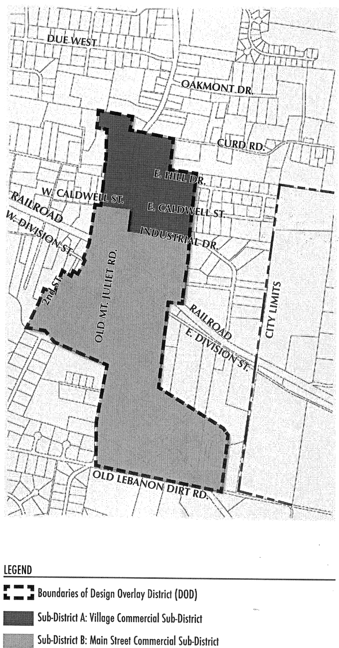
Illustration 8-500A. Town Center Overlay Sub-District Map
(Ord. No. 2005-09, 4-25-2005; Ord. of 10-23-2009, § 8-503)