
Nephi City Zoning Code
10.5 Establishment
Of Zones And Official Map
10.5.1 Zoning Districts Established
For the purposes of this title, the city is divided into the following zoning districts:
Residential 1-1/4 (Acre) Zone R1-1/4
Residential 1-8 (Thousand Sq Ft) Zone R1-8
Residential 1-Holding (Acre) Zone R1-H
Residential 1-5 (Acre) Zone R1-5
Residential 2-1/4 (Acre) Zone R2-1/4
Residential 2-8 (Thousand Sq Ft) Zone R2-8
Residential 3-8 (Thousand Sq Ft) Zone R3-8
Residential 1-1/2 (Acre) Zone R1-1/2
Combined Use 1 Zone CU1
Combined Use 2 Zone CU2
Highway Commercial 1 Zone HC1
Highway Commercial 2 Zone HC2
Central Commercial Zone CC
Industrial 1 Zone ID1
Industrial 2 Zone ID2
Industrial 3 Zone ID3
Industrial 4 Zone ID4
Agricultural Overlay Zone A
PUD Overlay Zone PUD
HISTORY:
Ord. 6-05-07, 6-6-2007; amd. Ord. 03-16-2021-A, 3-16-2021; Ord. 09-21-2021-A, 9-21-2021; Ord. 07-11-2023, 07-11-2023
10.5.2 Official Map
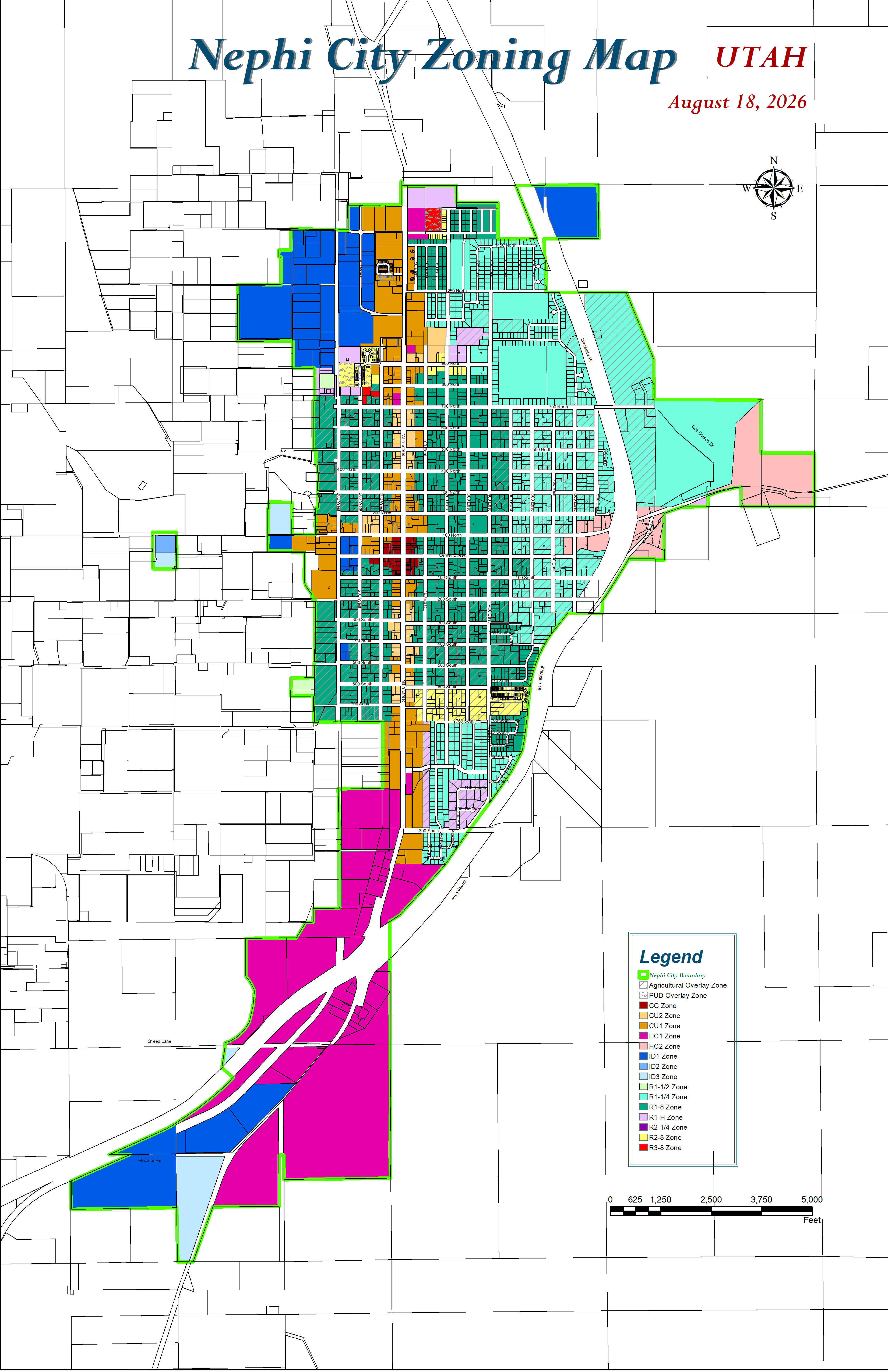
The boundaries of each of the districts are hereby established as described herein or as shown on the map or maps entitled "Zoning Map Of Nephi City, Utah", or as hereafter amended, which map or maps is attached to the ordinance codified herein, and all boundaries, notations and other data shown thereon are made by this reference as much a part of this title as is fully described and detailed herein. The map or maps shall be filed in the custody of the city recorder and may be examined by the public subject to any reasonable regulations established by the city recorder. No changes of any kind shall be made on the zoning map or matter shown thereon, except nonconformity with the procedures set forth in chapter 22 of this title. Any unauthorized change of whatever kind by any person or persons shall be considered a violation of this title and punishable as provided under chapter 23 of this title.
HISTORY:
Ord. 6-05-07, 6-6-2007; amd. Ord. 09-21-2021-A, 9-21-2021, Ord. 07-11-2023, 07-11-2023
10.5.3 Zoning District Boundary Interpretation
Where uncertainty exists as to the boundaries of districts as shown on the zoning map, the following rules shall apply:
- Boundaries indicated as approximately following the centerlines of roads or streets, highways or alleys, shall be construed to follow such centerlines.
- Boundaries indicated as approximately following platted lot lines shall be construed as following such lot lines.
- Boundaries indicated as approximately following city limits shall be construed as following such city limits.
- Boundaries indicated as approximately following centerlines of streams or canals shall be construed to follow such centerlines.
- Boundaries indicated as parallel to or extensions of features indicated in subsections B through D of this section shall be so construed. Distances not specifically indicated on the zoning map shall be determined by the scale of the map.
- Where physical or cultural features existing on the ground are at variance with those shown on the zoning map, or in other circumstances not covered by subsections A through E of this section, the administrator shall interpret the zone district boundaries.
- Where a zone district boundary line divides a lot which was in single ownership at the time of the passage date hereof, the legislative body may permit, as a special exception, the extension of the regulations for either portion of the lot, not to exceed fifty feet (50'), beyond the district line into the remaining portion of the lot.
- Wherever such boundary line of such district is indicated as being approximately at the line of any irrigation canal, other waterway, railroad right of way, public park or other public land, or any section line, then in such case the center of such canal or waterway, or of such railroad right of way, or the boundary line of such public land or such section line, shall be deemed to be the boundary of such district.
- Where the application of the above rules does not clarify the zone district boundary location, the administrator shall interpret the map. Appeals from said interpretation shall be filed with the legislative body.
HISTORY:
Ord. 6-05-07, 6-6-2007; amd. Ord. 09-21-2021-A, 9-21-2021

