
Dolores City Zoning Code
ARTICLE 3
- Zone Districts
Section 3.1.- Districts established.
In order to implement the Dolores Comprehensive Plan and the other purposes and provisions of this Land Use Code, the Town of Dolores, Colorado, is hereby divided into the following zoning districts:
Section 3.2. - Official zoning map.
A.
Map Adoption.
The boundaries of the zoning districts set out herein are delineated upon the Official Zoning Map of the Town of Dolores, Colorado, an up-to-date copy of which shall be maintained on the Town's website and in the office of the Zoning Administrator. Original copies of the official zoning map and all amendments thereto shall be maintained in the Town Clerk's office. In case of any dispute regarding the zoning classification of property subject to this Code, the original map maintained by the Town Clerk shall control.
B.
Zoning Map Amendment.
No changes or amendments to the district boundaries shown on the official zoning map shall be made except in compliance and conformity with all procedures set forth in Section 13.30, Zoning Map and Land Use Code Amendments. If, in accordance with these procedures, changes or amendments are made to district boundaries, such changes or amendments shall be made promptly after official adoption of the change or amendment as provided for herein.
C.
Interpretation of District Boundaries.
1.
The district boundary lines shown on the official zoning map are usually along streets, alleys, property lines or extensions thereof. Where uncertainty exists as to the boundaries of districts as shown on the official zoning maps, the following rules shall apply.
a.
Boundaries indicated as approximately following streets, highways or alleys shall be construed to follow the centerline of such street, highway, or alley.
b.
Boundaries indicated as approximately following platted lot lines shall be construed as following such lines.
c.
Boundaries indicated as approximately following Town limits shall be construed as following Town limits.
d.
Boundaries indicated as approximately following the centerline of irrigation ditches or drainage ways shall be construed to follow such centerline.
e.
Boundaries indicated as parallel to or extensions of features indicated in this subsection shall be so construed. Distances not specifically indicated on the original zoning map shall be determined from the graphic scale on the map.
f.
Whenever any street, alley or other public way is vacated by official action of the Board of Trustees the zoning district line adjoining each side of such street, alley, or other public way shall be automatically extended to the centerline of such vacated street, alley or way, and the area included in that change shall be subject to all regulations of the extended districts.
2.
Where physical features of the ground are at variance with information shown on the official zoning map, or when there arises a question as to how or whether a parcel of property is zoned and such question cannot be resolved by the application of Section 3.2.C.1.a through f., above, the property shall be considered as classified R-35, Resource-35, temporarily, and subject to Sec. 13.30, Zoning Map and Land Use Code Amendments.
Section 3.3. - Additional standards.
Structures and uses are subject to other applicable regulations outside of this article. For user reference, specific standards can be found in the following sections:
Section 3.4. - Resource districts.
A.
Purpose and Intent.
1.
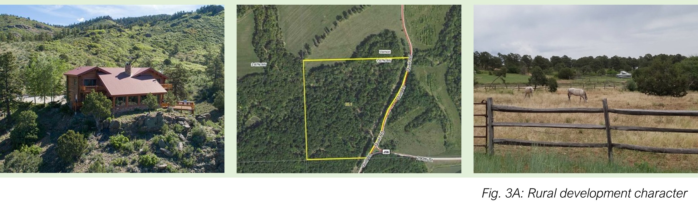
R-35 (current).
The R-35 Resource-35 district is designed primarily to accommodate large lot single-unit dwellings, in remote areas with minimal services or where steep slope, floodplains, or other hazards are present. The R-35 District is distinguished from the R-10 District in that the primary access to the area is through Town and substandard. The R-35 District is intended for application to areas designated "Resource-35" on the Future Land Use Map in the Comprehensive Plan.
2.
R-10 (current).
The R-10 Resource-10 district is designed primarily to accommodate large lot single-unit dwellings, in remote areas with minimal services or where steep slope, floodplains, or other hazards are present. It is intended for application to areas designated "Resource-10" on the Future Land Use Map in the Comprehensive Plan.
B.
Permitted Uses.
1.
Permitted and conditional uses are identified in Table 4.1: Primary Uses.
2.
Accessory uses are identified in Table 4.3: Accessory Uses.
C.
Area and Bulk Standards.
Each lot and structure in an R-35 or R-10 district shall comply with the dimensional standards of Table 3.1:
Section 3.5. - Residential districts.
A.
Purpose and Intent.
1.
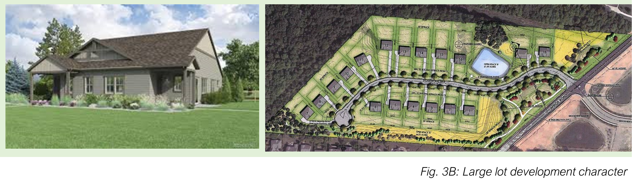
Large Lot Residential 1 (LLR-1).
The LLR-1 Large-Lot Residential district is designed primarily to accommodate single-unit dwellings in very low-density development patterns. It is intended for application to areas designated "Large Lot Residential" on the Future Land Use Map in the Comprehensive Plan. Lot size: 43,560 sf (1 acre) or larger.
2.
Large Lot Residential 2 (LLR-2).
The LLR-2 Large Lot Residential 2 district is designed primarily to accommodate single-unit dwellings in low density development patterns. It is intended for application as a transition between smaller, more urban lots closer to the Town center and the larger LLR-1 lots located in areas designated "Large Lot Residential" on the Future Land Use Map in the Comprehensive Plan. LRR-2 may also be applied to allow the conversion of existing LLR-1 to somewhat smaller lot development through resubdivision where sufficient services are available. Lot size: 12,000 sf (roughly 1/3 acre) to 43,560 sf (1 acre).
3.
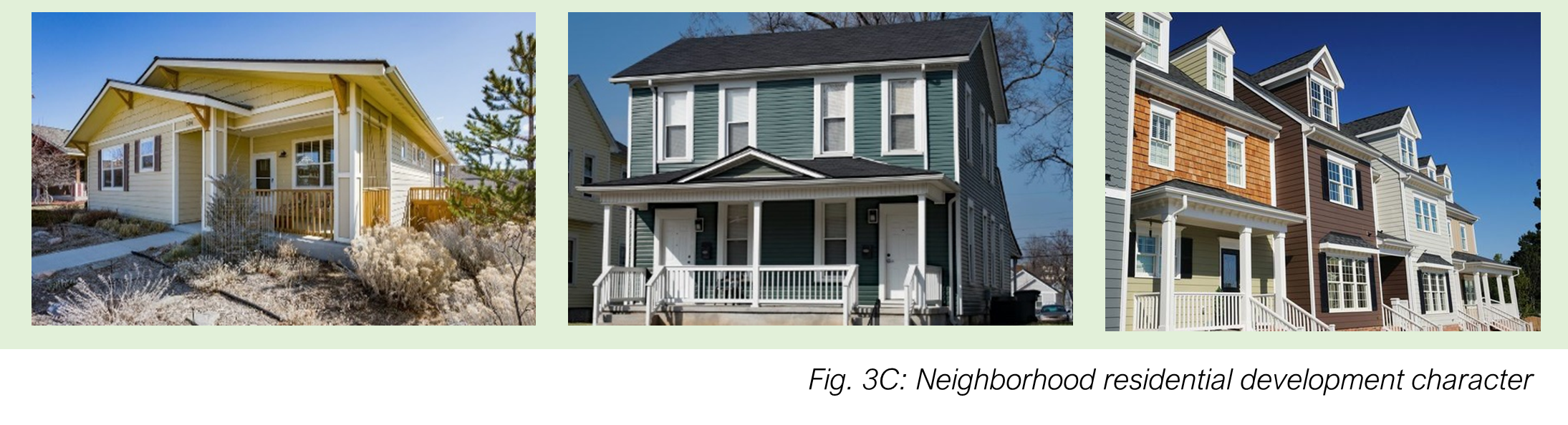
Neighborhood Residential 1 (NR-1).
The NR-1 Neighborhood Residential 1 district is designed primarily to accommodate single-family uses. It is intended for application in areas designated "Town Residential" on the Future Land Use Map in the Comprehensive Plan. Lot size: 6,000 to 12,000 sf.
4.
Neighborhood Residential 2 (NR-2).
The NR-2 Neighborhood Residential 2 district is designed primarily to accommodate single and two-unit dwellings along with some townhouse development designed in keeping with existing neighborhoods. NR-2 is intended to be applied in neighborhoods and areas where existing development patterns reflect this range of lot sizes and in new or redeveloping areas where Town-scale residential lots are an appropriate development pattern. It is intended for application in areas designated "Town Residential" on the Future Land Use Map in the Comprehensive Plan. Lot size: Single family or duplex: 3,000 to 6,000 sf, smaller for townhouse.
5.
Neighborhood Residential 3 (NR-3).
The NR-3 Neighborhood Residential 3 district is designed primarily to accommodate attached and multiunit dwellings. NR-3 zoning is appropriate adjacent to downtown Dolores and in areas walkable to downtown where full services are available. It is intended for application to areas designated "Multi-family Residential on the Future Land Use Map in the Comprehensive Plan. Lot size: Single family or duplex: 3,000 to 6,000 sf; smaller for townhouse; apartments permitted.
B.
Permitted Uses.
1.
Permitted and conditional uses are identified in Table 4.1: Primary Uses.
2.
Accessory uses are identified in Table 4.3: Accessory Uses.
C.
Area and Bulk Standards.
1.
Each lot in a residential district shall comply with the dimensional standards in Table 3.2: Dimensional Standards for Residential Structures.
2.
Non-residential structures permitted in residential districts shall comply with the standards for a one-unit development in that district.
3.
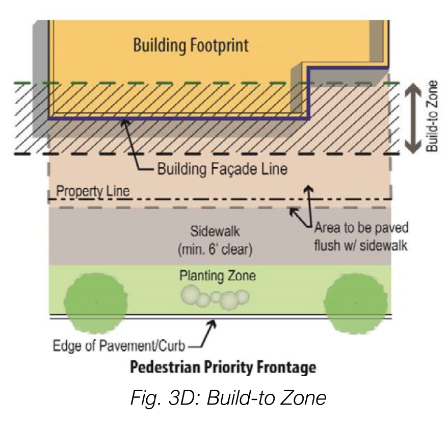
Where a front build-to-line is required, at least 60 percent of the front façade of the building must be located within the specified build-to range as shown in Fig. 3D. Where there is an existing block face average build-to location, new construction and redevelopment shall comply with that build-to location.
D.
Development and Design Standards.
Additional applicable development and design regulations can be found in the following sections:
1.
Lots Fronting on a Cul-de-Sac.
Lots fronting on a cul-de-sac shall have a minimum front street line of 50 feet and a minimum lot width of 75 feet.
2.
Accessory Structure Setbacks.
a.
Minimum Rear Yard Setback: The rear yard setback for detached accessory buildings may be reduced to zero adjacent to an alley; provided, however, that if no alley exists, the rear yard shall not be less than the setback required by the underlying zone district.
b.
Accessory Buildings: Detached accessory buildings shall have a side yard of not less than five feet measured from any side lot line, alley right-of-way or easement line.
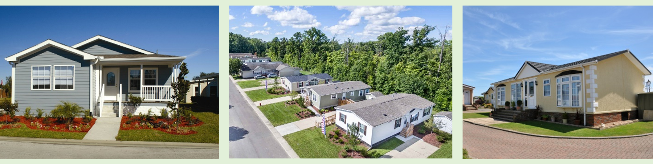
Section 3.6. - Manufactured home park district (MHP).
A.
Purpose and Intent.
The MHP Manufactured Home Park district is designed primarily to accommodate single-unit uses. It is intended for application to areas designated "Mobile Homes" on the Future Land Use Map in the Comprehensive Plan.
B.
Uses.
1.
Permitted and conditional uses are identified in Table 4.1: Primary Uses.
2.
Accessory uses are identified in Table 4.3: Accessory Uses. Accessory RV parking is limited to the following:
a.
Maximum total RV parking: equivalent of 10 percent of allowed manufactured home spaces.
i.
Minimum lot and setback standards in Table 3.5 are applicable around the exterior of any individual RV space, when not adjoining any other RV space, or the exterior of a group of adjoining RV parking spaces, but are not applicable to interior RV spaces in an adjoining group. The Table 3.5 structure dimensions are not applicable to RVs.
b.
Maximum stay: 24 months.
c.
Minimum stay: 2 months.
C.
Area and Bulk Standards.
MHP district development shall comply with the dimensional standards in Table 3.3:
D.
District-Specific Standards for Manufactured Home Parks or Subdivisions.
Manufactured home parks or subdivisions shall comply with the following standards:
1.
Applicability.
Existing manufactured home parks or manufactured home subdivisions shall not be enlarged, expanded, or additional manufactured homes permitted unless the same shall be brought into compliance with the standards of this subsection and the area regulations of this Section 3.5, Manufactured Home Park zone district regulations.
2.
Internal Site Layout.
a.
Manufactured home parks or manufactured home subdivisions shall have an internal driveway not less than 20 feet wide and the internal driveway shall have an all-weather, durable dust-free surface.
b.
Each manufactured home site in manufactured home parks and manufactured home subdivisions shall be clearly designated and arranged so that all manufactured homes have access to the internal driveway.
c.
Manufactured home parks and manufactured home subdivisions shall be properly graded and well drained, so as to prevent the accumulation of surface water.
d.
Each manufactured home site shall be improved with a four-inch concrete or gravel pad. No trailer with a footprint larger than the pad shall be placed on a site.
3.
Development Standards.
a.
All parks and individual manufactured home sites shall be provided with safe, convenient, all season pedestrian access of adequate width for the intended use.
b.
Manufactured home parks and manufactured home subdivisions shall be improved with adequate and sufficient night lighting to enable persons to walk in such areas at night without difficulty.
c.
All refuse shall be stored in bear resistant, fly-tight, water-tight, rodent-proof, dog-proof containers, which shall be located no more than 150 feet from each manufactured home site. Containers shall be provided in sufficient number and capacity to properly store all refuse generated in the manufactured home park or manufactured home subdivision.
d.
Exposed ground surfaces in all parts of a manufactured home park or manufactured home subdivision shall be protected with a vegetative growth compliant with Article 7, Landscaping, Screening, and Trees, that is capable of preventing soil erosion and of eliminating objectionable dust.
e.
A detached, accessory storage building or buildings shall be provided within a manufactured home park or manufactured home subdivision containing a minimum storage capacity of 10 cubic yards per manufactured home site.
f.
Exterior boundaries of manufactured home parks and manufactured home subdivisions shall be developed with a fence, or other acceptable border to create an attractive border. The land between the fence/border and the public street improvements shall be landscaped with street trees and other landscaping materials (sufficient to reasonably screen the park from view off-site) and shall be maintained by the owner of the manufactured home park. Landscaping and fences or walls shall be compliant with Article 7, Landscaping, Screening, and Trees,
g.
Manufactured home parks and manufactured home subdivisions shall connect to the sanitary sewer system.
h.
All utility lines shall be installed underground.
i.
Each manufactured home park or manufactured home subdivision shall include a recreational area and facilities for the use and enjoyment of the residents encompassing an area of 10 percent or two acres, whichever is less, of the total area of the manufactured home park or manufactured home subdivision. Lawns, parking, driveways, access way, streets, etc. shall not be considered part of the required recreational area and facilities.
j.
Any manufactured home that is replaced shall meet the requirements of this LUC.
Section 3.7. - Mixed-use districts.
A.
Purpose and Intent.
1.
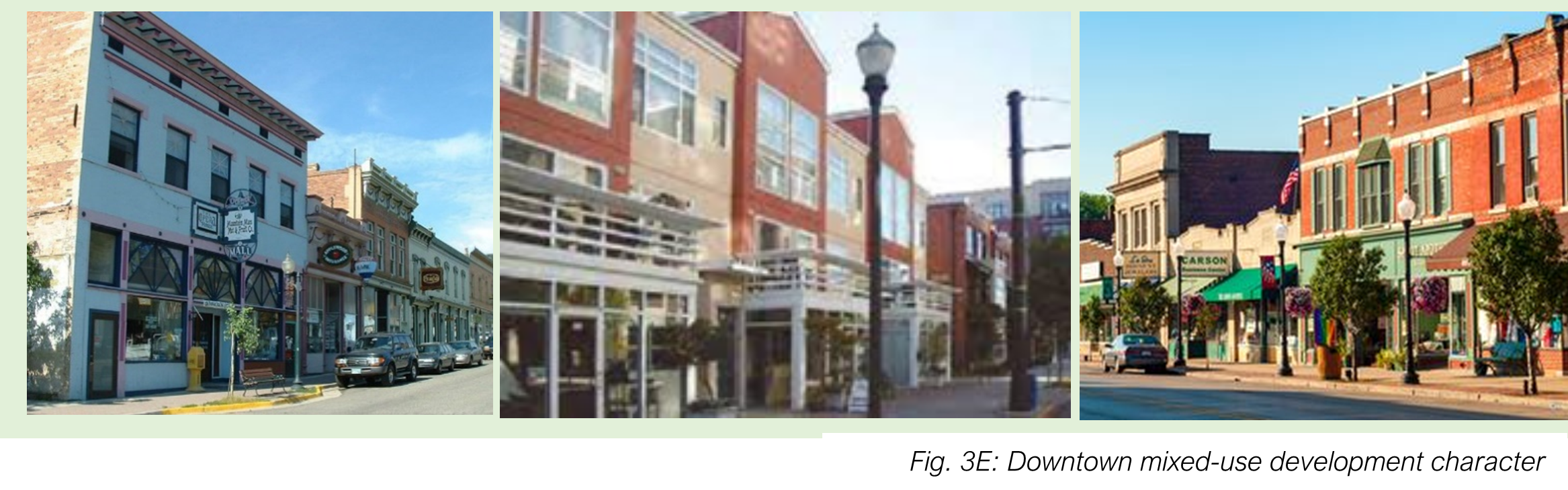
Downtown Mixed-Use (DMU) (combined CB-1 and CB-2).
The DMU Downtown Mixed-Use district is designed to accommodate a wide variety of commercial activities, to make Dolores a more attractive and energetic place to live, work, and shop and to enhance the economic development of Dolores. It is intended for application in areas designated "Community Business" on the land use map of the Comprehensive Plan.
2.
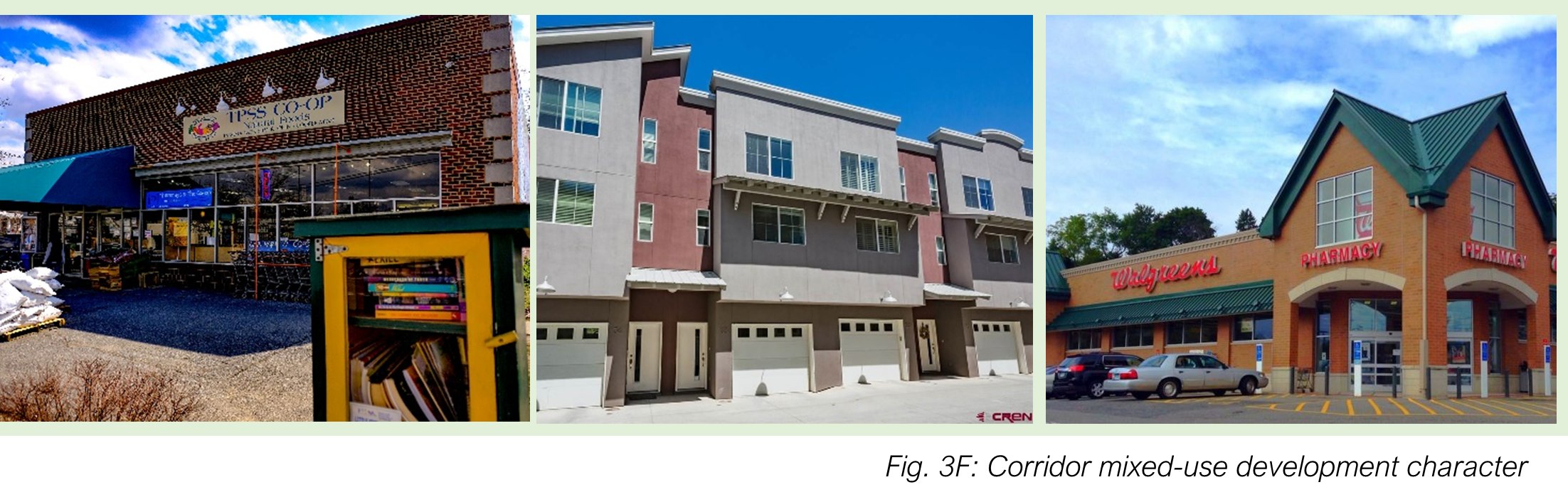
Corridor Mixed-Use (CMU) (was CH).
The CMU Corridor Mixed-Use district is designed to accommodate a wide variety of commercial activities, to make Dolores a more attractive and energetic place to live, work and shop and to enhance the economic development of Dolores. It is intended for application in areas designated "Commercial Highway" on the land use map of the Comprehensive Plan. New single-family and duplex development is not permitted in the CMU district but residential uses that existed as of the adoption date of this LUC are considered compliant uses and permitted to maintain their residential status.
B.
Uses.
1.
Permitted and conditional uses are identified in Table 4.1: Primary Uses.
2.
Accessory uses are identified in Table 4.3: Accessory Uses.
C.
Area and Bulk Standards.
1.
Residential development: Each residential lot in a mixed-use district shall comply with the dimensional standards in Table 3.2: Dimensional Standards for Residential Structures.
2.
Mixed-Use and Non-Residential Structures: Each mixed-use or non-residential lot in a mixed-use district shall comply with the dimensional standards in Table 3.4: Dimensional Standards for Mixed-Use and Non-Residential Structures.
D.
District-Specific Site and Structure Standards.
1.
DMU and CMU Location of Residential Use.
a.
Residential development in mixed-use structures shall be located either behind the front 30 percent of the building or above the ground floor.
b.
Single and two-unit dwellings are only permitted in mixed-use structures or as a replacement for a single or two-unit dwelling that pre-existed the effective date of this LUC. Replacement dwelling units are subject to conditional use permit review.
c.
Existing commercial structures may not be converted to residential use on the ground floor.
2.
Downtown Core Standards.
The following standards apply on either side of Railroad Avenue and Central Avenue between N 3 rd and S 9 th :
a.
Townhomes and apartment buildings are permitted by conditional use only.
b.
The ground floor of a mixed-use or non-residential building must have a minimum floor-to-ceiling height of 11 feet.
c.
The ground floor of a mixed-use or non-residential building shall contain the following minimum floor area designed for commercial use:
(1)
Lots with street frontage of less than 50 feet: at least 800 sq. ft. or 25 percent of the buildable lot area, whichever is greater; or
(2)
Lots with 50 feet or more of street frontage: at least 20 percent of the buildable lot area.
Section 3.8. - Downtown design.
A.
Front Setbacks and Build-To Lines.
The front setback of each primary structure in the DMU district shall meet one of the following standards, as applicable. If the setback or build-to required by this section differs from Table 3.4, this section shall govern.
1.
If the entire width of the front façade of either of the adjacent buildings is built to the front property line, then the entire width of the front façade of the proposed building shall also be built to the front property line.
2.
If part of the width of the front façade of either of the adjacent buildings is built to the front property line, then at least 50 percent of the width of the front façade of the proposed building shall also be built to the front property line.
3.
If no part of the front façade of either of the adjacent buildings is built to the front property line, then the front façade of the proposed building shall be built no more than 5 feet further from the front property line than the front façade of the adjacent building nearest the street.
4.
When the requirements of subsections 1, 2, or 3 above are applied to a building on a corner lot, they shall only require comparison with the front façade of the adjacent building facing the same street as the proposed building (not adjacent buildings that face different streets).
5.
If only one of the adjacent lots on the same block face is occupied with a primary structure, the requirements of subsections 1, 2, 3, and 4 above shall only require comparison with the one adjacent lot that is occupied with a primary structure. If neither of the adjacent lots facing the same block face is occupied with a primary structure, then the requirements of subsections 1, 2, 3, or 4 above shall require comparison with the nearest building located on the same block face and facing the same street.
B.
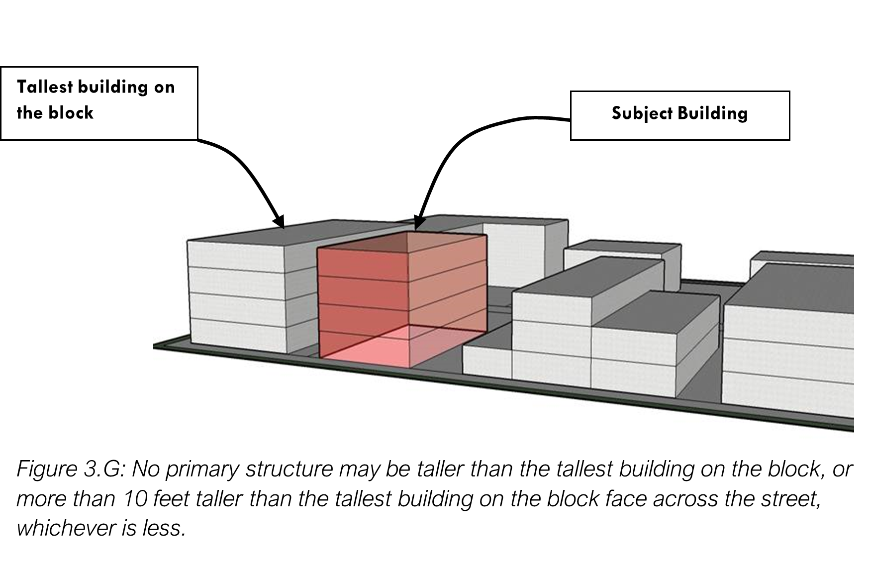
Maximum and Minimum Building Heights.
Regardless of the maximum height permitted in Table 3.6, no primary or accessory structure shall be taller than:
1.
The tallest building on the block face where the proposed building is located, or
2.
10 feet taller than the tallest building on the block across the street from the front façade of the proposed structure, whichever is less. (See Figure 3.G.)
C.
Building Design Standards.
1.
Maximum Building Size.
No single primary building shall have a building footprint of more than 10,000 square feet of gross floor area.
2.
Maximum Building Width.
The width of the building façade (as viewed from the street frontage), shall be no more than 35 percent wider than the width of the widest façade on any other building on the same block face or on the block face immediately across the street.
3.
Facades and Articulation.
Each multi-family residential principal structure shall meet the standards of subsections (b) and (c) below. Each non-residential principal structure or mixed-use principal structure (i.e., containing both residential and non-residential uses) shall meet at least two of the three standards in subsections (a) through (c) below, with the choice of those standards to be at the option of the owner:
a.
Transparency: A minimum of ten percent of each facade area that faces a street must be composed of transparent materials. At least 1/2 of this amount must be provided so that the lowest edge of the transparent materials is no higher than four feet above the street level.
b.
Wall Plane Articulation: Each facade greater than 50 feet in length abutting a street, measured horizontally, must incorporate architectural features such as wall plane projections, recesses, or other building material treatments and textures that visually interrupt the wall plane. No uninterrupted length of any facade must exceed 50 horizontal feet.
c.
Roof Articulation: Where sloping roofs are used, at least one projecting gable, hip feature, or other break in the horizontal line of the roof ridgeline (as viewed from the street frontage must be incorporated for each 50 lineal feet of roof. Where flat roofs are used, the design or height of the parapet must include at least one change in setback or height of at least three feet along each 50 lineal feet of façade.
d.
Entryway Design and Location: Each principal building must have clearly defined, highly visible main entrances for occupants and/or customers with features designed to emphasize the importance of the entrance, which must include at least one of the following features, with the choice of the features to be at the option of the owner:
(1)
A canopy or portico;
(2)
A roof overhang;
(3)
A horizontal recess or projection;
(4)
An arcade or arch;
(5)
Architectural moldings integrated into the building design; or
(6)
An architectural feature used to emphasize the entryway of another building in the DMU district.
4.
Pedestrian-Oriented Design Features.
a.
Multi-family Residential Buildings: Each multi-family dwelling development must be designed so that all principal entrances of principal buildings shall have direct access to a sidewalk, walkway, path, or pathway that leads to a public street.
b.
Non-residential and Mixed-Use Buildings: Each principal structure containing non-residential or mixed uses must be designed so that ground-floor façades that face public streets include arcades, display windows, entry areas, awnings, or similar features designed to attract or protect pedestrians along no less than 60 percent of their horizontal length. In addition, all principal entrances of principal buildings not facing an alley must have direct access (i.e., access without having to cross a public street) to a sidewalk, walkway, path, or pathway that leads to a public street.
Section 3.9. - Public districts.
Public districts are intended to identify and allow for the establishment of public, quasi-public, and civic uses in the community.
A.
Purpose and Intent.
1.
Parks and Open Space (P1).
The P1 Parks and Open Space district is intended to protect and preserve open spaces that are held in either public or private ownership. P1 districts may include parks, open spaces, trails, wetlands, floodplains, environmentally sensitive areas, and unique habitats and landscapes. To preserve access to clean air, pure water, natural recreation areas, and scenic natural beauty, the subdivision and development of land is restricted in P1 districts.
2.
Public, Civic, and Institutional, Small (P2).
The P2 Public, Civic, and Institutional district is intended to be used for civic and community service structures and uses, such as religious assembly, public safety facilities, and schools, within either a neighborhood or commercial setting.
B.
Uses.
1.
Permitted and conditional uses are identified in Table 4.1: Primary Uses.
2.
Accessory uses are identified in Table 4.3: Accessory Uses.
C.
Dimensions.
Each lot and structure in a public district shall comply with the dimensional standards in Table 3.5:
Section 3.10. - Industrial district.
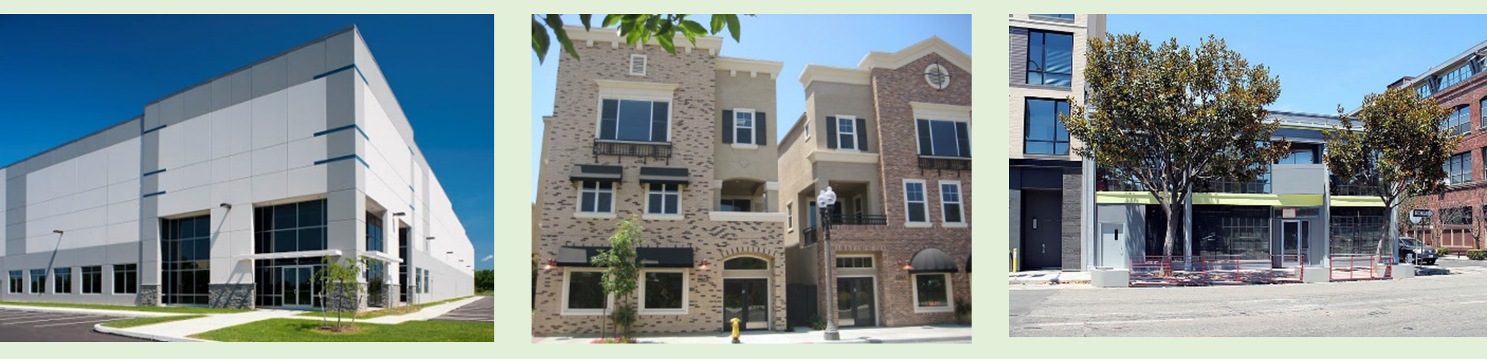
Fig. 3H: Industrial development character
A.
Purpose and Intent.
The IND Industrial District is intended to provide for a variety of businesses, including warehouses, research and development firms, repair shops, wholesale distributors, and light manufacturing. This district may include supporting office and commercial uses where appropriate. Uses permitted in this district are intended to serve community and regional needs. This district is intended to be located away from low- and medium- density residential development. The IND district implements the Light Industrial classification of the Comprehensive Plan and should take access from a primary connector or principal arterial street.
B.
Uses.
1.
Permitted and conditional uses are identified in Table 4.1: Primary Uses.
2.
Accessory uses are identified in Table 4.3: Accessory Uses.
C.
Area and Bulk Standards.
Each lot and structure in an IND district shall comply with the dimensional standards in Table 3.6:
Section 3.11. - Supplementary dimensional standards.
A.
Setback Encroachments.
1.
Setback encroachments are building and site elements that project into or are located on the "non-buildable" side of a setback line, typically in a required setback area.
2.
Permitted encroachments, identified below, are allowed where the required dimension is measured by a setback line, not a build-to line.
3.
Measurement.
a.
Each setback encroachment shall be measured from the minimum required setback line towards the lot line; setback encroachments are always measured from the same point and are not cumulative.
b.
No permitted setback encroachment shall be closer than two feet to any lot line with the exception of fences and walls and gardens and landscaping.
4.
The following encroachments shall meet the specified standards:
B.
Building Height Encroachments.
1.
Measurement.
a.
Each height encroachment shall be measured from the maximum building height.
b.
Building height encroachments are not cumulative in that they are always measured from the same point.
2.
The following building height encroachments shall meet the specified standards: