
Fayetteville City Zoning Code
CHAPTER 166
- DEVELOPMENT
Sections:
166.01 - Development Categories
(A)
Property Line Adjustment. A property line adjustment is a transfer or adjustment of a property line or lines between adjoining property owners which does not create a separate, new lot. A property line adjustment cannot dedicate new easements or right-of-way.
(B)
Subdivision of Land.
(1)
Lot Split. When a property is to be subdivided into two (2), three (3) or four (4) lots, parcels the application may be processed as a lot split. Except for lot splits created pursuant §164.22 Cluster Housing Development, (C) Development Review Process, after the creation of more than four (4) lots from an original parent tract as established under Washington County's countywide 1985 reappraisal. Any subsequent subdivision of the parent or resulting tracts is required to be processed as a preliminary/final plat or concurrent plat. A lot split may dedicate new easements or right-of-way and may be combined with an easement plat.
(2)
Preliminary Plat. When a property is to be subdivided into more than four (4) lots or when a parent or resulting tract has been subdivided three (3) or more times and is proposed to be further subdivided, the application shall be processed as preliminary plat. A preliminary plat establishes the preliminary location of lot lines, streets, and utility infrastructure, and allows for the applicant to request construction plan approval and install required improvements.
(3)
Final Plat. After completion of the required infrastructure (water, sewer, storm drainage, utilities, street improvements, etc.) for a preliminary plat, the entity subdividing may submit an application for approval of the final plat. The final plat application may not be submitted until the final inspection for the required infrastructure has been scheduled with City Engineering staff.
(4)
Concurrent Plat. A concurrent plat combines the preliminary and final plat into one (1) step. A concurrent plat is permitted when a property is to be subdivided into more than four (4) lots, or when a parent or resulting tract has been subdivided three (3) or more times and is proposed to be further subdivided, and the existing and new parcels do not require construction of new infrastructure.
(C)
Site Plan.
(1)
Large Scale Development. A large scale development is generally intended for development on a site of 1 acre or greater in size and proposes to a development and/or redevelopment area of more than 10,000 square feet of impervious surface and where a corresponding subdivision of land is not proposed.
(a)
Requirement. The development of the following must be processed in accordance with the requirements for a large-scale development:
(i)
A site 1 acre or greater in size and developing and/or redeveloping an area of more than 10,000 square feet of impervious surface;
(ii)
Facilities emitting odors or handling explosives; and
(b)
Excluded Developments. Proposals developing and/or redeveloping an area of 10,000 square feet or less of impervious area or a development on a site in a zoning district subject to administrative approval.
(2)
Large Site Improvement Plan. A large site improvement plan review is intended for a large scale development that is located on a site within a zoning district that permits administrative approval. A large site improvement plan is subject to the requirements and excluded developments for a large scale development listed in Fayetteville Unified Development Code §166.01(C)(1).
(3)
Small Site Improvement Plan. A small site improvement plan review is intended for development on a site that is less than 1 acre in size and proposes a development and/or redevelopment area of more than 10,000 square feet of impervious surface.
(a)
Requirement. The development of the following must be processed in accordance with the requirements for a small site improvement plan:
(i)
A development that is excluded from large scale development or large site improvement plan review and requires review by multiple city divisions;
(ii)
A development and/or redevelopment area of more than 10,000 square feet of impervious surface on site of less than 1 acre within any zoning district.
(b)
Excluded Developments. Proposals developing and/or redeveloping an area of 10,000 square feet or less of impervious surface and shall be submitted in accordance with the requirements of §166.02(E) and §166.15.
(4)
Concept Plan. When a developer intends to develop or redevelop greater than 6,000 square feet and less than 10,000 square feet of total impervious area within the city limits, they shall submit a concept plan to obtain feedback and recommendations from city staff prior to submitting a fully engineered development plan for review. Developments below or above this threshold, or in the city's planning area boundary, may submit a concept plan to obtain feedback and recommendations prior to submitting a fully engineered development plan for review.
(D)
Modifications.
(1)
Minor Modifications. The Zoning and Development Administrator may authorize minor modifications in an approved subdivision of land or site plan. Minor modifications shall include, but are not limited to, substitutions of one approved structural type for another, minor variations in placement of buildings in such a way that the overall limits of approved floor area, open space, or rooms per acre are not increased, and minor shifts in property line locations.
(2)
Major Modifications. In the event that a developer wishes to make major modifications to an approved development, such modifications shall be submitted to the approving body of the subdivision or site plan, whether staff, or the Planning Commission. After submission, the approving body shall approve or disapprove the requested modification.
(Code 1965, App. C., Art. II, §§A—D; Ord. No. 1750, 7-6-70; Ord. No. 2581, 12-4-79; Ord. No. 2789, 1-18-82; Code 1991, §§159.010; 159.11(C), 159.12, 159.13; 159.14; Ord. No. 3781, §1, 4-19-94; Ord. No. 4100, §2 (Ex. A), 6-16-98; Ord. No. 4350, §1, 11-20-01; Ord. No. 5296, 12-15-09; Ord. No. 5653, 01-21-14; Ord. No. 5945, §16, 1-17-17; Ord. No. 6067, §1, 5-1-18; Ord. No. 6446, §8(Exh. C), 6-15-21; Ord. No. 6785, §§ 1—3, 8-20-24; Ord. No. 6833, §4, 1-21-25)
166.02 - Development Review Process
(A)
Application Submittal
(1)
Submittal. All development applications shall be submitted to the Planning Division and will be processed for review in accordance with Planning Division operating procedures.
(B)
Public Meetings. Development applications are required to be processed through the Technical Plat Review Committee, Subdivision Committee, and Planning Commission as follows:
(1)
Technical Plat Review Committee. The following development applications are required to be reviewed by the Technical Plat Review Committee: Lot split, small site improvement plans, large site improvement plans, large scale development, planned zoning district with or without concurrent development, preliminary plat, final plat, concurrent plat, and concept plan. After the Technical Plat Review Committee meeting staff may administratively approve lot splits, final plats, small site improvement plans, and large site improvement plans after review for compliance with all applicable codes subject to UDC §166.02(C). No approval is necessary for concept plans.
(2)
Reserved.
(3)
Planning Commission. The following development applications are required to be reviewed by the Planning Commission. Large scale development forwarded by the Subdivision Committee, preliminary plat, concurrent plat, and planned zoning district with or without concurrent development. The Planning Commission may approve, deny, table, or approve development applications with conditions. A planned zoning district cannot be approved by the Planning Commission, but may be forwarded to City Council.
(C)
Approval and Denial Criteria
(1)
Administrative Approval. The following applications shall be approved administratively by the Planning Division as long as the proposal meets all requirements of the Unified Development Code: Property line adjustment, lot split, final plat, small site improvement plan, and large site improvement plan. Approval by the Planning Commission for these applications is not required unless an appeal is filed in accordance with Chapter 156 of the UDC. Concept plans are not subject to approval or denial.
(a)
Reasons for Denial. The Planning Division may refuse administrative approval based on the following criteria:
(i)
Property Line Adjustment; Lot Split. The application does not comply with zoning and development requirements including, but not limited to: Lot width, lot area, setback requirements, buildable area, required parking, impervious surface, dedication of required right-of-way or easements, etc., or the requested action would make an existing non-conforming property or structure more non-conforming.
(ii)
Final Plat. The conditions of approval of the preliminary plat have not been met, the proposed plat does not meet the zoning and development requirements of the UDC, and/or the required improvements have not been completed or guaranteed in accordance with Fayetteville Unified Development Code Chapter 158.
(iii)
Small or Large Site Improvement Plans. The Planning Division may refuse to approve a small or large site improvement plan for any of the following reasons:
(a)
The development plan is not submitted in accordance with the requirements of this chapter.
(b)
The proposed development would violate a city ordinance, a state statute, or a federal statute.
(c)
The developer refuses to dedicate the street right-of-way, utility easements or drainage easements required by this chapter.
(d)
The proposed development would create or compound a dangerous traffic condition. For the purpose of this section, a dangerous traffic condition shall be construed to mean a traffic condition in which the risk of accidents involving motor vehicles is significant due to factor such as, but not limited to, high traffic volume, topography, or the nature of the traffic pattern.
(e)
City water and sewer is not readily available to the property within the site improvement plat area and the developer has made no provision for extending such service to the development.
(f)
The developer refused to comply with ordinance requirements or condition of approval for on-site and off-site improvements.
(2)
Planning Commission Approval. The following applications shall be approved by the Planning Commission, subject to the criteria listed below: Large scale development, preliminary plat and concurrent plat.
(a)
Reasons For Denial. The Planning Commission may refuse to approve a large scale development, preliminary plat or concurrent plat for any of the following reasons:
(i)
The plat or development plan is not submitted in accordance with the requirements of this chapter.
(ii)
The proposed development would violate a city ordinance, a state statute, or a federal statute.
(iii)
The developer refuses to dedicate the street right-of-way, utility easements or drainage easements required by this chapter.
(iv)
The proposed development would create or compound a dangerous traffic condition. For the purpose of this section, a dangerous traffic condition shall be construed to mean a traffic condition in which the risk of accidents involving motor vehicles is significant due to factors such as, but not limited to, high traffic volume, topography, or the nature of the traffic pattern.
(v)
City water and sewer is not readily available to the property within the large scale development, preliminary plat, or concurrent plat and the developer has made no provision for extending such service to the development.
(vi)
The developer refused to comply with ordinance requirements or conditions of approval for on-site and off-site improvements.
(D)
Plat Recordation or Construction Plan Approval. After obtaining approval by the appropriate governing body, the applicant shall follow the procedures set forth below in order to record the plat or obtain construction plan approval.
(1)
Property Line Adjustment, Lot Split, Building Permit, Final Plat, Concurrent Plat. The applicant shall submit copies of the approved plats containing all required signatures to the Planning Division for final approval. The plats shall be recorded by the applicant and copies of the recorded plats provided to the Planning Division as required.
(2)
Preliminary Plat, Large Scale Development and Small or Large Site Improvement Plan. Receipt of the approval authorizes the applicant to proceed with:
(a)
The preparation of plans, reports and specifications in accordance with City Engineering requirements including but not limited to:
(i)
Street plans, profiles and specification accompanied by soil analyses and design calculations;
(ii)
Storm drainage plans, profiles and specifications accompanied by soil analyses and design calculations; and
(iii)
Water and sewer plans, profiles and specifications, accompanied by design calculations, to be reviewed and approved by City Engineering.
(iv)
Final site plans, landscape plans, and other plans, reports and specifications required by the city to obtain approval.
(b)
Once all approvals that are required have been obtained, the applicant may proceed with site preparation and construction in accordance with the permitted plans.
(E)
Building Permits.
(1)
Before a building permit is issued the developer shall:
(a)
Dedication of Right-of-Way. Dedicate right-of-way in compliance with the city's Master Street Plan, and in compliance with the requirements for on or off-site improvements.
(b)
Dedicate all easements necessary to serve the development as required by the utility providers and the city. This may be completed by easement plat or separate easement document(s), with approval of the Planning Division.
(c)
Comply with all applicable zoning and development codes.
(d)
In addition, for small site improvement plans, large site improvement plans and large scale developments, the developer shall:
(i)
Obtain approval from the appropriate governing body.
(ii)
On and Off-Site Improvements. Construct or guarantee required on- and off-site improvements in accordance with UDC Chapter 158.
(iii)
Complete applicable conditions of approval.
(2)
In addition to §166.02(E), before a building permit is issued for site that develops and/or redevelops between 1,201 and 10,000 square feet of impervious area, where a corresponding subdivision of land is not proposed, the developer shall complete, and receive approval of, appropriate grading and drainage documentation demonstrating compliance with UDC Chapters 169 and 170 as well as the current City Drainage Criteria Manual per the table below. Impervious areas will be considered as existing only if they are in place on March 3, 2021 which corresponds with the City of Fayetteville 2021 imagery.
(F)
Completion of Development/Certificate of Occupancy. No certificate of occupancy for a large-scale development, large site improvement plan, or small site improvement plan shall be issued, and no final plat or concurrent plat shall be signed for recordation until the following have been completed:
(1)
The requirements for on and off-site improvements have been completed, and maintenance bonds/guarantees deposited to city specifications.
(2)
An "as built" plot plan has been approved by the City Engineer (where applicable) showing:
(a)
The location of all buildings and the setback distance for said buildings from street right-of-way and adjoining property lines;
(b)
The location of any freestanding signs and the setback distance of said signs from street right-of-way and adjoining property lines;
(c)
The location, number, dimensions, and surfacing of all parking spaces and of all screens or fences;
(d)
The location and size of all water, sewer, gas, electric, telephone, and television cable lines;
(e)
The location and size of all stormwater features with associated drainage easements demarcated, where applicable; and
(f)
The location and quantity of existing and new impervious area on the property.
(3)
The development has been inspected and approved by all applicable city divisions.
(4)
All applicable conditions of approval have been completed.
(Code 1965, App. C., Art. II, §§F—H; Ord. No. 2581, 12-4-79; Code 1991, §§159.16—159.18; Ord. No. 4100, §2 (Ex. A), 6-16-98; Ord. No. 5296, 12-15-09; Ord. No. 5653, 01-21-14; Ord. No. 6061, §2, 4-17-18; Ord. No. 6446, §8(Exh. C), 6-15-21; Ord. No. 6539, §5(Exh. A), 3-1-22; Ord. No. 6785, §§ 4—6, 8-20-24; Ord. No. 6786, § 1, 8-20-24; Ord. No. 6833, §5, 1-21-25)
166.03 - Plat Requirements
(A)
Original Plan Drawings. Plans shall be drawn in a legible manner, at a scale which best suits the size of the property being developed or platted. All plans shall be drawn at a standard engineering scale, and submitted in paper and/or digital form, as listed on the application.
(B)
Plat Information. The following information shall be submitted to the Planning Division and/or Planning Commission for review and approval:
(1)
General.
(2)
Legal Description.
(3)
Floodplain/Floodways/Wetlands.
(4)
Topographic Information.
(5)
Tree Protection/Landscaping.
(6)
Utilities—Existing.
(7)
Utilities—Proposed.
(8)
Streets/Right-of-Ways/Easements.
(9)
Subdivision of Land.
(10)
Site Specific Information.
(11)
Other requirements.
(12)
Easement Plat.
*All plats should meet or exceed the most current State of Arkansas Standards of Practice
for Property Boundary Surveys and Plats.
**SIP = Large or Small Site Improvement Plan
***PZD = Planned Zoning District
(C)
Signatures Required. The final plat or concurrent plat may be signed by any officer of the Planning Commission.
(D)
Number of Plats. The Planning Division may require additional copies of plats if the amount required by this chapter is not sufficient for distribution to the various committee members.
(Code 1965, App. C., Art. III, §A(1); Ord. No. 2695, 1-20-81; Ord. No. 3080, 4-2-85: Ord. No. 3201, 8-5-86: Ord. No. 3315, 11-17-87; Code 1991, §§159.05, 159.30k.; Ord. No. 3578, 11-19-91; Ord. No. 3615, §1, 6-2-92; Ord. No. 3738, §1, 11-16-93; Ord. No. 3793, §1, 5-17-94; Ord. No. 3797, §1, 5-17-94; Ord. No. 4068, §1, 11-4-97; Ord. No. 4100, §2 (Ex. A), 6-16-98; Ord. No. 4199, 11-2-99; Ord. No. 4454, 01-07-03; Ord. No. 4545, 02-17-04; Ord. No. 4725, 7-19-05; Ord. No. 4864, 05-02-06; Ord. 5152, No. 7-15-08; Ord. No. 5215, 1-20-09; Ord. No. 5271, 9-1-09; Ord. 5296, No. 12-15-09; Ord. No. 6446, §8(Exh. C), 6-15-21)
166.04 - Required Infrastructure Improvements — Development In City Limits
(A)
Generally. Required of developer.
(1)
On and Off-Site Improvements. On-site improvements are adjacent to or within a project site; such as widening the street along the project street frontage, constructing interior streets and utilities, etc. Off-site improvements are not adjacent to a project; such as the extension of an off-site sewer line to the property boundary, off-site storm drainage improvements, or an off-site intersection improvement, etc.
(2)
Standards Applicable. Any required on or off-site improvements in the city and within one (1) mile of the city limits shall be installed according to the city's standards; provided on or off-site improvements to roads located outside one mile of the city limits shall be installed to the county's standards. The developer shall be required to bear that portion of the cost of off-site improvements which bears a rational nexus to the needs created by the development.
(3)
Required Infrastructure Improvements. On and off-site improvements that are roughly proportional and bear a rational nexus to the impact of the development are required for all development within the City of Fayetteville. The developer shall be required to install on and off-site improvements where the need for such improvements is created in whole or in part by the proposed development.
(4)
Planning Commission and Planning Division. At the time the Planning Commission or Planning Division (where applicable for administrative approval) grants development approval, the Planning Commission or Planning Division shall determine whether the proposed development creates a need for off-site improvements and the portion of the cost of any needed off-site improvements which the developer shall be required to bear; provided, that portion of the cost of off-site improvements to roads located outside the city's corporate limits but within the city's planning area shall be determined by the county. In determining that portion of the cost of off-site improvements which the developer shall be required to bear, the Planning Commission or Planning Division (where applicable for administrative approval) shall consider the acreage within the proposed development as a percentage of all the acreage which, when fully developed, will benefit from the off-site improvements; provided, the Planning Commission or Planning Division may use a different method of measurement if it determines that use of the acreage standard will not result in the developer bearing that portion of the cost which bears a rational nexus to the needs created by the development.
(5)
Determining Necessity for Off-Site Improvements.
(a)
When a proposed development has access to paved streets or roads only by way of substandard or unimproved roads or streets leading from the development to the paved streets or roads, the developer shall be responsible for contributing this proportionate share of the cost of improving the substandard access roads or streets to existing city or county standards. The developer's proportionate share of said costs shall be determined by the Planning Commission or Planning Division (where applicable for administrative approval) in accordance with the provisions of 166.04(A) above.
(b)
When a proposed development has direct access to, or fronts on an existing road or street, which is below current standards, the developer shall be responsible for contributing his/her proportionate share of the cost of improving said street or road to existing city or county standards. The Planning Commission or Planning Division (where applicable for administrative approval) shall determine the developer's proportionate share of said costs in accordance with the provisions of 166.04(A) above.
(c)
Off-site drainage improvements shall be required whenever a proposed development causes the need for such improvements.
(6)
Delayed Improvements. The Planning Commission or Planning Division may determine a required on-site or off-site improvement shall be delayed or payment-in-lieu contributed instead in accordance with Chapter 158 of the UDC.
(7)
Variances. A variance of off-site improvements may be granted in accordance with Chapter 156 Variances.
(8)
State Highways. The developer shall be required to dedicate sufficient right-of-way to bring those state highways which the Master Street Plan shows to abut or intersect the proposed subdivision into conformance with the right-of-way requirements of the Master Street Plan. The developer shall be required to install a sidewalk adjacent to that portion of a state highway abutting the proposed development; and provided that the Planning Commission or Engineering Division (where applicable for administrative approval) may waive the sidewalk requirement prescribed by this subsection upon application by the developer and a determination by the Planning Commission or Engineering Division (where applicable for administrative approval) that the topography of the proposed development where it abuts a state highway is such that installation of a sidewalk is not practical. Any other improvements required of the developer by the Planning Commission or Engineering Division (where applicable for administrative approval) shall be coordinated with the Arkansas Highway and Transportation Department.
(B)
Minimum Improvements by Application Type. The property owner/developer shall be responsible for constructing the following minimum improvements.
(1)
Property Line Adjustment or Exempted Properties of Less Than or Equal to 1,200 Square Feet of Impervious Area. No improvements are required unless the action would create or exacerbate a nonconforming infrastructure situation such as cutting off a lot from public water, sewer, or street frontage. In such as case the property may not be filed of record until the required infrastructure is first constructed to city specifications, or a variance or waiver is granted by the Planning Commission.
(2)
Building Permit with No Required Grading Review.
(a)
Monuments and Lot Stakes. The surveyor shall cause, preserve, and/or replace monuments and/or lot stakes marking the corners of a parcel to be set in accordance with Section 3.2, general procedures, of the Arkansas Minimum Standards for Property Boundary Surveys and Plats. The City Council retains the right to grant a lesser dedication of the right-of-way than is normally required by the Master Street Plan without the Planning Commission's recommendation.
(b)
Water, Sewer, or Street Frontage. Any lot that is created shall have adequate street frontage or street access that meets the minimum requirements of the zoning code, and access to public water and sewer as required by city and state code.
(c)
Grading and Storm Drainage System. The developer shall install water quality, flood, and tree mitigation measures after approval of the corresponding grading and drainage/stormwater documentation found in §166.02(F).
(i)
All drainage facilities shall be so designed to serve the entire drainage area per the specifications found in Chapter 170 and the current versions of the city's Drainage Criteria Manual.
(3)
Lot Split, Building Permit Requiring Grading Review.
(a)
Dedication of Right-of-Way. Sufficient right-of-way dedication, to bring those streets which the Master Street Plan shows to abut or intersect the property into conformance with the right-of-way requirements of the Master Street Plan for said streets; provided, the Planning Commission may recommend a lesser dedication in the event of undue hardship or practical difficulties. Such lesser dedication shall be subject to approval by the City Council.
(i)
Dedications. The City Council accepts all streets and alleys located in Fayetteville that have been previously approved and accepted as dedications by the Fayetteville Planning Commission. The City Council confirms the acceptance of all such streets and alleys dedicated by developers/owners to the city which have been approved by the Fayetteville Planning Commission.
(b)
Monuments and Lot Stakes. The surveyor shall cause, preserve, and/or replace monuments and/or lot stakes marking the corners of a parcel to be set in accordance with Section 3.2, General Procedures, of the Arkansas Minimum Standards for Property Boundary Surveys and Plats.
(c)
Water, Sewer, or Street Frontage. Any lot that is created shall have adequate street frontage or street access that meets the minimum requirements of the zoning code, and access to public water and sewer as required by city and state code. If a lot split would create or exacerbate a nonconforming situation (such as cutting off a lot from public water, sewer, street frontage, or street access), the lot split may not be filed of record until the required easement is dedicated and/or the infrastructure is first constructed to city specifications, or a variance or waiver is granted by the Planning Commission.
(d)
Parkland Dedication. Parks fees shall be assessed for each new residential unit that is constructed on the additional lot(s) in accordance with the parkland dedication requirements outlined in Fayetteville Unified Development Code Chapter 166. Said fees shall be paid prior to issuance of a building permit for construction on the new lot.
(4)
Preliminary/Final/Concurrent Plat; Large Scale Development; Large or Small Site Improvement Plan.
(a)
Dedication of Right-of-Way.
(i)
On-Site. Sufficient right-of-way dedication, to bring those streets which the Master Street Plan shows to abut or intersect the property and new streets proposed interior to the property, into conformance with the right-of-way requirements of the Master Street Plan for said streets, shall be approved by the Planning Commission; provided, the Planning Commission may recommend a lesser dedication in the event of undue hardship or practical difficulties. Such lesser dedication shall be subject to approval by the City Council.
(ii)
Council Acceptance of Streets and Alleys. The City Council accepts all streets and alleys located in Fayetteville that have been previously approved and accepted as dedications by the Fayetteville Planning Commission. The City Council confirms the acceptance of all such streets and alleys dedicated by developers/owners to the city which have been approved by the Fayetteville Planning Commission.
(b)
Monuments and Lot Stakes. The surveyor shall cause, preserve, and/or replace monuments and/or lot stakes marking the corners of a parcel to be set in accordance with Section 3.2, General Procedures, of the Arkansas Minimum Standards for Property Boundary Surveys and Plats.
(c)
Streets.
(i)
On-Site. Widening the street adjacent to the project frontage and construction of all interior streets to meet Master Street Plan standards. Street grading, base, and paving according to existing city standards and specifications as adopted by the City Council.
(ii)
Off-Site. Street widening and/or new street construction off-site may be required to address traffic impacts based on the rough proportion and rational nexus of the impacts of the project. Street grading, base, and paving according to existing city standards and specifications as adopted by the City Council.
(iii)
Private Street Name Signs. Where a structure is addressed on a private street or drive, the developer or property owner(s) shall be required to install, maintain, repair and replace all private street name signs. Any private street name sign existing at the time of passage of this ordinance shall be maintained, repaired and replaced as required by this section. Signs shall meet the standards of the Manual on Uniform Traffic Control Devices (MUTCD) and shall be installed at all street/drive intersections. Unless approved otherwise, all signs shall be retroreflective and utilize a white legend on a green background.
(d)
Curbs and Gutters.
(i)
On-Site. Curbs and gutters adjacent to the project frontage according to existing city standards and specifications as adopted by the City Council.
(ii)
Off-Site. Curbs and gutters off-site may be required to address drainage and/or traffic impacts based on the rough proportion and rational nexus to impacts of the project. Curbs and gutters according to existing city standards and specifications as adopted by the City Council.
(e)
Traffic Signals. As determined to be needed based on the rough proportionality and rational nexus of the impacts of the development.
(f)
Sidewalks.
(i)
On-Site. Sidewalks shall be installed along the property street frontage and along new interior streets according to existing city standards and the Master Street Plan as adopted by the City Council.
(ii)
Off-Site. Sidewalks may be required to be installed off-site based on the rough proportionality and rational nexus of the impacts of the development.
(g)
Streetlights. Standard 8,000 lumen streetlights (or equal alternative approved by the Planning Division) shall be installed at each intersection or cul-de-sac and along one side of each street or cul-de-sac at intervals of no more than 300 feet; provided, streetlights of higher intensity may be required at intersections with collector streets or arterial streets. Developers are encouraged to utilize high-efficiency (LED or similar) streetlights where possible).
(h)
Grading and Storm Drainage System.
(i)
The developer shall install storm drainage facilities, including drains, sewers, catch basins, and culverts necessary for the proper drainage of all surface water.
(ii)
All drainage facilities shall be so designed to serve the entire drainage area per the specifications found in Chapter 170 and the current versions of the city's Drainage Criteria Manual.
(iii)
All surface water drainage shall be transported to existing storm sewers, drainage facilities, or natural drainage ditches approved by the City Engineer.
(iv)
The City Engineer shall approve all drainage features.
(v)
Culverts and Bridges. Culverts and bridges shall be installed where needed in accordance with existing Arkansas State Highway Department standards and specifications.
(i)
Water Supply.
(i)
Accessible Public Water Supply. When an approved public water supply is reasonably accessible, the developer shall install a system of water mains and shall connect to such supply so that each lot within the subdivision or development shall be provided with a connection to said public water supply. All connections shall be approved by the City Engineer. Individual service lines shall be installed, and individual connections shall be made prior to the paving of the street, if possible.
(ii)
Nonaccessible Public Water Supply. Where an approved public water supply is not reasonably accessible, any private water supply system proposed by the developer must be approved by the county sanitarian and the City Engineer in order to assure that the private water supply system will provide an adequate supply of potable water to every lot in the subdivision or development. Individual service lines shall be installed, and individual connections shall be made prior to the paving of the street, if possible.
(iii)
Fire Hydrants. Fire hydrants for single-family dwellings and duplexes shall be installed so that the distance between two (2) consecutive fire hydrants does not exceed 800 feet, and no lot is more than 400 feet from a fire hydrant. Fire hydrants for apartment complexes, commercial structures, and industrial structures shall be installed so that the distance between two (2) consecutive fire hydrants does not exceed 600 feet; provided, the Fire Chief shall have the authority to require additional fire hydrants upon a determination that such additional fire hydrants are necessary to provide adequate fire protection. The Fire Chief shall develop written criteria to be applied in determining whether additional fire hydrants shall be required.
(j)
Sanitary Sewer System.
(i)
Public Sanitary Sewer Accessible. Where a public sanitary sewer is reasonably accessible, the developer shall connect with such sewer, and each lot within the subdivision or development shall be provided with a connection thereto. All connections shall be subject to the approval of the City Engineer. Individual service lines shall be installed, and individual connections shall be made prior to the paving of the street if possible.
(ii)
Public Sanitary Sewer Not Accessible. Where a subdivision, lot split, or other development is proposed to utilize either individual septic systems or an onsite wastewater treatment system the following is required:
(a)
Lot Splits Resulting in Lots Less Than 1.5 acres. Prior to the city stamping the lot split document for approval, a letter from the Arkansas Department of Health is required verifying approval of soil tests and that the property could be developed with a septic system.
(b)
Prior to the city signing a final or concurrent plat a letter from the Arkansas Department of Health is required indicating approval of the overall plan for the utilization of either onsite wastewater systems or individual septic permits.
(c)
Existing septic systems, sewage disposal fields (leach fields), alternate disposal fields required by state law and water wells on-site or off-site within 100 feet shall be shown on all proposed subdivisions, lot splits, and development plans.
(d)
Community Sewage Systems. The construction of community sewage systems or decentralized sewer systems shall be prohibited within the City unless expressly permitted by resolution of the City Council.
(e)
Annexation of Community Sewage Systems. Where a community sewage system is annexed into the city, then the following shall apply:
(1)
Unconstructed Systems. The wastewater system shall be designed such that the entire collection system is a traditional-style gravity sewer system that carries all wastewater flow to centralized treatment facilities and shall meet city standards for design construction. The system must also be designed such that there is one (1) single point of connection from which a future gravity connection can be made to the city sanitary sewer system when the latter becomes available. This connection shall be made at the expense of the owner of the decentralized wastewater system.
(2)
Constructed Systems. Systems constructed prior to annexation into the city must tie to the city sanitary sewer system when a city sanitary sewer main is constructed within 300 feet of the community sewage system and such main is reasonably available to the community sewage system. This connection shall be made at the expense of the owner of the decentralized wastewater system.
(k)
Trail Linkages/Corridor/Easements. The developer may be required to construct a trail linkage or corridor or grant a multi-use trail easement for trails shown on the Master Transportation Plan that abut, intersect, or traverse the project site, if it is determined that the improvements bear a rational nexus and rough proportionality to the needs created by the development.
(l)
Parkland Dedication.
(i)
Applicability. The requirements of this subsection shall apply to development that creates one (1) or more additional lots upon which residential dwelling units may be constructed and to development on an existing lot to create one (1) or ore additional residential dwelling units.
(ii)
Residential Development.
(a)
Dedication or Fee-in-Lieu. When a proposed residential development does not provide an area or areas for a public park based on the most recent Fayetteville Park and Recreation System Master Plan, the developer shall be required to make a reasonable dedication of land for public park facilities, or to make a reasonable equivalent contribution in lieu of dedication of land, such contribution to be used for the acquisition and development of park land that serves the subdivision or development.
(b)
Parks, Natural Resources and Cultural Affairs Advisory Board. Prior to the submittal of a preliminary plat, large scale development plan, or large site improvement plan the developer shall submit to the Parks, Natural Resources and Cultural Affairs Advisory Board a conceptual development plan. If land dedication is being requested by the developer, a small site improvement plan shall also be submitted to the Parks, Natural Resources and Cultural Affairs Advisory Board.
(c)
Planning Commission. The developer and the Parks, Natural Resources and Cultural Affairs Advisory Board shall make a joint recommendation to the Planning Commission as to the land dedication or contribution in lieu of dedication for a preliminary plat or large scale development. With the agreement of the Parks, Natural Resources and Cultural Affairs Advisory Board and developer, dedication or fee-in-lieu associated with small or large site improvement plans subject to administrative approval shall be accepted as a condition of approval. In the event that they are unable to agree, the developer and advisory board shall make separate recommendations to the Planning Commission who shall determine the issue.
(d)
Decision. If the developer proposes to dedicate land for a public park after consultation with the Parks, Natural Resources and Cultural Affairs Advisory Board which the Planning Commission determines is suitable for park purposes, the proposed dedication shall be accepted. Upon consent and consultation with the developer and the Parks, Natural Resources and Cultural Affairs Advisory Board, a developer may dedicate a portion of the required park land dedication and make a contribution of money in lieu of land dedication for the remaining park land dedication requirement. This monetary contribution may be used to develop the park land in the development or elsewhere within the quadrant consistent with the most recent Fayetteville Parks and Recreation System Master Plan.
(e)
Approval. The Planning Commission's decision must be incorporated into the developer's preliminary plat or large scale development. Dedication or fee-in-lieu associated with small or large site improvement plans or other plans subject to administrative approval must also be incorporated into the developer's final approval.
(f)
Dedication Ratios. Land shall be dedicated at a ratio of 0.023 acres of land for each single-family dwelling unit and 0.020 acres of land for each multi-family dwelling unit.
(g)
Fee-in-Lieu formulas. A contribution in lieu of land dedication shall be made according to the following formula:
$1,089.00 for each single-family unit.
$952.00 for each multi-family unit.
The Parks, Natural Resources and Cultural Affairs Department shall review the contribution formula every two (2) years and make recommendations to the City Council following such review.
(h)
Dedication in Excess. If a developer wishes to dedicate park land which exceeds the requirement of this subsection, the developer shall make a written request to the Planning Commission who may grant the developer a credit equivalent to said excess. Said credit shall be applied toward the developer's obligation under this subsection for any subsequent development located in the same park quadrant.
(iii)
Timing of Dedication and/or Contribution. All dedications of land must be made before the city signs the final plat or issues building permits for developments that create one (1) or more additional residential dwelling unit. A final plat shall not be released for recordation until the deed for a land dedication is received. Deeded land is dedicated public park land and not subject to any right of reversion or refund. A cash contribution in lieu of required land dedication shall be payable before the city signs the final plat, or issues building permits for a development that creates one (1) or more additional residential dwelling units. With the approval of the Planning Commission a developer may pay such contribution in three (3) equal installments to be paid in full within one (1) year of final plat approval. If a developer makes a cash contribution in lieu of land dedication, the developer shall be entitled to a pro rata refund, together with the accrued interest therefrom, in the event actual density is less than the density used as the basis for the developer's contribution; provided, no refund shall be made unless application therefore is made in writing to the Zoning and Development Administrator within one (1) year from the date of final plat approval. In the event actual density is more than the density used as the basis for a dedication of land or case contribution the developer must make an additional land dedication or contribution in lieu of dedication.
(iv)
Zoning Requirements. Lots created for the purpose of park land dedication shall not be required to meet the standards for lot size, bulk and area within any zoning district. Lots created for the purpose of park land dedication to serve the residents of the surrounding area shall not be subject to POA/HOA dues or other fees established for maintenance or other purposes within the neighborhood.
(v)
Fee-in-Lieu Allocation. All parkland fees received under this subsection shall be deposited in an interest bearing account. This money together with its earned interest shall be expended within five (5) calendar years of the last date of the calendar year in which it was received for the acquisition and/or development of parkland that services the subdivision or development for which the contribution in lieu of dedication was made. If this money has not been expended within the allowed period, the unexpended money together with any of its remaining earned interest shall be refunded to the present owner of the property that was the subject of the new development and against which the parkland fee was assessed and collected.
(C)
Other Infrastructure Improvements. Other infrastructure improvements may be required where the need for such improvements is created in whole or in part by the proposed development as determined by the City Engineer.
(Code 1965, App. C., Art. III, §A(2), (3); Ord. No. 1979, 2-5-74; Ord. No. 2353, 7-5-77; Ord. No. 2755, 9-1-81; Code 1991, §§159.31, 159.32; Ord. No. 4100, §2 (Ex. A), 6-16-98; Ord. No. 4263, 8-1-00; Ord. No. 4660, 12-21-04; Ord. No. 5152, 7-15-08; Ord. No. 5271, 9-1-09; Ord. No. 5296, 12-15-09; Ord. No. 5374, 12-21-10; Ord. No. 5523, 9-4-12; Ord. No. 5570, 03-05-13; Ord. No. 6116, §1, 11-20-18; Ord. No. 6166, §§1, 2, 4-2-19; Ord. No. 6195, §1, 6-4-19; Ord. No. 6350, §3(Exh. B), 8-18-20; Ord. No. 6426, §1, 4-6-21; Ord. No. 6446, §8(Exh. C), 6-15-21; Ord. No. 6751, §1(Exh. A), 5-21-24; Ord. No. 6833, §6, 1-21-25)
166.05 - Required Infrastructure Improvements and Subdivision Regulations - Development In Planning Area
(A)
Required Infrastructure Improvements and Subdivision Regulations Outside the City.
(1)
Within 1 Mile of City Limits. On and off-site improvements and subdivision regulations for development outside the city limits and within one mile of the city are the same as for those developments within the city limits, with the exception of park land dedication requirement which is not required.
(2)
Beyond 1 Mile of City Limits. On- and off-site improvements and subdivision regulations for development outside 1 mile of the city limits shall meet Washington County standards.
(3)
All lots in the planning area shall have direct frontage to a public street, with the minimum frontage required by Washington County pursuant to residential lot and block standards.
(B)
Developments Outside City Developed to All Inside the City Standards. If the City Council grants access to the City's sewer system pursuant to §51.115. (C) and the owner/developer agrees to petition for annexation as soon as legally possible and develop the subdivision in accordance with all city development requirements including payment of all impact fees, the bulk and area requirements for this subdivision shall conform to those within the RSF-4 Zoning District or as otherwise designated by the City Council rather than those within the planning area.
(Code 1965, App. A., Art. 8(11), App. C., Art. IV; Ord. No. 1747, 6-29-70; 1750, 7-6-70; Ord. No. 1999, 5-7-74; Code 1991, §§159.54, 160.120; Ord. No. 3925, §6, 10-3-95; Ord. No. 4100, §2 (Ex. A), 6-16-98; Ord. No. 4753, 9-6-05; Ord. No. 5215, 1-20-09; Ord. No. 5270, 9-1-09; Ord. No. 5296, 12-15-09; Ord. No. 5546, 12-04-12)
166.06 - Planned Zoning District (PZD)
(A)
General Requirements.
(1)
A development application may be concurrently processed with a rezoning application through the PZD process and may be conditionally approved, subject to City Council approval of the planned zoning district zoning standards.
(2)
Development plans submitted with a PZD may include more restrictive development regulations than that which are included in other sections of the UDC, but standards shall not be established that fall below these minimum standards.
(B)
Modifications to Development Plan.
(1)
Minor Modifications. Minor modifications to an approved PZD development plan shall follow the criteria established for the specific development category.
(2)
Major Modifications. Major modifications to an approved PZD development plan shall be submitted to the Planning Commission in a form which compares the approved submission with the desired changes.
(C)
Construction of Community Amenities. Unless otherwise approved by the Planning Commission, community amenities offered as part of a PZD development plan shall be constructed with the first phase of development.
(Ord. No. 4717, 7-5-05; Ord. No. 4779, 10-18-05; Ord. No. 4919, 9-05-06; Ord. No. 5104, 1-15-08; Ord. No. 5675, 4-1-14)
166.07 - Reserved
(Code 1965, App. C., Art. III, §A(4); Code 1991, §159.33; Ord. No. 2293, 12-7-76; Ord. No. 2361, 7-19-77; Ord. No. 2570, 10-16-79; Ord. No. 2860, 10-5-82; Ord. No. 3974, 6-4-96; Ord. No. 4100, §2 (Ex. A), 6-16-98; Ord. No. 5296, 12-15-09)
166.08 - Street Design And Access Management Standards
(A)
Intent. These standards are intended to ensure that development is designed to be inherently safe, walkable, and efficient for the facilitation of traffic and pedestrian movements.
(B)
Fitness for Development. Based on topographic maps, soil surveys prepared by the Department of Agriculture and drainage information from the Future Land Use Plan and the Hillside/Hilltop Overlay District, the Planning Commission may require that steep grades, unstable soil and flood plains be set aside and not subdivided until corrections are made to protect life, health, and property.
(C)
Applicability. The standards set forth herein shall apply to land which is proposed to be developed with new primary structures and all other developments where the creation of public streets are required, or proposed, or in which new or existing access is created or modified; or developments or expansions containing non-conforming access features which meet the thresholds set forth in subsection (G).
(D)
Street Design Principles.
(1)
Extensions. All street extensions shall be constructed to minimum street standards. Street extension stub-outs to adjacent properties are required to meet block layout/connectivity standards unless existing development or physical barriers prohibit such.
(2)
Substandard Widths. Developments that adjoin existing streets shall dedicate additional right-of-way to meet the Master Street Plan.
(3)
Street Names. Names of streets shall be consistent with natural alignment and extensions of existing streets, and new street names shall not duplicate or be similar to existing street names. Developers shall coordinate the naming of new streets through the GIS Office during the plat review process.
(4)
Pedestrian. Pedestrian-vehicular conflict points should be controlled through signalized intersections and proven traffic calming design principles.
(5)
Street Standards. All street requirements shall be met as set forth in the City of Fayetteville Master Street Plan and adopted minimum street standards.
(E)
Block Layout/Connectivity.
(1)
Block Length. Block lengths and street intersections are directly tied to the functional hierarchy of the street pattern that exists or is proposed.
(a)
Regional and Regional High Activity Links. Signalized intersections should be located at a minimum of one (1) every 2,640 feet (half a mile) along regional links and should be based on traffic warrants.
(b)
Neighborhood Links. Intersections should be located at a minimum of one (1) every 1,320 feet (quarter of a mile) along neighborhood links.
(c)
Residential Link and Downtown/Urban Street. Intersections shall occur at a minimum of one (1) every 660 feet.
(d)
Variances. Block length standards may be varied by the Planning Commission when terrain, topographical features, existing barriers or streets, size or shape of the lot, or other unusual conditions justify a departure.
(2)
With the exception of corner lots, double-street frontage lots are prohibited except where such lots front on access restricted roadways such as expressways. Alleys are not considered as frontage. Double frontage lots may be permitted by the Planning Commission for topographical problems, feasibility issues relating to the parcel's dimensions, or other good cause which must be established and proven by the developer. The Planning Commission may impose additional landscape requirements along the back of such double-frontage lots. Unless otherwise approved by the Planning Commission, all primary structures shall be oriented toward the higher functional classification street.
(3)
Connectivity. Wherever a proposed development abuts undeveloped land, street stub-outs shall be provided as deemed necessary by the Planning Commission to abutting properties or to logically extend the street system.
(4)
Topography. Local streets should be designed to relate to the existing topography and minimize the disturbance zone.
(5)
Dead-End Streets. Dead end streets are discouraged and should only be used in situations where they are needed for design and development efficiency, reduction of necessary street paving, or where proximity to floodplains, creeks, difficult topography or existing barriers warrant their use. All dead end streets shall end in a cul-de-sac with a radius of 50 feet, or an alternative design approved by the city and the Fire Department. The maximum length of a dead end street (without a street stub-out) shall be 500 feet.
(F)
Access Management. Safe and adequate vehicular, bicycle, and pedestrian access shall be provided to all parcels. Residential link streets and driveways shall not detract from the safety and efficiency of bordering arterial routes. Property that fronts onto more than one (1) public street shall place a higher priority on accessing the street with the lowest functional classification, e.g., residential and neighborhood links. In a case where the streets have the same classification, access shall be from the lower volume street, or as determined by the City Engineer.
(1)
Curb Cut Separation. For purposes of determining curb cut or street access separation, the separation distance shall be measured along the curb line from the edge of curb cut to the edge of curb cut/intersection. The measurement begins at the point where the curb cut and intersecting street create a right angle, i.e., the intersection of lines drawn from the face-of-curb to face-of-curb. The measurement ends at the point along the street where the closest curb cut or street intersection occurs; again, measured to the point where the curb cut or intersecting streets create a right angle at the intersection of face-of-curb. In all cases curb cuts shall be a minimum of 5 feet from the adjoining property line, unless shared.
(2)
Separation for two-family, three- and four-family, multi-family and nonresidential development.
(a)
Regional and Regional High Activity Links. Where a street with a lower functional classification exists that can be accessed, curb cuts shall access onto those streets. When necessary, curb cuts along regional links shall be shared between two (2) or more lots. Where a curb cut must access the regional link, it shall be located a minimum of 250 feet from an intersection or driveway.
(b)
Neighborhood Links. Curb cuts shall be located a minimum of 100 feet from an intersection or driveway. When necessary, curb cuts along neighborhood links shall be shared between two (2) or more lots.
(c)
Residential Links. Curb cuts shall be located a minimum of 50 feet from an intersection or driveway. In no case shall a curb cut be located within the radius return of an adjacent curb cut or intersection.
(3)
Separation for Single-Family Homes.
(a)
For all street classifications, curb cuts shall be located a minimum of 10 feet from another driveway. Driveways serving corner lots shall be located as far from the street intersection as possible while still meeting a 5-foot separation from an adjoining property line. In no case shall a curb cut be located within the radius of an adjacent curb cut or street intersection.
(b)
Regional and Neighborhood Links. Individual curb cuts along regional and neighborhood links streets shall be discouraged. When necessary, curb cuts along regional and neighborhood link streets shall be shared between two (2) or more lots.
(4)
Reduction in Separation Distance. In order to protect the ingress and egress access rights to a street of an abutting property owner, the City Engineer may reduce the separation distance of existing and proposed access points where strict compliance proves impractical, provided that joint access driveways and cross access easements are provided wherever feasible, and the ingress/egress curb cut is placed at the safest functional location along the property.
(5)
Speed. All streets should be designed to discourage excessive speeds.
(G)
Non-Conforming Access Features.
(1)
Existing. Permitted access connections in place on the date of the adoption of this ordinance that do not conform with the standards herein shall be designated as nonconforming features and shall be brought into compliance with the applicable standards under the following conditions:
(a)
When new access connection permits are requested;
(b)
Upon expansion greater than 50% of the property's appraised or market value as established by the Washington County Assessor; or
(c)
As roadway improvements allow.
(d)
With development of a new primary structure on the property.
(H)
Easements. Utility and drainage easements shall be located along lot lines and/or street right-of-way where necessary to provide for utility lines and drainage. The Planning Commission may require larger easements for major utility lines, unusual terrain or drainage problems.
(Code 1965, App. C., Art. IV, §§C, D, F—H; Ord. No. 1750, 7-6-70; Ord. No. 1801, 6-21-71; Ord. No. 2196, 2-17-76; Ord. No. 2353, 7-5-77; Code 1991, §§159.45, 159.58, 159.51—159.53; Ord. No. 4100, §2 (Ex. A), 6-16-98; Ord. No. 4757, 9-6-05; Ord. No. 4919, 9-05-06; Ord. No. 5156, 8-5-08; Ord. No. 5296, 12-15-09; Ord. No. 5546, 12-04-12; Ord. No. 5642, 12-03-13; Ord. No. 6179, §1, 4-16-19; Ord. No. 6207, §§1—4, 7-16-19; Ord. No. 6244, §1, 10-1-19; Ord. No. 6350, §4(Exh. C), 8-18-20; Ord. No. 6658, §9, 5-2-23)
166.09 - Condition Of Acceptance
(A)
The city shall not have any responsibility with respect to any street, or other improvements, notwithstanding the use of the same by the public, unless the street or other improvements shall have been accepted by the city.
(B)
Prior to requesting final acceptance of streets and sanitary and storm sewers the developer shall furnish "as-built" drawings in reproducible form.
(C)
The city shall, within 30 days after the public improvements have been offered for dedication to the city, accept the improvements, provided the improvements have been constructed in accordance with the requirements and conditions of this chapter and the specifications of the city. The developer shall furnish proof that all improvements are free of liens and debts.
(Code No. 1965, App. C., Art. III, §D; Ord. No. 1750, 7-6-70; Code 1991, §159.36; Ord. No. 4100, §2 (Ex. A), 6-16-98)
166.10 - Reserved
(Code 1991, §160.124; Ord. No. 4100, §2 (Ex. A), 6-16-98; Ord. No. 4917, 9-05-06)
166.11 - Conformance To Plans And Regulations
(A)
Conform to Plans and Regulations. The subdivision shall conform to the official plans and regulations that make up the Comprehensive Land Use Plan including the Future Land Use Plan, the Master Street Plan, access control, setback ordinances, the Community Facilities Plan and Zoning, Chapters 160 through 164.
(B)
Reserve Sites for Public Use.
(1)
For a period of six (6) months after submitting application for approval of a preliminary plat with the Planning Commission, the Planning Commission may require the subdivider to reserve sites for public use that are indicated within the boundaries of the proposed subdivision which are indicated on an officially adopted plan, to permit the public board, commission, or body having jurisdiction, or financial responsibility, the opportunity to acquire said sites.
(2)
The subdivider at his or her option may provide such areas or may be required to make them available for acquisition by the city under statutory procedure. All such areas shall be maintained at the expense of the city or other body which may be involved.
(C)
Future Acquisition. The Planning Commission may require the subdivider to establish building lines to allow for future acquisition of right-of-way for streets on the Master Street Plan.
(Code 1965, App. A., Art. 8(10.1); Ord. No. 1747, 6-29-70; Ord. No. 3073, 3-19-86; Code 1991, §160.119; Ord. No. 4100, §2 (Ex. A), 6-16-98; Ord. No. 4919; 9-05-06; Ord. No. 6350, §5(Exh. D), 8-18-20)
166.12 - Structures Not Allowed Within Public Easements
(A)
No portion of any building, pool (in-ground or above ground) or other immovable structure shall be built within a public utility easement.
(B)
Walls, brick or stone fences (with or without metal portions), monument or pole signs, and other difficult to move structures may only be built within public easements if permitted by the Zoning and Development Administrator after receiving written approval by all utility providers that could access the easement. The written documentation shall be filed of record in the Washington County Circuit Clerk's office. Any related damage or relocation of utilities or the structure in the easement shall be at the owner/developer's expense. The owner shall be responsible at his or her own expense to promptly remove any permitted structure or portion of such structure within the easement if a utility company or the city needs access. A utility company or the city may remove such structure or portion of a structure itself to avoid delaying necessary installation, maintenance or repair work without liability to the property owner who may reinstall the permitted structure at his or her own expense once the installation, repair or maintenance work is finished.
(C)
Readily movable fences (field fence, barbed wire, chain link, woodboard privacy, etc.) may encroach upon non-drainage public easements. Although the property owner is legally responsible to remove a fence blocking an easement, the city or utility company may remove such fence blocking an easement if access to the easement is necessary. The city or utility company will reinstall the fence to its approximate pre-removal condition after the maintenance, installation, removal or repair of mains or utility structures is finished. Neither the city nor any utility company shall be liable for damages to any property owner as a result of this subsection.
(D)
No fences may be installed in any drainage easement if such installation could impede the drainage through the easement.
(E)
No item may be installed within a public easement that could restrict the function, visibility, or access to a utility structure such as a manhole, meter, electrical, phone, or cable box, or other structure as may be built for utility function. No item shall be placed within 3 feet of a fire hydrant or in any way that may restrict visibility, access or use of the hydrant, which includes the clear space around the hydrant from which a pressurized hose may extend when in use.
(Ord. No. 5233, 4-21-09)
166.13 - Underground Utility Wires
(A)
In the new residential developments requiring Planning Commission approval and new commercial developments all utility wires, lines, and/or cable in said developments utilized by electric and/or telecommunications companies shall be placed underground.
(B)
Waiver. In case of hardships, (including but not limited to financial, geological, environmental, or regulatory) unique to the subject property, the Planning Commission may grant a waiver, on a permanent or temporary basis, to allow the erection, construction, installation, maintenance, use or operation of poles and overhead wires and associated overhead structures.
(C)
Exemptions. The following shall be exempt from the requirements of this section:
(1)
Overhead wires, supporting structures, and associated structures of a temporary nature which provide temporary service. A permit obtained from the Zoning and Development Administrator for said temporary service, addressing the nature and duration of said service, shall be required.
(2)
Existing lines of 12Kv and above.
(3)
A single power pole near the exterior boundary of a development shall be allowed to provide connections for underground service.
(D)
Nothing herein shall be construed to usurp the authority of the Arkansas Public Services Commission and in all instances of conflict, the rules and regulations of said Arkansas Public Service Commission shall prevail.
(Ord. No. 4100, §2 (Ex. A), 6-16-98; Ord. No. 4169, §1, 6-16-99)
166.14 - Reserved
(Code 1991, §160.124; Ord. No. 4004, §1, 10-15-96; Ord. No. 4100, §2 (Ex. A), 6-16-98; Ord. No. 4917, 9-05-06; Ord. No. 4930, 10-03-06; Ord. No. 5028, 6-19-07; Ord. No. 5271, 9-1-09; Ord. No. 5526, 09-18-12)
166.15 - Application For Building Permit
(A)
Application. All applications for building permits shall be accompanied by plans in duplicate drawn to scale showing:
(1)
The actual dimensions and shape of the lot to be built upon;
(2)
The exact sizes and locations on the lot of any existing structures or impervious areas, if any. Impervious areas will be considered as existing only if they are in place prior to the effective date of this ordinance;
(3)
The location and dimensions of the proposed structures and any new impervious area or alteration;
(4)
Construction of between 1,201 and 10,000 square feet of impervious area on a single lot meeting the requirements of §166.02, including building additions, shall require additional reviews which may include, but is not limited to, grading and/or drainage review by engineering and tree preservation review urban forestry. (Reference §169.03, §166.02.)
(5)
The location and dimensions of the proposed Green Stormwater Practices (GSPs) and/or Mitigation Measures, as described in the current Drainage Criteria Manual.
(6)
The application shall include such other information as lawfully may be required by the Zoning and Development Administrator, including:
(a)
Existing or proposed structures, alterations and impervious areas;
(b)
Existing or proposed uses of the building and land;
(c)
The number of families, housekeeping units, or rental units the building is designed to accommodate;
(d)
Conditions existing on the lot; and
(e)
Such other matters as may be necessary to determine conformance with, and provide for the enforcement of, this chapter.
(B)
Approval/Denial. One copy of the plans shall be returned to the applicant by the Zoning and Development Administrator after he/she shall have marked such copy either as approved or disapproved, and attested the same by his/her signature on such copy. The original of the plans, similarly marked, shall be delivered to, and retained by the Building Safety Division.
(C)
Expiration of Building Permit.
(1)
Begin Work. If the work described in any building permit has not begun within one hundred eighty (180) days after the date of issuance thereof, said permit shall expire. It shall be canceled by the building inspector and written notice thereof shall be given to the persons affected.
(2)
Substantial Completion. If the work described in any building permit has not been substantially completed within two (2) years of the date of issuance thereon, said permit shall expire and be canceled by the Building Inspector and written notice thereof shall be given to the persons affected, together with notice that further work as described in the canceled permit shall not proceed unless and until a new building permit has been obtained.
(3)
Expiration of Building Permit After City Council Orders Raze and Removal of Dilapidated Structure. If the City Council has determined that a building is so unsafe, dilapidated, unsanitary, or such a nuisance that its raze and removal is necessary and orders such raze and removal pursuant to Section 173.09 of the Unified Development Code, any existing building permit shall automatically expire and be canceled by the Building Official within thirty (30) days of the City Council's Order of Raze and Removal unless the Building Official determines that such substantial work and progress has been accomplished that all of the safety and other problems of the building justifying its raze and removal have been or will soon be repaired, remediated or resolved so that a reasonable extension of the building permit is justified. The Building Official may also issue a new building permit for a structure's repair and rehabilitation within thirty (30) days of the Order of Raze and Removal, but such new building permit shall be authorized only for a thirty (30) day time limit to accomplish complete repair and renovation of the structure or at least sufficient work and progress so that the Building Official can determine that all of the safety and other problems of the building justifying its raze and removal will be promptly repaired, remediated or resolved so that a reasonable extension of the building permit is justified. The Building Official may then extend either the existing or new building permit for a period of time the Building Official deems sufficient to complete the repair, rehabilitation and remediation of the building.
(Code 1965, App. A., Art. 9(2), (4); Ord. No. 1747, 6-29-70; Code 1991, §§160.191, 160.193; Ord. No. 4100, §2 (Ex. A), 6-16-98; Ord. No. 6127, §1, 12-18-18; Ord. No. 6446, §8(Exh. C), 6-15-21)
166.16 - Construction To Be As Provided In Application, Plan, And Permits
Building permits issued on the basis of plans and applications approved by the Zoning and Development Administrator authorize only the use, arrangement, and construction set forth in such approved plans and applications, and no other use, arrangement, or construction.
(Code 1965, App. A., Art. 9(5); Ord. No. 1747, 6-29-70; Code 1991, §160.194; Ord. No. 4100, §2 (Ex. A), 6-16-98)
166.17 - Suspending Issuance Of Permits Pending Zoning Amendments
(A)
No permit for the erection of any building or structure, or permit for the conduct of any use, shall be issued for a period of not more than ninety (90) days after the question of a zoning amendment, so as to prohibit the use or building contemplated in the area concerned, has been referred to the Planning Commission.
(B)
For the purpose of this section an amendment has been referred to the Planning Commission when a rezoning petition or official request for rezoning study is filed with the Zoning and Development Administrator. Provided that if final action by the City Council is not taken on the question within three (3) months of the time the matter is so referred, the permit shall be issued if all other requirements are met. If within such three (3) month period the governing body of the municipality shall pass an ordinance amending zoning, Chapters 160 through 165, so as to prohibit such building, structure, or use, no such permit shall be issued.
(C)
However, nothing contained in this section shall prohibit the issuance of a building permit, or permit for the conduct of any use, if an application for said permit together with all fees required and complete set of plans demonstrating complete or substantially complete compliance with all building and zoning requirements is filed with the Zoning and Development Administrator prior to the reference to the Planning Commission.
(Code 1965, App. A., Art. 9(7); Ord. No. 1747, 6-29-70; Ord. No. 1918, 5-15-73; Code 1991, §160.196; Ord. No. 4100, §2 (Ex. A), 6-16-98)
166.18 - Master Street Plan Setbacks
The city shall require the applicant/developer to establish a right-of-way setback line based on the right-of-way requirements for streets and highways designated by the Master Street Plan. Such setback line shall be considered the property line for such purpose of satisfying the requirements of the UDO. All building setbacks, required landscaping, parking lots, display areas, storage areas and other improvements and uses shall be located outside of such established setback area. The required width of setbacks, landscaped areas, buffers, and all other setback requirements shall be dimensioned from the established right-of-way setback line. The establishment of any new structure or other improvements within the right-of-way setback is prohibited.
166.19 - Expiration Of Previously Approved Plans And Permits
All approved large scale developments, planned zoning districts, conditional uses, and lot splits approved prior to July 1, 2002, which have not received all required permits to begin construction, have not begun construction, have not been established, or in the case of lot splits, have not been recorded within twelve (12) months from the date of the passage of this ordinance, shall be required to comply with all current ordinances. The Zoning and Development Administrator is authorized to approve minor plat modifications and/or design changes necessitated by compliance with this section.
166.20 - Expiration Of Approved Plans And Permits
(A)
Applicability. The provisions of this section apply to all of the following plans and permits:
(1)
Preliminary plats;
(2)
Planned zoning district developments;
(3)
Conditional uses;
(4)
Large-scale developments;
(5)
Lot splits;
(6)
Physical alteration of land (grading)/storm water, drainage, and erosion control (drainage) permit;
(7)
Tree preservation plans; and
(8)
Floodplain development permits.
(B)
Time Limit.
(1)
Tasks to Be Completed. All of the above-enumerated plans and permits are conditioned upon the applicant accomplishing the following tasks within one (1) year from the date of approval:
(a)
For any renovation or new construction, receive all building permits for the project; and/or,
(b)
For a Planned Zoning District, comply with the approved phasing plan; and/or
(c)
For a lot split, record a deed or survey at the Washington County Circuit Clerk's Office, stamped for recordation by the City Planning Division; and/or,
(d)
Receive a business license; and/or,
(e)
Receive all permits and approvals required by city, county, state, and federal regulations to complete construction of the development or project.
(2)
Administrative Extension Within Eighteen (18) Months. Within eighteen (18) months of the date of approval, an applicant may request the Zoning and Development Administrator to extend the period to accomplish the tasks by up to one (1) additional year from the original date of approval. The applicant has the burden to show good cause why the tasks could not reasonably be completed within the normal one (1) year limit. Extensions that are not permitted administratively may be requested from the Planning Commission within ten (10) days of the final administrative decision.
(3)
Planning Commission Extension. Prior to the expiration of any allowed extension period (maximum of two (2) years from the date of original approval), an applicant may request the Planning Commission to extend the period to accomplish the tasks by up to one (1) additional year, if the plans and permits are substantially the same as those originally approved. The applicant has the burden to show good cause why the tasks could not reasonably be completed within the normal one (1) year limit and the permitted extension period. Extensions beyond three (3) years from the original date of approval shall not be permitted.
(4)
Ordinance Amendments. To receive approval of an extension, the applicant shall comply with all applicable zoning and development requirements that have been adopted subsequent to the original project approval. Projects that must be substantially modified to meet new code requirements are subject to §166.01(D) Modifications.
(5)
Variances. Variances from applicable zoning and development requirements that have been adopted subsequent to the original project approval shall be reviewed by the Planning Commission prior to approval of the extension.
(6)
Expiration. If the required task(s) are not completed within one (1) year from the date of approval or during an allowed extension period, all of the above-enumerated plans and permits shall be rendered null and void.
(C)
Three (3) Year Time Limit.
(1)
Tasks to Be Complete. All of the above-enumerated plans and permits are also conditioned upon the applicant completing the project and receiving final inspection approval and/or a final Certificate of Occupancy permit within three (3) years from the date of issuance of a building permit or receipt of all permits and approval required to complete construction of the project.
(2)
Extensions. Prior to the expiration of the three (3) year time limit, an applicant may request the Planning Commission to extend the three (3) year period to complete the project by up to two (2) additional years. The applicant has the burden to show good cause why the project could not reasonably be completed within the three (3) year time limit.
(3)
Expiration. If the applicant fails to meet the requirements of subsection (C)(1) within three (3) years from the date of issuance of a building permit/receipt of all permits and approval required or during an allowed extension period, all of the above-enumerated plans and permits shall be rendered null and void.
(Ord. No. 5155, 7-15-08); Ord. No. 5425, 8-2-11; Ord. No. 6446, §8(Exh. C), 6-15-21; Ord. No. 6719, §1(Exh. A), 2-20-24)
166.21 - Downtown Design Overlay District
(A)
Purpose. The intent of this ordinance is to encourage good architectural form through the use of quality design and materials. The goal of the code is to promote functional architecture that creates attractive and usable space. Downtown Fayetteville has a rich architectural history spanning many decades and styles; therefore, architecture should be respectful of the existing built environment and should strive to enhance the public realm. A strong emphasis shall be placed upon designing and implementing sustainable and green architecture practices.
(B)
Applicability. The Downtown Design Overlay District applies to parcels of land located within the boundaries of the Downtown Design Overlay District. The Downtown Design Overlay District Architecture Standards are applicable in the following instances:
(1)
If a conflict occurs between different standards, these standards shall supersede the City's Nonresidential Design Standards; Office, and Mixed-use Design and Development Standards in the Downtown Design Overlay District and College Avenue Overlay District.
(2)
All new construction, additions or renovations shall comply with these standards regardless of whether the improvements require a permit; ordinary repairs and maintenance are not subject to these standards. Specifically, only the new construction or portions of the building that are being renovated shall comply with these standards.
(3)
Building designs that strictly comply with these standards are to be considered approved for matters of aesthetics and shall not require further discretionary review for architectural character or appearance.
(4)
Building designs that do not comply with these standards may be permitted by a variance after review and approval by the Planning Commission.
(5)
Building designs that are denied or approved by the Planning Commission may be appealed to the City Council.
(C)
Downtown Design Overlay District Manual.
(1)
The City of Fayetteville Downtown Overlay District Manual shall be used in support of this chapter to explain specific objectives and principles and to provide a resource for guidance in implementing these standards.
(2)
Copies of the Manual are to be made readily available to the public in the Planning Division.
(D)
Special Building Elements and Appurtenances. If a building has a marquee, awning, balcony, colonnade, arcade, turret, cupola, porch or stoop then it shall comply with the following regulations:
(1)
Marquees and Awnings.
(a)
Standard. These dimensional requirements apply to first or ground floor awnings and marquees. There are no minimum standards for awnings above the first floor.
(i)
Depth. To the back of the curb maximum.
(ii)
Height. 7 feet minimum clear.
(b)
Right-of-Way Encroachment. Marquees and awnings shall occur forward of the principal façade and may encroach within the right-of-way, in accordance with the Building Code adopted by the City of Fayetteville.
(c)
Placement. Placement of awnings or marquees shall not interfere with street trees, street lights, street signs, utilities or other such civic infrastructure.
(d)
Prohibited Materials. High-gloss or plasticized fabrics are prohibited.
(2)
Balconies.
(a)
Standard.
(i)
Depth. To the back of the curb maximum. Balconies above the second floor shall have a maximum projection of 4 feet from the principal façade.
(ii)
Height. 10 feet minimum clear to the underside of the horizontal floor. Supports or appendages may not extend below 7 feet clear.
(iii)
Length. 80% maximum of principal building façade for the second floor. 40% maximum for all balconies above the second floor.
(iv)
Roofs. Balconies may have roofs, but are required to be open, non-air conditioned parts of the building.
(v)
Underside. The underside of a balcony extending over a sidewalk shall be covered with a solid material and lighting may be required, depending upon the proximity to a street light.
(b)
Right-of-Way Encroachment. Balconies may encroach within the right-of-way, in accordance with the Building Code adopted by the City of Fayetteville.
(c)
Placement. Balconies shall not interfere with street trees, street lights, street signs, utilities, or other such civic infrastructure.
(3)
Colonnades and Arcades.
(a)
Standard.
(i)
Depth. 8 feet minimum from the principal façade to the inside of the column face. Columns must be setback 18 inches from the outside of the column face to the back of the curb.
(ii)
Height. 10 feet minimum clear.
(iii)
Length. 75—100% of the principal façade.
(iv)
Underside. The underside of a colonnade or arcade extending over a sidewalk shall be covered with a solid material and lighting may be required, depending upon the proximity to a street light.
(b)
Right-of-Way Encroachment. Colonnades shall only be constructed where the minimum depth can be obtained. Colonnades shall occur forward of the principal façade, and may encroach within the right-of-way, but shall not extend past 18 inches from the back of the curb, in accordance with the building code adopted by the City of Fayetteville.
(c)
Placement. Colonnades may replace street trees along their length.
(4)
Turrets and Cupolas.
(a)
Standard.
(i)
Area. 20 feet × 20 feet maximum footprint.
(ii)
Height. If the footprint is larger than 10 feet × 10 feet, then the cupola/turret may extend a maximum of 25 feet above the eave or top of the parapet of the highest story. If the footprint is less than 10 feet × 10 feet then the turret or cupola may extend to maximum of 50 feet above the eave or top of the parapet of the highest story.
(5)
Front Porches.
(a)
Standard.
(i)
Depth. 6 feet minimum from the principal façade to the inside of the column face.
(ii)
Length. 25 to 100% of the principal facade. Front porches may be multi-story and are required to be open or screened and non-air conditioned.
(b)
Right-of-Way Encroachment. Front porches may occur forward of the principal façade. Porches shall not extend into the right-of-way. Front porches and stoops shall not be built within 18 inches of the side property line on attached unit types.
(6)
Stoops.
(a)
Standard. Stoops may be covered or un-covered and stairs may run to the front or to the side.
(i)
Depth. 4 feet minimum from the principal façade to the inside of the column face for stoops with a covered landing.
(ii)
Height. 96 inches maximum.
(iii)
Length. Maximum 12-foot width for each individual building entrance or group of connected entrances. The pedestrian connection from the stoop to the public sidewalk shall be allowed to run from the door along the facade of the building, parallel to the street, for a maximum of 12 feet from the door, before connecting directly to the public sidewalk.
(b)
Right-of-Way Encroachment. Stoops may occur forward of the principal façade and may extend into the right-of-way in accordance with the building code adopted by the City of Fayetteville.
(c)
Placement. Sidewalks shall have a minimum 5 feet clear access for pedestrian movements. Stoops shall not be built within 18 inches of the side property line on attached unit types.
(7)
Projected Bay.
(a)
Standard. Bays shall consist of habitable space.
(i)
Depth. 4 feet maximum from the principal facade.
(ii)
Second Story Height. Bays above the first or ground floor shall have a minimum of 10 feet clear to the underside of the horizontal floor. Supports or appendages shall not extend below 7 feet clear.
(iii)
Length. 20% maximum of the principal façade length.
(b)
Second Story Right-of-Way Encroachment. Bays above the first or ground floor may encroach within the right-of-way, in accordance with the Building Code adopted by the City of Fayetteville.
(c)
Placement. Projected bays shall not interfere with street trees, street lights, street signs or other such civic infrastructure.
(E)
Exterior Architectural Elements. The lists of permitted materials and configurations have been selected for their durability, sustainability and responsiveness to climate. The primary goal of the Architectural Elements is authenticity; the elements encourage construction that is straightforward and functional and draws its ornament and variety from the assembly of genuine materials. Items not listed in the Architectural Elements may be approved upon review by the Planning Commission.
(1)
Rear Yards Only. The following shall only be located in the rear yard:
(a)
Trash dumpsters.
(b)
Trash and recycling carts and bins.
(2)
Exterior Prohibited Materials. The following shall be prohibited:
(a)
Undersized Shutters. Shutters shall be sized so as to equal the width required to cover the window opening.
(b)
Shutters made of plastic.
(c)
Glass with reflective coatings other than clear glass with Low-E coatings. (See opacity and façade section).
(d)
Plastic or PVC roof tiles.
(e)
Aluminum siding.
(f)
Vinyl siding.
(g)
Wood fiber board.
(h)
Unfinished pressure-treated wood.
(i)
EIFS (Exterior Insulation Finish System) located on the first or ground floor.
(3)
Columns, Arches, Pedestals, Railings and Balustrades.
(a)
Permitted Configurations.
(i)
Square columns shall have a minimum width of 6 inches with or without capitals and bases.
(ii)
Round columns shall have a minimum 6-inch outer diameter with or without capitals and bases.
(iii)
Pedestals shall have a minimum width of 8 inches.
(b)
Permitted Materials.
(i)
Columns and Pedestals. Brick, painted stained or natural wood, Terra Cotta, stained painted or un-painted concrete with a smooth finish, cast-in-place concrete with or without stucco, pre-cast concrete, fiber cement board, concrete masonry units with stucco, stone, structural steel, and cast iron.
(ii)
Arches and Lintels. Brick, painted stained or natural wood, Terra Cotta, stained painted or un-painted concrete with a smooth finish, cast-in-place concrete with or without stucco, pre-cast concrete, fiber cement board, concrete masonry units with stucco, stone, structural steel, and cast iron.
(iii)
Railings and Balusters. Brick, painted stained or natural wood, Terra Cotta, stained painted or un-painted concrete with a smooth finish, cast-in-place concrete with or without stucco, pre-cast concrete, concrete masonry units with stucco, stone, structural steel, cast iron, wrought iron, and glass.
(4)
Windows, Skylights, and Doors.
(a)
General Requirements.
(i)
Visible sills on the exterior of the building are required for all windows.
(ii)
Windows shall have trim on the sides and top when the exterior of the building is wood or lap sided. Window trim shall have a minimum dimension of 0.75 inches × 3.5 inches (a normal 1×4).
(iii)
A minimum of 10% of the window area per floor shall be operable with the exception of the first or ground floor.
(b)
Permitted Configurations.
(i)
All window configurations are allowed.
(c)
Permitted Finish Materials
(i)
Windows. Windows may be made of wood, aluminum, copper, steel, clad wood, thermally broken vinyl or aluminum. No false grids are permitted except for where mullions and muntins are permanently adhered to both the interior and exterior of a pane of thermally broken glass separated by a spacer aligned with the mullions or muntins in between panes of thermally broken glass. (Commonly referred to as simulated divided light windows).
(ii)
Doors. Doors may be made of wood, glass, fiberglass or metal. (I.e. steel, aluminum, copper, bronze, etc.)
(iii)
Sills. Brick, painted stained or natural wood, Terra Cotta, stained painted or un-painted concrete with a smooth finish, cast-in-place concrete with or without stucco, pre-cast concrete, fiber cement board, concrete masonry units with stucco, stone, structural steel, and cast iron.
(5)
Roofs and Gutters.
(a)
General Requirements.
(i)
Roofs may be gabled, hipped, mansard, shed, gambrel, barrel-vaulted, or domed.
(ii)
Applied mansard roofs are not permitted.
(iii)
Low sloped roofs (less than 1 in 12 pitch) shall have light colored finish materials.
(b)
Permitted Configurations.
(i)
Metal panel roofs shall expose the panel ends at the overhang.
(ii)
Gutters may be rectangular, square, half-round, or Ogee sections.
(c)
Permitted Finish Materials
(i)
Metal Roofs. Metal roofs may be made of galvanized steel, aluminum-zinc coated steel, copper, aluminum, zinc-alum, lead coated copper, terne, or powder coated steel.
(ii)
Shingles. Shingles shall be made of asphalt, metal, concrete, terrra-cotta, slate, or cedar shingles or shakes.
(iii)
Gutters and Downspouts. Gutters and downspouts shall be made of copper, aluminum, galvanized steel, aluminum-zinc coated steel, lead coated copper, terne, or powder coated steel.
(6)
Garden Walls, Fences and Hedges.
(a)
General Requirements.
(i)
Fences, garden walls, or hedges are permitted along side yards, rear yards, and all property lines which abut public streets or alleys.
(ii)
Fences in the front yard shall be not be 100% opaque and shall provide visible separation between the fence slats. Fences in a rear or side yard, at least 10 feet behind the principal façade of the primary structure, may be at a maximum 100% opaque.
(b)
Height.
(i)
Front yard (in front of the primary structure) maximum height of 42 inches.
(ii)
Fences located in the rear and side yards (behind the principal façade of the primary structure) shall have a minimum height of 36 inches and a maximum height of 8 feet.
(c)
Permitted Configurations.
(i)
Wood Fences. Vertical picket fences or horizontal slat fences with corner posts, and split rail fences; privacy fences are permitted in the rear and side yard only, behind the principal façade of the primary structure.
(ii)
Metal Fence. Fence shall be comprised of primarily vertical pickets with a minimum ⅝-inch diameter, and 4-inch maximum clear space between the pickets.
(iii)
Brick and Stone.
(d)
Permitted Finish Materials
(i)
Wood.
(ii)
Wrought iron, steel and cast iron.
(iii)
Brick and stone.
(iv)
Concrete masonry units with or without stucco so long as the primary structure corresponds.
(v)
Reinforced concrete with or without stucco as long as the primary structure corresponds.
(7)
Opacity and Facades.
(a)
General Requirements.
(i)
Each floor of any principal building façade above the first floor facing a park, square or street shall contain windows covering from 15% to 60% of the principal façade area.
(ii)
The permitted percentage of glass may be increased to 80% for any two floors above the fourth floor provided that there is a minimum stepback of 15 feet from the principal façade.
(iii)
A minimum of 10% of the window area per floor shall be operable with the exception of the first or ground floor.
(iv)
All glass shall have a Low-E coating.
(v)
Glass used above the first or ground floor shall have a visible transmittance rating of 0.4 or higher.
(b)
First or Ground Floor Requirements of Any Principal Façade.
(i)
Glass on the first or ground floor shall have a visible transmittance rating of 0.6 or higher.
(ii)
Commercial space and storefronts shall have a minimum of 75% glass on the first or ground floor.
(iii)
Office, institutional, and other non-residential space shall have a minimum of 50% glass on the first or ground floor.
(iv)
Multi-family residential space shall have a minimum of 40% glass on the first or ground floor.
(v)
Single-family and two-family residential space shall have a minimum of 5% glass on the first or ground floor.
(vi)
The measurement for glass percentage on the first or ground floor shall be calculated at the pedestrian level between 2—12 feet above the sidewalk. For a building façade located outside of a build-to zone the measurement for glass percentage on the first or ground floor shall be at the pedestrian level between 2 and 12 feet above the finished floor elevation (FFE).
(vii)
Doors or entrances for pedestrian access shall be provided at intervals no greater than 50 ft. apart along the principal façade.
(Ord. No. 5056, 9-04-07; Ord. No. 5679, 4-15-14; Ord. No. 6017, §1, 12-5-17)
166.22 - Parking Garages
(A)
Purpose. Parking garages by their nature tend to overwhelm the built environment due to their scale and repetitious construction. Parking garages must be detailed carefully in order for them to enhance the built environment in terms of scale, appearance, and pedestrian safety.
(B)
General Requirements.
(1)
All parking garages shall utilize materials and architectural detailing found in the primary development being served, or when stand alone, shall establish a distinct architectural style.
(2)
All parking garages shall provide adequate interior and exterior lighting to maintain visibility and public safety. Higher efficiency lighting such as LED, is encouraged.
(3)
City of Fayetteville Parking Garage Manual.
(a)
The City of Fayetteville Parking Garage Manual shall be used in support of this chapter to show images with acceptable architectural design techniques meeting the intent of this Code.
(b)
Copies of the Manual are to be made readily available to the public in the Planning Division.
(C)
Parking Garages in the Build-to Zone. The following regulations shall apply to minimize the appearance of a blank parking garage at the street level and to incorporate human scale elements and visual interest into parking garages located immediately adjacent to the street.
(1)
Property with multiple street frontages shall have a liner building at all corner locations; in accordance with section 3(a) below.
(2)
Entrances or pedestrian door openings shall be no greater than 50 feet apart.
(3)
The entire length of the principal façade of the parking garage on the first or ground floor shall provide one or a combination of the following options:
(a)
The principal façade of the parking garage on the first or ground floor shall be comprised of habitable area, such as retail, office, residential, and/or lobby space at a minimum depth of 15 feet. The habitable area may be interrupted to allow for vehicle and pedestrian access to the parking garage. The upper floors of a parking garage in this configuration may extend over the first or ground floor. A liner building constructed as the principal façade of a parking garage shall meet the applicable design standards for the use.
(b)
Architectural treatment shall be applied to the first or ground floor principal façade with the intent to make the appearance of the parking garage in the build-to zone appear part of the primary structure and/or enhance the pedestrian realm and visual interest. This includes utilizing building materials and pedestrian scale elements such as regular openings for windows and doors, display windows, glazing applied to the façade, or other design techniques approved by the Zoning and Development Administrator meeting the intent of the code. The upper floors of a parking garage in this configuration may extend over the first or ground floor.
(c)
A green screen (a trellis that will support vines and other landscaping materials to create a living green façade) may be utilized for a maximum of 10% of the principal façade where other permanent landscaping or urban design elements are also proposed in conjunction with the screen.
(4)
The principal façade above the first floor shall utilize one of the following options with the intent to screen cars in the parking garage and prevent a blank parking garage façade from view of the street:
(a)
Either of the options in section 3 above;
(b)
An architectural screen; or
(c)
Building materials utilized on the principal structure shall be applied to the façade.
(D)
Parking Garages Outside the Build-to Zone Between 26—49 Feet from the Right-of-Way. The following regulations shall apply to parking garages that are between 26—49 feet from the right-of-way and do not have a principal structure or liner building between the parking garage and the street. Parking garages within direct visual proximity of the street should be designed in an architecturally pleasing manner, and should not create a void of unusable, uninviting space between the parking garage and the street.
(1)
Shall be required to meet the general requirements of utilizing materials and architectural detailing found in the primary development being served.
(2)
Shall incorporate landscaping above and beyond the minimum requirements of the City's Code to soften the appearance of the parking garage from view of the street.
(3)
Shall incorporate spatially defining building elements and/or landscaping at a maximum separation of 100 feet of façade length in order to create accessible public open space, such as a courtyard, garden, patio, etc.
(a)
Each public space shall include seating opportunities, such as table and chairs or benches, and a combination of at least of three (3) of the following elements:
(i)
Planters;
(ii)
A planting bed;
(iii)
Public art;
(iv)
A water feature;
(v)
A shift in pavement material between the public right-of-way and the structure;
(vi)
A covered area, such as a canopy, awning, arcade, or portico spanning the width of the building; or
(vii)
Other elements approved by the Zoning and Development Administrator that are not included in other sections of the design standards and meet the intent of this requirement.

(4)
The 25-foot landscape buffer may be developed at some point in the future with habitable space that meets the requirements above.
(E)
Parking garages greater than 50 feet away from the right-of-way. Design elements:
(1)
Shall meet the general requirements of utilizing materials and architectural detailing found in the primary development being served.
(2)
Nonresidential, Office, and Mixed-use Design Standards in Fayetteville UDC Section 166.25 shall apply to the façade of the parking garage that is visible from the right-of-way.
(Ord. No. 5056, 9-4-07; Ord. No. 5271, 9-1-09; Ord. No. 5679, 4-15-14)
166.23 - Urban Residential Design Standards
(A)
Purposes.
(1)
To protect and enhance Fayetteville's appearance, identity, and natural and economic vitality.
(2)
To create appealing street scenes so that development enhances the image of the city and provides safe, pedestrian-friendly neighborhood environments.
(3)
To minimize service and parking impacts in order to preserve surrounding property values and scenic resources that contribute to the city's economic development.
(4)
To compose attractive residential facades that enhance the economic viability of and provide compatibility with surrounding property.
(B)
Applicability. All references to urban residential design standards shall include the following uses as permitted by right or conditional use in all zoning districts:
(1)
Two-family dwellings
(2)
Three- and four-family dwellings
(3)
Multi-family dwellings
(C)
Site Development Standards. The following site development standards shall apply for all urban residential development.
(1)
Intent. The intent of these site development standards is to create a pedestrian-friendly streetscape.
(2)
Vehicular Access/Circulation/Parking.
(a)
Site access and internal circulation should promote pedestrian safety, efficiency, and convenience and minimize conflicts between vehicles and pedestrians. Continuous circulation shall be provided throughout the site to the greatest extent possible creating a complete, compact, and connected transportation network both within the development and to the surrounding neighborhood. The visual impact of parking areas should be minimized by locating parking behind buildings and internal to the site.
(i)
Garage entries and carports shall not protrude forward from the principal facade. Driveways shall extend at least 18 feet into the property from the Master Street Plan right-of-way to allow parking to occur without encroaching into the right-of-way.
(ii)
Parking areas should be accessed by mid-block alleys whenever possible. Developments should minimize multiple driveways and should utilize a shared access to reduce the number of vehicle conflicts at the street.
(iii)
On-street parallel parking may be provided on at least one (1) side of the street in front of all multi-family buildings where feasible. Each on-street parking space provided along the project frontage shall count toward the total required spaces for the development.
(3)
[Reserved.]
(4)
Pedestrian Circulation.
(a)
Ground floor dwelling units adjacent to a public street shall have a primary pedestrian entry that is visible from the street. This entry shall connect unobstructed to the public sidewalk where sidewalk exists in a manner to allow occupants to access from the interior of the structure to the city sidewalk. The connection shall match the sidewalk in material type and shall be at least 3 feet in width unless otherwise approved by the Zoning and Development Administrator in writing. The entry may be gated and shared but must occur at a spacing of no fewer than one (1) entrance for every two (2) street level dwellings. The pedestrian connection to the street may run from the door along the façade of the building parallel to the street for a maximum of 12 feet from the door before connecting directly to the public sidewalk.
(b)
Urban residential projects shall incorporate pedestrian connections to adjacent residential and commercial properties where sidewalks exist unless this requirement is otherwise waived by the Planning Commission.
(5)
Screening Requirements if Visible from the Highway/Street Right-of-Way.
(a)
Mechanical and Utility Equipment. All mechanical and utility equipment located on the wall and/or on the ground shall be screened, except for air conditioning window units. All roof mounted utilities and mechanical equipment shall be screened by incorporating screening into the structure utilizing materials compatible with the supporting building. Mechanical and utility equipment over 30 inches in height shall meet building setbacks, unless located in a utility easement.
(b)
Recycling and Trash Containers. Adequate space and screening shall be provided for the placement of recycling and trash containers in urban residential developments.
(i)
Urban residential developments are required to provide adequate space to provide both recycling and trash services for residents. The Recycling and Trash Collection Division Director may exercise discretion in approving the dimensional size of the required enclosure or dedicated space for servicing recycling and trash containers. Large multi-family urban residential developments typically will be required to provide adequate space for the placement of two (2) front-end load dumpsters that are easily accessible with a minimum enclosure dimension of 24 feet wide and 12 feet deep.
(ii)
Recycling and trash containers shall be screened by enclosures with materials that are complementary to the principal structure, with access to the refuse containers not visible from the public right-of-way.
(c)
Screening. Screening shall mean a view obscuring fence, berm, vegetation, architectural treatment consistent with the residential architecture, or a combination of the four of sufficient height to prevent the view of the screened items from the public right-of-way. Vegetation shall be planted at a density sufficient to become view obscuring within two years from the date of planting.
(6)
Fencing. The following types, height, and location of fences shall be prohibited:
(a)
Razor and/or Barbed Wire. Razor and/or barbed wire fences are prohibited, unless and except barbed wire fences are used for agricultural purposes.
(b)
Chain Link. Chain link fence is prohibited if closer to the street than the front of the building.
(c)
Height of Fences in Front of Buildings. Fences in the front yard area shall have a maximum height of 42 inches subject to visibility requirements in Chapter 164.09 and 164.17.
(D)
Architectural Design Standards.
(1)
Intent. The intent of these building design standards is:
(a)
To ensure that urban residential buildings add to the character and quality of the community, offer a sense of security, and make a positive contribution to the life of the street.
(b)
To maximize the quality, value and longevity of urban residential neighborhoods.
(c)
To make housing appealing and comfortable for its inhabitants.
(2)
Construction and Appearance Design Standards for Urban Residential Development.
(a)
Building Form and Design.
(i)
In order to provide a variety in form and design, one (1) building type may not be utilized more than three (3) times in a development. Each building type shall be differentiated by variations in materials, colors and roof forms.
(ii)
Ancillary structures such as carports, garages, recreational buildings and storage structures shall be designed as an integral part of the project architecture.
(iii)
The following architectural elements shall be required of all principal façades that are greater than 48 feet wide along the street frontage:
(a)
Variations in materials;
(b)
Insets or other relief in the wall plane;
(c)
Incorporation of two or more of the following:
(1)
Balconies;
(2)
Bays or bay windows;
(3)
Porches;
(4)
Dormers;
(5)
Porticoes;
(6)
Turrets; or
(7)
Other architectural feature approved by the Zoning Development Administrator that meets the intent of the code.
(iv)
One (1) or more of the following architectural elements shall be required of all principal façades that are 48 feet wide or less along the street frontage:
(a)
Balconies;
(b)
Bays or bay windows;
(c)
Porches;
(d)
Dormers;
(e)
Porticos;
(f)
Turrets; or
(g)
Other architectural feature approved by the Zoning and Development Administrator that meets the intent of the Code.
(E)
Planning Commission Approval. An applicant may request approval from the Planning Commission of a variance from the maximum requirements where unique circumstances exist and the effect will not adversely impact adjoining or neighboring property owners. The applicant shall provide notification to adjacent property owners prior to the date of the meeting.
(Ord. No. 5118, 3-18-08; Ord. No. 5262, 8-4-09; Ord. No. 5679, 4-15-14; Ord. No. 6170, §1, 4-2-19; Ord. No. 6357, §§1, 2, 9-15-20; Ord. No. 6508, §1, 11-16-21; Ord. No. 6658, §10, 5-2-23; Ord. No. 6773, § 11, 7-16-24)
166.24 - Nonresidential Design Standards
(A)
Purpose. It is the intent of these standards to provide the methods and means by which designers and developers may achieve the city's adopted goals to produce quality development and to manage growth within the City of Fayetteville. These regulations complement the city's urban zoning districts and those districts that allow development in urban form, with site and architectural design regulations to produce a visually interesting and high quality development that responds to the needs of pedestrians, cyclists and vehicular traffic.
(B)
Applicability. These design standards shall apply to all non-residential development located in urban or form-based zoning districts that require a build-to zone, as well as non-residential development in conventional districts when built in an urban form allowing administrative approval, with the exception of those districts located within the Downtown Master Plan boundary. In addition to the city's Commercial Design and Development Standards, the standards apply when either new development occurs or expansion of 25% or more of the existing nonresidential building square footage occurs. All sides of a building that are visible from the public right-of-way shall be subject to design review.
(C)
General Intent. The following shall apply to all developments:
(1)
Developments with multiple buildings should be arranged to enclose and define space in the public realm (see Image 1).
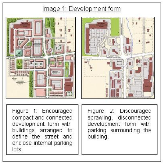
(2)
Multiple buildings located on the same lot should be articulated distinctly and separately so as to not provide an identical building on the same lot.
(3)
New construction should show respect for horizontal articulation established by existing buildings within the immediate area.
(4)
Application of building material and façade articulation of the building wall should encourage design, reinforce rhythm, increase visual impact, and create pedestrian interest.
(D)
Building Mass, Scale, and Articulation. The following regulations shall apply to break down the mass of large structures:
(1)
Structures shall not exceed 200 feet in length adjacent to the street, within a build-to-zone.
(2)
The mass of a building exceeding 100 feet in length shall be delineated into no more than 40-foot-wide segments utilizing changes in height and depth of the wall plane of no less than 24 inches.
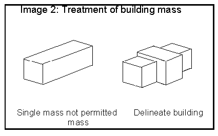
(3)
No less than 70% of the building length shall be broken into a minimum of two (2) horizontal shifts in material, texture, and/or wall plane to provide distinction between segments (see Image 3)
(a)
The middle segment shall be of greater height than the bottom and top segments.
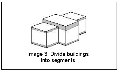
(4)
Buildings shall be constructed with high quality building materials. The following materials shall be prohibited:
(a)
Untreated Concrete Masonry Unit (CMU)
(b)
Wood fiber board
(c)
Unfinished pressure treated wood
(d)
Exterior Insulation Finish System (EIFS)
(e)
Vinyl siding
(f)
Reflective glass
(5)
Building façades located within a build-to zone shall incorporate the following:
(a)
Changes in plane with a depth of at least 24 inches, either horizontally or vertically at intervals not less than 10 feet and not more than 40 feet; and
(b)
Changes in color, texture, and material, either horizontally or vertically, at intervals of not less than 10 feet and not more than 40 feet.
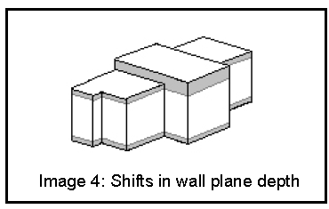
(6)
Building façades located outside of the build-to zone and that are visible from a public right-of-way shall consist of the following:
(a)
Changes in plane with a depth of at least 24 inches, either horizontally or vertically; and
(b)
Changes in color, texture, and material, either horizontally or vertically.
(7)
Fenestration. Fenestration patterns should encourage design, reinforce rhythm, and create shadows. The following shall be met to satisfy the fenestration requirements for a principal façade:
(a)
Entryways. A primary entrance for buildings located in a build-to zone shall face the public street. When a structure is not in a build-to zone, the primary entrance shall be well-defined from access drives, sidewalks, and/or major parking areas.
(i)
Multiple entryways are encouraged for all structures; however, a building entrance shall occur at a minimum of every 100 feet of building façade length that is within the build-to zone.
(ii)
Each primary entrance shall be made visible and prominent by using special architectural treatment that signifies the entrances, such as large entry doors, porches, or protruding or recessed entrances.
(b)
Glazing. In order to create a proportion of solids to voids and pedestrian interest the following standards shall apply:
(i)
A building façade located within the build-to zone shall be glazed no less than 50% of the first or ground floor at the pedestrian level between 2 and 12 feet above the sidewalk.
(ii)
A building façade located outside of a build-to zone shall be glazed no less than 30% of the first or ground floor at the pedestrian level between 2 and 12 feet above the Finished Floor Elevation (FFE).
(iii)
Glazing above the first story shall not exceed 80% of the total building wall area.
(E)
Pedestrian Oriented Elements. Developments that are subject to these standards shall meet and should exceed the basic needs of pedestrian accessibility and contribute to a unique sense of place and community. The following requirements are intended to define and articulate space at the street level in order to encourage the use and function for active and/or passive social interaction.
(1)
Buildings exceeding 50 feet in length or width within the build-to zone shall incorporate spatially defining building elements and/or landscaping at a minimum separation of 100 feet of façade length in order to create public or semi-private space, such as a courtyard, garden, patio, etc.
(2)
Each public space shall include seating opportunities, such as table and chairs or benches, and a combination of at least of two (2) of the following elements:
(a)
Planters;
(b)
A planting bed;
(c)
Public art;
(d)
A water feature;
(e)
A shift in pavement material between the public right-of-way and the structure;
(f)
A covering for seating, such as a canopy, awning, arcade, or portico spanning the width of the building; or
(g)
Other elements approved by the Zoning and Development Administrator that are not included in other sections of the design standards and meet the intent of this requirement.
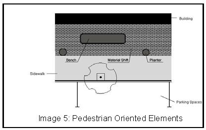
(F)
Variances. An applicant may request approval from the Planning Commission of a variance from the minimum requirements where unique circumstances existing and the effect will not adversely impact adjoining or neighboring properties. The applicant shall provide notification to adjacent property owners prior to the date of the meeting.
(Ord. No. 5312, 4-20-10; Ord. No. 5519, 8-21-12; Ord. No. 5859, §1(Exh. A), 3-15-16; Ord. No. 6164, §10, 4-2-19)
166.25 - Commercial, Office and Mixed-use Design And Development Standards
(A)
Purposes.
(1)
To protect and enhance Fayetteville's appearance, identity, and natural and economic vitality.
(2)
To address environmental concerns which include, but are not limited to, soil erosion, vegetation preservation, and drainage.
(3)
To protect and preserve the scenic resources distributed throughout the city which have contributed greatly to its economic development, by attracting tourists, permanent part-time residents, new industries, and cultural facilities.
(4)
To preserve the quality of life and integrate the different zones and uses in a compatible manner.
(5)
To address the issues of traffic, safety, and crime prevention.
(6)
To preserve property values of surrounding property.
(7)
To provide good civic design and arrangement.
(B)
Applicability. These design and development standards apply to commercial developments, office developments, small scale production, those parts of a planned zoning district or other mixed-use developments with commercial and office elements and to industrial developments within the I-540 Overlay District.
(C)
Building Exterior Appearance and Design Standards. The following exterior development standards and design element guidelines shall be followed:
(1)
The elements to avoid or minimize include:
(a)
Unpainted concrete precision block walls;
(b)
Square "boxlike" structures;
(c)
Metal siding which dominates the principal facade;
(d)
Large blank, unarticulated wall surfaces;

(2)
A development which contains more than one (1) building should incorporate a recurring, unifying, and identifiable theme for the entire development site, without replicating the building multiple times.
(3)
A development should provide compatibility and transition between adjoining developments.
(4)
All structures shall be architecturally designed to have front facades facing all adjacent street and highway rights-of-way, and shall include at least one prominent entry-way on the principal façade(s).
(5)
All buildings should be constructed of wood, masonry, or other similar durable material.
(D)
Site Development and Design Standards.
(1)
Site Coverage. A maximum of 80% of the development site may be covered by the ground floor of any structure, parking lots, sidewalks, and private streets and drives or any other impermeable surface. Properties located within the Downtown Master Plan boundary are exempt from this requirement.
(2)
Cross Access. Cross access shall be required to adjacent developed and undeveloped properties.
(3)
Mechanical and utility equipment and refuse containers shall be screened if visible from the highway/street right-of-way or from residential property as set forth below:
(a)
Mechanical and Utility Equipment.
(i)
All mechanical and utility equipment located on the wall and/or on the ground shall be screened with vegetation, by incorporating screening into the structure, or by utilizing paint schemes that complement the building and screen the equipment.
(ii)
All roof mounted utilities and mechanical equipment shall be screened by incorporating screening into the principal structure utilizing materials and colors compatible with the supporting building.
(b)
Recycling and Trash Containers. Adequate space and screening shall be provided for the placement of recycling and trash containers in commercial, office, and mixed-use developments.
(i)
Commercial, office, and mixed-use developments are required to provide adequate space for the placement of two (2) front-end load dumpsters, easily accessible for collection services. The minimum free and clear dimensional requirements for placing two (2) front-end load dumpsters in an enclosure is 24 feet wide and 12 feet deep. The Recycling and Trash Collection Division Director may exercise discretion in approving the dimensional size of the required enclosure if the applicant can demonstrate that a smaller enclosure is adequate for the development's anticipated needs due to the nature of the proposed business, the modest size or scale of the development or site access, or if they have the ability to share trash and recycling enclosure facilities with adjoining or nearby properties that have additional trash and recycling storage capacity.
(ii)
Recycling and trash containers shall be screened by enclosures with materials that are compatible with and complementary to the principal structure, with access to the refuse containers not visible from the street. Containers may be screened from view by the principal structure; by a permanent walled or fenced enclosure; or with appropriate vegetation, planted at a density and size sufficient to be view obscuring immediately from the date of planting; so long as the screening is maintained and loose trash does not litter the ground or become an environmental nuisance.
(4)
Outdoor storage of material and equipment shall be screened if visible from the highway/street right-of-way or from residential property as set forth below:
(a)
At the expense of the owner or lessee of the property, and in all zones, the following uses shall be completely surrounded by a view obscuring fence or by view obscuring vegetation, or a combination of the two, of sufficient height to prevent the view of the premises from vehicular and pedestrian traffic on adjacent streets: outdoor storage yards, including but not limited to, auto salvage yards, scrap metal yards, used furniture yard and garbage dumps.
(b)
Where vegetation is used to meet the requirements of this subsection, the vegetation shall be planted at a density sufficient to become view obscuring within two years from the date of planting. If vegetation planted under this subsection does not become view-obscuring within two years, a view-obscuring fence shall be installed.
(c)
Exceptions: The outdoor display of materials or equipment solely for sale or lease, such as automobiles, seasonal garden supplies, etc. shall not be required to be screened as set forth in subsection (a) above.
(5)
Non-Residential Uses Adjacent to Residential Uses. The Planning Commission or Planning Division may require non-residential uses, including parking lots associated with said uses, to be screened from adjacent residential uses, as set forth below:
(a)
A buffer strip, fence, or screen wall that is required shall be constructed and maintained on the zoning lot containing or proposed to contain such use, in accordance with provisions of this chapter.
(b)
Buffer Strip. The purpose of the buffer strip is to provide separation and enclosure of uses. The landscaped buffer strip shall consist of a strip of land at least 8 feet wide adequately landscaped with approval of the Urban Forester, entirely on the zoning lot which is required to provide the buffer strip, and so located as to serve as an effective buffer between the use required to provide the buffer strip and other property for whose protection the buffer strip is required. The buffer strip should extend along the full length of the boundary separating the zoning lot from such other property, or from the street, as the case may be.
(c)
Fence Required. The purpose of the fence is to enclose uses. Required fences shall not be less than 6 feet high, constructed of good, substantial material, of first-class workmanship, and so erected as to resist wind pressure, ensure public safety, and present a neat, attractive uniform appearance.
(d)
Screen Required. The purpose of the screen is to conceal uses. Screening shall mean a view obscuring fence, view obscuring berm, view obscuring architectural treatment, or view obscuring vegetation, or combination thereof, of sufficient height to prevent the view of the screened items from vehicular and pedestrian traffic on adjacent streets, and from residential property. Vegetation shall be planted at a density sufficient to become view obscuring within two (2) years from the date of planting.
(6)
Mini-Storage. At the expense of the owner of the property, all storage units and storage yards for mini-storage created under Use Unit 38 shall be required to be screened by view obscuring vegetation when the storage yards or the storage units have common property lines with any residential use or zone and when they have frontage on any public street. Vegetation used for screening purposes shall be planted at a density sufficient to become view obscuring within two (2) years from the date of planting and it shall be the responsibility of the property owner to maintain the screening throughout the life of the use of the property as mini-storage.
(E)
Design Review.
(1)
Submittals. The following drawings, information, and plans shall be submitted to the Planning Commission or Planning Division for design review and approval with the associated development application, when applicable;
(a)
Elevations. Color rendered elevation drawings of all building facades and a description of external building materials. Labels and dimensions, where applicable, shall accompany changes in texture, plane, material or color.
(b)
Materials Sample. A sample of exterior materials to be used for the proposed structure that indicates texture, color and type of materials.
(c)
Landscaping. Proposed landscaping to be used as screening shall be shown on the tree preservation plan and landscape plan.
(2)
Build Out. Upon approval of a development, or issuance of a building permit, build-out of the project shall conform to the drawings, information, and plans approved.
(a)
Amendments. Amendments to the drawings, information, and plans shall be submitted to the Planning Division. Amendments which are determined to be insignificant or minor may be approved by the Planning Division. Significant amendment shall be approved by the Planning Commission when approval was given through the large scale development process, or by the Planning Division when approval was given through the building permit process.
(b)
Review. Amendments shall be considered using the same standards as the initial design approval.
(c)
Noncompliance. Failure to build-out the project according to the approved drawings, information, and plans, or approved amendments thereto, shall render the large scale development approval, or the building permit approval void.
(F)
Variances. (See Chapter 156.)
(Ord. No. 5526, 9-18-12; Ord. No. 5735, 1-20-15; Ord. No. 6091, §1, 9-18-18; Ord. No. 6667, §1, 6-6-23)
166.26 - College Avenue Overlay District
(A)
Purpose. The intent of this ordinance is to encourage good architectural form through the use of quality design and materials. The goal of the code is to promote functional architecture that creates attractive and usable space while minimizing potential negative impacts of tall, single use multi-family buildings.
(B)
Applicability. The College Avenue Overlay District applies to parcels of land located within the boundaries of the College Avenue Overlay District.
(C)
General Requirements.
(1)
Buildings shall be constructed in accordance with the Downtown Design Overlay District Architecture Standards.
(2)
The maximum height of all buildings shall not exceed their zoning district's limitations or four (4) stories, whichever is less.
(3)
Use Units 17 and 18 allowed in any zoning district in this Overlay District shall be moved from permitted uses to conditional uses.
(Ord. No. 6017, §2, 12-5-17)
166.27 - Parksdale And Center Addition Overlay District
(A)
Purpose. The purpose of this section is to support the neighbors' desire to preserve the livability, historical character and quality of life of their neighborhoods, to protect the citizens' health, safety and welfare and to encourage new buildings that are compatible with the existing development pattern of the neighborhood in scale, height and building placement.
(B)
Applicability. The Parksdale and Center Addition Overlay District applies to parcels of land located within the boundaries of the Parksdale and Center Addition Overlay District.
(C)
General Requirements.
(1)
The maximum height of all buildings shall not exceed their zoning district's limitations or two (2) stories, whichever is less.
(2)
Within the NC and RI-12 districts, the front building line for new primary structures and additions shall match the existing front building lines or setbacks of the closest adjoining primary structures, or when adjoining structures have different front building lines, shall match the average of the front building lines on the closest adjoining structures. This baseline number may be automatically varied by 10%. For example, a 20-foot front building line may be varied by 2 feet in either direction creating an 18-22 foot build-to zone.
(Ord. No. 6080, §1, 8-7-18)
166.28 - Permit-Ready Building Design Program
(A)
Purpose. The purpose of this section is to encourage new buildings that are compatible with the existing development pattern of the neighborhood in scale, height and building placement. The program provides permit-ready building designs for infill construction and site redevelopment that are meant to fit the context of the existing building scale, styles and materials in the neighborhood.
(B)
Applicability. The Permit-Ready Building Design Program applies to lots or parcels of land on which the Permit-Ready Building Design Program is utilized.
(C)
General Requirements. The following general requirements are applicable only to residential building projects that use the Permit-Ready Building Design Program and submit building permit applications that utilize one (1) or more of the program's building plan sets.
(1)
Variability. Any contiguous set of three (3) or more lots or parcels with program buildings shall include at least two (2) distinct variations in building façade design.
(2)
Street-facing Orientation. All buildings which are adjacent to the street shall be oriented such that their primary facade as designated on the architectural plan set, or a secondary facade if also noted, faces the public street. Buildings which do not have a primary facade indicated on their architectural plans shall not be the primary, street-facing structure abutting a public street.
(3)
Solid Waste and Recycling Containers. All waste and recycling containers must be screened from view from public right-of-way except on designated days of service. Screening fences shall be opaque and constructed of wood fence, fiber cement, masonry, or a combination thereof, or may be dense shrubbery having year-round foliage within two (2) years of date of planting.
(4)
Stormwater. Where required, stormwater infiltration systems shall comply with the pre-approved stormwater facilities available from the Engineering Division. Where feasible stormwater facilities shall be located parallel and adjacent to any edge of the property.
(D)
Parking and Driveways. The following general requirements are applicable only to residential building projects that use the Permit-Ready Building Design Program and submit building permit applications that utilize one (1) or more of the program's building plan sets.
(1)
Parking Areas. Site plans shall show required off-street parking spaces located to the rear or side of a principal dwelling, in a garage, or in a carport.
(2)
Number of Spaces. One (1) parking space per dwelling unit shall be required. Projects shall not utilize reductions for residential use. Up to two (2) parking spaces per dwelling unit is permitted. Any increase or reduction to the number of spaces permitted shall be allowed only by the Planning Commission as a variance and shall be granted in accordance with Chapter 156.03.
(3)
Parking Lot Standards. Parking lots or parking areas containing between five (5) and thirteen (13) spaces are exempt from Parking Lot Construction Standards and Parking Lot Design Standards unless the parking lot is located within a build-to zone.
(4)
Tandem Lots. Parking for dwelling units on tandem lots shall not be considered off-site parking if the parking spaces are located on the parent lot or another tandem lot related to the parent lot.
(5)
Driveway Width. The minimum driveway width is 8 feet.
(6)
Shared Driveways. Shared driveways must be utilized to access parking areas for attached townhouse dwellings. Individual driveways from the primary street frontage are not permitted.
(E)
Sidewalks. Project sites with existing sidewalks which are not in need of repair or major relocation are encouraged to use fees in lieu of reconstruction and/or relocation.
(1)
Applicability. The provisions of this section shall only apply to the following property:
(a)
If a sidewalk does not exist, a new sidewalk must be constructed, or sidewalk fee-in-lieu must be paid.
(b)
Projects must bring existing sidewalks into good condition and into compliance with the Americans with Disabilities Act (ADA). Cracks with an offset greater than 0.5 inches must be ground flat and sidewalk segments with extensive spalling must be replaced.
(c)
If an existing sidewalk is required to be relocated, the fee-in-lieu option is preferred in lieu of construction. The building location shall accommodate the future sidewalk construction.
(d)
If an existing sidewalk is substandard, but in compliance with the ADA, the fee-in-lieu option is preferred for sidewalk replacement.
(2)
Sidewalk Fee-In-Lieu for Permit-Ready Building Program.
(a)
Fees will be set by the City Engineer in accordance with §171.13.
(b)
Contribution in lieu of construction of sidewalks shall be paid, or construction of the sidewalks shall be completed before issuance of a certificate of occupancy.
(Ord. No. 6723, §1(Exh. A), 3-19-24)