
Minturn City Zoning Code
ARTICLE 14
5 - Maloit Park Character Area
Sec. 16-14.5-10.- Character Area characteristics.
(a)
The Maloit Park Character Area is a relatively undeveloped one-hundred-five-acre parcel that over the years has provided for a variety of public and institutionally-oriented community uses. The property is currently owned by the Eagle County School District. Existing uses on the property include the Minturn Middle School and associated uses, school/staff housing, the Eagle County Community Fund/Rummage Sale and the Town water plant. Cross Creek bisects the property, portions of which border the United States Forest Service lands.
(b)
In 2001 the School District completed a master plan for Maloit Park. The Plan was prepared with a great deal of public involvement. The essence of this Plan was to balance the needs of the School District while also preserving the natural features that make this property special. It is the intention of these regulations that mixed use development on suitable portions of Maloit Park be allowed while preserving the natural characteristics of the Cross Creek corridor, wildlife resources and other areas.
(Ord. 4-2011 §3)
Sec. 16-14.5-20. - Maloit Park Mixed-Use Zone.
(a)
Zone characteristics. The Maloit Park Mixed-Use Zone includes forty-six and eight tenths (46.8) acres and encompasses the portion of Maloit Park that is already developed or has been previously disturbed. The terrain over the vast majority of this Zone is very flat and readily accessible via the existing access road. With the exception of the Town's water plant, all existing uses at Maloit Park are located within the Residential/Mixed-Use Zone.
(b)
Purpose and objectives. The purpose of the Mixed-Use Zone is to provide an area to accommodate a variety of land uses. These may include residential development, educational facilities, recreation and other similar uses, and other community-oriented buildings, facilities and uses. The Mixed-Use Zone allows for the continuation of all existing land uses.
(Ord. 4-2011 §3)
Sec. 16-14.5-30. - Maloit Park Public Facilities Zone.
(a)
Zone characteristics. The Maloit Park Public Facilities Zone is located west of Cross Creek and currently accommodates the Town's water treatment plant and related uses. The Zone is approximately eighteen and two-tenths (18.2) acres in size. The Zone borders Cross Creek and USFS lands. Access to the site is via an access easement from Hwy 24.
(b)
Purpose and objectives. The purpose of this area is to provide a site for the Town's water treatment plant. Other than potential recreational improvements and a limited amount of employee housing, no other uses are contemplated for this portion of the Maloit Park Character Area.
(Ord. 4-2011 §3)
Sec. 16-14.5-40. - Maloit Park Recreation and Open Space Zone.
(a)
Zone characteristics. The Recreation and Open Space Zone consists of approximately thirty-nine and five-tenths (39.5) acres and includes the Cross Creek corridor and the southern portion of Maloit Park. The Cross Creek corridor includes associated riparian and wetlands and the floodplain associated with Cross Creek. The Recreation and Open Space Zone at the southern portion of Maloit Park is comprised of relatively steep slopes and wildlife habitat.
(b)
Purpose and objectives. It is intended that the Recreation and Open Space Zone remain predominately undeveloped. Uses are generally limited to infrastructure and utility installations, trails and other passive recreation uses.
(Ord. 4-2011 §3)
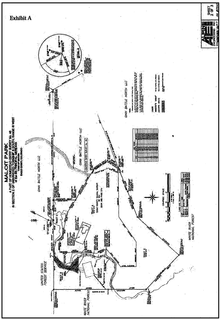
Sec. 16-14.5-50. - Maloit Park Character Area map.
The Maloit Park Character Area map is set forth in Illustration 16-14.5 below.
Illustration 16-14.5
Maloit Park Character Area Map
(Ord. 4-2011 §3)
Sec. 16-14.5-60. - Maloit Park Character Area use table.
The following Table 16-9.5 sets forth the uses for the Maloit Park Character Area:
Table 16-9.5
Maloit Park Character Area Use Table
* Historic property is exempt from the two-year ownership requirement.
(Ord. 4-2011 §3; Ord. 01-2015 §2; Ord. 20-2024 §2)